The Bloody Pit

There’s a gaping maw in the Berkshire Hills of Western Massachusetts that’s achieved a legendary degree for well over a century now due to its preternatural tales, mysteries, and tandem extraordinary and sinister creation that earned it the nickname “The Bloody Pit” (even though it’s a horizontal shaft) for killing hundreds of people who built it.

Its real name is The Hoosac Tunnel – an almost 5-mile long railroad tube that cuts underneath the Hoosac Range – a mountain chain that makes up the eastern rim of the jointed hill chains that make up the Berkshires region.

Skewed folklore tells that the name “Hoosac” roughly translates to “forbidden” in the language of the area’s first inhabitants – the Mohawks. But the actual meaning is akin to “stony place”, which is a pretty accurate description of the region. It’s also one of the many phonetic spellings of the word, which explains why New York, Vermont, and Massachusetts have the Hoosic River, the state of New York has the town of Hoosick Falls, and Vermont and Massachusetts share the Hoosac Mountain Range.

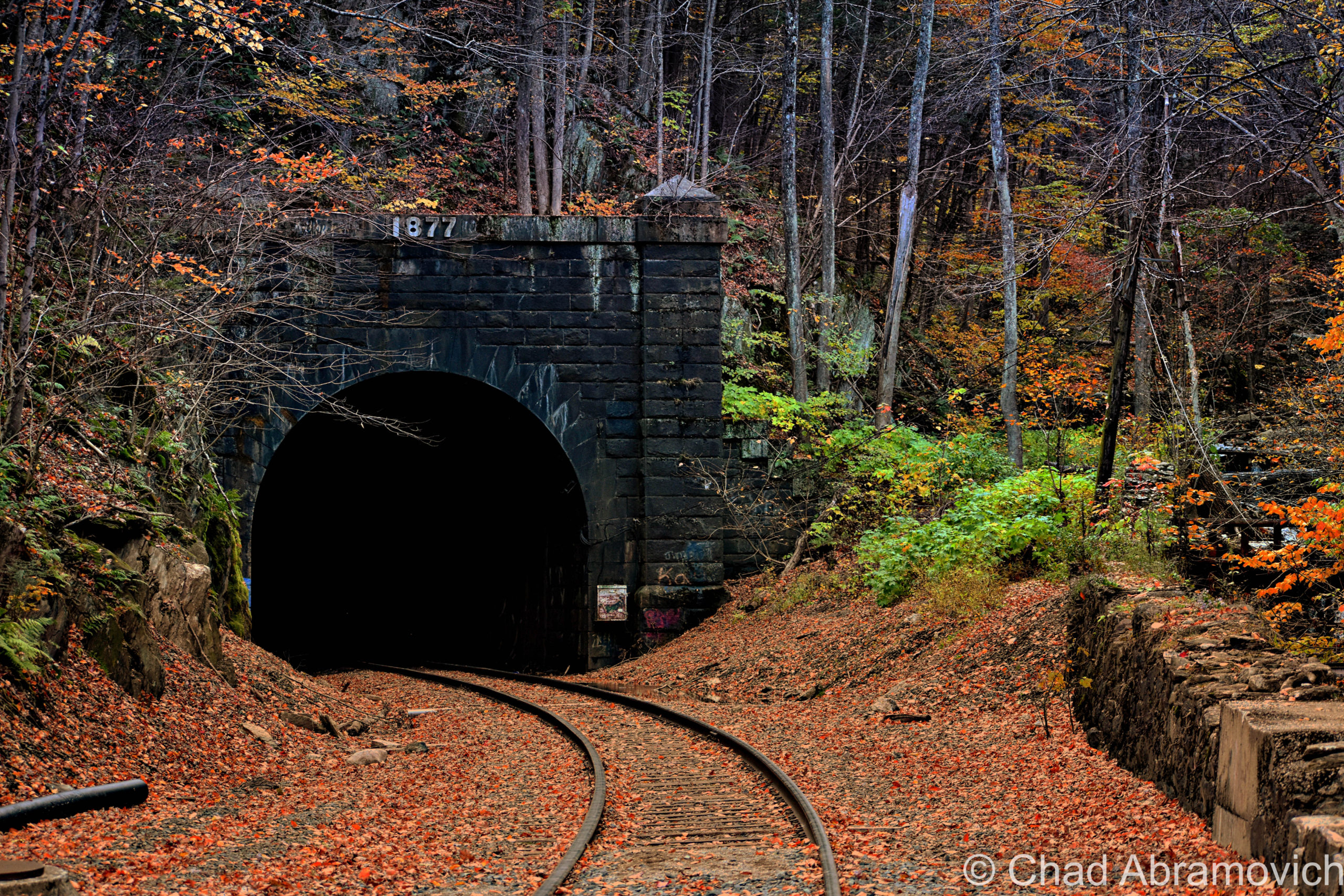
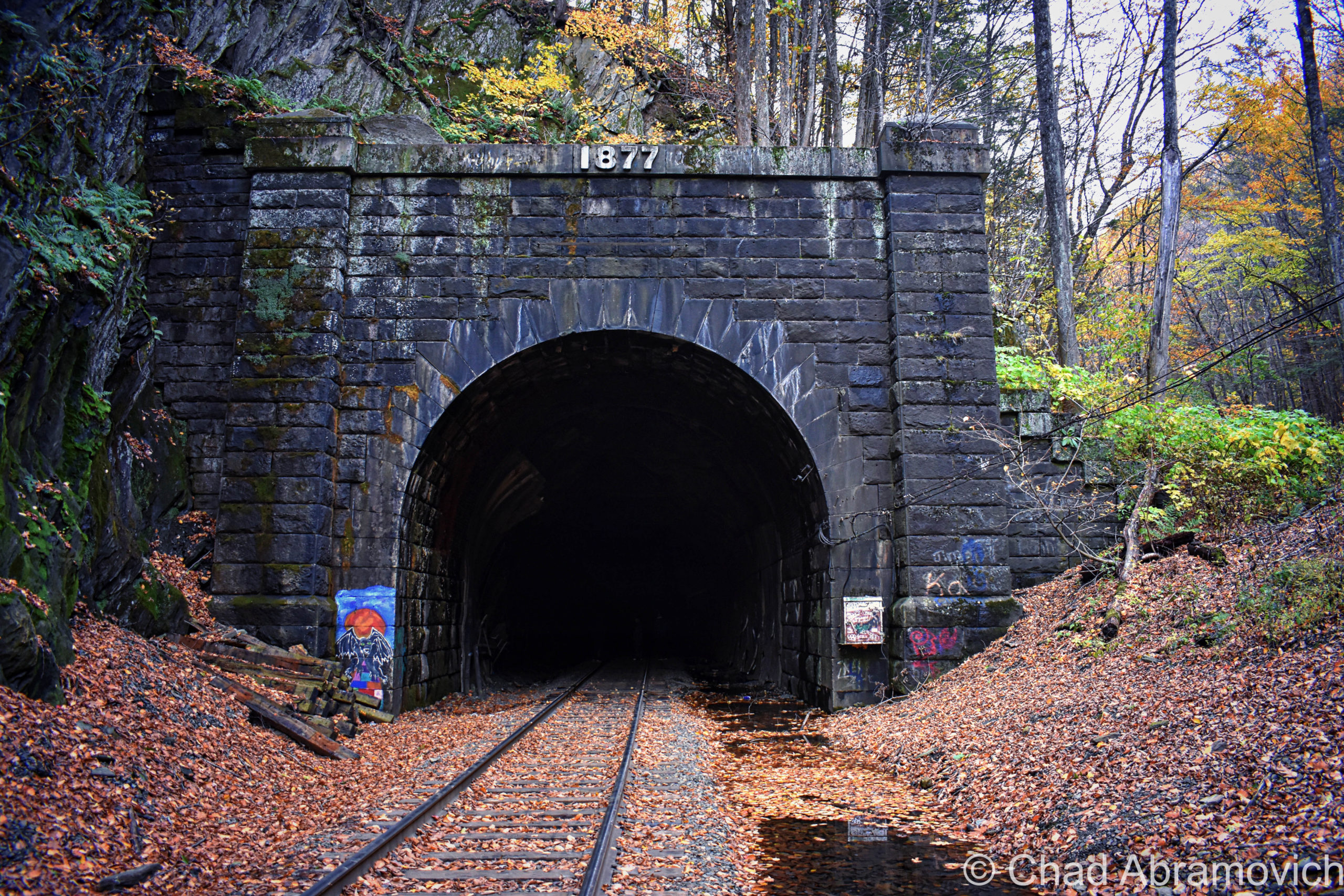
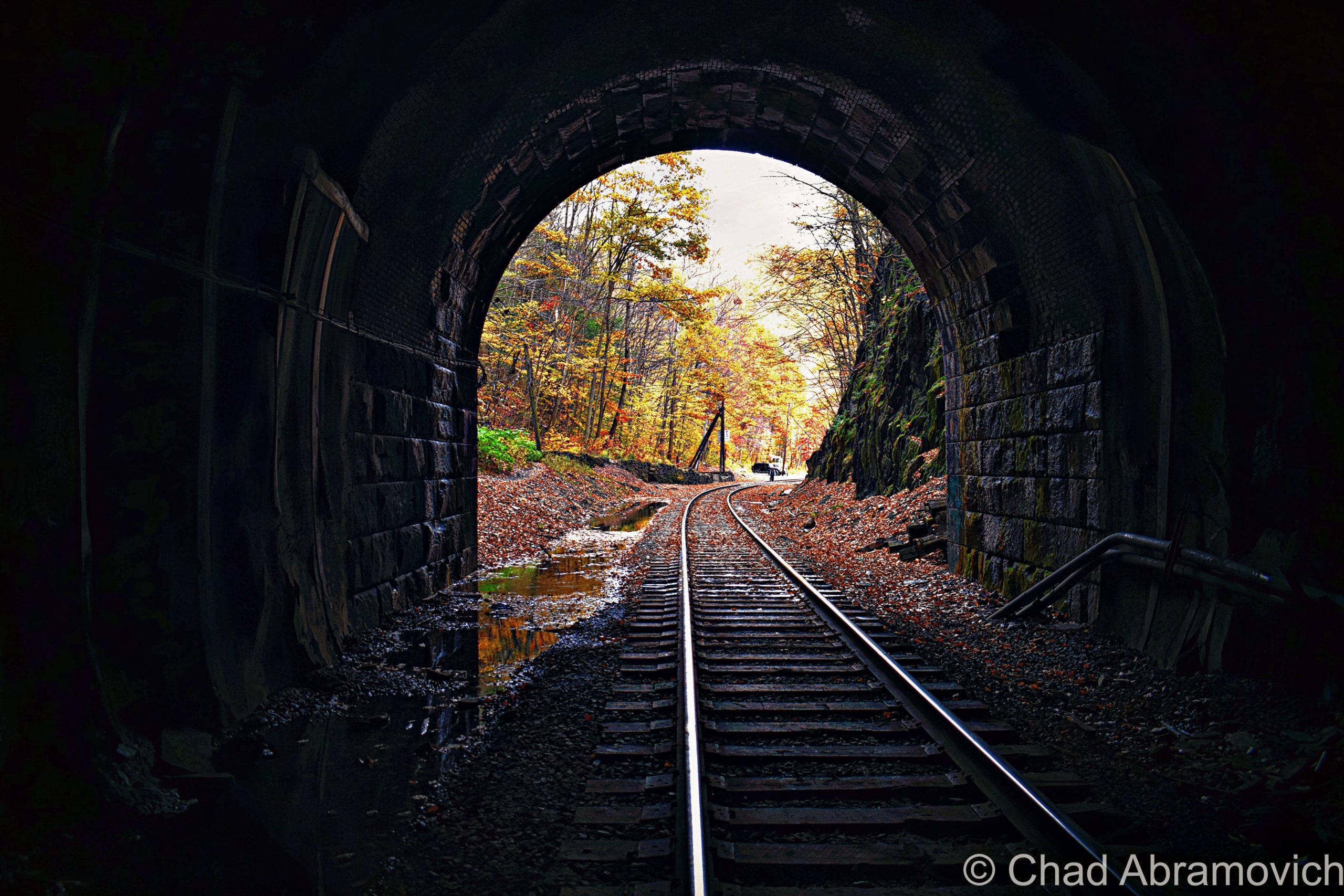
Every time I’ve stood in front of this imposing orifice that descends deep into the dark inscrutable heart of these hills, though, kinda brings the more ominous definition of its name right on home, and the vibes back up its designation as a damned place. It feels like you’re staring into an endless, ambiguous, and intimidating abyss that occasionally gurgles lonesome sounds and belches blasts of cold, acrid air in your face.

When this passageway was completed in 1873, it became a man-made leviathan turned celebrity – the longest tunnel of its kind in the world, a tangible example of an idea that had previously been thought to be impossible and foolhardy, and future-facing inspiration for other designs of engineering.

But it took lavish amounts of blood, tragedy, and time to make it happen. In its birth throes, the tunnel would devour an estimated 200 people, and for that reason, it became considered one of the most haunted places in all of New England, and that accolade is still very much stuck in the adhesive of the contemporaneous.

Why does something of this magnitude exist? Besides the fact that there’s something naturally settled within the psychological framework of humankind that makes us want to push anything that we consider a “boundary”, those pesky Berkshire Hills simply happened to be in the way.

Before the tunnel was built, you couldn’t really “get there from here” as us Vermonters like to say. Not at least without some substantial inconvenience.

As New England and New York’s Hudson Valley were beginning to enter the throes of the escalating industrialization in the mid-1800s – this huge disconnection was beginning to be felt.

A new railroad seemed like just the solution to intrepid self-made paper mill owner Alvah Crocker of Fitchburg, to extend the not completely altruistic gesture of financing the construction of a new railroad (not coincidentally, the railroad would also benefit his mills) – then cajoled groups of investors, engineers, and design firms to make it happen.

At the time, Massachusetts only had one railroad that accessed the western part of the state, and that ran through the southern part of the state, which left the north kinda isolated – both by the mountains and the fact that the railroad was cumbersome to access, and spur lines were billed exorbitant prices if they wanted to build a connection. Mr. Crocker wisely knew that a new, northern railroad would be incredibly serendipitous for him, and the rest of upper Massachusetts and Southern Vermont.

After survey work, the legend-crowded Deerfield River valley was chosen as the most practical route to veer westward on, until eventually having to puncture through what surveyors dubbed as the “thinnest” part of the unyielding slopes of the Hoosac Range – a chain of hills in the 2,000-foot elevations – to continue pursuing the trajectory all the way to Troy, New York – officially linking New York’s capital region and all their connections with Boston and inner New England.

To do that, they just needed to create a direct route through terra firma.

In 1842, Crocker and his cronies charted the Fitchburg Railroad that ran from Boston to Fitchburg, and then began to expand by acquiring smaller railroads and building new tracks to form a continuous link westward bound, the gestalt of which formed the Troy and Greenfield Railroad in 1848 as a connection – with the idea of the conceptualized Hoosac Tunnel being the cynosure of the project that would officially open up “the west” (or, anything west of the Berkshires).

The scheme was to have 2 crews of laborers start digging at different ends of the mountains between North Adams in the west, and (the town of) Florida in the east, and eventually meet up in the middle.

In January of 1851, ground was broken for the tunnel’s west portal on the mill town of North Adams’ side of the mountains, thus inaugurating Massachusetts’s original “big dig”.

But, such a colossal project couldn’t avoid being clingy to the sinister and was disturbed by bad luck from the very start.

In the summer of 1852, an innovative boring machine that was supposed to begin gouging out the tunnel’s eastern portal in Florida, got stuck in the Berkshire bedrock and nobody could extract it – so the crew had to start over in a new spot, with a new drill. If you know where to look, the original borehole that’s sometimes called “the false start” can still be detected in the woods today.

The tunnel’s clumsy start and continual ensuing setbacks ultimately became too expensive for Mr. Crocker, who eventually, begrudgingly had to declare bankruptcy. Other investors and engineers attempted to pick it up, but all would ultimately fail, and the project would stammer until the state of Massachusetts – who saw its prosperous potential – took it over in August of 1862.

In addition to the state declaring that most of the botched work done by private investors would ultimately have to be redone, including widening the tunnel and reinforcing it with bricks, some practicalities also had to be employed, or there was a sure chance that both burrowing crews wouldn’t link up!

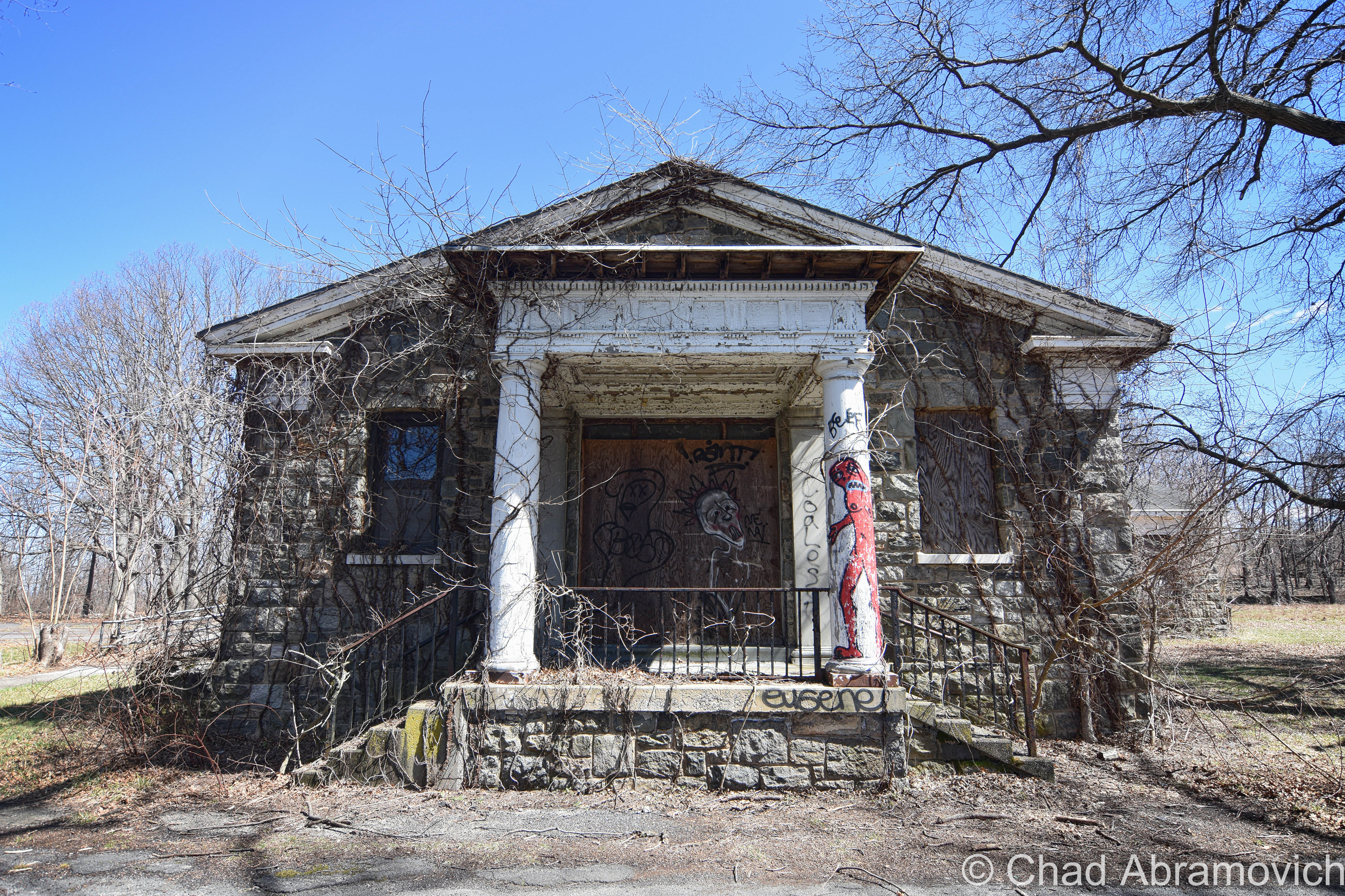
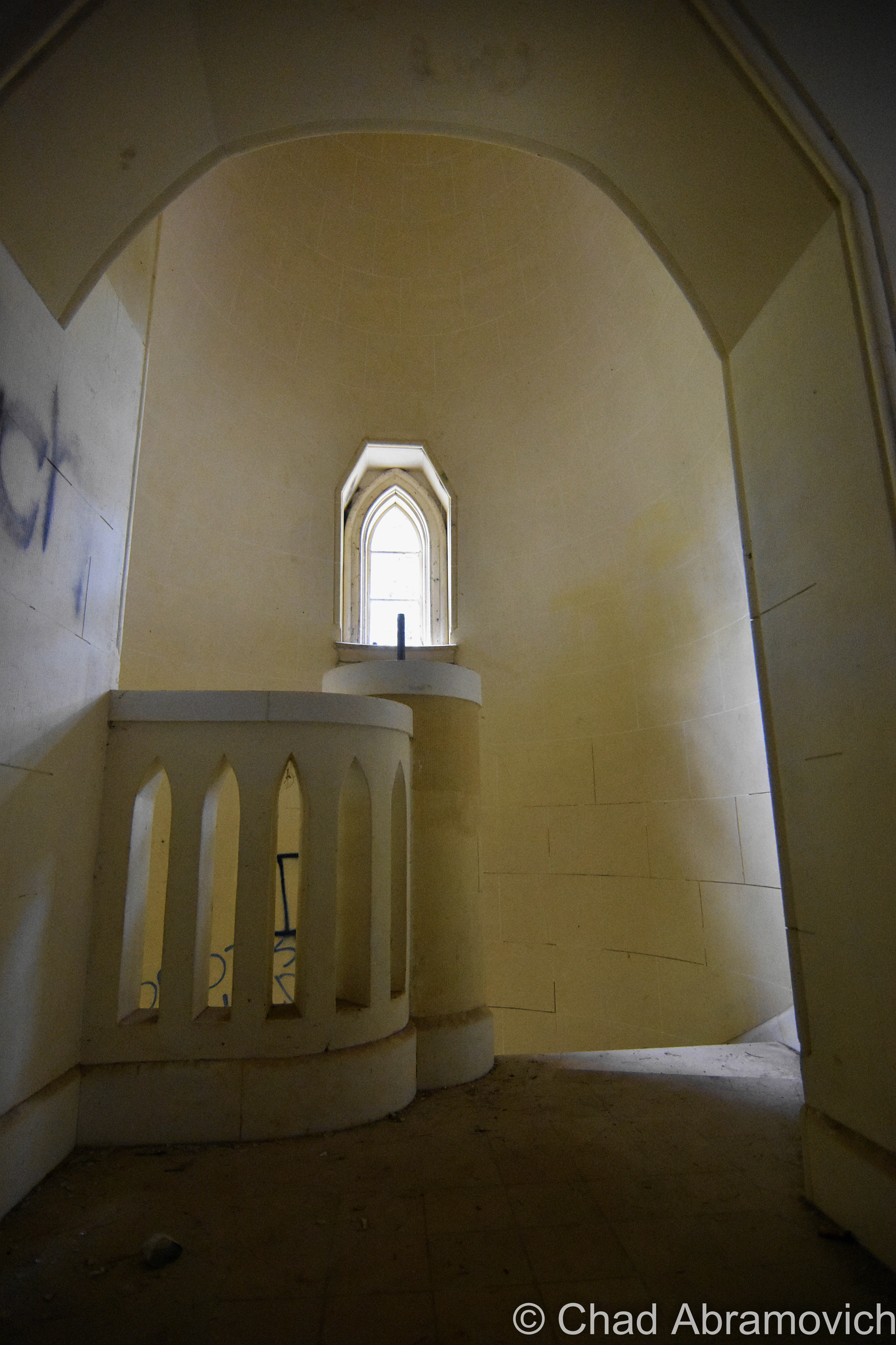
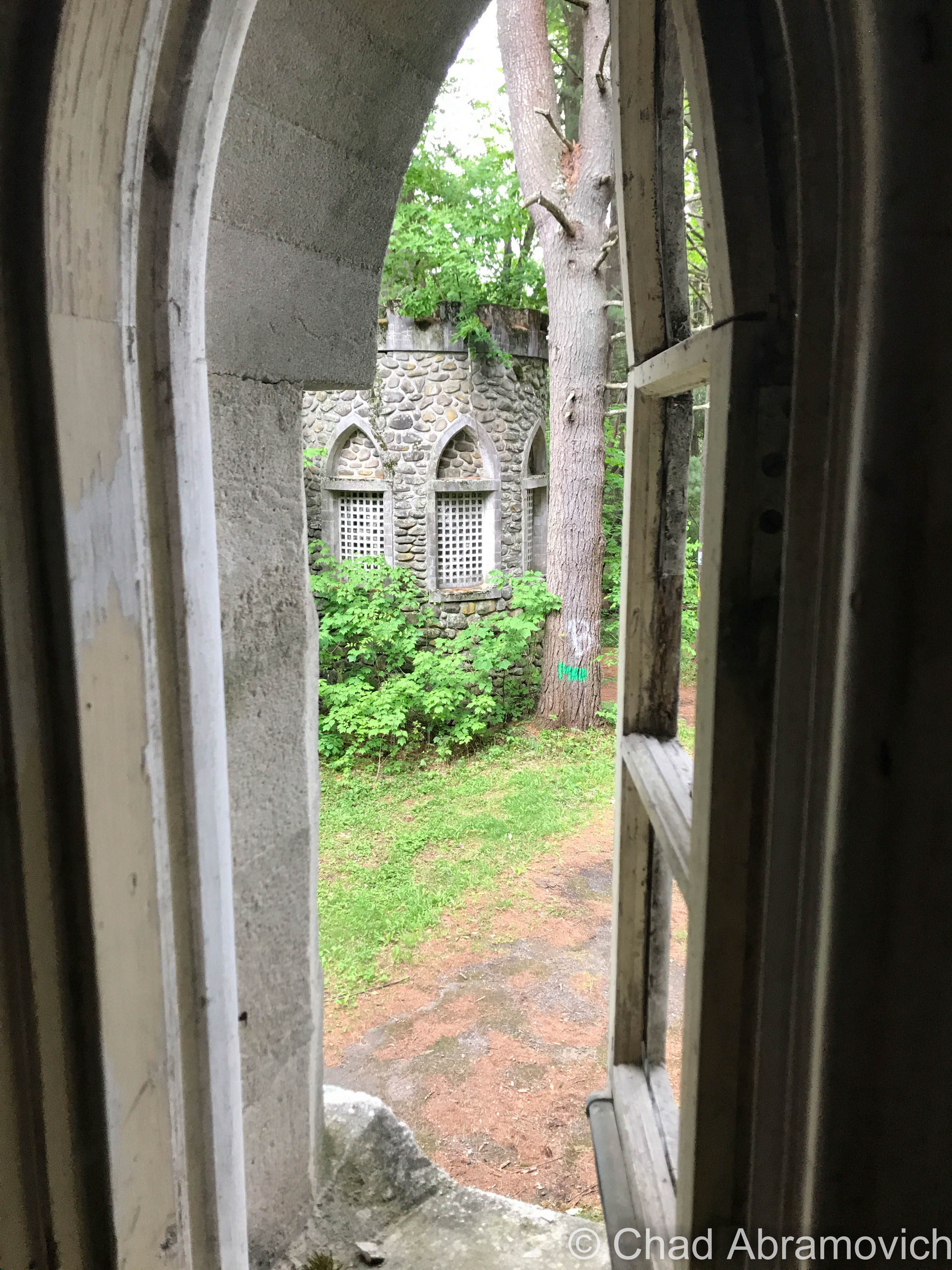
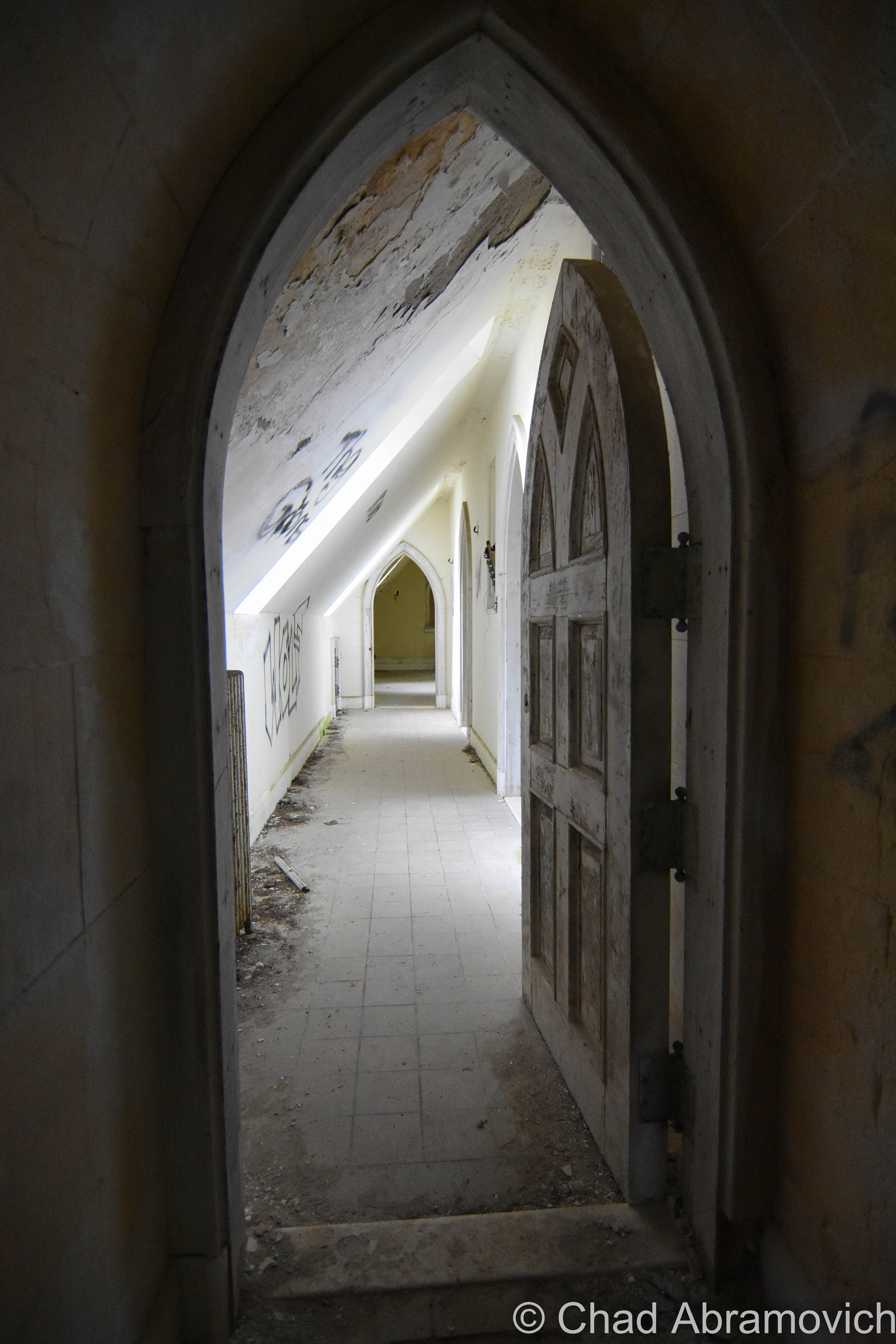
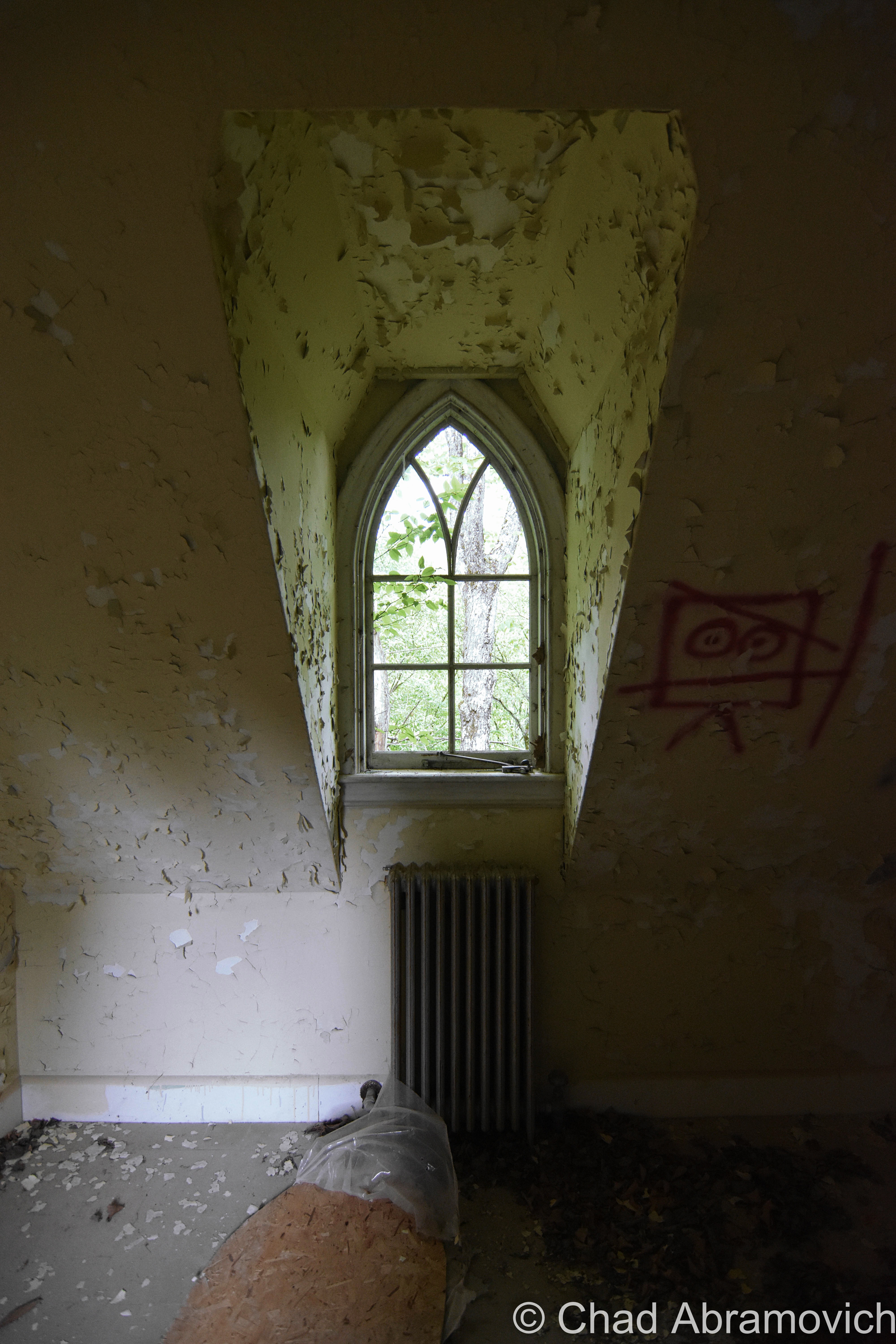
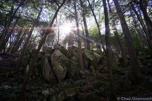
To make sure the tunnel-in-progress would turn into a tunnel-that-functions, 6 alignment towers were built over the planned path of the tunnel – 4 of them on the summits between the 2 digs and 2 at the entrances themselves.

The survey towers were simple constructions with stone foundations and a single-slant wooden roof. Each one was equipped with a transit scope (a device like a telescope) to make sure each tower aligned properly, and each had a red and white pole that protruded 25 feet up. Back then, the mountains had been cleared for farmland, so you would have been able to see one tower from another very clearly. Of the six that were built, the ruins of four can still be cooly detected in the mountains today!

Inside the tunnel, plumb bobs were driven into wooden plugs on the roof and hung from piano wire at intervals along the line that was sighted from the towers, and surveyors told the blasting crews which way to proceed.

And speaking of blasting crews, the Hoosac Tunnel was the first construction project to use nitroglycerin, but nobody was having a blast, because it directly accounted for a lot of the lives the tunnel would eat.

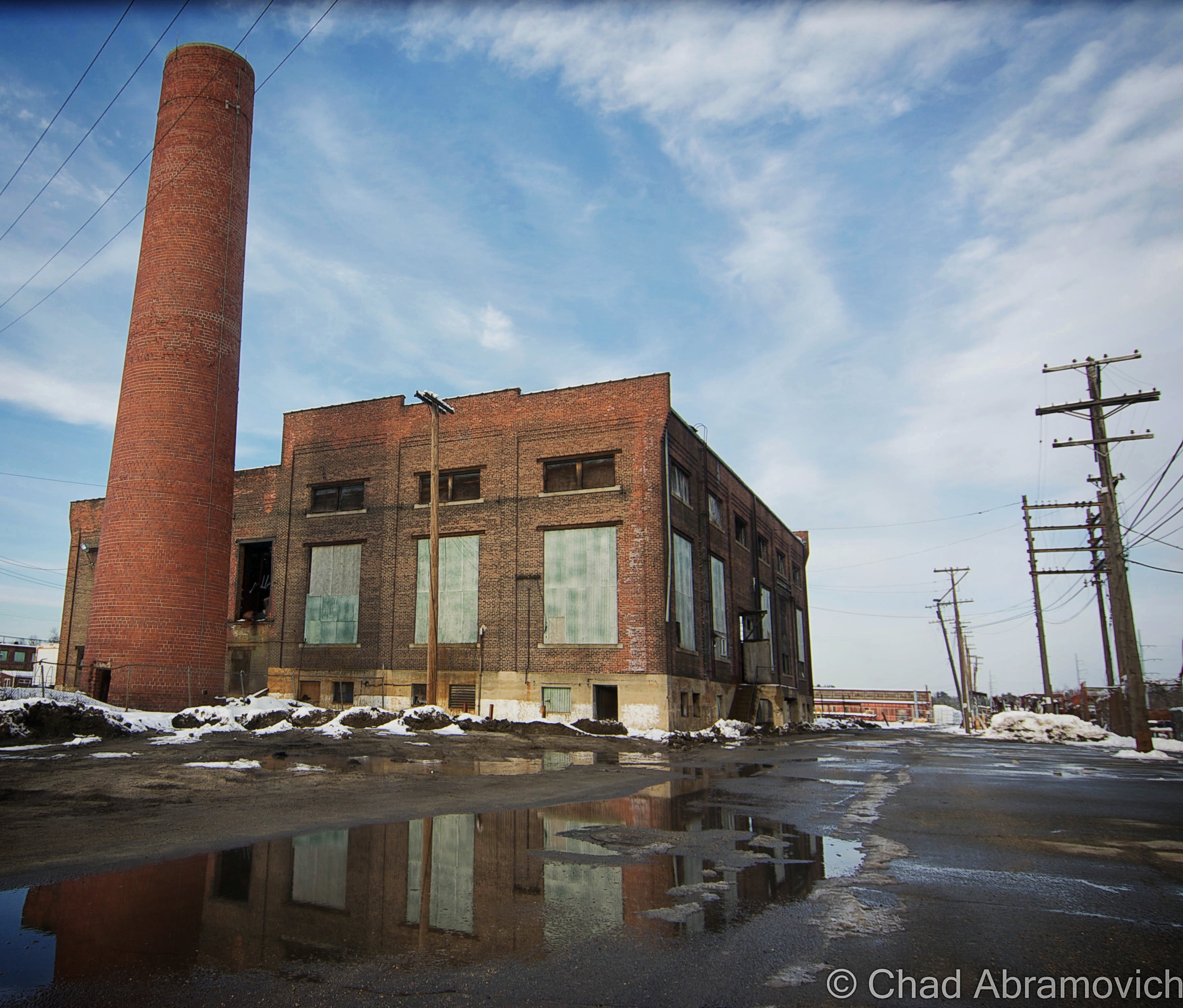
The endeavor would need so much nitroglycerin that a factory was built near the west portal to produce it. Over the years, I’ve heard intriguing but uncorroborated local hearsay that, though the factory is long gone, there are still several barrels of nitro that are lost somewhere in the Berkshire woods – and though I’m dubious, that delights me that the Berkshires still have wilds that things can still be hopelessly lost in, waiting to be found.

Because nitroglycerin was so new, most of the miners didn’t really know the dos and don’ts of working with the stuff, so a lot of accidental premature explosions happened, which either blew apart anyone in the vicinity, or pulverized them underneath mountain debris. Ironically, John Velsor, the new foreman at the nitroglycerin factory, was “blown to atoms”, as newspapers at the time put it – when around 800 pounds of the killer soup erupted in December of 1870. Not a single trace of the man’s body was ever found.

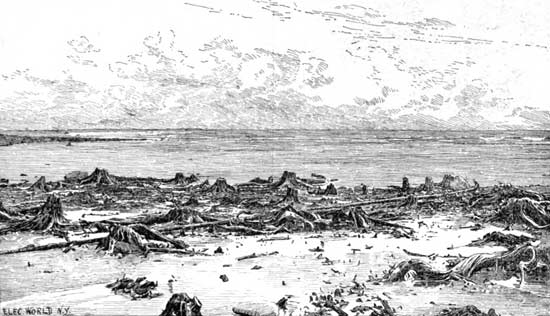
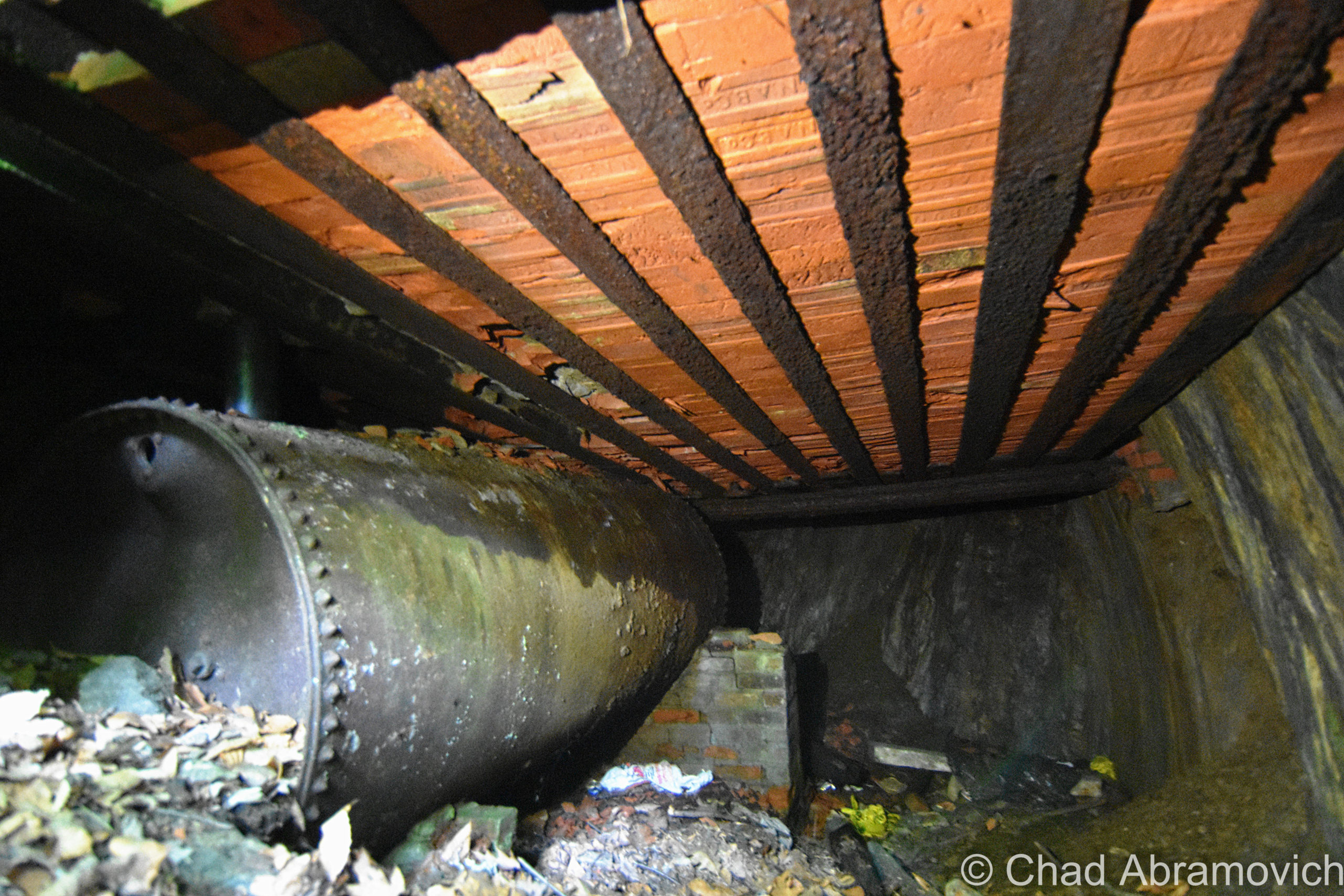
That certainly didn’t help anyone’s spirit, as the work had already been grueling from the very start. Crews were basically progressing a mere 2 feet a day. In the beginning, especially for the west portal activity, preliminary geological “surveys” saying that the rock was solid and sturdy were quickly proven wrong. What they were actually dealing with was what was called “porridge stone,” rock layers buckled into each other for thousands of years that were so saturated with water that they crumbled into something resembling quicksand. Miners complained that carving out the tunnel (especially the western portal) was like “building a sandcastle in the mud”. The highly unstable porous stone forced the builders to line a lengthy distance inwards from both portals with brick walls so that it wouldn’t collapse.   

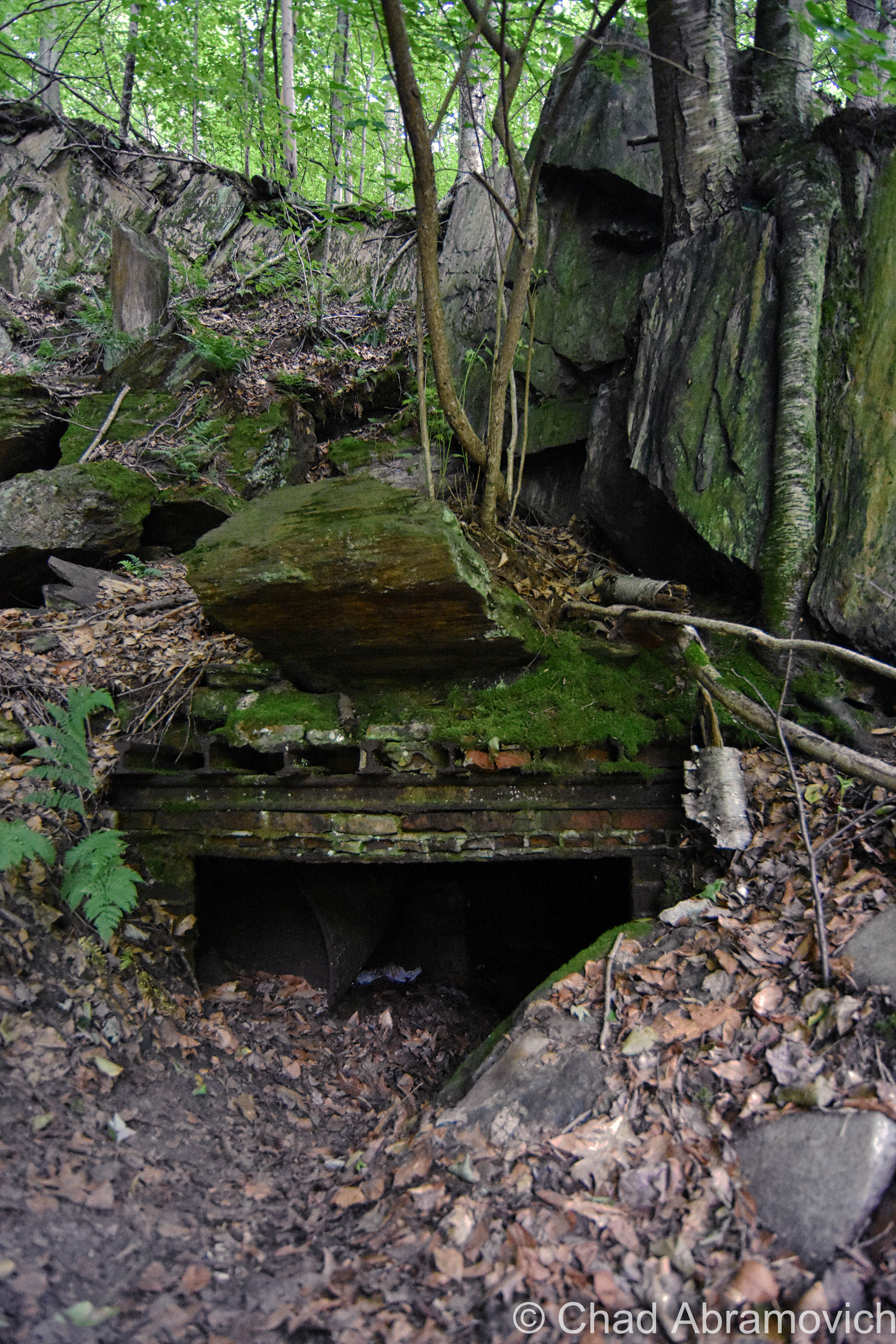
The west portal was so wet and unstable that a 264-foot tunnel had to be built around the portion of the western tunnel that had been completed to drain all the water that was flooding the worksite. Now known as The Haupt Tunnel, after the project’s first engineer – it still exists for those intrepid enough to search for it, and is pretty sketchy – with a few spelunkers running into spiders and narrowly avoiding a few collapses over the years.

Brinkman, Nash, and Kelley

On March 20th, 1865, explosives authority Ringo Kelley prematurely set off a blast that crushed his two companions, Ned Brinkman and Billy Nash, under untold tons of rock. Oddly, Mr. Kelley disappeared not long afterward without a trace. Did he run away? Had the guilt of killing two men become too much to bear? Or maybe it was because other workers started to report that they saw the angry ghosts of Misters Brinkman and Nash walking around within the pit? All anybody knew for sure, was that Mr. Kelley was gone.

Exactly one year later to the day, Ringo Kelley reappeared. Well, his corpse did. His body curiously turned up within the tunnel, precisely at the spot where Brinkman and Nash died, and he’d been strangled. Deputy Sheriff Charles E. Gibson investigated and determined that Kelley’s death had occurred between midnight and 3 a.m. of the day that he was discovered. But no clues were ever found, and no suspect was ever identified.

I can’t even imagine the vigor that those guys must have had to muster and keep stoked just to face a day at work. Most of them needed the work too badly to quit, but, some of them couldn’t take it and walked off the job – either because of the dreadful conditions, or now, because there were whispers of the tunnel being haunted and people seeing strange specters within the dark passage that they thought to be the shades of their fellow deceased miners.

Soon, the Hoosac Tunnel project was being christened as “The Bloody Pit”, a nickname that the tunnel has never been able to get rid of. And its nickname-legitimacy-card would be pushed when the project’s worst calamity took place while digging its central shaft.

The Central Shaft

With a tunnel almost 5 miles long, ventilation was needed, or there’d be plenty of unfavorable predicaments, and the resolution was as astonishing as the tunnel itself.

The Central Shaft is a 1,028-foot vertical conduit through Hoosac Mountain – essentially a giant hole that would be dug from the top of the mountain all the way to the tunnel below. The shaft would mark the tunnel’s close-enough halfway point (the actual mid-point was too close to the Cold River for a safe dig), and once it was completed, provide it with ventilation. The opening would also become the fastest way to introduce laborers into the tunnel – by dropping them down in a giant bucket instead of them having to walk about two and a half miles.

On October 17th, 1867, crews had completed boring about half of the central shaft.

Thirteen men had been dropped in the pit and working away, when sneaky escaping fumes from a naphtha fueled lamp in the hoist house above, somehow ignited, obliterating the structure. A deadly rain of freshly sharpened drill bits and tools fell down upon the trapped men, followed by the winching machinery, and finally, the flaming debris of the hoist house itself. If that wasn’t bad enough for the hapless crew, the air and water pumps stopped working almost immediately, leaving them stranded without oxygen as the shaft started to fill with water.

Helpless onlookers realized that nothing could be done, except for speculating whether the men who survived the falling debris would either die of suffocation or drowning.

When the smoke had finally cleared a little after 3 A.M., a miner by the name of Mallory volunteered to be lowered down on a rope to investigate and was given 3 oil lanterns for perceptibility. He was eventually pulled back up when 2 out of the 3 lanterns were snuffed out by lingering noxious gasses. Once above, he barely gasped out the words “no hope”, and then fell unconscious.

The flooded shaft was covered up and left untouched for about a year. Maybe it was partially because people in the vicinity claimed that they started seeing indistinct, fleeting shapes that’d be lurking one moment, and fading into the Berkshire inclines the next. Muffled disembodied groans and cries could also disturbingly be heard, almost like they were spooling out from within the earth itself.

But, the central shaft needed to be completed, so a year later, it was finally drained of water, and the bodies of those that perished down there were finally exhumed. That was when a chilling discovery was made; a raft was found.

Those that survived the initial ordeal had crudely taken a futile stab at survival – eventually dying of asphyxiation or starvation as the world above deemed them as already dead. Interestingly enough, those strange visitations and visions that haunted the domain prior, seemed to vanish afterward.

On August, 13th, 1870, the Central Shaft was ready to start central shafting, when it finally broke through the mountain and connected with the tunnel below.

Hoosac’s Horrors

But by now, the Hoosac Tunnel project morphed into the well-tread beat of other arcane phantoms that seemed to treat the tunnel as a manifesting mecca, and the formula seemed to be when one group of shades decides to split, others get ready to turn up the tomfoolery.  And as early as the 1870s, the gristly phenomena was starting to attract early ghostbusters – an allure that has never faded.

One of the first was a Dr. Clifford J. Owens, who on the night of June 25, 1872, took an expedition into the tunnel accompanied by drilling superintendent James McKinstrey. What the two men witnessed was reported in detail in Carl R. Bryon’s book A Pinprick of Light: 

“We had traveled about two miles into the shaft when we halted to rest. Except for the dim, smoky light cast by our lamps, the place was as cold and dark as a tomb… Suddenly I heard a strange mournful sound. The next thing I saw was a dim light coming from… a westerly direction. At first, I believed it was a workman with a lantern. Yet, as the light drew closer, it took on a strange blue color and… the form of a human being without a head. The light seemed to be floating along about a foot or two above the tunnel floor… The headless form came so close that I could have reached out and touched it, but I was too terrified to move.”

The apparition remained motionless in front of them as if it was looking at them just as they were of it, before floating toward the west end of the tunnel and vanished.

In October 1874, Frank Webster went missing when hunting near the tunnel. When searchers found him in the woods days later, he was in shock. He confessed that he had heard weird voices – their macabre siren song had coaxed him to enter the tunnel. He went in, and saw ghostly figures milling about that took his hunting rifle and beat him with it! He had the scars to prove it, but no rifle.

The next year, Harlan Mulvaney, an employee of the Boston & Maine Railroad, was supposed to deliver a cartload of wood nearby, but instead, fled in an unexplained panic and was never heard from again.

Despite all of these sinister happenings, eventually, both digging crews eventually met up in the middle of the mountain, and were less than an inch off! The plan had worked!

A New Marvel

It’s hard to imagine that simultaneously digging at both ends of a mountain over two thousand feet in elevation for twenty-two years and meeting in the middle using only plumb bobs and piano wire as a compass, would create what became America’s longest tunnel, a landmark in hard rock tunneling, and a new world wonder. The Hoosac Tunnel also laid down the rules of construction for practically all subsequent tunnels, and that’s still true today. I wonder if Mr. Crocker ever imagined that his hubris and attempted resolve would wind up being that impactful?

At almost five miles long, twenty-four feet wide, and twenty feet tall, using twenty million bricks to keep it together, it cost over $21 million, which was about ten times the initial price estimate. It would also cost an estimated 200 lives, with some saying that number is as high as 300.

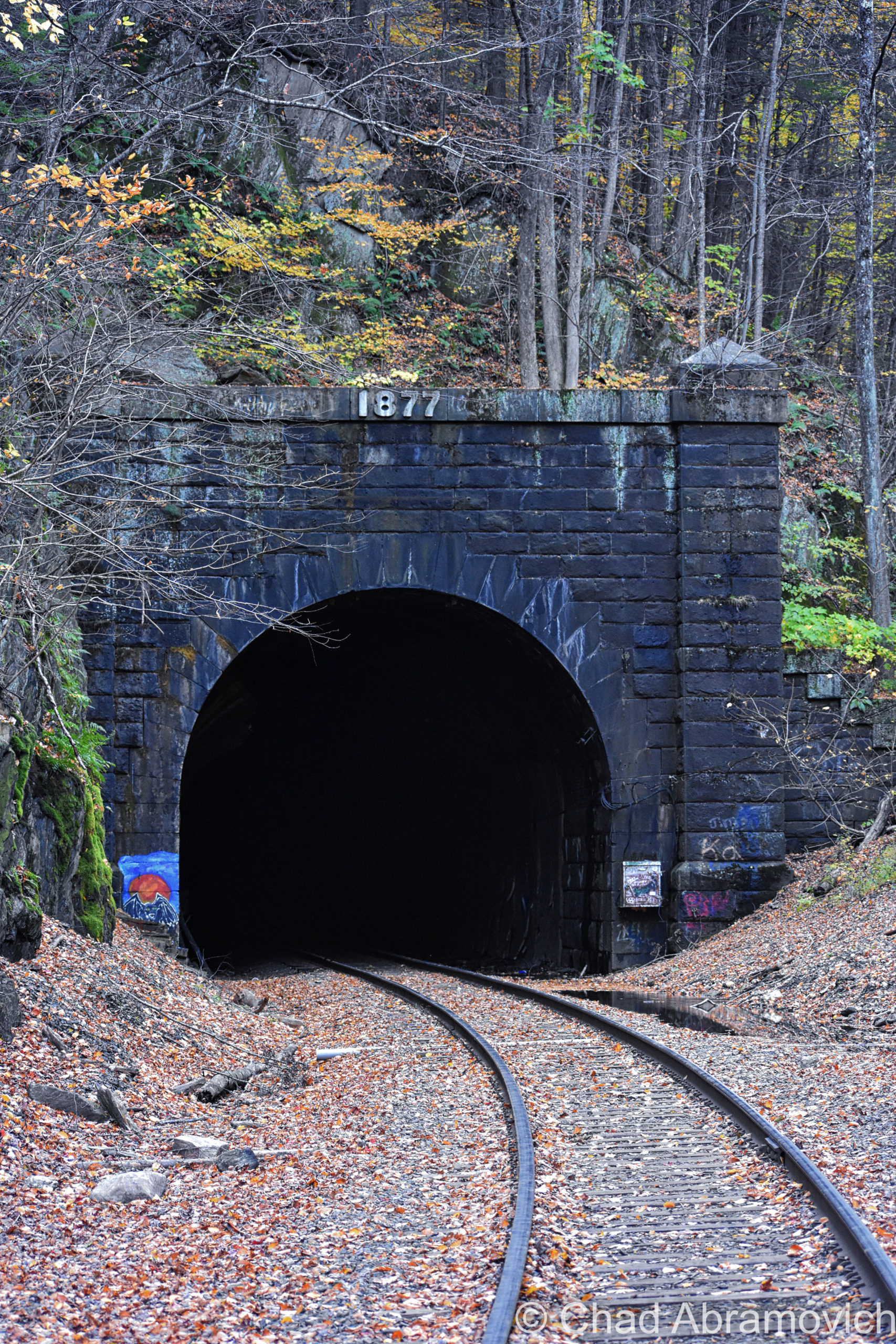
The tunnel’s headings (both respective routes from each side) were purposely inclined by 26 feet per mile – with both slopes meeting up at an elevated mid-point so all the water that puddles inside (there’s a lot) is drained out through both portals, but it also prevents you from seeing one end from the other end, making the passage seem endless – peering in, you only see blackness.

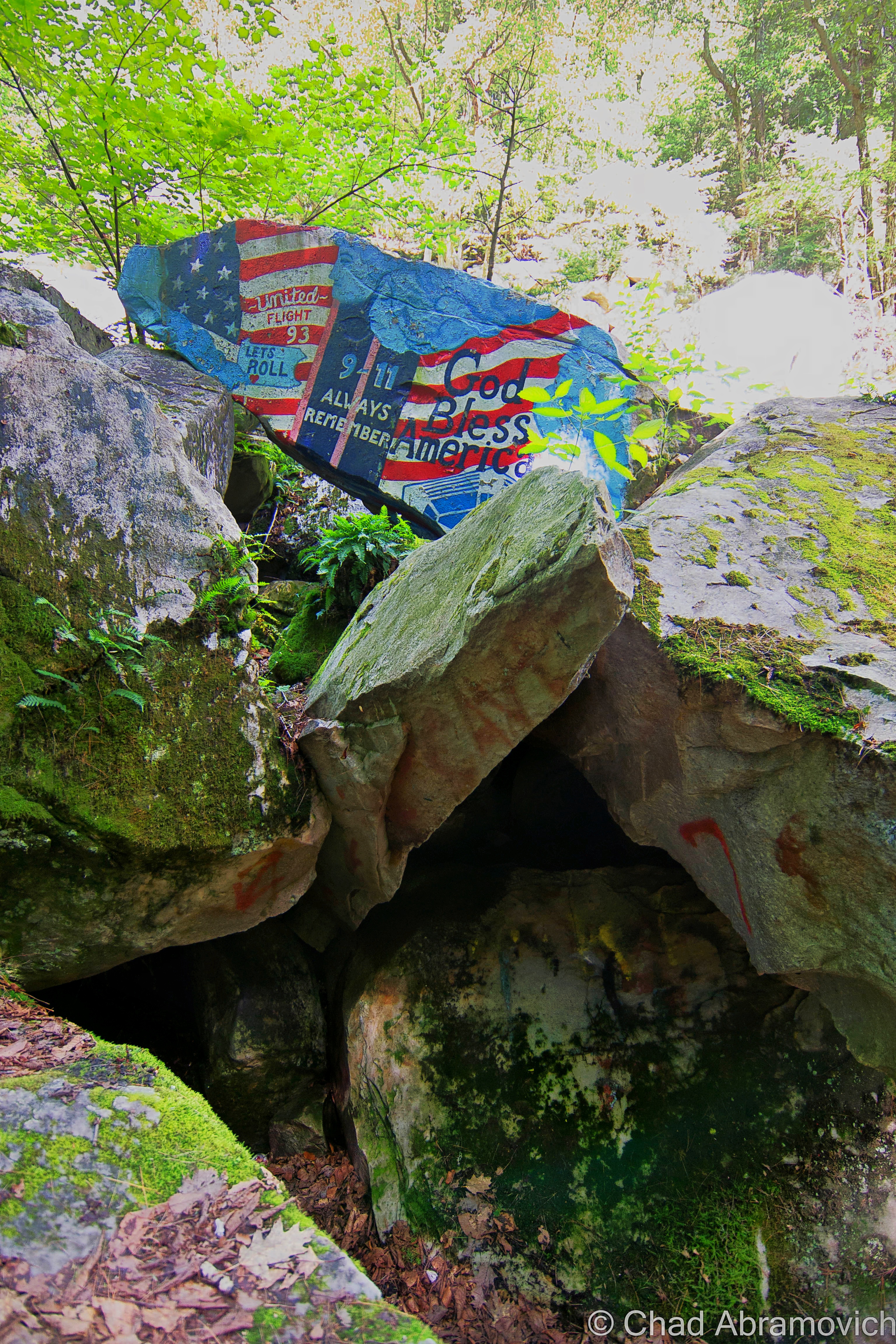
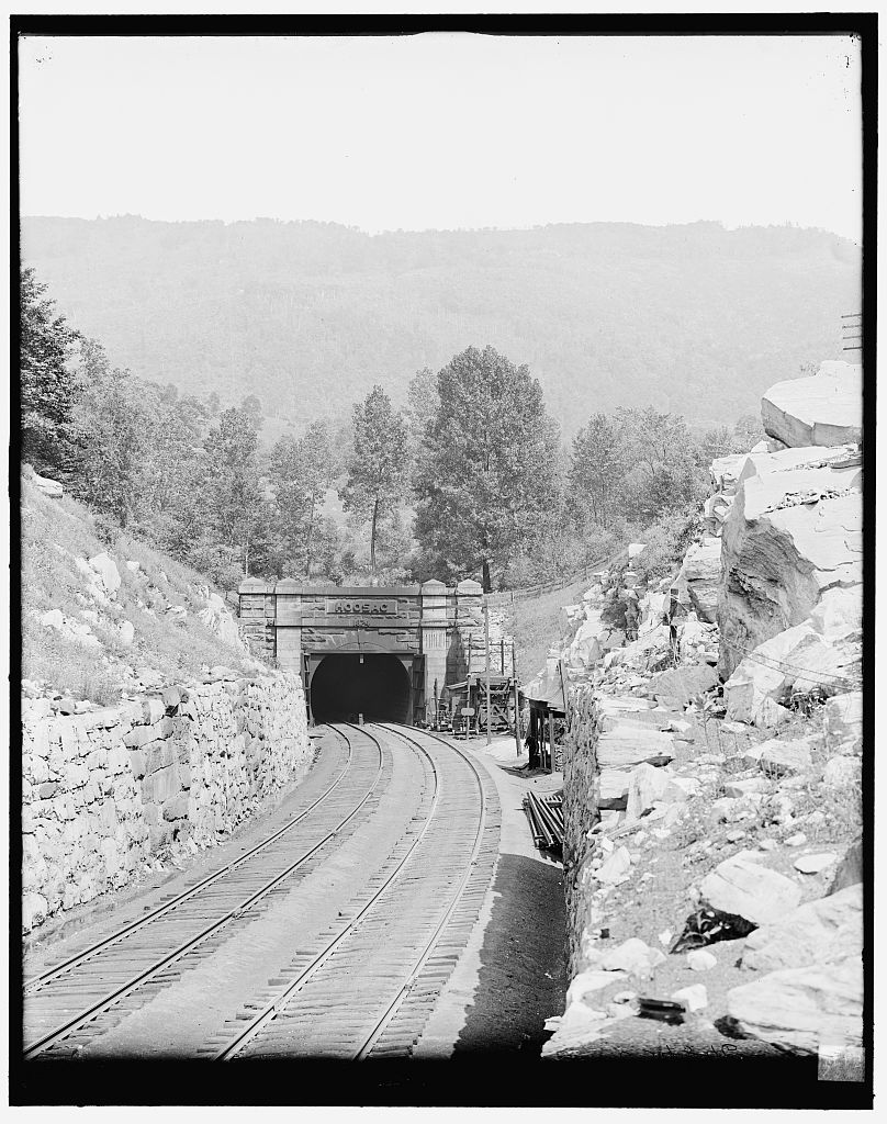
On February 9th, 1875, the remarkable Hoosac Tunnel was ready for its first train, and it became a big deal basically from the get-go, becoming both a cog in the regional economic engine, a tourist attraction, and a memento for some patriotic flexing.
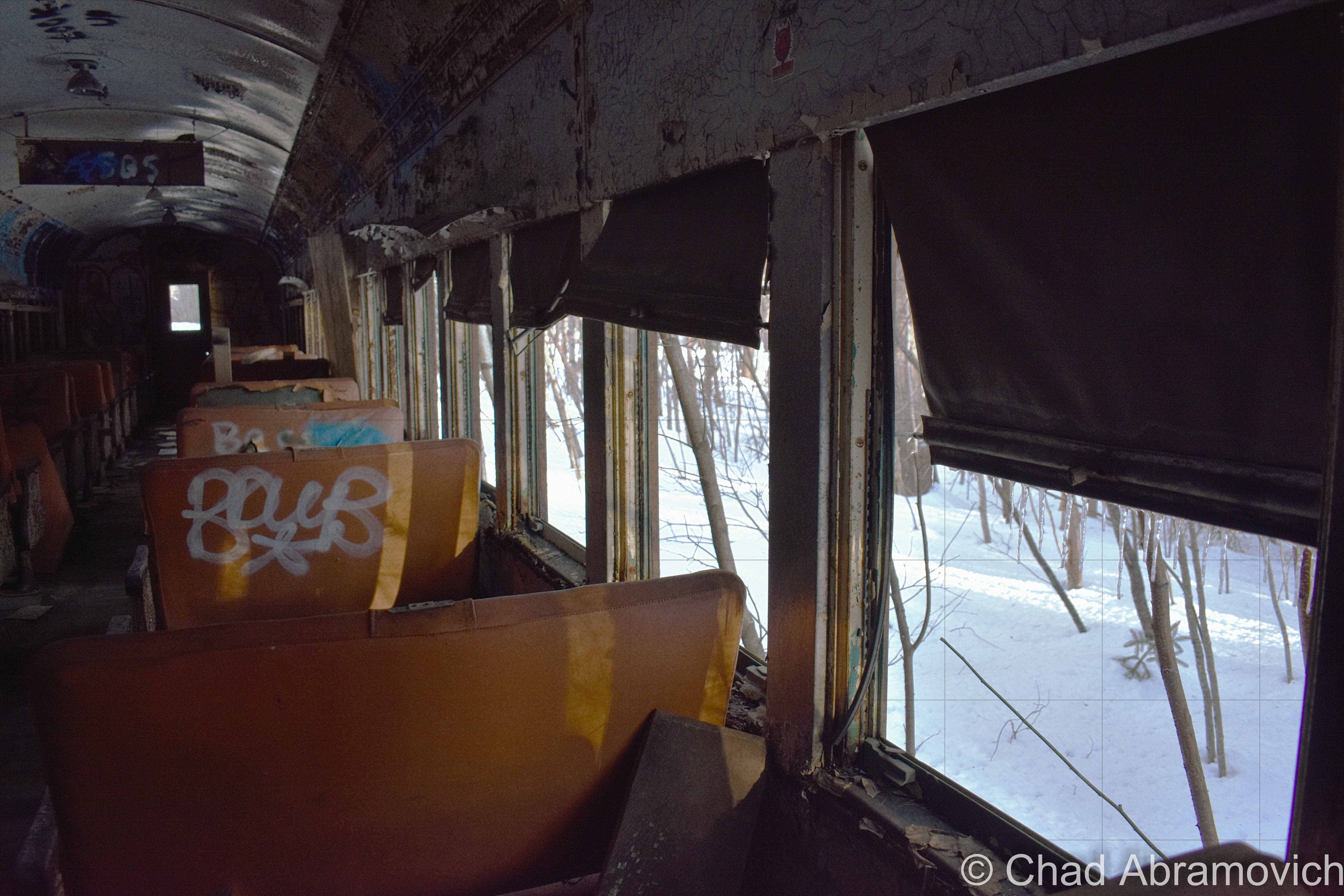
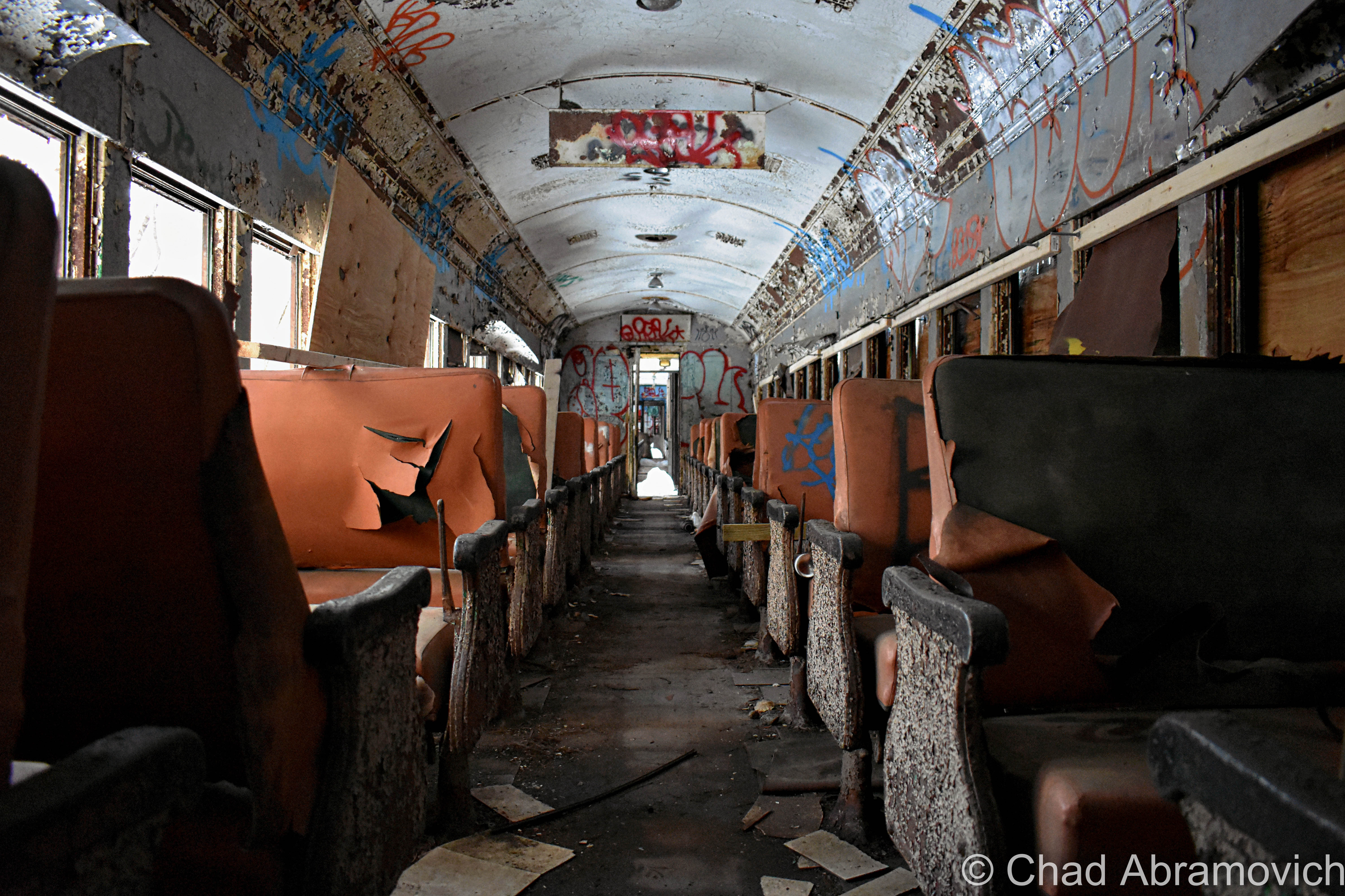
Original Hoosac Tunnel promotional advertisement, circa 1888/1889 – via The Library of Congress
Historic photo of the Hoosac Tunnel’s East Portal, Florida, Massachusetts. Circa 1900-1910. Via The Library of Congress
Neat vintage Infographic: Profile of the Hoosac Range showing the tunnel underneath – 1877. It’s really interesting to see exactly how it’s laid out! Via The Library of Congress
Historic photo of the Hoosac Tunnel’s West Portal, North Adams, Massachusetts. This view has changed quite a bit nowadays! Most notably, the introduction of the “Snow Door” in the 1950s. Photo taken circa 1900-1910. Via The Library of Congress

The Tunnel Today

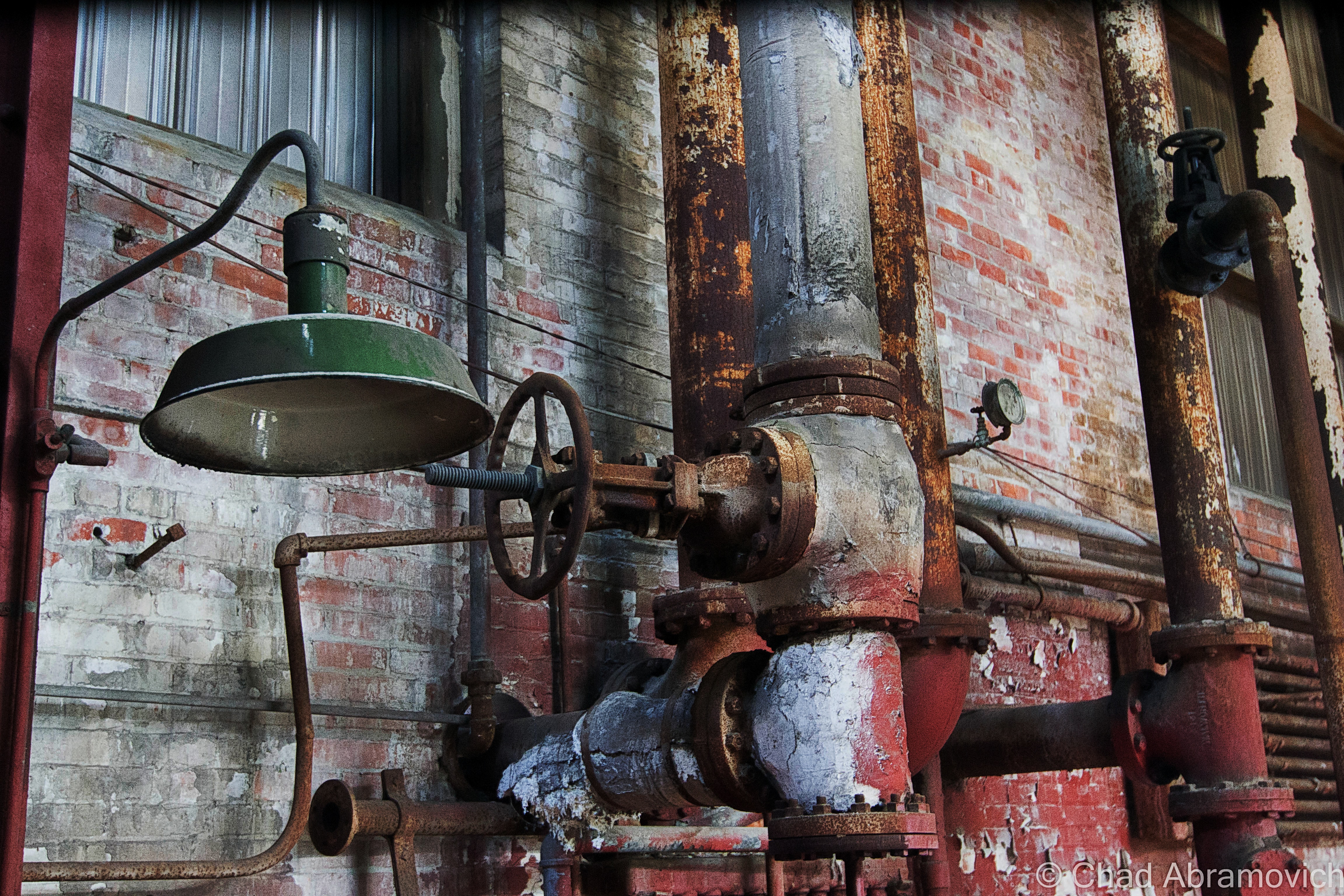
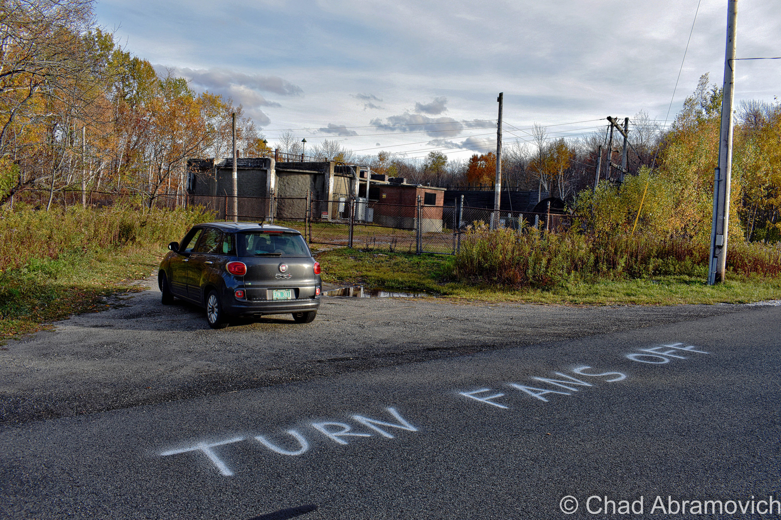
In the coming years, more improvements and features would be added. The tunnel originally had a double set of tracks running through it, because of the enormous amount of trains that were utilizing the American rail network in its prime. And all of those locomotives were powered by coal – which belched an awful lot of noxious smog as a tradeoff, which was making the tunnel a pretty hazardous environment, regardless of the central shaft’s existence. Seriously. Some people were actually succumbing to asphyxiation on trips through the tunnel. So in 1911, electricity was brought in to power a fan atop the central shaft to help pull the fumes out. But even that wasn’t completely eliminating the problem, so briefly, the tunnel went electric, and trains had to stop before entering and then be pulled through via electric cables. In 1946, a double fan system was installed at the top of the central shaft, which are the same ones in use today.

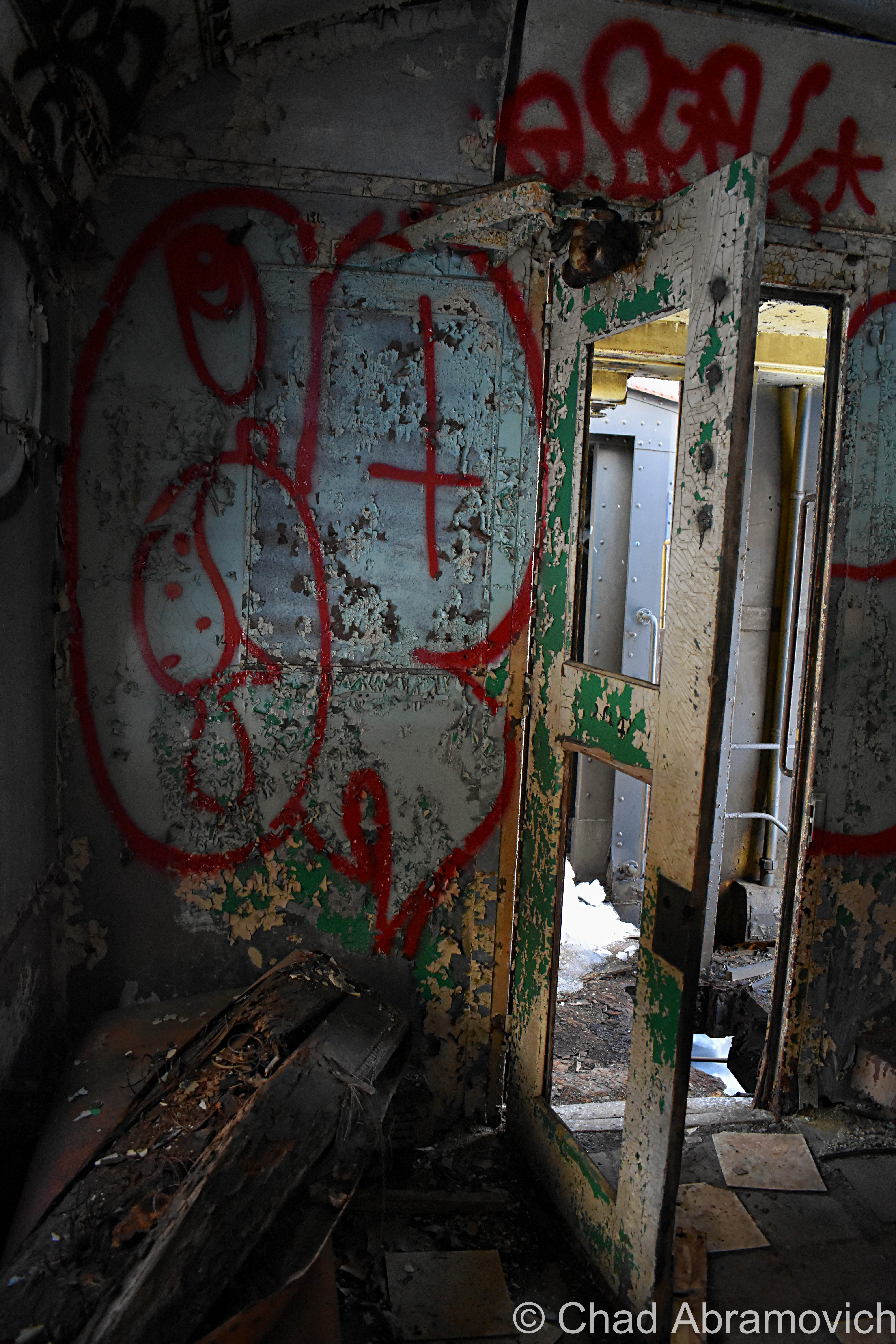
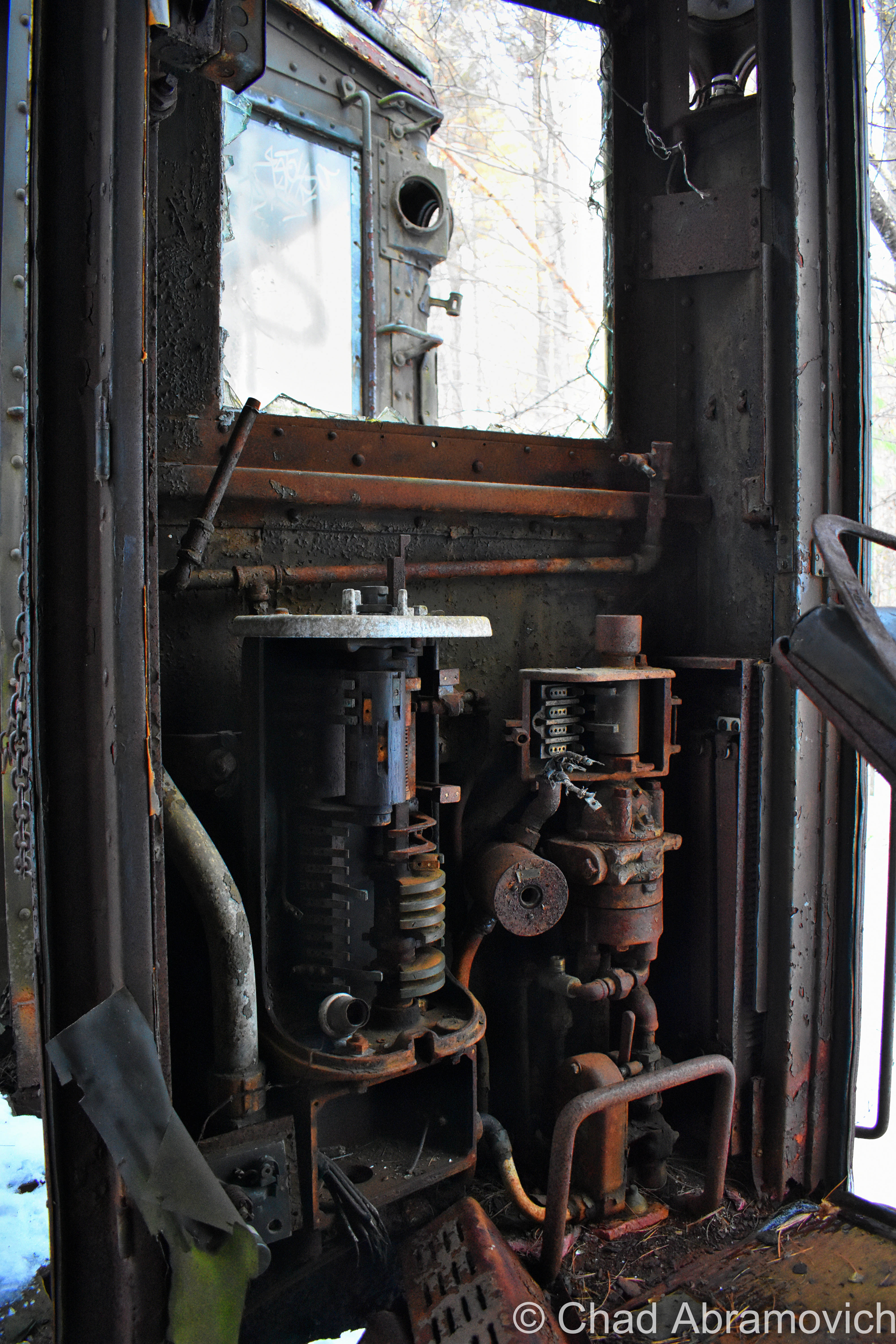
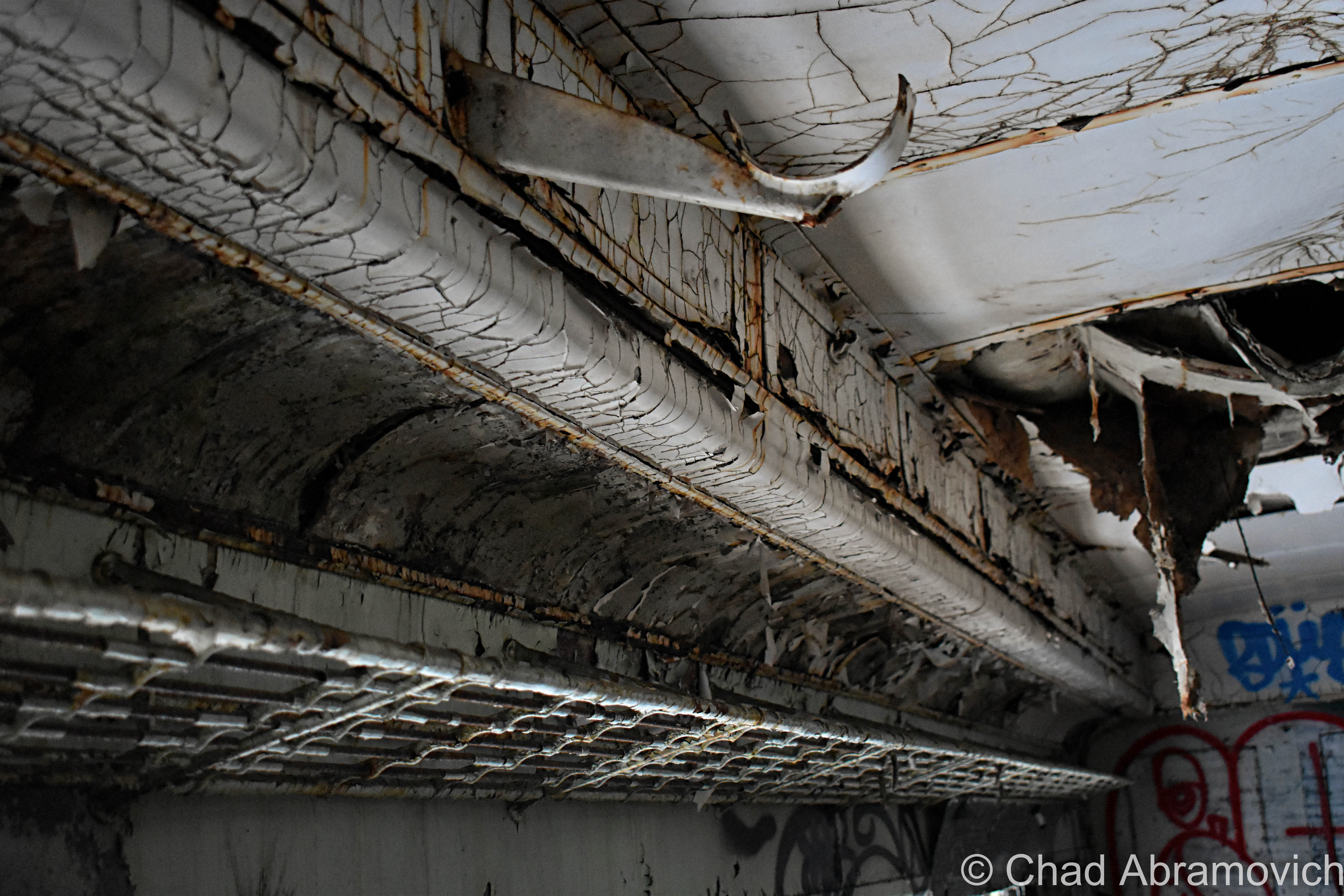
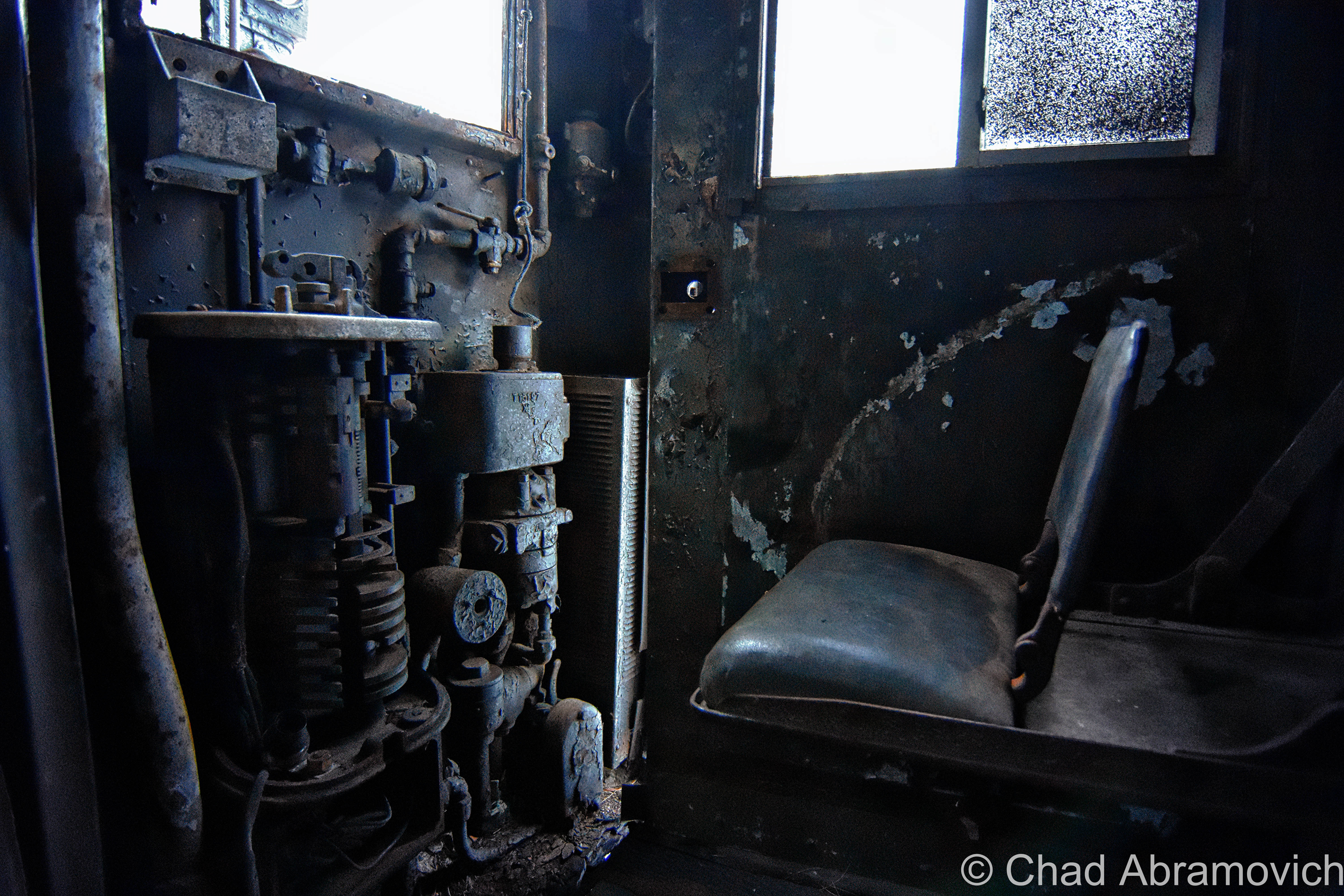
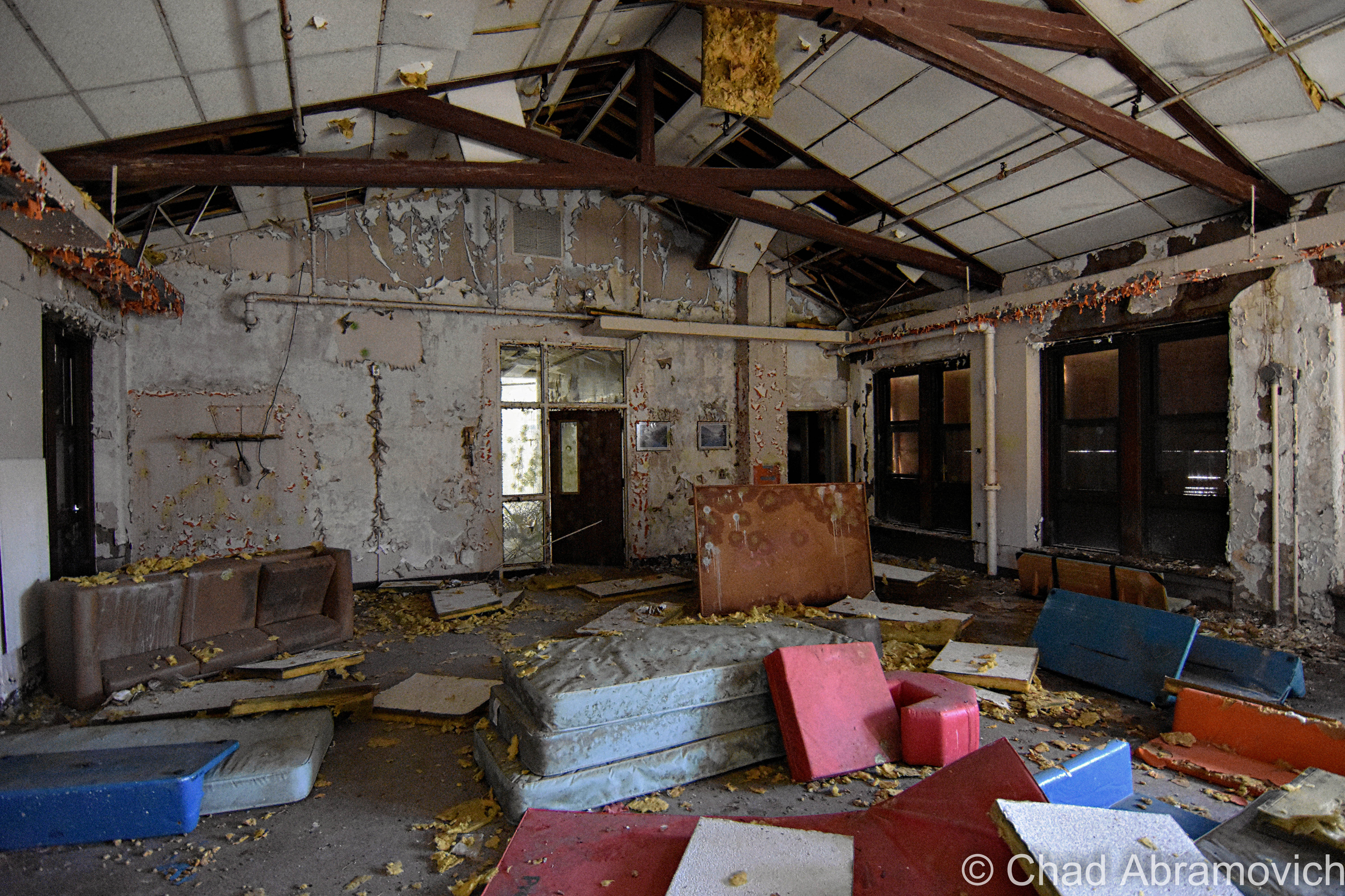
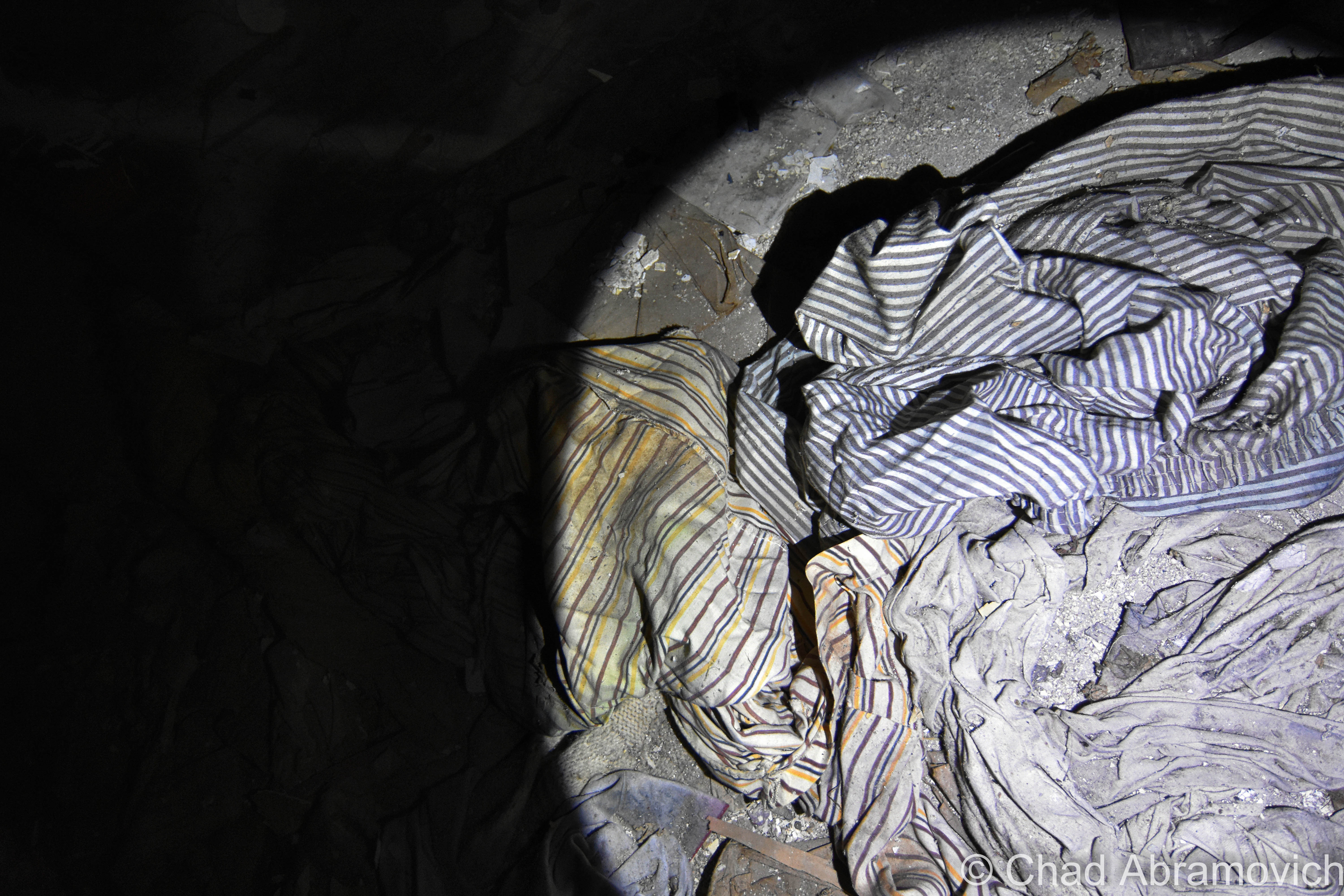
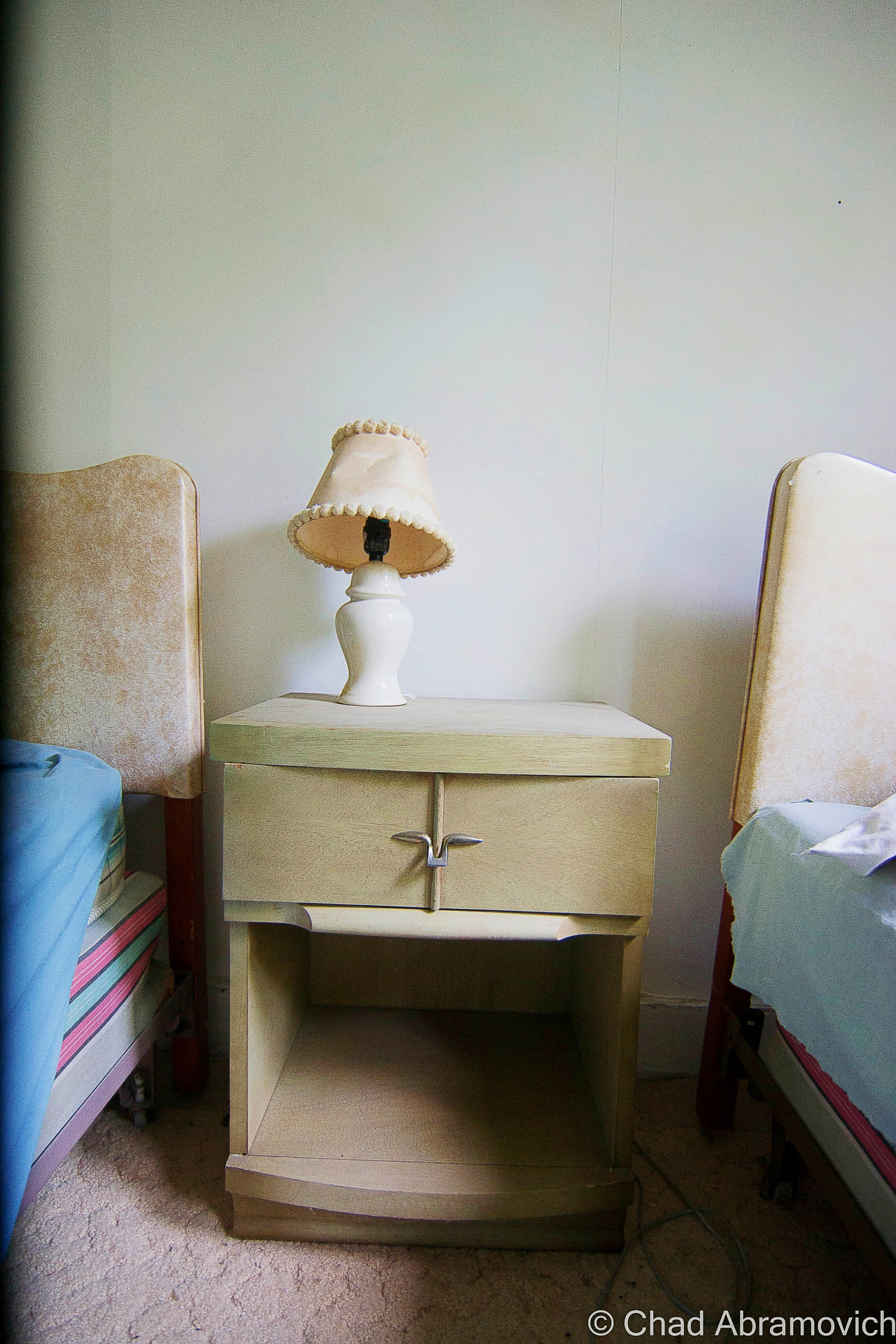
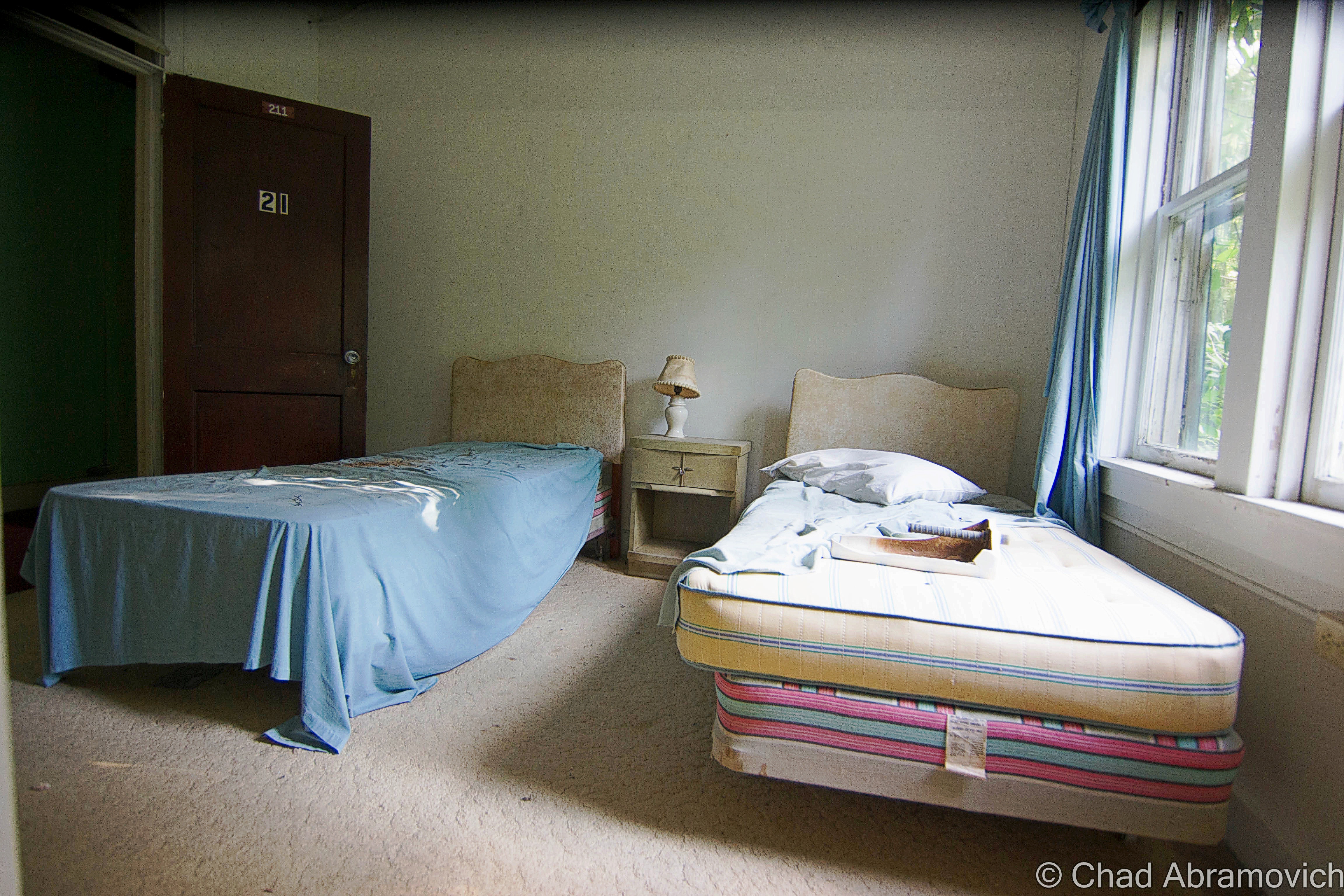
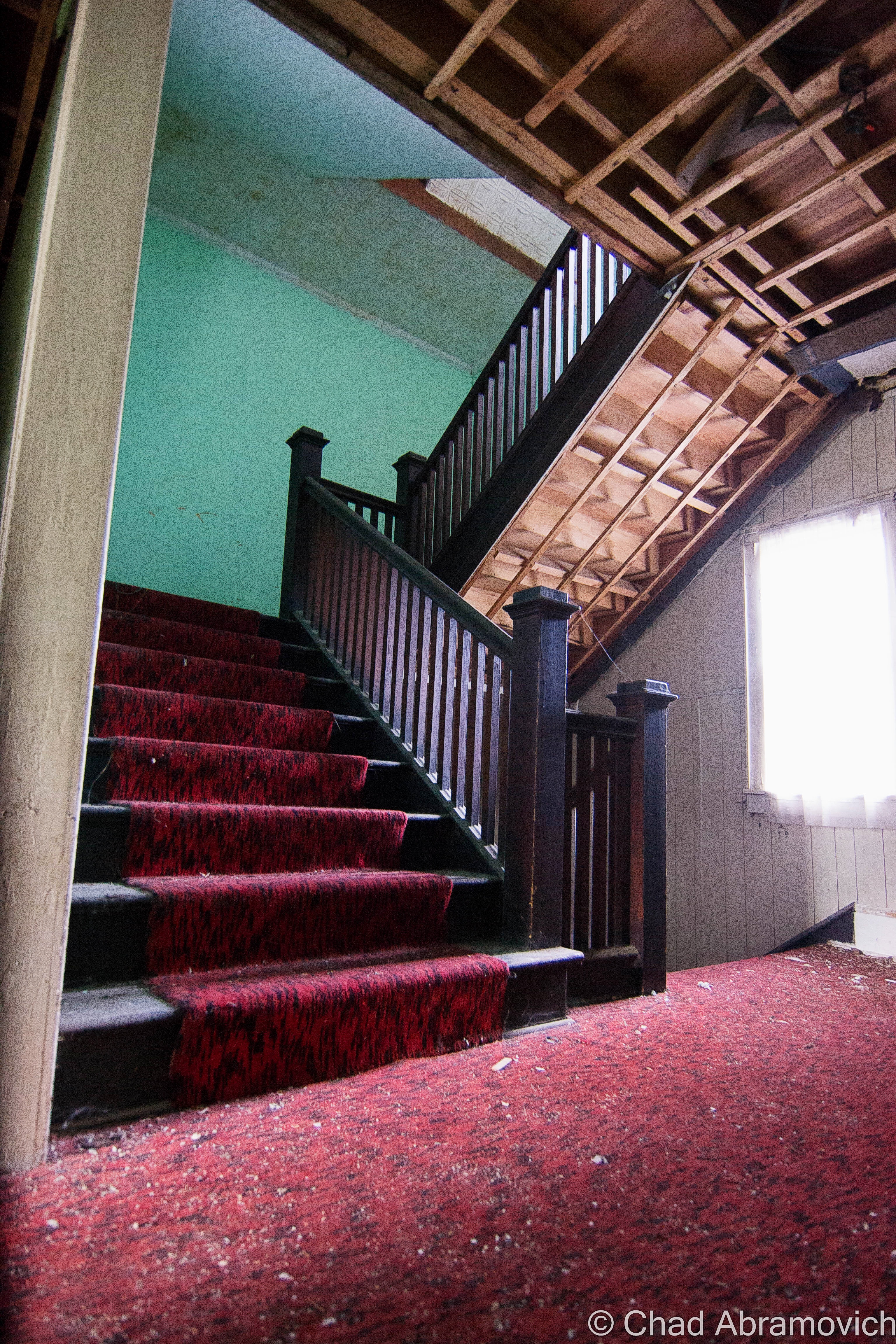
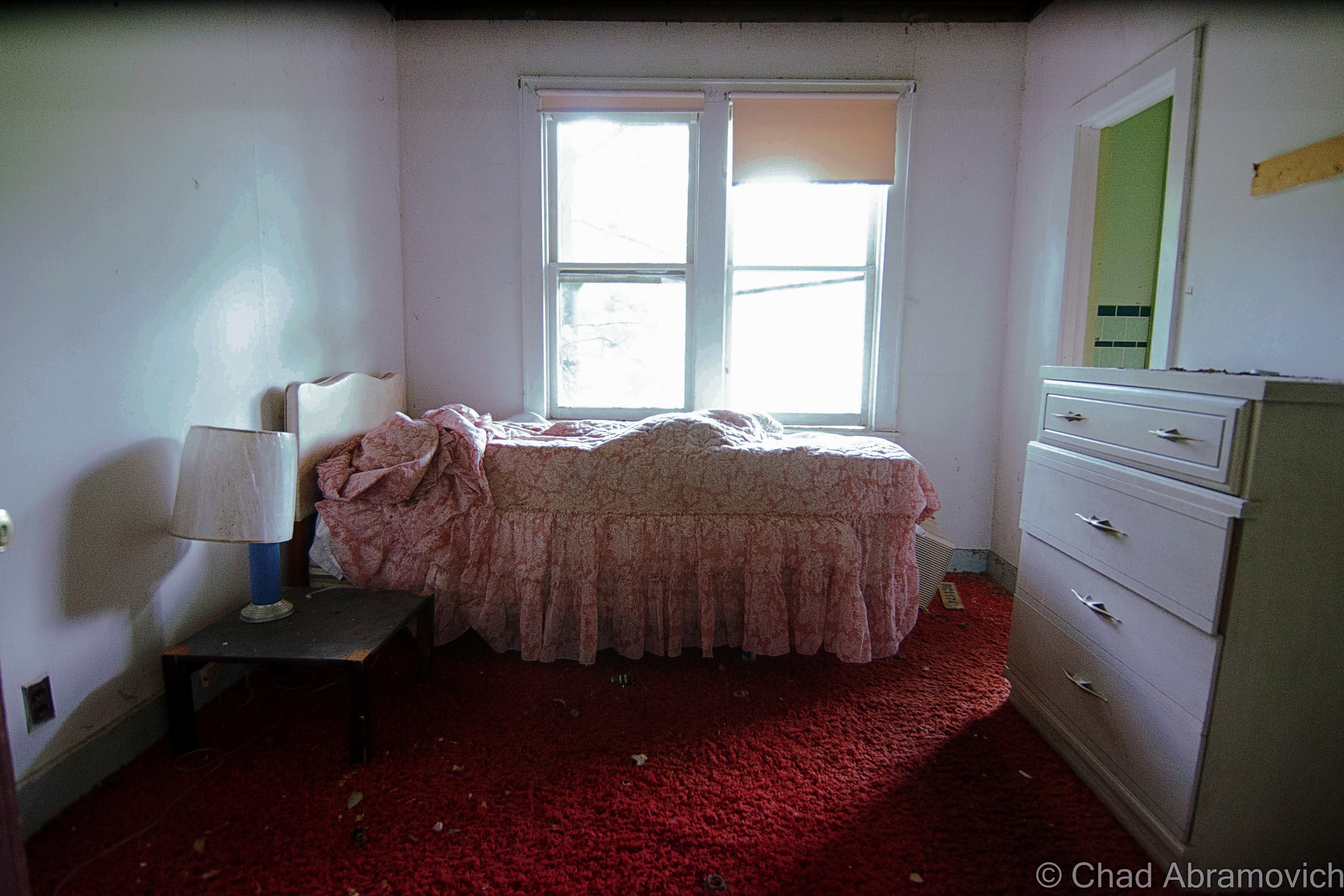
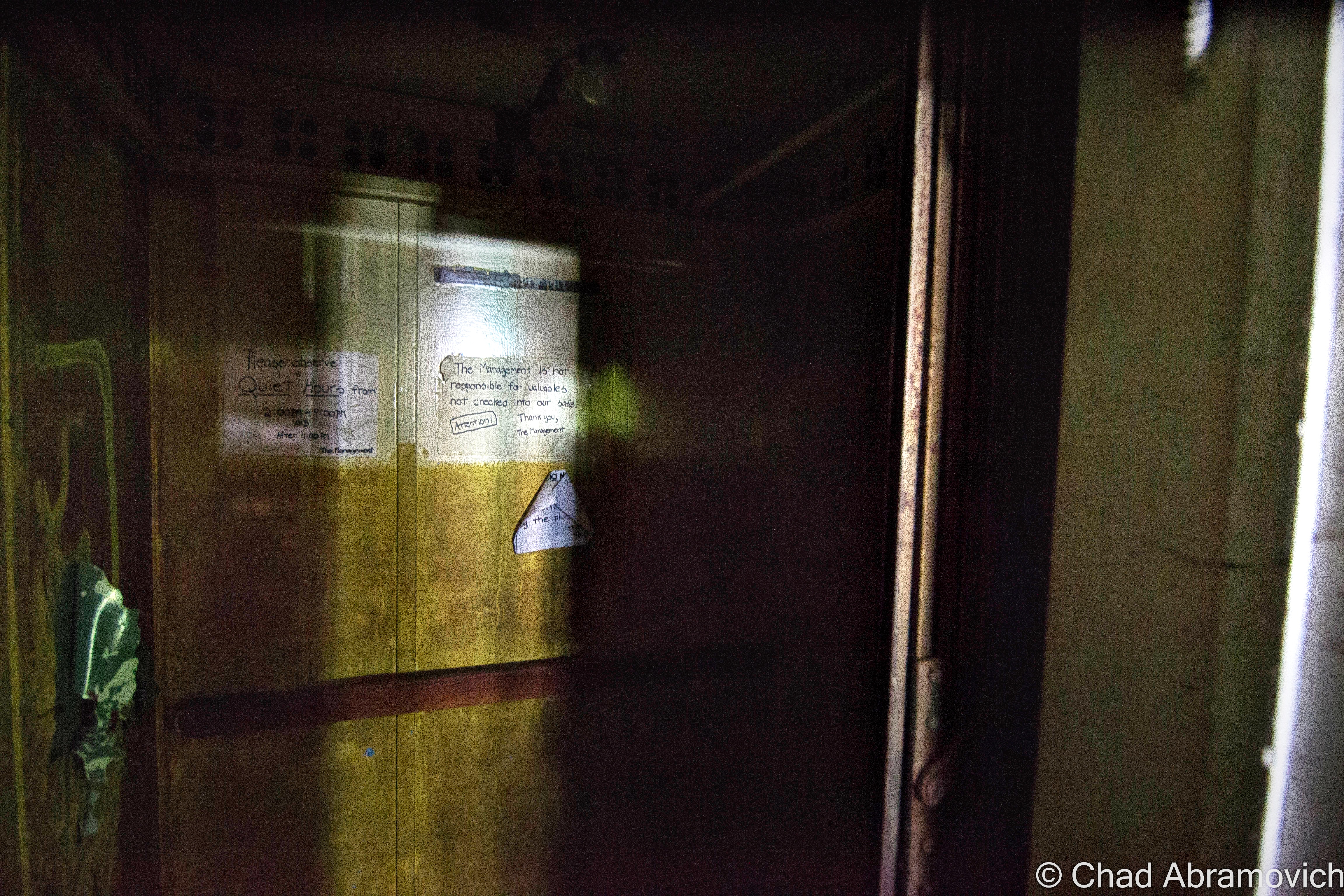
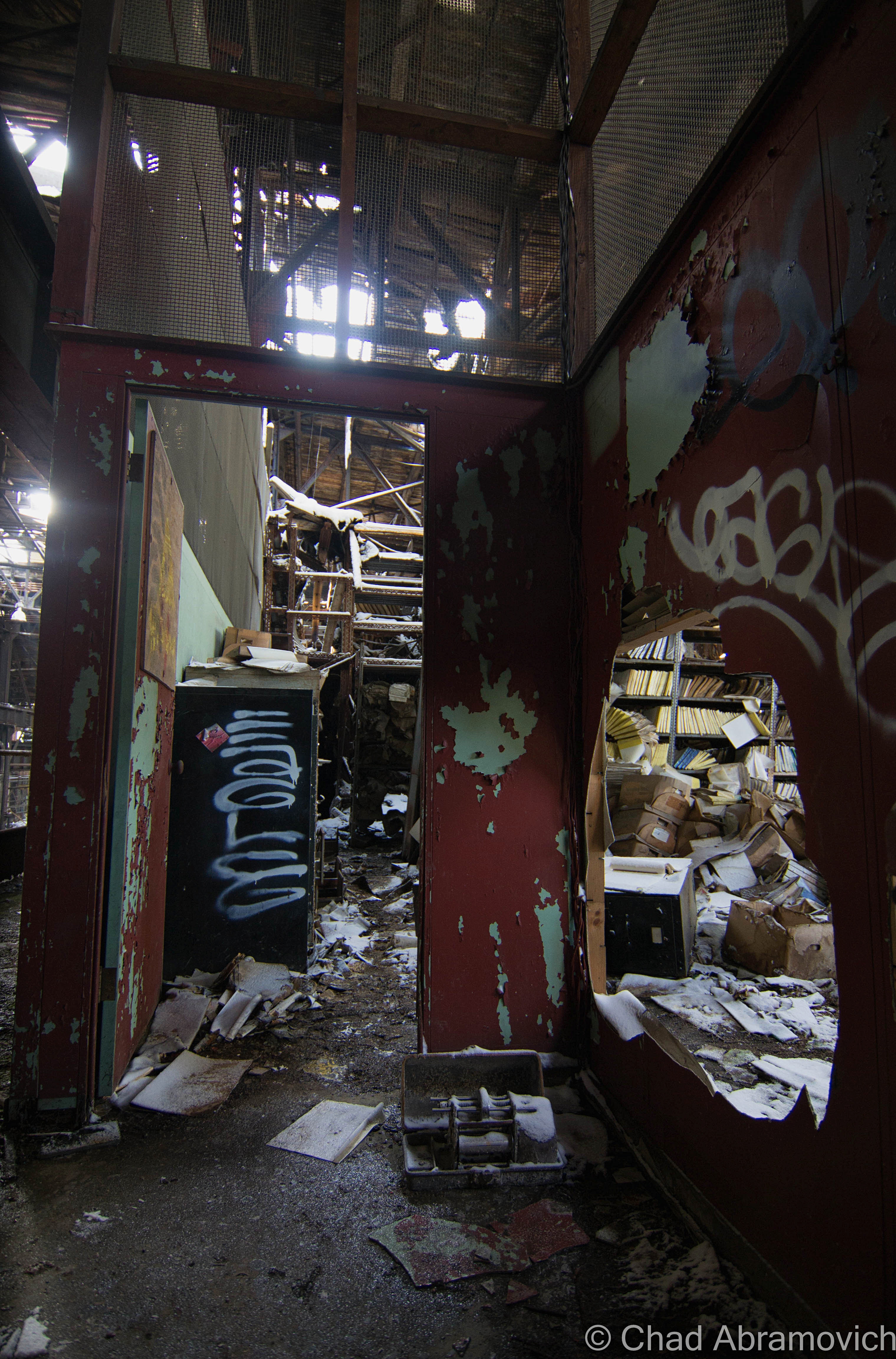
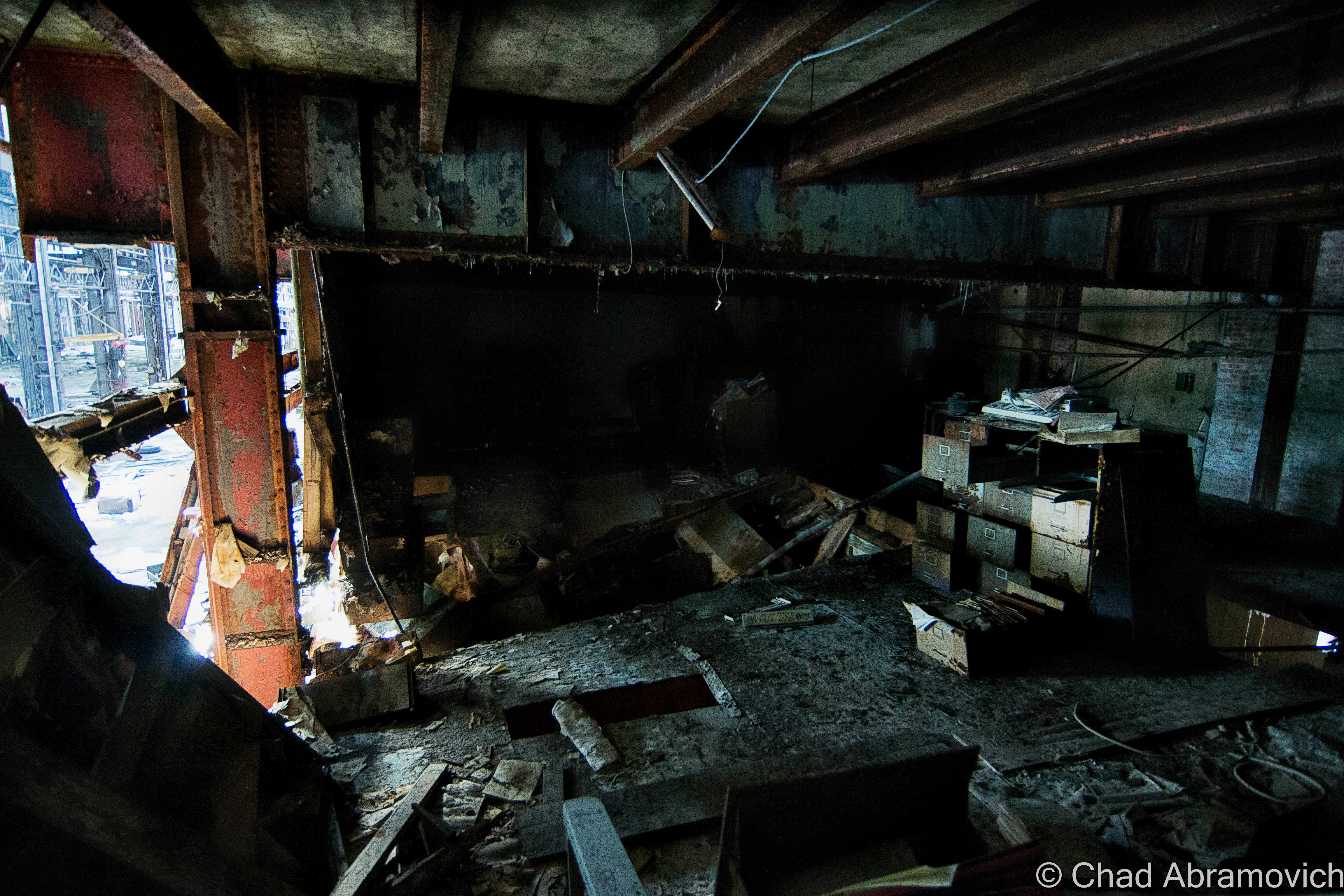
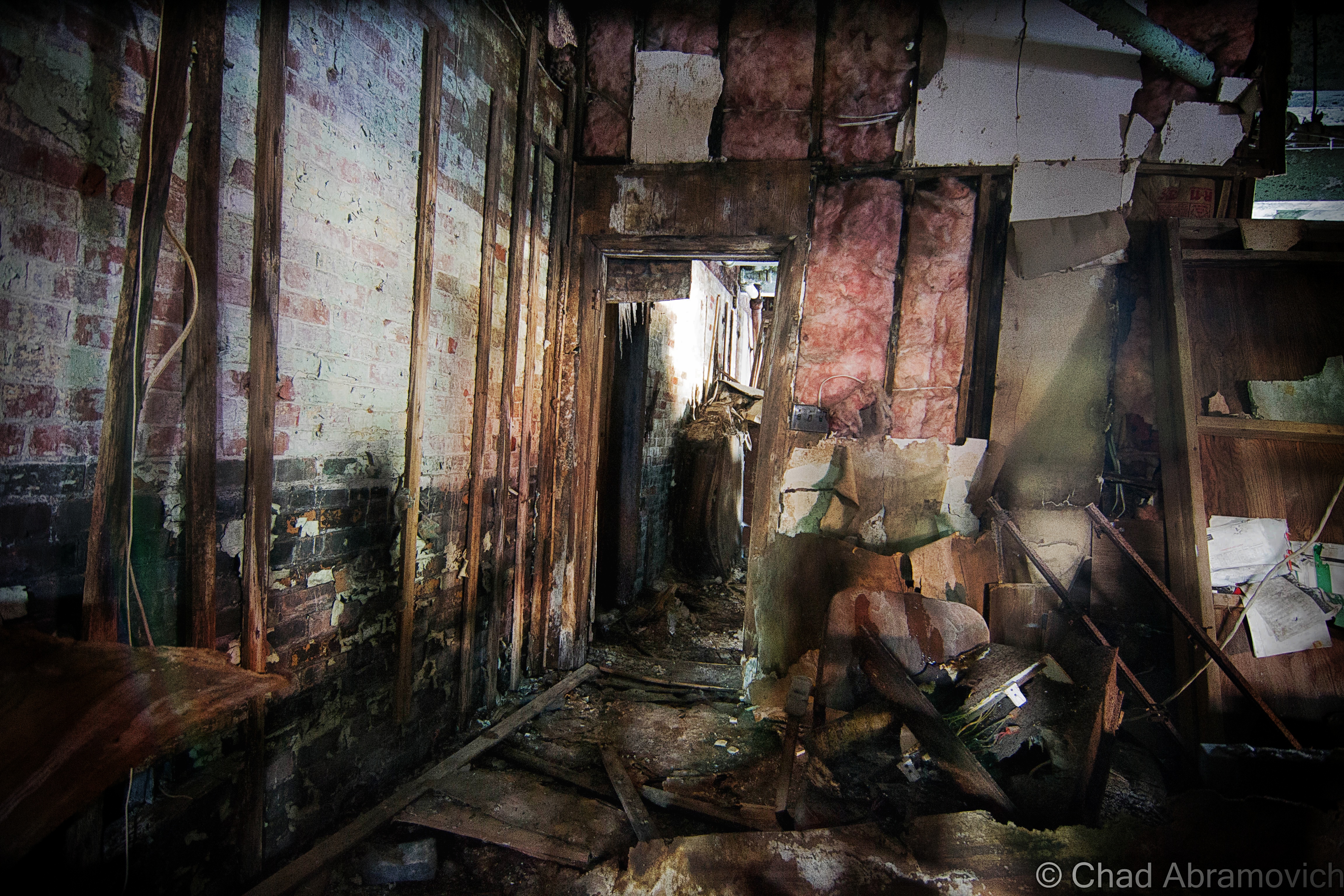
Directly below the central shaft, a room was blasted out of the mountain rock and became a shanty for trackwalkers and work crews, and inadvertently, it also became a frequent haunt for hobos – which earned the chamber the affectionate nickname “The Hoosac Hotel”, or sometimes “The Hoosac Hilton” – both of them still enthusiastically used in tunnel-talk today. I’ve also heard the possibility of there being some of the now-iconic “hobo graffiti” – a pictorial-based clandestine communication system invented by savvy recalcitrant turn of the last century train hoppers and vagabonds, scrawled somewhere within the room, but so far I haven’t seen the evidence.

The Hoosac Hotel has a real creepy vibe to it, and that might be influenced by the fact it’s in the same spot that a large section of tunnel collapsed and killed a bunch of workers, and some say it’s also where misters Brinkman and Nash were discombobulated by an explosion. Nearby is said to be the legendary secret room(s), walled up to contain some awesome horrors.

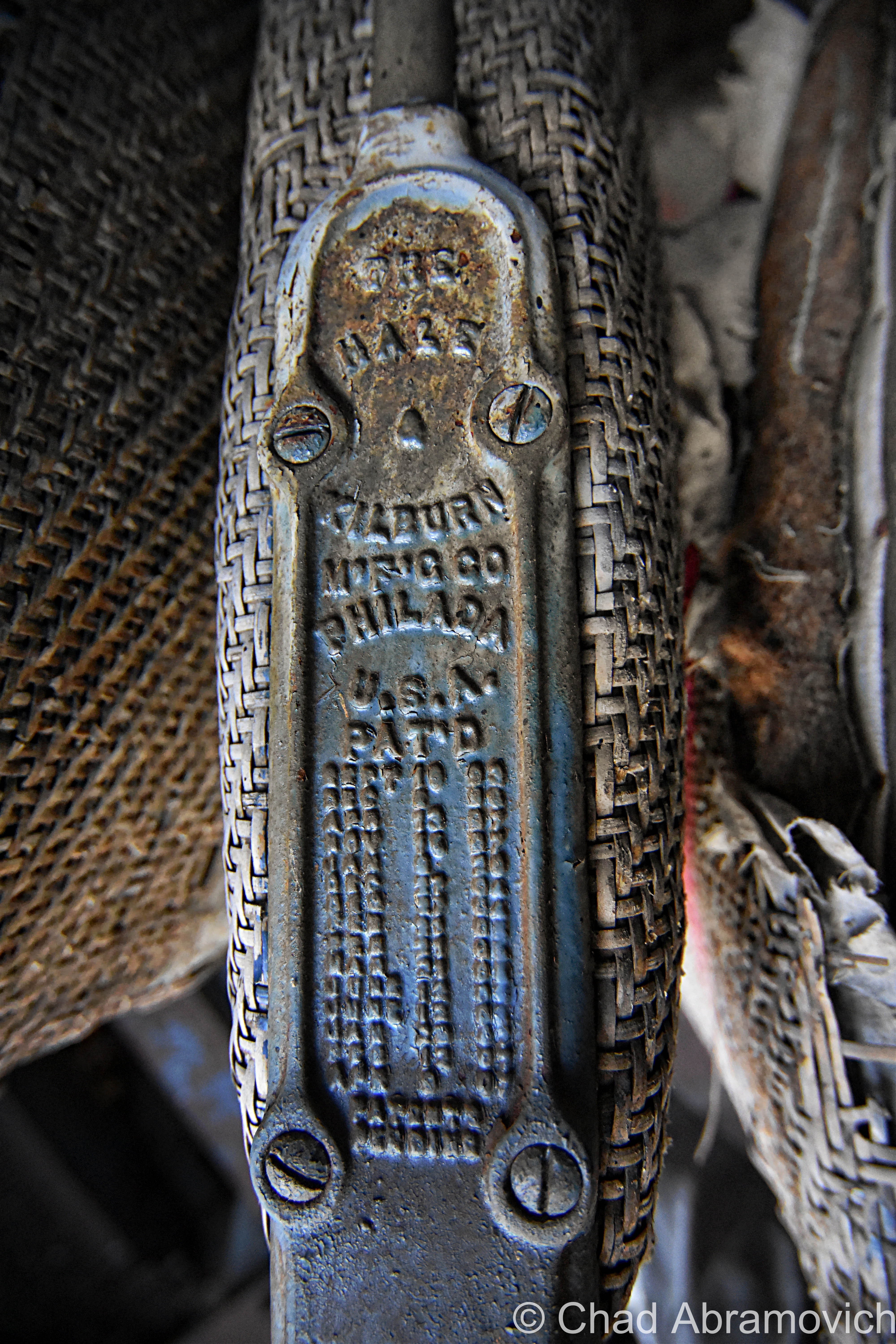
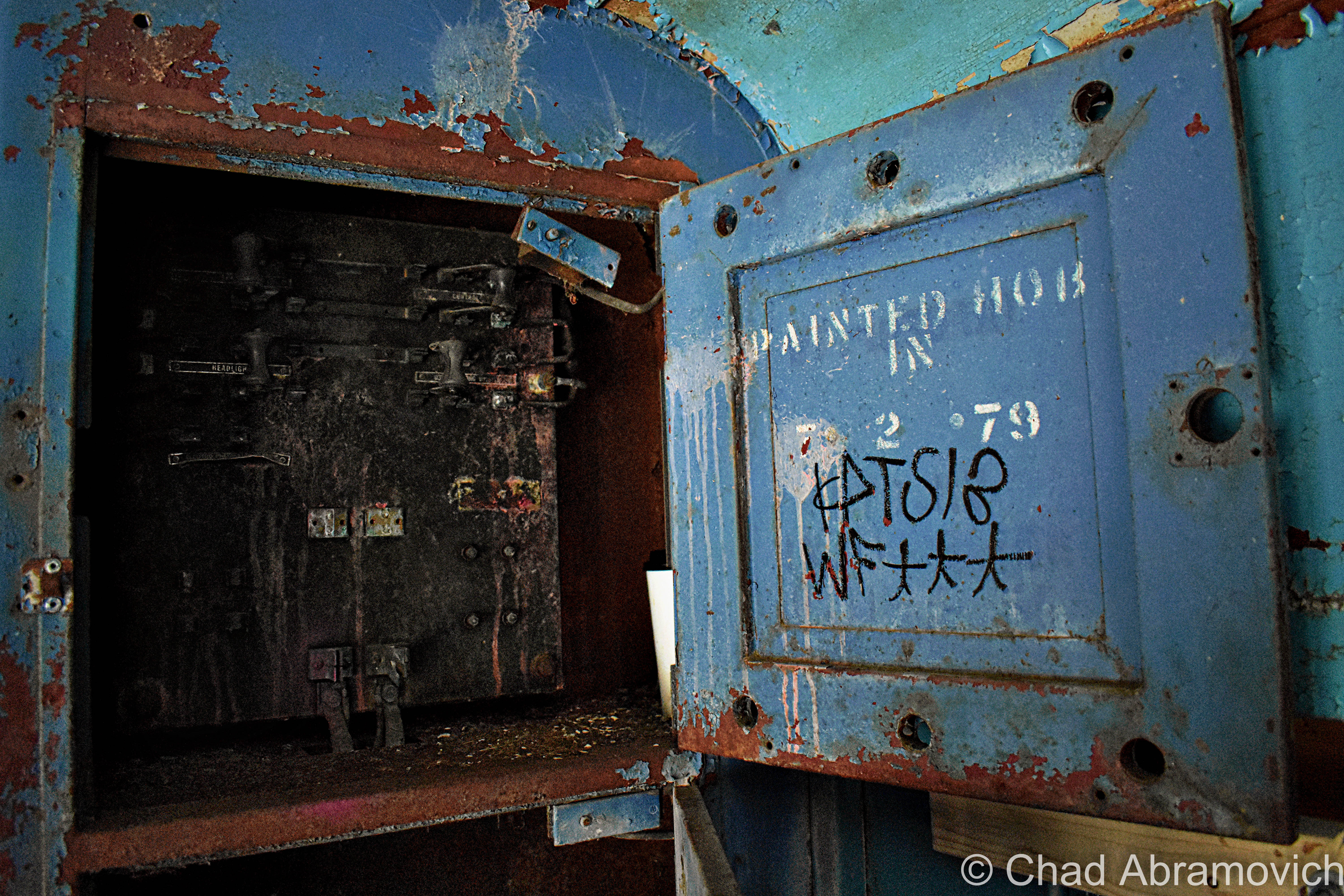
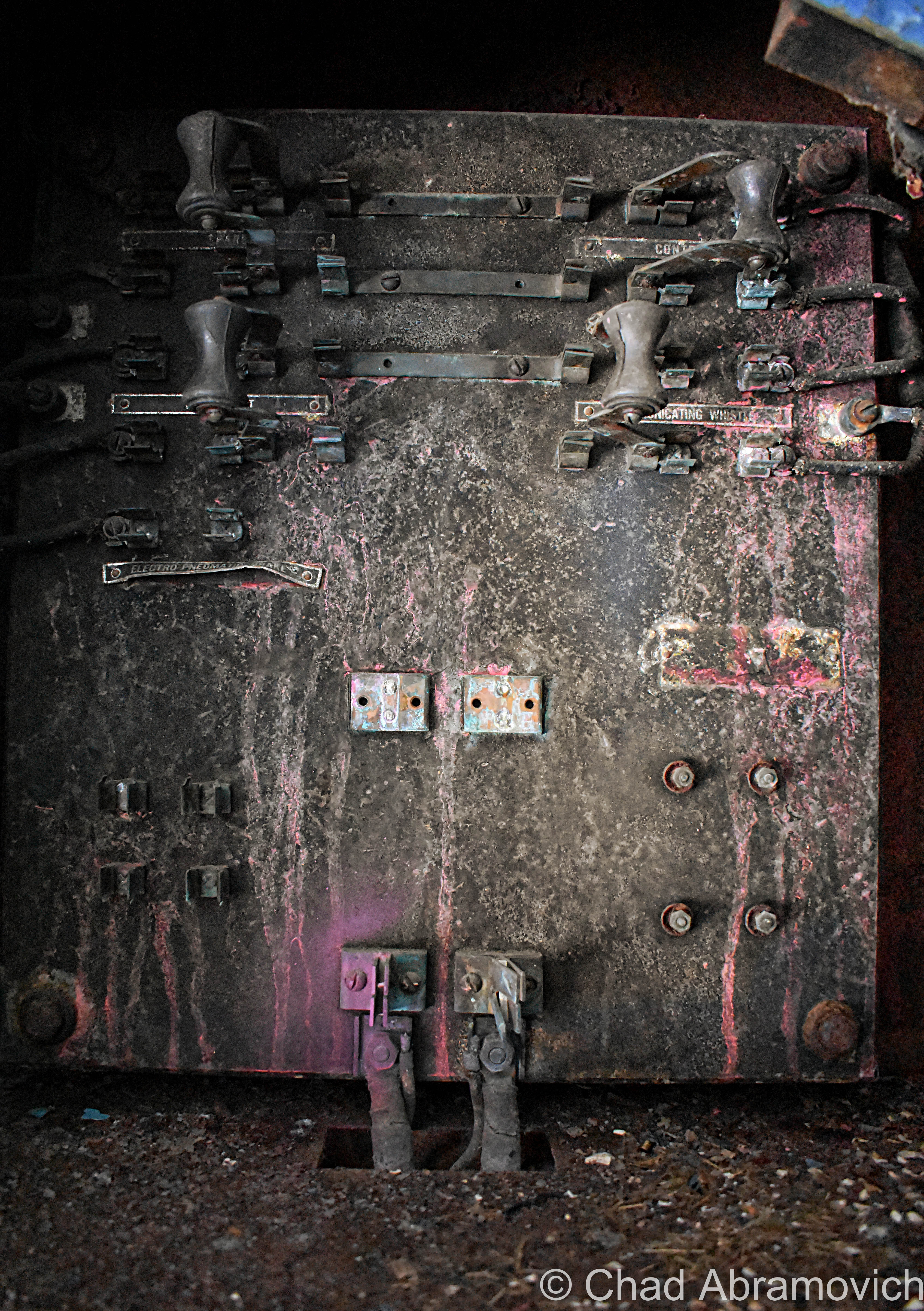
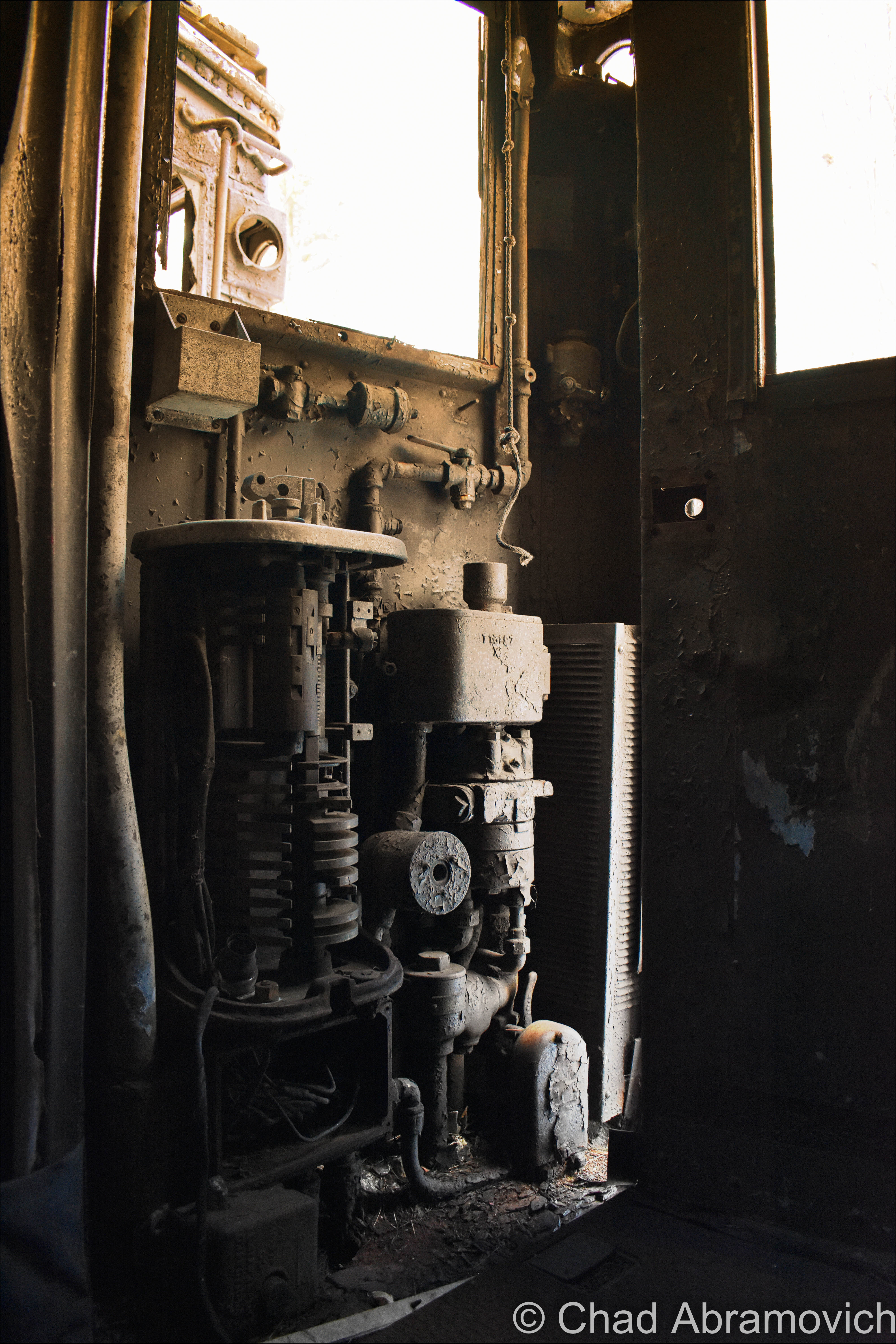
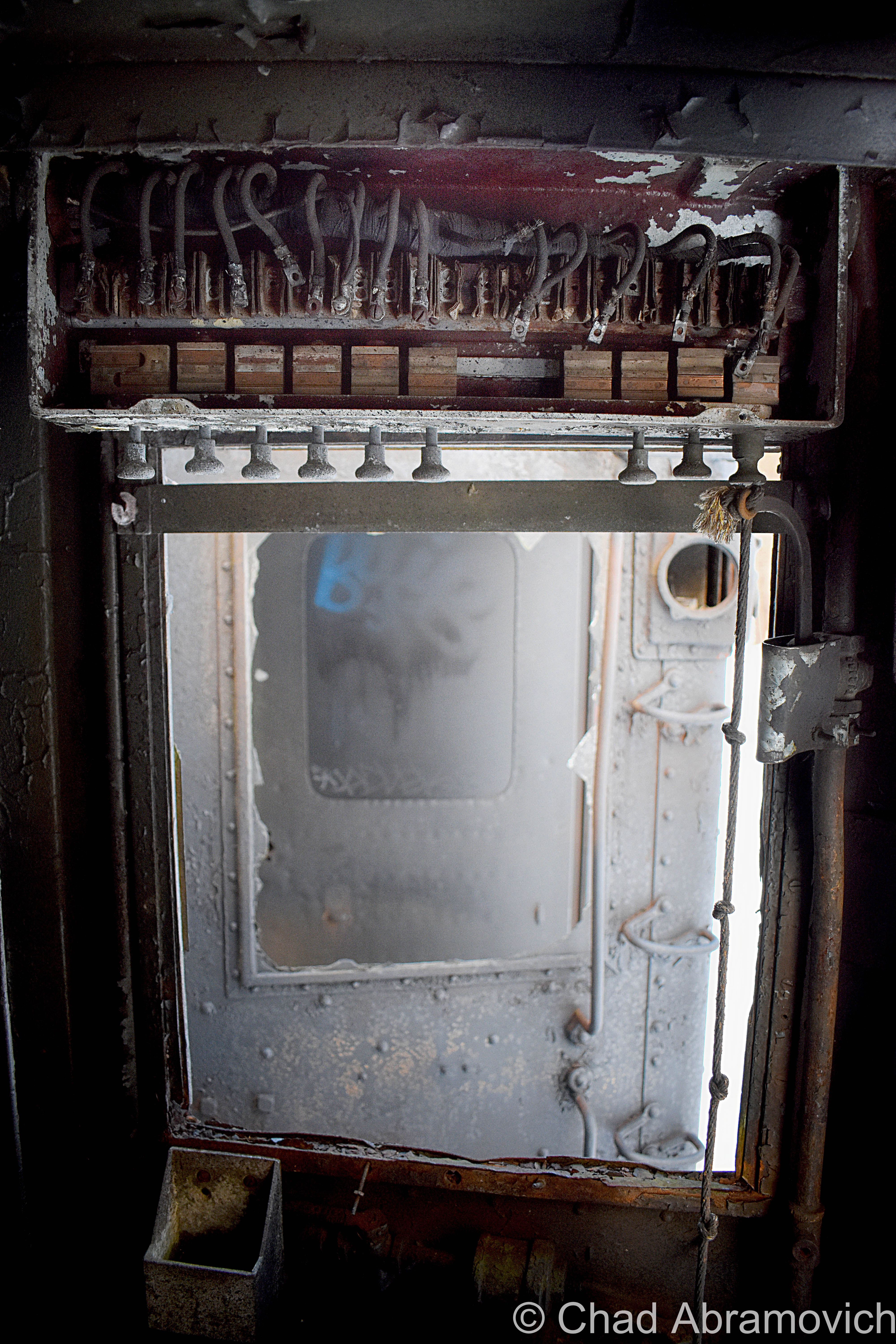
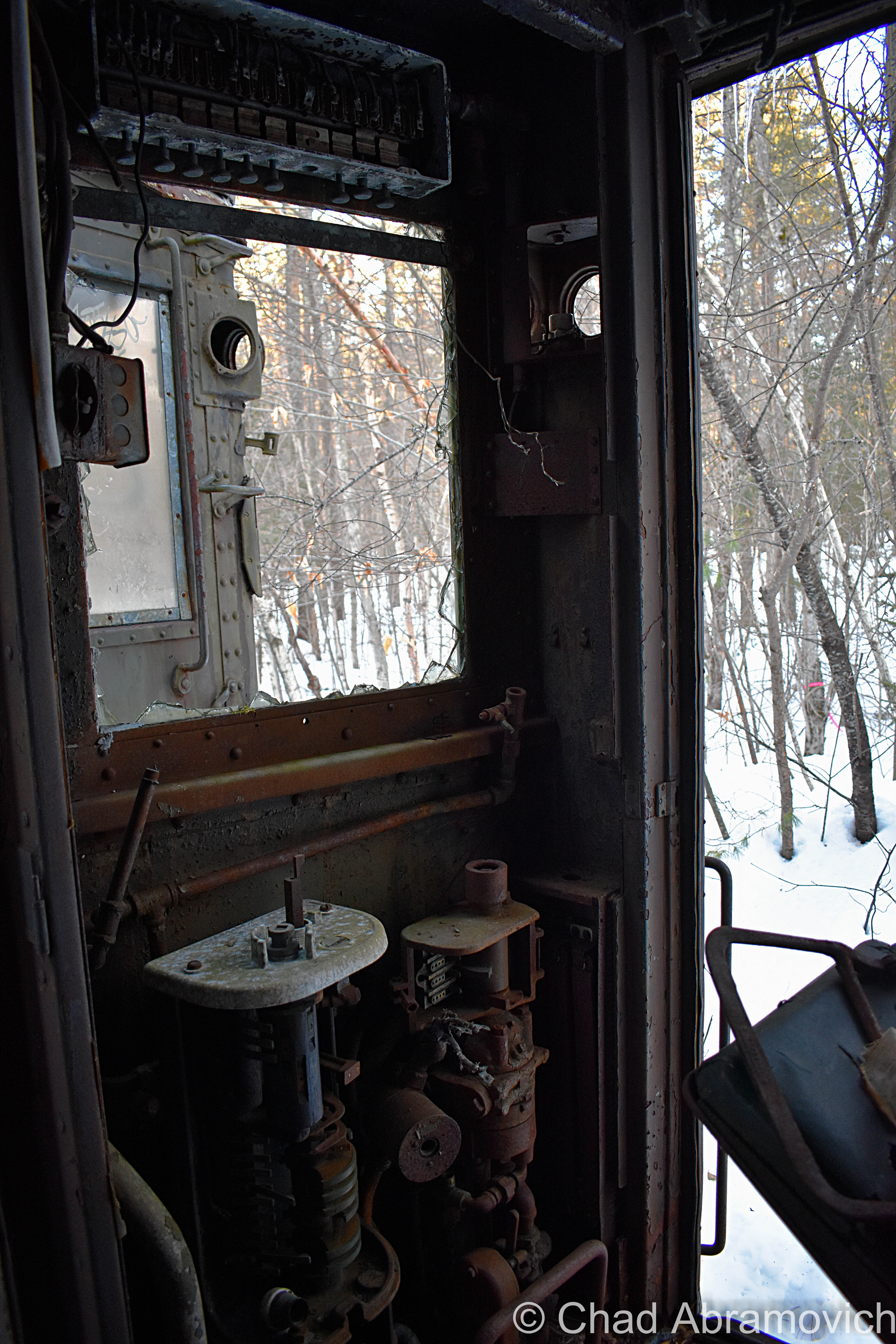
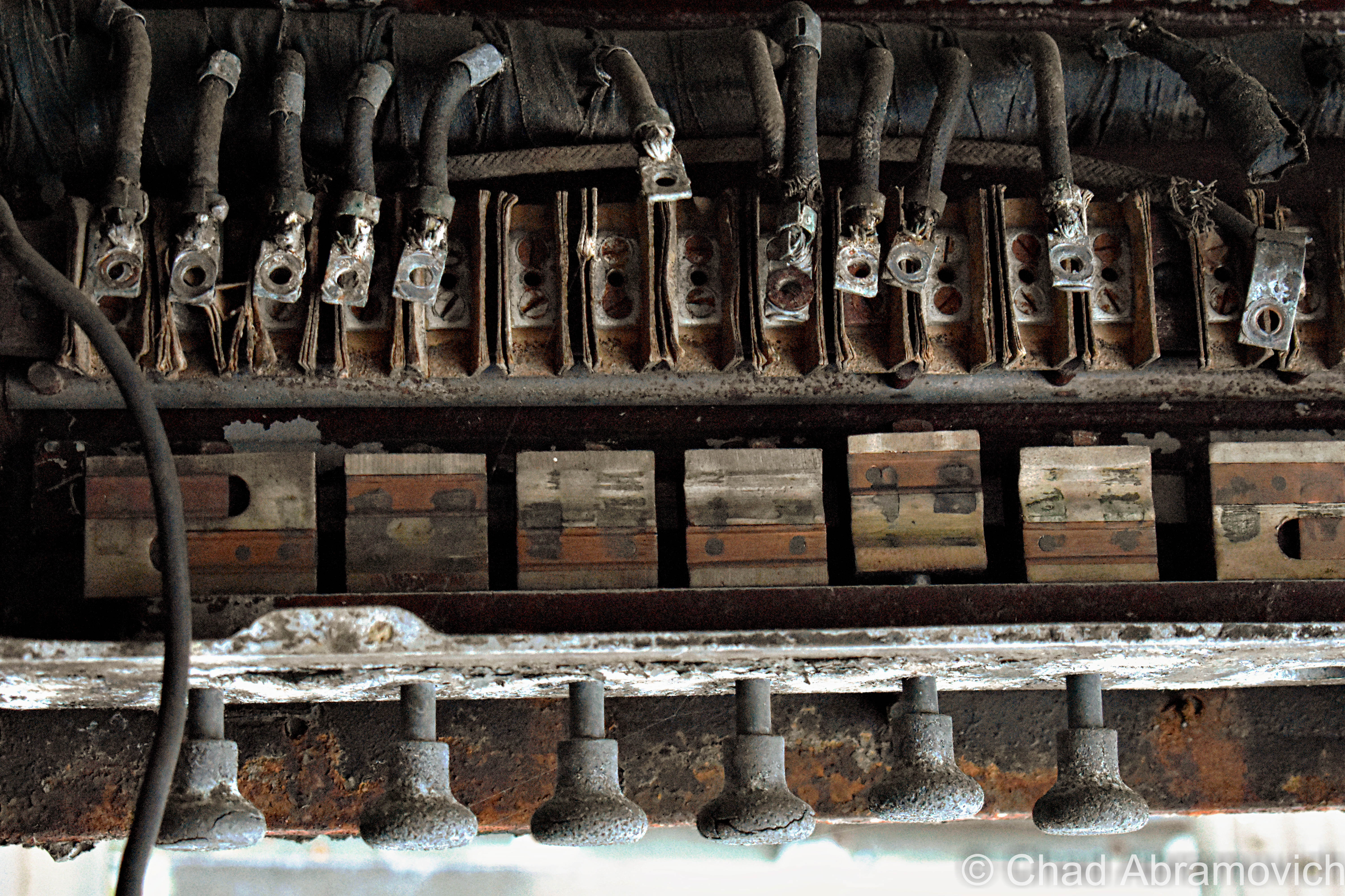
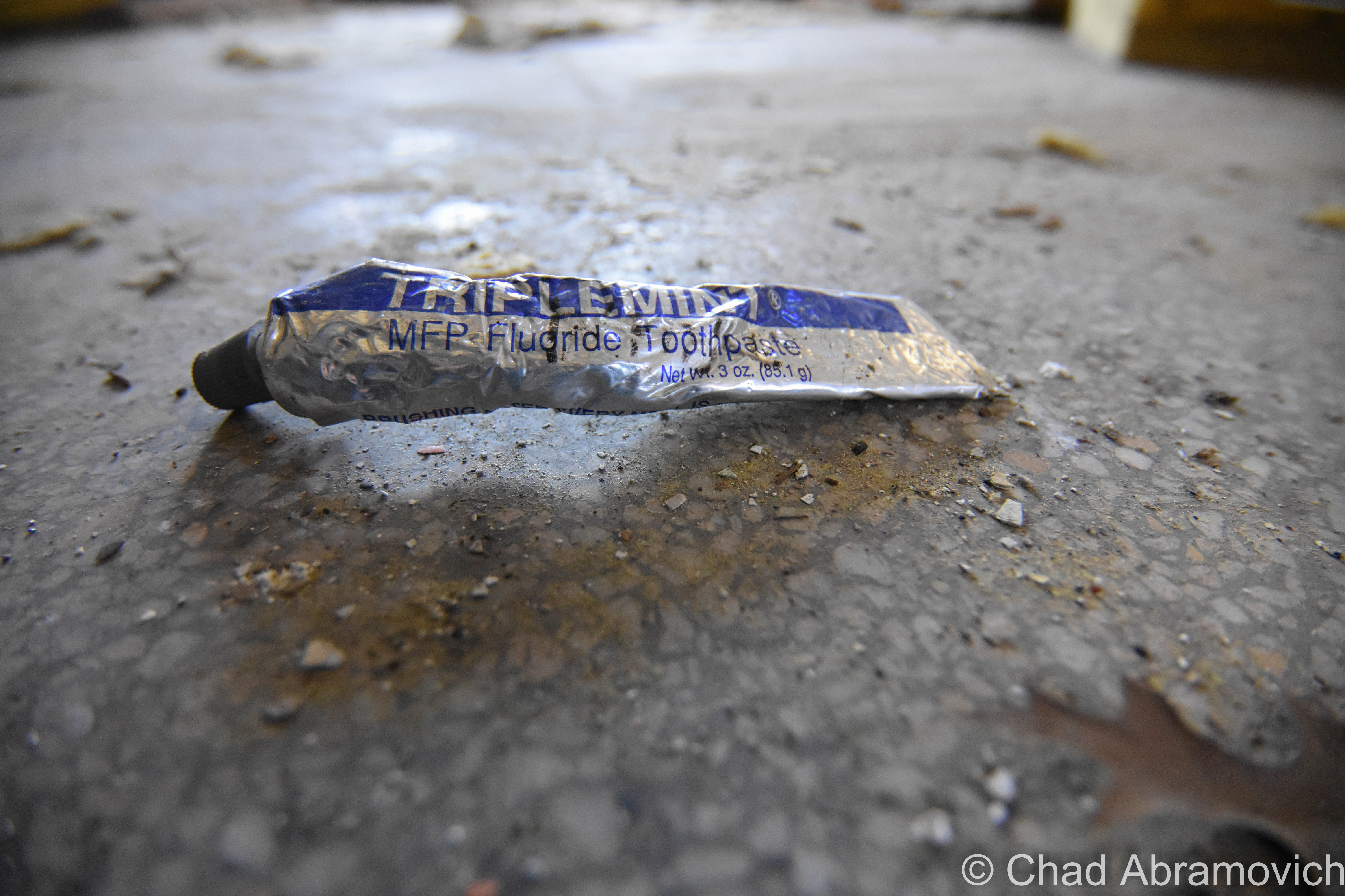
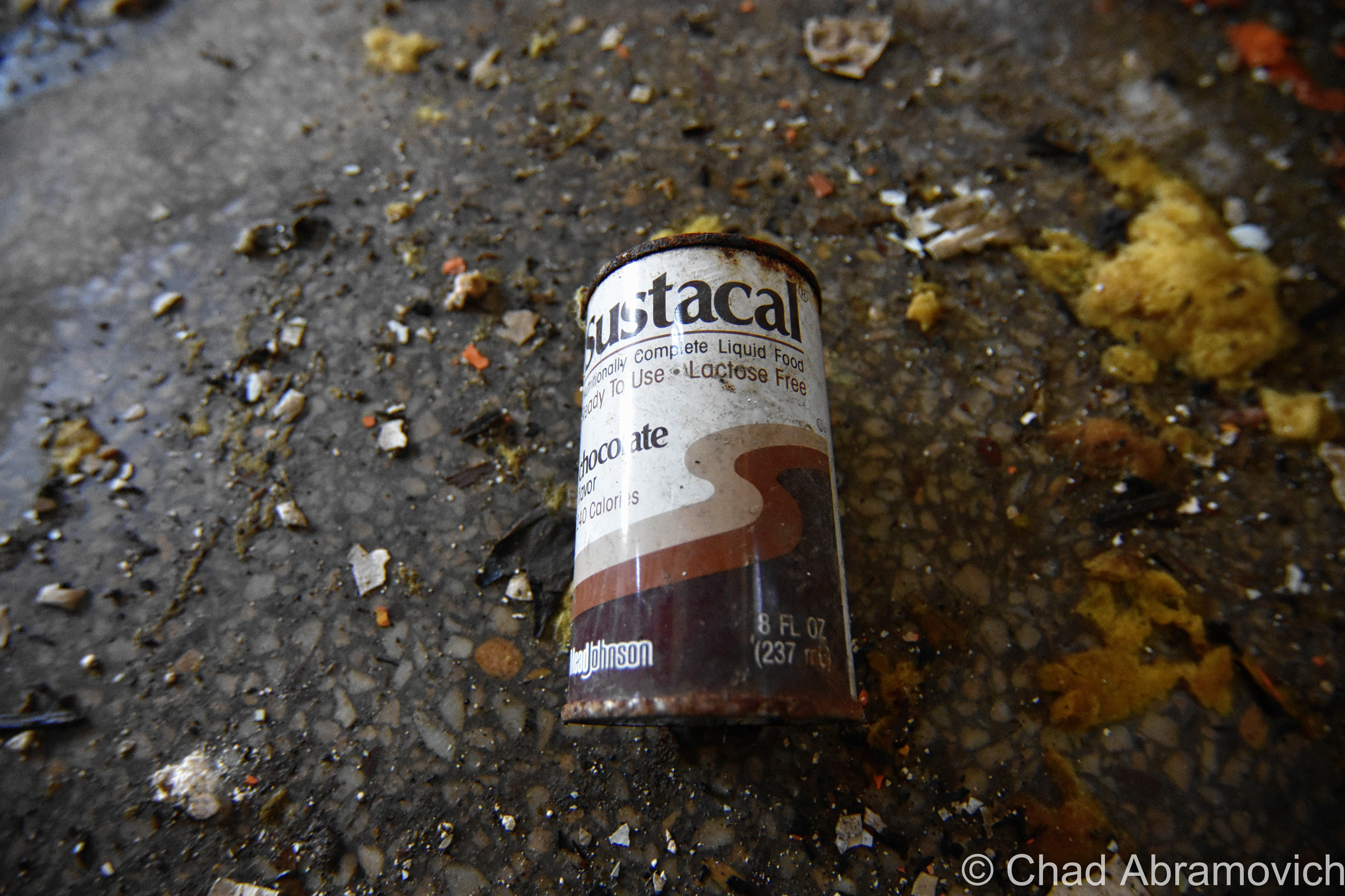
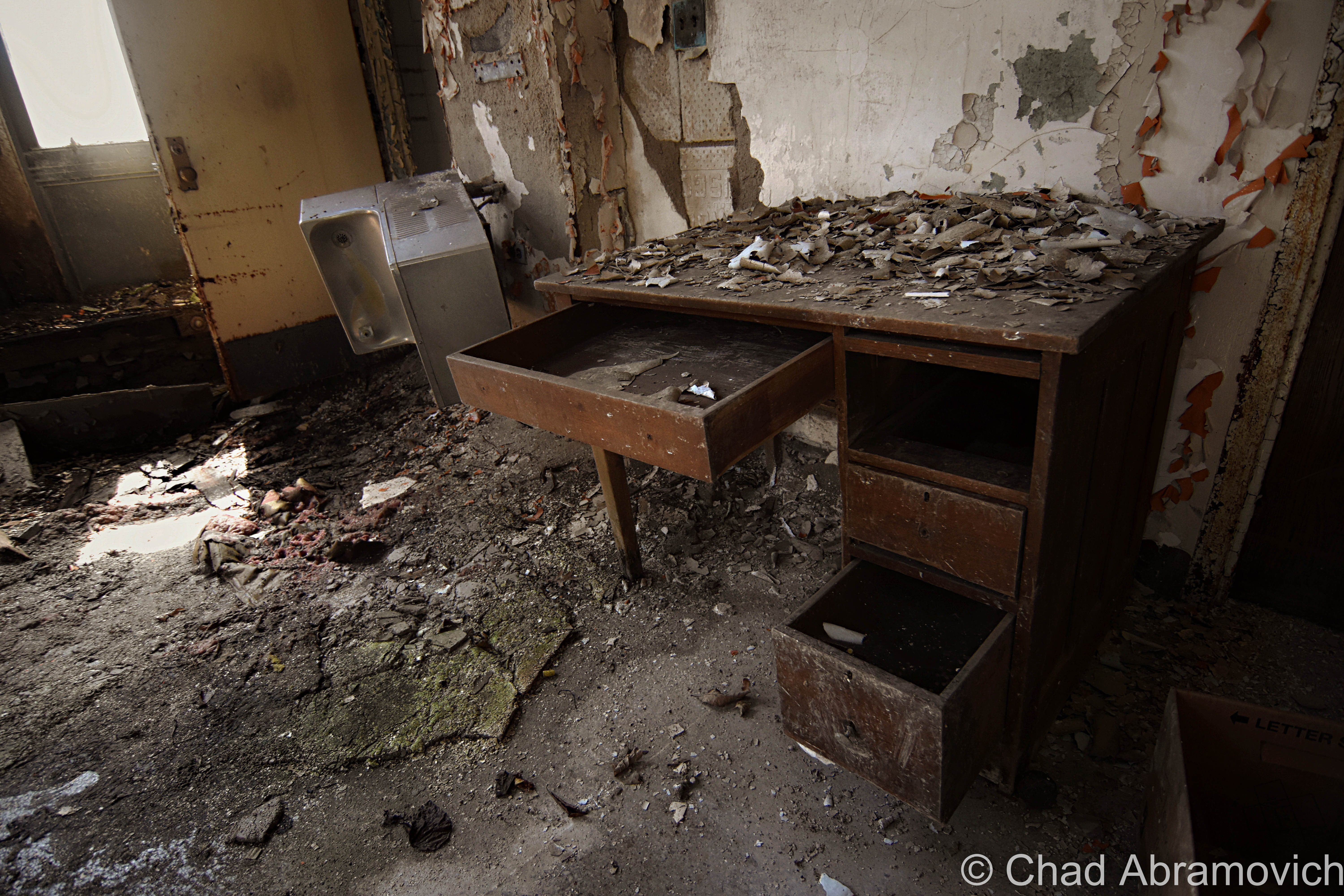
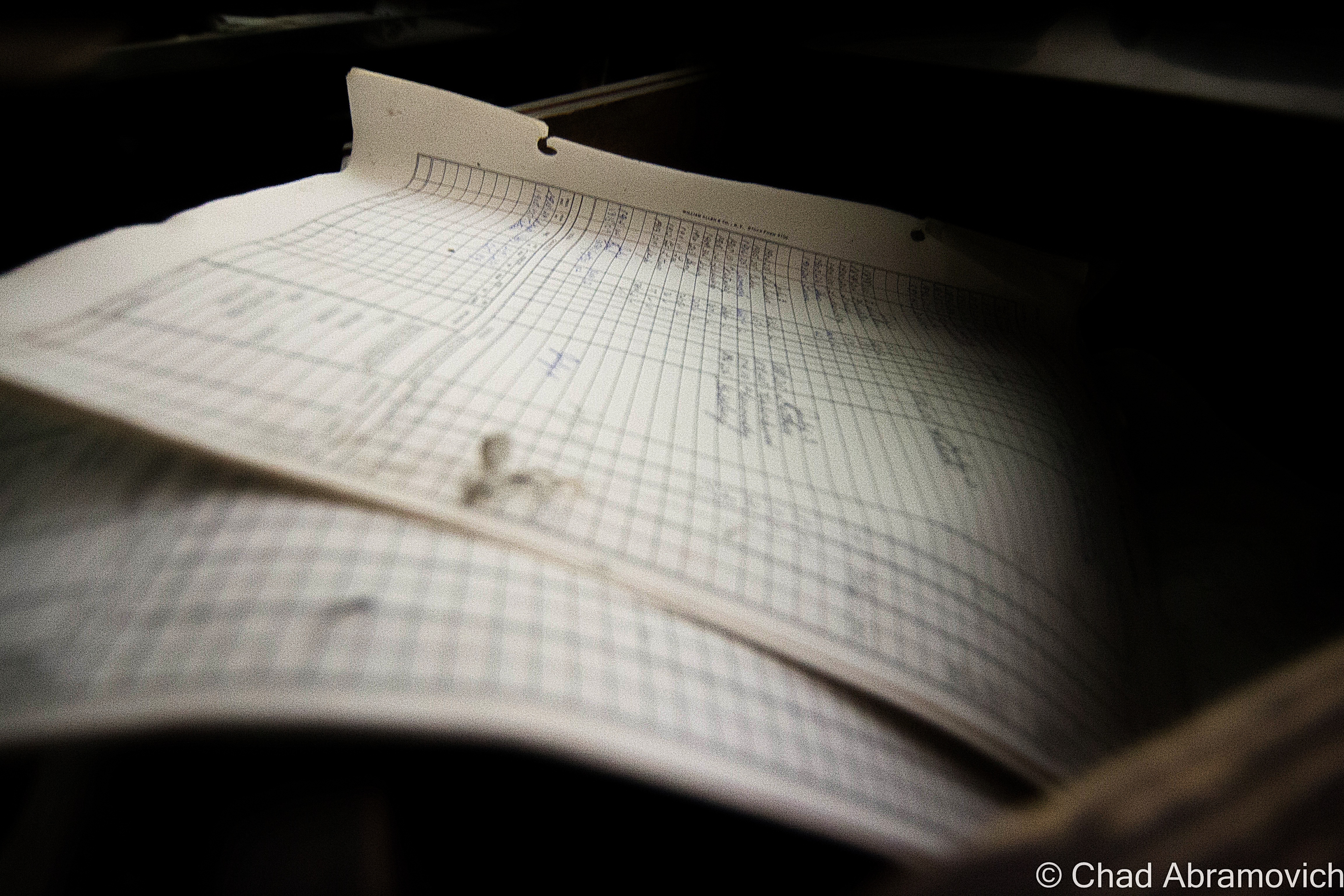
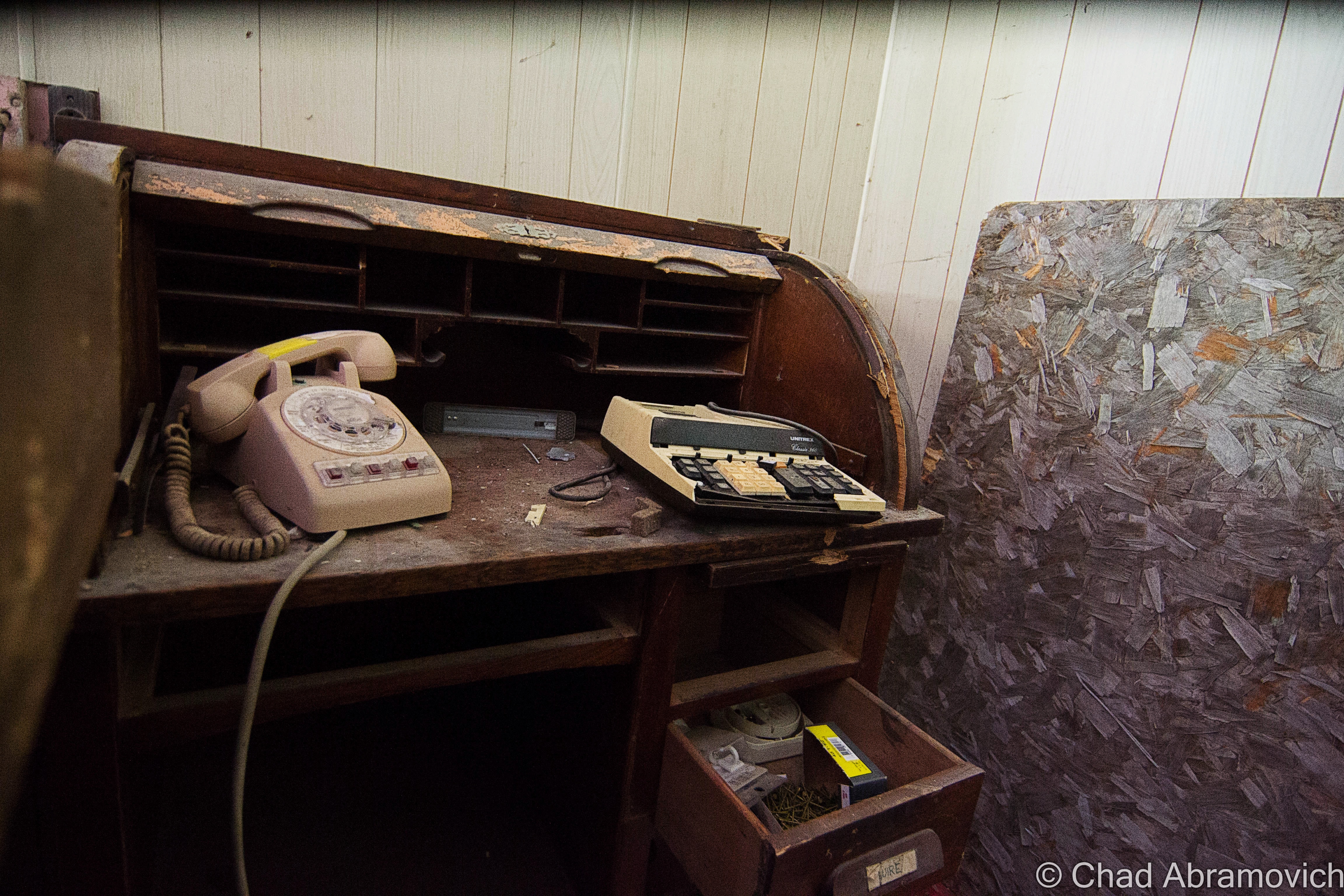
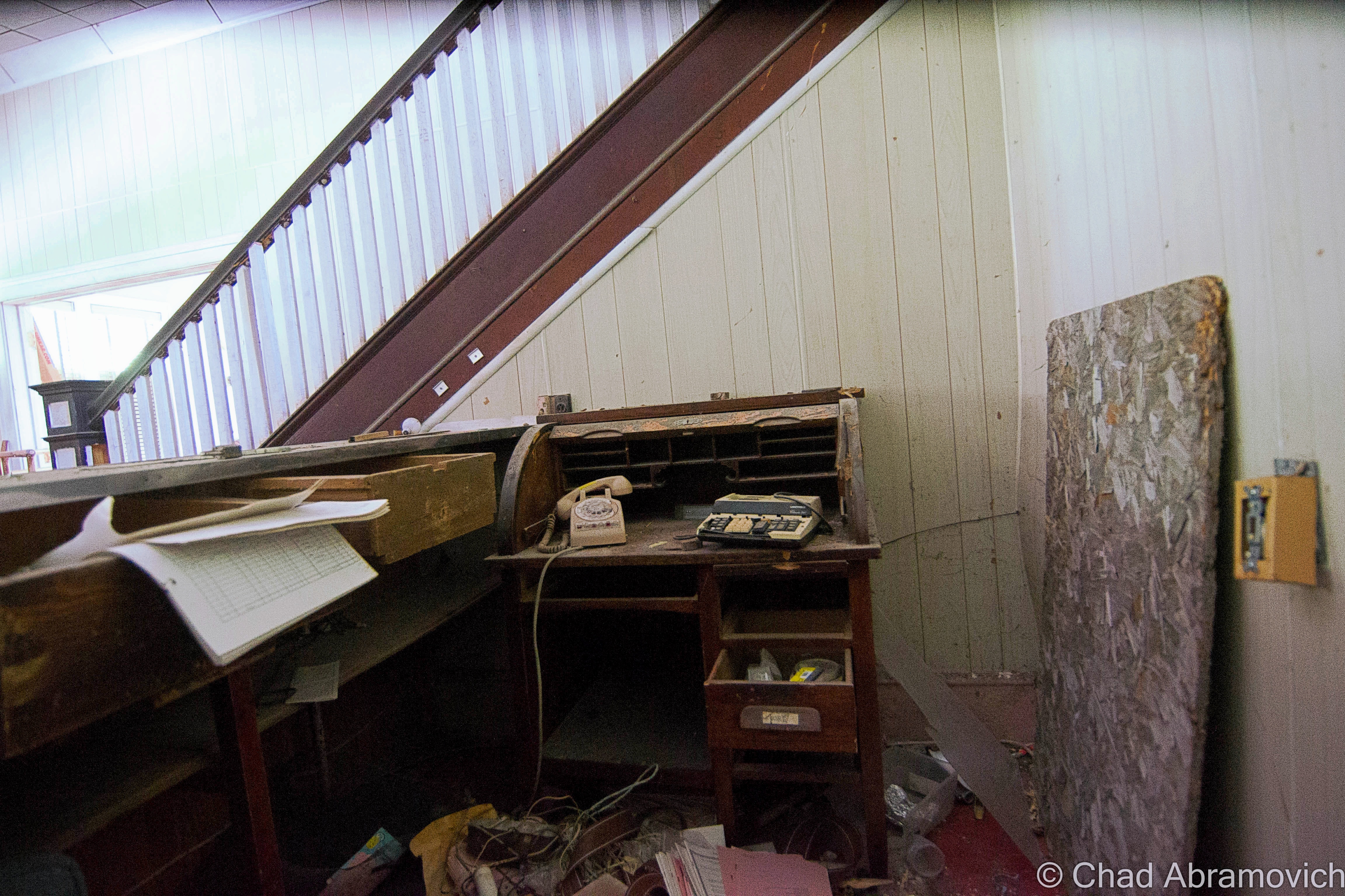
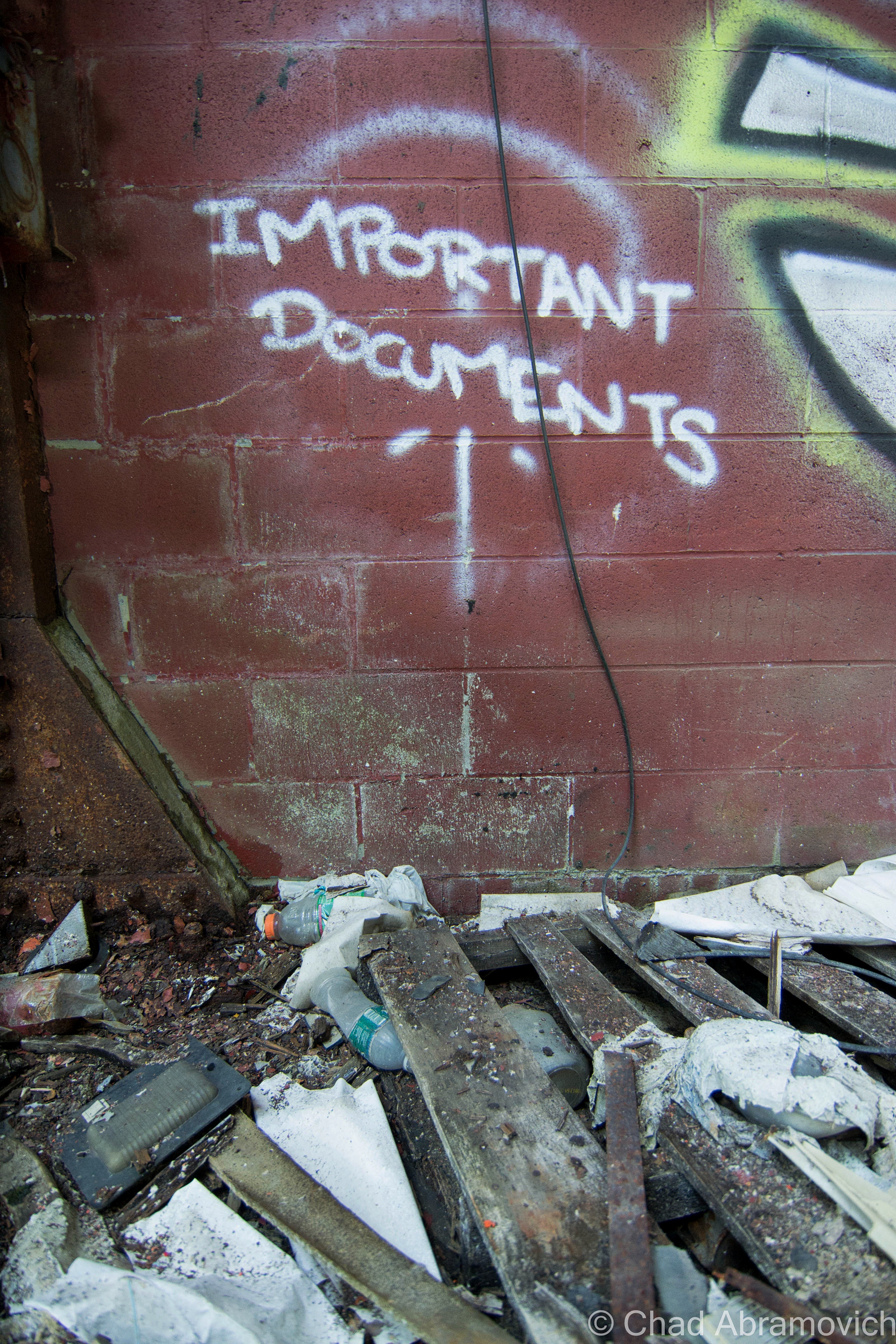
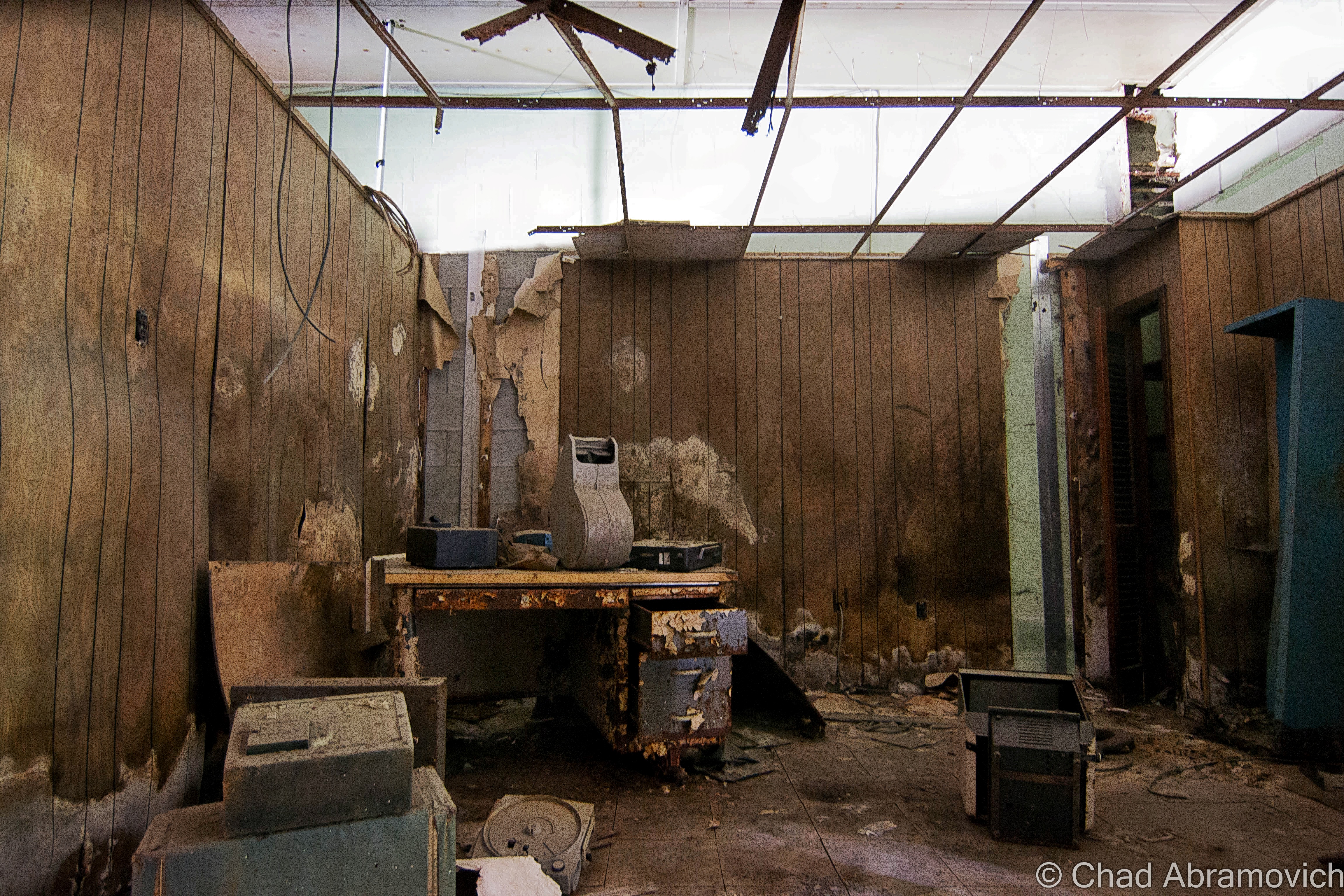
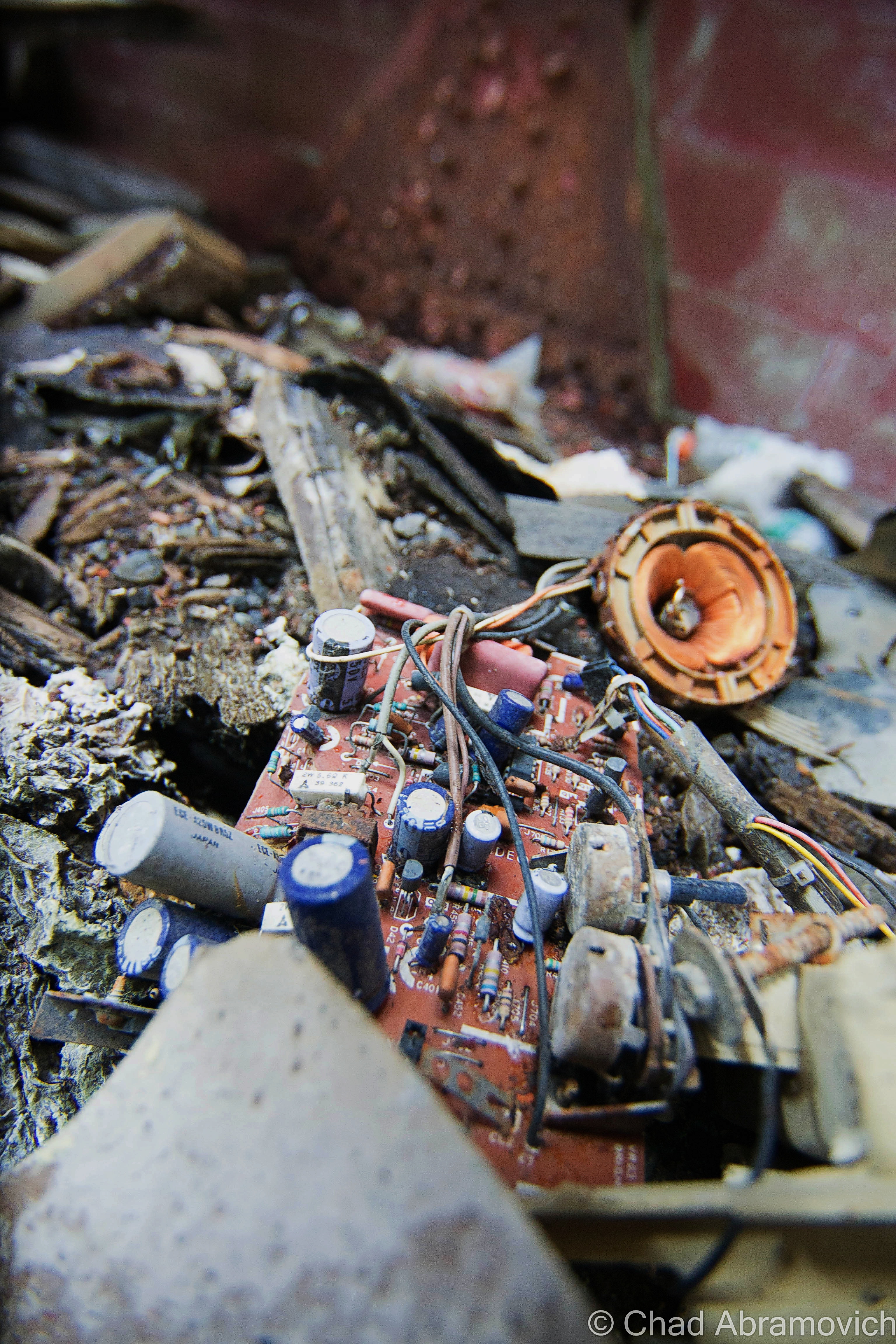
It’s also the physical characteristics that alter the mood. The room is separated by the tracks with a wall of sordid century-old bricks that have a dark patina with age and all the pollutants that used to hang around within the tunnel – the ceilings are the natural mountain rock that constantly dribbles with water. Even with flashlights, the darkness practically ruins the light, but you can still make out the forsaken relics within; an old wooden desk, chair, and dented archaic communication and control equipment – all slimy and glistening because of the dampness. Modern relics like Twisted Tea cans and Slim Jim wrappers strewn on the ground alert you that you’re not the first one to venture this far into the tunnel, even though you really start to inwardly feel that you’re a whole world away once you’re that far in. I’m sad to say that my photos of this room that I took back in 2012 have been lost since then, so I’m gonna have to make another trip in to get some more photos up on this blog.

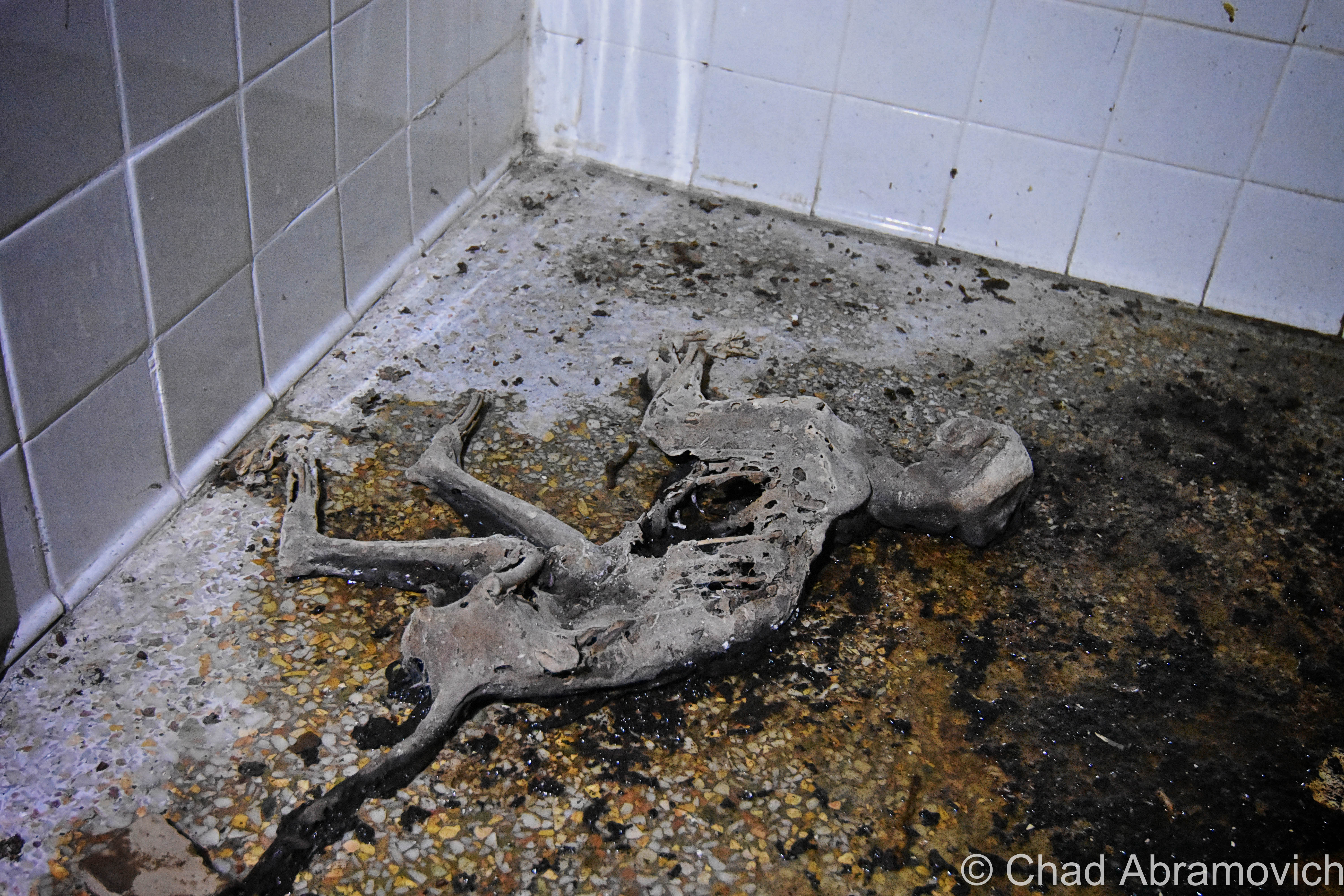
More sinister urban legends told of bodies wrapped in black trash bags found in the creepy room. Other yarns tell of other secret rooms built both somewhere in the tunnel and up in the central shaft that had been curiously bricked up. Some people say these spaces contain some unspeakable horrors that are best left undisturbed… (Check out this cool video below. These badasses not only explore the Hoosac Hotel, but they actually repel up the central shaft from inside the tunnel!)

The incredible Moffat Tunnel in Colorado took the accolade of the longest manmade tunnel in the western hemisphere in 1916 – at 6.2 miles underneath the Rockies! Then Washington’s 7.8 mile Cascade Tunnel became the longest in 1929, and currently, the Rogers Pass tunnel in British Columbia at 9.1 miles holds the record. But the Hoosac Tunnel basically wrote the manual on modern-day tunnel building, and all of these latter construction projects were successful because of what was learned while building it.

The American Society of Civil Engineers made the tunnel a Historic Civil Engineering Landmark in 1975, and it remains the longest in-use railroad tunnel east of the Rocky Mountains, and though it’s basically more of a curiosity nowadays, us New Englanders still love/fear the Hoosac pretty affectionately, and dark tales are still told…

In 1973, Bernard Hastaba was in the mood for an adventure and decided to walk the entire tunnel. He entered via the North Adams side, and never re-emerged. He wasn’t found inside, he wasn’t found at all. He had, apparently, vanished entirely.

In 1984, a professor and hobbyist ghost hunter named Ali Allmaker was gripped with the uncomfortable sensation of someone, or something, standing next to her. She described whatever it was as walking right behind her, and feared that it would try to grab her and pull her into some unknown, awful horror. Maybe Mr. Hastaba encountered the same situation on his walk through the tunnel, but wasn’t as fortunate…

There are still modern-day accounts of weirdness, mayhem, and paranormal pandemonium in and around the tunnel today, and that’ll probably continue to be the trend.

Strange winds, wily apparitions, disembodied voices both caught on tape recorders and heard in real-time, and odd illuminations like balls of blue-ish lights, and a more railroad-centric phenomenon that’s also spotted around the country; spook lights. Given the Hoosac’s pedigree, I’d honestly be pretty disappointed if spook lights didn’t give an appearance here. “Ghost hands” have also been known to both push people in front of moving trains and pull them back out of harm’s way. It just depends on the day I guess?

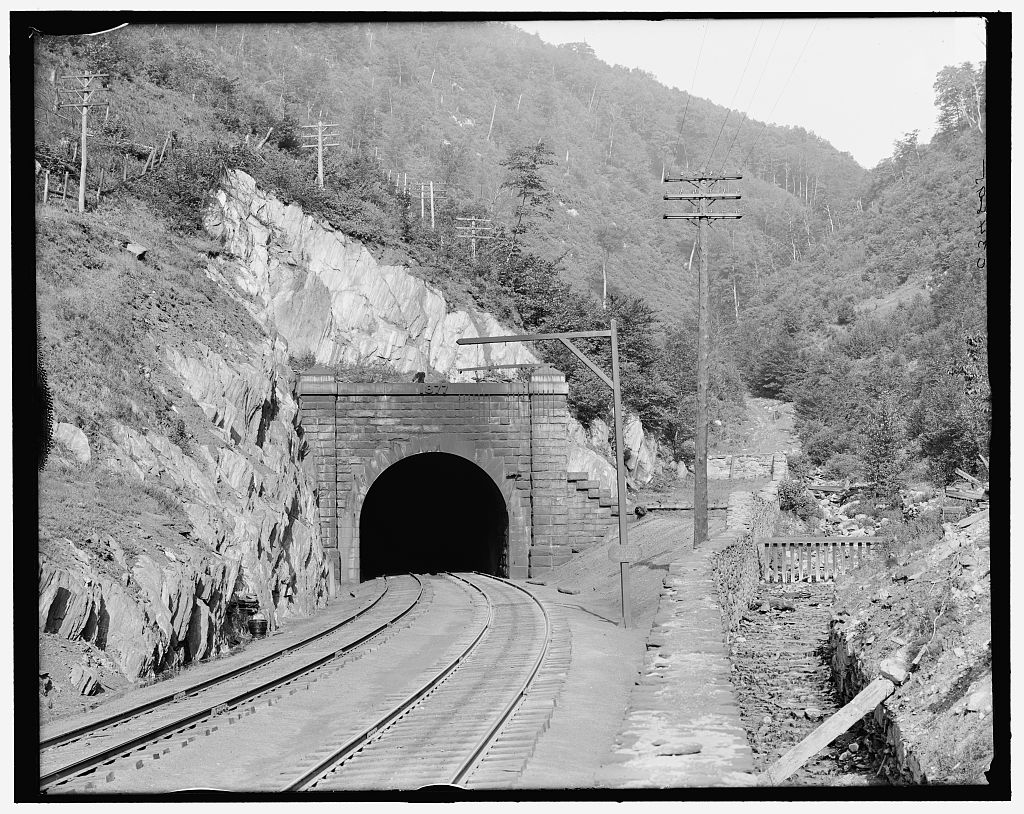
As for its mortal caretakers, Pan Am Railways owns the passageway now, and it looks like they do a kinda lousy job at maintaining it, which is tragic. The West Portal’s snow door was added in 1954 – which is basically a big steel garage door installed after a locomotive derailed due to ice on the rails inside, that help keep snow and other nasty weather out of the structure and has become a defining feature of the west portal.

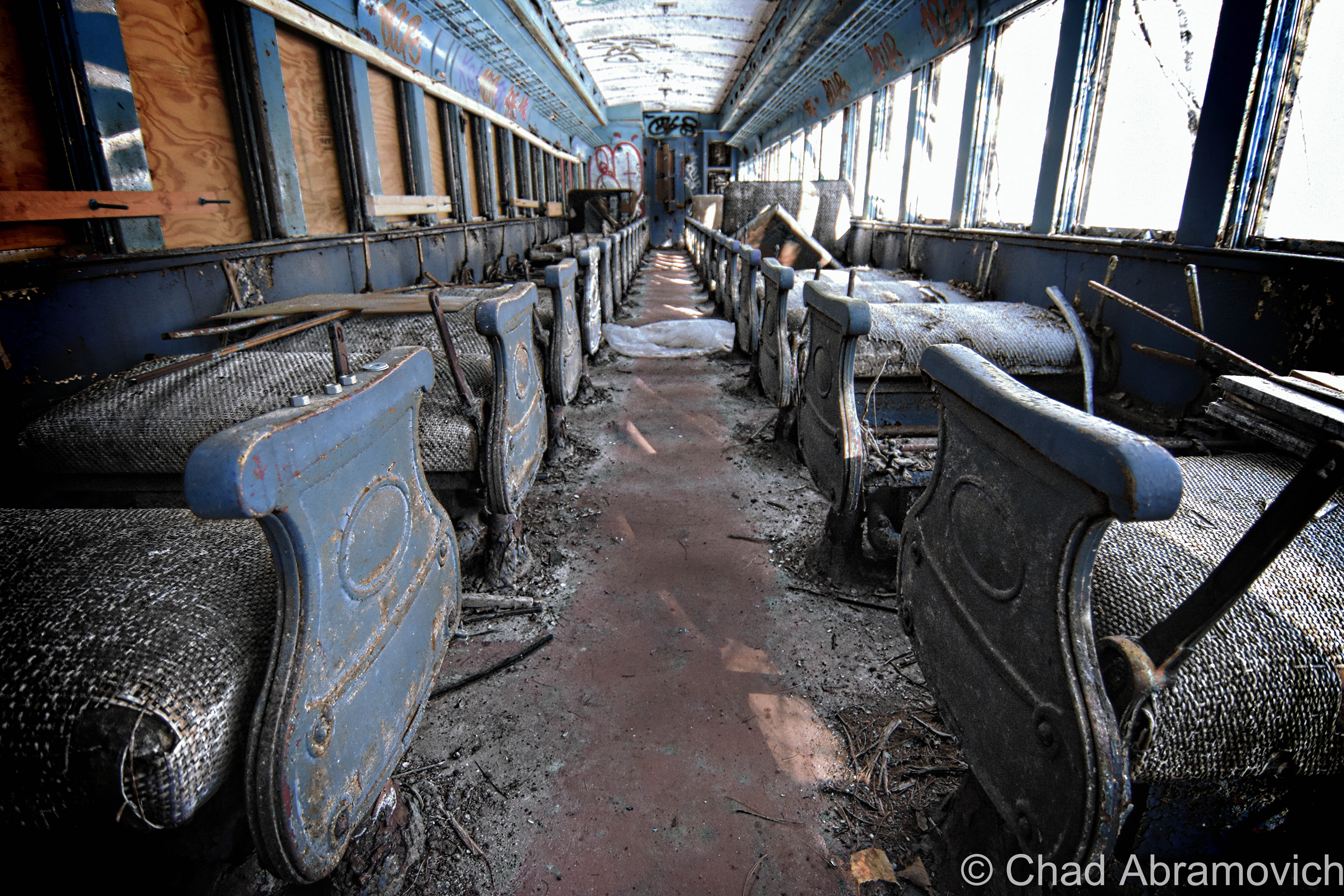
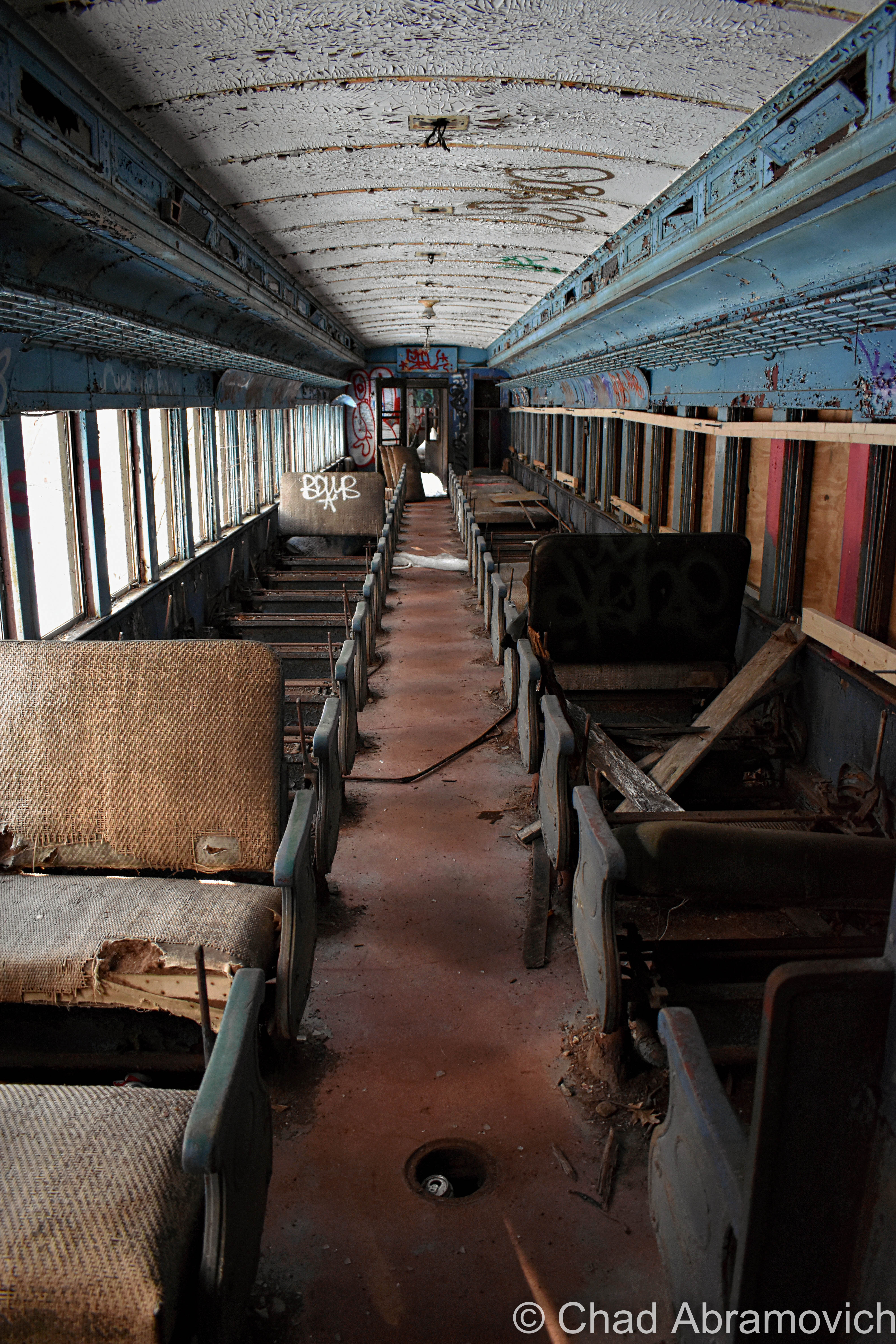
Originally 2 sets of tracks ran through the tunnel, but it’s been down to a single track since 1957 when tractor-trailers and the interstates became the leading mode to move. The last passenger train went through in 1958.

Around 8 freight trains a day are now all that run through its lonely void – and some of them are called “truck trains”, which can be as up to three miles in length and help reduce some of the traffic on the bay state’s byways. Structural engineers have been analyzing the tunnel since the end of the 20th century to see about renovating it so double-stacked container freight trains could pass through it – the track grade elevations were even dropped in 1997 to allow more clearance and taller railcars, but ultimately, the cost was deemed too high, and not imperative enough because there’s already a suitable route through southern Massachusetts, which I suppose is a bit ironic.

It’s kinda sad that it isn’t used more, given just how much effort went into creating it, and realizing that there was a time when a few National Guard soldiers would actually be stationed at both entrances during times of war to prevent potential terrorist attacks on it.

In early 2020, there was a substantial collapse about 300 feet into the more vulnerable western heading that shut the tunnel down for a few months, caused by both general wear and tear, and water flowing in from above the tunnel that was being trapped in blocked drainage tunnels that were supposed to be being maintained, which created a sinkhole that dropped about a 150 feet of mountain onto the tracks and opened up a cavity in the slope above. A structure this old, and this “constantly getting fisticuffs from the environment” is practically guaranteed to need some fixin’ up as the years pass by, but I really hope the Hoosac Tunnel doesn’t become the Hoosuck Tunnel. I really outdid myself with that last sentence.

But seriously, though, it’s such a special and uniquely New England landmark that’s left an epic indelible impression on our rhapsodized region. It would be a huge shame for it to diminish. Oh, and a literal topographical catastrophe.

Berkshire ODDysey 

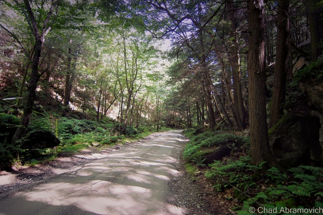
It was the week of Halloween, and I and a few friends took a jaunt down to the Berkshires to see some oddity and see some foliage, and were listening to the podcast Lore to rev up the creepy vibe. It was also one of the loveliest fall days I’ve ever encountered!

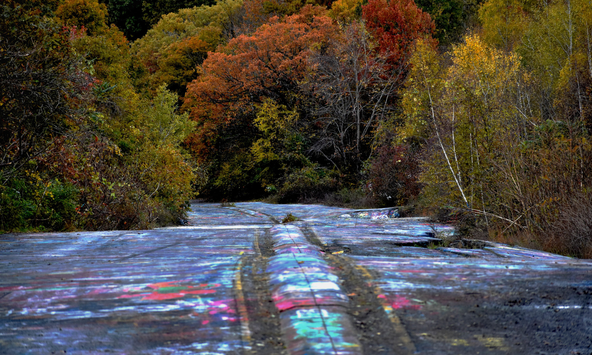
The Berkshires are actually an extension of Vermont’s Green Mountains that have a reputation of their own, so I figured I oughta do more exploring around their nooks and crannies seeing how I live so close. Usually, we’d hit up the old racetrack in Pownal if we were heading down that way.

It’s pretty amazing how much the landscape changes once you cross the Massachusetts state line – It basically immediately gets kinda suburban-y and billboard-y, and this is supposed to be one of Massachusett’s most “rural” areas. Even a good chunk of Berkshire backroads are paved and feel like you’re really in a suburban fringe community than actually in the mountains. But then again, Vermont is a bizarre bubble, and it’s only until Vermonters begin to venture outside our state lines that we recognize this.

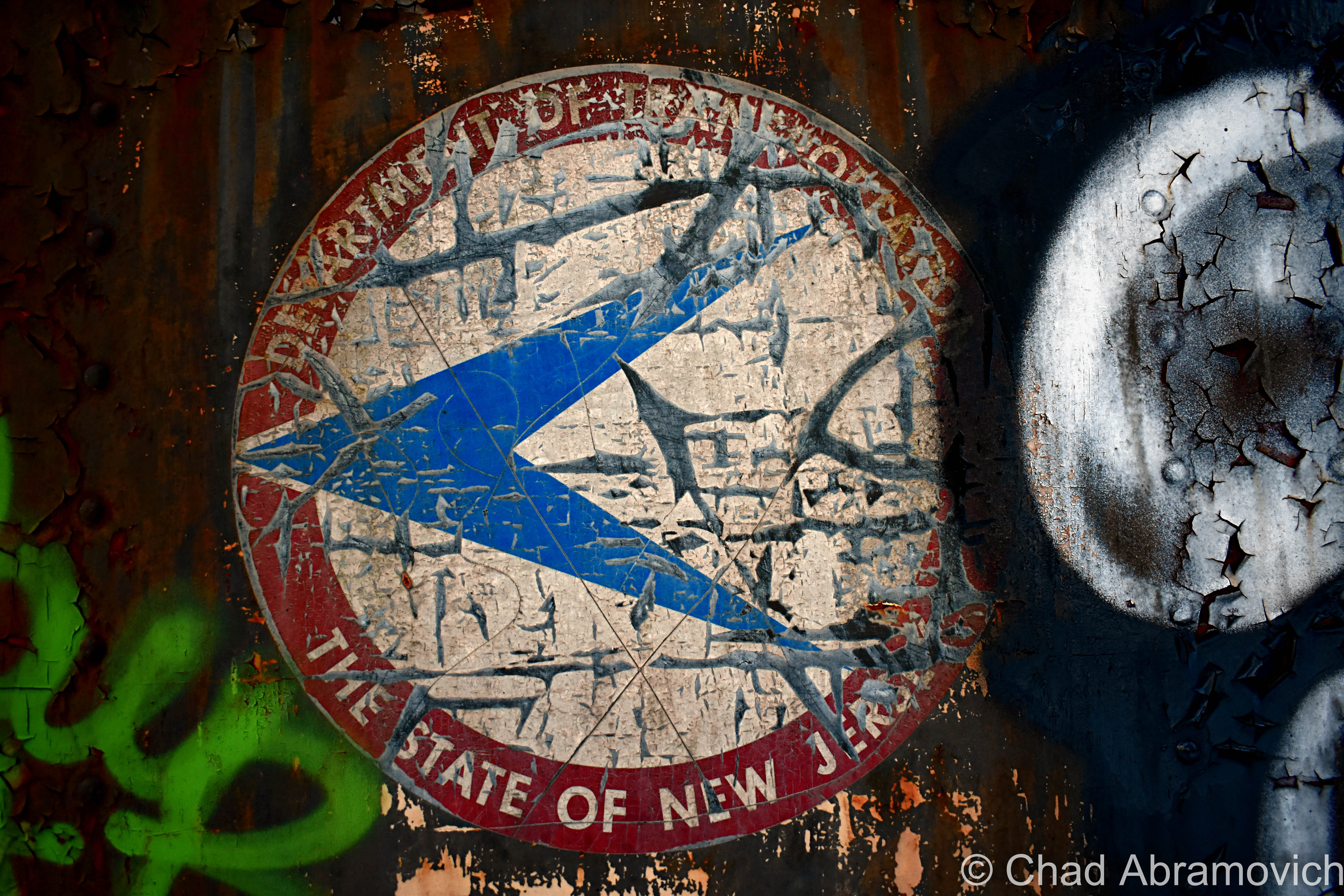
We drove through the neat historic mill turned liberal arts burb of North Adams, a town that the Hoosac Tunnel fundamentally ensured would thrive. The tunnel is even on their town seal that declaratorily exclaims “we hold the great western gateway”, which as far as civic iconography goes, is pretty rad.

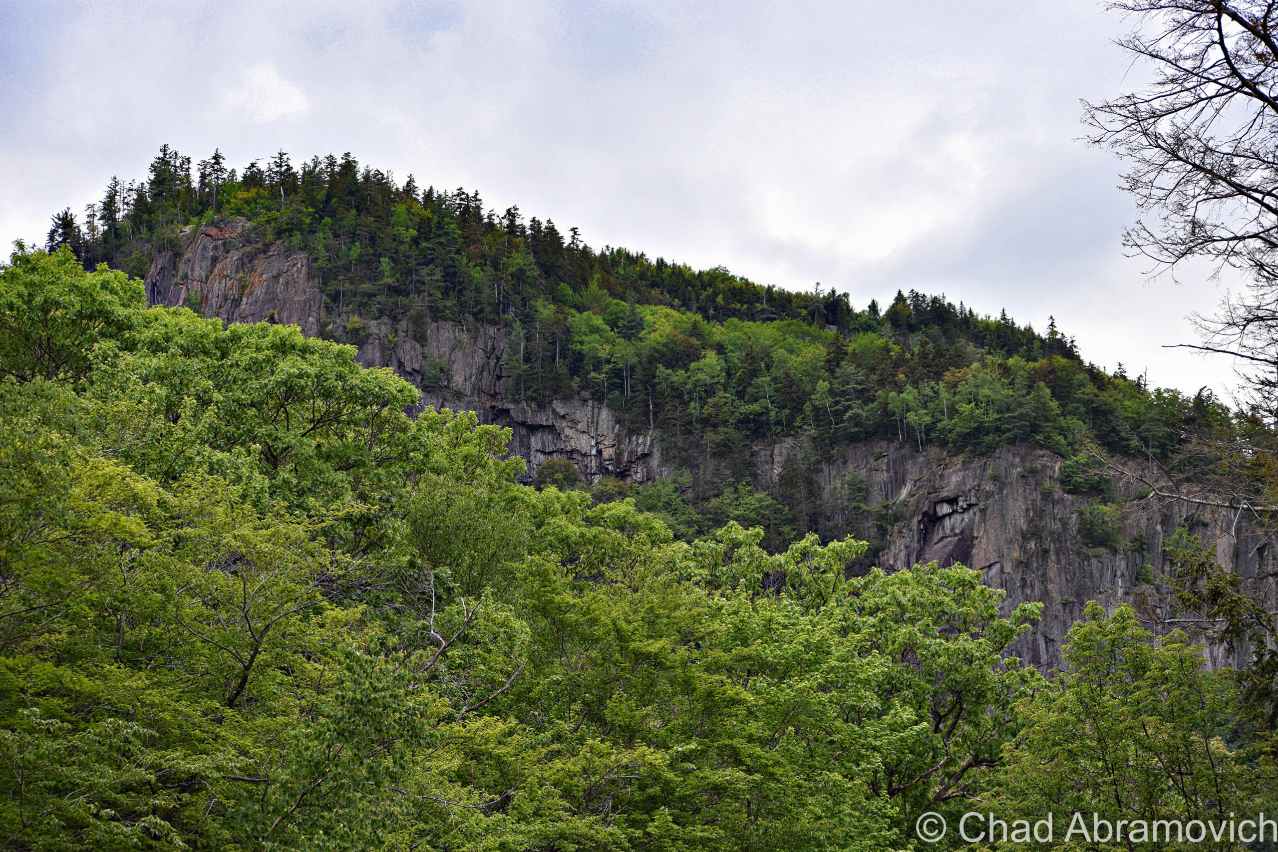
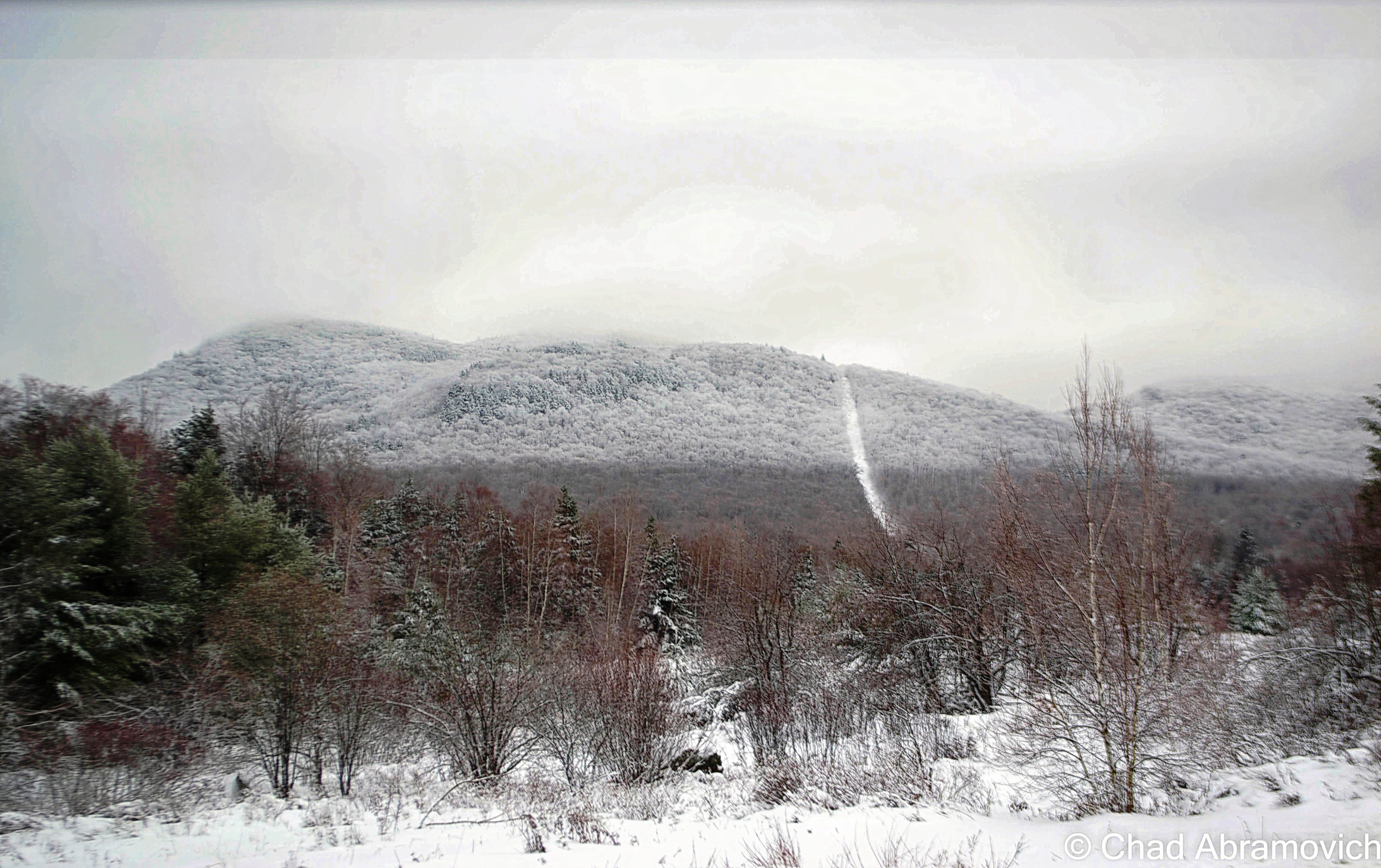
3,489 foot Mount Greylock – the tallest height in Massachusetts and named after a legendary Abenaki chief – loomed over the wobbly rows of old mill tenement houses that bracketed the main drag. Greylock is a mountain with some cool footnotes hidden up its non-existent sleeve. The only taiga-boreal forest in the state survives upon its slopes, and a unique natural feature called “The Hopper”, a glacial cirque (a natural amphitheater-shaped valley) has been declared a National Natural Landmark. An asphalted scenic seasonal road curves its way up to the summit, and it always reminds me of an inactive blog post I read years ago about some young guys who decided to literally race the sun. They embarked in the dark at the top of Mount Greylock and tried to see if they could hightail it to Cadillac Mountain in Maine’s Acadia National Park – the first place the sun rises in the United States – to catch it happen. Sounds fun to me!

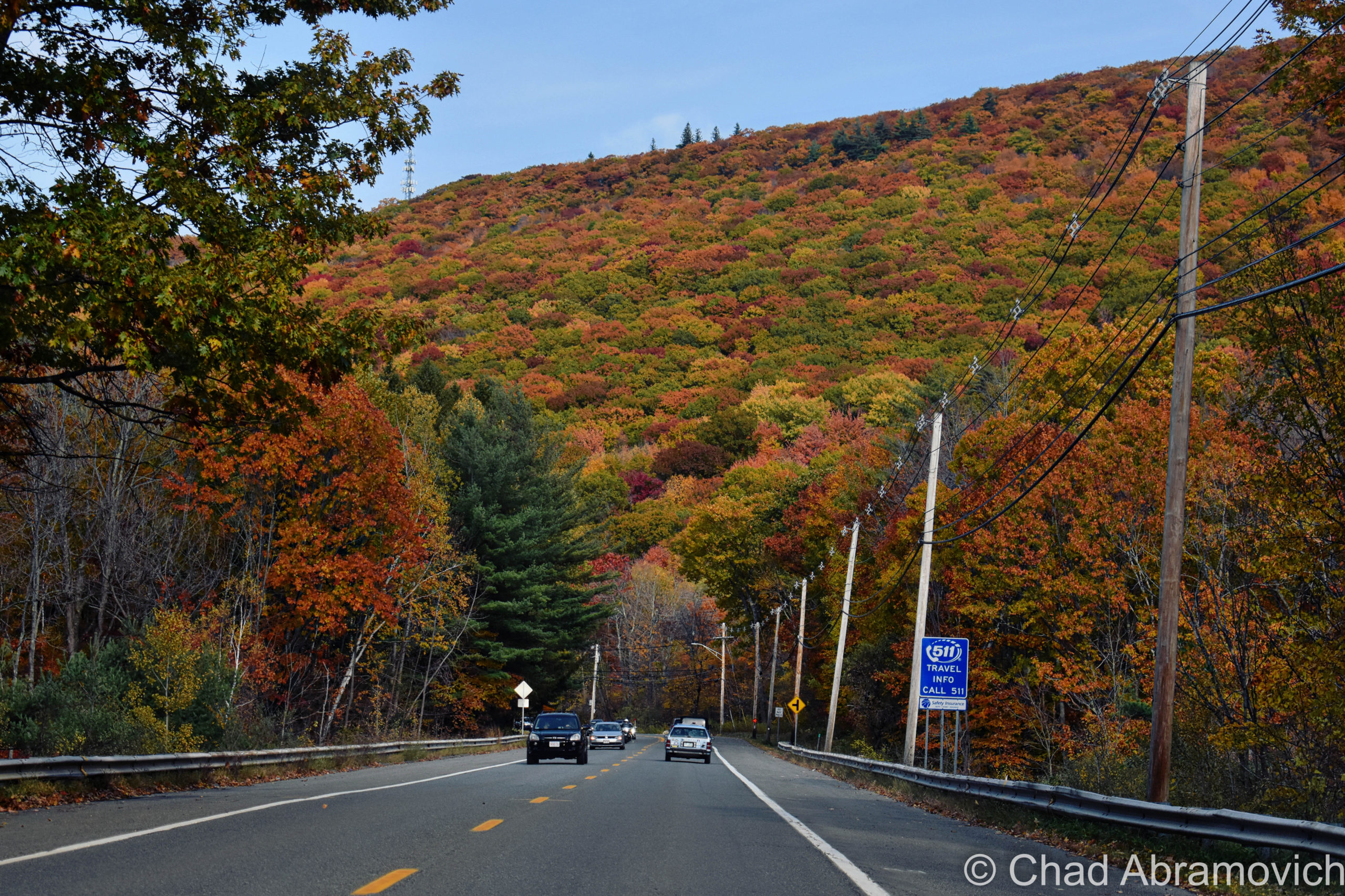
We linked onto the famous Mohawk Trail in North Adams, which in itself was an adventure! The Mohawk Trail is the affectionate and designated byway name for MA State Route 2. The name came from the fact that the road tar you’re driving on top of was put over what used to be a literal Mohawk Trail – a vital path that connected The Hudson River to the Connecticut River via going up and down the Berkshire Hills that was originally used by the local Mohawks and other area First Nation clans like the Mahicans, for trade, hunting, travel, and warring their enemies.

The Mohawk Trail basically invented and then literally paved the way for the idea of the American road trip, long before iconoclasts like Route 66. It got its start in 1914 when the state dished out money to improve the road around the dawn of the automobile craze. Early strategizing automobile clubs started to peddle the road as a tourist attraction to bring some cash into western Massachusetts, and it worked so well that it planted the seeds for Americans seeking out particular roads to drive for pleasure.  It’s still on my bucket list to drive the whole thing!

But, this scenic route wouldn’t be very scenic anymore with over-development, so foresighted conservationists before there were really conservationists started zoning and limiting development along the roadside, to keep one of the wildest parts of Massachusetts wild. The commonwealth acquired 5,000 acres of mountain slopes and created the Mohawk Trail State Forest in the 1920s, and during the Great Depression, the CCC came to the area and spruced it up by building roads, primitive campgrounds, and cabins up along miles of serpentine hill climbs. The tallest tree in all of New England – a 168-foot white pine named Jake Swamp – as well as about 700 acres of extremely rare old-growth forest with some trees over 400 years old – are somewhere within the state forest.

The Hoosac Range rises above the Mohawk Trail just east of North Adams. This is part of the mountain that the Hoosac Tunnel runs under!
The iconic hairpin turn on the Mohawk Trail – the hills of southern Vermont can be seen in the distance

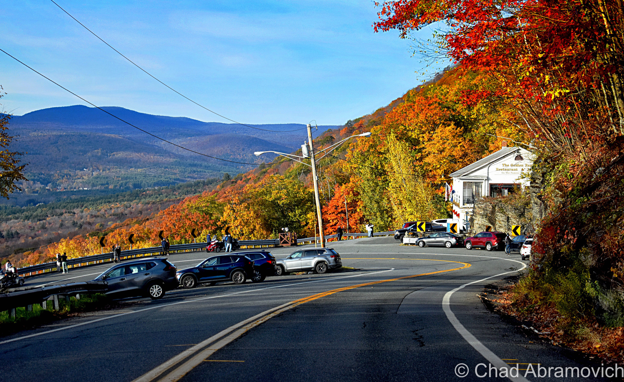
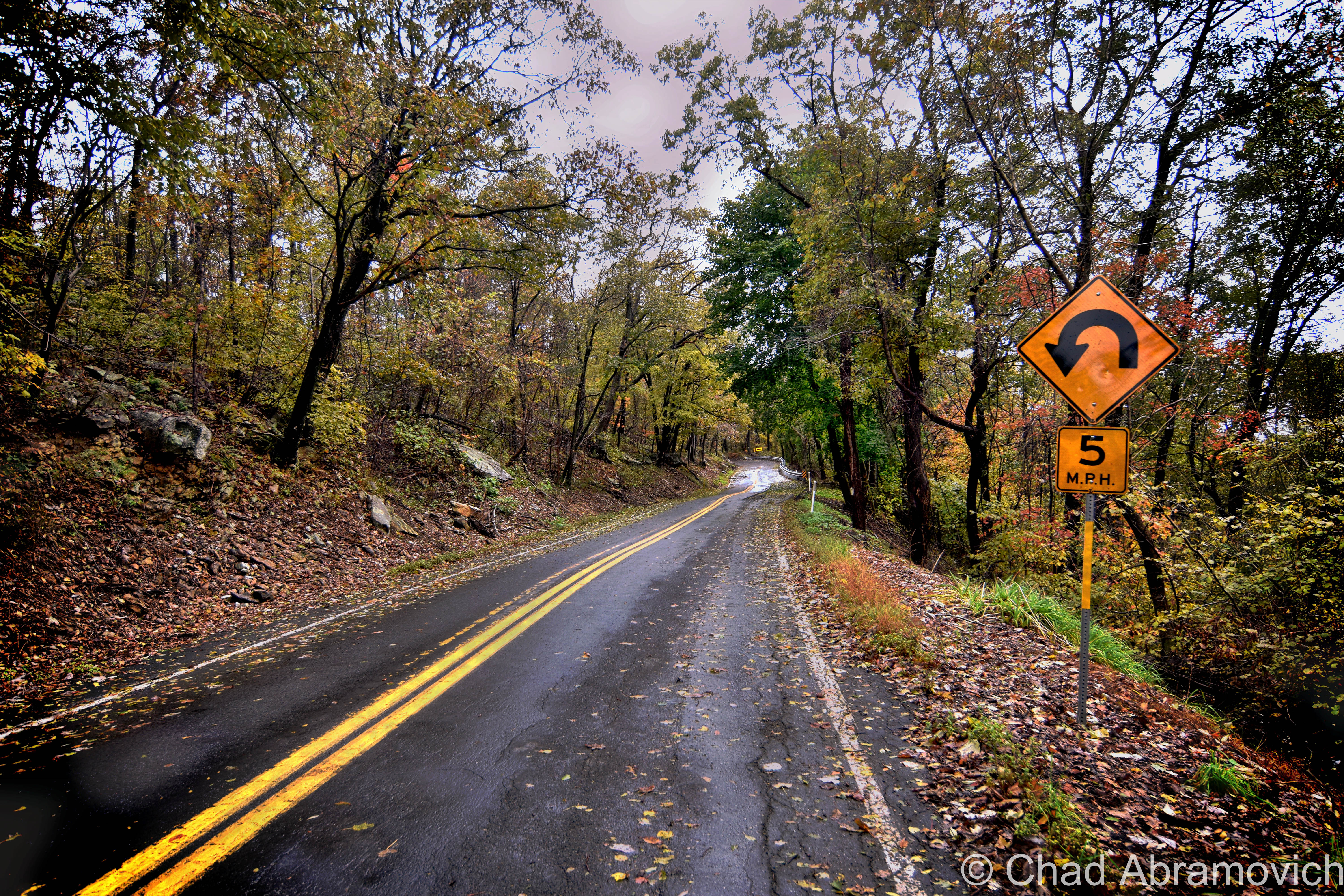
And then there’s the wicked hairy hairpin turn on the side of a mountain on the Clarksburg/North Adams town line, one of the more distinguished and (in)famous sections of the trail.

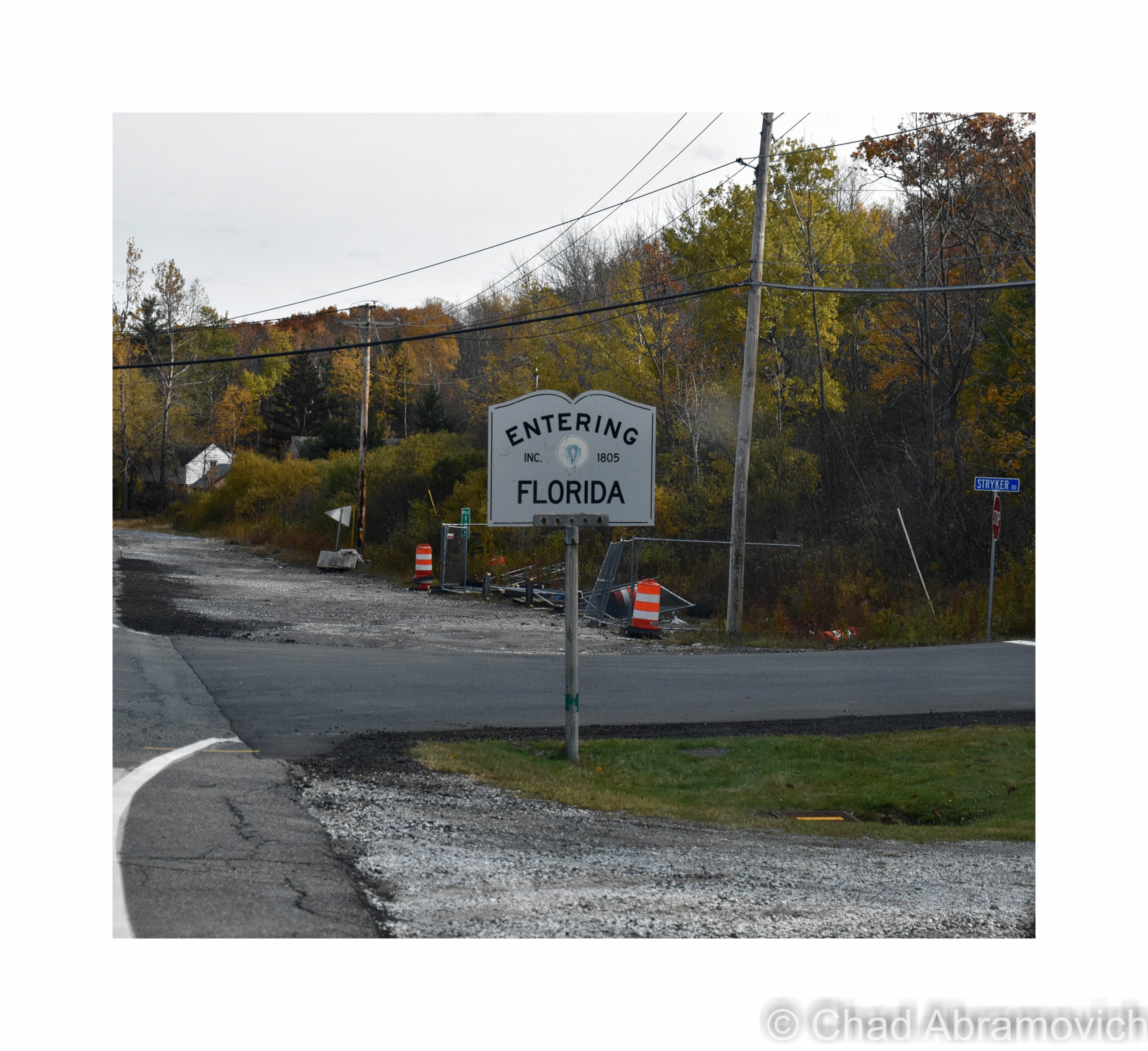
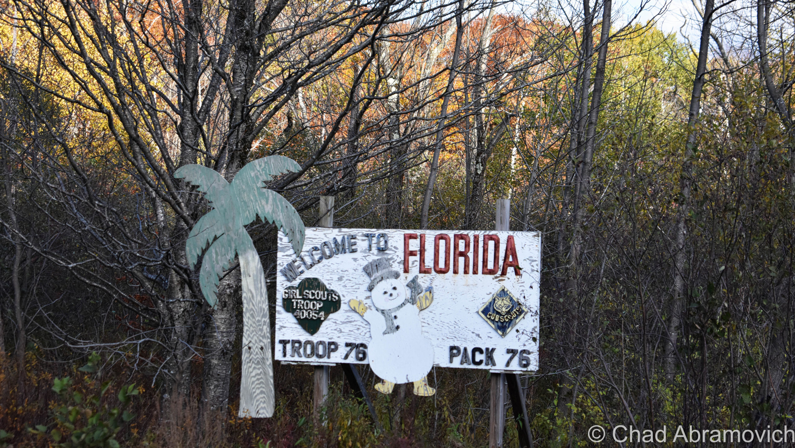
At the top of the Hoosac Range, you’ll enter the town of Florida, marked by one of Massachusetts’s iconic book-shaped town line signs, and is the total opposite of what we think of when we hear the word Florida. It’s the highest town in elevation in the commonwealth, and allegedly gets more snowfall and colder temperatures than any other town in Massachusetts. The name, too, is kind of a mystery. Even the town’s website gets shoulder shruggy at how the name was chosen. It is possible that the name was an invented one, bandwagoning on a trend in New England around the 1800s where remote, mountainous towns with poor farmland were given ‘exotic’ or pleasant names to lure settlers there.

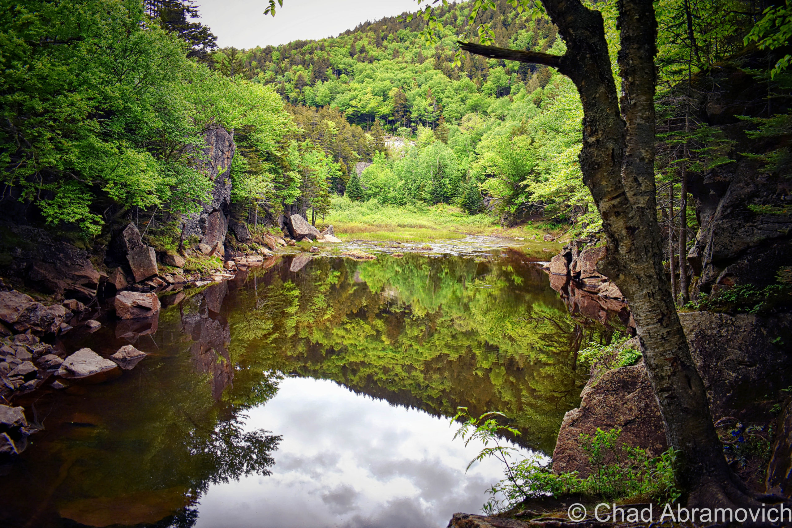
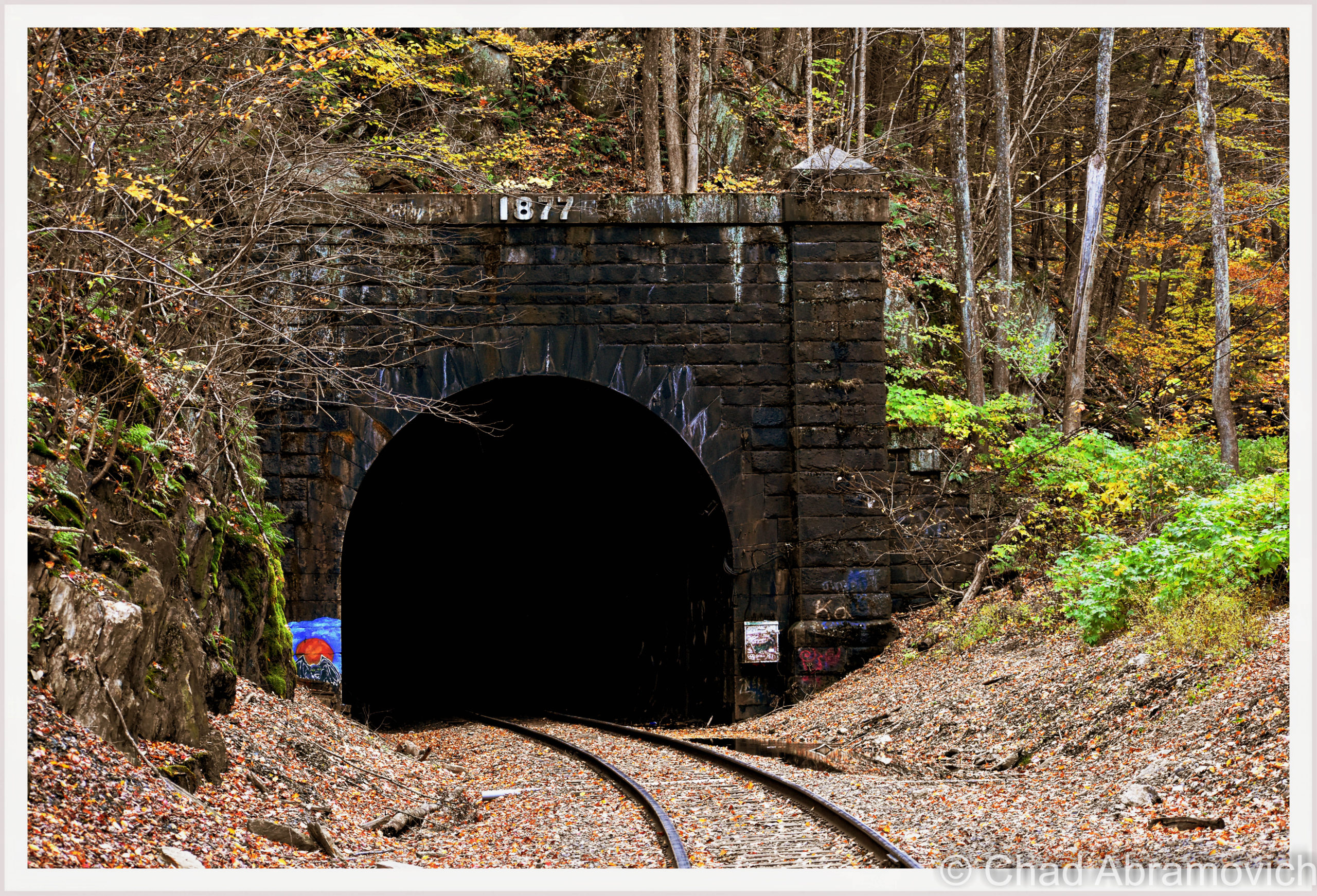
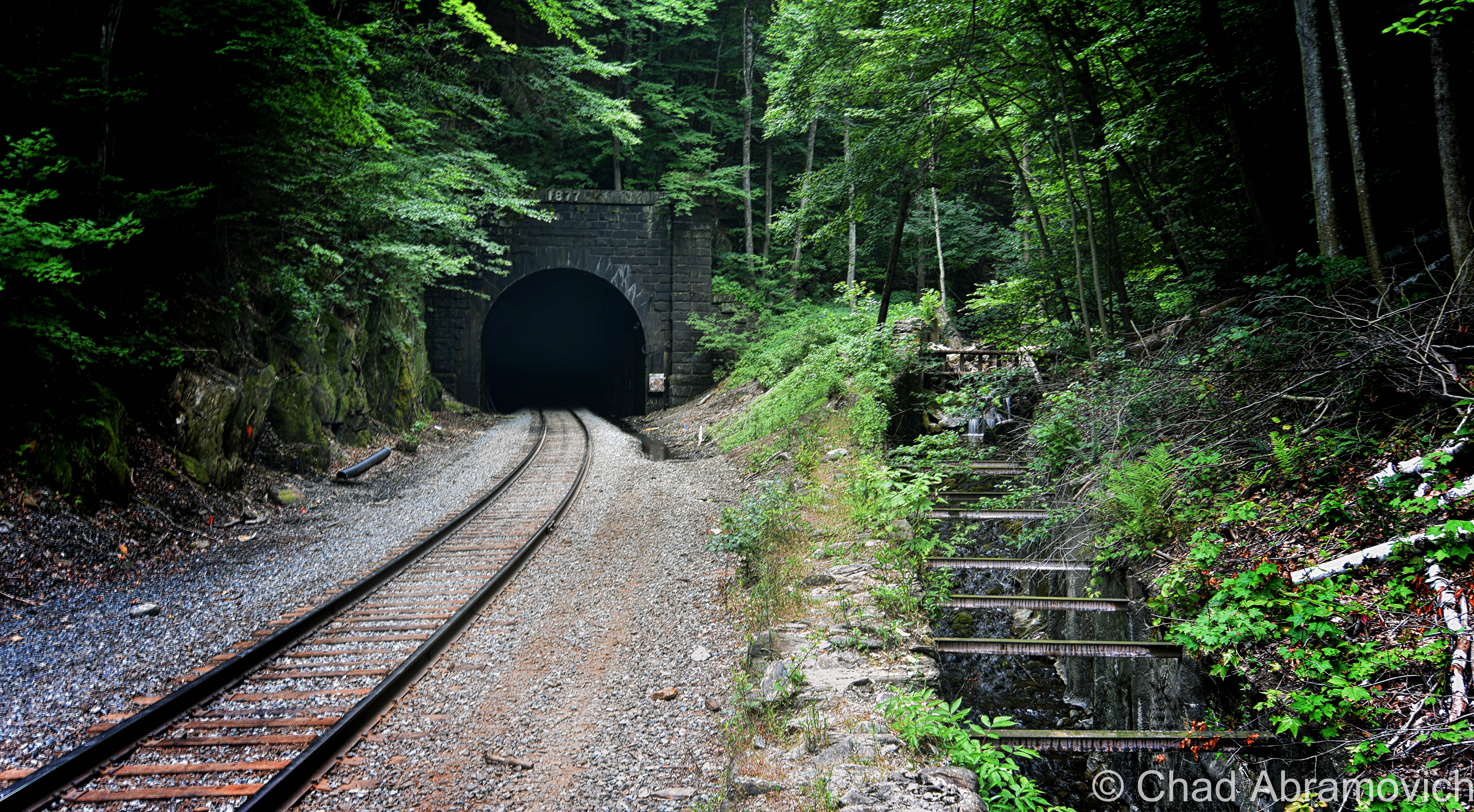
Florida is also the gateway to the Hoosac Tunnel’s eastern portal, which is the easiest of the two to see. From the Mohawk Trail, we went from the top of the Hoosac Range to the bottom and drove through an uncanny valley where New England’s perennial death was some of the most glorious I’ve ever seen – before we saw the giant hole in the mountain that told us we were there.

“The great bore” was everything but a bore! Standing at the foot of its wickedness was awe-inspiring and intimidating.

Cold, sour air belched from the murk and cryptic sounds echoed and cursed from within. Icy groundwater salivated from the ceiling and pooled along the tracks. Pieces of century-and-a-half-year-old brickwork occasionally crashed down with lethal strikes.

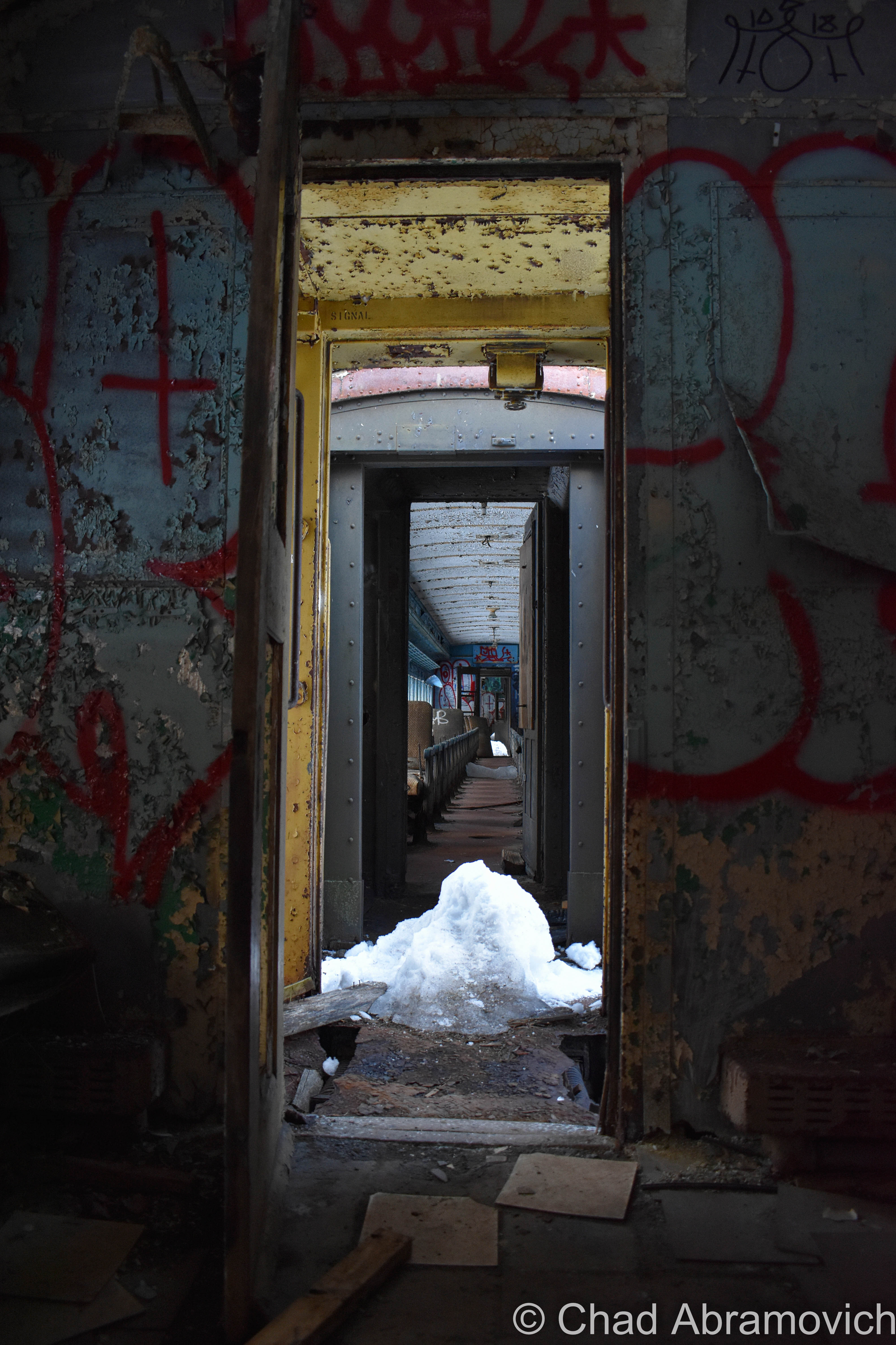
On a white-hot summer day back in 2012, I explored about half the length of the tunnel with a good college buddy of mine. I remember measuring that trip as such a big deal for me, because it was my first oddity expedition outside of Vermont, around the time when I was really struggling to find my identity and my beat out in the universe, and just beginning to try my prowess at blogging.

The tunnel was a tourist attraction even then, which was evident when an assembly of Hell’s Angels rumbled up next to us and decided to join us on our foray into the transport tube’s east portal. Well, at least that’s who they proclaimed to be. Some of those guys looked like they could do some casual origami with a parking meter, so I didn’t feel up for fact-checking them.

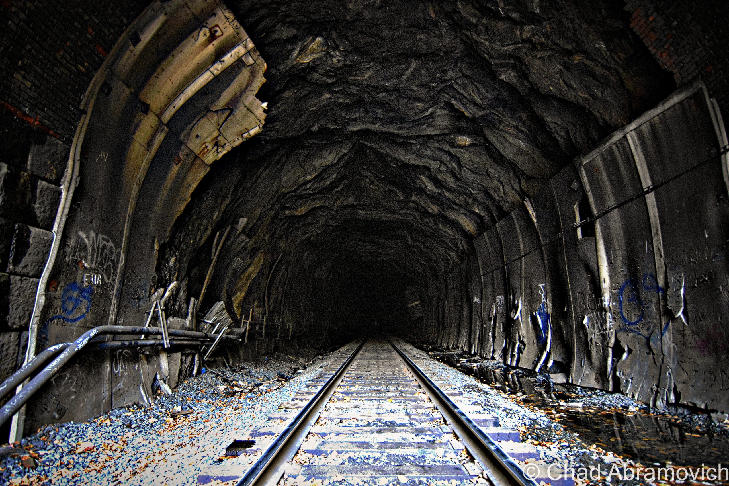
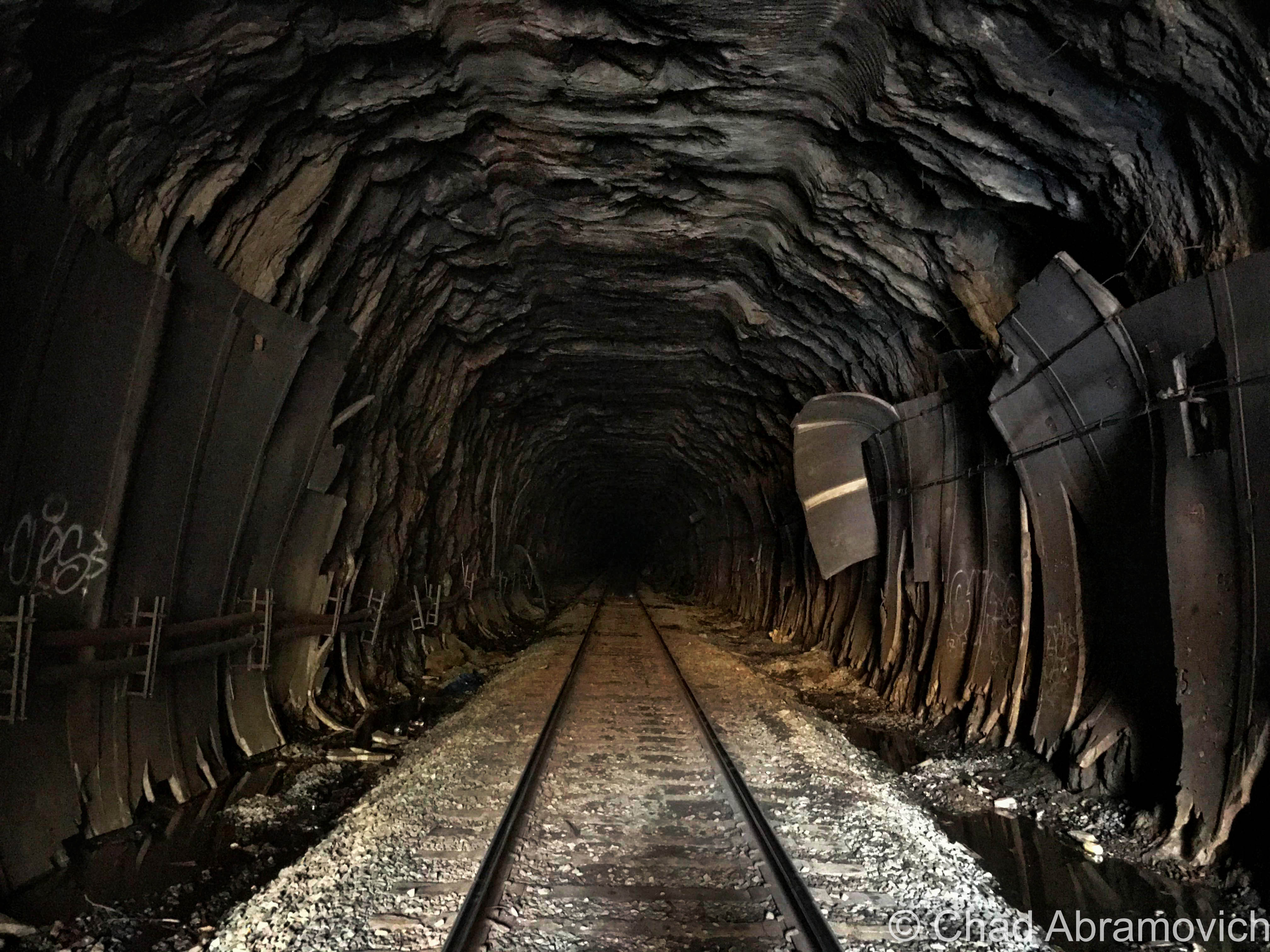
Leaving the Berkshire heat, the clammy darkness swallowed us and gave us a lot to stumble on. Endlessly falling water formed rivulets along both sides of the tracks, clogged with silt, gravel, brick shards, and sporadic live electrical cables. The tracks faired no better for a less accident-prone passage – the wooden railroad ties were warped, in various stages of deterioration and glistened with wetness, and made anything that wasn’t a slow and steady walk not such a great idea, unless a rolled ankle won’t throw off your mojo. I’m not in that camp of people.

We were about five minutes into the tunnel and the wife of one of the bikers had some kind of a happening. She immediately stopped in her tracks on the tracks, and explained she had the ability to detect when ‘spirits’ were in proximity. Not only were there apparently hoards of them in the tunnel, but according to her, they wanted us out. So she and the rest of the Hells’ Angels vamoosed, and me and my friend decided to continue onwards to the Hoosac Hotel.

I was far more concerned about running into a freight train than a ghost, and the fact that, even if I press myself up against the grimy tunnel walls, I barely have a few inches of space between me and the whizzing side of the locomotive to prevent me from being smashed. They pass through at random hours, spew potentially lethal amounts of diesel fuel, and the racket is enough to potentially cause some hearing damage, if not complete deafness.

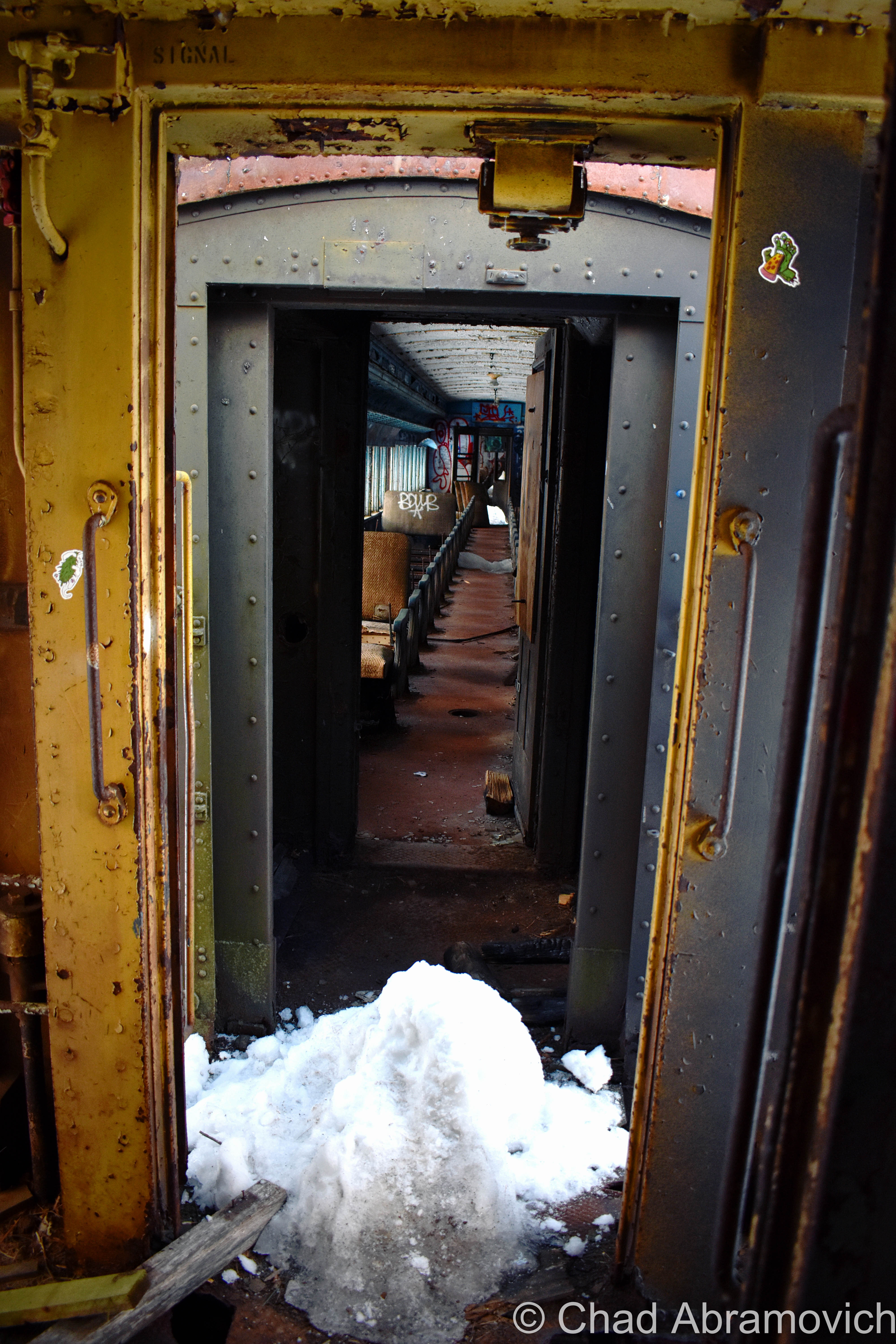
Water was everywhere, seeping out of the ceiling and raining down our necks and soaking our boots. Bricks crashed down to the earth erratically. We were far enough in the tunnel where the daylight coming in from the east portal could no longer be seen – it was just a sullen lacuna, and the silence was so intense, my tinnitus buzzed through the strange isolation like crazy. It was gritty, dirty, and cold.

Then, I saw something far ahead in the distance, that today I’m still uncertain was paranormal or not. Within the ghastly illumination of a lone crimson tunnel light affixed to the natural rock wall, I saw a startling silhouette of what appeared to be a man. I abruptly stopped my progress forward, motioned to my friend, and uttered something along the lines of “Fuck, we’re busted”.

I wasn’t thinking it was one of the tunnel’s many shades, I thought it was an actual railroad employee that was gonna bring the law down on our trespassing butts. Motionless, we stood in place, and I stared at this figure, trying to understand what I was seeing. Its outline appeared to be dressed up in clothes that I regarded as “official-looking”, like an old-fashioned uniform, which further backed up my fear that it was some kind of authority figure that was making haste towards us. But that was when I noticed, that no matter how long we were watching it, and despite the fact that the strange man looked like it was practically power walking in our direction with determination, it strangely never seemed to gain any ground – it just kept on walking but never making any progress.

Then, we saw another light and another figure. This new sight, however, was definitely making progress in coming our way. It was a train. My friend and I booked it and clumsily sprinted back towards the safety of the east portal as fast as we could, as we stumbled and slipped over slippery tracks and adjacent inundated burms. We made it out just in time as a lengthy locomotive came barreling out behind us – grimmy, wet, and desperately trying to chase a little breath. To this day, I’m not sure exactly what was hustling towards us in that tunnel. Maybe we should have listened to biker wife lady?

In the fall of 2020, me and some other friends decided to take a jaunt down to the Berkshires to revisit the tunnel, and to get a little relief from the stresses of the pandemic, and we had a lot of fun. It was around the close of the evening by the time we had arrived, and the tunnel was crowded with obnoxious social media influencers and TikTokers, but it was engaging to see it again – you never really tire with a site like this one.

Next time I head back, I’d like to finally make it to the Hoosac Hotel and get some pictures to share with y’all on this blog post!

Taken on a humid mid-summer evening in 2018. Cascade Brook runs to the right of the tracks and was contained within a stone sluiceway – most likely to prevent the tracks from potentially washing out when the brook decides to get floody. Railroad ties were installed and spaced along the top of the structure, which I thought was kinda neat. If you bushwhack along Cascade Brook up into the mountains, you’ll be rewarded with the sight of the Twin Cascades – two waterfalls plunging as high as 80 feet that most visitors to the Hoosac miss out on!
While I was lazily trying to see if I could find the cavity from the “false start”, I instead found this curious little storage pocket – a tiny brick space built into the cliffside that’s long been filling in with earth and dead leaves.
Took a quick peek inside and found some old machinery bits!
The east portal of the mighty Hoosac Tunnel, October 2020

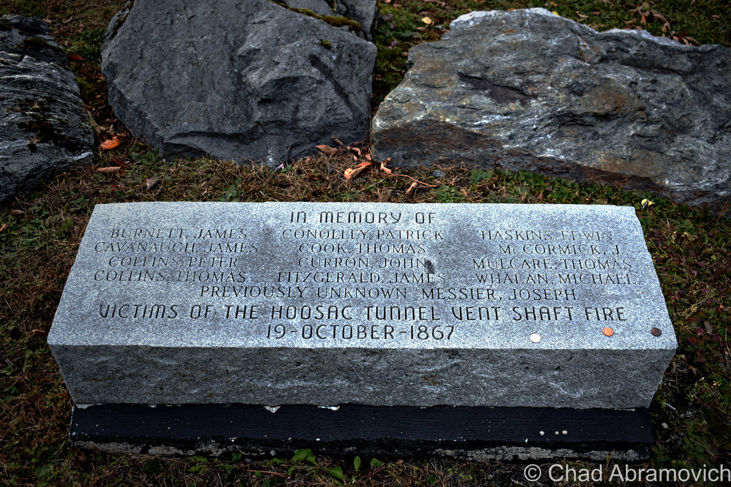
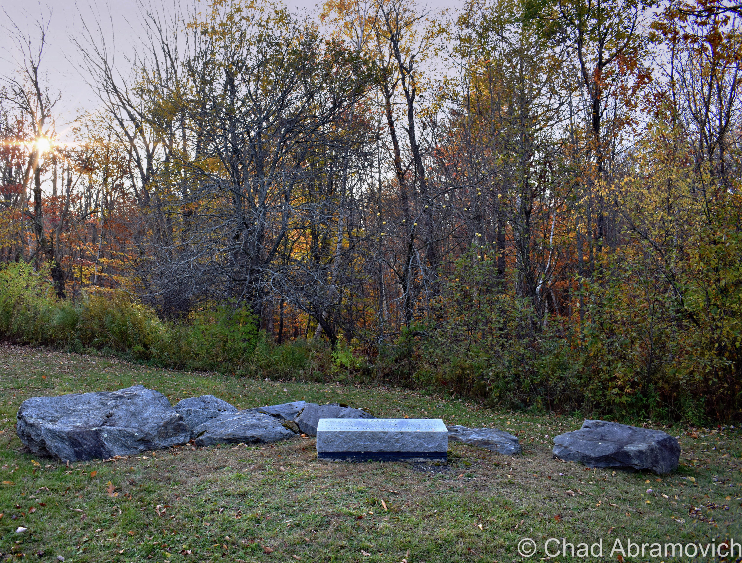
Before we headed back to Vermont, we took a quick drive down aptly named Central Shaft Road, to the top of the central shaft to check out the fan units, and to see a relatively new memorial that’s been dedicated to all the lives that the tunnel has reaped – a squat and prostrate rectangular block of granite laid down near some old apple trees across from the fan. Unbeknownst to us, we actually wound up visiting on the same day of the central shaft catastrophe.

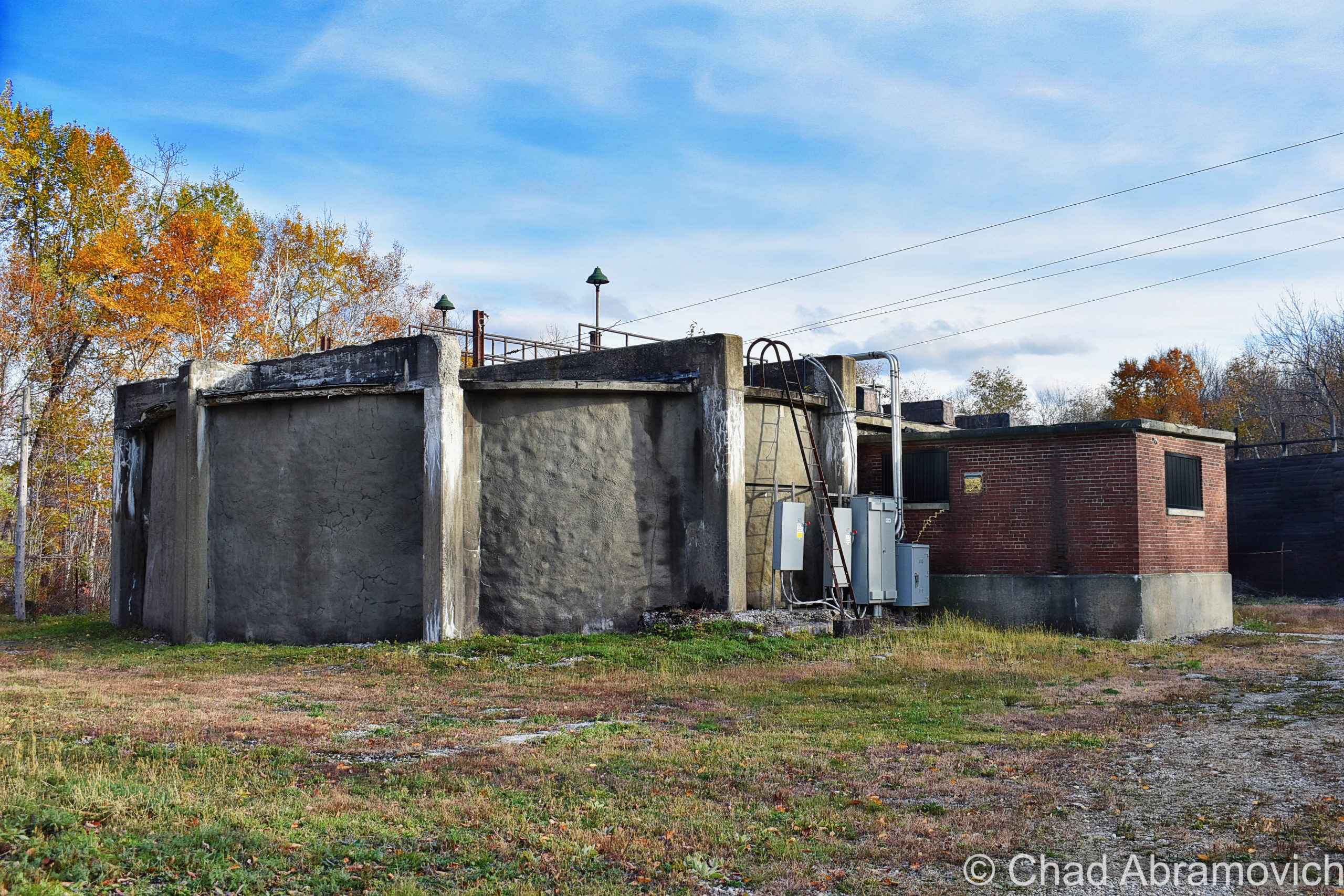
Here’s an older video of the fans in action – to get an idea of just how noisy they are!

I also haven’t had an opportunity to visit the west portal yet, so that’s still on my Hoosac-centric agenda. The last time I was down that way, it was a bit after the collapse. While the east portal is easy to access off a paved road, the west portal is obscured from a relatively well-traveled throughway – at the end of a dirt access road, which was gated and decked out with a few new looking “no trespassing” signs, and I totally I didn’t want to run into disgruntled railroad employees who were doing some collapse-cleanup.

This was a real fun explore, and even more fun to research and unpack everything I was gleaning about this place. The most fascinating thing about a place like the Hoosac Tunnel, is that it dutifully keeps spawning new tales, tall or true, and most likely will for posterity.

———————————————————————————————–

Do you have a spooky story from your trip to the tunnel that you’d like to share, or maybe have appear on this blog entry? Or perhaps you wanna make me hip to another Berkshire oddity or abandonment? Email me please!

Links

The closest thing the tunnel has to an ‘official’ website, which goes into amazing detail on all portions of the tunnel: HoosacTunnel.net

http://paulwmarino.org/hoosac-tunnel.html – a fantastically researched resource, with tons of historical imagery!

https://mysterious-hills.blogspot.com/ – my favorite Berkshires blog! Joe puts a lot of thought into his entries and is a great storyteller!

Here’s a video that actually films a modern-day train ride through the entire tunnel – it’s a neat watch and a good dose of perspective!


Since 2012, I’ve been seeking out venerable examples of Vermont weirdness, whether that be traveling around the state or taking to my internet connection and digging up forsaken places, oddities, esoterica, and unique natural features. And along the way, I’ve been sharing it with you on my website, Obscure Vermont. This is what keeps my spirit inspired.

I never expected Obscure Vermont to get as much appreciation and fanfare as it’s getting, and I’m truly grateful and humbled. Especially in recent years, where I’ve gained the opportunity to interact with and befriend more oddity lovers and outside the box thinkers around Vermont and New England. As Obscure Vermont has grown, I’ve been growing with it, and the developing attention is keeping me earnest and pushing me harder to be more introspective and going further into seeking out the strange.

I spend countless hours researching, writing, and traveling to keep this blog going. Obscure Vermont is funded almost entirely by generous donations. Expenses range from hosting fees to keep the blog live, investing in research materials, travel expenses and the required planning, and updating/maintaining vital tools such as my camera and my computer. I really pride and push myself to try to put out the best of what I’m able to create, and I gauge it by only posting stuff that I personally would want to see on the glow of my computer screen.

I want to continuously diversify how I write and the odd things I write about. Your patronage would greatly help me continue bringing you cool and unusual content and keep me doing what I love!

Donate Button with Credit Cards


The Drowned Forest

I recently had a lot of fun voyaging around the tiny angle that is New Hampshire’s 18 miles of seacoast! I haven’t been down towards the Granite State’s coast since I was 10 years old, so the nostalgia was stimulating and the sunburn was painful!

A few friends were tandem on this seacoast excursion, and one of the few goals I had for this trip was doing a bit of oddity hunting – and I was pleased with the few curios that I had eagerly put on my list. Beyond that, we just had a blast shunpiking around random coastal towns in both New Hampshire and Maine.

The environment is a bit exotic to me, in a sense that serpentine salt marshes and beaches on a waterbody you can’t see the other side of aren’t found up in Vermont (but we do have lighthouses!). This part of New England also has redolent history and mystery that have been fermenting far longer than Vermont has existed! I was definitely imbued with some unabashed excitement the whole time.

After all these years I’d never forgotten just how great of a drive New Hampshire State Route 1A was.

Before we checked into our hotel in Portsmouth, I suggested we took the requisite tour up Route 1A (known as Ocean Boulevard for most of New Hampshire’s seaboard) and the shore with the windows down and the breezy salt air coming in (and our music blasting out).

Starting in the brashy and tawdry beach burb of Hampton Beach and its famed 3-mile titular stretch of sand that are both long-established New England summer destinations, we then ventured northwards around a few rocky points with squinty views of the faraway rocks that are the Isle of Shoals – a group of forlornly not-quite-barren islands split between Maine and New Hampshire that are famed for their isolation, and grim and mysterious folklore – the spectrums of which include murder, shipwreck, ghosts, and a treasure – all suitable footnotes of any northern New England ocean island. I’d like to take a ferry ride out there next time I’m in the area.

We then passed through scenic Rye, with numerous state beaches, tidal wetlands, and ostentatious money enclaves that line Ocean Boulevard, and then ended up in Portsmouth.

*iPhone photo. The rad shield for New Hampshire State Route 1A – the numbers represented within the silhouette of the “Old Man of The Mountain” – which was formerly a naturally anthropomorphic rock outcropping above Franconia Notch said to look like its name implies, which has since crumbled ironically due to its old age, and is now kind of an awkward state marketing icon. I had fun explaining this to one of my friends who is from the Midwest.

Portsmouth, New Hampshire is a rad little city. As its name implies, it started out as a colonial shipbuilding hub and morphed into a rowdy naval port town where the Piscataqua River junctions with the Atlantic around the island town of New Castle.

The Pisaquata River also has a pretty great Google review!

The name was minted by the local Abenaki people and might mean something close to; “a river with a strong current”, which I’d say is pretty dead-on, but the details are a bit hard to parse, and because of that, there is a lot of speculative lore behind its name! It’s also the third fastest-flowing navigable river in the world. Though the city has long declined from being an employed port, the oldest naval shipyard in the new world is still active here on an island in the Piscataqua – which once launched some of the most important American warships and the first nuclear submarines. Now the shipyard is kinda moribund, but still functioning.

And speaking of submarines – there’s one in a hole right off the Route 1 Bypass! It had me and my friend exclaim: “Hold up… that’s a motherfuckin’ submarine!” when we passed it.

It’s the new home of the USS Albacore! Lauded as “the forerunner of the future” in its heyday, this vessel was built by the skillful laborers at the Portsmouth Naval Shipyard in 1953 and was intended to essentially be a paramount experiment of both its physical design and technological wizardry – one that the Navy was really depending on. Its teardrop-shaped body became the standard design for all subsequent submarines – and proved that submarines could actually sustain themselves and function while being submerged!

It became the world’s fastest submarine in 1966 when it set an underwater speed record of 40 miles per hour, and, it was used to innovate sonar equipment!

Now, it’s a neat roadside oddity and museum that we didn’t expect to see. Though it was closed when we pulled up as dusk hummed in, it was worth getting a few mediocre iPhone shots of!

One of the most memorable features of the navy’s island lair – and the region itself – is a notorious abandoned naval prison designed as a dismal gothic nightmare – intentionally, I’m sure.

I guess it’s an unwritten cultural rule that if a prison is built on an island, it’s gonna eventually be known as “the rock”.

Like Alcatraz, the intimidating Portsmouth Naval dungeon also shares the same tag, even though it’s technically across the state line in Kittery, Maine – and when in operation, was one of the nation’s most feared military lockups that could hold a surprising 86,000 inmates. The guards, too, had something to fear, because according to folklore, if they let a prisoner escape, they would be finishing out the rest of the escapee’s sentence. And you’ll have something to fear if you decide to try and explore it, because you’ll most likely wind up being locked up (though probably at another facility). I have no doubt that there are other gristly tales of this “the rock” – and most likely, those are forever classified.

I’m a bit bummed that I didn’t get a shot of it while in Portsmouth, but it wasn’t until afterward that I discovered that there was actually a pretty good vantage point from a bridge that leads into New Castle. Oh well, I’ll have to get my shot next time I’m in town!

Via Wikimedia Commons

Nowadays, Portsmouth is a hip tourist town with loads of charm that front squiggly roads and brick sidewalks – part of that charm comes in the form of loads of colonial architecture that was the result of the burb being one of the most successful port cities in early America. It also comes from the fact that after the city was being gradually consumed by a multi-decade period of decline, a whole bunch of Portsmouthians found their civic pride in the 1950s, when the “urban renewal” contagion was spreading around America – which meant a proposal to bulldoze half of the city’s historic neighborhoods so they could put modern stuff in its place. Thanks to locals loathing that idea – the city has a fantastic array of impressively preserved old buildings from the city’s various stages of life that couldn’t be more archetypal New England, and lacks the antiseptic, banal, and cheap architecture that plague so many other American city centers today.

It also gives Portsmouth a wicked creepy vibe after dark when things get shadowy behind old houses, arboreal-tunneled streets, and replica historic gaslights. You definitely start to wonder what sort of fiendish monstrosities lurk in the black voids and eerie stillness that slides over the city from ocean mists.

And speaking of creepy things at night – this is a good time to transition into my first oddity excursion…

Grave With A Glow?

Back at the hotel room, I was doing some research a few hundred years deep into local cemetery records, trying to track down a particular corpse. Well – actually – her gravestone. You see, Portsmouthians have a mystery among them – an inexplicable phenomenon that might be solely unique to their city. As far as I know, anyways.

According to the vague legend – there’s a light coming from within Portsmouth’s sprawling south street cemetery at night – the result of 5 old rotyards eventually colliding into one over the centuries that Portsmouth has existed.

This is a radiance that might be preternatural, for it’s said to come from a tombstone.

Yup, I was trying to find a grave that glows, which was a bit of a task. There wasn’t a lot of chitter-chatter about this curious claim. I first discovered a brief snippet of it within Curious New England: The Unconventional Traveler’s Guide to Eccentric Destinations by Joseph A. Citro and Diane E. Foulds and was finally able to dig up a bit more sustenance on a blog entry I found, that now seems to have vanished.

What I found so intriguing about the claim is that the reason for the luminosity seems to be a mystery. There are no specter stories and it can’t be blamed on floating orbs or a reflective surface that mirrors nearby shine. I guess it’s an intrinsic feature.

The grave’s occupant, too, seems to be a rather unremarkable person, in a sense that she doesn’t seem to have any disquieting history to support her grave’s peculiar behavior. The usual plot twists to New England cemetery supernatural shenanigans don’t apply here. She wasn’t accused of being a witch, and she wasn’t done some sort of great injustice that made her utter a posthumous curse (though making her headstone glow for eternity seems like a pretty silly way to achieve retribution if you had that sort of power).

Though some morphed local lore takes a stab at answers and proposes that the stone glows because; it’s the grave of a murderer, a murder victim, or even that the gravestone itself has uranium (!) or a luminescent particle in its mix. Uranium in a gravestone is still amusingly easier to believe than this story is.

It just does its thing, apparently, and it has been for some time.

That’s another interesting detail – I haven’t been able to find any information on exactly when this marvel started to happen, or how long it’s been doing its thing for, or even any accounts of people who’ve seen it. Even a few locals I mustered up the courage to ask about it had no idea what I was talking about. It’s just been acting in that fashion for a while it would seem…

The naysayers who are aware of this tale scapegoat sources like the light of the moon, streetlights along Sagamore Avenue and South Street, the traffic light at the intersection of Miller, Sagamore, and South, or reflections from the sizable pond within the cemetery grounds, that for some reason, leap a considerable distance and hit just the one headstone. But if this is all to be believed, then even skeptics have to concede that it can’t be the moon, for the stone is said to glow perpetually, even on moonless nights.

With such a mysterious sensation allegedly happening within a few minutes of our hotel, how could I miss out on witnessing it for myself?!

One of my friends decided to humor me and come along, while the other one raised an unimpressed eyebrow at me and opted to stay at the hotel.

My skepticism was as thick as the summer humidity outside that night and I felt a little guilty, so to appease my friend for joining me on my midnight legend-chase that would most likely have no payoff, I told him we could get some night shots of the city afterward, which he was pleased to agree to.

Navigating Portsmouth’s gridless grid, the old-fashioned wood frame houses ominously glowing with jaundiced light from the streetlamps soon ended and the vast graveyard thick with indifferent shadows extended beside us behind its low delineating stone wall. It was really dark in there.

Despite how nearsighted I know I am, a greenish/white glow within an otherwise dark cemetery should have been easy to spot – but as far as first impressions went, we didn’t see anything except for the waning rectangular shapes of rows of headstones coupling with panoramic umbrae that seemed to be extra nebulous for some reason. It was actually pretty creepy.

From within the cemetery, we could discern the distance-weakened streetlights and an occasional flash of passing headlights, but there was nothing I could see that I’d mistake for an unceasingly glowing gravestone. It was a good thing that I did the research beforehand, too, because finding a grave in that cemetery at night would have been an unlikely task. Unless it glowed.

“What’s the name on the grave?” my friend asked as we walked around in the dark.

“Burns”

“Wait… seriously?”

“Yup, we’re gonna see if Mrs. Burns, burns”.

“Oh god, Chad…”

Our experience in the cemetery can be summarized succinctly; there were no glowing tombstones. Or tombstones doing anything that could be considered eccentric. We then drifted over to the Portsmouth waterfront, reveled in glorious summer weather as the water bells tolled distantly, and called it a night.

We did return the next day en route to another oddity I’m going to get into below, so I could get some documentation shots of the headstones for this blog post.

There, in broad daylight, were a set of 3 tombstones with the surname Burns on them joined at their base – 2 of them bonded by older looking stones and a third and unevenly distanced one on a newer concrete foundation. They were more or less unremarkable and dimmed by age and weather. In the middle was the anomaly – the grave of Eunice Burns, who died in 1884. The epitaph “mother we miss thee” engraved below her lifespan was actually kind of sad and made me wonder how she turned into a local folkloric figure.

We also had a brief wander around the cemetery – a sprawling yard of little grave capped hills and a long pond, and observed a fantastic array of weathered old headstones and their memento mori and stories – dating all the way back to the 1600s, when Portsmouth was spelled as “Portsmuth”.

“So, it didn’t glow last night?” asked my other friend facetiously as I was putting my camera gear back in my bag.

“Nope. But who knows, it might be glowing right now and we just can’t tell because it’s sunny out”.

These are just a few shots of some headstones that I found to be interesting as I was leaving!

The Drowned Forest & The Transatlantic Telegraph Cable

More often than not, some of the most interesting things come to me completely by accident.

This is one such case, while traveling the fantastic New Hampshire State Route 1A through the town of Rye years ago.

My obsessive observational habits mean that I try to take in everything around me at once when I travel. Studying the landscape and reading every sign I see.

As we came across a small marshy area along Route 1A, I noticed a standard New Hampshire state historical marker standing a ways back from the road in the yellowed tall grasses. I’m a huge fan of those state historic/points of interest markers installed on roadsides and usually try to glance at them if I see them.

But this wasn’t the typical sign denoting a battle or historical event. Instead, it had two words that seemed to jump out at me; “Sunken Forest“.

I wasn’t expecting that, and almost immediately, my mind began to percolate.

After all, the term “sunken forest” does provide a lot for the imagination – conjuring up eerie images of giant pines and cedars submerged in a viscous, murky world of diffused light, their branches sullenly and slowly swaying with the mercy of the tides, fish encircling places where only birds could once perch and ship keels making their way over their crowns. 

Did something like that exist in New Hampshire?!  

Well, sort of.

After doing some internet research,  I soon discovered that the reality was a little less phantasmagoric, but still pretty awe-inspiring!

Rye’s sunken forest is the extant remains of a living forest of Hemlocks, Cedars, and Pines – reduced to a range of slimy tree stumps and contorted roots in thick peat mud, many of them barely noticeable and almost always obscured by high tides most of the year.

The traces of former forests and other things that the oceans have adopted into their secretive world can be found along the northeastern coast from Massachusetts as far up as Nova Scotia – and sometimes, a particularly low low tide can reveal these things, or give them back.

This fossilized forest is from a time when the New England coastline extended approximately 75 miles outward, thousands of years ago! When the giant ice sheets that covered North America began to melt, sea levels increased and changed the coastal signature of the area, and eventually, the once-great softwood forest found itself unable to adapt to its new environment; underneath the ocean.

New Hampshire’s inundated forest is one of the easiest to view of all the still-surviving ones, which makes it all the more unique and tantalizing to track down.

But, “easiest” still means little here. The visibility entirely depends on the tides, which means actually seeing them is a rarity. And if the conditions are more ideal, the arrangement of nudged sediments, stones, and mud might also work for or against your efforts.

This oddity is bisected into 2 parts, which are either collectively known as “The Sunken Forest”, or isn’t. The one I tracked down, is the more frequently surfaced depending on the season and the tides, and is known to some as “The Drowned Forest” – which is mostly submerged in a rocky cove near the storied Odiorne Point. I like how graphic and violent sounding that name is, so I usually just go with that one. It also makes more sense logically to me, because the whole reason this oddity exists was because it was literally drowned.

Spring and summer are the best times to detect it, because in the latter part of the year, the low tides are only at night. Also, luck and persistence will help a lot too. Seriously. This was my third attempt at trying to see this – and not being from an area that has ocean frontage, this was also a required opportunity to teach myself about the tides.

The more of a chore-to-view is called “The Sunken Forest”, and is southwards down at the northern end of broad Jenness Beach – which mostly Houdinis itself except for once every few decades if conditions are just right. But, the Jenness Beach portion is also the best-preserved – with the stumps actually looking more like stumps, as opposed to up at Odiorne where centuries of ocean movement have grounded down the stumps almost level with the earth.

But when they are exposed, they have been carbon-dated to around 3,600-4,000 years old – and using dendrochronology, some of the tree stumps were shown to reach around 100 years old before they met their fate!

Finding this patch of remarkable flora was the main persuasion for me going to the New Hampshire shore – and it also was the thing that managed to twist my arm towards a beach. Not that I don’t like pretty places, but I’ve never been much of a beach person, mostly because I don’t really dig crowds or heatstroke.

By the time we arrived at Odiorne Point to meet low tide, though, it was already on the cusp of 100 degrees, and that heat just sucked the life outta me.

But I couldn’t contain my excitement as I made my way out into a rocky cove that wreaked of the fragrances that come with low tide. This was a special kind of ocean controlled oddity, sort of like when old shipwrecks will surface every now and then off, or on, New England beaches, so being able to actually behold it for myself was pretty rewarding – even more so knowing that within an hour or so, it would all be submerged again.

Scores of parents and even more kids were roving around the stony banks bracketed by seagrass stands and splashing around in the tide pools – most of them having no idea that they were in proximity to 2 very cool curiosities. But me – I was roaming around with my camera and prattling about seaweed-covered mounds that I was trying to differentiate from either being the oddity I was looking for, or just a regular sodden lump.

Some of the stumps and exposed contorted roots were almost inconspicuous in muddy sediments and other remains were found but sort of veiled below ankle-deep water with surface sun glimmer in the shifting tide pools.

Odiorne Point unassumingly has quite the history – many of the ruins that mark the point’s fluctuating timeline can still be detected – scattered through the state park that now occupies the land around the point.

The Abenaki and the Penacook gathered here for the copious resources like muscles and clams found in the tide pools, and It became the first spot in New Hampshire that seafaring Anglos set foot on a few centuries ago.

While century-old gravel pitting operations obliterated any traces of those original settlements (besides the oldest known cemetery in the state!), the brawny vestiges of a vital World War 2 coastal defense fort still exist within the park’s woods, as well as a conspicuously curious watchtower that can be seen 83 feet above the shingled homes of a small neighborhood off Route 1A that once was a satellite of the fort and was used for intelligence.

It’s the lone extant survivor of New Hampshire’s original 14 coastal World War 2 watchtowers, and is, for the most part, closed to the public. The tower is named after a neighboring natural landmark – Pulpit Rock – a jutting flat-ish topped rock formation that thrusts into a bouldery range of shoreline.

We had originally wanted to go check out the old gun mounts and batteries (and investigate rumors of secret tunnels), but by the time we were done with the Drowned Forest, I guess the heat had gotten to us and our enthusiasm, and we opted for the air conditioner in the car instead. I’ll be sure to put them on my itinerary the next time I’m in the area. Just look at these photos!

This turned out to be a conjoined oddity – the second item on my agenda happened to have been coincidentally laid down right through the Drowned Forest, and was much more obvious to detect!

You’re looking at the rusted umbilical of one of the first transatlantic telegraph cables – the first one to be installed on United States soil!

Landing of the Direct United States Cable at Rye Beach, right through The Drowned Forest – circa 1889. Notice how much more girth those stumps had then! | Via Atlantic-Cable.com

The 19th century was the sparking point for a wondrous period of advancement and invention for America. Communication – being one of the seminals of the human existence – was naturally pulled into the gravity of the changing methodology.

The telegraph could cut delivery of information from weeks to a matter of hours, or even minutes, by transferring a pattern of electrical signals called Morse Code between 2 receiving stations via a special wire, which would then have to be deciphered.

American businessman Cyrus West Field knew absolutely nothing about telegraph cables, but he had a lot of faith in their prospect, bellwethered that the telegraph was going to grow in importance, and wanted to capitalize on it in a way that nobody else was doing.

By the 1850s, underwater telegraph cables were beginning to run in small dimensions, like from Newfoundland to Nova Scotia, and across the English Channel.

Field utilized this information and thought bigger, literally. He wanted to establish a telegraph cable across the Atlantic – linking North America and Europe.

The idea also became a good way of international flexing, and the governments of America and The United Kingdom jumped on the bandwagon and helped fund the endeavor.

Because the cable was too large/heavy to load on a single ship, 2 appointed ships would sail from opposite ends of the ocean; Southern Ireland and Newfoundland, Canada, and meet in the middle to splice the cables together.

But, so many calamities bedeviled the journey that both governments and investors began to feel like fools after 3 failed attempts in 8 years.

Eventually, though, the first transatlantic cable finally happened in 1866, and it was a moving affair – with both governments lauding it as a paramount shift in human accomplishment. But, it took upwards of 2 minutes to send a single character because of the length, and then the cable was debased early on because of the voltage sent down it was too high. But, eventually, they got the kinks worked out, which pushed the project’s legitimacy card.

But – any messages destined for America still had to be sent down from the boonies of Newfoundland, which was often a slow or clumsy process. So, the Direct United States Cable Company was formed in 1873 by the Siemens Brothers, which routed another underwater telegraph cable down from Nova Scotia to Rye Beach, New Hampshire on July 15, 1874.

Because this was the first such cable to terminate on American soil – it was a big deal, and a huge crowd gathered at the beach the day of its installation – and garnished up some pretty dramatic Victorian newspaper illustrations in Harper’s Weekly with symbolistic ethereal light beams parting dark clouds onto the spot where the cable met the beach.

An official cable house was built that winter, which closed in 1921 when the cable’s usage significantly slowed down after its zenith during WW1 when it was kept busy practically 24 hours a day.

The cable house still cooly exists and is nowadays a nicely preserved private residence. It’s also why “Cable Road” has its curious name – something I wondered about when I read its name on Rye’s signature white and black street signs when I was a kid.

I tell everyone who feels like lending their ears that New England really is a special and strange place, maybe a few shades more so than the rest of this country’s iconic regions because of the comprehensive spectrum of spectacles that make themselves at home here, and these treasures are just a small representation of this. I was talking to a friend that lives in New Hampshire about The Drowned forest in particular, and he was delighted that something like that existed in his own backyard, and for years, wasn’t aware of it.

As I grow older, those are the types of discoveries that really fire me up more and more. Adventuring can really open up your mind. You don’t always need to go poke around a behemoth of an over-Instagrammed ruin to have a “real adventure”. The magic is kinda what you make of it.

The rusted remains of Rye’s transatlantic telegraph cable can still be spotted at low tide!

Here are a few links:

There’s a pretty fascinating documentary on the design and installation of the first transatlantic telegraph cable that I’ll link you below for your pleasure!

ALSO – if this kind of thing strikes your fancy – then definitely make sure to check out the website atlantic-cable.com – which was an integral part in my research on this curiosity!

The blog “Cow Hampshire” also has a good and more succinct blog post on it.

And – there’s another neat article on Hackaday

The Rye, New Hampshire Historical Society has some neat photos of the Drowned Forest from the 1800s.


Are you from New Hampshire or a fellow Vermonter? I’m looking for weird, wild, or hilarious stories, wonderous and odd places, incredible people, and especially abandoned locales! So if there’s something you’d like to share with me, I’d love to hear from you!

I’d also really love to grow this blog and present unique, meaningful, and extraordinary content that’s a departure from the same regurgitated stuff you find everywhere else online, and your help would be hugely appreciated!

Feel free to drop me a line at chad.abramovich@gmail.com

Also – if you appreciate me and this blog, perhaps consider making a donation at my PayPal below? The pandemic has hit my finances and my mental health pretty hard, so any amount is humbly appreciated. I’m also on Venmo if that works better.


Since 2012, I’ve been seeking out venerable examples of Vermont weirdness, whether that be traveling around the state or taking to my internet connection and digging up forsaken places, oddities, esoterica, and unique natural features. And along the way, I’ve been sharing it with you on my website, Obscure Vermont. This is what keeps my spirit inspired.

I never expected Obscure Vermont to get as much appreciation and fanfare as it’s getting, and I’m truly grateful and humbled. Especially in recent years, where I’ve gained the opportunity to interact with and befriend more oddity lovers and outside the box thinkers around Vermont and New England. As Obscure Vermont has grown, I’ve been growing with it, and the developing attention is keeping me earnest and pushing me harder to be more introspective and going further into seeking out the strange.

I spend countless hours researching, writing, and traveling to keep this blog going. Obscure Vermont is funded almost entirely by generous donations. Expenses range from hosting fees to keep the blog live, investing in research materials, travel expenses and the required planning, and updating/maintaining vital tools such as my camera and my computer. I really pride and push myself to try to put out the best of what I’m able to create, and I gauge it by only posting stuff that I personally would want to see on the glow of my computer screen.

I want to continuously diversify how I write and the odd things I write about. Your patronage would greatly help me continue bringing you cool and unusual content and keep me doing what I love!


Donate Button with Credit Cards

Centralia, Pennsylvania: A Ghost Town On Fire

On Halloween weekend, me and a friend took an awesome 3 state sojourn – with a Pennsylvanian ghost town being the main objective – seeking out Americana, abandonment, backroads, and weirdness on the way, while getting completely fisticuffed by sputtering rain and the chill of the season.

This would be my first time to the Keystone State, so I was excited.

As what often comes with adventuring, some of the places I wanted to see had changed or torn down, or we just underestimated the travel distance between oddities, so looks like I’ll just have to plan a few more excursions.

Instead of taking the interstates, we decided it’d be fun to go shunpiking instead and wander around as many small upstate New York towns as we could.

2 of my favorite games to play when traveling through New York are trying to pronounce place names, and something we affectionately call; abandoned or recluse? The idea is simple, with the name of the game doubling as the instruction manual, and there is plenty to wonder about on those upstate backroads.

Spontaneously adventuring within another adventure can really pay off! As me and my friend were heading through upstate New York, we noticed an advertisement for an old motel listed on one of New York’s blue service directory signs.

We really digged the retro font in the logo and decided to veer off course for a few miles to see if the motel had a sign that would be on level with its cool.

And Behold!

We were rewarded with this fantastic mid-century gem of a sign! The adjacent motel was pretty great too, but we couldn’t tell if it was still a functional motel or long-term housing or none of the above.

I really really dig Americana and hunting for old signs, and Upstate New York is loaded with some terrific ephemera. One of my first out of state explores when I was getting this blog started was spending a few days traveling down US Route 9 between Plattsburgh and North Hudson to shoot some of them.

I think my fascination and reverence distills from the fact that they’re things we’ve lost as American instant gratification and laziness have rearranged routes and highways to bypass Main Streets; replaced by unimaginative, uninspiring, cookie-cutter corporate-owned businesses built right off the interstate that value profit over purpose.

The dilemma is there are many of us who want to preserve these special places and keep them vital to their communities and future generations, but with so many rural towns struggling to stay afloat, or even as a viable place to exist, it’s just another part of the tug of war.

There are some awesomely storied little towns in upstate New York that are literally moldering in their own history, and we drove through a bunch of them.

Their main drags were lined with remarkable historic homes, probably from the era of state history when the canals were bringing people and prosperity up that way. Now, many of these towns are practically dead, and these old homes are in various states of disrepair.

Passing through Cooperstown Junction, we noticed a whole string of abandoned locomotives on discontinued tracks, and we just had to U-Turn in the pounding rain and biting chill to shoot them.

After trudging through a bunch of ruthless tree branches and prickers, I detected an old GG1!

The cliff notes here are; they were beautiful 475,000-pound art deco machines conceptualized by General Electric and built for the Pennsylvania Railroad between 1935 and 1943. They were electric and deemed to slow for passenger transport, so they were mostly used as freight trains, with ball and socket construction that made them suitable character for sharp turns. 139 were made, American railroad franchises subsequently merged and then went bankrupt through the mid 20th century, and the last one was fazed out by 1985. Most of them have disappointingly since been scrapped.

When I got home from this trip, I dove into my ritual of brewing coffee, Google maps, and researching my GPScapade. Amusingly, the only Google information that really came up for Cooperstown Junction was the fact that a few trainspotters knew that these GG1s were there.

Eventually, we started seeing signs for Scranton, Pennsylvania, and I just had to detour to see whatever was left of the Scranton Lace Factory – named after it’s home Pennsylvanian city and it’s supreme export.

I’ve been wanting to see this place for years, and as cosmic relief would have it, the brobdingnagian factory is in the throes of demolition. But it’s still an eye magnetic wonder, complete with one of my favorite clock towers which features a Meneely cast iron bell.

Scranton Lace began industrializing in 1890, and would produce a sundry of textiles – anything from tablecloths, yarn, laminates, and their signature good; lace. The company would become the first and largest producer of Nottingham Lace in the United States.

The factory boomed during the world wars, would grow in dimension and employees (employing 1,400 people at its zenith) and was so large it had it’s own 4 lane bowling alley, a theater, barbershop, an infirmary and a gym on the premises.

Some risky investments and advances in technology would eventually weld its clout, and kill the factory by 2002. In the last years of its life, it only had 50 people working there!

Seeing the building in real time, I wondered how often the skeleton crew crossed paths, given the size…

An amateur autopsy revealed that the inside was trashed, and most goodies have been removed or destroyed. Also, the ruins are said to be loaded with arsenic. But little treasures still remain. Sheets of soggy lace and wooden dowels were scattered all over the debris.

We settled for a sketchy hotel in Harrisburg with neat features like an un-closable front door (we wound up propping a chair in front of it) and a room that smelled like burnt popcorn without the burnt popcorn, and headed out before first light to make up for travel time to get to the lion’s share of our adventure.

But first, we tracked down a favorite camp of oddity; a gravity hill.

If you’ve been following me for a while, you know I dig gravity hills – unique stretches of roads where gravity is said to not work as it should, and pull your vehicle uphill. I’ve sought a few out, where you could witness the magic if you squinted and kept an open mind, but this one on in Lewisberry was apparently the real McCoy (and that may or may not have something to do with ghost children).

It didn’t just pull our car uphill, it yanked it, and then tried to pull us down another hill nearby where gravity than would have then behaved as it should and possibly careen us into oncoming traffic.

I tried getting a shitty, dim cellphone video to as evidence because you can actually prominently see both a hill and the car being pulled up it. No tomfoolery on our end, promise!

Because my friend and I are also huge diner enthusiasts, we drove a few towns over just to eat at one, and then it was off to Pennsylvania coal country.

Anyone else really interested in rural American town names? Rough and Ready, PA is little more than a 4-way with a terrific name. It was actually named after the tiny gold rush town in California, and that one was named by their mine to honor Zachary Taylor’s nickname – the obscure 12th president of the United States. I had to Google him.

It seemed like all the locals were at church when we pulled into town, and it was eerily tranquil.

Abandoned farmhouse near-ish Rough and Ready, PA
One of the many unexpectedly hairpin turn assembled mountain backroads that our GPS brought us down. That 5 MPH suggestion was a good thing to heed. It was great driving through autumn woods – as Vermont lost most of its leaves a few weeks prior.

Well, this was a first for me. I’ve never seen graves within a gravel drainage area alongside a church before. I wonder if this church is haunted…

Centralia, Pennsylvania 

In May of 1962, a small Pennsylvanian coal mining town decided the best way to clear out a defunct landfill was to burn it. It’s an activity that’s been done before, but in Centralia’s case, it would create one of the most batshit crazy American stories I’ve ever heard.

The town was built on Anthracite coal deposits, and the blaze above ignited a blaze below – lighting the tip of an exposed coal shoot that serpentines for miles underneath the town, and an underground inferno started to spread slowly and stealthily over the next couple of decades, working its way to the surface.

I guess I don’t understand why anyone would burn anything near an “exposed coal seam”.

Centralians alerted the state government about the fire but found themselves flippantly disregarded. Ironically, the fire could have been almost completely extinguished months after it was set, but the dispatched state officials on the scene decided that taking labor day weekend off was more important than finishing what they started, so the fire was allowed to spread.

By 1976 – a temperature of 746 degrees was recorded in a woman’s backyard behind the swimming pool. Vegetable gardens were cooking in the soil. Some residents claimed their basements were so warm, they didn’t need to use their hot water heaters to warm their bathwater.

In 1979, local gas station owner John Coddington inserted a dipstick into one of his underground tanks to check the fuel levels, and was shocked to find the temperature read 180 degrees!

The Pennsylvania Bureau of Mines decided the best judgment here was to just let the fire burn itself out.

In 1981, a fiery sinkhole opened up and attempted to swallow 12-year-old Todd Domboski in his grandmother’s backyard. He immediately was deluged by hot, slippery mud and scorched by heat that was later measured at 350 degrees. He tried to gain his footing and frantically clambered around for anything he could use to pull himself up while breathing in large amounts of carbon monoxide and toxic gases, but it was futile.

Eventually, he was able to stabilize himself by grabbing hold of a tree root and then started screaming for help. His cousin, 14-year-old Eric Wolfgang, heard his terror imbued shrieks and pulled him out. It was determined that the levels of carbon monoxide and toxic vapors in the sinkhole would have been enough to kill Todd within minutes if he hadn’t been pulled out. The incident went viral.

The Pennsylvanian government had been muting the coal fire and resulting anxieties since it began, but now, they had no choice but to face it. Centralia suddenly found itself in the gravity of nationwide chitter chatter and the now irrefutable revelation of subterranean calamity hurt a lot of Centralians’ good day.

The underground fire caused sinkholes to yawn, roads to heave and fracture and endangered the lives of everyone who lived over the conflagration. And because those coal seams are so far-reaching, that demographic not only included every person in town but conceivably neighboring towns if (or when…) it trundles towards them.

The ground began collapsing unpredictably and devoured swaths of ground above. Hunters would start coming out of the woods with broken ankles. Sometimes deer carcasses would be spotted sticking out of a hole vertically, with steam billowing out around it. They had either starved to death or suffocated from the fumes.

Pets, too, were victims. A group of kids playing on a backyard swingset witnessed the grim death of their neighbor’s cat when the grass around it suddenly turned brown and it dropped down into a sinkhole.

Poisonous gasses began billowing into cellars and the local school. Some Centralians began developing a bad hacking cough that was compared to black lung – an absolutely horrific sounding miners’ ailment.

Others were constantly falling asleep in their homes because carbon monoxide levels were getting so high. It was getting so bad, that the state pushed people to install carbon monoxide detectors in their homes, but some were even buying canaries to do the job because the detectors weren’t…

Clumsy attempts to extinguish the fire, including boring ventilation holes down into the underground shoots, made the fire burn more triumphantly. Oops.

Another proposed resolution was to dig a gigantic trench around the town, which would have cost millions of dollars and wasn’t guaranteed to even work. It became evident that this fire wasn’t going to burn itself out anytime soon, because of the amazing amount of interconnected underground coal veins in the region that were all vulnerable.

Eventually, The government decided it’d just be easier to evacuate the town and inaugurate it onto club of elite communities like Times Beach and Pricher.

At first, they made the exodus voluntary, because they figured that no one wanted to live about a raging hellfire that was apparently as deadly as the surface of Saturn, and offered relocation buyouts.

But, the buyout prices were little more than pathetic because of the catch 22 the town had become – or, houses that are above a raging coal fire just don’t have that much market value, and as a result, a percentage was taken off the price, which was well below what was needed to move to another town and purchase a new home.

Because of that, some outright refused to leave, either thinking that the fire could be eventually extinguished, or shrugged it off as it not being that big of a problem. Some miners felt like they were being treated condescendingly when it came to the government officials and scientists that came to town to discuss the situation, so they stayed out of spite.

The homes and businesses of those who did accept the deals were then demolished so they couldn’t change their mind and come back.

But the emptying was slow, and by 1986, the government was getting impatient, so they turned to good ol’ eminent domain, which made the remaining leery recalcitrants invent the usual conspiracy theories, like how the government was greedily only after the coal stocks below the town.

Seriously. Centralia has such a wealth of the stuff that the Molly Maguires considered the burg important enough to be thugs in back in the 1800s when mining was appearing on the scene.

And speaking of conspiracy theories, others declared that Pennsylvania was consequently trying to erase the town. They removed the town’s zip code and its name from the municipal building – which is one of the few holdout structures left. I read somewhere that PennDOT also removed Centralia from wayfinding signs, but I clearly read it on a few new-ish looking signs on my trek there – including at the intersection of PA Routes 54 and 61 in Ashland.

Other varieties of signs, including street signs and the popularly photographed danger signs alerting you of both the mine fires and terrible risks to your future health if you hang around, have also gone missing in the intervening years. Theft has a probable role in that – and a few signs might be hanging in some teenagers bedrooms somewhere.

But with Centralia’s growing postmortem celebrity and things like GPS and Google maps, you will never be able to entirely erase it.

And that’s apparent with all the tourists that go there with an interest in ridiculous human disasters. People like me! Even though the Pennsylvania Department of Environmental Protection explicitly discouraged visitors and memoed that “Walking and/or driving in the immediate area could result in serious injury or death. There are dangerous gases present, and the ground is prone to sudden and unexpected collapse.”

Centralia isn’t the only perennially burning ghost town in America, nor is it the oldest. But its story is probably the most compelling, and pretty eerie.

You might already know about Centralia without knowing it. The movie Silent Hill was inspired by the doomed hilltop community within perennial wispy smoke – which may be part of the reason why this increasingly legendary dot of the Pennsylvanian atlas is in the din of the upper gradations of American oddities.

There are actually two vanished towns, the other with the unlikely name of Byrnesville, which was another casualty of the Centralia mine fire. The last building in Byrnesville was torn down in 1996, and there really isn’t all that much left that identifies the former village apart from a residual religious shrine to the Virgin Mary turned roadside landmark in the woods off Pennsylvania Route 61 between Centralia and Ashland – which is still called Byrnsville Road.

Centralia; First Impressions

Centralia still burns, and there is enough coal to stoke the flames for an estimated 600-1000 more years, depending on who you ask.

Centralia is far from being any sort of Brigadoon. It’s actually very easy to miss because it doesn’t really look like you’re driving into a hellscape. When we arrived, it was actually a cheerfully warm and sunny October day.

It’s right on PA Route 61 at the junction of PA route 42 in a little dip between 2 hills that’s between 2 still functioning towns, where the roadsides are a bit weedier and disheveled. You can spot a crumbling curb or amputated stretch of sidewalk still if you look close enough, and there’s the iconic dated brown municipal building.

My own imagination and the promoted hype built it up pretty good – so I guess I was a little, well, disappointed when I finally rolled into “town”.

If you’re wondering if you’ve actually found the place – the lines of shoehorned parked cars, people taking selfies, and youths riding around on dirtbikes will be a good wayfinding point.

They’ve all gotten out of their cars to see the main attraction at Centralia, something that’s become known as “graffiti highway” because it’s literally just that. Google maps calls it “PA-61 Destroyed”, which is also pretty accurate. If any start-up bands out there are looking for the title of their debut EP, that’d also be a badass sounding contender.

It’s an abandoned portion of Route 61 that had to be closed, and a new stretch of road re-routed around it because the temperature below got so perilously hot, the asphalt began to undulate and contort open.

Over time, the half-mile of tarmac became a canvas for taggers – mostly of the uncreative variety given how many phalluses there were, but I saw a few gems amongst the ironic elegy on my stroll.

All the colorful and squiggly graffiti certainly is a sight, but further down the road was something far more impressive – a roughly 100-foot sinuating fissure that was lazily venting wisps of smoke.

The giant smoking fissure, that wasn’t really smoking all that much for this photo. It’s actually much larger than it appears.

A gaggle of boys on dirtbikes propelled past us to the other terminus of the defunct highway, then turned around, did some wheelies, and stopped at the smoking crack to gawk at it while I was taking some photos. Behind me, 3 teenage girls were heading my way – all of them on their phones, and behind them, a young couple with a happy golden retriever were just lazily ambling along parallel-ish to another teenage fella piloting a drone.

This place was certainly no terra nullius, it was packed! Which really gave a conflicting feeling to the casual atmosphere on a road with a raging coal fire underneath, its heat odiously evacuating into our realm through the giant rift. It was weird.

The venting gasses smelled pretty rank and carried a good distance down the road, and there was evidence of toasted garbage and random stuff people tossed into the crack, probably just to stupidly see if it would burn. It did.

It wasn’t really smoking heavily, though, on my visit. It was only really noticeable once you were a few feet from it, and was difficult to capture in a photograph.

The walk back up the disintegrating road to the car left me feeling kinda vertiginous, and I’d like to think it wasn’t because I was realizing how out of shape I was walking back up the hill.

The entire town was a portend to the possibility of the ground opening up beneath me and taking me under, which I have to say is a first on an adventure of mine so far.

I guess I was also expecting the road to have a tactile temperature difference and for my shoes to be nice and toasty, but that didn’t happen either.

Nearby the graffiti highway and down a side street is the Odd Fellows cemetery, where it was said that the fire originally started and also where I’ve heard smoke can occasionally be spotted rising from the ground and curling around the gravestones, but it disappointingly looked like a normal cemetery when I strolled by. I’ve also heard of tales of tourists ostensibly being sucked into surprise sinkholes in the woods behind it.

Centralia has taken on new life – as a place to ride off-road vehicles. The marauding went beyond the graffiti highway – there were groups on dirtbikes, a few 4 wheelers, and even some lifted, mud-splattered trucks that were all doing their thing down what remained of the former gridded streets that all bled into well-worn dirt trails through the woods. It’s practically a real-time scene out of a post-apocalyptic film.

It’s strange to remember that there are a few people who still live here, (the 2012 census counted 9) and according to what I’ve been researching online, they hate the tourists. One woman reportedly started chasing people away with a broom who disrespectfully got too close to her house. Can’t say I blame her.

One of the remaining side streets in town, as seen from a bluff. It was strange to see a road with stop signs and power lines and sidewalks, but with nothing alongside them.
What remains of Centralia | Via Google Maps

Because this was both of our first time in Centralia, and we had about a 9-hour drive back to Vermont ahead of us, our time was a bit hurried.

When I got back home and began researching, I found that we also missed a few sites that would have been cool to see, like some of the remaining houses, the popularly and poignantly photographed time capsule marker (which was opened early back in 2014 with mostly ruined contents), and, this faux geyser! It’s said that this is created by runoff going through 200-year-old drainage tunnels of nearby collieries, and is only visible after a good rain.

Oh well, maybe next time.

Kind of feeling a bit underwhelmed in Centralia, we headed out of town and found some great abandoned rusted Chevrolets sitting in a field off a back road which were fun to shoot, before we deemed ourselves exhausted and drove back to Vermont. 

The thing about Centralia is that it really grows on you the more time you have to reflect on it. It really does. This trip also really reaffirmed that there are unbelievable sites that exist closer than you think.

There’s actually a fansite for the town, with lots of information! If you’re a Centralia enthusiast, you should check it out!

_____________________________________________________________________

Since 2012, I’ve been seeking out venerable examples of Vermont weirdness, whether that be traveling around the state or taking to my internet connection and digging up forsaken places, oddities, esoterica, and unique natural features. And along the way, I’ve been sharing it with you on my website, Obscure Vermont. This is what keeps my spirit inspired.

I never expected Obscure Vermont to get as much appreciation and fanfare as it’s getting, and I’m truly grateful and humbled. Especially in recent years, where I’ve gained the opportunity to interact with and befriend more oddity lovers and outside the box thinkers around Vermont and New England. As Obscure Vermont has grown, I’ve been growing with it, and the developing attention is keeping me earnest and pushing me harder to be more introspective and going further into seeking out the strange.

I spend countless hours researching, writing, and traveling to keep this blog going. Obscure Vermont is funded almost entirely by generous donations. Expenses range from hosting fees to keep the blog live, investing in research materials, travel expenses and the required planning, and updating/maintaining vital tools such as my camera and my computer. I really pride and push myself to try to put out the best of what I’m able to create, and I gauge it by only posting stuff that I personally would want to see on the glow of my computer screen.

I want to continuously diversify how I write and the odd things I write about. Your patronage would greatly help me continue bringing you cool and unusual content and keep me doing what I love!

Donate Button with Credit Cards

Abandoned Train Cars in the White Mountains

Part of the smorgasbord of odd objects in the woods of northern New Hampshire are some abandoned train cars that me and a friend determinedly slalomed into waist deep snow for a quarter of a mile to get to.

The White Mountains have a pretty legendary railroad history, so it wasn’t a surprise to learn that there was at least a few old trains that had been forsaken around the region.

Actually, the White Mountains and their notches have had a long history of people being enamored with them. And their motivated endeavors have been just as big and lofty as the peaks themselves.

Being a large outdoorsy area meant that logging railroads inexorably built their iron arteries up into seemingly untamable land to whack a lot of it down, and entrepreneurs built multitudinous grand hotels for tourists within the precipices to admire it – including the formidable Mount Washington; the tallest point east of the Mississippi at 6,288 feet, allegedly haunted by an omnipotent dwelling known to Native Americans as simply “the presence”, and the site of the highest wind gust ever recorded – at 231 miles per hour on April 12, 1934. Even today, it’s colloquially known as being home to the world’s worst weather. 

Randall E. Spaulding wrote in his The Grand Hotels, The Glory, and the Conflageration: “I doubt very much that anywhere on this continent there existed any such concentration of palatial wooden structures as here in the White Mountains region of New Hampshire”.

But the Taj Mahal of White Mountain infrastructure might possibly be the former Maine Central Railroad’s Mountain Division Line. In 1875, craggy Crawford Notch was decided to be the swiftest east-west passage from Portland, Maine to Chicago, so they railroaded its western walls with an awesome set of tracks that seem to defy sensibilities, and clutch high up along the cliffs of the notch.

Even today as we a drove down Route 302 which travels the notch floor along the cursed Saco River – said to take 3 lives each year – it’s confounding to crane your head upwards out the windshield and imagine the line being constructed up there over a century ago.

The most curious part of the tracks might be the intriguingly named Frankenstein Trestle, which isn’t named after who you think.

Frankenstein Trestle – Via Wikimedia Commons

The trestle was named after the cliff it bestrides, and the cliff was named after a German immigrant landscape painter named Godfrey Frankenstein – which was not an uncommon surname in Germany.

Though his original last name was Tracht, his father changed it to Frankenstein when they immigrated to America in 1831. Frankenstein wasn’t doing anything nefarious in these hills, though, even if they can look sinister and foreboding when inundated by seasonal mists, or in my case, a nor’easter.

Instead, he wanted to paint them after becoming enchanted with them in the mid-1800s. No inhuman like experiments culminated up there within better lightning striking distance. Well, at least I don’t think so…

The body of Crawford Notch is both a fantastic part of the White Mountain National Forest (with 8 different waterfalls!) and New Hampshire’s smallest town.

Frankenstein Ledge from Route 302

Hart’s Location is 11 miles long and 1.5 miles wide – most of that mileage being the granite flanks of Crawford Notch and the nearby mountain slopes. But it’s marked by a typical vertical NH town line sign, and 41 people have managed to squeeze in the spaces in-between.

But man oh man, upstate New Hampshire had some serious snow. The snowdrifts had accumulated above the tops of the road signs, and the howling wind was whipping it onto our windows and making visibility not so visible.

We stopped at the Bartlett General Store to grab some cheesesteaks, because nothing goes better with an adventure than spontaneous food from a general store, and devised a plan.

The plan was; see how far we could make it and hope that we wouldn’t want to give up and turn back. Seriously. We had really underestimated just how much snow there was going to be, and as soon as we left asphalt and began our trek into the woods, we were already awkwardly sinking in waist deep snow, doing our best to scramble out of our holes, and then repeating the process.

About ten minutes into our dutiful beeline and we saw the cold, rusted forms of a sequence of abandoned train cars underneath bending birch trees. We had made it!

There are three coaches, a swayback flat car, and a coal car here. But what’s their story? The vintage cars were originally from the Erie and Lackawanna railroad, were electric, and were mounted with a pantograph that glided below power lines through Pennsylvania, New York, and New Jersey.

The Conway Scenic Railroad – who now utilize those remarkable aforementioned tracks through Crawford Notch – bought them in the 90s with the intent of restoring and utilizing them. Two of them were revived, and I guess this stretch of tracks was the chosen site for the flotsam and jetsam.

The track facing side of these old locomotives has been boarded up and spraypainted a matte black – probably an attempt to keep people out, or at least their interests diluted.

Not to be deterred, we trudged over towards the other side, were whacked in the face with a few tree branches, but were able to climb right on up inside one of the cars, and was immediately thrilled at how photogenic the site was. I had a blast crawling around the cabs and inside the various compartments and observing each car’s different peculiarities.

The range of graffiti inside meant that these weren’t exactly as obscure as I’d originally thought they were (that became more apparent when I got back home and looked them up online) – a lot of the graffiti was understood purely on an attempted personal Rorschach test.

I was reading on an online message board that a few people have encountered a bear while checking these old train cars out, which also happened to be a real local nuisance according to commenters.  I’m glad that wasn’t part of my adventure.

I had to make a little room for myself to experience this. This winter has left me feeling disenchanted and lost, and I’ve been really questioning who I am and where I’m going as a creator. This explore was just what I needed to get my train of thought in order again. Ha! Get it?

I don’t think any roadside curiosity I’ve checked out has lived up to its expectations more than “Dismal Pool”. We decided to zigzag through lofty Crawford Notch on the way back to Vermont. “Notch” is northern New England vernacular for mountain pass – and a term I like more than any other geographical labels that describe ways to travel between mountains.

Crawford Notch is huge – violently upthrusted ridges of northern forest and ancient granite hem in route 302 for several miles. The notch is also part of the White Mountain National Forest, so the road was pockmarked with tons of iconic brown and white wayfinding signs enticingly announcing pull-offs for cool and scenic places. None of which we stopped at due to indecision. Eventually, we all decided that we were gonna pull off into the next one, damnit.

That tiny parking lot had a pretty great vista of the notch with a storm beginning to slide over the ridgelines and that sweet telltale smell of oncoming rain. And then we noticed a sneaky brown and white sign that read “Dismal Pool”, with a little “path” that descended down a rocky slope into dark woods.

How could I not be curious about something called Dismal Pool?! Well, if you appreciate your destination not letting you down, then Dismal Pool is the place for you! The vista went from broad and interesting, to, well, dismal.

The wonder that is Dismal Pool is a kinda depressing, dreary, and tepid-looking pond at the bottom of a grim hollow that was filled up with the debris from a huge rock slide off the mountain nearby, chocking a lot of the vegetation. The gloomy light really sealed the deal.I tried doing a little research to see if there was some dismal history here, but I got nothing. But, I’ve always had a fondness for the more macabre and curious place names, and I certainly didn’t expect I’d ever wind up at a place like this, so I took a bummer of a photo to document it, because when at Dismal Pool, do as….. wait. Ok, how about, What happens at Dismal Pool stays at Dismal Pool. Yikes, that sounds even worse!

Dismal Pool living up to its name!

I had said that the Taj Mahal of White Mountain construction projects was the railroad through Crawford Notch, but that opinion got rickety when I saw the magnificent Mount Washington Hotel for my first time. This iconic establishment is one of the last surviving of the area’s grand hotels, and when we drove by as the night got colder, we just had to stop to grab a few shots of it all lit up under the tall stark forms of Mount Washington and the Presidentials.


Since 2012, I’ve been seeking out venerable examples of Vermont weirdness, whether that be traveling around the state or taking to my internet connection and digging up forsaken places, oddities, esoterica, and unique natural features. And along the way, I’ve been sharing it with you on my website, Obscure Vermont. This is what keeps my spirit inspired.

I never expected Obscure Vermont to get as much appreciation and fanfare as it’s getting, and I’m truly grateful and humbled. Especially in recent years, where I’ve gained the opportunity to interact with and befriend more oddity lovers and outside the box thinkers around Vermont and New England. As Obscure Vermont has grown, I’ve been growing with it, and the developing attention is keeping me earnest and pushing me harder to be more introspective and going further into seeking out the strange.

I spend countless hours researching, writing, and traveling to keep this blog going. Obscure Vermont is funded almost entirely by generous donations. Expenses range from hosting fees to keep the blog live, investing in research materials, travel expenses and the required planning, and updating/maintaining vital tools such as my camera and my computer. I really pride and push myself to try to put out the best of what I’m able to create, and I gauge it by only posting stuff that I personally would want to see on the glow of my computer screen.

I want to continuously diversify how I write and the odd things I write about. Your patronage would greatly help me continue bringing you cool and unusual content and keep me doing what I love!

Donate Button with Credit Cards

The Village Of Secrets

I was told that some have called this place “the village of secrets”, because after its philanthropically intended inception, it instead aged into a shameful place intended to be unseen and hushed from the public.

Its actual name is Letchworth Village, its unfortunate moniker (when I brought it up to a few explorer buddies, they all returned with something like; “Letch-worth? That sounds terrible! What is it?”) was named after the distinguished humanitarian who pretty much conceptualized the place; William Pryor Letchworth. Construction began in 1908 and it was ready by 1911 to shelter the “feeble-minded and epileptic” – or any youth who basically couldn’t take care of themselves or were a danger to others.

At the time, the architected property and its ethos were incredibly innovative – lauded as what should become the new model of treatment of the developmentally disabled, with hopes that time here would increase the chances of many of them actually gaining the necessary skills to return to society and make a life for themselves.

Taking inspiration from the Kirkbride design where a serene country setting could aid in helping cure, or at least quell mental ailments, they chose some 2,362 acres of gentle hills at the crux of three towns; Haverstraw, Thiells and Stony Point in the palisaded Ramapos, with Minnisceongo Creek carving through the almost middle and acting as a contrived delineation of asylum culture.

The grounds were interspersed with several buildings, which gave it the appearance of a village. Each was limited to one or two stories and aesthetically took inspiration from Monticello or from Greek architecture. Almost all the dormitories had column girded entrances fronting hand cut flagstone facades that today, only add an uneasy gothic feel to them.

Letchworth’s design followed several rules when treating/caring for the institutionalized. Basically, boys and girls weren’t allowed to mingle and were separated in different areas on opposite creek banks. Then, they’d be distributed again based on how severely disabled they were.

The patient living quarters were arranged in six groups of cottages laid out in U-shaped patterns with lots of open space and wood patches in between. In the center of each horseshoe were a dining hall and kitchen and a hall used as a theater and a gym. Not far from each cluster was a physician’s and attendant’s home.

Other buildings incorporated administrative offices, a laboratory, library, firehouse, power plant, waste disposal,  a medical building and a farm colony – where until the 1960s, the able-bodied worked where they raised enough food and livestock to feed the entire population, making it a practically self-sustaining community.

But it didn’t take long for Letchworth’s magnanimity to begin writhing in the deep anguish of grief which conjured indelible disconcerts that still haunt its remains.

Unable to deny consent, many resident unfortunates became unwitting science experiments and test subjects – something that became sinister regulars in the Letchworth code of conduct. In 1950, the first human trials of the very experimental polio vaccine happened here. When the first child didn’t die, they tested nineteen more.

Another infamous anecdote tells of brain specimens harvested from deceased adolescents and stored in jars of formaldehyde, then shelved on perverse display in the laboratory. Until a few years ago, a few urban explorers actually admitted to finding some of those jars still in the basement of the medical building, but when I scouted my way there, were nowhere to be found. I seem to be pretty late to the Letchworth party, and many of the artifacts and scenery I’ve seen through photographs has been disappointingly damaged beyond recognition or removed entirely.

By the 1950s, Letchworth had become exactly what it was created to circumnavigate;  a human dumping cache. In the early and mid 20th century, the mentally retarded were treated like second-class citizens, many of which were shipped off to varying institutions. A huge increase in enrollment struck Letchworth and it just couldn’t accommodate. Many of the inhabitants became sickly and/or malnourished, sleeping on excrement sopped mattresses crammed in hallways and dayrooms because the already meager, untrained and overwhelmed staff were tasked with the impossible – leading some to turn to auxiliary detriment. There were no tools for personal growth, and seemingly no future, a sentiment that can wreck just about anyone.

Conditions became so hellish that then-local reporter Geraldo Rivera took a tour around the hospital with a film crew to document the atmosphere, alongside another soon to be notorious New York asylum, Willowbrook. The result was a scandalous and galvanizing documentary called “The Last Disgrace”, which would air on ABC and essentially shake the public hornets’ nest and sight the place in a now contemptuous gaze.

Letchworth followed the plot of many other period asylums and shut down for good by 1996. The state has made efforts to sell the blighted property, with mixed results.  Most of the land was supposed to be condo-ed in 2004, but as of 2017, that still hasn’t happened. However, this now sprawling landscape of failure has had some redemption.

Fieldstone middle school and two golf courses (it’s always a golf course…) make use of several buildings and adjoining tracts of the former girl’s group. Taking a gander at Google maps, I also see the Stony Point Justice Court and the local parks and rec department have taken up residency in other buildings and Kirkbride Hall seems to be nicely restored.

I heard over the social media machine that Lego Land, of all things, was possibly looking at the remaining estate a few years back, but so far, that terrible re-development plan also hasn’t arrived yet.

A forlorn paupers burying yard lies in a hollow on the fringes of the state school at the end of a barely used wooded path. Here, a crooked group of ankle height Ts are staked into the ground, each bearing a different number. These are the graves of those who died at Letchworth. Only, it was considered to be dishonorable to the family to include the identity of these poor invalids, so the 900 dead were simply given a number that further devalued and shamed them. Recently, a monument with a plaque was erected at the cemetery with the names of all the dead inscribed in list form, with a fitting epitaph; To Those Who Shall Not Be Forgotten. I missed the cemetery on my first visit, so I plan on taking a walk over next time.

Too many buildings, not enough time (Letchworth, part 1)

It was a suspenseful 5-hour drive from Vermont, and I was already feeling drained of stamina as we rolled into Haverstraw, New York. Apparently, we were traveling through an area with some pretty rad state parks that take advantage of all the cliffs and their views, but no, my tired, one track mind was devoted to our original mission. Up over a declining bend and a slight hill still decorated with worn out faux historical street lamps, I caught my first glimpse of the massive dilapidated property through undressed oaks.

Finding a place to park, we clambered out of the car, stretched our stiff limbs, and made a beeline for the campus posted with plenty of signs declaring war on trespassers. This was my inaugural visit and I was already feeling a bit pressured to make the most of our hours here, partially because I’m a control freak thanks to my anxiety disorder.

Letchworth’s name seems to have a hyped haunted status for the usual reasons; the many people who suffered and perished here. Paranormal eccentricities are often tourists here, running through the sprawling decay with camcorders – including spook chasers with their own television shows. The asylum’s vine-encumbered ruins that are outlined in sadness are perfect for these legends. Most photos I’ve seen of Letchworth have been shot when the property was in full bloom and green, so shooting it during the starkness of early spring formed a completely different vibe.

Many of the fetid interiors still contain patients’ clothes and eerie artifacts, and quite a few had the gruesome scars of disbanded paintball matches played inside.

The medical building, in particular, is said to be Letchworth’s most haunted, and though I’m generally an interested skeptic when it comes to matters of the paranormal, I discovered that while inside building, the ghosts really did come out.

Days after I had been there, I was uploading a few of my photos to my Instagram account and had mentioned that I was plagued with frustrating and inexplicable camera malfunctions, which de-focused a little less than half of my attempted shots inside. While I was bumming about that, I had a few Instagrammers pick up on my caption, and open up about similar experiences they had in the medical building as well. I’m not saying it was anything preternatural, but it certainly was a strange coincidence.

I felt a buzzing uneasiness while walking around inside the medical building. The basement area was the worst. I couldn’t explain it, but moments into our venturing into dark shadows swearing down its wide corridors, my nerves were on fire and irritation crawled up over me. There was a moment where I actually felt like packing up my camera gear, disappointing my friend, and just getting the hell out of there, which made me sort of miserable seeing how exploring is one of my favorite ways to spend my time. And then there was an incessant clout bang that we could hear perpetually throughout the building. The third-floor hallway acted as a wind tunnel, slamming all of its wooden doors violently in their frames, an unforgettable noise that gave a voice to each and every ghost inside.

Or maybe, my unshakable moods were well validated. After doing some post-adventure research, I discovered that quite a few explorers had a startling encounter with a lurking danger in the innards of that same building – one that was more threatening than spectral bullies. A young woman and a little girl were assumedly squatting in the foul and slimy basement areas, and she was territorial. A few explorers said that they were almost decked in the head by that woman, who was wielding a log. After they explained to the log lady that they were just there to take some pictures, the tension of the weird situation evaporated into the loathsome smells caused by rotting ceiling tiles and papers fermenting into a soupy viscosity. But imagine if you were unlucky enough to not have that time to react…

I’ll have to make a return trip here, there was too much to see and not enough time. I was fighting Lyme disease then, so my energy levels weren’t in tune with my adventure.

And strangely, I’ll forever associate Jesus and Mary Chain’s Just Like Honey with Letchworth, as it was the song crawling around in my head while I was walking the corridors of the medical building.  I even cued it on Spotify while writing this post up.

These grim yet fascinating ruins are an unabashed and raw museum of the human condition, and I really hope and urge that we learn from them and other places like this to build a better reality for all of us.

The first buildings we came across were ominous looking administration buildings, which even in bright April sun, looked eerie.

Historical image of the duplicated layout of a boys’ dormitory at Letchworth.

Inside a boys’ dormitory – Spring 2017. Being inside here was surreal. The interior was smoldering in a terrible silence that almost ran me down, but if you crept close enough to a window, you could hear the strains of people outside enjoying the grounds on a beautiful April weekend.

Hydrotherapy tubs could still be found within the dark corridors of the medical building.

The doors that lined this third floor hallway slam open and shut all day long because of the wind, and made us jump more than a few times.


Since 2012, I’ve been seeking out venerable examples of Vermont weirdness, whether that be traveling around the state or taking to my internet connection and digging up forsaken places, oddities, esoterica, and unique natural features. And along the way, I’ve been sharing it with you on my website, Obscure Vermont. This is what keeps my spirit inspired.

I never expected Obscure Vermont to get as much appreciation and fanfare as it’s getting, and I’m truly grateful and humbled. Especially in recent years, where I’ve gained the opportunity to interact with and befriend more oddity lovers and outside the box thinkers around Vermont and New England. As Obscure Vermont has grown, I’ve been growing with it, and the developing attention is keeping me earnest and pushing me harder to be more introspective and going further into seeking out the strange.

I spend countless hours researching, writing, and traveling to keep this blog going. Obscure Vermont is funded almost entirely by generous donations. Expenses range from hosting fees to keep the blog live, investing in research materials, travel expenses and the required planning, and updating/maintaining vital tools such as my camera and my computer. I really pride and push myself to try to put out the best of what I’m able to create, and I gauge it by only posting stuff that I personally would want to see on the glow of my computer screen.

I want to continuously diversify how I write and the odd things I write about. Your patronage would greatly help me continue bringing you cool and unusual content and keep me doing what I love!

Donate Button with Credit Cards


The Cryptic Castle

My home state of Vermont has much in the way of oddities, but abandoned castles don’t make the list. So when I heard of one in downstate New York, I had a road trip planned in a few weeks to see it.

My friend and I drove through the often long haul destitution of the Catskill Park, an area I’ve already become familiar with. You know you’re in the Catskills when all of the green road signs that label whatever river your crossing over marks them as “kills”, (the other detail is when you figure out none of the towns have gas stations). It might seem strangely morbid, but it’s actually the old Dutch word for creek or river, as opposed to the English equivalent. It’s a cool regional quirk. (Vermont has the fly fishing famed Batten Kill, which is redundantly labeled on state atlases as the ‘Batten Kill River’).

Atop a dim ledged hill above a picturesque river, I would get my first glimpse of this incredible ruin through thick woods that would ultimately conceal it from view, if you weren’t only on that particular back road looking for a castle like we were. This place was something else. The sight of it made me drop my jaw – it was both eerie and serene.

I think it’s in our profiling nature to assume fanciful remains like these accrete some sort of spooky lore or gothic mystic, especially when you add several decades of forsakenness letting weather and moss transmuting what was once a soaring vanity project into a projection of arcane frenzy. Even the history is enigmatic, which has given birth to quite a few myths and whispers of curses that bounce off its turrets and stone walls.

The castle was the idea of gilded aged businessman Ralph Werts Dundas. And this is where the research gets a bit convoluted. In my inquiry, a few blogs have paid some interest to this place, and the general agreement is that the history here is a bit nebulous – each page describes a slightly different storyline.

Not much is known about Mr. Dundas, other than he was born in 1871 and would eventually become a wealthy man. He wound up marrying, had a daughter, and was known to be a bit of a recluse. He also carried a penchant of becoming a Scotish Laird, in America. Because Laird’s had to have a castle to push their legitimacy card, he wound up buying about 1,000 acres in the Catskills to build one on.

Before Mr. Dundas installed his enigmatic castle, a chunk of the land was owned by Joseph Cammer, a farmer and enthusiastic fisherman who earned a reputation by letting other outdoorsmen from New York City and surrounding Catskill towns board on his land. This eventually attracted the venerable architect, Bradford Lee Gilbert. Mr. Gilbert liked the area so much, that himself and another boarder, Frank Livingston, got to talking and concluded they wanted to buy some of the Cammer property and build a hunting lodge there. They struck up a deal, were joined by three other interested men, and began construction on what would be called the Beaverkill Lodge towards the late 1880s.

A couple of years passed, and Mr. Gilbert wanted the property for himself, so he bought out Mr. Livingston and the other members. He worked on enlarging the lodge from a modest log cabin and purchased more land to buffer it with. His wife, an Irish immigrant, named the area “Craig-E-Claire” – a Gaelic toponym for “beautiful mountain” that reminded her of her native Ireland and is still adhered to the area on both a street sign and a place name label on Google maps. But they only wound up spending a few weekends out of the year at the lodge, and eventually lost interest and decided to sell. Sometime before the 1920s (sources vary with either 1907 or 1915), Ralph Dundas would acquire the plot.

Some accounts say that Bradford Lee Gilbert was the one who architected Dundas’s castle, and that’s sort of true. He at least provided some of the framework. Instead of tearing down the Beaverkill Lodge and building over it, Dundas decided to build around and consume the lodge, and then keep expanding.

Around World War 1, the castle began to take shape looming above the river. 30 Finnish masons assembled it with leaded windows and hand laid stone walls, stone by stone, which legend holds that in some parts of the castle are 3 feet thick. Conical towers with gothic windows and steep parapeted roofs added great architectural flourishes and made this abandonment so much cooler to find out in the woods.

The insides were said to be just as generous, with steam radiators and electricity being added, which were amazing luxuries at the time. The floors and countertops were done with marble which was possibly imported from Italy, and legend has it that a few of the fireplaces were accentuated with gold leafing. Mr. Dundas even had exquisite furnishings and dexterously woven tapestries crated and shipped to the castle to decorate it with.

Ralph Dundas and his family at their castle, around its completion.

But Dundas wasn’t the least stressful of employers. He was a very particular visionary, who had a habit of adding lots of spontaneous changes to the blueprints, often making the laborers tear down entire finished sections of the castle to rebuild it again to his partialities. But regardless, we can at least agree that his fussiness created an astounding home. A home that he would never get to see.

Dundas dies in 1921, but work continued until the castle was completed in 1924 – the final structure was “L” shaped, with 2 curtain walls completing a rectangle and creating a Scottish style bailey in the middle.

His wife Josephine, who was known for being emotionally unstable, suffered from some sort of undocumented malady, which may have been a form of dementia. She was eventually committed to a sanitarium. A creepy legend that seems to be widely trafficked about this place, is that Dundas actually locked his wife away in one of the upper bedrooms without an interior doorknob to keep her worsening disposition out of public scandal.

While those details are a bit hard to parse, what we do know is that their daughter Muriel suddenly came into a lot of money.

She was either completely swindled by the man she married (which may have been a hired caretaker of the castle) or made the decision herself to travel to England to find King James’ lost gold, using her substantial fortune to pick up the bill. She recruited the best scientists, historians and even a dowser and mystic who used a willow wand, but all efforts proved fruitless. By then, those around her considered her insane, and she was committed to an asylum for the remainder of her days.

The keep and its interior riches gathered dust and remained abandoned until it was sold to more thematically fitting owners in the 1940s; the Freemasons. But they never wound up doing anything with the great building, and instead, for reasons unknown, let the place enter multiple decade stasis. Today, the property is off limits, and it’s said that a groundskeeper may live in one of the former castle outbuildings just down the road.

—————————————————————————————-

I only knew of the castle’s vague location, without knowing much else about it – driving down back roads that traversed through a serpentine river glen and – apparently – through a now-famous “paper town”, until I eventually spotted one of its towers through the trees wearing their seasonal verdures.

We found a level-ish shoulder to pull off onto, gathered our gear, and hurried over into the forest cover and up the rocky slope – which at times was surprisingly steep – until we could reach out and touch the stone bulwarks. An up-close look revealed that saplings and sneaking moss were growing freely around the thoughtful stonework and beginning to take root inside the gutters. If the beleaguered prowess of nature isn’t decreased, this place will really look like an ancient ruin in a decade or so. The visual made all the adulated baggage this hunk of rock and slate carries pretty believable.

That was further reinforced by a thunderstorm that began to rage overhead when I was inside, making my explore so much more surreal as shadowed light fell in all directions. The only mood killer was an Ace Of Base song climbing around in my head from my friend’s Best of The 90s playlist on Spotify.

Passing through the climactic barbican into the bailey, we found our way inside and made for a set of spiraled marble stairs climbing up one of the turrets – when my friend noticed “To The Kill Room!” scrawled in red spray paint on the wall with an arrow pointing crookedly towards the ascent upstairs.  I heard a resolute “nope” uttered behind me, and I turned around to see her heading back towards where we climbed in. “I’ll just wait for you outside”.

Now on my lonesome, I moved silently through this literal monument to the epoch of American industrialism and prosperity. A walk through the anachronistic property today is a weird one. Though the lower floors were blackened due to boarded windows, its incredible attention to detail and marvelous stonework could be detected and appreciated through the shine of my flashlight. Upstairs, gray light came through and cast the hallways and the bones of ornate chambers into a dull pallor. Old push button light switches and 4 prong electrical sockets on the walls sort of break the otherwise ‘fairy tale’ illusion here, bringing a castle that remarkably looks ancient into 20th century America. There was even a functional dumbwaiter, (or ‘baby shoot’, as someone re-invented it in black sharpie) where meals from the kitchen could be ferried upstairs to the bed chambers. The castle was sending me the weight of its silence, with the only pause being summer breezes pushing around all the dead leaves that had long collected inside the vacant rooms.

I’m a little late on exploring out of state locations, so a great deal of what I see through the photography of others isn’t what I’m greeted with in real time. Dundas’s castle had lots more vandalism, and the few surviving glass window panes on the third story had by then, all been shattered. This is why I’m obscure about many places I write about. But despite that, the castle was in really good shape – most likely because of its robust construction and not being near much of a population. I wonder if anyone will ever revive it? Or will this go the way of many fascinating sites in America and become something only recalled in wistful stories?

Before departing, we headed down the road a ways to get a look at the defunct iron front gates that once opened up to a gravel carriage road that gradually climbed the ridge crest, went underneath a castle arch and inserted you in the central courtyard. Today, the intricately rusted doors and nudging stone abutments are all that remain – the path has since transitioned into a mowed lawn and make the former grand entry way even more conspicuous in its location at a 3-way intersection.

Being Memorial Day weekend, the huge regional park I happened to be near was crawling with people in trucks and camping gear on almost all the back roads. After I pulled over to shoot this cool entryway, I had multiple strangers in trucks pull over and have rolled down window conversations with me as if I was an old friend, including an awesome middle aged couple who enthusiastically talked about the castle and other Catskillian esoterica.

Being Memorial Day weekend, it also brought out the foolhardy. As we turned around and drove back down the road, we noticed that 3 state police cruisers, 3 officers, a Ford Focus, and 5 bummed looking teenagers appeared outside the castle.

I think local historian Dr. Joyce Conroy reckoned best when she mused that the strangest thing to her about the castle, was how no one has ever been able to live on that land.

Since 2012, I’ve been seeking out venerable examples of Vermont weirdness, whether that be traveling around the state or taking to my internet connection and digging up forsaken places, oddities, esoterica, and unique natural features. And along the way, I’ve been sharing it with you on my website, Obscure Vermont. This is what keeps my spirit inspired.

I never expected Obscure Vermont to get as much appreciation and fanfare as it’s getting, and I’m truly grateful and humbled. Especially in recent years, where I’ve gained the opportunity to interact with and befriend more oddity lovers and outside the box thinkers around Vermont and New England. As Obscure Vermont has grown, I’ve been growing with it, and the developing attention is keeping me earnest and pushing me harder to be more introspective and going further into seeking out the strange.

I spend countless hours researching, writing, and traveling to keep this blog going. Obscure Vermont is funded almost entirely by generous donations. Expenses range from hosting fees to keep the blog live, investing in research materials, travel expenses and the required planning, and updating/maintaining vital tools such as my camera and my computer. I really pride and push myself to try to put out the best of what I’m able to create, and I gauge it by only posting stuff that I personally would want to see on the glow of my computer screen.

I want to continuously diversify how I write and the odd things I write about. Your patronage would greatly help me continue bringing you cool and unusual content and keep me doing what I love!

Donate Button with Credit Cards

Richford’s Mystery Spot

The hill country up near hardscrabble East Richford is an older, left behind Vermont of farmhouses with sagging rooflines, boarded up country stores, rivers, rusted iron railroad bridges over narrow underpasses, and toothpick rows of harvested corn stocks left in bleak fields.

It was up in this part of the state under 6 inches of snow and roads that made me thankful for snow tires that I was going oddity hunting.

We were the only car on state route 105A, a pretty desolate spur road connecting route 105 to a sparsely used border crossing at Sutton, Quebec. The bad tarmac ran alongside the hypothermic waters of the Mississqoui as the snow began to tumble down to the ground in an amiable silence. “Man, I love roads that follow rivers” my friend enthused. “Yeah, roads that follow rivers are some of humankind’s’ best achievements” I returned, and we both cracked a grin.

We continued to be the only traffic as we turned onto the dirt main drag of East Richford, which was only a few older wooden homes in various states of decrepitude. Past the abandoned Gulf station, the road sharply right angles at Quebec before beginning its ascent up into the border hills. We passed an old graveyard where the invisible line between the two nations slashed through the middle of, before my friend suddenly stomped on his breaks, our car skidding for a few seconds on the slush and ice. “Oh……” he breathed, looking at the granite boundary marker to our right. “Shit, are we breaking the law? We’re in Canada! Don’t we have to check in?”

“The only law we’re breaking is the law of gravity!” I quipped.

dsc_0343_pe-2 dsc_0339_pe-2

According to Sir Isaac Newton, objects fall. No exceptions. But if Franklin County lore has a flicker of truth to it, perhaps not.

This remote border road that made it’s way through some of Vermont’s most stark and impoverished back country near East Richford is known as “Richford’s Mystery Spot,” according to Joseph E. Citro and Diane E. Foulds in their 2004 book Curious New England: The Unconventional Traveler’s Guide to Eccentric Destinations. The “mystery” is that gravity in this spot reputedly likes to behave unorthodoxly. For example, cars are said to roll uphill! WTF?

These oddities aren’t unique to the Green Mountain State. Various places around the U.S. manifest the same puzzling phenomenon. Nearest to Vermont, there are two “mystery spots” in the Massachusetts towns of Greenfield and Harvard, and one in Middlesex, N.Y., on the awesomely named Spook Hill Road.

Citro and Foulds reported that they weren’t able to locate Richford’s mystery spot. Years ago, in a brown and bleak November, I made my own attempt. Being an avid Vermont enthusiast and local weird worker, I couldn’t pass this one up. I enlisted a friend, who couldn’t contain his mirth when I explained we were aiming to defy gravity, and quickly signed on for the road trip. I guess breaking the laws of physics is a good way to make plans.

The mystery spot is aptly named, I discovered when we turned east out of Richford village toward the looming form of Jay Peak, because it’s no easy place to find. The night before, I had consulted the state atlas and decided that the most likely location was the curiously named East Richford Slide Road, a hilly dirt byway that rolls over the foothills of Jay Peak with a few trailers and abandoned farmhouses along its length, before depositing you back on Route 105 in Jay town. It serpentines over the border a few times, but because you can’t get anywhere in Canada unless you hike through miles of mountain wilderness, the crossings aren’t guarded.

So how do you discover such an area? There had to be a first person to be bewildered here. My research had identified the late Dolph Dewing of Franklin as the first person to report experiencing the mystery spot’s effects in 1978. According to Citro in Weird New England: Your Travel Guide to New England’s Local Legends and Best Kept Secrets, Dewing started by sharing the discovery with his friends, then brought a busload from the Franklin Senior Center to witness the phenomenon.

In October 1985, County Courier reporter Nat Worman accompanied Dewing to the spot and watched as he stopped his 1979 Dodge there and revved it to prove it was in neutral. After about 60 seconds passed, the car began rolling uphill, accelerating gradually from 10 to 15 mph.

My friend and I weren’t so lucky on that windy November day. We parked our car in several places along the rural road and waited. Despite our relocations, nothing happened.

We pulled over again and mulled things over. Did we have to be in Canada for the “mystery” to work, or on the Vermont side? Maybe we just hadn’t found the right spot.

Sitting beneath border skies as the sun shone off the hood of my friend’s Chevy, I wondered if Dewing had been fooled by some sort of optical illusion. Was it really antigravity? Or magnetism? Or a hoax?

Researching later on, I found that the answers may be closer than I expected and rooted in the rational. There are a bunch of “mystery spots” around the globe, some with equally evocative names such as “gravity hills” and “gravity roads.” So, do the laws of physics simply stop applying there?

Nope. What baffles tons of spectators is actually an optical illusion, one that’s been debunked by physicists. Or, at least, that’s the prevailing theory.

“Gravity hills” and the like are places where the geography of the surrounding land produces an illusion, making a downhill slope appear to go uphill. Obstructions on the horizon can be a key factor in creating this illusion, because they rob us of the reliable reference points we use to determine which way is up. The mind, in short, is tricked.

In a 2006 Science Daily article, Brock Weiss, a physics professor at Penn State Altoona, investigates a gravity hill in Bucks County, Penn., and concludes that this local oddity isn’t that odd. “You are, indeed, going downhill even though your brain gives you the impression that you’re going uphill,” Weiss explains. Using GPS, the investigators demonstrated that the hill’s starting point had a greater elevation than its ending point, despite appearances to the contrary. And, if these mystery spots really were gravitational anomalies, wouldn’t your sense of balance and the objects around you be affected, instead of just your vehicle?

Just as I was pretty much convinced that I could put this into my “mystery solved” pile, Linda Collins of the Richford Historical Society brought me back into a sentiment of uncertainty. I phoned the town offices looking for answers, and instead had an awkward silence sent my way. I had almost thought they hung up on me, before the town clerk spoke up and said she had no idea what I was talking about. So she directed my call to Linda, who had a lot to say about Richford’s weird side.

“Oh yeah, I know about the hill. I think it’s called a ‘gravity hill’. I learned about it when I was researching the UFO sightings in town” said an amused Collins.

Back in the 1970s, she related, a few Richford residents reported seeing strange moving lights over town. Wanting to chronicle the frenzy for the Burlington Free Press, Collins made phone calls, which led her to a government facility in Boulder, Colo. She refers to it as “the strange things facility,” because “I don’t remember what they were called — it’s been so long since I’ve talked about this!”

According to Collins, the feds told her that a singular magnetic pull or gravitational force in the Richford area had the potential to “attract things.” They didn’t specify what things, and she surmised there was probably more that they weren’t telling her. “You know, government secrecy? They were probably doing some testing or something and didn’t want that getting out to the public,” Collins said. Later on, Collins learned of the “mystery spot” phenomenon.

“Does the historical society get many inquiries about it?” I asked. “No one up here really knows that much about it,” she said with a laugh. “It was such a small deal when it happened. Lots of folks in town now don’t really know a lot about our history anymore.”

“So what’s your opinion on it? Do you think it’s an illusion, or is there something actually weird with gravity in Richford?”

“Well….I mean, I don’t know what to tell you. Richford is a weird town. If all this business about the UFOs and gravitational pulls are true, then who knows.”

Border towns are weird in general, in both their local lore and for political complications and the infrastructure meant to delineate a sense of placement. Richford’s mythology resume is a bulky one of giant birds that have swooped down and snatched babies, UFOs, giant wolves that may live around the border, a possible “window area” near Jay Peak, and a former rendezvous for rumrunners and smugglers.

But Richford has it easy, compared to what may be New England’s strangest border community, which I hope to check out one day.

If the Richford, VT/Sutton, QC area really does have some sort of unique magnetic force, that would set Vermont’s mystery spot apart from the scores of others around the globe that can be debunked by aesthetic tomfoolery.

One of my favorite Richford landmarks, as seen downtown.

Because I was trying to write about this for Seven Days, I decided that was a great excuse to take another trip up to border country with another friend, and give it another go, this time in a Ford (if that makes any sort of difference)

Back up the East Richford Slide Road, we drove around looking for answers and an outlandishly cool experience, stopping and going almost the entire length of the slick road, with some situationally motivating Jazz coming quietly through the radio.

We think there was one spot where the car rolled in a direction that wasn’t backward, but after getting out of the car and scrutinizing the area, the very very gradual incline of the road may have actually been inconspicuously dipping downhill, but the eye is fooled from a larger uphill lip of an intersection beyond it which forms the horizon line. Was this the spot? If so, Dewing’s car was recorded going at least 15mph, while we were going 5.

I’m not sure if I left empty handed or not to be honest, but it was an enjoyable way to spend my morning.

Whatever the explanation for the mystique, the Richford Mystery Spot is still one of my favorite examples of Vermont obscura, because it’s accessible and fun. If only it were a little easier to locate the exact spot where the optical illusion — if that’s what it is — kicks in.

dsc_0347_pe
One of our many stops up the East Richford Slide Road, where we were definitely sliding all over the place.
dsc_0352_pe
The mowed down strip of forest cutting over those snowy mountains is an aesthetic reminder of where the U.S./Canada border is that’s called “The Slash”, created by homeland security when they deemed all of the 150 plus year old granite obelisk markers formerly doing the job as obsolete. So far, the clear cut runs from Maine to Minnesota, with the eventual finish line being Alaska. I read in a newspaper write up years ago that they defended their forestry project by arguing that a lot of Americans would be confused and wind up in Canada accidentally if they didn’t. I’m not sure if I buy that. I mean, I’ve never bumbled my way into Quebec before. But who are we to question the government?

—————————————————————————————————————————————–

To all of my fans and supporters, I am truly grateful and humbled by all of the support and donations throughout the years that have kept Obscure Vermont up and running.

I spend countless hours researching, writing, and traveling to produce and sustain this blog. Obscure Vermont is funded entirely on generous donations that you the wonderful viewers and supporters have made. Expenses range from internet fees to host the blog, to investing in research materials, to traveling expenses. Also, donations help keep me current with my photography gear, computer, and computer software so that I can deliver the best quality possible. Seriously, even the small cost equivalent to a gas station cup of coffee would help greatly! Especially now, as my camera is in need of repairs and I can’t afford the bill, which is distressing me greatly.

If you value, appreciate, and enjoy reading about my adventures please consider making a donation to my new Gofundme account or Paypal. Any donation would not only be greatly appreciated and help keep this blog going, it would also keep me doing what I love. Thank you!

Donate Button with Credit Cards

Gofundme: https://www.gofundme.com/b5jp97d4

Time Will Tell

Everything changes, a truth that I’ve always fought a stubborn battle with. This town, once rolled over and turned into a sought after destination built around its exploitable mineral springs, has since witnessed its appeal, it’s many hotels, and it’s identity all become ghosts.

In the 19th century, natural springs were discovered in a hollow near town that had high levels of sulfur, magnesium, and iron in them – which were thought to have medicinal properties if mixed just right – that exact recipe changing quite a bit over the intervening mineral springs craze period, depending on what serial publication you subscribed to. Some even professed that these waters were the equivalent to the fountain of youth. The village capitalized on that, and its efforts were successfully rifled.

In a time period in America where a sizable roster of traditions and foundational history were sparked and now only largely recalled – it’s main drag eventually became dressed up with handsome grand hotels that you’d expect to see from that era, many rising above 4 stories and wearing broad porches and clapboard facades as its reputation swelled to an estimated 10,000 visitors coming in every summer, including the likes of the Vanderbilt’s, which is a name everyone loves to tote about if they had any relation to their area.

Business and tourism stopped coming around during the roaring 20s and the depressed 30s, but after World War 2, the diminutive village was rolled over again by the Jewish community of New York City, who brazenly decided that if they were going to face discrimination in the area’s existing vacation towns, than they’d make a place of their own – and with the natural springs and a bunch of existing hotels and infrastructure, the village was opportune for investment.

But the area and its springs were recanted by the 1980s, and it’s increasingly run down appearance as well as the construction of an interstate highway miles north that moved traffic away from the village, only helped to make it forsaken. What hasn’t been torn down today of those aforementioned hotels were left to transition into decrepitude, and strangely memorialize a haunting tradition of wreck that has plagued more than this town. The village today is pretty archetypal small-town America, it’s just littered with a surprising number of abandoned hotels that mark time and make us pause. Unlike many small towns out east – it was built using the grid system like you’d find a city or planned development to be oriented like. That arrangement accounts for the number of bathhouses and hotels that were once packed in the ravine the community sits in. But today – many of these bygone structures have been torn down because of how dangerous they got, leaving many of the “blocks” as woodlots occasionally interrupted by a stop sign. I liked all the patches of forest in between some pleasantly up-kept old houses, it gave the area lots of character.

I had traveled a few hours out of Vermont to explore one of the remaining ruins, a forsaken property ensnared by sickly looking pines that were once intended to landscape, now left to their own devices and slowly intend on consuming the unattended street the large structure molders on.

From what I was able to dig up, it was built around 1927 as a sister hotel to a much more opulent establishment behind it, now also in ruins. But, this was intended more as a long stay property. Guests here would rent rooms by the week or month.

When you checked in, you were given two sets of keys. One for your room, and another to a kitchen unit across the hall. It seems most floors, apart from the fourth floor had them. This may have also been an afterthought – as a desperate attempt at a creative solution when business began its slow descent and they found themselves with a surplus of hotel rooms that weren’t generating profit.

It seems that the business kind of limped along towards its later years, in a weird fluctuating state of wondering if it was alive or dead, just barely making it into the 21st century before closing in 2004.

Having a bummer of an experience a few years ago at another abandoned hotel in this town when I was chased away by a very disgruntled woman who power walked out her front door with four dogs on a leash and howled at us a reminder of how we were trespassing, I was really hoping for a good experience this time around.

Meeting up with a good compadre from my college days, whose meetups always seems to happen inside a smelly abandoned building of some sort, we set off for an adventure.

It started off awkward, which turned my nerves up a bit loud. This is the kind of burb that everyone takes the time to look at you suspiciously or slow down their car when you walk by if you’re not a local. But after getting off the main drag, things got pretty quiet, and though it was already a hot and sultry evening, there was a slight breeze that brought the perfume of wildflowers.

I read somewhere that the springs still made the town smell like “rotten eggs”, but I didn’t detect that at all. I’m a little sorry I missed the springs themselves because I was later told that there is a dipper handy at the sulfur springs near one of the old bathhouses, and you can still sample them today.

Getting in proved to be a bit more challenging than anticipated. But then again, I did say I wanted an adventure…

After climbing up a wobbly and very evidently out of code fire escape while doing some acrobatic maneuvers that might have vaguely impressed a free climber, we found ourselves stepping carefully over the threshold into a completely different atmosphere.

The silent interior immediately began to smother us with its festering rot, exhaust from its past and advancing water damage. The floors ebbed and groaned beneath our feet as our boots sank into the stretched, threadbare carpets. We actually spent a good 5 minutes or so debating whether we actually wanted to enter or not, because the floors were so deceptively sketchy.

This was not the kind of place you wanted to find yourself injured and incapacitated inside of. But, because you’re reading this blog post, that means we decided the reward was greater than the risk.

Once we got away from the northern section of the building, conditions were surprisingly disparate. Rooms were strange time capsules, in decent states of preservation. It was fun scrutinizing over mid-century furniture, beds, rotary phones and even nob television sets that could still be observed, and better yet, mildly free of vandalism. Clothes, blankets, bars of soap, and other miscellany had been left behind. Most of the doorways had transoms, another feature which you don’t see in modern construction. Many of the bathrooms didn’t have bathing facilities though, and the ones that did were only stand up showers. I read that patrons would do that at the springs, I guess.

There was a heaviness to the place that I just couldn’t describe. Me and my friend both exclaimed that our good moods grew cold and were replaced by a feeling of depression. The narrow hallways, cramped rooms and perpetual shadow that fell on the building built a rather grim atmosphere that looked so gone and hollow, only reinforced by its ugly outdated decor that seemed to bring a big broken heart of an existence.

I had heard from a few other friends and explorers that his hotel was shockingly preserved, thanks to it being very unknown in the emergent “urbex” frenzy of the internet. I even saw striking pictures online of a clean front desk with house plants still sitting on its countertop – it made the hotel look like it was simply closed for the weekend as opposed to years. But when I tromped around, it seems that this place too eventually fell victim to the less respectable aspects of human nature. Entire stretches of authentic tin ceiling, a feature of old buildings which I really love, had been pulled down. We didn’t see it on the floors, so I assume it was scrapped and sold for cash. Decor like light fixtures, an ugly yet obligatorily photographable landmark piano and the front desk had been clobbered. Some features, like an original old fashioned elevator with grate doors and a brawny yet ornate safe was still more or less in great condition and tucked away in the dark innards of the hotel.

But it was the relics from the place’s operational days that gave us a weird impression. Though we were only amateur archaeologists, we had noticed there were several signs that had been taped to walls around the hotel, all handwritten by the same person. The signs, now water stained and curling at their corners, were either yelling at guests or yelling at employees, with words like “no” capitalized and triple underlined, which added a bit of discomfort to the place. I have no idea what sort of place this was in its heyday, but finding all these signs made me assume that in its last days, it seemed like a drab, down on your luck sort of experience. I bet Anthony Melchiorri would have made a disapproving beeline towards the general manager’s office if he read one of those signs.

Every level up the grand staircase was a bit more to bear. The fourth floor was nauseating. It was 92 degrees outside, but upstairs the mercury was boiling towards 100, and the air was stale and fetid, making our breaths labored and my eyes water. Hornets seemed to have colonized the upper levels, coming through structural instability and it’s broken wooden windows. Plenty of them were swarming around us as we attempted to explore the upper corridors.

We wound up putting some arm muscle into opening one of the old wooden windows, which hideously groaned in their frames and sent a dusting of grit and lead paint down on our shoulders, but the fresh air coming in from outside was wonderfully refreshing. Far more than it’s view.

We appeared to be looking at the inside of the “U” shape of the building, and from that perspective, we could see just how bad the exterior damage was. To my disorientation, it was still pretty bright outside. The inside gave no impression of that due to just how dark it was already getting. As we descended back down the stairwell, I could see the crumbling form of another abandoned hotel from the dirty windowpanes, just over the treeline. This may be one of the only places I’ve visited where you can see more than one abandoned property from another abandoned property.

We left when the shine of the sun wasn’t reaching its way in anymore, and the black vibes came. The talked about restoration of a grander hotel just north of it suggested completely razing this property in its new set of plans, for a parking lot. Structurally, I think the only sensible move would be to demolish it. Though I’m all for preservation, this building is now far too gone. But these rumors have been circulating for years, and the hotel still stands.

I really needed this explore. I needed to get revved up about something and be underneath a spell that only the intoxication of an adventure can bring my way. If you’ve seen my Stuck in Vermont video interview, I talked about how and why this activity, this hobby, is meaningful to me. And this road trip really served as a valuable reminder. I had been losing my wits underneath suffering some terrible anxiety the past weeks, and this was such a relief.

Exploring educates me about several things, and often the stories and nuances of the places featured in my blog parallel the human experience. At least I find. Like the atmosphere of a place you explore affecting you, we are imbibed by our weather, as are the people around us. I flourish in the presence of passion and love, and when I’m doing my thing, I wear that grin and those cherry bombs on my sleeve for all to see. I’ve learned that anxiety doesn’t get me anywhere, but I feel it anyway. Sometimes, like this hotel or other places finding themselves inducted into the fables of the fallen, you can’t be entirely responsible for your own fate. And maybe most prevalent, life always moves on and our stories are always more connected than distance implies. There’s a story to every corner of these places.

Post card prime, date unknown. via cardcow.com

DSC_0006_pe DSC_0008_peDSC_0013_pe DSC_0011_pe DSC_0020_pe DSC_0029_pe DSC_0035_pe DSC_0040_pe DSC_0042_pe DSC_0048_pe DSC_0050_peDSC_0047_peDSC_0038_peDSC_0037_pe DSC_0057_pe DSC_0058_peDSC_0055_pe DSC_0061_pe DSC_0066_pe DSC_0068_pe DSC_0069_pe DSC_0072_pe DSC_0077_peDSC_0108_peDSC_0111_peDSC_0084_peDSC_0103_peDSC_0088_peDSC_0113_peDSC_0116_peDSC_0117_peDSC_0120_peDSC_0122_peDSC_0123_peDSC_0127_peDSC_0131_peDSC_0132_peDSC_0136_peDSC_0140_pe

—————————————————————————————————————————————–

To all of my fans and supporters, I am truly grateful and humbled by all of the support and donations through out the years that have kept Obscure Vermont up and running.

As you all know I spend countless hours researching, writing, and traveling to produce and sustain this blog. Obscure Vermont is funded entirely on generous donations that you the wonderful viewers and supporters have made. Expenses range from internet fees to host the blog, to investing in research materials, to traveling expenses. Also, donations help keep me current with my photography gear, computer, and computer software so that I can deliver the best quality possible. Seriously, even the small cost equivalent to a gas station cup of coffee would help greatly!

If you value, appreciate, and enjoy reading about my adventures please consider making a donation to my new Gofundme account or Paypal. Any donation would not only be greatly appreciated and help keep this blog going, it would also keep me doing what I love. Thank you!

Donate Button with Credit Cards

Gofundme: https://www.gofundme.com/b5jp97d4

Wizard’s Glen

Ever since we started narrating our folklore collectively as a species, we’ve always marked the wildest places of our topography as incubators of contagion shotgun blasts for the darkest, grimmest things our human minds can create, existing in a variety of forms. These tales often like to hang around well into the intervening years where they should become obsolete, and yet, they don’t. We all deal with the dangers of the world in different ways. Sometimes, carrying on the traditions of talking about these kind of fabled places is a way of dealing with these dangers. And sometimes, these monsters reveal the most about humanity.

Wizard’s Glen in the Berkshires is a wild, picturesque depression between two steep-sided hills. Intersected by a lone, narrow and often washed out dirt road with it’s to-the-point name of Gulf Road, you are welcomed into this attention-grabbing area by tons of boulders that are stacked up the hillsides, some covered with some impressive and patriotic graffitic murals instead of the flippant teenage rabble I expected to find in such an area.

The name “Gulf” interested me before I even began to think about Wizard’s Glen.  The noun is a distinctive part of the obscure Vermont vernacular. Gulfs are known to the rest of the world as a large area of the sea or ocean that’s almost entirely surrounded by land, expect for its mouth. A Vermont gulf is a landlocked one – found in our mountains. We know them as deep ravines (or more dramatically, an “abyss”) that run between two parallel mountains or rises. To my knowledge, us Vermonters were/are the only ones to use the word in that sense. Vermont actually goes as far as to erect road signs to let travelers know that you’re passing through one. Granville, Proctorsville and Williamstown Gulfs come to mind, all of which are great drives. But finding a gulf outside of Vermont, even only in the form of a street name, was sort of cool to me. There is also a Gulf Road in New Hampshire near Brattleboro.

This particular Gulf Road runs east to west over the bumps that are the Berkshires. Both entry points are unobtrusive and start out as an unremarkable suburban street with storm drains, crumbling curbs and cobra head street light fixtures that run to the very point when suddenly, the pavement ends, and the obsessively trimmed lawns cease to exist, and you’re in a surprisingly sizable wilderness area that runs for about 1.8 miles between Lanesborough and Dalton. But at the slow speeds you are forced to crawl on this winding roadway, it feels much longer.

Wizard’s Glen

The area known as Wizard’s Glen, vs. the rest of the area that’s not known as Wizard’s Glen, co-exist very inconspicuously with each other. If it wasn’t for the wayfinding graffiti marked boulders, I would have driven right by it.

I got out of the car and noticed the temperature was a pleasant few degrees cooler, and the forest was soluble underneath a still silence. I immediately began to get interactive with my environment and started clambering on top of the boulders and under Hemlock boughs and inside the caves and crevices of undetermined pasts.

Godfrey Greylock described the diminutive gorge in 1879 as being “as though and angry Jove had here thrown down some impious wall of Heaven-defying Titans. Block lies heaped upon block; squared and bedeviled, as if by more than mortal art…”

I have to say, the stories about this place were far more waggish than it’s real life locality would suggest, which only intrigued me more. This place has spawned plenty of strange tales of the supernatural and the dreadful, and many of them are almost as old as New England is.

Someone had told me that the hollow is known for its strange sounds and echo-related properties, and claimed that if you banged on one of the rocks with a hammer, it would make a noise sounding like you were smashing the keys of a xylophone, while inexplicably, the surrounding boulders wouldn’t. However, that enticing theory was disappointingly proven false. Well, at least it didn’t work for me.

It was here that Indian priests and shaman centuries ago performed rituals, ceremonies and incantations amongst the rocks in the ravine known for its echoes. Because they revered this area to have special properties, it was said they even offered human sacrifices here to Hobomocko, the spirit of evil. There is a flat, broad square-ish rock known as “Devils’ Alter” where these cryptic sacrifices were said to be imposed. The rock today has faint traces of red stains on it, which some say is the remaining blood from the aforementioned occurrences – but the reality is the stains just come from iron in the rocks.  The unique name Wizard’s Glen was actually derived from these legends. And it makes sense – it’s aesthetically the type of place where strange happenings can’t be easily dismissed.

The best known story of the glen is of John Chamberlain, a hunter from Dalton about two hundred years ago whose whopper of a story was passed on in Godfrey Greylock’s book Taghconic: The Romance and Beauty of The Hills in 1852, when he interviewed Joseph Edward Adams, a ninety-year-old man who had heard it from the hunter eyewitness himself.

Chamberlain had killed a deer and was carrying it home on his shoulders, when he was overtaken in the hills by a storm. The tired man decided to take shelter in a cavernous recess in Wizard’s Glen. But despite his fatigue, he was unable to sleep and wound up laying awake, lying on the earth with his wide open in the dark. He was suddenly amazed when, according to him, he saw the woods bend apart, disclosing a long aisle that was mysteriously lighted and contained “hundreds of capering forms”. As his eyes grew accustomed to the new faint light, he made out tails and cloven feet on the dancing figures. One very tall form had wings, who the hunter thought to be the devil himself.

As Chamberlain lay watching the through the spiteful deluge from his cave shelter, a tall and painted Indian leaped on Devil’s Alter, fresh scalps dangling around his body and his eyes blazing with fierce require. He muttered a brief incantation and summoned the shadows around him. They came with torches that burned blue, and began to move around the rock singing some sort of harsh chant, until a sign was given, and a nude Indian girl, shrieking, and fighting, was dragged and flung viciously onto the rock.

The figures now rushed towards her brandishing sharpened weapons in their outstretched arms, and the terrified girl let out a shrill cry that the hunter said haunted him for the rest of his life. The “wizard”, (who I’m assuming is the prominent figure with the wings), raised an ax, as the rest of the group waited apprehensively for the oncoming carnalish blood bath. Lightning flashed and quickly illuminated the dark pocket of woods, and Chamberlain noticed the the girl’s face quickly fell on his. The look she gave him tore at his heartstrings. He gathered as much courage as he could, and decided to act. Grabbing his bible he traveled with, he ran towards the debauchery in self-righteous fashion, clutching it in front of him and hollering the name of his god. There was a crash of thunder. The light faded, the demons vanished and the hunter was left sopping wet in the middle of the woods in silence. When morning came, he had almost convinced himself that it was all a dream, until he realized his deer had vanished.

Though not much is really known about Chamberlain, it was apparently well documented at the time that he was “no lover of the Indian race,” which may explain more about the content or the intent of this fanciful legend than anything. In my humble opinion, this eyebrow furrowing story probably shouldn’t be taken as verbatim of a real event. Even as mythology or folklore, it lacks essentially what most of these tales are built on; meaning.

There is no good evidence that any Native American group up in our part of the country even conducted human sacrifices, but I do believe that Wizard’s Glen held some sort of ritualistic importance to the area’s original natives.

Hobbomocco is a real Algonquin deity, though, and was more so associated with darkness and the night. His name is related to all Algonquin words for death and the dead, and has no relation to the Christian idea of Satan, unless misinterpreted by, well, a Christian. In the Algonquin viewpoint, Hobbomocco is actually a side or nuance of the natural world, a potential source of dangerous visions and power, which can be obtained through communication, sort of similar to Voodoo deities, and how it’s said that with enough persuasion, you can persuade them to either carry out good or evil intentions.  I think the rather dramatic story of Wizard’s Glen may be more of a manifestation of the friction between two clashing cultures and their ideas, where everything else is sort of devalued, open for interpretation, or simply cast away.

There is also said to be a talus “cave” known cryptically as Lucky Seven Cave somewhere in the glen. However, after some time clambering around and almost rolling my ankle, I couldn’t find any opening that could shelter a human who wasn’t a small child, so either it’s long toppled, or I just didn’t have good directions. Some speak of covens, convergences and rituals still being practiced in the cave and around the site, given the various paraphernalia and shitty beer cans that you can find there. I find it interesting that this site may still be attracting modern day wizards, witches or spiritualists, or people that think they are these things, but when I visited, I had the beautiful place all to myself under the heat of the day, despite the fact that it’s a geocache location and the famous Appalachian Scenic Trail crosses Gulf Road near the glen, just east of there.

Historic post card image of Wizards Glen, via cardcow.com. Date unknown.

DSC_0862_peDSC_0877_pe DSC_0880_pe DSC_0858_pe

More Wild Places

While I’m on the topic of gulfs, I’d highly recommend checking out what may be Vermont’s most beautiful; Granville Gulf, a rugged and impressive wilderness area of moss laden cliffs, ferns and waterfalls.

If you’re curious about more of our regional wild places with extraordinary folklore attached to them, my blog entry on Glastenbury and the popularly dubbed “Bennington Triangle” may be worth a read. It’s certainly one of my favorite Vermont tales to tell.

—————————————————————————————————————————————–

To all of my fans and supporters, I am truly grateful and humbled by all of the support and donations throughout the years that have kept Obscure Vermont up and running.

As you all know I spend countless hours researching, writing, and traveling to produce and sustain this blog. Obscure Vermont is funded entirely on generous donations that you the wonderful viewers and supporters have made. Expenses range from internet fees to host the blog, to investing in research materials, to traveling expenses. Also, donations help keep me current with my photography gear, computer, and computer software so that I can deliver the best quality possible. Seriously, even the small cost equivalent to a gas station cup of coffee would help greatly!

If you value, appreciate, and enjoy reading about my adventures please consider making a donation to my new Gofundme account or Paypal. Any donation would not only be greatly appreciated and help keep this blog going, it would also keep me doing what I love. Thank you!

Donate Button with Credit Cards

Gofundme: https://www.gofundme.com/b5jp97d4

Ephemera

“Wow, how does a place like this even exist?” mulled my friend aloud, lost in her own luminous reverie. I had seen photos of this beautiful dereliction online, but I was just as awed, as the stagnant cold inside stung my hands.

The early morning wintry cold was still hanging over the misty hills of Bolton flats in a hundred shades of blue as we departed for southern New England. While we drove we sat in silence, with heated seats, coffee and the wonderful sounds of Caspian coming through my iPod. After a few hours, Vermont’s brown frozen hills gave way to eight lanes of interstate traffic and lots of Dunkin Donuts signs.

Thirty-two years of fluctuating New England weather and zero upkeep had rotted out the drafty interior. The metal stairwells became stretches of rusty spiderwebs, some were completely untrustworthy. The snow that fell through between broken roof was so loud that you would have thought it was thundering outside. The thick brick walls oozing with slime and glazed by ice blocked cell phone reception pretty well. I received a few texts sent by my friend asking me where I was, hours after she had sent them and on the road back to Vermont, which I guess meant that contact in case of emergencies would have been pretty unaccommodating.

The complex appeared to be a utilitarian and symmetrical layout of two large spaces adjoined by a central row of offices, bathrooms, and mechanical areas. But upon closer and intimate inspection, I was actually more and more surprised at just how many rooms and levels there were, packed in by a labyrinth of confusing staircases and elevated runways. Some spaces were more or less original to their inaugural construction at the turn of the last century, and in the throes of the shifty ways of time, more were accommodated. There were quite a few dank 1970s office spaces put up hastily in areas that contained the infamous giveaway vinyl wall paneling and drop down ceilings, all which were accordion-ing now thanks to precipitous moisture. Some spaces were utterly unidentifiable under the entropy, with collapsing floors and sketchy staircases that lead into ambiguous soggy blackness above. But it was the two main rectangular chambers and their brawniness of broken glass and steel that I was interested in. These cavernous spaces had quite the compendium of artifacts left behind; from magnificent and remarkably intact machinery, actual steel rails still embedded in the floors, to just about anything you can fathom that had somehow found it’s way inside and subsequently left there to waste away. There’s a lot for a person to think about as they walk along the crumbling floors inside this illusion of another world. Just watch out for nails. There are plenty to step on.

The most interesting of things left to rediscover was the extraordinary amounts of sordid books, paperwork and filing cabinet miscellany (and their accompanying filing cabinets) that had been left behind. I’m talking entire floors filled with wall to collapsing wall of old records mummified in decay. Most of the paperwork was illegible, but the oldest date I was able to find was 1931. Another friend and explorer had joked that a photo of mine was the literal embodiment of “squishy”, but as of now, no destination has been able to surpass The Pines Hotel as my “squishy-est” explore, though this place is definitely a contender.

Though we live in a world that has largely been explored, mapped and reclaimed, these human-made spaces become utterly fascinating after their functionality ceases to exist. The mystery continuum of their inner spaces become sort of last frontiers, as nature begins to reclaim everything that has been forsaken by us, transforming these spaces into something incredible. It’s on these explores that I like to attempt a little amateur forensic archaeology, and try to pick at the bones.

The suburban New England town I traveled too became the chosen plot of land for the formerly prestigious Boston & Maine Railroad to build their rail yards and repair/manufacture shops in 1913. What is considered to be one of American’s oldest suburbs was built up in the adjacent area to accommodate the growing need for laborers, many of the garden enhanced neighborhoods eventually were built up over old track beds that were once spur lines leading back towards the roundhouse, depot and loading docks. The continuously shape-shifting property grew to massive scales as the railroad industry became a future facing wonder, as growing mill towns and their populations created a ravenous market. That is, until the automobile became de rigueur.

The popularization of the automobile and the trucking industry seems to be the harbinger of death for a good amount of the ruins I visit, and this seemed to follow the same storyline, as both the automobile and leveling of the same manufacturing that created the demands for the railroad, murdered it. The railroad had grown so much during its boom years, that it went into unpayable debt for the miles of tracks they laid and smaller companies they acquired in the throes of good-natured greedy competition. Towards the latter half of the 20th century, the railroad industry indignantly stepped back into a darker corner of civic and popular culture, and the massive campus was now useless.

The B&M went bankrupt in 1970 and despite efforts to reorganize and restrategize, became a ghost by 1983, when it was bought by another regional rail company. By 1984, the complex was abandoned altogether because all that space simply wasn’t needed by the diminishing industry. But, not before they left a naively irresponsible legacy of destruction and negligence behind them, as the massive yards were also used for toxic waste dumps and a place to haul train wreck shrapnel over the years, which earned the place an official designation on the Superfund site list, a bone of contention that isn’t even expected to be taken seriously until 2031-ish because like everything else, the EPA doesn’t have the money. To the locals understandable displeasure, there was quite a bit of opacity about their houses abutting a literal toxic waste dump – information which wasn’t even made widely public until some neighbors did a little digging in the late 80s when a pervasive chemically smell began to waft through side streets near the industrial park, and became an uncelebrated normal.

I was able to find a few articles on the local public radio website that explained that the entire 553 acres are so swamped with pollution – ranging from asbestos, arsenic, cadmium, lead, selenium, petrochemicals and wastewater lagoons that it not only earned a spot on the national Superfund database list, but it’s one of the worst in America. “You couldn’t leave your house to go out and even have a nice barbecue because the odor was so bad”, said an interviewed resident recalling how bad it was a few decades ago. To makes things more apprehensive, The EPA says human exposure risk is still “not under control”, though it seems far more controlled today than when the report was written. I guess I can cross off walking around a toxic waste site off my bucket list, regardless of the fact it wasn’t on my list.

Today, most of the former property has been reincarnated as a shabby looking industrial park. The largest railway in New England has it’s main headquarters here still, that sits directly in the decrepit shadow of the abandoned shop buildings I was walking around, among a few other places with no-frills signage and creepy vacant looking front entrances. That being said, this is still an active industrial park, with employees, cops, and on my visit, guys who operate plows, that are present on a daily basis. Unlike me, who technically has no reason to be here other than curiosity. The rail lines that hem in the property are also still in use, and some of the industrial businesses in the park receive rail traffic.

There is always a certain reward to risk ratio that I use as the dichotomy or gauge of how I treat my explores. On this trip, my friend and I and my friend decided to simply walk towards the buildings with our cameras, as there was no way we could get inside without someone seeing us, and I didn’t drive through three states just to turn around. The man in the plow noticed us as he was relocating a snow drift. We all mutually nodded our heads in affirmation and confidentially walked inside. We were exploring for four hours or so, and the cops never came, which was great, because this fascinating locale has easily turned into one of my fondest explores. This is one of those places I could return to multiple times and have a different experience at.

But I wouldn’t take that one fortunate opportunity for granted. I know a few people who have been dragged out by the powers that be before, which is why brushing up on trespassing laws in other states isn’t necessarily a bad thing.

Until some serious clean up and the accompanying scrutiny happens, these hulking and fetid ruins and all their soggy decay are more or less, in limbo.

DSC_0017_pe DSC_0025_pe DSC_0027_peDSC_0042_peDSC_0047_peDSC_0054_peDSC_0062_peDSC_0070_peDSC_0071_peDSC_0076_peDSC_0065_peDSC_0077_peDSC_0083_peDSC_0088_peDSC_0089_peDSC_0090_peDSC_0091_peDSC_0098_peDSC_0101_peDSC_0108_peDSC_0116_peDSC_0121_peDSC_0123_peDSC_0139_peDSC_0149_peDSC_0151_peDSC_0160_peDSC_0161_peDSC_0163_peDSC_0173_peDSC_0175_peDSC_0150_peDSC_0180_peDSC_0185_peDSC_0190_peDSC_0194_peDSC_0199_peDSC_0202_peDSC_0209_peDSC_0212_peDSC_0218_peDSC_0229_peDSC_0230_pe_peDSC_0237_peDSC_0241_peDSC_0243_peDSC_0248_peDSC_0250_peDSC_0251_peDSC_0253_peDSC_0261_peDSC_0274_peDSC_0278_peDSC_0287_peDSC_0288_peDSC_0290_peDSC_0291_peDSC_0292_peDSC_0295_peDSC_0300_peDSC_0303_peDSC_0304_peDSC_0307_peDSC_0310_peDSC_0311_peDSC_0313_peDSC_0314_peDSC_0315_peDSC_0318_peDSC_0320_peDSC_0322_peDSC_0324_peDSC_0329_peDSC_0333_peDSC_0337_peDSC_0339_peDSC_0344_peDSC_0348_peDSC_0349_peDSC_0136_peDSC_0351_peDSC_0354_peDSC_0360_peDSC_0361_peDSC_0366_peDSC_0367_peDSC_0369_peDSC_0381_peDSC_0392_peDSC_0395_peDSC_0399_peDSC_0405_peDSC_0409_peDSC_0413_pe

—————————————————————————————————————————————–

To all of my amazing fans and supporters, I am truly grateful and humbled by all of the support and donations through out the years that have kept Obscure Vermont up and running.

As you all know I spend countless hours researching, writing, and traveling to produce and sustain this blog. Obscure Vermont is funded entirely on generous donations that you the wonderful viewers and supporters have made. Expenses range from internet fees to host the blog, to investing in research materials, to traveling expenses. Also, donations help keep me current with my photography gear, computer, and computer software so that I can deliver the best quality possible. Seriously, even the small cost equivalent to a gas station cup of coffee would help greatly!

If you value, appreciate, and enjoy reading about my adventures please consider making a donation to my new Gofundme account or Paypal. Any donation would not only be greatly appreciated and help keep this blog going, it would also keep me doing what I love. Thank you!

Gofundme: https://www.gofundme.com/b5jp97d4

Donate Button with Credit Cards