I can’t think of a better way to spend a holiday or long weekend than to go oddity hunting. Especially on a winter day that didn’t feel like winter.
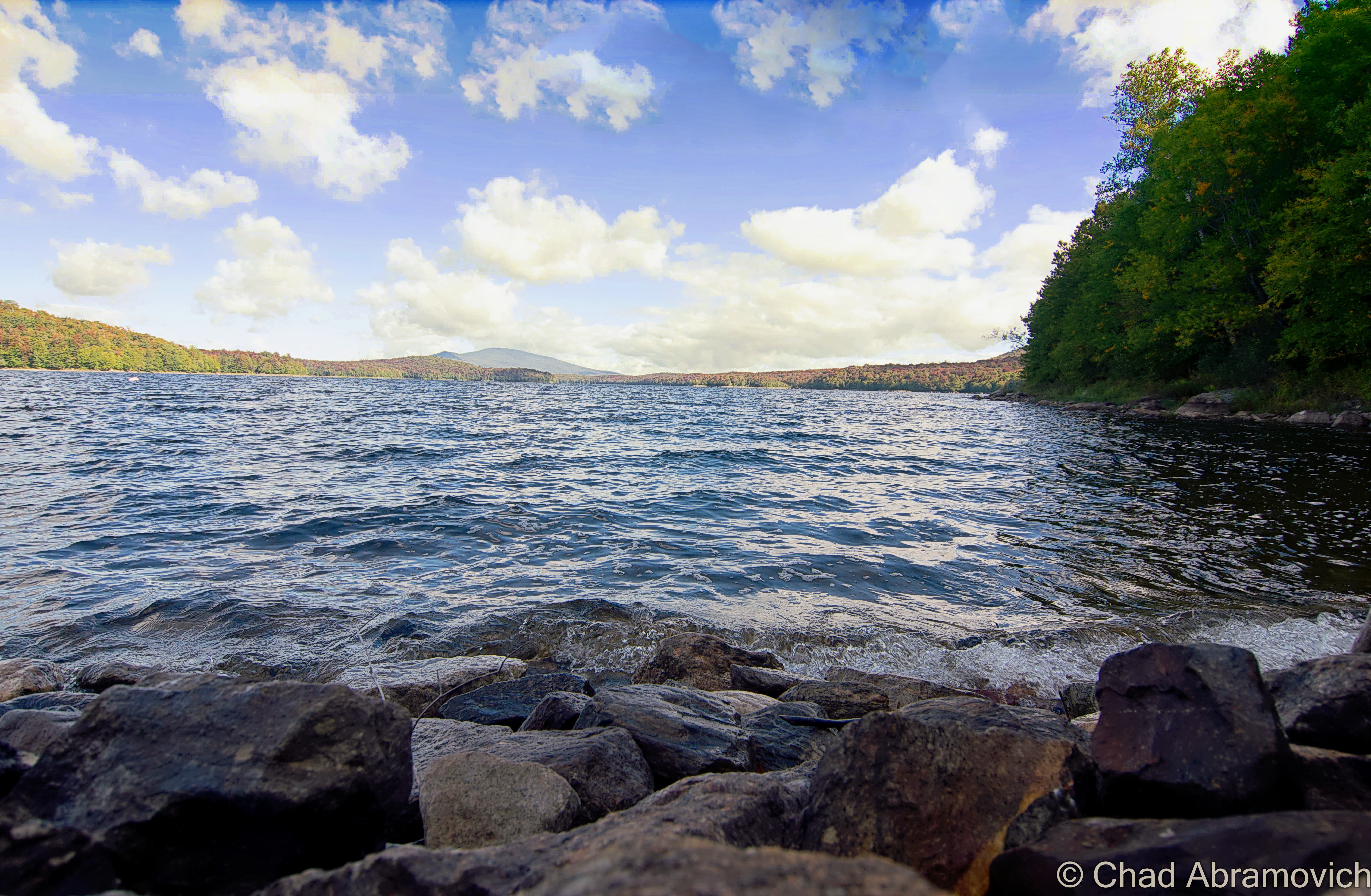
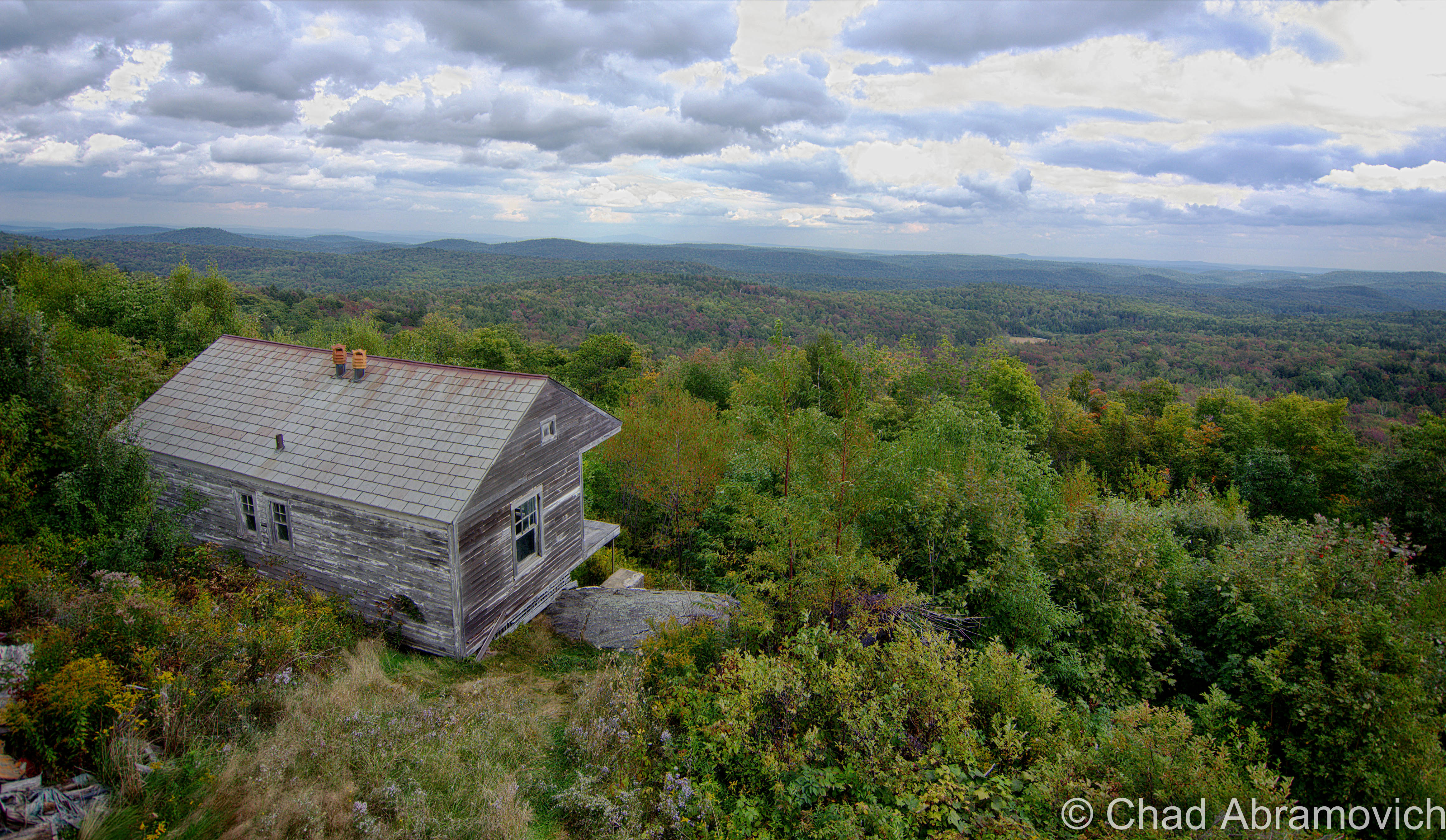
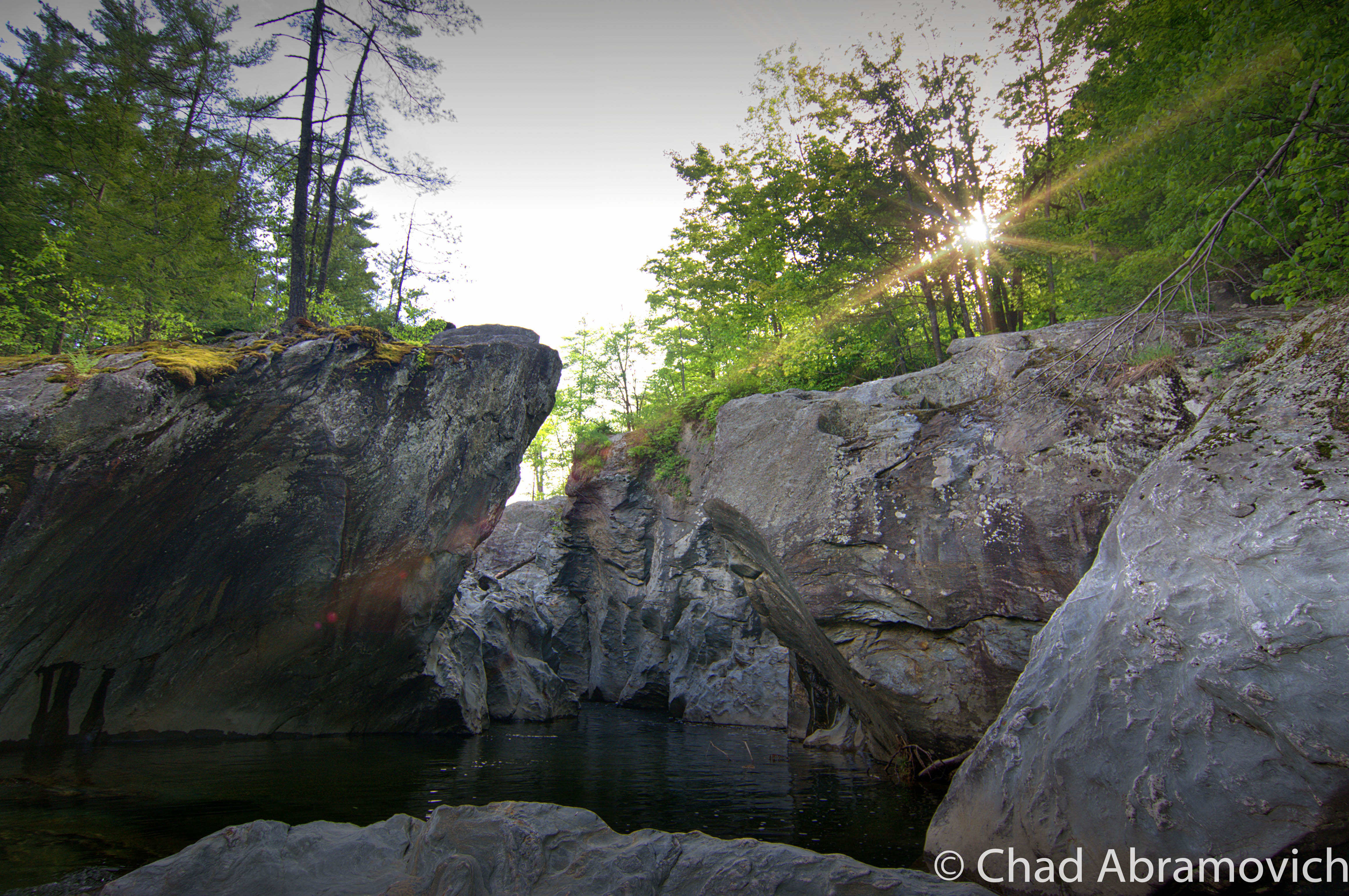
I set out towards Southern Vermont to check out a place I had been hearing about through the rounds of social media for a while now; some otherworldly and kitschy ruins situated in a pine glen north of Brattleboro.
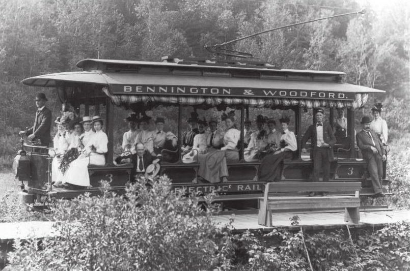
The whole thing was started in the epoch of the American road trip, by a pretty interesting New Jersey man named Jack Poppele in 1957.
Poppele started out as a pioneering radio man. Through his steadfast tinkering, he developed the first directional radio signal, the first portable radio and made stereo available on AM radio. Subsequently, he would start one of the nation’s first radio stations, WOR, out of his Newark, New Jersey home and run it himself. He even became the first person to broadcast on Christmas day in 1922.
Poppele also loved Christmas. So much so, it gave him enough weight and direction to his earnestness to build a roadside attraction dedicated to it a few decades later. He started his Christmas career in rural southern Vermont, and used the same equation that brought sucess and attention to most roadside Americana; he situated it on a major U.S. passageway; Route 5 – a decade before Interstate 91 would bypass a sundry of former industrial towns along the Connecticut River – a decision wielded with clout that would haunt a lot of Vermonters and leave a lot of communities divided and disconnected.
The coming of the interstate was a belief in progress, and Elbert Moulton, the state’s economic development chief, declared it as the thing that would bring Vermont “out of the sticks” into modern day America, and Senator George Aiken enthused “We’re on the verge of the greatest development Vermont has ever seen.” And he might have been right. Not many construction projects up here have matched its scale in its leveled and asphalted wake.
But with big change comes big displeasure from plenty of Vermonters.
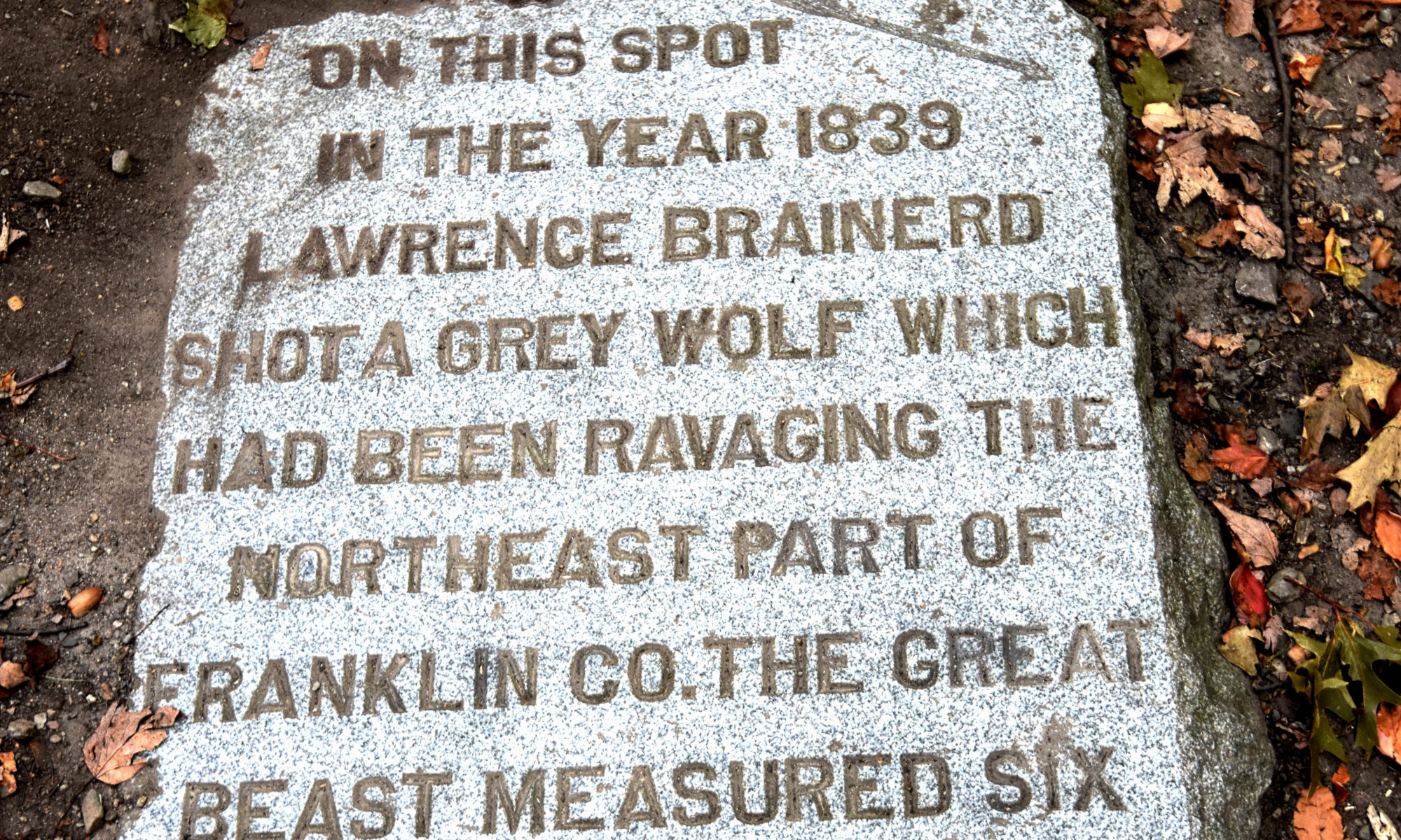
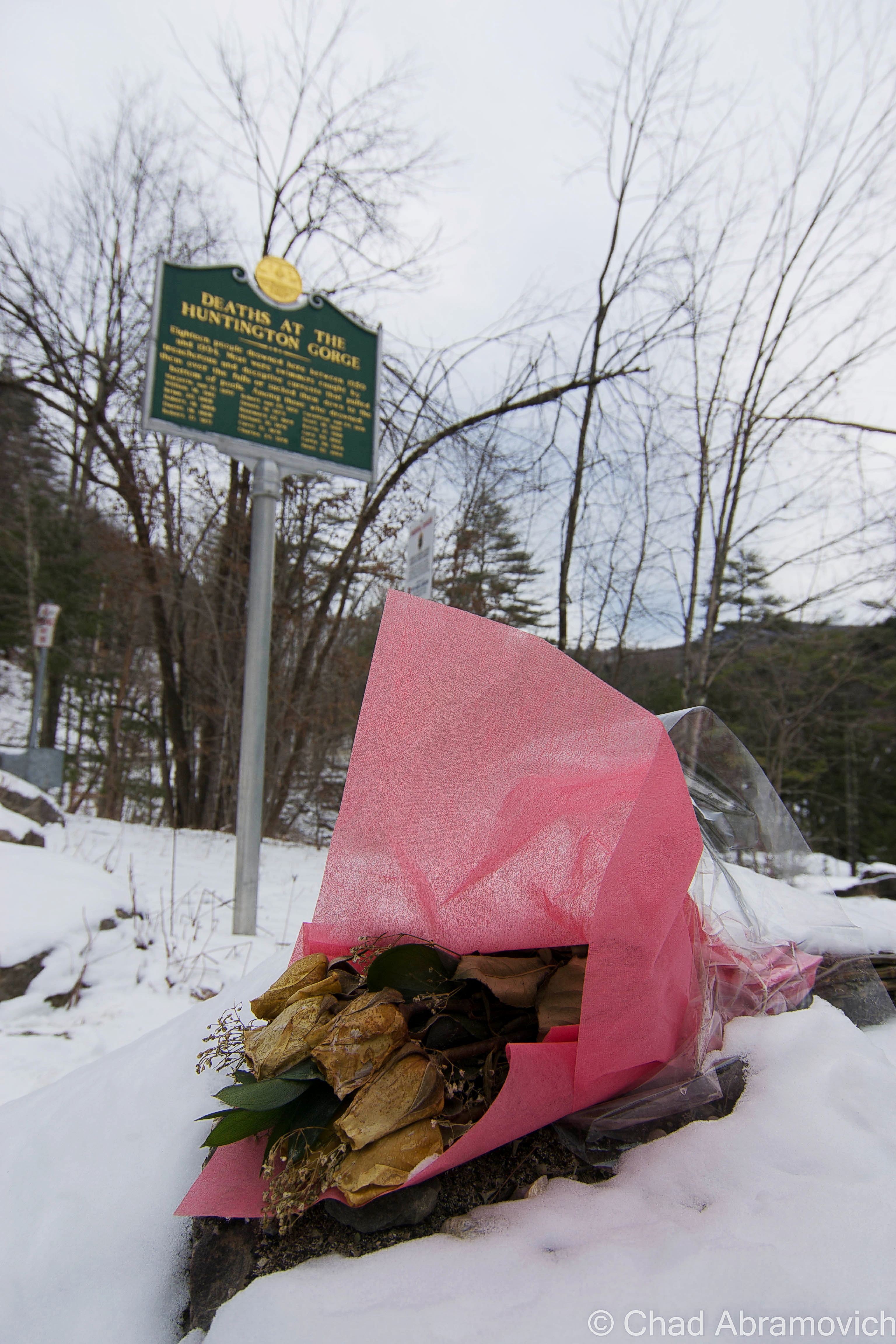
64-year-old farmer Romaine Tenney from nearby Ascutney made national headlines in 1964 when he committed suicide and set his barns alight after coming to the heartbreaking realization that the new highway would slash through his farm, and despite all his melancholic stubbornness and refusal to leave the land he grew up on and loved more than anything, he couldn’t stop the pavement from literally approaching his front door. Not only did Tenney posthumously become a symbol of the curmudgeonly Vermont character, but the circumstances might just make exit 8 the most poignant spot along the whole state highway system.
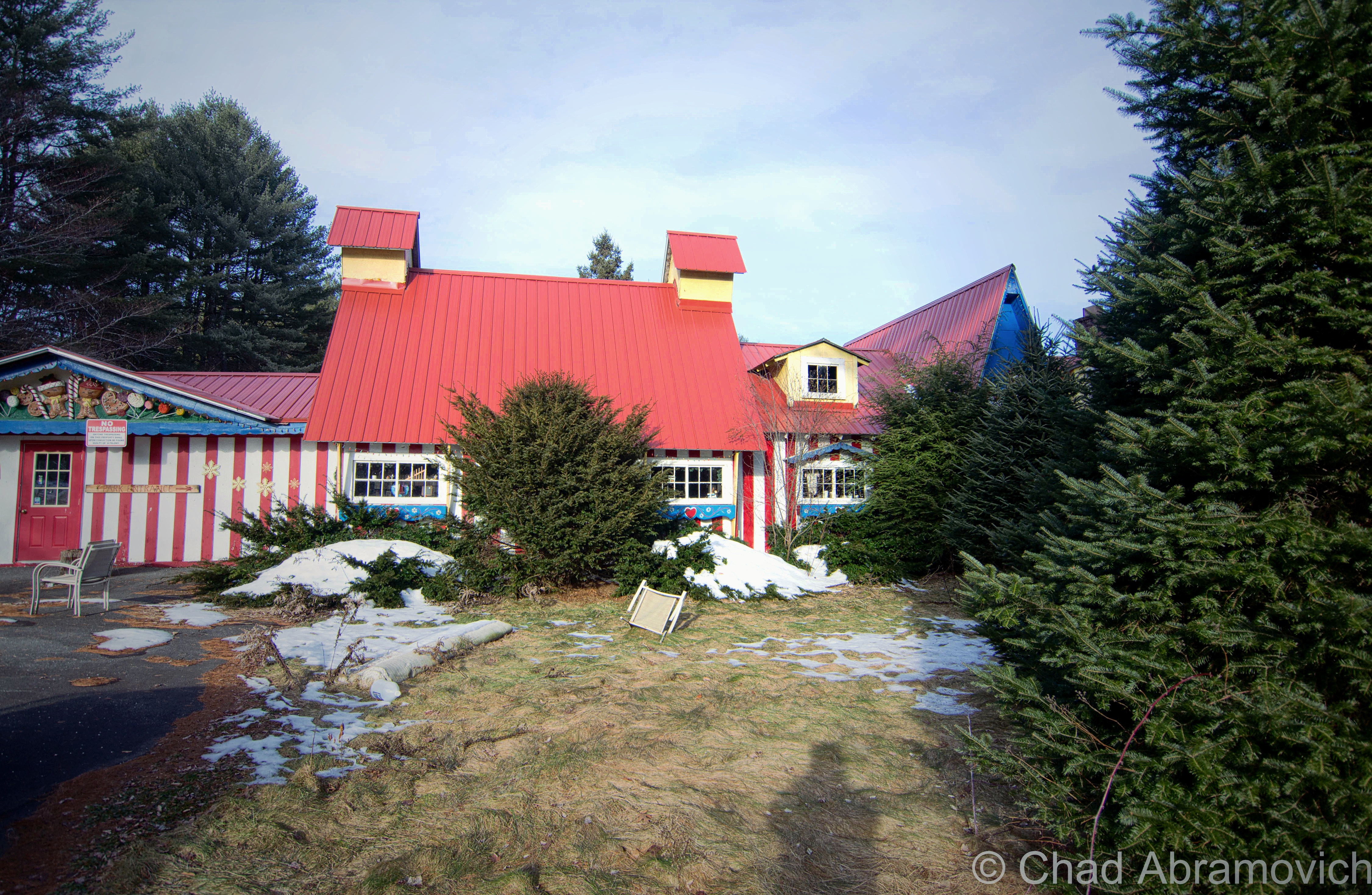
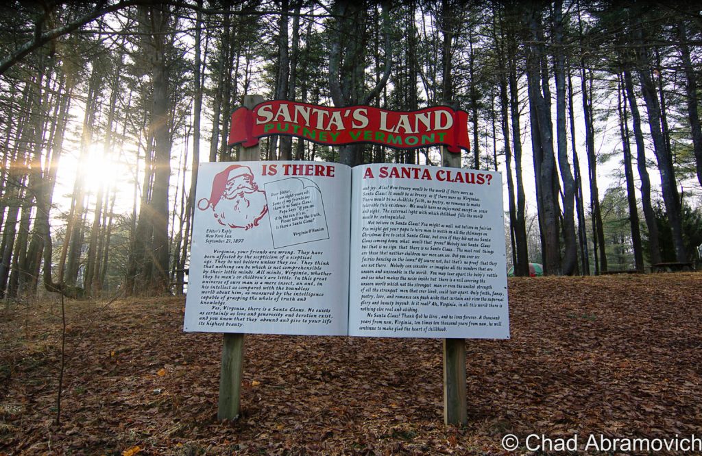
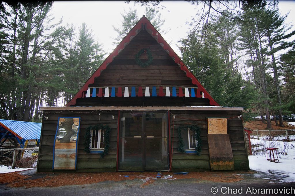
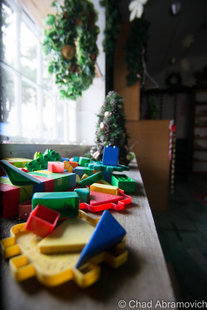
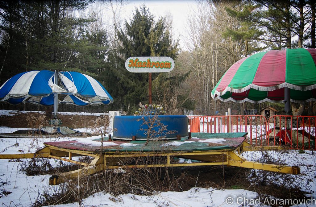
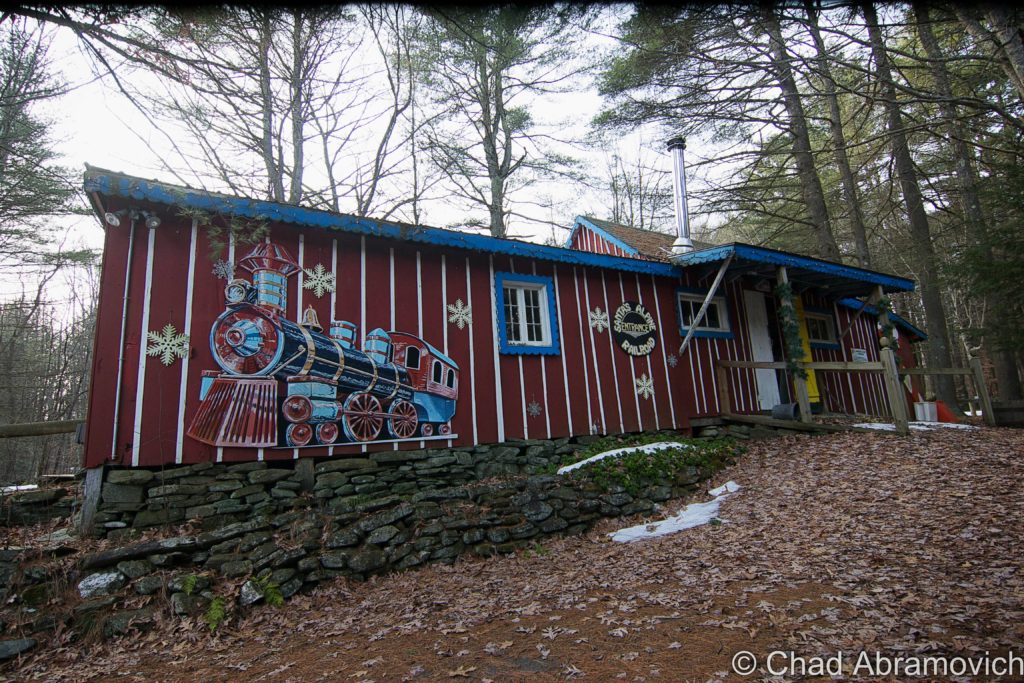
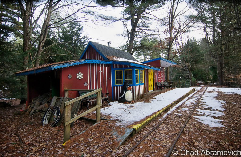
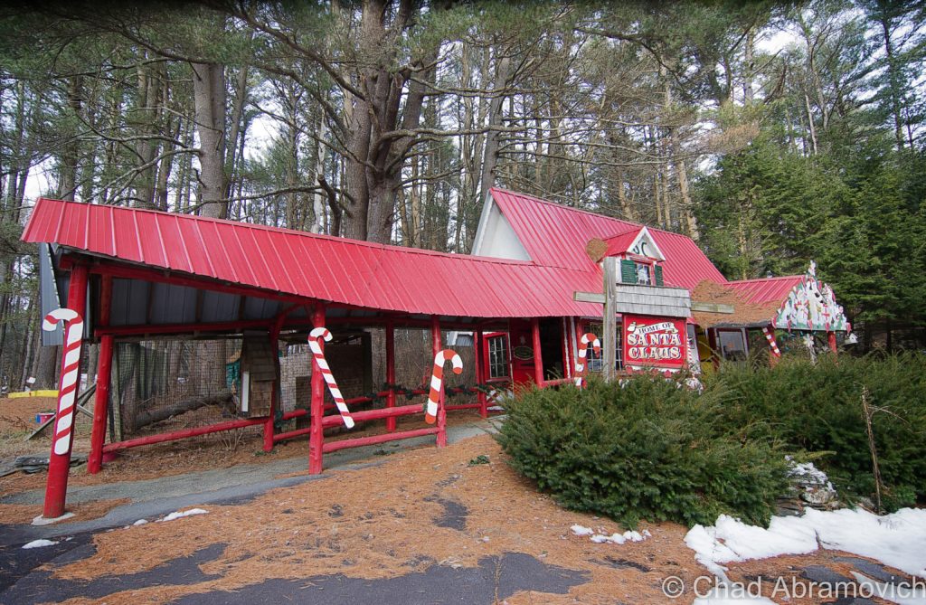
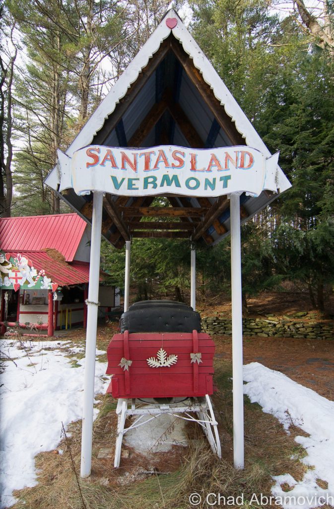
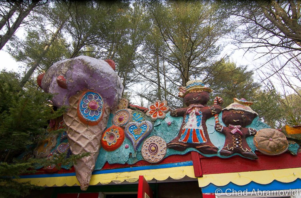
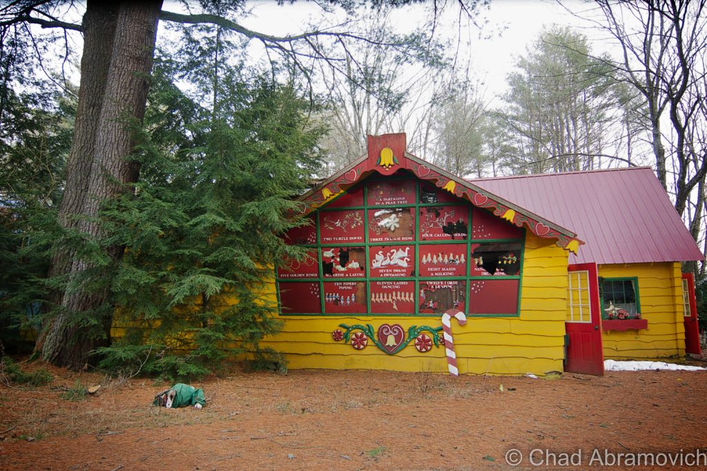
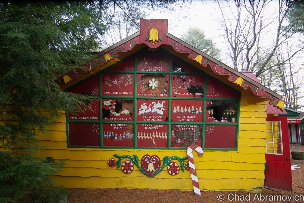
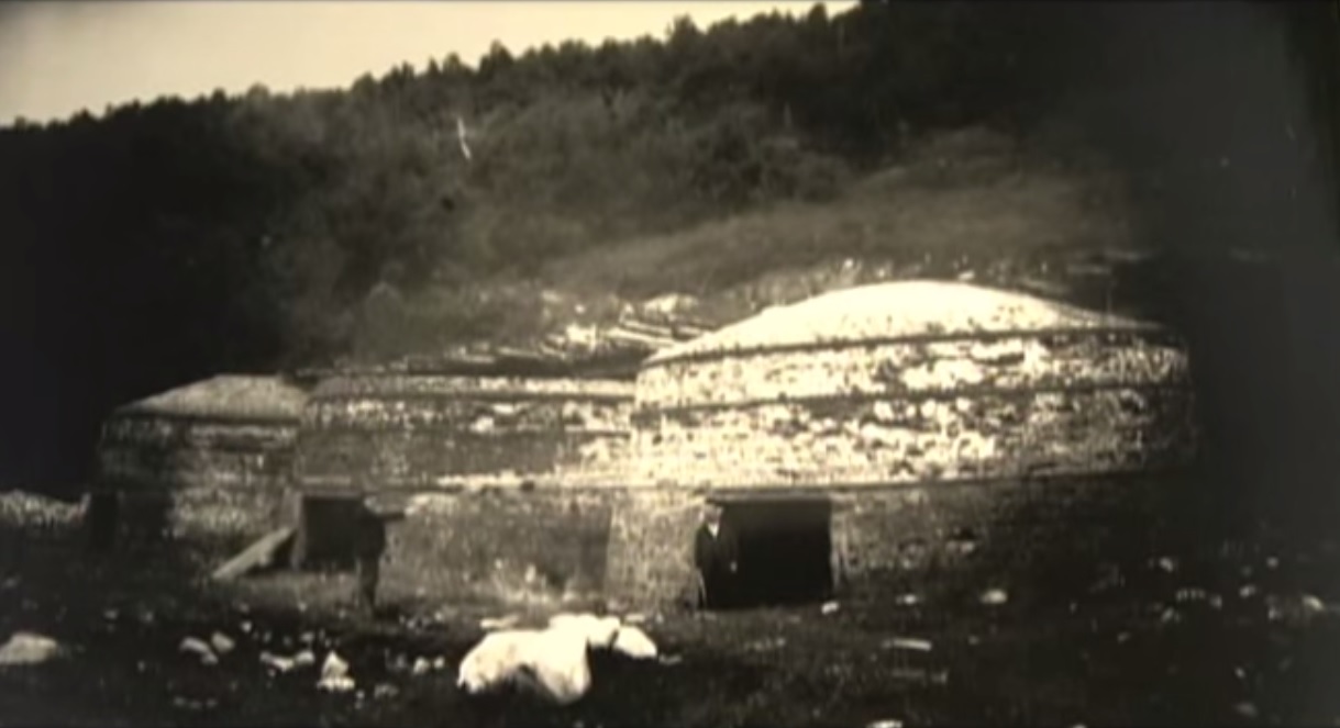
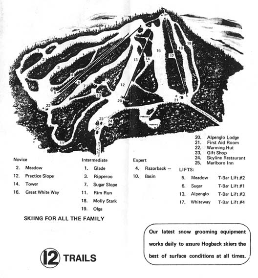
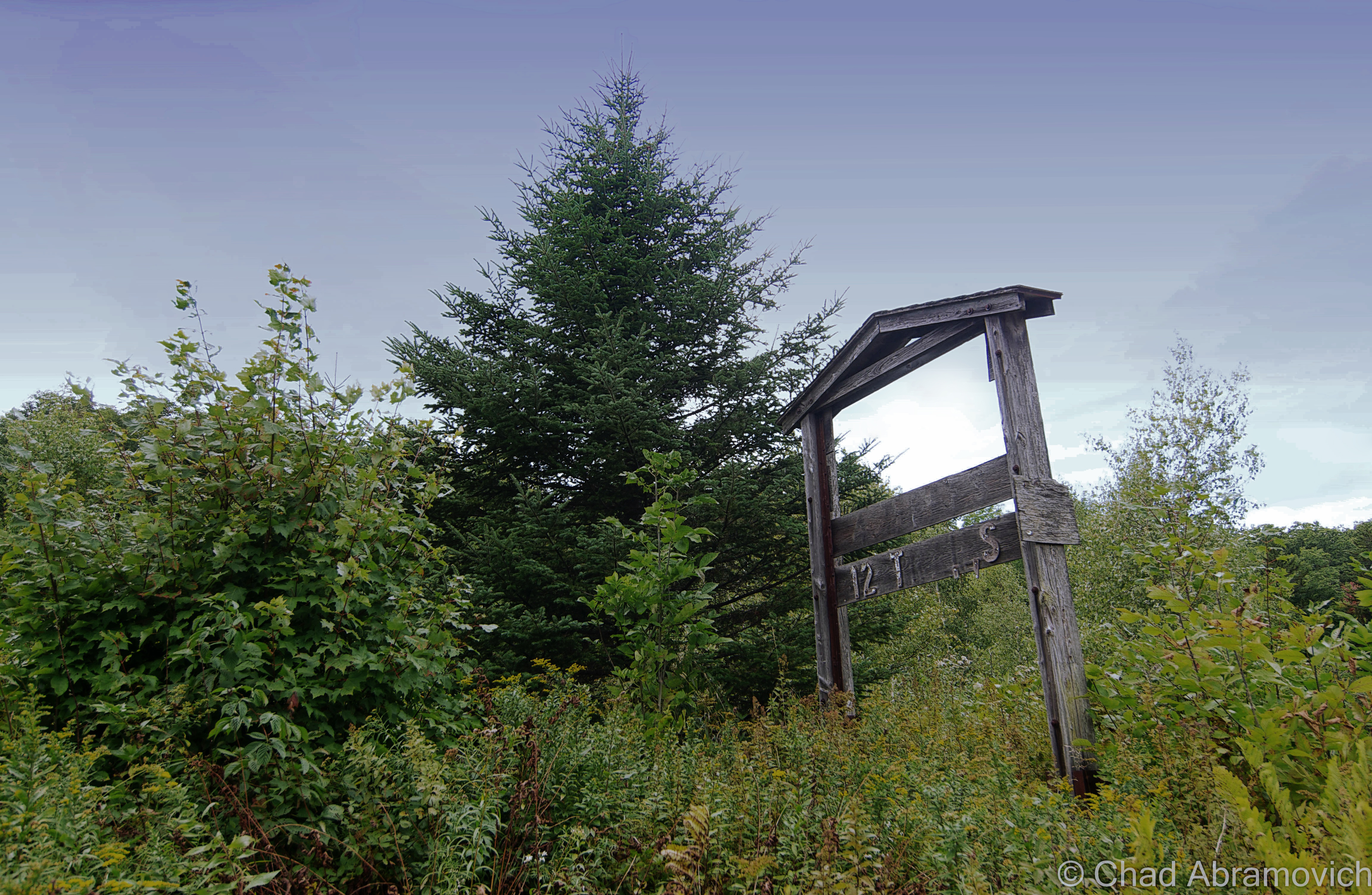
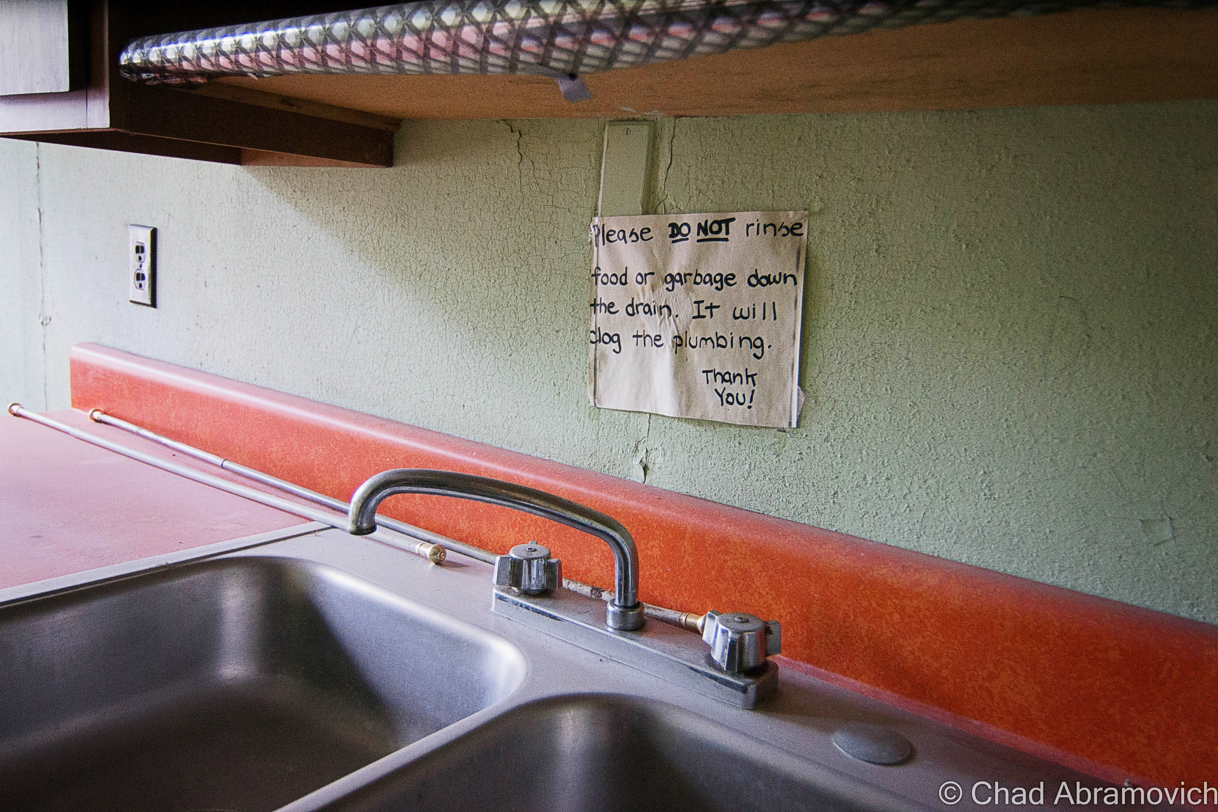
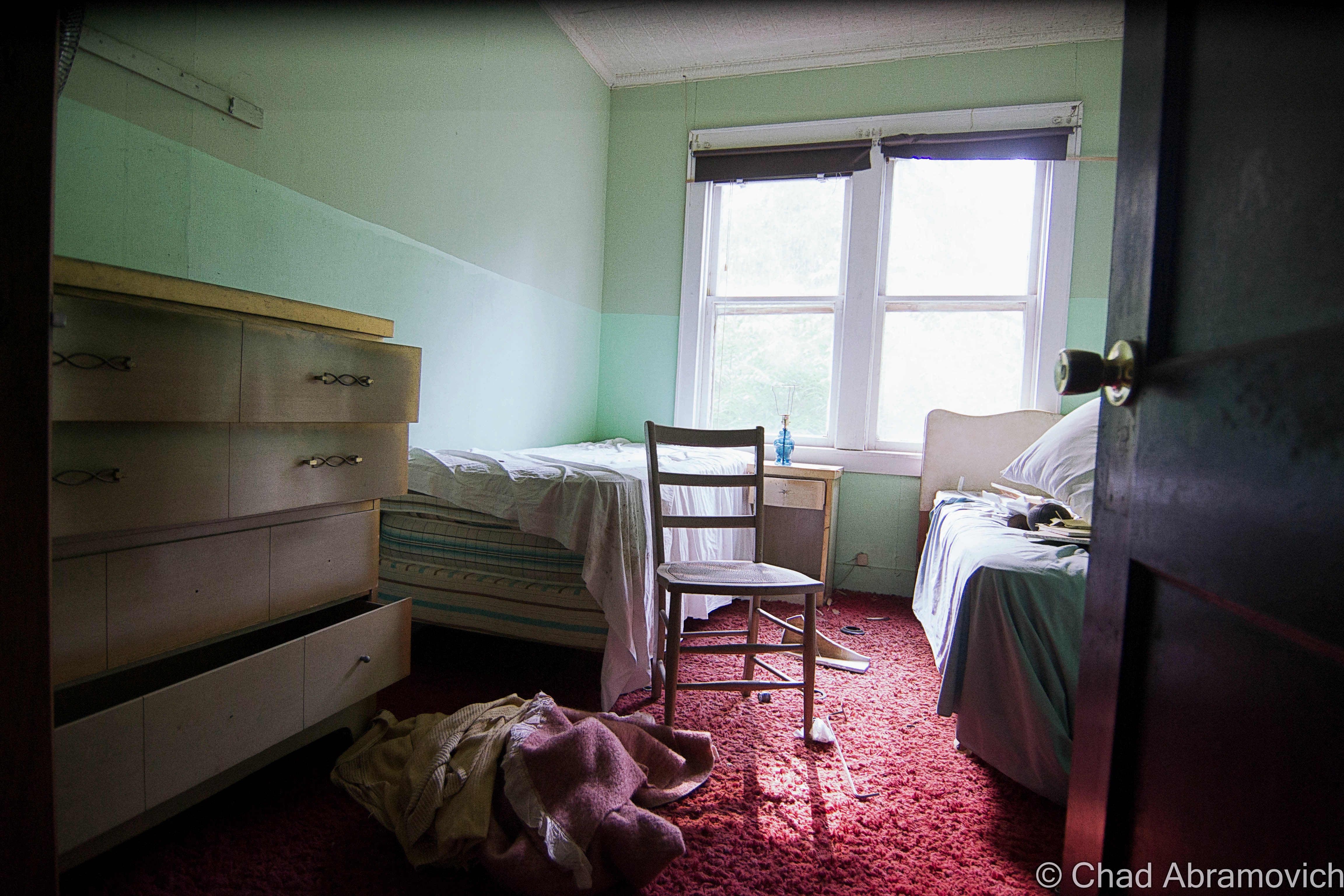
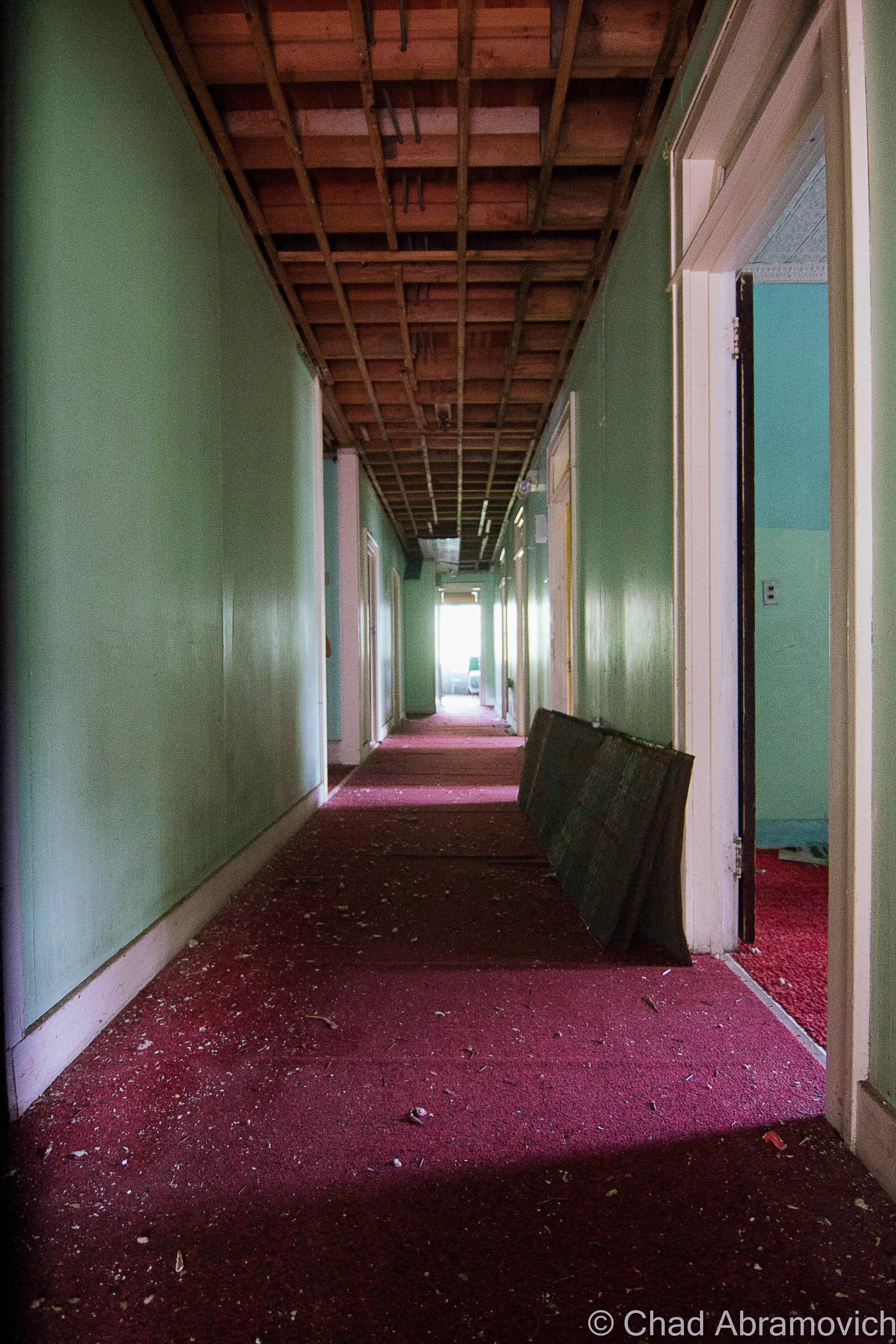
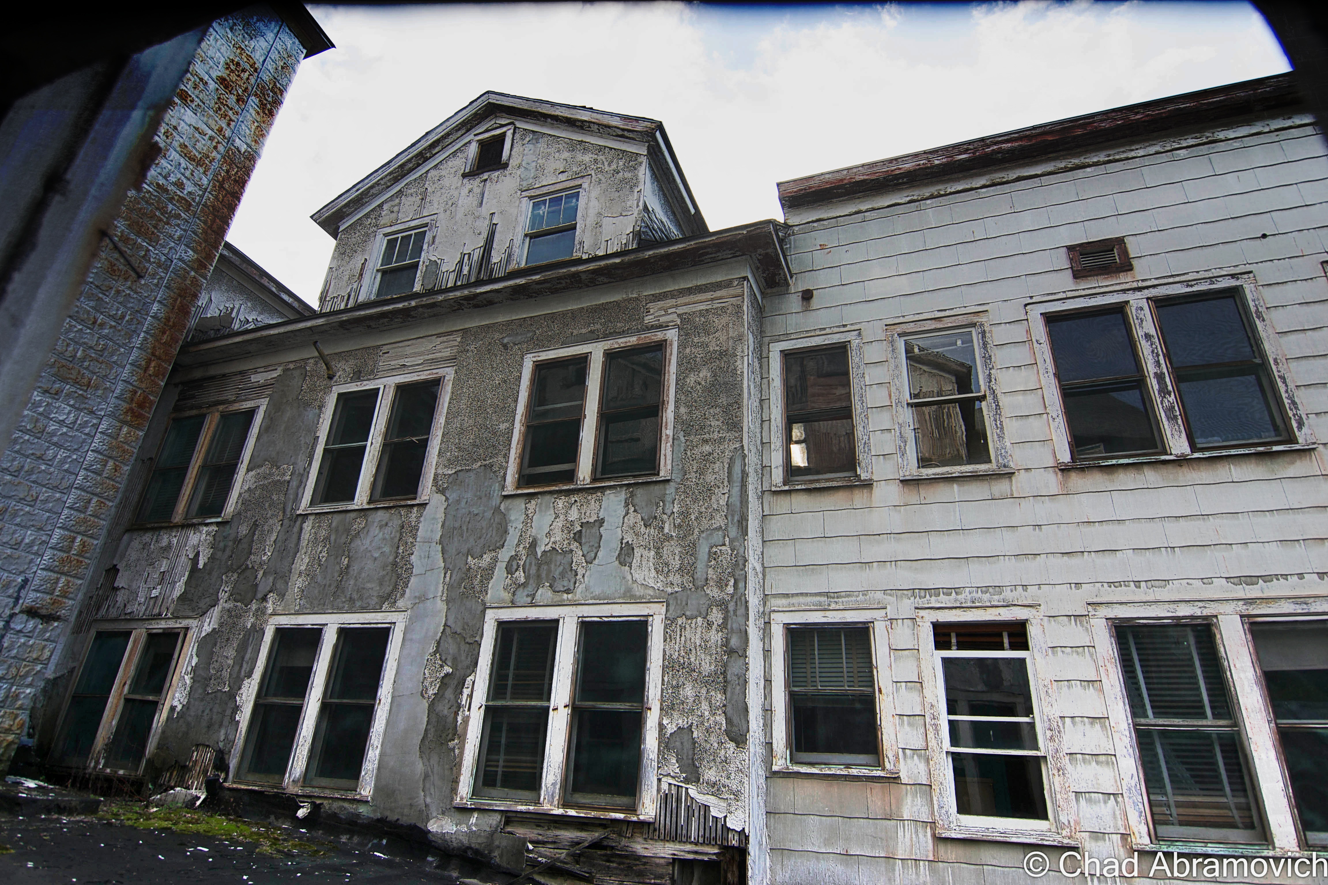
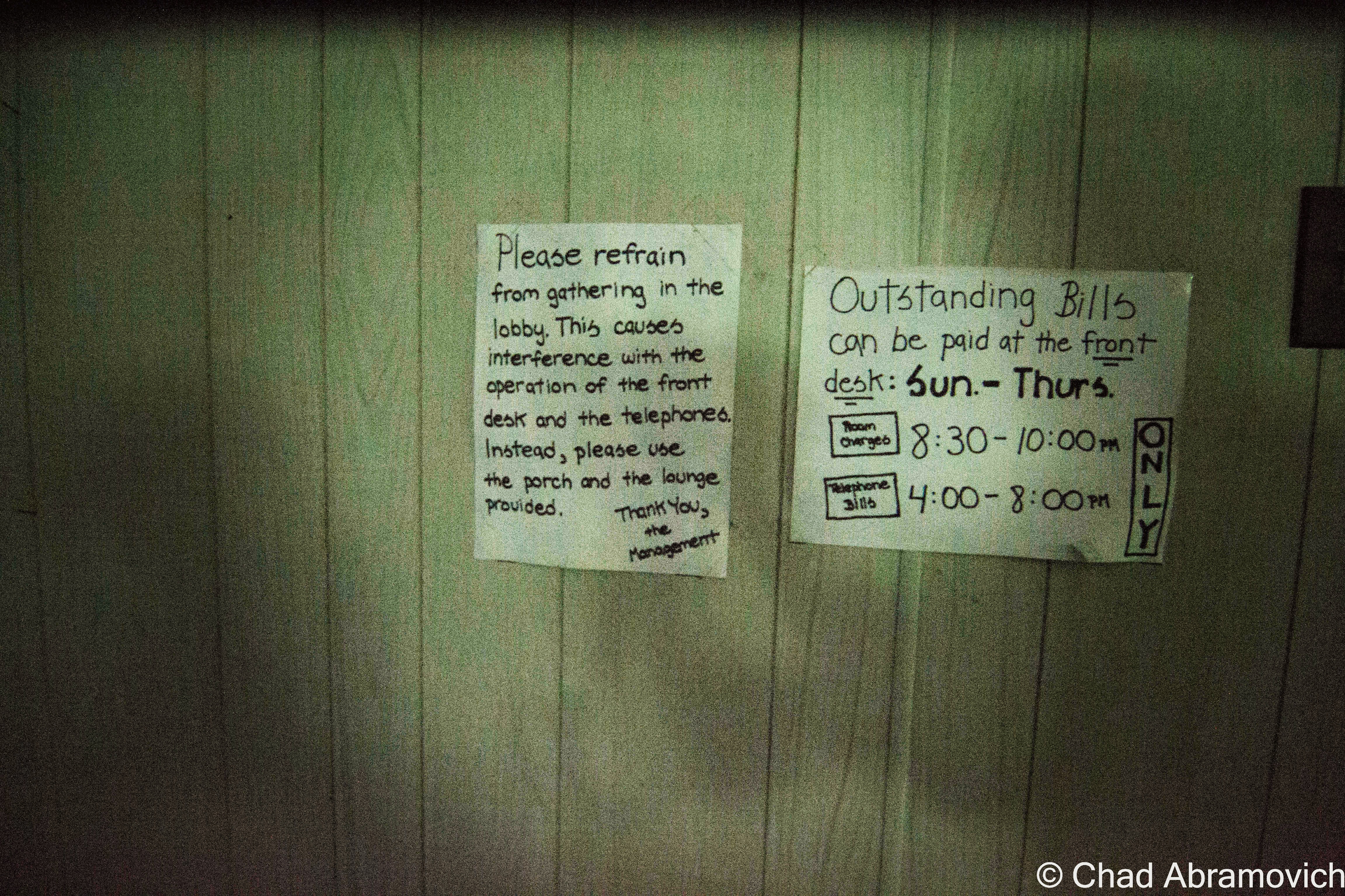
The tourist trap, which was built like a homespun alpine “storybook village” on 42 shady acres complete with attractions like Christmas heritage informational signs erected around the winding pathways, a reindeer petting area, a variety of uncomplicated rides, a circulating locomotive and, of course, a Santa that would gently interrogate wide-eyed children about their Christmas wishes – would run about half a century.
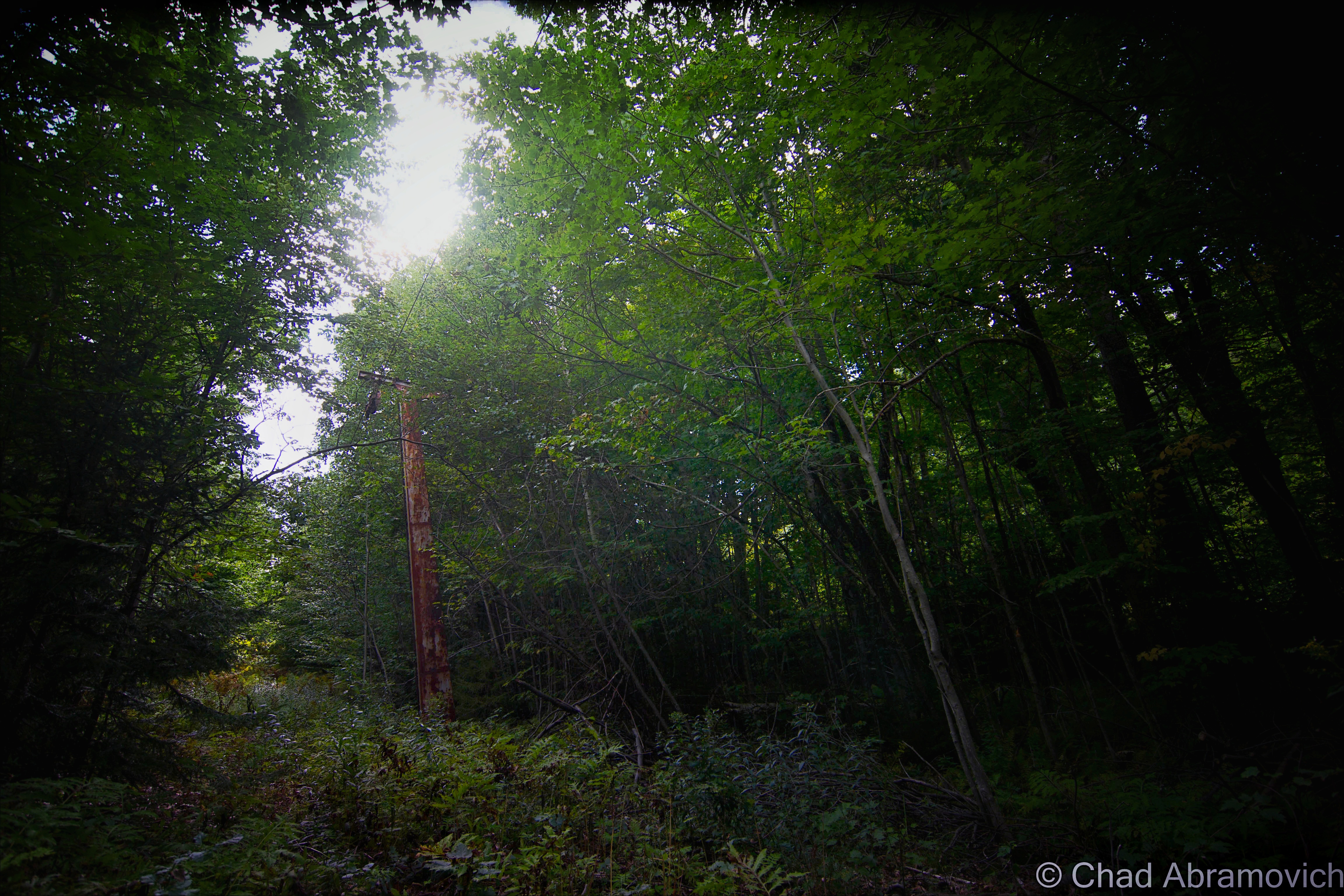
Even an airstrip was built adjacent to the park. Today satellite imagery reveals that the clearing is still there, but a new-ish solar farm installed in the middle indicates that no planes are probably going to be landing there now. A gander at Google maps still marks the defunct strip as “Santa’s” with the blue and white spherical plane logo, and is actually the only indication the park even exists.
Popple’s passion wouldn’t be enough to imbue it with a long shelf-life. Various owners, growing disinterest in the measured property and eventual bankruptcy would eventually close it down in December of 2011. The Billewicz family would save the place from being completely auctioned off in 2013 and opened it back up on winter weekends, but the park was still sort of dilapidated then according to Seven Days when they visited. It sounds like it might just be part of the Santa’s Land experience.
Not long after, in 2014, it was closed again due to animal cruelty allegations after 18 animals were found dead at the park, and it’s been forsaken ever since. If someone is interested in buying and re-opening, they would probably have to pay an enormous bill just to get it back up to code. Man, this place just can’t catch a break.
I’ll be honest here, I’m not really into Christmas all that much. To me, the holiday is sort of gaudy and more of a to-do list and running errands and unwanted pressure. I prefer fun holidays like Halloween, it just matches my weirdo style more, and better yet, no obligations in sight. That probably doesn’t come as a surprise from someone who runs this sort of a blog though.
One of the reasons I put this on my road trip list was not just because it’s a charming part of Vermont obscura, but because of the weird things I kept vaguely hearing about this place over the past decade, including that people thought it was abandoned years before it actually closed down. The attraction seemed to have a weird, remiss vibe in between the nostalgia.
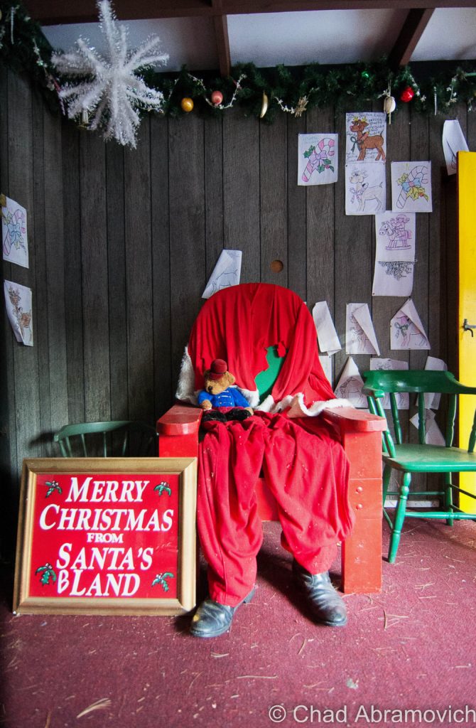
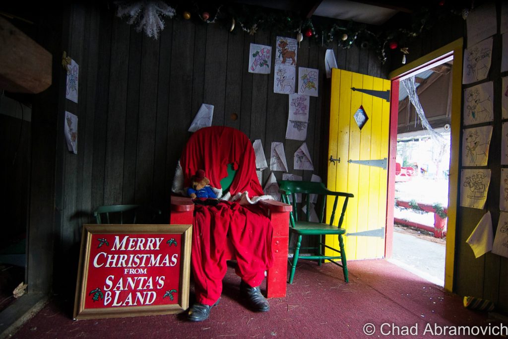
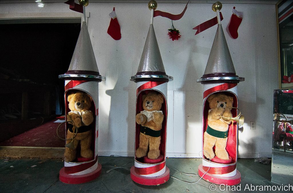
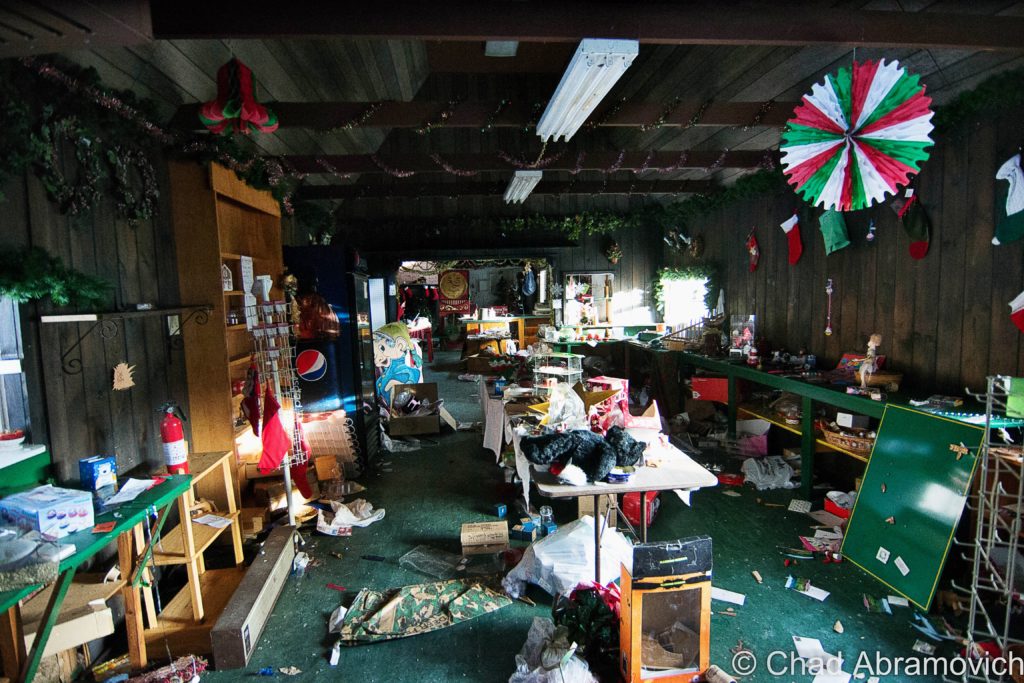
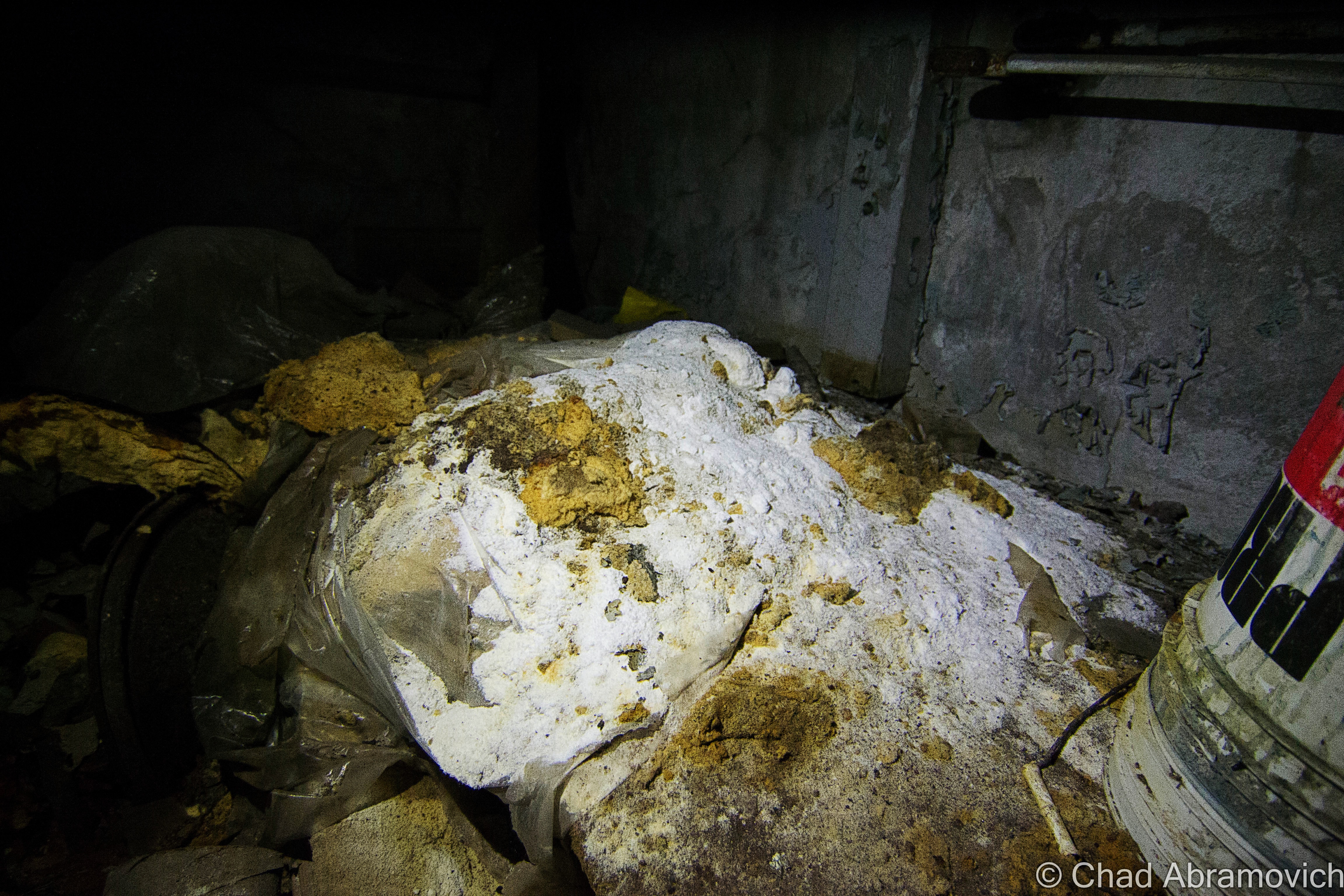
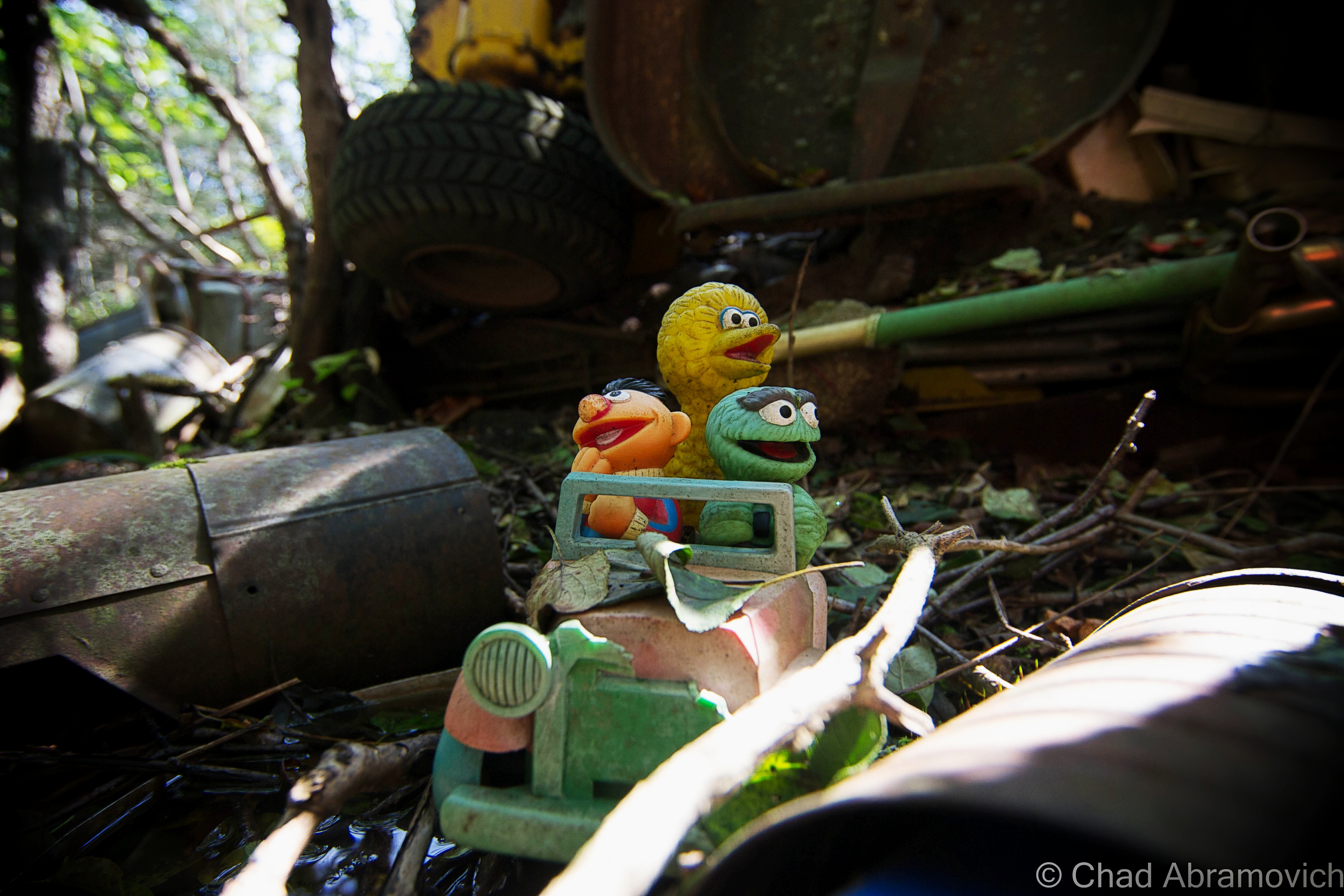
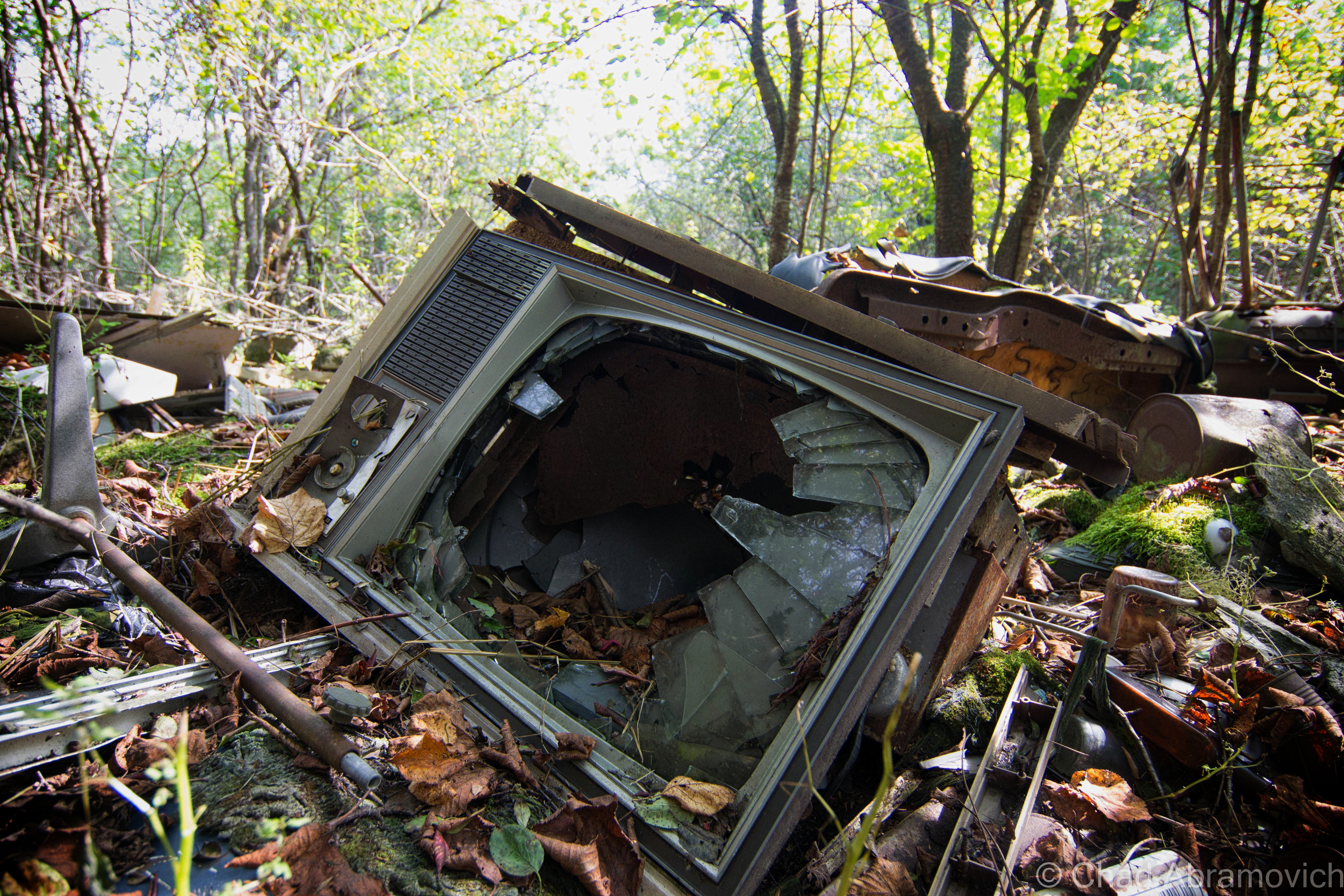
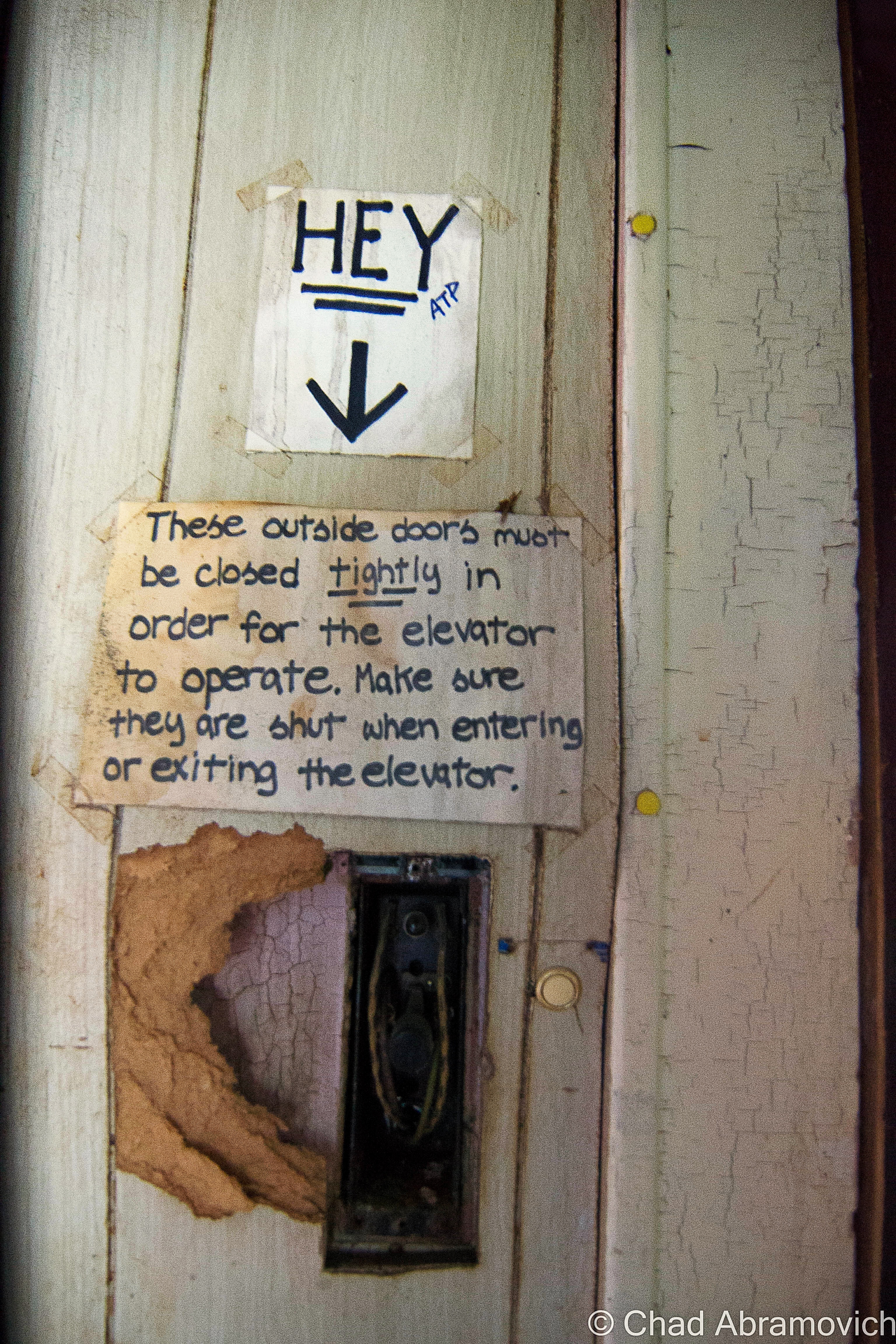
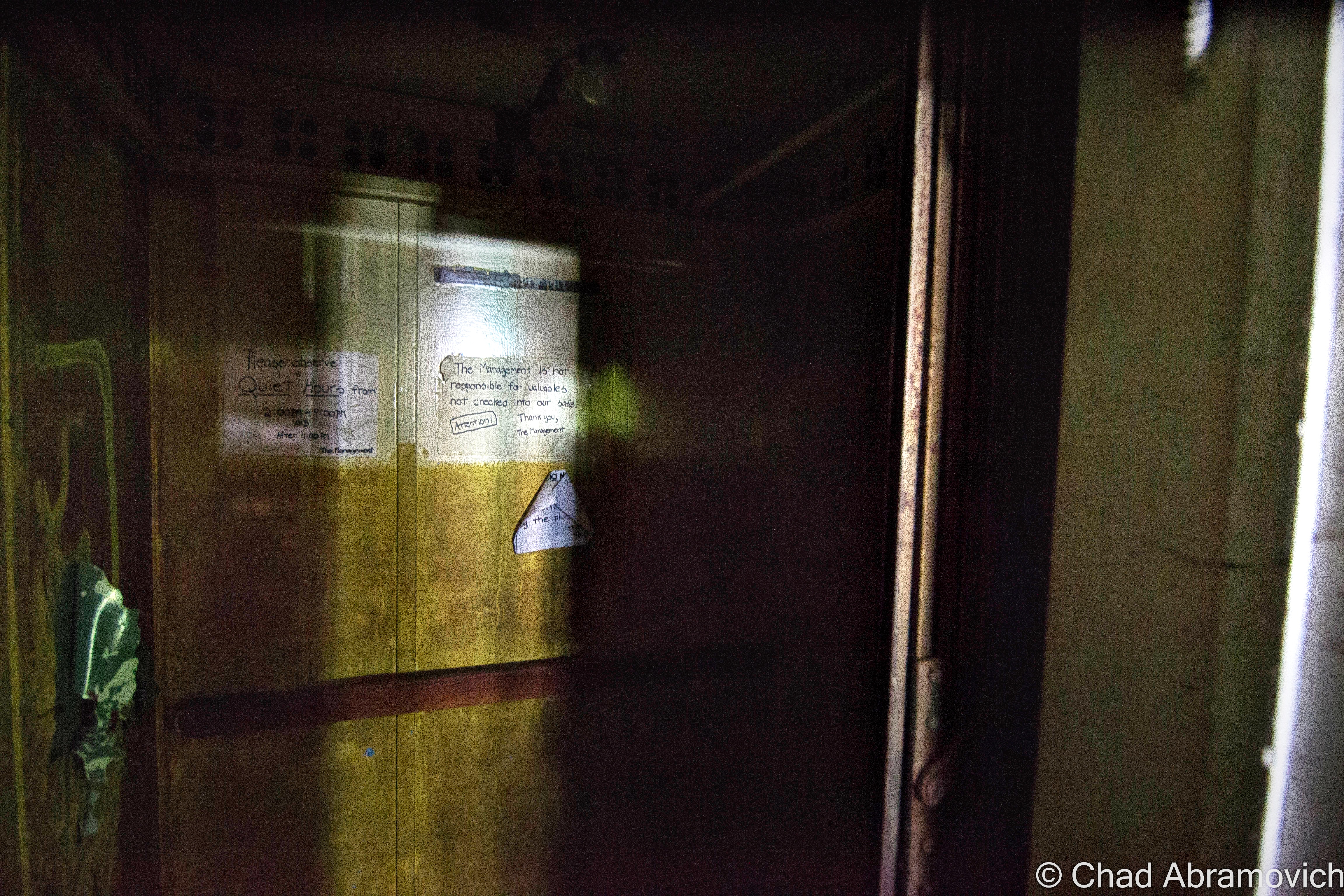
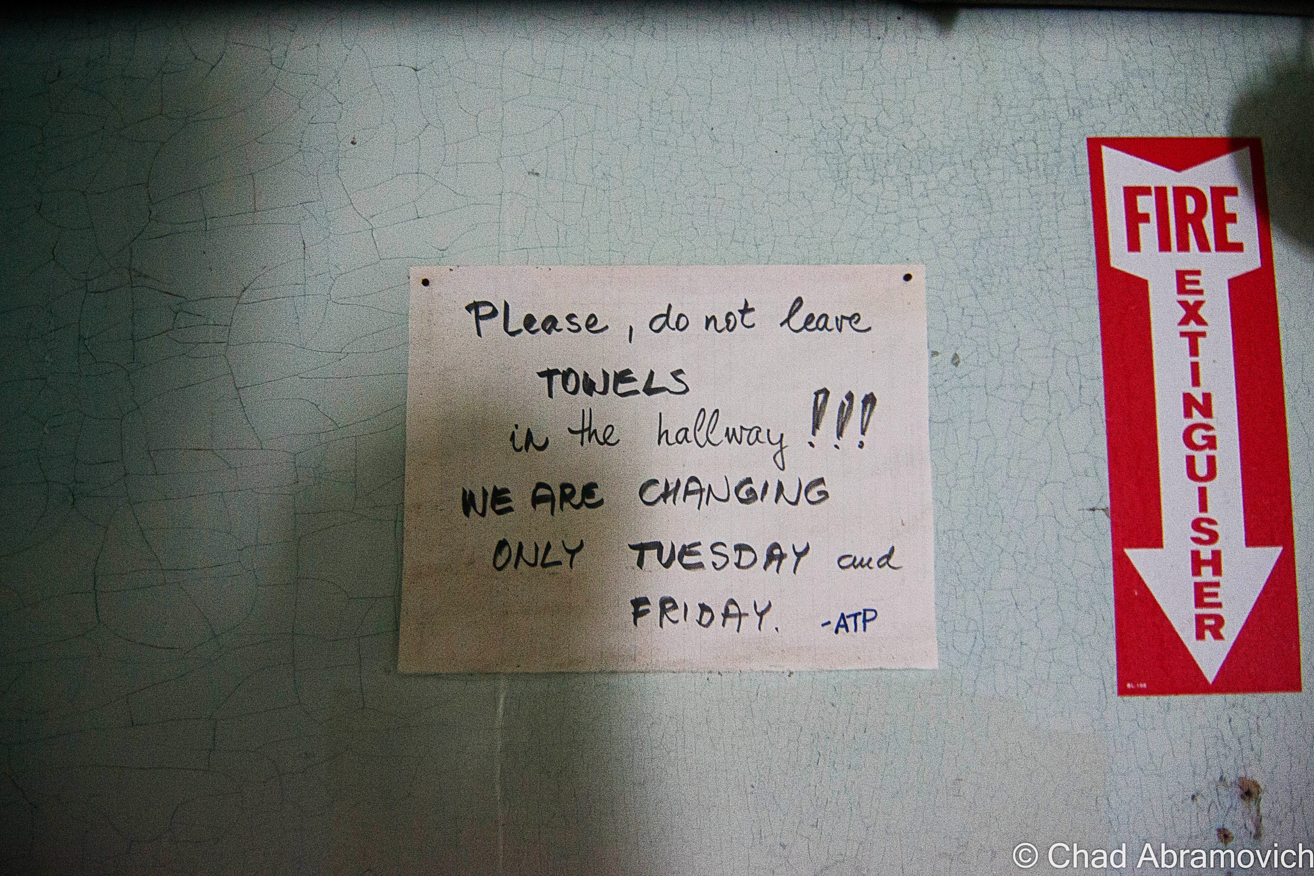
An amusing review of Roadside America’s trip here amusingly revealed a sort of surreal walk through a dysfunctional park that appeared to be run by a skeleton crew of 5 people. The best part was when they found a napping Santa, who awoke groggily and out of sorts at their presence, and then outright asked them if they wanted to buy the place, which was sort of a mood killer I would assume. Other memories included creepy static-y televisions left flickering in various deserted buildings and huge white blobs of, well, no one knows what, found along one of the pathways.
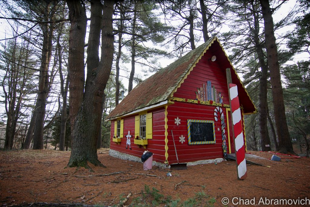
At one point, there was a unique and esoteric construction here called “The Igloo Pancake House”,- a restaurant built out of spray foam and considered to be somewhat rare in the realm of Americana – only another such structure was built similarly in the U.S. The concept was imagined in the 60s, with the thought that spraying wet polyurethane foam over gigantic balloons could be an answer to saving energy and was described as “turning over a Styrofoam cup and living in it!” But I guess not all Americans wanted to live in a styrofoam cup and the idea never really caught on.
The park was enthusiastically owned by the Brewer family in the 1970s, and they apparently lived in the spray foam house. But when Roadside America visited, it was decaying and forlorn looking. When I visited, I accidentally missed it. I wasn’t familiar with the property boundaries and kept to what I could see from my peripheral and out of sight of the road.
Walking Around
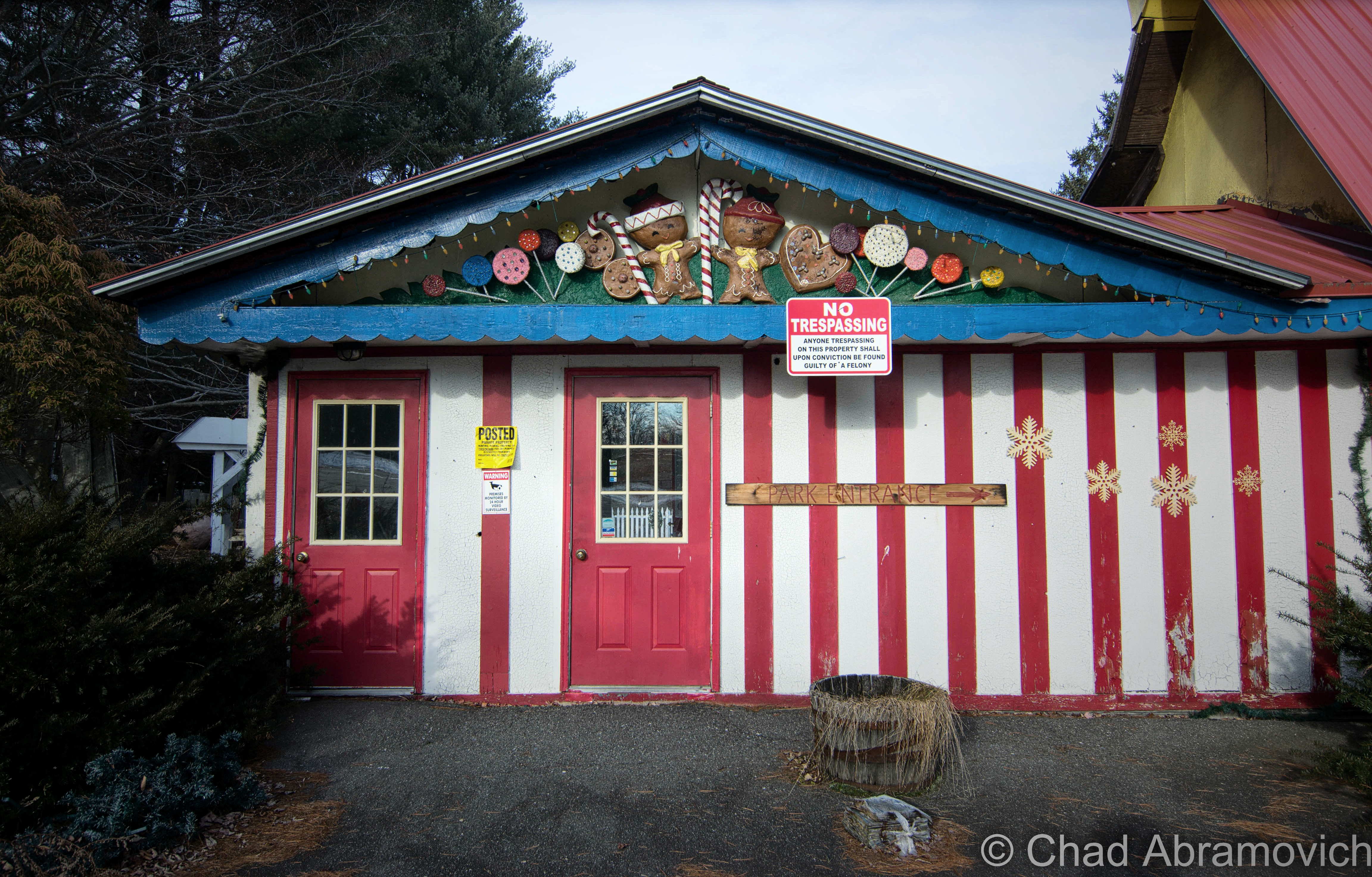
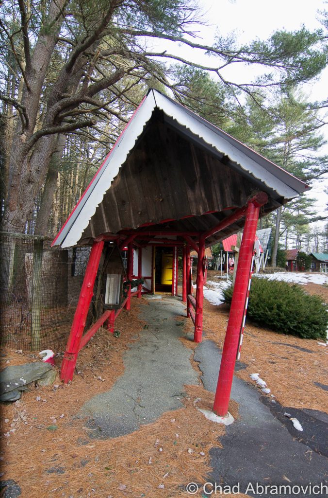
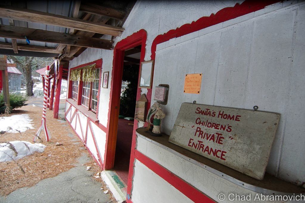
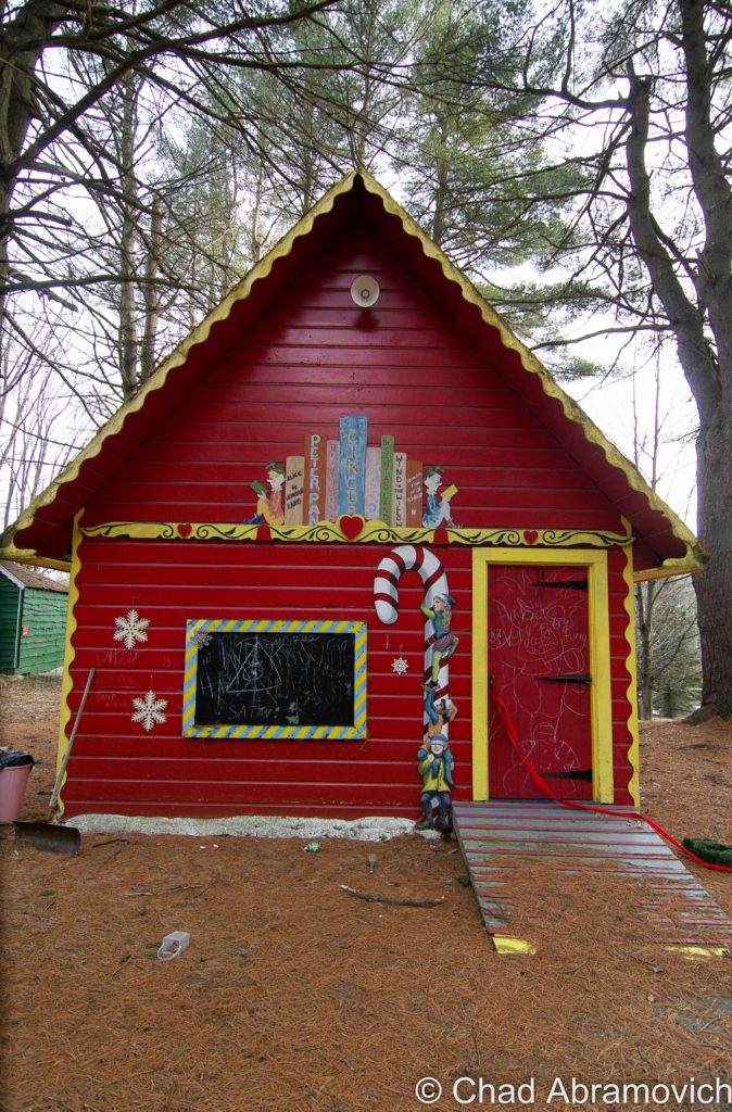
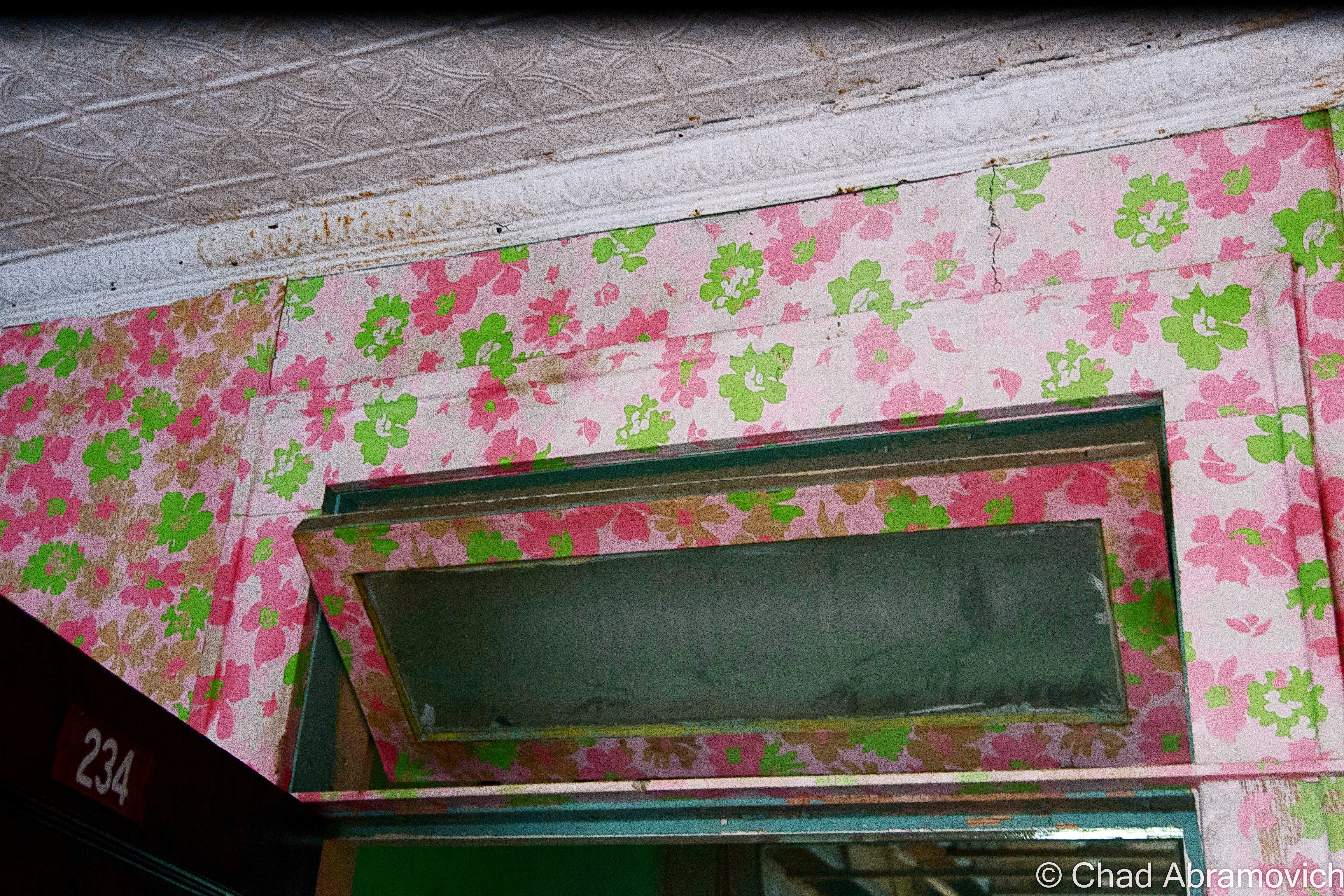
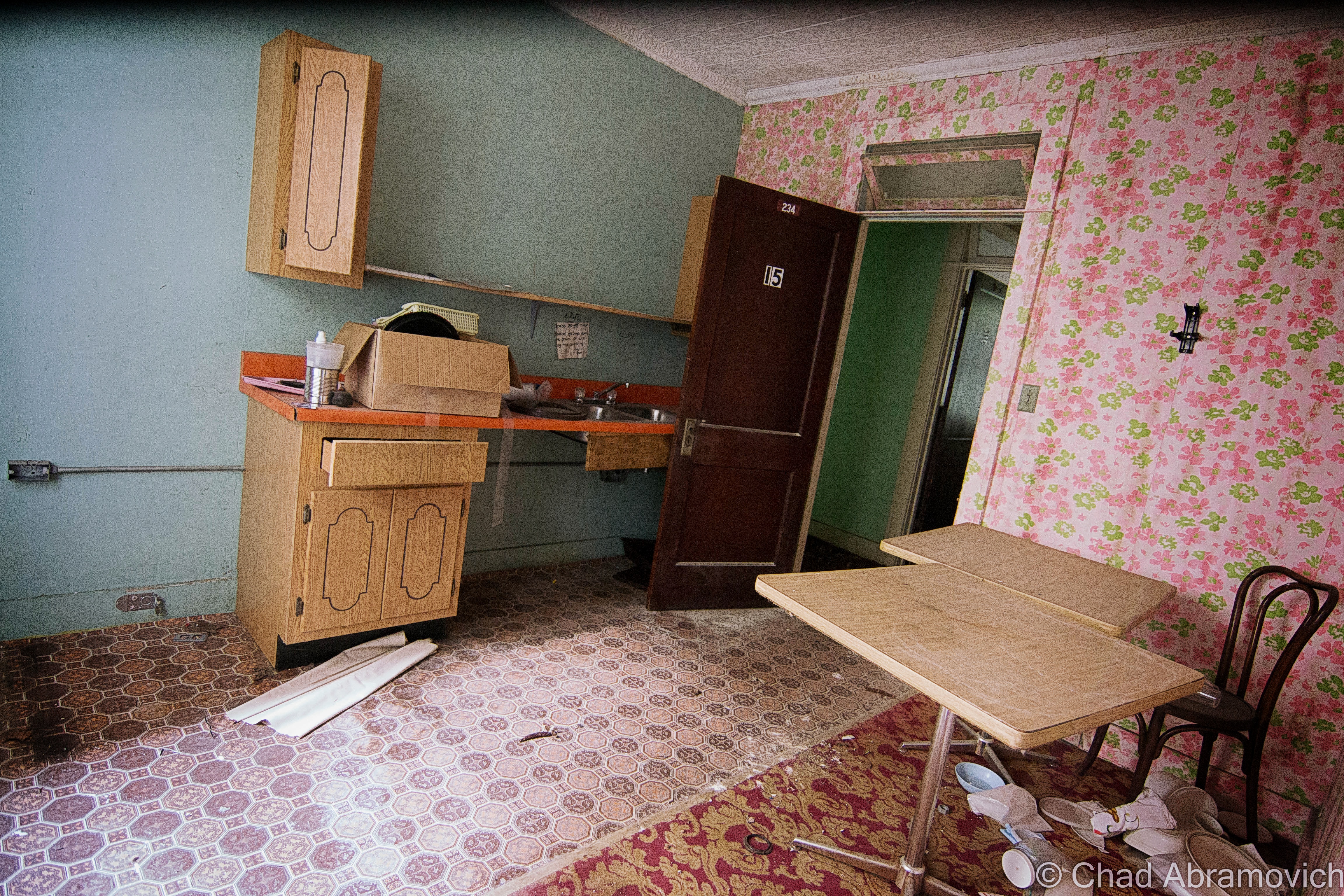
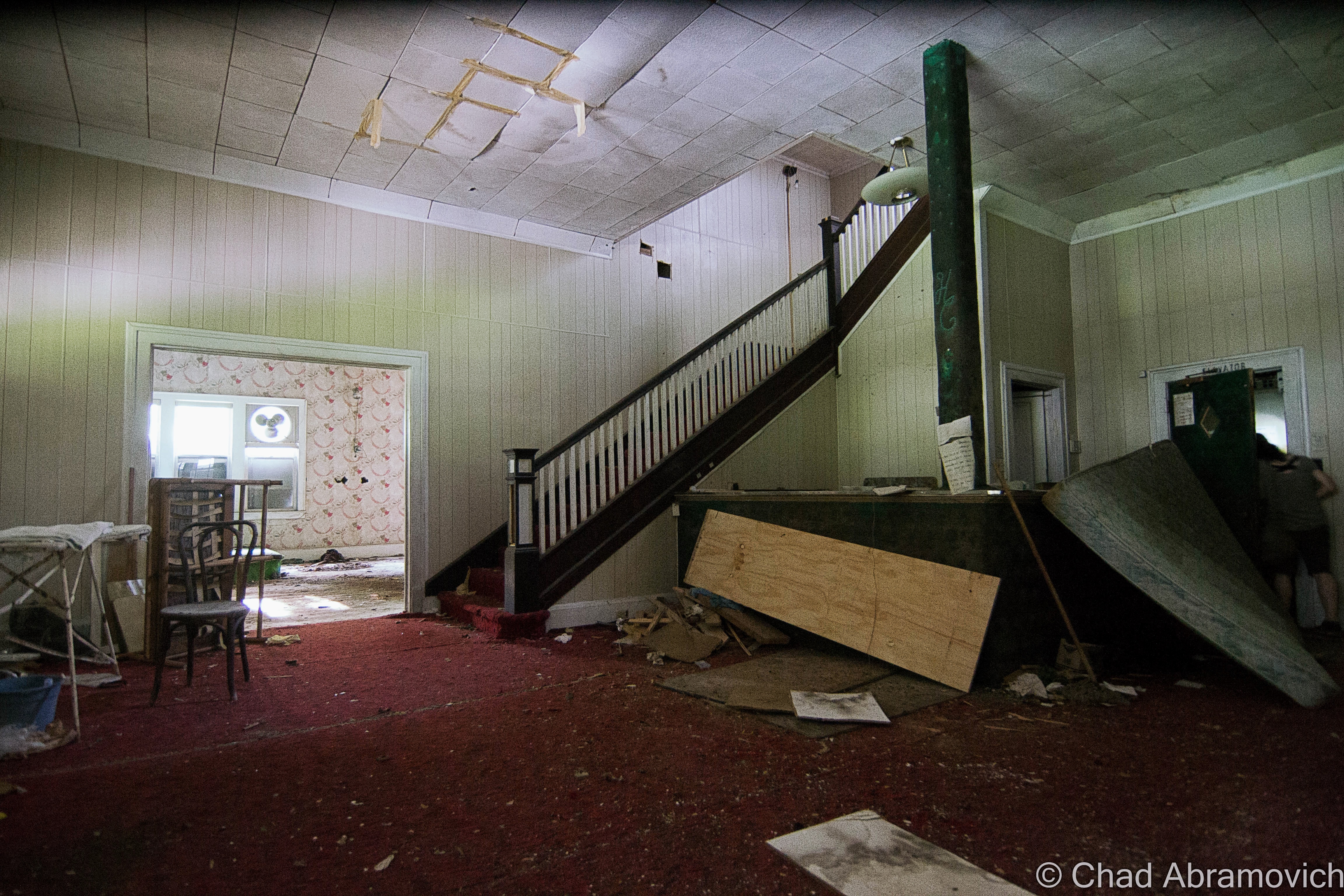
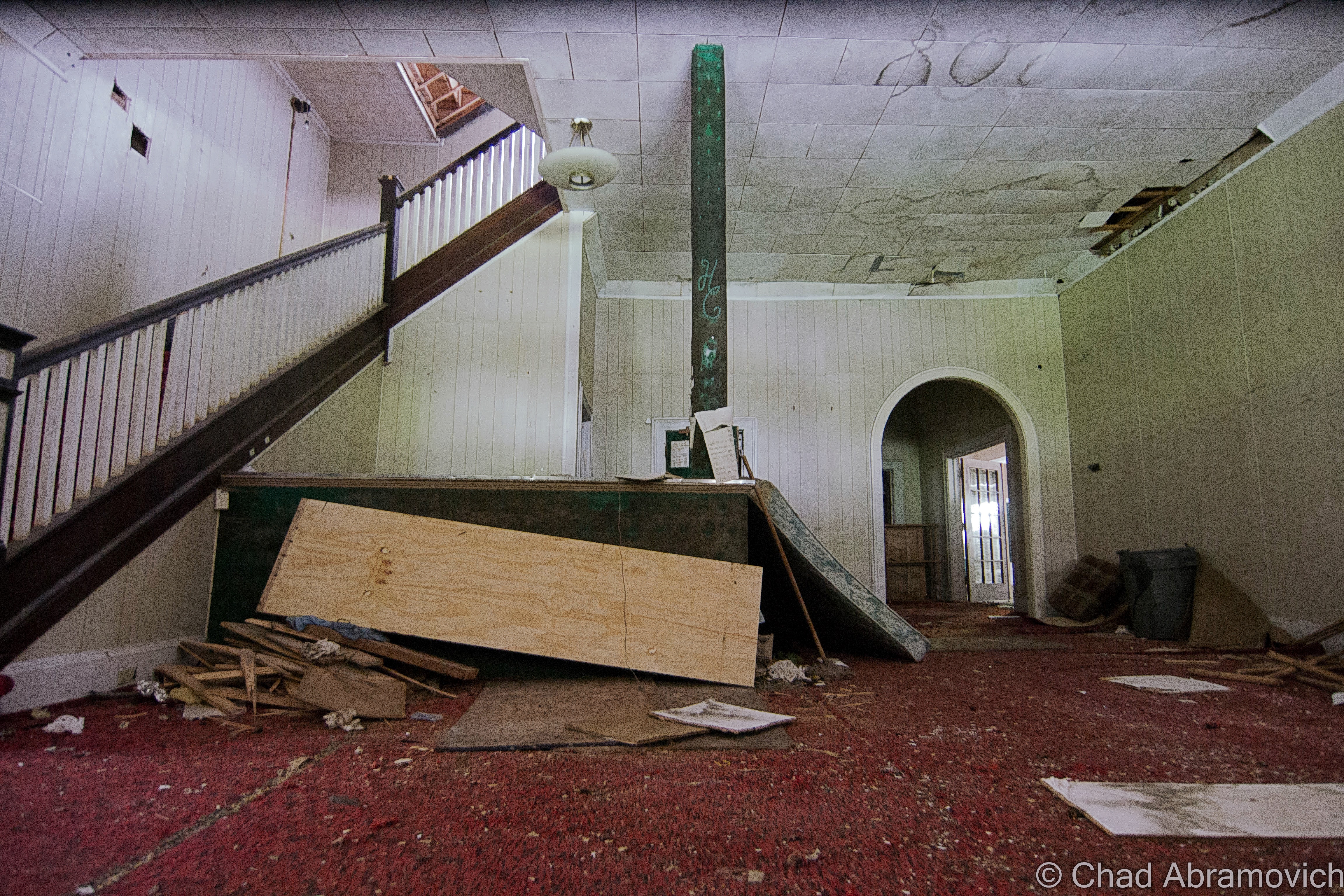
A candy cane propped sign marked the entrance, next to a vintage statue of Kris Kringle perched upon giant S and L alphabet blocks (which to your blogger’s frustration – my photo didn’t come out of for some reason). I’ll admit, I was curiously fired up after seeing that beacon. The cloistered Santa’s Land beckoned. Or, what hadn’t been removed yet by the last owners.
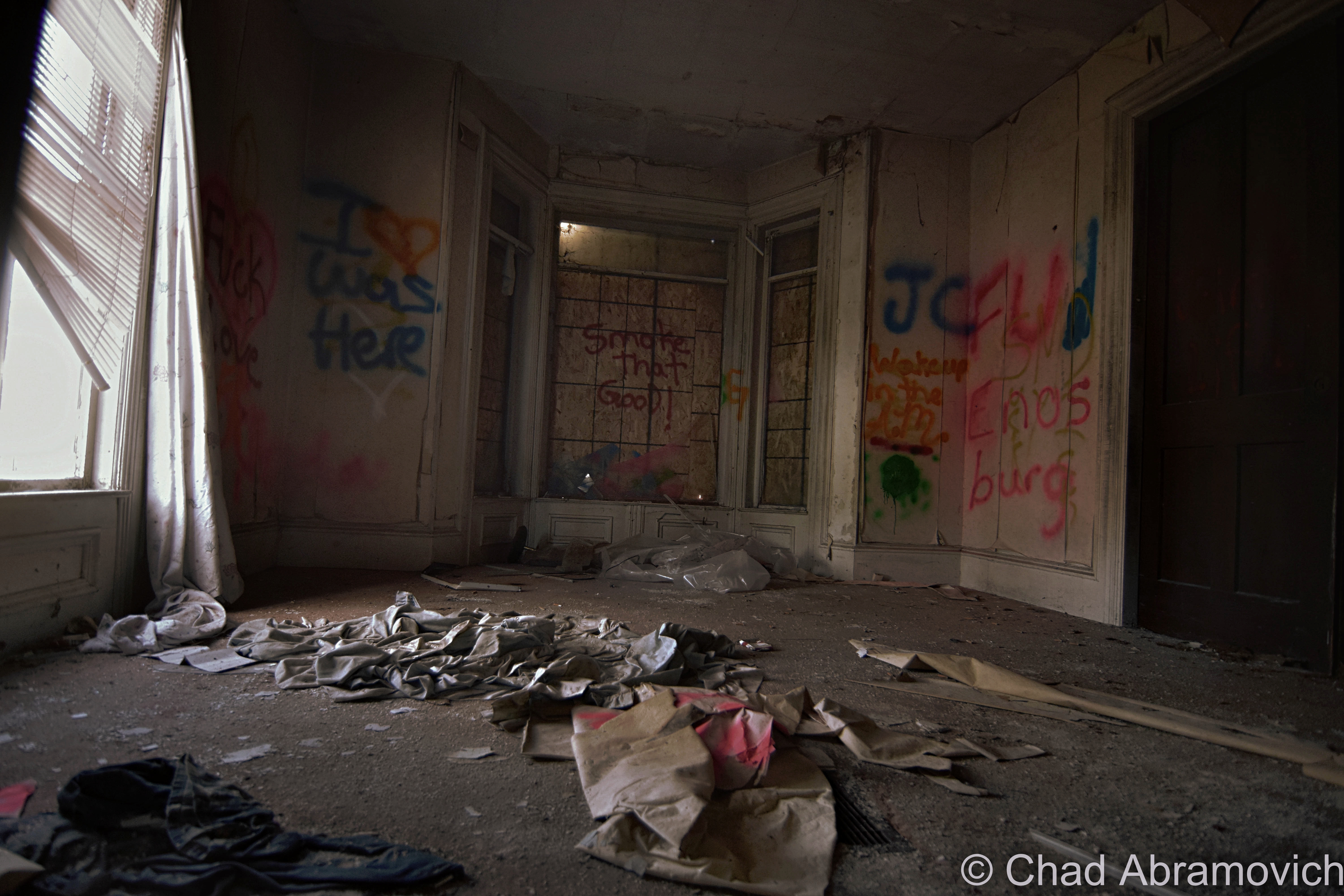
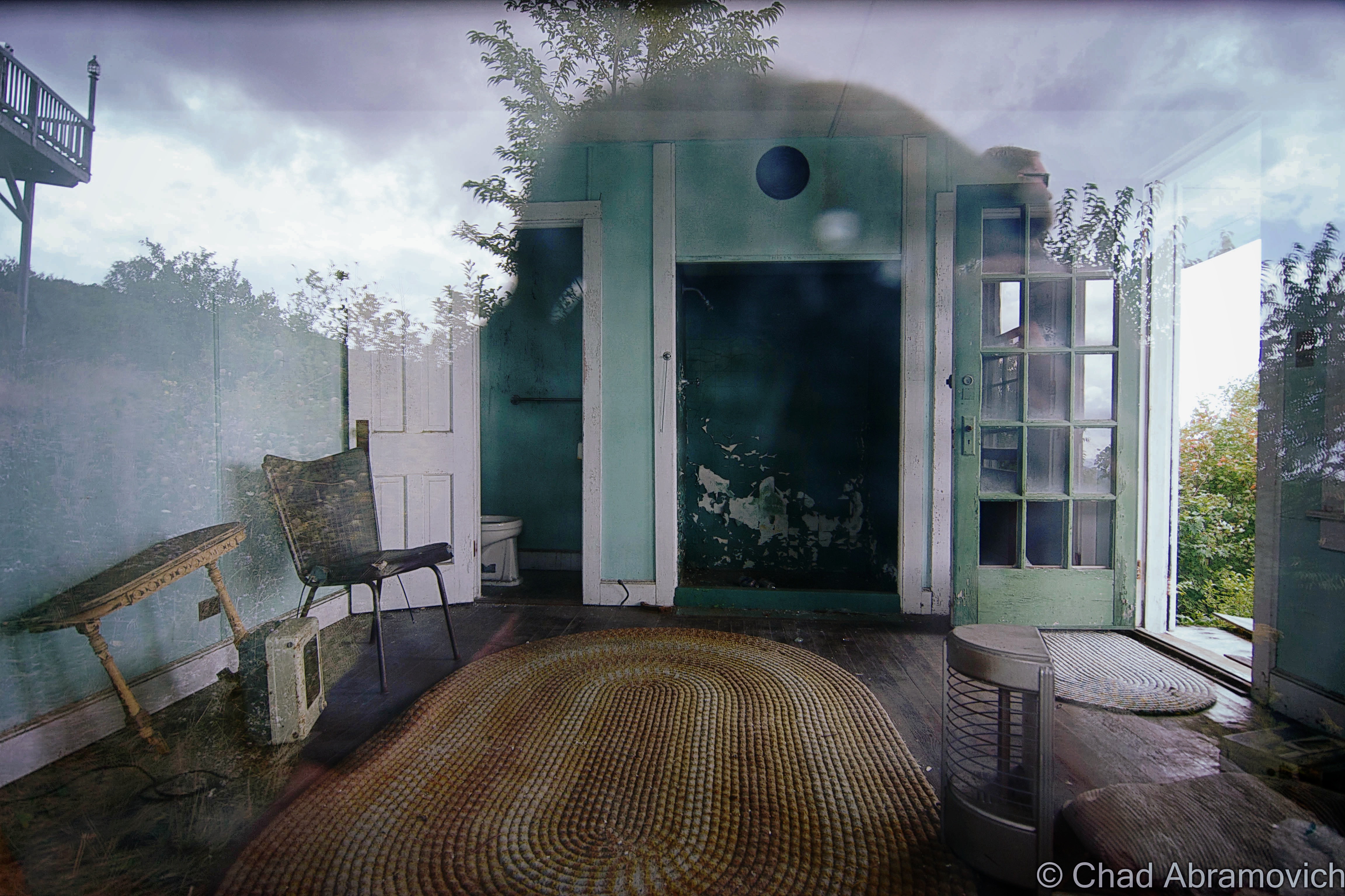
Everything after the candy stripped, balsam-scented gift shop I entered through flowed seamlessly with startling imagery that tangles Christmas and consumerism that seemed to almost radiate in the cold January sun.
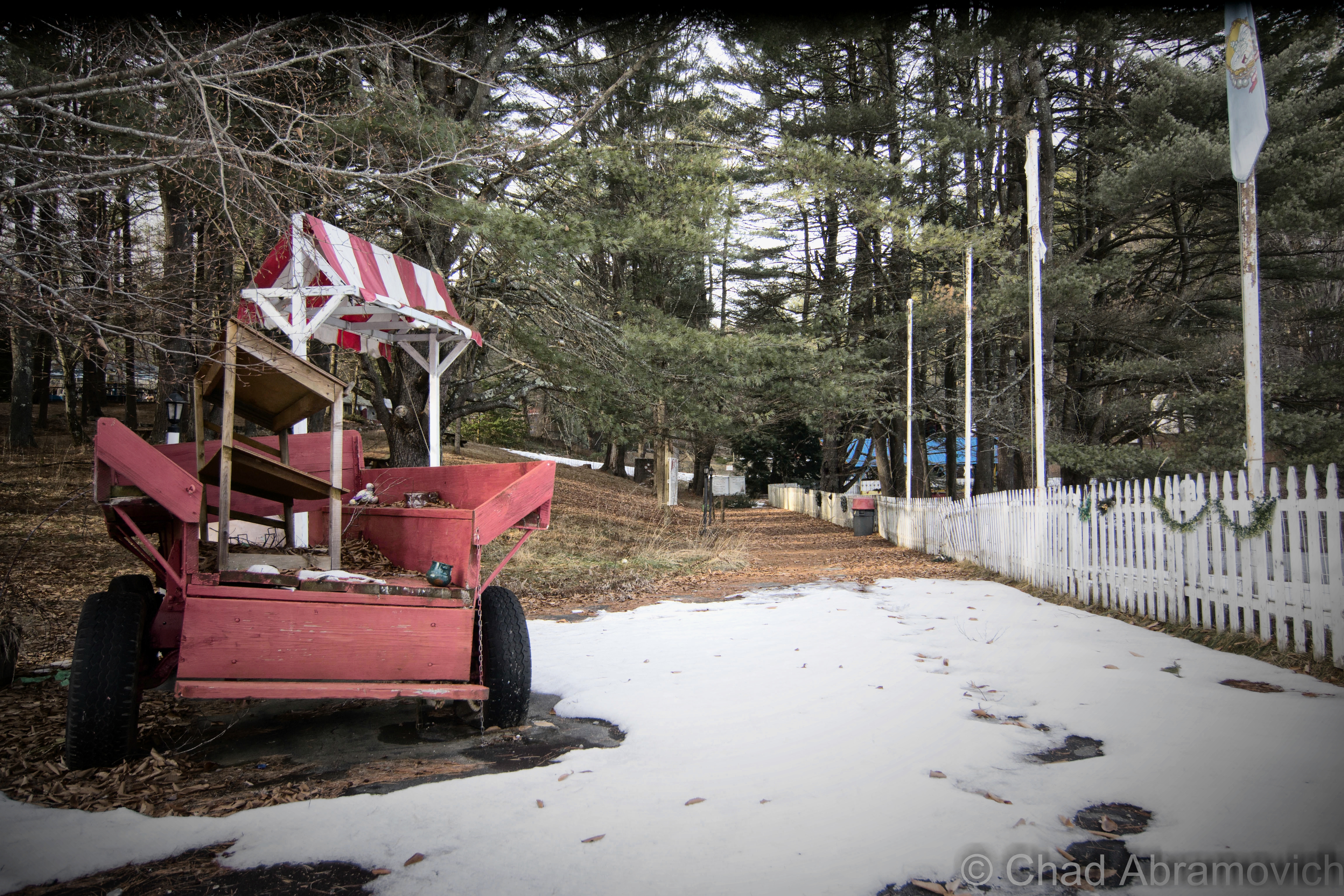
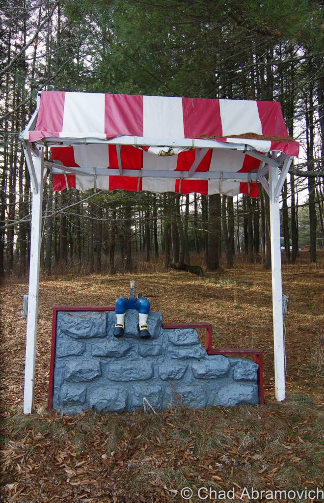
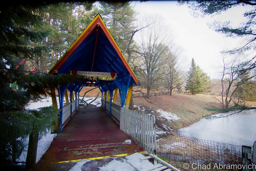
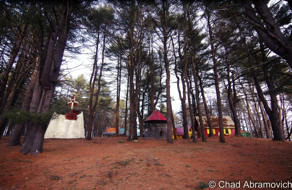
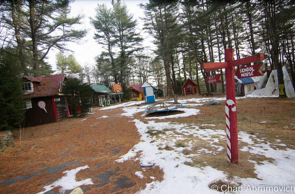
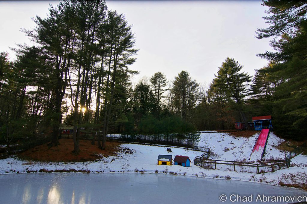
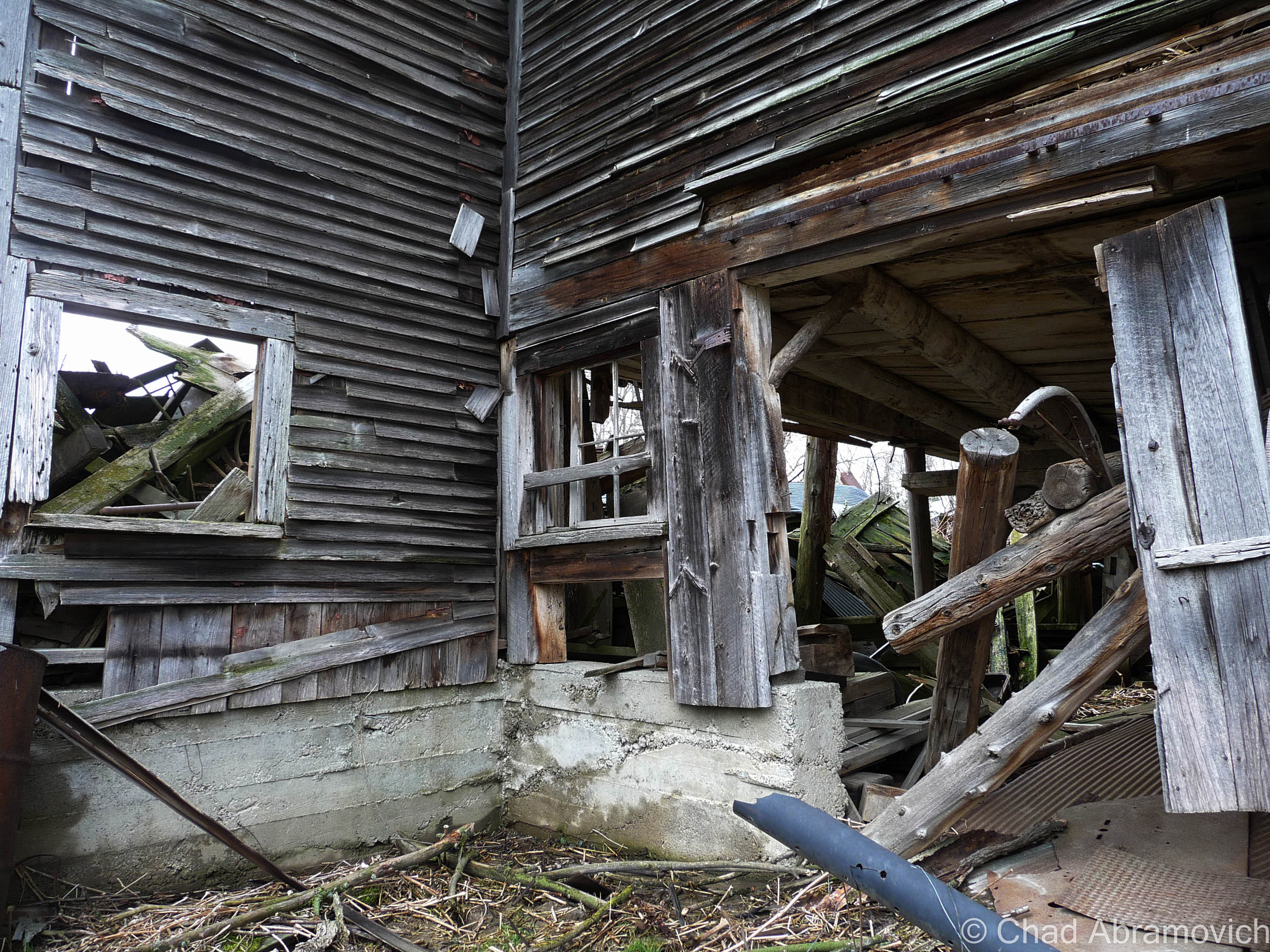
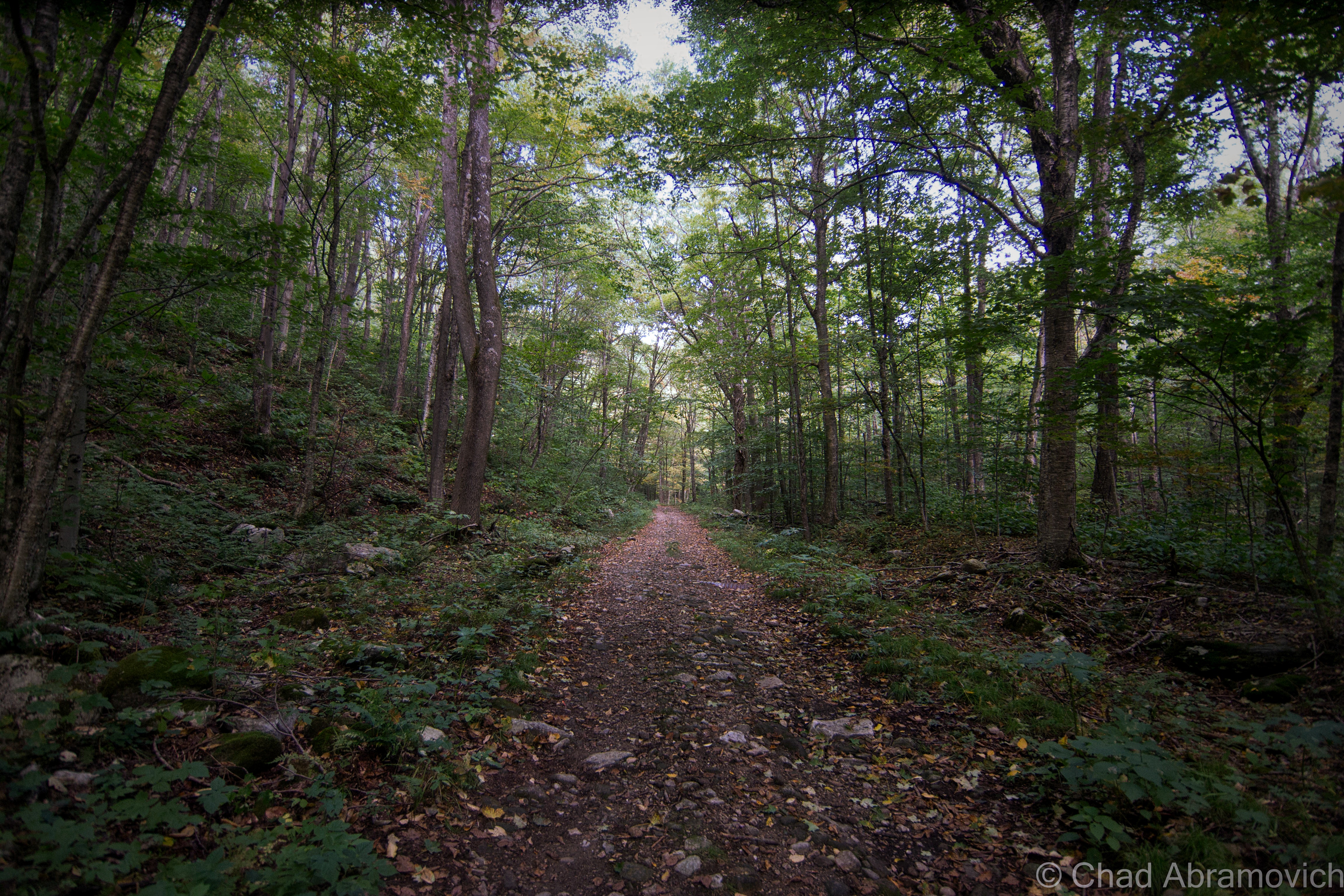
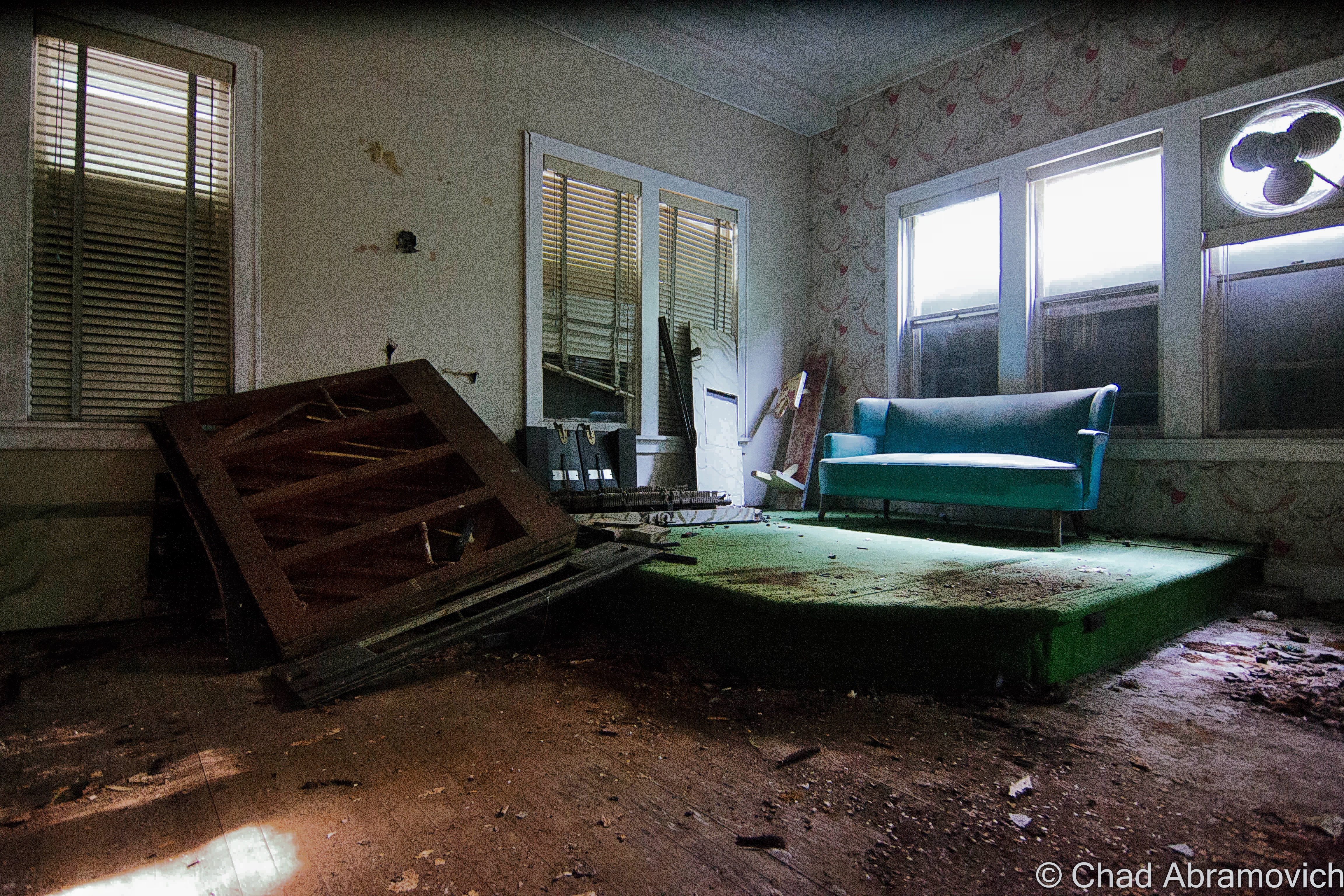
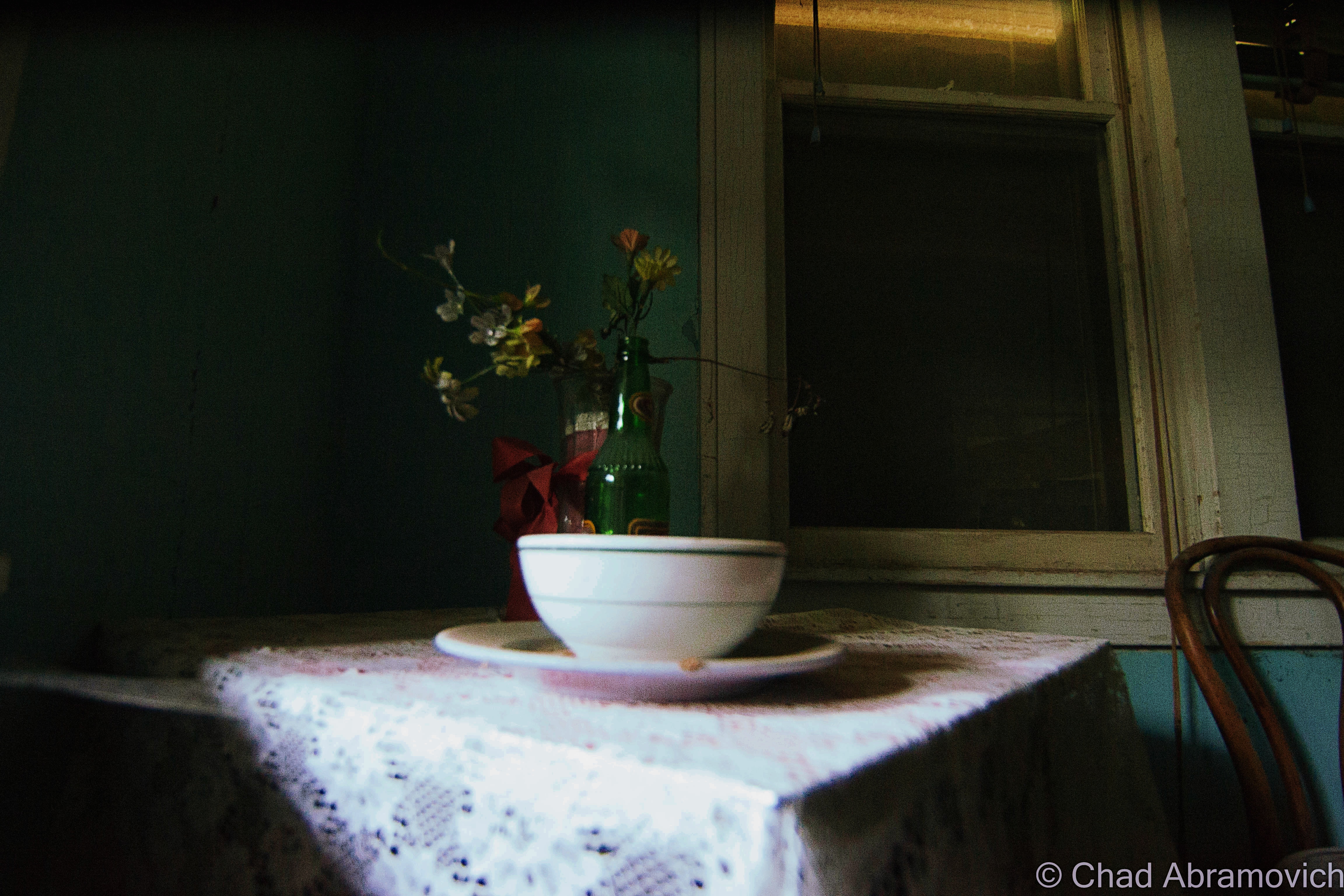
I didn’t have an objective idea of what I was actually checking out, and what I found was a relic of dispersed dilapidation almost untouched from the late 1950s, a virtual Christmas grave built along evergreen clustered hills that rose around an artificial lake spanned by a ‘kissing bridge’. There were times when I thought this place was too Christmasy and gimmicky, but then again, I suppose that’s sort of the point. I’m certainly not in their desired demographic.
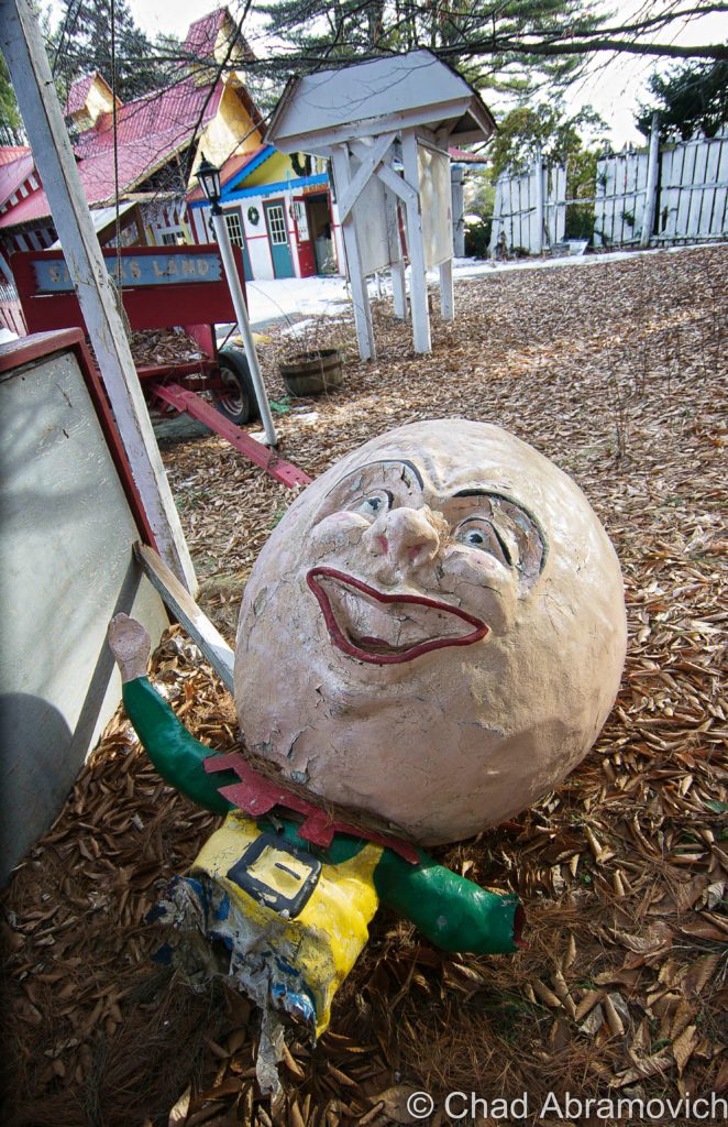
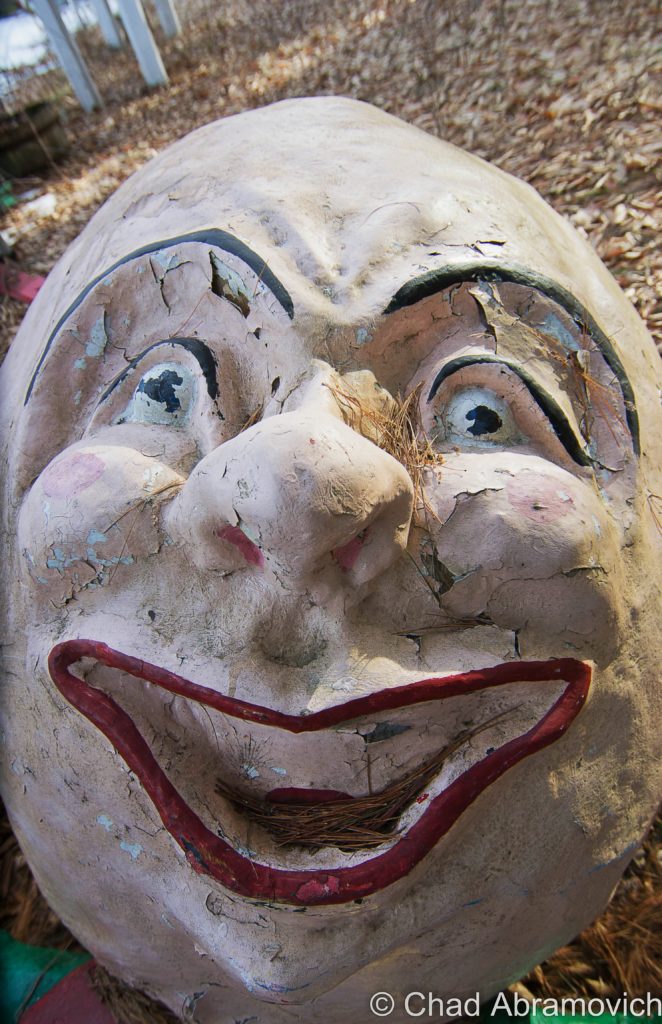
But one of the first spectacles I saw was intriguingly dissonant. It was a disturbing decapitated Humpty Dumpty statue, its humongous cranium fell from its body’s sitting perch on a faux stone wall and decays on a bed of dead leaves grinning madly at the canopy above, or in my case, directly at me and my camera lens. I grinned back and knew that was probably going to be my favorite photograph from this trip.
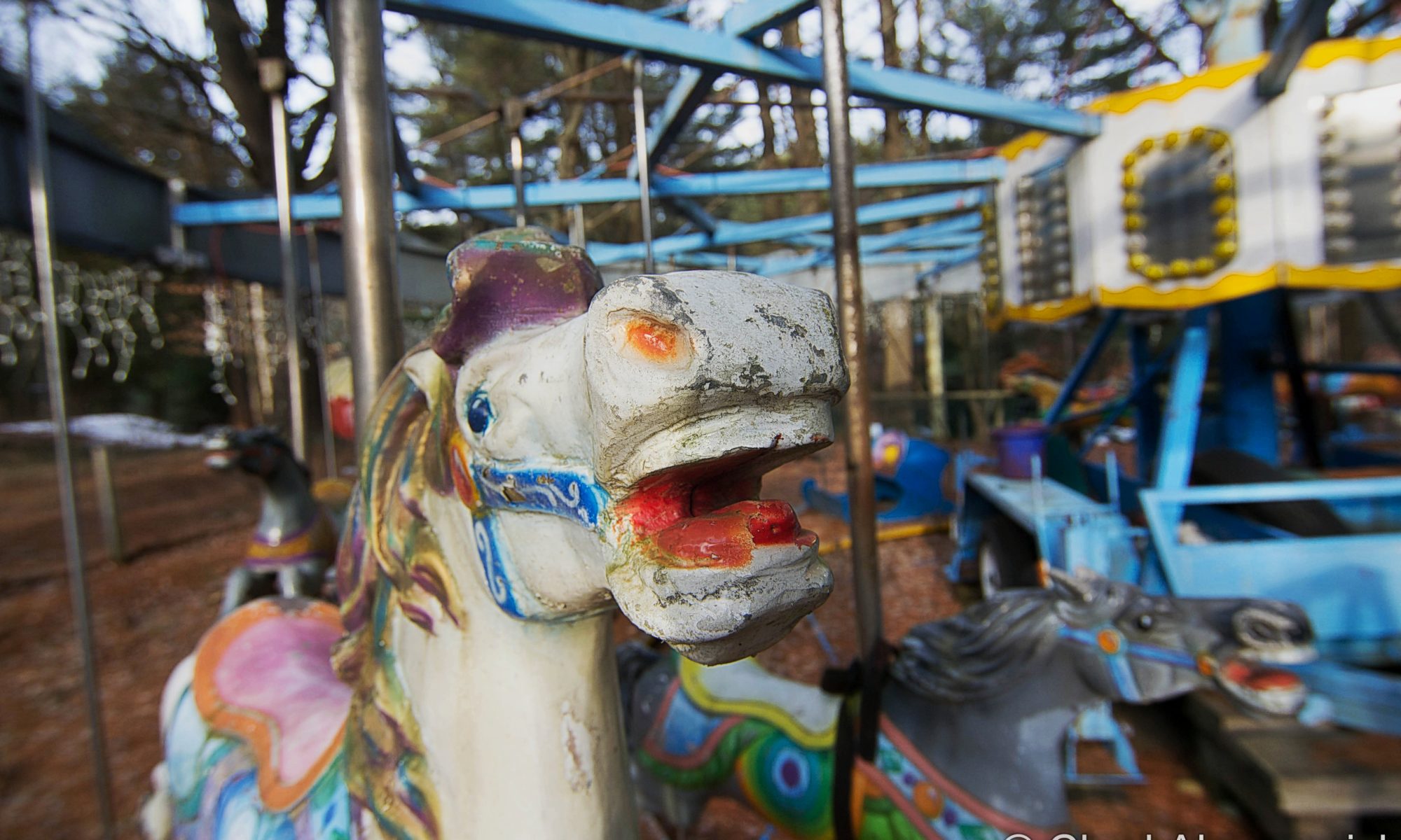
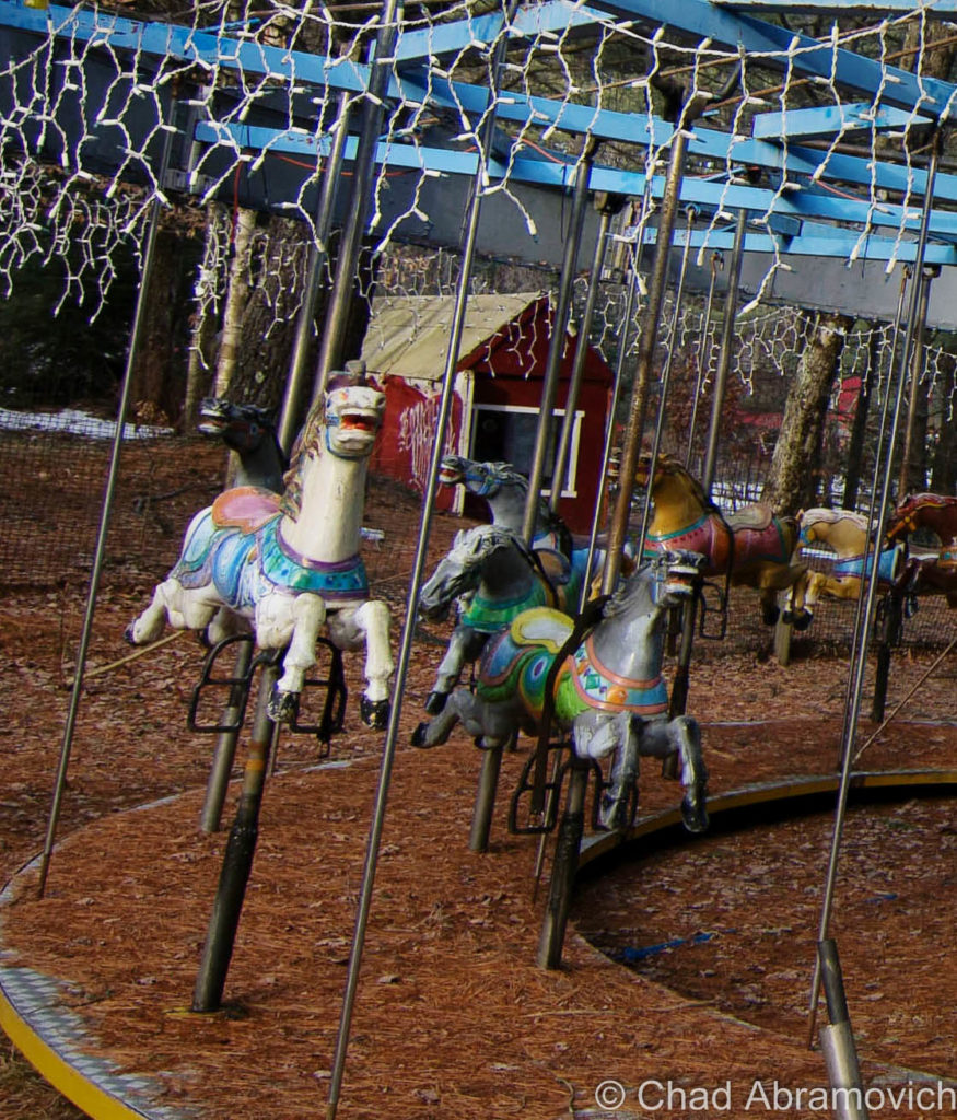
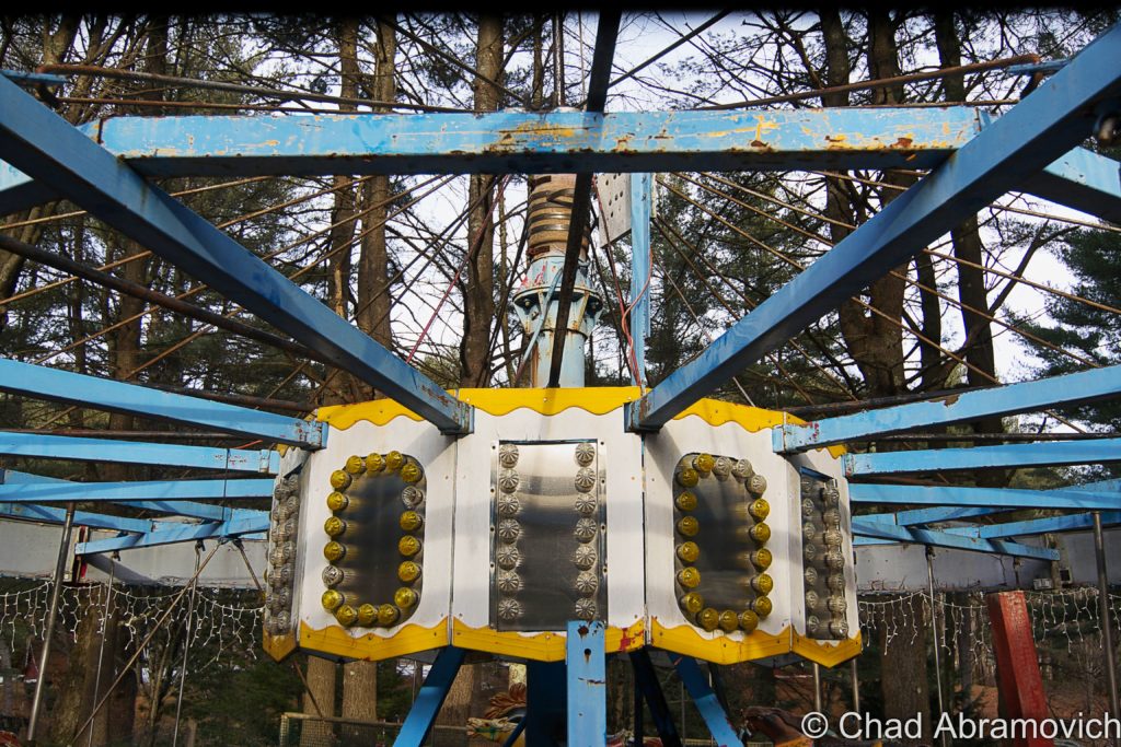
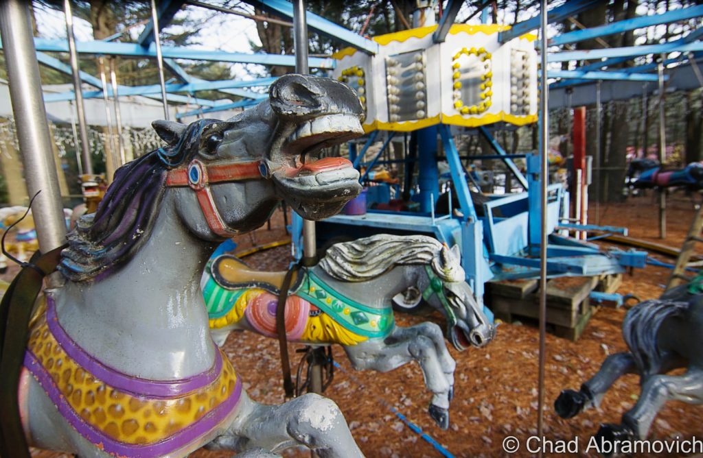
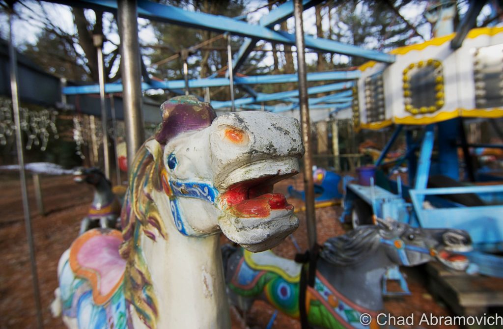
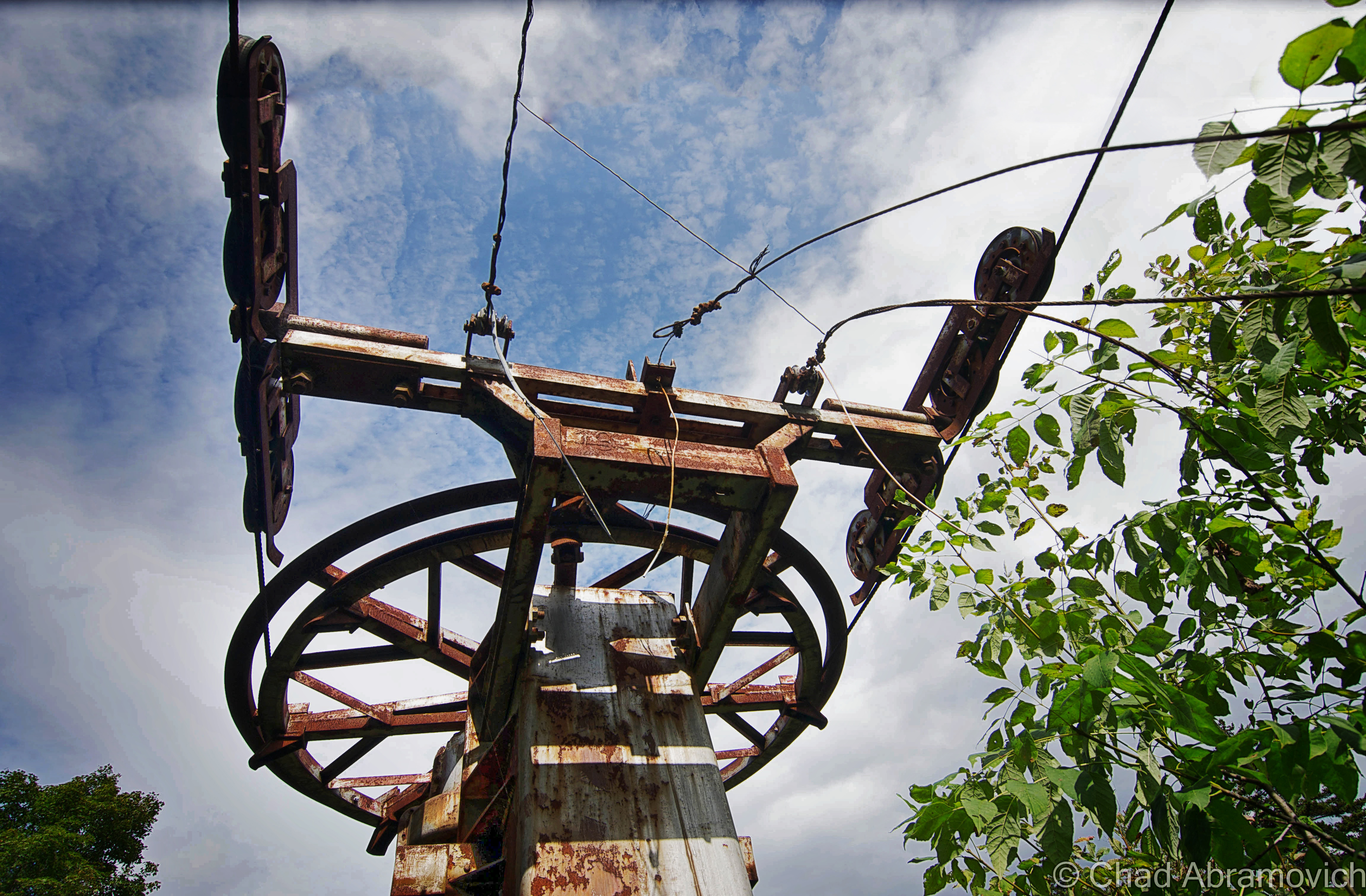
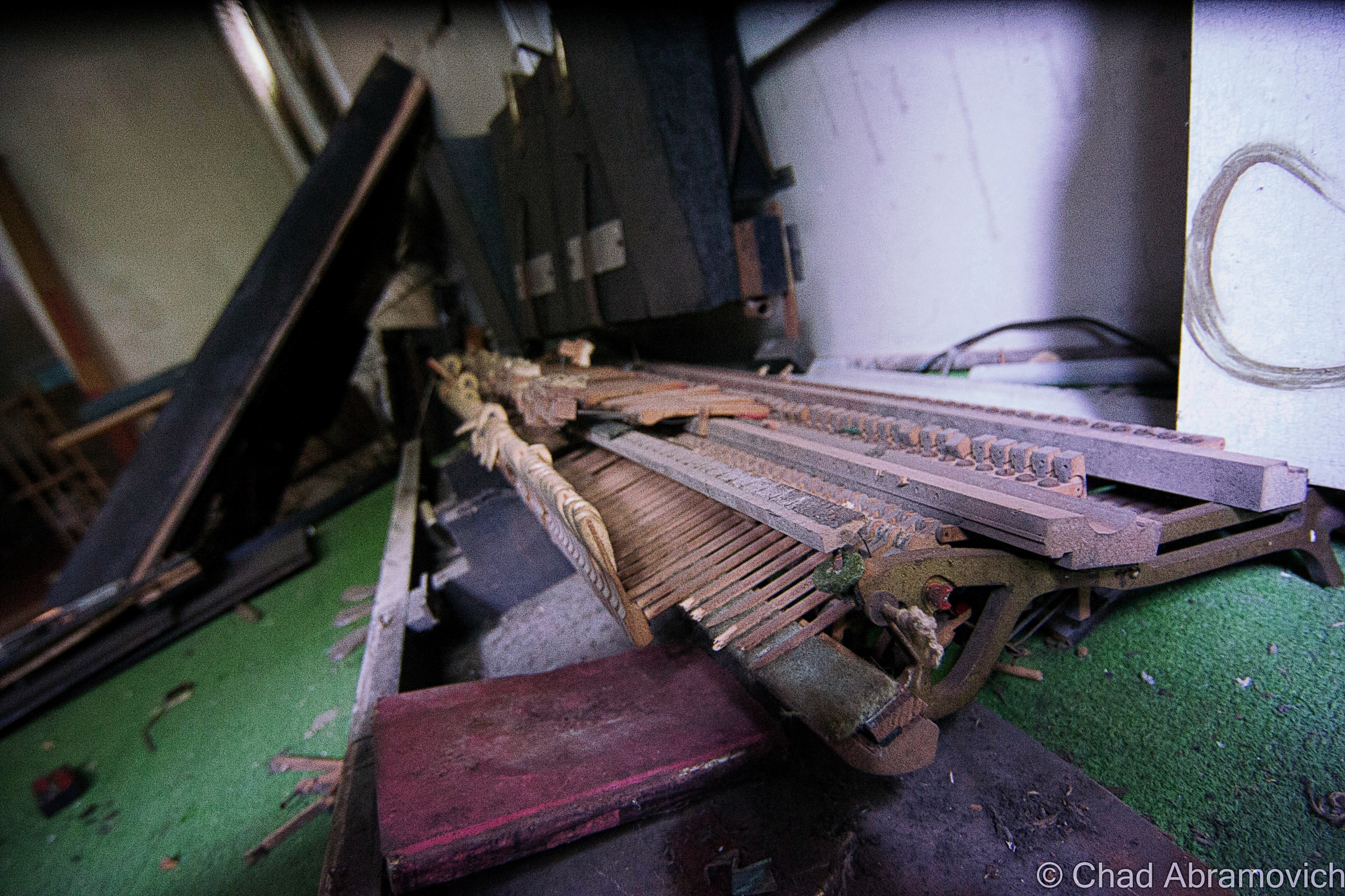
One of the coolest things I observed when I was roaming around the grounds was a cool, restored 1949 vintage carousel that was assembled on a wooded knoll, now covered in pine needles and left to Vermont’s mercurial weather to refurbish it.
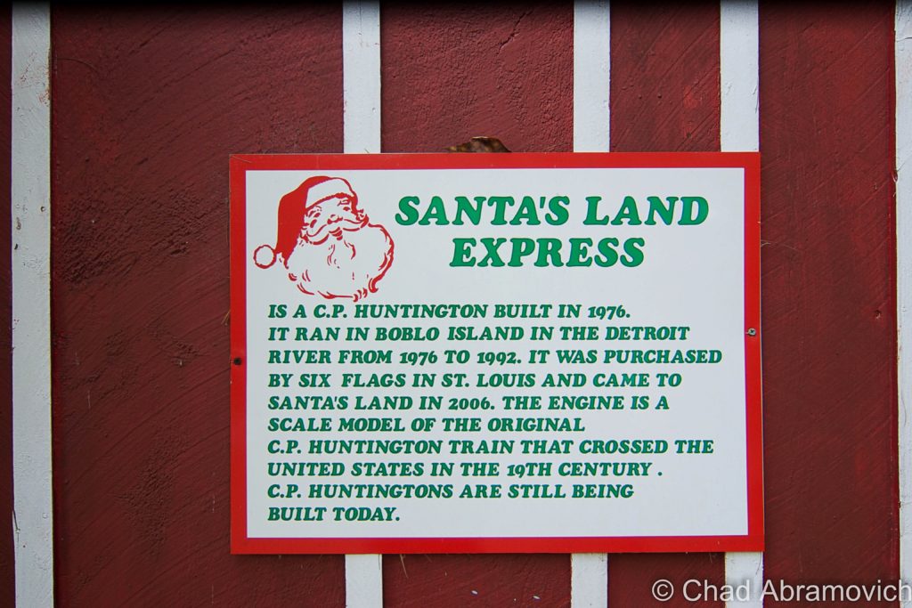
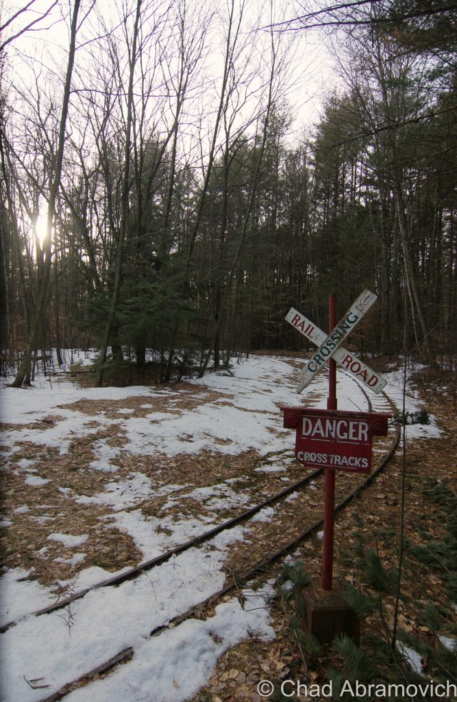
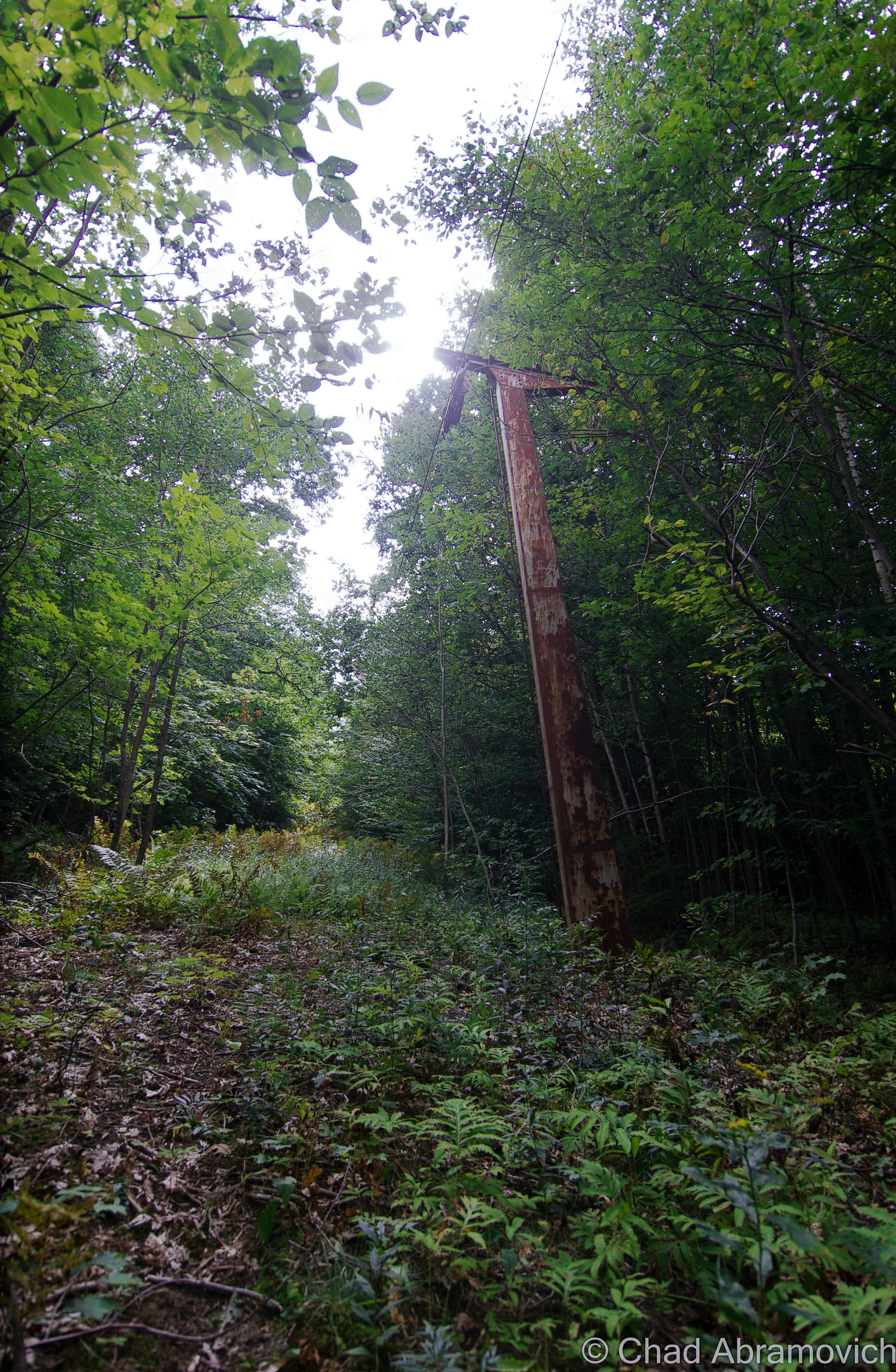
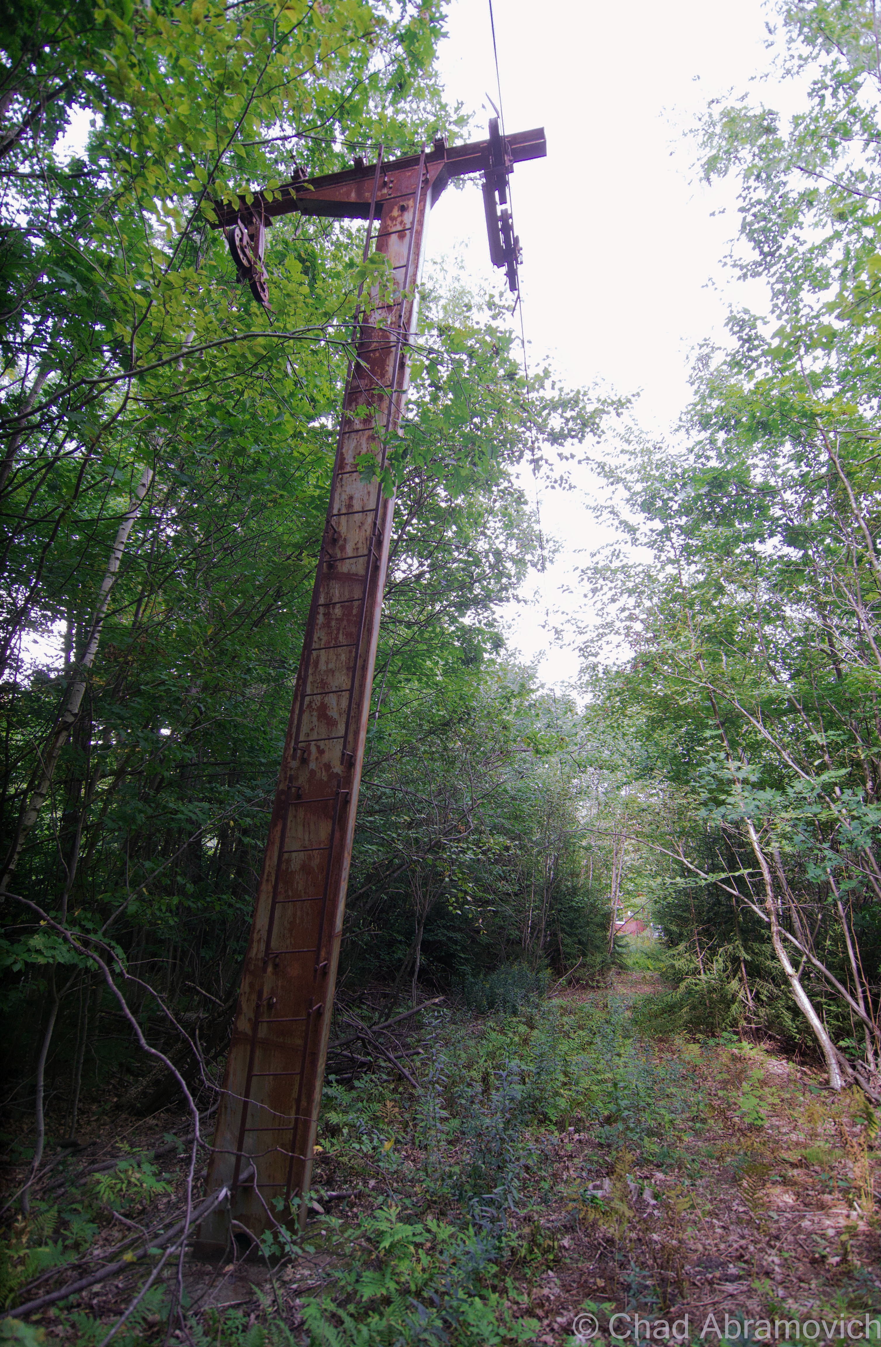
Further in, there is a train depot and a set of neglected tracks behind it. According to a wayfinding sign, a 1976 C.P. Huntington locomotive once stopped there – a train that once made runs down the Detroit River wound up bringing tourists to bedecked sections of the park.
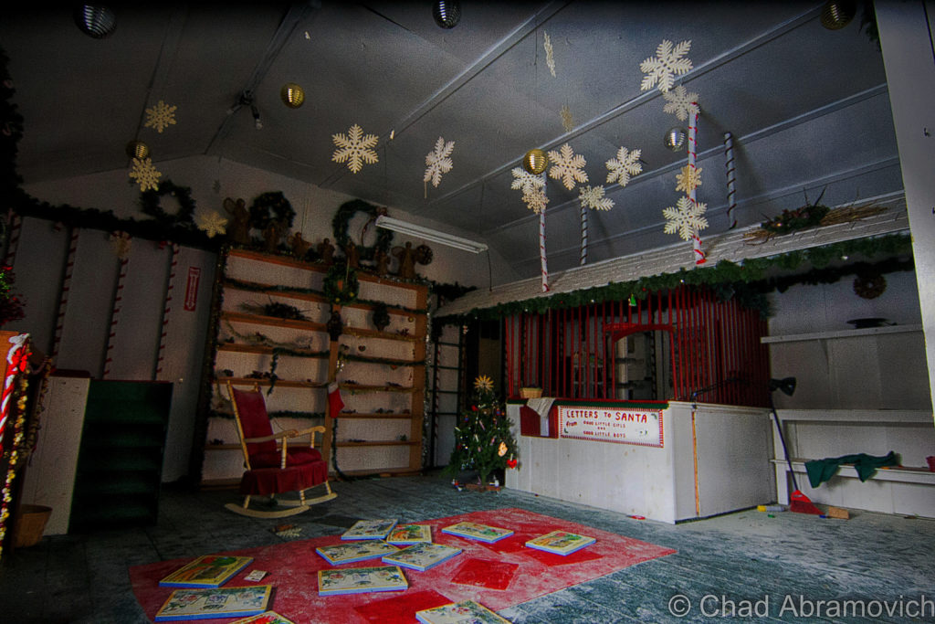
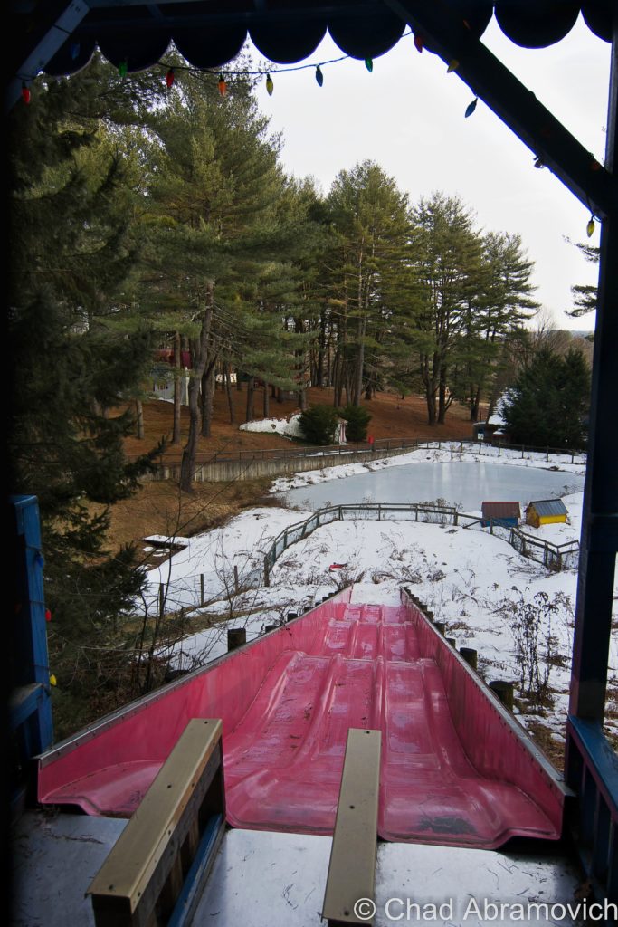
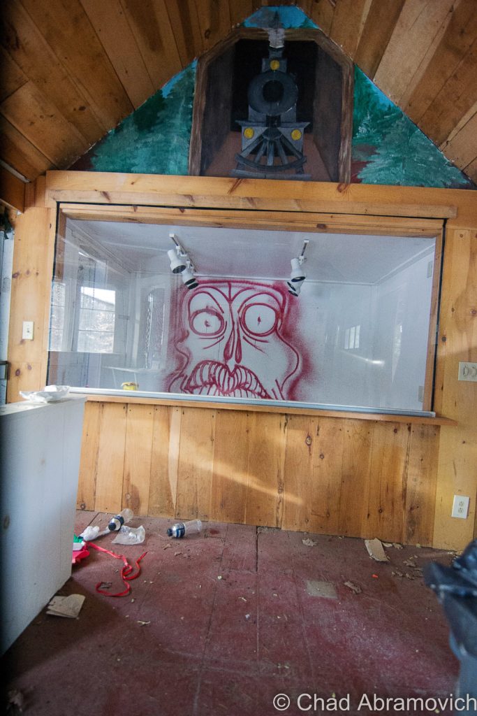
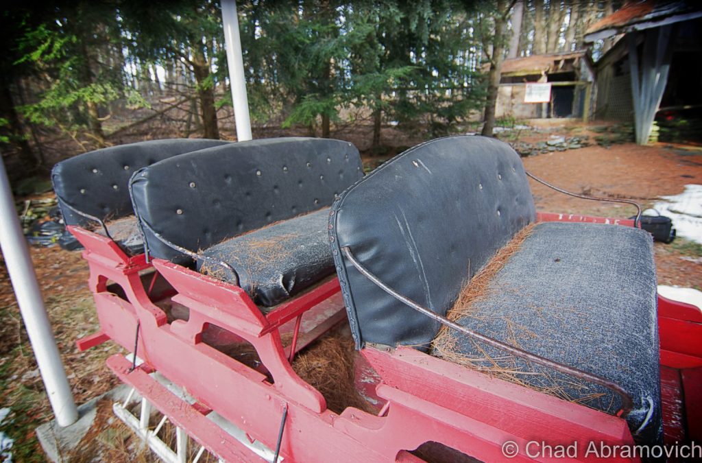
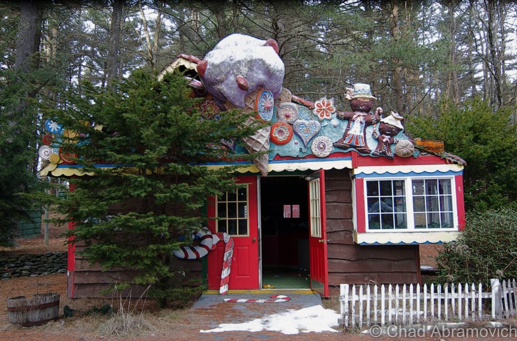
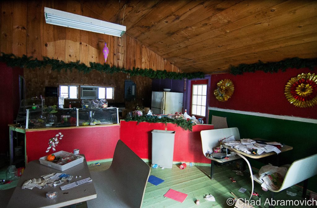
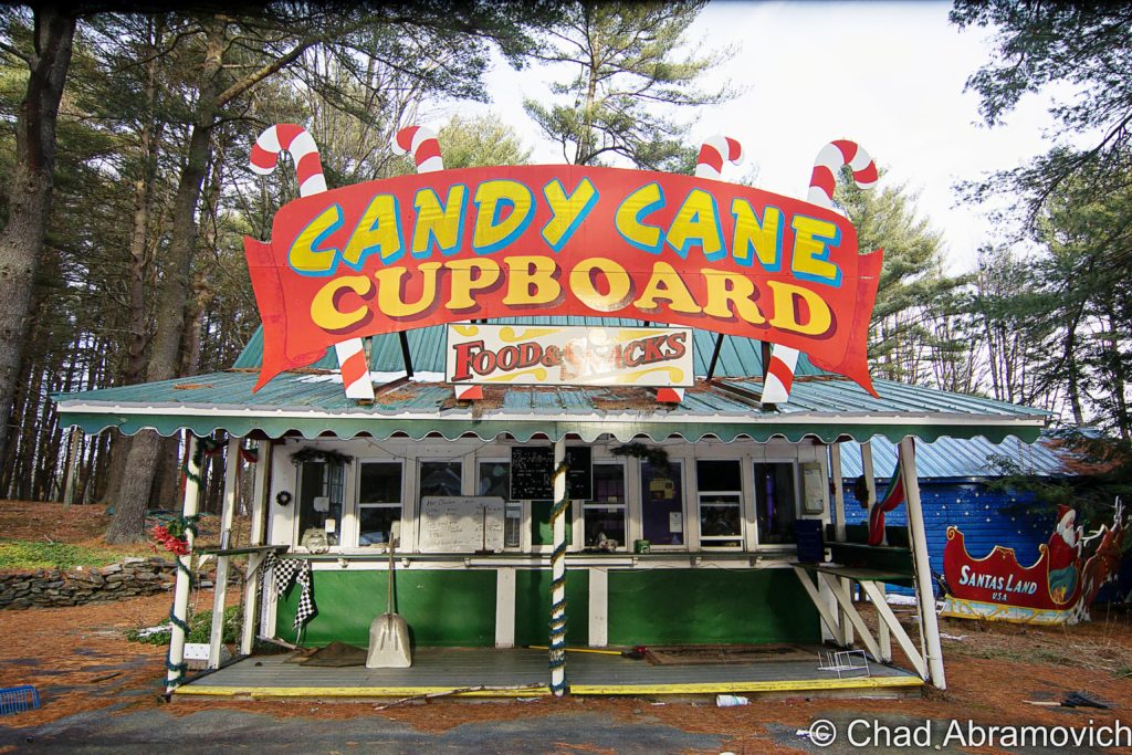
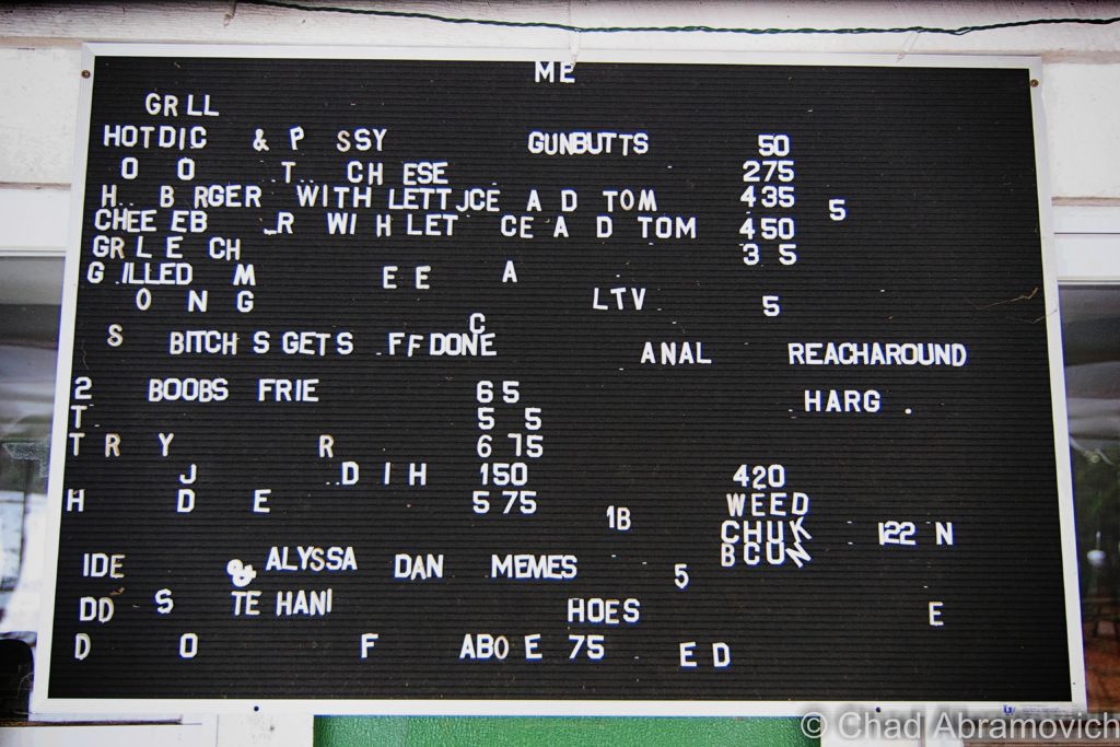
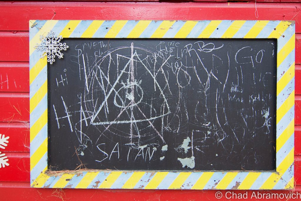
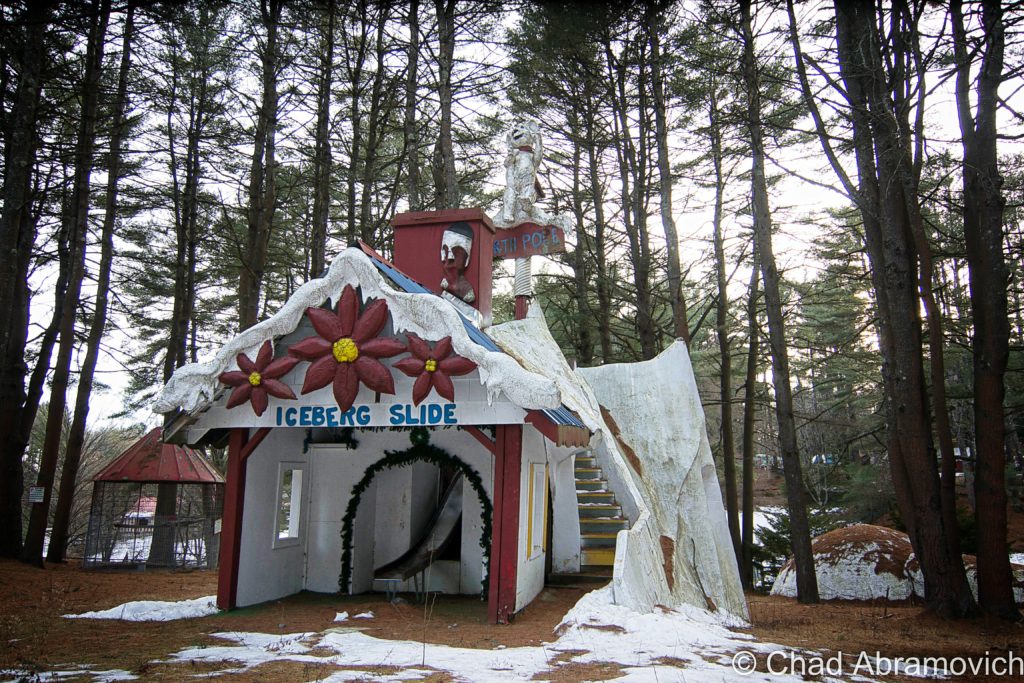
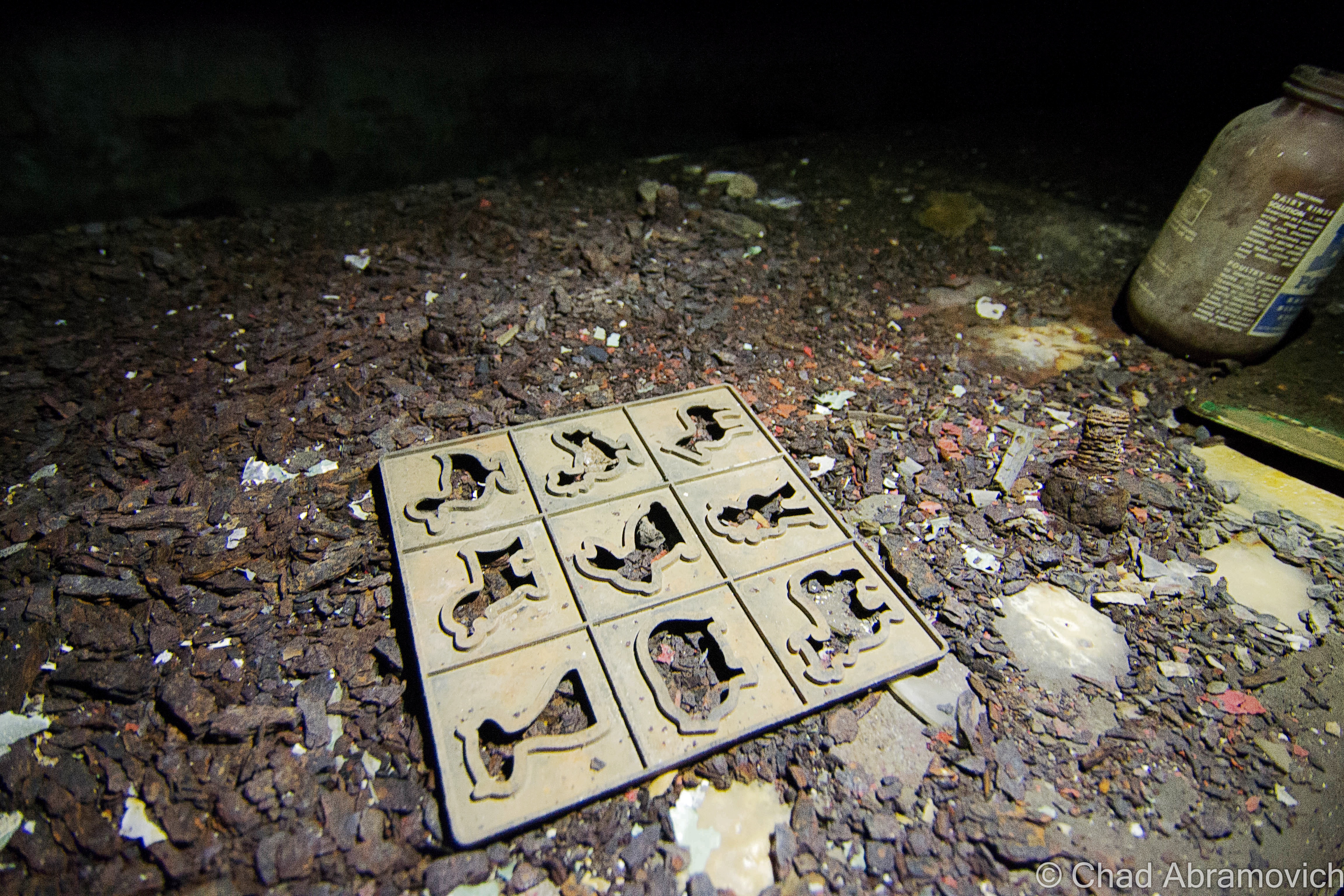
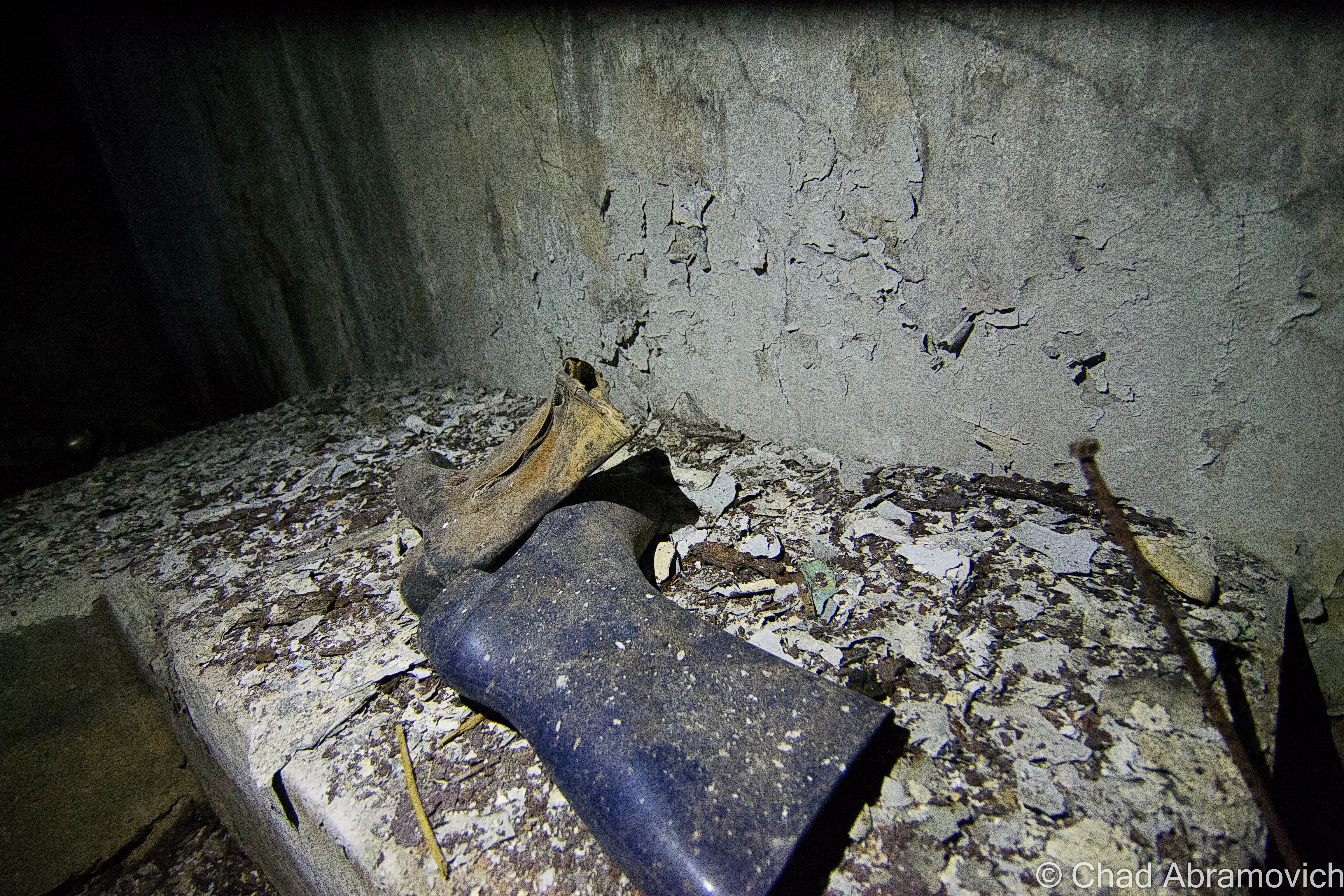
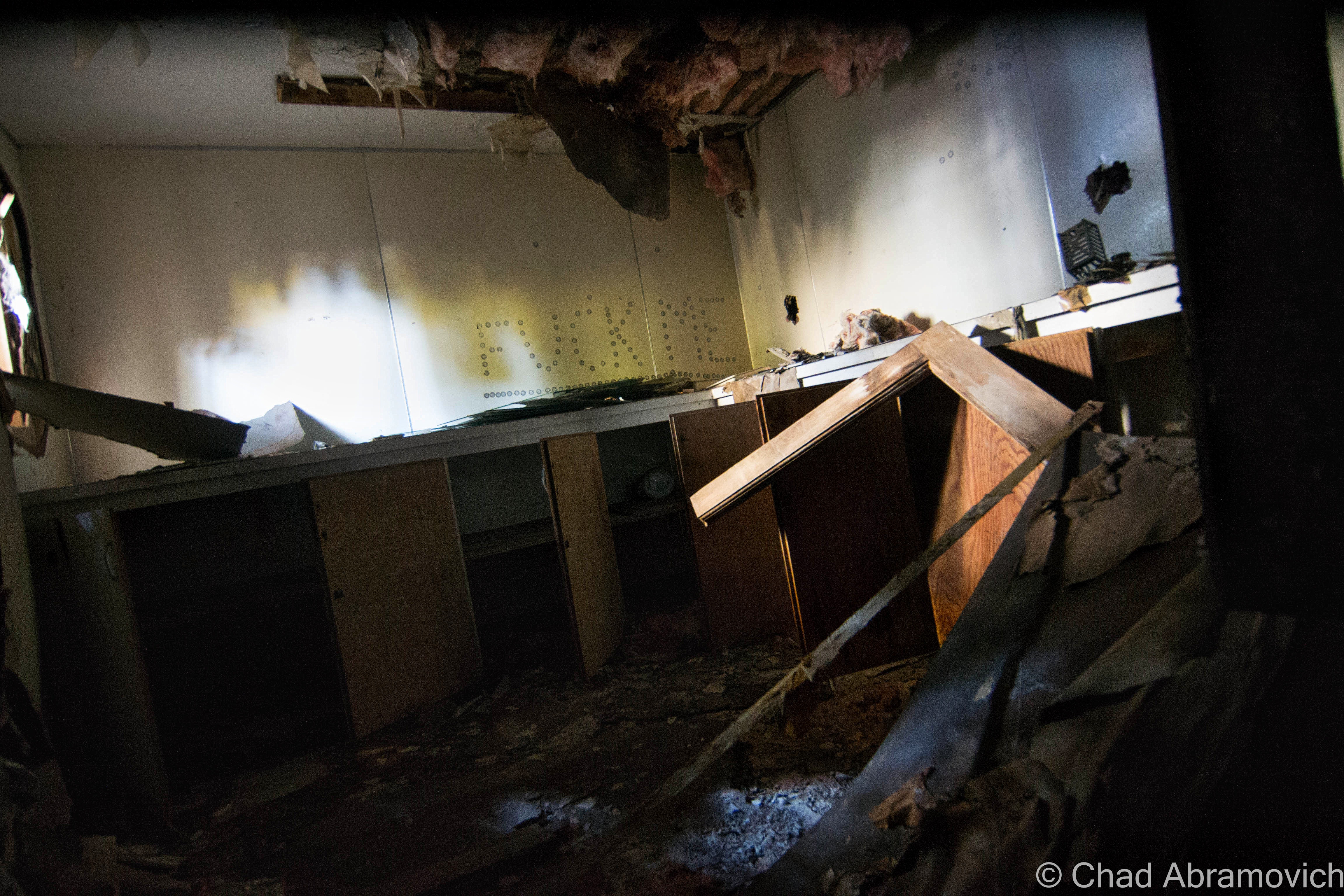
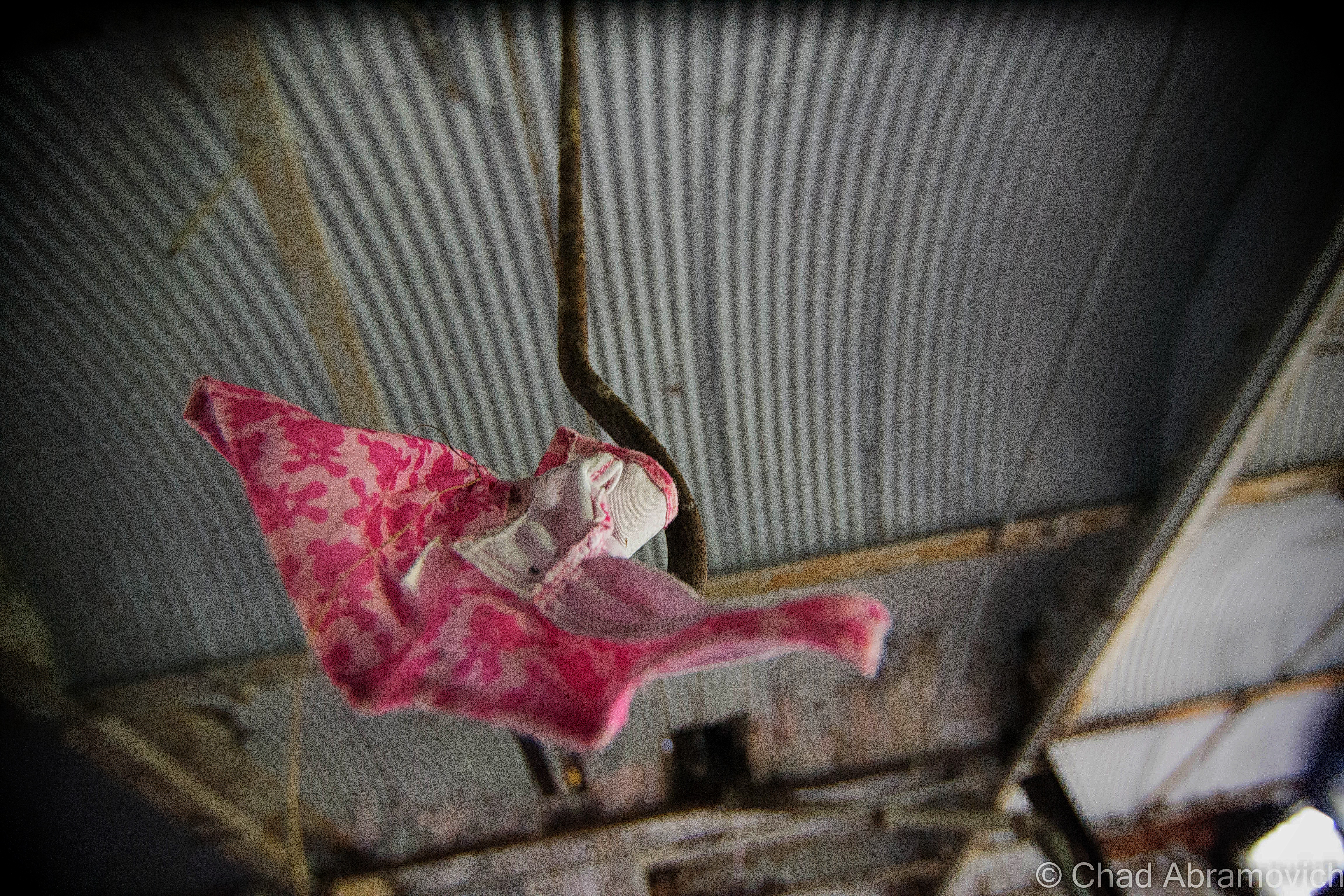
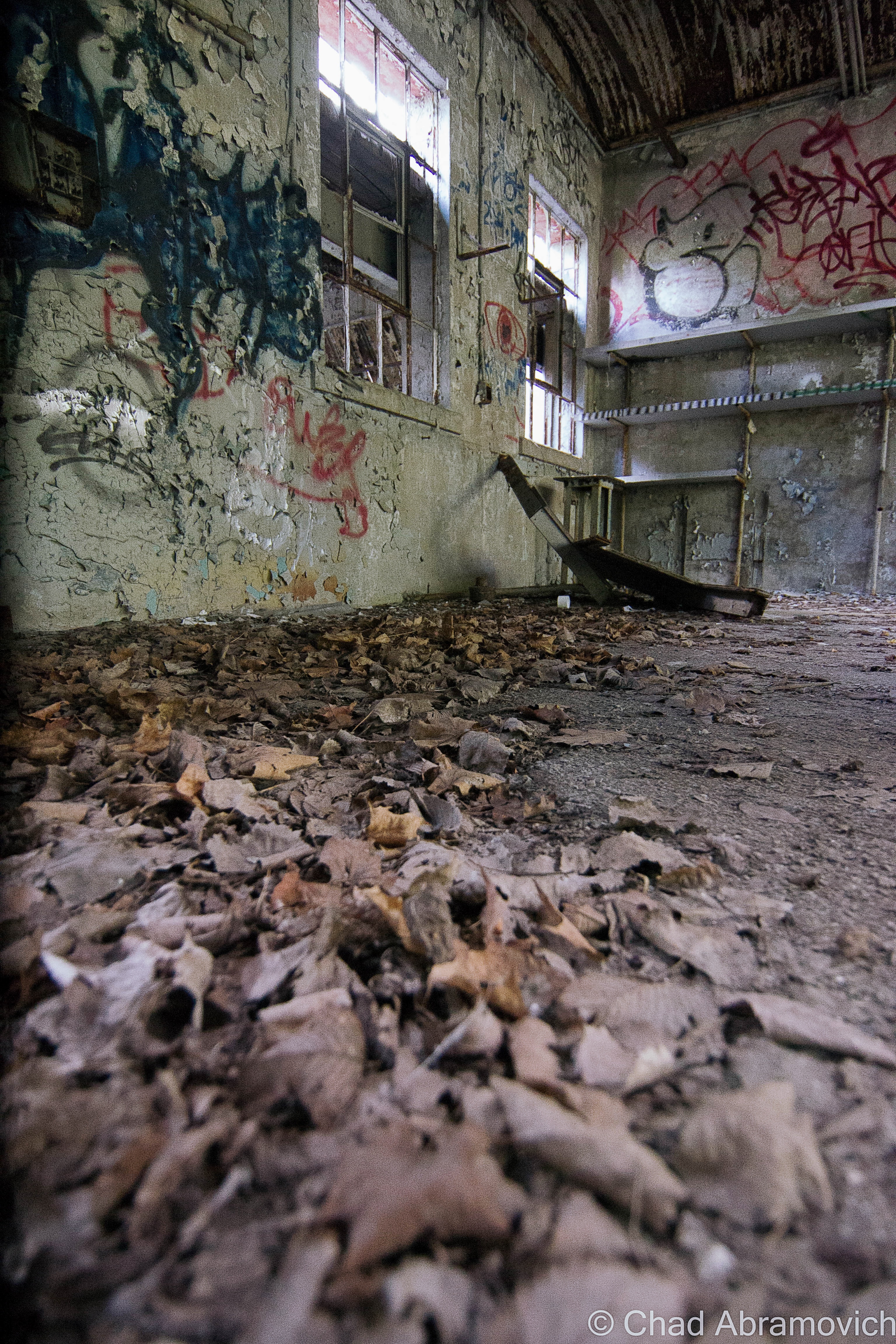
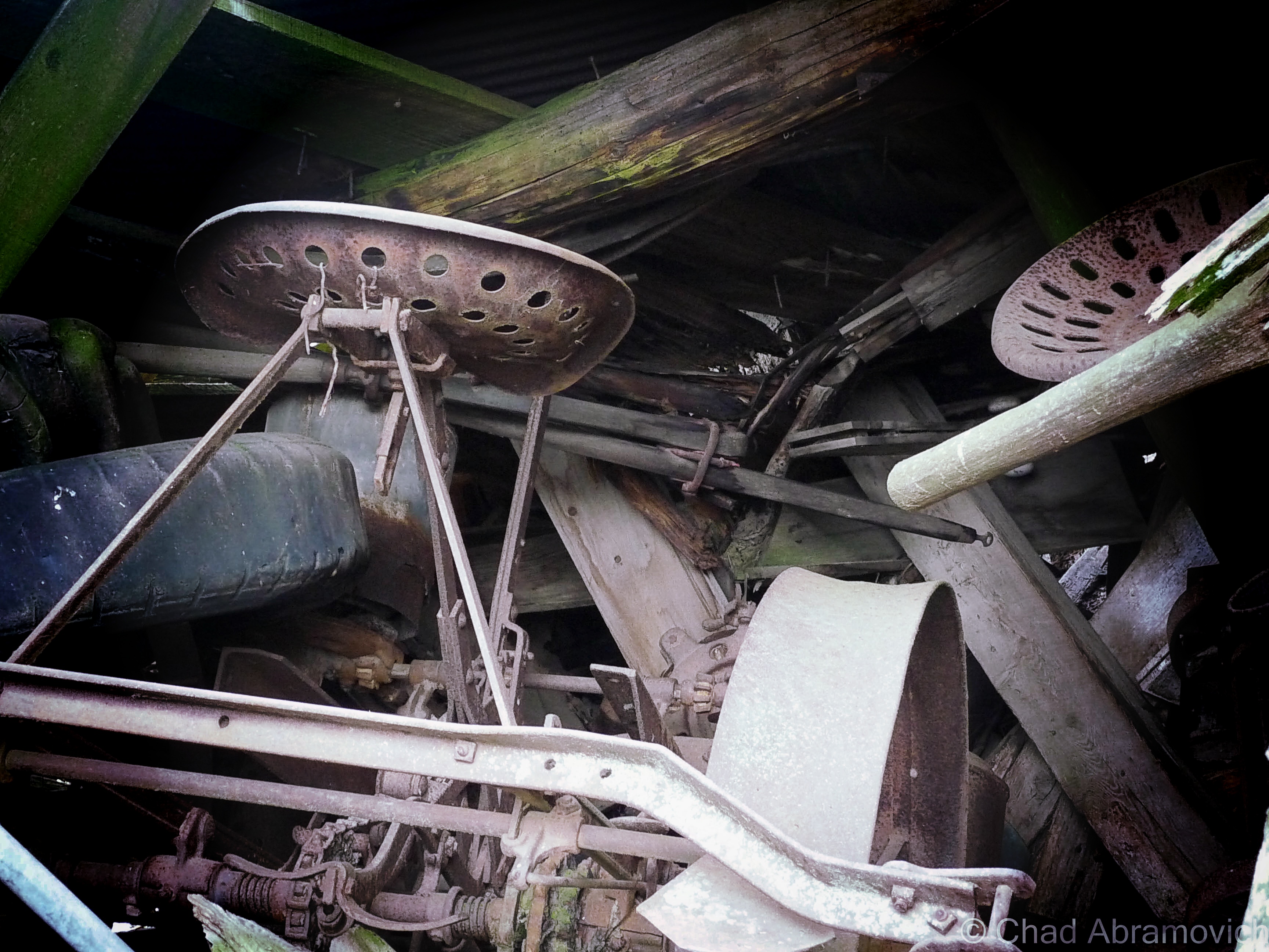
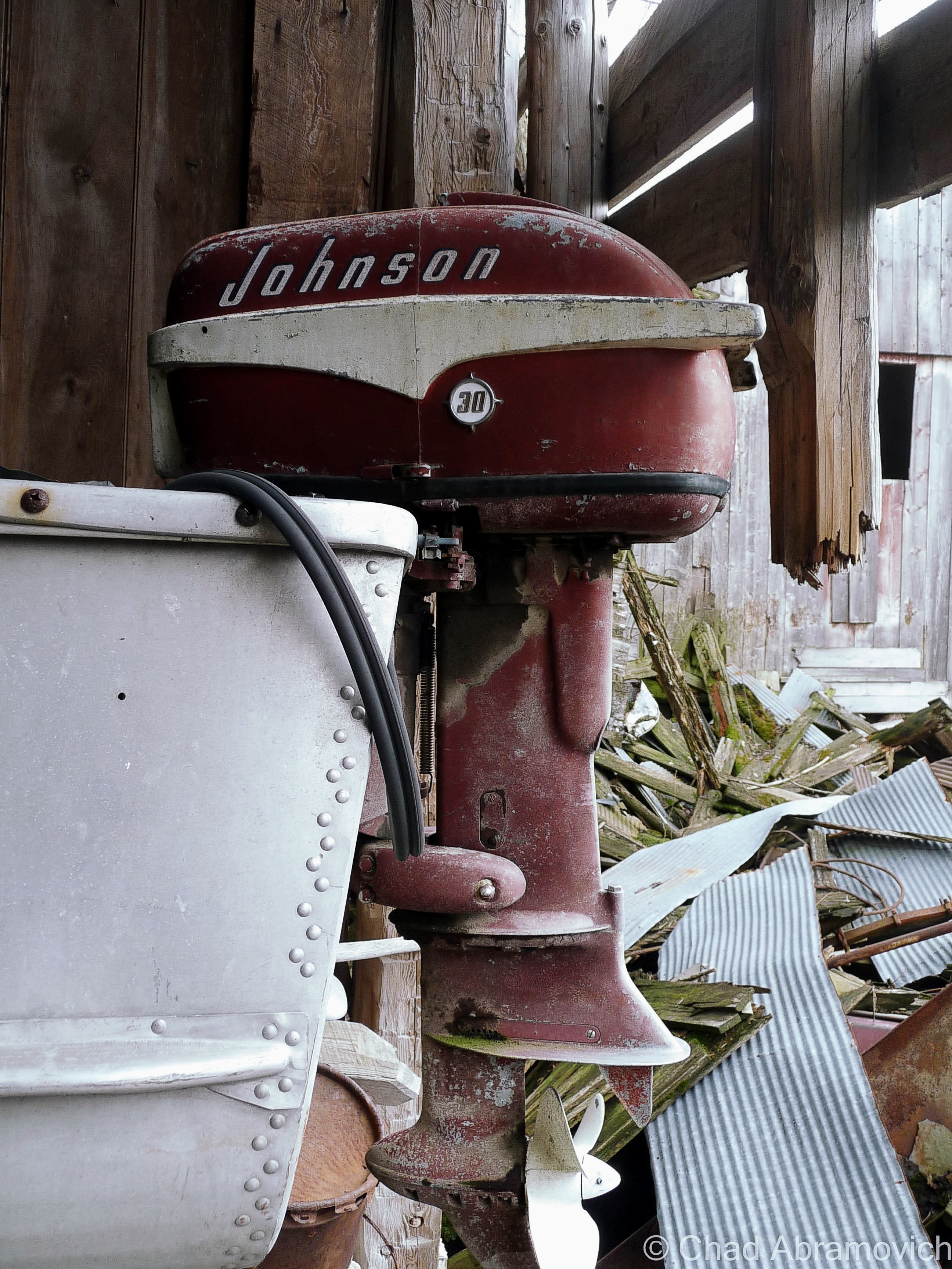
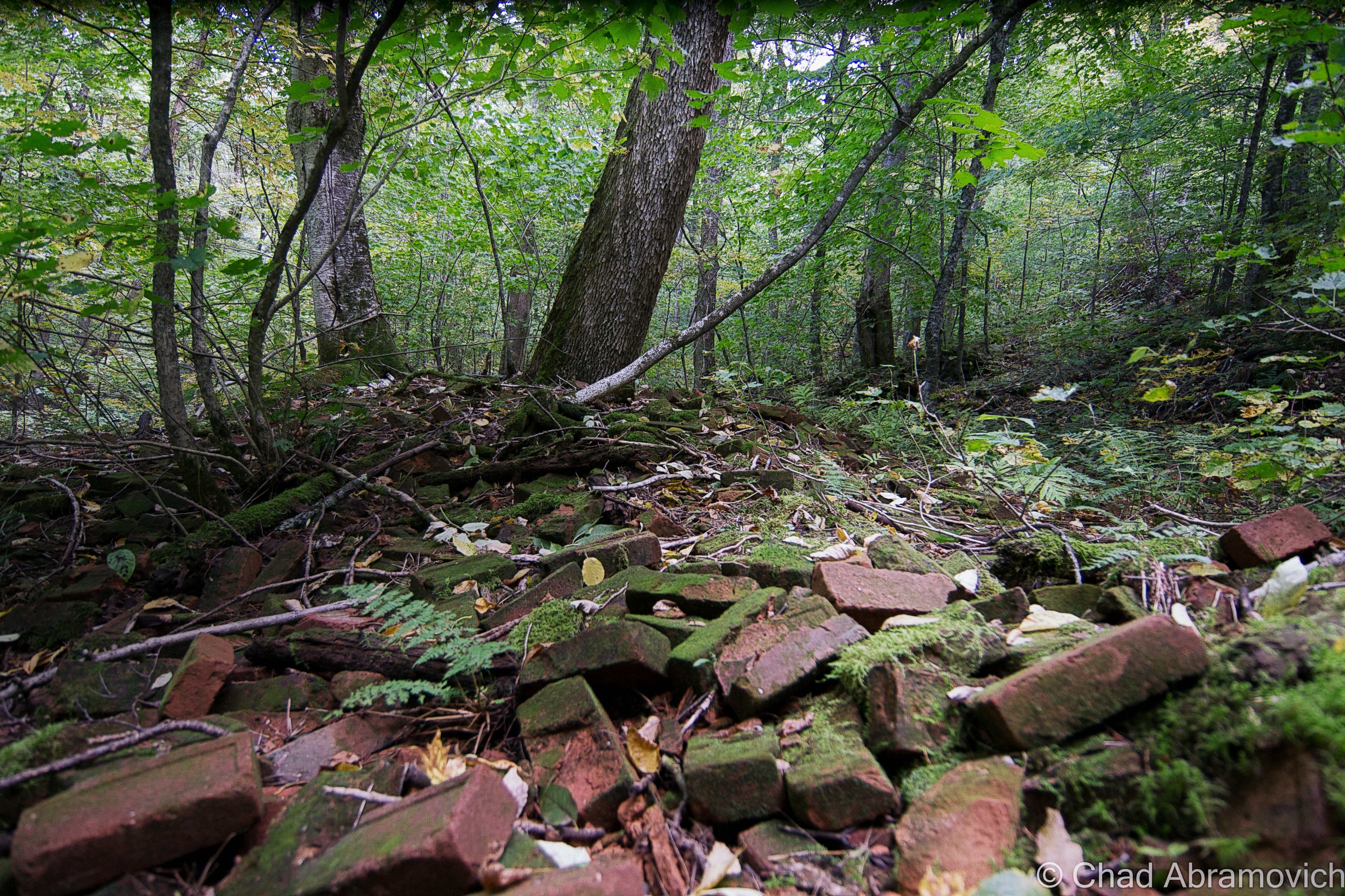
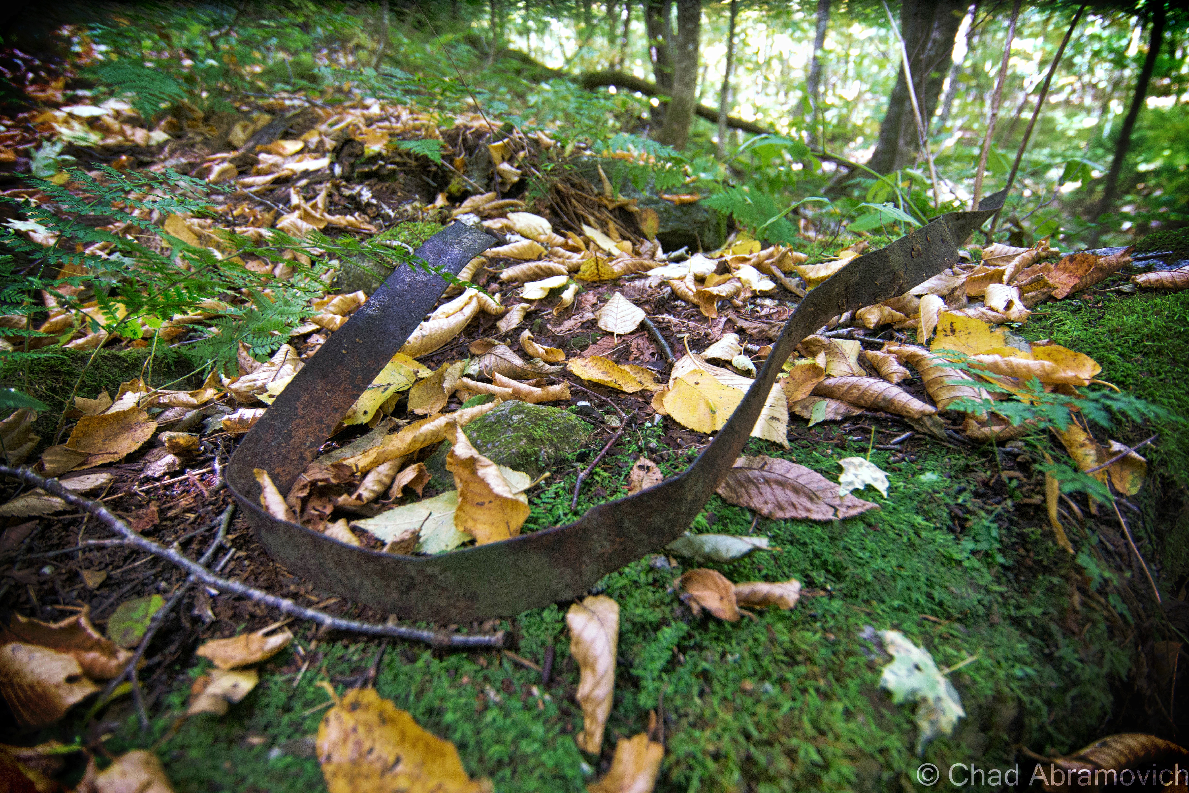
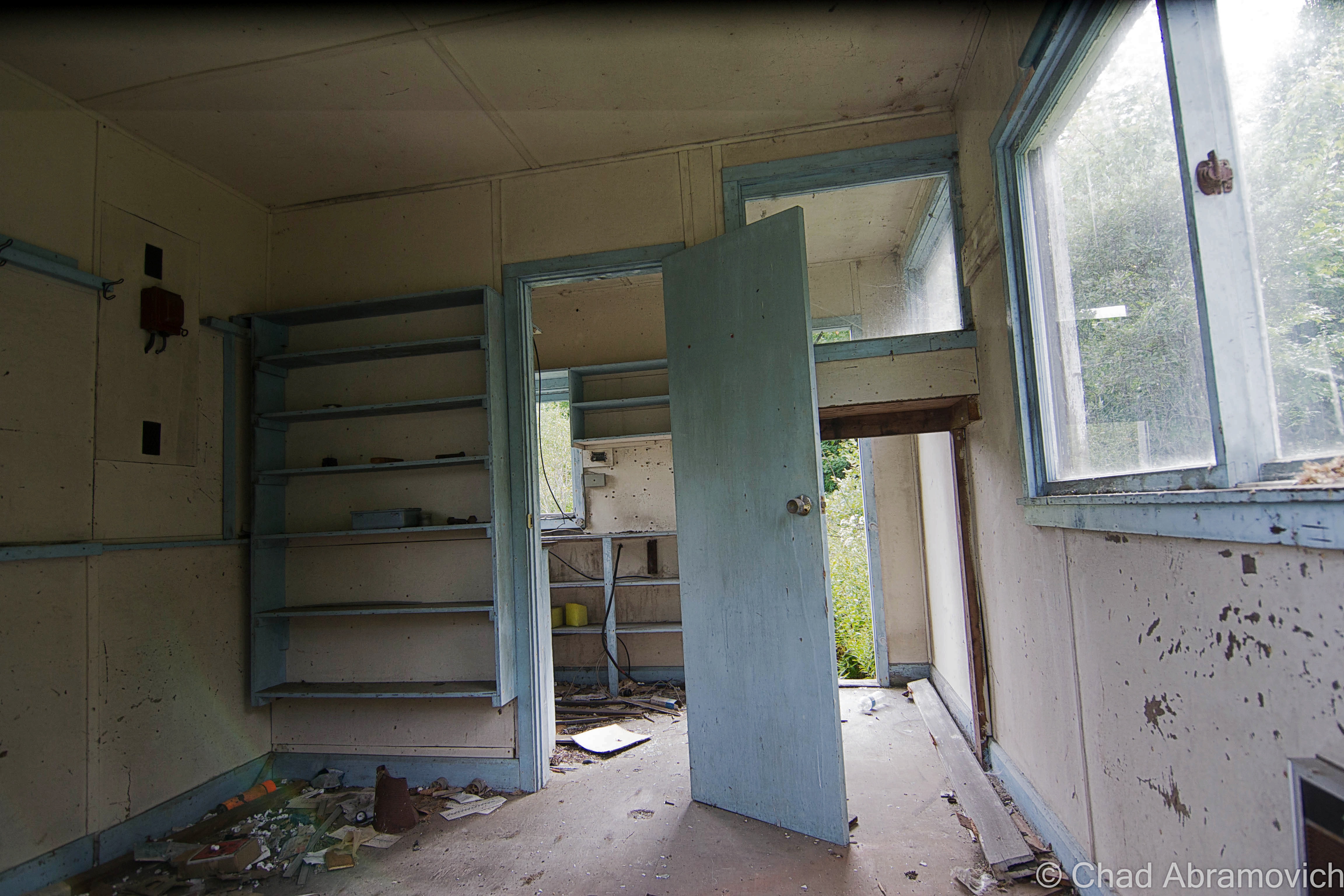
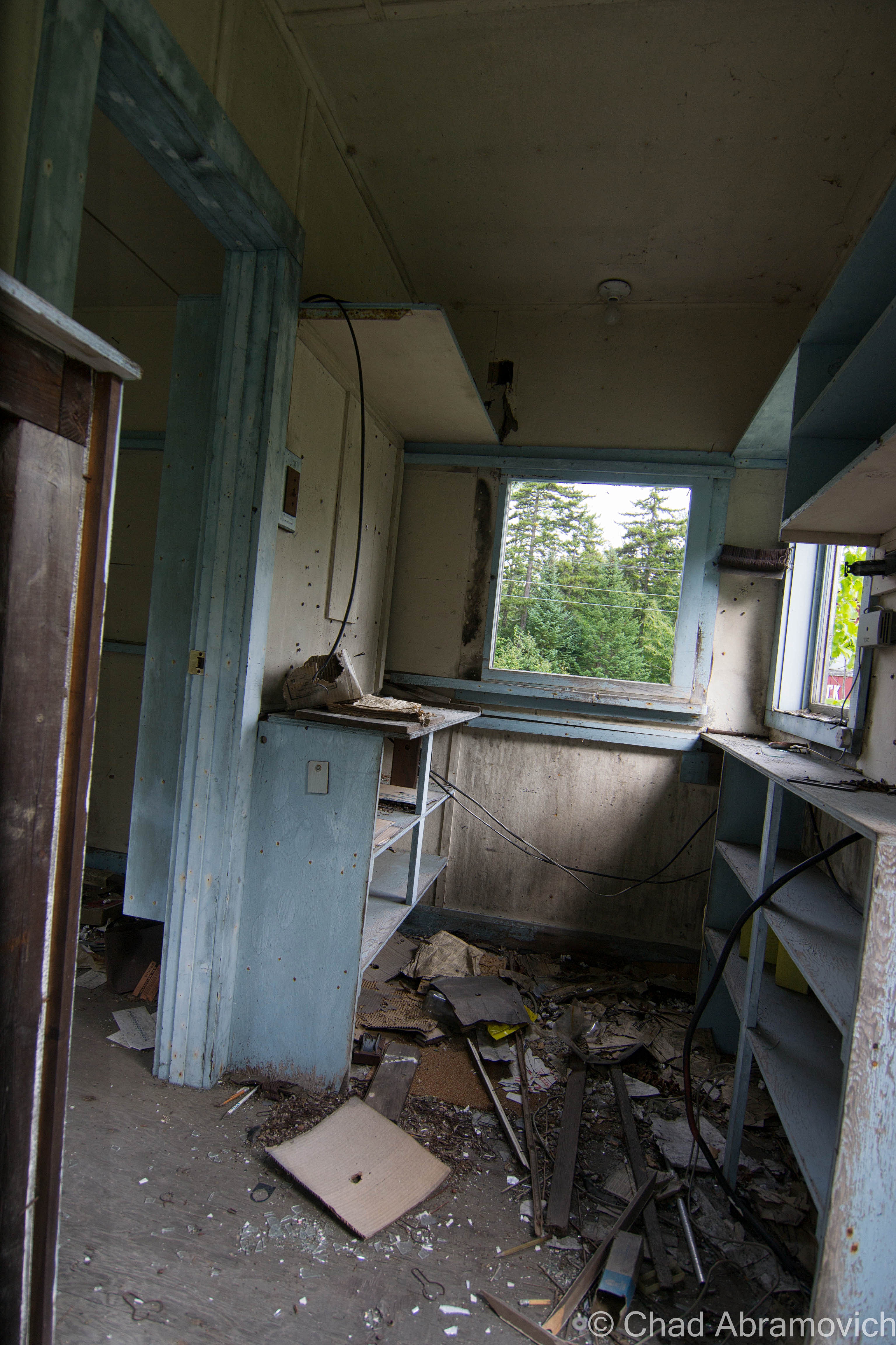
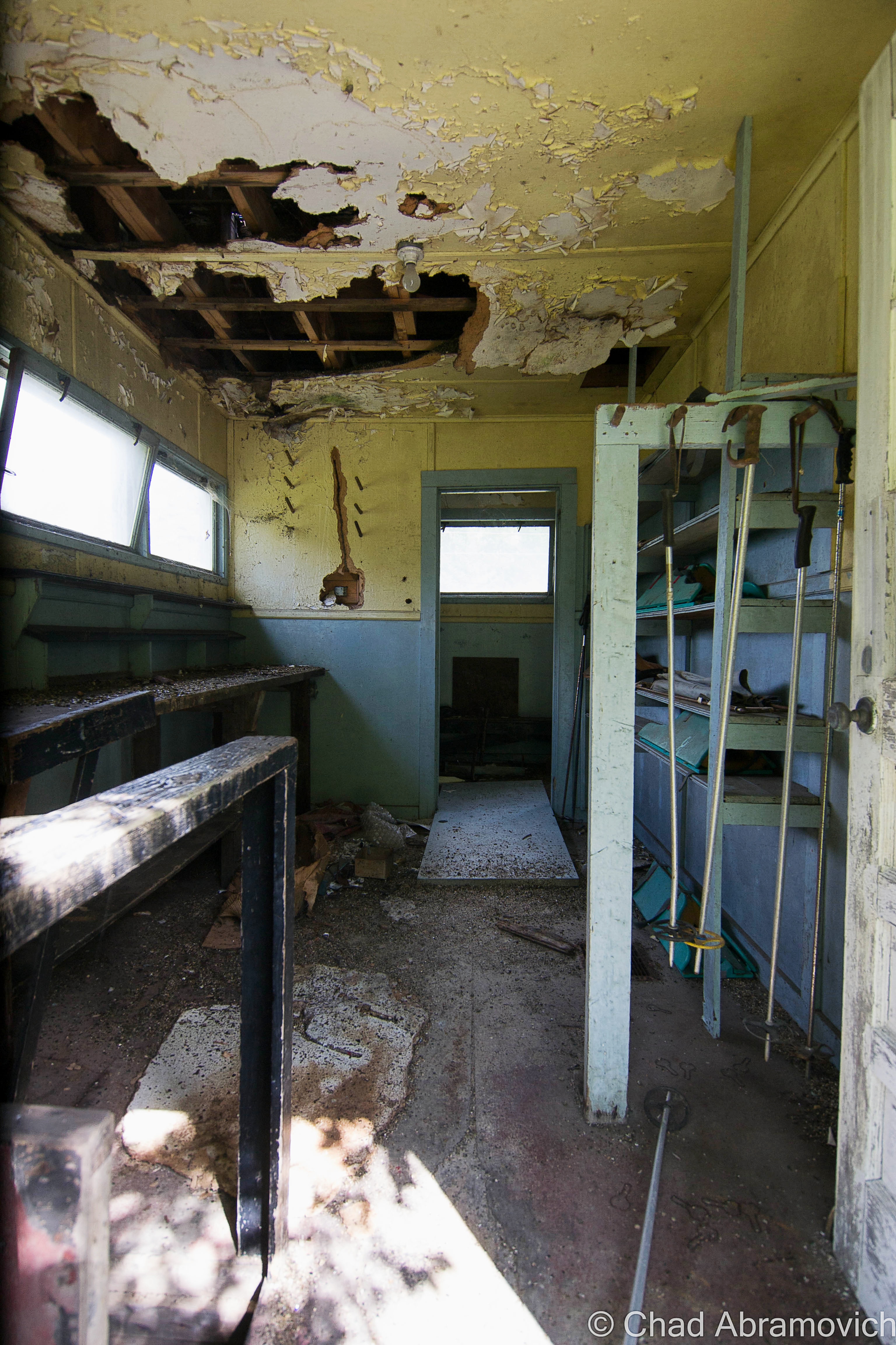
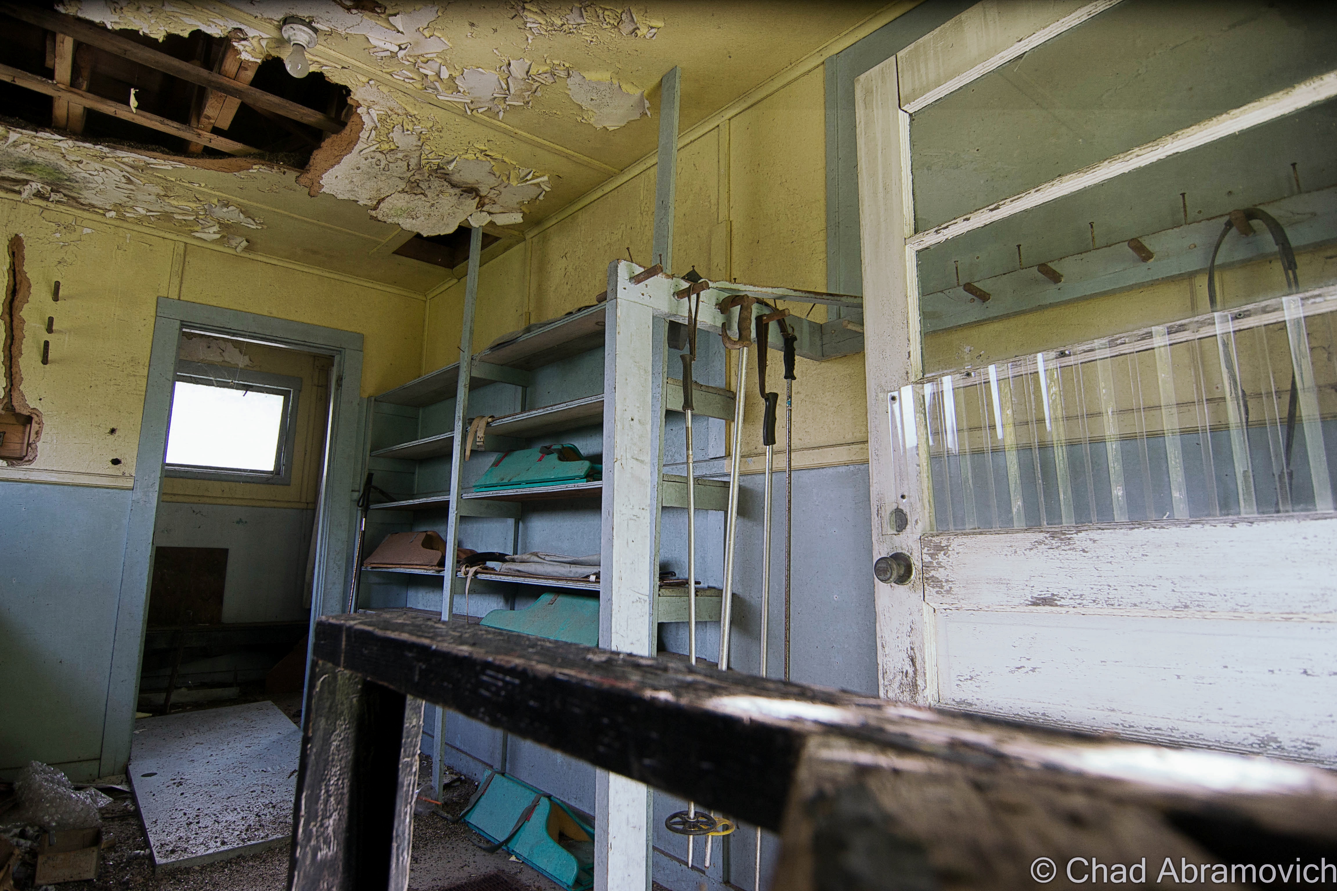
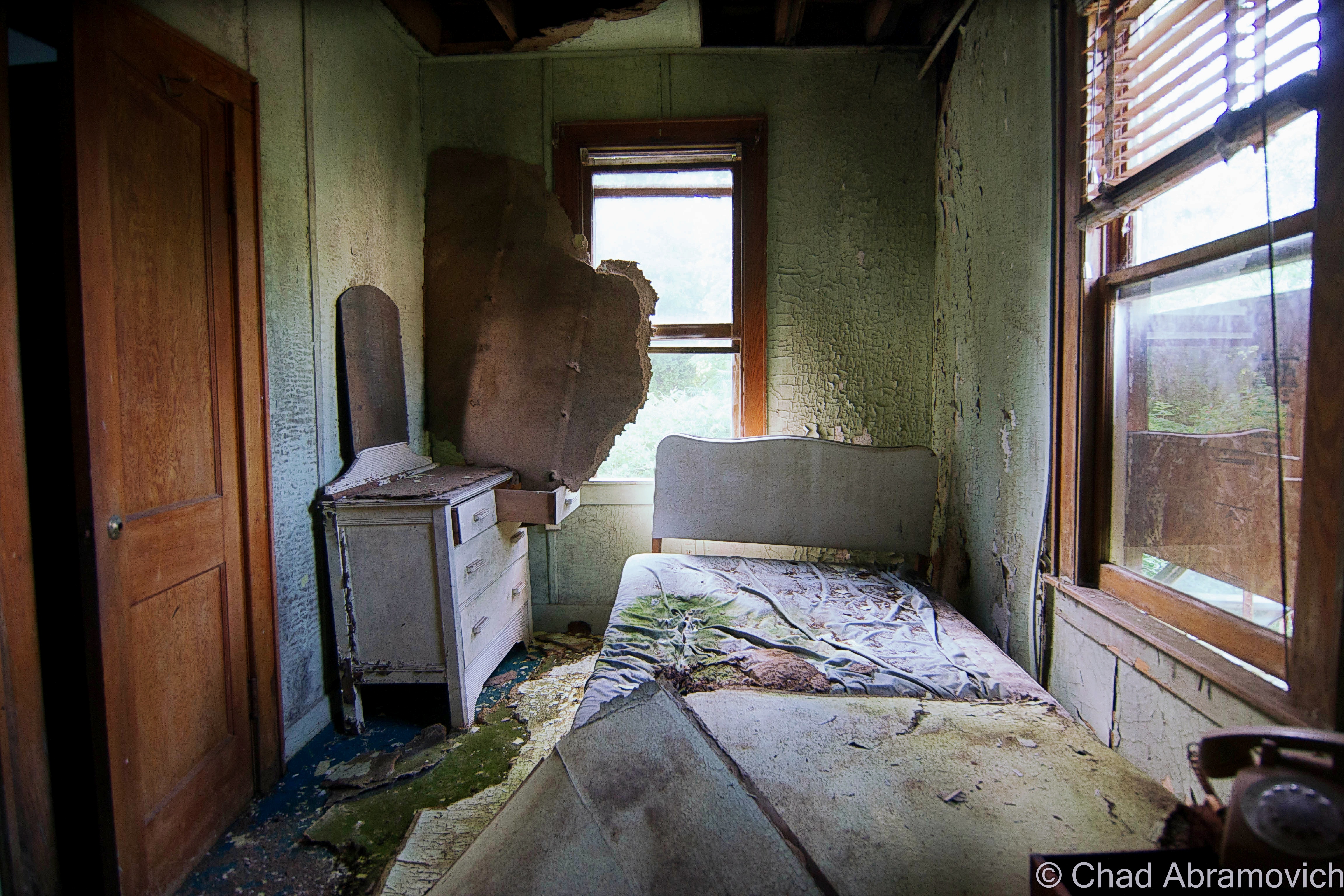
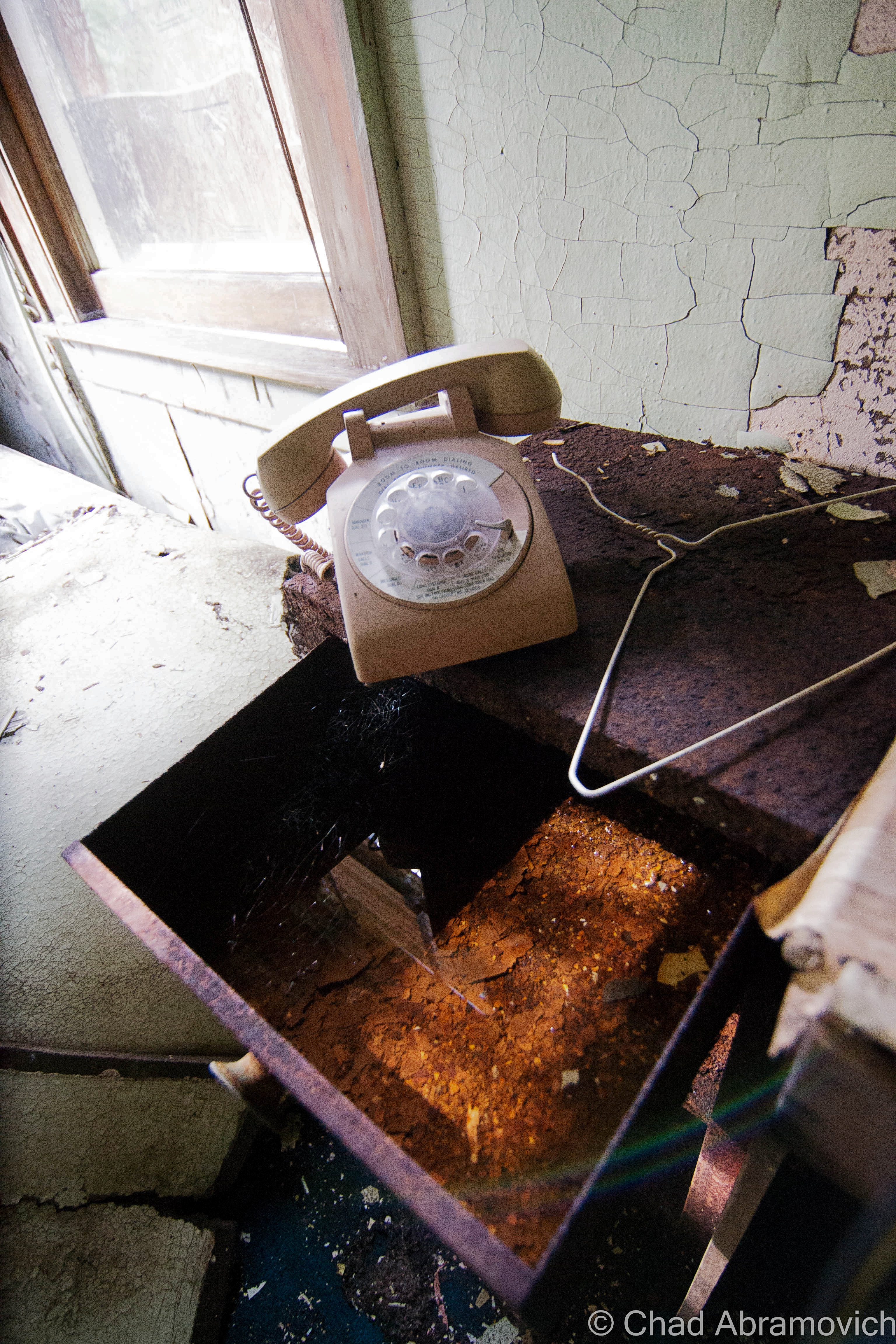
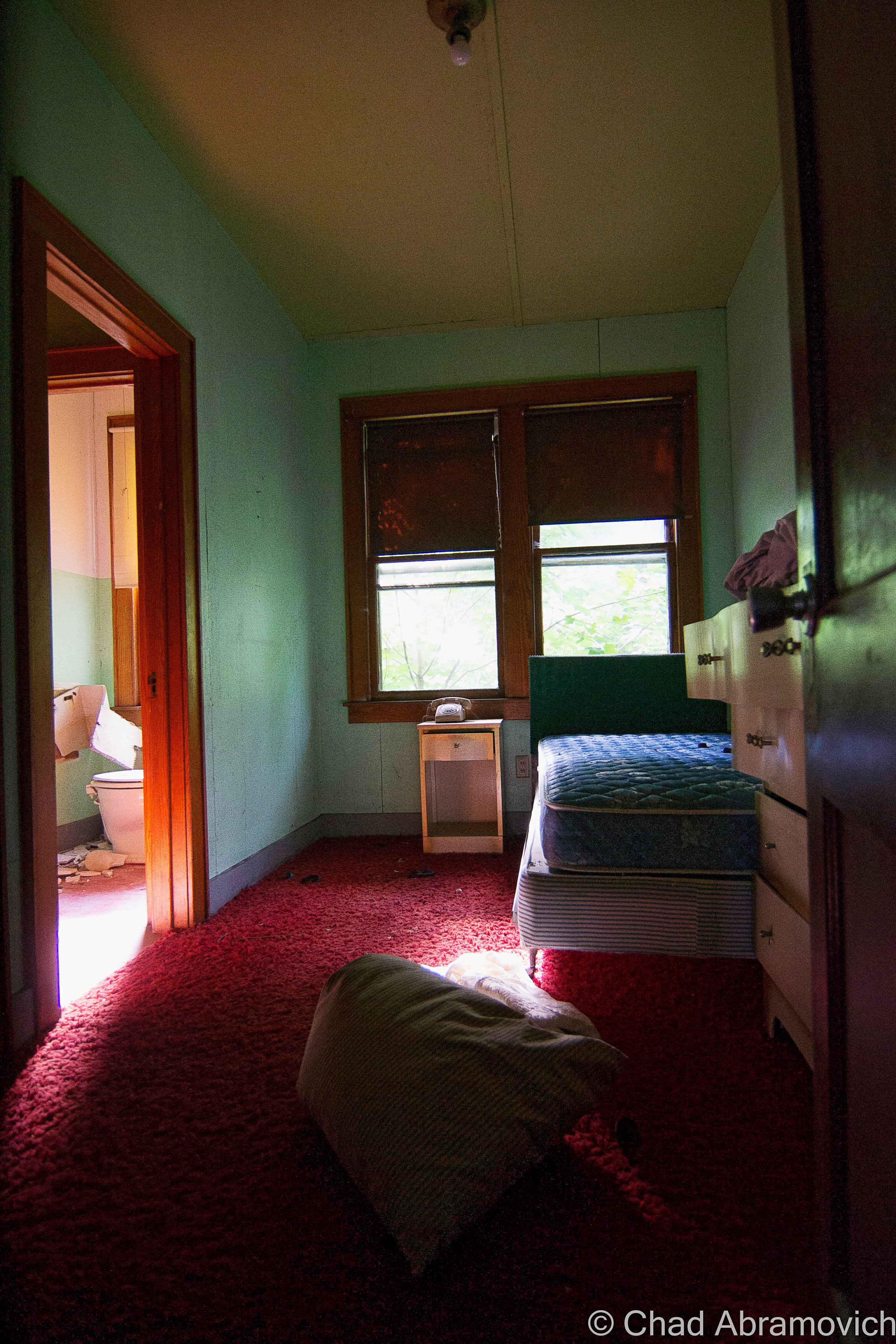
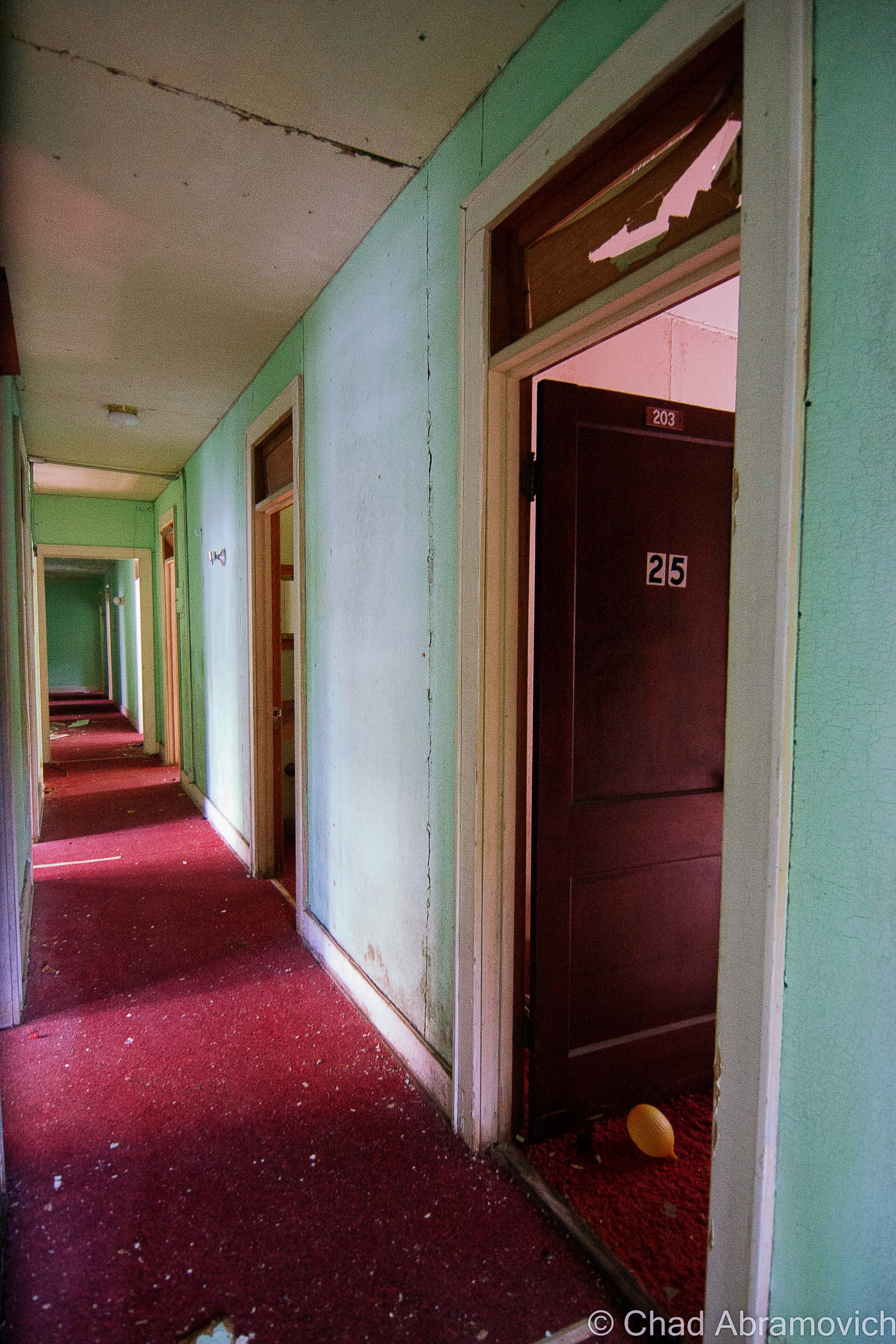
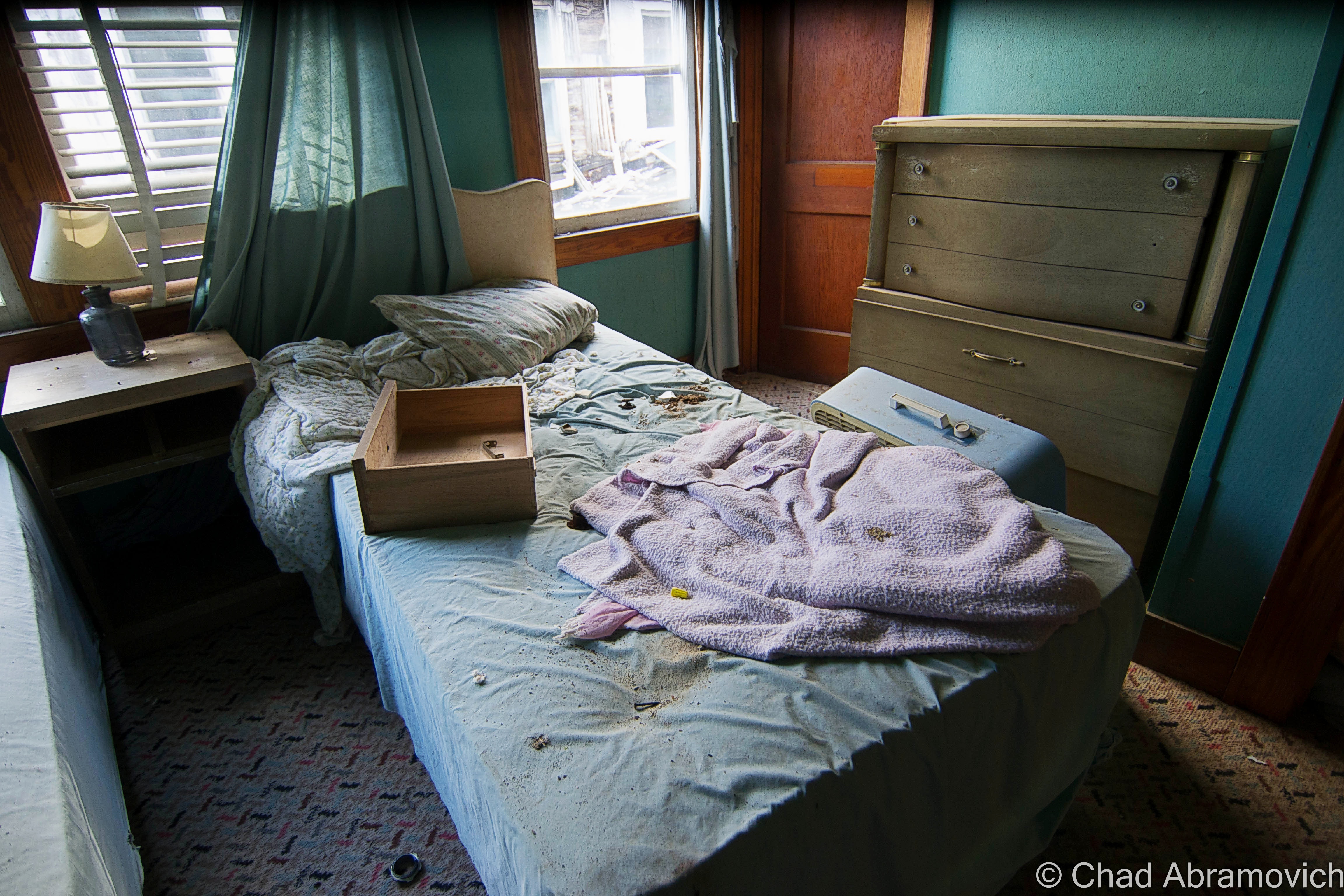
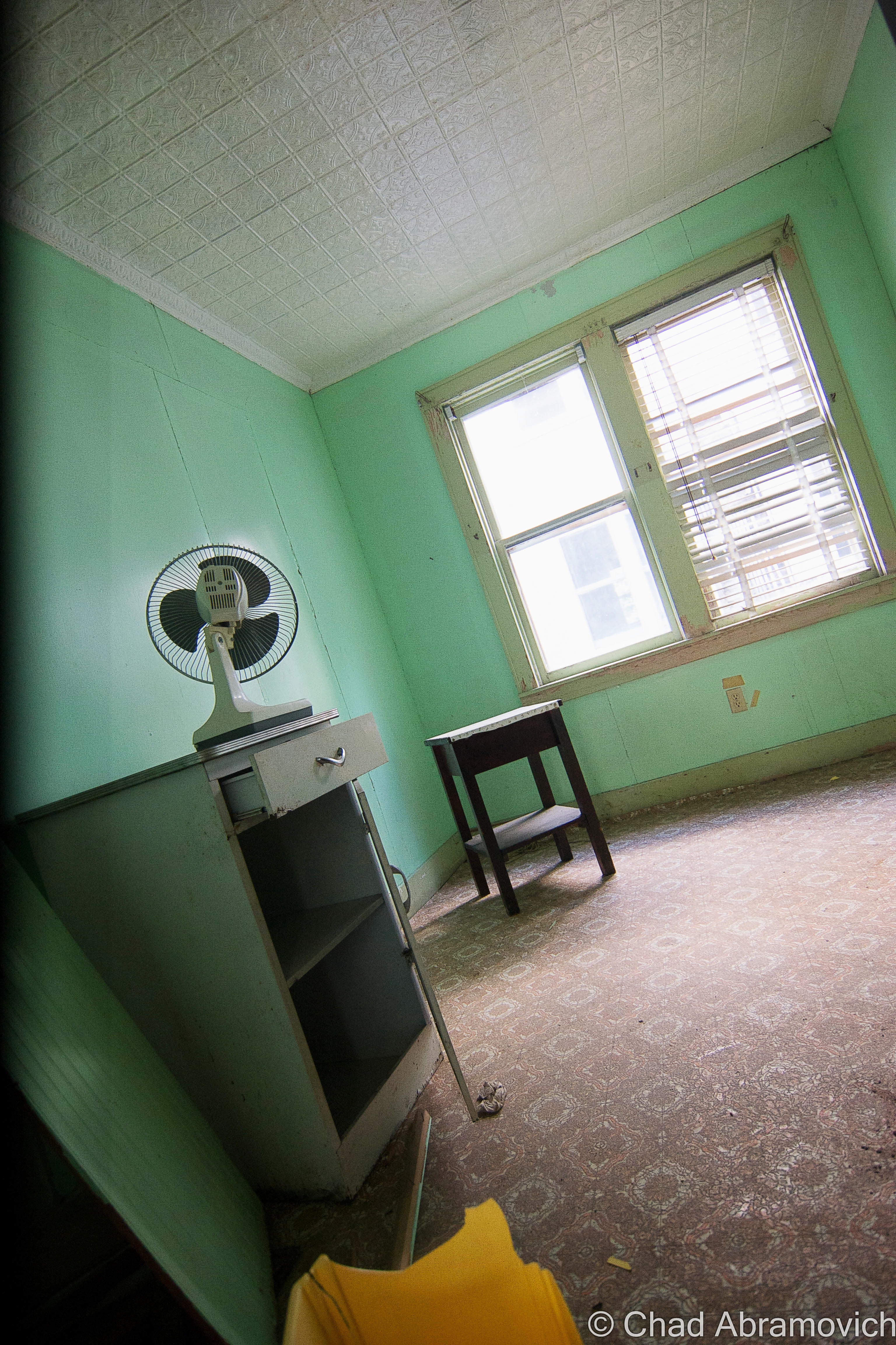
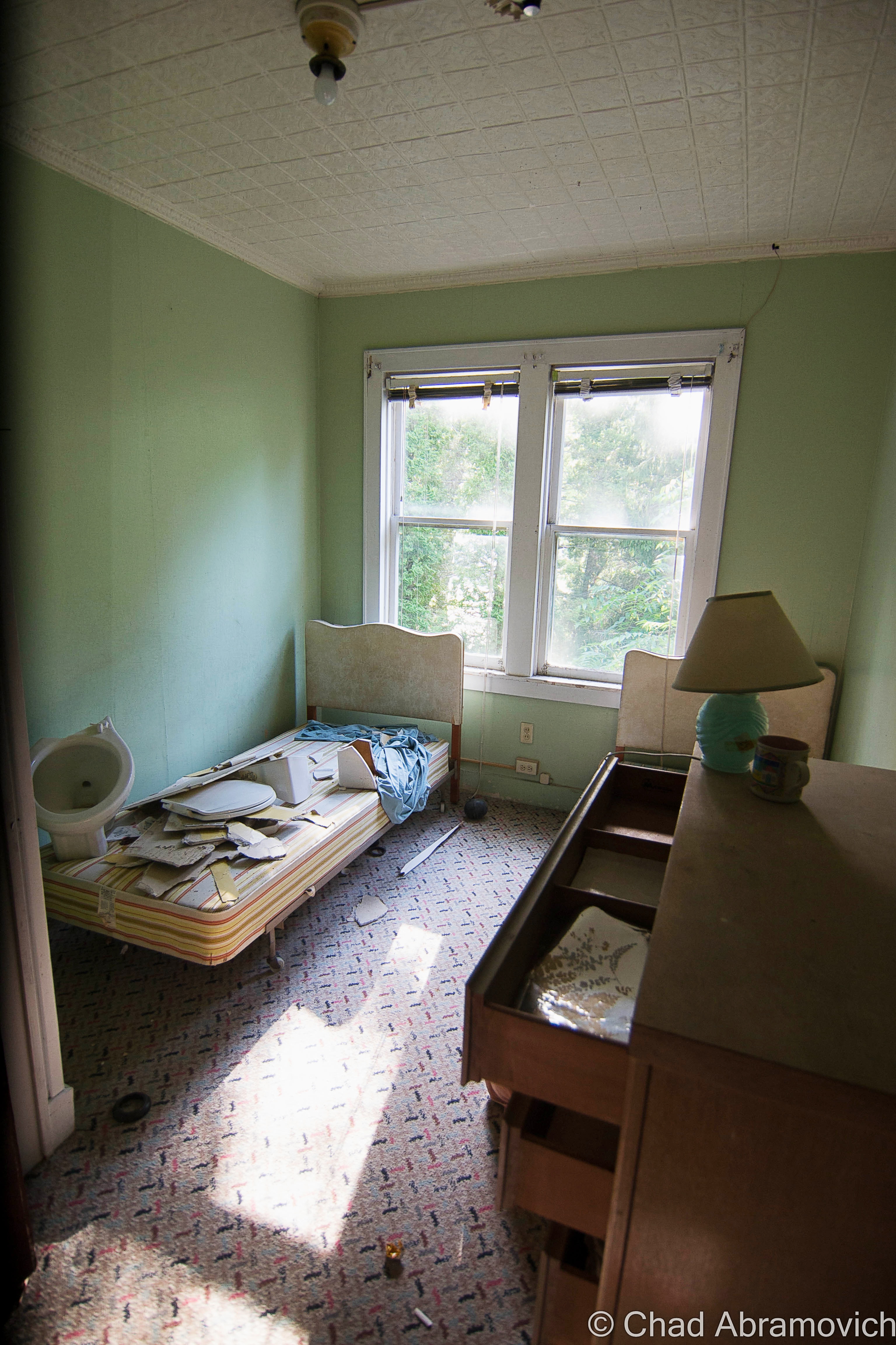
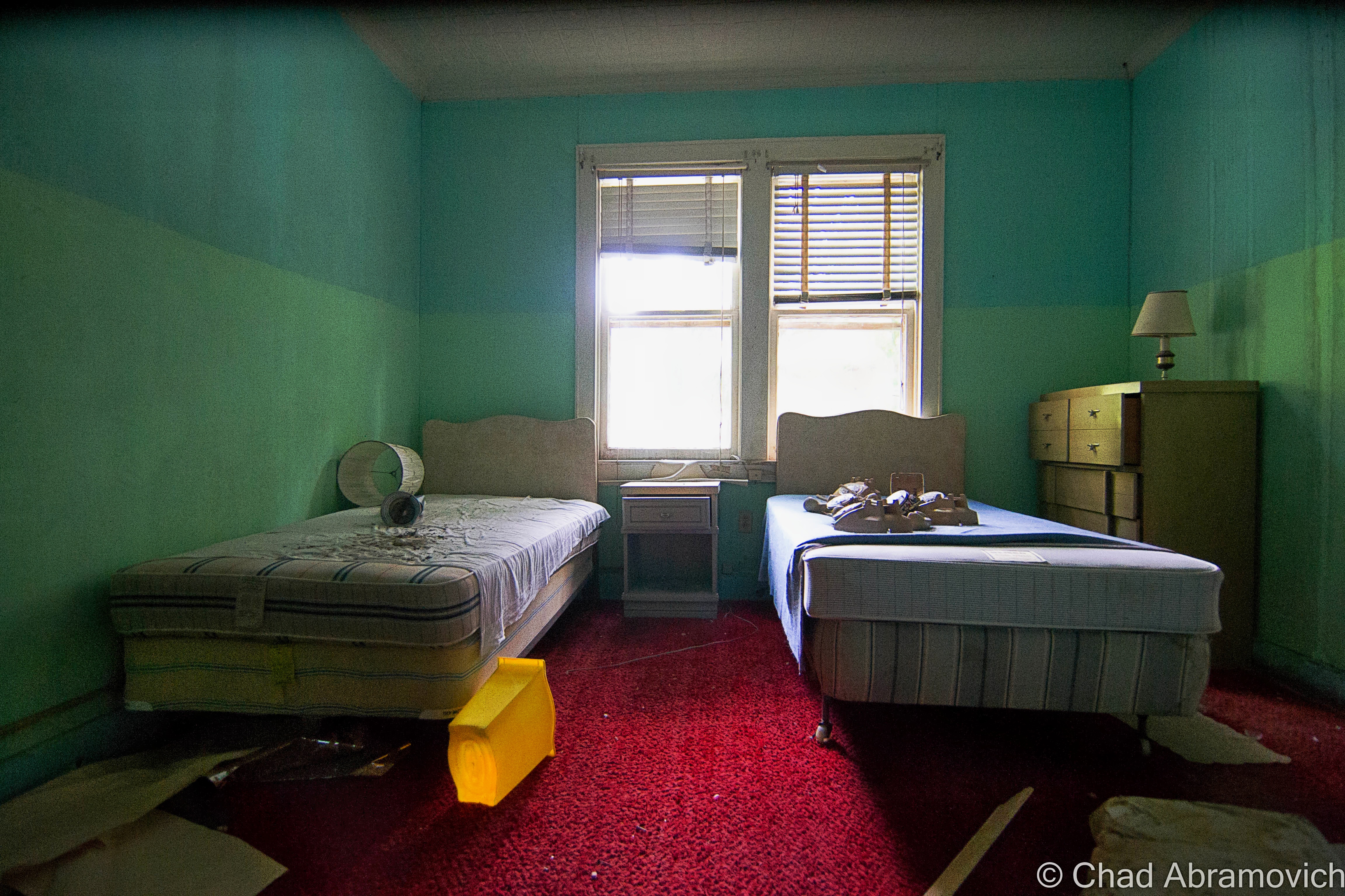
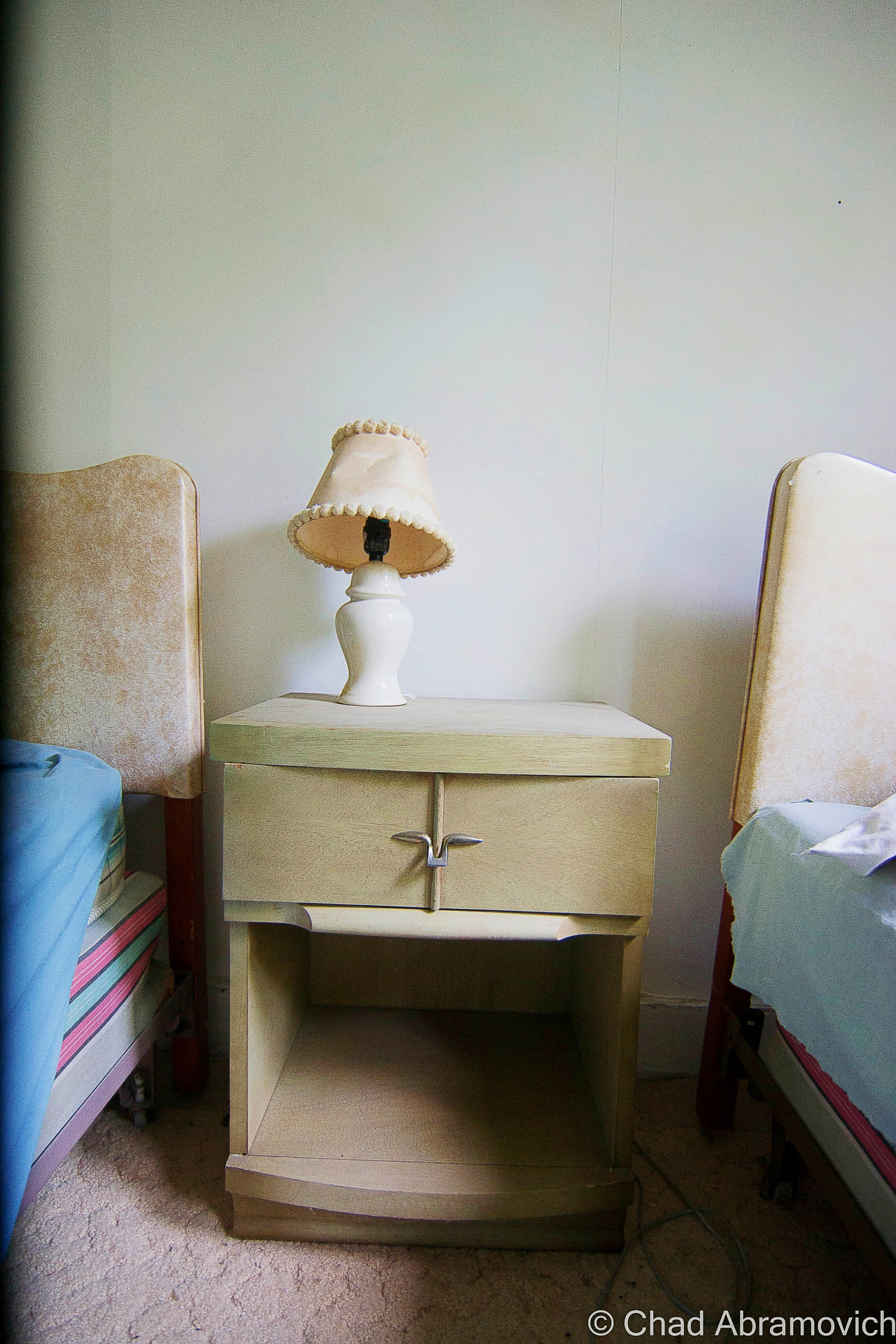
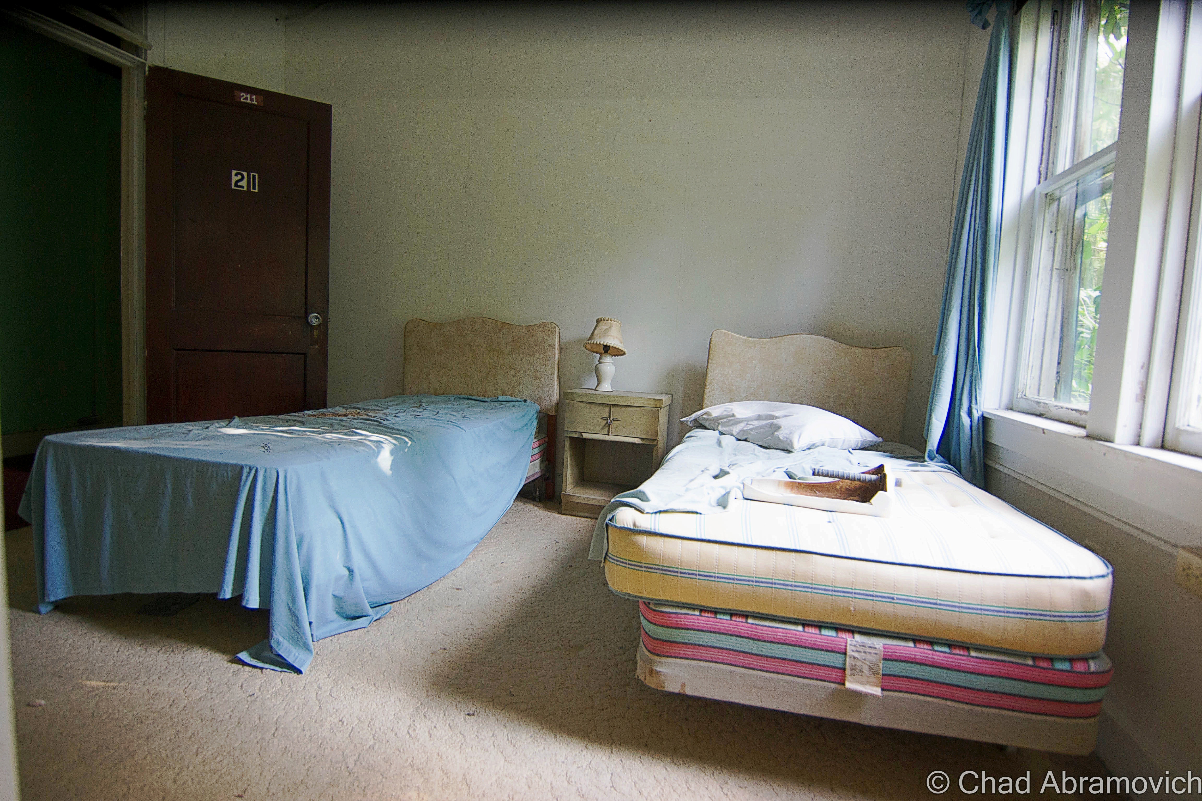
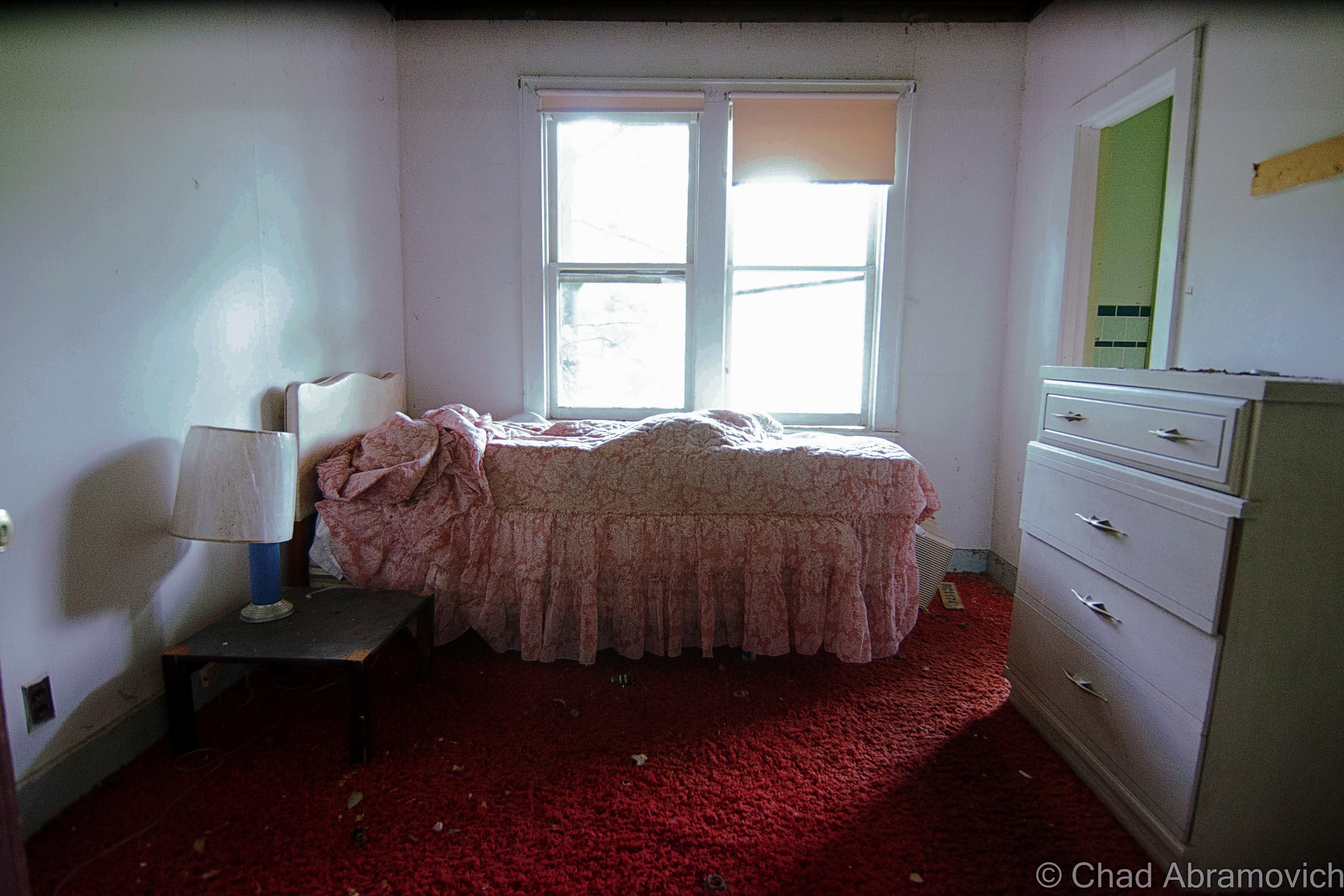
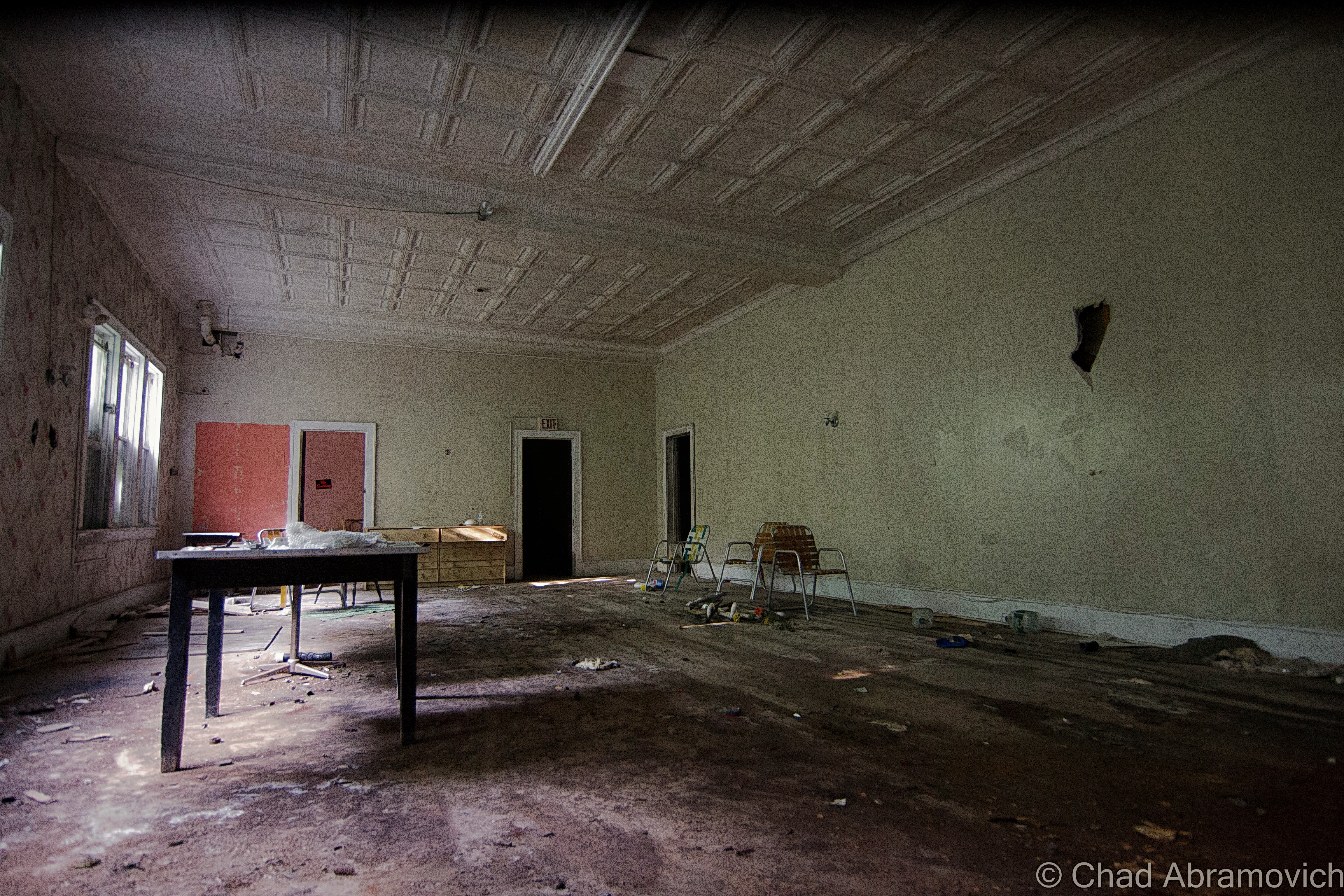
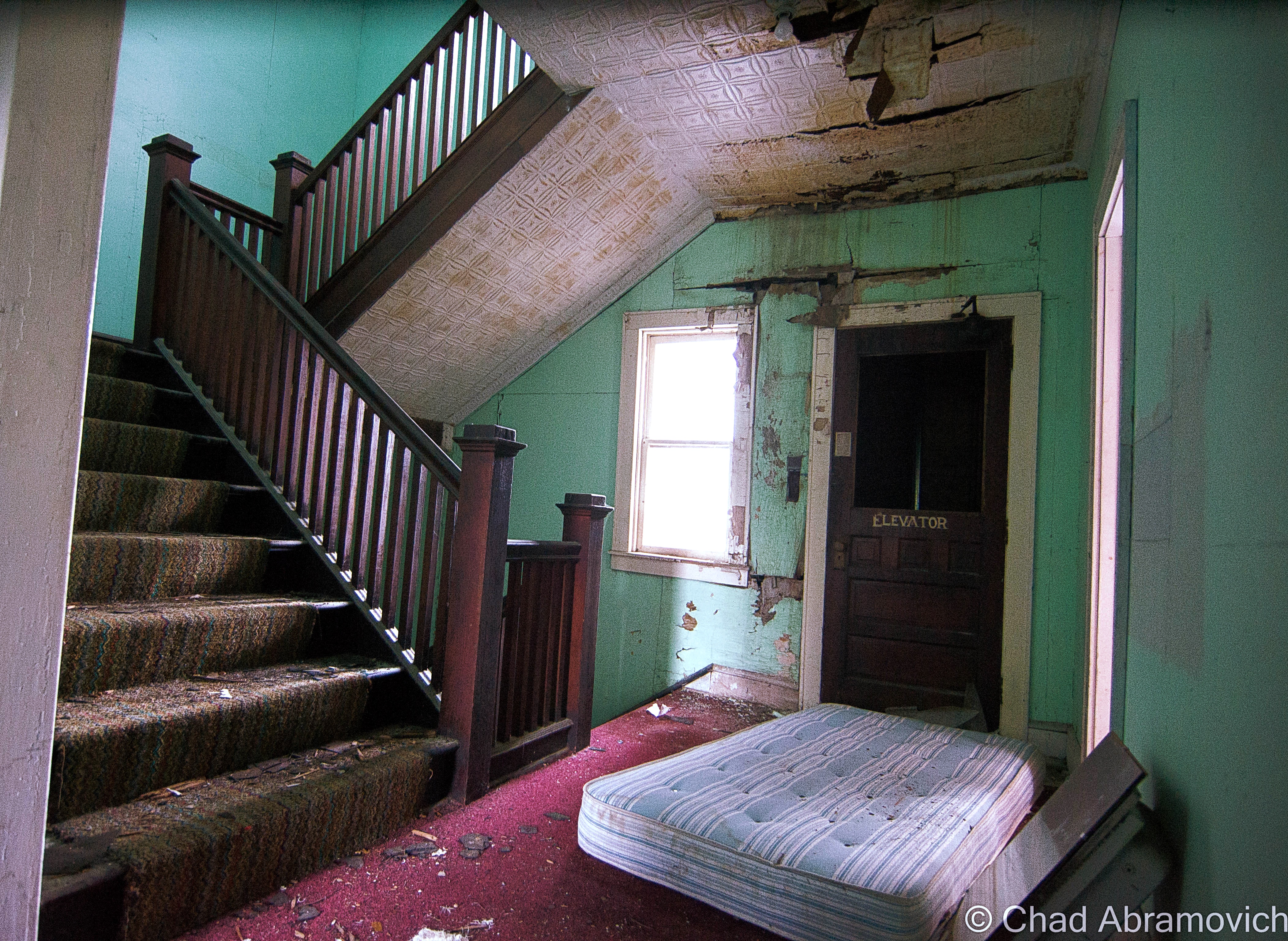
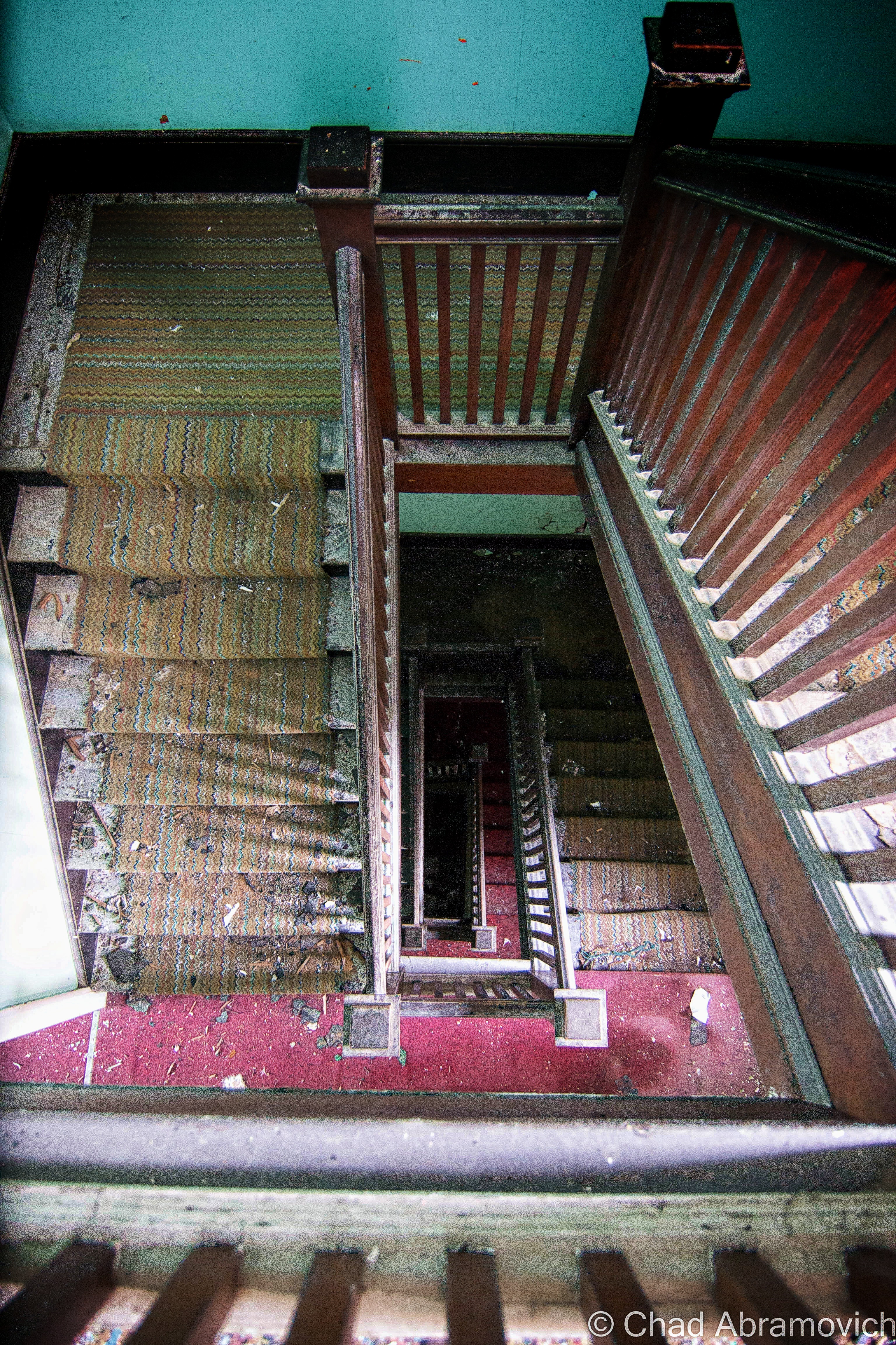
But it was evident that Santa’s Land was returning back to nature, and its desertion may be ironically bringing in more tourists. Antique sleighs were filled with dead leaves. Pine needles from past autumns collected on roofs and crevices of the ‘village downtown’ area. Some windows were broken, doors to various buildings were left wide open. Interiors were trashed and dusty. Kids had some fun with the snack bar menu at the ‘Candy Cane Cupboard’, offering up a whole new, un-family friendly smorgasbord of choices. The ‘iceberg slide’ looked sordid and the opposite of fun.
Everything was eerily haunting, and its location in the forest really helps push this vibe, as the woods and shadows help it be fantastical and mysterious without much help. Part of me almost felt this place belonged at the foot of some Bavarian alp than in the Connecticut River valley, and I should be craving a hot chocolate instead of a coffee with whiskey. It was completely immersive in its illusion because it’s buffered from the drone off Route 5 and any indication of a cluster of houses just north of the property line. It was strange and cozy at the same time.
In the beginning, it seems like Santa’s Land was a pretty cool and imaginative place, and if what I was able to dig up online was any indication, a lot of curiosity seekers, families, and Christmas fanatics really enjoyed it here.
Reality can often use some shuffling, especially nowadays. That’s why families used to come to places like this, and in my own way, that’s why I seek out the things you see on my blog.
Here’s a video shot by a passenger on the squeaky ‘Santa’s Land Express’ who informatively (and helpfully) points out various sites in the park.
Santa’s Land – January 2017
Interested in more decrepit northeastern Americana and Theme parks? Check out a few of my older blog entries of the remnants of that tourism era across the lake…
Since 2012, I’ve been seeking out venerable examples of Vermont weirdness, whether that be traveling around the state or taking to my internet connection and digging up forsaken places, oddities, esoterica, and unique natural features. And along the way, I’ve been sharing it with you on my website, Obscure Vermont. This is what keeps my spirit inspired.
I never expected Obscure Vermont to get as much appreciation and fanfare as it’s getting, and I’m truly grateful and humbled. Especially in recent years, where I’ve gained the opportunity to interact with and befriend more oddity lovers and outside the box thinkers around Vermont and New England. As Obscure Vermont has grown, I’ve been growing with it, and the developing attention is keeping me earnest and pushing me harder to be more introspective and going further into seeking out the strange.
I spend countless hours researching, writing, and traveling to keep this blog going. Obscure Vermont is funded almost entirely by generous donations. Expenses range from hosting fees to keep the blog live, investing in research materials, travel expenses and the required planning, and updating/maintaining vital tools such as my camera and my computer. I really pride and push myself to try to put out the best of what I’m able to create, and I gauge it by only posting stuff that I personally would want to see on the glow of my computer screen.
I want to continuously diversify how I write and the odd things I write about. Your patronage would greatly help me continue bringing you cool and unusual content and keep me doing what I love!
It only believes In a pile of dead leaves And a moon That’s the color of bone
– Tom Waits
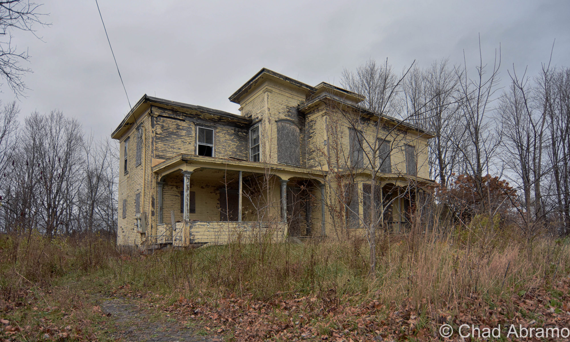
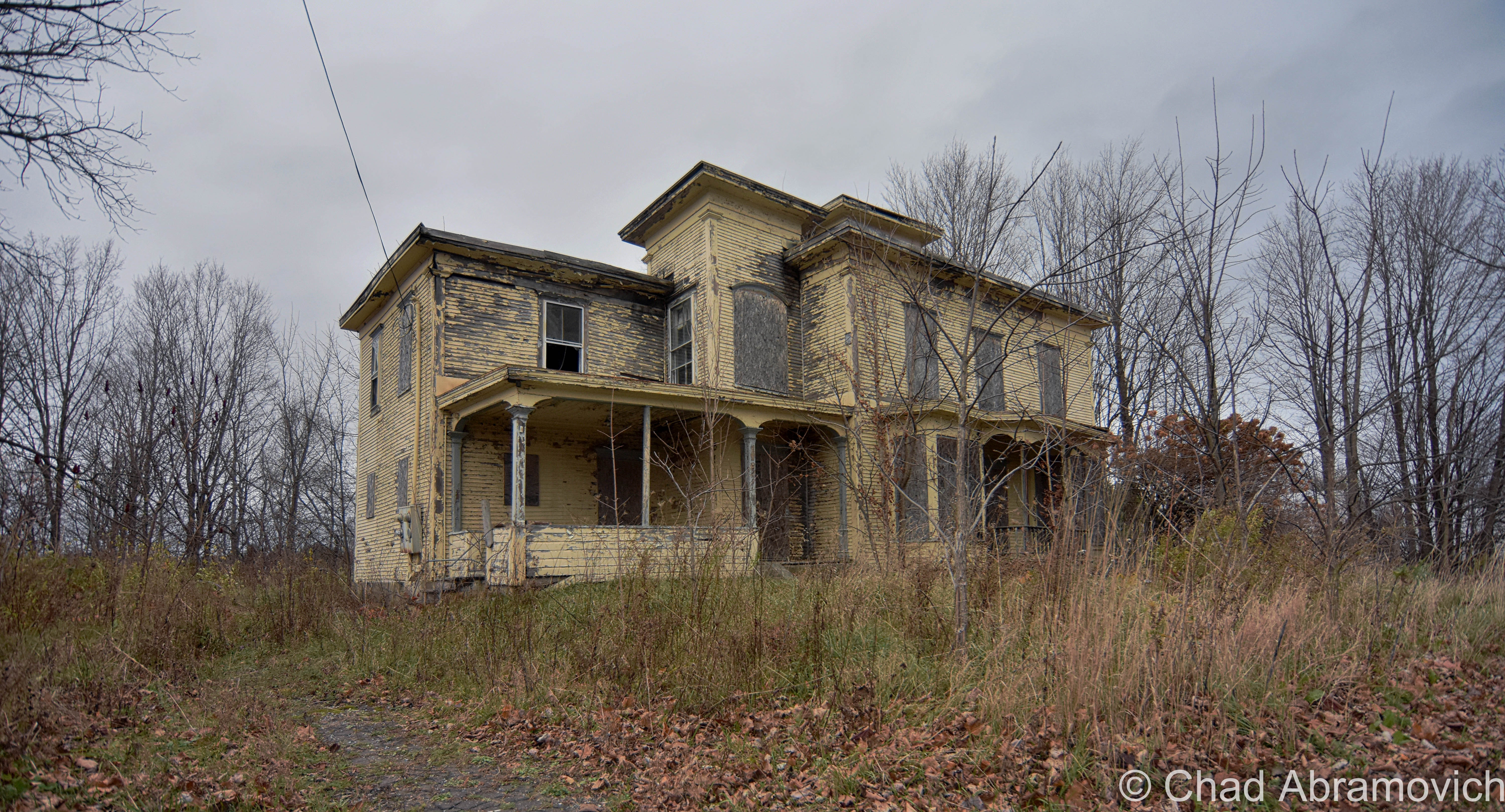
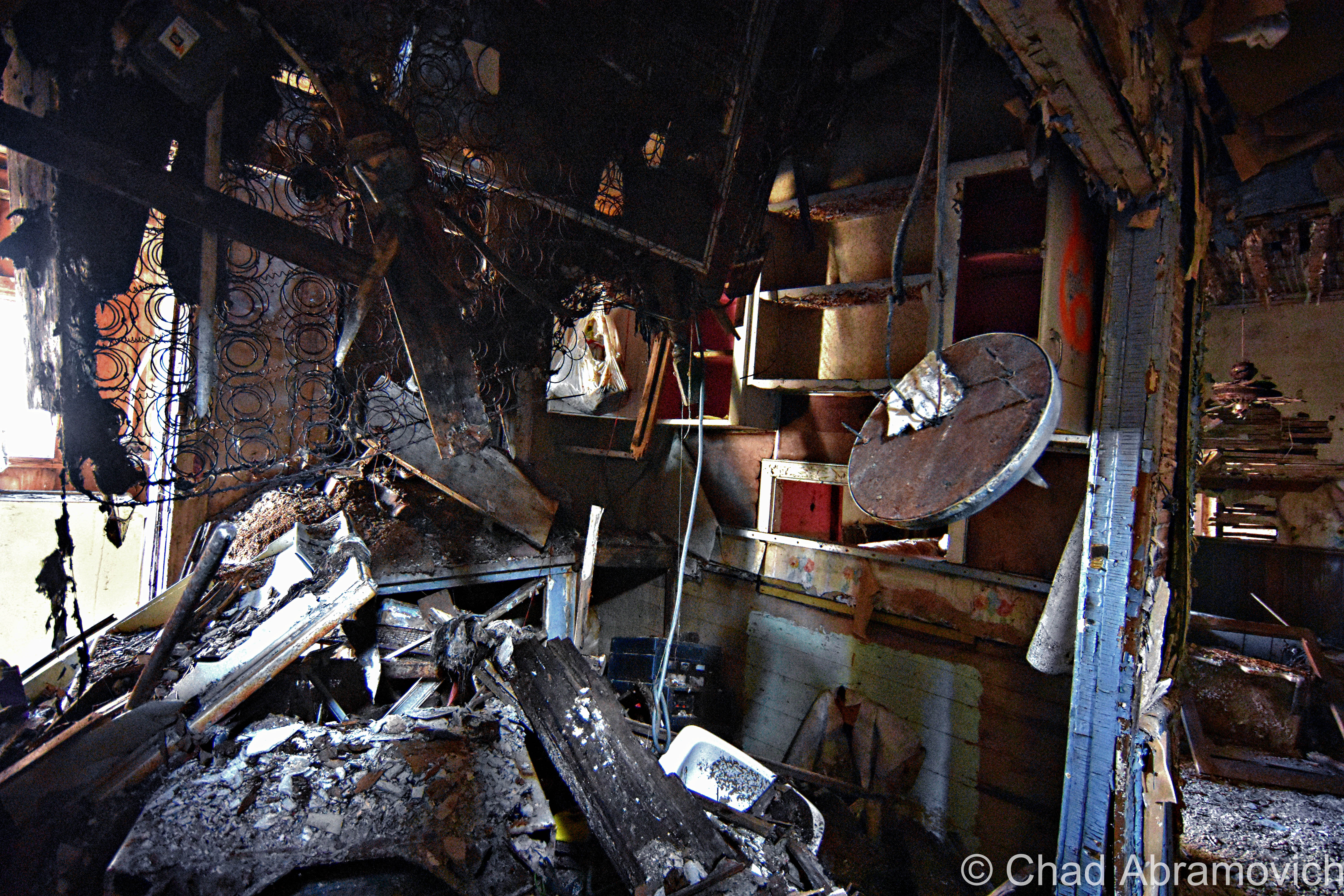
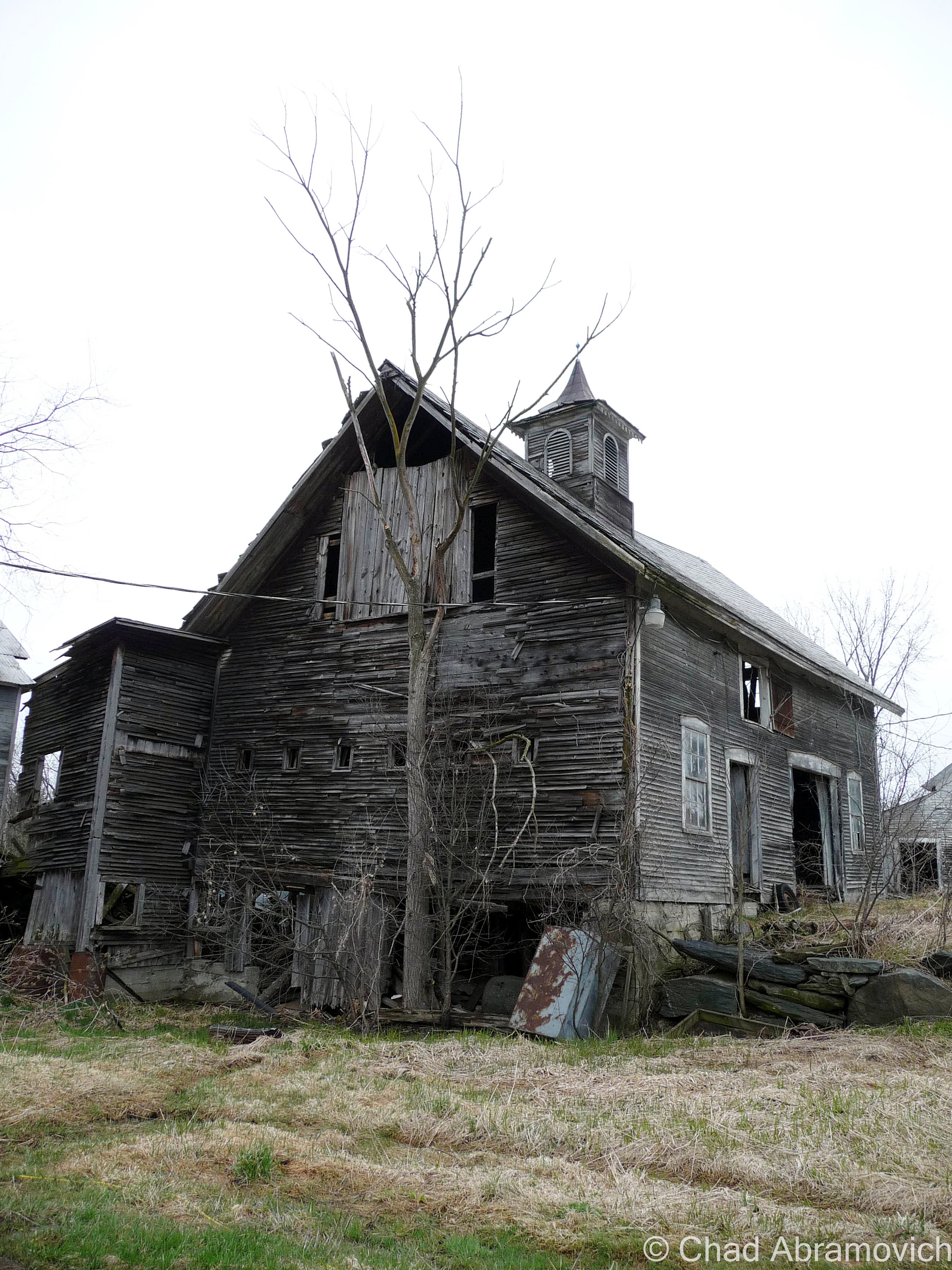
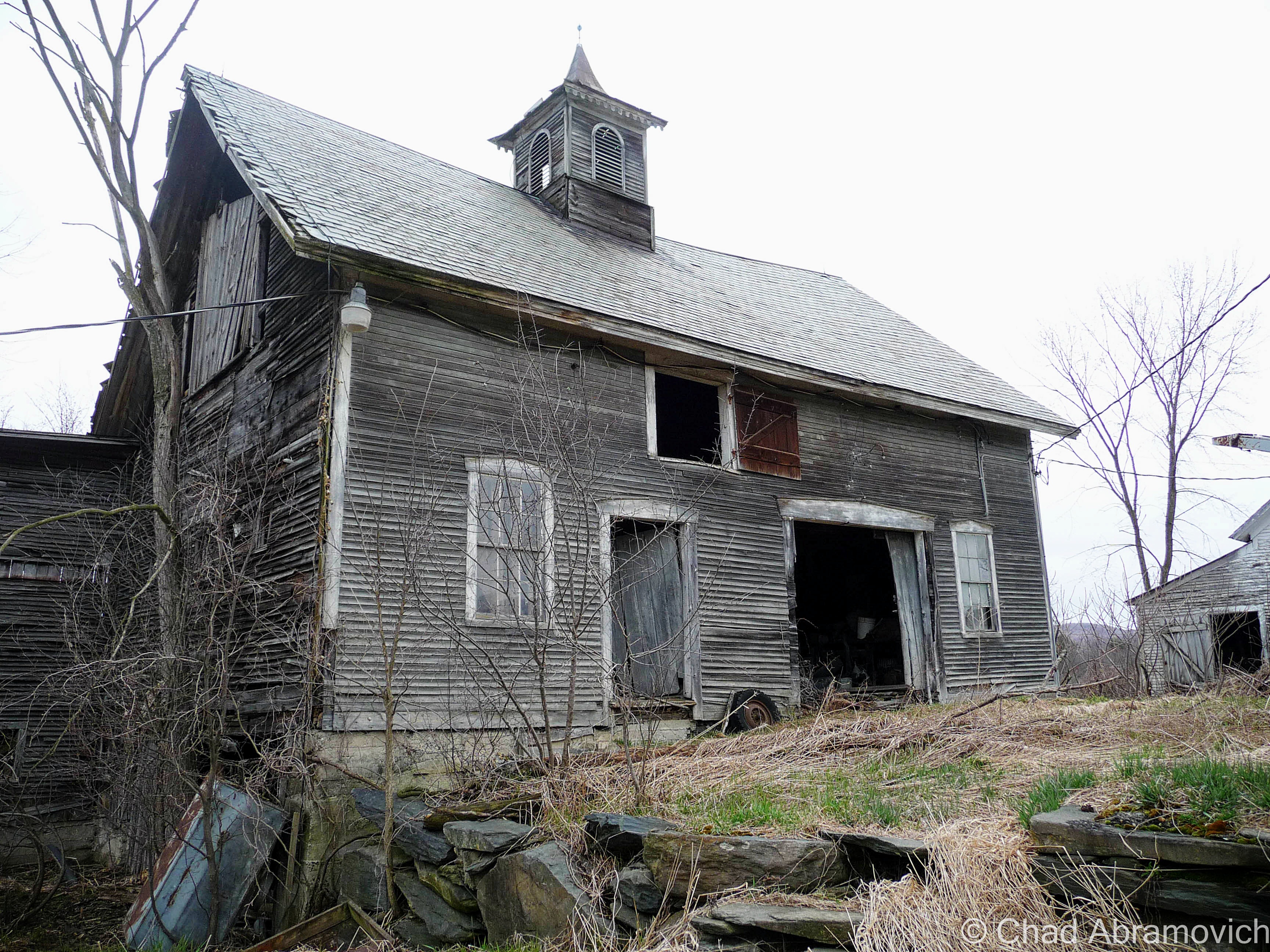
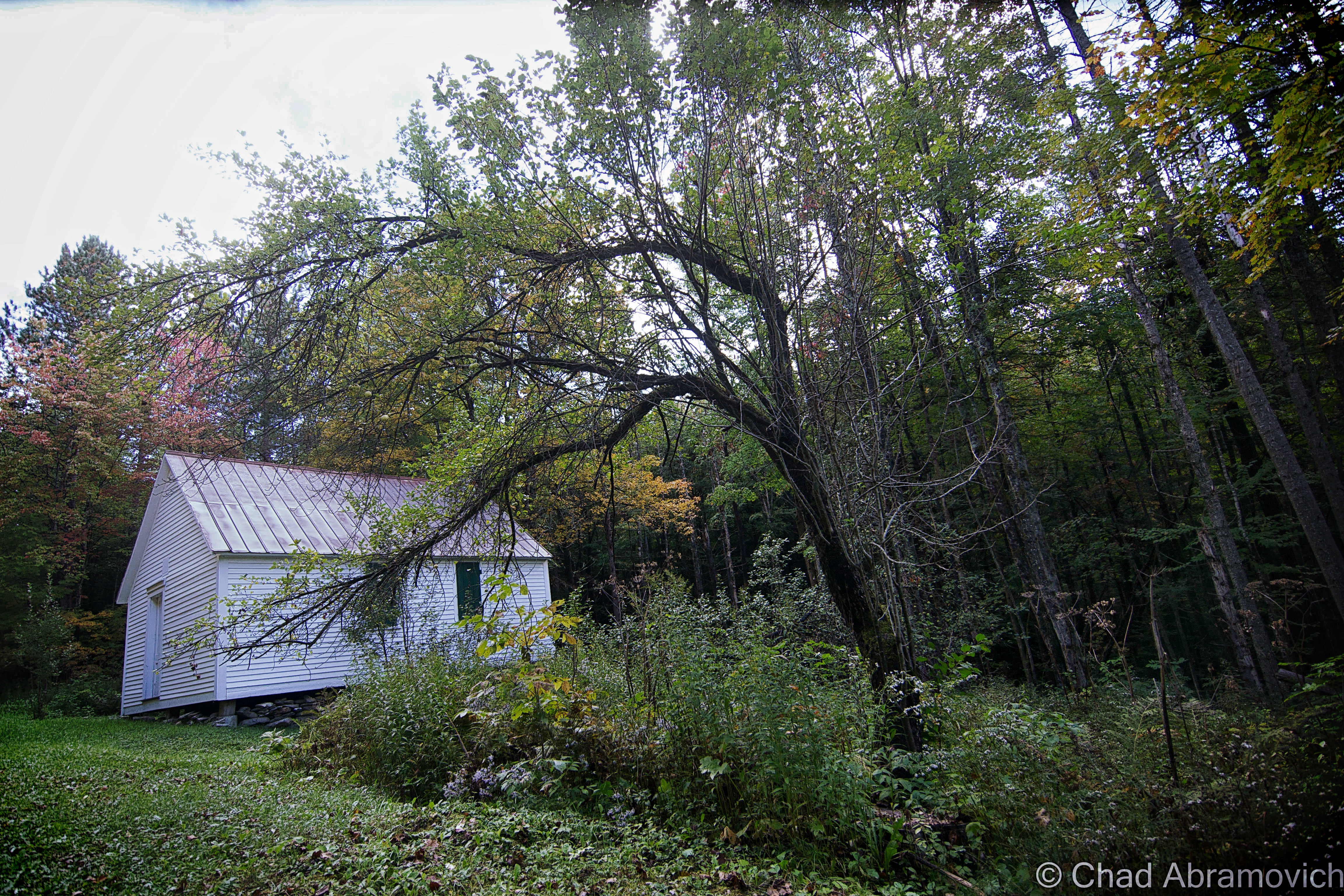
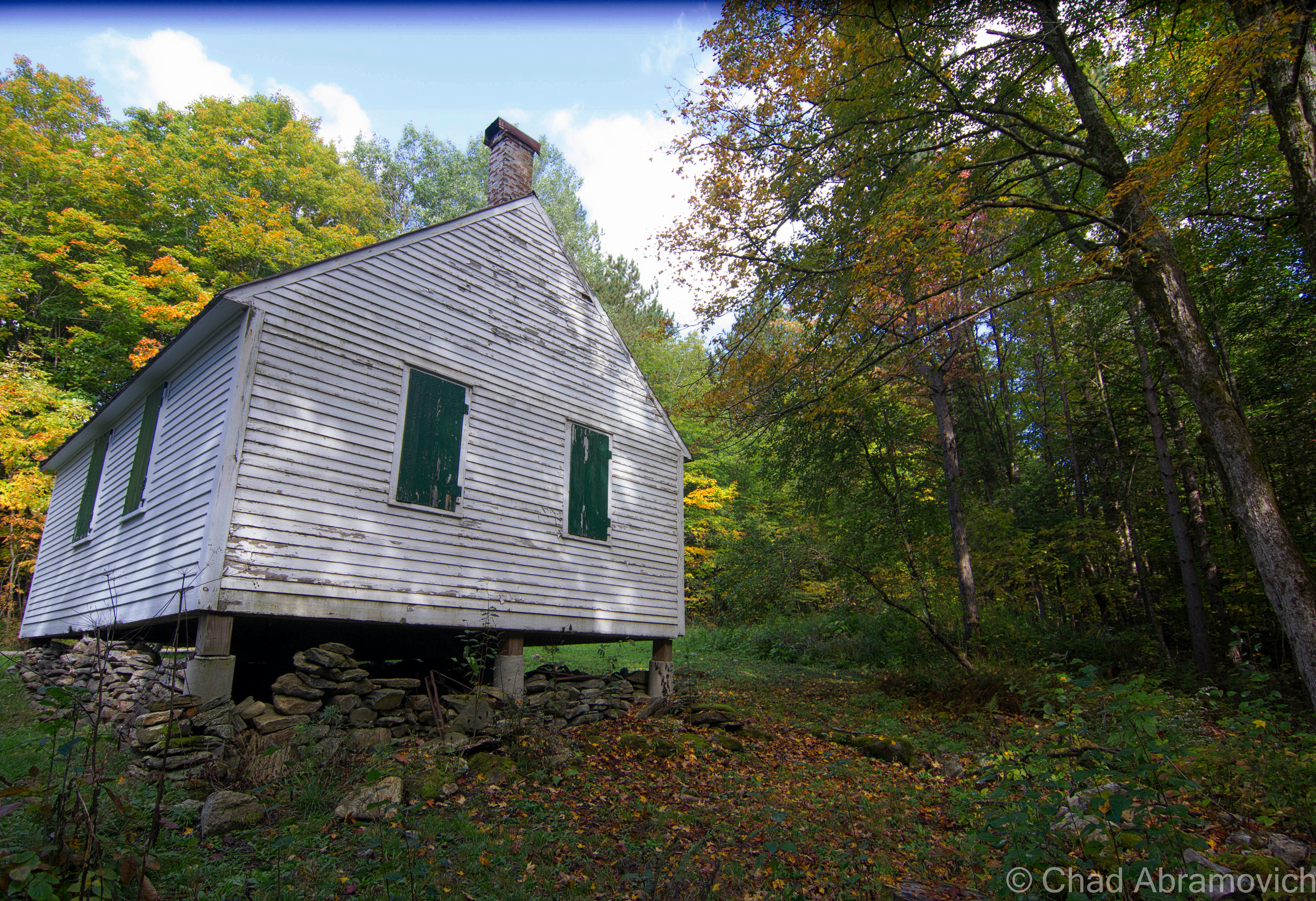
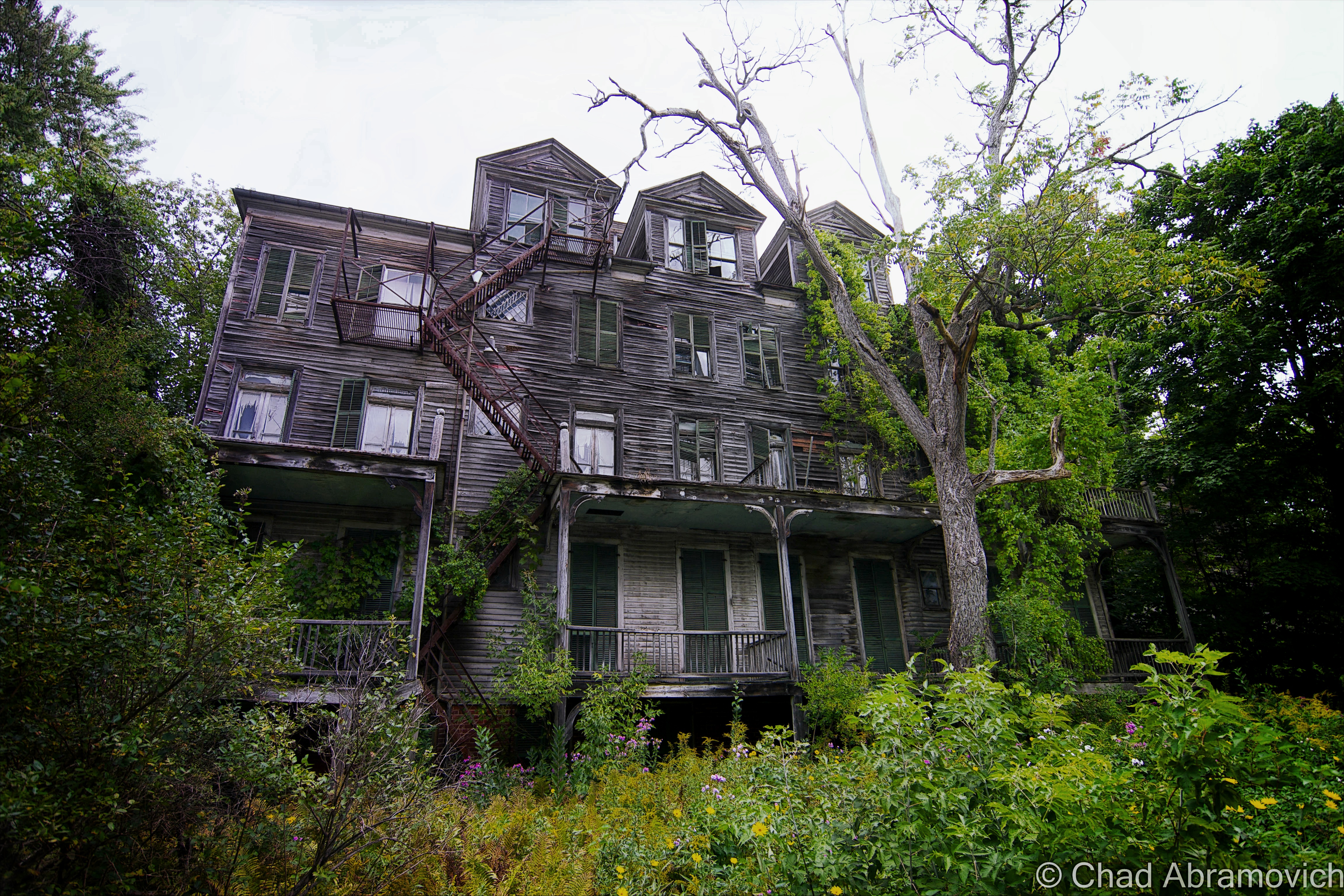
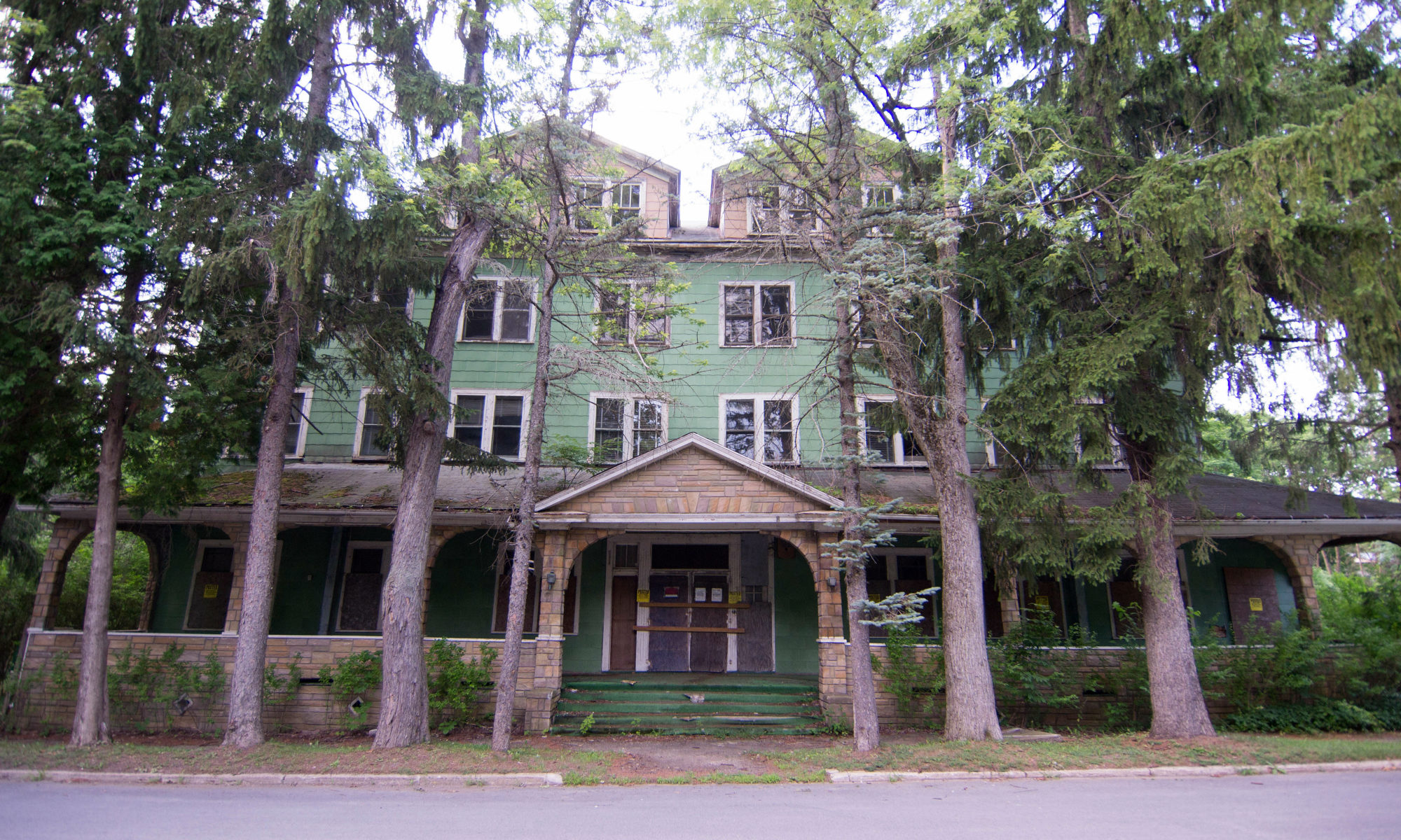
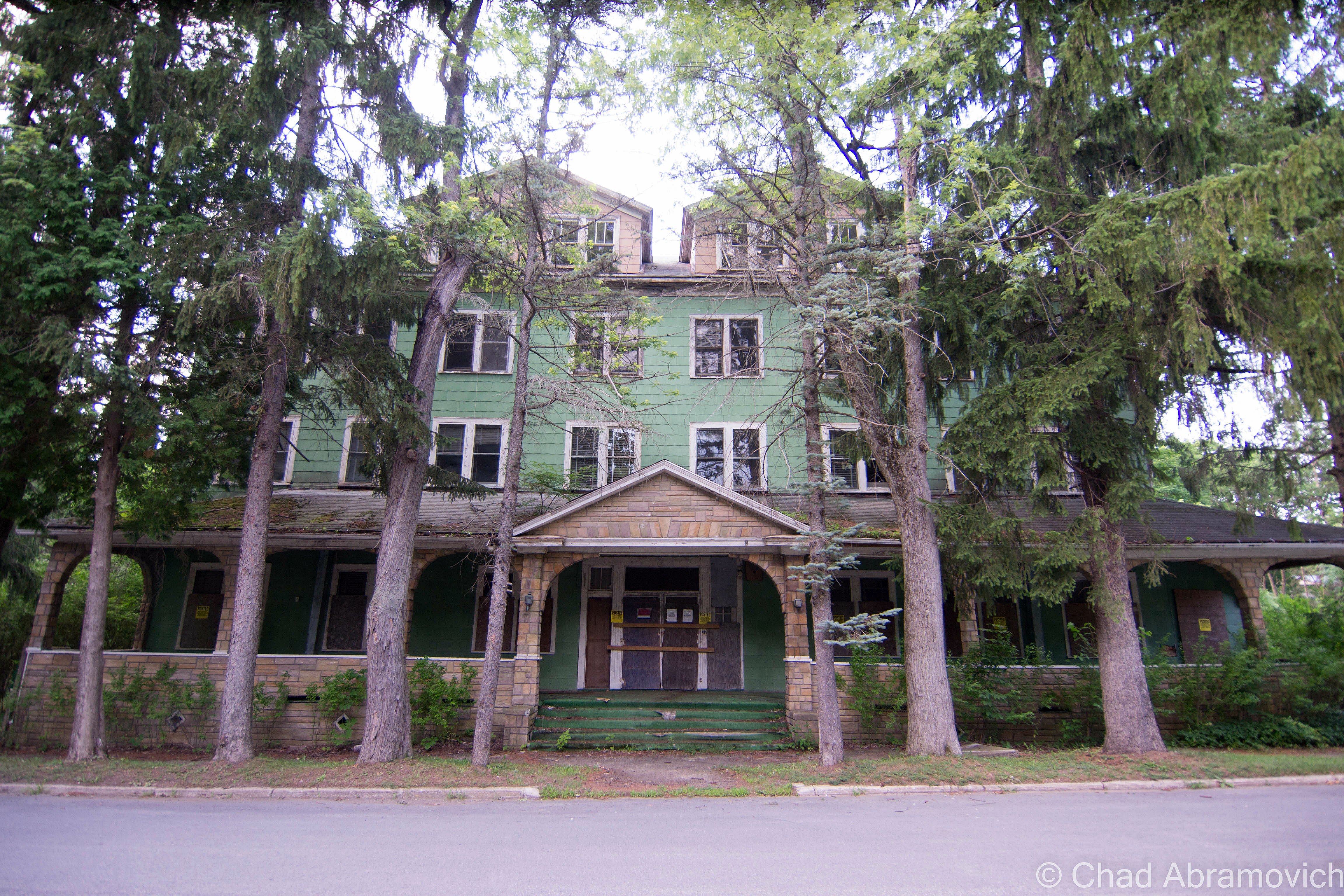
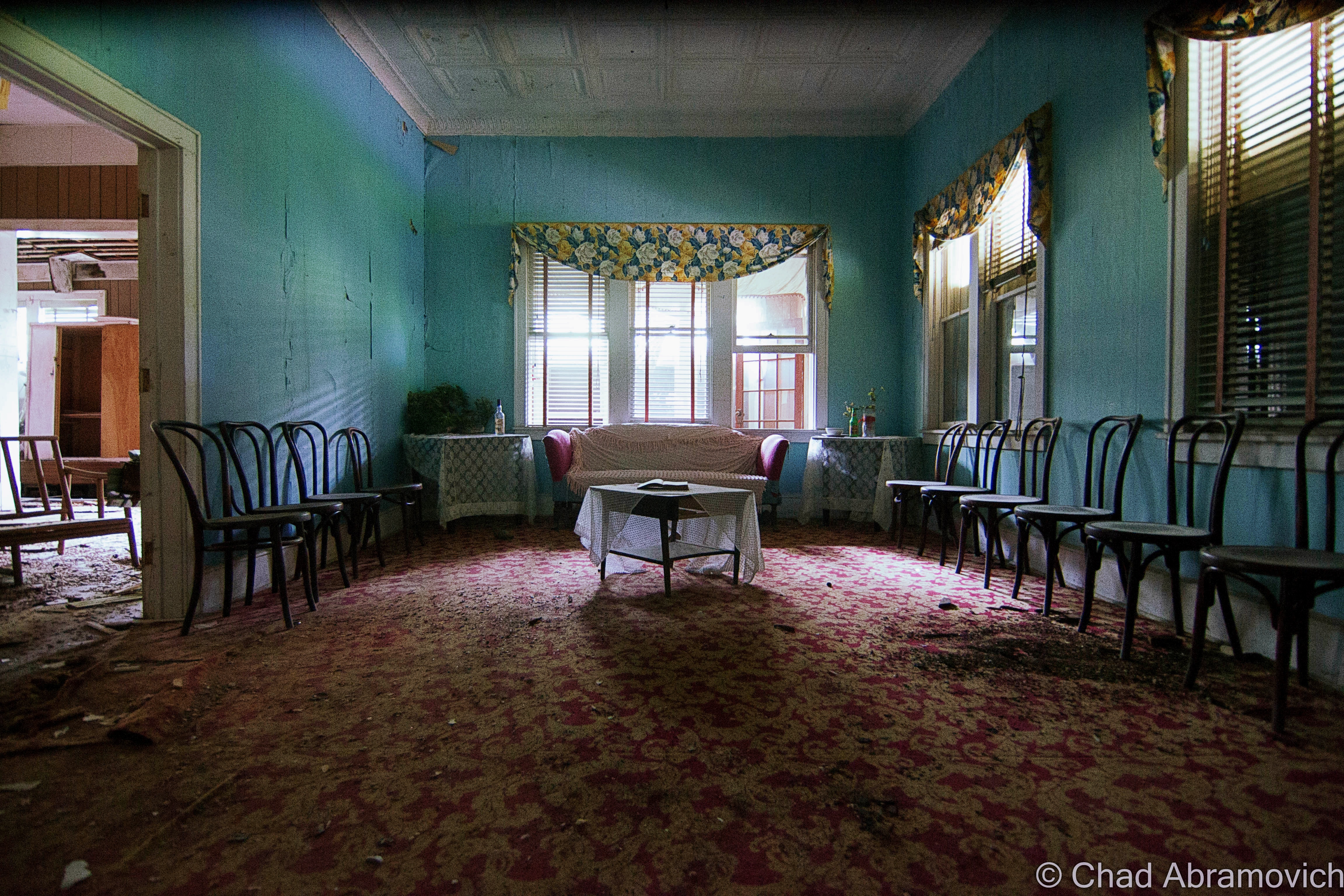
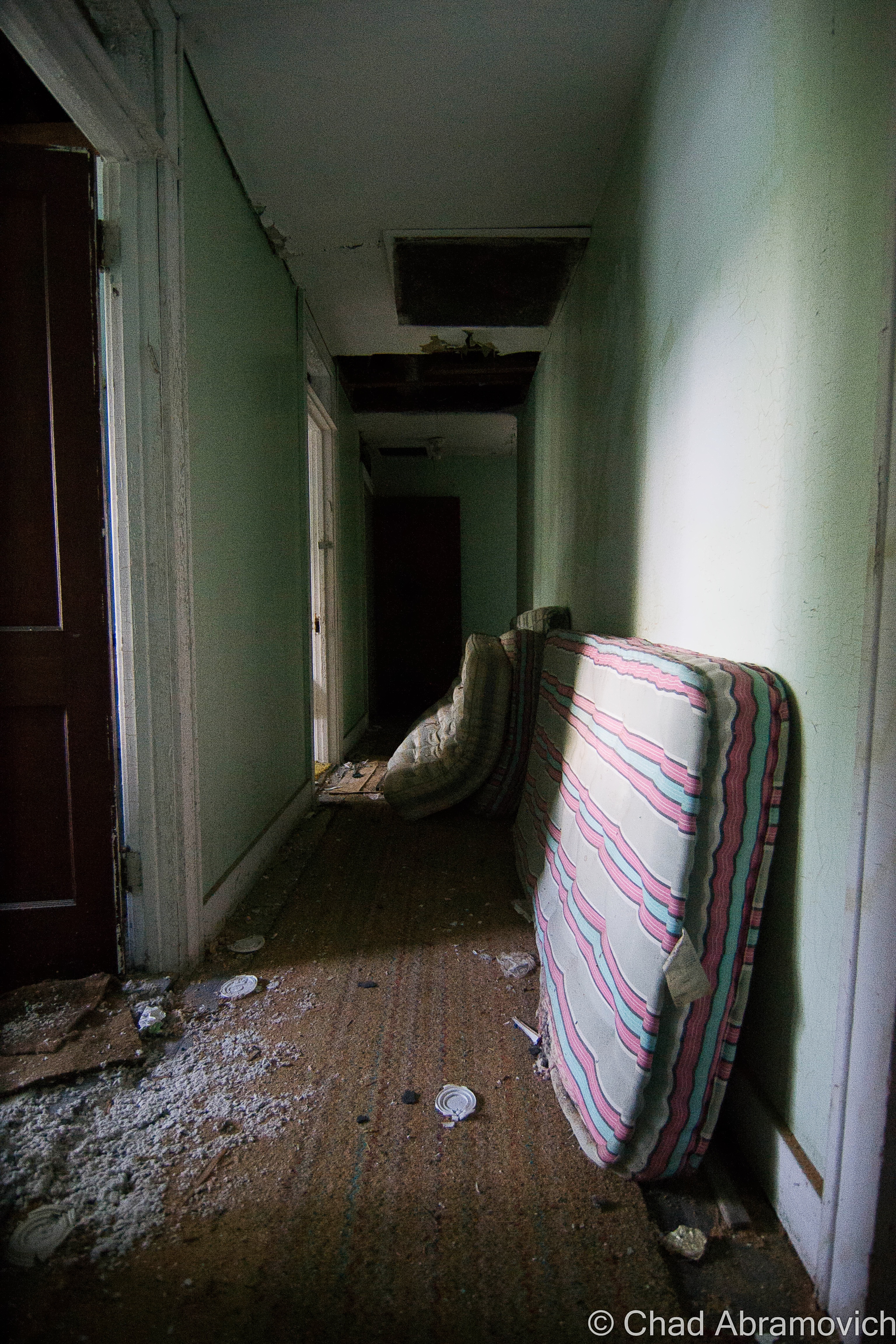
This Italianate corpse in this lonesome Vermont village was actually an amazing portal into the past despite its rampant decay, with an impressive amount of vintage influences left behind since its abandonment decades ago. Many of these things were from the swanky 70s, though, and sort of brought this almost sleazy weight down upon the coalesce.
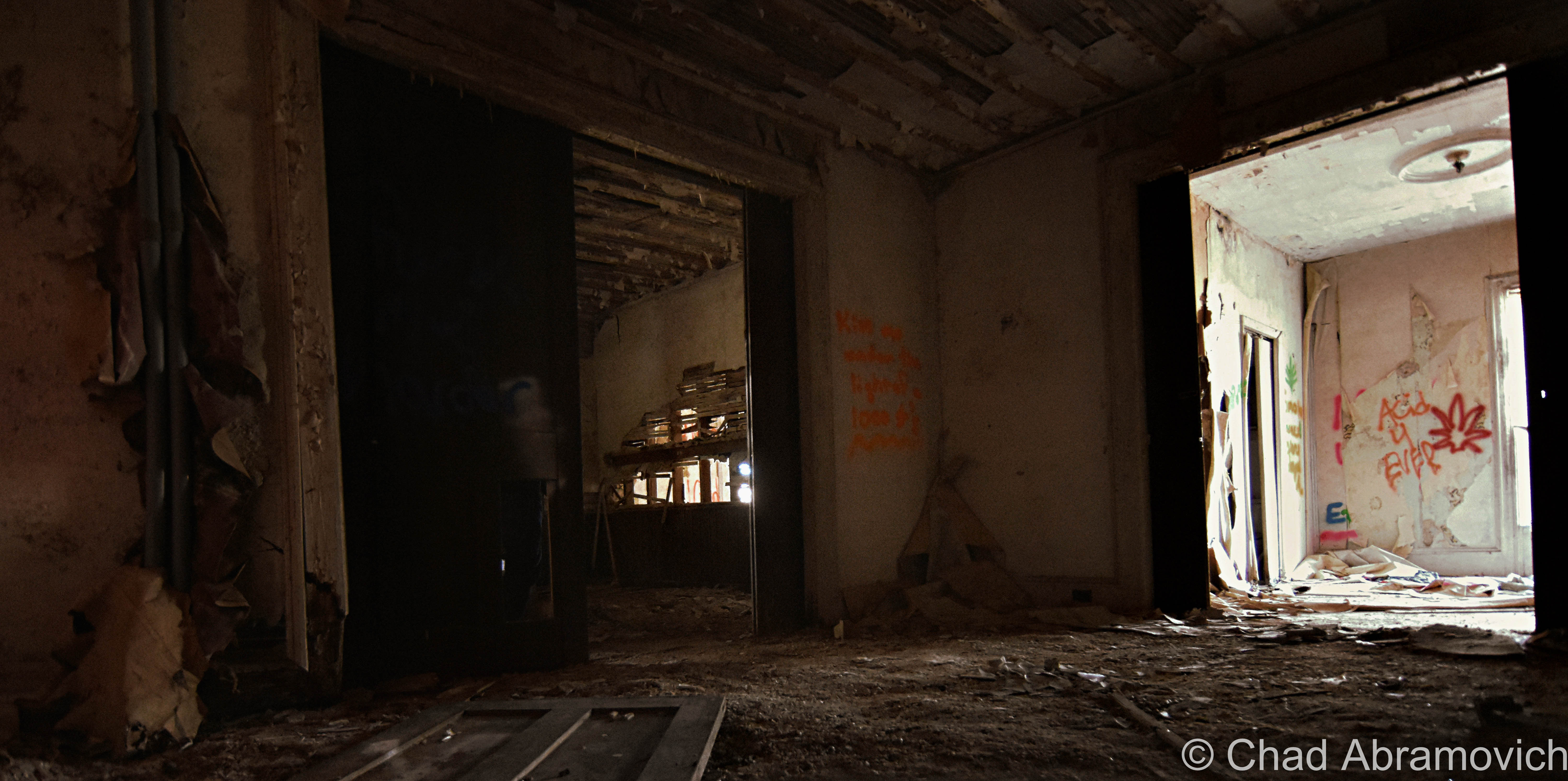
When I pulled into town that day, the wind was strong, and once you got a block away from the village’s historic downtown neighborhood that followed a few blocks along a well-attended state route, it got pretty quiet, and the few older folks outside raking leaves in the cold or strolling down crumbling sidewalks gave us strangers suspect sideways glances. The never-ending stream of traffic yet permeating silence and deserted storefronts gave the village a surreal aura. But history manifests itself deeply up that way. I bet every house has a few skeletons in their closets, maybe even in a sense that isn’t metaphorical.
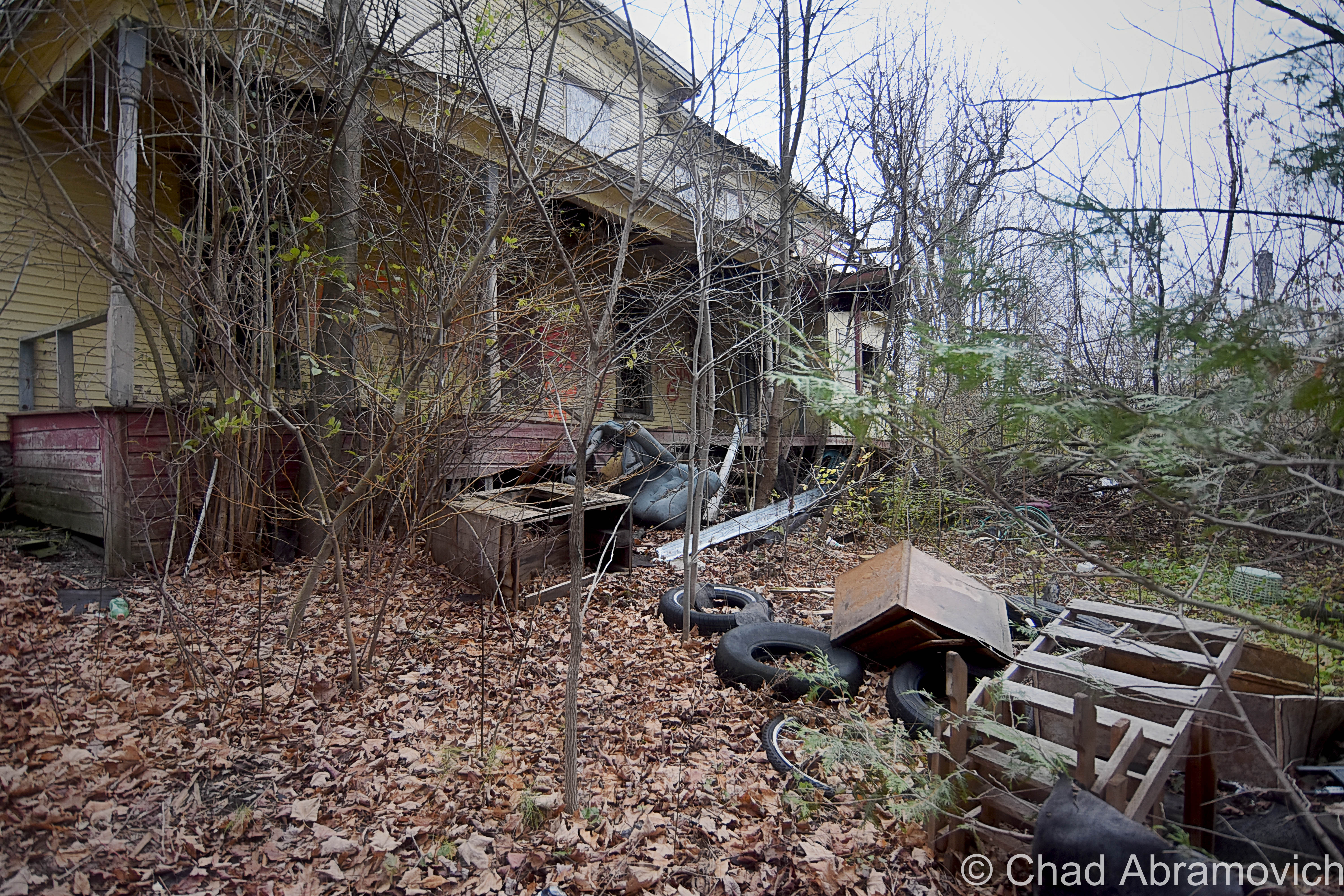
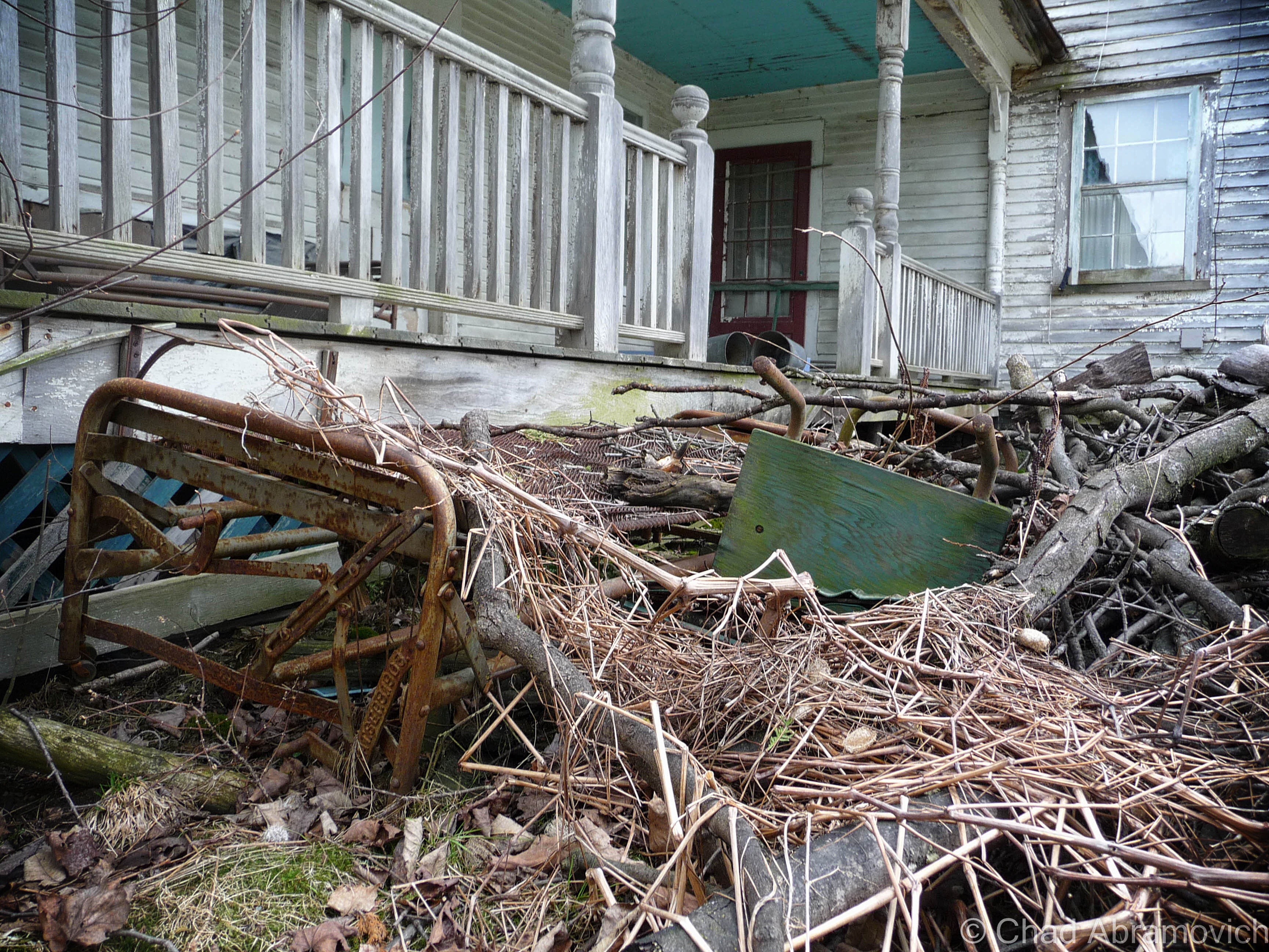
The paling yellow property that held my interest had grown wild and is now a grave – its overgrowth clung to my jeans and stung my face as I attempted to make my way around the back of the house, away from the open road where there’d be people wondering what a fella like me was doing inching closer to a place like this.
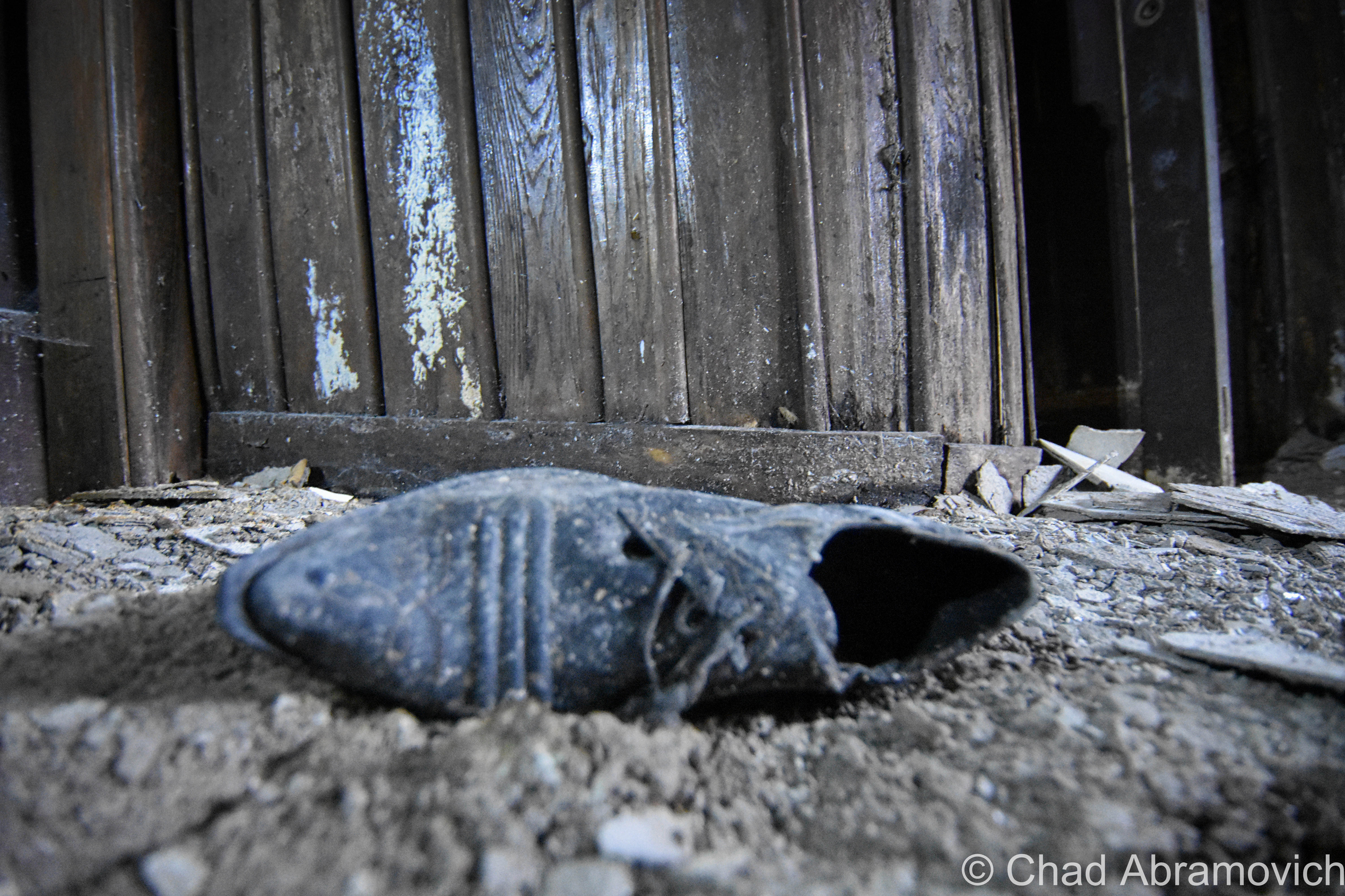
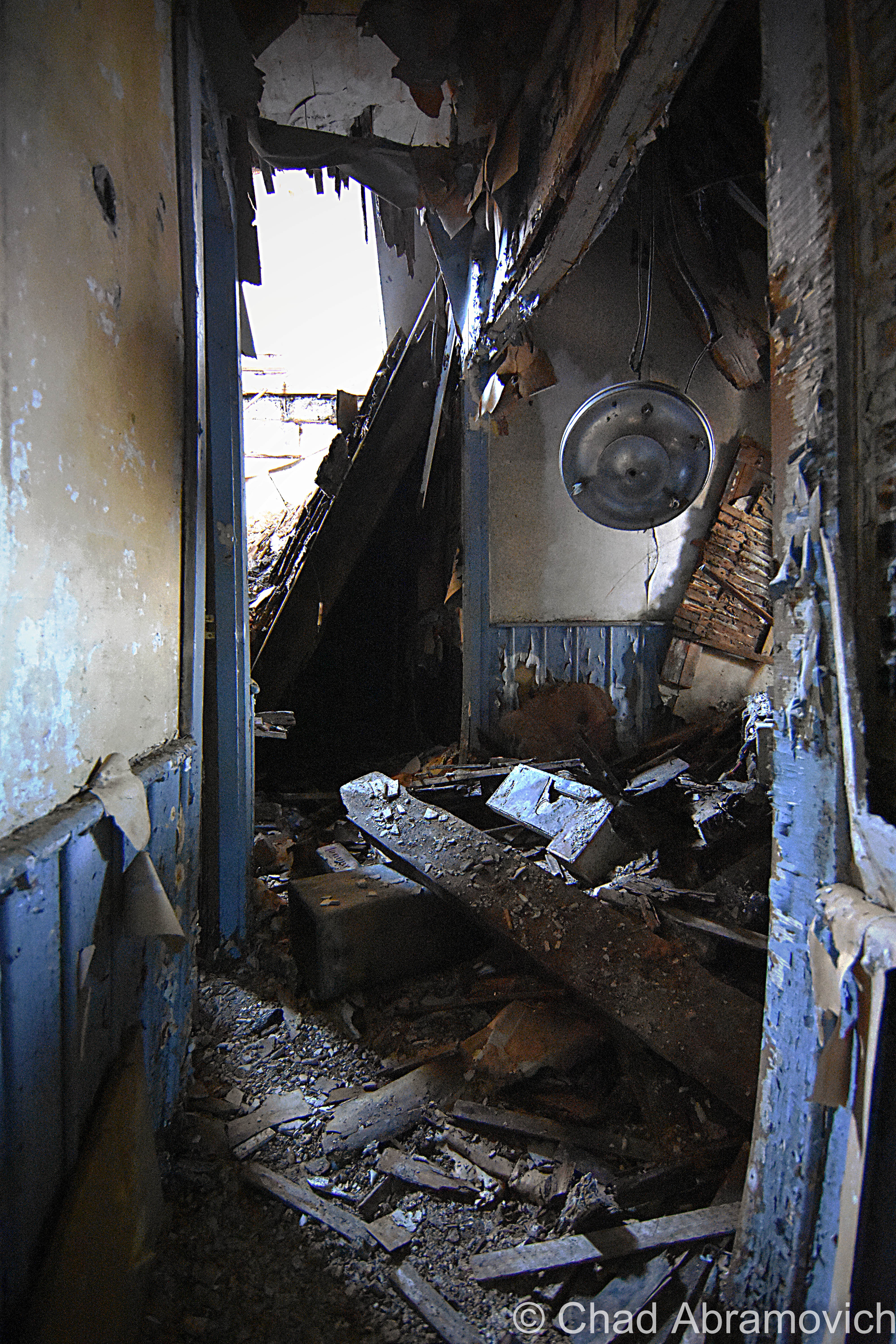
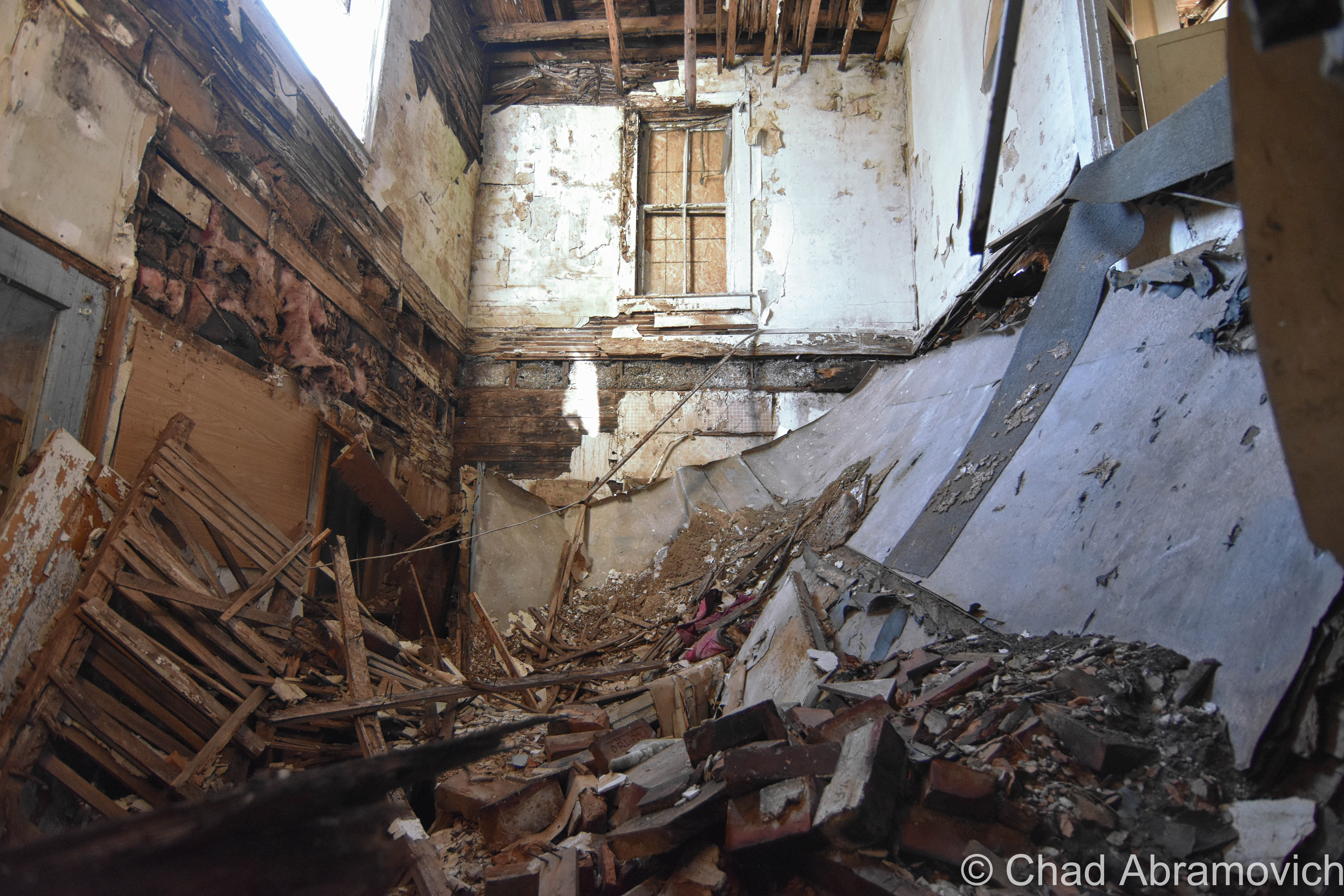
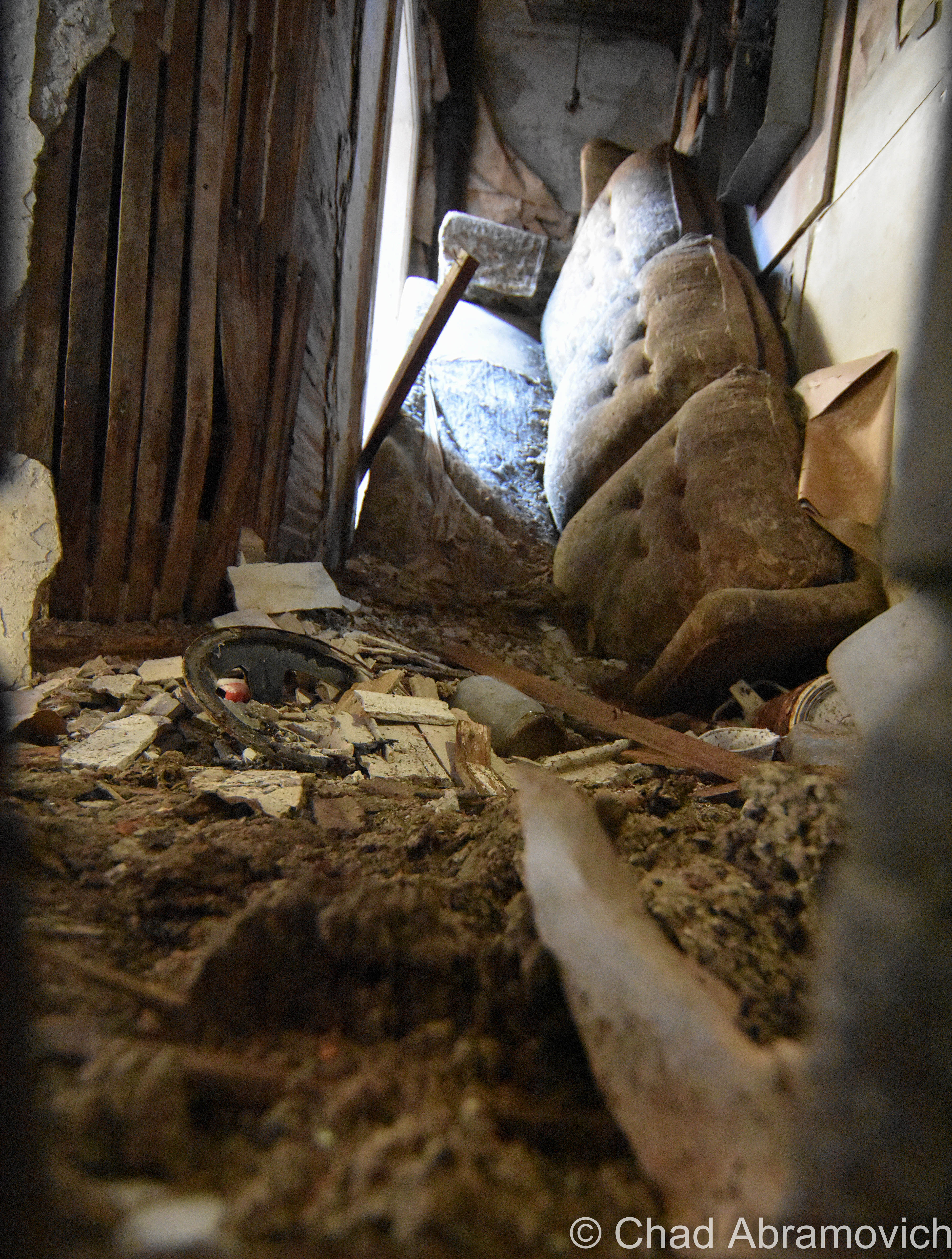
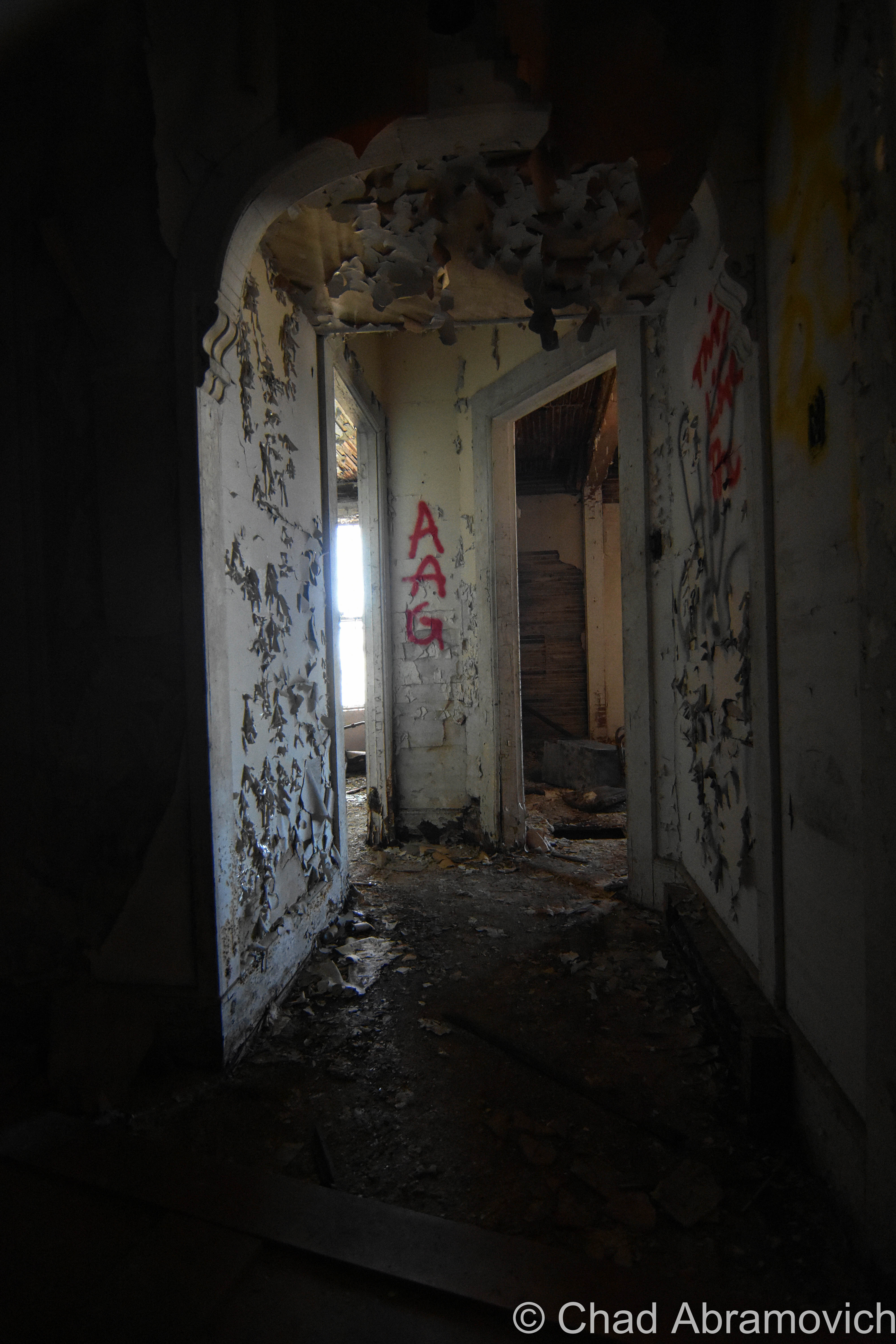
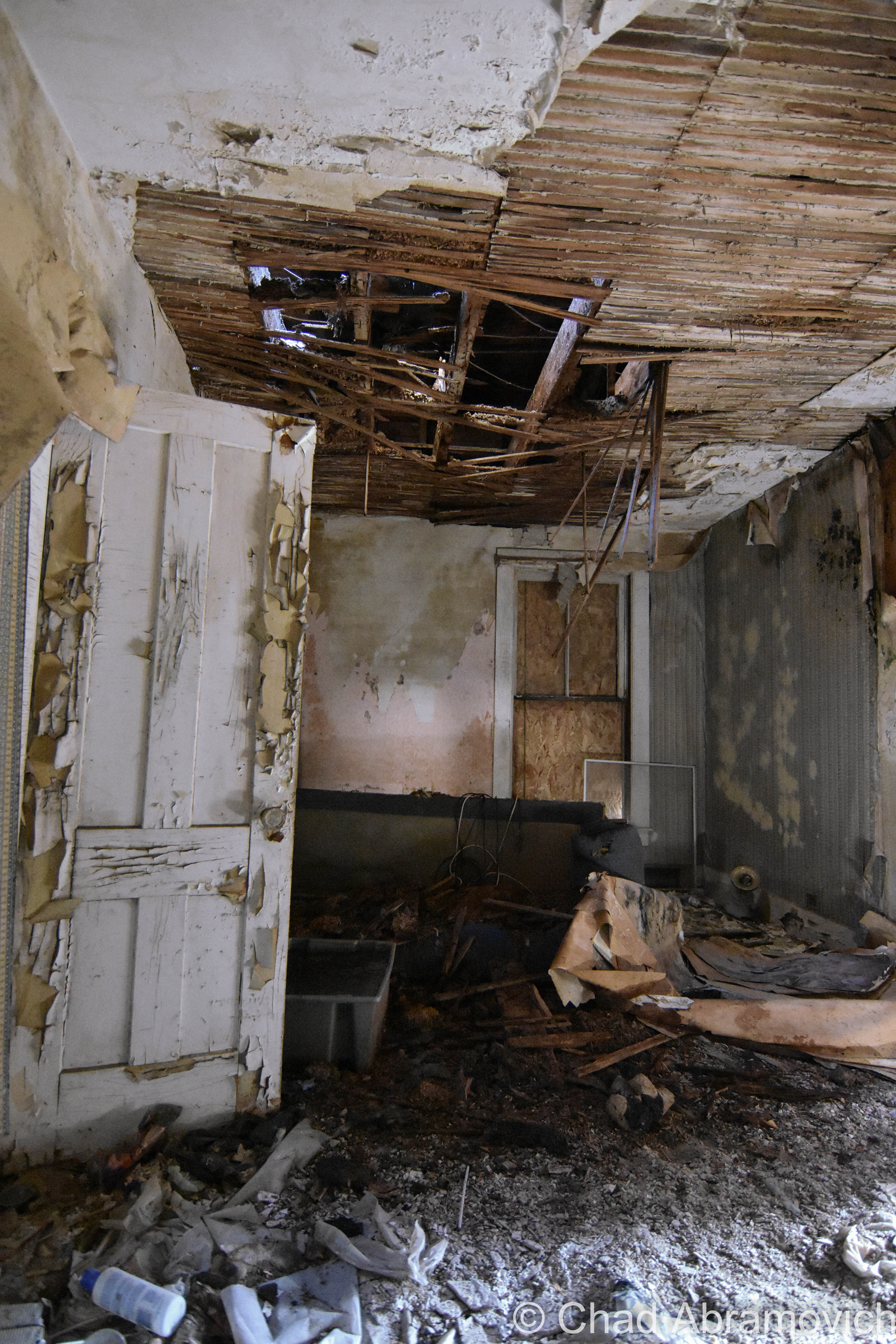
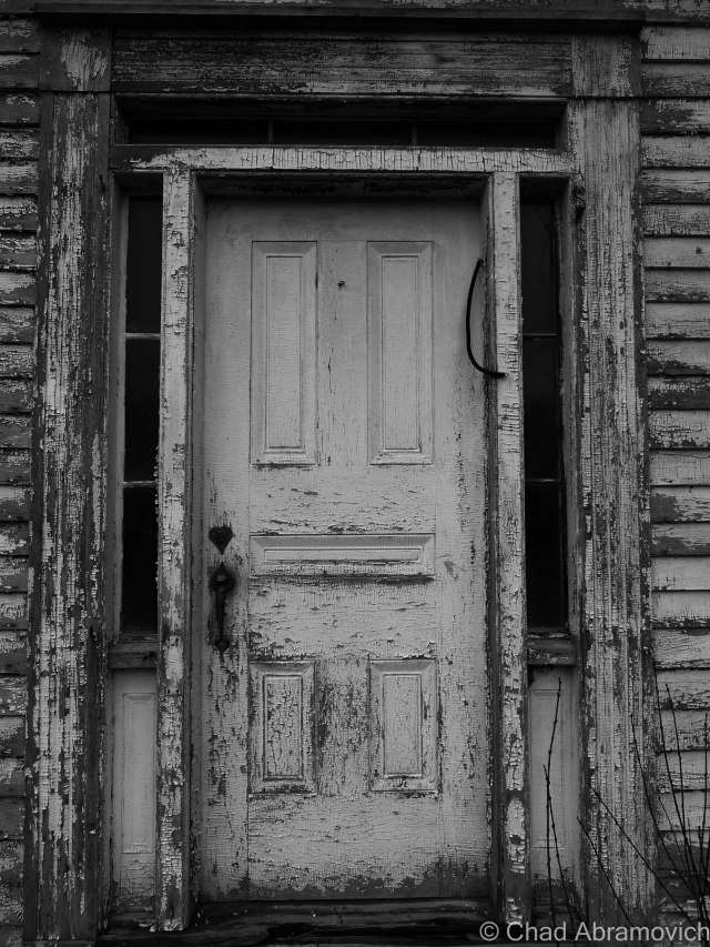
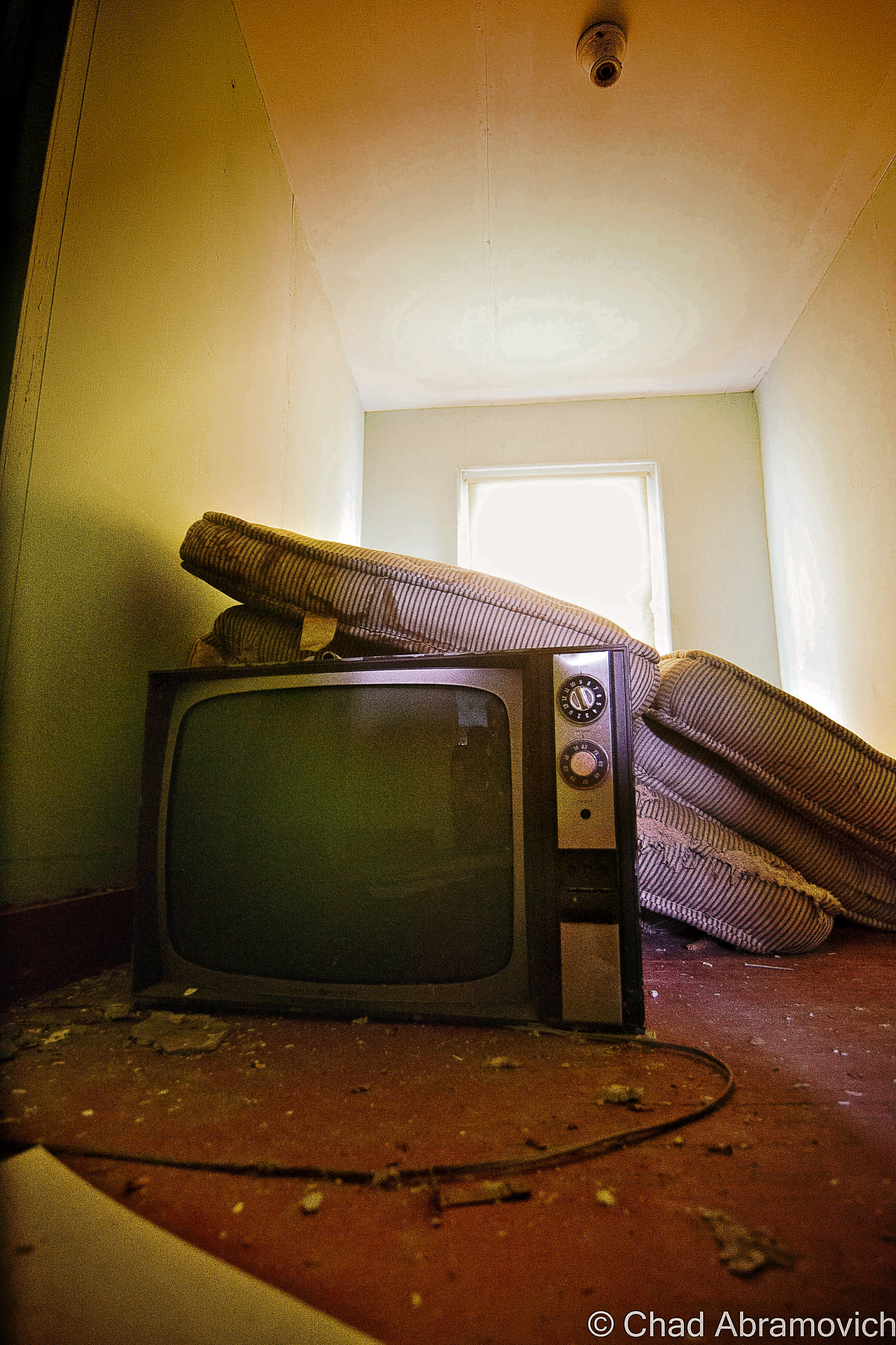
Indeterminable lumps of gross garbage and things tossed behind the house were awkward to scramble over as I made my way towards a rotten back porch and my way inside; a broken window. Entering through the passage allowed me to now admire an astonishing specimen of wall decomposition with the characteristic folds of sagging paint and still impressive ephemera around me falling to pieces with no other informative signs to be seen, making a mockery out of human virtues of order and hygiene.
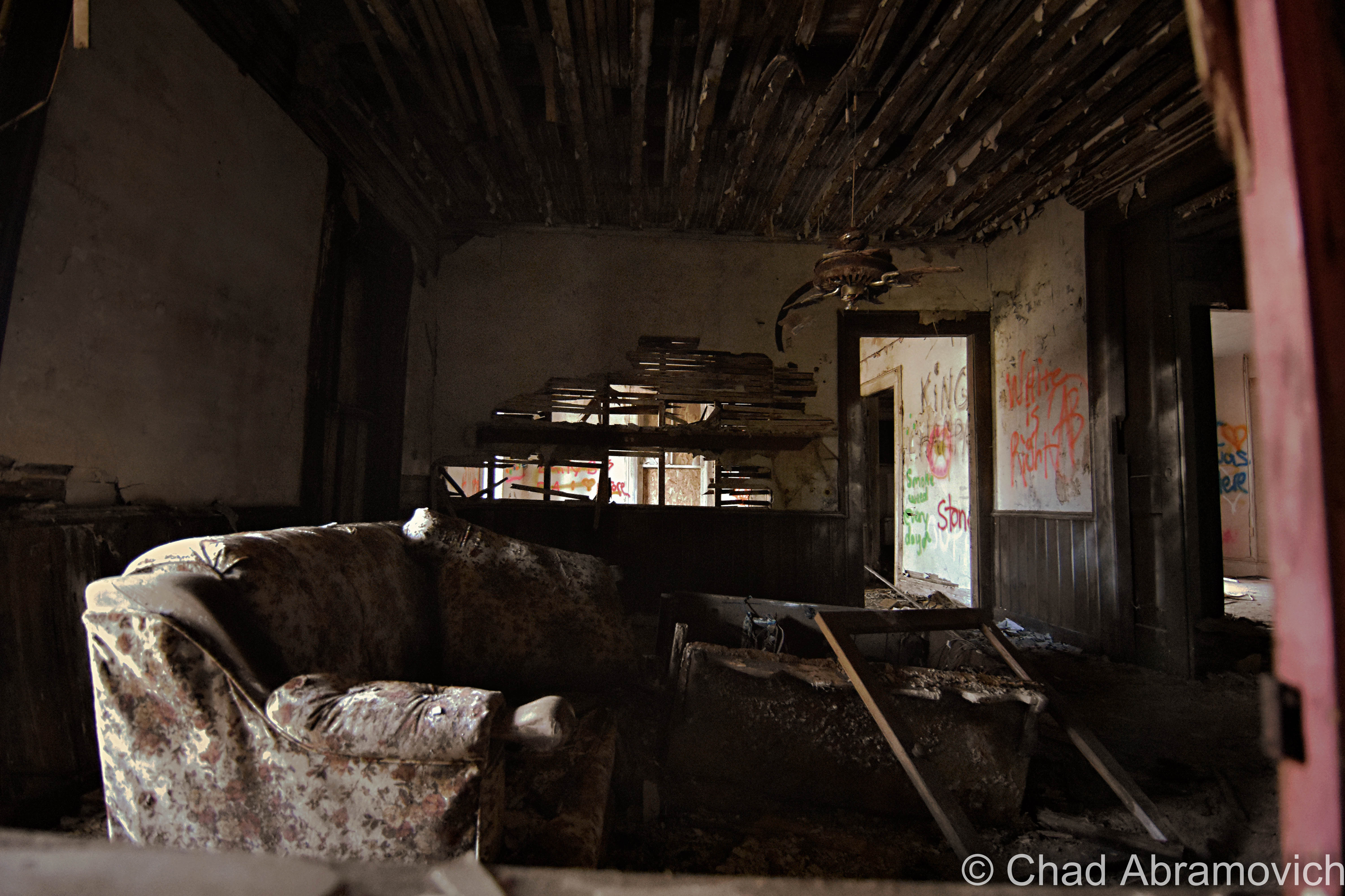
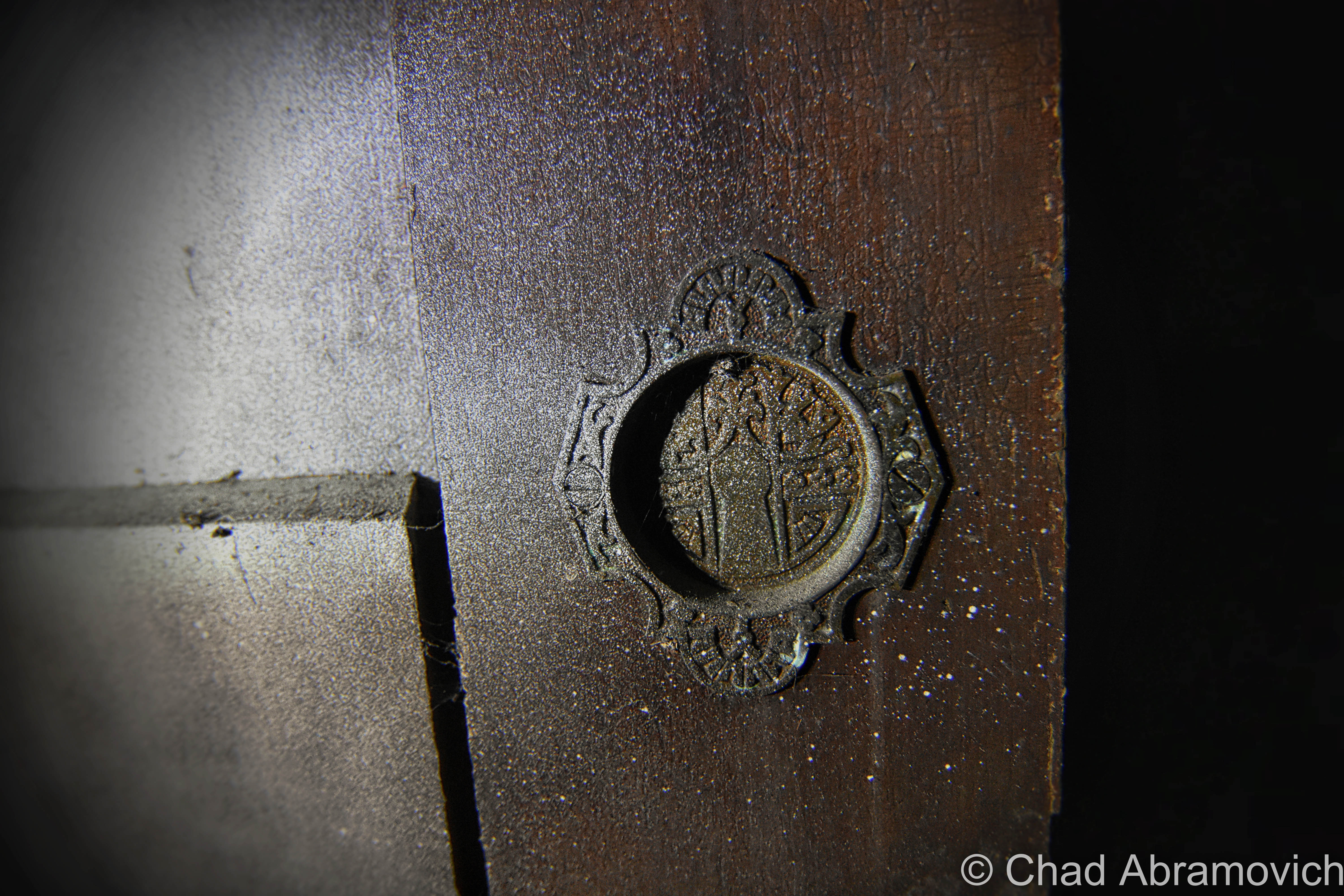
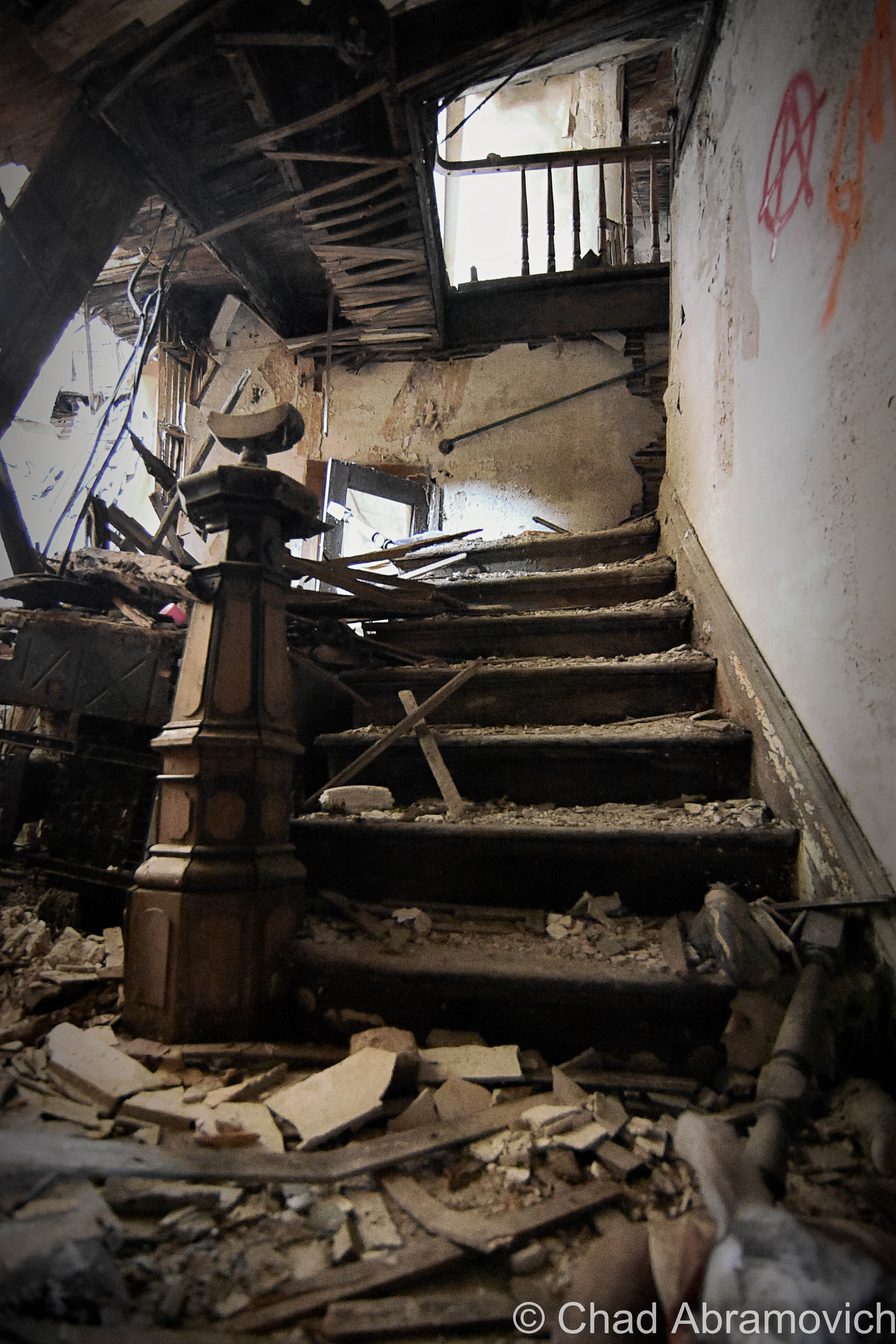
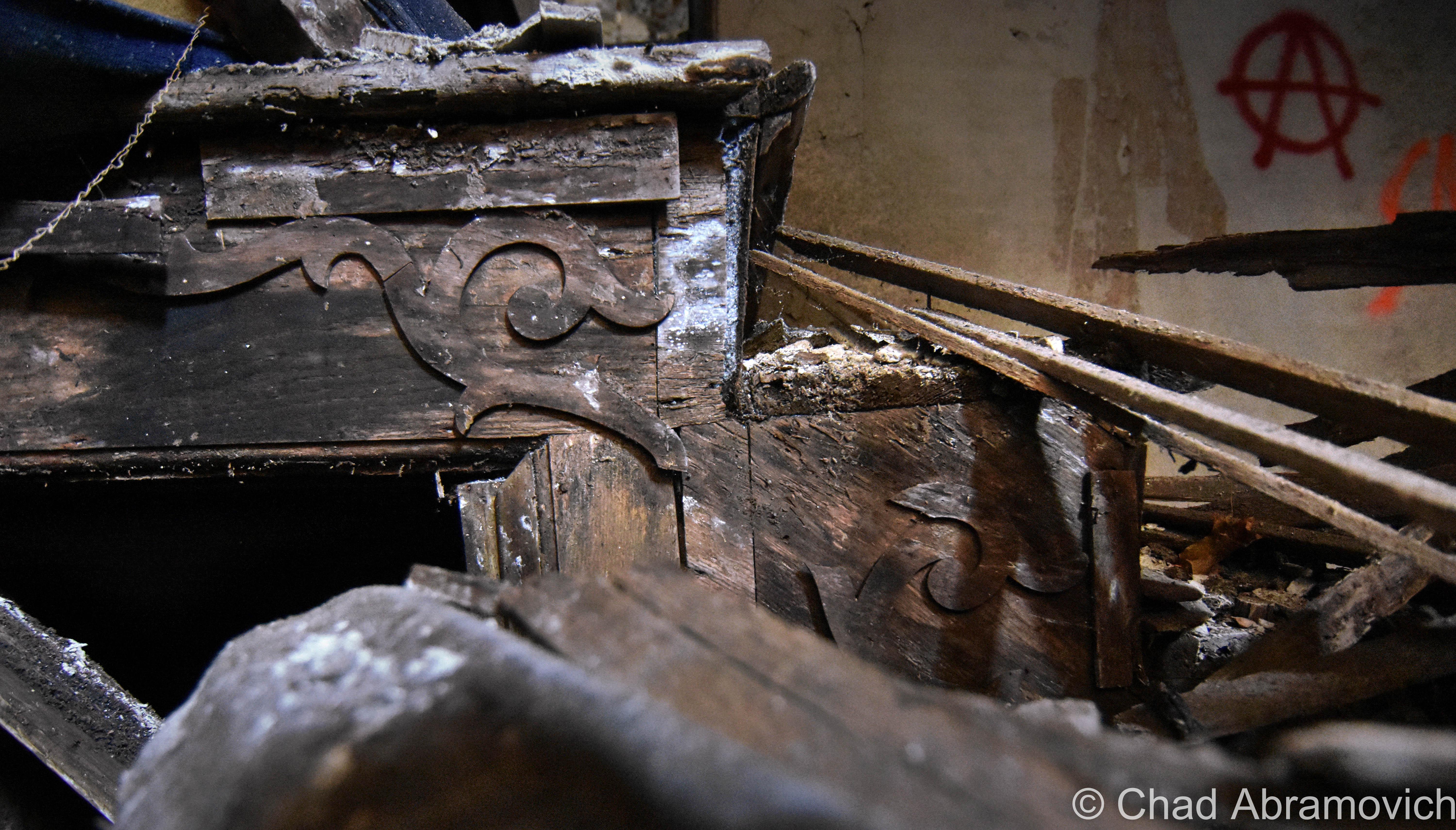
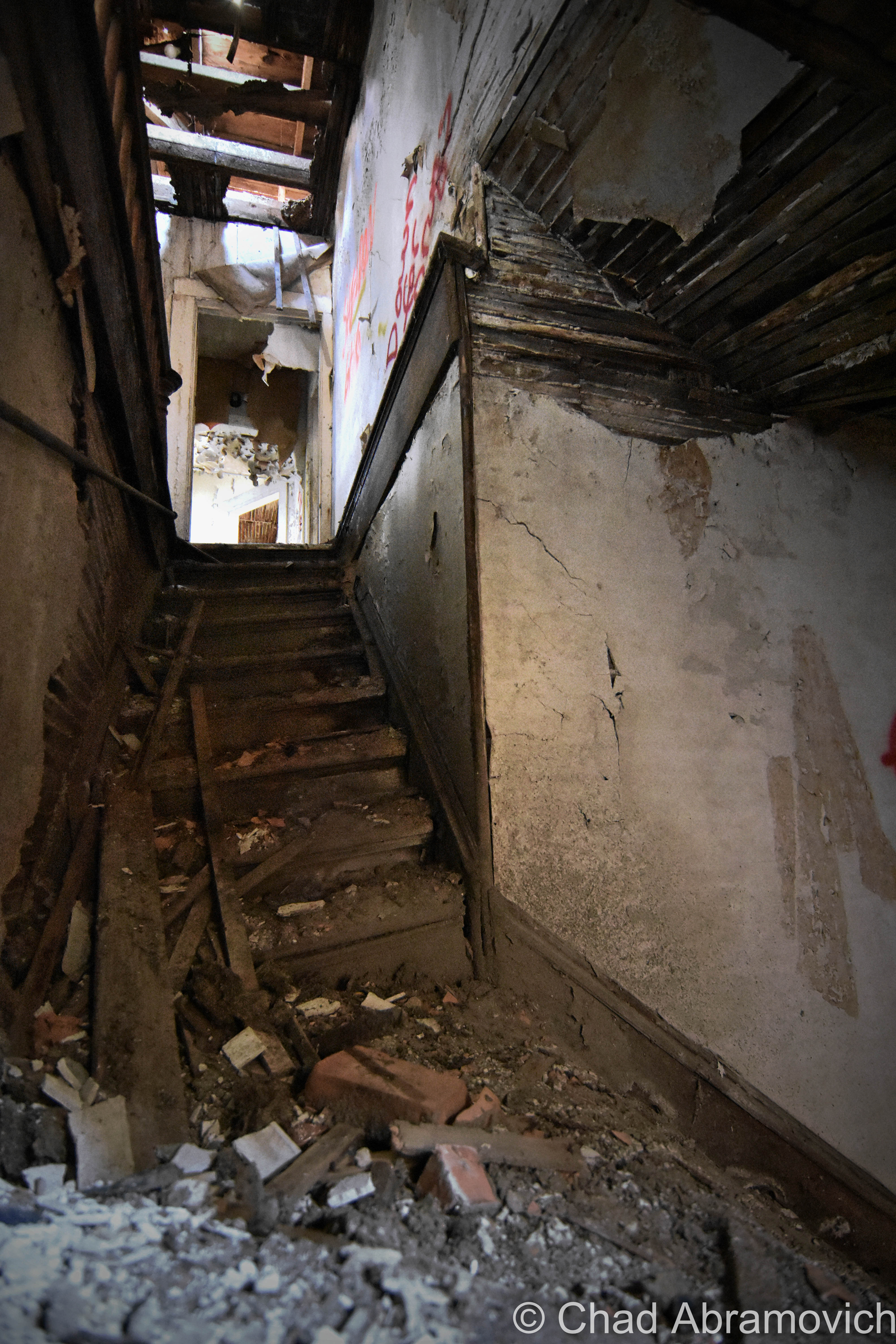
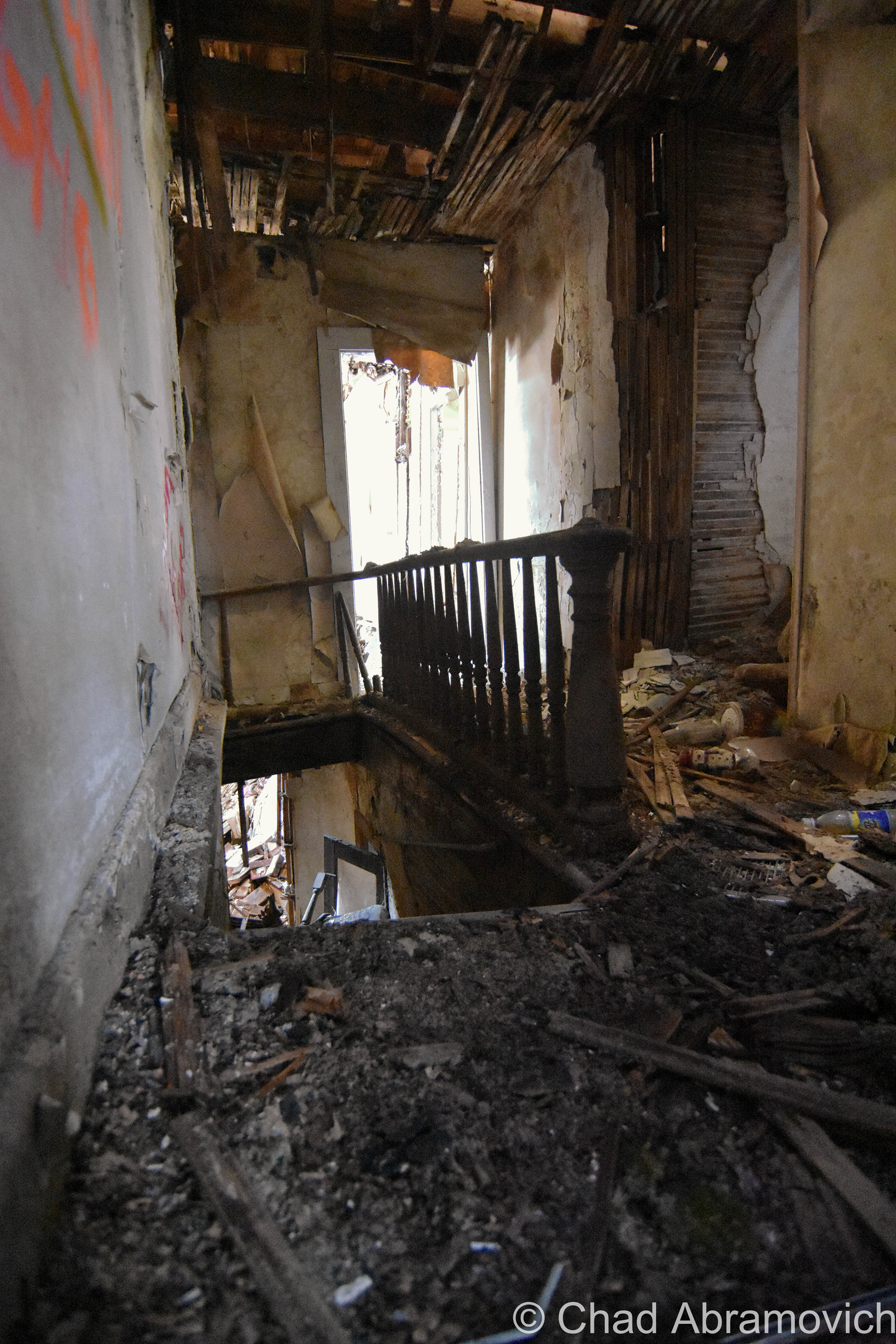
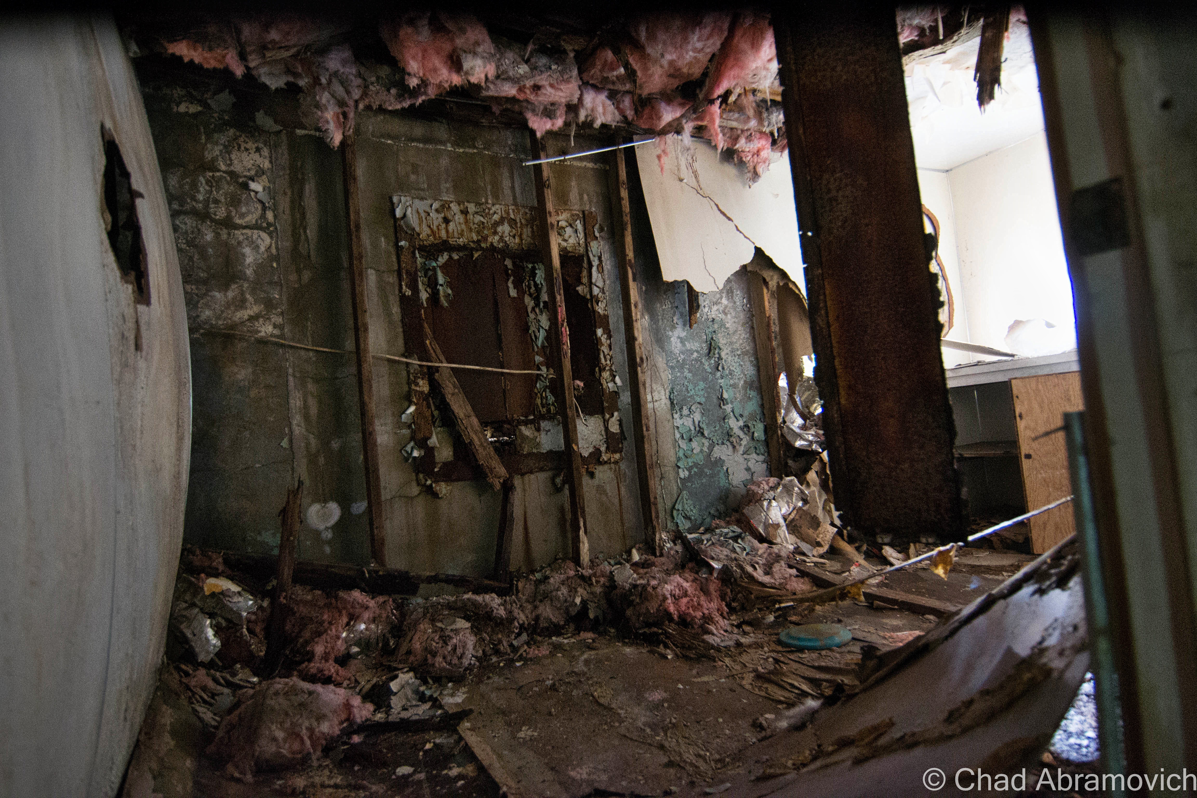
Depending on what side of the house you were on dictated the rate of decay. Some areas still had strong bones and beautiful masculine woodwork. Pocket doors with gilded ornamentation within their door handles and a stairwell with remarkable newel posts of my secret desires – while the other section had completely given into descending, due to how sections of roof are holding up. Parts had partially or entirely collapsed, concealing whatever secrets they had underneath chunks of rubble, making it pretty difficult to forensically reassembling any layers of this corpse that are still available.
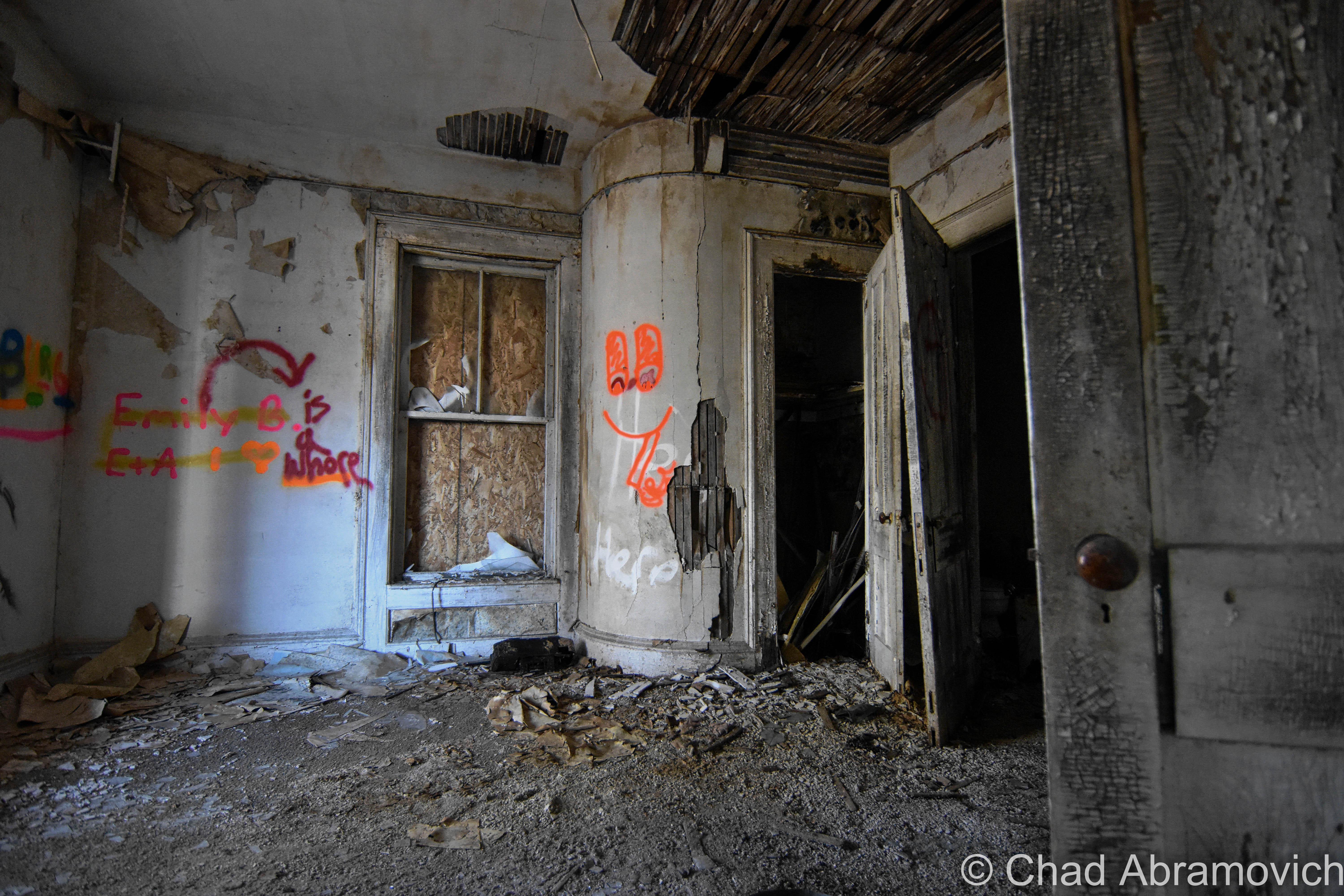
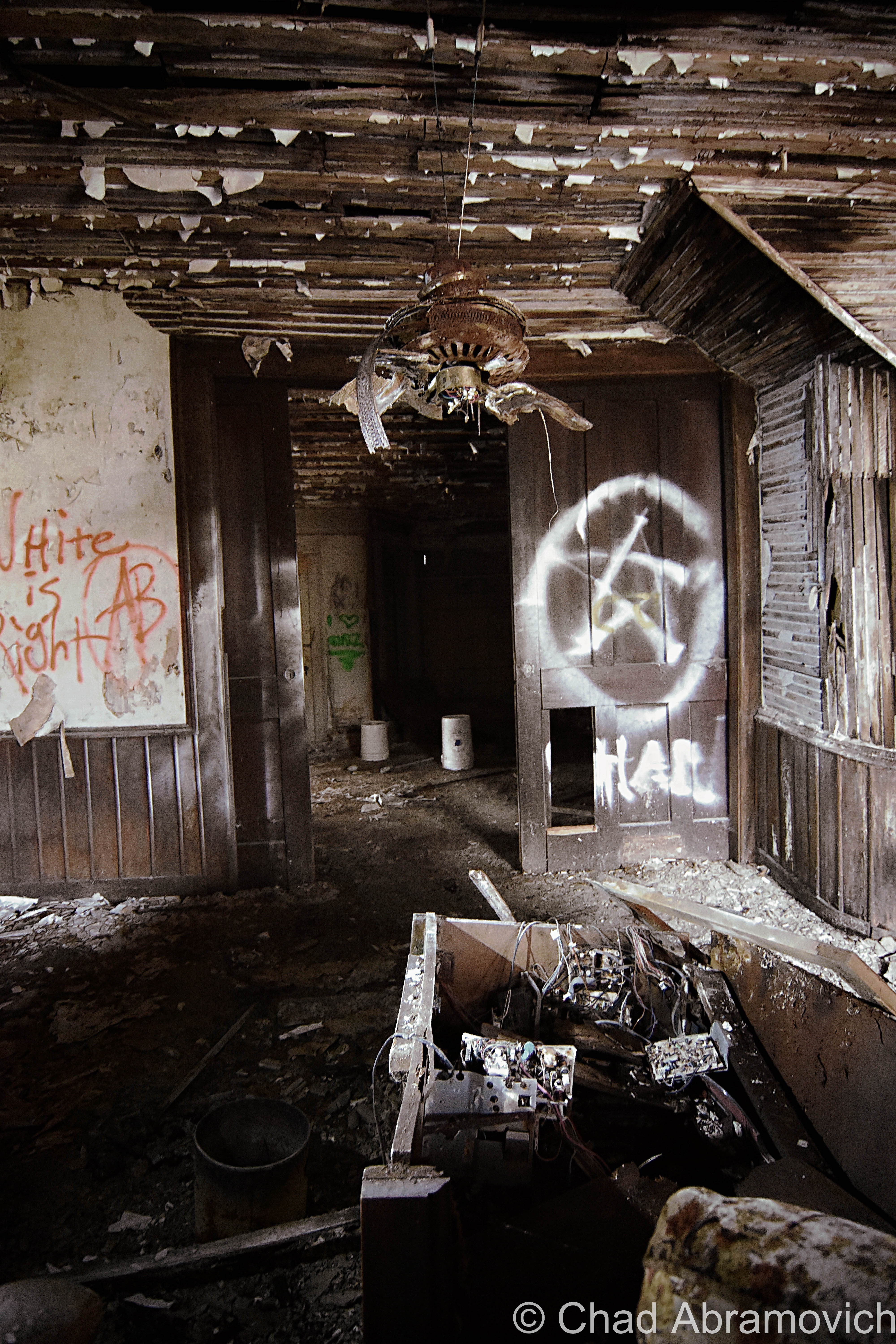
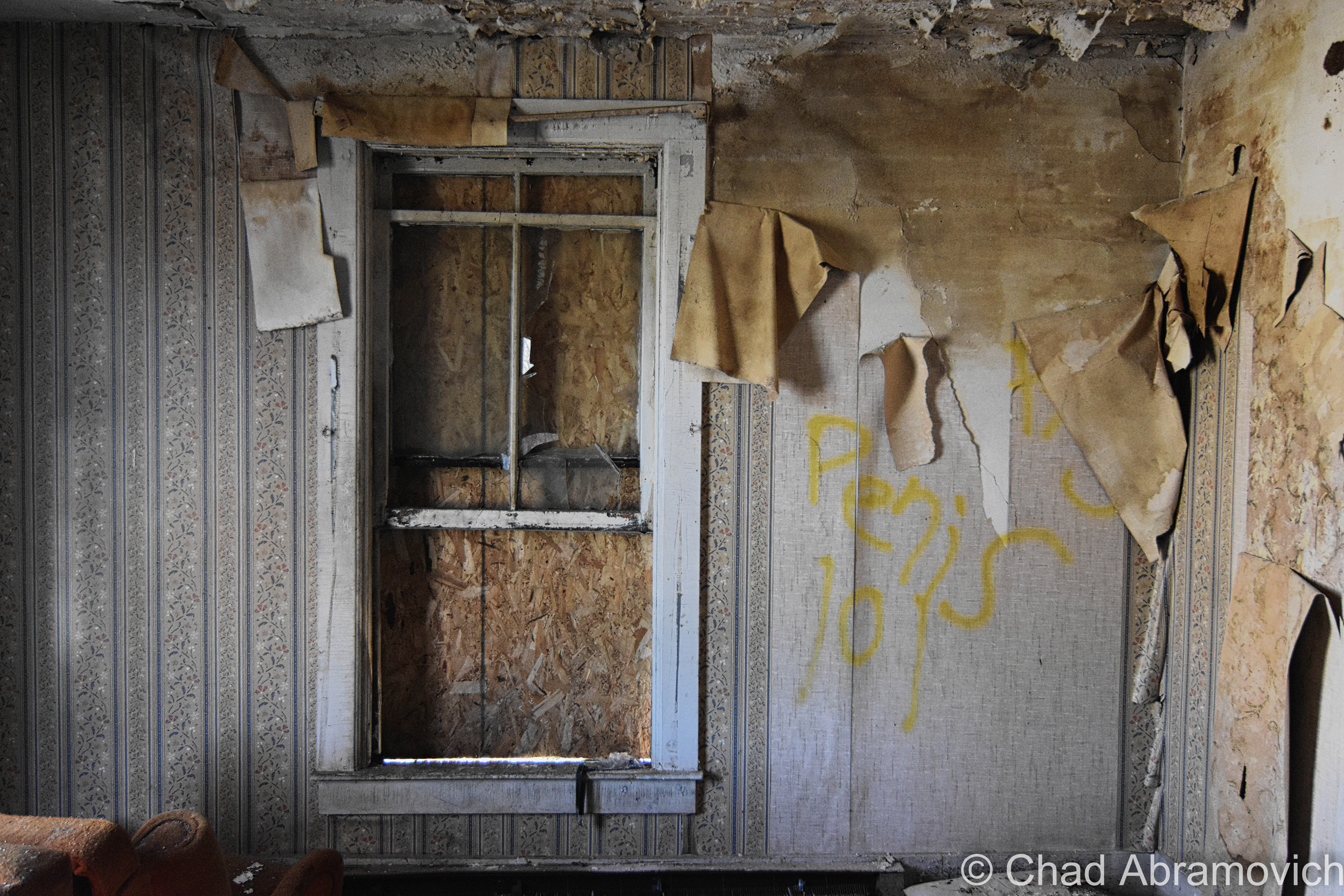
Not depending on which part of the house we were in; most all rooms had a bit of uncreatively crass graffiti scribbled onto the walls, usually telling about a girl or some sort of unpleasant sounding coitus. I thought the most hilarious tag I came across was the fact that someone actually spraypainted the name of the town onto the wall of the parlor.
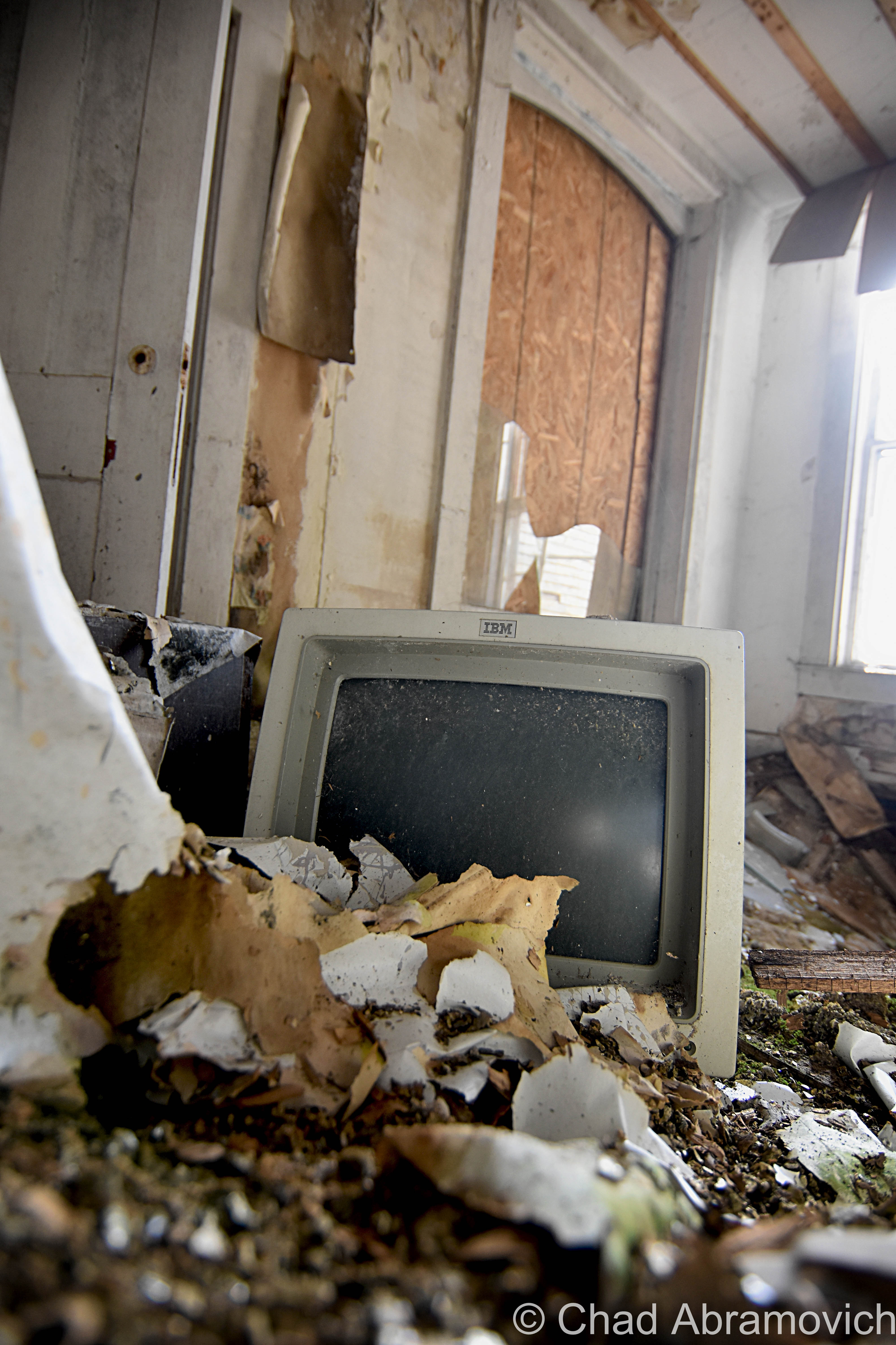
And then there was something off about this broke down palace. Sounds carried all too well inside its curating rot that was a flimsy shell of its former grandeur. Voices transmitted in the wind and we were pretty sure we heard an old woman talking to US at one point when we went upstairs – as if ‘she’ was in the house. Though my friend seemed to be more sensitive to that particular happening than I was at the time. Some relics of occupation had been left behind, but most of them were completely ruined by neglect and various collapses over the decades.
Awkwardly clambering my way up a wobbly staircase, I found myself sitting in a tipsy old cupola in delight and taking in the morning, the village noises, and the views with a damn good cup of coffee enhancing my solitude. This house was a real treat.
Even in the midst of that howling weather that dolefully cried through broken windows, rotting wood, and continuously banged the door of a rusted clunker sitting in a nearby trailer’s driveway.
Which really makes me shake my head all the more at writing ‘what a shame’. If only building trends returned to something meaningful and crafted instead of cookie cuttered, cheap drywalled crap.
What sort of things culminate into making something become forsaken and disheveled? I don’t think I’ll ever not be fascinated by human beings.
Stranger still; when we crawled out a window to take our leave, a woman’s voice intoned somewhere from a distance behind dead lilacs, and said; “leaving already?”
I’m looking for stories of Vermont and Vermonters (or New England, Quebec and anywhere else if it’s worth the drive – even if it’s a day’s haul. Please contact me if you have some weirdness you’d like to share! Help me keep this website imbued with content!
Since 2012, I’ve been seeking out venerable examples of Vermont weirdness, whether that be traveling around the state or taking to my internet connection and digging up forsaken places, oddities, esoterica, and unique natural features. And along the way, I’ve been sharing it with you on my website, Obscure Vermont. This is what keeps my spirit inspired.
I never expected Obscure Vermont to get as much appreciation and fanfare as it’s getting, and I’m truly grateful and humbled. Especially in recent years, where I’ve gained the opportunity to interact with and befriend more oddity lovers and outside the box thinkers around Vermont and New England. As Obscure Vermont has grown, I’ve been growing with it, and the developing attention is keeping me earnest and pushing me harder to be more introspective and going further into seeking out the strange.
I spend countless hours researching, writing, and traveling to keep this blog going. Obscure Vermont is funded almost entirely by generous donations. Expenses range from hosting fees to keep the blog live, investing in research materials, travel expenses and the required planning, and updating/maintaining vital tools such as my camera and my computer. I really pride and push myself to try to put out the best of what I’m able to create, and I gauge it by only posting stuff that I personally would want to see on the glow of my computer screen.
I want to continuously diversify how I write and the odd things I write about. Your patronage would greatly help me continue bringing you cool and unusual content and keep me doing what I love!
Being a storyteller is somewhere in my framework. I’d like to think that’s the crux of this blog, to tell stories. This blog has lots of long-winded stories. It’s just one of those things that you’re gonna have to live with for giving an emotionally unstable person a keyboard and a WiFi connection. (That’s me) And whatever it is that I have to tell wouldn’t be complete without the mention of this place.
When I first started this blog, I made sure this was one of the first subjects I posted about, because it was, and still is such a big deal to me, following me around like a phantom through different stages of my life.
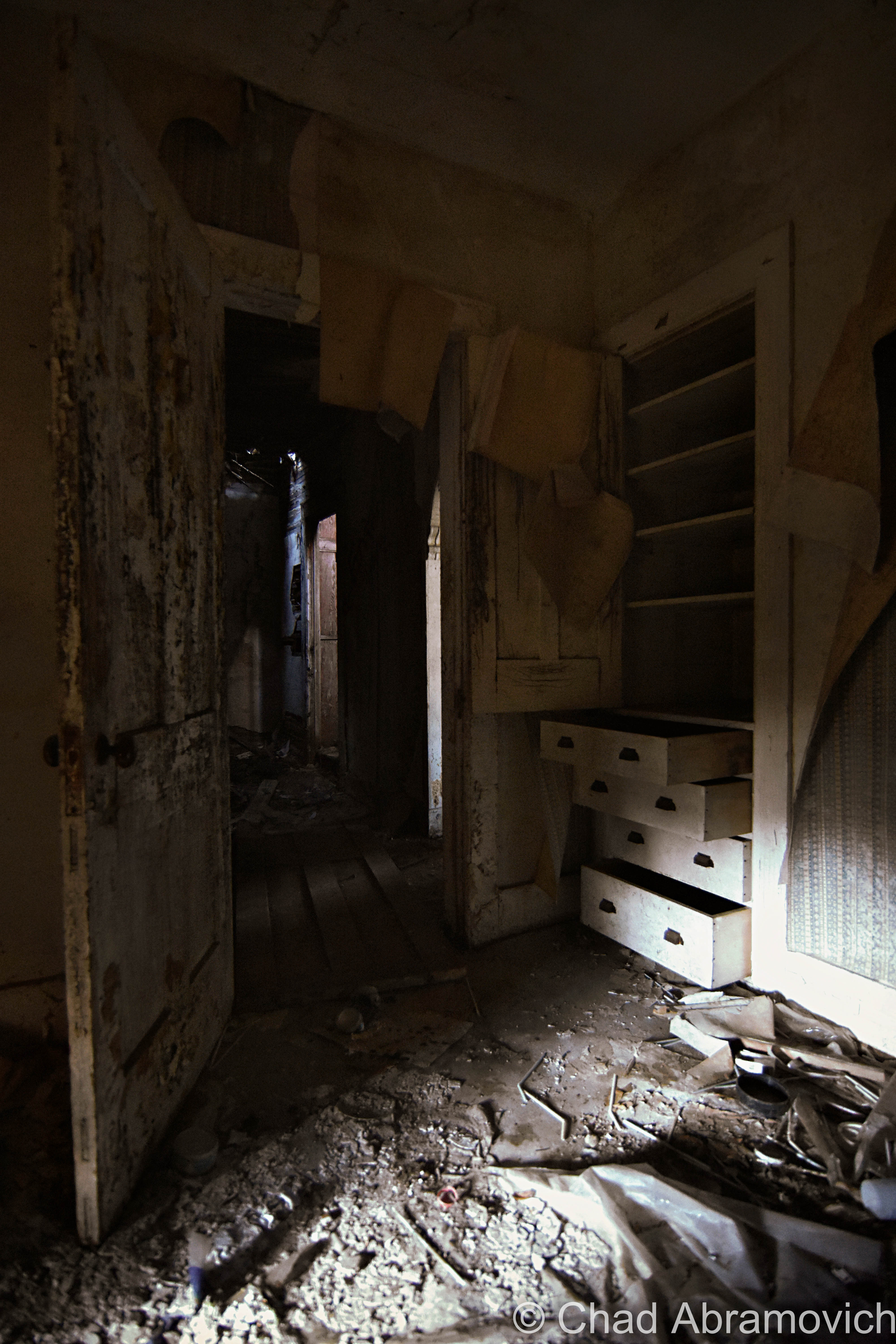
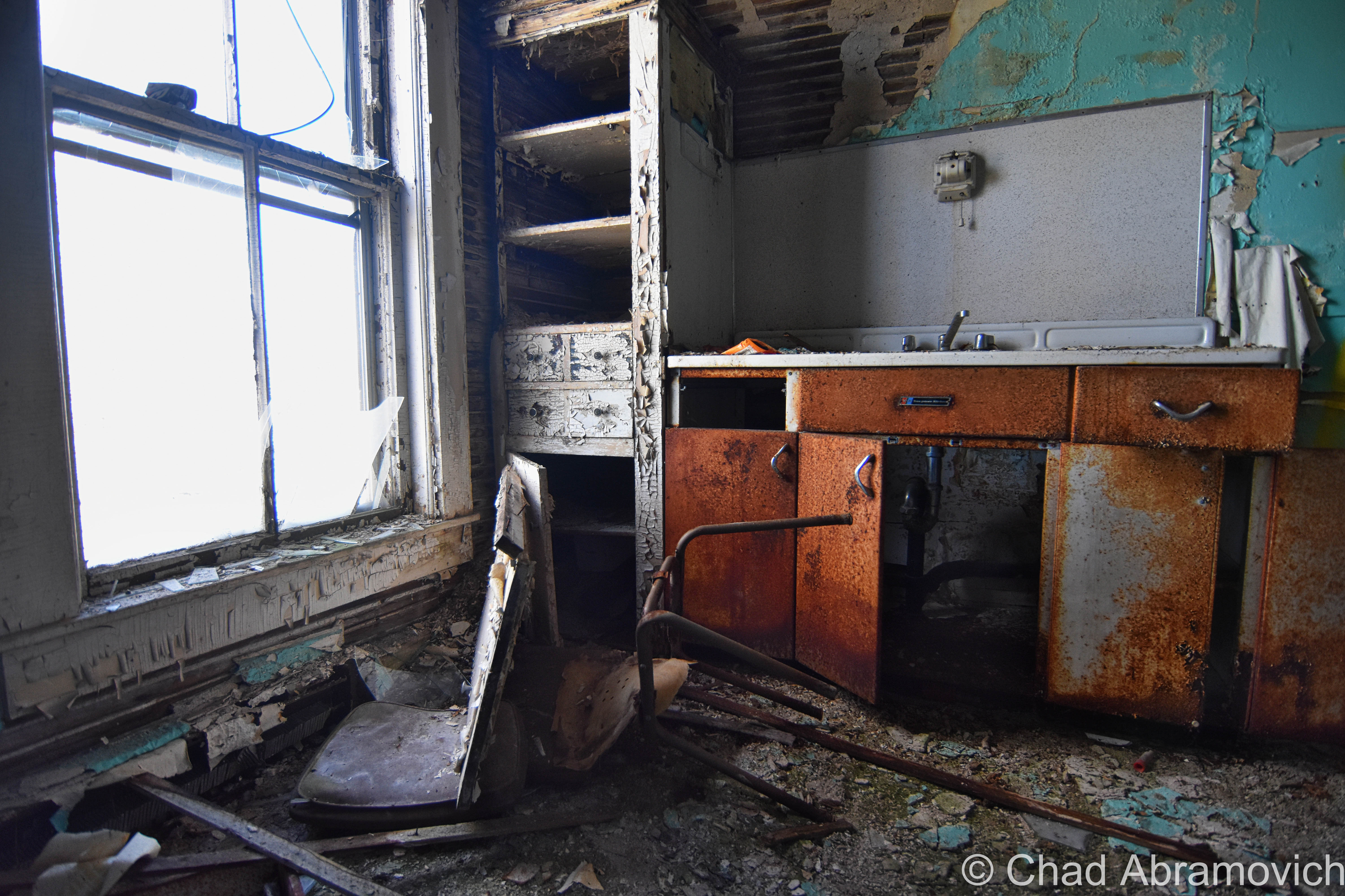
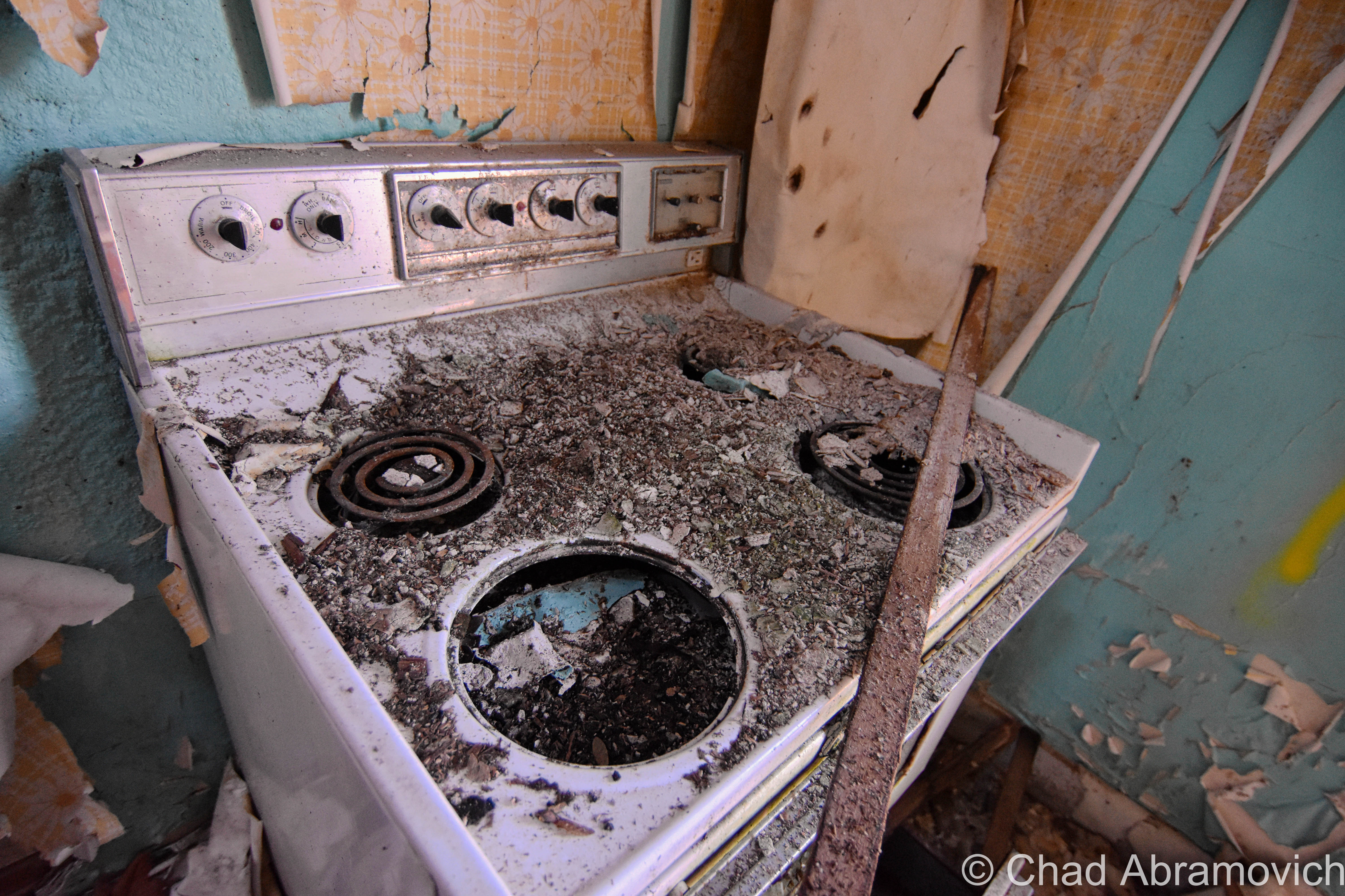
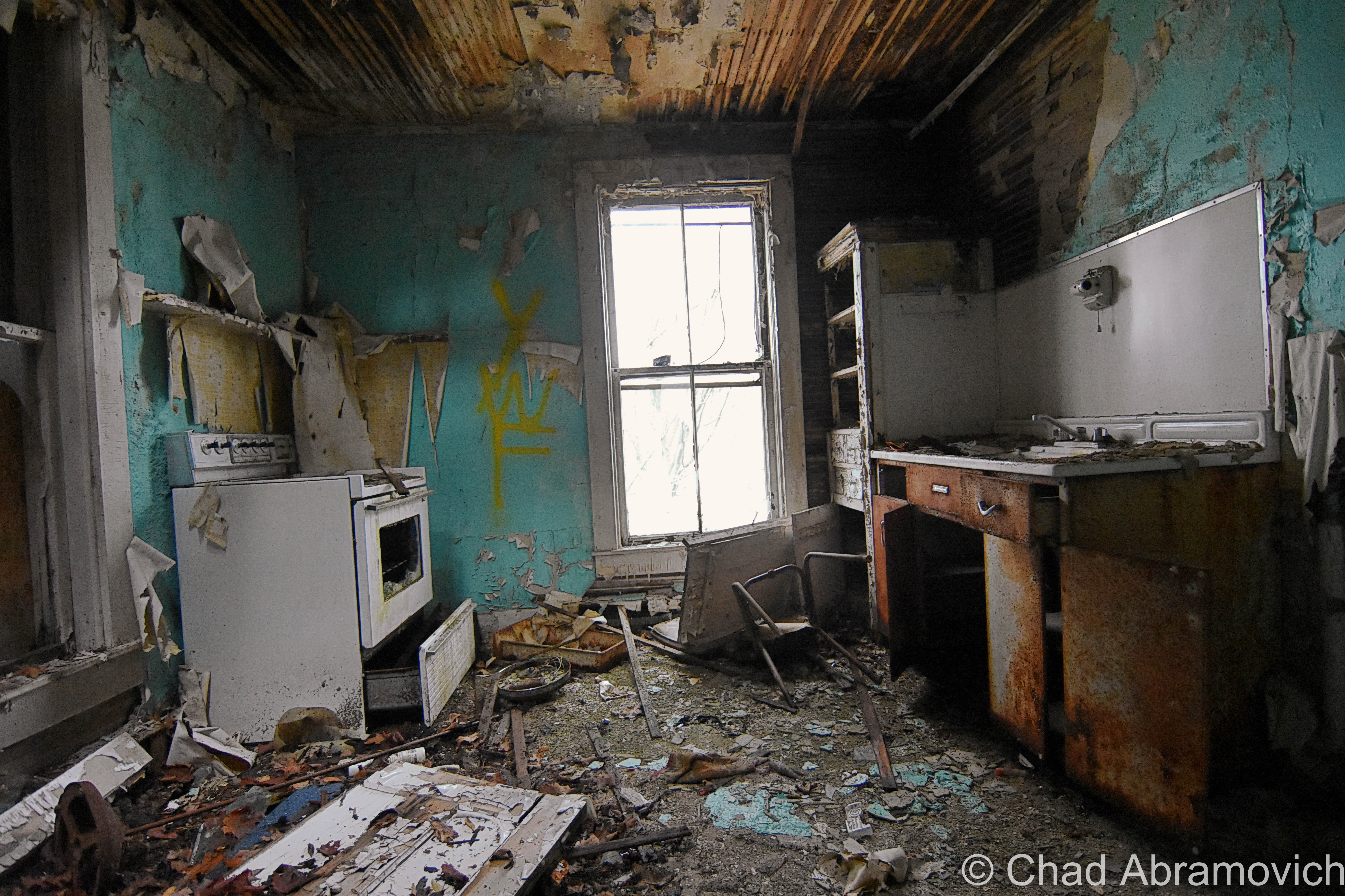
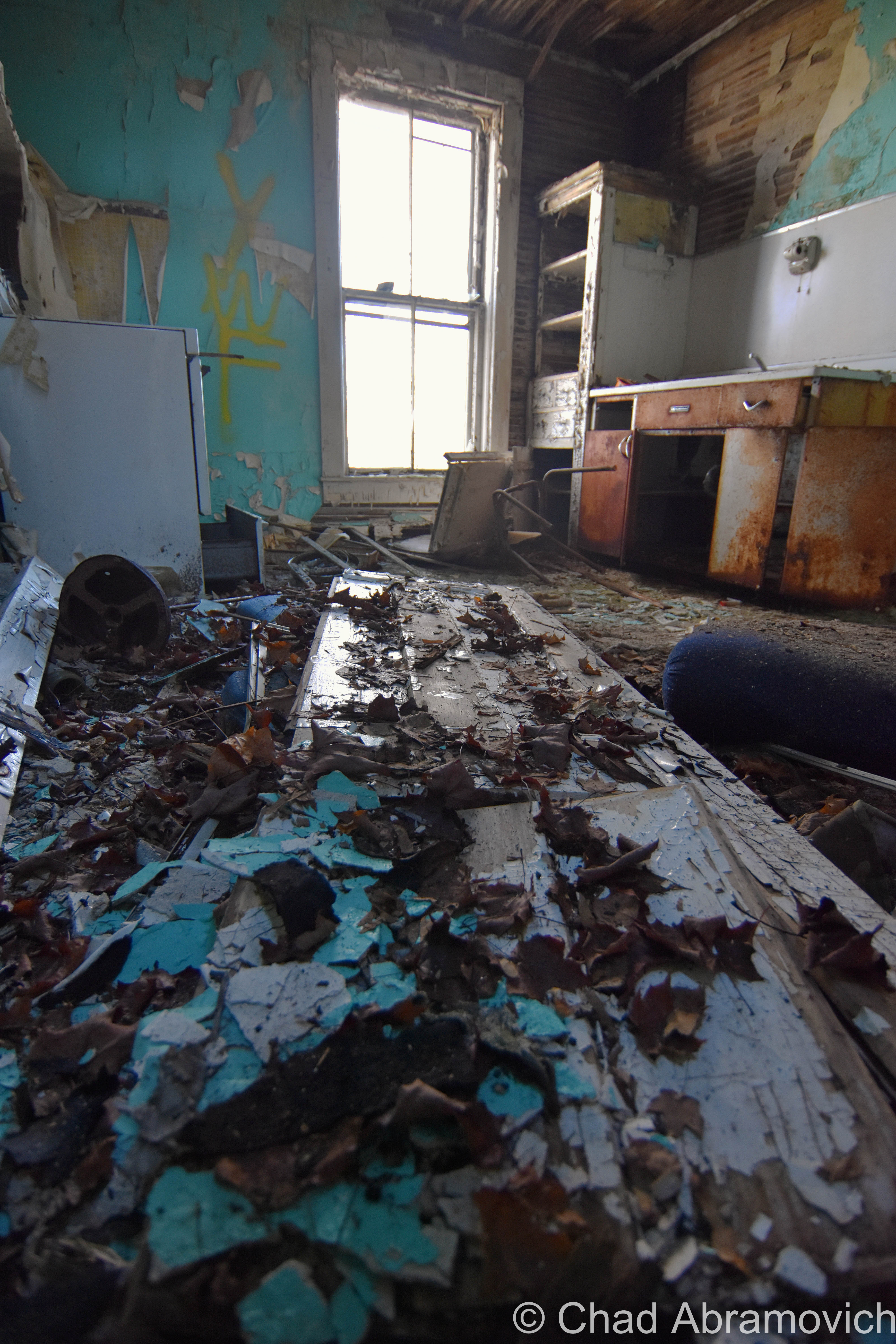
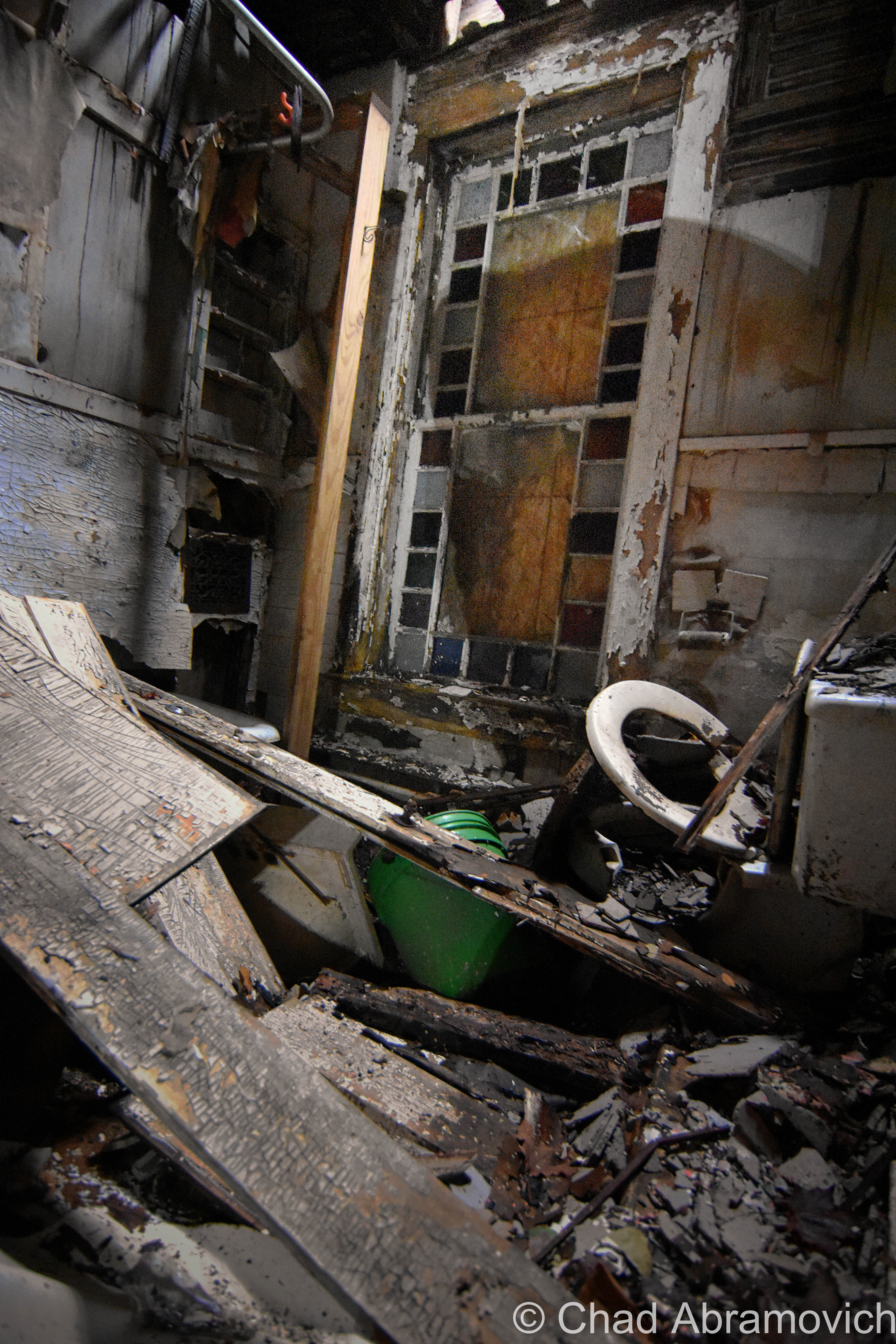
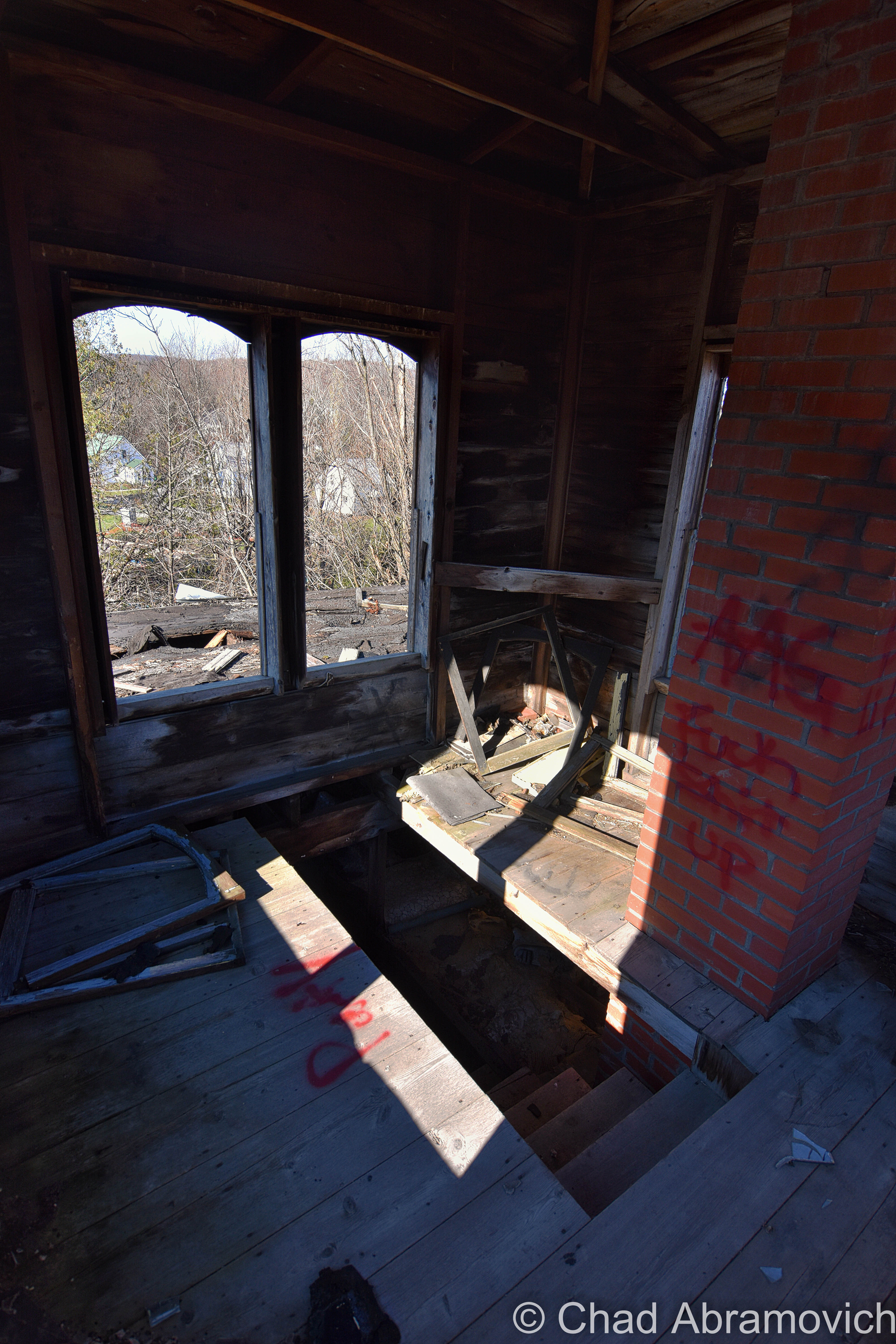
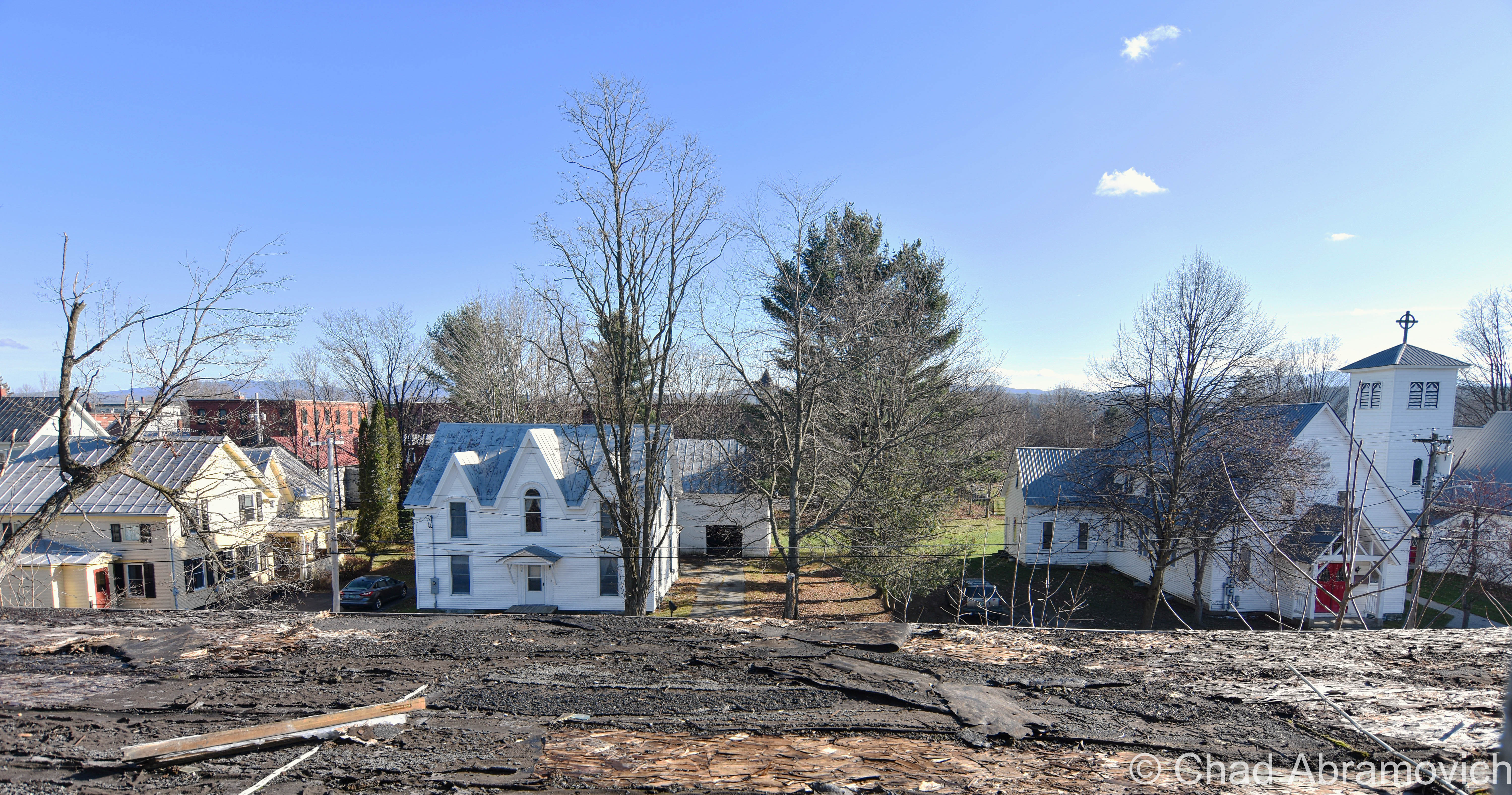
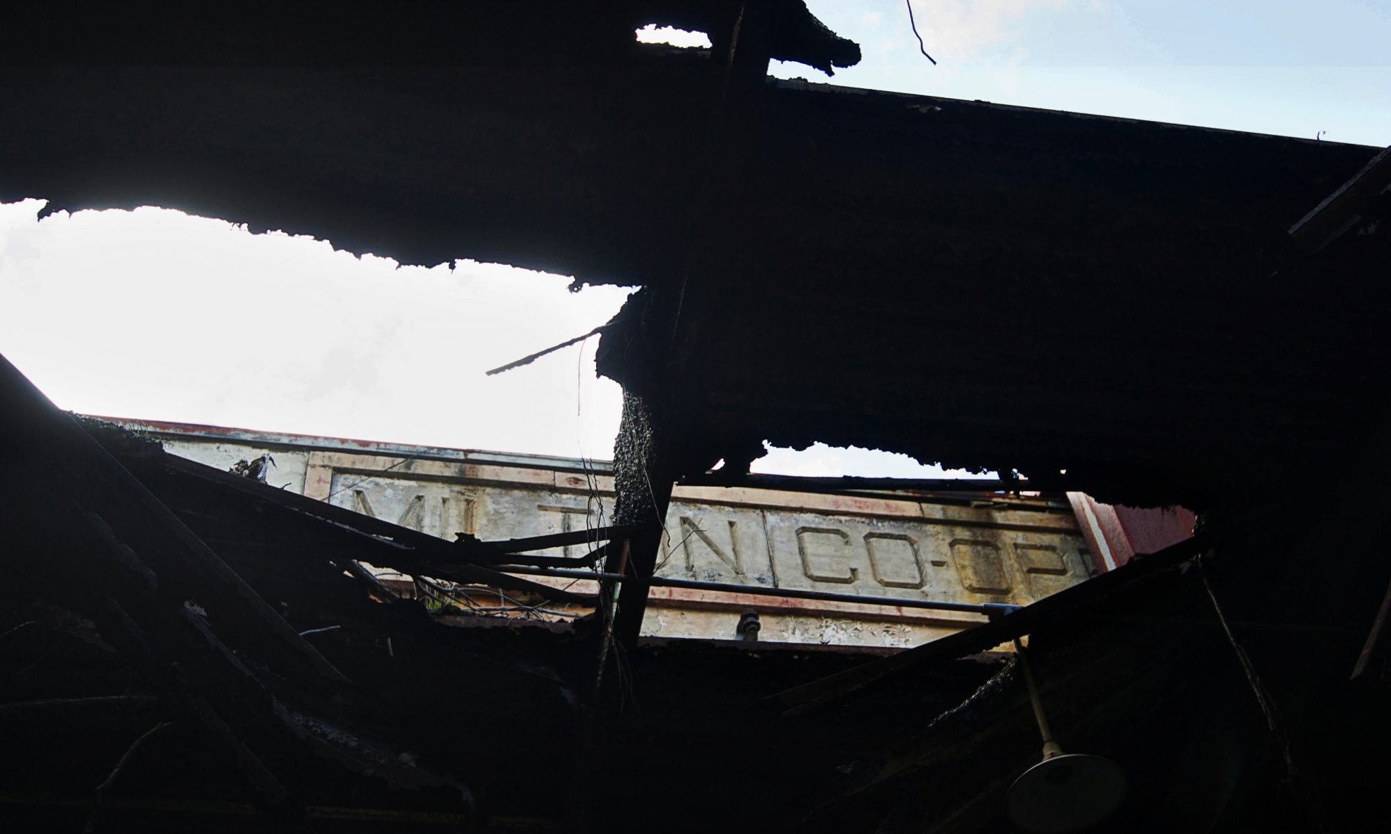
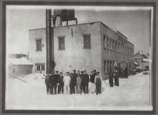
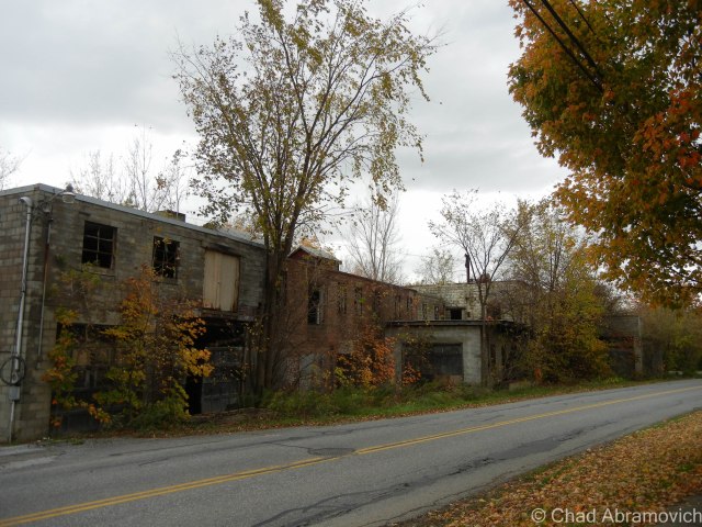
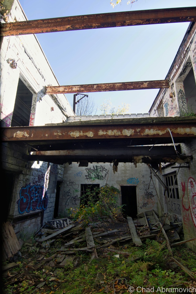
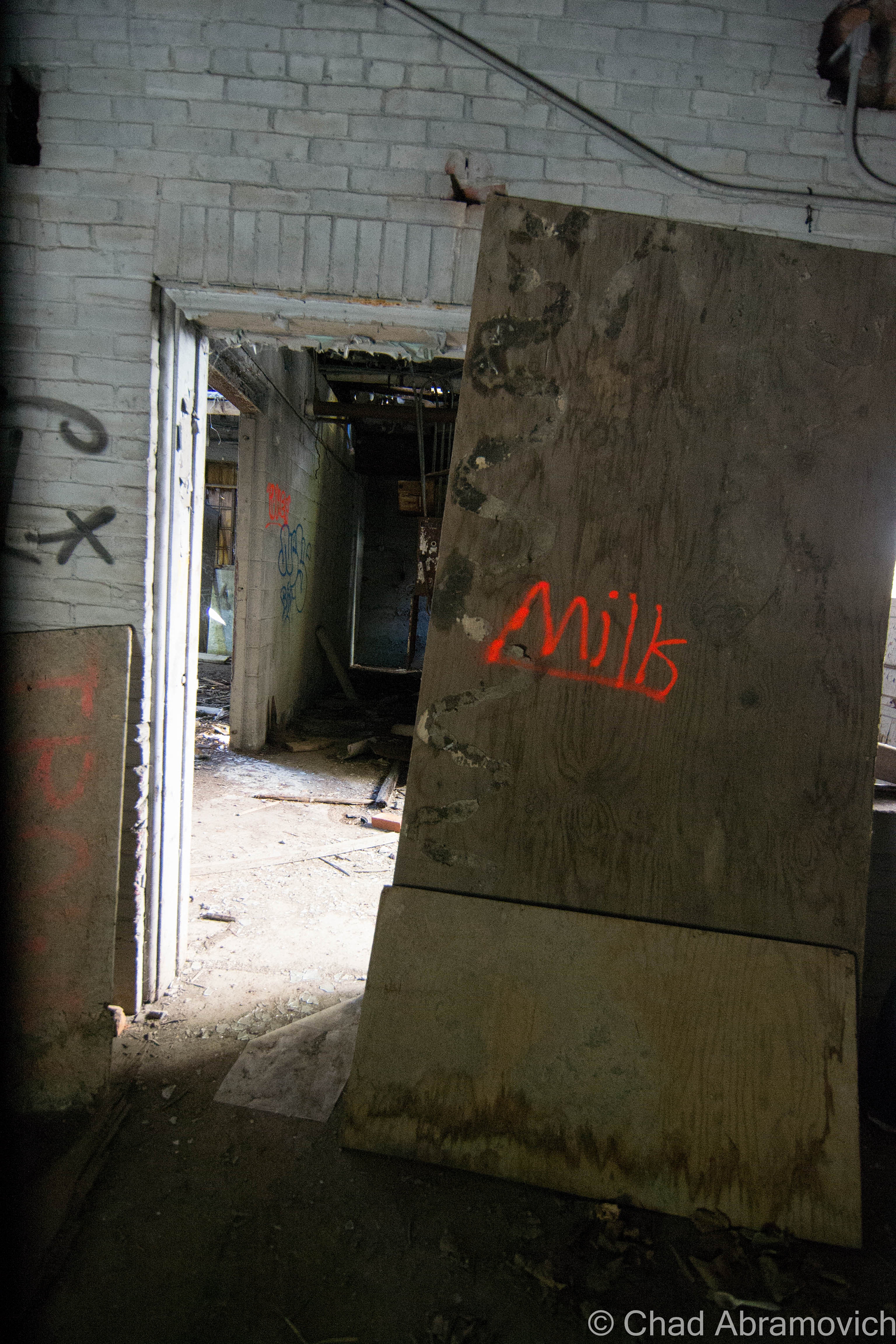
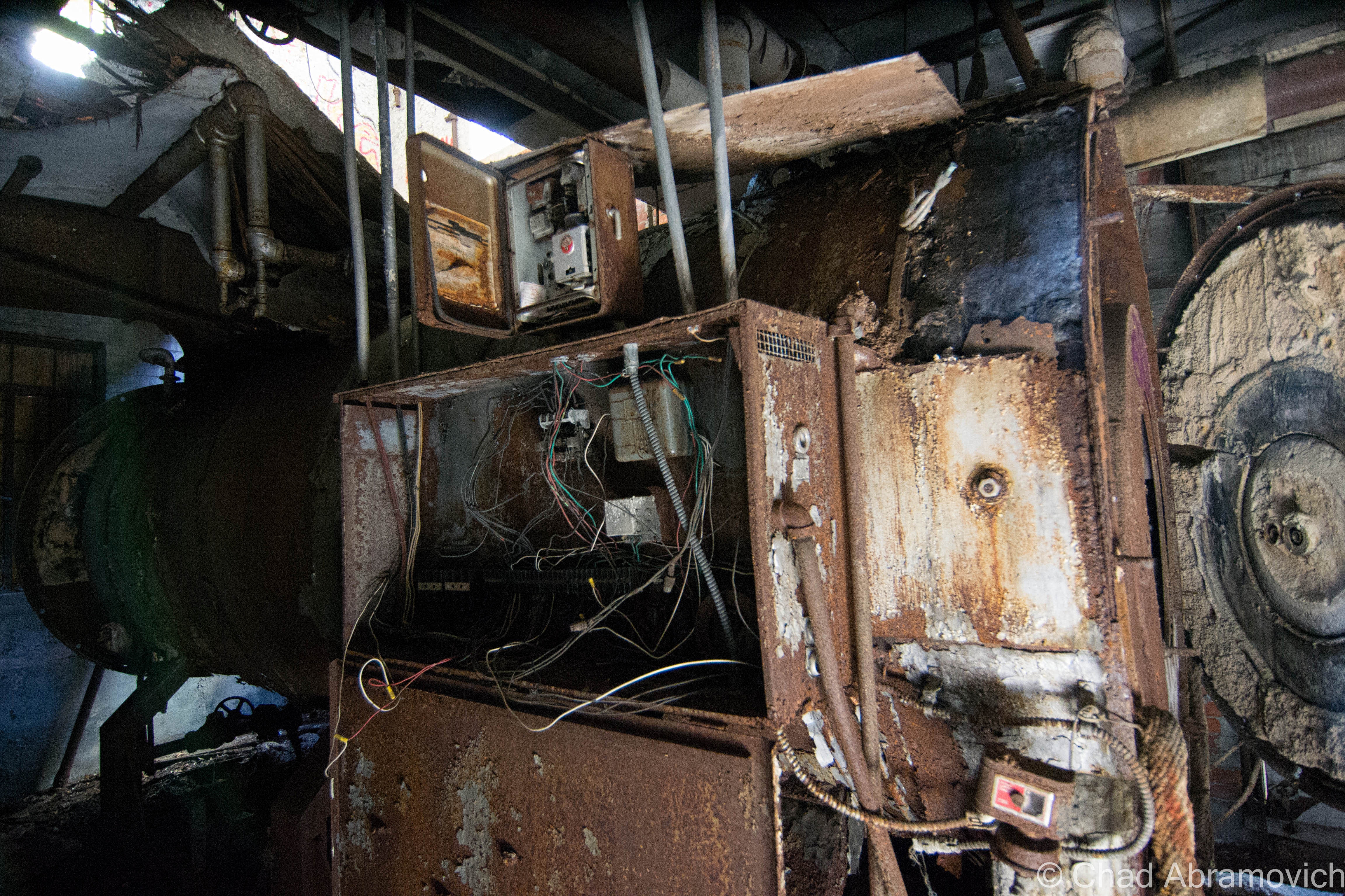
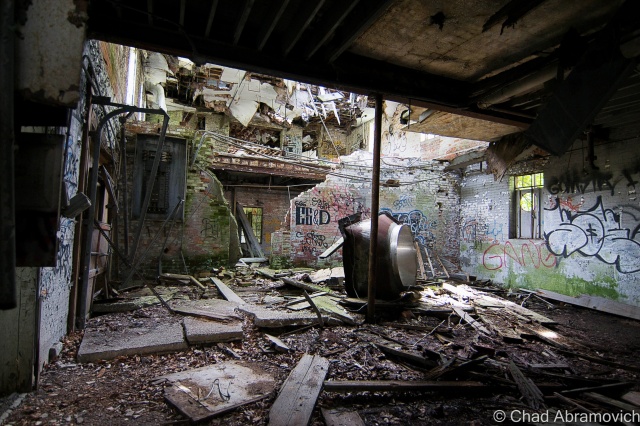
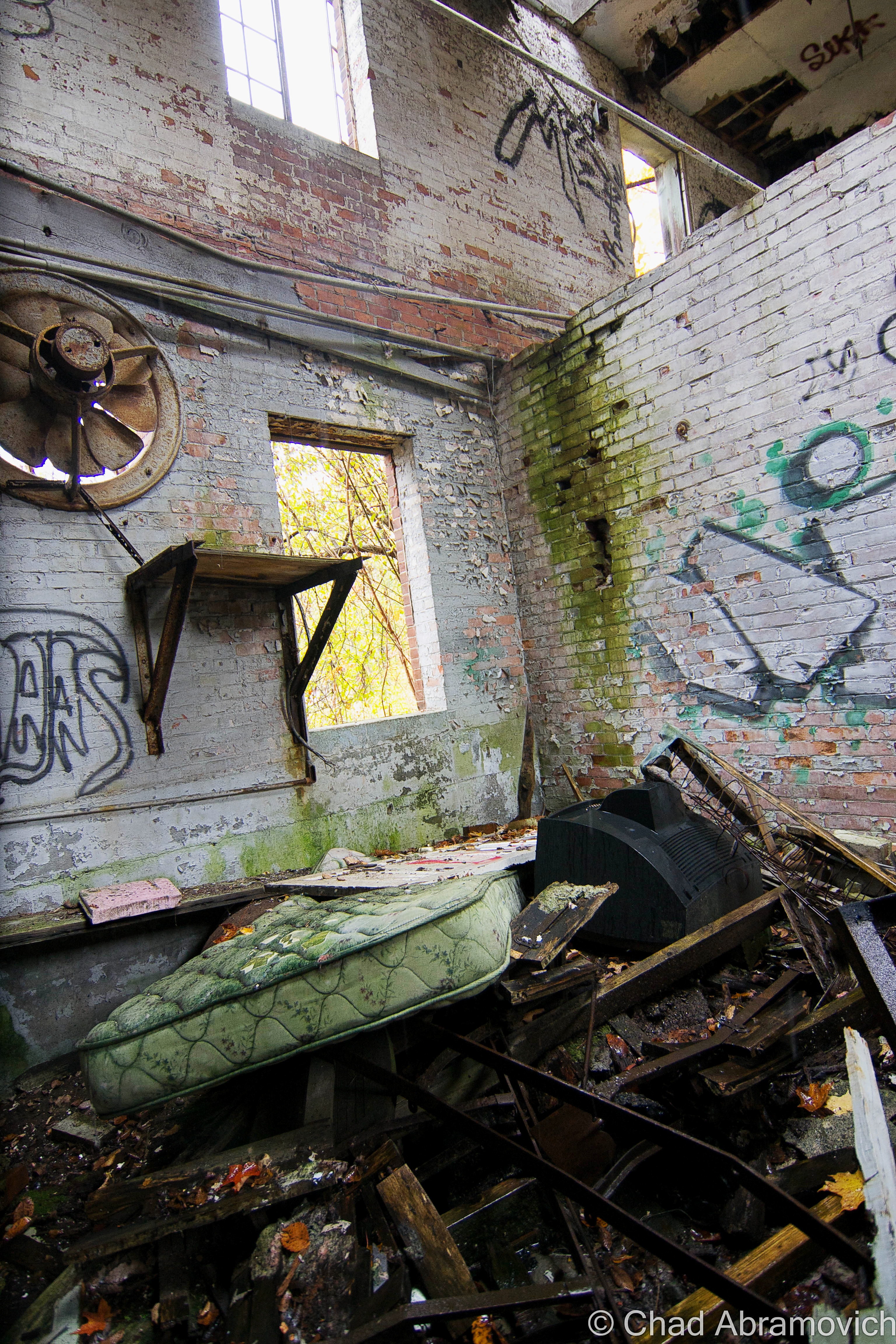
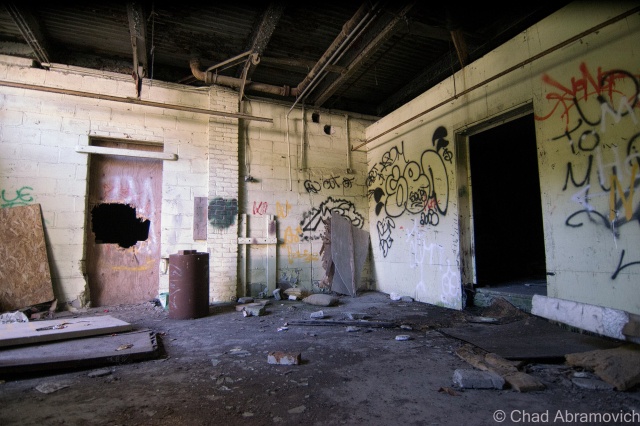
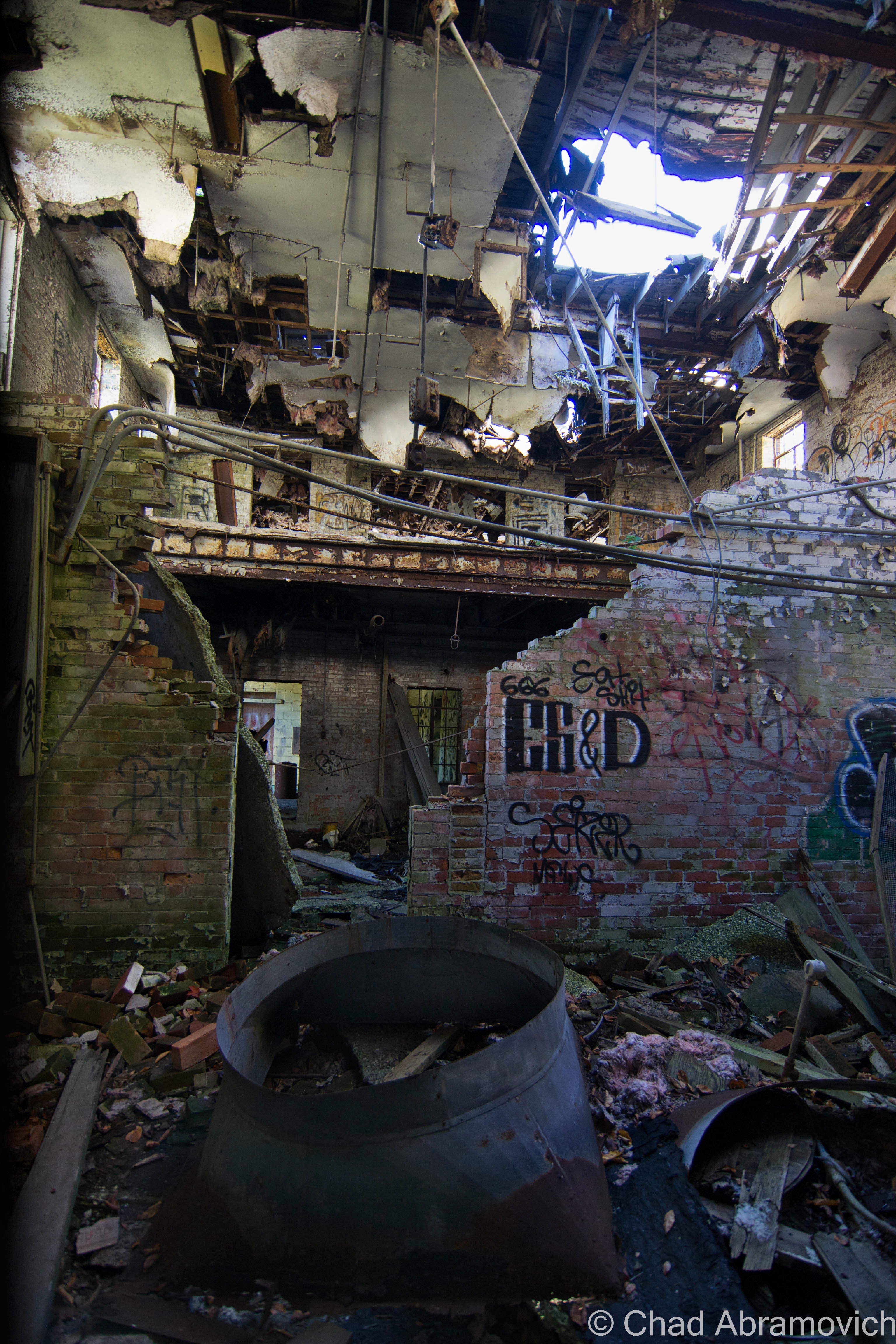
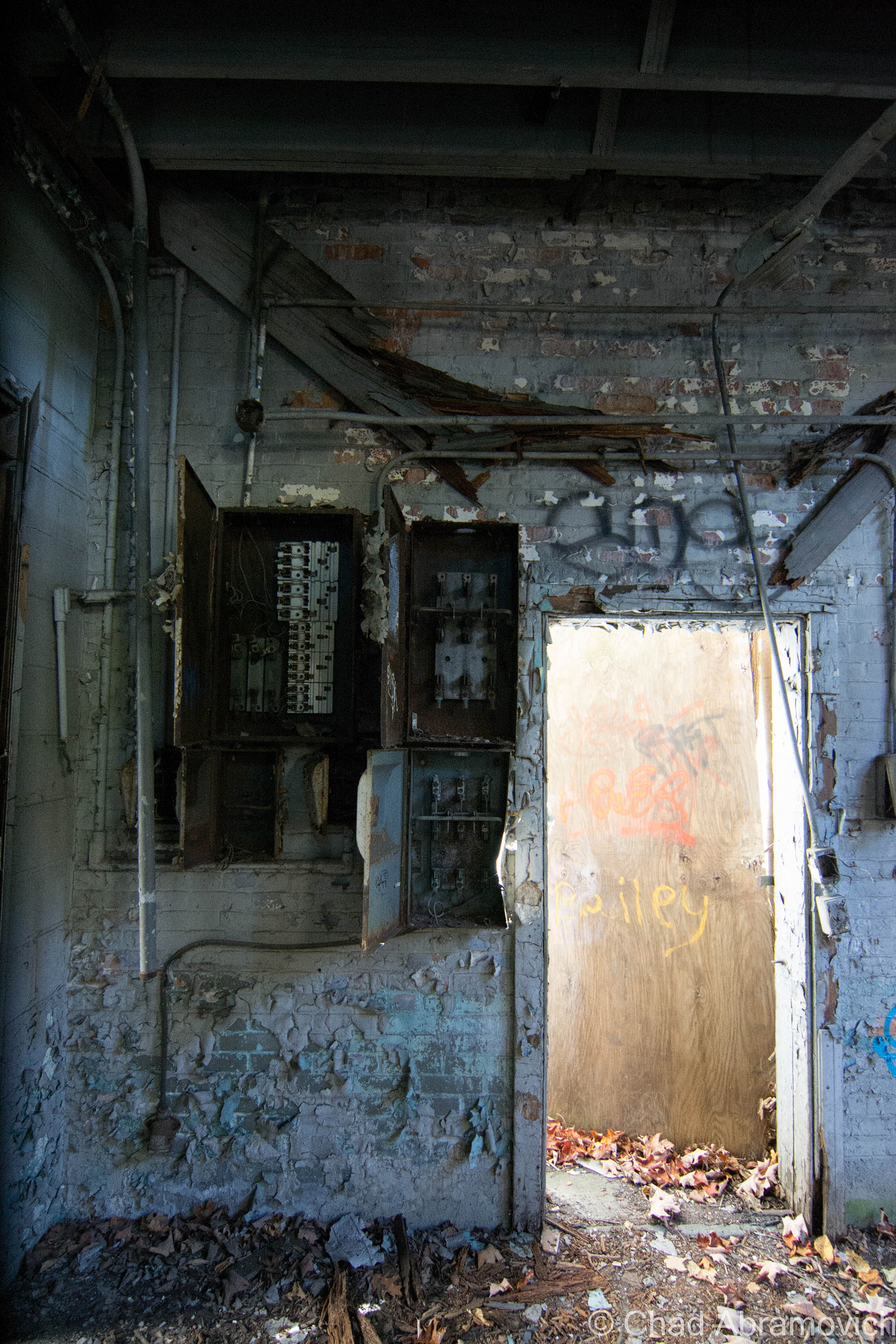
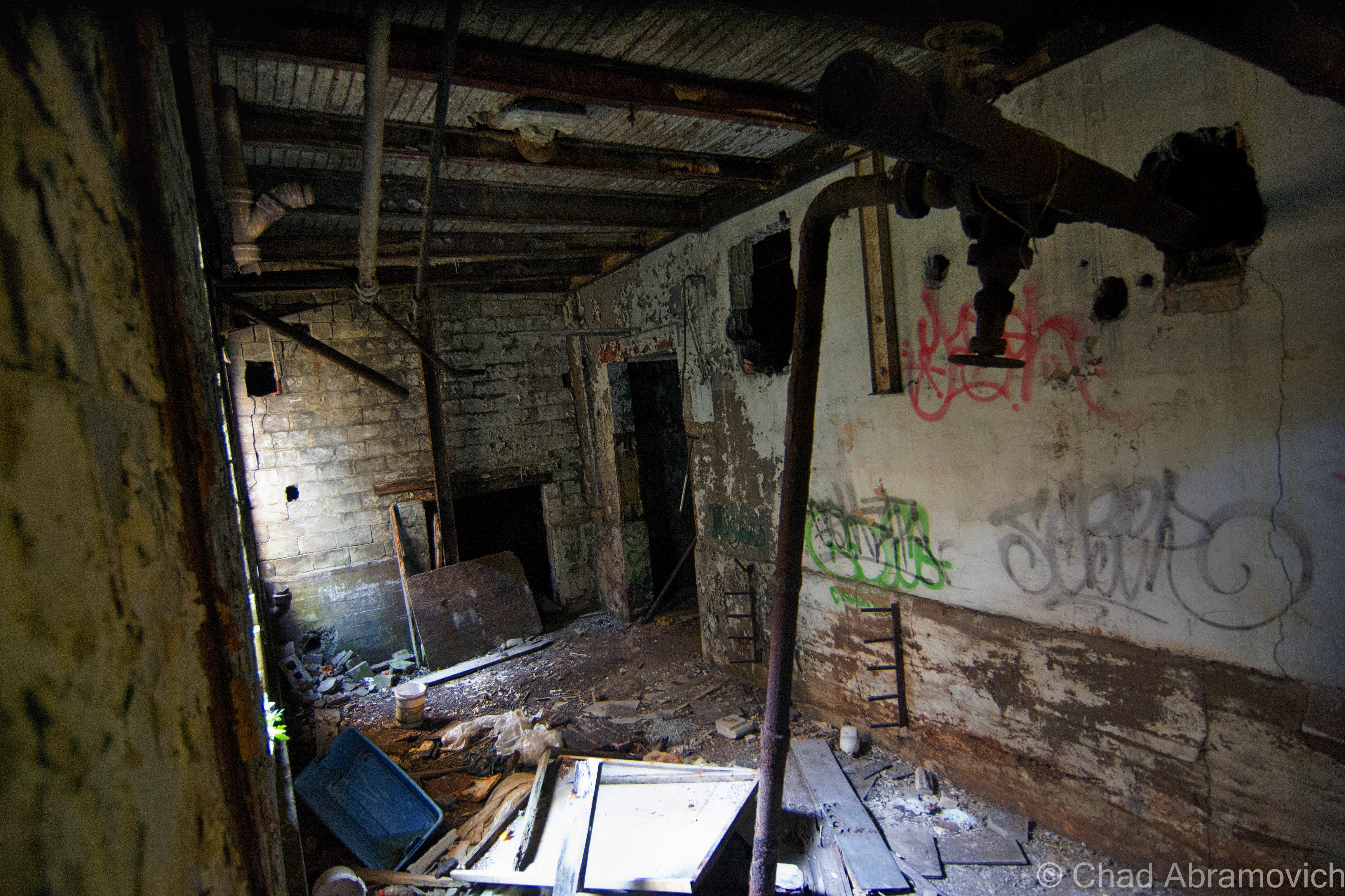
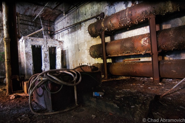
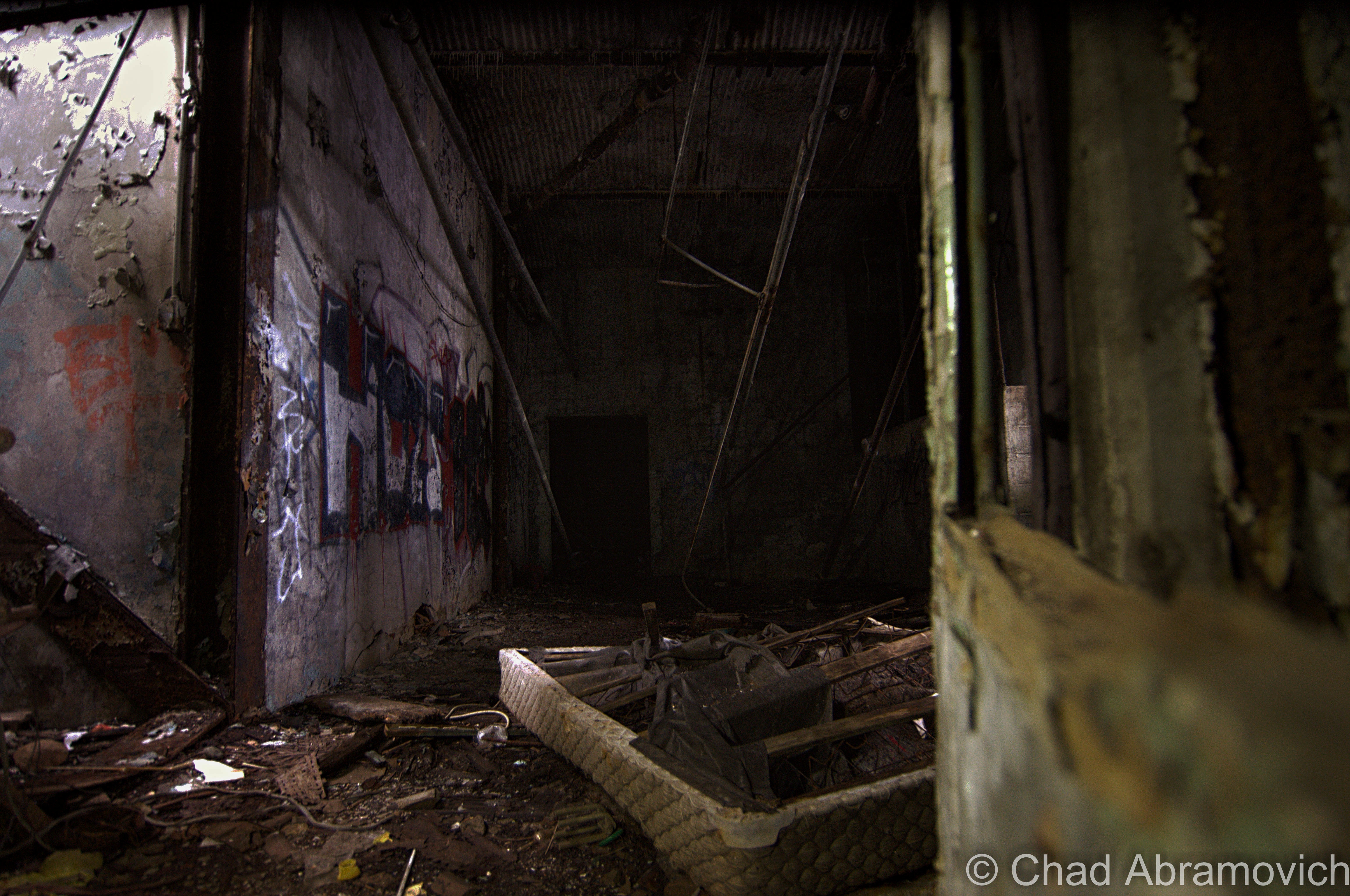
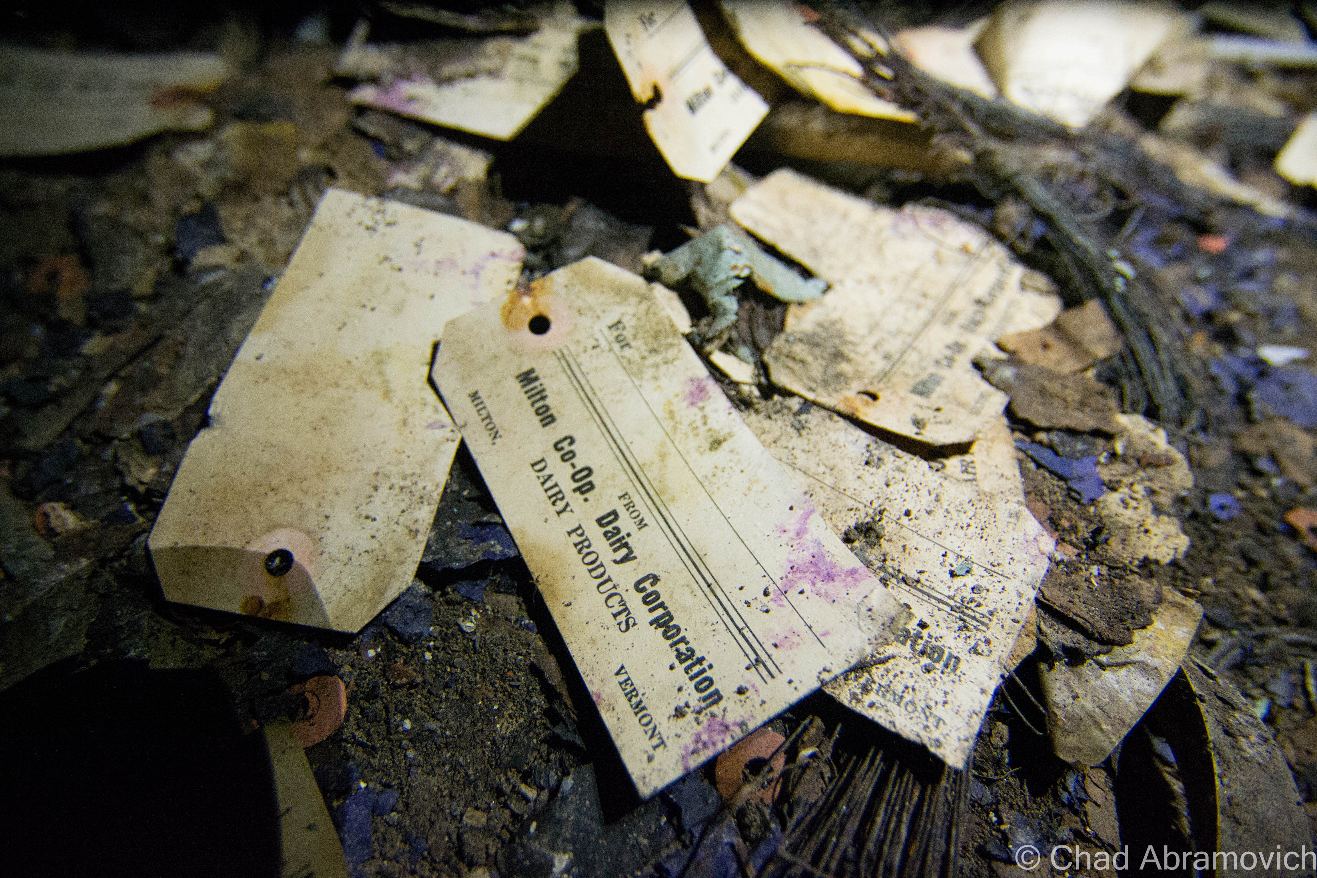
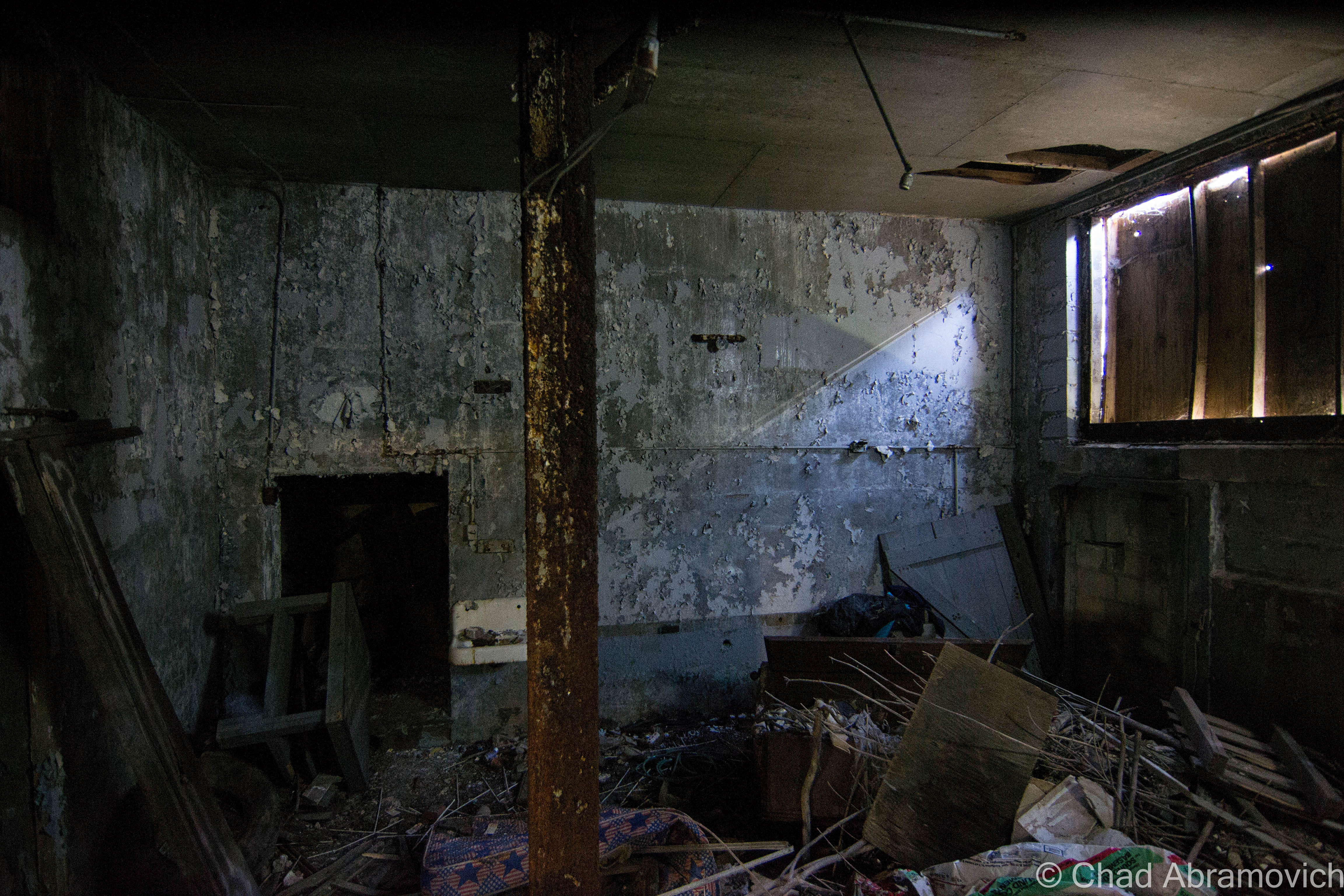
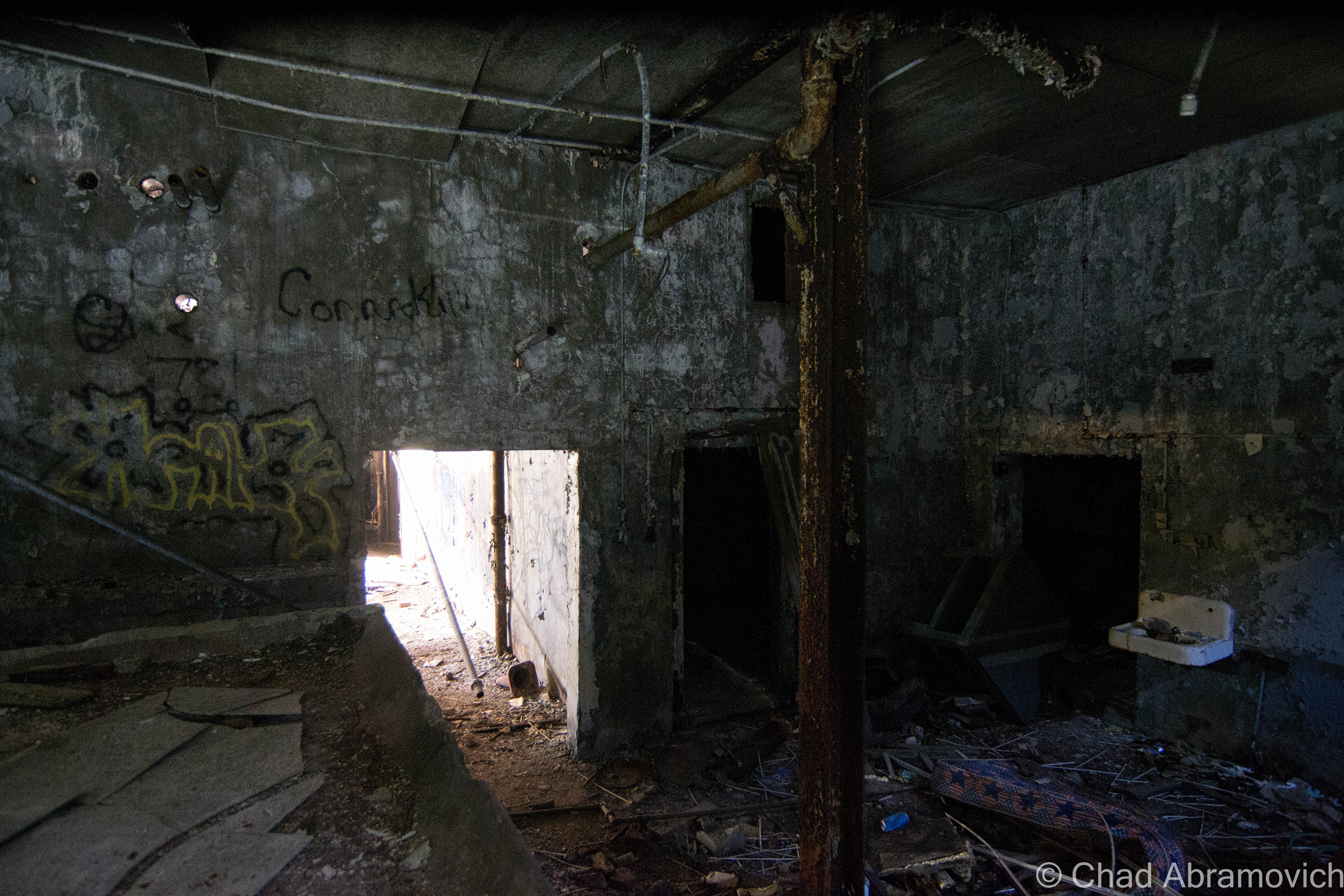
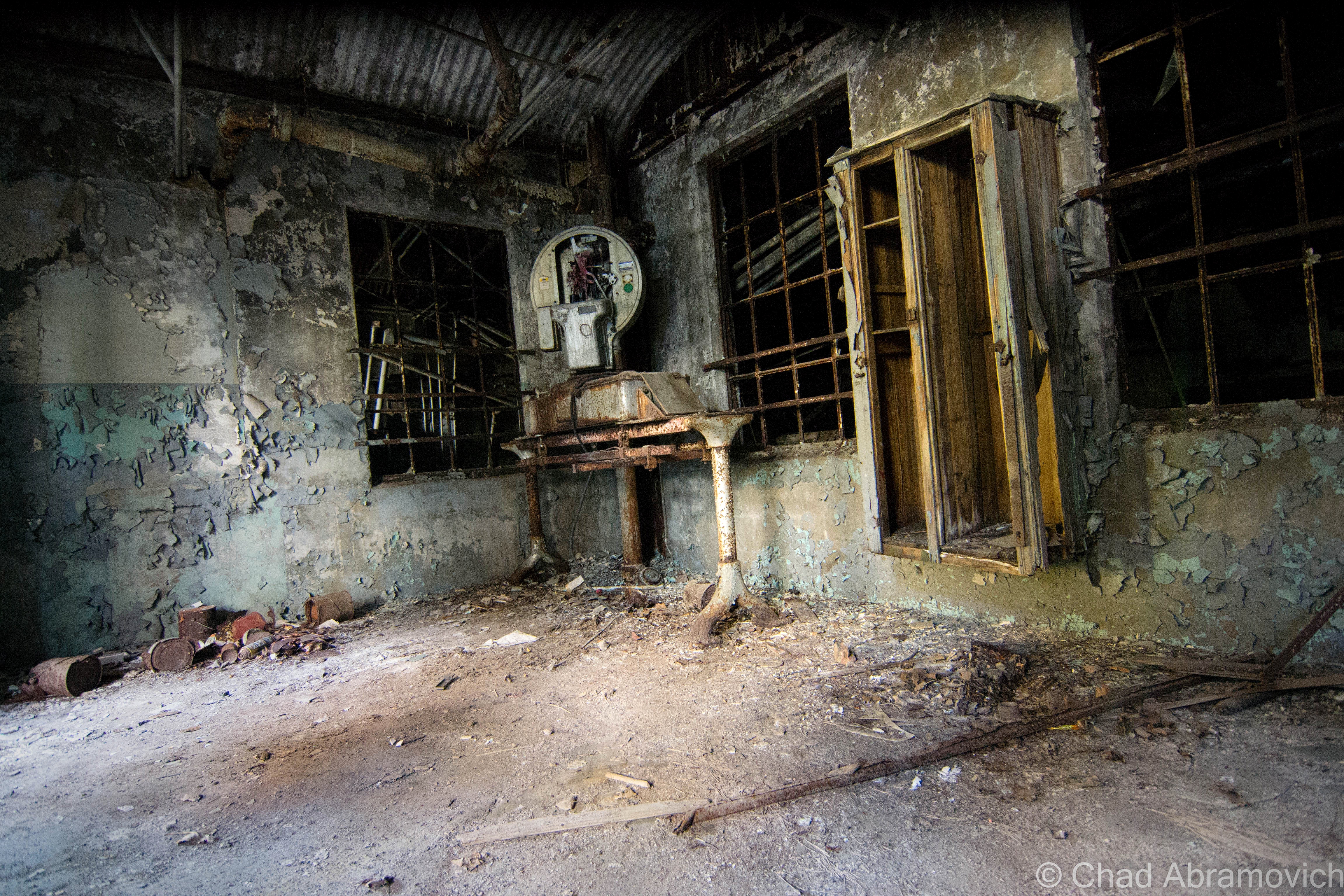
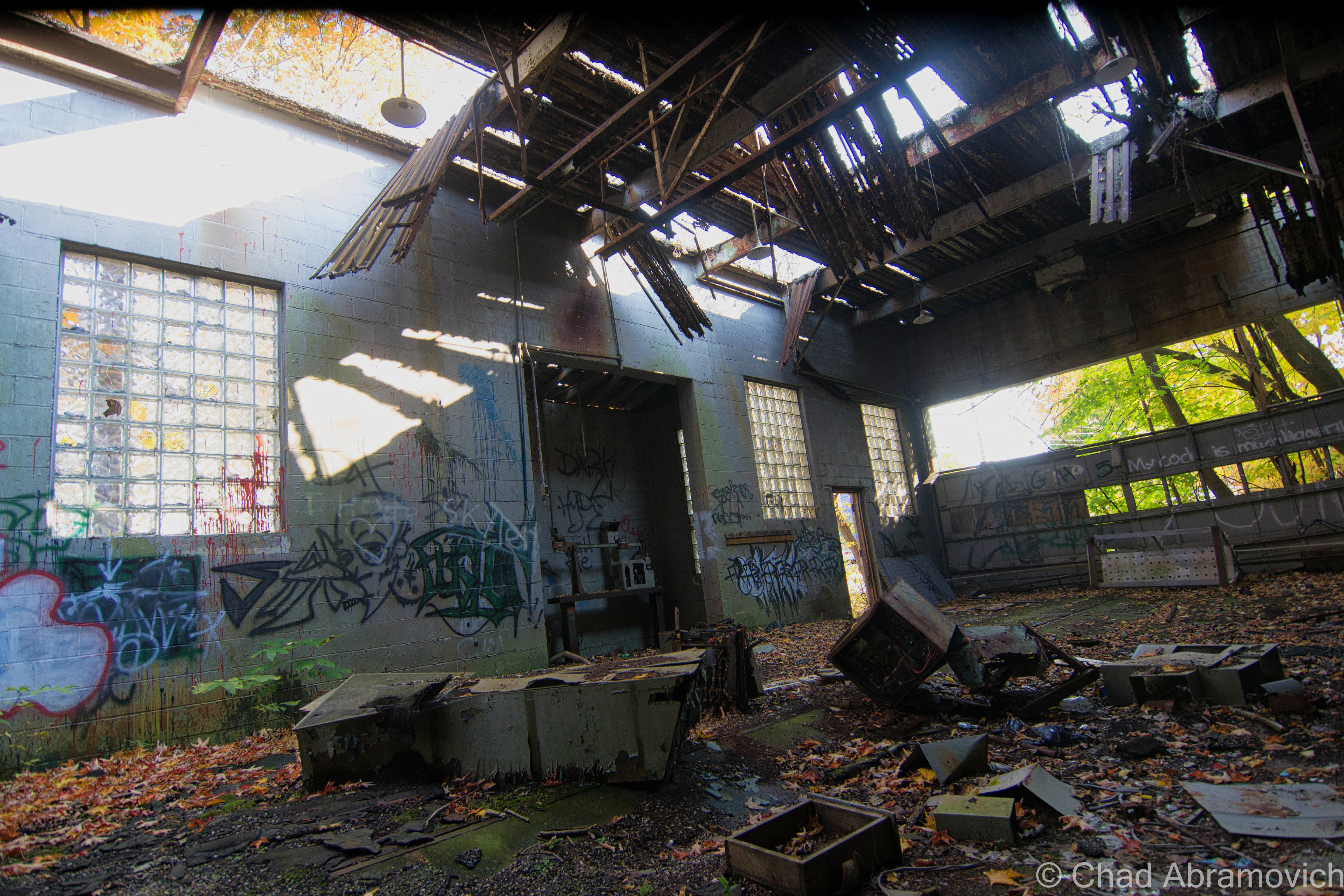
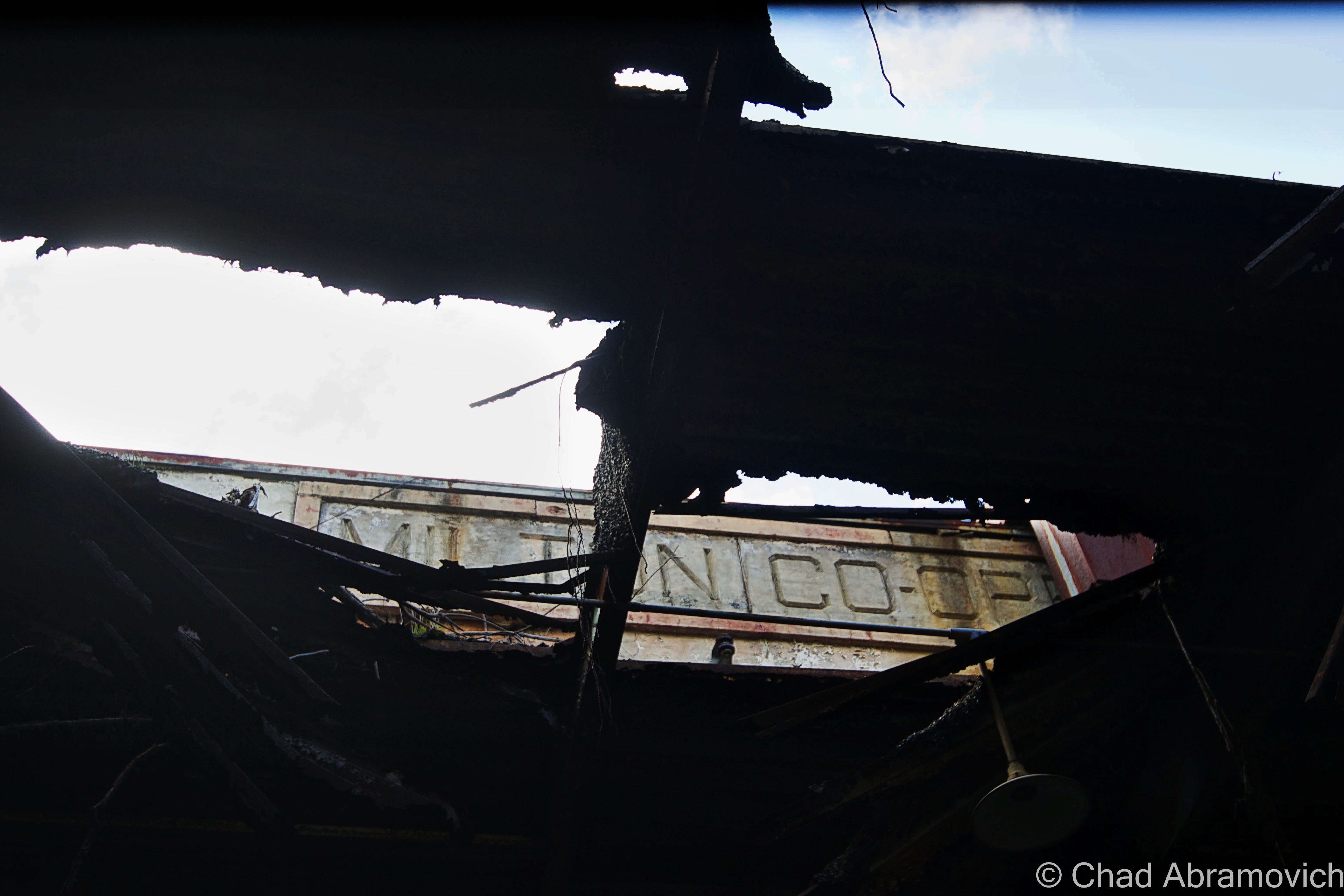
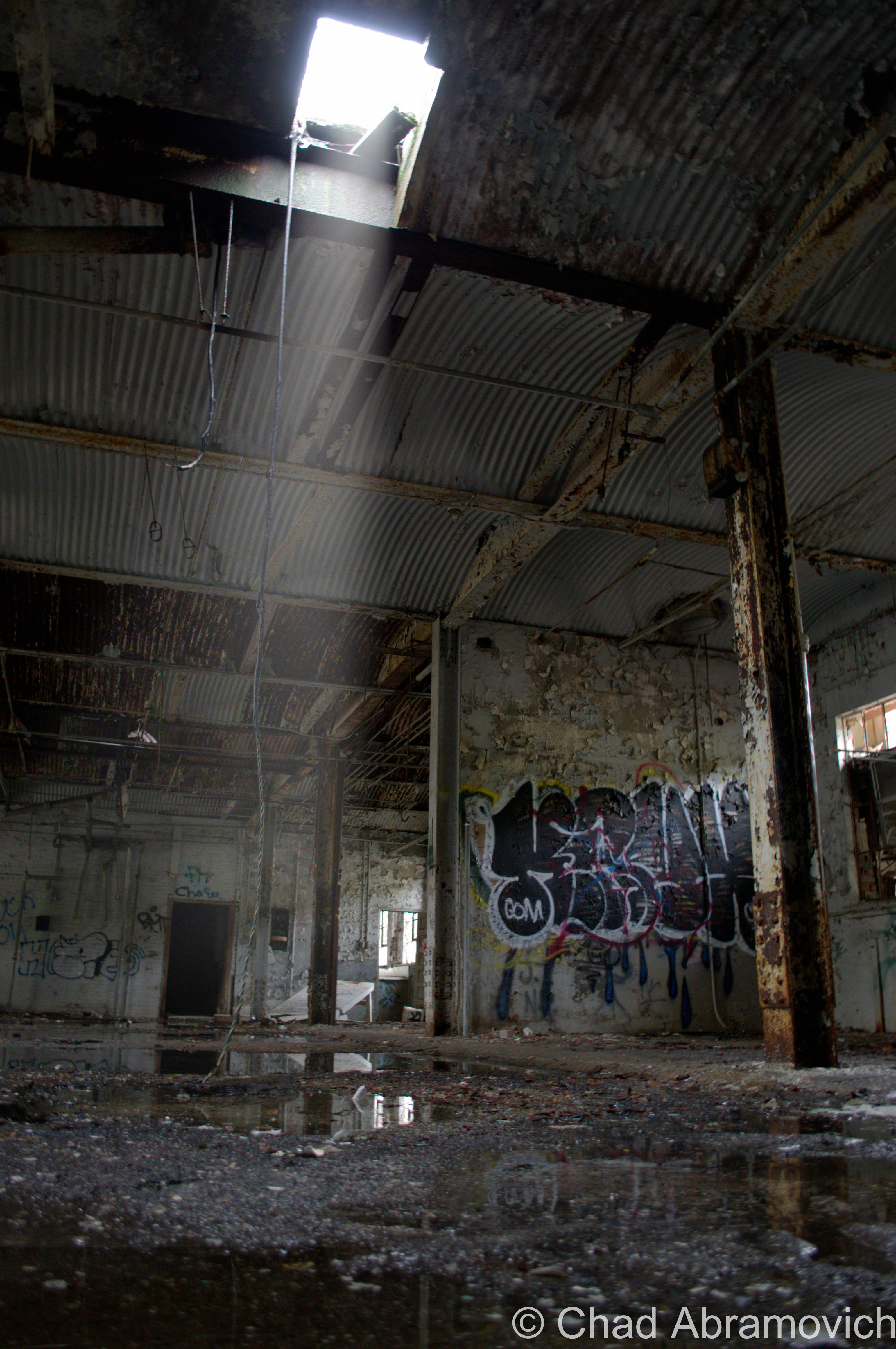
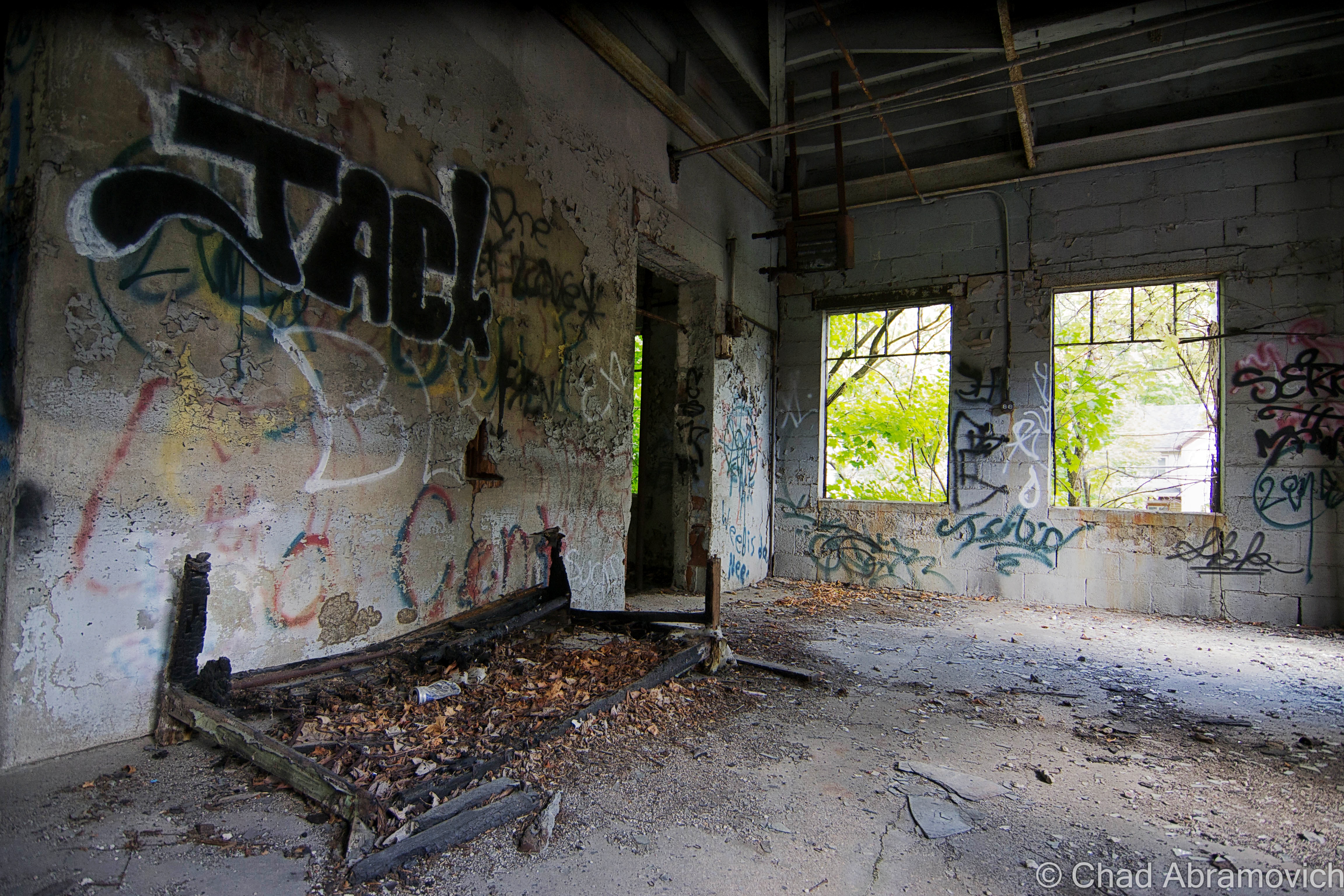
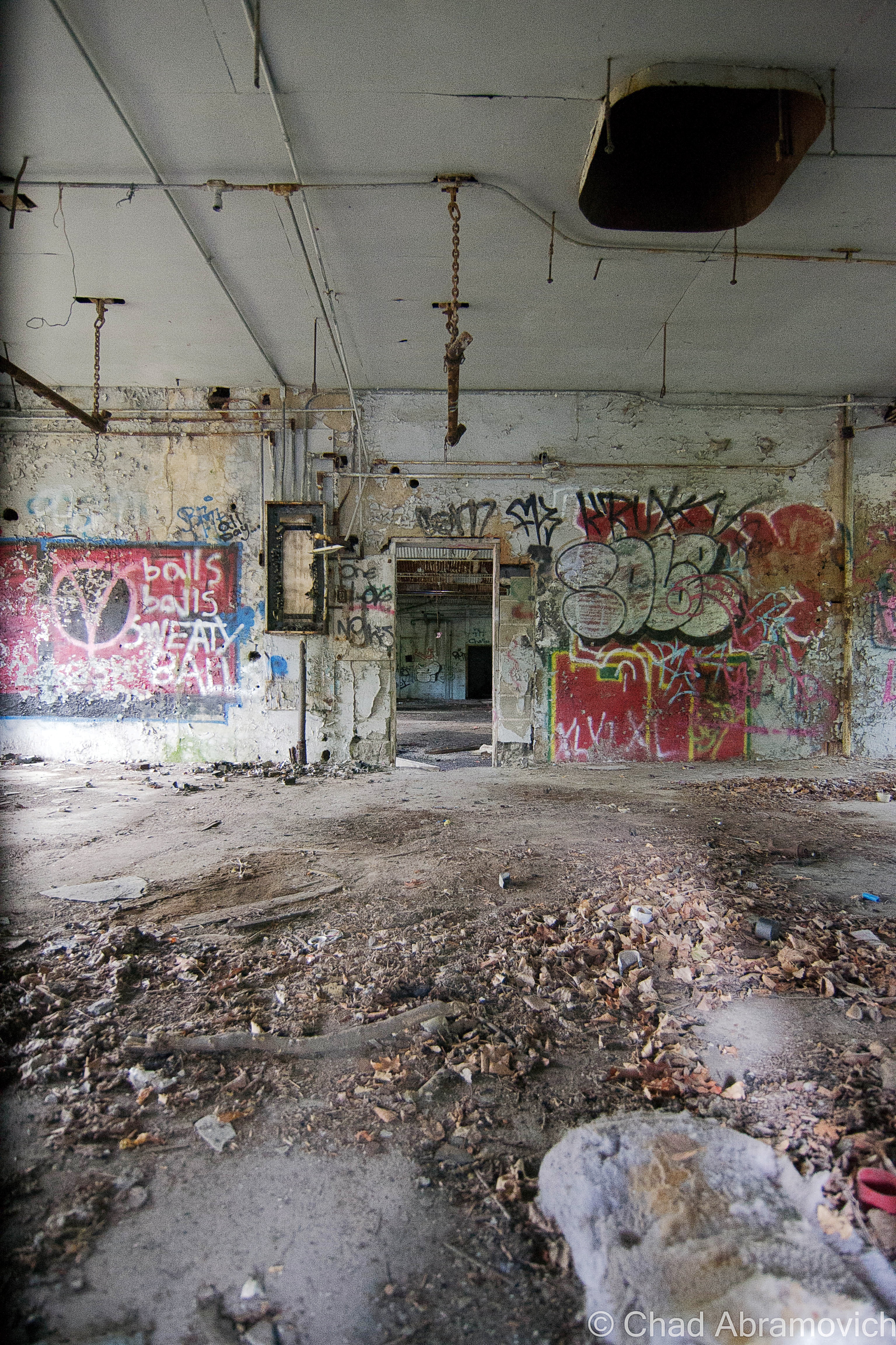
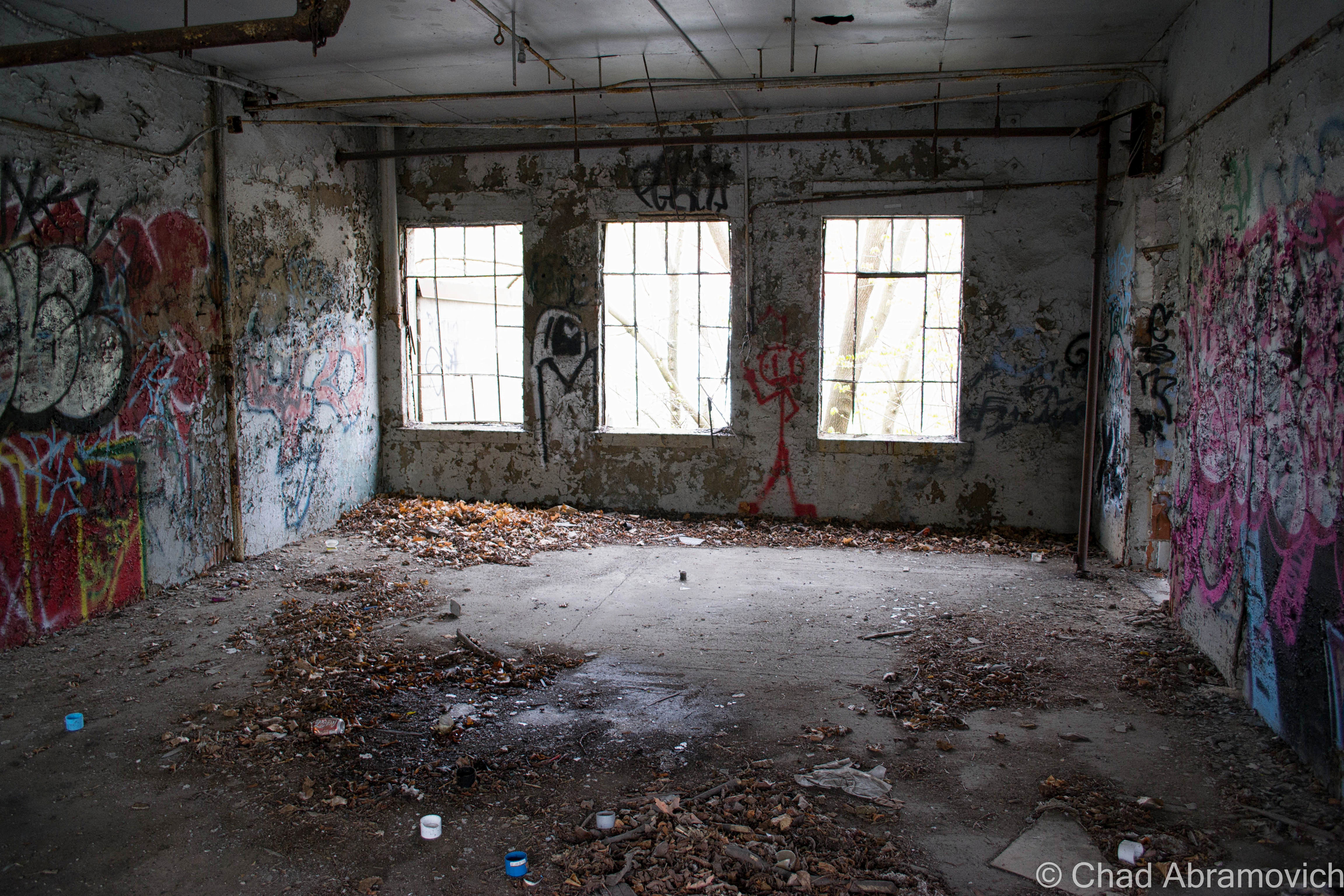
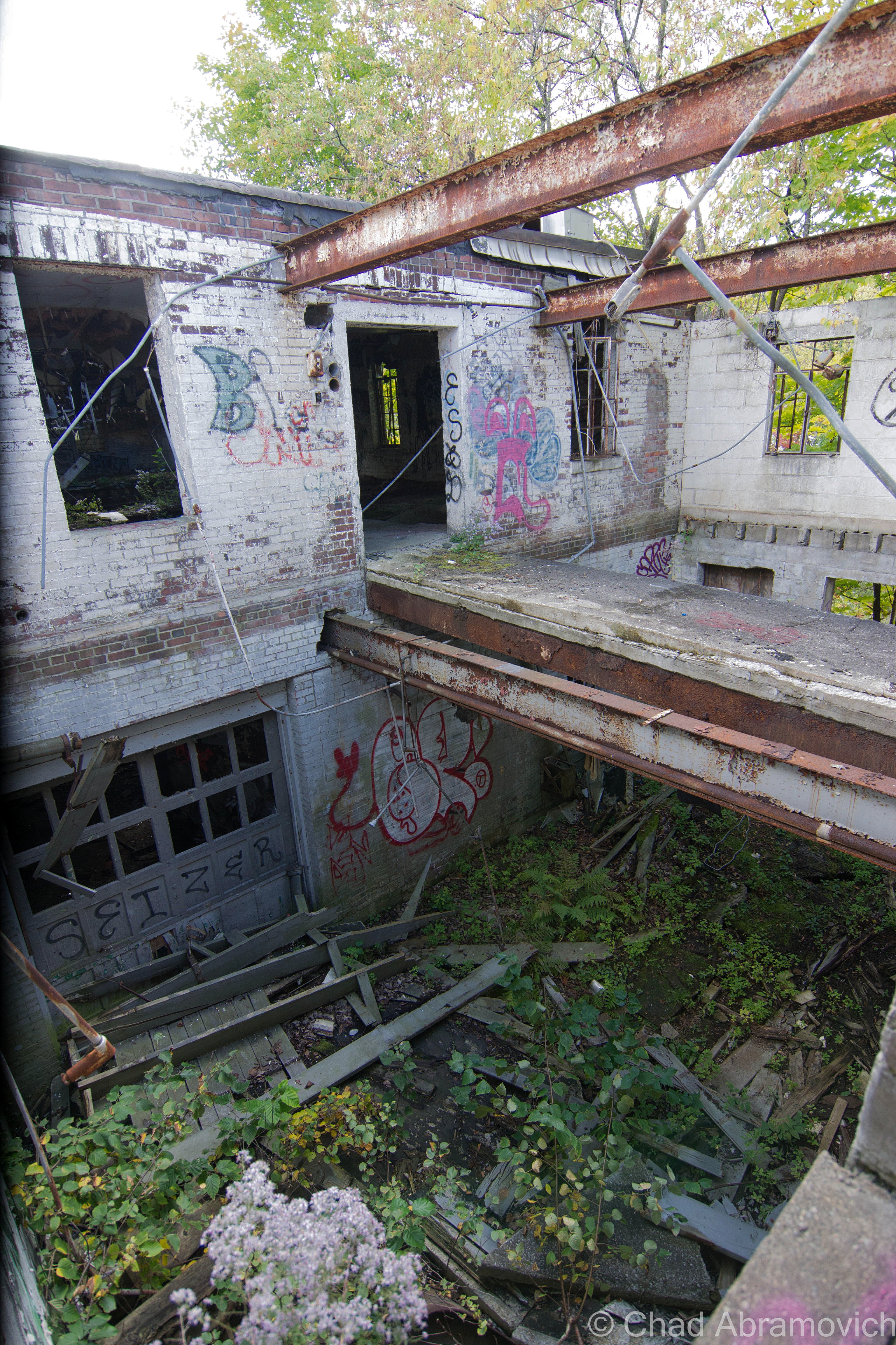
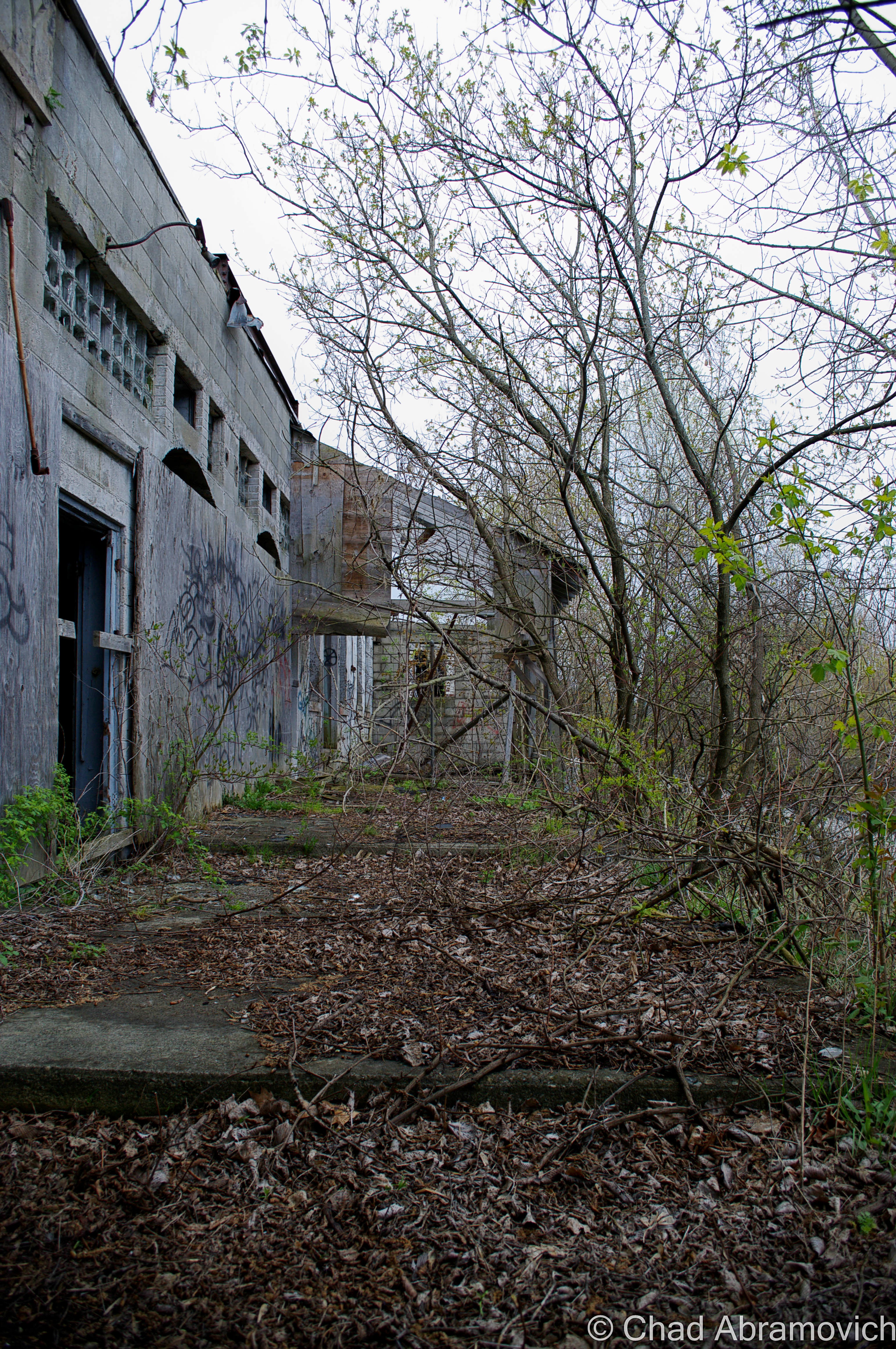
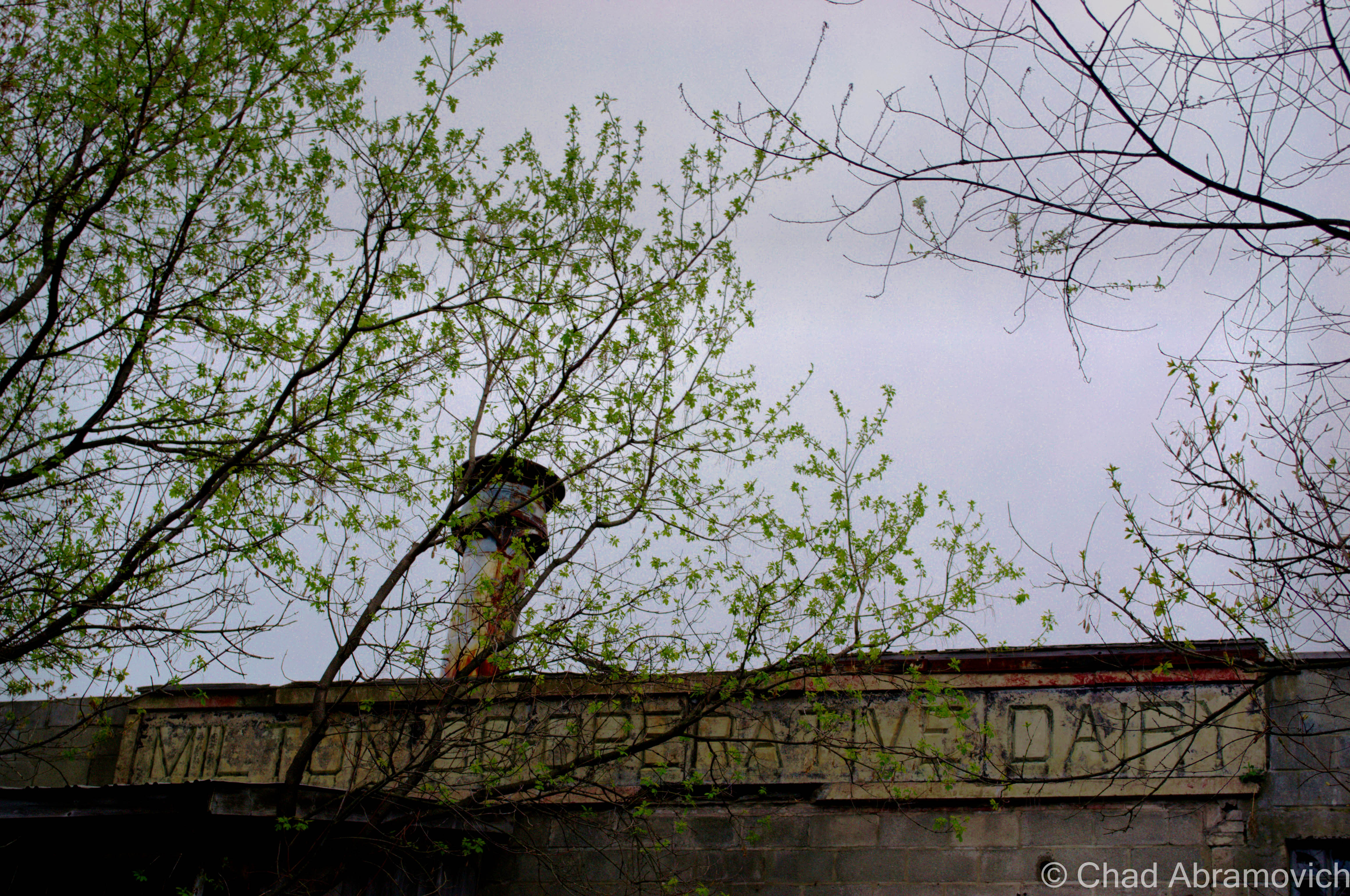
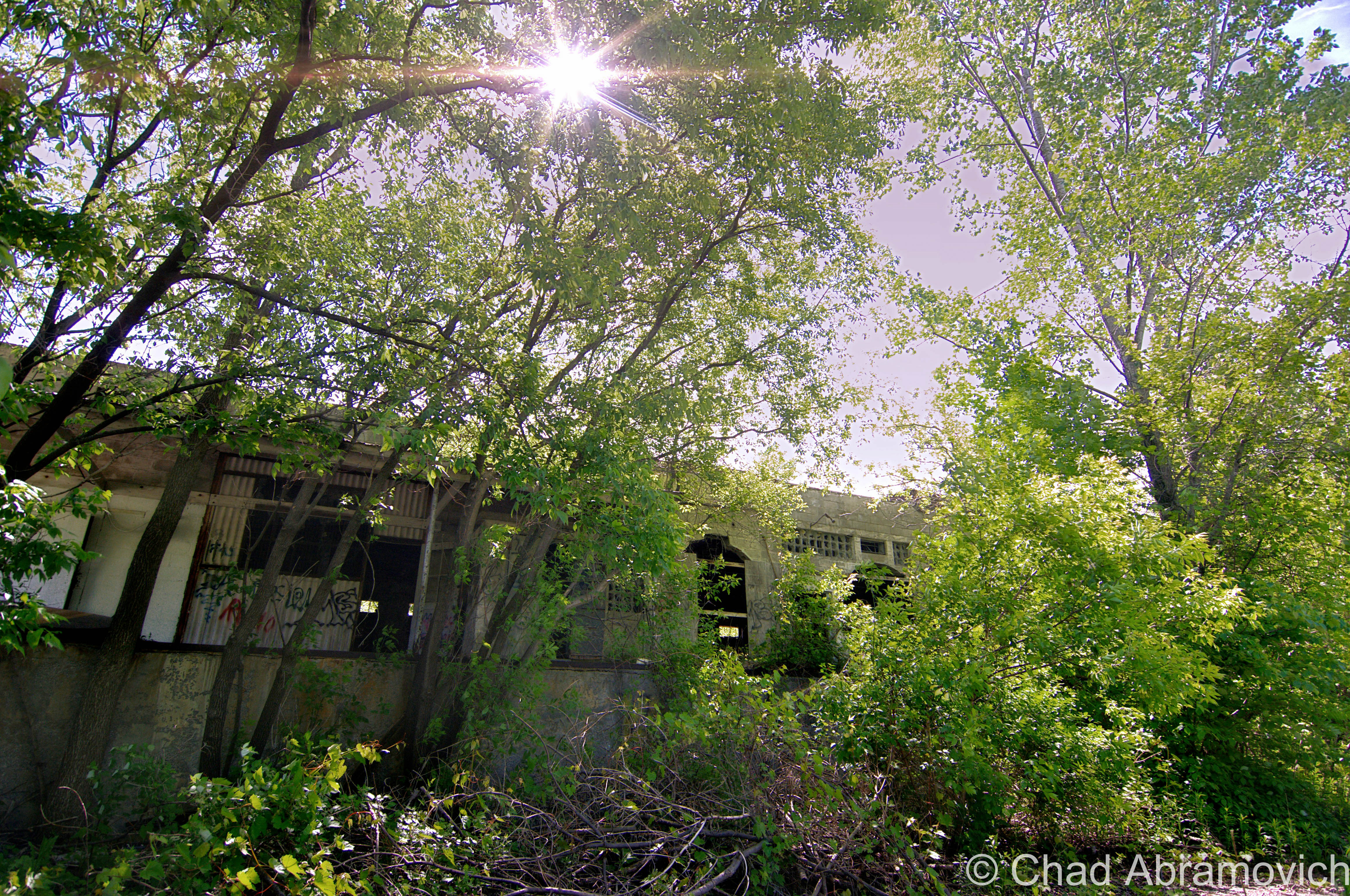
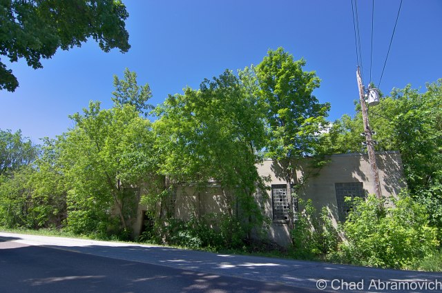
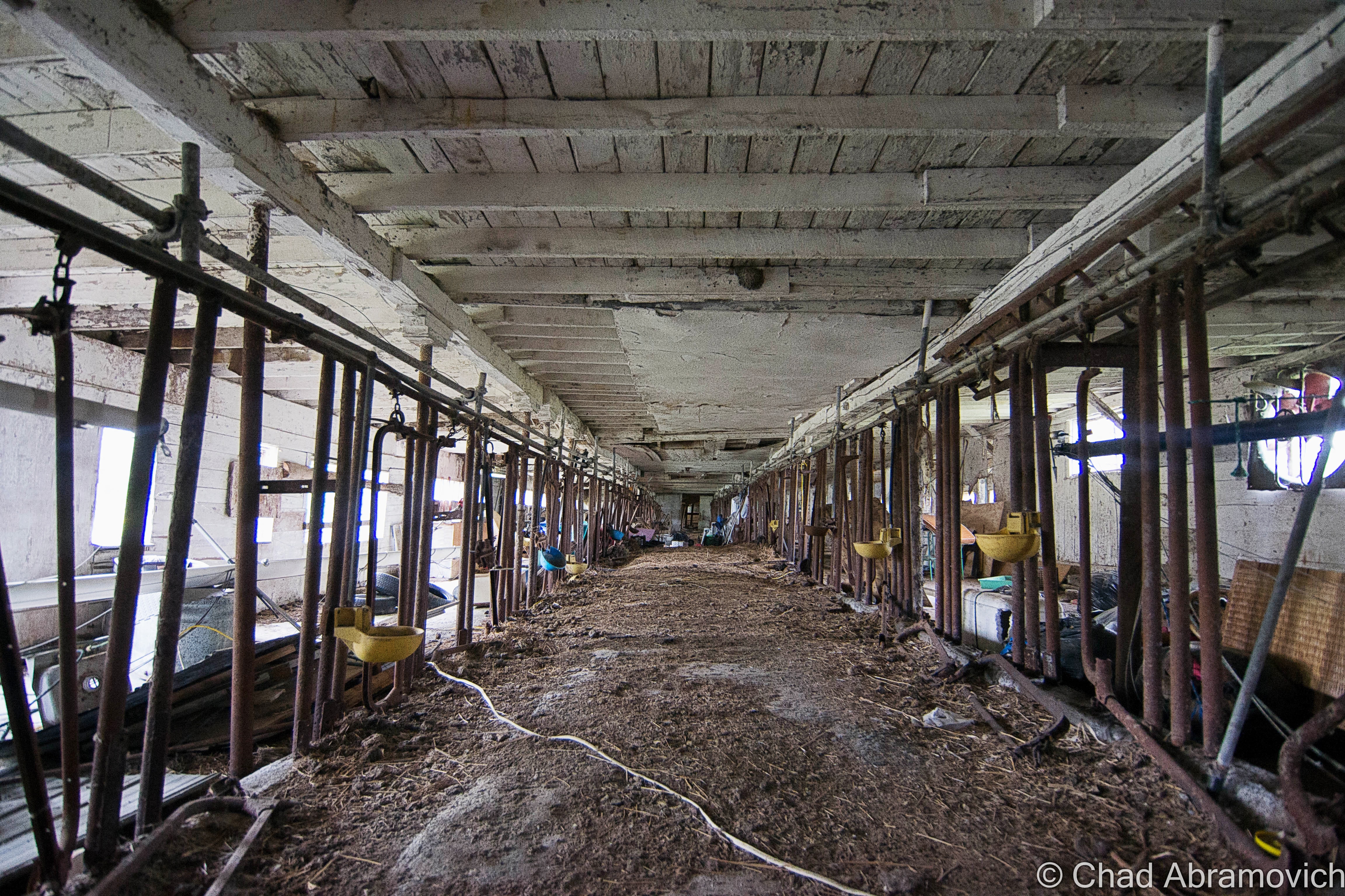
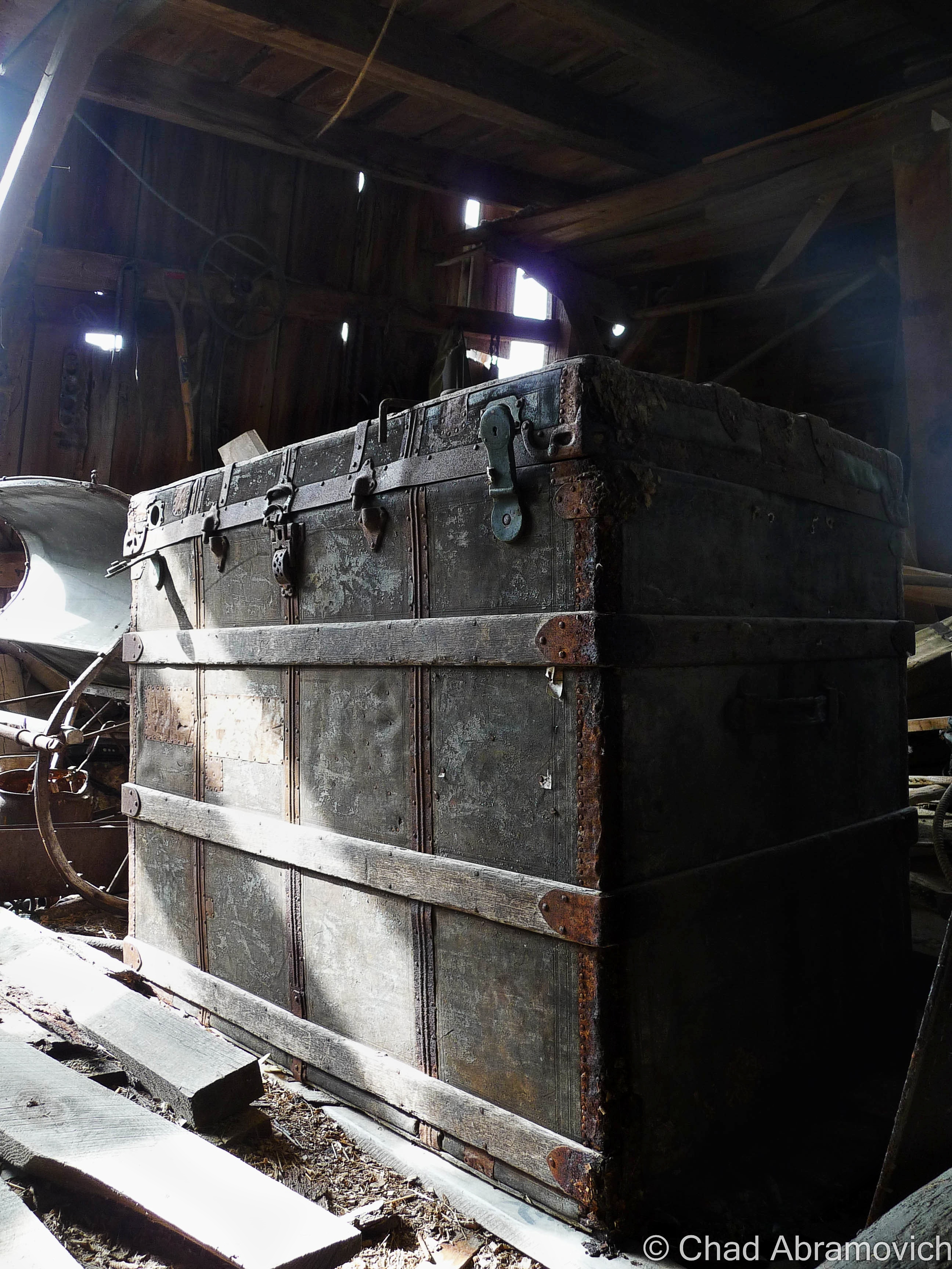
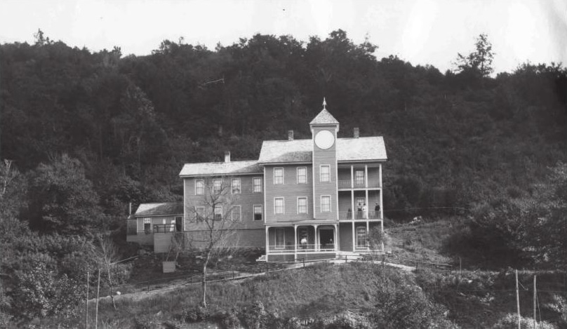
The chiseled granite block along the disintegrating roof line reads “Milton Co-operative Dairy Corporation”. Most folks in town call it “the creamery” unless you’re one of the few who are unaware of what the corroding property used to be. I’ve heard people speculate plenty of things, including a train station, a munitions factory or an armory.
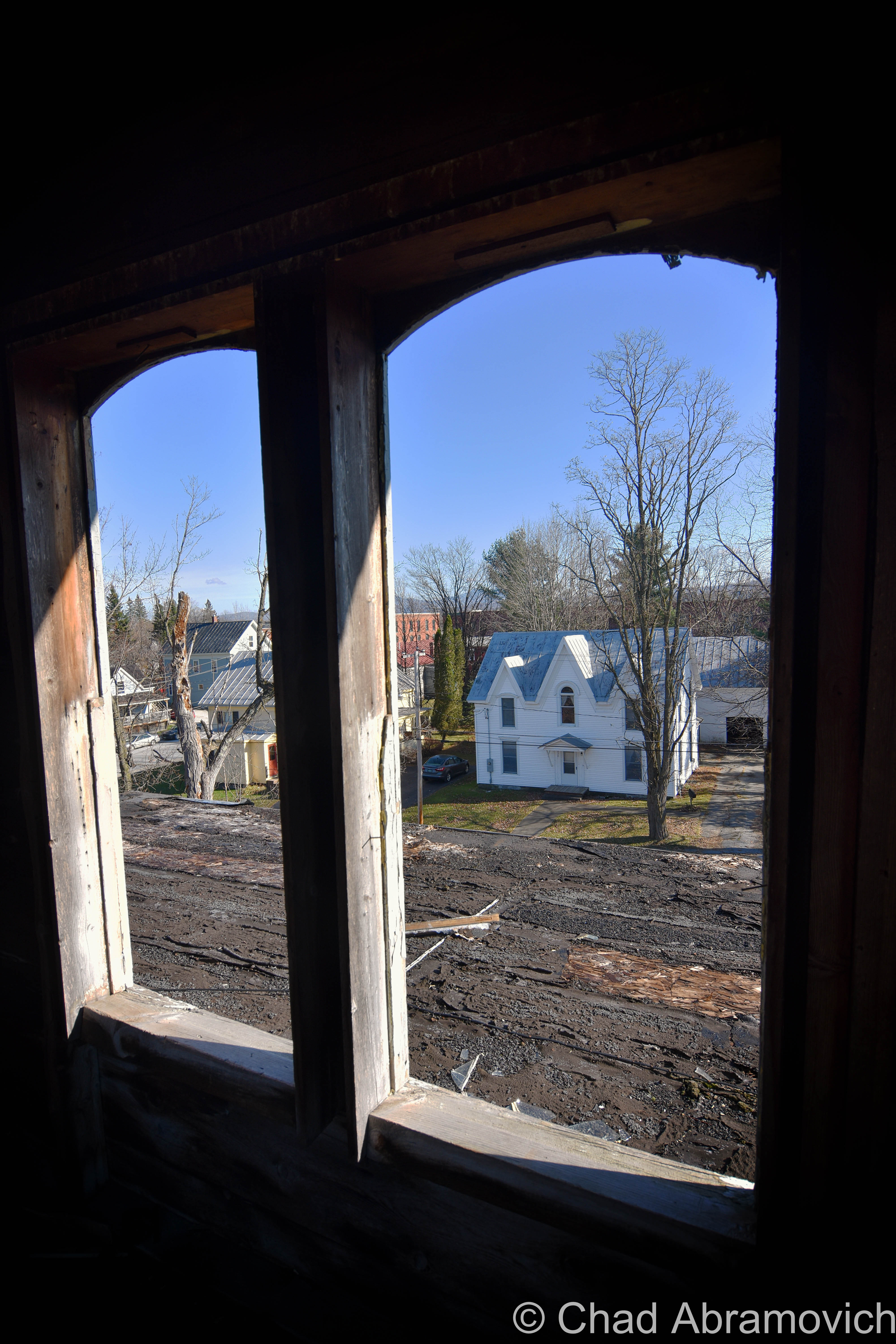
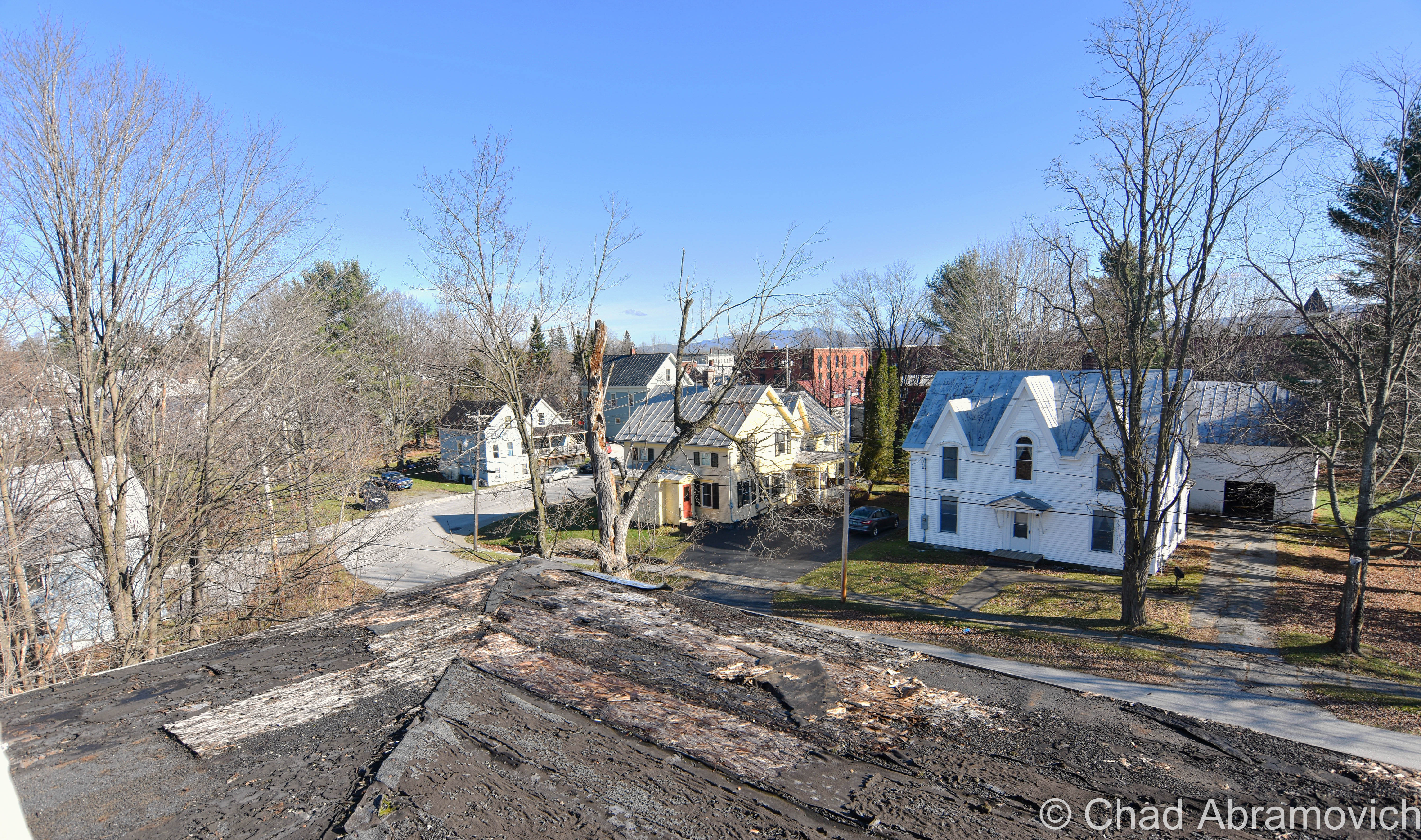
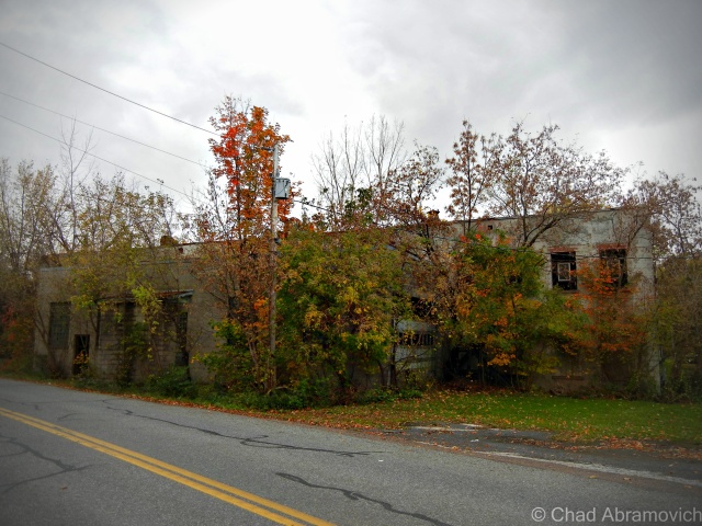
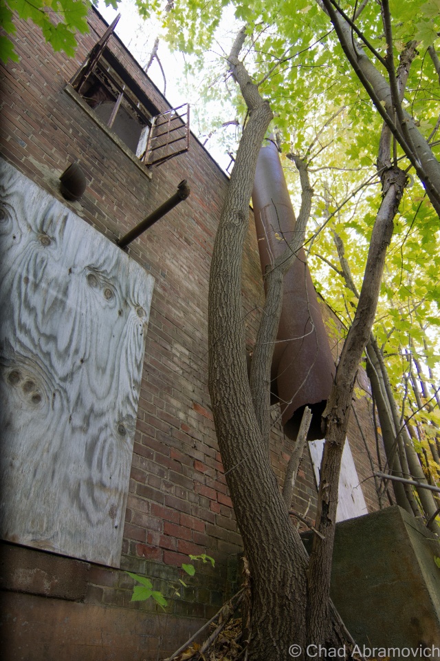
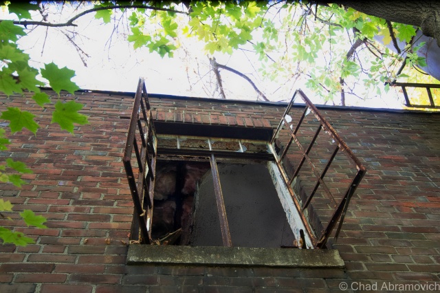
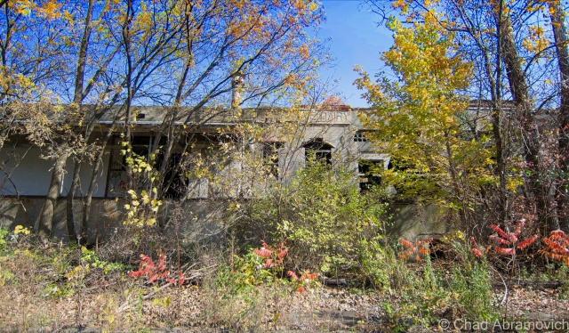
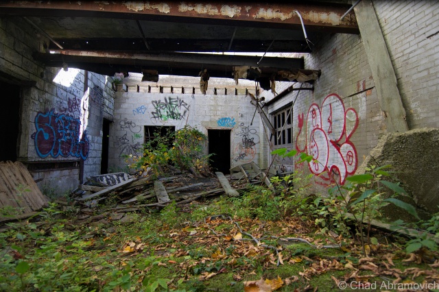
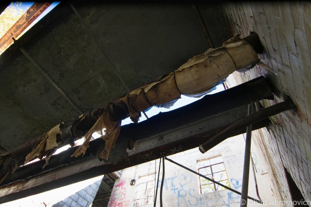
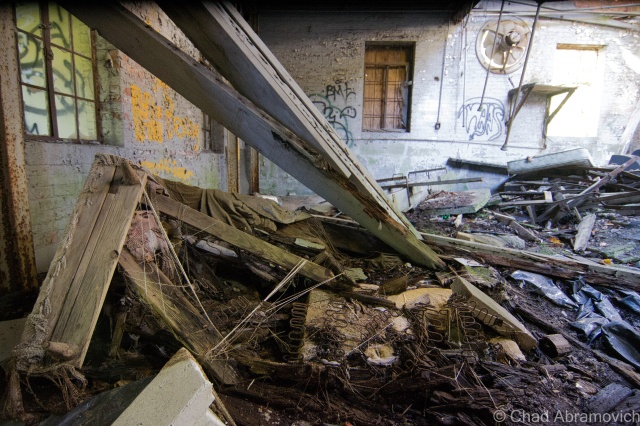
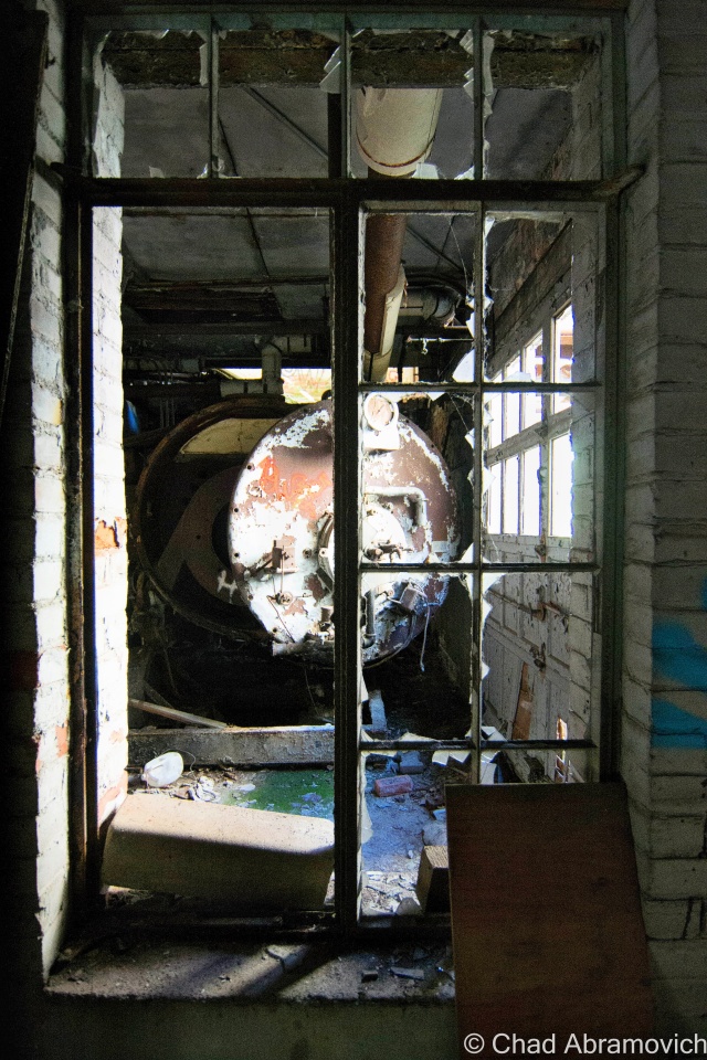
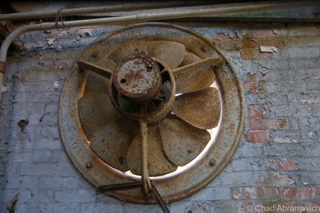
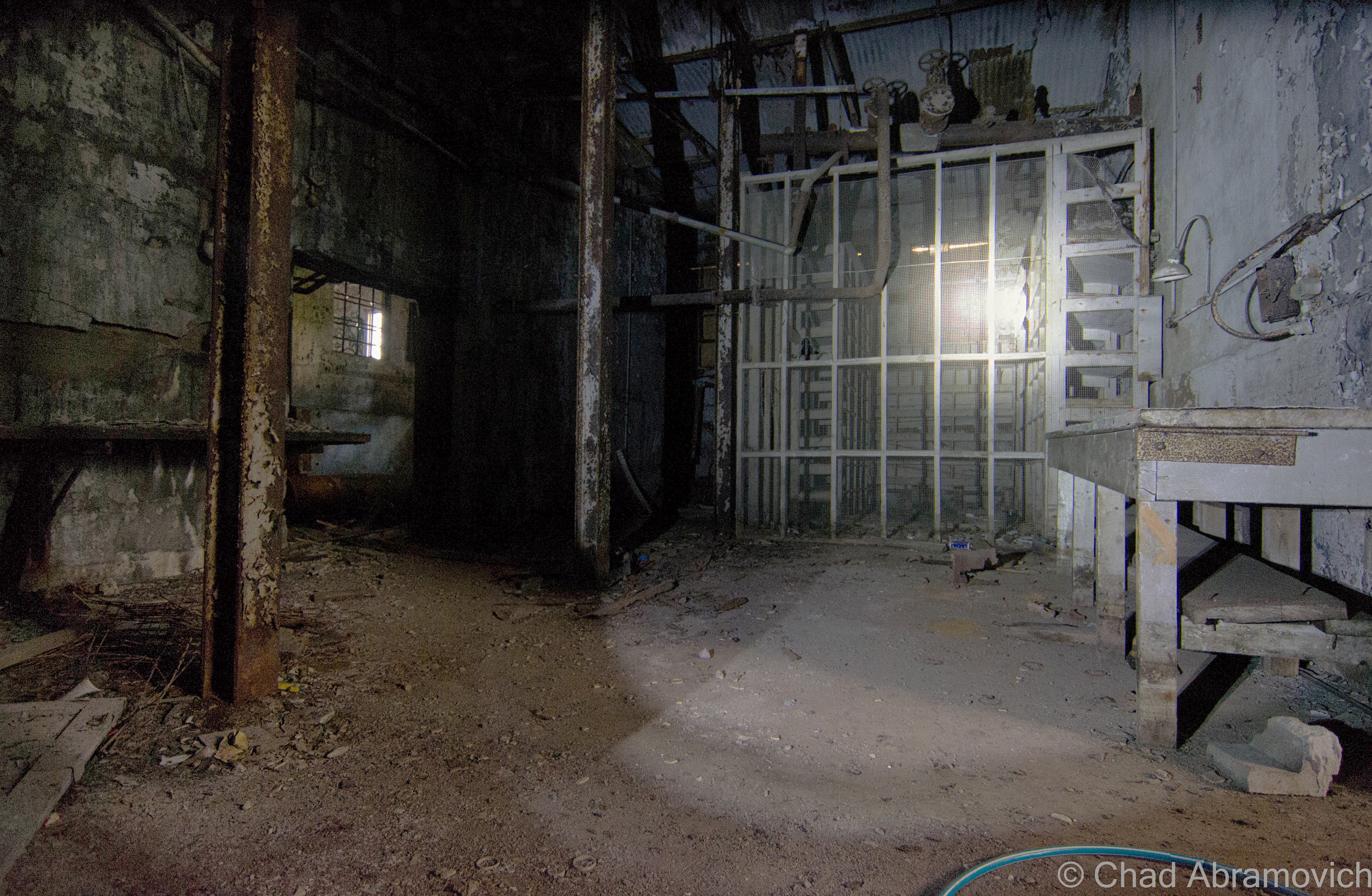
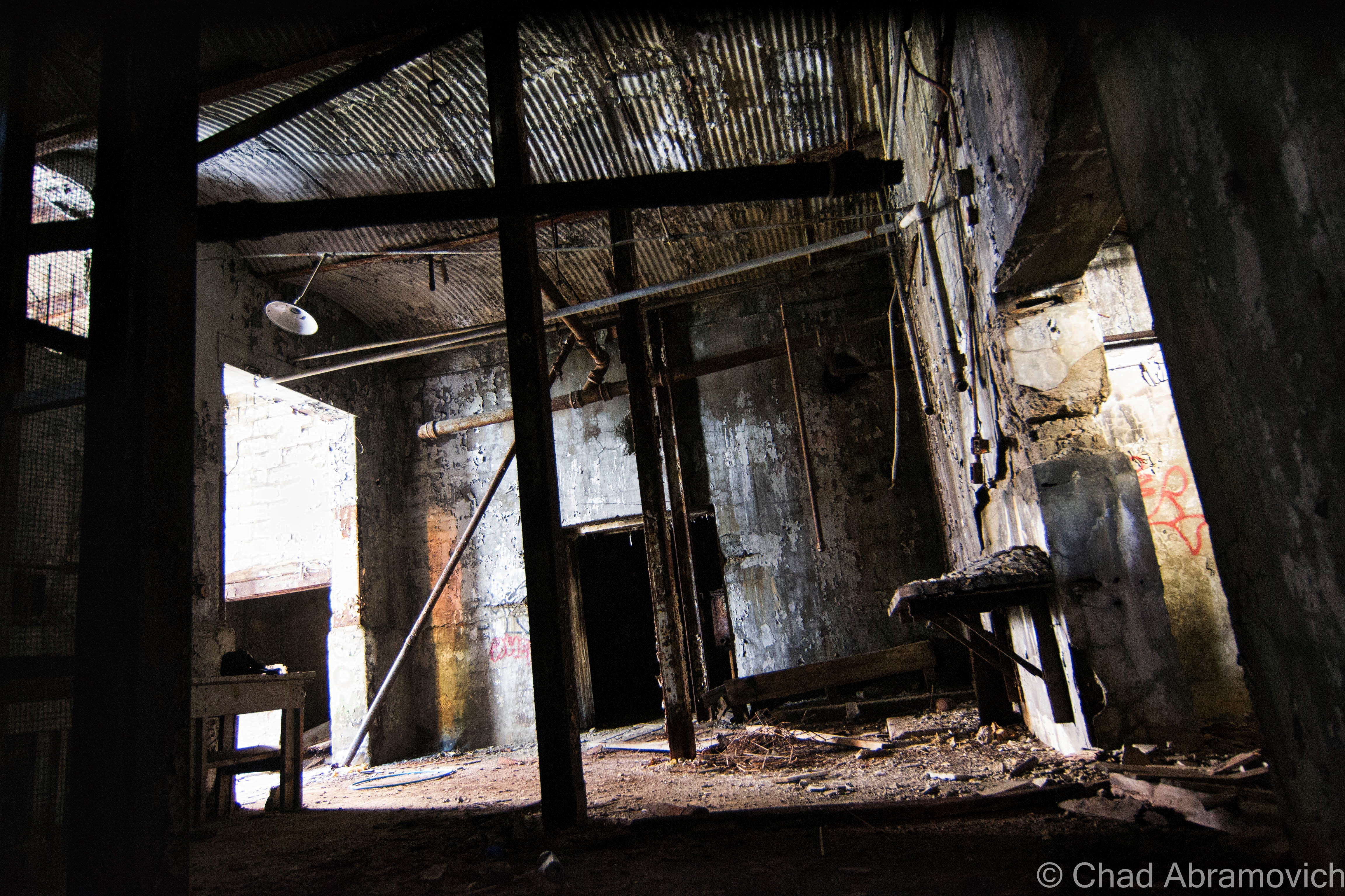
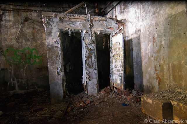
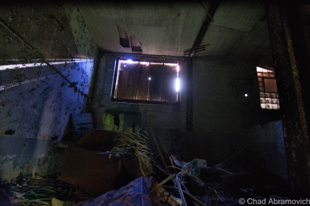
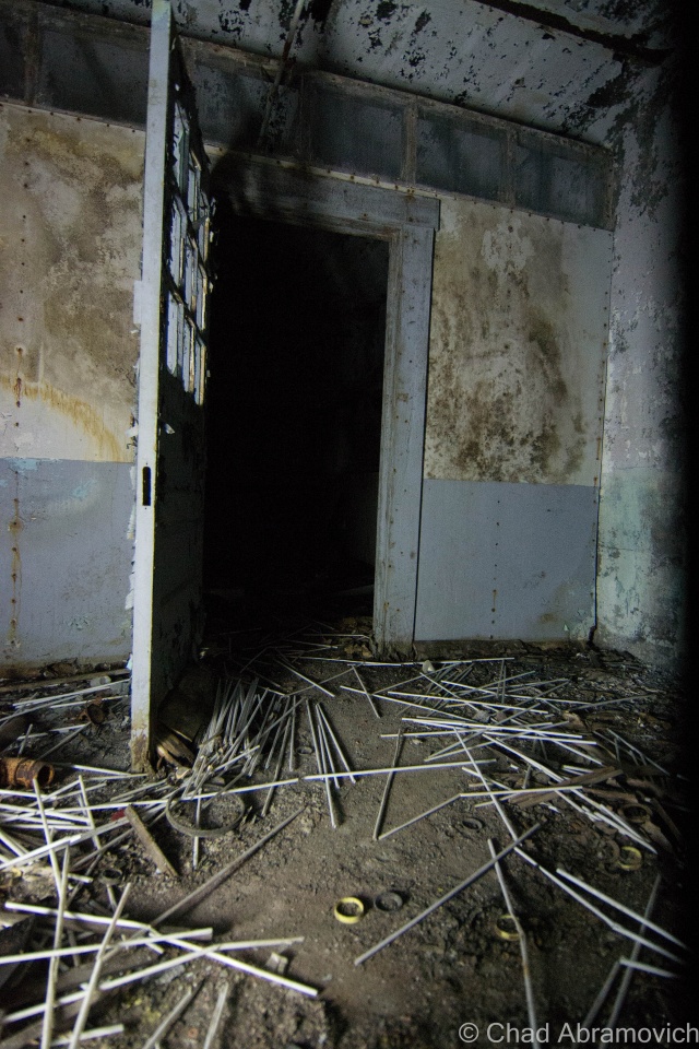
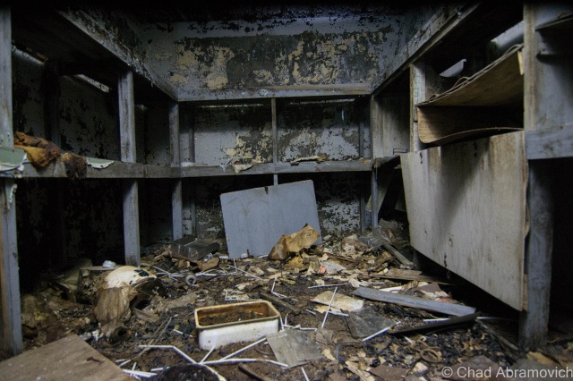
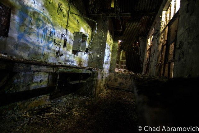
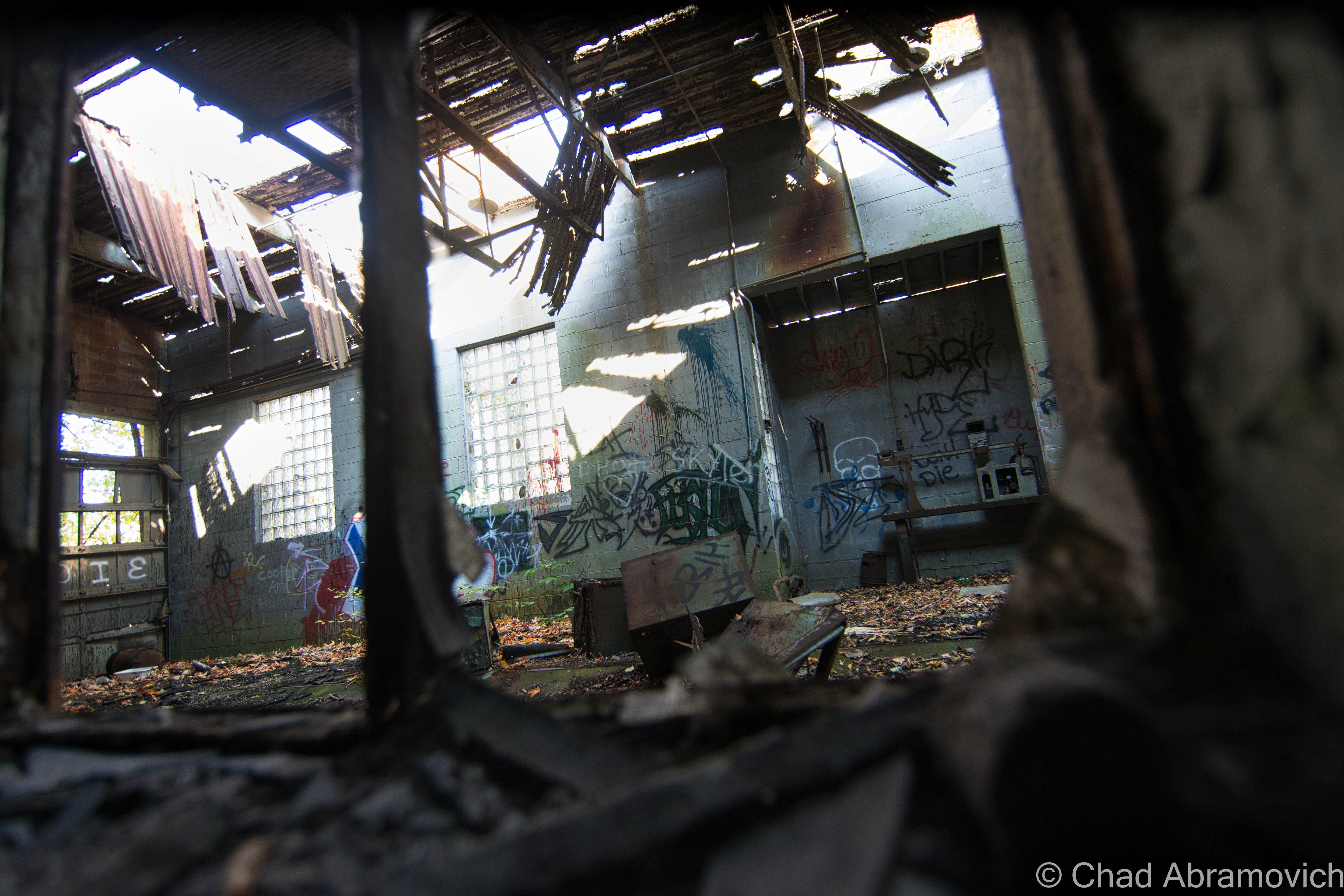
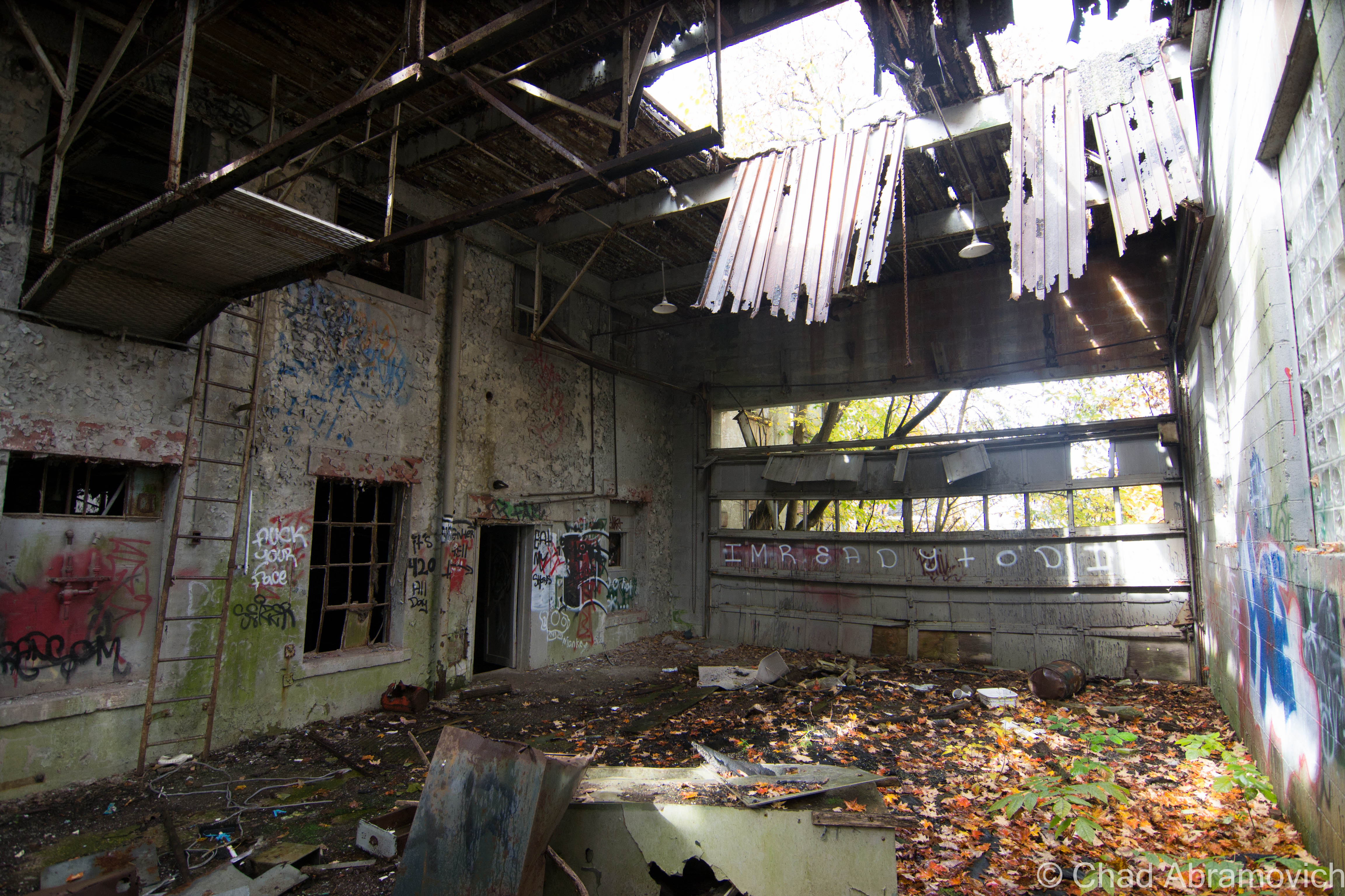
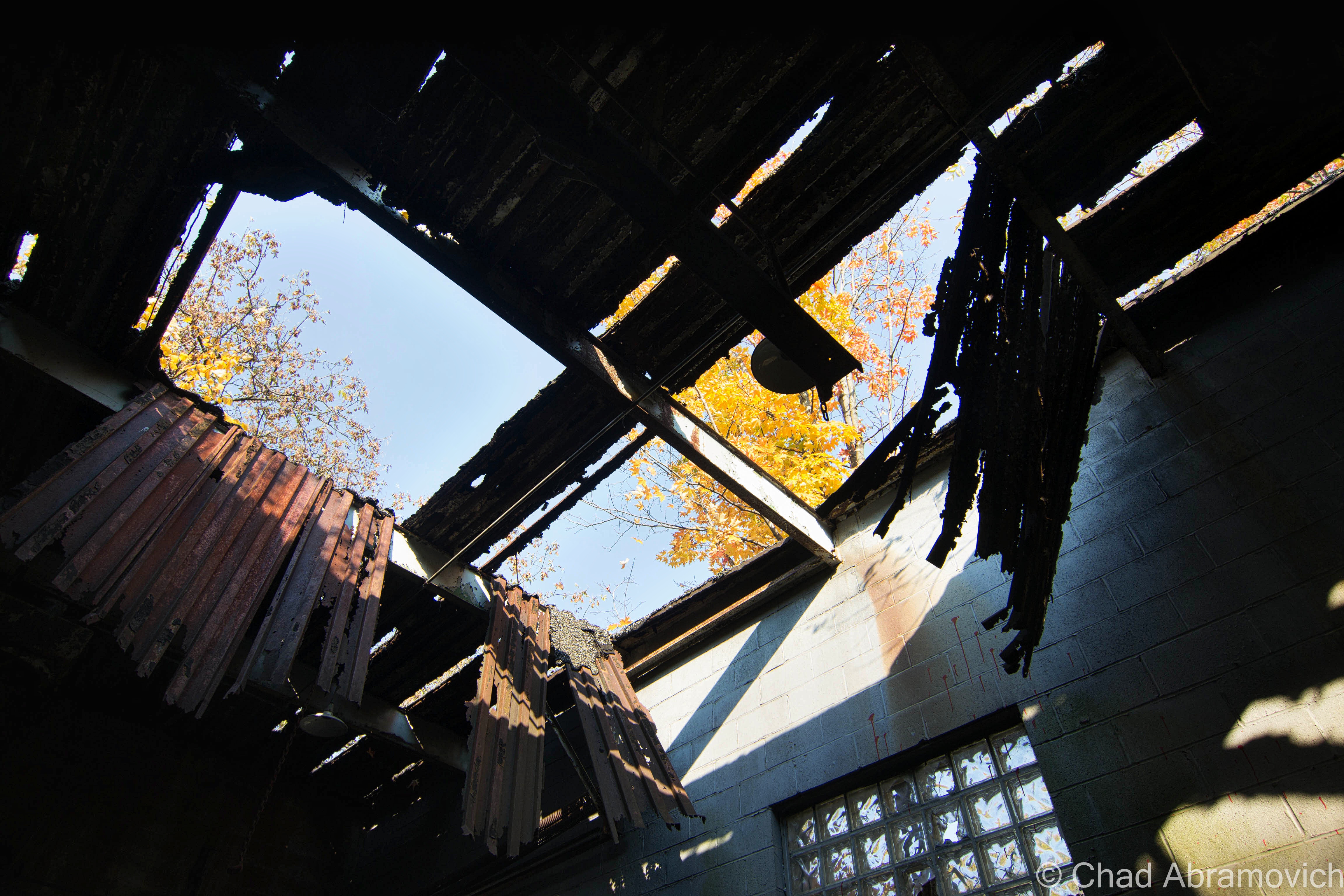
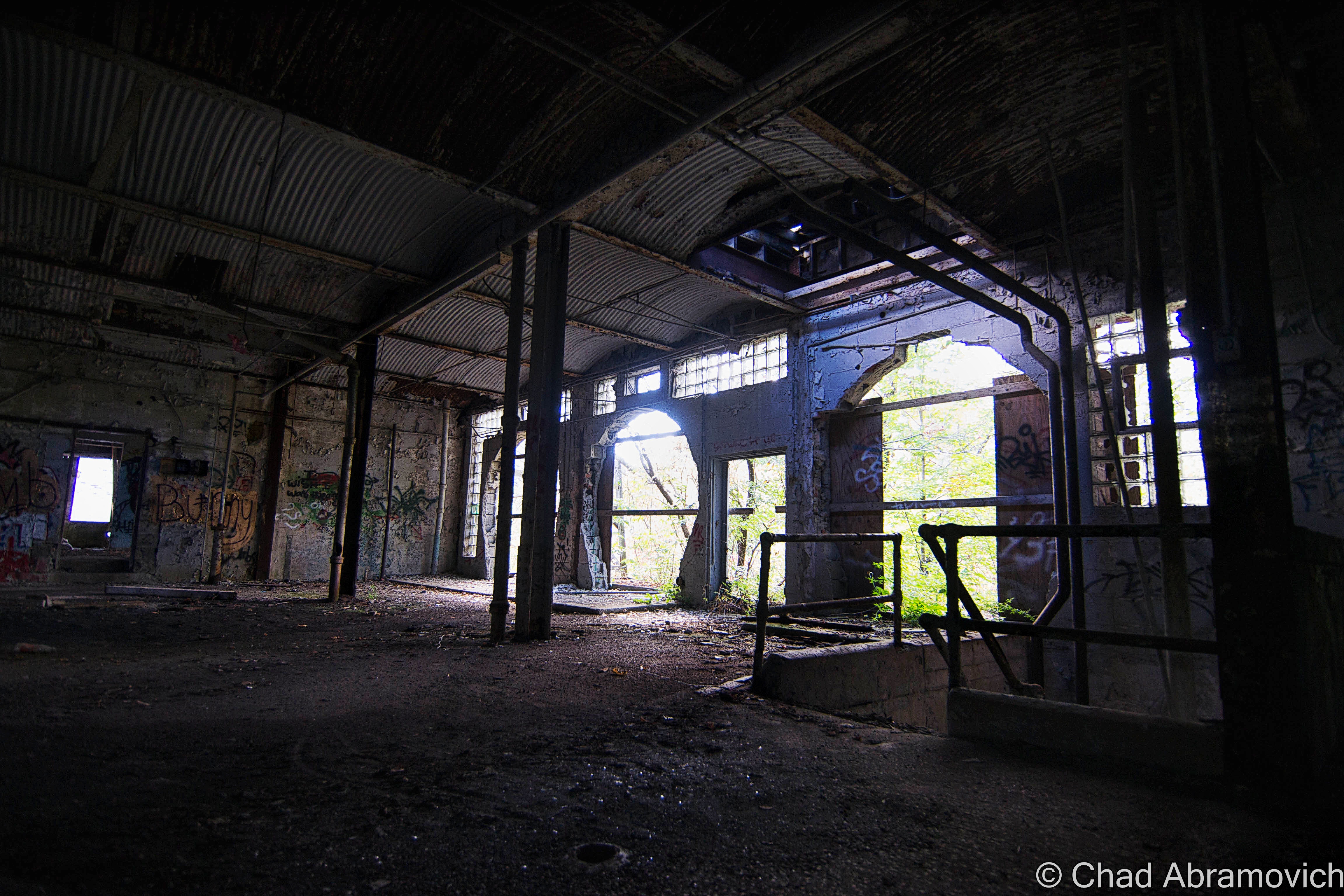
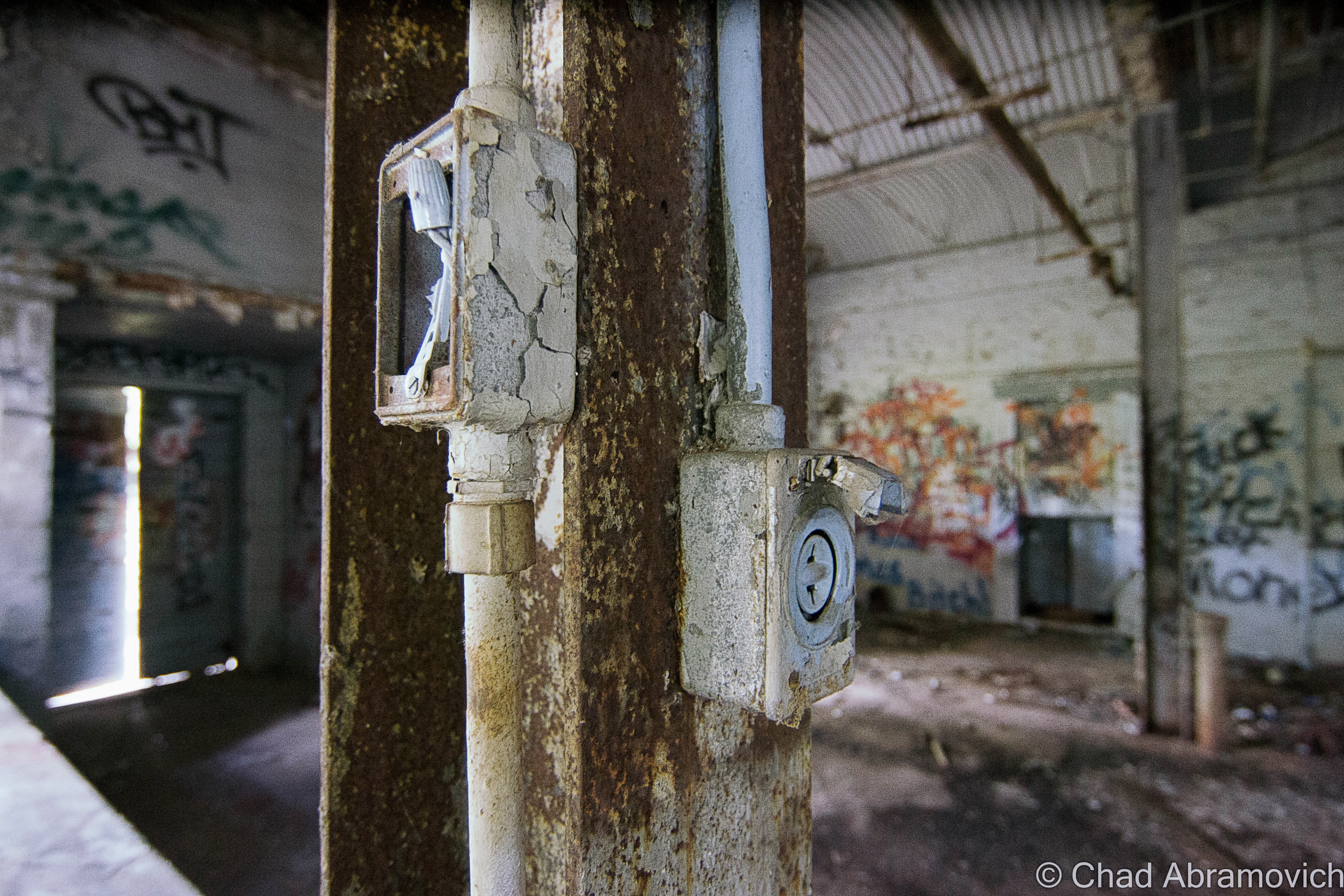
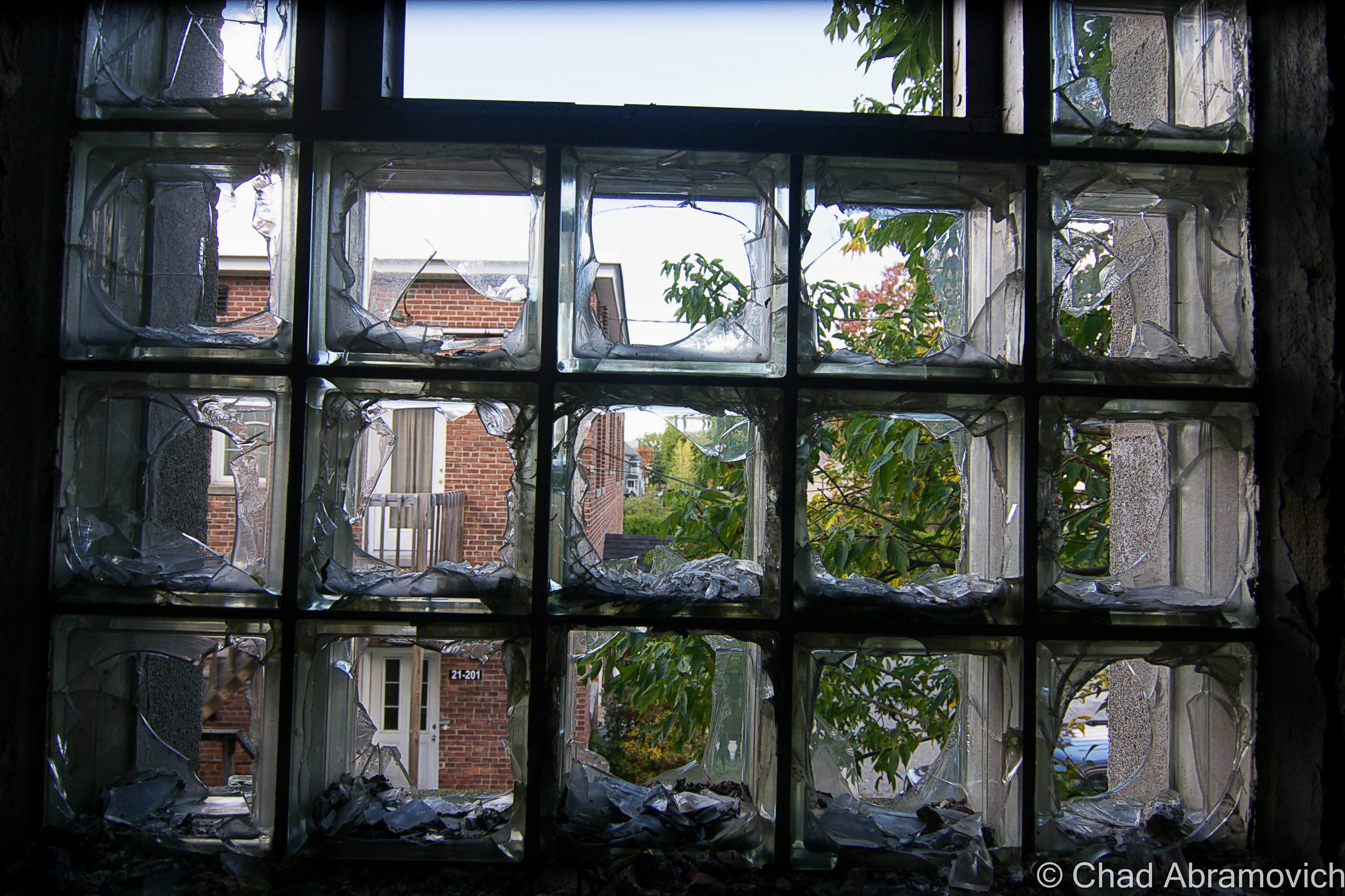
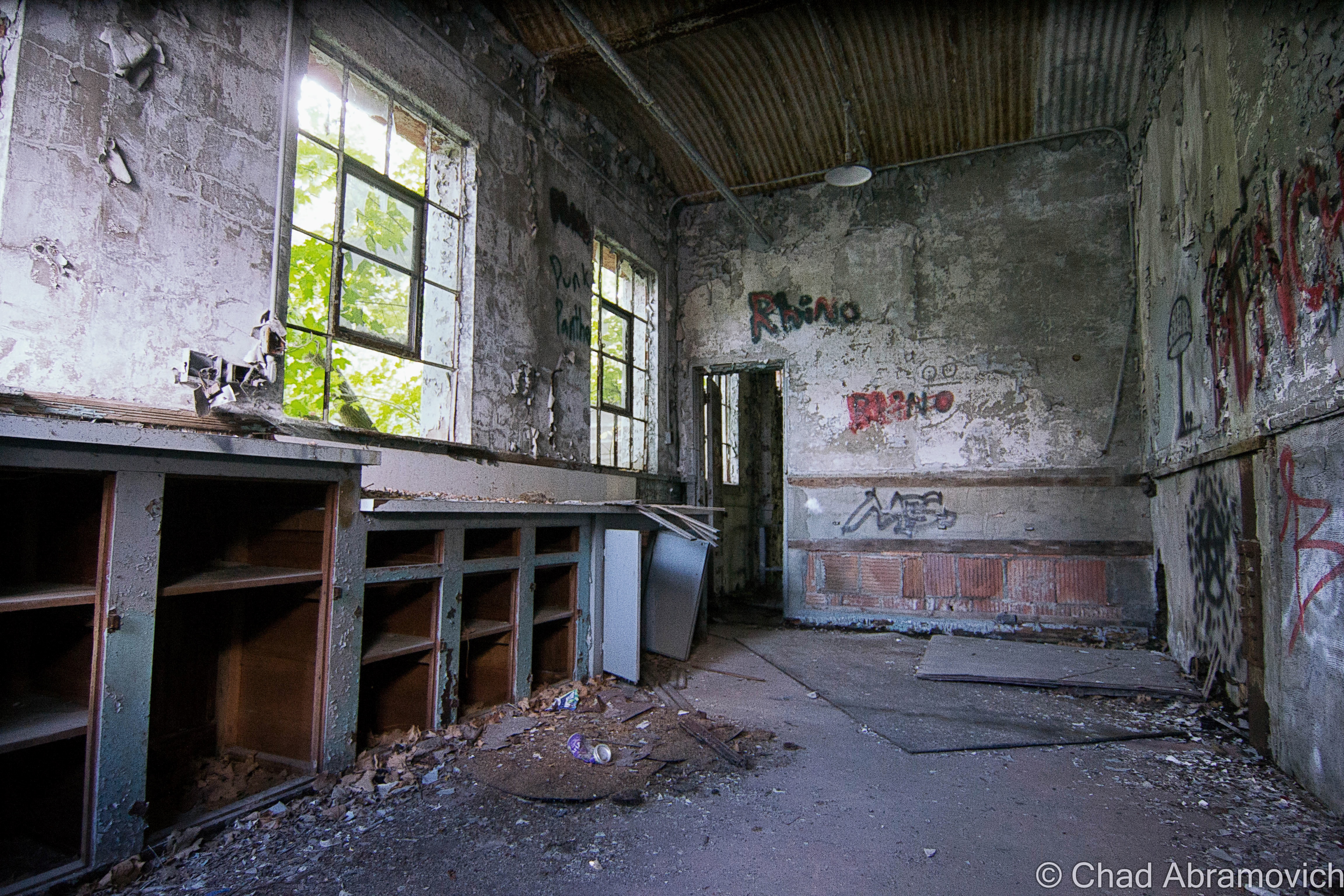
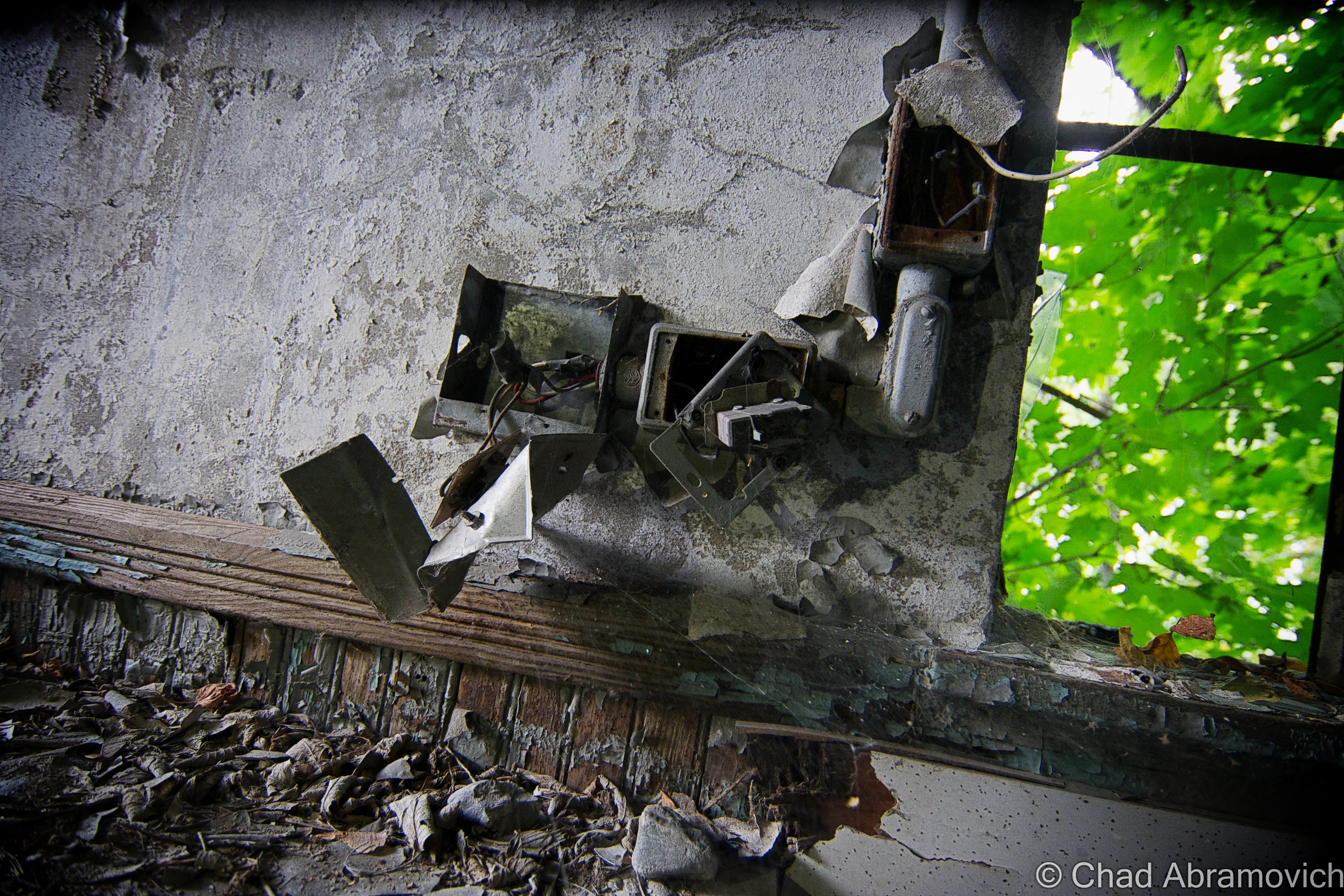
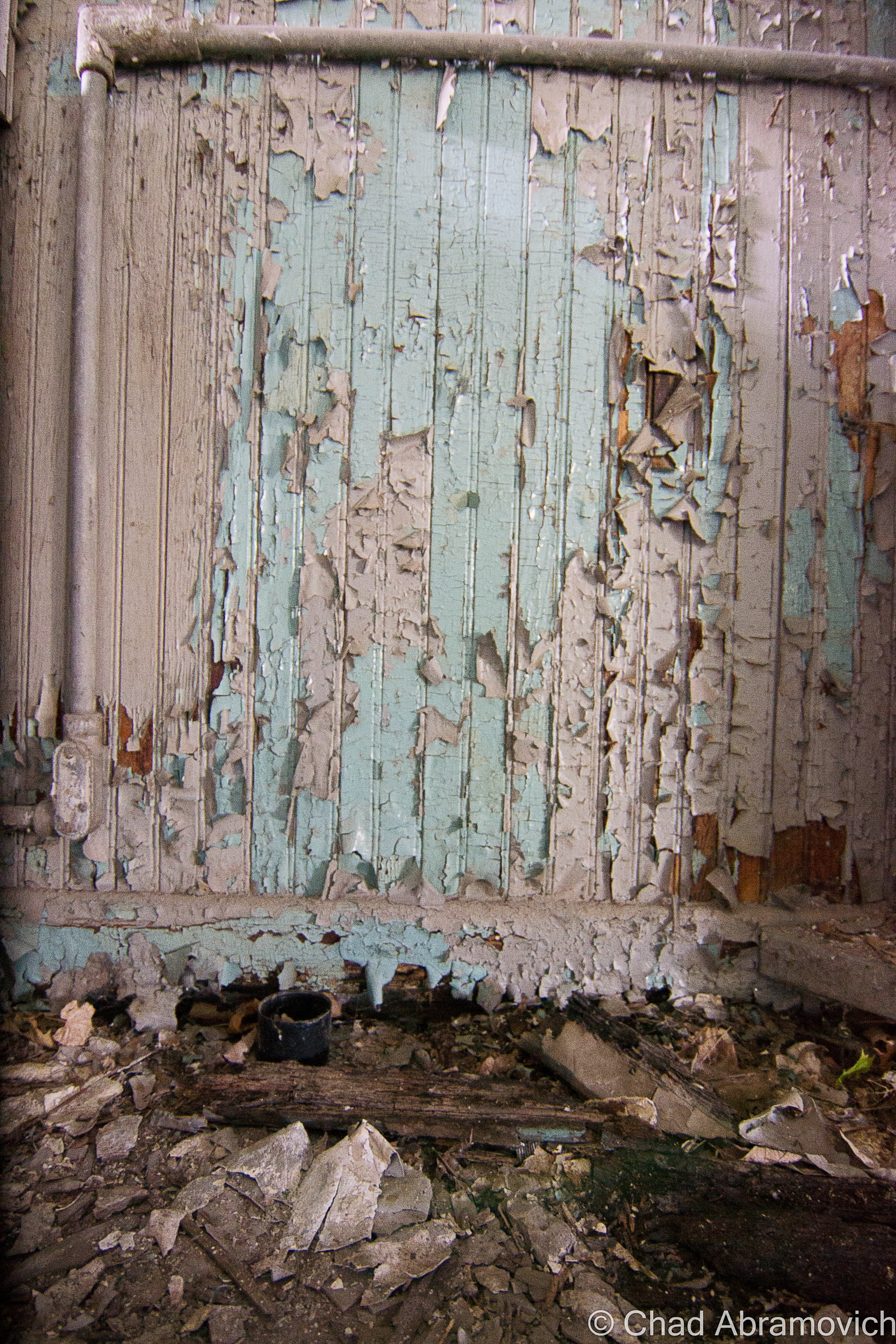
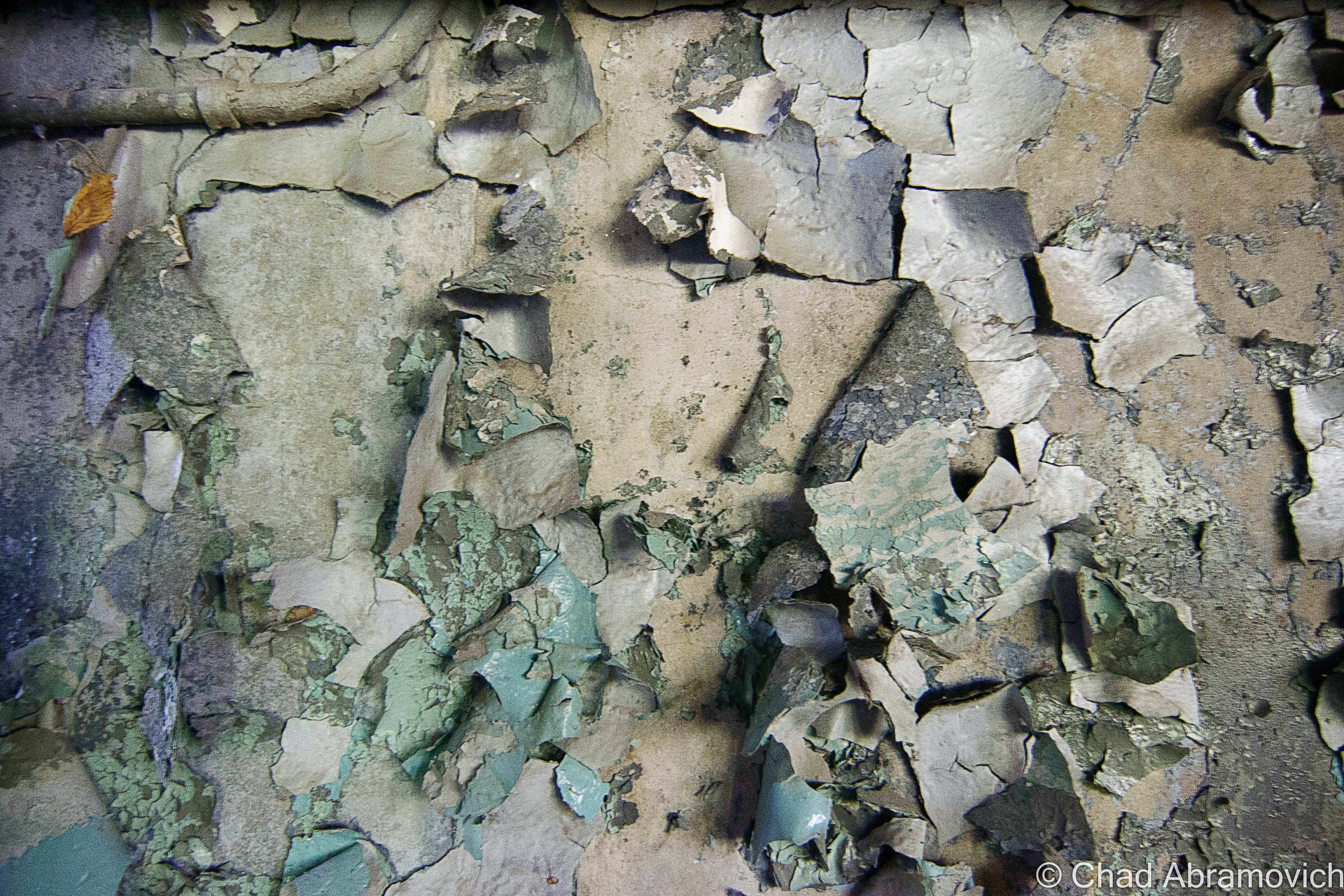
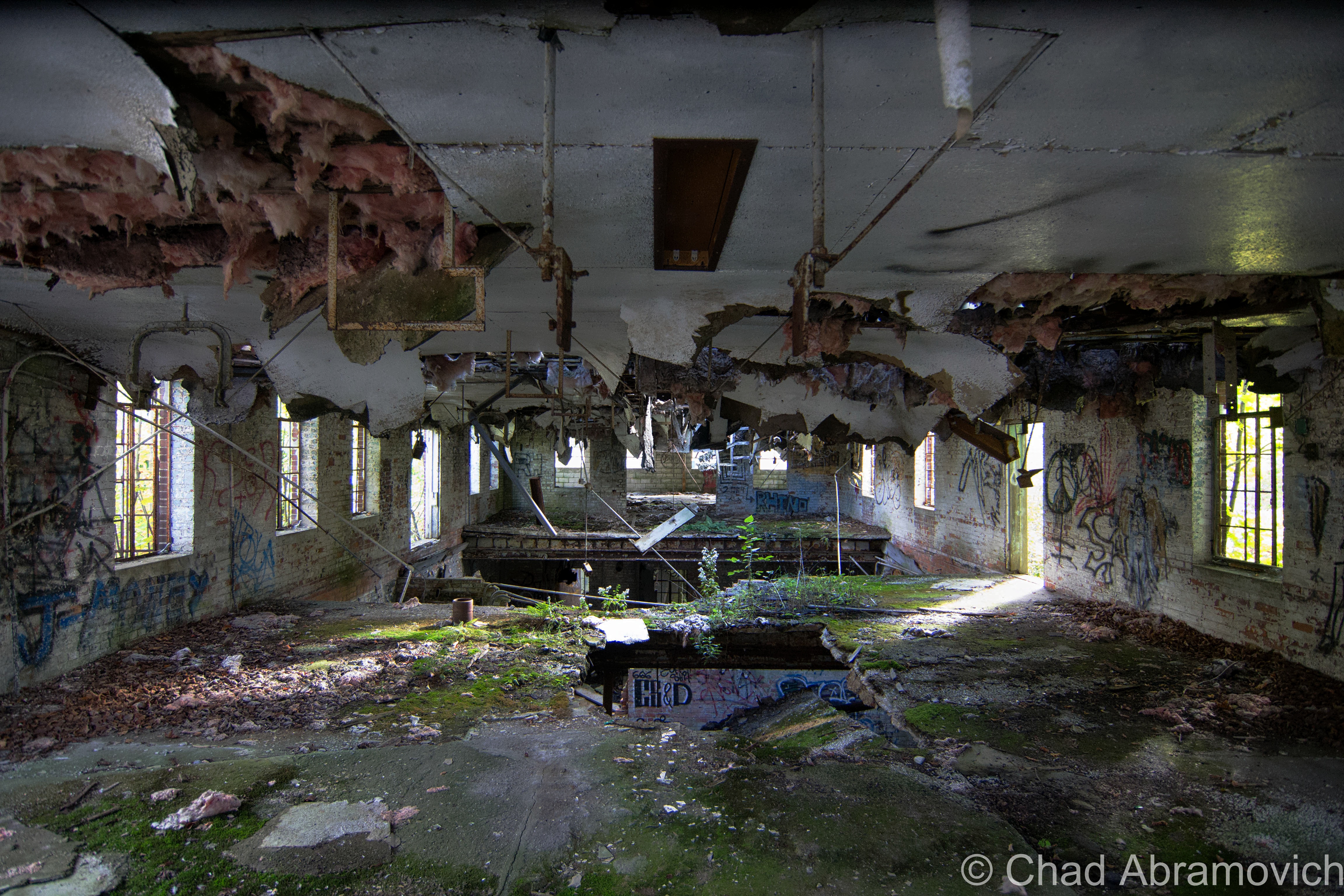
The rambling building made of patchwork additions is off a side street in town, and the years run down its crumbling facade. Its forsakenness is obvious. Young trees have grown around and inside the building, disfiguring the structure. If you catch a glimpse through any of the broken windows or an open doorway, you witness a dark world made of peeling lead paint, reservoired floors and piles of fallen bricks, all cast in various shadows in the places the shine of the sun penetrates its way inside. In a state as non-industrial as Vermont, this location is truly a magnificent way to get your senses drunk. And it was this dangerous, virulent location that changed my life around age 12.
Around 1835, Milton’s agriculture scene shifted fads, from sheep based farming, to more profitable dairy. The town saw an increase in farming in the intervening years which began to put a strain on Milton’s original creamery, The Whiting Creamery, located off Main Street near where Oliver Seed is today. By 1919, many Milton farmers got together to form a dairy co-op. They built their headquarters on Railroad Street, a side street off Main Street, which today is one of the village’s primary thoroughfares. At the time, Main Street was actually the Main Street in town, and because titular Railroad Street paralleled the tracks, it was practical real estate.
The Whiting Creamery in Milton, circa 1905 | UVM Landscape Change Program
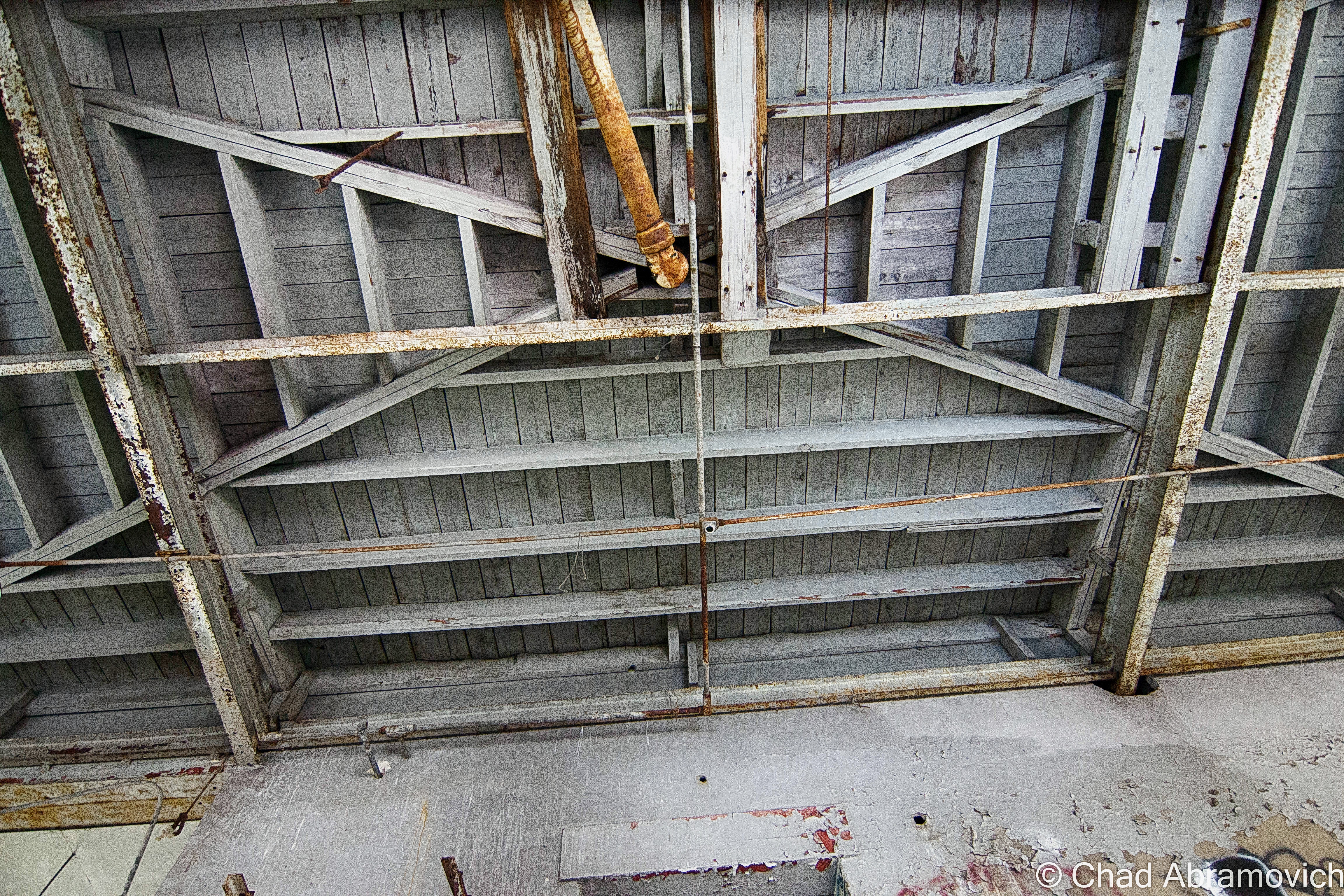
The building was done unconventionally, with a steel I-beam construction and stucco facade installed over bricks, which according to the late owner of the ruins, was a design unique for anywhere in Vermont at the time. Miltoner John McGrath would become the first president of the co-op. Over time, the creamery’s business ignited, as more farmers from Milton, and rural parts of northern Chittenden County and Southern Franklin County were sending their milk to be processed there – and shipped out. A lot of the revenue made by the creamery actually came from exotic foreign locations they shipped the milk to, like Boston and New York, via the aforementioned railroad that runs inches from behind the building.
In 1935, the creamery would expand for the first time at the height of the great depression in a conspicuous brick addition that today is the worst part of the complex. While most money-making things in the United States were prostrate in defeat, the railroads and the dairy industry seemed to be staying steady. Over the years, several more additions came along, and when cars became common, garages and a scale room were built, until the current uniquely shaped structure that exists today was finished. Those who can remember the creamery when it was functioning said that it was one of the largest creameries in western Vermont. During its most prosperous years, it would do over $5 million worth of business in a year, and employed 50 people. According to a homeless fella I accidentally met that briefly lived in a tent near the tracks behind the building, he recalled his father working there. “I remember how bad the milk lab used to smell” he said in fervent disgust at the memory. “Used to stink so bad, you could smell it down Railroad Street!”
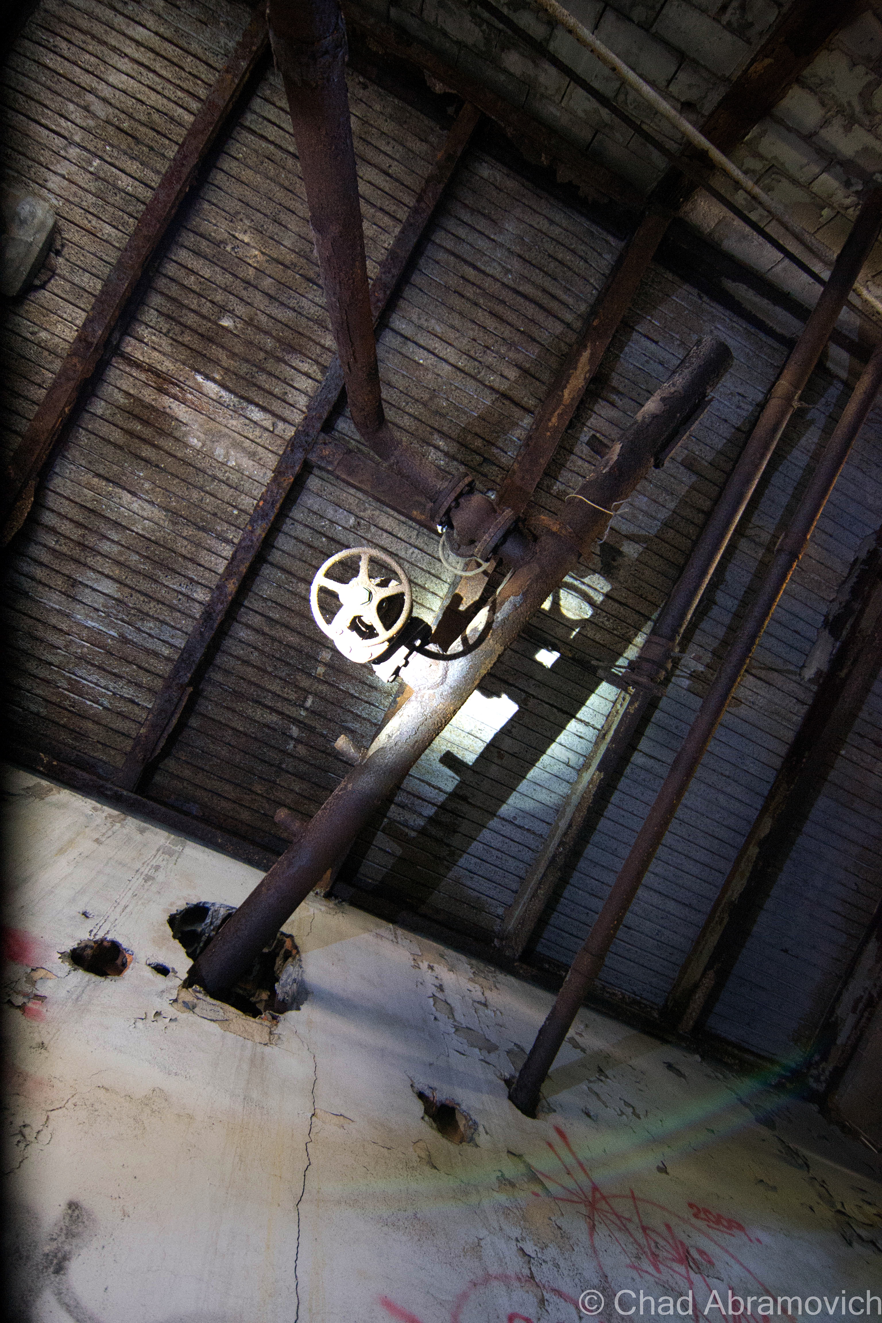
During the cold war, the basement area was also designated as a fallout shelter, an appointed place to seek safety in case of nuclear destruction. Though, a practical observation at the grimy basement now days tells the visitor that the apocalyptic urgency so many people in the 50s were subscribing to would have easily vaporized anyone who decided to wait it out down there. Until recently, a badly warped caution-yellow sign that read “Fallout Shelter” in black lettering could be seen crookedly hanging from a concrete wall. Some local kid most likely stole it for a memento and hung it in their bedroom.
However, as time flowed, business practices changed, and the creamery soon found itself cutting its teeth on the stone of the changing times. McGrath would resign as president in 1953, and Ray Rowley, from another long-standing dairy family in town, would take control. But the Co-Op was already shaking hands with its mortality.
By the 1960s, the creamery’s fate seemed poised to continue percolating in some downward lament. A decline in dairy farming led to a decline in dairy – the stuff that created the business in the first place. It was around this time when bigger monopolies began to appear on the scene, a trend which has only intensified since then. Larger and more resourced operations like HP Hood in Burlington were hard to compete with, and the growing struggle of irrelevancy disarmed many smaller businesses. Sort of ironic is that HP Hood is also long gone, the old plant on the corner of King and South Winooski has been modernly renovated into condos and mixed commercial space, as is the cool trend with defunct industrial properties.
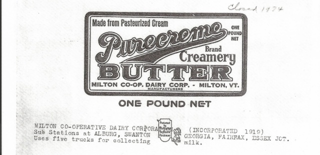
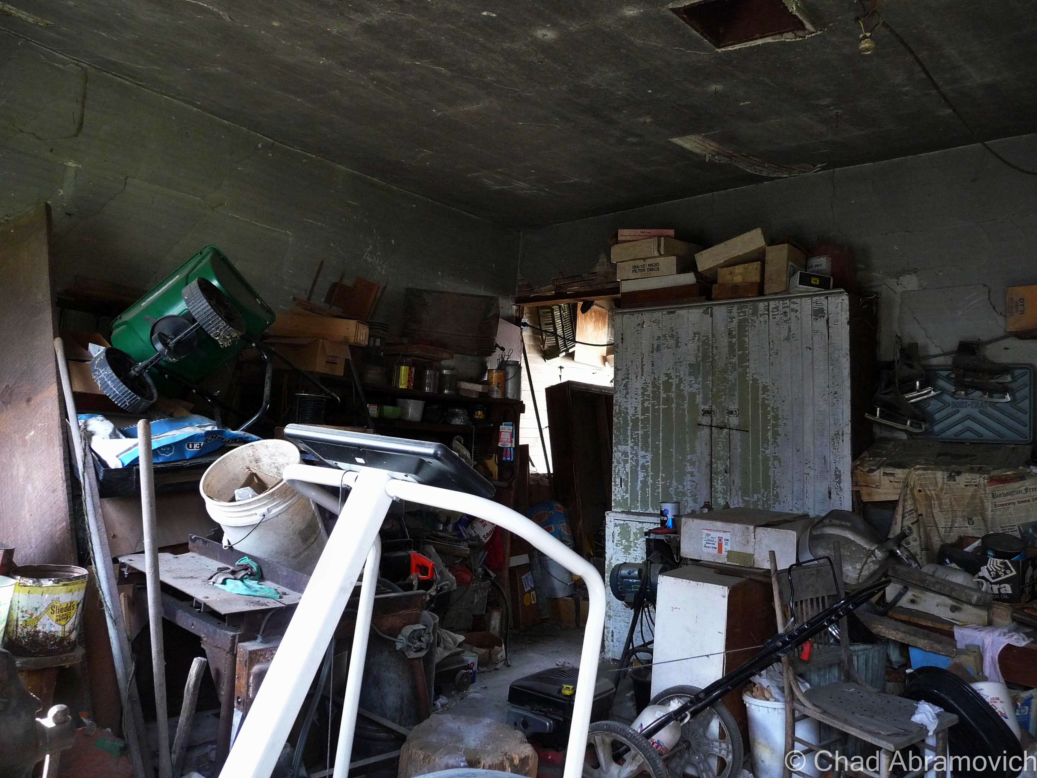
The last 2 decades of the creamery’s life were slow death. Fluctuating milk prices and the cost of refining didn’t show up in the farmers’ paychecks, which irritated some of them. I can’t say I blame them, farming is hard work. A crude barn shaped structure was built next door, and was ran as “The Milton General Store” for a while – an appendage of the creamery. Those who still remember it, say that it was the kind of place where you could literally buy anything – from nails to maple syrup, and had a distinct “dusty workshop smell” inside. But that attempt at savior failed as well, and by 1974, the creamery became a ghost.
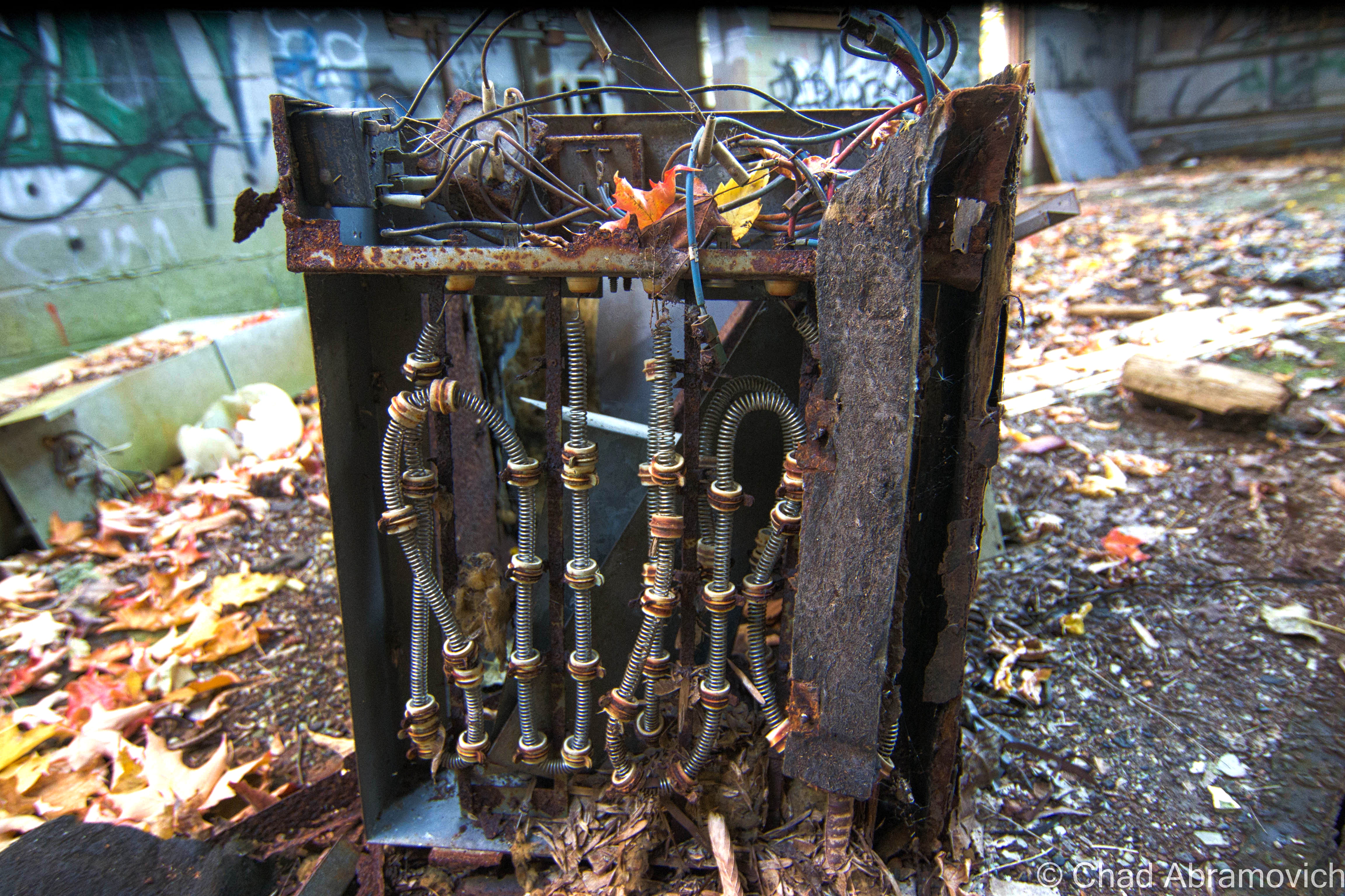
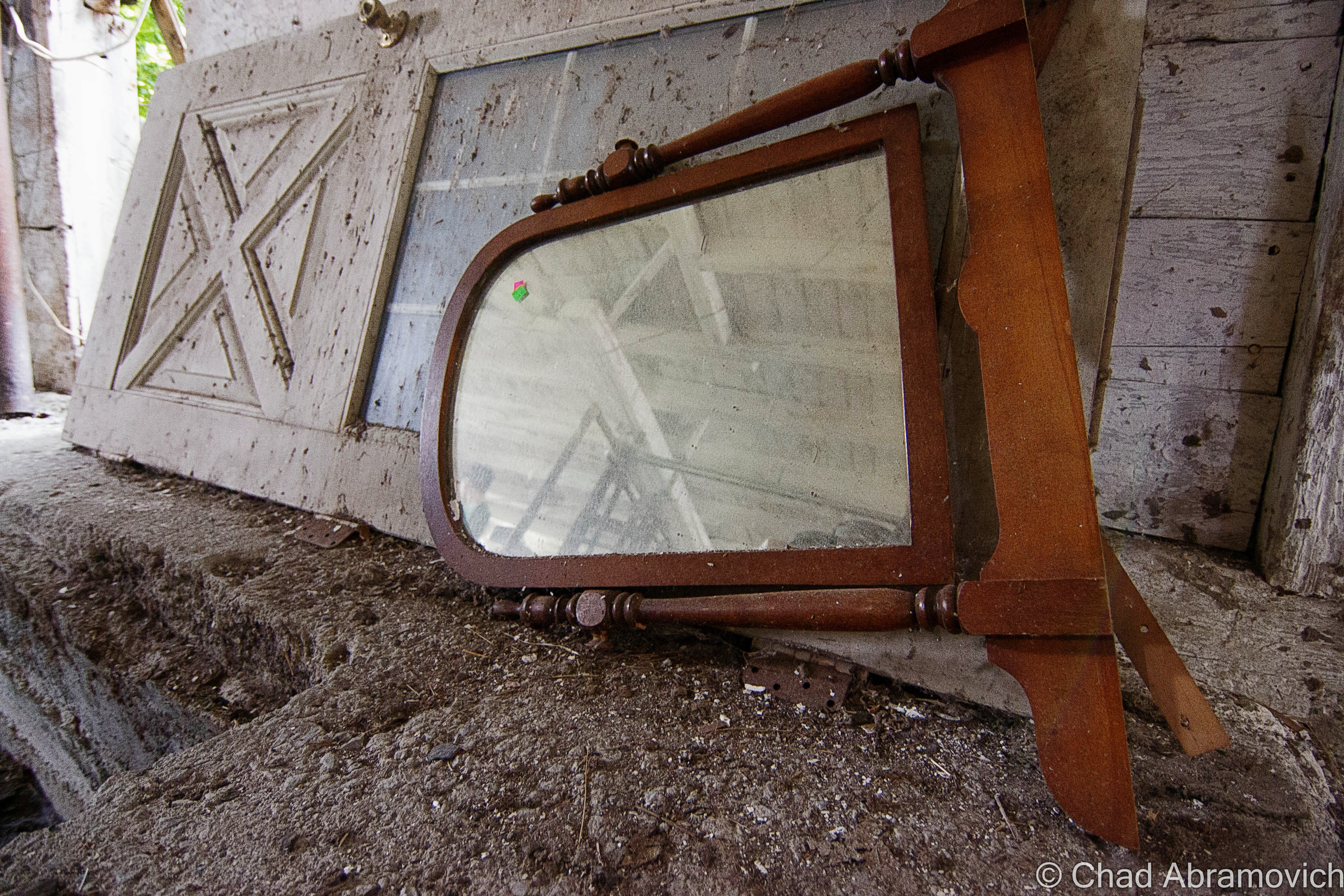
The building was put up for sale, and shortly afterward, was purchased by a local gentleman who used it as storage space for his many antiques and the miscellany he either collected or hoarded. That line was a blurry one. But it was clear that this guy was of his own sort. Sadly, mental instability and his own demons got the best of him, and one of the consequences was that he neglected the place. His paraphernalia became either stolen by characters who have no moral issues with thievery, or what was left behind rotted away when the building began to progressively weaken, and rats began to nest inside.
I had struck up a few conversations with the owner before in my teenage years. I used to work at a local gas station then, which was a crash course on social skills for this young Aspergian and his seemingly incompetent switchboards, but the struggles also brought some worthy experiences. Like getting to know him a little better whenever he’d stop in. I knew who he was, but our getting acquainted was a bit coincidental. He’d see me working and just start chatting with me if he was in my proximity, but he seemed a bit lonely and he’d chat with anyone willing to lend an ear. Over time, he began to recognize me as a regular working stiff and always made a point to have some sort of small talk with me, on his own terms anyways. I found out that he was a pundit on Milton history, or really the old in general. I’d risk getting reprimanded by my shift manager and have conversations with him about local history and things I found to be fascinating – information that I didn’t have access to anywhere else. But due to his schizophrenic-esque behaviors, I had to try to be mindful of how I engaged with him.
I found out about his death in the summer of 2016, which saddened me a little. I’m sure he had so many stories and secrets that he took to his grave with him that we’ll just never know. I always contemplated taking the time to contact him and ask for an interview, but anxiety got the best of me. The creamery was hastily and quietly sold, and condos were spoken of. I suppose the momentum didn’t surprise me. Milton-ites have wanted to get rid of the scorned property for decades. Which is also why I’m re-submitting this blog post. The creamery wasn’t just the first place I had ever explored, it was a huge part of my adolescence. I’ve never dealt with change that well, so when I got word of a change coming up in the form of the creamery’s possible demolition, I decided I needed a fond farewell.
I’m going to borrow a quote from the late Leonard Cohen, when he said; “I’m interested in things that contribute to my survival”. The creamery (and Mr. Cohen) has contributed greatly and artfully to my survival and I’m forever grateful. It’s weird to think about as I’m reminiscing and drinking a beer right now – how different would my life have been if I didn’t grow up in walking distance of this place? Did any of you folks have an abandoned building in your hometown, or a place that was a local rite of passage to visit as a kid? Do you have any stories of your first adventure?
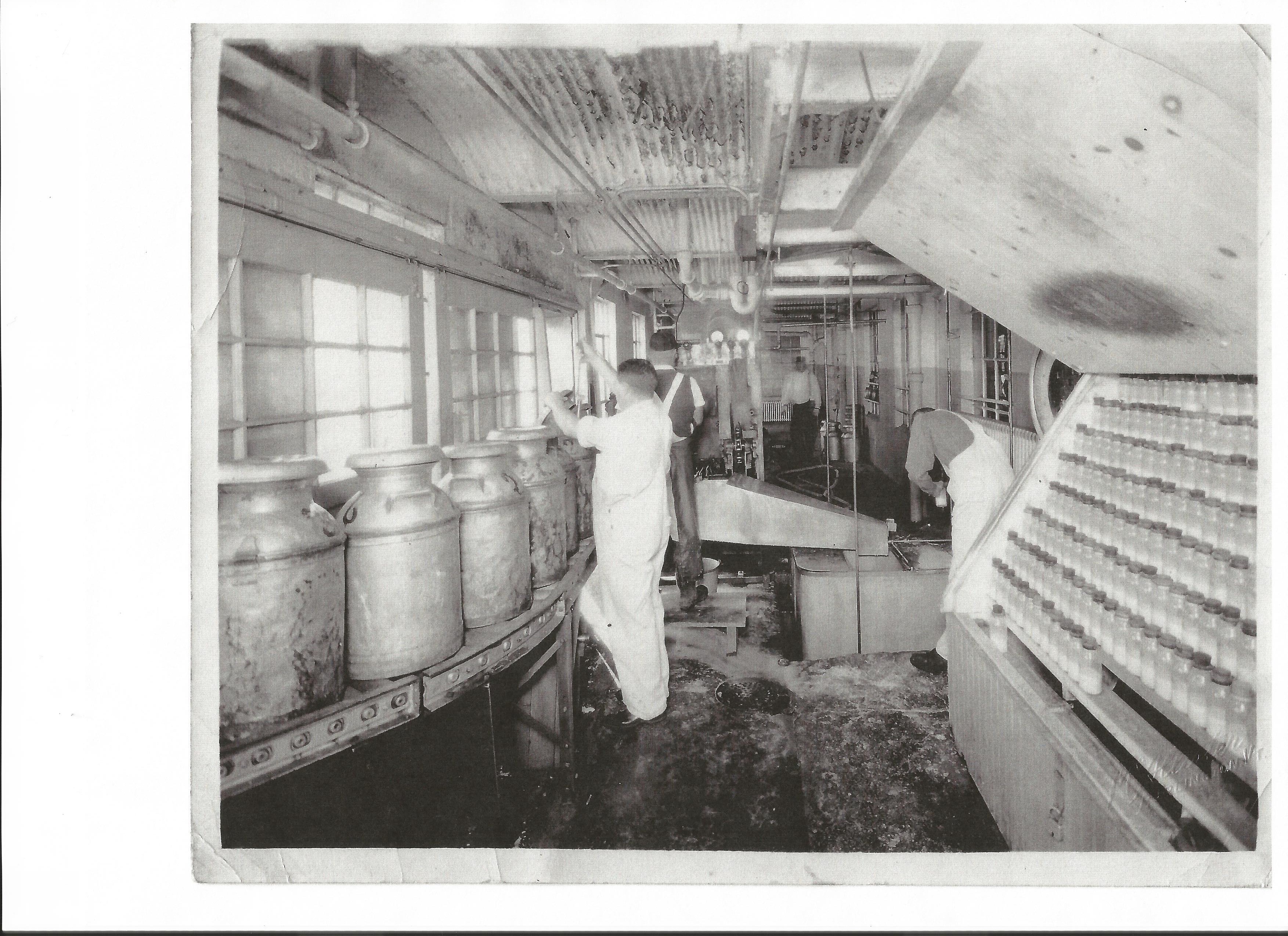
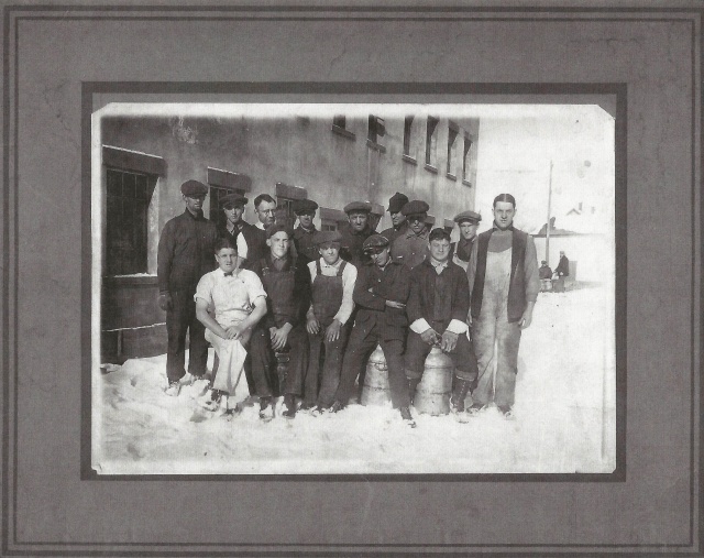
Over the years, I struck up a friendship with the great folks at the Milton Historical Society, and one of my first research topics was the creamery. Sadly, not a great deal of information about it really carried over the turn of the most recent century. For the most part, I compiled all the usable information I could in the paragraphs above this one. But that’s not all. Museum curator Lorinda Henry was kind enough to scan for me some historical photographs of the business in operation, and portraits of its employees.
Folklore
I think one of the most memorable things about the creamery, and my childhood affixion to it, were the ghastly urban legends and ghost stories that the older kids told me, a ritual I continued when I aged. Stories that created an inseparable impression about the place.
Murder
I still remember the first story I was told, which I think is also the most popular one in some variation or another. The story of the murdered janitor. Essentially, two custodians were working graveyard shift, and a known rivalry was between them. That particular night, one of them would let all of his animosity towards the other cut loose like a pressure valve. Somehow, one of them fell off of a two story catwalk which is suspended above the scale room, broke his neck when he hit the concrete, and died in the building. The motive, whether it was preempted murder or a moment of unchecked anger isn’t translated into this tale. But the aftermath is. The other employee realized the gravity of what just happened, and he was frightened. He’d be blamed. He’d go to prison! No, he couldn’t let that happen. So, he decided to make his co-worker’s death look like a suicide.
Transporting the body upstairs, he hung him from a meat hook in one of the coolers, hoping when the corpse was discovered the next day, that’s exactly what the shocked observers would believe. Only, they didn’t, and apparently, according to an increasingly vague story line, the assaulting janitor was accused of the crime. The story splits into a few endings from here. One says he was arrested, acquitted and sentenced to prison. Another version tells that he skipped town, and successfully vanished from those who wished to prosecute him. As the older kids told me, the residue of the departed janitor still skulks around the building, which seems to be his tomb in the afterlife. Though not much is known about his apparent haunting, people have admitted to feeling uncomfortable inside, like they were being watched by some unknown specter, especially by the room where his body was hung. Phantom chills and disembodied noises have also been reported, but whoever was the one coming forth with these claims remain a mystery. The historical society couldn’t give me any hard evidence of a murder at the creamery, or even a death, so this spook tale remains in the realm of urban legend.
Broiled Alive
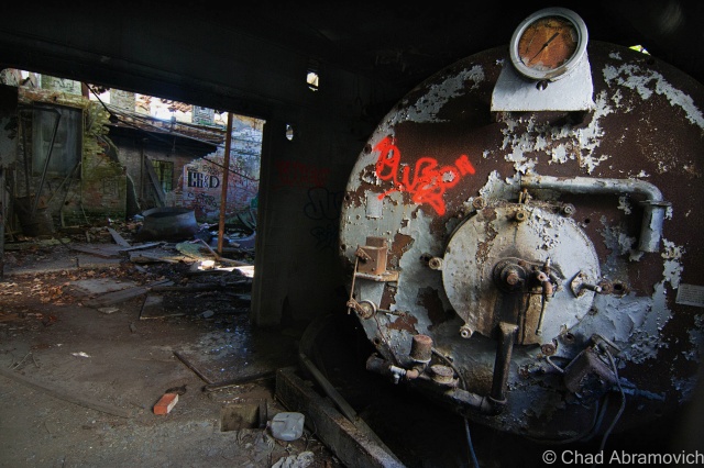
I remember another, far more ghastly story. I was shown a large rusted vat inside one of the many dark rooms of the basement, leprous with peeling paint, dankness and dripping water trickling down overhead. A dim mag light beam illuminated the robust fixture, and it was filled with some sort of unidentifiable glish. As the story goes, sometime in the 30s or 40s, a young man was tasked with making powdered milk, and somehow, fell into a vat of product heated to boiling temperatures. His skin was filleted from his body and was unable to be saved. A more macabre version of the story was that crooked business practices just distributed the milk afterward because losing money was a more grim thought than their customers drinking liquefied employee.
Well, I couldn’t find any validation on that story either – but the historical society did help me dig up a very brief newspaper snippet from the 1940s, about a boy who did die in the creamery in those days before child work regulations, but the cause of his death wasn’t specified. But one look at the gross vat today does make a good totem for a story like this one, and the basement is a creepy place. Not surprisingly, there have been quite a few reports of feelings of unease down there.
The Homeless Man
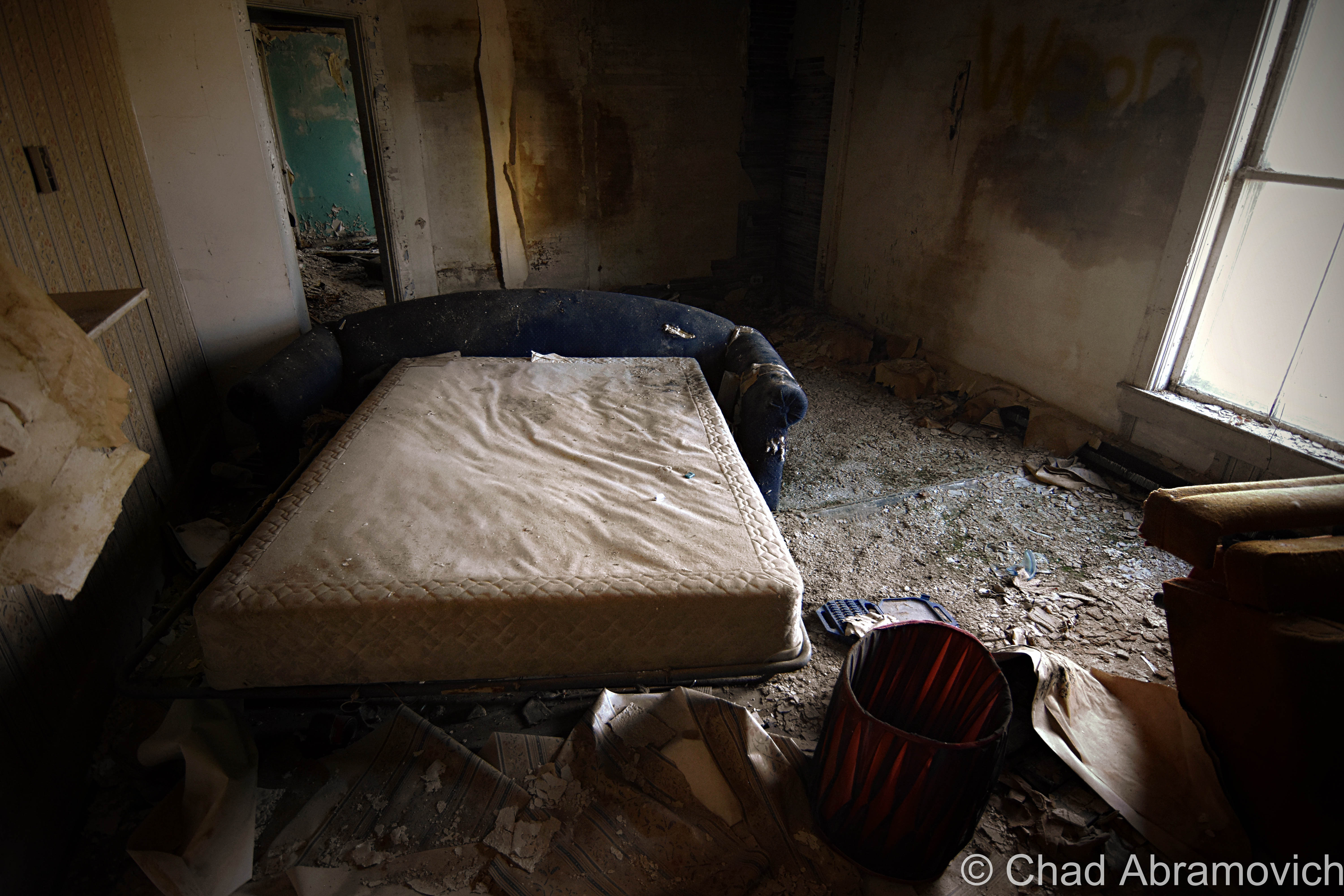
Another notable story did happen, and is documented. Sort of. In the 1980s, recently after the building had been abandoned, a homeless man got inside and planned on spending the night. But nothing stays warm in the wintery cold, and he decided to get a fire started. The details here vary on what happened, but somehow, him and the old couch he was sleeping on, became engulfed in flame. The man died on site. Speculations vary on how he died, whether some flying cinders landed on his sleeping form and ignited his clothes, he was drunk and knocked over or fell into the barrel he used to put the fire in, or some hoodlum kids decided to harass the guy, and wound up setting him on fire. Either way, a dead vagabond was the result. Today, there is a pancaked and charred couch on the ground floor, which I was told was the very same one he died on. Though that too is unverifiable. Some ghost enthusiasts like to think that the homeless man adds to the creamery’s fabled layers of ghosts.
That may account for a claim I heard around 2009, when someone told me of a strange experience of theirs. As he was walking by the creamery at night, he saw a ‘black cloaked figure – almost like a robed monk’, moving in the same direction as him as he walked by the building down the railroad tracks on his way home. He could easily distinguish the thing thanks to the dirty yellow glow of the street lights coming through the second-floor windows, giving the figure a distinct outline from the shadows. His claim wouldn’t have been as weird if it weren’t for the fact that he saw it walking in a part of the second story that didn’t have a floor.
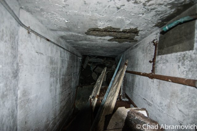
The Tunnel
My favorite hearsay was of the old tunnel. In my teenage years, when I began to become more intimate with the building, I was acquainted with a piece of Milton lore; about a tunnel, which supposedly led from the creamery, all the way down Main Street underneath several of the old houses before dumping out near the Lamoille River. My teenage mind sort of just took that in as fact, and I began making trips down to the basement trying to find the opening, or a trace of a sealed up door. I did find something, a door below ground level, that had been cinderblocked off. Most likely, that was the old tunnel, and years later, parts of the blockade were sledgehammered through, giving me a glimpse. The tunnel was there all right, but didn’t run all that far. I could see the collapsed section yards from my position. It actually ran to the brick building next door. Today, its apartments, but it was originally built as another part of the creamery, which is why the tunnel was there, and which is why it was sealed off. I spoke to a few Milton old timers, who smirked and recalled breaking into the tunnel when they were younger, and sneaking beer and cigarettes down there. But was there ever a passageway that ran all the way under Main Street? Well, I wrote about that, if you’re curious.
As for me? Well, I’ll admit that my experiences being a tourist to this old building haven’t been all that paranormal. I generally don’t concern myself with hauntings or ghosts anyways, unless one of them walks right up to me and says hi. It’s not that I don’t believe in those things (I write about weird stuff after all!), I just try to take an agnostic approach first. I do have one strange personal account though. In 2011, I was walking up to take some photos, and found a very strangely placed mannequin inside one of the old coolers upstairs, propped right in the doorway so whoever walks by would notice it. This one was particularly creepy. It looked old and decayed and yellowed, and dressed in a patchwork of old clothes. There was also a pentagram carved into its neck. I went to other parts of the building and doubled back about 40 minutes later, and the thing was gone. I never heard or saw anyone come for it. To this day, I still don’t have much of an explanation for that weird event.
I still recall one person writing to me when my old post was live, and told me how they found old co-op milk jugs that had been found underneath their old concrete front steps. They had apparently been used to help build the framework for them, which wasn’t an unusual practice for old Vermonters, who used their ingenuity to use whatever materials they could for their benefits. Milton’s Main and Railroad Streets are old. It makes me wonder what else is found within these old homes.
Painkillers and a Purpose.
This is the section where I get emotional and hash out my scars. If you don’t dig personal backstories or revelations, skip down to the pictures. There’s lots.
Growing up in Milton, I was a shy, creatively maladjusted boy. As the years and my youth passed on, not much changed, apart from my curiosity, and me never feeling like I was comfortable in my own skin. I was always thinking there was something wrong with me. Being diagnosed with Aspergers at a young age, I quickly found out that I was a pundit on certain things, but hopelessly inept with others, like social skills. It was an unhappy balance, and that led to a coming of age where I was bullied and timid.
I suppose it’s fitting that I began to take interest in what we perceive as oddities, or things that don’t fit our conception of the illusion of normal – and their captivating stories. Abandoned places fell into that category for me. The creamery was the first. And better yet, it was easily accessible.
I first dared to cross that threshold into a world that conventional wisdom told me was dangerous and forbidden. And that’s partially why I wanted to venture inside, and why I decided to repeat that ritual for years to come, because people frowned on those sort of behaviors, and I wanted answers for myself.
The thing is, I’ve never been like everyone else or satisfied with the pre-prescribed banalities of everyday life, things that are all too generic and sanitized. Whether it had to do with growing up Aspergian, or be it something in my framework, I never fit in. So I decided to put myself in haunted waters, and see what happened. Turns out, bending the rules, thinking for myself and daring to go against what I was taught was one of the best things I ever turned into a habit – and is some of the best advice I can give to anyone, assuming I’m asked for my opinion on these things.
Everything is a language, everything is constantly trying to tell us something or express itself in its own way. The trick was learning how to discern the signals from the din of chaos. It was the first abandoned building I ever explored that fired the engines of desire and curiosity in my mind. It was in those precious hours inside where I heard an obsession being born amidst the damp cold and watchful eye of wild shadows that would haunt me for years to come. Treading over the debris littered floors, slowly opening crumbling doors, peering into a vast basement filled with water and intimidation, the dark becomes your hunting grounds, in the foreground of endlessly dripping water.
I spent most of my 20s in dislocation and learning about the blues while slowly murdered by my anxiety. I was depressed, lonely, still trying to figure out my autism diagnosis, and going through the trials and tribulations of several different antidepressants or booze. Sometime in between all of that, I lost myself trying to please everyone. In those years of learning what heartache brings, I waltzed between things that I did that brought regret and just trying to get by. By age 25, I had given up on myself. I spent years running from nothing but those vicious, self-depreciating thoughts in my mind and not only did I feel inferior to everyone in the world, but I lost faith in people, and hoping that anyone would understand. I even attempted suicide. They say that you grow up believing the narrative we’re told by society, and how people treat you. Either you had it or you didn’t, I guess. I couldn’t be the only one who felt there had to be something better than the imposed adult lifestyle that was bounded by convention. I knew I wanted more.
My tendencies to escape from the pressures of a judgemental society raging over me and all my failures brought me to these forsaken locations. When things got too rough outside, my earnest self climbed inside. My time hanging out in them not only became like therapy for me, but it also picked me up like a drug as unacquainted fires lit sparks in me that took me years just to understand their ways. Urban exploration helped me confront social and emotional turmoil, as I’d disappear into a sea of rebirth, or at least a change of scenery.
It was here where I could try on my heart, and let my walls down. Over time, I didn’t really mind that I was lonely because it felt like home. Whatever things ran through my mind I could keep for myself. I could learn about myself and my environment and observe both and how they changed with the weather. I could study these ruins and what was left behind, getting an extraordinary and authentic look at a sort of museum of humankind than I could ever learn elsewhere as I picked at the bones. Building materials, architecture, electrical and plumbing, amateur archeology, hazardous side effects, irrelevant culture – all things that would give me a better understanding of the world around me, and conjure more questions and a desire to learn. I could learn to gauge my anxiety and problem solve in different ways.
Little did I know that while I spent so much time in the edges between self-awareness and self-loathing, I grew as a person.
Photography was something I picked up in relation to urban exploration, as I pushed myself to learn the mechanics and how to capture this world that I saw. I really digged the feelings I was receiving, that excitement, that push to keep trying, to keep dreaming. I wanted to get lost because I couldn’t be found. When we’re presented with things that we don’t see in our routine days, we get curious and we look. Social norms often tend to discourage looking closer in real life, and that’s why I love photography. It allows us to do so freely.
I still remember the satisfied grin on my face when I first bought my own camera with money that I had worked so long to save. And the creamery was where I honed those skills. Exploring enhanced and enlightened by appreciation for the landscape around me, and matured a sense of wonder in these everyday spaces. Being a photographer really enhanced my self-esteem and gave me a distraction from everything that was bringing me down. Every photo tells a story. Every photo was taken by someone who had to be at that place, who did the planning, who had an experience to share.
In college, I majored in graphic design, which, despite me falling out of love with it after I became wise to how the industry works and how that didn’t fit me, has greatly influenced and improved my imagery and my hobby. I could further my creativity with all that was still stuck in my head.
Writing has something that always came sort of naturally to me I guess, but it’s still something I’m pretty self-conscious about and always trying to develop. Twisting the night away in front of the comforting glow of a computer screen as I listened to those records that almost hit harder than my pain, I tried to translate and find a meaning in my thoughts and experiences and explores. Especially as I grew older, I wanted to spin a thread from my past into my present and try to find a meaning to my suffering, to these forsaken locations, and how being a human is one complicated gig.
I definitely wore my heart on my sleeve, and I remember all the things I felt discovering my favorite albums, the heroes I would worship, fascinating local weirdness and just about anything else that made me shiver. Part of me wanted to contribute, to create, to make sense of everything I could. What do I do with all these feelings and experiences, these things that are crawling up inside my head in my 20 something-year-old wasteland?
I’m not sure what it is about the creamery, or these temples that are a relief to me, but they make great atmospheres to drain my mind, all the more so when my cup is full.
Exploring ironically became some sort of a social endeavor for me in my young adult years when I was searching for friendships and other libertines. I’d often accidentally meet these amiable, intelligent people with the same interests, and I’d take the chance and meet them in person and go on adventures, and I’ve been lucky to form a few strong bonds because of it.
Before I had this blog, I had a Flickr account. In those days, Flickr was really a niche audience. But somehow, my Vermont-based photographs made their rounds, and over time, others started to reach out to me. We would bond over the places we’d shoot and our stories, and sometimes, if we really hit it off, we’d meet up in person and find new exploratory joys (but to be honest, the biggest thrill for me was to finding new places myself). I think any other explorers can vouch for this – that the conversations you have while adventuring are often the best, and the weirdest. I’ve had plenty of amusing chats underneath the creamery’s arched tin ceilings. That’s how I met my friends and role models Rusty and Christina who run Antiquity Echoes and Dan from Environmental Imagery, to name a few.
The internet introduced me to the “urban exploration” community, which was still emerging at the time and pretty underground, and I remember being curiously thrilled that there were other people out there who did what I did. The explorers (“urbexers”) who were creating websites and putting their photography online, I found, had scars, philosophies, and interests similar to mine. And their work was good, it was venerable, and it gave me a direction. I love people who add personality to their work.
That was also where I was introduced to the term “urbex”, something that attempted to categorize what I was doing. Way different than the modern day urbex explosion that has crawled all over the internet, and alongside the greats, an oversaturation of various disrespectful types who are more into their own vanity and bravado and taking pictures of them smoking vapor cigarettes than the tourism, which often brought drama and something pathetically similar to high school cliques in the social media groups I used to be apart of (another attempt at trying to fit in), so these things turned back into a private affair for me.
I don’t want to be a trite person because that’s unfulfilling and there is no point in following this blog if I sound like everyone else. I’m me, and my thing is to be upfront and honest about where I come from, and often, I talk too much. That may not be everyone’s scene, but I’m okay with it – it’s all I got. It took me years to find my words and a beat, and I’ve learned a murderers row of personal lessons from it.
I’ve been searching all my life for a purpose, some sort of connection to this “humanhood” we’re all supposedly a part of – but I never really found it until I started learning how to live in the present tense and brave through the pain and uncertainties. You have to be vulnerable to grow, and sometimes, letting down my guard was a significant and valuable thing. Proving the static in my head wrong, that I wasn’t too far gone to have a talent.
Exploring, photography, writing, they all sort of united together, and as I chased them, I fell for them. I wasn’t wasting away my soul anymore, and I learned to stand on my own and begin again as my purpose worked its way to the surface. I wanted my life to matter, and for my time to have a positive impact and not to simply pass me by, even if it costs me. I don’t want to just survive, I want to do the best that I can to create a wonderful life. Especially now as my youth and years are passing me by.
Nothing will ever be handed to you. You gotta work hard, or it will never happen. If you want to be an artist or wield a talent, you have to study that art. Get the books, the role models, the media that has to do with what sort of person or thing that you feel you want to become. Study it all the time. Practice, learn, stumble, keep practicing, go. Decide, who are you trying to be? And what’s the motive? Do you want to be an artist that cares about your art, or famous? Those are 2 completely different things. I’d rather be trying to be the best I can be at whatever I’m doing, even if I only have a few other people that happen to like it.
For someone who didn’t believe he had much of a future after he had left college and feels like he’s spent his whole life less up than his downs, this has turned my whole life around. It’s the long haul, but it’s worth it. I try not to put anything out there that I don’t believe is good. Even if that means a lot of time in between my newer posts. Quality is more important to me than success. And I’m still finding my beat and my voice (and still cringing at my earlier posts haha).
I learned that I can succeed even when I’m failing miserably. I learned not to be as negative as I used to be, and indulgence can be a good thing in moderation. Enjoying a little danger now and then is fun and beneficial, and remembering where I came from doesn’t have to be a condemnation. Being willfully ignorant will get me nowhere, and is counter-productive to the life I want to live, or the people that help me shine.
Others are imbued by my weather, and I flourish in the presence of love. Fear gets me nowhere. Anger and indignation can be useful and rejection can make you resilient. In pain there is wisdom. Waiting out my life to hold onto anything never worked.
I re-wrote this blog entry and re-photographed this place for myself, the people I know now, and those who became ghosts, because I think there is a great story being told here. Our beginnings and ends are all written in the choices we make, and they all lead us in a direction.
In this struggle, something can be found, and it shouldn’t be measured by what conventional wisdom has imposed or implied. It’s the experience that means everything. In some ways, I’d like to hope my story can be several of us. And after all I’ve said here, I’m still shaking as I consider hitting the publish button. If you don’t say anything, you’re not vulnerable.
It took me 28 years to stop playing my old records, to get beyond that point where I couldn’t seem to move on yet knew I couldn’t stay the same. Now, I’m writing this up in an apartment 24 miles away from where I grew up, and where I spent my youth in imagination or hopelessly devoted to misery. Life moves on and our stories are always more connected than distance implies.
Requiem Revisited
The town I grew up in left a long time ago, and we lost touch as I shed my skin. Now, with the creamery’s uncertain future and Hyde Manor’s weight taking over and speeding its collapse, I felt like two of the most influential figures of my past lives, things that really shaped the person that’s writing this right now, are vanishing. And they’re dying breeds – venerable buildings built with a motivation and with dignity, things that our new disposable and tawdry society shamefully doesn’t value. That’s more or less evident with all the pop-up cardboard condos appearing in town. It’s a shame that future generations of curious kids or explorers will loose these mysteries and interactions that are kept inside these constructions that they don’t build anymore.
Because I taught myself the basics of photography here, I thought it was ironic that all the photos I had of this place didn’t really reflect how much I feel I’ve progressed over the intervening years – and I definitely felt like out of all the locations I’ve documented, this deserved good representation. So I was on a bittersweet mission of reverence; to record every corner of the building and do a good job at doing so.
My friend Josh and I got together and decided to spend as many days as we could stomping around the creamery with camera equipment, our footsteps the only things haunting its rooms.
I wonder if I would have even gotten into exploring to the extent that I am now, if it wasn’t for my time spent here and the spell I was under. Would I have ever gone to Hyde Manor? Would this blog be existing? I can’t say if this place that has driven me crazy will fall and fade or not, but I’m glad we let our distress push us back to this old haunt and all my forgotten ghosts. But if I never see it again, well, I’m damn appreciative of my time here.
Thank you for the indulgence here. Part of me was almost against posting this last section, but my feelings that it was somehow meaningful and cathartic overpowered the fears of showing my scars.
I think the Lawrence Arms said it best; the time is never right, the words are never right. I hope it’s helpful. I hope it fires you up.
Historical Images
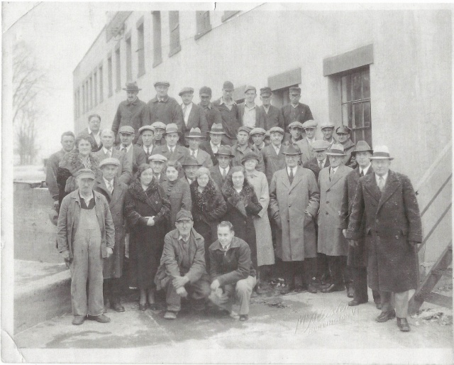
The newly constructed Milton Creamery. The ground still muddied and rutted from building it. 1919. Via UVM Landscape Change ProgramCirca 1930. Via UVM Landscape Change ProgramCollection trucks in front of the creamery – Circa 1930. Via UVM Landscape Change ProgramWeighing and Receiving Room. Courtsey of Milton Historical Society.Employees, Circa 1920. Courtesy of Milton Historical SocietyThe original Creamery, before the brick edition and the front garages. Courtesy of Milton Historical SocietyRailroad view, Notice the massive water tower and the absence of the brick edition. Courtesy of Milton Historical SocietyCourtesy of Milton Historical Society43 Creamery Employees, in its later years. Courtesy of Milton Historical Society
The Creamery Today
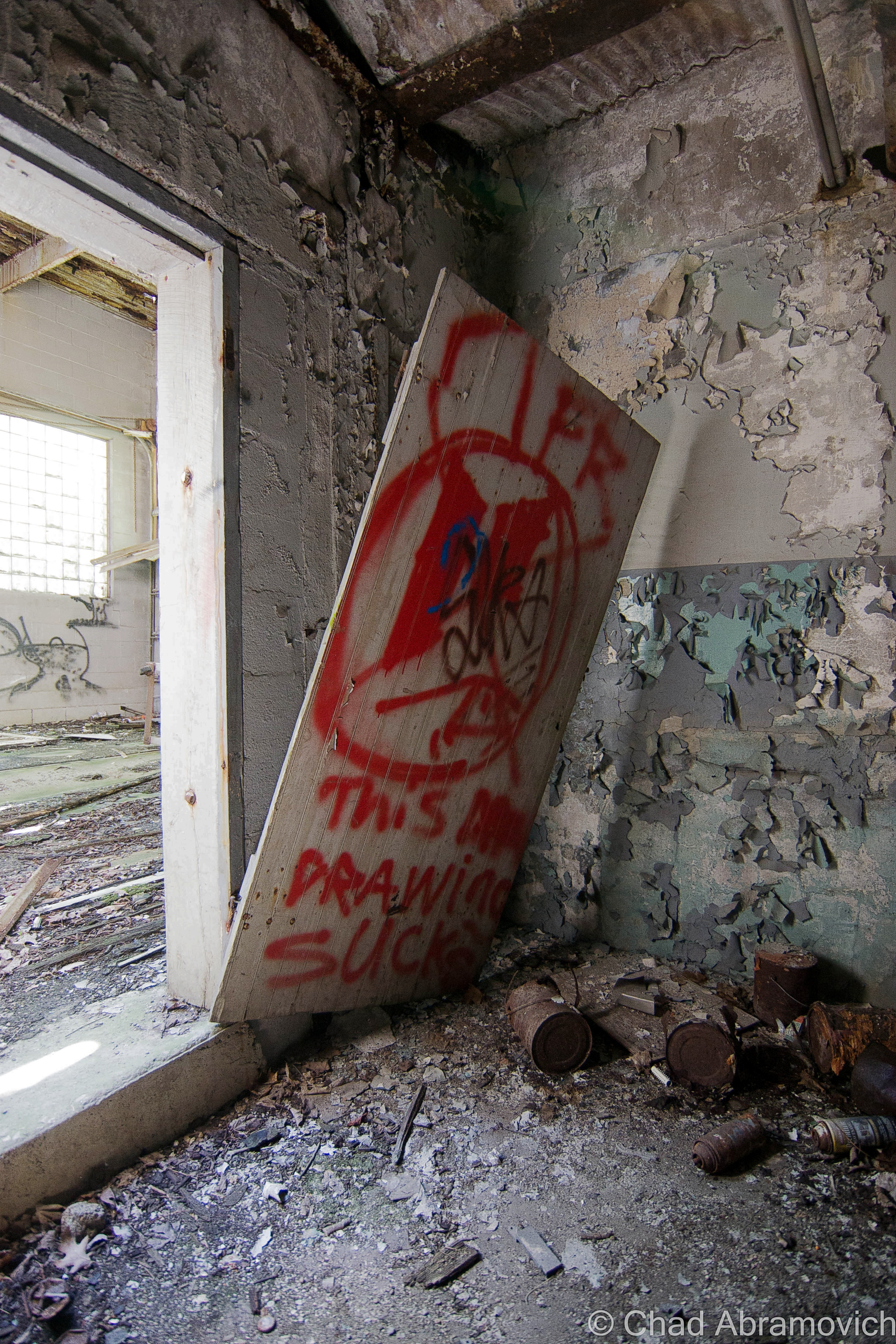
Because this is an old creamery, I think this is the best graffiti in the entire building. Get it?!According to local lore, this is all that remains of the couch that the homeless man burned alive on years ago.
According to local lore, this is all that remains of the couch that the homeless man burned alive on years ago.
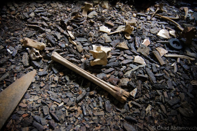
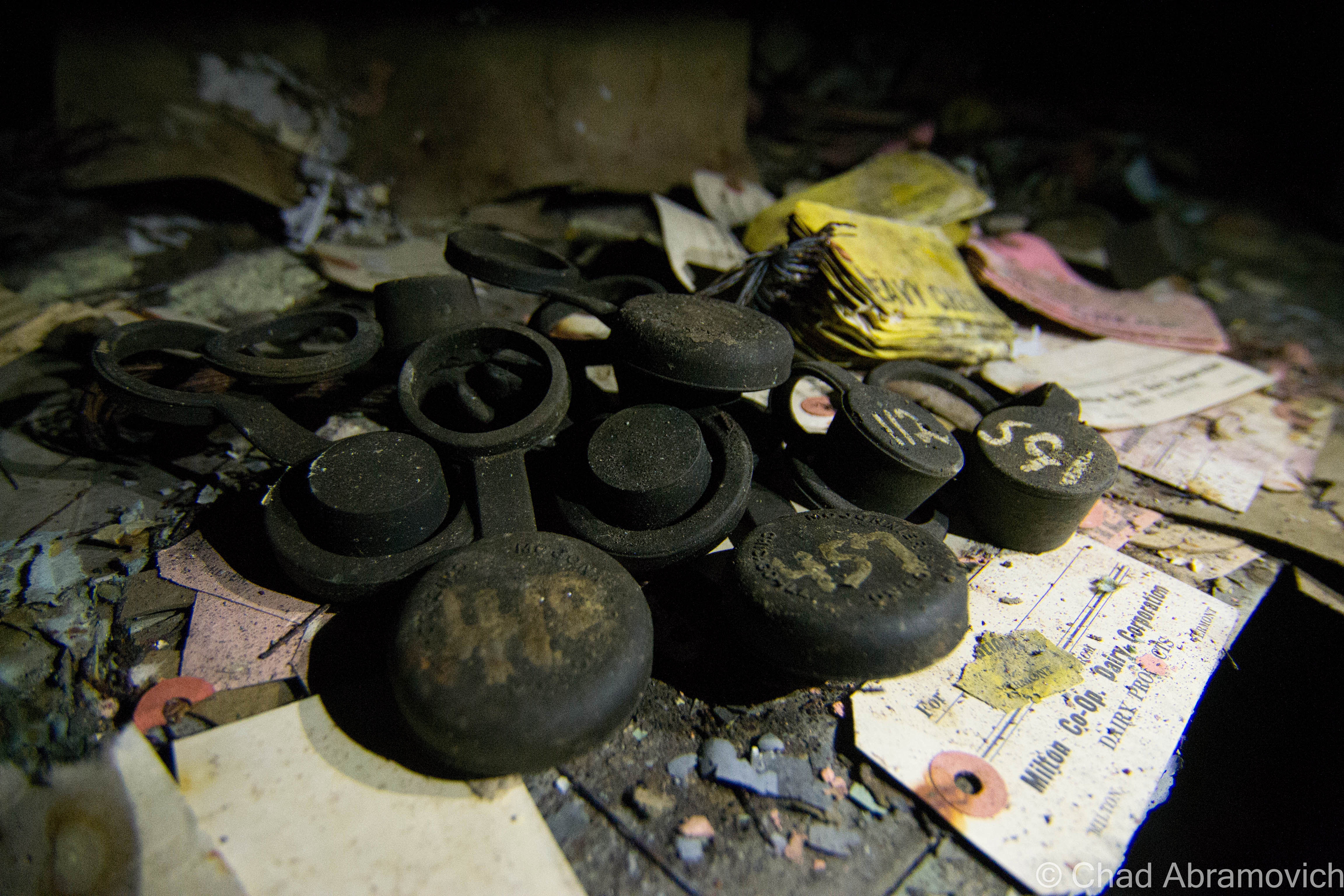
We found several animal bone fragments in the basement. According to my friend, years ago, people used to have illegal cock fights down here. Over the years, the decayed corpses of dead cats and skunks would also appear. Once, some folks, probably teenagers, stole road flares and had what we guess was a road flare fight down there as well.
A reality of abandoned places. They’re very commonly breeding grounds for stuff that hates us. Stuff like mold in a Pantone book of colors.Always a good reminder to look down, you might be surprised at what your feet crunch over. Like shards of old china plates.
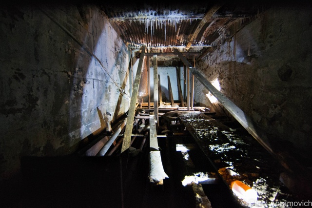
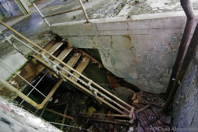
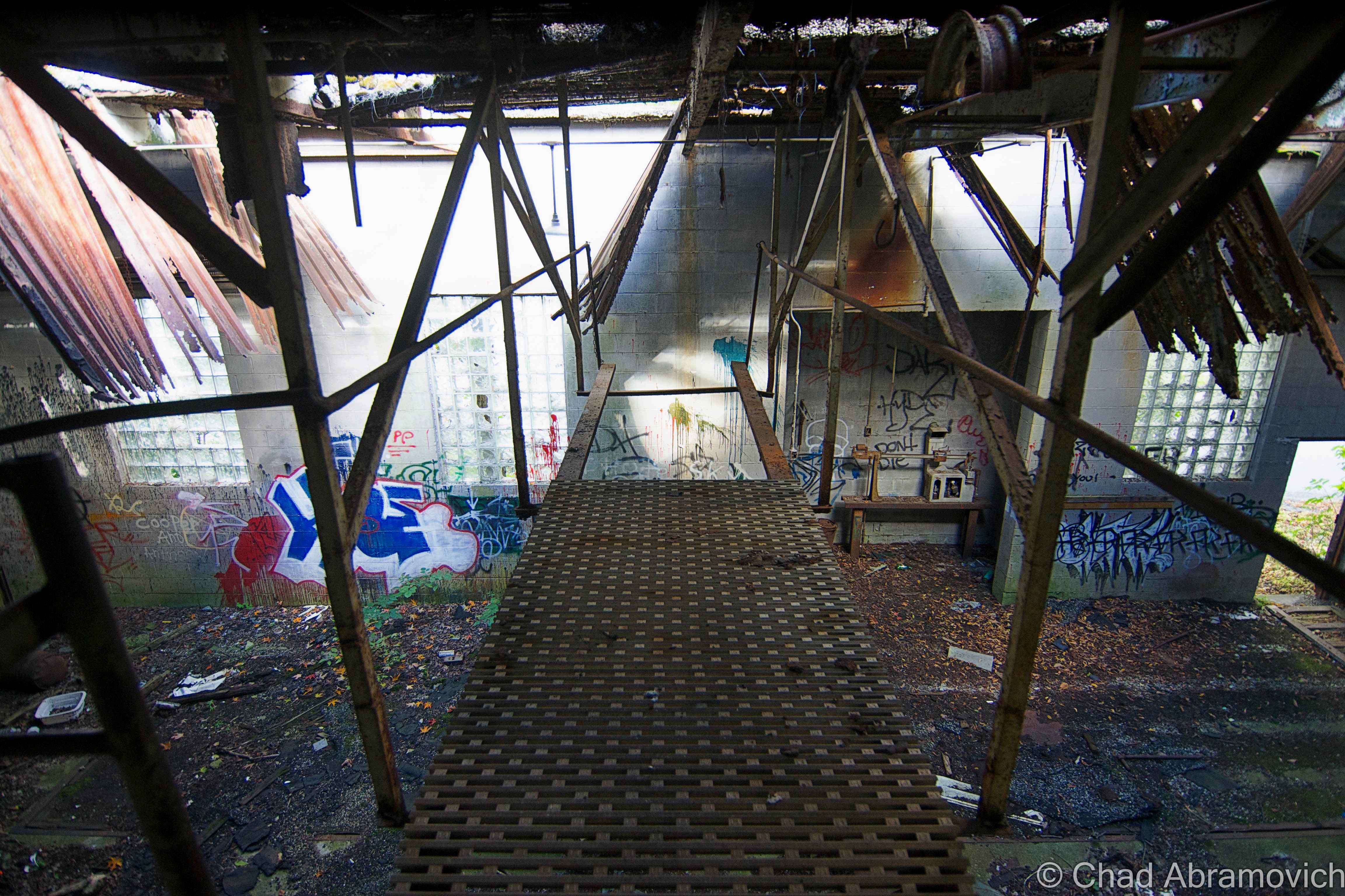
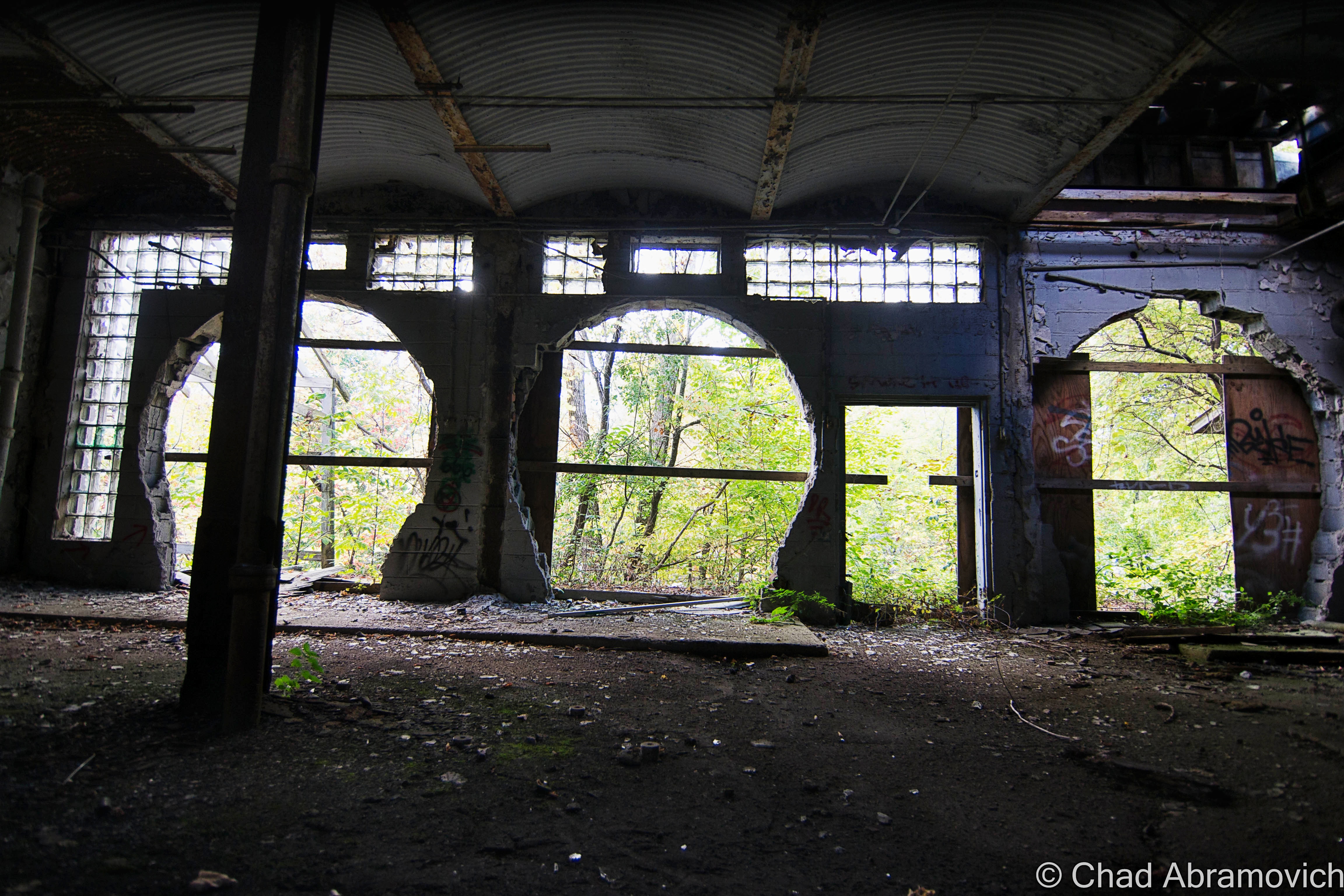
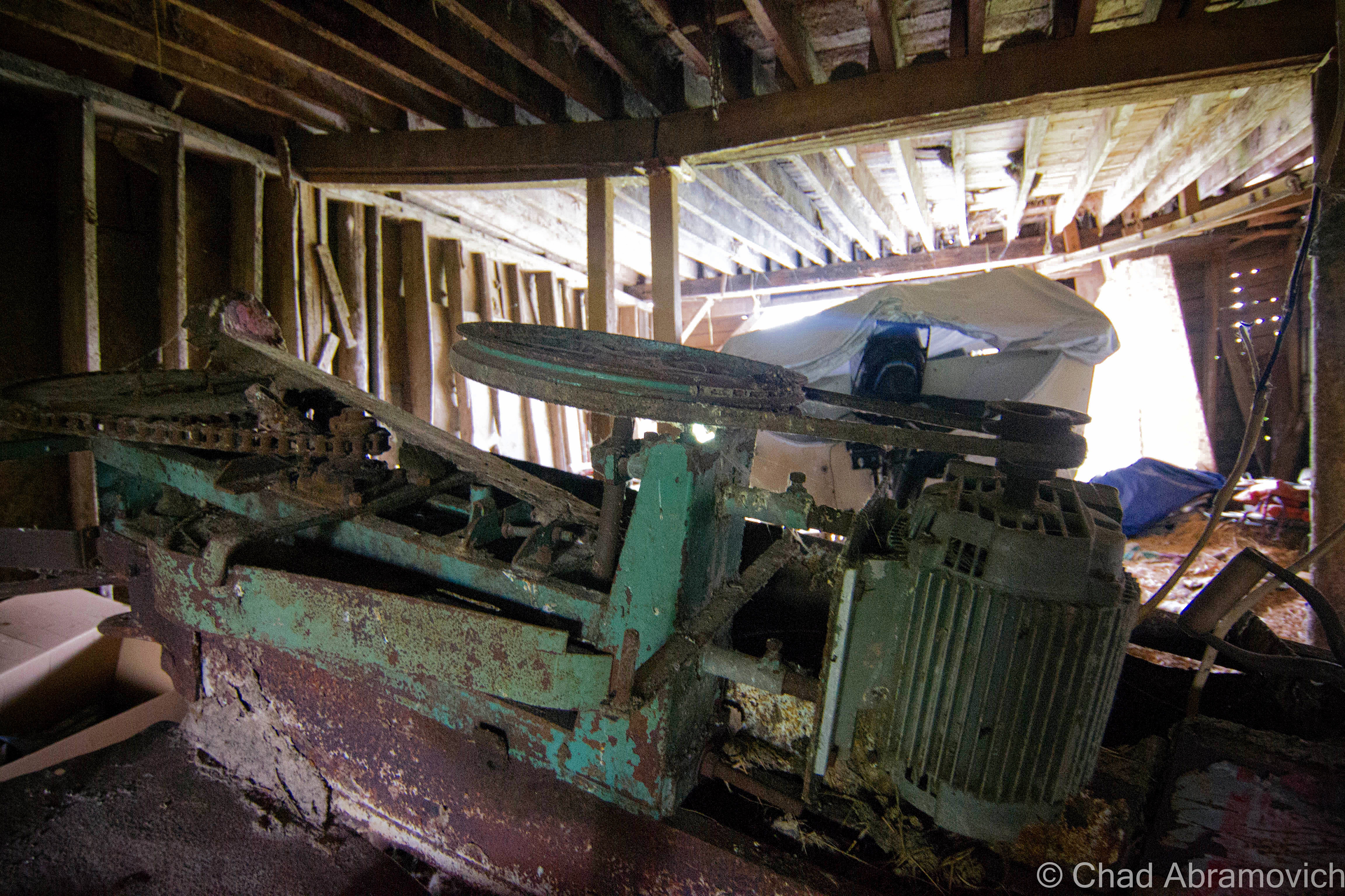
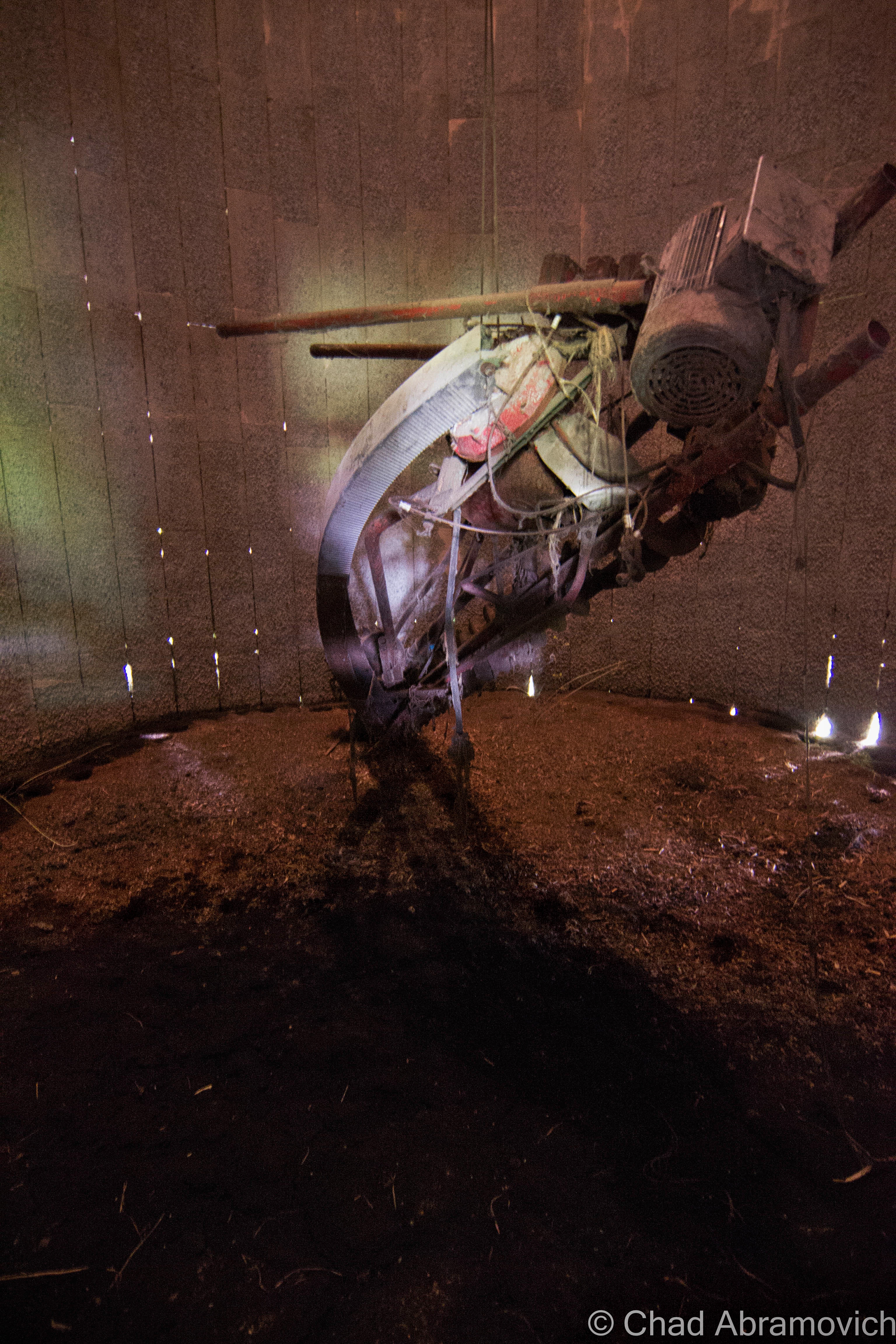
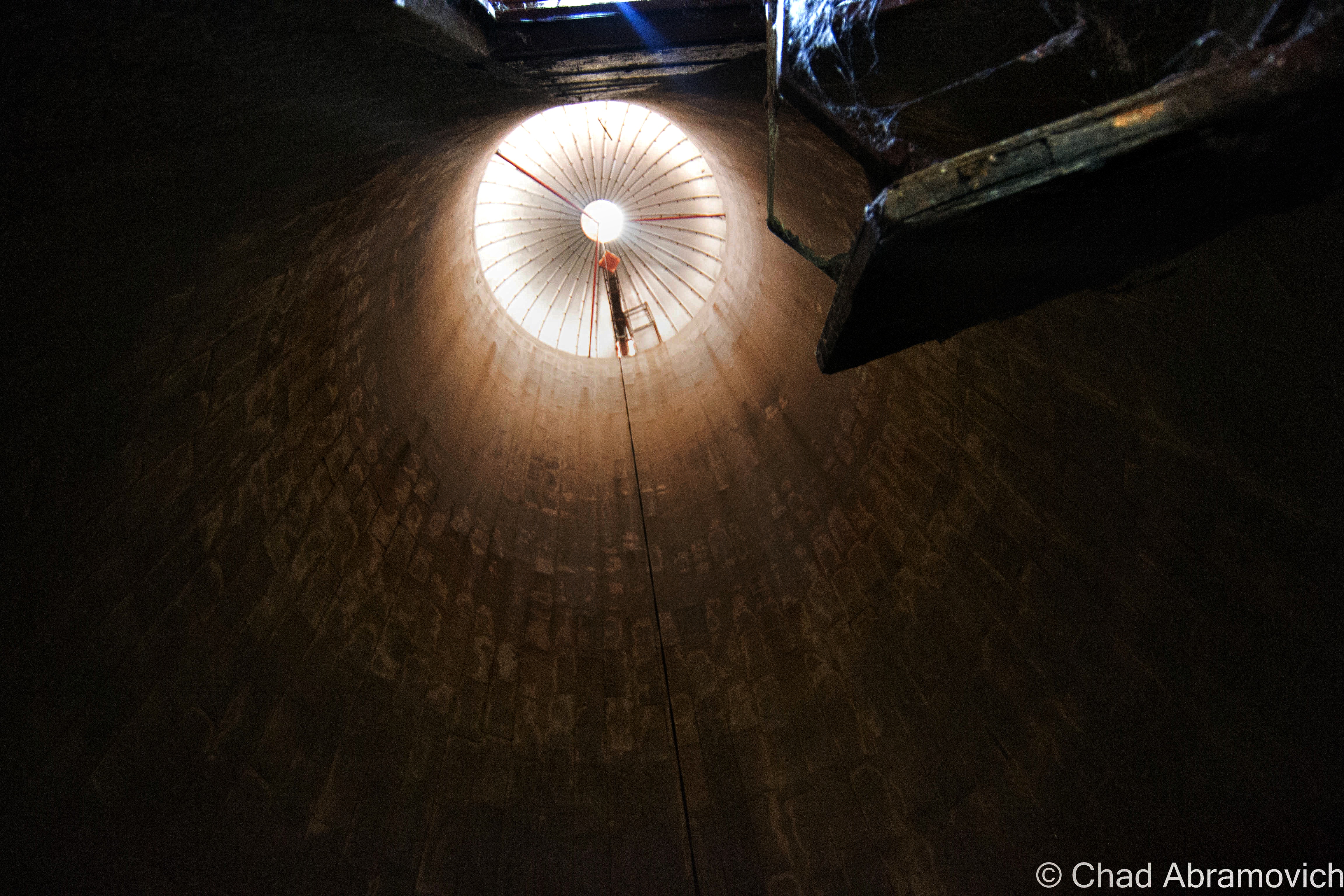
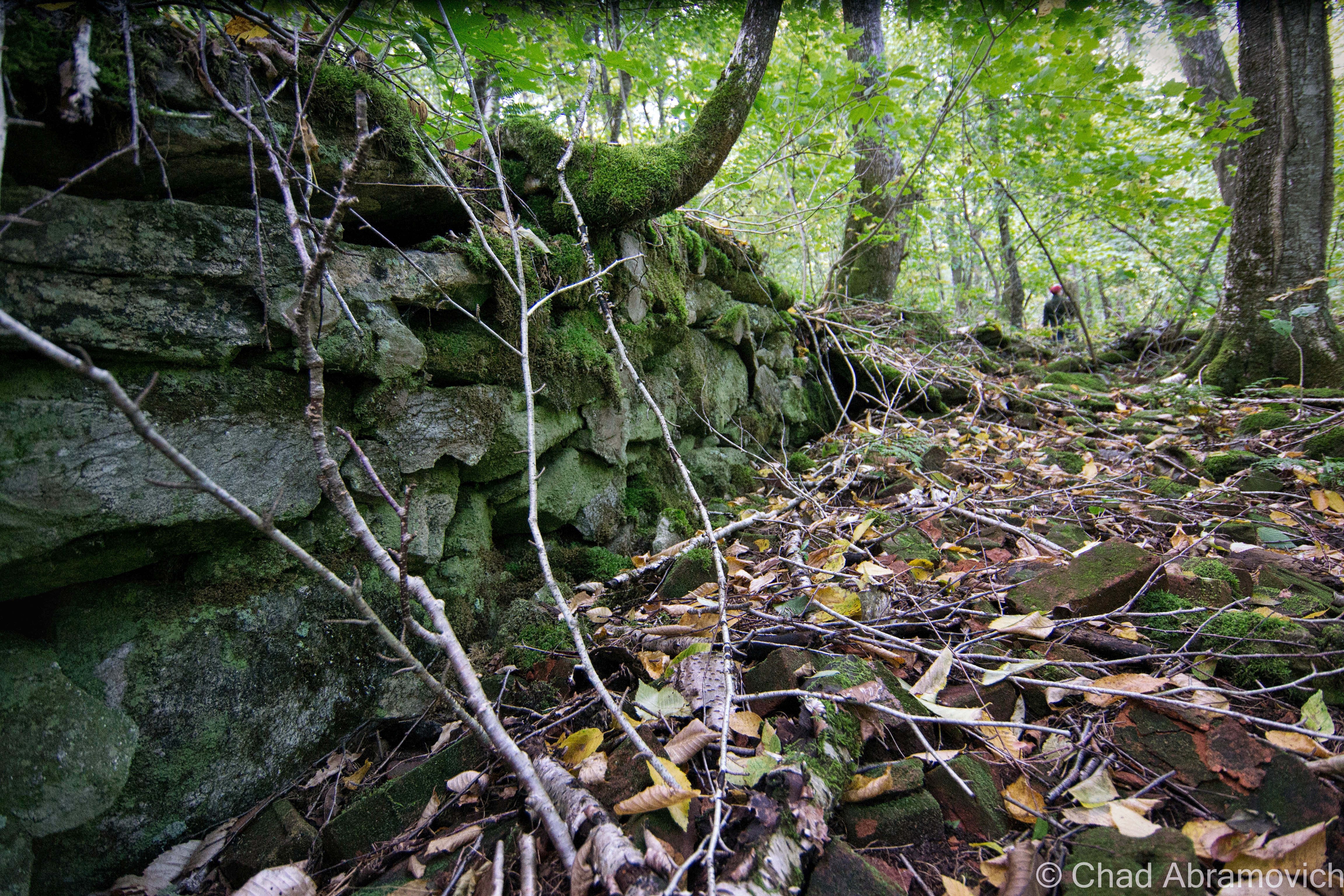
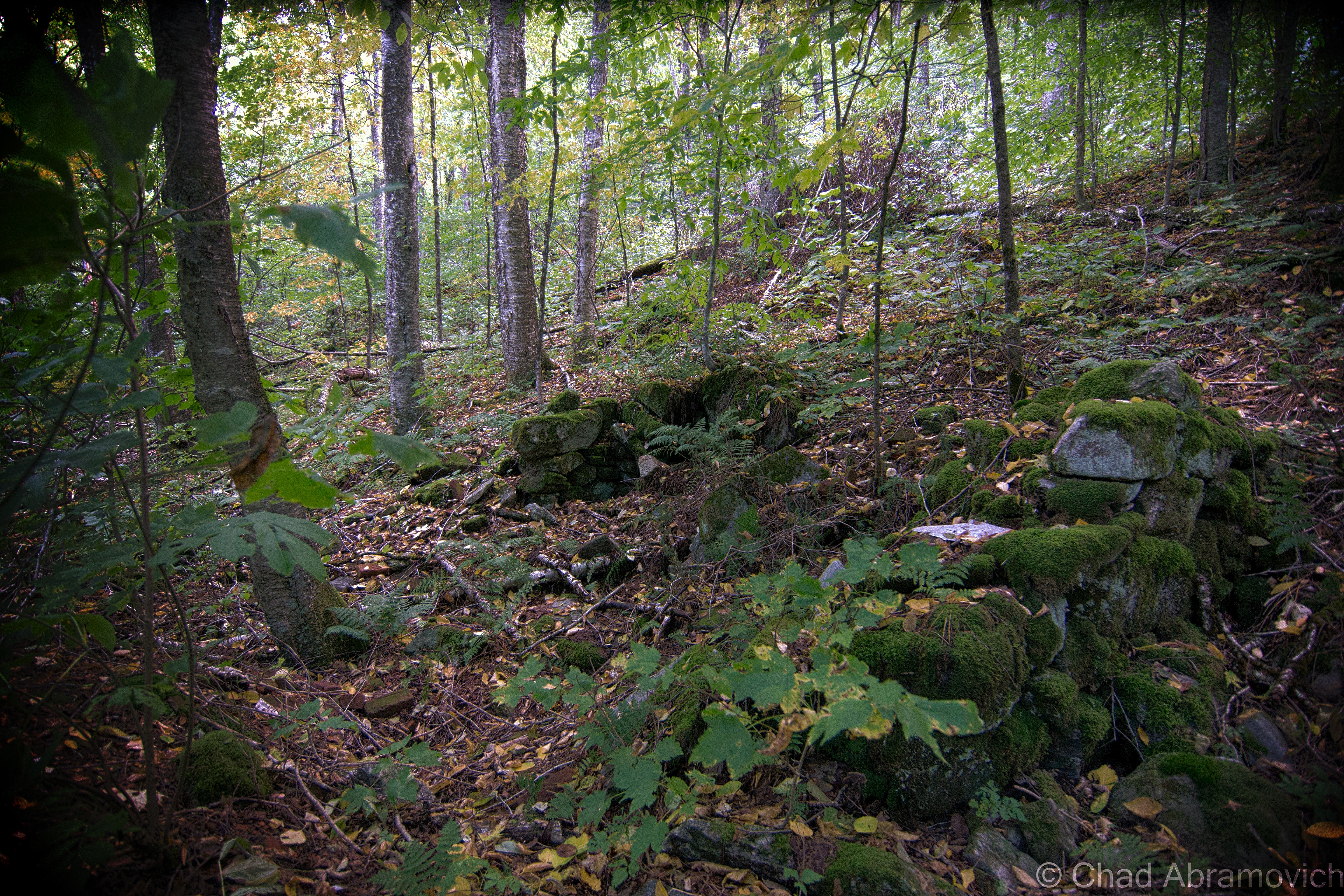
The sections of the basement area that ran alongside the railroad tracks were chopped up into several smaller rooms and passageways. In one of them, we found a crooked, rusted ladder that scaled up alongside what appeared to be a giant vat. So, up we climbed to check it out.Here’s a shot of the former tunnel entrance, from the basement. If you notice the indented cinder blocks with holes sledged into them back against the wall – below where the light is working its way through the boards, that’s it. The eerie and dank basement levels here were dug down two and a half stories deep, with slate ceilings to insulate and keep in the chill. The foresight in its design worked. Even in the most sultry summer months as a kid, I remember it always being chilly down here in the dark. For half the year, the subterranean areas are a reservoir of stagnant water and the waste of the decaying building.The Creamery tunnel, sealed off at its other end.
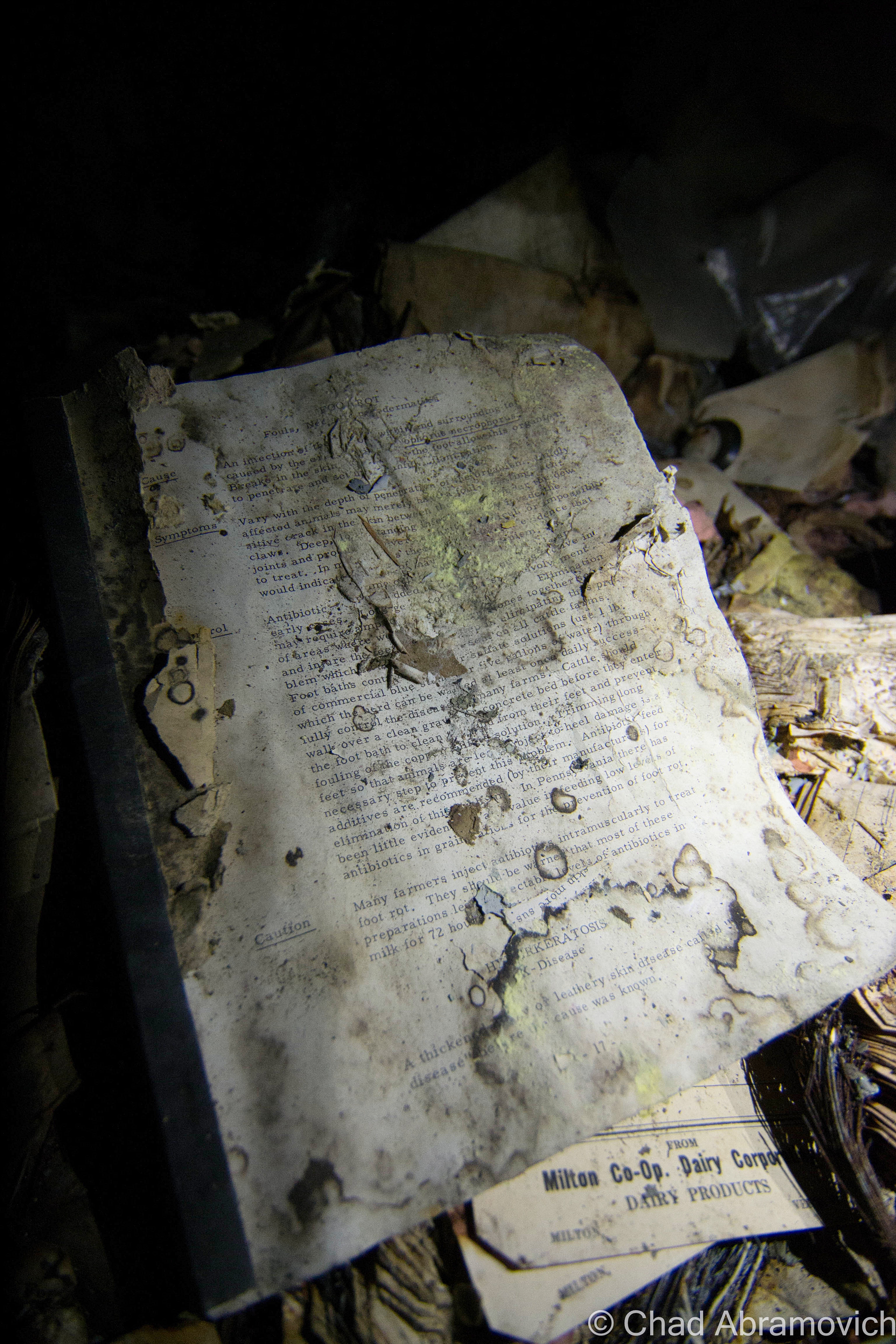
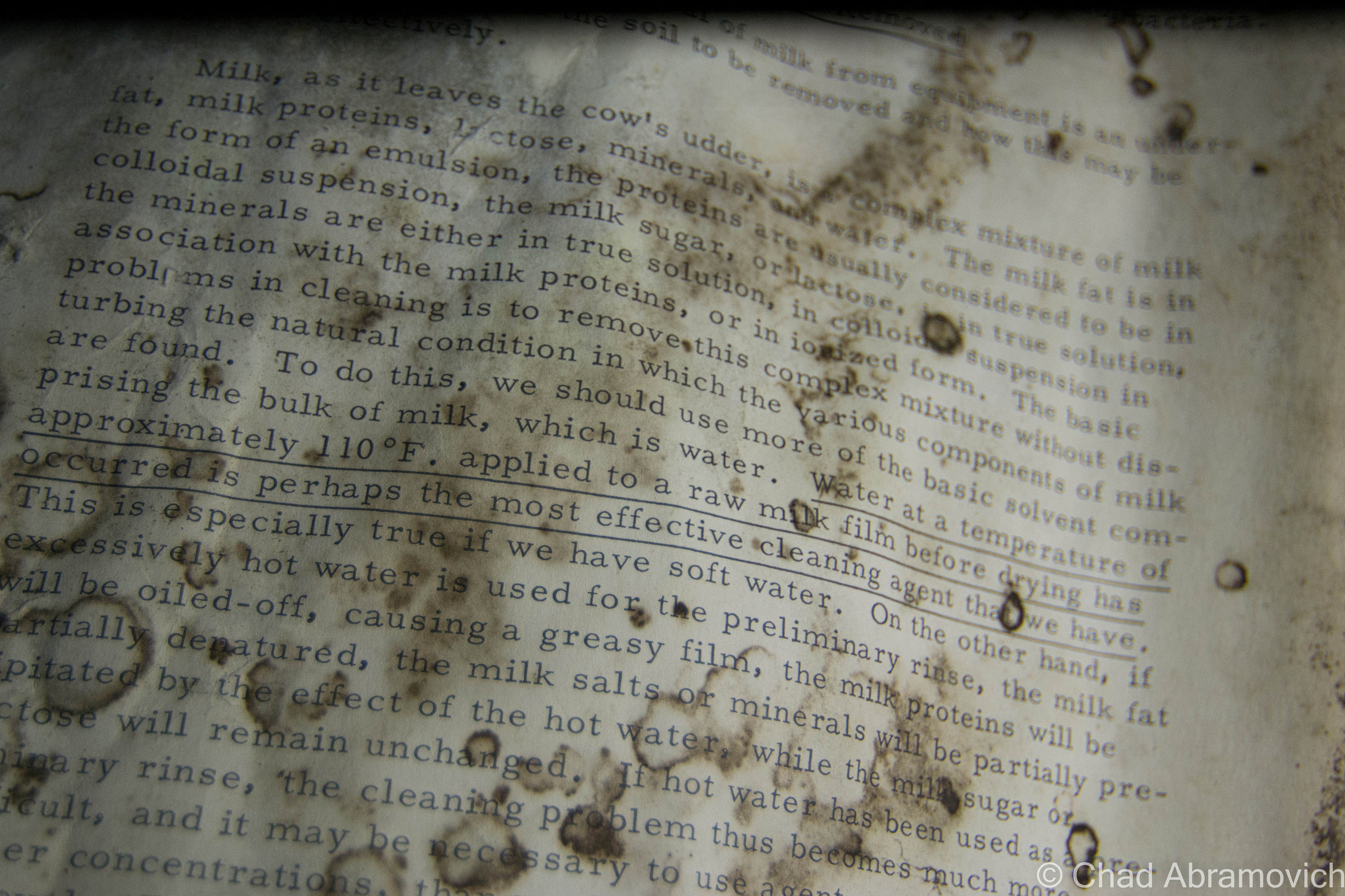
A little DIY reading was found in the dark and the damp of the basement area. It was a moldering manual on how to properly run a creamery. It’s fragile pages pretty much covered how to properly clean and sterilize both the machines and the milk, and how to pasteurize it so people won’t get sick.
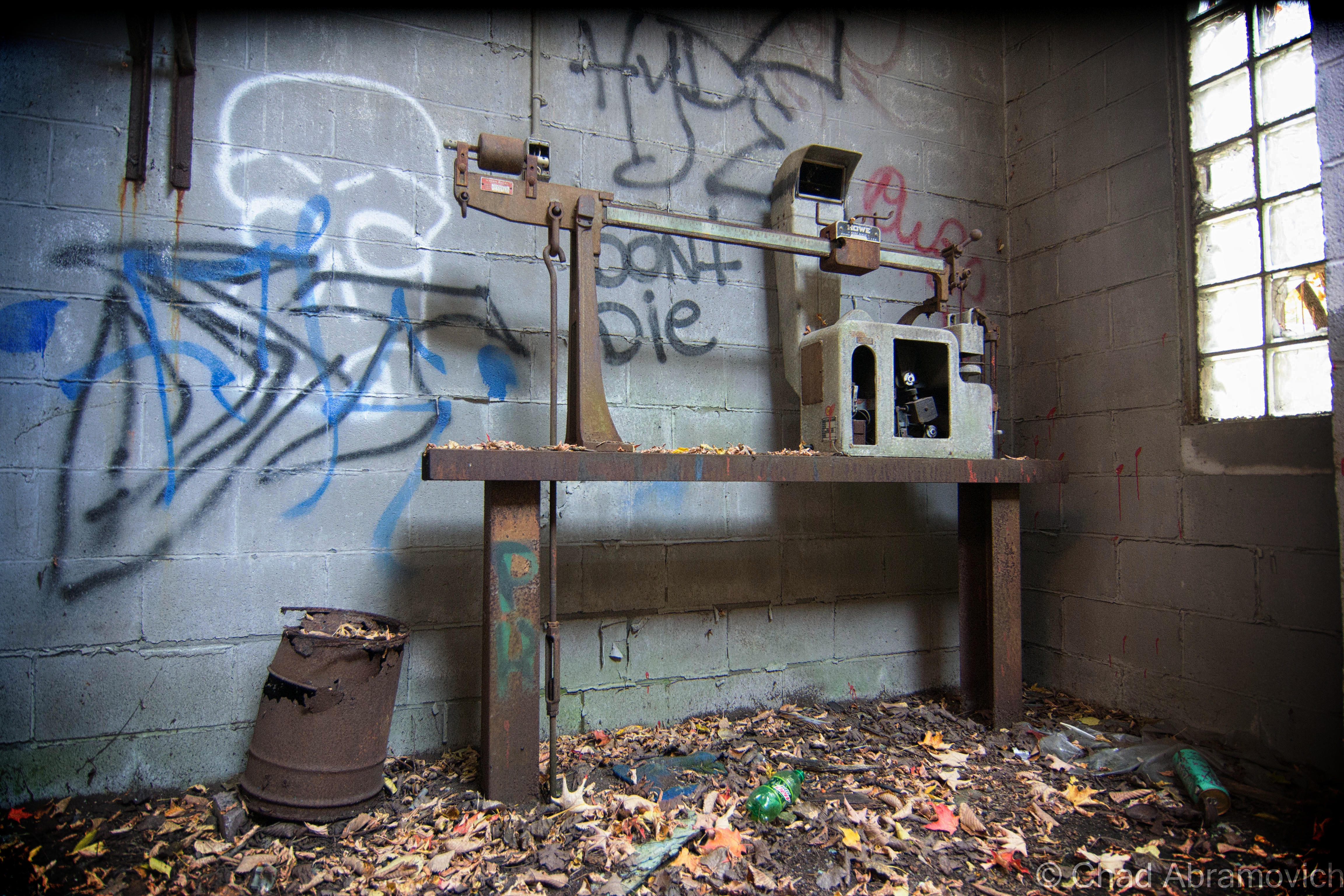
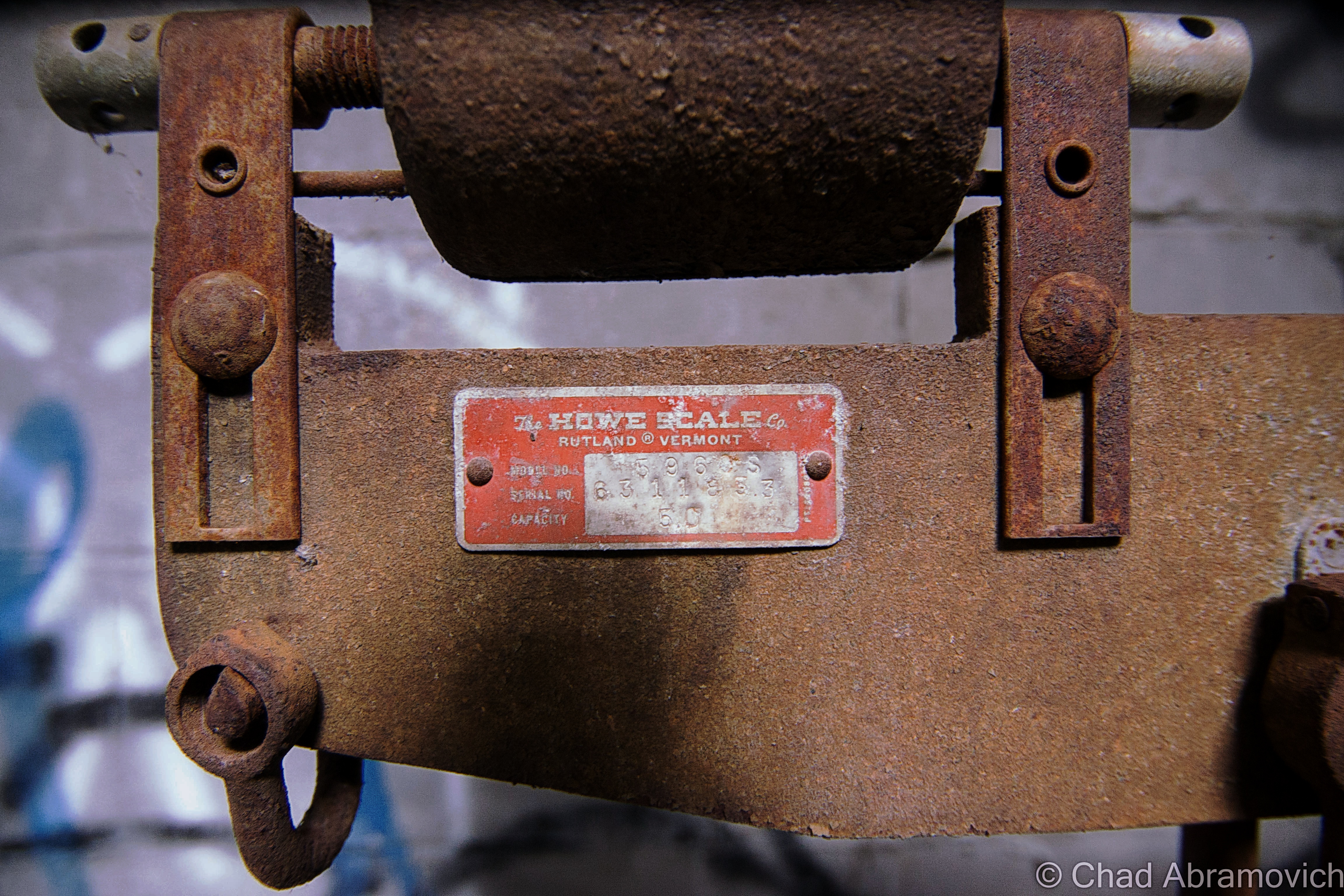
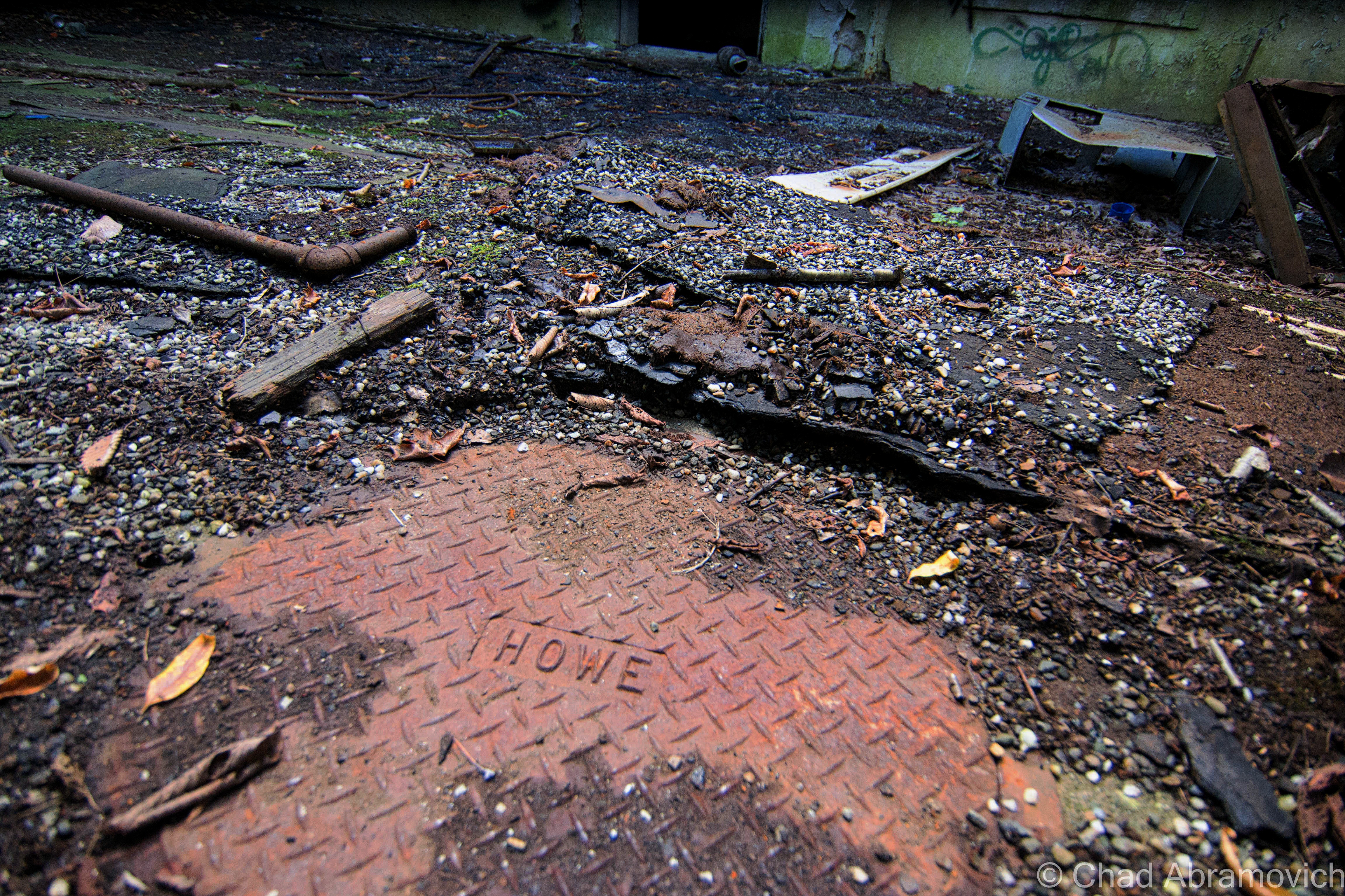
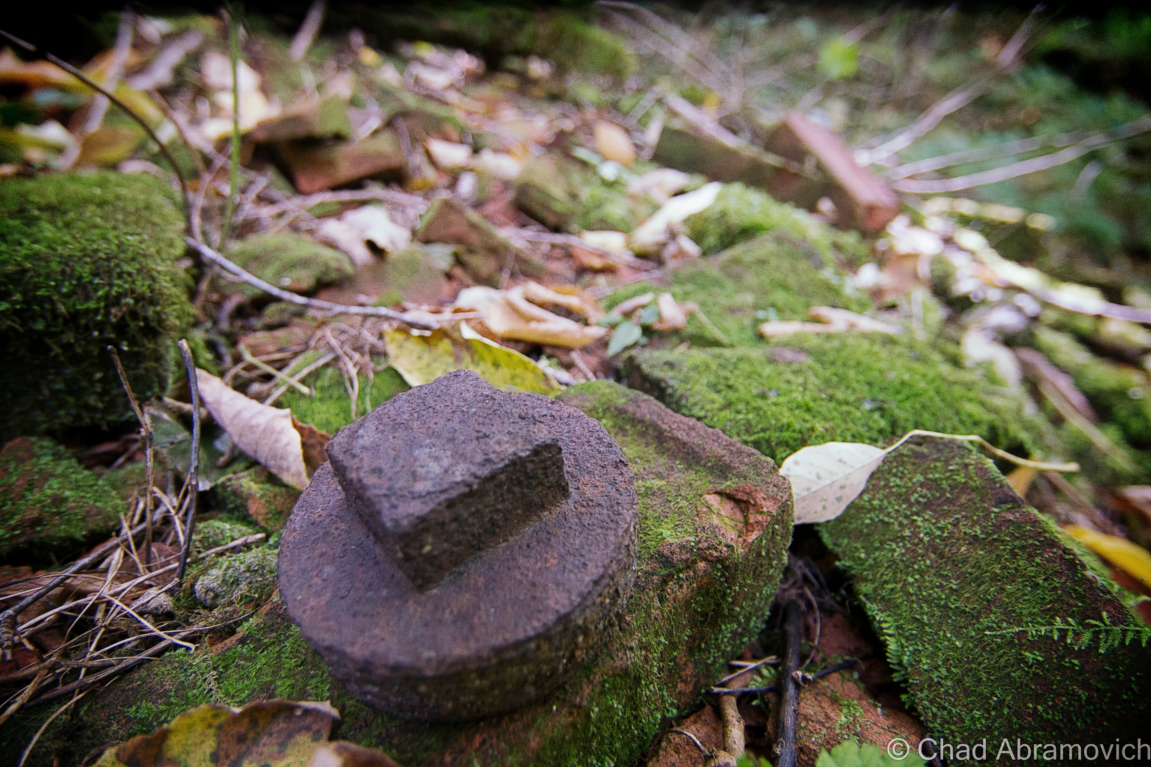
Howe scales came from Rutland, and besides Saint Johnsbury’s Fairbanks factory, was one of the domineering weighing apparatuses found around Vermont. The Howe factory went defunct years ago, and it’s great building was converted into mix commercial and office space.
—————————————————————————————————————————————–
To all of my fans and supporters, I am truly grateful and humbled by all of the support and donations throughout the years that have kept Obscure Vermont up and running.
As you all know I spend countless hours researching, writing, and traveling to produce and sustain this blog. Obscure Vermont is funded entirely on generous donations that you the wonderful viewers and supporters have made. Expenses range from internet fees to host the blog, to investing in research materials, to traveling expenses. Also, donations help keep me current with my photography gear, computer, and computer software so that I can deliver the best quality possible. Seriously, even the small cost equivalent to a gas station cup of coffee would help greatly!
If you value, appreciate, and enjoy reading about my adventures please consider making a donation to my new Gofundme account or Paypal. Any donation would not only be greatly appreciated and help keep this blog going, it would also keep me doing what I love. Thank you!
For a blog about obscure Vermont, I’m a little surprised that an abandoned farm hasn’t made the rounds in my posts yet.
Every state has stereotypes that give an oversimplified image of what it’s supposedly all about. Massachusetts is all paved suburbia and Dunkin Donuts, Maine has the ocean and fanfare for an acquired taste called Moxie, and Vermont is a bunch of farms and home to Ben and Jerry’s.
Well, in Vermont’s case, that’s not that far from the truth. Vermont is the most rural state in the nation and to prove it, we have a bunch of statistics with the word “small” in them. We have the second smallest population, the smallest largest city, the smallest tallest building, the smallest state capital, and are the 45th smallest of the states.
Growing up in Vermont, your friends most likely fall into two categories. You love it here, or you think it’s wicked boring. Personally, it’s what we don’t have that I think makes Vermont so great. There are no casinos here, no billboards, few malls and chain stores, and no amusement parks (unless you count the Pump House at Jay Peak?). And in all that space in-between our 9 cities are a lot of farms and their variations.
Agriculture has strong roots up here. Generations of Vermonters have been farmers because you did what you had to do to get by. In such a detached state, other jobs often weren’t here so you had to be self-reliant, until very recently with the emergence of the internet and a growing commuter culture. This hardscrabble lifestyle may very well have infused our culture with that independent-minded, self-sufficient ethos, devising that ‘you-can’t-get-there-from-here’ Vermonter who is crusty, stoic and has abundant old school common sense. Stories of old farmers who toiled in the barn all day and then bootlegged whiskey at night to make enough to save their farms can still be uttered by old timers should you ask them about it.
Many surmise that this was the reasoning behind all the Poor Farm Roads that can be found across the state, because so many Vermonters were farmers who lived around the poverty line, but the actuality is more depressing. Poor Farms were institutional farm complexes that were sort of an early form of welfare, created and supported by public taxes, where anyone who couldn’t support themselves would wind up and were made to labor their days away on by doing farm work. In return, they had food, a bed, and clothes. But from what I heard about them – they were often gloomy places, and many unfortunates spent their lives there and went to the grave there. There’s a Poor Farm Road in the town I grew up in, but by the time I was aware of its namesake, most of the place had long been developed by cookie cutter rural suburbia and erased, minus one old barn which the local kids would tell me used to be part of it, and according to them, had bars on the windows and shackles still on the wall. But a trip down to the end of the road as a late teenager revealed it was just a dilapidated barn without the lingering despair.
In the 1800s, historical records say that the state was 3/4 deforested with most of the land used for sheep grazing, and later, dairy – which gave us a more cows than people ratio. Over the last century, that proportion has directly reversed, and now 3/4 of the state is back to being forested, and we now have more humans than cows – though I’m still heckled about that by flatlanders. The trend reversal started to develop during the last century when aggravated Vermonters moved westward for literal greener pastures with less rocks. We lost about half our population then, and a sizable number of towns around the state still haven’t recovered the lost numbers of their 1800 population peaks.
A good example would be the out of the way southern Vermont town of Windham. The town sharing a name with its positional county had over 1,000 bodies, a half dozen villages and 2 post offices in 1820, but by 1970, had a headcount of just 150.
There is a place name on state maps in the town of Sunderland curiously labeled”Kansas” (there’s also a tinier “East Kansas” a mile or so east), and the odd name is said to have came from a curmudgeonly old farmer who in the 1800s, kept making empty threats to his family, other Sunderlandians, and anyone else who’d listen, that he was so fed up with his rocky fields that he was going to sell his farm and move to Kansas. Only, he never did, and died right there in Bennington County. That part of town became known as Kansas by the locals and soon became a wayfinding moniker.
Vermont still has plenty of agricultural affairs left, but with milk prices not equaling the cost of production, dairy is slowly and steadily dying. Farmers are even callously getting flyers with suicide prevention hotline numbers on them in the mail.
But despite dwindling farms around the country, smaller horticultural farms are taking root all over the state and growing – mostly supporting modern-day farm to table fads, which means Vermont’s emerging restaurants and craft breweries can come blazing through wearing the future on its sleeve.
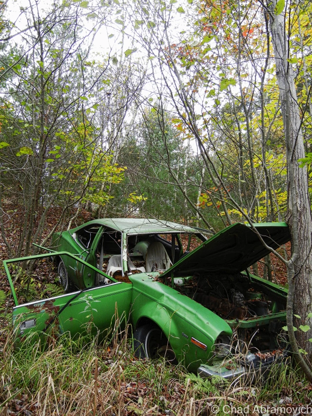
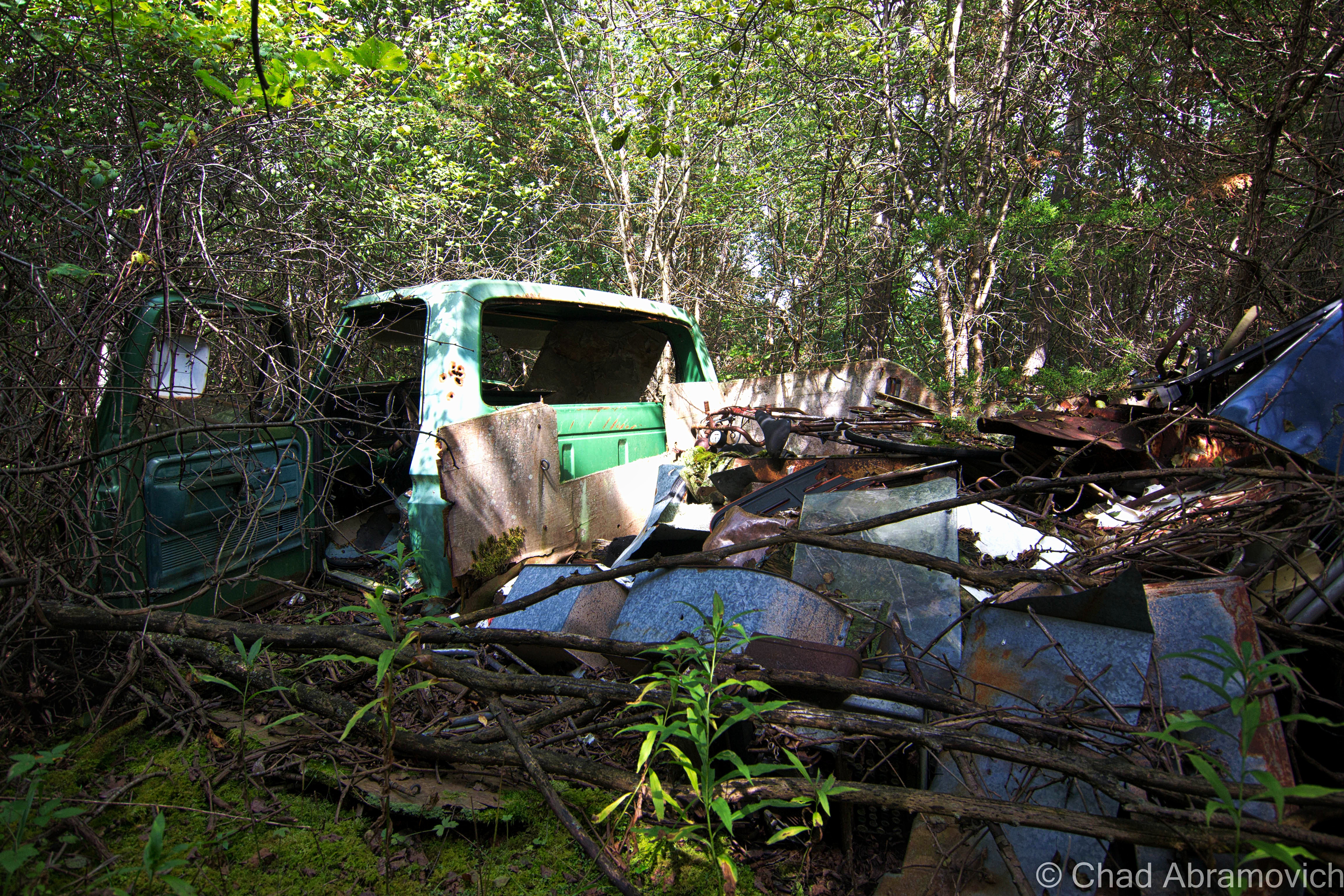
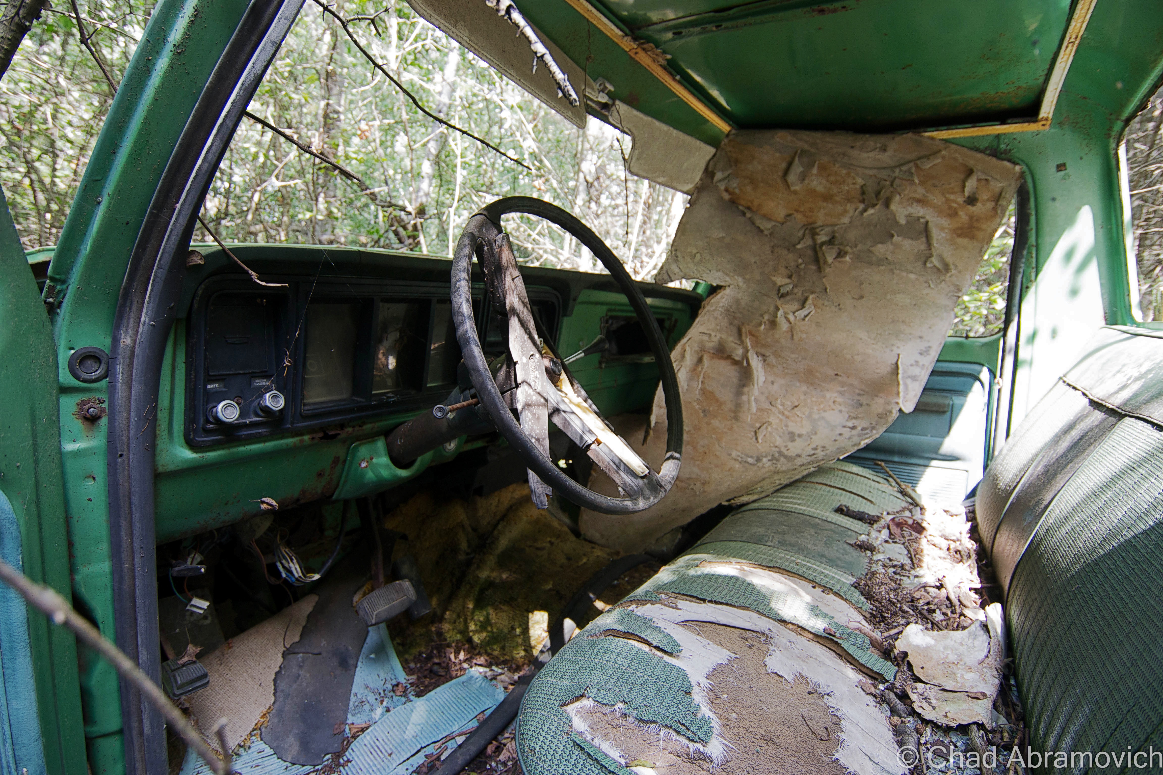
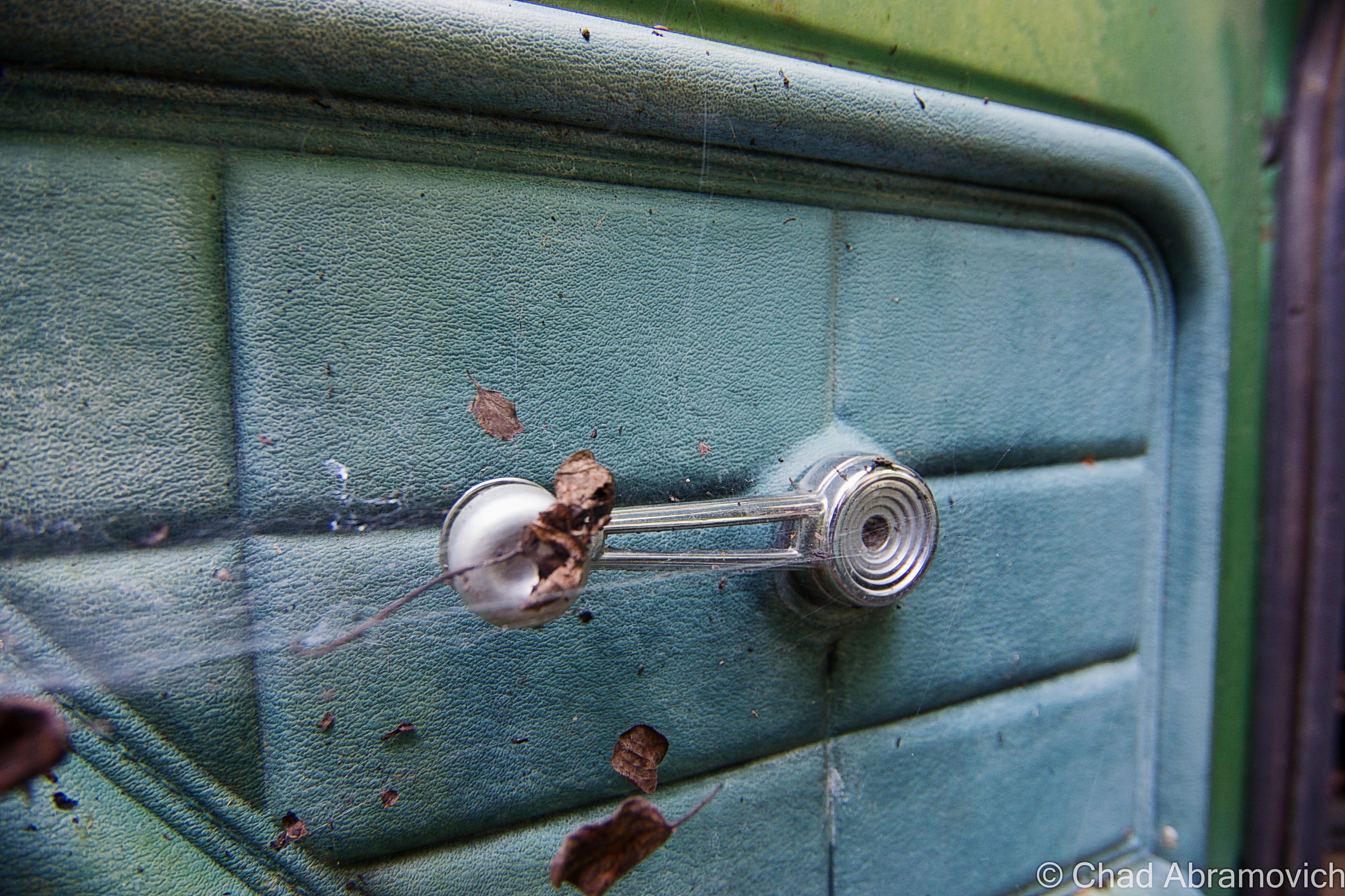
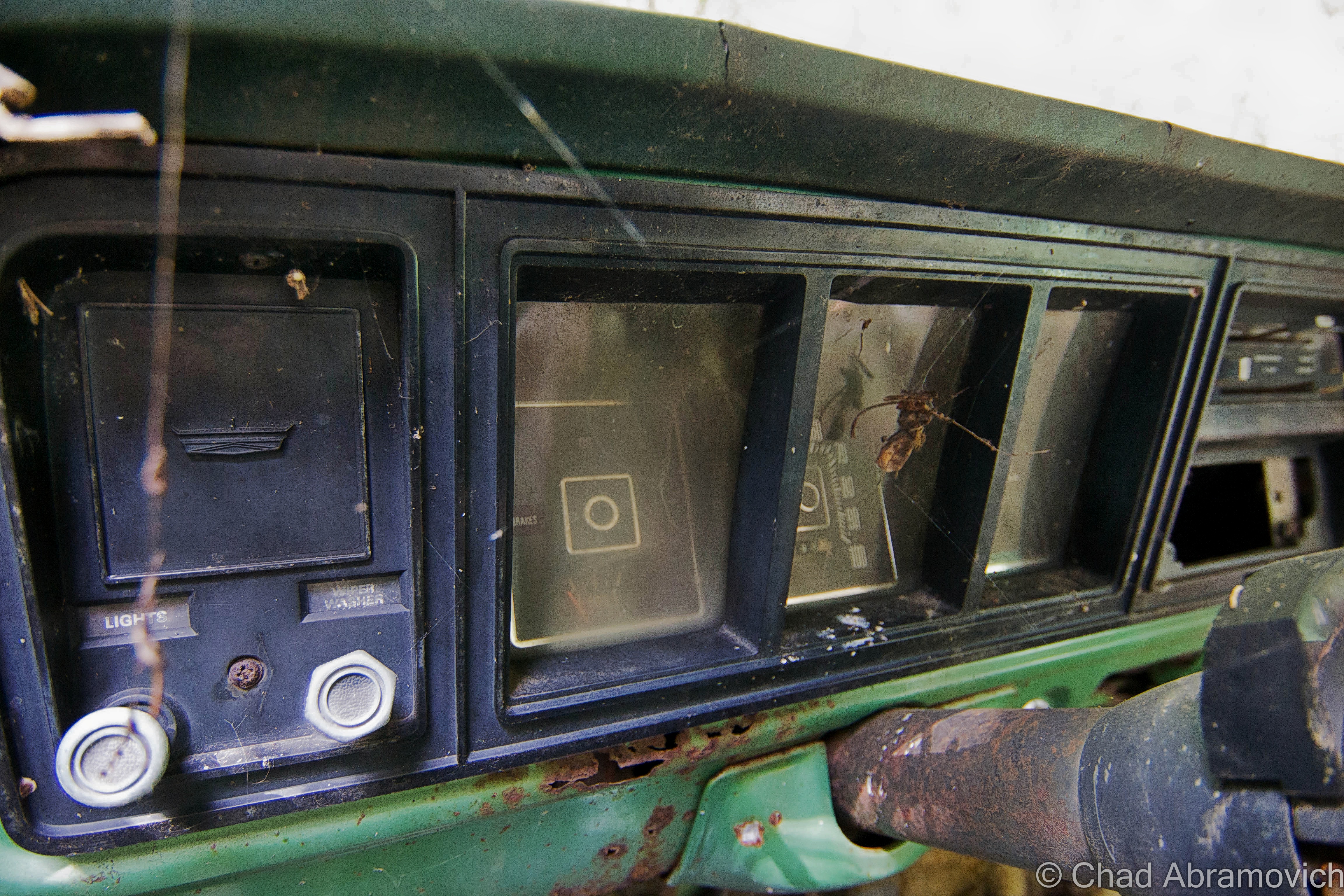
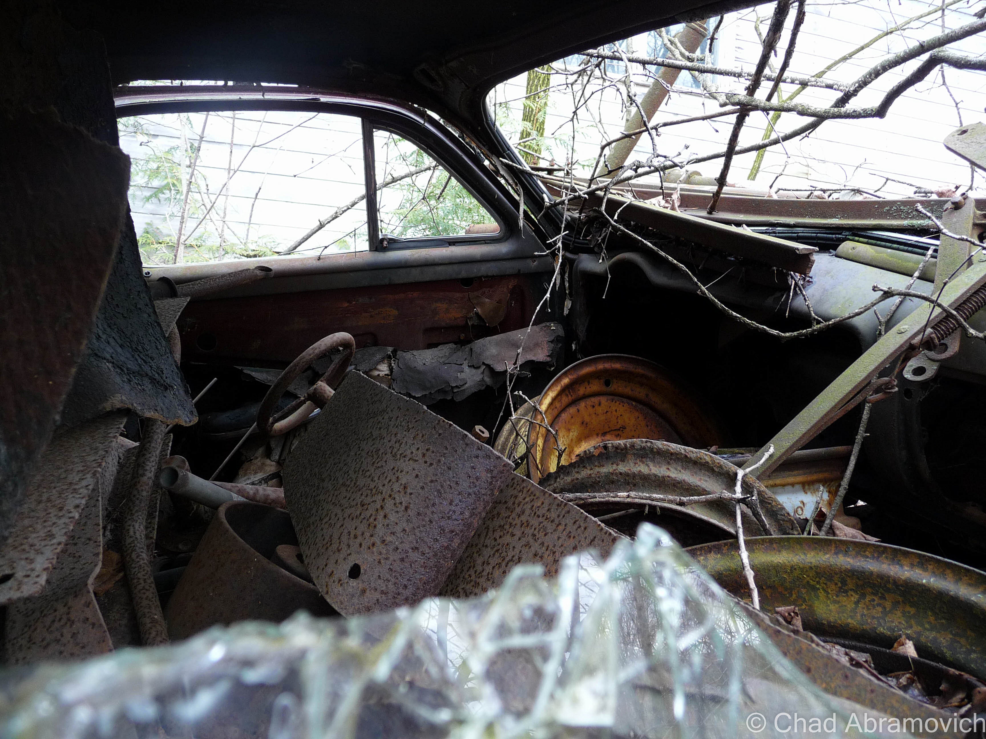
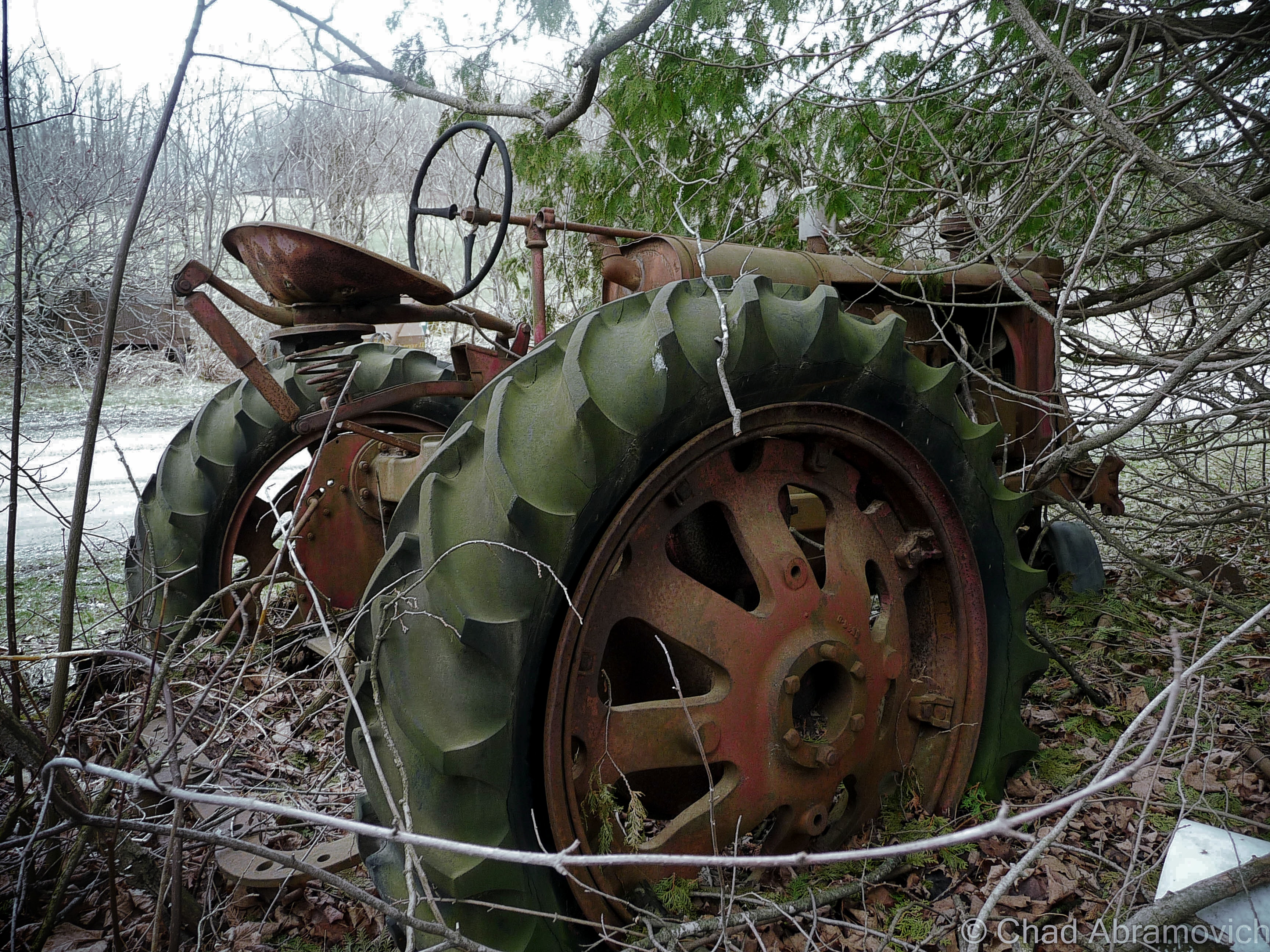
As a kid, I grew up playing in the woods of an old farm behind my house. Most of the land wasn’t tended and had grown up into a mature forest by then. We used to cut 4 wheeler trails through the growth and explore the old farm roads and examine artifacts from yesteryear we’d come across, like old barbed wire fences, a neon green AMC Hornet pushed into a ravine, and the prime find – the grimy miscellany of the old farmers’ junkyard. We used to salvage stuff from the heaps of junked appliances, tires, and barn mementos and use it to build forts with. Old tin, a couch, the front seats from an old Ford Mustang, even an old woodstove. We made some cool hangouts from the refuse we excitedly recycled.
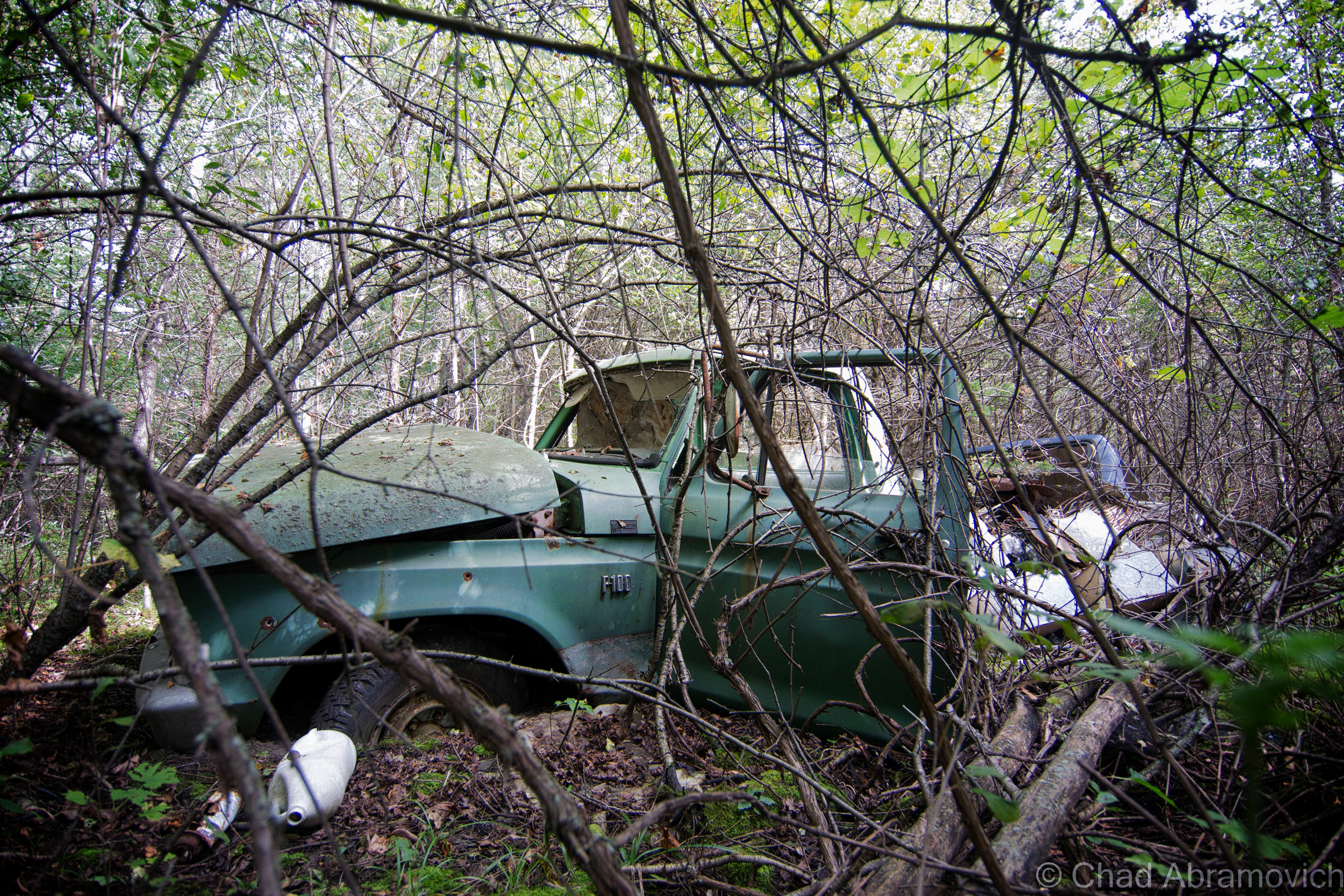
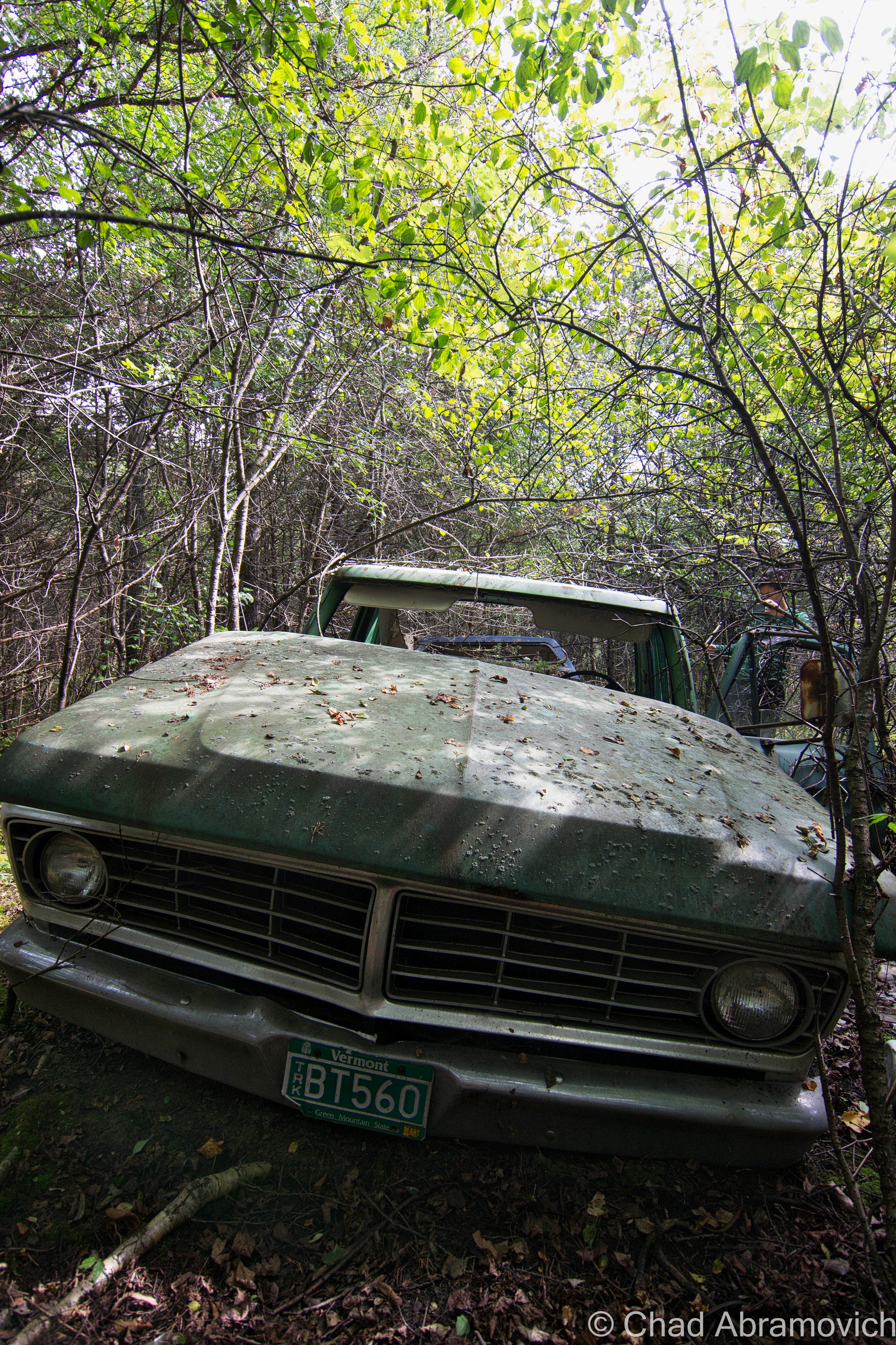
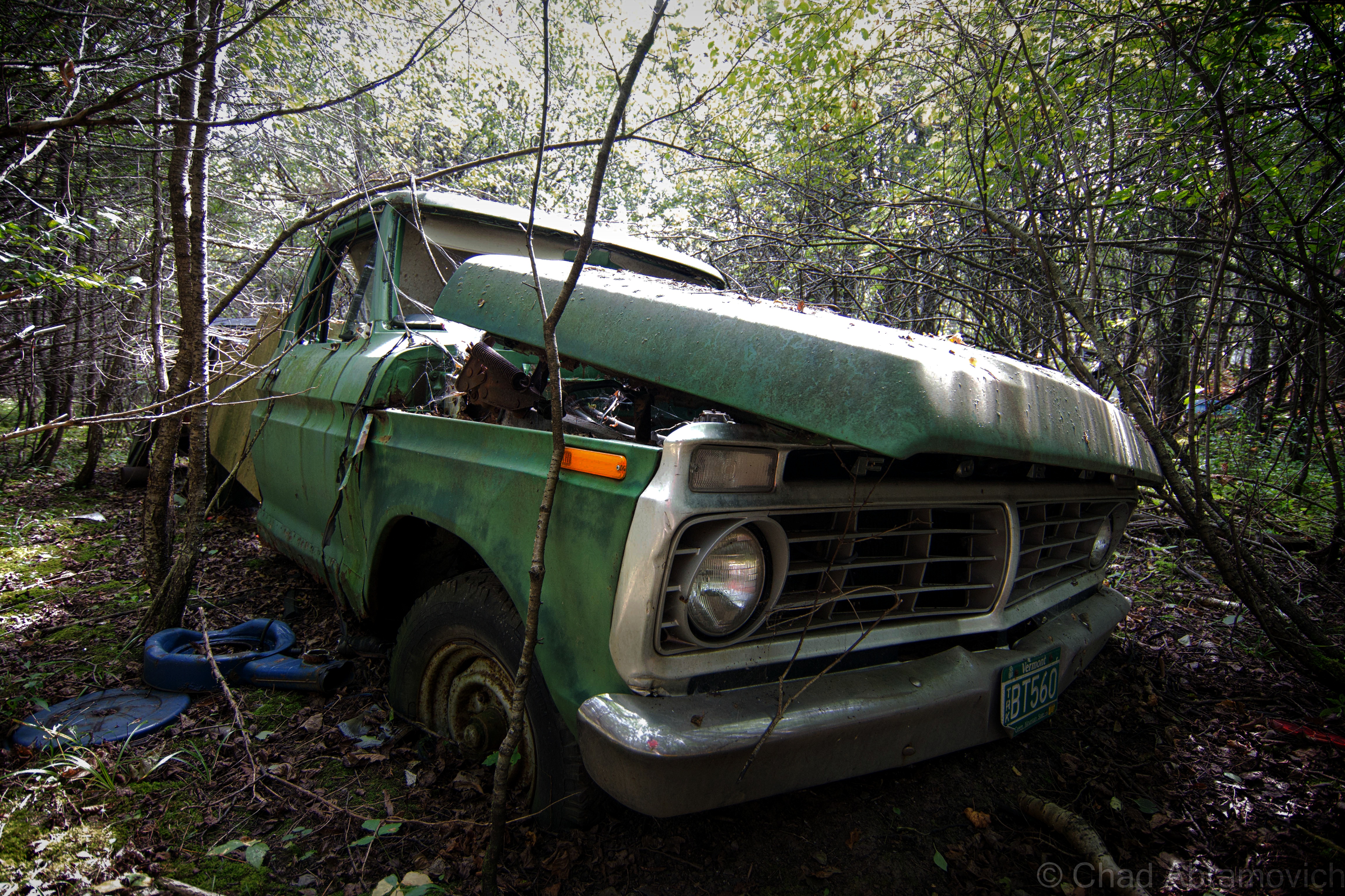
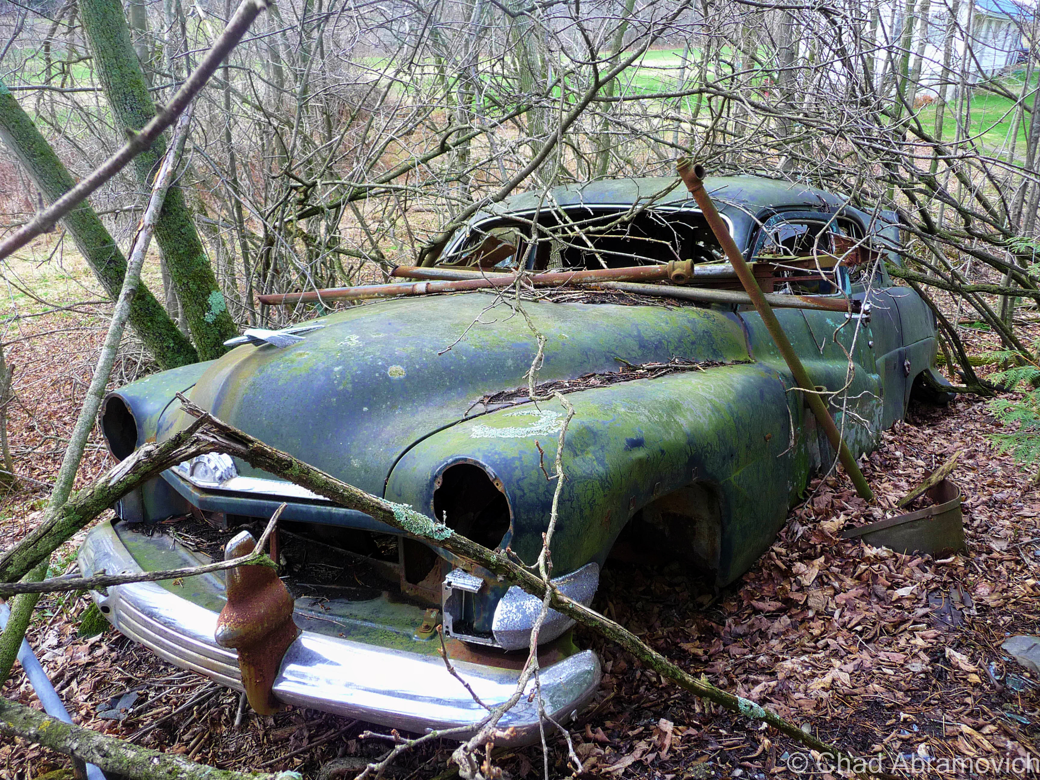
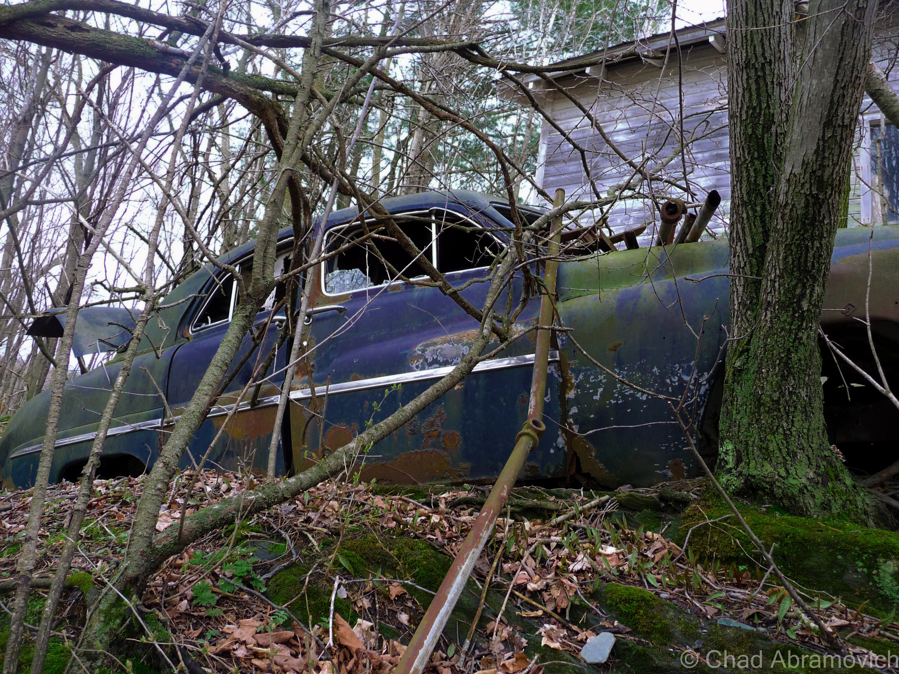
Milton – this fading green AMC Hornet lies on a steep bank behind a rural stretch of railroad tracks, on the edge of a patch of thick swampland. it looks as if someone pushed (or quite possibly drove) the car down the hill, where it lays to rest.
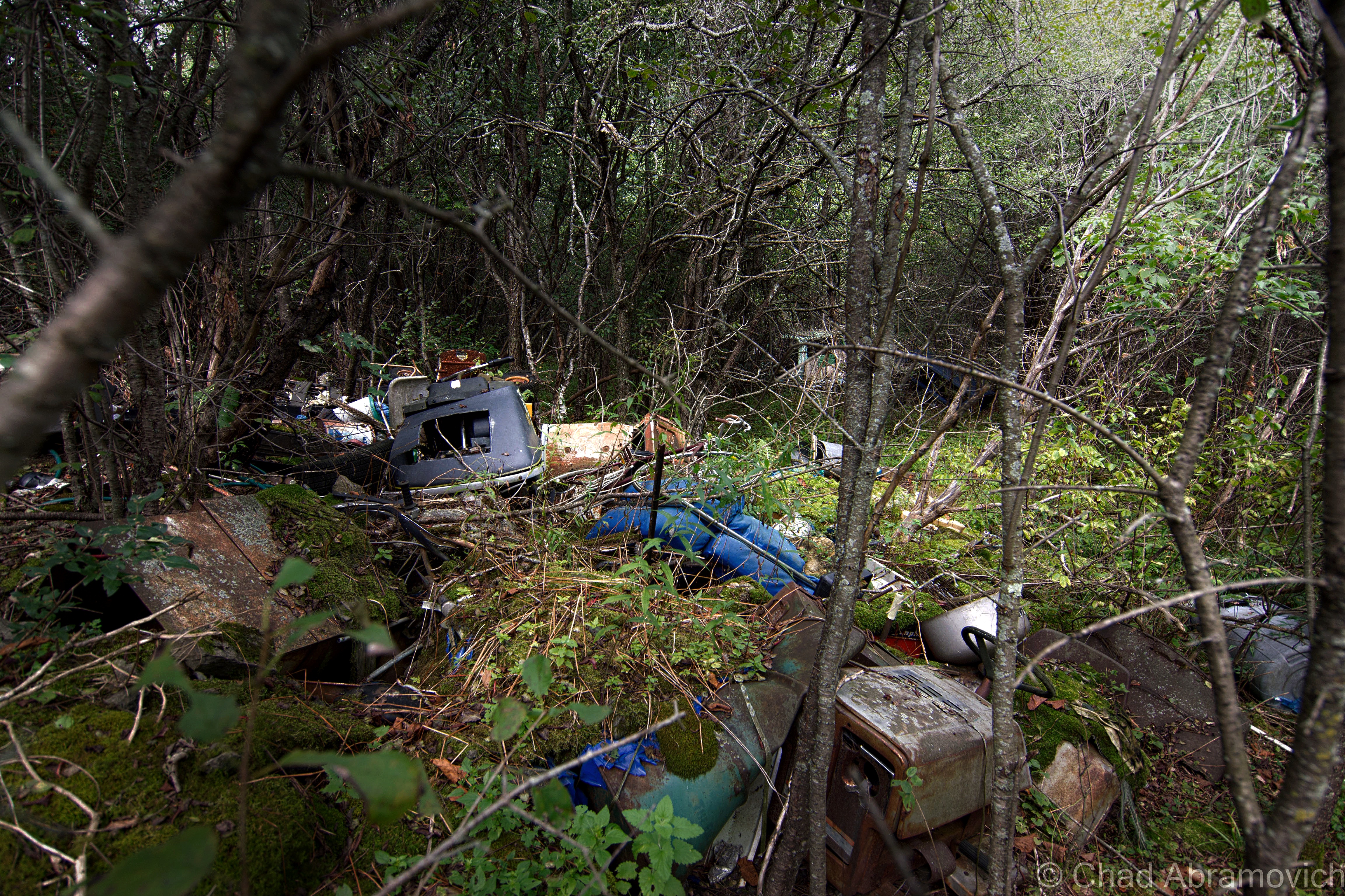
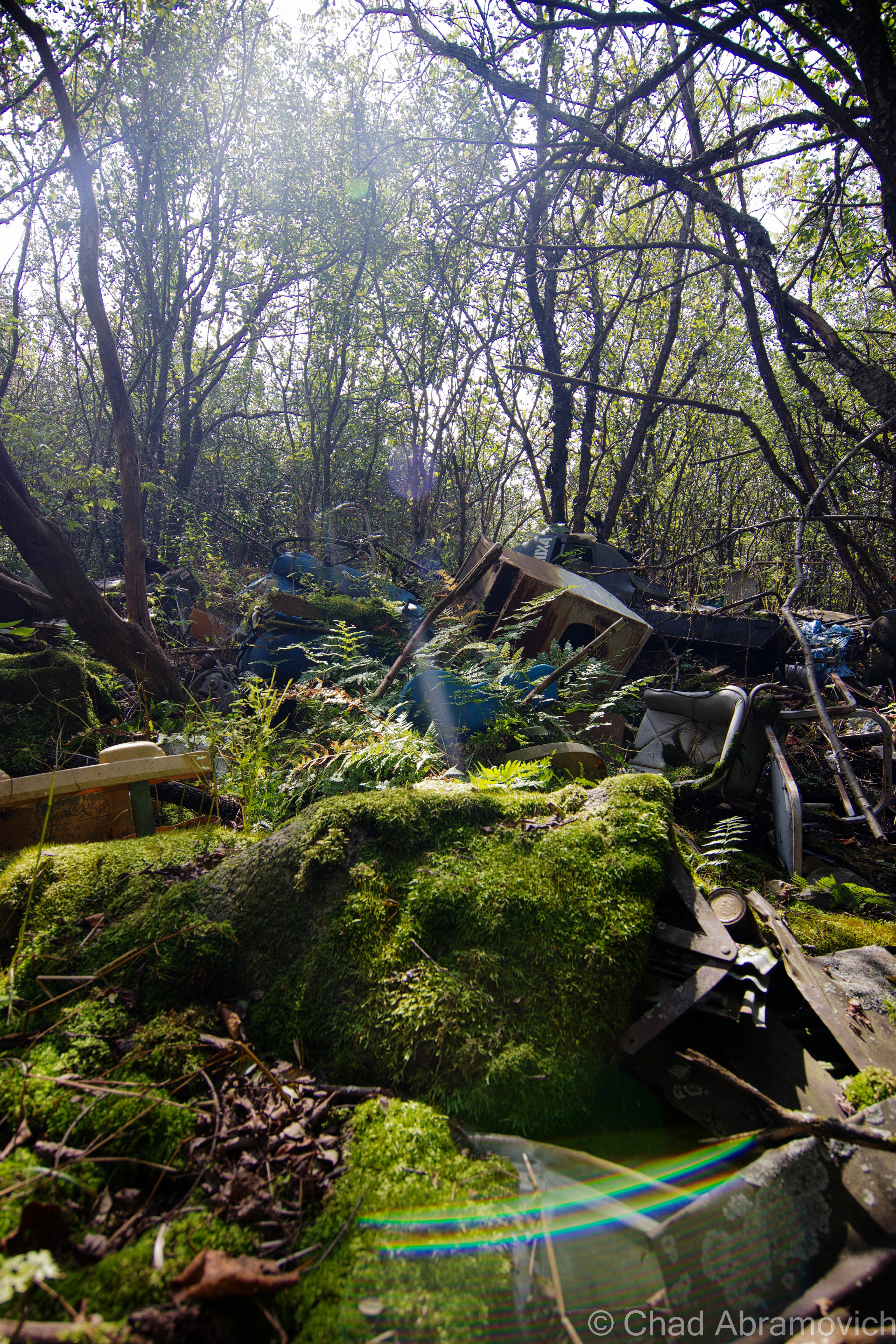
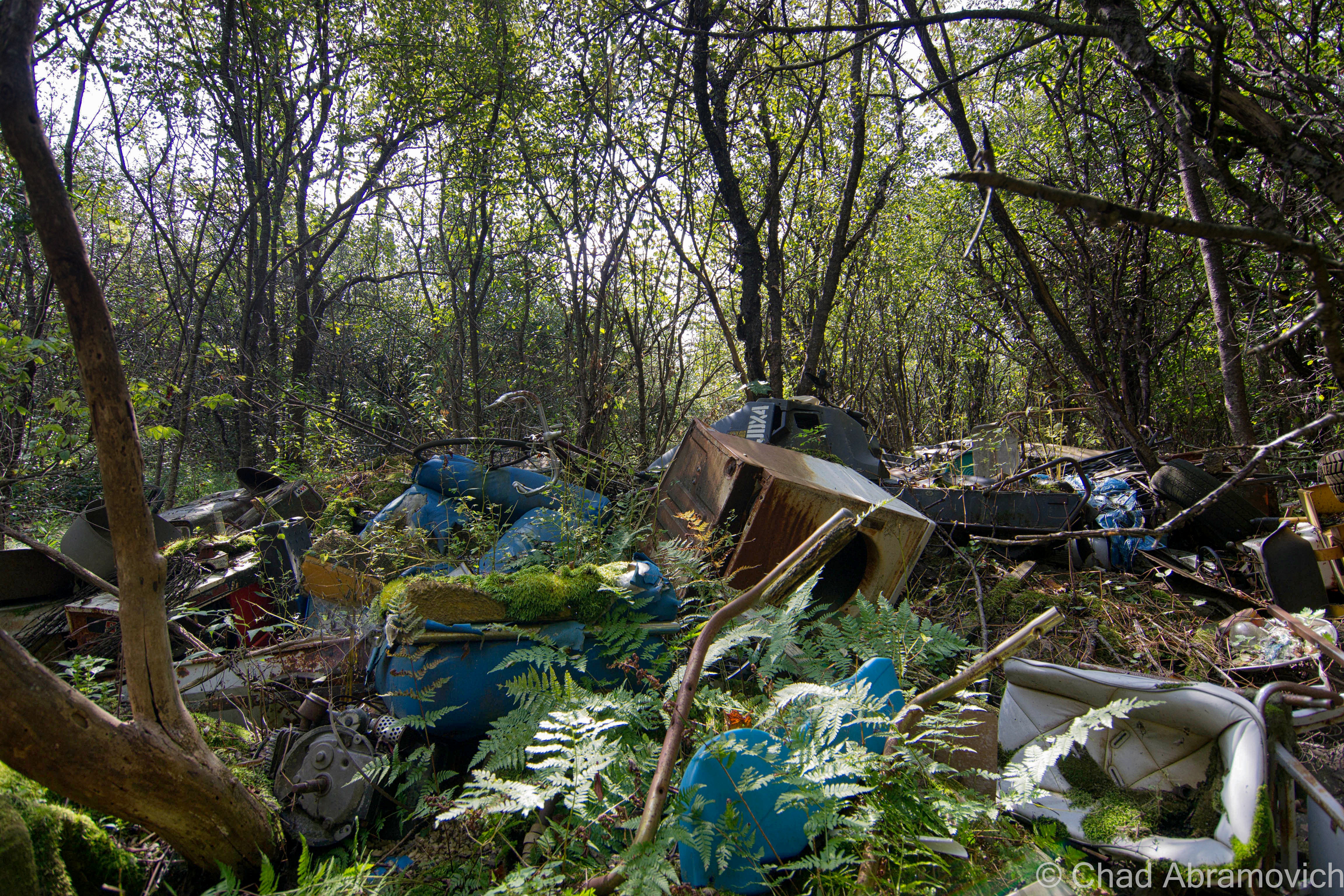
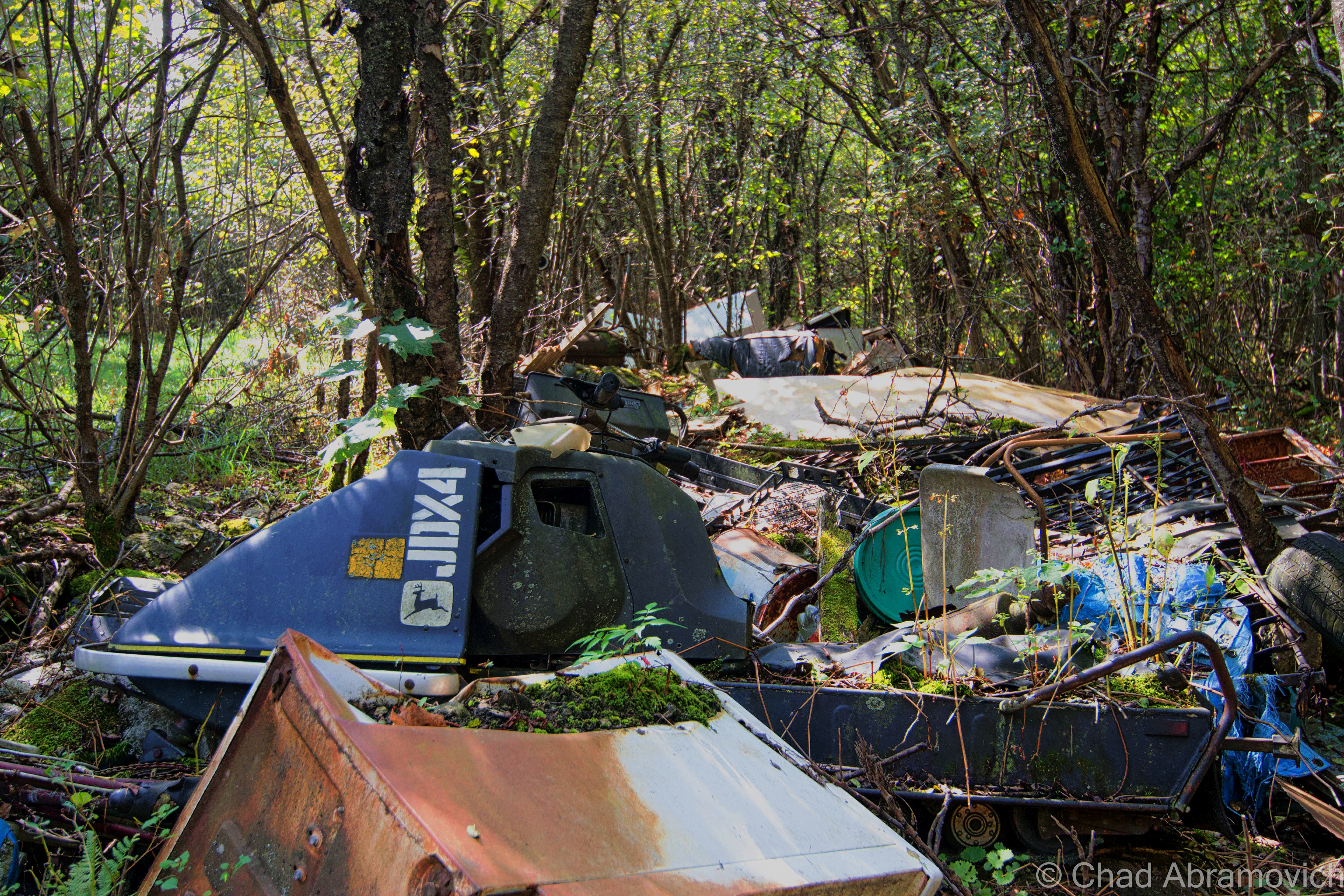
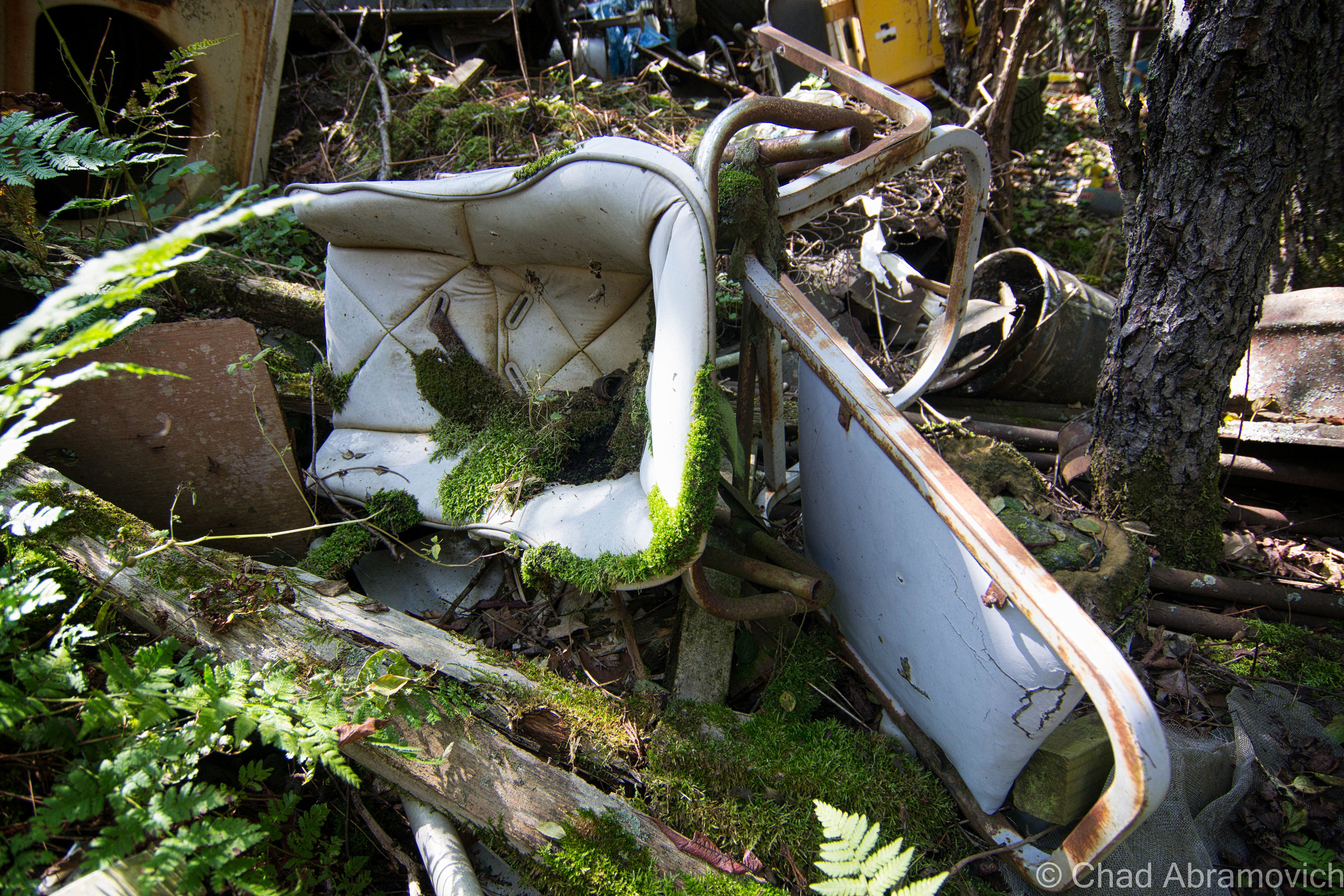
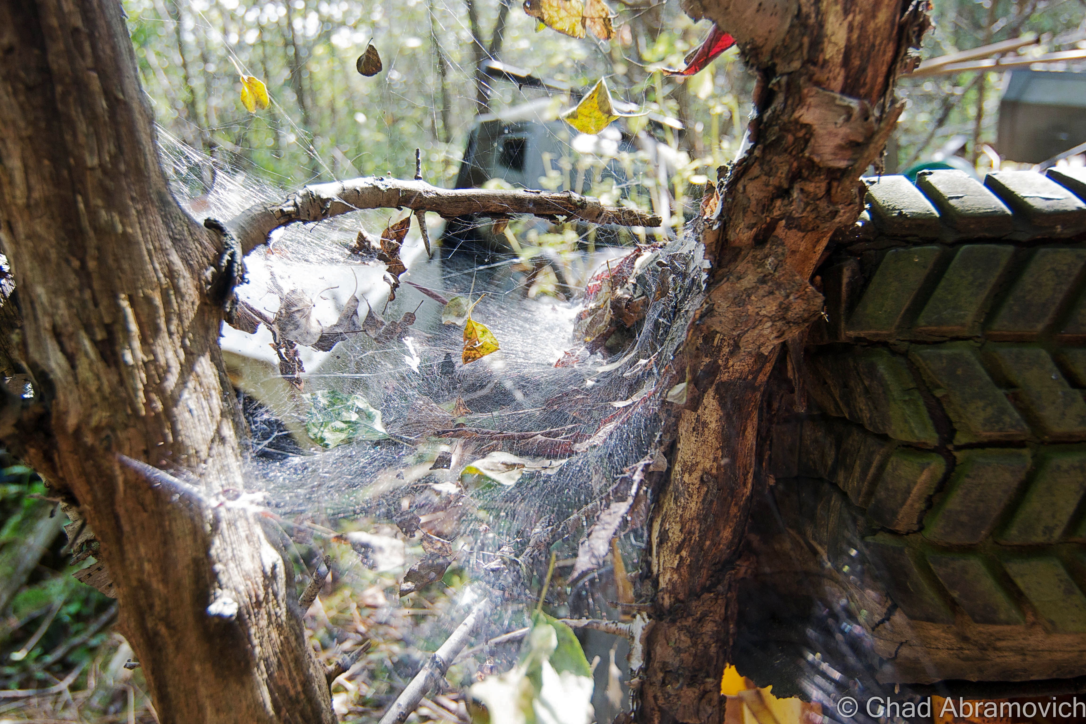
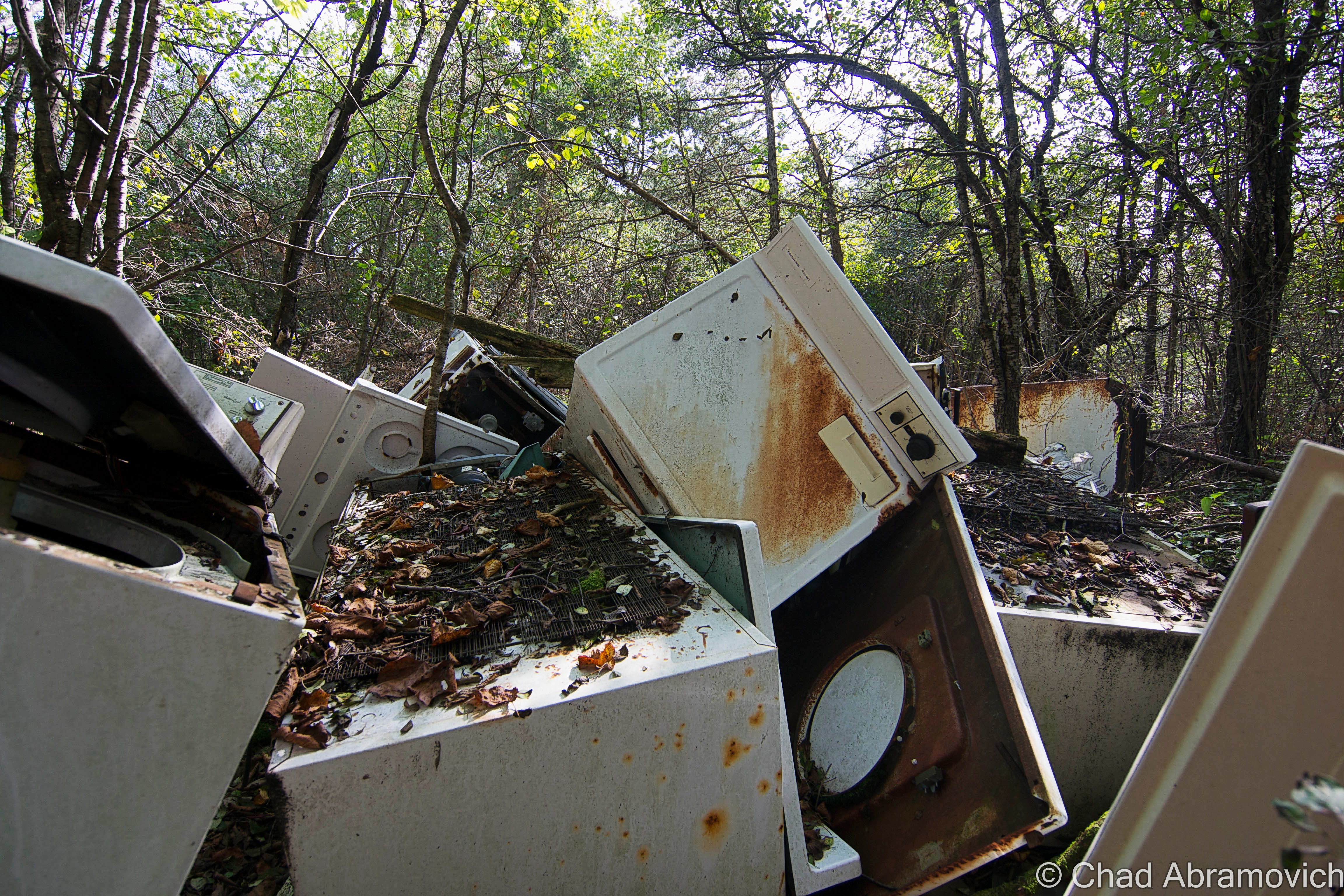
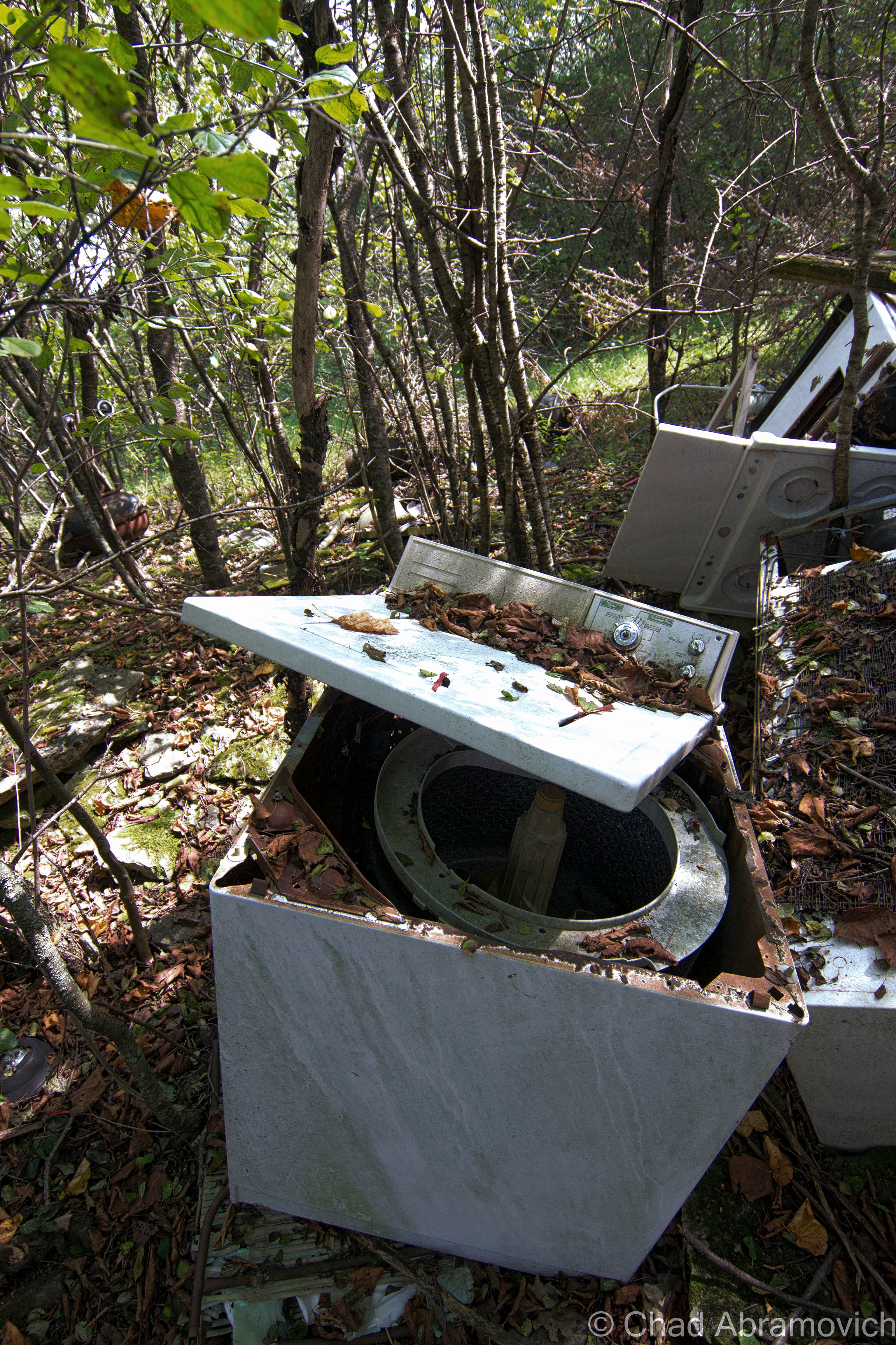
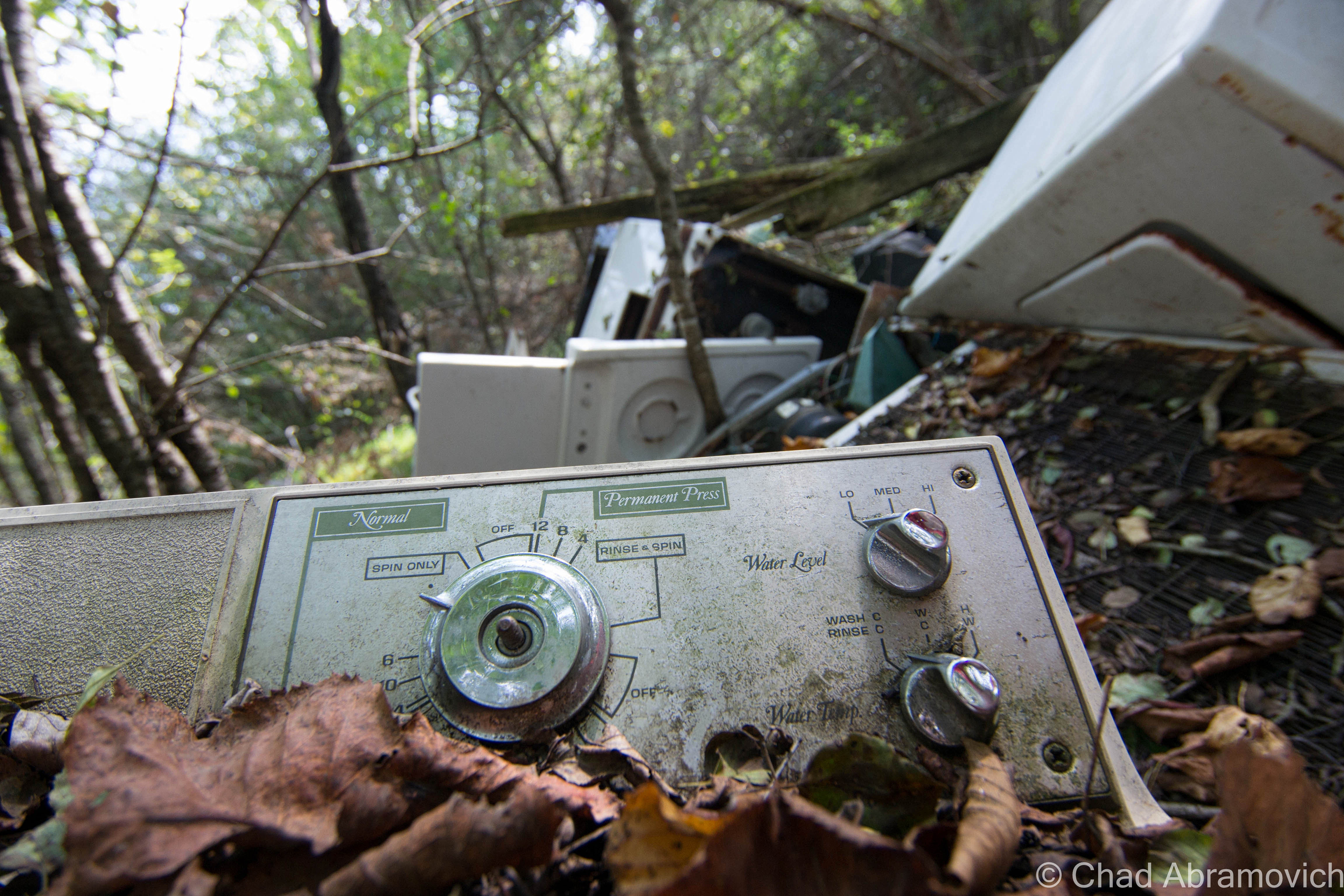
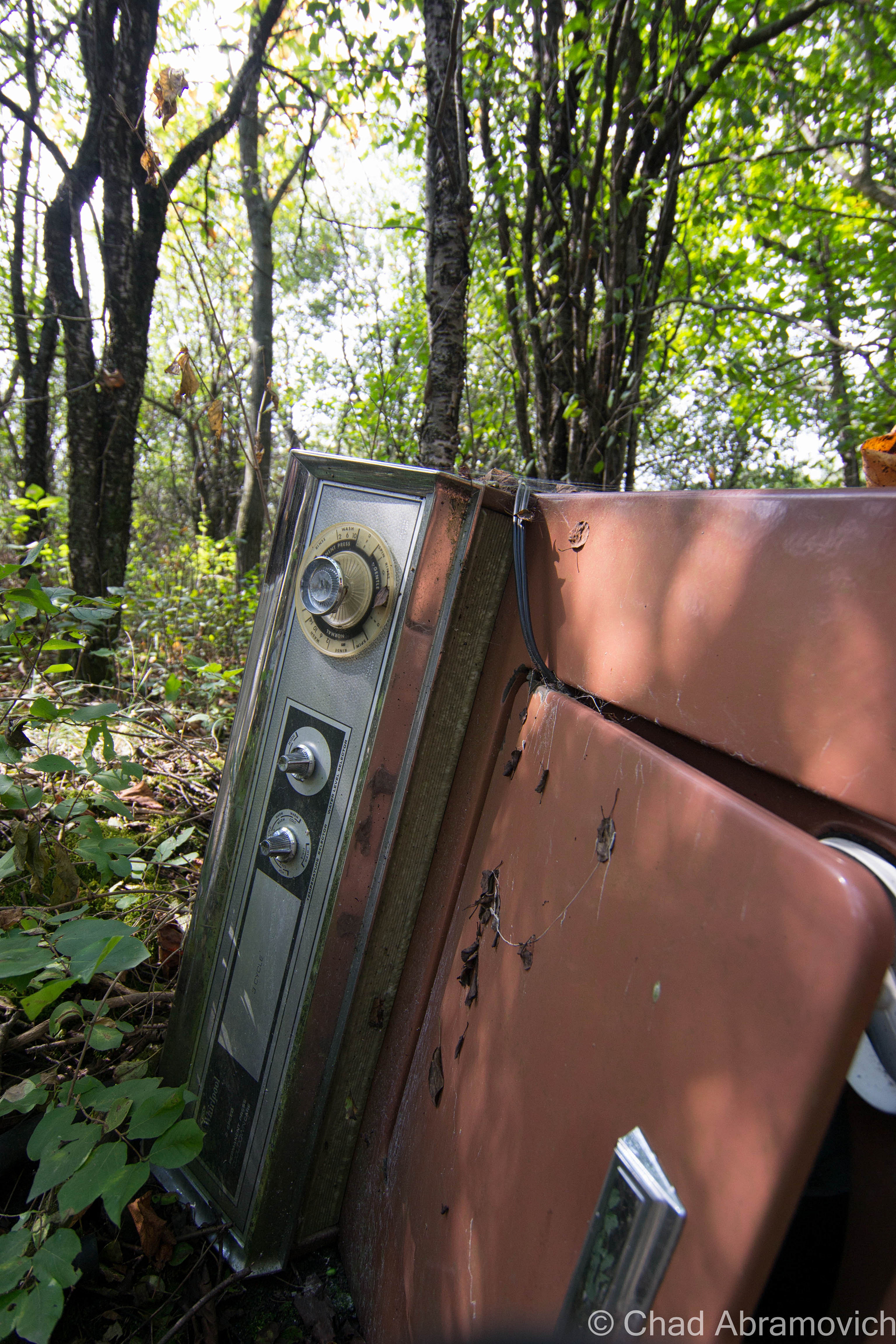
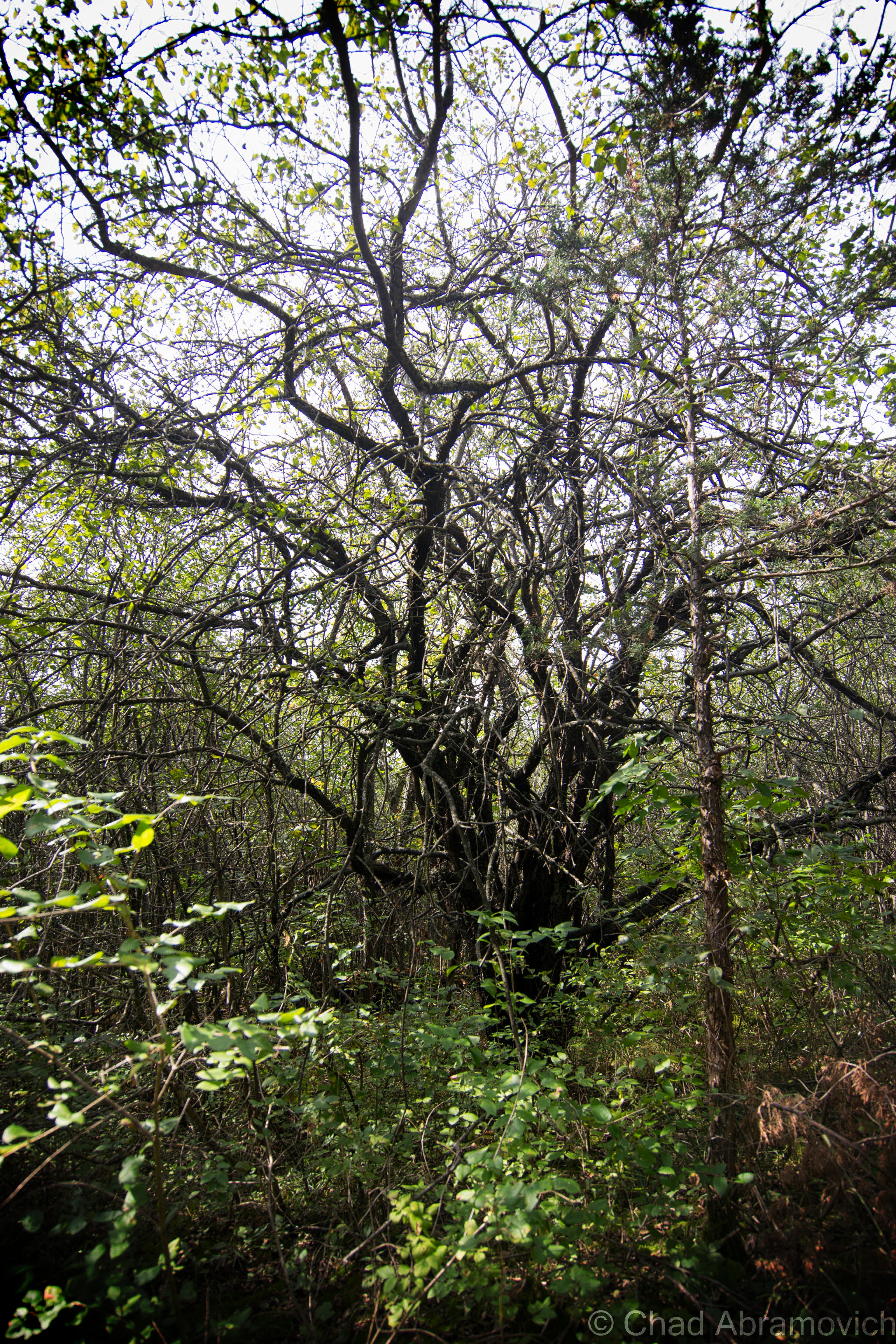
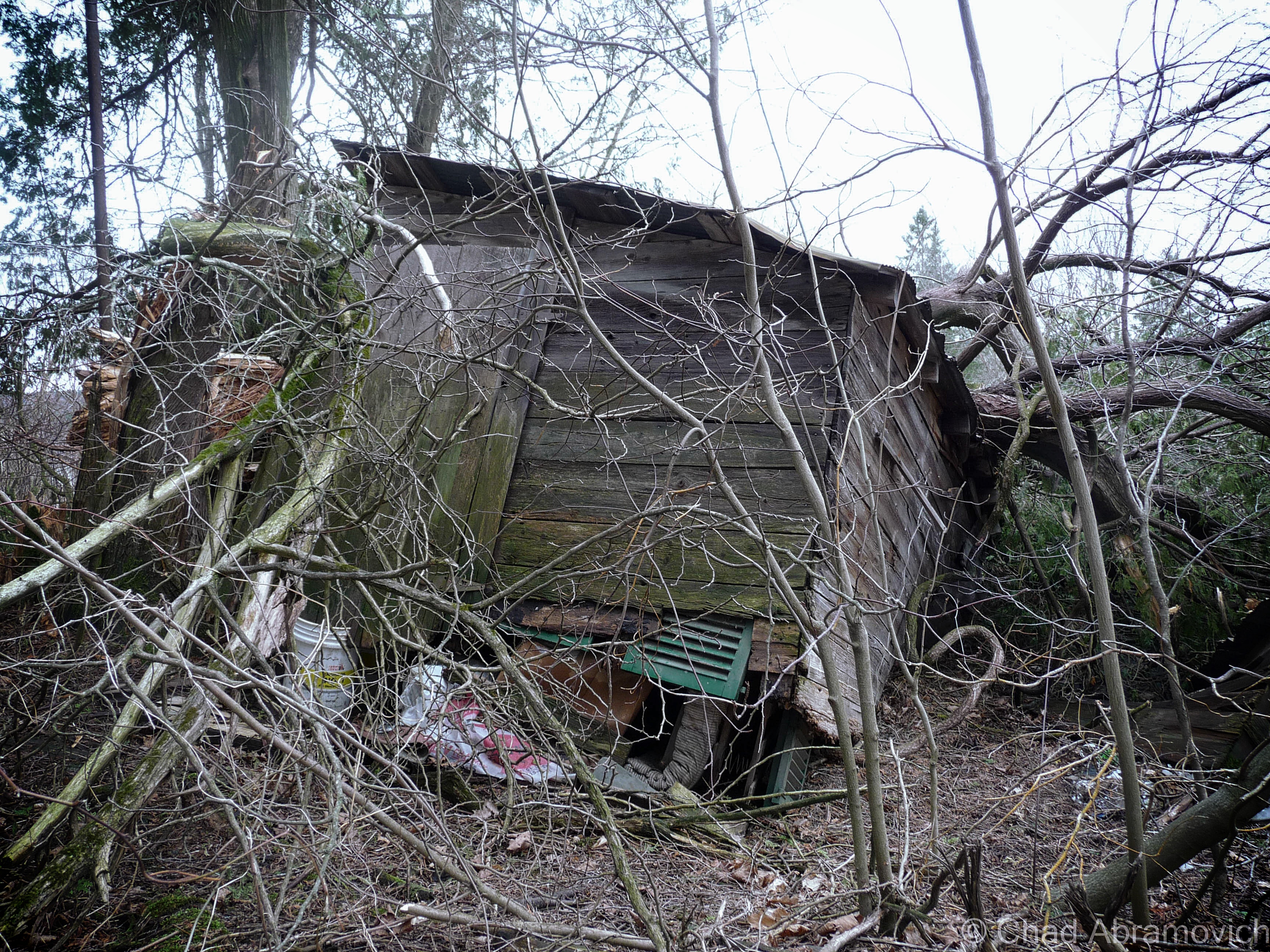
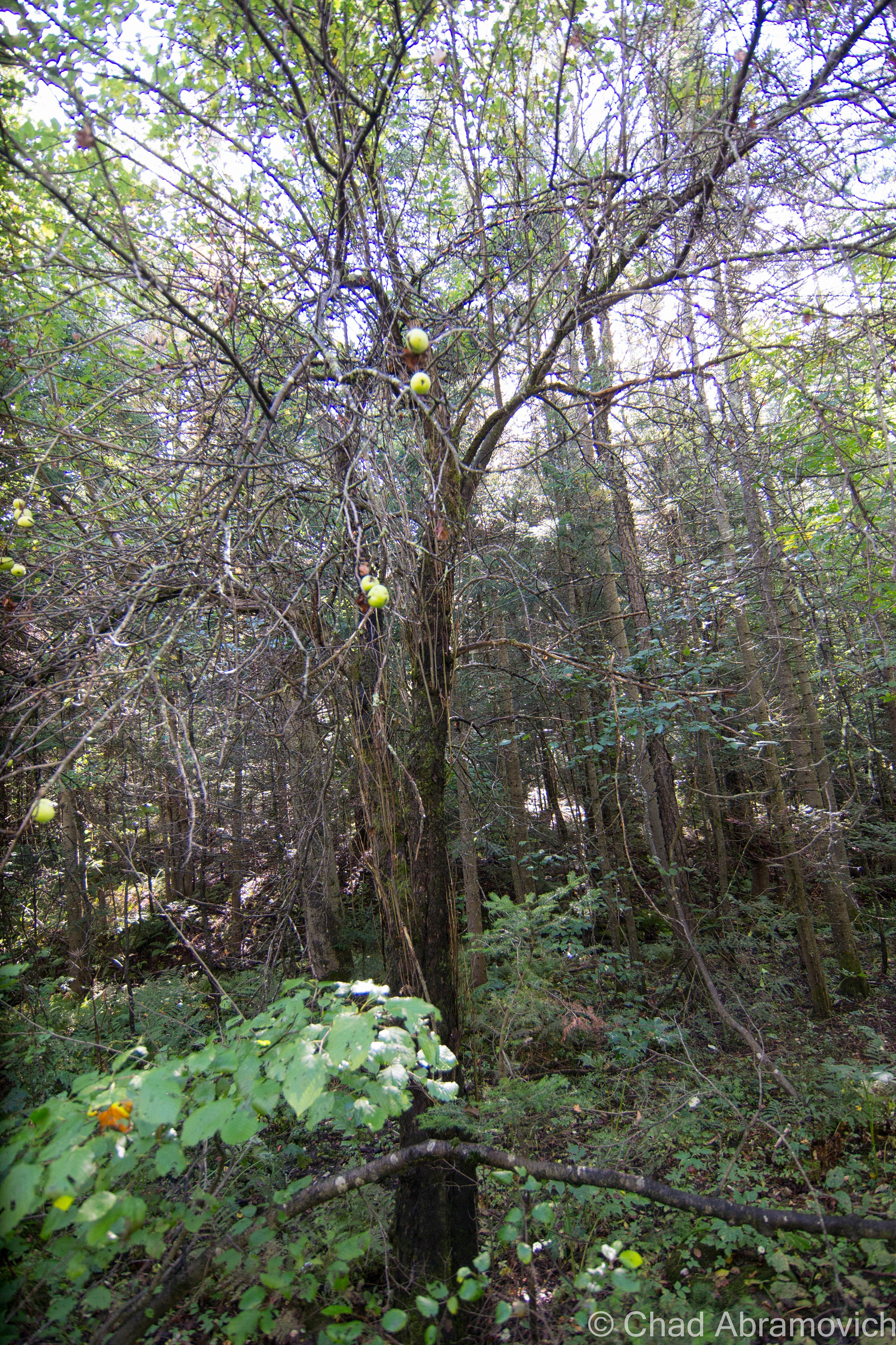
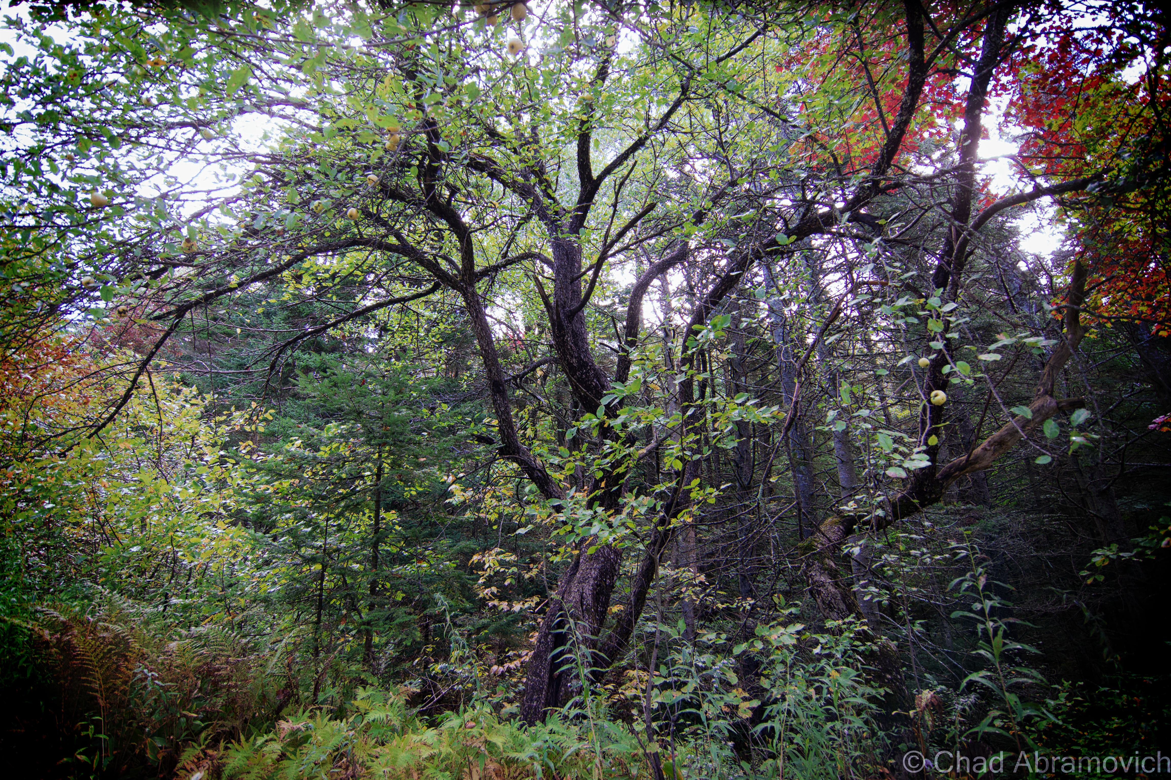
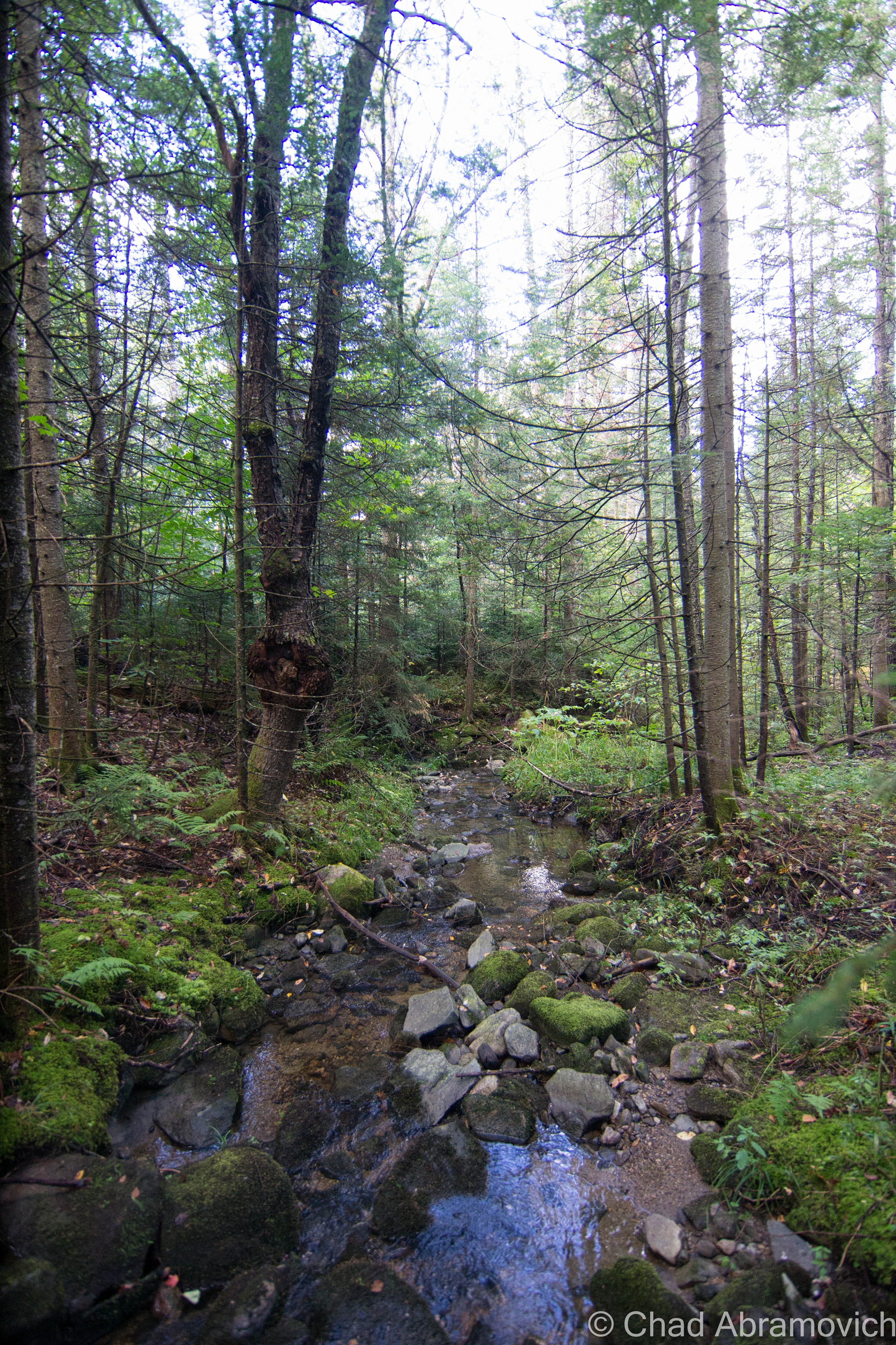
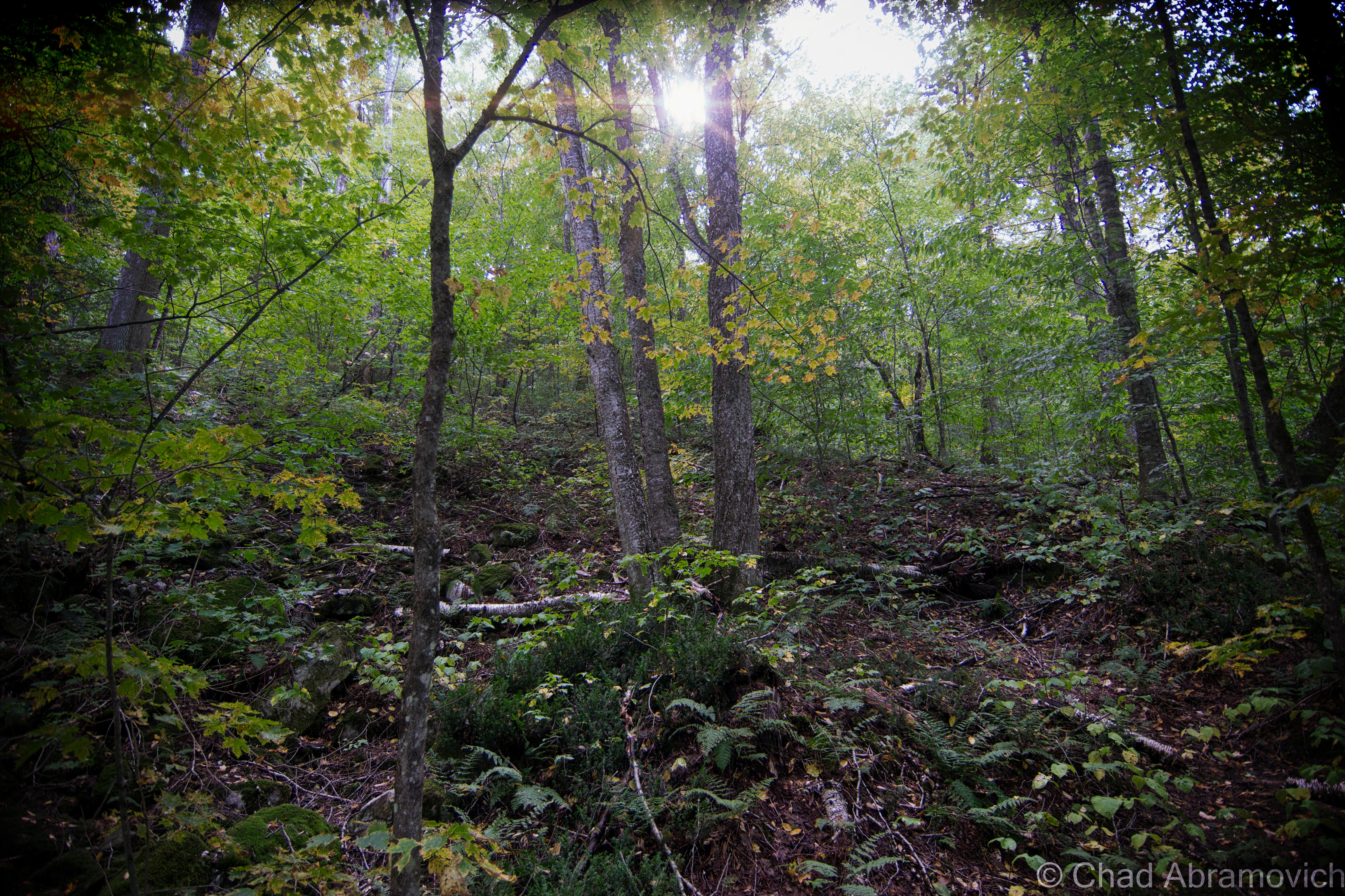
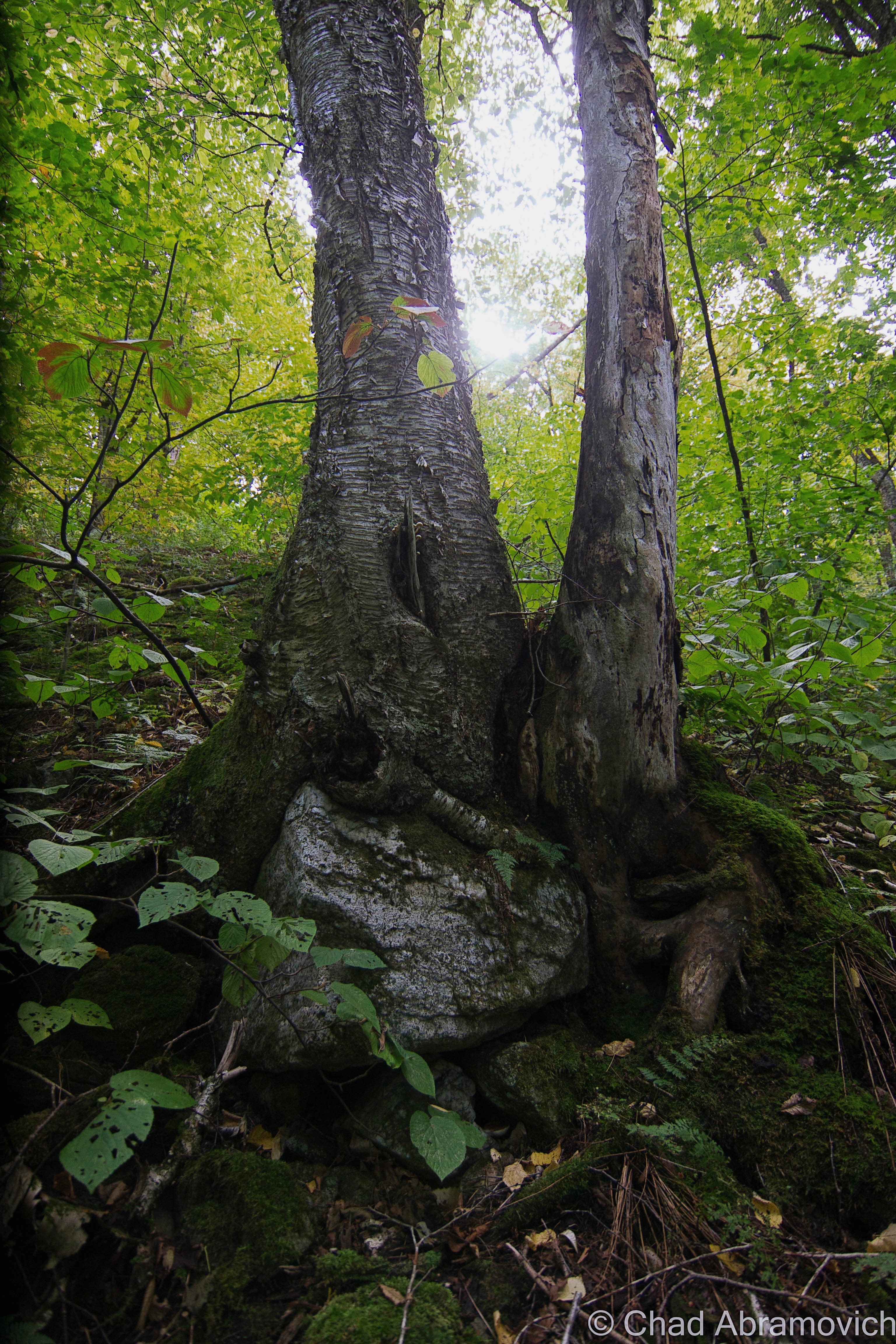
A friend of mine got in touch with me and said she had a new location up her sleeves, an abandoned farm up in the north part of the state, the dumping ground part of it was on her property and she hadn’t gotten around to doing anything about it yet. I thought it was weird that I live in Vermont and haven’t explored a farm yet. So on a beautiful autumn day, I met up with her and she led me through some overgrown tangle woods of nettles, dead apple trees and mangey looking cedar trees that turned the area into a dark entry. A few minutes into our walk and the already fallow landscape began to change, and I began to notice mounds of discarded anything covered in moss and fallen leaves that had been dumped underneath the dead canopy.
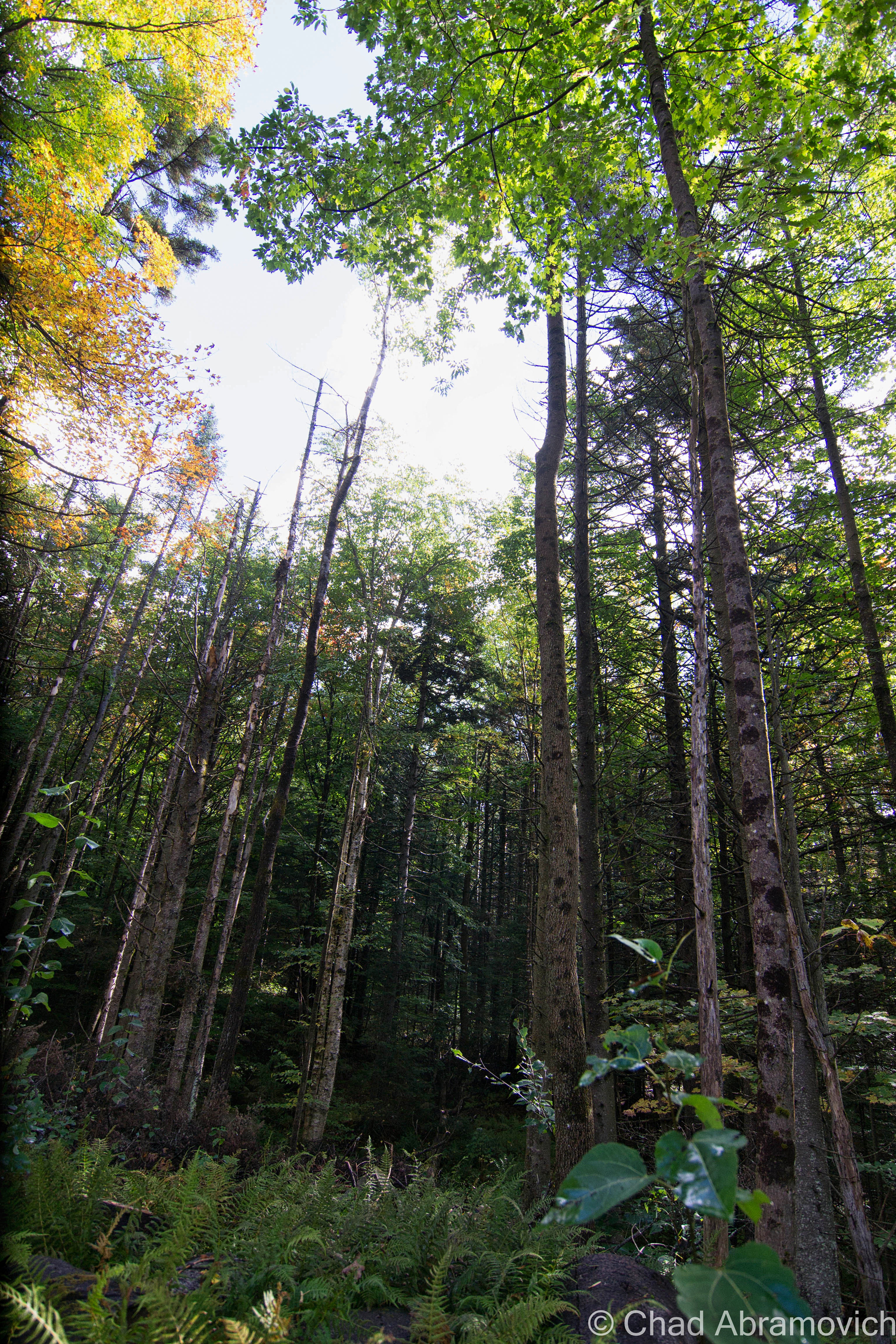
A walk through the Vermont woods can often be revealing. It’s not uncommon to find relics from a different Vermont left to disintegrate below the trees. And in my opinion – our ruins are often one of the coolest things about the human race. We create amazing structures and accomplishments or inhabit these laborious lifestyles and let the aftereffects rot without much of a thought, leaving people like me to eagerly trace their occurrences that blur the line between litter and urban archeology. And out of any time of the year, you can be most appreciative of our habit to ruin than the fall, when visibility is best.
There was a time not that long ago, when Vermonters didn’t dig today’s Green culture. Back then, the most efficient and convenient way to get rid of anything you deemed as garbage, was to make the disposal quick and uncomplicated. This was often accomplished by dumping those items on a far corner of the farm, or let gravity take it down a river bank. Over time, these items accumulated, festering in the woods long after the farm went defunct, or their traces bleeding into our waterways or soil.
How times have changed. Today, a growing chunk of Vermonters are building a culture that feels how we coexist with our environment is a virtue, and villainize those things that don’t fall into place. And if you’re not one of those people, well, it’s also the law. But as is the trend, the movement also shakes things up, especially farmers who find it expensive and laborious to abide by new regulations, or the costs of implementing new laws or infrastructure by a government that many are losing faith in.
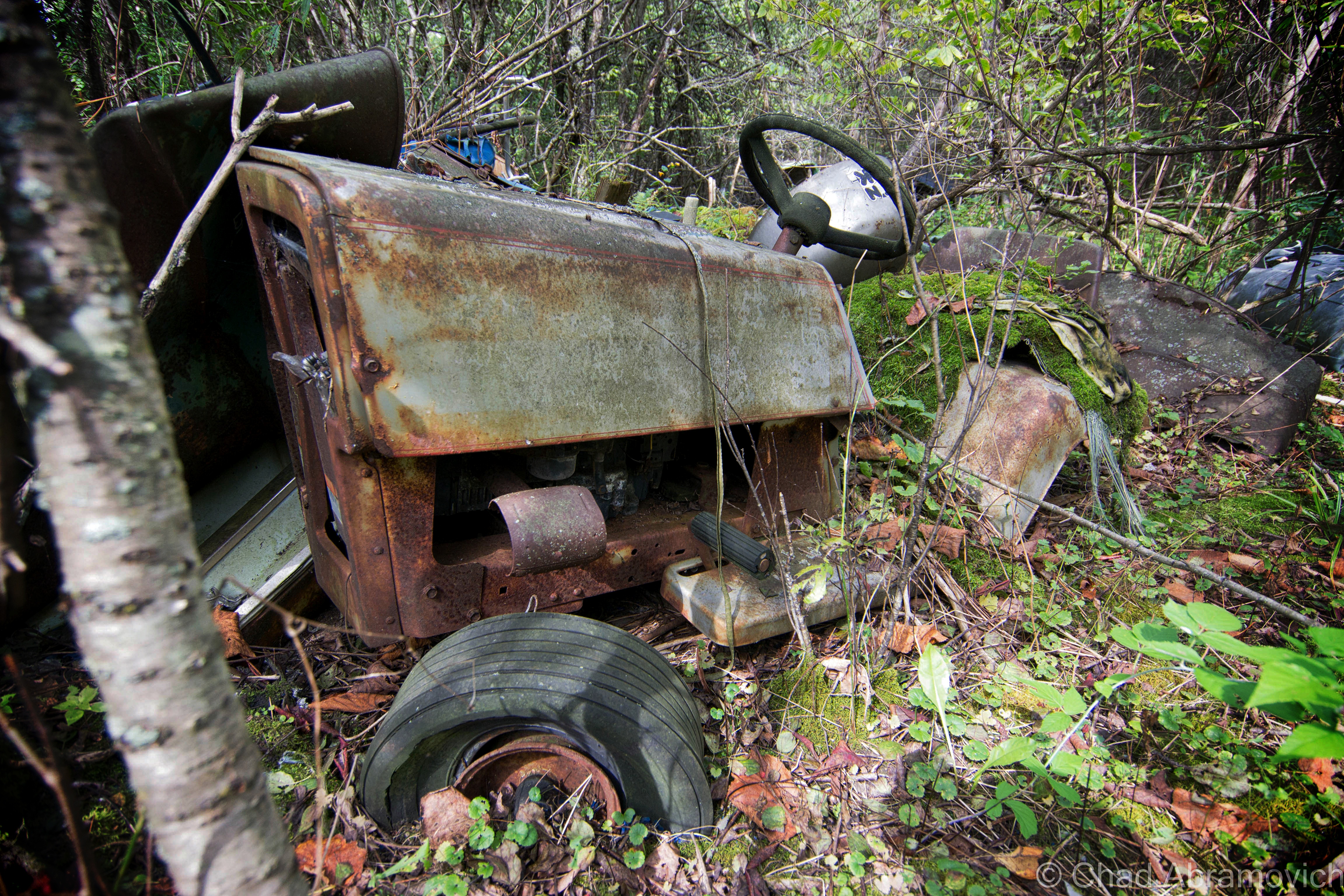
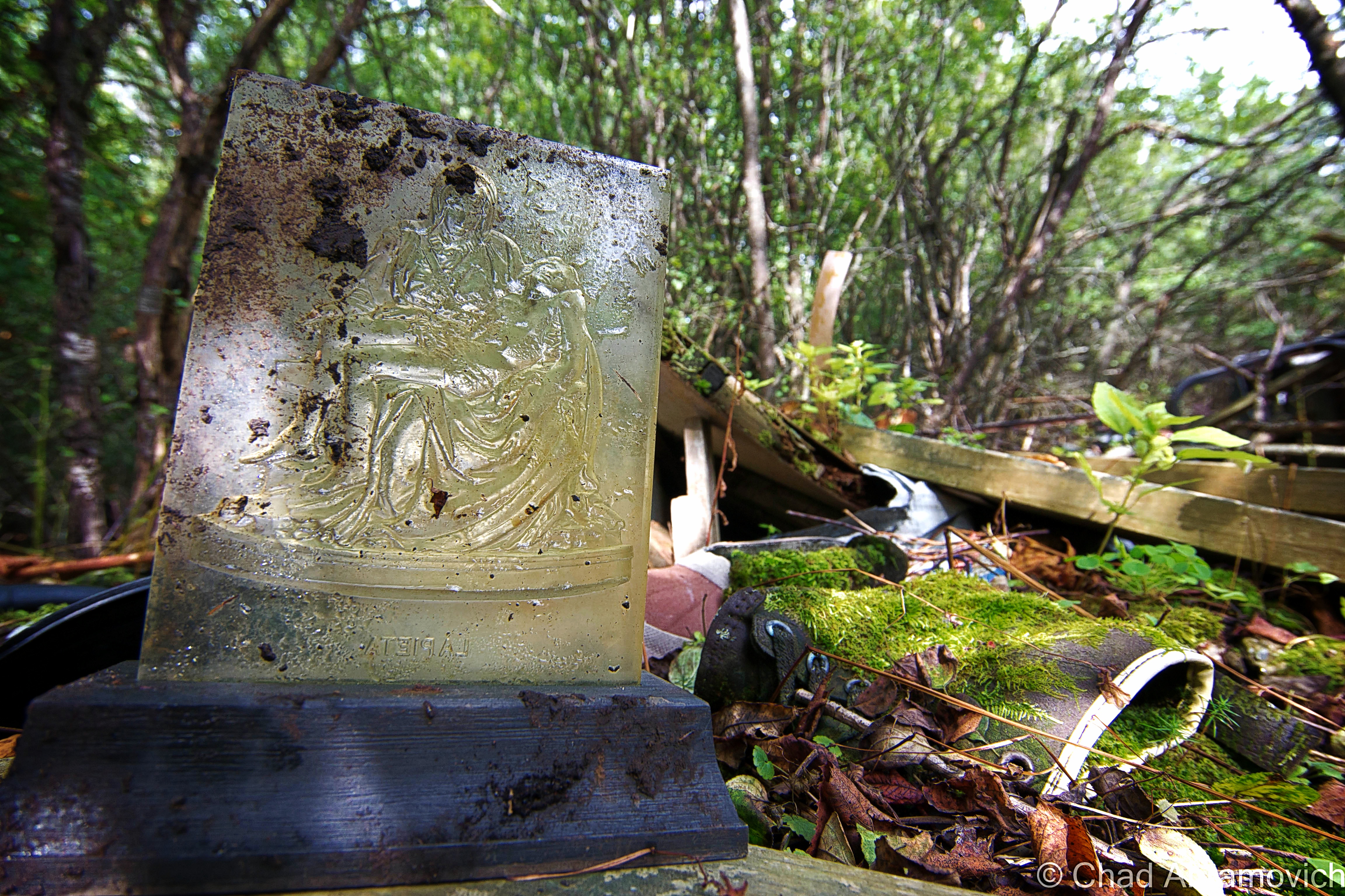
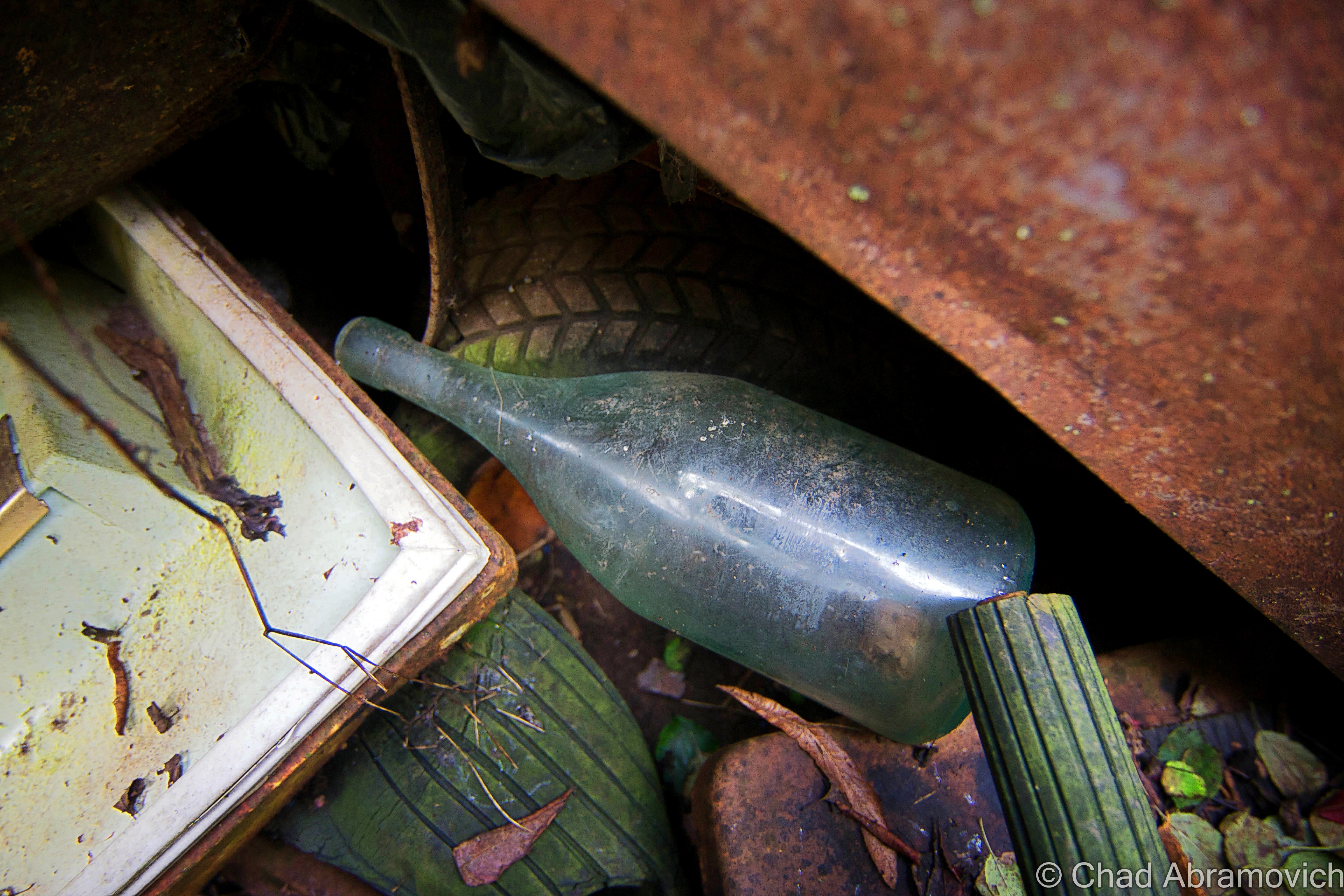
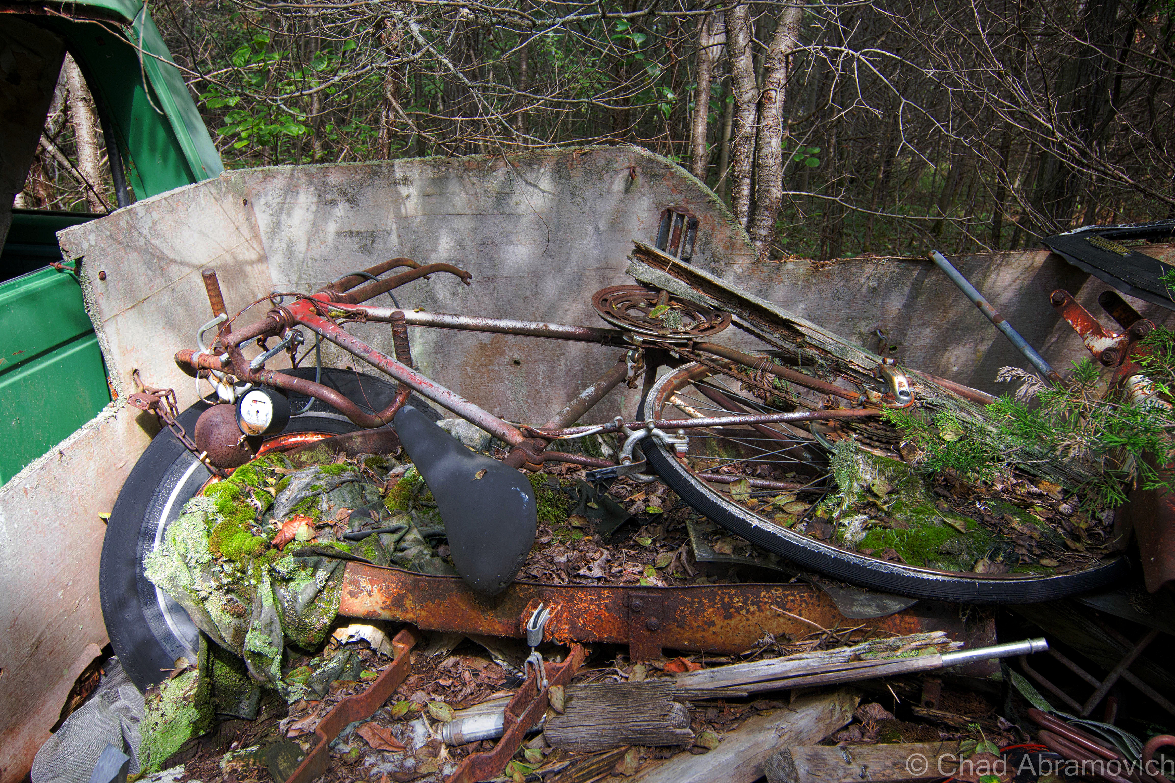
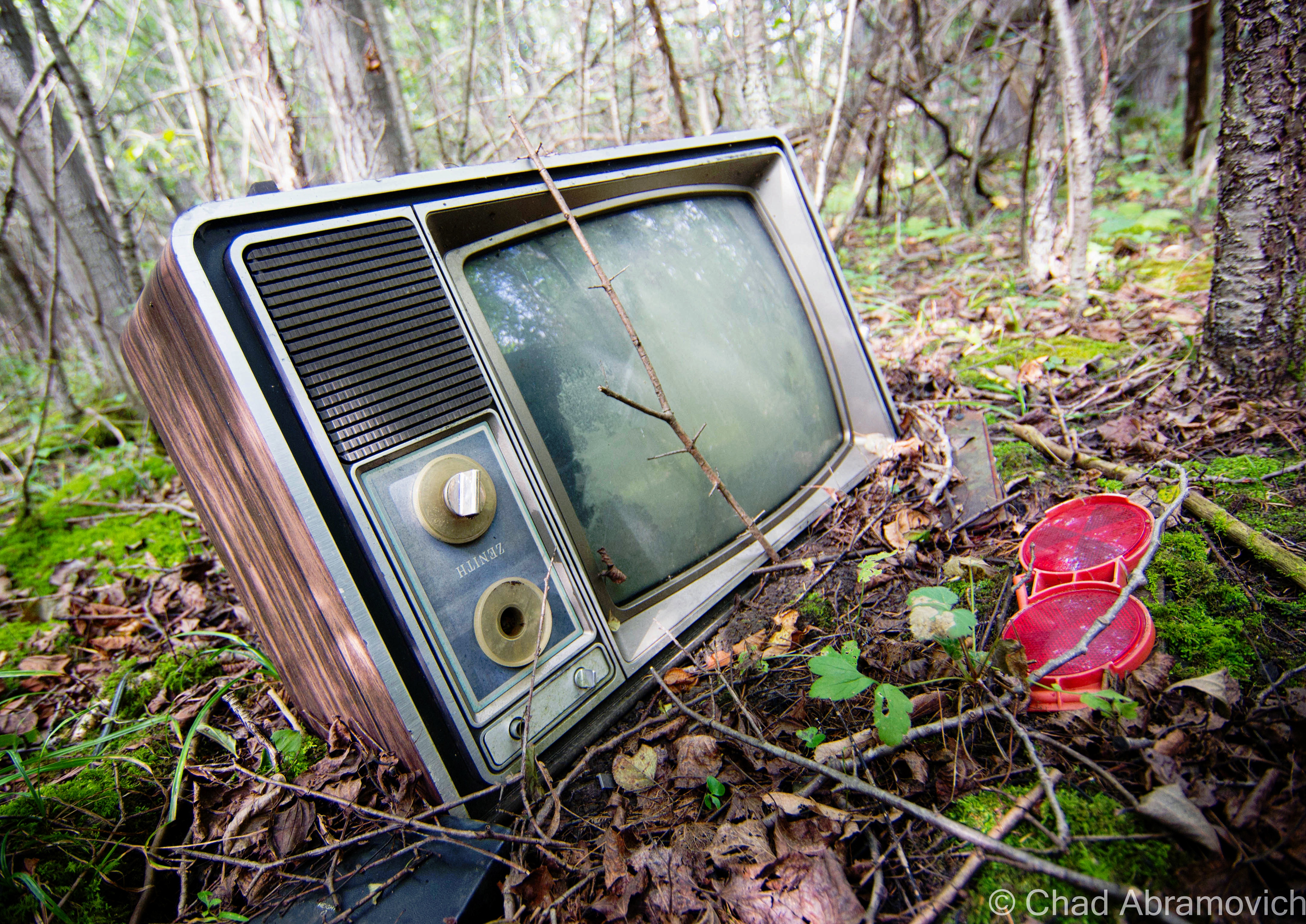
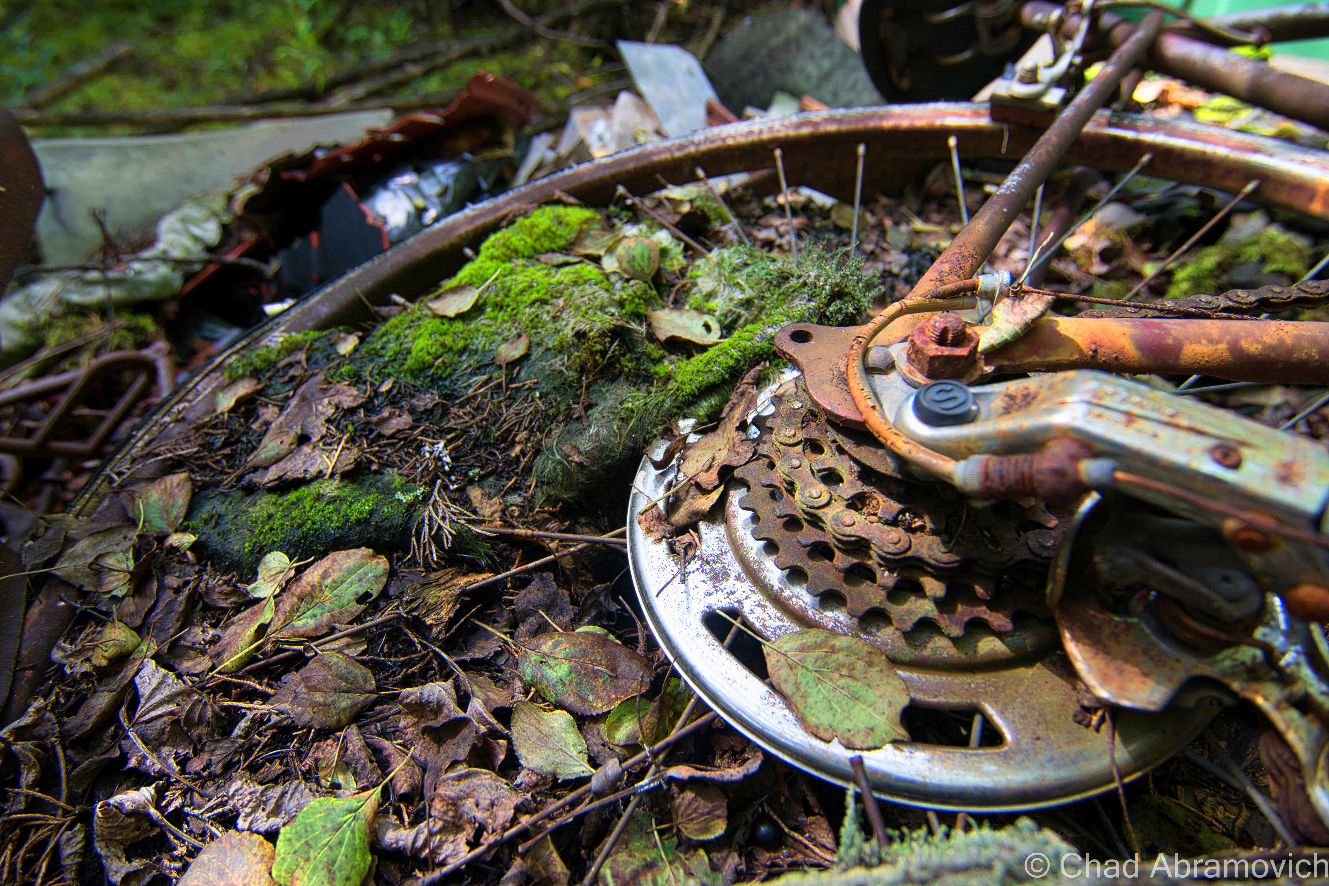
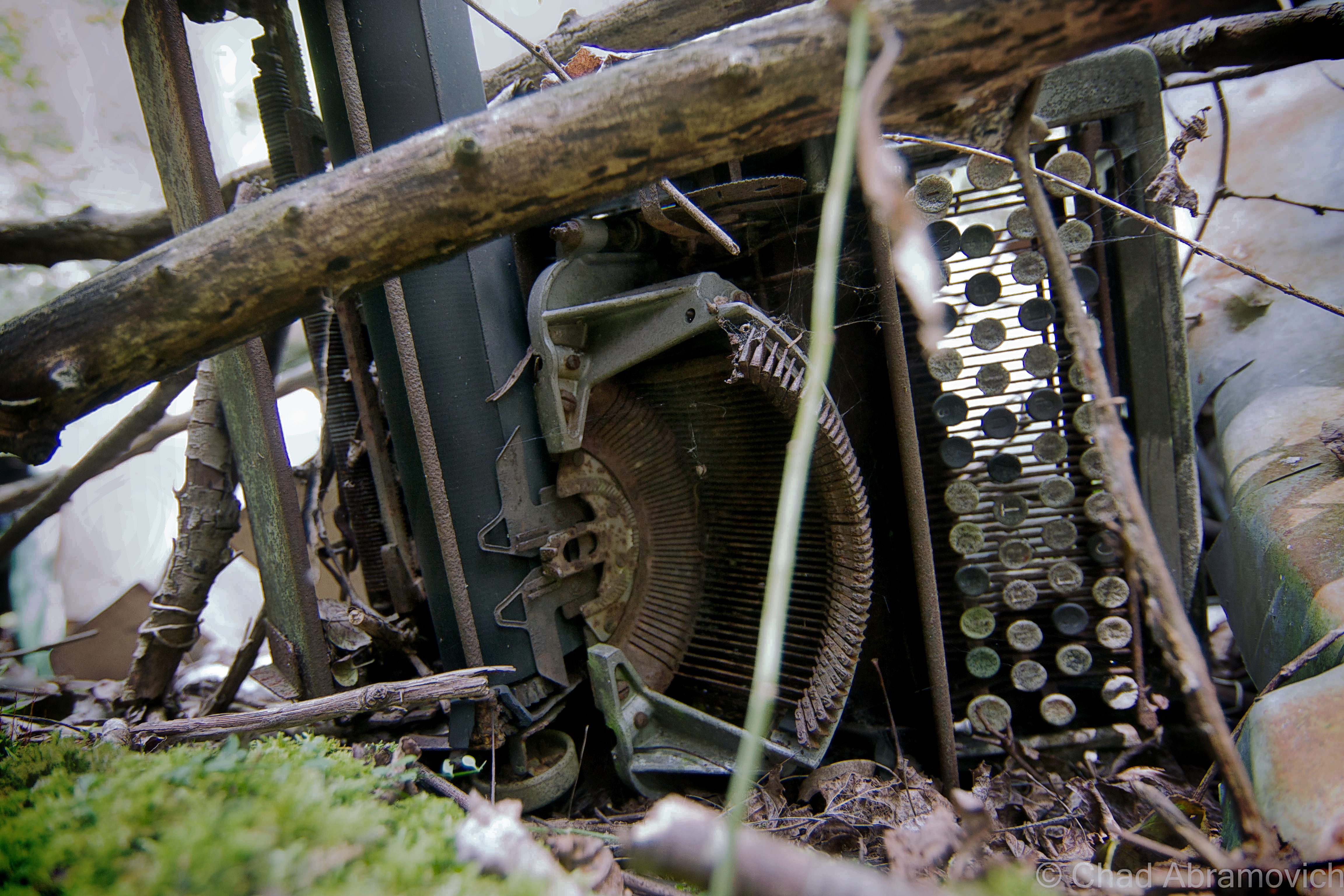
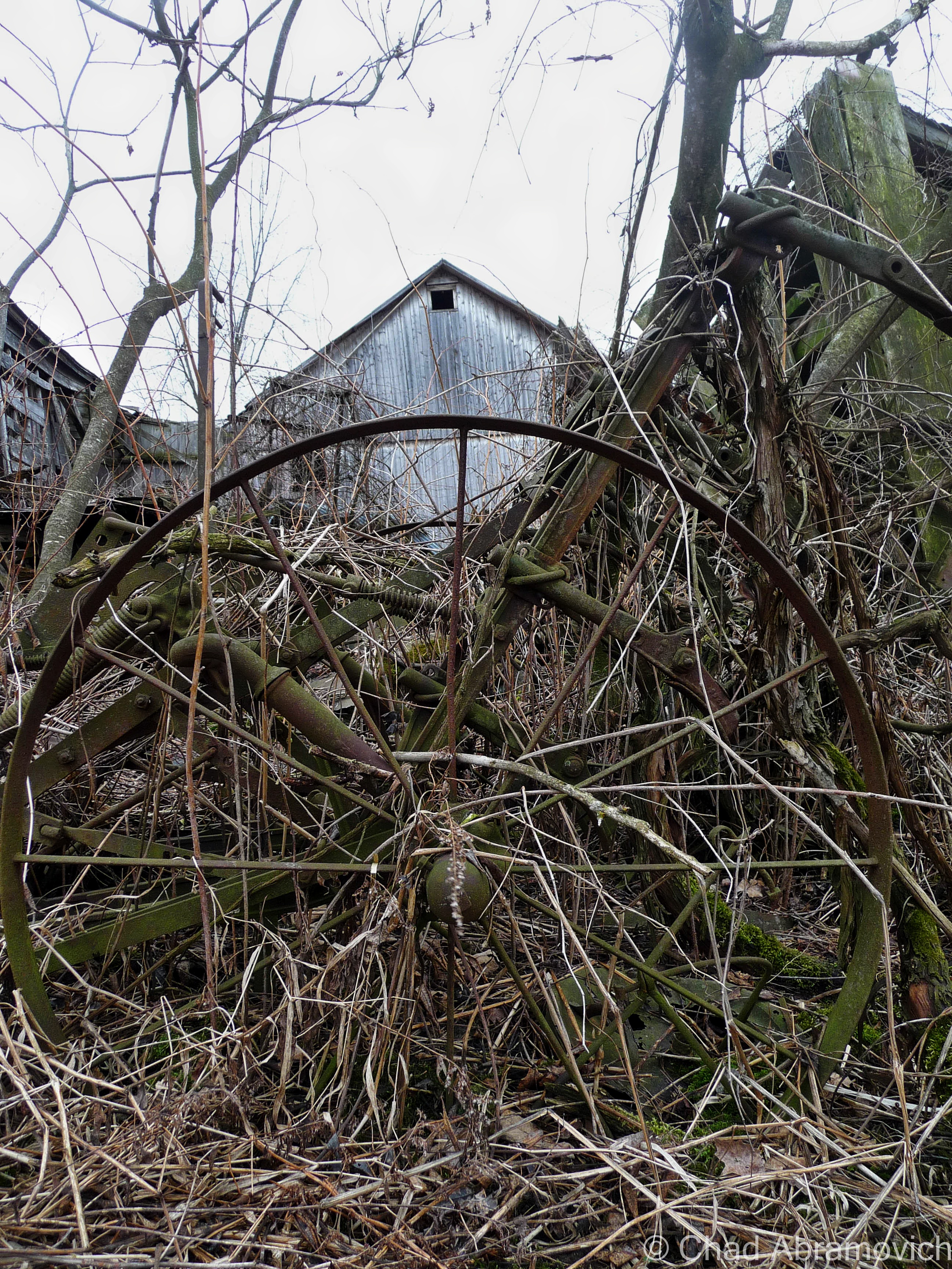
A lot less of Vermont is farmed now days, and much of the land has returned to forest, but these rusted and forgotten vestiges of the past still remain, now moldering in the silence of the wilderness. This particular junkyard had an eyebrow-raising amount of stuff brought there. Old tractors, snowmobiles, knob televisions, a Ford truck, religious paraphernalia, antique glass bottles, creepy childrens toys decaying in the weather, a small mound of old appliances, and so much more in depths farther down than I felt good about digging to reach. There is even rumored to be some traces of an old prohibition era still coffined back here, but there was so much to sift through, I probably wouldn’t have been able to recognize it if I was standing on it.
“I thought you’d like this, seeing how you’re into old stuff” said my friend as she went to unscrew the top from her iced tea, humorously not following me further into the collection of trash. “I figured I’d show you before I clean this all up”
“Oh, when is that happening?” I called out as I wobbled and stumbled my way over a mound of shifting garbage that squeaked and rustled underneath my crooked feet.
“Welllll…….one day.” she assured me, a tone of defeat in her voice.
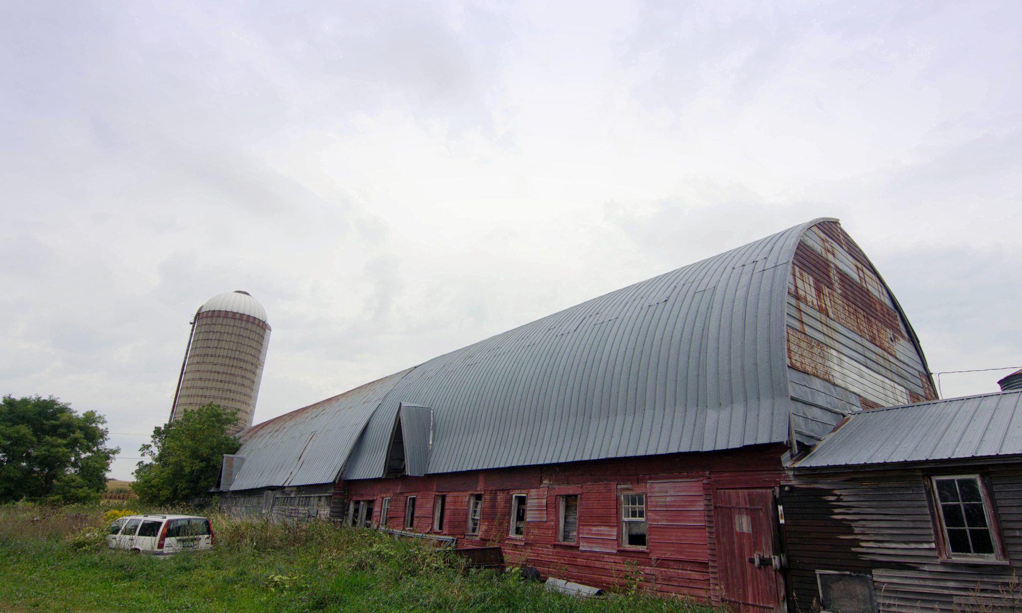
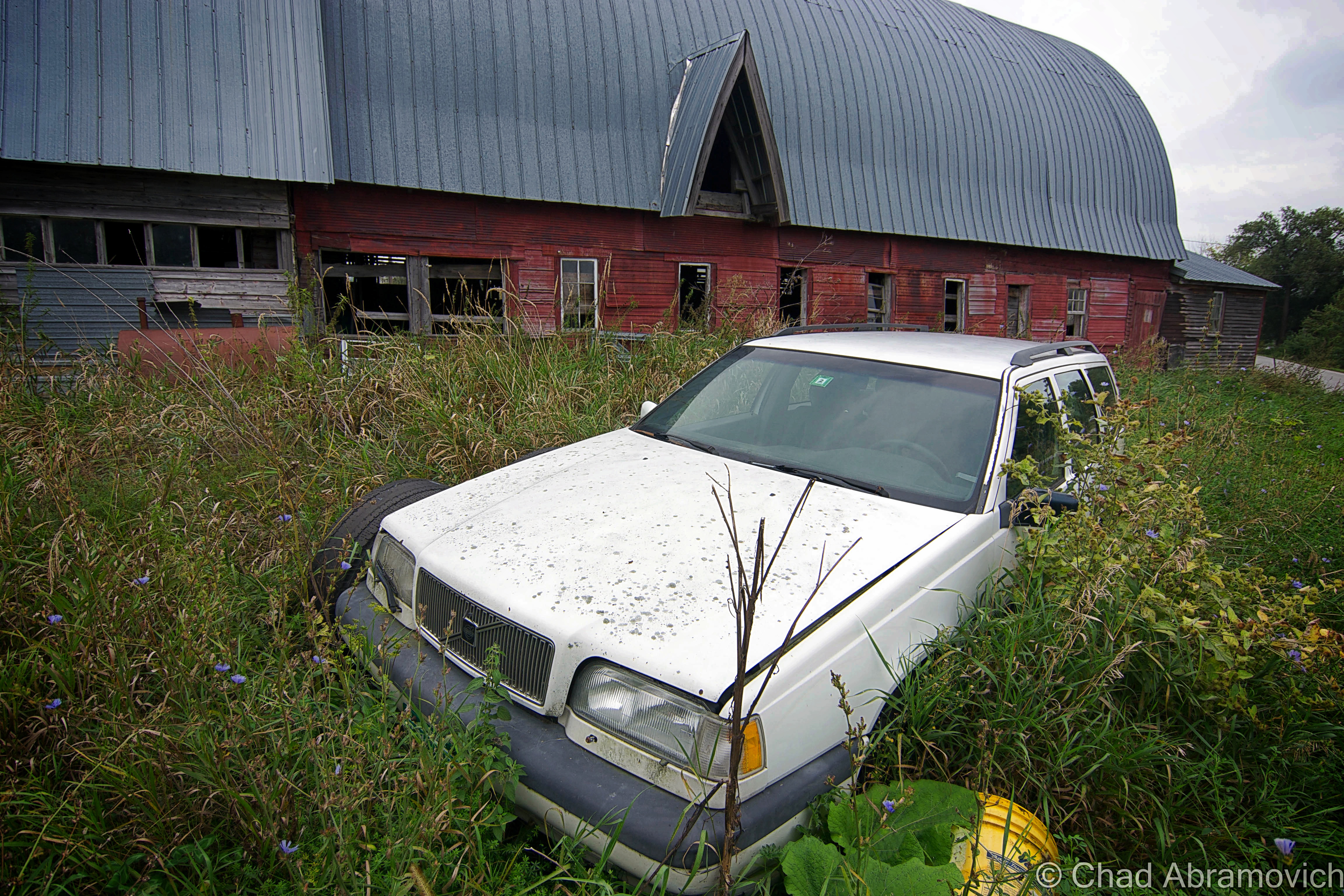
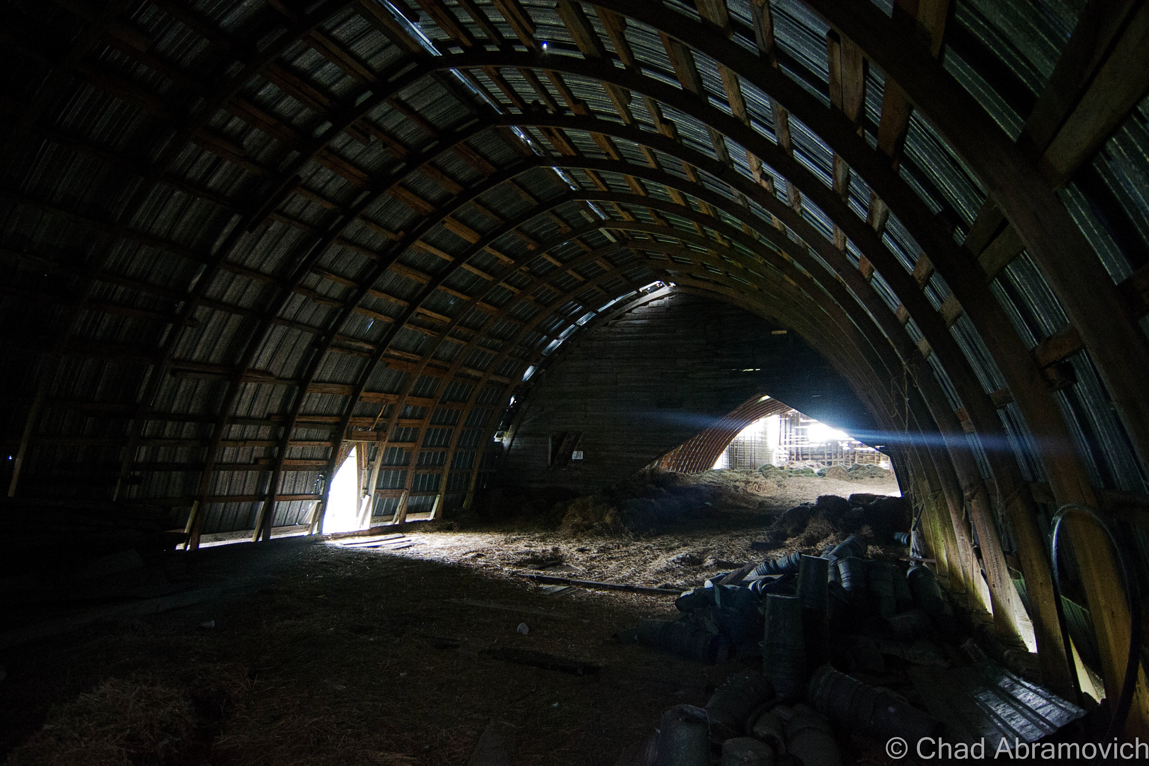
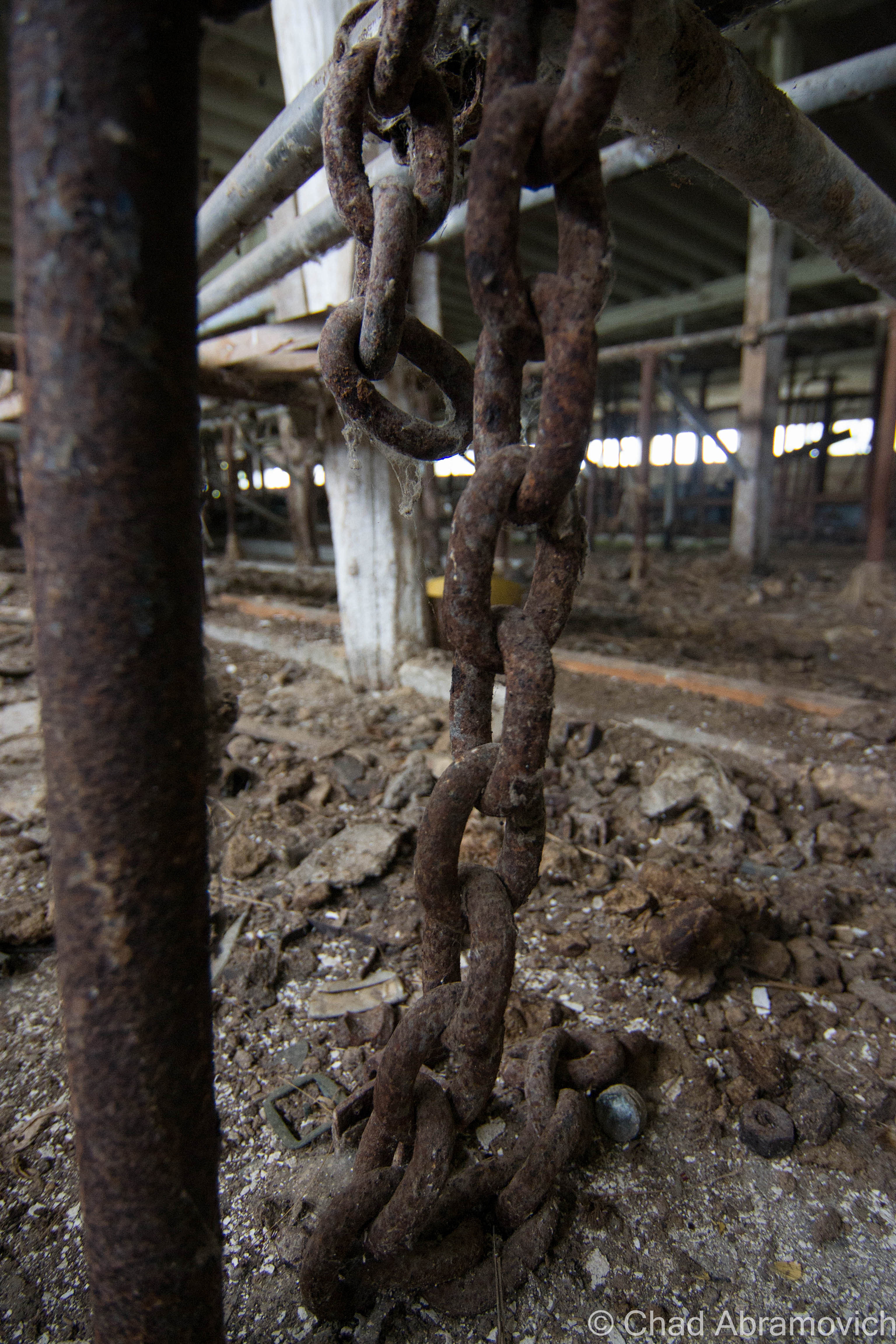
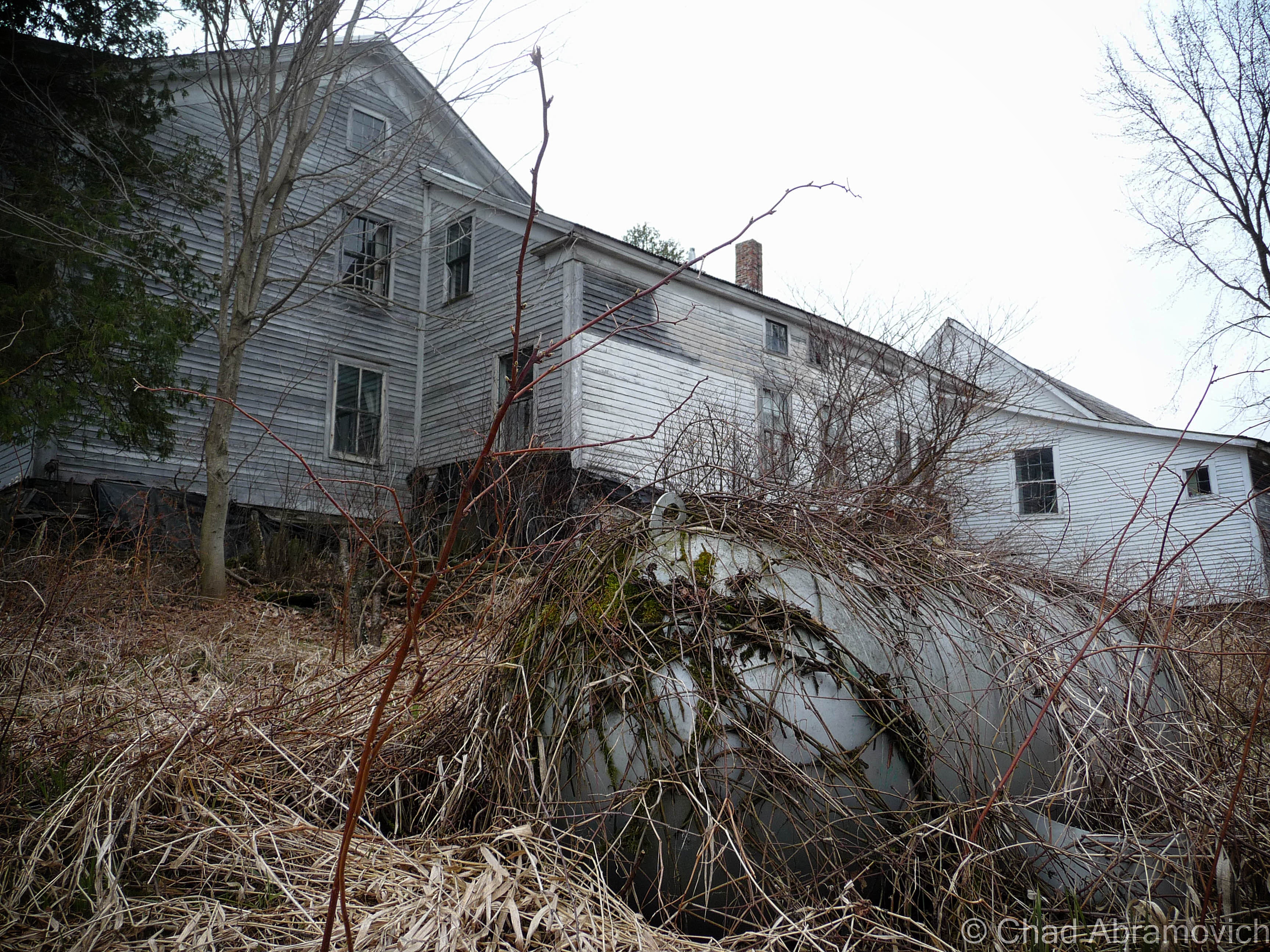
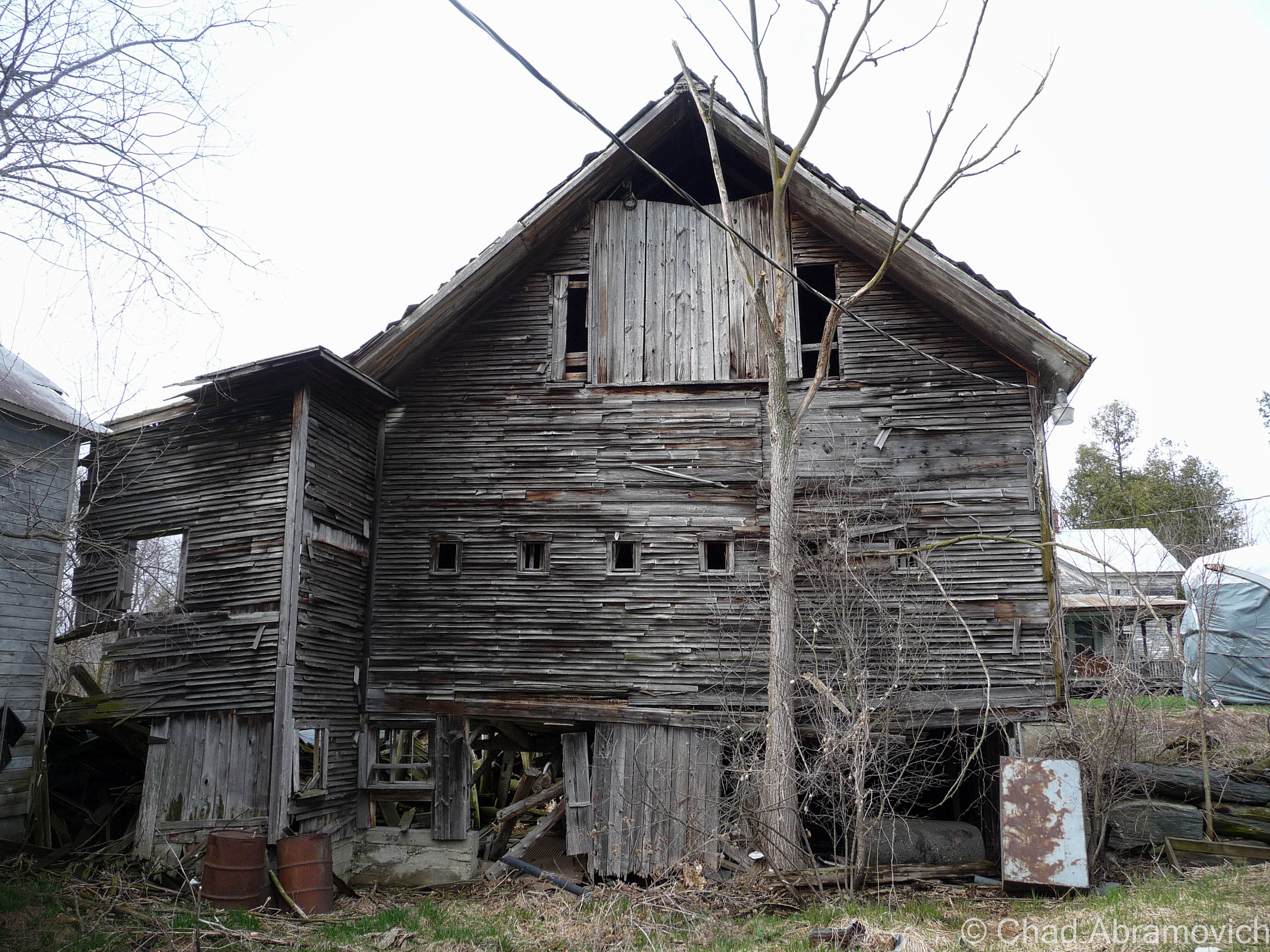
Further down the road, there was the most important cog in the farm machine, the dairy barn, which excited me lots because you never know what you’ll come across in an old Vermonter’s barn. Barns are vital storage spaces, workshops and in some cases, awesomely bizarre museums.
Traditionally, a Vermont farmer would put more money and effort into keeping up the barn than anything else they owned. So much, that many of them would let their houses fall into ruin if they had to make that hard choice of where to divvy up their cash. That even goes as far as the demolition process if the construction gets too far gone. As an old timer up in the Northeast Kingdom once explained to me; “Why tear down a perfectly good barn when it’ll just fall down when it’s ready?”
According to my friend and tour guide, the old barn was close to 100 years old, filled with accumulations of its years. As a side hobby, I’m a picker when my finances allow it, and I used to love shunpiking around rural Vermont and checking out barn finds, yard sales or whatever treasures or weirdness I could spot on our backroads, so I was already wondering what I’d find inside this old barn.
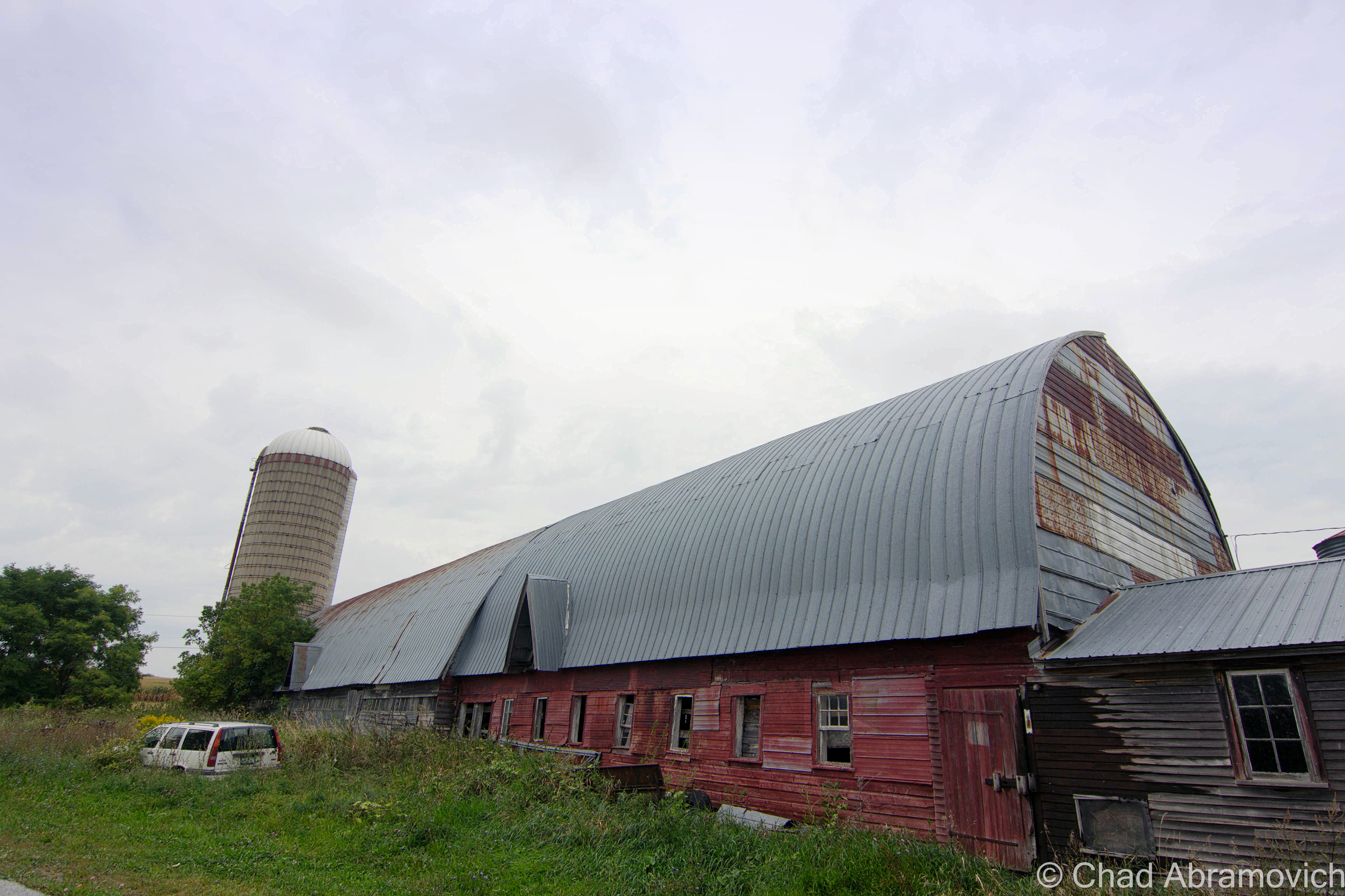
The fading red structure didn’t appear to be in bad shape, or really even abandoned. If I had just passed by, I’d probably thought it was just another working farm. We pulled over in some tall grass and began to tromp our way through the threshold.
I think barns and farms play some role in lots of Vermonters lives, even if you don’t have one of your own, chances are, you know someone who does. I remember my childhood of playing in my paternal grandparents’ dusty old barns on their farm up near East Montpelier, finding ones near Chittenden County to store our 78 Toyota Landcruiser in for the winter, and spending some of the best days of my youth riding my 4 wheeler through sugarbushes and meadows on a 250 acre farm and some of the most beautiful land I’ve had the privilege of having access to in East Wallingford. Now days, I’ve been apartment jumping around the Burlington area, but man, I wish I had a barn of my own where I could set up a workshop and have a place to do projects and space to store the 4 wheeler I would most definitely buy.
While I’m on the subject – do you folks know why red happens to be the ubiquitous choice of barn attire? Simply put – red paint is cheap. But the why behind that answer actually has to do with dying stars. Pretty much; red paint is made from Iron. Iron is created when a star eventually collapses. The ground is loaded with iron, or, an iron-oxide compound called red ochre that makes a good pigment. The ground is loaded with red ochre because when stars die, they explode, and physics decrees they generate a bunch of iron as the result, which is pretty cool.
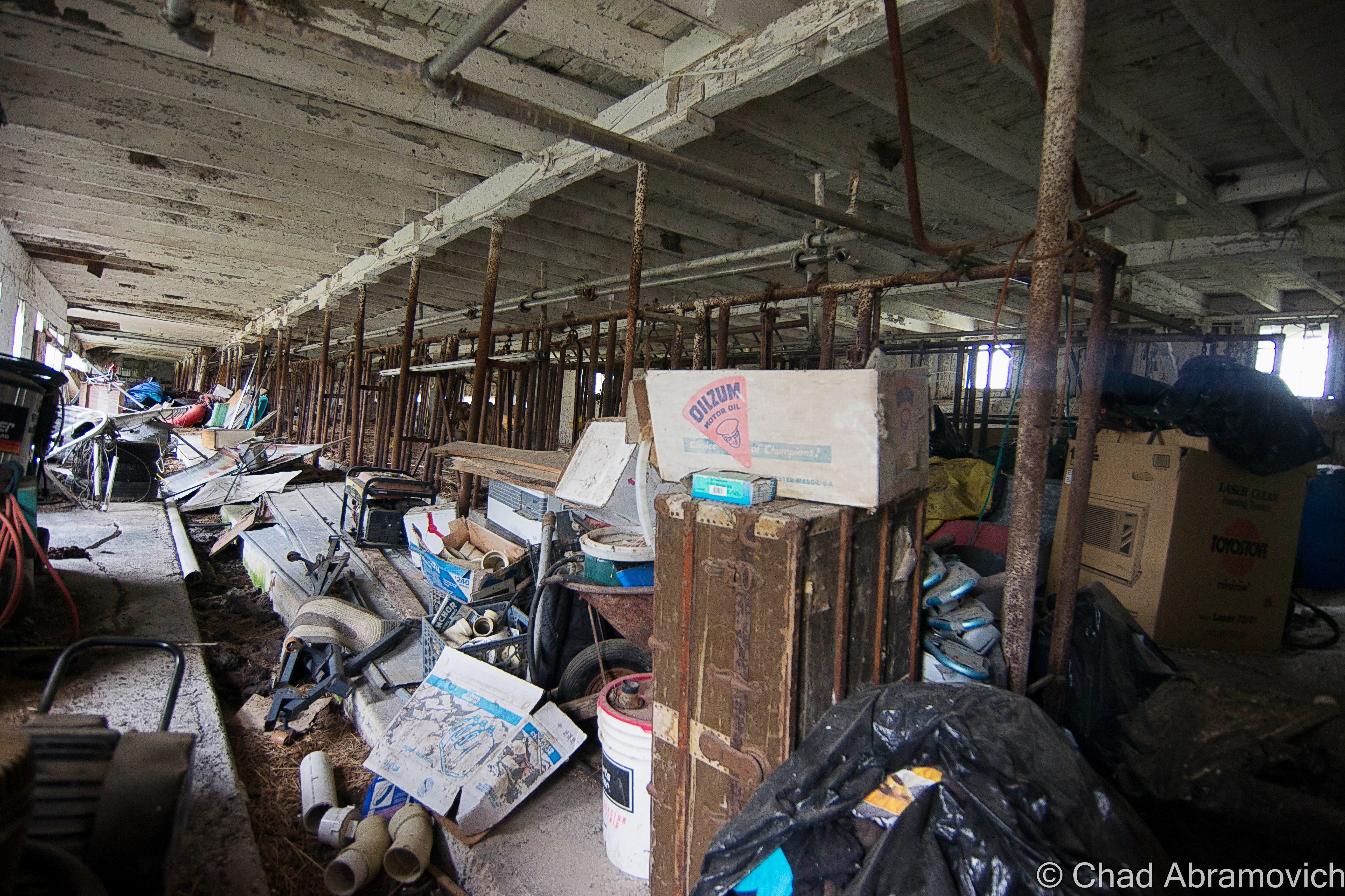
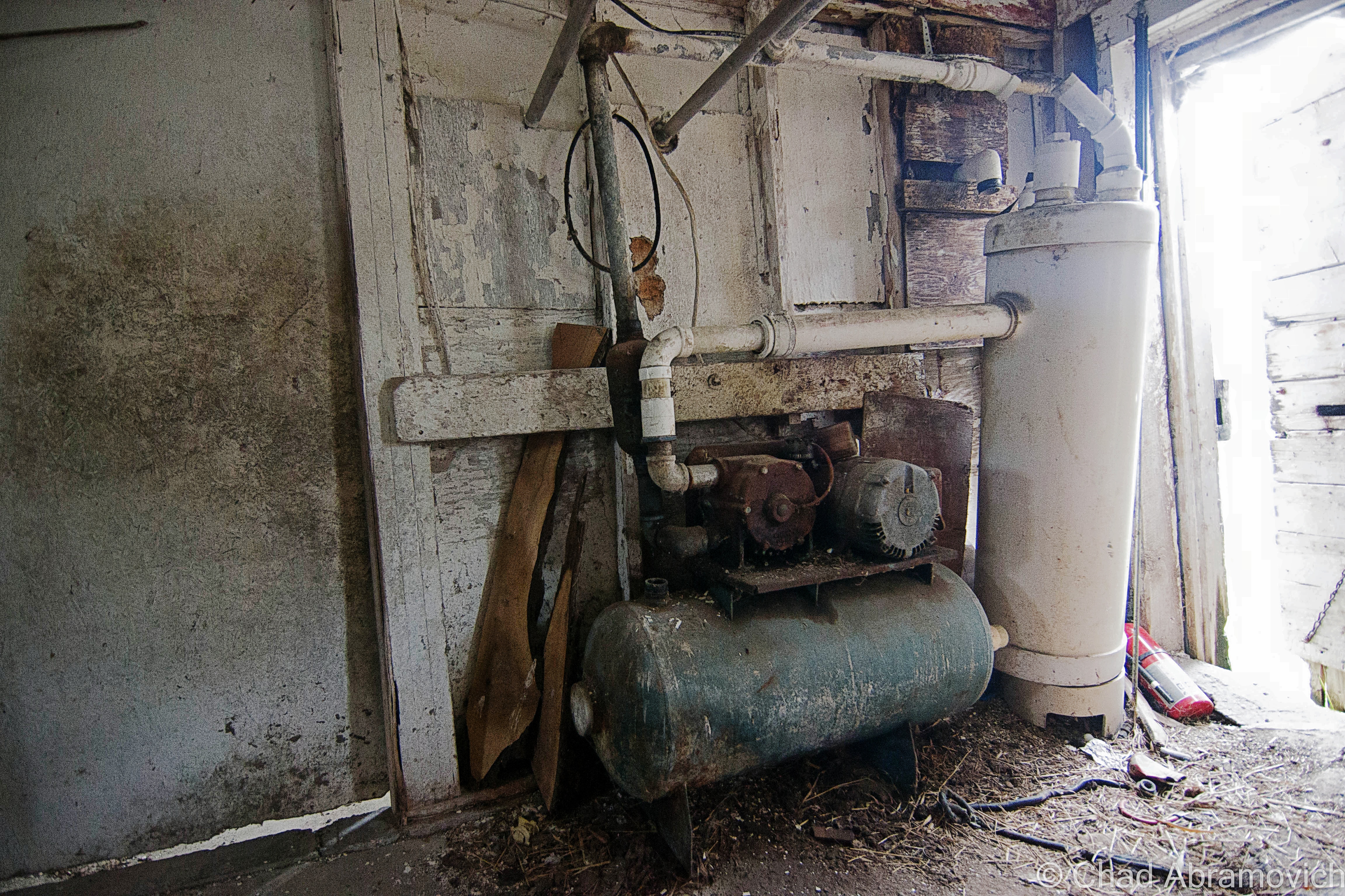
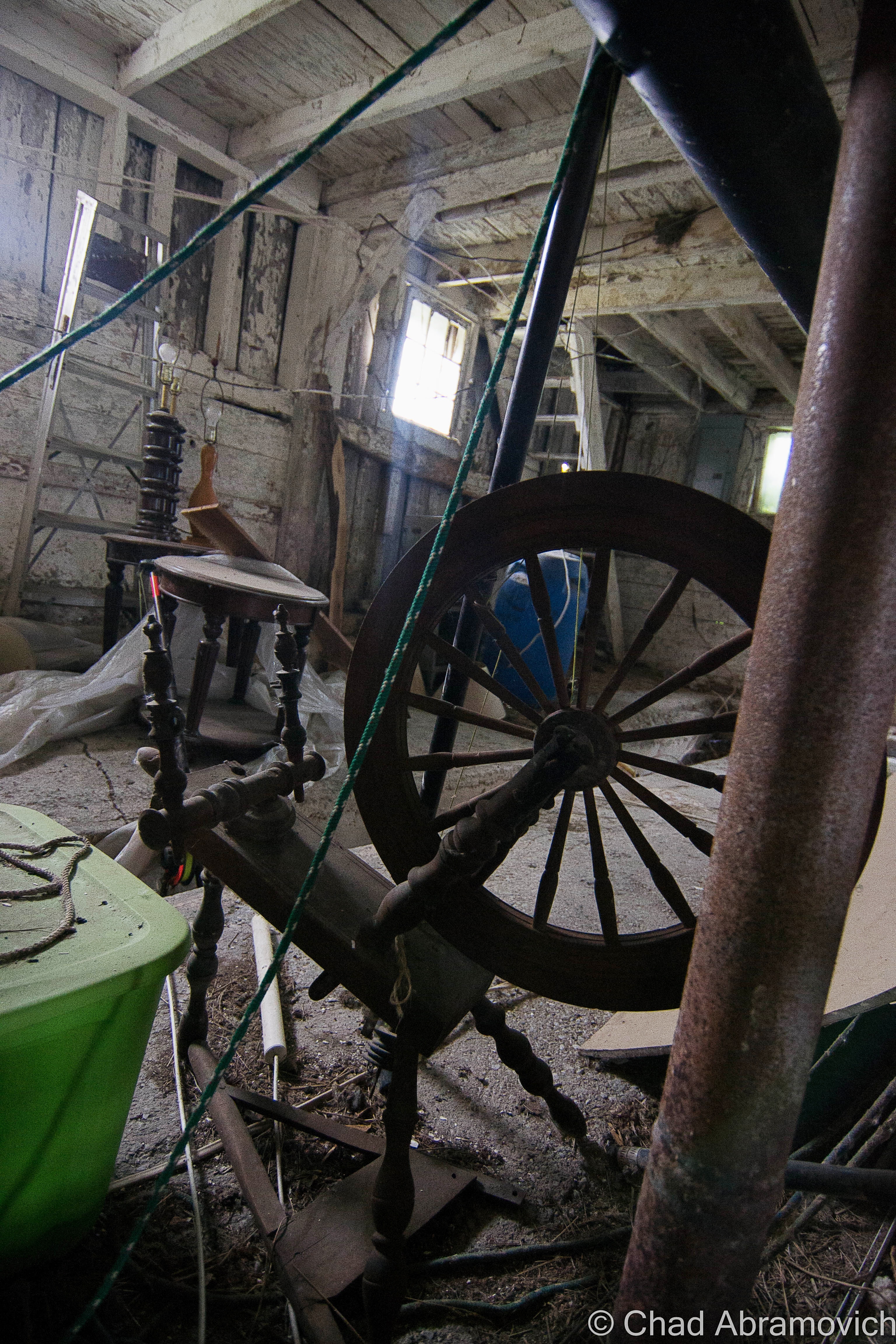
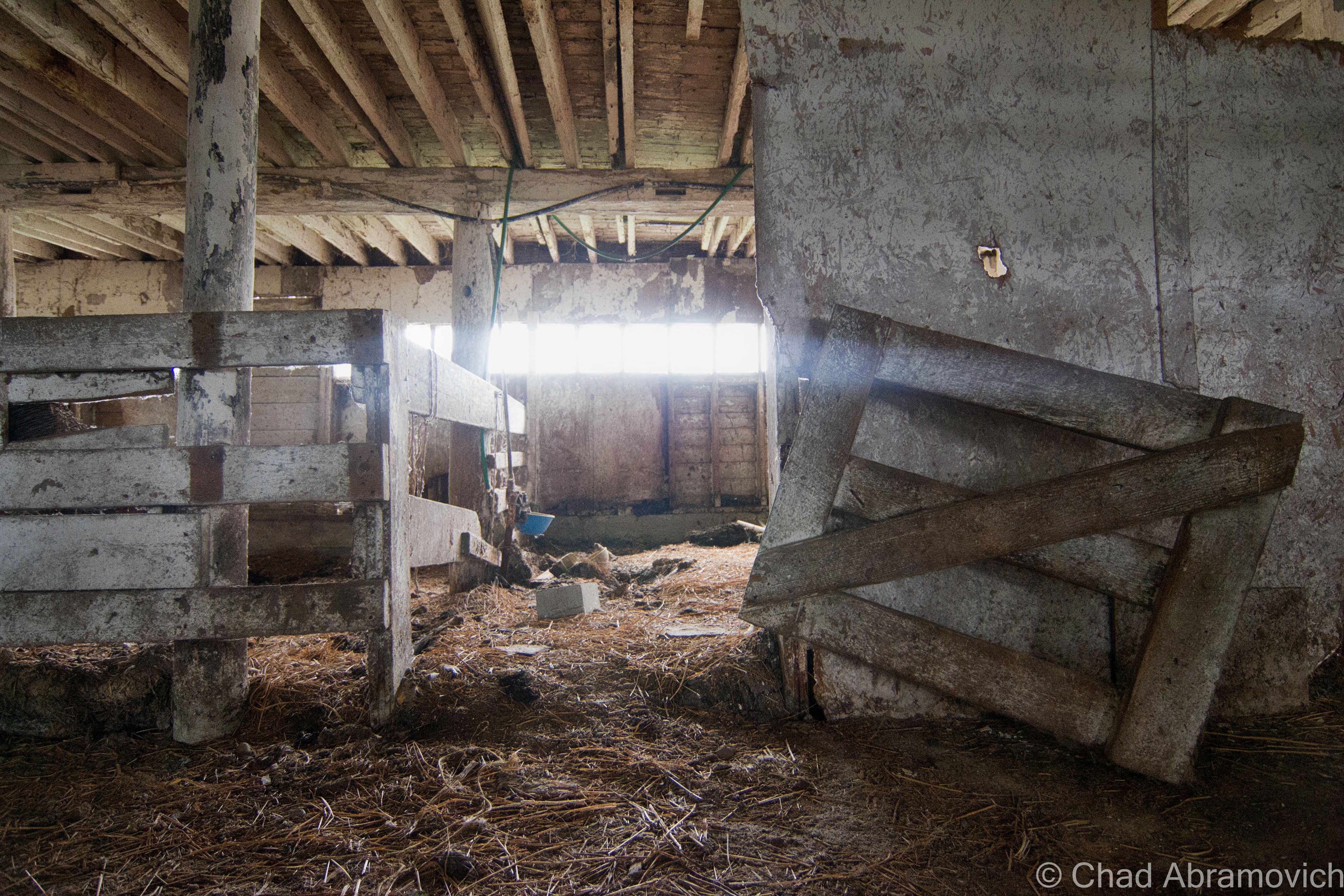
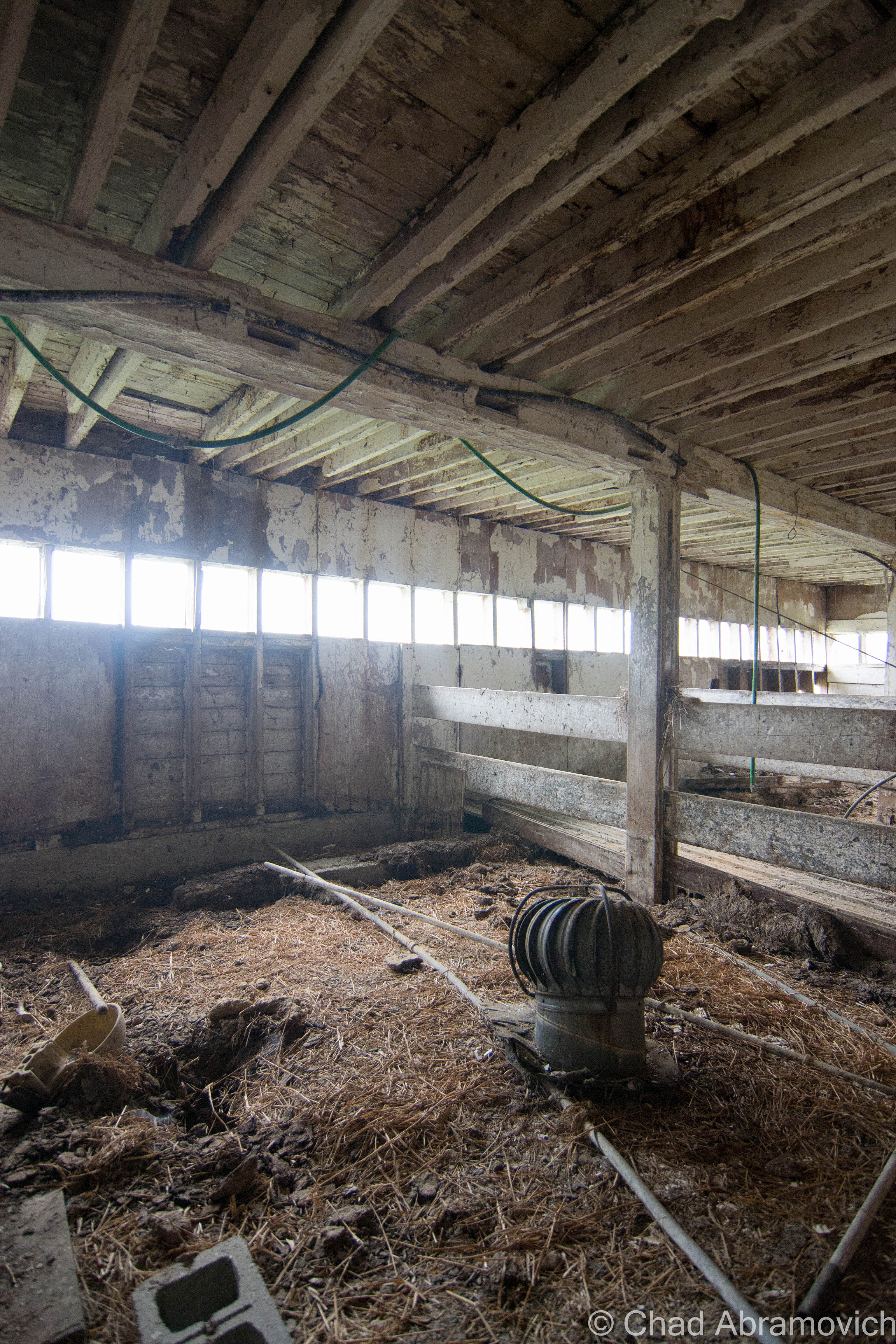
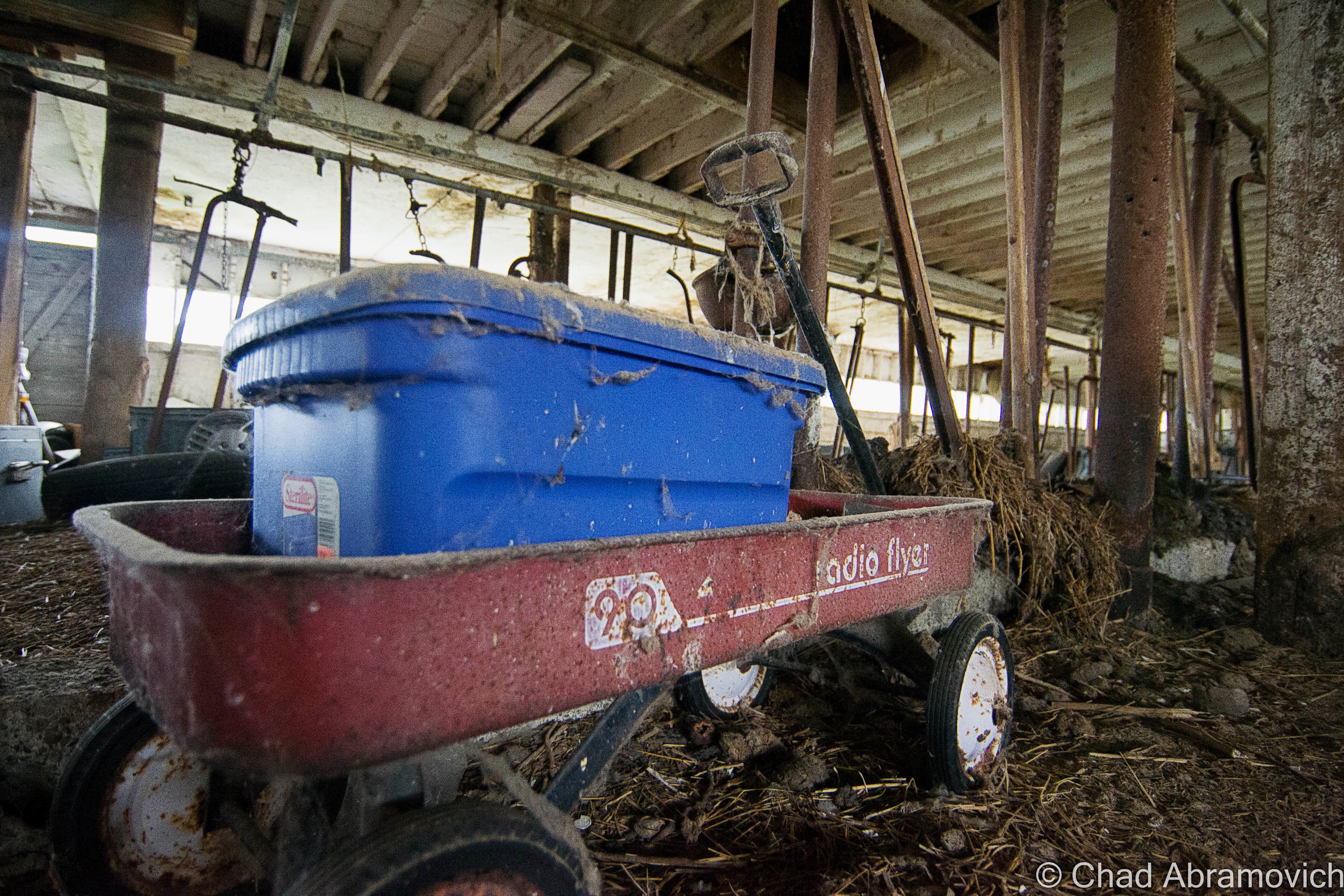
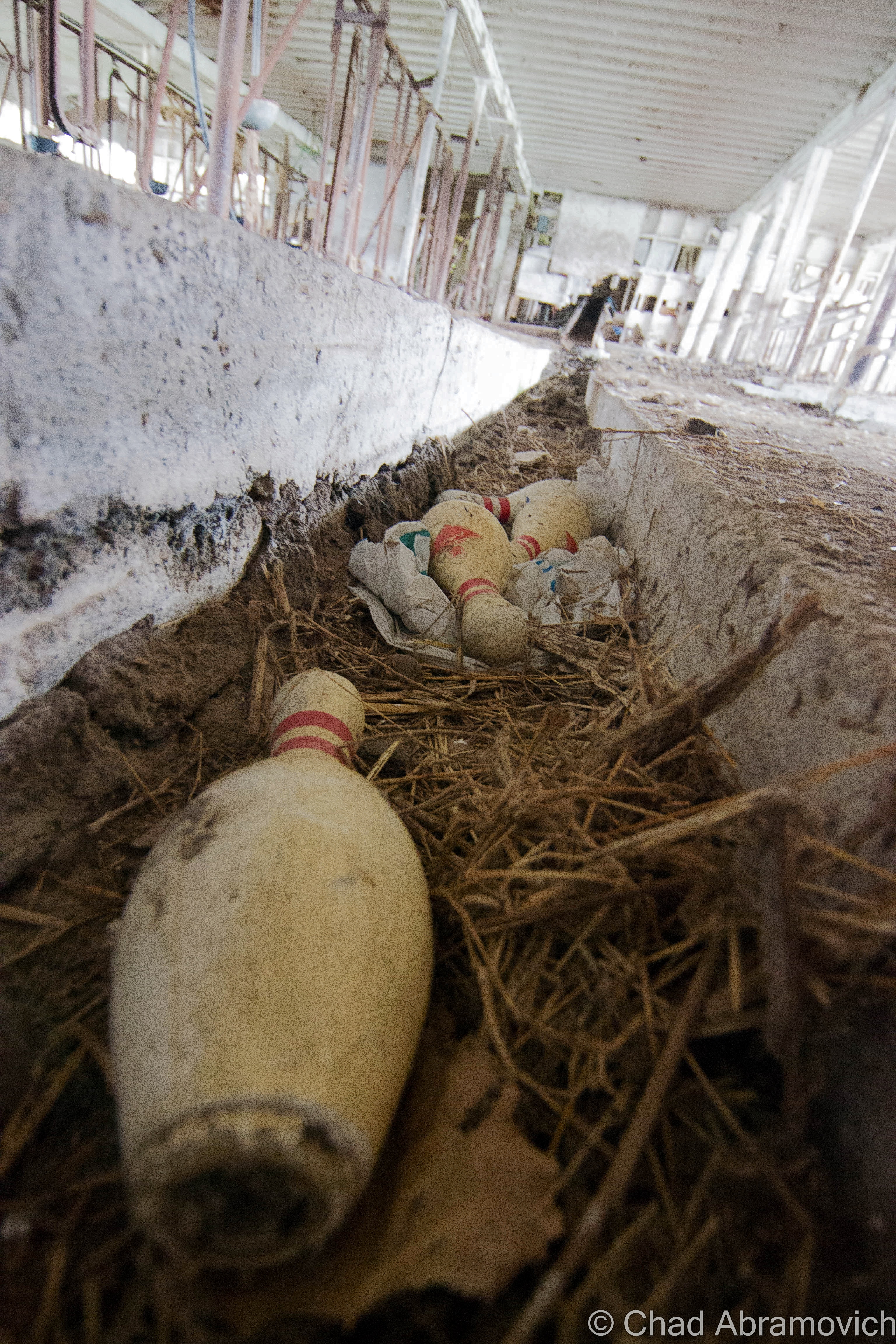
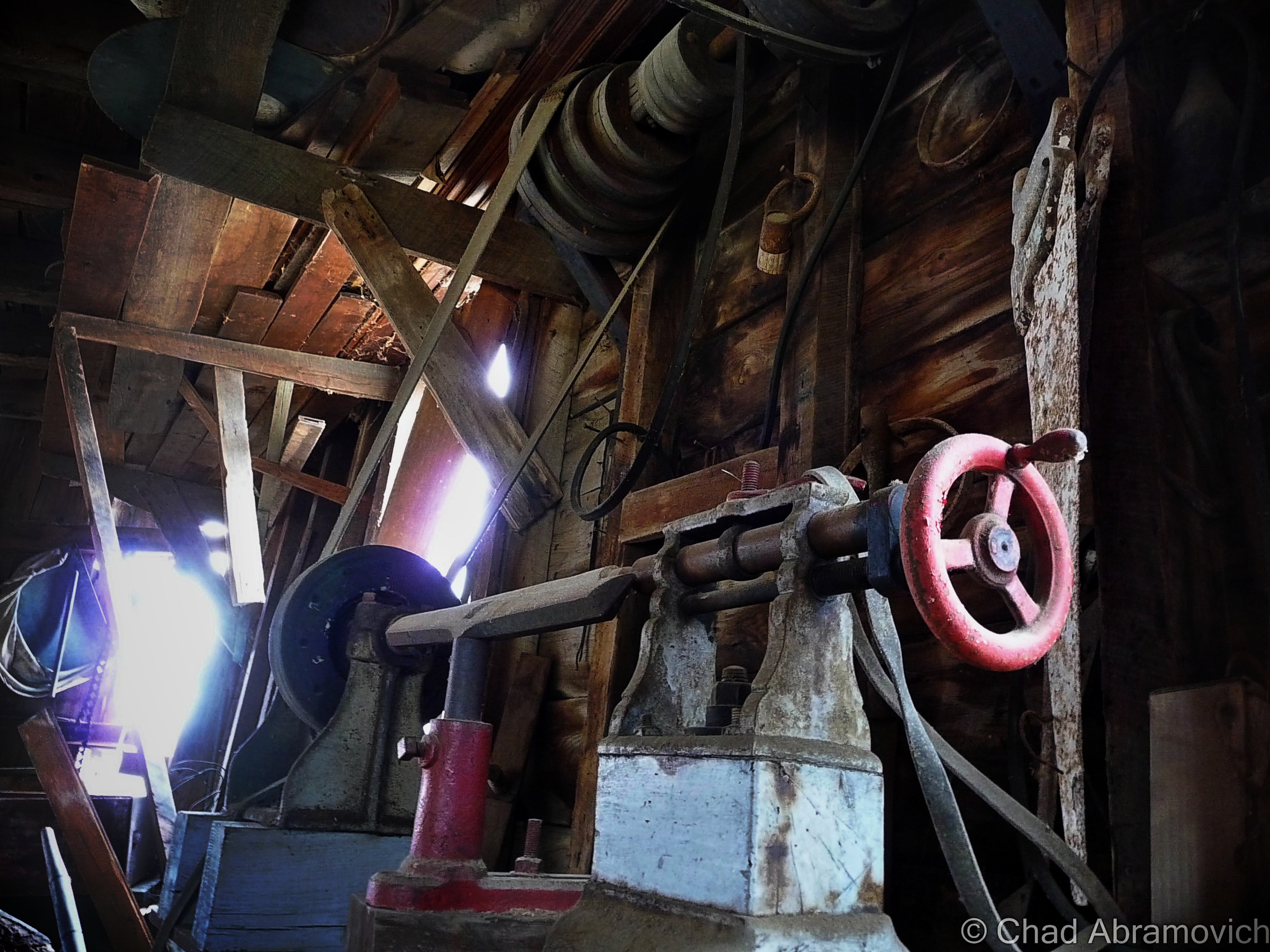
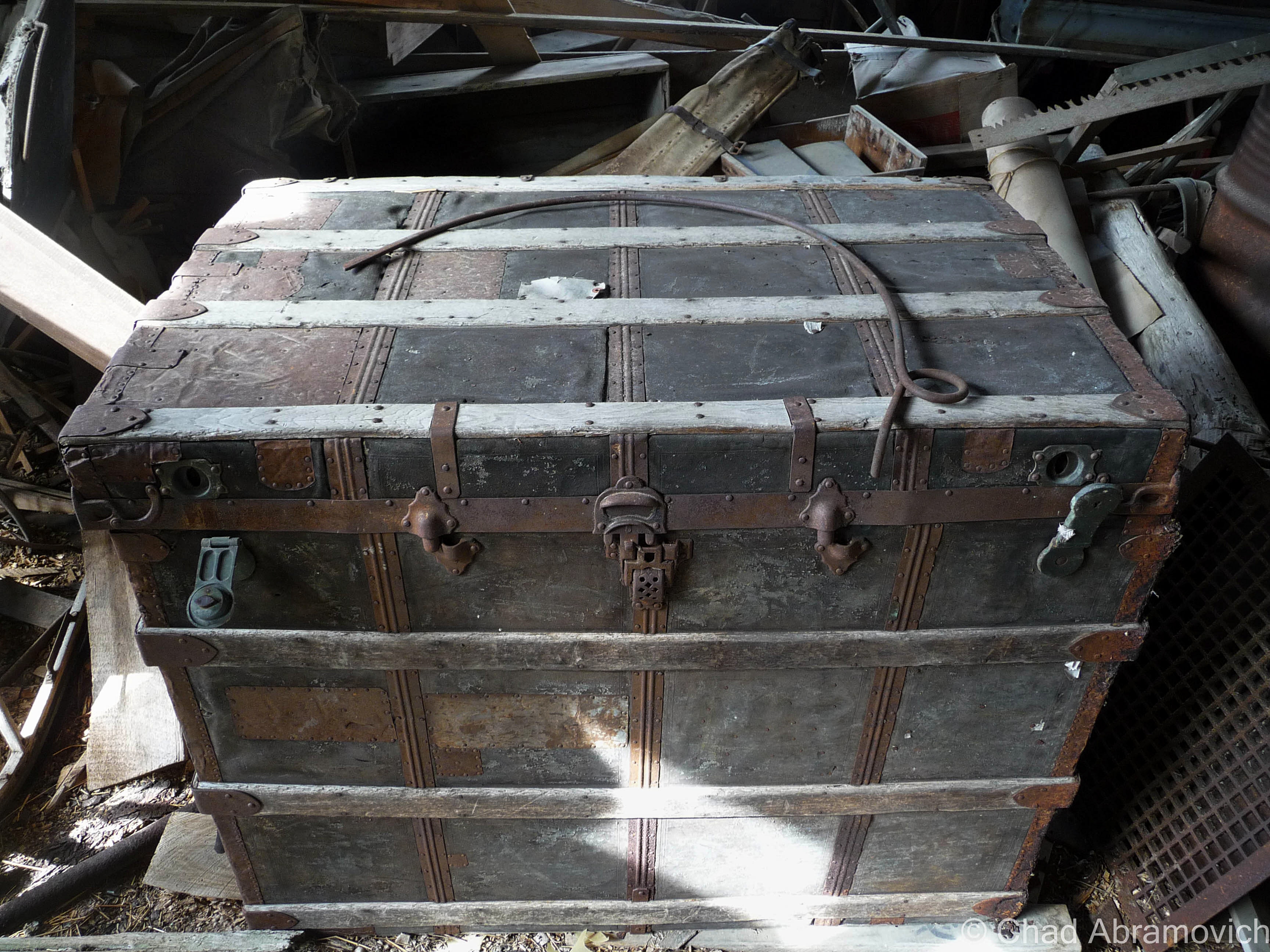
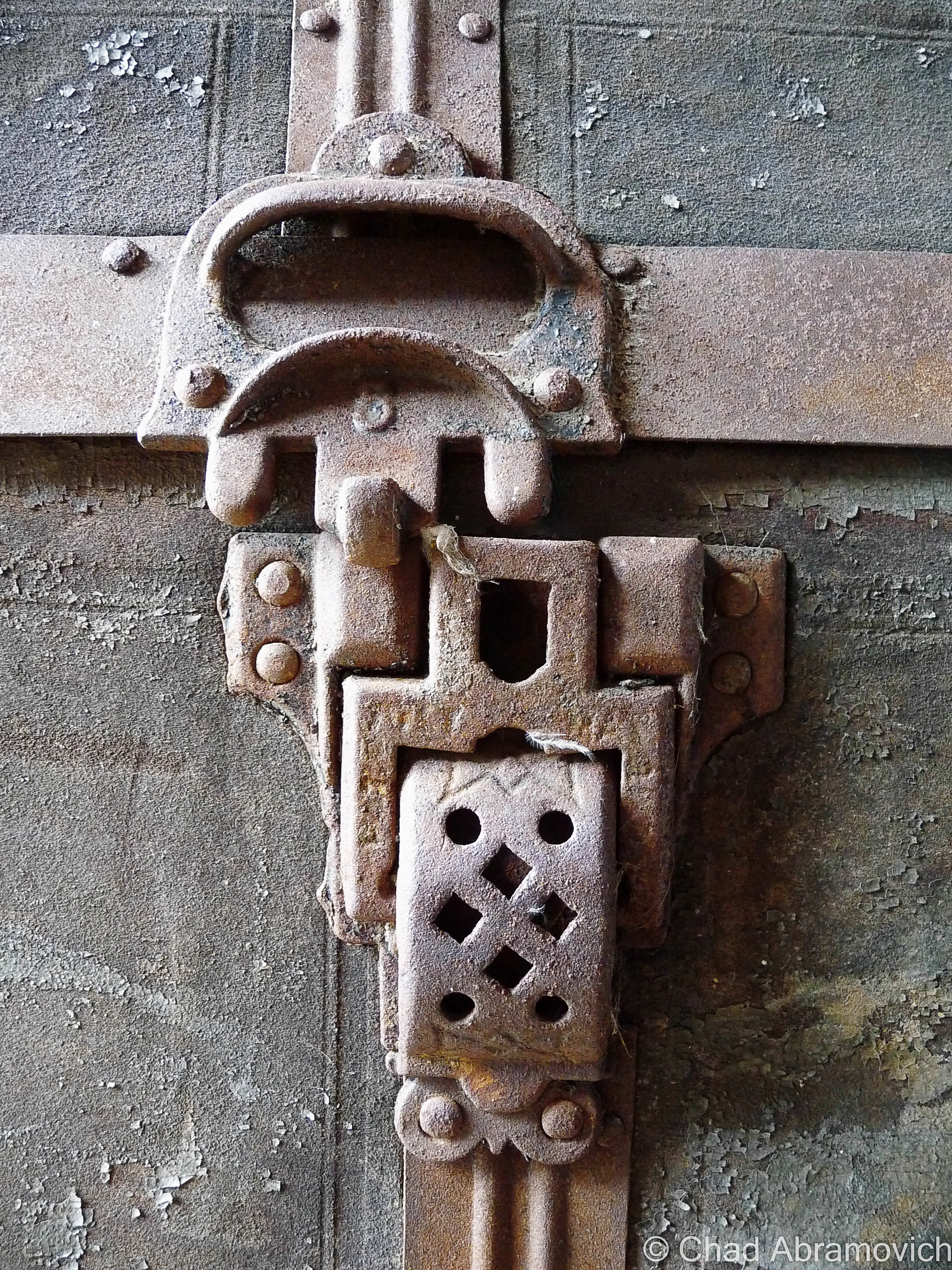
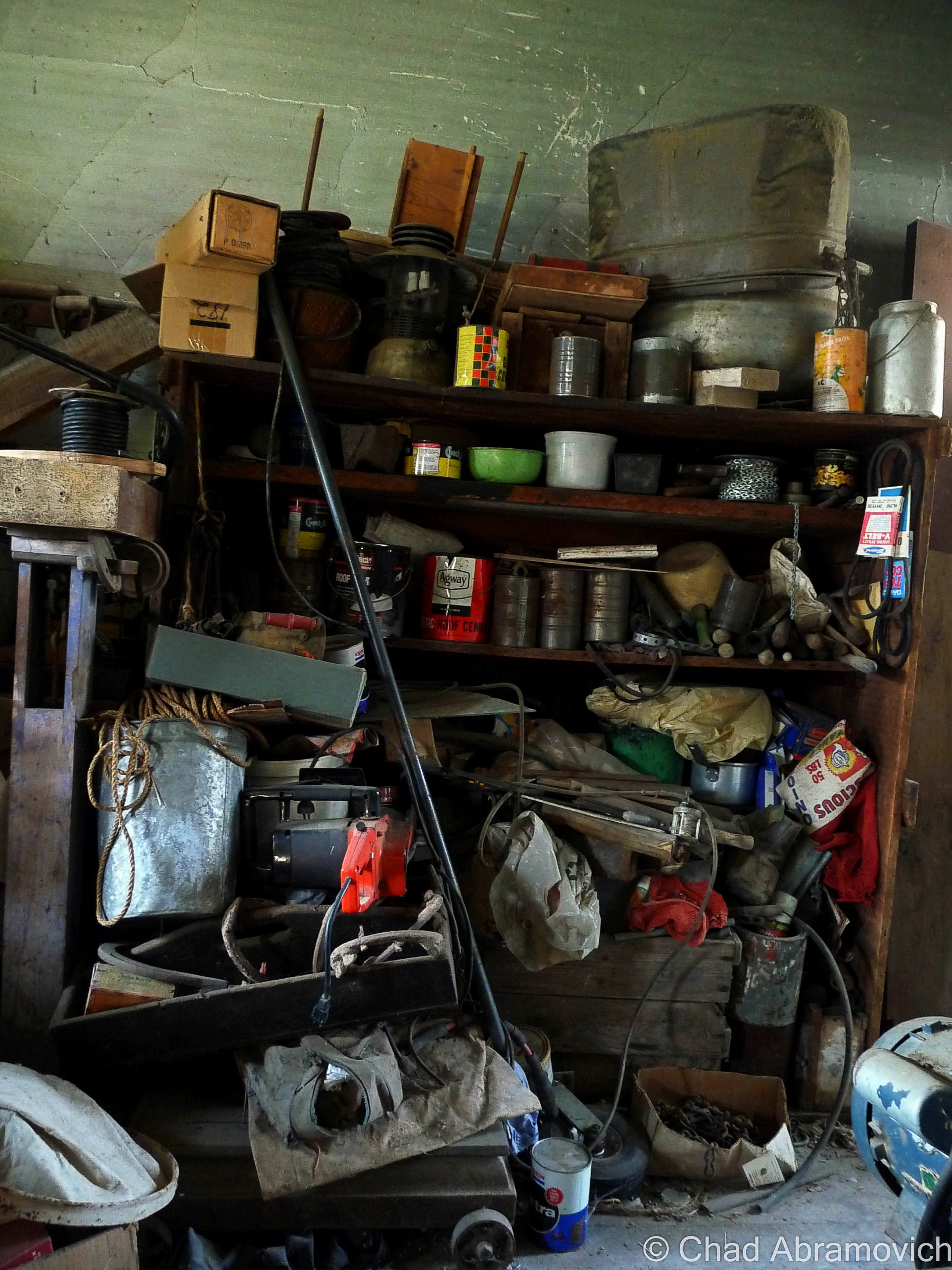
The dusty whitewashed interior of the barn was pretty cool as well. In typical Vermont tradition, the old farmhands never threw anything away, so the spaces were stuffed with antique furniture, busted farm equipment, and some unexpecteds like a collection of bowling pins. I know barns usually lived double lives thanks to Yankee ingenuity, like this great story on State 14, of an old one in tiny East Granville that formerly was the town’s dance hall that the current owners wish to restore. Maybe these guys used their barn as a makeshift bowling alley to pass the doldrums?
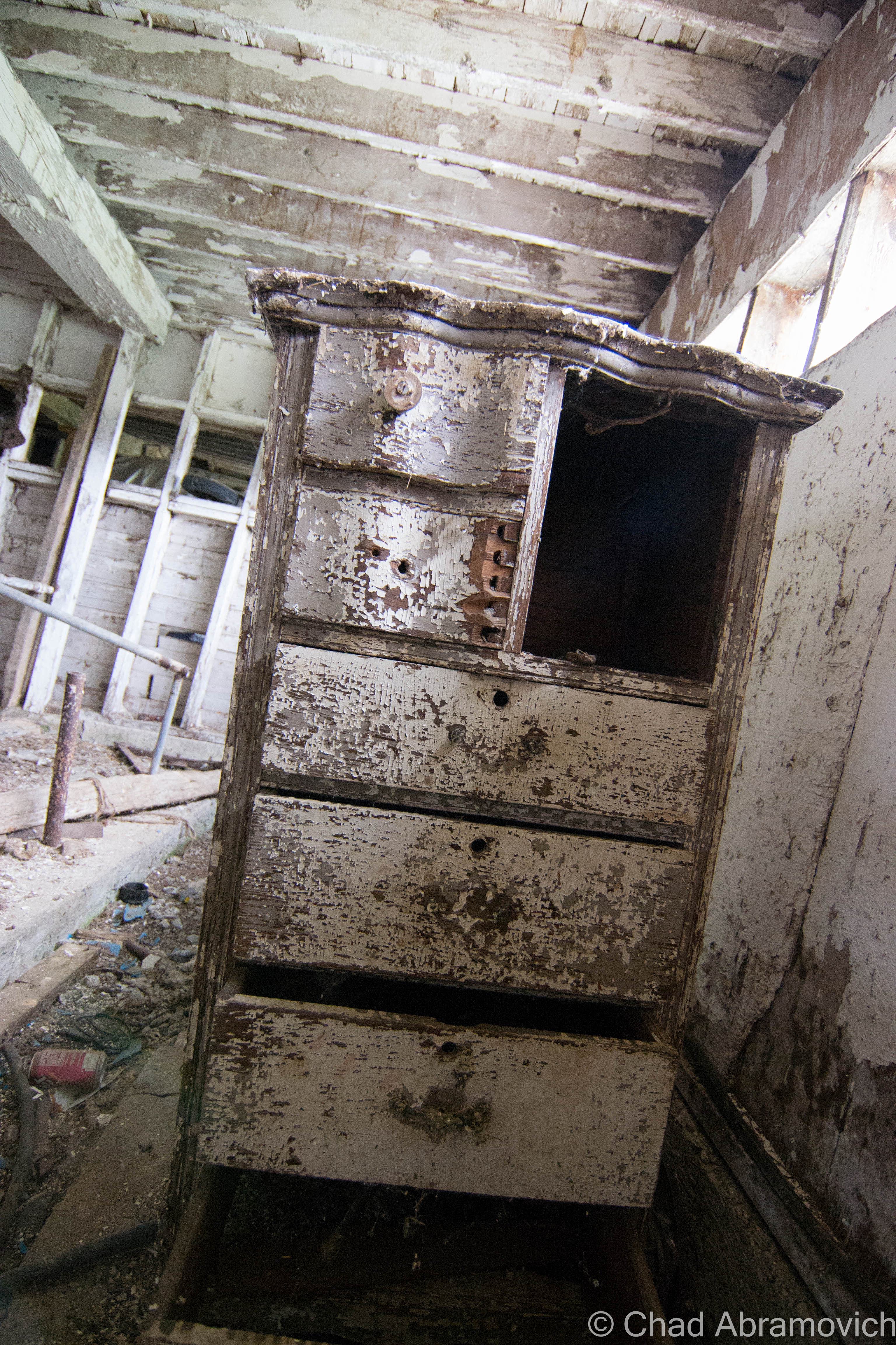
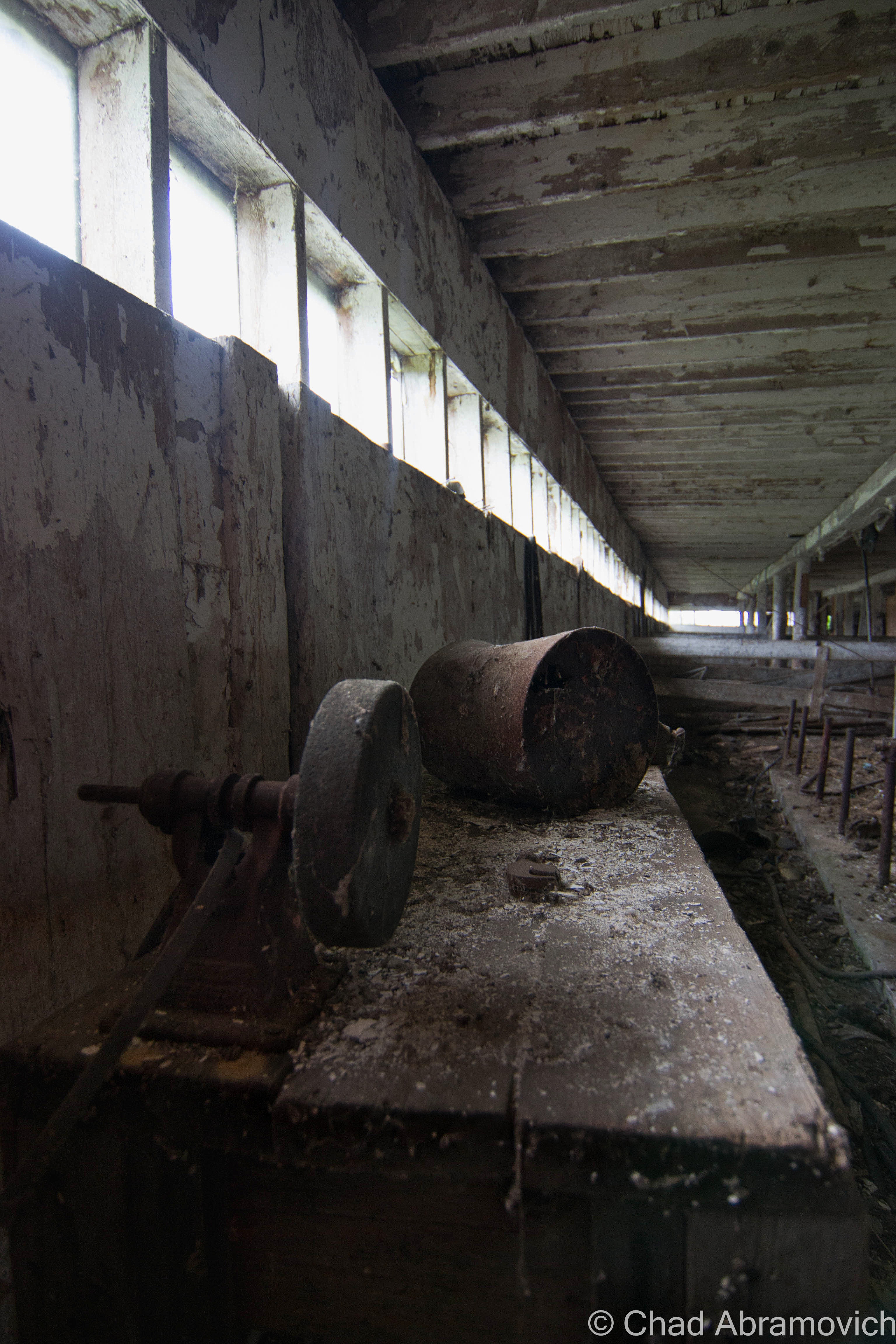
Walking around through hay that stuck to my boots, I realized the barn was a little worse for wear than I had thought. Structurally, it’s wooden floors and walls were beginning their slow descent into wasting away, and some of the older items stored inside were rotting to a point beyond saving.
While I was writing up this post, I remembered another old barn I had checked out many years ago, and decided to dig up the old photos. I want to say these were taken by an insecure me with my Nikon point and shoot, around the spring of 2010. I figured I’d include them in this post as well. It’s sort of funny how years ago, I thought the only way I would be any good at photography was to get myself a top-grade camera, but looking back, I think that heading out with my old point and shoot actually forced me to become more creative and observant with a limited focal distance and zoom range. Man, young Chad had so much to learn. The equipment sure helps, but it’s really the photographer behind the gadgets that makes the difference.
During that spring, I needed to get out of the house to clear my head, and one of the best ways for me to do that was to go shunpiking – one of my favorite activities still.
I found myself on some swampy backroads up in Franklin County. With the windows down and the wet Spring perfume coming through, I found myself passing by an abandoned farm, and next door, a rundown ranch house where the owning family still dwelled.
They agreed to let me skulk around their abandoned farm, but their elderly teenage son thought I was a weirdo for being interested in their place. Well, I am a weirdo, but I’ll never forget his furrowed eyebrow look and accompanying chuckle. According to him, the town actually condemned their old farmhouse when it began to violate building codes as it aged. So they moved into the ranch next door, which honestly didn’t look much better.
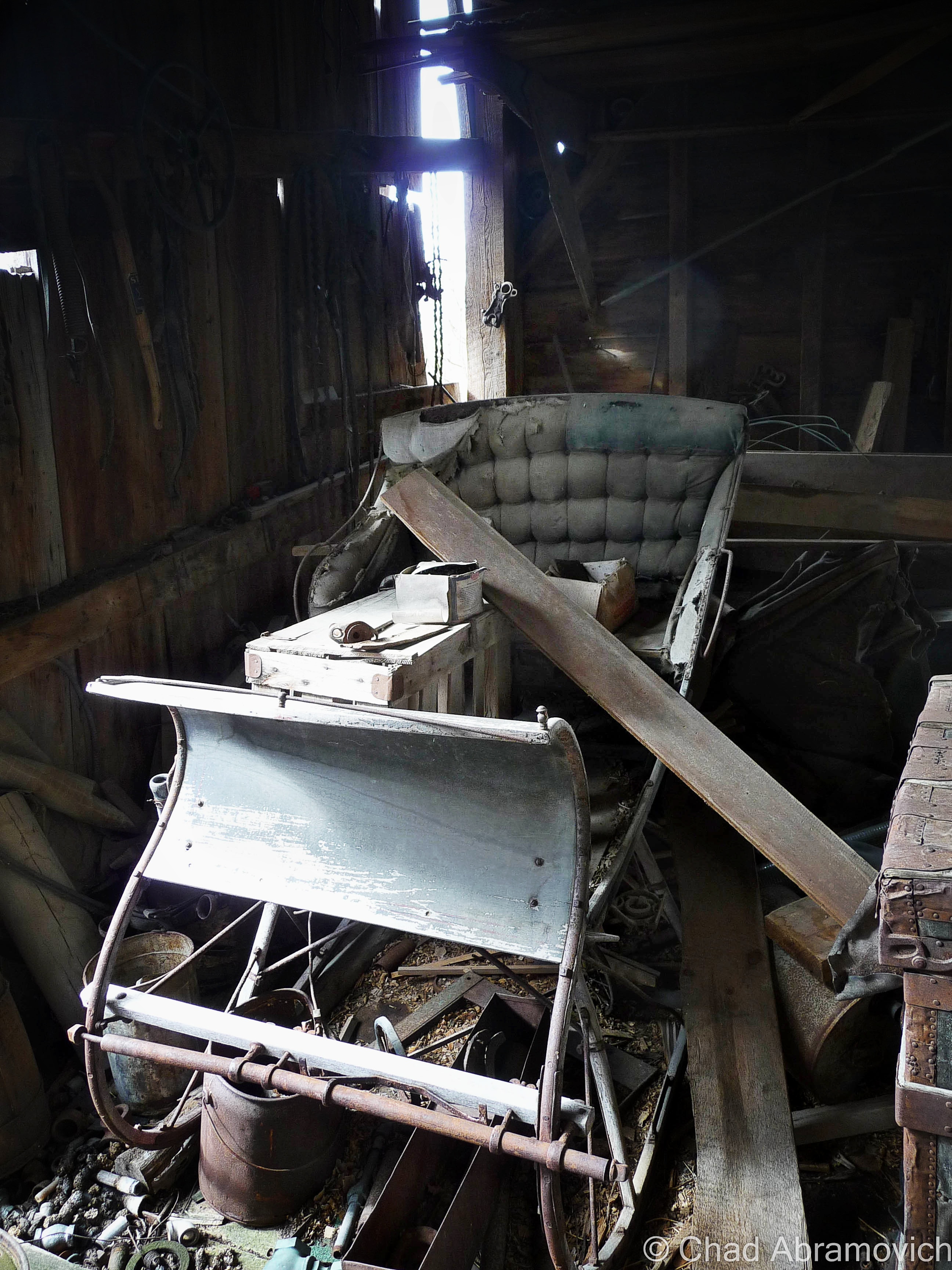
The best feature of the property was a tumbledown dairy barn covered in gray decay. The ramshackle structure was worth the potential threat of tetanus. The interior was filled with the debris of century old farm equipment, hidden doors and other relics. Like a beautiful antique sleigh.
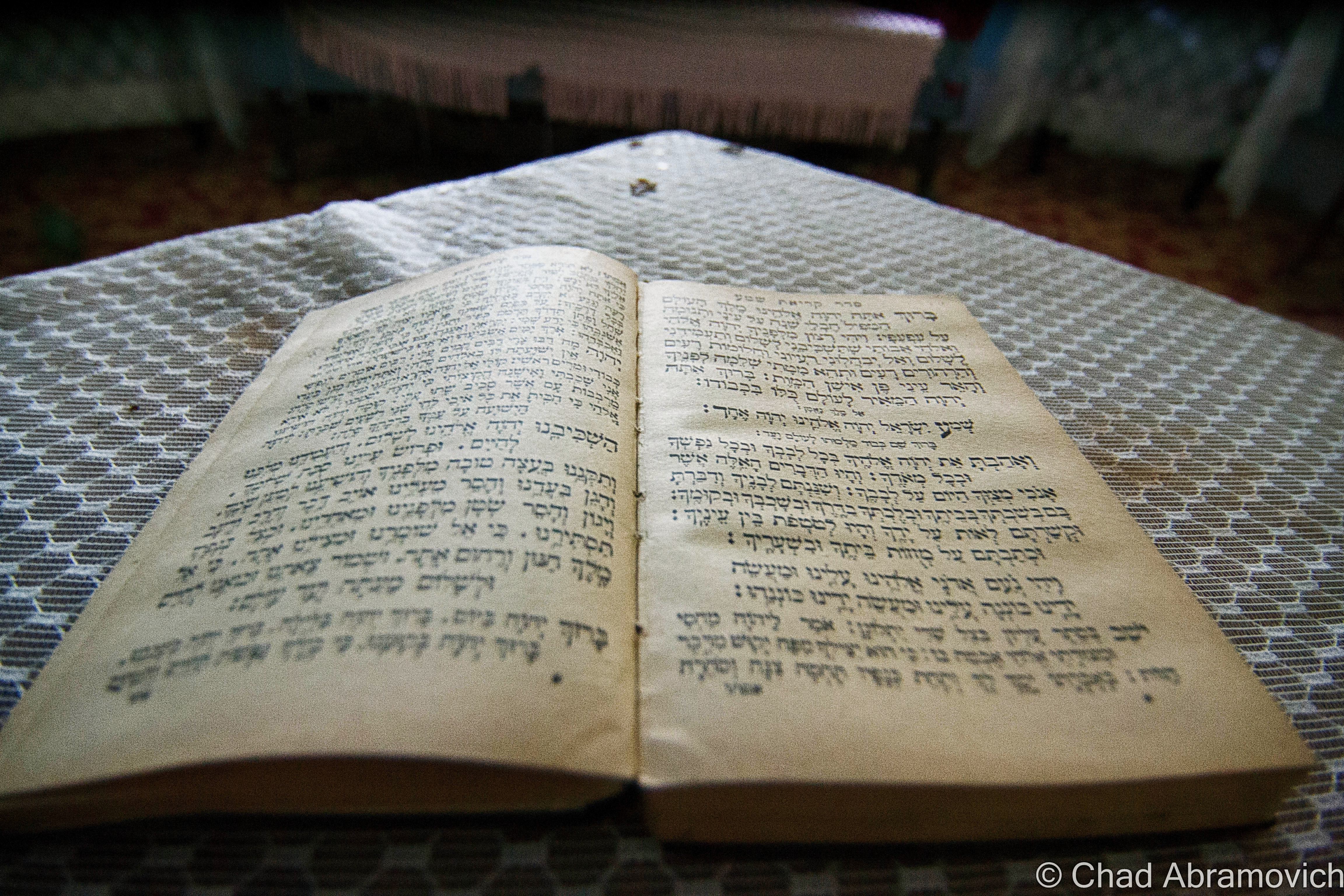
I even found a century plus old book underneath some floorboards in an abandoned barn, which raised a few questions. Why was this book concealed under the floor? What else was below my boots?
I’m not into theology, but it was pretty cool. As a graphic design major, I really appreciated the headlining typography. Finding old religious paraphernalia hidden in Vermont buildings isn’t rare it seems. Around the same time, an acquaintance I knew found someone’s leather bound, ornate family bible from 1848 under his floorboards, along with a handgun and the skeleton key to his basement door, which they had never been able to access until then. The decaying book was scrawled with various notes and births/deaths of a family who used to live in his old house in Milton. The place was built in the 1840s as a hotel, and also functioned as a bar, vaudeville theater and silent movie house and an odd fellows hall, before being converted into shoddy apartments.
—————————————————————————————————————————————–
To all of my fans and supporters, I am truly grateful and humbled by all of the support and donations throughout the years that have kept Obscure Vermont up and running.
As you all know I spend countless hours researching, writing, and traveling to produce and sustain this blog. Obscure Vermont is funded entirely on generous donations that you the wonderful viewers and supporters have made. Expenses range from internet fees to host the blog, to investing in research materials, to traveling expenses. Also, donations help keep me current with my photography gear, computer, and computer software so that I can deliver the best quality possible. Seriously, even the small cost equivalent to a gas station cup of coffee would help greatly!
If you value, appreciate, and enjoy reading about my adventures please consider making a donation to my new Gofundme account or Paypal. Any donation would not only be greatly appreciated and help keep this blog going, it would also keep me doing what I love. Thank you!
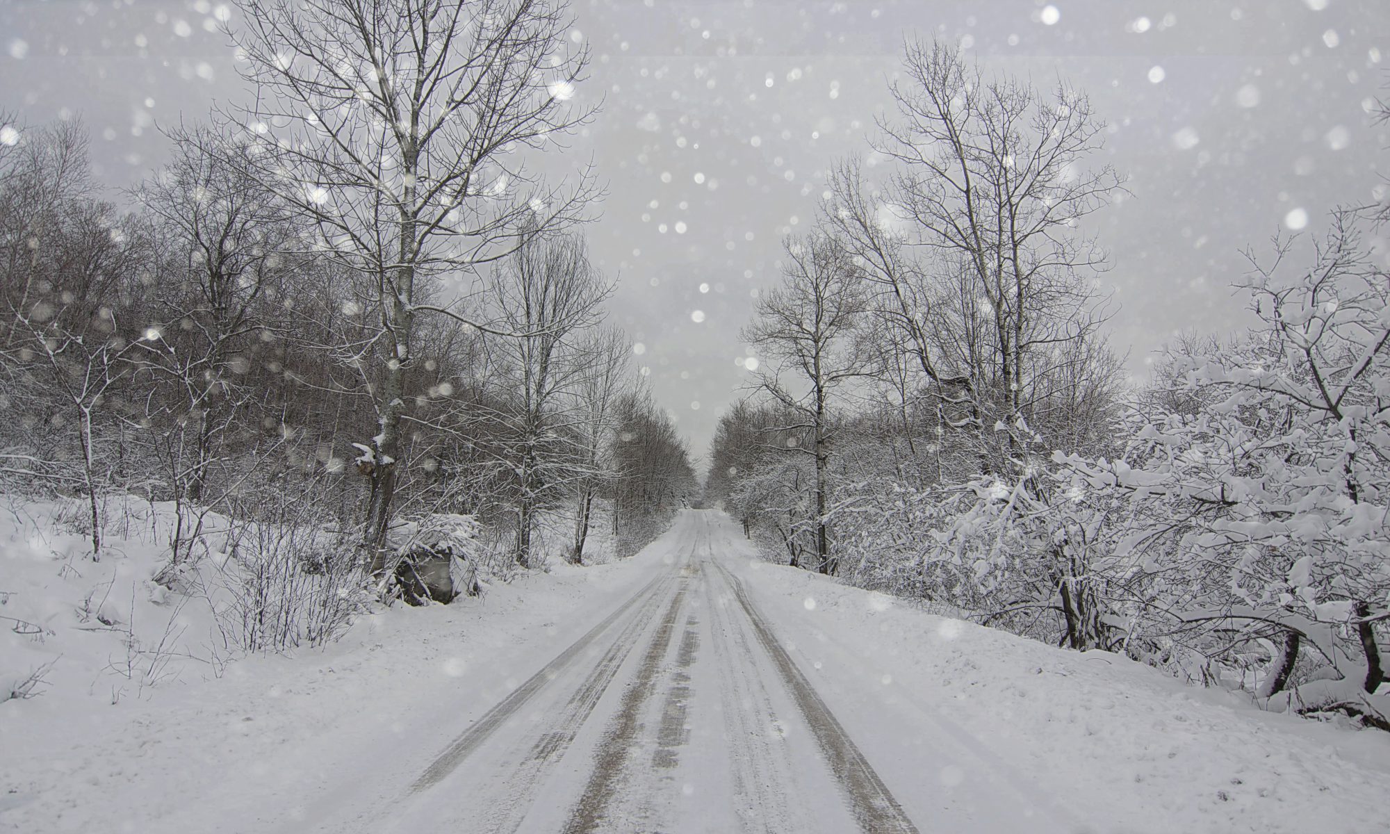
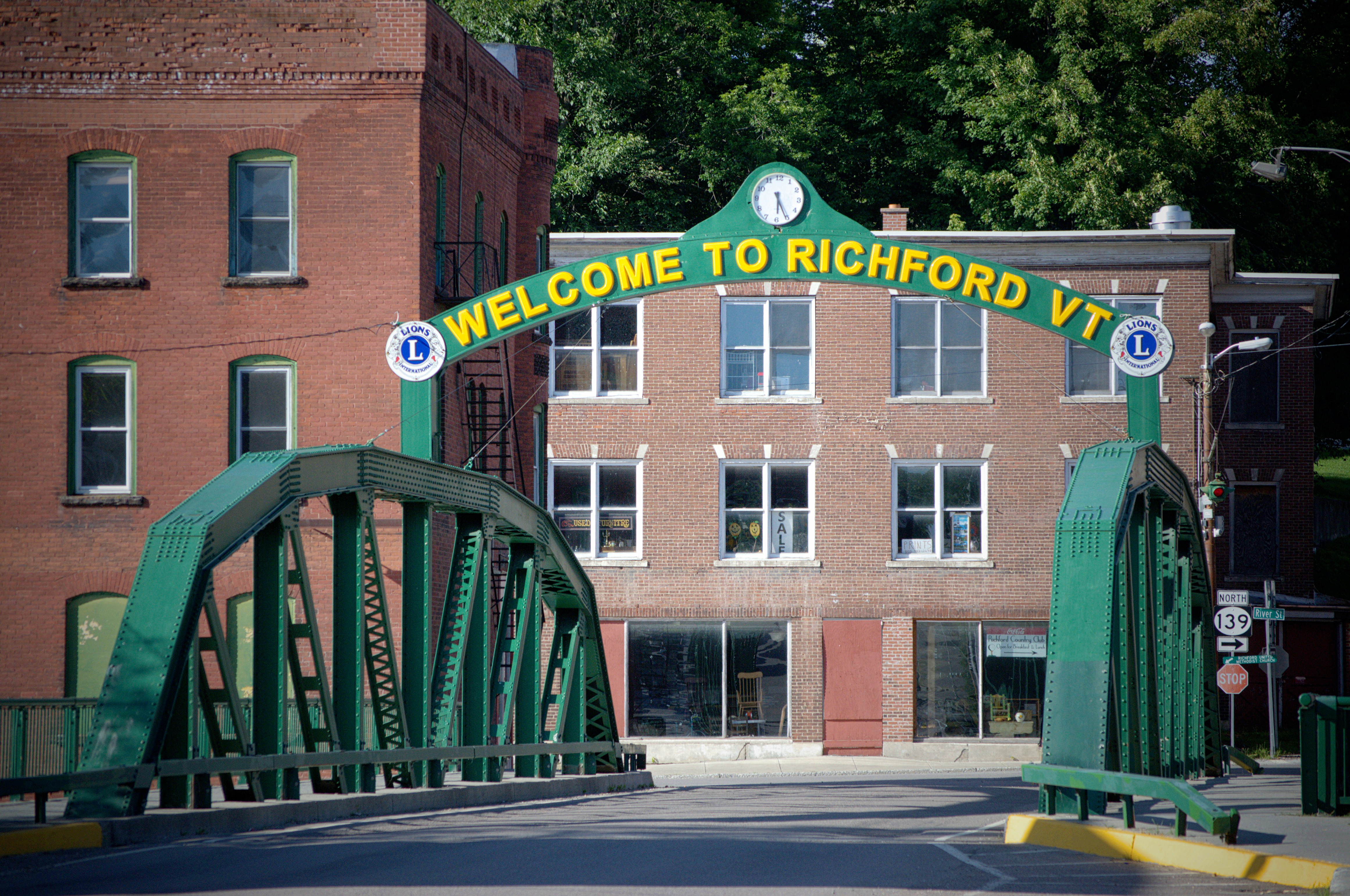
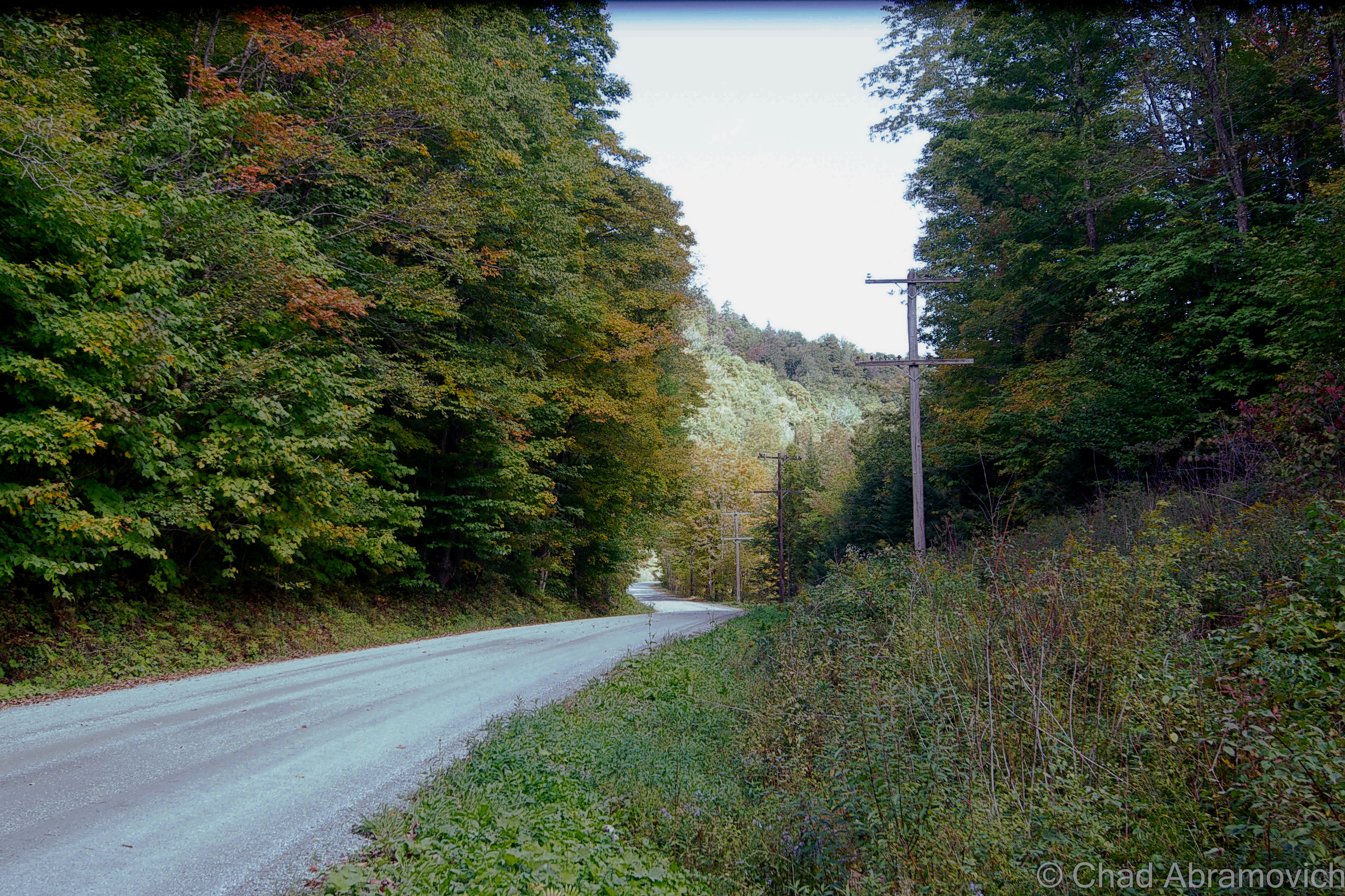
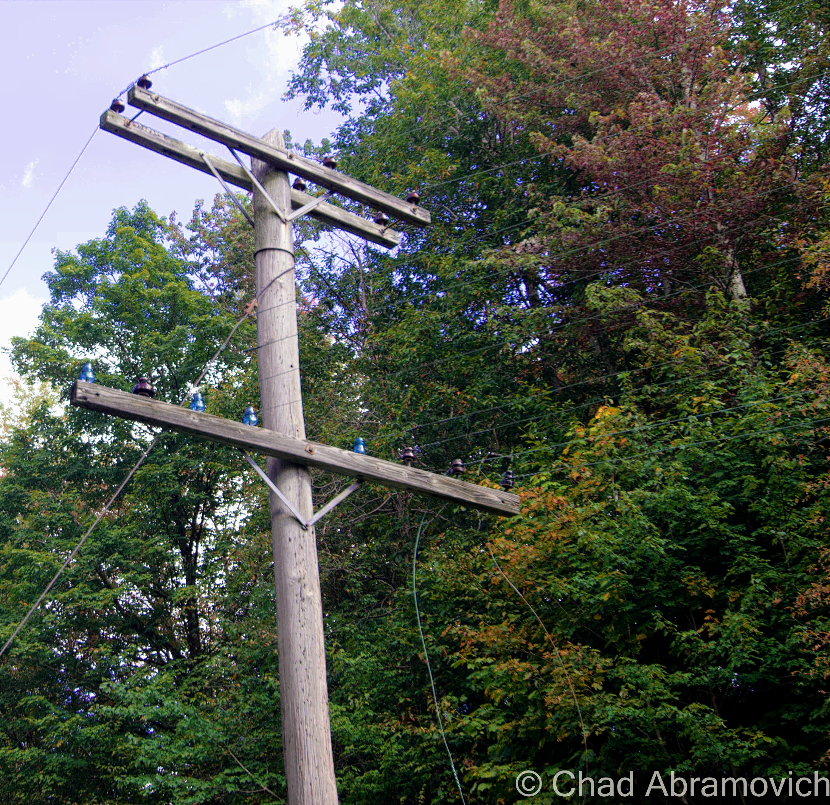
The hill country up near hardscrabble East Richford is an older, left behind Vermont of farmhouses with sagging rooflines, boarded up country stores, rivers, rusted iron railroad bridges over narrow underpasses, and toothpick rows of harvested corn stocks left in bleak fields.
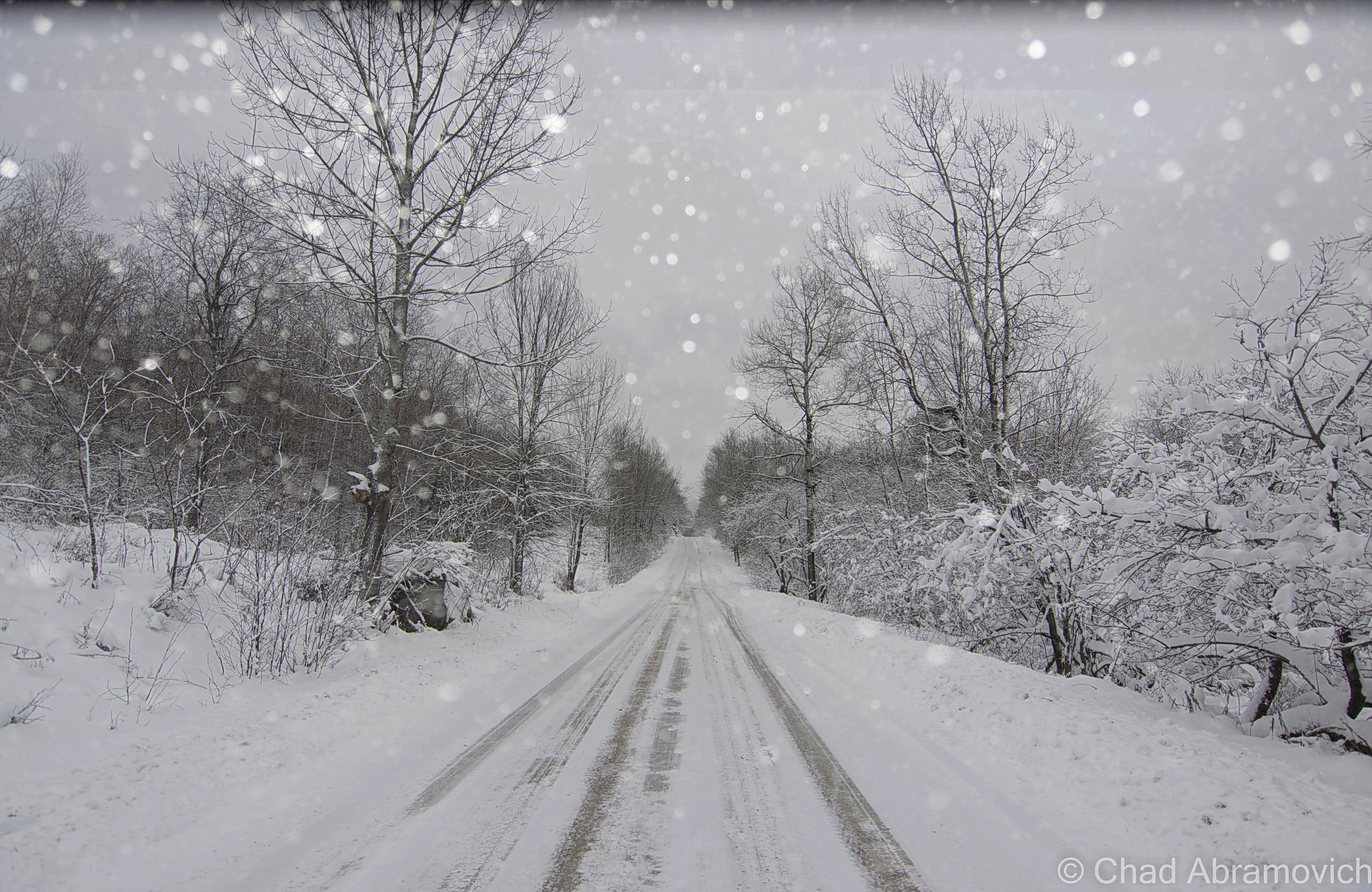
It was up in this part of the state under 6 inches of snow and roads that made me thankful for snow tires that I was going oddity hunting.
We were the only car on state route 105A, a pretty desolate spur road connecting route 105 to a sparsely used border crossing at Sutton, Quebec. The bad tarmac ran alongside the hypothermic waters of the Mississqoui as the snow began to tumble down to the ground in an amiable silence. “Man, I love roads that follow rivers” my friend enthused. “Yeah, roads that follow rivers are some of humankind’s’ best achievements” I returned, and we both cracked a grin.
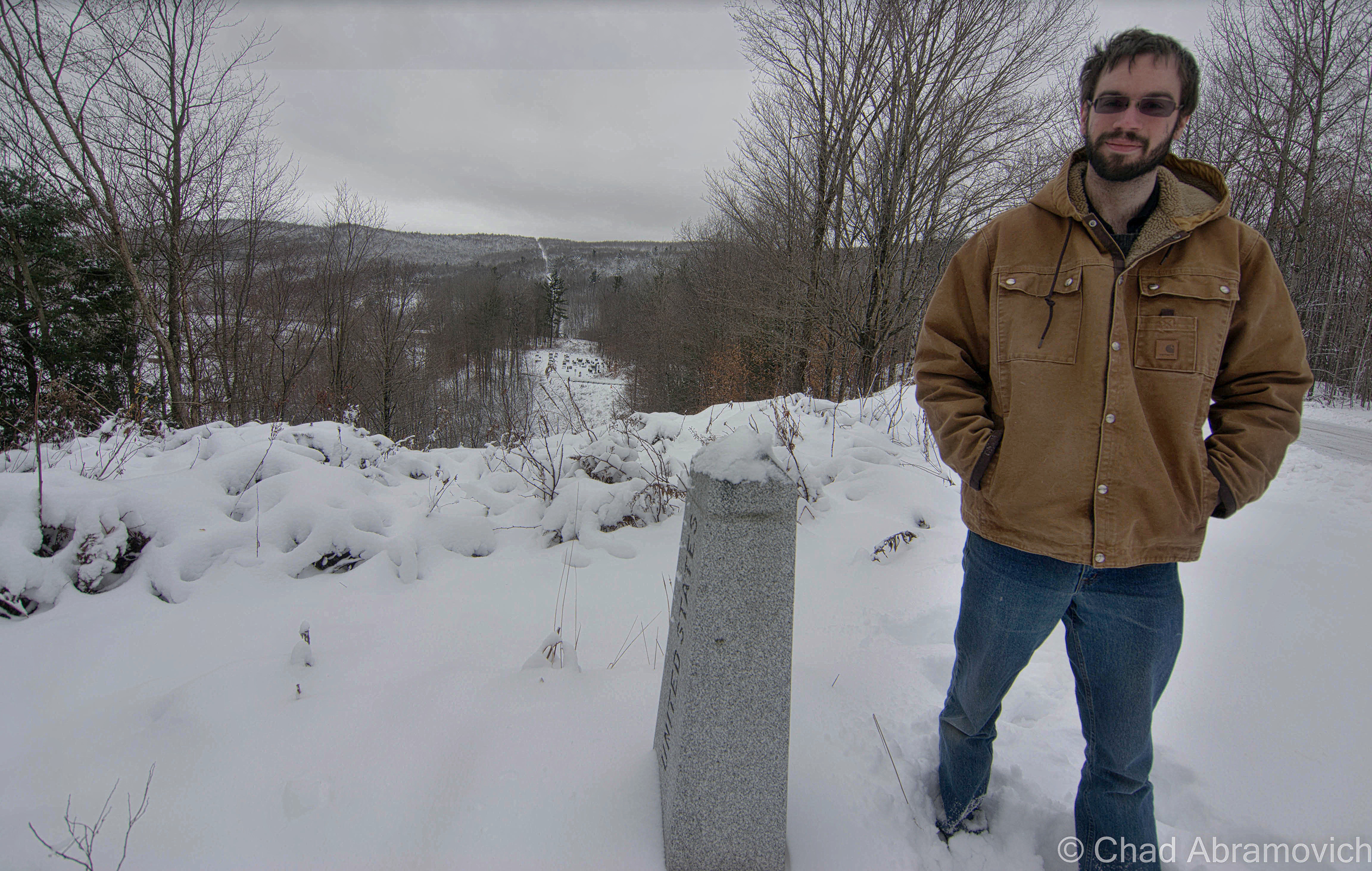
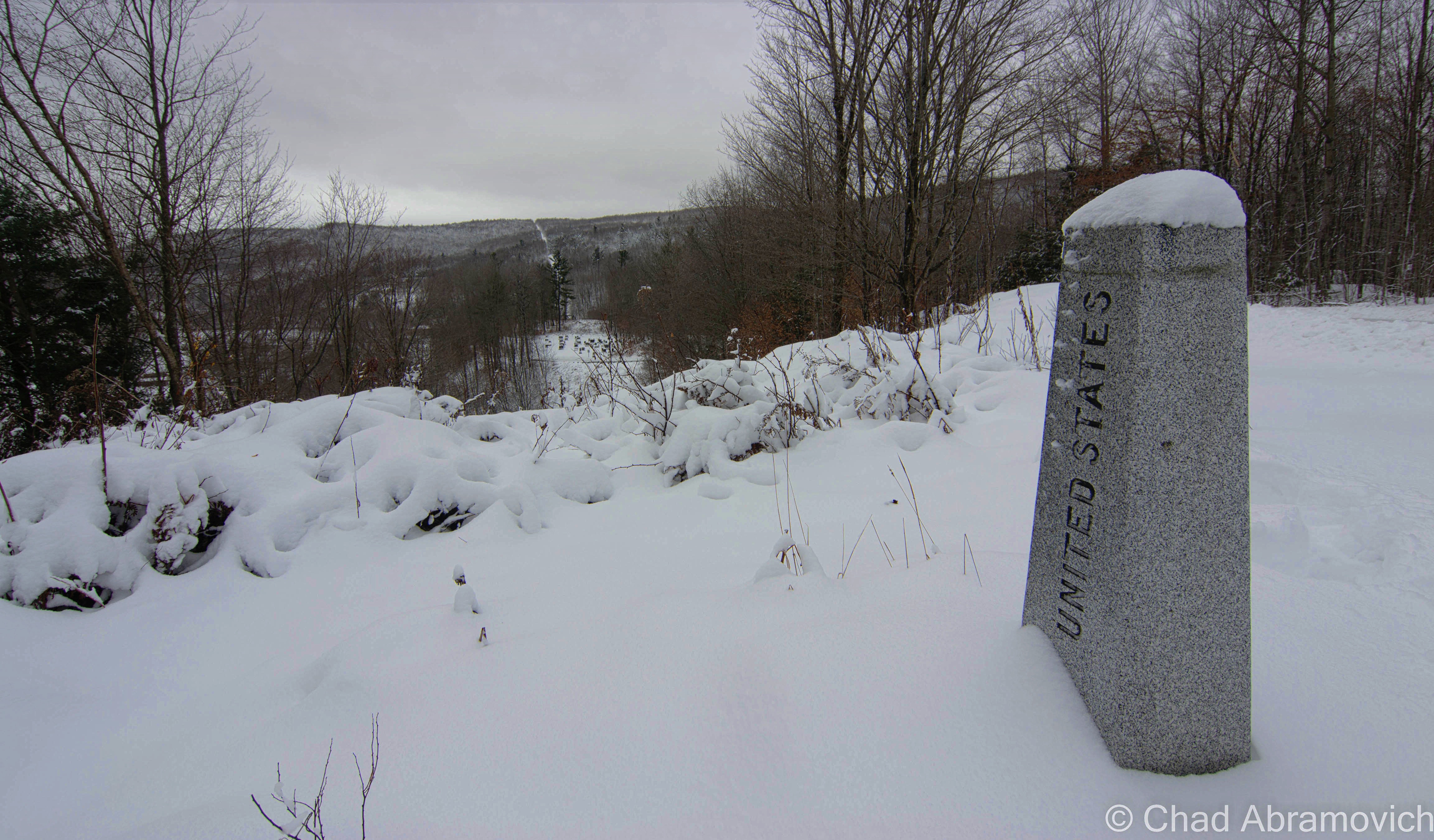
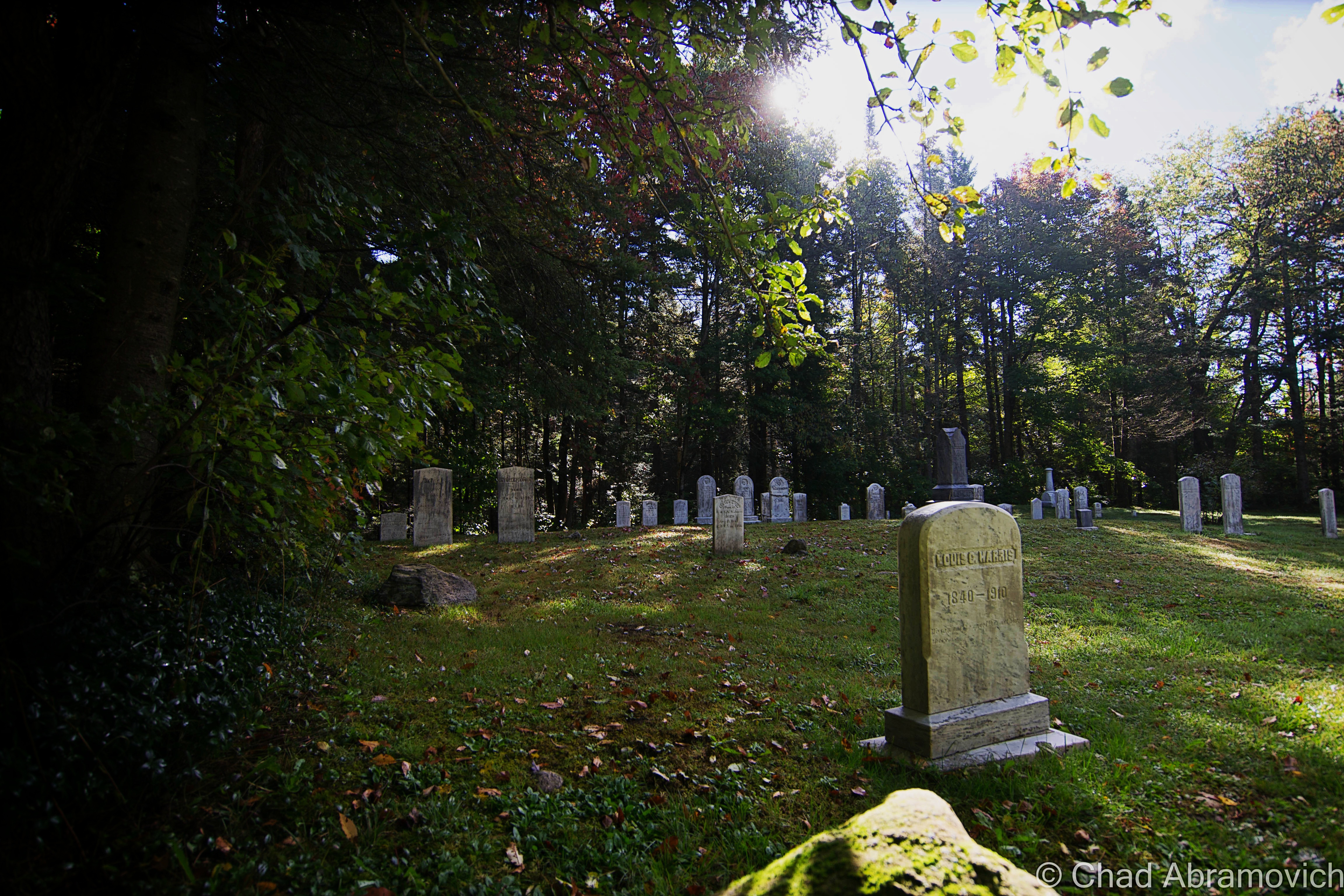
We continued to be the only traffic as we turned onto the dirt main drag of East Richford, which was only a few older wooden homes in various states of decrepitude. Past the abandoned Gulf station, the road sharply right angles at Quebec before beginning its ascent up into the border hills. We passed an old graveyard where the invisible line between the two nations slashed through the middle of, before my friend suddenly stomped on his breaks, our car skidding for a few seconds on the slush and ice. “Oh……” he breathed, looking at the granite boundary marker to our right. “Shit, are we breaking the law? We’re in Canada! Don’t we have to check in?”
“The only law we’re breaking is the law of gravity!” I quipped.
According to Sir Isaac Newton, objects fall. No exceptions. But if Franklin County lore has a flicker of truth to it, perhaps not.
This remote border road that made it’s way through some of Vermont’s most stark and impoverished back country near East Richford is known as “Richford’s Mystery Spot,” according to Joseph E. Citro and Diane E. Foulds in their 2004 book Curious New England: The Unconventional Traveler’s Guide to Eccentric Destinations.The “mystery” is that gravity in this spot reputedly likes to behave unorthodoxly. For example, cars are said to roll uphill! WTF?
These oddities aren’t unique to the Green Mountain State. Various places around the U.S. manifest the same puzzling phenomenon. Nearest to Vermont, there are two “mystery spots” in the Massachusetts towns of Greenfield and Harvard, and one in Middlesex, N.Y., on the awesomely named Spook Hill Road.
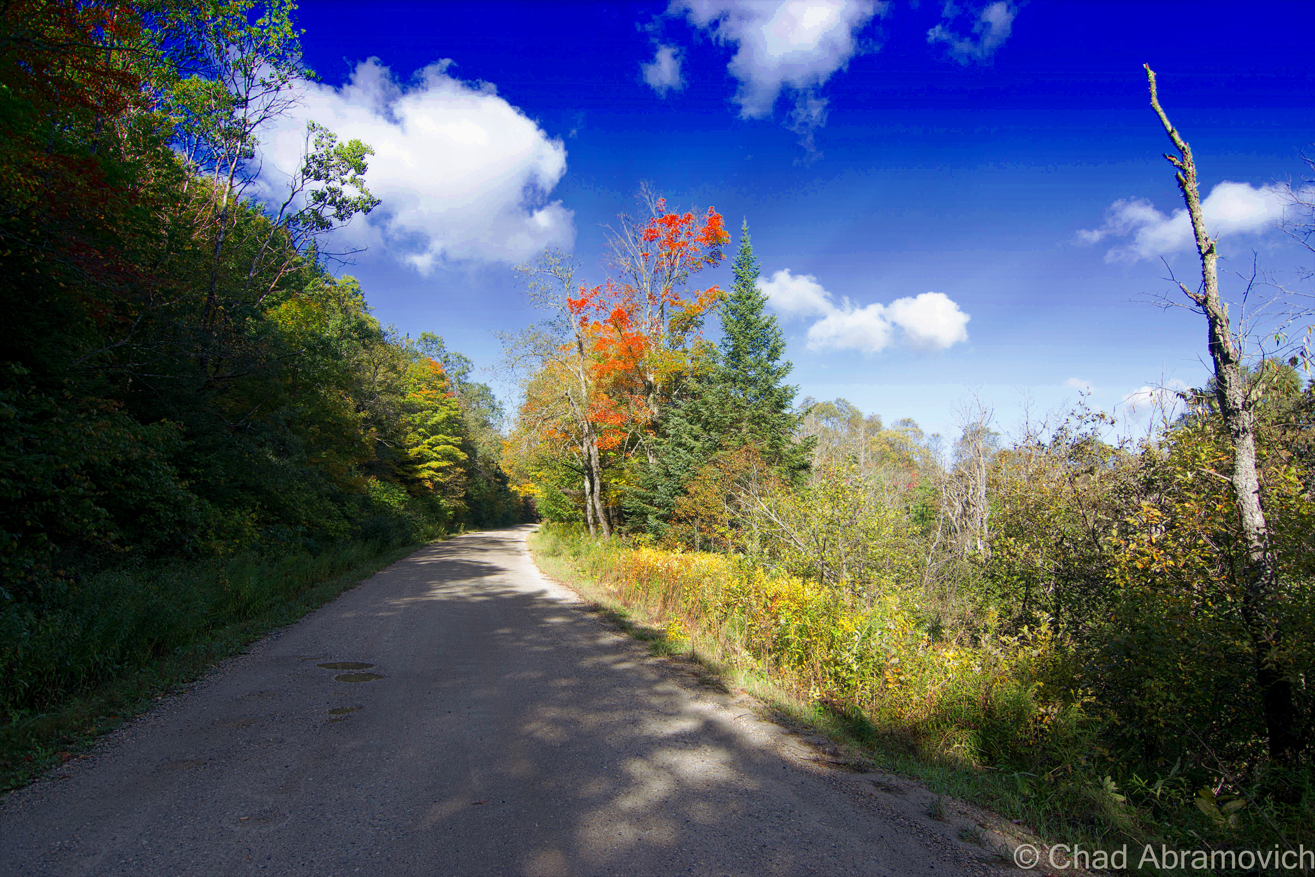
Citro and Foulds reported that they weren’t able to locate Richford’s mystery spot. Years ago, in a brown and bleak November, I made my own attempt. Being an avid Vermont enthusiast and local weird worker, I couldn’t pass this one up. I enlisted a friend, who couldn’t contain his mirth when I explained we were aiming to defy gravity, and quickly signed on for the road trip. I guess breaking the laws of physics is a good way to make plans.
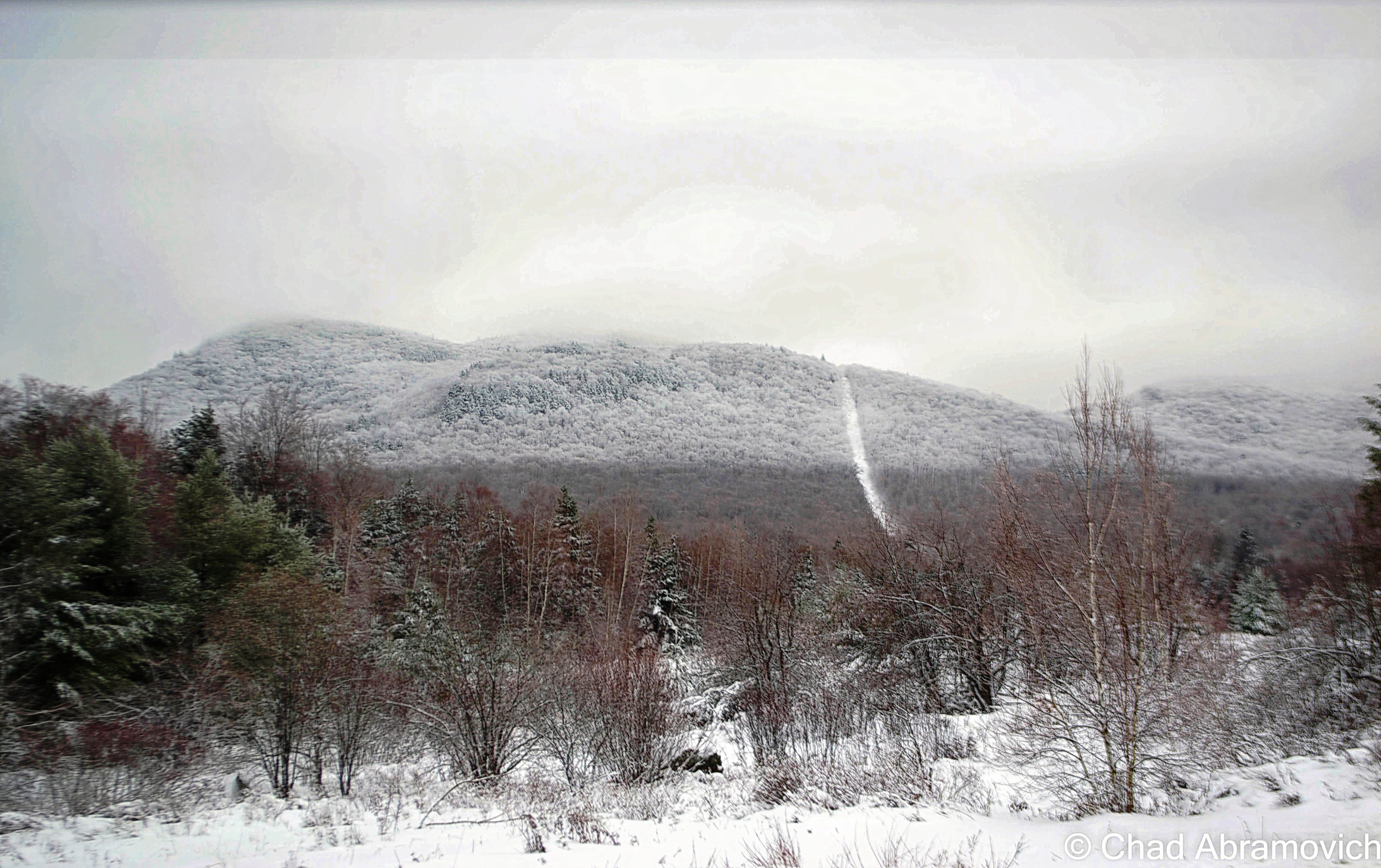
The mystery spot is aptly named, I discovered when we turned east out of Richford village toward the looming form of Jay Peak, because it’s no easy place to find. The night before, I had consulted the state atlas and decided that the most likely location was the curiously named East Richford Slide Road, a hilly dirt byway that rolls over the foothills of Jay Peak with a few trailers and abandoned farmhouses along its length, before depositing you back on Route 105 in Jay town. It serpentines over the border a few times, but because you can’t get anywhere in Canada unless you hike through miles of mountain wilderness, the crossings aren’t guarded.
So how do you discover such an area? There had to be a first person to be bewildered here. My research had identified the late Dolph Dewing of Franklin as the first person to report experiencing the mystery spot’s effects in 1978. According to Citro in Weird New England: Your Travel Guide to New England’s Local Legends and Best Kept Secrets, Dewing started by sharing the discovery with his friends, then brought a busload from the Franklin Senior Center to witness the phenomenon.
In October 1985, County Courier reporter Nat Worman accompanied Dewing to the spot and watched as he stopped his 1979 Dodge there and revved it to prove it was in neutral. After about 60 seconds passed, the car began rolling uphill, accelerating gradually from 10 to 15 mph.
My friend and I weren’t so lucky on that windy November day. We parked our car in several places along the rural road and waited. Despite our relocations, nothing happened.
We pulled over again and mulled things over. Did we have to be in Canada for the “mystery” to work, or on the Vermont side? Maybe we just hadn’t found the right spot.
Sitting beneath border skies as the sun shone off the hood of my friend’s Chevy, I wondered if Dewing had been fooled by some sort of optical illusion. Was it really antigravity? Or magnetism? Or a hoax?
Researching later on, I found that the answers may be closer than I expected and rooted in the rational. There are a bunch of “mystery spots” around the globe, some with equally evocative names such as “gravity hills” and “gravity roads.” So, do the laws of physics simply stop applying there?
Nope. What baffles tons of spectators is actually an optical illusion, one that’s been debunked by physicists. Or, at least, that’s the prevailing theory.
“Gravity hills” and the like are places where the geography of the surrounding land produces an illusion, making a downhill slope appear to go uphill. Obstructions on the horizon can be a key factor in creating this illusion, because they rob us of the reliable reference points we use to determine which way is up. The mind, in short, is tricked.
In a 2006 Science Daily article, Brock Weiss, a physics professor at Penn State Altoona, investigates a gravity hill in Bucks County, Penn., and concludes that this local oddity isn’t that odd. “You are, indeed, going downhill even though your brain gives you the impression that you’re going uphill,” Weiss explains. Using GPS, the investigators demonstrated that the hill’s starting point had a greater elevation than its ending point, despite appearances to the contrary. And, if these mystery spots really were gravitational anomalies, wouldn’t your sense of balance and the objects around you be affected, instead of just your vehicle?
Just as I was pretty much convinced that I could put this into my “mystery solved” pile, Linda Collins of the Richford Historical Society brought me back into a sentiment of uncertainty. I phoned the town offices looking for answers, and instead had an awkward silence sent my way. I had almost thought they hung up on me, before the town clerk spoke up and said she had no idea what I was talking about. So she directed my call to Linda, who had a lot to say about Richford’s weird side.
“Oh yeah, I know about the hill. I think it’s called a ‘gravity hill’. I learned about it when I was researching the UFO sightings in town” said an amused Collins.
Back in the 1970s, she related, a few Richford residents reported seeing strange moving lights over town. Wanting to chronicle the frenzy for the Burlington Free Press, Collins made phone calls, which led her to a government facility in Boulder, Colo. She refers to it as “the strange things facility,” because “I don’t remember what they were called — it’s been so long since I’ve talked about this!”
According to Collins, the feds told her that a singular magnetic pull or gravitational force in the Richford area had the potential to “attract things.” They didn’t specify what things, and she surmised there was probably more that they weren’t telling her. “You know, government secrecy? They were probably doing some testing or something and didn’t want that getting out to the public,” Collins said. Later on, Collins learned of the “mystery spot” phenomenon.
“Does the historical society get many inquiries about it?” I asked. “No one up here really knows that much about it,” she said with a laugh. “It was such a small deal when it happened. Lots of folks in town now don’t really know a lot about our history anymore.”
“So what’s your opinion on it? Do you think it’s an illusion, or is there something actually weird with gravity in Richford?”
“Well….I mean, I don’t know what to tell you. Richford is a weird town. If all this business about the UFOs and gravitational pulls are true, then who knows.”
Border towns are weird in general, in both their local lore and for political complications and the infrastructure meant to delineate a sense of placement. Richford’s mythology resume is a bulky one of giant birds that have swooped down and snatched babies, UFOs, giant wolves that may live around the border, a possible “window area” near Jay Peak, and a former rendezvous for rumrunners and smugglers.
If the Richford, VT/Sutton, QC area really does have some sort of unique magnetic force, that would set Vermont’s mystery spot apart from the scores of others around the globe that can be debunked by aesthetic tomfoolery.
One of my favorite Richford landmarks, as seen downtown.
Because I was trying to write about this for Seven Days, I decided that was a great excuse to take another trip up to border country with another friend, and give it another go, this time in a Ford (if that makes any sort of difference)
Back up the East Richford Slide Road, we drove around looking for answers and an outlandishly cool experience, stopping and going almost the entire length of the slick road, with some situationally motivating Jazz coming quietly through the radio.
We think there was one spot where the car rolled in a direction that wasn’t backward, but after getting out of the car and scrutinizing the area, the very very gradual incline of the road may have actually been inconspicuously dipping downhill, but the eye is fooled from a larger uphill lip of an intersection beyond it which forms the horizon line. Was this the spot? If so, Dewing’s car was recorded going at least 15mph, while we were going 5.
I’m not sure if I left empty handed or not to be honest, but it was an enjoyable way to spend my morning.
Whatever the explanation for the mystique, the Richford Mystery Spot is still one of my favorite examples of Vermont obscura, because it’s accessible and fun. If only it were a little easier to locate the exact spot where the optical illusion — if that’s what it is — kicks in.
One of our many stops up the East Richford Slide Road, where we were definitely sliding all over the place.The mowed down strip of forest cutting over those snowy mountains is an aesthetic reminder of where the U.S./Canada border is that’s called “The Slash”, created by homeland security when they deemed all of the 150 plus year old granite obelisk markers formerly doing the job as obsolete. So far, the clear cut runs from Maine to Minnesota, with the eventual finish line being Alaska. I read in a newspaper write up years ago that they defended their forestry project by arguing that a lot of Americans would be confused and wind up in Canada accidentally if they didn’t. I’m not sure if I buy that. I mean, I’ve never bumbled my way into Quebec before. But who are we to question the government?
—————————————————————————————————————————————–
To all of my fans and supporters, I am truly grateful and humbled by all of the support and donations throughout the years that have kept Obscure Vermont up and running.
I spend countless hours researching, writing, and traveling to produce and sustain this blog. Obscure Vermont is funded entirely on generous donations that you the wonderful viewers and supporters have made. Expenses range from internet fees to host the blog, to investing in research materials, to traveling expenses. Also, donations help keep me current with my photography gear, computer, and computer software so that I can deliver the best quality possible. Seriously, even the small cost equivalent to a gas station cup of coffee would help greatly! Especially now, as my camera is in need of repairs and I can’t afford the bill, which is distressing me greatly.
If you value, appreciate, and enjoy reading about my adventures please consider making a donation to my new Gofundme account or Paypal. Any donation would not only be greatly appreciated and help keep this blog going, it would also keep me doing what I love. Thank you!
I woke up at 5 AM, was reminded that I wasn’t a morning person, and stumbled out my back door at 6. My friend was waiting for me in his parked car as the headlights cast a dull amber pallor onto quiet streets that were under the cold gray dawn. It was 41 degrees and I was all shiver bones in the new coming chill.
I stopped for a few gas station coffees and was rewarded with my early rise by wicked fog that obscured the landscape off route 7 in a glorious visceral veil that turned everything into mutated shadows. I caught some of it on my cell phone hanging around Dorset Peak, before it burned off.
The weather lately has been prime for adventuring, and I’ve been aching to get out. This trip would give me that spark in my brains I was looking for. Feeding off my desire to visit as many obscure places as I can, I figured that two ghost towns in southern Vermont would be a great way to spend my day. These vanished places are probably some of the most obscure in the state. But everyone pays the price to feed, and I arrived back home exhausted and practically limping, so I suppose that can be gauged as one hell of an adventure. But I’m also someone who’d willingly drive 8 hours just to find an oddity, so a follow-up day of sluggish exhaustion was easily worth it for me.
Somerset
I’m willing to assume that plenty of Vermonters haven’t heard of Somerset. If you take a gander at a state atlas, it’s a narrow rectangle at the western edge of Windham County that nudges into eastern Bennington County – giving the latter county its block lettered “C” shape.
The entire burg is filled by the Green Mountain National Forest. It has a year-round population of 2 people and is only accessible by a forest service road that is all too easy to miss because of its small, squint-to-read street sign. But out of the two destinations I was planning on scouting, Somerset was the only one that was somewhat accessible by vehicle, so we started out with that one. I was still sipping my coffee which was getting unsatisfyingly cold, trying to shake off a road trip thematic Tom Waits song beating around in my head.
Somerset Road sort of plunges immediately down an embankment right off The Molly Stark Byway in woodsy Searsburg, and almost as quickly, turns to washboarded gravel after passing a few houses with scores of signs telling you that they’re not into people trespassing on their land. The increasingly destitute road now follows the Deerfield River and is thick with trees. We noticed that some older power lines had still been strung up along the road, and ran the length of the Searsburg portion. But it was evident these lines were archaic predecessors of modern day utility infrastructure. Some of the poles were leaning pretty horizontally as we got further down the road, and that’s when we noticed that they had glass insulators still on their lower rungs, now defunct as the power company had long clipped those wires and modernized things a bit a few feet higher up. Glass insulators were developed in the 1850s originally for telegraph wires, but were later utilized for initiative telephone wires and electric power lines, until the 1960s when they began to be phased out and simultaneously became a feature of interest.
I thought it was pretty cool to see them, and that there are still more or less untouched Vermont back roads that still exist. Older relics like these are becoming increasingly hard to find nowadays. And, apparently, there is a collectors market, clubs and even shows dedicated to them. Anything can have fanfare it seems.
The Somerset Road as it winds through Searsburg.The blue glass insulators are on the bottom rung, while the modernized installation sits on top.
As soon as we hit the Somerset town line, which was marked by an omnipresently strange country icon of a bullet-perforated speed limit sign and an abrupt transition of bad gravel road to worse gravel road. The power lines stopped, and for the next several miles, we were deep in the type of woods where you really couldn’t see the forest through the trees, and they were all in the throes of their glorious descent into their perennial death.
There are really no places in Vermont like Somerset. Though there are 2 census documented year-round denizens, the amount of people gets to about 24-ish during the summer months – they’re all people who have camps there. In a 2011 interview done by WCAX, one of two Somersetians, Don Gero, explained that people don’t stick around here. Both residents are bachelors, and he quipped that because Somerset has no electricity or phones, women don’t want to live there. “They can’t use their hair dryers or wash their clothes” he said. He’s also not happy about the summer camping population, who are “two dozen too many” for his tastes, and paeaned for the good ol’ days when I guess none of them were there. Often, the current culture of these odd places is more interesting than the past events that created them.
Charted by Benning Wentworth back when Vermont wasn’t Vermont and its land was quarreled over by New York and New Hampshire, the New Hampshire governor and businessman (in no particular order) just drew a whole bunch of lines on a map and granted towns without knowing anything of the area’s geography. The most important thing was that New York couldn’t get their hands on any of the land, so he didn’t concern himself with pesky things like that. Vermonters decided they preferred anarchy, and would later orgonize an independent republic in 1777 with our own currency and postal service, and then, the 14th state in 1791 when we tried on our current name.
Somerset is all mountains, far away from anything and hard to get to. Despite that it wasn’t great real estate to early settlers, 321 people tried to live here in the town’s 1880s apex. Logging was the only way to make a few bucks, so they deforested all of the area mountains. They attempted to have log drives down the Deerfield River, except for when it was low, which it was, a lot.
The demand for timber was ravenous, and that convinced a railroad line to lay tracks up to the mills, which were a huge boon to the town, but also helped speed up its death. A town depending on a finite resource comes and goes like fads always do, and most of the trees in the area were hacked down, the inevitable consequence was that both the logging industry and the town became a literal washout.
The town’s last hurrah was when the Deerfield River valley was eyed for a future facing wonder like hydropower and the cash it could bring. In 1911, the Somerset Dam began to take form. The dam was built by massive work crews of about 100 men in shifts, doing everything by hand and took about 3 years to complete. The reservoir did what reservoirs do best and collected the desired water, which submerged what was left of town and the railroad and the mills.
At some point, there was an airfield in Somerset, which has also vanished. Today it’s a free and minimal amenitied national forest campground under the same name. According to campers who post reviews online, it’s either wonderfully remote or a place where amateur outdoors folk or “Massholes” go to belt loud music and litter. Given my experience at campgrounds, I’d say it’s probably both.
I also found out, which isn’t detrimental to your life if you don’t know, that you can take class D forest roads from Somerset all the way north to the Kelly Stand Road – a west-east oriented forest road that’s also one of Southern Vermont’s most scenic. If you enjoy shunpiking, finding more of these back road byways to explore is usually not a bad thing.
The Somerset Road in Somerset.A small and mowed cemetery surprisingly pops out of miles of wilderness as you travel up the forest road. Many of the weathered and matching headstones were kids. One sad entombment was uniquely chiseled with a sheep on top, and quickly caught my wondering eyes. Lancelot was 3 years old. Life up here was tough, especially for kids.
The further away from civilization we drove, the more apple trees started to distinguishly appear from the northern forests. I’m not sure how old some of these trees were, and if they were original to former Somerset residents, or planted after the national forest took over. These apple trees appeared somewhat haunted by the thick woods and lack of sunlight needed to grow. Others still carried apple crops which varied in how rotten they were. These apple strands that are heirloom seeds, and are not commercially available anymore in an increasingly lack of choice based GMO market, leaving these trees to one by one die off.A brown and white national forest sign explained at the trees that were still able to produce apples were part of an “apples for wildlife program”,which is pretty self-explanatory.I could have hung out in Somerset all day, it was just so beautiful and almost intimidatingly wild. All I’d need is a few Vermont microbrews to accompany me. This little brook paralleled the forest road, but I wouldn’t have found it if I didn’t stop to spark my interest in an old apple orchard.Only 3 things remain of Somerset’s days as a town – one of them being its restored but locked one-room schoolhouse, also found a ways up the forest road. I heard it was a private camp, but not positive about those details. I’d love to see the inside. Or to live in a restored one-room schoolhouse.The forests of Somerset. Are any of my blog followers into Geocaching like me? Somerset may be remote, but the area is loaded with caches!
The Somerset Reservoir is where the Somerset Road comes to an end, and in my humble opinion, one of the more stunning places in Vermont. The sinuous and currently blustery cold water body is about 5-6 miles long and undeveloped. The long form of Stratton’s rounded mountain top could be seen in the distance . The dam’s roadside appearance is really just a high grassy wall with a nearby unmanned rickety tin shack that has a TransCanada logo sign plate on it. But atop the dam is this awesome view of one of Vermont’s largest wilderness areas. I really wish I had brought a kayak or something. Seriously, places like this are therapy to me. I couldn’t contain my approval and swore a few times to prove it.
Glastenbury
Vermont author Joseph Citro introduced Connecticut’s faded hamlet of Duddleytown (which was really only a place name in the town of Cornwall named after the trio of brothers who bought land there) as “the granddaddy of all New England window areas” in his book Passing Strange, which to me made a pretty good lead-in to that chapter (it was actually the last sentence in his chapter on Glastenbury). I’d like to term swipe that to introduce Glastenbury on a more localized level, as the granddaddy of Vermont’s lost areas, for multifarious justifications.
Getting to the ill-fated town is nothing short of a challenge today, and was for the people who tried to make a life for themselves up there over a century ago. It’s isolation, stubbornly built up in an area of 12 peaks over 3,000 feet with no convenient access, makes it one of the most unique places in the Green Mountain State, then and now.
If you’ve been following my blog, you might know that I’ve been very interested in Glastenbury since I was a kid, and wrote about it extensively, my long winded self trying to pack as much detail as I could into a blog post. This entry expands on that.
To summarize things; the vanished town of Glastenbury was charted in 1761, and reflected the circumstances of its neighbor Somerset when it was naively plotted over some of the worst topography in the state. As a consequence, it wasn’t really until the 1850s when anyone paid interest to the town, when people figured out they had an entire mountain of wood to deforest for profit, and a logging/charcoal duality became Glastenbury’s only industry.
About 12 brick kilns for charcoal production were built in southern Glastenbury at an area known as “the forks”, because it was a distinguishable location where Bolles Brook split in two in a V-shaped parting of ways. A small and rough, lawless village designated as South Glastenbury grew up around these kilns, including a one-room schoolhouse, loggers boardinghouse and company store.
The steepest railroad ever built in the U.S. was developed to get up into South Glastenbury. The electric trolly line was the only element that made the town a pragmatic place; bringing down money making lumber and charcoal, and later, bringing up tourists. Many have no idea that aforementioned rail bed still exists, and if you follow it, will bring you deep into indistinguishable wilderness to the grave of the old town. Our adventure started well before we got out of the car when we navigated our way to the portal into the forest.
Funny enough, Glastenbury is still technically a town, at least in the haze of Vermont law. A gaze at a state atlas, or a Google map search, will show you a dotted lined square that represents a town boundary, only, there is nothing within the square. It’s considered an unincorporated town – or, one of 5 Vermont communities with a population so low, that instead of a town government handling its affairs, those things are managed by a county or the state. Or the national forest service I guess. There are a few people who still do live in Glastenbury – populated by just 6 people ( their properties are pretty much clustered near the borders of either Shaftsbury or Woodford), who also have achieved somewhat of a level of intrigue beyond the strange phenomena that describes the town.
I’m going to stay quiet on the access road we took, because it’s pretty evident that the people who have their addresses there don’t want the crowds. (Like the folks in Somerset, they live in the boonies for a reason, only, these folks express their discontent via threatening scrawl) When we drove up the gravel roadway, we immediately began to pass some shabby looking properties, all of them with handwritten and somewhat threatening signs warning nonlocals not to park their cars there, or else.
Fearing our car would be cannibalized for its wheels in an uncomfortable back woods “we warned you!” sort of situation, we decided to find what we designated as the safest parking space on the road, far away from any discernable houses and no parking signs. Hoping that we didn’t make a stupid mistake, we trekked up the road on foot, found the forest road, and began our hike into one of the most fabled places in state mythology.
This is a shot of the trail slash old rail bed, miles into our hike. Unexpectedly to me, this might be the most grueling of Vermont hikes I’ve endured. The amount of rocks ravished my feet to a point where I was literally limping down the trail, silently no longer caring if I was there and begging to rest my weary bones in the car.Further up the trail, we started to find original rail spikes from when the railroad was built over a century ago!This was a sign that got me revved up. We began to notice chunks of Slag along the trail. Slag is a stony waste matter separated from metals during the smelting or refining of ore, and since Glastenbury was built around charcoal furnaces, there is plenty of the stuff in the woods today. We were even to find some rare green and blue slag. I’m not very savvy about the jewelry culture, but I guess you can polish and buffer up slag chunks pretty attractively and make accented miscellany from them. I dig them in their natural form, and grabbed a few chunks of the green for my collection of oddities.The Bennington-Woodford Railroad ran electric trolleys up to South Glastenbury
We hushed our sound as we heard another one that was all too familiar to me. We heard an approaching 4 wheeler. Because of my suspicious nature and not knowing what sort of people were this deep up in the woods, I decided to relocate myself as far to the side of the trail as I could, give a friendly nod and let them pass. As they got closer, I saw it was a younger couple, a man and a woman, and they slowed down as they saw us. I decided to take the mutual encounter and get past my social anxiety and spark up a conversation with them.
Actually, I wanted directions, because we were beginning to second guess ourselves as to where we were, and if we could find any of the ruins, and I really didn’t want to leave disappointed.
The front handbrakes were pulled and their 4 wheeler slowed down to a stop. The gentleman, who was wearing a camo baseball cap and sunglasses smiled at us and wished us a good afternoon, his wife sat behind him silently observing us with a friendly expression. I returned the greeting and asked him if he could direct us to South Glastenbury.
“Oh, the forks?” he asked. That casual nickname drop meant that they were aware of it, and I nodded my head, my excitement immediately betrayed my casual expression I was trying to keep. I also thought it was pretty rad that locals today still use the place’s old handle.
“Yes, the forks. Are we close? Would it even be traceable in all this?” I gestured to the thick woods around me to make a point. “Well, yeah you can find it. But this is sort of the wrong time of year to be looking for that sort of stuff. Also, it’s bear season up here you know. Uhh, how’d you guys know about Glastenbury, just curious?” he asked us with a backdrop set to his tone.
I wasn’t quite sure if my candor had triggered a nerve, or how to give him a cropped statement of how Glastenbury found itself sticking to the flypaper of New England mythology, but I had a feeling he already knew that. “So, you know about Middie Rivers?” his wife spoke up. “Yeah, I do” I stated. There was no need to be superfluous there. But for those of you who are unfamiliar with Glastenbury and it’s monsters;
Local lore includes a froth of big hairy monsters, a cursed Indian stone that swallows humans, UFOs, mysterious lights, sounds and odors detected by colonial settlers, and numerous hikers walking off the face of the earth here between 1945 to 1950 – earning it the nickname; “The Bennington Triangle” in 1992, which has adhered itself to the flypaper of popular culture.
Fortean researchers like John A. Keel conjured up the term “Window Area”, which I had referenced at the beginning of this section, as a place where some sort of interdimensional trapdoor can be found. Well, that’s one theory anyways. New England is loaded with so-called “Window Areas”. Cryptozoologist and researcher Loren Coleman identified Massachusetts’ “Bridgewater Triangle”, using the term “triangle” to designate any odd geographical area. Joseph Citro followed up by coining “The Bennington Triangle” – both are said to be “window areas” It’s also one of my favorite terms to use when talking about this caliber of local weirdness.
Who knows where the flickers of truth are in all this. And that’s what makes everything so damn fascinating, because there is truth in these tales tall and true.
It’s also the mountain’s paranormal and controversial tales that attract modern day professed ghost hunting clubs and social media sensationalists, whose meddling are an affront to both locals and reasonable judgment, which really seemed to have damned the wilderness area.
Don’t get me wrong, these haunting stories are partially why I found myself hiking up the mountain, because of how impressionable they were and still are to me, but I find that there is also a line between being a civilized researcher, and becoming one of the monsters you’re chasing and exploiting it on a tawdry clickbait website with a headline that reads something like “{insert subject} will give you NIGHTMARES!”
Middie Rivers
The elderly Middie Rivers was the first of a handful of people who reputedly disappeared in the mountains in or near Glastenbury. Anyone who tells the story of southern Vermont’s Shangri-La recants that Rivers was an experienced woodsman who, while leading other hunters on the mountain, got a bit ahead on the trail, and was never seen again.
“None of that is true”, his wife said declaredly. “Rivers wasn’t a hunter or an experienced woodsman at all! He was actually from Massachusetts, and he had borrowed a rifle from his brother-in-law, who he was hunting with. He’d probably never even hunted before, and certainly never guided other hunters up here. The only thing that’s true about that story, is that he did disappear.”
“One theory is that he might have fallen down an old well. That seems pretty plausible to me”, I added. She nodded her head. “Yup, that’s what we think too. I mean, there are plenty of them up in the hills. But vanishing without a trace…people love to say that, because it backs up the mystic or, I don’t know, the ghostly impression about this place. They’d rather believe that than the facts, because it’s more interesting” she furrowed her brows and cut herself off in annoyed contemplation – like she knew what she wanted to say but couldn’t get it out. I was loving this conversation. “I know a bit about Middie Rivers” she continued after a moment. “I know a lot of stories and legends, passed down by relations to him. The Loziers – that’s the family who is related to him – we knew/know them, they passed down all sorts of stuff to us growing up. They have a camp up in Glastenbury still, like us. I even have a picture of Middie Rivers”.
“Ah, that explains the 4 wheeler then. I was a little surprised to see you folks! I assumed this was just a hiking trail or forest road”.
“Yup, we’re one of two camps in Glastenbury on this trail. My wife’s father built it years ago. We were grandfathered in. After the national forest took over, no one else was allowed to build up here or drive up this trail anymore. As it is, we need a special permit to have 4 wheelers so we can ride up here” – the husband cut in. “Did you see all of the gates?” I nodded in confirmation. We had to crawl underneath a few of them just to advance our hike. He continued; “We used to have friends up all the time, they used to come up in huge parties on ATVs up the trail. Now you can’t do that. It’s ridiculous, but hell, we’re not going to fucking lug all of our shit up to the camp on foot” – he then gestured to a cooler on the back rack of his 4 wheeler to emphasize his point. I got it. My friend and I had been walking for over an hour now, and I was already exhausted. “Our camps have been here for a long time – they started out as plywood cabins with dirt floors, and over the years as they were passed down, we’ve improved them a bit. No one else can build up here now.”
“I mean, it’s really probable that Middie could have fallen down a sink hole”, his wife interjected herself back into the already broadening conversation. “Sinkholes?” I asked, hoping I delivered a cue to get any sort of further information. “Ayuh, it happens more often than you think. Sinkholes swallow hunters all the time! There’s tons of them up here. People have hunted this mountain all their lives and still report getting turned around in the woods and intimidated here.”
“Because of the cross winds that meet on Glastenbury Mountain?” I prodded, a showing a little pride in my research. She nodded her head.
“I’d love to hear more about Middie Rivers, or any stories you guys have, if you’d be interested in chatting? I can give you my email or something?” I attempted. I couldn’t help it, I live for stuff like this. There is just something underneath my skin, a desire to make sense of everything. I’m definitely the type to overload myself with information.
At this point, his wife broke out in a lopsided grin and told me that she wasn’t interested in speaking any further about Glastenbury, without actually telling me she didn’t want to speak anymore about Glastenbury. “Well, we’ll be on our way now” said her husband, his thumb pushing the ignition and the engine promptly firing up. He gave us directions that were incredibly vague, but given the lack of wayfinding points, were the best he could do with people who’ve never been in those woods before. I thanked the both of them, tipped my hat in gesture, and both groups parted our opposite ways down the trail.
The Forks
It didn’t take long before we were unclear of the given directions and insecure about how much we remembered. It didn’t help that there were plenty of brook forks along the trail, tripping my thoughts up to think that any of them could be the forks.
As we continued our trek up the trail, we sighted something that sort of sketched us out. I’m laughing to myself as I type this sentence, but it was a cozy looking, nicely upkept log cabin which was probably one of the camps the baseball capped guy was talking about. There was an open lawn area out front that was mindfully mowed and solar panels on the roof, with an outhouse in back. It’s hard to explain what it is about off grid living, or seeing a home way out in the boonies, that sends odd reactions that crawl up your spine. I suppose that so many of us are just accustomed to being hooked up to utility poles (in some more repressive states, it’s actually against the law to be off the grid), that this sort of makes us subconsciously weary, like there is something “weird” about the arrangement, and easy to stereotype the people that chose to live like that and how they’re of their own sort. But then I remember that I’d live like that too if I could.
But still, I picked up my pace a bit, wanting to get out of sight of the cabin and back into the woods. Then, we ran into another fellow on a 4 wheeler. This time, our approaching character was an older gentleman. We side-stepped off the trail again, nodded our heads, and went through the same rounds of introductions as last time.
“The forks, huh? Well, I mean….you can’t make out much of the old hotel foundation anymore, but it’s right off this trail. Nothing much left of the kilns. Might be some iron bands, maybe bricks.” Then he pointed to an offshoot 4 wheeler trail that ran through an area thick with prickers and berry bushes. “There’s more kilns up that knoll there” he said, his wisdom rolled confidently off his tongue wrapped up in his heavy Vermont accent. “Oh, uh, that trail looks like it goes behind the camp we just passed,” I said uncomfortably. Though my hobby of exploration often involves trespassing, I wasn’t about to skulk around someone’s land up in those hills, especially inhabited land. People in the boondocks have guns. “They aren’t home are they?!” He said, a little wonderment in his inotation.
“No, we didn’t see anyone when we walked by”, I returned, grinning at his unexpected humorous reaction.
“Oh, good!” he said, his enthusiasm almost made me crack up. I wondered if they got along or not. “But yeah – there’s more of em’ down that trail. Well, I’ve never seen them, but I know they’re there!” This time, I didn’t contain my mirth. I liked this guy. I asked him to clarify our misdirections a bit, and he gave us some of the most Vermont directions I’ve ever gotten – far superior to the ones I got when searching for some of our state’s mysterious stone chambers.
“Well, when you get to the forks, take a right instead of the left crossing over the brook, then go up the mountain a ways but still make sure to parallel the river – look down and you’ll eventually see the kilns. Or what’s left of ’em anyways. ” Just then, a Glastenbury traffic jam formed behind the old timer on his 4 wheeler, as three teenage rednecks on dirtbikes pulled up and sort of just looked at my friend and I stoically, the last one in line revved his engine impatiently while refusing to make eye contact and tried to flaunt his, I don’t know, machismo? Or maybe he was just impatient. I shook his hand and wished him a good afternoon, and we were on our way.
More walking down the trail later, and we approached a very standout fork in Bolles Brook and the rail bed portion of the trail we were on ended and transitioned into a slender path beyond a wooden bridge that crossed the brook. We had found the forks.
The village of South Glastenbury circa 1897. Bolles Brook is in the middle of the photo. The hotel is to the left, with the double story porch, and the casino is up the hill a ways to the right. You can also see the electric trolly on the lower right corner of the photo – the same tracks we hiked to get up into town. This is my favorite picture of Glastenbury.This is “the forks” or Bolles Brook today. The village of South Glastenbury is practically intractable.Taken on the forest road bridge that crosses Bolles Brook. Someone cryptically carved either “The Kilns” or “The Kill” on the railings.The Glastenbury casino, 1897. I really like the architecture on this old building, like the multi-story porches and the clocktower. You still get a good sense of how isolated it was.You can’t really tell, but this landslide filled in pitted portion of hillside is a foundation. This is where Glastenbury’s casino used to be. The logging and charcoal industry decimated the forests of Glastenbury, so the townsfolk, with a lot of urging from the railroad who didn’t want to go broke, developed South Glastenbury into a mountain tourism getaway. The loggers’ boardinghouse became a hotel and the company store became a casino. It was open for business by 1897 after much painstaking work was put into sprucing up the area, and visitors loved it. Glastenbury must have been pretty cool in its day, way up in the mountains over 2,000 feet. And during the time of inconvenient travel, it must have been a novelty. But a year later, a flood destroyed the tracks to a quality beyond repair, and it successfully killed the town. Most of the buildings just rotted away and fell into their cellar holes, and the national forest took control of the area in the 1930s.
“Well….” I dragged out the word, in a reverie of run down indecisiveness. “Should we try to scout the hillside a bit? See if we can find anything?” I asked. My friend enthusiastically agreed, not being constantly annoyed by an abused foot throbbing in pain. So, off the trail we went, regardless of the reminders that we were in “The Bennington Triangle” and “this is how people disappear” that my brain was trying to communicate with me. To my relief, which quickly muted by lethargy, my friend ecstatically yelled; “I found bricks!”I clambered over to where his form was through the foliage and found myself stumbling over piles and piles of bricks that practically made up the slope we were on. Further up the hill, we began finding some old stone foundations filled in by a century of erosion.
I read that there were very few photos of any of the charcoal kilns in Glastenbury – and the few that do exist are only after the kilns went defunct. Here’s one of the few I was able to find, with two men standing nearby.The further up the slopes we ventured, our efforts paid off. I began finding tons of moss covered bricks and bent up iron bands from the old charcoal kilns! I was so excited to find artifacts that have survived the ravages of time – things that help us reconstruct our past culture.A contorted iron band from one of the old kilns.
Visiting the peaceful and secluded location of Glastenbury town was a strange experience. Knowing the lore and the history there sort of make you look at this otherwise banal stream crossing in the woods through a different set of lenses, ones that makes professed monsters a bit more discernable. Unless there is just something in Bolles Brook that made/makes the locals morbidly imaginative.
On our way down the mountain, we saw a couple fellas standing barefoot in the chilly waters of the brook smoking pot – a scent that followed us halfway through the rest of our hike. One gave us a toothless smile and a wave, and kept on giggling at whatever it was they were talking about. I won’t deny that they picked a nice afternoon for woodsy shenanigans.
Thankfully, our car was as we left it when we got back, and we sluggishly made our way back down to Bennington to grab a burger.
My friend and fellow explorer Josh is into video editing and decided to film our oddysey. Cinematography is something I keep saying I’m going to get into more, but my laziness and reserved nature always seem to prevent that from getting a checkmark on my list. If videos are your thing, and you want to see my friend and this blogger being sort of goofy/awkward while tromping through the woods, I’ll link you below.
Things worth mentioning:
If any of you are interested further in Glastenbury, I’d highly recommend author Tyler Resch’s venerable book about the history of the town. I have a copy of it in my library.
I’d also like to suggest Joseph Citro’s Passing Strange, a detailed compendium of New England folklore and weirdness. It was one of the first books I bought as a kid, and my worn out copy is still with me. Both of these books helped further my research and curiosity.
To all of my fans and supporters, I am truly grateful and humbled by all of the support and donations throughout the years that have kept Obscure Vermont up and running.
I spend countless hours researching, writing, and traveling to produce and sustain this blog. Obscure Vermont is funded entirely on generous donations that you the wonderful viewers and supporters have made. Expenses range from internet fees to host the blog, to investing in research materials, to traveling expenses. Also, donations help keep me current with my photography gear, computer, and computer software so that I can deliver the best quality possible. Seriously, even the small cost equivalent to a gas station cup of coffee would help greatly! Especially now, as my camera is in need of repairs and I can’t afford the bill, which is distressing me greatly.
If you value, appreciate, and enjoy reading about my adventures please consider making a donation to my new Gofundme account or Paypal. Any donation would not only be greatly appreciated and help keep this blog going, it would also keep me doing what I love. Thank you!
“Wait – there it is!” I shouted, pointing to the top of a long rock emergence that confined a rootsy trail between a steep descent down to more rocks and dead leaves. I hastily bushwacked off from the path, clambered up the small incline thick with lots of scratchy underbrush and got to a plateaued area at the top, and found what I had been searching for – the very camouflaged Franklin County wolf monument.
This boulder clumped pitch on Saint Albans’ Aldis Hill was apparently where the last gray wolf in Franklin County was seen in 1839. But instead of memorializing the wolf, it memorialized how it ended up. Dead.
As my confused friend shuffled up after me, I let out a fulfilling “yes!” like I wasn’t still in ear shot of residential neighborhoods.
According to the inscribed story on the supine slab; the beast, 6 feet in length, had been “ravaging” in unidentified ways around northeastern Franklin County until local businessman and politician Lawrence Brainerd had some sort of run-in with it, pursued it up the hill, and shot it, which inspired someone to then erect a pretty modest, somewhat macabre commemoration of the event. That person remains a mystery. People react to these sort of situations in different ways.
Then, shooting a wolf, which was seen as a predator to sheep farmers, was probably seen as a good riddance worthy of recognition. In current times, I’m sure the reactions would be social media spitfire. Wolves, like Vermont’s mythical Catamount (which is still committedly debated still exist here despite the ‘last one’ being shot near Barnard in 1881), probably roamed our forests until the late 1800s according to wildlife biologists.
The monument serves as a mark of distinction of the area, and makes me wonder what other secrets or conditions have long been buried?
The area around the monument is some of the hill’s wildest topography. It would be easy to envision having a run-in with a wolf up there, or maybe some other wild beast. Though I’m not sure how many Brainerd’s are left in the maple city, there is still a Brainerd Street today that runs upwards from North Main Street in the direction of the hill, commemorating the obviously influential family. Although, it’s disappointingly not marked with the city’s signature white street signs emblazoned with green maple leaf silhouettes.
The monument is a local legend and cool piece of Franklin County obscura. It’s a totem that I kind of found strange, too. I guess it’s because the idea of wolves in Vermont is so out there nowadays.
Many don’t know about it – which doesn’t surprise me. And if you do, you fall into two camps; you know where it is, or don’t. And if you do, it’s a pretty hard thing to give directions to. On my second time hiking up the hill, it was July and come down humidity, I was trampling through the heat and trying to discern my friend’s text message directions, only to walk back down the hill no longer caring if I found it or not and just wanting to sit in some air conditioning for a while.
Plenty of others have tried to find it – but it’s a challenge. Trust me, this was my third time on the hill, which is surprisingly steep and tredded with a network of overlapping trails that can screw up a mental compass. Generally, if you use the hum of the interstate nearby, you can get a good orientation of where you are. But the monument is small, doesn’t distinguish itself from the woods, and isn’t really on the trailside.
I knew the Hard’ack ski area existed, a local rope tow operation on the east slope of the hill. But I wasn’t aware that there were trails beyond Hard’ack, that lead up and all over Aldis Hill. And that’s a shame, because once I found out just how to get up to the un-signed recreation area, I really liked it. Its terrain was rugged and wild, not what I was expecting for a little green rise that separates Saint Albans city from interstate 89.
Aldis Hill, or, the area that’s not Hard’ack, was gifted to the city of Saint Albans in 1892 by the family that owned it, the Aldis’s. The idea was to turn the rocky eminent into a recreation area for Saint Albans-ites. Somewhere on the 849-foot hill is a lookout, framed by old-growth trees that rewards the finder a pretty awesome view of the architecture of the city, and beyond looking out towards Saint Albans Bay. However, this was one of those Aldis Hill points of interest that I haven’t been able to find yet. Seriously, there are a lot of trails here, and none of them are marked. But the very noticeable lack of signage is, in my opinion, another thing that makes this woodsy area so satisfying.
I won’t give out the location of the monument, because honestly, 3/4th of the fun was actually trying to find the damn thing myself. The wanting brought me exploring all over Aldis Hill, which in my opinion, is worth it. Who knows, you might find the cool stone cut staircase, the lookout, the monument, remnants of barbed wire fencing being consumed by trees, and rusting artifacts that somehow ended up in the woods on the hill.
If you have found it – you might have scratched your name into the large boulder nearby with smaller rocks.Or on this tree, which someone decided should have a content face.
—————————————————————————————————————————————–
To all of my fans and supporters, I am truly grateful and humbled by all of the support and donations throughout the years that have kept Obscure Vermont up and running.
As you all know I spend countless hours researching, writing, and traveling to produce and sustain this blog. Obscure Vermont is funded entirely on generous donations that you the wonderful viewers and supporters have made. Expenses range from internet fees to host the blog, to investing in research materials, to traveling expenses. Also, donations help keep me current with my photography gear, computer, and computer software so that I can deliver the best quality possible. Seriously, even the small cost equivalent to a gas station cup of coffee would help greatly! Especially now, as my camera is in need of repairs and I can’t afford the bill, which is distressing me greatly.
If you value, appreciate, and enjoy reading about my adventures please consider making a donation to my new Gofundme account or Paypal. Any donation would not only be greatly appreciated and help keep this blog going, it would also keep me doing what I love. Thank you!
Vermont’s roads are pretty regulated, so there isn’t much here in terms of weird or kitschy personalized properties that people like to put into the broad category of roadside Americana – which includes a perpetually growing compilation of the same genre (nonstandardized) but vary widely in sentiment and imagery.
But, that doesn’t mean obscurities can’t be found along Vermont’s byways. Take the tiny farm town of Leicester, whose most famous denizen can be seen lumbering over the small oval-shaped lawn of Pioneer Auto Sales, right along the side of Route 7 either before or after you approach the tiny village center – which is pretty much an intersection with a few houses and a newly reopened gas station that now has a growler filling station.
“Queen Connie”, which it’s sometimes referred as when it’s not called “that big gorilla holding the VW bug”, is a huge 20-ft. tall, 16 ton, concrete ape, holding up a progressively rotting Volkswagon Beetle in one of her upraised arms, while the other arm is stretched out, palm upward, acting as a place where someone could grab an uncomfortable seat and a gimmicky photo opportunity.
But how did something like Queen Connie end up in aesthetic conscious Vermont? And what’s the story behind it? Actually, the answer is pretty straight forward – according to what I was told anyways. The owner of the car dealership had commissioned local artist T.J. Neil to do some concrete work around his pool at home. He was impressed with Neil’s work, and casually suggested another project; to do something cool to spruce up his business. Neil surprised him by suggesting a hyperbolized gorilla – his only reason was because he wanted to see it holding up a car. In 1987, Queen Connie was constructed using steel reinforced concrete, and she’s been observing activity on Route 7 with a disgruntled facial expression ever since, and for Vermonters who are into the weird, might be one of their first forays into oddity hunting.
Though I’m glad Vermont isn’t carelessly overdeveloped like other states, emblems like this are a pejorative thing to build here in the present tense, so it makes it all the more enjoyable.
Your blogger and local weird worker, posing for a photo.
Up The Molly Stark Trail
I was heading down to explore parts of southern Vermont with a friend. My summer turned into a lot of stress and setbacks, and I felt like my life was becoming as standard as my white apartment walls. My prescription was a long drive, and the lure of autumn’s sway just makes road trips better. Passing through my favorite town of Wallingford always cures a frown on my face, and as we got farther south and the trees began to turn gold in the hills around Mount Tabor and Dorset, I enthusiastically recalled a defunct marble quarry I hiked to last summer.
Route 7 turns into a limited access highway through most of Bennington County, until it reverts back to full access in Bennington and brings you right into its historic downtown district, the center of town being where it intersects with state route 9. I took a quick jaunt up the hill to the Old Bennington neighborhood to take a few photos of one of my favorite buildings in Vermont, The Walloomsac Inn, then ventured up route 9 eastwards into the mountains.
The Walloomsac Inn, my favorite haunt in Bennington.
Route 9, also known as The Molly Stark Trail or The Molly Stark Byway as the state issued scenic byway signs tell you – is one of my favorite drives in Vermont, and the same sentiment could probably be said for quite a few other people. It’s an extraordinary road to gawk at through the windshield of your car, and even better when you’re stopping to get out and look around. The mountain road twists and turns through the innards of the national forest and gains elevation and grade pretty much as soon as you get beyond Bennington’s limits as it starts to climb the first of many hills and parallels the boulder filled Walloomsac River. To be honest, lots of things on this road vie for your attention.
A sense of awe and anticipation builds in me when I see a trademark brown and white national forest sign, telling drivers that there are various access spaces to Vermont’s Green Mountain National Forest for the next 15 miles or so. That includes the massive Glastenbury wilderness, one of Vermont’s largest undeveloped areas, but more known for the titular defunct town and about 2 centuries worth of weirdness that culminated on its many slopes and took off like a contagion shotgun blast into paranormal sensationalism. But it”s hard not to be fascinated by the large expanse of wilderness. The huge area holds ghost towns, a slew of trails and forest roads, man-made feats of engineering, and plenty of mysteries. Just ask the Geocaching community.
We passed through forested Woodford, the highest town in elevation in Vermont at around 2,215 feet, then descended into Wilmington. Which is where I unintentionally found some local curio. A green 1915 iron truss bridge first caught my eye, because it was obviously abandoned, as indicated by all the trees growing through it. The underwhelming replacement was a simple concrete and steel span that bridged the river inches away. As I was gazing at the bridge, I noticed a strange white sign across the bridge that was put up on a small weedy embankment that welcomed me to “Medburyville”, and gave me a precise census of 31 people and 26 pets who I guess lived somewhere nearby in the rural area.
I was at a loss here. The area around the sign was pretty much an undeveloped light wilderness area, and I knew that we had already crossed the Woodford/Wilmington town line. I’m a pundit on Vermont geography and had never heard of Medburyville before, so I was pretty curious. What was/is Medburyville? A local parody or some kind of irony? A name of an obscure back road Wilmington neighborhood?
My camera was acting up, so looks like Google street view will have to suffice for an image of the sign.
I was curious if there was a mystery or story here, so I sent an email to the Wilmington Historical Society. In their reply, Julie Moore explained that Medburyville was a village in Wilmington, but was erased when the Harriman Reservoir was constructed for the purpose of flood control. There was a mill, several houses and a railroad line that ran through the area at one point.
Today there is only a small aluminum sign that raises more questions than answers. Just a few feet from what was/is the Medburyville area is a narrow arm of the aforementioned reservoir, which is experiencing pretty low water levels lately so it was more sandbars than water when I drove by. Local lore has it that when the reservoir is low, a slimy church steeple from the former village is exposed, but I didn’t see anything that day that looked out of place in a reservoir.
Another obscure footnote is that there once was a placename along the reservoir that had the post office address of “Surge Tank” – a name of a temporary settlement that sheltered the men who built the Harriman Reservoir dam that had it’s own recognized post office. The post office also moved around between Readsboro and Whittingham – depending on wherever construction was happening. I still see Surge Tank sometimes on obscure place name lists. Like Medburyville, Surge Tank is long gone, and without a sign to commemorate it.
Back on the road, the forests occasionally break up a little and you got a positioning glimpse that you were right in the middle of the green mountain chain. Unlike some parts of Vermont where a high elevation isn’t surrounded by other mountains and instead reduces off into valleys, the mountains around Wilmington and Marlboro stretched as far as the vistas, with various 440 million-year eroded summits slanting into other rounded domes. A few “runaway truck ramps” with large yellow signs and rhythmic blinking lights were a reminder that the undulating byway had the potential to be more dangerous than scenic for other drivers, and judging by the scars and pit marks in one of them, it had been used recently.
The “100-Mile View”
But it was the so-called “100-mile view” in Marlboro that was the most impressive. I’m not sure if that name is superlative or not, but I suppose it doesn’t really matter because the view is awesome. From a large wooden deck with coin functioning viewing apparatuses for the tourist crowd, you can see what’s left of southern Vermont before it transitions into the Berkshire Hills, and the bumps of southern New Hampshire, including Mount Monadnock.
One of the ramshackle old lodging cabins from a deceased ski resort, which I was about to hike to, sits on the edge of a drop off below the overlook, and might be one of the most photographed site among the sights. I took a walk down, and there was a laminated sign taped to the twisting floorboards telling people like myself to keep out – it’s not actively maintained (as evident by the peeling paint) and can be dangerous if the building decides to tumble down the hill. But I was able to get a shot through a dusty old window along the side and gaze curiously at a few items of older furniture left inside.
I live in Vermont’s largest city, and dig the scene there, but sometimes my hometown is just too oversaturated with people for my taste. I really ache for having access to land like I did when I was younger, where I could go 4 wheeling and hiking and just let out the things storming in my mind. So my predilection was that I could sit on that porch all day or night and gaze off into the distance in my own reverie, listening to Gregory Alan Isakov albums.
It seems like I was racing storms all day as I traveled around the state yesterday. They finally caught up with me at the top of the Molly Stark Trail, one of Vermont’s most scenic byways. Someone once told me how the few street signs (mostly stop signs) in Greenland’s research bases and camp cities are completely coated with stickers. It’s a way to get the story of its visitors or inhabitants. Where you’re from, what you like, what you stand for, etc. I thought that was pretty cool, and remembered that when I saw the guardrail that hemmed in the road atop Hogback Mountain. Though that’s not quite the case in Vermont, I’ve seen a few guardrails covered in visitor mementos, many just confessing fannish love for various companies or organizations, alongside sharpied graffiti, names and dates. Appalachian Gap on state route 17 has a similar theme.
The cluster of tourist buildings that sort of delineate the maximum height of land between Bennington and Brattleboro were all once a part of Hogback Mountain, a defunct ski area cut out of the slopes of Mount Olga which has mostly been recovered by nature.
Hiking Around Hogback Mountain
Hogback was one of the longest lasting family owned traditional ski resorts in the state, and arguably is one of the best lost ski areas in Vermont to explore, though you’d probably guess either of these things while driving by the few diminutive red buildings sitting in tangled underbrush along a slight rise above the wide shoulder of route 9. You’d probably never guess the property was even a ski hill unless you were able to catch the white lettering affixed to the former first aid building that reads “Hog ark Ski Area”, which in all honestly would be a memorable name for a functioning ski hill.
I decided to walk down from the overlook and have a look around at the property. Good thing I wore jeans – the land was wild with tangled undergrowth, and most likely, ticks. Having been bitten by one a month ago, I didn’t want to go through that debacle again. A few old buildings, the rusted bones of an old lift line and a squint-to-make-out overgrown ski trail could still be traced.
Vermont is the land of skiing (and snowboarding) and our pioneering ski hills ranged from extremely plain rope tow affairs to more detailed mom and pop establishments.
If you’re a New Englander, I’d say we’re pretty lucky to have a great site like the New England Lost Ski Area Project. Between that and the book Lost Ski Areas of Southern Vermont by Jeremy K. Davis, I got a startling impression of how many ski areas we once had just in the lower part of Vermont, and how many of them have been, well, lost.
Hogback Mountain itself seemed to be something special. The ski area warranted a pretty long chapter in Davis’s book and a long entry on NELSAP – considering other areas had merely a few sentences. It has a lot of history, so much I had to condense it a bit for the sake of keeping people reading this blog post.
The truth seemed to be that Hogback was envisioned by a community of people who loved skiing, and the consequences were real. Hogback opened for the 1946-47 ski season on prime real estate owned by Harold White, and was operated by the Hogback Mountain Ski Lift Company out of Brattleboro, as well as several of the families who owned the various businesses along route 9, like the White’s who owned the gift shop, the rental shop, the Marlboro Inn and other rental properties. The Douglass’s who were involved with the ski shop, and the Hamelton’s who were involved with the skyline restaurant.
It featured a Constam T-Bar which could move 900 skiers an hour and was the highest capacity lift in the country at the time. Old brochures and trail maps promote the ski hill’s location in Vermont’s “snow belt”, a high annual snowfall area of the Green Mountains which at the time, received an average of 120 inches. The Vermont winters of today are a bit more disparate.
Hogback’s highest elevation was about 2,400 feet (the base area being at around 1,900), which helped preserve the natural snowfall much better than lower area ski hills, which made it so beloved. I observed some older trail maps, and discovered that Hogback had a unique layout. You’d begin your day along route 9 where a hotel, gift shop and Skyline Restaurant were, and ride a rope tow to the practice slope, but intermediate or expert level skiers would have to transport over to a different face of the mountain to access the main T-Bar and more advanced trails.
A trail map from the 1970s -Hogback Mountain had 12 trails to ride on. To give you an idea of the weird layout and a wayfinding point: number 21 is the first aid building, and below it is Route 9. The first aid building is abandoned and still visible from the road today. That is also where the practice slopes/beginners area was. The more advanced trails were over on another side of the mountain, where numbers 3, 4 and 6 are.
Over the years, the laid back ski hill caught enough popularity from a top notch ski school, excellent snowfall and a gorgeous mountain where skiers would admire spruce trees crusted in snow. In the 50s, it started to expand, and would continue that momentum through the 70s. More trails were cut down the slopes and made easier accessible by a Pomalift and the addition of 4 more Doppelmayr T-bars. There was also a Quonset Hut brought to the property that served as a ski-in snack hut.
Seriously, this place was a big deal. A lot of the history or accounts I read about the mountain was that plenty of southern Vermont kids learned to ski here. It also helped develop a local interest in ski races and became home to the Southern Vermont Racing Team. If a nearby community, like Brattleboro, had an outing club, they probably went to Hogback. The mountain developed a pretty enthusiastically devoted fanbase. The ski school changed instructors a few times over the decades, each new presence contributing to it in their own way.
One of my favorite images I found of Hogback. Love the front of those old cars parked along Route 9, with equipped skiers ready to ride. The trails were literally along the roadside. | Photo: UVM Landscape Change Program.People on skies at Hogback, circa 1953. I read stories about how wooden shacks were built around the property and used as warming huts, with pot belly stoves inside burning wood continuously. There were signs posted nearby warning skiers not to get too close because of the heat. Several learned the hard way when the back of their nylon packs had melted off. | Photo: UVM Landscape Change ProgramSkiers getting on a T-Bar, circa 1956. | Photo UVM Landscape Change Project.Skiers waiting in line. Sometime vaguely between 1930-1950. | Photo: UVM Landscape Change ProgramT-Bar lift, circa 1948. | Photo: UVM Landscape Change Program.
But towards the 1980s, snowfall began to change to a lack of snowfall. Between not enough natural snow to ski on, rising costs of operation and increasing competition from bigger resorts that were becoming more common on the scene in Vermont mountains, the small mom and pop ski hill eventually couldn’t compete. Hogback’s story is similar to most of Vermont’s lost ski areas. Not being able to compete or stay consistent, most of them became fading ghosts.
Abandoned ski hills are interesting real estate. What do you do with them? Some have subsumed away in the caprices of nature and others re-opened or became private operations. In Hogback’s case, the Vermont Land Trust and a group of adamant people worked pretty tirelessly over the years to secure the funds to purchase and secure the land to save it from becoming a condominium development with a marketed quintessential nature-esque type of name. The purchased acreage was then transferred over to the town of Marlboro, and the cool Hogback Mountain Conservation Area was the result. It’s now glorious protected land, with an abandoned ski hill in the middle that Vermonters can enjoy.
Some of the old ski trails are still maintained and pruned, so hikers, snowshoers and cross-country skiers can still enjoy them. Though, for me anyways, I found that finding those trails was a bit of a challenge.
To my delight and surprise combination, if you bushwhack through some waist-high tangle weeds and growth, you can still find some of the old ski trails, which were still hikable! Well, it’s subjective I guess, but I thought it was achievable. Using the linear rusted cables of the former chairlift as wayfinding points, I decided a short early autumn hike was a good idea. The trail oddly cleared out the farther up I climbed, until both the trail and the lift sort of ended in a blissful and fragrant silence. I was a little bummed I didn’t find an old chairlift or more paraphernalia. If I had gone up farther, I would have eventually stumbled upon the Mount Olga fire tower, which I’m told had splendid far reaching views. You can get there far easier than scrambling up Hogback Mountain, by hiking over via Molly Stark State Park.
My list of places to visit in Vermont alone is so long, it’s hard to cross stuff off of. I’ll get up there one day.
There were still old ski poles left behind in the first aid building
—————————————————————————————————————————————–
To all of my fans and supporters, I am truly grateful and humbled by all of the support and donations through out the years that have kept Obscure Vermont up and running.
As you all know I spend countless hours researching, writing, and traveling to produce and sustain this blog. Obscure Vermont is funded entirely on generous donations that you the wonderful viewers and supporters have made. Expenses range from internet fees to host the blog, to investing in research materials, to traveling expenses. Also, donations help keep me current with my photography gear, computer, and computer software so that I can deliver the best quality possible. Seriously, even the small cost equivalent to a gas station cup of coffee would help greatly! Especially now, as my camera is in need of repairs and I can’t afford the bill, which is distressing me greatly.
If you value, appreciate, and enjoy reading about my adventures please consider making a donation to my new Gofundme account or Paypal. Any donation would not only be greatly appreciated and help keep this blog going, it would also keep me doing what I love. Thank you!
The deadliest place in Vermont is simultaneously one of it’s least dead places. The head of the state’s public safety commission once dubbed the Huntington Gorge as “the deadliest place in the state”, and according to those who make it their business to track this sort of stuff, this is considered the most dangerous swimming hole in all of New England. But despite that macabre distinction, in the summer the chasm is absolutely crawling with bodies, energy, and canned beer, all which dive impetuously off of the dangerous cliffs.
It’s not hard to see the appeal to this spectacular rocky crevice carved deep into the Richmond hills. Vertical undulating cliffs rise intimidatingly around a twisting boulder deposited river that corkscrews through several waterfalls, ranging from 6 to 12 feet in height, underneath a ceiling of evergreen trees. But this stunning crevice successfully conceals real dangers, masking strong currents that can easily whisk an unsuspecting person away. With high levels of water rushing rapidly down a steep rise constricted in a narrow spot, it’s an easy place to be greeted by the grim reaper.
Some refer to the spot by its unofficial nickname; “The Hungry Gorge”, probably because of the place’s appetite for human beings. Since 1950, a great number of people have lost their lives here, but just how many people is up for debate apparently. A few books, newspaper articles and the Richmond town records list the number at 25, but other accounts say the number is probably high as 40. The victims’ ages so far range from between 15 and 30, and all lost their lives by drowning. This information may even be out of date by the time I actually get around to publishing this entry. The casualties even include heroic would be rescuers, including a state police officer who attempted to retrieve a body and drowned in the process. And the numbers continue to grow, despite numerous attempts to stem the death tolls.
The most tactile approach happened in 1976 when a band of locals got together and blasted away a dangerous underwater chute where several swimmers had gotten swept into and trapped by strong currents. But the gorge continues to take lives.
In 2005, a 19-year-old UVM student became another statistic when he slipped on some rocks and plummeted fatally into the gorge. Frazzled people wanted a solution. There were demands to make the gorge off limits entirely, with heavy trespassing fines as intimidation to visitors. Some even wanted to build a giant wall around the gorge. That same year, Gary Bressor would purchase the property for $20,000 to preserve it and keep it open to the public, so future generations can continue to enjoy the unique area – or as others would argue, so future generations can die here. It’s a matter of perspective I guess.
The purchase made other gorge goers happy, unequivocally saying that anyone can enjoy themselves here, you just need some common sense and some information – something I’d agree with. Bressor was one of those people as well, so he bought the land to stop the quarreling over what to do with it and formed the Huntington River Gorge LLC, who wish to protect and preserve the natural area. Because it’s now under private ownership, an official ban isn’t possible.
But why do so many seem to die here? Apart from entrapping geography, the answer may lie within its tourist population. Many people who drown here are out of towners, who aren’t aware of the gorge’s concealed dangers, seeing things through youthful impunity. The surprising and frustrating thing about Huntington Gorge is that some of the deaths here could have been easily avoided. According to my research, a few deaths were related to drug or alcohol use before diving in. And sometimes, well, accidents just happen.
The locals know when to avoid the gorge, especially when the river is swollen with high runoffs from snow melt or rainwater, and they know where the safe parts are to swim. Some people have lived near the gorge all their lives and have never set foot down there.
A drive up Dugway Road, the dirt thoroughfare that runs along the rim of the gorge, reveals a plentiful amount of parking ban notices and warning signs nailed to any available tree or fence post that would be visible through a windshield. At the top of the gorge sits an official dark green state historic marker chronologically listing deaths here over the years. But the dates end ominously in 1994 which was probably around the time the sign was erected, and an updated replacement hasn’t been commissioned yet – if it ever will. There is talk of even more signs are planned to be erected when the project gets official zoning approval. But, knowing how human nature works, those signs won’t be of much help unless the visitor actually chooses to heed their warnings. Despite the dangers, this swimming hole remains widely popular, partially because of it’s harrowing reputation, or maybe some just have a perverse interest in tragedy. Humans have always had a fascination with death after all. That’s partially the reason why I visited. Also because I run a blog on Vermont weirdness, and love being outdoors.
Regardless, it’s easy to fall for this site’s charm and majestic splendor. Even in the dead cold of winter when I first visited, it was impressive. Icy waters churned over the surfaces of halfway frozen waterfalls and the cacophony of solid vs. liquid echoed up over the gorge walls. But I stayed well away from the edges, because a very slick layer of ice had glazed over the rocks, and I definitely didn’t want my name emblazoned on a tragedy induced warning sign.
Having a blog has offered quite a crash course on social culture. One of the benefits is befriending cool people through it. My friend Timothy is one such person. We hit it off last fall and even went on a few adventures together. He grew up down the road from the gorge as a kid and agreed to show me around on a sultry summer day.
After a morning of metal detecting at a ghost town and being pestered by mosquitoes, a dip in the Huntington River sounded fantastic, and visiting with someone who was intimate with the place excited me. I wanted to know it’s secrets and it’s stories. But within minutes of arriving, I wanted to go home. The gorge was thick with people in sports jerseys and cheap beer. Timothy groaned and said he missed the days when the gorge something that really only the locals knew about. Today, it’s all overran with bros and frat boys he complained, who, at least on that particular day, were making quite the ruckus as a crew who set up camp on a rock below were challenging someone’s manhood as they waited to see if the guy would jump off the cliffs as a group of distantly perched girls laughed snootily at them. There’s nothing wrong with people flocking to a great spot on a hot summers afternoon, it just wasn’t my particular scene.
Subsequently, the growth of the college kid crowd pushed out a lot of the locals from the gorge said my friend. When he was younger in the 90s, he loved spending his summer days there as he developed a fascination with diving off of the cliffs. Doing this, he got to know several of the old timers who were very familiar with it and knew all of its secrets and idiosyncrasies, like the best places to jump, when to go, and places to avoid. During this time, he explored every nook he could and got very familiar with it. During one of his dives, he found a wheel from a car that was from the early 20th century. On his other expeditions, he told stories of caves he found, and how if you were patient enough after diving into a pool near the falls, minnows would swim into you, hundreds if you had the patience. There are even certain rocks that have seen so many people sunning themselves or used as a launching point to jump off of that they have grooves in their surfaces now. “I remember always trying to make it down there before ten in the morning when I was a kid – that was always before the crowds would come down – and you’d always see the usual people, all jumping off the ledges and trying to out-do one another in the flamboyance of their dives. But it was all in good fun, and some of those guys were really good. Others looked up to them. Everyone knew each other, it was sort of like a club”. Today, those characters may have more or less, vanished from its boulder strewn walls. To my surprise, one of the last vestiges of older crowds to still hang out here, are nudists. We saw a few on our trek down the ledges to the river.
But the gorge is so popular, its entangled its way inside the frothy forefront of local legends. Some put enough emphasis on the gorge in conversation as if it’s the only swimming hole in the area, sort of like how Vermonters refer to Lake Champlain as “the lake”, even though Vermont has numerous other bodies of water.
As we were cringing at the site of a 20 something-year-old girl try to park an orange VW Bus, which was continuously ending in a position where two of the four wheels would be lifted off the road, my friend postulated that he thinks some of the locals might be hanging out at the upper gorge again. The upper portion of the gorge was the original gathering spot for visitors, and the locals hung out at the lower portion away from the crowds, until bad press moved most of the frenzy down to the lower gorge. But here’s the thing; both parts of the gorge are just as dangerous as one another. The only difference is that one area has been stained by hysteria and numerous signs about death, and one hasn’t.
Not surprisingly, a location with such grim stories attached to it has also spawned a few ghost stories. The only one I heard was years ago, where an unsuspecting swimmer was resting on some rocks and got a creeping feeling that someone was watching them. When they gazed around, they noticed a fully clothed teenage boy staring at them, standing on top of a large boulder down river a bit. But they noticed he was sopping wet, and he was standing there still as a stone. Concerned, the swimmer went to stand up, thinking that the boy may have needed help, but when they turned back around, he was gone. It was an open area, so he couldn’t have managed to clamber back up the gorge walls without being detected. But somehow, he had completely vanished. Whether these grim cautionary stories are preternatural occurrences or a local method of driving people away is anyone’s guess.
But the Huntington Gorge’s grim veneer isn’t exclusive. All swimming holes have the potential to be monstrous places if the right circumstances are applied. And seemingly, it seems to be a certain shade of visitors who ruin these sort of places, as opposed to the places themselves. A bit north, the landmark Bolton Potholes are a good example.
Bolton town is an often interstate passed Chittenden County fringe town where it’s old designation as “the land of boulders and bears” is undiluted verisimilitude. It’s charted land acreage is mostly taken up by steep rises in elevation, which suck for farming, but are great for outdoor recreational pursuits like a ski area and part of the 250 mile Long Trail.
A go-to summer relief for many area Vermonters, the potholes are where 3 impressive glacial waterfalls that pour into emerald-tinted holes are formed where Joiner Brook plunges about 45 feet down the Bolton slopes. It’s a cool area, but now days, the site also draws other sights in the form of large herds and obnoxious visitors, who litter, crowd the road and party there which bothers both long time visitors and denizens of the road that runs alongside of it. I used to go there as a teenager, but not so much anymore, opting for quieter locales.
Every action has a reaction, and now, there is talk of possibly closing it or restricting access to the public. Maybe. There is also a fight against that, wanting to keep these special places accessible for present and future Vermonters, which blew up on the Vermont subreddit page. Only time will tell, I guess. I’m more on the side of using common sense, and that it would be a shame to loose our state swimming holes – a deep-rooted tradition up here which is something that we tend to dig a lot. They’re free, all inclusive, and often outlandishly beautiful. The type of thing that summer memories up here are made of. But if you trash the place, well, your part of the problem.
If you visit, just be careful.
—————————————————————————————————————————————–
This summer, my camera has developed some technical problems that are above my ability to fix them, and I’m trying to save up some money to have it diagnosed by a professional, and then for subsequent repairs. Because my camera is self designated as the most important item I own, this is a real bummer for me. Any donations would be hugely appreciated.
As you all know I spend countless hours researching, writing, and traveling to produce and sustain this blog. Obscure Vermont is funded entirely on generous donations that you the wonderful viewers and supporters have made. Expenses range from internet fees to host the blog, to investing in research materials, to traveling expenses. Also, donations help keep me current with my photography gear, computer, and computer software so that I can deliver the best quality possible. Seriously, even the small cost equivalent to a gas station cup of coffee would help greatly!
If you value, appreciate, and enjoy reading about my adventures please consider making a donation to my new Gofundme account or Paypal. Any donation would not only be greatly appreciated and help keep this blog going, it would also keep me doing what I love. Thank you!
Everything changes, a truth that I’ve always fought a stubborn battle with. This town, once rolled over and turned into a sought after destination built around its exploitable mineral springs, has since witnessed its appeal, it’s many hotels, and it’s identity all become ghosts.
In the 19th century, natural springs were discovered in a hollow near town that had high levels of sulfur, magnesium, and iron in them – which were thought to have medicinal properties if mixed just right – that exact recipe changing quite a bit over the intervening mineral springs craze period, depending on what serial publication you subscribed to. Some even professed that these waters were the equivalent to the fountain of youth. The village capitalized on that, and its efforts were successfully rifled.
In a time period in America where a sizable roster of traditions and foundational history were sparked and now only largely recalled – it’s main drag eventually became dressed up with handsome grand hotels that you’d expect to see from that era, many rising above 4 stories and wearing broad porches and clapboard facades as its reputation swelled to an estimated 10,000 visitors coming in every summer, including the likes of the Vanderbilt’s, which is a name everyone loves to tote about if they had any relation to their area.
Business and tourism stopped coming around during the roaring 20s and the depressed 30s, but after World War 2, the diminutive village was rolled over again by the Jewish community of New York City, who brazenly decided that if they were going to face discrimination in the area’s existing vacation towns, than they’d make a place of their own – and with the natural springs and a bunch of existing hotels and infrastructure, the village was opportune for investment.
But the area and its springs were recanted by the 1980s, and it’s increasingly run down appearance as well as the construction of an interstate highway miles north that moved traffic away from the village, only helped to make it forsaken. What hasn’t been torn down today of those aforementioned hotels were left to transition into decrepitude, and strangely memorialize a haunting tradition of wreck that has plagued more than this town. The village today is pretty archetypal small-town America, it’s just littered with a surprising number of abandoned hotels that mark time and make us pause. Unlike many small towns out east – it was built using the grid system like you’d find a city or planned development to be oriented like. That arrangement accounts for the number of bathhouses and hotels that were once packed in the ravine the community sits in. But today – many of these bygone structures have been torn down because of how dangerous they got, leaving many of the “blocks” as woodlots occasionally interrupted by a stop sign. I liked all the patches of forest in between some pleasantly up-kept old houses, it gave the area lots of character.
I had traveled a few hours out of Vermont to explore one of the remaining ruins, a forsaken property ensnared by sickly looking pines that were once intended to landscape, now left to their own devices and slowly intend on consuming the unattended street the large structure molders on.
From what I was able to dig up, it was built around 1927 as a sister hotel to a much more opulent establishment behind it, now also in ruins. But, this was intended more as a long stay property. Guests here would rent rooms by the week or month.
When you checked in, you were given two sets of keys. One for your room, and another to a kitchen unit across the hall. It seems most floors, apart from the fourth floor had them. This may have also been an afterthought – as a desperate attempt at a creative solution when business began its slow descent and they found themselves with a surplus of hotel rooms that weren’t generating profit.
It seems that the business kind of limped along towards its later years, in a weird fluctuating state of wondering if it was alive or dead, just barely making it into the 21st century before closing in 2004.
Having a bummer of an experience a few years ago at another abandoned hotel in this town when I was chased away by a very disgruntled woman who power walked out her front door with four dogs on a leash and howled at us a reminder of how we were trespassing, I was really hoping for a good experience this time around.
Meeting up with a good compadre from my college days, whose meetups always seems to happen inside a smelly abandoned building of some sort, we set off for an adventure.
It started off awkward, which turned my nerves up a bit loud. This is the kind of burb that everyone takes the time to look at you suspiciously or slow down their car when you walk by if you’re not a local. But after getting off the main drag, things got pretty quiet, and though it was already a hot and sultry evening, there was a slight breeze that brought the perfume of wildflowers.
I read somewhere that the springs still made the town smell like “rotten eggs”, but I didn’t detect that at all. I’m a little sorry I missed the springs themselves because I was later told that there is a dipper handy at the sulfur springs near one of the old bathhouses, and you can still sample them today.
Getting in proved to be a bit more challenging than anticipated. But then again, I did say I wanted an adventure…
After climbing up a wobbly and very evidently out of code fire escape while doing some acrobatic maneuvers that might have vaguely impressed a free climber, we found ourselves stepping carefully over the threshold into a completely different atmosphere.
The silent interior immediately began to smother us with its festering rot, exhaust from its past and advancing water damage. The floors ebbed and groaned beneath our feet as our boots sank into the stretched, threadbare carpets. We actually spent a good 5 minutes or so debating whether we actually wanted to enter or not, because the floors were so deceptively sketchy.
This was not the kind of place you wanted to find yourself injured and incapacitated inside of. But, because you’re reading this blog post, that means we decided the reward was greater than the risk.
Once we got away from the northern section of the building, conditions were surprisingly disparate. Rooms were strange time capsules, in decent states of preservation. It was fun scrutinizing over mid-century furniture, beds, rotary phones and even nob television sets that could still be observed, and better yet, mildly free of vandalism. Clothes, blankets, bars of soap, and other miscellany had been left behind. Most of the doorways had transoms, another feature which you don’t see in modern construction. Many of the bathrooms didn’t have bathing facilities though, and the ones that did were only stand up showers. I read that patrons would do that at the springs, I guess.
There was a heaviness to the place that I just couldn’t describe. Me and my friend both exclaimed that our good moods grew cold and were replaced by a feeling of depression. The narrow hallways, cramped rooms and perpetual shadow that fell on the building built a rather grim atmosphere that looked so gone and hollow, only reinforced by its ugly outdated decor that seemed to bring a big broken heart of an existence.
I had heard from a few other friends and explorers that his hotel was shockingly preserved, thanks to it being very unknown in the emergent “urbex” frenzy of the internet. I even saw striking pictures online of a clean front desk with house plants still sitting on its countertop – it made the hotel look like it was simply closed for the weekend as opposed to years. But when I tromped around, it seems that this place too eventually fell victim to the less respectable aspects of human nature. Entire stretches of authentic tin ceiling, a feature of old buildings which I really love, had been pulled down. We didn’t see it on the floors, so I assume it was scrapped and sold for cash. Decor like light fixtures, an ugly yet obligatorily photographable landmark piano and the front desk had been clobbered. Some features, like an original old fashioned elevator with grate doors and a brawny yet ornate safe was still more or less in great condition and tucked away in the dark innards of the hotel.
But it was the relics from the place’s operational days that gave us a weird impression. Though we were only amateur archaeologists, we had noticed there were several signs that had been taped to walls around the hotel, all handwritten by the same person. The signs, now water stained and curling at their corners, were either yelling at guests or yelling at employees, with words like “no” capitalized and triple underlined, which added a bit of discomfort to the place. I have no idea what sort of place this was in its heyday, but finding all these signs made me assume that in its last days, it seemed like a drab, down on your luck sort of experience. I bet Anthony Melchiorri would have made a disapproving beeline towards the general manager’s office if he read one of those signs.
Every level up the grand staircase was a bit more to bear. The fourth floor was nauseating. It was 92 degrees outside, but upstairs the mercury was boiling towards 100, and the air was stale and fetid, making our breaths labored and my eyes water. Hornets seemed to have colonized the upper levels, coming through structural instability and it’s broken wooden windows. Plenty of them were swarming around us as we attempted to explore the upper corridors.
We wound up putting some arm muscle into opening one of the old wooden windows, which hideously groaned in their frames and sent a dusting of grit and lead paint down on our shoulders, but the fresh air coming in from outside was wonderfully refreshing. Far more than it’s view.
We appeared to be looking at the inside of the “U” shape of the building, and from that perspective, we could see just how bad the exterior damage was. To my disorientation, it was still pretty bright outside. The inside gave no impression of that due to just how dark it was already getting. As we descended back down the stairwell, I could see the crumbling form of another abandoned hotel from the dirty windowpanes, just over the treeline. This may be one of the only places I’ve visited where you can see more than one abandoned property from another abandoned property.
We left when the shine of the sun wasn’t reaching its way in anymore, and the black vibes came. The talked about restoration of a grander hotel just north of it suggested completely razing this property in its new set of plans, for a parking lot. Structurally, I think the only sensible move would be to demolish it. Though I’m all for preservation, this building is now far too gone. But these rumors have been circulating for years, and the hotel still stands.
I really needed this explore. I needed to get revved up about something and be underneath a spell that only the intoxication of an adventure can bring my way. If you’ve seen my Stuck in Vermont video interview, I talked about how and why this activity, this hobby, is meaningful to me. And this road trip really served as a valuable reminder. I had been losing my wits underneath suffering some terrible anxiety the past weeks, and this was such a relief.
Exploring educates me about several things, and often the stories and nuances of the places featured in my blog parallel the human experience. At least I find. Like the atmosphere of a place you explore affecting you, we are imbibed by our weather, as are the people around us. I flourish in the presence of passion and love, and when I’m doing my thing, I wear that grin and those cherry bombs on my sleeve for all to see. I’ve learned that anxiety doesn’t get me anywhere, but I feel it anyway. Sometimes, like this hotel or other places finding themselves inducted into the fables of the fallen, you can’t be entirely responsible for your own fate. And maybe most prevalent, life always moves on and our stories are always more connected than distance implies. There’s a story to every corner of these places.
Post card prime, date unknown. via cardcow.com
—————————————————————————————————————————————–
To all of my fans and supporters, I am truly grateful and humbled by all of the support and donations through out the years that have kept Obscure Vermont up and running.
As you all know I spend countless hours researching, writing, and traveling to produce and sustain this blog. Obscure Vermont is funded entirely on generous donations that you the wonderful viewers and supporters have made. Expenses range from internet fees to host the blog, to investing in research materials, to traveling expenses. Also, donations help keep me current with my photography gear, computer, and computer software so that I can deliver the best quality possible. Seriously, even the small cost equivalent to a gas station cup of coffee would help greatly!
If you value, appreciate, and enjoy reading about my adventures please consider making a donation to my new Gofundme account or Paypal. Any donation would not only be greatly appreciated and help keep this blog going, it would also keep me doing what I love. Thank you!