The Broken Tower

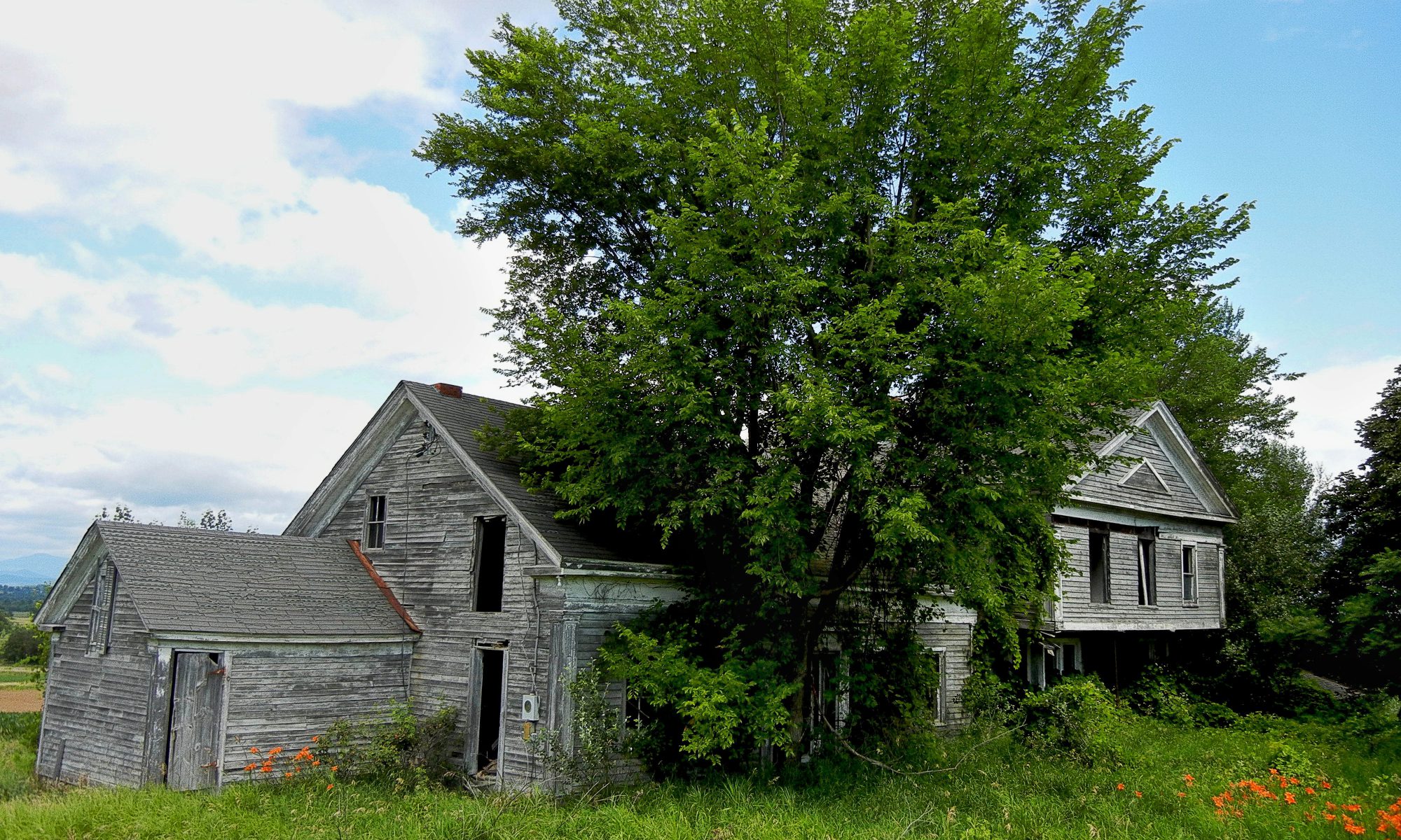
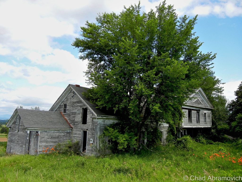
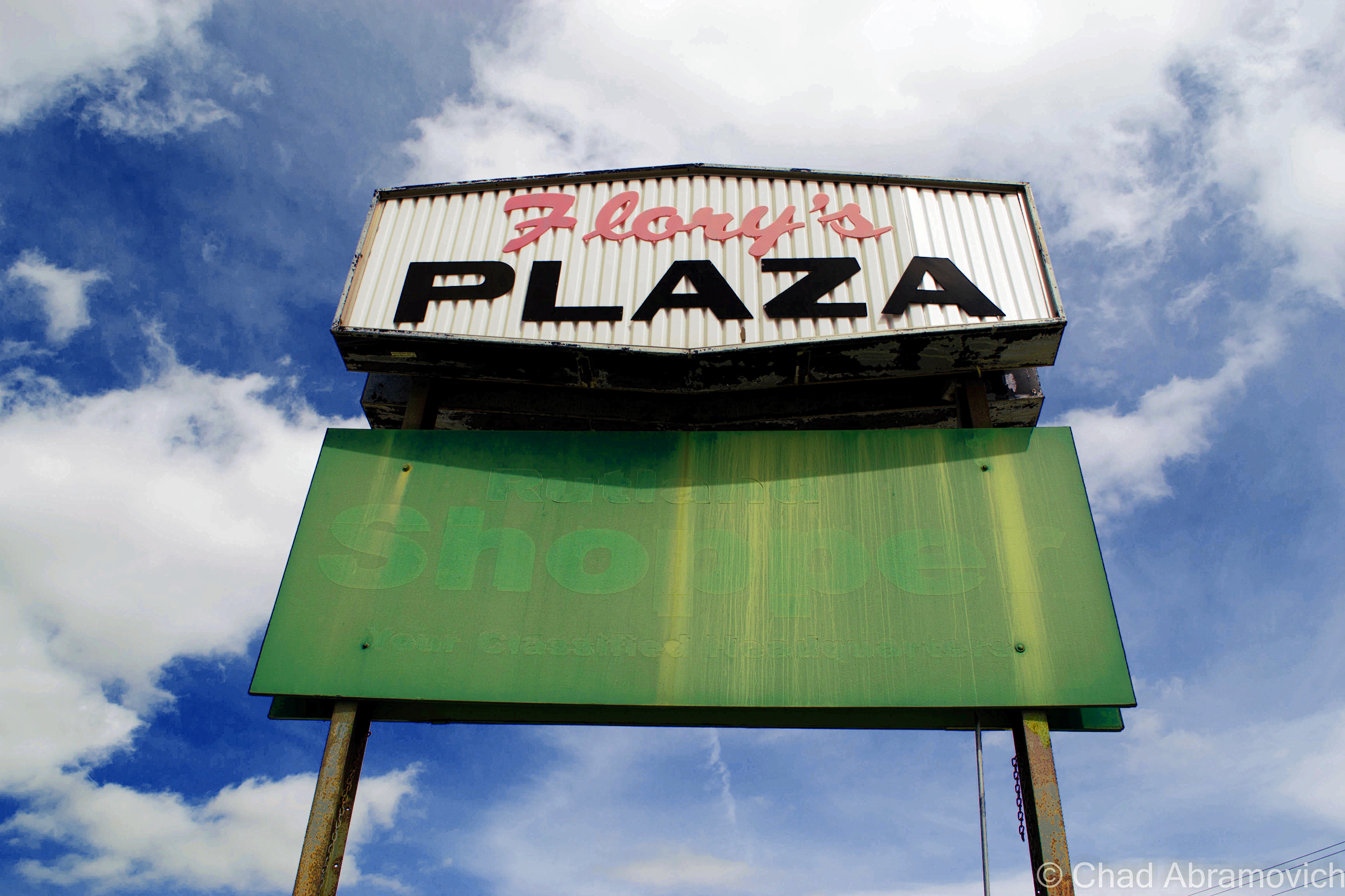
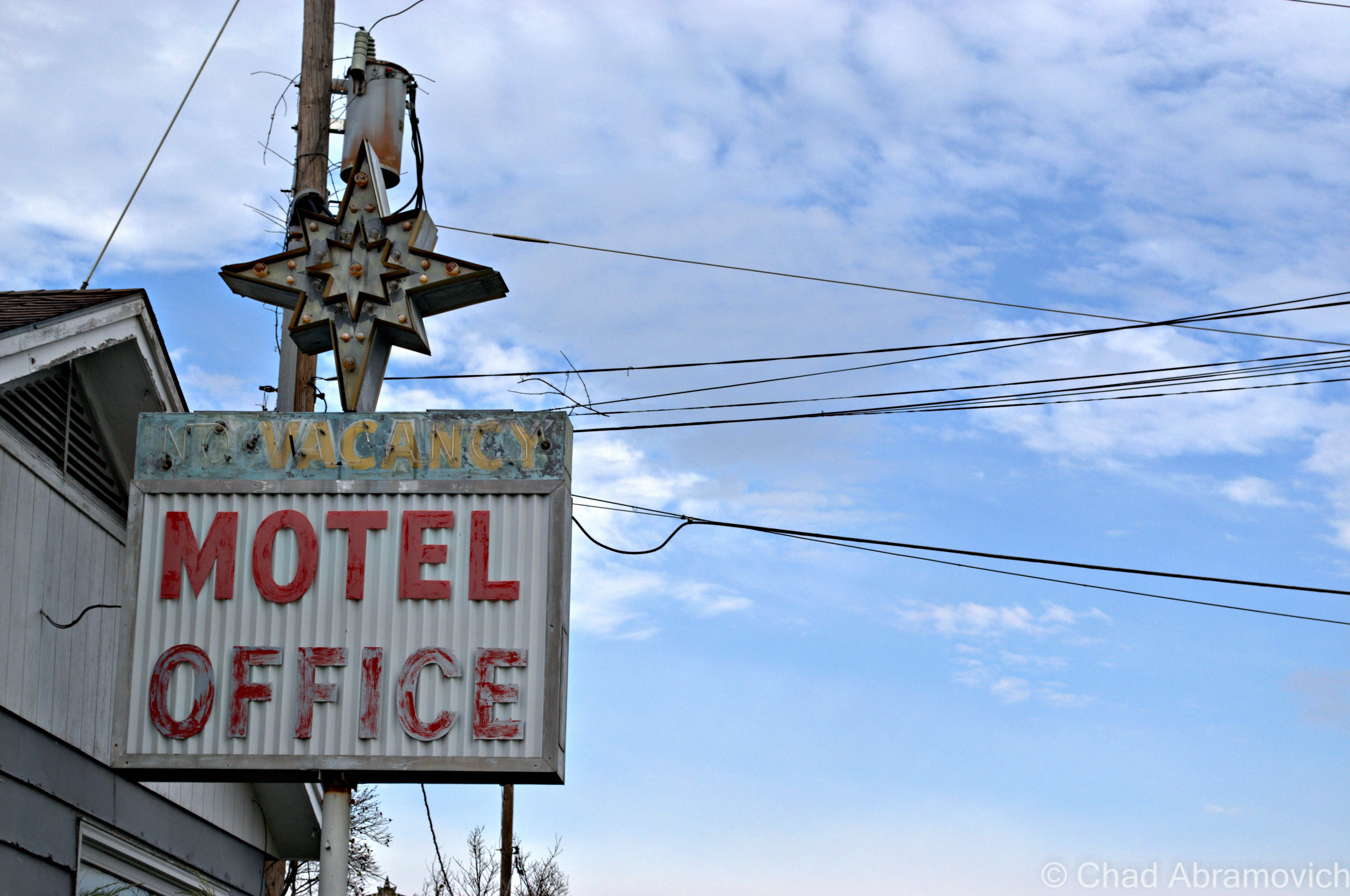
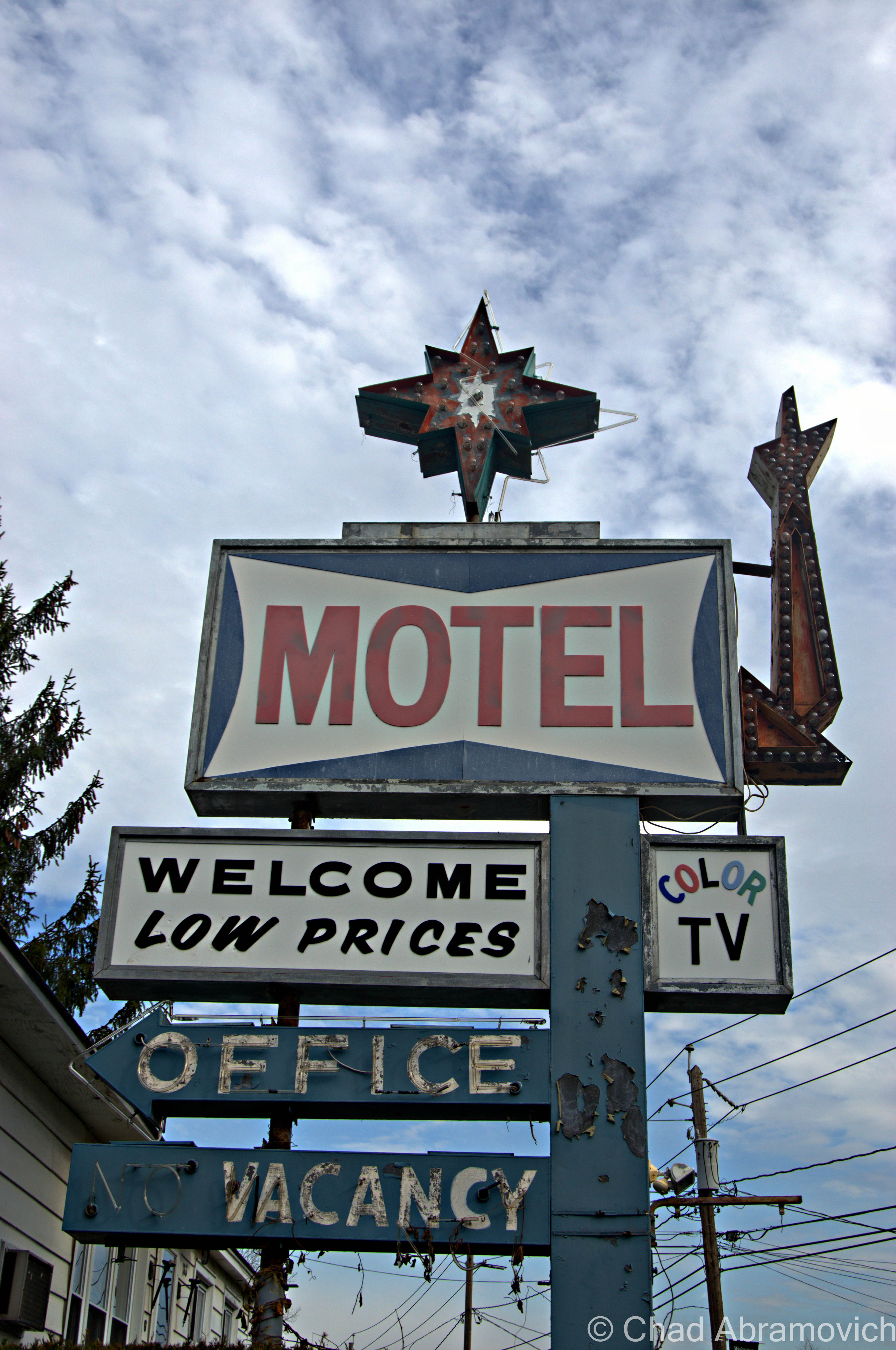
Winooski is a brawny old mill town built intentionally on a series of cascades on it’s namesake river that would power the woolen mills that built the city, and a prevalent French Canadian populace that affixed their surnames to street signs and brought down francophone media from Quebec. The textile mills both lifted the city up, and then let it fall when the industry went bust. The flood of 1927 was particularly harsh to business, when swells of rapid brownish watery destruction decimated most of the buildings along the riverfront. The mills never recovered fully, and went from the state’s largest employer, to limping along rather awkwardly until 1954 when they shuttered for good after they no longer landed government contracts when new synthetic fibers became the future.

The town was bruised for decades afterwards underneath economic blight, higher rates of poverty, and a humbling lack of identity. In the late 1970s, the one square mile burb made news when it ambitiously decided it was going to build a glass dome over the city to keep down the costs of heating prices in the winter, and partially for a publicity stunt inspired by a town meeting with lots of wine. That idea surprisingly almost happened, but was coffined in the 80s, when the Reagan administration came into power and decided that there were better things to spend money on.

A few more decades later, Winooski once again made headlines for another construction project; brazenly undertaking the largest downtown redevelopment project in state history, which simultaneously included the construction of a controversial rotary that was oddly blueprinted on a hill. It was intended to lessen traffic congestion where routes 2,7 and 15 met downtown, but instead confused and upset certain commuters and Winooski-ites, earning it the bad for business nickname “the circle of peril”. But their massive scale improvement project seemed to work, and years later, downtown Winooski has filled in with some of the best eateries in the Burlington area, a pretty enjoyable microbrewery and an awesome indie music festival which brings all sorts of converging artists into town.

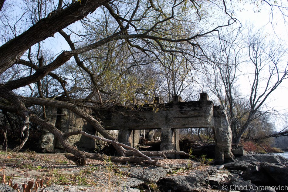
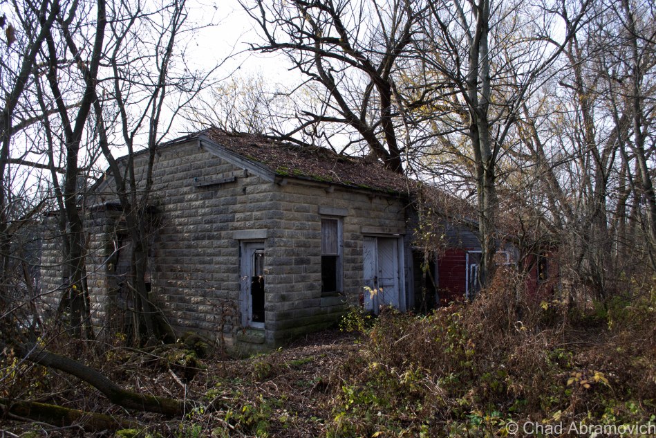
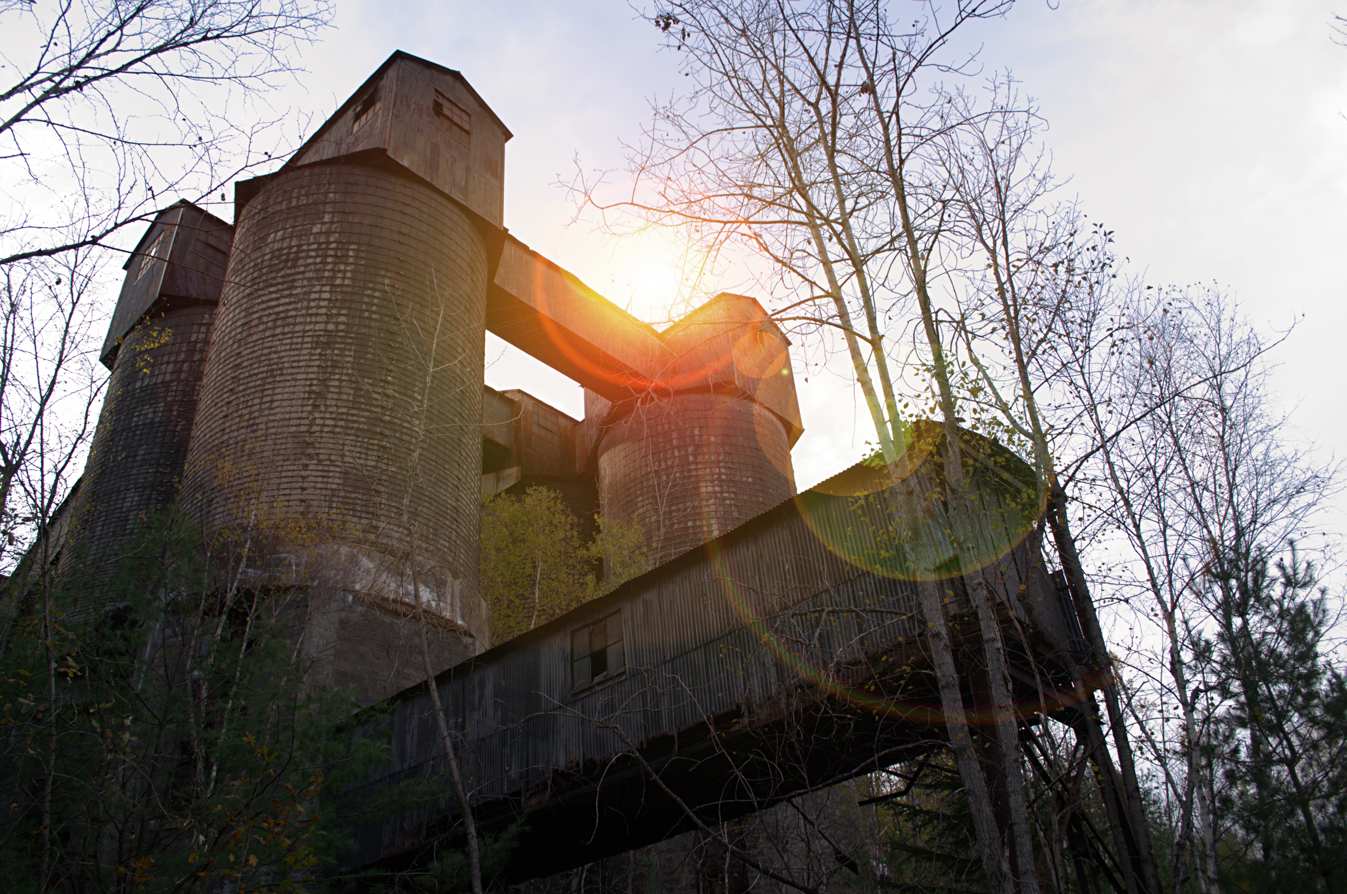
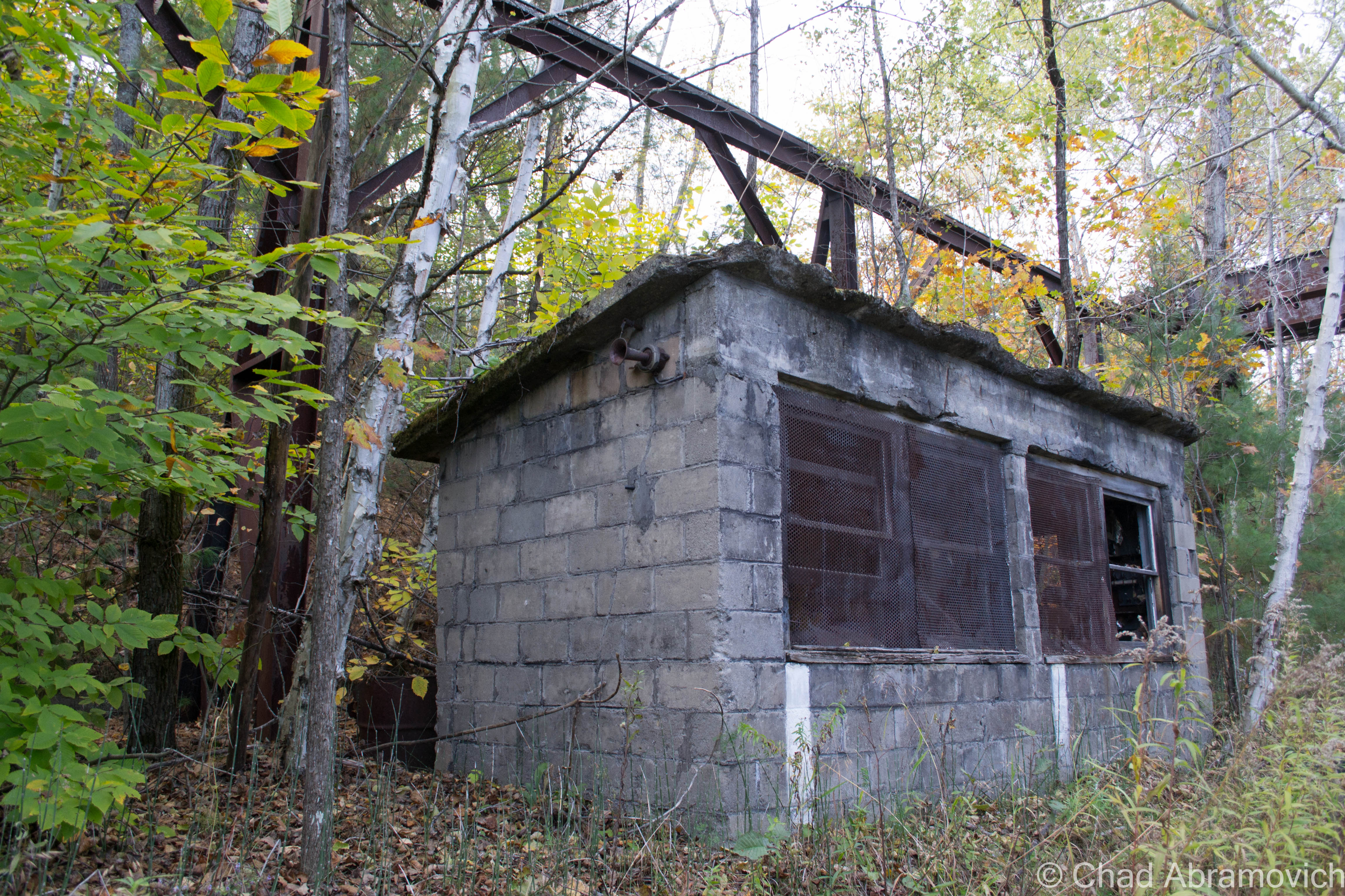
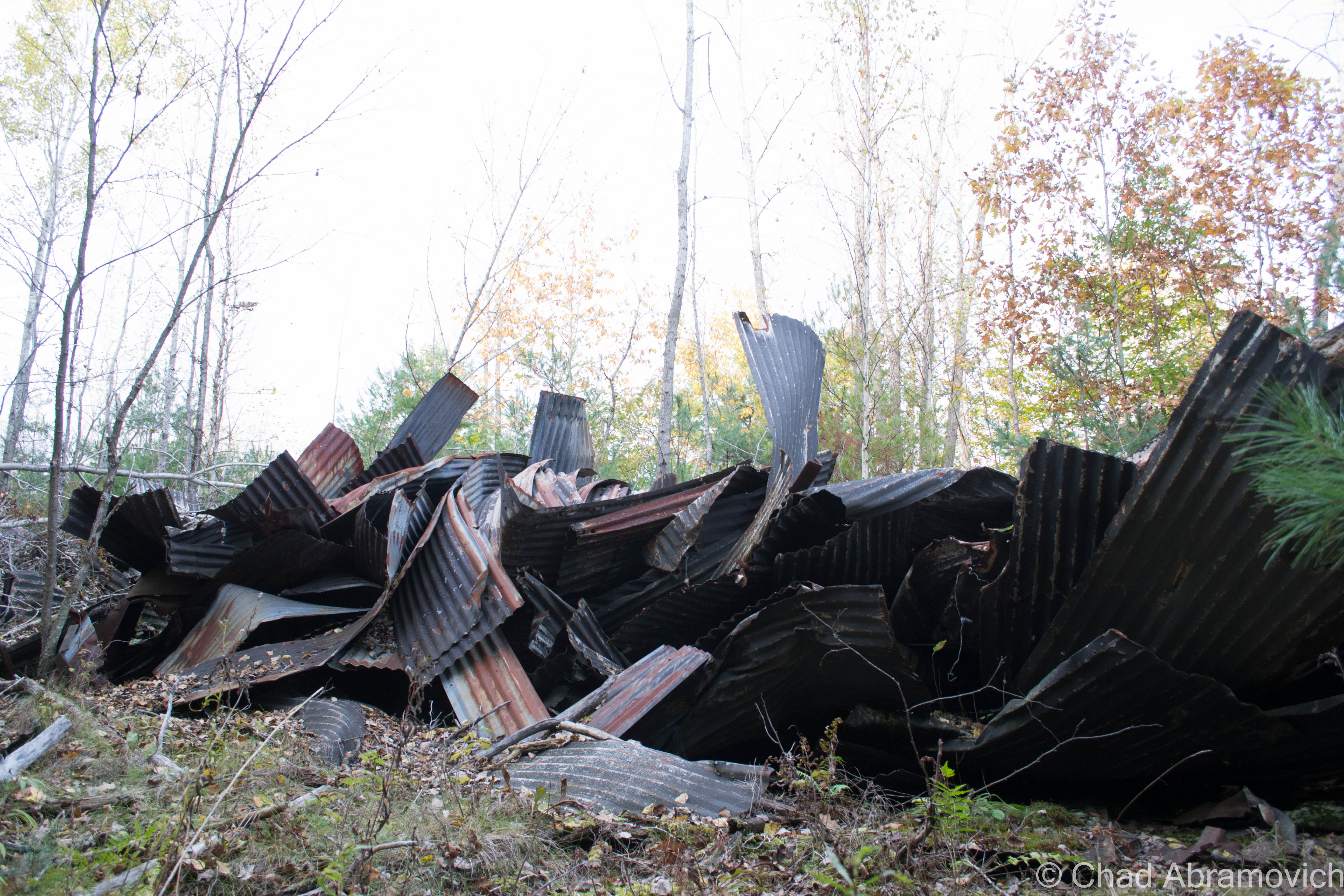
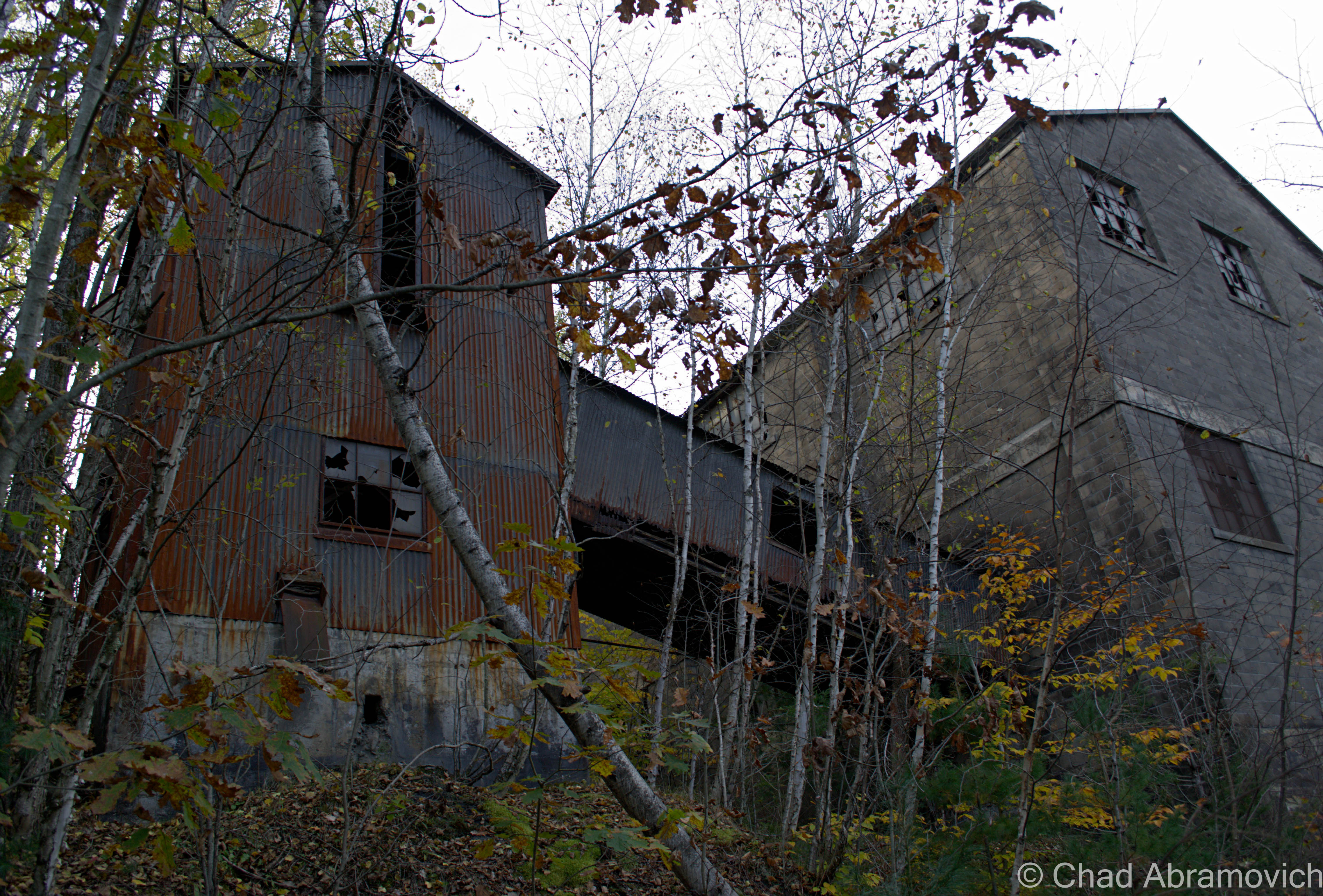
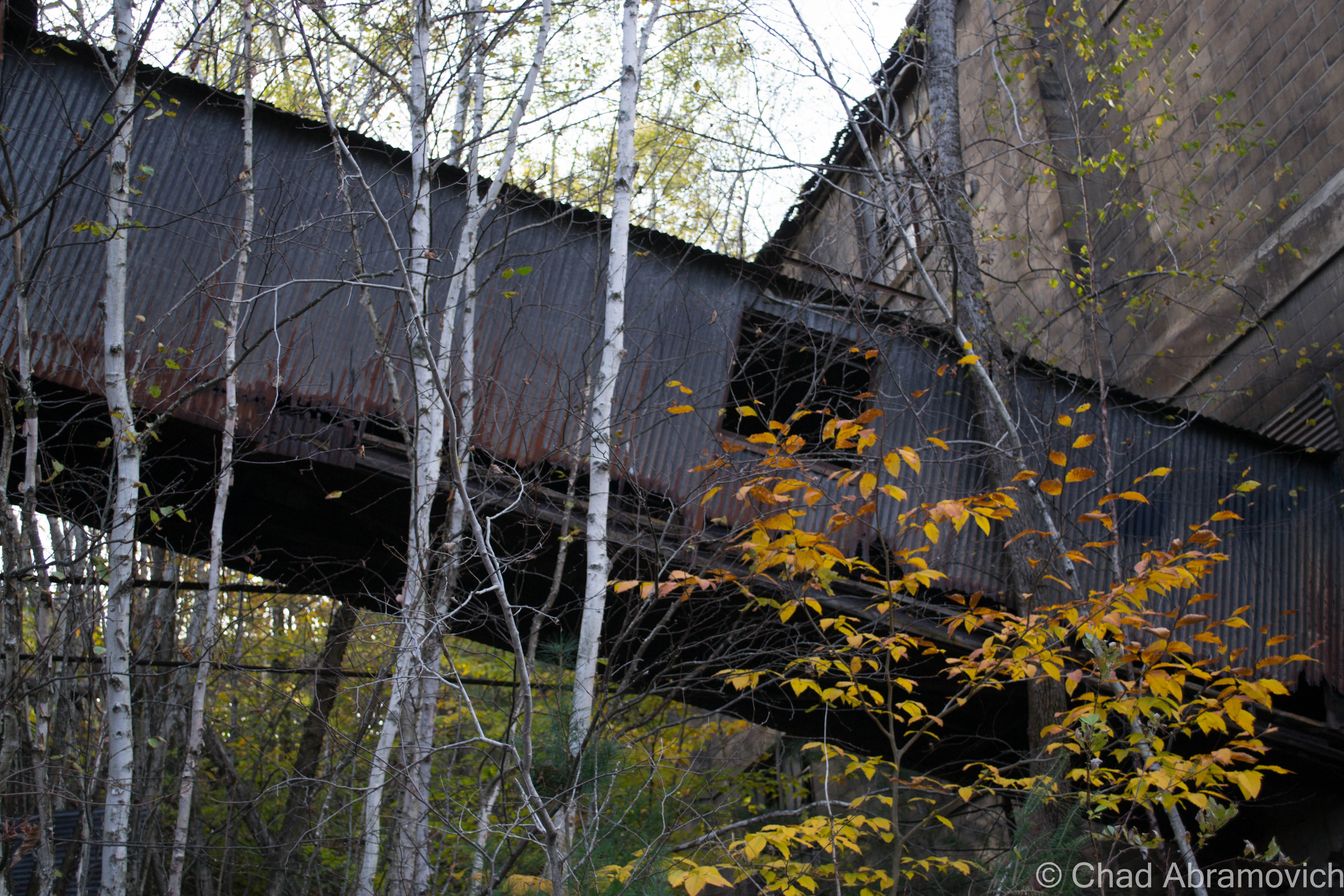
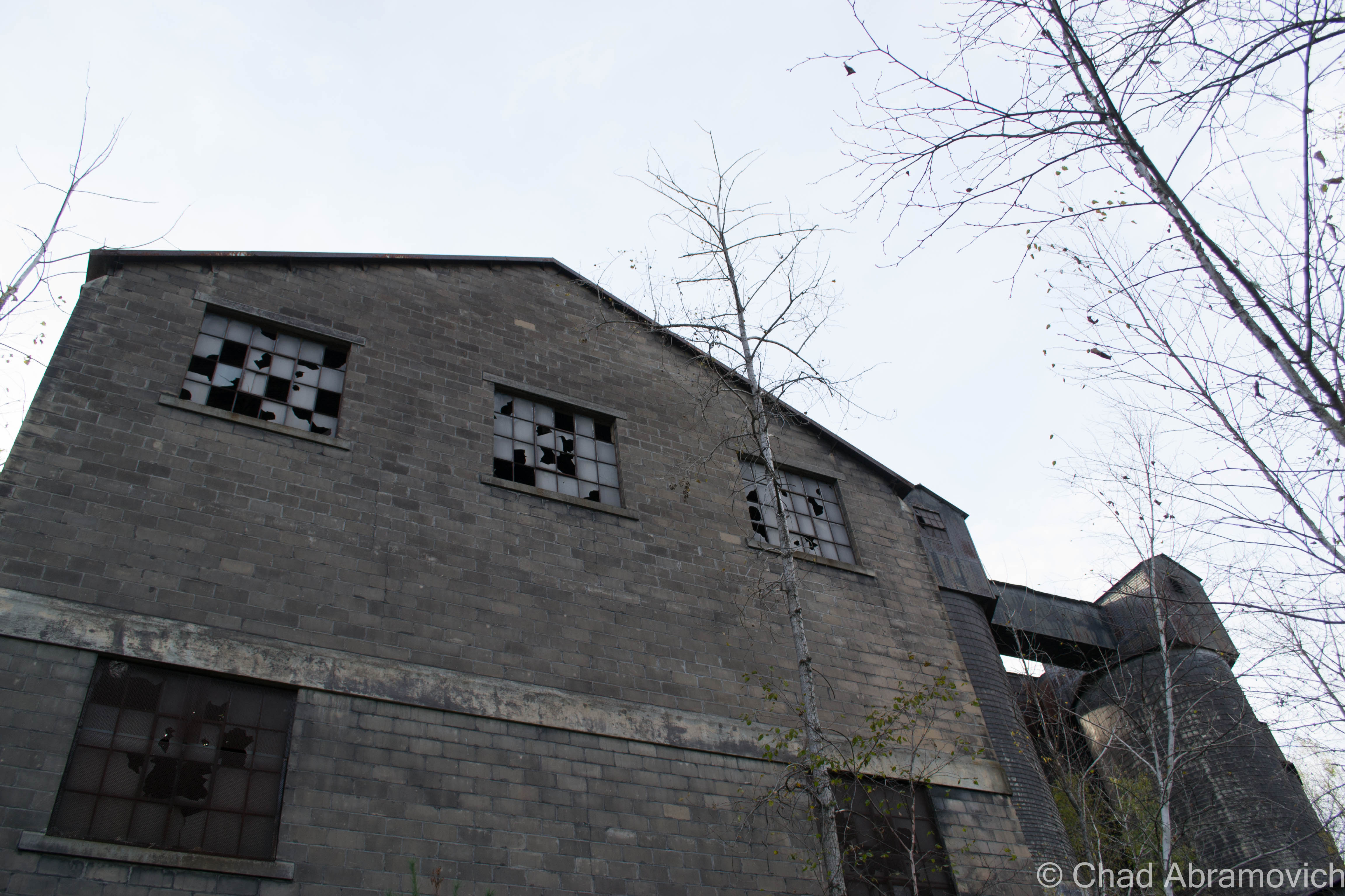
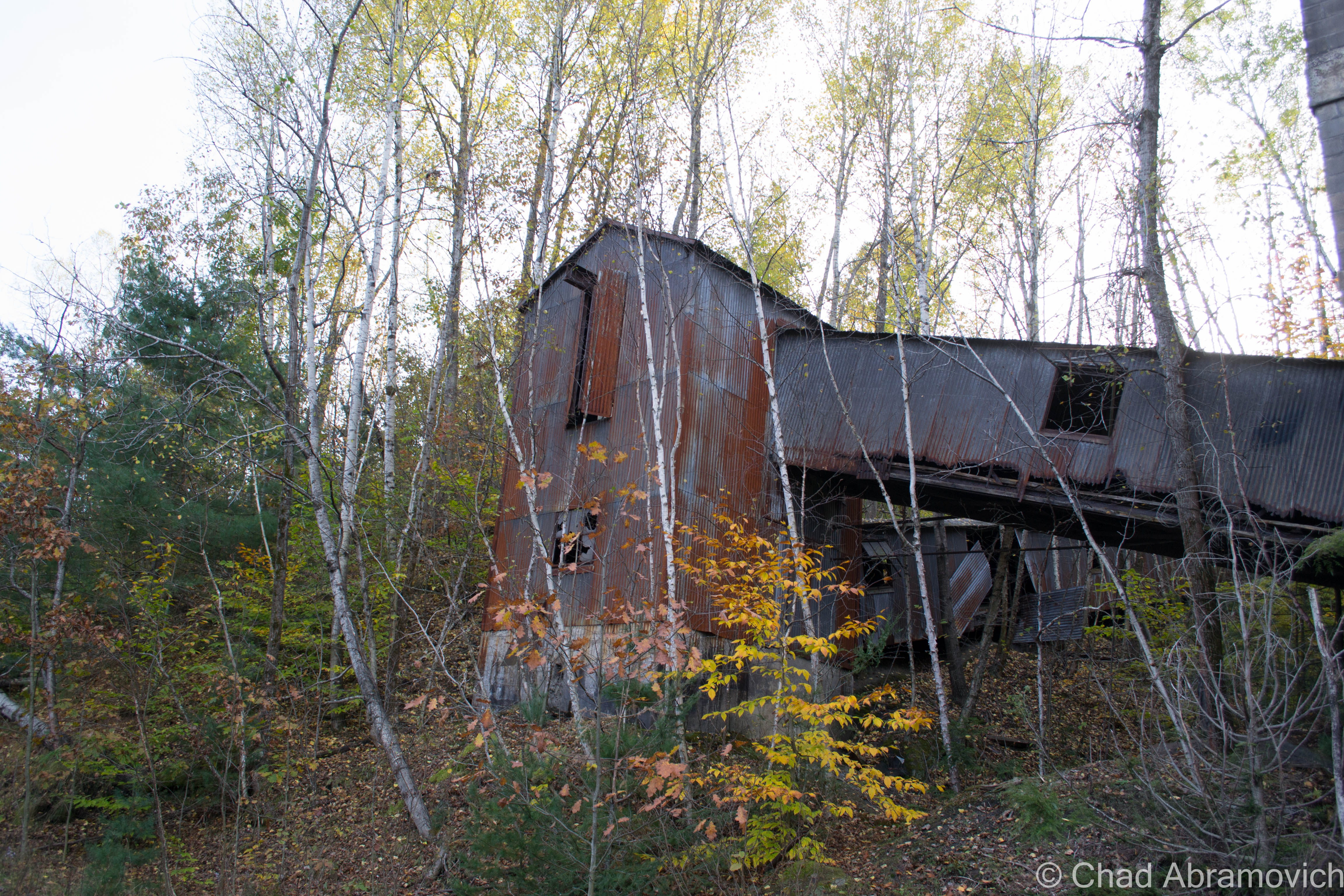
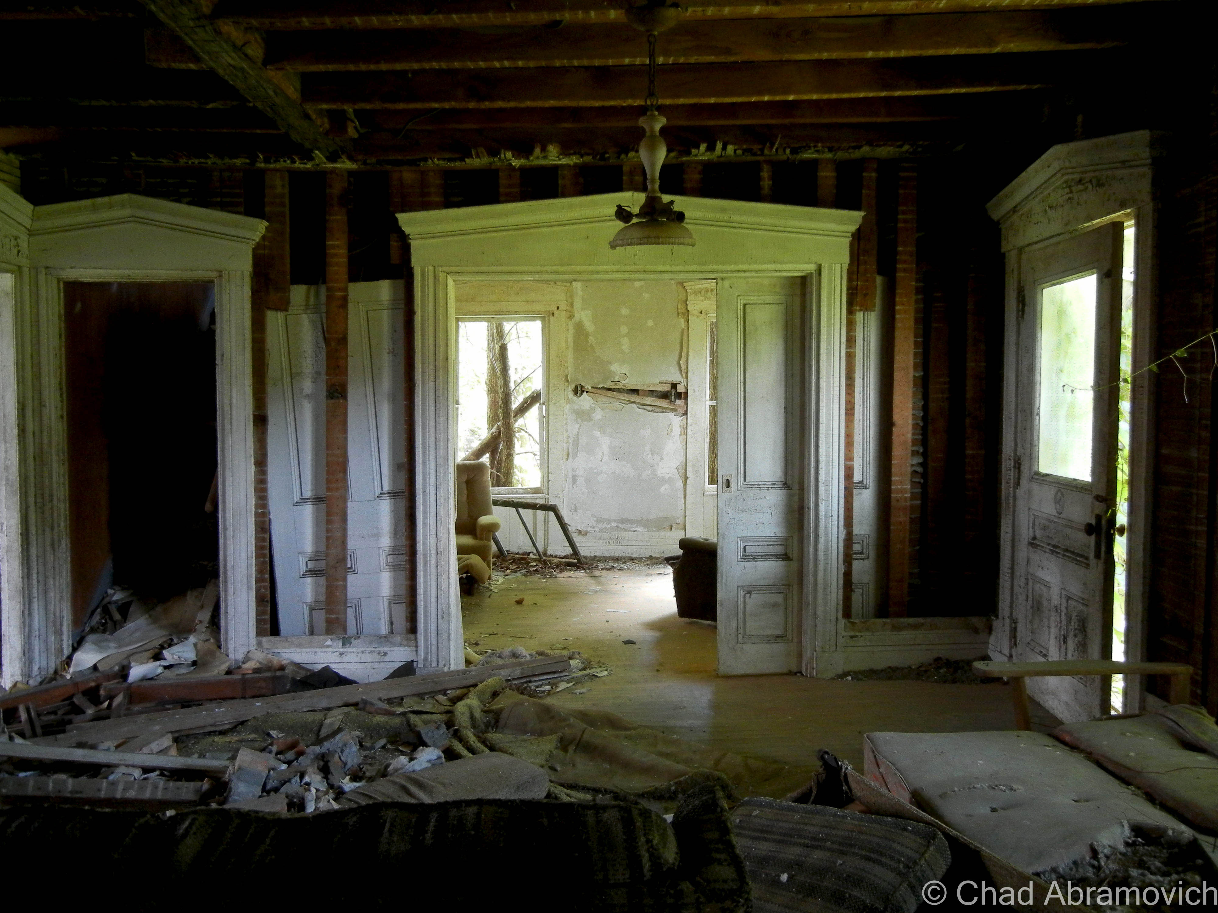
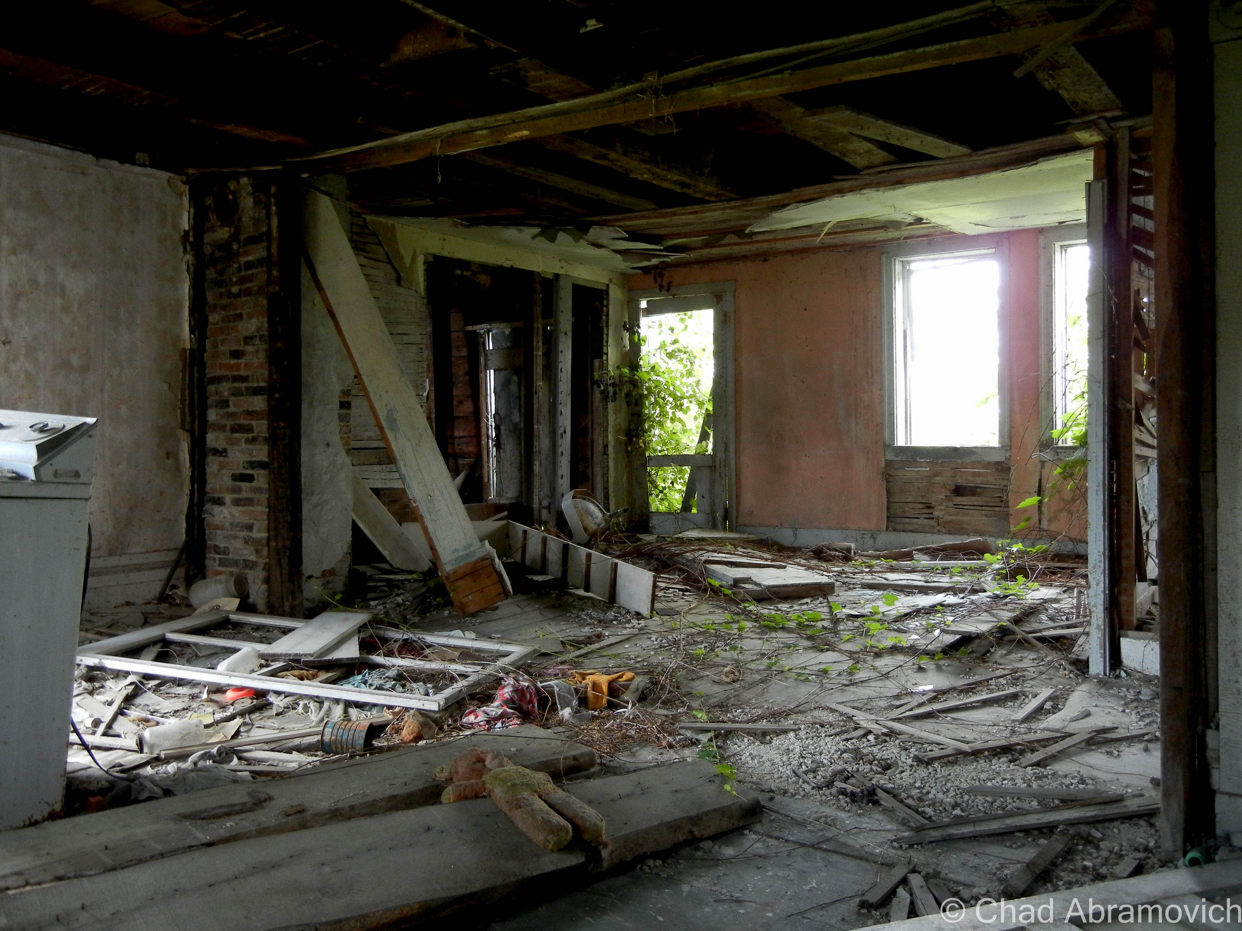
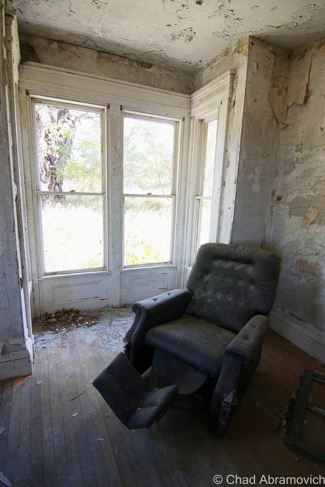
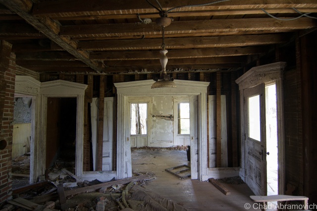
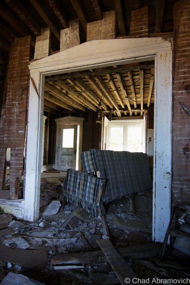
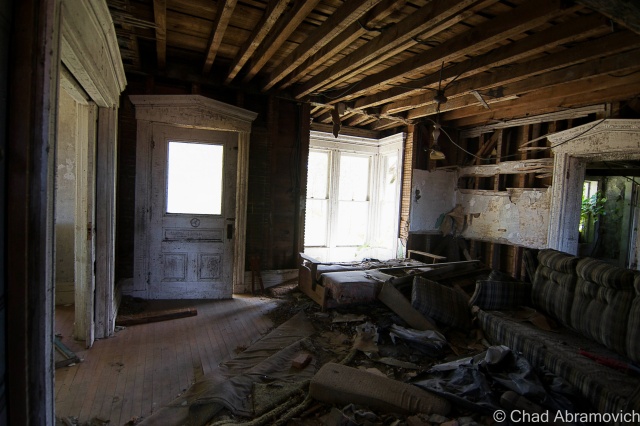
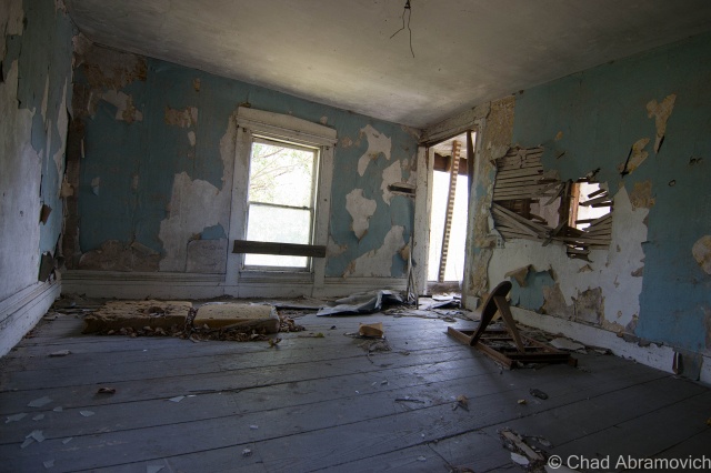
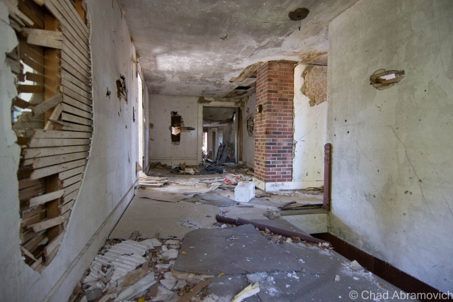
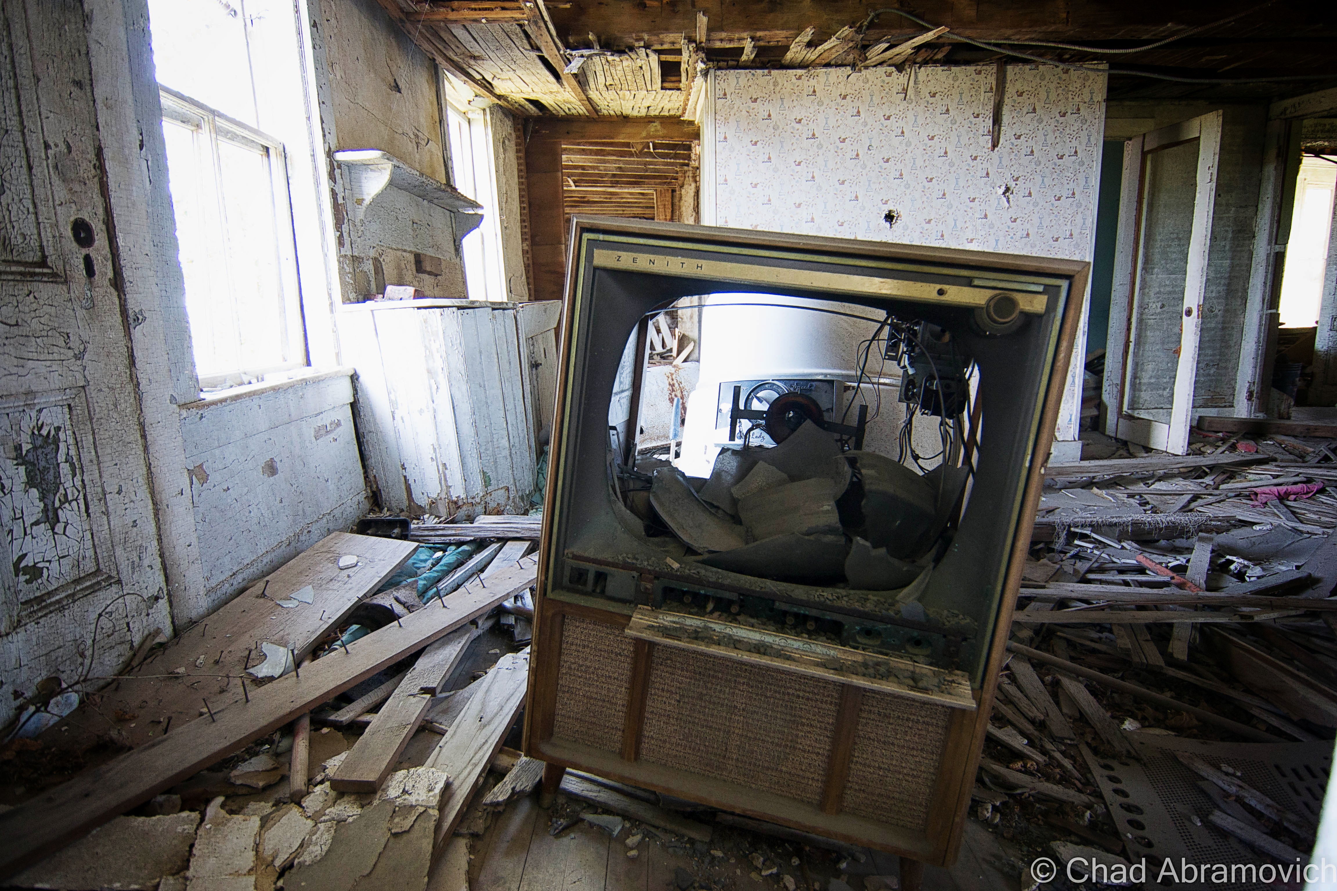
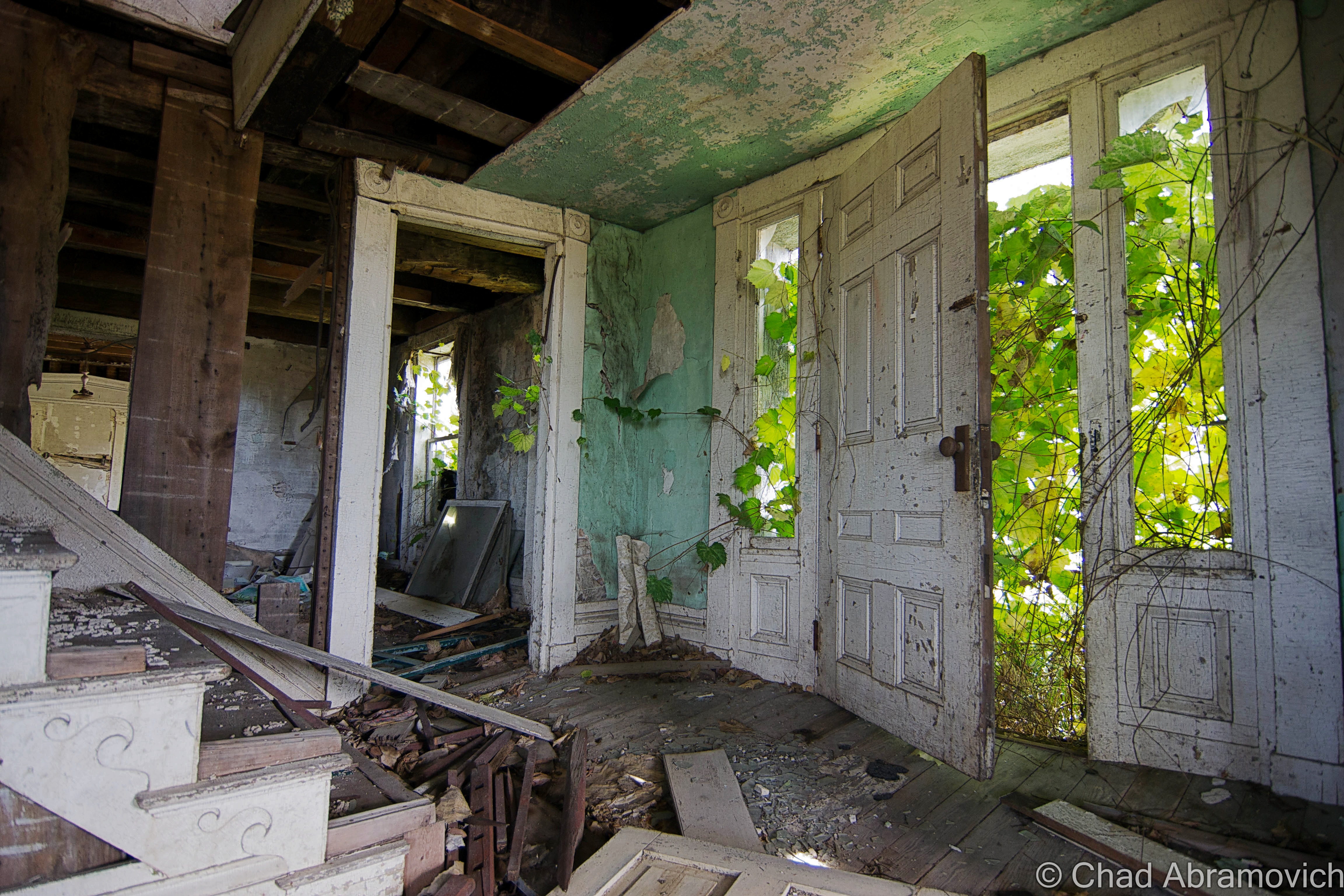
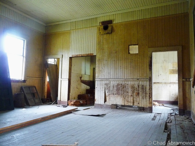
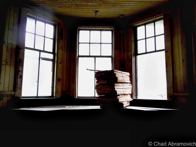
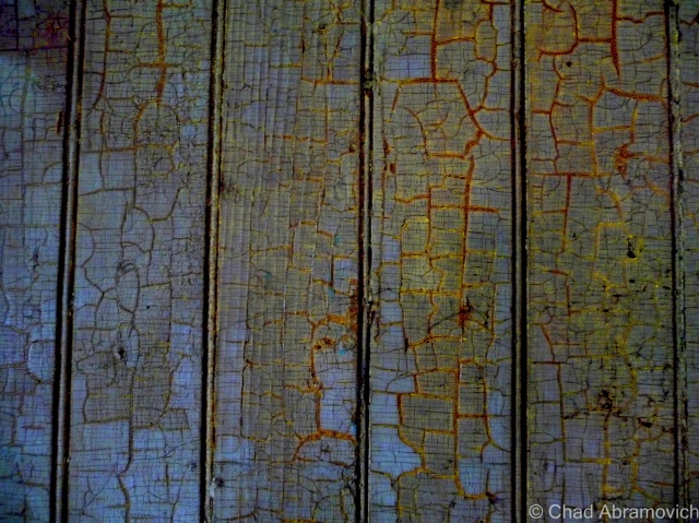
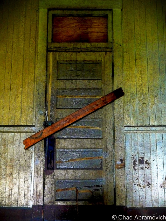
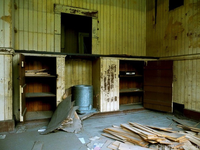
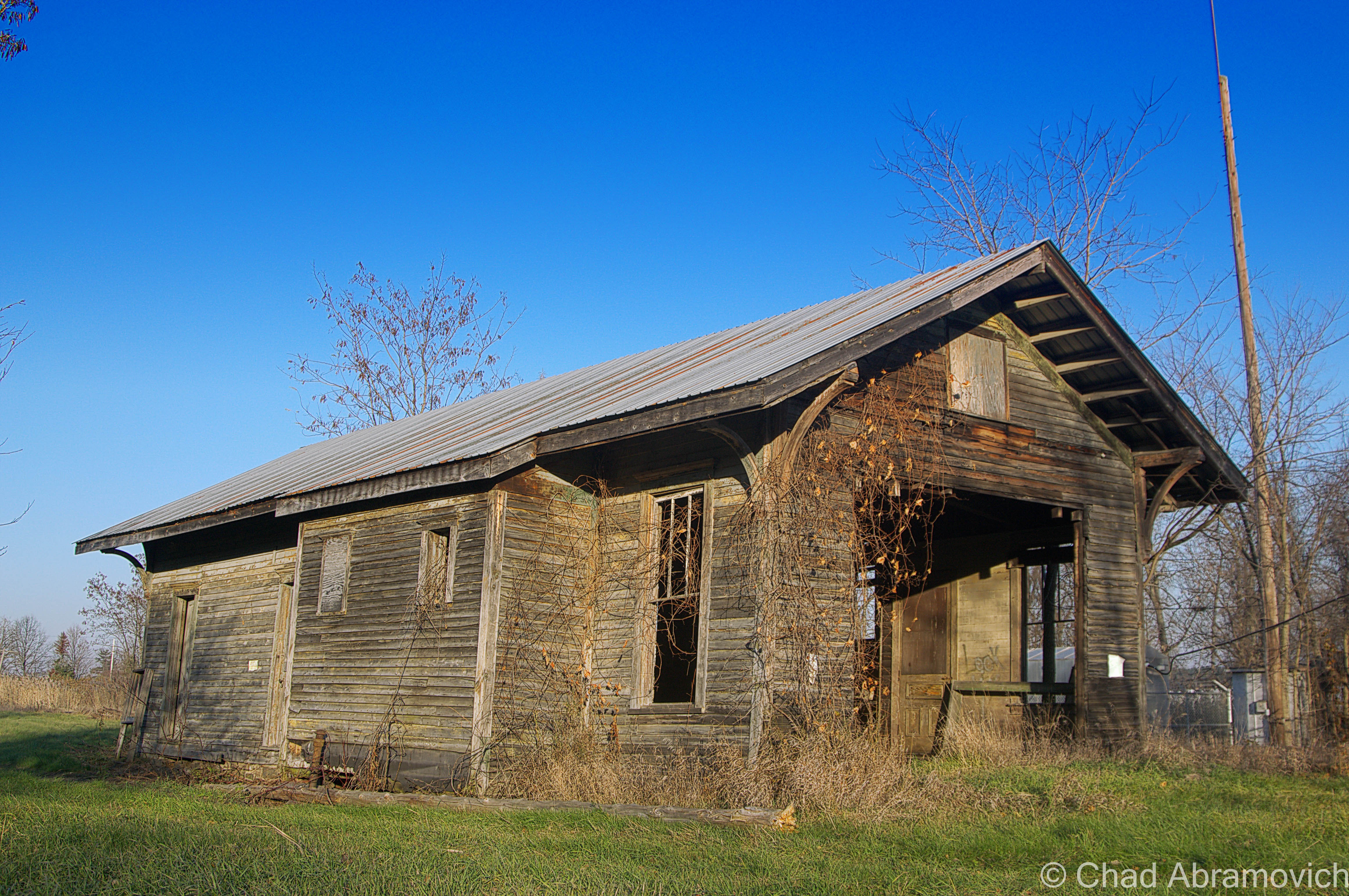
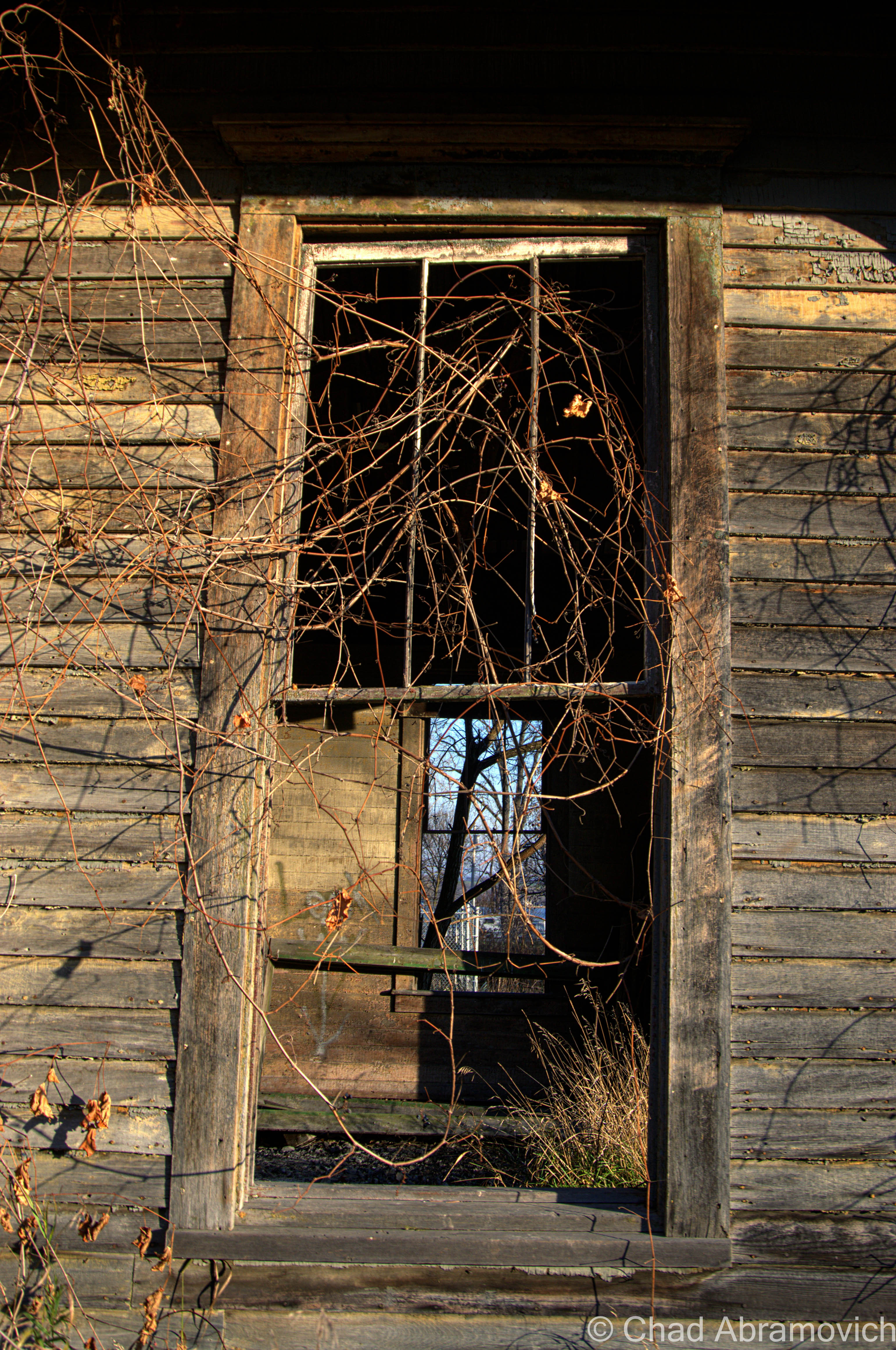
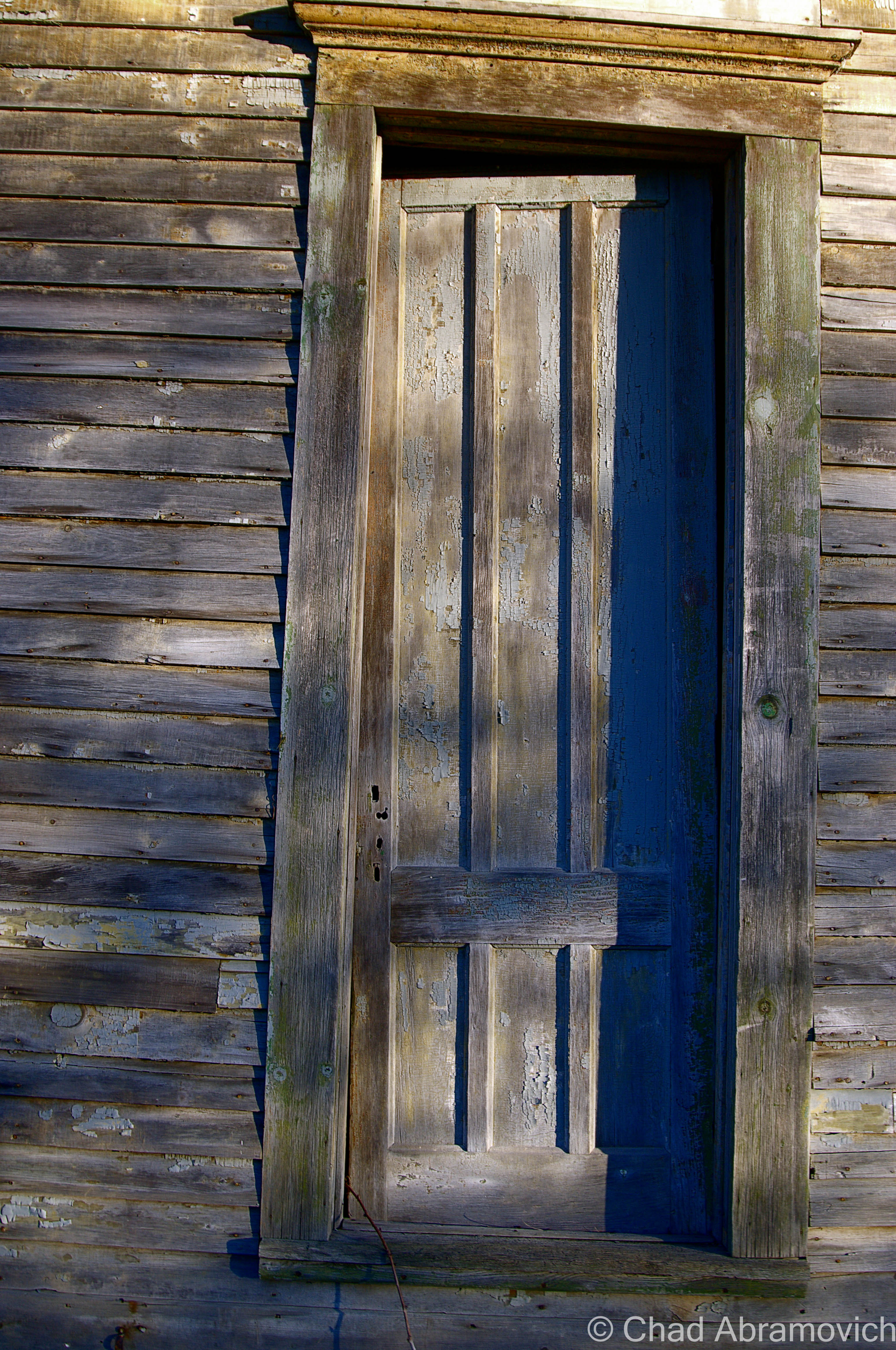
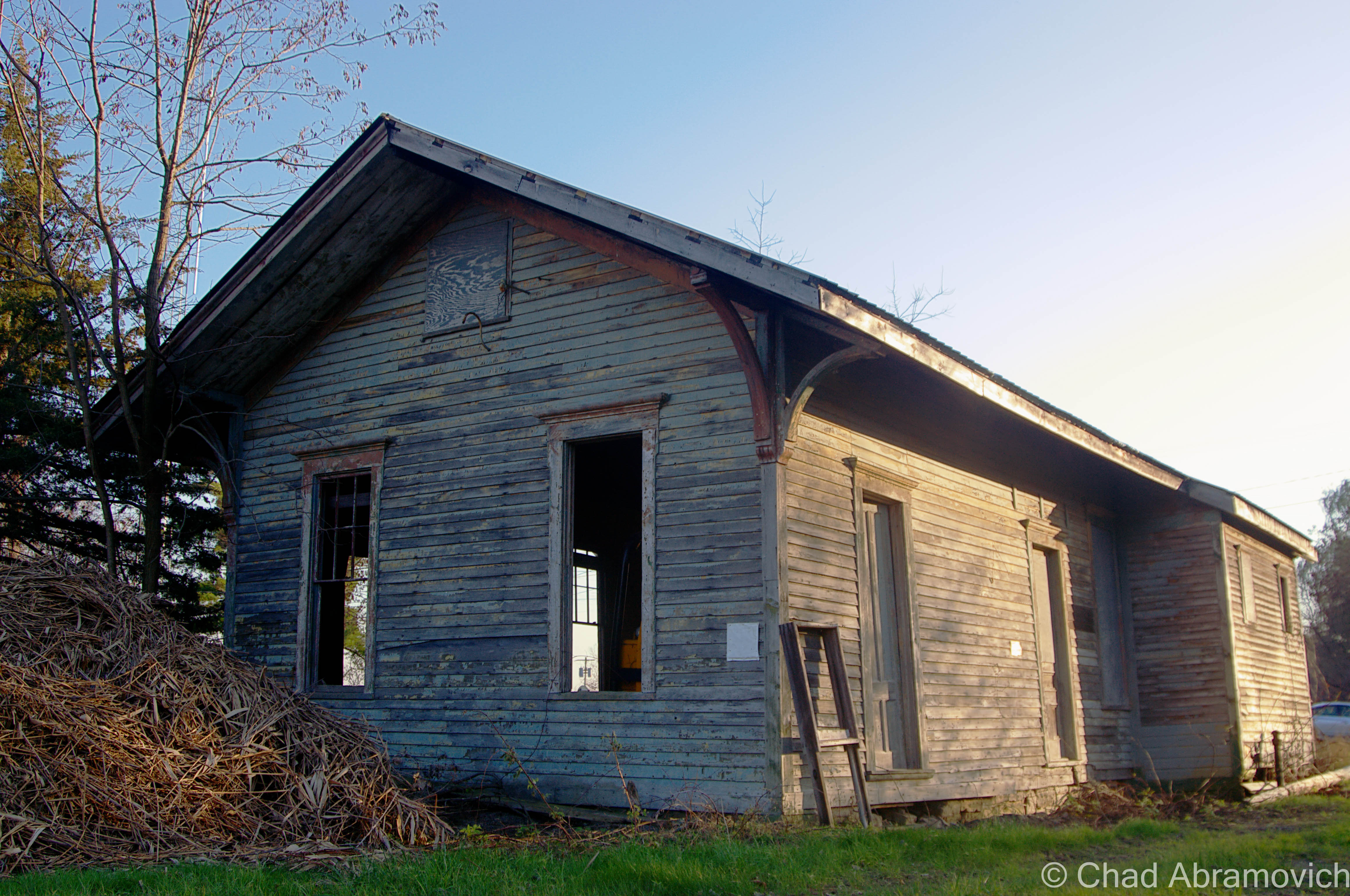
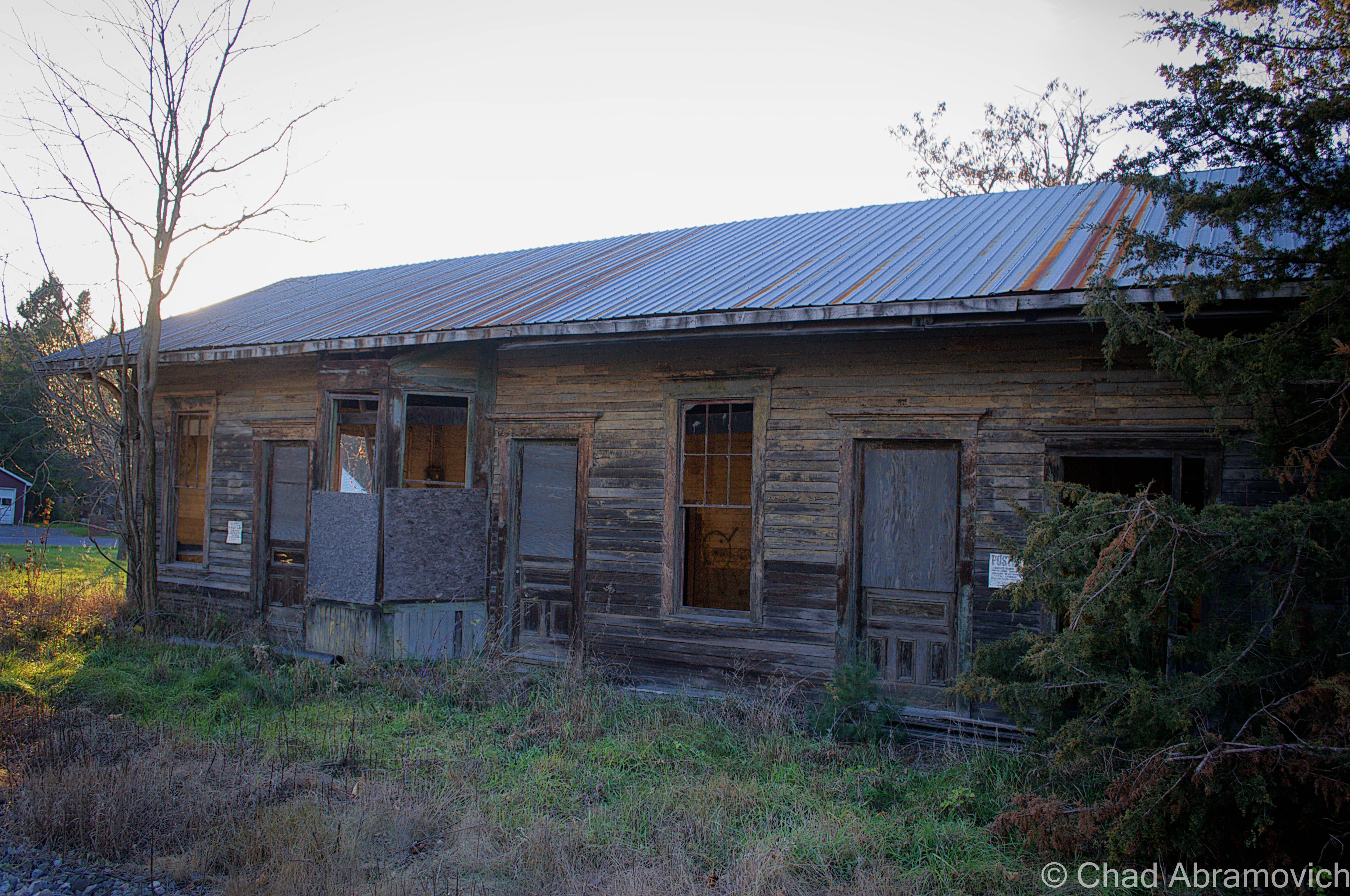
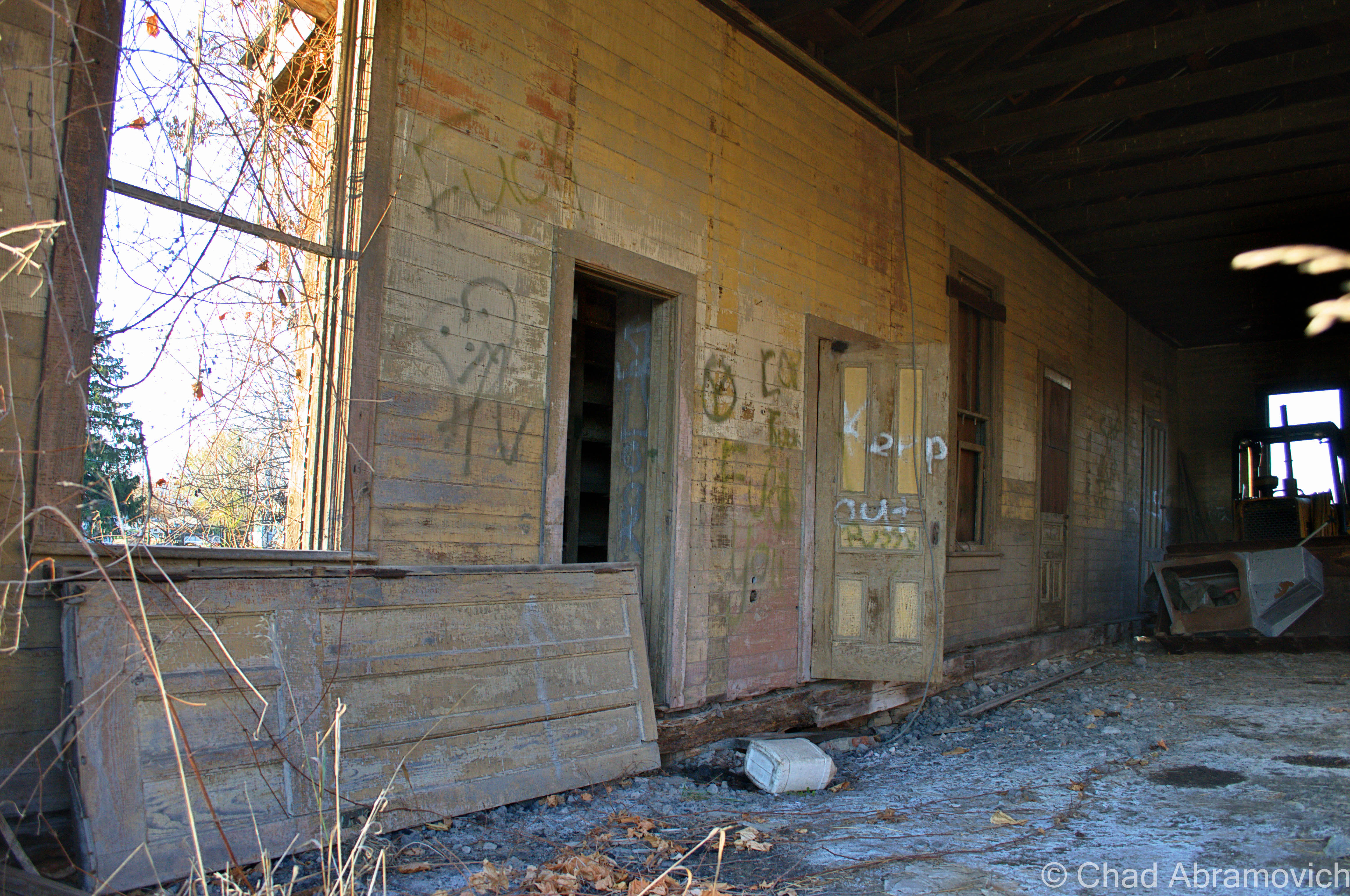
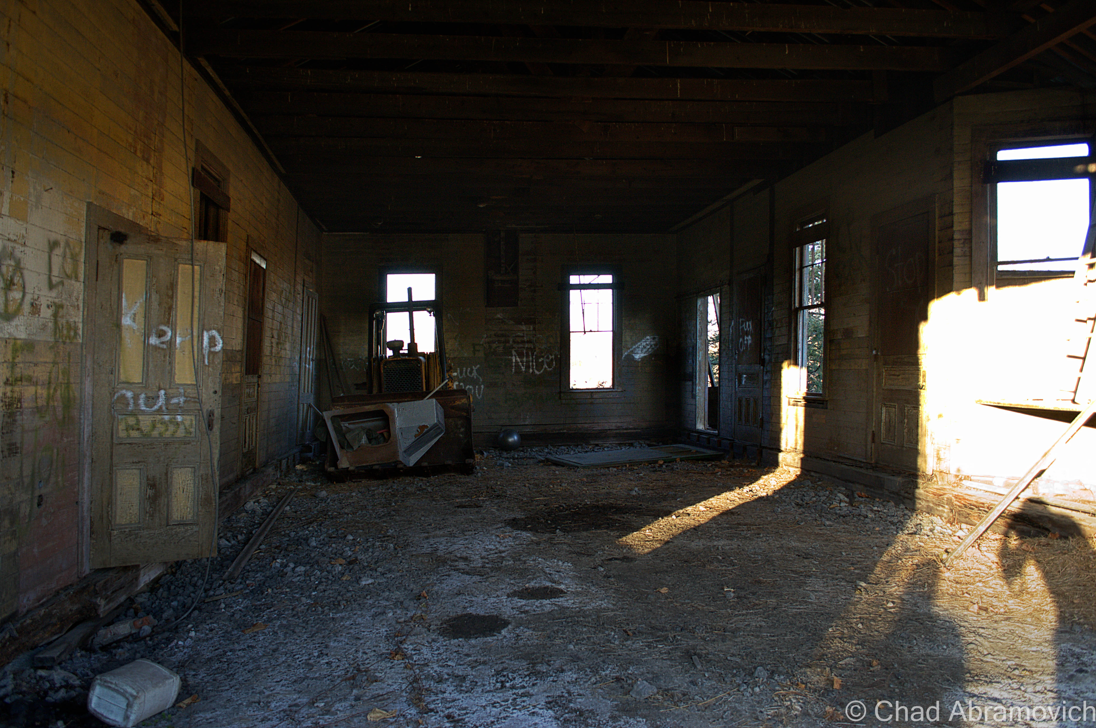
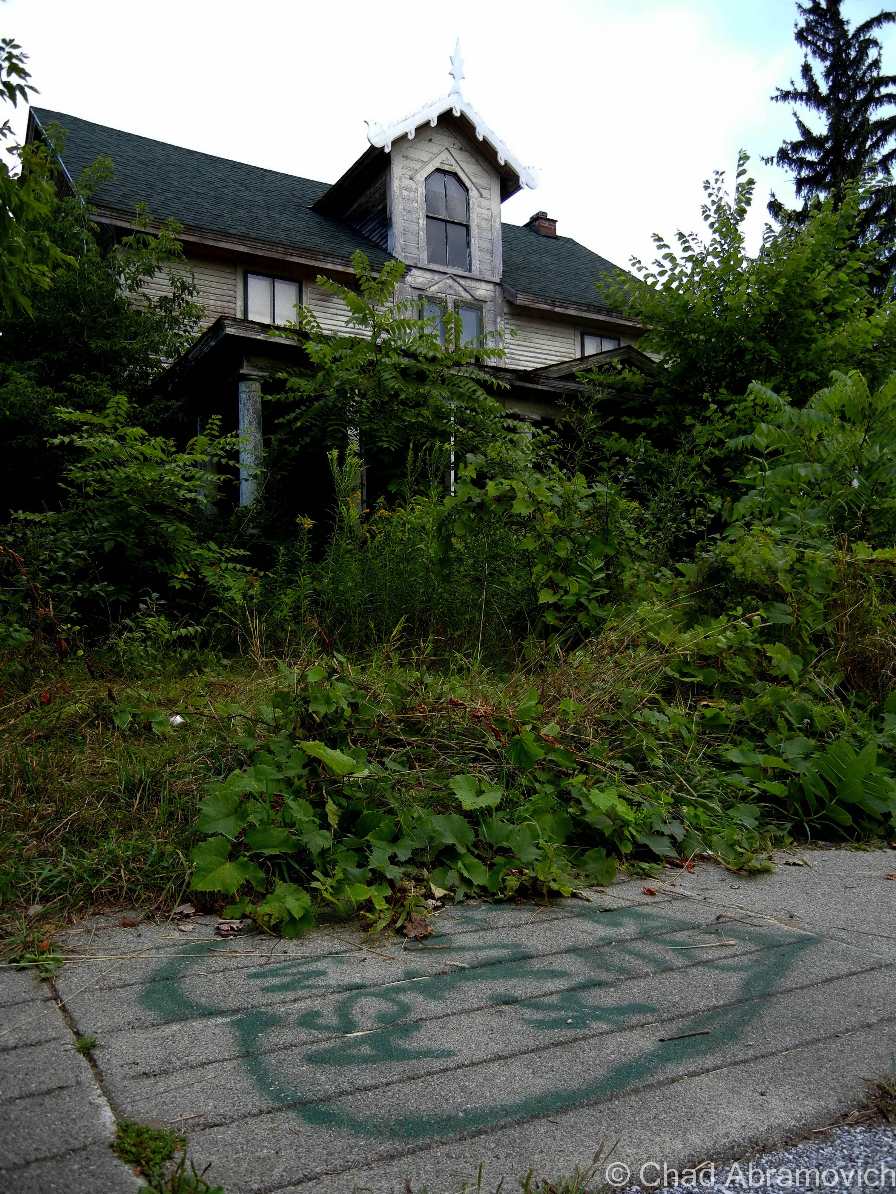
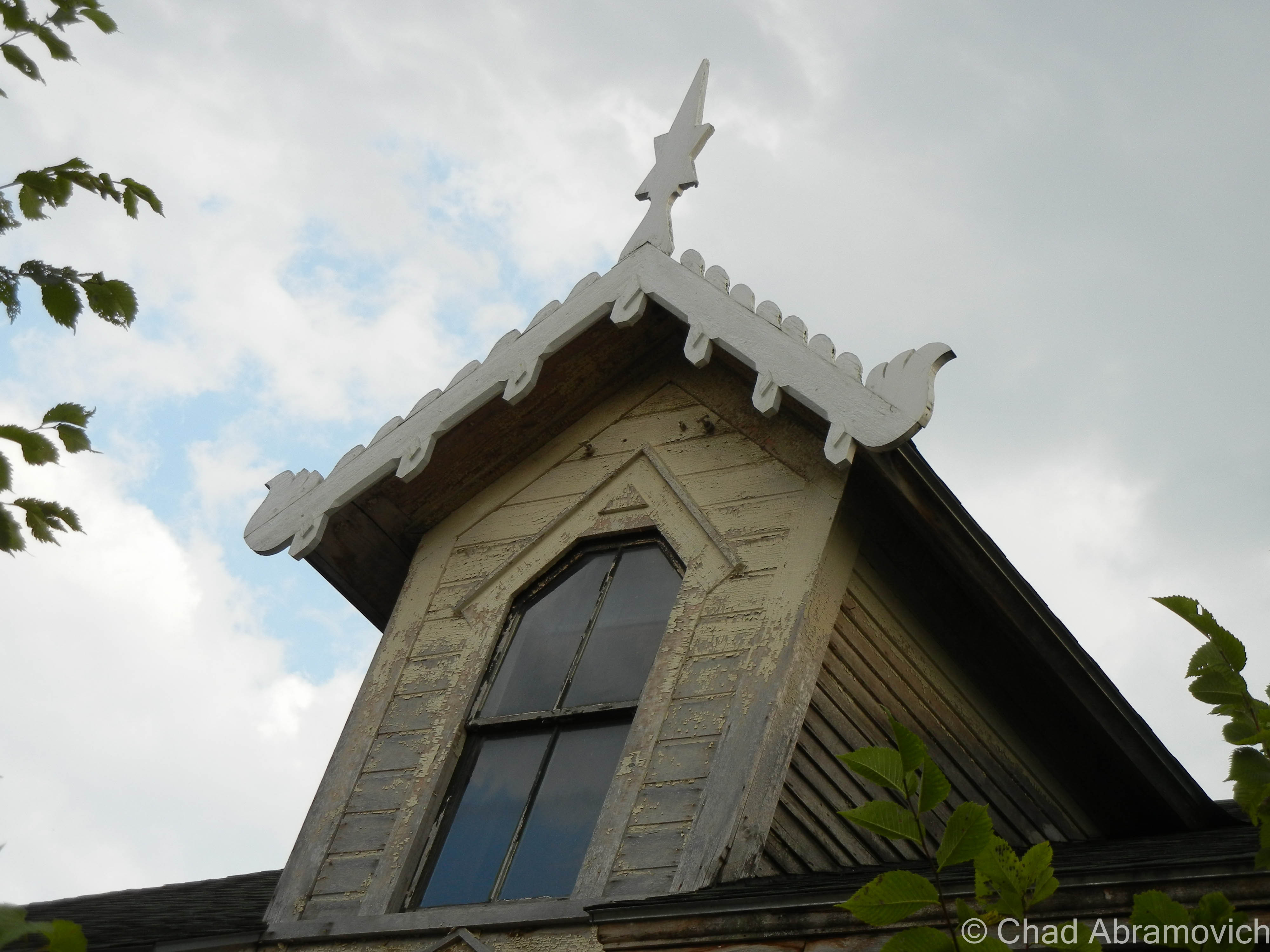
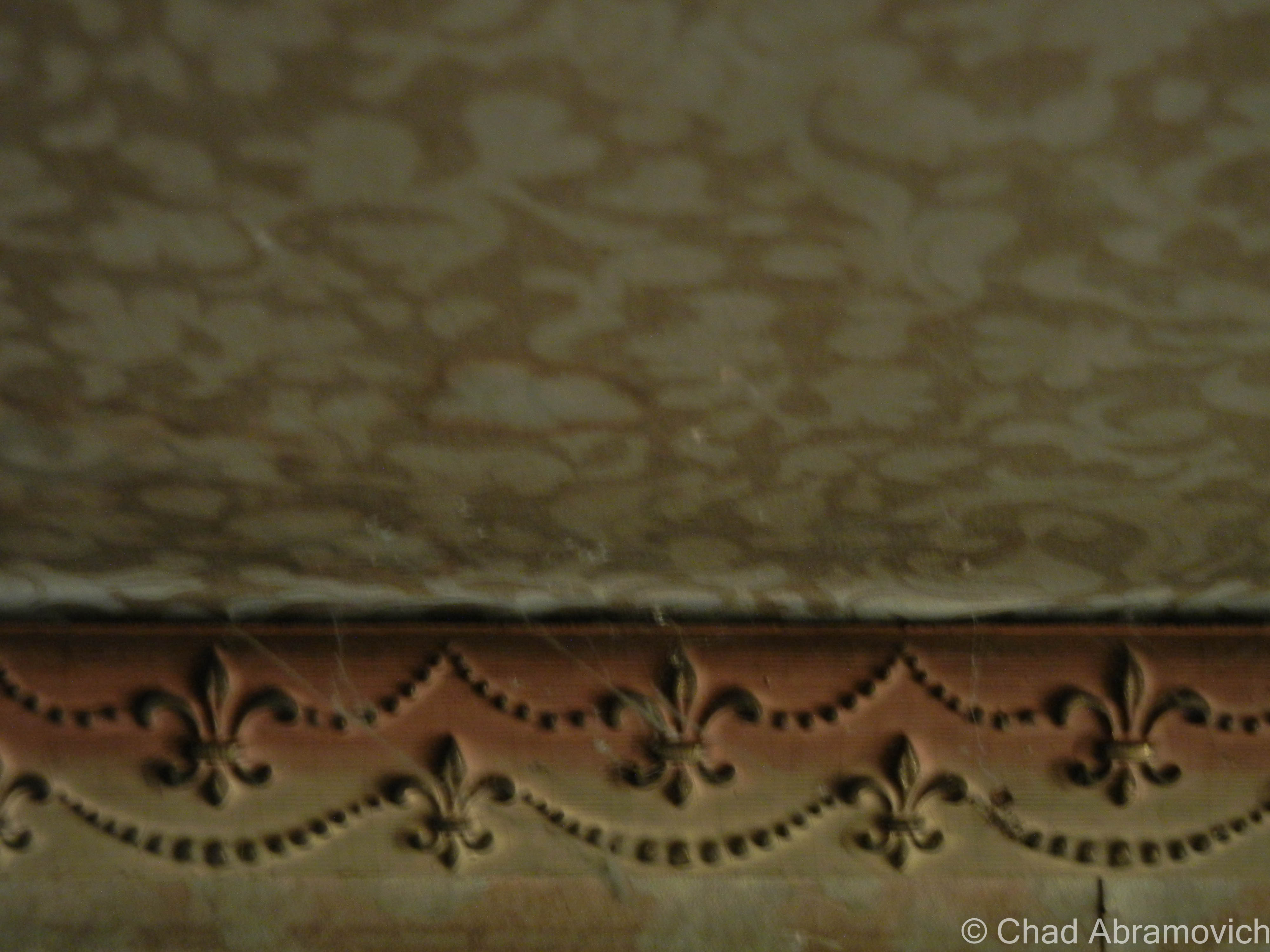
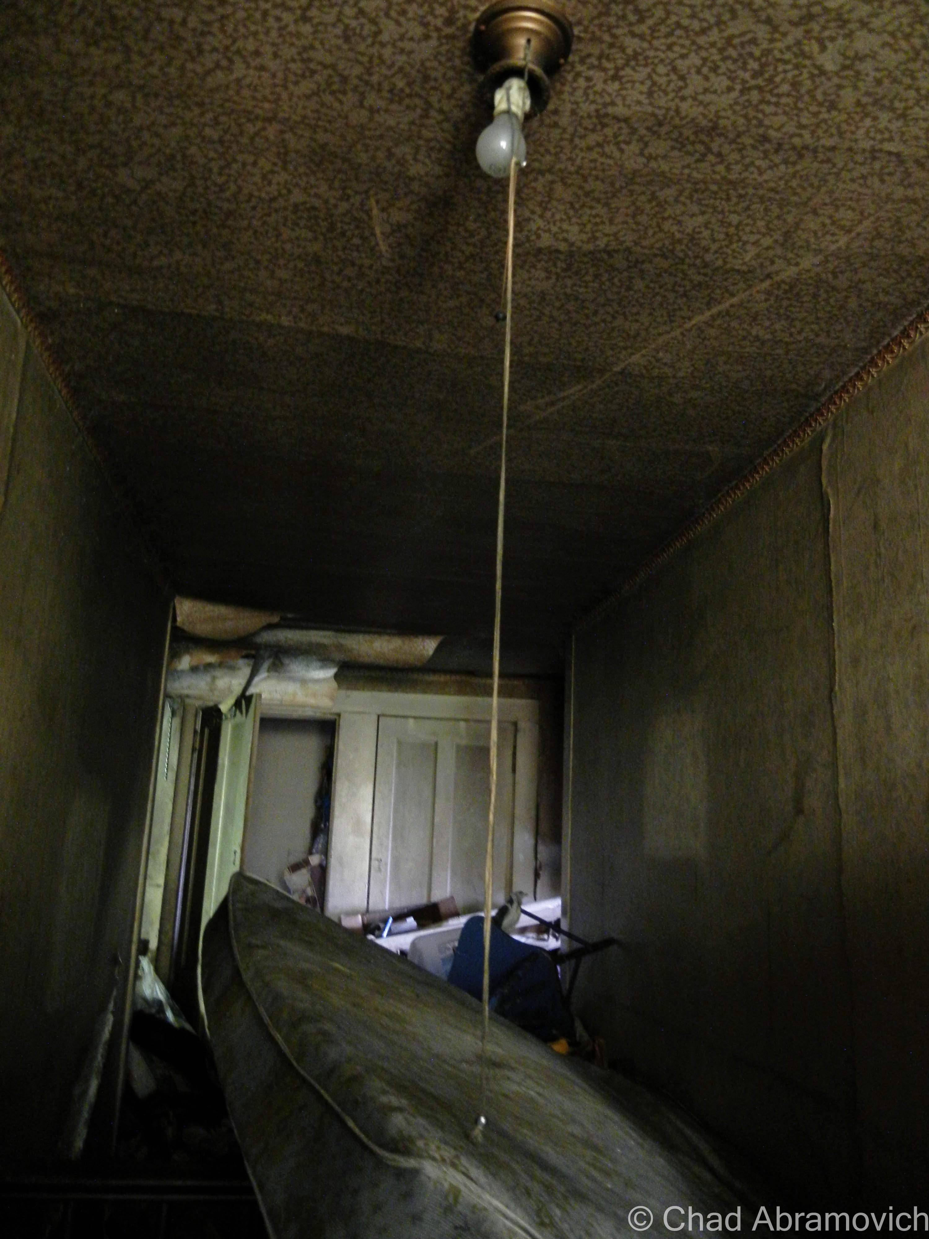
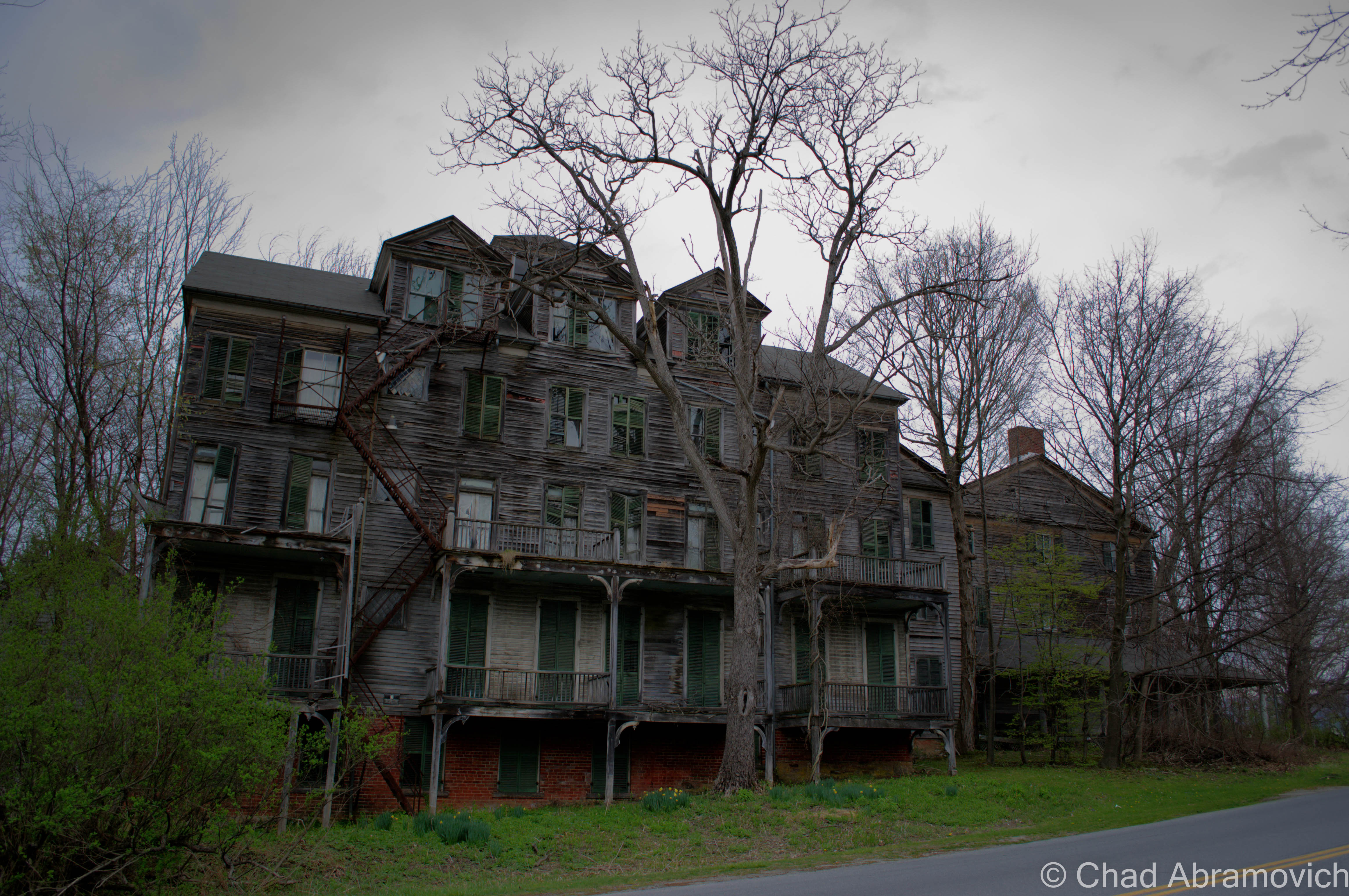
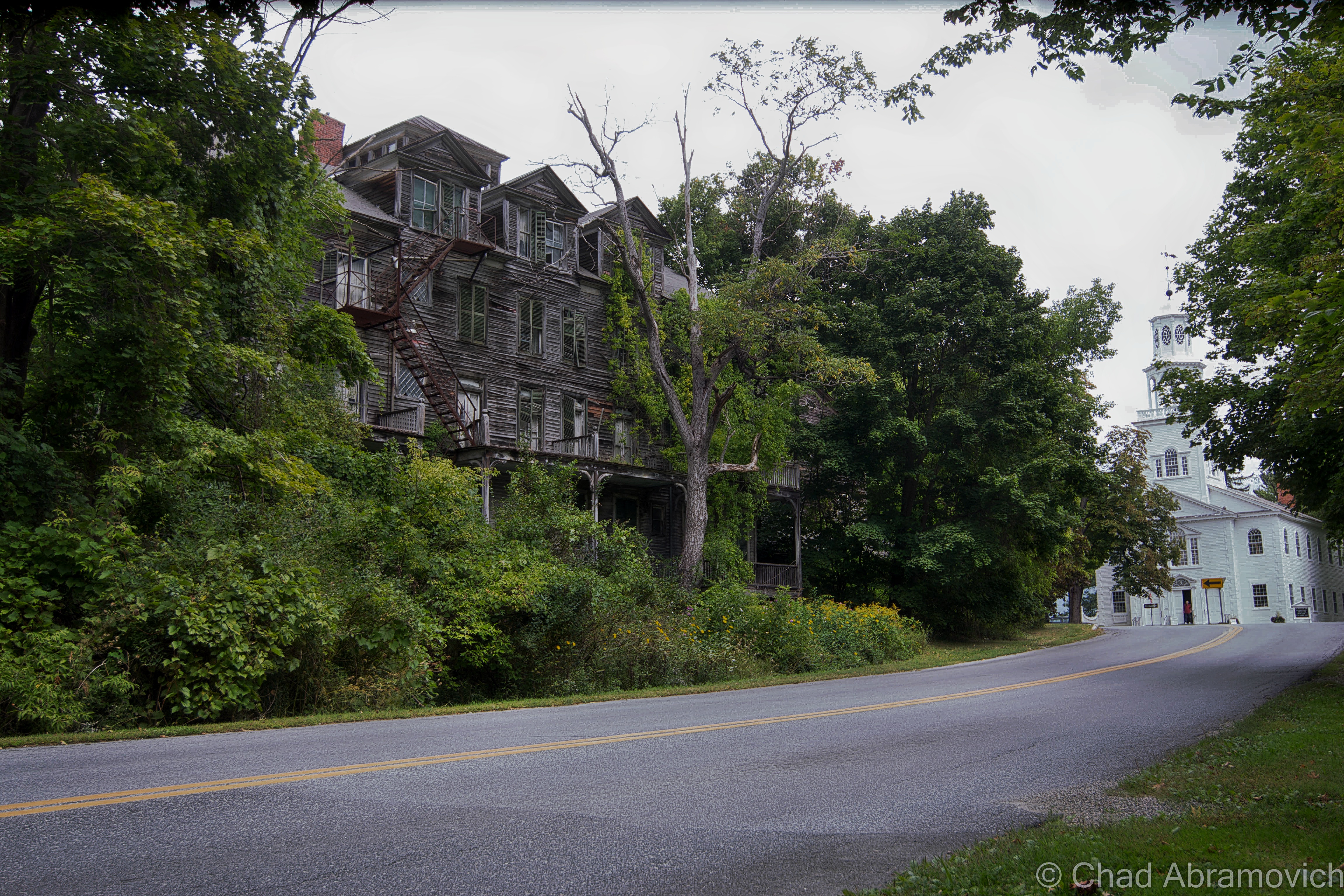
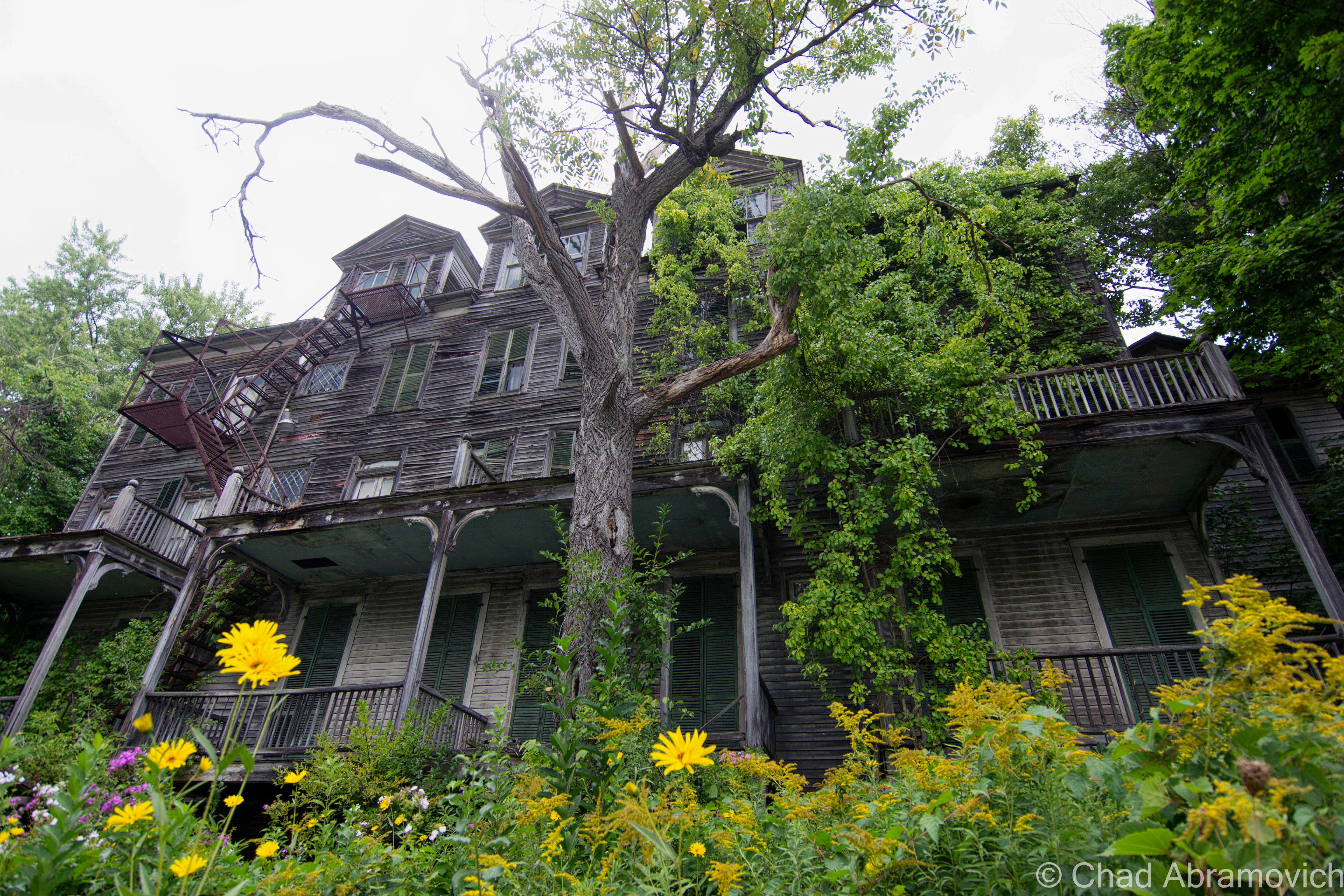
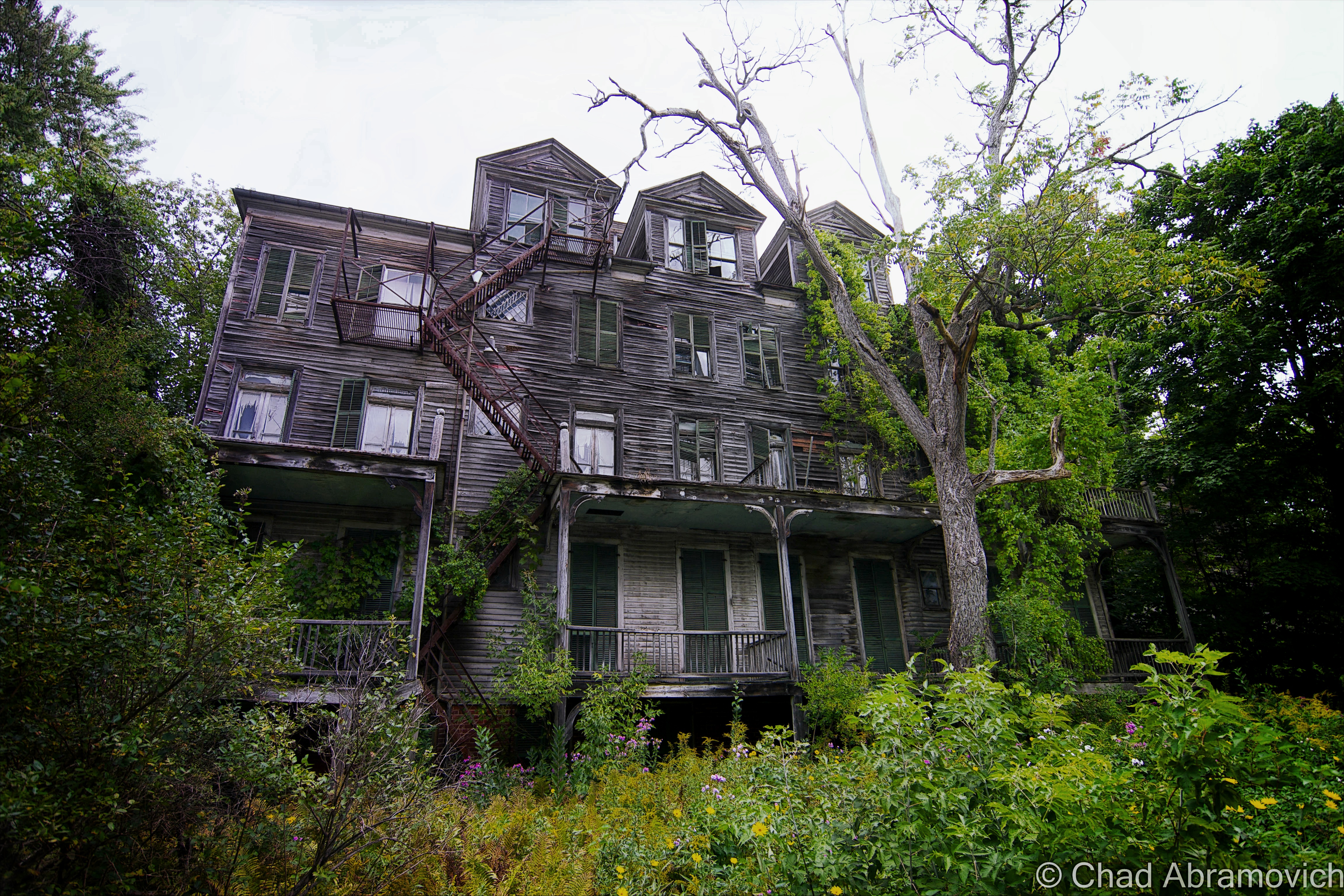
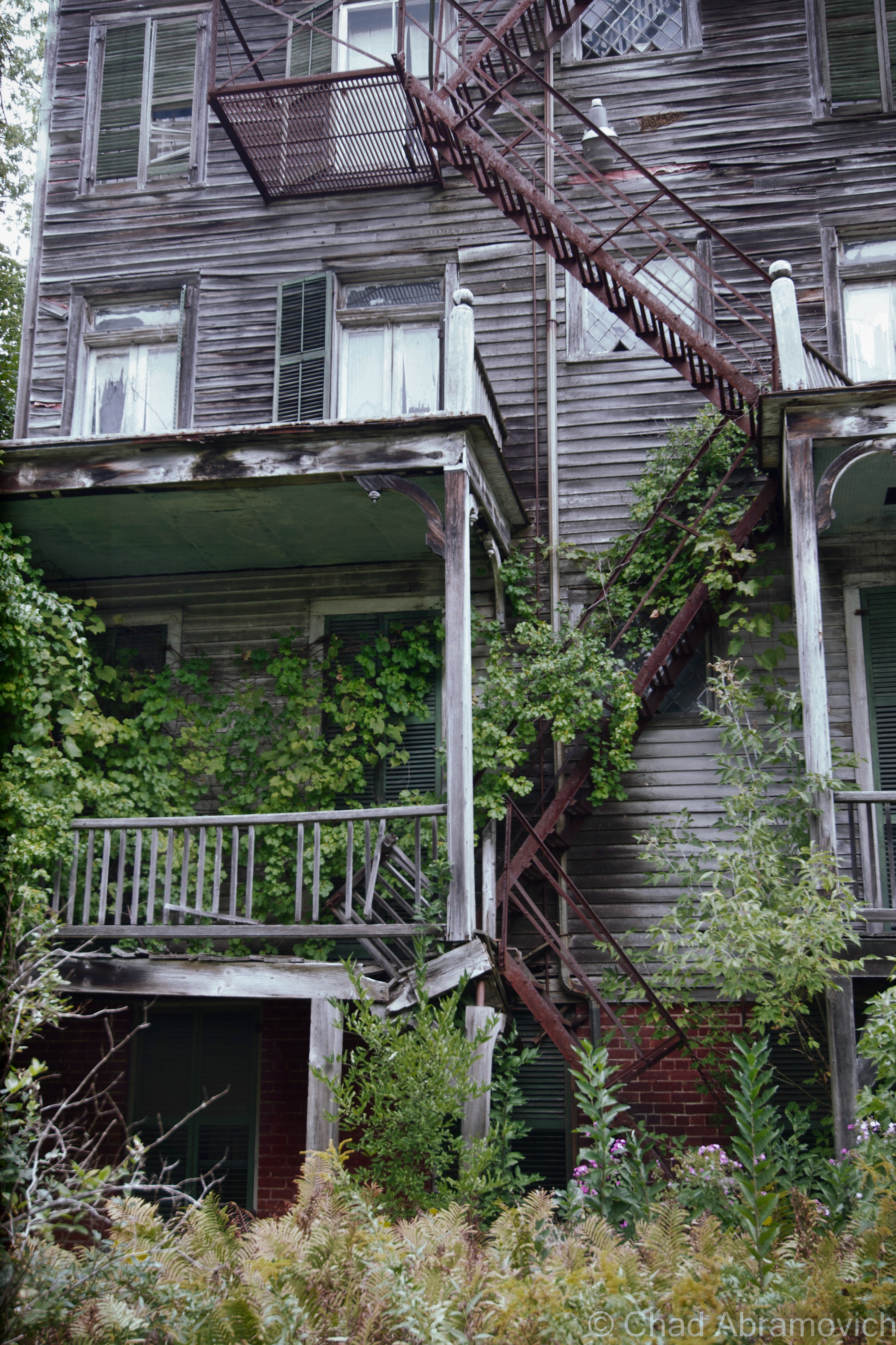
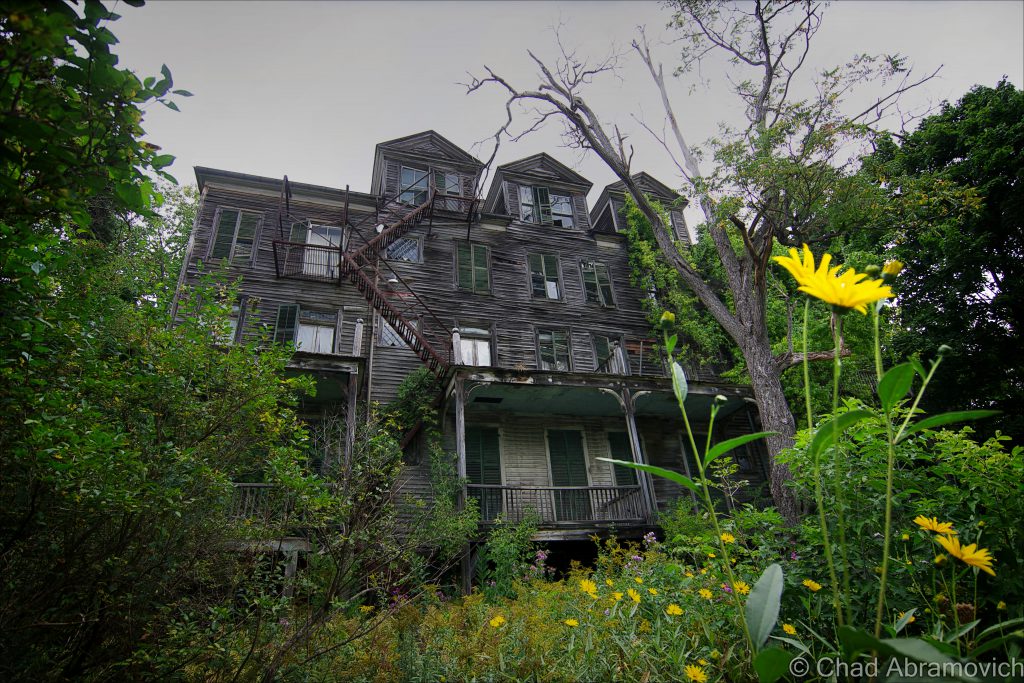
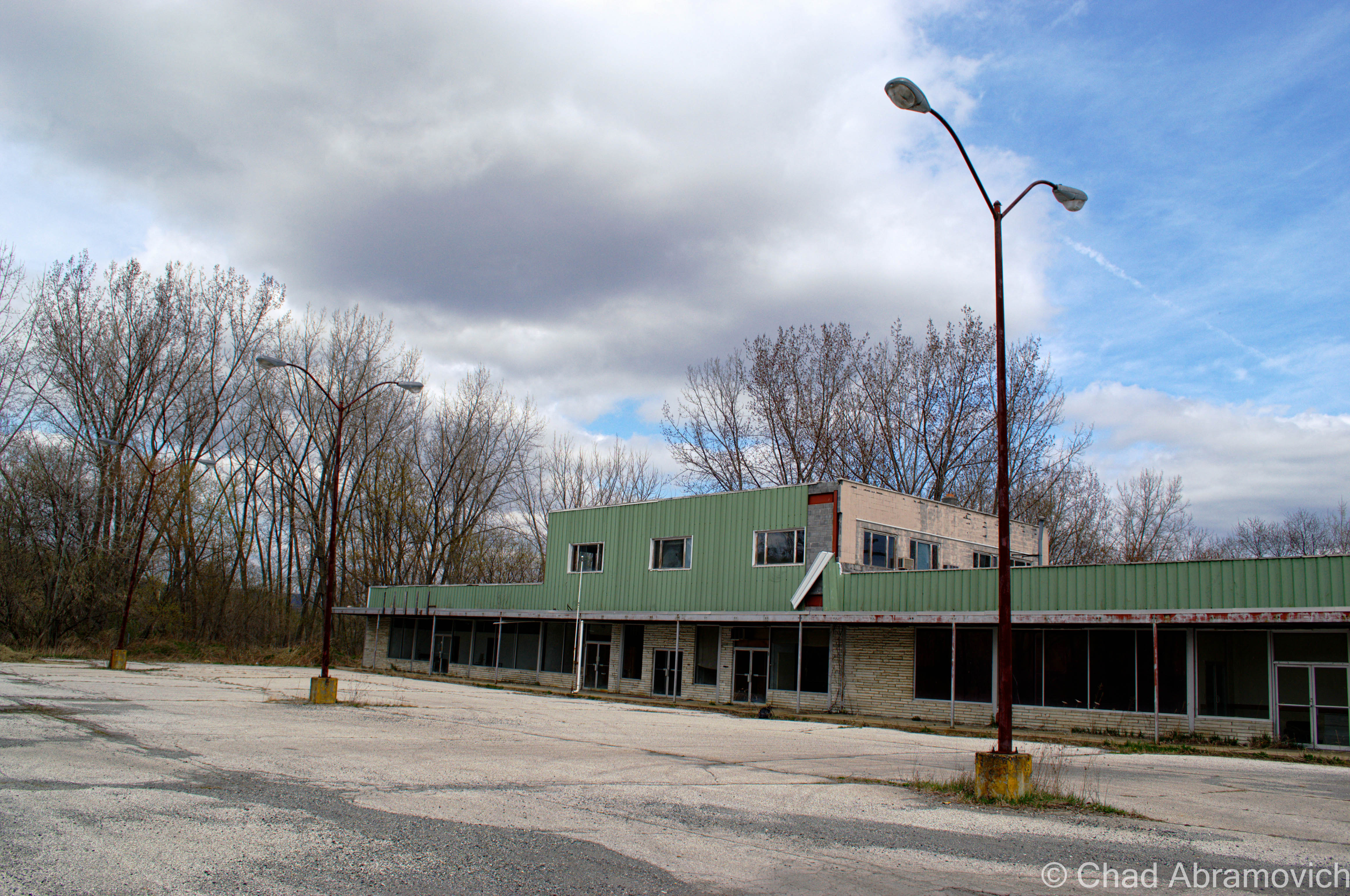
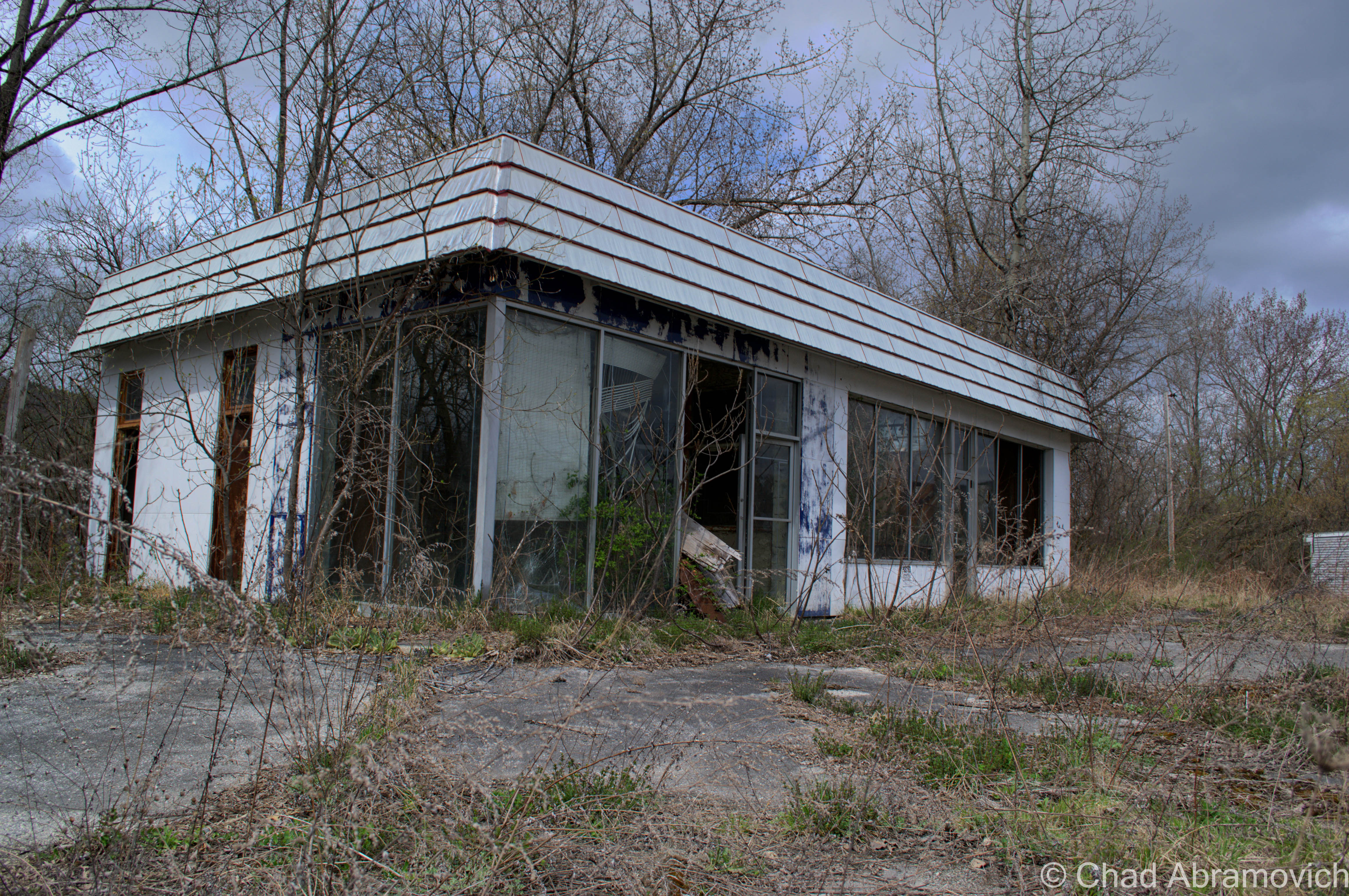
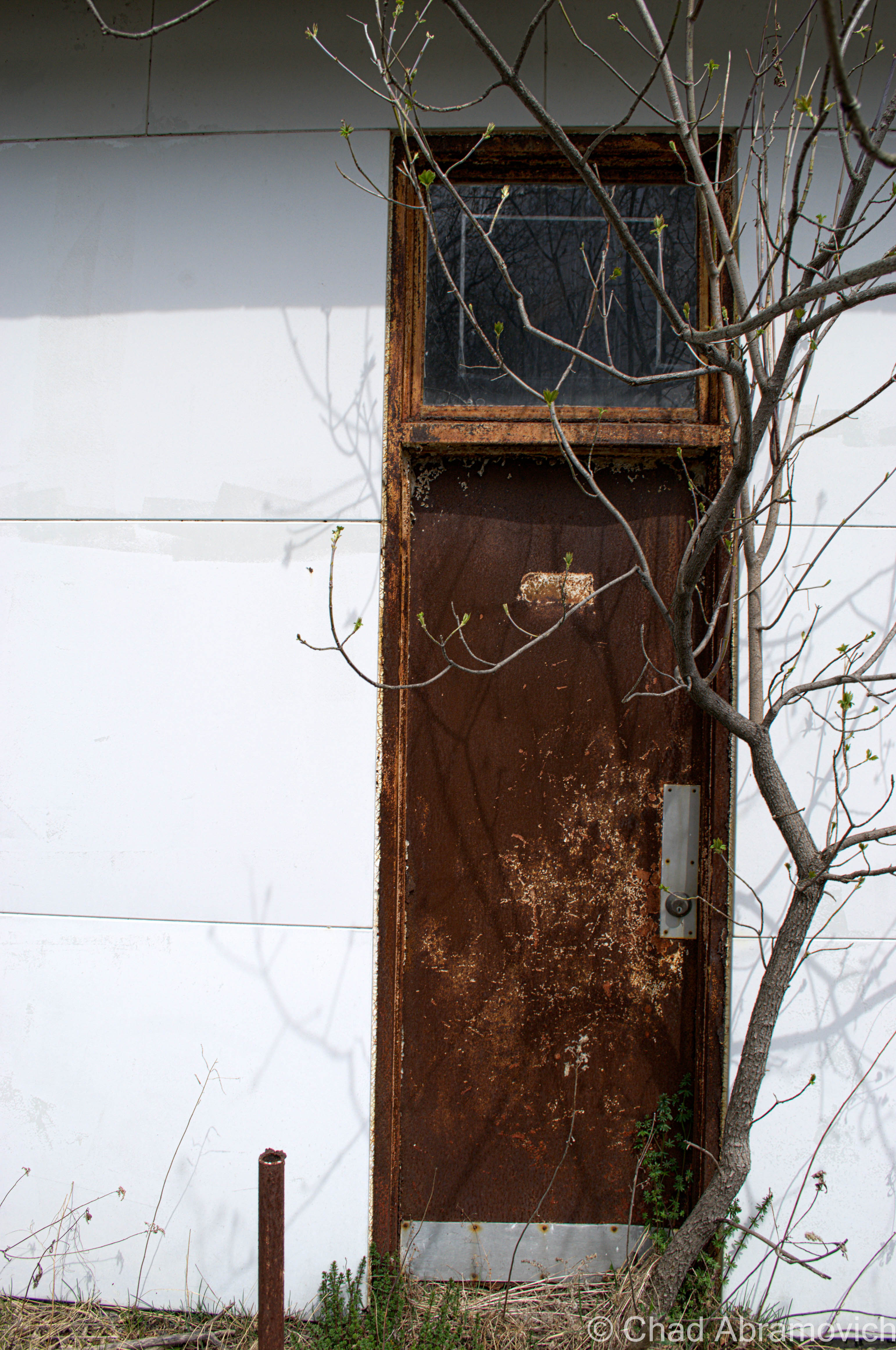
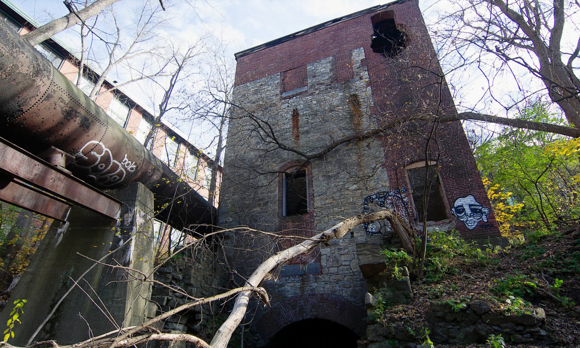
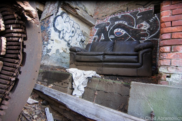
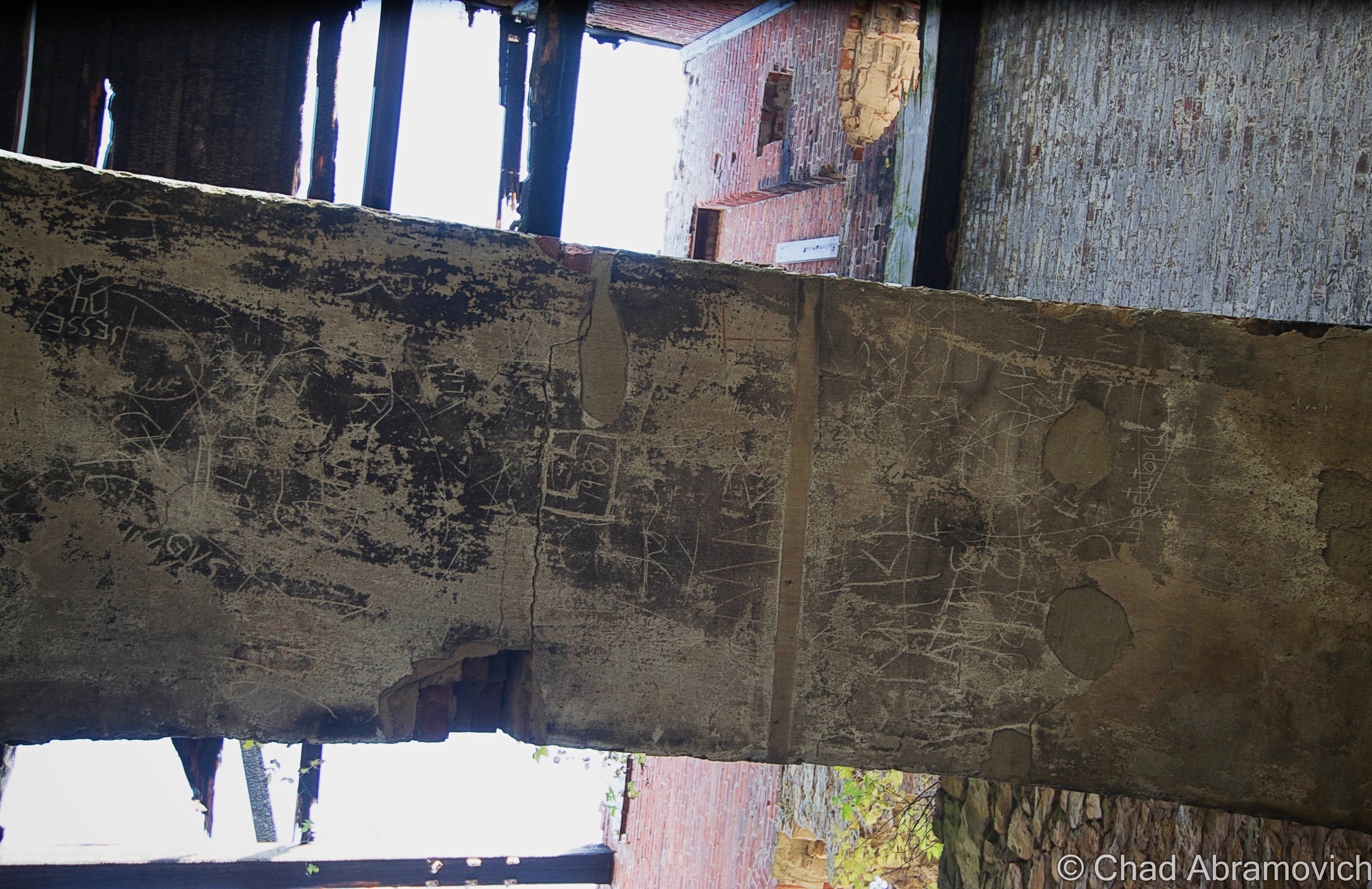
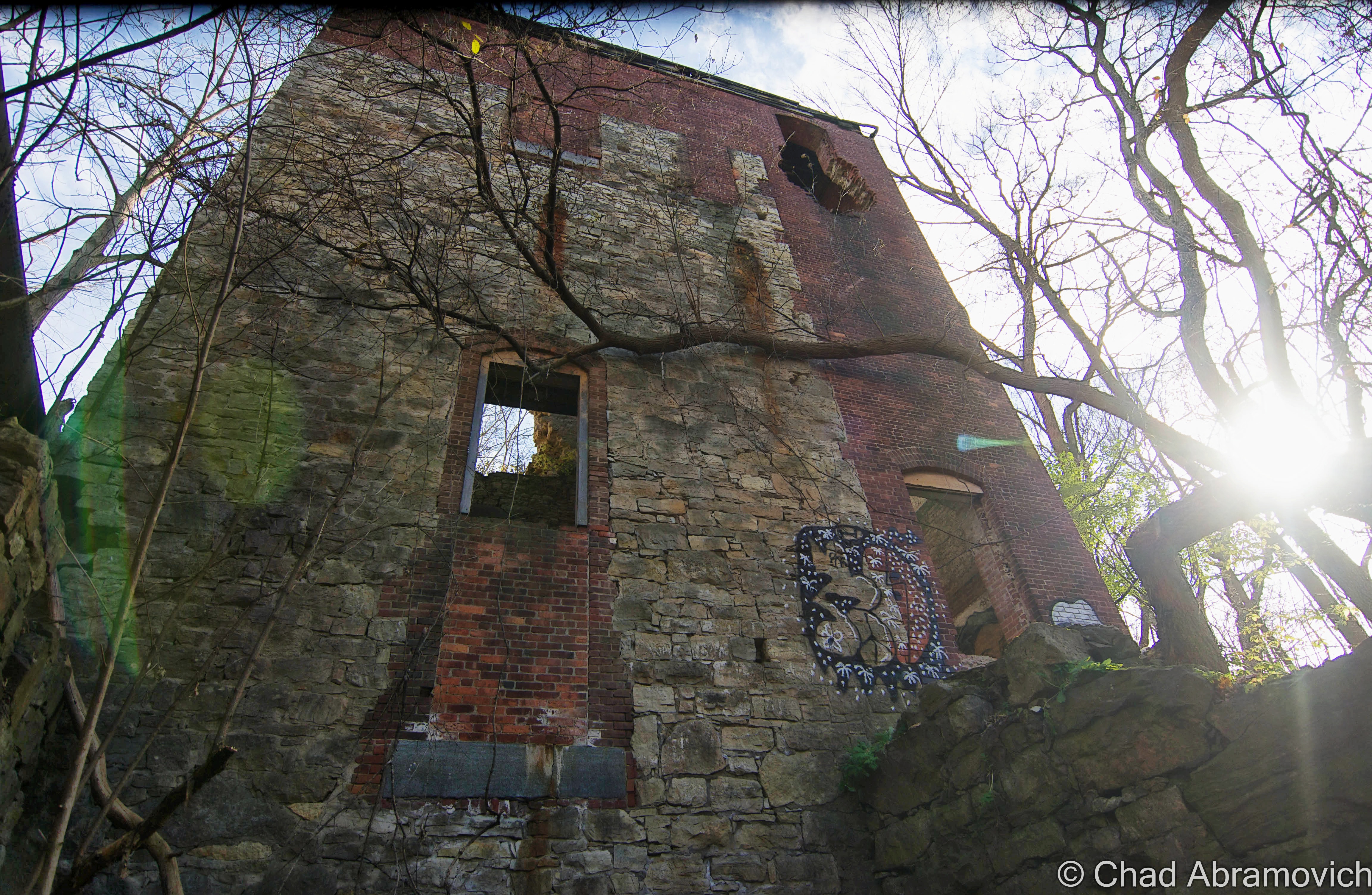
Brawny industrial towns like Winooski have had their rises and falls, but if there is one good thing about old mill towns, is that their lasting impression comes in the form of admirable architecture. More precisely here, it’s spacious and handsome brick mills. Most of the old mill buildings have taken on new lives as very nice mixed office and apartment space, but a small vestige of Winooski’s raw and unrenovated industrial past can still be seen, if you know where to look.

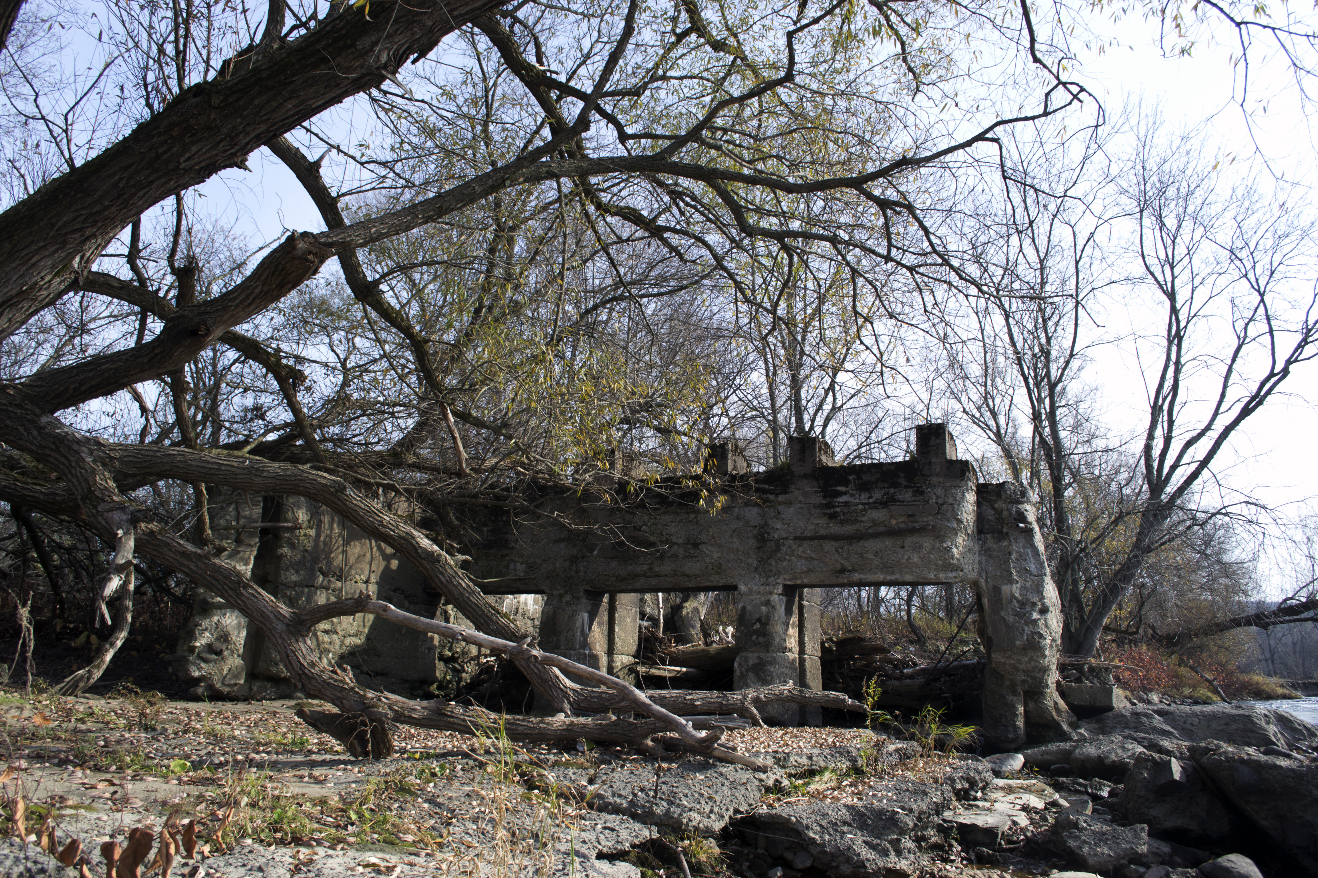
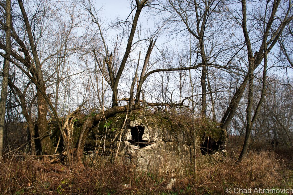
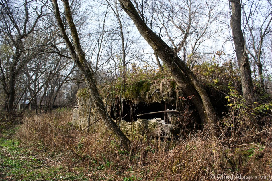
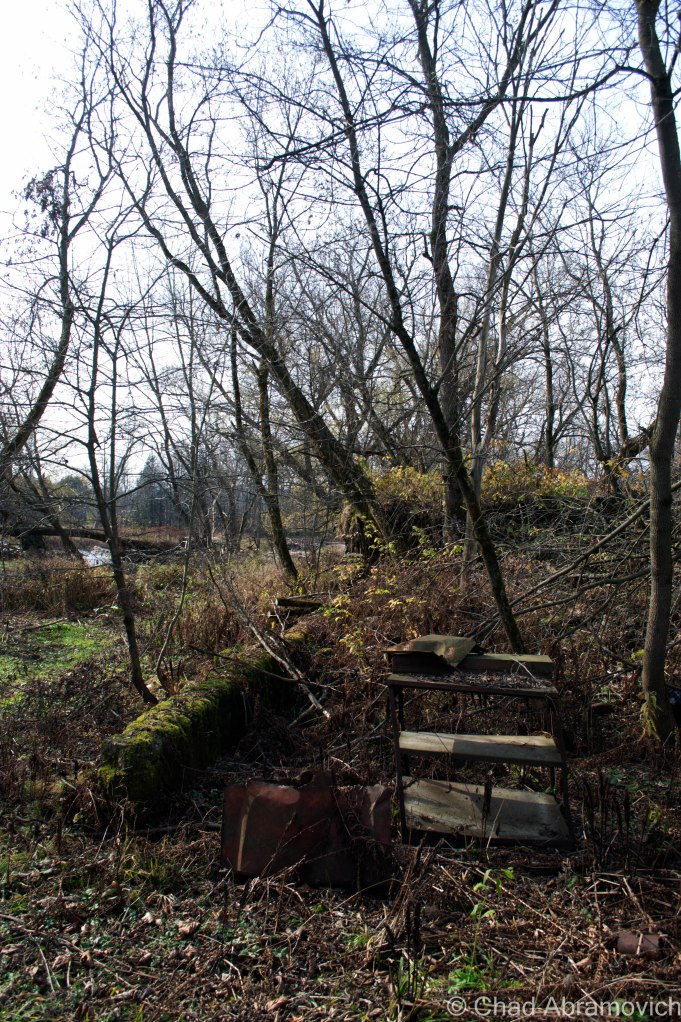
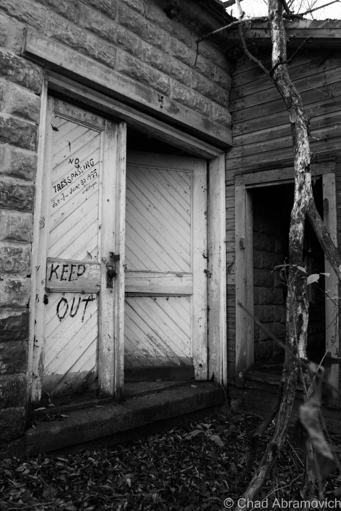
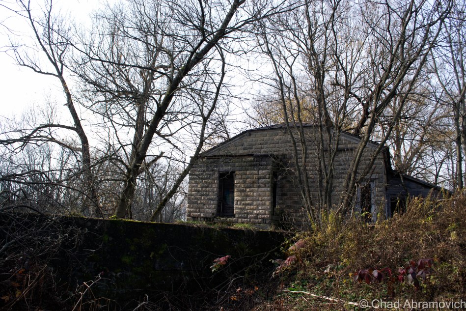
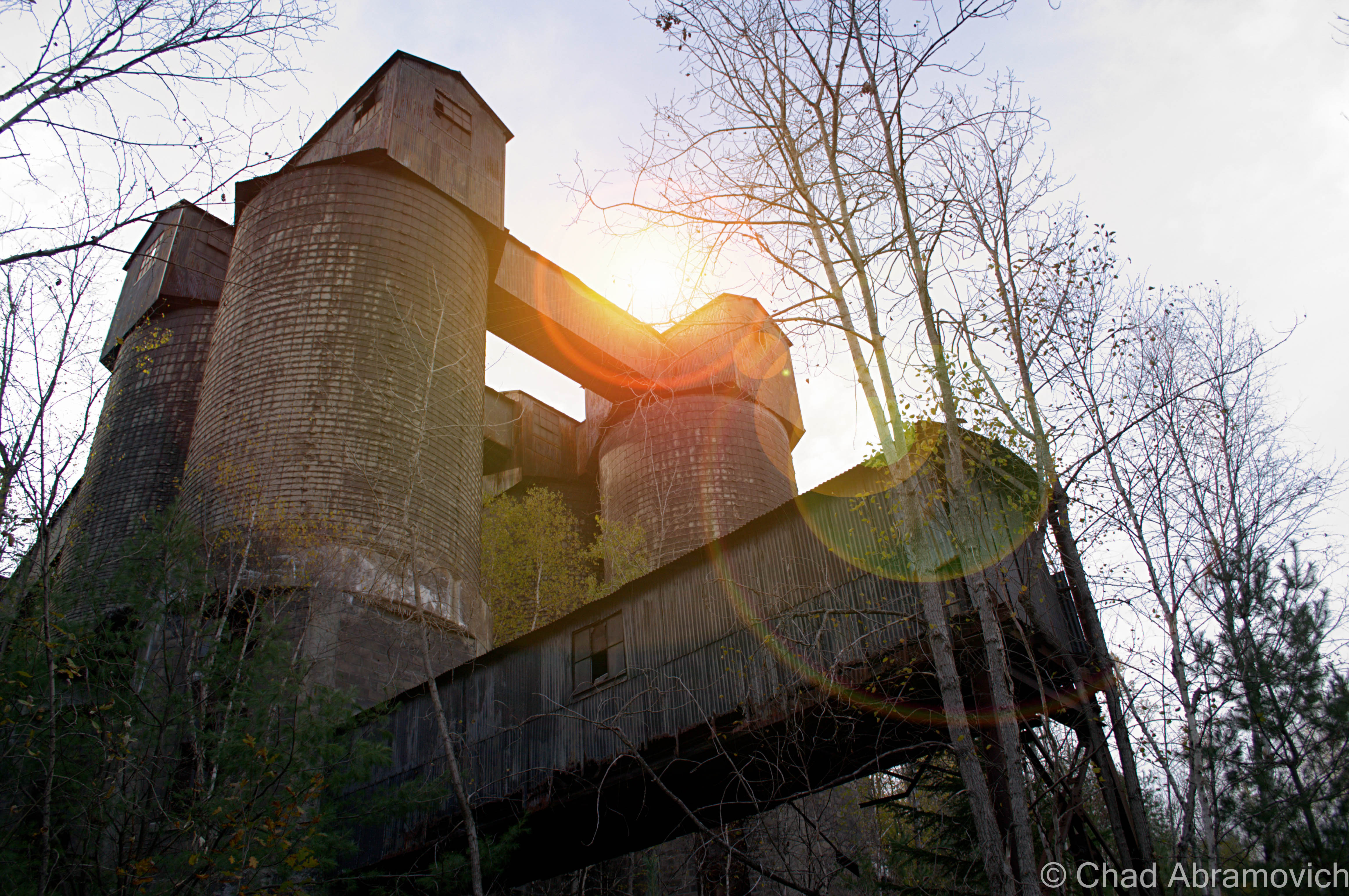
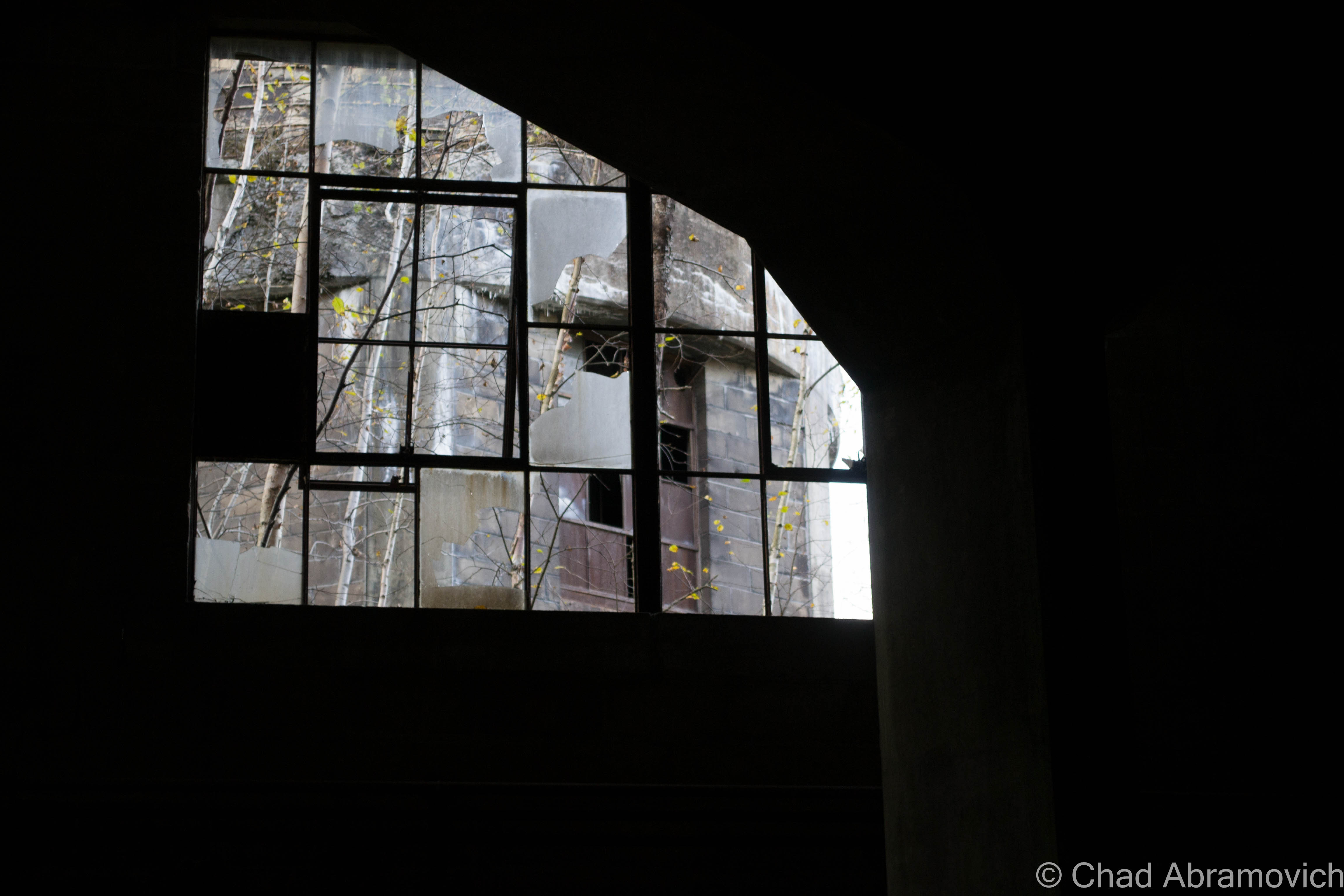
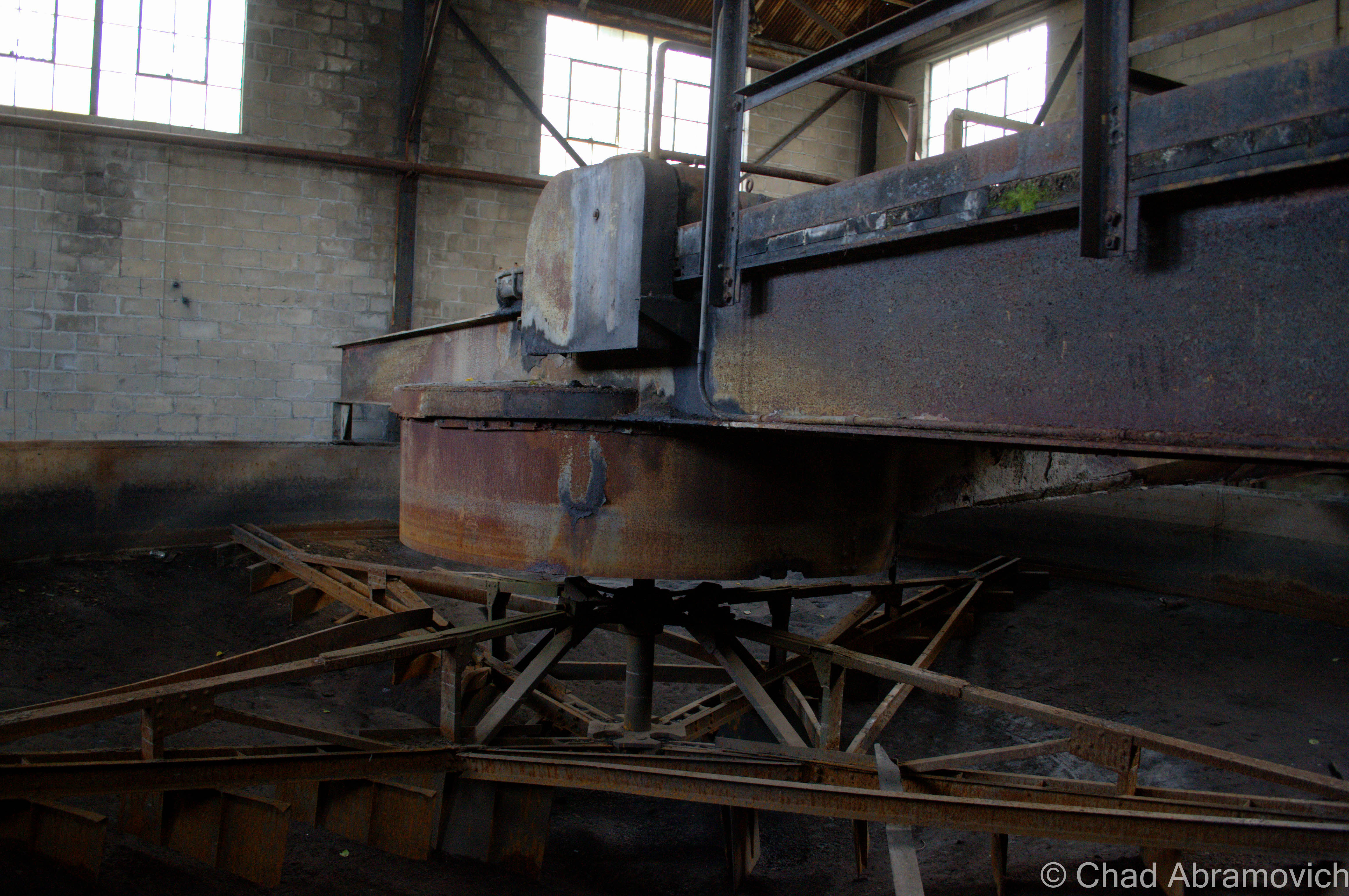
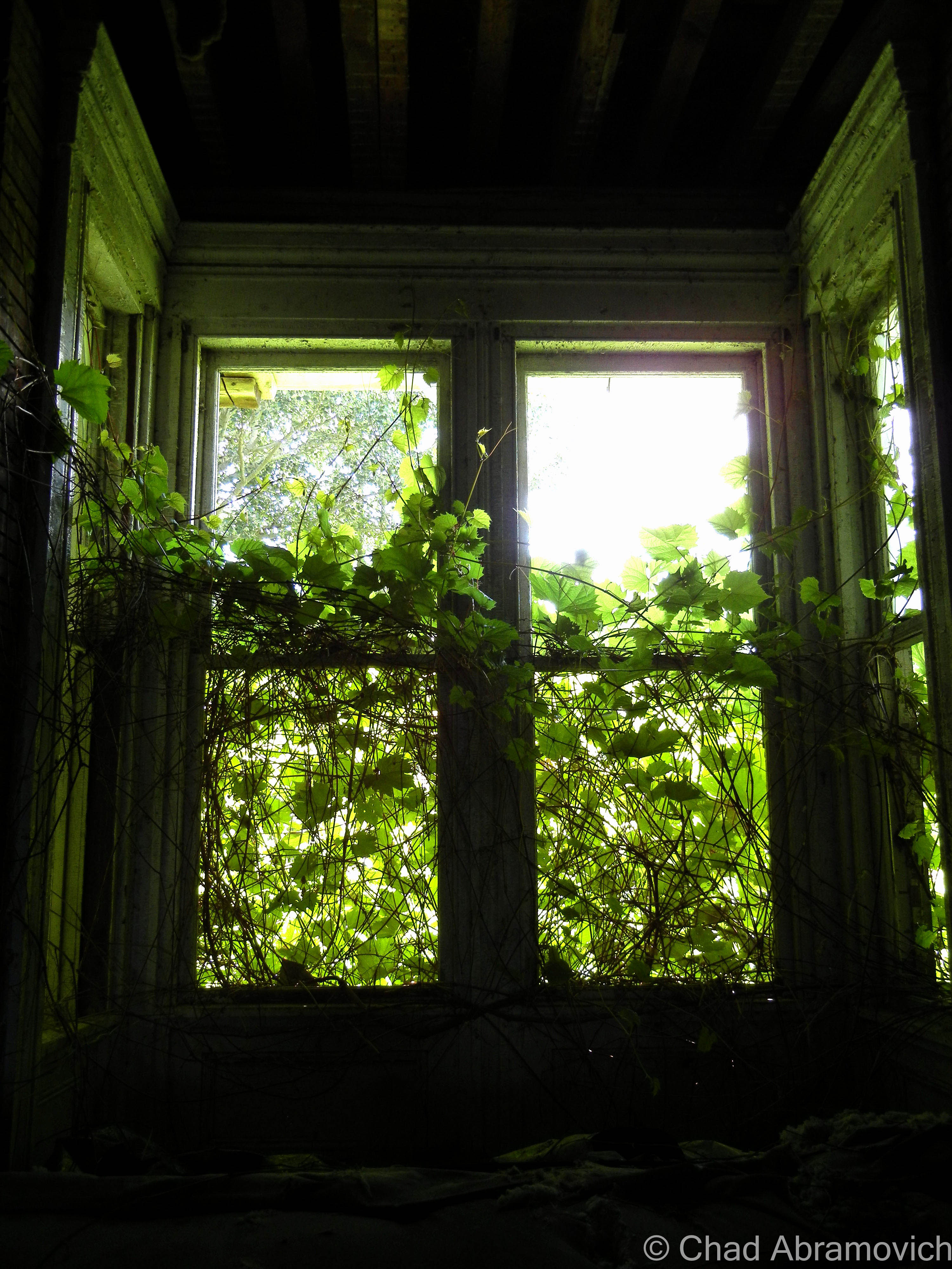
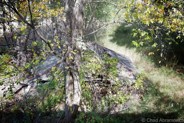
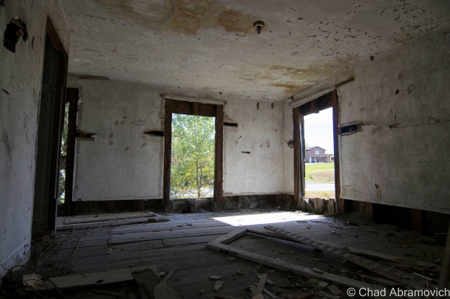
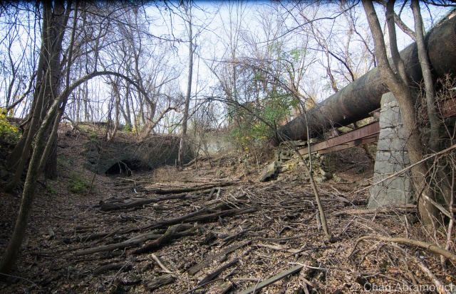
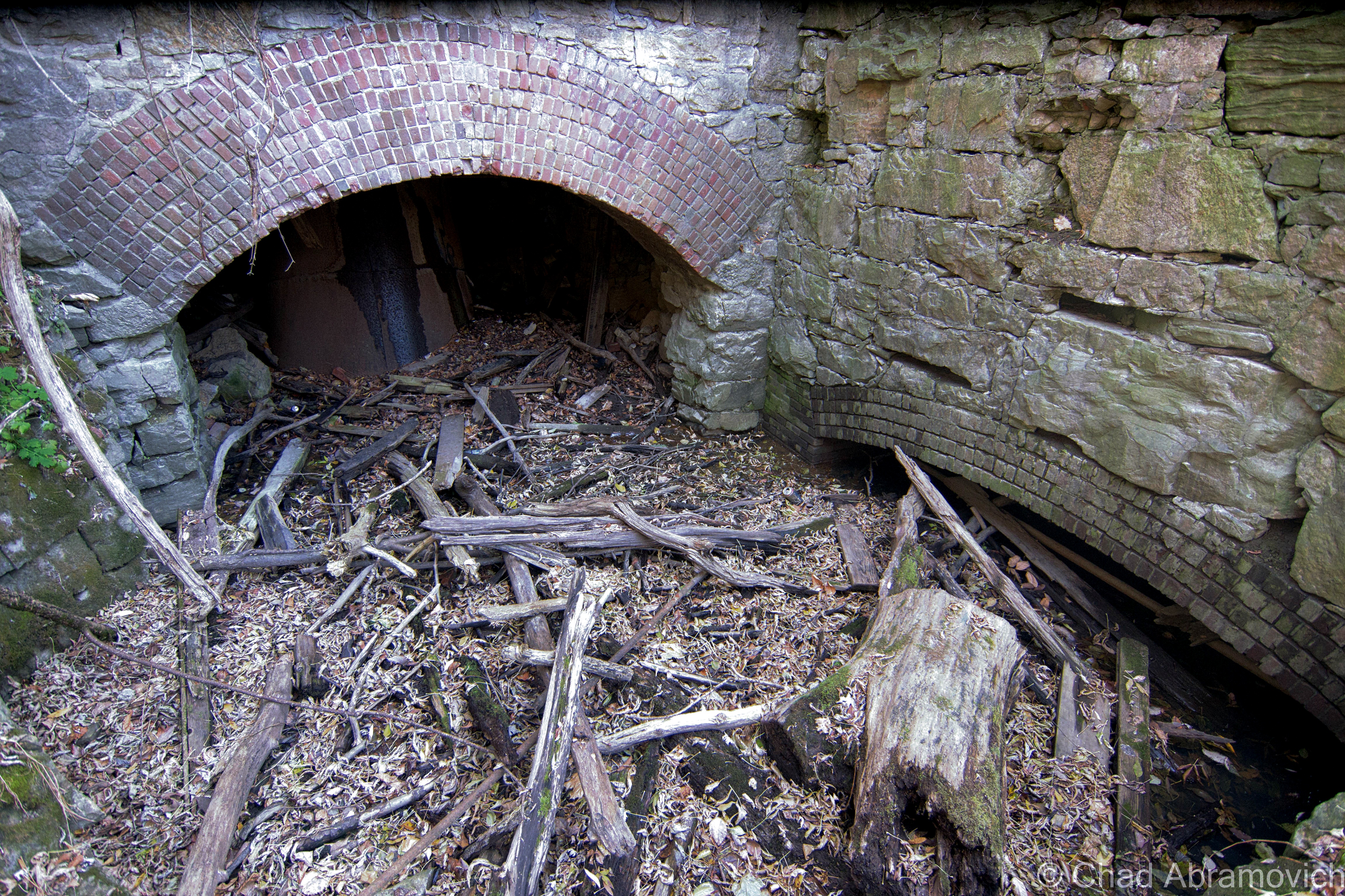
Sulking behind the expansive brick edifice of the Woolen Mill, down in a recessed area of scraggly trees and the graveyards of stagnant mill ponds once formed by water entering through the low stone tunnels now being filled in by erosion, sits the crumbling remains of a brick tower.


These dangerous ruins were enigmatic to me, as I know practically nothing about early twentieth century mill operations, so with the help from my friend who was also the one who took  me here, a little research was done and was able to shed some light on what this tower once was.

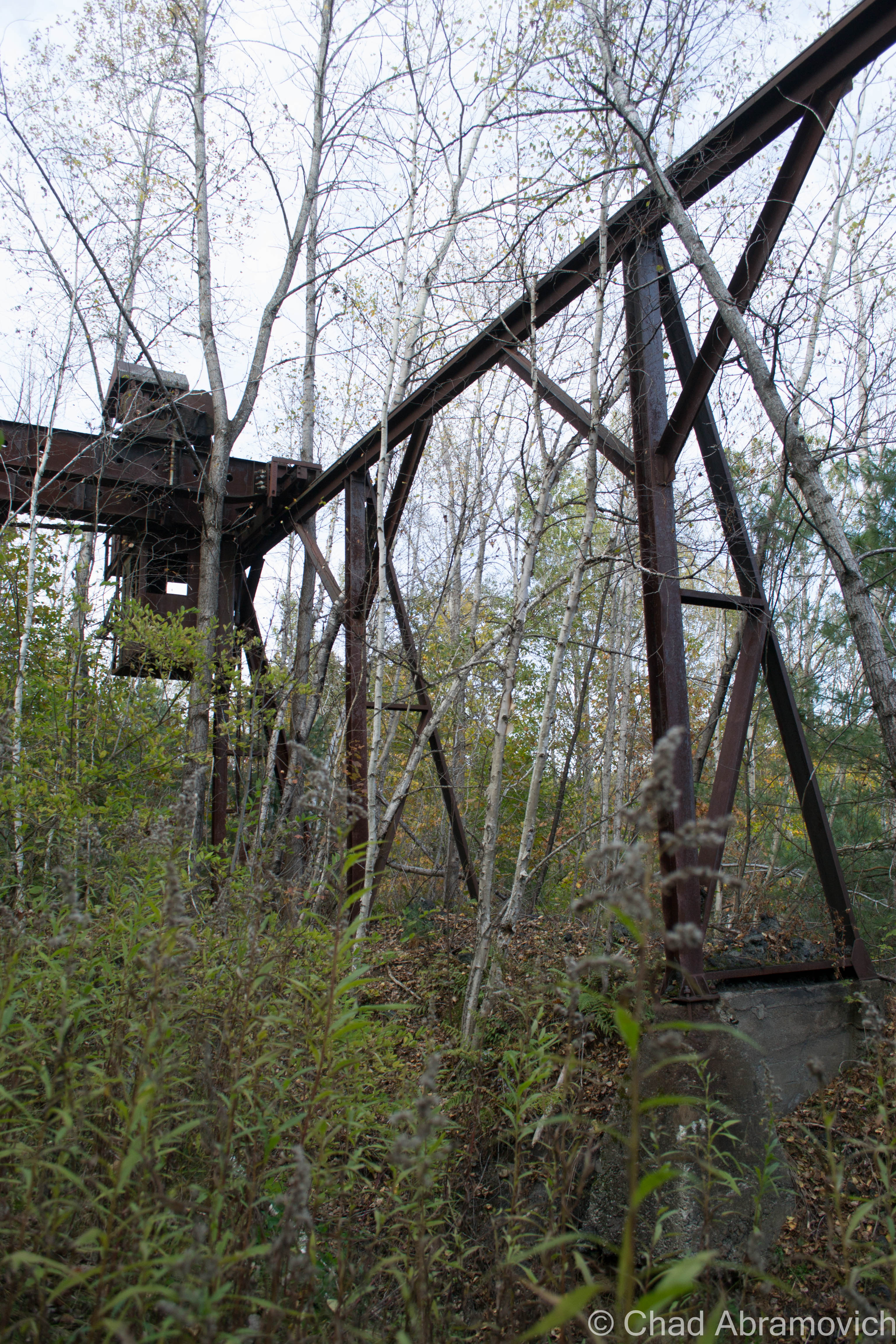
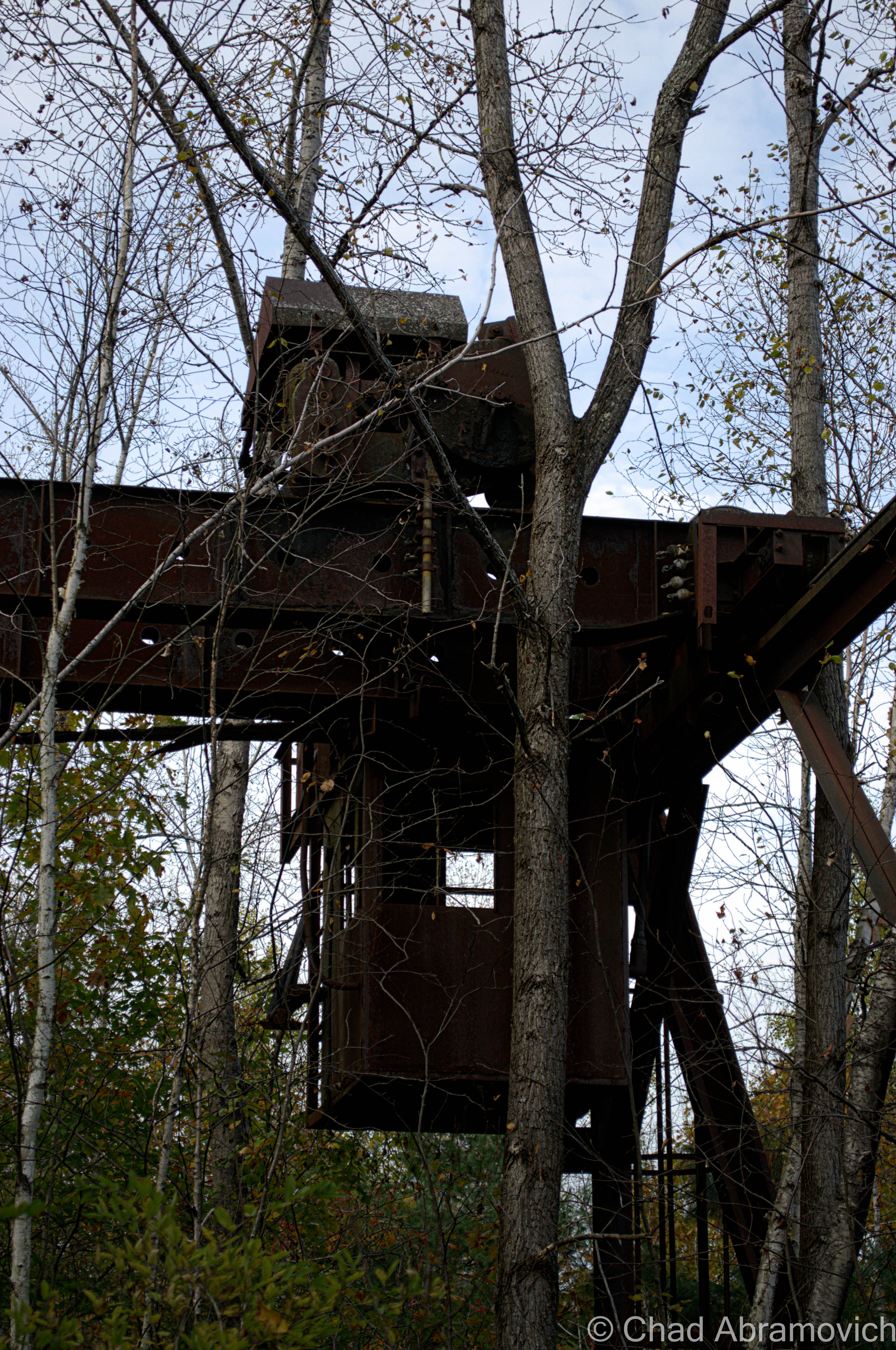
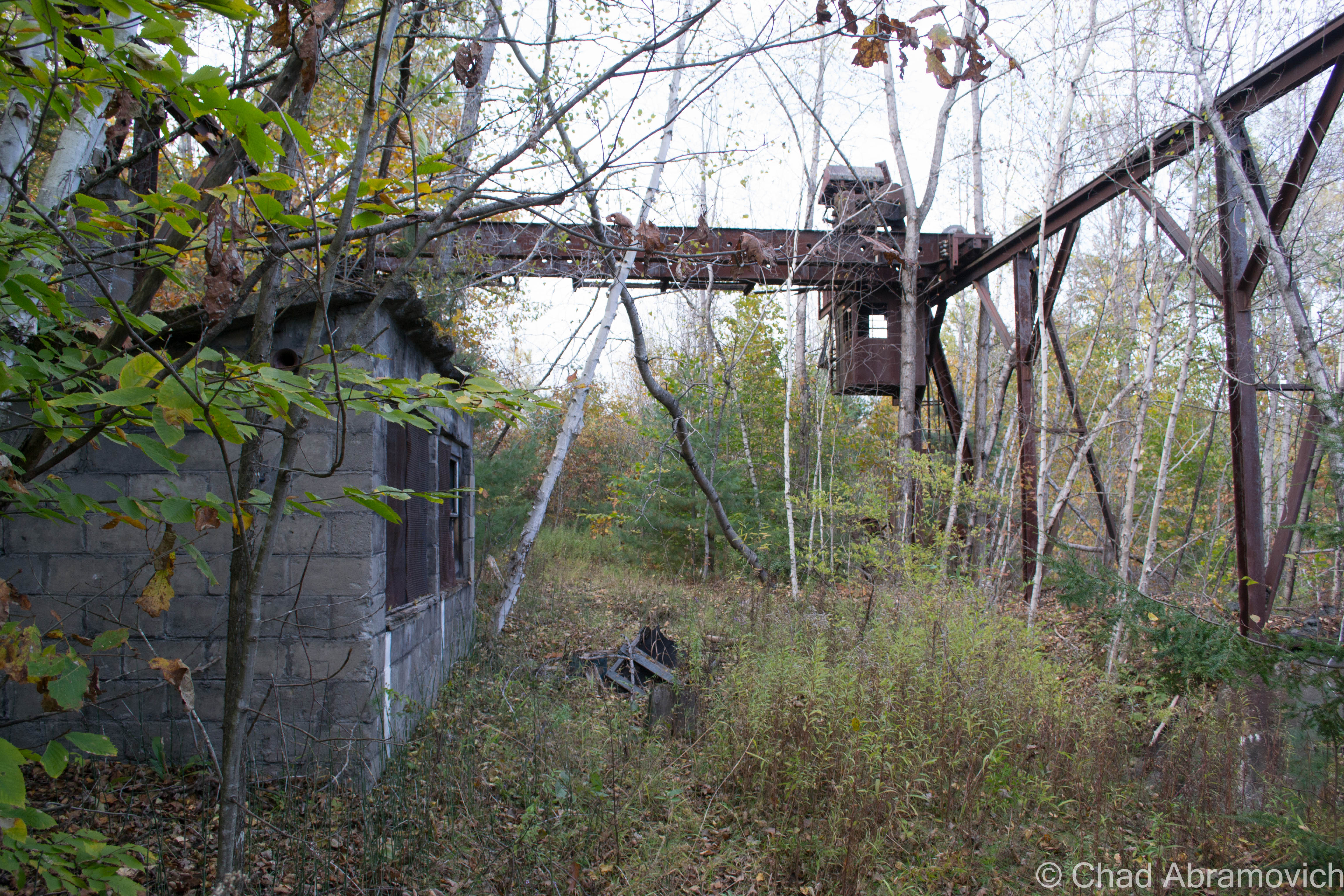
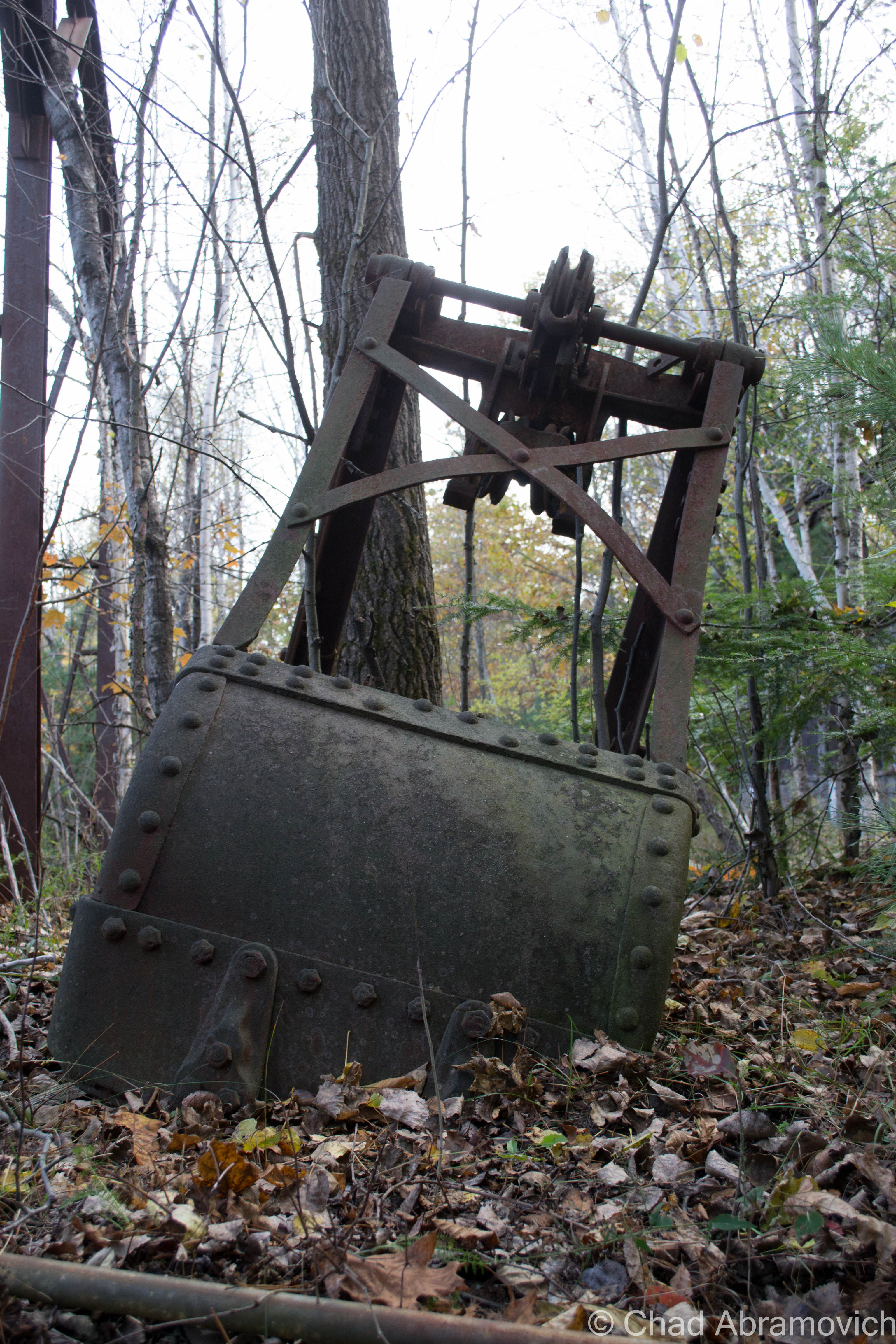
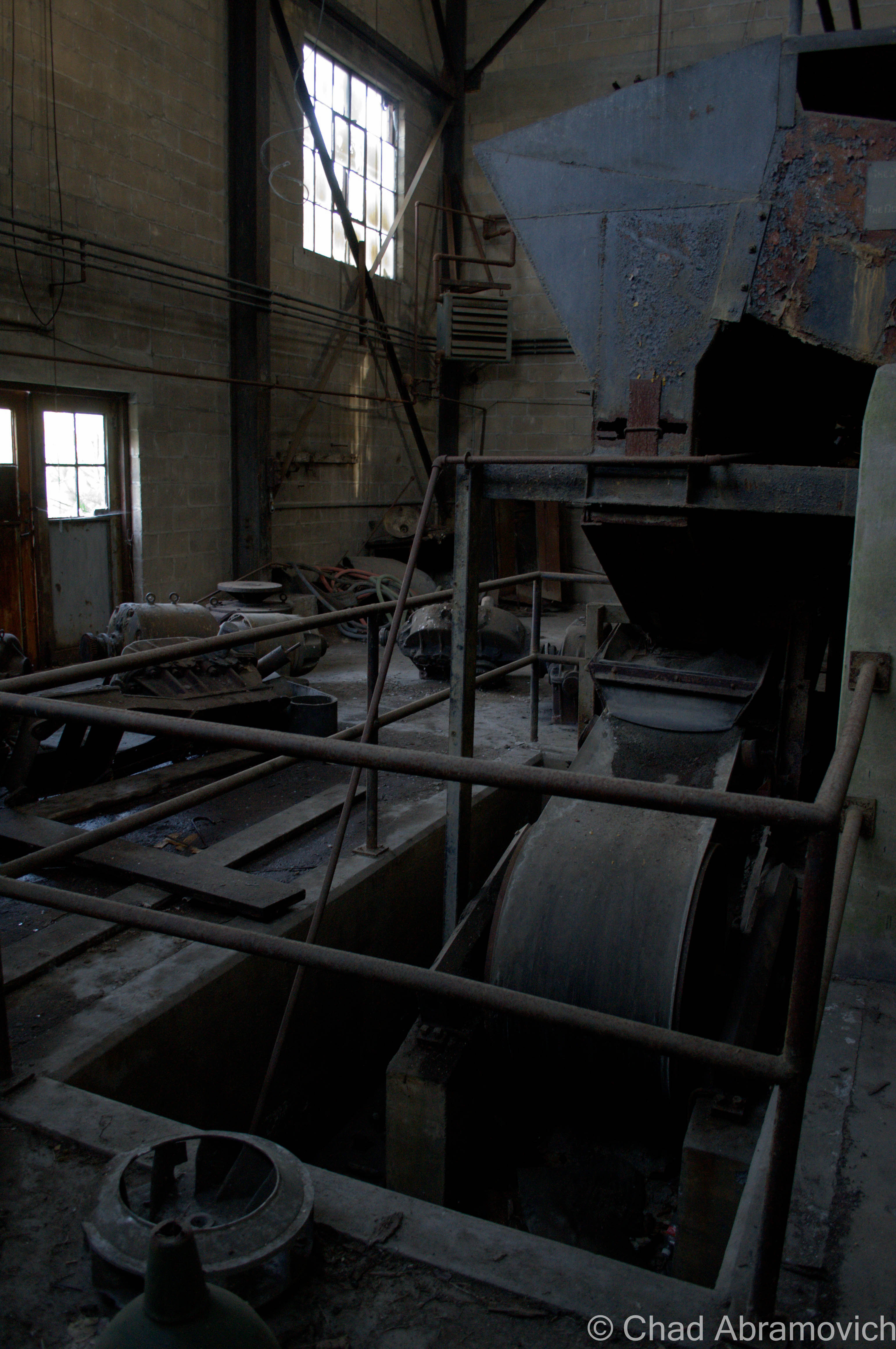
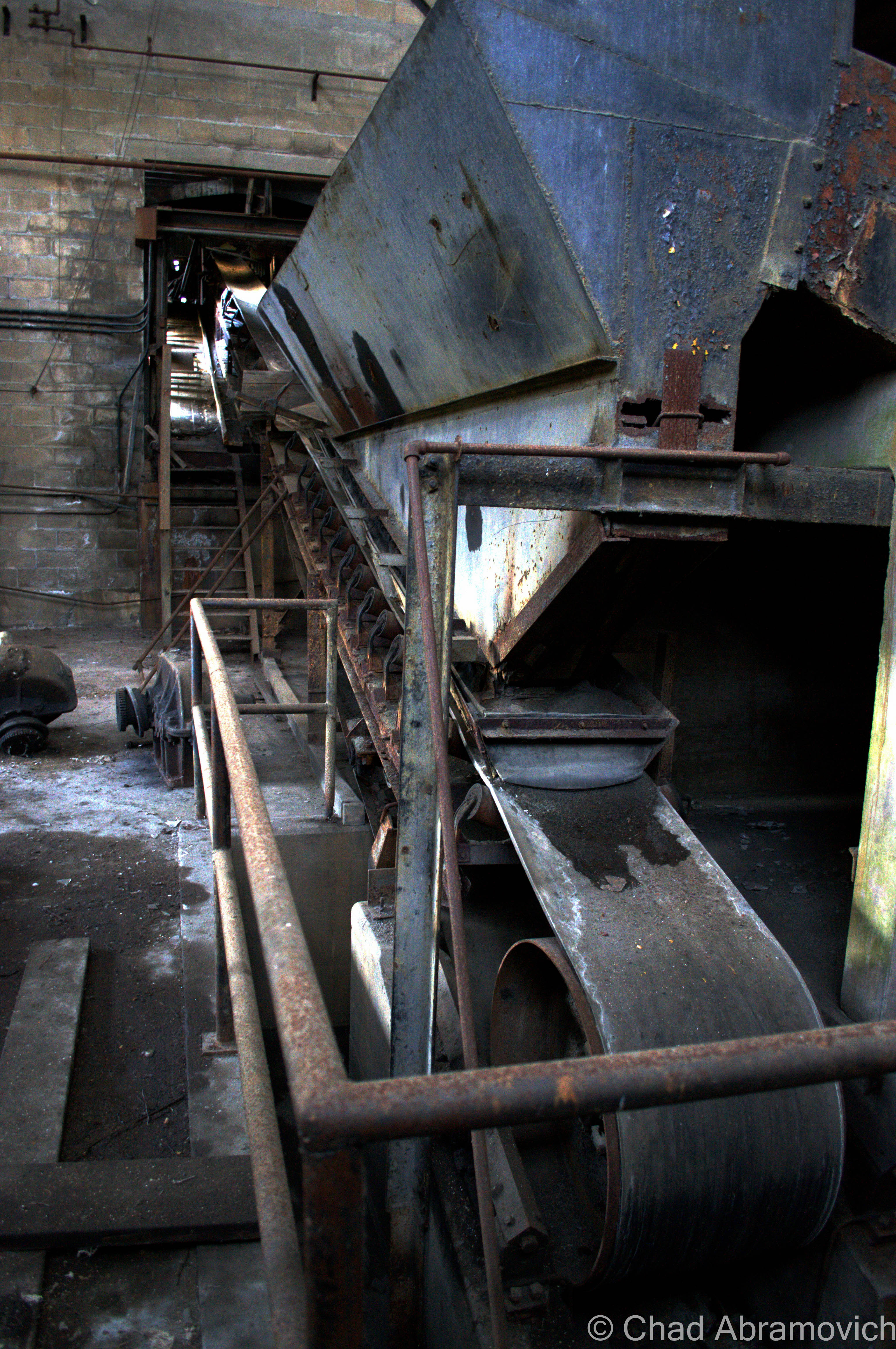
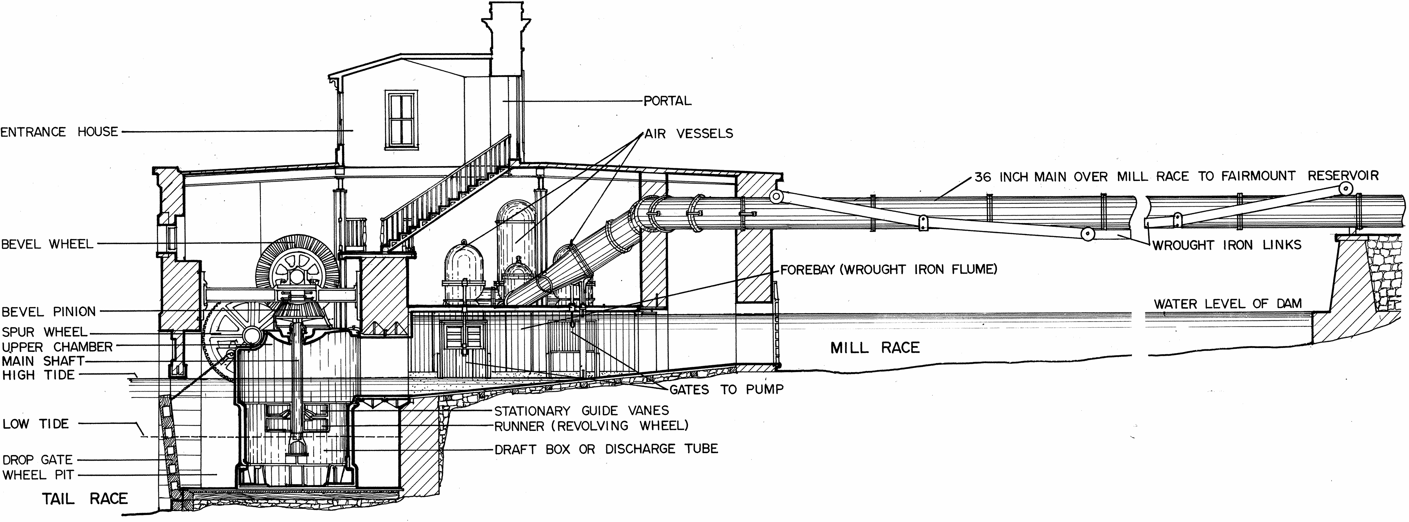
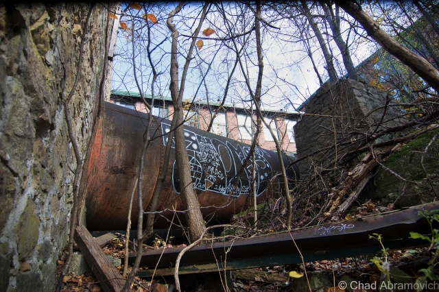
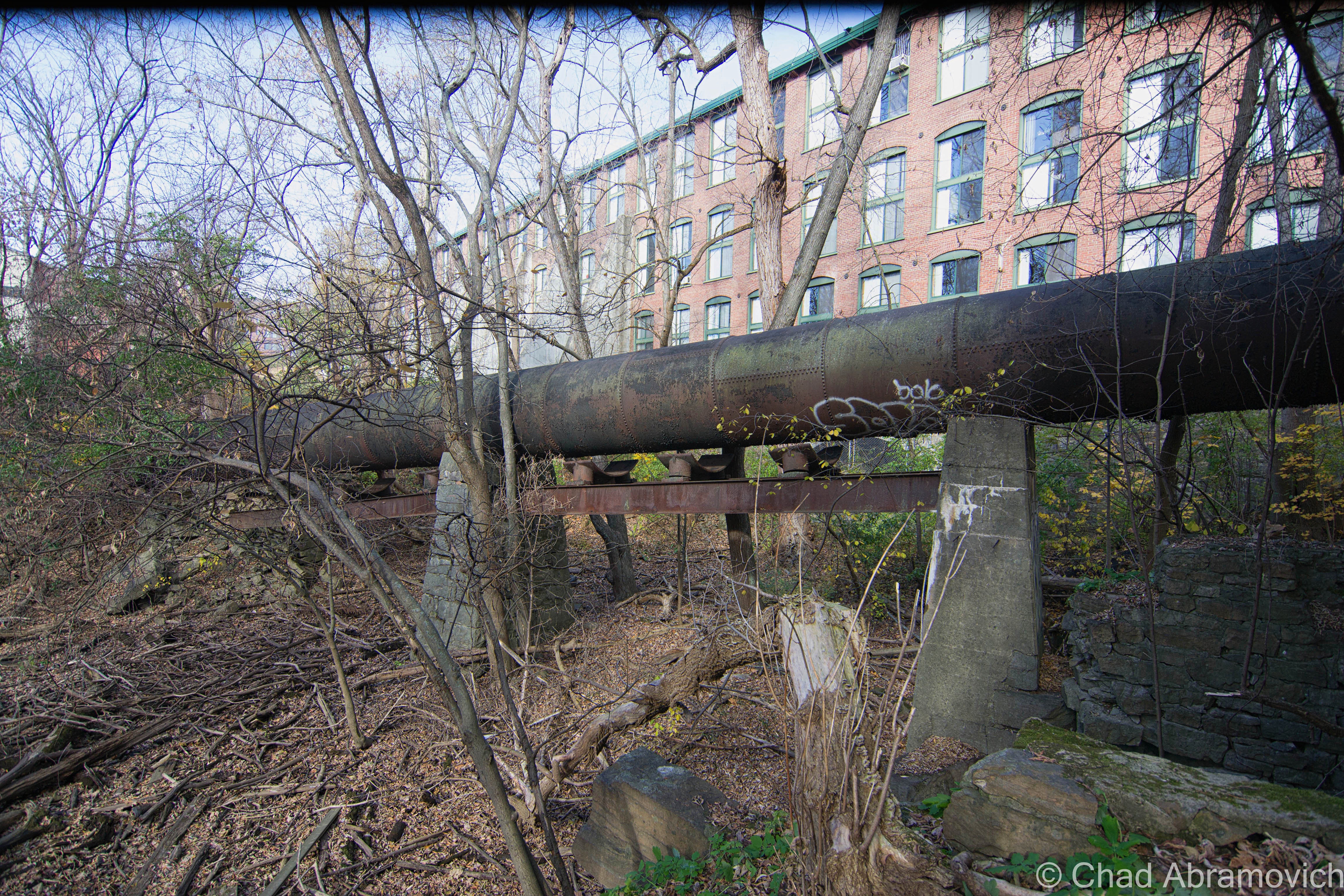
Basically, there is a large intake pipe at the top of the tower. Using gravity, the water flows from the river to the top of the tower.It then is diverted downwards into a turbine where the rushing water turns a wheel before being used for power generation. This turning wheel would have been connected to a shaft that ran into the mill to turn and power the equipment. After 1930 however, the turbine would likely have been repurposed, so instead of using water to create mechanical energy to turn the actual machines, the machines began to use electricity  So the turbine would have been repurposed. Instead of turning a shaft and going into the mill, it turned a shaft that turned an electric generator and this power would have supplied the mill.  Or, something perhaps very similar to the diagram below. (If you are using this blog for any sort of essay information, I encourage you to find a more reputable source)

Fairmount_Water_Works_Jonval_Turbine_Cutaway

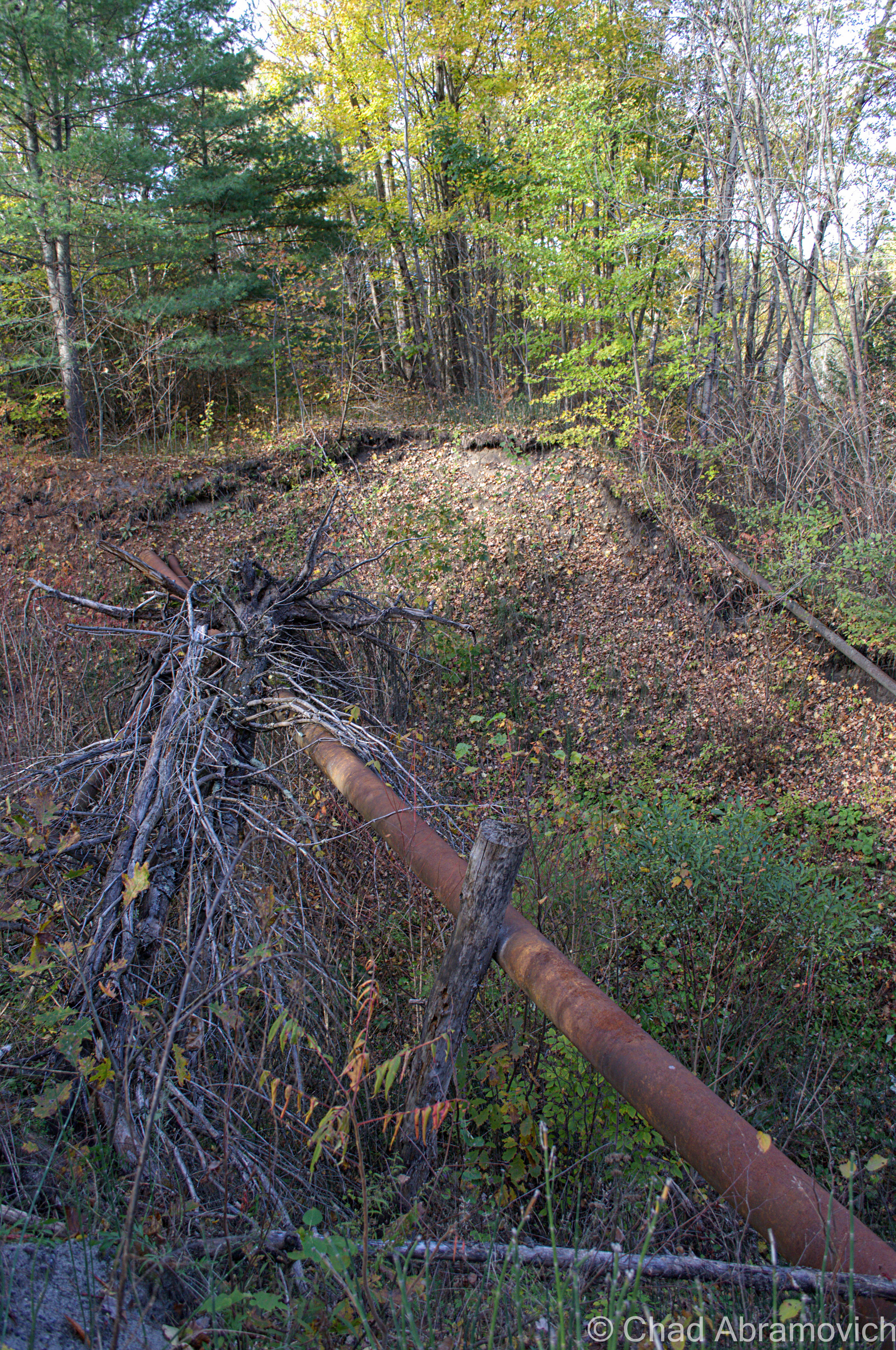
Sure enough, there were the remnants of additional pipes and tunnels that formed a broken trail from this spot over to the bridge where the water levels were higher, making this a very plausible description of how this tower might have functioned.

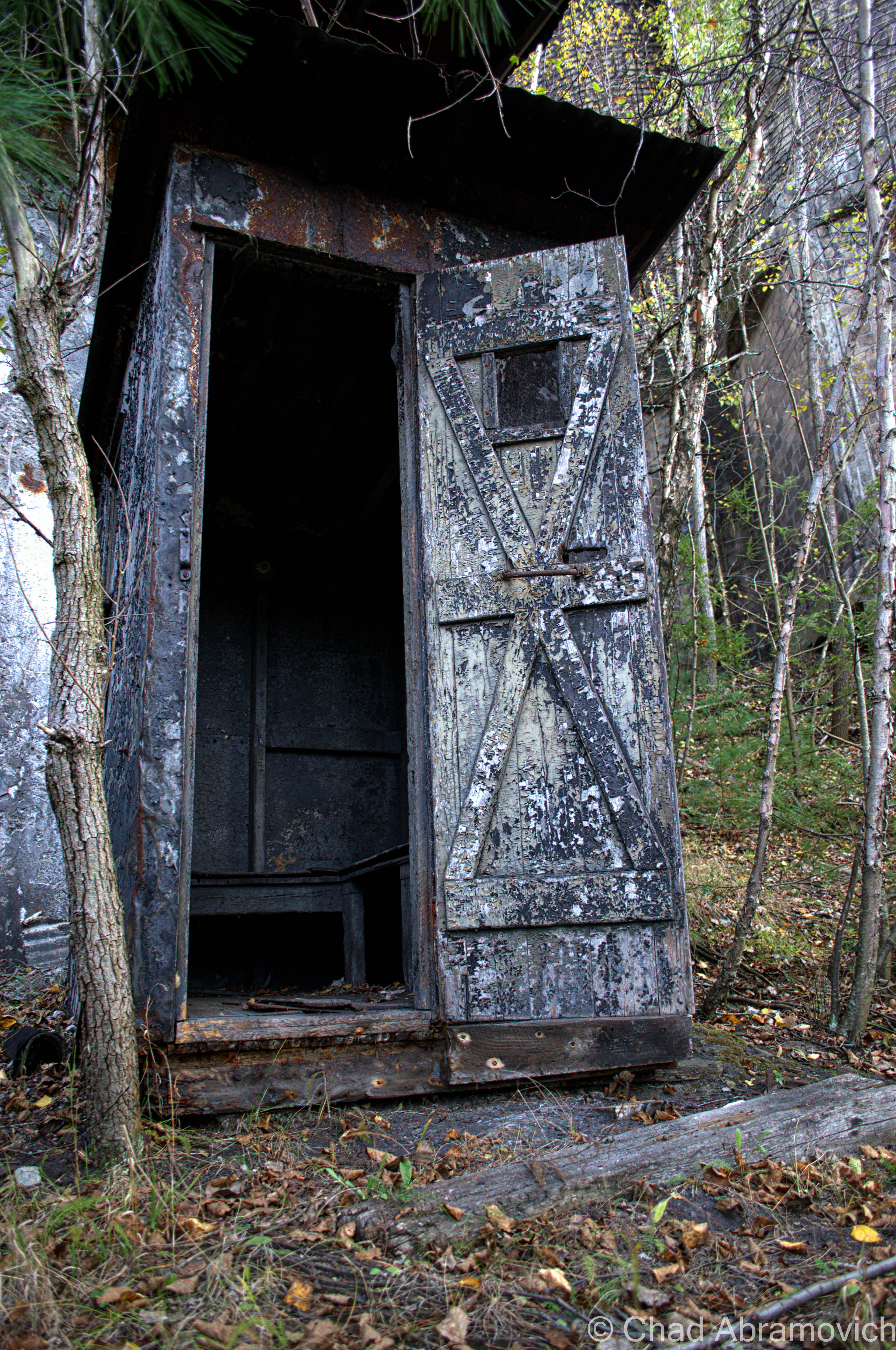
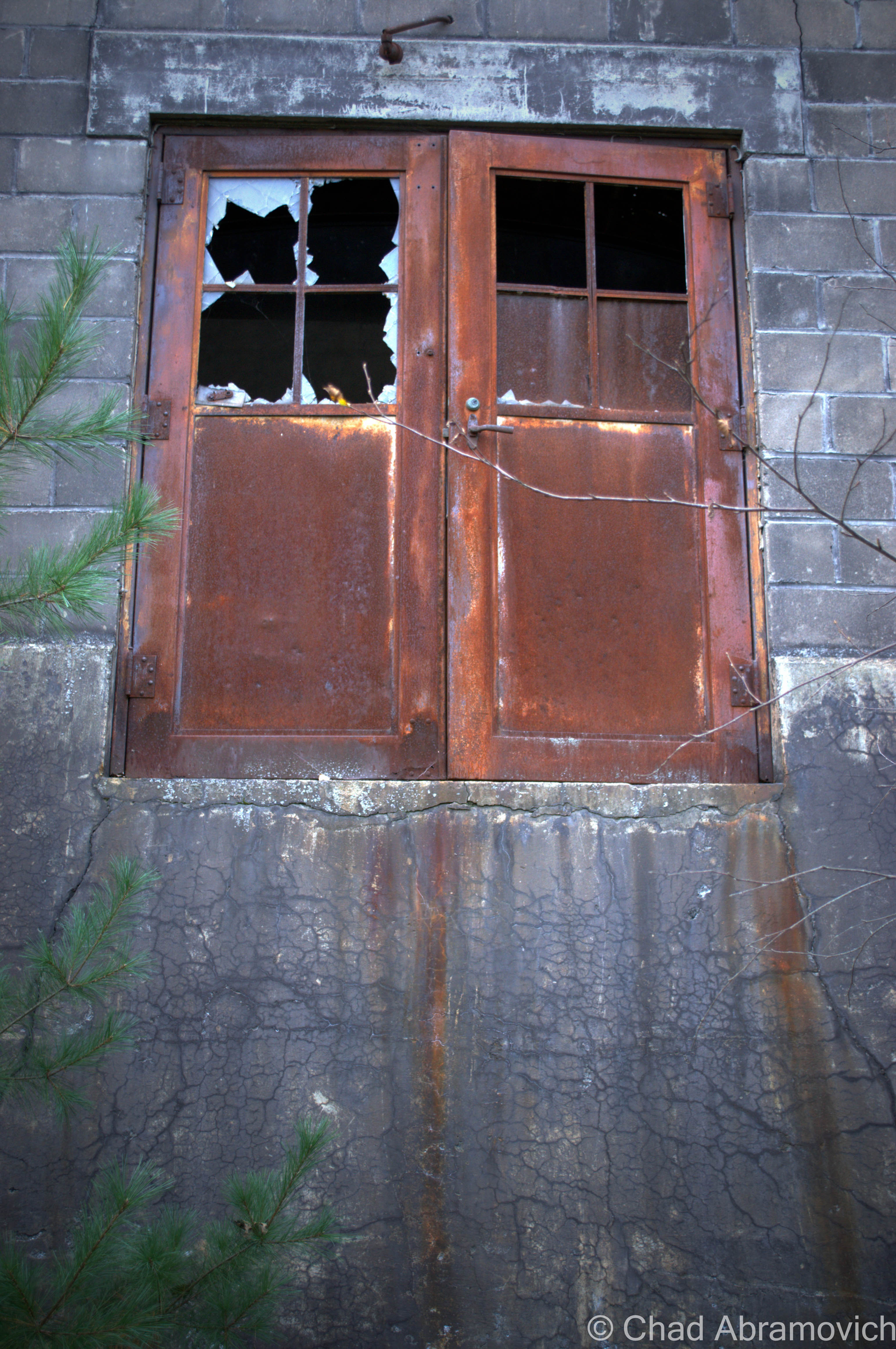
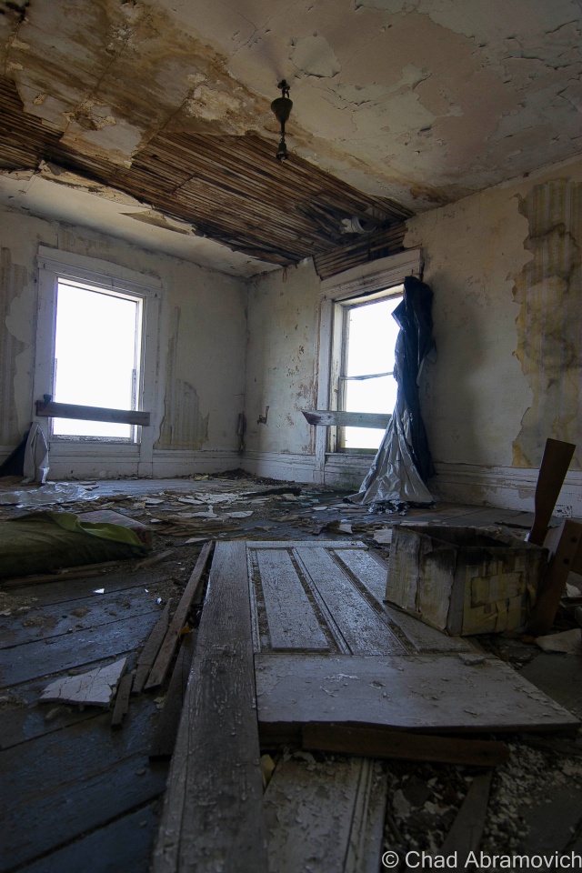
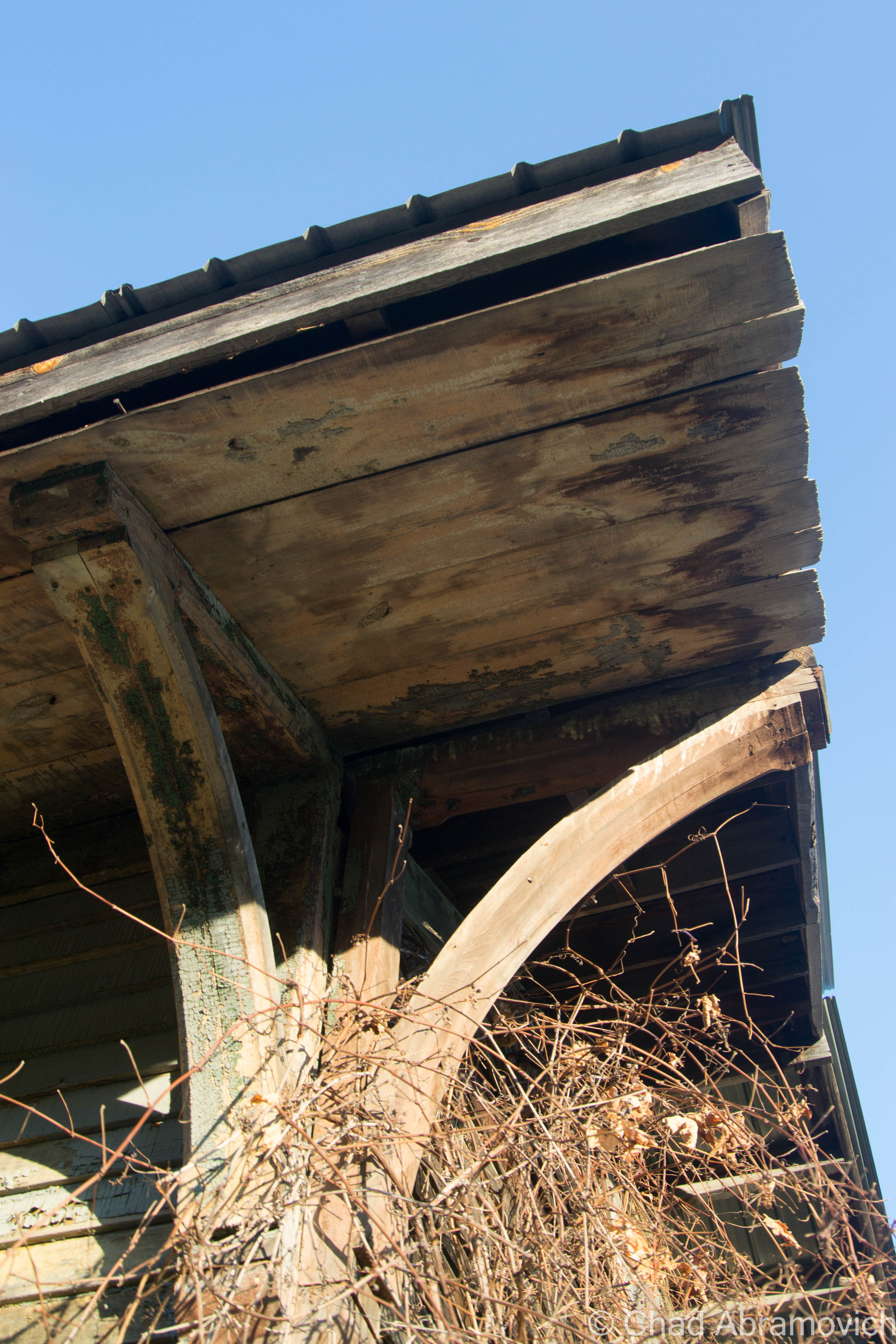
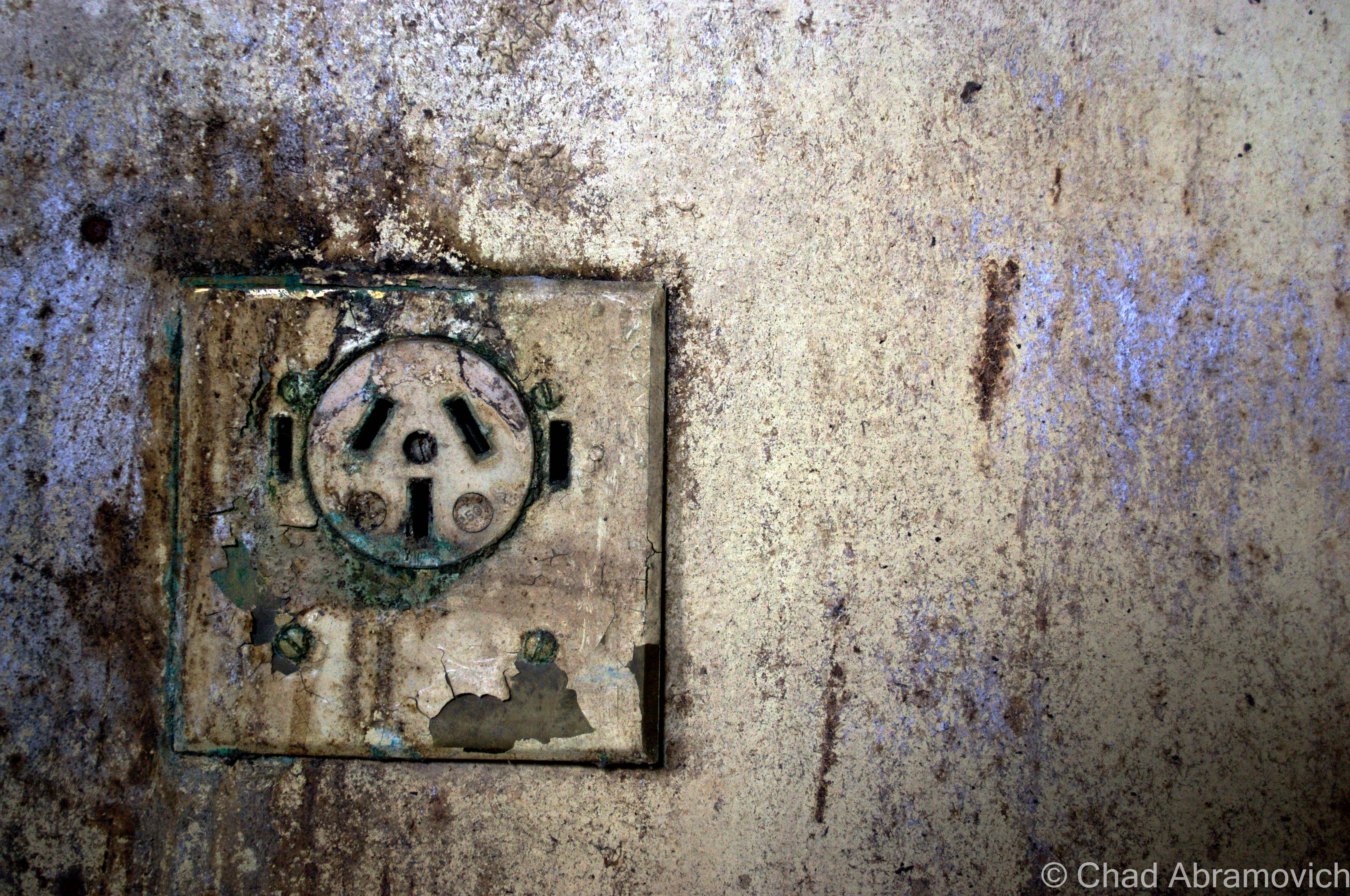
But by looking at the crumbling, and rusted ruins today, they keep their secrets far from your presence, besides the strikingly obvious – this place is dangerous. The tower had made its mark on this part of the property since it’s construction, its shadow forever burning its impression into the wet ground around it, but a few more winters may finally bring this decrepit place down into the muddy recesses of the foul mill wastelands below it.

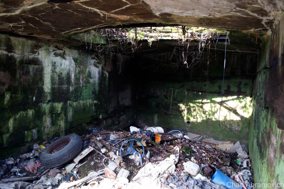
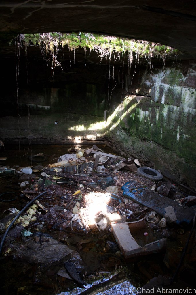
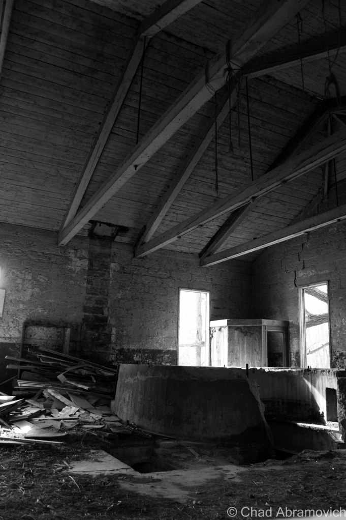
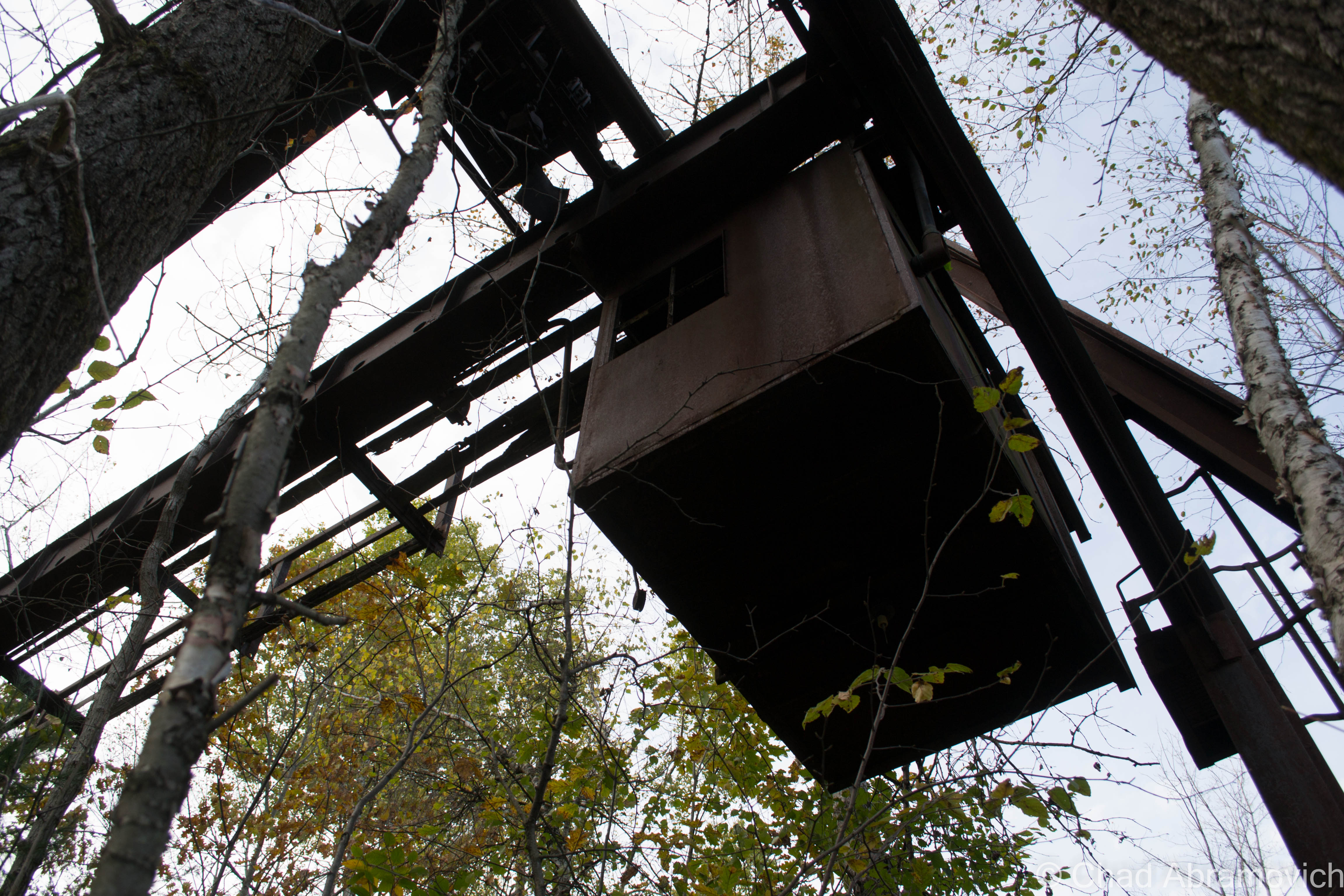
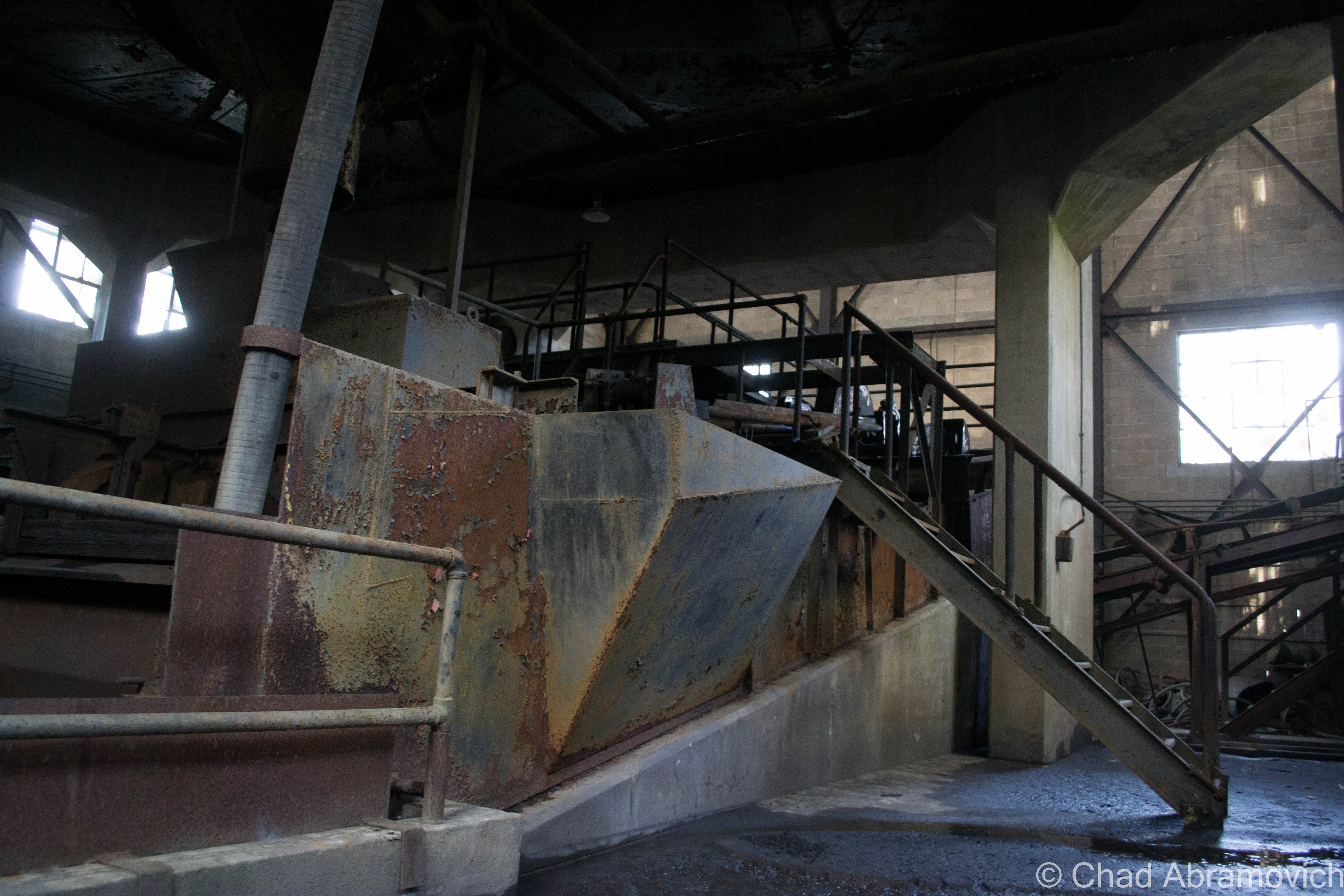
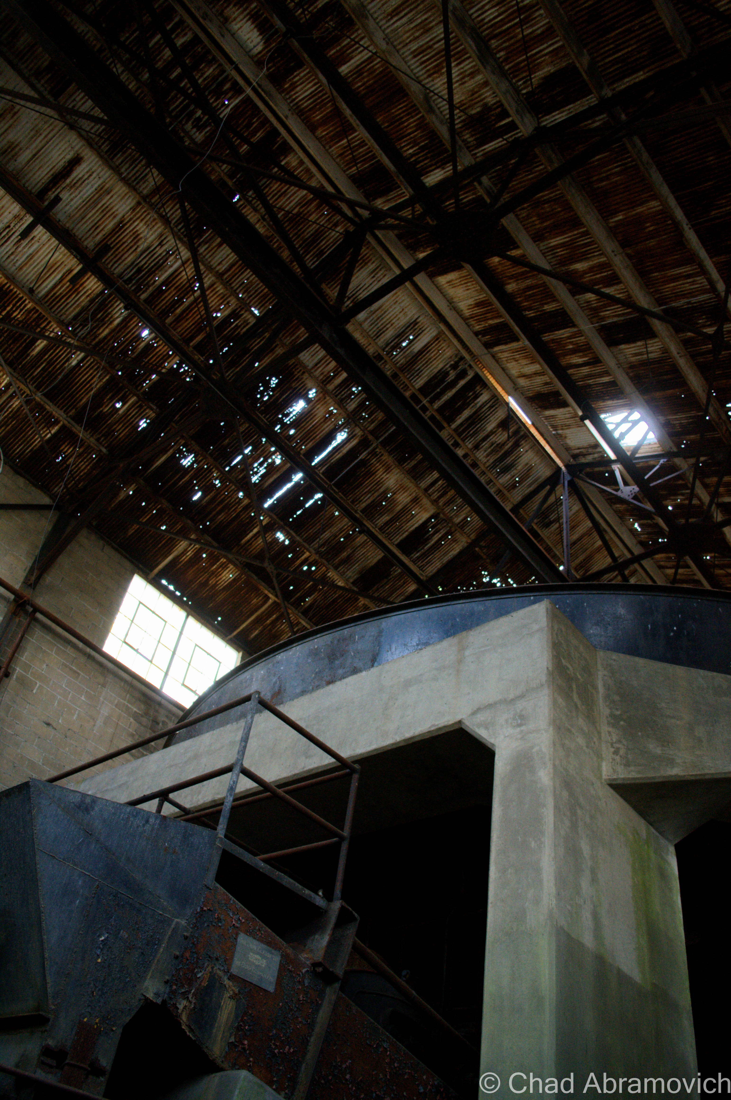
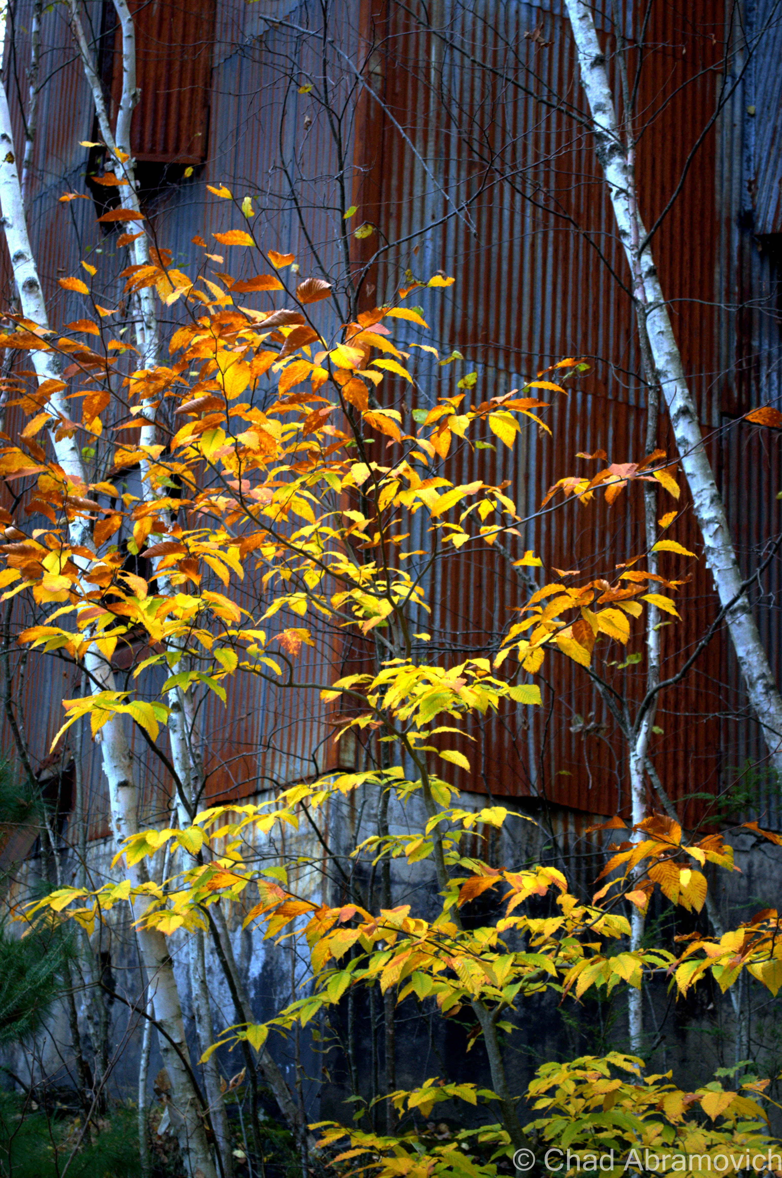
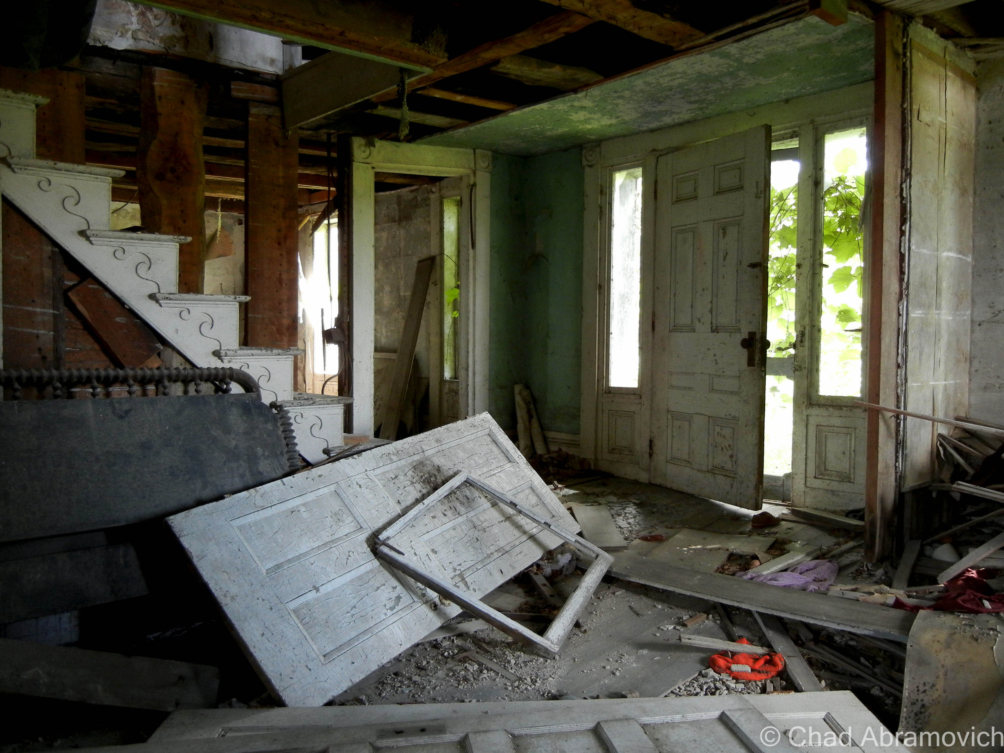
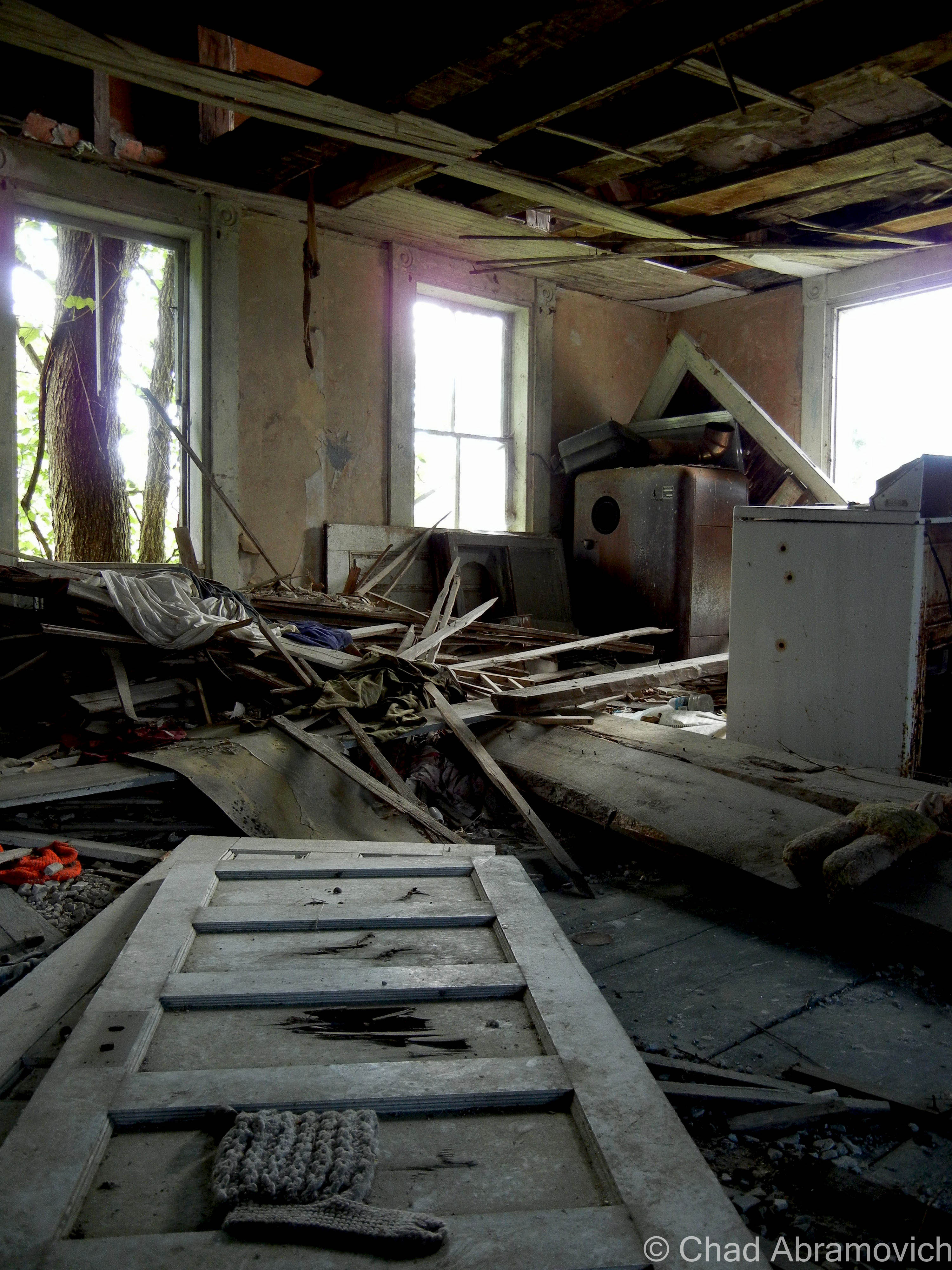
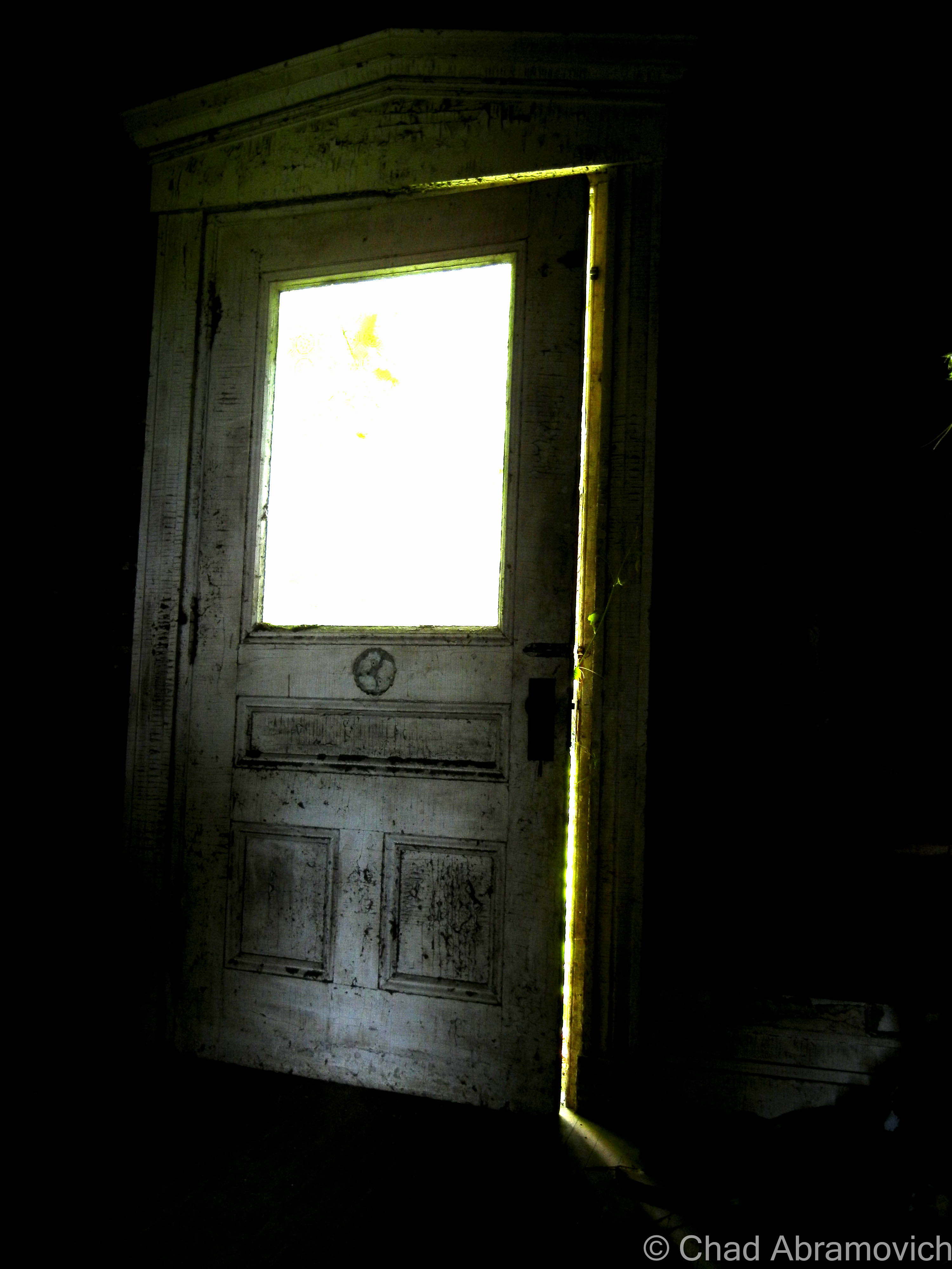
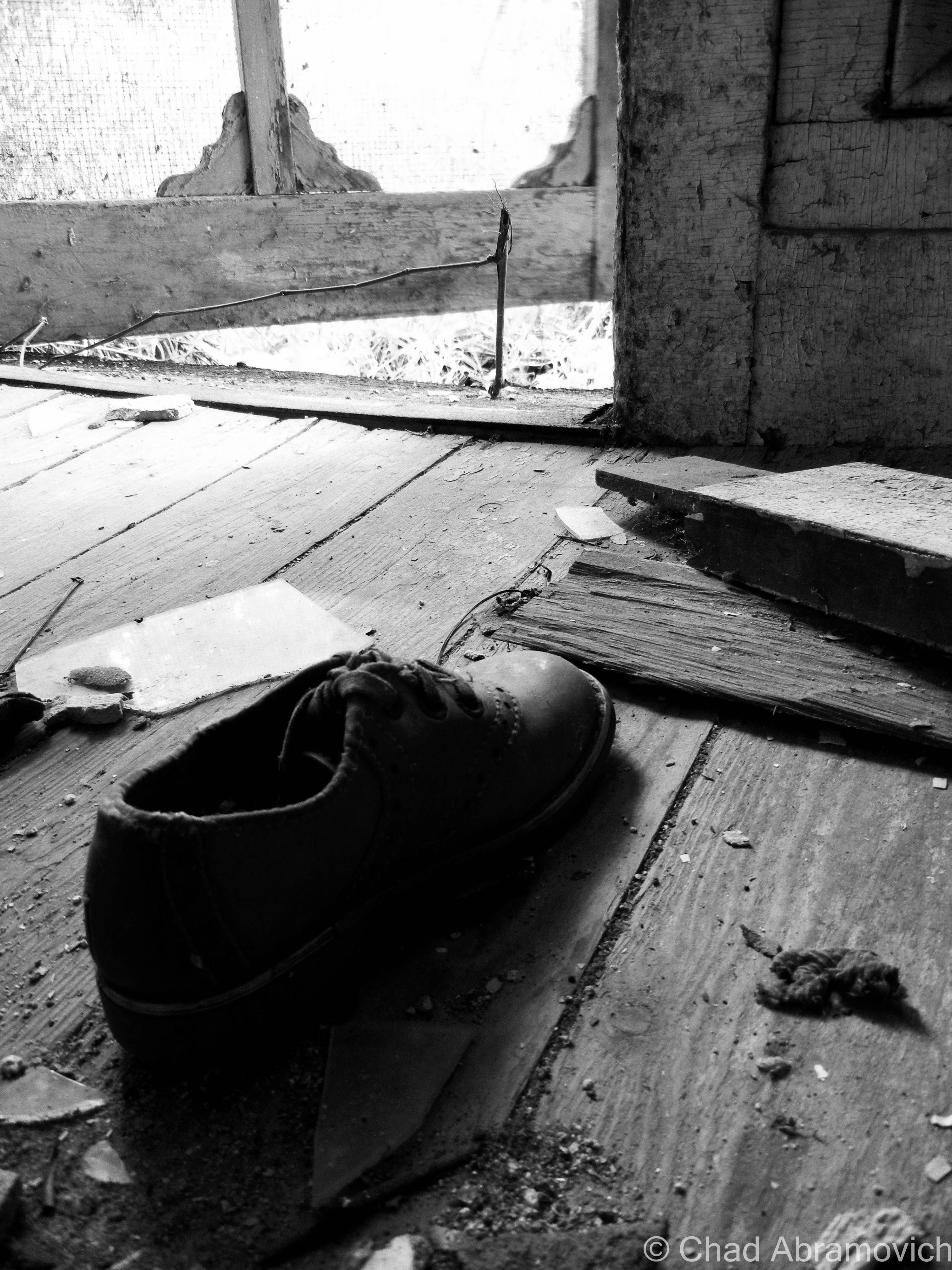
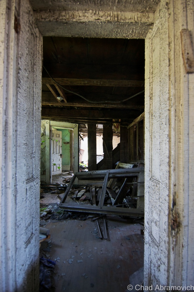
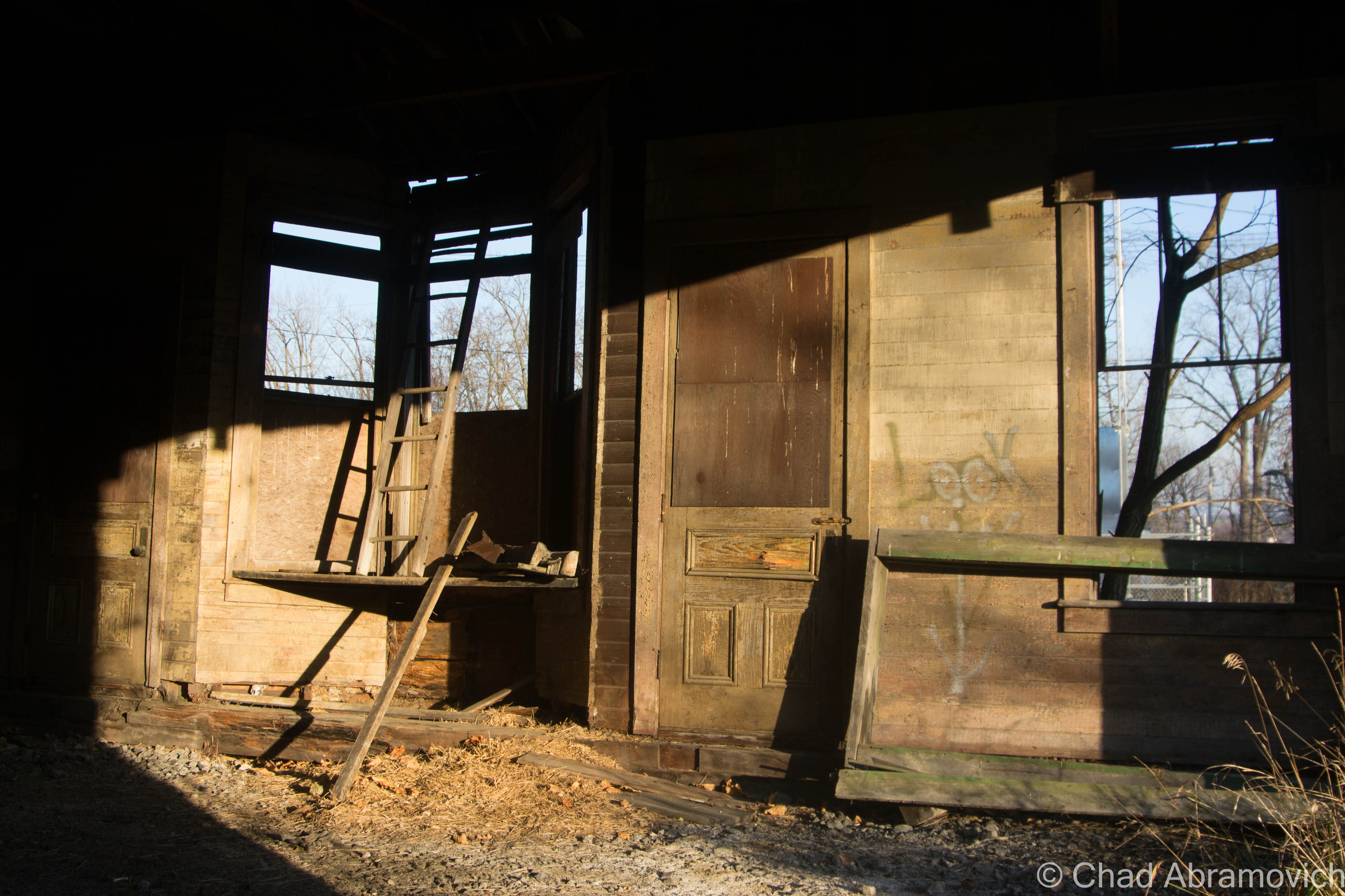
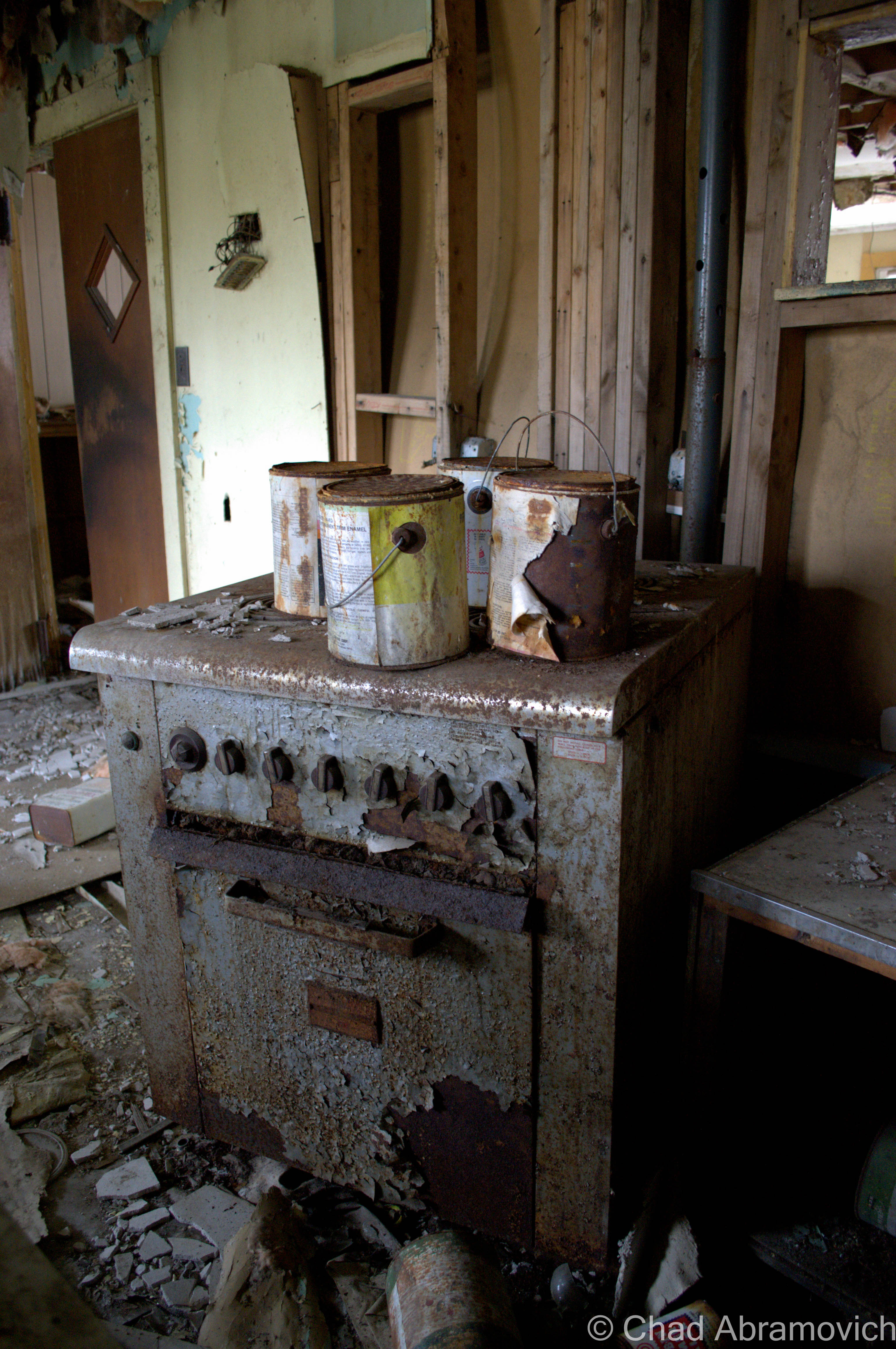
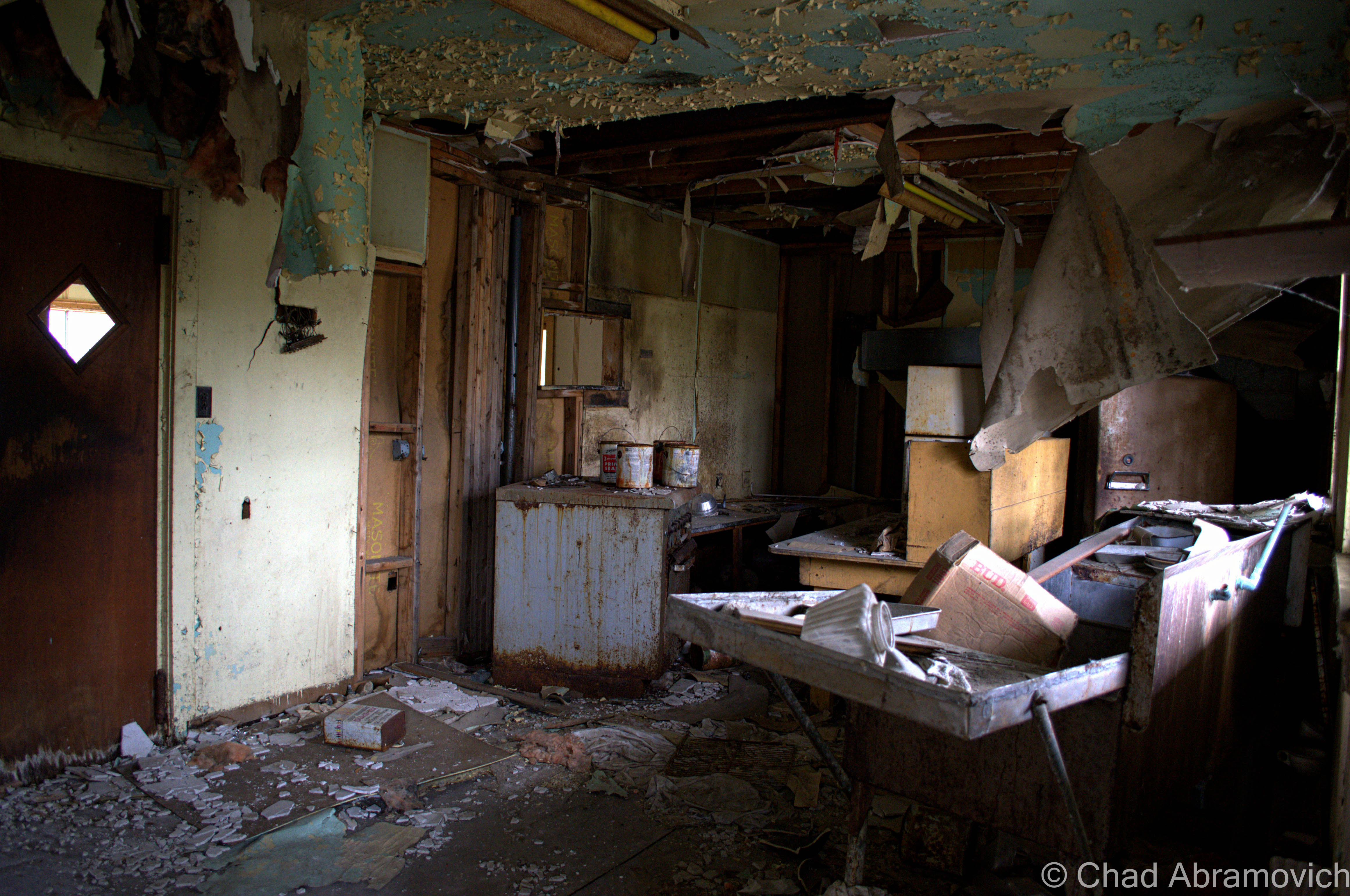
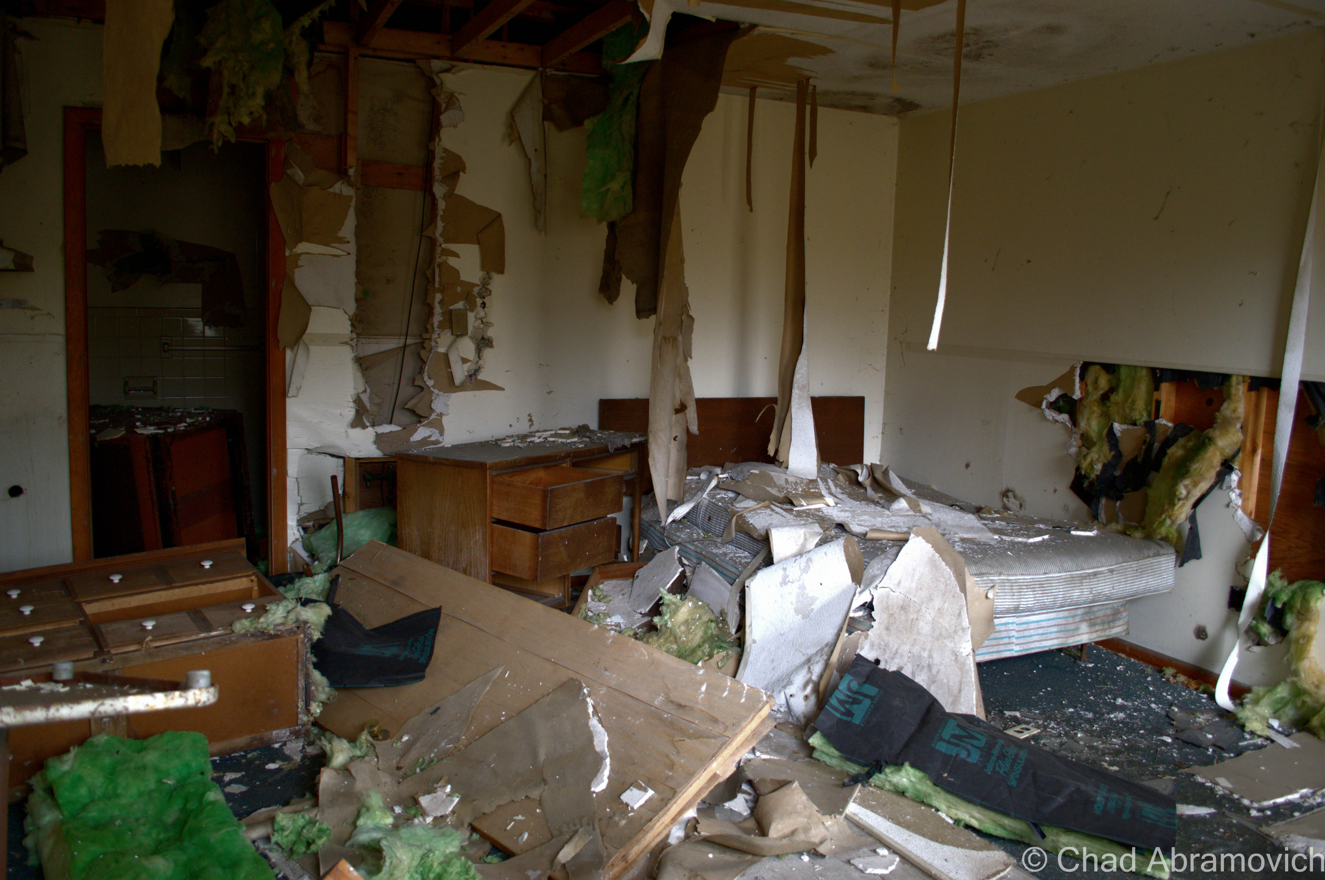
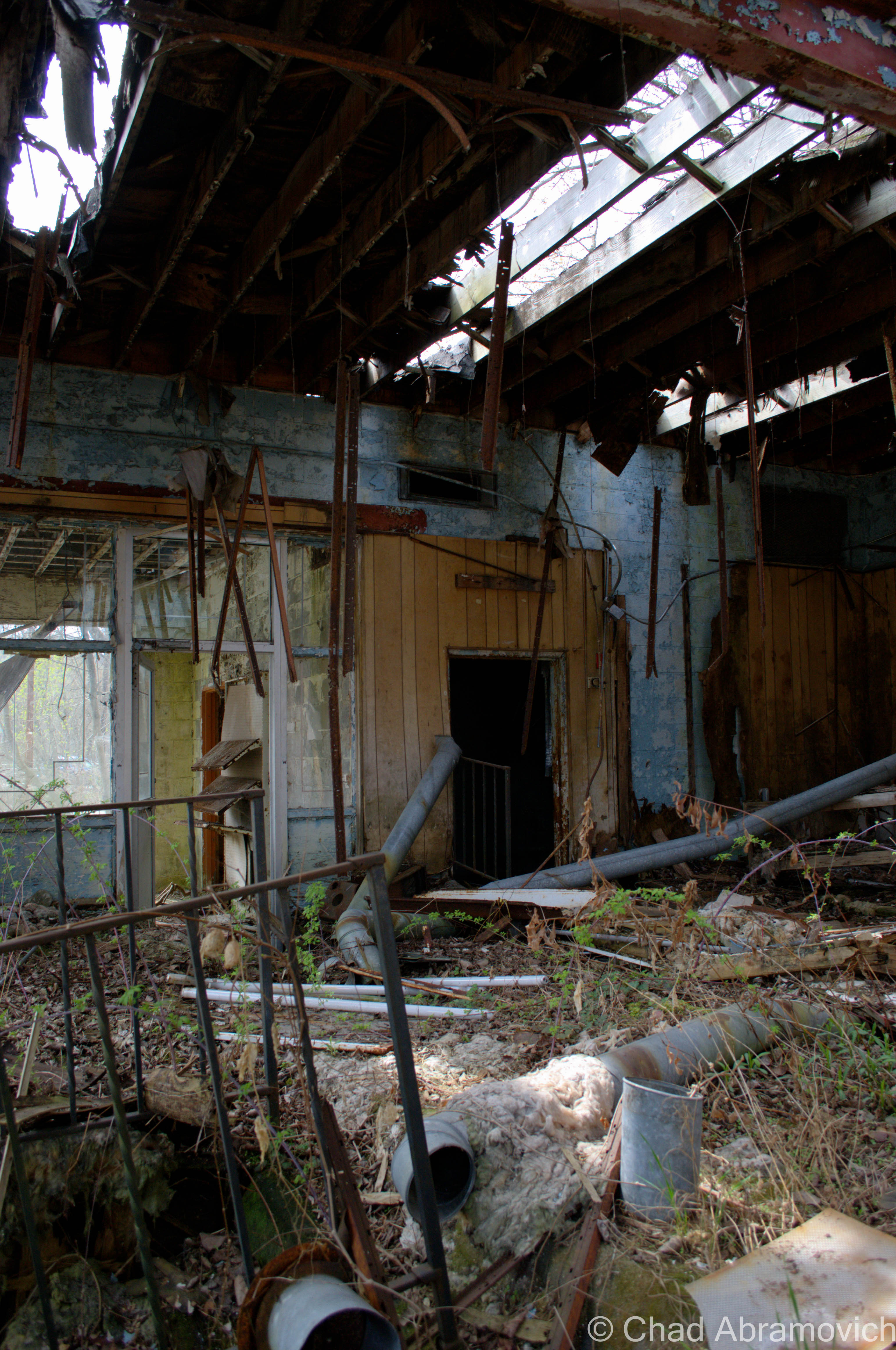
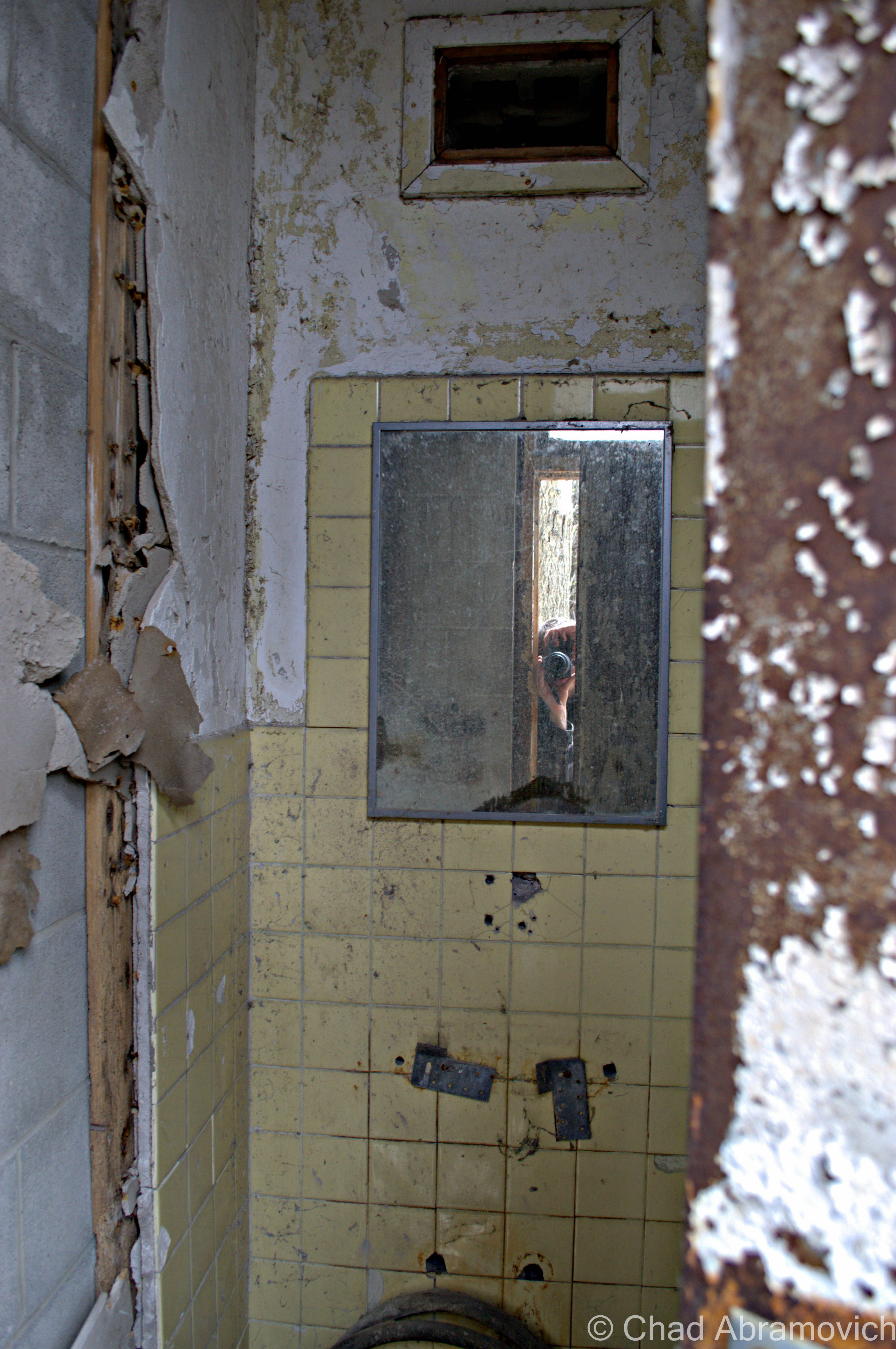
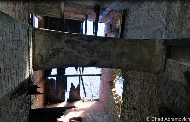
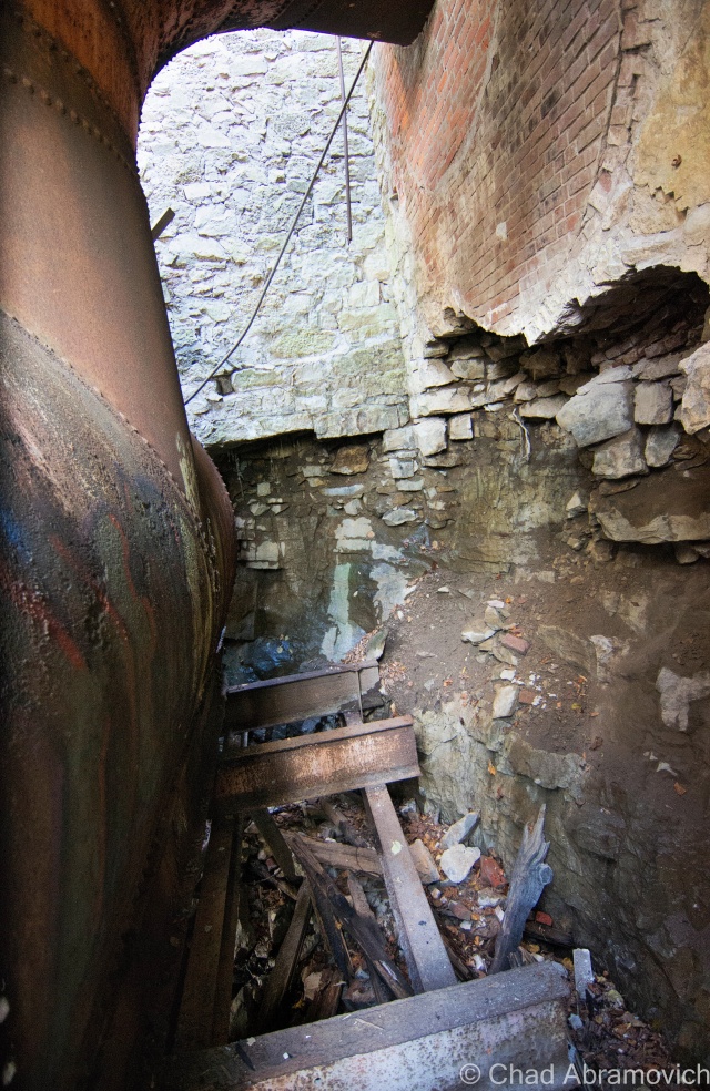
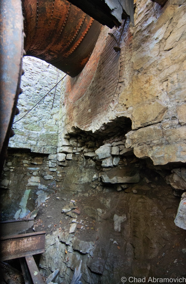
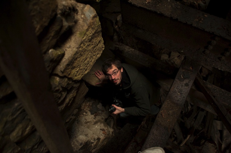
A surprisingly warm day for December 2nd in Vermont, I probably could have gotten away with just a flannel or a hoodie, but chose to bring a more protective layer just in case. And I’m glad I did. As we shambled over piles of soggy ground and driftwood to the arched entrance, the inside of the tower was noticeably colder – the air was dead inside. There would be no “safe” traveling, so much had fallen that we were constantly crawling over untold amounts of dirty bricks covered in slime and rust, underneath piles of the rotting wooden floors above that had long collapsed below.dsc_0209_pe

dsc_0779_pe dsc_0210_pe dsc_0214_pe dsc_0215_pedsc_0220_pe dsc_0218_pe dsc_0219_pe dsc_0243_pe

Now this is where things became interesting. We climbed further inside the tower, and saw just what we were up against. Behind the massive bulk of debris infront of us, were very narrow crawl passages that hugged the dripping and filthy walls around the tower. To get inside any further, it would require us to squeeze through them. But to get there, we’d have to scale a 6 foot drop to a level below us, onto a series of rusted steel I beams that were glistening with ice, rust and slime. One wrong move, and a sprained ankle would be the least of your problems, as your body would tumble down into a dark rocky cavern beneath in a world where no one would hear your cries for help. Did we want to take this risk? Yes. So one by one, the both of us hoisted ourselves down the 6 foot drop, using the cold and dirty brick foundations as support, the bricks crumbling to dust in our hands.
Now this is where things became interesting. We climbed further inside the tower, and saw just what we were up against. Behind the massive bulk of debris in front of us, were very narrow crawl passages that hugged the dripping and filthy walls around the tower. To get inside any further, it would require us to squeeze through them. But to get there, we’d have to scale a 6 foot drop to a level below us, onto a series of rusted steel beams that were glistening with ice, rust and slime. One wrong move, and a sprained ankle would be the least of your problems, as your body would tumble down into a dark rocky cavern beneath in a world where no one would hear your cries for help. Did we want to take this risk? Yes. So one by one, the both of us hoisted ourselves down the 6-foot drop, using the cold and dirty brick foundations as support, the bricks crumbling to dust in our hands.

dsc_0224_pe dsc_0228_pe dsc_0231_pe dsc_0241_pe dsc_0242_pedsc_0267_pedsc_0246_pedsc_0249_pedsc_0250_pedsc_0252_pedsc_0264_pedsc_0266_pe

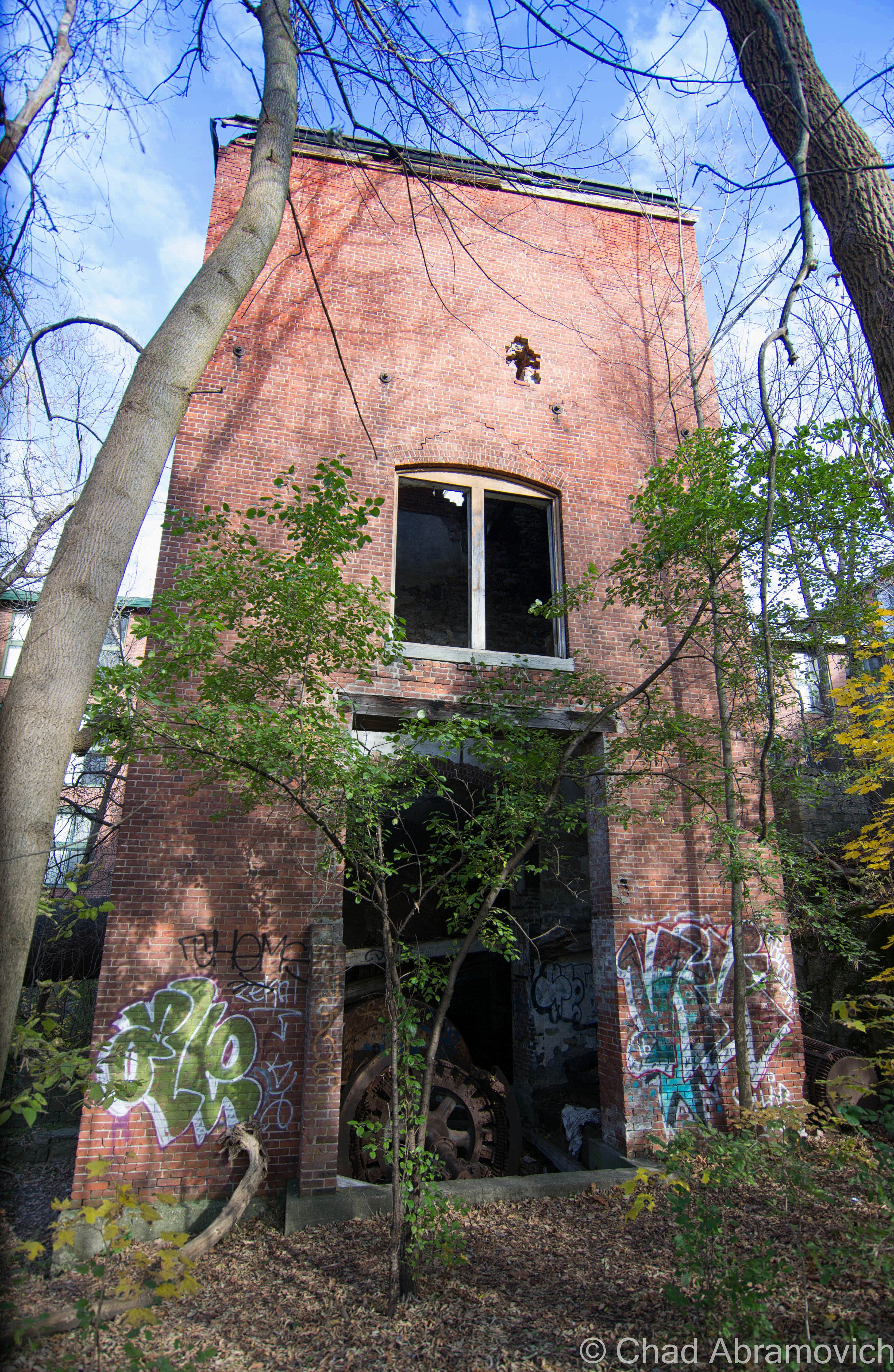
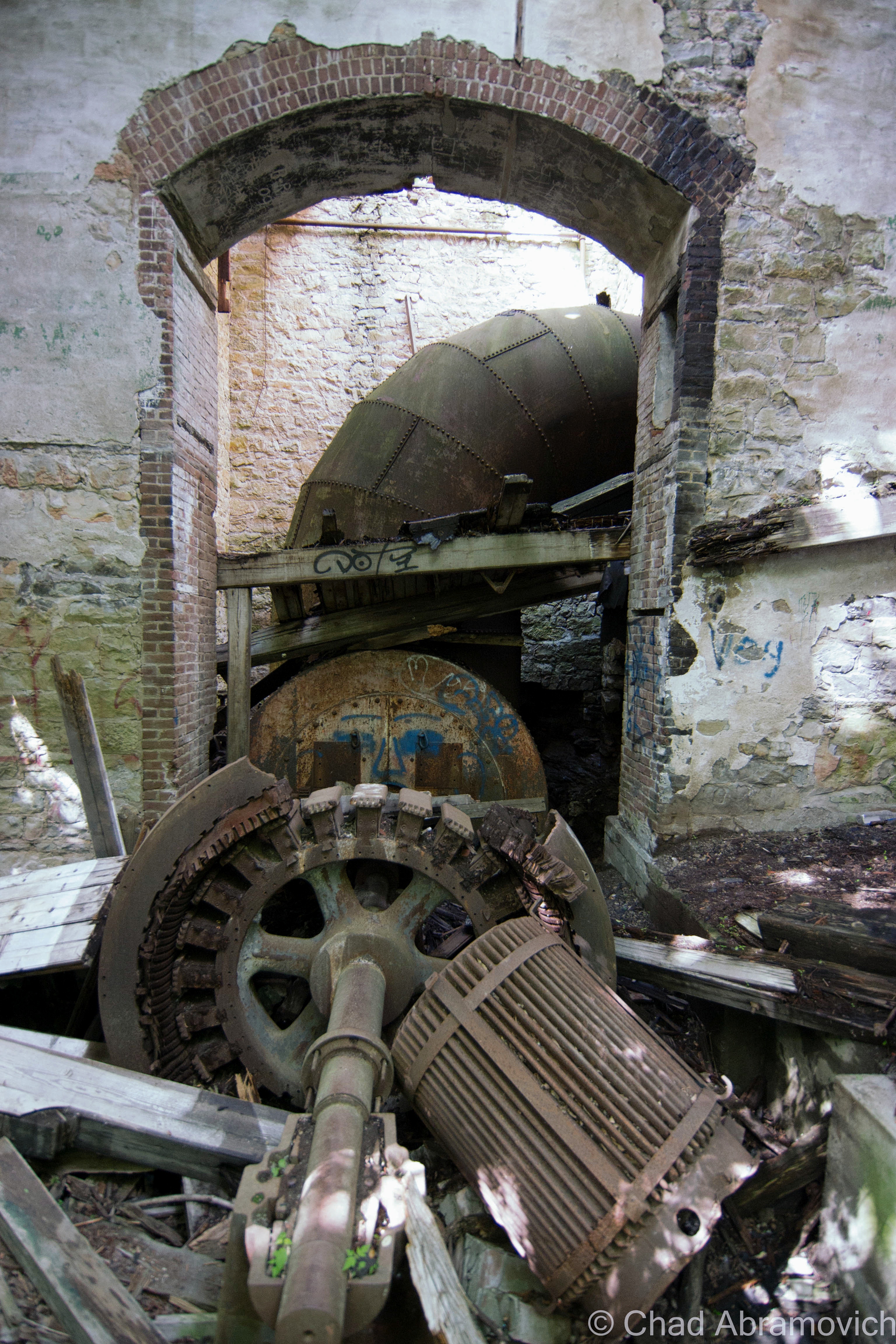
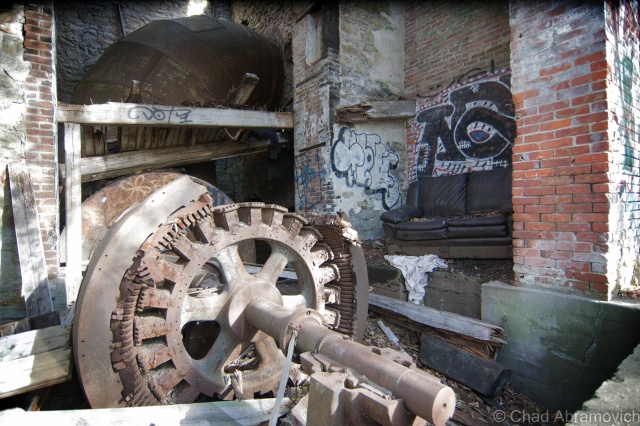
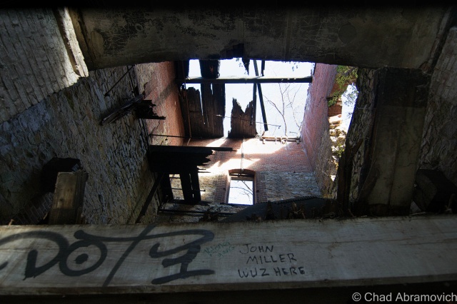
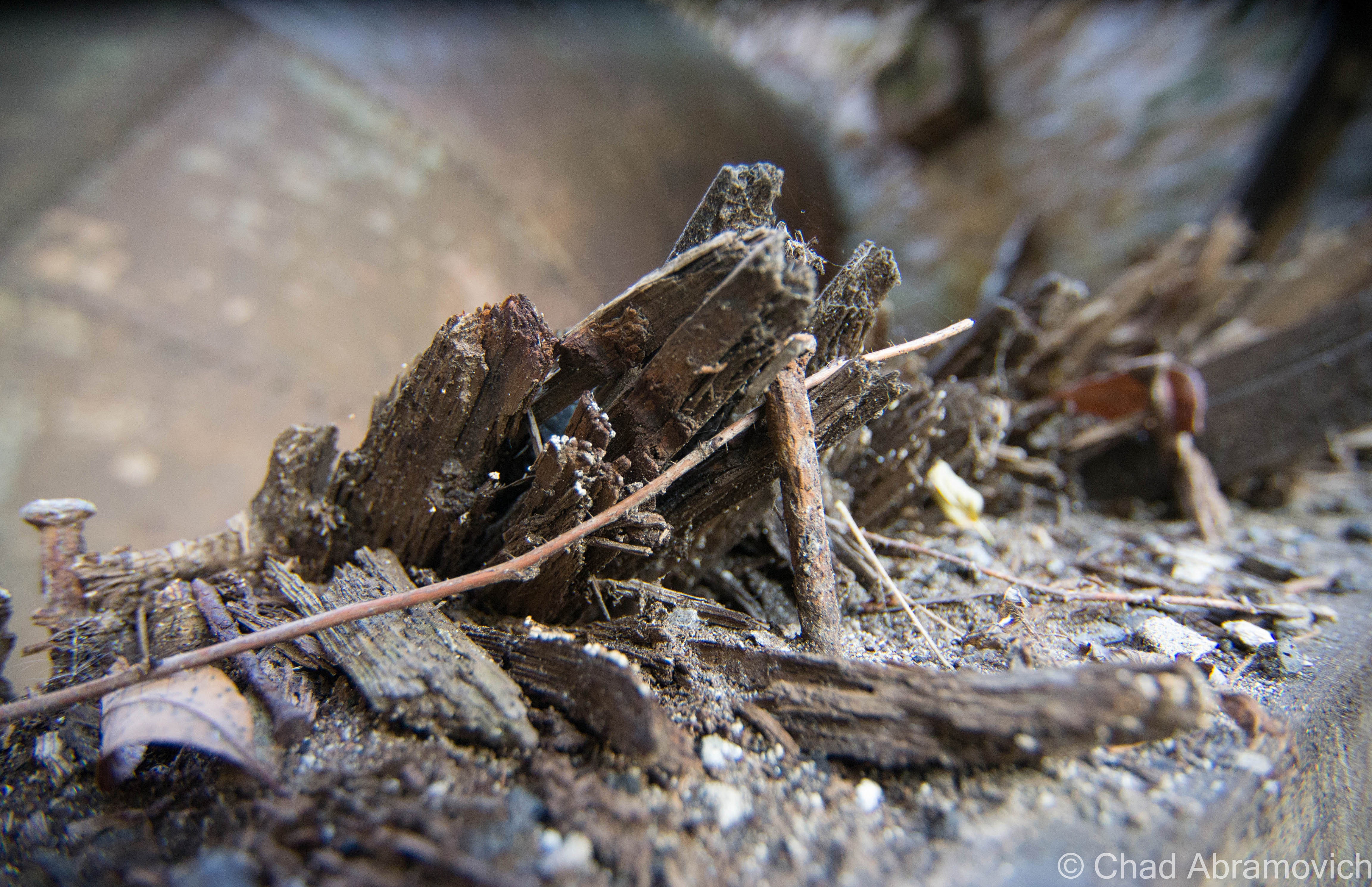
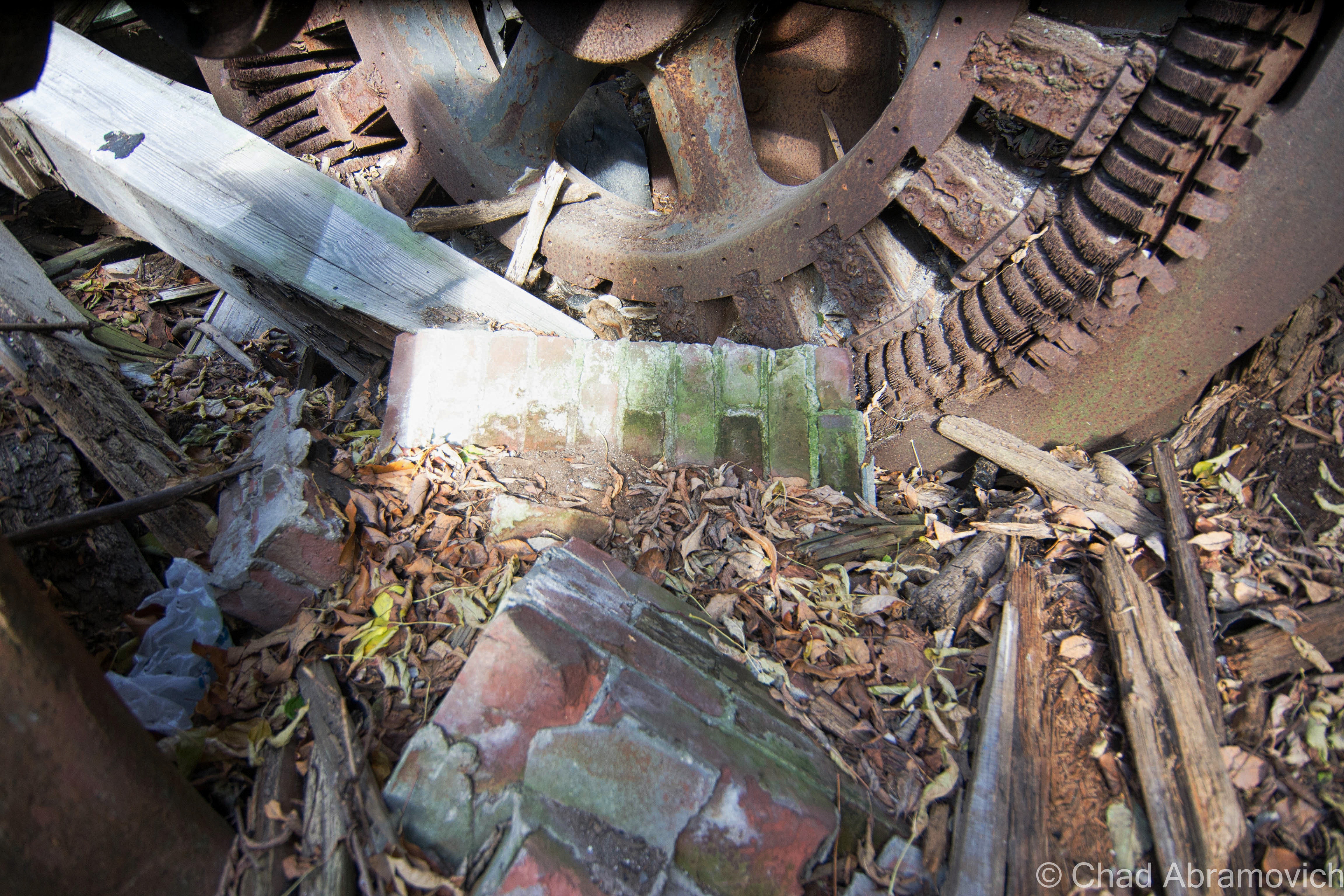
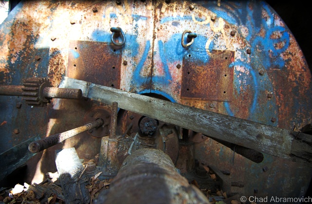
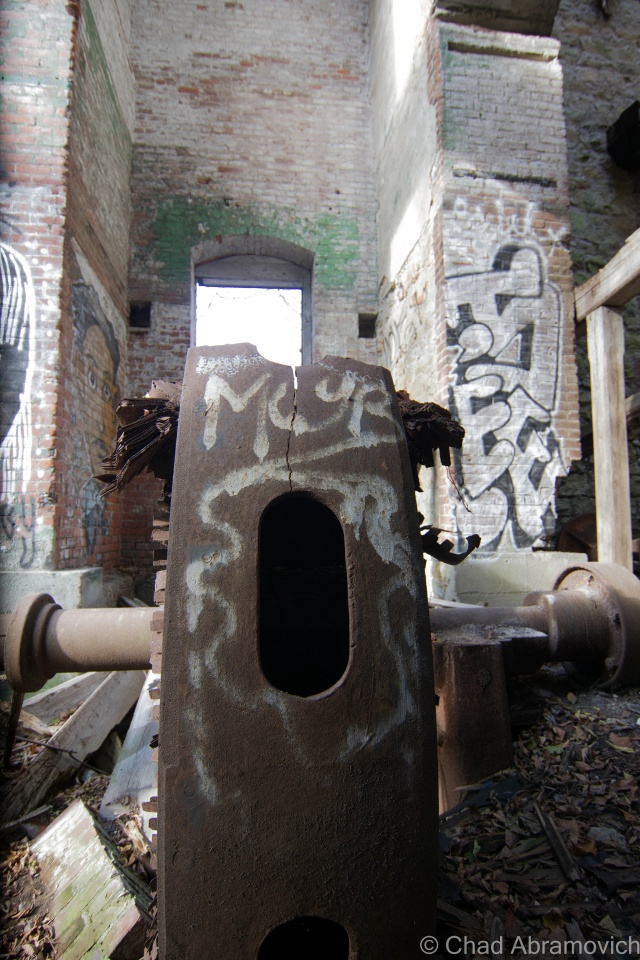
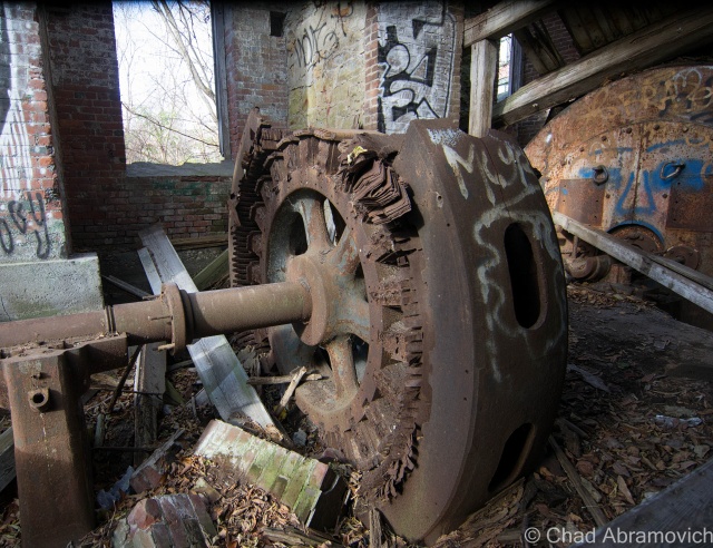
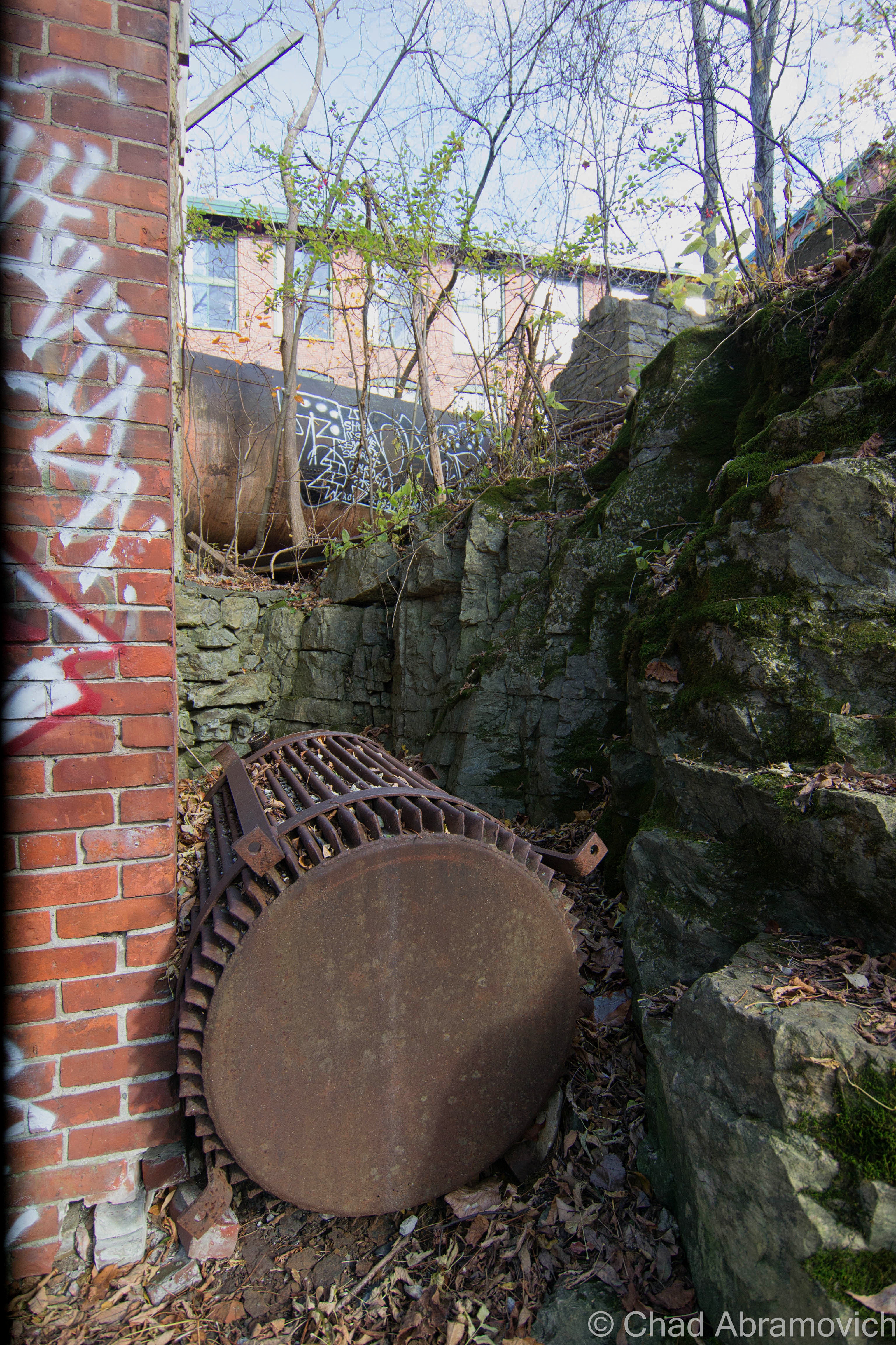
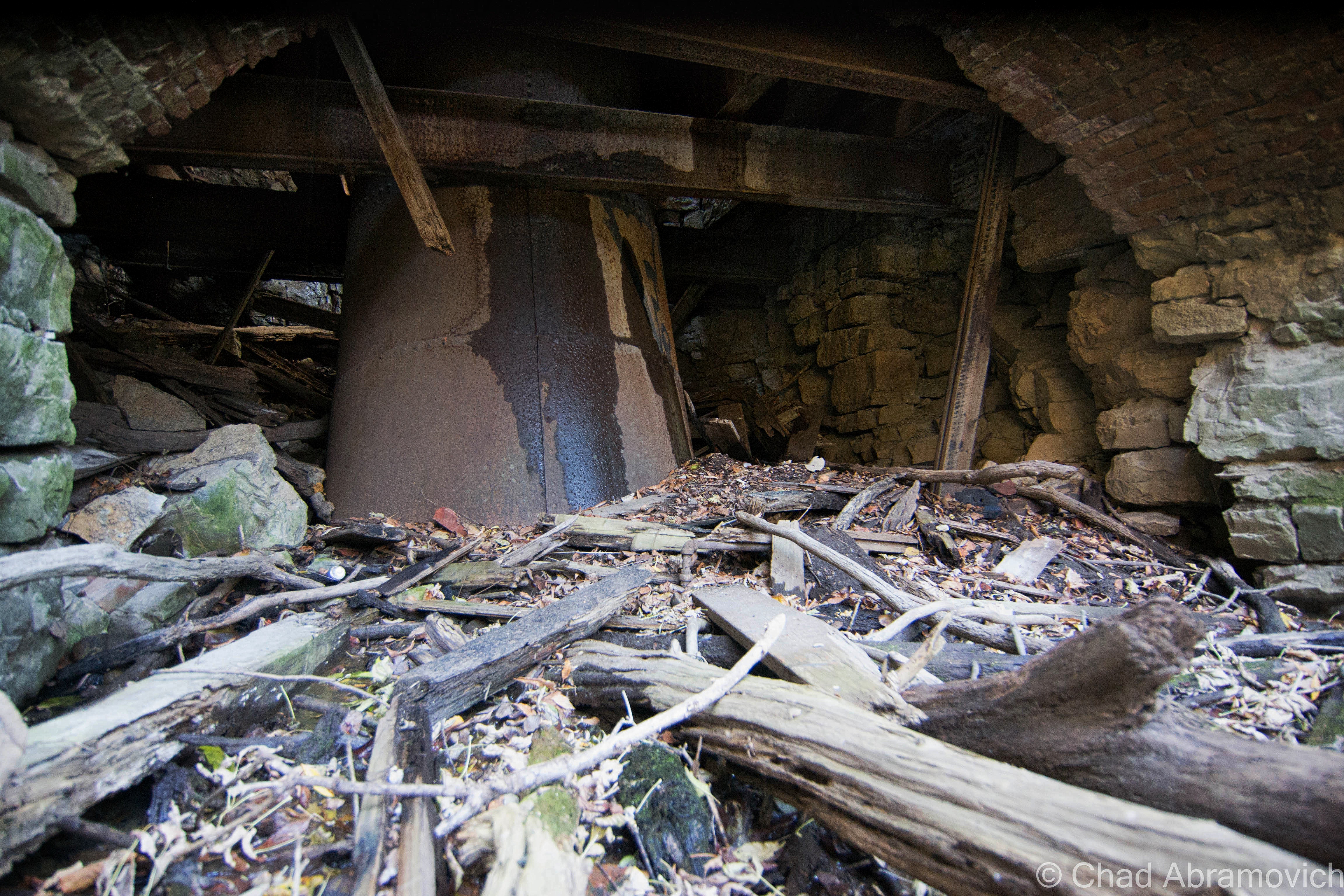
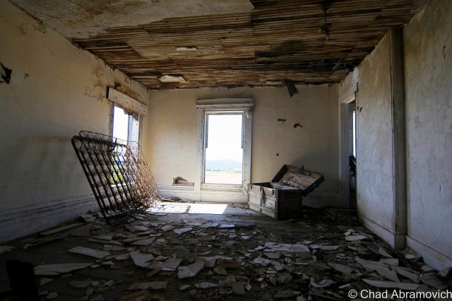
At this point, our excitement had gotten the better of us, gawking at the incredible textures to photograph, the industrial gears frozen in rust and time as the shadows became wild. The inevitable and comic question of what the cold slimy substance our hands were touching was mentioned a few times, as well as how surprised we were that we hadn’t ran into any animals yet – these dark and cavernous ruins would make the perfect home for a mischievous creature.

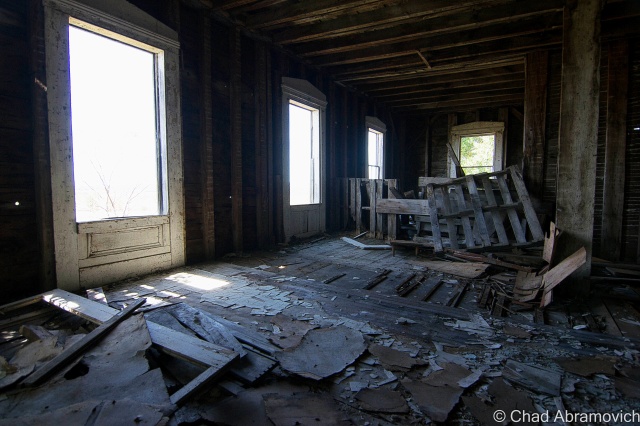
Turning to the realization that we had spent an hour or longer (most definitely longer) inside a dank crumbling tower, and we were beginning to feel the effects. My hands were numb, and we were more than filthy. “I think it’s time we head out” I said. But it was then I realized exactly how much work we went through to get to our current position, and all that clambering and wedging through those tight damp spaces back to the entrance just didn’t excite me. “Think we can fit down there, and climb out that way?” I asked, pointing to the dark area below the steel beams that suspended us above the pit. Below us, was a crumbling shadowy world of filth and fallen bricks, with a tunnel type entrance out to the former mill pond. Going out that way would save us a lot of time, if we could make it. “We’re not 16 anymore” I jokingly called up to my friend – I am not nearly as limber as I was. Down there, it was so cold, icicles were forming on the pipes. “I’ll give you $5 if you eat one of those” my friend called above me. I declined the offer to fatten my wallet and made my way out. He soon followed.

DSC_0372

me
Self Portrait. Here, you can get a good idea of perspective, from where I climbed down and where my friend was standing.

It’s incredible to think about the ingenuity and complex systems behind how these mills harnessed the natural water power of the falls. Today all that remains of Winooski’s industrial legacy are the buildings, a few relics in a museum, and little else. The Winooski skyline as viewed from Burlington is a great picture and one of contrasts, the Champlain Mill and the new downtown symbolically rising next to it.

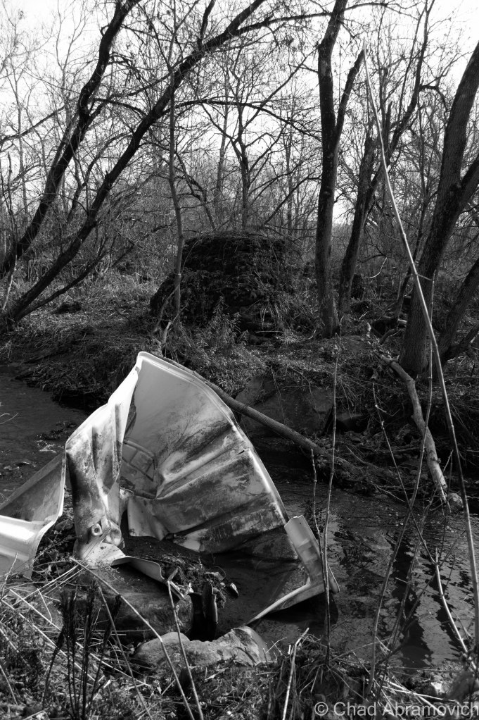
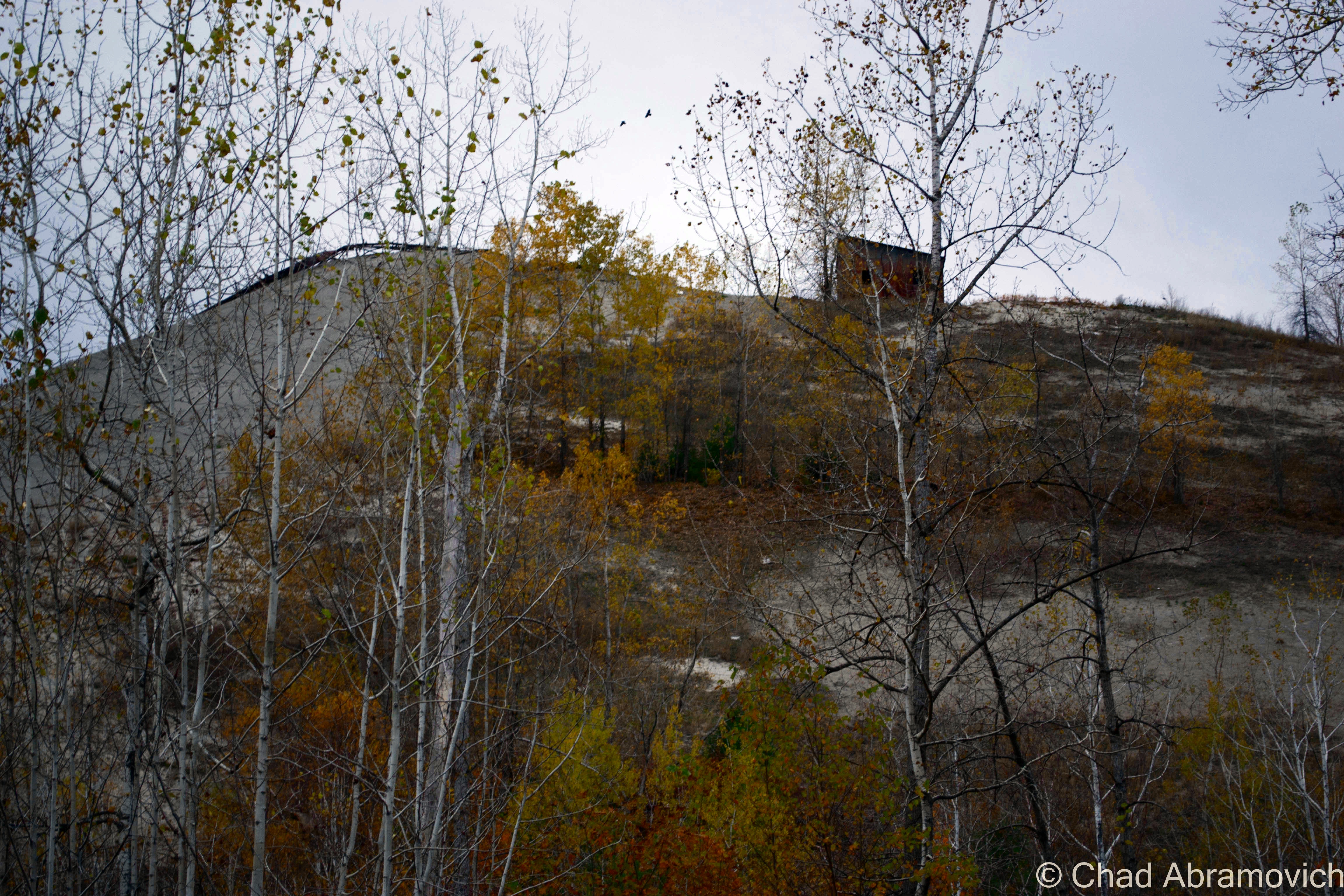
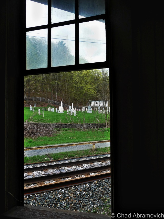
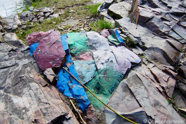
Nearby, on the rocky ledges of the Winooski River Gorge, there were a few more sites of interest, so before we wrapped up our adventure, we took a short ride from Downtown Winooski to Colchester.

The Walls

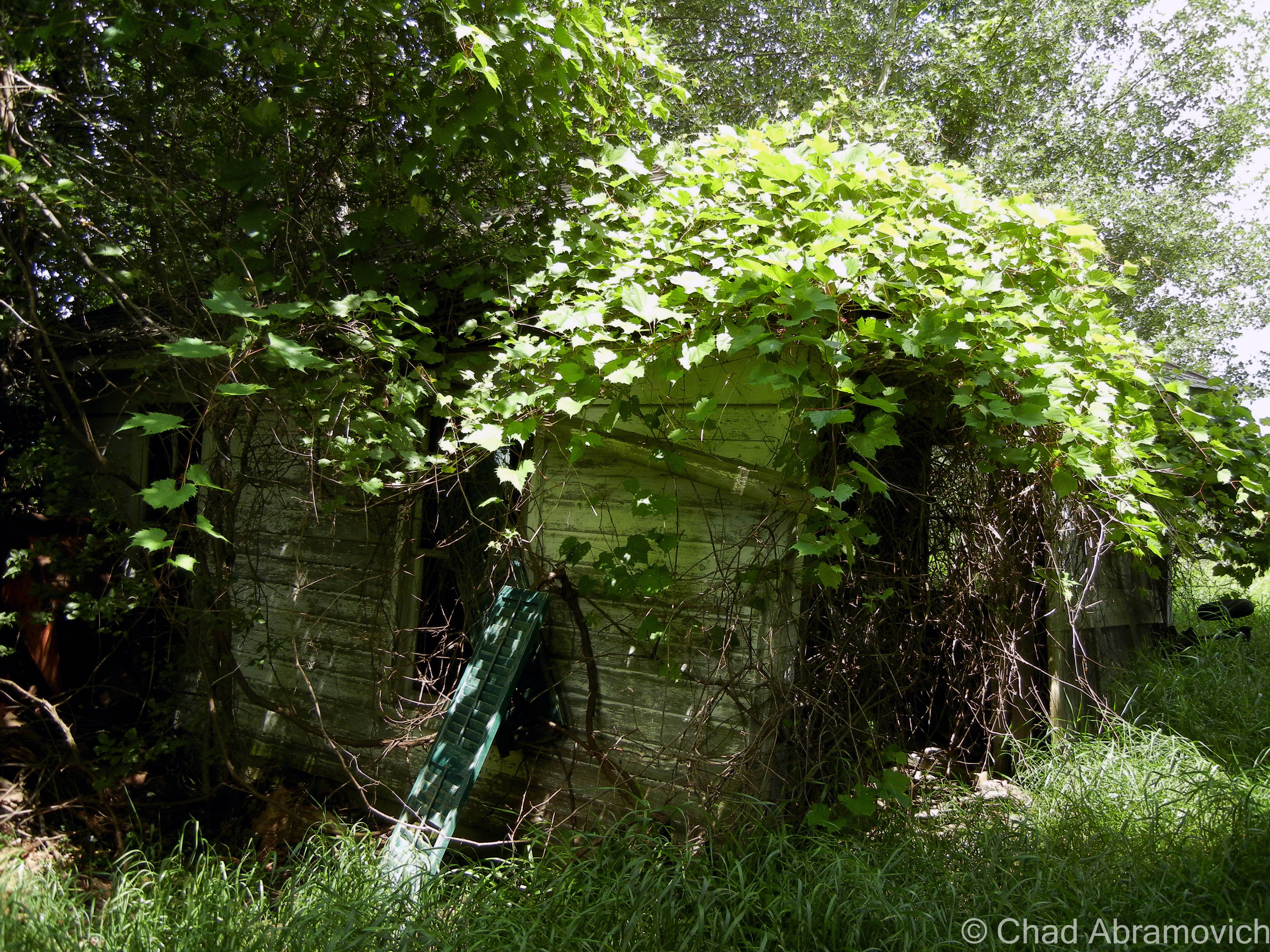
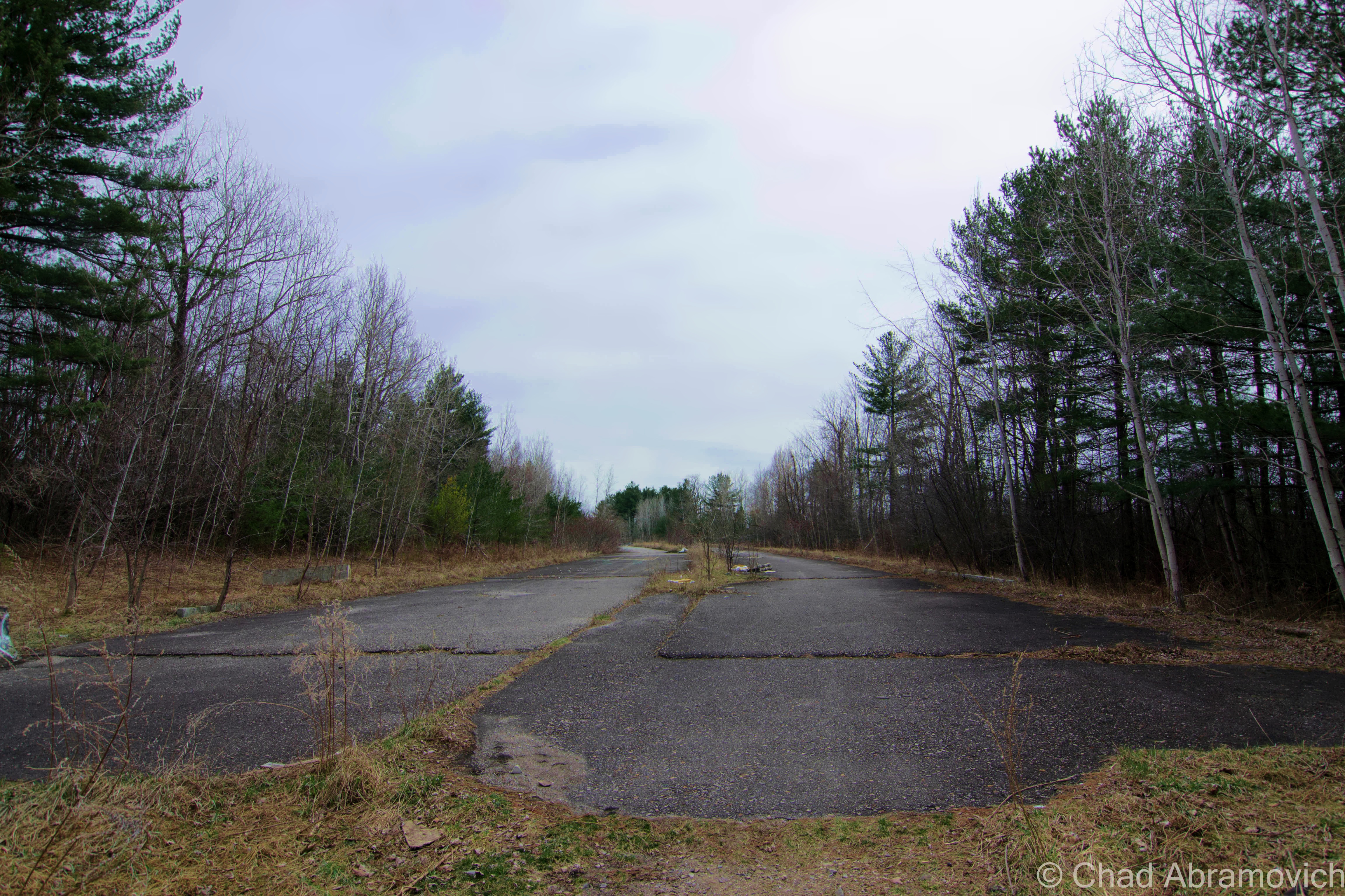
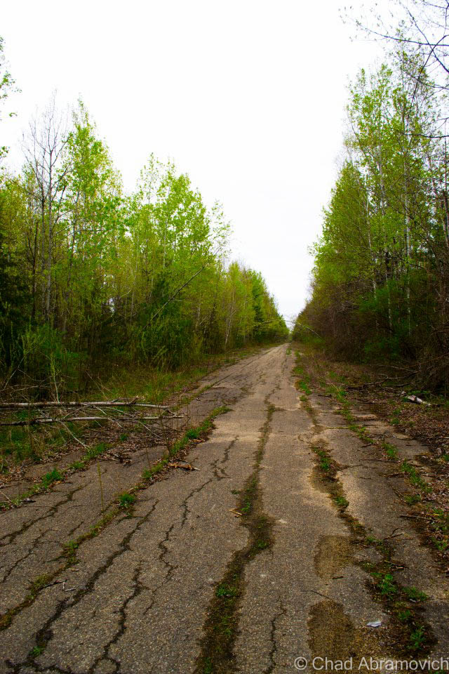
Years ago, you had to stumble your way along a riverbank of roots, swamps and thick northern jungle to reach this cool urban locality. Nowadays, there’s a path and a designated natural area that brings you here, which in a way is sort of a bummer.

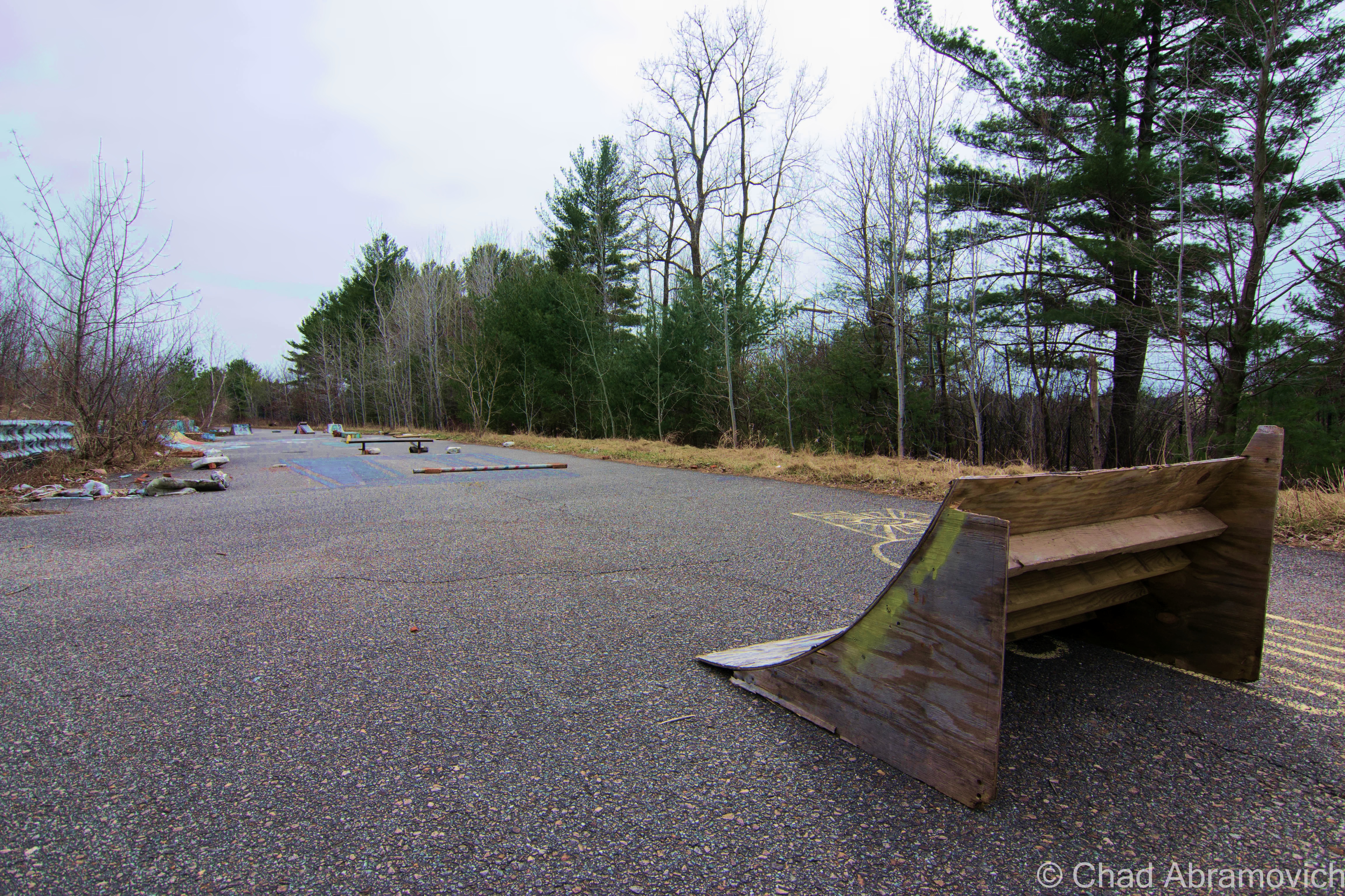
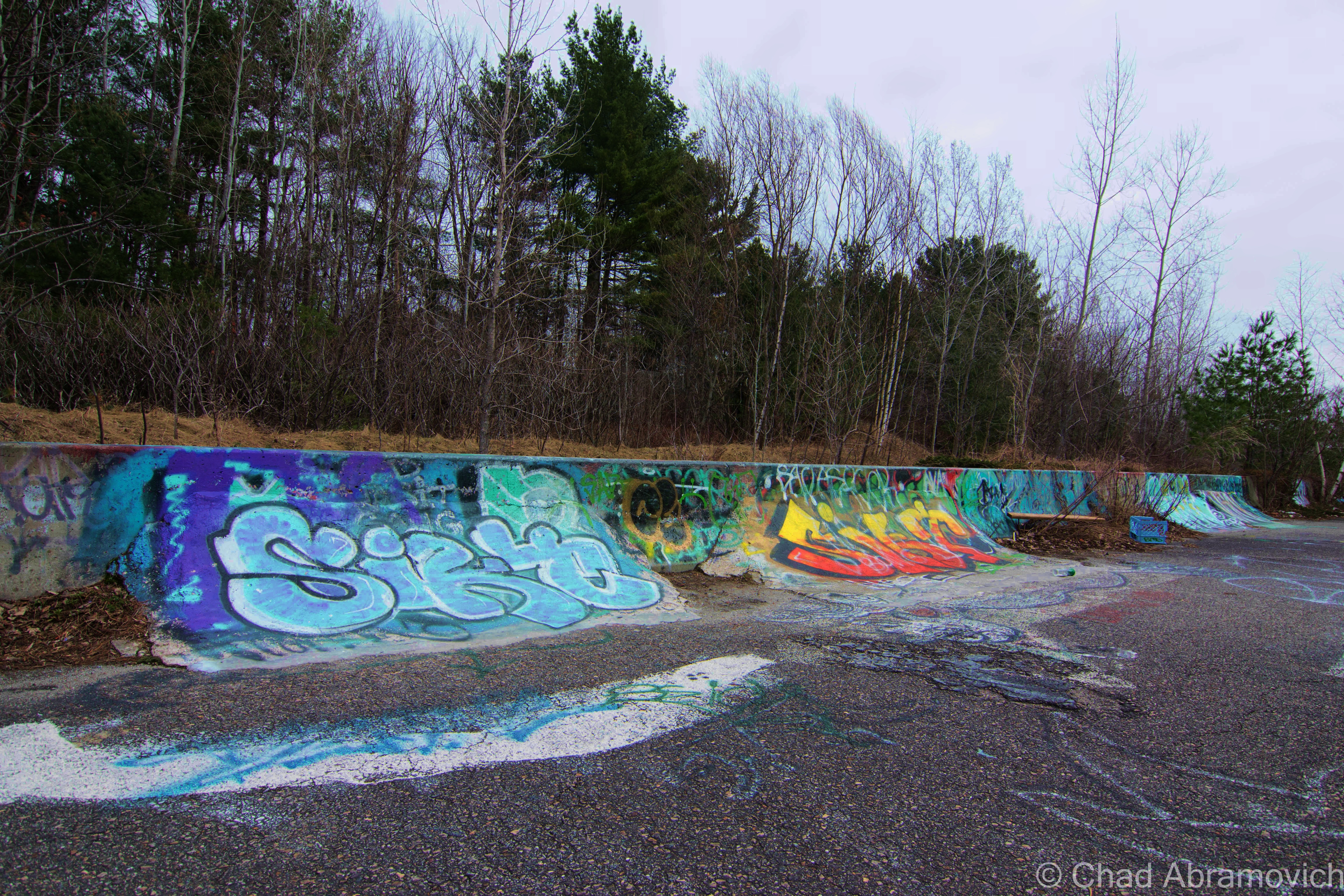
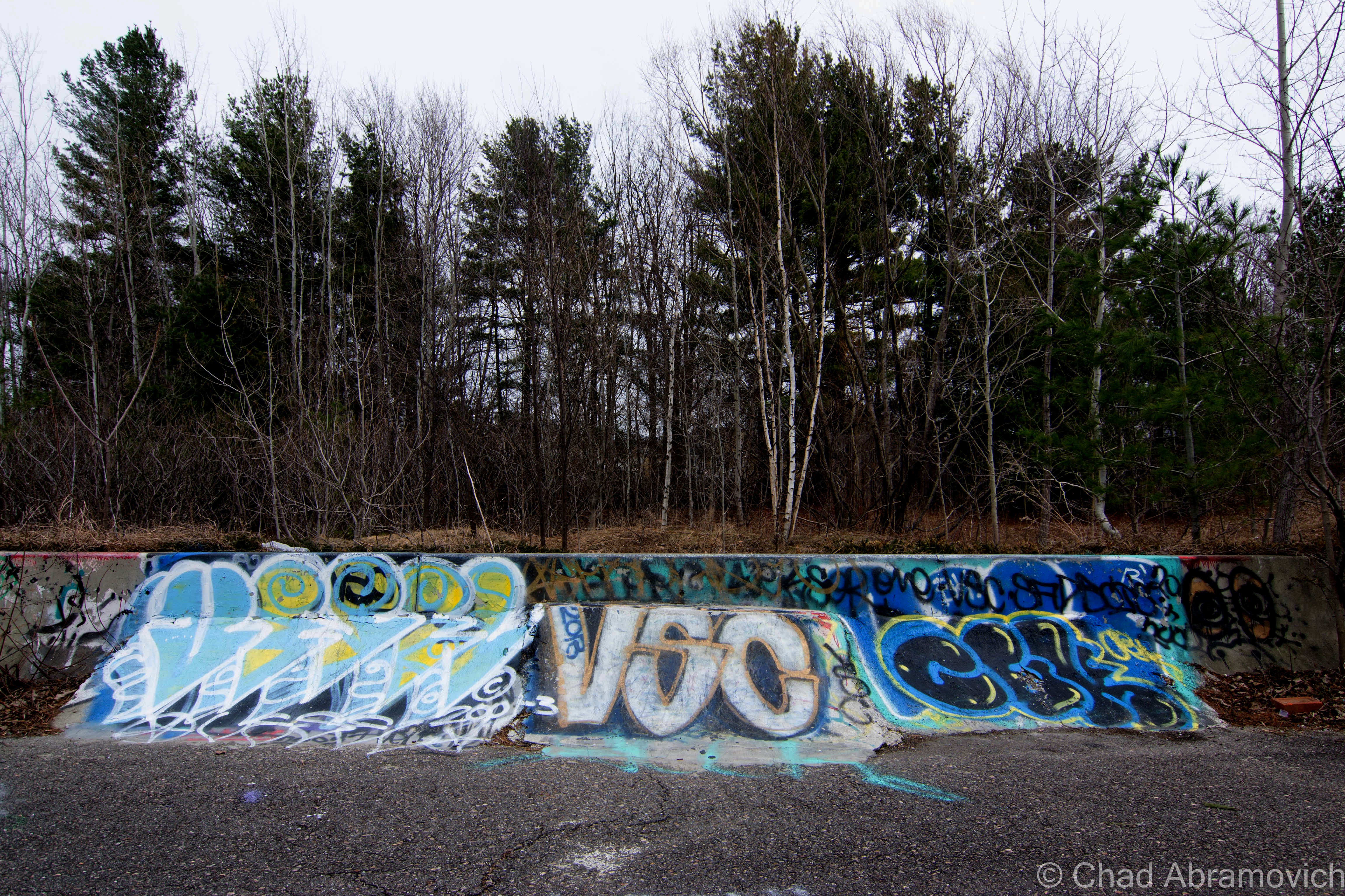
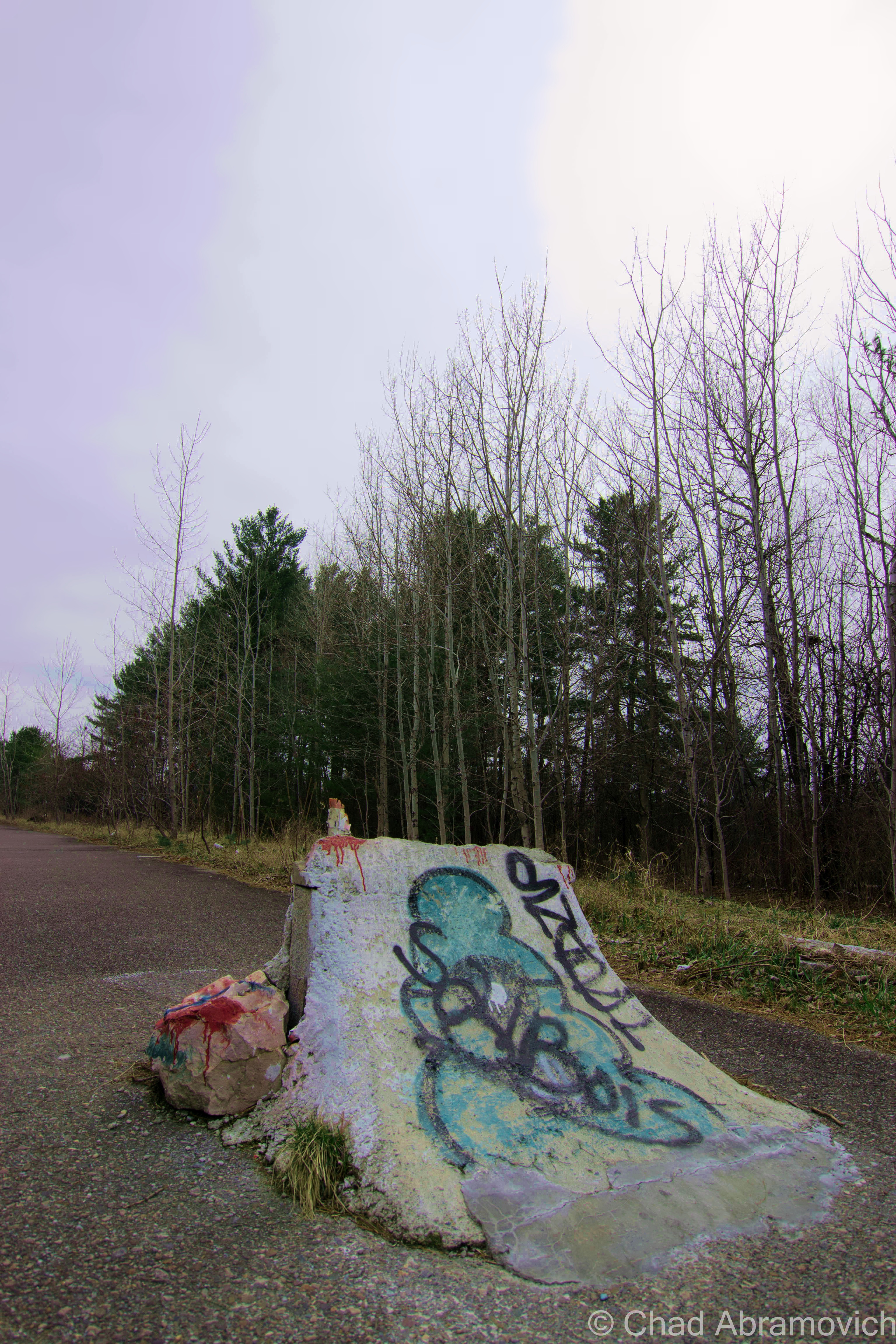
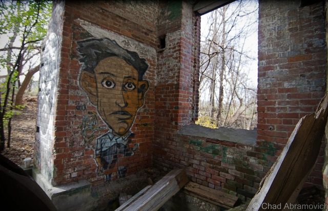
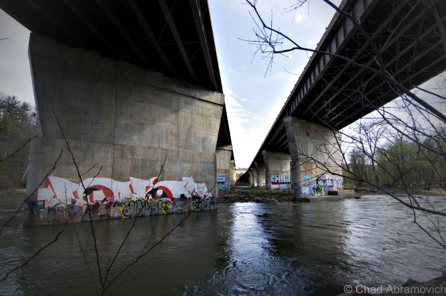
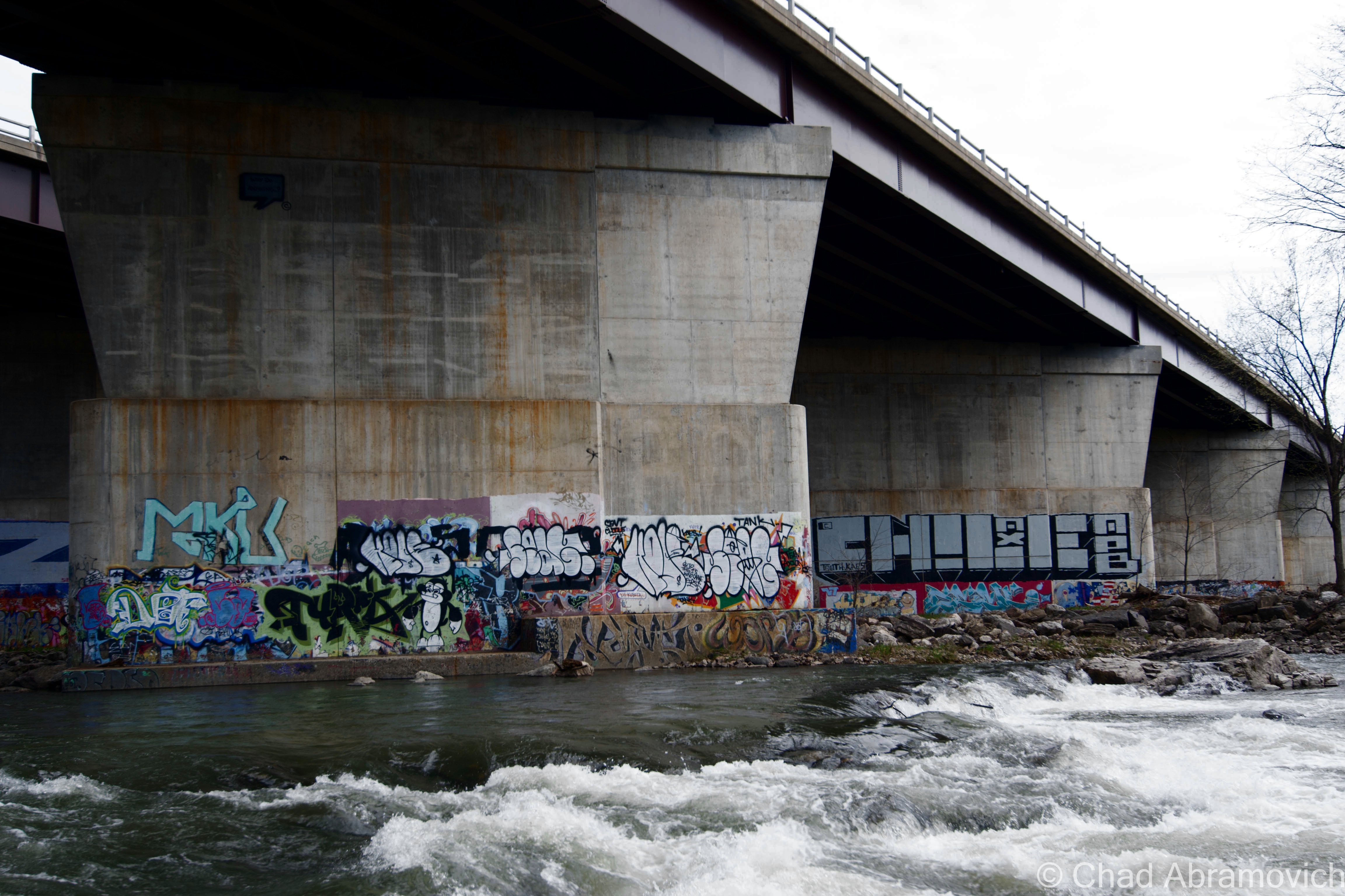
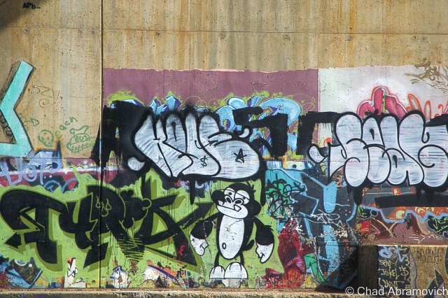
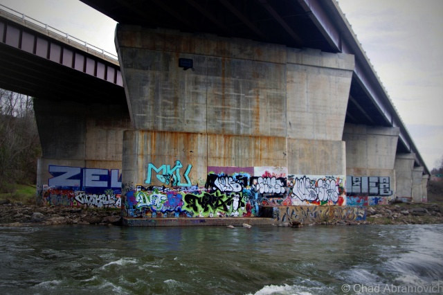
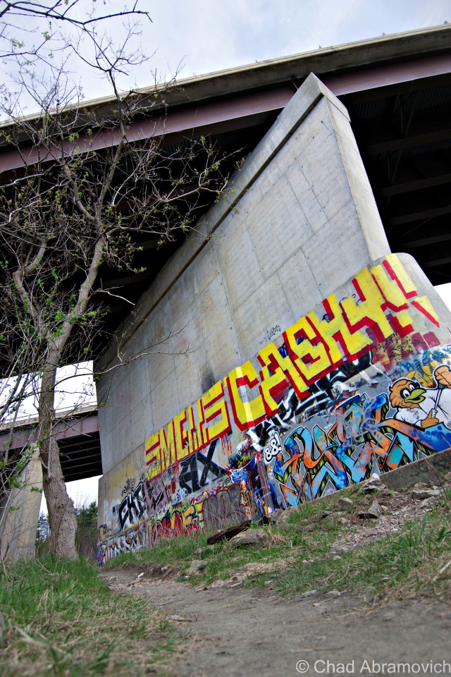
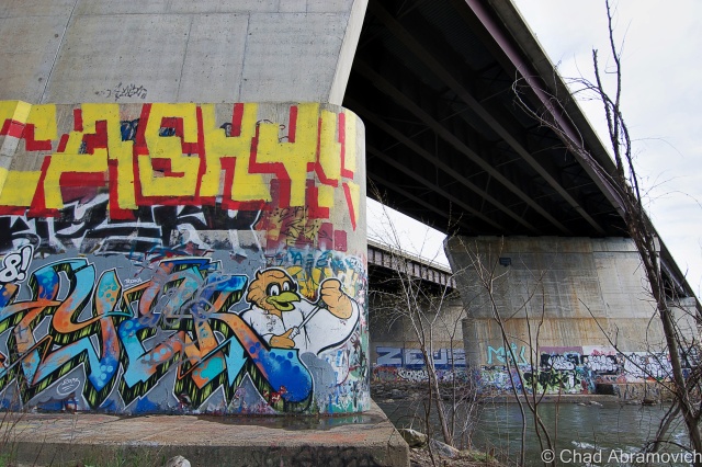
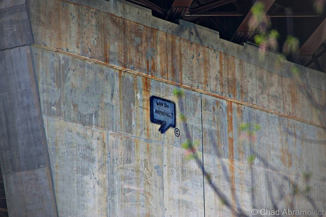
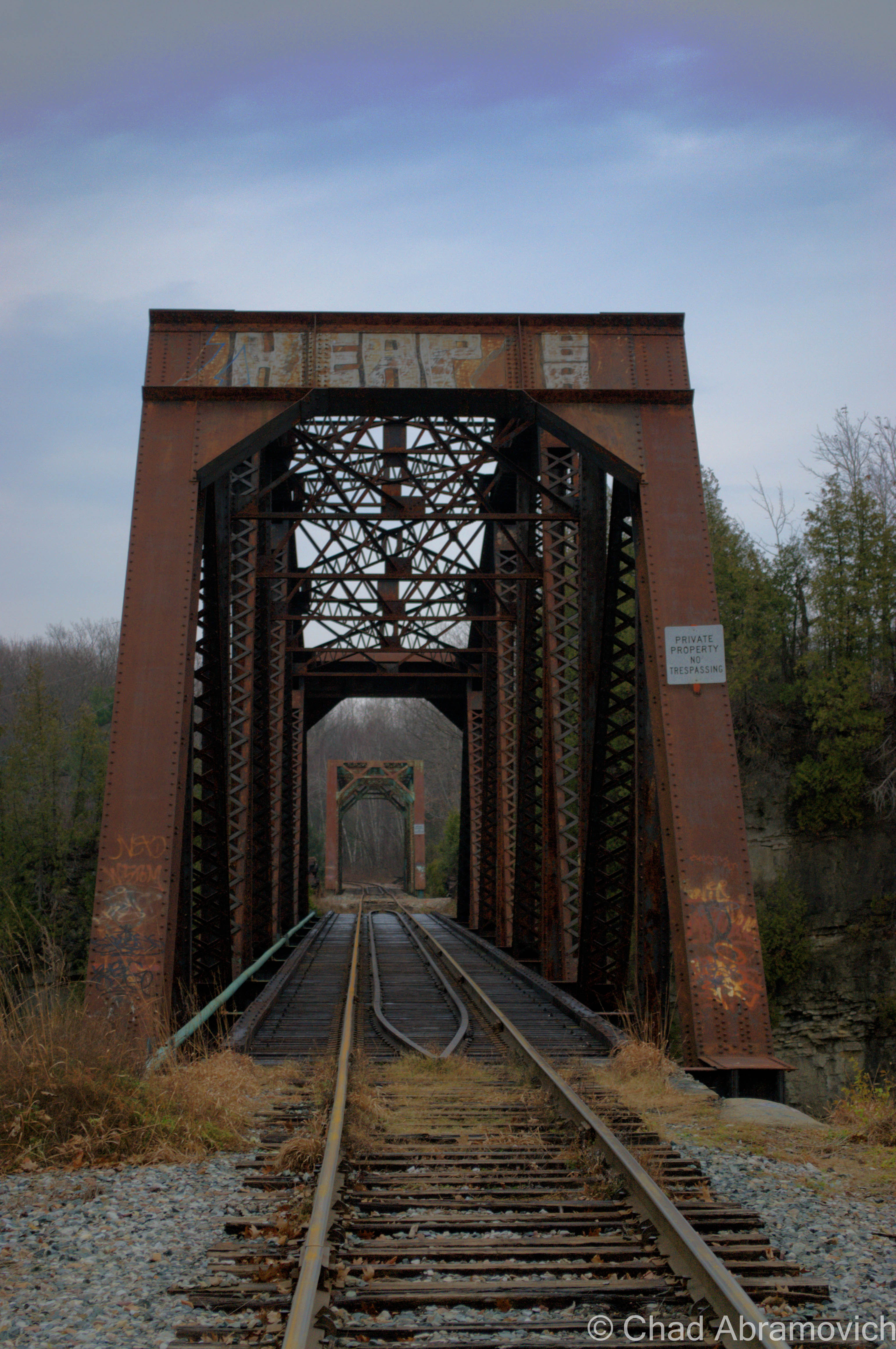
The area underneath the interstate bridge that spans the Winooski River in Winooski city is colloquially called “the walls”, a youth minted term which is most likely a reference to the humongous concrete pylons supporting one of the busiest bridges in the state overhead. Those pillars are sprayed with some of the best graffiti and spray paint art in the state. In my humble opinion anyways. The robust and colorful artwork is always evolving, with some tags in seemingly difficult to reach places that conjure more questions and hint at the engines and the love of those who do their thing here.

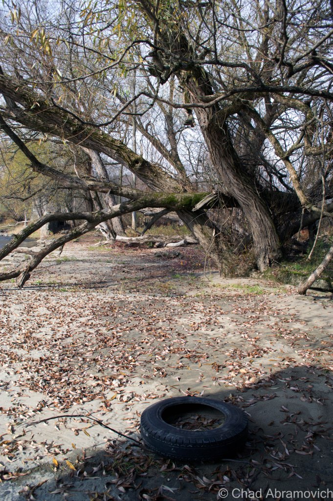
I’ve met some local taggers down there before on a summers afternoon years ago. Most people you run into are friendly folk who will strike up a conversation with you. The other half are either people like me, or teenagers who are smoking swisher sweet cigars they got from the local Maplefields convenience store having fires along the beach areas. The area is a neat one, which is undoubtedly why it draws so many eclectic folks. It’s isolated and a bit of an inconvenience to get to, with thick vegetation, sandy river bottom beaches and the gradual limestone rises of the Winooski gorge giving it a dislocated feel from the pulse of Burlington, but never too far from the hum of the highway.

dsc_0335_pe dsc_0348_pe dsc_0312-2_pe dsc_0316_pe dsc_0318_pe dsc_0325_pe dsc_0326_pe dsc_0332_pe

There is an abandoned hydroelectric station amongst the ledges and evergreen forests of the gorge walls, but as we found out, access is almost impossible, and unless you want to risk a security encounter and some torn clothes as a result of climbing a very sturdy fortified fence. As I later found out from someone, if we had dared to climb down into there ruins, we would have been met with several feet of rapid flowing river water and foul mud that now flows freely through the complex. In this case, it was best just to admire it from a distance.

An area landmark, and a cool one at that, a double railroad trestle bridge spanning the turbulent waters of the Winooski Gorge.
An area landmark, the double truss railroad bridge spanning over a ledgy oxbow river bend in the Winooski Gorge. Locals mistake this impressive feat of engineering as a haunted trestle, where a little girl was struck and killed by a train in the 60s. But that’s actually another truss bridge down the river a ways, crossing into Burlington’s intervale. It’s called “the blue bridge” because according to legend, the girl’s ghost hangs around the bridge and is a pale blue, like an oxygen deprived corpse. If the real blue bridge wasn’t weird enough, I’ve heard tons of stories of sketchy characters who hang out on the bridge. I once ran into a young couple (I assume) dressed in dollar store magician and assistant costume, with top hat and plastic wand, sitting in the middle of the train bridge and quarreling. I’ve seen them 2 additional times afterward. That’s an old ghost story though, not one I think many younger Winooskians are aware of nowadays. It’s easy to see why the double truss bridge would be the assumed monument to tragedy, given its striking location and unique construction. Just make sure you’re not eligible for a statistic if you decide to walk the tracks.

—————————————————————————————————————————————–

To all of my amazing fans and supporters, I am truly grateful and humbled by all of the support and donations through out the years that have kept Obscure Vermont up and running.

As you all know I spend countless hours researching, writing, and traveling to produce and sustain this blog. Obscure Vermont is funded entirely on generous donations that you the wonderful viewers and supporters have made. Expenses range from internet fees to host the blog, to investing in research materials, to traveling expenses. Also, donations help keep me current with my photography gear, computer, and computer software so that I can deliver the best quality possible.

If you value, appreciate, and enjoy reading about my adventures please consider making a donation to my new Gofundme account or Paypal. Any donation would not only be greatly appreciated and help keep this blog going, it would also keep me doing what I love. Thank you!

Gofundme: https://www.gofundme.com/b5jp97d4

Donate Button with Credit Cards

Nostalgic Route 9: Abandoned Motels, Vintage Signs

Recently, I had my inaugural voyage to the Adirondacks of Upstate New York, an area I’ve became quite interested in. Lake Champlain, the massive body of freshwater roughly 500 square miles in size, forms the boundary between Vermont and New York, and with a limited amount of crossings to the next state, as well as a lack of reasons for your blogger to go visit, the state of New York was practically an unfamiliar exotic world to me, an undisputed disparity from the weird bubble that is Vermont. One of the most common things I hear flatlanders say about Vermont, is something like; “man, do you have any idea how weird Vermont is? Seriously, you guys are like a cult up here. It’s almost like you don’t belong in the rest of the United States”, and sometimes they eye me with momentary awe. And I’m immensely proud of that.

The Vermont side of the lake is gentler and up kept, while the New York side is wild and grungy, wallowing in its nostalgia. Boulders and forests slide into the lake, bordered by rural stretches of crumbling highways and tumbledown homes. The Adirondack experience is a multi-faceted one – a region that doesn’t give up all its secrets, but doesn’t hide its scars. A place that’s vast, desolate and intriguing.

Meeting up with a good friend who is familiar with the region, he agreed to show me around some of his favorite haunts on a rather pleasant November day. Crisscrossing the region’s roads in the most inefficient manor possible, we decided to dedicate our escapade to a particular hue; the scores of old motels, vacation cabins and awesomely unkempt vintage signage and their visage of deterioration.

Everything related to this goal can be found along U.S. Route 9, where much of the area’s notoriety once came from. The route cuts through this huge region in a north south direction between the Adirondack Mountains and Lake Champlain. At one point, Route 9 was the original superhighway to the North Country before the Adirondack Northway, also known as Interstate 87, was built. In Route 9’s well traveled heyday, it was crawling with people tromping through its roadside attractions, curio, and motels which made lasting impressions in some tangible way. Today, a journey down Route 9 is more of a reflection of one of the more grimy truths of reality; impermanence. It’s now a desolate and forlorn drive through almost uninterrupted miles of forest, which is often sick and scraggily looking, as the Adirondack Northway carries most traffic now. But it’s a fascinating drive to me.

The landscape changes dramatically from the unanimated city of Plattsburgh and neighboring town of Keeseville as Route 9 heads south towards the tiny town of North Hudson and the ruins of Frontier Town, a frontier themed amusement park that was once the blood and pride of an otherwise easily missed town. The areas around Plattsburgh and Keeseville are lined by mid century motel establishments and their gimmicky retro signs complete with wondering arrows, neon lights and sharp angles; all designed to capture the travelers’ attention. Further south, unvarying one room wooden cabins are scattered in the midst of otherwise scraggly fir forests and increasingly long distances of highway with no signs of life for miles. Depressed hamlets like Lewis and New Russia spring out of the untamed forest like some sort of northern mirage, but are easily forgotten within minutes.

We decided the best route to New York would be The Grand Isle Ferry. From there, it would be a short drive down Route 314 to the destination Route 9 in Plattsburgh. The winds were incredibly fierce, the lake was choppy and full of whitecaps. Because of this, the ferry ride over was twice as long, as the captain attempted to navigate the rough waters safely, the boat viciously rocking back and forth and the waves spraying over onto the deck. For the fun of it, we got out of the car and attempted to get a few pictures of the rough conditions, but my, uh, sea legs had 25 years of inexperience working against me. The boat was rocking so badly that it was almost impossible to gain my balance. Admitting defeat, it was back in the car for me.

The choppy waters of Lake Champlain from the Grand Isle ferry.

DSC_0857_pe

While taking pictures of this sign, the owner of the motel happened to be walking by, giving us a strange look. To relieve some of the tension, we told her we liked her sign, and asked how old it was. She scratched her head in thought, and said it's been here since the mid 50s.
While taking pictures of this sign, the owner of the motel happened to be walking by, giving us a strange look. To relieve some of the tension, we told her we liked her sign, and asked how old it was. She scratched her head in thought, and said it’s been here since the mid 50s. “I can’t believe you guys want to take a picture of it” she said laughing.

DSC_0889_pe DSC_0894_pe DSC_0906_pe DSC_0910_pe DSC_0918_pe

Out of the city limits now, Route 9 returns to stark wilderness. With the motels of Keeseville now gone, the desolation is now occasionally broken by crumbling roadside cabins shrouded in growth, with a decaying sign out front, their paint long faded and neon tubes hanging loosely around the sides.

Cabin Set #1

DSC_0948_pe DSC_0950_pe DSC_0952_pe DSC_0955_pe DSC_0960_pe DSC_0974_pe

Cabin Set #2

DSC_0982_pe

These cabins were practically in someone's front yard.
These cabins were practically in someone’s front yard.

Cabin Set #3

I found these to be interesting because of their unique hillside perch – and their remote location – there was nothing else around for several miles, making me think that these were sort of a “last chance” affair.

DSC_0989_pe DSC_0996_pe DSC_0999_pe

Now the landscape changed again from the cramped rustic abandoned cabins to abandoned motels.

Abandoned Motel #1

This abandoned motel seemed to be relativity up kept, its dated architecture looking almost as crisp as its heyday. The lawn was kept mowed, and the owners lived across the street in another former motel, which I suppose wasn’t very surprising.

DSC_0001_pe DSC_1006 DSC_1013_pe

Abandoned Motel #2

This motel was more desolate then the first one, done in a kitschy in a rustic log theme, which was inspired by the defunct amusement park, Frontier Town, which was just down the road. The crumbling parking lot had almost returned to a wild state overran with weeds, and the long front porch was becoming encroached with fir trees growing slowly inside it. This was the first place we noticed that hosted transient people. Some of the rooms had been broken into, and the obvious signs of human presence were everywhere, but thankfully none were around when we arrived.

An abandoned playground weighed down by the desolation of the forest.

DSC_0010_pe DSC_0021_pe DSC_0024_pe

Frontier Town

Down the road is the uninteresting town of North Hudson, nothing more then a collection of ramshackle homes and trailers amidst the scraggly woods. But years ago, North Hudson was home to one of the most beloved tourist destinations in the Adirondacks; Frontier Town.

In 1951, an enterprising man named Art Benson chose the woods of North Hudson to be the home for his new vision; a theme park that would bring the wild west to upstate New York. He had no income, no background in construction or anything related to running a theme park, and yet, with ambition and bearing his charismatic personality, he managed to pull off one of the most beloved tourist traps in the Adirondacks. Decorated like a primitive frontier town of the 19th century and amusing it’s guests with interactive dioramas from folklore, popular culture and history, the park continued it’s role as a compelling spectacle until 1983, when Benson sold the park to another development firm, who closed the park in 1989, and reopened it shortly after with new attractions to try and lure more people to make up for the park’s dwindling audience. By 1998, Frontier Town closed for good, after being discombobulated by dropping finances and the latest victim of changing trends; the new notion that it was now dated and politically incorrect.

The vast property was seized in August 2004 by Essex County for past-due property taxes. Today, the park is a humble collection of ruins rotting in the woods, or along Route 9, which is where the main entrance was. The property is skirted by a collection of abandoned motels and restaurants that now look rather out of place in town.

There have been a few special interest groups organized with the goal to restore Frontier Town, and have it labeled as a historic landmark. But so far, none have been successful. Nearby the property is the seedy Gokey’s Trading Post, which has a few pieces of Frontier Town memorabilia for those looking for some nostalgia.

To read more about Frontier Town, you can click this link to be taken to my blog entry on that.

Abandoned Motel at the entrance to Frontier Town

DSC_0027_pe

Those swanky chairs.
this motel also came with a simple playground for the kids, which admittedly looked more disappointing than fun
From the motel parking lot, one of the remaining buildings of Frontier Town could be seen - a former restaurant and gift shop against the late Adirondack sun.
From the motel parking lot, one of the remaining buildings of Frontier Town could be seen – a former restaurant and gift shop against the late Adirondack sun.
DSC_0046_pe
Driving through abandoned roads still adorned with battered street lamps and the ruins of the remaining buildings is an eerie experience. Years ago, this area used to be packed with tourists, noises and life – today the only sounds are the mountain winds and the hum of traffic from Route 9.

DSC_0048_peSide Note: There is a ghost town in the mountains behind Frontier Town. If you’re curious, click on here to read about it.

DSC_0052_pe
In addition to the numerous motels, cabins and restaurants that are abandoned here – we found out that the interstate exit that once served Frontier Town was also abandoned as well. This abandoned Citgo station sat a few yards away from the exit ramps. Here, a poor traveler pulled into the parking lot and was panicking. “Hey guys, do you know where a gas station is?” We told him there was on in Schroon Lake, 10 miles down the road. His face dropped. “shit. I don’t think I can make it” he sighed. We watched him pull out and turn onto Route 9. I hope he made it before it was too late.
Abandoned at Frontier Town

Frontier Town is such a large property that I would need to devote an entire day to see it, which I hope to plan.

“Dysfunction Junction”

Heading back up Route 9, we drove through a unique, bizarre intersection at Routes 9 and 73 in New Russia, a hamlet of Elizabethtown. When Route 73 hits Route 9, the lanes split off in separate directions, crossing each other in a crazed and seemingly random pattern before coming together again. Everytime I’ve driven through it, I’ve wondered: why does this intersection exist? And the first few times – Where do I go?

A chance find on a Google search provided me with some answers. The locals call this “Dysfunction Junction”. The intersection was built in 1958, using a design that has been instituted (with slightly variations) in other areas of the state. The design is a “bulb type-T intersection” that “favors the heavier right-turn movement from the upper to the lower left leg of the intersection. Sight distances are excellent and approach speeds are approximately 40 miles per hour.”

So why was this design chosen for this spot? We have to go back to Route 9’s heyday as the main artery from Plattsburgh and points South. Before the Northway was built, Route 9 suffered far worse traffic congestion as it does now. Before the construction, a simple stop sign was in place, which overtime was unable to handle the flow of moving traffic. The design allows Route 9 traffic to flow through without stopping, while anyone continuing on 73 would have to wait. Today, they’d probably build a roundabout instead. While this design may have made sense in the 1950s, today’s traffic patterns have changed. But not everything thinks it’s a bad design. “If you just follow the signs, you’ll be alright” says one indifferent local.

Photo: Adirondack Almanac

—————————————————————————————————————————————–

To all of my amazing fans and supporters, I am truly grateful and humbled by all of the support and donations through out the years that have kept Obscure Vermont up and running.

As you all know I spend countless hours researching, writing, and traveling to produce and sustain this blog. Obscure Vermont is funded entirely on generous donations that you the wonderful viewers and supporters have made. Expenses range from internet fees to host the blog, to investing in research materials, to traveling expenses. Also, donations help keep me current with my photography gear, computer, and computer software so that I can deliver the best quality possible.

If you value, appreciate, and enjoy reading about my adventures please consider making a donation to my new Gofundme account or Paypal. Any donation would not only be greatly appreciated and help keep this blog going, it would also keep me doing what I love. Thank you!

Gofundme: https://www.gofundme.com/b5jp97d4

Donate Button with Credit Cards

Requiem On The Missisquoi Banks

The sad reality that winter was on its way was all too evident as me and a friend set out for a journey into Northern Vermont. Most of the hillsides were grey and barren and the grass had long lost its summer sheen. However in Downtown Saint Albans, the stately Maples in Taylor Park still retained their Red and Orange leaves, an ideal ceiling for the bustling gathering on the sprawling lawn. Out of Saint Albans, Route 105 runs up and down the rolling hills of Franklin County’s farm country, through a jejune landscape that even the sun and her warming light had a hard time cheering up. The brisk winds scurrying the dead leaves around in swirling movements battered the front windshield. We drove through interesting small towns and villages such as Enosburg Falls, East Berkshire and the more hardscrabble Richford to the North, communities once far larger and more prosperous 100 years ago, now only hinted by fading landmarks and regal architecture beating in and out of time.

But this trip would in no way go the way I had hoped it would go. We had a particular destination in mind, and drove an hour and a half to get there, with little more then hope and determination and a general idea of where we were going. But sadly, a little more research and planning would have been helpful. The property in question was heavily fortified, with a very imposing chain link fence capped with barbed wire that ran not only at the roads edge, but jutted deep back into the scraggly North woods with no end in sight. To make matters worse, the already rough road had no shoulder to park on, and the front gate of the property was in the middle of 2 tumbledown trailer homes, neither of which we felt comfortable being near. Admitting defeat, we had no choice but to turn away with heavy hearts and uprooted minds. Now the question was what were we going to do with the rest of our day. We inched up the slopes of the Green Mountains as the road climbed around a deep set beaver pond before cresting at the top of the hill, yielding brilliant views of Richford and Quebec, all lost somewhere in a thick haze that pitied the changing of the seasons. I plan on returning to this place, with permission to access the property I hope – So I’ll save revealing this location for another entry.

As we drove back into the crumbling streets of Richford, we debated what to do next. We had seen some interesting old houses and other picture worthy things on the drive up, so I figured we might as well make use of our trip. Richford had beauty in its tough skin and Enousburg Falls showcased an impressive array of Victorian architecture and an attractive brick downtown complete with an opera house and well preserved painted brick advertisements. Plus, the Victorian ruins of the former Kendal Factory sat in the middle of town, the sagging facade and vacant windows are always interesting to photograph.

As we approached one of the many Missisquoi Valley Rail Trail crossings, there was some sort of form in the woods that only offered a fleeting glimpse of it’s existence as we passed it. Curious, and wanting to kill more time, we turned around to try to get a better look. There was indeed something sulking in the river bottom forest, and it was abandoned. The property had grown completely wild and was untamed, but there were 4 wheeler trails that cut across the area, and they seemed well maintained, so someone had to use them, and often. But what was this place?

I had no idea what sort of ruins I was walking around, but the strange beauty of the ruins along the Missisquoi banks, ensnared with twisting roots and moss more then made up for the missing information. Wondering below the Willow trees, more ruins emerged out of their slumber. Large cement structures, covered with moss were accepting their fate, as the snarled skeletons of tree routes which are working on destroying all evidence of this odd ruin. Peering inside, I looked at 2 subterranean rooms that look like they went far below the Earth’s surface, but were so filled with trash, leaves and dead branches that it was impossible to tell. I thought about climbing down into one, but quickly decided against it. The chambers smelled strongly of stale air, dampness and rot. Who knew what was waiting for me down there.

I made my way towards the stone building through waist high weeds that tangled themselves around my body and made passage extremely difficult. The building was only a single room, its floor marred with holes where former machinery most likely once sat. Most evidence of it’s industrial past had long been removed – its cold cinder block walls the eternal witnesses to its secrets. My best guess was it was some sort of mill. I noticed a rather vivid “No Trespassing” warning written on the front doors, in sharpie. An odd note to this warning was the person who wrote it, dated it at June 30, 1955 and then signed his name to his warning.

Having a blog can be a great resource, especially when readers are kind enough to share their information and experiences. This was one such case, where a commenter was friendly enough to put the puzzle pieces together for me, and with a little more research via the Montgomery Historical Society, I had more possible clues. These ruins may very well be all that remains of the Sampsonville Mill, a satellite of the former Atlas Plywood Company. With their main headquarters in Montgomery, they also owned separate mills in North Troy, Richford (Sampsonville) and Montgomery. Because Montgomery and the surrounding towns had some of the finest veneer timber in the United States, and ready access to water power and the railroad, the region proved to be an ideal place for the Atlas Company. The company boasted that its satellite locations provided the company and the communities it served with jobs, but kept the facilities small enough to be human scale and to prevent crowded and cramped conditions. It was also said that this was to prevent any labor organizers from unionizing. The Atlas Plywood Company was probably most noted for their fine Victrola’s. Sadly the company went out of business by the 1950s due to the popularity of radios and changes in the packaging industry. The company’s headquarters building can still be seen in the small village of Montgomery Center. As of 2008, it was converted into a ski lodge.

dsc_06492

dsc_0661 dsc_0664 dsc_0666 dsc_0668 dsc_0672 dsc_0688 dsc_06541

dsc_0674 dsc_0675 dsc_0678 dsc_0682 dsc_06761

—————————————————————————————————————————————–

To all of my amazing fans and supporters, I am truly grateful and humbled by all of the support and donations through out the years that have kept Obscure Vermont up and running.

As you all know I spend countless hours researching, writing, and traveling to produce and sustain this blog. Obscure Vermont is funded entirely on generous donations that you the wonderful viewers and supporters have made. Expenses range from internet fees to host the blog, to investing in research materials, to traveling expenses. Also, donations help keep me current with my photography gear, computer, and computer software so that I can deliver the best quality possible.

If you value, appreciate, and enjoy reading about my adventures please consider making a donation to my new Gofundme account or Paypal. Any donation would not only be greatly appreciated and help keep this blog going, it would also keep me doing what I love. Thank you!

Gofundme: https://www.gofundme.com/b5jp97d4

Donate Button with Credit Cards

Picking At The Bones

As the chill in this season sputtered and spit outside, I was comfortably warm inside the car as we headed on a 7-hour drive from the Burlington area to unfamiliar territory. But my friend grew up in this part of the North Country, and was playing tour guide today. It felt nice to get out of Vermont and see new places I was completely unfamiliar with, leading on with nothing but my curiosities and perceptions as the untamed mountains and silent swampland hinted at its secrets and its troubles.

But as the hours passed and the surroundings became increasingly different, conversation began to slip away and I became haunted by the hardscrabble landscape. Unlike Vermont, with its tamed meadows and gentle hills, this region was wild and more disheveled, with less open land and grungy backwoods towns where you can taste the desperation, isolation, and hardships in its blood – all turning towards the riotous color of the Autumn hills and ledges which literally fought with the roadside for dominance over the landscape.

“So, where are we going?” I asked after a lengthy amount of time. “Not sure yet – I was sort of just hoping we’d find a place as we drove by and check it out from there”.

At that point I had to laugh to myself. Here we were, driving sort of aimlessly through sprawling mysterious woodland with no set goal in mind. If I was with anyone else, I would have been a little doubtful at this point, but I trusted his wisdom fully. Now that I thought of it, it had been at least 30 minutes where we hadn’t so much as passed a house, trailer, or even a set of power lines. Few places in Vermont could compare to the loneliness and isolation here. The Northeast Kingdom perhaps. But here – this was truly wild land.

But his point was valid. The further we got from Vermont, the more abandoned buildings sat along the roadside. It was now more common to see an abandoned house as opposed to one that is inhabited still. And the ones that were lived in perhaps would have been better abandoned.

By now it was getting late, and we still had yet to find a location that would be possible to explore. I could tell the same thoughts were weighing on his mind as well. “Shit, it’s getting late” he said, realization in his tone. “Any ideas?” There was a moment of silence before we passed a directional sign. One of the communities listed he recognized and his face lit up. “I think I have an idea – you’ll like this” he promised, as we made a sharp turn on another winding back road.

Of Mountains and Mines

After another 20 minutes or so of twisting, stomach-churning turns and an indistinguishable landscape of scraggly fir trees, the road took a sharp drop down a rather steep hill, below us stretched the rooftops and church steeples of a small village. He slowed the car down for a second before progressing further into town and pointed out his window. Several hundred feet below us in an unforgiving mountain valley sat the large crumbling ruins of an abandoned iron ore mine, it’s rusted tin facades and broken windows slowly losing the struggle against mother nature.

With a little research, I was able to find out about the mine and the town. In 1827, rich Iron Ore deposits were discovered in the area and soon mining operations began to tunnel their way into the hills. Almost immediately, the mining operations ignited a regional economic boom as railroad companies were lured to town, bringing several immigrant workers with it. Soon, the town shed it’s small-town skin and became a center for regional commerce. Many grand mansions climbing the steep hillsides were constructed by the mining company’s more prominent employees and a stately downtown was built, bringing some civilization to the unkempt mountain wilderness.

The busiest period the mines saw was during World War 2 when a great deal of material was needed to build Army aircrafts, making iron demands high and working conditions that would turn fingers to dust. Workers soon began laboring around the clock. The mines became so large that it was said that it took miners an average of an hour and a half to be transported in mining cars from the surface to their subterranean work site.

After the war, several economic depressions and the opening of larger and more prosperous mines out west brought an end to the mining boom, something the area never recovered from. In 1971, the mine closed its doors for good. And now ironically, what was responsible for building the town had also killed it. Today, the looming decrepit edifice of the mine still haunts the heart of this town. Crumbling and brooding mansions and vacant storefronts serve as fleeting memories of nostalgia. With not much of a tourism draw, the town may have a long and slow recovery ahead of it.

For whatever reason, I always recall a peculiar story about this town when I drive through it. Dated in a relatively recent newspaper article from 2012, it talked about a mysterious middle-aged man who once drove around town in a black Toyota pickup would ask people he would run into if they wanted to purchase some steak of chicken from the back of his truck, origins both unknown and ungiven. A police report was eventually filed, and as it turned out, the same guy reportedly broke into someone else’s house who also had a run-in with the mysterious gentleman and refused to buy any meat.

This leaves a lot of questions about the suspicious meat. What kind of meat? Stolen Meat? Who knows I guess. As far as I know, no one seems to have complained about any further incidents…

Back to my story.

Fading Light

With the mine in sight, the question was, how were we going to get there? We had been driving for so long that we were working with 2 hours of remaining day light if we were lucky. The mine’s location was also hidden (perhaps deliberately) from the center of town. There were a few dirt roads with tumbledown houses scattered around the property, but none lead us right to the front gates. But as my friend informed me, that was probably for the best.

An elderly gentleman and retired police officer has taken it upon himself to self righteously patrol and monitor the perimeter of the property and the mines themselves. Though he has never had an encounter with him, he had been warned to avoid him at all costs.

As it turns out, he was a fabled local character, known for his imposing – if not psychotic behavior. He carries a gun at all times and won’t think twice about calling the local police and the state police. So it looked like we’d have to backtrack through the woods, and see if we can get onto the property that way. The security forces here were infamous for prosecuting trespassers within the fullest extent of the law possible, without exceptions, so we took every precaution we could.

Walking up a steep clay bank with trees battering our faces, my camera gear weighing me down a bit, we finally reached the now defunct railroad bed that cut through the woods towards the mines. “If we follow this, we should come out right behind it” my friend informed me. He seemed a little unsure about this, but I figured it’d be easy enough to get back to the road if we failed. So off we went, constantly swatting at the low tree branches that hung their claws over the old railroad bed. That must of been a comical site for a stealthy deer hunter. 2 lumbering guys with a good amount of camera equipment awkwardly stumbling through the woods.

After 20 minutes of walking or so, we were met with a surprise. We stood at the top of a rather deep trench, with steep clay banks and a tangled mass of weeds, rocks and sludge at the bottom. It seemed like it was the work of some sort of flash flood, and it was a very strange coincidence that it just so happened to follow the perimeter of the abandoned mine. We knew we’d have to climb down and climb up the other side if we wished to continue.

On the other side, we continued walking the old railroad beds, the sun was now beginning to set behind the mountainous piles of tailings at our sides. Then suddenly we saw something ahead of us, the silhouette of rusted pipes that stretched far above ground level. We had arrived. On the left of us was a small cinder block cabin, with rusted meshwork drilled over its broken windows, almost ensnared completely by the fall foliage. Inside the crumbling shack was a magnificent old scale which sat alone in the shadows. Above me was the rusted husk of some sort of steel building that was suspended far above my head, with only a dangerous rusted ladder as access. As it turned out, it was far too unsafe to climb on, so I stayed on the ground.

the washout had exposed old rusted pipes that were left exposed and dangling over the gap. climbing up and down the banks was terrible, as the earth kept sliding beneath our feet.

DSC_0503 DSC_0504_pe DSC_0506 DSC_0507 DSC_0519 DSC_0526

Just ahead was another interesting find – a large pile of discarded twisted scrap tin was left littering the side of the trail, stretching ahead of us for an impressive distance.

A few yards down the trail and the looming shapes of the mine buildings began to take form, towering far above my head, their colors almost lost to the heavy purple skies above. This was far larger then I had thought it would be. Now my excitement was growing, there was so much to see and so little time. Not wanting to feel rushed, but wanting to try to get as much shooting in as possible, we began to investigate.

The rusted tin, weathered cinder blocks and massive round silos all competed for attention. Each building was very large, the broken windows allowing some of the darkened interior to bleed out. It was almost overwhelming. Which one first? Do we go inside now, or do we walk around outside a little more and get exterior shots? Now a new thought entered my mind. The woods had grown into a startling stillness that I had never heard until then. The entire property was silent, the only noises were the wind occasionally blowing some rusted tin which echoed through the industrial catacombs of the interiors. It was an imposing place.

Trudging cautiously, we made our way up to a rusted steel door that was left ajar. That was going to be our entrance inside. However, when my friend opened the door, a large steel pipe that had been propped on the top fell downwards and smashed against the hard concrete floor below, making a thunderous sound that danced through the empty warehouses and rusted steel catwalks. I bet every hunter in the area heard that noise.

The worried look on my friends face told me something was wrong. “It’s a booby trap” he told me in a whisper. “That guy I told you about, he set up booby traps to ensure people won’t trespass. shit!” Though I didn’t say anything, I found myself admiring his cleverness. A sound that loud he would have undoubtedly heard. I expected within a few minutes we’d hear the roar of an ATV coming our way, accompanied by a guy who just might kill us.

We waited with hushed breath, not making a move. And no one came. Coming to a mutual understanding, we tried the door again, this time letting the giant metal pipe down gently and quietly as possible. The second time proved to be more successful, and we quickly yet carefully darted into the shadowy interior.

DSC_0538_pe DSC_0540 DSC_0542 DSC_0543 DSC_0546_pe DSC_0549 DSC_0552_pe DSC_0555_pe DSC_0556_pe DSC_0558 DSC_0560 DSC_0563 DSC_0564 DSC_0568_pe DSC_0570 DSC_0573_pe DSC_0576_pe DSC_0587 DSC_0589_pe DSC_0590 DSC_0592_pe DSC_0599_pe DSC_0604_pe DSC_0623_pe

The adrenaline tapered off as we soon became one with the growing shadows of the night, the only company was the giant rusted machinery and the ghosts of the past that still lurked around – some for haunting, and some aching to be missed. There was a lot to photograph inside, you couldn’t help not be overwhelmed and anxious to see as much as you could.

Rusted pipes forming great geometric angles, filthy broken windows letting in mixed amounts of fading light, giant rusted gears and wheels and the skeletons of old converter belts that branched out into the bowels of the complex. It was simply fascinating.

And that’s when we heard it. The indisputable sound of a firing engine somewhere at the top of the hill. The low but aggressive humming went on for a few minutes as we waiting in the shadows, trying to assess the situation. Then, silence. Not wasting another minute, we crept back out the door and scanned the area. We saw no one. At this point the sun was setting, and we knew we’d need any remaining daylight to get back to the car.

As we made our way out, we heard another sound. The sound of a barking dog carried through the hills and dales, fading into the evening. That was never a good sign, so we immediately began our hike back down the tracks. At this point, we weren’t sure if we were hearing a hunting dog, or a tracking dog.

We couldn’t exactly tell where the barking was coming from, so all we could do is cautiously and hastily press onward towards the car. The barking grew louder and closer, but we still couldn’t pinpoint where it was coming from. We began to walk faster, now strenuously scanning the woods in vain hopes to find it before it found us. Then, to make matters more interesting, we heard yet another sound. This one was long and filled with sorrow – its haunting bellows burned through the trees. I had no idea what it was, some sort of Wilhelm Scream being carried from somewhere out of sight. It was certainly enough to leave a bad feeling over my trembling skin.

Close Encounters

After a long grueling hike, we finally made it back to the car, and just as we thought luck was on our side, we heard the sound of an approaching vehicle. Pulling out from behind the trees at the top of the hill, the large Ford truck gained speed before parking directly in front of our car, blocking us in. Wasting no time, a late middle-aged man got out, wearing a baseball cap, a faded flannel and some jeans, and he immediately began to get confrontational.

“Just what the fuck do you think you’re doing here?” He spat. “This is private property, you’re all trespassing, and that’s a criminal offense” He was all spitfire, his eyes deep set and intimidating. I already knew this was the guy I had heard so much about.

My friend and I cautiously and slowly explained ourselves, trying to dilute the situation. “We’re photographers” I stated as, trepidation began to set in, but he remained silent, never breaking his accusatory stare. “We were interested in those old railroad tracks over there and the foliage. We’re sorry…we didn’t realize this was private property, there were no posted signs…”

He interrupted. “Trespassing is trespassing. There doesn’t need to be any signs. In New York, walking on anyone’s land is trespassing. You know, I’m buddies with all the state police up here, I can just call one of my buddies now and have your car impounded. Better yet, you fuckers can all spend the night in the Moriah Jail” Again, we calmly stood our ground and tried to diffuse the situation. In events like this, I’ve learned that the best tools are how you conduct yourself. Try to appear friendly, transparent, and interested in whatever they had to say, while not making them feel threatened or in danger. If you can make the confrontee feel valued and important, there is more of a chance that you get to walk away from the situation with little to no consequences.

After several back and forths between us, his eyes turned to our cameras. His anger had subsided a little bit, but not by much. “You guys like taking pictures so much? Ok – I’ll give you something beautiful to shoot” We stared at him, now caught off guard, the anticipation was horrible. What was going on?

“Head down the road, take a left at the four-way, then take your third left, and go about a mile down that road. There’s a hill there and you can see across the lake and into Vermont. You can even see the bridge from there. Best view in town. If you like taking your fucking pictures so much, you should go there”

We smiled at him and thanked him for the good idea, and for a brief second, a small smile crept on his face, only to vanish just as quickly. “Yeah, well, get out of here and go take your pictures. Don’t let me catch you here again” he snarled, trying to be intimidating again, and took off in his truck, speeding back up the hill, until we lost sight of it around a curve.

As it turns out, we only were able to see about 1/5th of the property. Fleeting daylight, under preparation and suspicious noises all contributed to a hasty retreat, and given the circumstances, we sadly decided not to plan a return trip. But something positive was gained here, hopefully making our future trips successful with the added knowledge and experience that were gained.

—————————————————————————————————————————————–

To all of my amazing fans and supporters, I am truly grateful and humbled by all of the support and donations throughout the years that have kept Obscure Vermont up and running.

As you all know I spend countless hours researching, writing, and traveling to produce and sustain this blog. Obscure Vermont is funded entirely on generous donations that you the wonderful viewers and supporters have made. Expenses range from internet fees to host the blog, to investing in research materials, to traveling expenses. Also, donations help keep me current with my photography gear, computer, and computer software so that I can deliver the best quality possible.

If you value, appreciate, and enjoy reading about my adventures please consider making a donation to my Paypal. Any donation would not only be greatly appreciated and help keep this blog going, it would also keep me doing what I love. Thank you!

Donate Button with Credit Cards

The Elgin Springs Remedy

In 1850, Hiram Allen would discover Elgin Spring on his property near Vergennes, and knew he had found a way to turn a profit during the spring hotel craze of the antebellum age, a popular therapeutic treatment at that time.

He built an elegant Greek Revival addition onto his cottage style farmhouse and turned his property into a boardinghouse, located on the crest of sloping pasture lands, with a beautiful view fading into the rugged Adirondacks in the distance.  The waters from the spring were peddled to patrons for their supposed medicinal properties, and among many things, were said to “purify blood”.

An analysis of Elgin Springs written in 1889 describes the springs to be so perfect in character that they were encouraged to be comparable to other famous springs across the globe.

“The analysis of Elgin Waters” – May 1st, 1889

But as with most health crazes, it came and went. The business prospered for 20 years until 1870 when it closed for good. After that, it became a private residence and changed hands until the 1970s. By then, the house had been deteriorating due to neglect as the years passed.

The town of Panton eventually condemned it, which is the reason for its abandonment. The current family who owns the property used the house for salvageable materials – selling off pieces of the house to people that wanted period details for their own house renovations. They have apparently been approached a few times by curious people wishing to purchase the property, but the family doesn’t wish to sell it.

Today, the people who used to sing their praises here have long been dust and bones, and a walk around the property is waltzing through memories, playing those sad songs like they were alive.

It was a white hot Vermont afternoon when I came across this wild abandoned house. Everything was in bloom, the plants wearing a brilliant green that was under competing blissful cerulean skies. The house sat pretty close to the wide shoulder of 22A, a thunderous roar of cars coming at a constant pace, traveling the long distance between Vergennes and Fair Haven. But we might have otherwise been in another world, the thick amount of foliage that had began to grow over the house provided ample invisibility from passersby. It was a magnificent house, it’s elegance still golden. Though what had been left behind was sparse, there was just enough for the imagination to latch onto.

Though it was once a hotel, it was the bones of a private residence I was exploring. The ruins of the interior retained all its original character, and though what had been left behind was sparse, there was just enough for the imagination to latch onto.

The whole place was practically being ensnared by vines and trees, adding a surrealistic quality to its decayed beauty. It was almost like mother nature was trying to demolish this place herself, saying its future was gone, using her roots and plants to pull this house down towards the earth, reclaiming what was once hers.

The springs that brought folks out this way over a decade ago were nowhere to be found either. Though I wasn’t that familiar with the property boundaries and was more concerned about getting caught trespassing out in the open.

5920272338_0aebffaa55_o

5919703567_32841526dd_o 5919706497_373e26f81a_o (1) 5919706761_92b862d21a_o 5920265580_6f76dd4e54_o 5920266778_982cba0cbf_o 5920268128_85df3ea780_o 5920269520_9e789e608c_o 5920273368_62a47d8ffb_o 5920863128_a4e28b0071_o

The Carriage Barn
The Carriage Barn

DSC_0068_pe DSC_0069_pe DSC_0072_pe DSC_0073_pe DSC_0074_pe DSC_0075_pe DSC_0081_pe DSC_0084_pe DSC_0085_pe DSC_0088_pe DSC_0089_pe DSC_0091_pe DSC_0092_pe DSC_0093_pe DSC_0098_pe DSC_0102_pe DSC_0106_pe DSC_0108_pe DSC_0114_pe DSC_0118_pe DSC_0120_pe DSC_0122_pe DSC_0123_pe DSC_0131_pe DSC_0135_pe_pe DSC_0137_pe DSC_0141_pe DSC_0145_pe DSC_0146_pe DSC_0149_pe DSC_0153_pe

—————————————————————————————————————————

To all of my amazing fans and supporters, I am truly grateful and humbled by all of the support and donations through out the years that have kept Obscure Vermont up and running.

As you all know I spend countless hours researching, writing, and traveling to produce and sustain this blog. Obscure Vermont is funded entirely on generous donations that you the wonderful viewers and supporters have made. Expenses range from internet fees to host the blog, to investing in research materials, to traveling expenses. Also, donations help keep me current with my photography gear, computer, and computer software so that I can deliver the best quality possible.

If you value, appreciate, and enjoy reading about my adventures please consider making a donation to my new Gofundme account or Paypal. Any donation would not only be greatly appreciated and help keep this blog going, it would also keep me doing what I love. Thank you!

Gofundme: https://www.gofundme.com/b5jp97d4

Donate Button with Credit Cards


Roads Less Traveled

Abandoned roads have a story to tell. They represent abandoned dreams and ambitious projects that reflect the growth and often tumultuousness of our society, or the irresponsibility of our governments, cracked asphalt scars that mar the landscape and are reincarnated into monuments of failure.

The Southern Connector

There is a stretch of abandoned interstate highway in Burlington’s south end, crumbling to pieces as the urban development around it was designed purposely to obscure the fact the blighted stretch of pavement even exists, with privacy fences and shrubbery. If you’ve approached town via exit 13 or have driven on the southern section of Pine Street where it ends at Queen City Park Road, you’ve most likely seen the incongruous graffitied space blocked off by jersey barriers. And maybe, you’ve wondered what it was, or why it was there.

In the 1960s, American cities were jumping on the massive urban renewal bandwagon, which was aimed at revitalizing communities long forgotten by neglect, and the de rigueur of American suburbia. Being Vermont’s largest city, Burlington was having an identity crisis, and figured that Vermont’s largest city should be something more than an unflattering image of blighted industrial waterfront and vacant downtown. So, The Queen City jumped on the urban renewal bandwagon. Their grand vision was a multifarious one which envisioned many future facing wonders; a shiny new downtown area connected to it’s environs by an efficient circumferential highway. They achieved this dream by using the power of eminent domain, and discombobulated an entire neighborhood of primarily Italian immigrants, to build canyons of featureless brick, glass and concrete, with loads of parking real-estate, which reflected the precipitously rising car culture obsession.

Stage two of the plan was to build a highway that would move traffic in and out of the city efficiently. Because Burlington was built on an awkward grid system from the 1800s, the city layout was never met to accommodate an unprecedented population rise or a society where everyone drove a car. Traffic was already piling up and into residential neighborhoods, which was frazzling local residents.

Construction broke in 1965, and the “Southern Connector” was started, creating today’s exit 13, aka, the Shelburne Road exit. But, the project quickly ran into problems.

Directly in the path of the proposed highway was a contaminated swath of swampland wedged between Pine Street and the lake.The Pine Street Barge Canal, a former industrial waterway turned Superfund site, was discovered to be highly polluted by the state of Vermont in the late 60s. If construction crews were to build over the canal, all of the trapped ground contaminants such as coal ooze and gasoline from irresponsible industrial disposal decades ago would all be released into the lake.

Because of this, construction halted, and a forlorn stretch of pavement was left stretching from Shelburne Road to Home Avenue. The only solution was to just block off the remained of the now unusable highway, and divert the exit to dump out onto Route 7. The project could go no further. Plans to finish the highway were proposed for several years, but it wasn’t until 2010 when plans resurfaced again. This time, it was recreated as “The Champlain Parkway”, and the reinvented idea was to merge the highway onto the south end of Pine Street, then turn the street into a 4 lane boulevard with updated pedestrian crossings and sidewalks, creating a main artery to and from downtown. But that too fell into problems, including concerns from south end residents who weren’t thrilled with the idea. Eventually, a compromise was made between city hall and opposed denizens, that include selective signage that only mark the anticipated parkway from certain directions, in an attempt to reduce traffic flow. But in the GPS era, I doubt that omitting signage in certain areas of the city will truly be a solution.

Today, the so called road to nowhere still goes nowhere, There are remnants of many homeless camps behind crumbling jersey barriers, and the local teen crew has converted much into a make shift skate park and a canvas for graffiti artists. It’s an interesting place to walk around on a warm spring day.

Places like this are special – an unusual contrast only separated from the dead eyes of the city by a chain link fence and new growth trees. Here it’s a different world, frequented by mysterious people of all types, all leaving their marks and appreciating what was otherwise left to rot.

DSC_0001 DSC_0004_pe DSC_0007_pe DSC_0009_pe DSC_0010_pe DSC_0013_pe DSC_0020_pe DSC_0021_pe DSC_0023_pe DSC_0024_pe DSC_0027_pe DSC_0030_pe DSC_0032_pe DSC_0037_pe DSC_0040_pe DSC_0042_pe

The Milton Speedway

A few miles to the north of Burlington is the growing town of Milton, which is nostalgically remembered for being the former home of Catamount Stadium, a legendary stock car racing stadium and a now demolished staple of local culture.

LS34194_000_thumb_3
Photo: Milton Historical Society
Photo: UVM Landscape Change Program
Catamount Stadium. Photo: UVM Landscape Change Program

In the 1960s and 70s, Milton had a reputation for being the “race town, with a strong local culture and two lively institutions supporting it.

In the last century, Vermont had over 22 race tracks, with many being hastily created to assist the growing American car culture and it’s ripple effects. In 1960, the iconic Thunder Road would open in Barre, which was noted for it’s fine and thoughtful construction – something that resembled a modern track instead of the many crude and clumsy oval type tracks that were otherwise being built across the state. Thunder Road was such a success that the Vermont racing community began to brain storm. Building a track in a populated area near major transportation arteries would not only expand awareness of local racing culture, but give it’s participants more places to, well, race.

Milton’s proximity to New York, Quebec and Burlington and land which now was found to be conveniently suited for a racing track would be what would inspire Catamount to be financed and built by 1965 on farmland purchased from Kermit Bushey. A racetrack in town drew in lots of Milton locals and got them involved as racers, spectators or mechanics, which would prove to be one the things that would make the 1/3rd of a mile oval track such a success story.

The track was built to NASCAR specifications by excited local contractors and businessmen, and enjoyed considerable notoriety, those who remember it speak fondly of it. It hosted drivers of all skill, from nationally acclaimed to local heros, and would hold races of all varieties from circuit races to it’s grand finale of an enduro race, which many feel was an insulting way to go out. It was the type of place where car lovers and the curious could witness the latest trends in what would be racing on the track, or the more rigged homemade inventions and the characters that drove them. The locals would come with chips and a cooler full of beers, while the more prestigious could pay to sit in private boxes. All were there for a good time. One summer nights, the stadium could most often be found filled to capacity, and created a loyal fan base. The track would play host to adrenaline and voyeurism until 1987 when the Greater Burlington Industrial Cooperation, who curiously came in possession of the land, wouldn’t agree to renew the track’s lease, leaving Catamount with no choice but to shut down.

Apart from the stadium, Milton had another monument to man’s love of his car and pushing the limits of societal boundaries; a drag strip. In the 1950s, the young and reckless would find isolated stretches of road to drag race on. In 1963, the illegal sport’s popularity inspired local residents Herbert McCormick and Maurice Bousquet, owners of the former B&M Motors, to finance a drag strip of their own. At a quarter mile long, the track was a spectacle itself, located near the Route 7/West Milton Road interchange.

Photo: UVM Landscape Change Program
The Milton Speedway. Photo: UVM Landscape Change Program

Billing itself as “The Milton Speedway”, it was apparently quite active in its heyday. Old newspaper clippings show that the speedway was an animated place, and boasted cash prizes and contests. It’s allure drew some notable clientele such as Shirley Muldowney and The Royal Pontiac GTO Racing Crew, who all raced in Milton at one point.  But the drag strip’s existence was brief, as the phenomenal costs of resurfacing the road proved to be too much. It was closed by 1971.

clipping clipping2 clipping4

In the 1980s, Milton experienced a real estate boom – with the lure of cheap land and close proximity to Burlington – the community soon found itself shedding its old skin as a farming town, and becoming a bedroom community. A few neighbors of mine talked about how they remembered the old stadium when they first built their houses around 1984. Even 4 miles away, they recalled standing on their back decks at night underneath the cool summer skies and hearing the howl of the engines being carried through the dark.

By 1987, partially due to the exorbitant cost of automobile and track maintenance, the stadium closed forever, a sad loss for Milton. The Catamount Stadium was appreciated by the entire region, and its closure was a bitter one. Catamount was very much a community affair. A few Milton residents who I spoke with recalled their fathers, friends and neighbors who used to race there over the years. Today an almost excessive plenitude of automobile related businesses still line Route 7 through town, a fading reminder of a dead era.

The Catamount Stadium grounds were redeveloped to the successful Catamount Industrial Park, which today among other things, houses a helicopter sales business, a warehouse for Burlington based Gardener’s Supply Company and a printing company.

But one relic of Milton’s automobile past does still remain, if you do a little searching. If you head into town on Route 7, towards the grungy stained cinderblock walls of the Milton diner, there is a large vacant and gravely weed chocked field on your right. If you look far back into the field, you notice a perfectly straight segment of roadway that seems to emerge from the otherwise dead ground, and cuts into the woods behind it, going back as far as the eye can see. The pavement is cracked and potholed, weeds are plentiful, and the entrance is blocked by a set of very old Jersey barriers. This is all that remains of Milton’s drag strip.

The drag strip is hard to find now because everything is so grown up around it, so it doesn’t come as a surprise that most people don’t realize this small piece of history still exists. And if they stumble across it, do they know what they are staring at? The overgrown footprint continues for a few miles, until it abruptly ends in crumbling asphalt and birch trees, its ghosts sitting in the branches that tangle over your head.

Today it is a somber place, sitting behind a building supply store and a local diner, pretty much forgotten by the locals. The few that do remember the old strip refer to neighboring Racine Road as “Racin Road”, because the road runs directly parallel to the former strip, and is perfectly straight. Not surprisingly, some like to occasionally race there.

Last I heard, condos are scheduled to be developed on the upper half of the drag strip.

Two stretches of abandoned highways, both with very unique stories to tell.

The Milton Speedway Today.

A great find on Youtube! The Milton Drag Strip, 1963. The identifiable shape of Cobble Hill can be seen in the background.

Links

If you are curious about the Catamount Stadium, or have fond memories of it, there is a great website devoted to it

—————————————————————————————————————————————–

To all of my amazing fans and supporters, I am truly grateful and humbled by all of the support and donations through out the years that have kept Obscure Vermont up and running.

As you all know I spend countless hours researching, writing, and traveling to produce and sustain this blog. Obscure Vermont is funded entirely on generous donations that you the wonderful viewers and supporters have made. Expenses range from internet fees to host the blog, to investing in research materials, to traveling expenses. Also, donations help keep me current with my photography gear, computer, and computer software so that I can deliver the best quality possible.

If you value, appreciate, and enjoy reading about my adventures please consider making a donation to my new Gofundme account or Paypal. Any donation would not only be greatly appreciated and help keep this blog going, it would also keep me doing what I love. Thank you!

Gofundme: https://www.gofundme.com/b5jp97d4

Donate Button with Credit Cards

Silent Stations

There was a time in Vermont where even the smallest village had it’s own railroad depot, making a once removed community now accessible to anywhere within the nation’s rail system. It established a sense of identity and pride for local residents, provided the great convenience of transportation, and in many cases helped lure growth to the regions. Even the smallest ones were done with thoughtful craftsmanship. Many in Vermont featured beautiful wooden interiors made from local wood – a thematic reflection of their country location.

But today’s Vermont is a different place, one where transportation is mostly divvied up among the asphalt. Vermonters have Interstates 89 and 91 to take them places at high speeds now, and all our small towns and cities are connected by a road of some form. With the new luxury and independence of owning a vehicle, rail travel suffered a slow decline in the 20th century, and as a result, many train stations closed and became abandoned and neglected. In recent years, old train stations have been refurbished as private homes, others have been turned into restaurants. And in the case of this one, it sits idle and abandoned, conspicuously forsaken by the very town that once urged for it’s construction.

A somber visit

I happened on this small train station completely by accident as I drove by it. It was in one of those small Vermont towns with only a general store and a single stop sign. Just beyond the train station, the speed limit was raised from 25 to 50 mph and traffic wasted no time in speeding up out of the village limits. I decided to have a look around. The building looked like it was in good condition still, but nothing was being done with it. A peek through a dirt streaked window pane revealed the inside had been gutted, and was sort of being used for storage – the rooms housing stacks of cut lumber. I looked to my left and noticed a lumber yard right next door, who was most likely using the station as a shed. I walked around to the former train platform in back and found an open window. That was my chance. I wasted no time, and slipped in quietly and quickly, my feet landing on the dusty wooden floors.

Though there wasn’t much left to the inside, it was still fascinating. The walls were done completely in old wainscoting that was stained with kerosene oil, giving the walls a distinct color that only looked better as they cracked and aged. The station was small, with the ticket vendors office, central waiting room and a few side rooms making up the one floor structure. Inside, it was silent, my footsteps across creaking floorboards making the only sound. Remnants of old signs still stained the old walls. Former built in wall cabinets were now just holes in the wall – their records and artifacts long removed. The sky outside was over cast and a little dismal – grey light was seeping through the stained windows, creating a solemn ambiance. I stopped and savored the moment, knowing that back outside, I would soon be greeting by roaring impatient traffic and the real world. It’s this rare time of reflection that makes these locations so special.

P1020533_peP1020509_peP1020511_pe P1020510_pe P1020512_pe P1020513_pe P1020515_pe P1020526_pe P1020528_pe P1020531_pe P1020532_pe

Inside Out

A chance find lead my tired self to another abandoned train depot, on my way home from another explore. It was in a quiet neighborhood, the type of place where we were probably suspicious just because we happened to be the only car slowly prowling the potholed gravel roads.

Still retaining much of its original character and woodwork, it had been abandoned and then converted into a garage, and then seemingly, abandoned again. The building was pretty much only a shell of what it once was, and it’s dusty old walls had the archetypal small town graffiti affixed to it by local kids most likely. But the antiquity still echoed here under the harsh late Autumn sunset.

DSC_0069_peDSC_0071_peDSC_0072DSC_0074DSC_0076_peDSC_0077_peDSC_0079_peDSC_0088_peDSC_0091_pe

—————————————————————————————————————————————–

To all of my fans and supporters, I am truly grateful and humbled by all of the support and donations through out the years that have kept Obscure Vermont up and running.

As you all know I spend countless hours researching, writing, and traveling to produce and sustain this blog. Obscure Vermont is funded entirely on generous donations that you the wonderful viewers and supporters have made. Expenses range from internet fees to host the blog, to investing in research materials, to traveling expenses. Also, donations help keep me current with my photography gear, computer, and computer software so that I can deliver the best quality possible.

If you value, appreciate, and enjoy reading about my adventures please consider making a donation to my new Gofundme account or Paypal. Any donation would not only be greatly appreciated and help keep this blog going, it would also keep me doing what I love. Thank you!

Gofundme: https://www.gofundme.com/b5jp97d4

Donate Button with Credit Cards

The Hoarder’s Fortress

Hidden in plain sight in the center of town, this sad looking house has a story to be told that would make misery proud.

This once attractive house is steeped in hard luck and roams in the ether. Though it was once a symbol of grandeur, it now stays down with its demons, lost to the vines that ensnare it – trying to keep its skeletons in.

As the story goes, the house was the home of an elderly woman, who over the years she lived there, became an extravagant hoarder. Eventually, the garbage inside reached ceiling level, and the house was in absolute squalor. A once proud and independent person, she now sealed her house like a fort, fighting her secret wars. 

She was eventually evicted, and the house became condemned, and left to sit there. Gazing upon it from the sun bleached sidewalk out front, it’s amazing how overwhelming nature can be when melding with something artificial; something man made.  These countless plants have securely attached and actually have became part the exterior walls. Who knows how long it would be before the force is too much, and the first pane of window glass breaks, allowing entry for the outside.

Summer Humidity

I had picked the worst day to investigate this house. It was an incredibly hot August afternoon, and the humidity was sliding off the streets. As me and a friend parked the car out front, I was beginning to rethink my decision, but decided to push forward.  Making our way through the urban jungle to the back of the house, we needed a way inside that was unobstructed by garbage. Walking through long grass that were needles that drew blood, the sweat that was forming on my body began to sting the fresh wounds as it entered. I finally found our entrance, the only door that had been spared by a barricade of garbage. The door swung open effortlessly, and we stepped into the dark interior, our eyes painfully straining to adjust.

Upon stepping into the kitchen, I soon realized I had my work cut out for me. The garbage was so high that the floors were not visible. In order to walk around, we had to awkwardly stumble across the top of the garbage mounds, which were well over knee deep in height. I now had to hunch over to prevent my head from hitting the ceiling, as I attempted to walk from room to room as I fumbled and fell in the unknown below my feet. Ironically, there were “paths” leading from room to room – obviously someone had went through the trouble of getting around in here before.

And then, something strange happened. Subconsciously, both me and my friend found ourselves being intently silent, daring not to speak in anything more than a whisper. Even stranger, we both seemed to recall our actions at the same time.

Another thing I didn’t anticipate was the humidity inside the house. It was stifling. I had only been inside 5 minutes, and between attempting to successfully move from one place to another while seeing where I was going in the smoldering shadows, I was already drenched in sweat. The summer heat baked the house, and the smell of plaster rot, mold, water damage and the cooking garbage was pungent. I had made my way through the kitchen and the parlor, and found a staircase on my right. The door had so much garbage on both sides that I had to spend several minutes attempting to open it just wide enough for me to squeeze through. Not surprisingly, there was more garbage on the stairs, making it a dangerous trip up. I looked at my friend, and she looked at me as if to say “your call”.  At this point, I was wondering what I had gotten myself into. Through the maze of littered hallways and staining shadows, it was almost like a silent challenge to the house, as if to say “come and find me”, as I felt smaller and smaller.

There were some other unusual things inside that I noted. The doors and windows were covered in strips of fly paper that had been there for years, hundreds of dead flies clinging to the stained yellow paper. Also, each door upstairs had a “No Trespassing” sign and a “No Smoking” sign nailed to both sides.

Old photographs, furniture, handwritten letters, priceless China and clothes lay scattered in heaps within each room. All that captured her heart was on the table, lost to the ether. Part of me wished the ghosts in the room would let me hear their voices when they ask what I see.

In terms of a psychological experience of discovery, this was quite powerful, allowing you to pick at the pieces of someone else’s puzzle, while allowing your wondering mind to read between the lines, telling yourself to come down, it’s alright. Underneath waning silhouettes, I felt strangely connected to this person I’ve never met before.

Today, the house has long been gutted, and is in the process of being renovated. It’s like this mysterious woman and her alien, lonesome world never existed. If there is one thing I’ve learned about life, inhabited throughout my urban explorations, is that no matter how grand something might seem, nothing is ever more than temporary.

007_pe 017 026 032 034 036

045

080077 072

084 085 086 089_pe

095 117 127_pe 134

123

—————————————————————————————————————————————–

To all of my amazing fans and supporters, I am truly grateful and humbled by all of the support and donations through out the years that have kept Obscure Vermont up and running.

As you all know I spend countless hours researching, writing, and traveling to produce and sustain this blog. Obscure Vermont is funded entirely on generous donations that you the wonderful viewers and supporters have made. Expenses range from internet fees to host the blog, to investing in research materials, to traveling expenses. Also, donations help keep me current with my photography gear, computer, and computer software so that I can deliver the best quality possible.

If you value, appreciate, and enjoy reading about my adventures please consider making a donation to my new Gofundme account or Paypal. Any donation would not only be greatly appreciated and help keep this blog going, it would also keep me doing what I love. Thank you!

Gofundme: https://www.gofundme.com/b5jp97d4

Donate Button with Credit Cards

The Walloomsac Inn

It’s a point of pride for a community to be able to call themselves the home of something, or boast themselves as a standout locality. Bennington’s tourism slogan bills itself as “Where Vermont begins”, and that’s pretty accurate. The sizable town is located on the right angle that creates Vermont’s southwest corner, 6 miles from both the Massachusetts and New York state borders on U.S. Route 7, the most traveled road in the state.

Bennington is the type of town that probably prefers to be known for its verdant scenery, state-mandated lack of billboards and quaintness with a pricey college and liberal vibe. But more cryptically, it’s also another gateway – to the state’s fabled Bennington Triangle, a vast area of mountainous wilderness to the northeast of town where people have been known to disappear without a trace. Though the “Bennington Triangle” won’t appear on Google maps or a Rand McNally atlas, Old Bennington certainly will.

The area of town known as Old Bennington is just that – it’s the oldest settled part of town, and an official historic district located on state Route 9 west of the present day Downtown. Probably the most identifiable landmark in a neighborhood of colonial-era homes, old burial yards and white picket fences, is a brooding structure towering behind a veil of trees and creeping vines. This locale upholds as my favorite sight in town. Maybe because it looks like it doesn’t belong right in the epicenter of the tourist hub historic district that prides itself on aesthetics, or maybe it’s because it holds a great mystic to it.

It’s sagging porches and balconies and weather-beaten wood facade with crooked shutters conjuring a wistful image that carries the weight of its ghosts. The building successfully drew my attention, and apparently every other passing car, as many slowed down in front of me to take a better look at the place before speeding up back to the legal limit and heading down the hill towards downtown. So, what is this place? Its appearance is so galvanizing that it’s impossible not to go woolgathering when you gaze at its gray entropy and wild vines against the idyllic clean whiteness of the clapboard church that sits just at the other end of the corner.

You’re staring at the ruins of The Walloomsac Inn, once a venerable hotel with a storied legacy, now an intriguing eye magnetic corpse that mystifies and takes your attention successfully.

However, despite appearances, it’s not abandoned. The family who owned the hotel in the last years of its life, still live there. I recall hearing a story where, years ago, a writer for the Bennington Banner ventured to the front door to check the place out, and was not so pleasantly surprised when the owner greeted them.

So, what’s the story here? The Bennington Museum website turned out to be a great source of information. The hotel has the distinction of being the oldest in Vermont, something most people would probably never guess. Dated back to 1771, the mystery immediately begins with its construction. Popular wisdom states that it was built by Elijah Dewey, son of Bennington’s first minister, but others have said that claim is false, leaving it up for speculation, but from my research, the inn was first run by the Dewey family. The original structure still stands today, the part directly facing the cemetery, which also happens to be the part of the hotel that is still currently inhabited.

In 1818, the inn was purchased by James Hicks and his family and became known as Hicks Tavern. The tavern doubled as a stagecoach stop, and because the journey to and from New York was a long one, taking around four days to complete, its location proved to be good for business. Hicks eventually enlarged the building in 1823, adding the third floor and installing a ballroom on the second floor.

The Inn grew in popularity until 1848 when the railroad came to the region, ending stagecoach travel. While many herald the railroad as a cause for celebration, Bennington was served by something called a “corkscrew line”, operated by the Rutland Railroad, which is as terrifying as it sounds. The stretch of tracks were known for their “spectacular derailments“, which probably weren’t as celebrated. The inn was purchased by George Wadsworth Robinson, who changed its name to Walloomsac House, after the river of the same name which runs nearby. But business was never quite as successful as it was during the stagecoach era, when travelers would arrive at its doorstep, so in a vain effort to attract summer visitors, Robinson constructed observatory towers on nearby Mt. Anthony, which would have offered impressive views of 3 mountain ranges; The Greens, Berkshires and Taconics. Unfortunately, the mountain’s high winds often blew them over and because putting people’s lives at risk is bad for business, the idea was abandoned. Eventually, the hotel changed hands again, this time it was bought by Mrs. Mary Sanford Robinson and her brother, Samuel Sanford.

In 1891 Sanford hired a proprietor named Walter Berry, who after five years was able to purchase the inn and it has been owned by the Berry family ever since. Walter Berry decided to expand the hotel, and added the large three-and-a-half-story addition on the rear of the original building, which is probably the most photographed part of the hotel.

The hotel operated sluggishly until around 1996, the property closed for good, and time has sadly not been kind to it. I spoke to a few people who recall staying there during the 80s, and gave me descriptions of the place being dusty, run down and musty, with sort of an uncomfortable feeling attached to it.

If this blog has been able to prove anything, it’s that things fade with time and neglect – the Walloomsac wasn’t immune to that rule, and continues to deteriorate for all to see. The current owners most likely can’t afford the massive bill to fix it up, and state historic preservation regulations no doubt have provided a massive obstacle to deal with, but its state of limbo is a rather curious one. The information on the internet is surprisingly sparse.

I can only imagine what the inside must look like. Are there dark and musty hallways and ancient guest rooms covered in dust and disarray? Does sunlight swirl through the gaps in the broken shutters, making linear patterns on the dirty walls? Or perhaps it has been renovated and cleared over the years, leaving only the shell? Or maybe, the grungy outsides are hiding a lavish interior, which would be a great joke and a lesson on judgment all in one.

A friend of mine, who has an obsession with the old hotel, had stopped in Bennington in May of 2015 and wrote me an email with some further clarification about its condition.

The hotel’s current owners, descendants of the Berry family, are merely following instructions of the family will, which stated that no one is to touch the building, and to leave it as is. But, it seems they may have took it a little too seriously! While it may look like it’s going to collapse, another bit of research revealed that underneath the wry expression of its decrepit clapboard siding, the hotel is actually made of brick underneath, which is why the building is showing almost no sign of slumping or bowing into a shape that would rattle a state inspector. That was something that amazed me on my first visit.

While the old hotel, rotting in the middle of town, has a pretty storied history behind it, I sort of enjoyed the place more when it was enigmatic to me, and left my mind to its own devices.

135_pe

View from Route 9. The original 1771 structure (with front porch) and the newer addition in the back left.

I stopped by again during summer’s last days of 2016 and got some more photographs. I will never object to making a jaunt here for a photo opportunity, it’s one of my favorite haunts in Vermont, and that day, a storm I was racing just happened to catch up with me outside, giving the place, and my photographs, some great atmosphere.

dsc_0411_pe dsc_0396_pe dsc_0399_pe dsc_0400_pe dsc_0401_pe

Years ago, I had the pleasure of befriending Stuart Clough in an urbex related Facebook group. We both had similar interests and personalities and just clicked. He is also interested in the Walloomsac, and actually got his hands on an old book that featured both its history and photographs of the inside! He graciously scanned the photos and sent them my way, which I was incredibly excited about.  Thanks Stuart!

The Most Interesting Statue in Bennington

A passing thunderstorm was making its way over The Green Mountains, and the air became noticeably cooler, as a pungent earthy smell rode the winds that blew. The Walloomsac Inn underneath dark thunderheads certainly looked like the stereotypical haunted house.

Back in the car, myself and a good friend joining me for a road trip headed back towards Route 7, but stopped when we saw a startling statue in front of the Bennington Museum that looked all kinds of infelicitous. We pulled into the parking lot to get a better look, and I had no idea what I was staring at. A giant bronze statue of Abraham Lincoln with his green-ish weathered hands placed on the head of two naked companions, one of them a small child. What?

I’m sure there had to be a story here. Later on, Seven Days would come to my aid and answer the question behind this puzzling statue. As it turns out, the sculpture, designed by Clyde du Vernet Hunt, was actually intended to be more uplifting rather than suggestive.

In a nutshell, the two people kneeling in front of honest Abe were taken from two other sculptures he had commission earlier, the boy came from a piece called “Fils de France,” which depicted a naked boy gazing into the distance in his own reverie, was supposed to symbolize France’s rebirth. The girl came from his piece, “Nirvana”, which is said to represent “spiritual emancipation from passion, hatred, and delusion.” The figure of Abraham Lincoln was sculpted in 1920, and he made the unfortunate decision of combining the three pieces together, thus creating “The American Dream” – the official name of the sculpture. Maybe it’s just me, or maybe Clyde really missed the point he was going for.

The statue has become a landmark, but probably not like the artist would have wanted. Instead of a symbol for the virtuous, it acts as a novelty to teenagers who take their pictures with it. But I suppose, art is subjective.

179

—————————————————————————————————————————————–

To all of my amazing fans and supporters, I am truly grateful and humbled by all of the support and donations through out the years that have kept Obscure Vermont up and running.

As you all know I spend countless hours researching, writing, and traveling to produce and sustain this blog. Obscure Vermont is funded entirely on generous donations that you the wonderful viewers and supporters have made. Expenses range from internet fees to host the blog, to investing in research materials, to traveling expenses. Also, donations help keep me current with my photography gear, computer, and computer software so that I can deliver the best quality possible.

If you value, appreciate, and enjoy reading about my adventures please consider making a donation to my new Gofundme account or Paypal. Any donation would not only be greatly appreciated and help keep this blog going, it would also keep me doing what I love. Thank you!

Gofundme: https://www.gofundme.com/b5jp97d4

Donate Button with Credit Cards

No Tell Motel

When I first knew I wanted to become a local weird worker and started plotting Vermont road trips to weirdness and wonders, Flory’s was on my list. I was younger then, I recalled seeing it numerous times driving through Rutland to my deer camp in East Wallingford growing up. It was abandoned, it was creepy, and it fueled the imagination and boredom of my late teenage mind, before I grew a bit older and my paths began finding a way to the surface.

There is a set of shady and conspicuous ruins that are crumbling to pieces at a major entry point into the bustle of Rutland City, and its neighbors aren’t giving them so much love.  As these buildings become disfigured by neglect, and the decay spreads from the first patches of mold to crumbling plaster and collapsing roofs, they become black eyes of the community and act as silent invitations for suspicious activity or banter that’s not praise.

In this constellation of dead places, there is a shopping plaza, a burger stand, a gas station and a motel, connected by patchworks of parking lots turning into weed pits. One commonality forever links all of these places together; they all wear the name Flory, which would account for the many locals who refer to this aging stain as “Floryville”

Perhaps the most interesting place in this collection of decrepitude is Flory’s Motel; a simple 2 story rectangular building with collapsing balconies and broken windows. Opening in 1968, it sold itself as a family destination in the heart of Vermont’s ski country. At the time, Rutland had a booming tourism industry which was fueled by the allures of the nearby ski resorts of Pico and High Pond – Killington would later follow in 1958. The commercial strips of Routes 4 and 7 became lined with motels and restaurants that would cater to the visitors.

But times changed, as new homogenized chain hotels were built along the ‘RutVegas strip’, and the glitzy hotels and mountain chalets of Killington opened their doors. That, and a new portion of U.S. Route 4 was constructed around 1986, creating an interstate type highway which bypassed south of Rutland, running from Route 7 all the way west to Whitehall, New York.

With new competition and Rutland’s declining reputation into the 21st century, Flory’s Motel eventually closed around 1989. But it wasn’t just the motel. It seems that the entire Flory empire fell into ruin at one point, leaving nothing but decaying husks along Route 4 as an unceremonious eulogy to the family name and a giving the place name Center Rutland sort of a sketchy reputation.

Admittedly, the defunct motel’s history didn’t really interest me – tons of other ruins across the country more or less had similar destructions. It’s both the urban legends that surround its corpse and the simple fact that it’s just there that made it intriguing to me, and on my ODDysey to explore as much of obscure Vermont as I can over the years, I put it on my list.

With its rampant fungus and collapsing floors, there’s no chance that the motel will ever be reopened.

Since it’s closing, most anything of value has been stolen. Copper wiring has been stripped from the building and it has become a haven for druggies and the homeless. The thought of human habitation in this foul place seems absurd. And yet, in the lonely rooms smoldering in darkness and mildew, there were piles of new Arizona jeans, cases of bottled water and bed sheets for curtains.

Seeing that gave every single awful story I’ve ever heard about this place a tendril of believability, which ranged from meth labs to cults and their arcane rituals to vagabonds that chase visitors away with blunt objects.

The floors were rotting away, some too dangerous to walk on. Most of the lobby could have disintegrated into the black cellar below at any moment. The busted jukebox in the corner never playing that song from yesteryear when everything was alright. The balconies were treacherous to walk on, and could collapse with just the right amount of weight, which thankfully I didn’t appear to amount to.

In one room upstairs, me and my exploring companion had an uncomfortable experience. While checking out the row of accommodations upstairs, I stepped into one of them, before being called over to another room for a reason that I don’t recall anymore. When I returned to photograph that room I never got to shoot, there was a butcher knife newly stabbed into the rotting plaster walls – it’s wielder unseen. At that point, we decided to make a hasty retreat and called it a day.

Flory’s Motel was a dangerous location to visit. The structural decay and the possibility of running into a suspicious (and most likely dangerous) character made this a risky location.

But there is something to be said here. Though dangerous and imposing, the motel offers a more melancholy look into Rutland’s past, a relic of yesteryear and showpiece of a community fallen on hard times.

A few years ago, someone finally got rid of the motel via a successful arson attempt. I bet the neighbors don’t miss it.

*special thanks to Carolynn Ranftle from the Rutland Historical society for providing me with the information used in this article. 

Flory’s Motel in its heyday:

Flory's Motel

Flory's Motel

Flory’s Motel Today (Spring 2012):

058_pe 059_pe 064 072_pe 075_pe 078 083_pe 089_pe 094_pe 095_pe 099_pe 106_pe 111_pe 113_pe 114_pe5801779658_2583a490ba_o 115_pe 116_pe 123_pe 125_pe“Floryville”

006_pe 013_pe 035_pe 037_pe 050_pe 053_pe

I was thankful that a dirty mirror was the only thing I found in this bathroom. I was half expecting a dead body.

055_pe131_pe

My exploring protocol is to see as much as I can during my visitation hours, and I noticed there seemed to be more property behind the motel. That property was a brookside area completely grown wild with nasty vines and waste weed that were writhing around a collection of junked vehicles, which only increased the creepy vibe to this place.

—————————————————————————————————————————————–

To all of my amazing fans and supporters, I am truly grateful and humbled by all of the support and donations through out the years that have kept Obscure Vermont up and running.

As you all know I spend countless hours researching, writing, and traveling to produce and sustain this blog. Obscure Vermont is funded entirely on generous donations that you the wonderful viewers and supporters have made. Expenses range from internet fees to host the blog, to investing in research materials, to traveling expenses. Also, donations help keep me current with my photography gear, computer, and computer software so that I can deliver the best quality possible.

If you value, appreciate, and enjoy reading about my adventures please consider making a donation to my new Gofundme account or Paypal. Any donation would not only be greatly appreciated and help keep this blog going, it would also keep me doing what I love. Thank you!

Gofundme: https://www.gofundme.com/b5jp97d4

Donate Button with Credit Cards