Fire and Ice: The Hartford Railroad Disaster

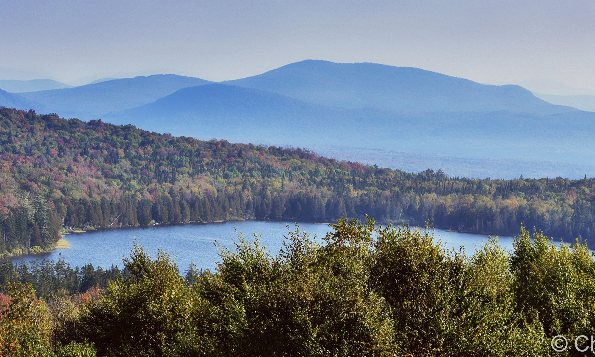
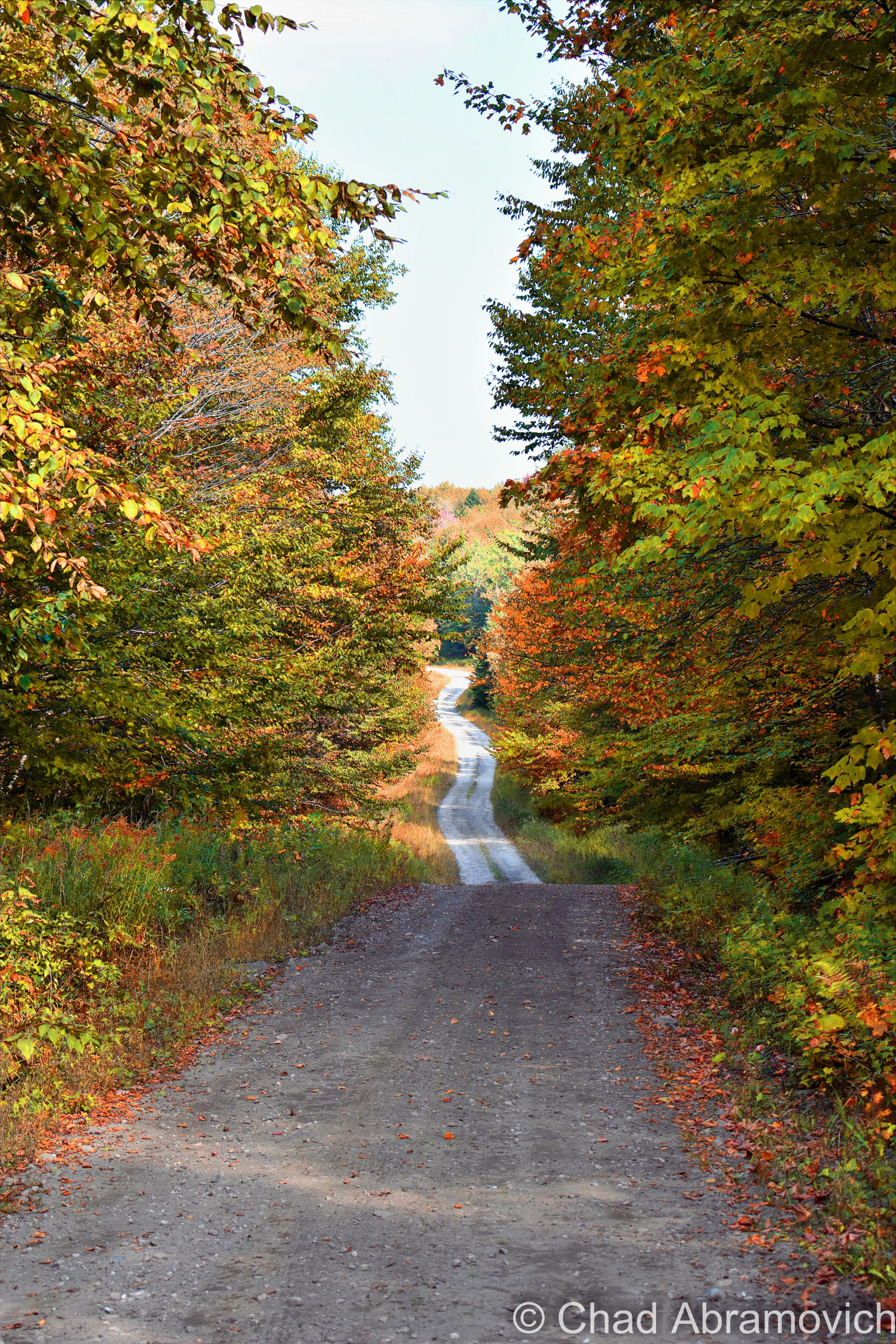
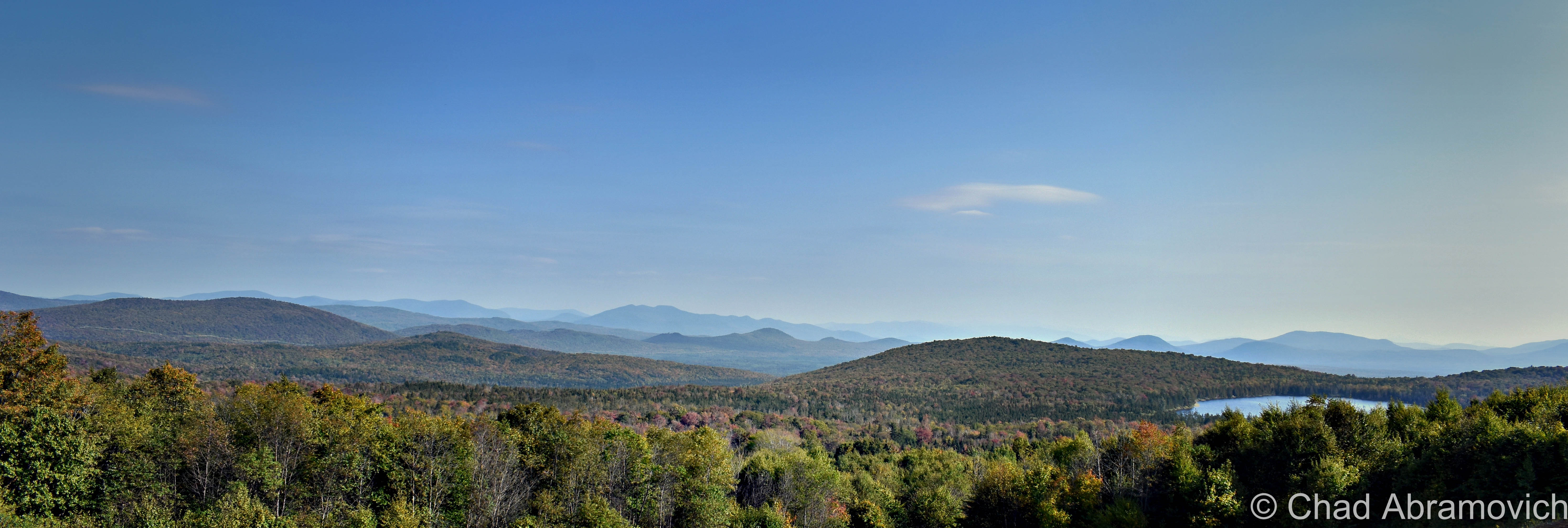
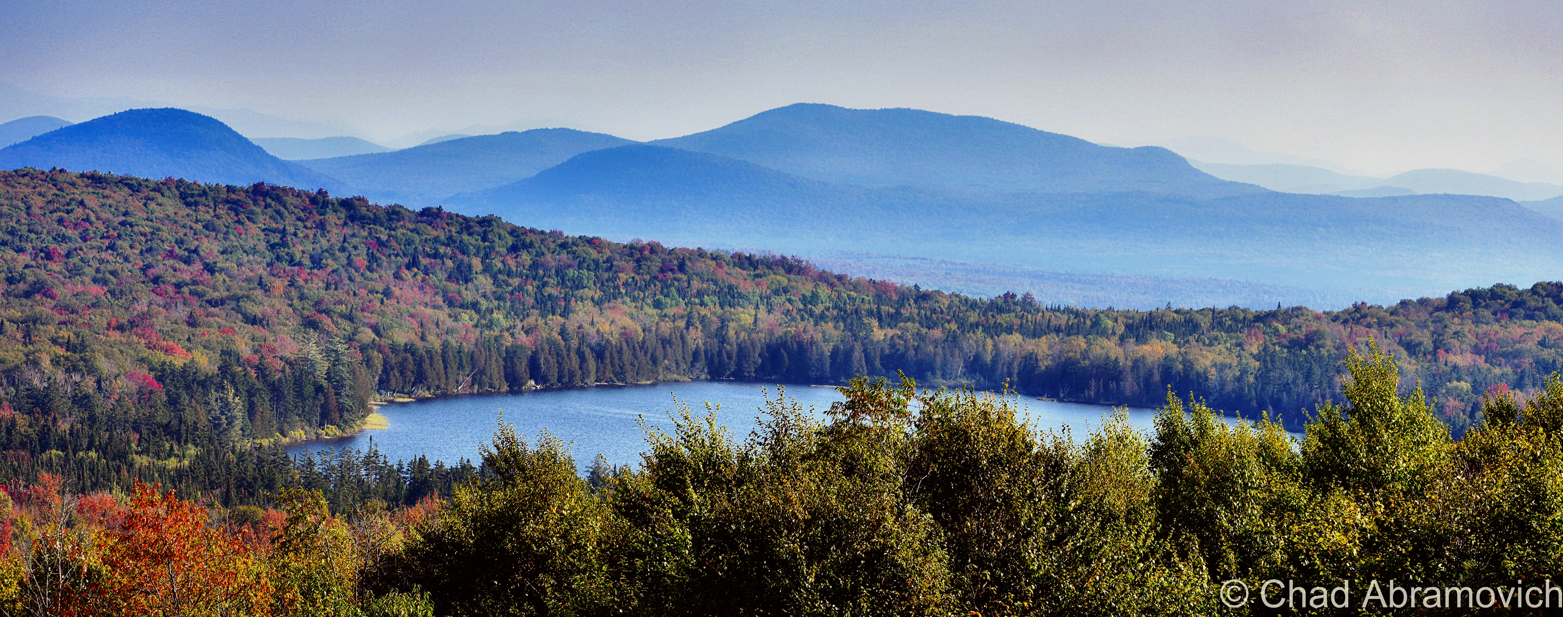
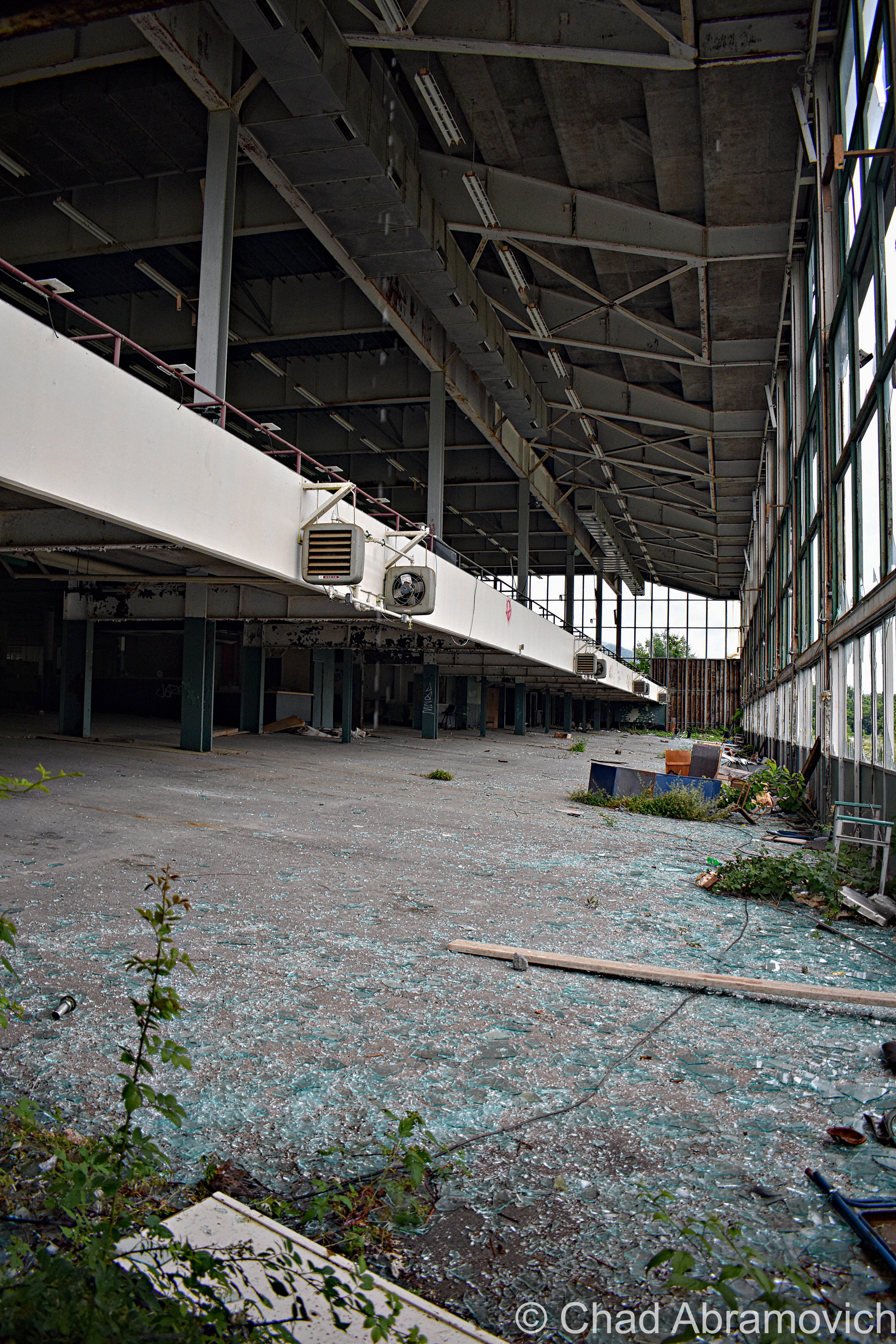
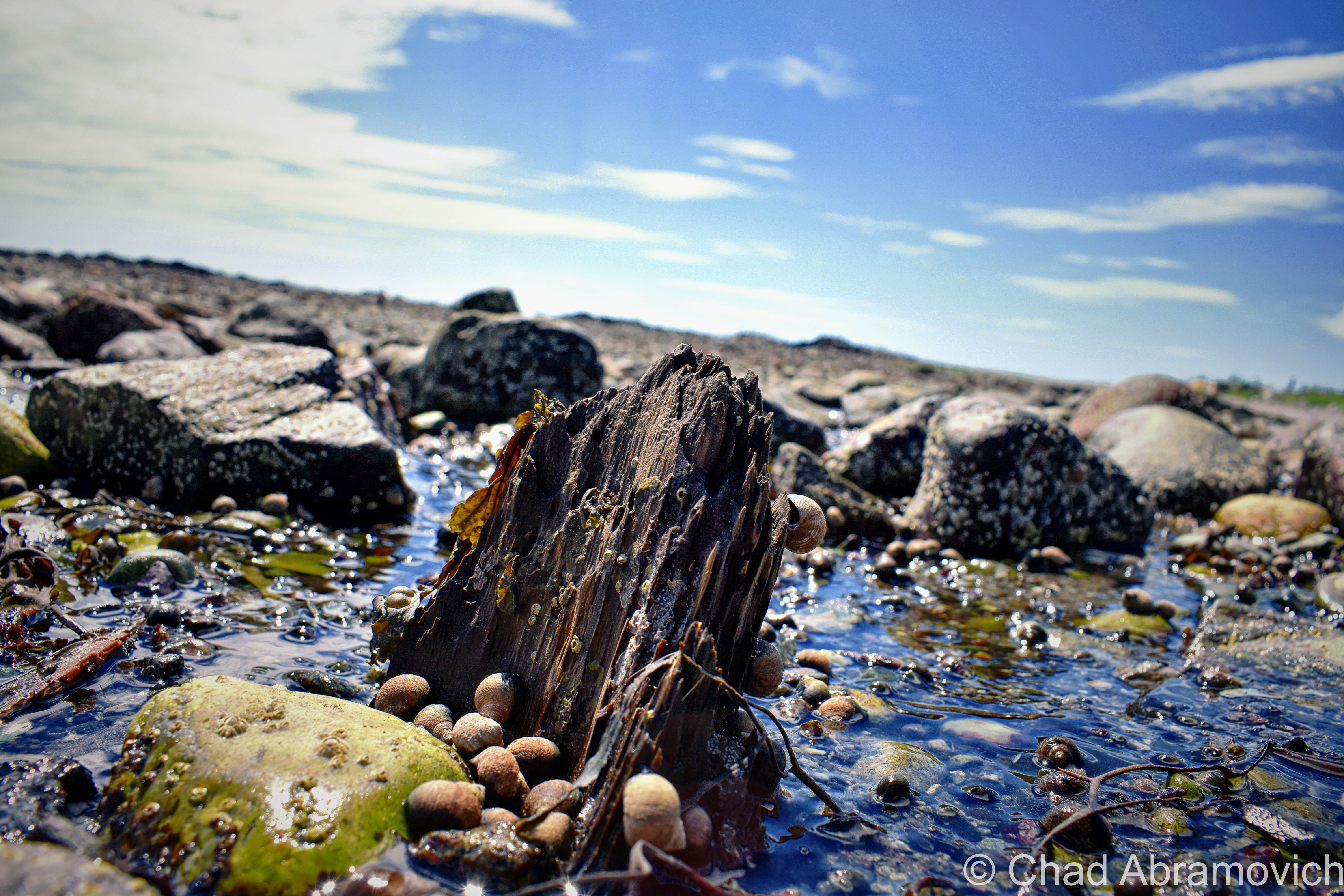
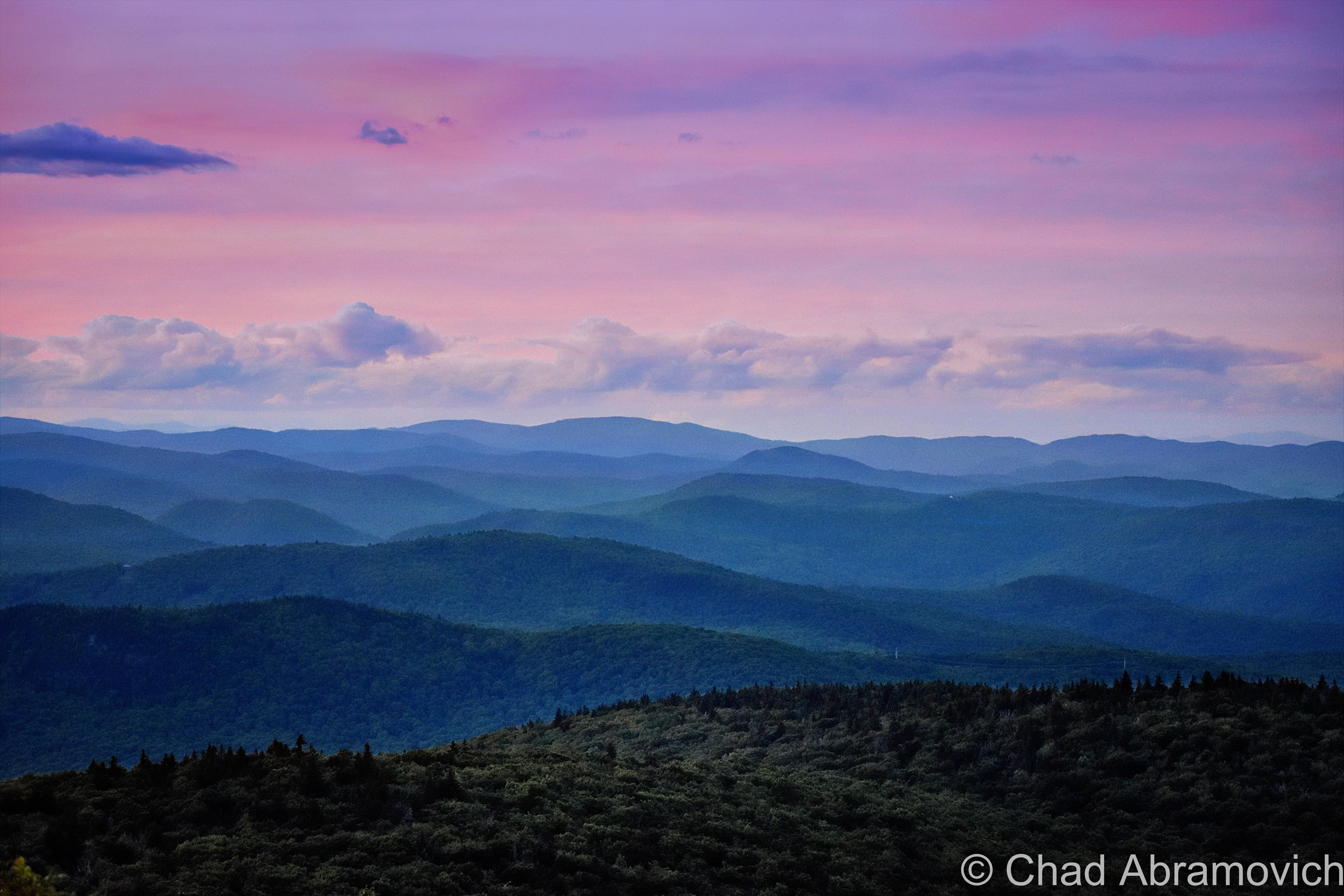
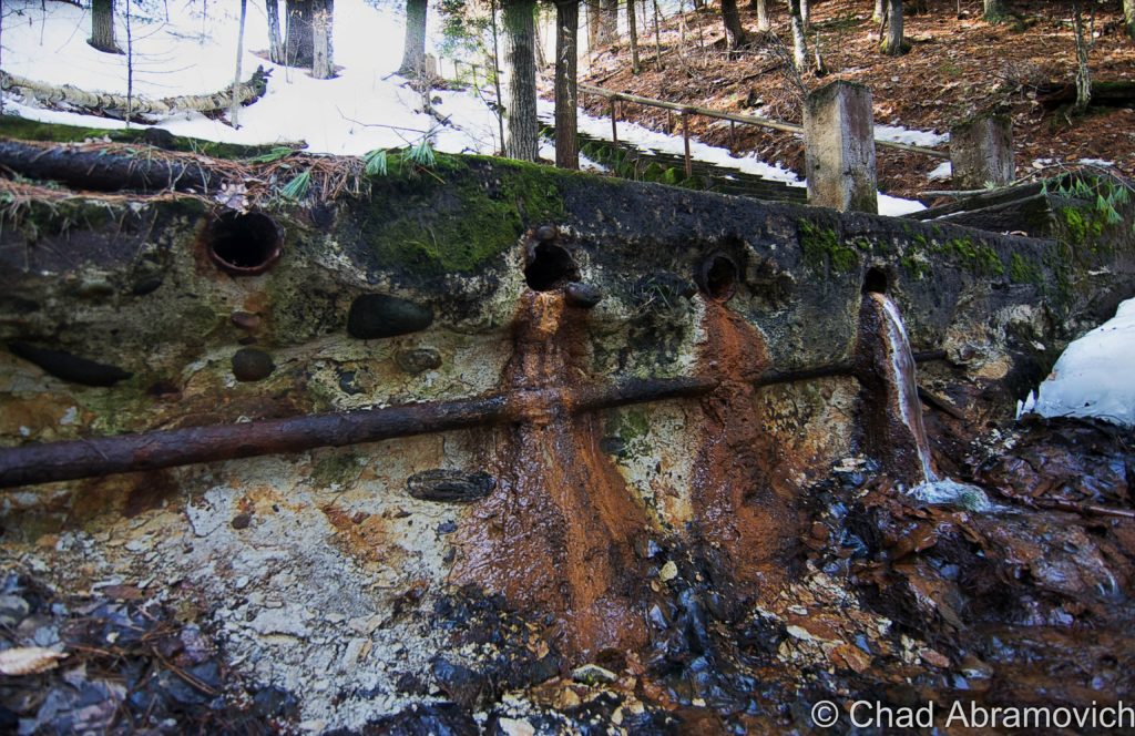
Vermont’s White River valley is full of shoulder-to-shoulder oddities that really communicate the personality of that part of the state. The last free-flowing (undammed) river in the state, its peripherals are loaded with history and mystery incorporated with its beautiful countrified scenery.

Over the years, I heard some conjecture that the Abenaki name for White River pretty much translated as “the useless river”, because of its mercurial behavior; often frozen solid in the winter, a dangerous torrent in the spring, and then shallow in the summer. Neither I, nor the Vermont Historical Society, could find any evidence to corroborate that, but I still find it pretty interesting. Actually, the White River’s name seems to be a bit of a mystery, though it’s reckoned that some settlers who were observing the 60-mile river 200 years ago noticed a white frothiness in its gush near present-day White River Junction, and decided to name it White River.

That etymologic mystique is pretty thematic and kinda sets the stage – the White River is viscous with history and enigma.

There used to be legendary log drives that utilized the river when they could. Nowadays, paddlers and fishermen seem to be the only traffic.

It might have been considerably larger thousands of years ago, which subsequently made up for its untrustworthy nature in the form of natural resources. Vermont Verde Antique – a rare beautiful and coveted form of serpentine is found in the hills between Hancock, Roxbury (the geographic center of Vermont!), and Rochester.

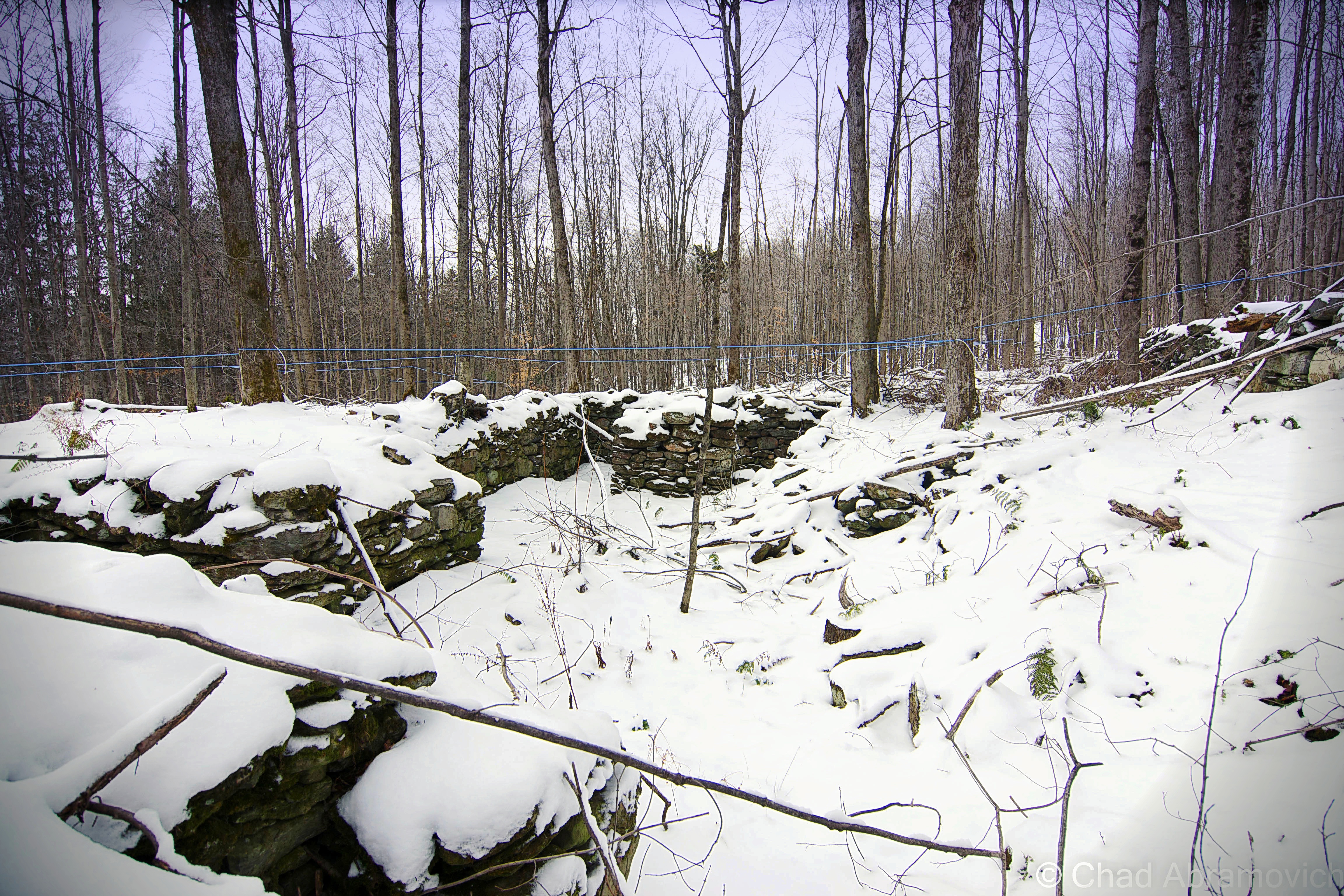
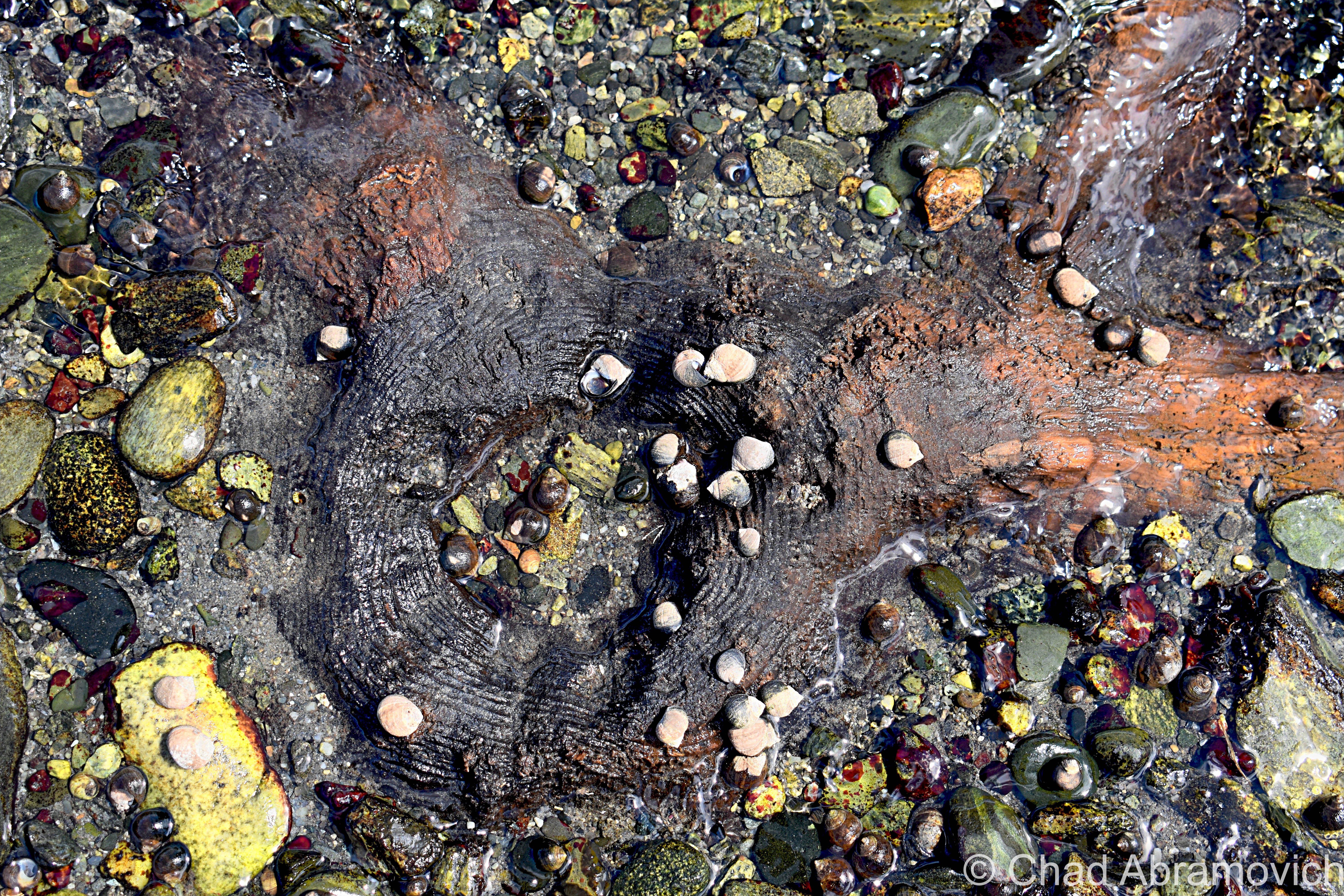
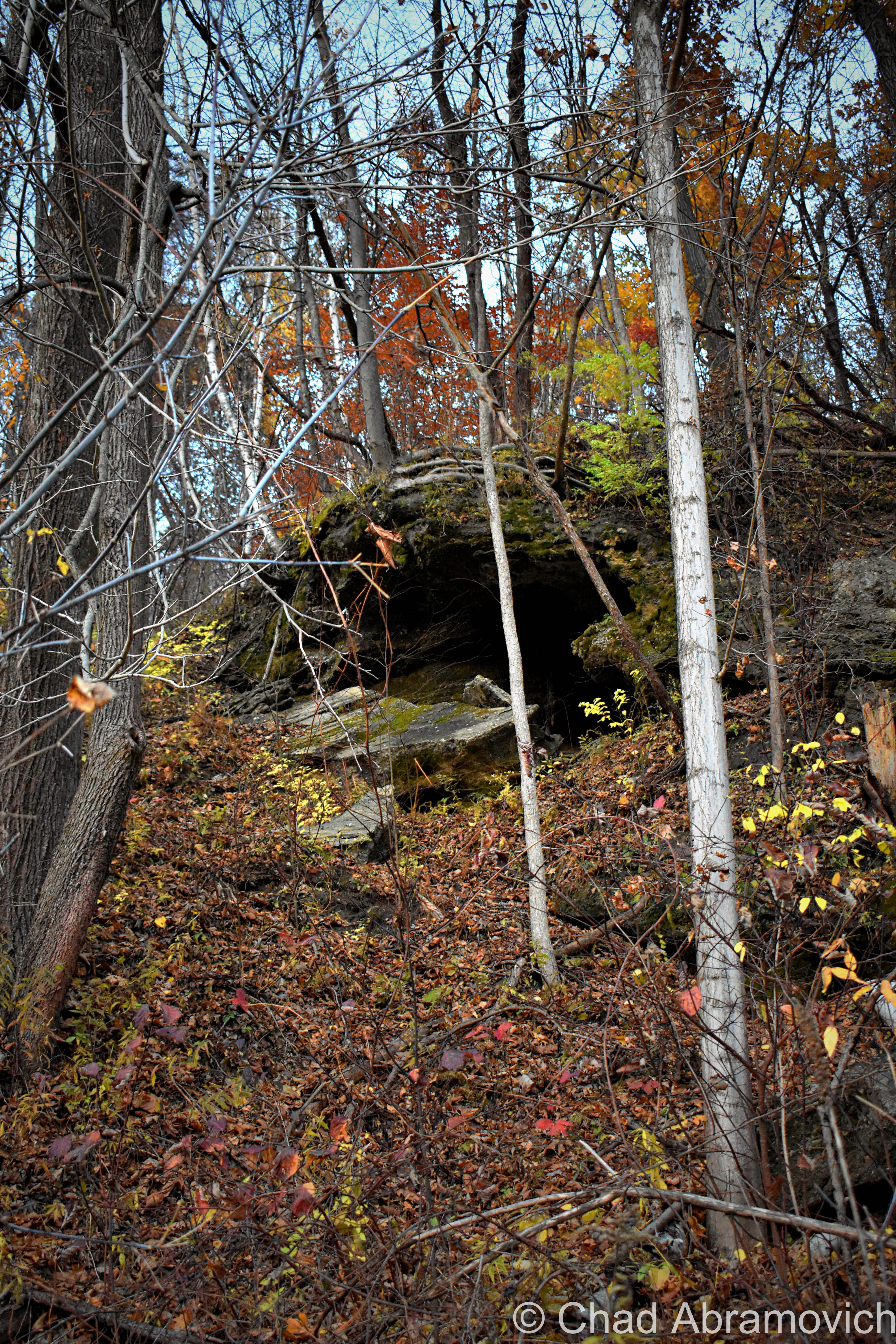
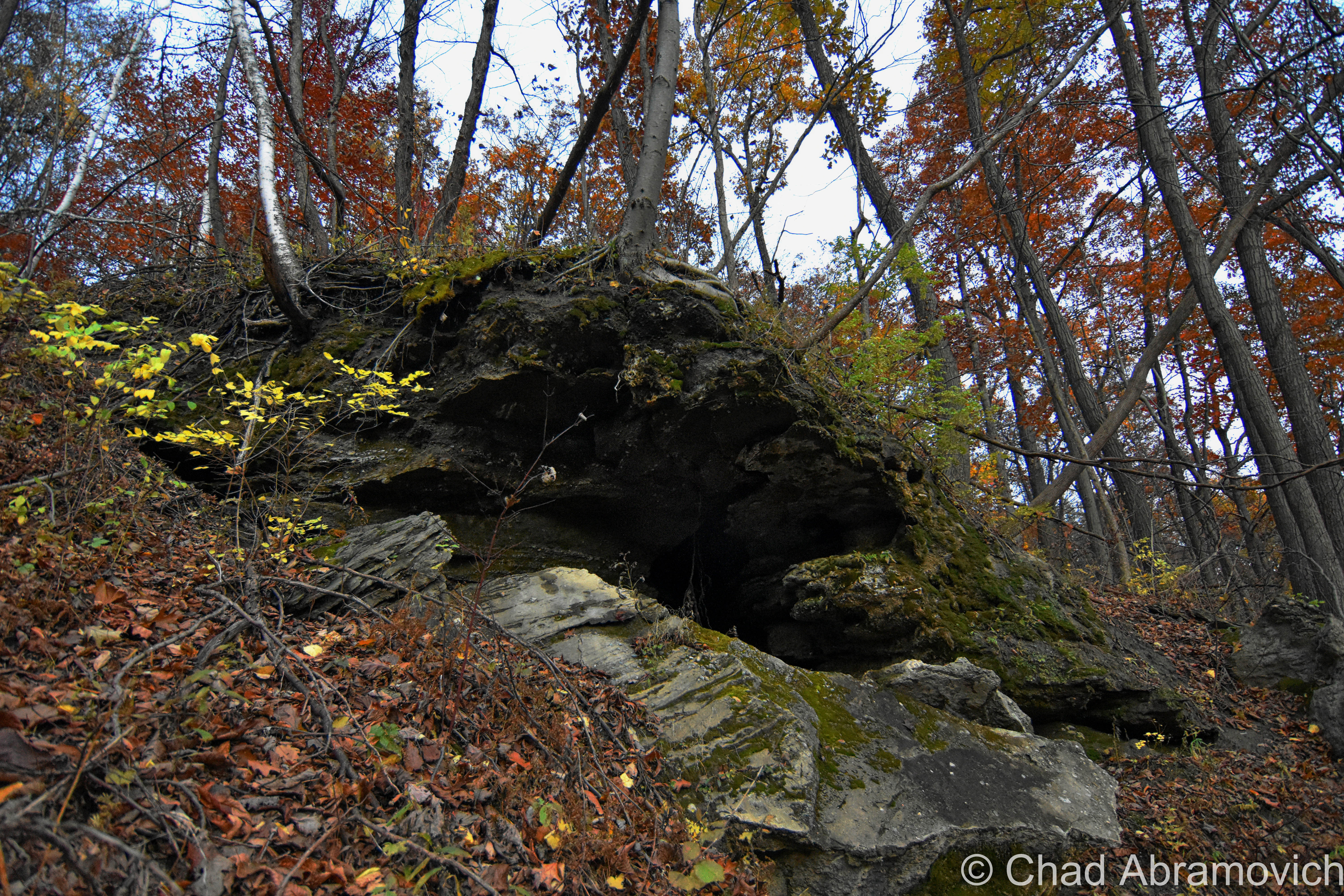
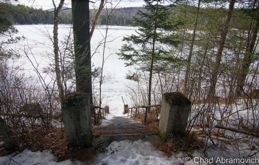
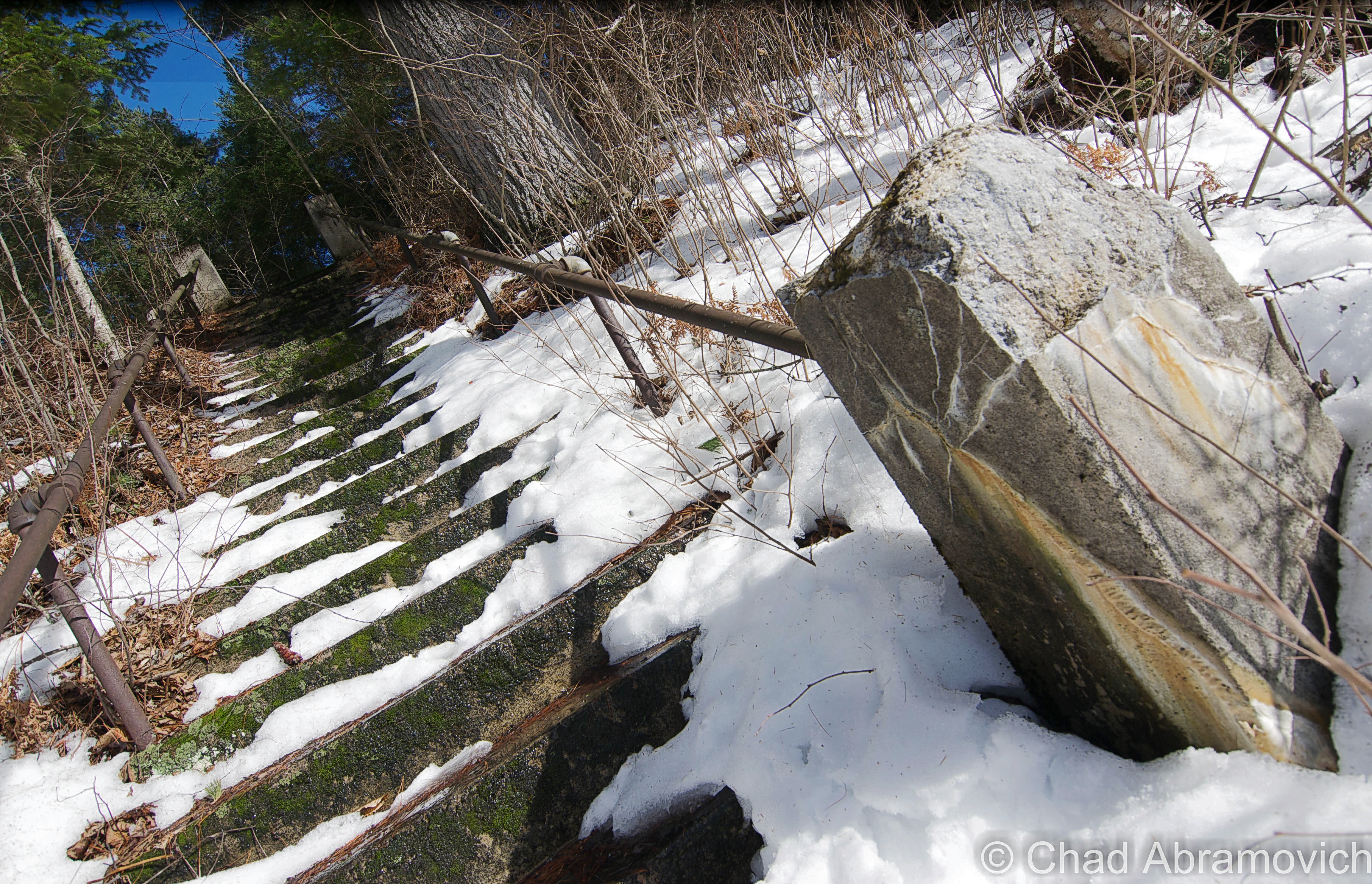
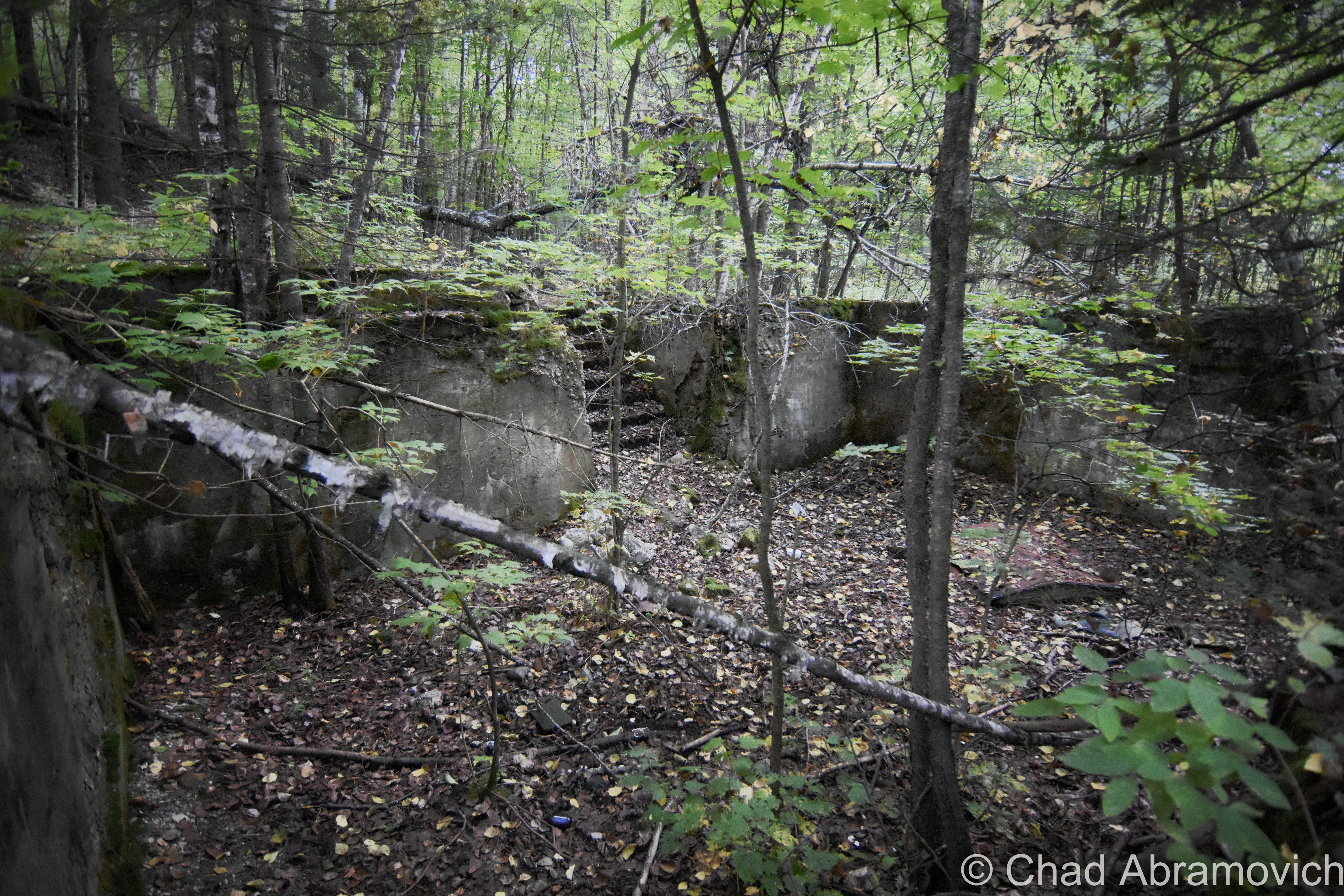
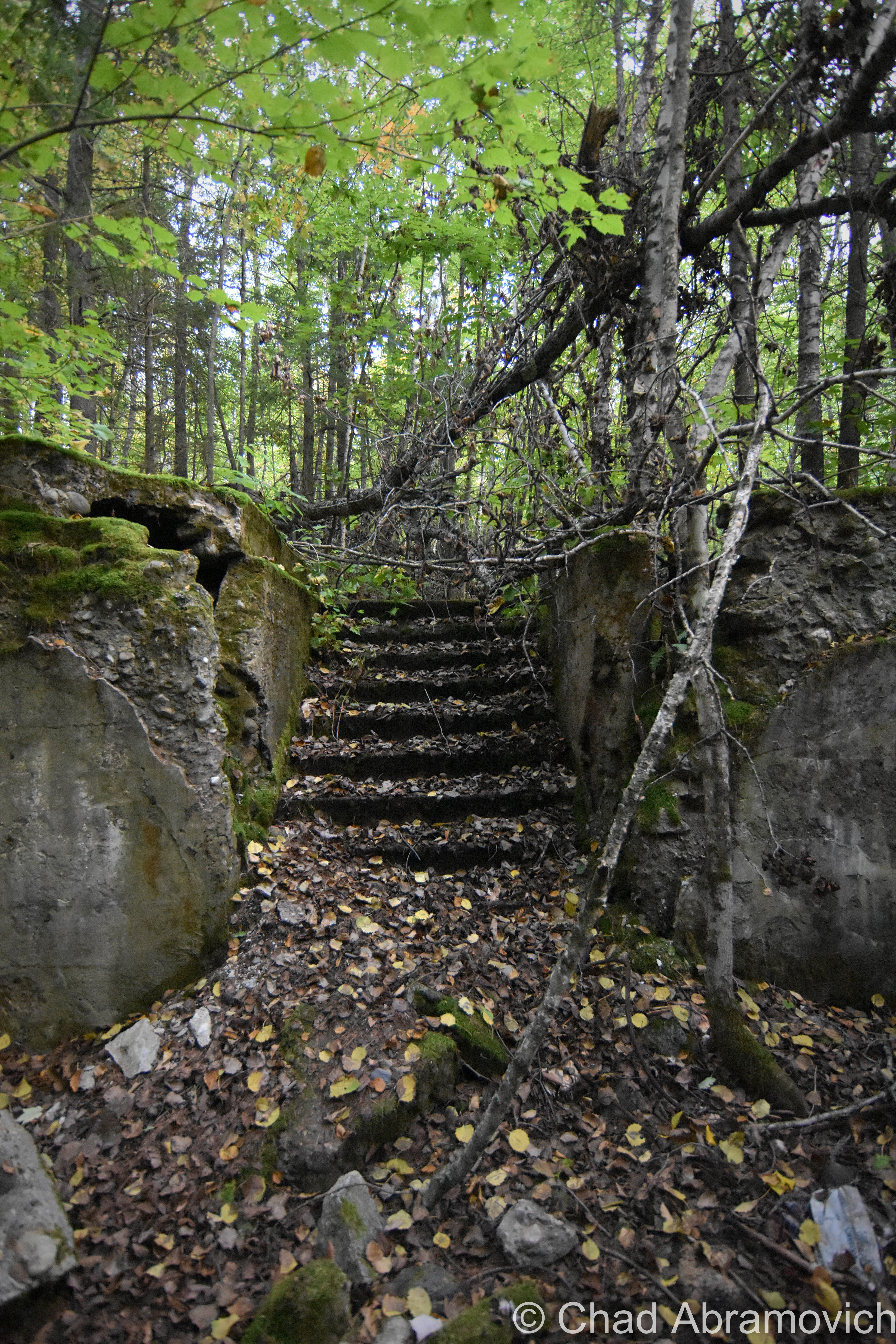
A few of our strange stone chambers – one of my favorite state mysteries – can also be found up in the rocky highlands of a few white river valley towns.

Gold has been found in the river, and ancient Roman coins were once said to be discovered along its banks. Perhaps what’s more puzzling is how they got there…

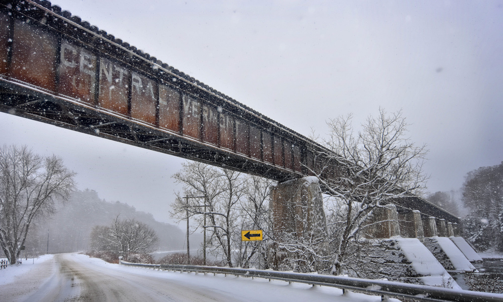
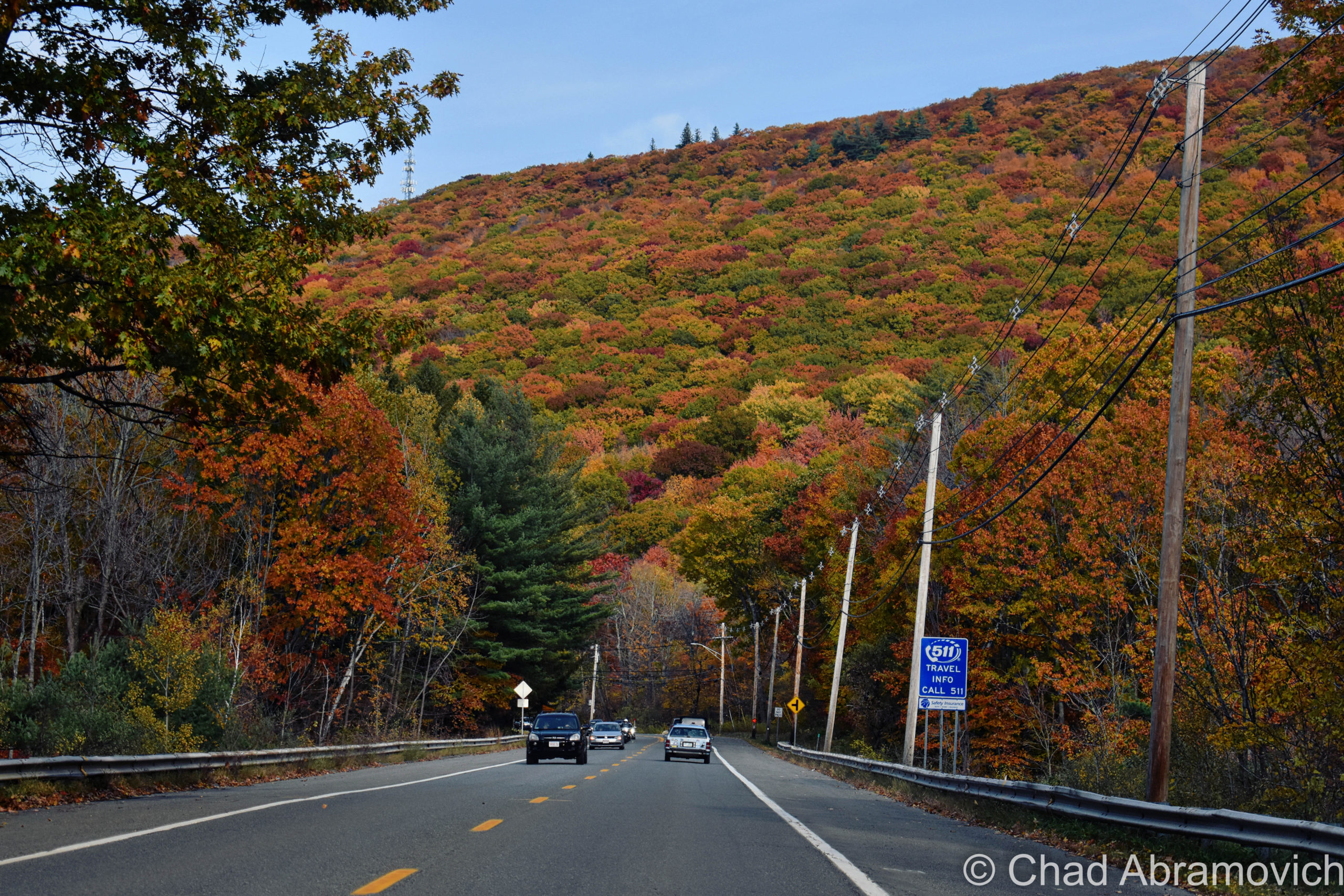
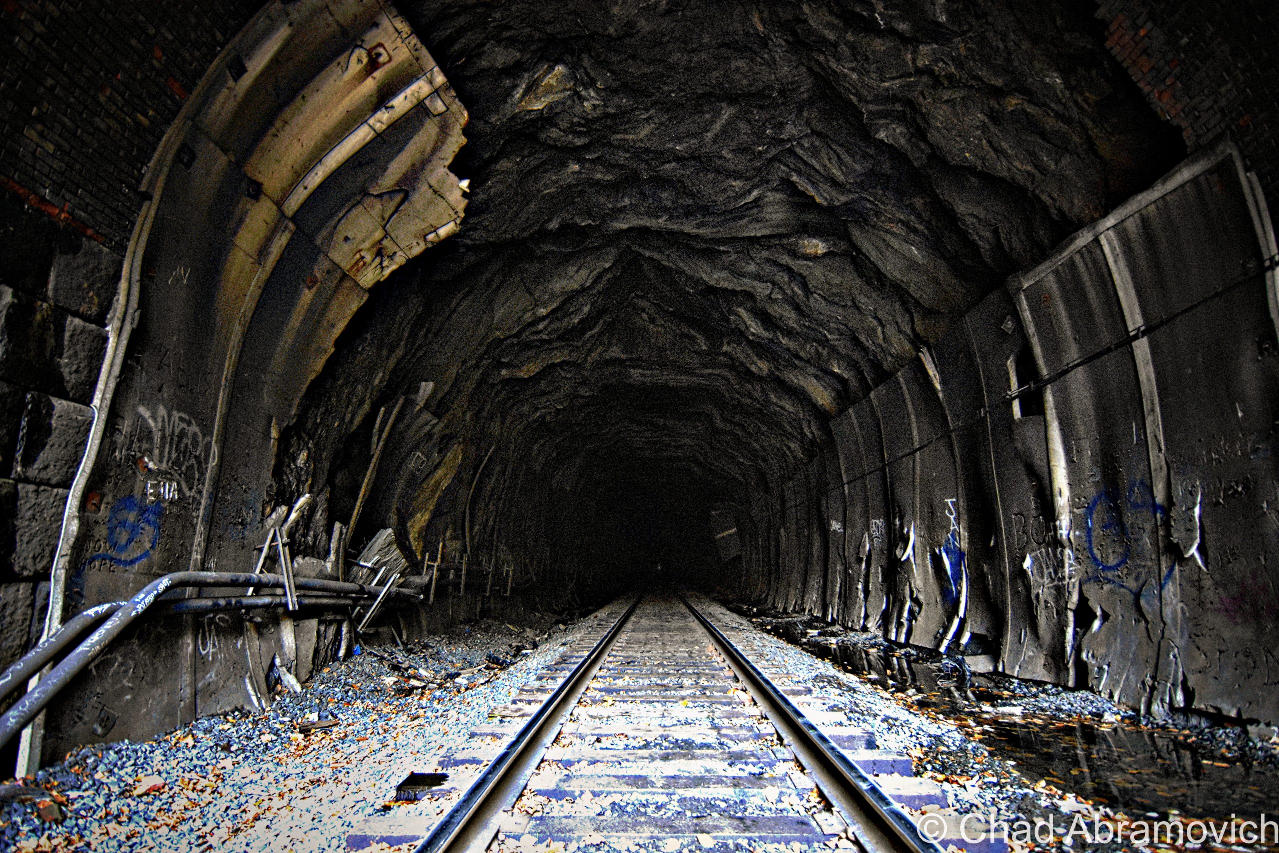
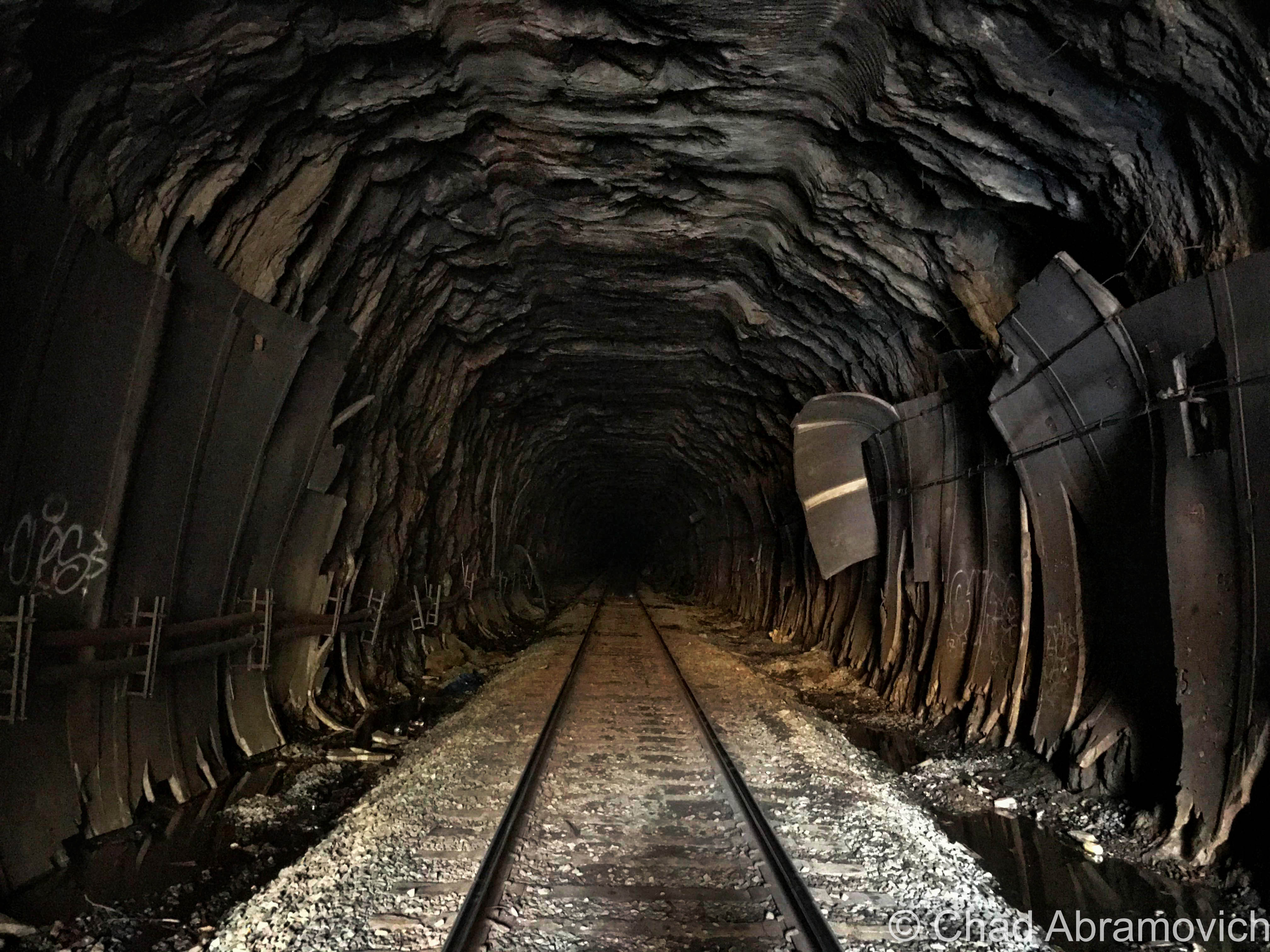
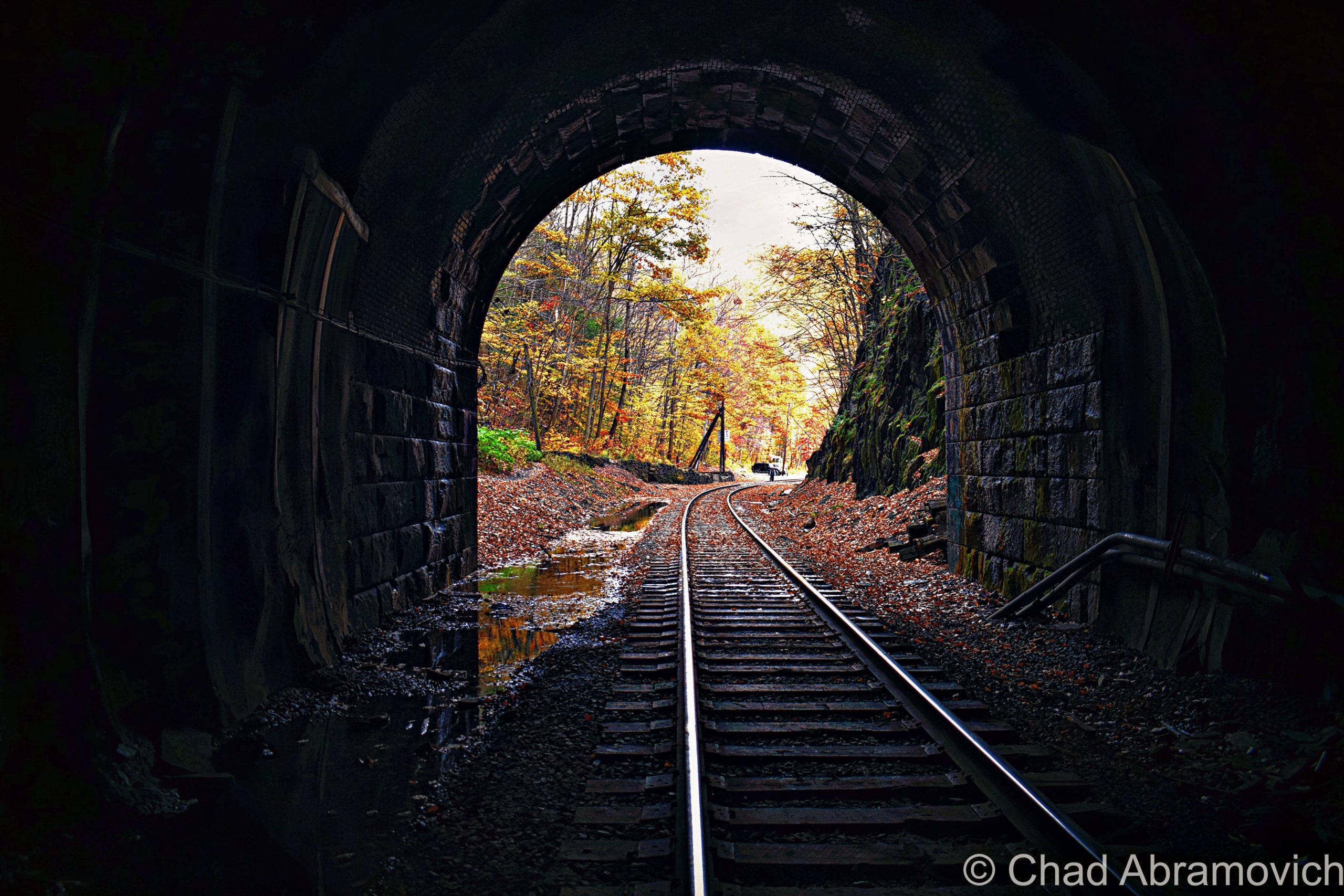
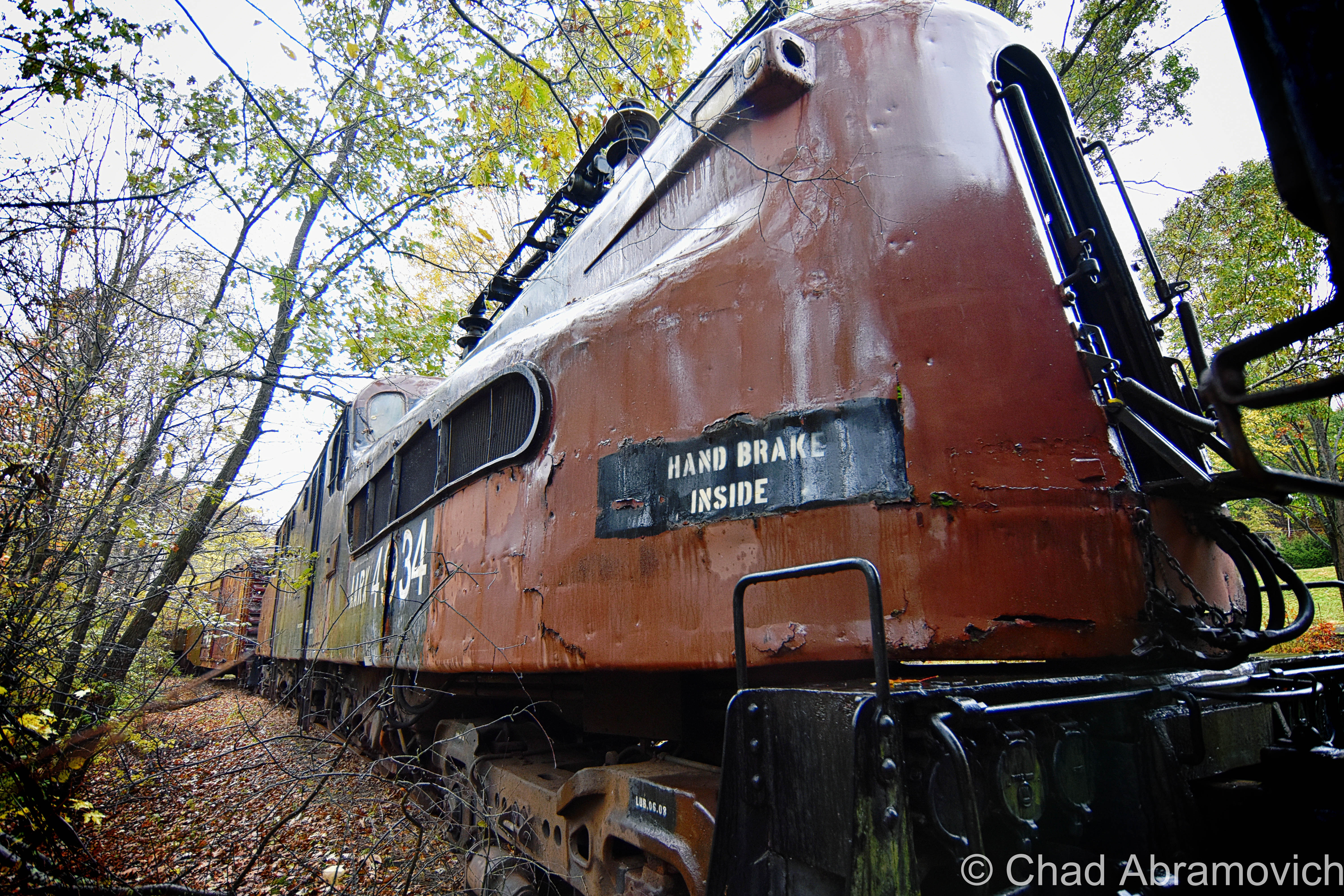
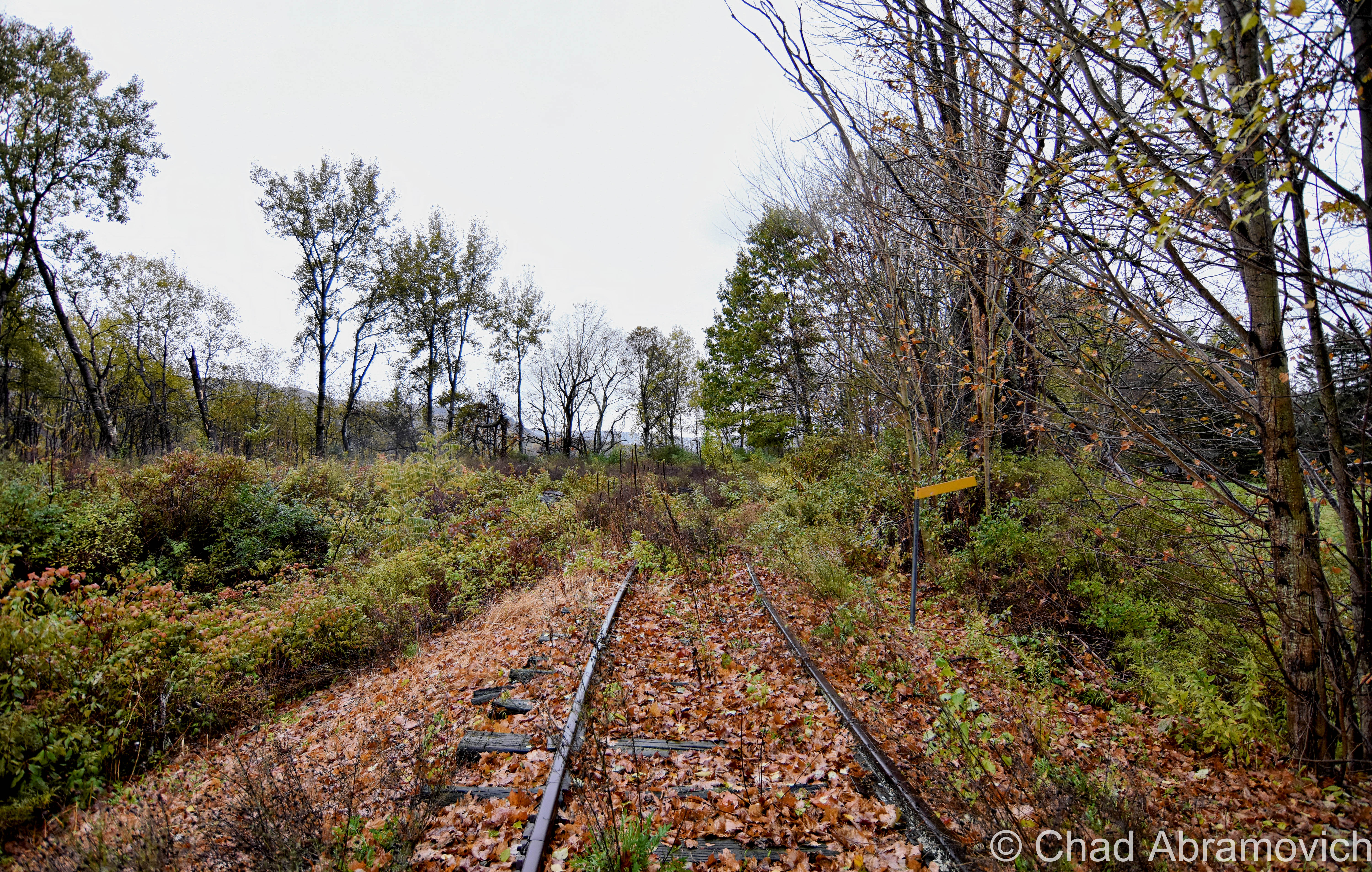
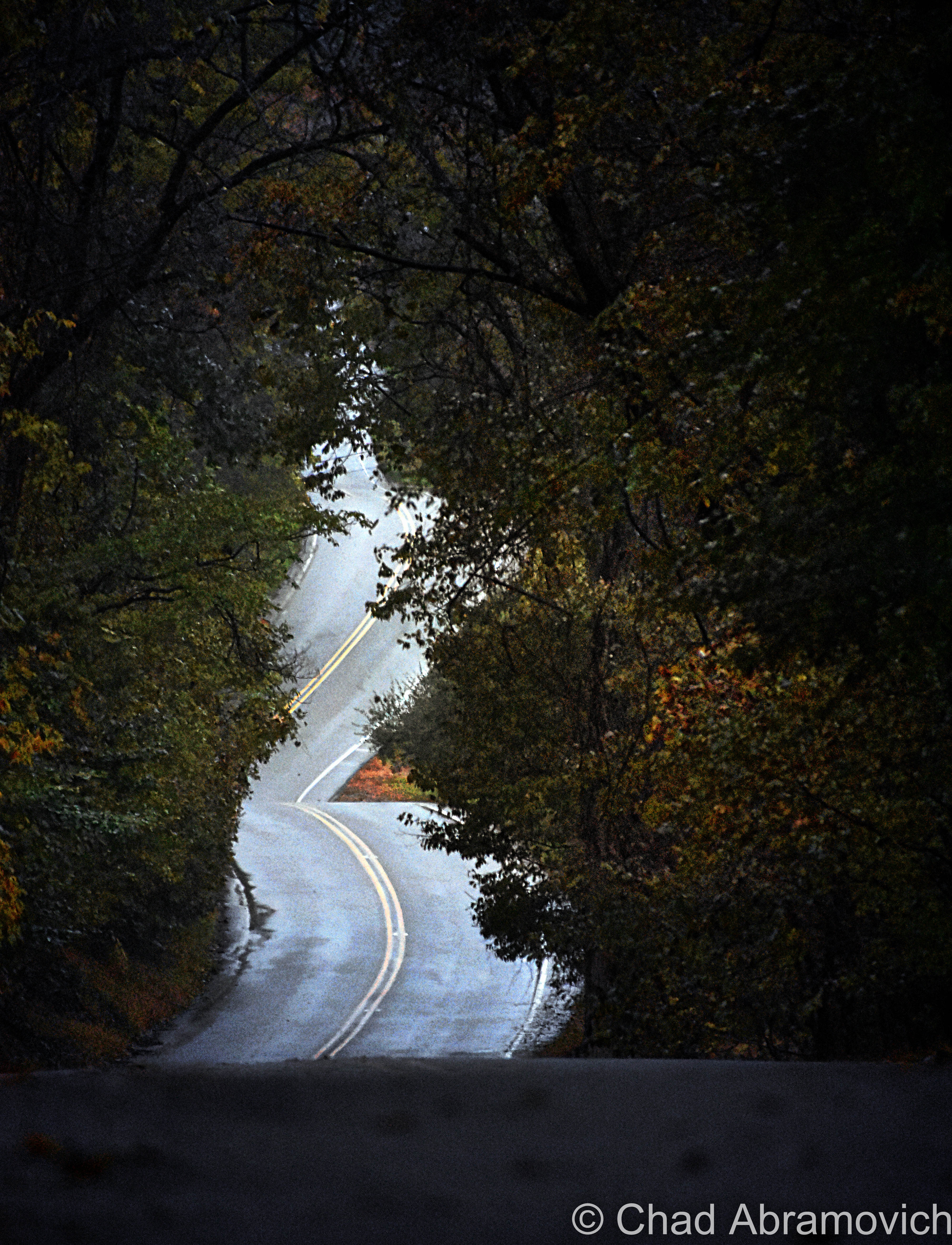
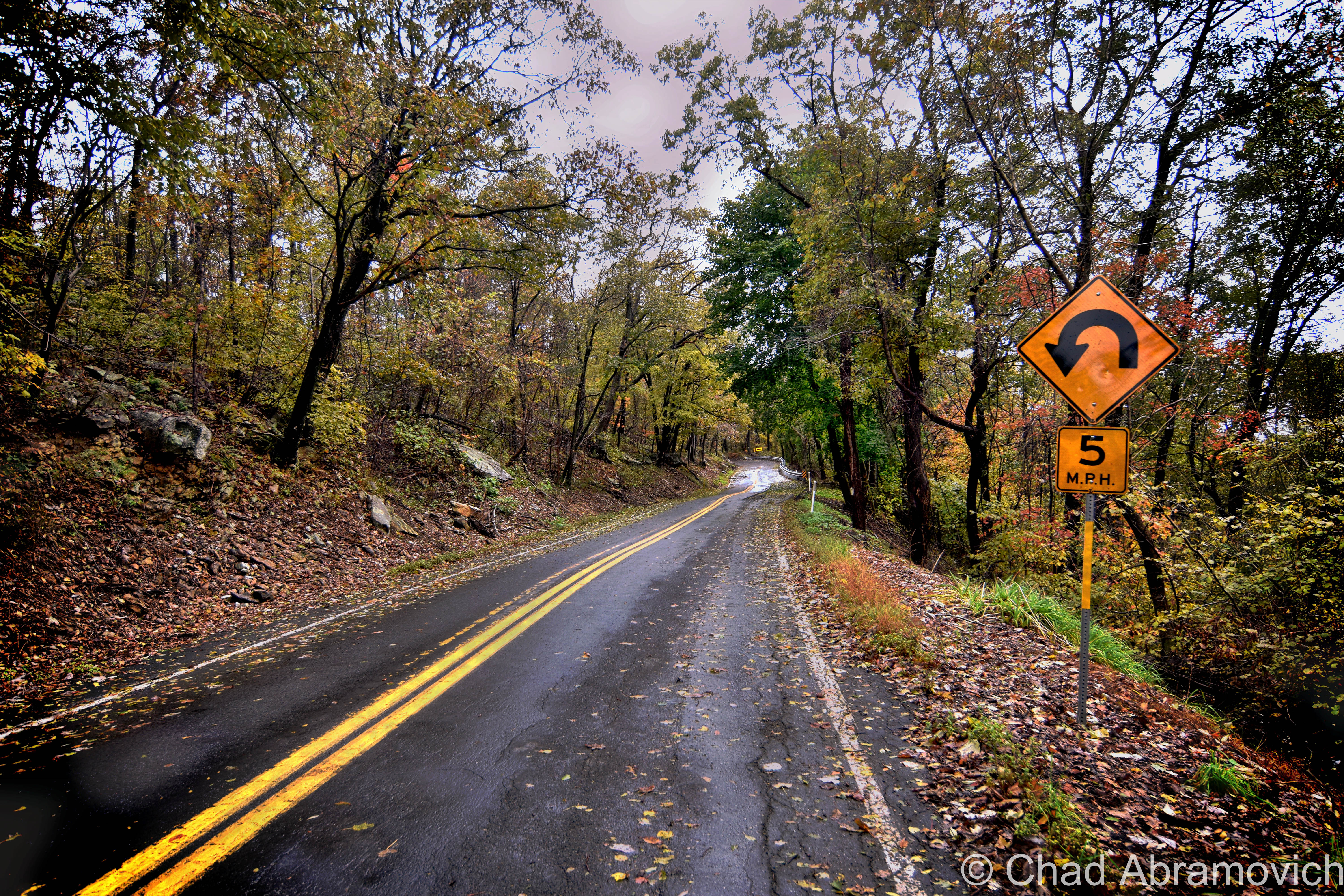
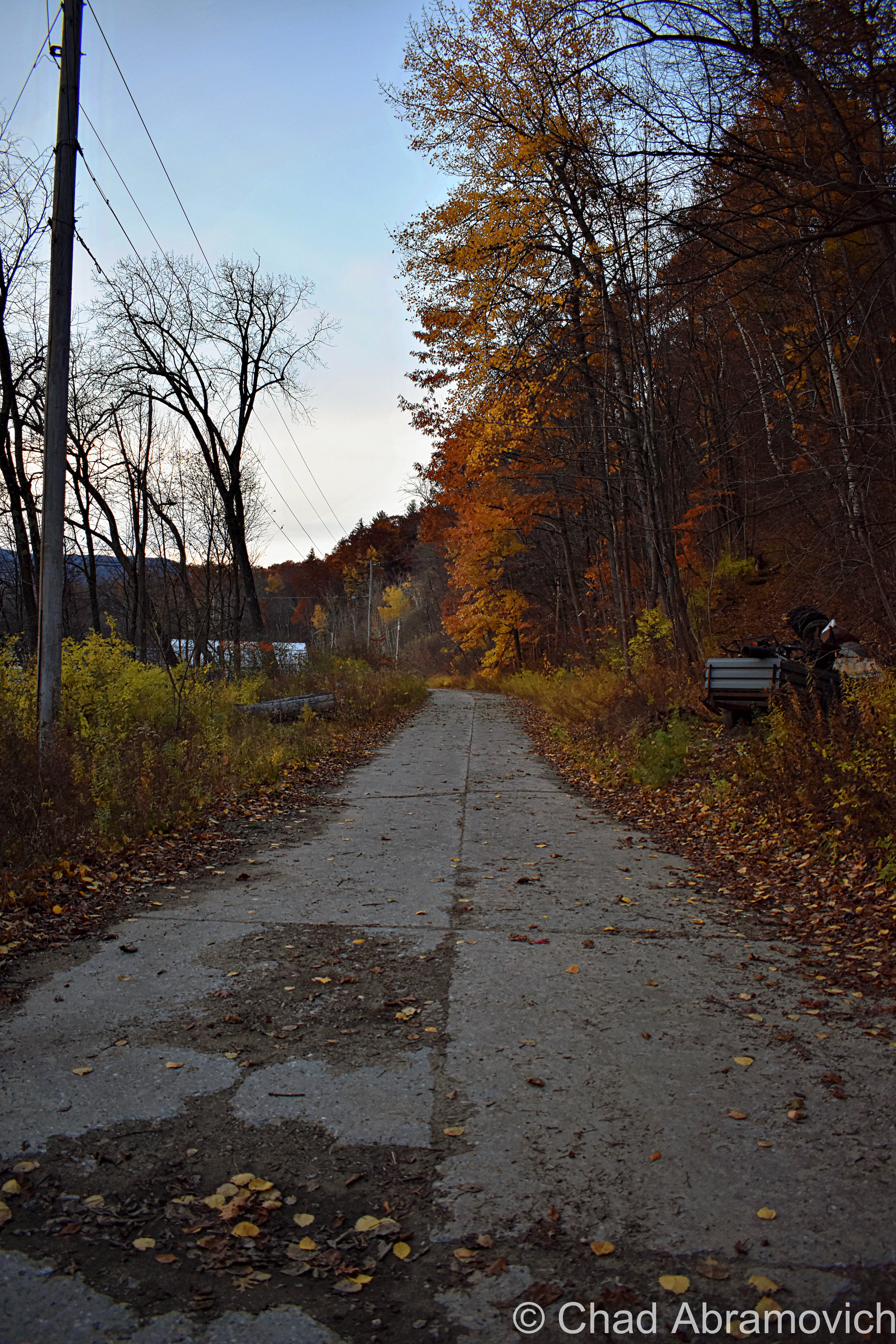
State Route 14 follows much of the White River and zigzags through the neat small towns it carves through like Bethel, Sharon, Royalton, and Hartford, and underneath old rusted railroad bridges that never anticipated a 2 lane road to pass underneath them in their construction. It’s a great drive and would eagerly recommend it to any other Vermont enthusiasts.

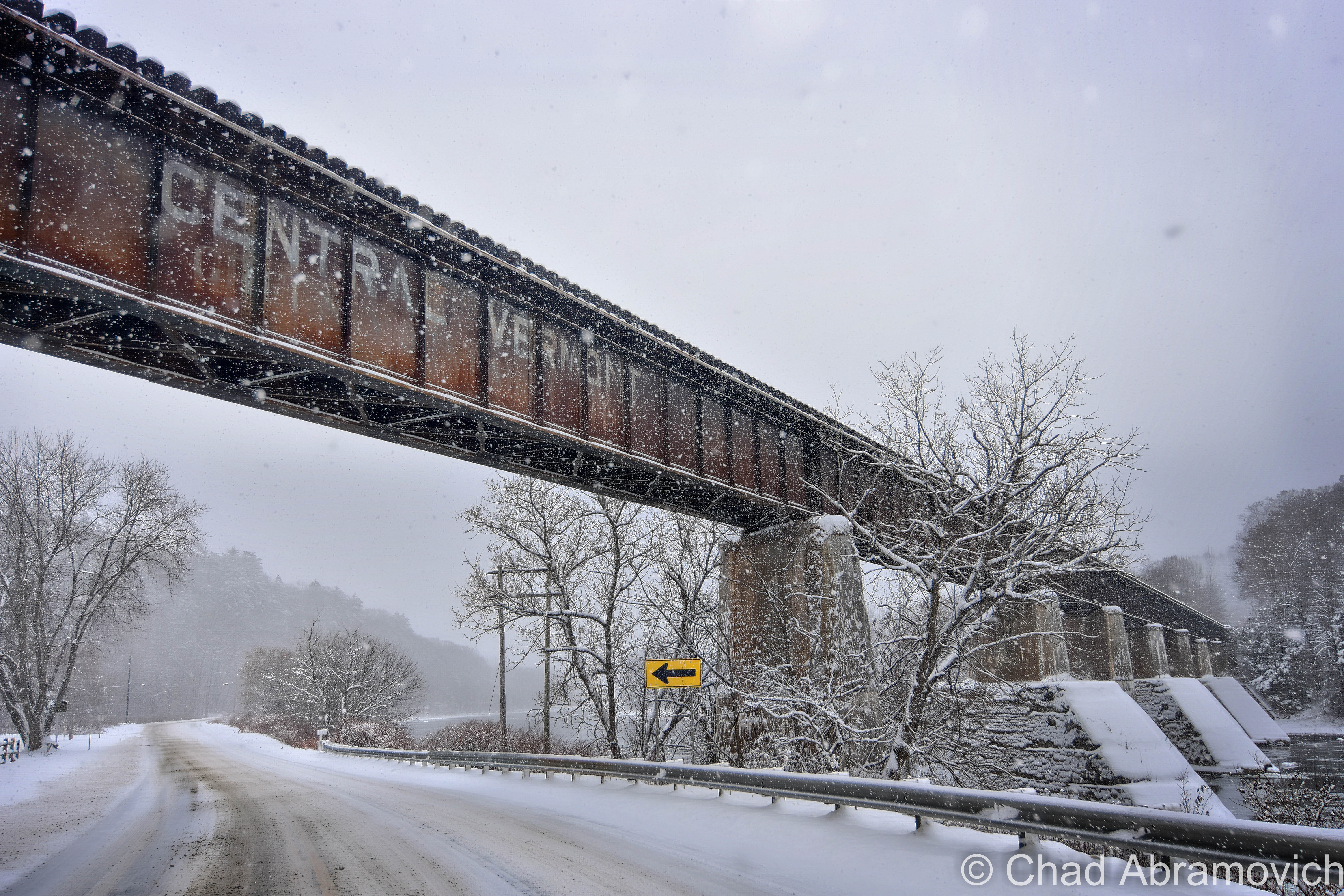
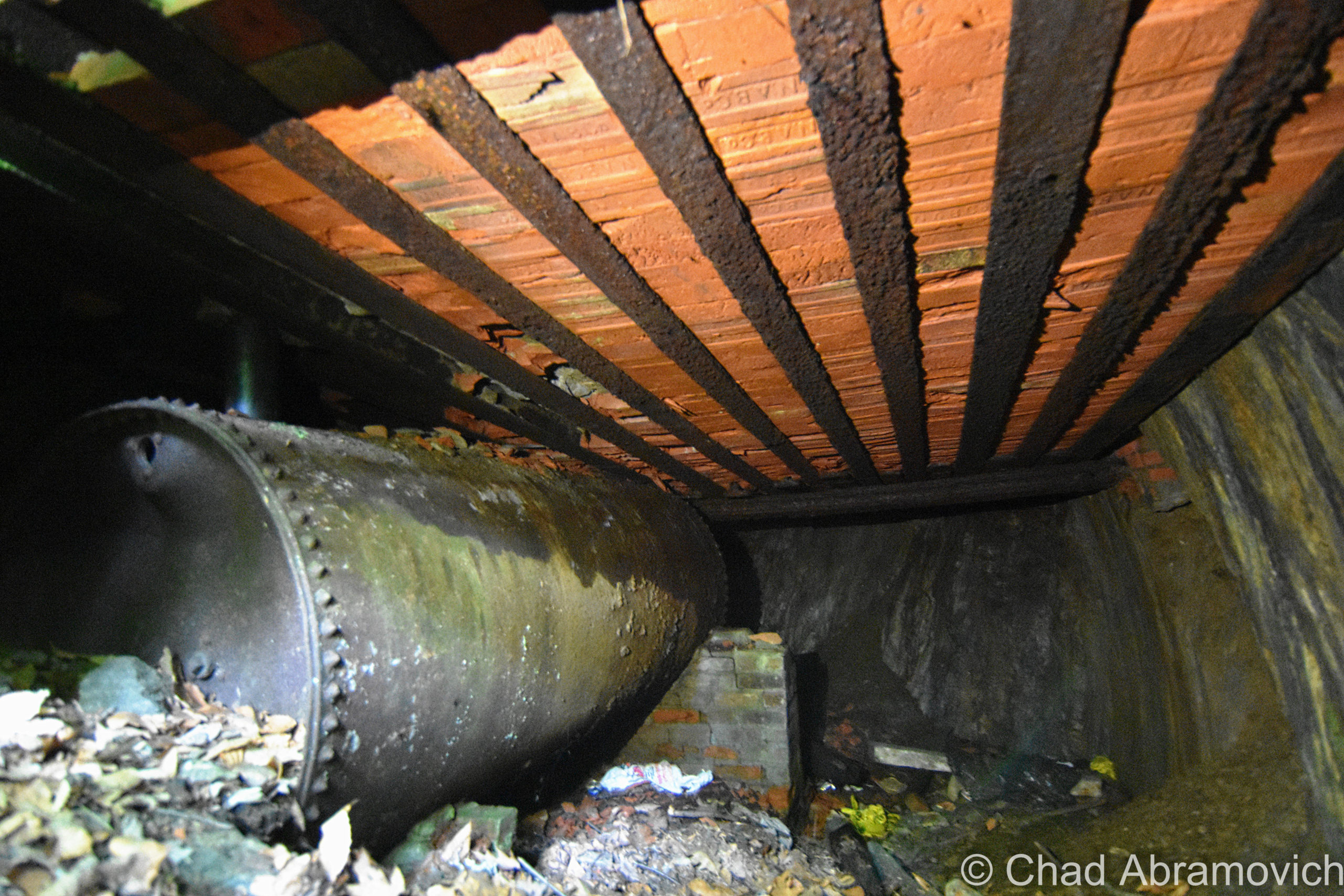
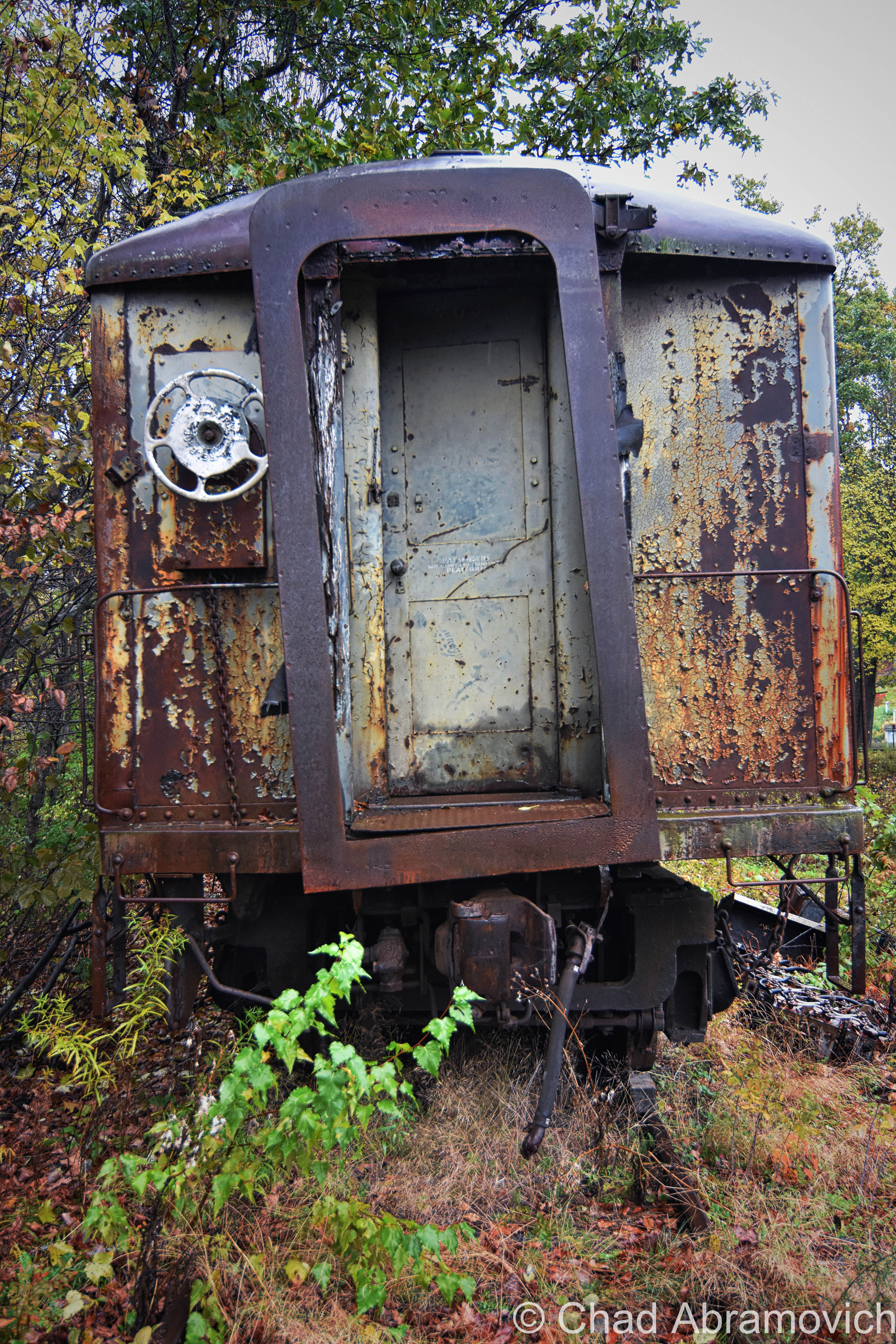
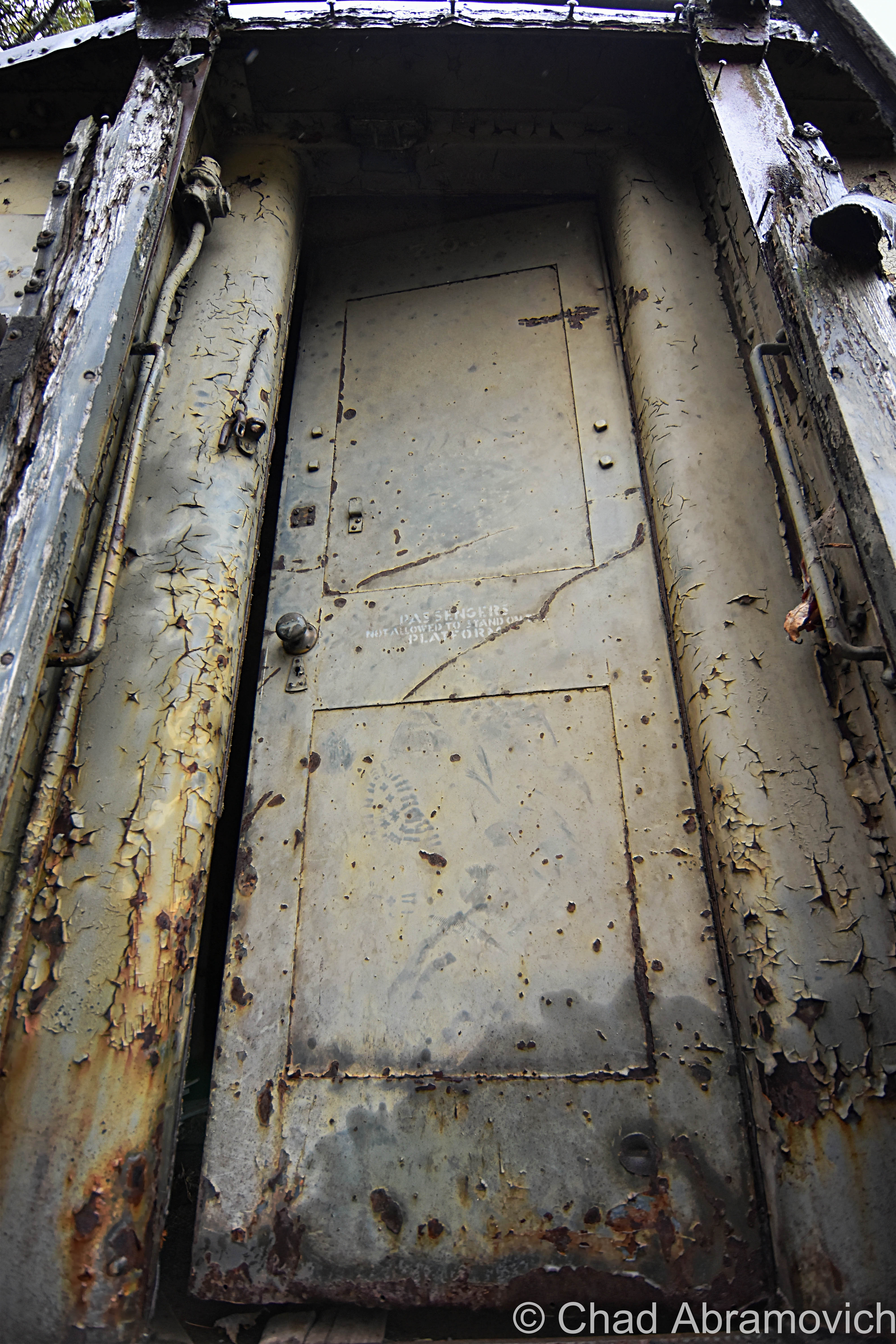
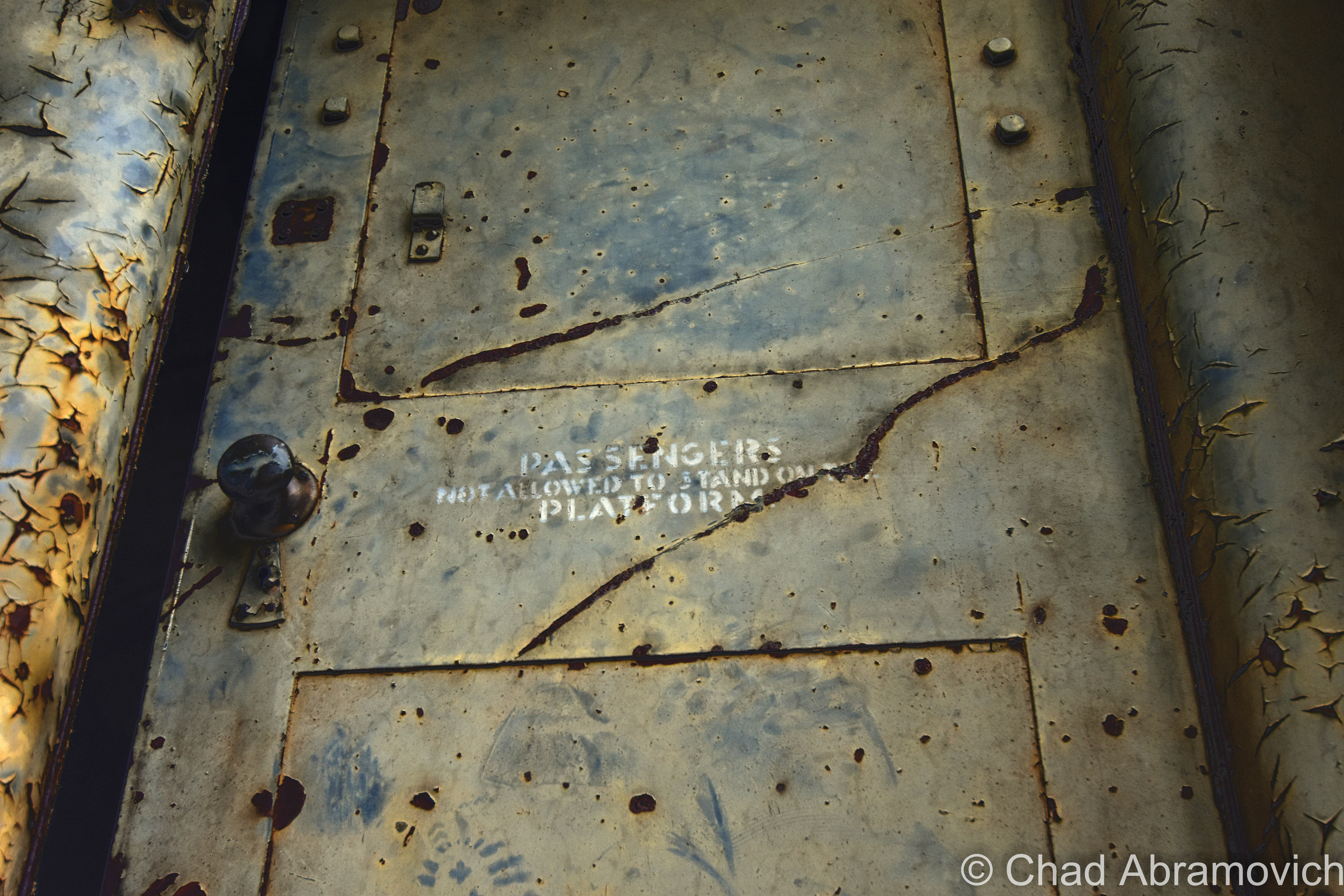
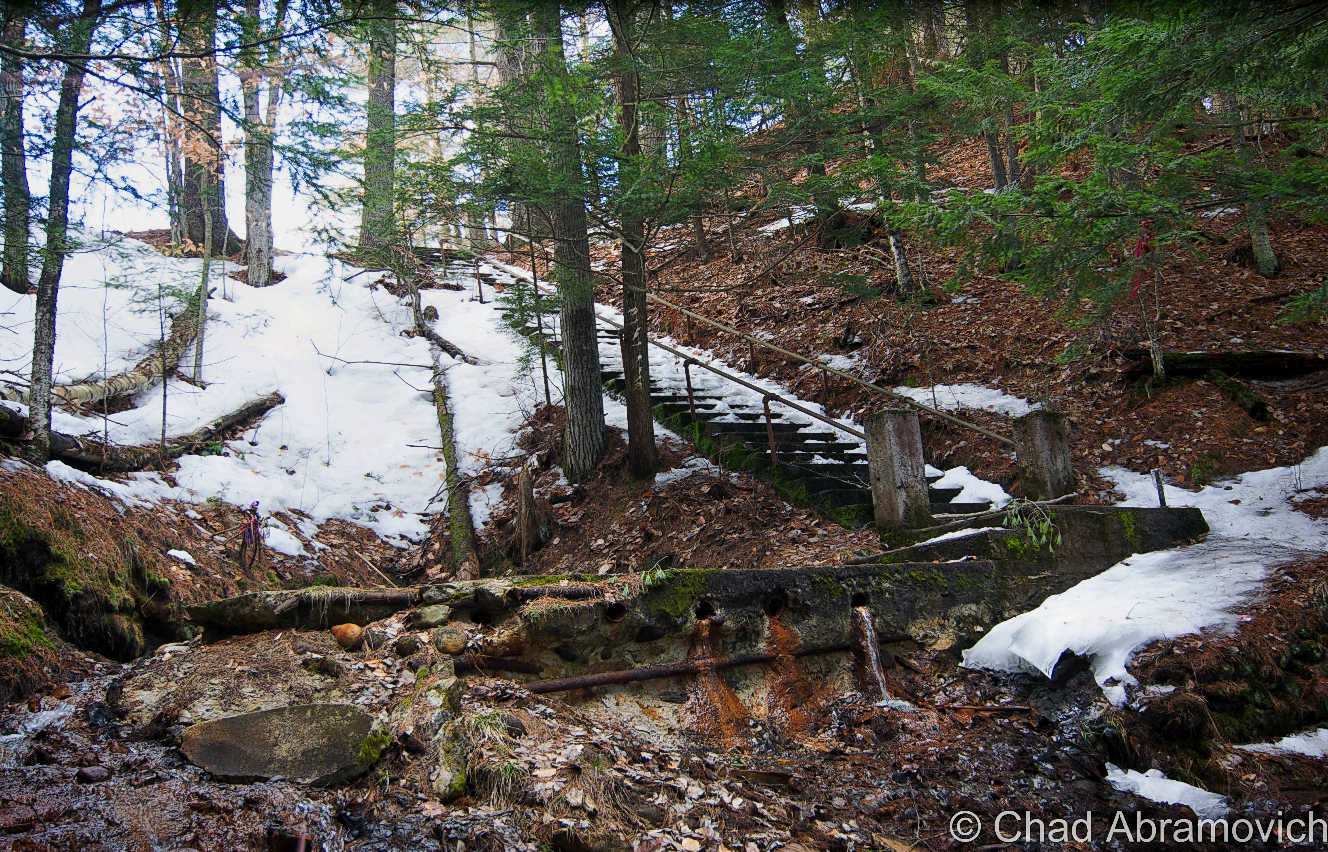
If you drive state route 14 along the White River near the tiny village of West Hartford, you’ll eventually spot an unremarkable rusty railroad trestle supported by time-beaten stone pylons and vanitied with a neat fading old Central Vermont Railroad ghost sign. It looks like plenty of other old railroad bridges around New England.

But this one happens to be where the worst railroad disaster in Vermont took place – an affair so horrific that it secured national recognition.

The Hartford Railroad Disaster

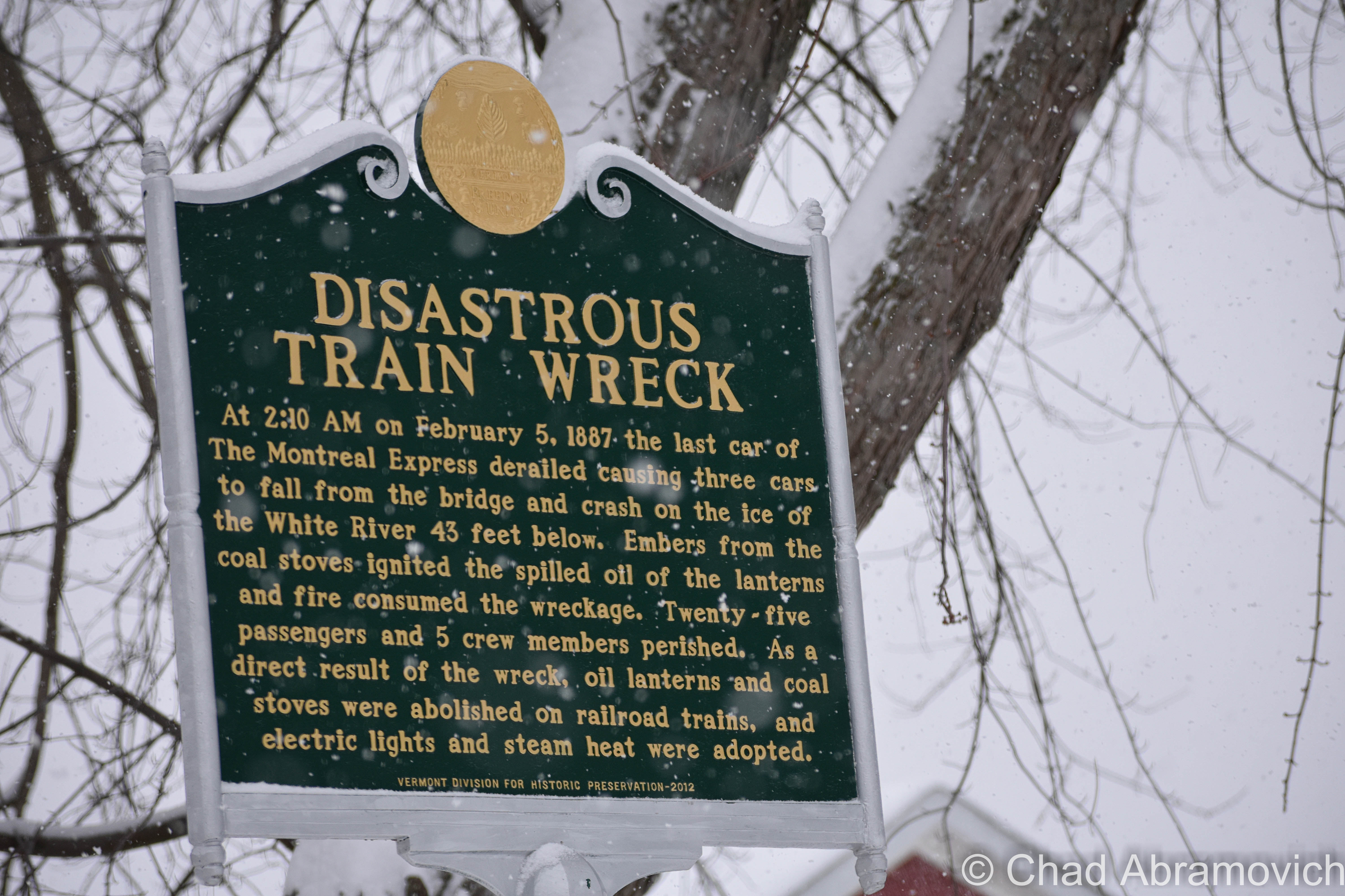
On the early morning of February 5th, 1887, the Montreal Express (also called “The Night Express”) pulled into the depot at White River Junction at quarter past two in the morning, before continuing northward to its titular destination. It was already running about 90 minutes late, so maybe the train was traveling a little faster than usual to make up for lost time.

The night was frigid cold – assaulted by arctic temperatures of 18 degrees below zero. Inside the passenger cars, oil lamps illuminated the interiors while wood stoves tried to fight the vicious chill in the uninsulated coaches.

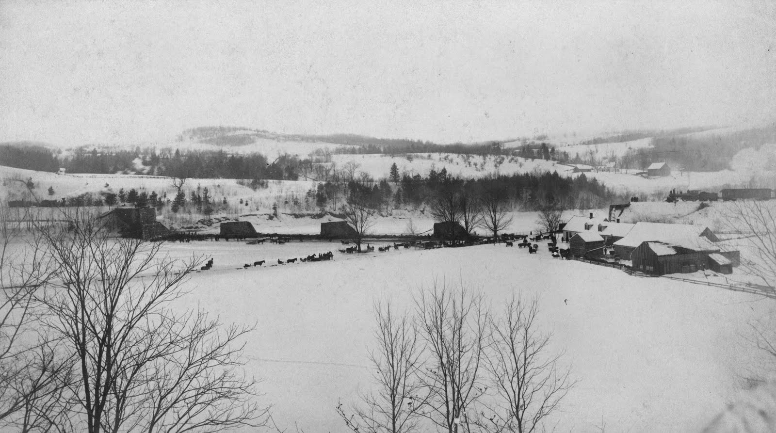
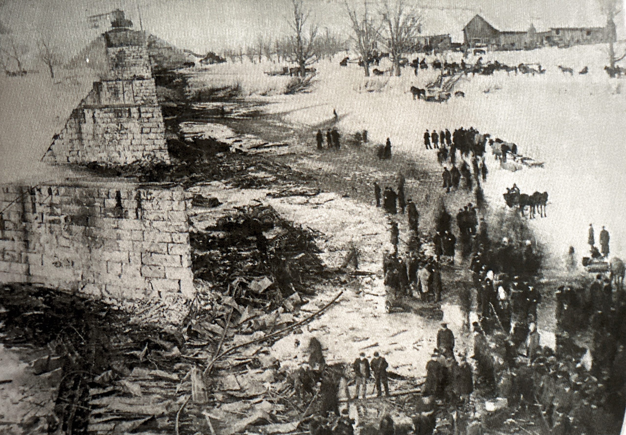
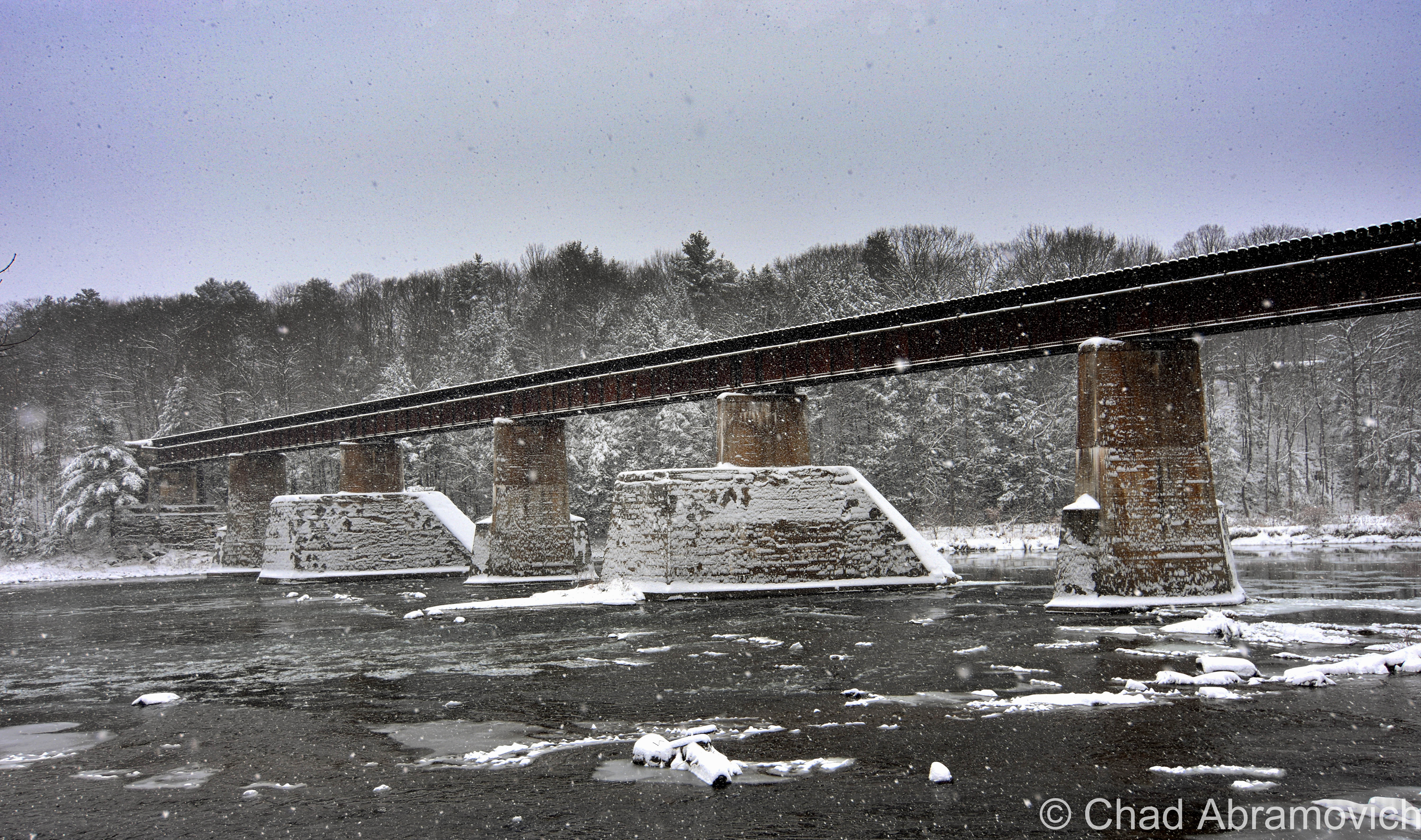
The locomotive was approaching what was then called “The Woodstock Bridge” (despite not actually being in the town of Woodstock), a high 650-foot-long wooden trestle about four miles west of White River Junction.

Conductor Smith Sturtevant of Saint Albans was making rounds through the train, taking tickets from sleepy passengers and amiably chatting with people he recognized. He was probably also the first person to notice that something was wrong.

As the train was approaching the bridge, Conductor Sturtevant noticed a dull bump and grinding sensation accompanied by a peculiar noise. Instincts took over, and he rushed to pull the emergency bell to signal the venerated engineer Charles Pierce from White River Junction.

Pierce, confused at what the commotion was, curiously peered out both side windows of his cab and saw the back of the train “swaying”, before beginning to slide off the bridge.

Breakman George Parker rushed to apply the brake when he heard the signal from the engine, but by then, it was too late. The whole thing happened so quickly that nobody had time to react.

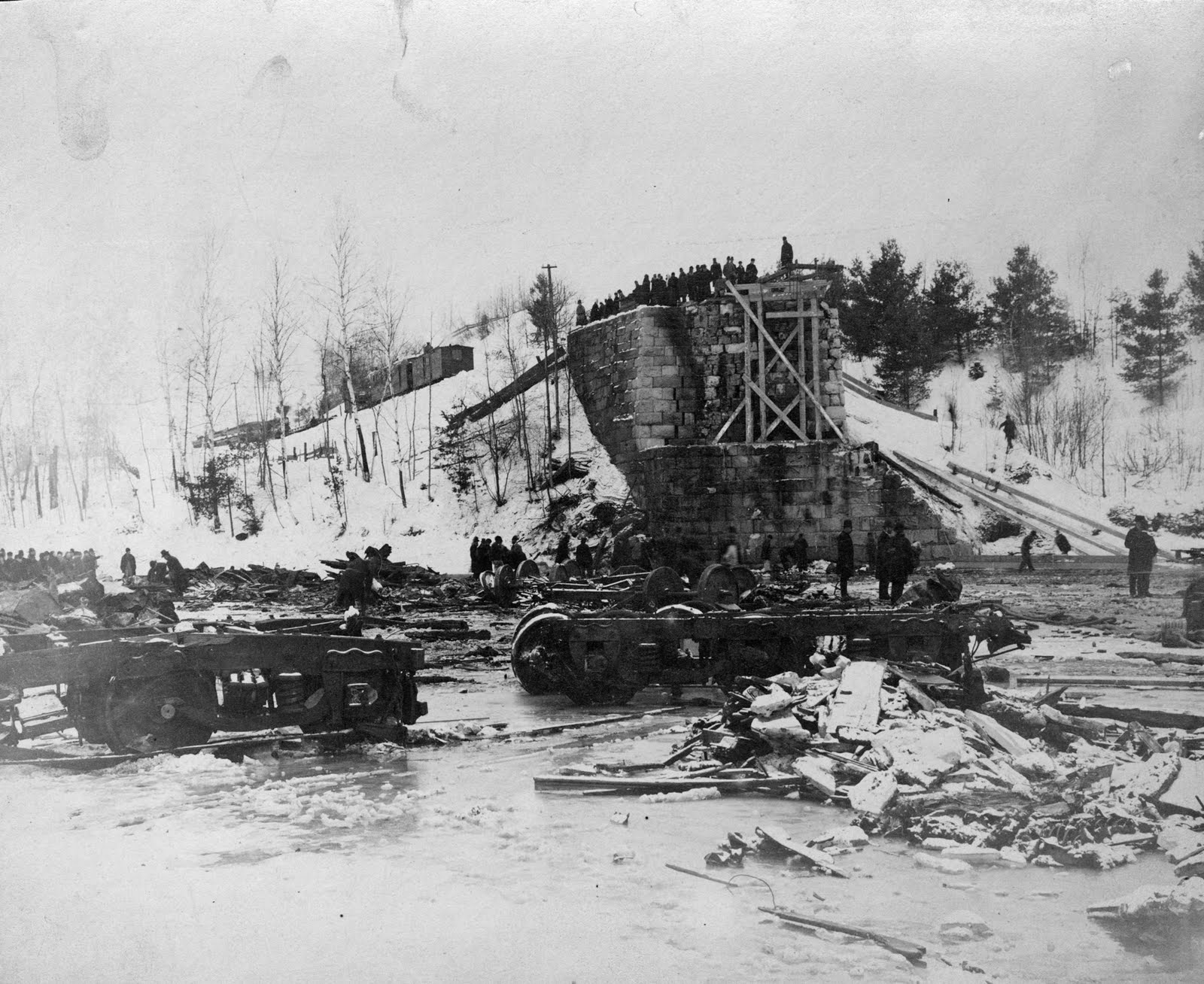
The engine, mail, and smoking cars made it over the bridge safely, mostly because the coupling that tethered all the cars together snapped and spared them, but the last car in line, a sleeper, hit a broken rail before the span in just the right way, tipped and toppled off the bridge, and dropped 45 feet downwards – pulling three other cars with it – another sleeper and two-day coaches. The cars dangled for a few astonishing seconds, before all falling and smashing against the solid iced surface of the White River.

Brakeman Parker, who noticed that the train was falling off the bridge, made a split-second leap to safety that almost cost him his life while also saving his life. He narrowly missed plunging off the bridge himself and careened down the steep embankment before the overpass touched the river, striking a few trees along the way. He gathered himself, borrowed a team of horses from a nearby farmhouse, and raced four miles back to town to fetch help. “I would have never lived through it had not the snow been deep,” he remarked in an interview afterward.

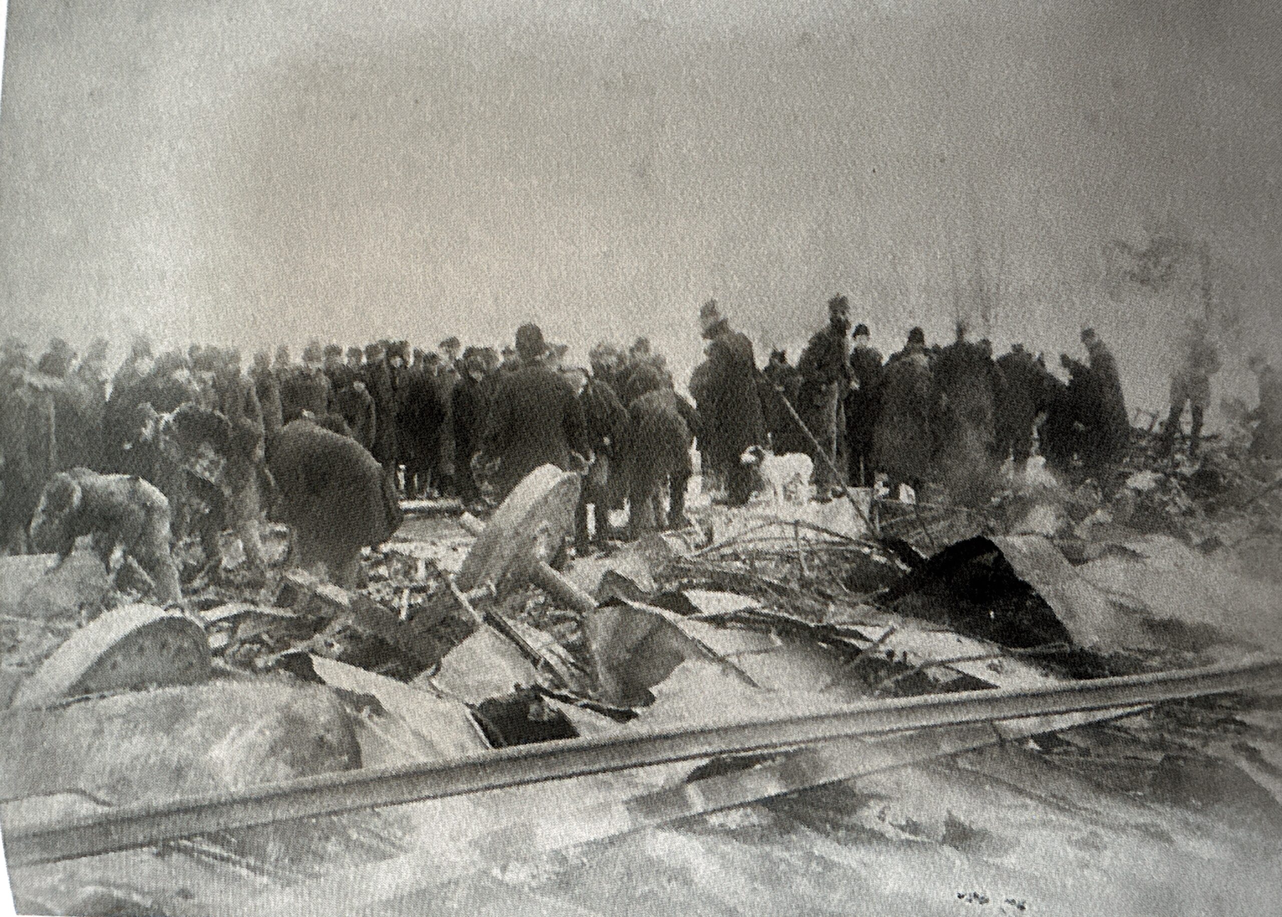
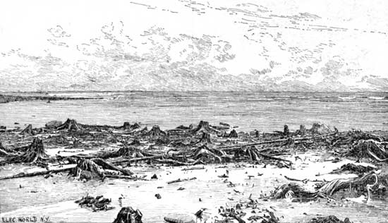
The train cars landed upside down on the ice. The impact ignited the woodstoves and oil lamps, which began to feed off the wooden cars. Wild winter winds fanned the flames into a monstrous inferno, and fiery tongues lapped at the wooden trestle above, until the timbers burned, extricated, and collapsed in a cindery plume below onto the crushed wreck. In less than 30 minutes, the entire bridge apart from its stone supports was gone.

Those confined inside the dismembered locomotive were now introduced to a nightmarish catastrophe.

They were tossed and jostled violently into one another while being pulverized by all the breaking debris as wooden walls, furniture, cast iron woodstoves, luggage, iron rods, and tin roofing all came undone. Passenger Charles M. Hosmer of Lowell, Massachusetts described the encounter this way; “it was all darkness and confusion. I do not remember hearing any screaming, but there were moans and calls for help”

If that didn’t immediately kill them, the conflagration that soon began to spread toward the imprisoned and injured, did. Some were cremated, others were suffocated by smoke or the weight of rubble, and some were mangled to such an extent that although they were able to eventually be extracted, died after their rescue.

Pierce and onboard fireman Frank Thresher of Saint Albans slid down the bank to the broken coaches and attempted to both try and rescue the ambushed and douse the flames with snow. But the blaze was spreading too fast. Pierce then decided to break some windows to try and evacuate survivors, which would wind up helping a few.

One of those people was poor Conductor Sturtevant, who was found by Pierce terribly injured and pinned down by detritus. Through superhuman efforts, they managed to get him out, but not before he was critically burned from head to foot. His ribs were broken and had a fearful wound on the side of his head.

If all that wasn’t bad enough for those who were still caught in the chaos below – the amazing heat from the blaze was starting to melt the ice, creating about 10 inches of water that began to flood the scene and seep its way into the cars. One sleeper car, “The Saint Albans”, had started to sink into the river because the heat had begun to melt the ice beneath a corner where the heavy iron wheels had fractured the surface. If the riders weren’t dead yet, now they had to worry about drowning.

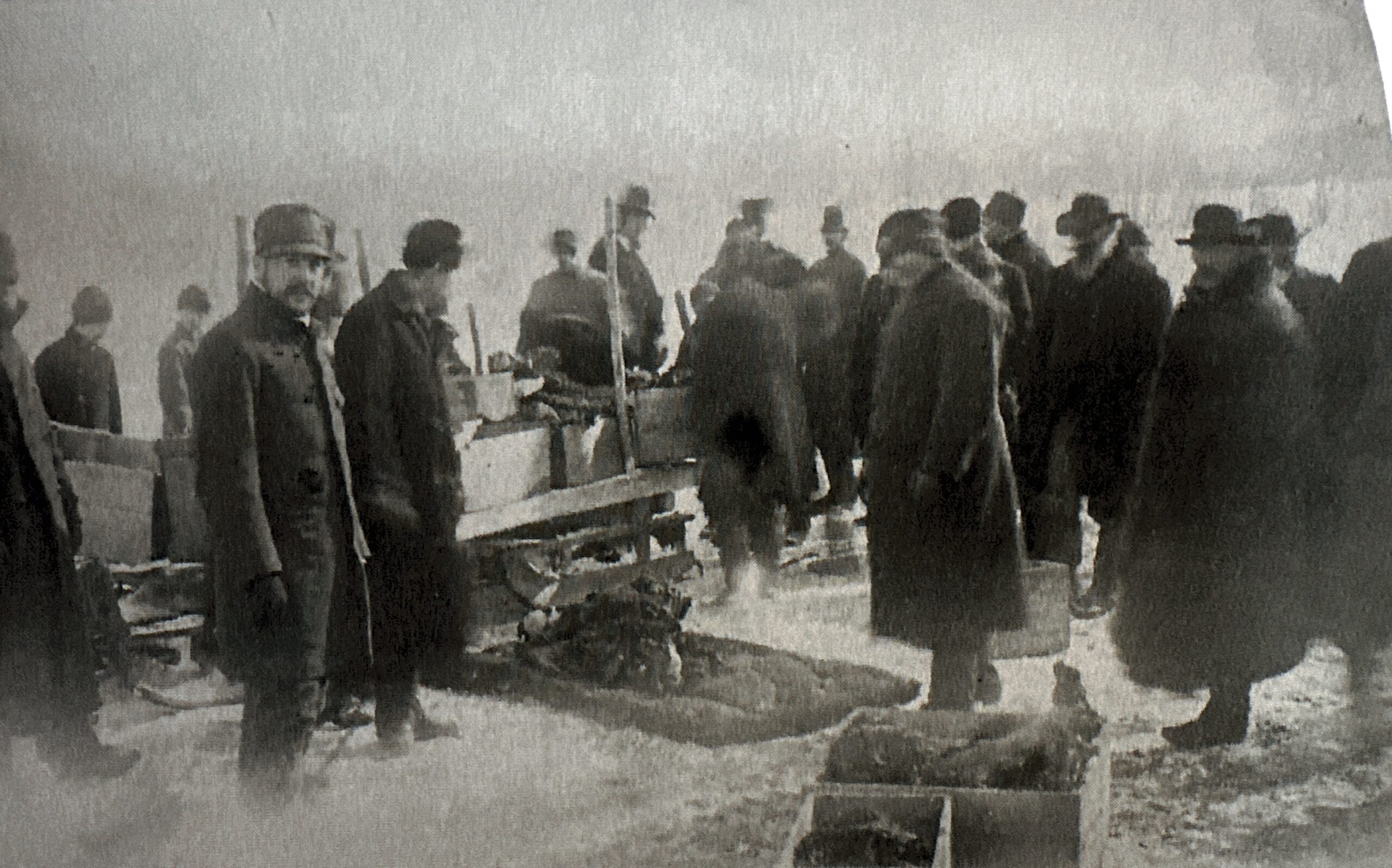
The first batch of rescuers arrived about 45 minutes later with Mr. Parker – the crew including freed and able passengers, town and railroad officials, and reporters, and they all began slogging through the icy water with poles and hooks to retrieve charred corpses and spot survivors, while constantly having to keep back a growing crowd of curious spectators that each wanted to see more than their neighbor. They soon felt exhausted, and their work was far from over.

Passenger Henry W. Tewksbury of Randolph, VT, recalled his experience that was galvanizing to read.

Lawyer, Dartmouth alumnus, and regarded lecturer, he was taking the train home after giving a talk on the battle of Gettysburg in Windsor. He had been sleeping at the time, but was aroused when he felt his car jump the rails. Tewksbury had already been in two railroad accidents before, so he knew what that feeling portended; he realized that another one was going to occur. He jumped from his seat and was about to attempt an exit, but paused as the train deceptively seemed to come to what felt like a standstill. Thinking it was just a false alarm, he sat back down. Then the train leaped into space and crashed.

He was stunned and dazed, not sure if he was dead or alive. As he was trying to shake the gauzy feelings from his head, he tried to move but was alarmed when he realized he couldn’t. That fear was further compounded when he regarded a fire had broken out at the further end of the car. He tried to free himself but couldn’t, so he started shouting – hoping someone would hear him and come to his assistance, but help didn’t come. As he lay trapped and frightened, he noticed an old couple nearby who were pinned down by heavy seats. The pair both seemed to accept that there was no hope for them, so they embraced and fondly kissed each other as the smoke and flames engulfed them.

Falling railroad ties from the bridge above were beginning to crash down around him, and somehow, he escaped being hit. As he was striving to resign to his ghastly fate, he heard voices nearby and started to shout. He was greeted by fireman Thresher and Engineer Pierce. They both came to his aid immediately and had to break his arm and his leg to pull him out. By that point, the flames were so close to his body that all his clothes had burned off.

Mrs. Bryden of Boston (or Montreal, the accounts I’ve read were irresolute) was also in the misfortune. As she was reaching for her window shade, her car suddenly plummeted off the bridge and her surroundings closed in on her. “How I passed those few seconds I don’t know; they seemed eternal” she mused later on record. Her still outstretched hand eventually got the attention of her neighbor Mr. Cushing, and then of rescuers – one of them Mr. Hosmer. She asked for a knife and cut her nightdress off, which was caught and leashing her in place. After she was pulled out, she witnessed the severity of the situation.

“Then I witnessed the most horrible scene of my life. The train could be scarcely recognized. A few men were pulling things out of the car and getting out the people. The train was already on fire. Each car was set on fire by its stove, and the flames leaping up soon set the bridge crackling. The sparks blew mostly to the sky, and the cinders fell on the frozen creek like rain. From the ice I could hear the shouts and the cries piercing the night. One voice still rings in my ears. It was that of a woman. She said “Won’t someone let me out?” The groans of the dying, the fatally injured and those pinioned in the wreck, upon whom the flames leaped devouringly, filled the air” – Mrs. W.B. Bryden

A stark view of The Paine farm, where most of the injured were taken, and the destroyed railroad bridge | Dartmouth Rauner Special Collections Library
A view of the south abutment taken from the ice. You can see the scarce mangled remnants of the train and a gang of investigators | Dartmouth Rauner Special Collections Library
If there’s one thing Victorian media knew how to do well, it was whipping up a sensation into a rapturous froth. This is a pretty dramatic illustration of the event that appeared on Frank Leslie’s Illustrated Newspaper.

Henry Mott of Alburgh, VT, might have been one of the luckier ones; he was knocked unconscious in the accident and woke up completely bewildered with only minor injuries at the Junction House (where today’s historic Hotel Coolidge is) in White River Junction after being rescued.

Because of the distance rescue teams had to move, by the time they actually arrived at the doomed scene, nothing substantial could be done but eventually just stand back and helplessly watch the horrific exhibition of flames engulfing the beleaguered wreckage and listening to the agonizing screams of those dying. The radiating heat was simply too intense and too dangerous to get near.

The gravest of the wounded were brought to the ironically named Paine house, innocuously named after its owner Oscar Paine, which was both located at the foot of the bridge and happened to be the only dwelling in the vicinity in 1887. As a result, it would briefly become a charnel house. I looked for it on my jaunt down and was sad to see it gone.

The hullabaloo that manifested at the Paine farm was a dismal and pitiful one.

Two back rooms were where the dead and dying were laid out, and the barn was utilized as a makeshift hospital to treat the most brutally hurt. The Paine residence also became the reception place for friends and family who got word of the disaster and made the journey to West Hartford to try and identify their loved ones, or in many awful cases, trying to recognize them just by their mutilated remains. Some arrivers would have to catalog their familiars by what might have felt like pure divination.

The viewing and sorting took about 3 days. Undertakers W.F. Johnson and J.R. Goodrich had the mighty task of trying to piece together individual cadavers as best as they could – which sometimes was simply cleaning them up to their ability, and using twine to sort of fashion them into “shape”, then laying them out to hopefully be claimed before shuffling one corpse out and replacing it with another.

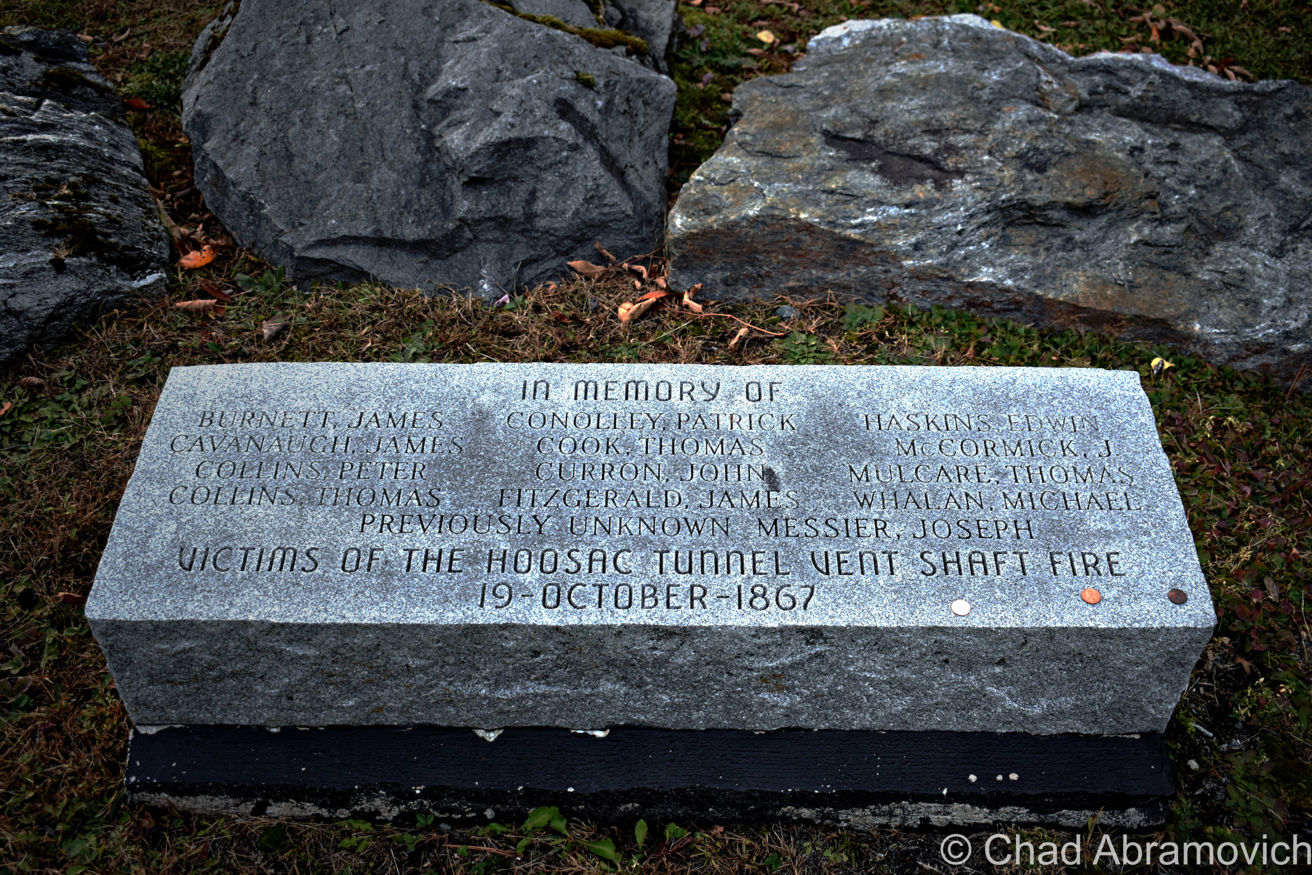
One of the named departed was Frank L. Wesson, second son of D.B. Wesson, of Smith and Wesson Arms manufacturing fame.

Many only had fragments of charred clothing, letters, or personal belongings to work with – like personalized handkerchiefs that were still legible. Doctor H.R. Wilder of Swanton was eventually able to identify his brother Edgar by some of his cards, a suspender with the name “Swanton” on it, and a piece of his skull.

Dartmouth student Edward Dillion was spotted by fellow pupils by his camel’s hair undershirt. He had been otherwise pinned down, crushed, and his head was nearly gone.

One of the most heartbreaking accounts I dug up was the identification of Mr. S.S. Wescott of Burlington – who was found with his young son tightly clasped in his arms.

Though physicians would later attempt to treat and dress his wounds, Conductor Sturtevant would tragically be one of many who wouldn’t survive that night.

A relief train was dispatched, and the probably frazzled Engineer Pierce would drive the rest of the unimpaired passengers dutifully to Saint Albans.

The Aftermath 

Obviously, the disaster had many ripple effects and an investigation was launched with fervency by the Vermont Railroad Commissioners.

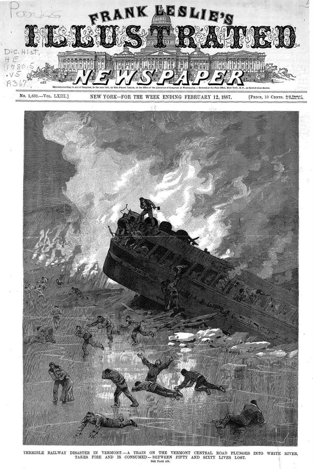
To this day, no one is exactly sure about the death toll, with the number usually listed as around 37 out of 77 passengers on board, but some accounts run variously higher – Frank Leslie’s Illustrated Newspaper announced between “50-60 lives lost”, and others list there were 89 passengers on board, with the death number simply being reported as “many”.

Though Pierce claimed that he had slowed down to 8 miles an hour before approaching the bridge, as was customary to reduce speed before crossing a span, It was doubted and questioned by the inquiry that Pierce actually did so, which cast the Central Vermont Railroad in a debased, negligent light. Their image wasn’t redeemed when it was found that they had used defective iron on the tracks approaching the bridge – some of it was reported to be curved in a cold state and was acknowledged to be unfit for the heavily loaded trains passing over it. Vermont railroad companies of that time were cutthroatly competitive and refused to let competing railroads use each other’s lines, and in order to gain the edge, sometimes corners were cut during construction.

But, the Railroad Commission eventually declared; “The defect in the rail could not have been discovered before it broke,” after they investigated.

Unfortunately, it’s usually horrible circumstances like this that are the ones to goad beneficial change – and the incident at Hartford was so uniquely appalling that Congress and state legislatures knew they had to do something.

While stopping train derailments as a whole was a stretch, they could at least make locomotive travel safer. New safety regulations were employed, replacing gas lights and coal stoves with electric lights and steam heating – things that wouldn’t turn into experience ruining Molotovs. I’m not sure if this was a coincidence or not, but a spell after all this carnage made the papers, the national annual railroad casualty numbers dropped by about 60 percent.

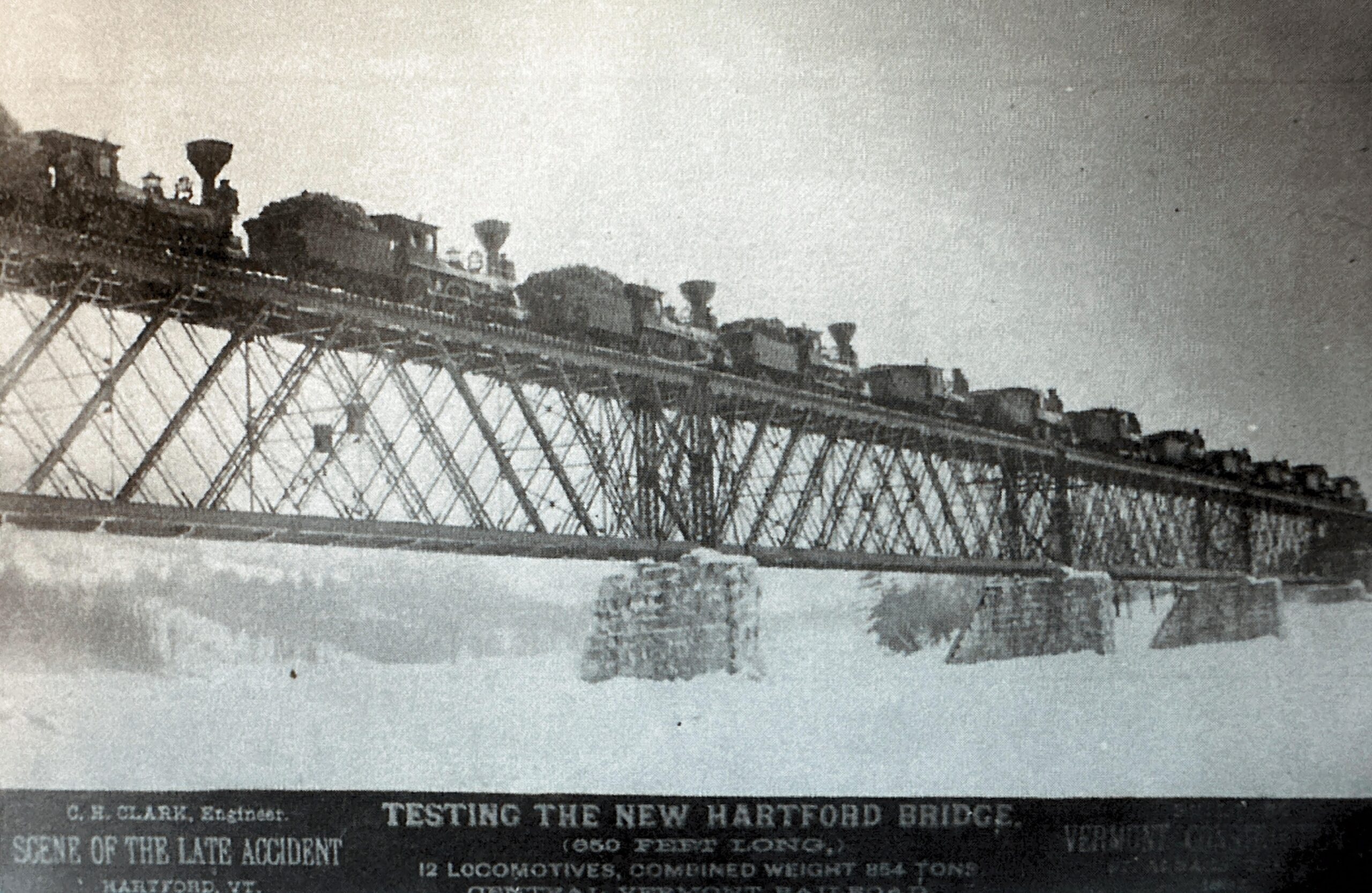
The Central Vermont would rebuild the bridge, and it would double as a needed publicity stunt. The new span would be constructed from fireproof steel, and, they would acquire and park 12 locomotives on it – 845 tons in total, to prove that it could carry the weight.

Loading the remains of the victims from the wreck. Courtesy Hartford Historical Society
View from the south abutment, looking down on the ice where the cars struck. The rambling-out buildings of the Paine Farm can be seen in the distance. Courtesy of Hartford Historical Society
Debris from the train wreck on the ice, near the south abutment. Courtesy Hartford Historical Society
A promotional publicity stunt for the new bridge post-disaster, with a spectacle string of parked locomotives across the superstructure, intended to demonstrate the bridge’s integrity and safety. Courtesy of Hartford Historical Society

A Spirited Place?

The pattern seems to be that disasters create ghosts. Dark stories are still said to linger, though I’m not sure how strongly nowadays.

Some residents, or people in the know, have proclaimed to notice the displaced odor of burning wood hanging out near the bridge that has no discernible source.

The shade of a uniformed man has been detected walking the tracks around dusk and into the night. Though it’s hard to say who this corporal entity is, some have speculated that it might be the remains of Conductor Sturtevant. Maybe he’s staying vigil, keeping plaintive watch for future calamities.

It was said that the Paine’s barn was also haunted – stained with the residual sounds of those who died there well over a century ago. Some have admitted to hearing faint cries and hopeless sobbing coming from within the darkened interior at night when the barn was empty. Others have also spotted human-shaped silhouettes standing stone-still within the swarthy barn, as if they were just watching the passersby. The barn, too, is now gone, which I was disappointingly hoping I could have gotten a photo of. Maybe the structure’s eventual extinction somehow gave those trapped cruces a sort of cosmic permission to finally move on, to wherever it is that awaits wayward souls. Or perhaps, they still loiter…

But perhaps the most gripping tale that spawned from the mishap is the ghost of a child. Dressed in old-fashioned clothing, the boy has been spotted around dusk, hovering above the White River as if standing on a sheet of ice that had melted long ago. Whenever these spook tales started to leak into Vermont culture, it’s been said that the ghost is that of a 13-year-old boy named Joe McCabe, who traumatically watched his father burn to death. Though he managed to escape, his battered spirit seems to be ensnared here in the afterlife, lingering over the water, as if he’s waiting for something that will never happen…

Interestingly, I didn’t find a “Joe McCabe” registered in the passenger manifesto. But I did find a Joseph Maigret, A French Canadian boy around the same age who survived to tell his dejecting account.

He and his father Dieudonne were returning to their home in Shawinigan, Quebec after visiting his father’s brother in Holyoke, Massachusetts. Joseph managed to crawl out a window and onto the ice but realized that his father wasn’t following and panicked. He scrambled over and tried to pull him free. But as much as he tried, his dad wouldn’t budge – he just couldn’t pull him out. “Pull me out if you break my legs!” his father pleaded. The hapless boy tried for 10 minutes, but it became too hot.

“He told me to go away. He got out his pocket book and gave it to me, but there wasn’t any money in it. Then he tried to reach around to his other pocket where the money was, but he could not get to it. ‘Tell your mother good by’ he said, and then I had to go away” – Joseph Maigret

Oftentimes in the past, names were sort of “Americanized”, so maybe the French Canadian boy morphed into “Joe McCabe”. If so, is he the ghost? Other children perished in the accident as well, so could the apparition be one whose story has yet to be told?

For some reason, Joe, or Joseph’s tale, was the detail of this story that haunted me over the years. And apparently, I’m not alone in that sentiment. After the disaster, a ballad called “The Montreal Express” was written about it, and a boy credited as “Joe McGrette” was mentioned in the lyrics, which is what I assume is a homophonic mistranslation of his real last name. Below is a video of retired postmaster and Upper Valley local Bob Totz covering the song! (He also has a really neat blog)

And Today?

I’ve been fascinated by this story since I heard it as a kid. The information fluctuated a bit between sources and was a bit of a trial to compare and put together, but it was a captivating project to embark on and brought me a bit closer to better understanding the layers of my home state’s memoirs.

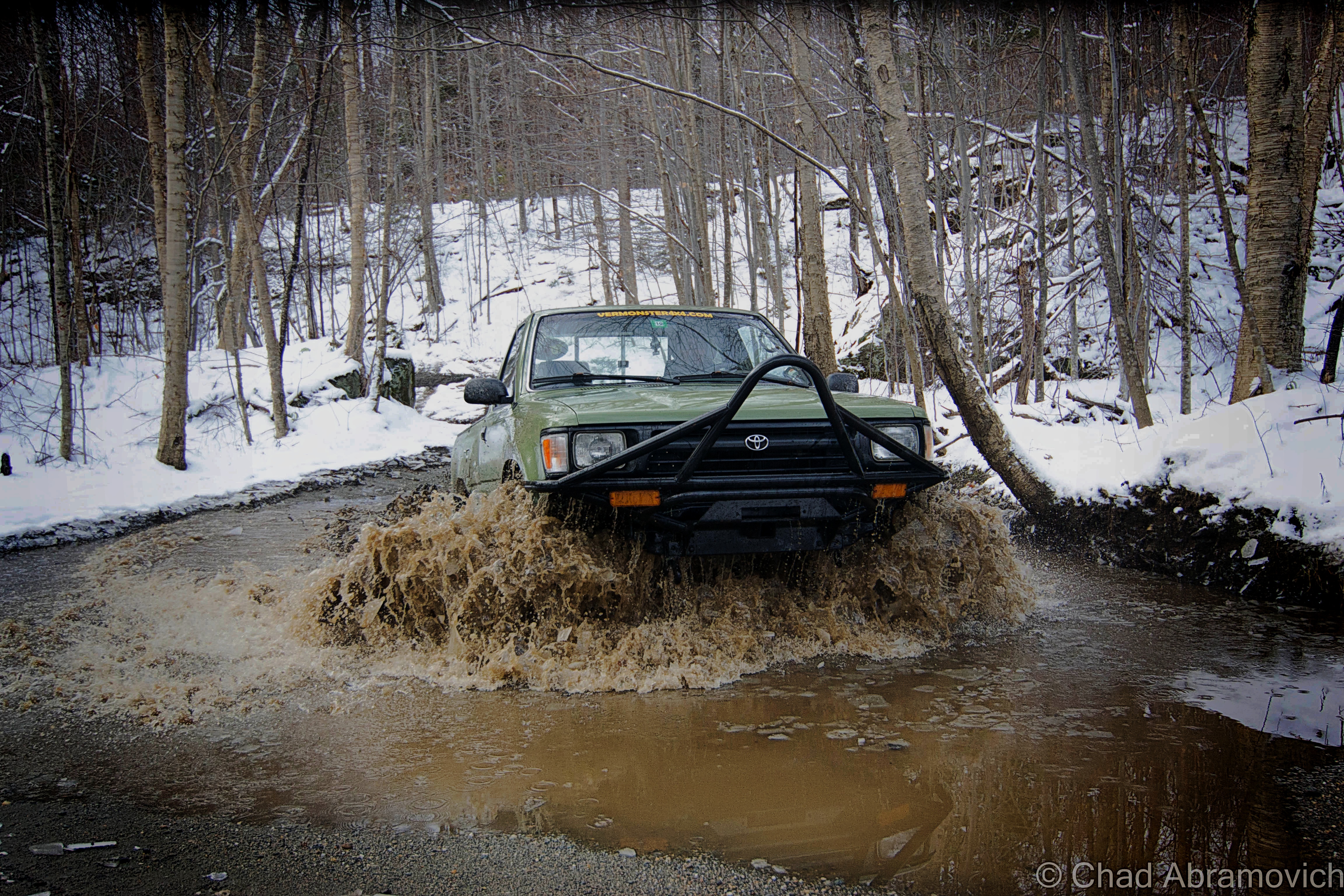
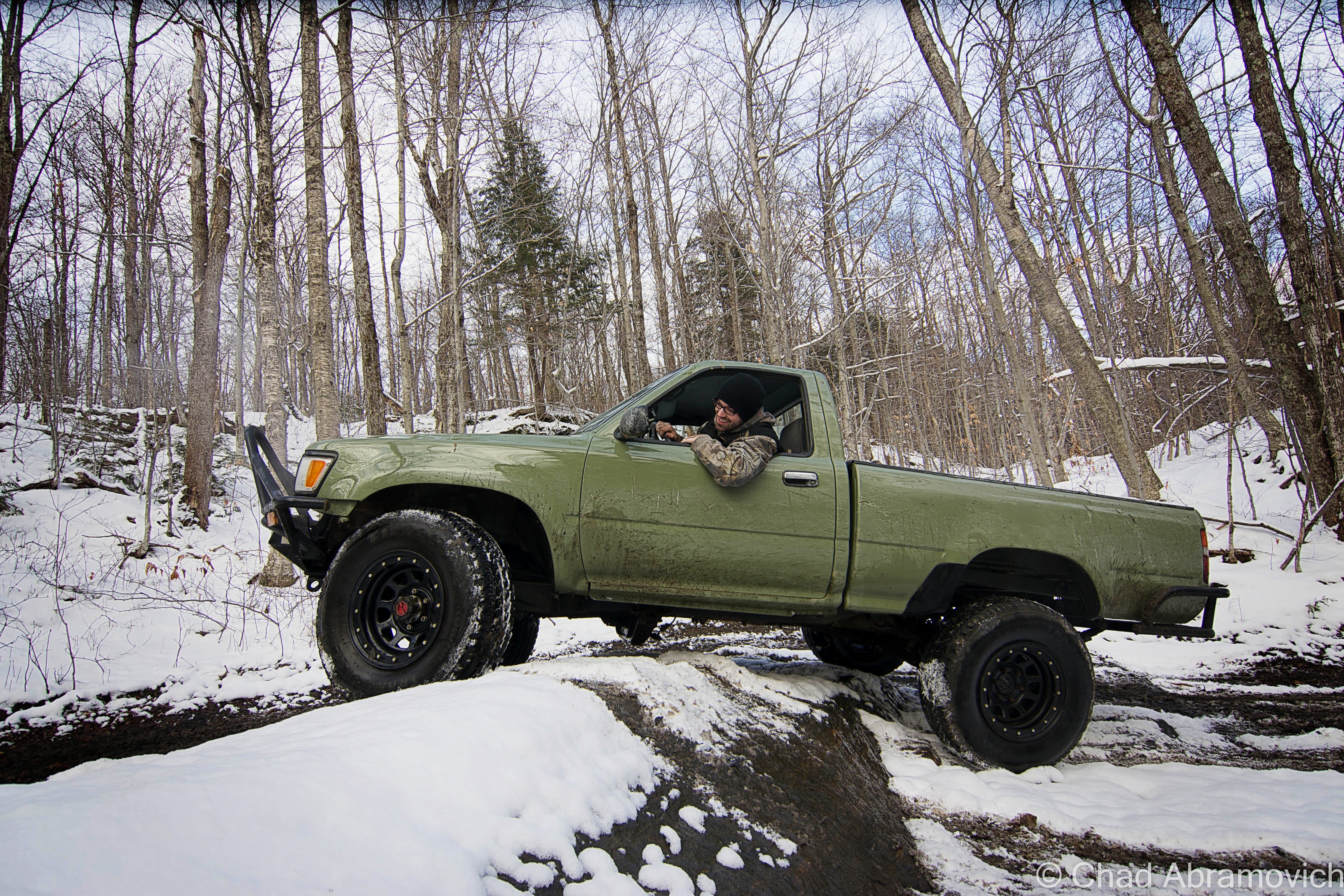
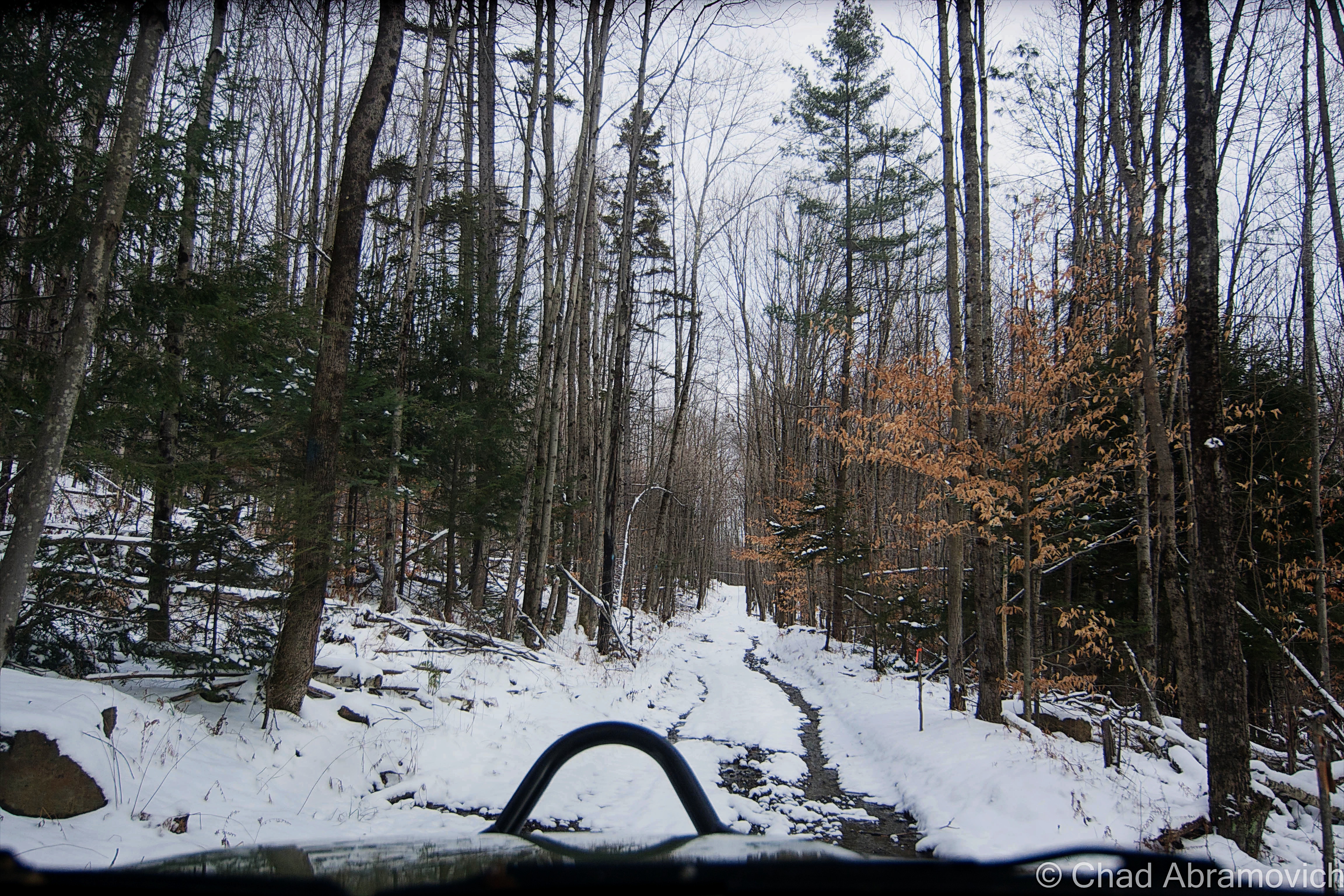
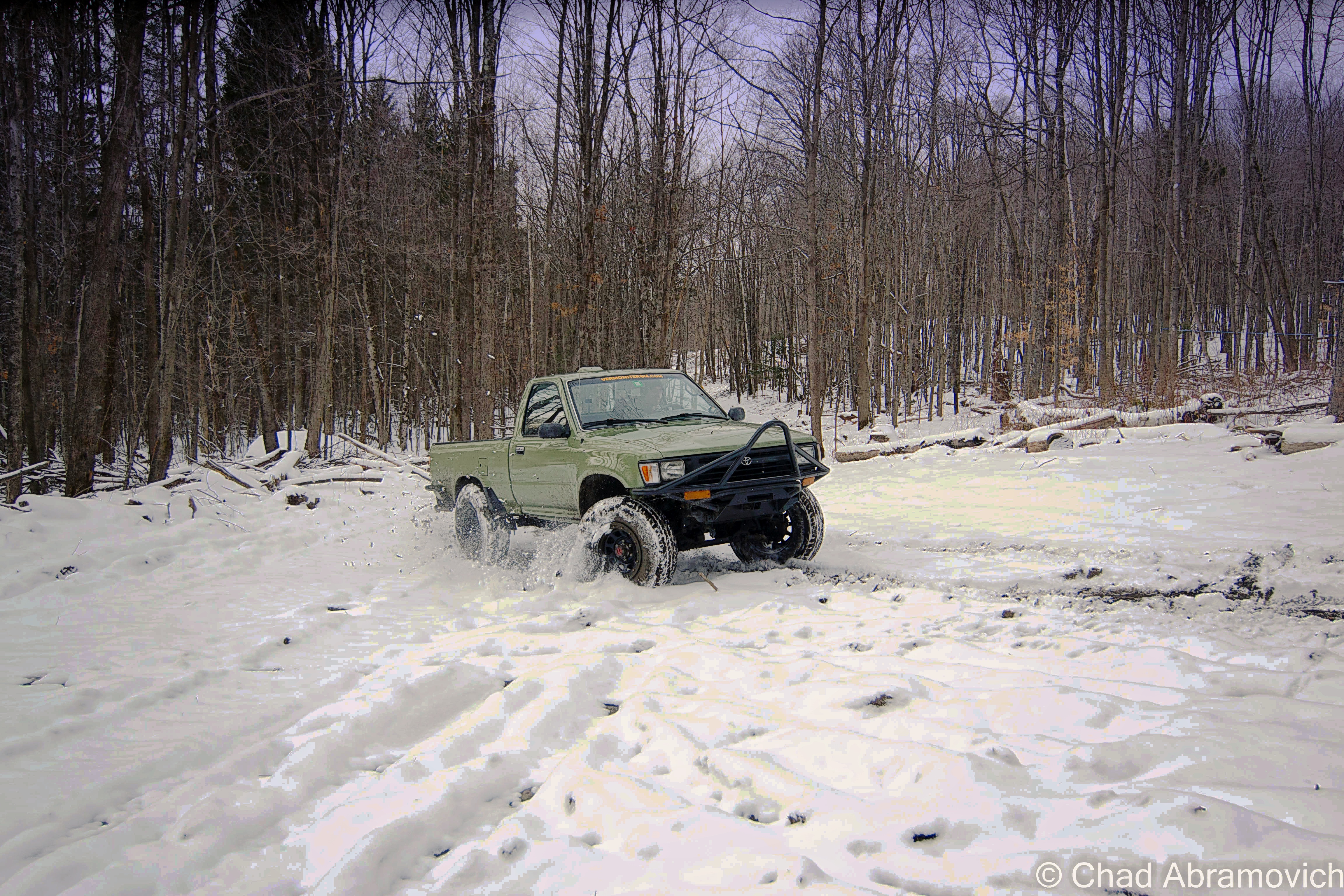
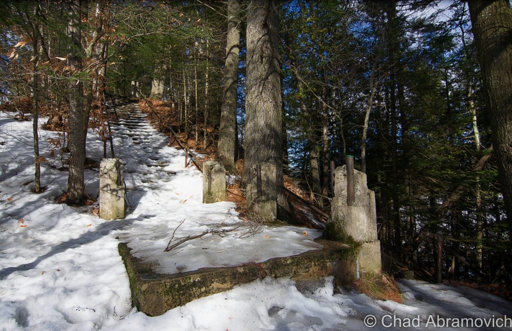
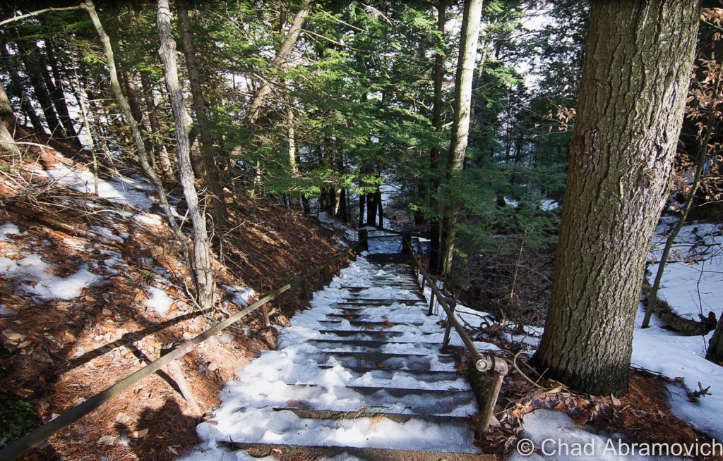
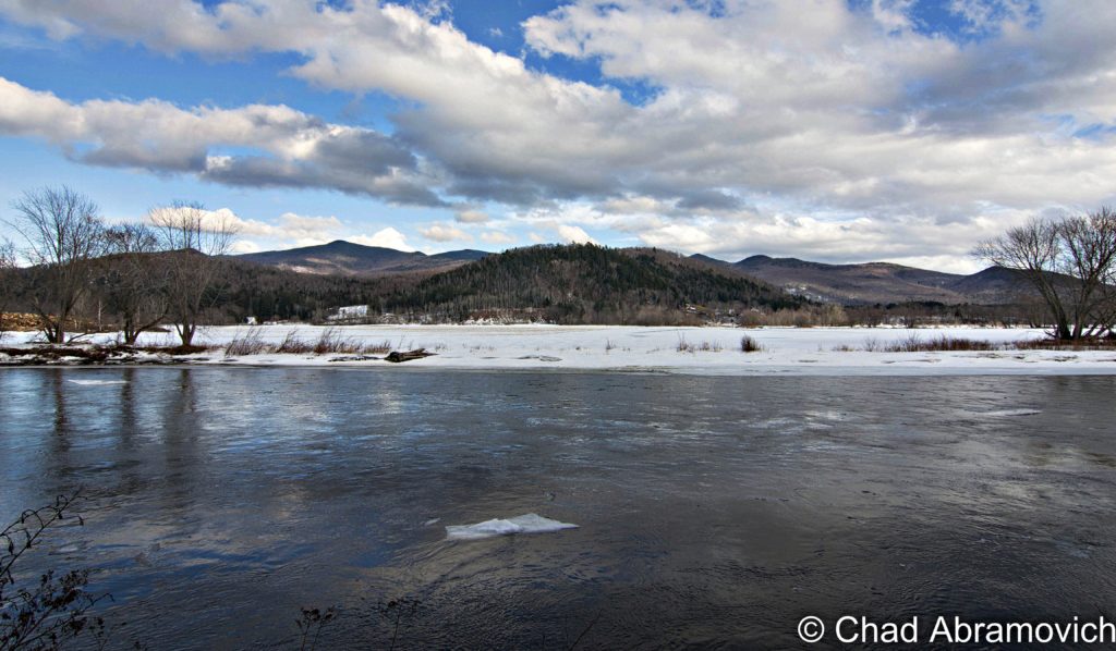
It was a very fitting winter day as me and a friend made our way down to Hartford to get a good look at the old trestle ourselves. We had some fun detouring through off-the-beaten-path towns like Williamstown and Tunbridge, both delightful little villages that look like the 21st century hasn’t completely reached its tendrils yet. I think that’s most of Orange County, though. It’s really a holdout of what Vermont used to be.

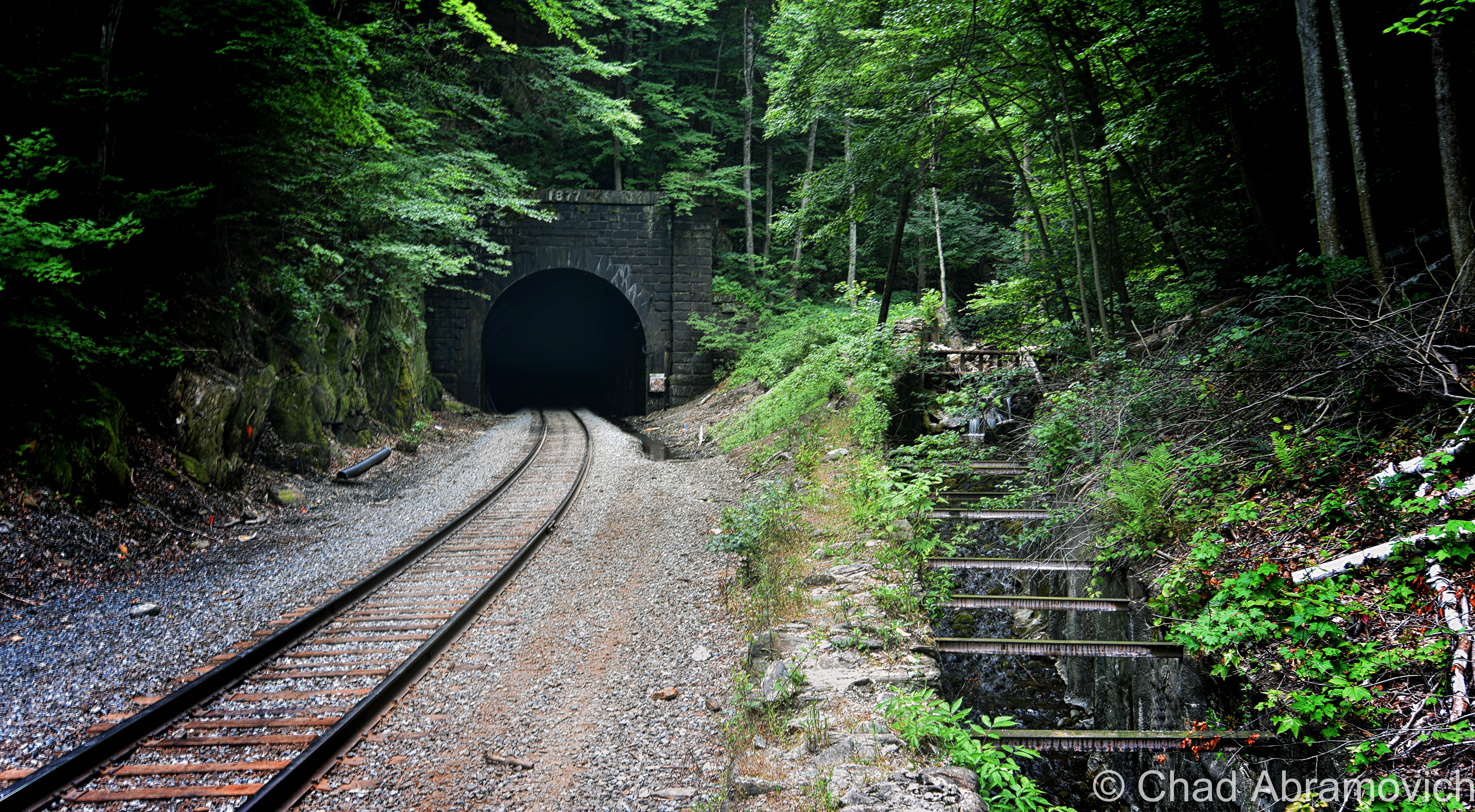
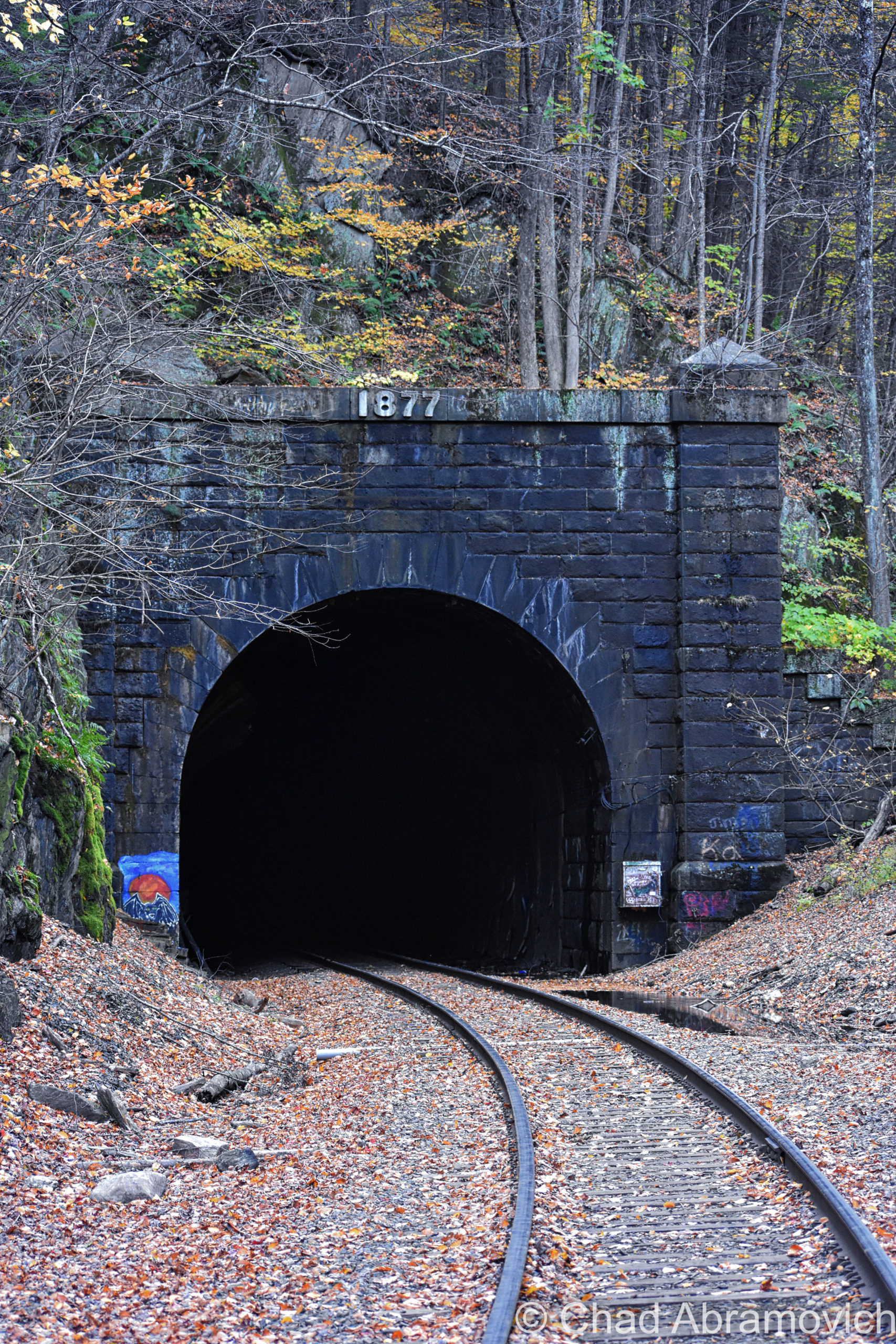
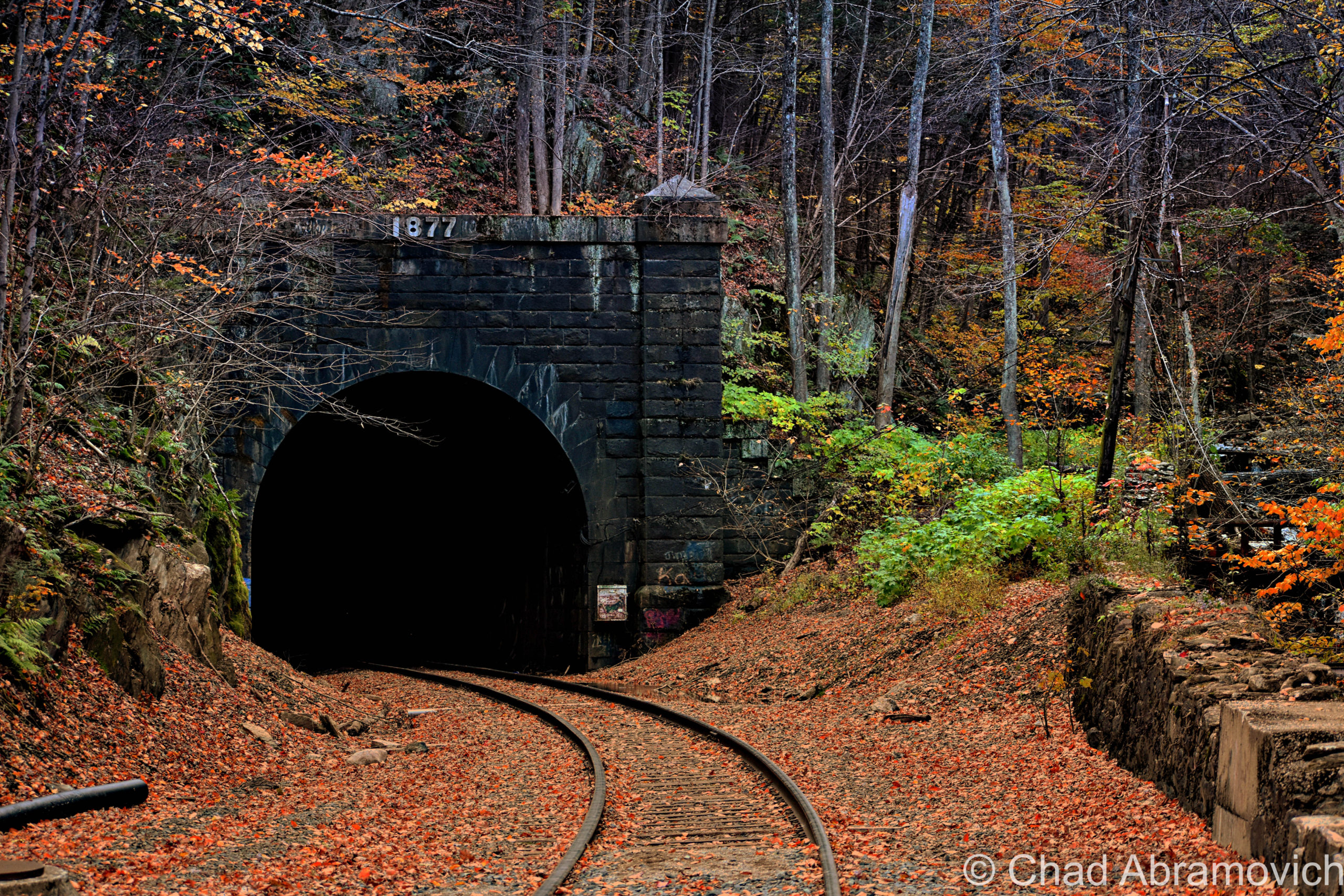
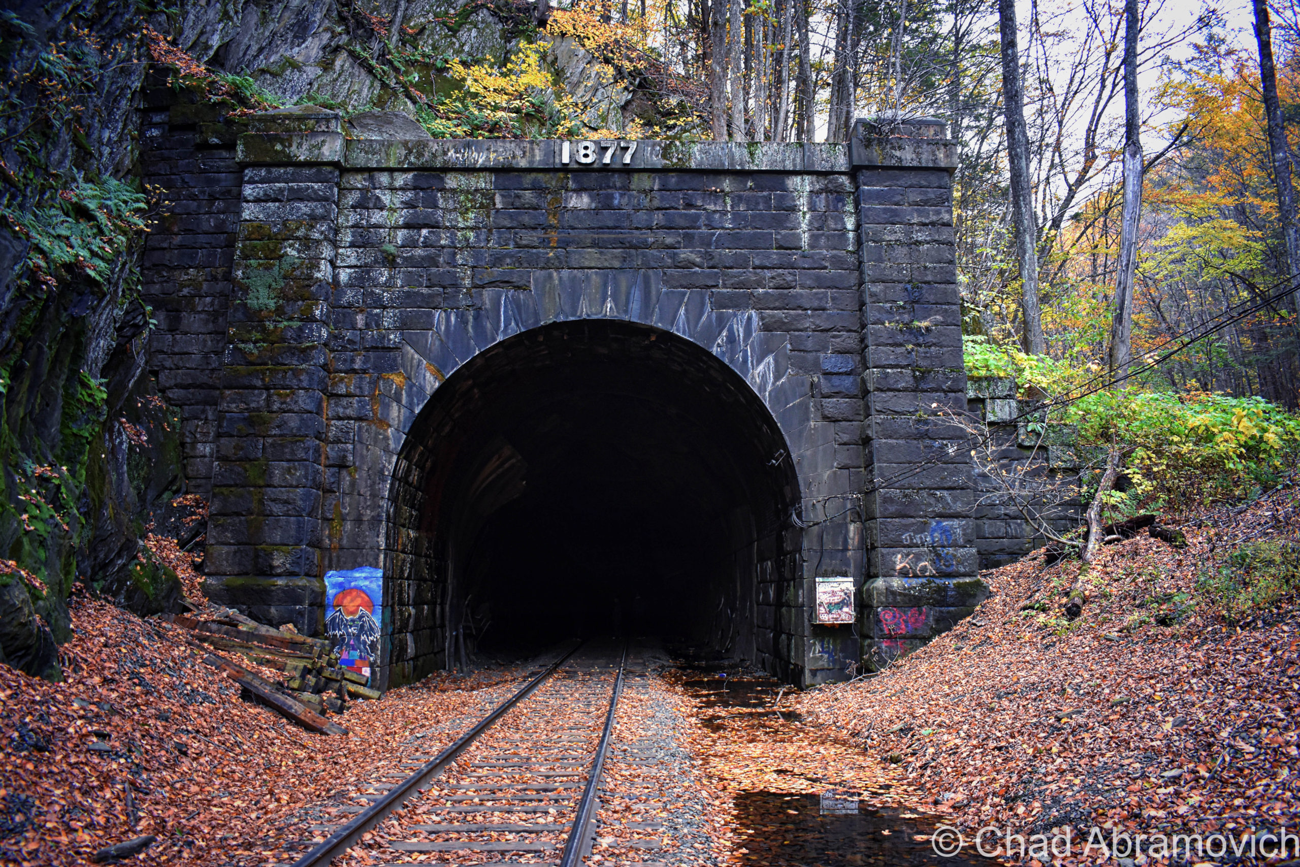
It was kind of surreal to actually see the infamous bridge itself. Or, well, most of it. It’s since been replaced a few times, the current deck plate girder structure was put up in 1935, but the abutments are original, and it still carries train traffic to this day. The last time I was down that way, I caught the Amtrak Vermonter – ranked by Outdoor Magazine as the most adventurous train ride in America – heading northbound.

Admittedly, it was this tragic tale that twisted my arm down this way (and my interest in vintage railroad history), and if I didn’t know about its turbulent yore, this old span would lose its morbid luster and would look like many other common dated ones around New England. But knowing what I did, there was something about the bridge that seemed colder, more sinister, a bit more stained with darkness to my wandering mind. Or maybe it was just my imagination and the howling weather.

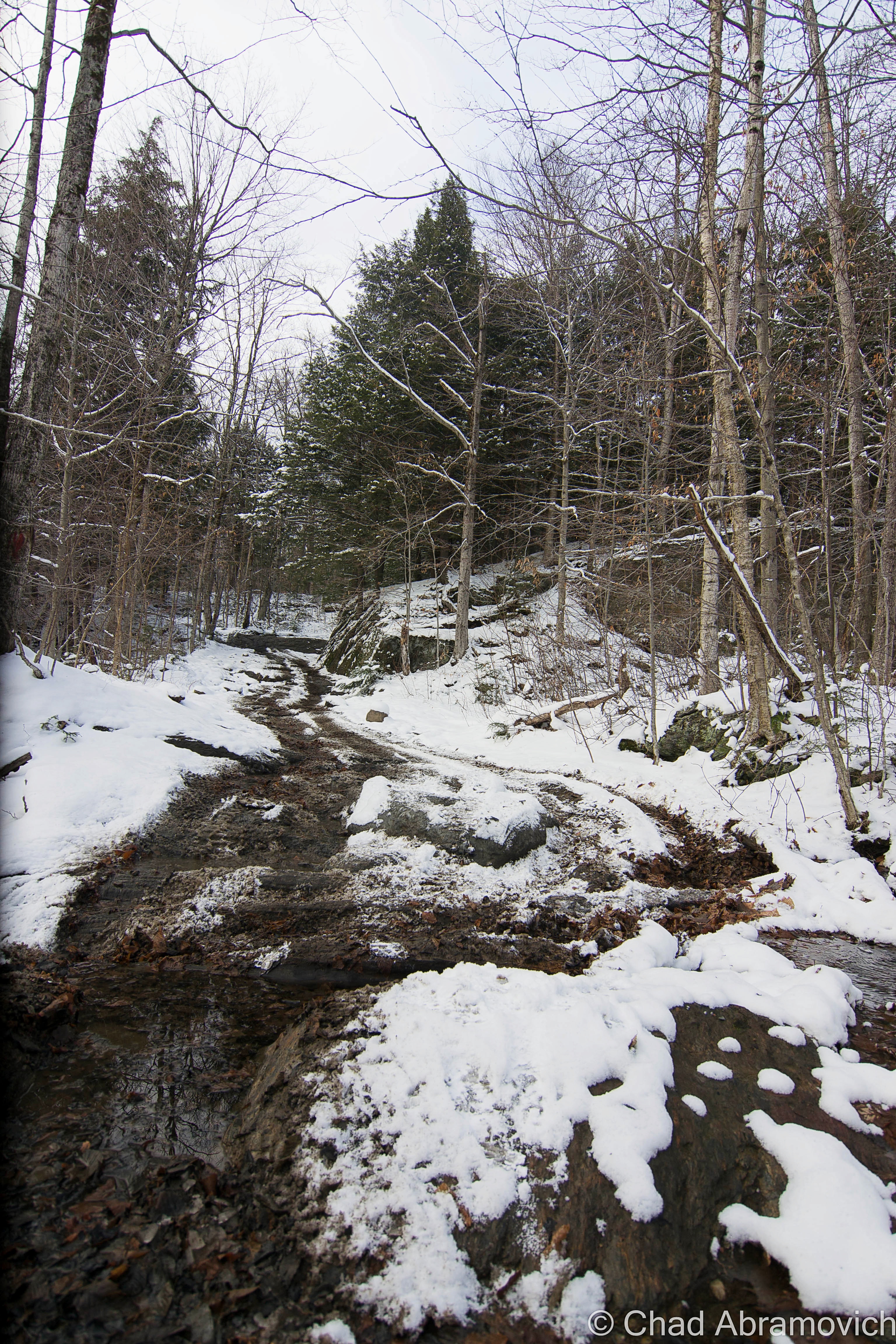
Route 14 was lifeless then, and its path slowly became disfigured by rapid snowfall. It was still outside except for that cold snow that whipped at my face in icy sheets, but I wanted to get a good look at the bridge and the river, which felt almost inappropriately serene in the snow. It definitely stoked the thematic mood, my plans to visit during a winter gail were actually just coincidental. It was so windy that I decided that even if anything paranormal did happen, I probably wouldn’t notice it. Are dark stories still told down in the area?

Eventually, I hopped back in the car and headed off to another lamentable local locale, the Maplefieldized Sharon Trading Post for coffee.

Next time you’re down in Hartford on State Route 14, keep your windshields peeled for this oxidized span.

A neat ghost sign for the Central Vermont Railway can still be seen stenciled onto the rust of the Steel Deck Girder. The Central Vermont, is too, a ghost. The New England Central Railroad owns these tracks nowadays.

Sources:

An absolutely invaluable source to my research was the booklet “The Great Train Disaster of 1887″ researched and compiled for the Hartford Historical Society by Clyde Berry and Pat Stark.

The Vermont Historical Society has a PDF version of their research on it: The Wrong Rail in The Wrong Place at the Wrong Time” by J.A. Ferguson which I’ll link here!

Vermont Dead Line, one of my favorite Vermont blogs, has a good post on it here! 

“Then Again: The Deadly 1887 crash of the Montreal Express” on VTDigger

It’s also mentioned in William Howard Tucker’s “History of Hartford, Vermont”

Old newspapers like The Boston Herald and The Vermont Standard (Woodstock)


Since 2012, I’ve been seeking out venerable examples of Vermont weirdness, whether that be traveling around the state or taking to my internet connection and digging up forsaken places, oddities, esoterica, and unique natural features. And along the way, I’ve been sharing it with you on my website, Obscure Vermont. This is what keeps my spirit inspired.

I never expected Obscure Vermont to get as much appreciation and fanfare as it’s getting, and I’m truly grateful and humbled. Especially in recent years, where I’ve gained the opportunity to interact with and befriend more oddity lovers and outside-the-box thinkers around Vermont and New England. As Obscure Vermont has grown, I’ve been growing with it, and the developing attention is keeping me earnest and pushing me harder to be more introspective and going further into seeking out the strange.

I spend countless hours researching, writing, and traveling to keep this blog going. Obscure Vermont is funded almost entirely by generous donations. Expenses range from hosting fees to keep the blog live, investing in research materials, travel expenses and the required planning, and updating/maintaining vital tools such as my camera and my computer. I really pride and push myself to try to put out the best of what I’m able to create, and I gauge it by only posting stuff that I personally would want to see on the glow of my computer screen.

I want to continuously diversify how I write and the odd things I write about. Your patronage would greatly help me continue bringing you cool and unusual content and keep me doing what I love!

Do you have any stories you’d like to share? Know of anything weird, wonderful, or abandoned? Email me at chad.abramovich@gmail.com

Donate Button with Credit Cards

https://cash.app/$ChadAbramovich


The Bloody Pit

There’s a gaping maw in the Berkshire Hills of Western Massachusetts that’s achieved a legendary degree for well over a century now due to its preternatural tales, mysteries, and tandem extraordinary and sinister creation that earned it the nickname “The Bloody Pit” (even though it’s a horizontal shaft) for killing hundreds of people who built it.

Its real name is The Hoosac Tunnel – an almost 5-mile long railroad tube that cuts underneath the Hoosac Range – a mountain chain that makes up the eastern rim of the jointed hill chains that make up the Berkshires region.

Skewed folklore tells that the name “Hoosac” roughly translates to “forbidden” in the language of the area’s first inhabitants – the Mohawks. But the actual meaning is akin to “stony place”, which is a pretty accurate description of the region. It’s also one of the many phonetic spellings of the word, which explains why New York, Vermont, and Massachusetts have the Hoosic River, the state of New York has the town of Hoosick Falls, and Vermont and Massachusetts share the Hoosac Mountain Range.

Every time I’ve stood in front of this imposing orifice that descends deep into the dark inscrutable heart of these hills, though, kinda brings the more ominous definition of its name right on home, and the vibes back up its designation as a damned place. It feels like you’re staring into an endless, ambiguous, and intimidating abyss that occasionally gurgles lonesome sounds and belches blasts of cold, acrid air in your face.

When this passageway was completed in 1873, it became a man-made leviathan turned celebrity – the longest tunnel of its kind in the world, a tangible example of an idea that had previously been thought to be impossible and foolhardy, and future-facing inspiration for other designs of engineering.

But it took lavish amounts of blood, tragedy, and time to make it happen. In its birth throes, the tunnel would devour an estimated 200 people, and for that reason, it became considered one of the most haunted places in all of New England, and that accolade is still very much stuck in the adhesive of the contemporaneous.

Why does something of this magnitude exist? Besides the fact that there’s something naturally settled within the psychological framework of humankind that makes us want to push anything that we consider a “boundary”, those pesky Berkshire Hills simply happened to be in the way.

Before the tunnel was built, you couldn’t really “get there from here” as us Vermonters like to say. Not at least without some substantial inconvenience.

As New England and New York’s Hudson Valley were beginning to enter the throes of the escalating industrialization in the mid-1800s – this huge disconnection was beginning to be felt.

A new railroad seemed like just the solution to intrepid self-made paper mill owner Alvah Crocker of Fitchburg, to extend the not completely altruistic gesture of financing the construction of a new railroad (not coincidentally, the railroad would also benefit his mills) – then cajoled groups of investors, engineers, and design firms to make it happen.

At the time, Massachusetts only had one railroad that accessed the western part of the state, and that ran through the southern part of the state, which left the north kinda isolated – both by the mountains and the fact that the railroad was cumbersome to access, and spur lines were billed exorbitant prices if they wanted to build a connection. Mr. Crocker wisely knew that a new, northern railroad would be incredibly serendipitous for him, and the rest of upper Massachusetts and Southern Vermont.

After survey work, the legend-crowded Deerfield River valley was chosen as the most practical route to veer westward on, until eventually having to puncture through what surveyors dubbed as the “thinnest” part of the unyielding slopes of the Hoosac Range – a chain of hills in the 2,000-foot elevations – to continue pursuing the trajectory all the way to Troy, New York – officially linking New York’s capital region and all their connections with Boston and inner New England.

To do that, they just needed to create a direct route through terra firma.

In 1842, Crocker and his cronies charted the Fitchburg Railroad that ran from Boston to Fitchburg, and then began to expand by acquiring smaller railroads and building new tracks to form a continuous link westward bound, the gestalt of which formed the Troy and Greenfield Railroad in 1848 as a connection – with the idea of the conceptualized Hoosac Tunnel being the cynosure of the project that would officially open up “the west” (or, anything west of the Berkshires).

The scheme was to have 2 crews of laborers start digging at different ends of the mountains between North Adams in the west, and (the town of) Florida in the east, and eventually meet up in the middle.

In January of 1851, ground was broken for the tunnel’s west portal on the mill town of North Adams’ side of the mountains, thus inaugurating Massachusetts’s original “big dig”.

But, such a colossal project couldn’t avoid being clingy to the sinister and was disturbed by bad luck from the very start.

In the summer of 1852, an innovative boring machine that was supposed to begin gouging out the tunnel’s eastern portal in Florida, got stuck in the Berkshire bedrock and nobody could extract it – so the crew had to start over in a new spot, with a new drill. If you know where to look, the original borehole that’s sometimes called “the false start” can still be detected in the woods today.

The tunnel’s clumsy start and continual ensuing setbacks ultimately became too expensive for Mr. Crocker, who eventually, begrudgingly had to declare bankruptcy. Other investors and engineers attempted to pick it up, but all would ultimately fail, and the project would stammer until the state of Massachusetts – who saw its prosperous potential – took it over in August of 1862.

In addition to the state declaring that most of the botched work done by private investors would ultimately have to be redone, including widening the tunnel and reinforcing it with bricks, some practicalities also had to be employed, or there was a sure chance that both burrowing crews wouldn’t link up!

To make sure the tunnel-in-progress would turn into a tunnel-that-functions, 6 alignment towers were built over the planned path of the tunnel – 4 of them on the summits between the 2 digs and 2 at the entrances themselves.

The survey towers were simple constructions with stone foundations and a single-slant wooden roof. Each one was equipped with a transit scope (a device like a telescope) to make sure each tower aligned properly, and each had a red and white pole that protruded 25 feet up. Back then, the mountains had been cleared for farmland, so you would have been able to see one tower from another very clearly. Of the six that were built, the ruins of four can still be cooly detected in the mountains today!

Inside the tunnel, plumb bobs were driven into wooden plugs on the roof and hung from piano wire at intervals along the line that was sighted from the towers, and surveyors told the blasting crews which way to proceed.

And speaking of blasting crews, the Hoosac Tunnel was the first construction project to use nitroglycerin, but nobody was having a blast, because it directly accounted for a lot of the lives the tunnel would eat.

The endeavor would need so much nitroglycerin that a factory was built near the west portal to produce it. Over the years, I’ve heard intriguing but uncorroborated local hearsay that, though the factory is long gone, there are still several barrels of nitro that are lost somewhere in the Berkshire woods – and though I’m dubious, that delights me that the Berkshires still have wilds that things can still be hopelessly lost in, waiting to be found.

Because nitroglycerin was so new, most of the miners didn’t really know the dos and don’ts of working with the stuff, so a lot of accidental premature explosions happened, which either blew apart anyone in the vicinity, or pulverized them underneath mountain debris. Ironically, John Velsor, the new foreman at the nitroglycerin factory, was “blown to atoms”, as newspapers at the time put it – when around 800 pounds of the killer soup erupted in December of 1870. Not a single trace of the man’s body was ever found.

That certainly didn’t help anyone’s spirit, as the work had already been grueling from the very start. Crews were basically progressing a mere 2 feet a day. In the beginning, especially for the west portal activity, preliminary geological “surveys” saying that the rock was solid and sturdy were quickly proven wrong. What they were actually dealing with was what was called “porridge stone,” rock layers buckled into each other for thousands of years that were so saturated with water that they crumbled into something resembling quicksand. Miners complained that carving out the tunnel (especially the western portal) was like “building a sandcastle in the mud”. The highly unstable porous stone forced the builders to line a lengthy distance inwards from both portals with brick walls so that it wouldn’t collapse.   

The west portal was so wet and unstable that a 264-foot tunnel had to be built around the portion of the western tunnel that had been completed to drain all the water that was flooding the worksite. Now known as The Haupt Tunnel, after the project’s first engineer – it still exists for those intrepid enough to search for it, and is pretty sketchy – with a few spelunkers running into spiders and narrowly avoiding a few collapses over the years.

Brinkman, Nash, and Kelley

On March 20th, 1865, explosives authority Ringo Kelley prematurely set off a blast that crushed his two companions, Ned Brinkman and Billy Nash, under untold tons of rock. Oddly, Mr. Kelley disappeared not long afterward without a trace. Did he run away? Had the guilt of killing two men become too much to bear? Or maybe it was because other workers started to report that they saw the angry ghosts of Misters Brinkman and Nash walking around within the pit? All anybody knew for sure, was that Mr. Kelley was gone.

Exactly one year later to the day, Ringo Kelley reappeared. Well, his corpse did. His body curiously turned up within the tunnel, precisely at the spot where Brinkman and Nash died, and he’d been strangled. Deputy Sheriff Charles E. Gibson investigated and determined that Kelley’s death had occurred between midnight and 3 a.m. of the day that he was discovered. But no clues were ever found, and no suspect was ever identified.

I can’t even imagine the vigor that those guys must have had to muster and keep stoked just to face a day at work. Most of them needed the work too badly to quit, but, some of them couldn’t take it and walked off the job – either because of the dreadful conditions, or now, because there were whispers of the tunnel being haunted and people seeing strange specters within the dark passage that they thought to be the shades of their fellow deceased miners.

Soon, the Hoosac Tunnel project was being christened as “The Bloody Pit”, a nickname that the tunnel has never been able to get rid of. And its nickname-legitimacy-card would be pushed when the project’s worst calamity took place while digging its central shaft.

The Central Shaft

With a tunnel almost 5 miles long, ventilation was needed, or there’d be plenty of unfavorable predicaments, and the resolution was as astonishing as the tunnel itself.

The Central Shaft is a 1,028-foot vertical conduit through Hoosac Mountain – essentially a giant hole that would be dug from the top of the mountain all the way to the tunnel below. The shaft would mark the tunnel’s close-enough halfway point (the actual mid-point was too close to the Cold River for a safe dig), and once it was completed, provide it with ventilation. The opening would also become the fastest way to introduce laborers into the tunnel – by dropping them down in a giant bucket instead of them having to walk about two and a half miles.

On October 17th, 1867, crews had completed boring about half of the central shaft.

Thirteen men had been dropped in the pit and working away, when sneaky escaping fumes from a naphtha fueled lamp in the hoist house above, somehow ignited, obliterating the structure. A deadly rain of freshly sharpened drill bits and tools fell down upon the trapped men, followed by the winching machinery, and finally, the flaming debris of the hoist house itself. If that wasn’t bad enough for the hapless crew, the air and water pumps stopped working almost immediately, leaving them stranded without oxygen as the shaft started to fill with water.

Helpless onlookers realized that nothing could be done, except for speculating whether the men who survived the falling debris would either die of suffocation or drowning.

When the smoke had finally cleared a little after 3 A.M., a miner by the name of Mallory volunteered to be lowered down on a rope to investigate and was given 3 oil lanterns for perceptibility. He was eventually pulled back up when 2 out of the 3 lanterns were snuffed out by lingering noxious gasses. Once above, he barely gasped out the words “no hope”, and then fell unconscious.

The flooded shaft was covered up and left untouched for about a year. Maybe it was partially because people in the vicinity claimed that they started seeing indistinct, fleeting shapes that’d be lurking one moment, and fading into the Berkshire inclines the next. Muffled disembodied groans and cries could also disturbingly be heard, almost like they were spooling out from within the earth itself.

But, the central shaft needed to be completed, so a year later, it was finally drained of water, and the bodies of those that perished down there were finally exhumed. That was when a chilling discovery was made; a raft was found.

Those that survived the initial ordeal had crudely taken a futile stab at survival – eventually dying of asphyxiation or starvation as the world above deemed them as already dead. Interestingly enough, those strange visitations and visions that haunted the domain prior, seemed to vanish afterward.

On August, 13th, 1870, the Central Shaft was ready to start central shafting, when it finally broke through the mountain and connected with the tunnel below.

Hoosac’s Horrors

But by now, the Hoosac Tunnel project morphed into the well-tread beat of other arcane phantoms that seemed to treat the tunnel as a manifesting mecca, and the formula seemed to be when one group of shades decides to split, others get ready to turn up the tomfoolery.  And as early as the 1870s, the gristly phenomena was starting to attract early ghostbusters – an allure that has never faded.

One of the first was a Dr. Clifford J. Owens, who on the night of June 25, 1872, took an expedition into the tunnel accompanied by drilling superintendent James McKinstrey. What the two men witnessed was reported in detail in Carl R. Bryon’s book A Pinprick of Light: 

“We had traveled about two miles into the shaft when we halted to rest. Except for the dim, smoky light cast by our lamps, the place was as cold and dark as a tomb… Suddenly I heard a strange mournful sound. The next thing I saw was a dim light coming from… a westerly direction. At first, I believed it was a workman with a lantern. Yet, as the light drew closer, it took on a strange blue color and… the form of a human being without a head. The light seemed to be floating along about a foot or two above the tunnel floor… The headless form came so close that I could have reached out and touched it, but I was too terrified to move.”

The apparition remained motionless in front of them as if it was looking at them just as they were of it, before floating toward the west end of the tunnel and vanished.

In October 1874, Frank Webster went missing when hunting near the tunnel. When searchers found him in the woods days later, he was in shock. He confessed that he had heard weird voices – their macabre siren song had coaxed him to enter the tunnel. He went in, and saw ghostly figures milling about that took his hunting rifle and beat him with it! He had the scars to prove it, but no rifle.

The next year, Harlan Mulvaney, an employee of the Boston & Maine Railroad, was supposed to deliver a cartload of wood nearby, but instead, fled in an unexplained panic and was never heard from again.

Despite all of these sinister happenings, eventually, both digging crews eventually met up in the middle of the mountain, and were less than an inch off! The plan had worked!

A New Marvel

It’s hard to imagine that simultaneously digging at both ends of a mountain over two thousand feet in elevation for twenty-two years and meeting in the middle using only plumb bobs and piano wire as a compass, would create what became America’s longest tunnel, a landmark in hard rock tunneling, and a new world wonder. The Hoosac Tunnel also laid down the rules of construction for practically all subsequent tunnels, and that’s still true today. I wonder if Mr. Crocker ever imagined that his hubris and attempted resolve would wind up being that impactful?

At almost five miles long, twenty-four feet wide, and twenty feet tall, using twenty million bricks to keep it together, it cost over $21 million, which was about ten times the initial price estimate. It would also cost an estimated 200 lives, with some saying that number is as high as 300.

The tunnel’s headings (both respective routes from each side) were purposely inclined by 26 feet per mile – with both slopes meeting up at an elevated mid-point so all the water that puddles inside (there’s a lot) is drained out through both portals, but it also prevents you from seeing one end from the other end, making the passage seem endless – peering in, you only see blackness.

On February 9th, 1875, the remarkable Hoosac Tunnel was ready for its first train, and it became a big deal basically from the get-go, becoming both a cog in the regional economic engine, a tourist attraction, and a memento for some patriotic flexing.

Original Hoosac Tunnel promotional advertisement, circa 1888/1889 – via The Library of Congress
Historic photo of the Hoosac Tunnel’s East Portal, Florida, Massachusetts. Circa 1900-1910. Via The Library of Congress
Neat vintage Infographic: Profile of the Hoosac Range showing the tunnel underneath – 1877. It’s really interesting to see exactly how it’s laid out! Via The Library of Congress
Historic photo of the Hoosac Tunnel’s West Portal, North Adams, Massachusetts. This view has changed quite a bit nowadays! Most notably, the introduction of the “Snow Door” in the 1950s. Photo taken circa 1900-1910. Via The Library of Congress

The Tunnel Today

In the coming years, more improvements and features would be added. The tunnel originally had a double set of tracks running through it, because of the enormous amount of trains that were utilizing the American rail network in its prime. And all of those locomotives were powered by coal – which belched an awful lot of noxious smog as a tradeoff, which was making the tunnel a pretty hazardous environment, regardless of the central shaft’s existence. Seriously. Some people were actually succumbing to asphyxiation on trips through the tunnel. So in 1911, electricity was brought in to power a fan atop the central shaft to help pull the fumes out. But even that wasn’t completely eliminating the problem, so briefly, the tunnel went electric, and trains had to stop before entering and then be pulled through via electric cables. In 1946, a double fan system was installed at the top of the central shaft, which are the same ones in use today.

Directly below the central shaft, a room was blasted out of the mountain rock and became a shanty for trackwalkers and work crews, and inadvertently, it also became a frequent haunt for hobos – which earned the chamber the affectionate nickname “The Hoosac Hotel”, or sometimes “The Hoosac Hilton” – both of them still enthusiastically used in tunnel-talk today. I’ve also heard the possibility of there being some of the now-iconic “hobo graffiti” – a pictorial-based clandestine communication system invented by savvy recalcitrant turn of the last century train hoppers and vagabonds, scrawled somewhere within the room, but so far I haven’t seen the evidence.

The Hoosac Hotel has a real creepy vibe to it, and that might be influenced by the fact it’s in the same spot that a large section of tunnel collapsed and killed a bunch of workers, and some say it’s also where misters Brinkman and Nash were discombobulated by an explosion. Nearby is said to be the legendary secret room(s), walled up to contain some awesome horrors.

It’s also the physical characteristics that alter the mood. The room is separated by the tracks with a wall of sordid century-old bricks that have a dark patina with age and all the pollutants that used to hang around within the tunnel – the ceilings are the natural mountain rock that constantly dribbles with water. Even with flashlights, the darkness practically ruins the light, but you can still make out the forsaken relics within; an old wooden desk, chair, and dented archaic communication and control equipment – all slimy and glistening because of the dampness. Modern relics like Twisted Tea cans and Slim Jim wrappers strewn on the ground alert you that you’re not the first one to venture this far into the tunnel, even though you really start to inwardly feel that you’re a whole world away once you’re that far in. I’m sad to say that my photos of this room that I took back in 2012 have been lost since then, so I’m gonna have to make another trip in to get some more photos up on this blog.

More sinister urban legends told of bodies wrapped in black trash bags found in the creepy room. Other yarns tell of other secret rooms built both somewhere in the tunnel and up in the central shaft that had been curiously bricked up. Some people say these spaces contain some unspeakable horrors that are best left undisturbed… (Check out this cool video below. These badasses not only explore the Hoosac Hotel, but they actually repel up the central shaft from inside the tunnel!)

The incredible Moffat Tunnel in Colorado took the accolade of the longest manmade tunnel in the western hemisphere in 1916 – at 6.2 miles underneath the Rockies! Then Washington’s 7.8 mile Cascade Tunnel became the longest in 1929, and currently, the Rogers Pass tunnel in British Columbia at 9.1 miles holds the record. But the Hoosac Tunnel basically wrote the manual on modern-day tunnel building, and all of these latter construction projects were successful because of what was learned while building it.

The American Society of Civil Engineers made the tunnel a Historic Civil Engineering Landmark in 1975, and it remains the longest in-use railroad tunnel east of the Rocky Mountains, and though it’s basically more of a curiosity nowadays, us New Englanders still love/fear the Hoosac pretty affectionately, and dark tales are still told…

In 1973, Bernard Hastaba was in the mood for an adventure and decided to walk the entire tunnel. He entered via the North Adams side, and never re-emerged. He wasn’t found inside, he wasn’t found at all. He had, apparently, vanished entirely.

In 1984, a professor and hobbyist ghost hunter named Ali Allmaker was gripped with the uncomfortable sensation of someone, or something, standing next to her. She described whatever it was as walking right behind her, and feared that it would try to grab her and pull her into some unknown, awful horror. Maybe Mr. Hastaba encountered the same situation on his walk through the tunnel, but wasn’t as fortunate…

There are still modern-day accounts of weirdness, mayhem, and paranormal pandemonium in and around the tunnel today, and that’ll probably continue to be the trend.

Strange winds, wily apparitions, disembodied voices both caught on tape recorders and heard in real-time, and odd illuminations like balls of blue-ish lights, and a more railroad-centric phenomenon that’s also spotted around the country; spook lights. Given the Hoosac’s pedigree, I’d honestly be pretty disappointed if spook lights didn’t give an appearance here. “Ghost hands” have also been known to both push people in front of moving trains and pull them back out of harm’s way. It just depends on the day I guess?

As for its mortal caretakers, Pan Am Railways owns the passageway now, and it looks like they do a kinda lousy job at maintaining it, which is tragic. The West Portal’s snow door was added in 1954 – which is basically a big steel garage door installed after a locomotive derailed due to ice on the rails inside, that help keep snow and other nasty weather out of the structure and has become a defining feature of the west portal.

Originally 2 sets of tracks ran through the tunnel, but it’s been down to a single track since 1957 when tractor-trailers and the interstates became the leading mode to move. The last passenger train went through in 1958.

Around 8 freight trains a day are now all that run through its lonely void – and some of them are called “truck trains”, which can be as up to three miles in length and help reduce some of the traffic on the bay state’s byways. Structural engineers have been analyzing the tunnel since the end of the 20th century to see about renovating it so double-stacked container freight trains could pass through it – the track grade elevations were even dropped in 1997 to allow more clearance and taller railcars, but ultimately, the cost was deemed too high, and not imperative enough because there’s already a suitable route through southern Massachusetts, which I suppose is a bit ironic.

It’s kinda sad that it isn’t used more, given just how much effort went into creating it, and realizing that there was a time when a few National Guard soldiers would actually be stationed at both entrances during times of war to prevent potential terrorist attacks on it.

In early 2020, there was a substantial collapse about 300 feet into the more vulnerable western heading that shut the tunnel down for a few months, caused by both general wear and tear, and water flowing in from above the tunnel that was being trapped in blocked drainage tunnels that were supposed to be being maintained, which created a sinkhole that dropped about a 150 feet of mountain onto the tracks and opened up a cavity in the slope above. A structure this old, and this “constantly getting fisticuffs from the environment” is practically guaranteed to need some fixin’ up as the years pass by, but I really hope the Hoosac Tunnel doesn’t become the Hoosuck Tunnel. I really outdid myself with that last sentence.

But seriously, though, it’s such a special and uniquely New England landmark that’s left an epic indelible impression on our rhapsodized region. It would be a huge shame for it to diminish. Oh, and a literal topographical catastrophe.

Berkshire ODDysey 

It was the week of Halloween, and I and a few friends took a jaunt down to the Berkshires to see some oddity and see some foliage, and were listening to the podcast Lore to rev up the creepy vibe. It was also one of the loveliest fall days I’ve ever encountered!

The Berkshires are actually an extension of Vermont’s Green Mountains that have a reputation of their own, so I figured I oughta do more exploring around their nooks and crannies seeing how I live so close. Usually, we’d hit up the old racetrack in Pownal if we were heading down that way.

It’s pretty amazing how much the landscape changes once you cross the Massachusetts state line – It basically immediately gets kinda suburban-y and billboard-y, and this is supposed to be one of Massachusett’s most “rural” areas. Even a good chunk of Berkshire backroads are paved and feel like you’re really in a suburban fringe community than actually in the mountains. But then again, Vermont is a bizarre bubble, and it’s only until Vermonters begin to venture outside our state lines that we recognize this.

We drove through the neat historic mill turned liberal arts burb of North Adams, a town that the Hoosac Tunnel fundamentally ensured would thrive. The tunnel is even on their town seal that declaratorily exclaims “we hold the great western gateway”, which as far as civic iconography goes, is pretty rad.

3,489 foot Mount Greylock – the tallest height in Massachusetts and named after a legendary Abenaki chief – loomed over the wobbly rows of old mill tenement houses that bracketed the main drag. Greylock is a mountain with some cool footnotes hidden up its non-existent sleeve. The only taiga-boreal forest in the state survives upon its slopes, and a unique natural feature called “The Hopper”, a glacial cirque (a natural amphitheater-shaped valley) has been declared a National Natural Landmark. An asphalted scenic seasonal road curves its way up to the summit, and it always reminds me of an inactive blog post I read years ago about some young guys who decided to literally race the sun. They embarked in the dark at the top of Mount Greylock and tried to see if they could hightail it to Cadillac Mountain in Maine’s Acadia National Park – the first place the sun rises in the United States – to catch it happen. Sounds fun to me!

We linked onto the famous Mohawk Trail in North Adams, which in itself was an adventure! The Mohawk Trail is the affectionate and designated byway name for MA State Route 2. The name came from the fact that the road tar you’re driving on top of was put over what used to be a literal Mohawk Trail – a vital path that connected The Hudson River to the Connecticut River via going up and down the Berkshire Hills that was originally used by the local Mohawks and other area First Nation clans like the Mahicans, for trade, hunting, travel, and warring their enemies.

The Mohawk Trail basically invented and then literally paved the way for the idea of the American road trip, long before iconoclasts like Route 66. It got its start in 1914 when the state dished out money to improve the road around the dawn of the automobile craze. Early strategizing automobile clubs started to peddle the road as a tourist attraction to bring some cash into western Massachusetts, and it worked so well that it planted the seeds for Americans seeking out particular roads to drive for pleasure.  It’s still on my bucket list to drive the whole thing!

But, this scenic route wouldn’t be very scenic anymore with over-development, so foresighted conservationists before there were really conservationists started zoning and limiting development along the roadside, to keep one of the wildest parts of Massachusetts wild. The commonwealth acquired 5,000 acres of mountain slopes and created the Mohawk Trail State Forest in the 1920s, and during the Great Depression, the CCC came to the area and spruced it up by building roads, primitive campgrounds, and cabins up along miles of serpentine hill climbs. The tallest tree in all of New England – a 168-foot white pine named Jake Swamp – as well as about 700 acres of extremely rare old-growth forest with some trees over 400 years old – are somewhere within the state forest.

The Hoosac Range rises above the Mohawk Trail just east of North Adams. This is part of the mountain that the Hoosac Tunnel runs under!
The iconic hairpin turn on the Mohawk Trail – the hills of southern Vermont can be seen in the distance

And then there’s the wicked hairy hairpin turn on the side of a mountain on the Clarksburg/North Adams town line, one of the more distinguished and (in)famous sections of the trail.

At the top of the Hoosac Range, you’ll enter the town of Florida, marked by one of Massachusetts’s iconic book-shaped town line signs, and is the total opposite of what we think of when we hear the word Florida. It’s the highest town in elevation in the commonwealth, and allegedly gets more snowfall and colder temperatures than any other town in Massachusetts. The name, too, is kind of a mystery. Even the town’s website gets shoulder shruggy at how the name was chosen. It is possible that the name was an invented one, bandwagoning on a trend in New England around the 1800s where remote, mountainous towns with poor farmland were given ‘exotic’ or pleasant names to lure settlers there.

Florida is also the gateway to the Hoosac Tunnel’s eastern portal, which is the easiest of the two to see. From the Mohawk Trail, we went from the top of the Hoosac Range to the bottom and drove through an uncanny valley where New England’s perennial death was some of the most glorious I’ve ever seen – before we saw the giant hole in the mountain that told us we were there.

“The great bore” was everything but a bore! Standing at the foot of its wickedness was awe-inspiring and intimidating.

Cold, sour air belched from the murk and cryptic sounds echoed and cursed from within. Icy groundwater salivated from the ceiling and pooled along the tracks. Pieces of century-and-a-half-year-old brickwork occasionally crashed down with lethal strikes.

On a white-hot summer day back in 2012, I explored about half the length of the tunnel with a good college buddy of mine. I remember measuring that trip as such a big deal for me, because it was my first oddity expedition outside of Vermont, around the time when I was really struggling to find my identity and my beat out in the universe, and just beginning to try my prowess at blogging.

The tunnel was a tourist attraction even then, which was evident when an assembly of Hell’s Angels rumbled up next to us and decided to join us on our foray into the transport tube’s east portal. Well, at least that’s who they proclaimed to be. Some of those guys looked like they could do some casual origami with a parking meter, so I didn’t feel up for fact-checking them.

Leaving the Berkshire heat, the clammy darkness swallowed us and gave us a lot to stumble on. Endlessly falling water formed rivulets along both sides of the tracks, clogged with silt, gravel, brick shards, and sporadic live electrical cables. The tracks faired no better for a less accident-prone passage – the wooden railroad ties were warped, in various stages of deterioration and glistened with wetness, and made anything that wasn’t a slow and steady walk not such a great idea, unless a rolled ankle won’t throw off your mojo. I’m not in that camp of people.

We were about five minutes into the tunnel and the wife of one of the bikers had some kind of a happening. She immediately stopped in her tracks on the tracks, and explained she had the ability to detect when ‘spirits’ were in proximity. Not only were there apparently hoards of them in the tunnel, but according to her, they wanted us out. So she and the rest of the Hells’ Angels vamoosed, and me and my friend decided to continue onwards to the Hoosac Hotel.

I was far more concerned about running into a freight train than a ghost, and the fact that, even if I press myself up against the grimy tunnel walls, I barely have a few inches of space between me and the whizzing side of the locomotive to prevent me from being smashed. They pass through at random hours, spew potentially lethal amounts of diesel fuel, and the racket is enough to potentially cause some hearing damage, if not complete deafness.

Water was everywhere, seeping out of the ceiling and raining down our necks and soaking our boots. Bricks crashed down to the earth erratically. We were far enough in the tunnel where the daylight coming in from the east portal could no longer be seen – it was just a sullen lacuna, and the silence was so intense, my tinnitus buzzed through the strange isolation like crazy. It was gritty, dirty, and cold.

Then, I saw something far ahead in the distance, that today I’m still uncertain was paranormal or not. Within the ghastly illumination of a lone crimson tunnel light affixed to the natural rock wall, I saw a startling silhouette of what appeared to be a man. I abruptly stopped my progress forward, motioned to my friend, and uttered something along the lines of “Fuck, we’re busted”.

I wasn’t thinking it was one of the tunnel’s many shades, I thought it was an actual railroad employee that was gonna bring the law down on our trespassing butts. Motionless, we stood in place, and I stared at this figure, trying to understand what I was seeing. Its outline appeared to be dressed up in clothes that I regarded as “official-looking”, like an old-fashioned uniform, which further backed up my fear that it was some kind of authority figure that was making haste towards us. But that was when I noticed, that no matter how long we were watching it, and despite the fact that the strange man looked like it was practically power walking in our direction with determination, it strangely never seemed to gain any ground – it just kept on walking but never making any progress.

Then, we saw another light and another figure. This new sight, however, was definitely making progress in coming our way. It was a train. My friend and I booked it and clumsily sprinted back towards the safety of the east portal as fast as we could, as we stumbled and slipped over slippery tracks and adjacent inundated burms. We made it out just in time as a lengthy locomotive came barreling out behind us – grimmy, wet, and desperately trying to chase a little breath. To this day, I’m not sure exactly what was hustling towards us in that tunnel. Maybe we should have listened to biker wife lady?

In the fall of 2020, me and some other friends decided to take a jaunt down to the Berkshires to revisit the tunnel, and to get a little relief from the stresses of the pandemic, and we had a lot of fun. It was around the close of the evening by the time we had arrived, and the tunnel was crowded with obnoxious social media influencers and TikTokers, but it was engaging to see it again – you never really tire with a site like this one.

Next time I head back, I’d like to finally make it to the Hoosac Hotel and get some pictures to share with y’all on this blog post!

Taken on a humid mid-summer evening in 2018. Cascade Brook runs to the right of the tracks and was contained within a stone sluiceway – most likely to prevent the tracks from potentially washing out when the brook decides to get floody. Railroad ties were installed and spaced along the top of the structure, which I thought was kinda neat. If you bushwhack along Cascade Brook up into the mountains, you’ll be rewarded with the sight of the Twin Cascades – two waterfalls plunging as high as 80 feet that most visitors to the Hoosac miss out on!
While I was lazily trying to see if I could find the cavity from the “false start”, I instead found this curious little storage pocket – a tiny brick space built into the cliffside that’s long been filling in with earth and dead leaves.
Took a quick peek inside and found some old machinery bits!
The east portal of the mighty Hoosac Tunnel, October 2020

Before we headed back to Vermont, we took a quick drive down aptly named Central Shaft Road, to the top of the central shaft to check out the fan units, and to see a relatively new memorial that’s been dedicated to all the lives that the tunnel has reaped – a squat and prostrate rectangular block of granite laid down near some old apple trees across from the fan. Unbeknownst to us, we actually wound up visiting on the same day of the central shaft catastrophe.

Here’s an older video of the fans in action – to get an idea of just how noisy they are!

I also haven’t had an opportunity to visit the west portal yet, so that’s still on my Hoosac-centric agenda. The last time I was down that way, it was a bit after the collapse. While the east portal is easy to access off a paved road, the west portal is obscured from a relatively well-traveled throughway – at the end of a dirt access road, which was gated and decked out with a few new looking “no trespassing” signs, and I totally I didn’t want to run into disgruntled railroad employees who were doing some collapse-cleanup.

This was a real fun explore, and even more fun to research and unpack everything I was gleaning about this place. The most fascinating thing about a place like the Hoosac Tunnel, is that it dutifully keeps spawning new tales, tall or true, and most likely will for posterity.

———————————————————————————————–

Do you have a spooky story from your trip to the tunnel that you’d like to share, or maybe have appear on this blog entry? Or perhaps you wanna make me hip to another Berkshire oddity or abandonment? Email me please!

Links

The closest thing the tunnel has to an ‘official’ website, which goes into amazing detail on all portions of the tunnel: HoosacTunnel.net

http://paulwmarino.org/hoosac-tunnel.html – a fantastically researched resource, with tons of historical imagery!

https://mysterious-hills.blogspot.com/ – my favorite Berkshires blog! Joe puts a lot of thought into his entries and is a great storyteller!

Here’s a video that actually films a modern-day train ride through the entire tunnel – it’s a neat watch and a good dose of perspective!


Since 2012, I’ve been seeking out venerable examples of Vermont weirdness, whether that be traveling around the state or taking to my internet connection and digging up forsaken places, oddities, esoterica, and unique natural features. And along the way, I’ve been sharing it with you on my website, Obscure Vermont. This is what keeps my spirit inspired.

I never expected Obscure Vermont to get as much appreciation and fanfare as it’s getting, and I’m truly grateful and humbled. Especially in recent years, where I’ve gained the opportunity to interact with and befriend more oddity lovers and outside the box thinkers around Vermont and New England. As Obscure Vermont has grown, I’ve been growing with it, and the developing attention is keeping me earnest and pushing me harder to be more introspective and going further into seeking out the strange.

I spend countless hours researching, writing, and traveling to keep this blog going. Obscure Vermont is funded almost entirely by generous donations. Expenses range from hosting fees to keep the blog live, investing in research materials, travel expenses and the required planning, and updating/maintaining vital tools such as my camera and my computer. I really pride and push myself to try to put out the best of what I’m able to create, and I gauge it by only posting stuff that I personally would want to see on the glow of my computer screen.

I want to continuously diversify how I write and the odd things I write about. Your patronage would greatly help me continue bringing you cool and unusual content and keep me doing what I love!

Donate Button with Credit Cards


Shunpiking to Lewis, Vermont. Population: 0

For years, I’ve been interested in Vermont’s unique political divisions; gores, grants, and ‘disorganized’ towns – just some of the things I’ve discovered thanks to being a map nerd! I found it fascinating that there were delineated areas on the map that had little, to nothing in them.

On a firey September day that felt more like July, me and my friend set out on an ODDysey towards Vermont’s Northeast Kingdom, the state’s wildest and poorest corner where some of these enigmatic areas are clustered. I’ve always loved the kingdom. From my dad pulling me out of school as a kid to go fly fishing on the legendary Willoughby River in Orleans, to hustling up at Northern Vermont University in Lyndonville when I was older, I have fond memories of the NEK, and always kinda associate it with The Monkees – because whenever I used to head up that way with my mom, we’d always listen to them on CD in her car, so I totally had them in my head on the ride up.

I wanted to see one place in particular; Lewis, one of Vermont’s five “disorganized towns” (a phrase that has always amused me) – which refers to towns with populations so low, or sometimes never luring any people at all, that their charters were revoked.

It felt fitting that we were heading up to the deserted realm north of Island Pond, a rough and tumble railroad village in the town of Brighton that’s the hub of that piece of the NEK, so much so that most wayfinding signs point you to Island Pond instead of Brighton.

Island Pond has always had a sort of an eccentric reputation, and I think a lot of that has to do with the temperament of how isolated the place is. Seclusion can be a lightning rod for weirdos, outlaws, religious cults, and the preternatural.

One of my favorite Island Pond tales of intrigue involves a carpenter renovating an old farmhouse outside the village in the 1980s. Across the road was an old farmer’s pasture that had long been overgrown and disused, so imagine how startled the carpenter was when he happened to glance out the window and see a young girl herding a flock of sheep in a field that was formerly empty seconds ago. When he confusingly went to investigate, the sheep and the girl had vanished. So he got back to work, until a few minutes later when he looked out the window and saw the girl and the sheep again, only this time, the girl was waving at him. He apparently quit the job on the spot!

UFO sightings nearby at an amazing abandoned radar base, and quite a few “Bigfoot” (or some variation of a wild and wily creature) sightings have also been handed down and proclaimed through all the big woods that edge town. Who knows what other morbid or macabre things that are still skeletons in Island Ponders’ closets… (and you’re a local, feel free to send me an email and tell me!)

Island Pond got its name from the 600-acre pond with a 22-acre island in the middle of it, which lead the Abenaki to name the area Menanbawk, which literally means Island Pond. Whites decided to keep the name but use the English translation.

The pond of Island Pond has probably existed since the last glaciers grinded on through the area, but the village of Island Pond got its start in the 1850s, when the Grand Trunk Railway, the first international railway that linked Montreal to the port of Portland, Maine, laid their tracks through the kingdom, which was very much a sort of last frontier in Vermont at that time. What would become Island Pond village just happened to be the halfway point, which made it a big deal – a total of 13 tracks once merged downtown. The railroad turned into memory by the 1950s, and the town depends on outdoor tourism nowadays – it’s pretty much the snowmobile capital of Vermont – but architectural elements of its former rowdy railroad days are everywhere. Island Pond is a strangely beautiful and unique part of the state that’s very much worth a trek up towards.

Stopping at a gas station at the water’s edge to grab some suspicious sandwiches, we were on our way!

You Can’t Get There From Here

The hard-to-reach and very pretty southern Vermont town of Sandgate might have the ‘Vermontiest’ town hall sign yet and I dig it.

As that vintage Vermont vernacular goes, you can’t get there from here – and because of Vermont’s rural and inconvenient geography, that’s often somewhat the case, so we’re not really pulling your leg or anything.

Usually, it’s a now stereotypical expression of Vermont identity that means you actually can get there from here, but the “there” is usually remote, and it requires a very long-winded, confusing route, no doubt complicated because of the very mountains that give our state its name, and whether the road is plowed or not in the winter.  And that’s further complicated by mountainous parts of the state that are dead zones for GPSs and cellular service.

Taken in Stockbridge, VT, near a mountainous and mysterious area called “Notown”.

Lewis, Vermont

Lewis, Vermont has a population of zero. Charted early in 1762, it was heavily timbered, rough, and mountainous. It never attracted a single settler, so no roads, villages, or post office was ever established. The northern half of town is made up of mountains all in the 2,000-foot range, and all but one are unnamed. The southern half of town levels out into mostly semi-swamp known as Yellow Bogs, and they’re filled with mangy-looking forests that stretch out as far as you can see, which kinda backs up the ugly name.

Though Lewis is void of permanently inhabiting humans – loggers, hunters, and sugaring operations have all taken advantage of its space. At one point, most of the land within Lewis was owned by the Champion International paper company, until they sold off their 132,000 acres – most of which the state of Vermont eagerly acquired with the intention of preserving. As a result, most of the flora and fauna in Lewis is pretty young. But! Lewis – and the Northeast Kingdom – is at the southern edge of the largest biome on earth: the boreal forest! Named for Boreas, the Greek god of the Northwind, the boreal forest encircles the entire northern hemisphere in a band that stretches across Alaska, Canada, Scandinavia, and Russia – the boreal forest accounts for nearly one-third of all earth’s forests! Pretty cool, right?

Lewis is also considered one of the “holy grails” of the 251 club, a cool local social club that challenges interested participants to visit all 251 of Vermont’s towns, cities, unincorporated areas, and gores. Some folks make it more fun by customizing their adventure – like making points to visit every library, post office, state park, or another Vermont icon – the general store. There’s even a film dedicated to it! It’s one of my Vermonty ‘bucket list’ items, along with eventually being able to make my own maple syrup. I even became introduced to this great Instagram account recently, where the Instagrammer plans on taking a photo in all 251 burgs. It’s also inspiring me to stop being such a procrastinator.

Lewis is hard to find. There are no state routes, ‘welcome to’ signs, green VTrans wayfinding signs, or any indications that the place actually exists. Using an atlas as a guide, we headed northeast of Island Pond and took a few class D logging roads, which are the only roads in Lewis, up into the area marked by that indicating yellow dotted line that showed we were, in fact, in a town.

According to the map, we should have been able to get there via Lewis Pond Road, but when we turned off where the unsigned road should have been, we were met with what was just a 4 wheeler trail, and a gate, and a gravel dune that would have wrecked my friend’s car. I guess you really can’t get there from here.  So we had to do a little scouting for another access point, which we found further east down Route 105 and was little more than a passable but thin forest service road.

The rough road marred with gravel banks took us deep into thick wilderness occasionally punctured by a few awesome ramshackle hunting camps that had been standing for multiple generations (which I regret not taking some photos of!) – skirted around Lewis Pond, and eventually brought us up the slopes of Gore Mountain – one of the few topographical place names in Lewis – to a cleared section of mountainside where we enjoyed a terrific view of the NEK and out towards the hazy blue bumps of New Hampshire’s White Mountains, and we had the area all to ourselves.

We found an accommodating boulder to sit on, enjoyed some gas station sandwiches, and just enjoyed the silence and the view and a world that was big and full of autumn. I remember the foliage that day being just ridiculous. I had no idea the views up in Lewis were gonna be so fantastic! It was definitely an evening I’ll remember.

Lewis, Vermont. Via Google Maps

The other named feature in Lewis is to-the-point named Lewis Pond, which is only 7 feet deep, undeveloped, apparently has some good fishing, and as beautiful as it is silent. We spent a while just lounging around the shoreline as the water lapped calmly at the cedars.

I’m not sure why the fact that the wobbly diamond-shaped town only has two toponyms is a bit surreal, but psychologically, it is. It feels like everything else within the 39 square miles that’s considered Lewis is a sort of an uncanny terra nullius, and speaks to our control freak side of human nature to label and categorize things, to prove that something exists, to achieve just a bit more of a grip on this world.

I’m fascinated with human psychology, and how a lot of the time (but not every time), things we consider as ‘odd’ are because we make them odd, because they don’t jive with our architected ideals and social rules. The only thing truly odd to me is the fact that we blindly subscribe to so many of these rigidly particular doctrines without questioning them.

But, I’m wicked into this stuff, and I guess I’d be both out of a blog and identity if I go too deep down that rabbit hole.

Lewis Pond Road, a bit north of Lewis Pond. At one point, all of Lewis was logged, so the forests are pretty young.
Lewis Pond
A sunken island in the middle of Lewis Pond
The huge landscape of the Northeast Kingdom and New Hampshire’s White Mountains as seen from Gore Mountain.
Panorama of Lewis/Lewis Pond, the NEK, and New Hampshire’s White Mountains from Gore Mountain
Lewis Pond from Gore Mountain

Today, the Nulhegan Basin Division of the Silvio O Conte Wildlife Refuge – whose goal is to try and protect the waterways that feed the Connecticut River – occupies a huge chunk of Lewis, and is named after the Nulhegan River, which basically translates to “deadfall trap” – a savvy snare that’s usually a log that’s used to capture small game by falling on it – and is a connecting title to the Nulhegan Abenaki People who were the first inhabitants of this domain.

Though the Nulhegan Basin was formed by a pool of magma solidifying here 300 million years ago and subsequently eroding away – which developed the current scenery, it’s apparently one of the coldest places in all of the northeast, with an average of 100 inches of snowfall a year and around 100 frost-free days.

There are other ‘disorganized’ towns in Vermont, but Lewis is one the most exotic to check out because of its rawness. Because people like speaking in superlatives – my personal pick for ‘most’ captivating of them would be the next-door-neighbor ghost towns of Glastenbury and Somerset down in Bennington County if anyone was wondering.

The other three out of five disorganized Vermont towns (Averill: pop. 24, and Ferdinand: pop. 32, and of course, Lewis) are all up in remote Essex County and all border with Lewis, basically making a huge chunk of the northeastern corner of the state pretty capacious, and making them eligible for a mention in this blog post. And standing shoulder to shoulder with those three towns are three of Vermont’s other geographical curiosities, two out of our three gores (the third being Buel’s Gore which forms Chittenden County’s dagger-like southern tip and consists of the dramatic Appalachian Gap), and the state’s only grant! All this chaos by simply drawing lines on a map.

And speaking off – just “down the road” from Lewis exists another state geopolitical oddity that I just had to quickly jaunt towards before heading back home; Warren Gore.

Gores and Grants

What’s a gore? It sounds gruesome, but it’s not, even though my spellcheck is really fighting me on my use of the word.

Scottish immigrant James Whitelaw would become Vermont’s official surveyor in 1787, replacing the often error-proned Ira Allen and becoming considered as one of the best map makers and surveyors in New England. But in Ira’s defense – inaugural survey work is hard.

Survey Crews would embark into unmapped wilderness to do just that. Using a 66-foot chain and wooden posts, they’d attempt to delineate new town boundaries, and then camp out for the night.

But there were still pieces left over; awkwardly sized areas never charted to any town, or given to early land grantees as disappointing compensation for basically getting screwed out of land they were promised.

In a land where possession is about 3/4th of the law; the end result became known as gores, and Vermont once had 60 of them! Currently, we’re down to just three – the rest were eventually absorbed into their neighboring towns to make the map a little less confusing, which makes gores some of the rarest creatures in the green mountain state, and pretty much non-existent elsewhere in the country apart from northern New England, which I think sorta lends them their air of charm.

Gores are often triangular, but sometimes not, as in the case of Averys Gore, which is more trapezoidal, and Warren Gore, which is rectangular. It’s their triangular shape, though, that gave these parcels their curious name. Gore is an old English term that referred to the shape of a spearhead, which is what early cartographers thought they resembled.

Warren Gore is tandem with the Mad River Valley town of Warren. Warren was trying to get a charter in 1780, but couldn’t because it lacked the total amount of decided acreage needed to create a town – which the Vermont legislature said had to be 23,000 acres. So the grantees scrambled to find the remaining 6,595 acres of land, which they did, just completely disconnected, all the way up in the Northeast Kingdom. Technically, they had what they needed, and in 1789, Warren was charted in two pieces (also known as a “flying grant”) – the smaller part becoming Warren Gore. But the two places never had anything to do with each other.

While Warren lured settlement and skiing, Warren Gore, sometimes called “Warren’s Gore”, went the static route of most gores, and attracted only 10 people by 2000, and lost 6 of them by 2010.

The desolate State Route 114 runs pretty much through the center of the gore, and is mostly bookended by deep woods and the pretty shoreline of Norton Pond. Apparently, old guidebooks used to call it “the roller-coaster road” due to miles of continuous sharp rises and dips that made you sorta feel like you were riding a roller coaster. Well, I was absolutely down with that experience, but I guess I didn’t notice anything that was too different from a bunch of other roads in Vermont, so maybe the road had been leveled down over the decades.

I took a tour through the gore and turned around in tiny Norton, an old lumber town of around 169 people that has reverted back to forests and small hill farms. Norton is a 45th parallel town ( the latitudinal line that’s half the distance between the equator and the north pole), and until pretty recently, had one of the last remaining “line houses” in Vermont – or a building built right on the American/Canadian border which is now absolutely illegal to do, in part of northern Vermont being uncooperative during prohibition.  The most famous one is undoubtedly The Haskell Library and Opera House in the unusual village of Derby Line, where the stage is in Quebec and the seats are in Vermont. In Norton’s case, it was a general store that was split in two by the border, until it was demolished in 2021 and is now a grassy lot.

Pretty sure Vermont is the only state that does these brilliant sideways town line signs.

Inbetween Warren Gore and Lewis is Avery’s Gore – Vermont’s largest gore – a large trapezoidal wedge of land void of people or infrastructure. The only way in is on aptly named Gore Road, which is just a really nice logging road that dead-ends in the middle of the gore, near one of the only points of interest, an undeveloped pond a bit ironically named Unknown Pond.

West of Warren Gore is tiny Warner’s Grant, Vermont’s only grant, which is exotically considered to be the most inaccessible land tract in Vermont, and its existence is because of the sad plea of a troubled post-revolutionary war widow.

Hester Warner was the widow of revolutionary war hero Seth Warner (who Vermont state route 30 is named for). Warner was cousins with Vermont’s patron saint; Ethan Allen. With The Green Mountain Boys, Warner would lead the capture of the British fort at New York’s Crown Point while Allen was commandeering Fort Ticonderoga in May of 1775.

The Continental Congress was pretty impressed with that scheming lot and declared them an official militia. Warner was so well venerated that he was voted captain over Ethan Allen! But the war would eventually wreck him, and he’d retire and retreat to Connecticut in 1780, dying there a few years later at 41. His poor widow, Hester, literally and in idiom, was now burdened with the problem of having 3 children to raise but barely having the means to do so. So she despairingly reached out to the legislature. Her husband did so much for the revolution, surely they would give her some assistance.

They did wind up coming through for her, just slowly, and ironically, not in a way that would actually help the widow Warner.

Their compensation came in the form of 2,000 acres in the Northeast Kingdom of practically inaccessible highlands that was coarsely timbered, which they named Warner’s Grant.

Beyond that, history seems to have lost track of Hester Warner. Records do show that she never lived on the land. It seems that like the widow Warner, nobody else wanted to give living there a shot either. Warner’s Grant remains today as it was then, empty – apart from some logging activity.

I’d like to someday get up into Avery’s Gore and Warner’s Grant, but last time I was up that way, it was getting late. Too late to drive into the deep woods on logging traces – so those two are still on my list.

All of the places I’ve mentioned in this post are managed by a special state department – The Unified Towns & Gores of Essex County, Vermont, headquartered in the town of Brighton somewhere down a gated dirt driveway that leads off into some pines that looks more like the nondescript entrance to a sandpit than a government office.

Beers Atlas of Caledonia and Essex Counties – 1859. Shown here is Warner’s Grant, Warren Gore, Avery’s Gore, and Lewis.

Overlanding

There’s a fun hobby that’s abundant here in Vermont that always gets you near enough to some of the state’s best off-the-beaten-path places that most aren’t hip to. It’s called Overlanding, or, off-roading, and it can bring you to cool places like Lewis.

It’s something that I’ve dabbled with a few times with my brother over the years, starting out when we were late teens/early 20-year-olds when we started taking the family’s ’78 Toyota Landcruiser along gnarly mountain trails in the hills between Milton and Westford. For some reason, I couldn’t think about my trip to Lewis without thinking about this, so I decided to shoehorn it in this blog post.

The truck taking a muddy thrashing in the above photo was a more recent project of my brother’s – a 2 door, early ’95 project Toyota that was probably more work than it was worth. It was completely cut in half and welded back together, and all the parts came from Craigslist. It amounted to about a year of road trips, work, and headaches. But it paid off!

We rumbled in the cold and took it up bumpy logging roads and 4 wheeler trails in Vermont’s rugged north country; towns like gritty Johnson and the unassumingly vast spaces of mountainous Waterville and Belvidere – both far-flung villages that look like they’re still in the 1800s and are probably a picker’s jackpot. I still have flashes of us stopping at Tallman’s Store and rumbling down potholed route 109 and seeing the formidable wind molested haunch of Belvidere Mountain thick with snow and ridgeline alpenglow that blazed luminously.

Up in the mountains, we bumped and jarred around defunct mines, active sugarbushes, past 200-year-old cellar holes and slipped and slided up steep slopes, through stream beds, and passed cool hidden waterfalls and dead quarries – many of these areas used to be gores! It was a real thrill (and in the winter, was an activity specifically called ‘snow bashing’). If I had a metal detector, I’d probably bring that along too!

Sometimes you’d meet other off-roaders, pull over and chat about trail conditions, or get the details on the other’s ride. Other times you saw scuffed rocks or trees and knew some poor fella had to of done a real number on their vehicle. If you can make it happen, it’s a fun time, taking you places most folks don’t get to see.

It’s also a continuous mental and problem-solving situation, with the journey itself infused with self-reliance being the primary goal – so using your wits is recommend. Some of these trails aren’t easy to navigate. Another fun activity I used to do is to find some “dead roads”, a Vermont phenomenon where roads that were built in the 1700s and the 1800s have long been abandoned, but are still legal right-of-ways. Using old maps and tracking some of them down was pretty neat!

But honestly, the best part of it all? Overlanding and oddity hunting means spending time outside.

My brother Drew doing his thing!

Here’s a Youtube video of some guys having some fun! I know this made me wanna get out for an adventure!


Since 2012, I’ve been seeking out venerable examples of Vermont weirdness, whether that be traveling around the state or taking to my internet connection and digging up forsaken places, oddities, esoterica, and unique natural features. And along the way, I’ve been sharing it with you on my website, Obscure Vermont. This is what keeps my spirit inspired.

I never expected Obscure Vermont to get as much appreciation and fanfare as it’s getting, and I’m truly grateful and humbled. Especially in recent years, where I’ve gained the opportunity to interact with and befriend more oddity lovers and outside the box thinkers around Vermont and New England. As Obscure Vermont has grown, I’ve been growing with it, and the developing attention is keeping me earnest and pushing me harder to be more introspective and going further into seeking out the strange.

I spend countless hours researching, writing, and traveling to keep this blog going. Obscure Vermont is funded almost entirely by generous donations. Expenses range from hosting fees to keep the blog live, investing in research materials, travel expenses and the required planning, and updating/maintaining vital tools such as my camera and my computer. I really pride and push myself to try to put out the best of what I’m able to create, and I gauge it by only posting stuff that I personally would want to see on the glow of my computer screen.

I want to continuously diversify how I write and the odd things I write about. Your patronage would greatly help me continue bringing you cool and unusual content and keep me doing what I love!

Donate Button with Credit Cards


A Day At The Races: The Old Green Mountain Racetrack (and Pownal Peculiarities)

I remember first passing this ugly hulking blight as a young kid on a trip to Connecticut, and never forgot it. It took me until the past few years to really investigate it, though, because I assumed it was just going to be a boring empty building enclosing rows of old stadium seats. But damn, I really under-estimated the interest factor here.

This place is so incongruous and inconspicuous in contemporary Vermont, that many people are pretty surprised to find it actually ever existed at all. And though it was never a huge success, it was a standout place for this compartment of American culture and ran for most of the latter half of the 20th century.

In the spring of 1965, a horse racing track started up in the hardscrabble town of Pownal – where three fascinating mountain ranges, the Green Mountains, Taconics, and Berkshire Hills, collide.

Its three creators’ idea was to duplicate the success of Saratoga, New York, and then compete with it by creating another track in a charming rural area – and the Pownal Valley, which has been literally viewed as one of America’s most photogenic, was chosen.

But it was also a very practical decision. Pownal is the extreme southwestern corner of Vermont – bordered to the west by New York State, and Massachusetts and their weird Berkshire Hills to the south. Pownal, being a primary portal into Vermont, is closer to the more urban burbs of southern New England and New York State than the rest of Vermont is, so the track effortlessly racked up a lot of visitors from the “flatlands”. 

Pownal’s history is a small magnum opus for yarn spinners and history nerds like me because so much has seemingly happened there, while parts of town look like so much hasn’t happened there, and I’m sure even more tales molder away in the town’s backroad hovels and neat antiquated farms. (Seriously, some environs look like they have been untouched by modern headways –  like you’ve stumbled into a deep southern Appalachia, or as my friend calls it; “Pennsyltucky”.)

Perhaps that’s because there’s just something, well, weird about the town, something endemic and enigmatic that might be as old as its mountains, and that draws me in like a torch in search of a flame. The town definitely has a different kind of vibe to it than the rest of Vermont. I really like Pownal – it’s seriously one of the coolest towns in the state! When I sat down to put together my blog post from this explore, I couldn’t think of this old racetrack without thinking about all of the other amazing things that I’ve gleaned about this town over the years.

Originally, the area was inhabited by Mahicans, whose savage fate may have been foretold by prophetic rocks on a Pownal mountainside.

Its realm was the only part of what is now Vermont that was ever trodden on by Dutch colonizers from New York in the 1600s (The Albany/Hudson Valley region of New York has a really cool lingering trace of Dutch-inspired architecture, toponyms, and seemingly ancient muniments as a result! I’d love to do far more exploring/researching there)

What might be the oldest home in Vermont is in Pownal village – The Mooar-Wright House – which was constructed around 1750.

Vermont’s only witch “trial” happened here in the early days of Pownal, where some folks victimized a Dutch widow named Mrs. Krieger for “possessing extraordinary powers,” whatever that meant. The obscure account was originally (and fortunately) recorded by lawyer and historian T.E. Brownell, and has managed to survive into the 21st century, though still pretty obscure.

I’ve read about a few Vermont women who were said to be witches, and usually, the accusations and “evidence” were in the camps of “consorting with the devil” or using “magic”, which lead to mischief like making cows stop producing milk, crop failures, townsfolk suddenly being inflicted by mysterious maladies, and innocuous stuff like predicting the weather before it happens. Other more sinister tales include the conjectured witch conjuring up a vast spectrum of malicious acts towards others she didn’t like.

I’ve been told that my great grandmother could predict the weather, held seances in her parlor, told fortunes she read in tea leaves, and once unwittingly shared a barn dance with the devil himself, but she seemed pretty well-liked and esteemed.

Unfortunately, widows were sometimes the prey of discrimination back then, because they were seen as not only a “burden” to the community, but they were easy targets because they had no family to defend them. Human beings are the real monsters.

Whatever it was that the widow Krieger was doing was seen as diabolical enough to condemn her, and a “safety committee” was organized to deal with it.

The Hoosac Valley: Its Legends And Its History by Pownal-ite Grace “Greylock” Niles tells that the committee sentenced widow Krieger (spelled “Kreigger” in her pages) to trial by ordeal, and gave her two choices. The first choice was she could climb a tree and wait for a group of men to chop it down. If she wasn’t killed outright, she was innocent. Or, she could face “trial by water” – which meant that a group of townsfolk cut a hole through the ice of the Hoosic River, bound her, and then tossed the poor woman into the frigid current. This surefire method stemmed from an old belief that water was sacred, and would undoubtedly sort these provoking preternatural things out. If she sunk, she was innocent, but if she floated, then that meant that she was in allegiance with the devil or some other variety of evil, and would have absolutely nothing to do with science/physics. I also noticed the confirming circumstances of the two methods contradict one another (if she wasn’t killed, she was innocent, versus if she was killed, she was innocent. What).

The widow Krieger chose the latter, thinking it was the safer choice, and sank like a stone. That was apparently good enough for those Pownal-ites who gathered for the show. Unlike neighboring Bay State witch hunters, though, these Vermonters seemed to be a bit more philanthropic, and a group of men suddenly panicked and scrambled down the riverbank to fetch her. Not only did she live through the ordeal, but I’m assuming things were really awkward afterward. As the committee resolutely said afterward; “If the widow Kreigger had been a witch, the powers infernal would have supported her”

Today, there’s a standout cliff near North Pownal that local parlance still knows as “Krieger Rocks” – both a homage to early Dutch influence and an informal parable of a hapless woman.

I also found this occurrence even more uncanny, because while the epoch of the infamous witch hysteria of Salem and southern New England occurred in the 1690s, Vermont’s lone delirium happened sometime in the 1760s, probably after 1761 when the town was charted. (Actually, Yankee witch based superstitions, though weakened, remained alive into the 19th century!)

Perhaps Pownal just needed to install a few witch windows? 

In October of 1874, Thomas Paddock, a well-respected farmer with an amicable character, suddenly found his property under a maelstrom from poltergeist-like activity.

Stones – varying in size from pebbles to a 20-pound boulder (!) rained down on his house and outbuildings, but neighboring properties were completely unaffected. The stones were found to be hot when handled, even on chilly nights, and a few of them reportedly defied gravity, and rolled uphill, or even up and over the peak of the roof after landing, almost as if they were propelled. Mr. Paddock dubbed whatever it was “the stone-throwing devil”, word got out, and for a brief time, it caused a sensation.

He even offered a reward of one dollar for anyone who could solve these shenanigans, but shortly after, the cache of tourists and newsmen cleared out when the odd activity finally stopped. Nobody was any wiser at what exactly happened at the Paddock farm, not even today (though cursory blame was attempted on a hired farm boy named Jerry, who coincidentally was in the vicinity of the falling rocks more often than not…) Interestingly enough, the farm just happened to be near-ish the Krieger Rocks part of town…

Local girl Addie Card, who once labored at the now-demolished and superfunded Pownal Tannery (a site I’m sorry I missed out on), was photographed by the now-famous documentarian Lewis Hines and the image became a barometer in his efforts to stoke public objection about turn of the last century child labor in America. A collection of dilapidated shacks off state route 346 on a dented dirt drive known as “French Hill” are original tenement houses of the old tannery and one of the last reminders that the place actually existed in North Pownal.  

There’s still an existing and forgotten granite tri-point state marker erected by surveyors in the 1800s that’s now lost in the thick forests of the hills – some of those slopes still cooly contain colonial-era scrawlings on glacial deposited boulders of predecessing hikers and explorers – just some of the many relics I’m sure these hills contain. I know some people that hit a jackpot with their metal detectors around it. Who knows what else can still be found within the southern Green Mountains?

Another notable person with alleged wild talents was Clara Jepson, Pownal’s official seer – a profession that you don’t hear that much of in contemporary times (except maybe advertised on television at 3 AM). But until she died at 87 in 1948, she was the best-known clairvoyant in Vermont and created a pretty venerable reputation to back up her accumulated character.

Among her professed talents, she could allegedly hunt the location of lost or hidden objects, and was consulted on several cases, including one of the terrifying disappearances in the nearby mountains that would later become an area known as the “Bennington Triangle” (one of my favorite Vermont stories). According to witnesses, her answers would manifest themselves in a cryptic language within the folds of a lacy white handkerchief she would fondle during her sessions. (If anyone is old enough to recall ‘seeing’ her in real-time, or has any kind of story related to, I’d love to hear from you!)

It seems like Pownal’s always done things a bit differently, in ways that seem to almost be a few shades deeper into the mystic that’s masqueraded by a rough enchanting landscape, and maybe that’s augmented because of the town’s historically independent spirit, mountain isolation, and influenced by its border state surroundings. I honestly don’t think that this racetrack project could have happened in any other spot in Vermont.

And speaking of the racetrack, it also seems to be the last big spike in Pownal’s histogram, for the time being anyway. The track opened in May of 1965 at a cost of six million dollars in a former cornfield along the Hoosic River.

But from the start, Vermont’s only pari-mutuel racetrack failed to draw in the crowds that its investors were anticipating – the actual attendees were half that. But it kept on keeping on, despite quite a few subsequent telltale ownership changes, and oddly became kind of significant for east coast horse racing, ironically because of the efforts made just to keep the place buoyant. It was one of the earliest to do gimmicky nighttime races, and the first to do Sunday matches anywhere east of the Mississippi during the days of yore when the rest of the country still adhered to the blue laws. It created a sort of niche fanbase and wound up employing a lot of locals, which was a boon in a region with an economy that was becoming pretty hard-up. Casual tourists enjoyed the racetrack, too, and I was told it was a popular stop for folks who’d take Sunday drives through the mountains of Southern Vermont.

Old postcard of the Green Mountain Racetrack via CardCow.com
Old postcard of the Green Mountain Racetrack, with Route 7 in the foreground – via CardCow.com
Old postcard view from inside the grandstands.

A packed parking lot at the Pownal Track – sometime in the sixties.

Twelve years later, horses were dropped from the itinerary, and Greyhound racing was the only thing occupying the oval (which I guess is the bottom echelon of these kinds of places, according to some nostalgia sites I browsed) until 1992, when the track closed for good – in part to animal rights activists, waning income, and the state making the activity illegal. A resurrection was attempted around the turn of the millennium but ultimately failed. It was strange seeing moldy flyers and banners ambitiously announcing its “grand re-opening” stored in soggy piles in the dank basement levels. I’d love there to be more economic prosperity for Pownal and Bennington County, but not in the form of animal exploitation.

Today, the 144-acre property is abandoned, despite multiple failed attempts to do something with it, and it’s a real shame that nothing has happened yet. Further damage was done when the nearby Hoosic River, a perimeter defining watercourse that wears the Indian appointed name of many local toponyms that variate between “Hoosic” and “Hoosac” – and has a history steeped in local lore – flooded its banks significantly a while back and seeped into the lower levels of the building.

The site has so much potential – especially being off the most traveled road in Vermont. Lollapalooza held their festivities on the expansive grounds in 1996, and a few antique car shows also took advantage of the space between 2005 and 2008, which fits right in seeing as the iconic Hemmings Motor News is located up the road in Bennington in a rad, restored Sunoco station.

Williams College, a few miles south of the old track, even did a study about the property in 2011 and suggested everything from affordable housing, light manufacturing, or bringing back some agriculture.

Until any of that happens, you can’t miss the place. It’s an intriguing, conspicuous eyesore at one of the main entry points into the state – dominating a portion of the view as Route 7 begins to climb the mountains towards Bennington.

One of the biggest curiosities about this property to me was the name of its access road. The unassuming road is named after a cemetery, but I’ve walked around the grounds and I couldn’t spot any boneyards. It made me wonder – back in the day, moving an old cemetery wasn’t as big of a deal as it would be nowadays. Could there have been an old family plot from an old farm that was erased? Are there still corpses trapped underneath the sea of weedy asphalt that encircles the grandstands, or maybe underneath the earth of the old track?

Well, according to Google, the cemetery still exists in a far-flung corner of the property, and it’s the oldest in town – with a gathering of faded and broken 19th-century headstones placed in the woods (Interestingly, Pownal has a lot of cool old cemeteries – and many of them are old farm family plots, which might seem kind of an odd concept in today’s world). I’ll have to give it a visit the next time I stop by.

Many of the glum-looking crumbling cinderblock stables were razed for a solar farm, which is awesome, but the gigantic grandstands building still stood at the times of my visits, and was a spooky but really fascinating time capsule of the late sixties and early seventies, with its cold cement blocks and hideous fake vinyl wooden wall paneling – an architectural design element I hate. I especially admired the extinct fonts on all the office doors; “bookkeeper”, “telegraph”, “photographers suite” etc – that was pretty neat to see. One unifying theme to the property was the use of a particular dark green – thematic of its location in the Green Mountains, which was used on everything from the exterior paint job to the color of its graphic design marketing. The appeal, though, was a little curious. Everything about the place felt cheap and kinda sleazy.

The building was an unassuming labyrinth of smelly and squalid offices and catacombs of dark and drippy maintenance and miscellany areas all filled with relics, gross puddles of goopy chemicals on the floors, and wandering birds.  The roof had long failed, and nature has been metamorphosing the structure in gross ways for over a decade.  One of the coolest things I found was the former track photographers suite, which was still filled with heaps of developed and undeveloped film of the old races. The basement had such a foul odor that, eventually, we had to dip back outside for some fresh air revitalization.

Upstairs, the former venue, snack bars, and grandstands are all cavernous spaces that have been trashed, smashed to smithereens, graffitied, succumbing to water and decay, and turning into terrariums, as moss and young plants have begun to take habitat on the floors and the rooftop. A whole colony of what was probably hundreds of pigeons had taken up residence on (and within the cavities of) the defective roof and constantly circled the large, mid-century structure.

It was a creepy explore, with lots of eerie sounds that croaked and carried through the wide spaces and dark crevices. The smell of rancid decay permeated everywhere.

Overall I thought this was a real bummer of a place – an attitude formed by the dated and ugly ruins, and the fact I’ve never enjoyed or supported the kinds of revelry that once went on here.

The real reason I chose to make multiple explores here was simply because of the fact that it exists, and my sense of wonder seduces me to explore as much of Vermont as possible – especially the abandoned stuff. And admittedly, a few visits had me appreciating it in a totally different light and discovered that it was a treasure trove of an explore and architecturally evocative of its time. But I found it a real shame that other people who’ve stopped by have decided to completely decimate this place and use it as a law-free zone.

The amount of destruction in the past few years was astonishing – I noticed a humongous difference between my visit in July of 2019 and March 2020, and towards the last months of its life, the bad road tar of the old parking lot and access road almost always had multiple cars – many with out of state plates, parked around.

The people that come here are quite a circus show of other amiable explorers, curiosity seekers, locals, and shady characters – it seems like many out of staters or area hooligans are using the old track as a law-free zone. A few people we ran into definitely made us uncomfortable.

Dusk was humming up, and as we were getting ready to leave, three boys on ATVs zoomed through the parking lot, and a Nissan Altima full of teenagers parked in the weeds in front of the building and had an “oh shit!” moment as we pulled out and all locked eyes as they were removing copious packs of Twisted Tea out of their trunk, while nearby, a young twenty-something couple was awkwardly trying to wedge a sign they had taken into the backseat of their Ford Focus.

I had this post sitting in my WordPress drafts for a while. Because I’m a perfectionist, I wanted to get the feeling right and make this post interesting and fun, but I was also concerned about posting the location. I realize that in the past few years, a larger amount of people have been using my blog to add places to their exploration checklists, and I’ve been really re-evaluating my responsibilities as a preservationist and a local weird worker, what I post, and how I write about it.

I already saw the racetrack morphing into a weird beacon for trouble, and I guess I didn’t want to add to it. Thanks to the internet, nothing is a secret anymore, and I’ve seen an alarming increase in the momentum of special places, in general, being over-touristed and ruined by unlikely people.

Unfortunately, at some point on the night of September 16th, 2020, a “suspicious fire” was started in the grandstands that used the wooden seats for fuel, and the entire building was cooked and even more destroyed than it already was. The fire fueled a local outcry of folks who are fed up with all the fools turned sightseers. This is one of the many reasons why I never give out locations. Practically everything you’ll see in my photos has been reduced to ashes, but the mangled and blackened shell sadly still looms beyond Route 7 looking pretty haunted. If you’re interested, the Berkshire Eagle has some illuminating drone photography of the damage.

I’m so grateful I had the chance to enjoy a few explores and make some fun memories here when I did, and am saddened by the loss of what oddly was such an uncommon wreck. There was so much more that I wanted to see, that now I never will.

I think that the Green Mountain Racetrack was uniquely special. Because of its smooth accessibility, its literal open-door policy intrigued all kinds of souls who decided to let their curiosities lead them here. I was scanning loads of posts on Instagram and was a bit startled to see just how many people not only have snooped around here, but were genuinely fond of this place in their own ways, and had fun making multiple trips here to satisfy the natural human urge of investigation. Abandoned places inspire that kind of magic that encourages us to forget about the chains of society and our inhibitions. When the news hit that this place burned down, people started commiserating.

This was a continued lesson for me not to take places for granted. I was just speaking to a good friend a few weeks ago about planning yet another return here because of all the fun we had last time – but we took this old track for granted, and now it’s gone. Everything is finite.

So here you go; a whole bunch of photos of the old Green Mountain Racetrack!

The Green Mountain Racetrack when I visited back in Spring 2011. 

The Green Mountain Racetrack June 2019/March 2020

The old track oval, now a field growing wild. Looking at this image, I still remember this summer evening; the humidity dripping down my skin and shallow breathes in heavy air, with the gentle sound of rustling long grasses and a nocturne of peepers. The end of the Green Mountain range can be seen in the distance.

Green Mountain Racetrack June 2020

Photos from my last sojourn here. It was a sultry early summer day as mists slid of new green slopes vibrant against gloomy ashen skies and uncomfortable humidity that drenched us in sweat. The entire place reeked of something sodden and foul. It had started to rain, and the roof, which had long failed, was letting fetid water in which dripped down and baptized us and made the upper carpets like stepping on a wet sponge.

“You’ve been baptized – your soul belongs to the race track now” I joked as a trickle of mystery water dribbled down upon my friend’s head and shoulders. She involuntarily cringed at the sensation and shot me a glare.

Man oh man, I really miss this place.

I realize the noun “Paddock” means a field/enclosed area where horses are kept and exercised (duh, because it’s an old horse track), but I personally can’t help always think of the aforementionedly bedeviled Pownal farmer Thomas Paddock when I’ve passed under this sign, and all the inexplicable weirdness that went down (literally) on his local farm. Personally, I think that would have been a way cooler restaurant name reference.
A groovy old conference room in the basement

I’d really love to do more shunpiking and exploring around the Pownal area – it really is a gem of a town, with far-stretching vistas, old farms, backroads that convert into gnarly class D forest roads, and hidden swimming holes under mountain cascades.

When I was curiously searching for other people’s media from their explores here, I found quite a few talented folks who bring some great stuff to the table. Here’s one of my favorites; a great urbex video by explorer “Dark Exploration” (who, in my opinion, got wayyy better shots than I did!)

Check out this cool drone footage shot by Youtuber Dagaz FPV! It gives you a scope of just how big the property was and some rad POVs that I couldn’t capture. Maybe I should invest in one of these…


Are you from Pownal or the surrounding environs of Southern Vermont/The Berkshires/New York State? Or are you a Vermonter in general? I’m looking for weird and wild stories, wonderous places, incredible people, and especially abandoned locales! So if there’s something you’d like to share with me, I’d love to hear from you!

I’d also really love to grow this blog and present unique, meaningful, and extraordinary content that’s a departure from the same regurgitated stuff you find everywhere else online, and your help would be hugely appreciated! I have bad social anxiety, so I’m not always on social media as often as I probably should be.

Feel free to drop me a line at chad.abramovich@gmail.com

Also – if you appreciate me and this blog, perhaps consider making a donation at my PayPal below? The pandemic has hit my finances and my mental health pretty hard, so any amount is humbly appreciated. I’m also on Venmo if that works better.


Since 2012, I’ve been seeking out venerable examples of Vermont weirdness, whether that be traveling around the state or taking to my internet connection and digging up forsaken places, oddities, esoterica, and unique natural features. And along the way, I’ve been sharing it with you on my website, Obscure Vermont. This is what keeps my spirit inspired.

I never expected Obscure Vermont to get as much appreciation and fanfare as it’s getting, and I’m truly grateful and humbled. Especially in recent years, where I’ve gained the opportunity to interact with and befriend more oddity lovers and outside the box thinkers around Vermont and New England. As Obscure Vermont has grown, I’ve been growing with it, and the developing attention is keeping me earnest and pushing me harder to be more introspective and going further into seeking out the strange.

I spend countless hours researching, writing, and traveling to keep this blog going. Obscure Vermont is funded almost entirely by generous donations. Expenses range from hosting fees to keep the blog live, investing in research materials, travel expenses and the required planning, and updating/maintaining vital tools such as my camera and my computer. I really pride and push myself to try to put out the best of what I’m able to create, and I gauge it by only posting stuff that I personally would want to see on the glow of my computer screen.

I want to continuously diversify how I write and the odd things I write about. Your patronage would greatly help me continue bringing you cool and unusual content and keep me doing what I love!

Donate Button with Credit Cards

The Drowned Forest

I recently had a lot of fun voyaging around the tiny angle that is New Hampshire’s 18 miles of seacoast! I haven’t been down towards the Granite State’s coast since I was 10 years old, so the nostalgia was stimulating and the sunburn was painful!

A few friends were tandem on this seacoast excursion, and one of the few goals I had for this trip was doing a bit of oddity hunting – and I was pleased with the few curios that I had eagerly put on my list. Beyond that, we just had a blast shunpiking around random coastal towns in both New Hampshire and Maine.

The environment is a bit exotic to me, in a sense that serpentine salt marshes and beaches on a waterbody you can’t see the other side of aren’t found up in Vermont (but we do have lighthouses!). This part of New England also has redolent history and mystery that have been fermenting far longer than Vermont has existed! I was definitely imbued with some unabashed excitement the whole time.

After all these years I’d never forgotten just how great of a drive New Hampshire State Route 1A was.

Before we checked into our hotel in Portsmouth, I suggested we took the requisite tour up Route 1A (known as Ocean Boulevard for most of New Hampshire’s seaboard) and the shore with the windows down and the breezy salt air coming in (and our music blasting out).

Starting in the brashy and tawdry beach burb of Hampton Beach and its famed 3-mile titular stretch of sand that are both long-established New England summer destinations, we then ventured northwards around a few rocky points with squinty views of the faraway rocks that are the Isle of Shoals – a group of forlornly not-quite-barren islands split between Maine and New Hampshire that are famed for their isolation, and grim and mysterious folklore – the spectrums of which include murder, shipwreck, ghosts, and a treasure – all suitable footnotes of any northern New England ocean island. I’d like to take a ferry ride out there next time I’m in the area.

We then passed through scenic Rye, with numerous state beaches, tidal wetlands, and ostentatious money enclaves that line Ocean Boulevard, and then ended up in Portsmouth.

*iPhone photo. The rad shield for New Hampshire State Route 1A – the numbers represented within the silhouette of the “Old Man of The Mountain” – which was formerly a naturally anthropomorphic rock outcropping above Franconia Notch said to look like its name implies, which has since crumbled ironically due to its old age, and is now kind of an awkward state marketing icon. I had fun explaining this to one of my friends who is from the Midwest.

Portsmouth, New Hampshire is a rad little city. As its name implies, it started out as a colonial shipbuilding hub and morphed into a rowdy naval port town where the Piscataqua River junctions with the Atlantic around the island town of New Castle.

The Pisaquata River also has a pretty great Google review!

The name was minted by the local Abenaki people and might mean something close to; “a river with a strong current”, which I’d say is pretty dead-on, but the details are a bit hard to parse, and because of that, there is a lot of speculative lore behind its name! It’s also the third fastest-flowing navigable river in the world. Though the city has long declined from being an employed port, the oldest naval shipyard in the new world is still active here on an island in the Piscataqua – which once launched some of the most important American warships and the first nuclear submarines. Now the shipyard is kinda moribund, but still functioning.

And speaking of submarines – there’s one in a hole right off the Route 1 Bypass! It had me and my friend exclaim: “Hold up… that’s a motherfuckin’ submarine!” when we passed it.

It’s the new home of the USS Albacore! Lauded as “the forerunner of the future” in its heyday, this vessel was built by the skillful laborers at the Portsmouth Naval Shipyard in 1953 and was intended to essentially be a paramount experiment of both its physical design and technological wizardry – one that the Navy was really depending on. Its teardrop-shaped body became the standard design for all subsequent submarines – and proved that submarines could actually sustain themselves and function while being submerged!

It became the world’s fastest submarine in 1966 when it set an underwater speed record of 40 miles per hour, and, it was used to innovate sonar equipment!

Now, it’s a neat roadside oddity and museum that we didn’t expect to see. Though it was closed when we pulled up as dusk hummed in, it was worth getting a few mediocre iPhone shots of!

One of the most memorable features of the navy’s island lair – and the region itself – is a notorious abandoned naval prison designed as a dismal gothic nightmare – intentionally, I’m sure.

I guess it’s an unwritten cultural rule that if a prison is built on an island, it’s gonna eventually be known as “the rock”.

Like Alcatraz, the intimidating Portsmouth Naval dungeon also shares the same tag, even though it’s technically across the state line in Kittery, Maine – and when in operation, was one of the nation’s most feared military lockups that could hold a surprising 86,000 inmates. The guards, too, had something to fear, because according to folklore, if they let a prisoner escape, they would be finishing out the rest of the escapee’s sentence. And you’ll have something to fear if you decide to try and explore it, because you’ll most likely wind up being locked up (though probably at another facility). I have no doubt that there are other gristly tales of this “the rock” – and most likely, those are forever classified.

I’m a bit bummed that I didn’t get a shot of it while in Portsmouth, but it wasn’t until afterward that I discovered that there was actually a pretty good vantage point from a bridge that leads into New Castle. Oh well, I’ll have to get my shot next time I’m in town!

Via Wikimedia Commons

Nowadays, Portsmouth is a hip tourist town with loads of charm that front squiggly roads and brick sidewalks – part of that charm comes in the form of loads of colonial architecture that was the result of the burb being one of the most successful port cities in early America. It also comes from the fact that after the city was being gradually consumed by a multi-decade period of decline, a whole bunch of Portsmouthians found their civic pride in the 1950s, when the “urban renewal” contagion was spreading around America – which meant a proposal to bulldoze half of the city’s historic neighborhoods so they could put modern stuff in its place. Thanks to locals loathing that idea – the city has a fantastic array of impressively preserved old buildings from the city’s various stages of life that couldn’t be more archetypal New England, and lacks the antiseptic, banal, and cheap architecture that plague so many other American city centers today.

It also gives Portsmouth a wicked creepy vibe after dark when things get shadowy behind old houses, arboreal-tunneled streets, and replica historic gaslights. You definitely start to wonder what sort of fiendish monstrosities lurk in the black voids and eerie stillness that slides over the city from ocean mists.

And speaking of creepy things at night – this is a good time to transition into my first oddity excursion…

Grave With A Glow?

Back at the hotel room, I was doing some research a few hundred years deep into local cemetery records, trying to track down a particular corpse. Well – actually – her gravestone. You see, Portsmouthians have a mystery among them – an inexplicable phenomenon that might be solely unique to their city. As far as I know, anyways.

According to the vague legend – there’s a light coming from within Portsmouth’s sprawling south street cemetery at night – the result of 5 old rotyards eventually colliding into one over the centuries that Portsmouth has existed.

This is a radiance that might be preternatural, for it’s said to come from a tombstone.

Yup, I was trying to find a grave that glows, which was a bit of a task. There wasn’t a lot of chitter-chatter about this curious claim. I first discovered a brief snippet of it within Curious New England: The Unconventional Traveler’s Guide to Eccentric Destinations by Joseph A. Citro and Diane E. Foulds and was finally able to dig up a bit more sustenance on a blog entry I found, that now seems to have vanished.

What I found so intriguing about the claim is that the reason for the luminosity seems to be a mystery. There are no specter stories and it can’t be blamed on floating orbs or a reflective surface that mirrors nearby shine. I guess it’s an intrinsic feature.

The grave’s occupant, too, seems to be a rather unremarkable person, in a sense that she doesn’t seem to have any disquieting history to support her grave’s peculiar behavior. The usual plot twists to New England cemetery supernatural shenanigans don’t apply here. She wasn’t accused of being a witch, and she wasn’t done some sort of great injustice that made her utter a posthumous curse (though making her headstone glow for eternity seems like a pretty silly way to achieve retribution if you had that sort of power).

Though some morphed local lore takes a stab at answers and proposes that the stone glows because; it’s the grave of a murderer, a murder victim, or even that the gravestone itself has uranium (!) or a luminescent particle in its mix. Uranium in a gravestone is still amusingly easier to believe than this story is.

It just does its thing, apparently, and it has been for some time.

That’s another interesting detail – I haven’t been able to find any information on exactly when this marvel started to happen, or how long it’s been doing its thing for, or even any accounts of people who’ve seen it. Even a few locals I mustered up the courage to ask about it had no idea what I was talking about. It’s just been acting in that fashion for a while it would seem…

The naysayers who are aware of this tale scapegoat sources like the light of the moon, streetlights along Sagamore Avenue and South Street, the traffic light at the intersection of Miller, Sagamore, and South, or reflections from the sizable pond within the cemetery grounds, that for some reason, leap a considerable distance and hit just the one headstone. But if this is all to be believed, then even skeptics have to concede that it can’t be the moon, for the stone is said to glow perpetually, even on moonless nights.

With such a mysterious sensation allegedly happening within a few minutes of our hotel, how could I miss out on witnessing it for myself?!

One of my friends decided to humor me and come along, while the other one raised an unimpressed eyebrow at me and opted to stay at the hotel.

My skepticism was as thick as the summer humidity outside that night and I felt a little guilty, so to appease my friend for joining me on my midnight legend-chase that would most likely have no payoff, I told him we could get some night shots of the city afterward, which he was pleased to agree to.

Navigating Portsmouth’s gridless grid, the old-fashioned wood frame houses ominously glowing with jaundiced light from the streetlamps soon ended and the vast graveyard thick with indifferent shadows extended beside us behind its low delineating stone wall. It was really dark in there.

Despite how nearsighted I know I am, a greenish/white glow within an otherwise dark cemetery should have been easy to spot – but as far as first impressions went, we didn’t see anything except for the waning rectangular shapes of rows of headstones coupling with panoramic umbrae that seemed to be extra nebulous for some reason. It was actually pretty creepy.

From within the cemetery, we could discern the distance-weakened streetlights and an occasional flash of passing headlights, but there was nothing I could see that I’d mistake for an unceasingly glowing gravestone. It was a good thing that I did the research beforehand, too, because finding a grave in that cemetery at night would have been an unlikely task. Unless it glowed.

“What’s the name on the grave?” my friend asked as we walked around in the dark.

“Burns”

“Wait… seriously?”

“Yup, we’re gonna see if Mrs. Burns, burns”.

“Oh god, Chad…”

Our experience in the cemetery can be summarized succinctly; there were no glowing tombstones. Or tombstones doing anything that could be considered eccentric. We then drifted over to the Portsmouth waterfront, reveled in glorious summer weather as the water bells tolled distantly, and called it a night.

We did return the next day en route to another oddity I’m going to get into below, so I could get some documentation shots of the headstones for this blog post.

There, in broad daylight, were a set of 3 tombstones with the surname Burns on them joined at their base – 2 of them bonded by older looking stones and a third and unevenly distanced one on a newer concrete foundation. They were more or less unremarkable and dimmed by age and weather. In the middle was the anomaly – the grave of Eunice Burns, who died in 1884. The epitaph “mother we miss thee” engraved below her lifespan was actually kind of sad and made me wonder how she turned into a local folkloric figure.

We also had a brief wander around the cemetery – a sprawling yard of little grave capped hills and a long pond, and observed a fantastic array of weathered old headstones and their memento mori and stories – dating all the way back to the 1600s, when Portsmouth was spelled as “Portsmuth”.

“So, it didn’t glow last night?” asked my other friend facetiously as I was putting my camera gear back in my bag.

“Nope. But who knows, it might be glowing right now and we just can’t tell because it’s sunny out”.

These are just a few shots of some headstones that I found to be interesting as I was leaving!

The Drowned Forest & The Transatlantic Telegraph Cable

More often than not, some of the most interesting things come to me completely by accident.

This is one such case, while traveling the fantastic New Hampshire State Route 1A through the town of Rye years ago.

My obsessive observational habits mean that I try to take in everything around me at once when I travel. Studying the landscape and reading every sign I see.

As we came across a small marshy area along Route 1A, I noticed a standard New Hampshire state historical marker standing a ways back from the road in the yellowed tall grasses. I’m a huge fan of those state historic/points of interest markers installed on roadsides and usually try to glance at them if I see them.

But this wasn’t the typical sign denoting a battle or historical event. Instead, it had two words that seemed to jump out at me; “Sunken Forest“.

I wasn’t expecting that, and almost immediately, my mind began to percolate.

After all, the term “sunken forest” does provide a lot for the imagination – conjuring up eerie images of giant pines and cedars submerged in a viscous, murky world of diffused light, their branches sullenly and slowly swaying with the mercy of the tides, fish encircling places where only birds could once perch and ship keels making their way over their crowns. 

Did something like that exist in New Hampshire?!  

Well, sort of.

After doing some internet research,  I soon discovered that the reality was a little less phantasmagoric, but still pretty awe-inspiring!

Rye’s sunken forest is the extant remains of a living forest of Hemlocks, Cedars, and Pines – reduced to a range of slimy tree stumps and contorted roots in thick peat mud, many of them barely noticeable and almost always obscured by high tides most of the year.

The traces of former forests and other things that the oceans have adopted into their secretive world can be found along the northeastern coast from Massachusetts as far up as Nova Scotia – and sometimes, a particularly low low tide can reveal these things, or give them back.

This fossilized forest is from a time when the New England coastline extended approximately 75 miles outward, thousands of years ago! When the giant ice sheets that covered North America began to melt, sea levels increased and changed the coastal signature of the area, and eventually, the once-great softwood forest found itself unable to adapt to its new environment; underneath the ocean.

New Hampshire’s inundated forest is one of the easiest to view of all the still-surviving ones, which makes it all the more unique and tantalizing to track down.

But, “easiest” still means little here. The visibility entirely depends on the tides, which means actually seeing them is a rarity. And if the conditions are more ideal, the arrangement of nudged sediments, stones, and mud might also work for or against your efforts.

This oddity is bisected into 2 parts, which are either collectively known as “The Sunken Forest”, or isn’t. The one I tracked down, is the more frequently surfaced depending on the season and the tides, and is known to some as “The Drowned Forest” – which is mostly submerged in a rocky cove near the storied Odiorne Point. I like how graphic and violent sounding that name is, so I usually just go with that one. It also makes more sense logically to me, because the whole reason this oddity exists was because it was literally drowned.

Spring and summer are the best times to detect it, because in the latter part of the year, the low tides are only at night. Also, luck and persistence will help a lot too. Seriously. This was my third attempt at trying to see this – and not being from an area that has ocean frontage, this was also a required opportunity to teach myself about the tides.

The more of a chore-to-view is called “The Sunken Forest”, and is southwards down at the northern end of broad Jenness Beach – which mostly Houdinis itself except for once every few decades if conditions are just right. But, the Jenness Beach portion is also the best-preserved – with the stumps actually looking more like stumps, as opposed to up at Odiorne where centuries of ocean movement have grounded down the stumps almost level with the earth.

But when they are exposed, they have been carbon-dated to around 3,600-4,000 years old – and using dendrochronology, some of the tree stumps were shown to reach around 100 years old before they met their fate!

Finding this patch of remarkable flora was the main persuasion for me going to the New Hampshire shore – and it also was the thing that managed to twist my arm towards a beach. Not that I don’t like pretty places, but I’ve never been much of a beach person, mostly because I don’t really dig crowds or heatstroke.

By the time we arrived at Odiorne Point to meet low tide, though, it was already on the cusp of 100 degrees, and that heat just sucked the life outta me.

But I couldn’t contain my excitement as I made my way out into a rocky cove that wreaked of the fragrances that come with low tide. This was a special kind of ocean controlled oddity, sort of like when old shipwrecks will surface every now and then off, or on, New England beaches, so being able to actually behold it for myself was pretty rewarding – even more so knowing that within an hour or so, it would all be submerged again.

Scores of parents and even more kids were roving around the stony banks bracketed by seagrass stands and splashing around in the tide pools – most of them having no idea that they were in proximity to 2 very cool curiosities. But me – I was roaming around with my camera and prattling about seaweed-covered mounds that I was trying to differentiate from either being the oddity I was looking for, or just a regular sodden lump.

Some of the stumps and exposed contorted roots were almost inconspicuous in muddy sediments and other remains were found but sort of veiled below ankle-deep water with surface sun glimmer in the shifting tide pools.

Odiorne Point unassumingly has quite the history – many of the ruins that mark the point’s fluctuating timeline can still be detected – scattered through the state park that now occupies the land around the point.

The Abenaki and the Penacook gathered here for the copious resources like muscles and clams found in the tide pools, and It became the first spot in New Hampshire that seafaring Anglos set foot on a few centuries ago.

While century-old gravel pitting operations obliterated any traces of those original settlements (besides the oldest known cemetery in the state!), the brawny vestiges of a vital World War 2 coastal defense fort still exist within the park’s woods, as well as a conspicuously curious watchtower that can be seen 83 feet above the shingled homes of a small neighborhood off Route 1A that once was a satellite of the fort and was used for intelligence.

It’s the lone extant survivor of New Hampshire’s original 14 coastal World War 2 watchtowers, and is, for the most part, closed to the public. The tower is named after a neighboring natural landmark – Pulpit Rock – a jutting flat-ish topped rock formation that thrusts into a bouldery range of shoreline.

We had originally wanted to go check out the old gun mounts and batteries (and investigate rumors of secret tunnels), but by the time we were done with the Drowned Forest, I guess the heat had gotten to us and our enthusiasm, and we opted for the air conditioner in the car instead. I’ll be sure to put them on my itinerary the next time I’m in the area. Just look at these photos!

This turned out to be a conjoined oddity – the second item on my agenda happened to have been coincidentally laid down right through the Drowned Forest, and was much more obvious to detect!

You’re looking at the rusted umbilical of one of the first transatlantic telegraph cables – the first one to be installed on United States soil!

Landing of the Direct United States Cable at Rye Beach, right through The Drowned Forest – circa 1889. Notice how much more girth those stumps had then! | Via Atlantic-Cable.com

The 19th century was the sparking point for a wondrous period of advancement and invention for America. Communication – being one of the seminals of the human existence – was naturally pulled into the gravity of the changing methodology.

The telegraph could cut delivery of information from weeks to a matter of hours, or even minutes, by transferring a pattern of electrical signals called Morse Code between 2 receiving stations via a special wire, which would then have to be deciphered.

American businessman Cyrus West Field knew absolutely nothing about telegraph cables, but he had a lot of faith in their prospect, bellwethered that the telegraph was going to grow in importance, and wanted to capitalize on it in a way that nobody else was doing.

By the 1850s, underwater telegraph cables were beginning to run in small dimensions, like from Newfoundland to Nova Scotia, and across the English Channel.

Field utilized this information and thought bigger, literally. He wanted to establish a telegraph cable across the Atlantic – linking North America and Europe.

The idea also became a good way of international flexing, and the governments of America and The United Kingdom jumped on the bandwagon and helped fund the endeavor.

Because the cable was too large/heavy to load on a single ship, 2 appointed ships would sail from opposite ends of the ocean; Southern Ireland and Newfoundland, Canada, and meet in the middle to splice the cables together.

But, so many calamities bedeviled the journey that both governments and investors began to feel like fools after 3 failed attempts in 8 years.

Eventually, though, the first transatlantic cable finally happened in 1866, and it was a moving affair – with both governments lauding it as a paramount shift in human accomplishment. But, it took upwards of 2 minutes to send a single character because of the length, and then the cable was debased early on because of the voltage sent down it was too high. But, eventually, they got the kinks worked out, which pushed the project’s legitimacy card.

But – any messages destined for America still had to be sent down from the boonies of Newfoundland, which was often a slow or clumsy process. So, the Direct United States Cable Company was formed in 1873 by the Siemens Brothers, which routed another underwater telegraph cable down from Nova Scotia to Rye Beach, New Hampshire on July 15, 1874.

Because this was the first such cable to terminate on American soil – it was a big deal, and a huge crowd gathered at the beach the day of its installation – and garnished up some pretty dramatic Victorian newspaper illustrations in Harper’s Weekly with symbolistic ethereal light beams parting dark clouds onto the spot where the cable met the beach.

An official cable house was built that winter, which closed in 1921 when the cable’s usage significantly slowed down after its zenith during WW1 when it was kept busy practically 24 hours a day.

The cable house still cooly exists and is nowadays a nicely preserved private residence. It’s also why “Cable Road” has its curious name – something I wondered about when I read its name on Rye’s signature white and black street signs when I was a kid.

I tell everyone who feels like lending their ears that New England really is a special and strange place, maybe a few shades more so than the rest of this country’s iconic regions because of the comprehensive spectrum of spectacles that make themselves at home here, and these treasures are just a small representation of this. I was talking to a friend that lives in New Hampshire about The Drowned forest in particular, and he was delighted that something like that existed in his own backyard, and for years, wasn’t aware of it.

As I grow older, those are the types of discoveries that really fire me up more and more. Adventuring can really open up your mind. You don’t always need to go poke around a behemoth of an over-Instagrammed ruin to have a “real adventure”. The magic is kinda what you make of it.

The rusted remains of Rye’s transatlantic telegraph cable can still be spotted at low tide!

Here are a few links:

There’s a pretty fascinating documentary on the design and installation of the first transatlantic telegraph cable that I’ll link you below for your pleasure!

ALSO – if this kind of thing strikes your fancy – then definitely make sure to check out the website atlantic-cable.com – which was an integral part in my research on this curiosity!

The blog “Cow Hampshire” also has a good and more succinct blog post on it.

And – there’s another neat article on Hackaday

The Rye, New Hampshire Historical Society has some neat photos of the Drowned Forest from the 1800s.


Are you from New Hampshire or a fellow Vermonter? I’m looking for weird, wild, or hilarious stories, wonderous and odd places, incredible people, and especially abandoned locales! So if there’s something you’d like to share with me, I’d love to hear from you!

I’d also really love to grow this blog and present unique, meaningful, and extraordinary content that’s a departure from the same regurgitated stuff you find everywhere else online, and your help would be hugely appreciated!

Feel free to drop me a line at chad.abramovich@gmail.com

Also – if you appreciate me and this blog, perhaps consider making a donation at my PayPal below? The pandemic has hit my finances and my mental health pretty hard, so any amount is humbly appreciated. I’m also on Venmo if that works better.


Since 2012, I’ve been seeking out venerable examples of Vermont weirdness, whether that be traveling around the state or taking to my internet connection and digging up forsaken places, oddities, esoterica, and unique natural features. And along the way, I’ve been sharing it with you on my website, Obscure Vermont. This is what keeps my spirit inspired.

I never expected Obscure Vermont to get as much appreciation and fanfare as it’s getting, and I’m truly grateful and humbled. Especially in recent years, where I’ve gained the opportunity to interact with and befriend more oddity lovers and outside the box thinkers around Vermont and New England. As Obscure Vermont has grown, I’ve been growing with it, and the developing attention is keeping me earnest and pushing me harder to be more introspective and going further into seeking out the strange.

I spend countless hours researching, writing, and traveling to keep this blog going. Obscure Vermont is funded almost entirely by generous donations. Expenses range from hosting fees to keep the blog live, investing in research materials, travel expenses and the required planning, and updating/maintaining vital tools such as my camera and my computer. I really pride and push myself to try to put out the best of what I’m able to create, and I gauge it by only posting stuff that I personally would want to see on the glow of my computer screen.

I want to continuously diversify how I write and the odd things I write about. Your patronage would greatly help me continue bringing you cool and unusual content and keep me doing what I love!


Donate Button with Credit Cards

Terrible Tragedy on Terrible Mountain

It was a great late summer day to be on a Vermont-venture!

We got a late start, and we had a little over a 2 hour drive down towards the southern part of the state before dusk, but we decided we were going to go for it anyway – and set off to locate the deformed remains of a terrible tragedy on Terrible Mountain, an aptly named geographical growth on the Weston-Andover town line.

Vermonters have always been fighting with their topography. An old local yarn is that if you were to somehow flatten all of our hills, Vermont would have a land area the size of Texas (although, I’m pretty sure that was actually debunked).

Sometimes, our mountains were a huge annoyance to our forerunners which would earn them on-the-level toponyms telling you what was what. One of my favorites is East Wallingford’s Hateful Hill.

In Terrible Mountain’s case – it’s pretty formidable and definitely not hoaxing anyone, despite how reposeful it looks.

Over 200 years ago, unaware surveyors put the mountain right in the middle of the town of Andover and it made getting from one end of town to the other a huge trouble. So much so that the west part of town split and formed its own town, becoming Weston by 1799.

At 2,882 feet, it’s steep and thick with brush and ticks, and an annex of the Okemo State Forest.

We were looking for a plane crash wreck site.

It happened on March 19th, 1968, when bad weather impaired a twin-engine Beechcraft plane carrying 7 men – 5 of them executives of Springfield’s Jones and Lamson Company. It crashed into the southwestern side of Terrible Mountain in a terrific fireball and killed all of them on impact.

Adjacent locals still recall seeing and feeling the collision and trekking up through 5 feet of snow to the conflagration. It’s pretty intriguing that over half a century later, the debris field is still littering the mountainside. Sometime in the intervening years, someone created a small black cross from 2 plastic bands and nailed it to a birch tree as a somber memorial.

The hardest part was a close toss up between the hike and finding the place to begin the hike. Though the mountain is apart of the Okemo State Forest, it’s a primitive domain without convenient access. And for a while, we thought without any access at all.

I managed to settle on the road I thought would get us to our entry into the woods, and the higher we drove, the better the views became. I was enthusiastically enjoying wide-ranging vistas of the Green Mountain National Forest and north to Okemo Mountain that was beginning to silhouette underneath the shimmer of a summer sunset.

Looking north at the Green Mountain range from the Okemo Mountain Access Road – a great place to catch the sunset!

Eventually, we uncomfortably drove down what was probably someones’ long gravel driveway, before the narrow road forked – the left lead to what I assume was a McMansion in the woods, and the right was pretty much just some ruts that ran up over a slight hill and faded into a weedy clearing with growth that was about shoulder high at that point.

And there it was – behind the overgrowth – a fading green and yellow sign that read “Okemo State Forest”. We figured that was a good of a place as any to leave the car, and prepared for our blind adventure into the wild.

I already have Lyme Disease, and man oh man is it inconvenient. Not wanting to get double Lyme, I broke out the tick spray and diffused it liberally all over my body.

Terrible Mountain is an accurate name (and an admittedly cool one to find in a state over-inundated with cloying contrived ones like “Sunset View” and “Honeysuckle Hollow”). We were definitely breaking a sweat, stumbling over seasonally dry rills and through thick brush and fallen trees that just kept getting more perpendicular.

The wreckage was hard to find. You don’t really detect it until you’re pretty much stepping on the shrapnel – but it’s definitely detectable, and I have the photos to prove it!

The pieces themselves are all over the place. Some are as small as a baseball, and others are as large as an automobile. Most were hard to photograph without leaving me wondering what I was seeing in my digital preview afterward.

The dashboard and engine were still there, underneath heaps of dead leaves. All of the text above the control sockets was still legible, but most of what I was seeing was unintelligible to a layman like me. Seeing the seats was a bit creepy, and the heavy silence and gentle wind that rattled the leaves atop the mountain imbued the atmosphere with kind of a dismally still feeling.

Just being here gave me an uncanny feeling. So much of what I glean comes through the glow of a screen and the presentation of the internet. And being an oddity hunter – these sort of topics tends to end up in my Chrome tabs more often than not.  It kind of desensitizes and trivializes this kind of stuff. Things happen. This site was especially poignant because it’s the real deal. It hasn’t been cleaned up. There isn’t a bronze plaque and a blazed hiking trail. It’s just here, in the same spot it slammed into decades ago, slowly being consumed by nature.

Additional links:

My interests are eclectic and take me all over the place. Exploring can take me anywhere from the rambling lead-painted wards of an abandoned asylum, or a defunct quarry right in my own back yard. But there are Vermonters who’ve narrowed their focus specifically on green mountain plane crashes – I’ll link you a cool Seven Days article about that here! I hope to track down more in the future! Though Vermont isn’t that known for its abundance of aircraft collisions, our Green Mountains have absorbed the impact of quite a few over the 20th century, many of these wrecks still loam silently within our deep slopes. I tracked down another one on Mount Abraham years ago.

Terrible Mountain’s impact wasn’t the worst aviation disaster in Vermont – that grim accolade would go to Hawk Mountain, near the Weathersfield village of Perkinsville. (Behind Hawk Mountain is also one of Vermont’s more obscure towns – Baltimore).

There are other ‘triangles’ in Vermont than the infamous Bennington Triangle – or – blurrily defined realms where things seem to just go missing. According to some, Lake Champlain might be a sort of northeastern Bermuda Triangle – because 25 (!) planes have gone down or gone missing over the legend culled waterbody.


Since 2012, I’ve been seeking out venerable examples of Vermont weirdness, whether that be traveling around the state or taking to my internet connection and digging up forsaken places, oddities, esoterica, and unique natural features. And along the way, I’ve been sharing it with you on my website, Obscure Vermont. This is what keeps my spirit inspired.

I never expected Obscure Vermont to get as much appreciation and fanfare as it’s getting, and I’m truly grateful and humbled. Especially in recent years, where I’ve gained the opportunity to interact with and befriend more oddity lovers and outside the box thinkers around Vermont and New England. As Obscure Vermont has grown, I’ve been growing with it, and the developing attention is keeping me earnest and pushing me harder to be more introspective and going further into seeking out the strange.

I spend countless hours researching, writing, and traveling to keep this blog going. Obscure Vermont is funded almost entirely by generous donations. Expenses range from hosting fees to keep the blog live, investing in research materials, travel expenses and the required planning, and updating/maintaining vital tools such as my camera and my computer. I really pride and push myself to try to put out the best of what I’m able to create, and I gauge it by only posting stuff that I personally would want to see on the glow of my computer screen.

I want to continuously diversify how I write and the odd things I write about. Your patronage would greatly help me continue bringing you cool and unusual content and keep me doing what I love!

Donate Button with Credit Cards


Centralia, Pennsylvania: A Ghost Town On Fire

On Halloween weekend, me and a friend took an awesome 3 state sojourn – with a Pennsylvanian ghost town being the main objective – seeking out Americana, abandonment, backroads, and weirdness on the way, while getting completely fisticuffed by sputtering rain and the chill of the season.

This would be my first time to the Keystone State, so I was excited.

As what often comes with adventuring, some of the places I wanted to see had changed or torn down, or we just underestimated the travel distance between oddities, so looks like I’ll just have to plan a few more excursions.

Instead of taking the interstates, we decided it’d be fun to go shunpiking instead and wander around as many small upstate New York towns as we could.

2 of my favorite games to play when traveling through New York are trying to pronounce place names, and something we affectionately call; abandoned or recluse? The idea is simple, with the name of the game doubling as the instruction manual, and there is plenty to wonder about on those upstate backroads.

Spontaneously adventuring within another adventure can really pay off! As me and my friend were heading through upstate New York, we noticed an advertisement for an old motel listed on one of New York’s blue service directory signs.

We really digged the retro font in the logo and decided to veer off course for a few miles to see if the motel had a sign that would be on level with its cool.

And Behold!

We were rewarded with this fantastic mid-century gem of a sign! The adjacent motel was pretty great too, but we couldn’t tell if it was still a functional motel or long-term housing or none of the above.

I really really dig Americana and hunting for old signs, and Upstate New York is loaded with some terrific ephemera. One of my first out of state explores when I was getting this blog started was spending a few days traveling down US Route 9 between Plattsburgh and North Hudson to shoot some of them.

I think my fascination and reverence distills from the fact that they’re things we’ve lost as American instant gratification and laziness have rearranged routes and highways to bypass Main Streets; replaced by unimaginative, uninspiring, cookie-cutter corporate-owned businesses built right off the interstate that value profit over purpose.

The dilemma is there are many of us who want to preserve these special places and keep them vital to their communities and future generations, but with so many rural towns struggling to stay afloat, or even as a viable place to exist, it’s just another part of the tug of war.

There are some awesomely storied little towns in upstate New York that are literally moldering in their own history, and we drove through a bunch of them.

Their main drags were lined with remarkable historic homes, probably from the era of state history when the canals were bringing people and prosperity up that way. Now, many of these towns are practically dead, and these old homes are in various states of disrepair.

Passing through Cooperstown Junction, we noticed a whole string of abandoned locomotives on discontinued tracks, and we just had to U-Turn in the pounding rain and biting chill to shoot them.

After trudging through a bunch of ruthless tree branches and prickers, I detected an old GG1!

The cliff notes here are; they were beautiful 475,000-pound art deco machines conceptualized by General Electric and built for the Pennsylvania Railroad between 1935 and 1943. They were electric and deemed to slow for passenger transport, so they were mostly used as freight trains, with ball and socket construction that made them suitable character for sharp turns. 139 were made, American railroad franchises subsequently merged and then went bankrupt through the mid 20th century, and the last one was fazed out by 1985. Most of them have disappointingly since been scrapped.

When I got home from this trip, I dove into my ritual of brewing coffee, Google maps, and researching my GPScapade. Amusingly, the only Google information that really came up for Cooperstown Junction was the fact that a few trainspotters knew that these GG1s were there.

Eventually, we started seeing signs for Scranton, Pennsylvania, and I just had to detour to see whatever was left of the Scranton Lace Factory – named after it’s home Pennsylvanian city and it’s supreme export.

I’ve been wanting to see this place for years, and as cosmic relief would have it, the brobdingnagian factory is in the throes of demolition. But it’s still an eye magnetic wonder, complete with one of my favorite clock towers which features a Meneely cast iron bell.

Scranton Lace began industrializing in 1890, and would produce a sundry of textiles – anything from tablecloths, yarn, laminates, and their signature good; lace. The company would become the first and largest producer of Nottingham Lace in the United States.

The factory boomed during the world wars, would grow in dimension and employees (employing 1,400 people at its zenith) and was so large it had it’s own 4 lane bowling alley, a theater, barbershop, an infirmary and a gym on the premises.

Some risky investments and advances in technology would eventually weld its clout, and kill the factory by 2002. In the last years of its life, it only had 50 people working there!

Seeing the building in real time, I wondered how often the skeleton crew crossed paths, given the size…

An amateur autopsy revealed that the inside was trashed, and most goodies have been removed or destroyed. Also, the ruins are said to be loaded with arsenic. But little treasures still remain. Sheets of soggy lace and wooden dowels were scattered all over the debris.

We settled for a sketchy hotel in Harrisburg with neat features like an un-closable front door (we wound up propping a chair in front of it) and a room that smelled like burnt popcorn without the burnt popcorn, and headed out before first light to make up for travel time to get to the lion’s share of our adventure.

But first, we tracked down a favorite camp of oddity; a gravity hill.

If you’ve been following me for a while, you know I dig gravity hills – unique stretches of roads where gravity is said to not work as it should, and pull your vehicle uphill. I’ve sought a few out, where you could witness the magic if you squinted and kept an open mind, but this one on in Lewisberry was apparently the real McCoy (and that may or may not have something to do with ghost children).

It didn’t just pull our car uphill, it yanked it, and then tried to pull us down another hill nearby where gravity than would have then behaved as it should and possibly careen us into oncoming traffic.

I tried getting a shitty, dim cellphone video to as evidence because you can actually prominently see both a hill and the car being pulled up it. No tomfoolery on our end, promise!

Because my friend and I are also huge diner enthusiasts, we drove a few towns over just to eat at one, and then it was off to Pennsylvania coal country.

Anyone else really interested in rural American town names? Rough and Ready, PA is little more than a 4-way with a terrific name. It was actually named after the tiny gold rush town in California, and that one was named by their mine to honor Zachary Taylor’s nickname – the obscure 12th president of the United States. I had to Google him.

It seemed like all the locals were at church when we pulled into town, and it was eerily tranquil.

Abandoned farmhouse near-ish Rough and Ready, PA
One of the many unexpectedly hairpin turn assembled mountain backroads that our GPS brought us down. That 5 MPH suggestion was a good thing to heed. It was great driving through autumn woods – as Vermont lost most of its leaves a few weeks prior.

Well, this was a first for me. I’ve never seen graves within a gravel drainage area alongside a church before. I wonder if this church is haunted…

Centralia, Pennsylvania 

In May of 1962, a small Pennsylvanian coal mining town decided the best way to clear out a defunct landfill was to burn it. It’s an activity that’s been done before, but in Centralia’s case, it would create one of the most batshit crazy American stories I’ve ever heard.

The town was built on Anthracite coal deposits, and the blaze above ignited a blaze below – lighting the tip of an exposed coal shoot that serpentines for miles underneath the town, and an underground inferno started to spread slowly and stealthily over the next couple of decades, working its way to the surface.

I guess I don’t understand why anyone would burn anything near an “exposed coal seam”.

Centralians alerted the state government about the fire but found themselves flippantly disregarded. Ironically, the fire could have been almost completely extinguished months after it was set, but the dispatched state officials on the scene decided that taking labor day weekend off was more important than finishing what they started, so the fire was allowed to spread.

By 1976 – a temperature of 746 degrees was recorded in a woman’s backyard behind the swimming pool. Vegetable gardens were cooking in the soil. Some residents claimed their basements were so warm, they didn’t need to use their hot water heaters to warm their bathwater.

In 1979, local gas station owner John Coddington inserted a dipstick into one of his underground tanks to check the fuel levels, and was shocked to find the temperature read 180 degrees!

The Pennsylvania Bureau of Mines decided the best judgment here was to just let the fire burn itself out.

In 1981, a fiery sinkhole opened up and attempted to swallow 12-year-old Todd Domboski in his grandmother’s backyard. He immediately was deluged by hot, slippery mud and scorched by heat that was later measured at 350 degrees. He tried to gain his footing and frantically clambered around for anything he could use to pull himself up while breathing in large amounts of carbon monoxide and toxic gases, but it was futile.

Eventually, he was able to stabilize himself by grabbing hold of a tree root and then started screaming for help. His cousin, 14-year-old Eric Wolfgang, heard his terror imbued shrieks and pulled him out. It was determined that the levels of carbon monoxide and toxic vapors in the sinkhole would have been enough to kill Todd within minutes if he hadn’t been pulled out. The incident went viral.

The Pennsylvanian government had been muting the coal fire and resulting anxieties since it began, but now, they had no choice but to face it. Centralia suddenly found itself in the gravity of nationwide chitter chatter and the now irrefutable revelation of subterranean calamity hurt a lot of Centralians’ good day.

The underground fire caused sinkholes to yawn, roads to heave and fracture and endangered the lives of everyone who lived over the conflagration. And because those coal seams are so far-reaching, that demographic not only included every person in town but conceivably neighboring towns if (or when…) it trundles towards them.

The ground began collapsing unpredictably and devoured swaths of ground above. Hunters would start coming out of the woods with broken ankles. Sometimes deer carcasses would be spotted sticking out of a hole vertically, with steam billowing out around it. They had either starved to death or suffocated from the fumes.

Pets, too, were victims. A group of kids playing on a backyard swingset witnessed the grim death of their neighbor’s cat when the grass around it suddenly turned brown and it dropped down into a sinkhole.

Poisonous gasses began billowing into cellars and the local school. Some Centralians began developing a bad hacking cough that was compared to black lung – an absolutely horrific sounding miners’ ailment.

Others were constantly falling asleep in their homes because carbon monoxide levels were getting so high. It was getting so bad, that the state pushed people to install carbon monoxide detectors in their homes, but some were even buying canaries to do the job because the detectors weren’t…

Clumsy attempts to extinguish the fire, including boring ventilation holes down into the underground shoots, made the fire burn more triumphantly. Oops.

Another proposed resolution was to dig a gigantic trench around the town, which would have cost millions of dollars and wasn’t guaranteed to even work. It became evident that this fire wasn’t going to burn itself out anytime soon, because of the amazing amount of interconnected underground coal veins in the region that were all vulnerable.

Eventually, The government decided it’d just be easier to evacuate the town and inaugurate it onto club of elite communities like Times Beach and Pricher.

At first, they made the exodus voluntary, because they figured that no one wanted to live about a raging hellfire that was apparently as deadly as the surface of Saturn, and offered relocation buyouts.

But, the buyout prices were little more than pathetic because of the catch 22 the town had become – or, houses that are above a raging coal fire just don’t have that much market value, and as a result, a percentage was taken off the price, which was well below what was needed to move to another town and purchase a new home.

Because of that, some outright refused to leave, either thinking that the fire could be eventually extinguished, or shrugged it off as it not being that big of a problem. Some miners felt like they were being treated condescendingly when it came to the government officials and scientists that came to town to discuss the situation, so they stayed out of spite.

The homes and businesses of those who did accept the deals were then demolished so they couldn’t change their mind and come back.

But the emptying was slow, and by 1986, the government was getting impatient, so they turned to good ol’ eminent domain, which made the remaining leery recalcitrants invent the usual conspiracy theories, like how the government was greedily only after the coal stocks below the town.

Seriously. Centralia has such a wealth of the stuff that the Molly Maguires considered the burg important enough to be thugs in back in the 1800s when mining was appearing on the scene.

And speaking of conspiracy theories, others declared that Pennsylvania was consequently trying to erase the town. They removed the town’s zip code and its name from the municipal building – which is one of the few holdout structures left. I read somewhere that PennDOT also removed Centralia from wayfinding signs, but I clearly read it on a few new-ish looking signs on my trek there – including at the intersection of PA Routes 54 and 61 in Ashland.

Other varieties of signs, including street signs and the popularly photographed danger signs alerting you of both the mine fires and terrible risks to your future health if you hang around, have also gone missing in the intervening years. Theft has a probable role in that – and a few signs might be hanging in some teenagers bedrooms somewhere.

But with Centralia’s growing postmortem celebrity and things like GPS and Google maps, you will never be able to entirely erase it.

And that’s apparent with all the tourists that go there with an interest in ridiculous human disasters. People like me! Even though the Pennsylvania Department of Environmental Protection explicitly discouraged visitors and memoed that “Walking and/or driving in the immediate area could result in serious injury or death. There are dangerous gases present, and the ground is prone to sudden and unexpected collapse.”

Centralia isn’t the only perennially burning ghost town in America, nor is it the oldest. But its story is probably the most compelling, and pretty eerie.

You might already know about Centralia without knowing it. The movie Silent Hill was inspired by the doomed hilltop community within perennial wispy smoke – which may be part of the reason why this increasingly legendary dot of the Pennsylvanian atlas is in the din of the upper gradations of American oddities.

There are actually two vanished towns, the other with the unlikely name of Byrnesville, which was another casualty of the Centralia mine fire. The last building in Byrnesville was torn down in 1996, and there really isn’t all that much left that identifies the former village apart from a residual religious shrine to the Virgin Mary turned roadside landmark in the woods off Pennsylvania Route 61 between Centralia and Ashland – which is still called Byrnsville Road.

Centralia; First Impressions

Centralia still burns, and there is enough coal to stoke the flames for an estimated 600-1000 more years, depending on who you ask.

Centralia is far from being any sort of Brigadoon. It’s actually very easy to miss because it doesn’t really look like you’re driving into a hellscape. When we arrived, it was actually a cheerfully warm and sunny October day.

It’s right on PA Route 61 at the junction of PA route 42 in a little dip between 2 hills that’s between 2 still functioning towns, where the roadsides are a bit weedier and disheveled. You can spot a crumbling curb or amputated stretch of sidewalk still if you look close enough, and there’s the iconic dated brown municipal building.

My own imagination and the promoted hype built it up pretty good – so I guess I was a little, well, disappointed when I finally rolled into “town”.

If you’re wondering if you’ve actually found the place – the lines of shoehorned parked cars, people taking selfies, and youths riding around on dirtbikes will be a good wayfinding point.

They’ve all gotten out of their cars to see the main attraction at Centralia, something that’s become known as “graffiti highway” because it’s literally just that. Google maps calls it “PA-61 Destroyed”, which is also pretty accurate. If any start-up bands out there are looking for the title of their debut EP, that’d also be a badass sounding contender.

It’s an abandoned portion of Route 61 that had to be closed, and a new stretch of road re-routed around it because the temperature below got so perilously hot, the asphalt began to undulate and contort open.

Over time, the half-mile of tarmac became a canvas for taggers – mostly of the uncreative variety given how many phalluses there were, but I saw a few gems amongst the ironic elegy on my stroll.

All the colorful and squiggly graffiti certainly is a sight, but further down the road was something far more impressive – a roughly 100-foot sinuating fissure that was lazily venting wisps of smoke.

The giant smoking fissure, that wasn’t really smoking all that much for this photo. It’s actually much larger than it appears.

A gaggle of boys on dirtbikes propelled past us to the other terminus of the defunct highway, then turned around, did some wheelies, and stopped at the smoking crack to gawk at it while I was taking some photos. Behind me, 3 teenage girls were heading my way – all of them on their phones, and behind them, a young couple with a happy golden retriever were just lazily ambling along parallel-ish to another teenage fella piloting a drone.

This place was certainly no terra nullius, it was packed! Which really gave a conflicting feeling to the casual atmosphere on a road with a raging coal fire underneath, its heat odiously evacuating into our realm through the giant rift. It was weird.

The venting gasses smelled pretty rank and carried a good distance down the road, and there was evidence of toasted garbage and random stuff people tossed into the crack, probably just to stupidly see if it would burn. It did.

It wasn’t really smoking heavily, though, on my visit. It was only really noticeable once you were a few feet from it, and was difficult to capture in a photograph.

The walk back up the disintegrating road to the car left me feeling kinda vertiginous, and I’d like to think it wasn’t because I was realizing how out of shape I was walking back up the hill.

The entire town was a portend to the possibility of the ground opening up beneath me and taking me under, which I have to say is a first on an adventure of mine so far.

I guess I was also expecting the road to have a tactile temperature difference and for my shoes to be nice and toasty, but that didn’t happen either.

Nearby the graffiti highway and down a side street is the Odd Fellows cemetery, where it was said that the fire originally started and also where I’ve heard smoke can occasionally be spotted rising from the ground and curling around the gravestones, but it disappointingly looked like a normal cemetery when I strolled by. I’ve also heard of tales of tourists ostensibly being sucked into surprise sinkholes in the woods behind it.

Centralia has taken on new life – as a place to ride off-road vehicles. The marauding went beyond the graffiti highway – there were groups on dirtbikes, a few 4 wheelers, and even some lifted, mud-splattered trucks that were all doing their thing down what remained of the former gridded streets that all bled into well-worn dirt trails through the woods. It’s practically a real-time scene out of a post-apocalyptic film.

It’s strange to remember that there are a few people who still live here, (the 2012 census counted 9) and according to what I’ve been researching online, they hate the tourists. One woman reportedly started chasing people away with a broom who disrespectfully got too close to her house. Can’t say I blame her.

One of the remaining side streets in town, as seen from a bluff. It was strange to see a road with stop signs and power lines and sidewalks, but with nothing alongside them.
What remains of Centralia | Via Google Maps

Because this was both of our first time in Centralia, and we had about a 9-hour drive back to Vermont ahead of us, our time was a bit hurried.

When I got back home and began researching, I found that we also missed a few sites that would have been cool to see, like some of the remaining houses, the popularly and poignantly photographed time capsule marker (which was opened early back in 2014 with mostly ruined contents), and, this faux geyser! It’s said that this is created by runoff going through 200-year-old drainage tunnels of nearby collieries, and is only visible after a good rain.

Oh well, maybe next time.

Kind of feeling a bit underwhelmed in Centralia, we headed out of town and found some great abandoned rusted Chevrolets sitting in a field off a back road which were fun to shoot, before we deemed ourselves exhausted and drove back to Vermont. 

The thing about Centralia is that it really grows on you the more time you have to reflect on it. It really does. This trip also really reaffirmed that there are unbelievable sites that exist closer than you think.

There’s actually a fansite for the town, with lots of information! If you’re a Centralia enthusiast, you should check it out!

_____________________________________________________________________

Since 2012, I’ve been seeking out venerable examples of Vermont weirdness, whether that be traveling around the state or taking to my internet connection and digging up forsaken places, oddities, esoterica, and unique natural features. And along the way, I’ve been sharing it with you on my website, Obscure Vermont. This is what keeps my spirit inspired.

I never expected Obscure Vermont to get as much appreciation and fanfare as it’s getting, and I’m truly grateful and humbled. Especially in recent years, where I’ve gained the opportunity to interact with and befriend more oddity lovers and outside the box thinkers around Vermont and New England. As Obscure Vermont has grown, I’ve been growing with it, and the developing attention is keeping me earnest and pushing me harder to be more introspective and going further into seeking out the strange.

I spend countless hours researching, writing, and traveling to keep this blog going. Obscure Vermont is funded almost entirely by generous donations. Expenses range from hosting fees to keep the blog live, investing in research materials, travel expenses and the required planning, and updating/maintaining vital tools such as my camera and my computer. I really pride and push myself to try to put out the best of what I’m able to create, and I gauge it by only posting stuff that I personally would want to see on the glow of my computer screen.

I want to continuously diversify how I write and the odd things I write about. Your patronage would greatly help me continue bringing you cool and unusual content and keep me doing what I love!

Donate Button with Credit Cards

The Weeping Rocks

Sometimes, a Vermont-venture will bring me to parts of the state like this:

Not that I mind. I’m kind of an old-school guy anyways and try to get a basic idea of my route before I depart. And, getting lost on country roads can be a lot of fun (except for the times when it’s not) I’ve found a ton of cool things before as a result.

It was looking like the only relatively sunny day in the forecast for a while, so. I decided I was gonna make the best of it and go oddity hunting down in Southern Vermont for a lost geographical curiosity that hasn’t had publicly in near a century – but first, a stop at the Wayside Restaurant in Montpelier for some breakfast.

You won’t find The Weeping Rocks mentioned in any tourist guide. Even locals might look at you quizzically if you should ask. But in times past, puzzled folks actually made a point to seek them out and ponder whether or not their fable was true.

In the pre-colonial days, the local resident Indians – the Mahicans – confidently believed their nation and its bounteous land would always prevail, and that they could handle any confrontation aimed at them. It’s quite possible an old prophetic saying claimed that they would hold strong “until the rocks weep”. So a passing Mahican, possibly a chieftain, was surely horrified one day when moving through a rocky hollow in present-day Pownal and noticed the rocks were weeping!

Not long after, a group of Mohawk warriors crossed the Berkshire Hills on a Mohawk Trail that’s now the Mohawk Trail, and slaughtered the entire tribe.

According to a more particular chronicle mentioned in The Hoosac Valley: It’s Legends and Its History, a fleeing group of Mahicans temporarily took a breather beneath the cliffs in the Pownal hollow with Mohawk warriors on their trail, when they suddenly felt gentle perspiration. They looked above, saw the “teardrops” seeping from the rock arc, and knew their savagely executed end had come.

However, history really doesn’t authenticate the story of the extermination being foreshadowed by the rocks, but they’re still there and still weeping to this day, which really contributes to their uncanny and enchanting atmosphere. They’re in a shallow grotto several very steep feet above an obscure backroad. It’s said that water drips continuously from the rock overhang, even in times of drought.

I wish they’d bring back interesting road signs like this that told you weird facts! | UVM Landscape Change Program
A portion of old Route 7 through Pownal, circa 1926 | UVM Landscape Change Program
Old Route 7 today.

Finding them was a bit tricky. We only went off vague and dated directions. Some wayfinding landmarks had changed in appearance or had been removed entirely.

This is a concrete stretch of old Route 7, which hugs the cliffs and Hoosic River instead of its modern, less scenic but more practical re-route. It’s signed under a different name, is still considered a town highway (I think), and is in absolutely terrible condition – we were forced to slow to a cringing crawl. The environs are stacks of trailers and various garbage piles before coming to an end in a hollow. It’s wild places like this that I wind up in when I go oddity hunting!

U.S. Route 7 was once the principal gateway to New England’s western realm, certainly the main artery into Vermont. Route 7 looks a bit different these days with the addition of the interstates and a shift in travel and tourist culture. In the stagecoach days, this stretch of old Route 7 was built over an old Hoosac-Mohawk war trail. The Weeping Rocks were once rated as a notable entry landmark into Vermont, in an area called Pownal Pass – a cleft between the start of the Green Mountains the Taconics. An old black and white photo shows a wide dirt path, rickety telephone poles and the jagged outcropping more prominent amongst an otherwise pastured landscape.

We awkwardly crept down the road a few times playing a guessing game on what we were exactly trying to look out for, which was getting the attention of a family who lives in a ramshackle house at the foot of the road. On one U-Turn passing, their little daughter opened the screen door and shot finger guns at us and squealed “pew pew”

Eventually, we resolved on a conspicuous outthrust that was more of a feature than anything else up on the slopes.

“So, is this it?” asked my friend. “There’s only one way to find out”, I decided, and I departed the vehicle and attempted to make the very awkward scramble up the banks to get a better glimpse.

Older accounts referenced the hill as Rattlesnake Ledge. That’s a danger I was glad I didn’t have to worry about, considering I was already worried about rolling my ankle, tumbling down the hill and breaking my camera.

It was a steep, near verticle climb over lots of deadfalls, pricker bushes, and sneaky earth that gave way and crumbled below my feet. My adventure partner decided to wait by the car and let me have all the fun.

I managed to get myself up directly underneath the protrusion and was kneeling almost vertically. As I tried to situate myself in a less perilous position, I felt it.

The rocks were still weeping, dripping slowly and softly from overhead.


Since 2012, I’ve been seeking out venerable examples of Vermont weirdness, whether that be traveling around the state or taking to my internet connection and digging up forsaken places, oddities, esoterica, and unique natural features. And along the way, I’ve been sharing it with you on my website, Obscure Vermont. This is what keeps my spirit inspired.

I never expected Obscure Vermont to get as much appreciation and fanfare as it’s getting, and I’m truly grateful and humbled. Especially in recent years, where I’ve gained the opportunity to interact with and befriend more oddity lovers and outside the box thinkers around Vermont and New England. As Obscure Vermont has grown, I’ve been growing with it, and the developing attention is keeping me earnest and pushing me harder to be more introspective and going further into seeking out the strange.

I spend countless hours researching, writing, and traveling to keep this blog going. Obscure Vermont is funded almost entirely by generous donations. Expenses range from hosting fees to keep the blog live, investing in research materials, travel expenses and the required planning, and updating/maintaining vital tools such as my camera and my computer. I really pride and push myself to try to put out the best of what I’m able to create, and I gauge it by only posting stuff that I personally would want to see on the glow of my computer screen.

I want to continuously diversify how I write and the odd things I write about. Your patronage would greatly help me continue bringing you cool and unusual content and keep me doing what I love!

Donate Button with Credit Cards


The Coldest Heart In Peacham

Sometimes it’s fun to wander around an old New England boneyard, which occasionally contains products that chronical captivating calamities, violence, and curiosities that have long been running deep in New England’s granite hills and character.

There is actually an entire coterie of tombstone tourists who dig hanging out in cemeteries and marveling at what the dead went into creating. If you’ve been following my blog for a while, you know I’ve sojourned to a few cemeteries before, where I’ve tracked down everything from a grave with a curse, to a grave with a window.

In the postcard lauded NEK village of Peacham is a graveyard on a hill crest with a view, and inside is a quiet monument erected by guilt-burdened townsfolk over a century ago.

The increasingly hard to decipher text reads; Erected by the citizens of Peacham to the memory of Esther Emmons, aged 74,  Mary Davis, aged 35, and Willie, aged 8 – a mother, daughter, and grandchild who perished in the snow on the night of March 5th AD, 1869, after traveling on foot nearly 15 miles during the day.  

It was an appropriately miserable 7 degrees that day with a brutal wind as I drove into town on the cratered tarmac of the Bayley Hazen Road – one of Vermont’s most historic thoroughfares.

Commissioned by Colonel Jacob Bayley and General Moses Hazen in 1776, the idea was to slash a road from Wells River and head northwest through the frontier lands of northern Vermont up to the border, so the continental army would have a convenient route to invade Canada if they decided to put that on their to-do list.

But roads work in two directions. By 1779 they got as far as a gap in the Green Mountains now known as Hazen’s Notch (which is a great drive!) before they realized that the British army could also easily use the road to raid Vermont. Oops. Construction ceased, but what had already been laid down inadvertently opened up access to a corner of Vermont now known as the Northeast Kingdom that was previously incredibly hard to get to – places like what became known as Peacham.

Today, tons of kingdom towns have Bayley Hazen Roads – and you can still drive a huge chunk of the original military route as plotted in this cool pdf that would make a fun summer or autumn road trip for those of you who dig backroad expeditions like me.

Spotted in Peacham village – a coffin/witch/Vermont window!
Also spotted in downtown Peacham – some great old school pressed tin wayfinding signs with vintage raised typography! It also looks like a few cars have hit them over the years. Or maybe locals are exercising that old Vermont mentality of “it’ll fall over when it’s ready”, or whatever the equivalent here would be.

This wasn’t the easiest marker to find. With some emailed guidance by the enthusiastic Stan Fickes of the Peacham Historical Society,  I spotted my sought-after piece of memento-mori as the chill crept down my spine; an innocuous granite rectangle with subtly rounded top gouged with a weather-beaten eulogy that looked much like half the other graves here, and probably wouldn’t have grabbed my attention if I didn’t have an idea of what to detect.

This also might be one of the few instances where a re-cataloging of a cemetery came about due to a ghost story.

Mr. Fickes recalled an interesting personal story to me. Several years ago, he worked as the assistant town clerk. A local woman had stopped by one day and sheepishly came forward with a problem that isn’t complained about on the regular. She explained that they had bought an old house in town and had been living there for a few months now, but something was a bit… amiss.

She and her husband both admitted to feeling something in the house, something they described as “a presence”. This notion was solidified when they actually saw a woman inside their house, a woman in ‘Victorian’ garb that was trespassing in a corporal sense.

They started to ask around about the house’s history and discovered that a girl had drowned in their water supply cistern decades ago. They wanted to know more about the drowned girl and tracked down her name – which lead them to find her grave in the town cemetery. It dismally appeared that the girl had been buried by herself, with nothing that could be traced as her family anywhere near her plot. The story affected them on such a personal level that they would make several visits to her resting place over the years.

By chance, a cousin of the girl heard about their interest and stopped by the town clerk’s to convey more of the story. It turns out, her parents weren’t far away at all! They were actually buried right beside her, but they couldn’t afford to have their names added to the headstone.

However, none of this supposedly stopped any odd happenings at that house, even with a change of ownership over the years. But the search for the little girl’s grave and the noting of its additional occupants did inspire a revision of the cemetery index – which helped me find what I was looking for.

As I knelt down on the frozen grass and pulled my camera out of my bag, I couldn’t help thinking that I hope this will be a tale that hopefully inspires generosity in present-day Vermonters.

————————————————

Mrs. Esther Emmons was an impoverished widow and an employed servant on a well-to-do farm near Peacham. Her son had recently become disabled after an accident in the Vermont woods (sources vary; either he was a woodsman or a farm hand) left him crippled.

Having no way to bring in any income, he was indignantly left with no other choice but to apply to the town of Hardwick for assistance.

Mrs. Emmons walked the 20 miles from Peacham to Hardwick to see to her son. Her daughter, 35-year-old Mary Davis, and her grandson, 8-year-old Willie, agreed to fetch her later that day and make the walk back together.

But the appointed overseer of the poor, who was ironically lacking in sympathy, curtly told Mrs. Emmons that her son was her responsibility. There being nothing else she could do, she glumly rendezvoused with her daughter and grandson and embarked on the long walk back to Peacham.

It was calm when they set out – the cold coming at them like knives. By the time they reached north of Peacham, thick storm clouds drifted in and light flakes began to drop around them.

Arriving at the junction of Peacham woods, Mrs. Emmons was beginning to show signs of exhaustion, and the skies began to get ominous.

Assessing the situation, they decided to take the long way around – with the intent of seeking shelter at one of the farms they’d have to pass. That would surely be a safer bet than taking the little-traveled and undeveloped uphill road through the forest, which might be a fatal place to get stuck in such a big blizzard that was approaching.

The Bean farm came up first, but Mr. Bean, who apparently had a deficiency in social niceties, flat out turned them away.

Their hopes were picked up when they heard the clank of approaching sleighbells. A man in a one-horse sleigh was passing by and slowed down when he recognized Mrs. Emmons. He offered her a ride, but the sled couldn’t hold the weight of all 3 of them. Mrs. Emmons declined, saying that she was going to stay with her family. Surely the next house would take them in she reasoned.

The trio trudged onward. The storm’s fury was swelling into something that would make misery proud, and the night was finally tuning up, sending wet clumps of snow that clung to their bodies and a stinging wind that flung icy crystals into their faces.

They began to stop and embrace each other for warmth, and then keep moving forward a few more sluggish yards in the dark and sleet before repeating the process, until the form of the Stewart farmhouse came into their blurry sight.

Hope for a night’s lodging gave way to a dreadful surprise when Mr. Stewart brusquely and without an explanation, grunted “I’m taking no one in”, and slammed the door in their faces.

The incredulous family turned away and desperately attempted to reach the Farrow Farm down the road – who were known by many to be kindly folks.

But Mrs. Emmons’ strength had almost diminished, and now the stalwart matriarch, who had been their leader and navigator, was stumbling into rapidly gathering snowdrifts and greatly struggling to continue onwards. Mary and Willie desperately attempted to help her and drag her along, but hunger, fatigue, and the strangling cold was taking their toll on all of them.

Could they make it?

As you’ve already seen in my photograph, they sadly became confused, disoriented, worn down, and froze to death within 30 feet of safety.

The next morning, Peacham residents awoke to the mercury sinking to 24 below zero at the end of one of the worst snow storms in Vermont history and began the arduous process of digging themselves out from shoulder high drifts.

Townsfolk hitched up their oxen and sleds, formed teams, and set out to the seemingly impossible task of breaking through snow covered roads.

Then, Ben Kimball spotted something from his sled. Brightly covered cloth against the stark white of fresh powder. He slowed down to investigate and grimly discovered that the garment was attached to the corpse of an old woman. It was the widow Esther Emmons.

He called out for assistance, and soon, the crew made even more gruesome discoveries.

Another body, a younger woman who they recognized as Mary Davis, was found sitting against a stone wall where she’d frozen to death. Then they found eight-year-old Willie Davis nearby, who was poised upright as if he’d been fighting his way from the Farrow farmhouse through the storm back to his mother’s side. Judging by his tracks that were still visible in the snow, it looked like he had become disoriented, and for some reason had turned around. In some instances, he’d been crawling on his hands and knees.

Distressed spectators were able to put together the missing pieces. When Mrs. Emmons was no longer able to stand, Willie attempted to go for help. He was undoubtedly guided by a lighted window at the Farrow’s. But the boy had become confused and turned around just a few feet from shelter.

Later during questioning, Mr. Farrow admitted to turning out his light and going to bed around the same time he heard some sort of faint calls amid the howling storm. But then he disclosed a pretty gothic detail; he attributed the cries to his demented daughter who was locked away in a room upstairs and didn’t think much else of it.

Peachamites, caught in the gravity of failing to help their own, attempted to atone for their collective sins and decided to erect a modest monument out of humiliation.

Though it was ruled that no one was officially at fault, in the minds of most, it was cold-hearted Mr. Stewart who was to blame. Reportedly, he agreed with that sentiment and suffered horrendous guilt for the rest of his days.

Even on his deathbed, he still felt haunted by his callous actions on that dark event from 1869. As the tale goes, his body shivered violently as if from a terrible cold. He cried out that he was freezing, whether from delusion or perhaps, something more preternatural…

And though it was mid-July when he died, Mr. Stewart’s corpse was as cold as ice.


** Thank you to Stan Fickes of the Peacham Historical Society, who provided background information on this tragic tale and aided me in my cemetery safari. 


Since 2012, I’ve been seeking out venerable examples of Vermont weirdness, whether that be traveling around the state or taking to my internet connection and digging up forsaken places, oddities, esoterica, and unique natural features. And along the way, I’ve been sharing it with you on my website, Obscure Vermont. This is what keeps my spirit inspired.

I never expected Obscure Vermont to get as much appreciation and fanfare as it’s getting, and I’m truly grateful and humbled. Especially in recent years, where I’ve gained the opportunity to interact with and befriend more oddity lovers and outside the box thinkers around Vermont and New England. As Obscure Vermont has grown, I’ve been growing with it, and the developing attention is keeping me earnest and pushing me harder to be more introspective and going further into seeking out the strange.

I spend countless hours researching, writing, and traveling to keep this blog going. Obscure Vermont is funded almost entirely by generous donations. Expenses range from hosting fees to keep the blog live, investing in research materials, travel expenses and the required planning, and updating/maintaining vital tools such as my camera and my computer. I really pride and push myself to try to put out the best of what I’m able to create, and I gauge it by only posting stuff that I personally would want to see on the glow of my computer screen.

I want to continuously diversify how I write and the odd things I write about. Your patronage would greatly help me continue bringing you cool and unusual content and keep me doing what I love!

Donate Button with Credit Cards


The Mysteries Of The Brunswick Springs

It felt great to be outside last weekend without my Carhartt and winter gear! 64 degrees on a February Saturday meant me and an exploring compadre set out for an off the beaten path oddity hunt – one that had tantalizing fragments of being a unique natural wonder saturated in mystery, history and allegedly once the site of some sort of spitefully destructive curse. 

Well, we were on our way. For this trip, we headed up towards one of the most remote areas of the most remote area of Vermont.   

Vermonters refer to the northeastern most part of their state as The Northeast Kingdom. Its regional moniker was said to be inspired by a 1949 speech by US Senator George Aiken, who purportedly said something like; “Man, this is such beautiful country up here, it should be called the Northeast Kingdom”. But, according to an edition of LIFE from 1977, Aiken, from the kingdom town of Irasburg, used the term facetiously when he referred to the state’s most wretchedly poor corner with exorbitant heating prices and mangy looking forests as “my Northeast Kingdom”.

Only one of those two anecdotes is better for tourism.

The region has even been recognized by National Geographic as one of the first geotourism destinations, which coincidentally is kinda relevant to this blog entry.

I love the NEK. I have good memories up that way. I remember my dad taking me fly fishing on the Barton and Willoughby rivers as a young kid and handing down his wisdom, pointing out small towns from the driver’s seat and sharing old stories. Later in my years, I’d attend Lyndon State College in Lyndonville and go out backroading on weekends.

The kingdom might be Vermont’s most fabled and mythicized realm, and that’s largely due to it being so extraordinarily wild. It’s certainly always had a different feel to it than the rest of the state. Driving up Route 2,  it was almost a 3-hour trip to a part of the state with no direct routes and lots of bad road tar crossing the area.

But the journey, to me anyways, is always half the fun. We began to pass towns with increasingly thinning populations, before turning north onto deserted state route 102, which serpentines along the mighty Connecticut River and brings us deep into unpopulated timberlands and destitute little towns that are now smaller than their census counts a century ago.

There was the Essex County seat of Guildhall, which was sparsely more than a collection of old wood-framed buildings around the town green. Their town hall was actually named “The Guild Hall”, and I appreciated the cleverness. Further north, there was tinier Maidstone, where the most remote state park in Vermont is. Beyond that was our destination town of Brunswick, which was little more than a vacant one room school house, a town office building and 2 houses before returning back to ugly sand-banked woodlands and acres that dragged together.

Those woods are where one of Vermont’s earliest oddity tales came out of a few centuries ago – when early settlers began uttering stories of a strange critter, that began reputedly terrorizing a broad area stretching from Morgan at the border, down to Brunswick, Lemington, Maidstone and westwards towards Victory sometime in the early 1800s.

This canny inhabitant is in the elusive category of Vermont’s endemics and left folks baffled to know that they were sharing the state with it.

It was said to be some sort of awesome bear with abnormal intelligence and human-like behaviors. The Indians knew of this smart bear too, and called it Wejuk, which translated to ‘Wet Skin’. Samuel de Champlain might have even seen one of its kin as it threw pine cones at his crew while sailing near Missisquoi Bay.

White settlers took to similarly calling it “Old Slipperyskin”, due to the thing’s uncanny ability to avoid being captured. It could literally ‘slip’ out of any trap set for it.

Other defining characteristics were It was said to walk upright like a man, had a mean disposition, and would even seek out revenge on those it had a grudge against. It could rip out fences, frighten livestock, flatten cornfields with trees, or use stones to throw at machinery and fill up sap buckets. Most impressively, some guessed the wily creature had a way of backtracking in its own prints, confusing trackers with a trail that abruptly ended. A few hunting parties were put together around the region, and all failed at shooting the underestimated antagonist.

It was prevalent enough in kingdom culture where the bear would enter local historical records, such as the History of Lemington written by Marion M. Daley, was mentioned in quite a few local newspapers through the 19th century, and later re-discovered by Vermont author and folklorist Joseph Citro in his book Green Mountain Ghosts, Ghouls, and Unsolved Mysteries and given a mention in The Northland Journal. The Norwich Inn also named one of their IPA’s after it, which I haven’t tried but would like to.

Even former Vermont governor Jonas Galusha attempted to hunt it down in 1815, when himself and a hunting party entered the Maidstone woods where it was last sighted. But instead, they were fearfully chased out of the woods by the enigmatic monster when the governor finally encountered it.

Though we really have no idea what Old Slipperyskin actually was, the story has enormous charm and is a fun one to tell, even if it might be nothing more than historical deformity.

But the fundamental truths remain; it resembled a bear but walked like a human, it seemed to be highly intelli­gent, and it appeared to be hostile. Maybe it was provoked because people were starting to intrude on what for centuries had been its own dominion, making it vindictive and hostile when encountered?

Where the bear came from, what it actually was, and where it ultimately vanished too afterward still all remain in the realm of enigma and largely forgotten about. I wonder if people still spot something comparable nowadays?

Brunswick Springs

Believe it or not, Robert Ripley once addressed the Brunswick Springs as “the eighth wonder of the world“, which only adds to its mystique, because they’re mostly in the haze of esoterica and are largely unremembered by folks today.

But it’s easy to understand the curiosity about this place because it’s a true geographical anomaly. Here, 6 springs with completely different mineral contents, all bubble forth from a single knoll as close together as the spigots on a soda fountain.  They flow under the crest of a steep hill before all merging together in an – at the time of my visit –  orange, gunky, iron oxidized spillway draining all together down into the Connecticut River below.

An old, helpfully labeled photograph of the springs lists their individual mineral contents from left to right; Iron, Calcium, Magnesium, White Sulfer, Bromide, and if you’re really intrepid, Arsenic.

The deterioration of the 19th century attempts to exploit the springs was also very evident. The modern “facelift” they were given consisted of channeling them through convenient pipes and building a concrete landing above for easy access. But when I visited, only 4 of the 6 springs were still encased through now rusted pipes, the infrastructure of the two most leftward ones seemed to have completely deteriorated, once again returning them to somewhat more of a natural environment.

Medicine Waters

To the Native Americans, the springs were, and still are, considered magical healing waters on sacred, legend crowded terrain.

The Abenaki used to make long-distance treks here to benefit from the “medicine waters of the great spirit”. But, they only visited during the hours of daylight.

Not only was this seen as a spiritual place, it also had a metaphorical dark side after the literal dark would crawl up over the north country. Part of the land’s divine designation meant the Abenaki believed there was a supernatural balance here, an arrangement of light and dark forces – perhaps symbiotic. Something was said to reside and lurk on those Connecticut River banks, both respected and wisely avoided.

Near the springs is a tranquil waterbody that’s called Silver Lake. You won’t find it labeled on any atlases though. Abenaki lore says that it’s bottomless and that Indian spirits can be seen around the shore.

Other, more wishful lore suggests that the doomed Roger’s Rangers party – while fleeing from their horrific raid/massacre on a Saint Francis Indian village in Quebec – might have stashed some of their plundered treasure near the vicinity, and never made their anticipated return to grab it because they eventually lost their way and forsakenly perished in the frozen wilderness.

Who knows, there may still be a priceless silver statue of the Madonna somewhere in the wilderness of the northeast kingdom or the White Mountains, waiting to be discovered…

A few troubled souls used the forests near the springs as a place to kill themselves in more recent years, and an infant was once found strangled to death close by.

A more gloomy account documented by VPR was described to them by an Abenaki descendant from Swanton, who found the body of an old logger who just got sick of living, tied a rope both around a tree limb and his neck, and sat down.

No doubt the Brunswick Springs can be a spooky place, but what about the real draw here?

The springs and their supposed natural healing powers were revered for centuries, but their first documented account in the public sphere happened in  1748, when Abenakis allegedly lead an injured British soldier to the springs all the way from Lake Memphremagog. The soldier had a badly wounded arm that was almost lifeless, and he worried about having to get it amputated or losing it to infection – both outcomes would most likely involve the dreadful medical procedure of removing the appendage with a surgeon’s saw without anesthesia.

Somehow, through an undocumented ritual, a shaman worked those magic springs over his arm, and miraculously, life returned to the injured limb!  As far as I know, this seems to be the best-documented case of the waters and their vigors.

The Abenaki avow that you can treat just about anything here – these 6 springs are all the prescriptions you’ll ever need. It just depends on how you mix them. That arcane wisdom, however, seems to be covert hum.

There isn’t exactly tons of factual evidence that claims the validity of this place though. Apparently, a state geologist from New Jersey once tested the spring waters and observed that the mineral contents weren’t all that different from one another, just a lot of sulfur dioxide. But, former Vermont state geologist Dr. H. A. Cuttings had a different opinion and likened them to the chalybeate waters in Germany, which were sought after to combat skin diseases.

Even today, some denizens from local towns still make trips to the property and argue that it’s partially responsible for their longevity. They don’t need scientific confirmation. As is often the case with legends and mythology,  not everything relies on evidence.

Brunswick resident Bill Boudle told Bill Alexander of Vermonter.com, that he’s been drinking the waters there since 1945. After he injured his back working on the railroad, no doctors or chiropractors were able to give him any relief, until he started consuming the medicine waters. “I’m telling you that stuff will heal. A lot of people use it,” Boudle told Mr. Alexander.

Beverly Kettle from across the river in North Strafford, New Hampshire, recalled an old man living in a cabin near the springs when she was a child. The man would regularly drink the waters and lived to the old age of 90 – and said that his ‘secret’ was those trips down to them.

So is there truth to any of this? What about that British soldier and his personal wondrous phenomenon here? If these waters are so miraculous, why are they so obscure today?

Curses!

We’ll have to take a look at some vague and bewildering history that progressed over the intervening centuries to get anything that may come close to being an answer here.

Ironically, the troubles started when that soldier came back to what is now Brunswick after the French and Indian war. He was so taken by his experience that he wanted to bottle and enterprise from the waters. The Abenaki weren’t having it, firmly objecting to the preposterous sale of something the great spirit gives for free. But the word was already out and would take off like a contagion shotgun blast.

Brunswick was charted in 1761 and as it is now, has never been very populated. But settlers did eventually trickle up into Vermont’s last frontier, just very slowly.

Anglo and Abenaki began to find themselves in a conflicted relationship over the local wonder.  At first, everyone took freely of the waters. But soon, that notion of free sharing began to corrode when early American entrepreneurs began to eye them as agents of free enterprise.

Businessmen made a variety of offers and bargains, but the Native Americans held firm to their decision not to sell. Because being covetous brings out the worst in people, attempted negotiations became hostile, and two Indians would somehow be killed as a result.

The grief-stricken mother of one of the dead, who also happened to be a shaman or sorceress depending on the storyteller, retaliated by architecting a curse that would prove to be long remembered; “Any use of the waters of the great spirit for profit will never prosper

Maybe the great spirit did spray a curse on those pine banks that day. Strangely enough, though it was slow coming, that’s exactly what happened.

Fire Water & Changing Times

White settlers began replacing Native Americans, who subsequently began to vanish from the land, and the springs’ reputation continued to grow.

In 1790, the first boarding house to offer accommodations and easy (uncharged) access to those marvelous waters was built nearby by a Major French. That number grew to 12 operating on both sides of the Connecticut River by 1820.

By 1845, people from as far away as coastal Maine were making the arduous journey to sample Vermont’s now celebrated healing springs – which among other things, were advertised as being able to treat a murderers row of maladies that included; inanimate limbs, vitality, kidney problems, consumption, and rheumatism.

The railroads soon followed, which would change Vermont’s economics and landscape forever, and make trips to the springs practically effortless. A train would deposit health seekers off at a depot in North Strafford, New Hampshire, where they would board a carriage that would bring them across the Connecticut River over to Brunswick.

Charles Bailey would erect the first hotel near the springs in 1860, which he then sold shortly after to local dentist D.C. Rowell. Mr. Rowell named his new endeavor the Brunswick Springs House, and would also be the first person in the history of the springs to sell them when he later opened a bottling plant. If there was a curse, maybe this was its first preternatural warning shot, when In 1894, The Brunswick Springs House burned to the ground.

Not to be deterred, the dentist rebuilt somewhere on the bluff between the lake and the river, this time as The Pine Crest Lodge. After that, history seems to have lost track of him until his death in 1910. The lodge would later collapse into the river after the foundation finally gave way due to erosion and changing water patterns and the springs were put back on the market and were ogled with temptation.

John Hutchins from across the river in North Strafford saw the springs as a sure economic victory. And why not? Hutchins was already a financially well off man, and that was partially ensured by a characteristic quality of early twentieth century businessmen; avarice.

His appetite for vanity and profit lead to a multifarious portfolio of accolades. He was a successful druggist, real estate agent, mortician, and expanded upon all that by buying up huge tracts of north country woodland and establishing himself as a lumber baron. But none of that seemed to be enough. To his vexation, Mr. Hutchins was never able to make any headway in politics, so he might have figured that the Brunswick Springs would be a jackpot of an investment to at least heighten his celebrity.

The watery emanates and their innate constituents would be a logical move. They’d merge together and extend two of his businesses; pharmaceuticals, and real estate. All over the world, grand resorts were emerging and profiting from their peculiar tasting waters, and he planned to make Vermont the next development.

If there was any talk of a “curse” at all, he didn’t let that deter his purchase, because his ambitions were far more significant than a mere spook story. Being able to sell “nature’s magic elixir” would surely set him apart from anyone he’d be competing with – especially now after no less of an authority than charismatic huckster Robert Ripley supplying national awareness.

It seemed he had a real skill of turning what he could see into business, and what a sight the Brunswick Springs were, and still are.

From the springs themselves, the view descends down towards the Connecticut River, and beyond that, the rugged White Mountains. Up the hill, a placid and tiny lake that backed up against the abraded granite hills of the kingdom. It was an entrepreneurial dream come true. So, Hutchins bought the place and chose a new spot to build a brand new resort hotel, with the waters as part of the levied package. On September 19th, 1929, the hotel burned down – gone before it even had its grand opening.

But Hutchins wasn’t the superstitious type, and he surely wasn’t going to give up something that had the potential to be so profitable, so he rebuilt. Only this time, he went all out.

Stereoscopic view of the Brunswick Springs Hotel, Brunswick Springs, VT. Via Wikimedia Commons.
The view of the Connecticut River from the mineral springs hotel at Brunswick. Via Wikimedia Commons.

He hired a Bloomfield contractor sort of ironically named Harry Savage, who drove his crew all through the long winter months to re-build. Savage was a man of his word, and the hotel was completed and ready to open its doors by the spring.

At the time, Hutchin’s new hotel would have been a remarkable rarity in northern Vermont. It was a dignified four and a half story construction with 60 rooms featuring plate glass windows with springs water piped into 30 of them.

Reservations poured in and anticipation for opening day was mounting.

But, on May 15th, 1930 – just a month before the hotel was set to open for business, the night watchman spotted smoke billowing from a storage room. By then it was too late. The phone lines were already superheated and snapped – cutting off communication while the building went down in fiery wreck.

I’m not sure just how much talk of the curse actually circulated (if any), and if John did know about it, how much he paid it any mind.

If he acknowledged of it, he certainly didn’t heed its ruinous insurance, despite losing two hotels in two years. Again, the willful Mr. Hutchins hired contractor Savage, and his crews worked through the winter to build another retreat. By spring of 1931, the new hotel was ready for business – advertised as a “modern city hotel nestling between the White and Green Mountains”

A colorful brochure was printed up (see scans 1,2 & 3) and widely distributed, advertising the “Medicine Waters of The Great Spirit” and their Native American mystique, which was bolstered by a thematic design scheme of woven patterns and a kneeling brave partaking in the magic fountain, which Hutchins still planned on charging for.

It was larger than its predecessor, featuring 100 rooms with Brunswick Springs water pumped into every one of them. Two brand new Packard limousines were also purchased to transport guests to and from the railroad depot.

On April 23rd, 1931, John C. Hutchin’s third and final hotel was struck down by inexplicable inferno. Maybe by now, he became a believer, because this time, he never tried to rebuild, and in the years that followed, neither has anyone else.

It seems the great spirit could finally stop counting up the days of vultures driving for temptations and their lust for glory. In Brunswick, anyways.

What really happened here? Historical records are full of fires murdering hotels. Surely this was just an odd chain of freak accidents, right? Well, one of Hutchin’s blazes was ultimately linked to the combustion of paint fumes in a storage room, but the other two still remain undiscovered.

It’s plausible that because of Hutchin’s hubris, those higher powers might not have been quite finished with the already stricken gentleman. Not long after the demise of his last hotel, his health rapidly declined until he passed away on March 22, 1938, at age 74.

Scouting

The acrid smell of sulfur told us we were close. That was a huge boon, actually, because I had no idea exactly where the springs were. Just that they were on an embankment above the Connecticut.

They and the surrounding lands have since returned back under Abenaki ownership, who formed a non-profit organization about a decade ago to purchase it with the help of the Vermont Land Trust. Now, they legally prevent any sort of development near the springs.

The springs were really the only reason to ever recognize Brunswick, and because of that, there’s an almost unnoticeable cartographical weirdness here. Old maps label the area as ‘Brunswick Springs’ instead of Brunswick, and even today, Google maps still tags the ‘village center’ as Brunswick Springs, regardless of the real-time aluminum road signs reading as just Brunswick.

Via Google Maps

We finally found the old logging road we’d have to walk, and parked our car along the side of a completely deserted Route 102 – which I think is a contender for Vermont’s quietest highway.

We actually spent a few moments just sitting in the car, lazily getting our gear together and listening to the almost startling silence of no cars or humans for a good ten minutes or so, before climbing out of my friend’s Subaru and preparing ourselves for getting our boots soaked. I was told by someone who had managed to track them down that the location isn’t easy for a non-local to find. That was a pretty accurate statement.

We followed the path into the woods, our feet continuously stumbling through snowdrifts with a flimsy layer of ice glazing the surface. It was an unseasonable (and as I’d find out later, record-breaking) 64 degrees, and bright noonday sun was filtering through trees in hibernation.

Then, we saw something on the trail ahead of us. Curiously, we trudged forward to get a better look at the cryptic artifact in the snow, which turned out to be a decoratively stitched handmade bag filled with rose petals. It was an offering of some sort. That was a good sign. The Abenaki still revere the area as a sacred one, and often come here and leave gifts to honor the springs and the spirits that twist and turn through the trees, so I hoped that meant we were at least on the right path, in a literal sense of that metaphor.

The trail to the springs in the beginnings of fall.

My hunch seemed to be correct when our path brought us skirting along Silver Lake. And then, to our right, I saw an unmissable worn concrete staircase leading down to the lakeshore. It was a fragment of the old hotel. We were close!

Silver Lake, which is said to be bottomless and a haunt for Indian spirits.

We walked a bit further, both of our spirits elevated at the discovery of the staircase. Then, we found more ancient ruins of the former business operations here. Another staircase plunging down a steeper pitch that the years had chipped away at, the ice-chunked waters of the Connecticut moving steadily southbound through the trees below. The smell of sulfur immediately overtook the formerly thin and sweet country air.  We had made it!

The crumbling foundations of Hutchins’ hotel can still be traced near the springs.

I stood at the crest of the drop for a few minutes observing my surroundings, before joking that the real adventure would be descending the stairs. Though it was in the 60s, it was still February, which meant the steps were slick with treacherous ice that could easily send you to the hospital after sending you down into the river. The hillside beside the stairs didn’t seem like a much better way to travel down.

Death gripping onto lead pipe hand railings, we scrambled down to a cement landing at the bottom. There, rusted pipes running horizontally underneath the walkway channeled water from a green dyed pool sunken into the hillside, filled with white stringy forms that looked like hair that swayed in the currents.

A huge block the size of a dishwasher from some part of the rubble detached itself and fell down the embankment, coming to rest when its weight buried a corner into the earth. Other visitors left several offerings and totems here, from candles, rose peddles (which may have come from the discarded bag we found earlier), dream catchers and miscellaneous trinkets such as beads, glass bottles, seashells and colorful ribbons ornamented around tree branches.

As you can see from the obvious difference in my photos, I’ve made a few trips here. On my sophomore trip, It was nearing dusk as I set out for a walk in the woods. The wonderful smell of dead leaves followed me down what was left of an old logging road into a forest that was so quiet and still, it was starting to creep under my skin.

Then, I saw the unmistakable ruins of an early 20th-century mineral springs hotel, now only a few foundations and stairs leading to nowhere. I had missed the cellar hole of Hutchin’s hotel on my first sojourn and wanted to scout those out.

I wandered around before the night hummed in, hoping I’d find some old glass bottles or buttons or maybe even a pocket watch – something long dropped by a guest now long turned into dust. Then I scrambled back down the banks to the springs and their sulfuric perfume.

But did I sample the waters? No, just to be safe. While it’s understandable to get inspired by the parables, the code of conduct here is definitely caveat emptor.

The silence was deep and unseen specters probably skulked amongst the trees – and all of the stories I harkened about this place being a stomping ground for continuing life of the supernatural kind and other possible unsettling encounters, came to life.

I hastened my pace and headed back to the car.


So, what can be said about all this? Who can say for sure? Can a specific string of words actually belabor unfortunate victims?

All I can reckon is that the magical springs at Brunswick continue to flow freely.

And just as the sorceress predicted; no one has had any luck in profiting from them.


Since 2012, I’ve been seeking out venerable examples of Vermont weirdness, whether that be traveling around the state or taking to my internet connection and digging up forsaken places, oddities, esoterica, and unique natural features. And along the way, I’ve been sharing it with you on my website, Obscure Vermont. This is what keeps my spirit inspired.

I never expected Obscure Vermont to get as much appreciation and fanfare as it’s getting, and I’m truly grateful and humbled. Especially in recent years, where I’ve gained the opportunity to interact with and befriend more oddity lovers and outside the box thinkers around Vermont and New England. As Obscure Vermont has grown, I’ve been growing with it, and the developing attention is keeping me earnest and pushing me harder to be more introspective and going further into seeking out the strange.

I spend countless hours researching, writing, and traveling to keep this blog going. Obscure Vermont is funded almost entirely by generous donations. Expenses range from hosting fees to keep the blog live, investing in research materials, travel expenses and the required planning, and updating/maintaining vital tools such as my camera and my computer. I really pride and push myself to try to put out the best of what I’m able to create, and I gauge it by only posting stuff that I personally would want to see on the glow of my computer screen.

I want to continuously diversify how I write and the odd things I write about. Your patronage would greatly help me continue bringing you cool and unusual content and keep me doing what I love!

Donate Button with Credit Cards