

It was an icy Winters day as me and some friends drove through the Champlain Islands; destination unknown. It was one of those situations where we were seeking a place to explore, hoping to find some inspiration and intrigue in the brown fields burned by the harsh blue skies. In the Winter, the Champlain Islands loose the comfort and allure brought with the Summer months, vanishing with the shivers and darkness of the later half of the year as if it were a completely different place.
Not having any real luck in the islands, we crossed the Alburgh bridge into New York, the sturdy ruins of Fort Montgomery were not being pitied by the season as they were battered by the choppy and relentless waters of Lake Champlain.
For a region with such an extraordinary history and important connection to the rest of the country, a surprisingly large amount of it has been buried (metaphorically and literally), the occasional historical marker is scattered across the geography, hinting at what once was.
Rouses Point, New York has always been a heavily trafficked locality thanks to it being a portal into Quebec. It’s where the dotted border lines of New York, Vermont and Canada all meetup, as well as Lake Champlain and Quebec’s Richelieu River, which were the area’s original super highways before the interstate systems were built.
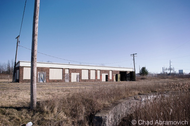
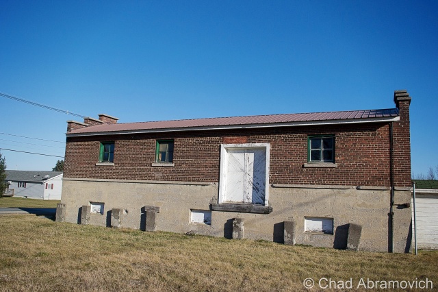
Automobile, rail and boat traffic is all siphoned through the gateway community, and because there are always nuances, that also includes the more illicit of things, like rum runners, smugglers, the underground railroad, and a few wars fought by the British and the Americans skirmishing on Lake Champlain over the past hundred years. Seriously, Rouses Point was such a noteworthy place that the feds financed a fort to be built at the mouth of the Richelieu just in case British troops wanted to invade us through Canada. Only, the United States was a much younger nation then, which meant that no one knew exactly where the border was, and the fort was accidentally built in Canada, later returned to the U.S, and never actually used. It was eventually partially salvaged for parts, and a lot of the small village was built up with the bricks, stone and wood salvaged from the brawny structure. From what I was told, the present day village offices were built on top of a former prohibition era dumping site of all the paraphernalia that was confiscated. Today, a drive through Rouses Point is mostly simple wood frame houses, moored sailboats and a Dollar General, a ubiquitous find in Upstate New York.
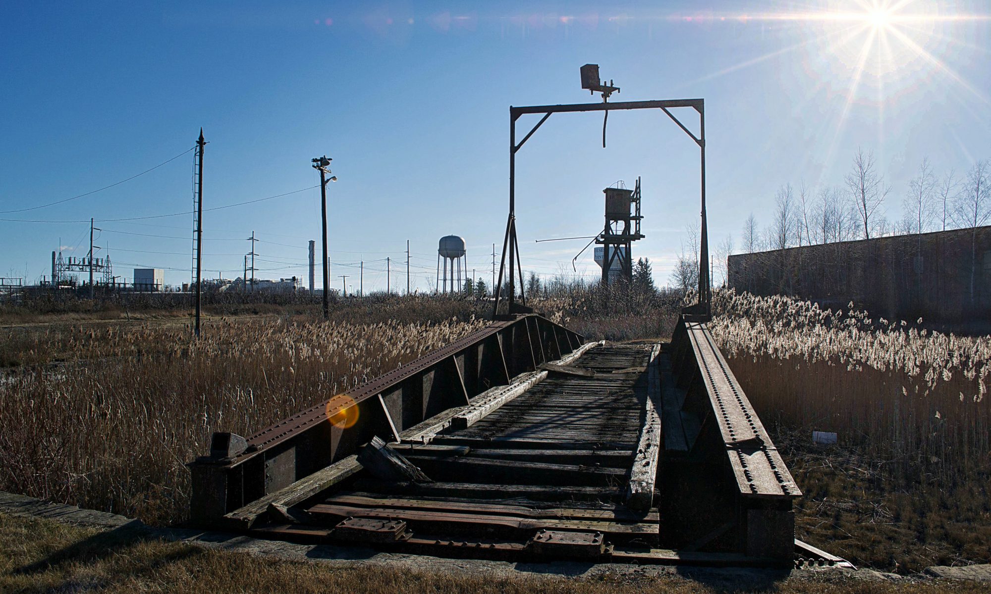
The village really did well for itself when the Delaware and Hudson Railroad decided to build passenger and freight facilities here and a rail yard to accommodate. Though Rouses Point is a pretty obscure community overall today, just outside the village limits are the remains of the oldest and last remaining Delaware and Hudson roundhouse turntables. Being battered by fierce winds, our trip here was short as the numbness in my hands began to outweigh my increasingly diluted curiosity. What can I say, I hate the cold.


Interestingly enough, most railroads, the D&H included, didn’t bother to wash their steam locomotives. Every so often, they would go over them with a mop soaked in kerosene to make them shine, but that’s about it. Roundhouses were built in the steam era as a way to store and maintain the locomotives, as well as repair and prepare them for their next trips. Other buildings on the site would be a coach shop, which was used to repair passenger stock, a cooling tower which was used for fuel, water tower for water, and in some cases a freight house where less than carload items were sorted and shipped out.
So, what is the reason that so many roundhouses are now abandoned? In short, diesel engines need much much less repair than steam engines. When the steam engines faded away, so did the roundhouses.


Alburg is a 45th parallel town, and one of a handful of Vermont communities that have found themselves in a weird moniker contention, where the United States Board on Geographic Names decided that they needed to standardize place names around the country in 1891. Every city or town ending in ‘burgh’ had their H dropped, pretty much so the mail would go to the right places and to make them easier to write on federal documents.
Well, over a hundred years later, a few Vermont towns decided that the dropped consonant was something to get up in arms about, with a few bringing it back, and the other few not caring that much.
Back across the bridge, in the pancake flat farmlands of the Champlain Island archipelago, the landscape is dotted with trailers, sagging farmhouses done in vinyl siding, and silver silos that reflect the coarse December sunlight from their gleaming surfaces.
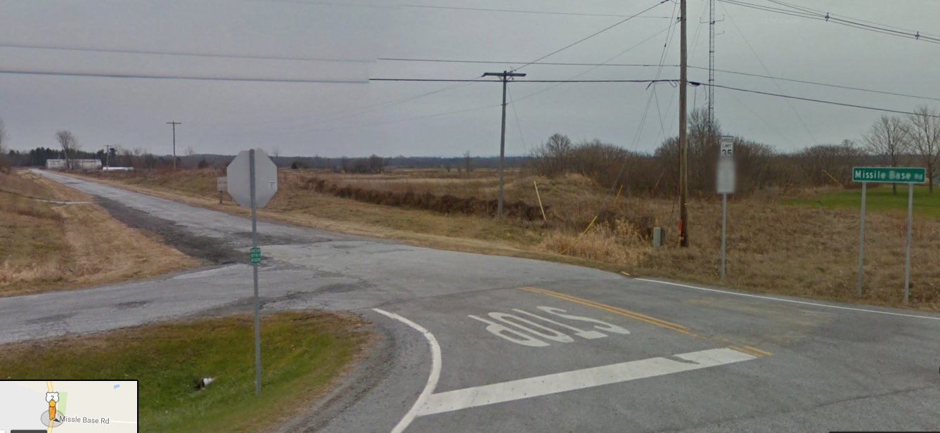
There is a rural road off of Route 2 called Missle Base Road, a moniker that supports the notion that this cul-de-sac is different from other Alburg byways . Whether or not it’s misspelling is a VTrans blunder or intentional, it’s sort of a weird road name in a region that only has a sheriff to bring down the law. That street sign is overshadowed by a much larger and more intimidating sign. In fading lettering, it sort of reads “Stop! Authorized Personnel Only Beyond This Point” in attention grabbing orange, while even more faded text behind it once read “Town of Alburg” (spelled without its H)
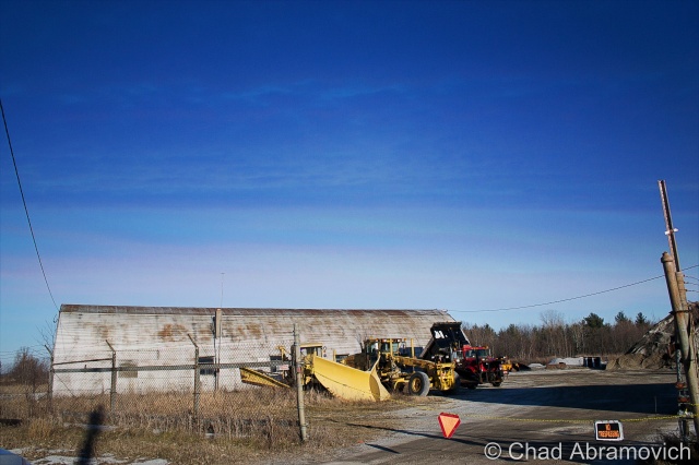
A drive down bad tarmac puts you dead ending in front of 2 rusted Quonset Huts, a chain gate, construction equipment that has seen better days and a dune of road salt. You’re looking at the Alburgh town garage!
But the Quonset Huts give its past away. Underneath the salt pile is the reason for the huts construction; an atlas missile silo.
This is the site of one of Vermont’s 2 nuclear missile silos. But you’d never know it. Towards the back of the property, a rusting pile of junk and a dune of road salt sits on top of the closed silo bay doors, each concrete door weighing 45 tons, enclosing the dark dripping confines of the flooded silo below.
Peering down the silo today would be a wondrous gaze into man’s eternal battle with evil and glorious ruin, but if you had peered down this shaft in the early 1960s, you would have been gazing at the tip of a nuclear missile.
In the 1960s, the military was scrambling to build defenses against the potential of a nuclear apocalypse that the Soviet Union was scheming, with the Soviets doing the same thing with the role of the villain reversed. The Army Corps of Engineers constructed 12 sites in a ring around the Air Force base in Plattsburgh — 2 in Vermont, 10 in New York, and absolutely no expenses were spared, with each site costing between $14 and $18 million to build, each one coming with a brazen claim that each could withstand a direct nuclear attack.
But these mysterious and aggressive projects were quite a feat to build. Many workers died during their constructions, with urban legends reciting that some unfortunate souls became entombed in the concrete silo walls they were hired to produce. The thought of the cold walls and dark depths of the missile silo as someone’s last vision is an image is a poignant one.
Ironically, despite the large expenses invested in these agents of destruction, the pulses of these missile silos were short lived, only active from 1962 until 1965, thanks to leaps in progressive apocalyptic technology. To add to the uncertainty, many were disputing afterward whether the missiles would have been able to hit their targets, and even be able to lift off the ground.
But they left a lasting impression on the landscape. However today, they hold contaminated waste and shadows smothered with valiant ghosts.
Each launch site constructed included two Quonset huts, a utility shed and an antenna that could detect a nuclear attack up to 30 miles away. The silo itself was 52 feet wide and 174 feet deep, encased in a shell of incredibly thick and durable concrete.
After their demise, the sites were abandoned. Ownership was now the burden of their communities, including this one, which was, uh, gifted to Alburgh, who turned it into their down highway department headquarters and dumped road salt over the perforation. Others were looted, some were sold to private investors and military enthusiasts. According to lots of testimonies over the intervening decades, most of them flooded to some degree.
Because everything has a market, interest in these intriguing properties has picked up in recent years, thanks to curious buyers who see the old silos as great “fixer-upper” projects, especially for private homes. But due to their deteriorating conditions, these sites require a buyer with a lot of money, patience and time. One of the former sites, in Champlain, New York was found and purchased on eBay. The new owner plans to clean it up and live in the remaining Quonset hut, and possibly in the launch control center. Taking his project a bit further, he has created an intriguing website which tracks his progress cleaning up the site, and gives everyone else a cool and rare look into these fabled locations.
Alburgh’s site wasn’t phenomenally interesting, but I still thought it was cool. I snapped a few photos of the Quonset Huts, because that’s more interesting than a photo of a pile of salt. I’m pretty confident in my assumption that the town won’t be opening up those blast doors anytime soon, so it’ll have to do. A town garage that doubles as a weird monument to humankind’s strange tendency to destroy itself.


—————————————————————————————————————————————–
To all of my amazing fans and supporters, I am truly grateful and humbled by all of the support and donations through out the years that have kept Obscure Vermont up and running.
As you all know I spend countless hours researching, writing, and traveling to produce and sustain this blog. Obscure Vermont is funded entirely on generous donations that you the wonderful viewers and supporters have made. Expenses range from internet fees to host the blog, to investing in research materials, to traveling expenses. Also, donations help keep me current with my photography gear, computer, and computer software so that I can deliver the best quality possible.
If you value, appreciate, and enjoy reading about my adventures please consider making a donation to my new Gofundme account or Paypal. Any donation would not only be greatly appreciated and help keep this blog going, it would also keep me doing what I love. Thank you!
Gofundme: https://www.gofundme.com/b5jp97d4
![]()