

Spring in Vermont often means weeks of gloom and rain, which mixes up with the sour in my cup. Sometimes the best cure for Spring fever is adventuring.
I knew of two local spectacles in Burlington’s intervale, one a local landmark and another a striking existence of hidden obscura.
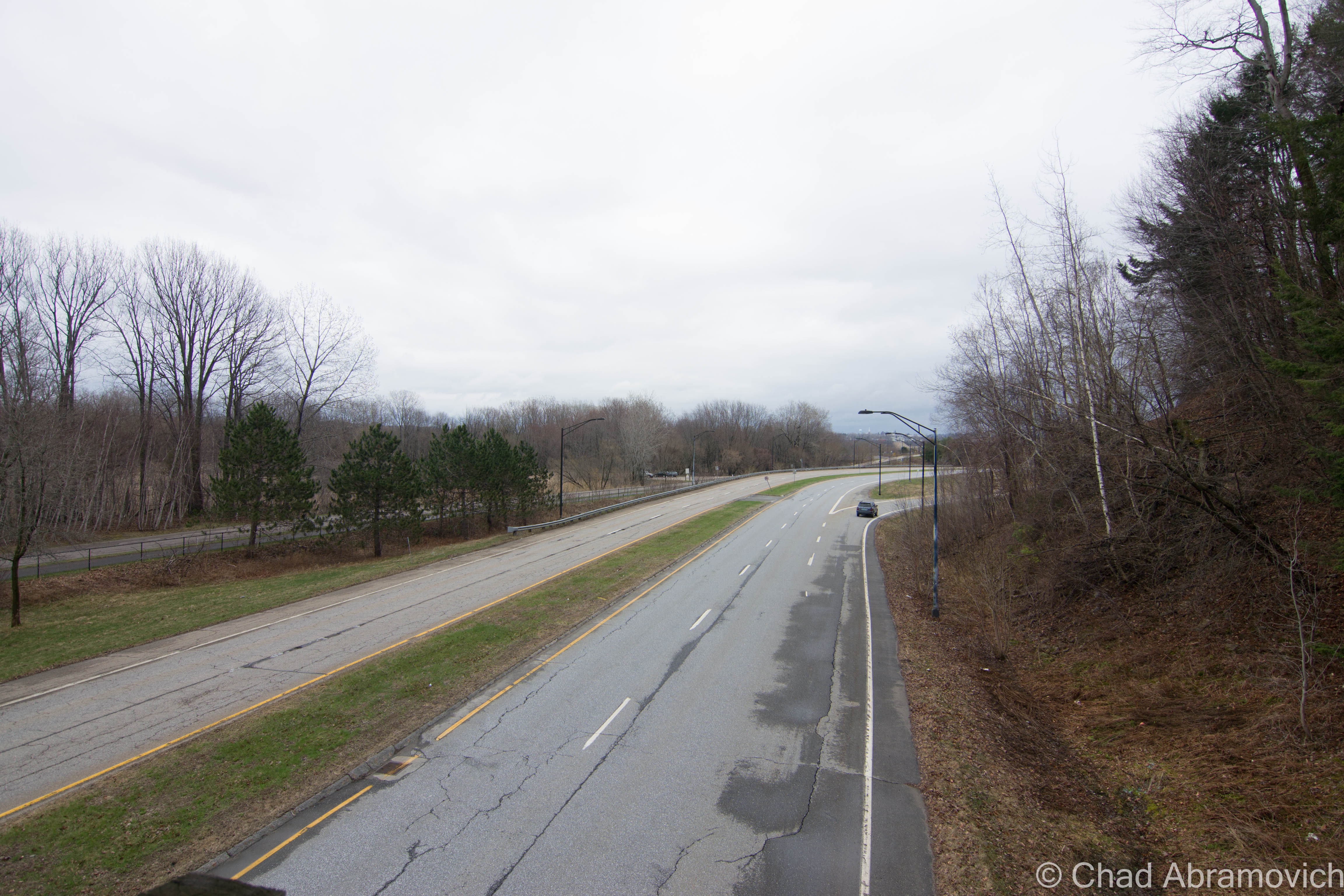
Cruising down North Champlain Street, jarring along the many “speed humps” along the cracked road, I gazed at the Old North End’s many brightly colored old homes which seemed to be blazing underneath melancholy skies. Turning into the beltline, I shortly arrived at my first place of interest.
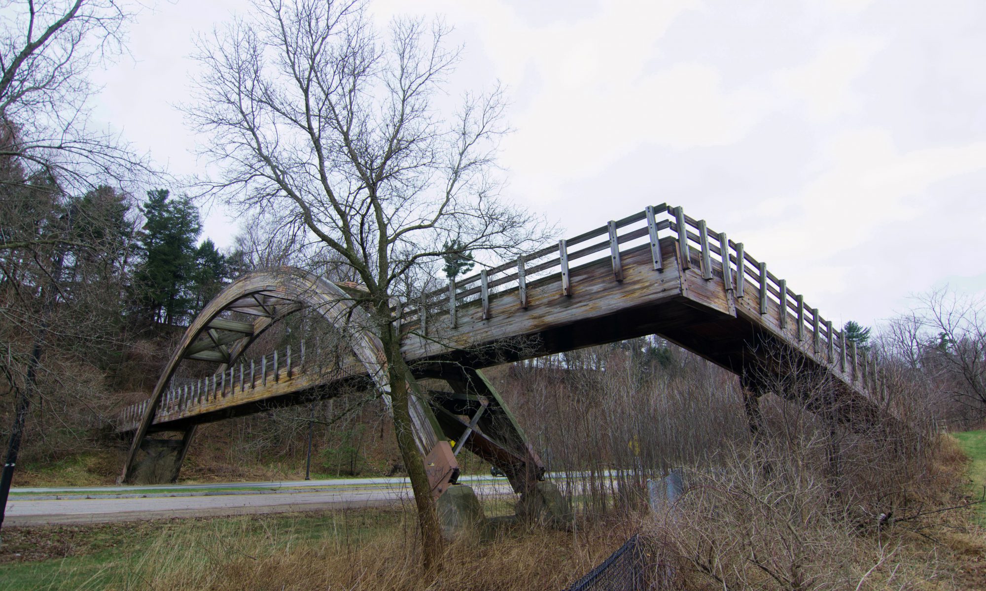
Burlington’s Bridge To Nowhere
If you’ve ever driven the Burlington Beltline before (Route 127), you’ve probably noticed this unique wooden arched bridge that stretches dramatically across the roadway, resting into a steep slope. But upon closer investigation, something seems weird about this particular bridge – it doesn’t seem to go anywhere – the bridge ends abruptly into a steep hillside rising above the highway. More puzzling is that there are at least 2 other bridges that also cross the highway, but they are all in use and connect to a network of bicycle trails. So what’s the story with this bridge? Why doesn’t it go anywhere? Why is it here?
To be blunt – federal law. The Beltline – Vermont’s first planned circ highway- sliced through land designated as parkland by the Winooski Valley Park District, and created a division in a piece of parkland west of the highway, aka that useless steep and over grown slope. Because the highway site was purchased with federal funds, law stated that the park’s land had to be connected for access purposes , thus a bridge had to be constructed to maintain the park’s continuity — even though the western side, in this case, was too steep and densely forested to enjoy or use. But federal law is federal law, regardless of the logic.
The bridge might not look like anything truly extraordinary, but as it turns out, a lot of detail and planning were included in the design. Rich Ranaldo, the Agency of Transportation engineer who designed the bridge, wanted to do something different than what has been done before. He wanted the bridge’s design to compliment the natural setting of the intervale. The decided idea was a unique timber arch bridge, which they have never designed before. In the end, it was a success.
The Burlington Department of Parks and Recreation has closed the end of the bridge to the public – blocked off by a chain link fence, which has raised a less than positive response from people who view the deserted span as wasteful. At one time, it was proposed to make a bike path connecting the bridge to the New North End, but the idea was declined, saying the funding just wasn’t there. Above the rough slope lies Revere Court, a small cul-de-sac neighborhood, whose residents apparently weren’t that thrilled at the time with more traffic entering their quiet street. The parks department said the slope was too problematic for construction, given the nature of it’s unstable soil.
Walking on the bridge as the mist in the air weighted heavily on my skin, my feet slipped several times on the slick wood as my boots made high and lonesome sounds. For being in such an area of high traffic, I felt strangely isolated up above the highway. Surprisingly, the bridge is reflectively clean for such a large abandoned structure in an urban area. It’s void of graffiti and has minimal rot damage. I walked as far as I could go until I hit the fence. Beyond it, there was evidence that others have climbed over and trekked up the steep hill, a worn footpath made its way through tanglewoods. In the summer, the entire slope would be wild and filled with prickers, making that a path I’d want to avoid.
The good news is that if the bridge were ever to be refurbished and utilized as another pedestrian or cycling trail, the work wouldn’t be difficult. But until that day comes, the bridge will continue to awkwardly span The Beltline, vexing residents and passersby for years to come.


The Donahue Sea Caves
Burlington can boast an impressive amount of geographical features within its 16 square miles. Rocky points and sandy beaches slide into the lake as steep hills, vast swamps and river bottoms make up the surprisingly diverse land that rises up from the lake shore. But one of Burlington’s most curious features are what have been dubbed as The Donahue Sea Caves, something that many residents in the city are unaware even exist, including myself until a few days ago.
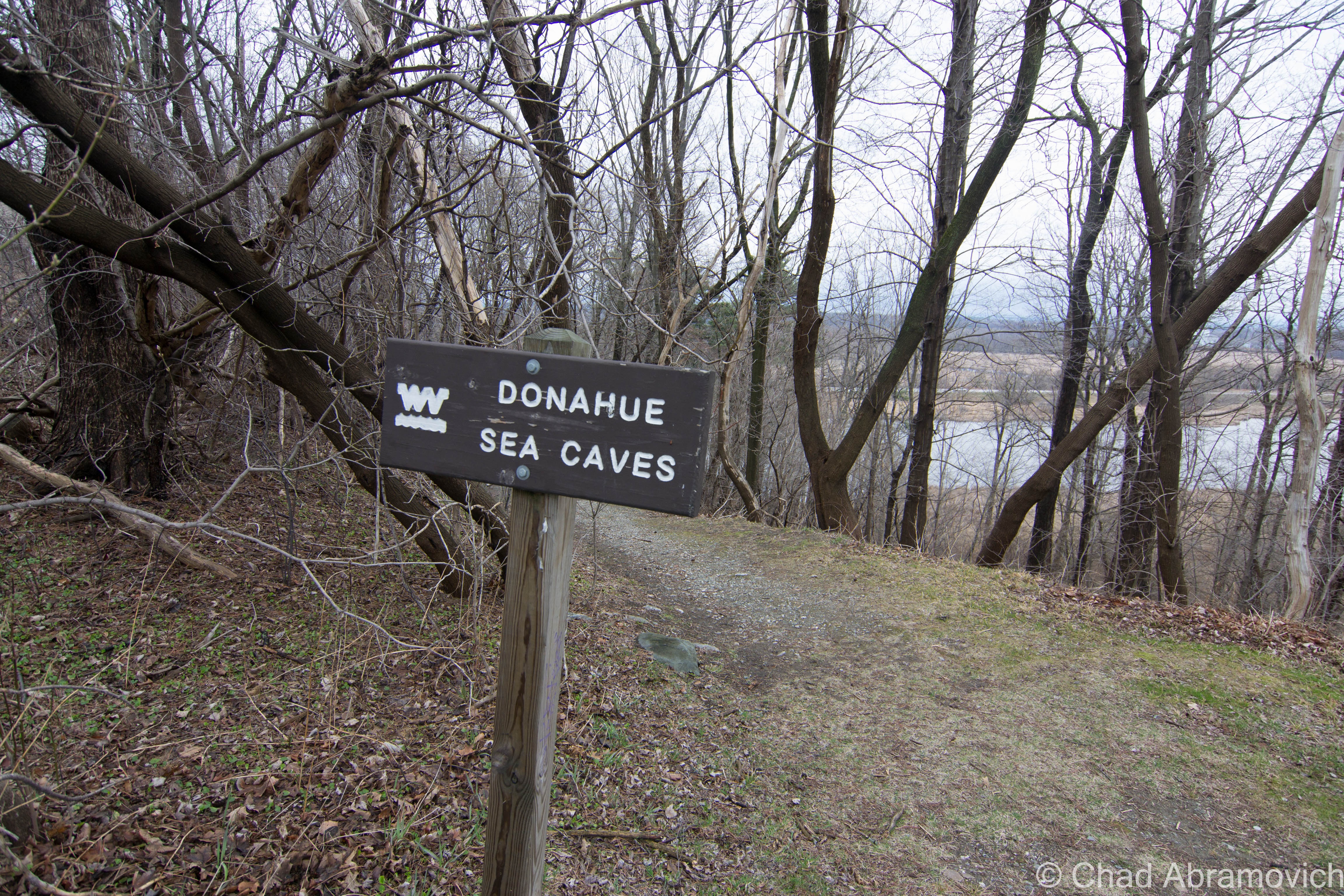
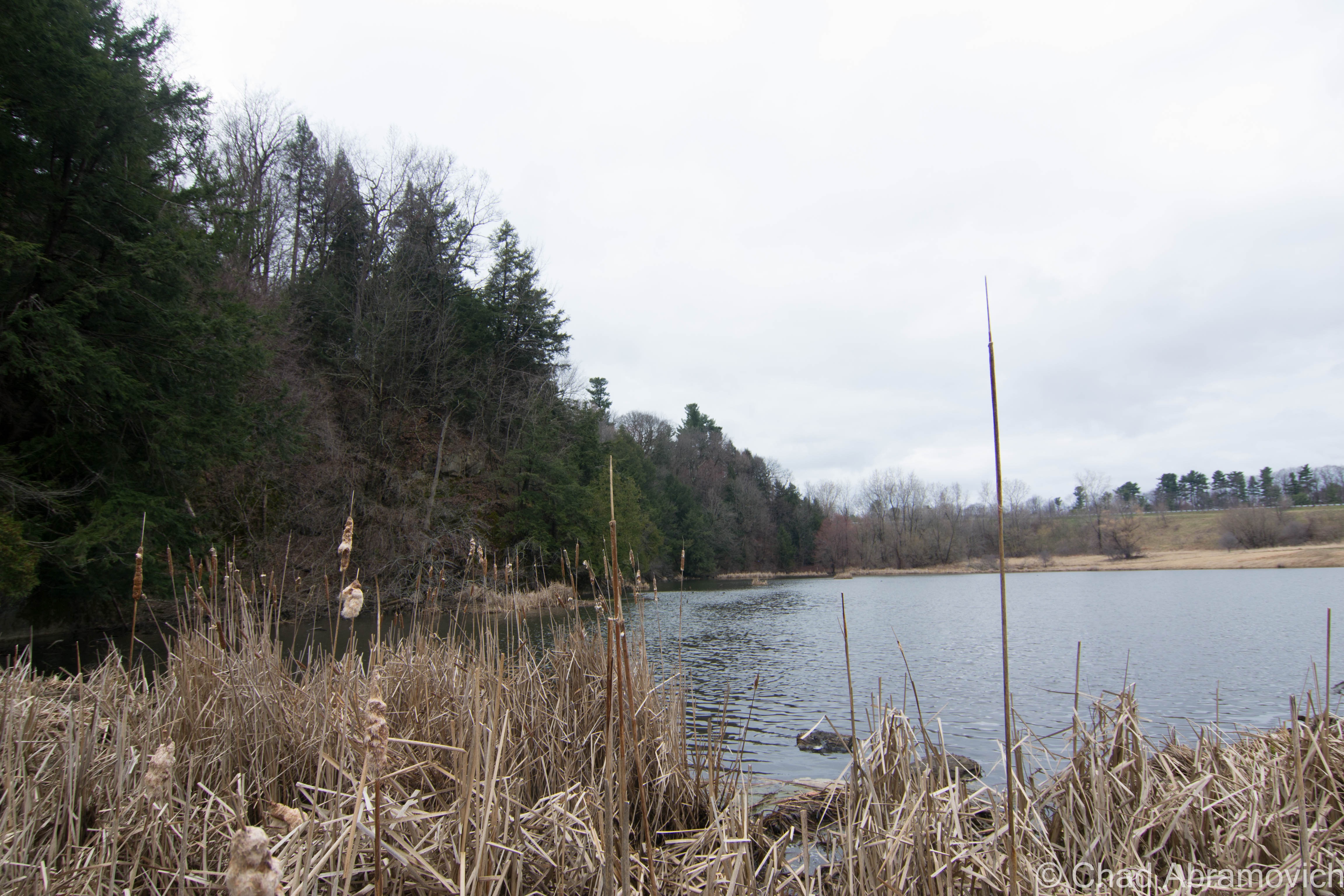
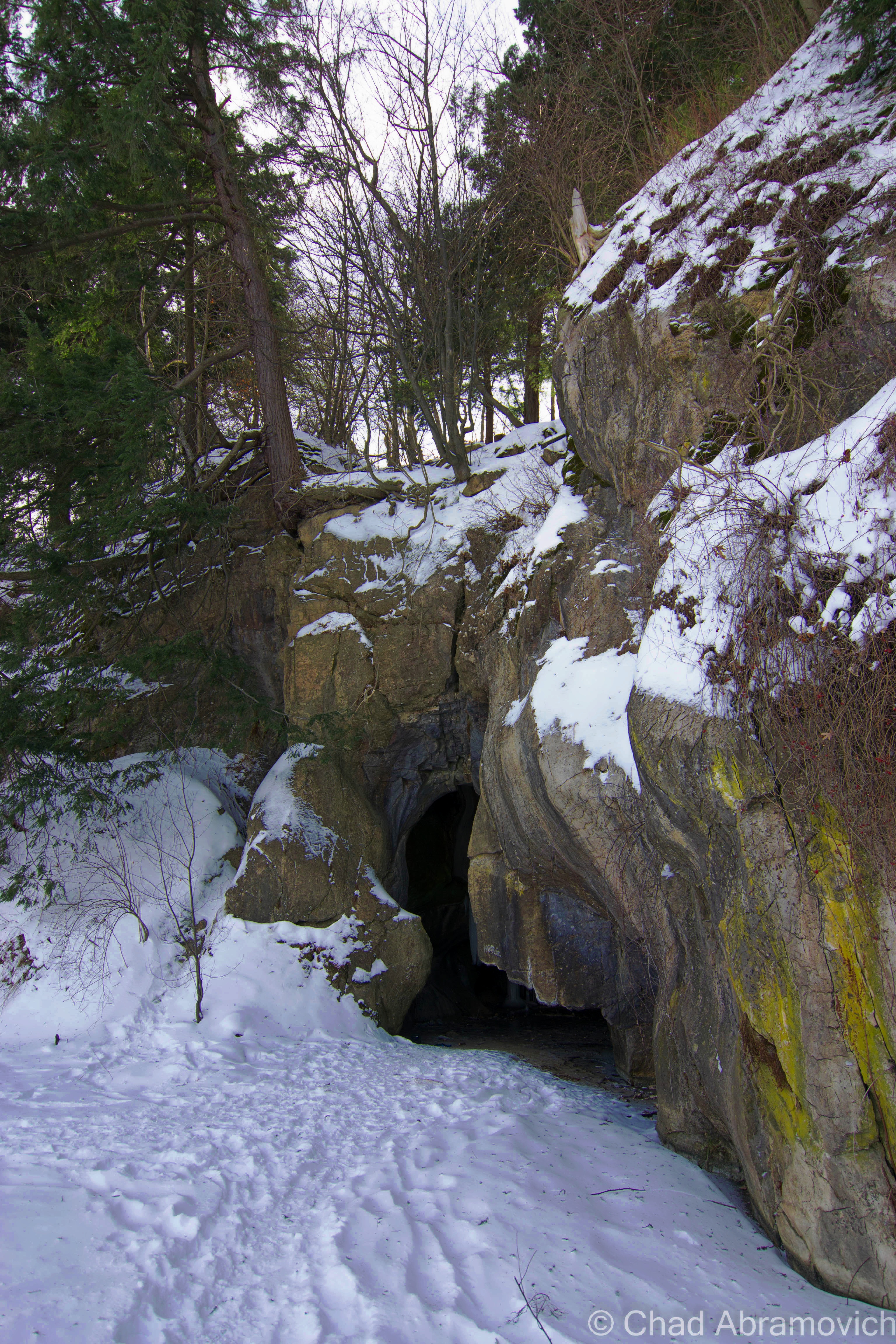
Midway on North Avenue, across from Burlington High School, lies a discrete small brown sign near a bus stop that simply reads “Donahue Sea Caves“, with a dirt path leading down the steep banks into the intervale below. I don’t know how many times I’ve passed this strange trail head before without noticing it, and I was curious. What exactly were the Donahue Sea Caves? So, I followed the trail, down the hill and into a world of woods shambling up steep clay banks and deep swamps. But the roar of traffic from the Beltline nearby brought me back to reality. Eventually, the trail went from dirt to swamp, and the land literally ended at my soaking wet feet as the trail bled into a wide open dark pool that ran along the base of steep ledges. I looked around, and was wondering exactly what I was supposed to see now that I was here. Way in the distance, around a rocky outcropping, was a black hole in the rock ledges. I was staring at the entrance to a cave, and it seemed the only way to get there was with a kayak. Or swimming. I didn’t have a kayak and didn’t feel like taking a swim, so I hiked back up to North Avenue, defeated.
Later that day, I did some research and found out the story behind these mysterious caves. First of all, “Sea Caves” is a bit deceptive, because there is only one cave. The name Donahue comes from David Donahue, who donated the land to the Winooski Valley Park District. The “Sea Caves” part of the name struck me as odd, considering we’re in landlocked Vermont, but I soon found out that the limestone caves are remnants of the Champlain Sea, formed by the waves when the sea once covered this area over 10,000 years ago. However, that might be a bit controversial. A UVM geologist explained that he thinks the caves are instead the product of a glacier retreating, probably shaping the cave when the glaciers retreated from what it is now Vermont.
To add a little more to the mystery, my grandfather told me that Burlington old timers once referred to the cave as “Devil’s Cave” – which is a moniker given to many creepy, dark and remote places across New England.

A year after I had posted this, cabin fever would drive me out of the house. Because most bodies of water in the area had frozen, the Donahue Sea Caves came to mind, and because it was -3 degrees with a colder windchill, I welcomed the idea of a local adventure that would hopefully be sheltered from the horrible winds.
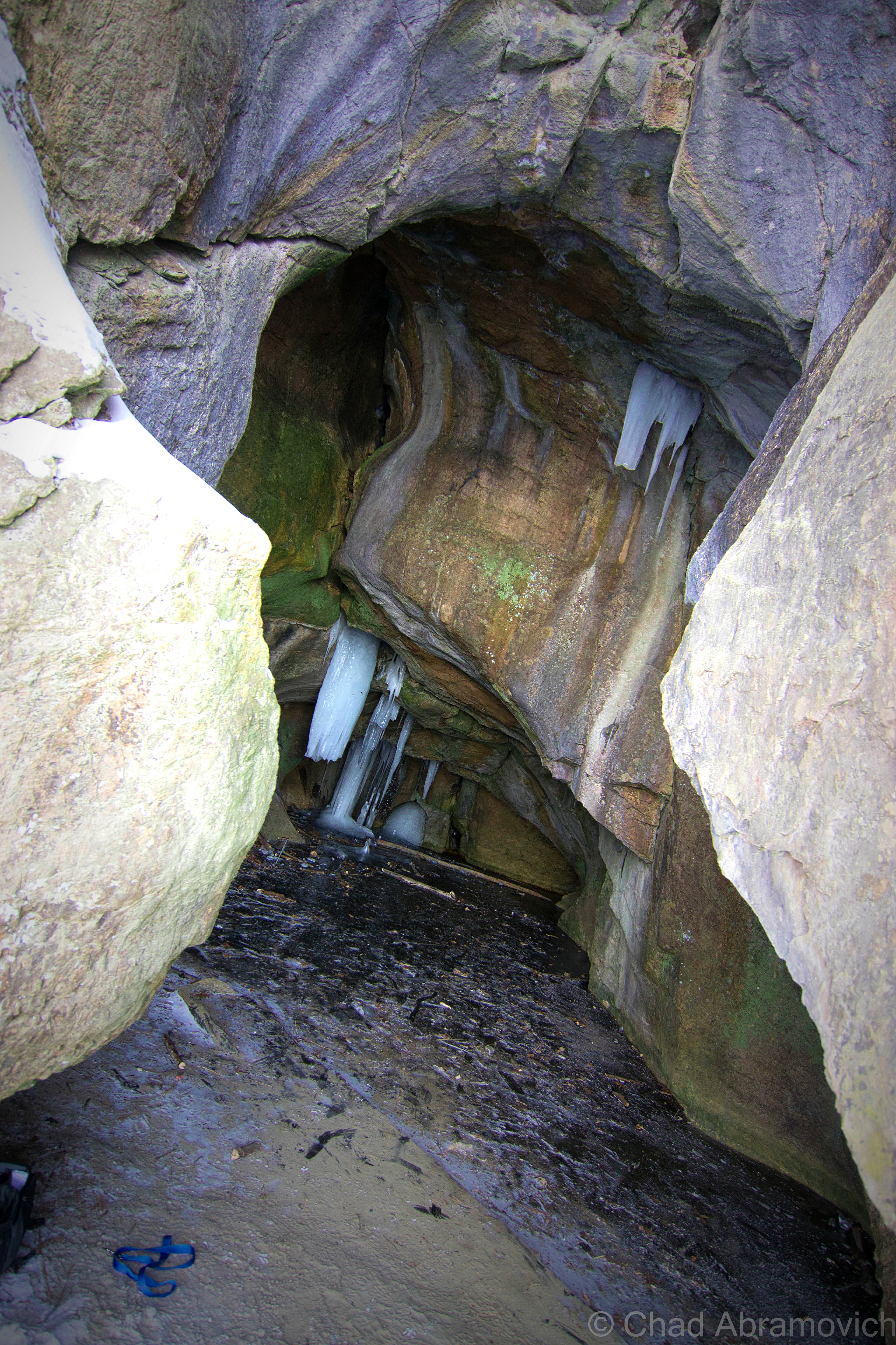
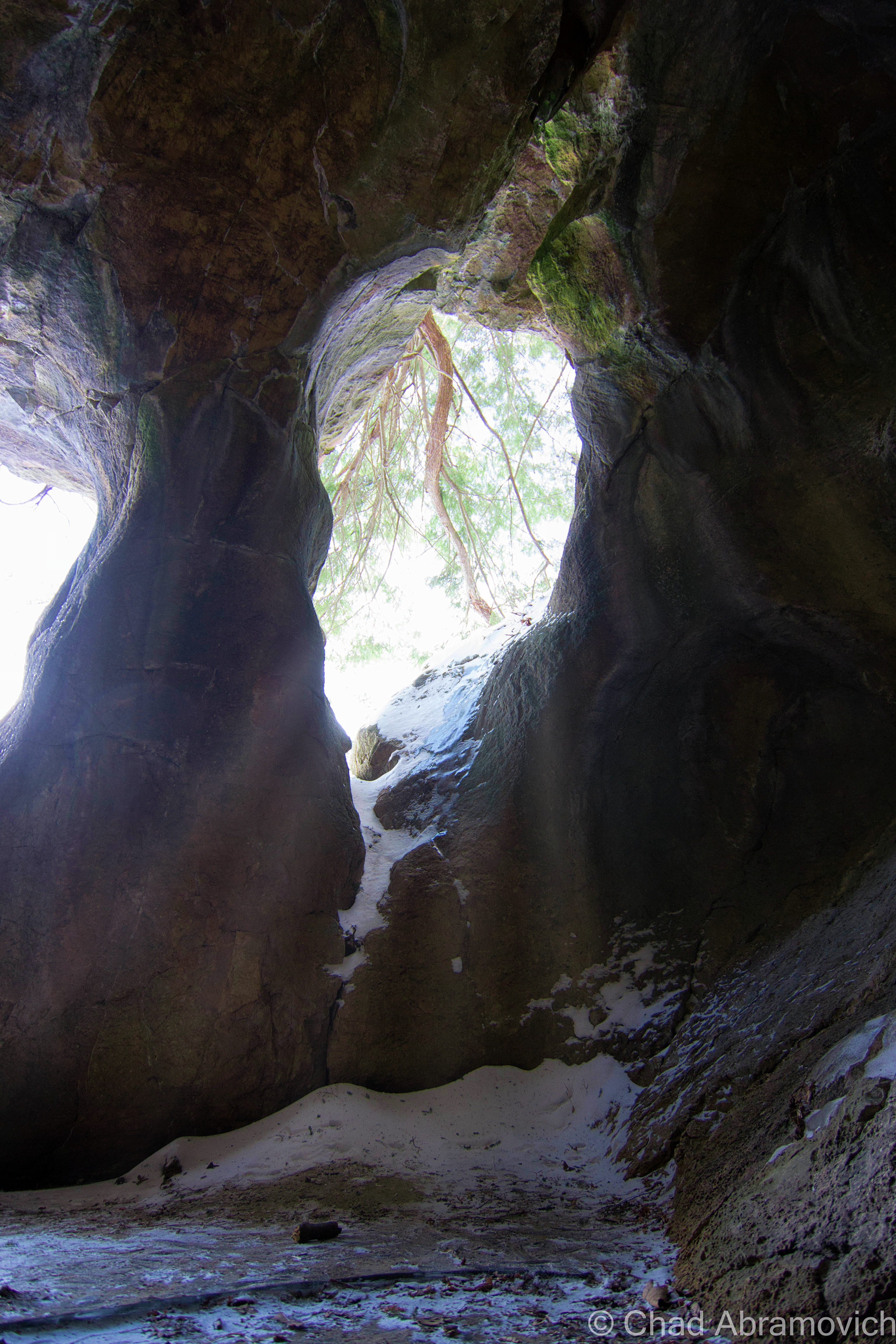
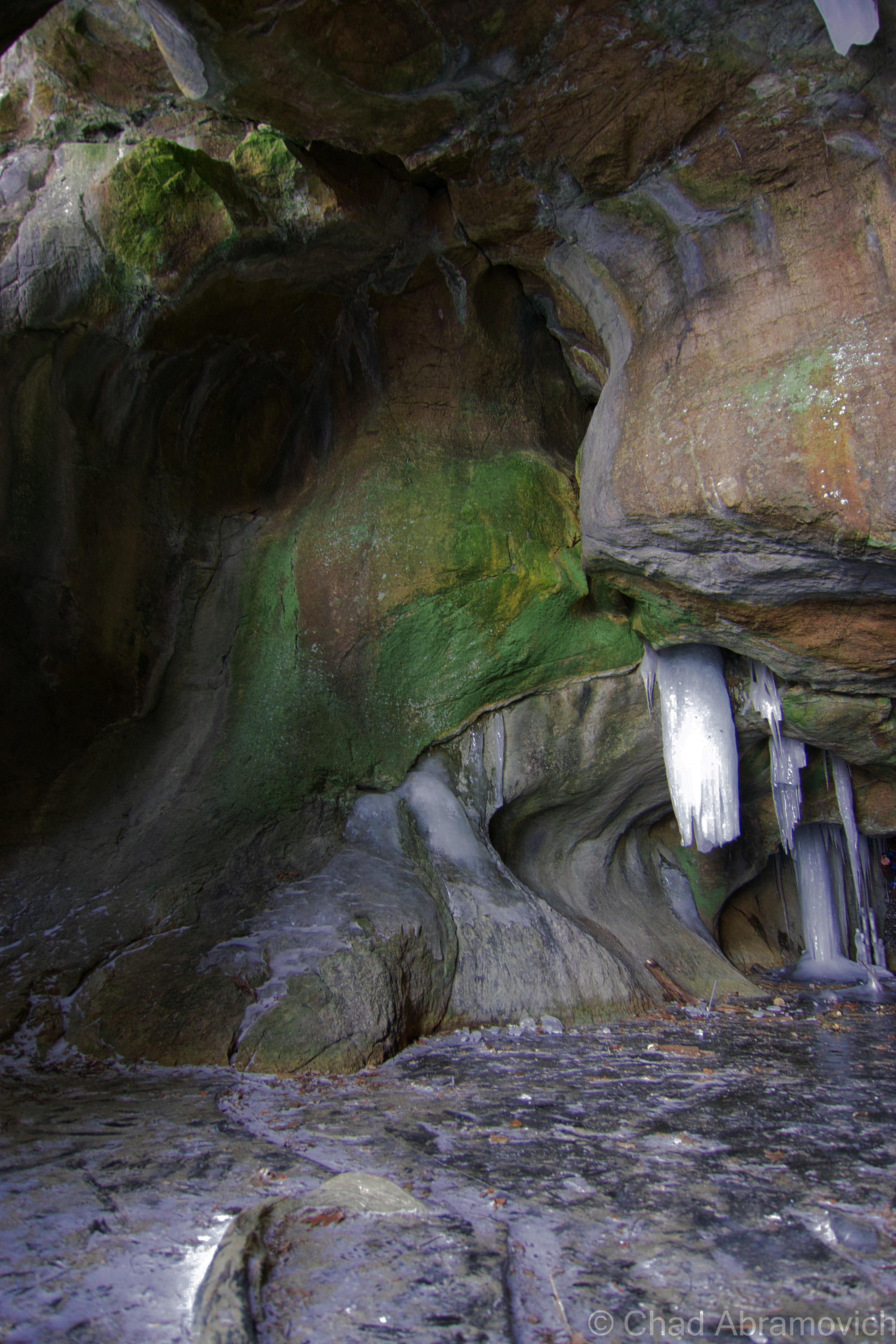
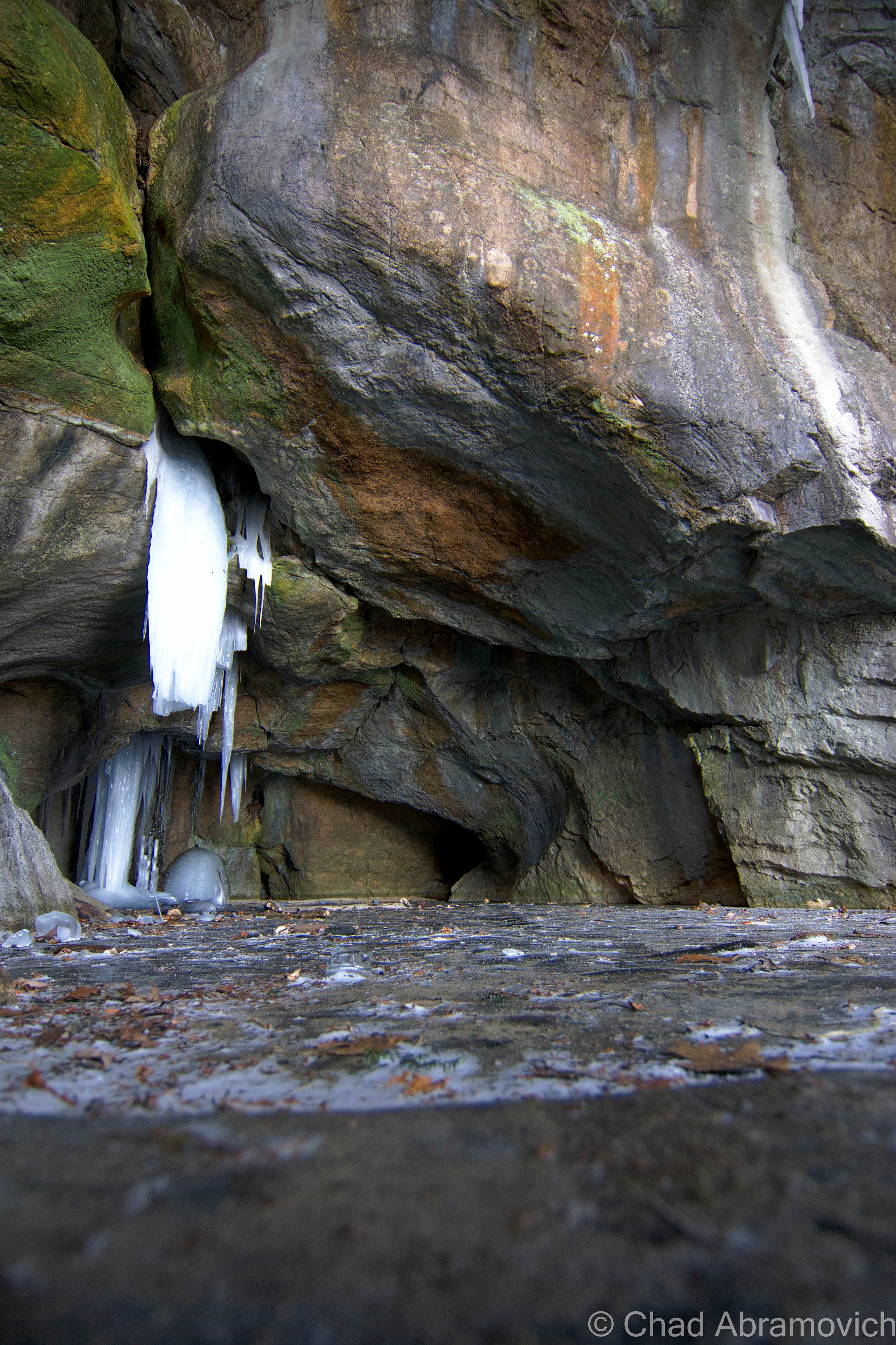
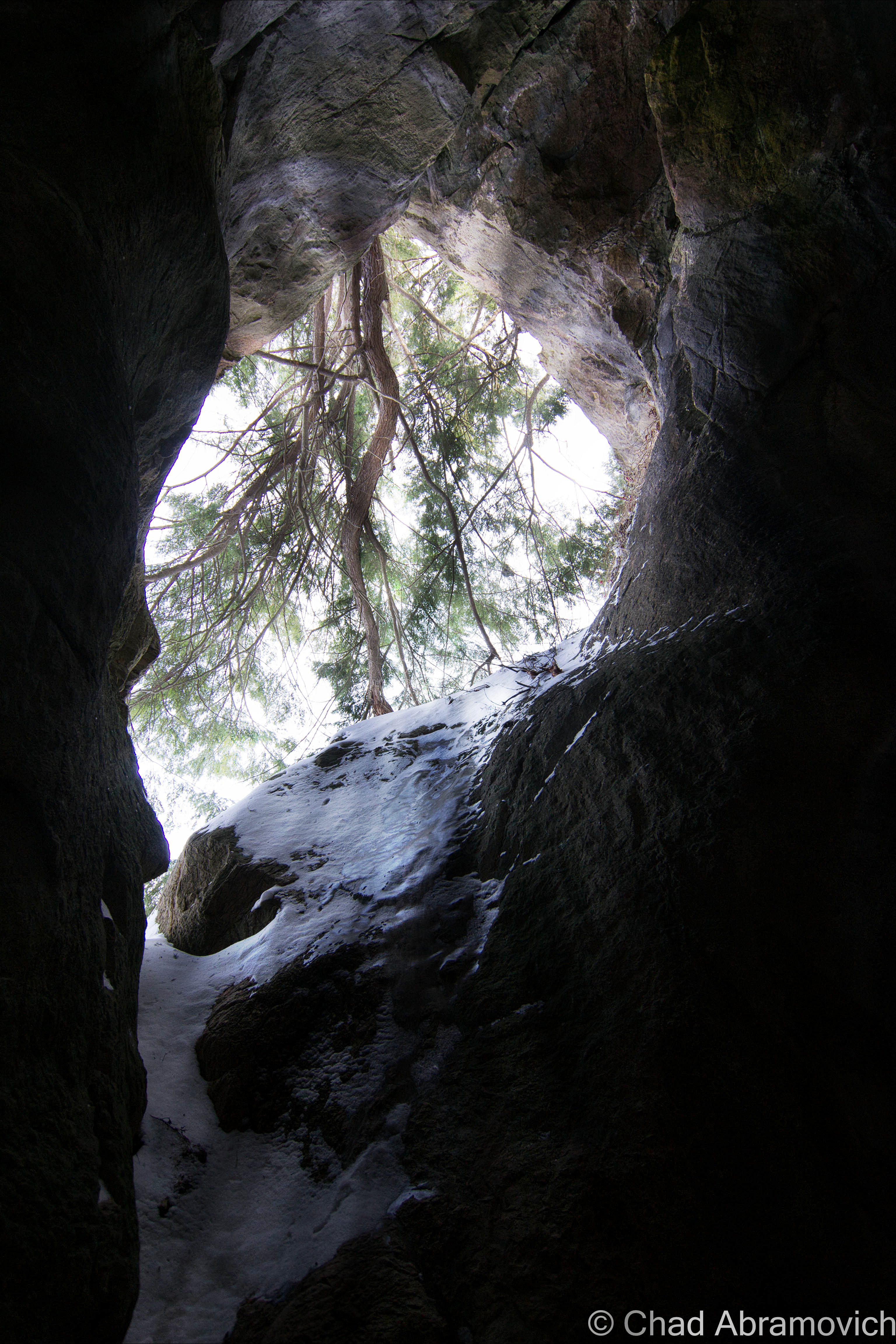
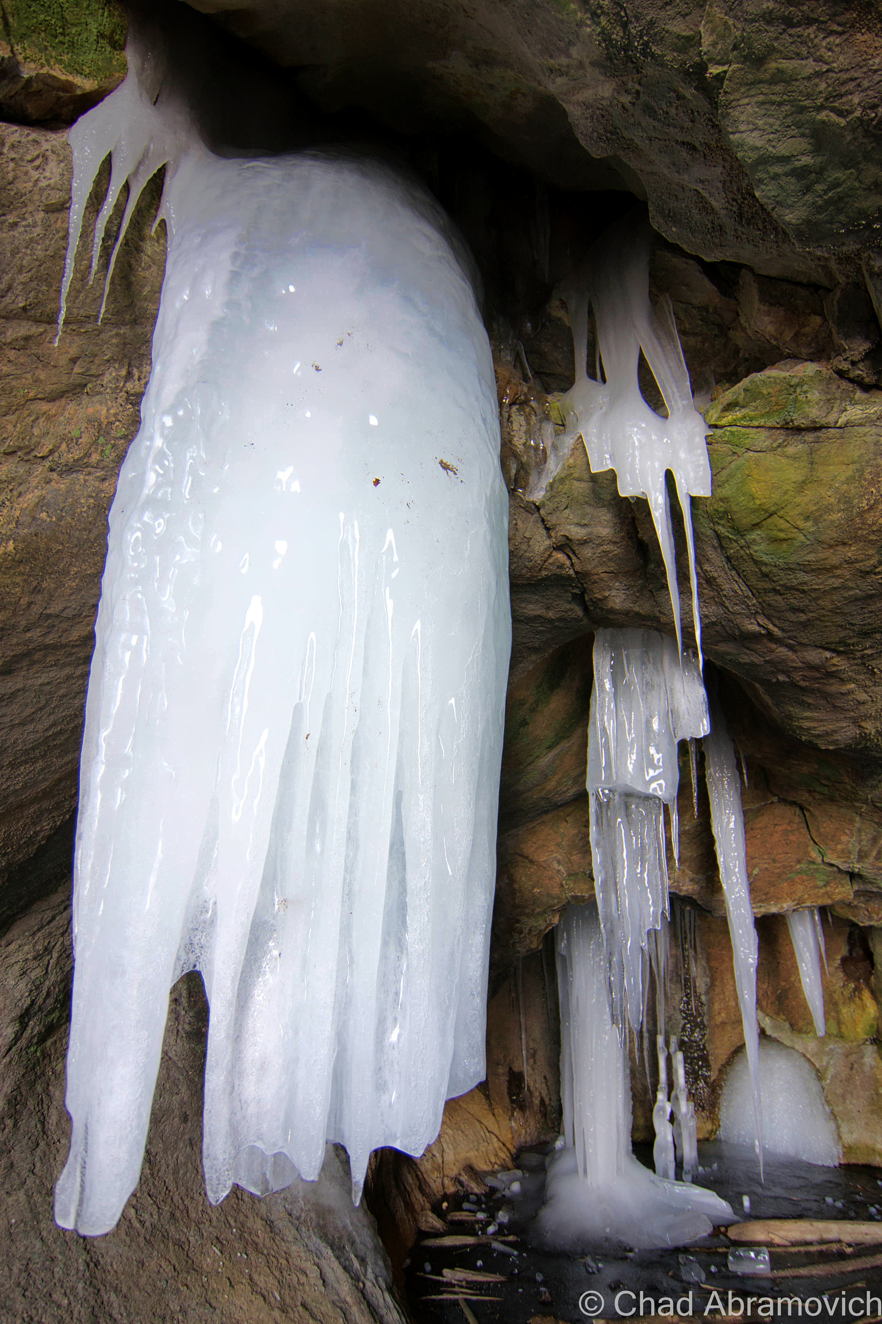
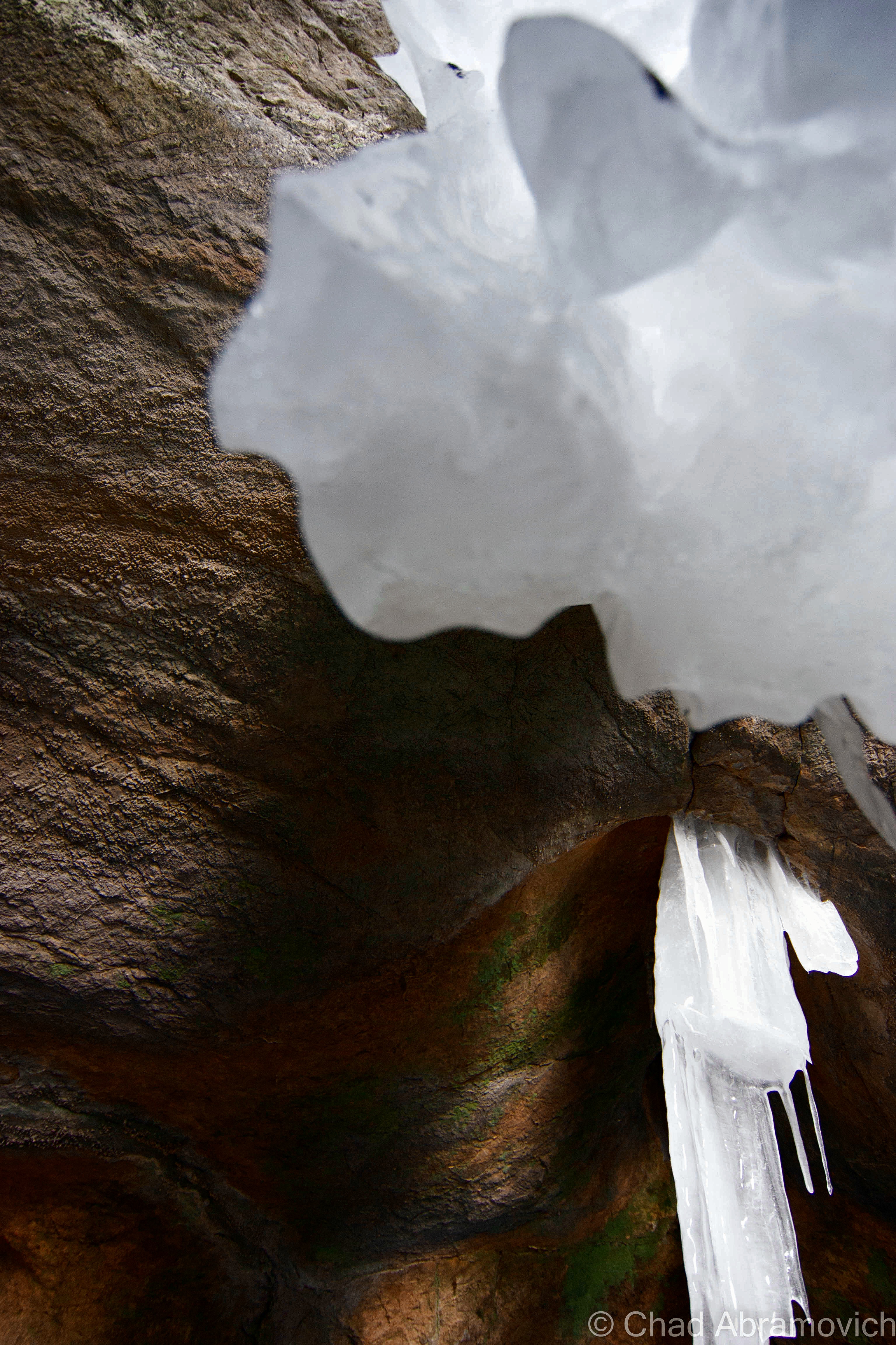
The caves twisting rock walls and undulating textures coated with icy stalagmites dripping into solid ice floors which are otherwise thawed and a murky green in the summer months, with depths that are said to link to underground pools and hold an assortment of urban relics, are just a few reasons why this chamber is a cool place to walk around and explore, even with temperatures well below zero. The best time to access this area is in the winter, when the swamps freeze over. Otherwise, you’ll need a kayak.


How To Get Here:
The Donahue Sea Caves can be reached from the trail head on North Avenue, directly opposite the Burlington High School. The small brown sign can be seen a few feet north of the bus stop across the road. Follow the trail down the hill to the swamps. You’ll need a kayak, boat, or dependable ice to make this trek.
—————————————————————————————————————————————–
To all of my amazing fans and supporters, I am truly grateful and humbled by all of the support and donations through out the years that have kept Obscure Vermont up and running.
As you all know I spend countless hours researching, writing, and traveling to produce and sustain this blog. Obscure Vermont is funded entirely on generous donations that you the wonderful viewers and supporters have made. Expenses range from internet fees to host the blog, to investing in research materials, to traveling expenses. Also, donations help keep me current with my photography gear, computer, and computer software so that I can deliver the best quality possible.
If you value, appreciate, and enjoy reading about my adventures please consider making a donation to my new Gofundme account or Paypal. Any donation would not only be greatly appreciated and help keep this blog going, it would also keep me doing what I love. Thank you!
Gofundme: https://www.gofundme.com/b5jp97d4
![]()