Most people my age aren’t likely to recall Frontier Town, a once-prominent destination turned ghost town in the woods of tiny North Hudson, New York, but there are plenty of people who will tell you that it used to be great, and integral to the once-thriving Adirondack tourism heyday of the mid 20th century.
The Adirondacks are the rugged mountain range that makes up a the eastern half of upstate New York, and most of those mountains are within the 6 million-acre vast and often desolate Adirondack Park, an area about the size of my home state of Vermont and is the largest park within the lower 48.
I’ve mentioned Frontier Town before in an earlier blog entry, but never truly got around to exploring it until recently.
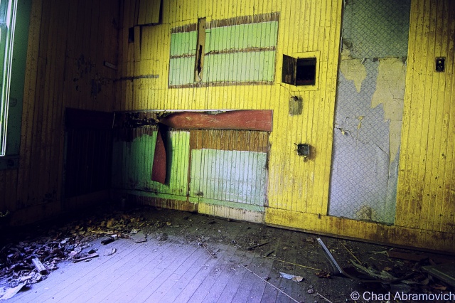
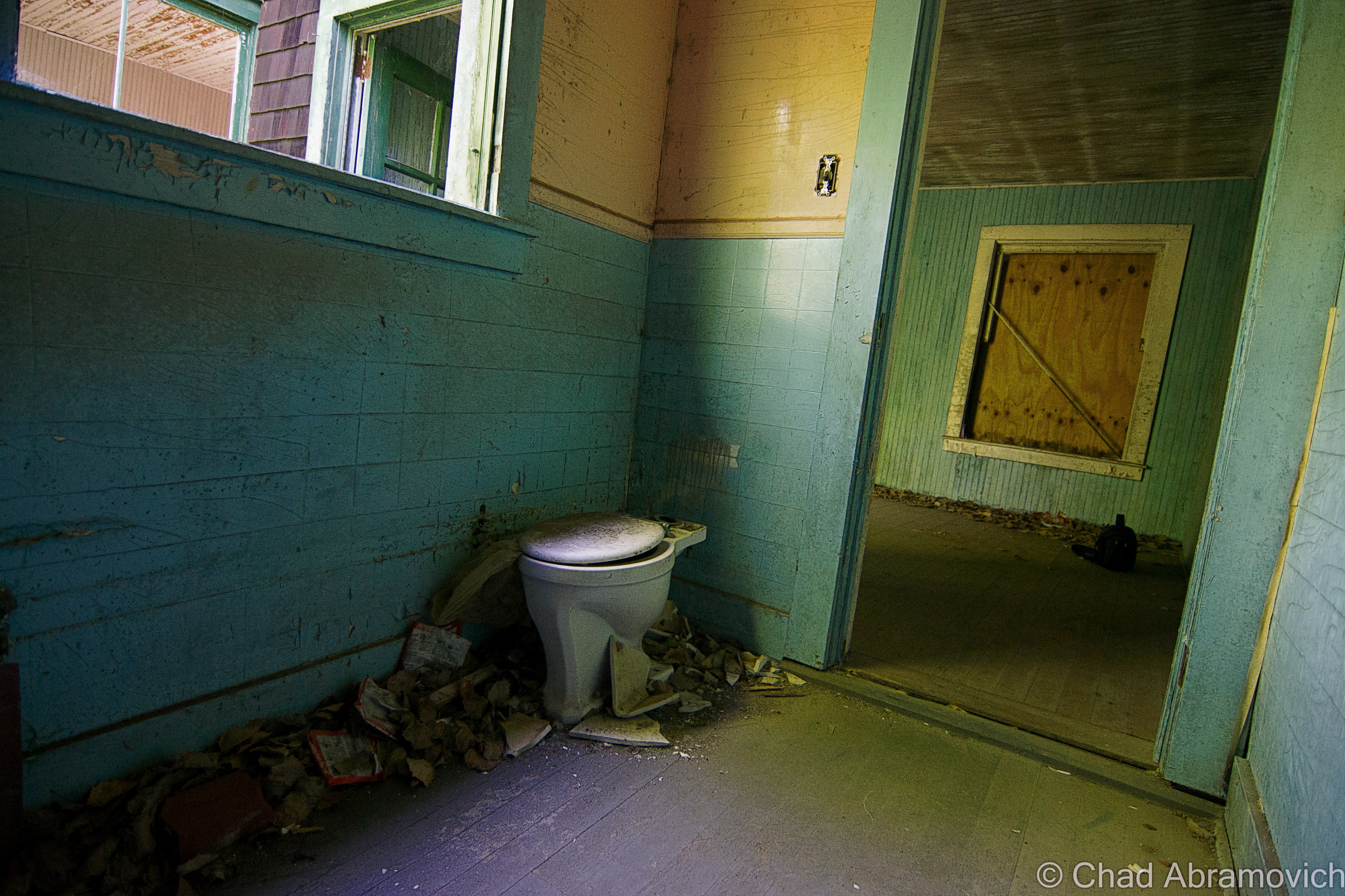
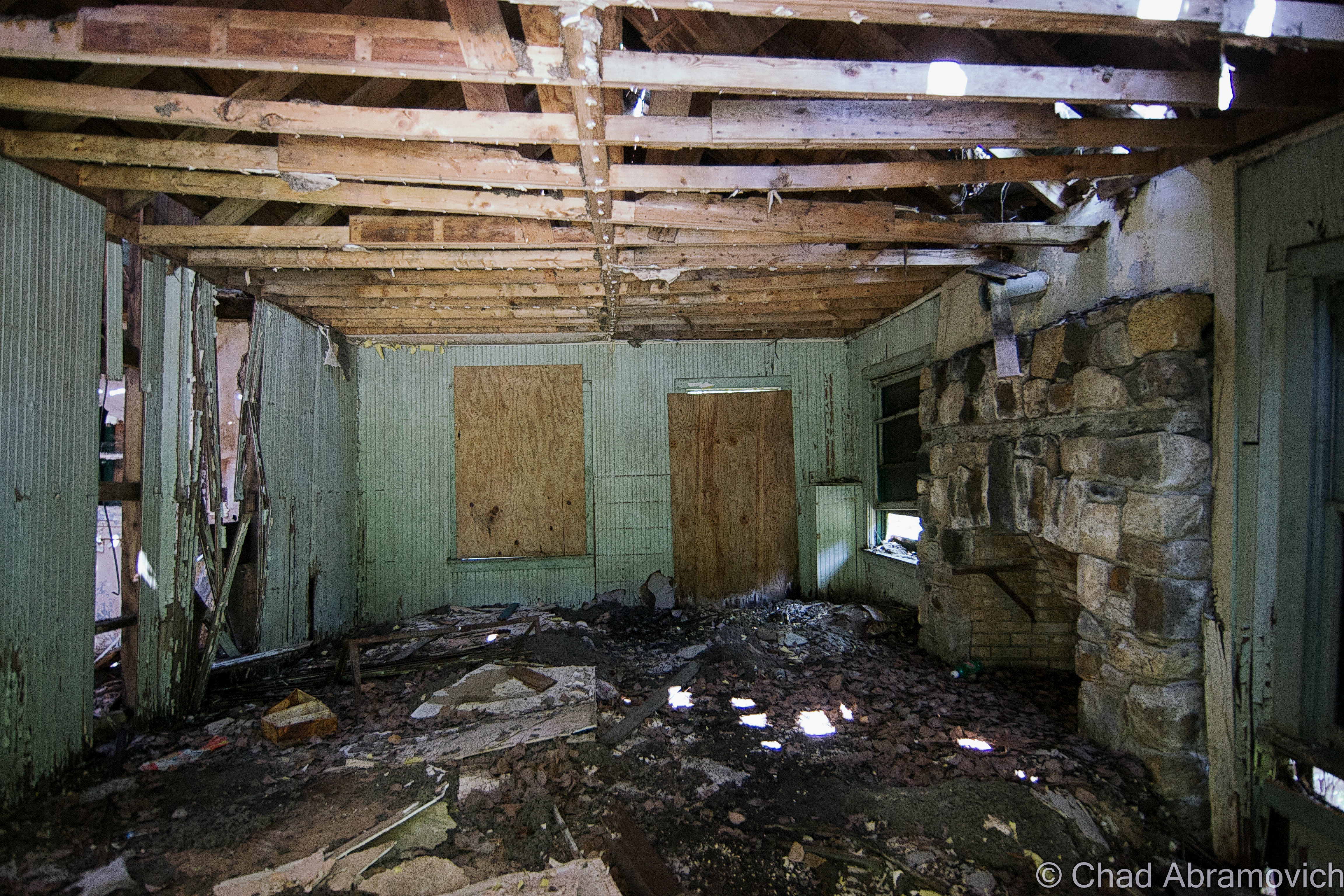
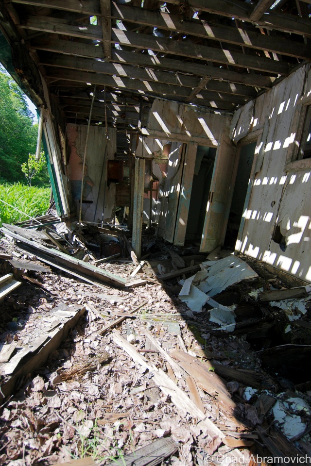
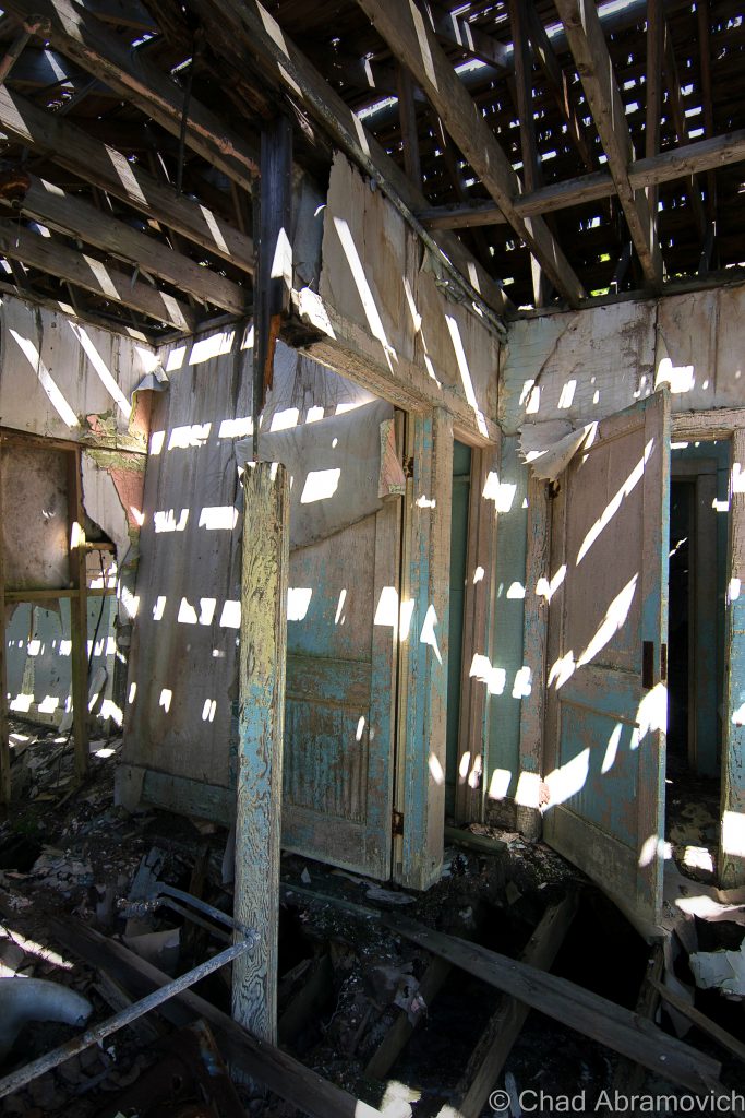
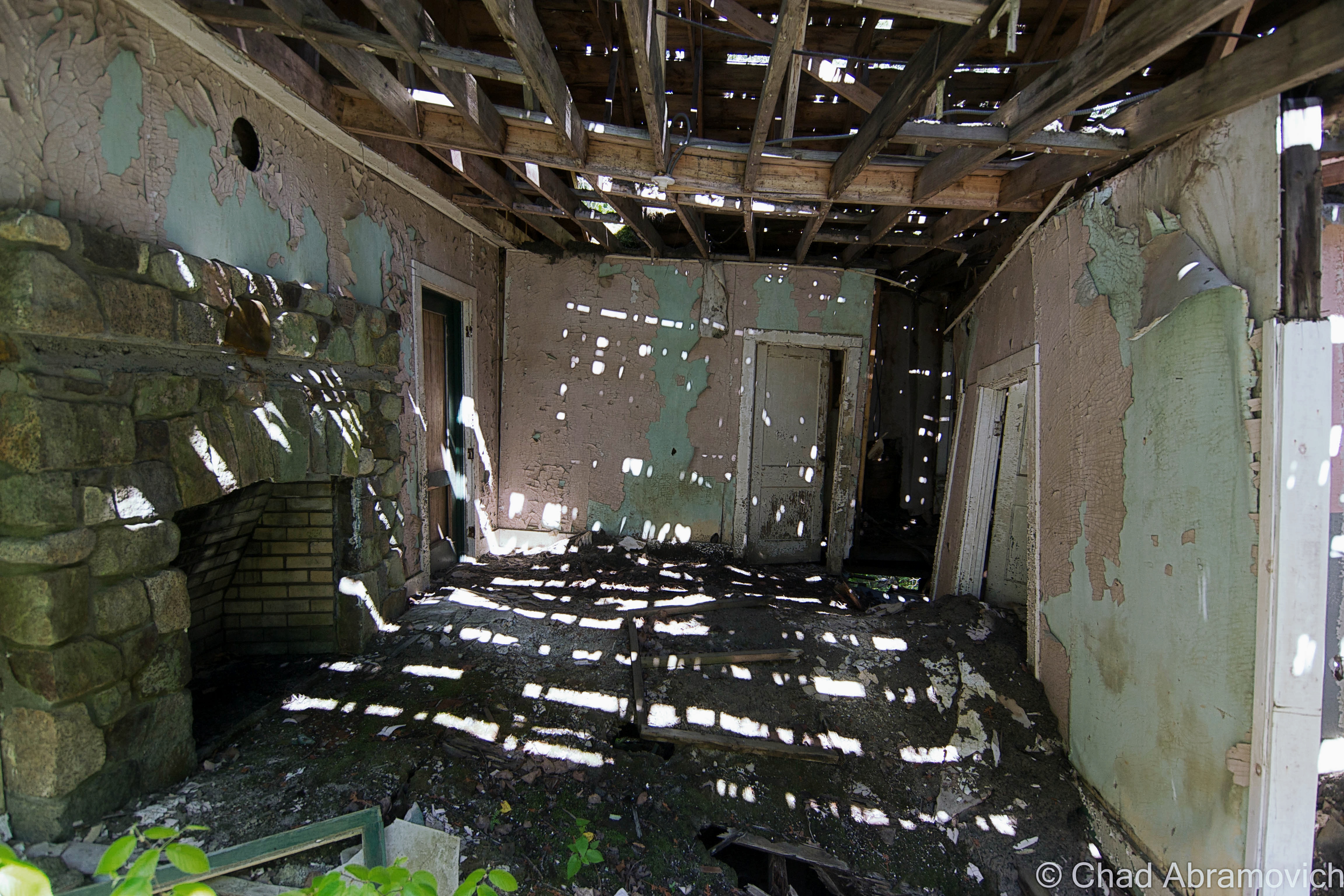
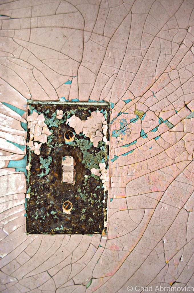
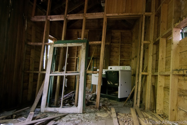
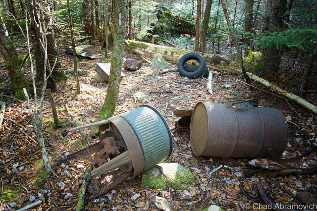
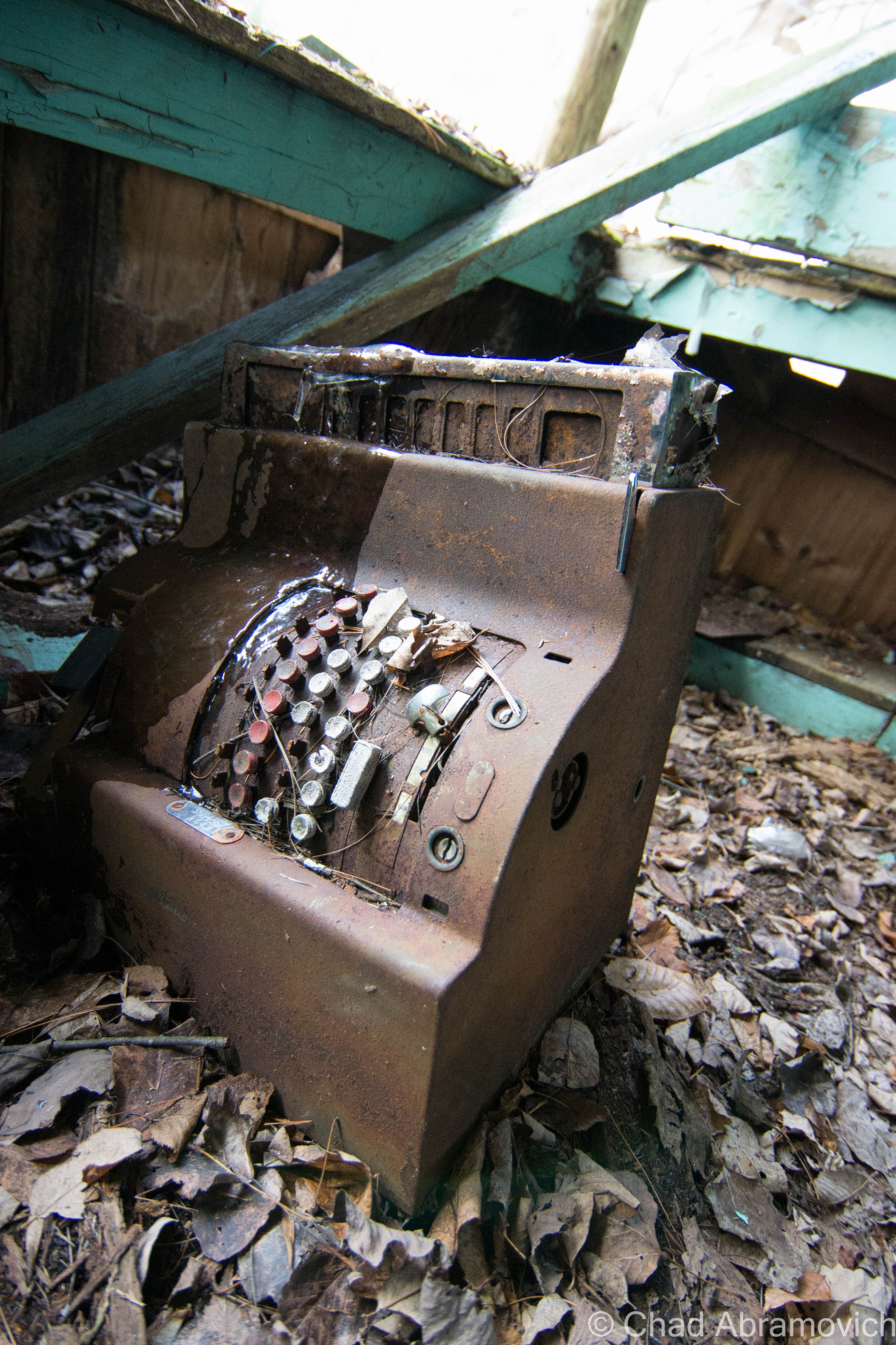
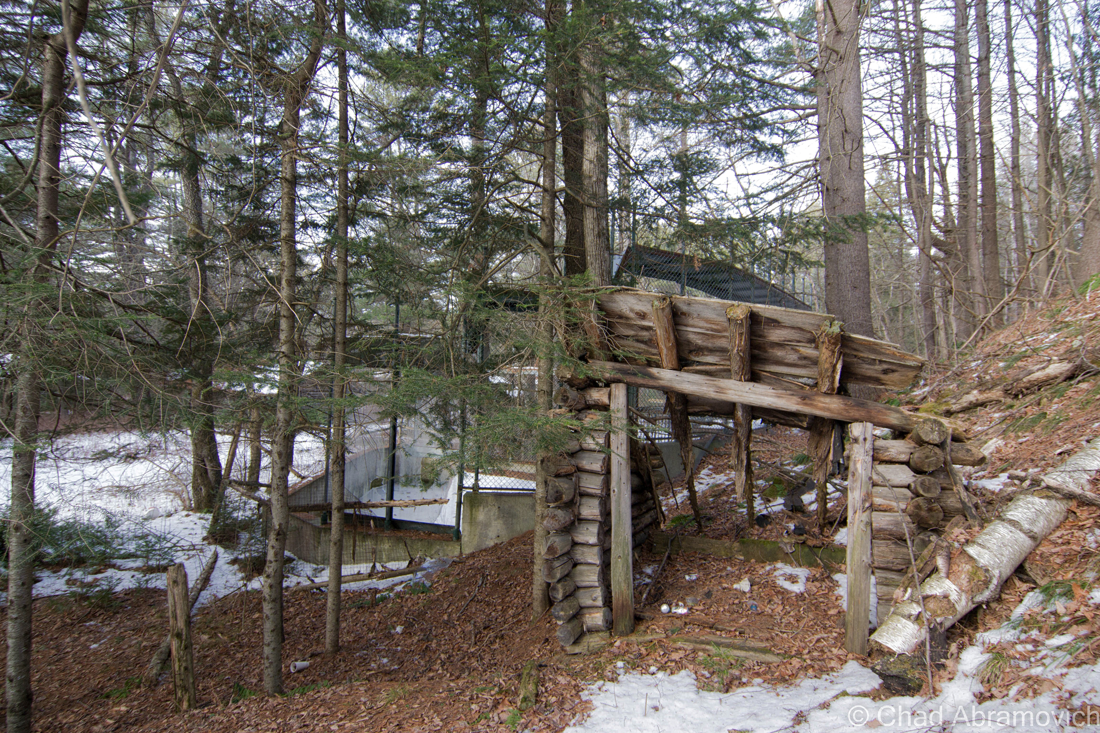
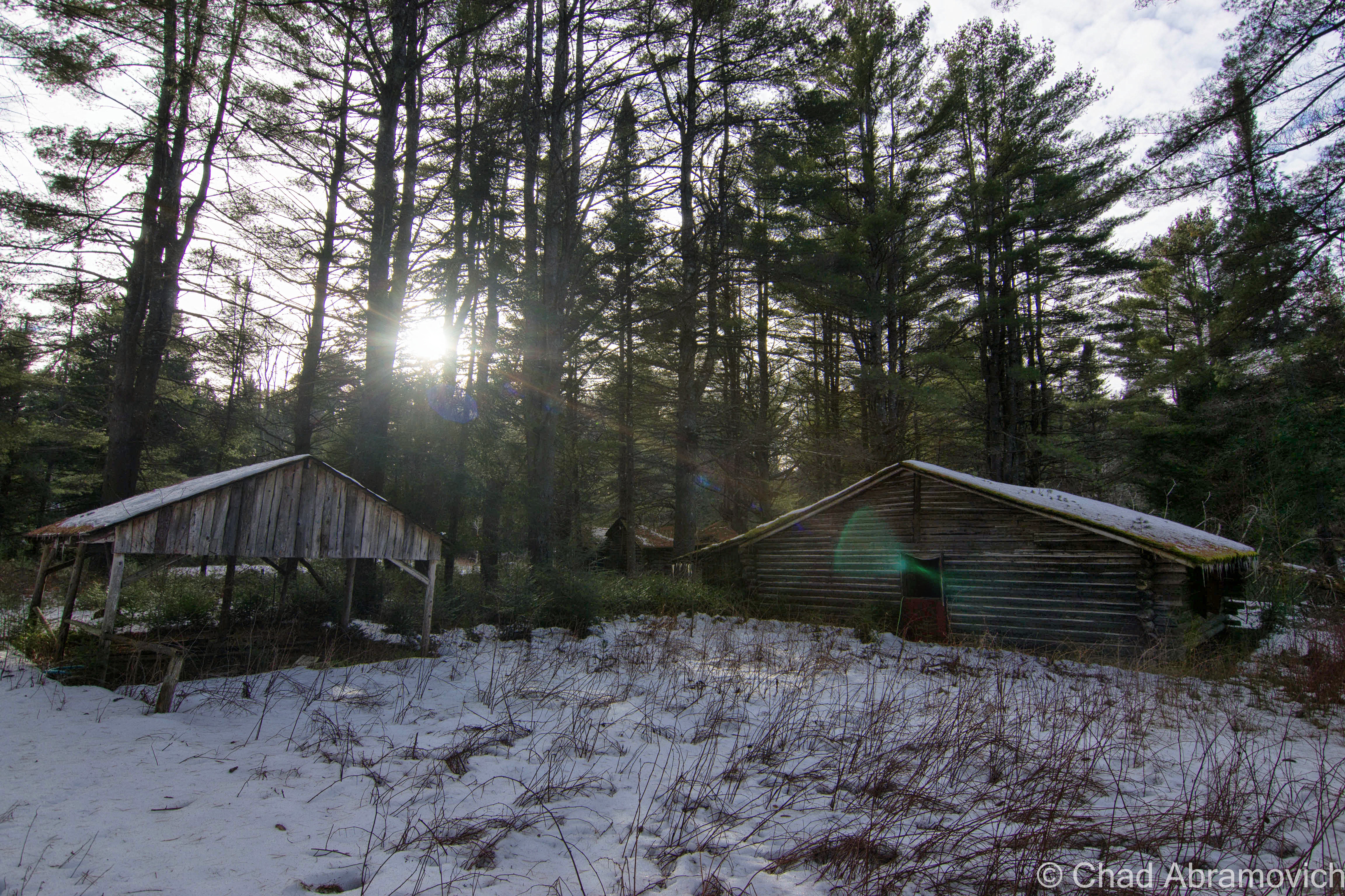
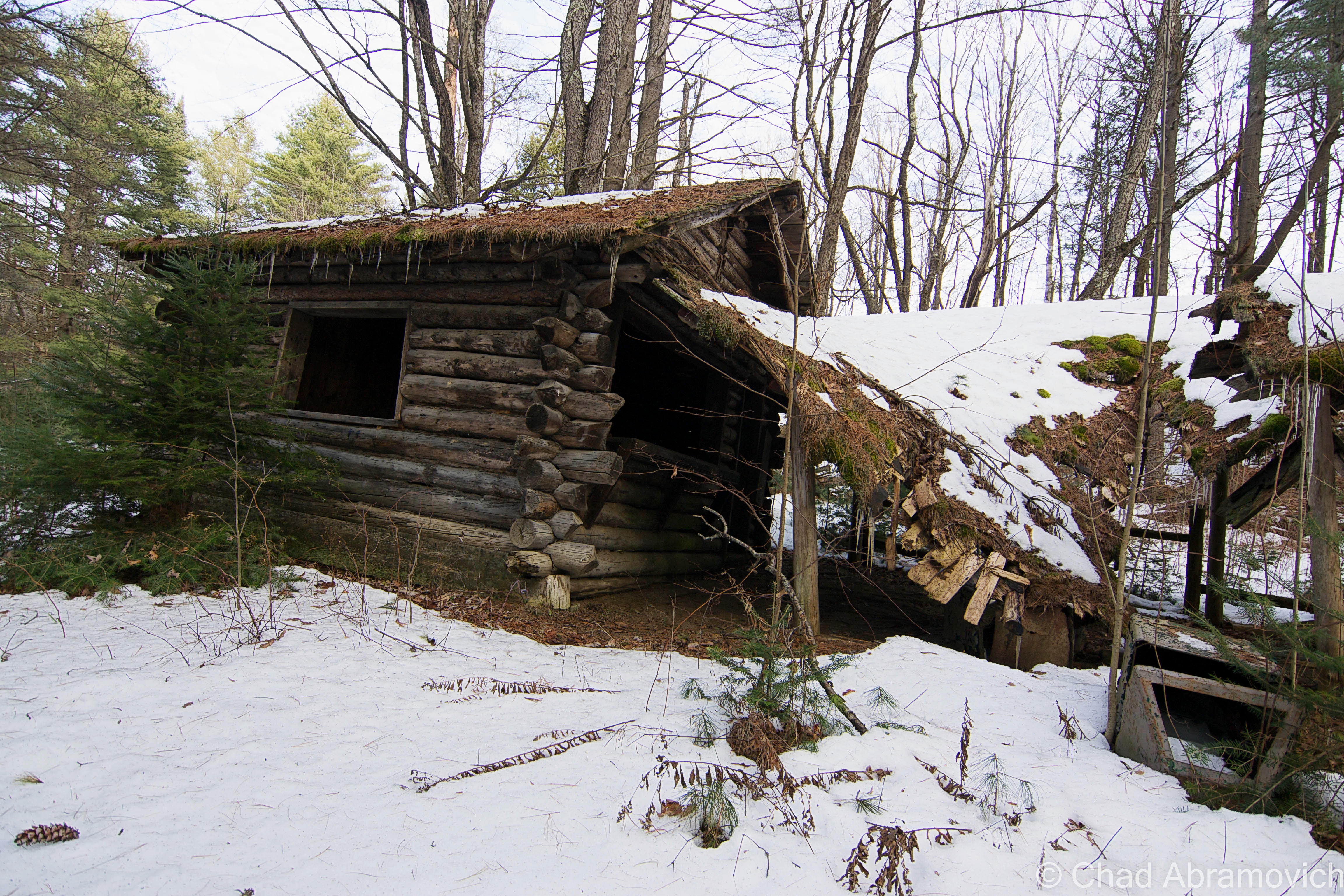
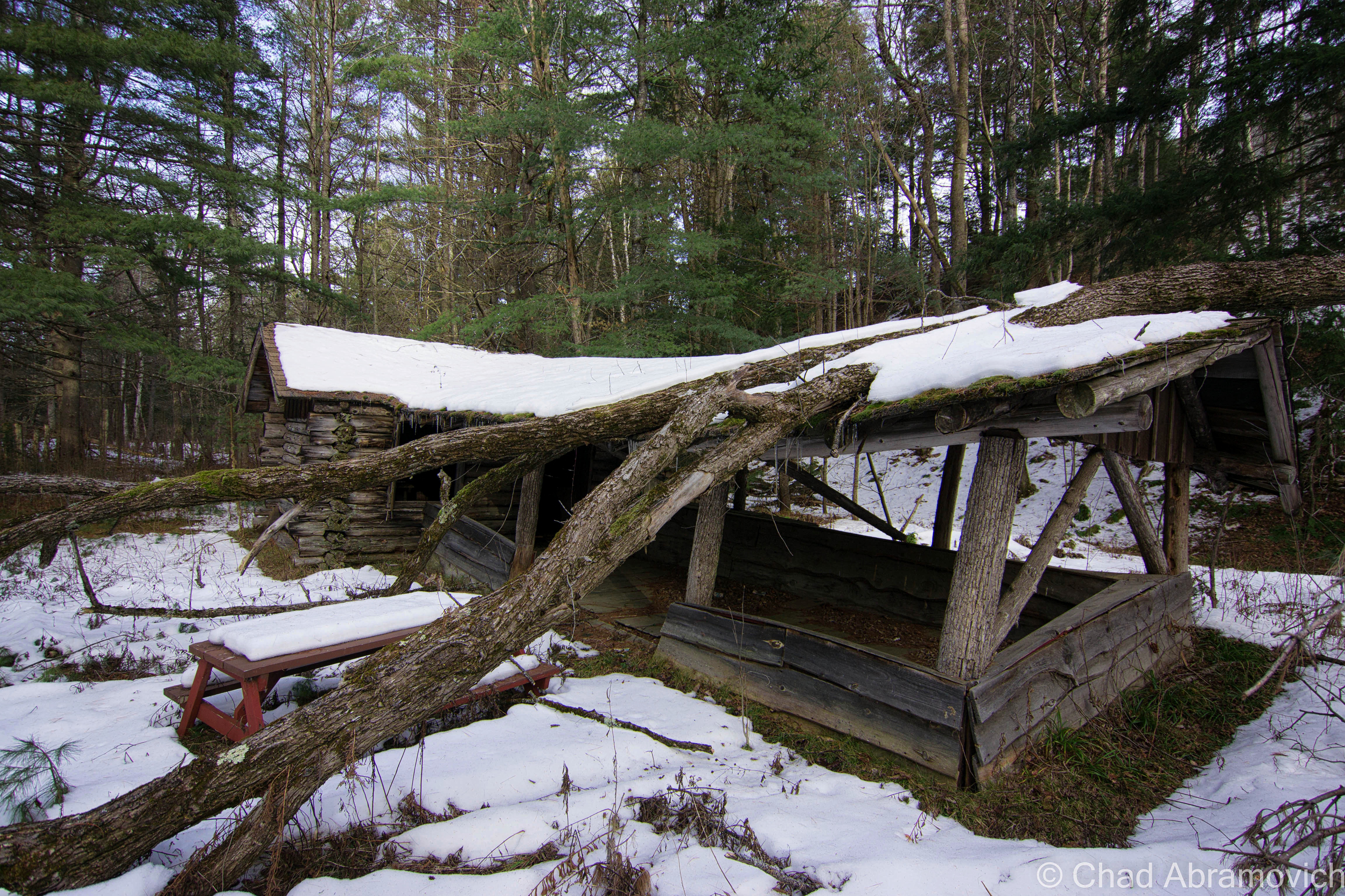
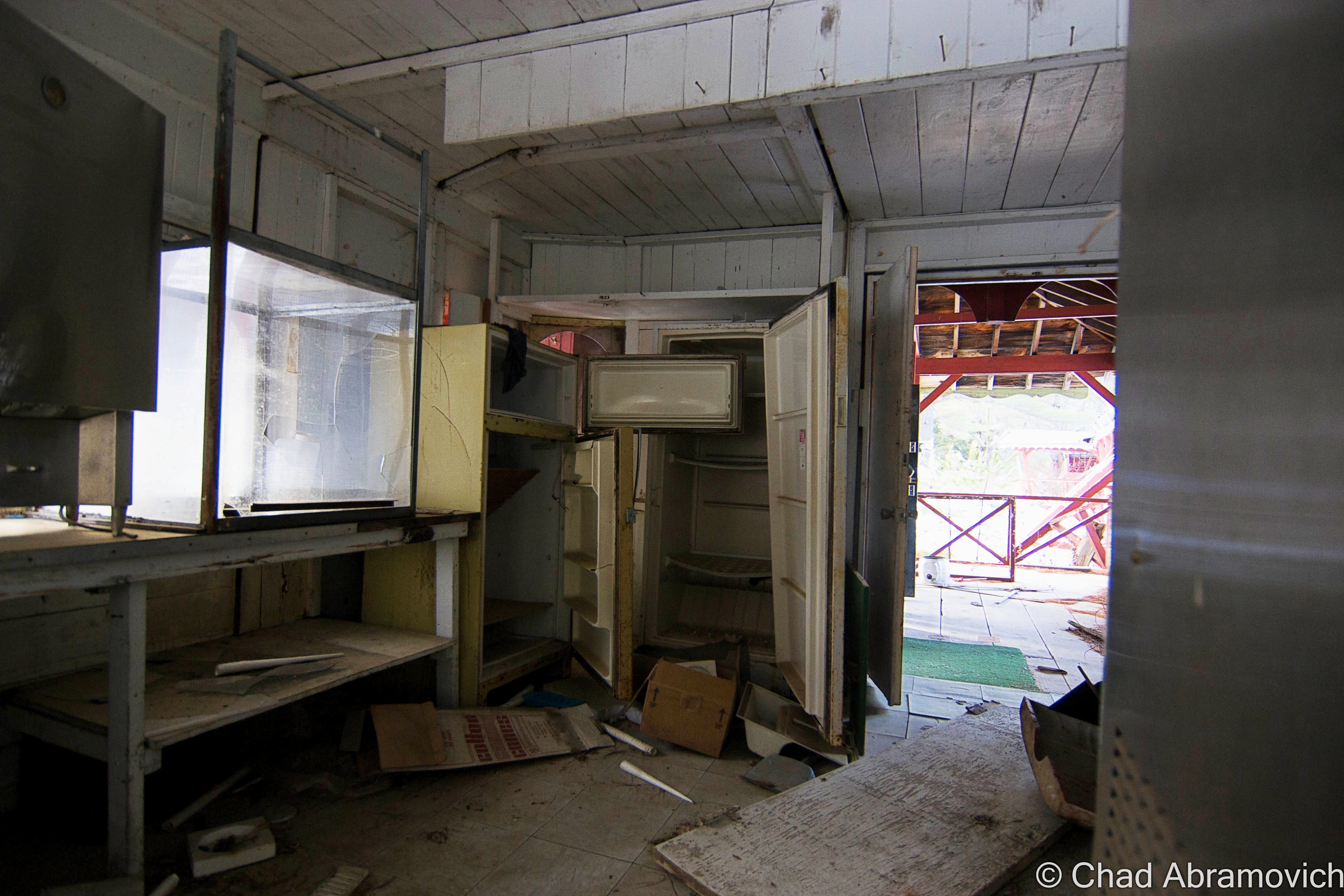
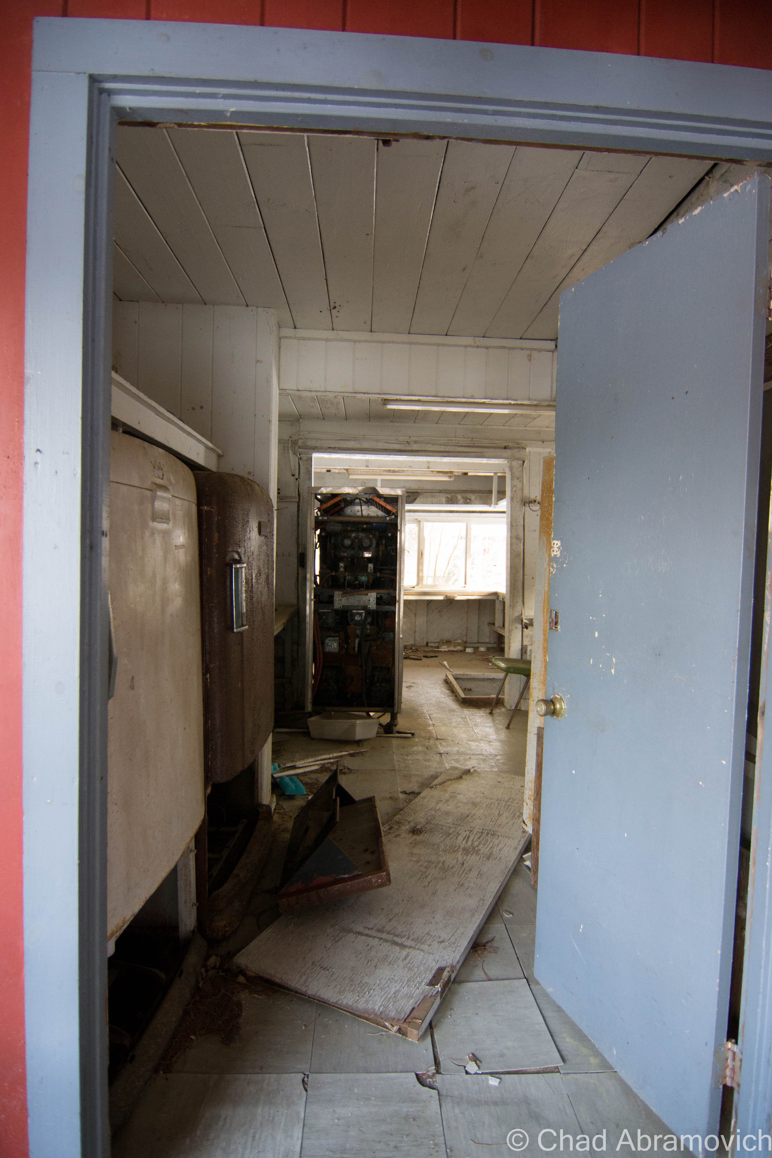
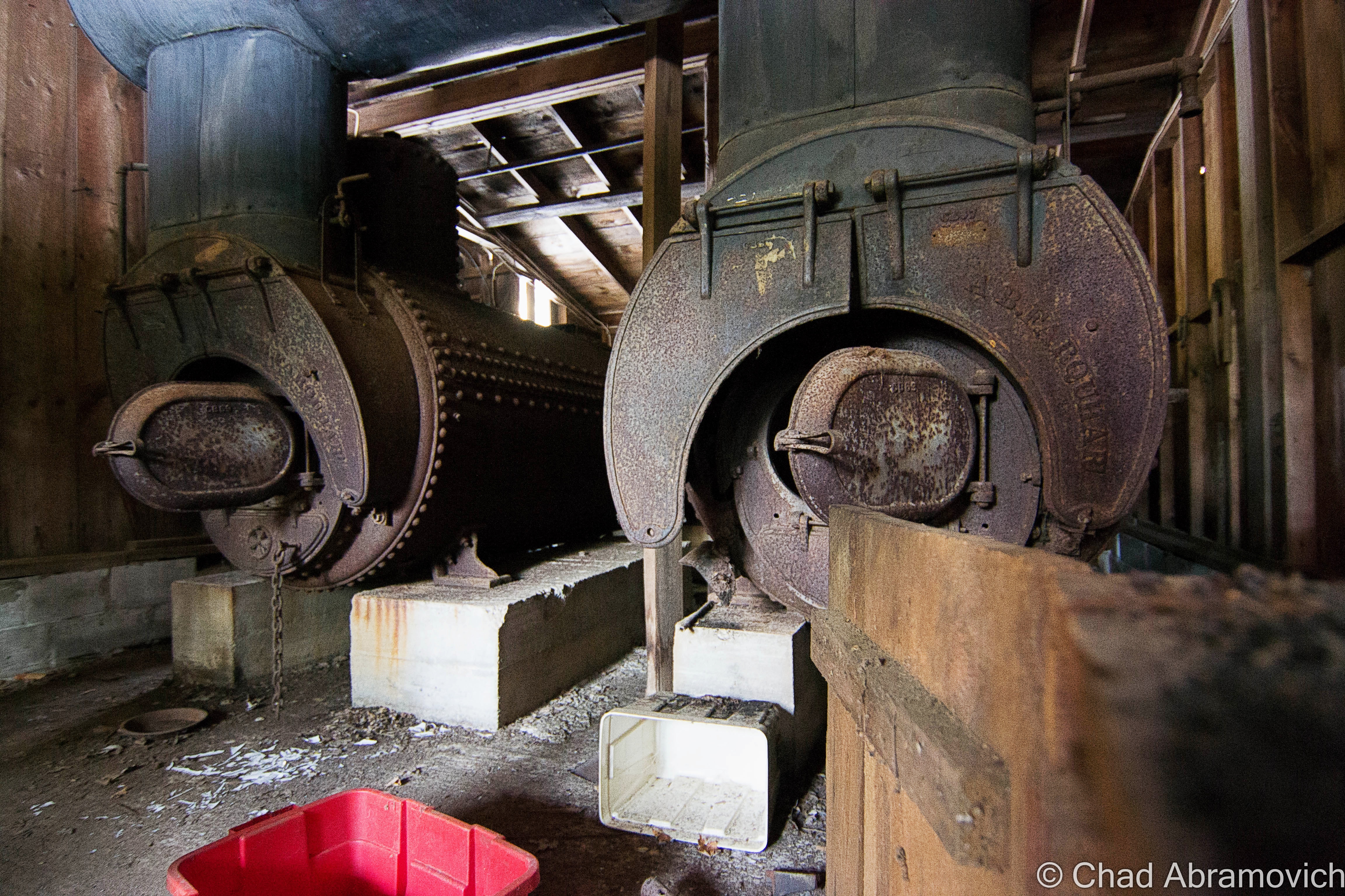
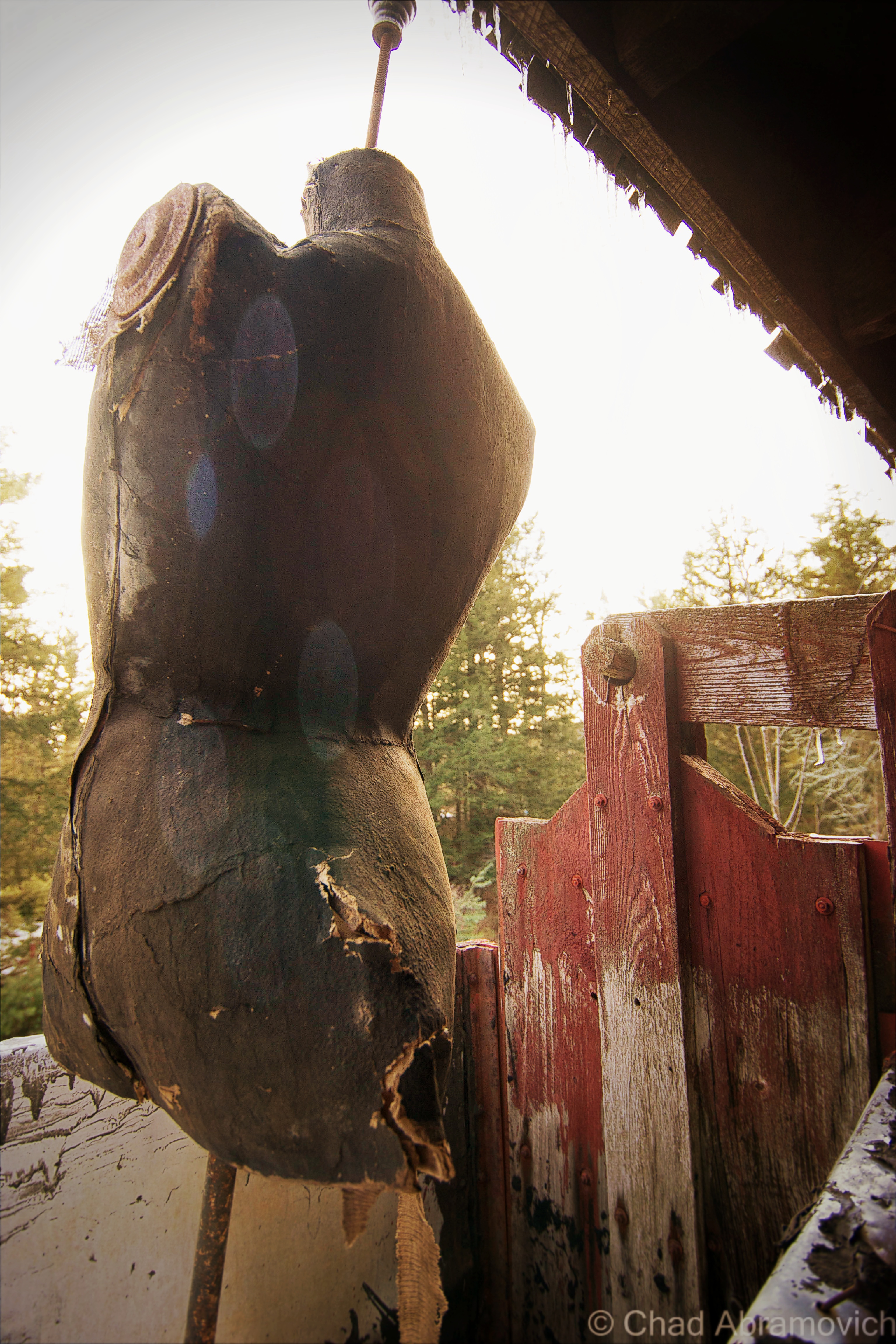
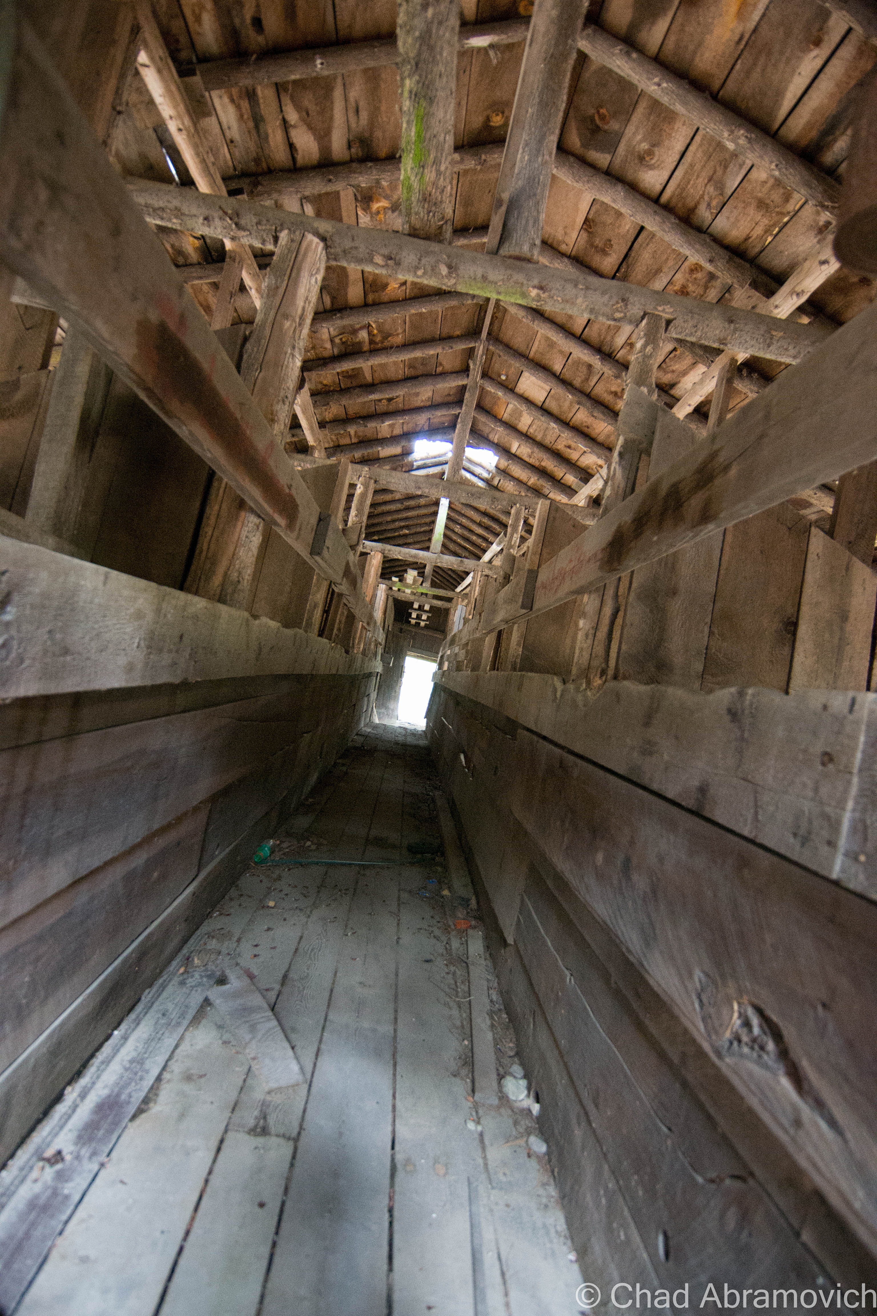
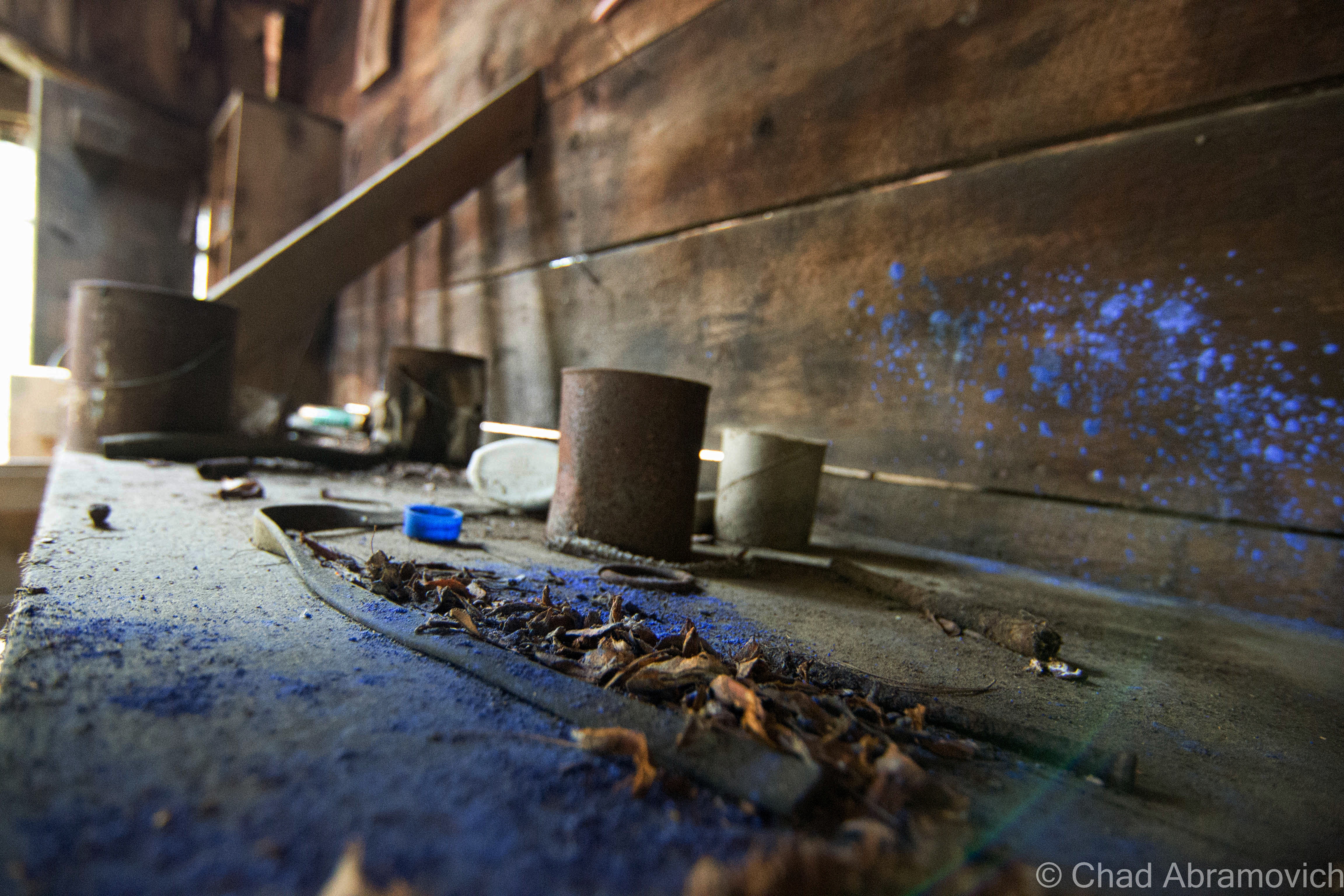
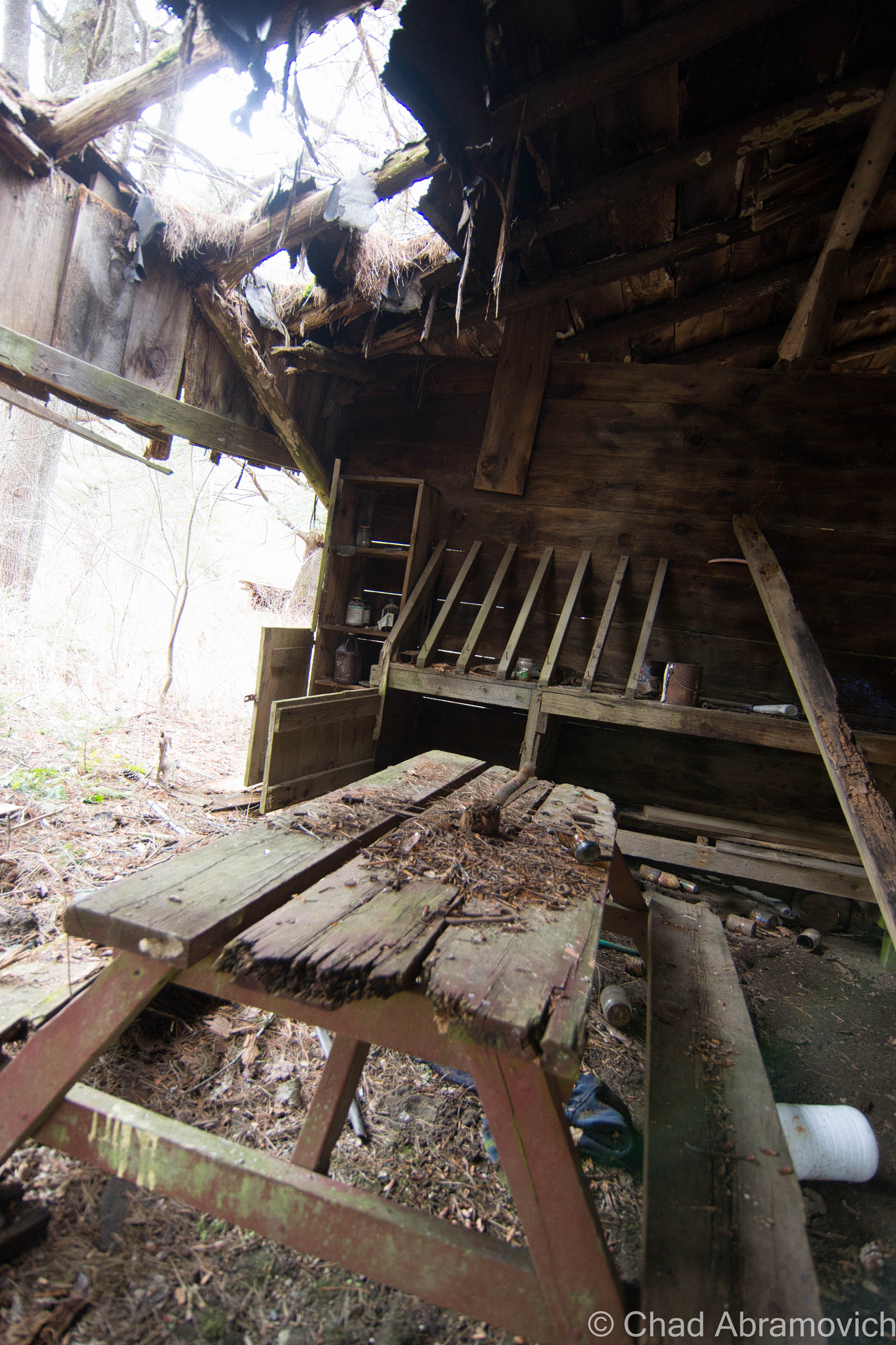
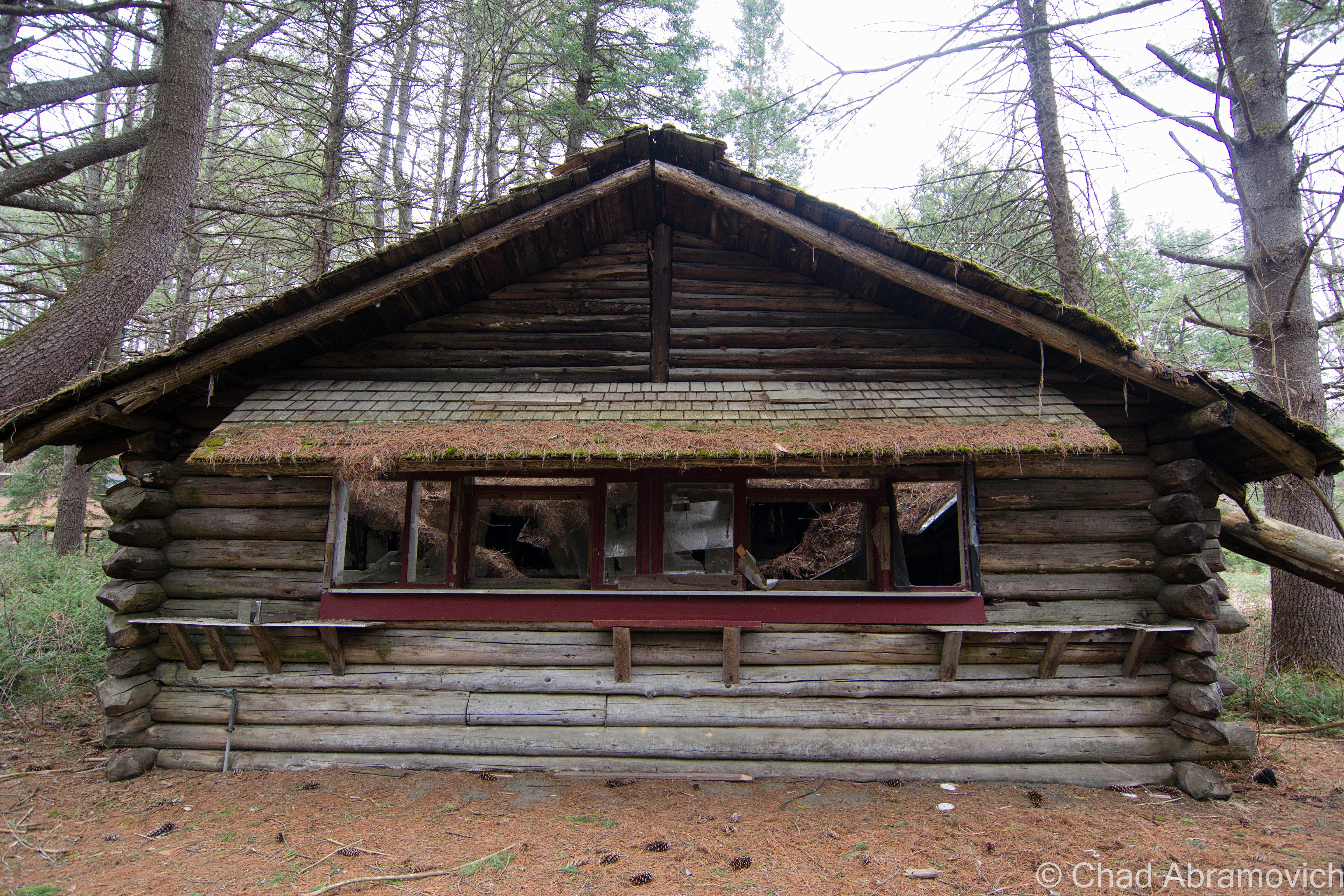
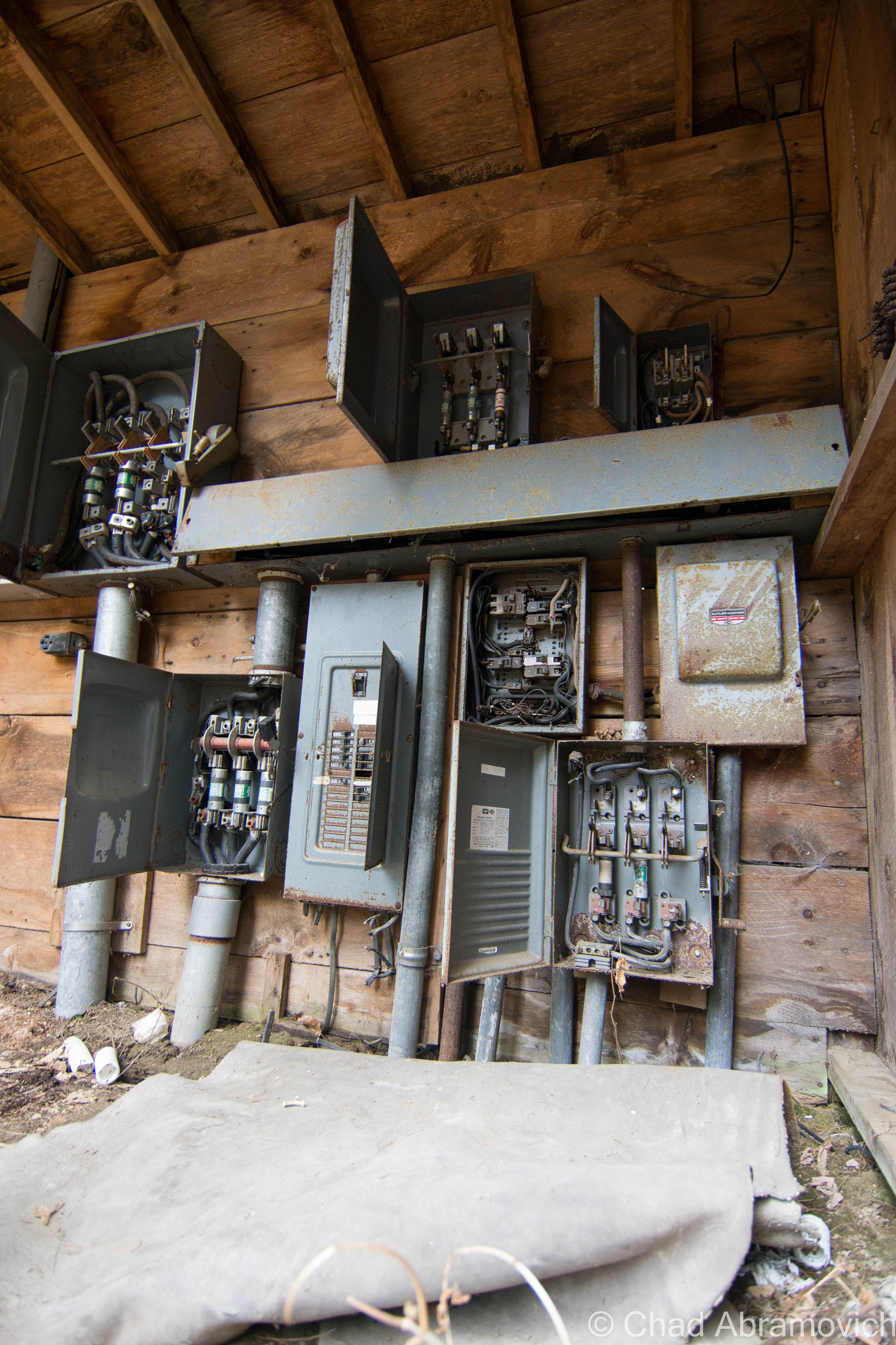
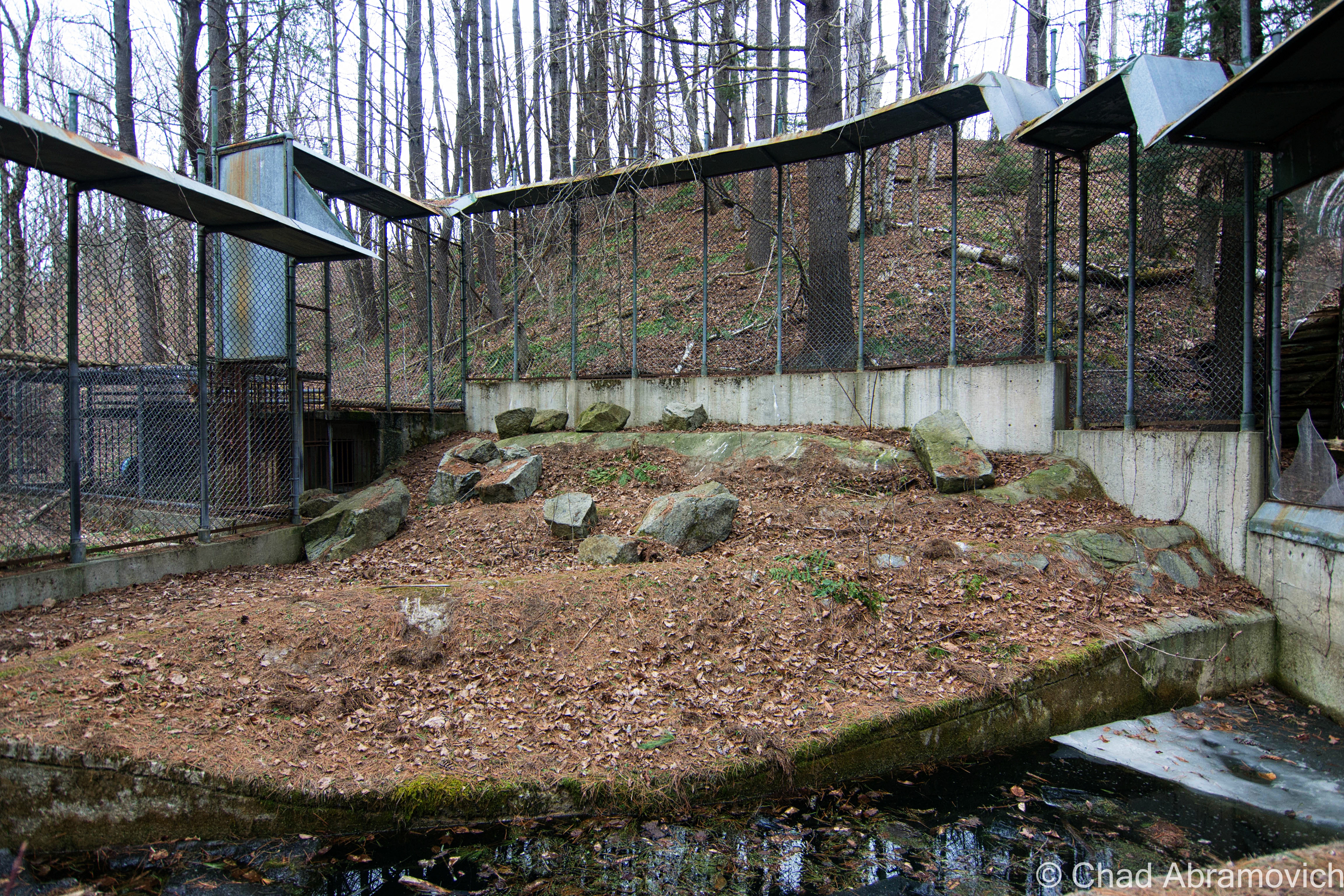
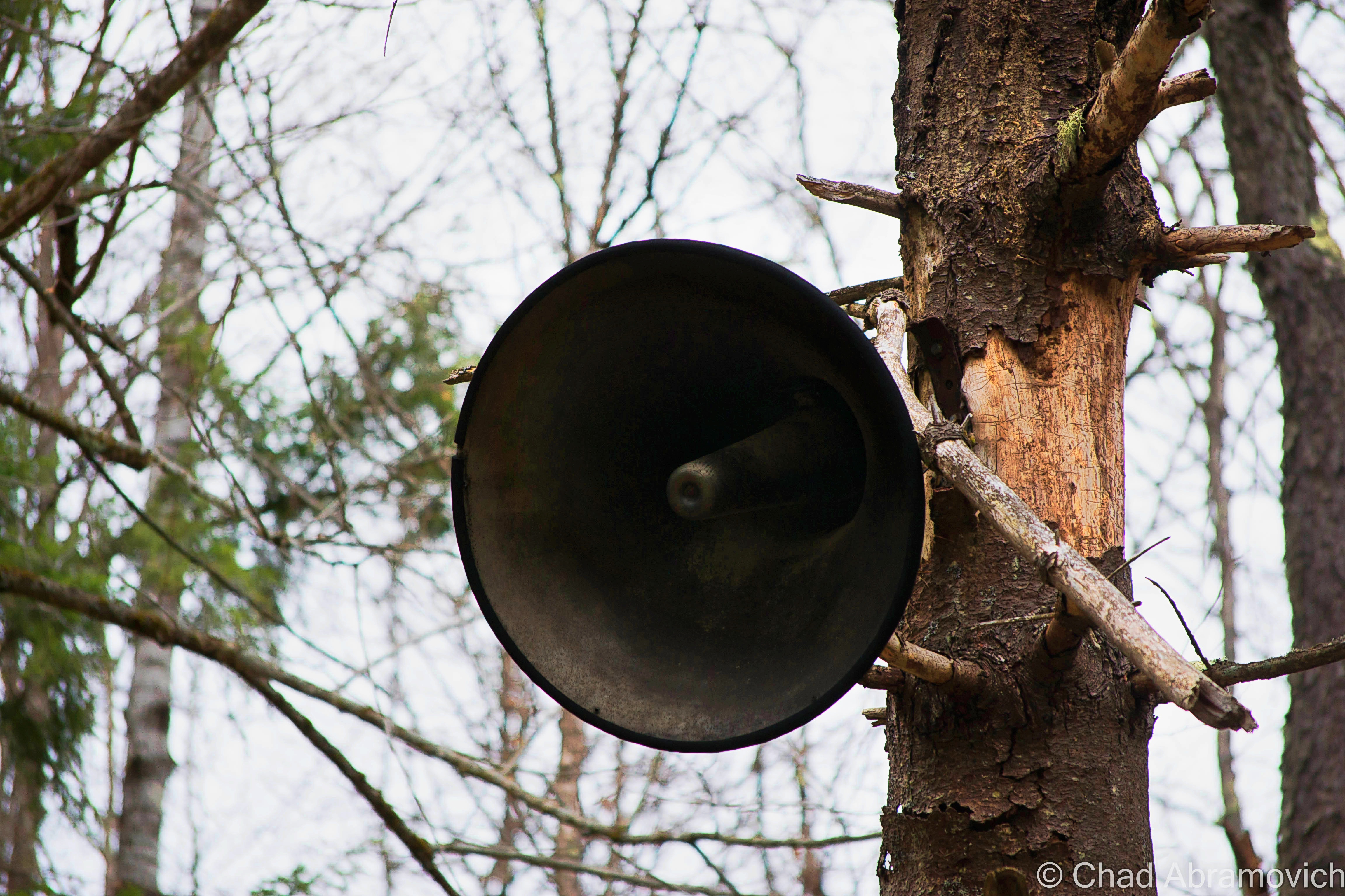
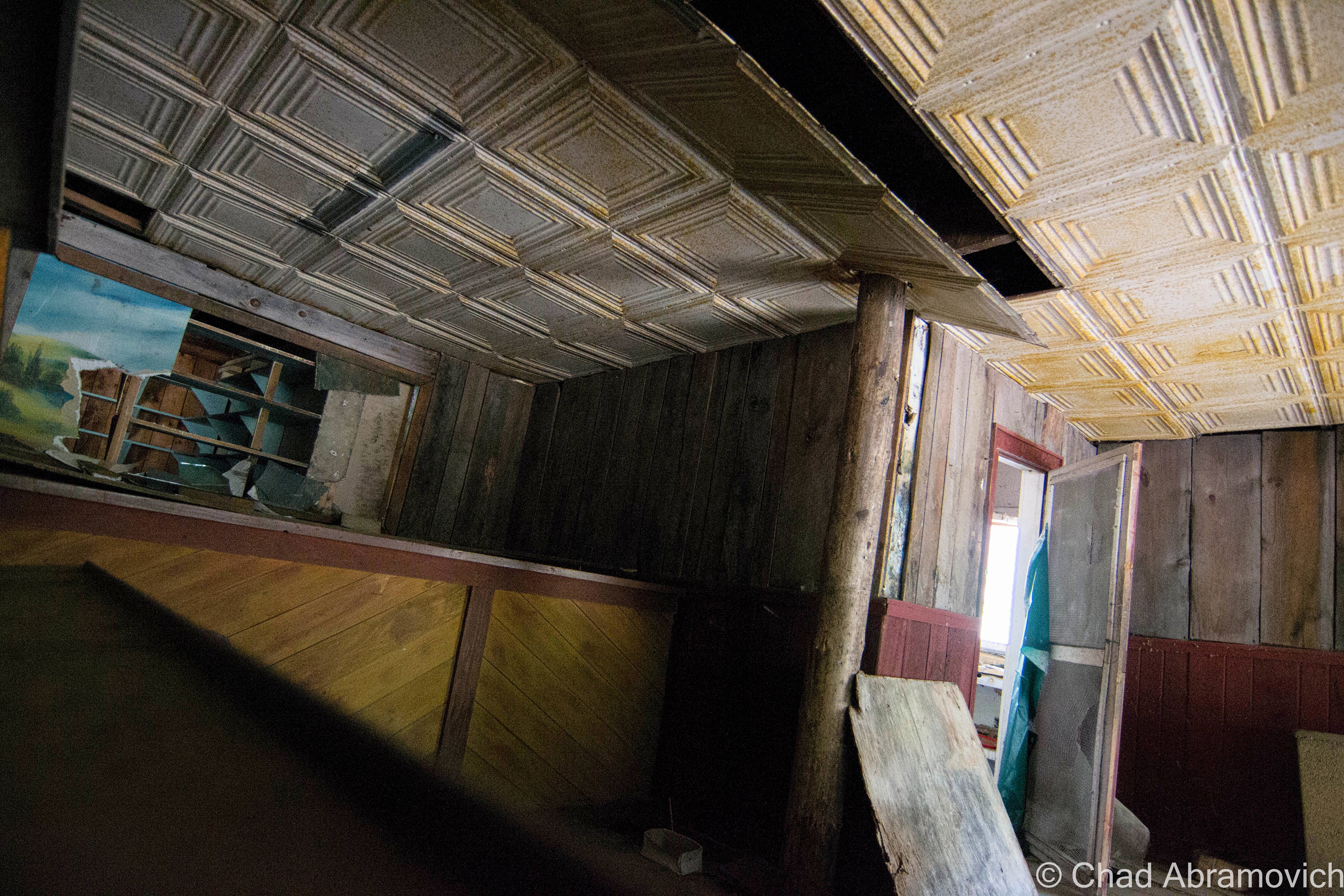
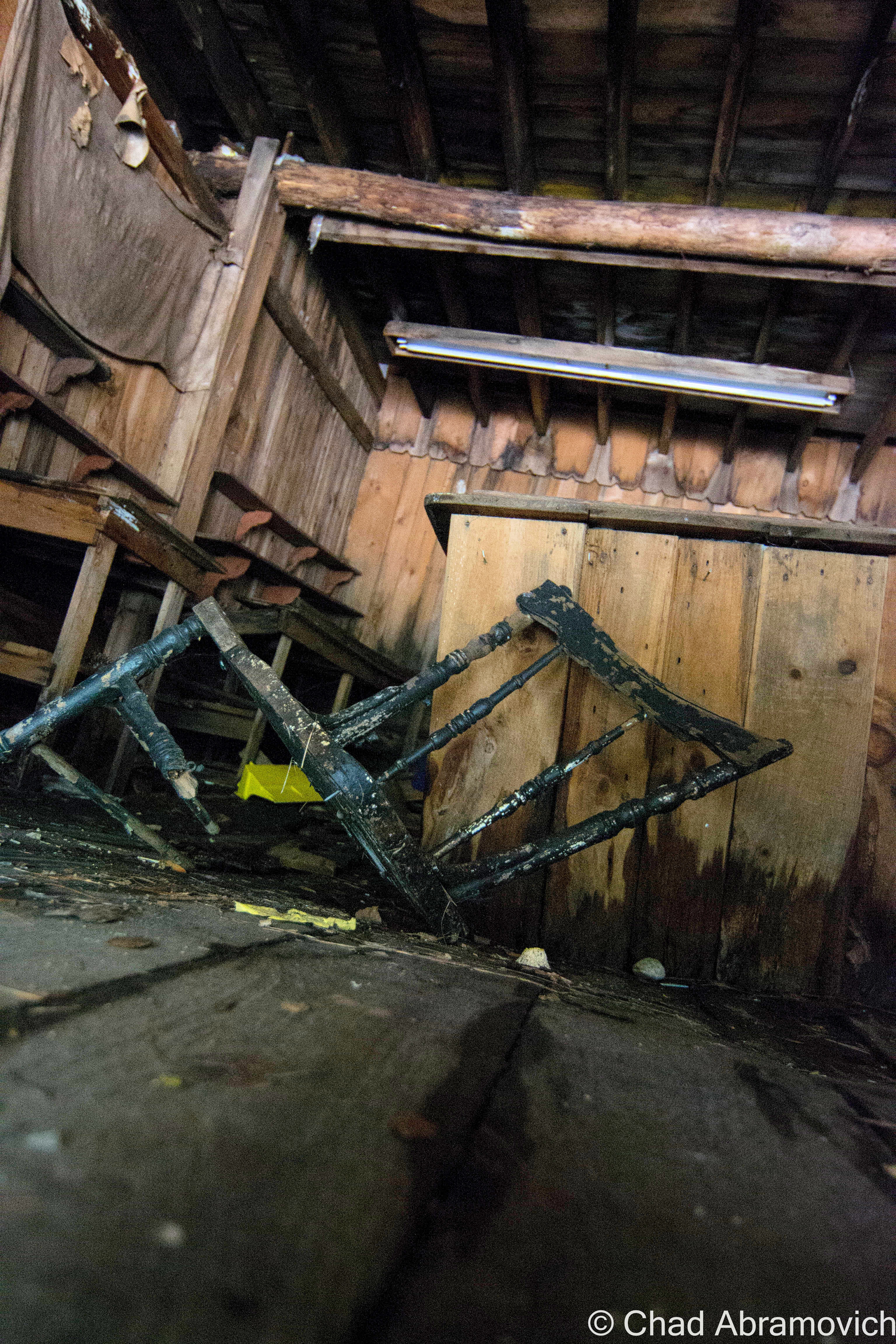
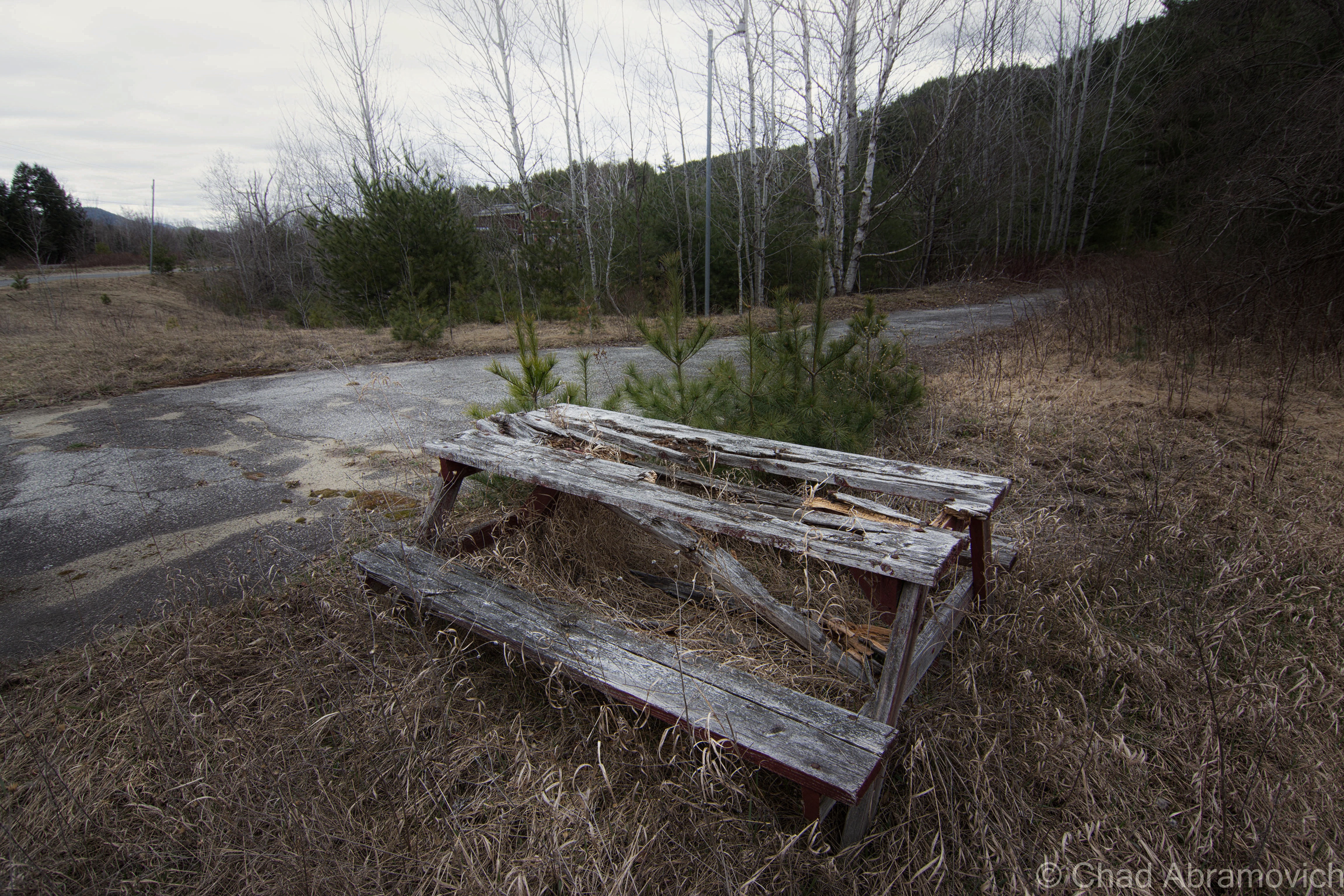
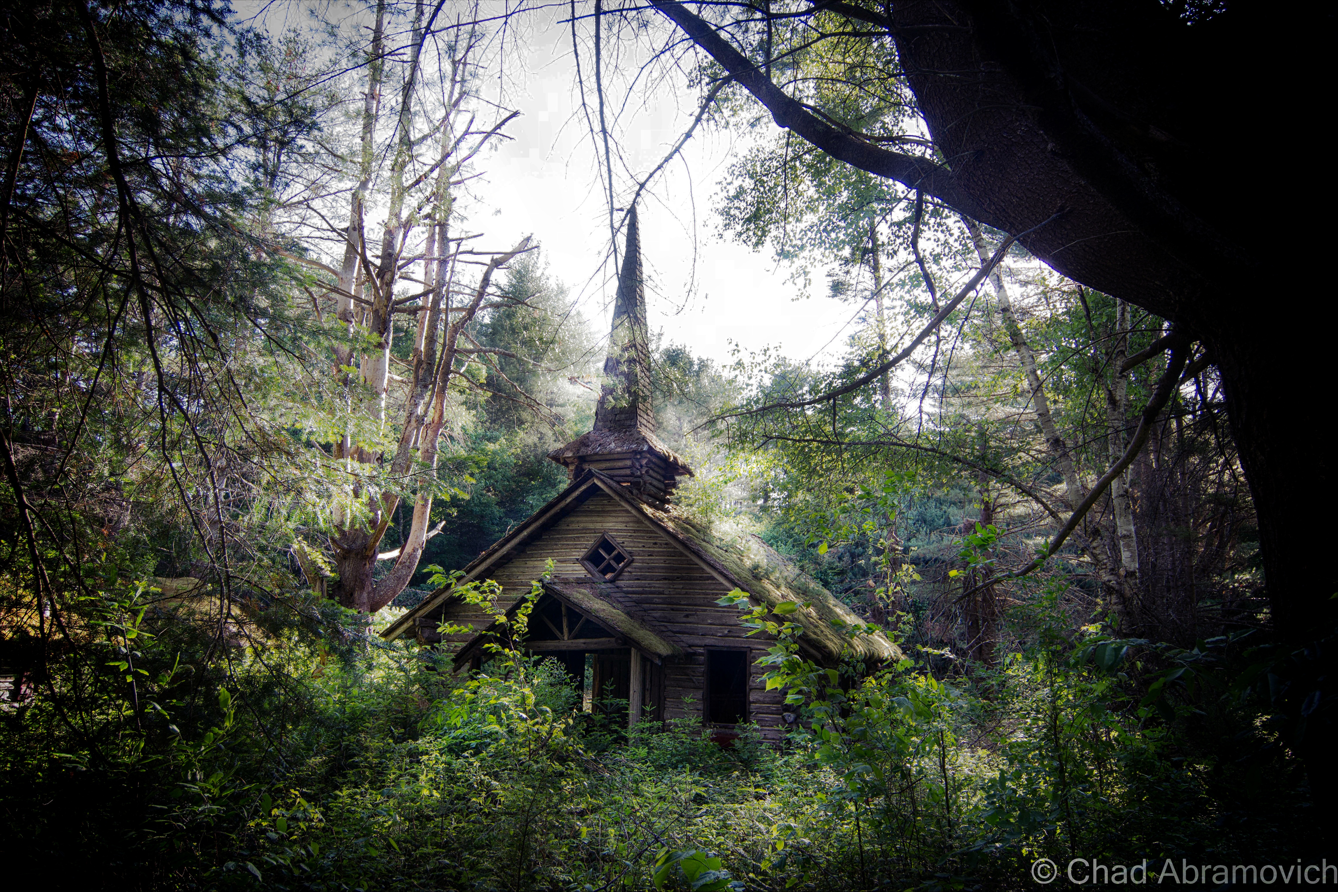
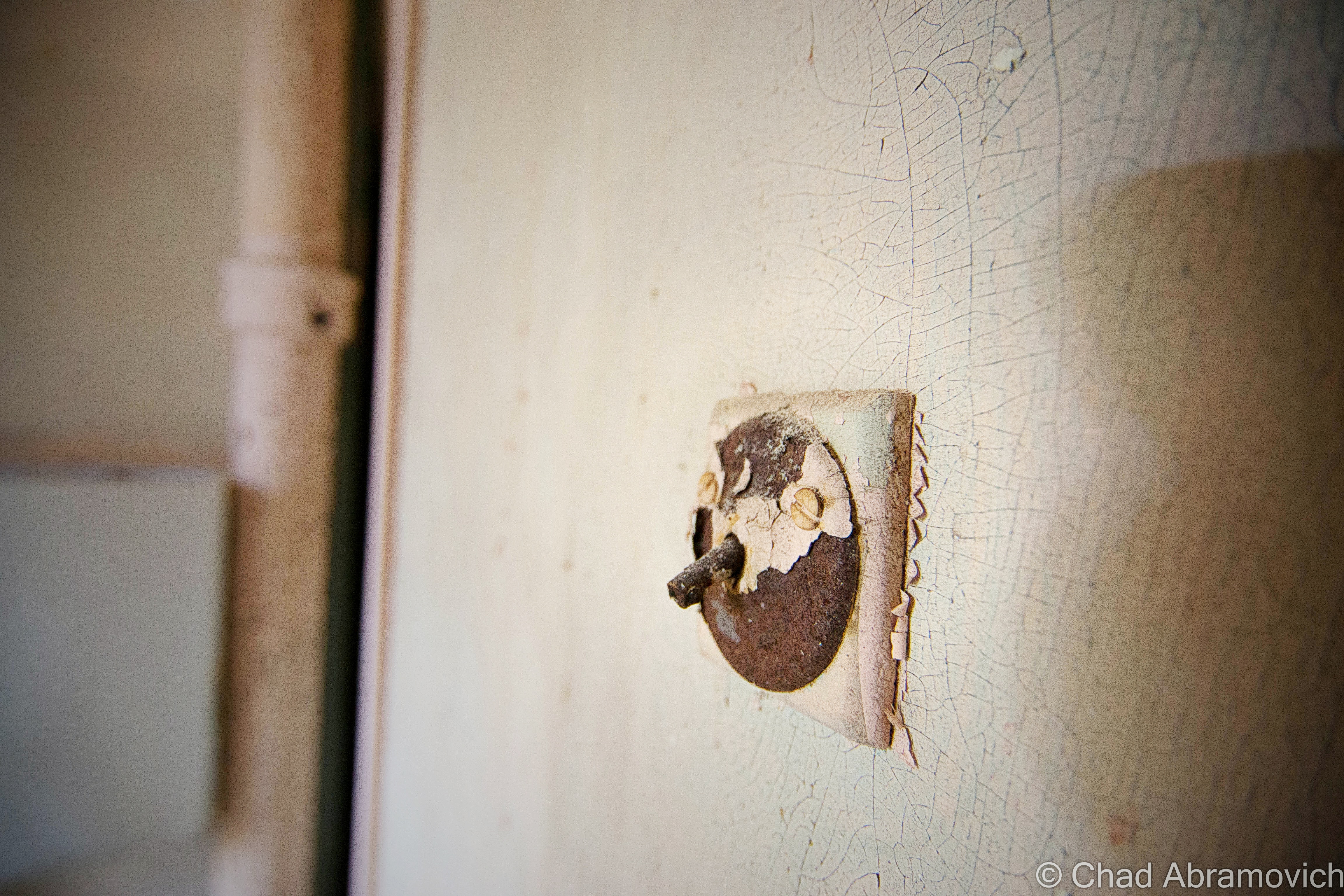
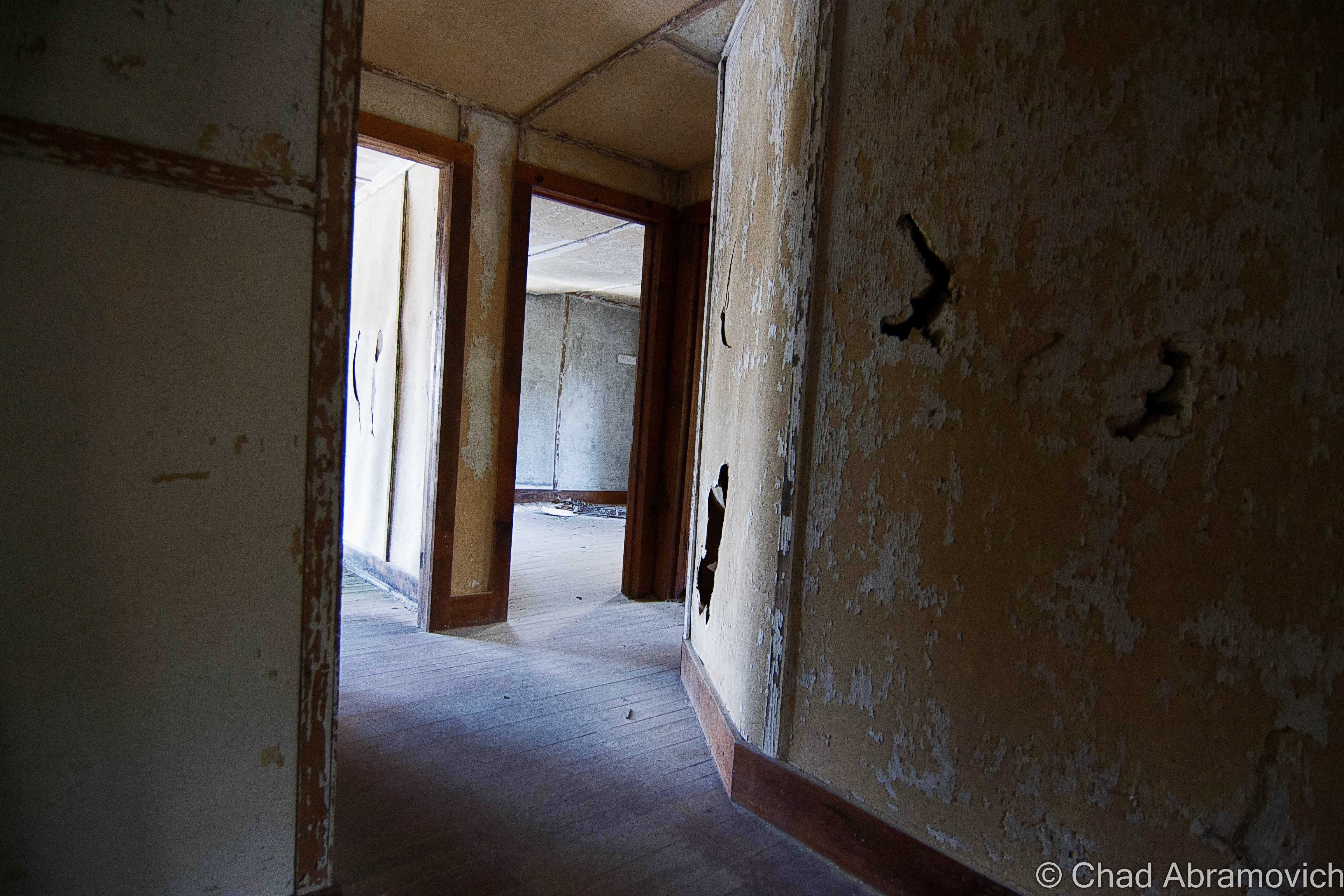
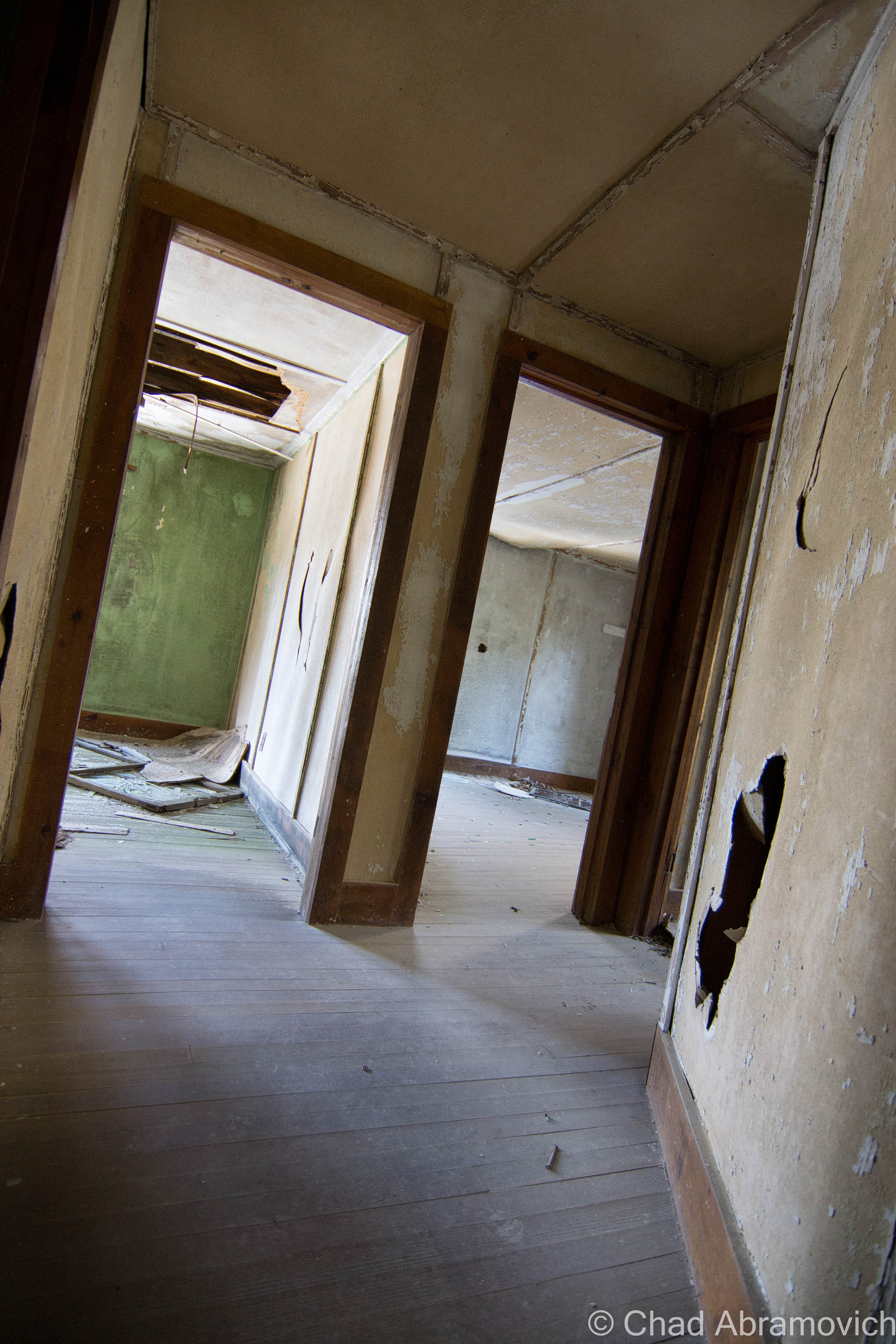
Frontier Town is a massive place, it’s kitschy-cool ruins stretch unassumingly from the roadsides of Routes 9 and 84, and far back out of sight on the sprawling property at the bottom of shady hollows and a myriad of cold swamps that pulse with mosquitoes in the summers. Even in its decay, it still had a wondrous vibe to it that really stuck with me as I wandered around.
Because the property is so large, it’s very difficult to get a good idea of just how much there is to see, until you start exploring for yourself. It’s taken me 3 trips to see a good deal of it, and I still feel like I’ve been unprepared with every visit.
My trips started back in 2012, which were focused on the assortment of abandoned motels and cabins lining Route 9 that once served the motel, and slowly, I would explore my way inwards.
The story of these curious ruins are actually pretty extraordinary. It’s one of those anecdotes that stumbles its way onto the altar of the American Dream and became a venerable benchmark – something that I could file away in the “anything’s possible” camp of things that makes my cynicism do a double-take in a contemporary culture that’s been questioning the truth and the achievability of the American Dream.
In 1951, Arthur Bensen, a Staten Island entrepreneur who installed telephones for a living, was becoming bored with his job, so he started to tour the northeast with $40,000 to find a location suitable for building his dream project; an amusement park.
267 wooded acres in North Hudson would eventually seal the deal, and despite having no construction skills, no idea how to run an amusement park, and no real income after purchasing the property, he went to work!
He was known and admired for his amiable personality, someone who was convincing and charismatic, so much so that he sold North Hudson-ites and locals from neighboring Adirondack towns to help him build the park and eventually be employed there, despite some thinking he was out of his mind.
But impressively, his tenaciousness and optimism paid off, and his fantasy began to take shape. Using his 1951 Chevy, he would drag timber behind his car to build many of the log cabins around the site that still stand today.
Bensen was known for his ingenuity; he was thrifty, a quick thinker and good at improvisation – and it was these skills that ultimately would shape the park so many would come to love. Maybe the greatest example of that previous sentence is how Frontier Town became Frontier Town. His original vision was to build a Pioneer Village, but when opening day was looming, the thematic costumes for his employees/LARPers never arrived.
Bensen made a trip down to New York City to purchase some, but returned with Cowboy and Indian costumes instead, because according to the story, those were the only costumes he could buy in such short notice. But luckily, that just happened to be all the rage in the America of that time.
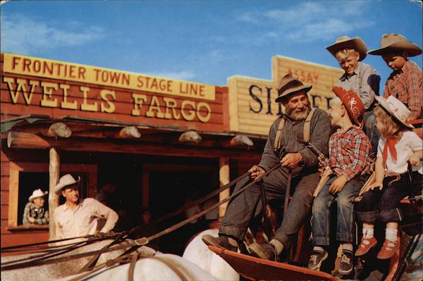
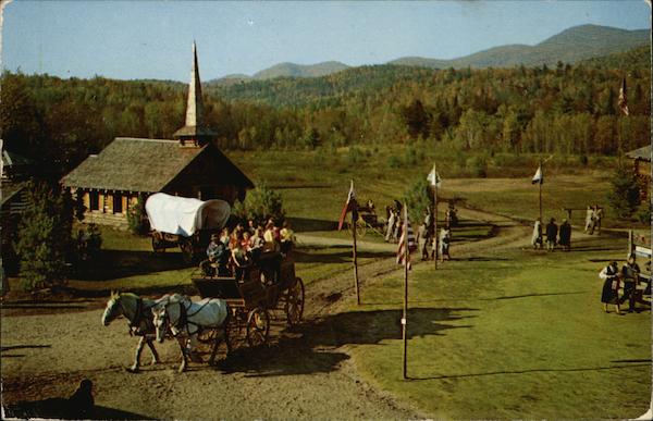
So, he made some alterations to his blueprints, and Frontier Town was born, officially opening on July 4, 1952 and would continue to expand in the intervening years.
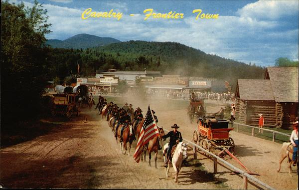
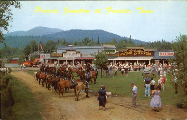
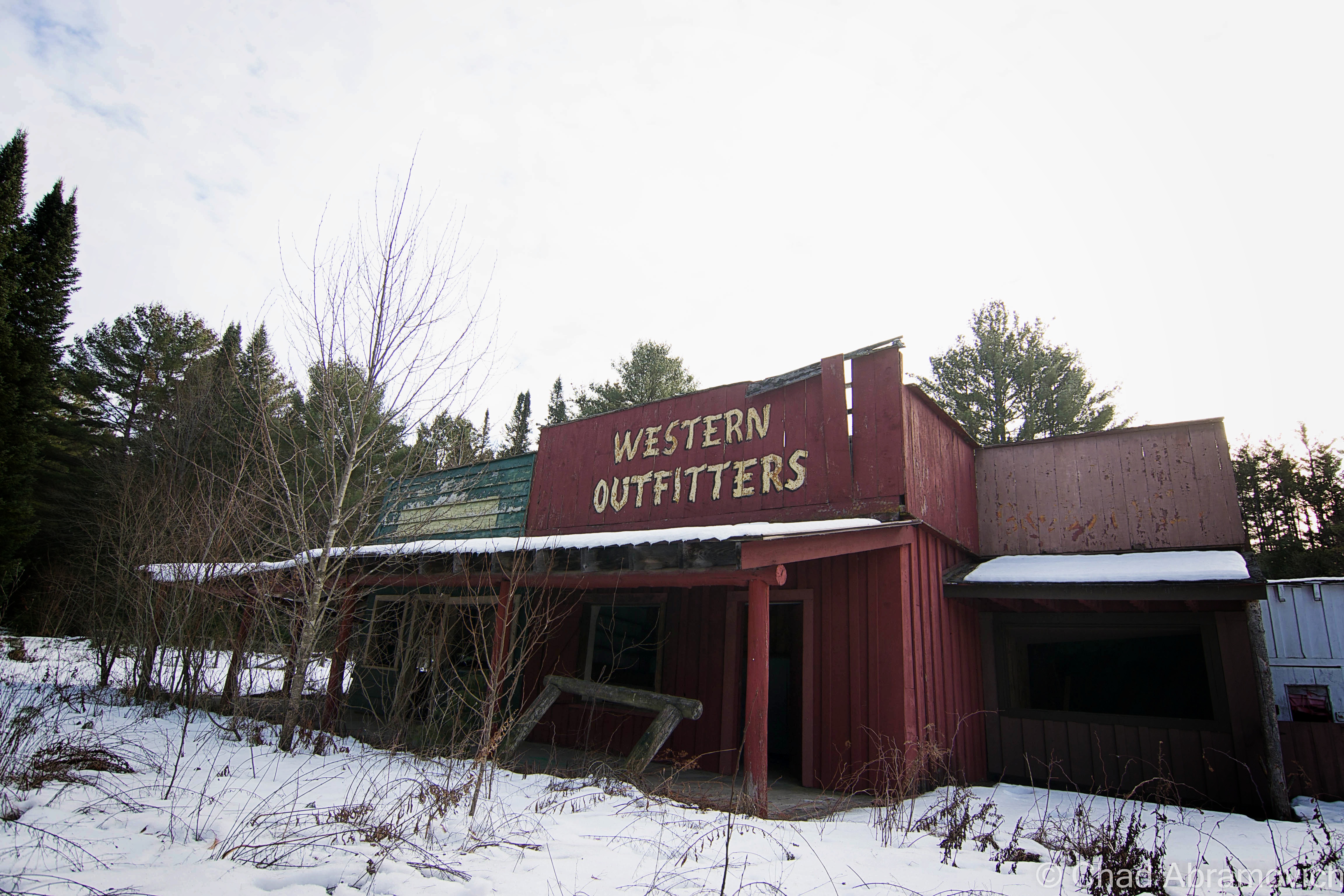
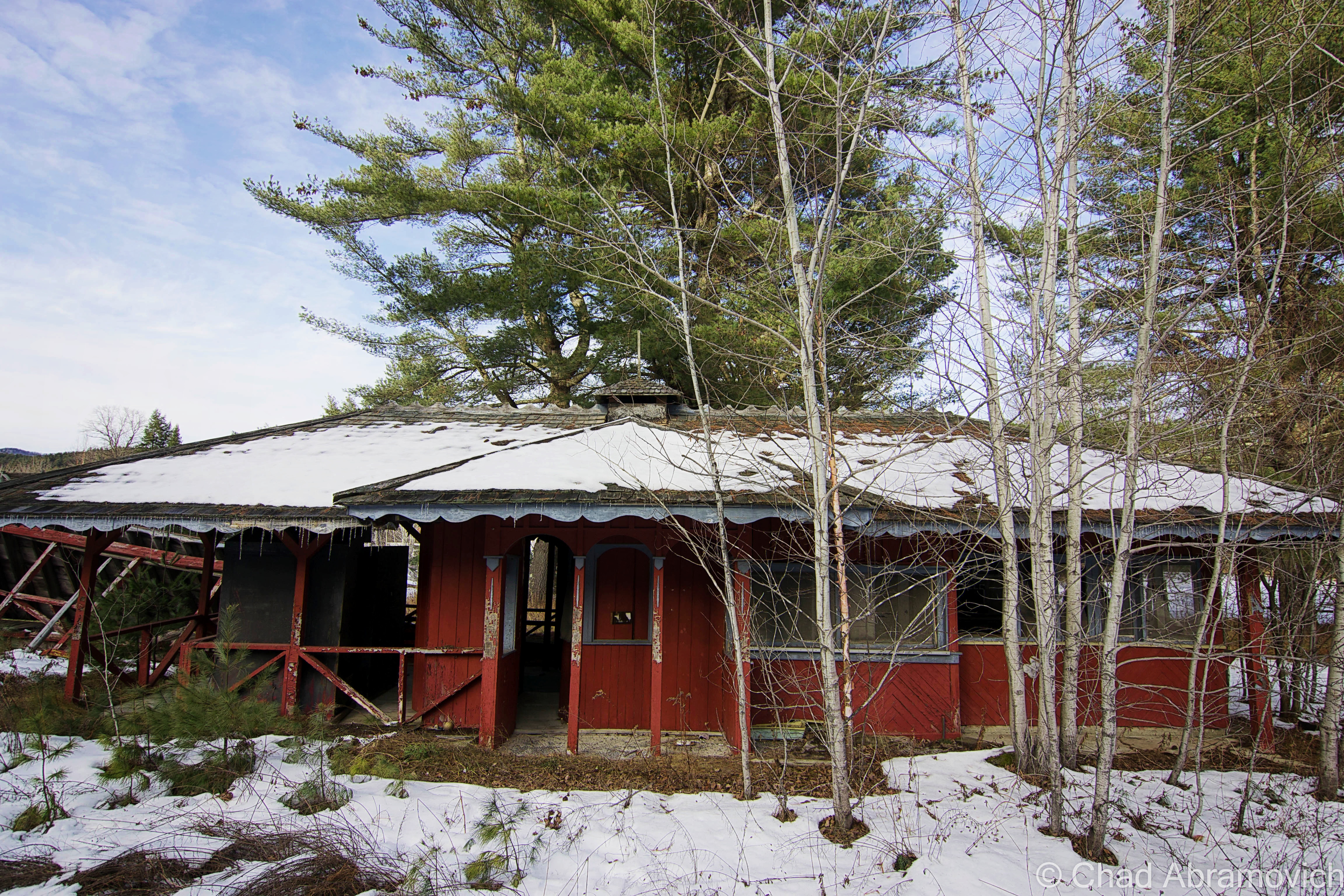
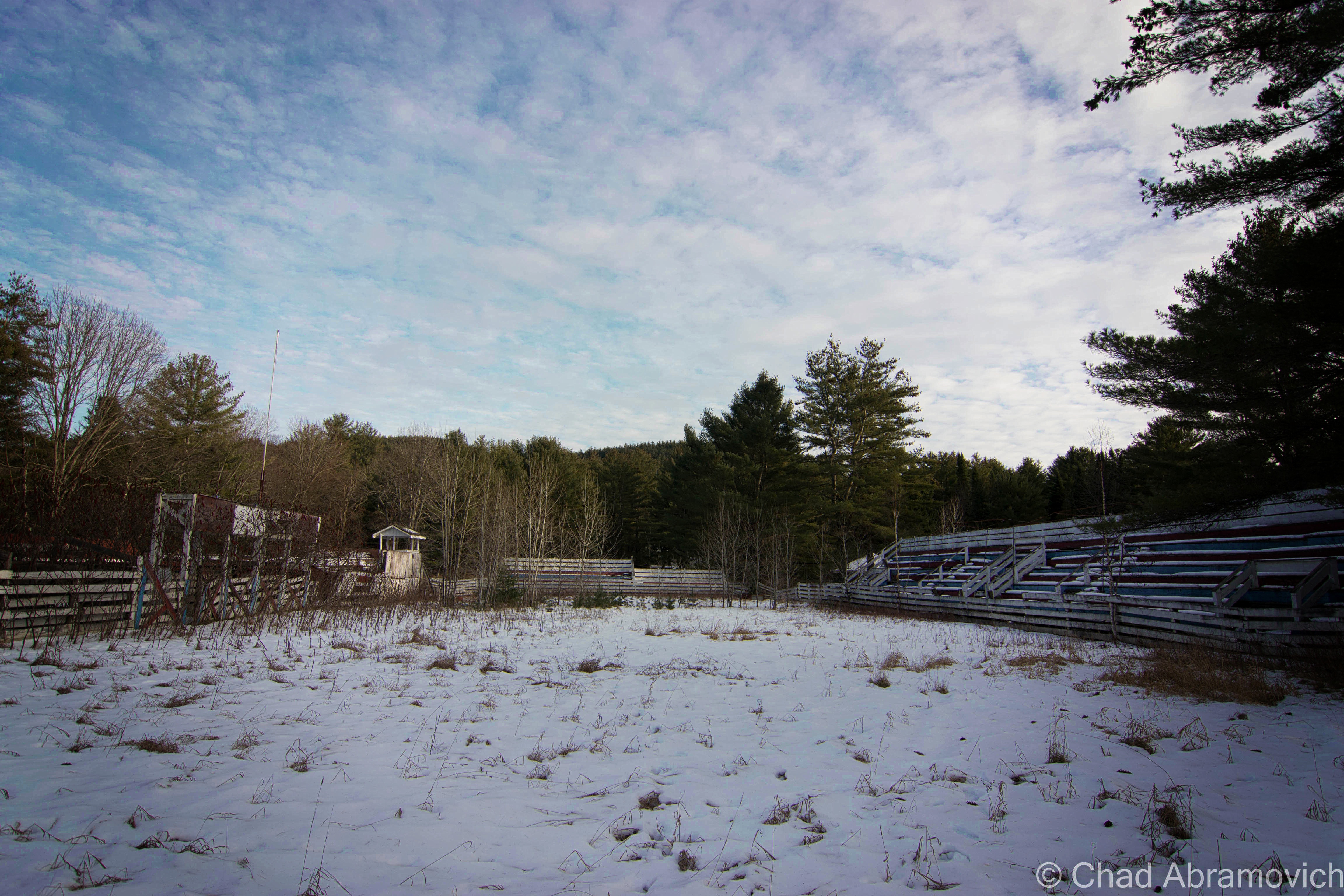
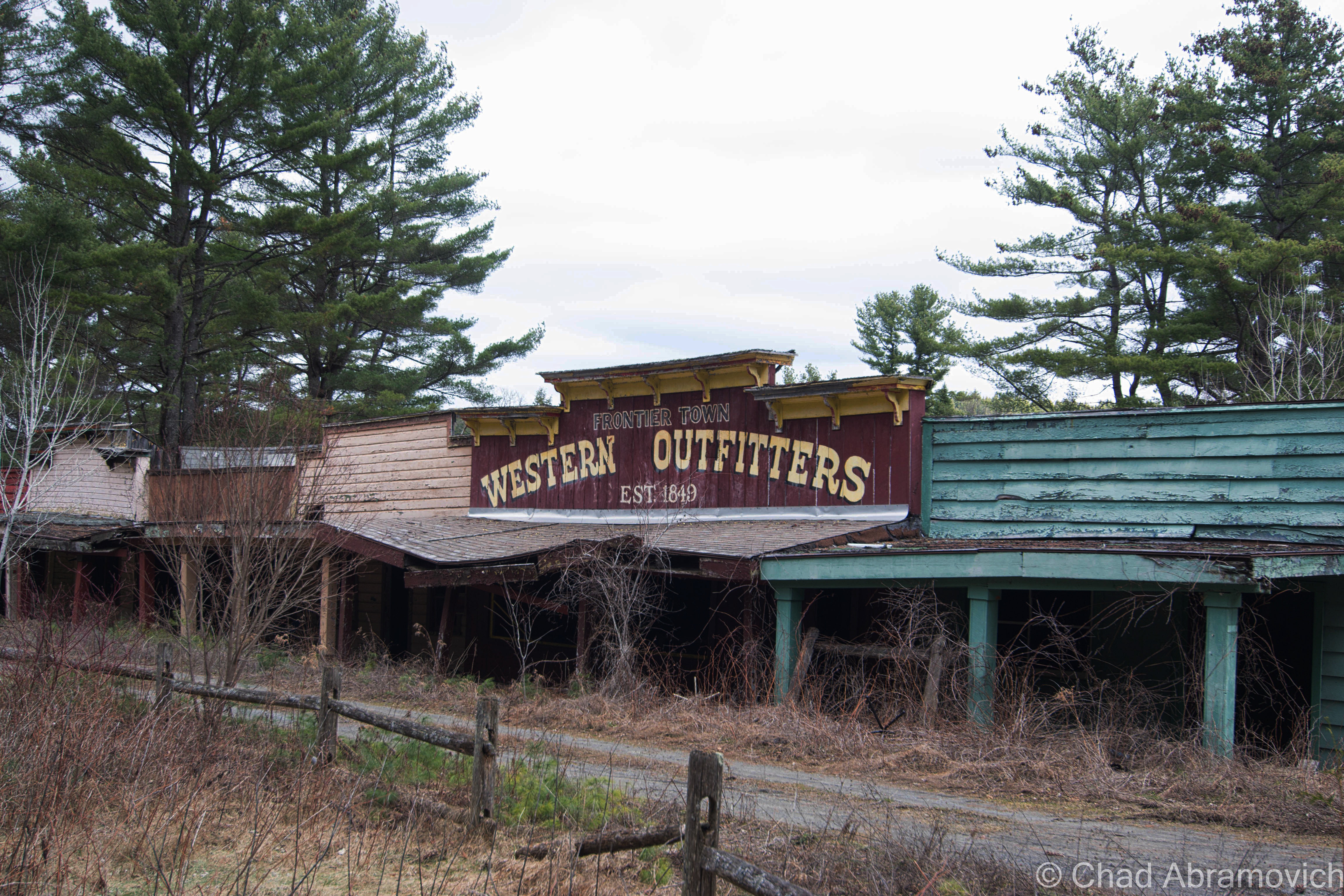
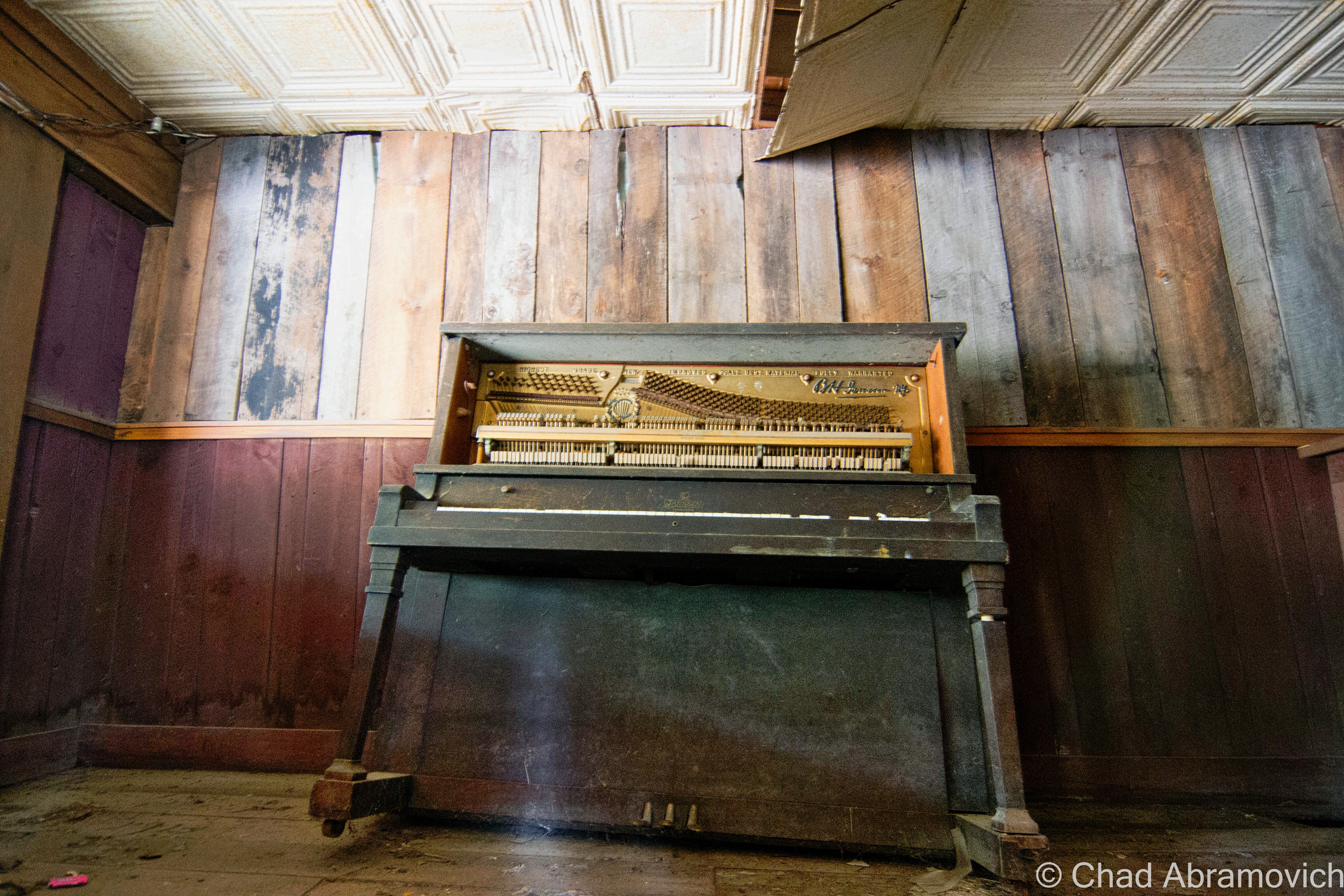
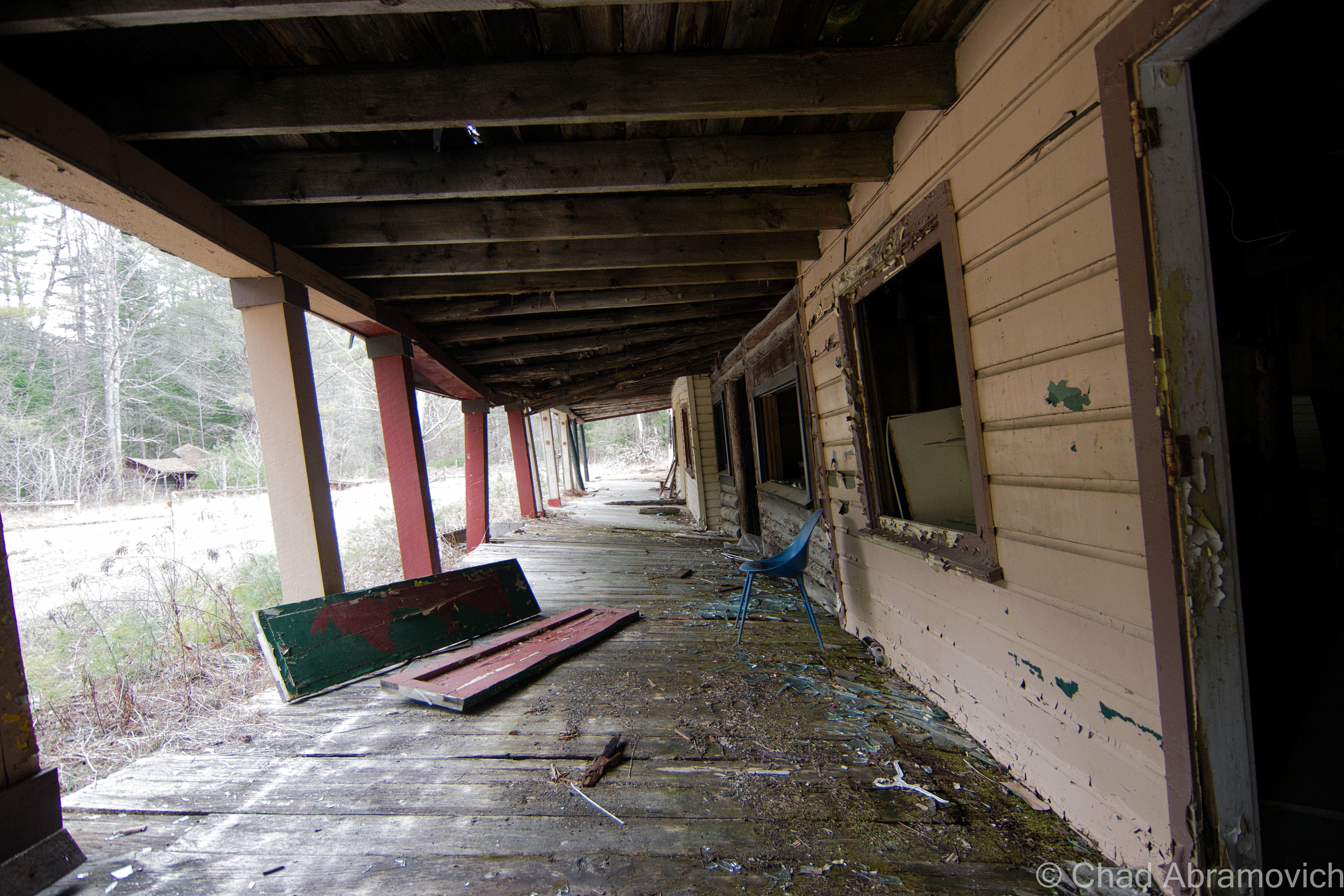
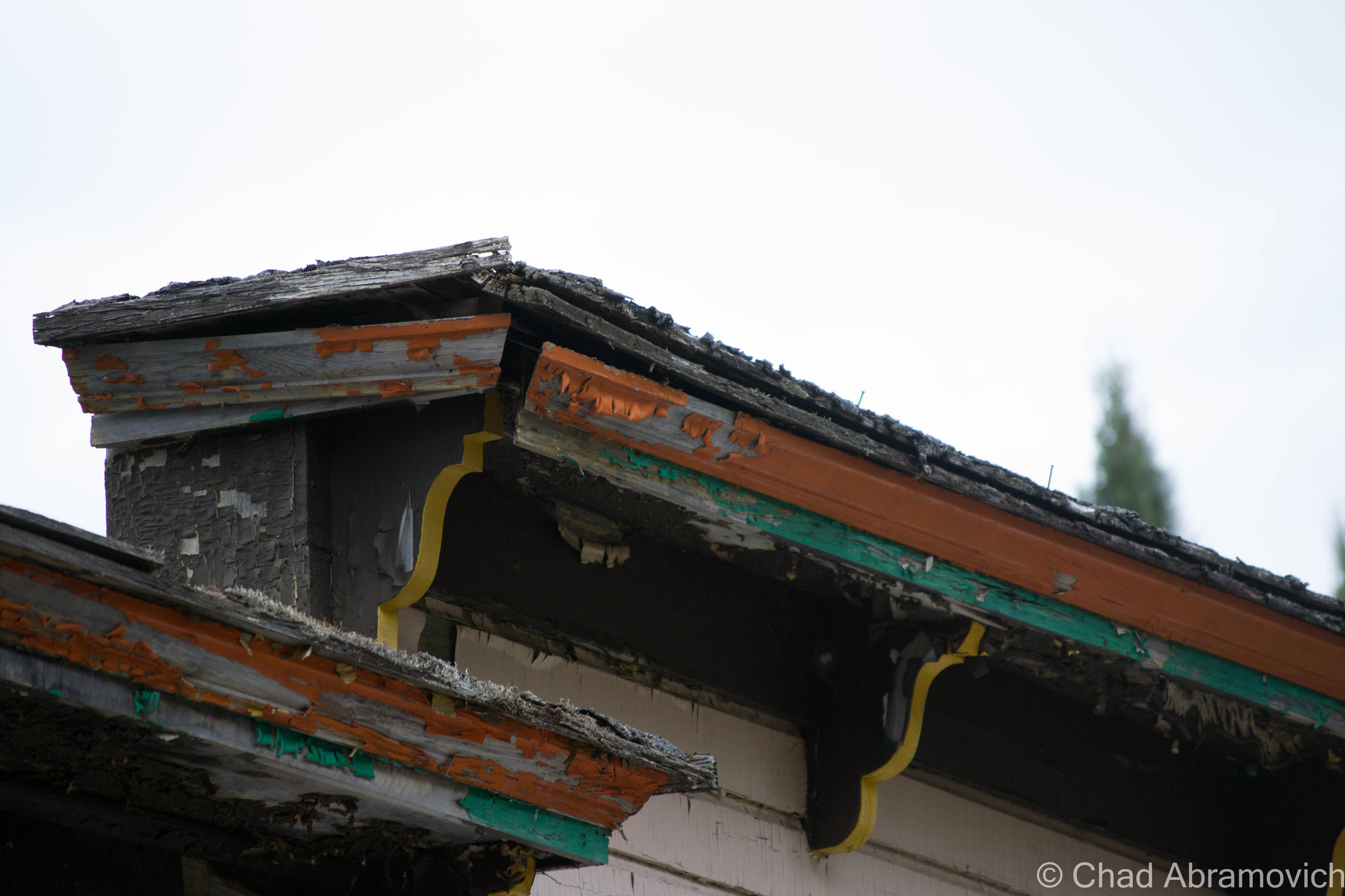
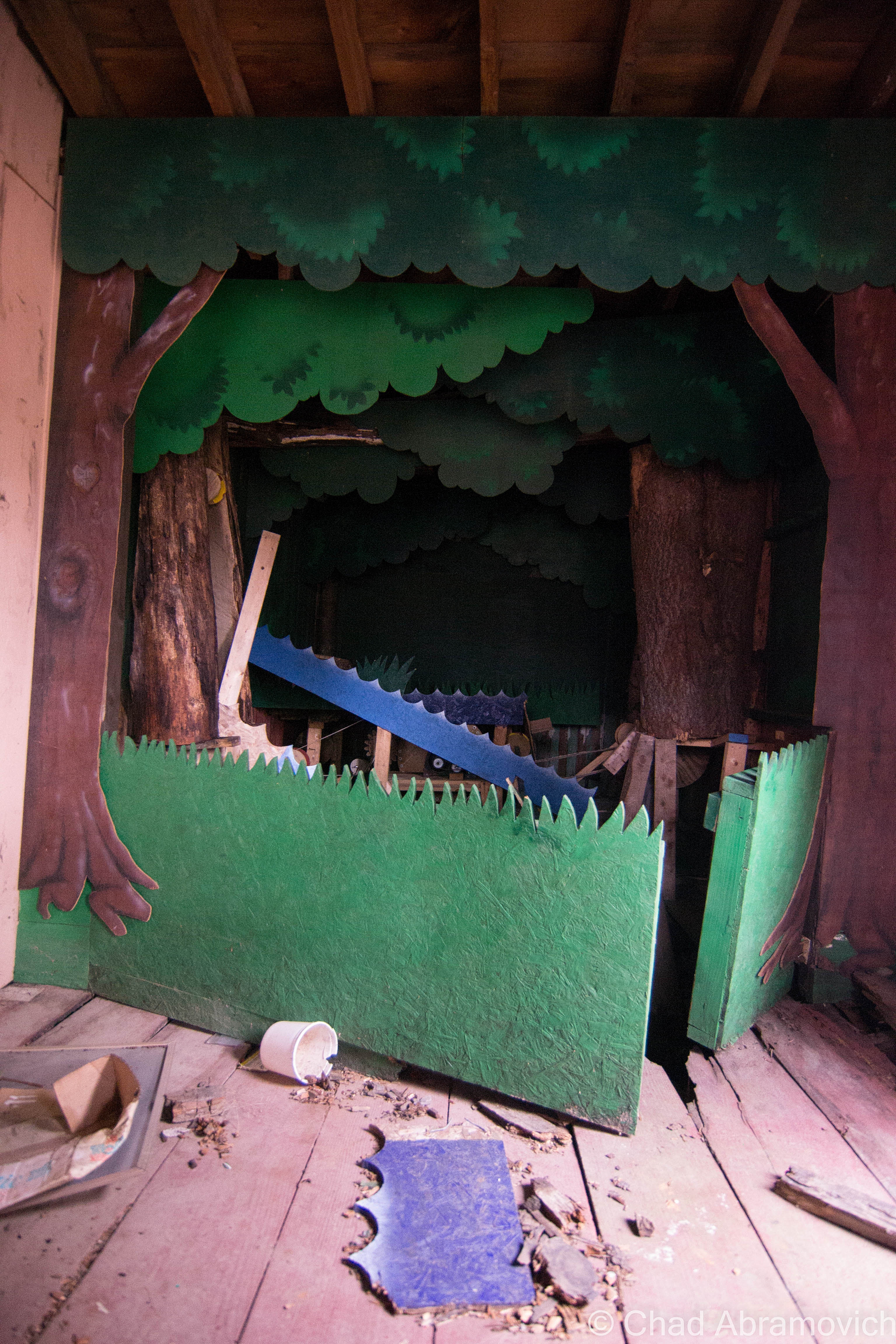
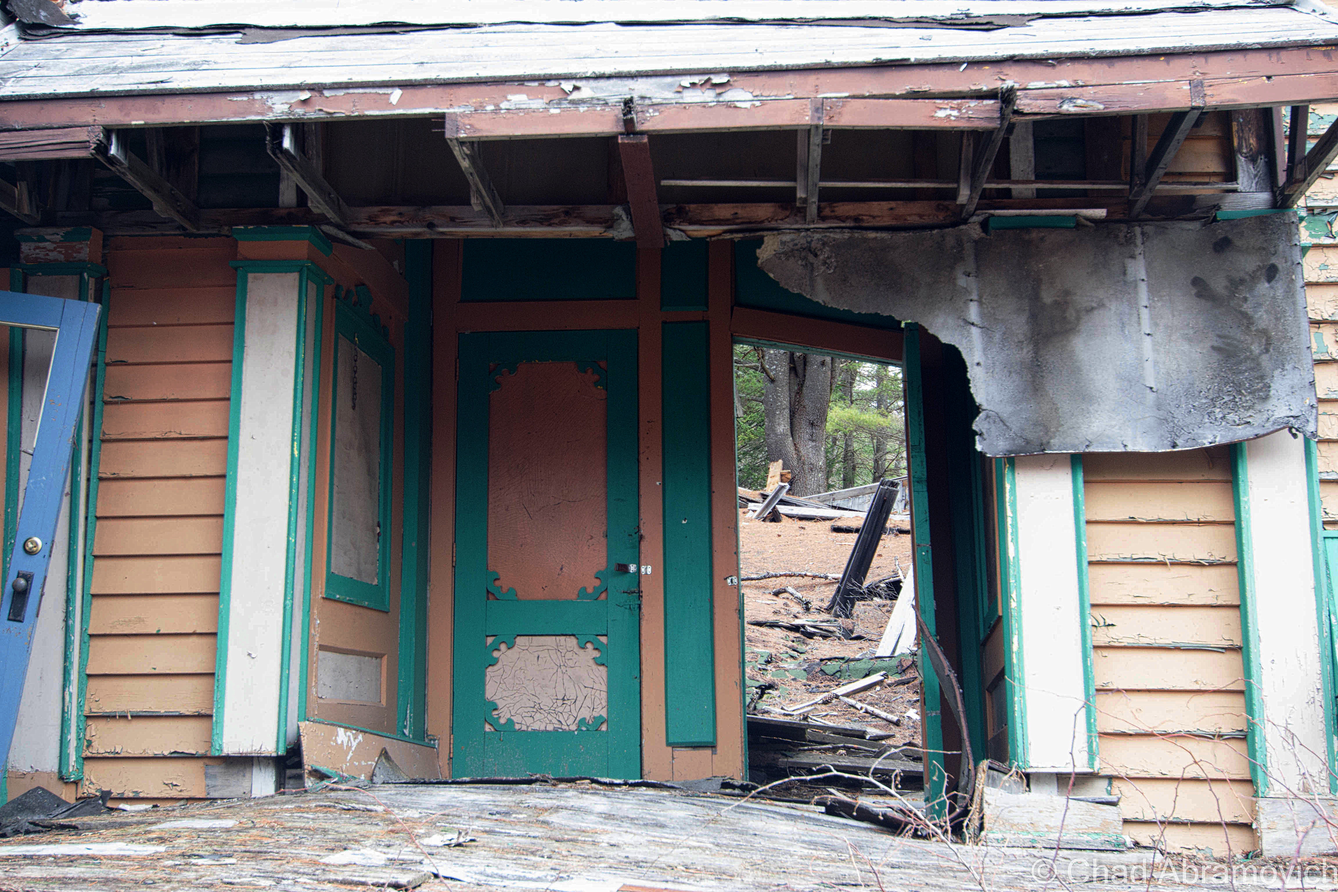
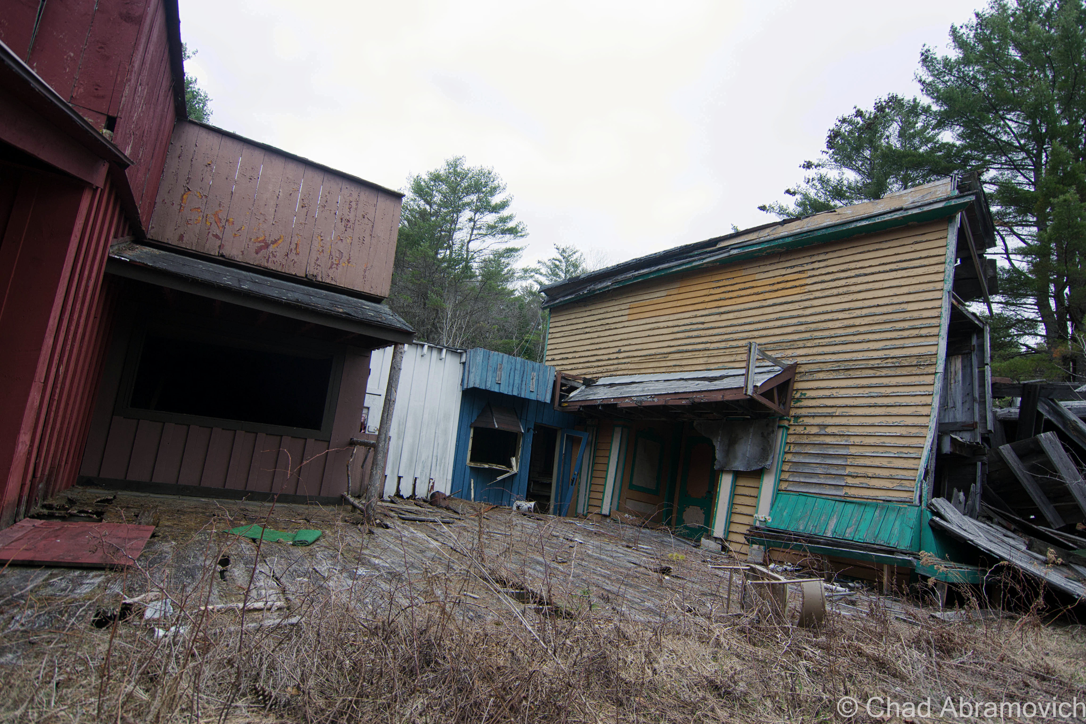
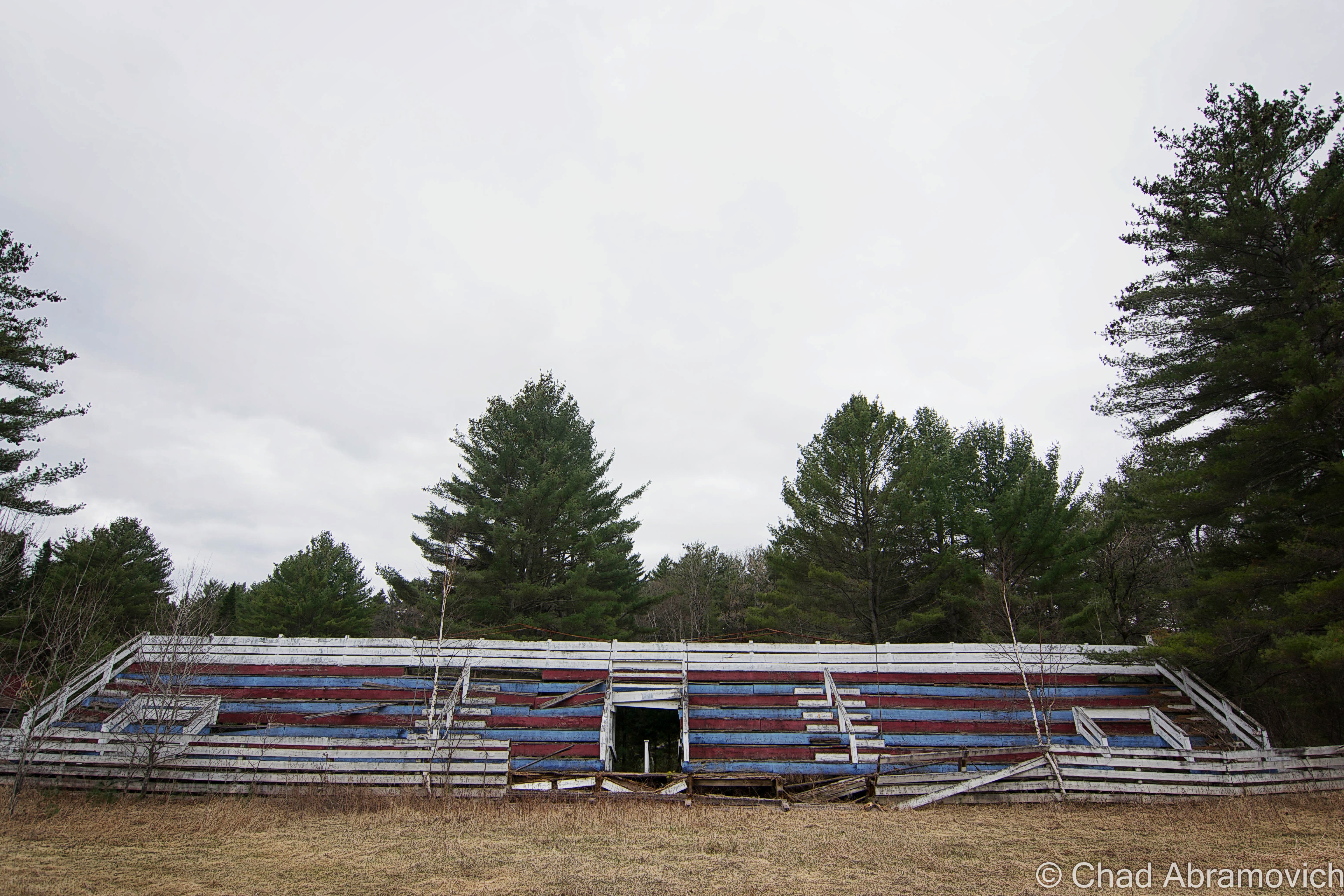
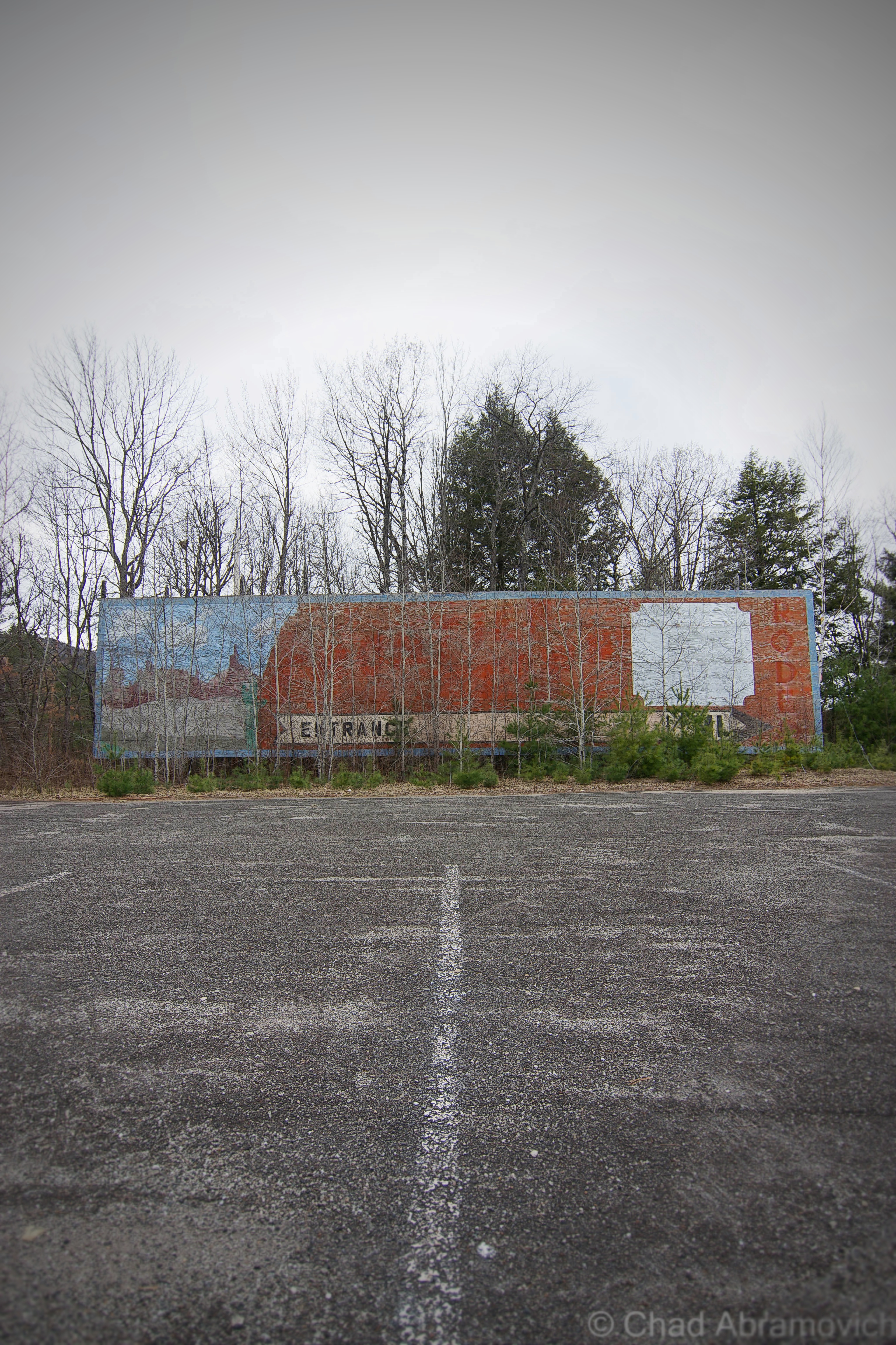
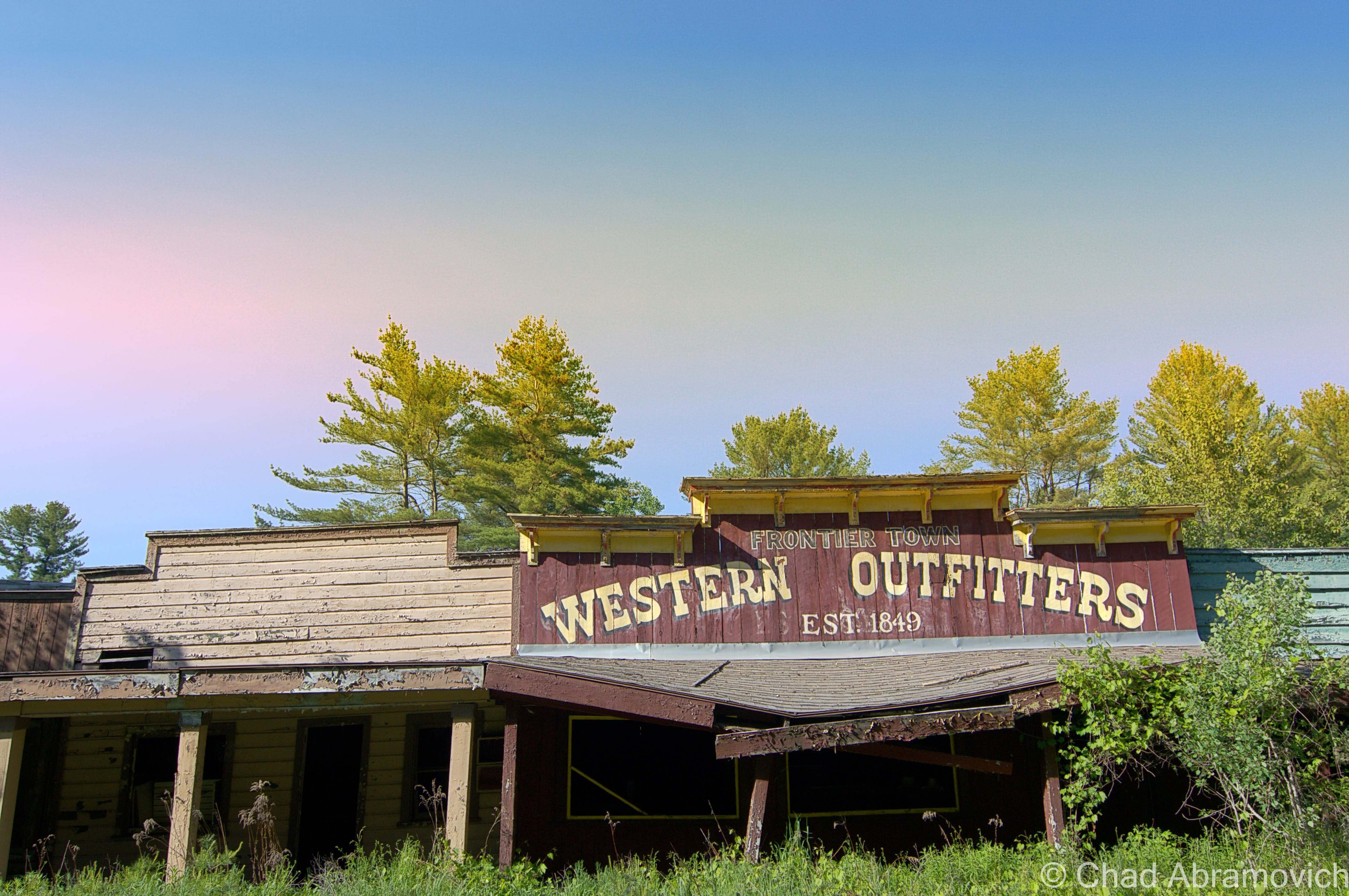
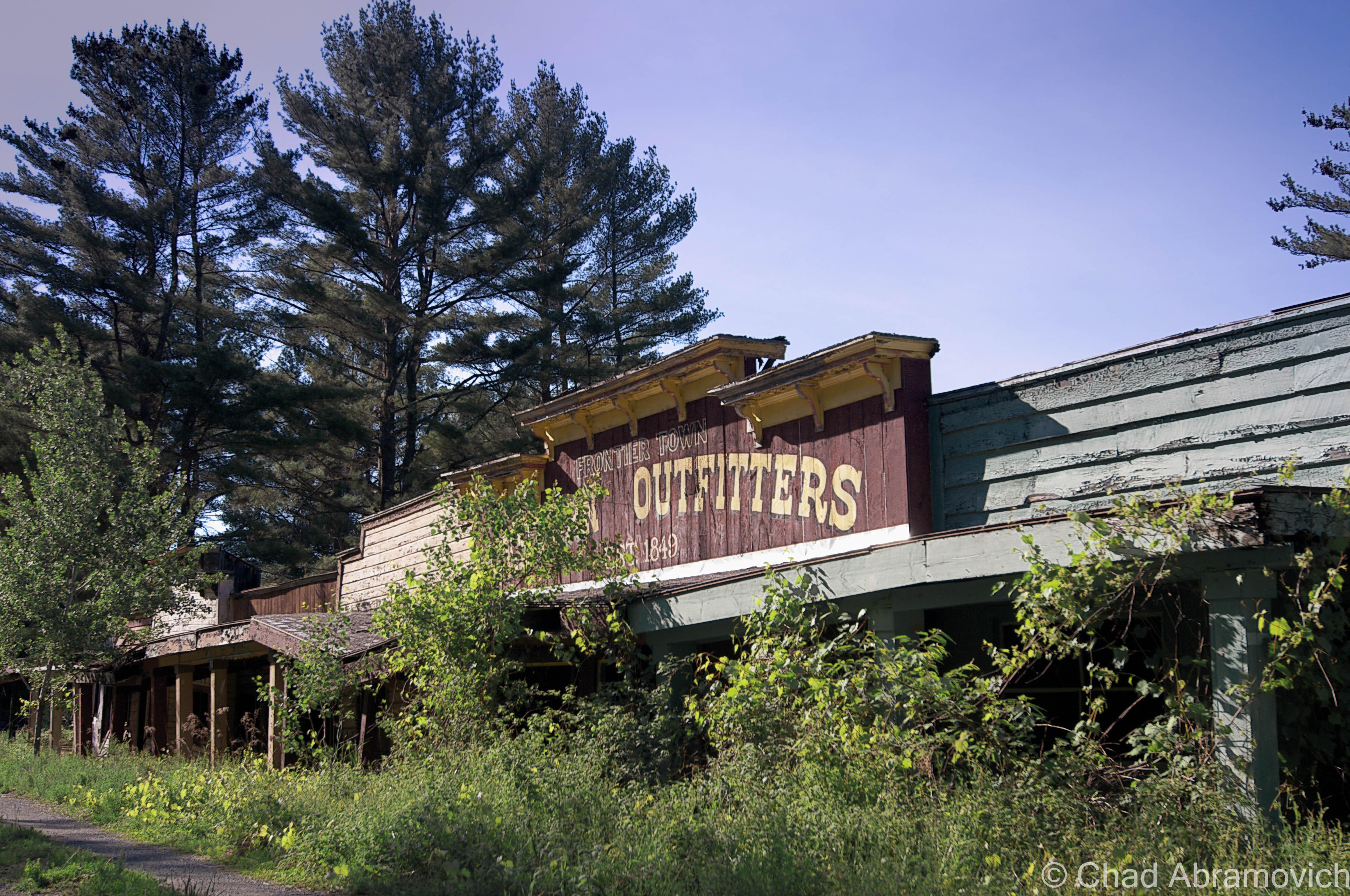
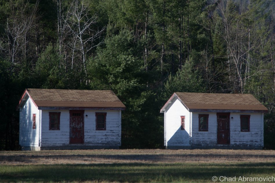
He soon constructed Prairie Junction to keep with his new theme, which was modeled after your trope-y Main Street of a dusty wild west town, and is one of the more interesting areas of the park ruins to photograph today. The low rise wooden buildings were all connected by a broad wooden porch, consisting of a saloon, music hall and a shop selling Western-themed souvenirs and clothing.
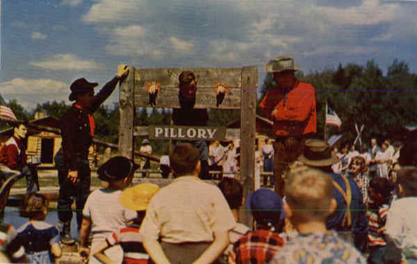
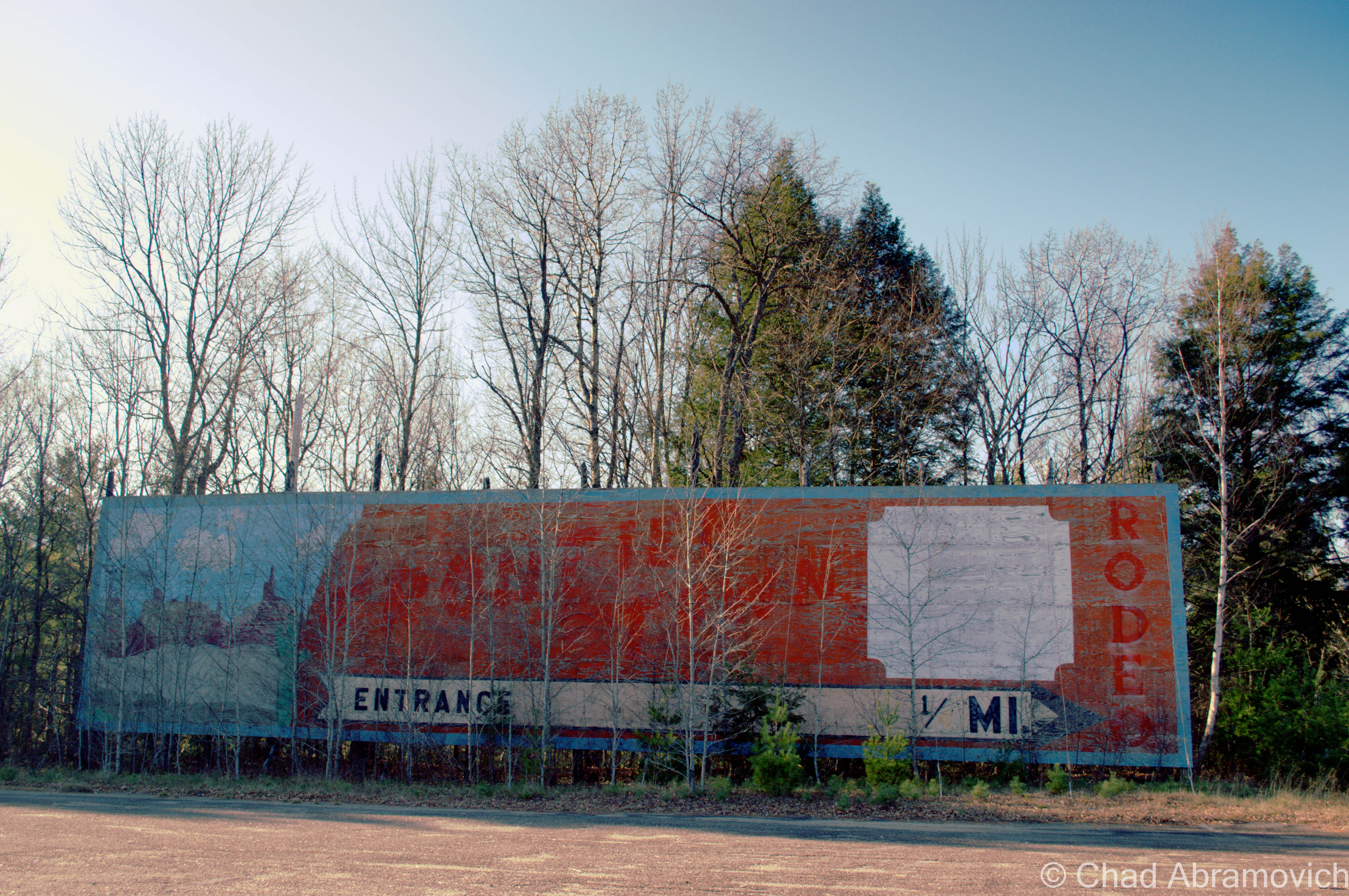
A rodeo area was built nearby, which held two of them a day would and even had shows that allowed children to participate. Stagecoaches, replica era steam trains, and covered wagons would all transport visitors around the park, and outlaws on horseback would “rob” the trains and engage in “shoot-outs”. And it was a huge success.
Frontier Town wasn’t just loved by the tourists and generations of wide-eyed kids who made memories there, it was also loved by the locals.
The park employed many Adirondack area teens, who spent their paychecks on college tuition. Many friendships and romances were also forged here, some which would last lifelong, and would later be recalled wistfully on Frontier Town message boards and fansites that pop up on Google searches about the place.
Employees wore period garb and would teach bemused sightseers how to do thematic daily tasks that our frontier predecessors did back in the day to survive. Stuff like churning butter, demonstrating how yarn was spun, or cook pea soup in an iron kettle over a fireplace, which was said to be a favorite of loggers in the Adirondacks.
Unfortunately, like real western frontier towns, New York’s Frontier Town would also go bust after it came to its peak popularity in the 1960s and 70s. The times were changing. The construction of the Adirondack Northway would lure traffic to bypass North Hudson and would make a large reduction in travel time. Now, sojourners no longer needed to depend on Route 9 to get to the Adirondacks from New York City and any point in-between.
Some speculate that the park really declined when a new transgressive era ushered in parents becoming uneasy with their kids playing with guns, which was more acceptable when Westerns were all the craze on TV and the silver screen.
As one Frontier Town enthusiast wrote on a comment thread; “Cowboys and Indians were big time. Every kid had a gun and a cowboy hat”. Others blame broader travel opportunities that came with the construction of interstate highways and air travel, making places like Frontier Town obsolete.
In 1983, a tired Art Benson sold Frontier Town to another development firm, and would pass away 5 years later. The park was closed until 1989, re-opening with additions, such as a miniature golf course. But it was a short rejuvenation, and in 1998, Frontier Town closed for good due to failing finances and weak attendance.
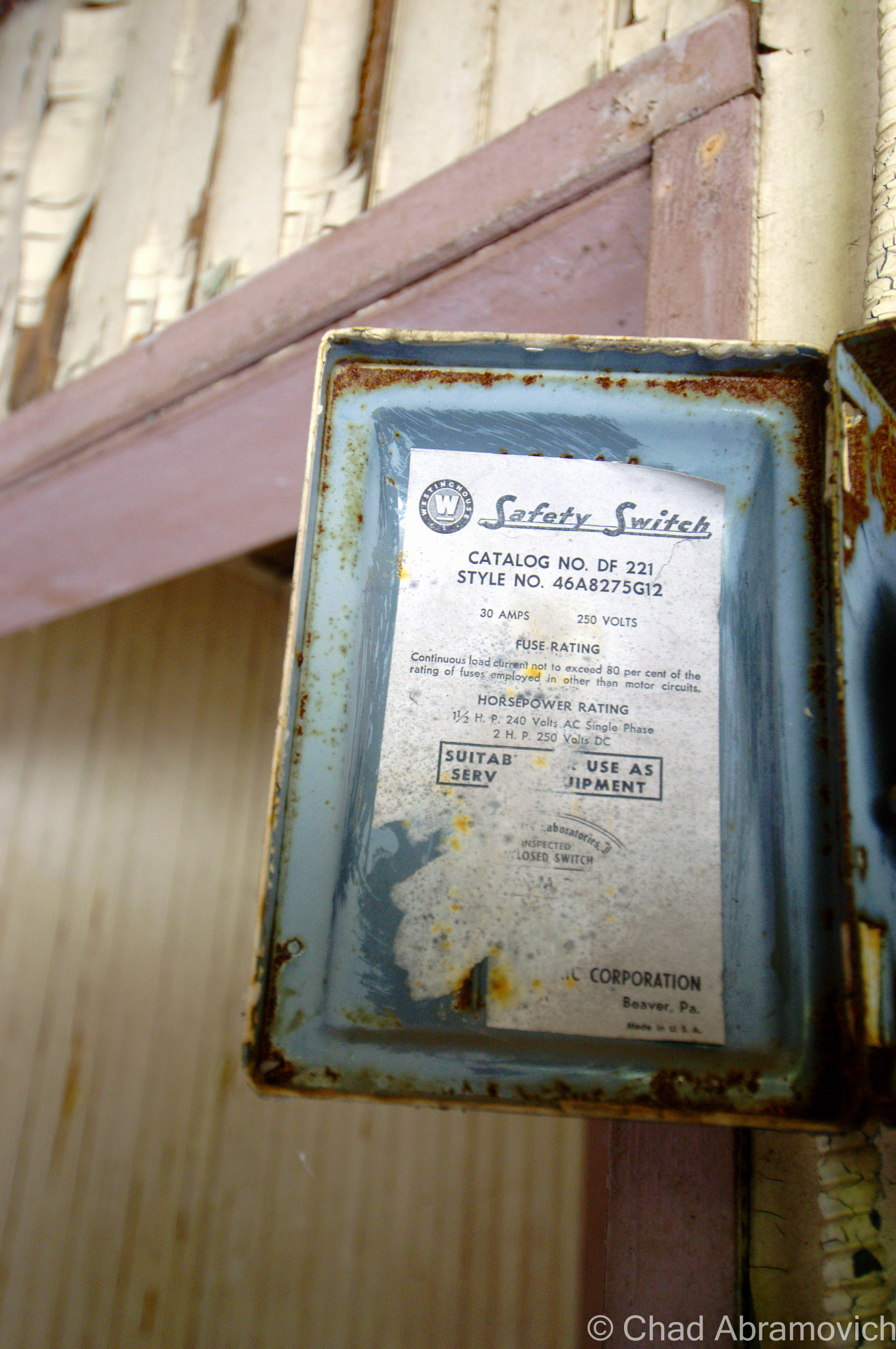
The property was seized in August 2004 by the county for past-due property taxes. The stagecoaches, trains, buggies and the tracks were all scrapped and sold, as well as other paraphernalia. Collectors can still find mementos at Gokey’s Trading Post just down the road, which is where a lot of Frontier Town relics ended up during the massive auction after the park’s closing and appears to be one of the few remaining businesses in town.
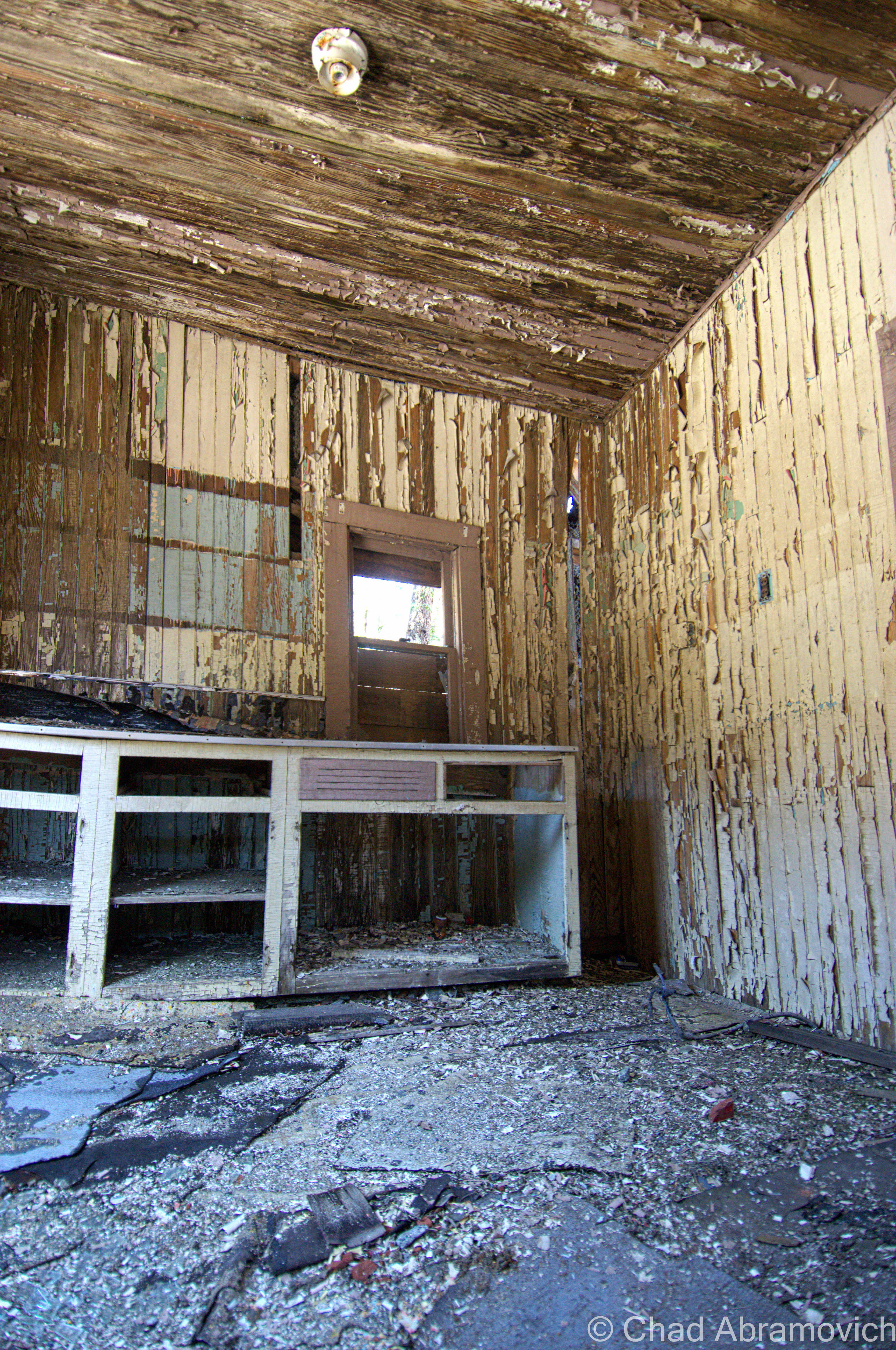
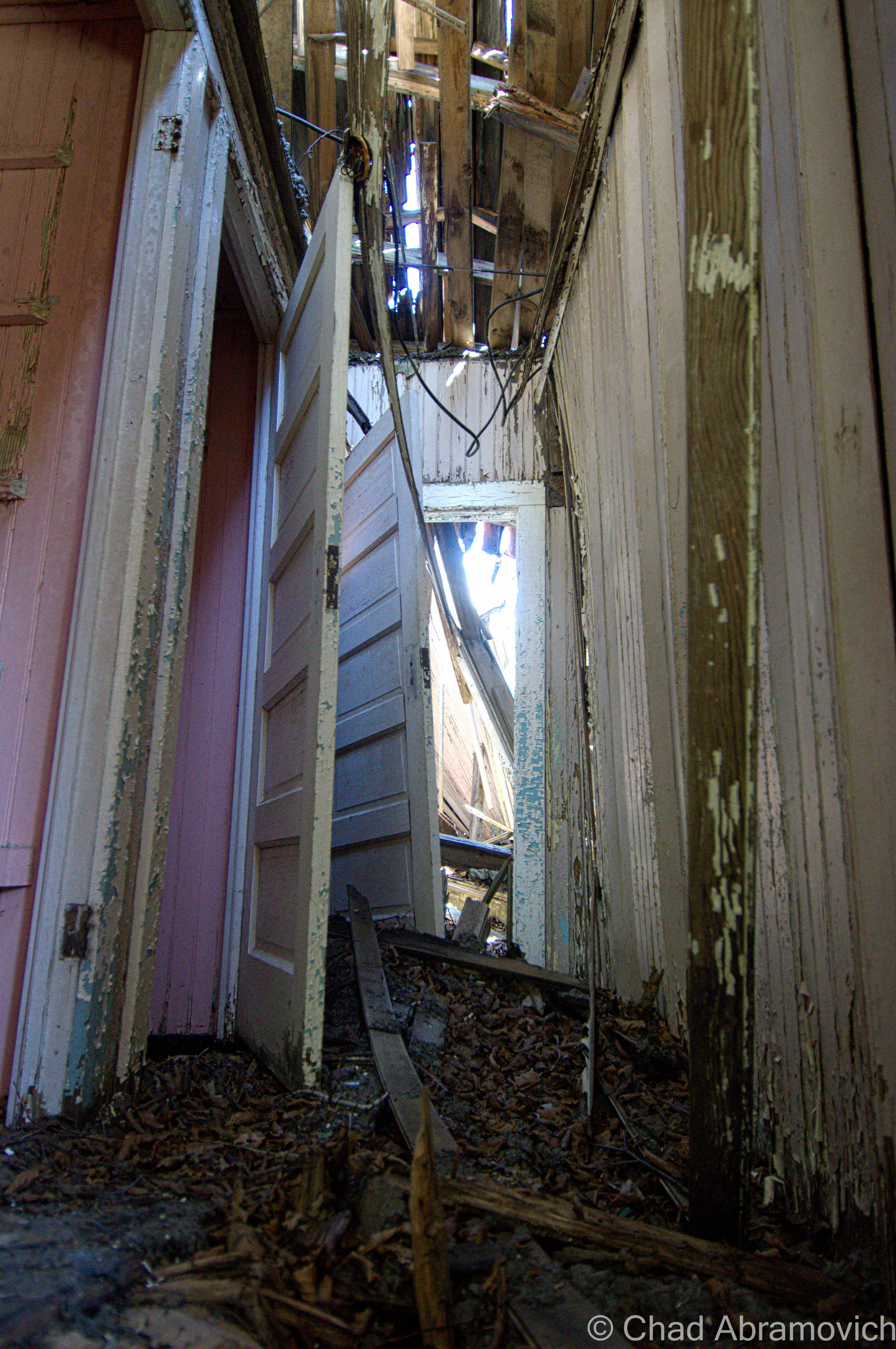
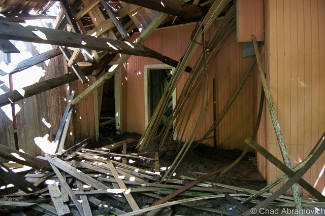
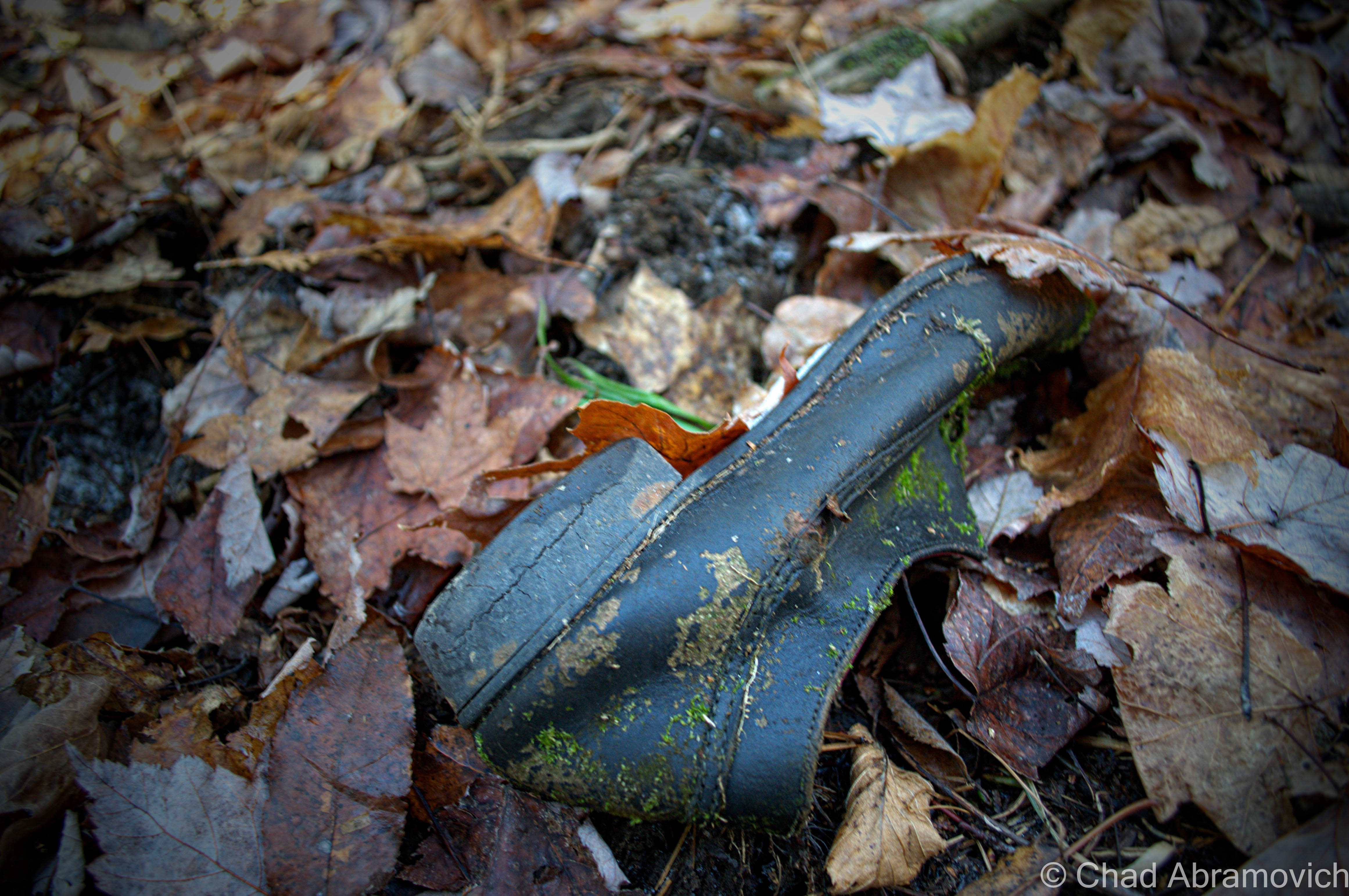
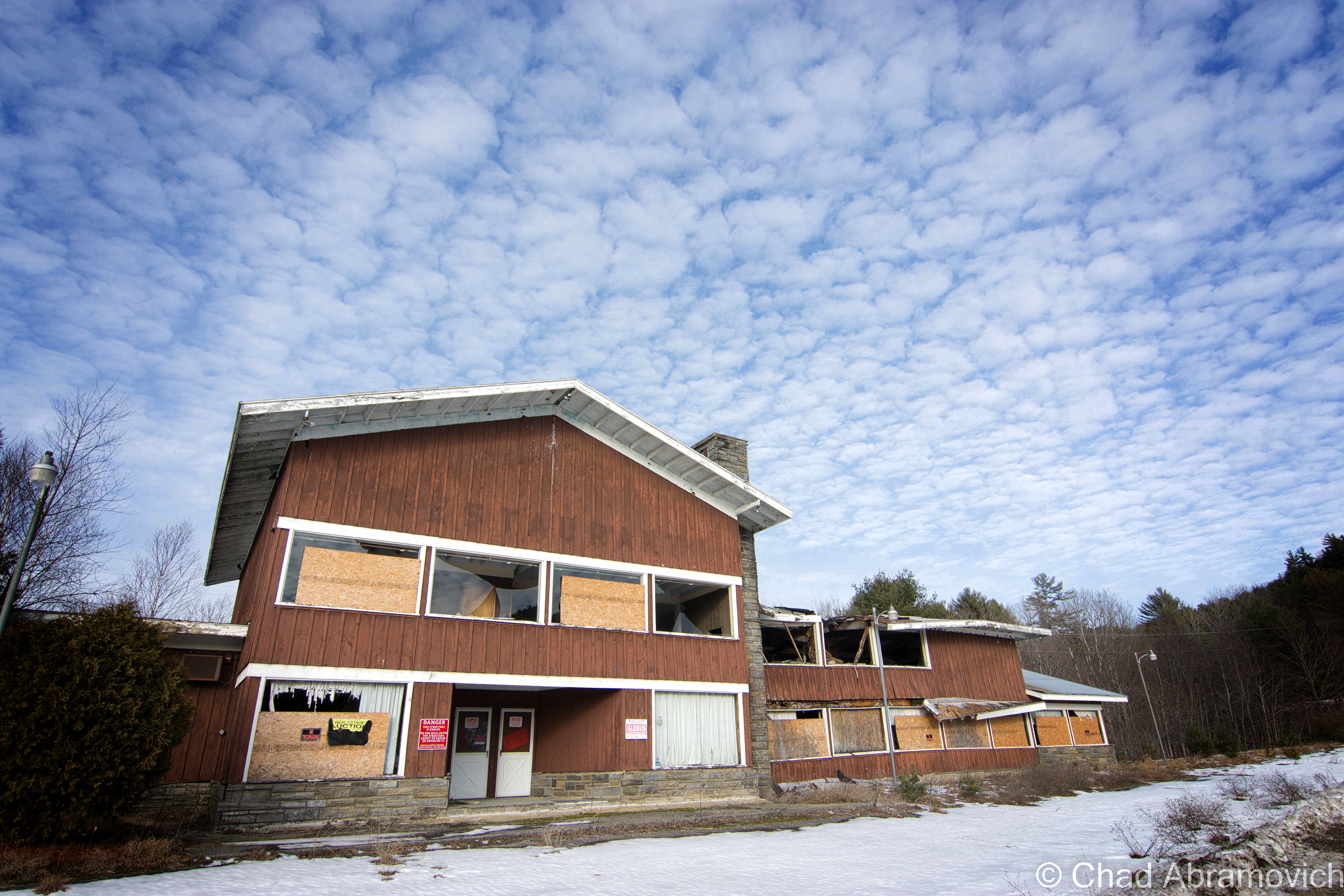
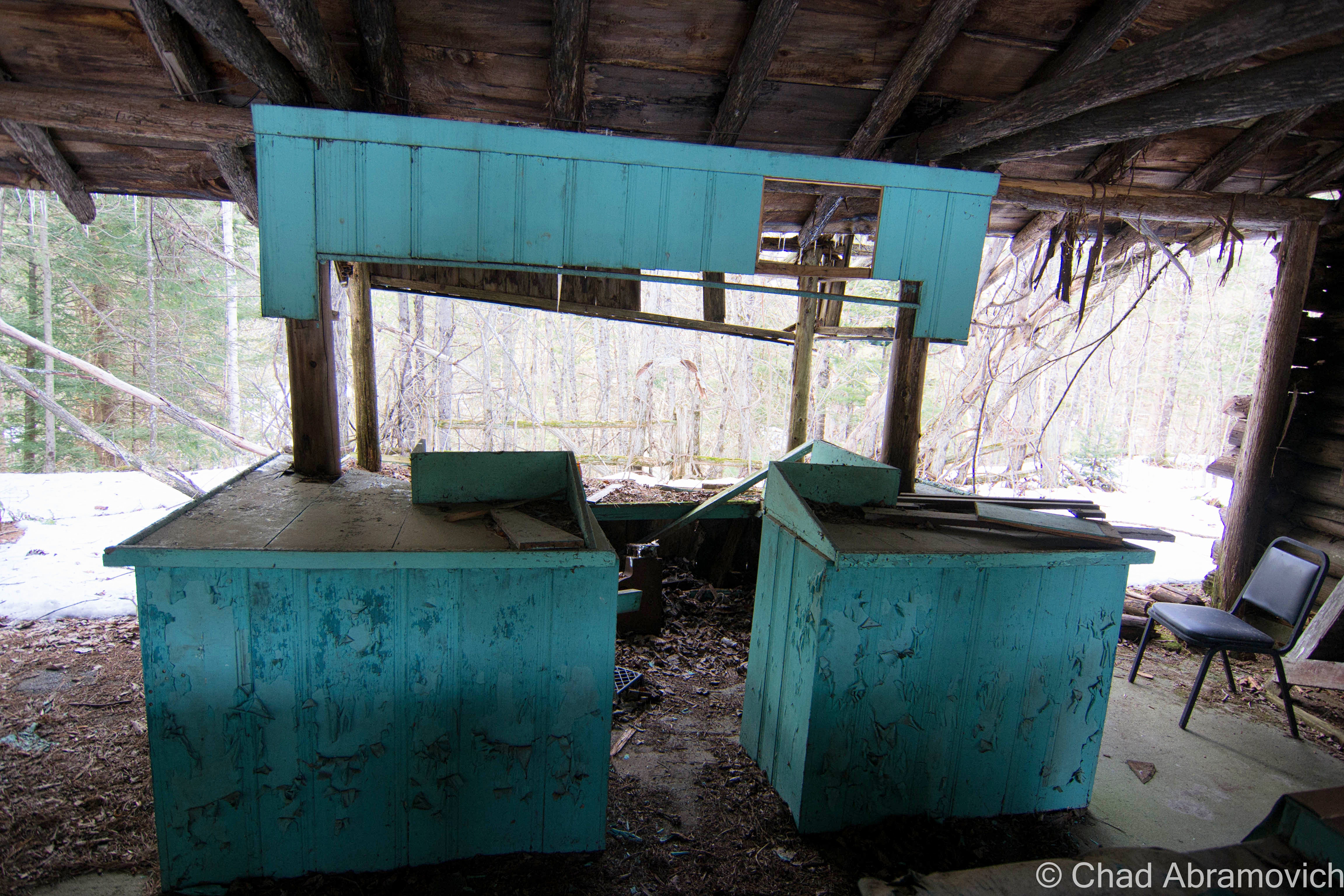
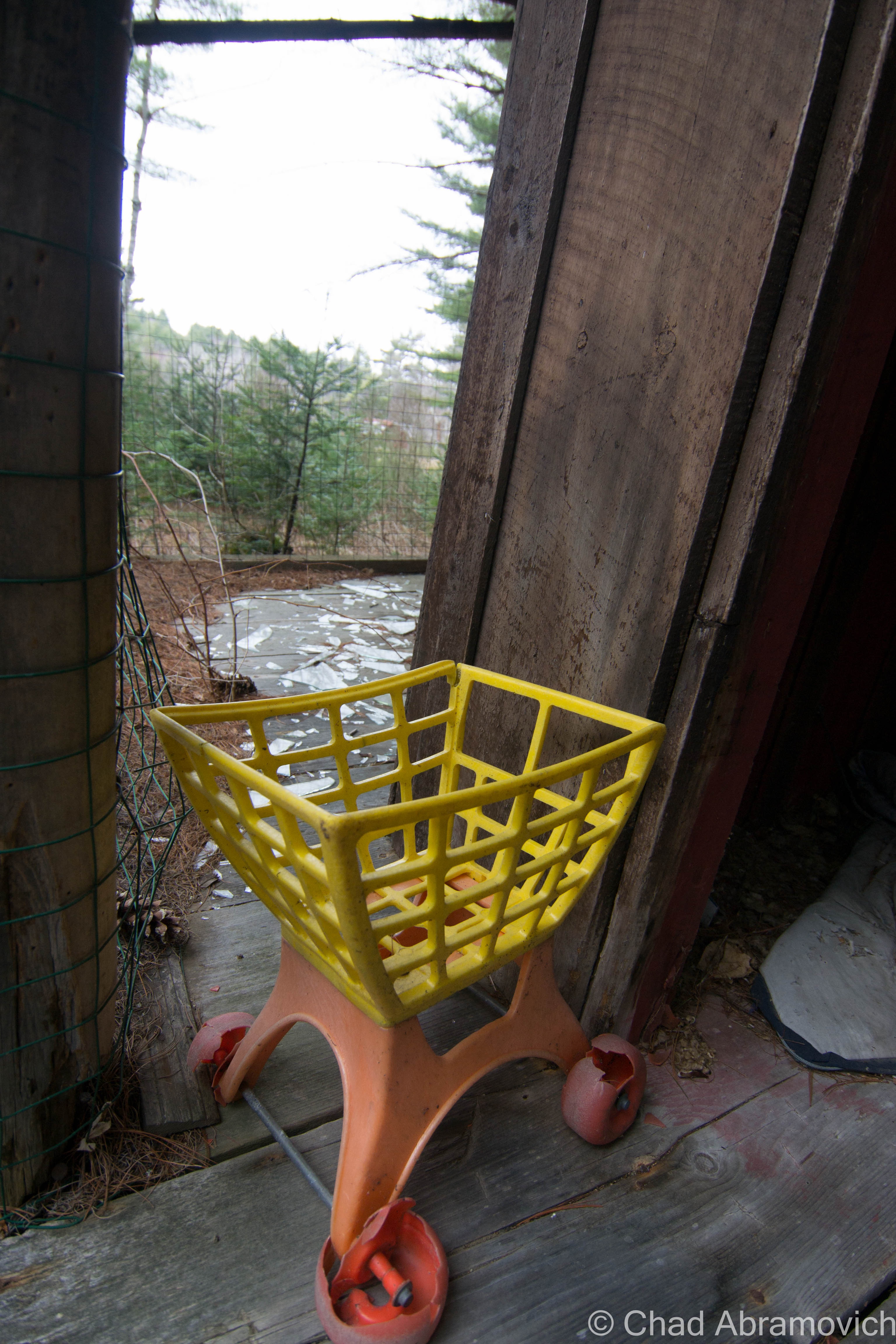
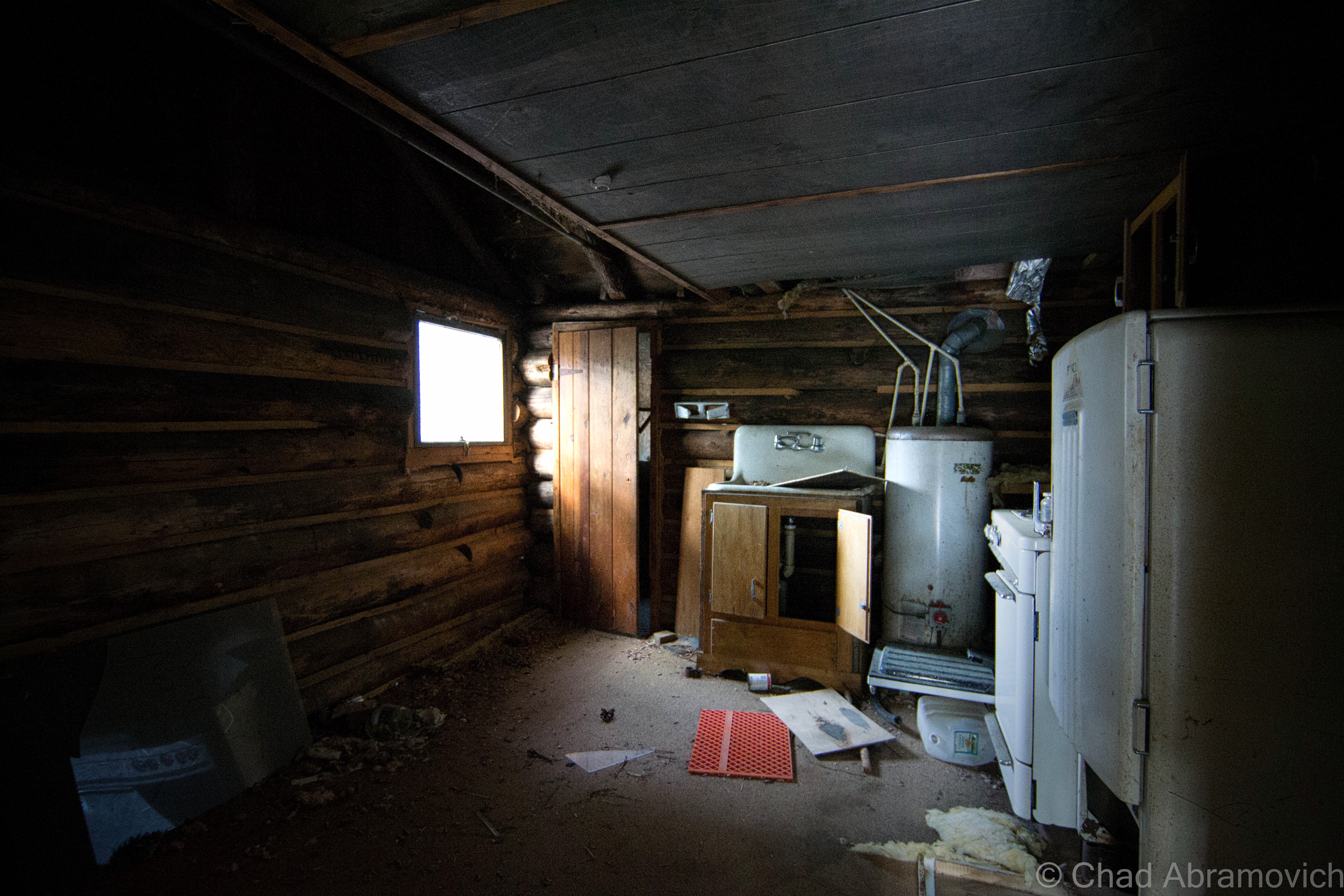
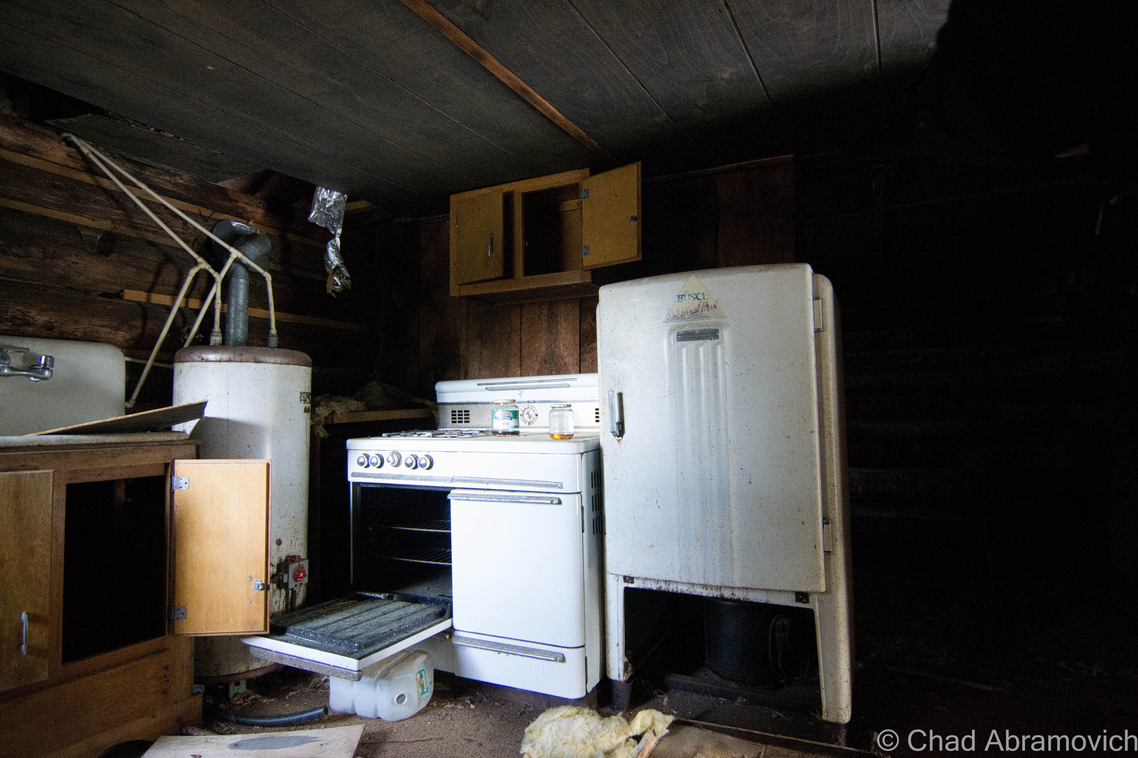
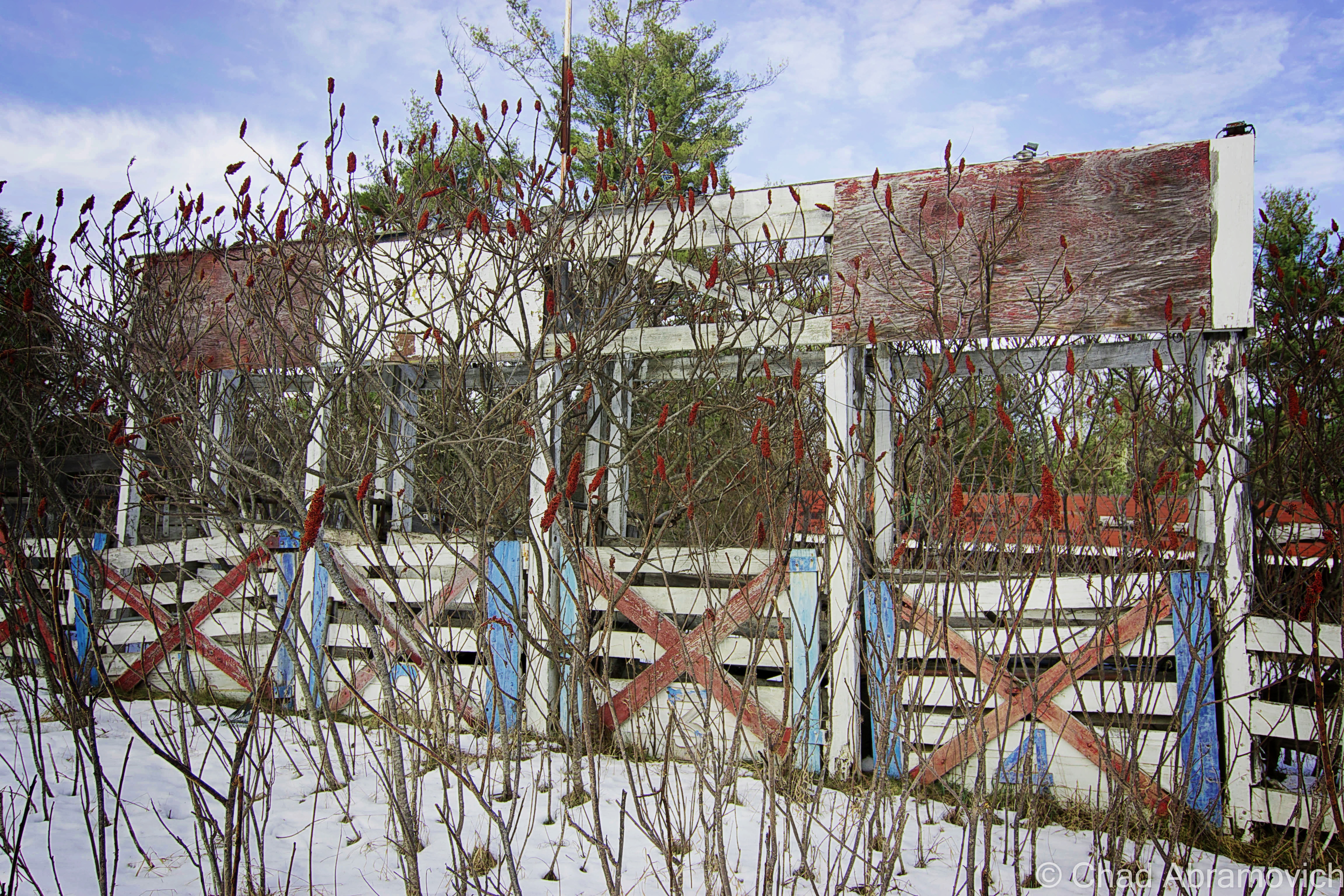
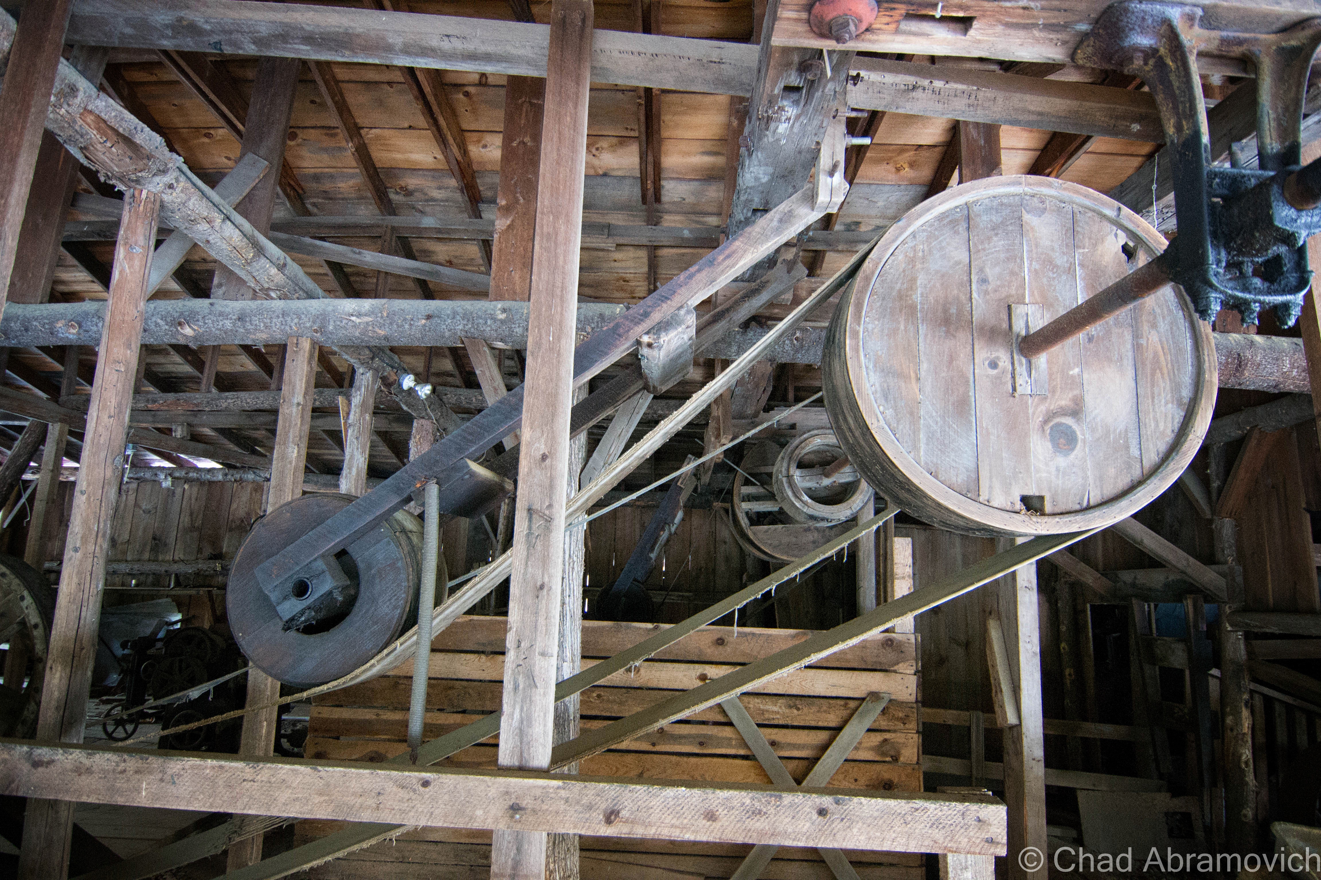
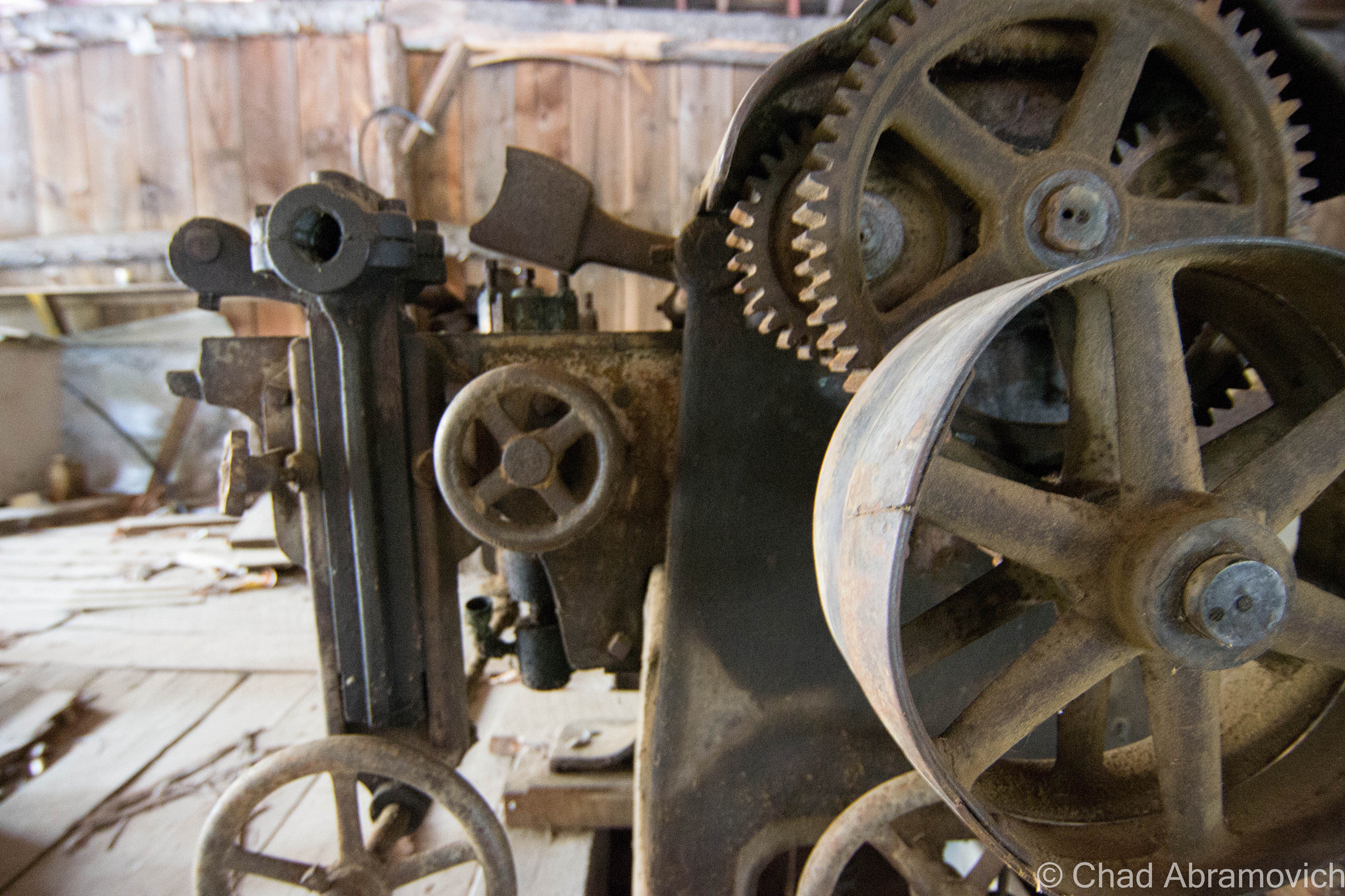
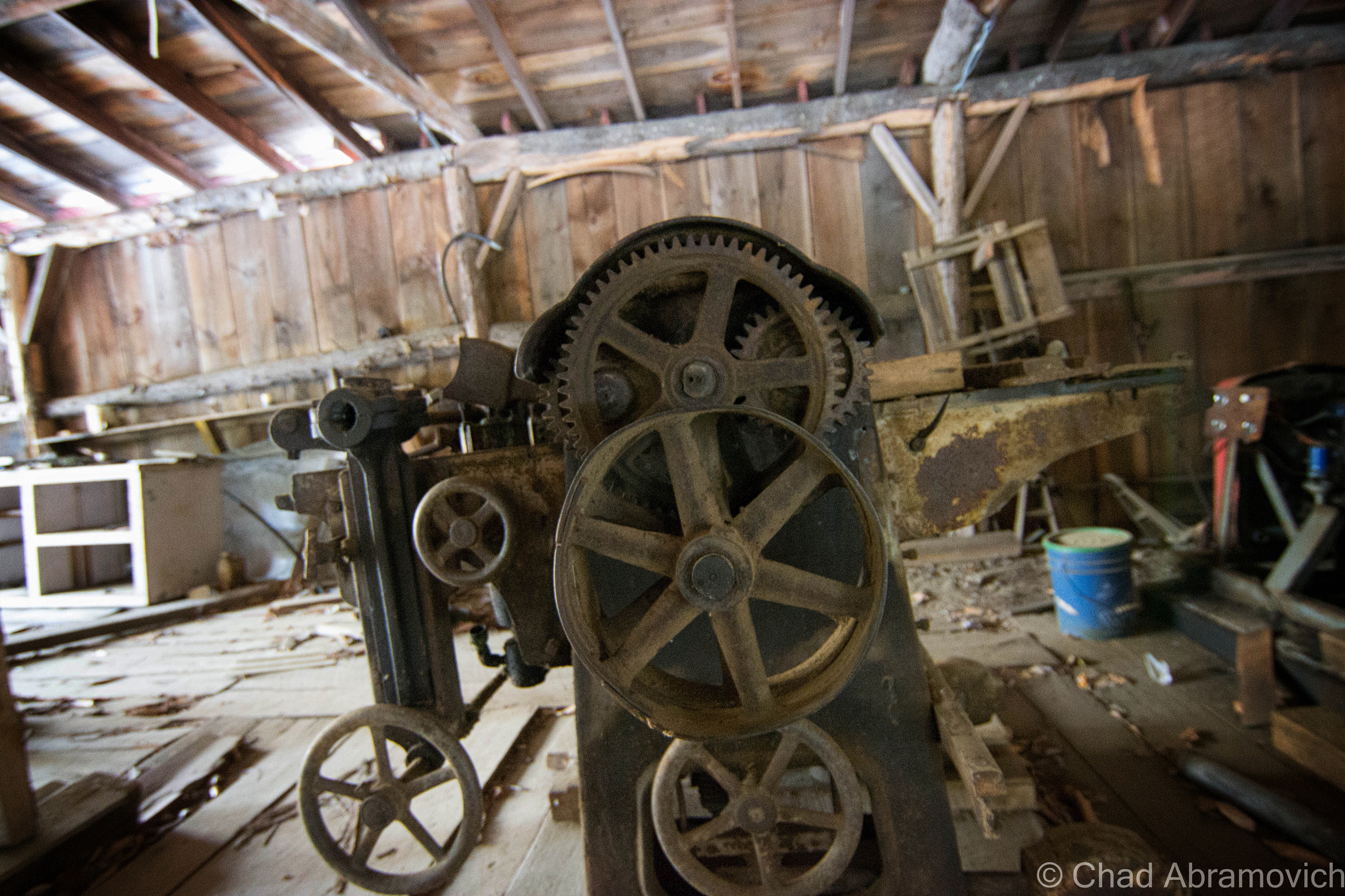
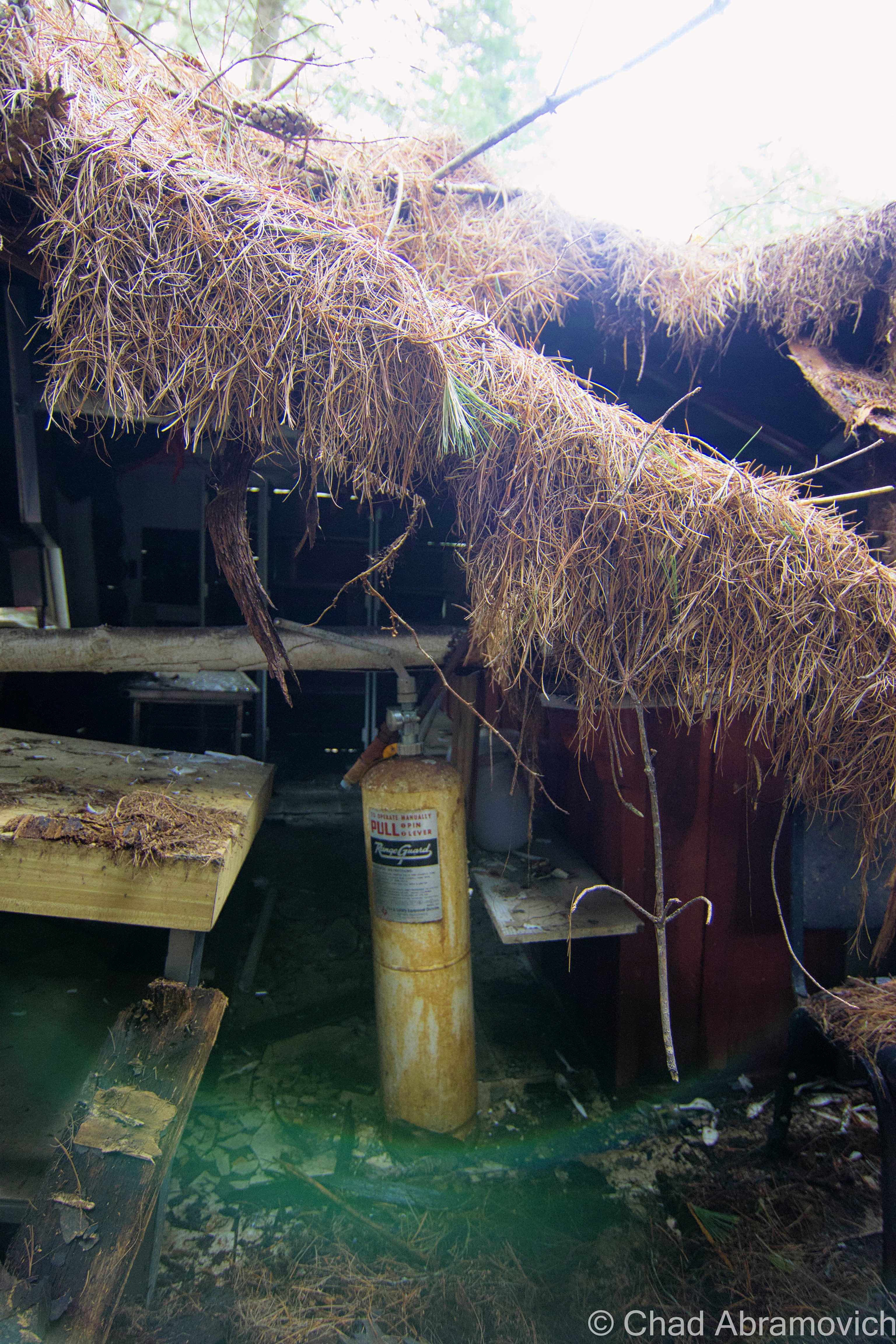
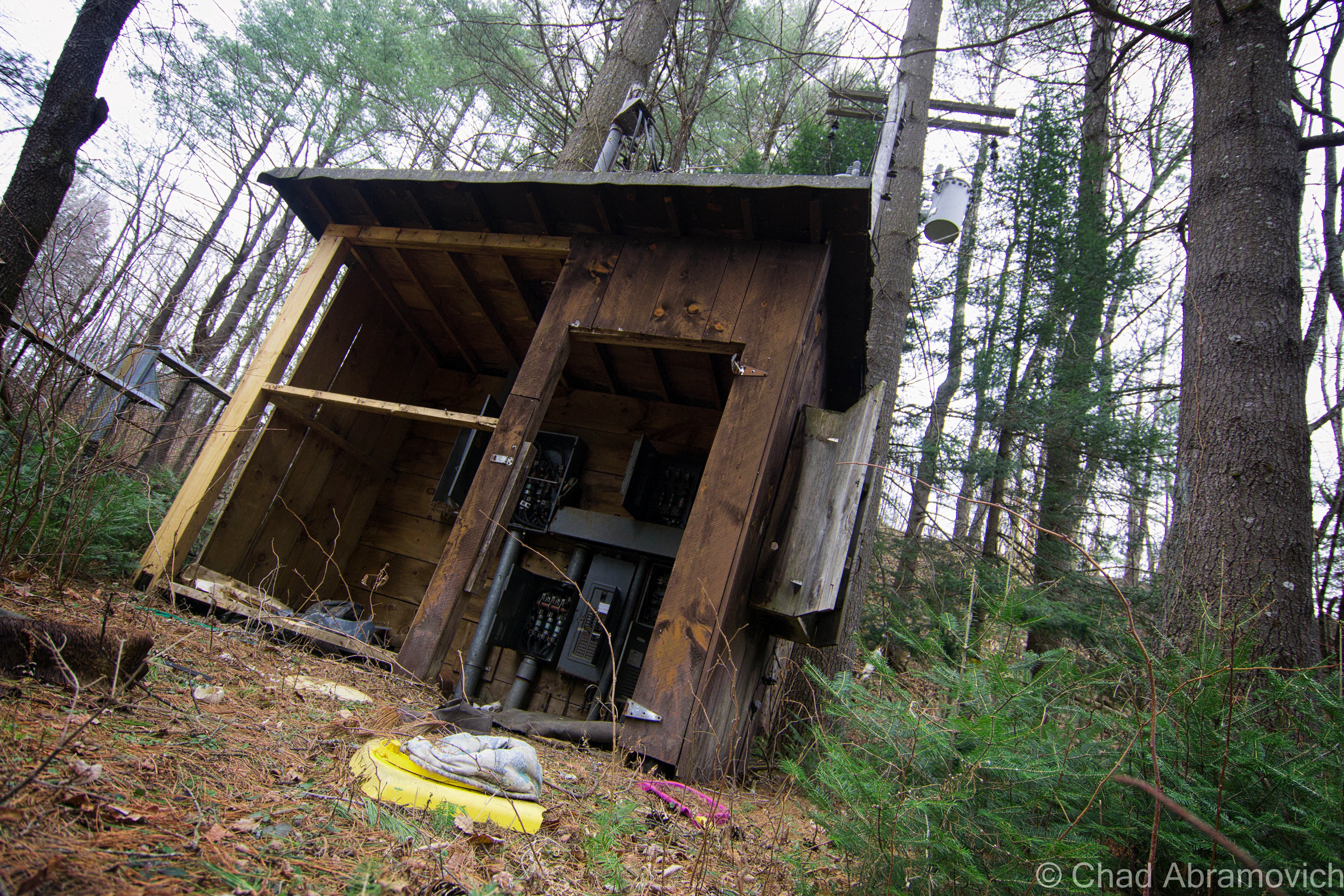
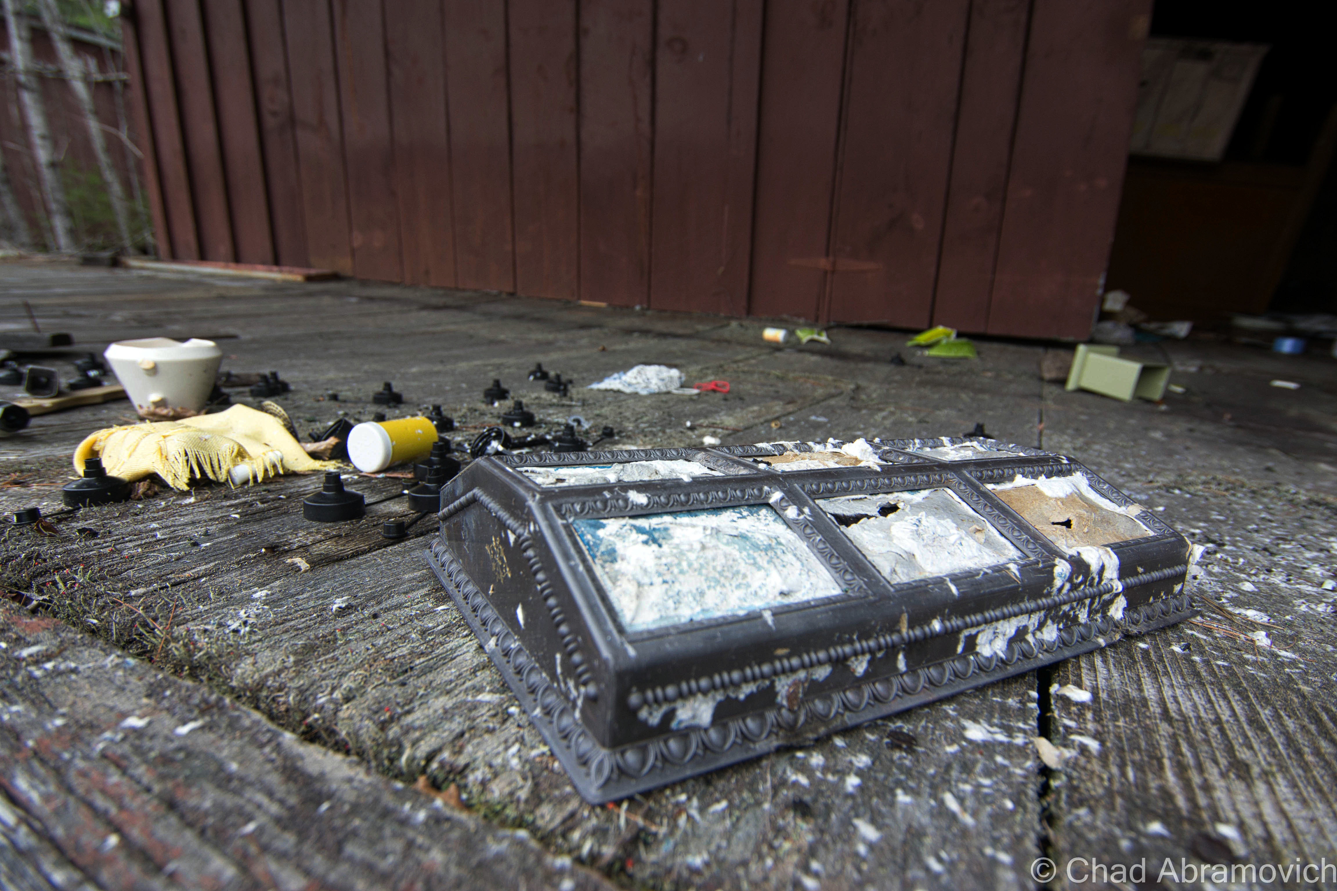
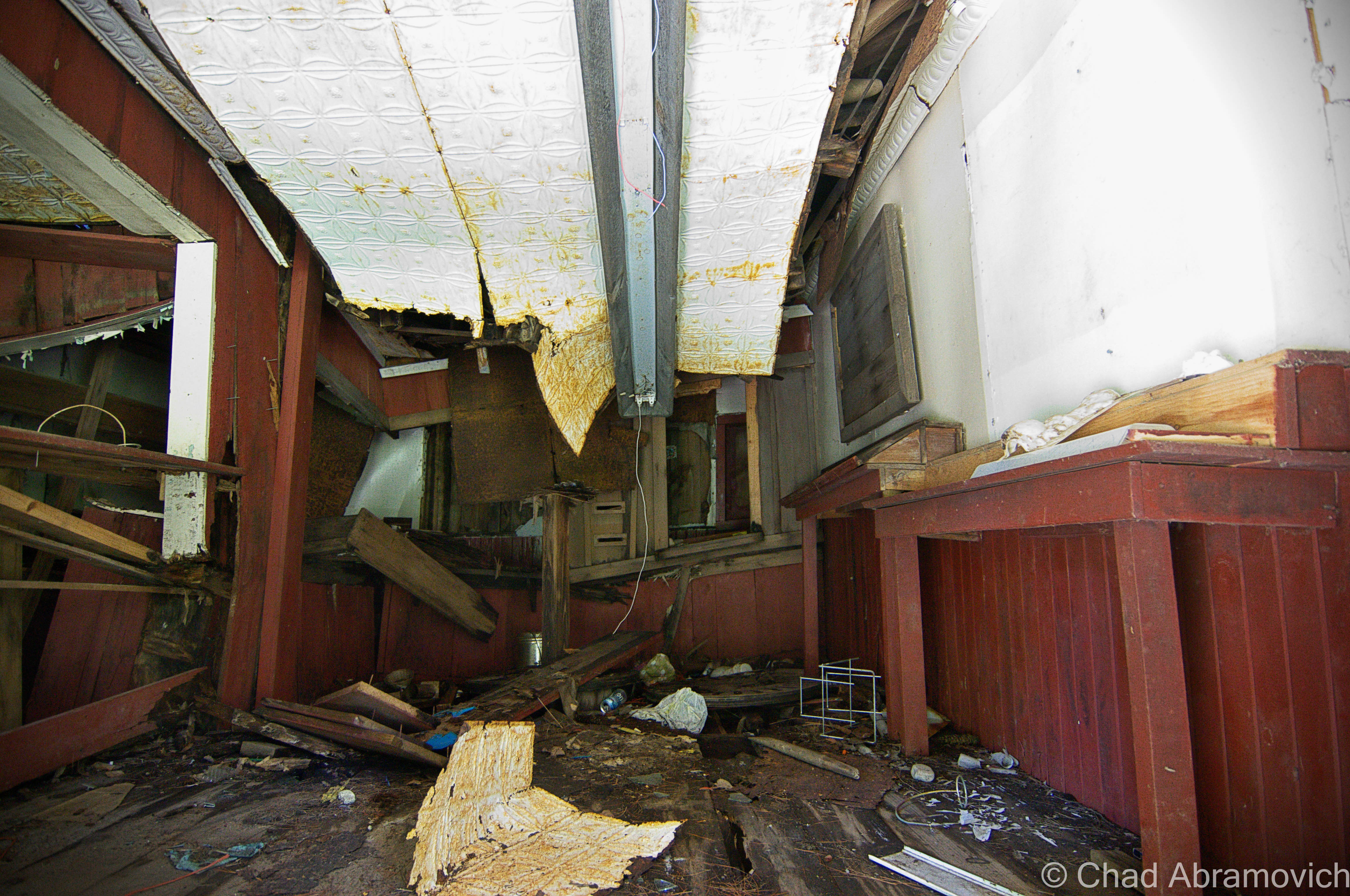
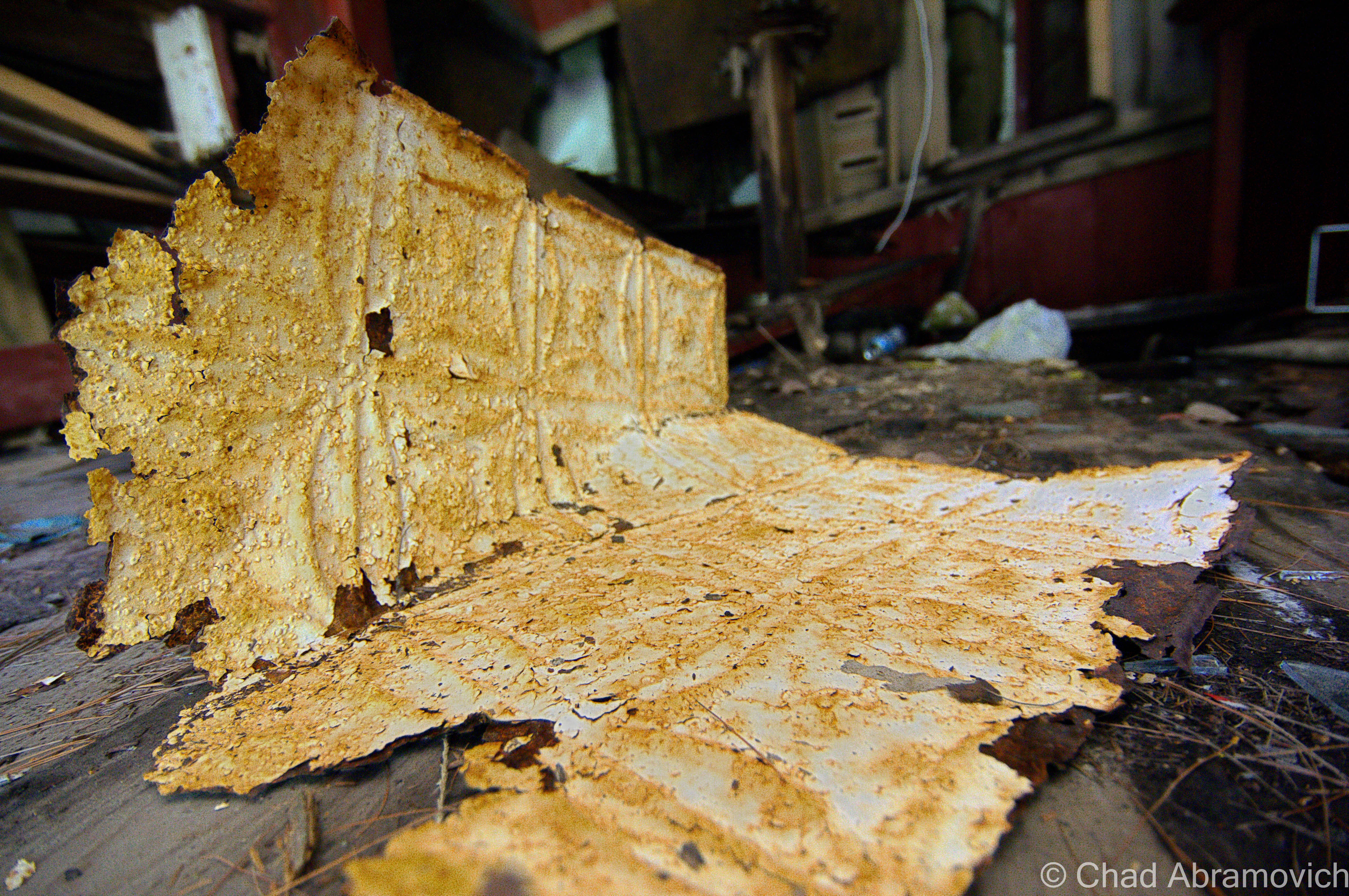
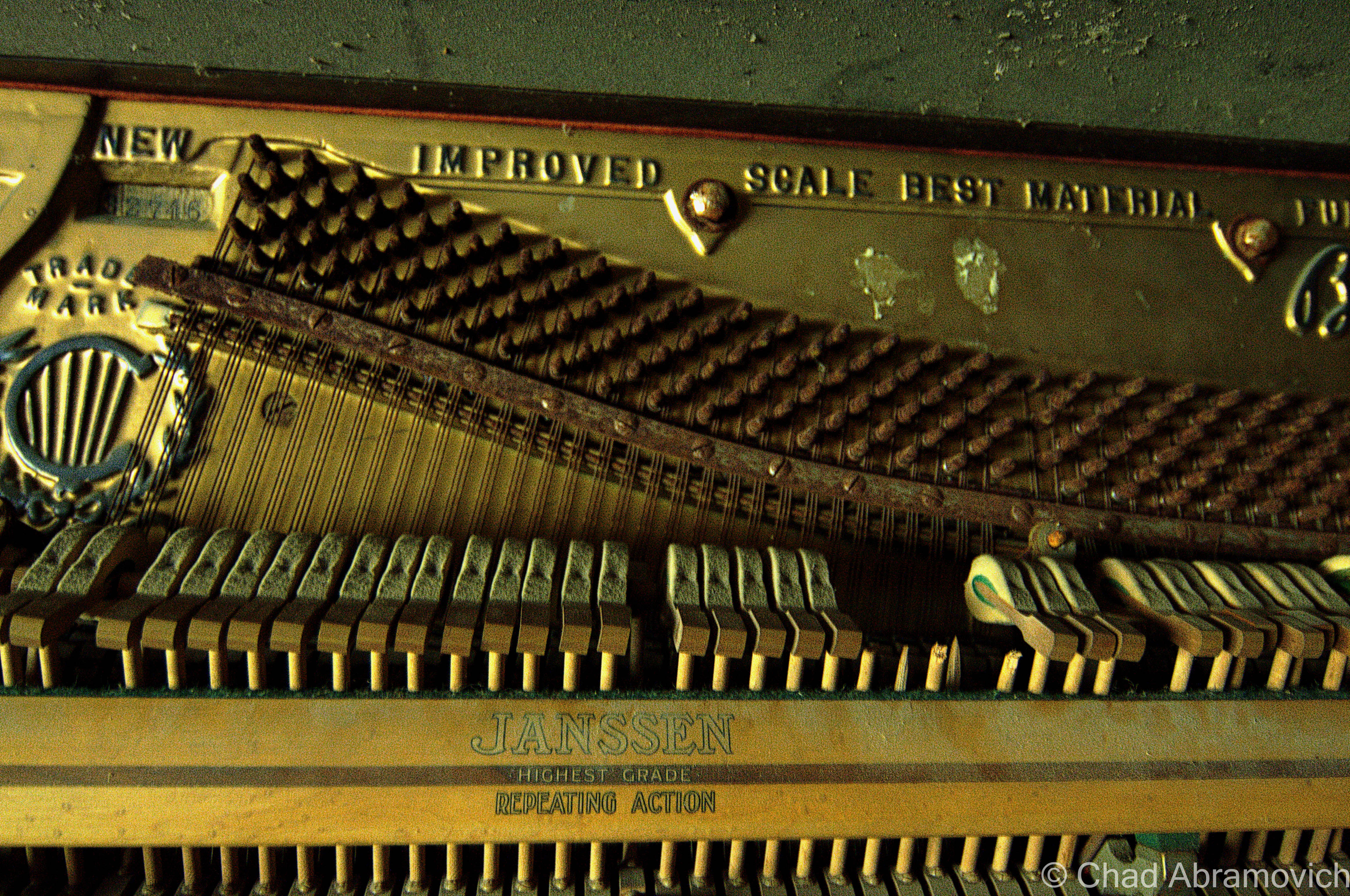
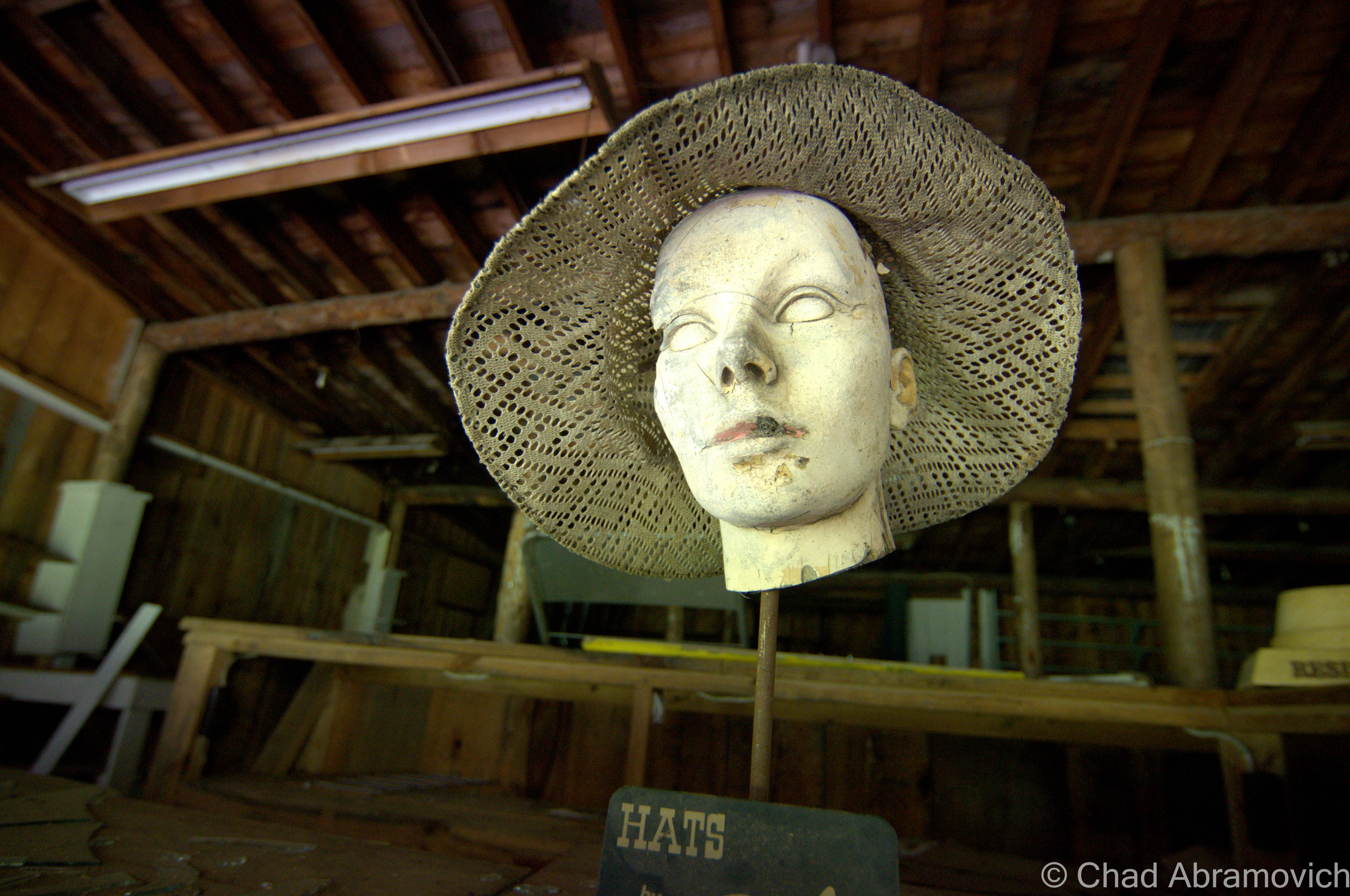
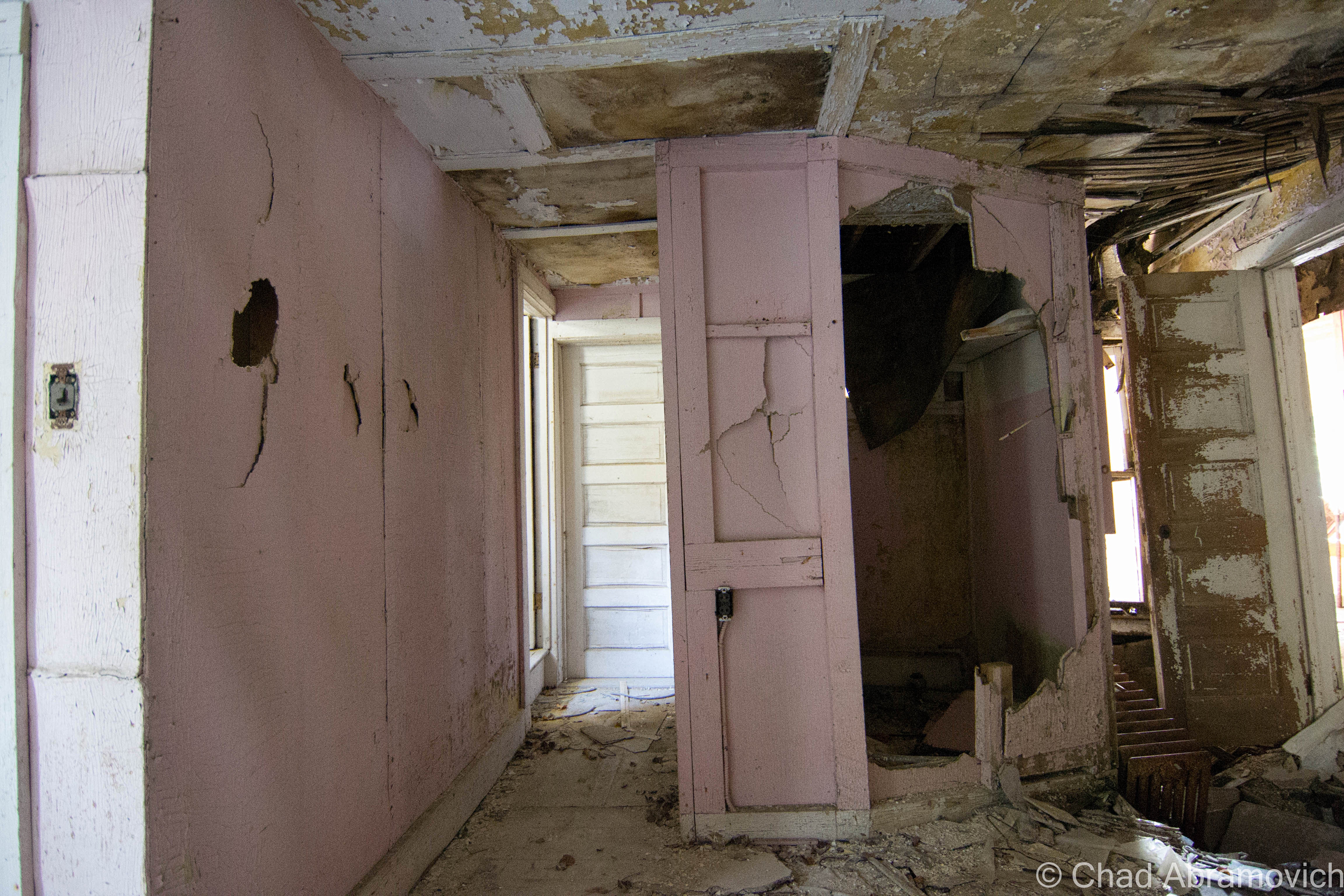
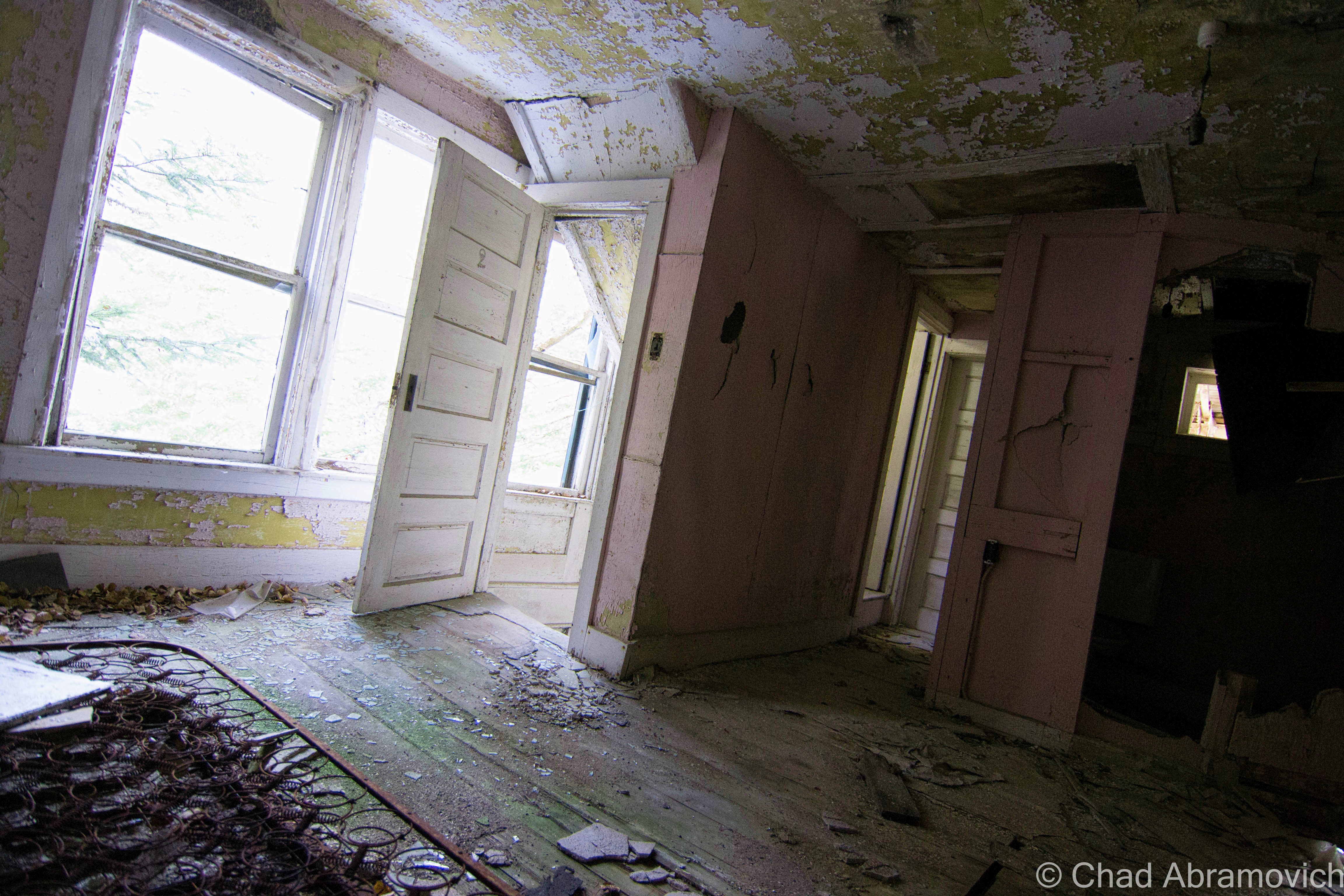
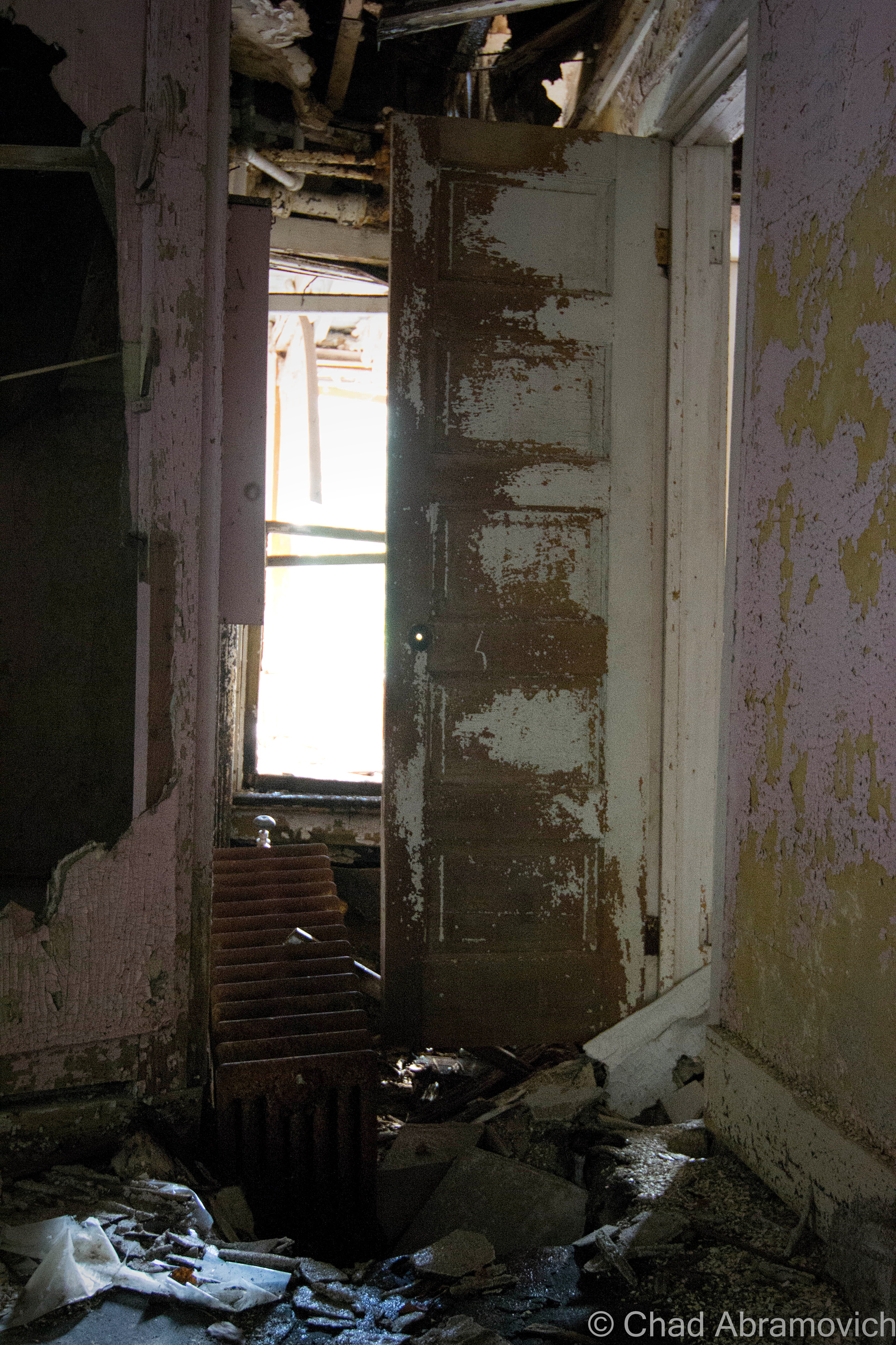
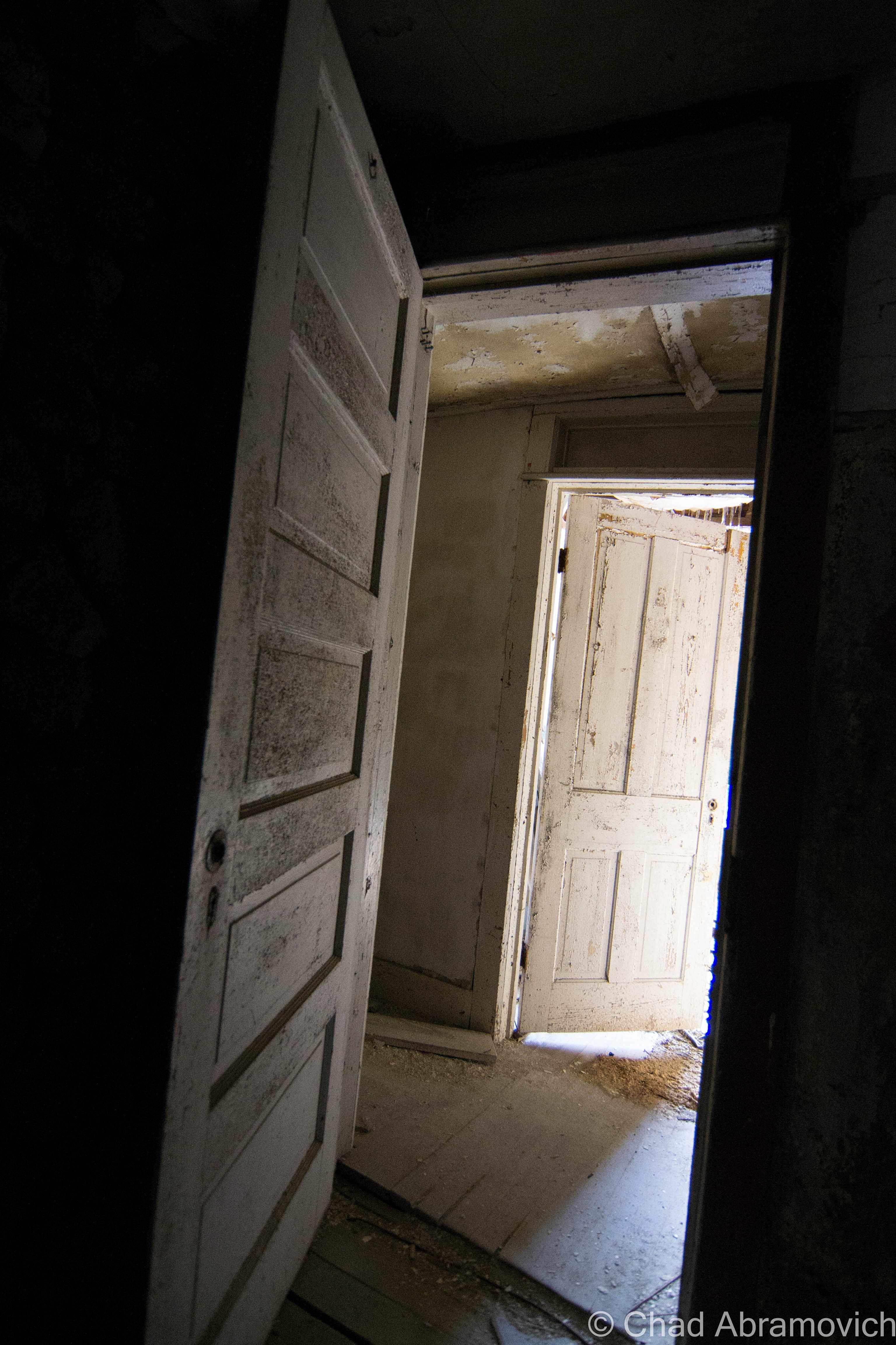
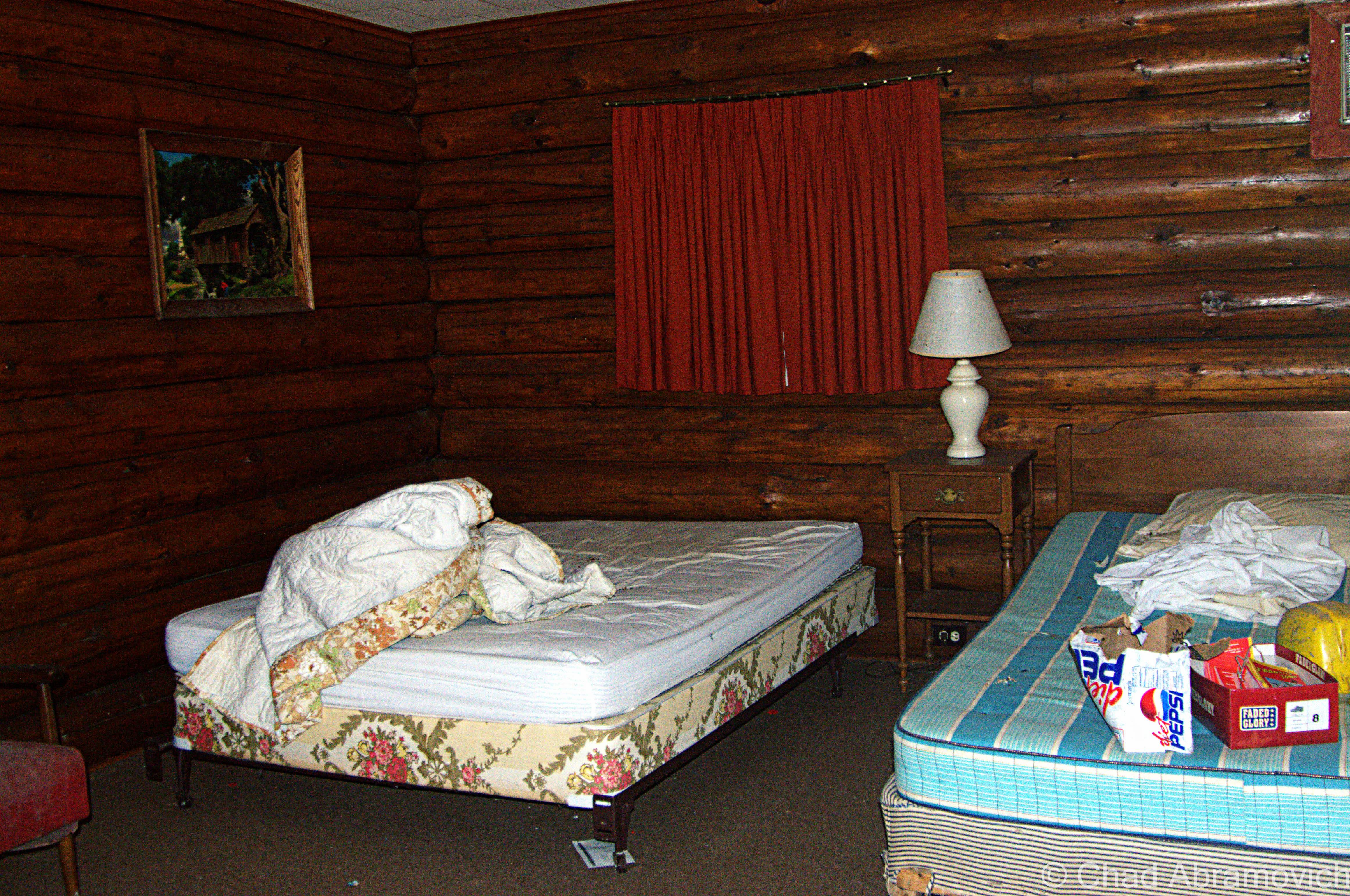
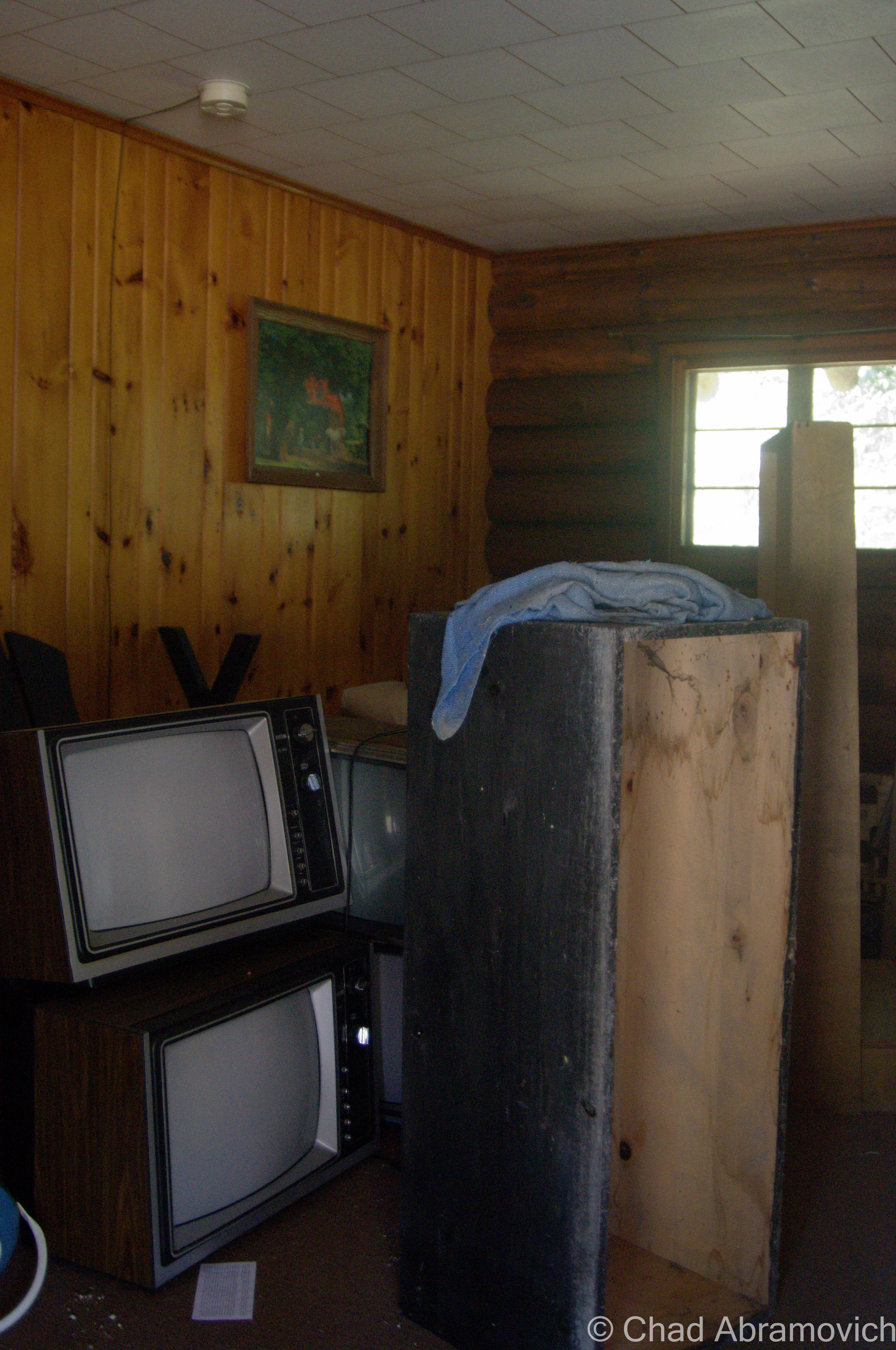
Today, awkward and fantastical ruins falling apart in silence underneath the Pines are all that remains of Frontier Town. A walk around the property reveals the tragic process of disintegration and entropy which is both sad and breathtaking to behold and makes me reflect on society’s impermanence.
I visited during the dark wintery cold of January, and returned during a far more pleasant 50 degree April Sunday, so my photos are a mixture of winter and early spring shots.
When I took my research to the internet, I found a cool Facebook page, Frontier Town Abandoned Theme Park Now And Then, with tons of great old photos to gaze at. It’s incredible what the transformative power of nature can do to a place in a short time.
I was really charmed by this place and its story. Researching it had a certain inspiring magic. I love how one guy who was a layman just decided to go for it, and managed to create something that’s had a humongous impact and subsequent ripple effects on the Adirondacks, and a generation of people who were coaxed by its remarkably creative atmosphere. It’s a genuine example of the American dream. Who knows, maybe Arthur’s story can help inspire future dreamers (or amusement park builders).
Since I’ve posted this – the New York Department of Environmental Conservation and the Adirondack Park Preserve have rehabbed Frontier Town into a really cool looking campground and equestrian center – and named it in the park’s honor. I’m a bit sad to see it go but was excited to hear that the property is now fun and beneficial to town of North Hudson.
Frontier Town in its Postcard Prime
via cardcow.comvia cardcow.comvia cardcow.comvia cardcow.comvia cardcow.com
Frontier Town, 2015
Joining me for my adventure was my friend Bill Alexander, creator of Vermonter.com, who filmed our walk around the grounds. Check out his write up and video below!
Return, Summer 2015
As much as I openly complain about Facebook, and how I find social media more unnourishing and exhausting for me, I have to admit that it’s also been a huge boon in terms of networking and keeping this blog’s momentum in a direction that’s not backwards. Making friends when your an adult is a hard gig. Thankfully, I was able to network with and befriend other explorers over Facebook who dwell all over the east coast. Eventually, we started to organize meet ups with willing participants. In June, 2015, I would meet two cars worth of previously virtual photographer and explorer friends, and Frontier Town was one of our stops on a full day excursion. But, a day of exploring before we arrived in North Hudson had drained my camera batteries, so I only was able to get a few pictures under the coolness of a soft summer evening.
—————————————————————————————————————————————–
To all of my amazing fans and supporters, I am truly grateful and humbled by all of the support and donations through out the years that have kept Obscure Vermont up and running.
As you all know I spend countless hours researching, writing, and traveling to produce and sustain this blog. Obscure Vermont is funded entirely on generous donations that you the wonderful viewers and supporters have made. Expenses range from internet fees to host the blog, to investing in research materials, to traveling expenses. Also, donations help keep me current with my photography gear, computer, and computer software so that I can deliver the best quality possible.
If you value, appreciate, and enjoy reading about my adventures please consider making a donation to my new Gofundme account or Paypal. Any donation would not only be greatly appreciated and help keep this blog going, it would also keep me doing what I love. Thank you!
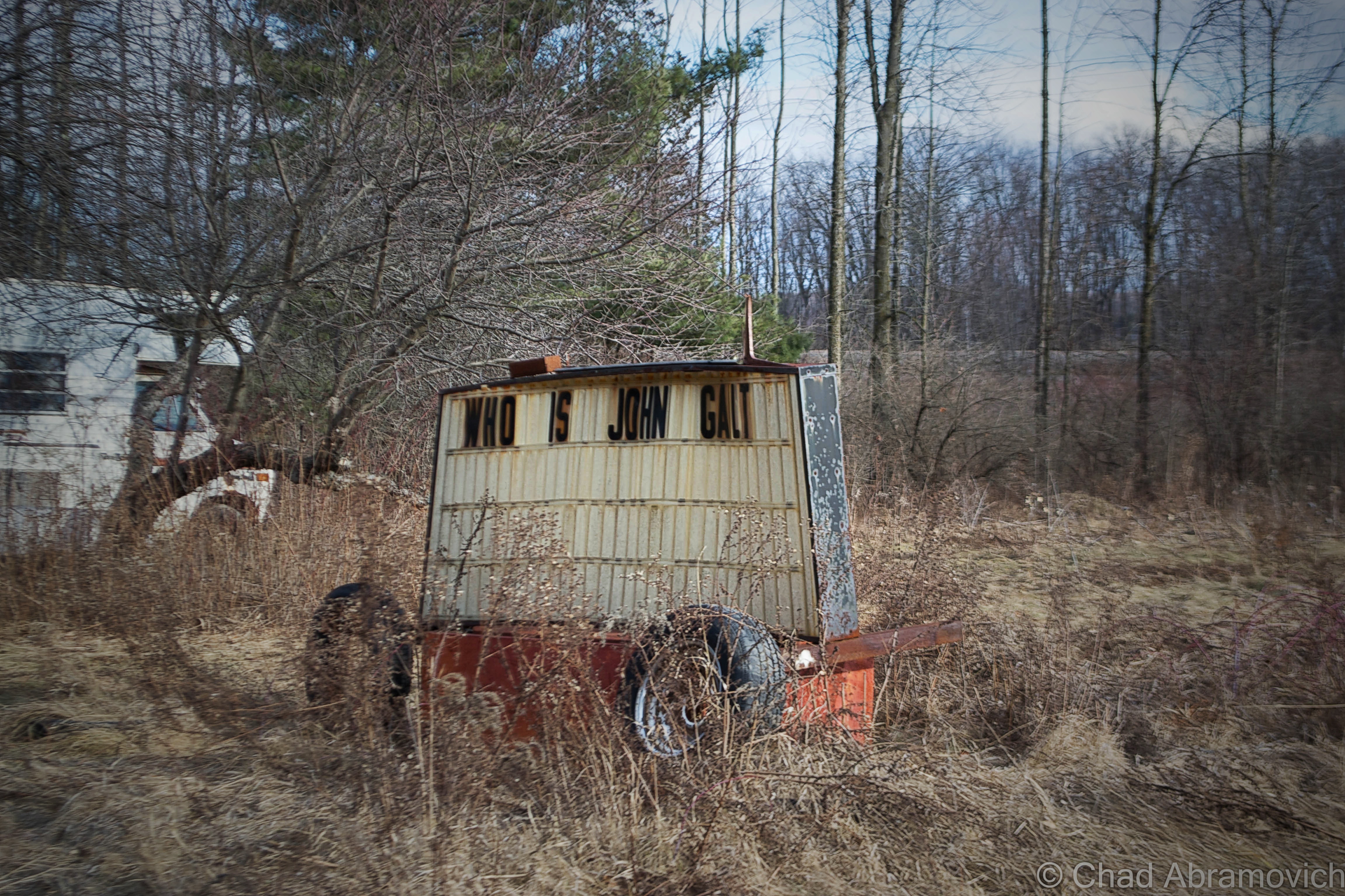
My travels to New York state often start with the same question; Who is John Galt? Usually, I cross into New York via the Crown Point Bridge over Lake Champlain, and I always find myself observing this busted sign on dysfunctional wheels with two cryptic messages arranged on both sides. I’ve found plenty of questions, but no answers.
Good friend, mentor and fellow explorer Dan Koopman of Environmental Imagery tells me that the sign used to have a smorgasbord of anti Obama hate messages on it’s dented sides, which I assume was the work of the mysterious and aforementioned John Galt, ruler of the titular Galt’s Gultch, which seems to be a collection of ramshackle campers alongside the railroad tracks. I recall him showing me the sign years ago, but it seems the sign has gotten a bit more enigmatic and stagnant since then. I always make a point to look whenever I pass, to see if there is a new message. So far, nothing.
After a little internet research, the search term John Galt introduced me not to a New Yorker, but to a character created by author Ayn Rand from her novel Atlas Shrugged, which I’ve never read. The gist is; Galt is a philosopher and inventor who believes in the power and glory of the human mind. Galt stood for the ideals of free thinking, individualism and Egalitarianism rather than a society embracing conformity oppressed underneath the government. That’s something to think about on your commute.
Though Dan was the one who introduced me to his stomping grounds of New York state years ago, on this trip, I would venture to the exotic world upstate with another friend and adventurer Eric Hodet of Cabbages and Kings. We made a quick pit stop for gas in Port Henry, a jaded village that climbs up some steep ledges above Bulwagga Bay.
Port Henry, Home of Champ
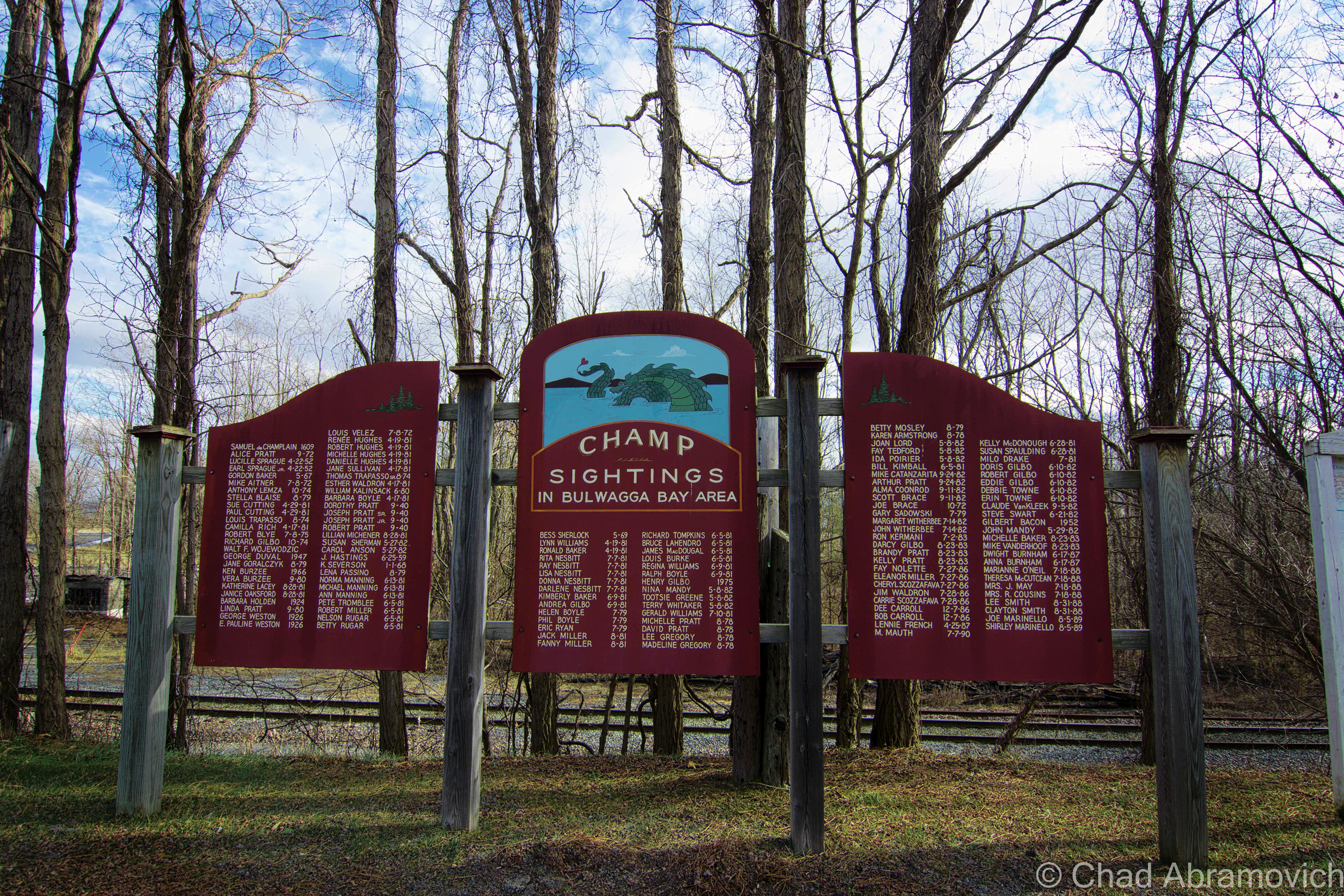
Though we once had a very short lived christening as the 6th great lake, Lake Champlain is still pretty great, being shared by 2 states and Quebec. It is also large enough to completely conceal an elusive unidentified swimming object of monstrous proportions. “Champ”, which I suppose isn’t the most creative name for a lake monster, is said to take on a Plesiosauric resemblance, and is most often depicted as your typical water dinosaur, with it’s defining humped back, small head, long neck and ending with a long tail.
Of all places that border Lake Champlain, Port Henry proudly claims itself to be the home of Champ, the lake’s renown lake monster, and they take that distinction pretty seriously. So much so in fact that the first Saturday of August is designated as Champ Day, which brings a street fair and entertainers, with the centerpiece being, a Champ float.
What’s made the legend of Champ so important, apart from the various marketing campaigns, bumper stickers and business names, is the numerous eyewitness sightings, consisting of a rather long tradition of reports. French explorer Samuel De Champlain’s journals told of a sighting of some strange beast near Isle La Motte when he first traveled down the Richelieu River into the lake. But his records were lost to knowledge until the 1800s, when the first verifiable report of a Champ sighting came into public consciousness. It captivated the public so much that P.T. Barnum once offered a reward for its capture, dead or alive. More interestingly, in the 1970s, Champlain’s records were once again studied, and it was discovered that the intrepid explorer’s account may have been mistranslated, making his sighting officially unofficial. Instead, it was most likely that Champlain saw a Garfish, which still live in the lake today.
But what really propelled allegations into fixation was in 1977, when Sandra Mansi captured a photograph of what she claims is Champ. The photograph in question shows something that vaguely takes on Champ’s described appearance rising out of the waters of the lake – but a sense of scale is hard to determine here. Was it actually Champ? A giant Sturgeon? Or maybe, just a piece of driftwood?
Regardless of Champ’s existence, countless sightings have been reported over the years, and people hold firm to their stories. My grandfather even claims that he saw it – as well as quite a few other people, whose names have been memorialized on a wooden memorial south of the Port Henry on Route 22. The sightings unsurprisingly start with Samuel De Champlain in 1609, and escalate into the 21st century. Even local celebrities like WCAX’s Gary Sadowsky made it on the list. The dates stop at 1989, which raises a few questions. Have there been any reported sightings in Bulgwagga Bay since then? Are any plans to extend the list?
I’ve sort of made it a point not to write about Champ in this blog, because admittedly, I’m just not all that interested in the Champ hype. But it’s almost impossible to not pick up some information about it along the line, and I found myself slowly giving in, because some of it is actually pretty interesting. This is probably my favorite; Documented sightings of Champ actually predate those of the Loch Ness Monster by fifty years! I find this amusing because most cryptozoology enthusiasts consider Champ to be “America’s Loch Ness Monster”, but maybe it should be the other way around?
To be fair, Lake Champlain is a large lake, with depths said to be beyond 400 feet in some places near the Charlotte-Essex ferry crossing. With many areas uncharted, I suppose it’s possible that something could live harmoniously in the lake undetected. That, and scientists did discover a sonar sound emanating from the depths of the lake that was so unique, they named it after the lake monster (they did, however, claim that the odd sound did not belong to Champ)
So, why did Port Henry land the distinction of being the home of Champ? The first modern day sighting of Champ was reported here in 1819, by a “Captain Crum” in Bulwagga Bay. His eyewitness report illustrated a rather graphic spectacle of a black monster resembling a seahorse with three teeth, large eyes, a white star on its forehead and a red band around its neck. So I guess that’s as good of a reason as any.
Ironville, Birthplace of the Electric Age!
When traveling to unfamiliar territory, one of the first impressions of a community you take in is their welcome sign. The small town of Ironville’s sign stood out from the others I’ve noticed (apart from Port Henry’s, of course). The sign had a pretty groundbreaking claim written along the bottom in capital letters; “Birthplace of the Electric Age”. That left me and my friend scratching our heads a little. But a little après-adventure research was able to put the pieces together for me.
The hills around Ironville were known for their rich iron ore deposits, and mining activities brought great prosperity to the rural region. Curious about the natural magnetic rocks in the area, Joseph Henry, an early pioneer in electricity and professor of mathematics and natural philosophy in Albany, was interested in the phenomenon of magnets and how they worked. He traveled to the Penfield Iron Works in town where he obtained some high quality Iron to study. His goal was to attempt to create magnets of his own. At the time, magnets worked by wrapping bare wire around an Iron core, creating magnetic fields. But they were short lived, as the fields always rapidly collapsed into the iron core. Henry then got an idea; why not insulate the wires?
He attached his new prototype to a battery, the only known producer of electricity at the time, and created the world’s first electromagnet – and the key component to making all-electric power possible today. Eventually, Ironville became the first town to use electricity for commercial use. It was this breakthrough that would inspire Vermonter Thomas Davenport to invent the electric motor, and eventually, a world ran by electricity would become the norm.
Aiden Lair
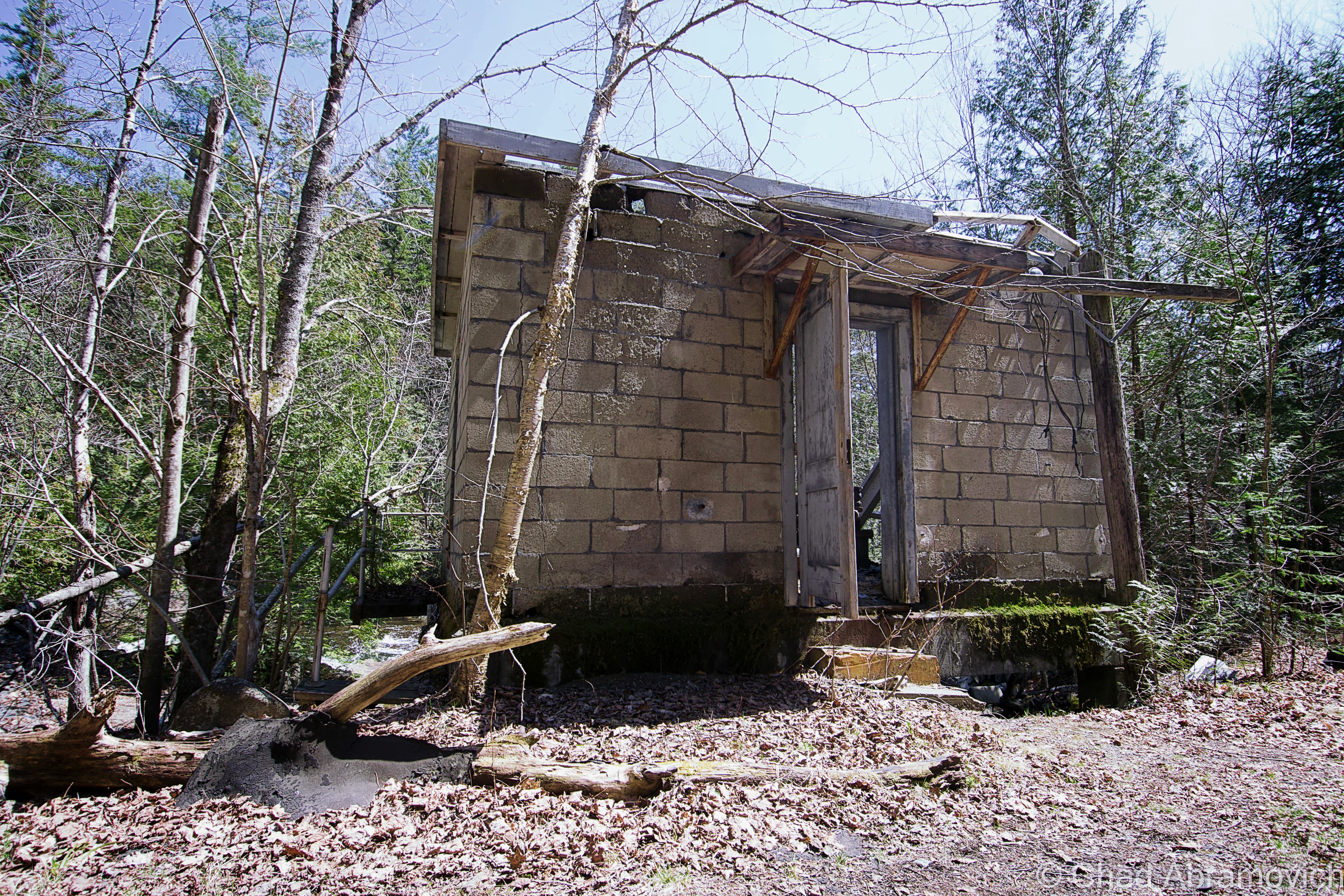
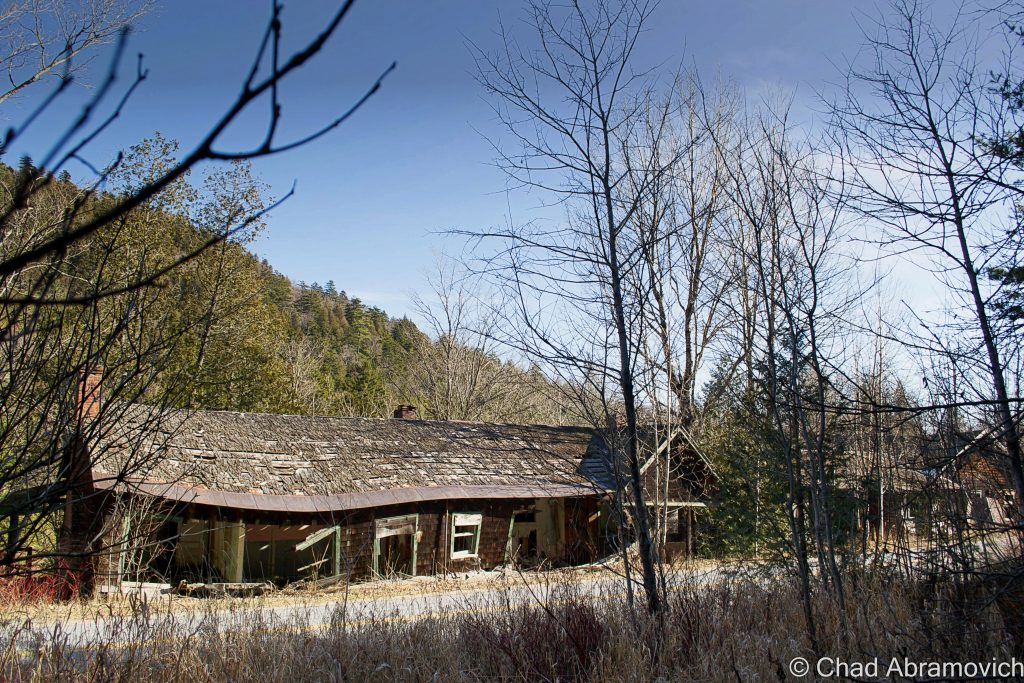
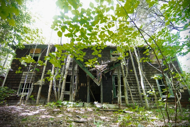
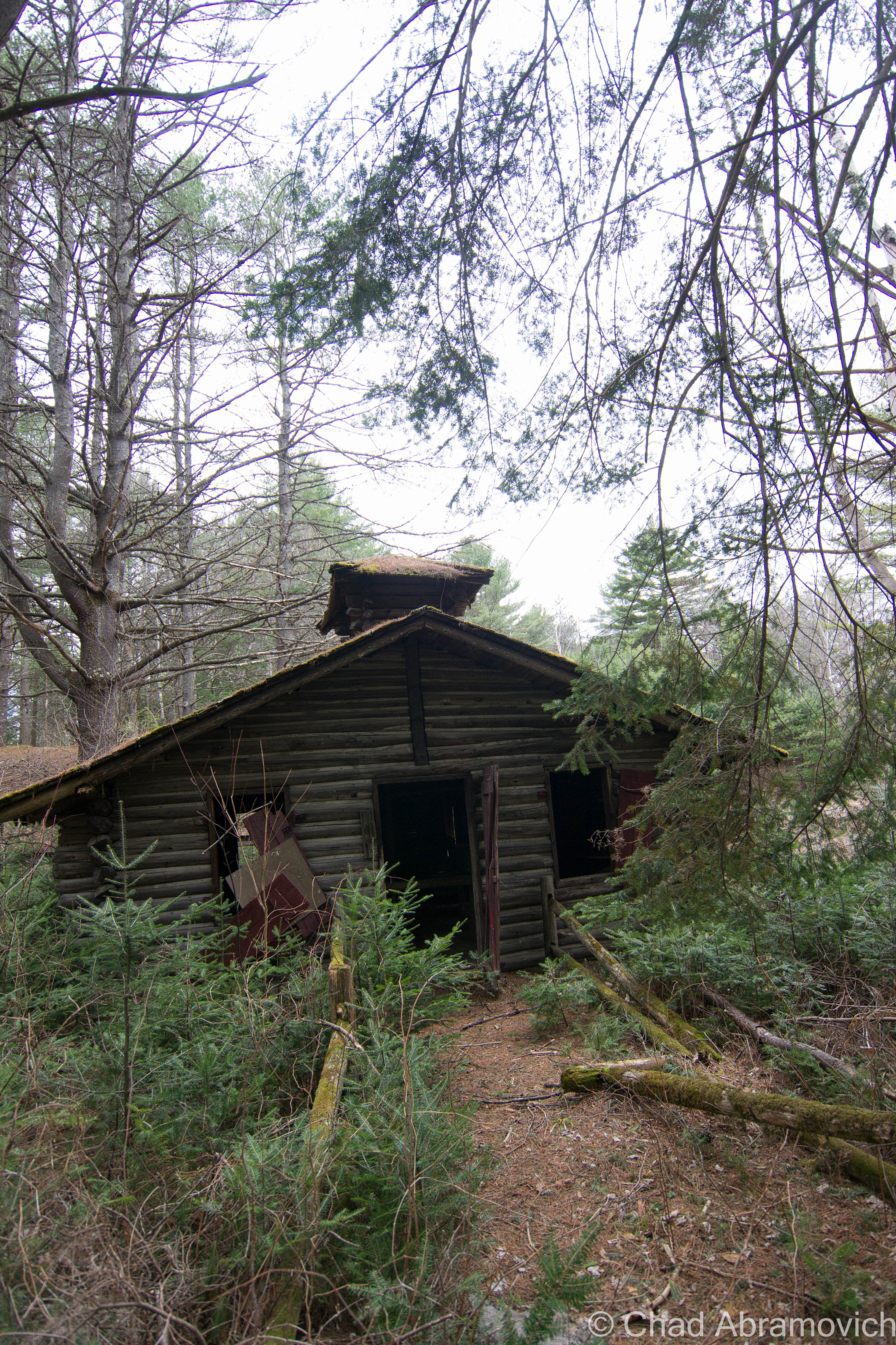
The real reason for visiting upstate New York was to visit Aiden Lair, a sizely rotting wooden building, deep within the forests of the Adirondacks.
The history of Aiden Lair begins around 1850, with the construction of a crude log cabin to house travelers and hunters going into the interior of the Adirondacks, at a time where the rugged region was only beginning to be more accessible. The cabin eventually burned down, and in 1893, the first Aiden Lair lodge was built, a grand Adirondack hunting lodge ran by an Irishman named Michael Cronin.
The original Aiden Lair Lodge, early 1900s. (via town of Minerva website)
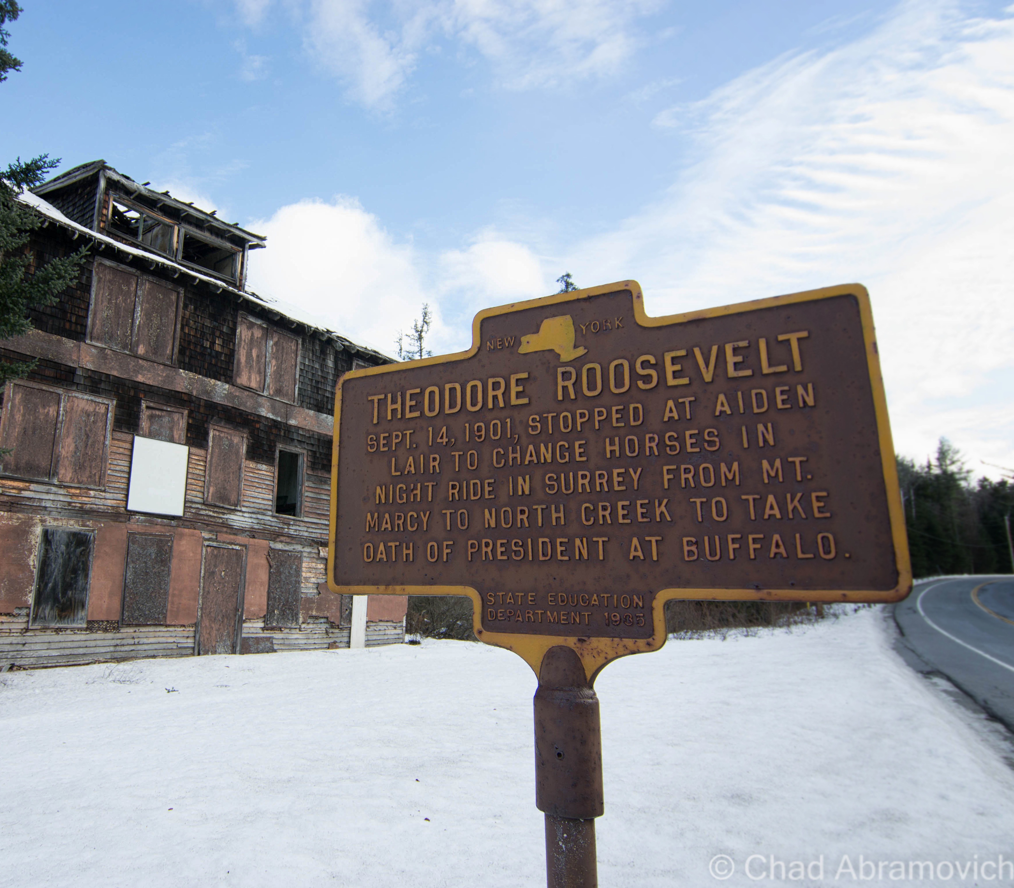
But the lodge truly gained notoriety for being a vital part of the so called Midnight Ride of Theodore Roosevelt in 1901, which would be the first stop of a remarkable presidency.
Being president of the United States can have contingent natures with the responsibility, and I don’t think there are many American presidents that have been more fit for the role than Theodore Roosevelt.
On Sept. 6, 1901, President William McKinley was in Buffalo attending the Pan American Exposition when he was shot by Leon Czolgosz, a hot tempered anarchist. At the time, vice president Theodore Roosevelt was a guest of the Vermont Fish and Game Club in Isle La Motte. When word reached Roosevelt on the attempt on the president’s life, he immediately left and traveled to Buffalo.
But McKinley’s surgeon insisted he was fine, and that he would surely recover. Roosevelt, no longer feeling needed, decided to travel to join his family who were vacationing at the Tahawus Hunting Club. He had campaigned laboriously during the election of 1900 – an effort which involved much traveling and speech giving. Some rest and relaxation in the Adirondacks sounded damn good.
In Tahawus, Roosevelt decided that a great way to kick off his vacation would be to have an afternoon hike up Mount Marcy, the tallest elevation in the state. He sought out some guides and set out up the slopes. While relaxing near Lake Tear-of-the-Clouds, the source of the Hudson River, a foot messenger named Harrison Hall found him and gave him word that McKinley’s condition had worsened, and it didn’t look good.
According to local lore, Roosevelt’s reaction after reading the message was to say “Gentlemen, I must return to the clubhouse at once,” before calmly finishing his lunch, and then making the 12 mile hike back to Tahawus in 3 hours.
Roosevelt was reluctant to go back to Buffalo unless he was truly needed. He was just there, and that would be a long trip to make for a false alarm. But soon, another telegram came with news came that president McKinley was dying. Roosevelt set out for Buffalo immediately, but first, he had to get to the nearest train station which was 35 miles away at North Creek. That would be an arduous journey on muddy rut choked roads in the middle of the night, through vast mountainous wilds, a journey that would take at least 7 hours to complete today. The 35 mile stretch would have to be completed on horseback, with a stop somewhere in between to switch the exhausted horse for a fresh one. He departed Tahawus and made the grueling journey to Aiden Lair Lodge in Minerva, where he would switch horses.
A team of wagon drivers were organized, and would switch off driving Roosevelt at different legs of the trip, until they made it to the train station. David Hunter, the superintendent of the Tahawus Club, drove the first leg, a 10-mile stretch from the Tahawus Club to the Tahawus post office. The first stretch took two hours to complete because the road was practically washed out due to rainy conditions. From there, he would swap drivers again until he would get to Aiden Lair Lodge in Minerva.
By the time he got to Aiden Lair around 3:30 AM, he was already president. McKinley had died at 2:15 AM, while Roosevelt was still rushing through dark wilderness and rough roads. Though word had reached Aiden Lair, Michael Cronin decided not to tell Roosevelt. The staff knew he was dealing with great stress, and tried to urge him to rest there for the remainder of the night, and leave a day break. But Roosevelt was having none of it, and hitched up his team. Cronin drove him the remaining 16 miles, partially in an altruistic gesture, but mostly because if anything were to happen to Roosevelt en route, he was threatened that he would be held accountable. The wagon barreled and slid down slippery and sinuous mountain roads, with Roosevelt himself holding the lantern in front of the wagon so they could see where there were going. They made the journey in an hour and 41 minutes.
By the time they arrived, the news had been broken. A telegram awaited him with the news of McKinley’s death at the train station. Roosevelt boarded the train en route to Buffalo and his oath of office. Apparently, Roosevelt’s final leg of his ride achieved so much fame that other drivers had attempted to make the same route and beat the time, but no one has been able to succeed. As far as I know.
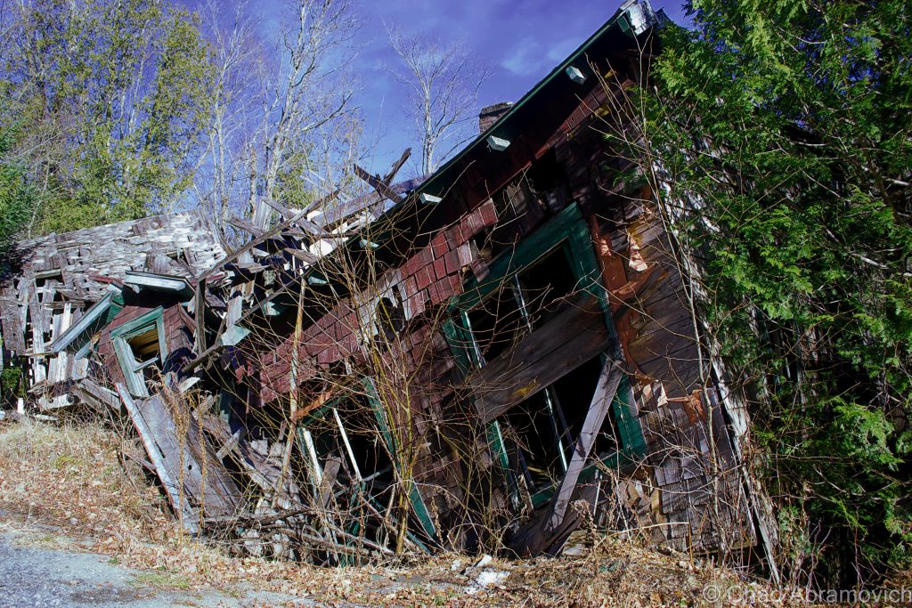
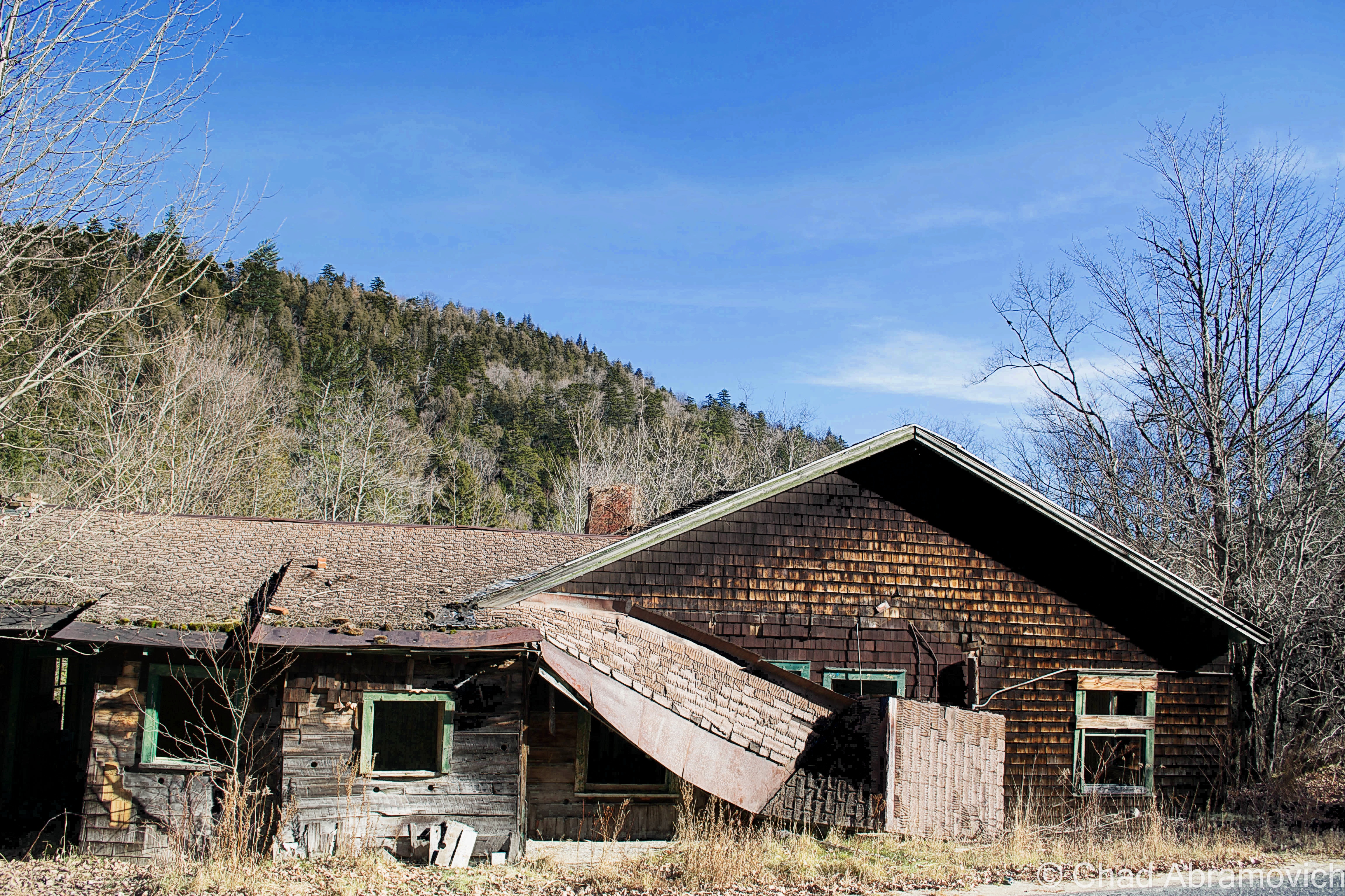
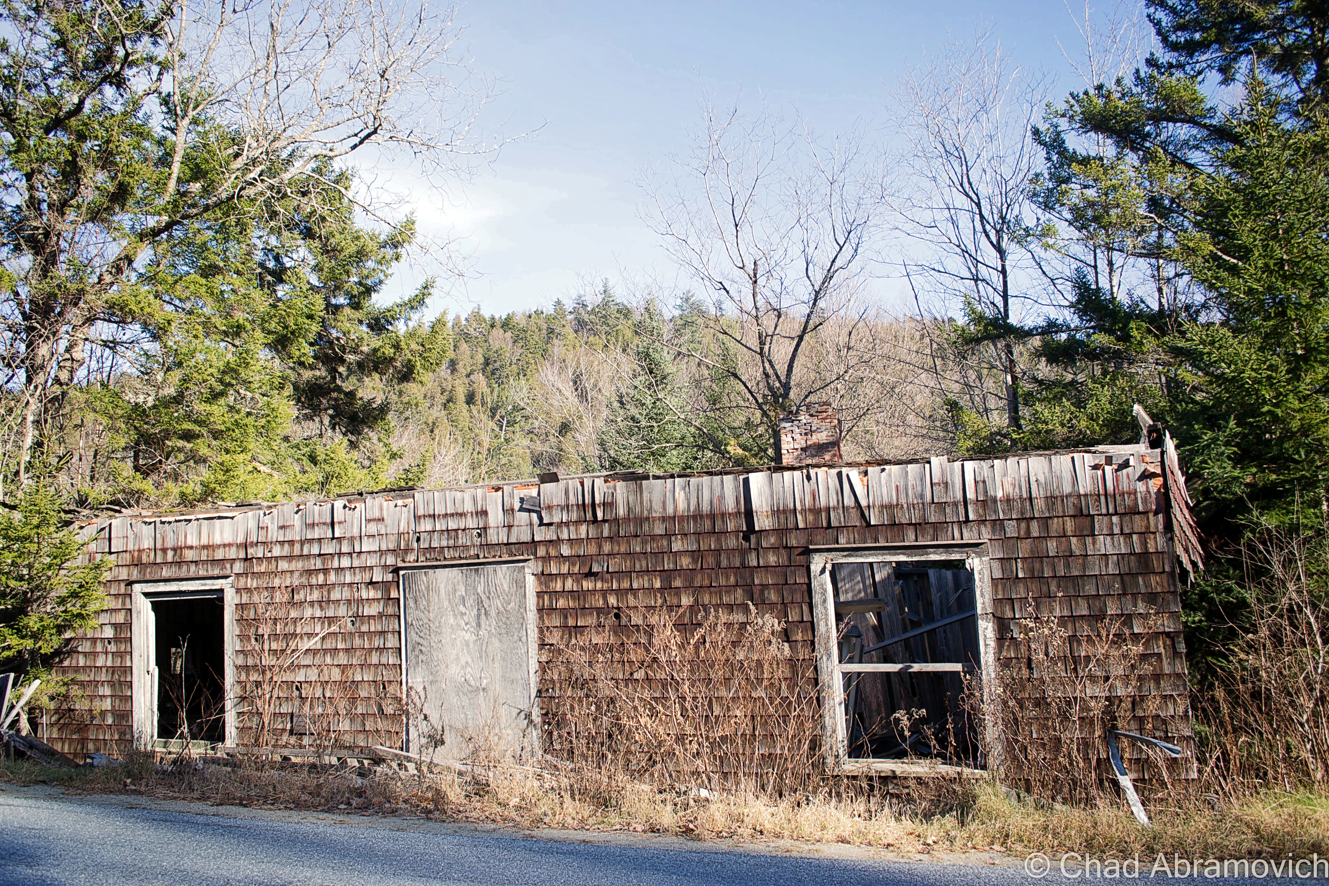
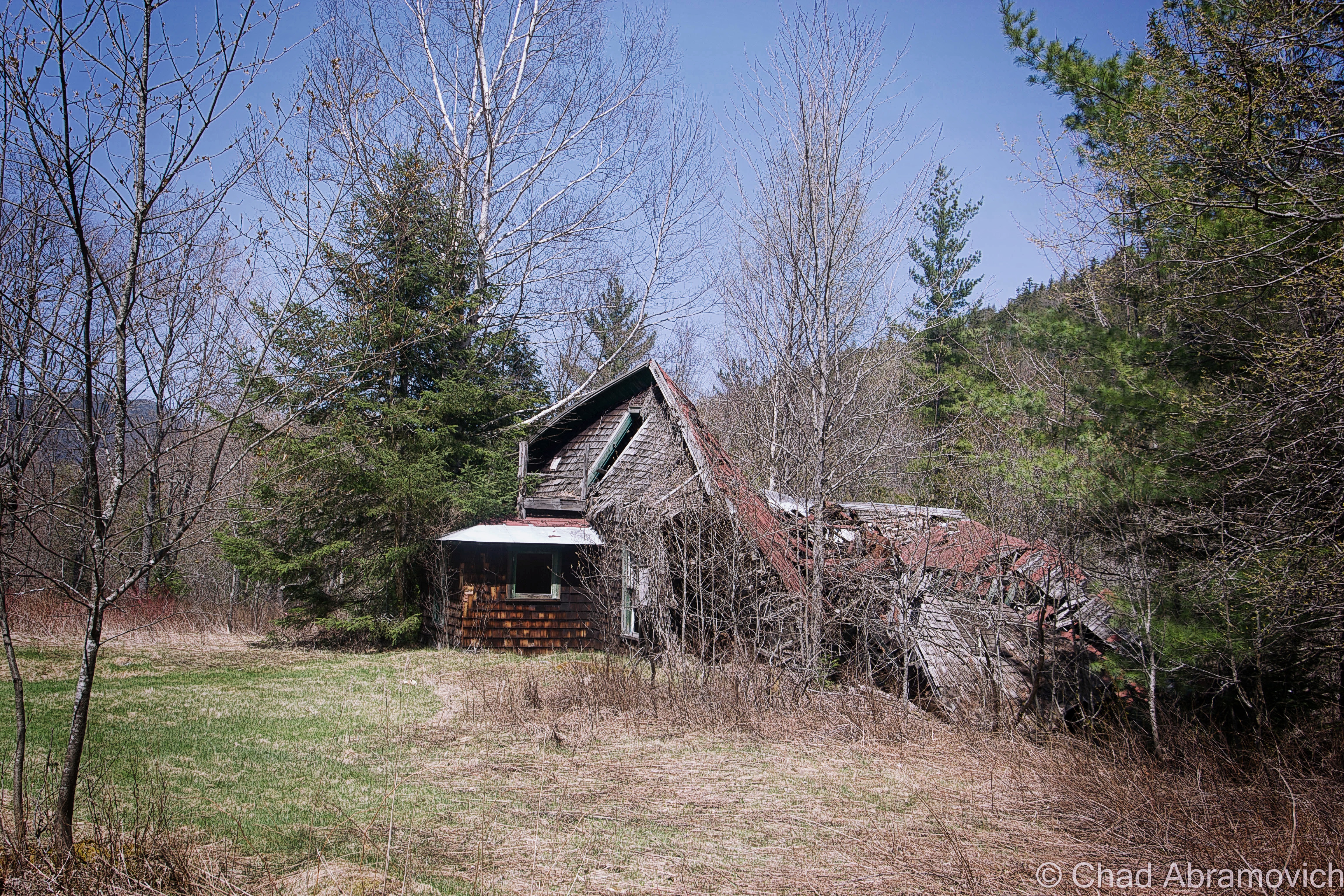
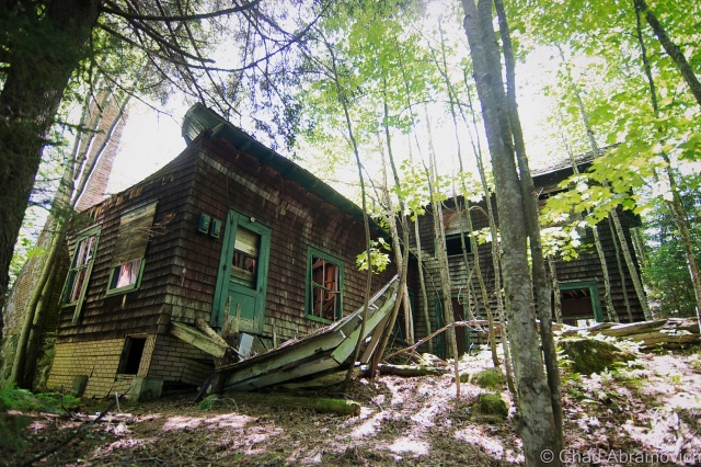
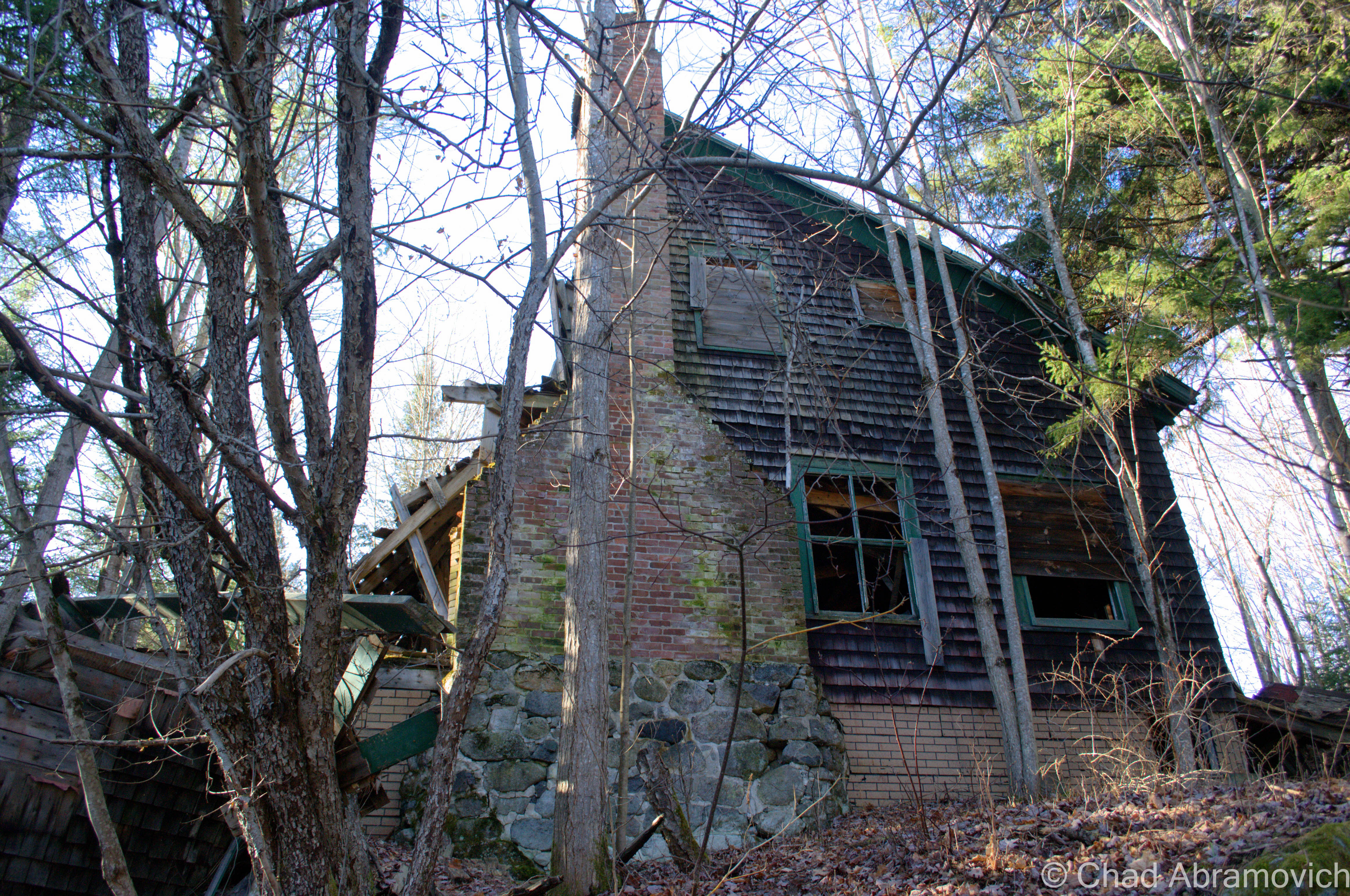
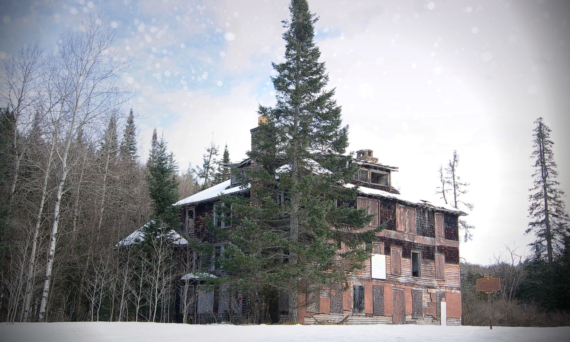
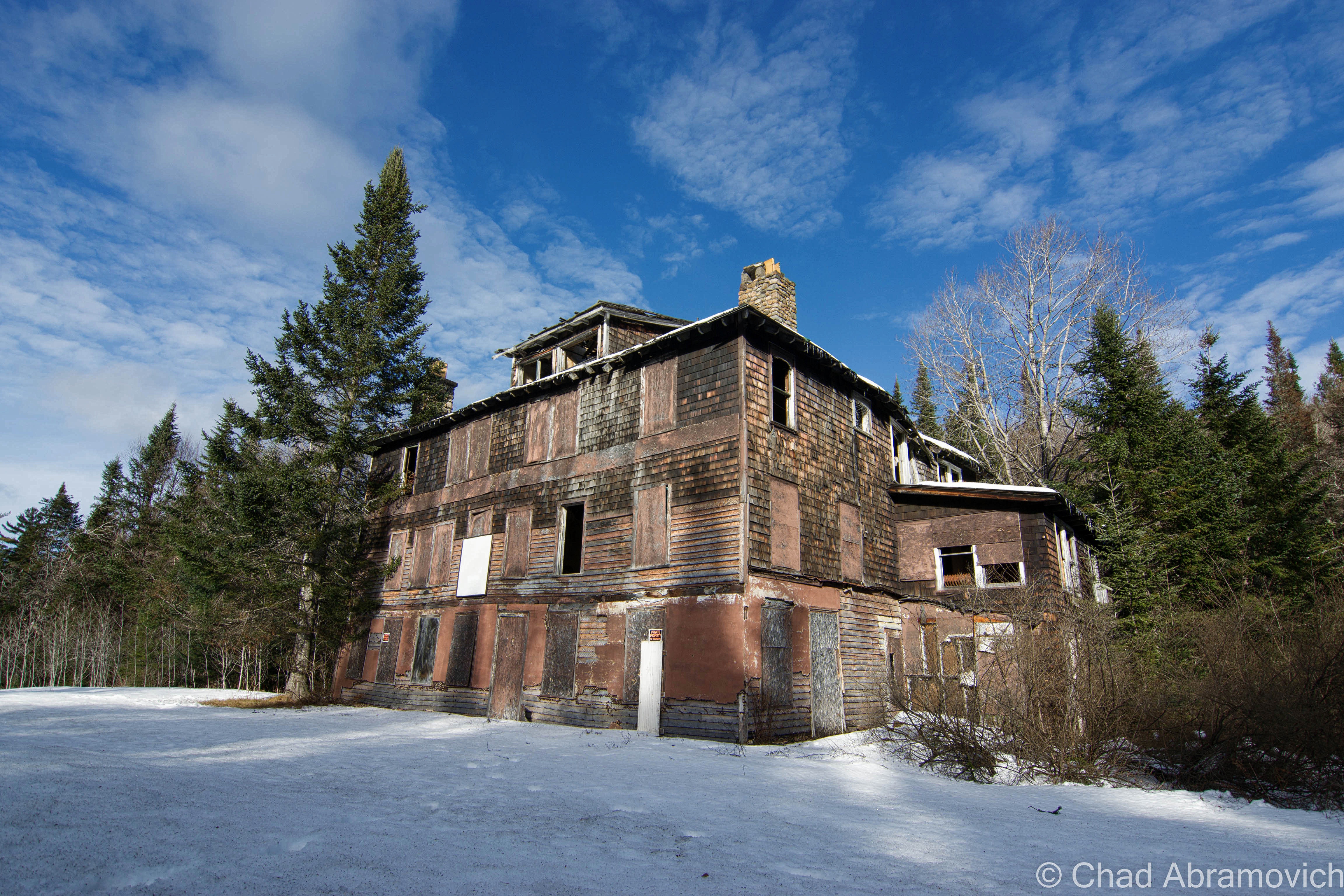
But, there is a little deception here. Though it makes a good story, the ramshackle building that skulks behind the the state historical marker on the side of the road is actually not the Aiden Lair that Roosevelt stopped at. The first hotel burned down in 1914, and a new 20 bedroom hotel was built shortly after, the 16,000 square foot decaying wooden structure you see today.
Though Mr. Cronin seemed to play an important part in the earliest hours of Roosevelt’s new found presidency, cosmic relief would pay a visit to the Irishman. Not long after the midnight ride, A New York Tribune article from April 1914 ran a headline that announced: “Roosevelt Guide Crazy.” Michael Cronin was hospitalized for mental health reasons. The lodge burned a month later, and was rebuilt by his family without his help. He died shortly after.
The hotel continued to serve travelers to the Adirondacks from hunters, outdoor enthusiasts and as the times changed, skiers and snowboarders heading to Gore Mountain, until the 1960s, when Adirondack hunting lodges began to go out of style and Aiden Lair closed for good. According to a segment of Adirondack Attic on North Country Public Radio – a gentleman from Albany bought the property a few years ago, with the intentions of restoring and reopening it, to continue it’s storied legacy. But the hurtles of renovations and reaching out to historic preservation proved to be too much, and it has since faced demolition by neglect – rotting in a state of limbo.
The current Aiden Lair LodgeTopographical map of Minerva, NY circa 1901. Aiden Lair was prominent enough to be plotted as a standout place on the map (upper right hand corner)
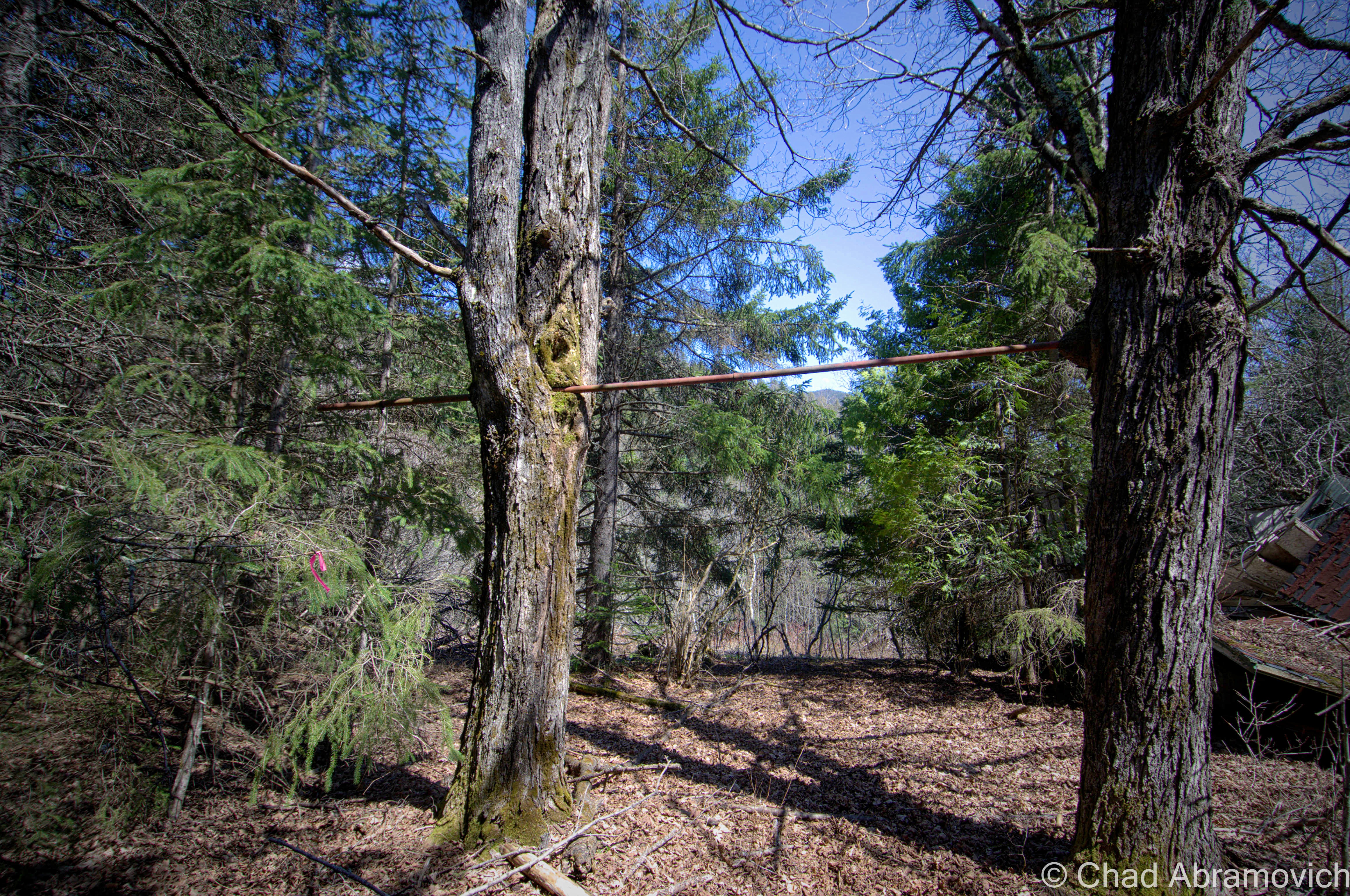
I drank copious amounts of Stewart’s Shop coffee before the long drive up to Aiden Lair, fighting the urge to pass out in the car. Long drives with the heat on and a prior week of insomnia tend to do that to me. It was much colder in Minerva. The temperature had plummeted to 11 degrees somewhere along the ride from Schroon Lake, and there was at least a foot of snow in the high peaks. Immediately after exiting the truck, my hands and face stung painfully, and I found myself not being able to control my shivering. But we didn’t travel 2 hours just to turn around, so onward we trudged.
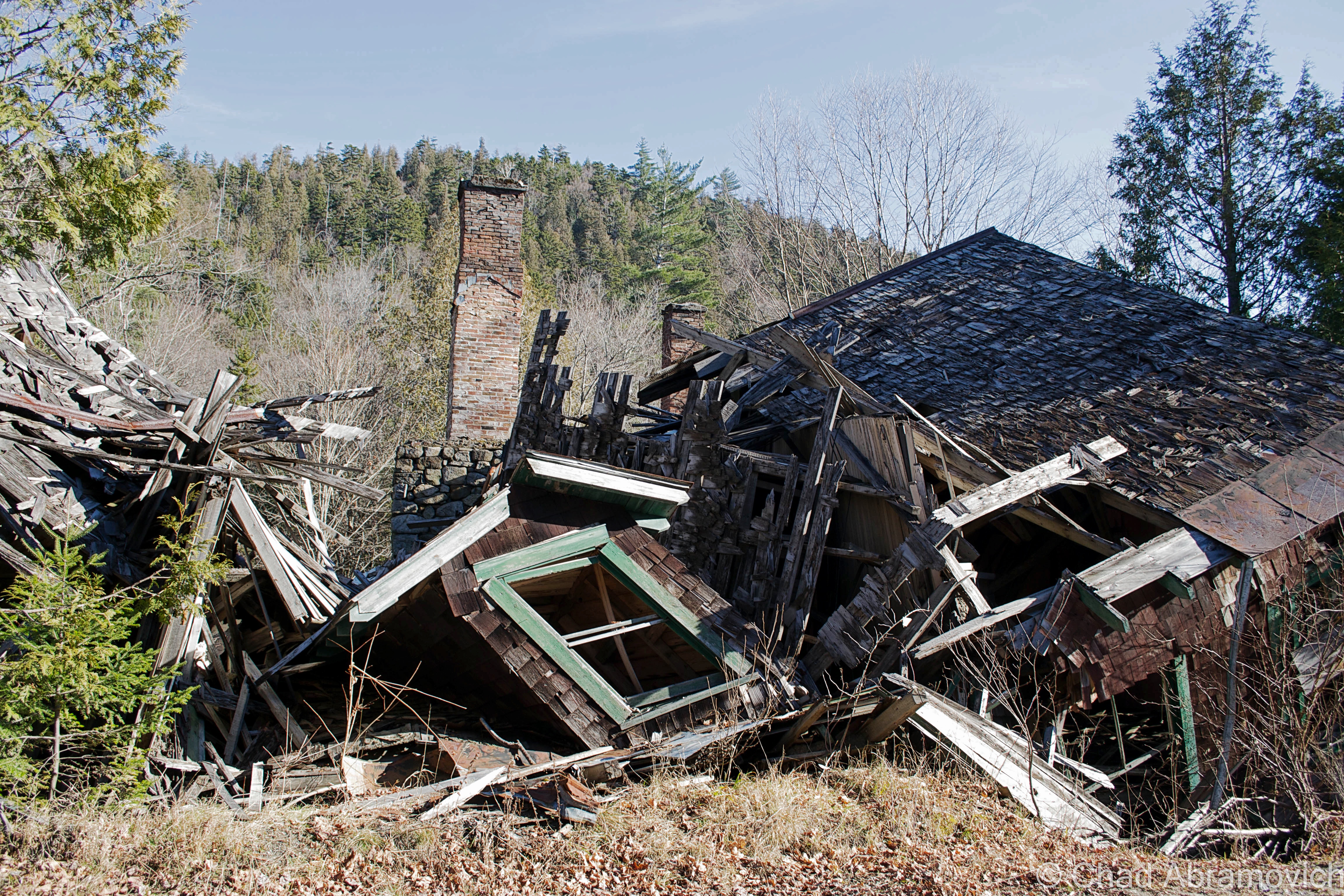
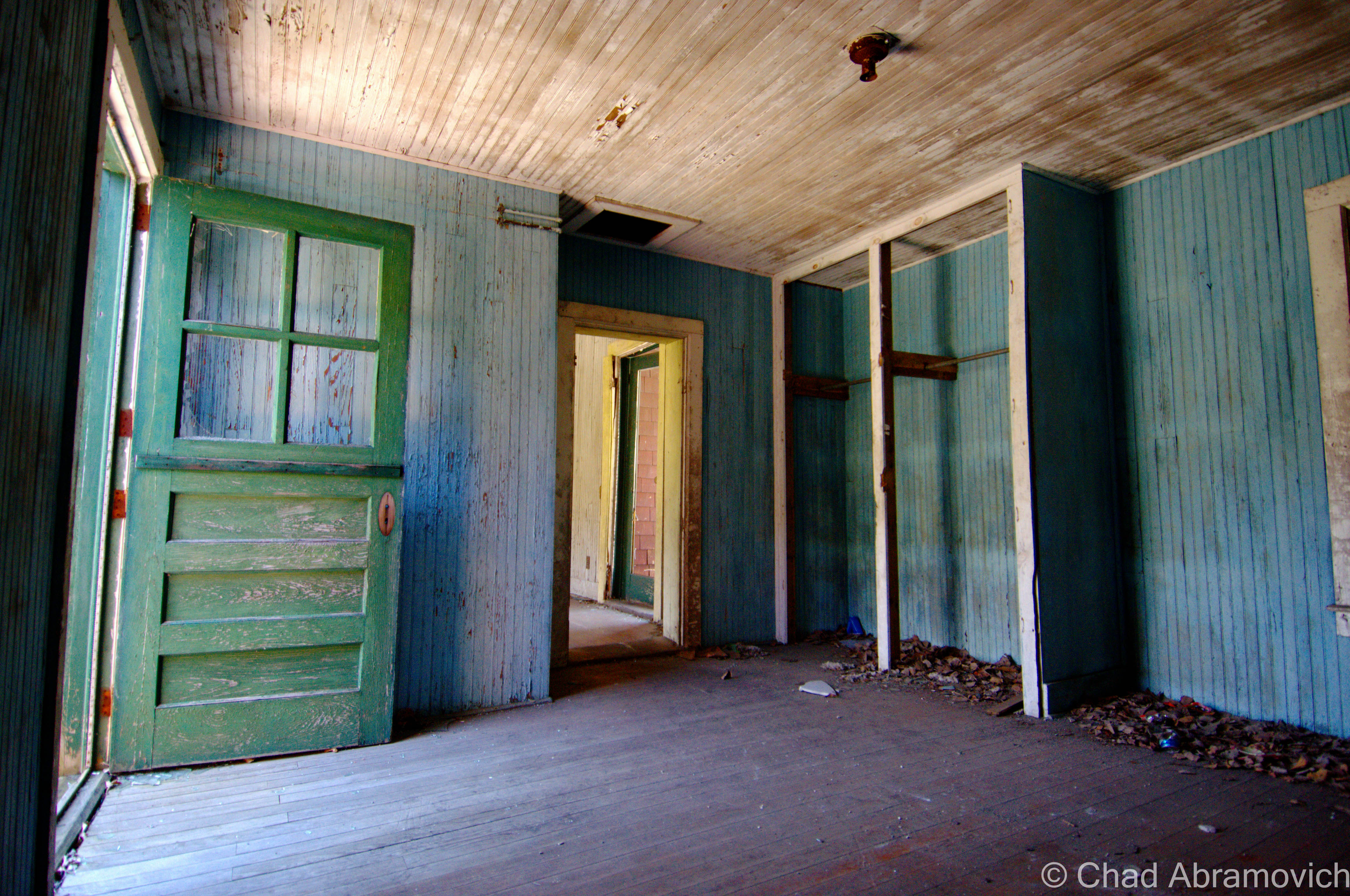
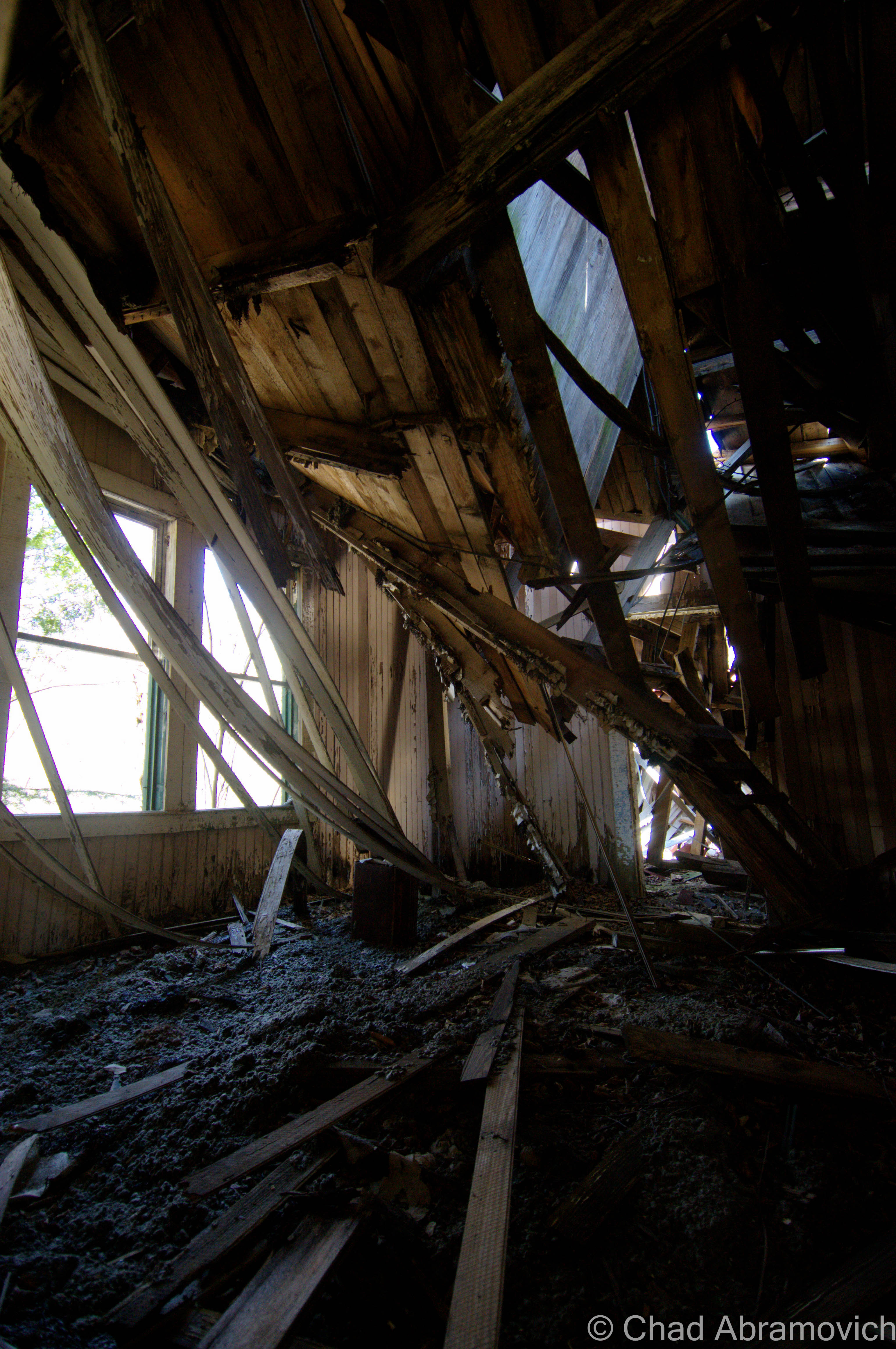
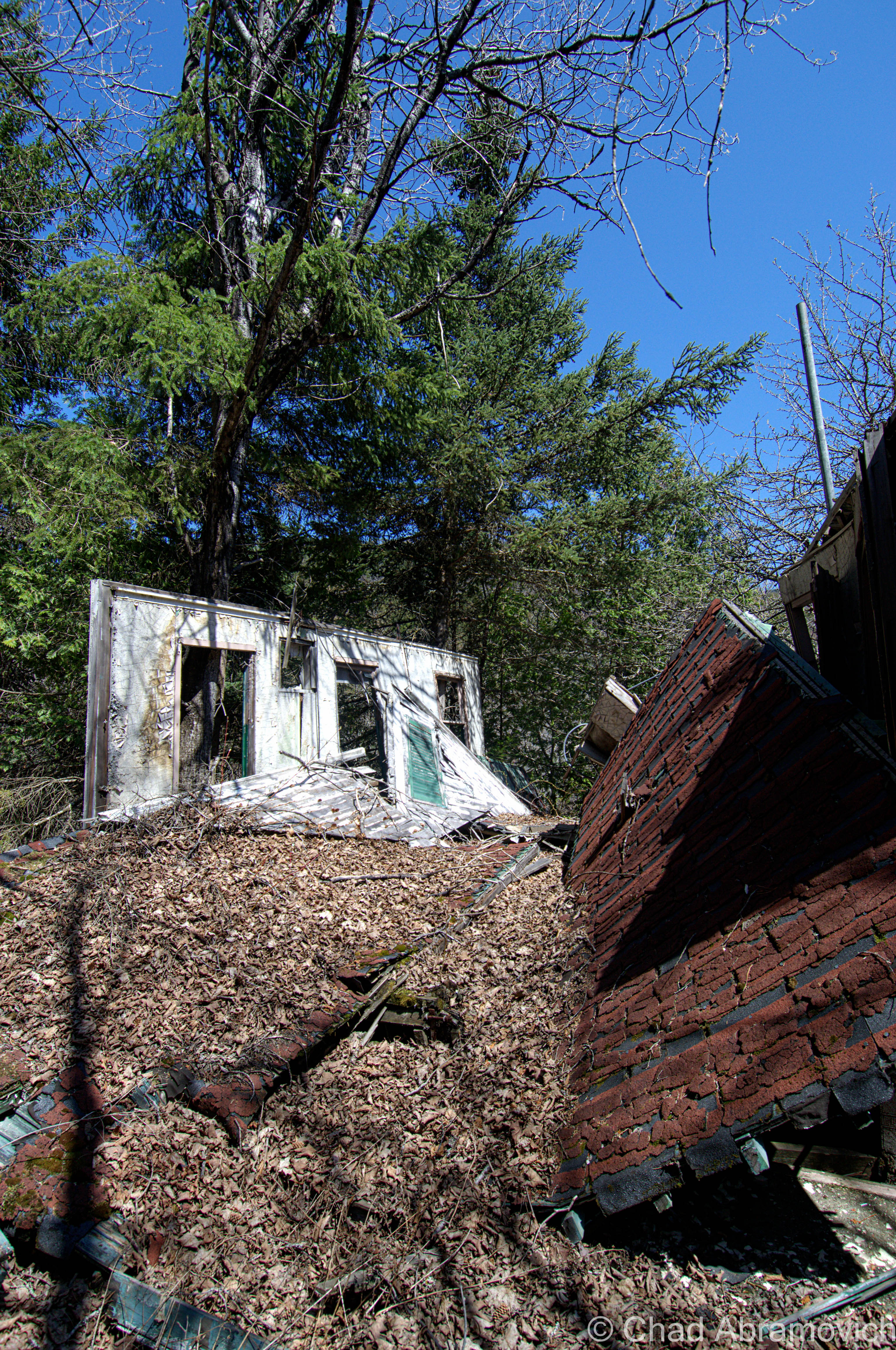
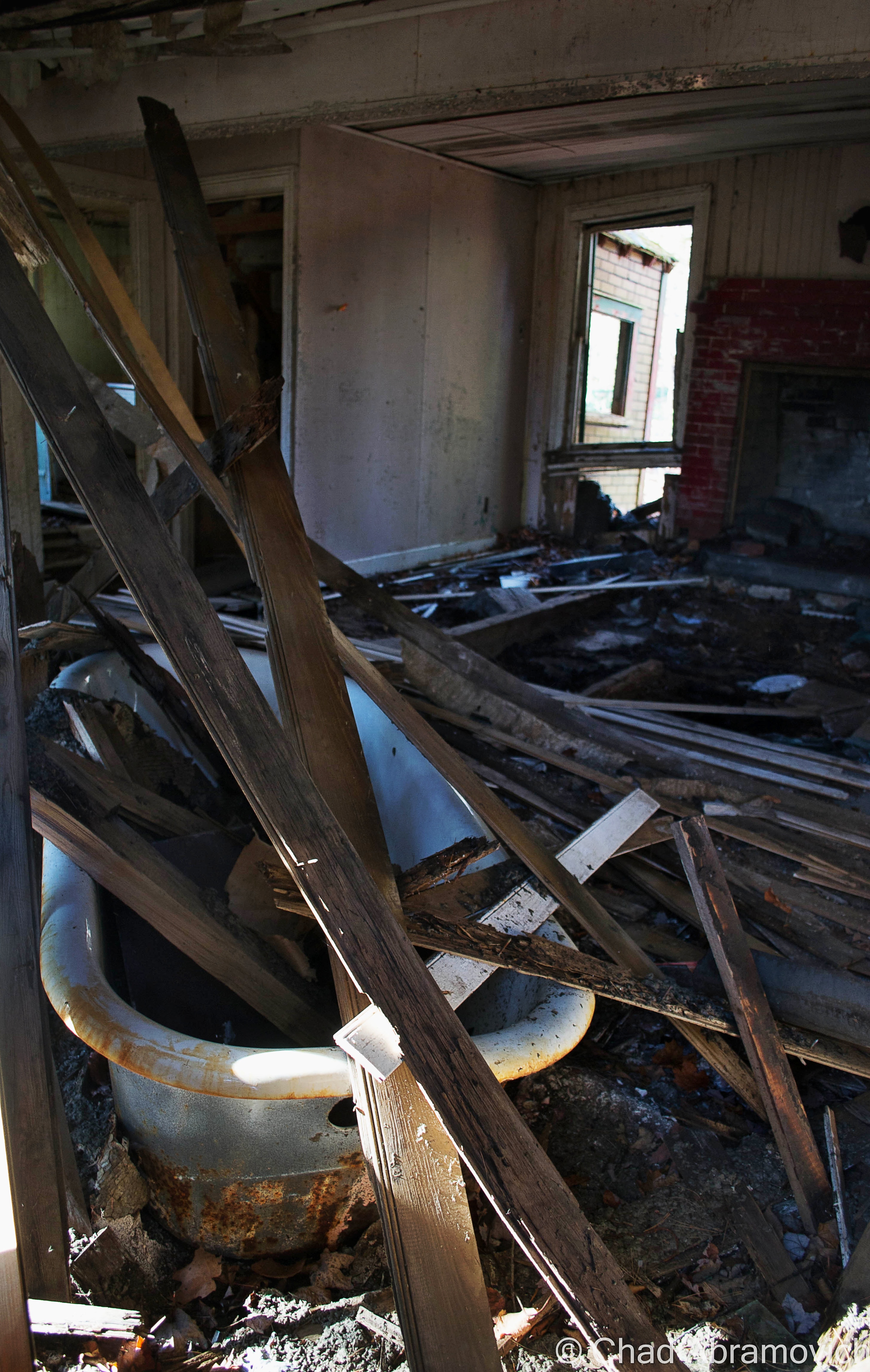
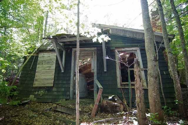
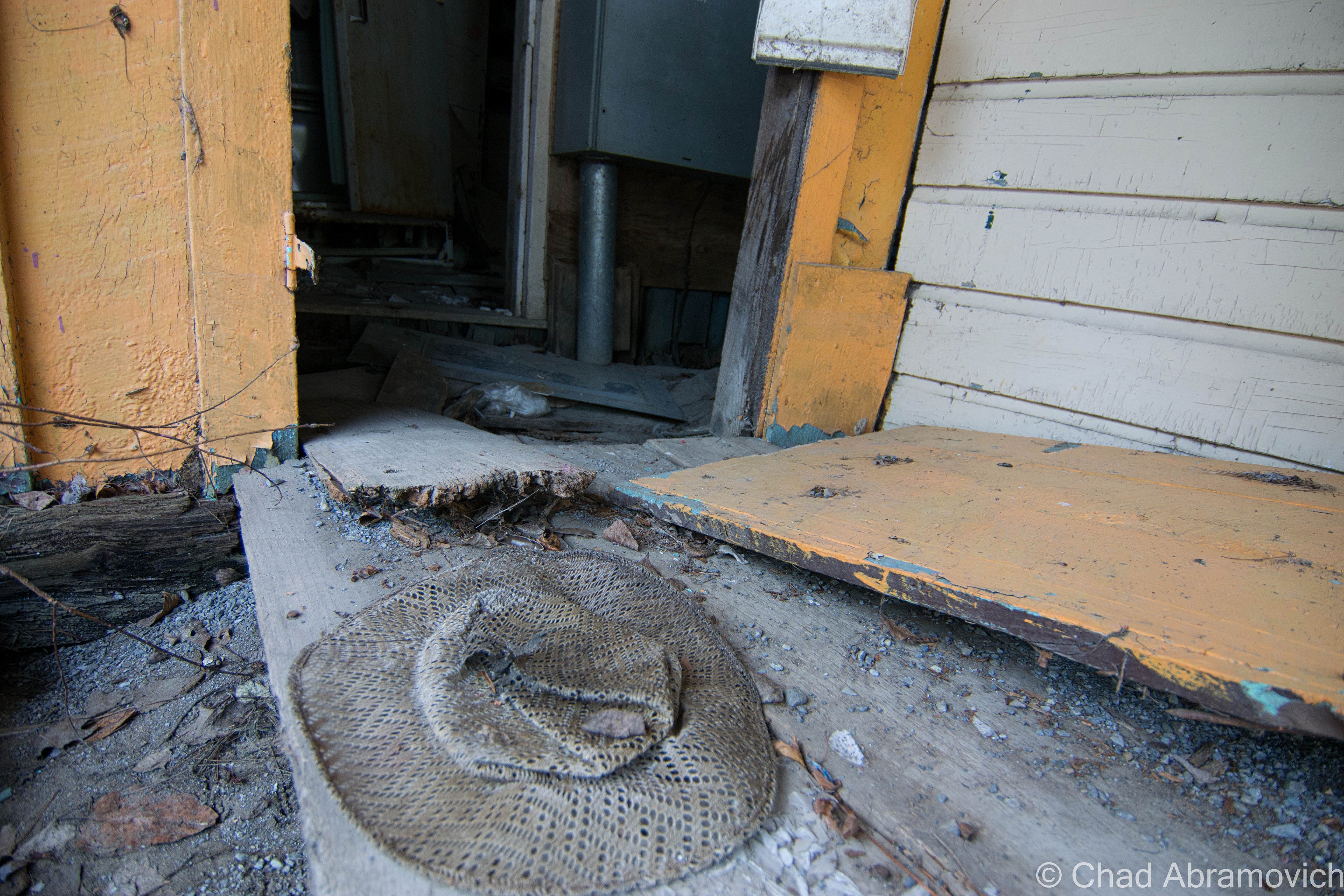
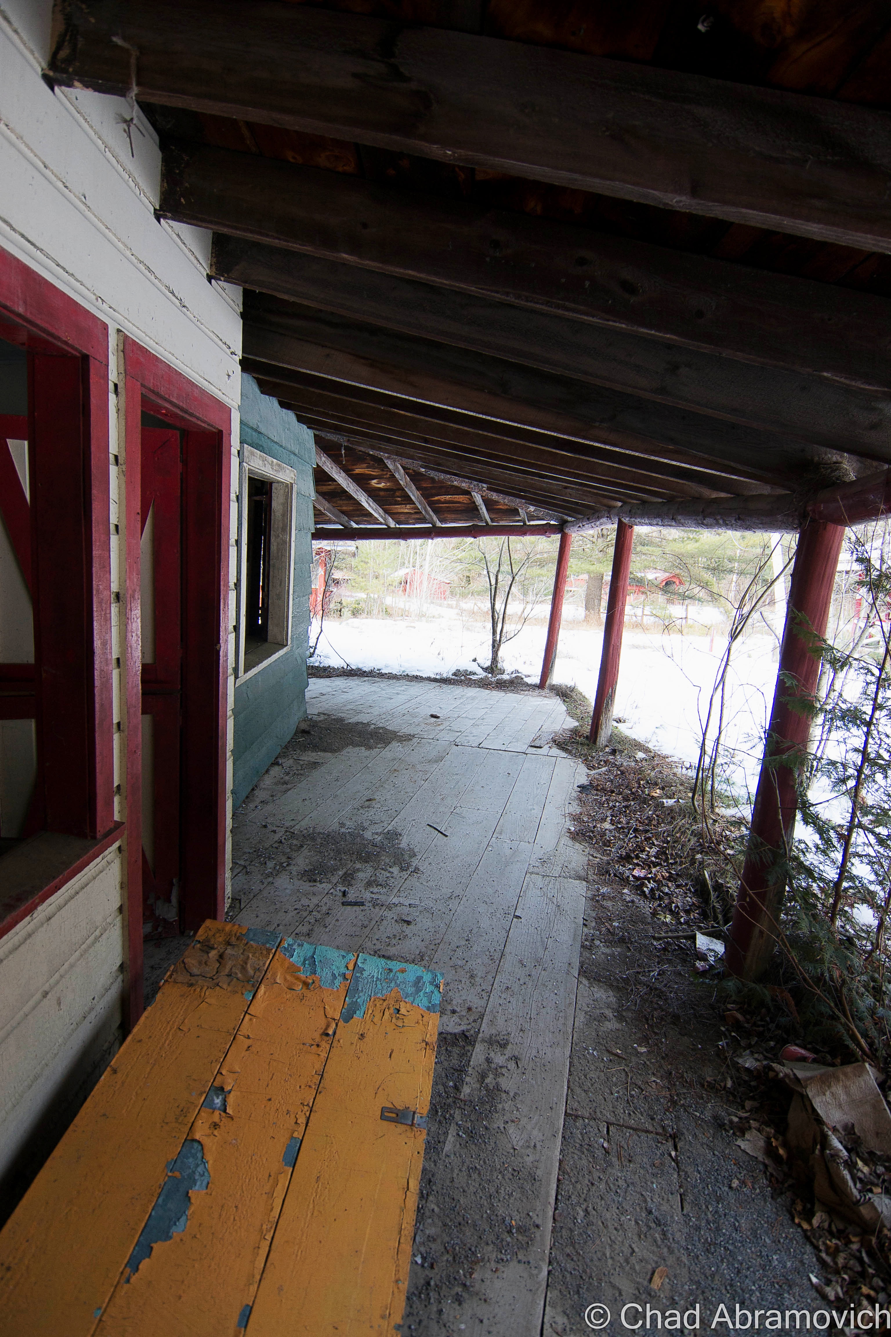
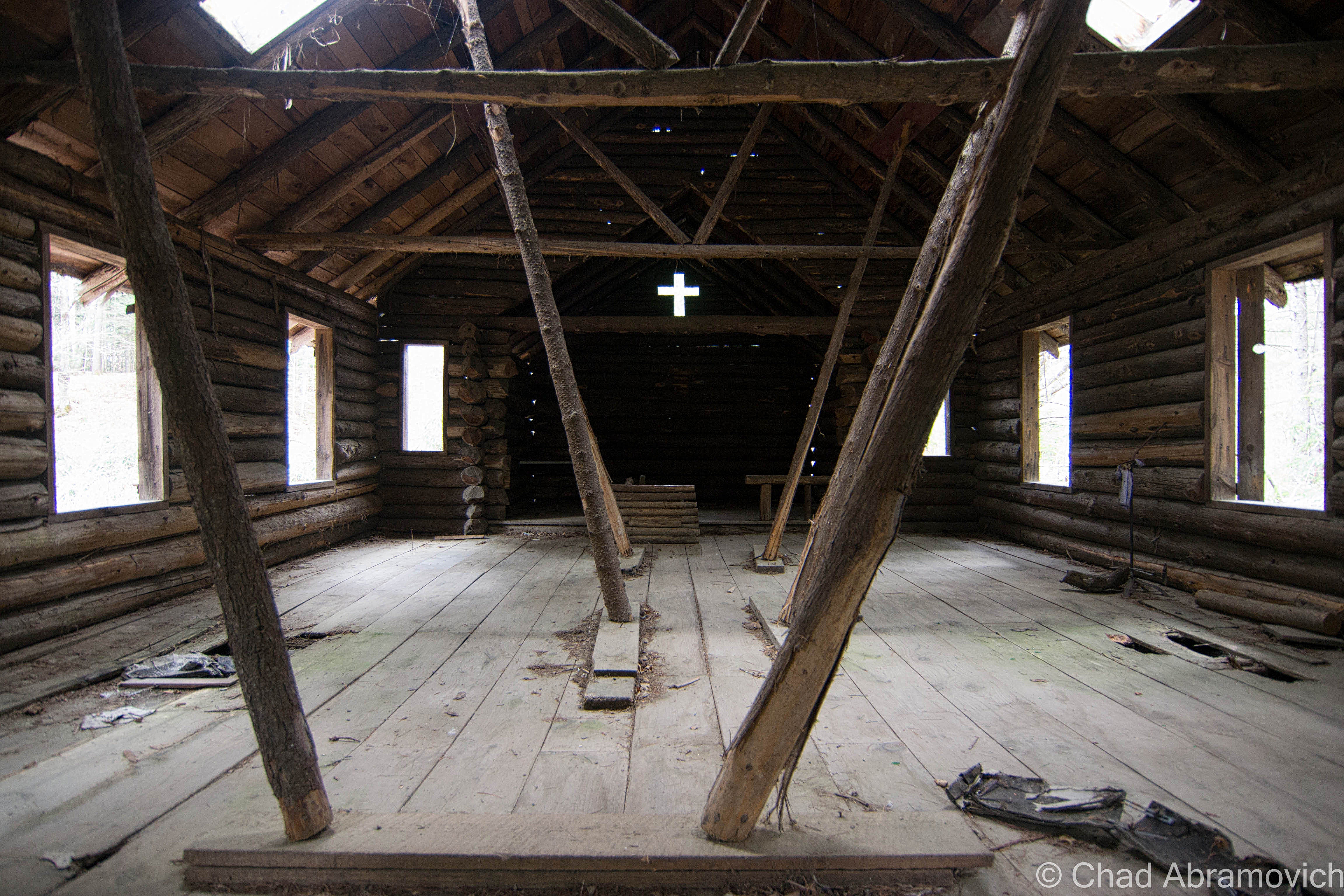
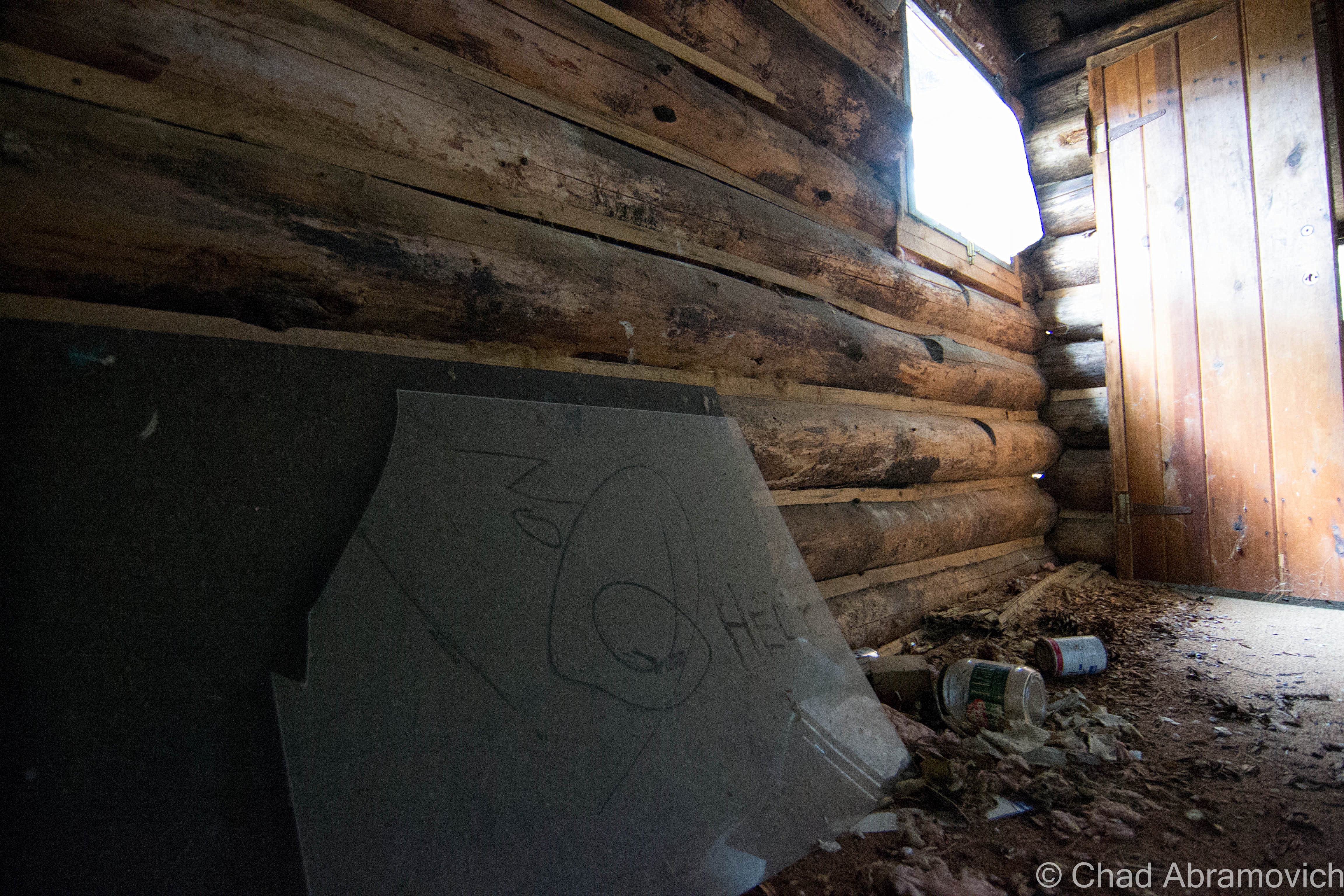
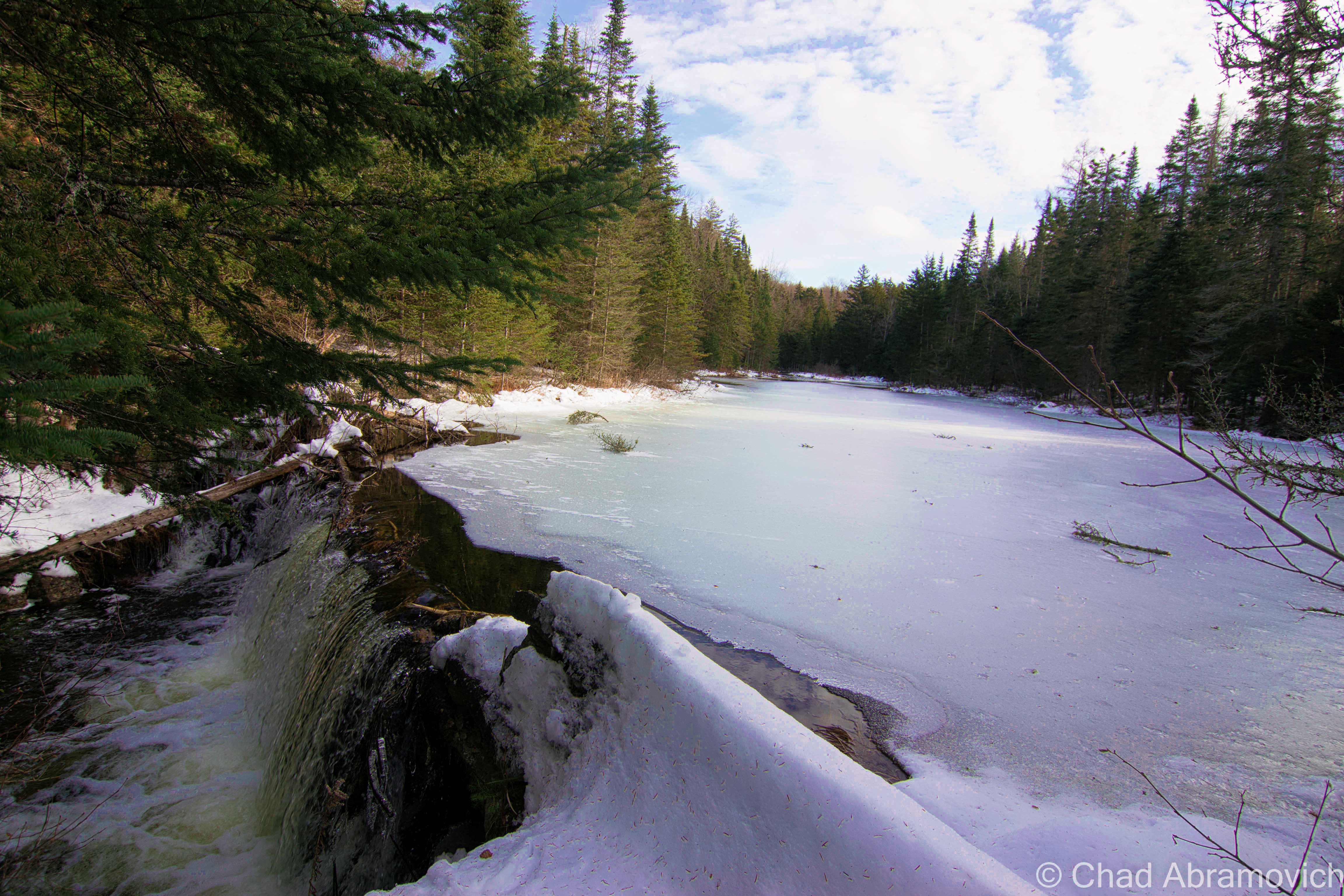
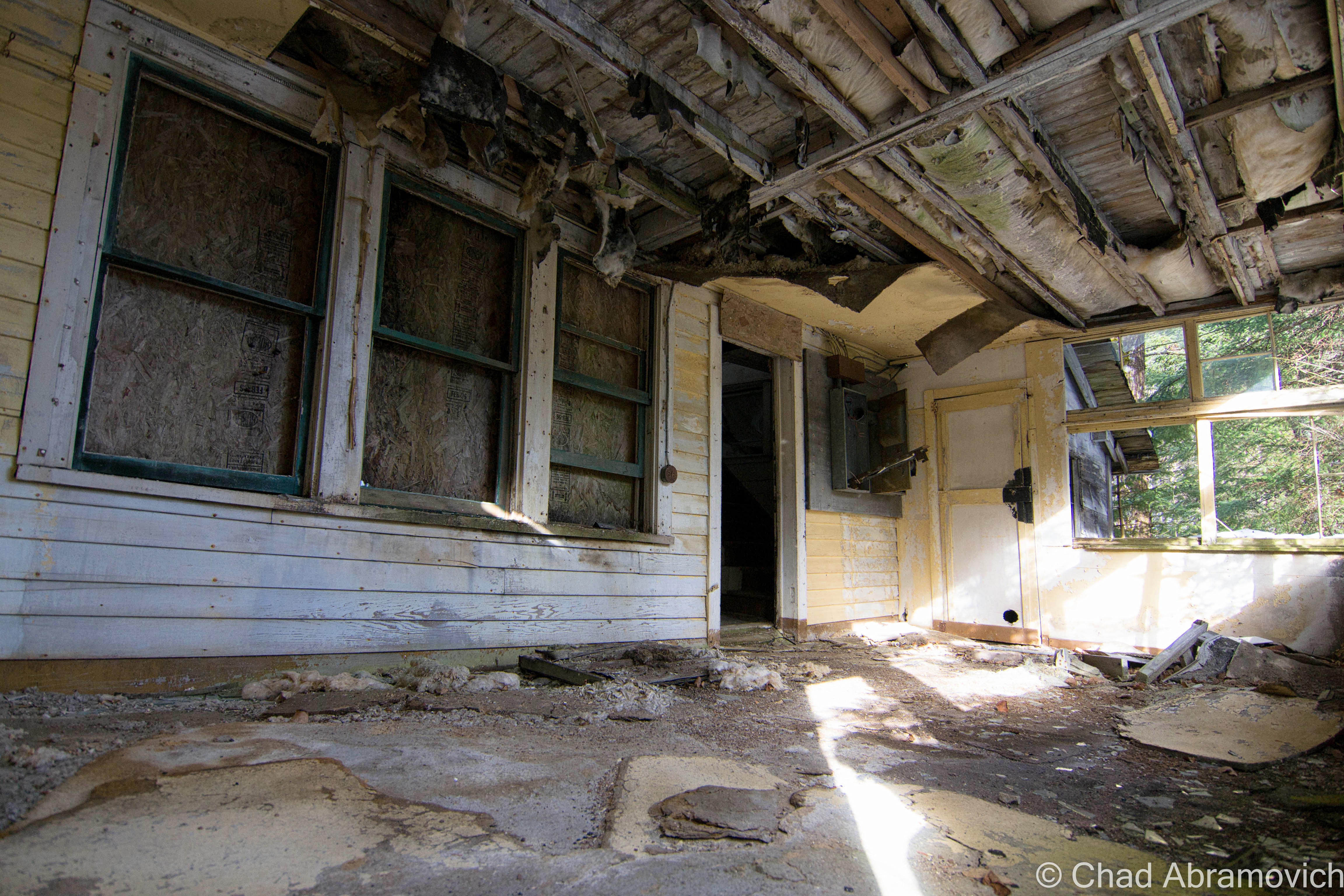
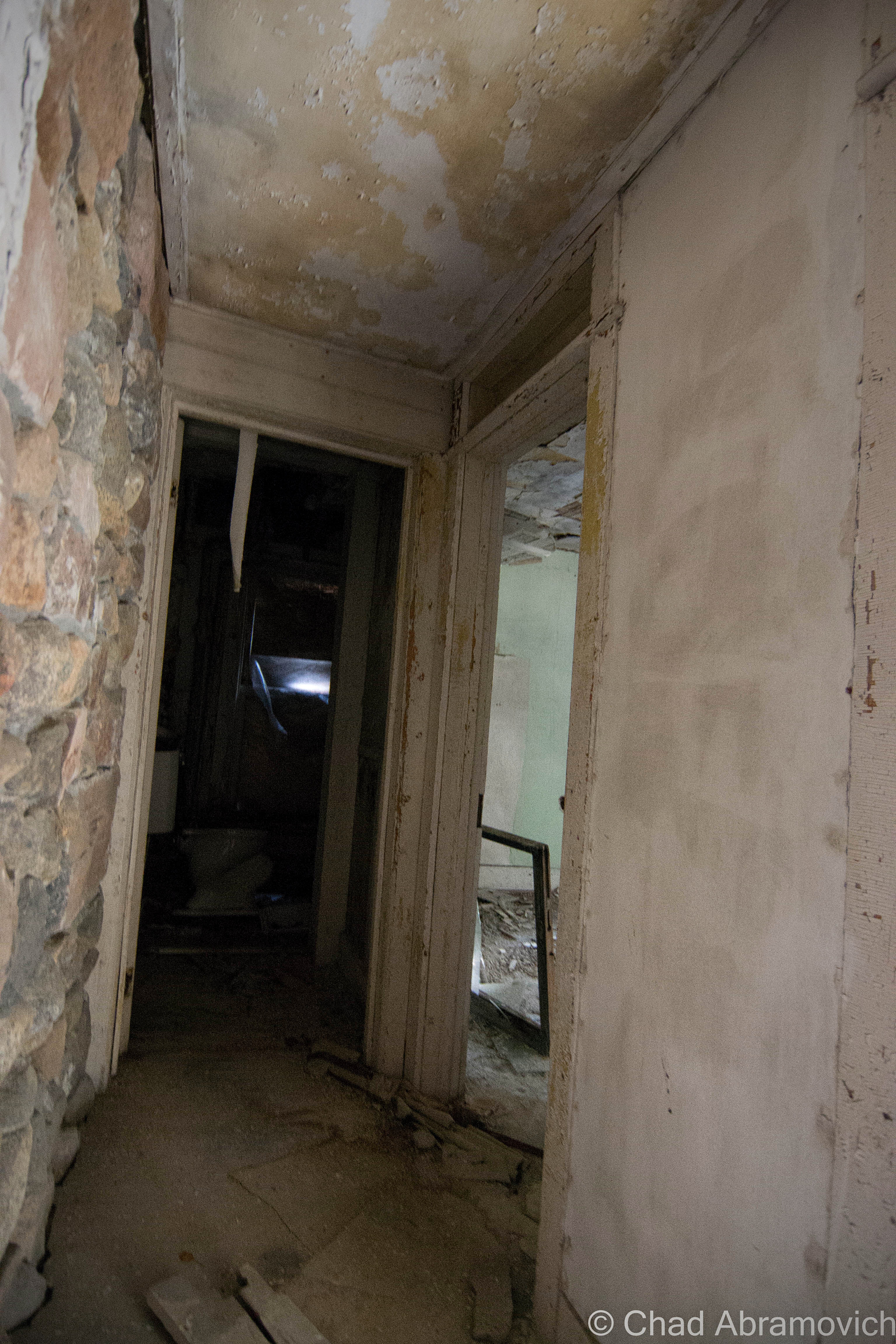
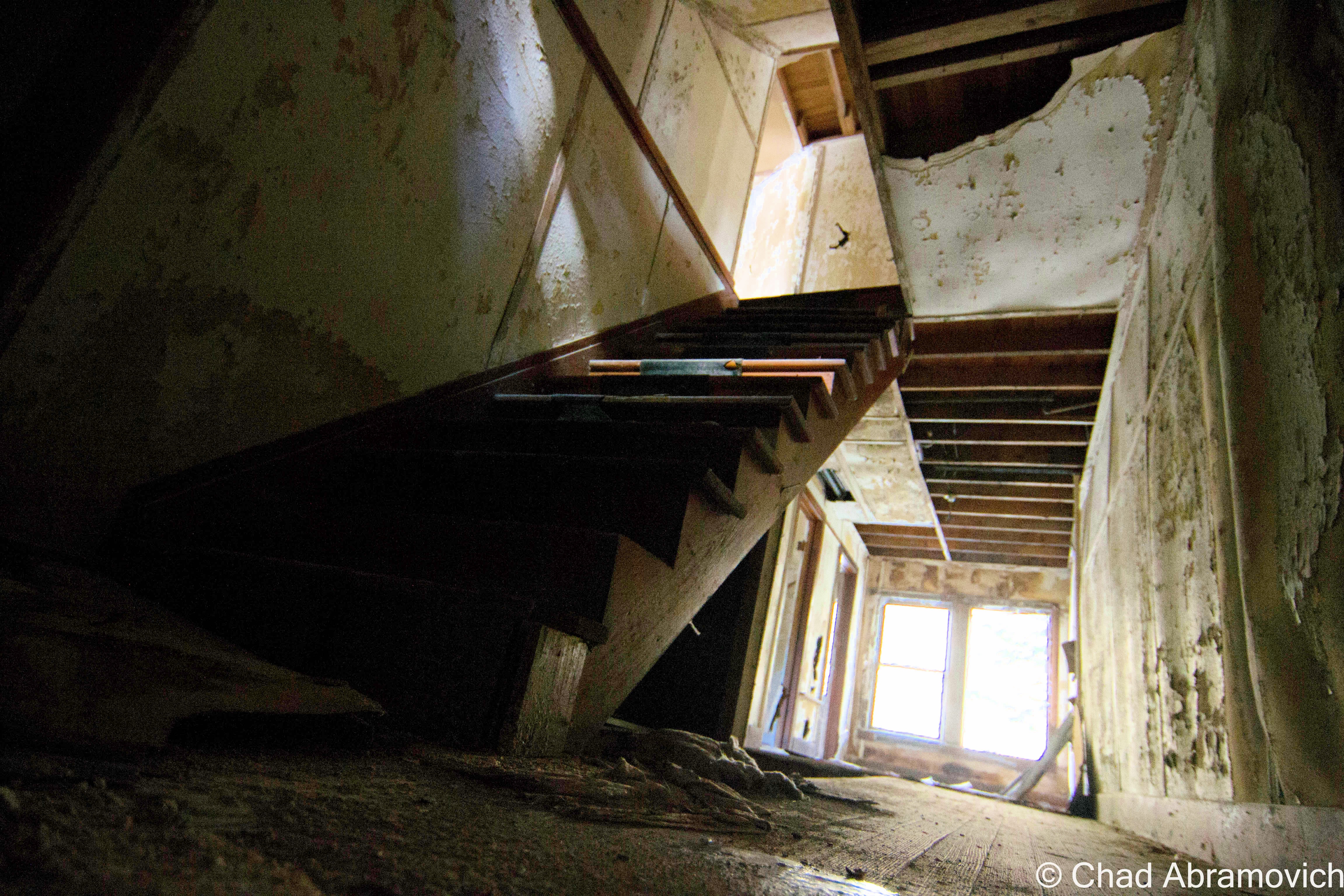
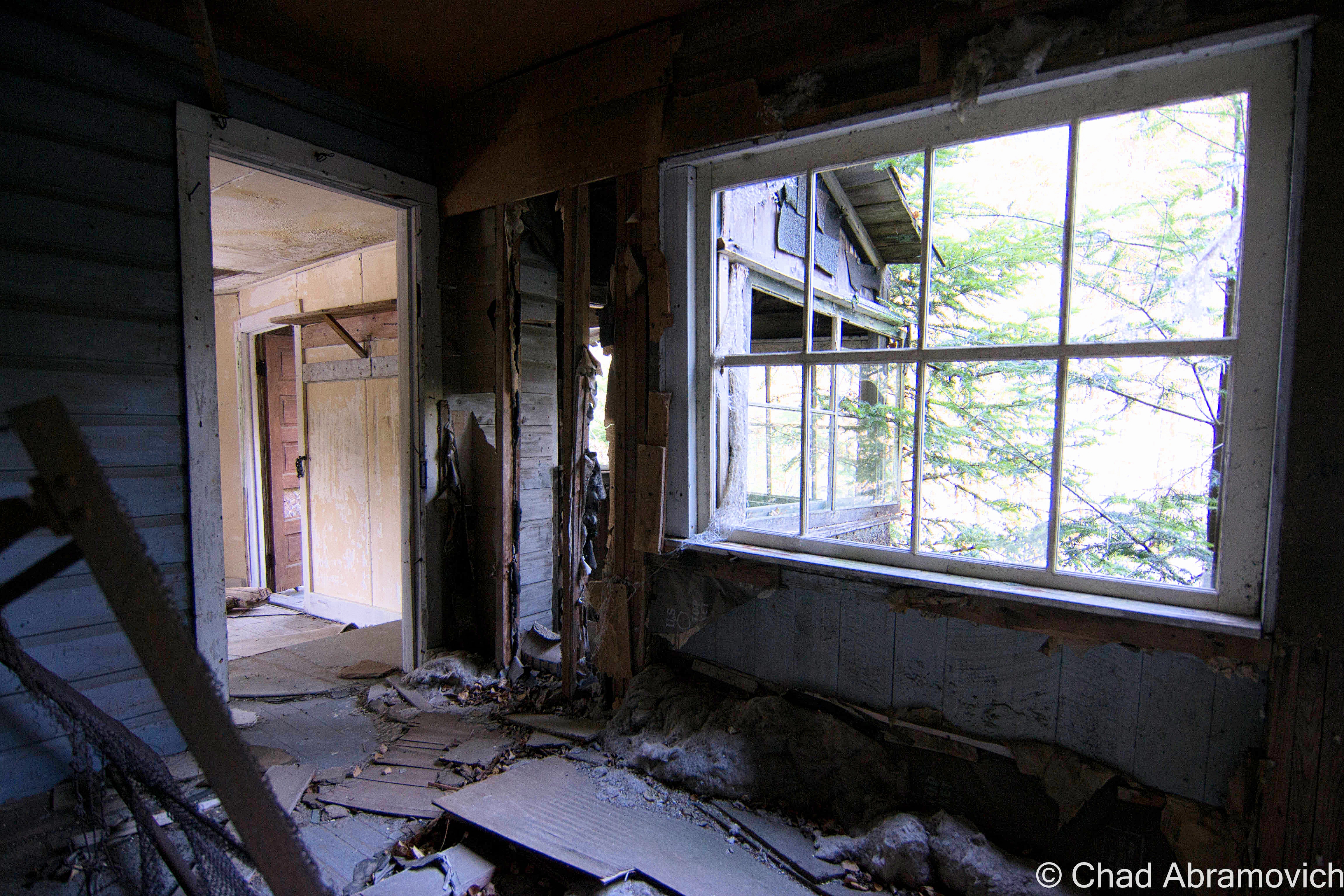
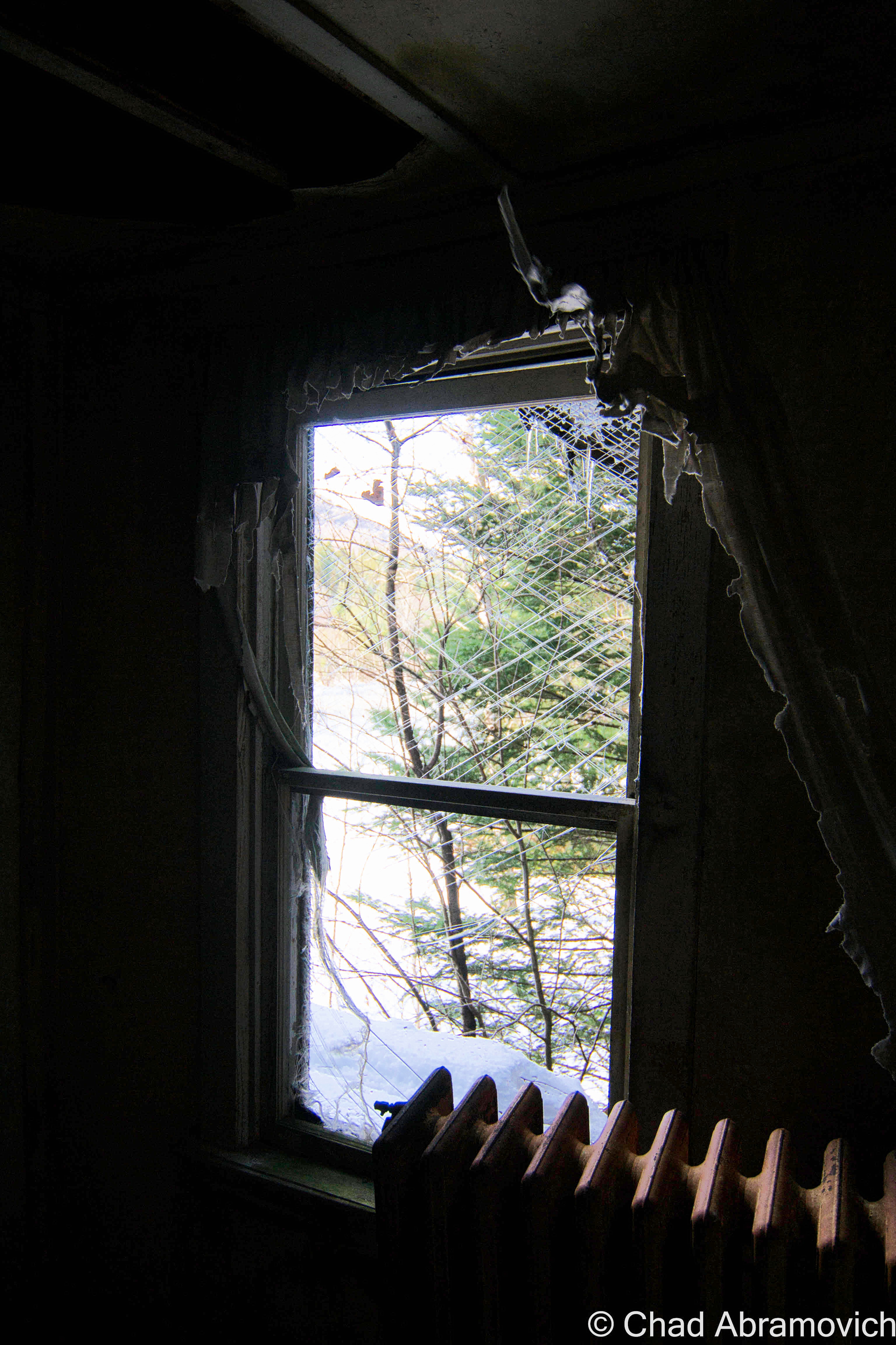
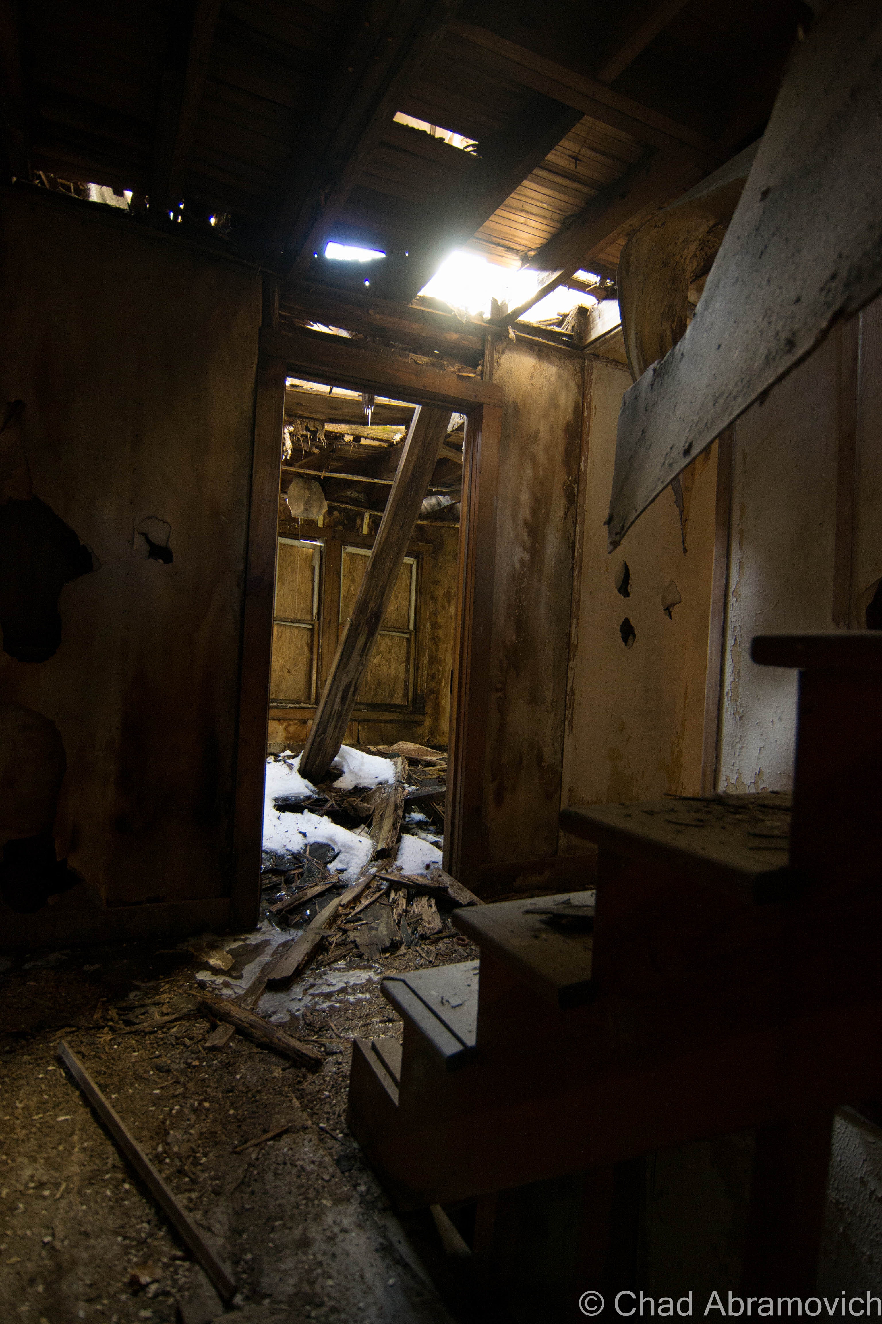
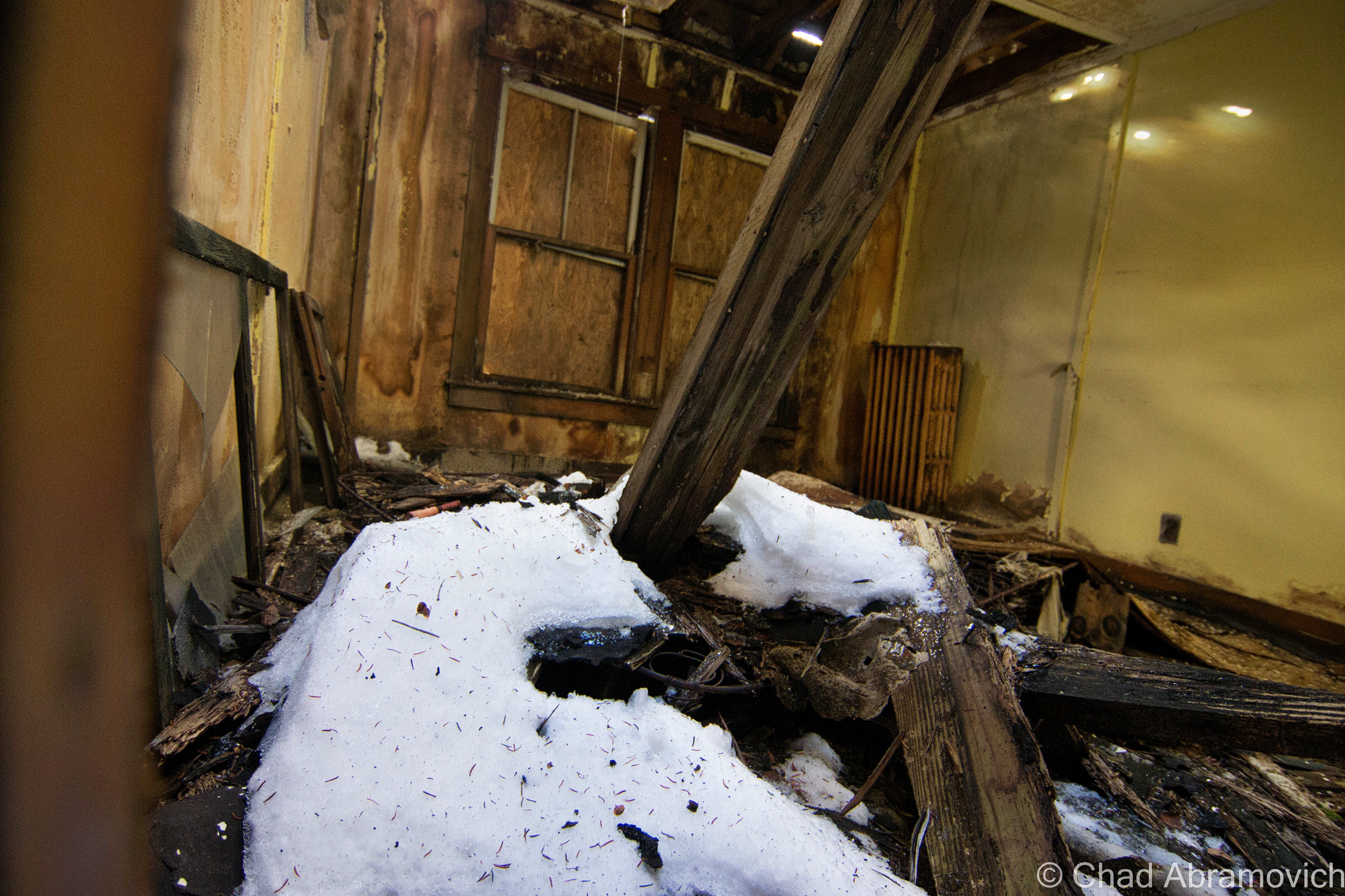
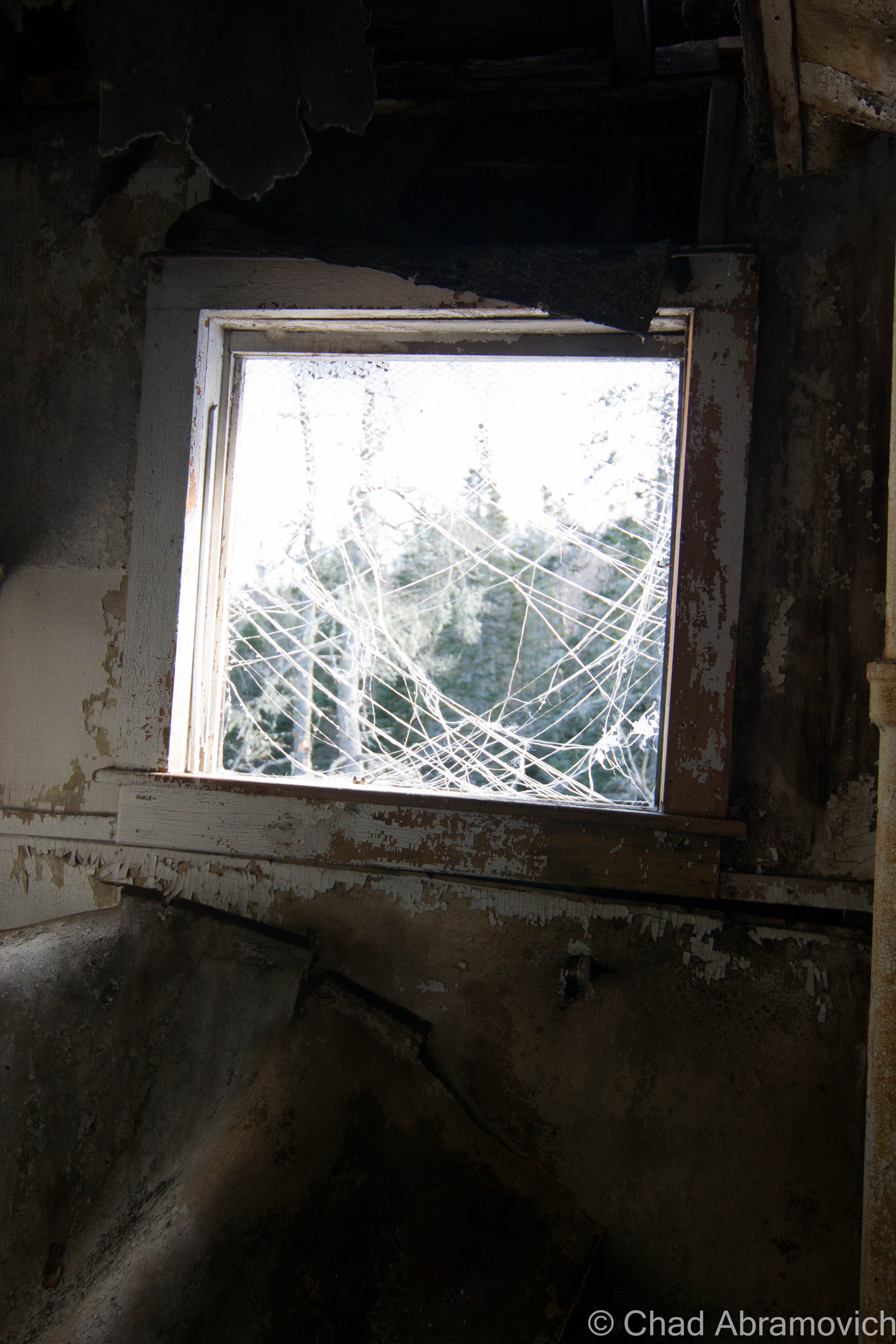
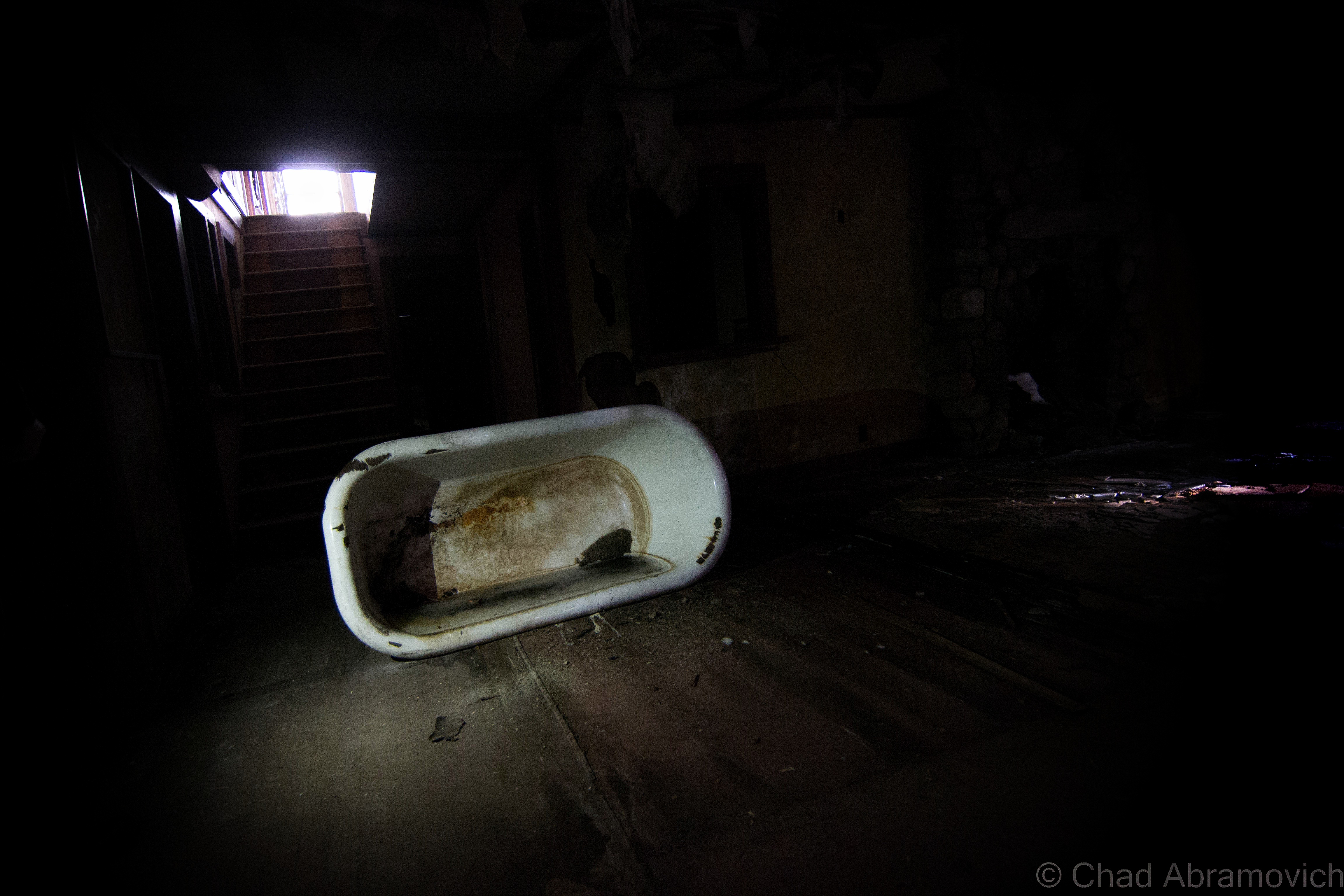
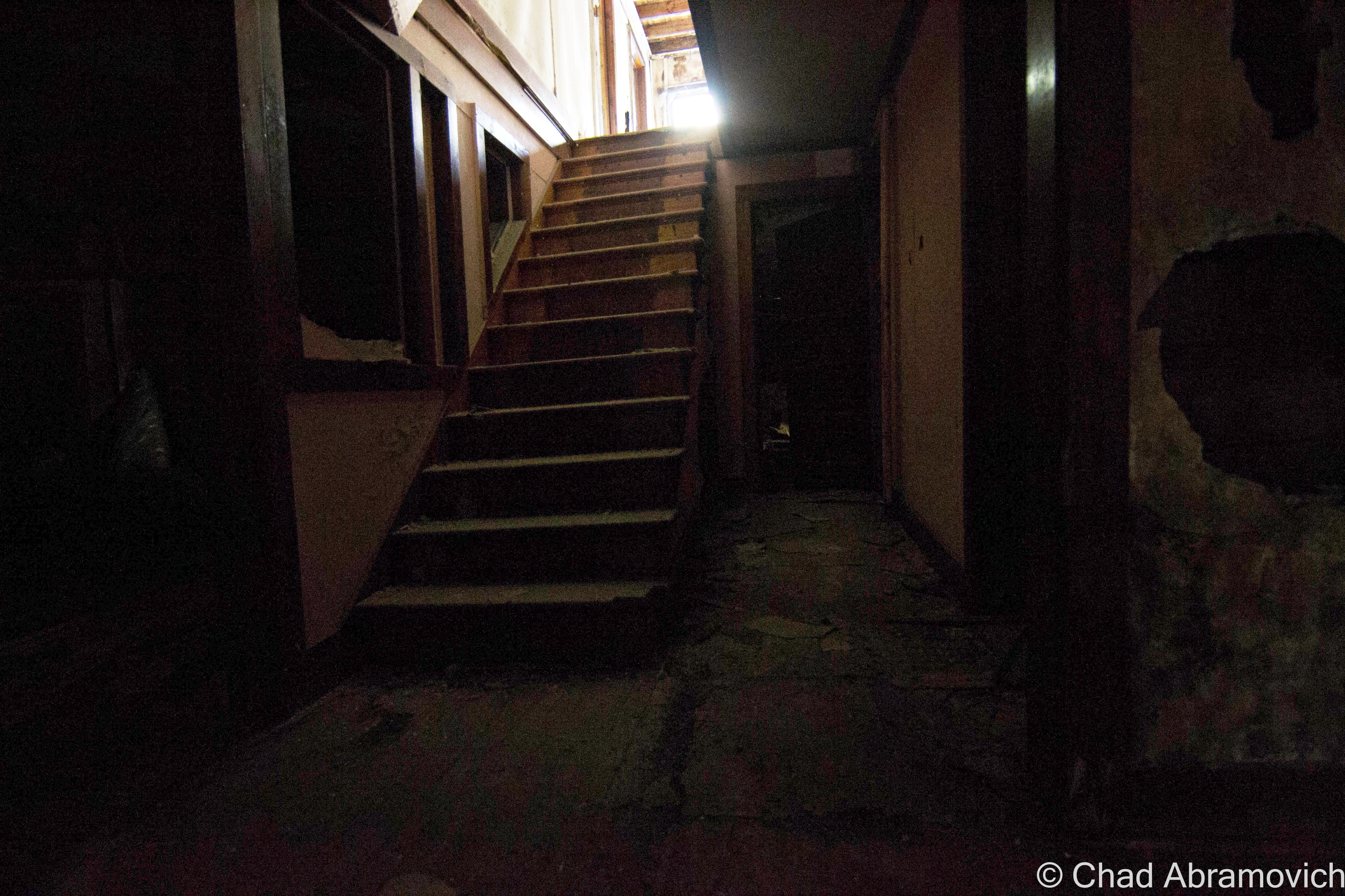
I hadn’t had any expectations to get inside Aiden Lair, as I heard it was sealed up very well, but we found a door around back, near an old dam that created a small pond. The bottom had been kicked out, leaving a human sized hole to crawl through onto a rotting sun porch – the afternoon sun was pleasantly warming the peeling yellow lead paint that speckled the weather beaten floors.
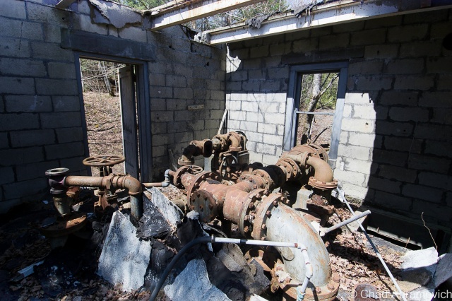
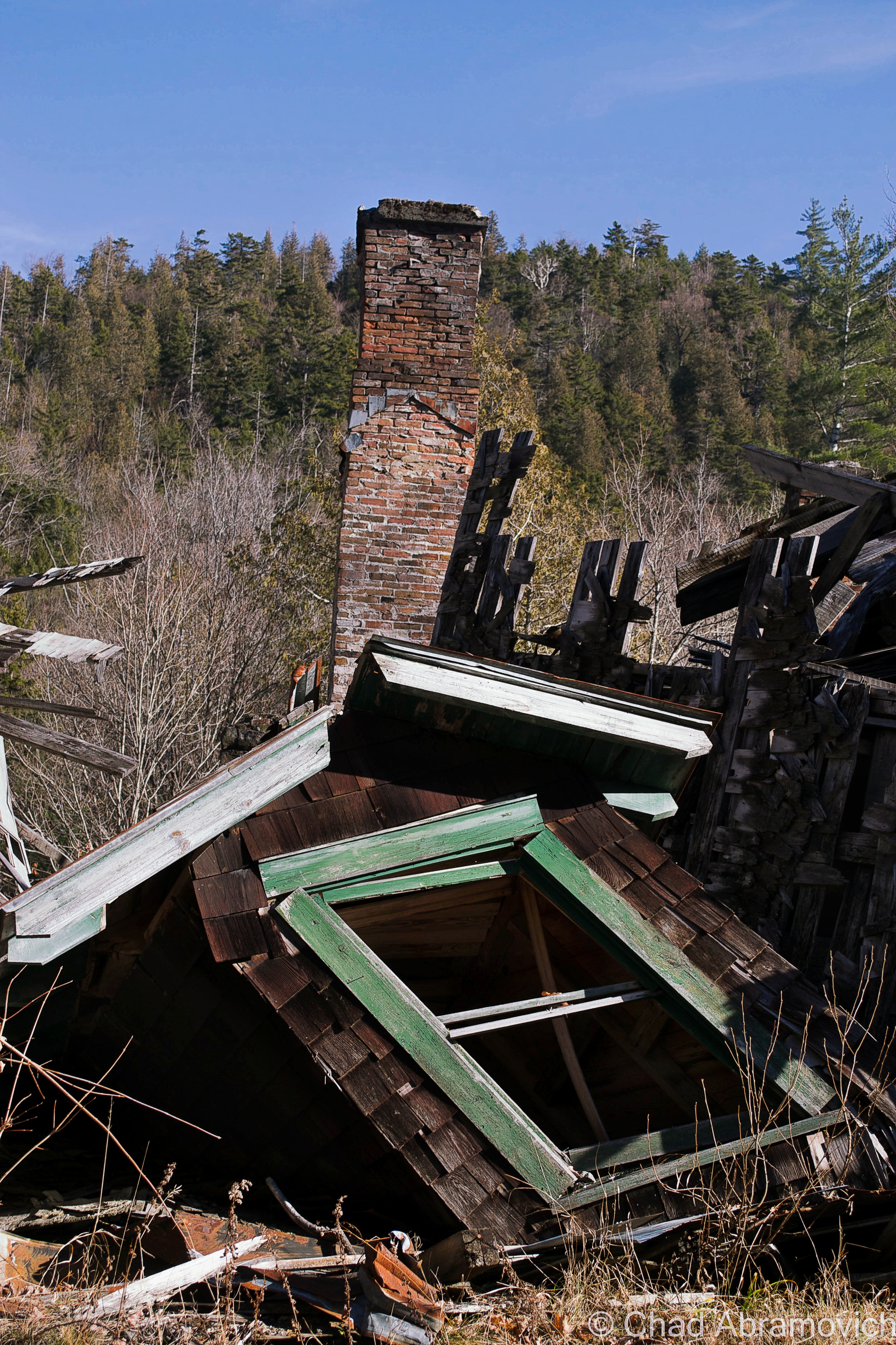
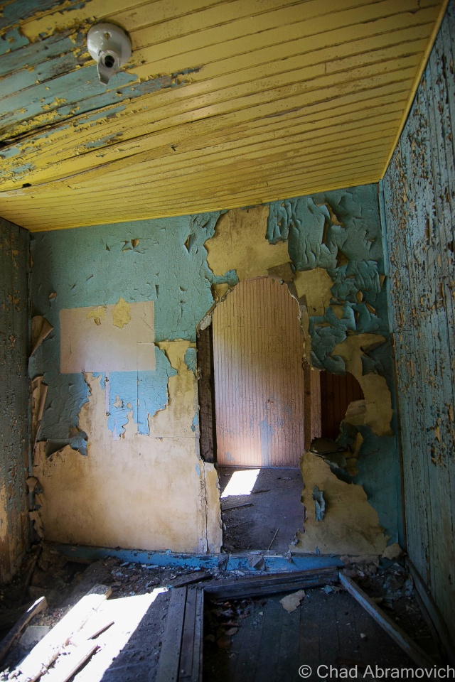
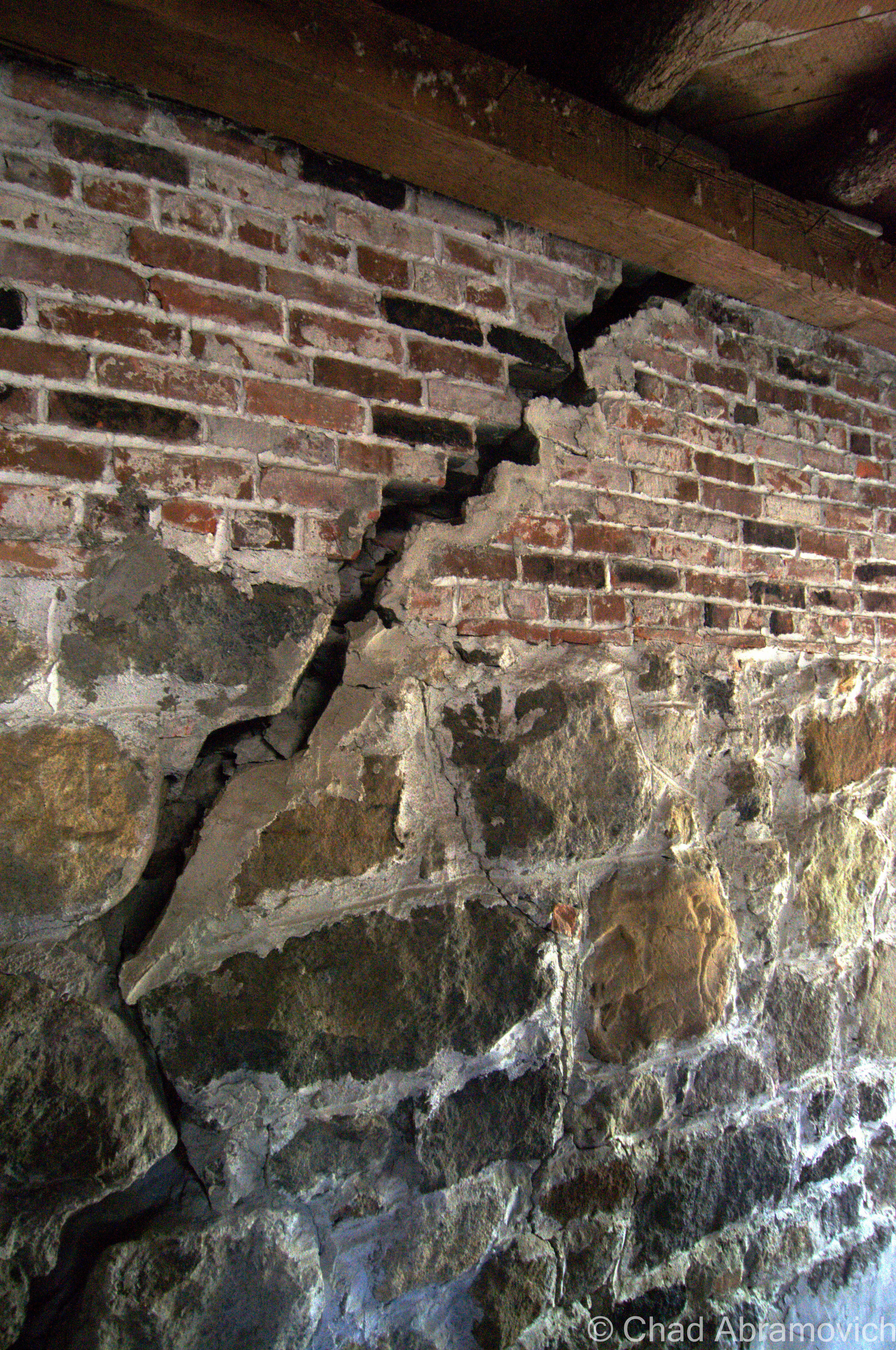
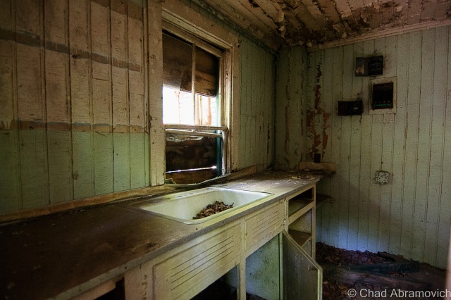
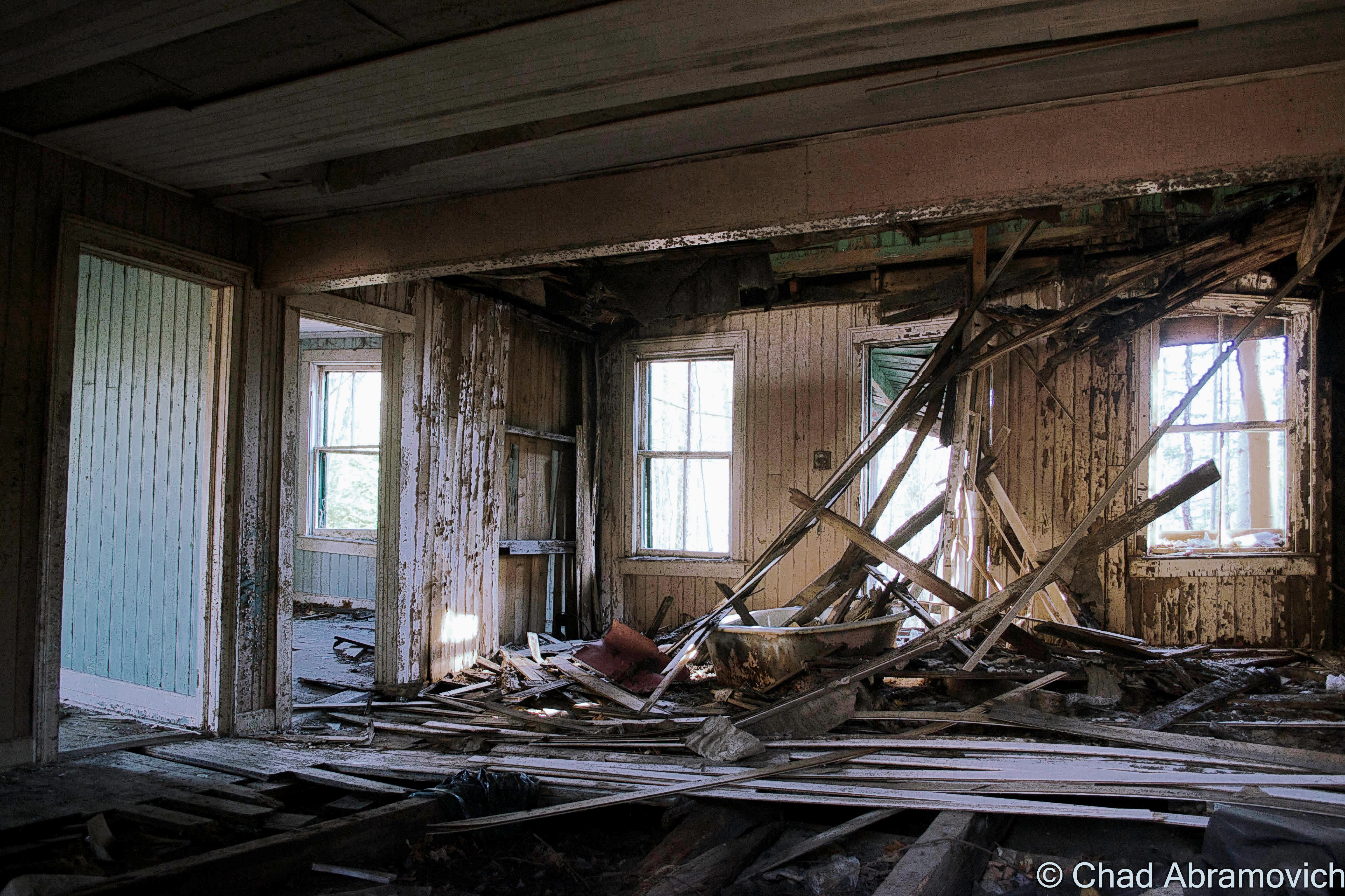
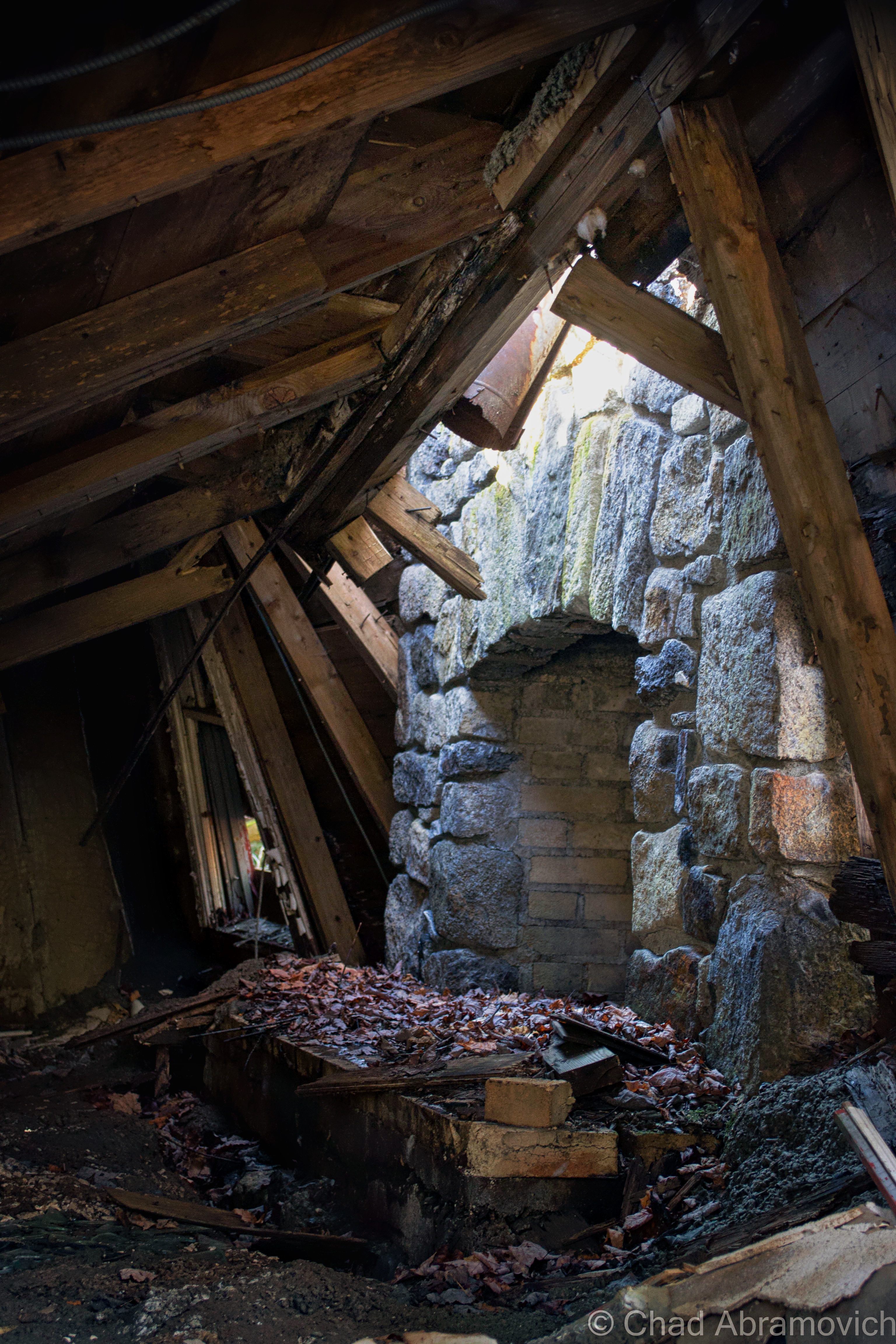
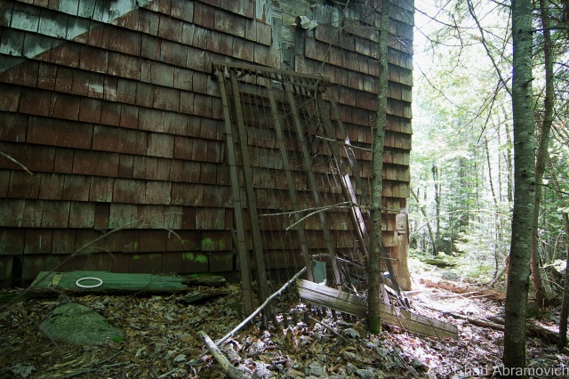
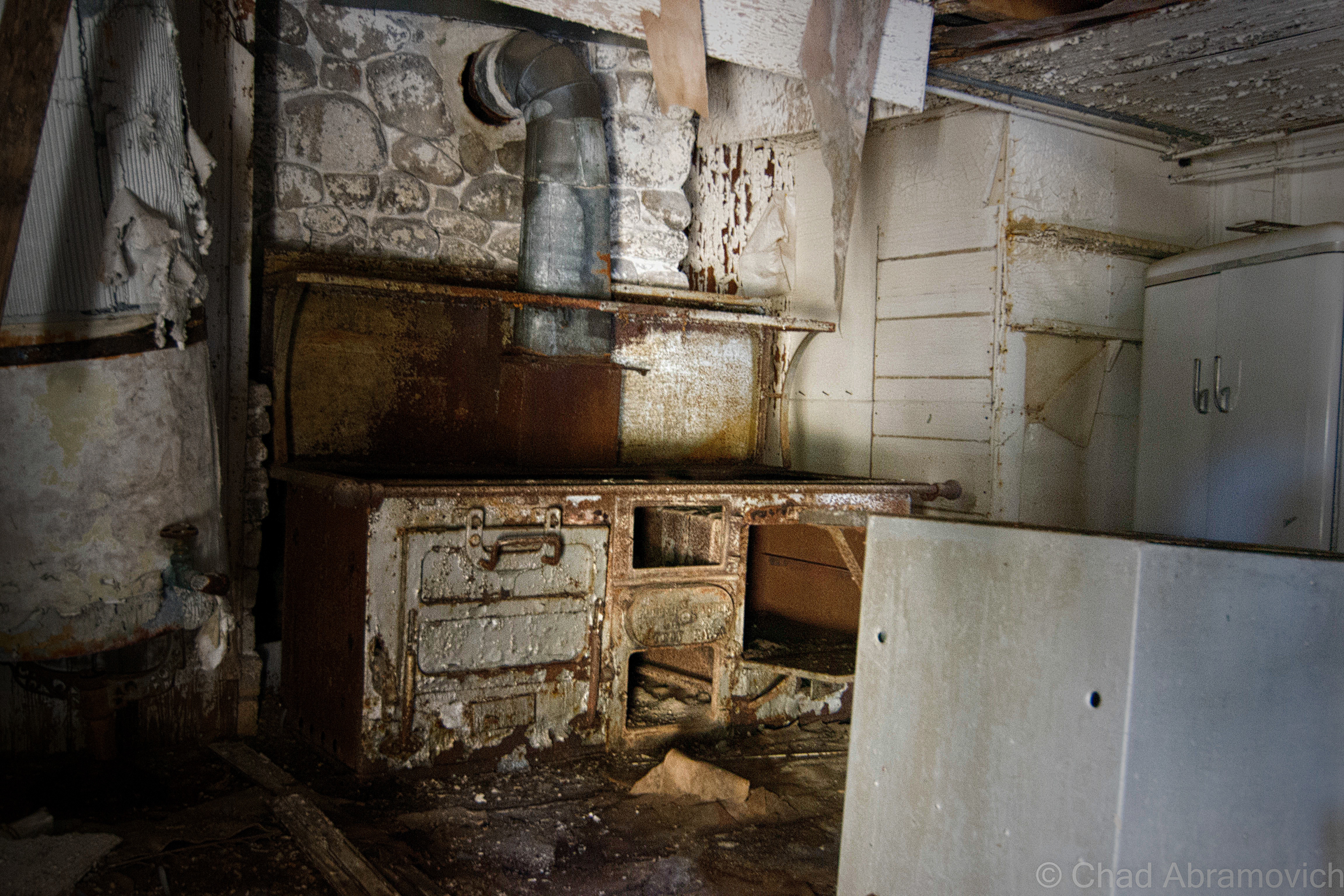
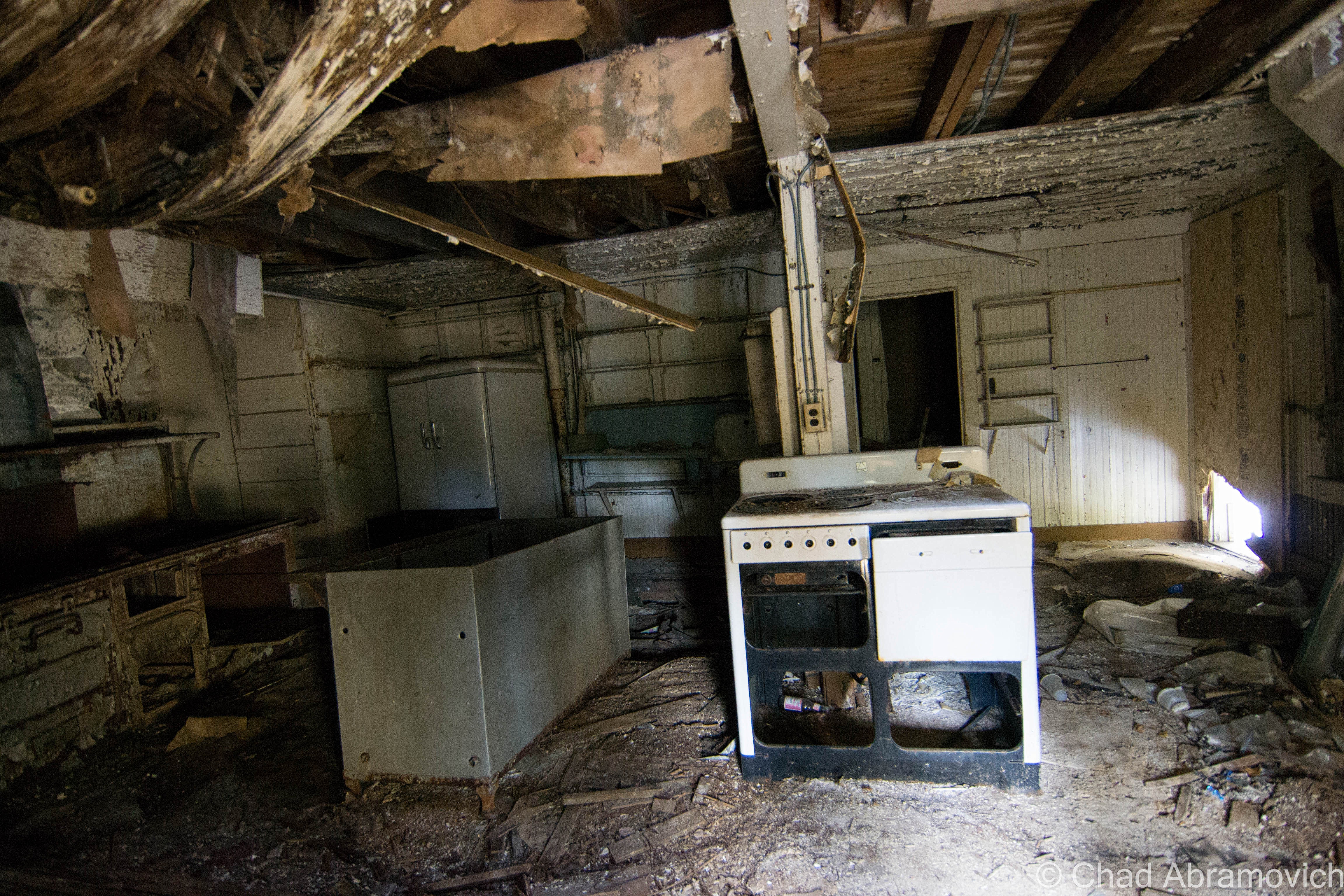
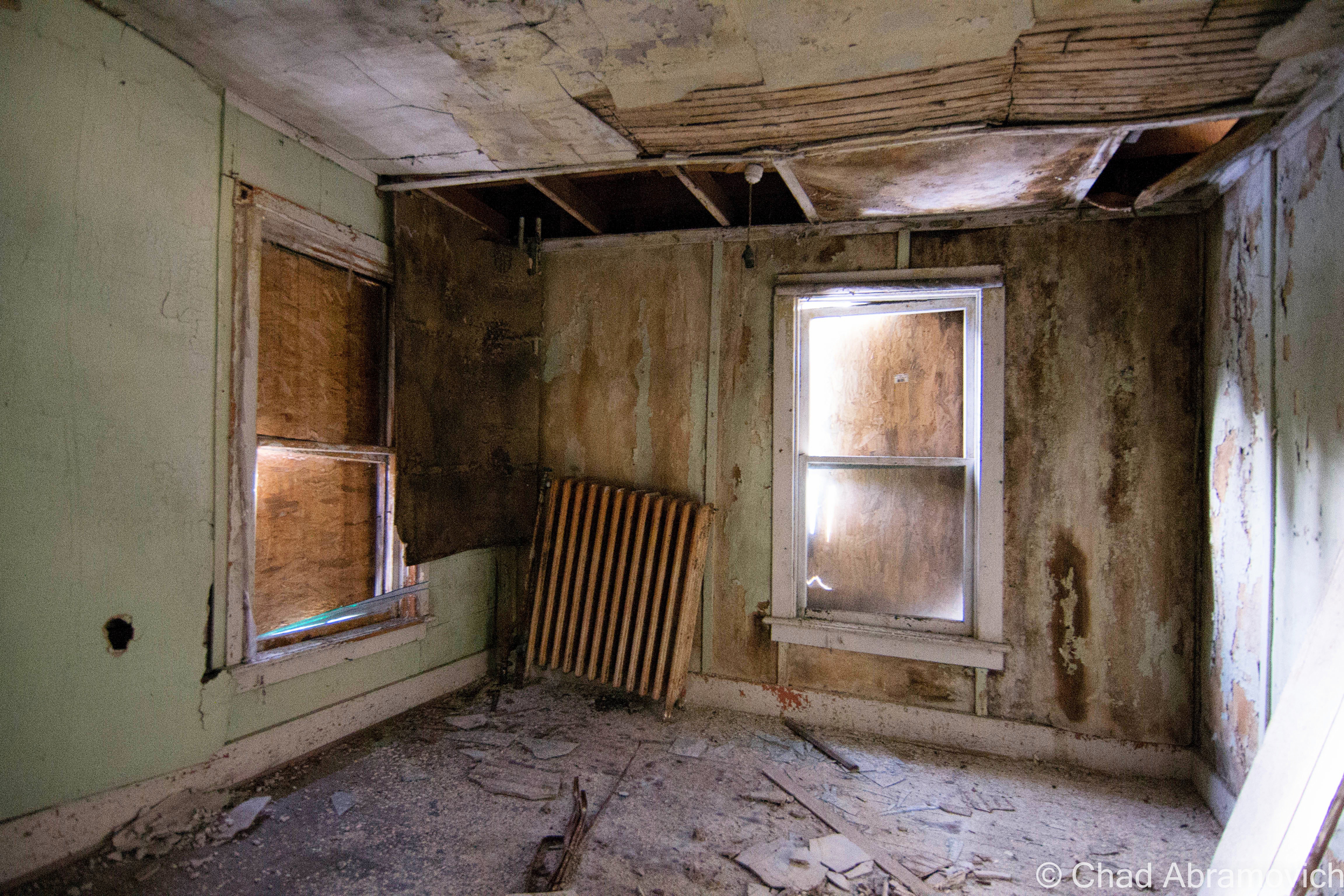
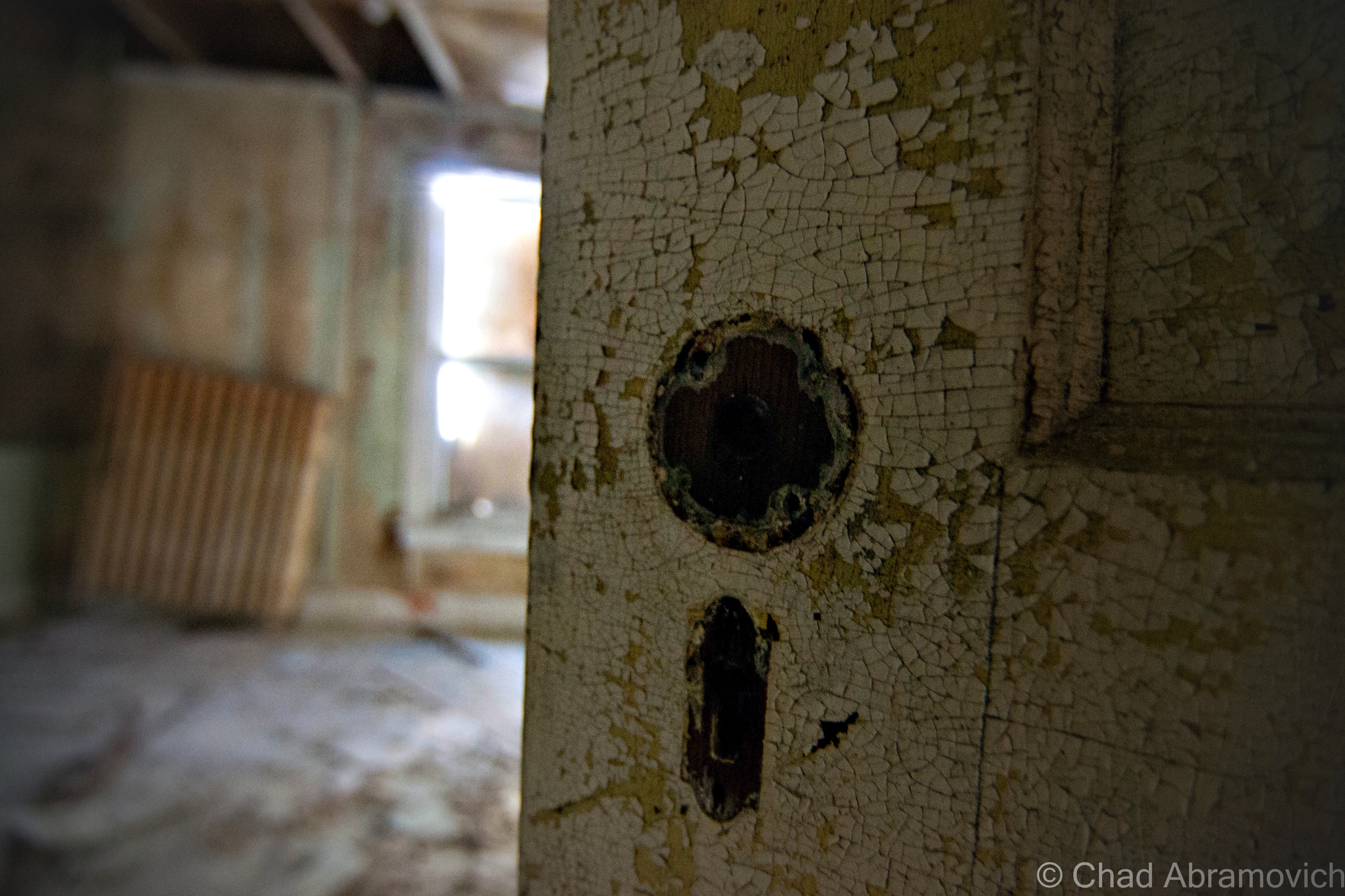
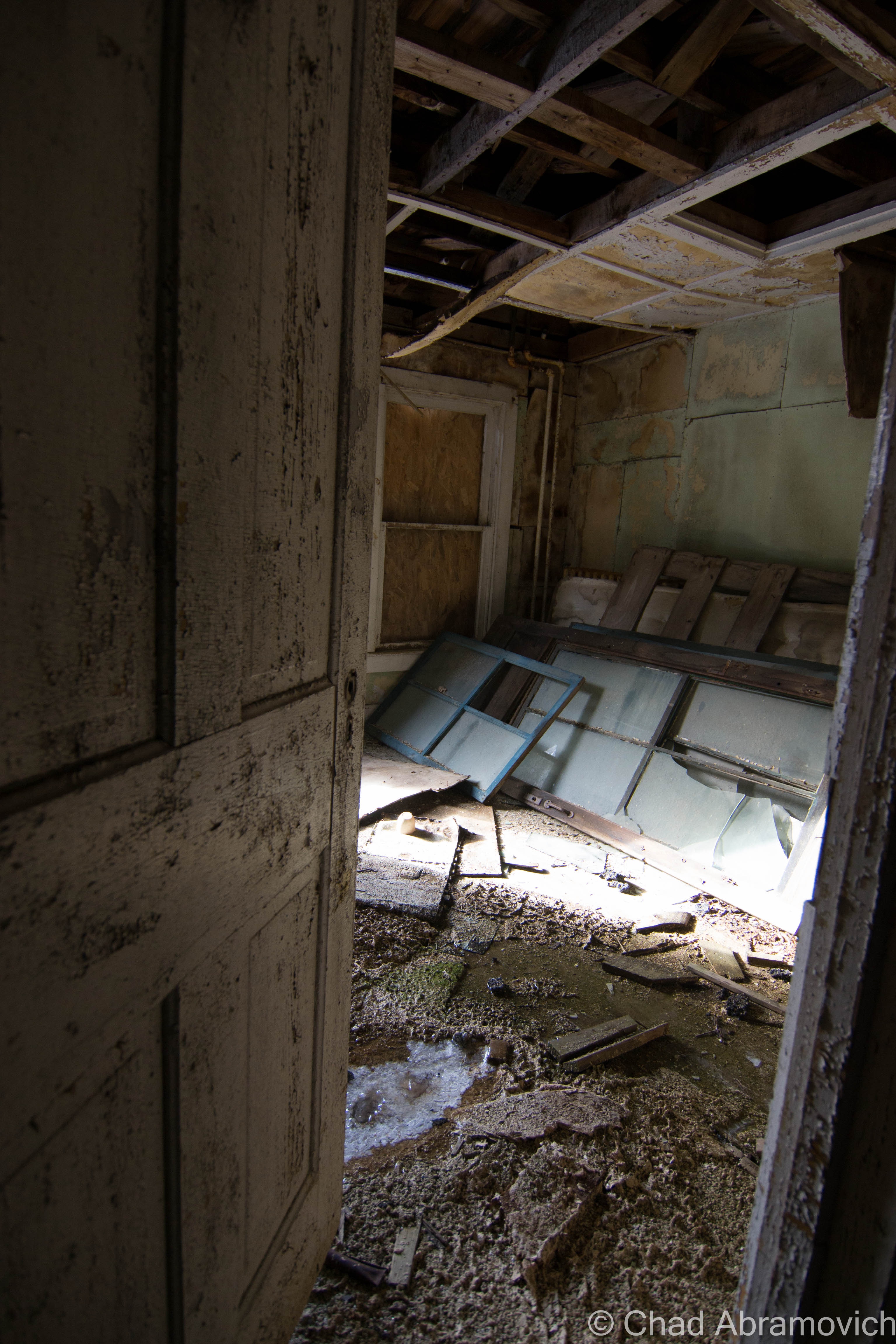
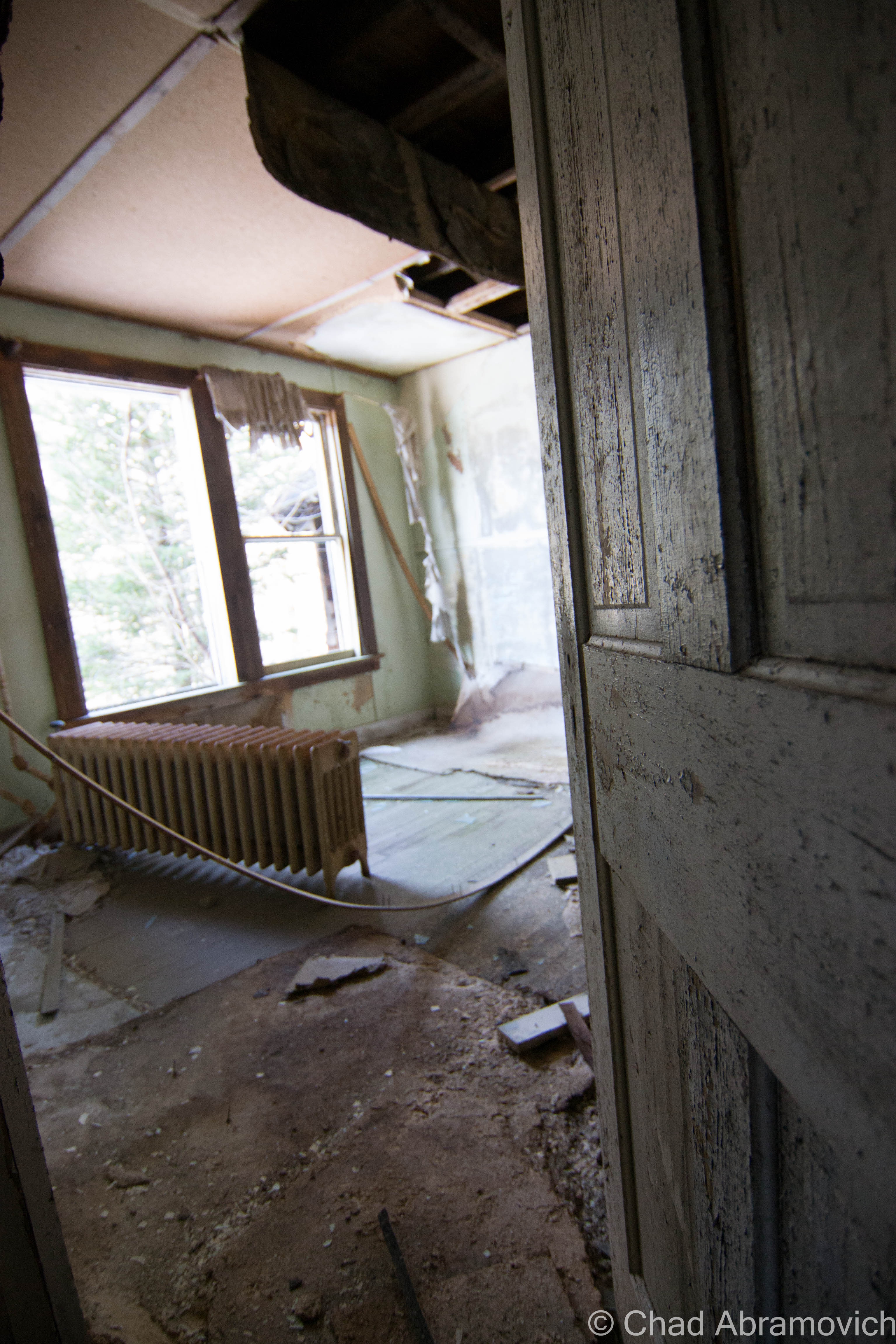
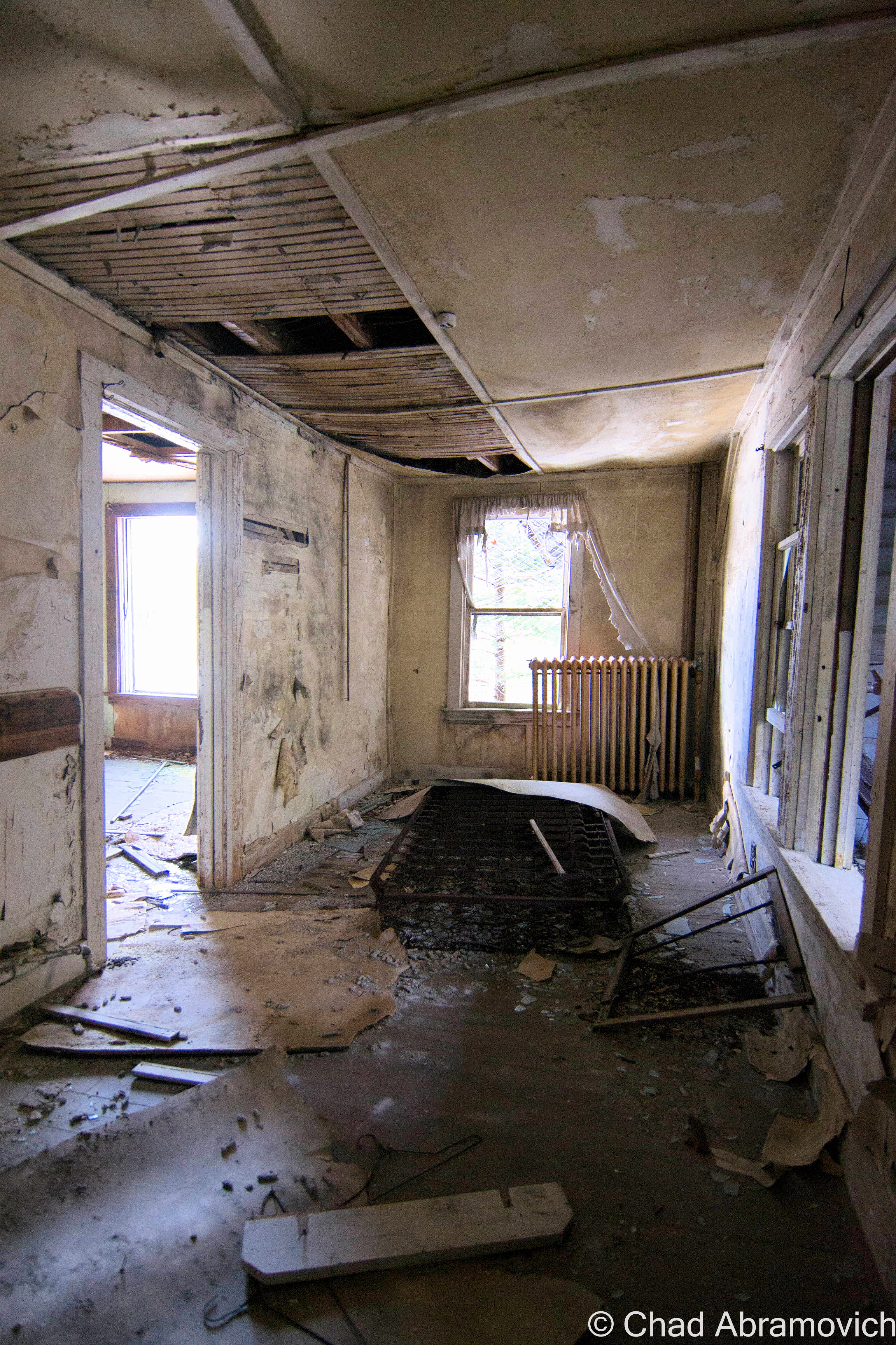
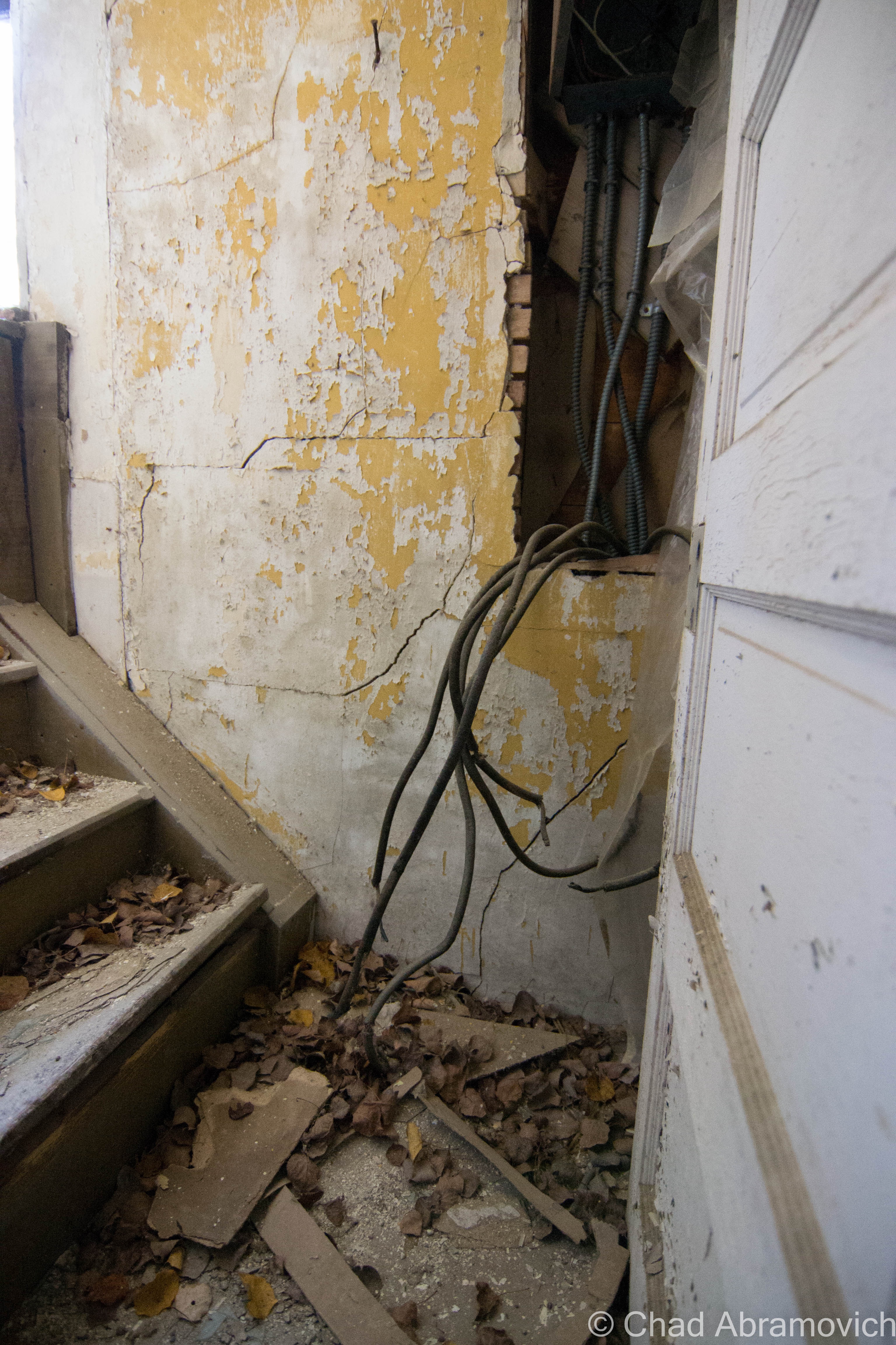
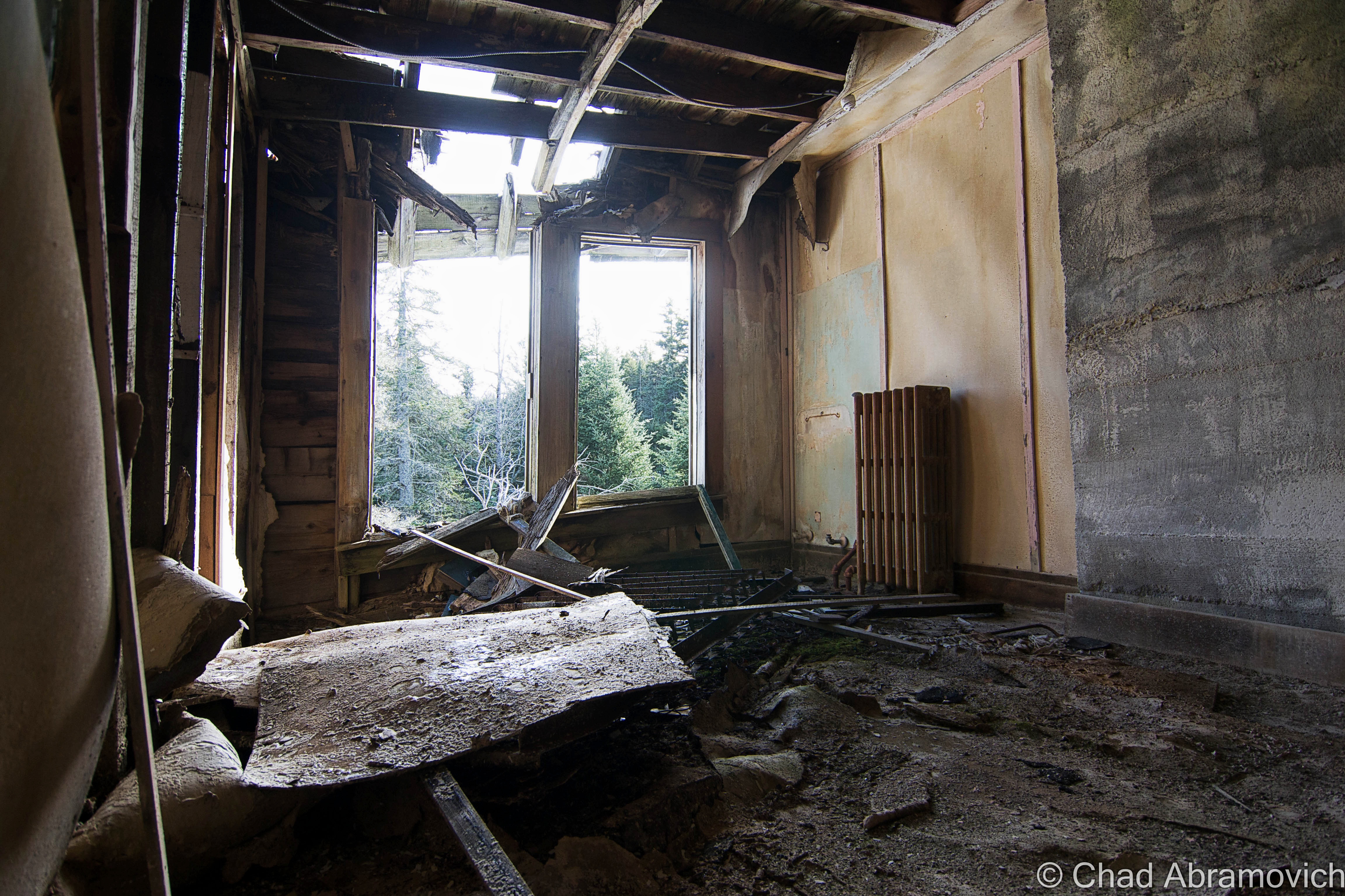
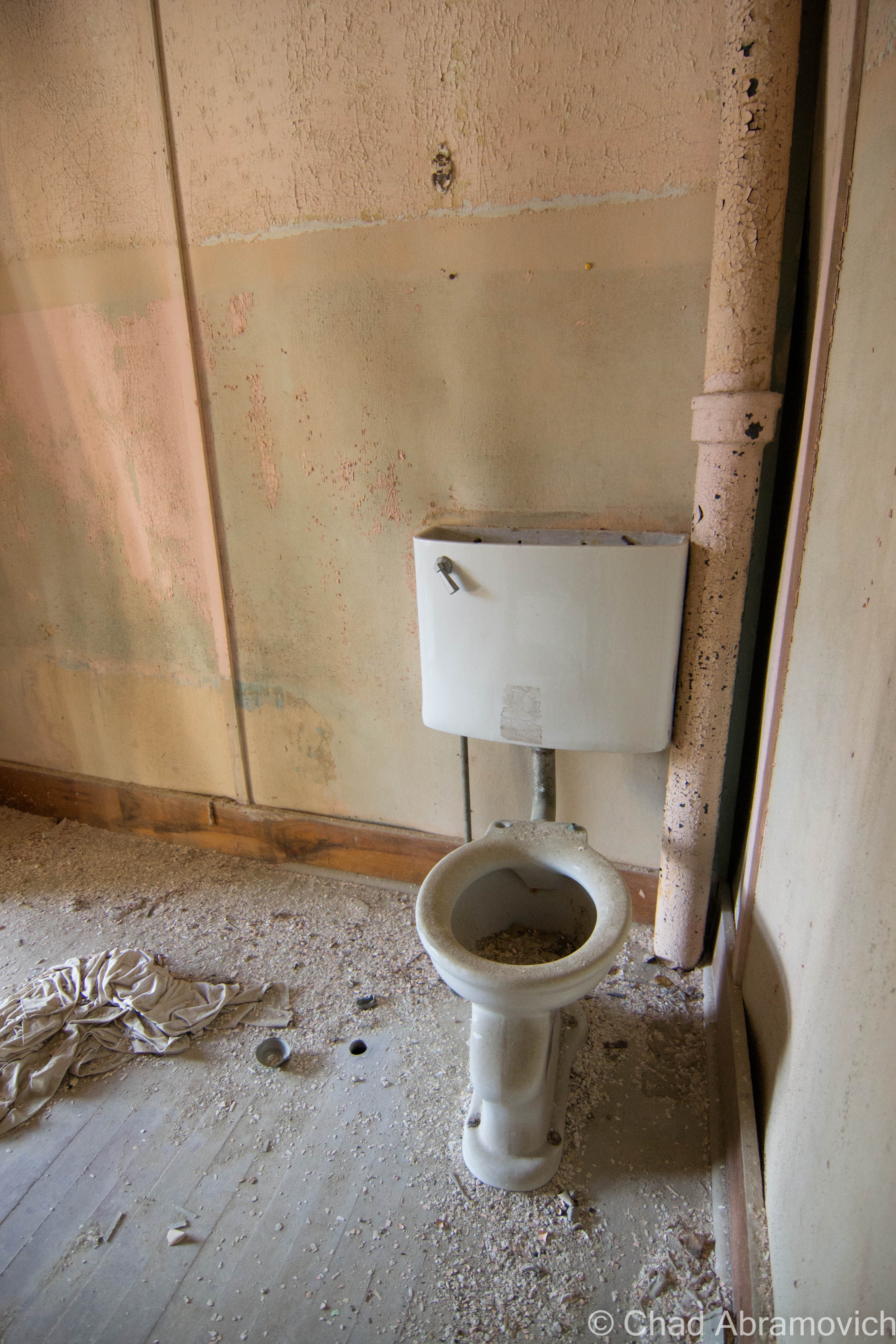
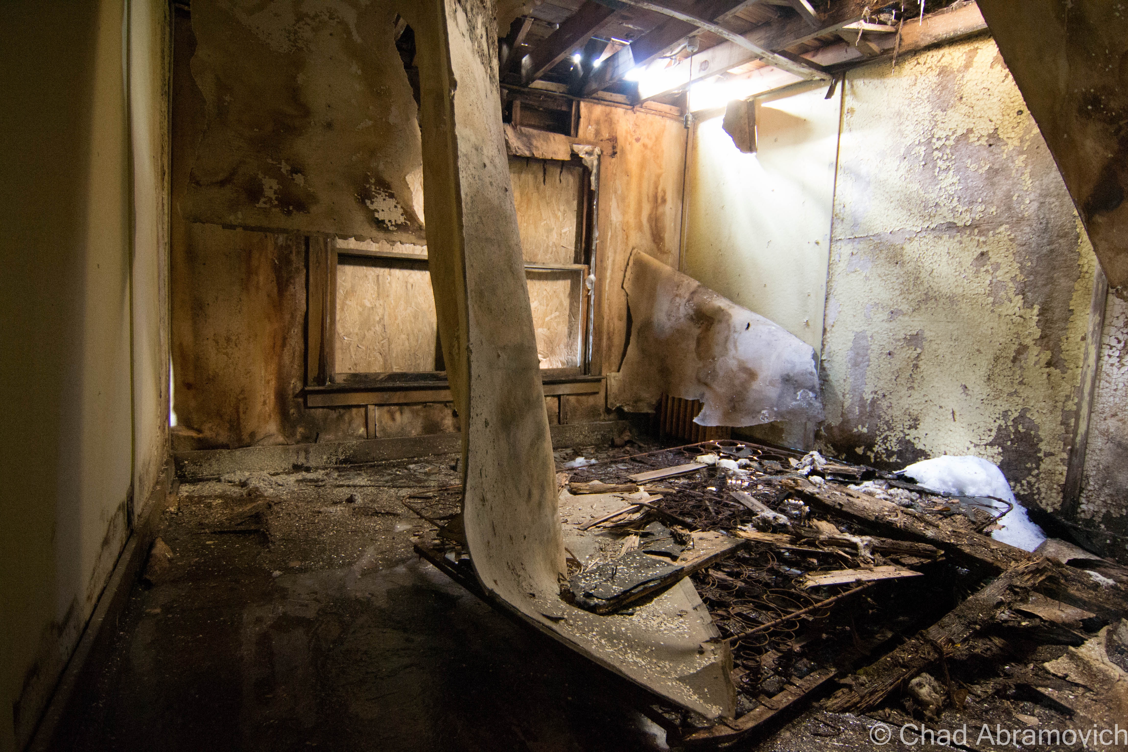
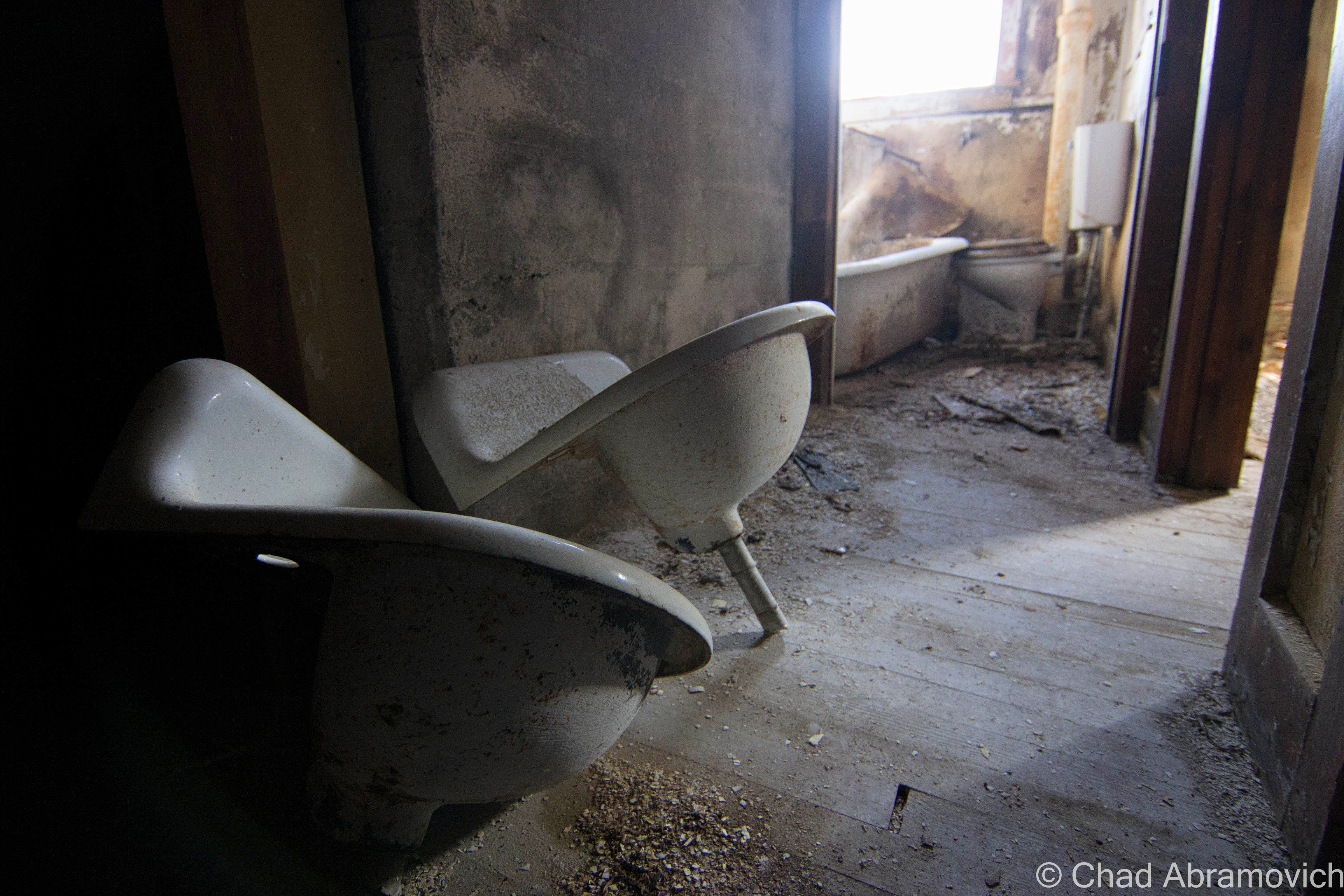
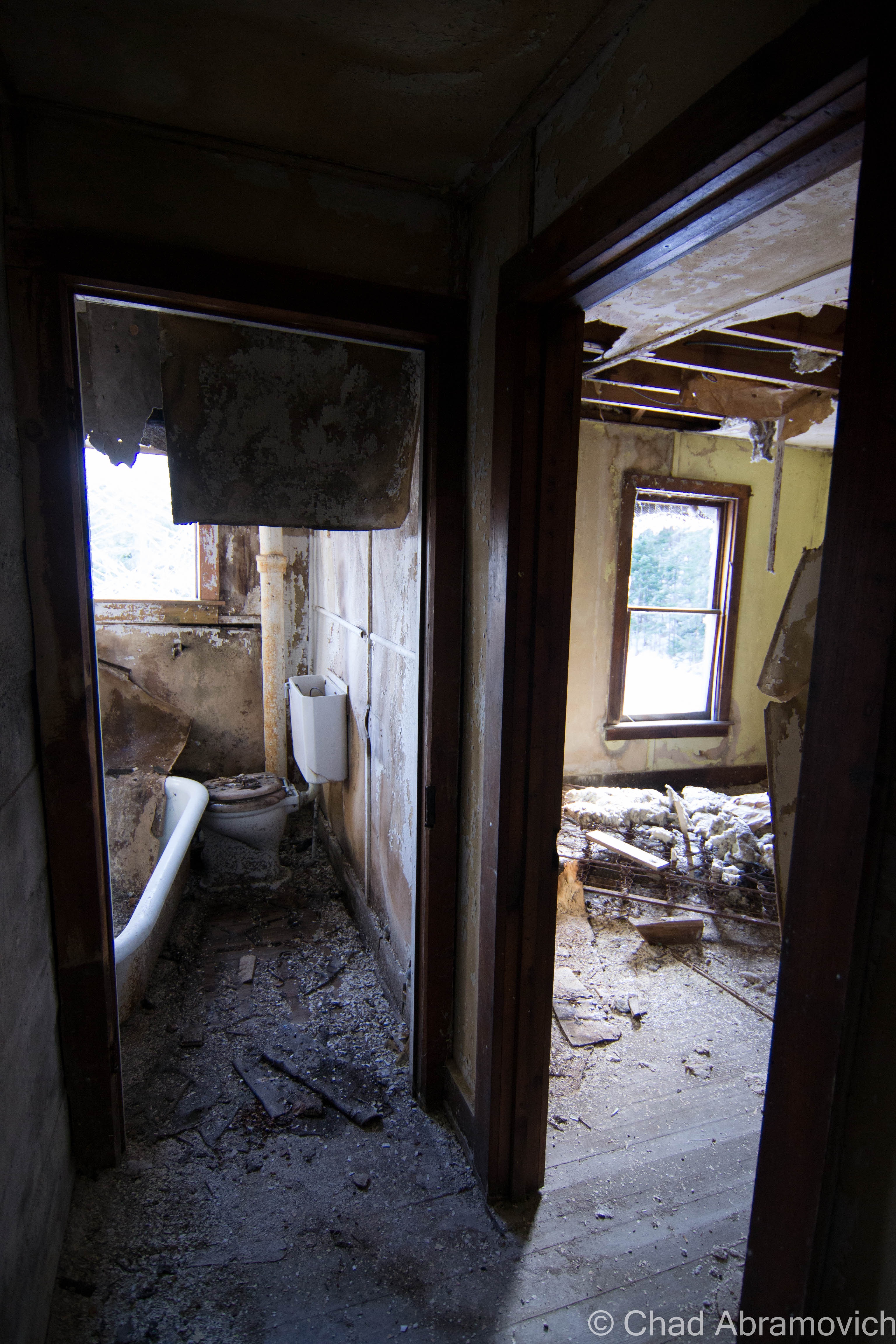
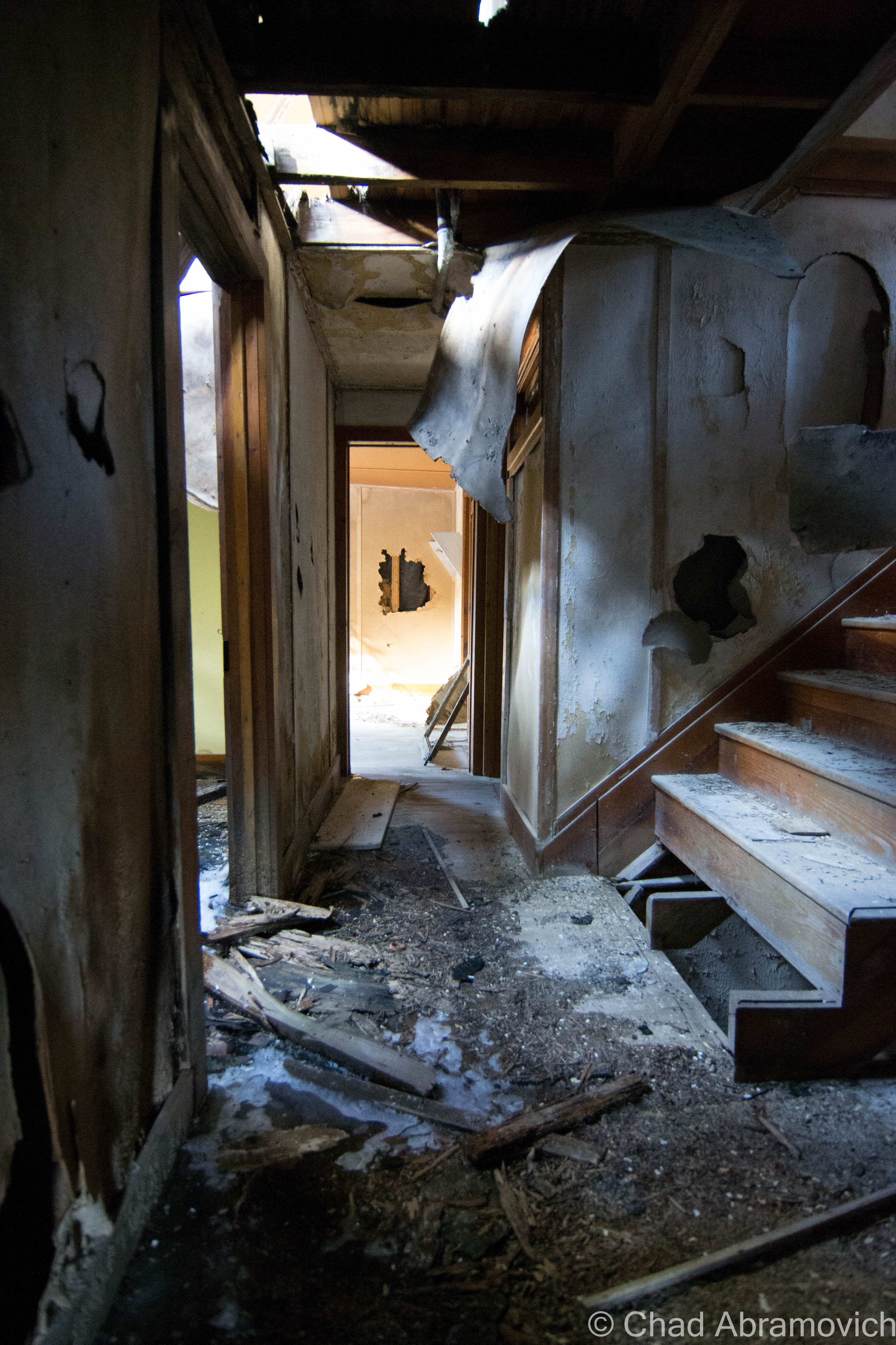
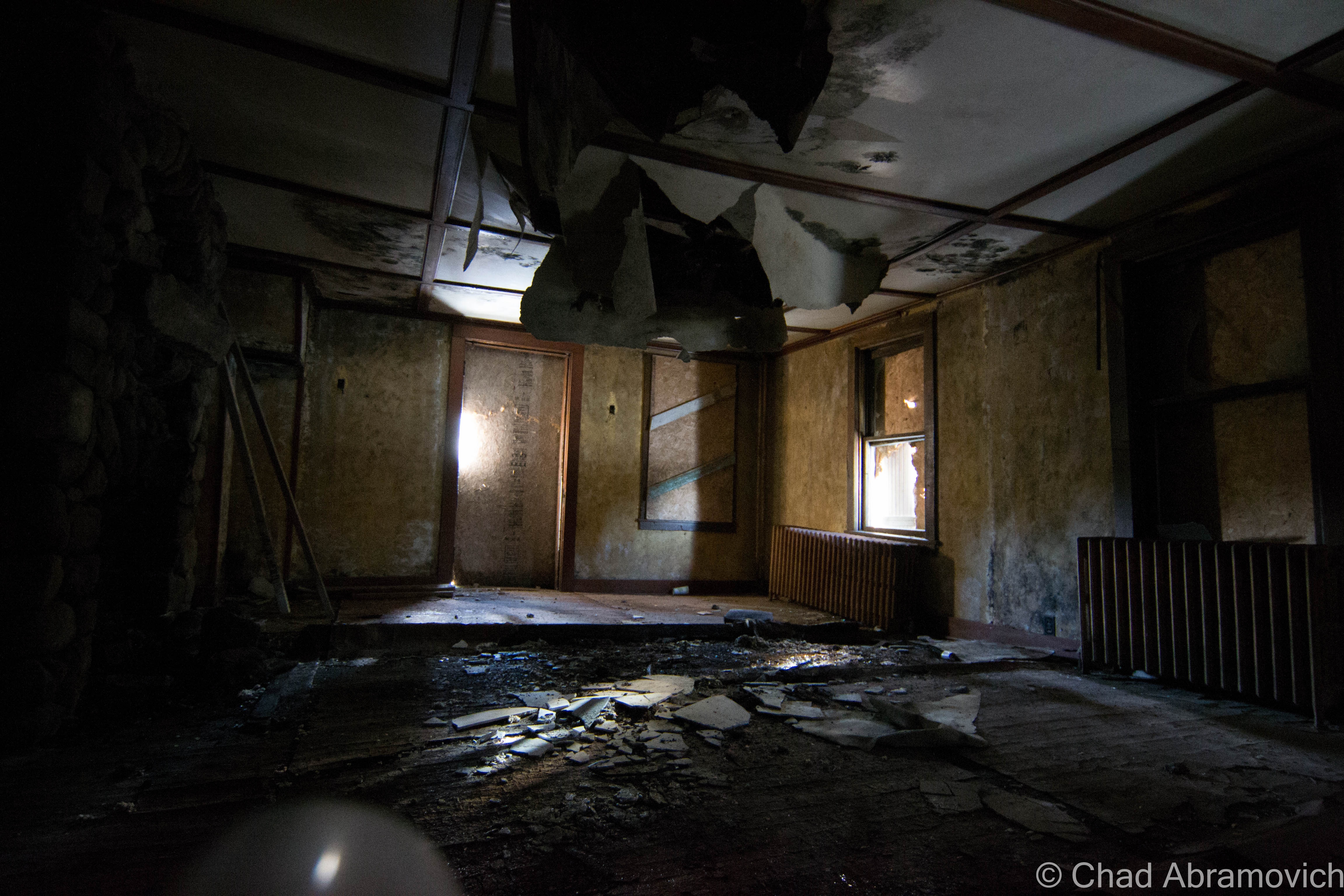
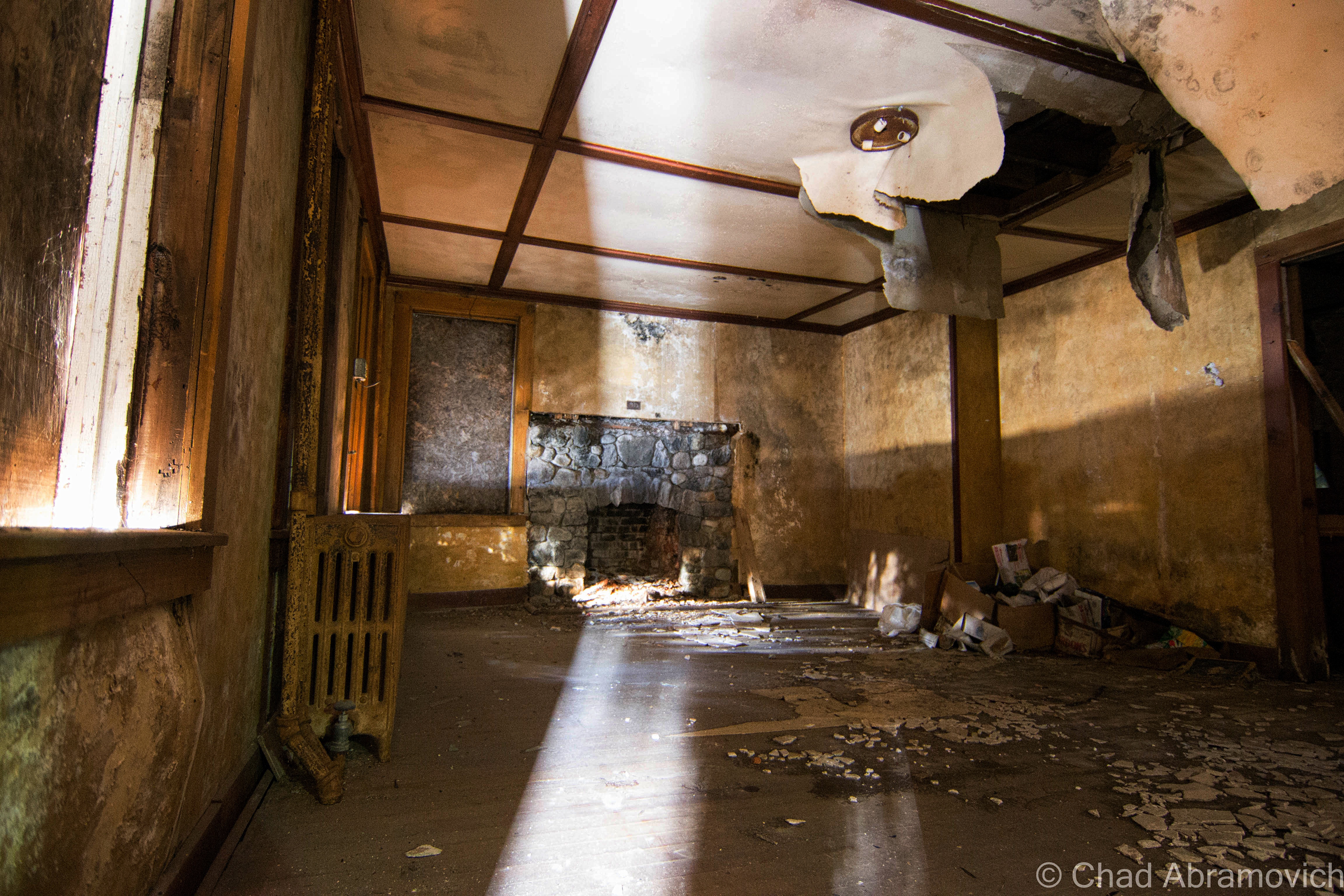
I gazed into the interior dubiously. Because the floor had already begun to sag underneath the weight of my hands as I pulled myself up, I wasn’t sure if this was going to be worth the risk or not. The lack of maintenance has caused serious damage to parts of the buildings – especially the roof. The damage has festered its way down to the stone cellar, causing the entire structure to rapidly fall apart from the mercurial freezing and thawing of the seasons.
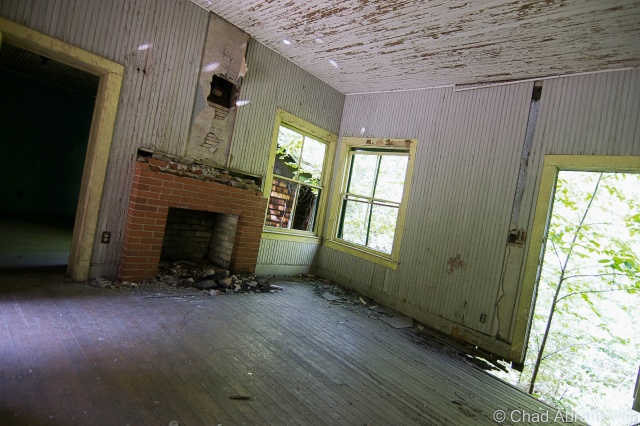
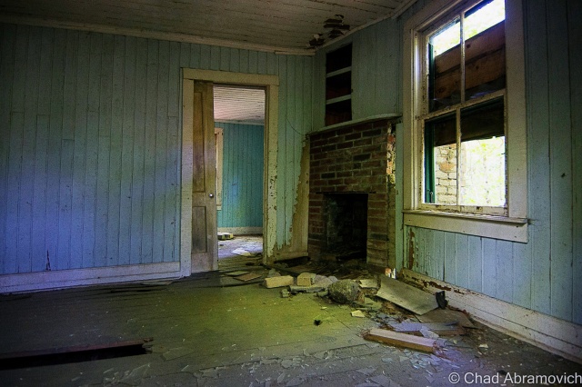
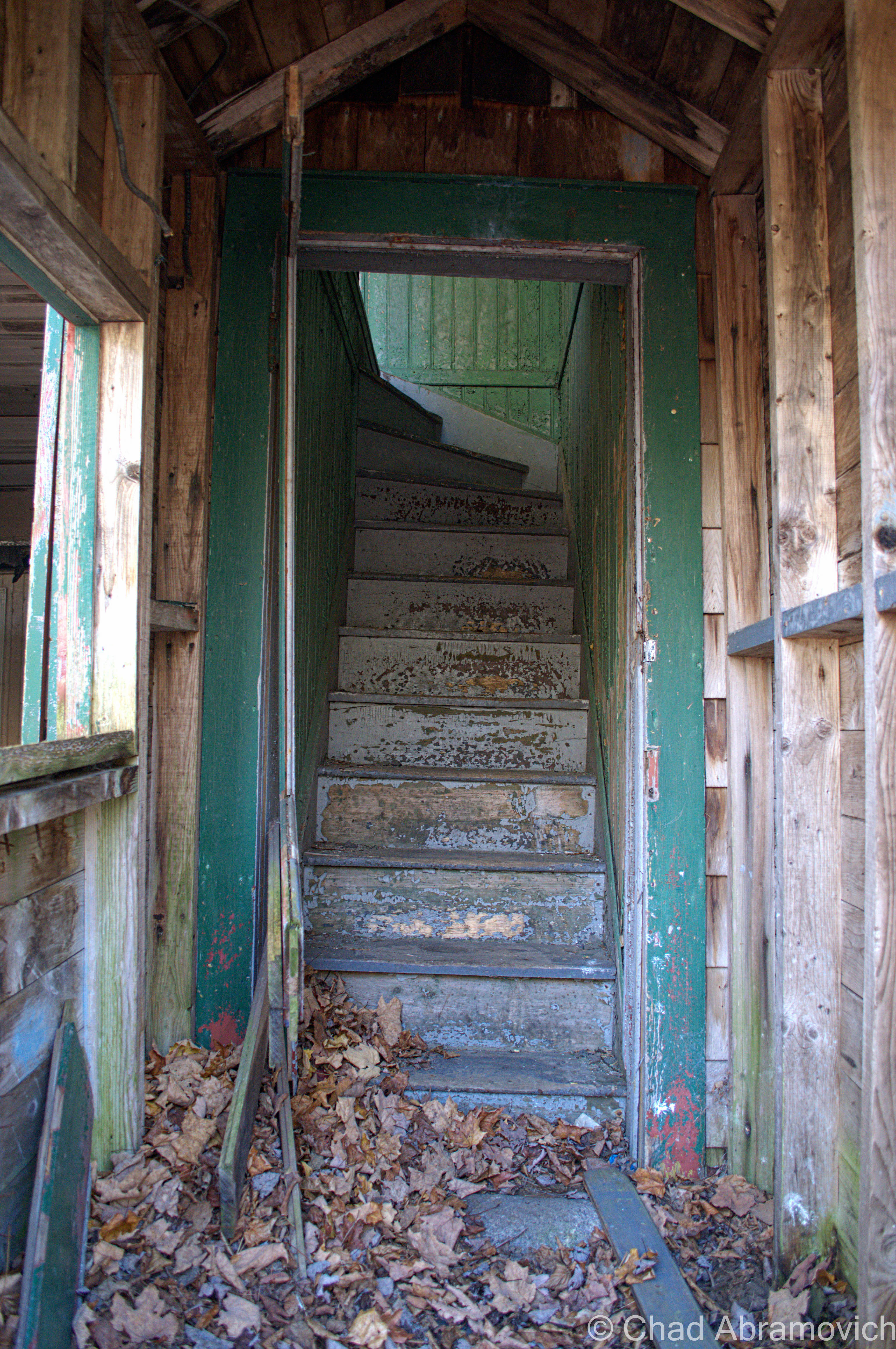
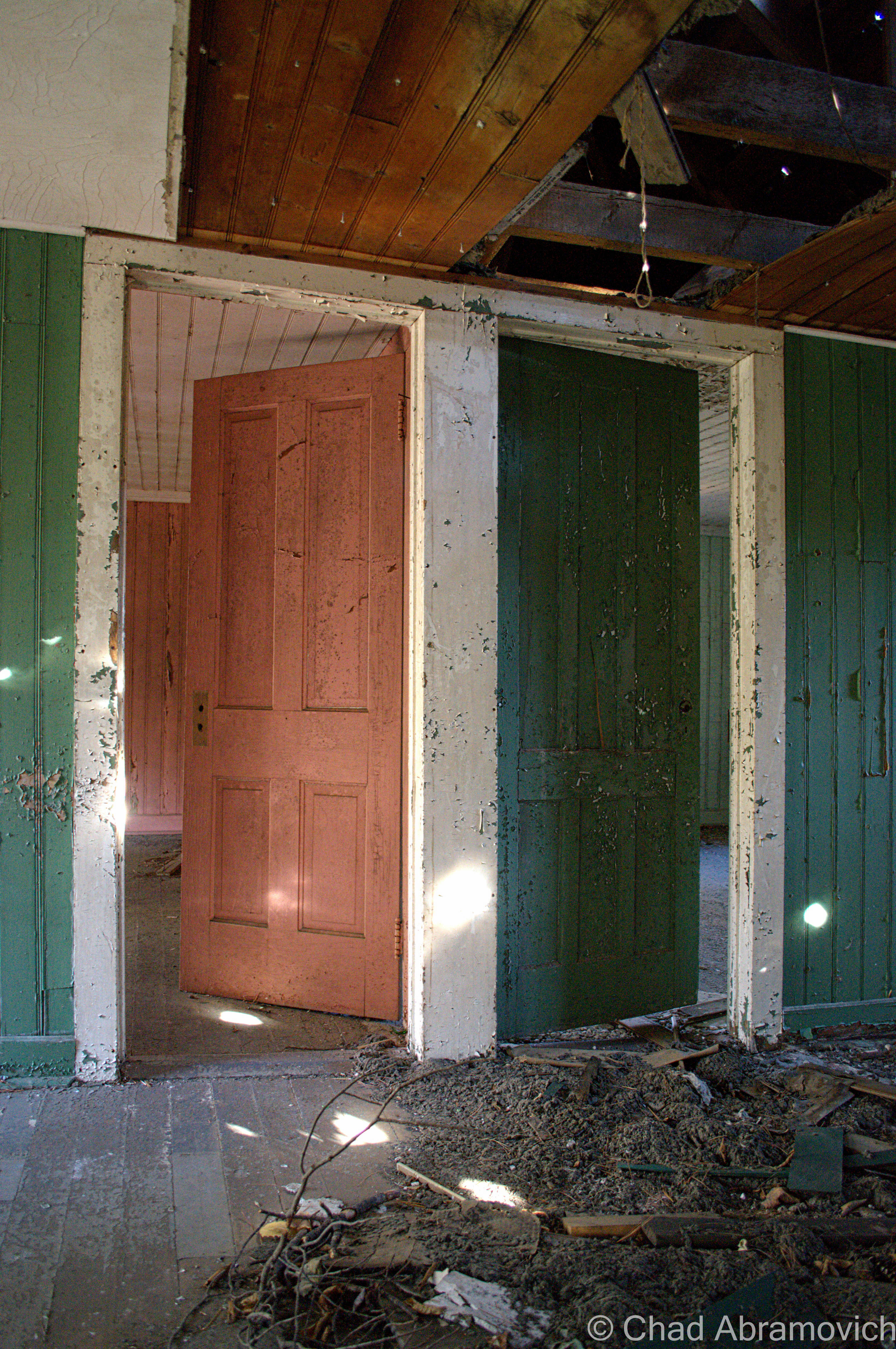
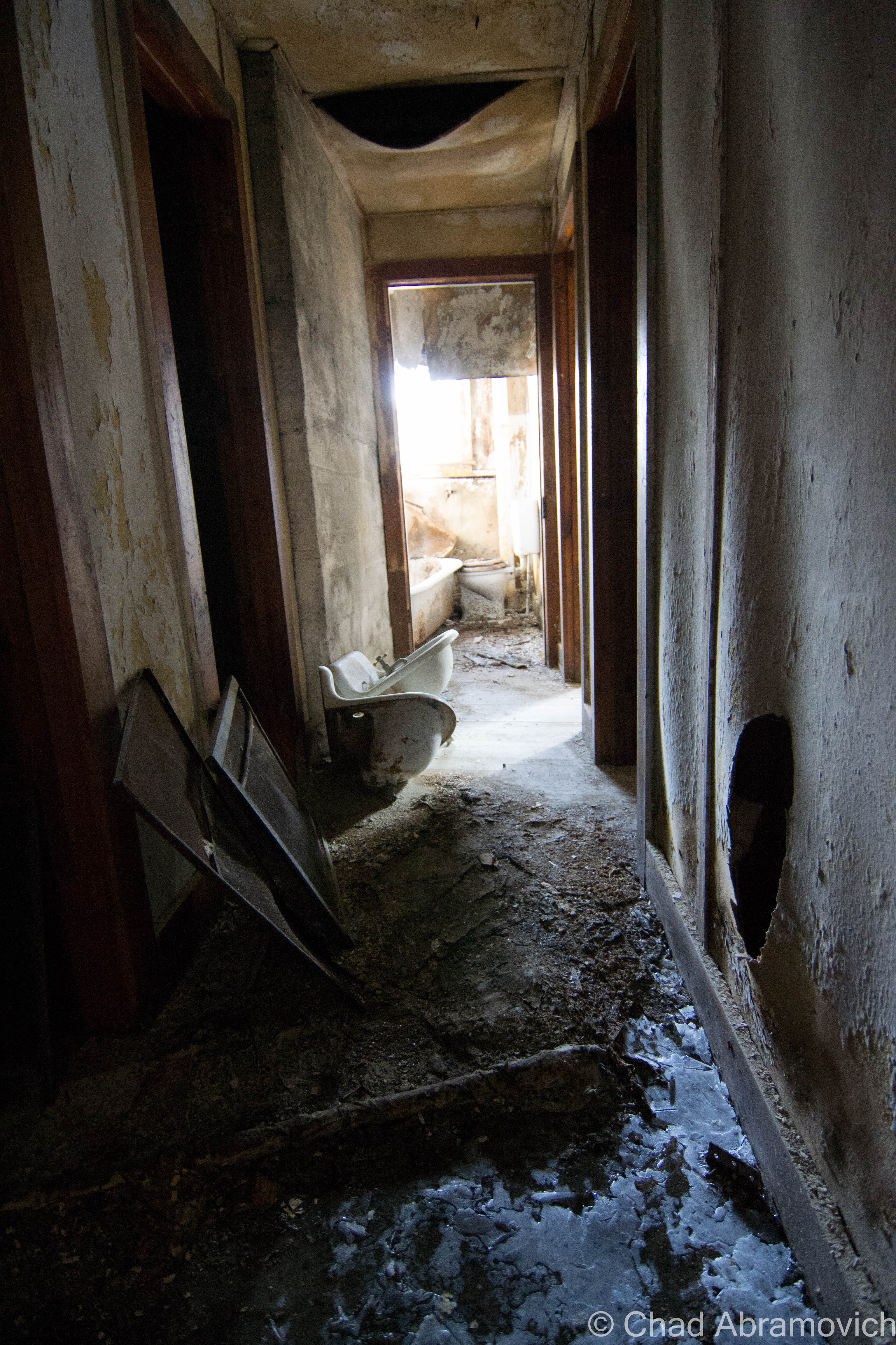
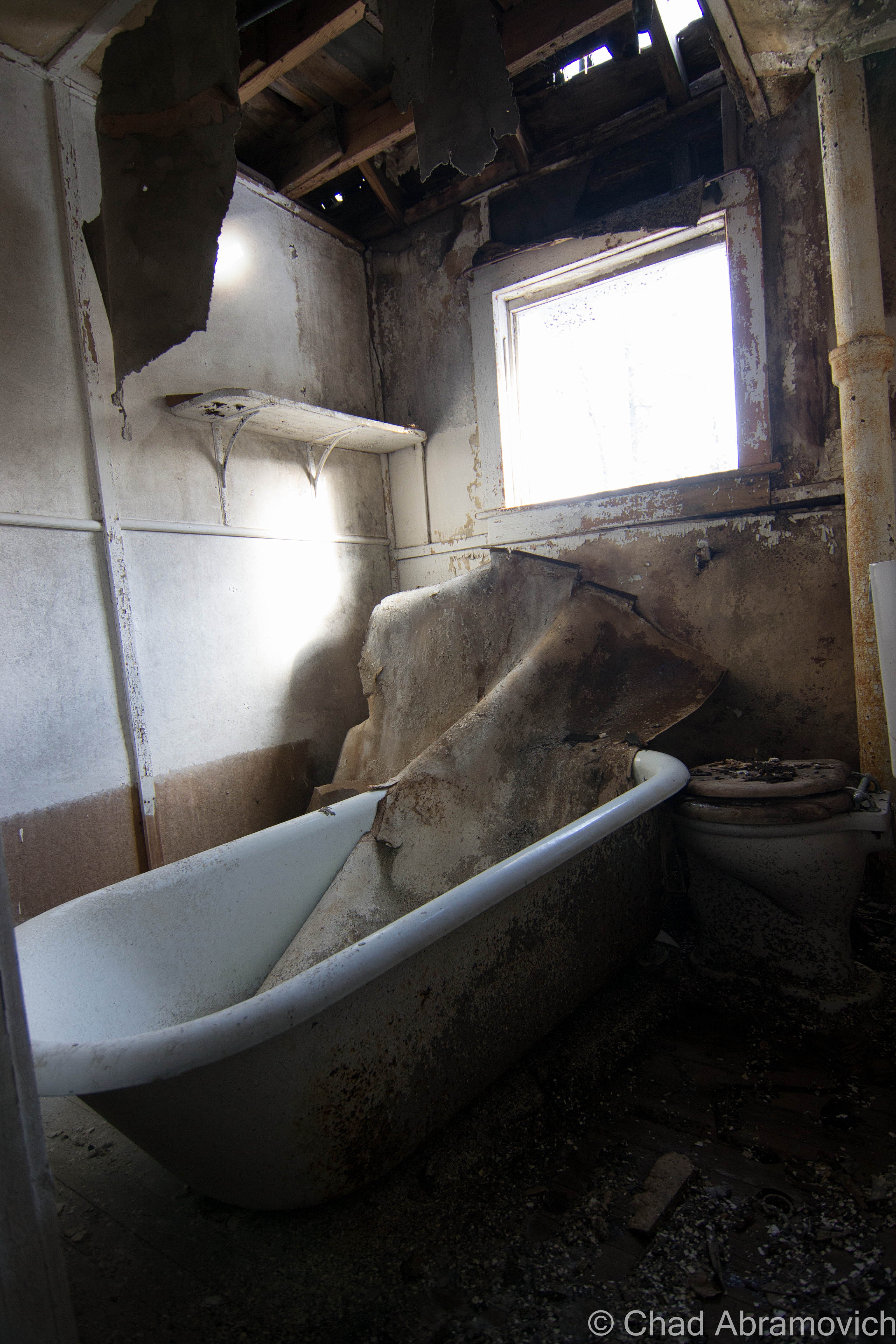
Aiden Lair was a now formidable and sizable husk of a building, devoid of most of its original details that have been effaced with time. Being on the upper floors in cramped rooms flourishing with mold that discolored disintegrating walls and suspicious water dripping down my neck, I found it almost difficult to believe that this was once a respected and comfortable place to want to be. But some beautiful details remained. Two massive and classic Adirondack stone fireplaces could be found illuminated by my flashlight, and a balcony overlooking Stony Pond Brook had that identifying mountain woodwork on the railings that many Adirondack lodges have synonymously featured in their architecture.
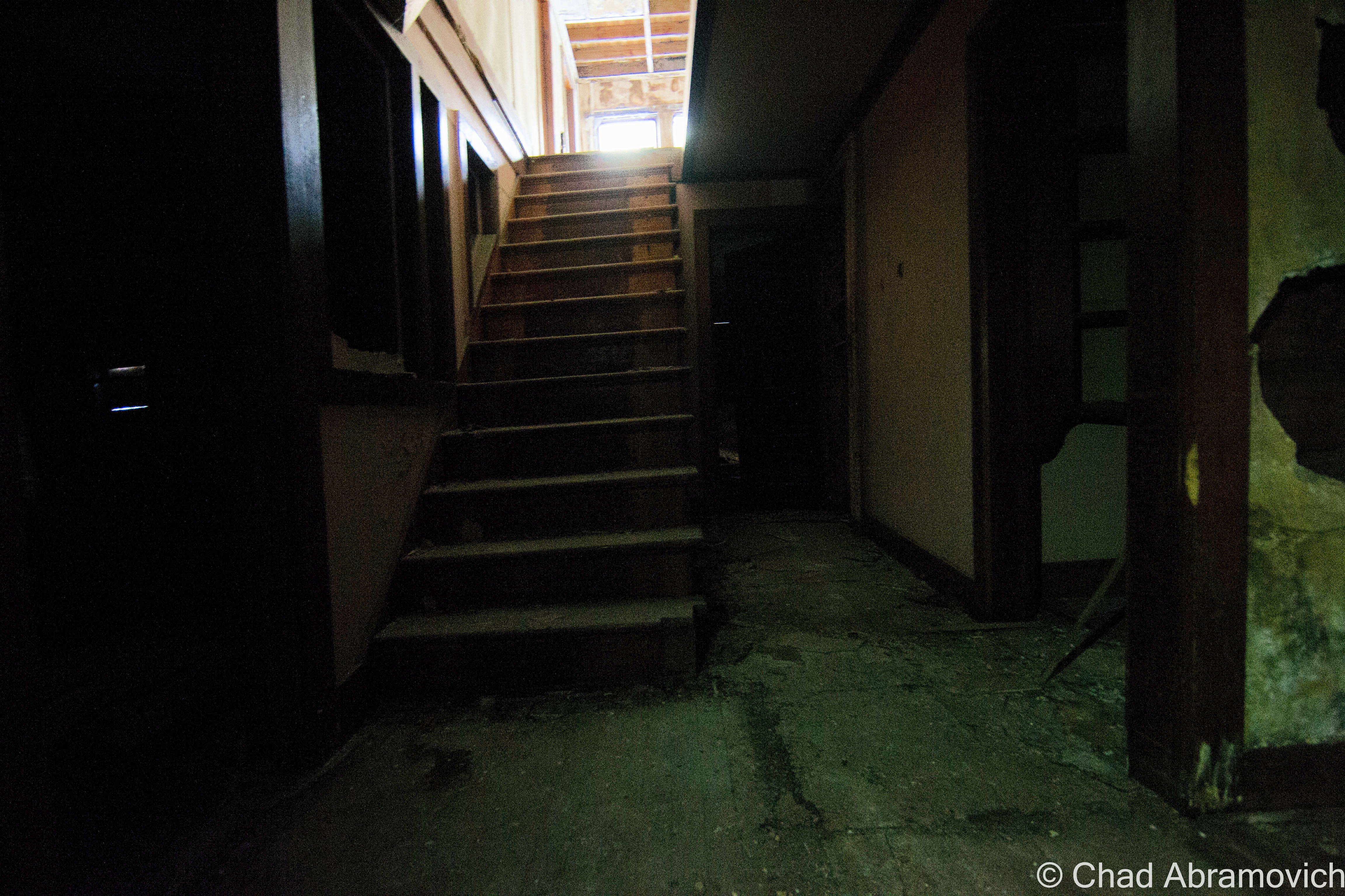
The vastness of the floor plan took me by surprise as well. Though it looks relatively tiny from the outside, once inside, it becomes apparent at just how much there is to see. I was quite surprised with how many hallways and rooms there were. We were humbled at least once when we found ourselves loosing our bearings.
The cold was having deleterious affects on my nervous system. At this point, I was already trembling in my coat, and I was beginning to get hasty. The floors throughout the entire building were so perilous, that we were exploring at a very slow crawl of a pace. This is definitely one of the most dangerous places I’ve ever been in to date.
The place was incredibly silent, void of life, so sound carried through remarkably well, not being obstructed by competition. The cold rushing waters of Stony Brook could be heard inside, and provided some white noise behind the clomping of our boots and steady breathing. The movement of a door banging against a wall from a gust of wind flickered in our peripheral vision – making us someone else was inside with us. Another urban explorer perhaps, or a cop…
I’ve always thought that the term “lair” in the name was a little ominous sounding, but after seeing it’s state of slow collapse and dark places within, that part of the name now seems very fitting.
When writing these blog posts, and comparing my photographs to historical ones when these places were in their prime, it’s almost surreal. A place that was once frequented and celebrated in many ways, now is forsaken and seemingly unwanted; a burden. We human beings are sentimental creatures, and those sentiments can transcend far beyond other humans. Man made things, constructed from wood, stone, mortar and slate also have powerful emotional bonds to otherwise utilitarian objects, and as they were once so easily loved, they can also be so easily lost.
Admittedly, the cacophony of all that we were taking in here can make you want to stay for quite some time to enjoy it all, finding a different world that doesn’t exist in the superfluous found outside. But, there was much wanted heat back in the truck…
The Glebus Count
I’m a bit of a weirdo, so it’s great that I’m also friends with weird people, with plenty of inside jokes between us. This one is definitely a time honored one, now being practiced for a few years running. Whenever we travel to the northern reaches of the empire state, we found ourselves engaging in something that I call “The Glebus Count”. What is this strange ritual?
While Vermont seems to have it’s fair share of real estate agencies represented, across the lake in the high peaks region, one name reigns supreme on red and white signs emblazoned with a bold, down to business, san serif font; Glebus. They’re everywhere. I’m not kidding. Almost every piece of property that listed as for sale has a Glebus sign in front of it, with the occasional other Realtor found in between. But who are they kidding, they’re not Glebus! Over time, we began to start pointing out when we’d come across one of their signs, and soon, that turned into trying to count as many as we pass during our trip. You’d be surprised at just how easily you’re drawn into it.
“Who do you think this guy Glebus is? He’s pretty much selling everything in upstate New York” The best satire we came up with thus far, was that the mysterious man had to have an old timey name evocative of infamous business moguls from the golden age of unprecedented capitalism- something like, say, Cornelius Glebus, (according to their website, his actual name is Gary) and he could be found in his real estate lair sitting in a gilded throne drinking wine from a chalice. Sometimes it’s those long drives that inspire the best conversations that you probably wouldn’t have elsewhere. You know what I’m talking about. It’s unintentionally became such a integral part of my treks here that I feel it’s that if I’m writing about upstate New York, it wouldn’t be fitting unless I included it.
Next time your in the high peaks, see how many Glebus signs you can count. And if you were curious, we counted 21 on this trip.
—————————————————————————————————————————————–
To all of my amazing fans and supporters, I am truly grateful and humbled by all of the support and donations through out the years that have kept Obscure Vermont up and running.
As you all know I spend countless hours researching, writing, and traveling to produce and sustain this blog. Obscure Vermont is funded entirely on generous donations that you the wonderful viewers and supporters have made. Expenses range from internet fees to host the blog, to investing in research materials, to traveling expenses. Also, donations help keep me current with my photography gear, computer, and computer software so that I can deliver the best quality possible.
If you value, appreciate, and enjoy reading about my adventures please consider making a donation to my new Gofundme account or Paypal. Any donation would not only be greatly appreciated and help keep this blog going, it would also keep me doing what I love. Thank you!
Recently, I had my inaugural voyage to the Adirondacks of Upstate New York, an area I’ve became quite interested in. Lake Champlain, the massive body of freshwater roughly 500 square miles in size, forms the boundary between Vermont and New York, and with a limited amount of crossings to the next state, as well as a lack of reasons for your blogger to go visit, the state of New York was practically an unfamiliar exotic world to me, an undisputed disparity from the weird bubble that is Vermont. One of the most common things I hear flatlanders say about Vermont, is something like; “man, do you have any idea how weird Vermont is? Seriously, you guys are like a cult up here. It’s almost like you don’t belong in the rest of the United States”, and sometimes they eye me with momentary awe. And I’m immensely proud of that.
The Vermont side of the lake is gentler and up kept, while the New York side is wild and grungy, wallowing in its nostalgia. Boulders and forests slide into the lake, bordered by rural stretches of crumbling highways and tumbledown homes. The Adirondack experience is a multi-faceted one – a region that doesn’t give up all its secrets, but doesn’t hide its scars. A place that’s vast, desolate and intriguing.
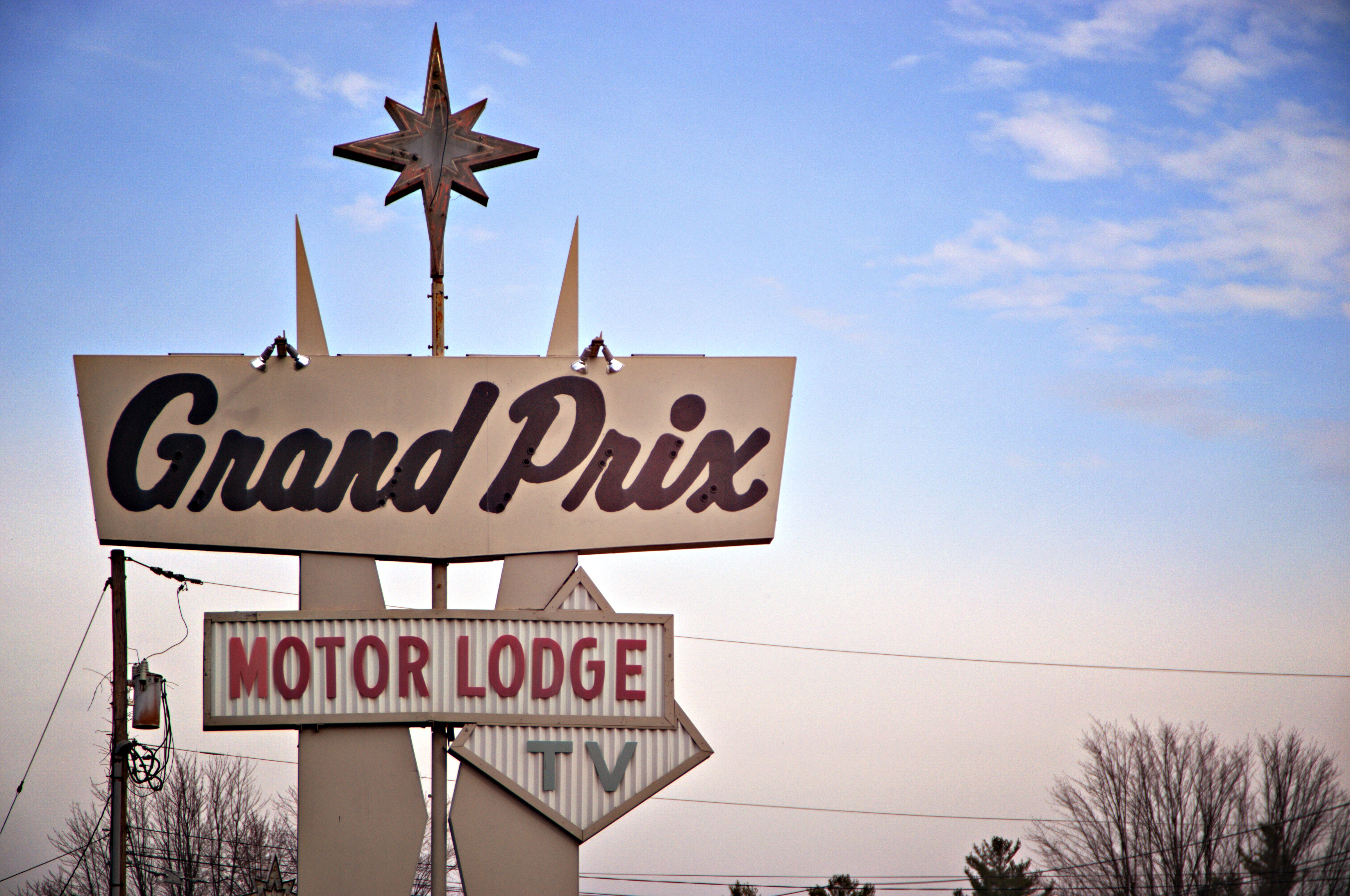
Meeting up with a good friend who is familiar with the region, he agreed to show me around some of his favorite haunts on a rather pleasant November day. Crisscrossing the region’s roads in the most inefficient manor possible, we decided to dedicate our escapade to a particular hue; the scores of old motels, vacation cabins and awesomely unkempt vintage signage and their visage of deterioration.
Everything related to this goal can be found along U.S. Route 9, where much of the area’s notoriety once came from. The route cuts through this huge region in a north south direction between the Adirondack Mountains and Lake Champlain. At one point, Route 9 was the original superhighway to the North Country before the Adirondack Northway, also known as Interstate 87, was built. In Route 9’s well traveled heyday, it was crawling with people tromping through its roadside attractions, curio, and motels which made lasting impressions in some tangible way. Today, a journey down Route 9 is more of a reflection of one of the more grimy truths of reality; impermanence. It’s now a desolate and forlorn drive through almost uninterrupted miles of forest, which is often sick and scraggily looking, as the Adirondack Northway carries most traffic now. But it’s a fascinating drive to me.
The landscape changes dramatically from the unanimated city of Plattsburgh and neighboring town of Keeseville as Route 9 heads south towards the tiny town of North Hudson and the ruins of Frontier Town, a frontier themed amusement park that was once the blood and pride of an otherwise easily missed town. The areas around Plattsburgh and Keeseville are lined by mid century motel establishments and their gimmicky retro signs complete with wondering arrows, neon lights and sharp angles; all designed to capture the travelers’ attention. Further south, unvarying one room wooden cabins are scattered in the midst of otherwise scraggly fir forests and increasingly long distances of highway with no signs of life for miles. Depressed hamlets like Lewis and New Russia spring out of the untamed forest like some sort of northern mirage, but are easily forgotten within minutes.
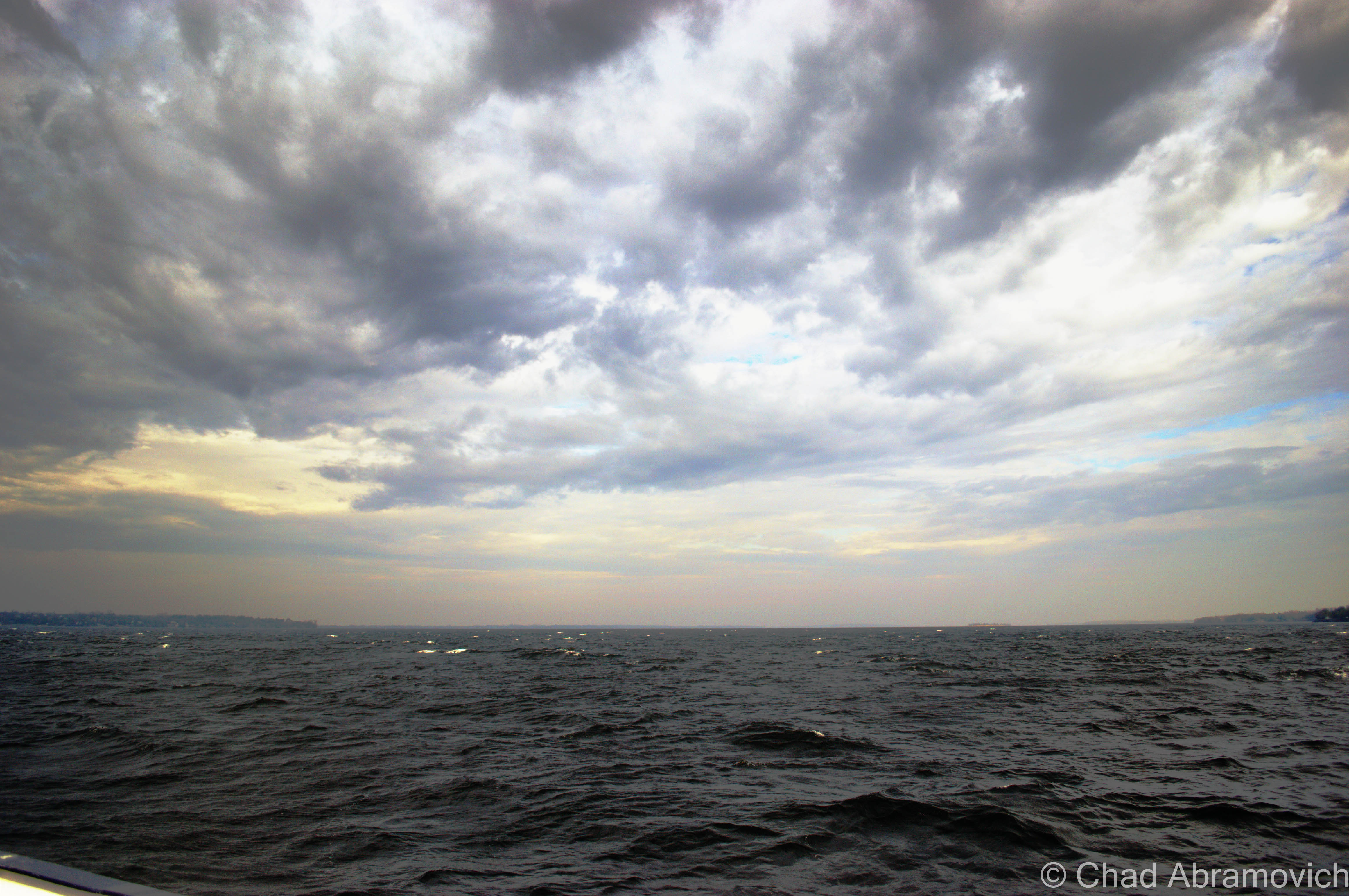
We decided the best route to New York would be The Grand Isle Ferry. From there, it would be a short drive down Route 314 to the destination Route 9 in Plattsburgh. The winds were incredibly fierce, the lake was choppy and full of whitecaps. Because of this, the ferry ride over was twice as long, as the captain attempted to navigate the rough waters safely, the boat viciously rocking back and forth and the waves spraying over onto the deck. For the fun of it, we got out of the car and attempted to get a few pictures of the rough conditions, but my, uh, sea legs had 25 years of inexperience working against me. The boat was rocking so badly that it was almost impossible to gain my balance. Admitting defeat, it was back in the car for me.
The choppy waters of Lake Champlain from the Grand Isle ferry.
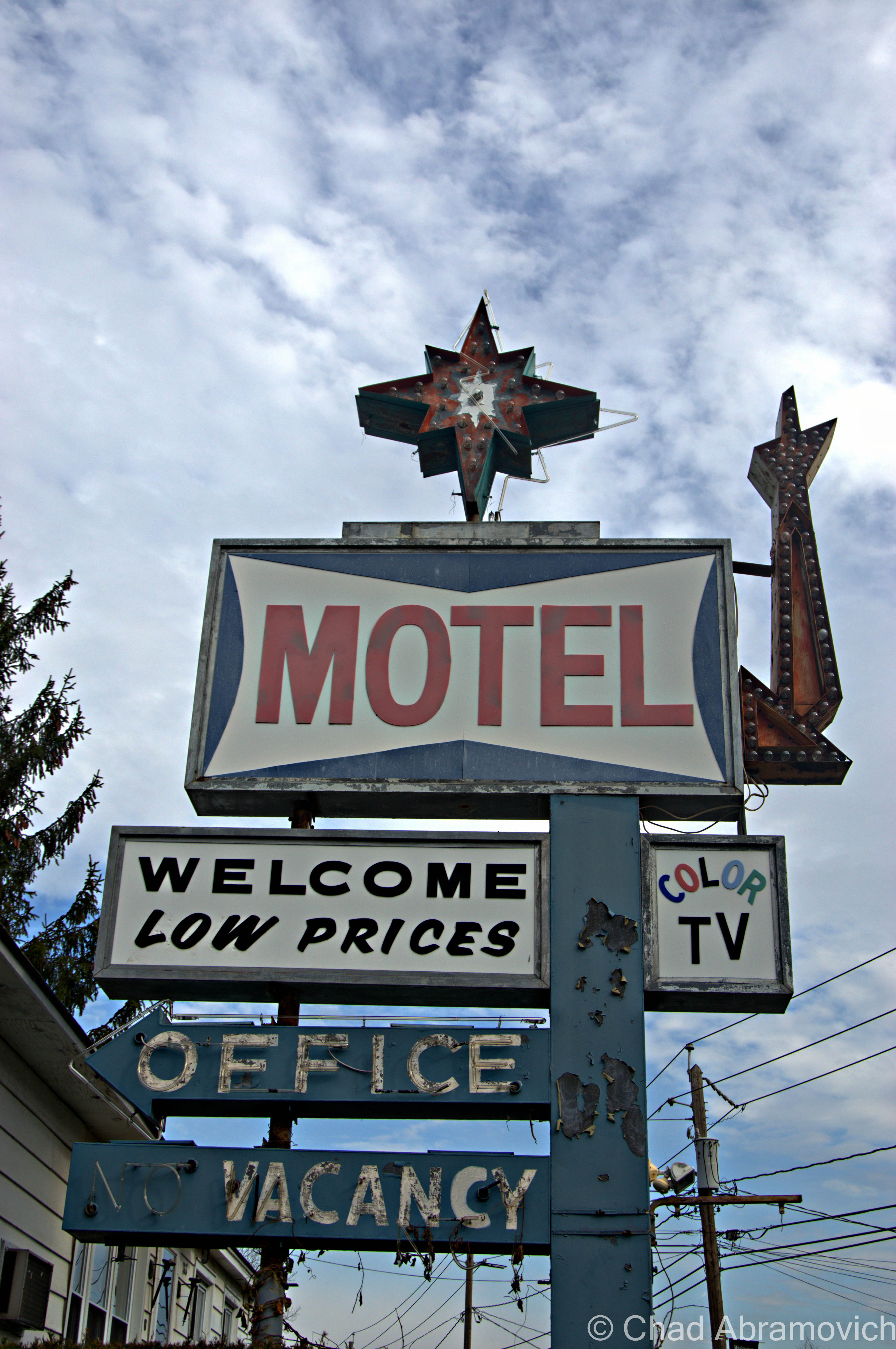
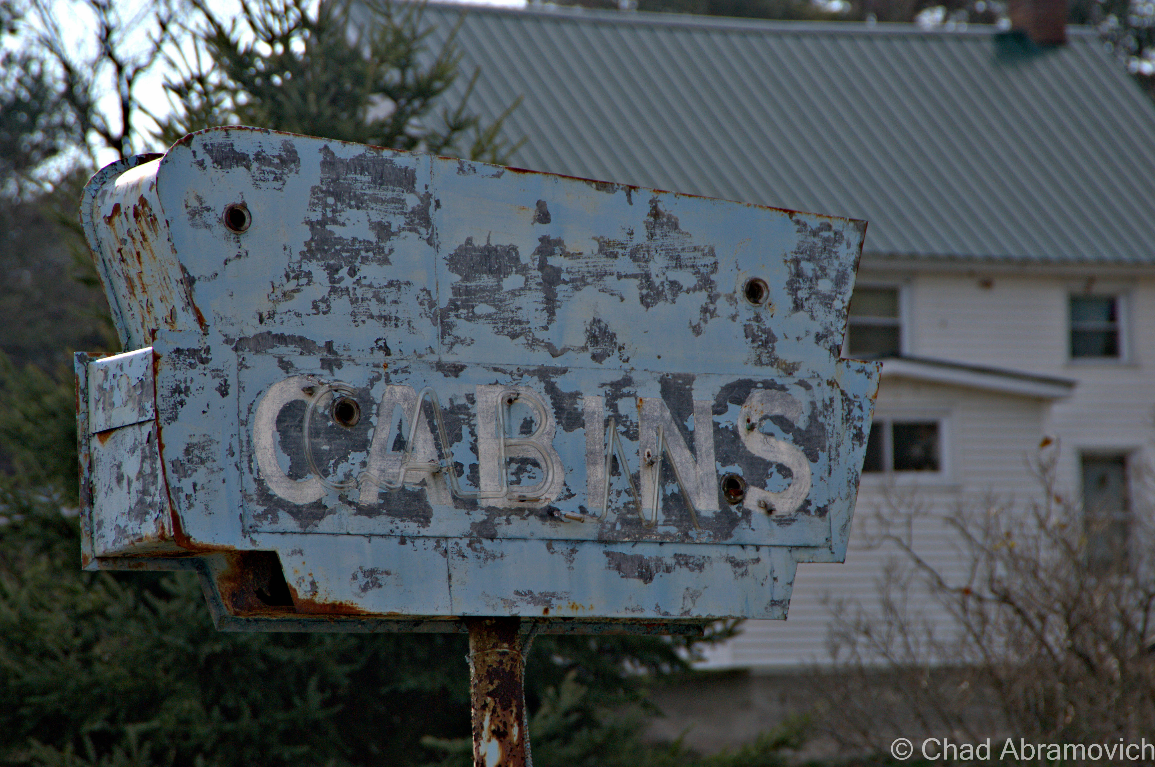
While taking pictures of this sign, the owner of the motel happened to be walking by, giving us a strange look. To relieve some of the tension, we told her we liked her sign, and asked how old it was. She scratched her head in thought, and said it’s been here since the mid 50s. “I can’t believe you guys want to take a picture of it” she said laughing.
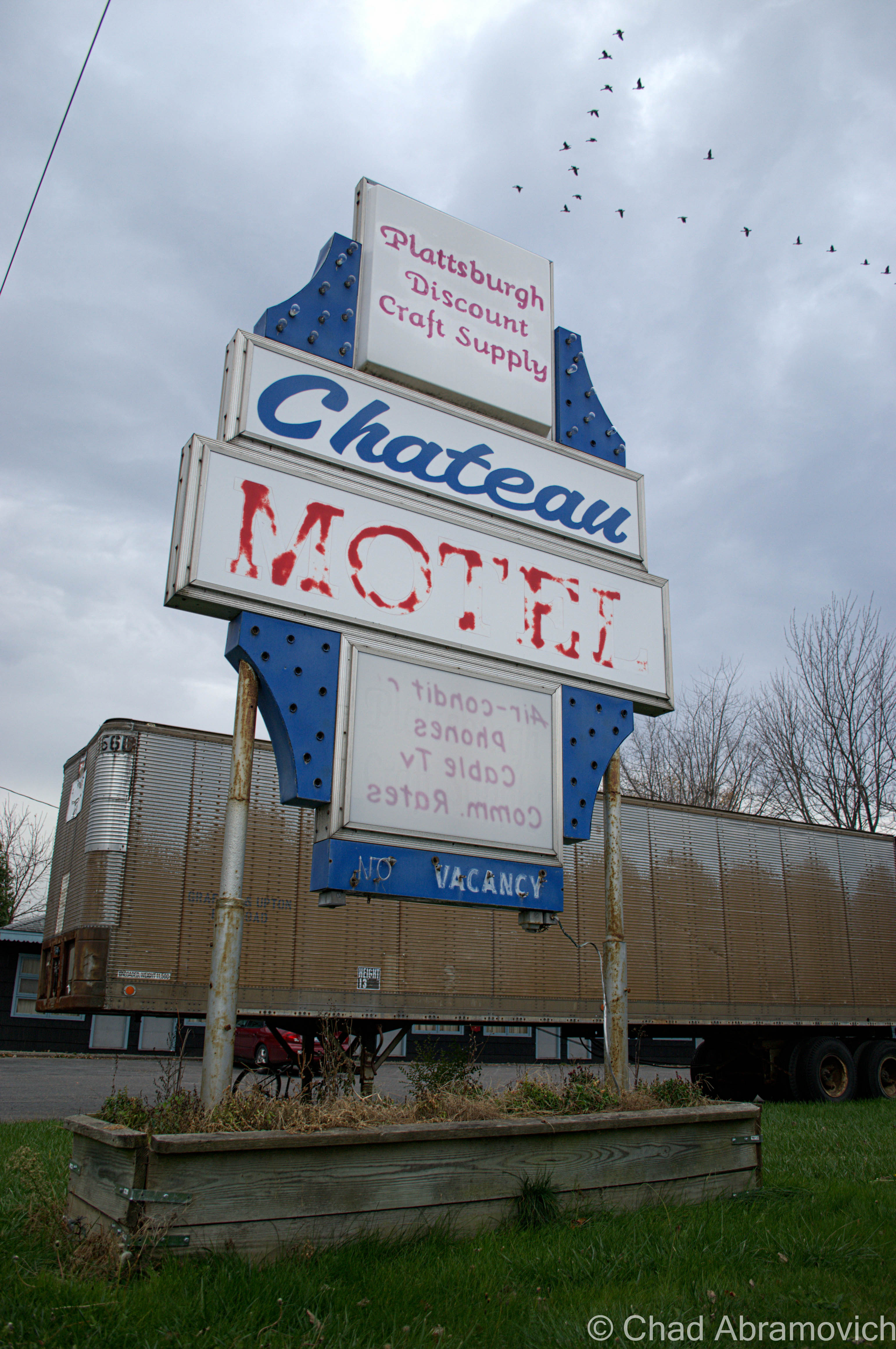
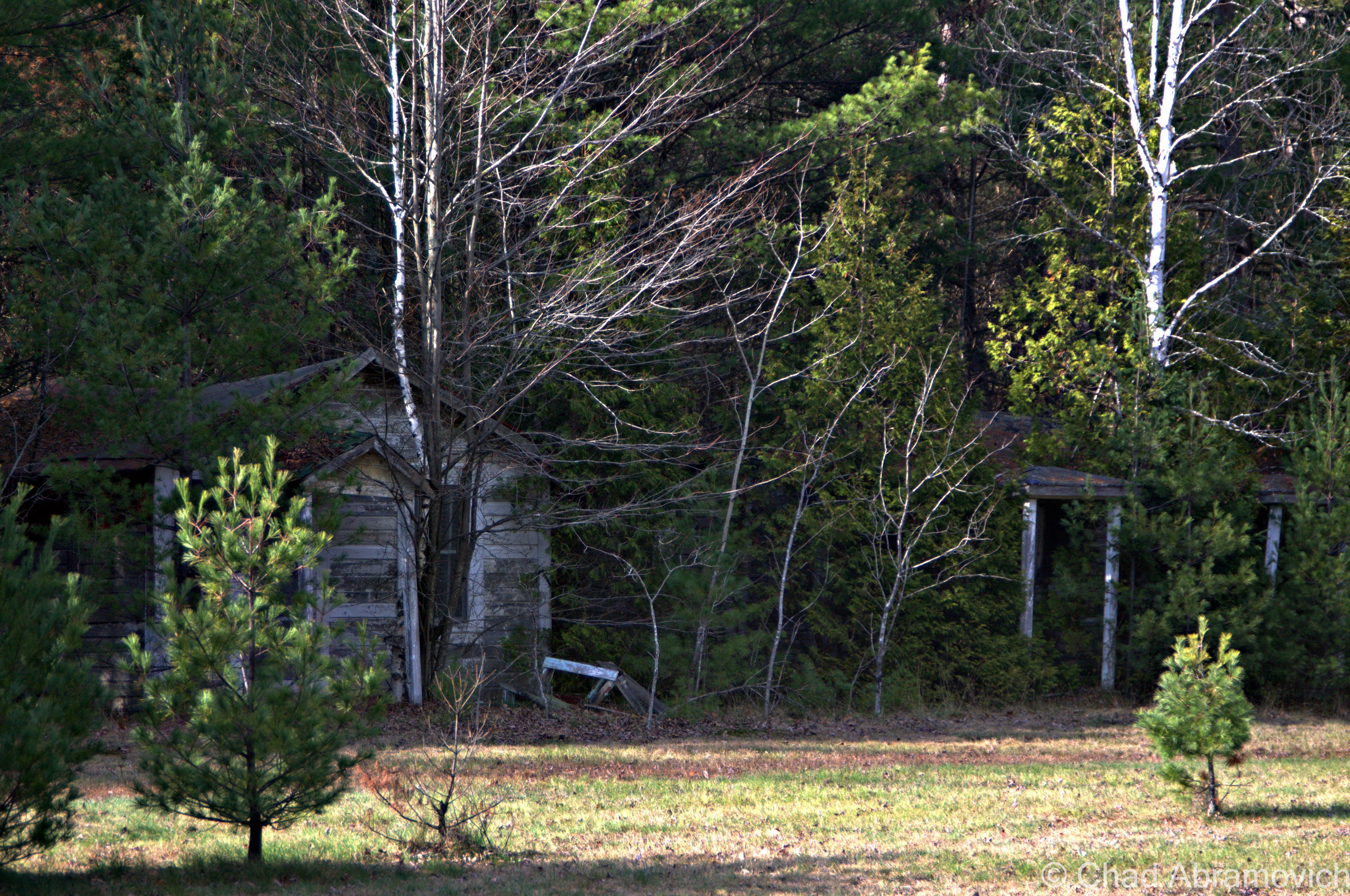
Out of the city limits now, Route 9 returns to stark wilderness. With the motels of Keeseville now gone, the desolation is now occasionally broken by crumbling roadside cabins shrouded in growth, with a decaying sign out front, their paint long faded and neon tubes hanging loosely around the sides.
Cabin Set #1
Cabin Set #2
These cabins were practically in someone’s front yard.
Cabin Set #3
I found these to be interesting because of their unique hillside perch – and their remote location – there was nothing else around for several miles, making me think that these were sort of a “last chance” affair.
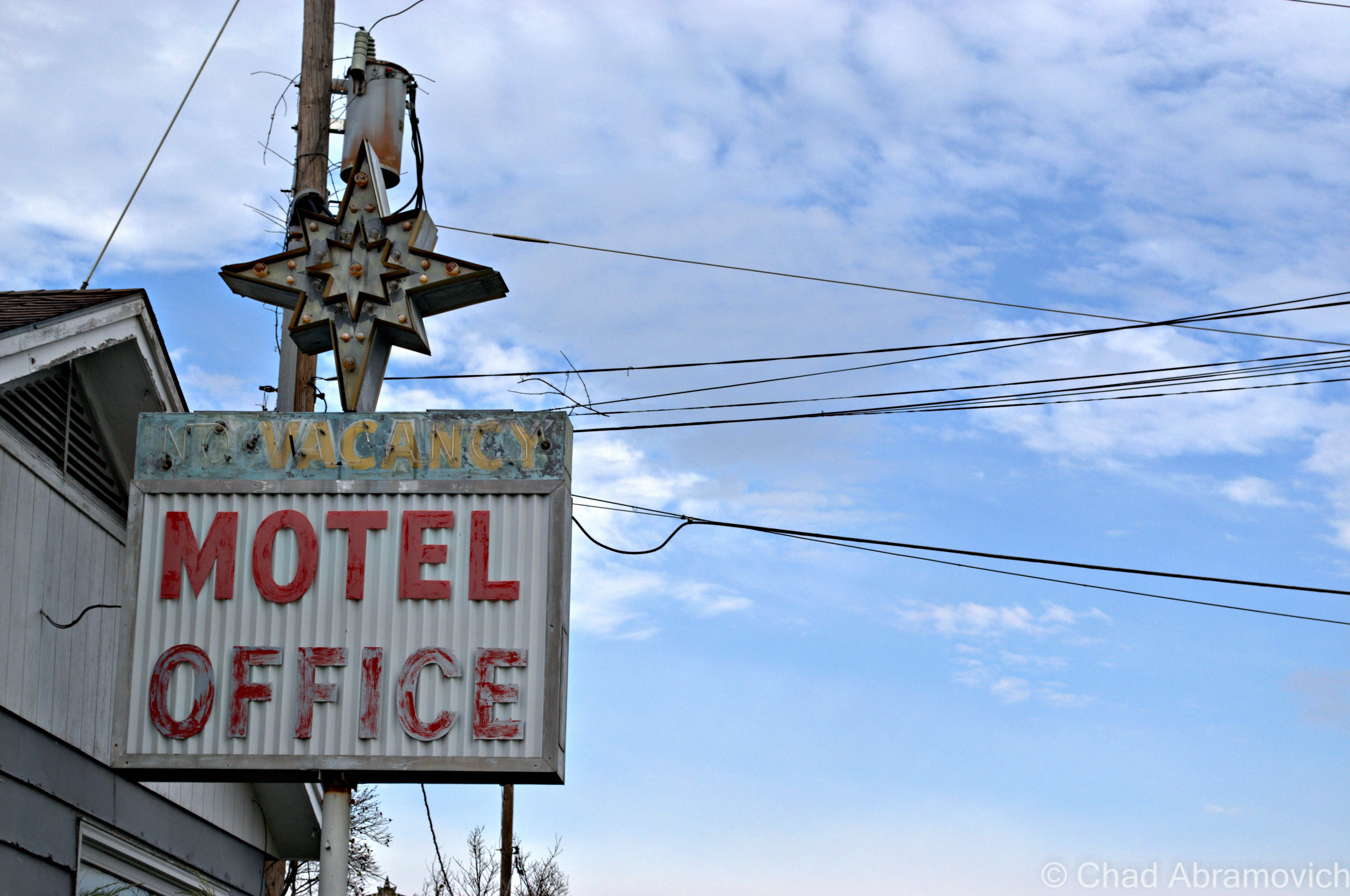
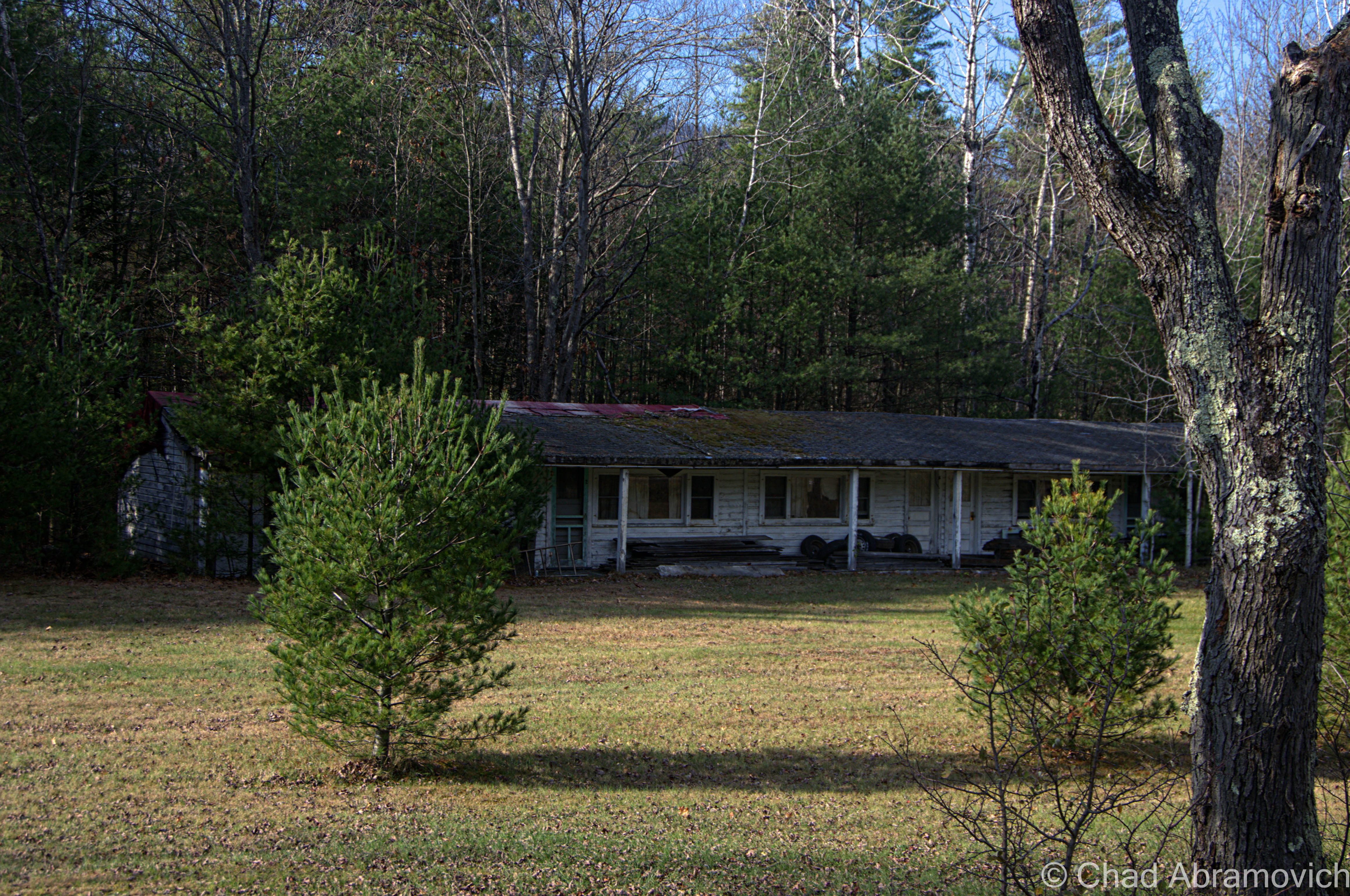
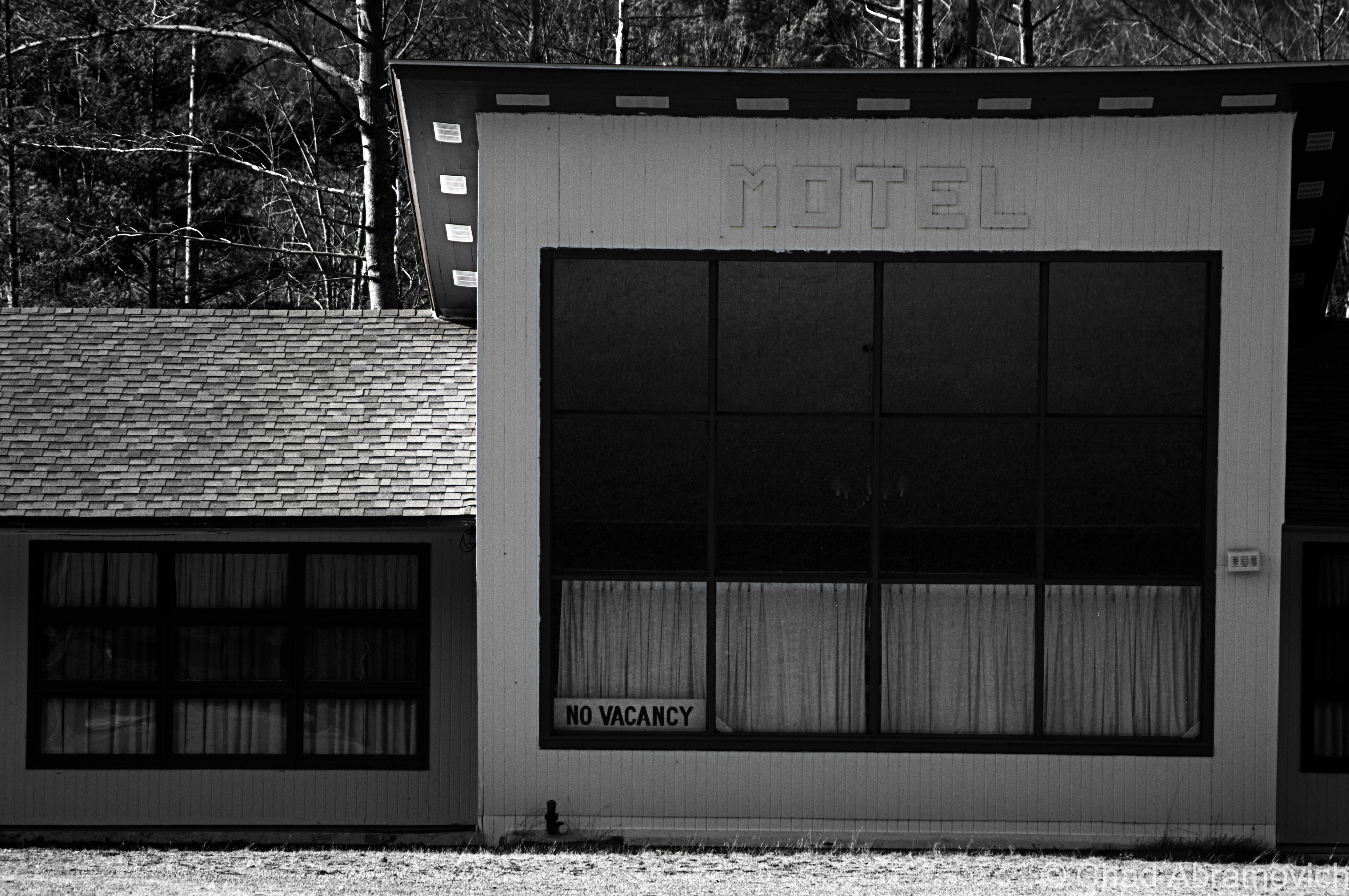
Now the landscape changed again from the cramped rustic abandoned cabins to abandoned motels.
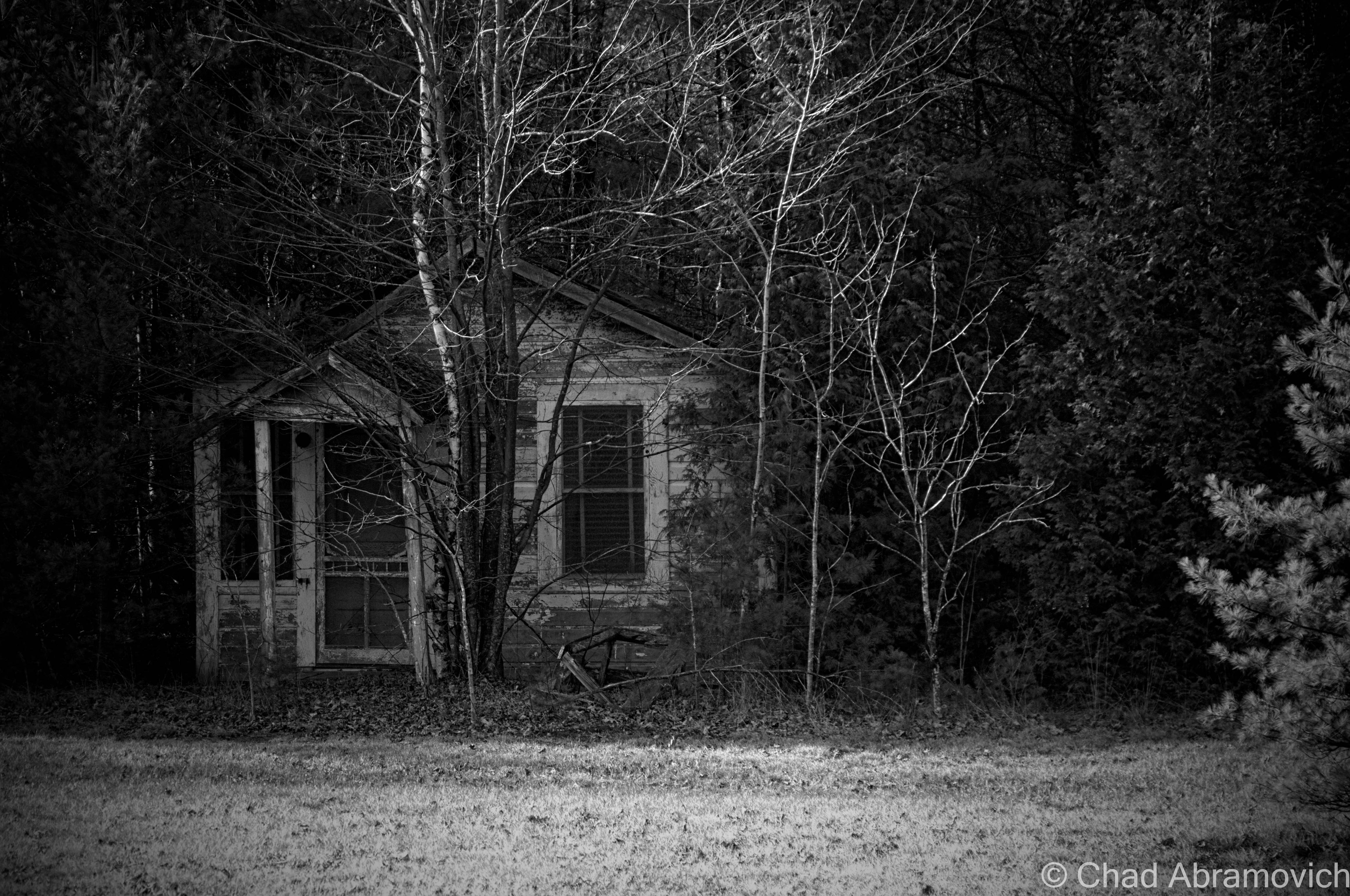
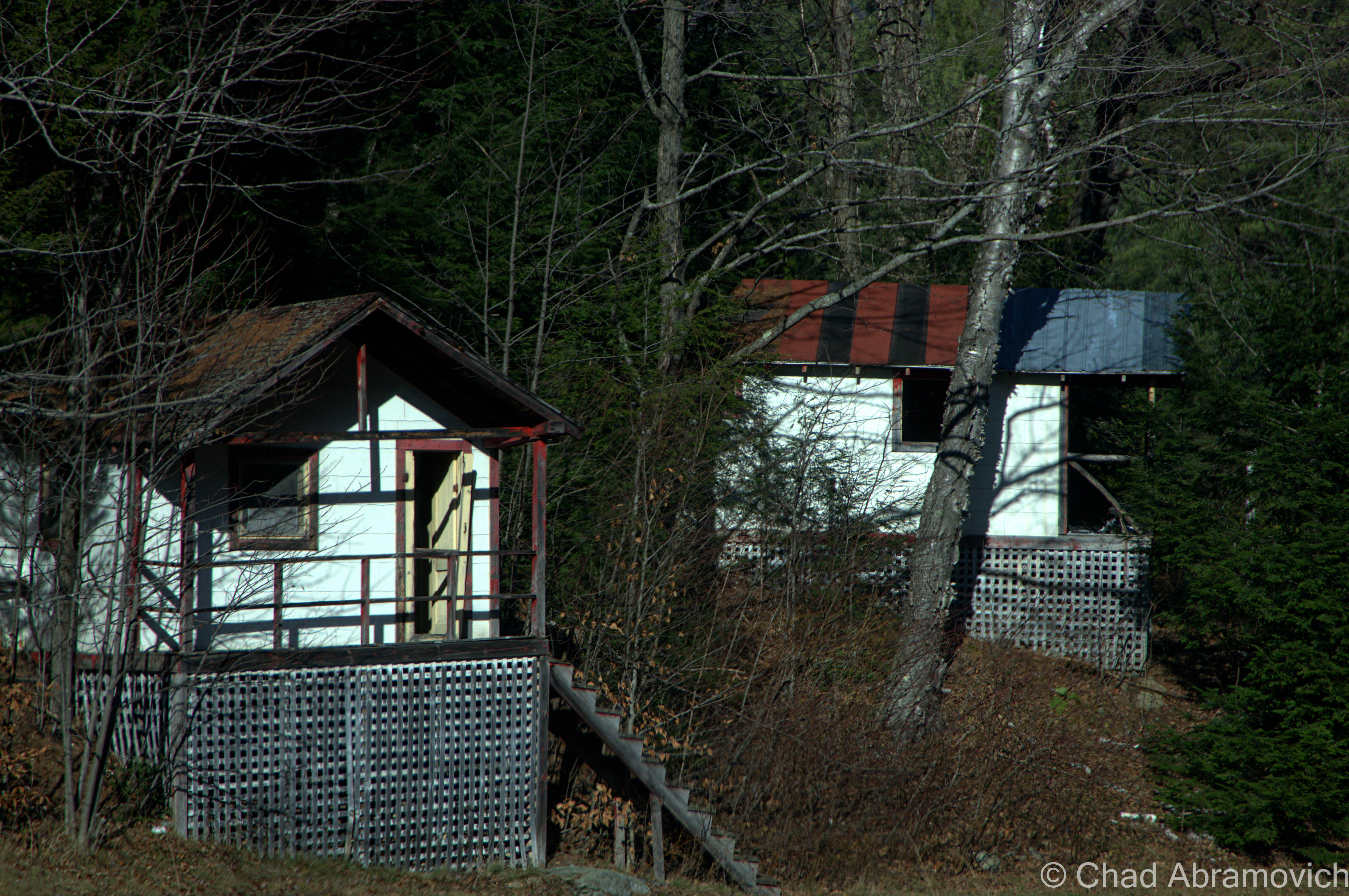
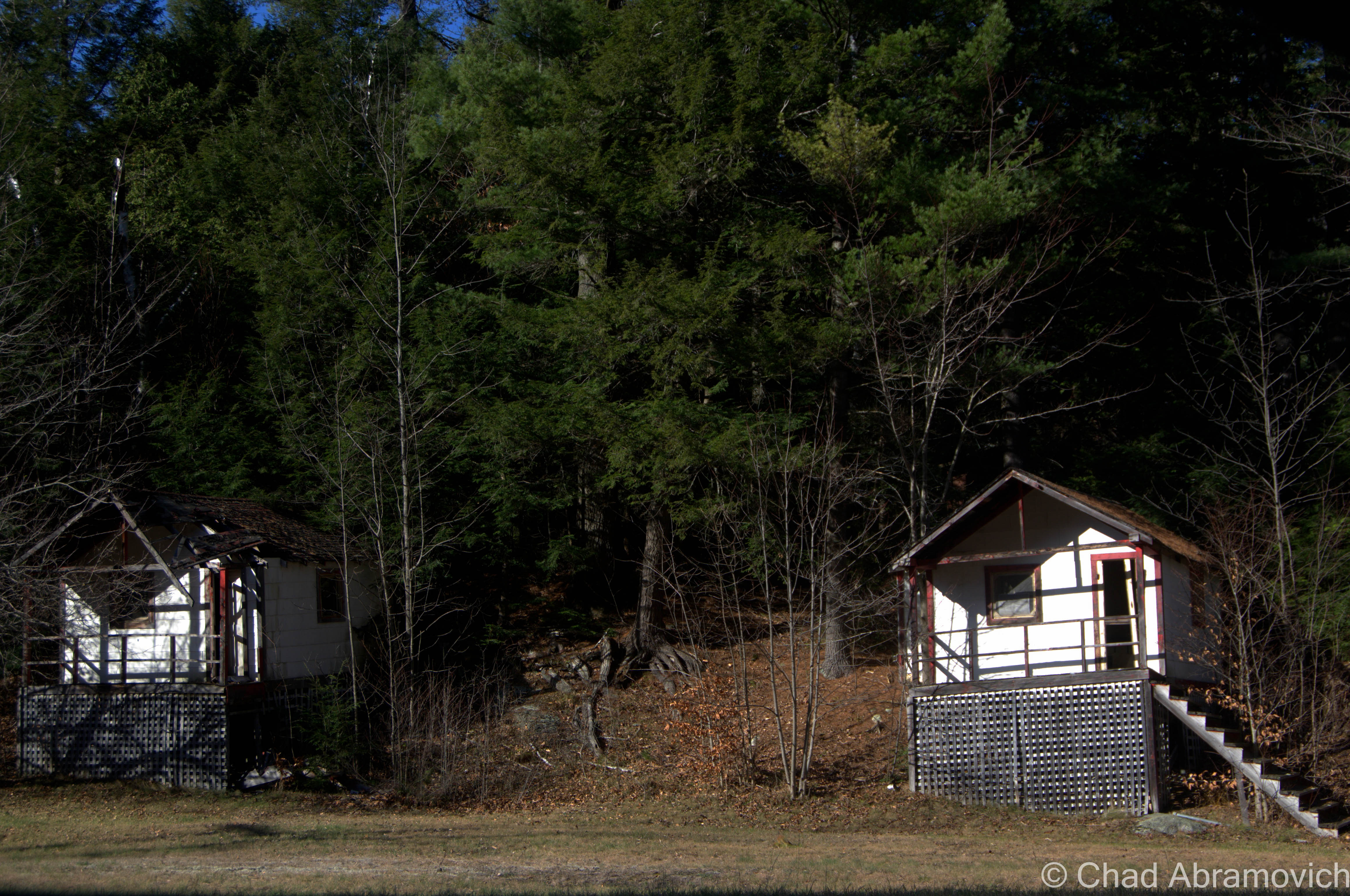
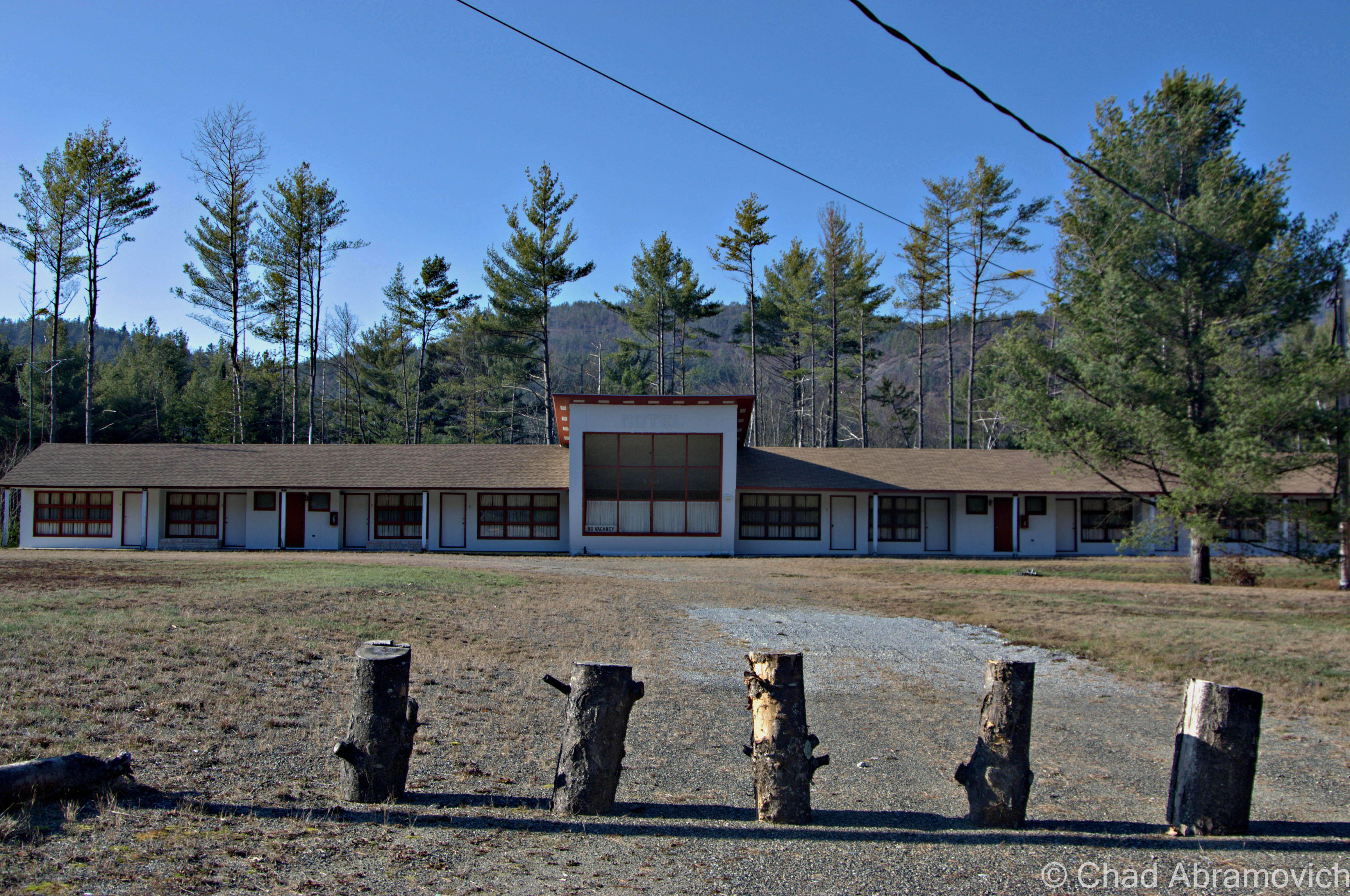
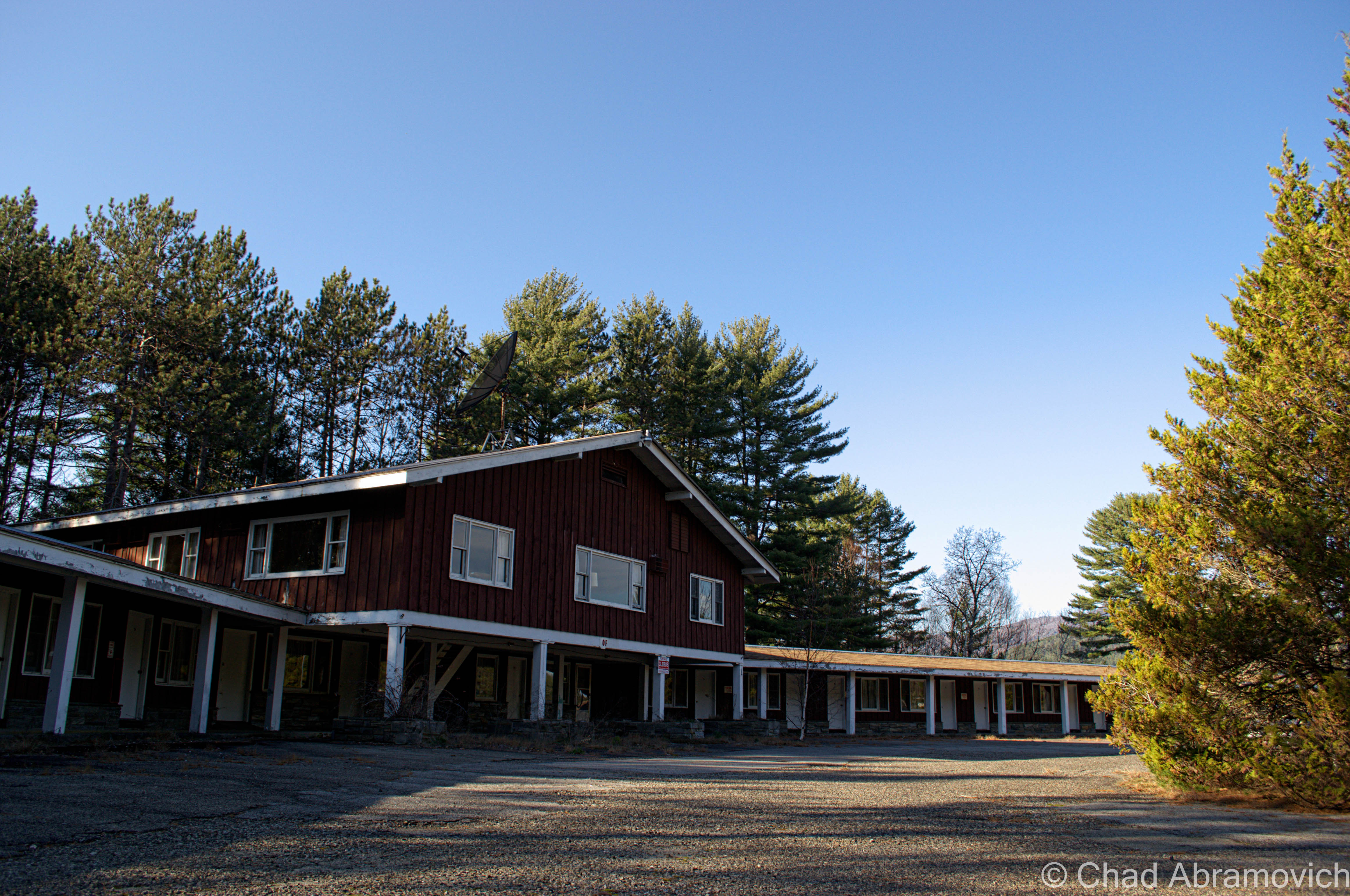
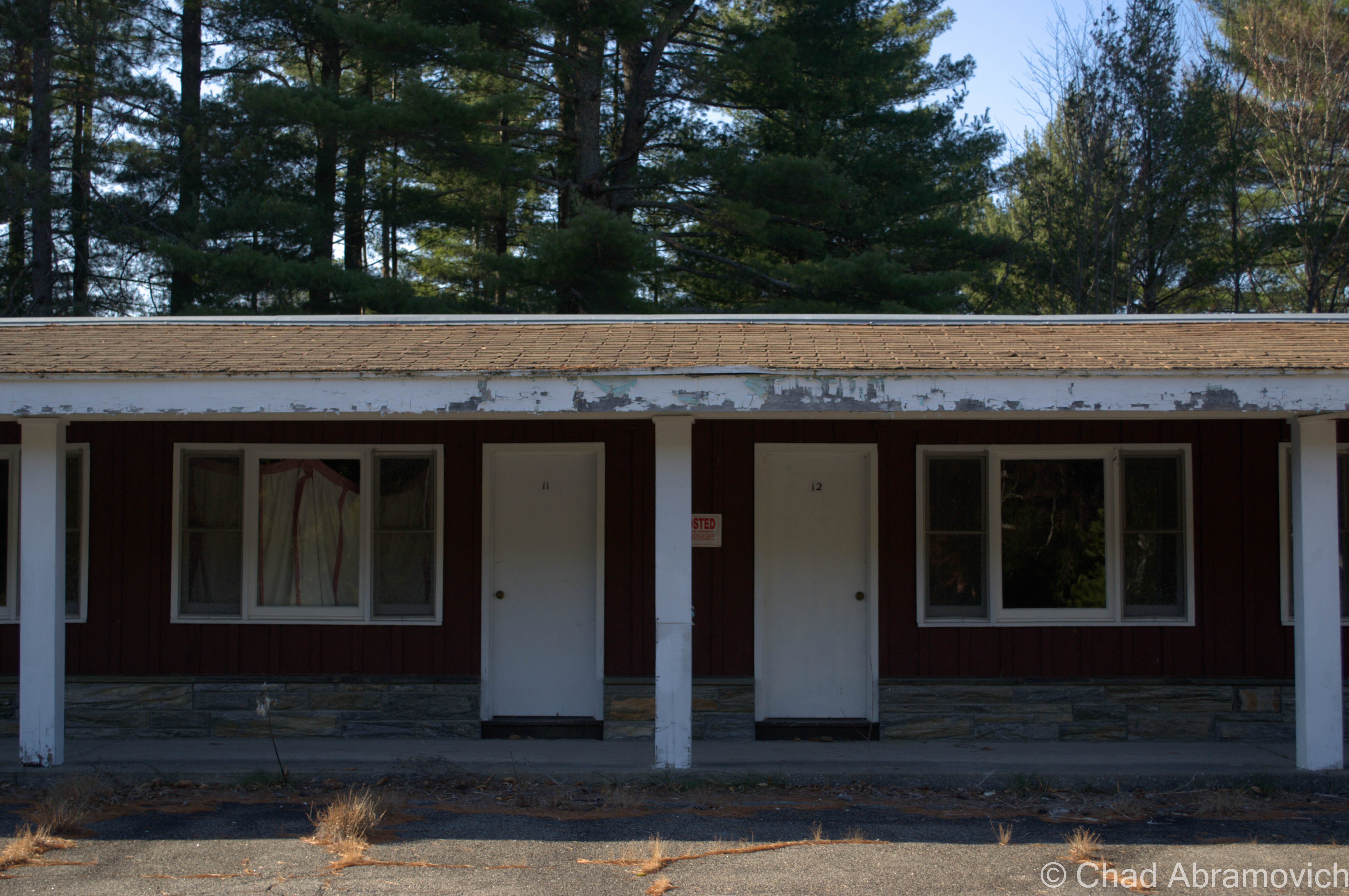
Abandoned Motel #1
This abandoned motel seemed to be relativity up kept, its dated architecture looking almost as crisp as its heyday. The lawn was kept mowed, and the owners lived across the street in another former motel, which I suppose wasn’t very surprising.
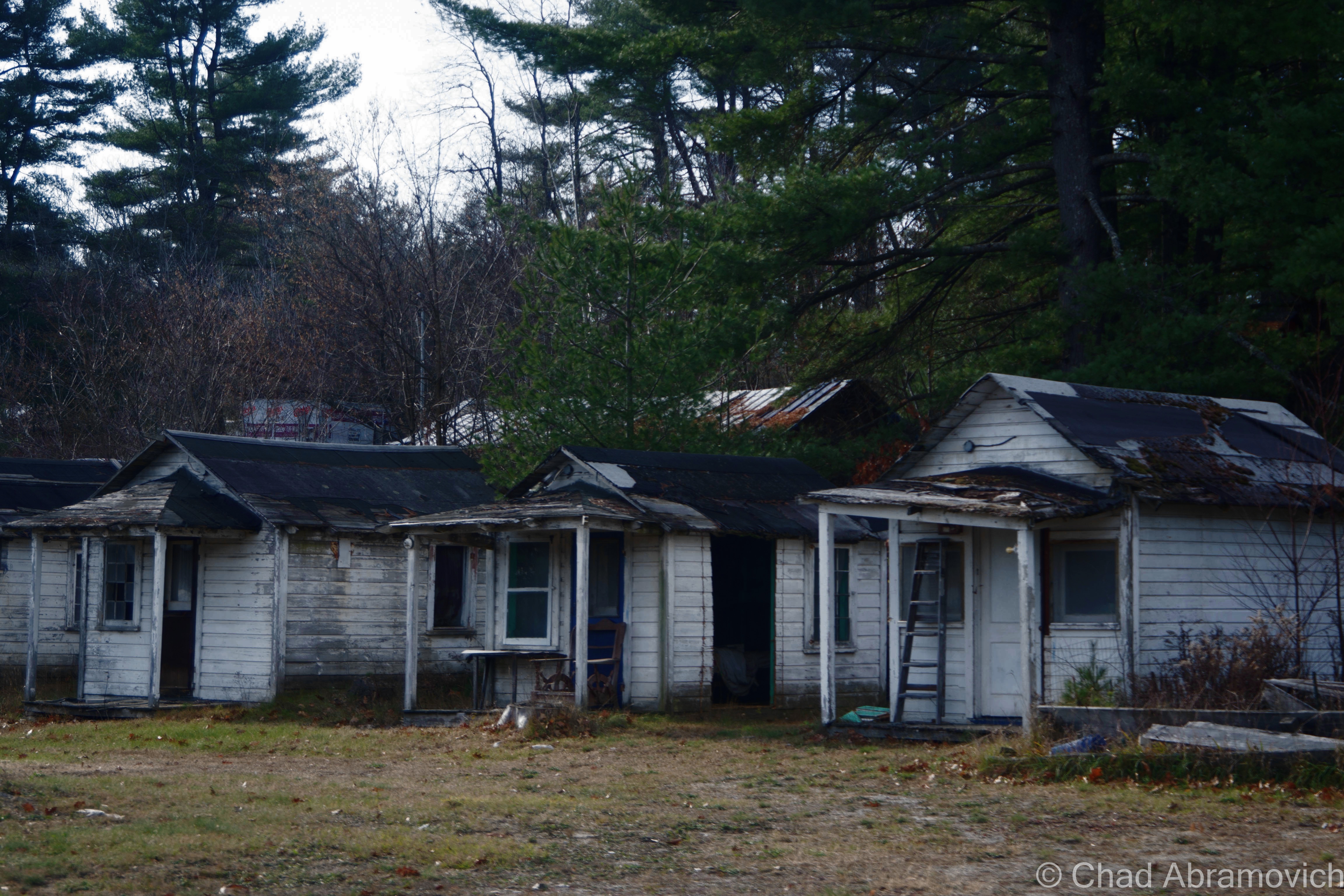
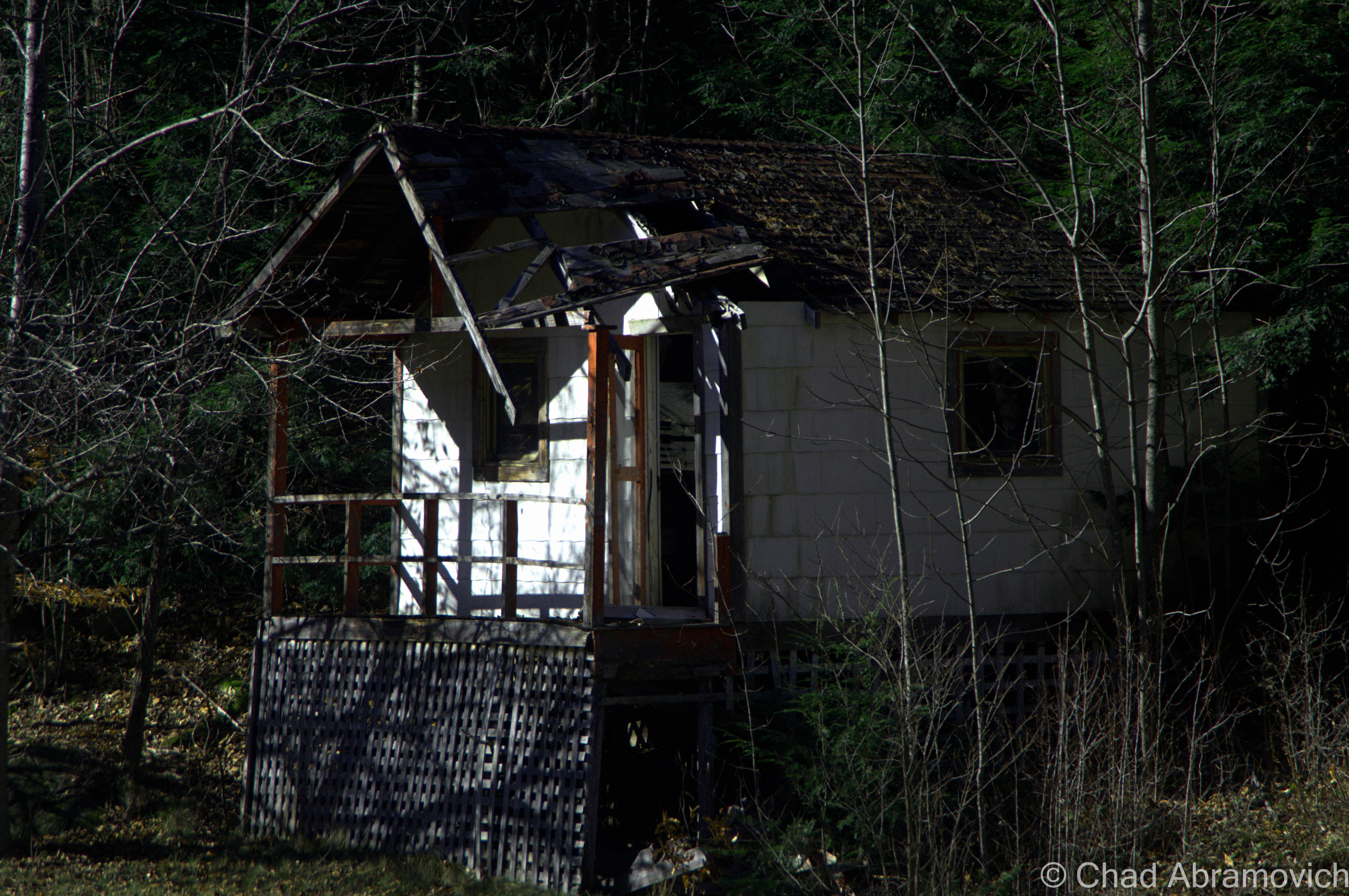
Abandoned Motel #2
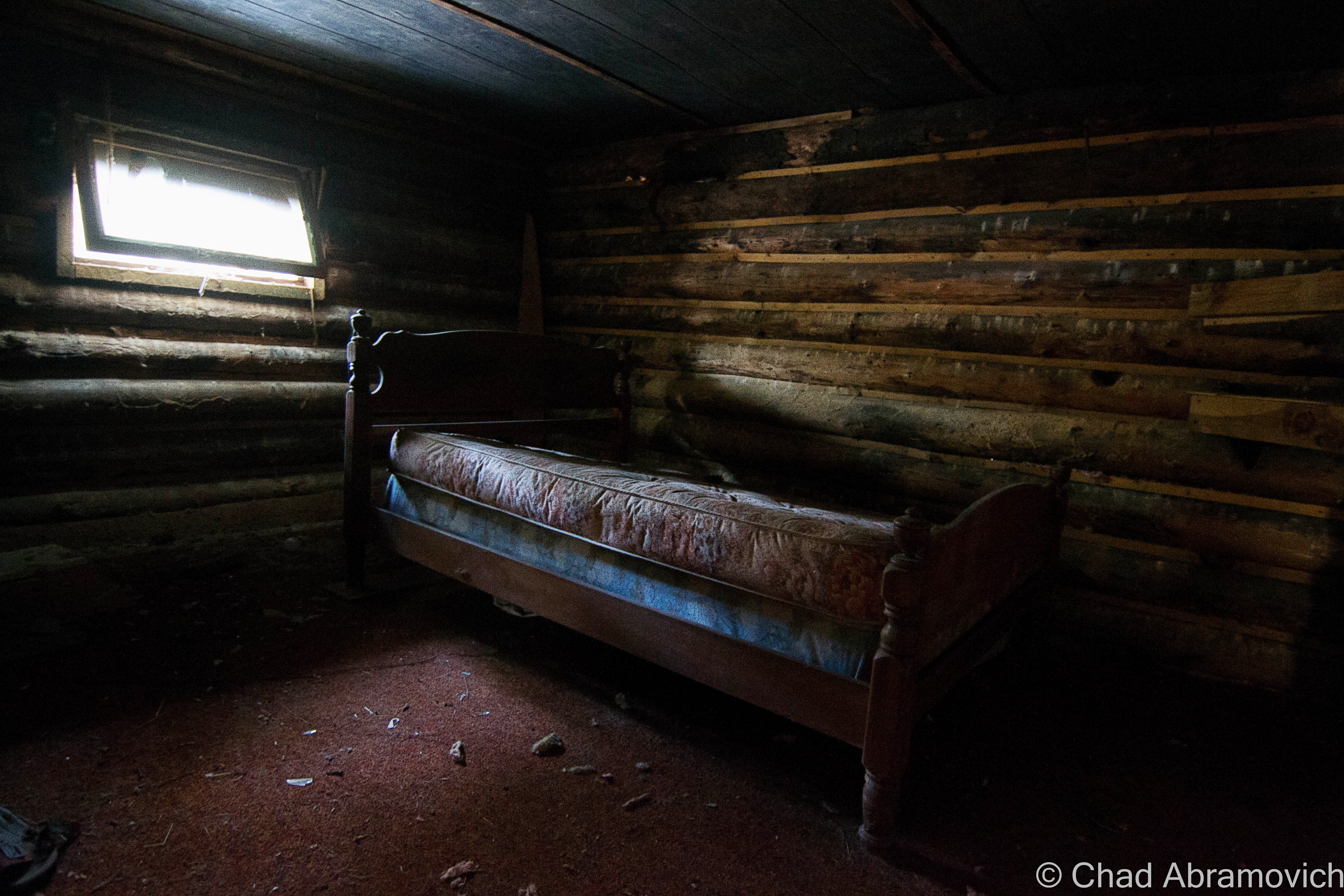
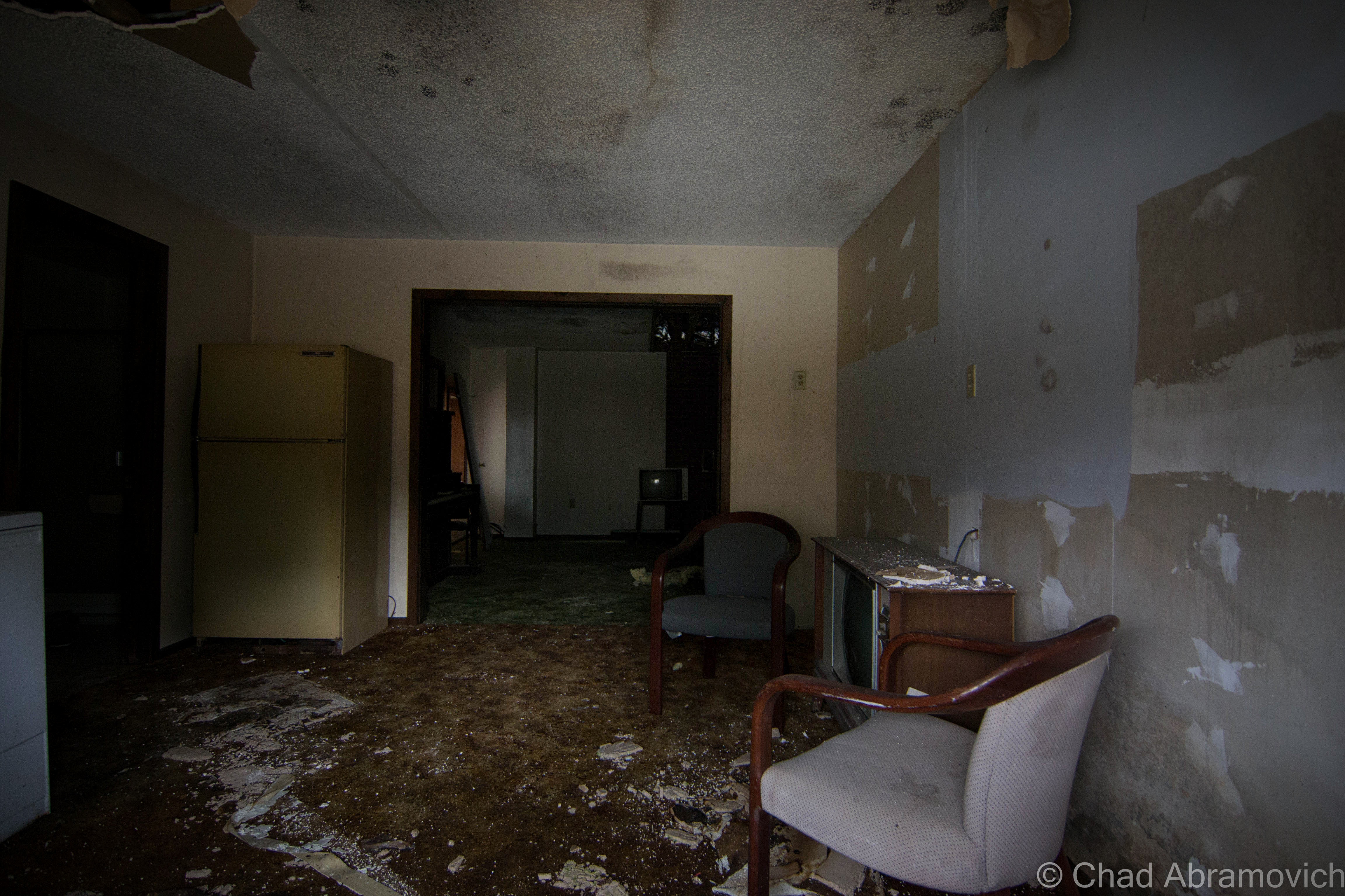
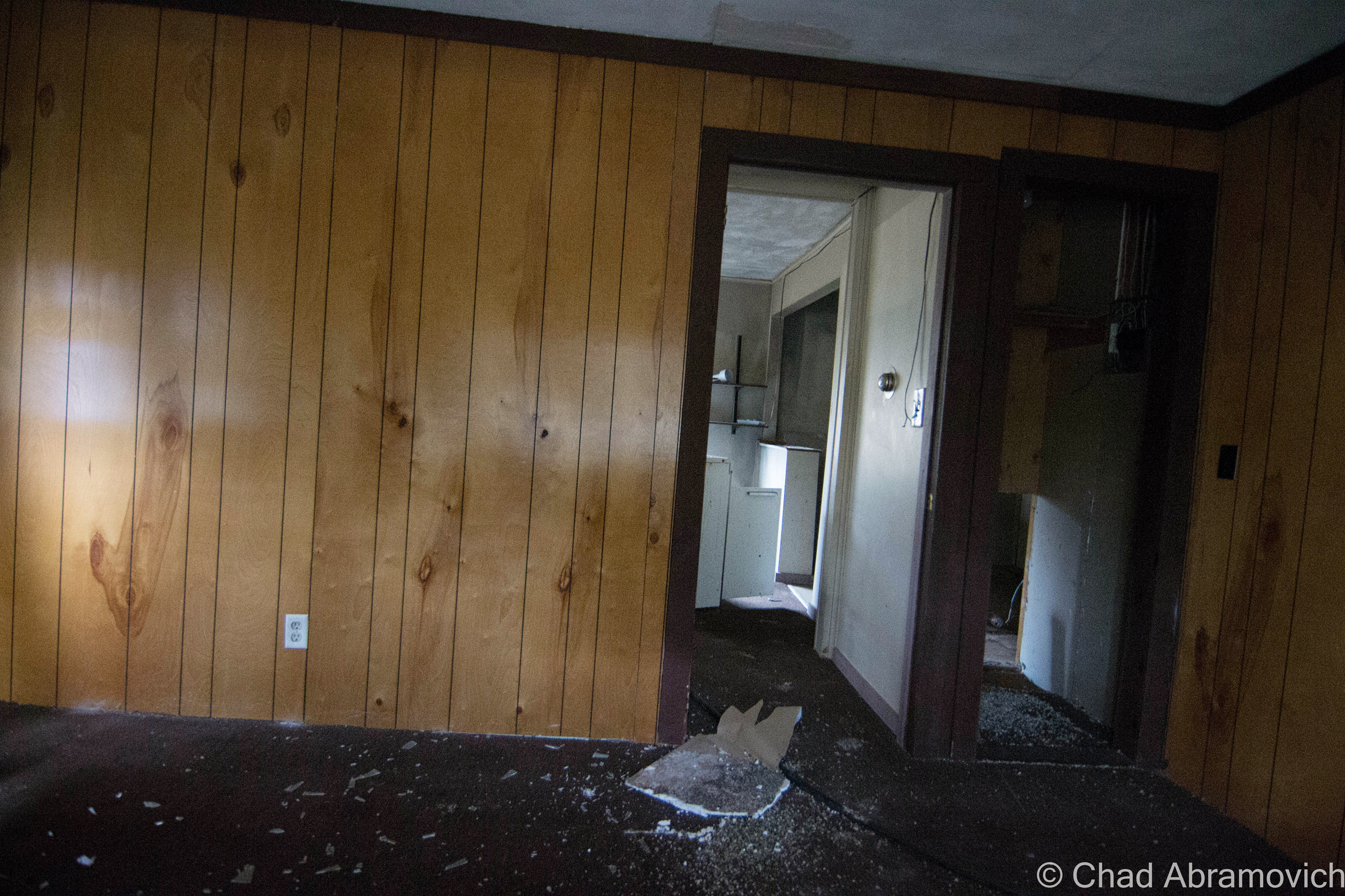
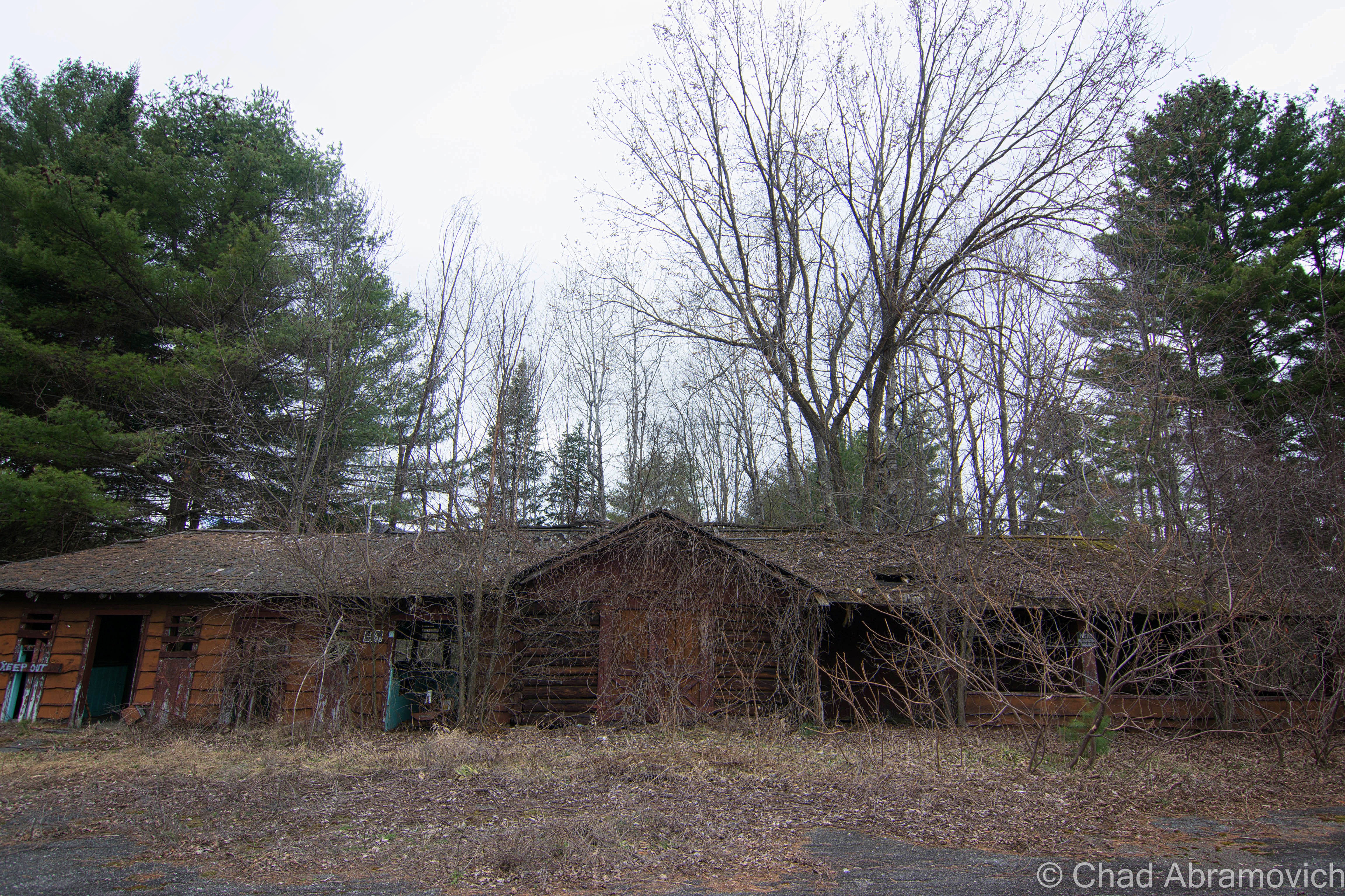
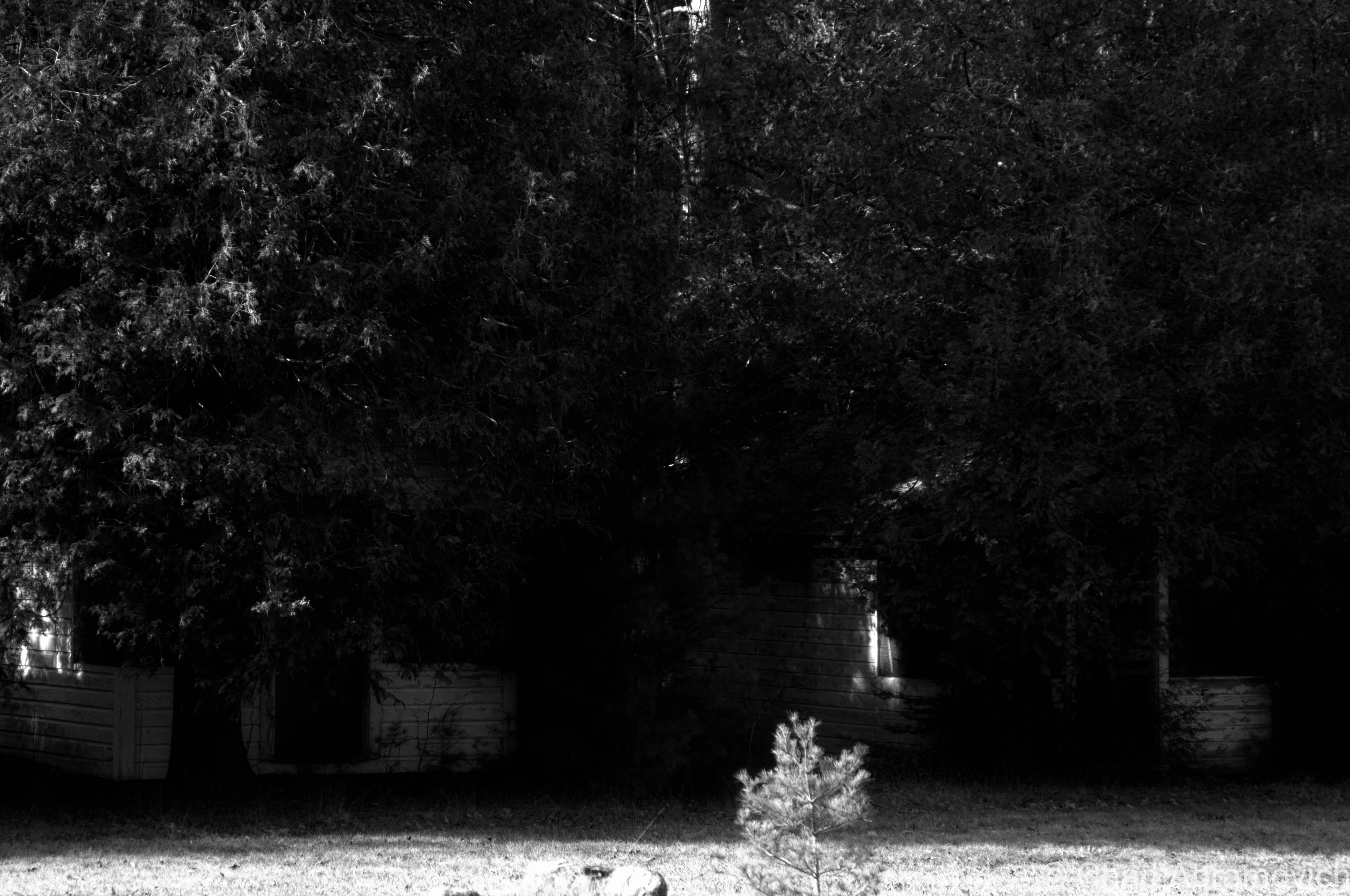
This motel was more desolate then the first one, done in a kitschy in a rustic log theme, which was inspired by the defunct amusement park, Frontier Town, which was just down the road. The crumbling parking lot had almost returned to a wild state overran with weeds, and the long front porch was becoming encroached with fir trees growing slowly inside it. This was the first place we noticed that hosted transient people. Some of the rooms had been broken into, and the obvious signs of human presence were everywhere, but thankfully none were around when we arrived.
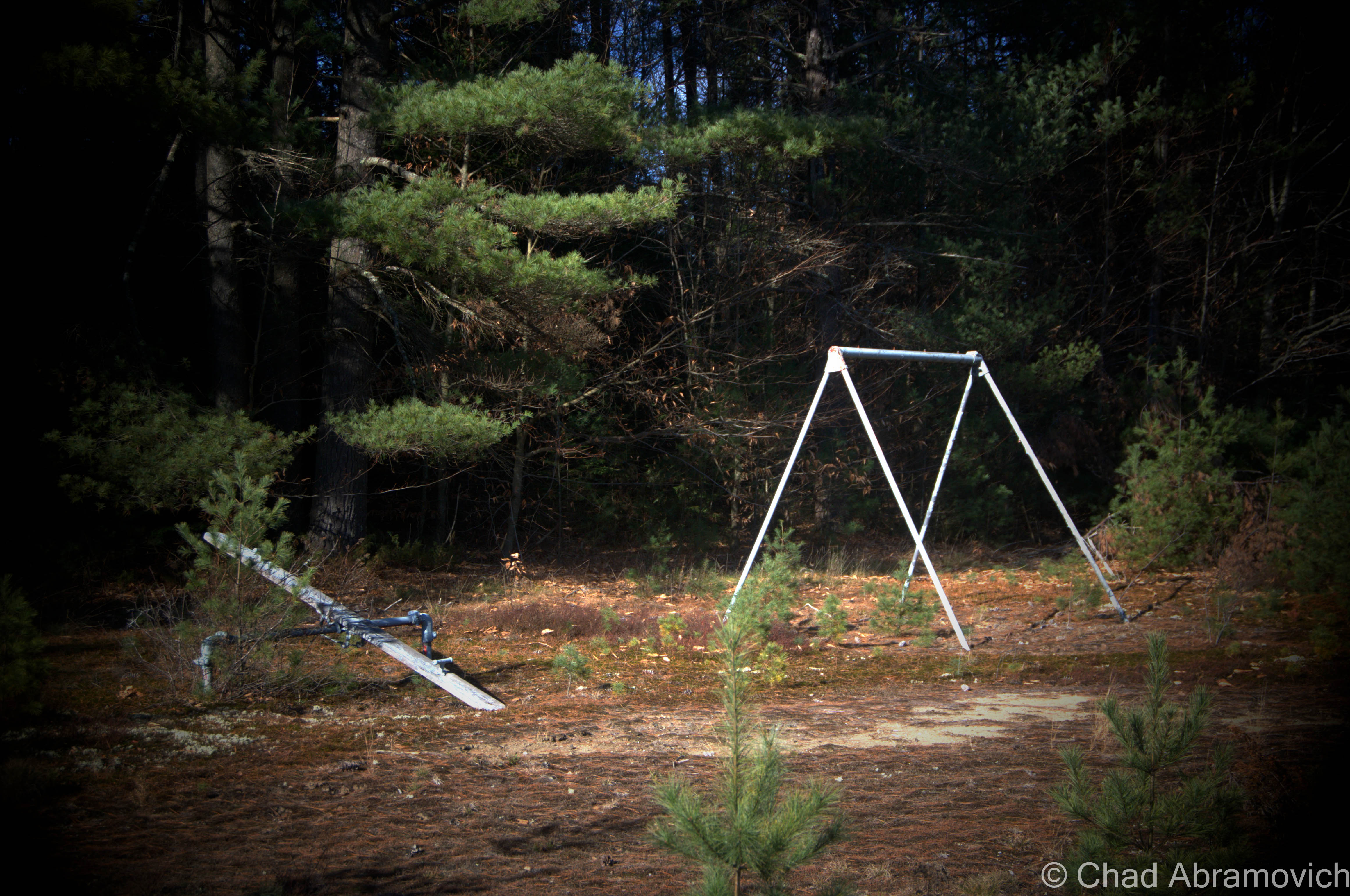
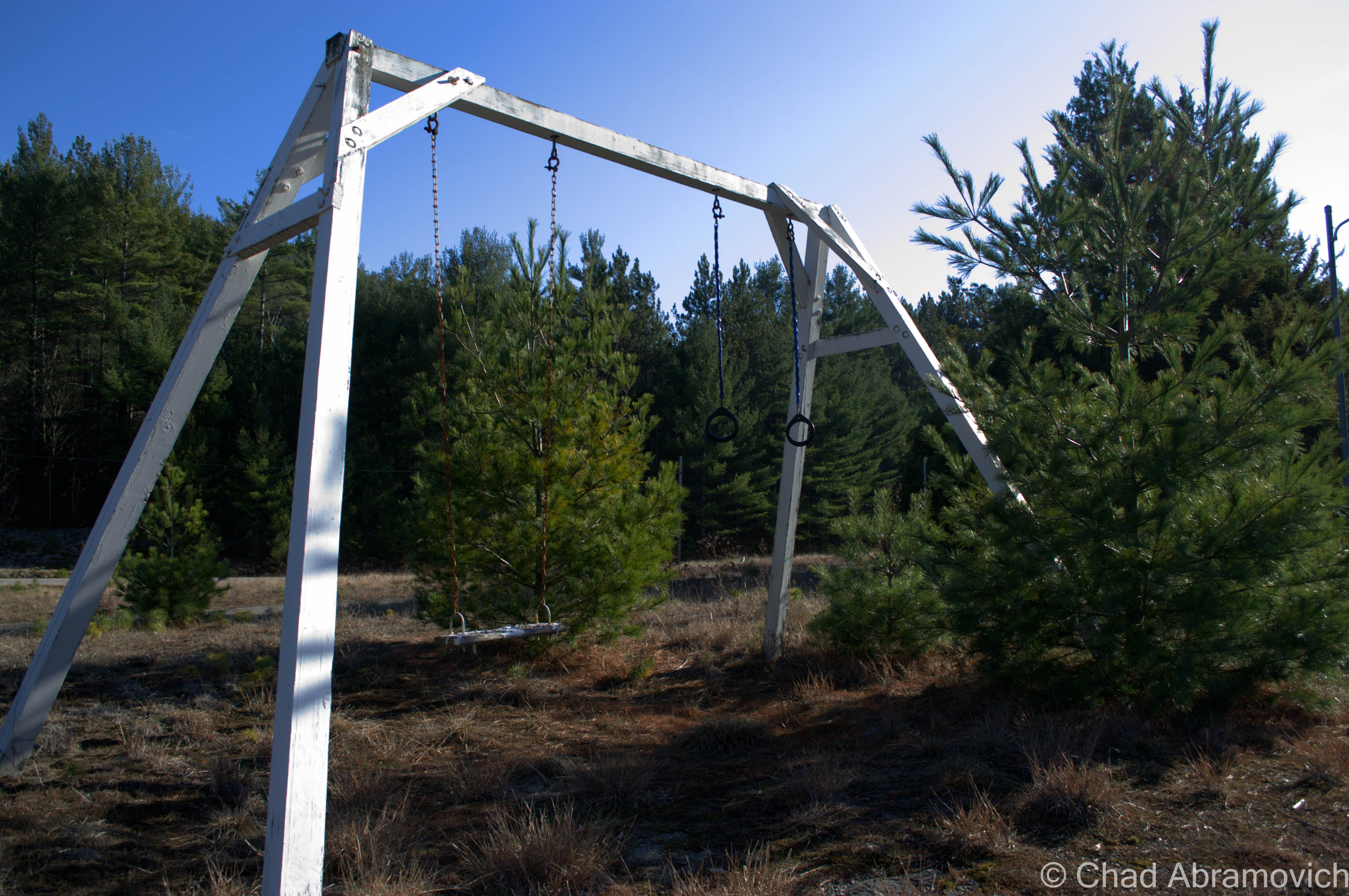
An abandoned playground weighed down by the desolation of the forest.
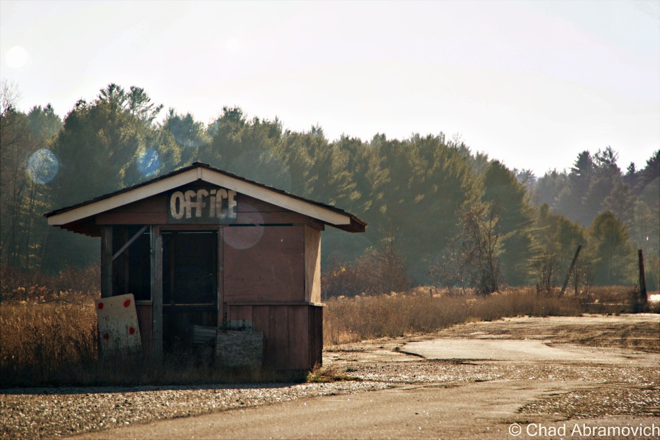
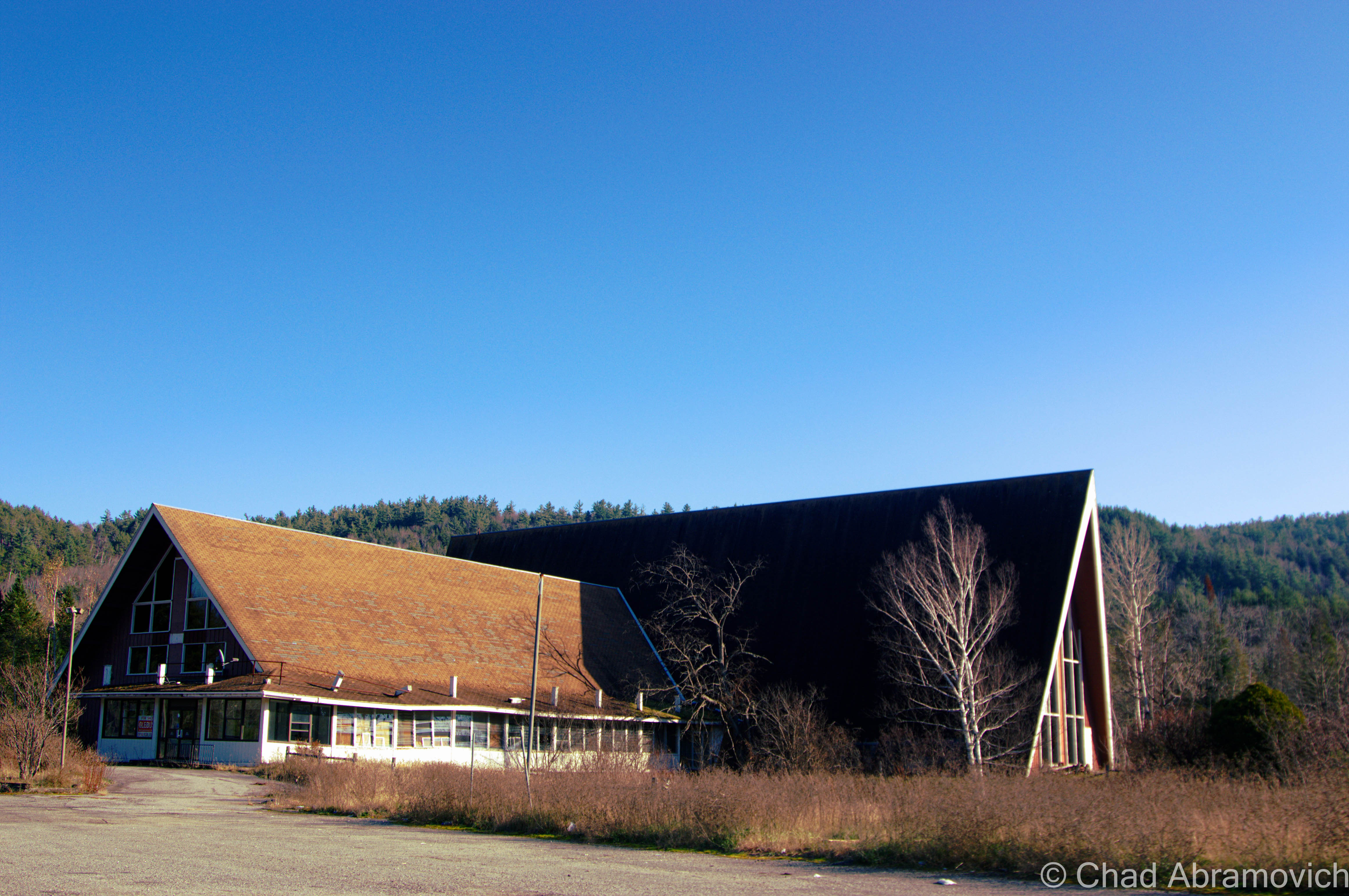
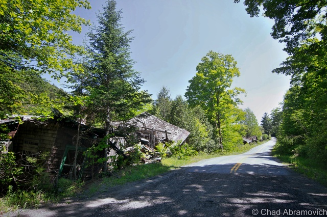
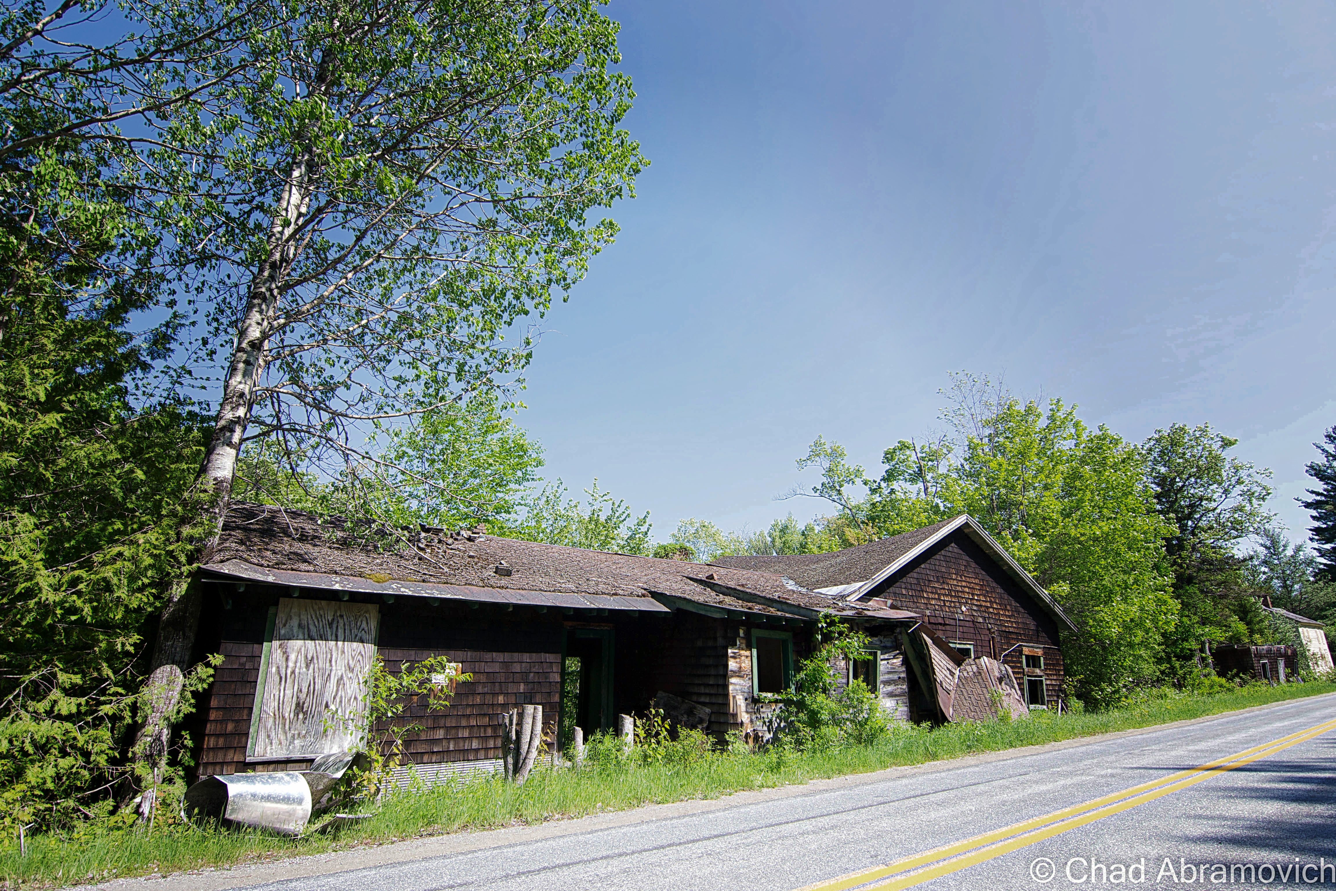
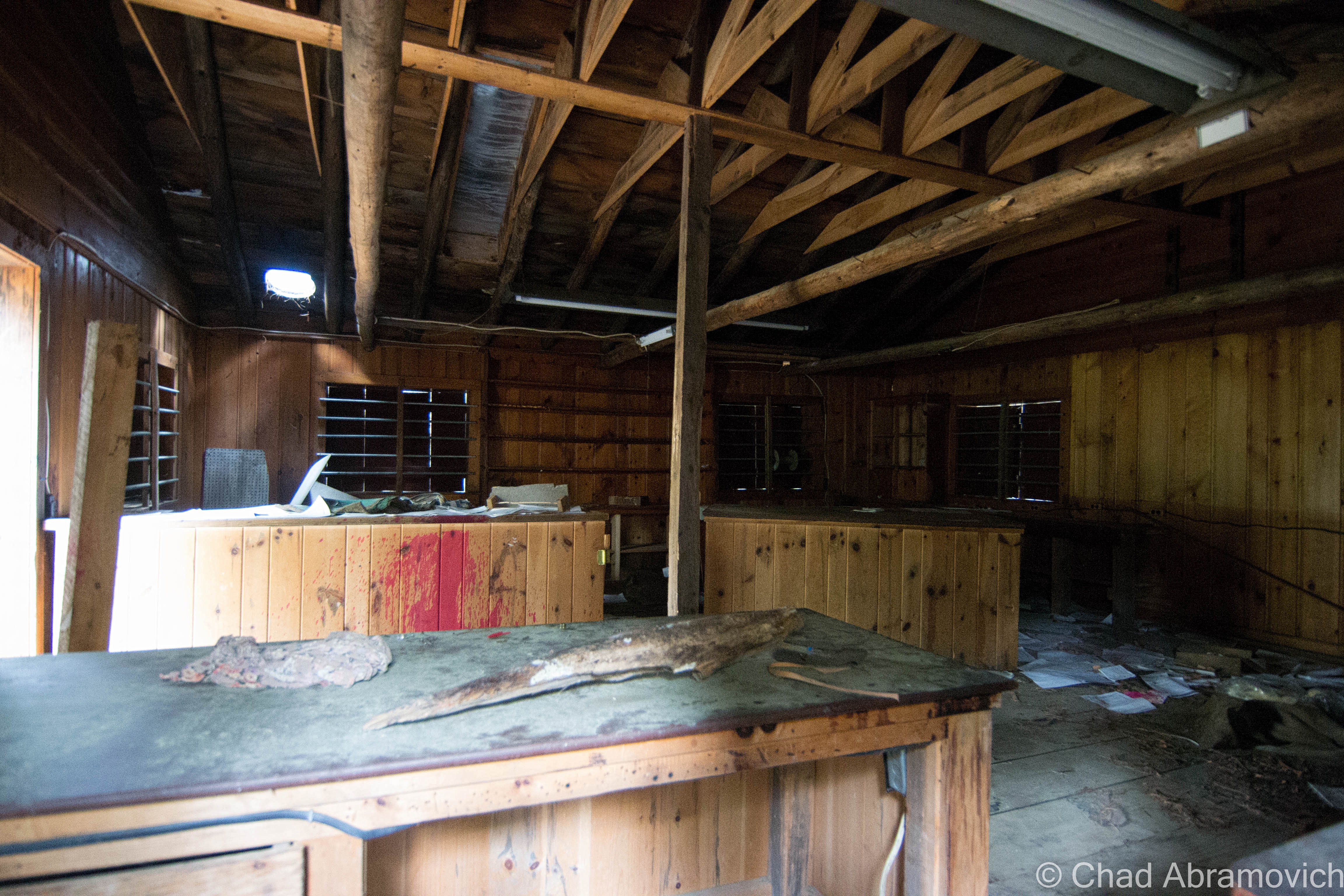
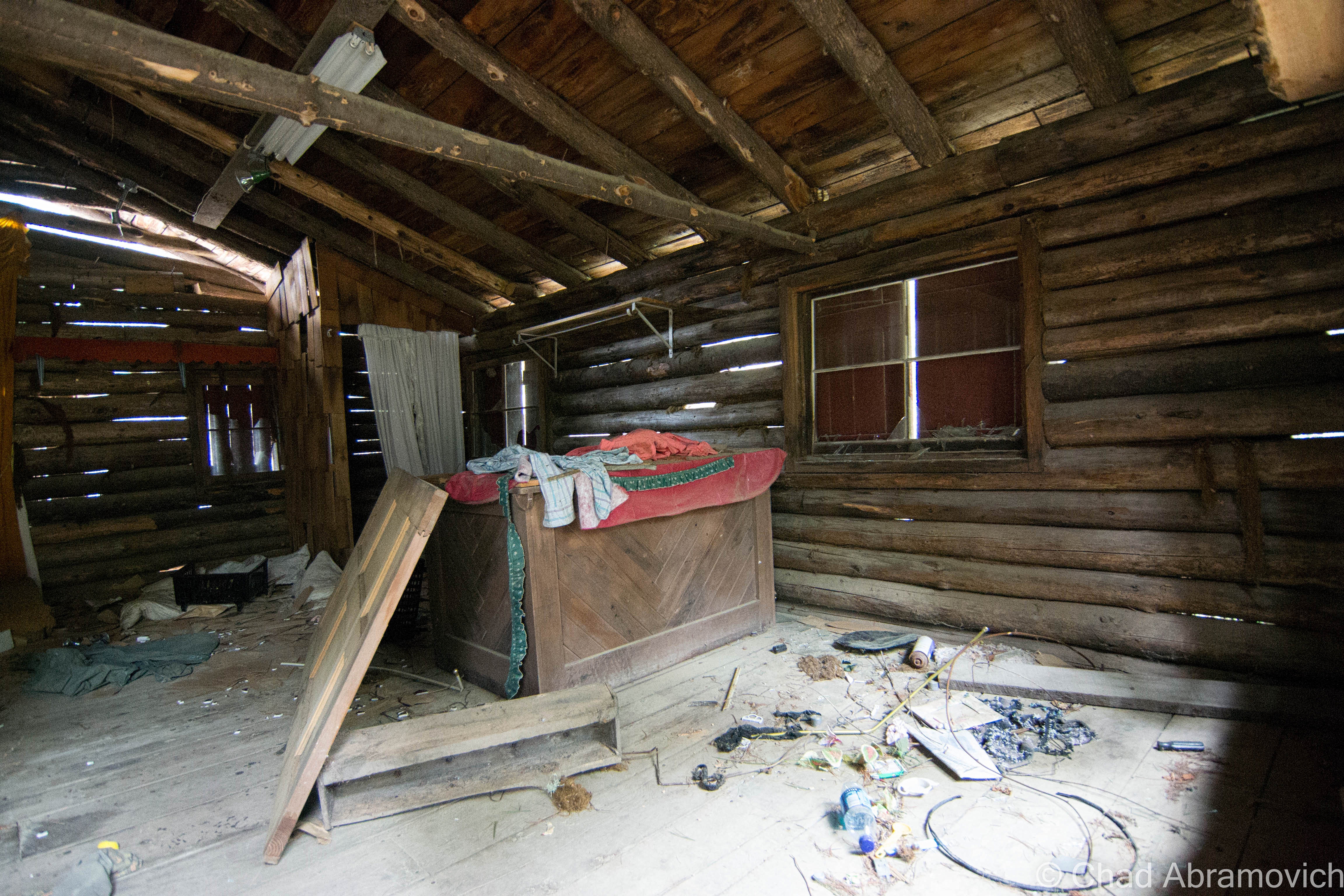
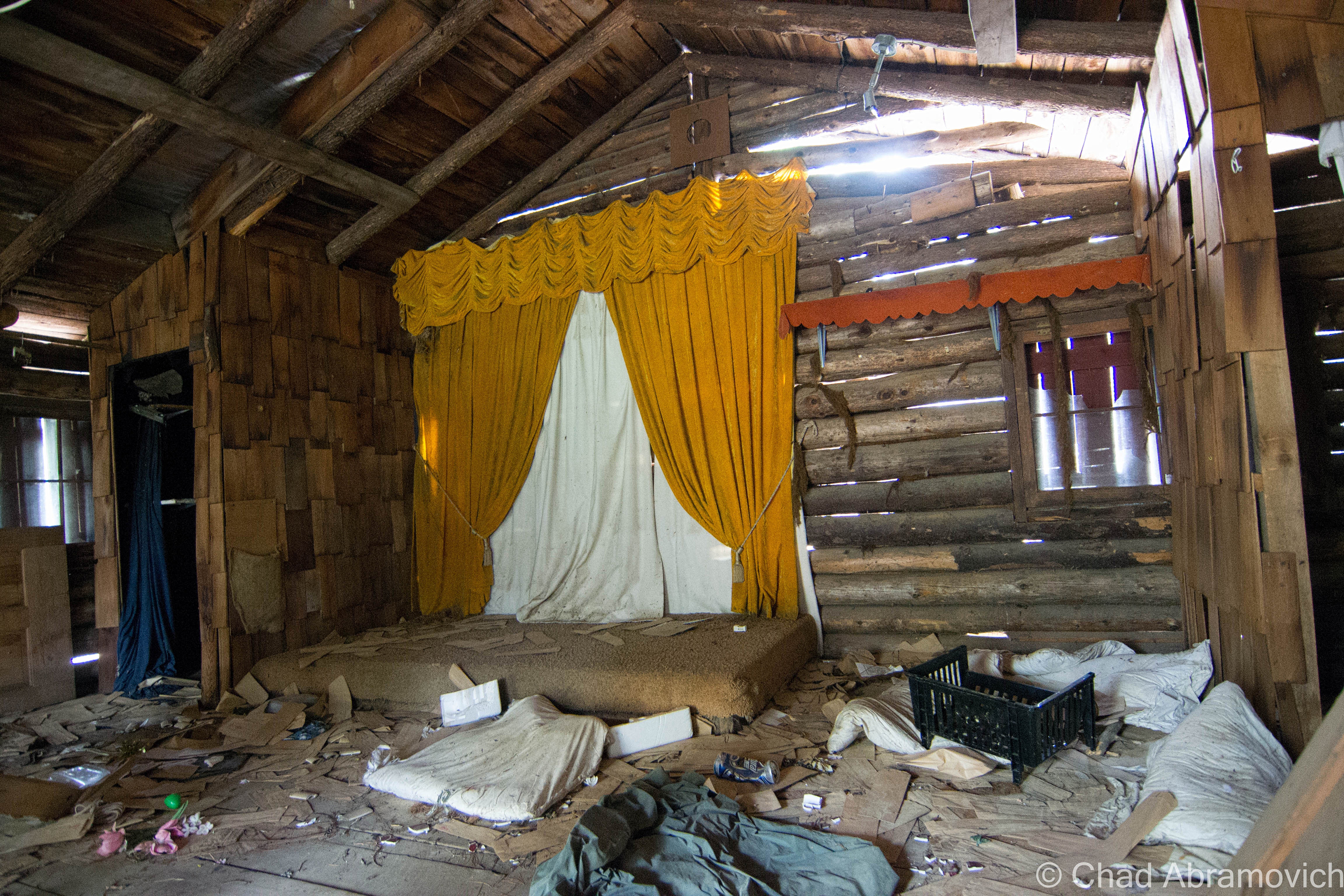
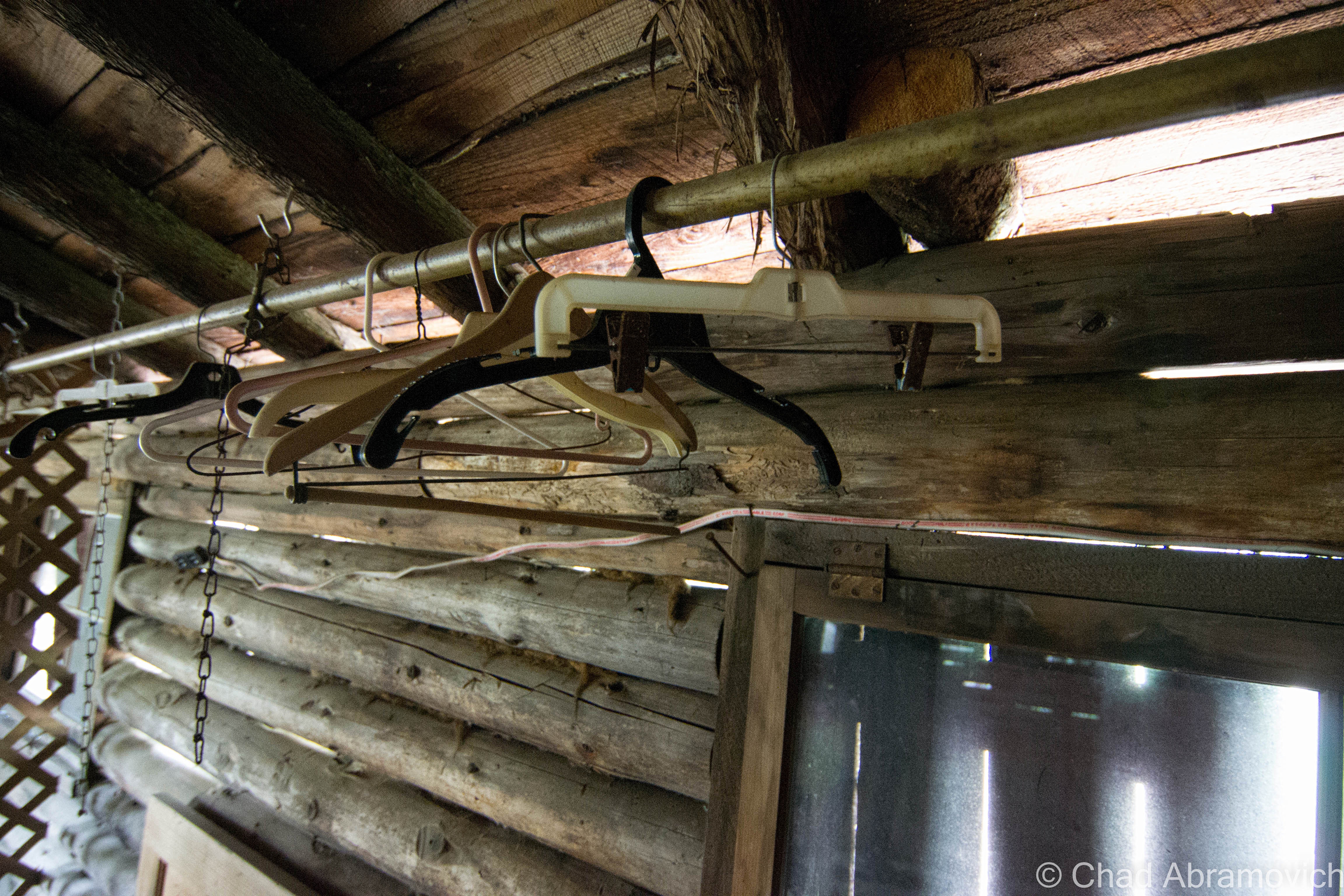
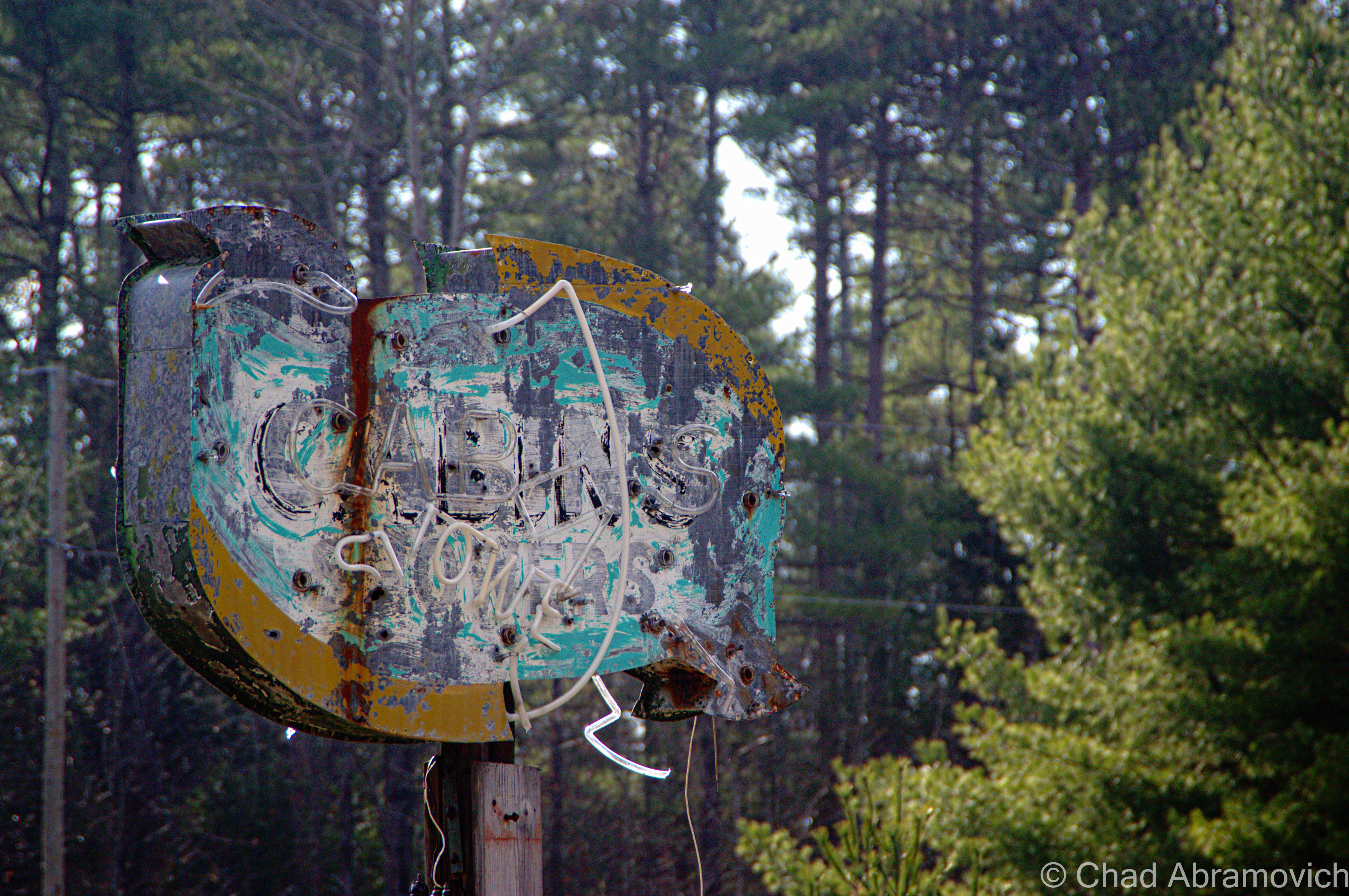
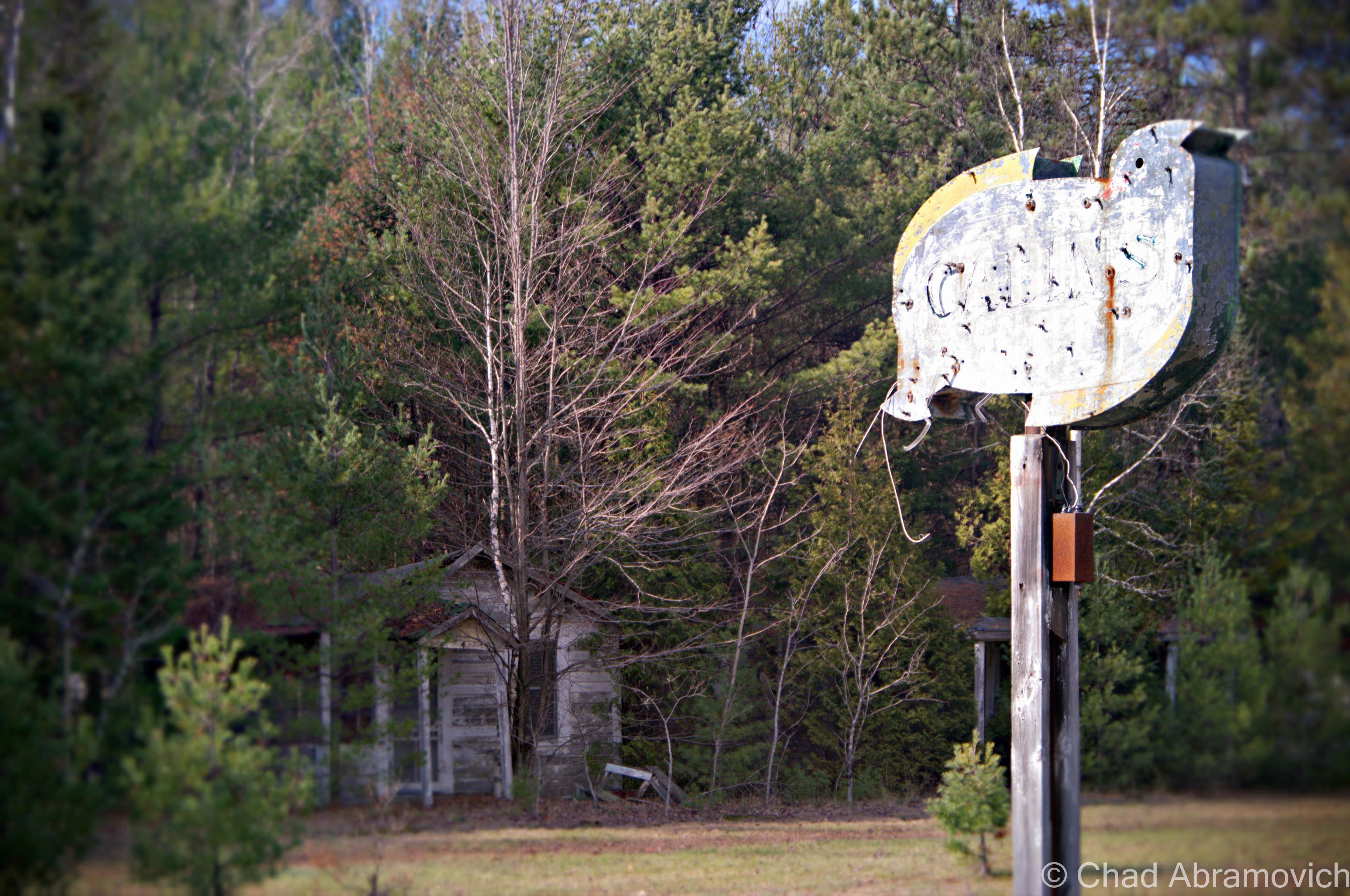
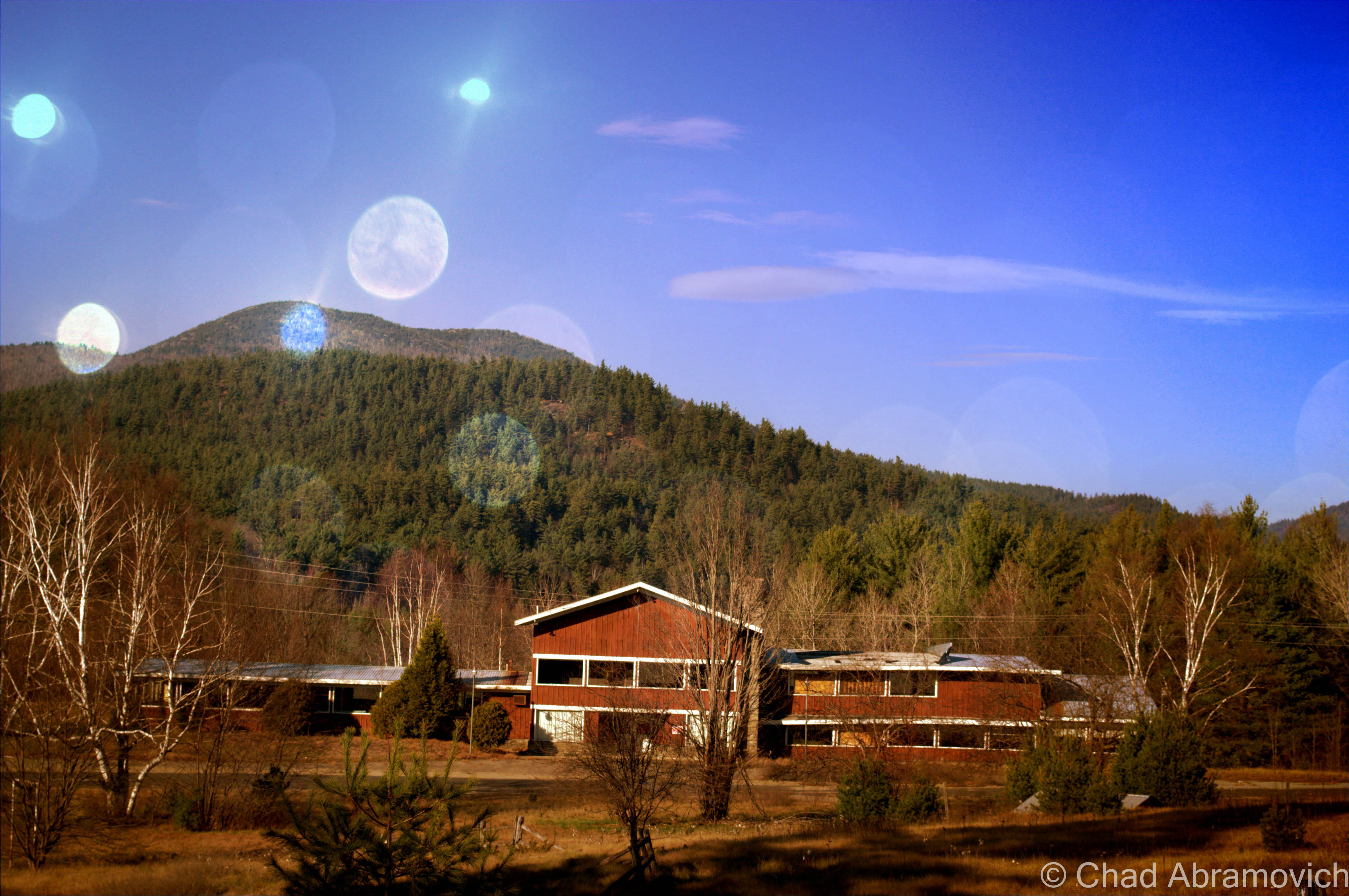
Frontier Town
Down the road is the uninteresting town of North Hudson, nothing more then a collection of ramshackle homes and trailers amidst the scraggly woods. But years ago, North Hudson was home to one of the most beloved tourist destinations in the Adirondacks; Frontier Town.
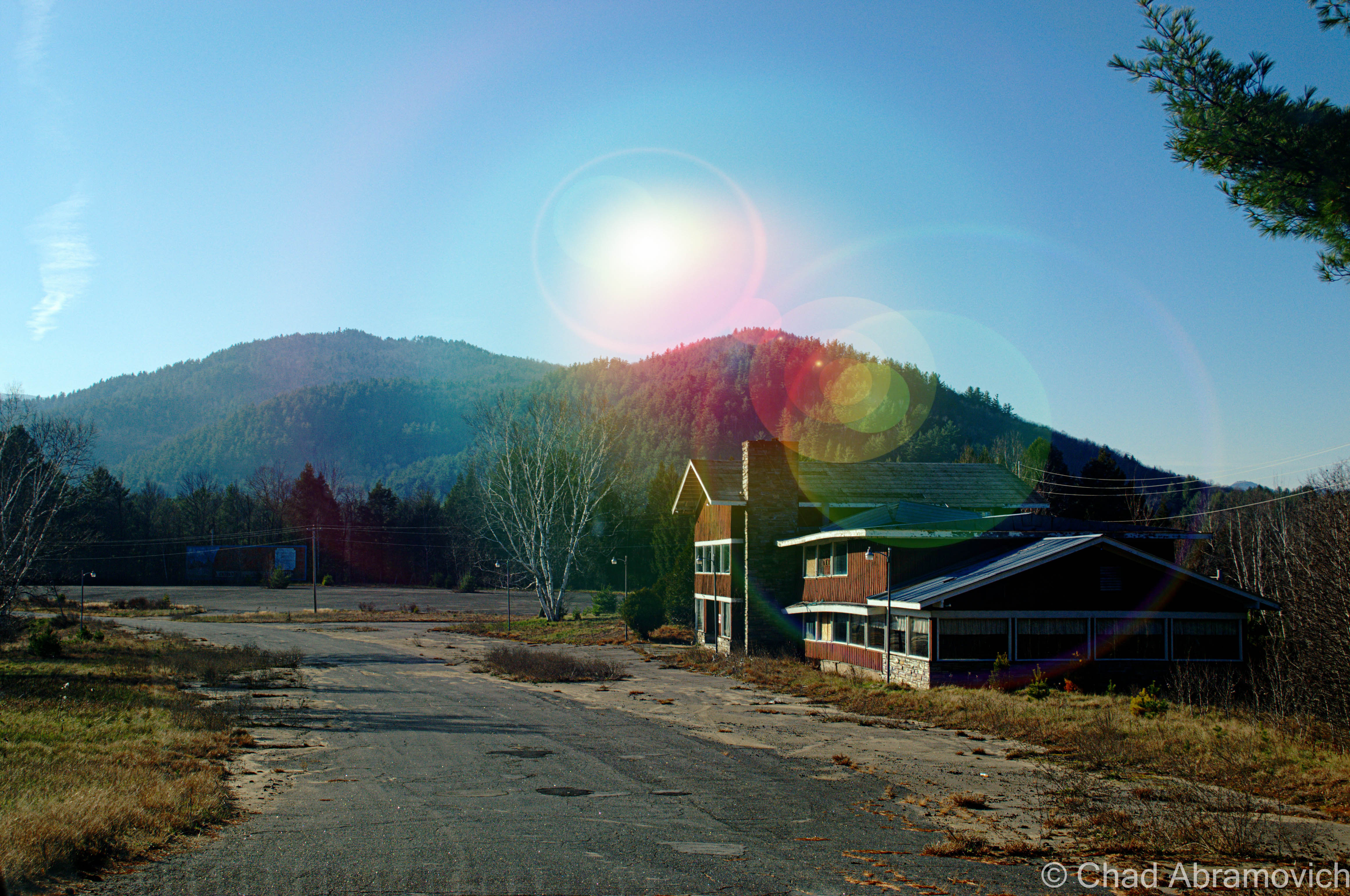
In 1951, an enterprising man named Art Benson chose the woods of North Hudson to be the home for his new vision; a theme park that would bring the wild west to upstate New York. He had no income, no background in construction or anything related to running a theme park, and yet, with ambition and bearing his charismatic personality, he managed to pull off one of the most beloved tourist traps in the Adirondacks. Decorated like a primitive frontier town of the 19th century and amusing it’s guests with interactive dioramas from folklore, popular culture and history, the park continued it’s role as a compelling spectacle until 1983, when Benson sold the park to another development firm, who closed the park in 1989, and reopened it shortly after with new attractions to try and lure more people to make up for the park’s dwindling audience. By 1998, Frontier Town closed for good, after being discombobulated by dropping finances and the latest victim of changing trends; the new notion that it was now dated and politically incorrect.
The vast property was seized in August 2004 by Essex County for past-due property taxes. Today, the park is a humble collection of ruins rotting in the woods, or along Route 9, which is where the main entrance was. The property is skirted by a collection of abandoned motels and restaurants that now look rather out of place in town.
There have been a few special interest groups organized with the goal to restore Frontier Town, and have it labeled as a historic landmark. But so far, none have been successful. Nearby the property is the seedy Gokey’s Trading Post, which has a few pieces of Frontier Town memorabilia for those looking for some nostalgia.
To read more about Frontier Town, you can click this link to be taken to my blog entry on that.
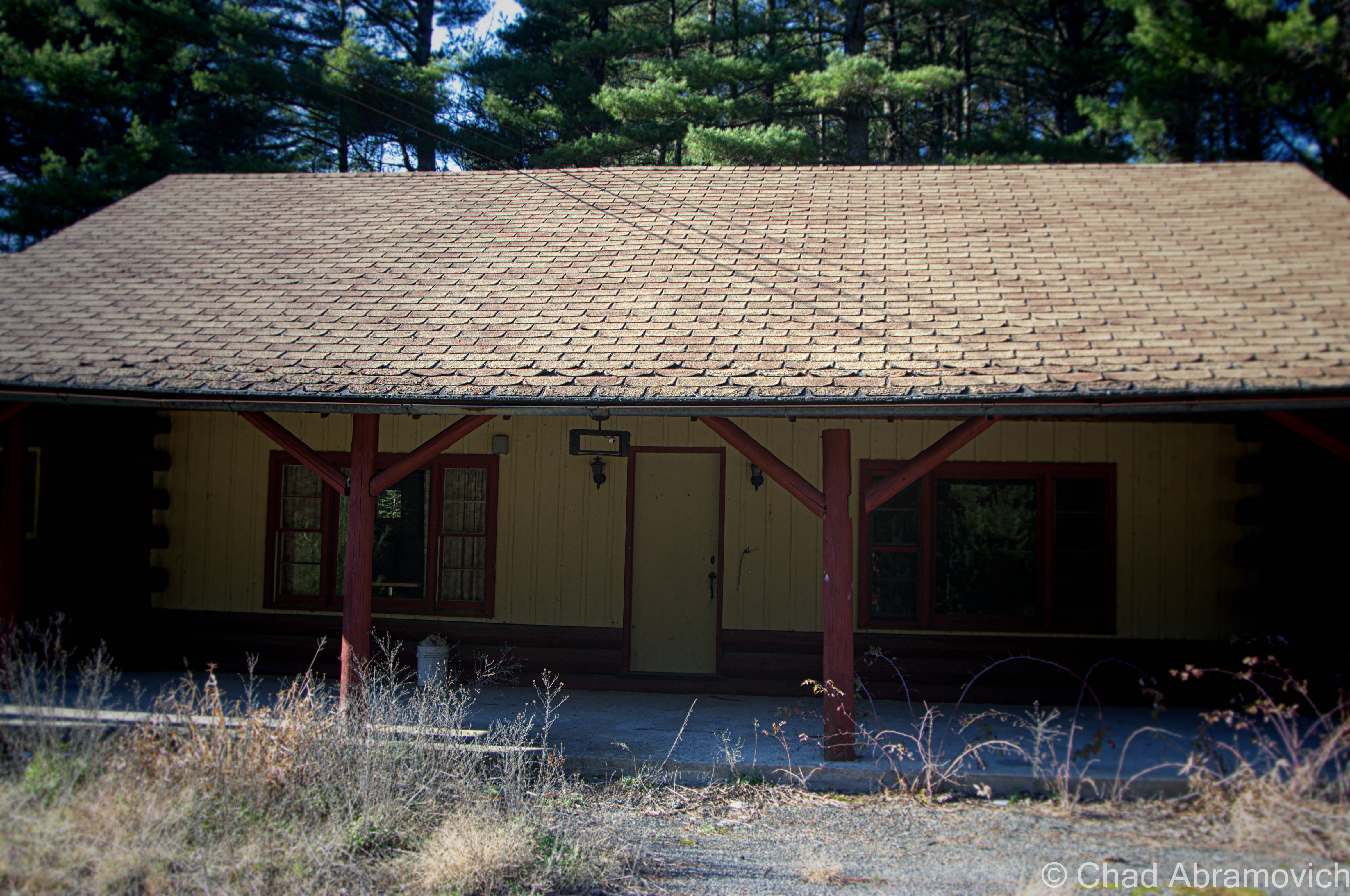
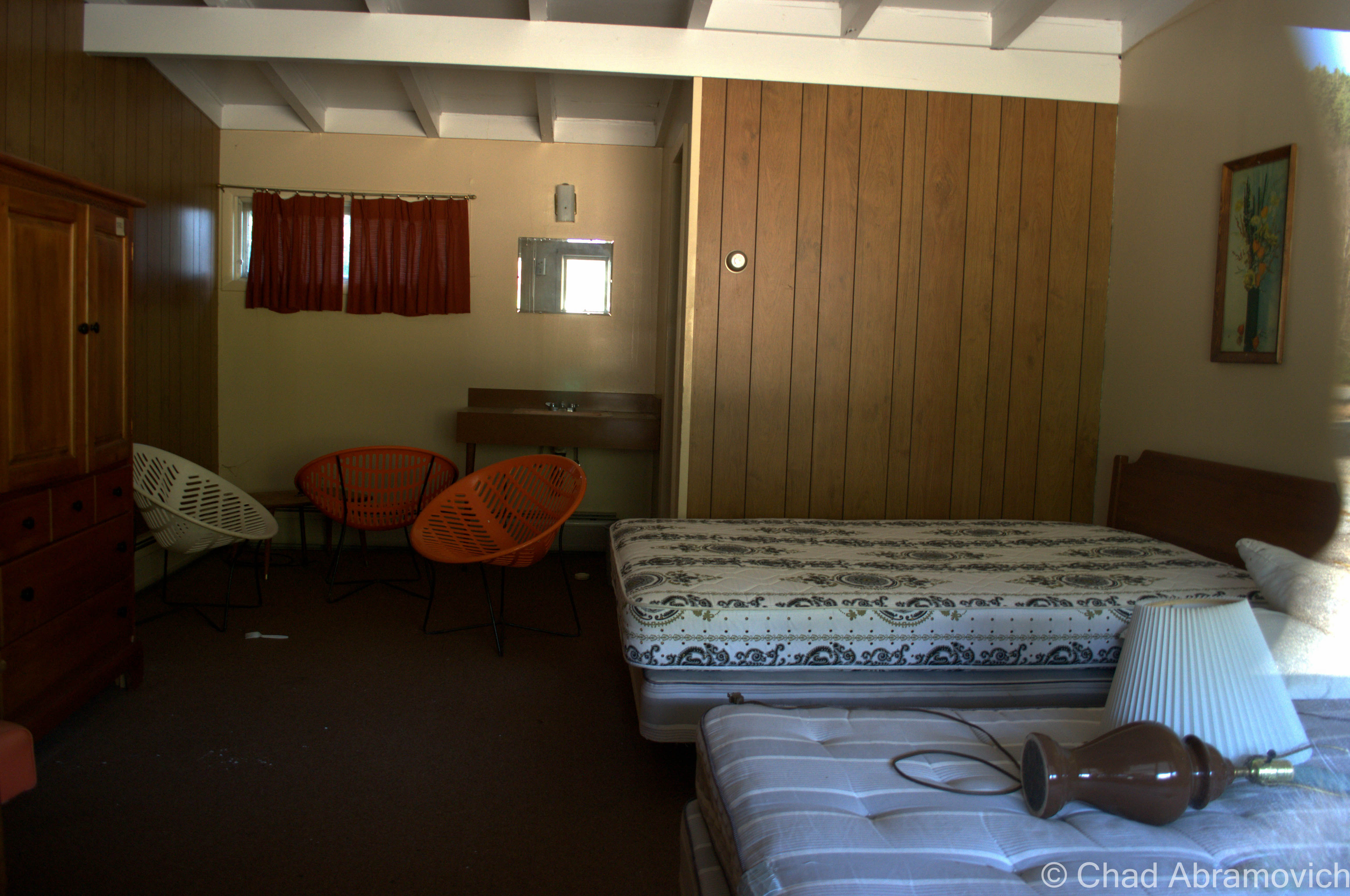
Abandoned Motel at the entrance to Frontier Town
Those swanky chairs.this motel also came with a simple playground for the kids, which admittedly looked more disappointing than funFrom the motel parking lot, one of the remaining buildings of Frontier Town could be seen – a former restaurant and gift shop against the late Adirondack sun.Driving through abandoned roads still adorned with battered street lamps and the ruins of the remaining buildings is an eerie experience. Years ago, this area used to be packed with tourists, noises and life – today the only sounds are the mountain winds and the hum of traffic from Route 9.
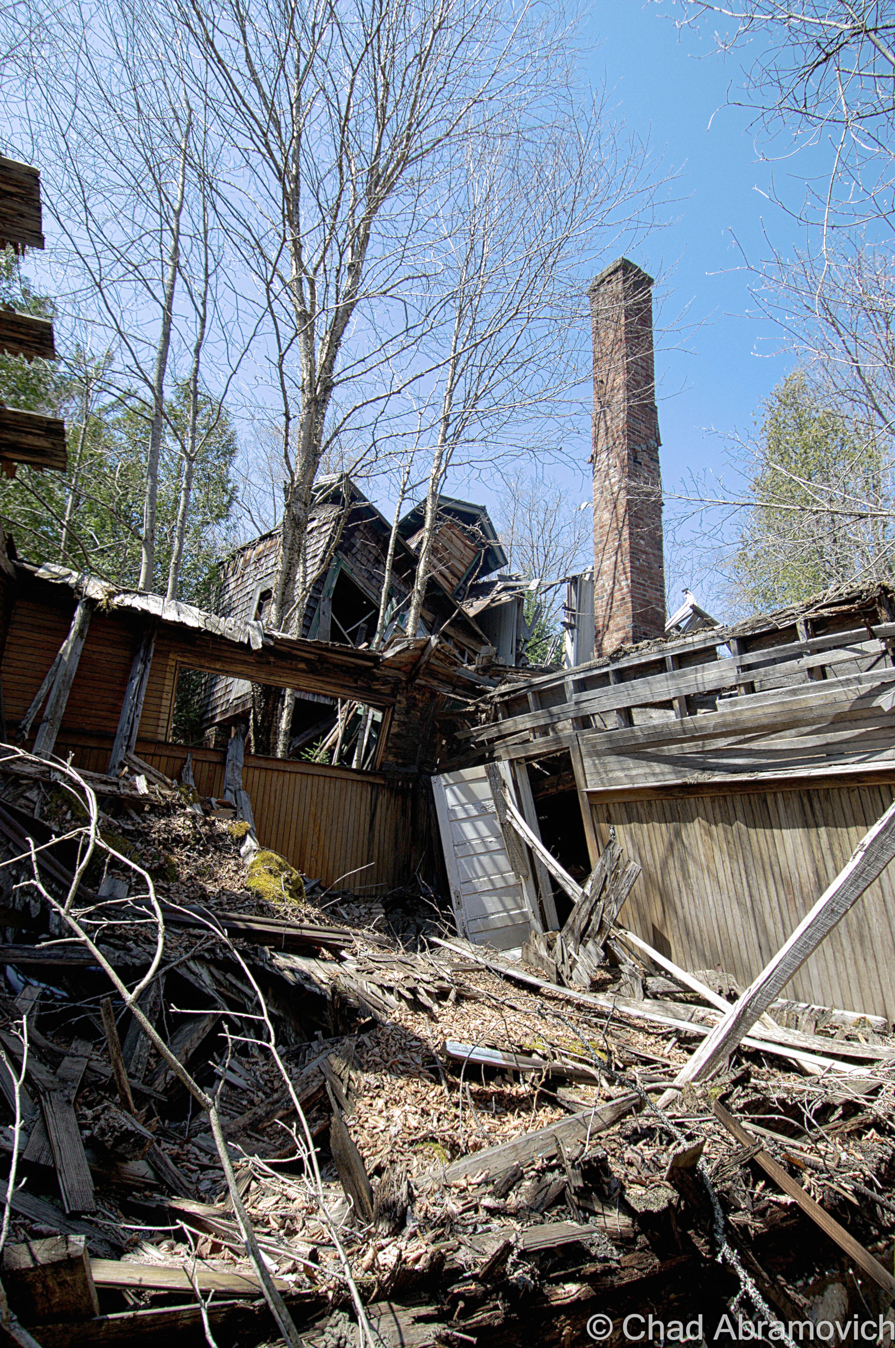
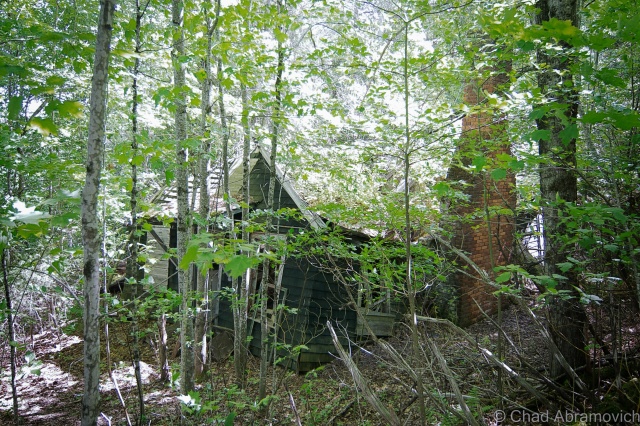
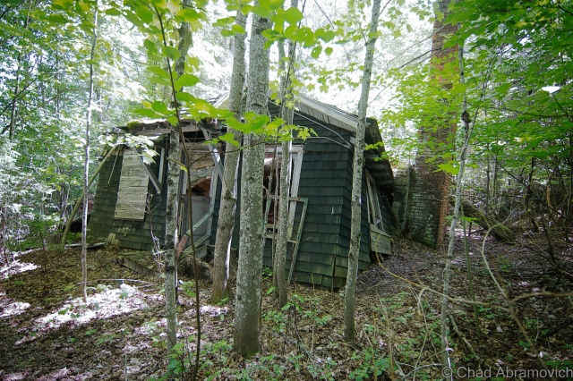
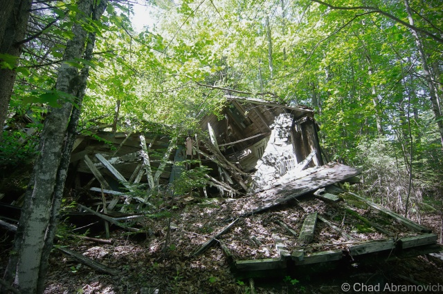
Side Note: There is a ghost town in the mountains behind Frontier Town. If you’re curious, click on here to read about it.
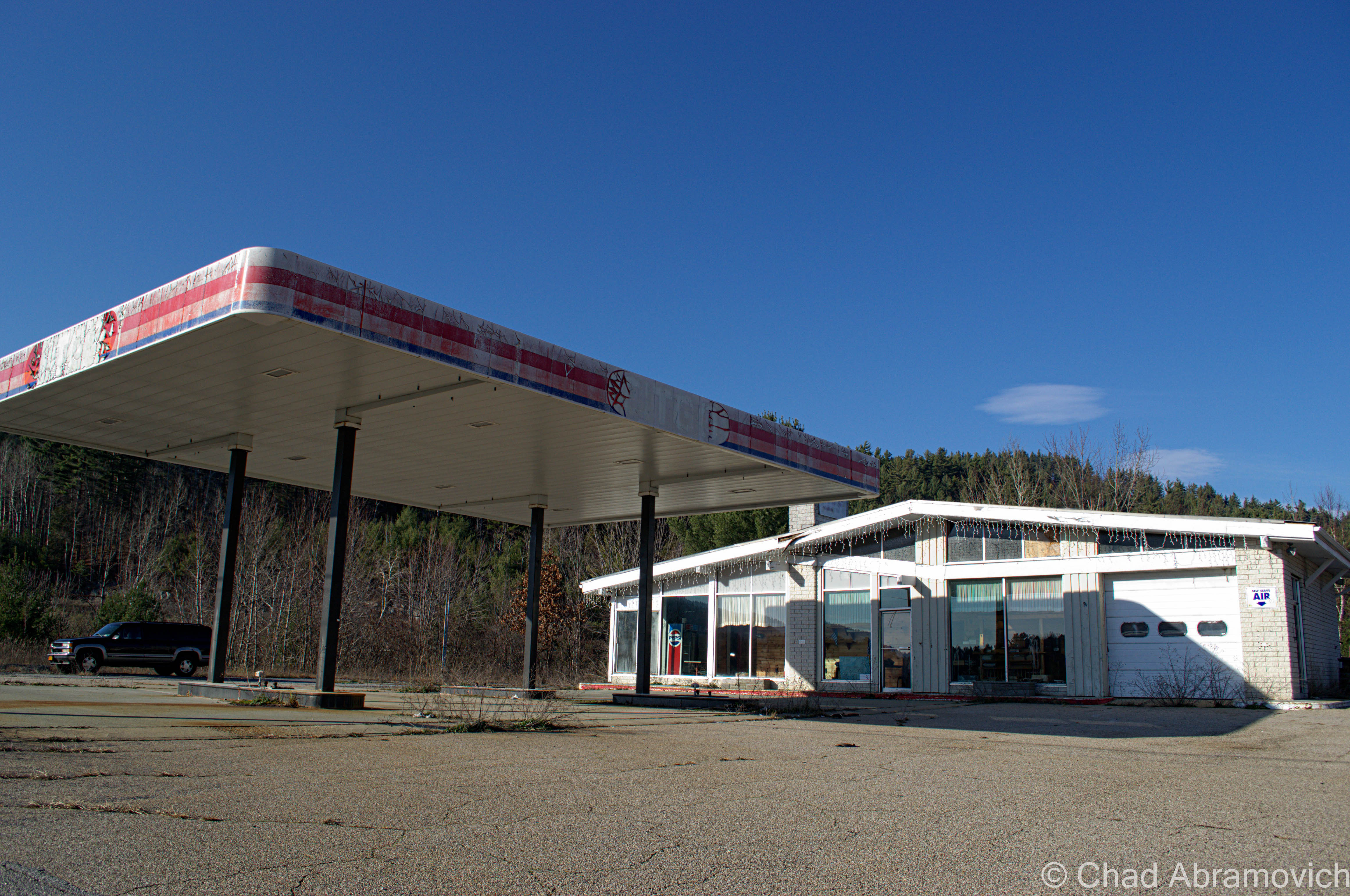
In addition to the numerous motels, cabins and restaurants that are abandoned here – we found out that the interstate exit that once served Frontier Town was also abandoned as well. This abandoned Citgo station sat a few yards away from the exit ramps. Here, a poor traveler pulled into the parking lot and was panicking. “Hey guys, do you know where a gas station is?” We told him there was on in Schroon Lake, 10 miles down the road. His face dropped. “shit. I don’t think I can make it” he sighed. We watched him pull out and turn onto Route 9. I hope he made it before it was too late.Abandoned at Frontier TownAbandoned at Frontier Town
Frontier Town is such a large property that I would need to devote an entire day to see it, which I hope to plan.
“Dysfunction Junction”
Heading back up Route 9, we drove through a unique, bizarre intersection at Routes 9 and 73 in New Russia, a hamlet of Elizabethtown. When Route 73 hits Route 9, the lanes split off in separate directions, crossing each other in a crazed and seemingly random pattern before coming together again. Everytime I’ve driven through it, I’ve wondered: why does this intersection exist? And the first few times – Where do I go?
A chance find on a Google search provided me with some answers. The locals call this “Dysfunction Junction”. The intersection was built in 1958, using a design that has been instituted (with slightly variations) in other areas of the state. The design is a “bulb type-T intersection” that “favors the heavier right-turn movement from the upper to the lower left leg of the intersection. Sight distances are excellent and approach speeds are approximately 40 miles per hour.”
So why was this design chosen for this spot? We have to go back to Route 9’s heyday as the main artery from Plattsburgh and points South. Before the Northway was built, Route 9 suffered far worse traffic congestion as it does now. Before the construction, a simple stop sign was in place, which overtime was unable to handle the flow of moving traffic. The design allows Route 9 traffic to flow through without stopping, while anyone continuing on 73 would have to wait. Today, they’d probably build a roundabout instead. While this design may have made sense in the 1950s, today’s traffic patterns have changed. But not everything thinks it’s a bad design. “If you just follow the signs, you’ll be alright” says one indifferent local.
To all of my amazing fans and supporters, I am truly grateful and humbled by all of the support and donations through out the years that have kept Obscure Vermont up and running.
As you all know I spend countless hours researching, writing, and traveling to produce and sustain this blog. Obscure Vermont is funded entirely on generous donations that you the wonderful viewers and supporters have made. Expenses range from internet fees to host the blog, to investing in research materials, to traveling expenses. Also, donations help keep me current with my photography gear, computer, and computer software so that I can deliver the best quality possible.
If you value, appreciate, and enjoy reading about my adventures please consider making a donation to my new Gofundme account or Paypal. Any donation would not only be greatly appreciated and help keep this blog going, it would also keep me doing what I love. Thank you!
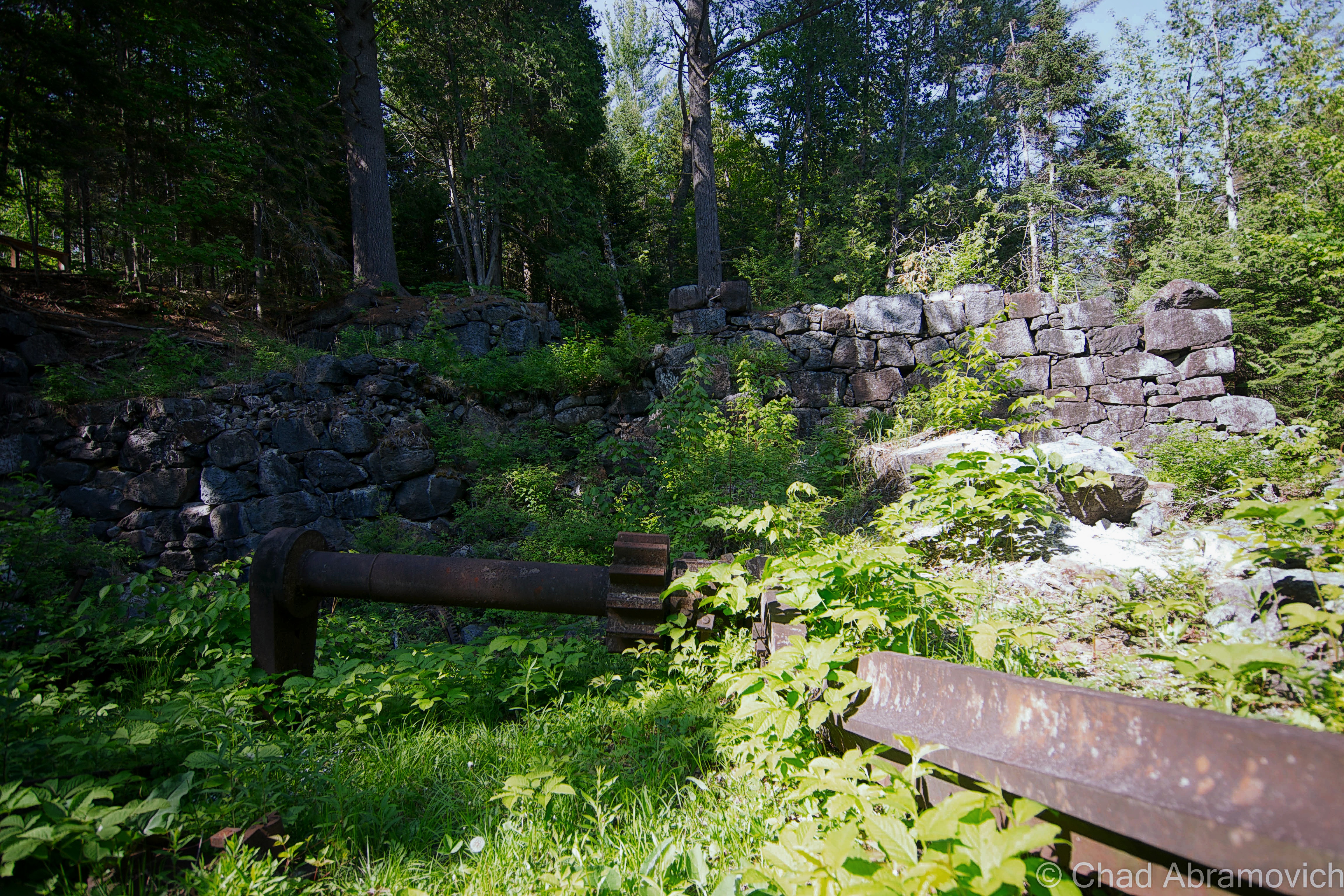
During the nineteenth century, the Adirondack Mountains began to be rummaged heavily for exploitable natural resources. The intrepid prospectors pushed farther north into a deep world of desolate woods, vast swamps and vertical slopes haunted by grueling winters. In 1826, industrialist Archibald McIintyre and his partner David Henderson, who were guided by an Indian of the Saint Francis Tribe, would discover iron ore where the headwaters of the iconic Hudson River spilled out of the mountains on their descent into New York Harbor, which lead to the creation of The Adirondack Iron Works to extract the precious commodity.
A settlement, which confusingly is either spelled as Adirondac or Adirondack, was formed around the mines and iron smelting operations. The village would grow to about sixteen dwellings, with a central multifarious building used as school, church and a meeting room.
The mines impacted the village to such an extent, that it became singularly lucrative, which meant that the first bank in the Adirondacks opened here, instead of surrounding towns that were easier to access and far more populated. But it’s previously mentioned remotely inauspicious location ensured life here was a constant struggle of endurance, and if it wasn’t for the seduction of fortune, no one would have decided to attempt to live here.
The iron ore here was at the time considered the best deposit in the country, but it’s far flung remoteness up numerous steep slopes all helped to run down the operations until they became prostrate ghosts.
In 1840, a road was finally hacked through the hills from the mines down to Port Henry, which was another emerging mining town and regional hub that boomed thanks to it’s location on Lake Champlain.
The Saratoga Railroad, which wanted to build a special spur line up to the blast furnaces, couldn’t construct up the vertical rises and was only able to extend the line to North Creek, a small hamlet “nearby” in the town of Newcomb. Because of this, the ore from Tahawus had to be hauled down to North Creek in tractors, or any other creative method they could devise.
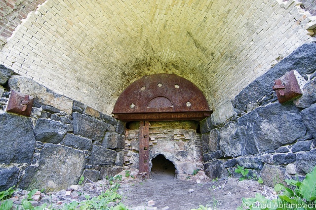
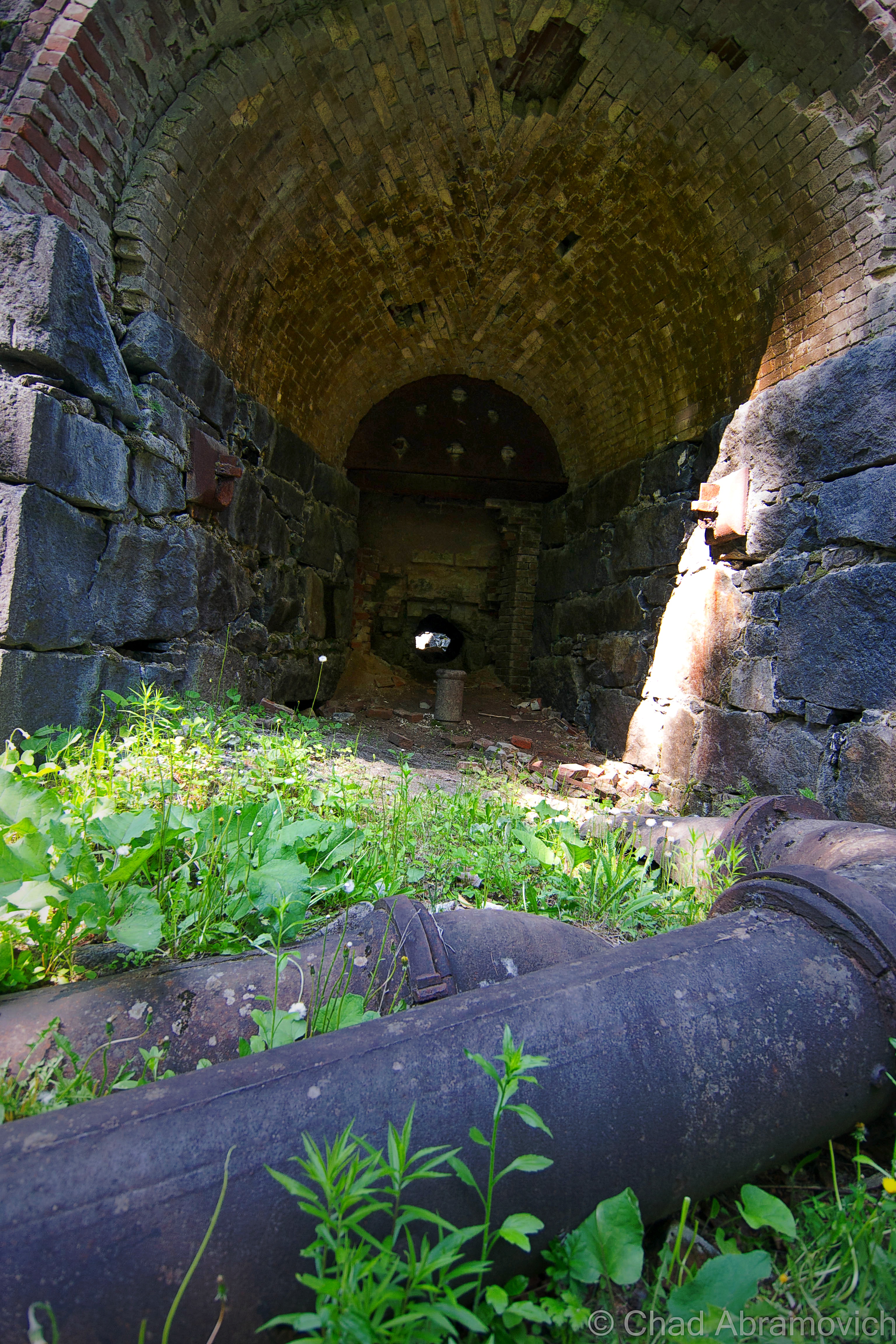
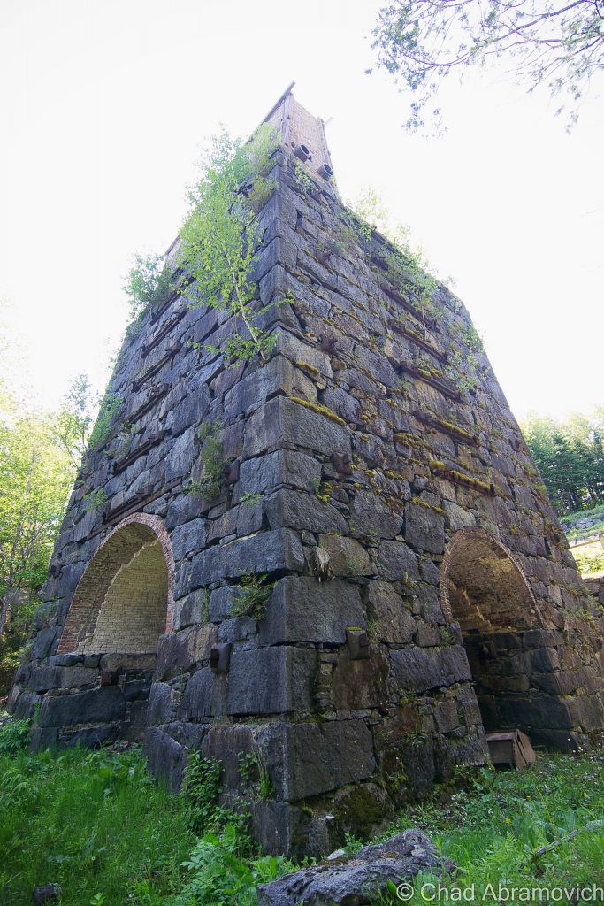
The fact that Adirondac(k)’s existence was brief was owed to a continuous chaser of circumstances that kept running the town down – the most impacting being the impurities in the iron ore they were trying to withdraw – later discovered to be titanium dioxide – that killed the town. The equipment at the time simply wasn’t advanced enough to successfully process the stuff, despite spending a remarkable $43,000 on an impressive fort like stone blast furnace known as McIntyre, which they had hoped would improve efficiency and profits. The entire village was forsaken in 1857 when the Adirondac(k) Iron Works gave up.
A decade later, a hunting club had eyed the land and the deserted ruins and eventually bought up most of it. The club at the base of the highest peak in New York attracted such notable people as Vice President Theodore Roosevelt, who was on a hunting trip here when President McKinley was assassinated by gunshot in Buffalo. Staying in regional character, the hunting club changed names and identities quite a bit. The Preston Ponds Club came in 1876 for both hunters and fisherman. Just a year later, it became the Adirondack Club, and in 1989, renamed itself the Tahawus club, the titular name that most of the area wears today.
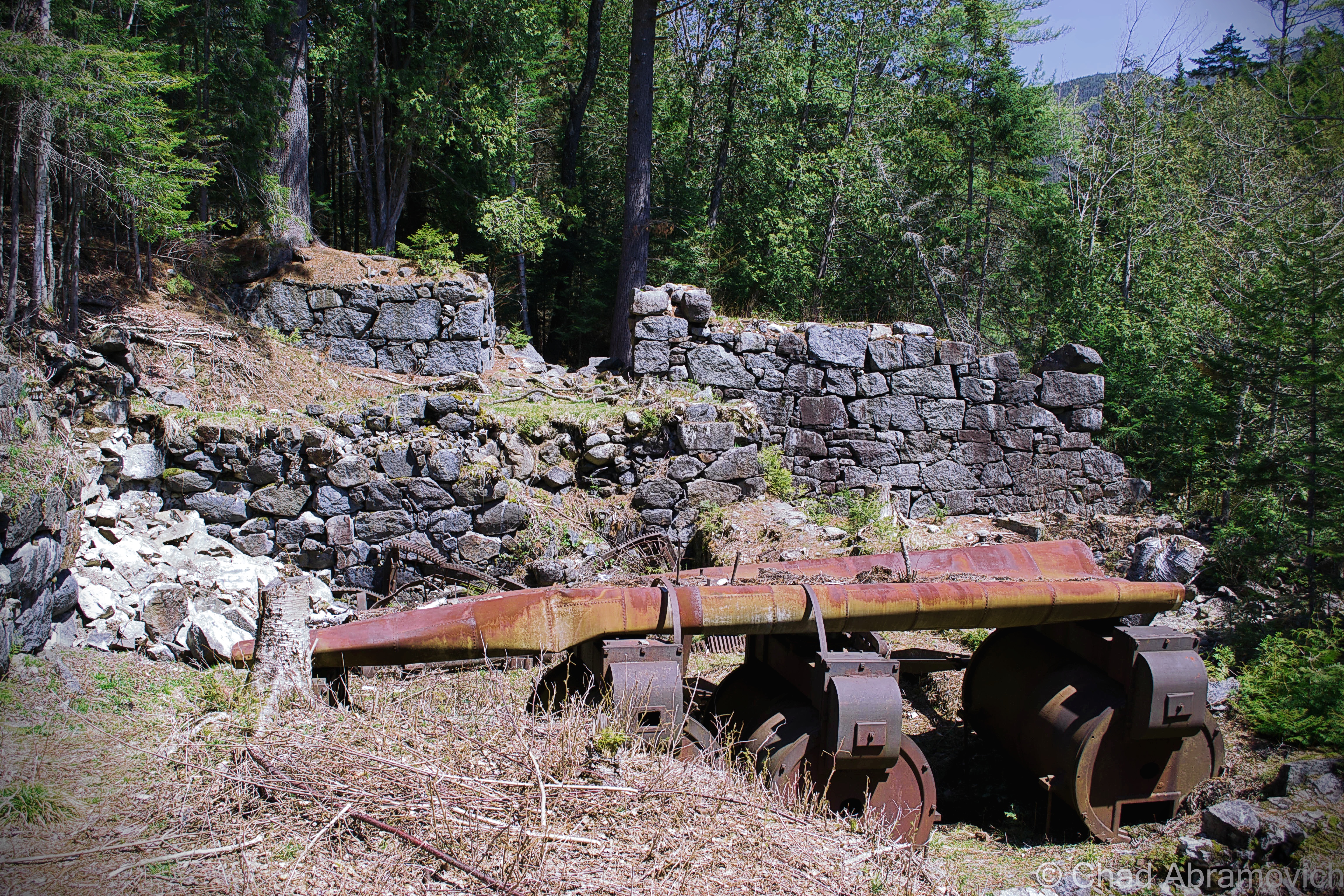
Times changed again and in 1940, a new mine opened, this time for the situationally ironic purpose of obtaining the titanium dioxide that had been responsible for previous failures in mining. World War 2 was in full swing, and because wars generally are hungry tempered affairs, anything that supported the war effort was in high demand, things like lead.
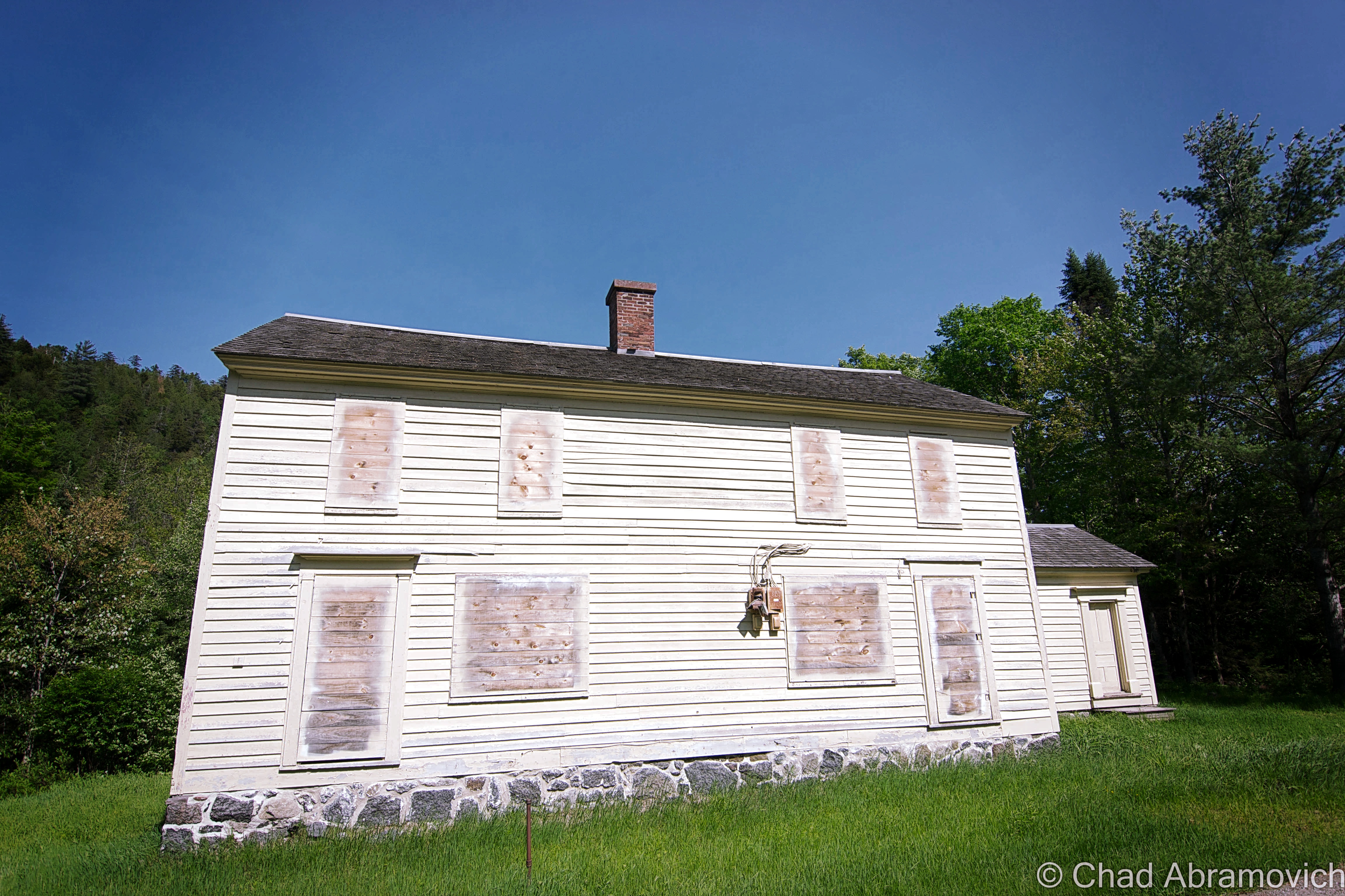
The National Lead Industries began mining along Sanford Lake which is southeast of the village, an area that would become known as The Lower Works. In 1943, the abandoned village was rebuilt for the new mine workers and was thematically renamed Tahawus. By 1945, Tahawus had 84 buildings, including some of the extant dwellings from the original town.
Before operations ceased in 1989, over 40 million tons of titanium oxide were extracted from the lower works, but the changing economy and bankruptcy would close the iron works. Once again, the wilderness was left to reclaim what was once its own, but this time no one tried to rebuild the town, leaving Tahawus to bury its faith in the rocky mountain soil.
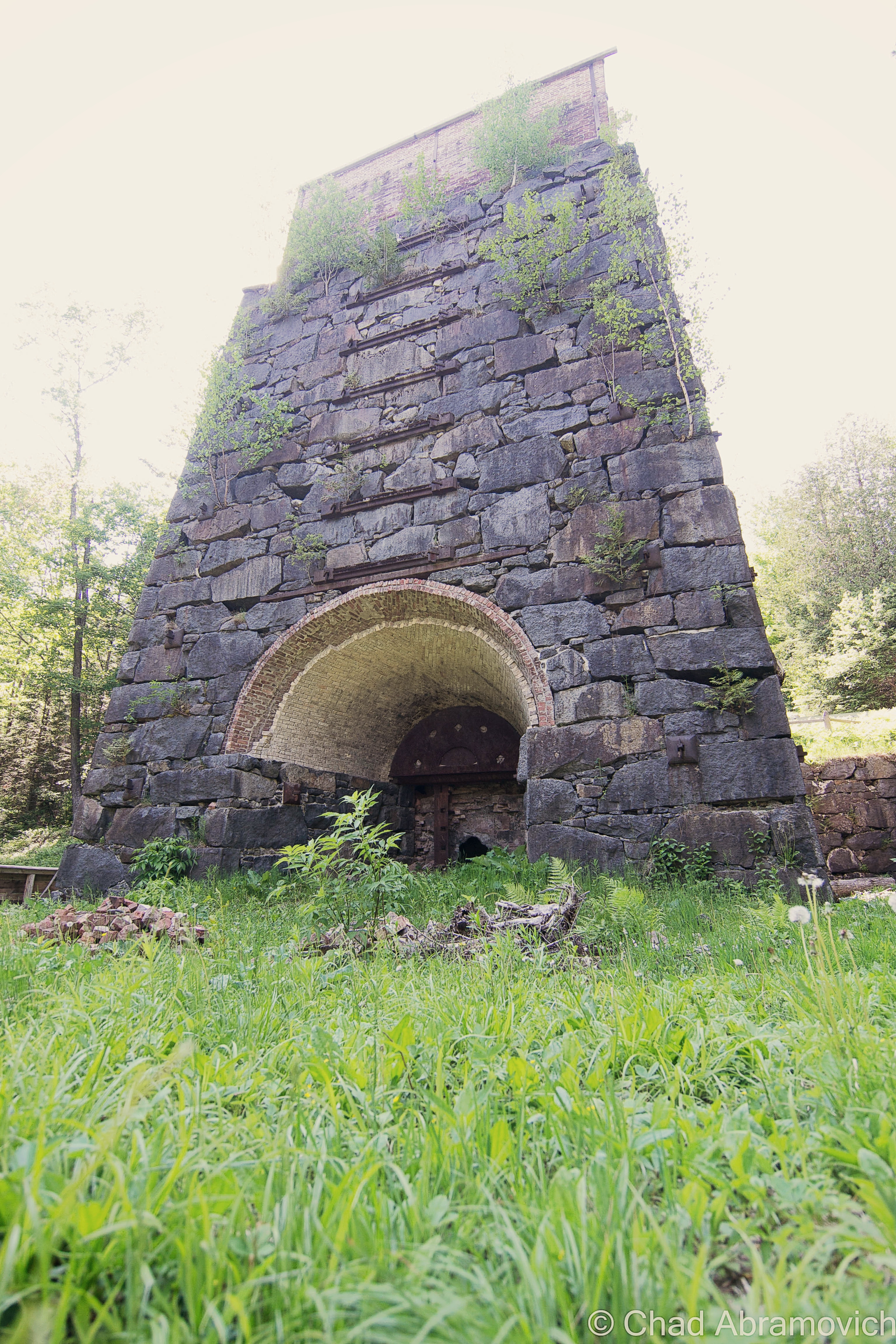
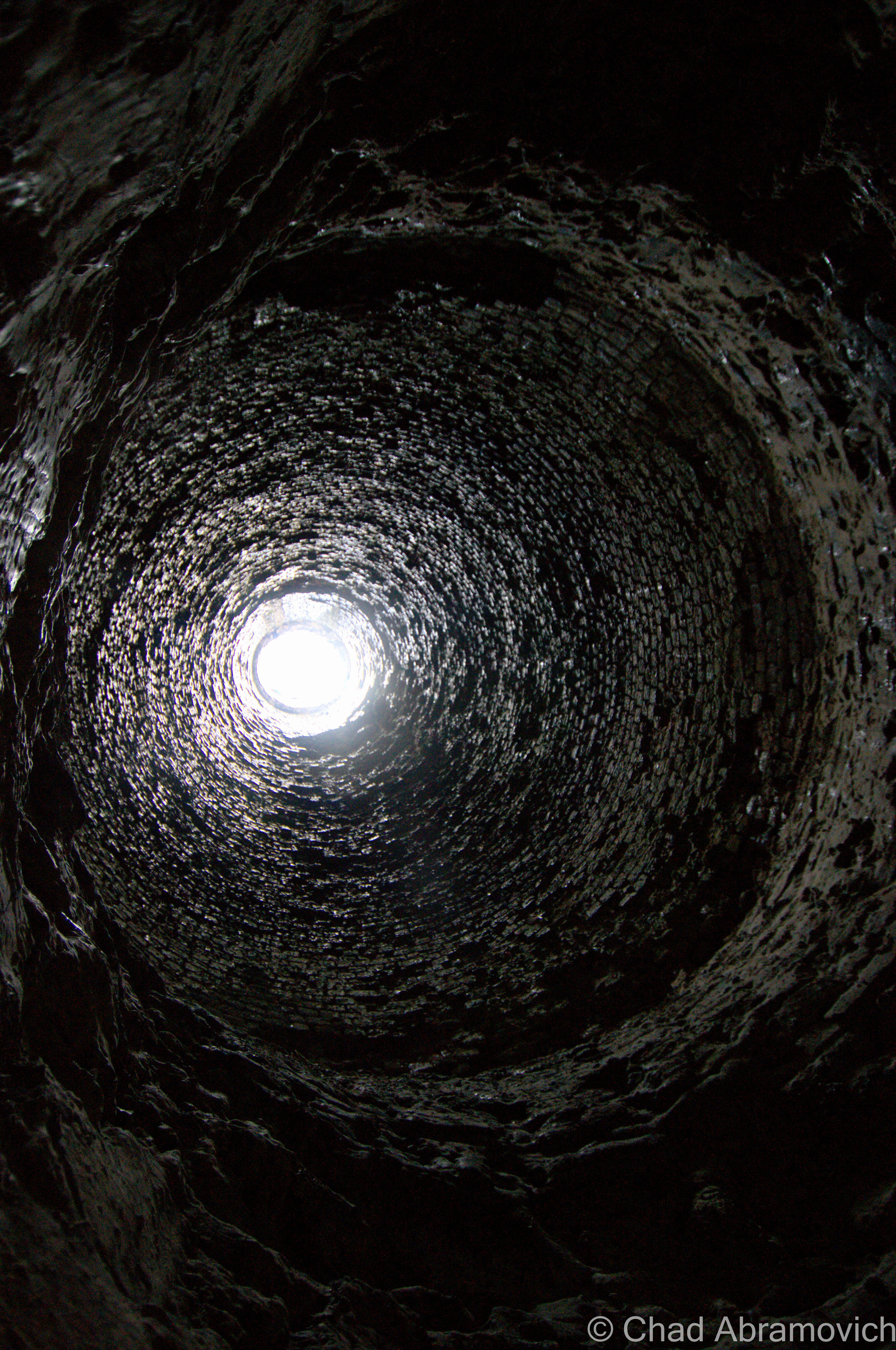
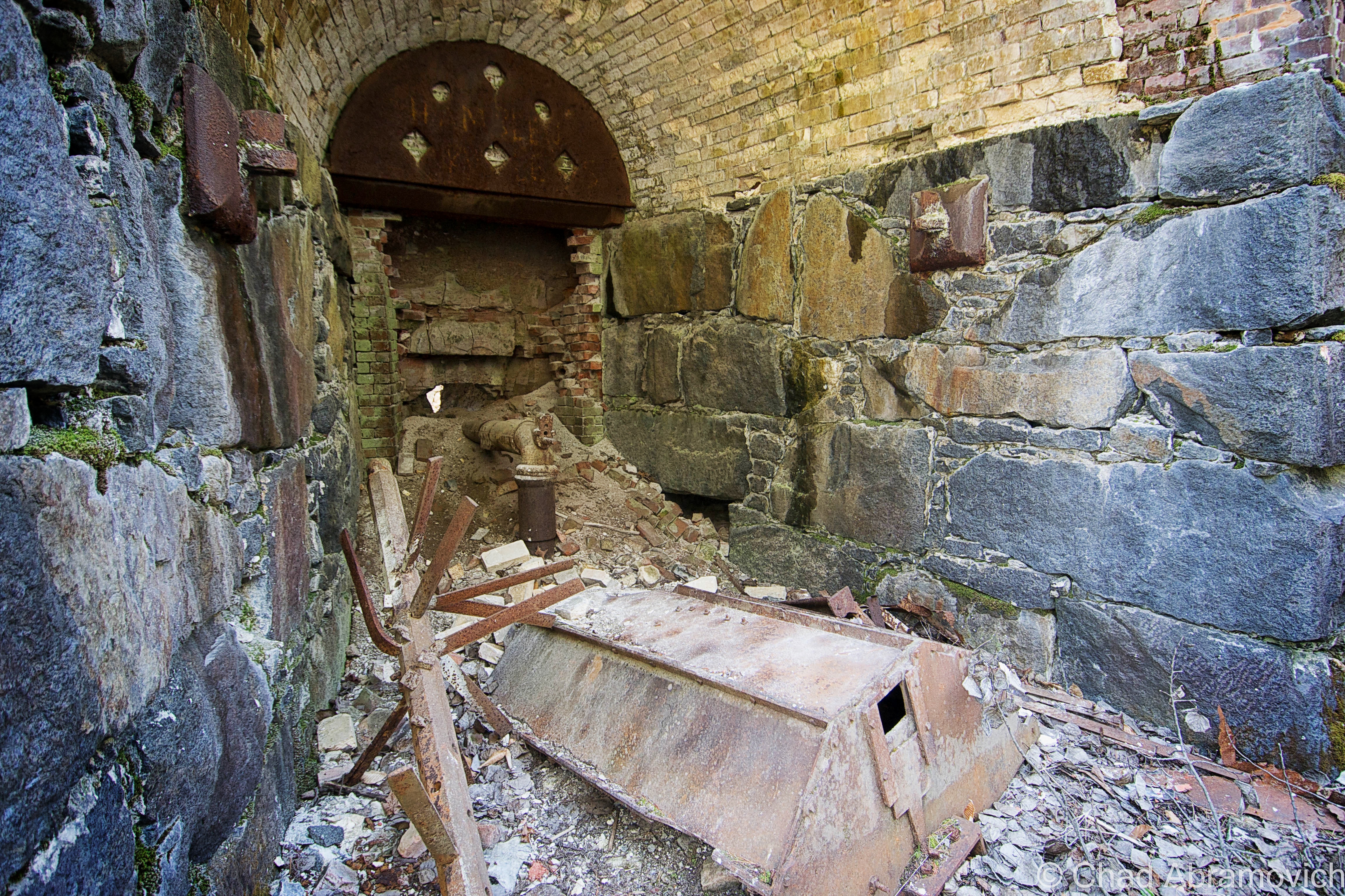
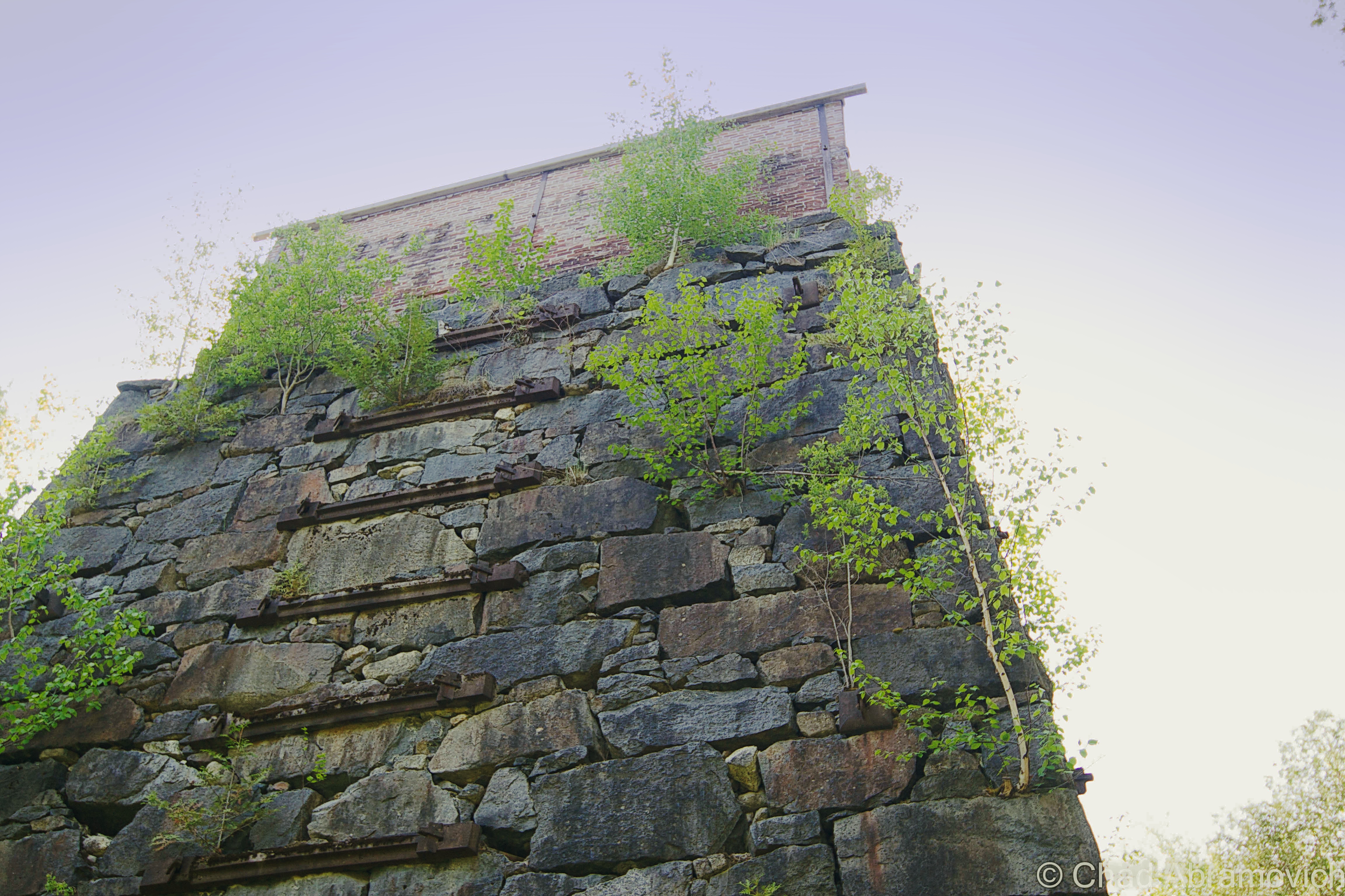
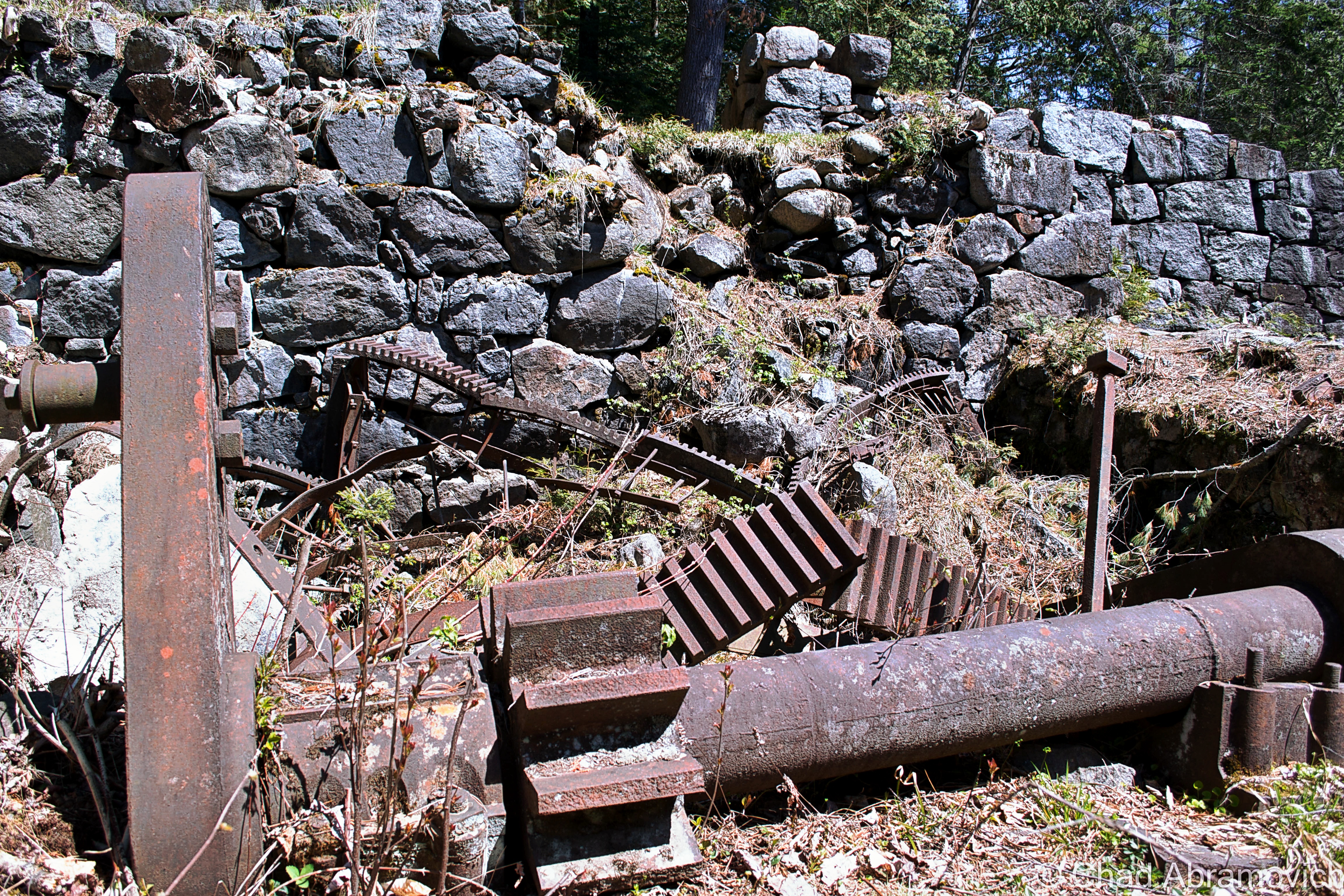
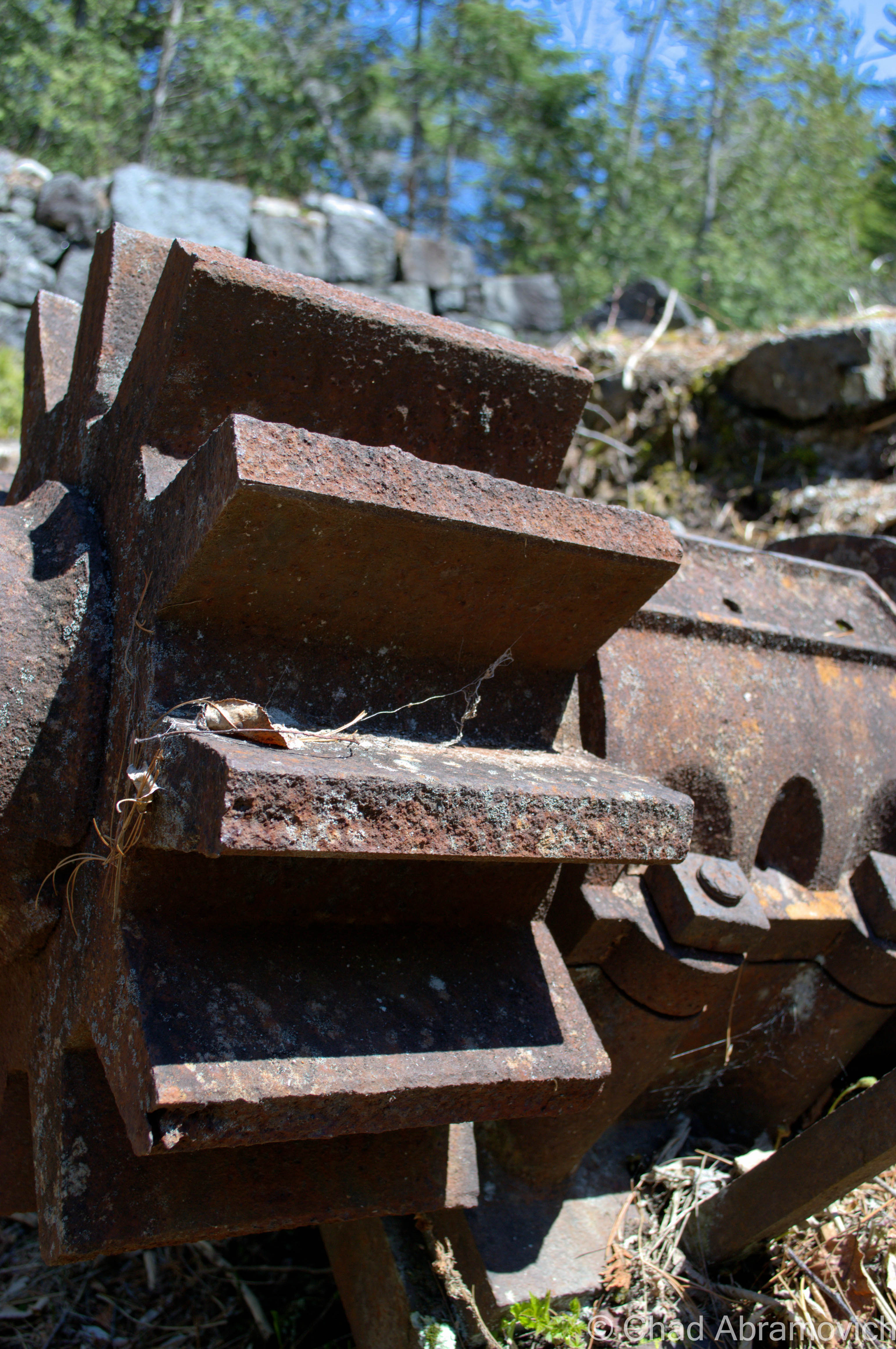
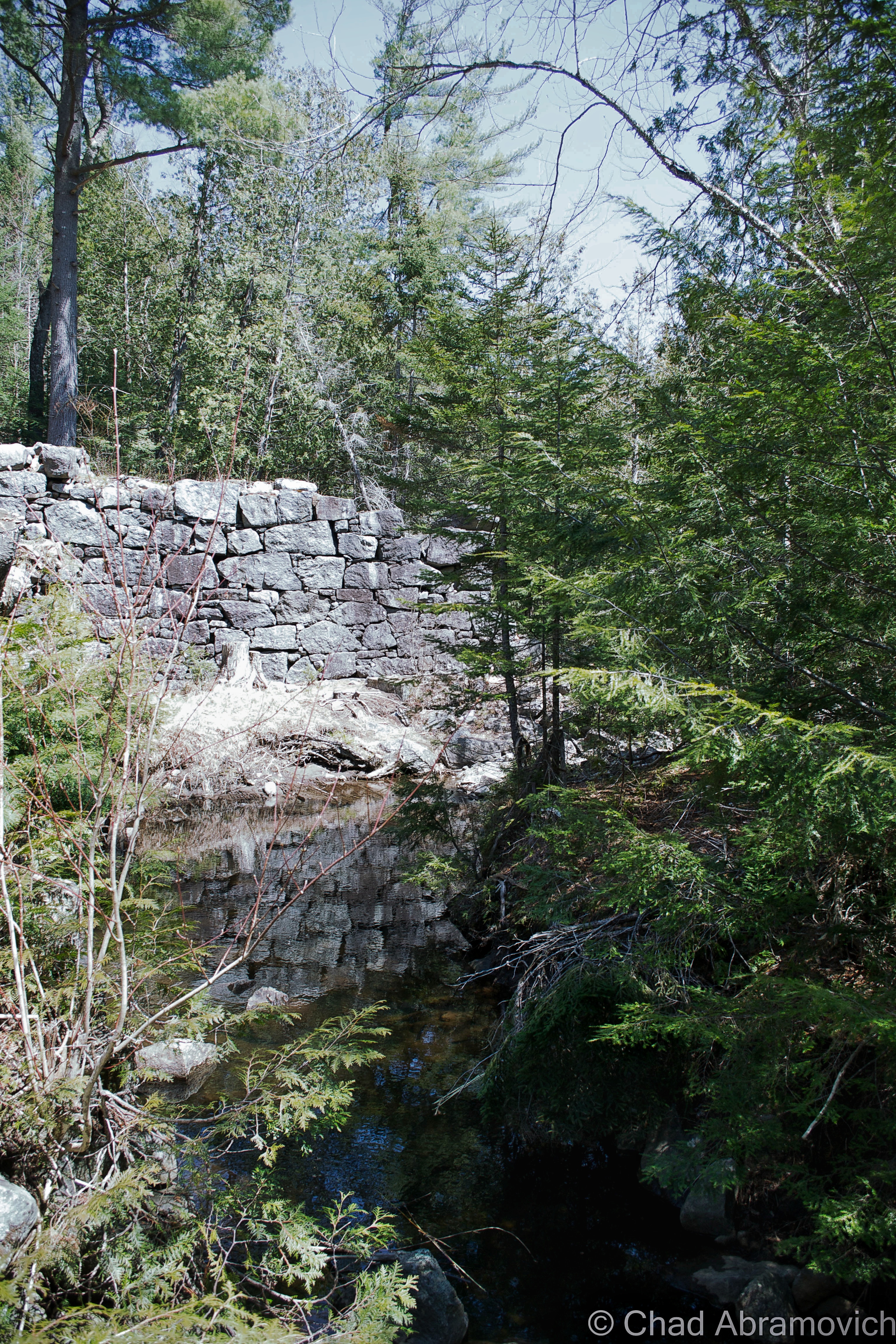
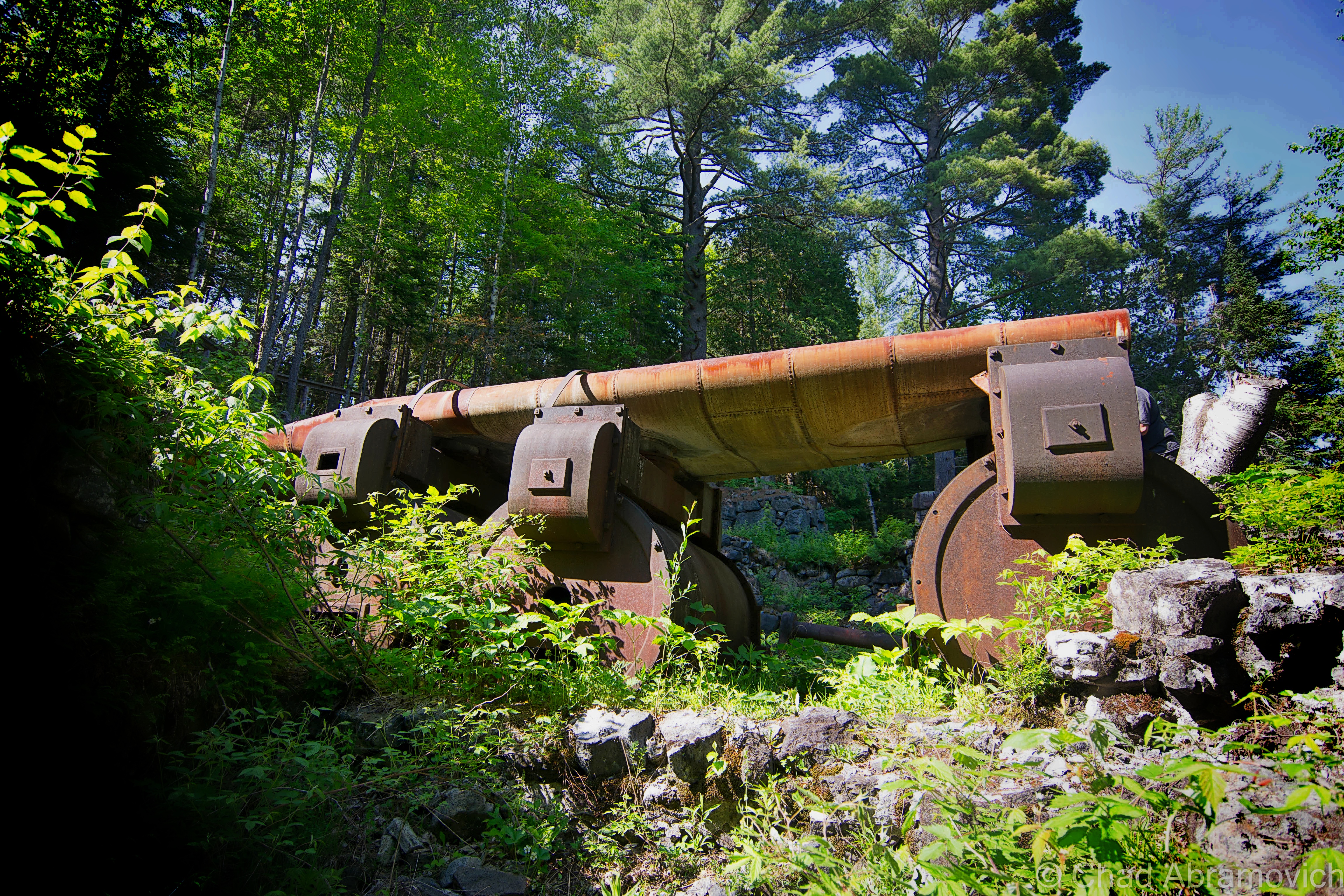
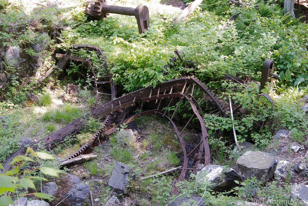
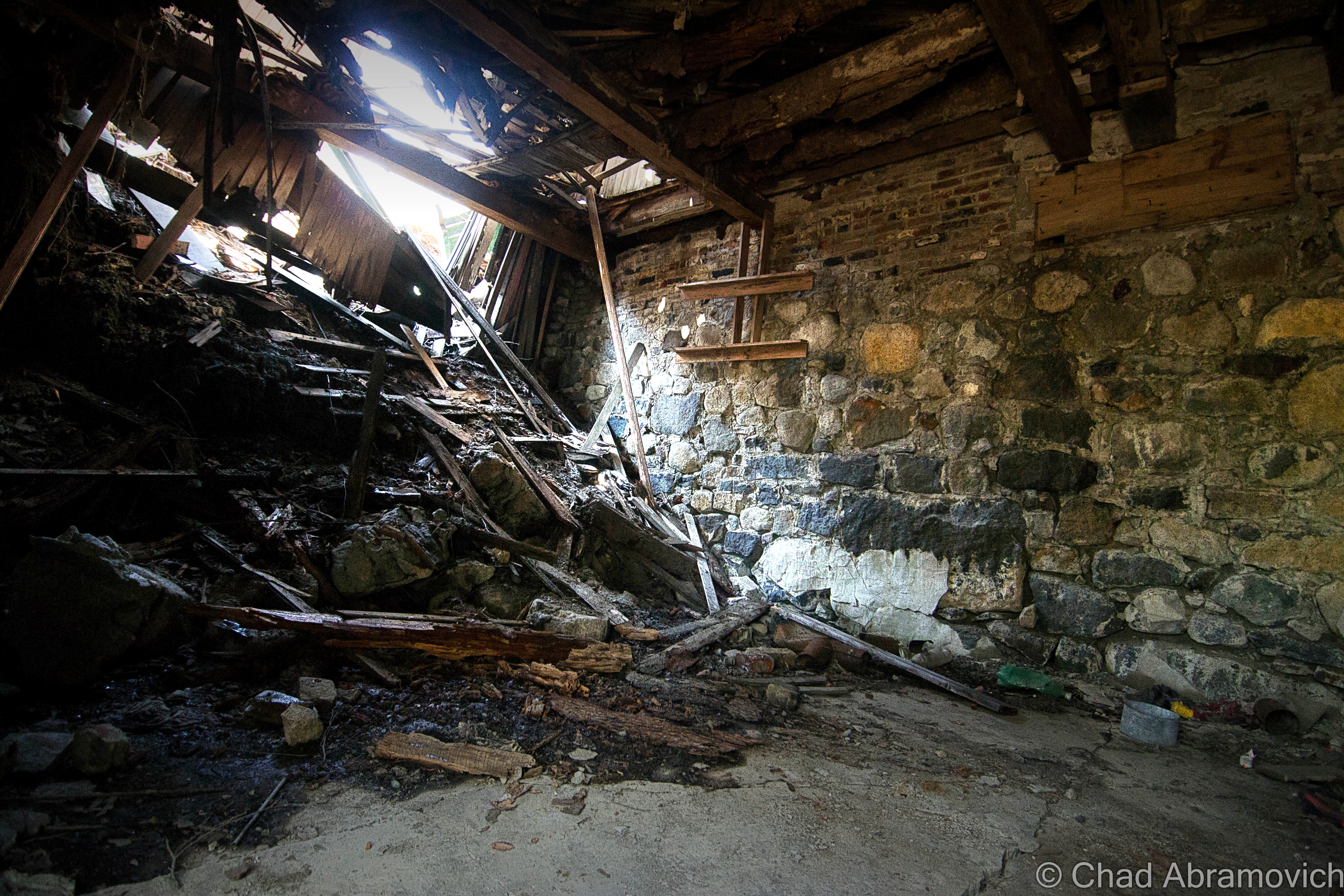
From my experience, most ghost towns in the northeast are nothing more than overgrown cellar holes, but Tahawus still retains 10 of its original buildings from it’s 1940s reincarnation, one preserved home from 1845, and the imposing remnants of the McIntyre Blast Furnace with trees growing through the cracks in its stonework, all accessible by a stretch of nicely laid asphalt (until previously, it was a dirt road).
The Open Space Institute purchased Tahawus and surrounding forests in 2003 to preserve the unique area and formed the Tahawus Tract Project. Until 2006, the ghostly ruins of the Tahawus mines at Sanford Lake were also still existing, but have been since demolished, but the startling grey toned waste dunes still devour much of the lakeshore and Google satellite imagery of the place.
To find Tahawus’s rotting bones, they lay at the end of a long and desolate road which carves its way around swamps and streams, and follows the scars of an old railroad bed. Eventually, it comes to a rather abrupt dead end right in the center of town. And it is here where you can finally start picking at the pieces of this fascinating community.
Though Tahawus is a ghost town, because of it’s proximity on a roadway that leads to the junction of several popular hiking trails that take off towards cloud splitting Mount Marcy, it’s probably one of the least dead places in the Adirondacks. But on an interesting note; a passing hiker did tell me that he remembers bodies being found in Henderson Lake in the 70s that were the suspected victims of a local serial killer or madman. Or, so he told me.
Tahawus Today
The road to Tahawus was a long and lonely drive, passing through incredibly vast wilderness areas that a person could walk into and never reemerge from. I was actually a little surprised to find out that there was an actual road that lead right into town.
The road, aptly named “Tahawus Road” plunges deep into the wild, forwarded by what me and my friends refer to as the world’s most misleading “dead end” sign – as the road continues to cover ground for an unsuspected 7 miles before finally ending. As the forlorn stretch of asphalt climbed further into the woods, you could see the remnants of railroad lines that used to pass through, evidence of the areas industrial past. The rail beds had long been removed, leaving leveled banks that slice through an otherwise organic landscape. So, what did I expect to see as I entered Tahawus? I wasn’t sure what I expected, but it certainly wasn’t what greeted my hungry eyes.
Though the environs were squalid and eerie, admittedly, my first impression of this community was a bit underwhelming. The misleading photographs I found on the internet had set my expectations pretty high, but the unanticipated reality was humble and wrecked. What I had expected to be a large forgotten town reachable by trekking through thick forest and undergrowth, with somewhat of a sense of pre-coordinated directions, wasn’t. Instead, I could easily explore the place by hopping out of the car in a dirt parking lot cramped with other cars, hikers with backpacks, and one of my favorite jazz tunes wafting from the stereo.
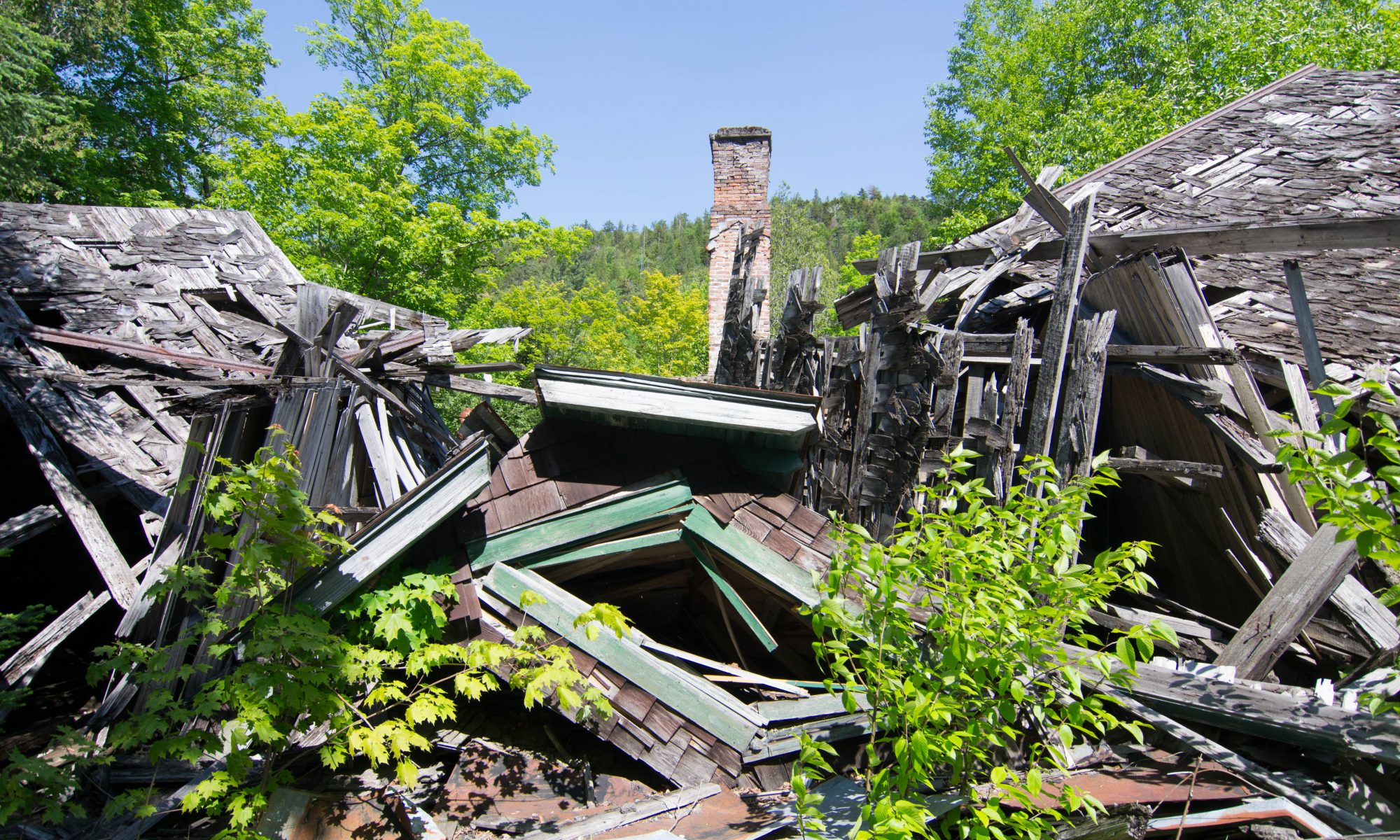
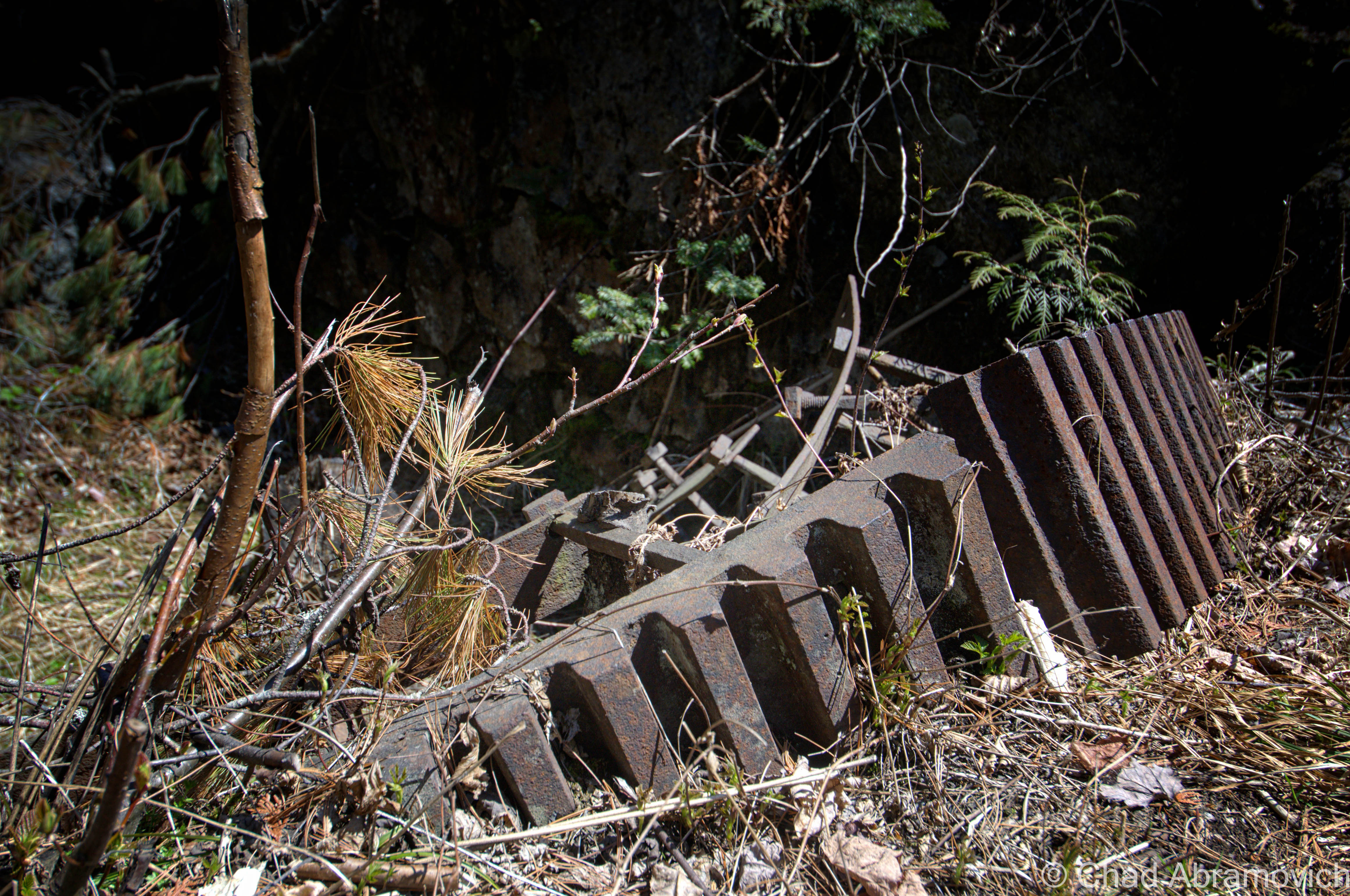
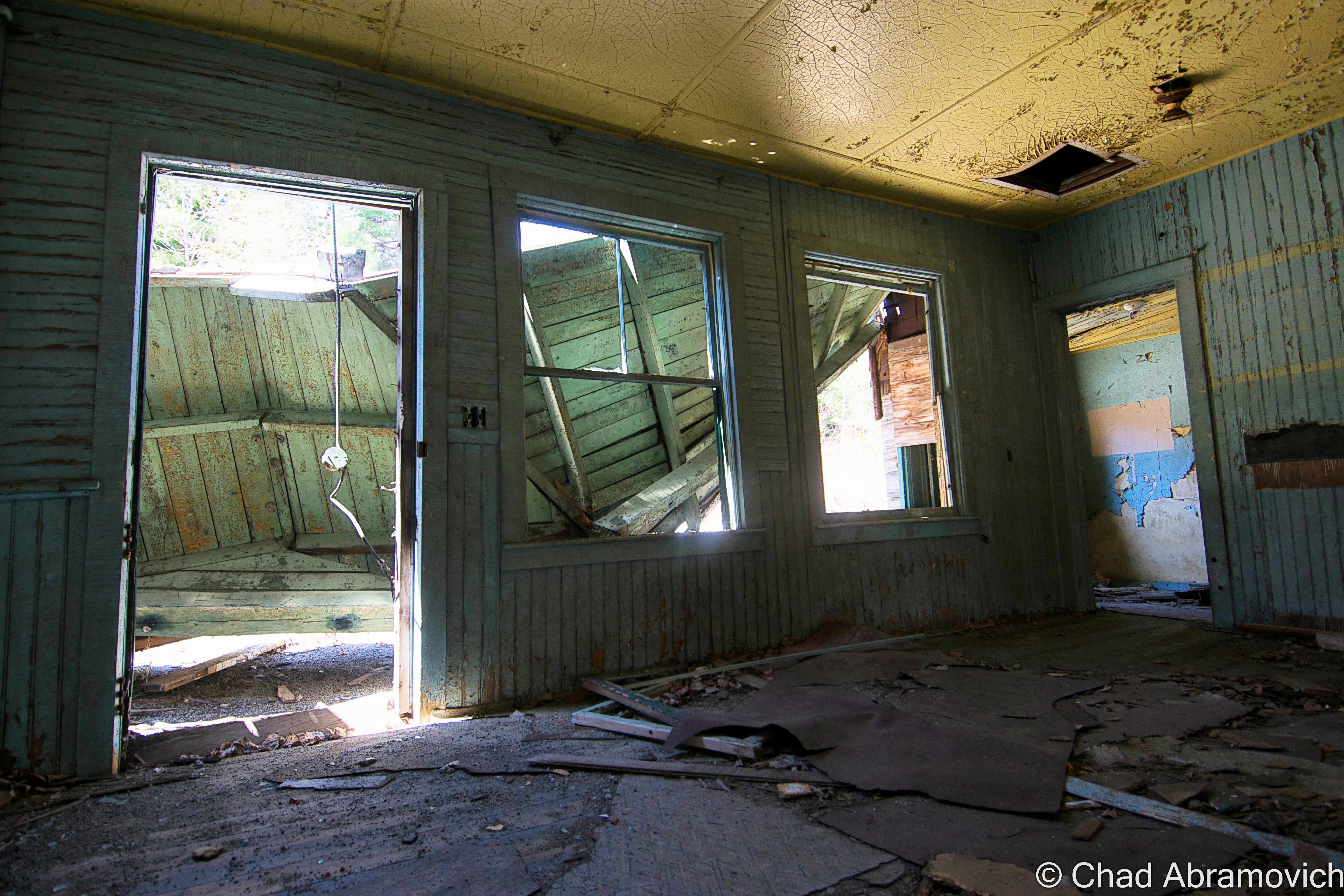
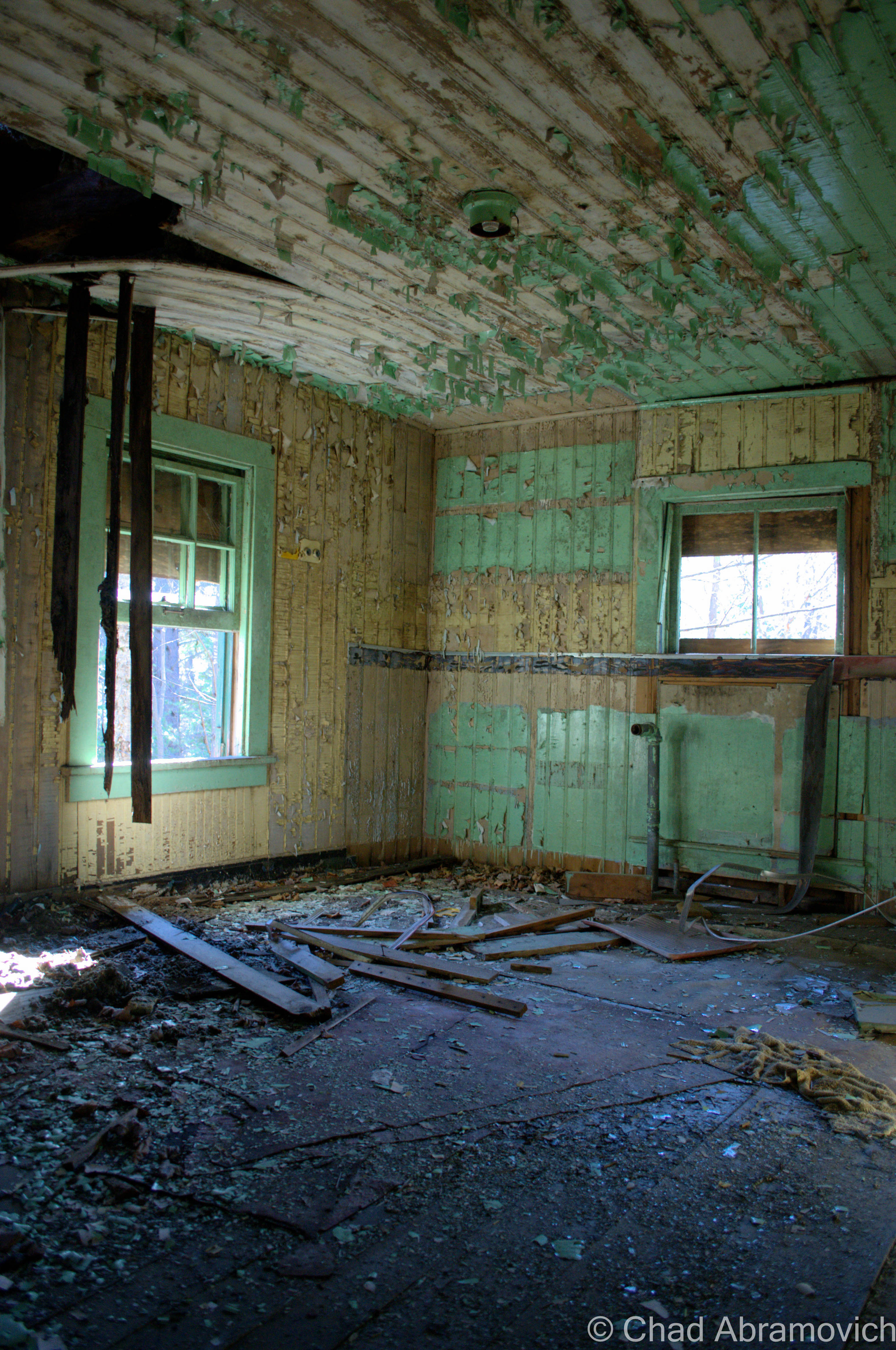
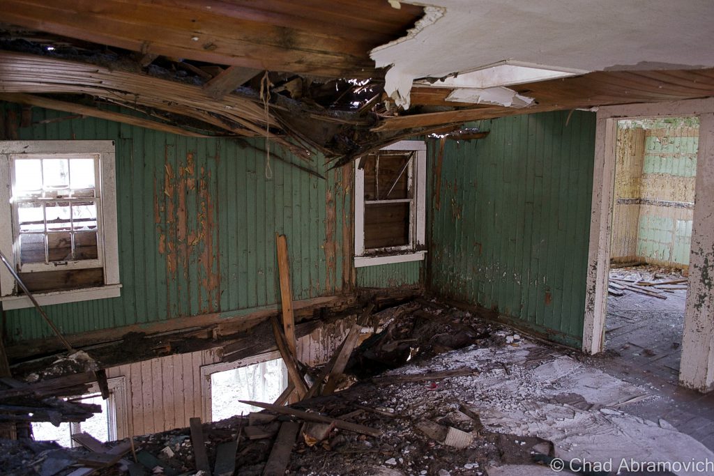
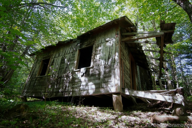
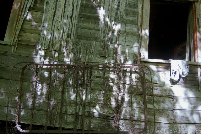
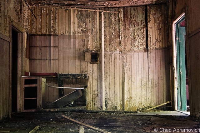
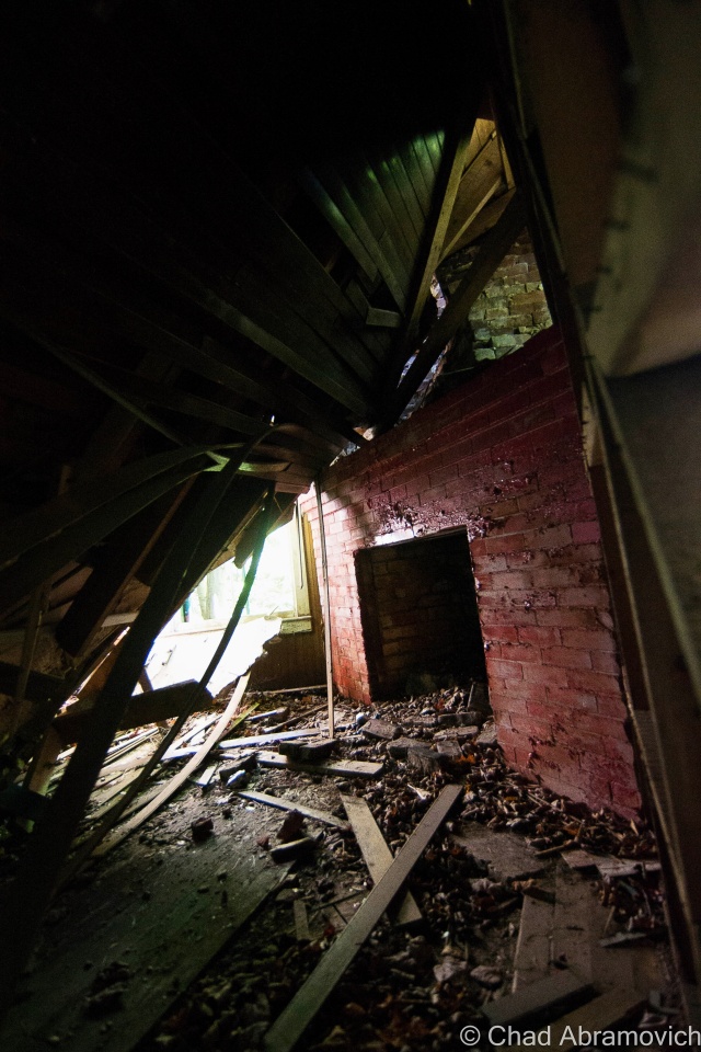
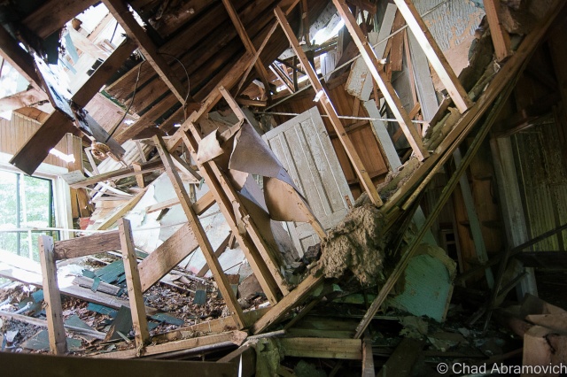
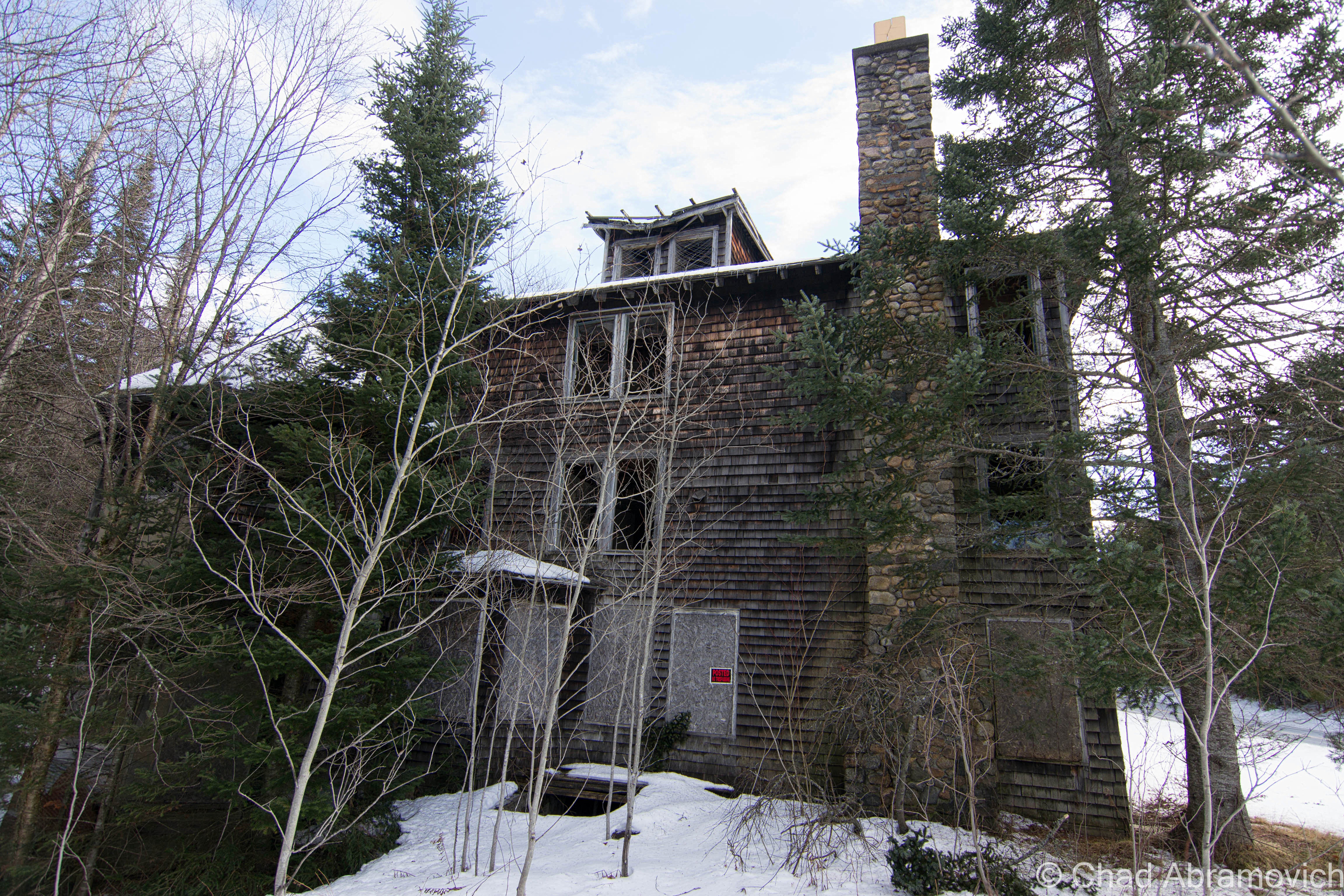
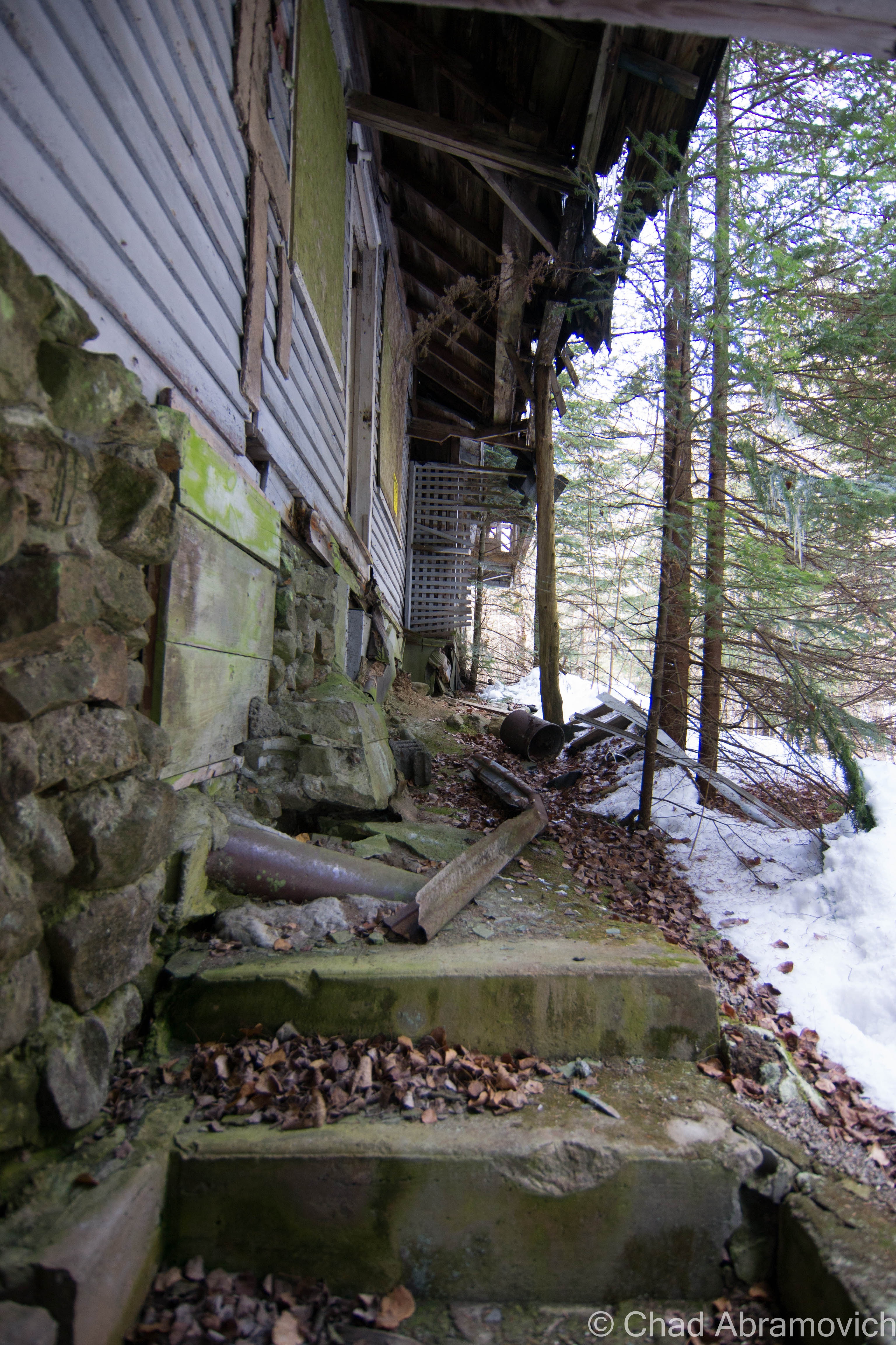
Some of the surviving/deteriorating buildings have wasted away to the point beyond recognition, and others weren’t far behind. The roofs collapsed where they’re not entirely missing, forming mangled and wild shapes, and the dead weight slowly dragging many of the structures down the banks into the Hudson River.
Another interesting feature was that all of the buildings looked almost identical, with brown cedar shingles and a dark green forest trim.
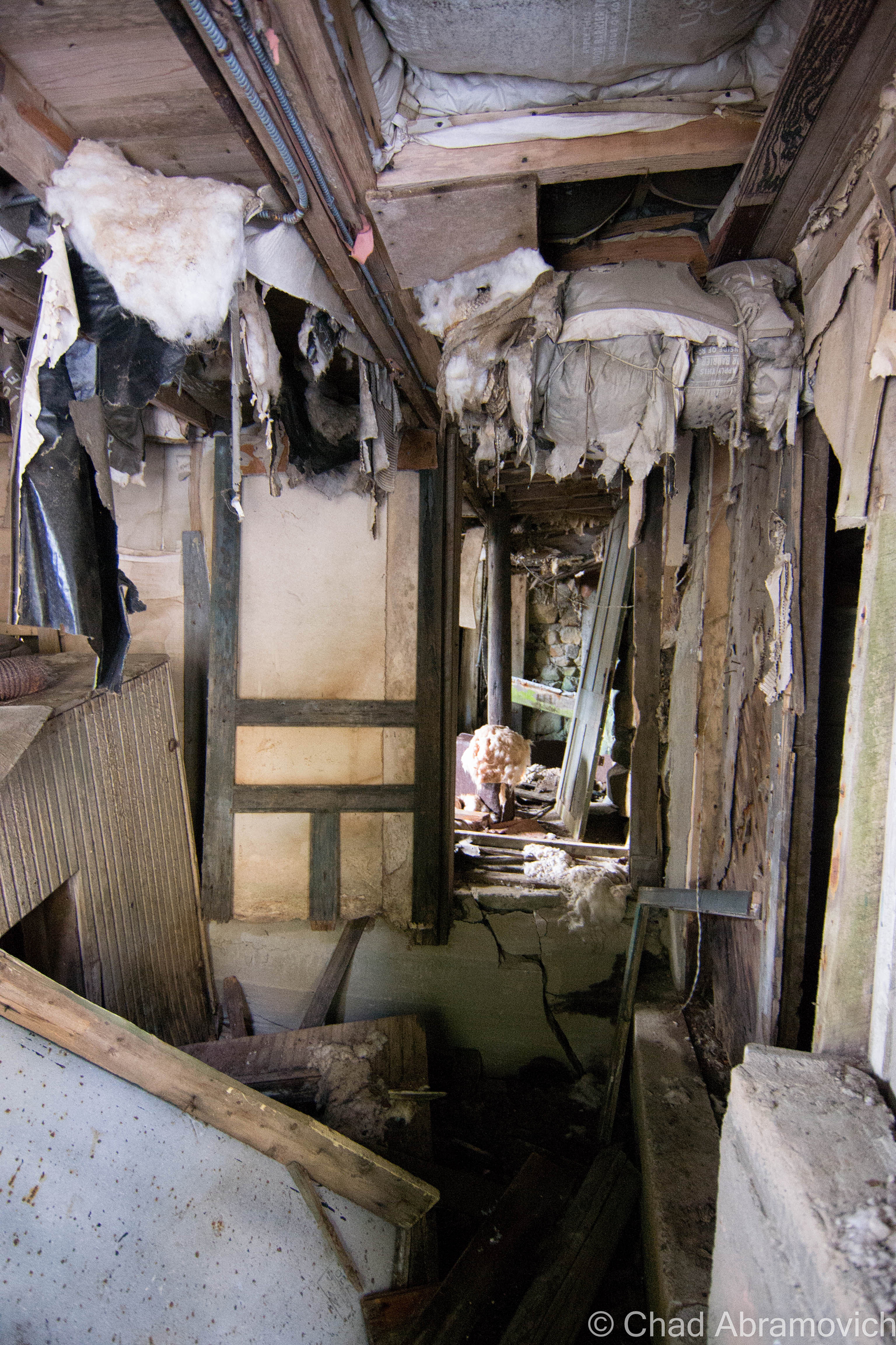
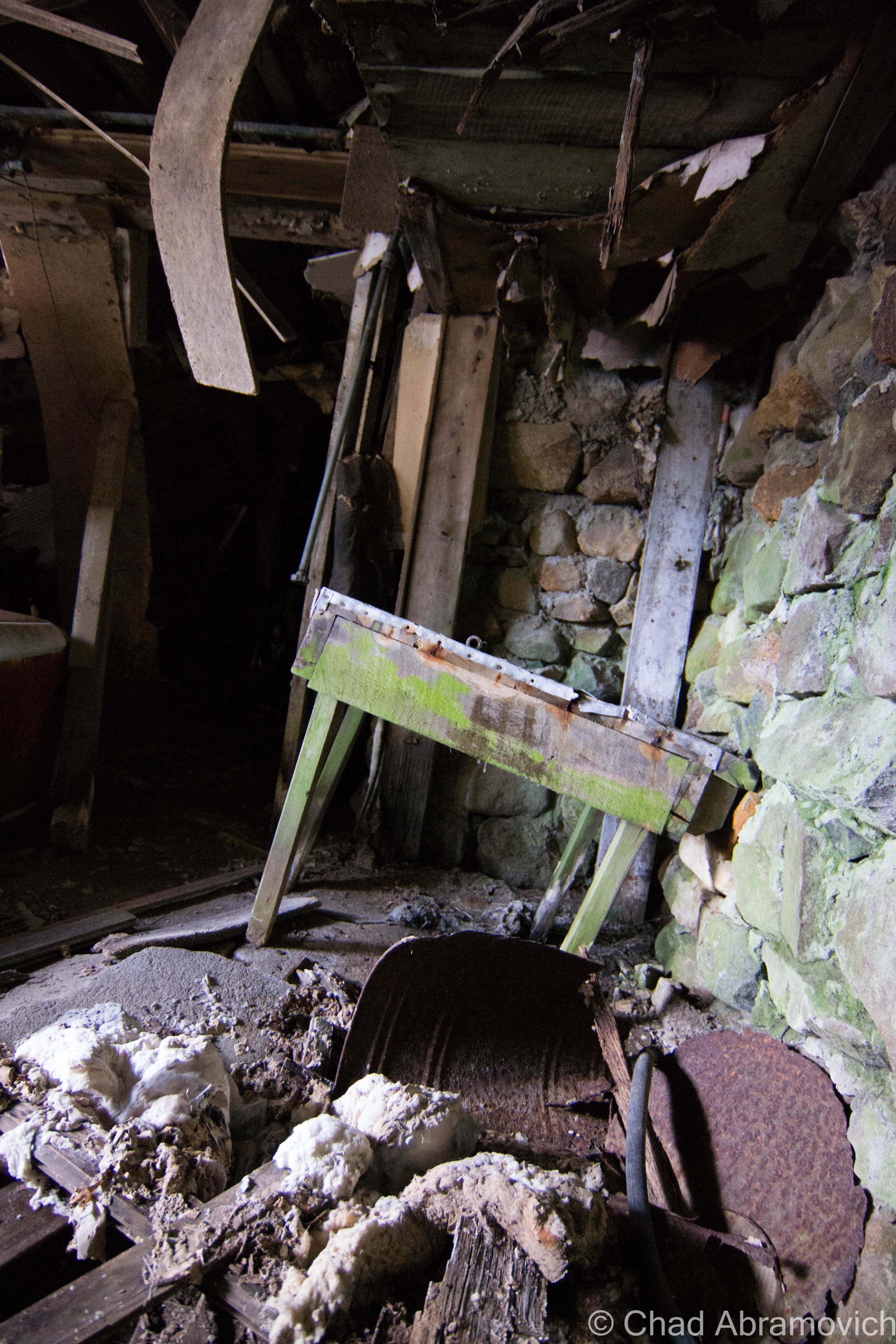
A few buildings proved safe enough to enter. But the interiors were claustrophobic and vertigo, as each building became warped as they deteriorated at their own rate. There were no relics left behind amid the rubble, each room was an empty wooden shell. The ramshackle atmosphere was an enigma, masquerading the dangers by putting them in plain sight – your eyes straining continuously for a safe passage.
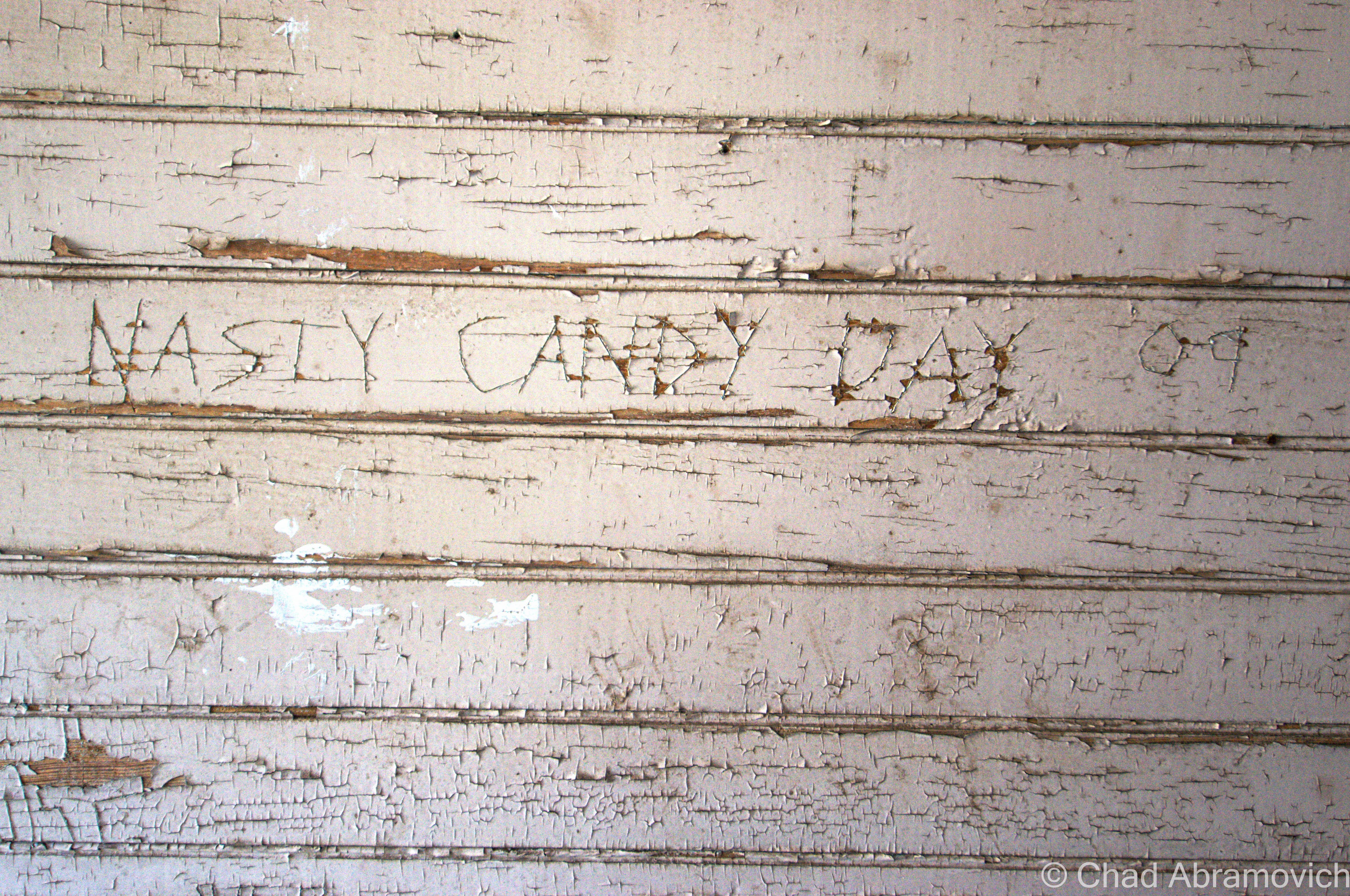
But it was also this carnival of chaos that’s been a few decades in the making that give me a strong feeling of awe that a great adventure always does. Every room was done in old fashioned wainscoting, each it’s own vibrant lead painted color which had been peeling and weathering for years. The sun poured through the cracks in the walls and kissed my fingertips as you begin to think about who might have lived here beforehand and how this new atmosphere has filled the places where they once used to stand.
Later during the dying days of Fall, I would make a return trip.
In the shadowy dales of the upland marshes, there were already pockets of snow, the fir trees bent over with a rather thick dusting. This was the first snow I’ve seen of the season. Though it was only around 1 in the afternoon, the harsh glow of the late Autumn sun made it feel otherwise, as the scraggly woodlands basked in sort of an offsetting golden glow.
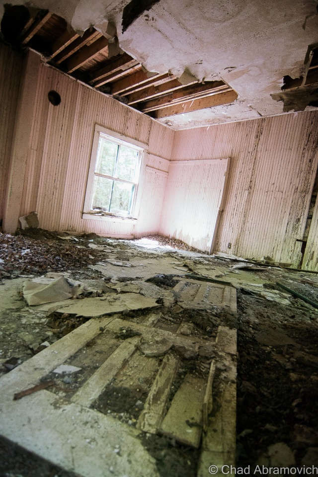
I was surprised at just how bad Tahawus had become since my last journey here in the spring. Most of the remaining houses had either fallen over almost entirely, or were significantly worse off than before. The majority of the buildings I had wondered in months ago had become far worse for wear. Now, I had to take very careful precautions to set foot inside. As it was, my friend had already stepped on a nail which went through his boot. Not the best way to begin an adventure.
I can’t very well describe the feeling of exploring these modest dwellings, the interiors adorned with peeling walls shedding their lurid lead paint onto the dusty wooden floors as the late afternoon sunlight filtered inside as if keeping an eye on a sacred Adirondack shrine, the former world of man now home to nature and dust, finding peace with each other in subtle nuances. Any feelings of human habitation is a queer thought now, as time incinerates what that was to Tahawus.
At the alarming rate of Tahawus’s decay, it’s strange to think about the reality of the village becoming nothing more then a name on a map 3-5 years down the road, its buildings returning to dust that is scattered to the Adirondack winds.
But despite its shocking rate of deterioration from when I first visited only 3 years ago, and it’s crowds, it still remains one of my favorite places in upstate New York, which may or may not entirely be due to nostalgia.
The Old McIntyre Blast Furnace site
Tahawus Town
MacNaughton Cottage (1845). This was the house that Vice President Theodore Roosevelt stayed in during his hike to Mount Marcy when he received news of President William McKinley being close to death after being shot in Buffalo, and is the only “restored” building in Tawahus, as well as the first building you see in town.
Links:
If you’re interested in Tahawus, The Adirondack Park Agency published a great article on it.
To all of my fans and supporters, I am truly grateful and humbled by all of the support and donations throughout the years that have kept Obscure Vermont up and running.
As you all know I spend countless hours researching, writing, and traveling to produce and sustain this blog. Obscure Vermont is funded entirely on generous donations that you the wonderful viewers and supporters have made. Expenses range from internet fees to host the blog, to investing in research materials, to traveling expenses. Also, donations help keep me current with my photography gear, computer, and computer software so that I can deliver the best quality possible.
If you value, appreciate, and enjoy reading about my adventures please consider making a donation to my Paypal. Any donation would not only be greatly appreciated and help keep this blog going, it would also keep me doing what I love. Thank you!


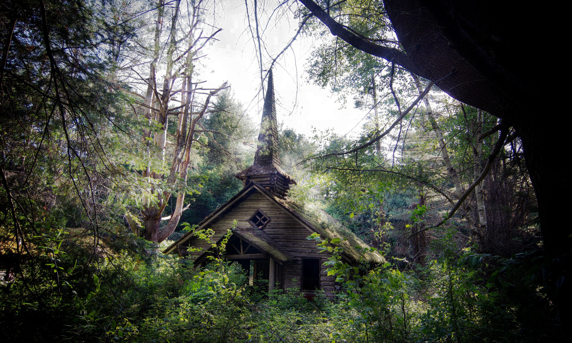


 Side Note: There is a ghost town in the mountains behind Frontier Town. If you’re curious, click on