Frontier Town

Most people my age aren’t likely to recall Frontier Town, a once-prominent destination turned ghost town in the woods of tiny North Hudson, New York, but there are plenty of people who will tell you that it used to be great,  and integral to the once-thriving Adirondack tourism heyday of the mid 20th century.

The Adirondacks are the rugged mountain range that makes up a the eastern half of upstate New York, and most of those mountains are within the 6 million-acre vast and often desolate Adirondack Park, an area about the size of my home state of Vermont and is the largest park within the lower 48.

I’ve mentioned Frontier Town before in an earlier blog entry, but never truly got around to exploring it until recently.

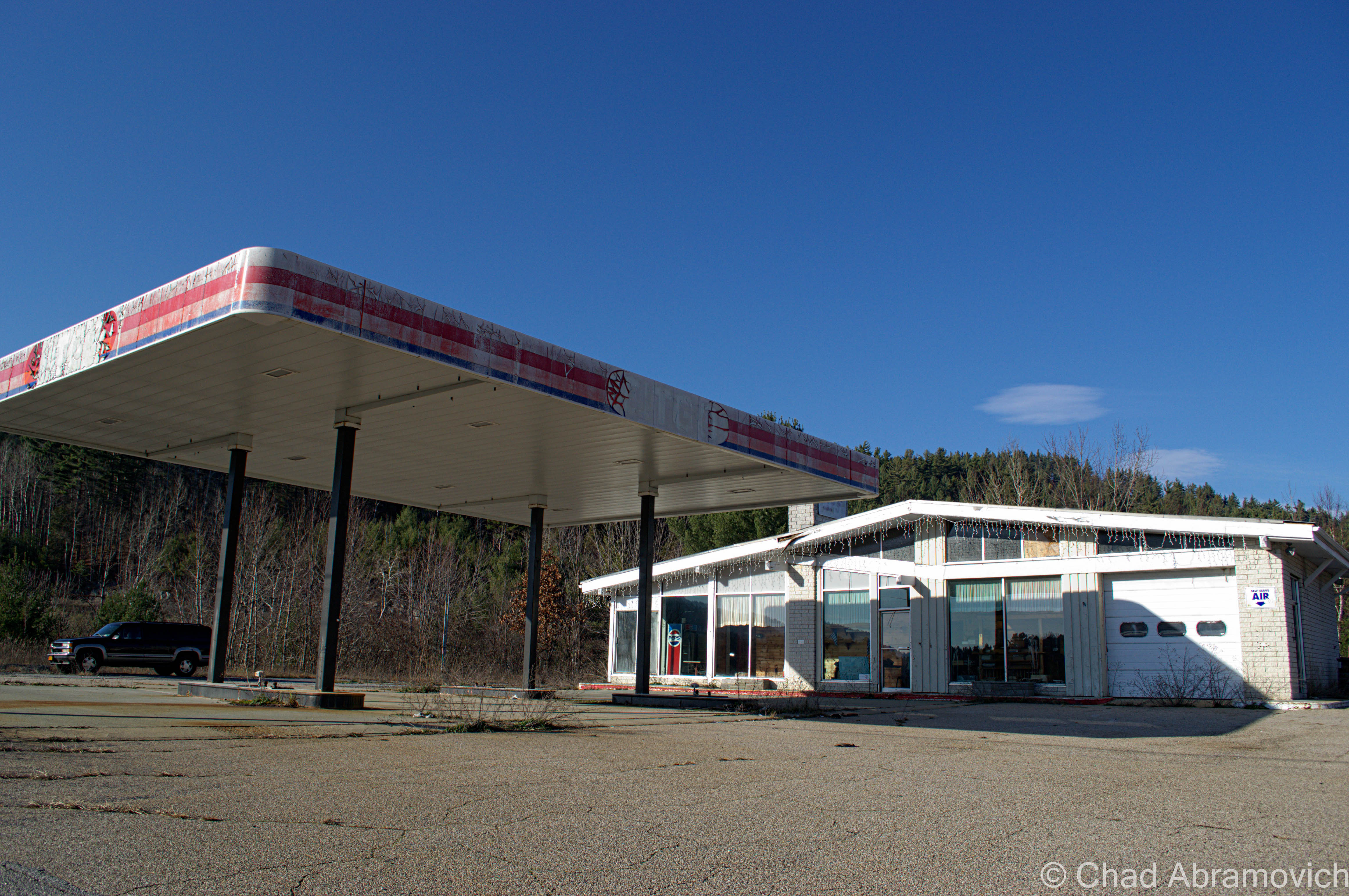
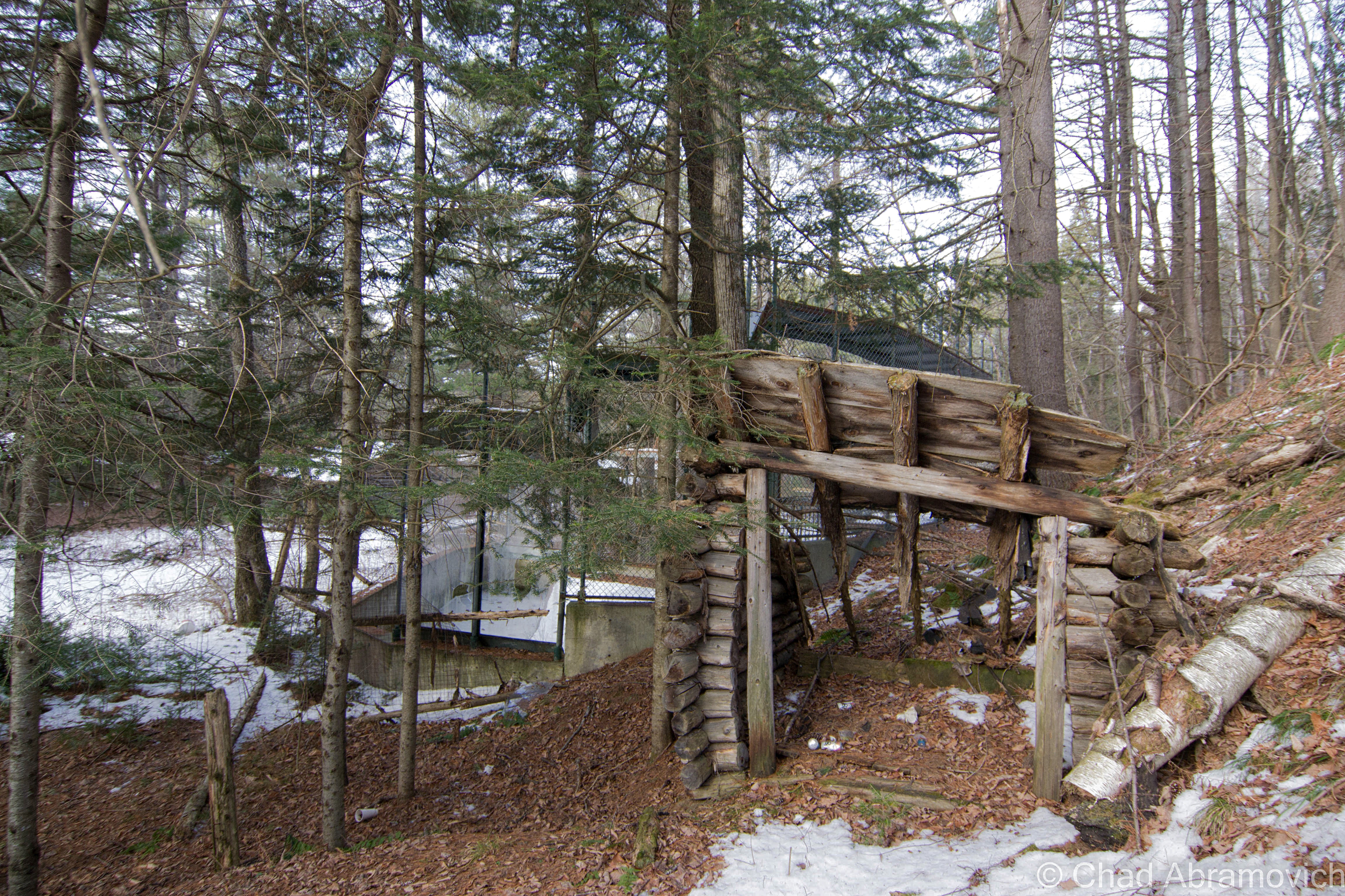
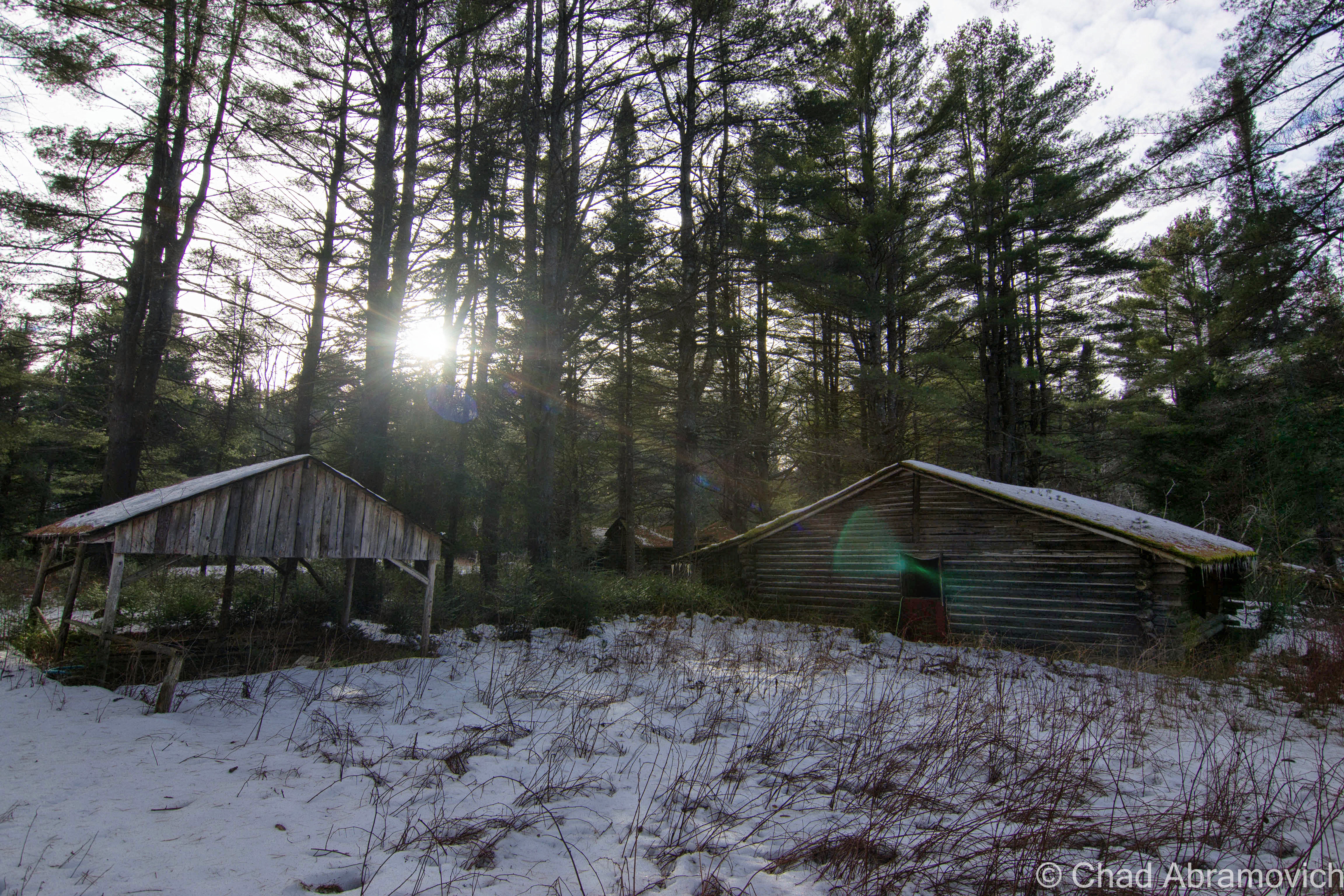
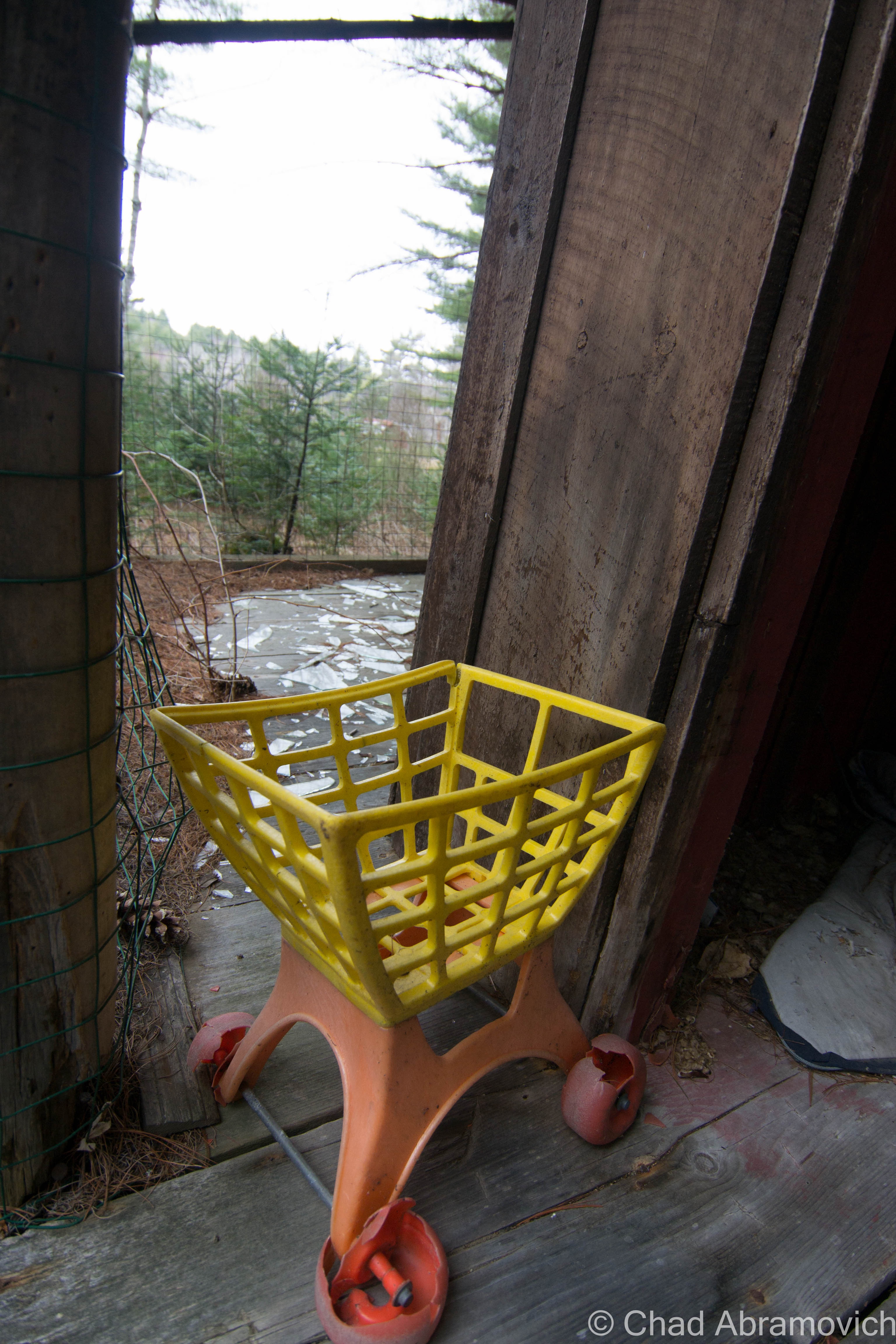
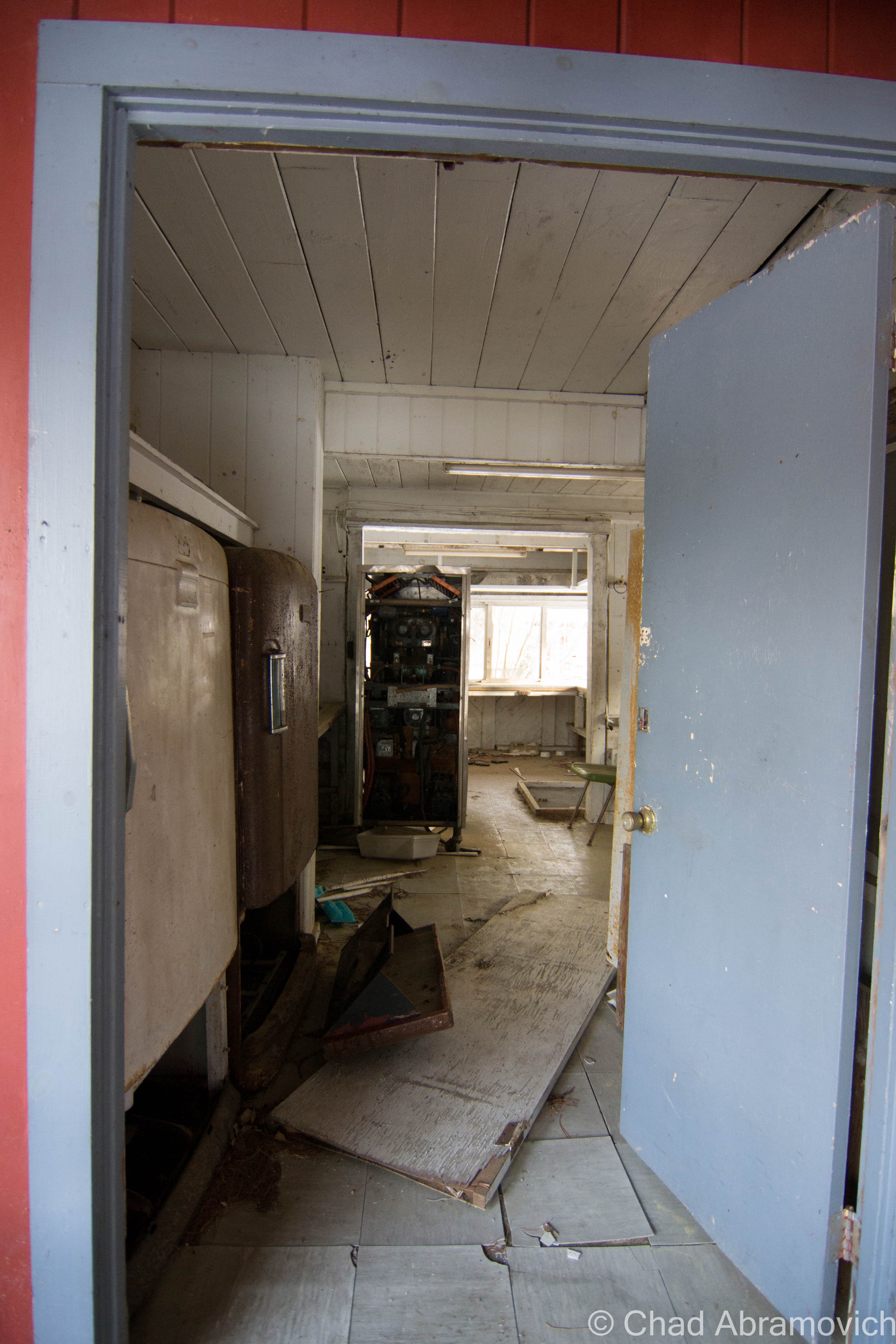
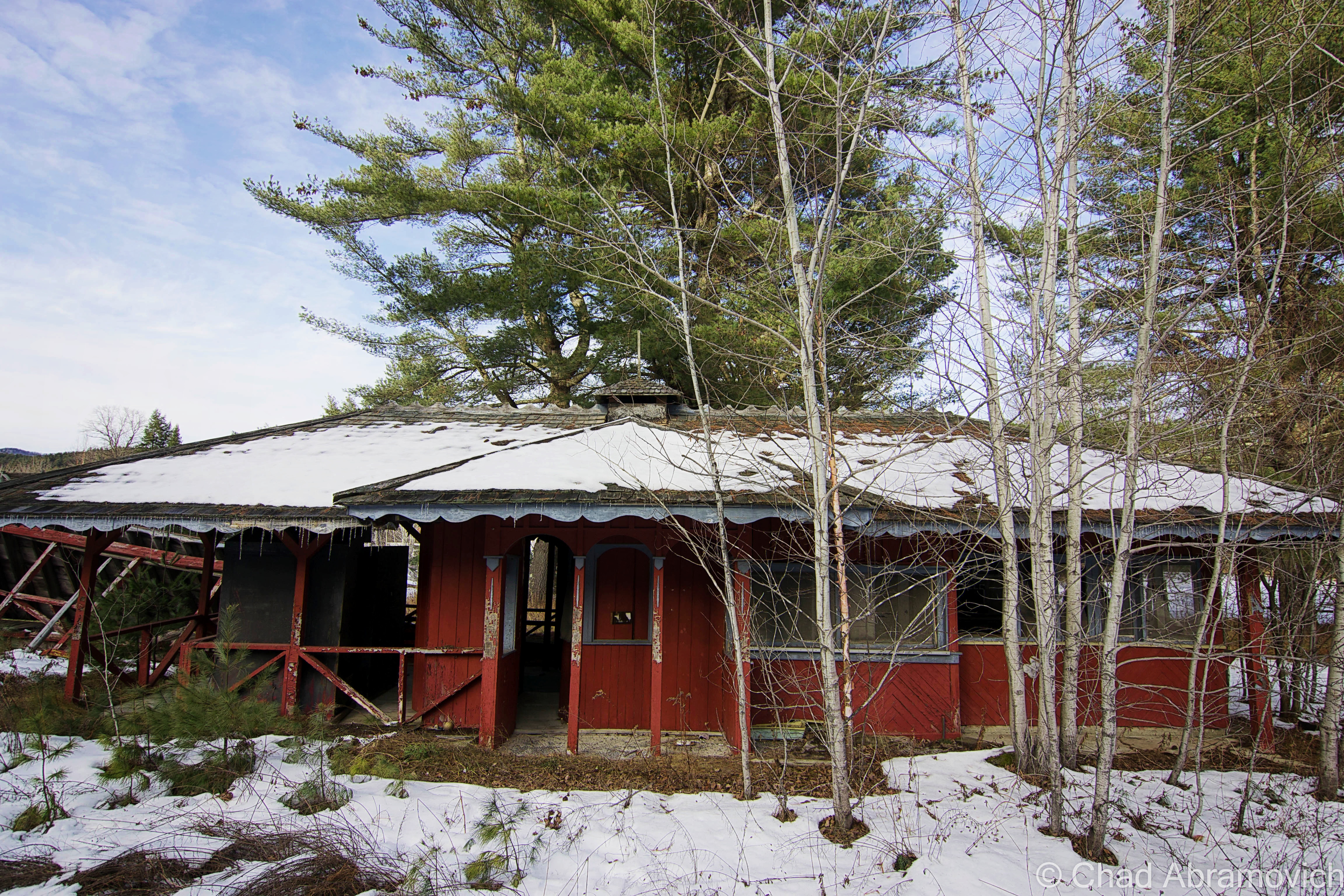
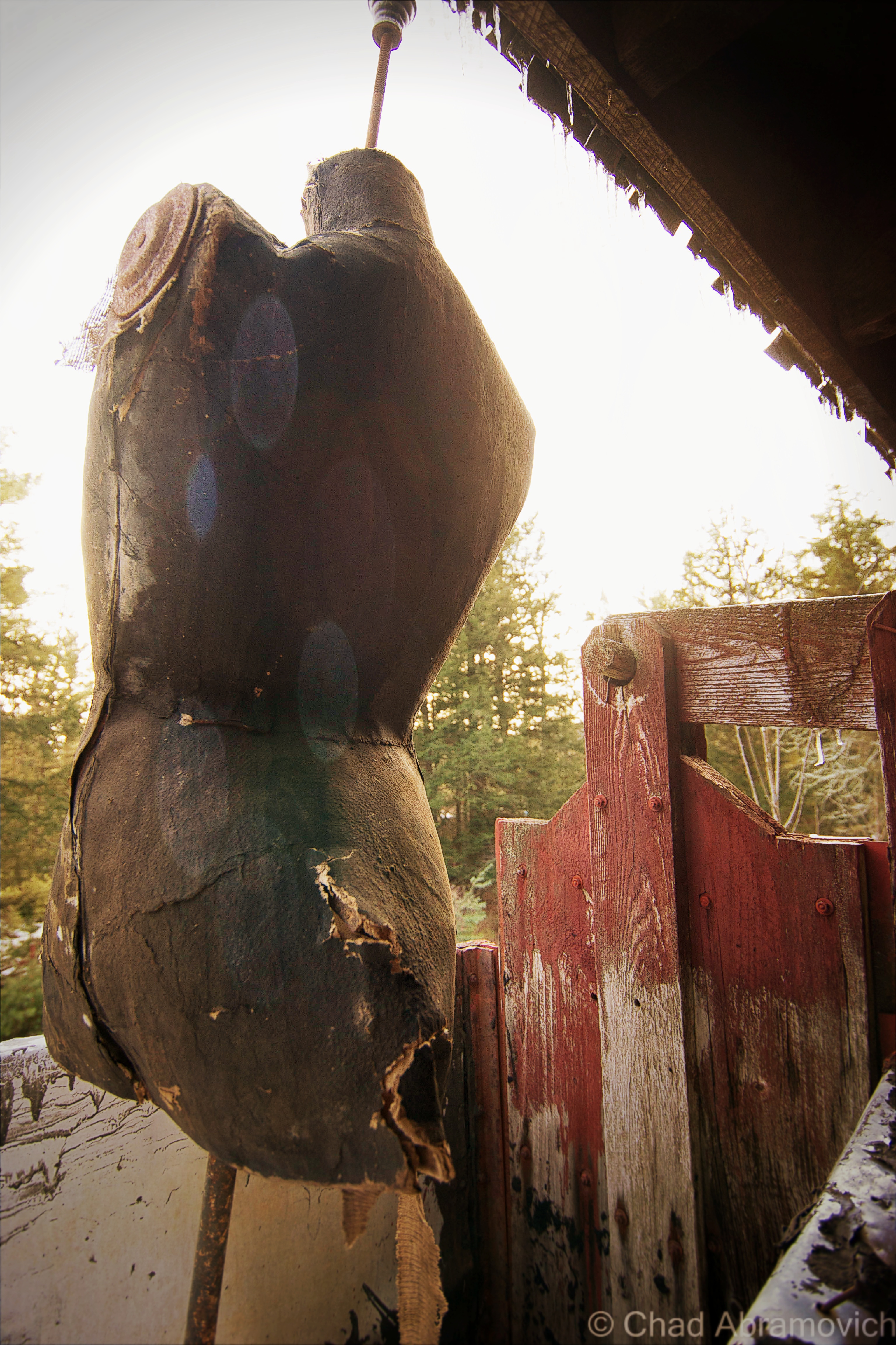
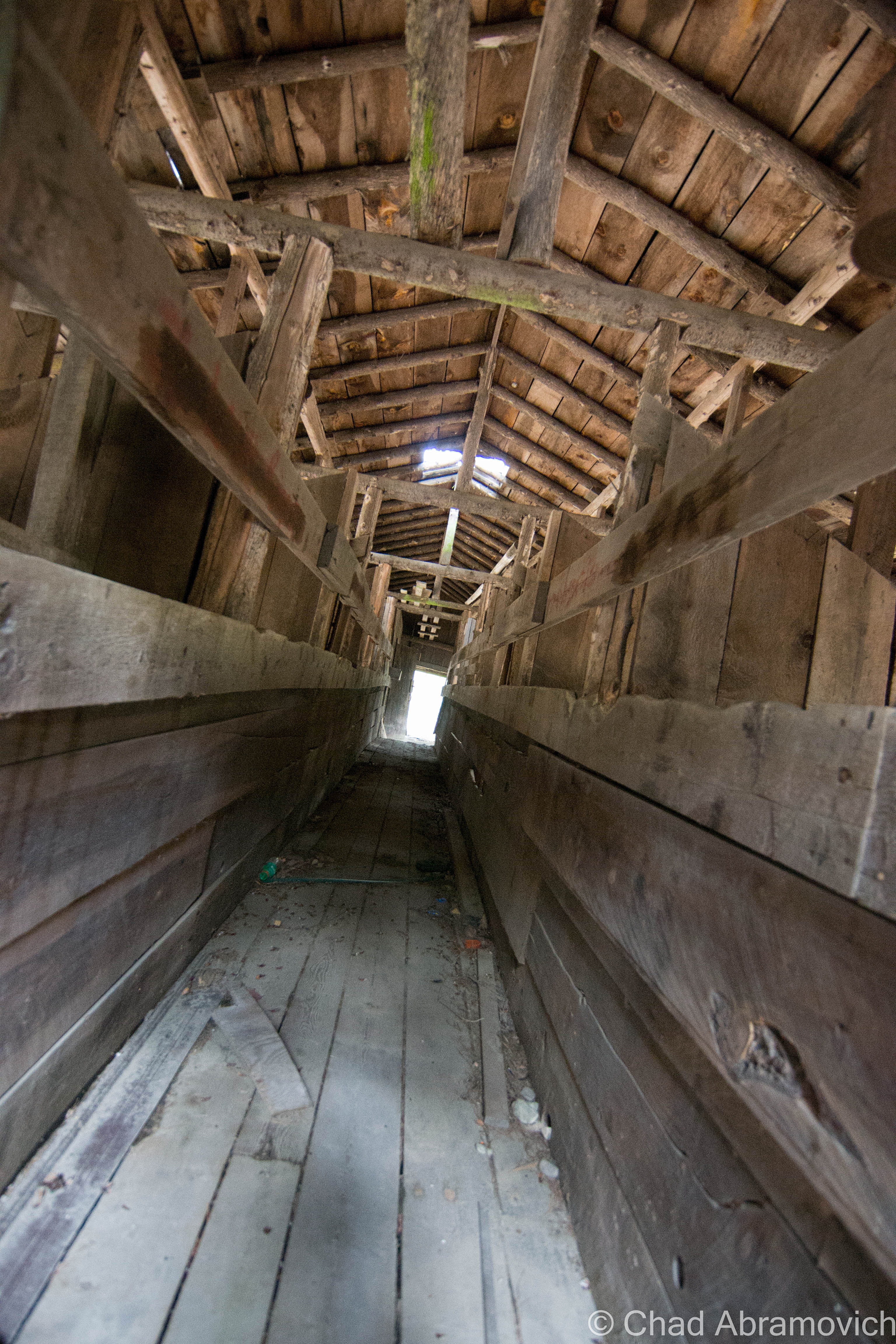
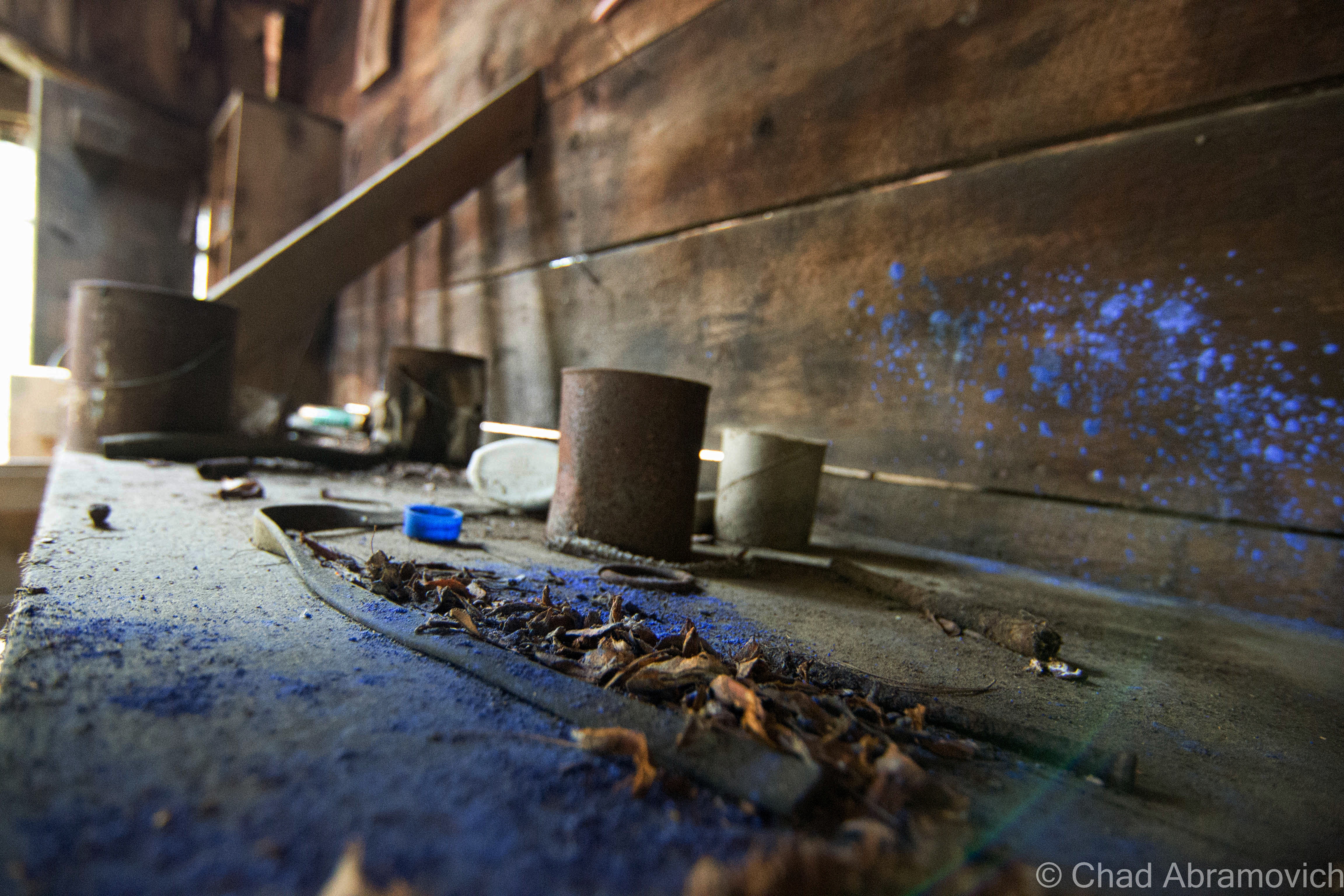
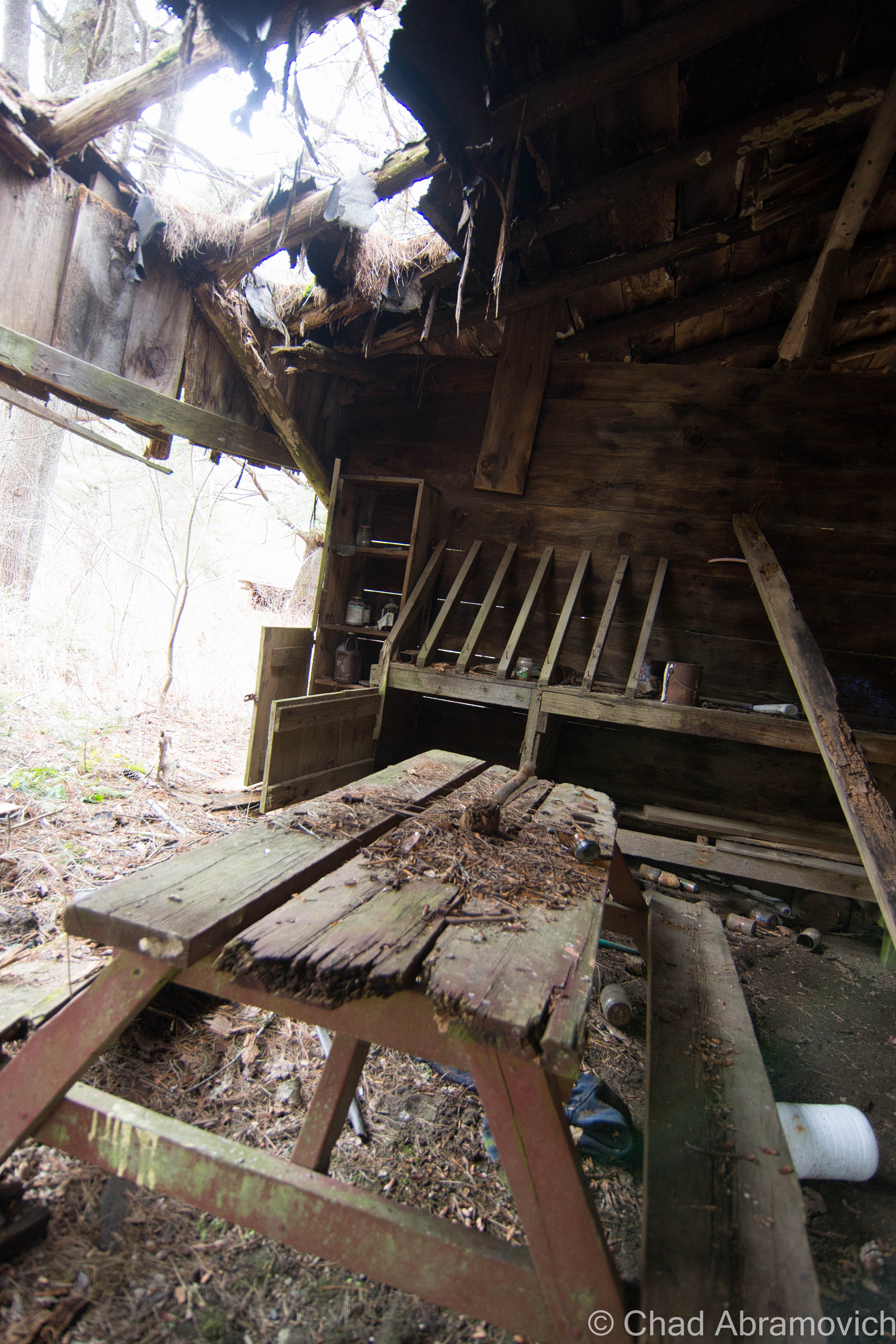
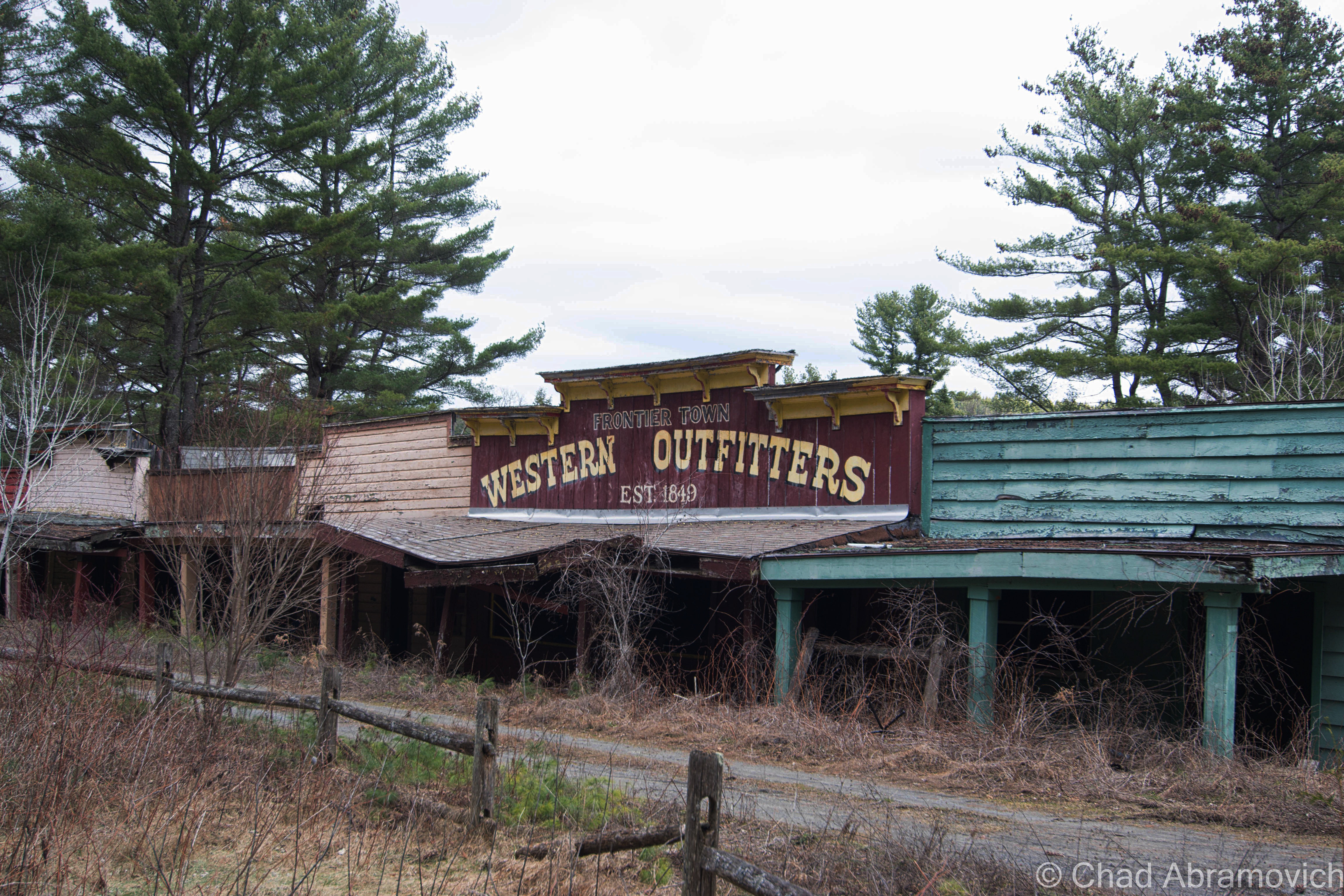
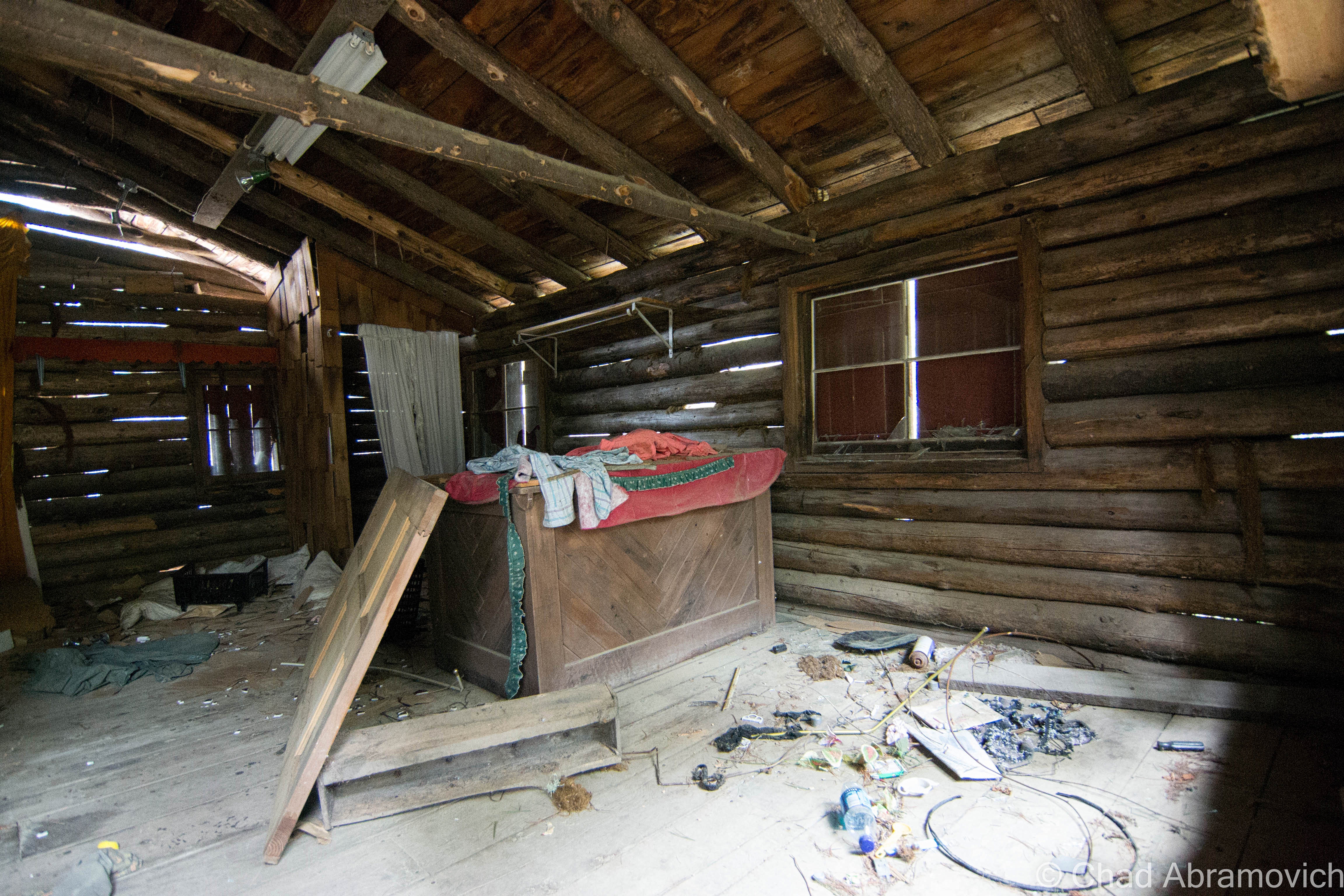
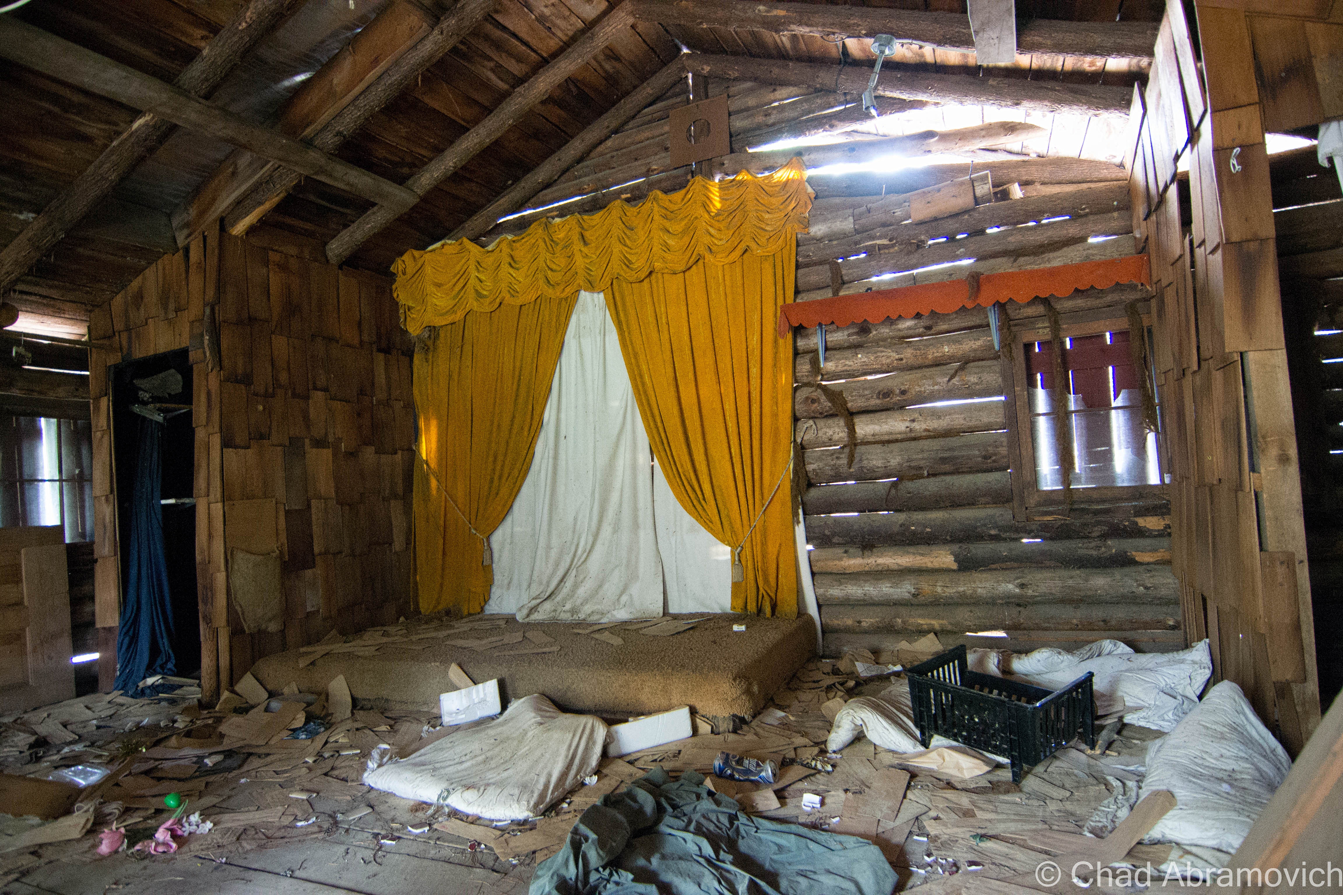
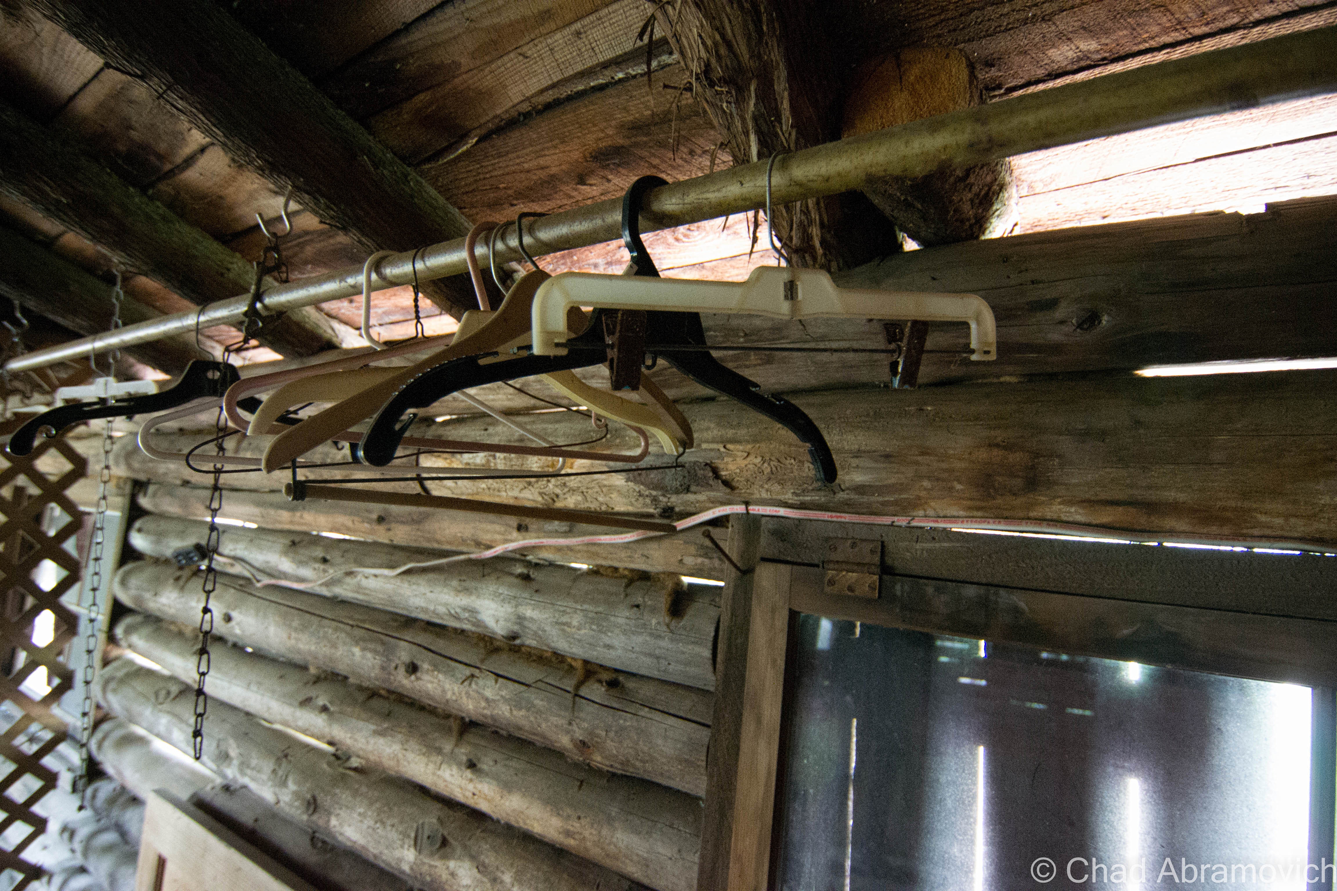
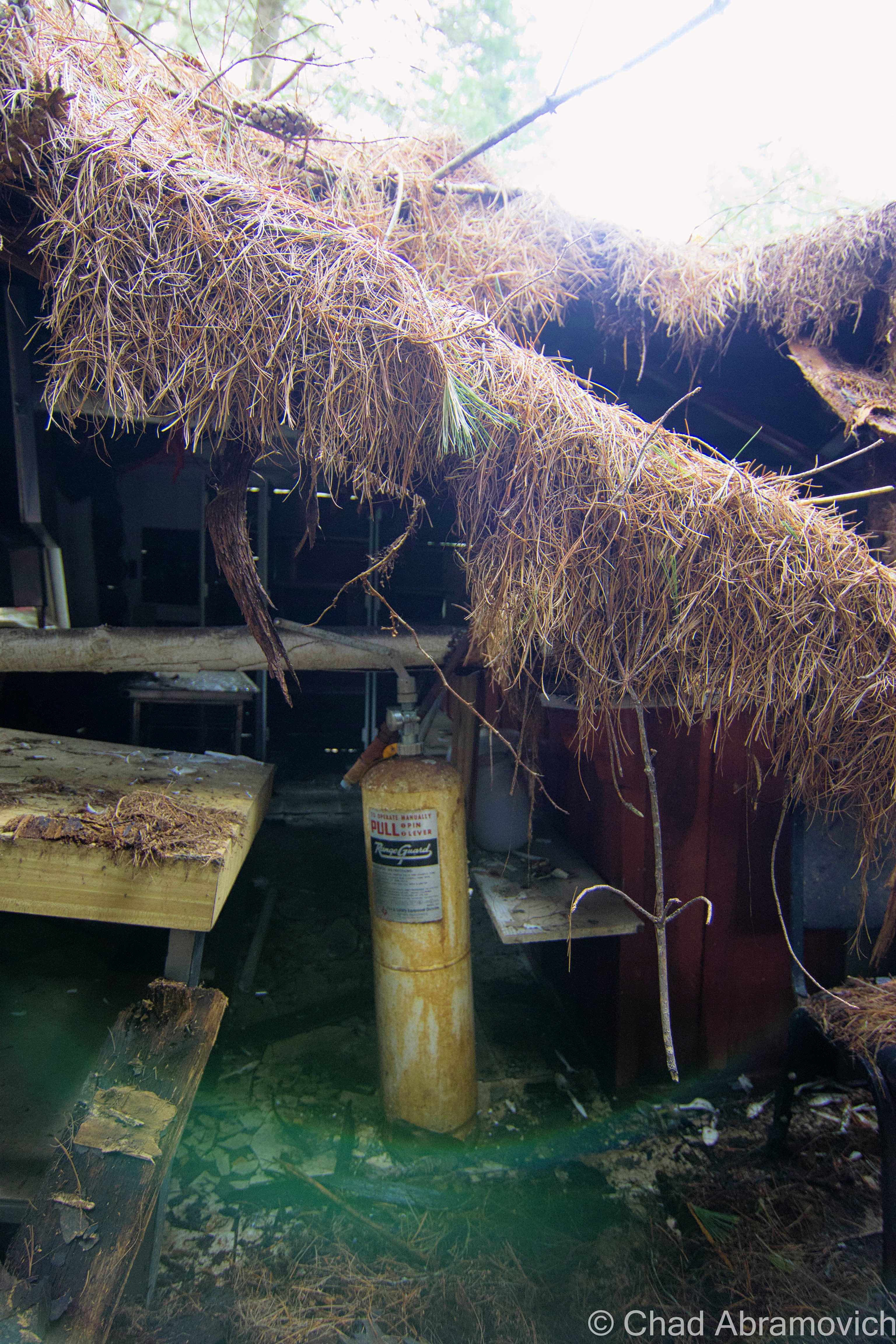
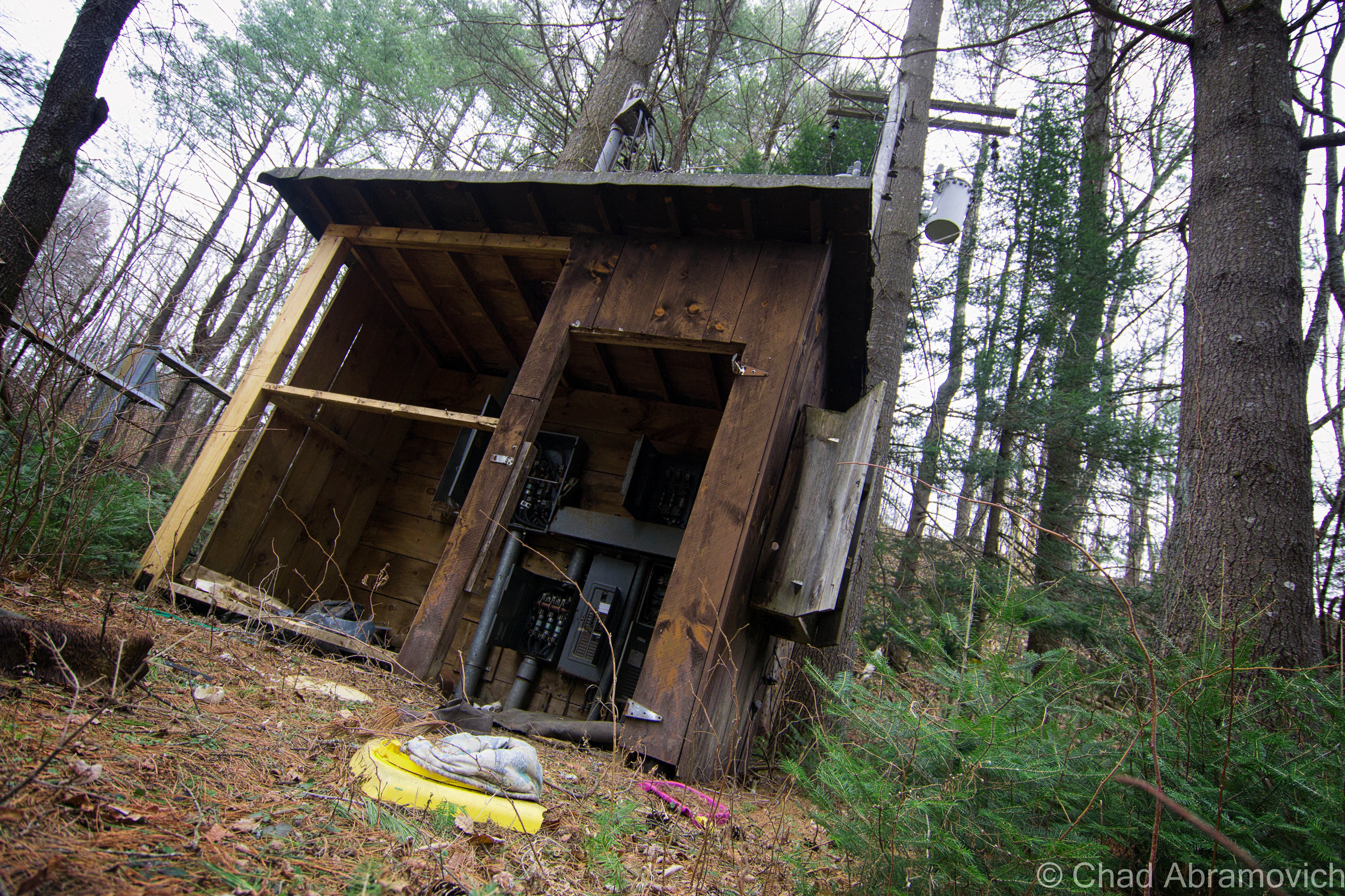
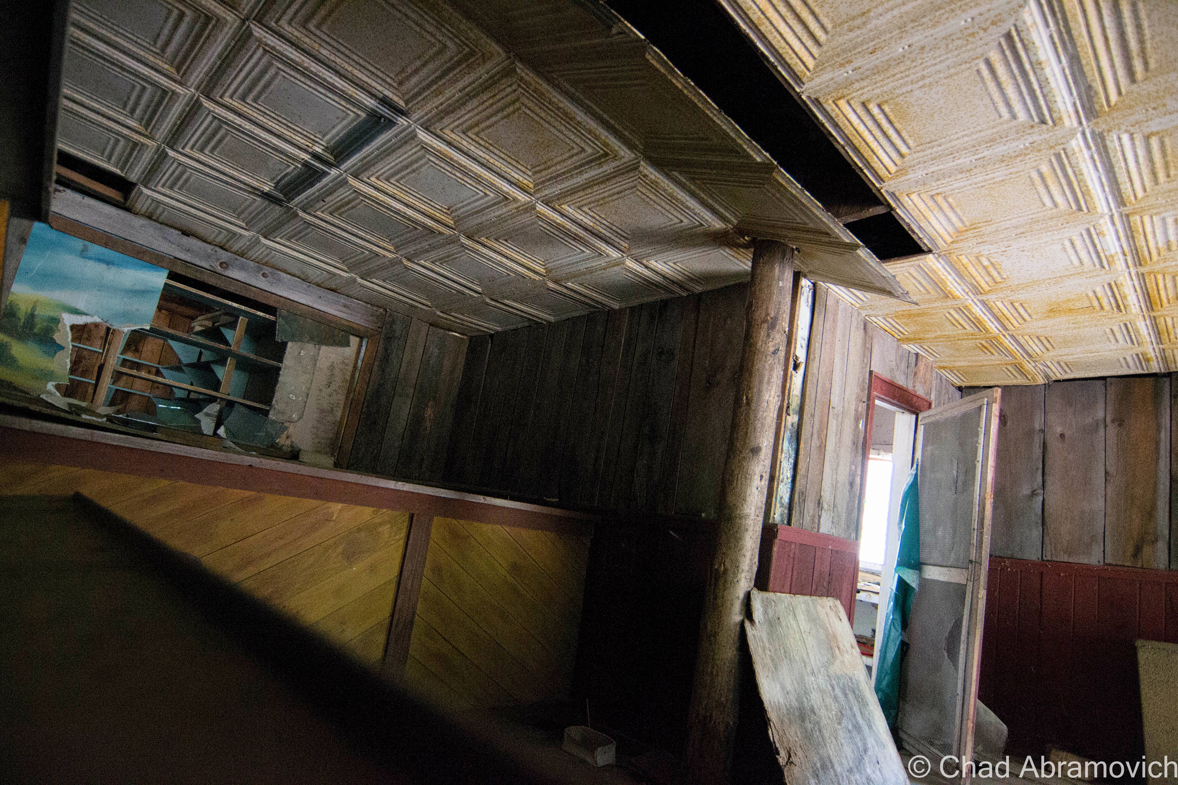
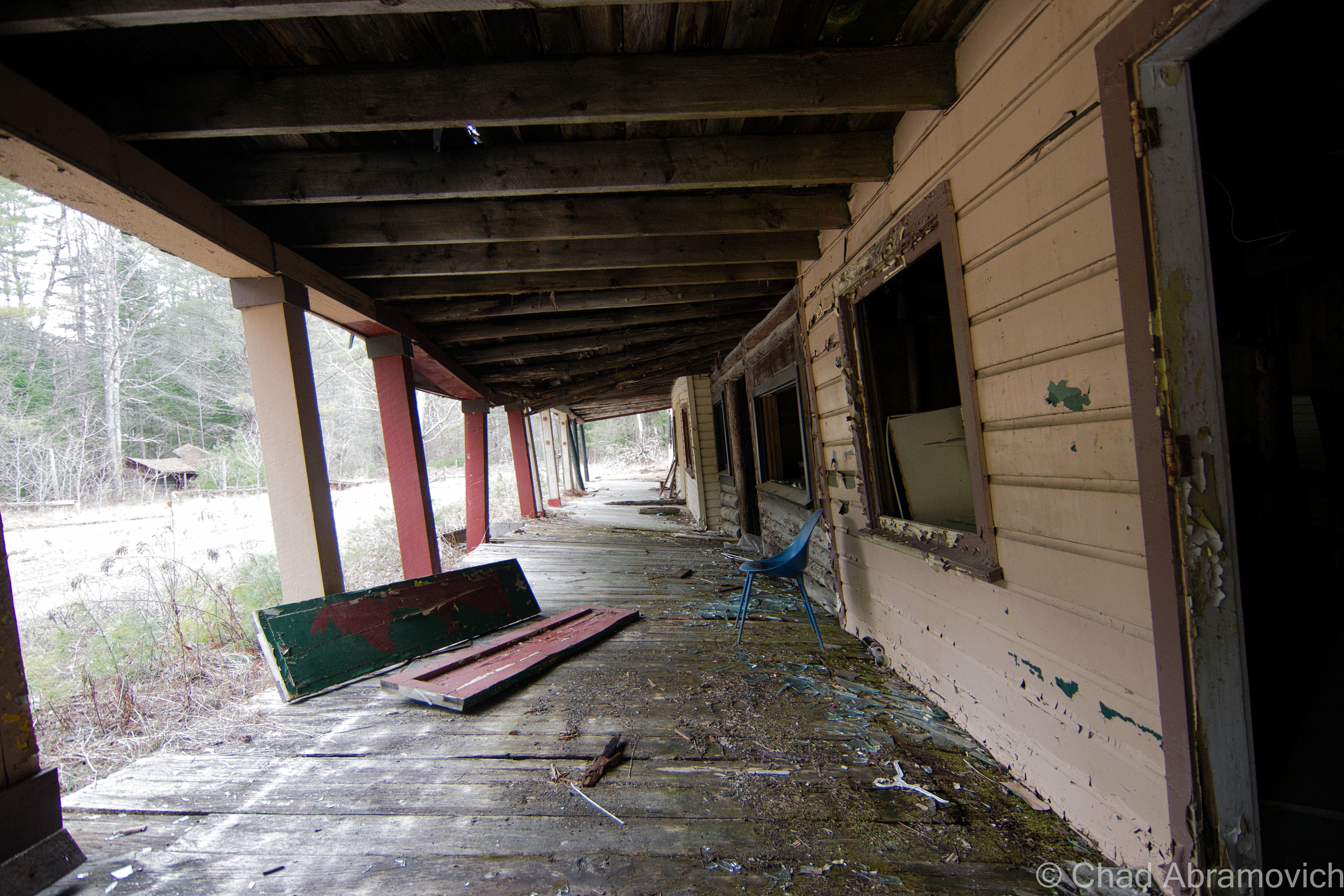
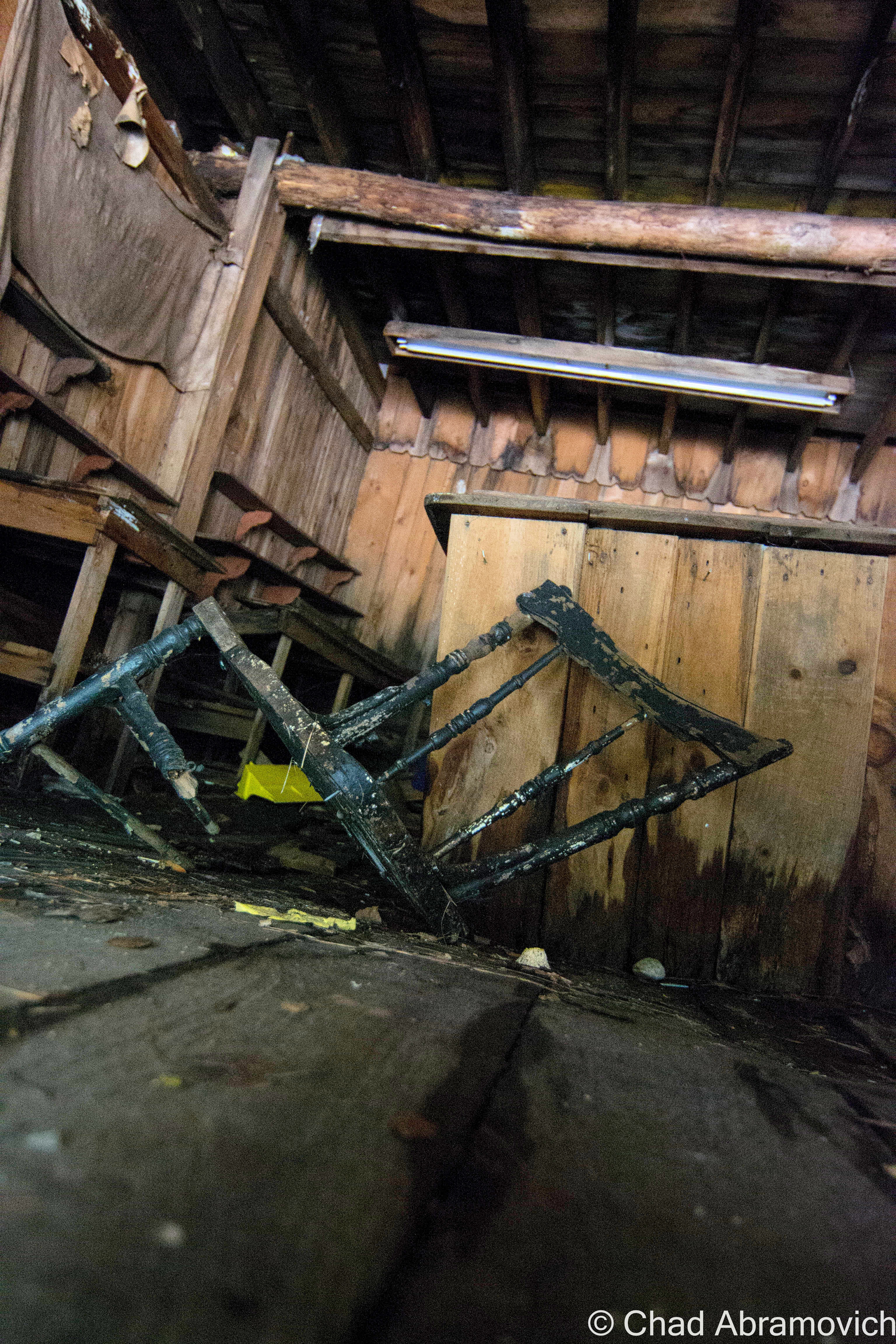
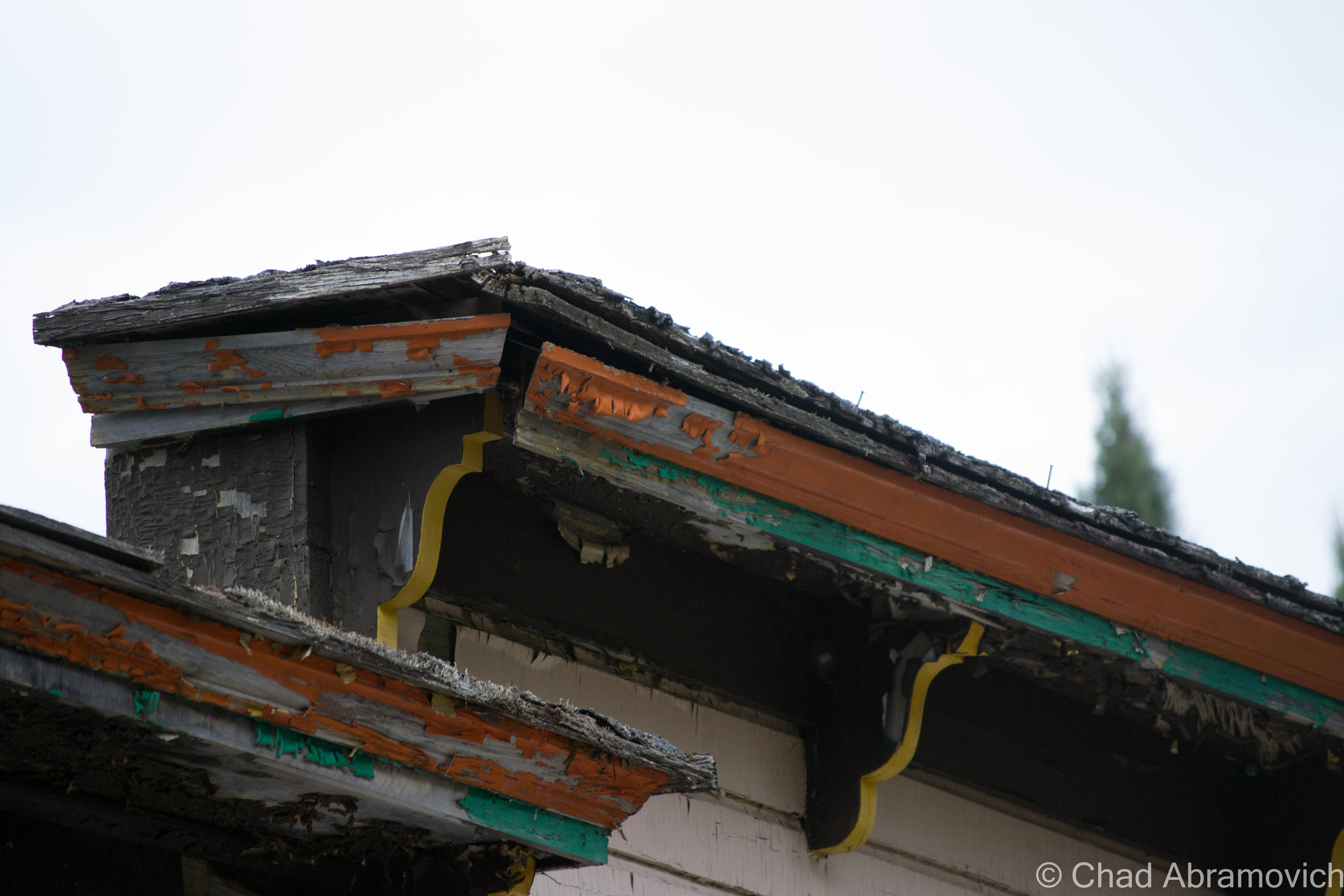
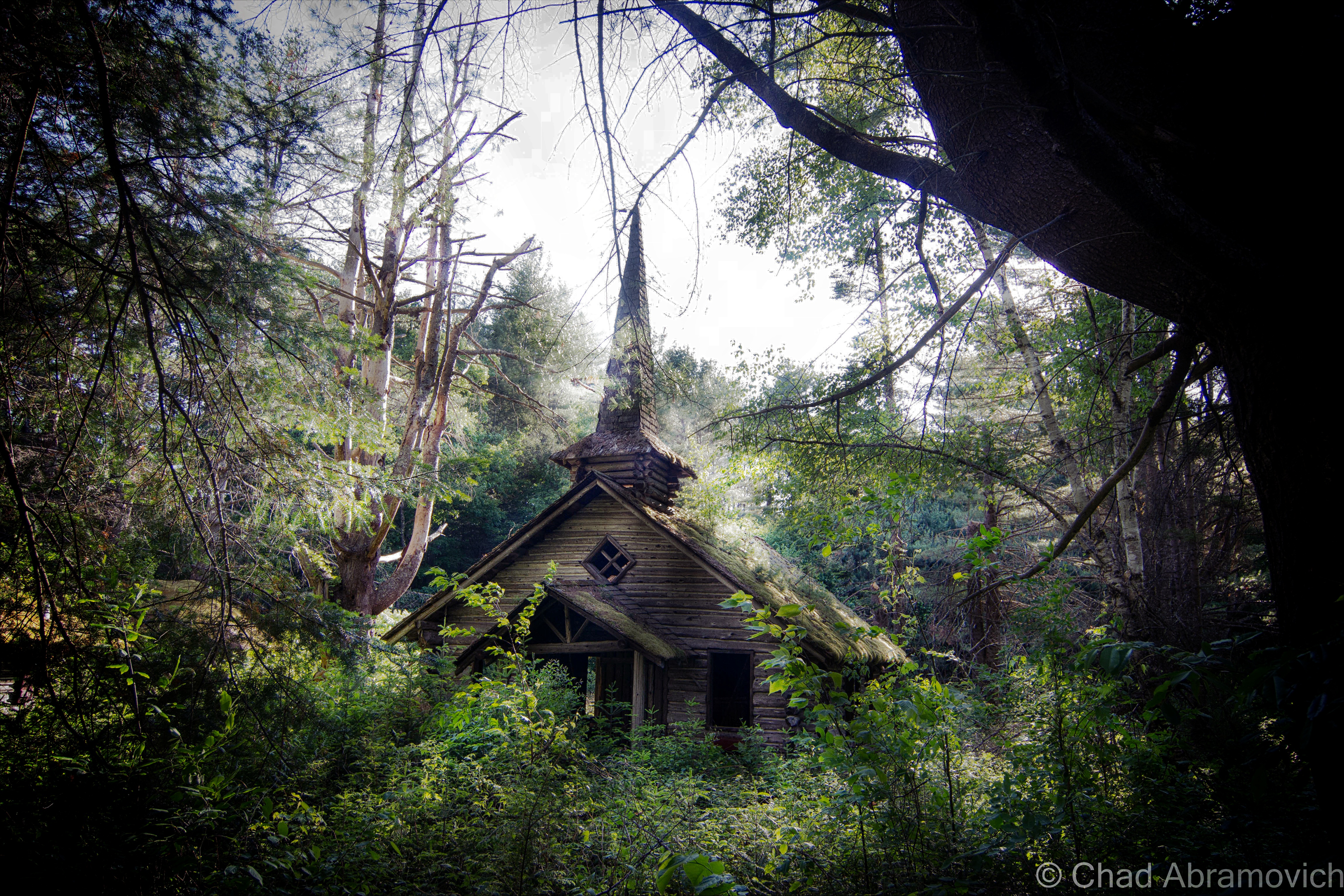
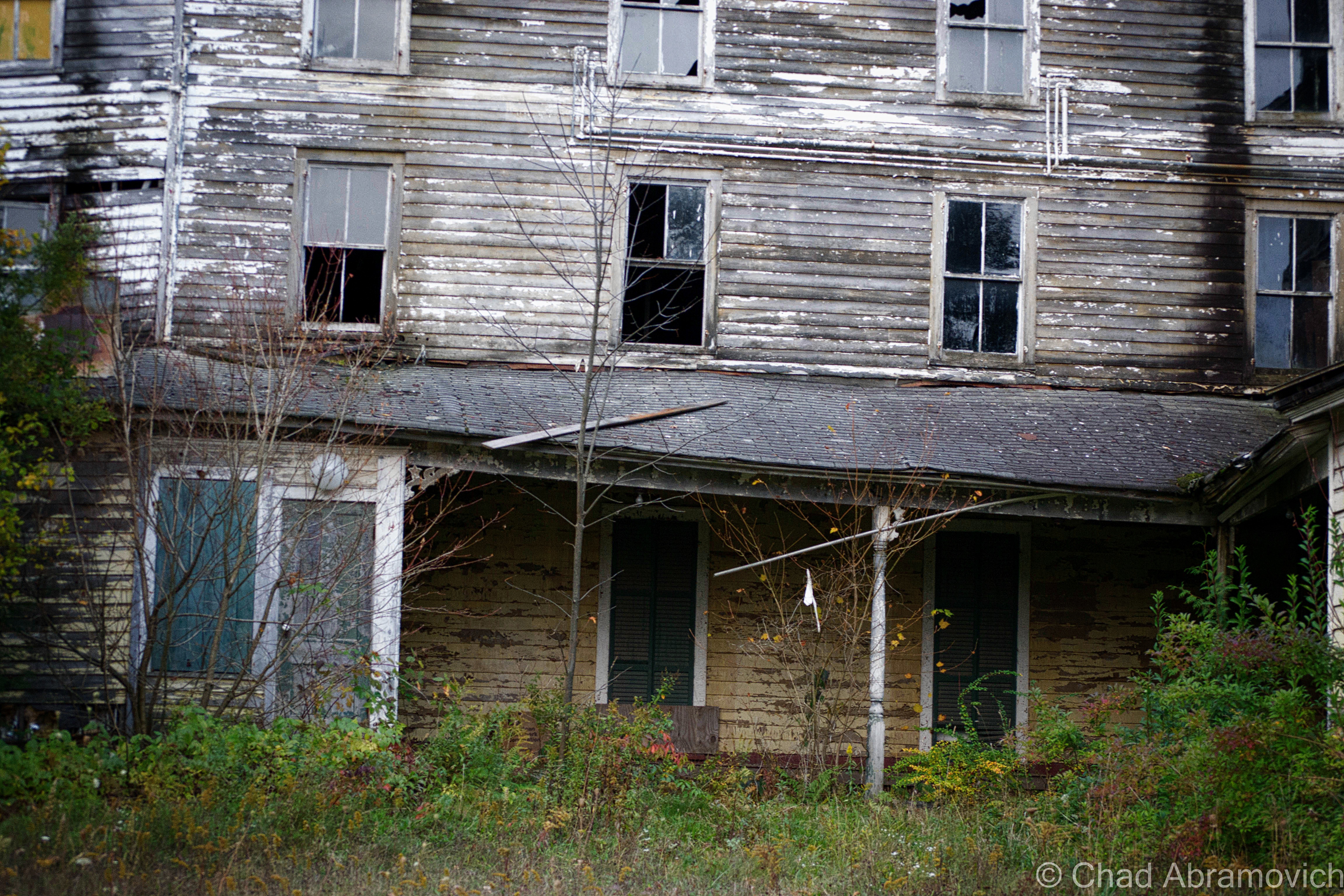
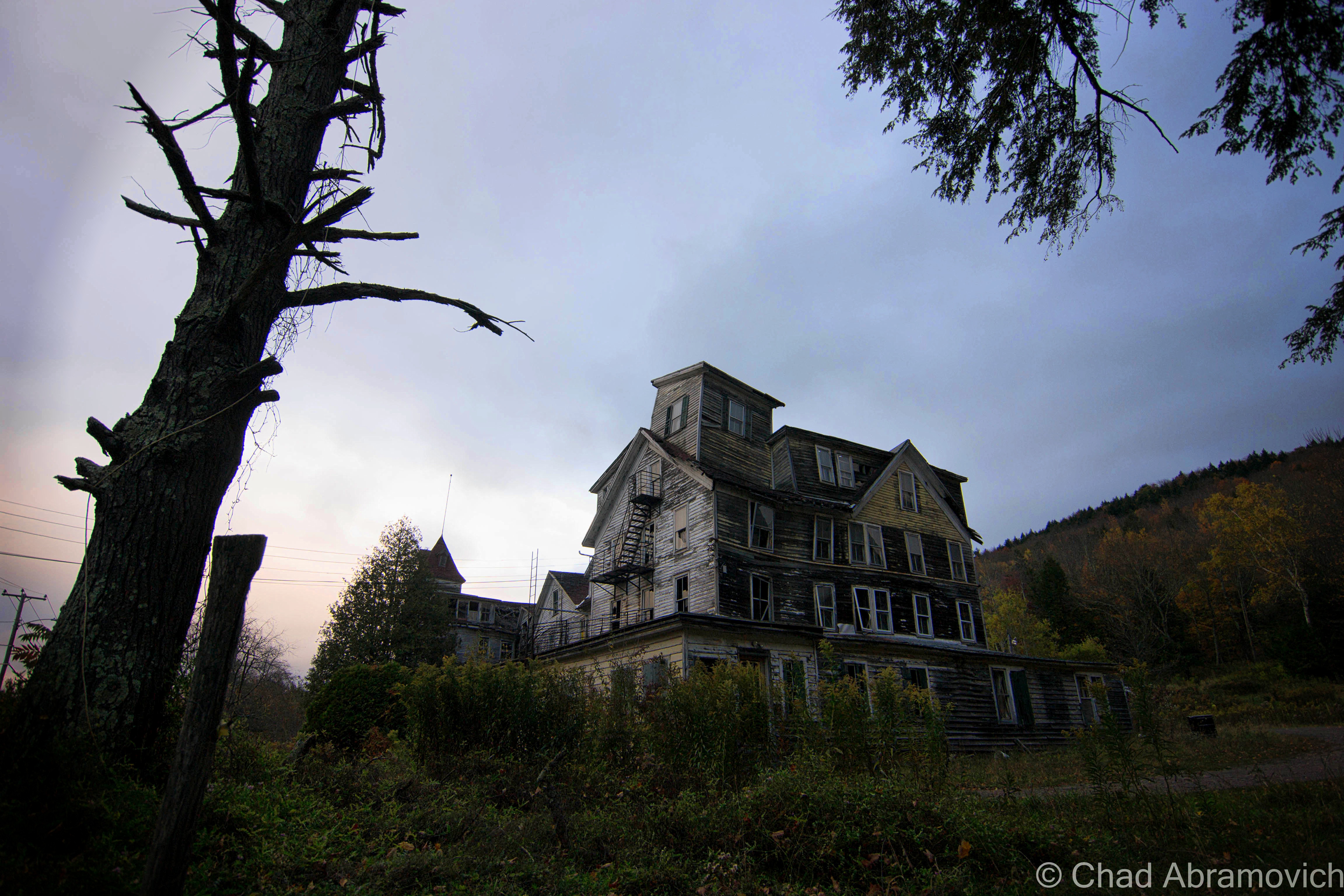
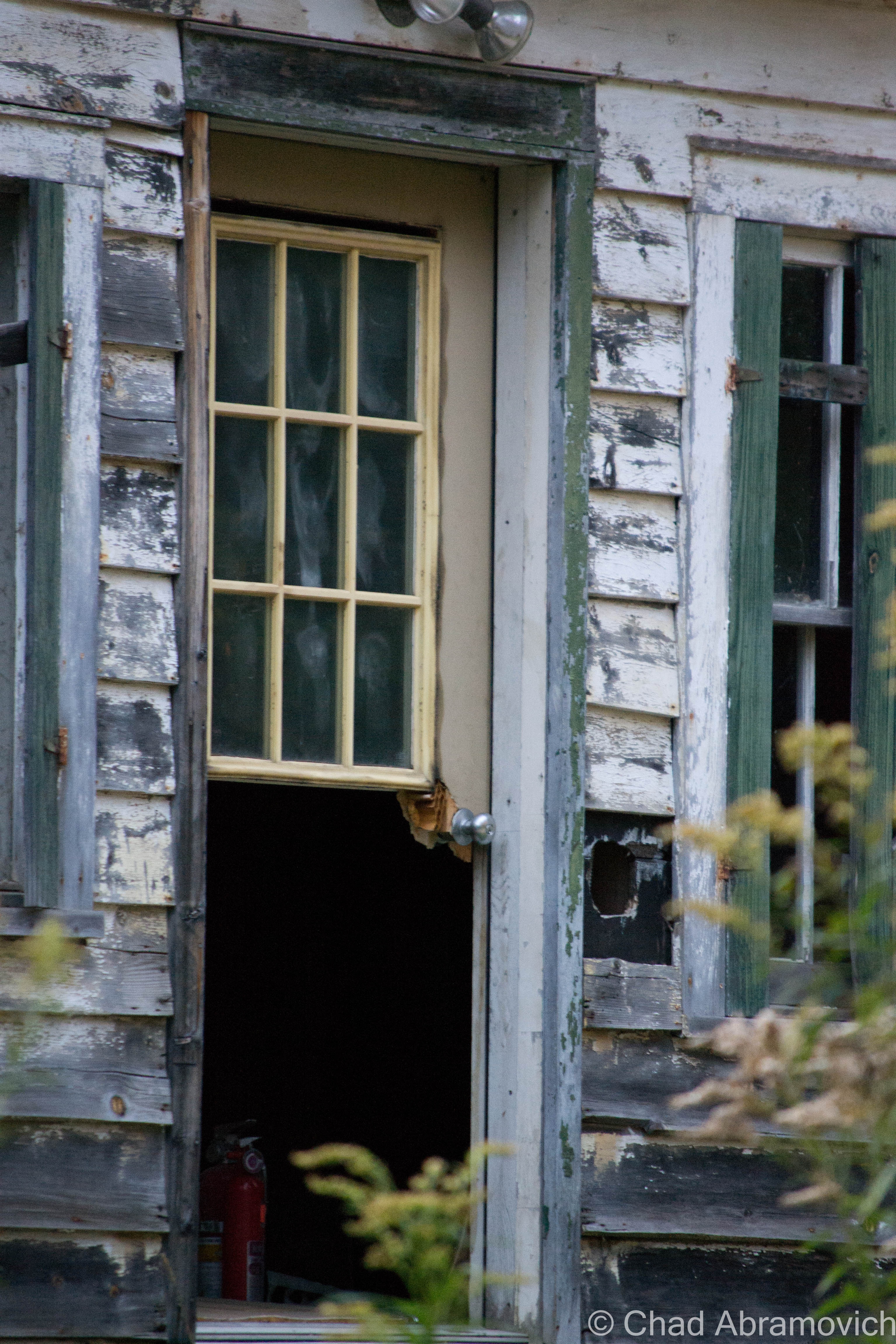
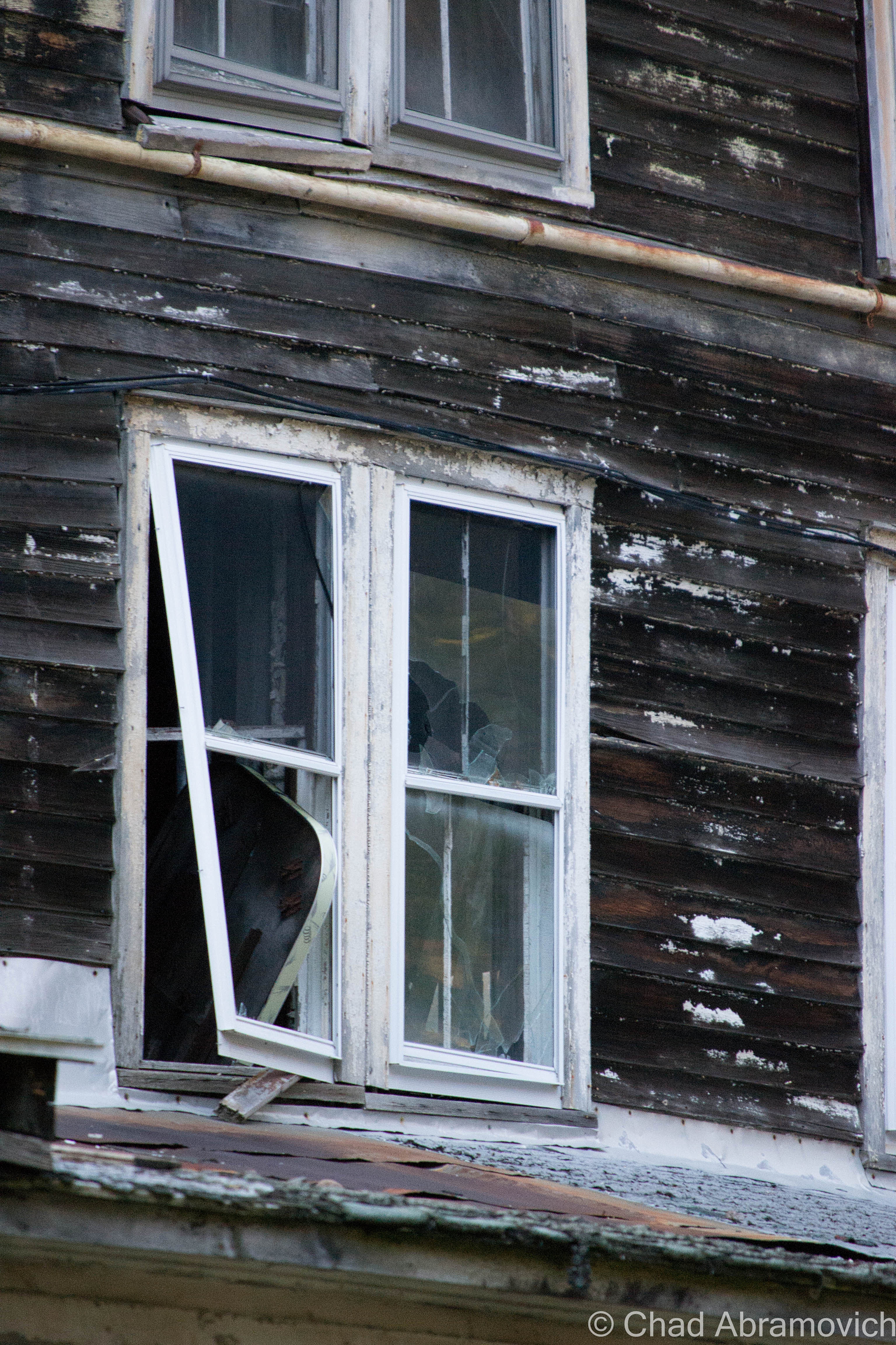
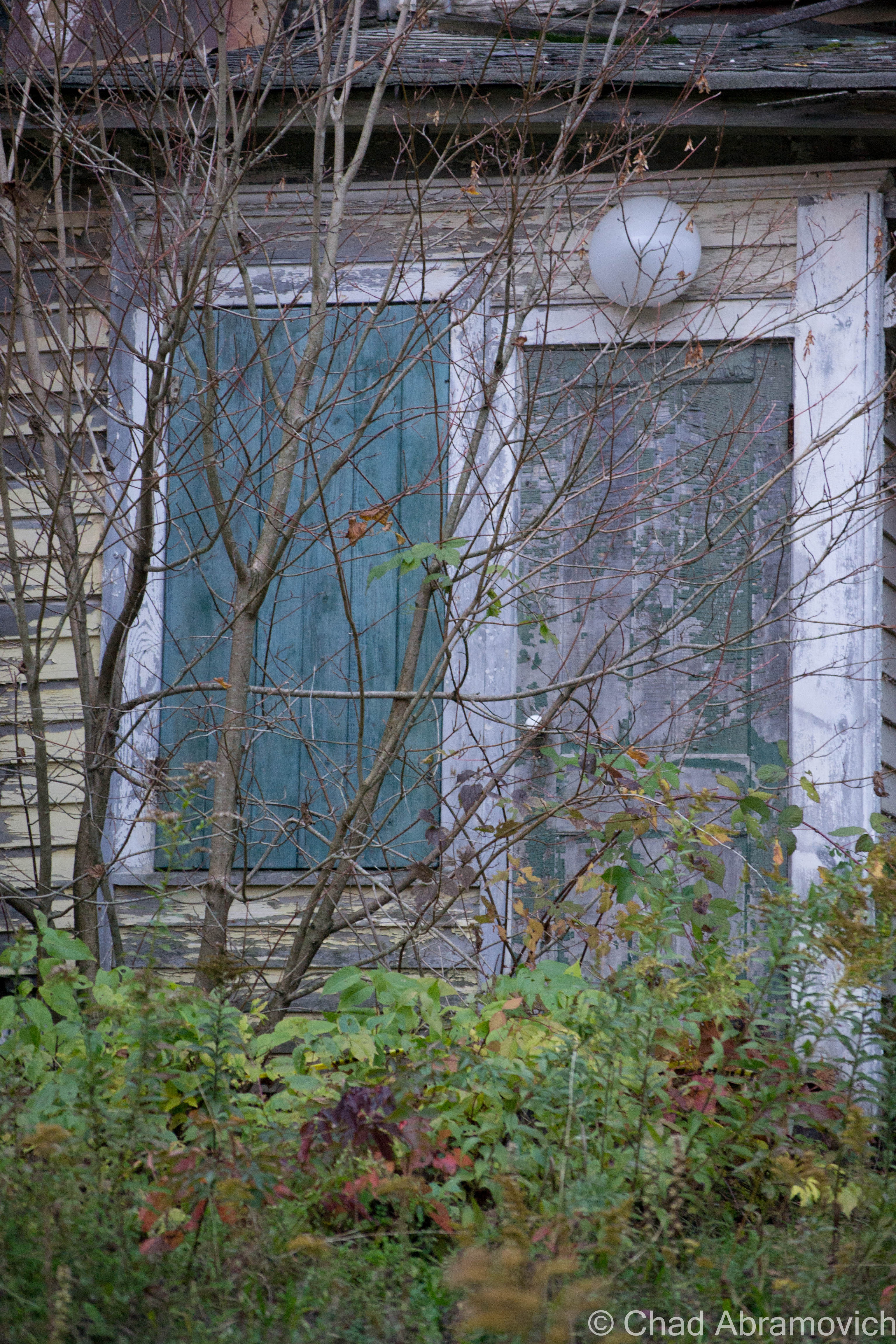
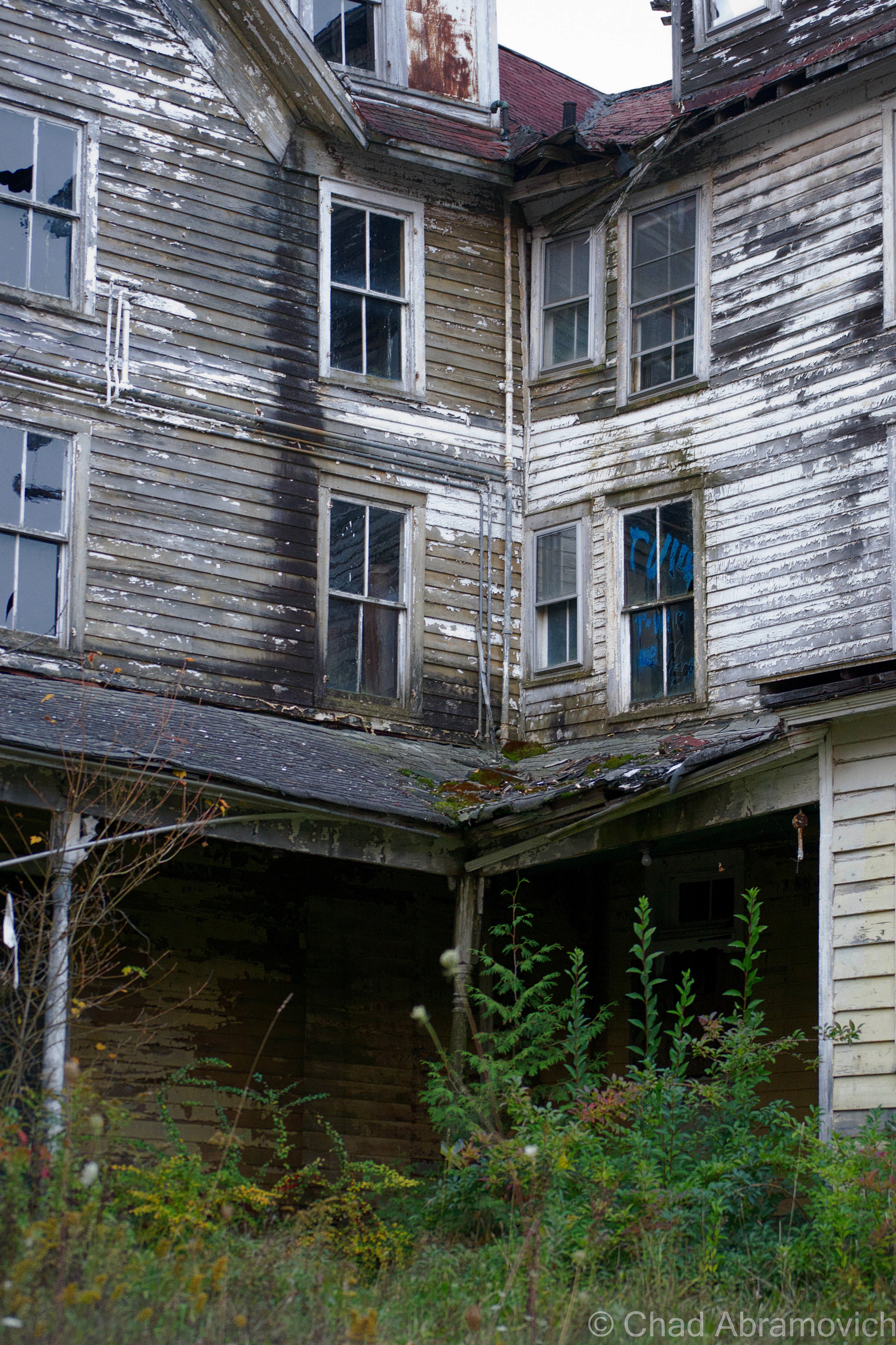
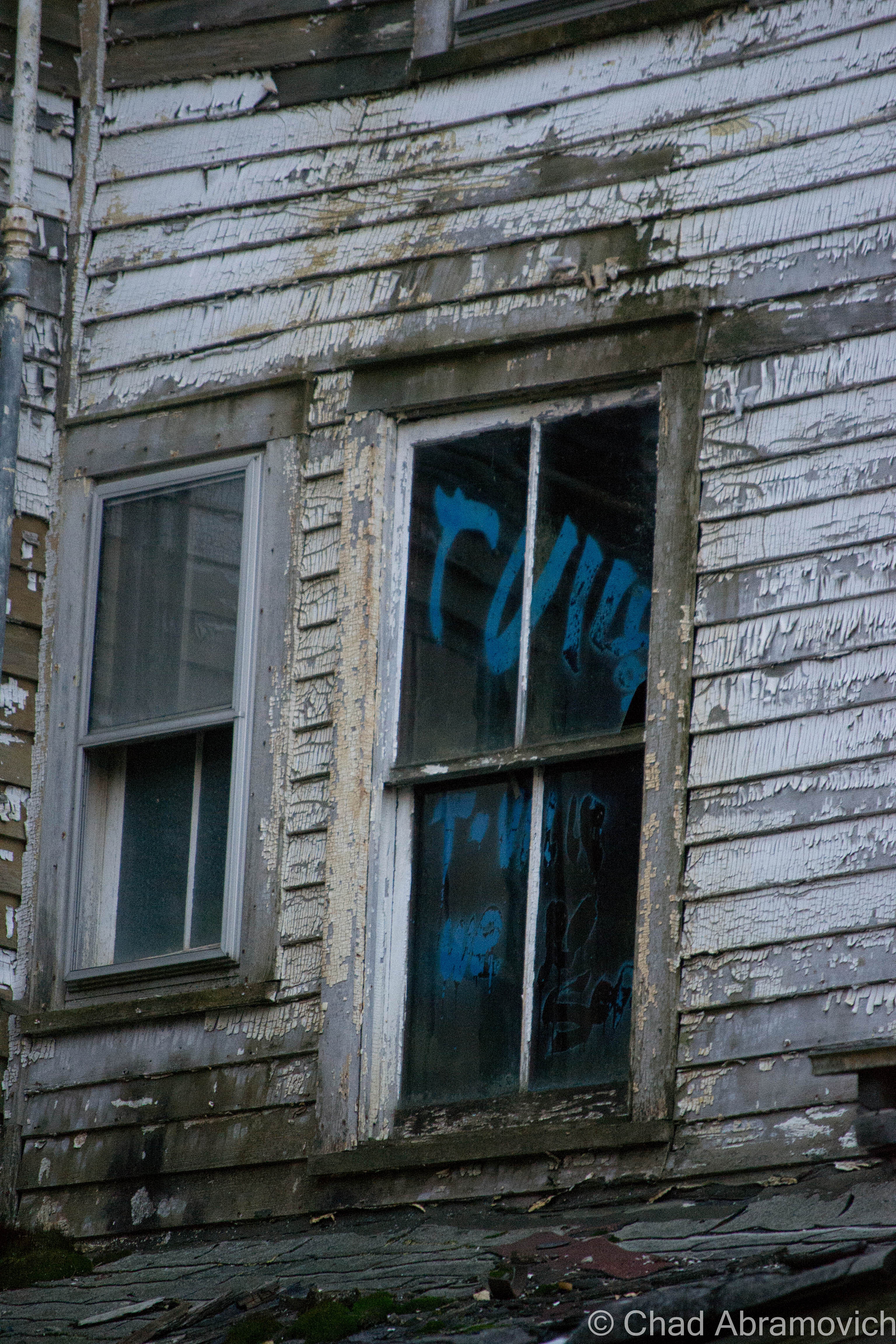
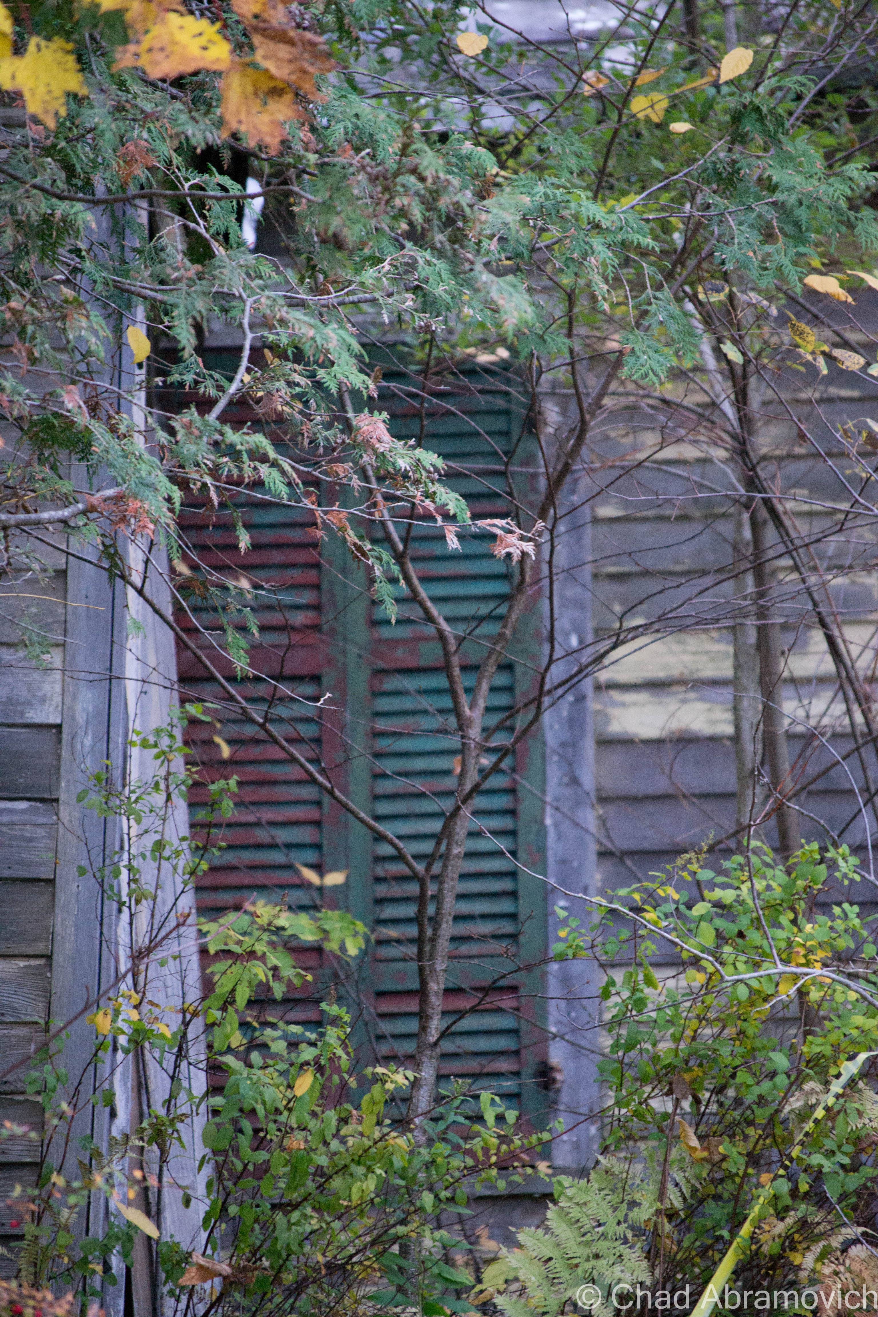
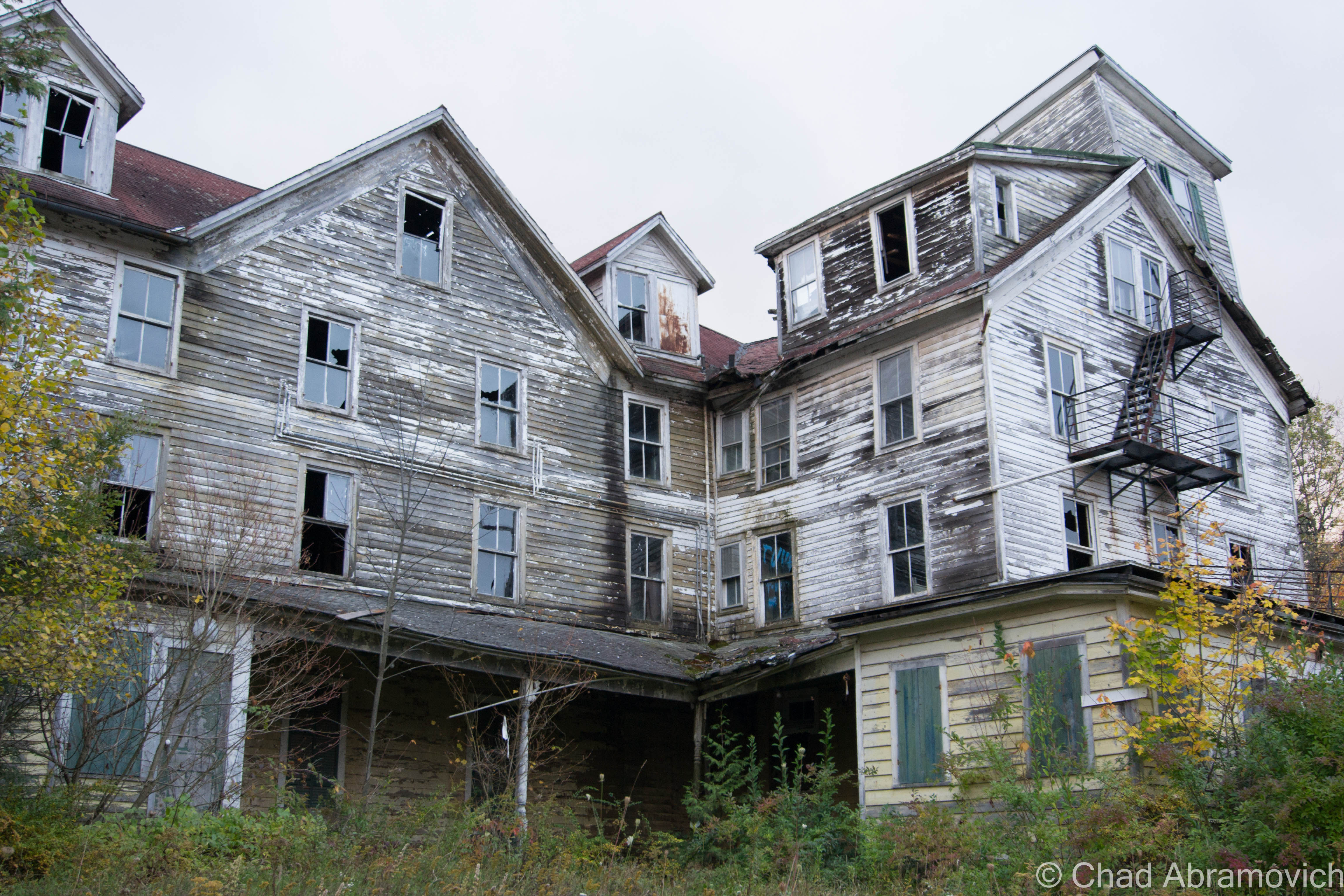
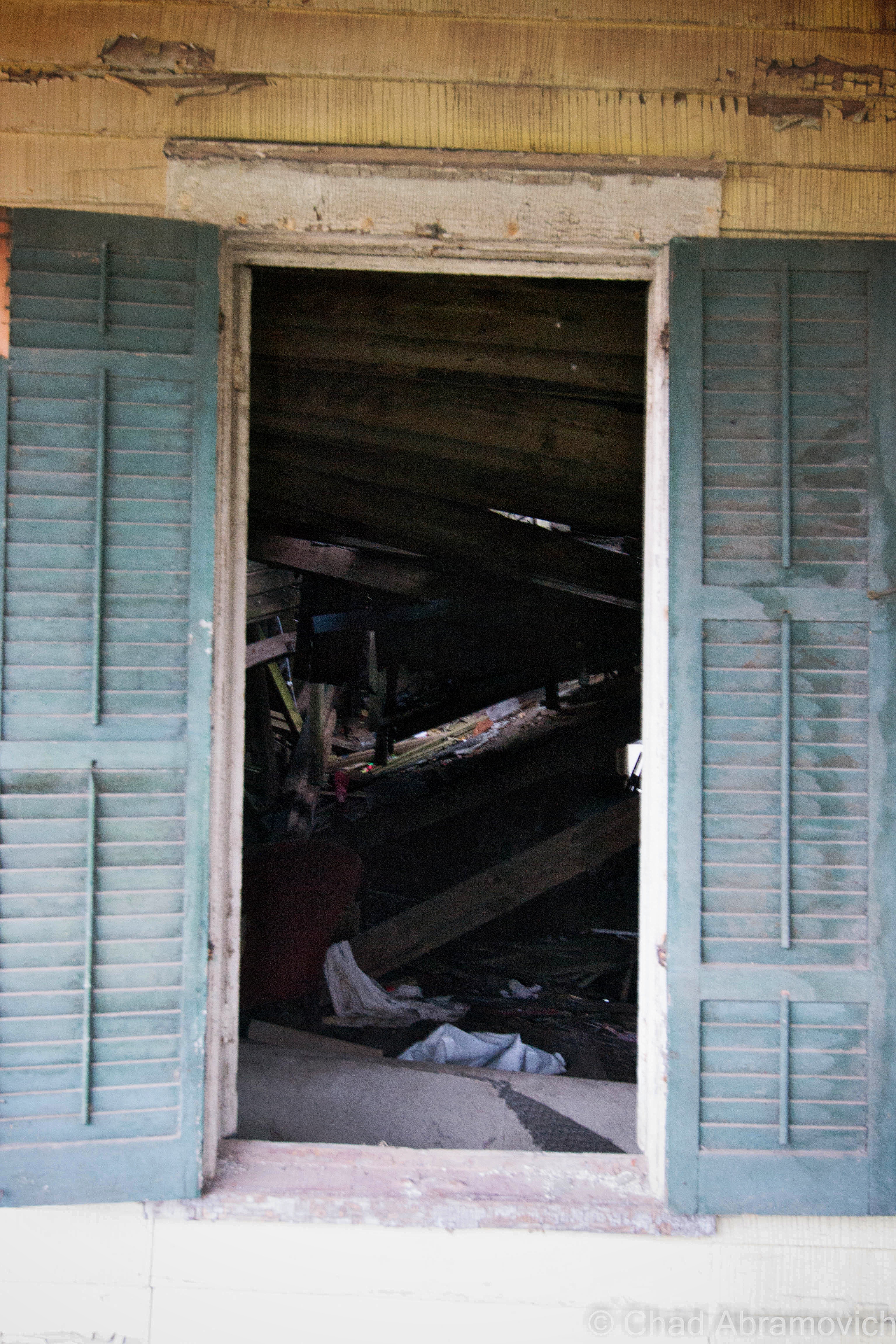
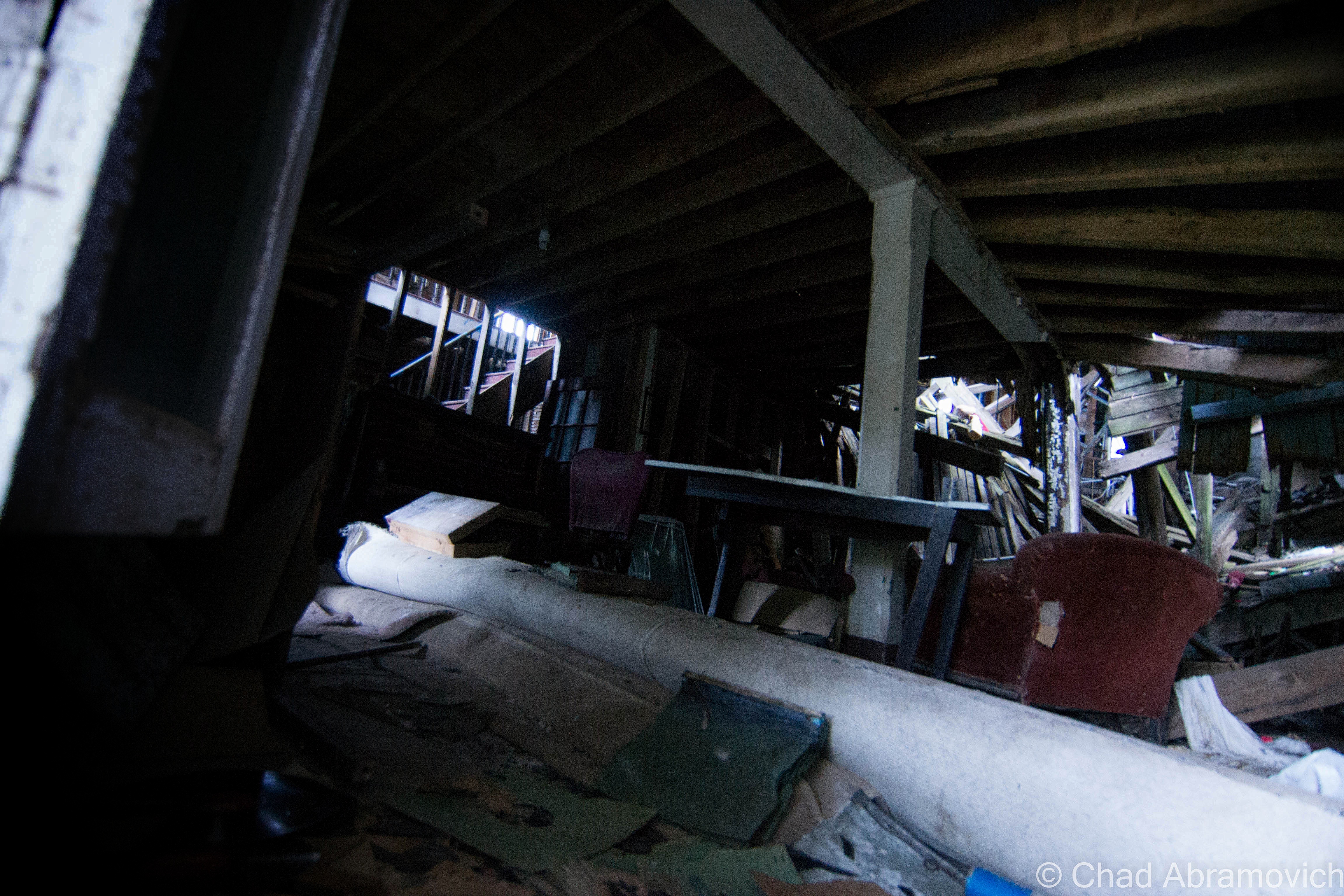
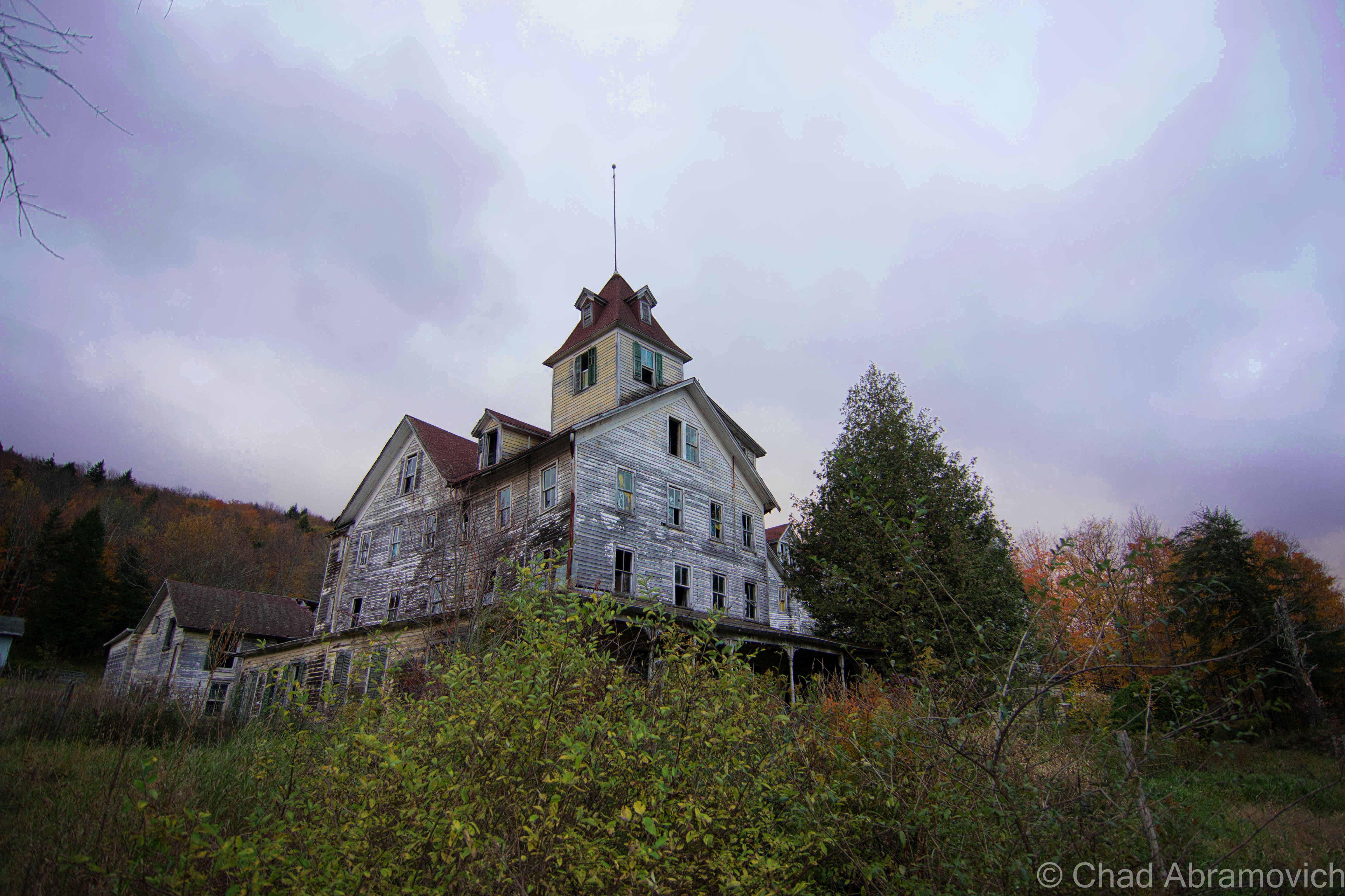
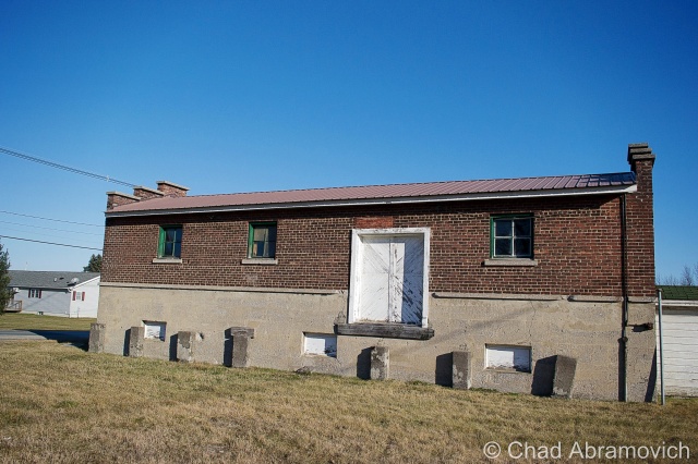
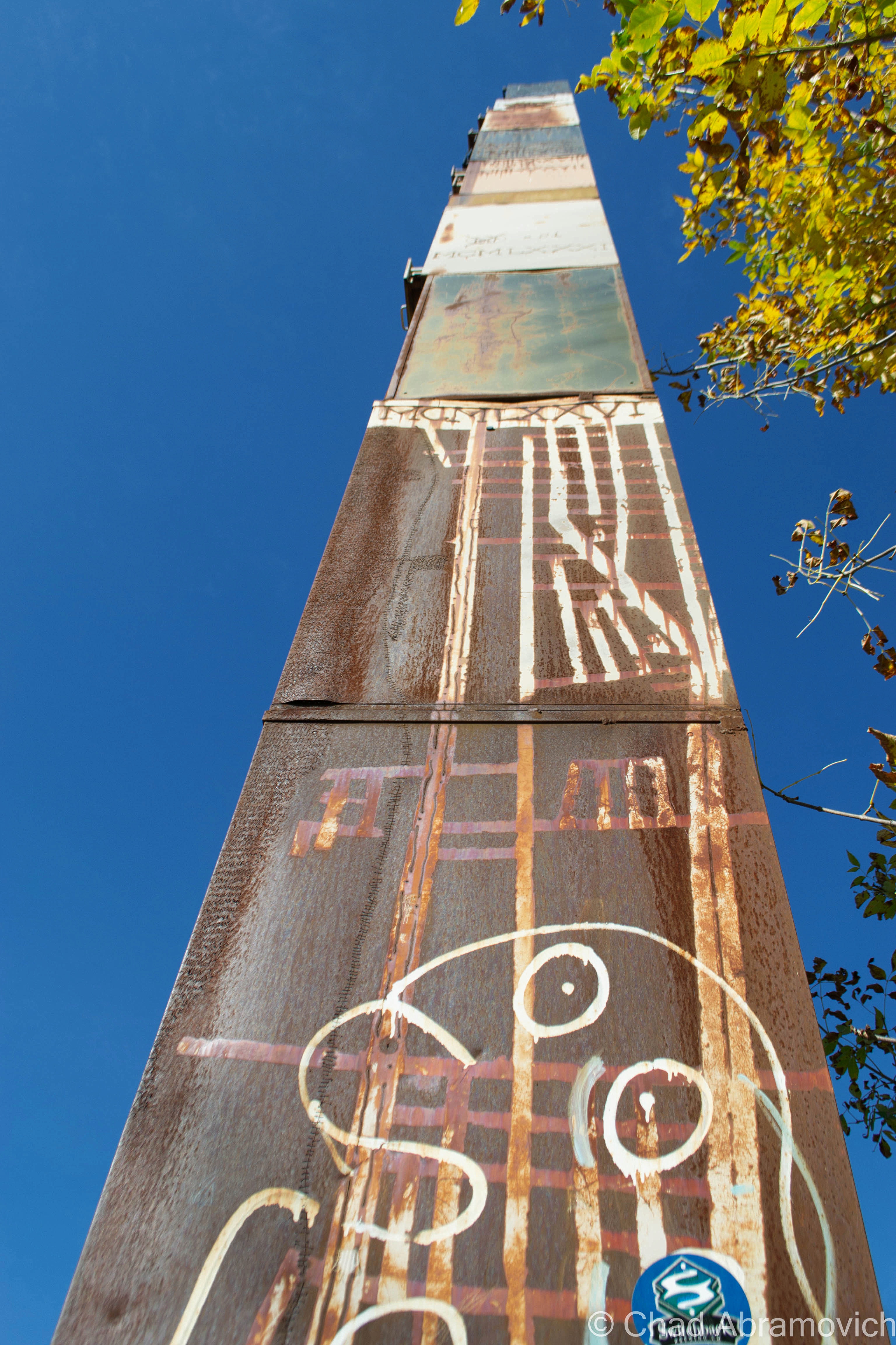
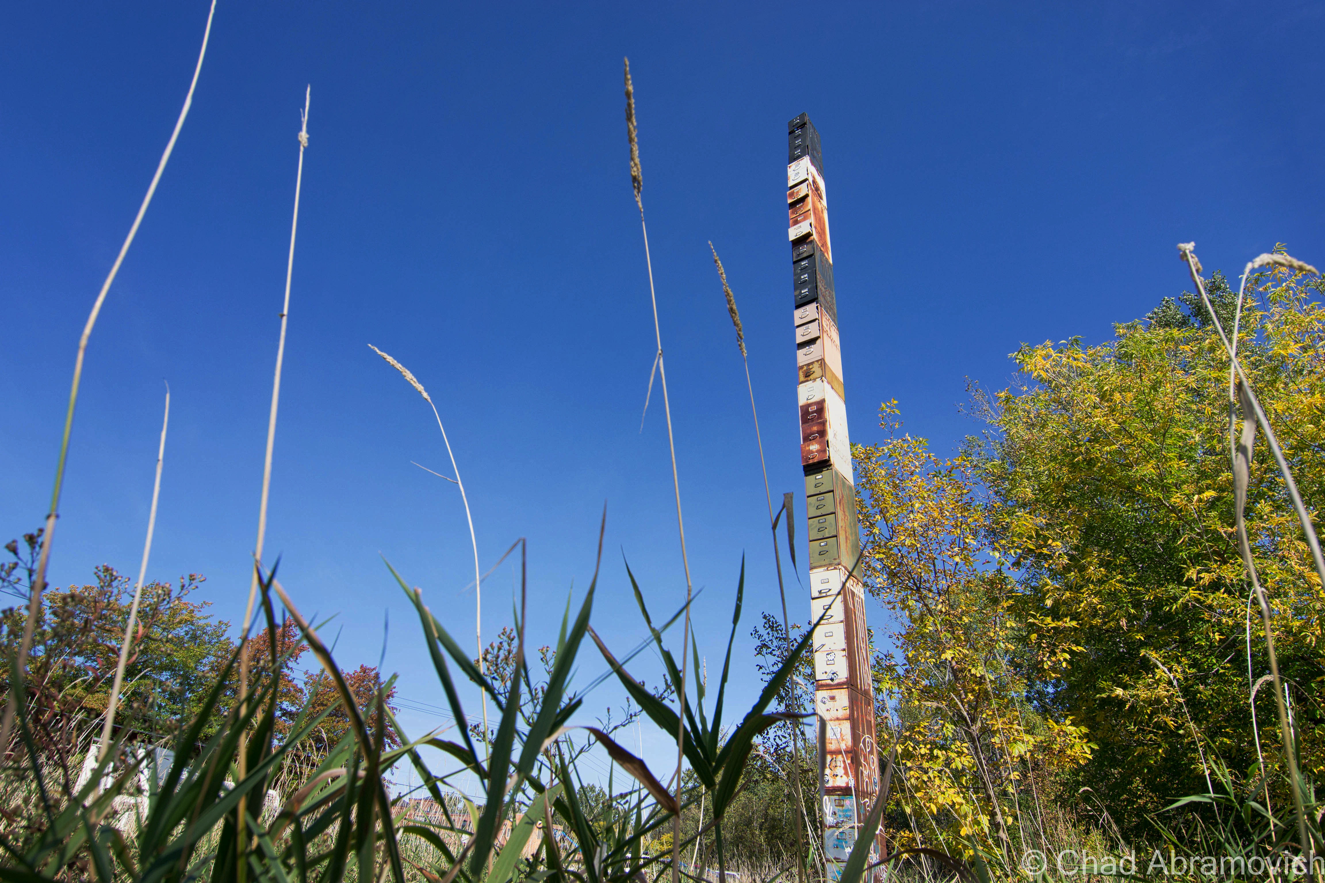
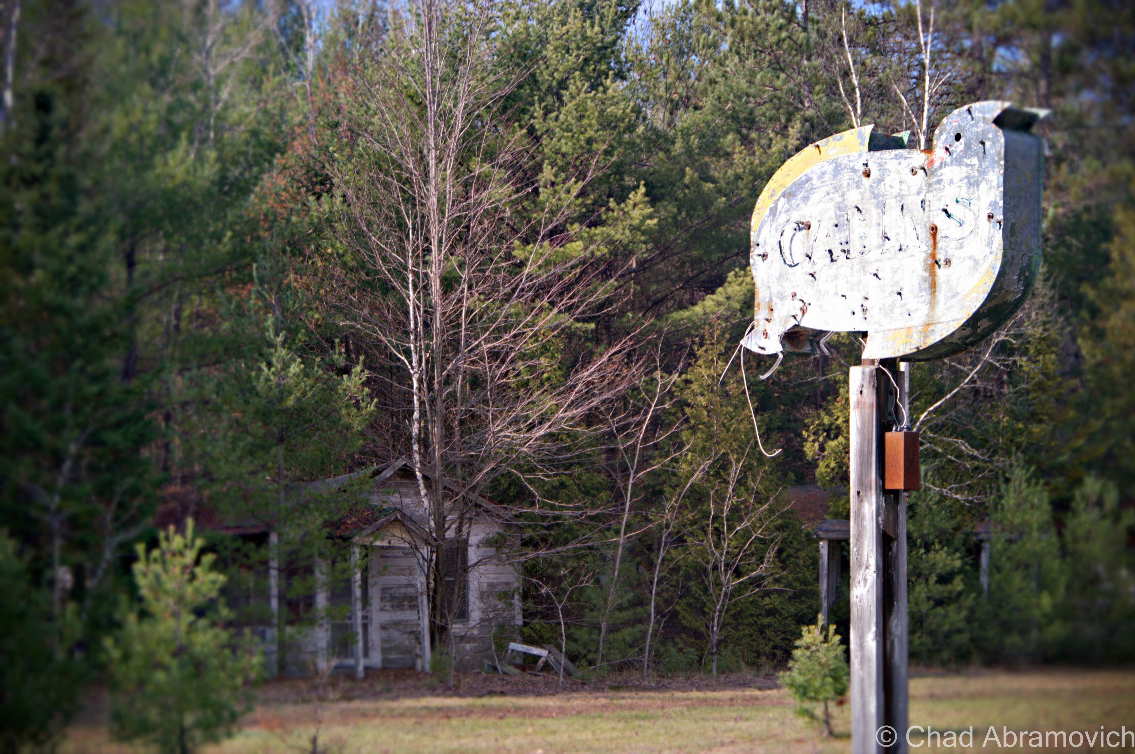
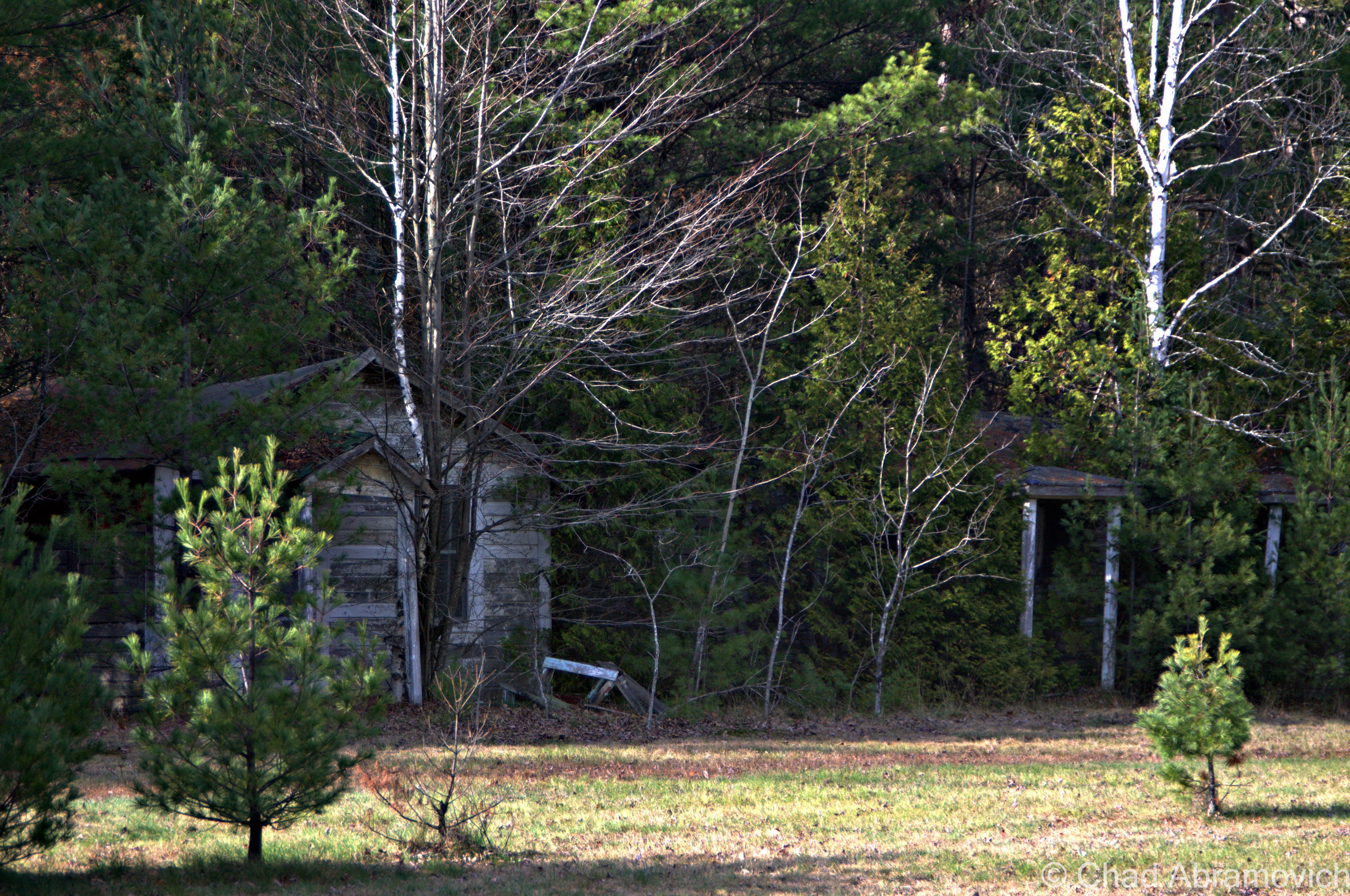
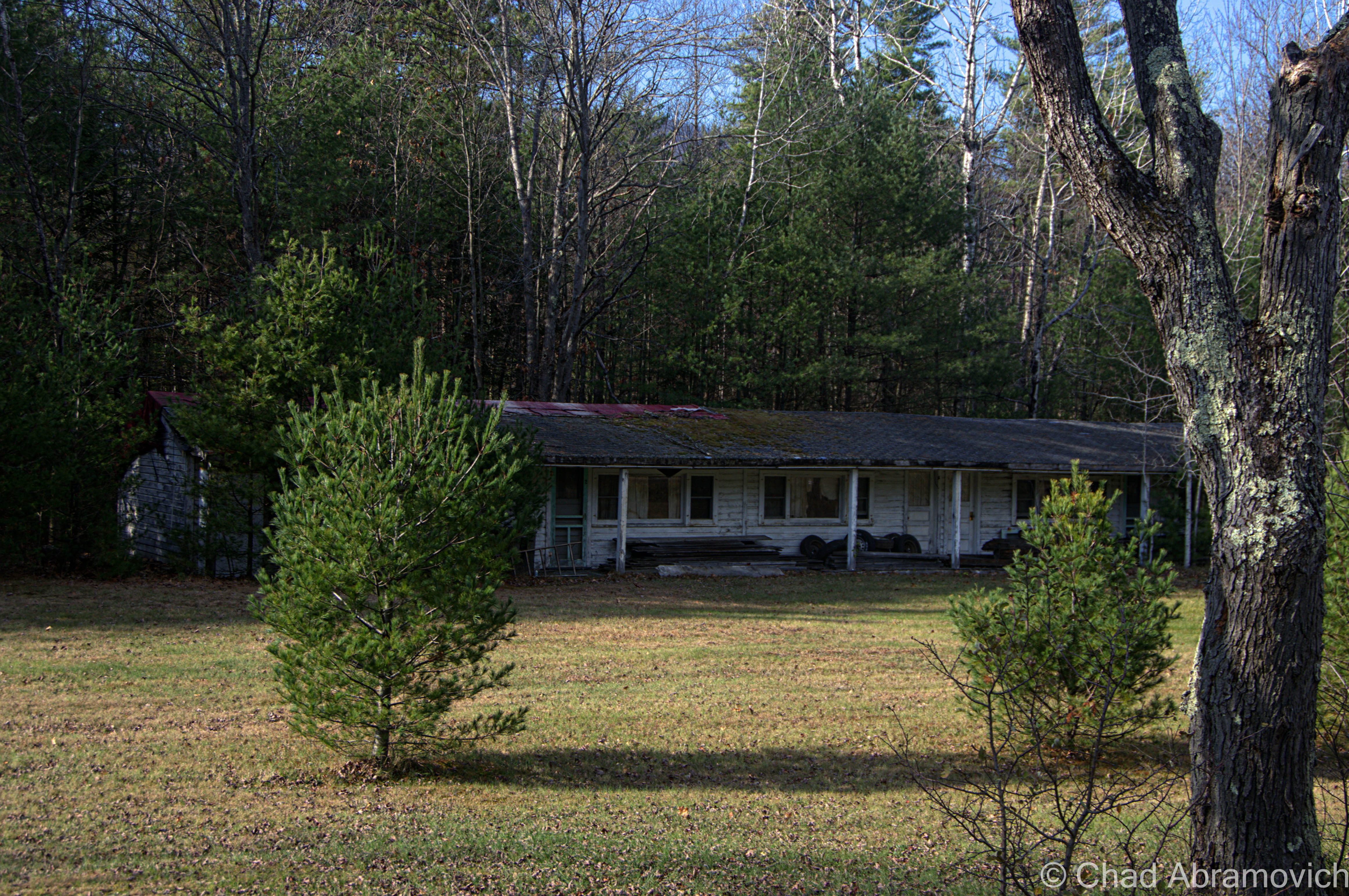
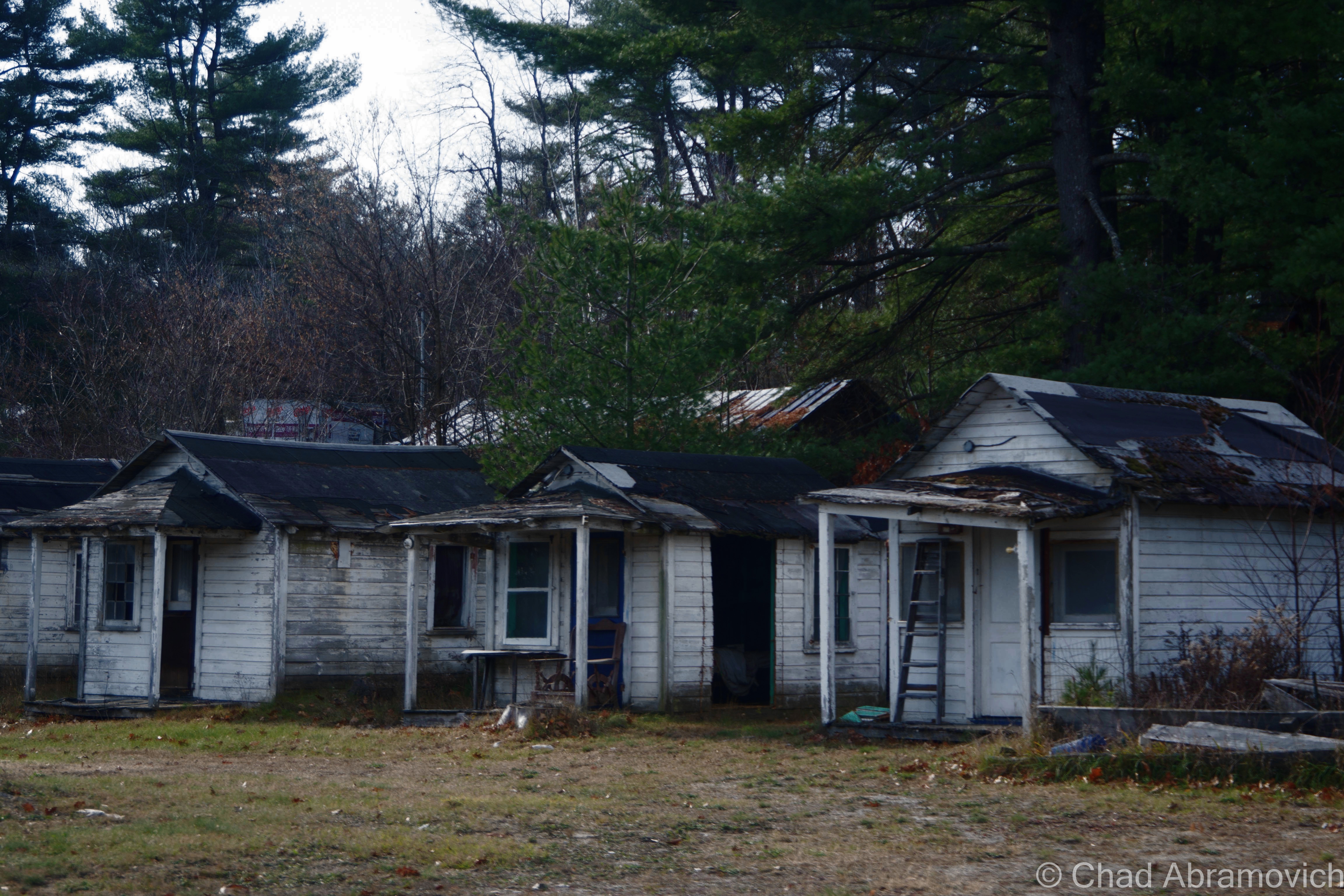
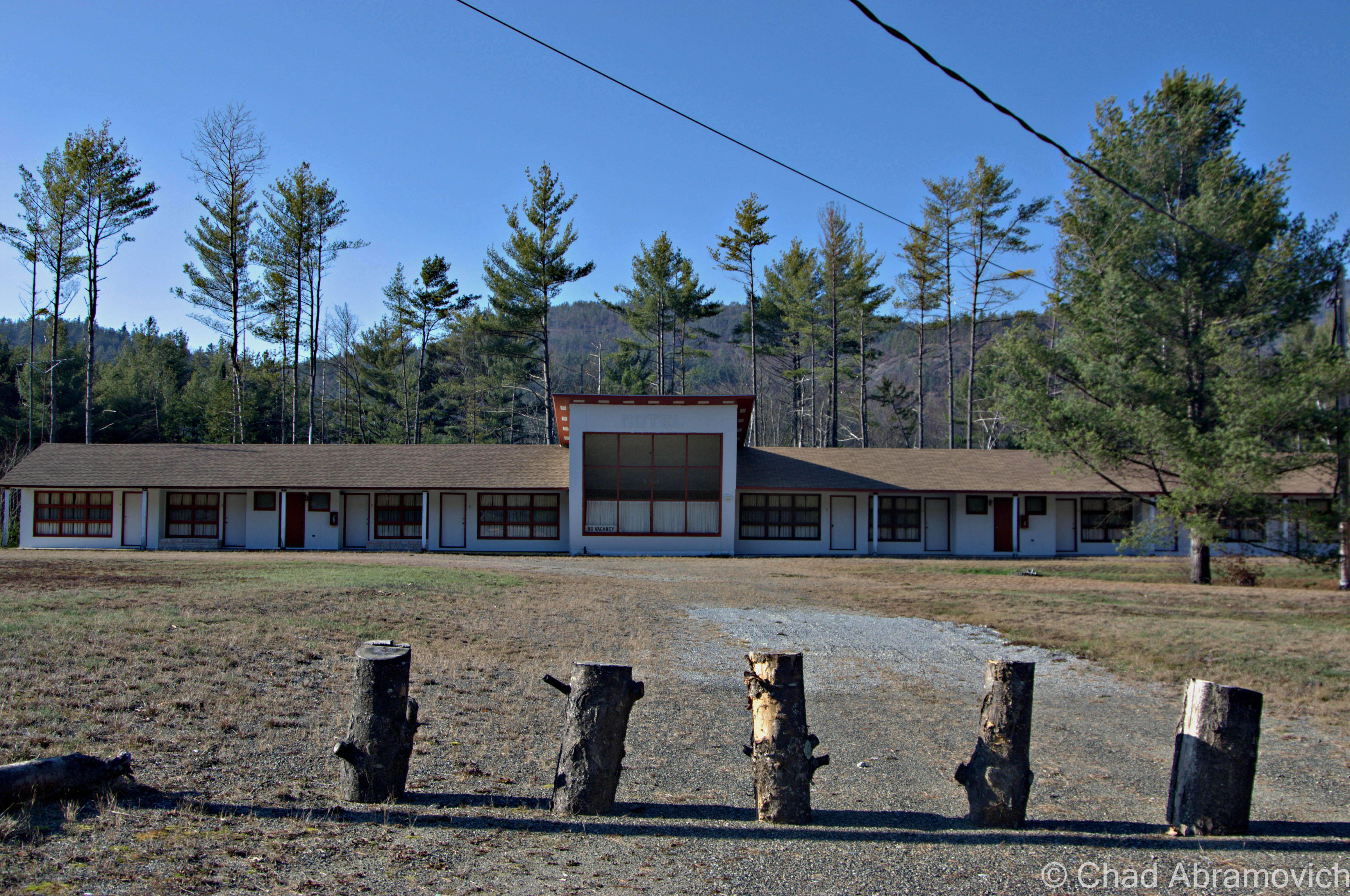
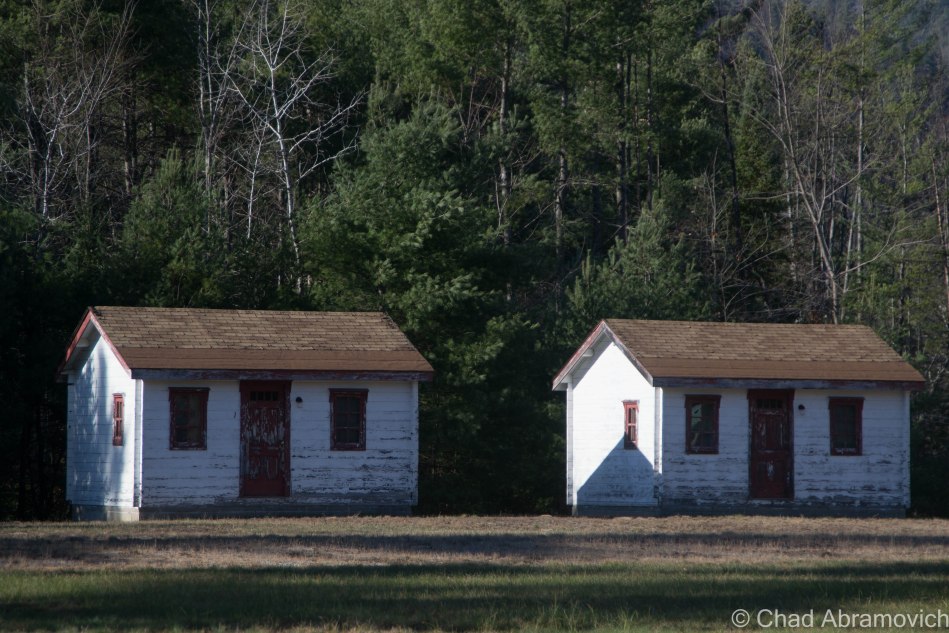
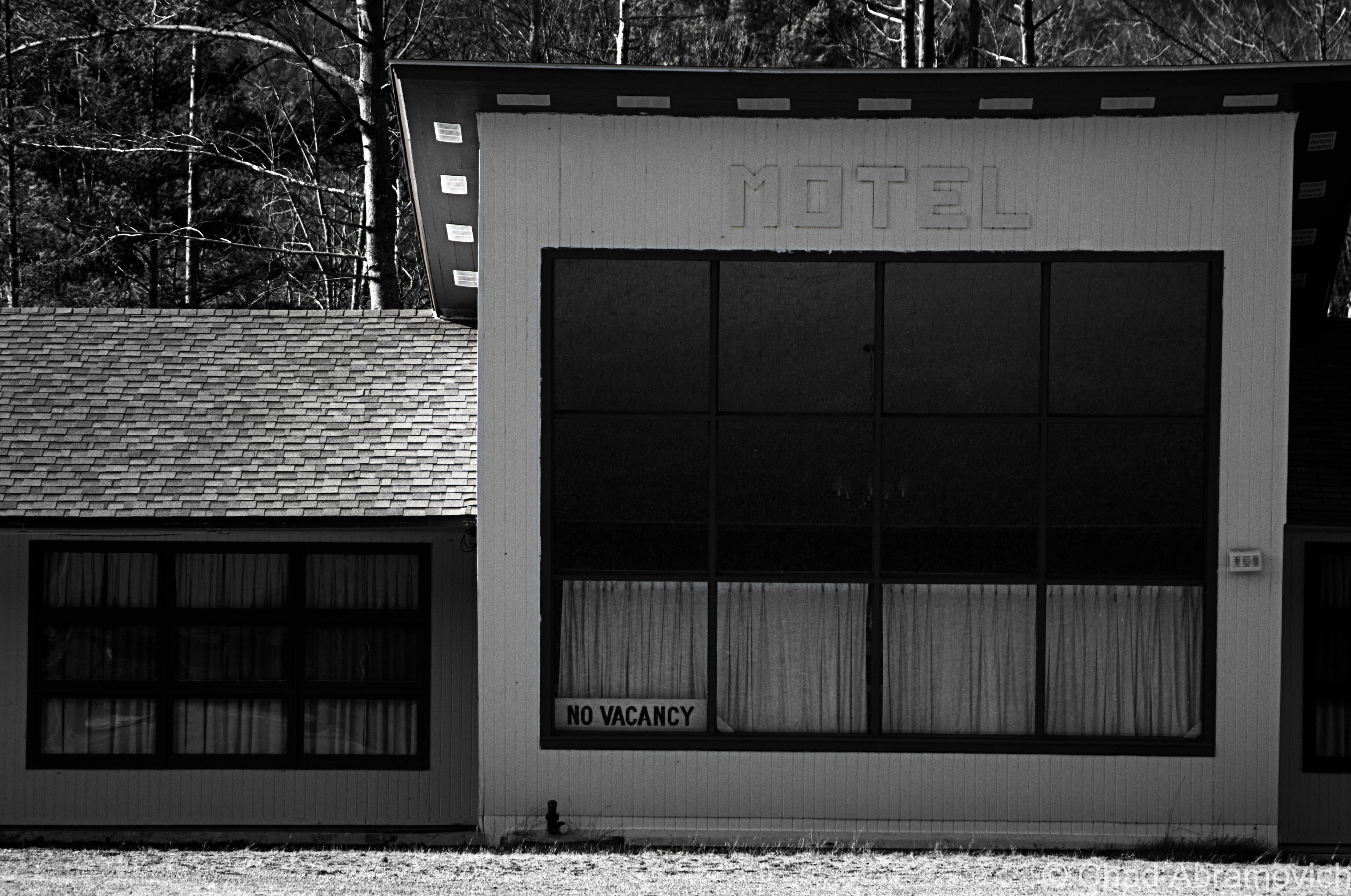
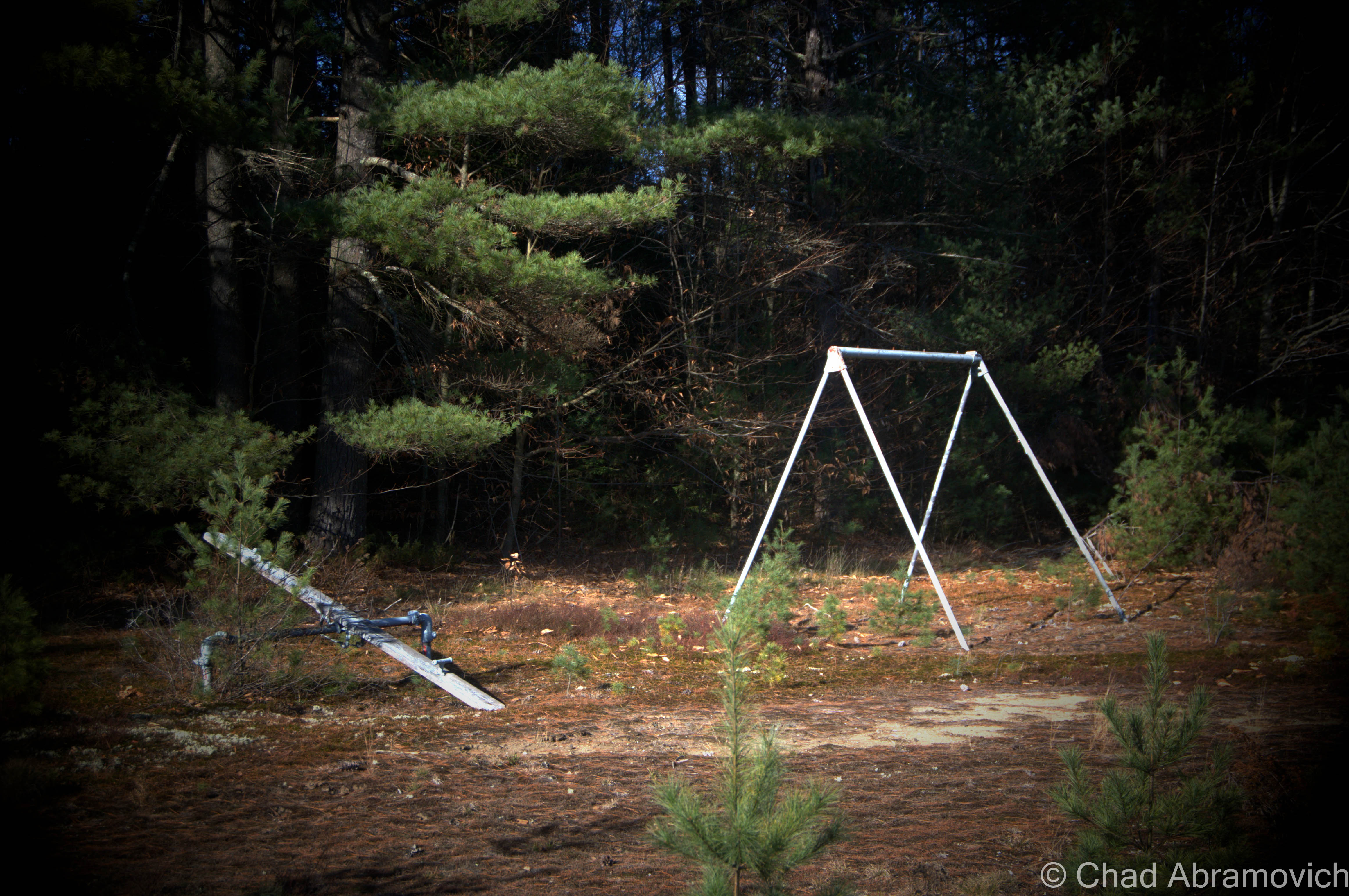
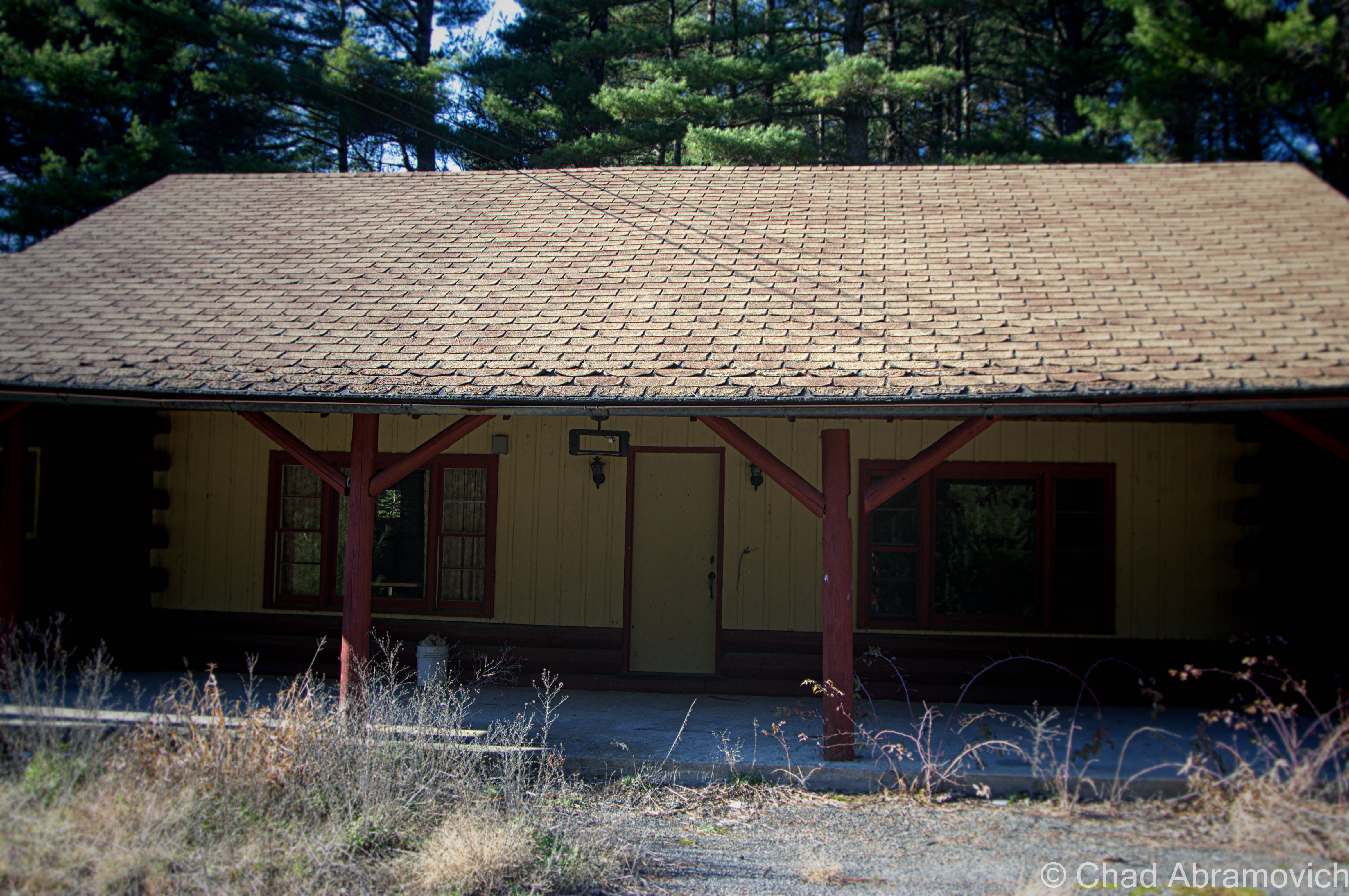
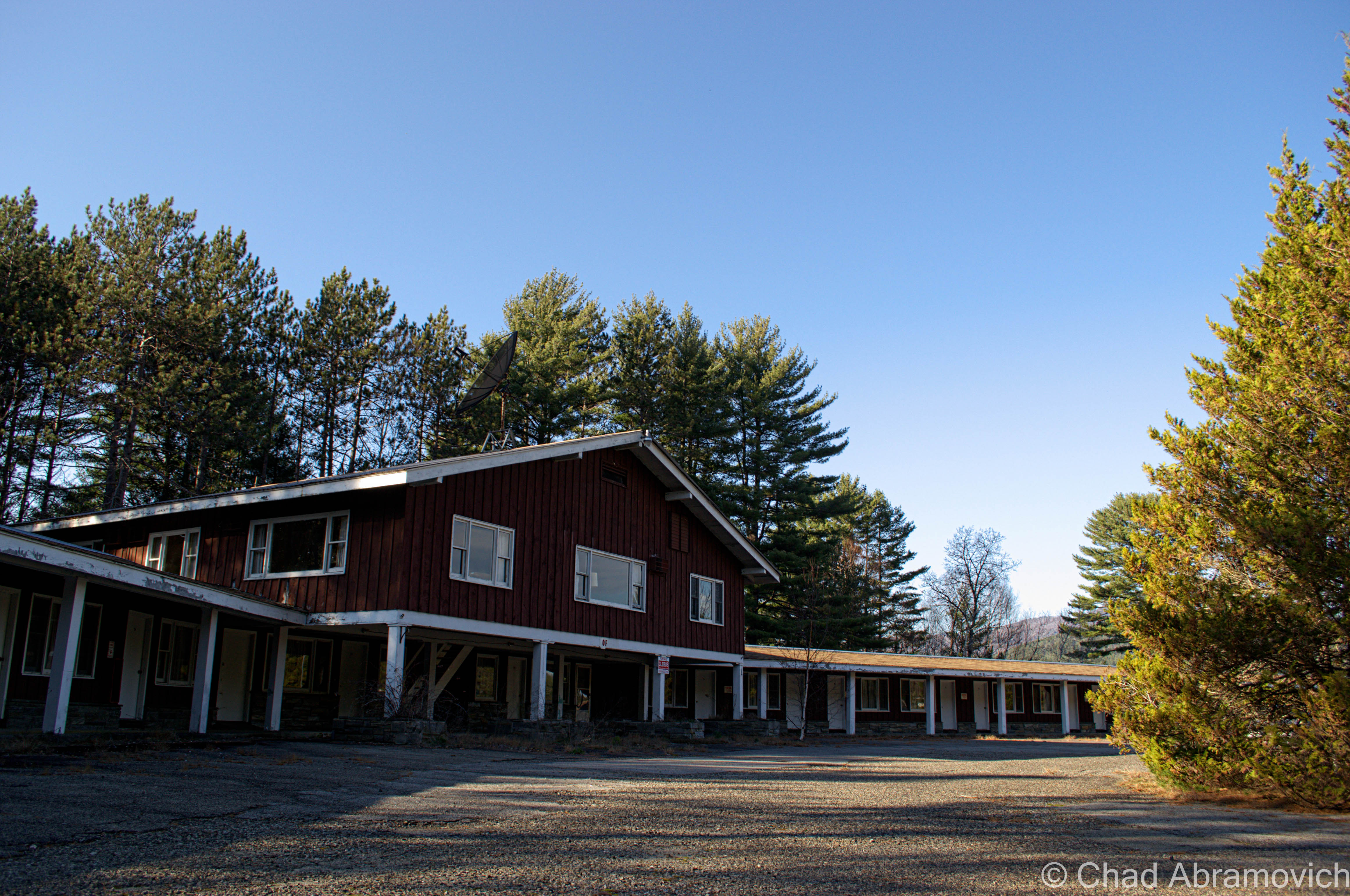
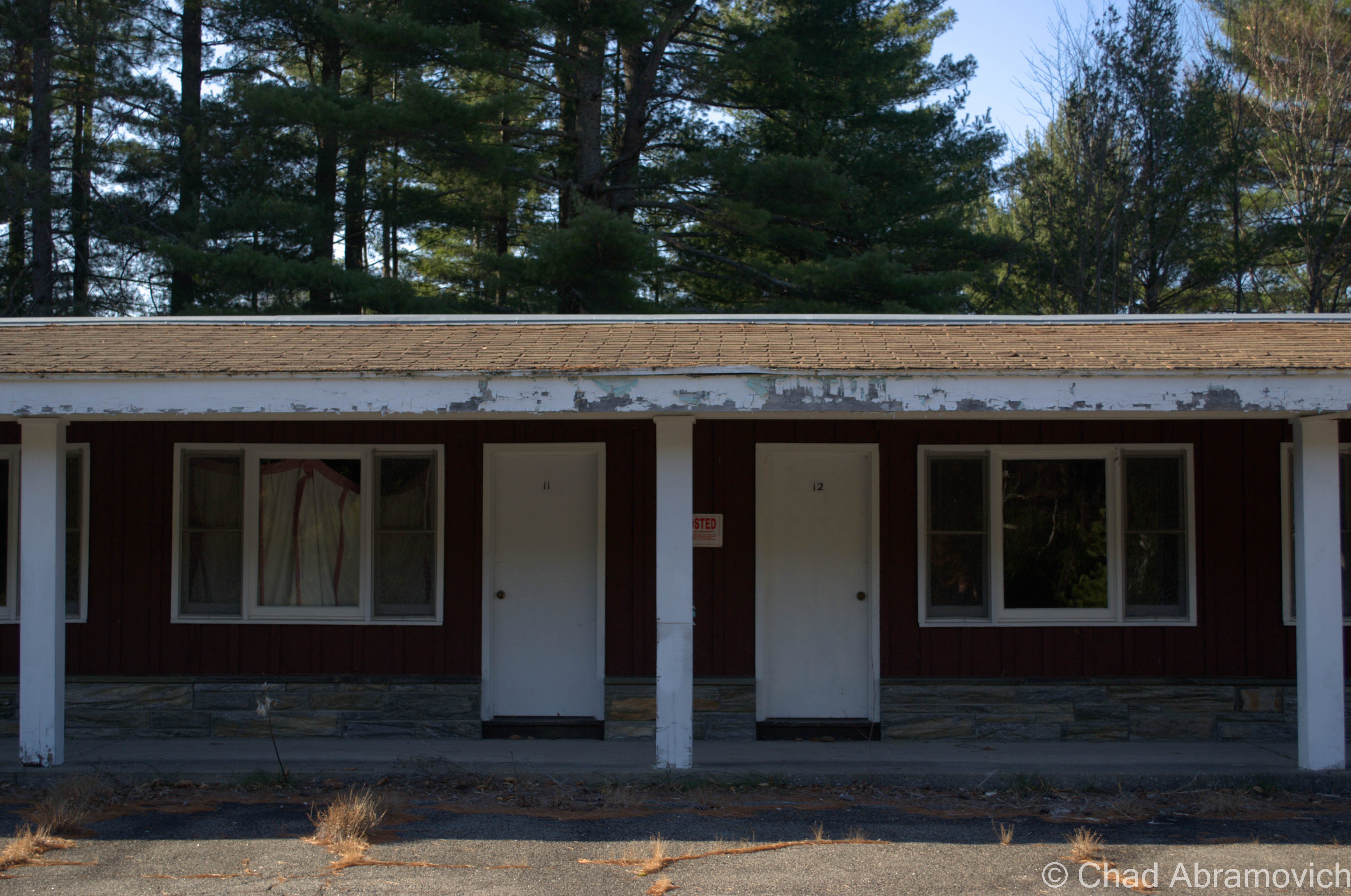
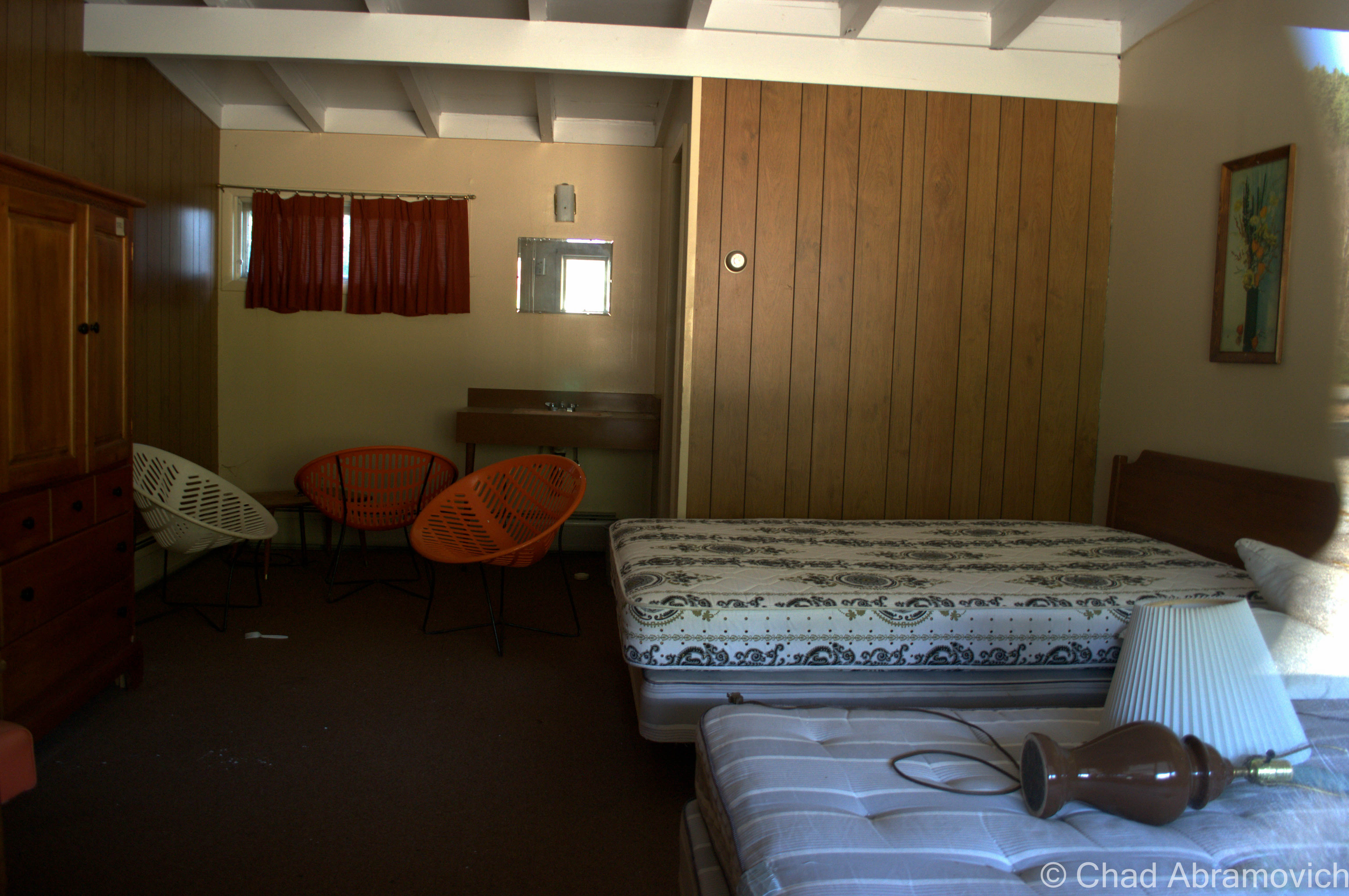
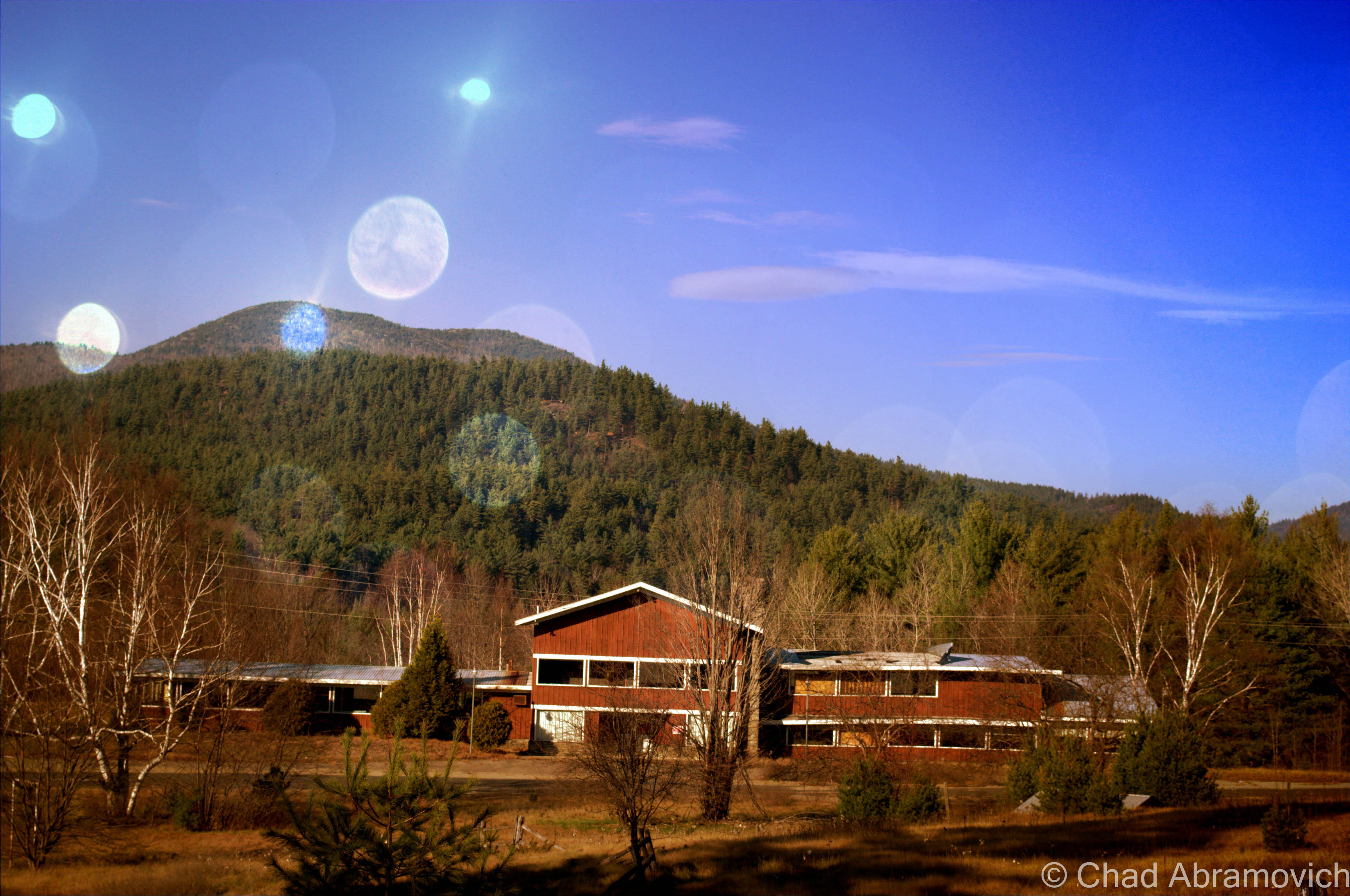
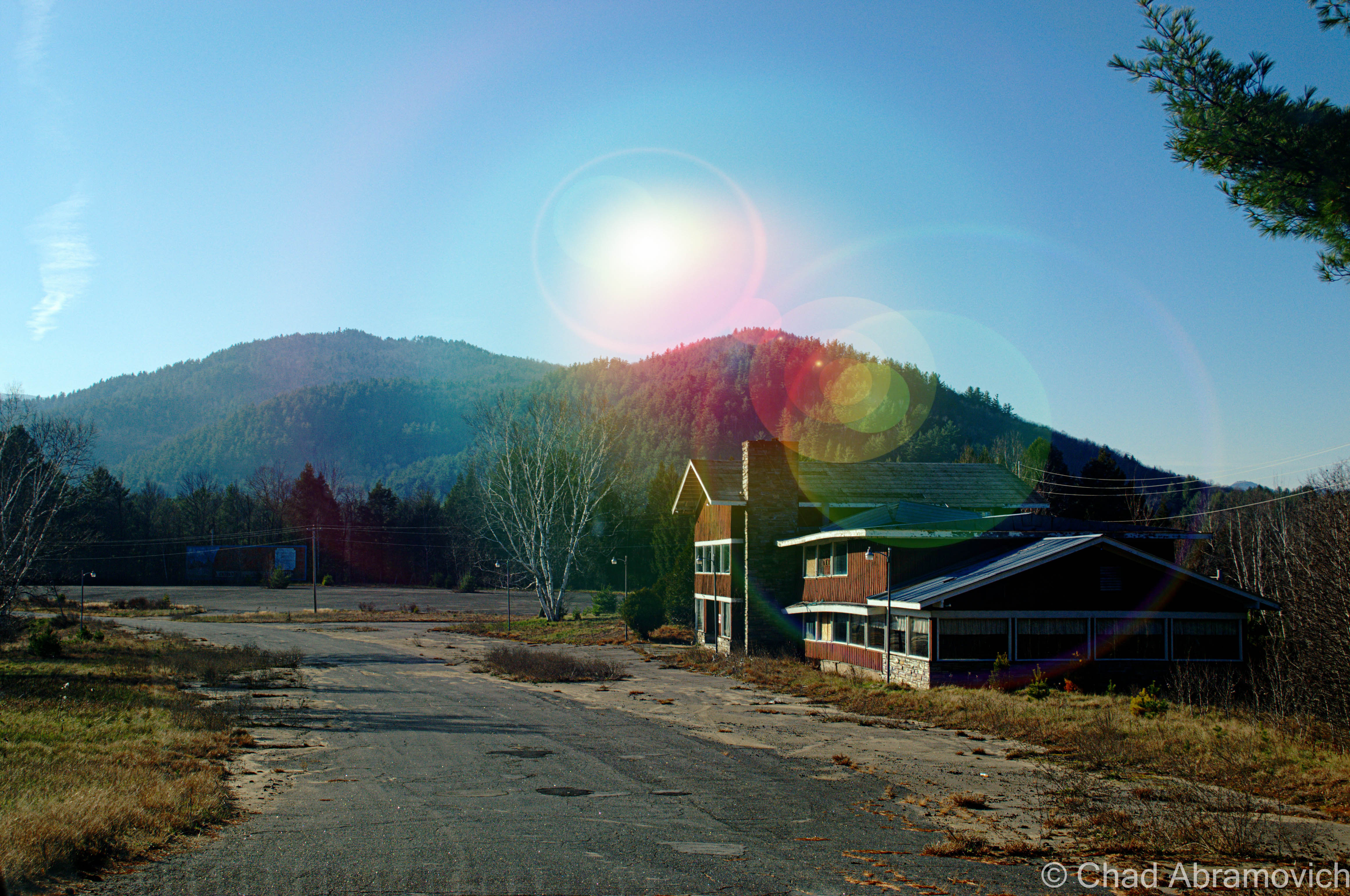
Frontier Town is a massive place, it’s kitschy-cool ruins stretch unassumingly from the roadsides of Routes 9 and 84, and far back out of sight on the sprawling property at the bottom of shady hollows and a myriad of cold swamps that pulse with mosquitoes in the summers. Even in its decay, it still had a wondrous vibe to it that really stuck with me as I wandered around.

Because the property is so large, it’s very difficult to get a good idea of just how much there is to see, until you start exploring for yourself. It’s taken me 3 trips to see a good deal of it, and I still feel like I’ve been unprepared with every visit.

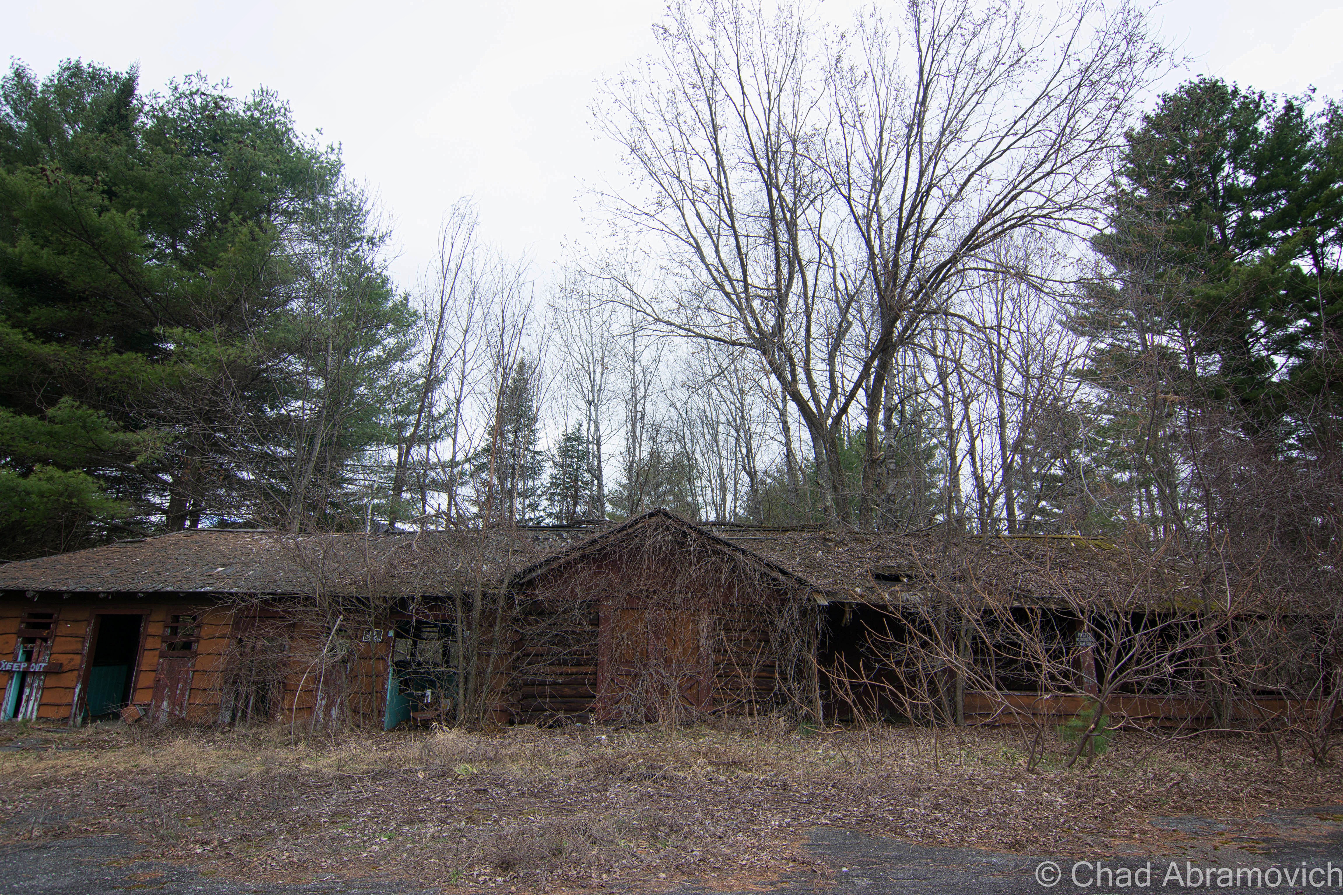
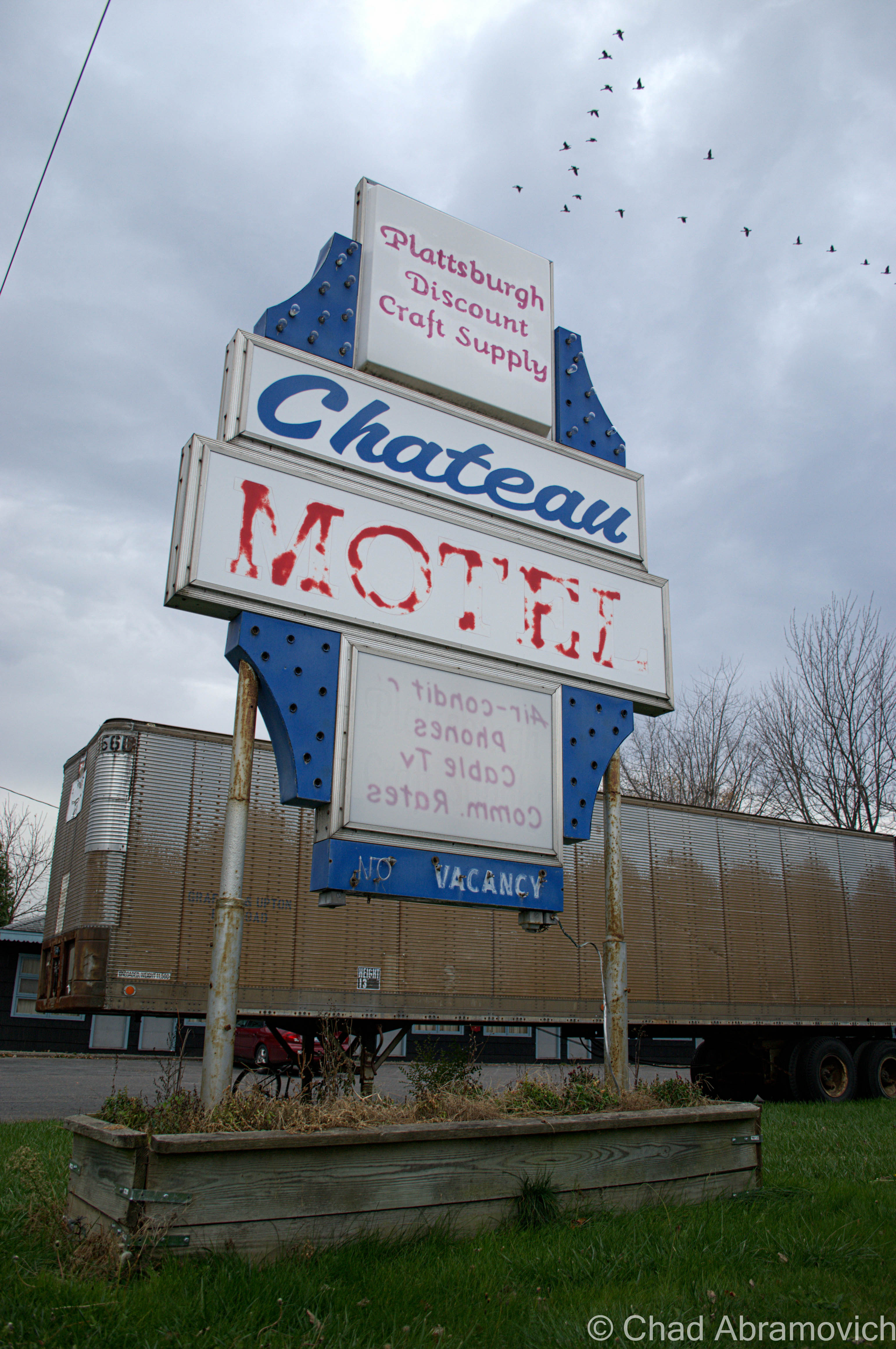
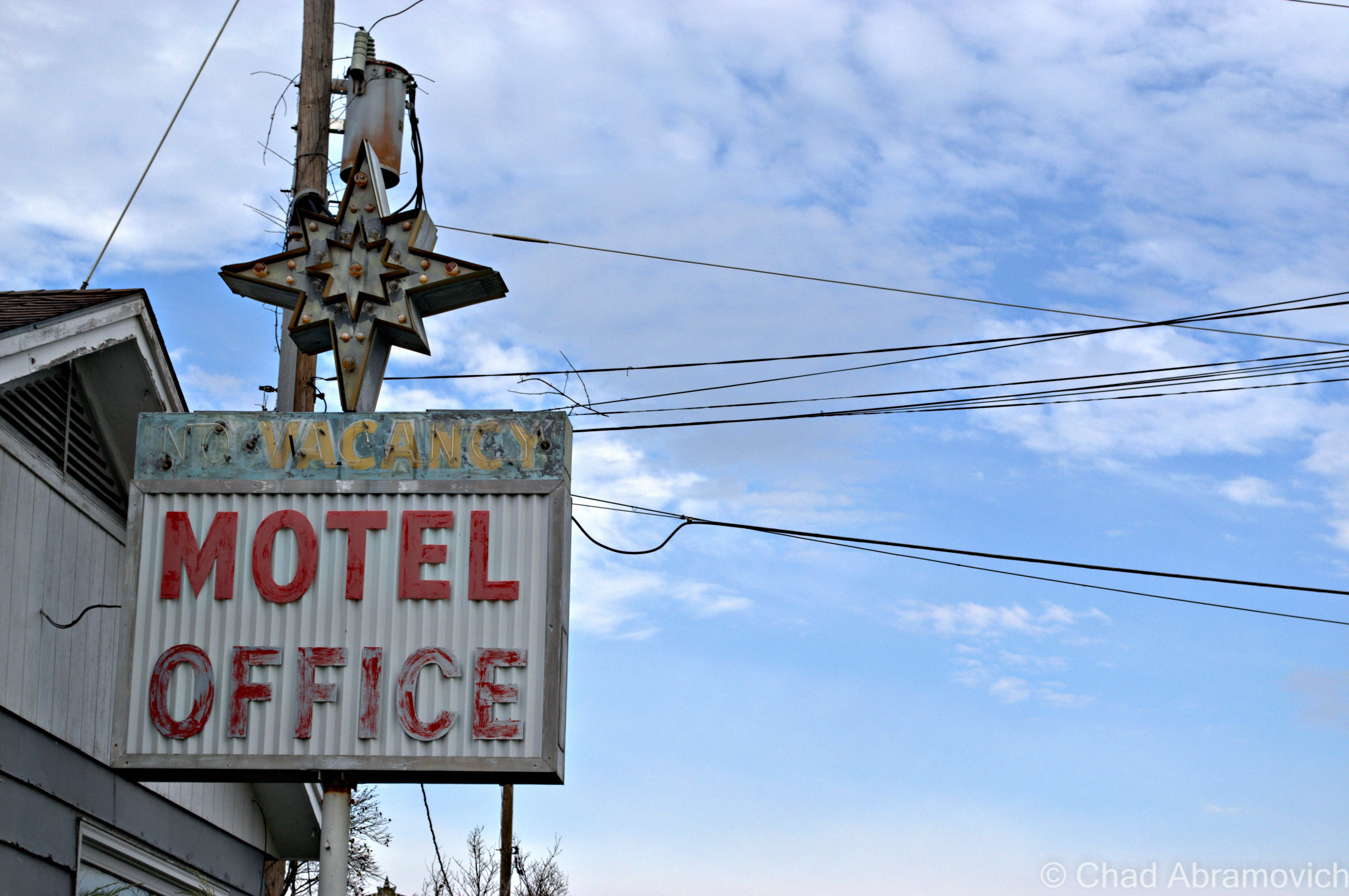
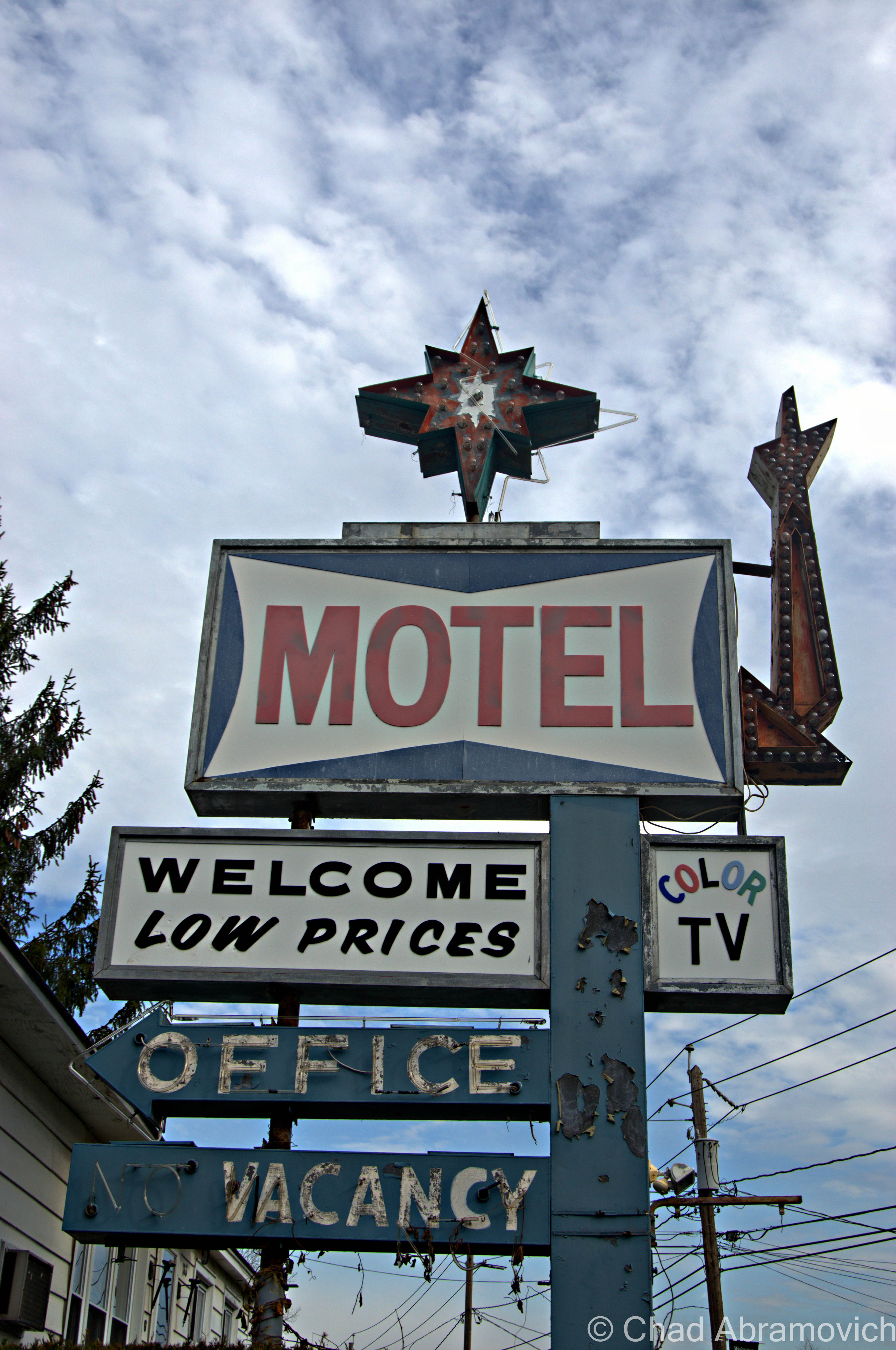
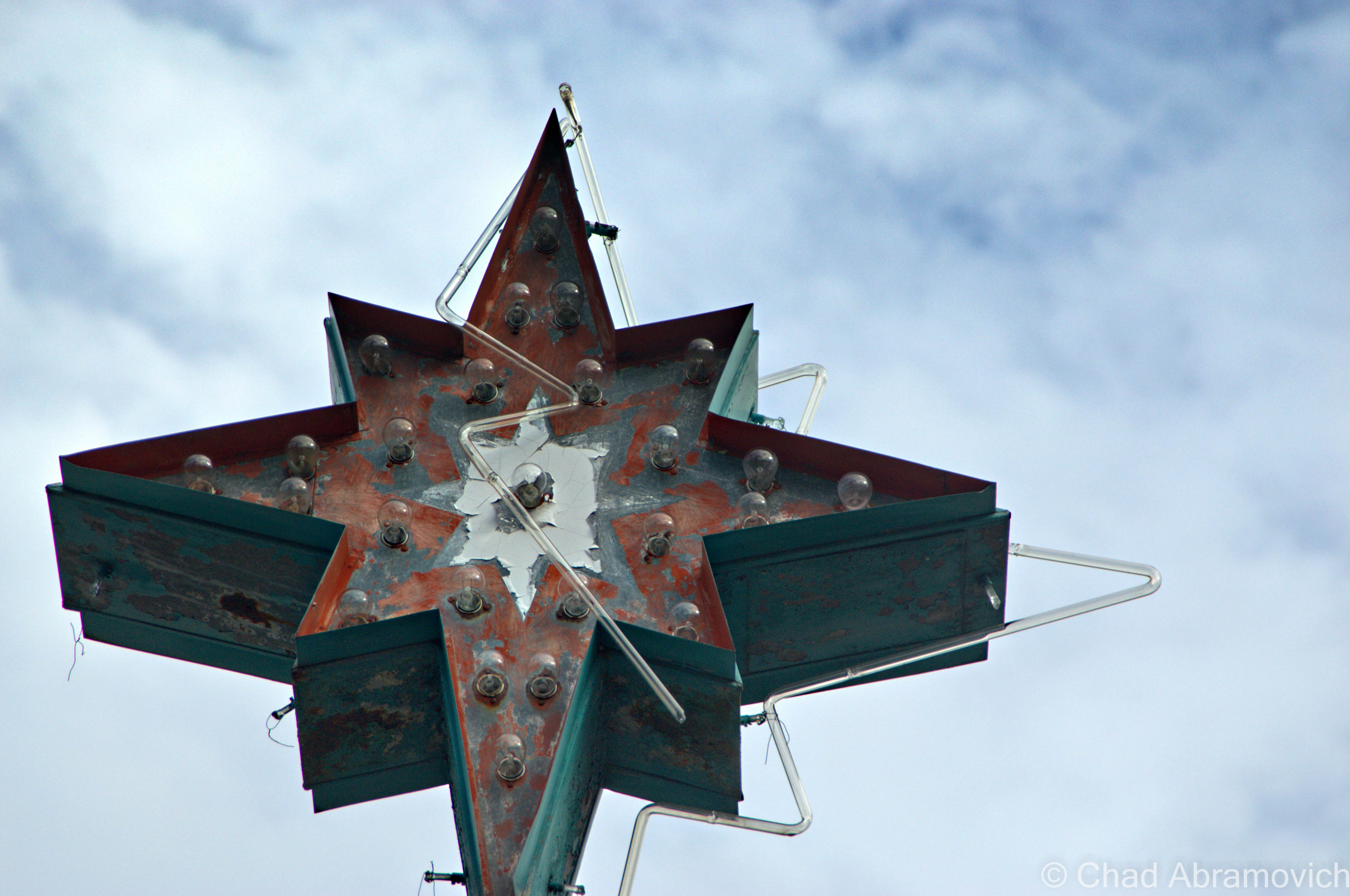
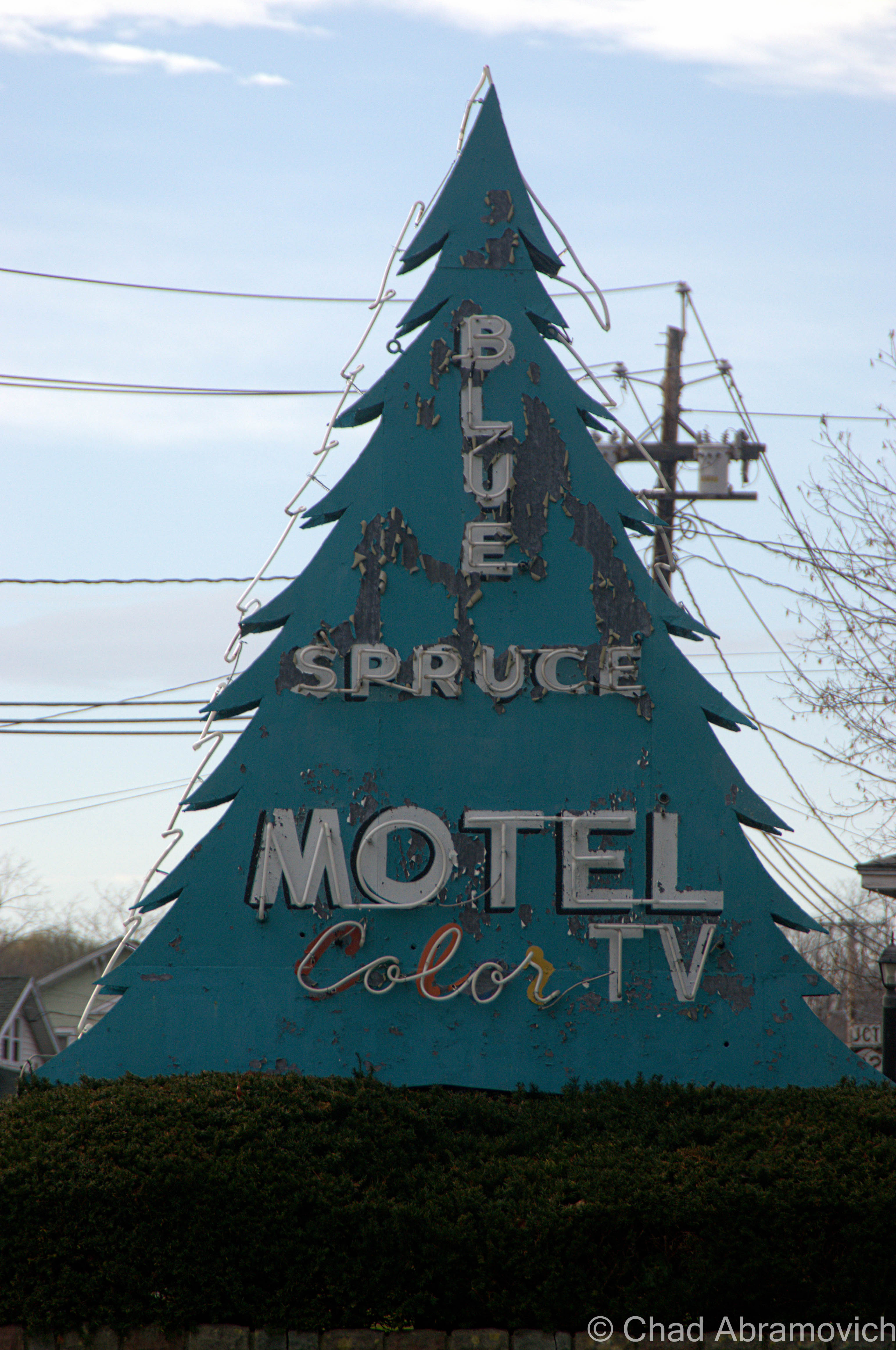
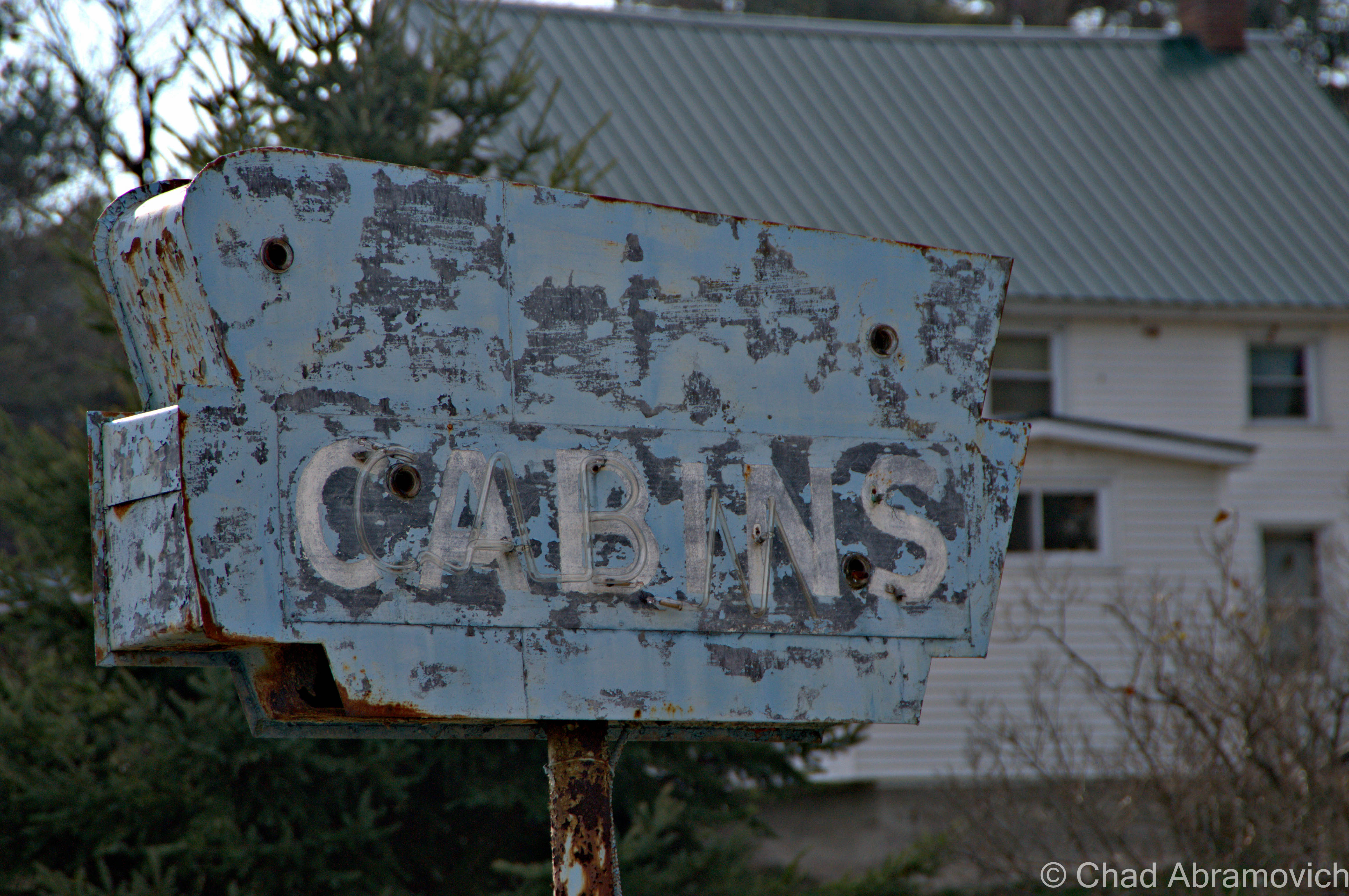
My trips started back in 2012, which were focused on the assortment of abandoned motels and cabins lining Route 9 that once served the motel, and slowly, I would explore my way inwards.

The story of these curious ruins are actually pretty extraordinary. It’s one of those anecdotes that stumbles its way onto the altar of the American Dream and became a venerable benchmark – something that I could file away in the “anything’s possible” camp of things that makes my cynicism do a double-take in a contemporary culture that’s been questioning the truth and the achievability of the American Dream.

In 1951, Arthur Bensen, a Staten Island entrepreneur who installed telephones for a living, was becoming bored with his job, so he started to tour the northeast with $40,000 to find a location suitable for building his dream project; an amusement park.

267 wooded acres in North Hudson would eventually seal the deal, and despite having no construction skills, no idea how to run an amusement park, and no real income after purchasing the property, he went to work!

He was known and admired for his amiable personality, someone who was convincing and charismatic, so much so that he sold North Hudson-ites and locals from neighboring Adirondack towns to help him build the park and eventually be employed there, despite some thinking he was out of his mind.

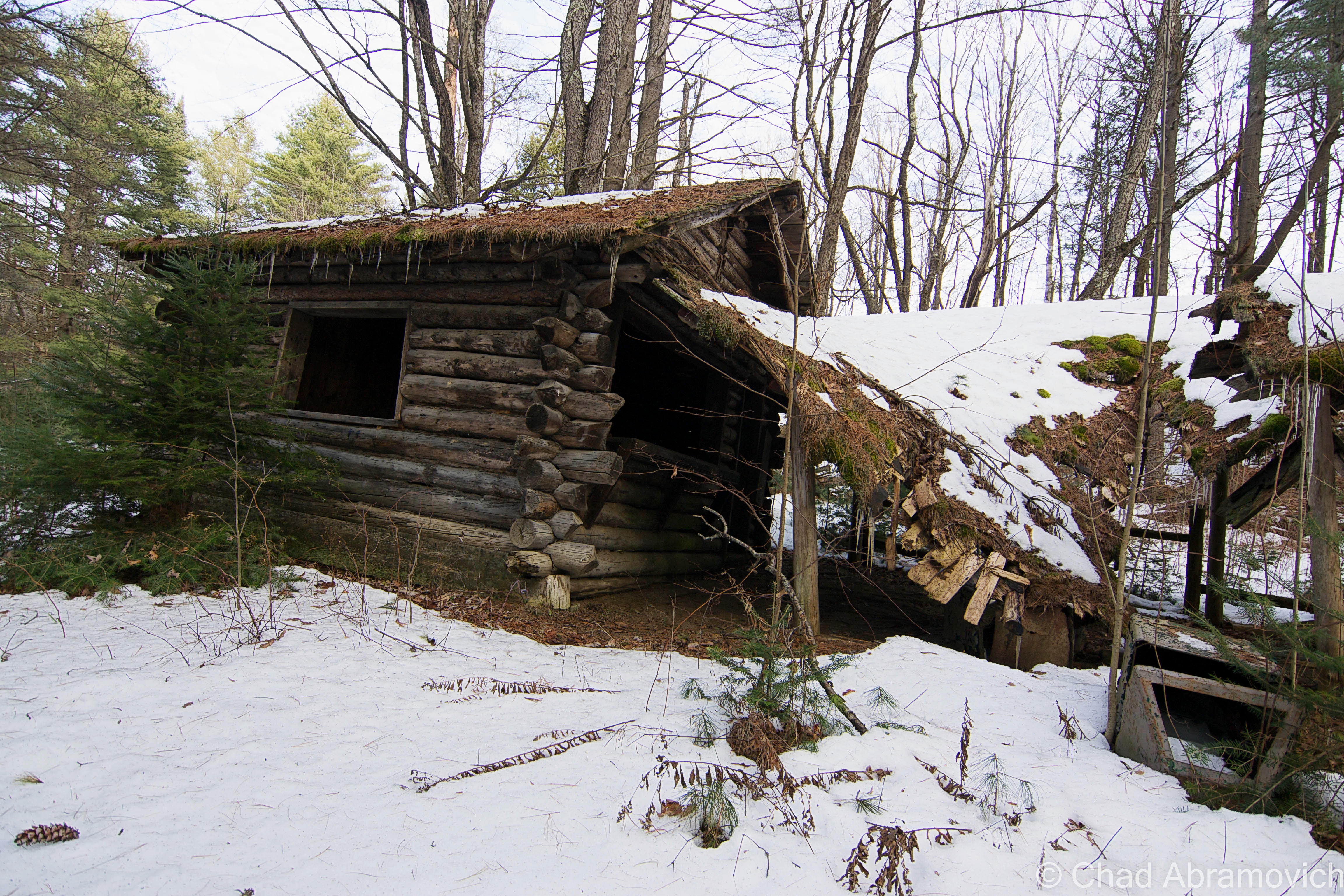
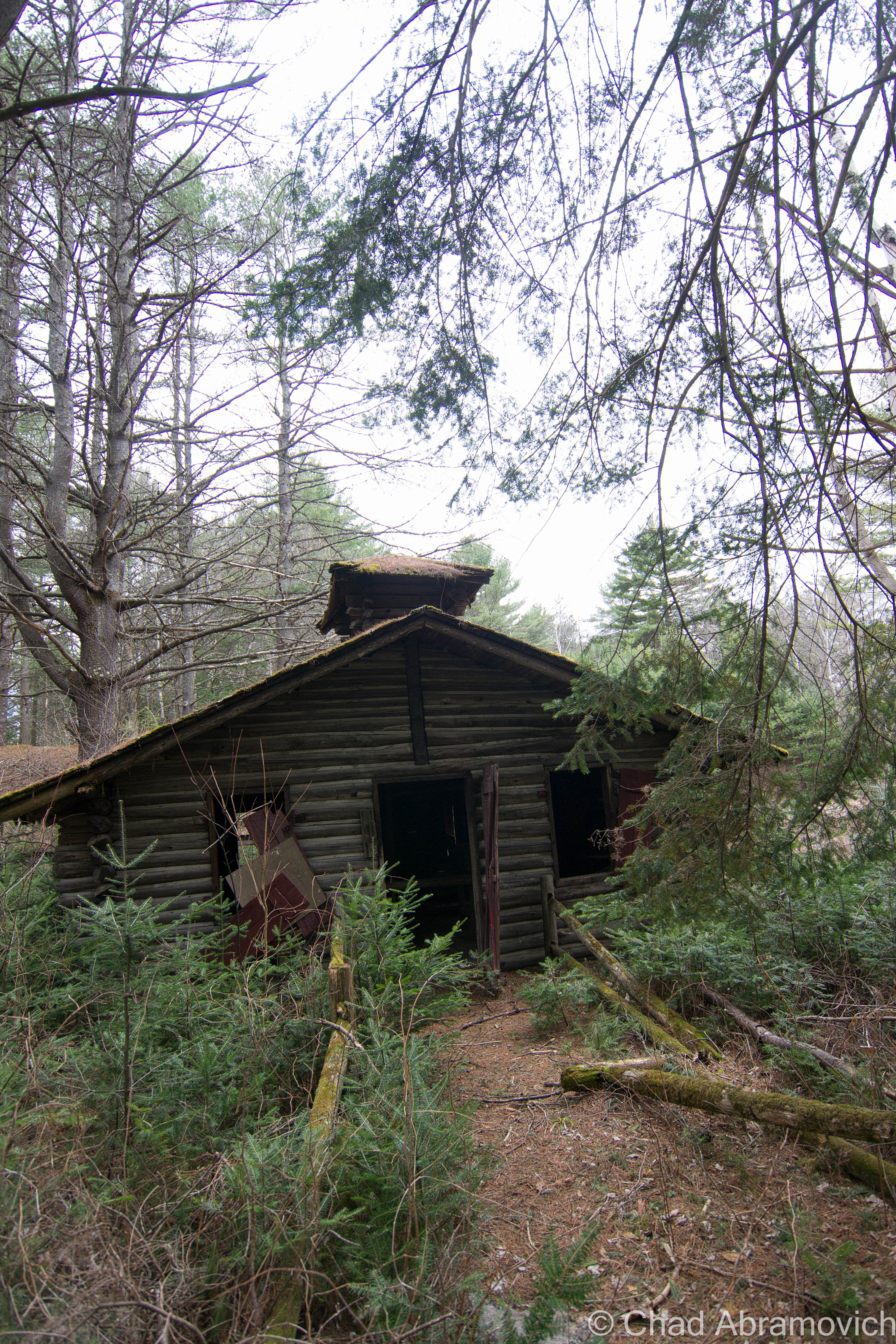
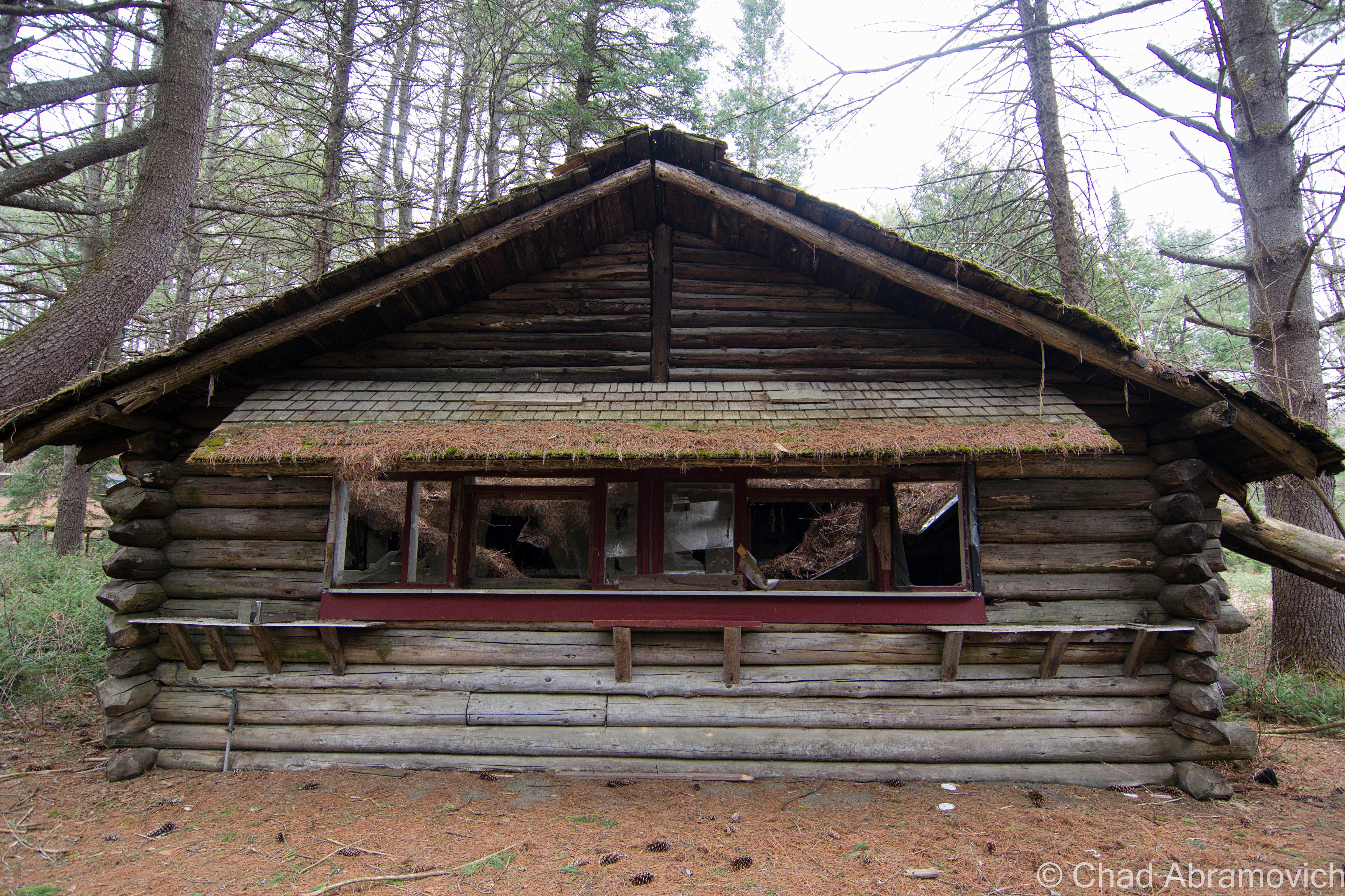
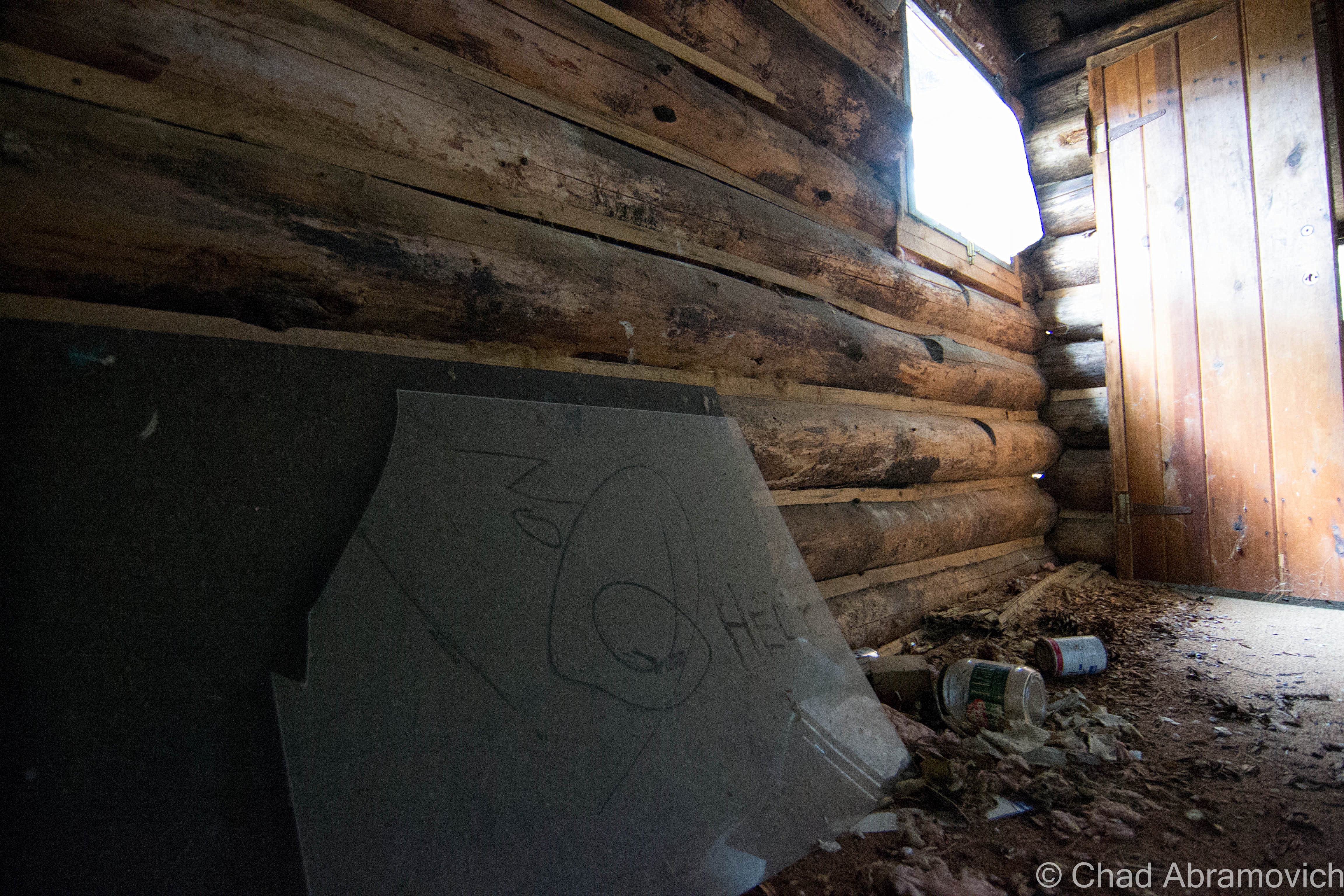
But impressively, his tenaciousness and optimism paid off, and his fantasy began to take shape. Using his 1951 Chevy, he would drag timber behind his car to build many of the log cabins around the site that still stand today.

Bensen was known for his ingenuity; he was thrifty, a quick thinker and good at improvisation – and it was these skills that ultimately would shape the park so many would come to love. Maybe the greatest example of that previous sentence is how Frontier Town became Frontier Town. His original vision was to build a Pioneer Village, but when opening day was looming, the thematic costumes for his employees/LARPers never arrived.

Bensen made a trip down to New York City to purchase some, but returned with Cowboy and Indian costumes instead, because according to the story, those were the only costumes he could buy in such short notice. But luckily, that just happened to be all the rage in the America of that time.

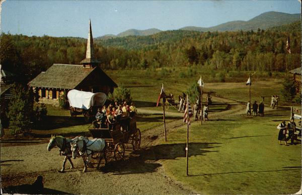
So, he made some alterations to his blueprints, and Frontier Town was born, officially opening on July 4, 1952 and would continue to expand in the intervening years.

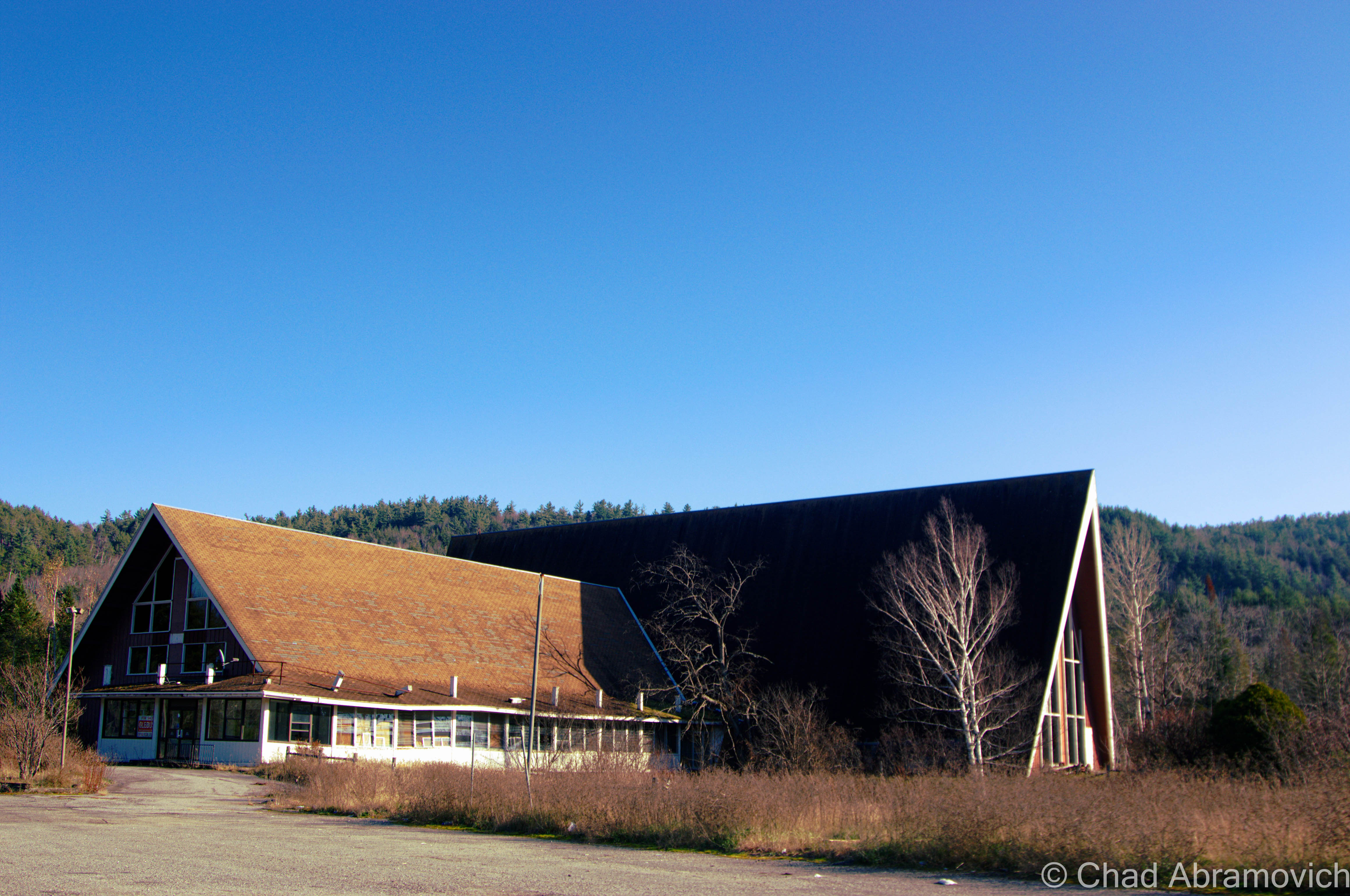
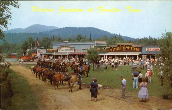
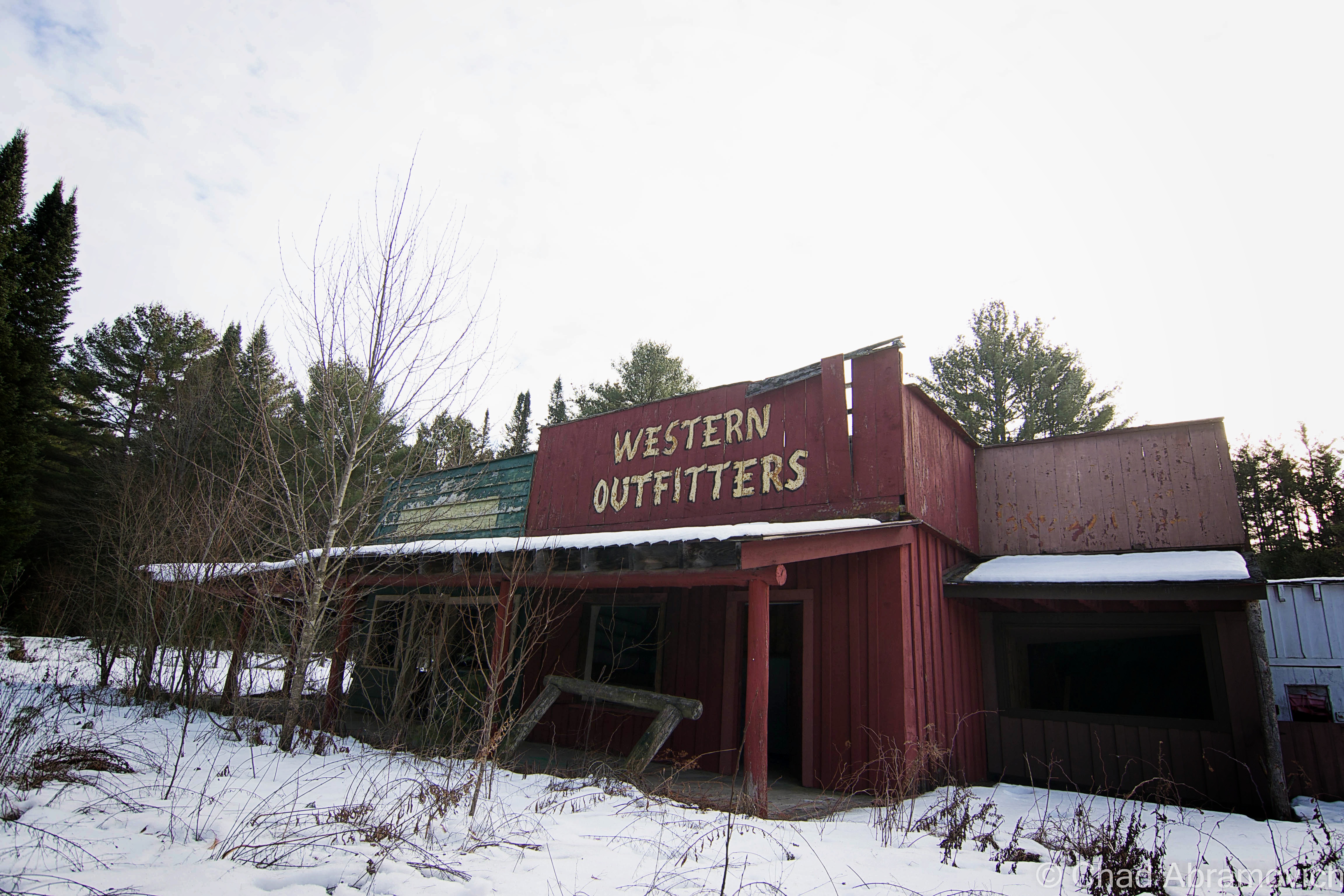
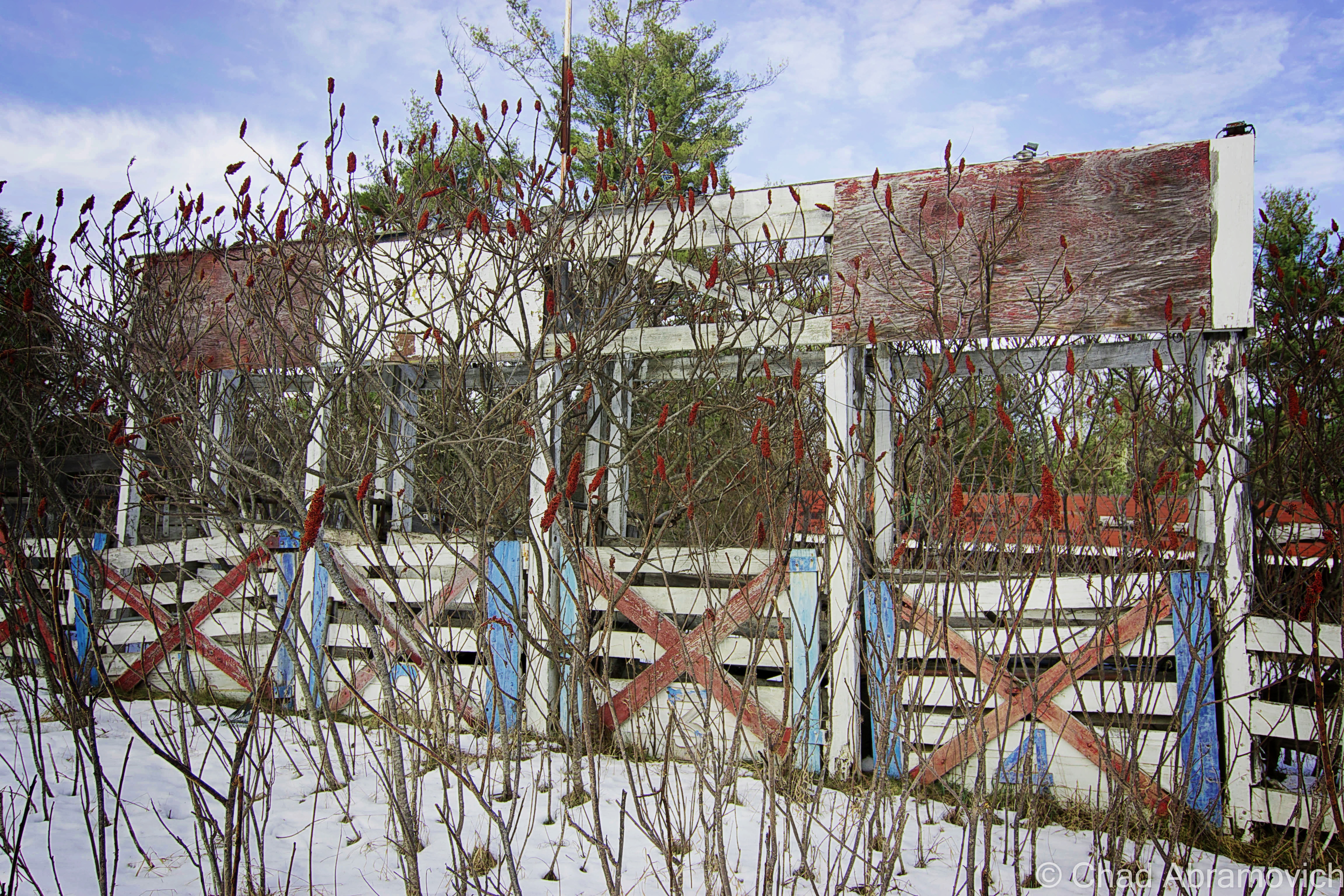
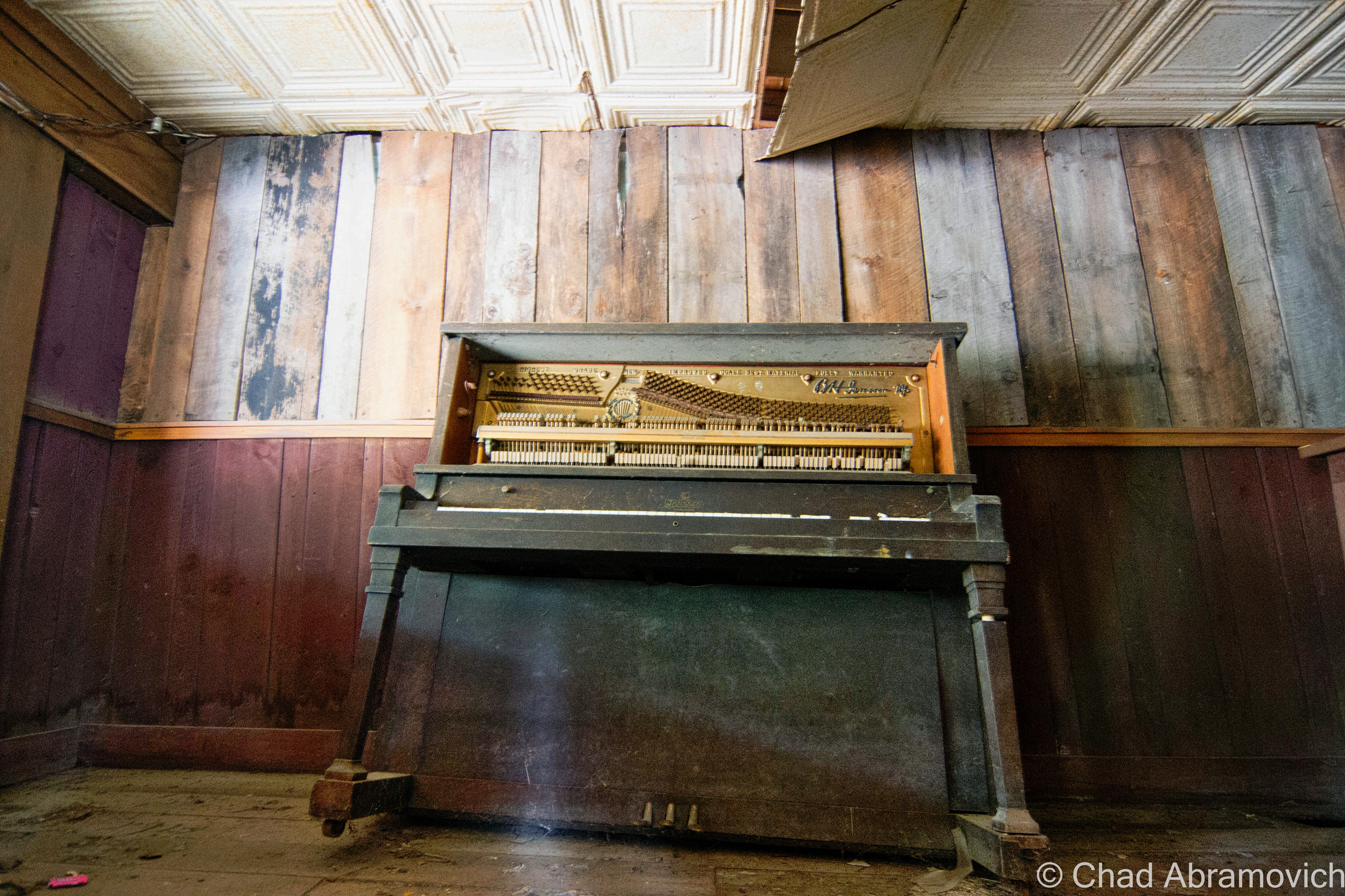
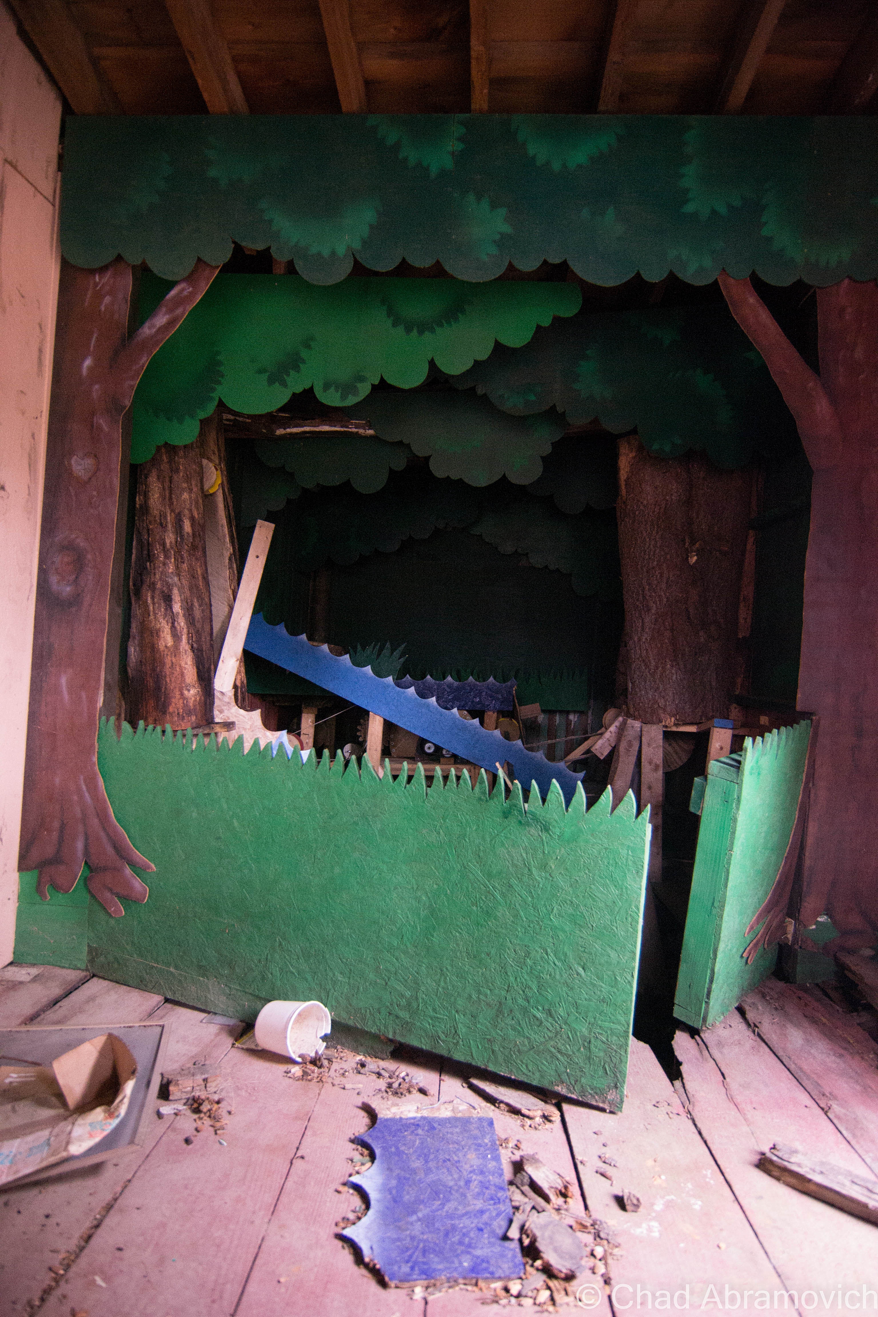
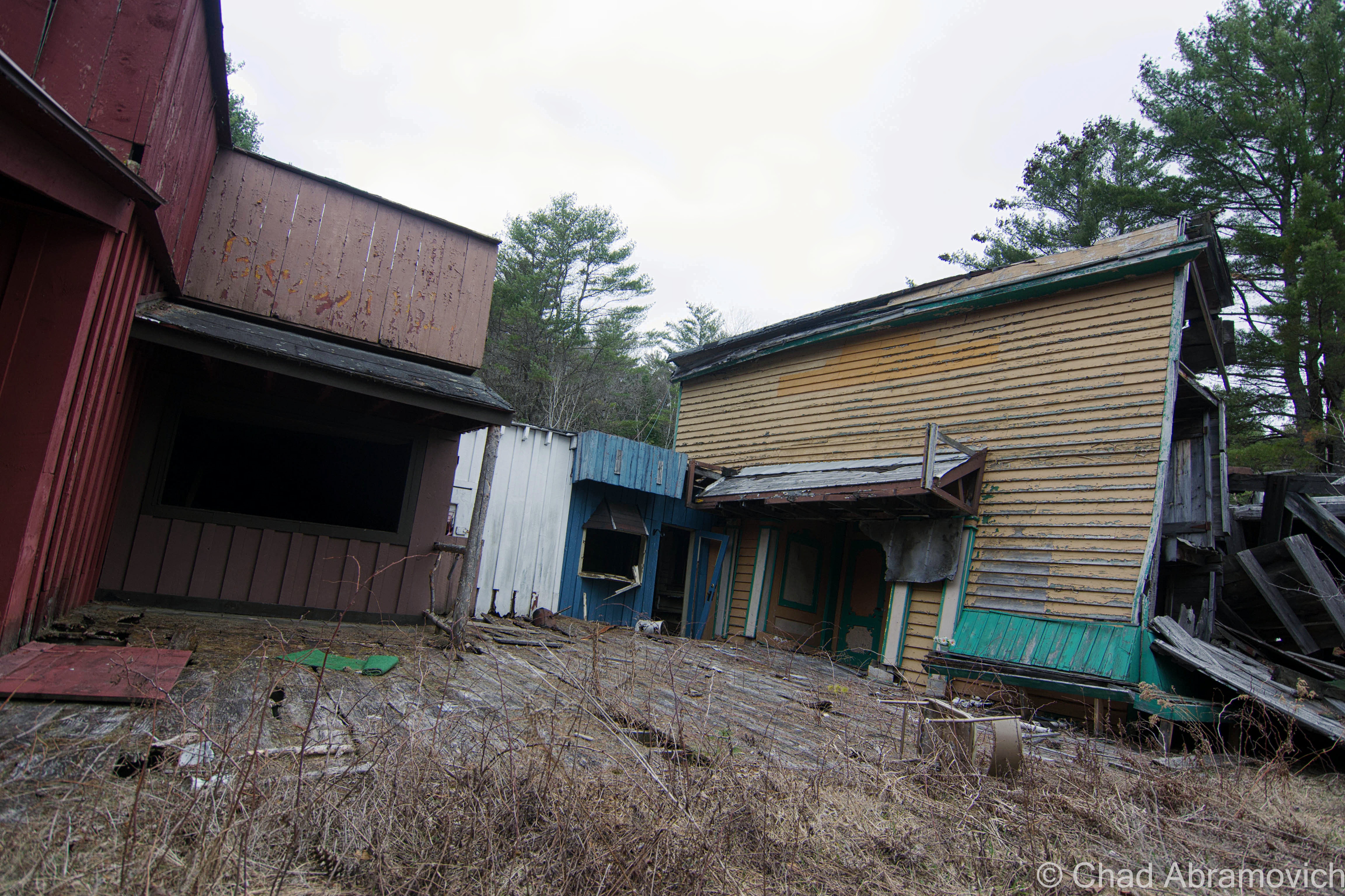
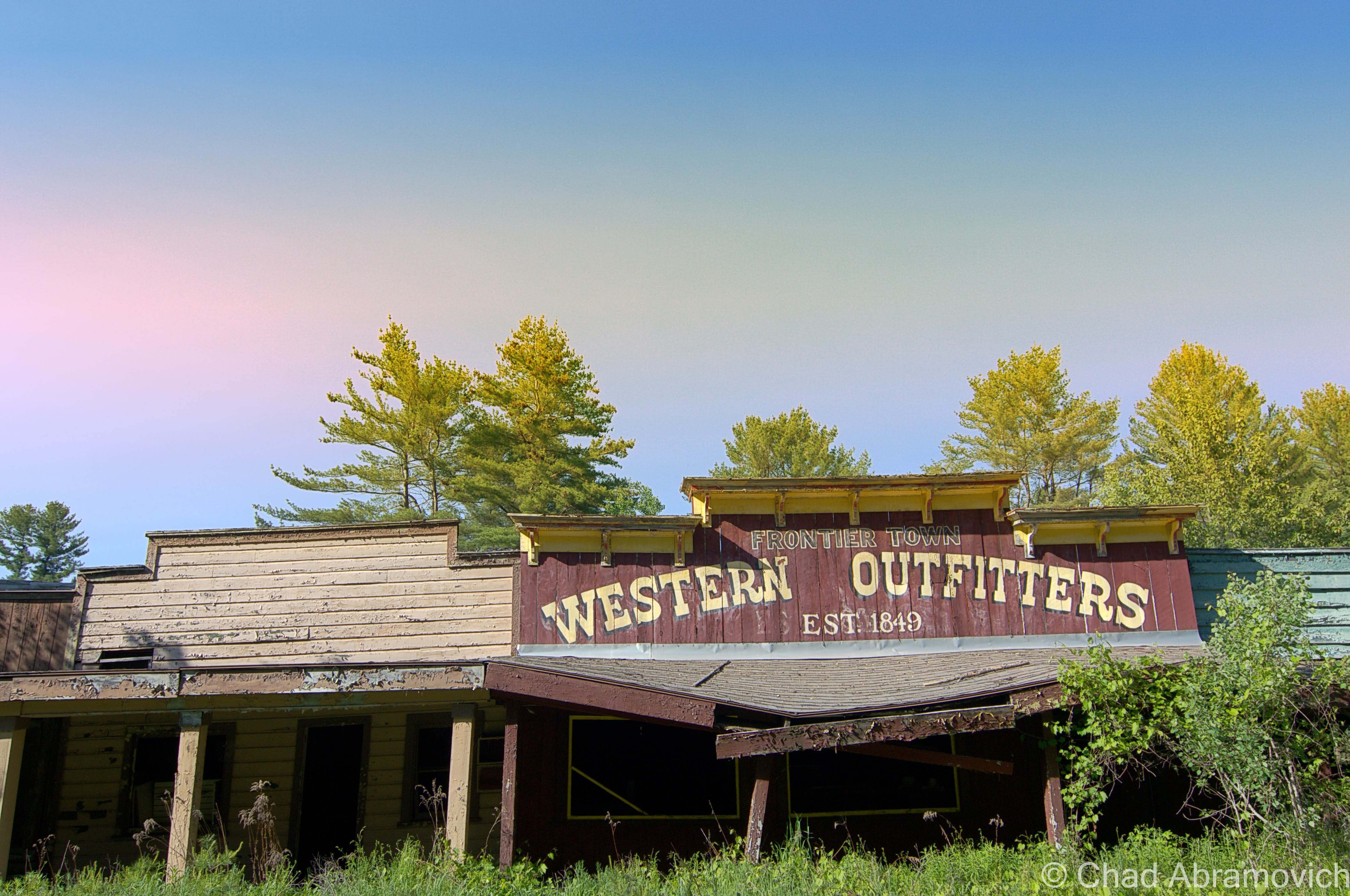
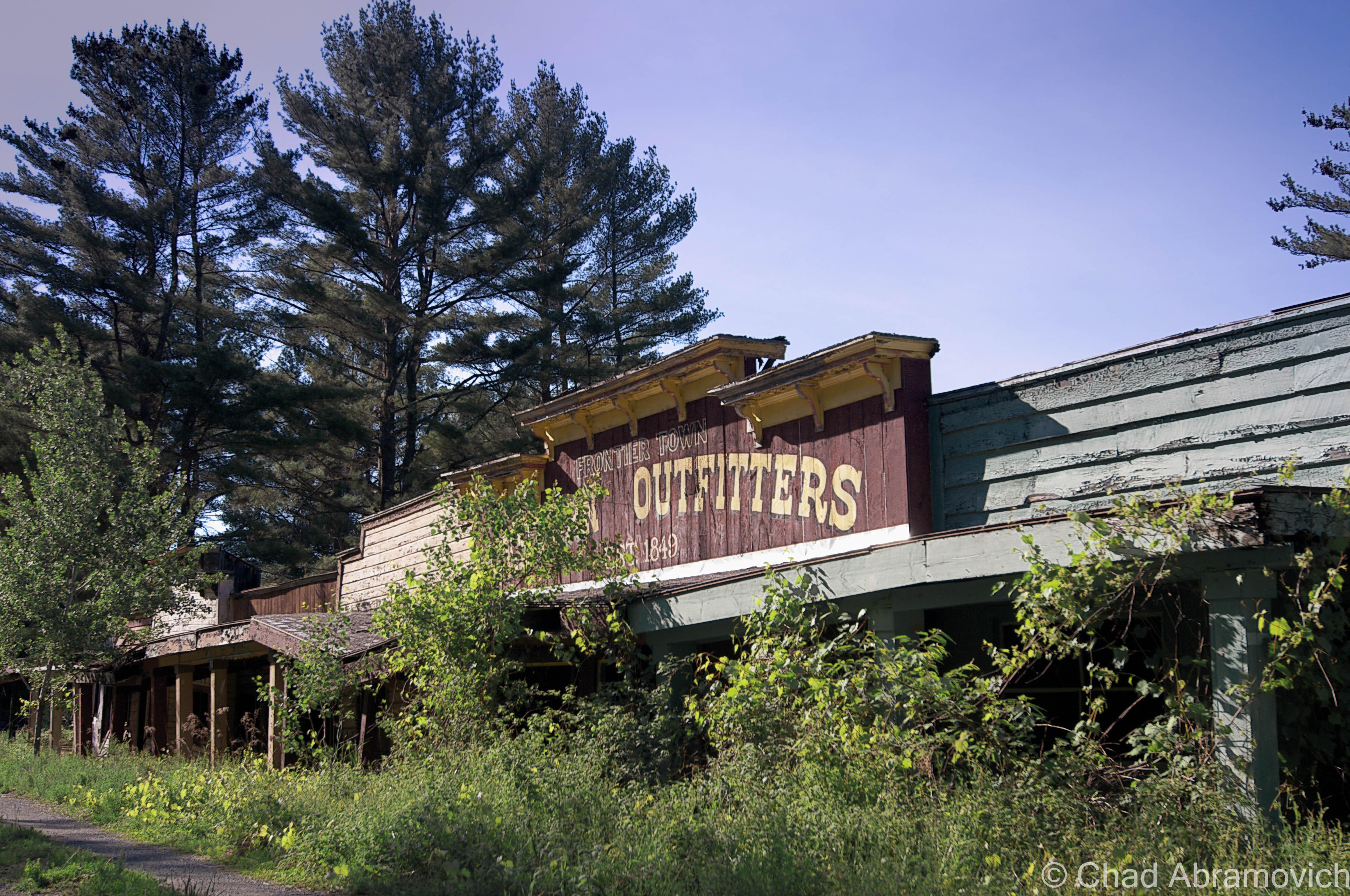
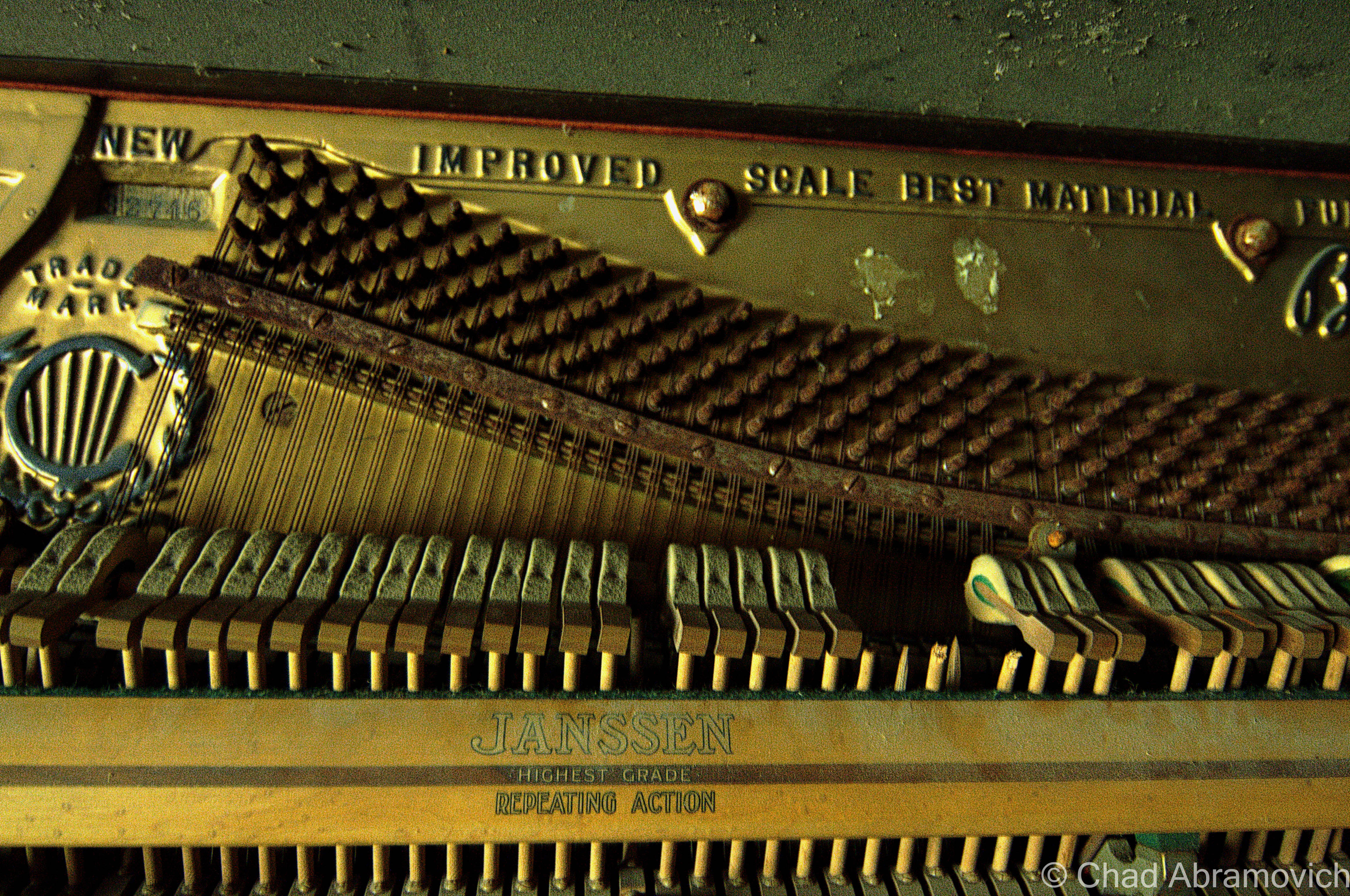
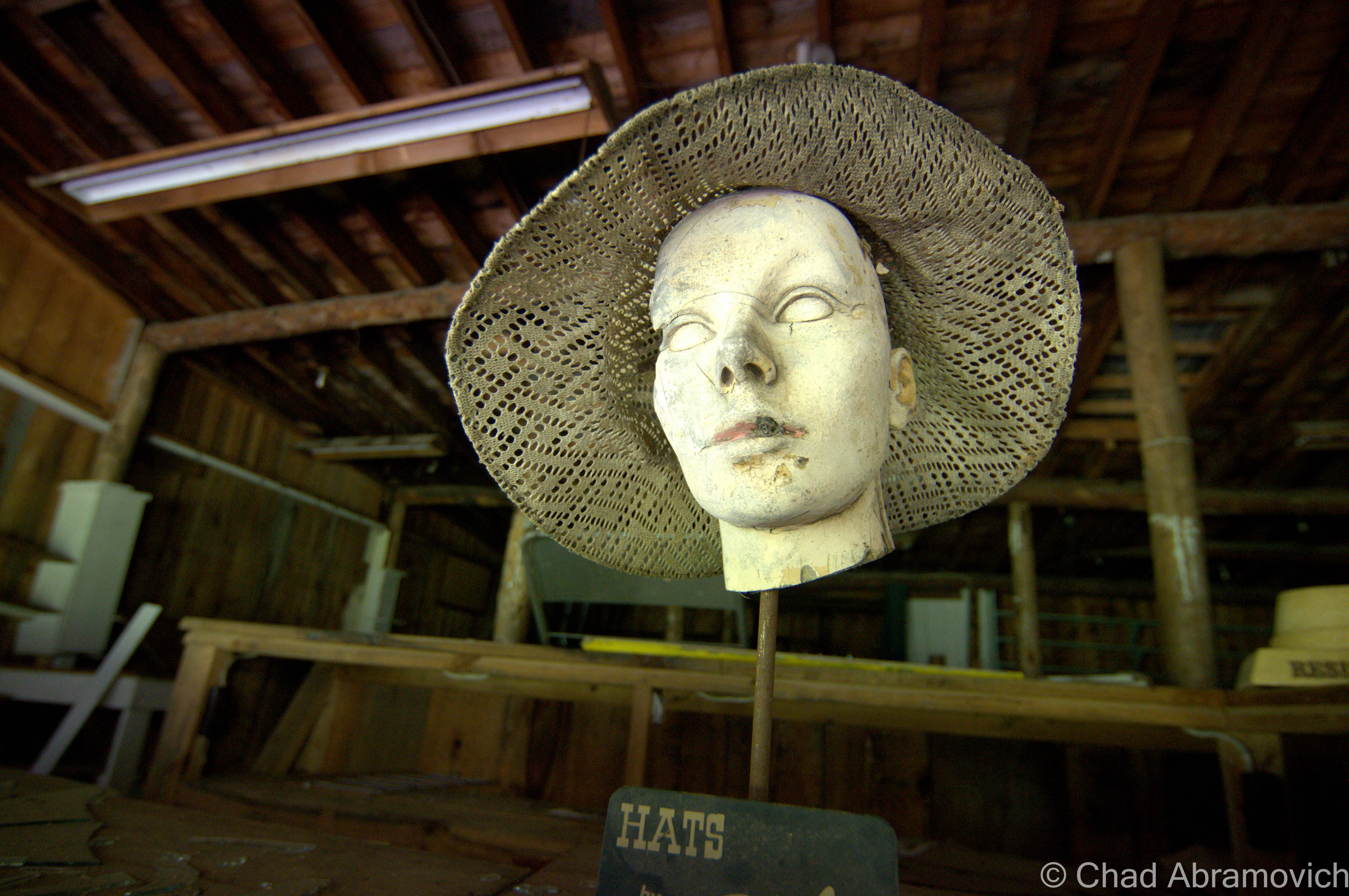
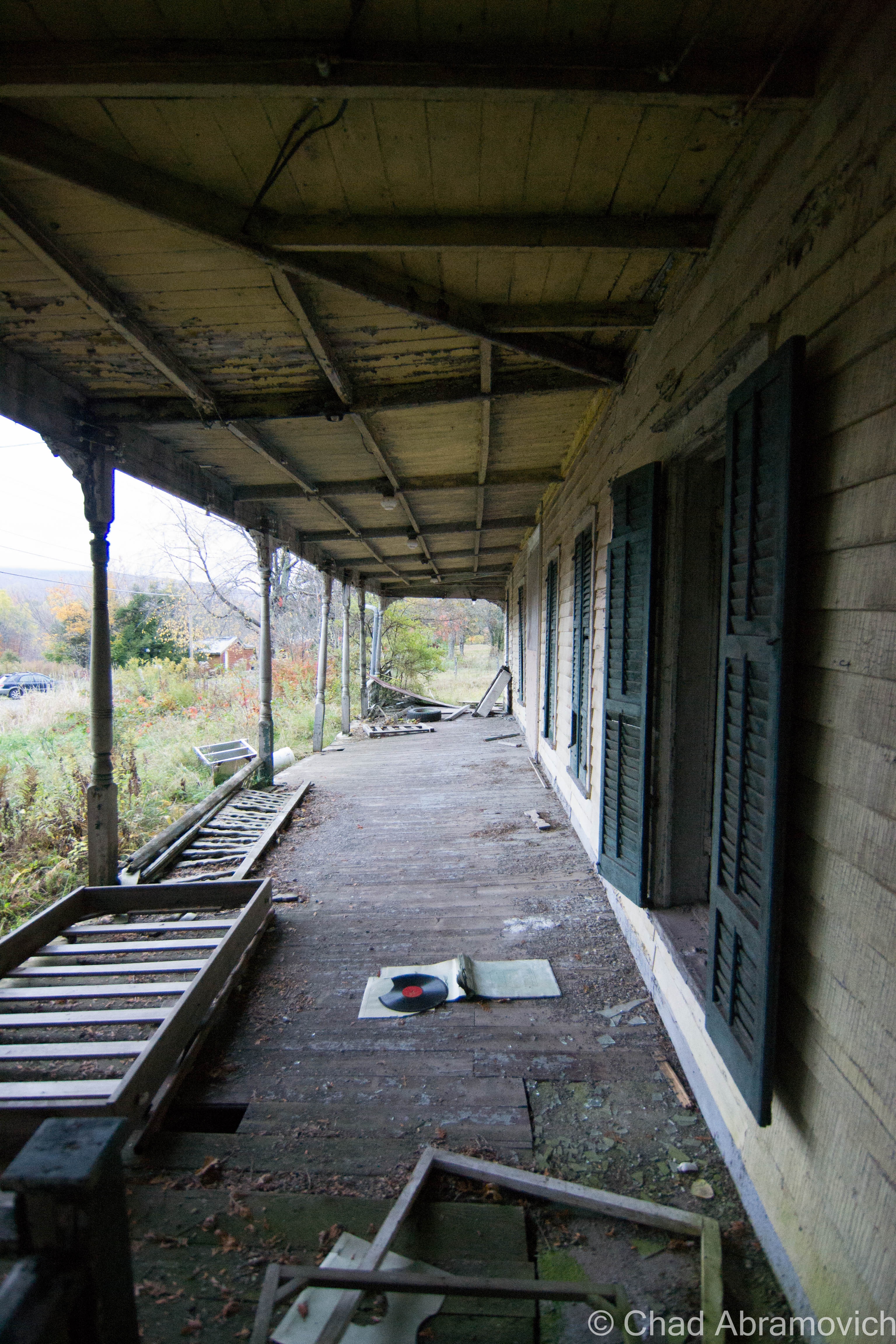
He soon constructed Prairie Junction to keep with his new theme, which was modeled after your trope-y Main Street of a dusty wild west town, and is one of the more interesting areas of the park ruins to photograph today. The low rise wooden buildings were all connected by a broad wooden porch, consisting of a saloon, music hall and a shop selling Western-themed souvenirs and clothing.

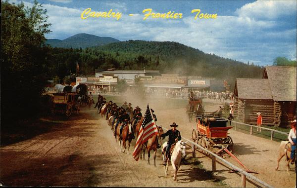
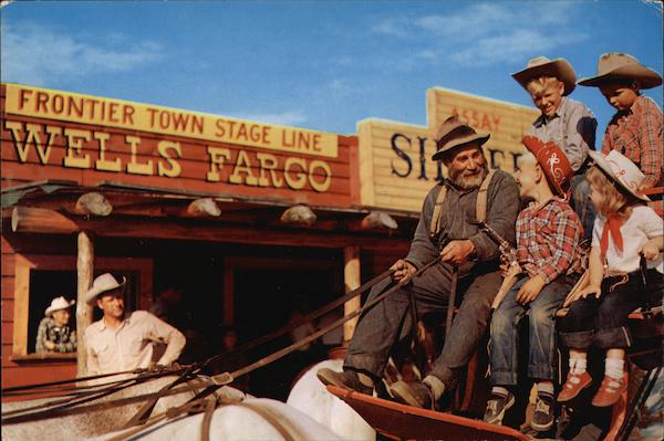
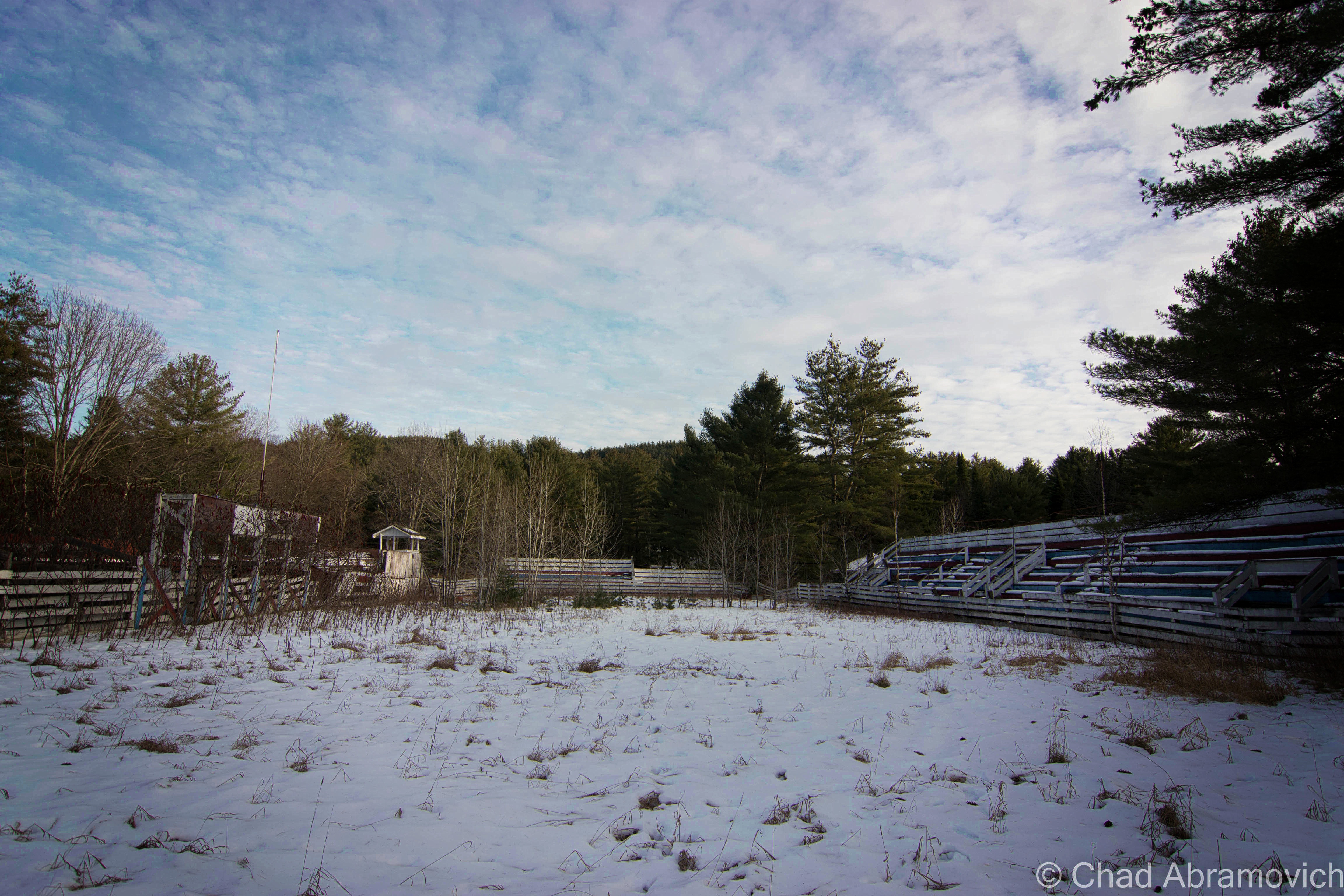
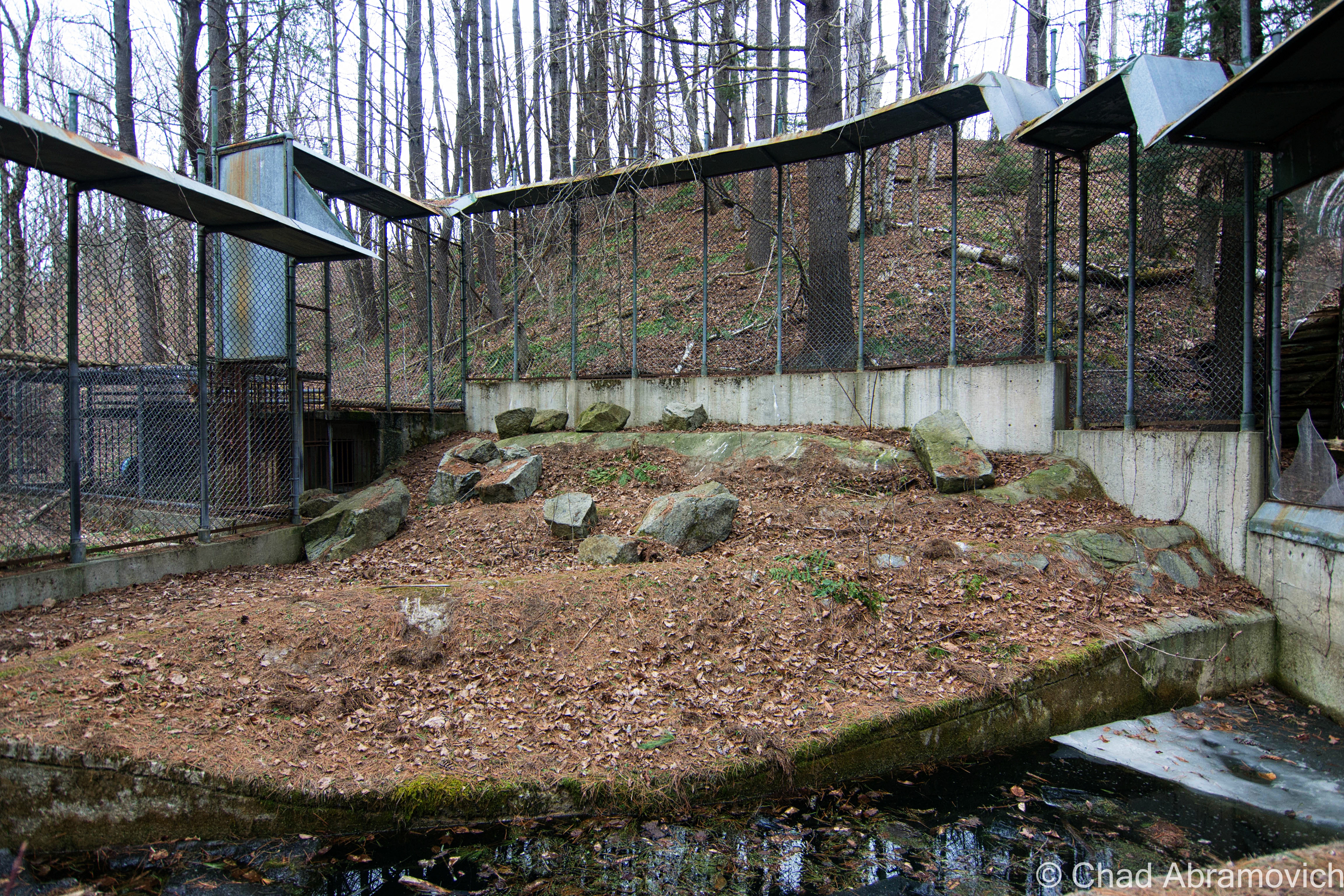
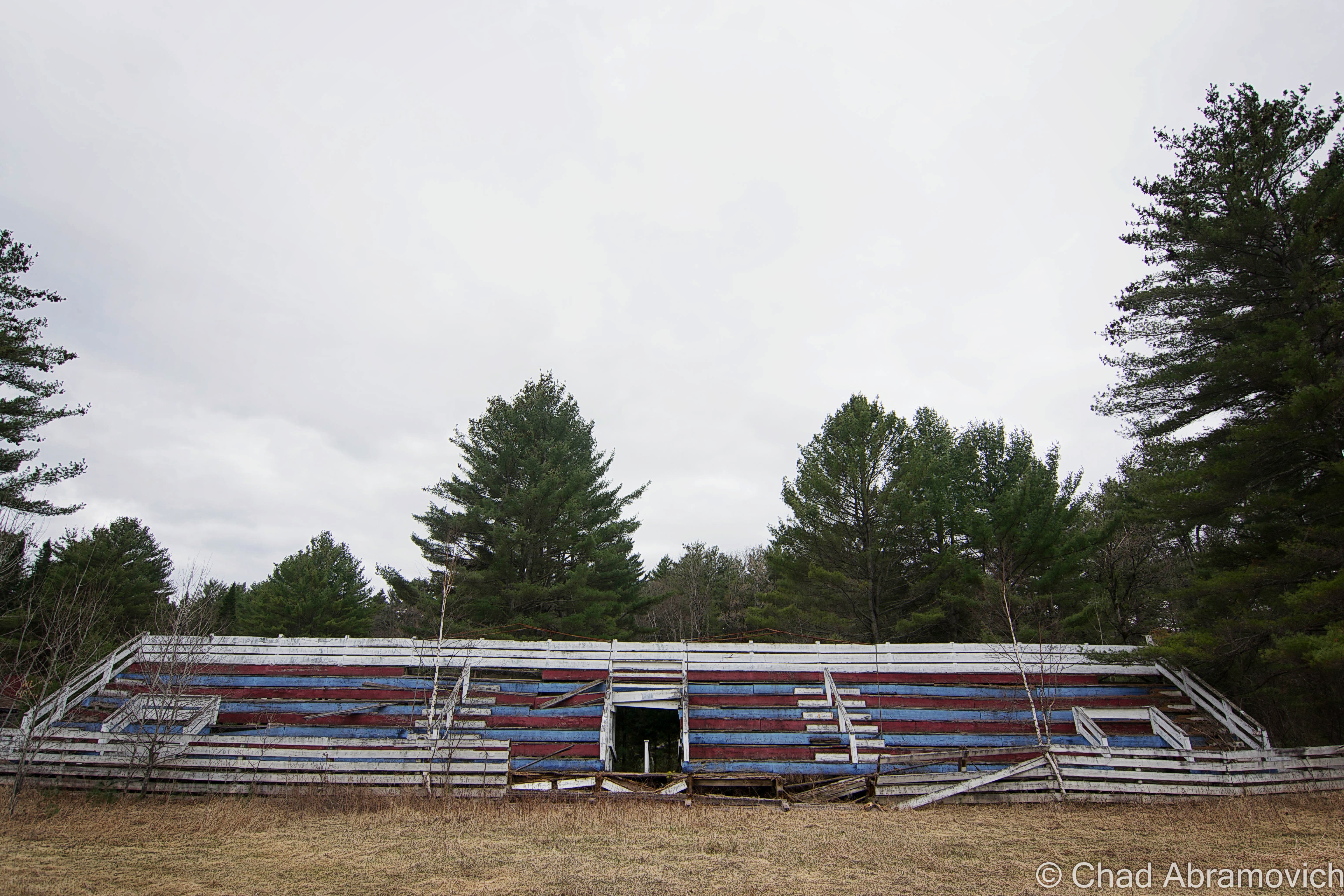
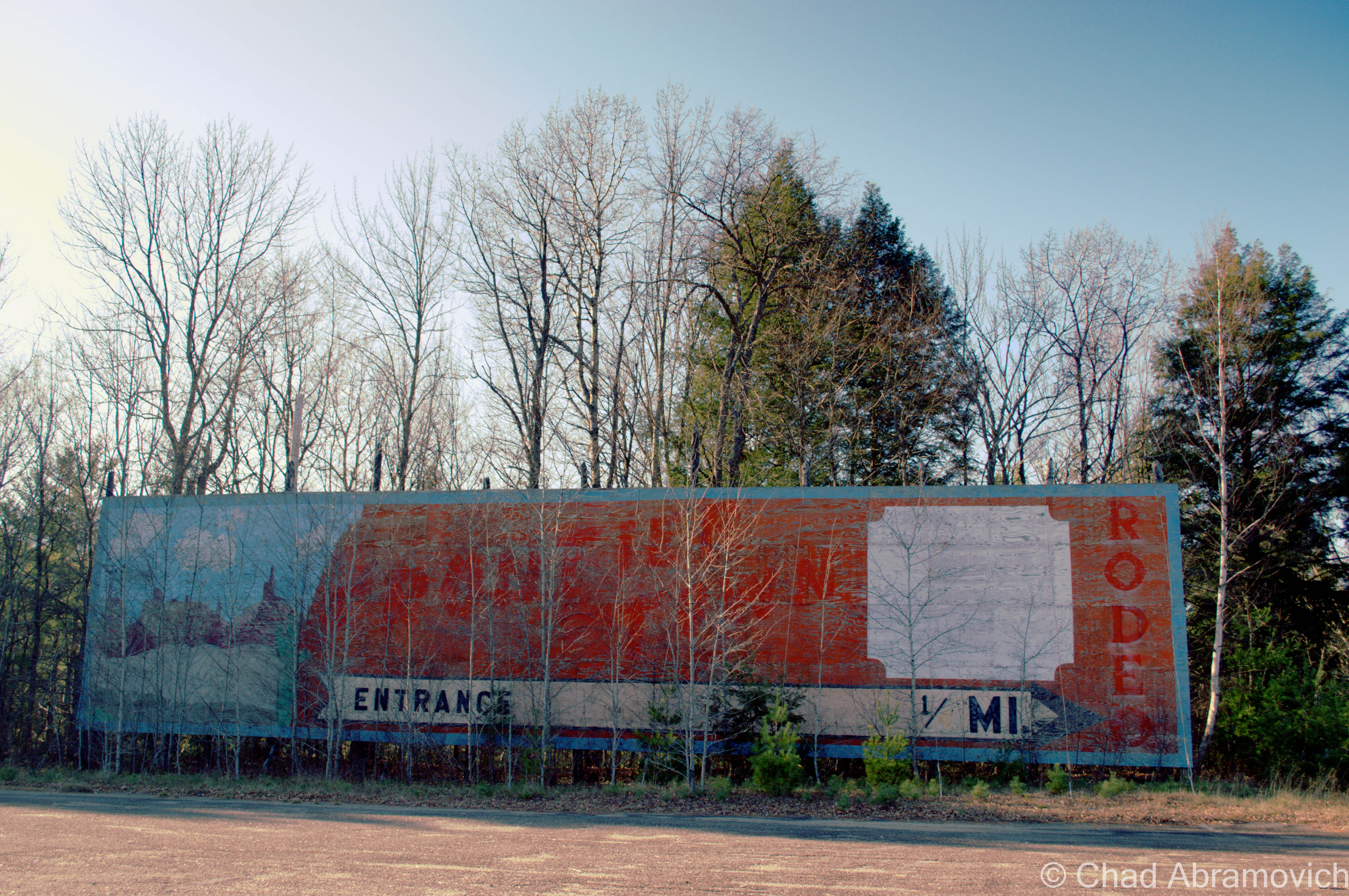
A rodeo area was built nearby, which held two of them a day would and even had shows that allowed children to participate. Stagecoaches, replica era steam trains, and covered wagons would all transport visitors around the park, and outlaws on horseback would “rob” the trains and engage in “shoot-outs”. And it was a huge success.

Frontier Town wasn’t just loved by the tourists and generations of wide-eyed kids who made memories there, it was also loved by the locals.

The park employed many Adirondack area teens, who spent their paychecks on college tuition. Many friendships and romances were also forged here, some which would last lifelong, and would later be recalled wistfully on Frontier Town message boards and fansites that pop up on Google searches about the place.

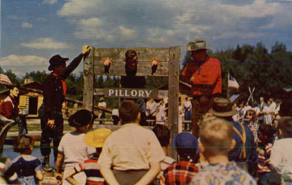
Employees wore period garb and would teach bemused sightseers how to do thematic daily tasks that our frontier predecessors did back in the day to survive. Stuff like churning butter, demonstrating how yarn was spun, or cook pea soup in an iron kettle over a fireplace, which was said to be a favorite of loggers in the Adirondacks.

Unfortunately, like real western frontier towns, New York’s Frontier Town would also go bust after it came to its peak popularity in the 1960s and 70s. The times were changing. The construction of the Adirondack Northway would lure traffic to bypass North Hudson and would make a large reduction in travel time. Now, sojourners no longer needed to depend on Route 9 to get to the Adirondacks from New York City and any point in-between.

Some speculate that the park really declined when a new transgressive era ushered in parents becoming uneasy with their kids playing with guns, which was more acceptable when Westerns were all the craze on TV and the silver screen.

As one Frontier Town enthusiast wrote on a comment thread; “Cowboys and Indians were big time. Every kid had a gun and a cowboy hat”. Others blame broader travel opportunities that came with the construction of interstate highways and air travel, making places like Frontier Town obsolete.

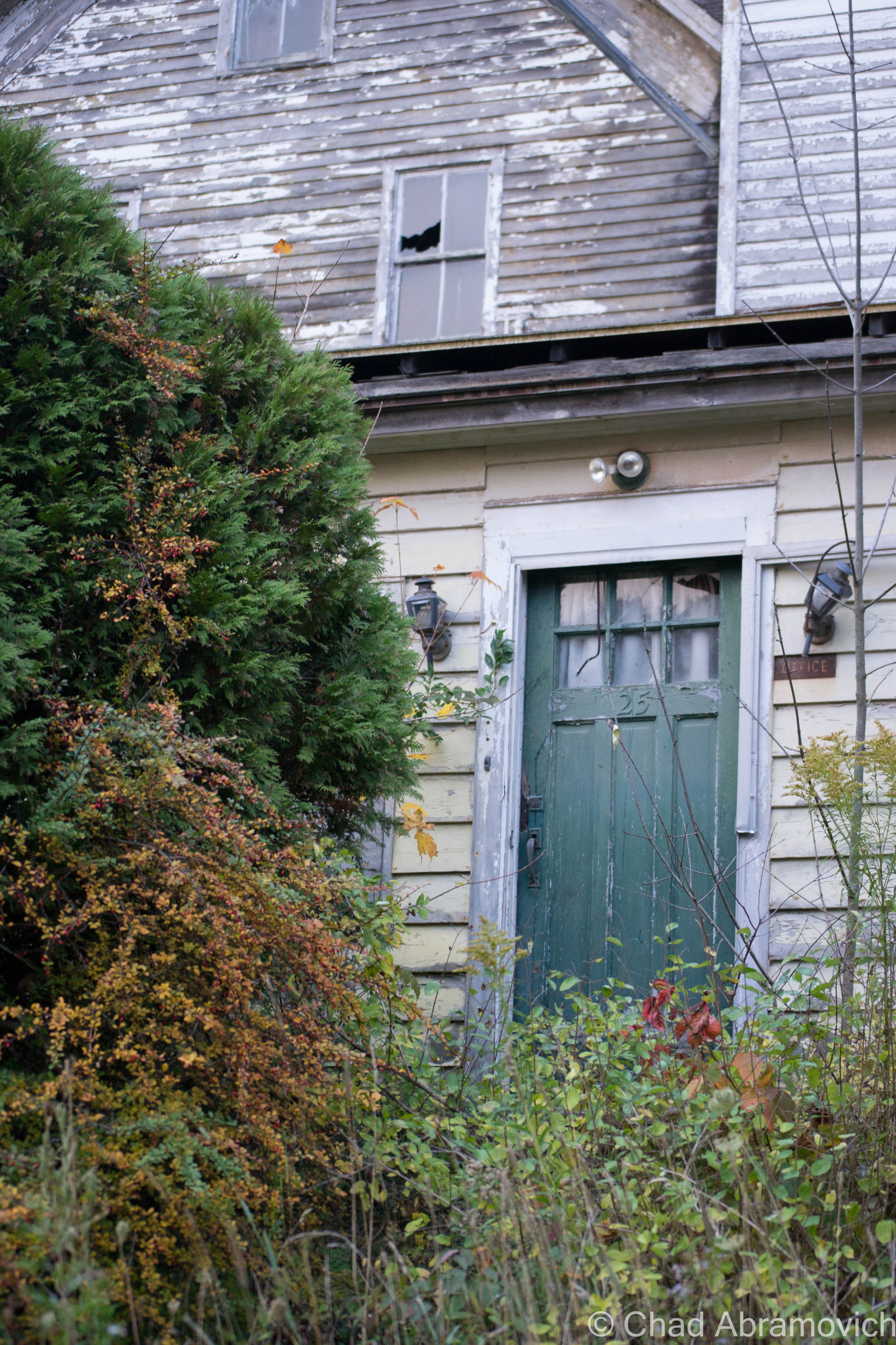
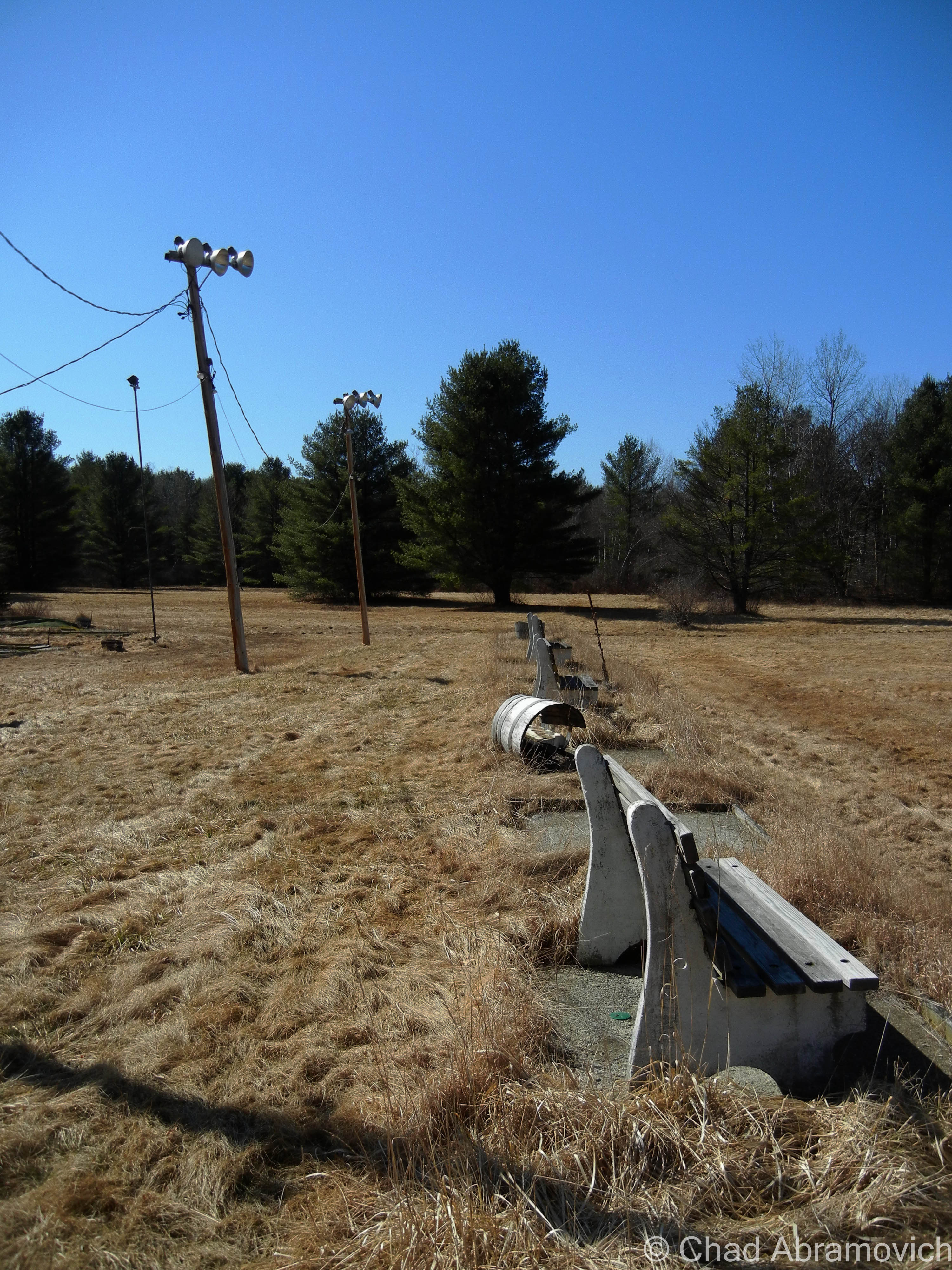
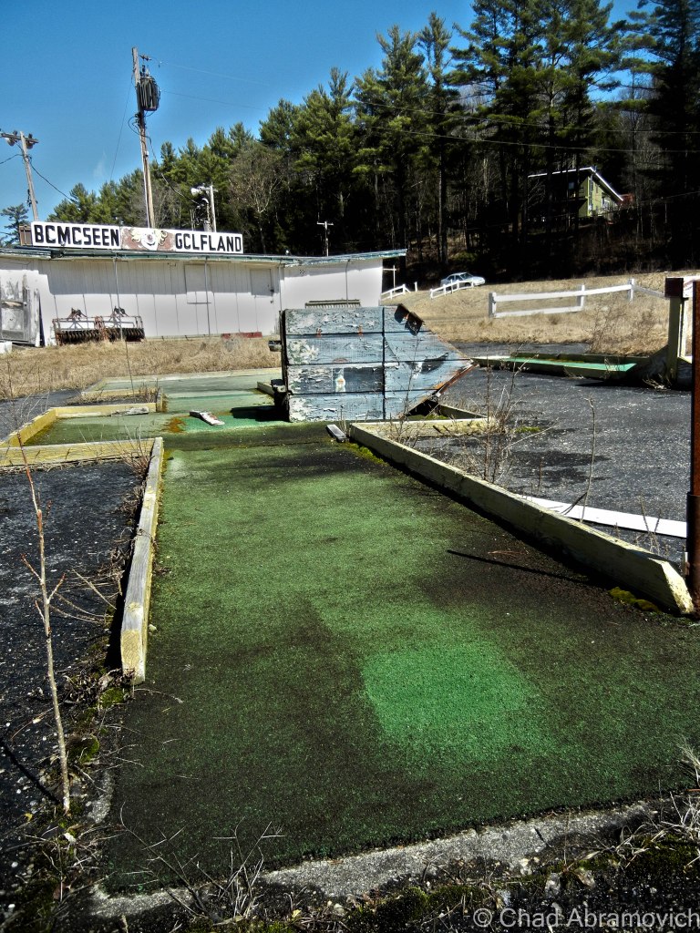
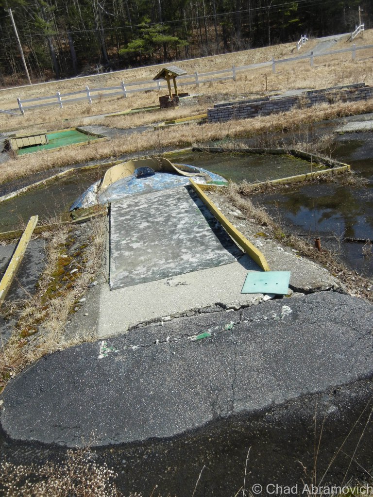
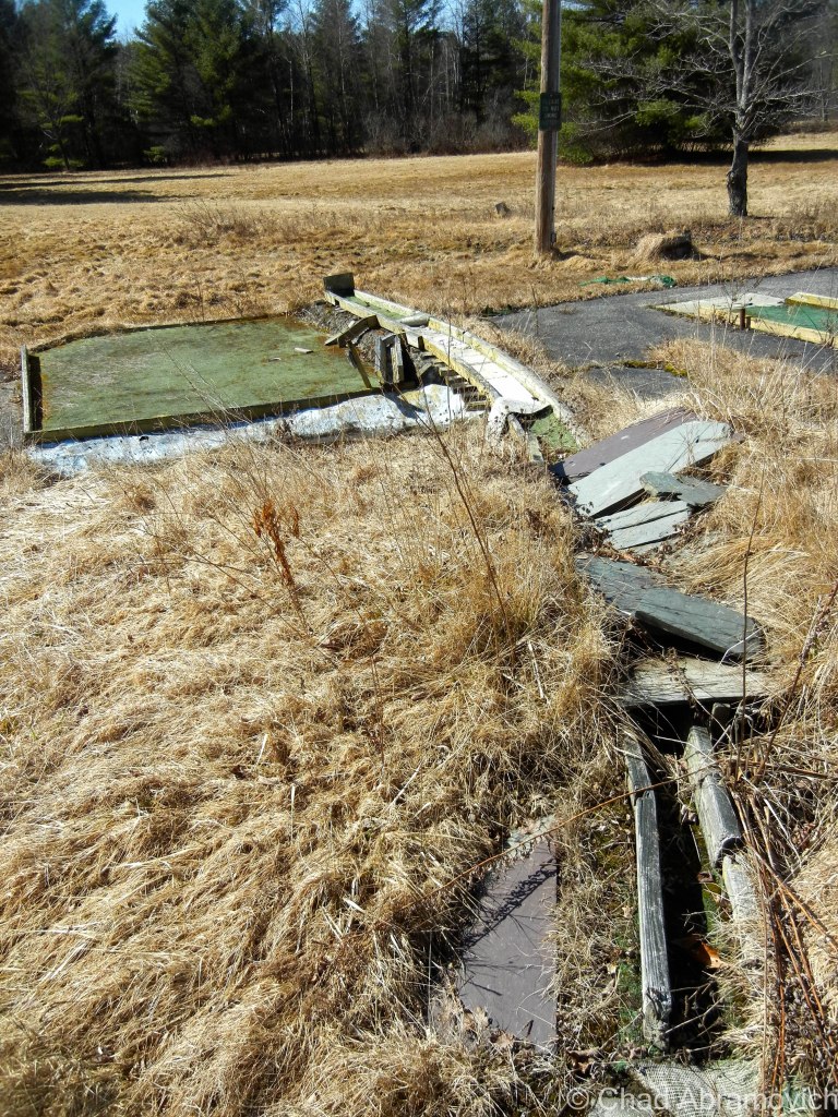
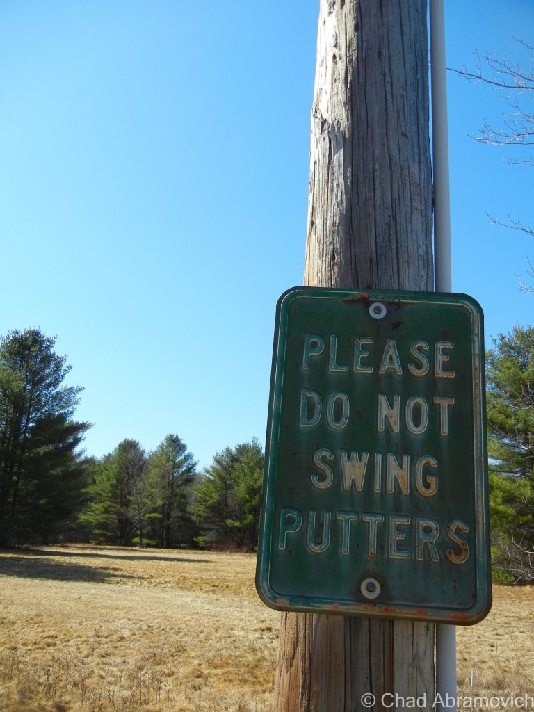
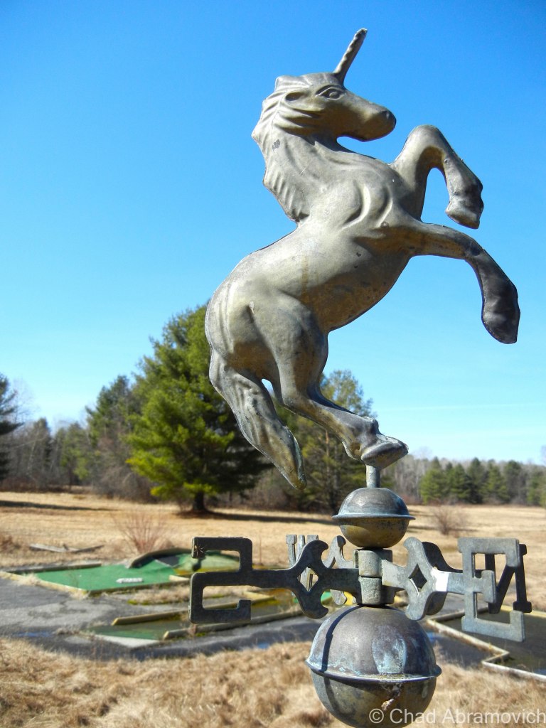
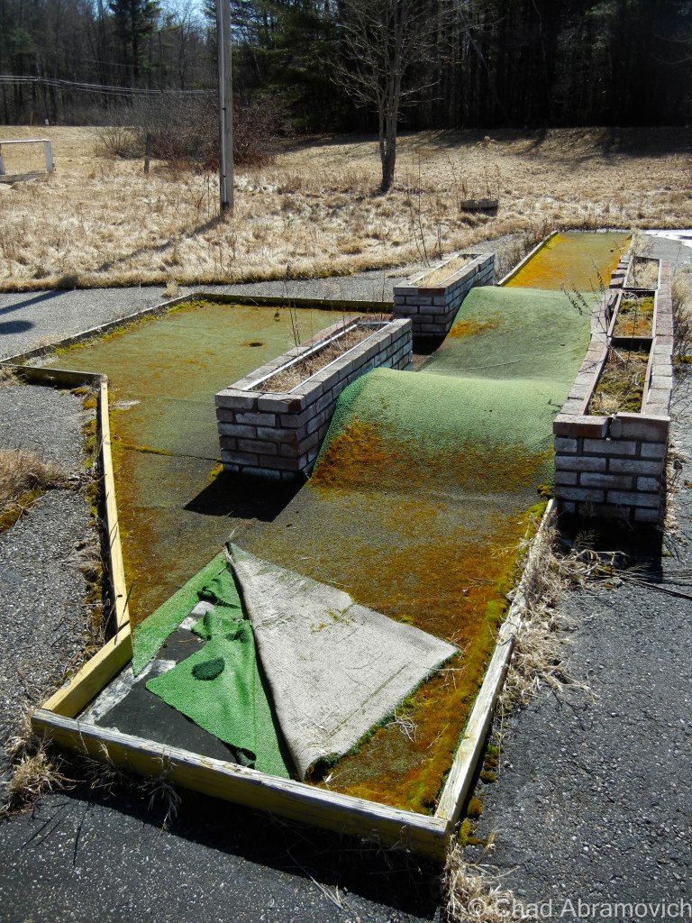
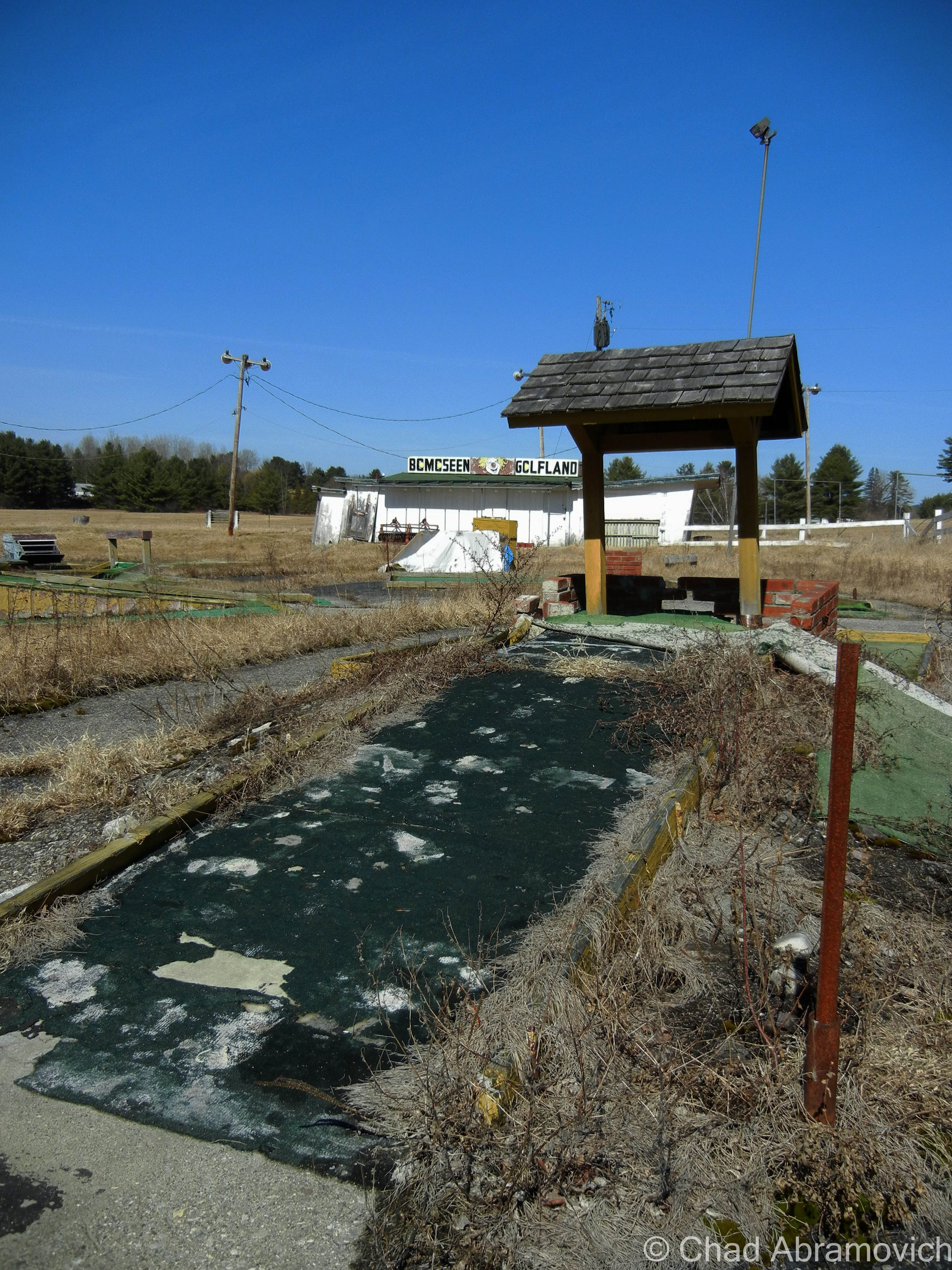
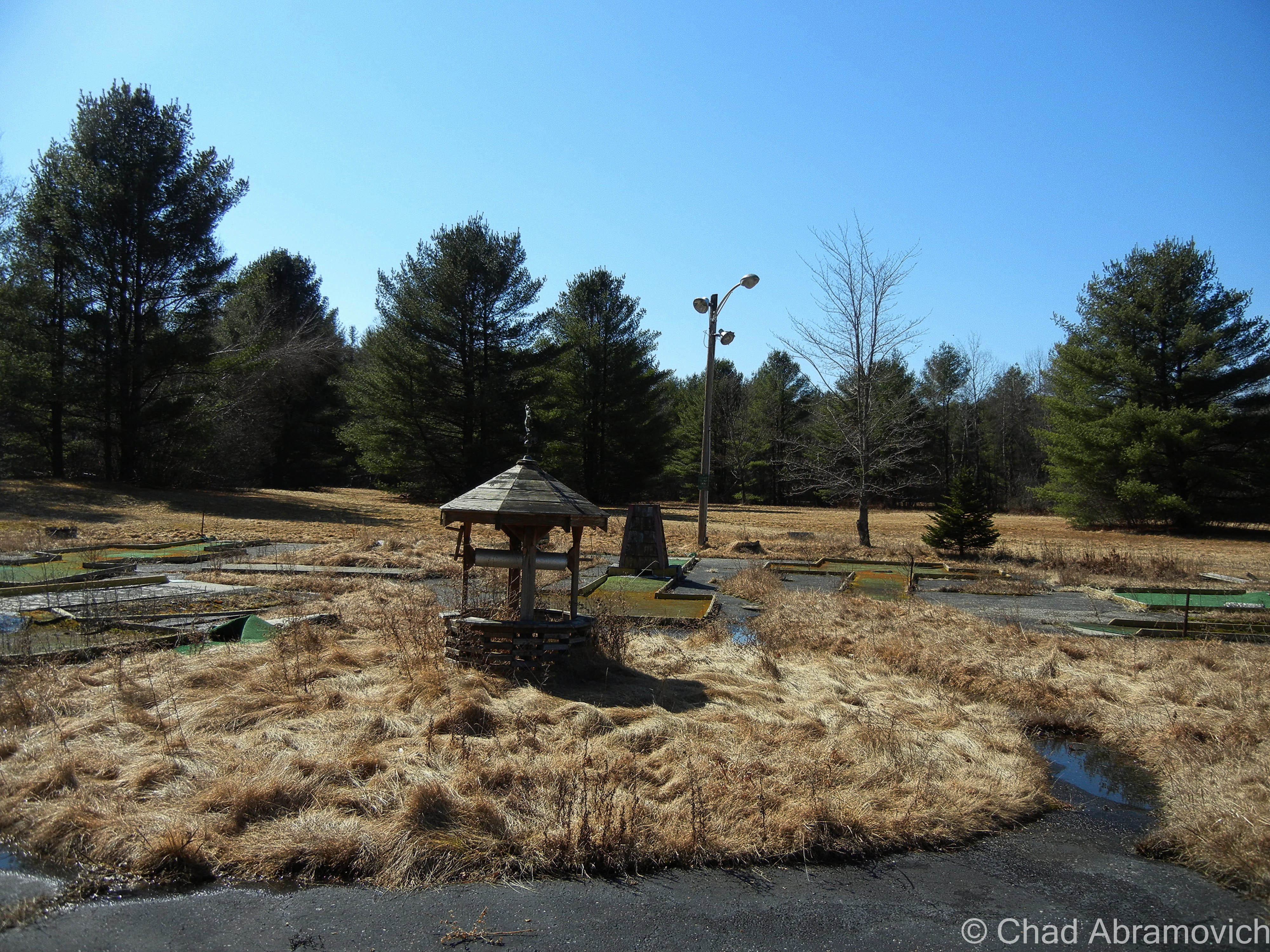
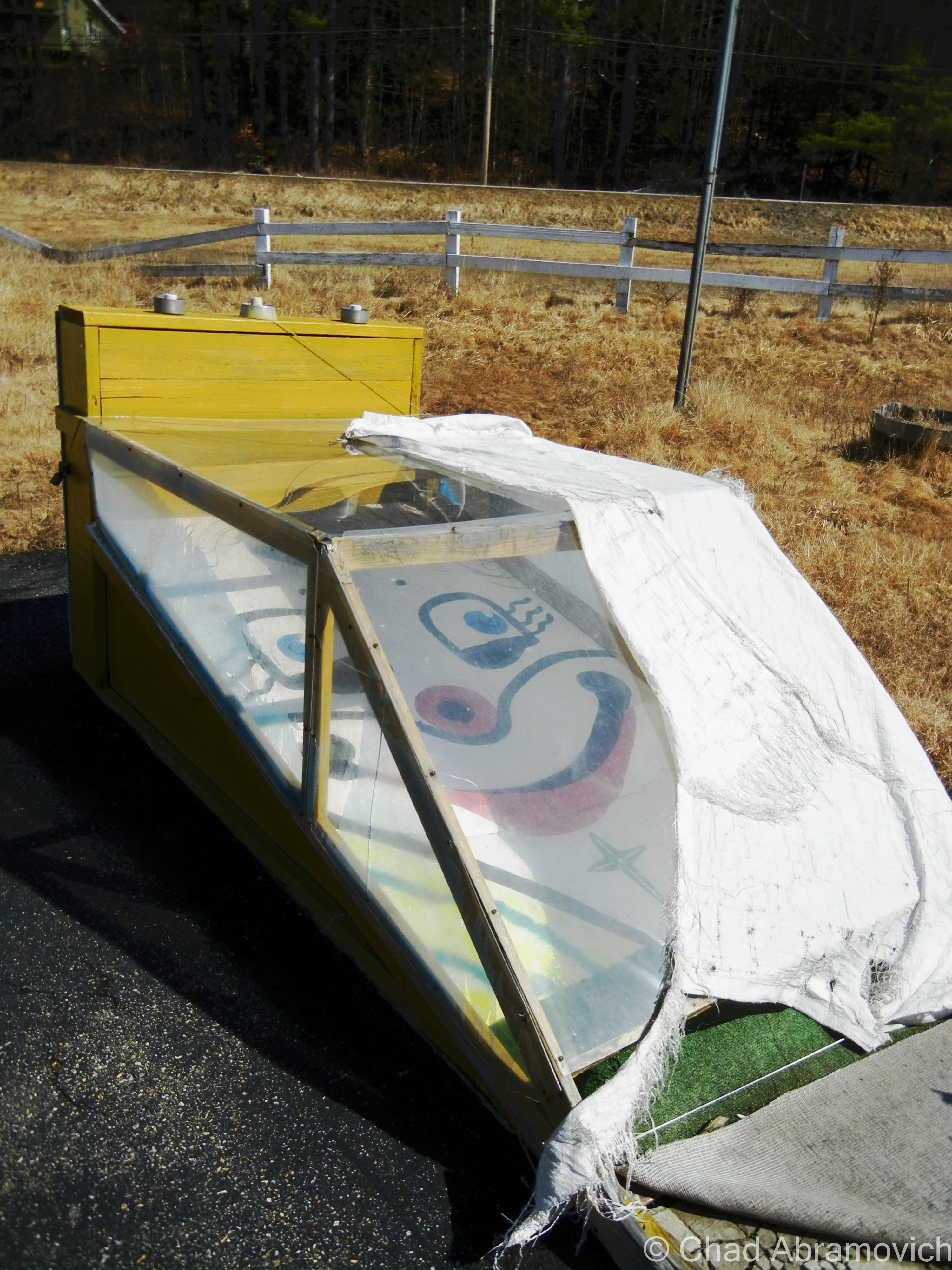
In 1983, a tired Art Benson sold Frontier Town to another development firm, and would pass away 5 years later. The park was closed until 1989, re-opening with additions, such as a miniature golf course. But it was a short rejuvenation, and in 1998, Frontier Town closed for good due to failing finances and weak attendance.

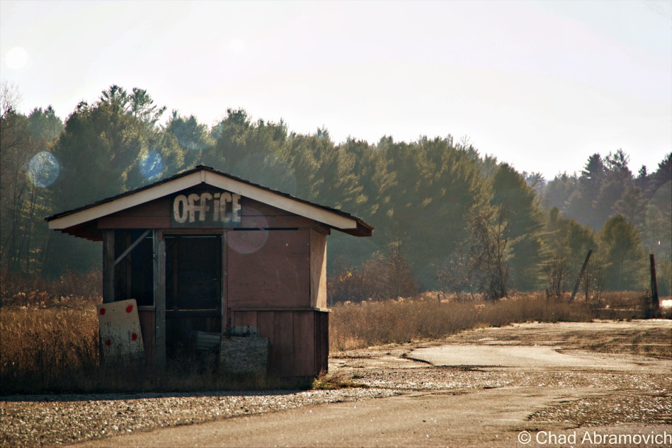
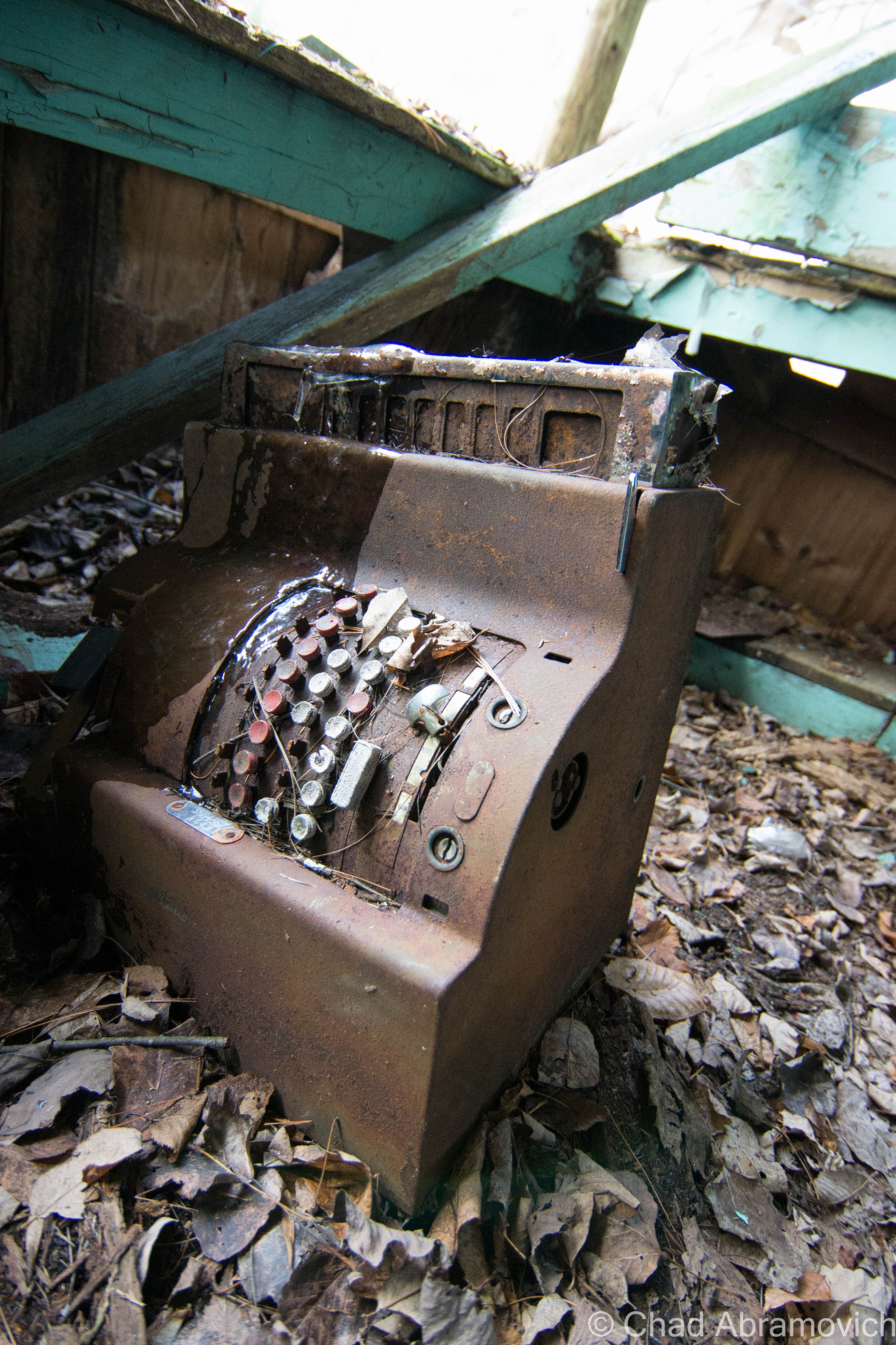
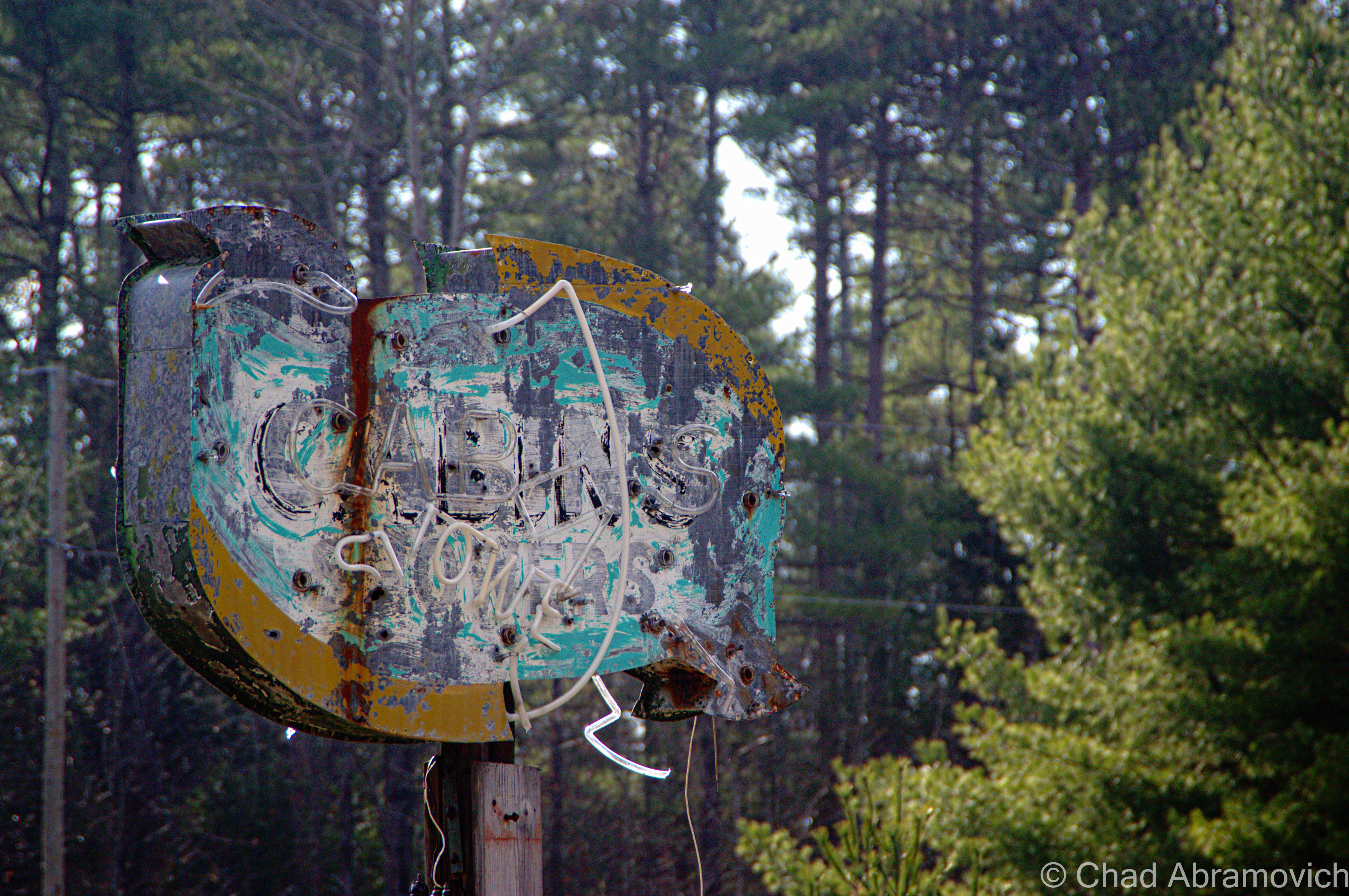
The property was seized in August 2004 by the county for past-due property taxes. The stagecoaches, trains, buggies and the tracks were all scrapped and sold, as well as other paraphernalia. Collectors can still find mementos at Gokey’s Trading Post just down the road, which is where a lot of Frontier Town relics ended up during the massive auction after the park’s closing and appears to be one of the few remaining businesses in town.

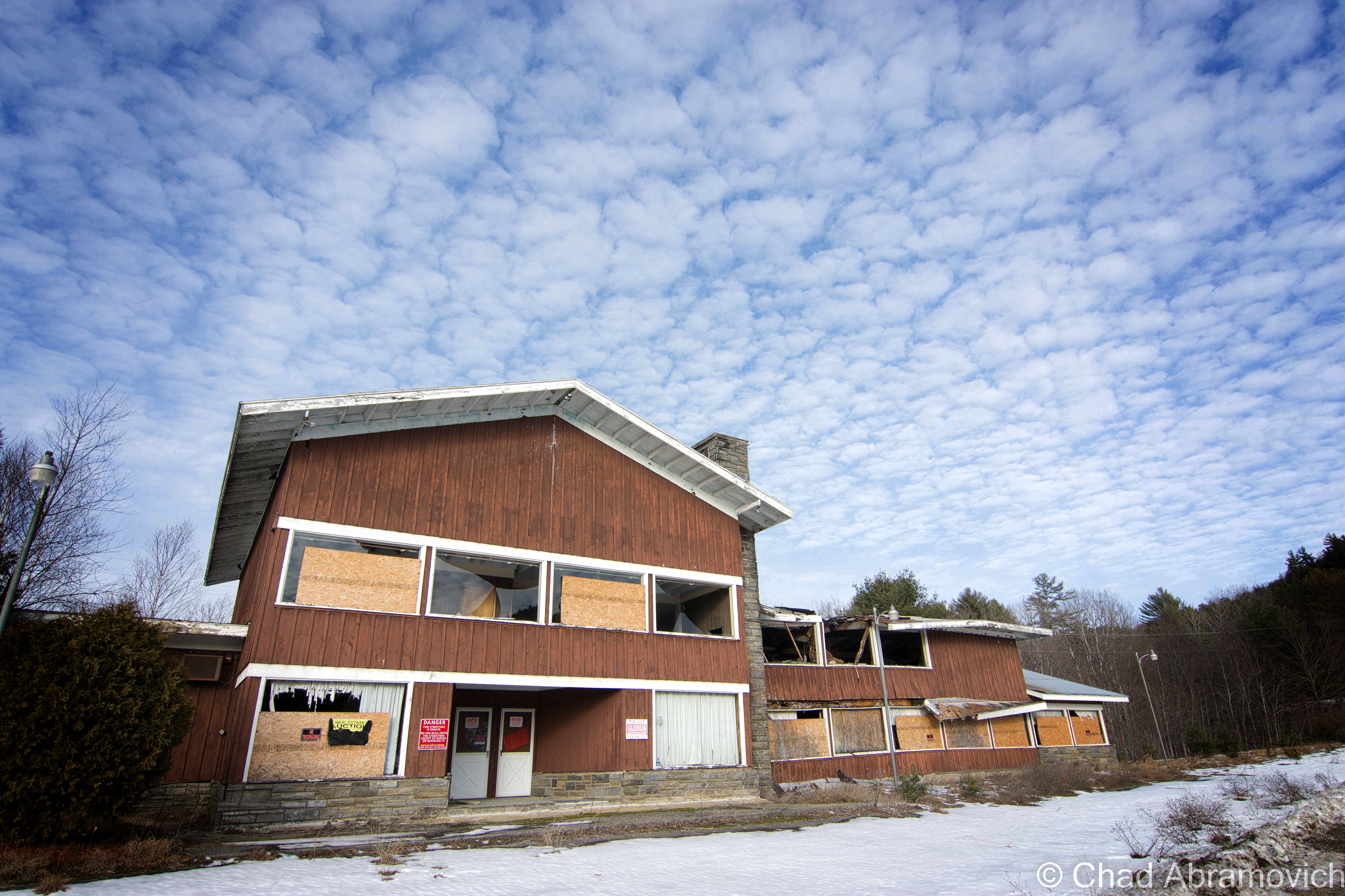
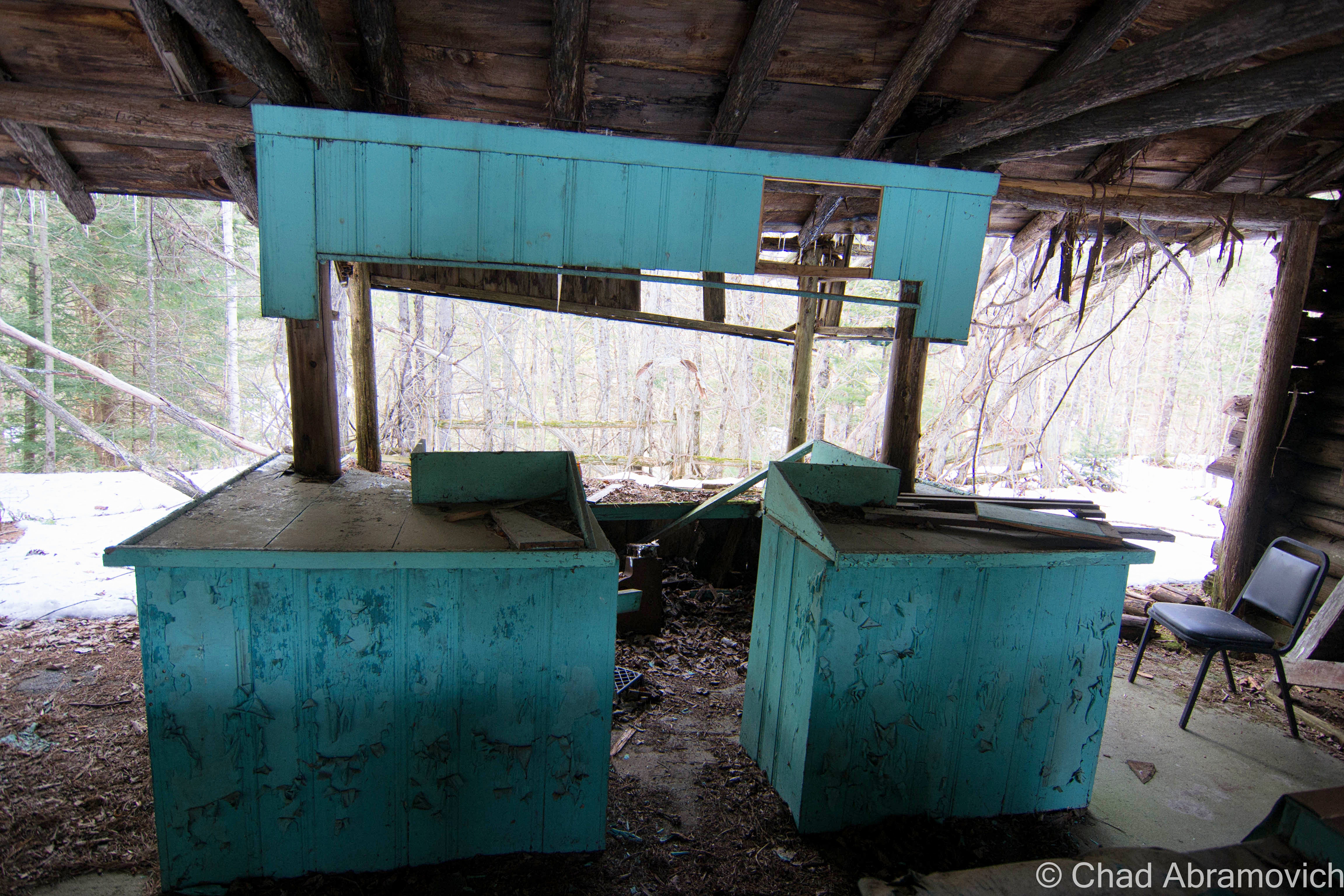
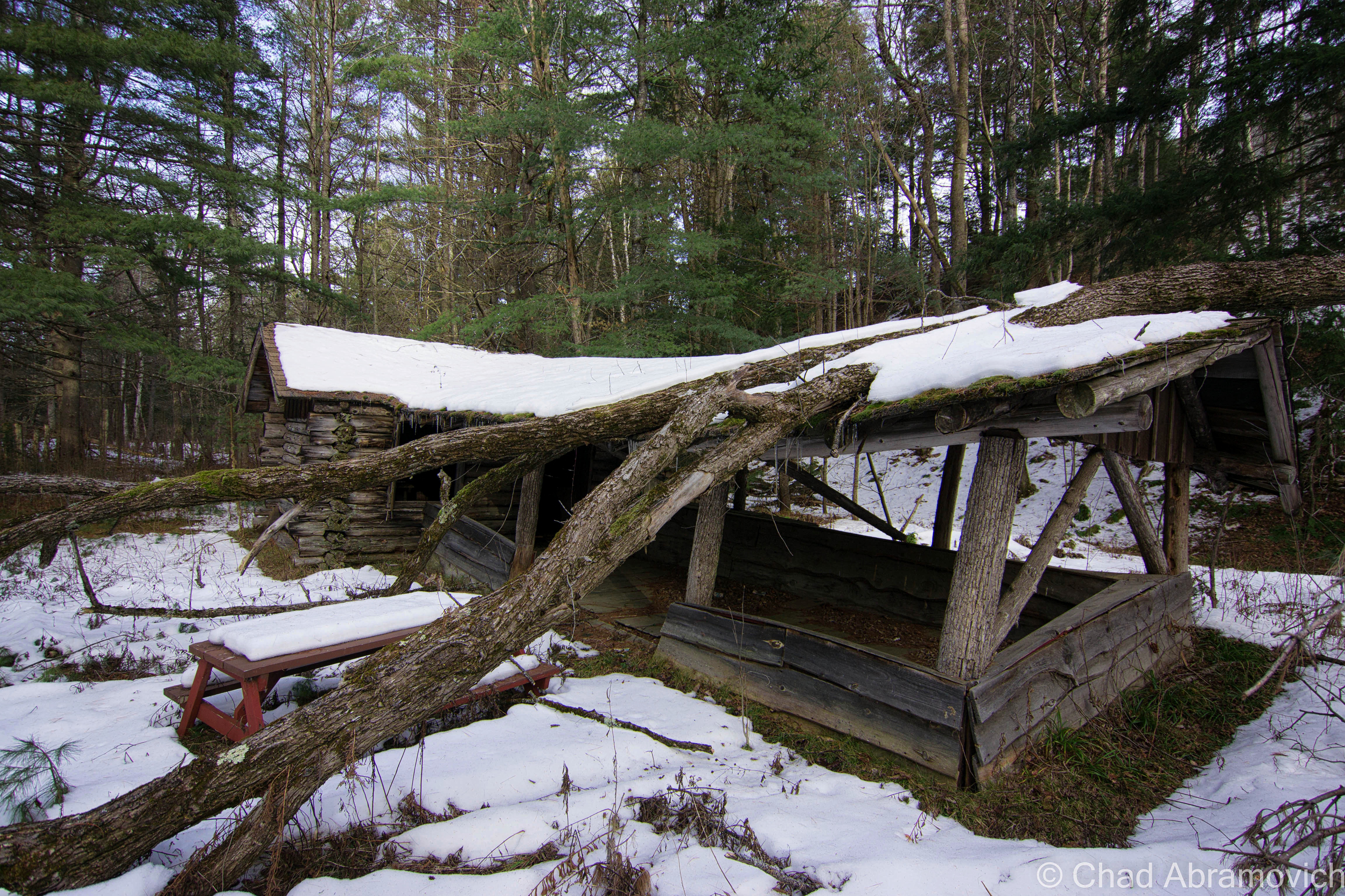
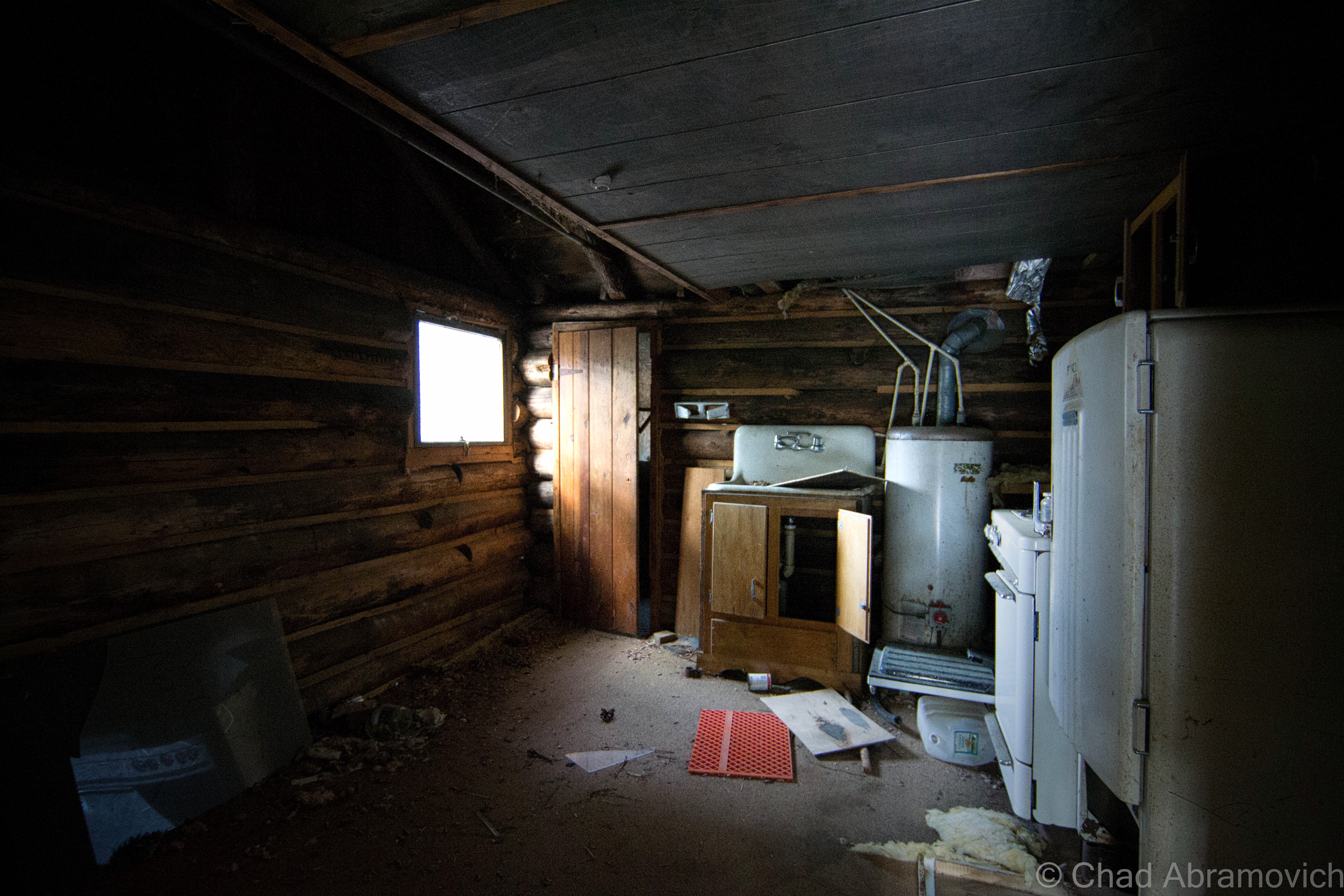
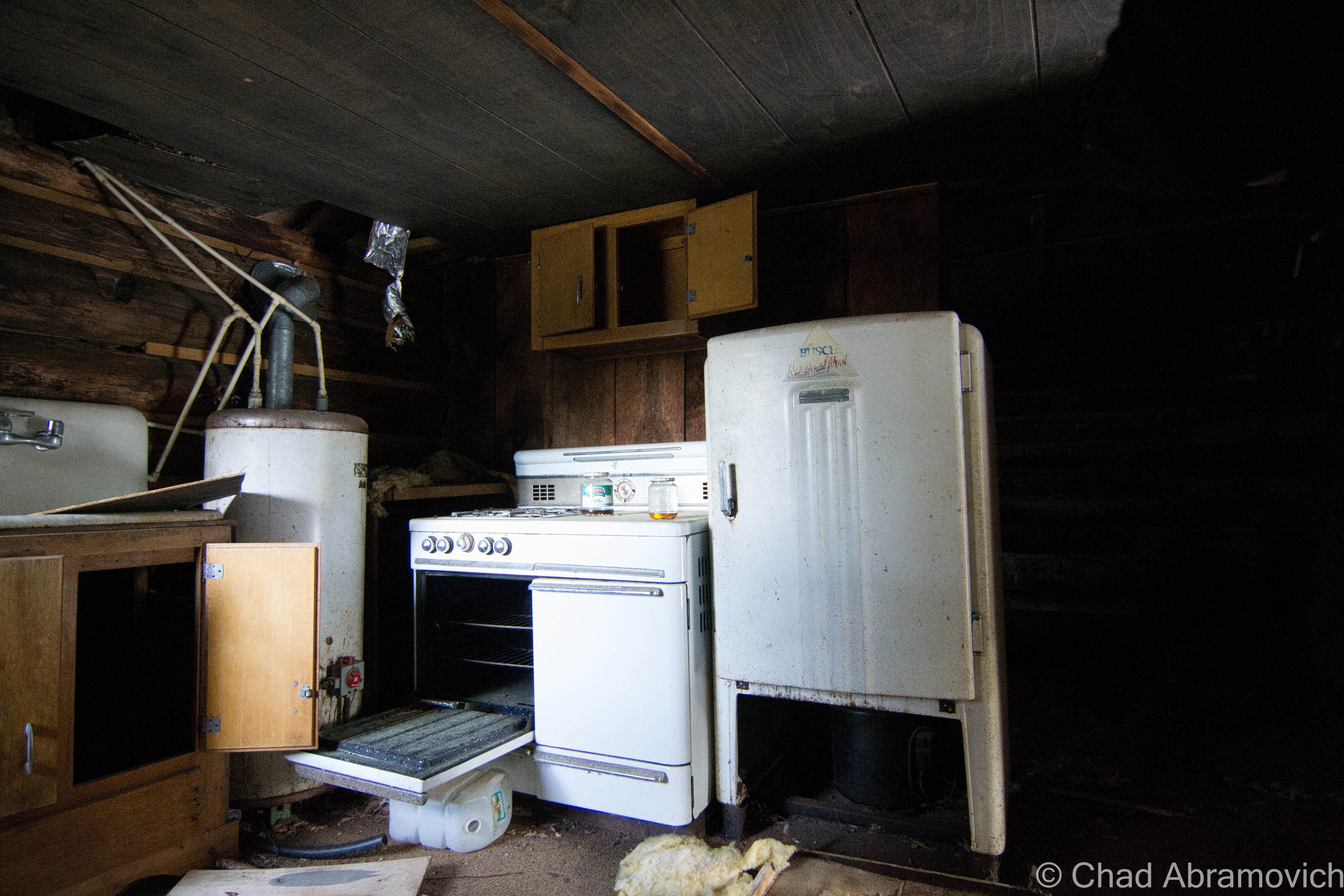
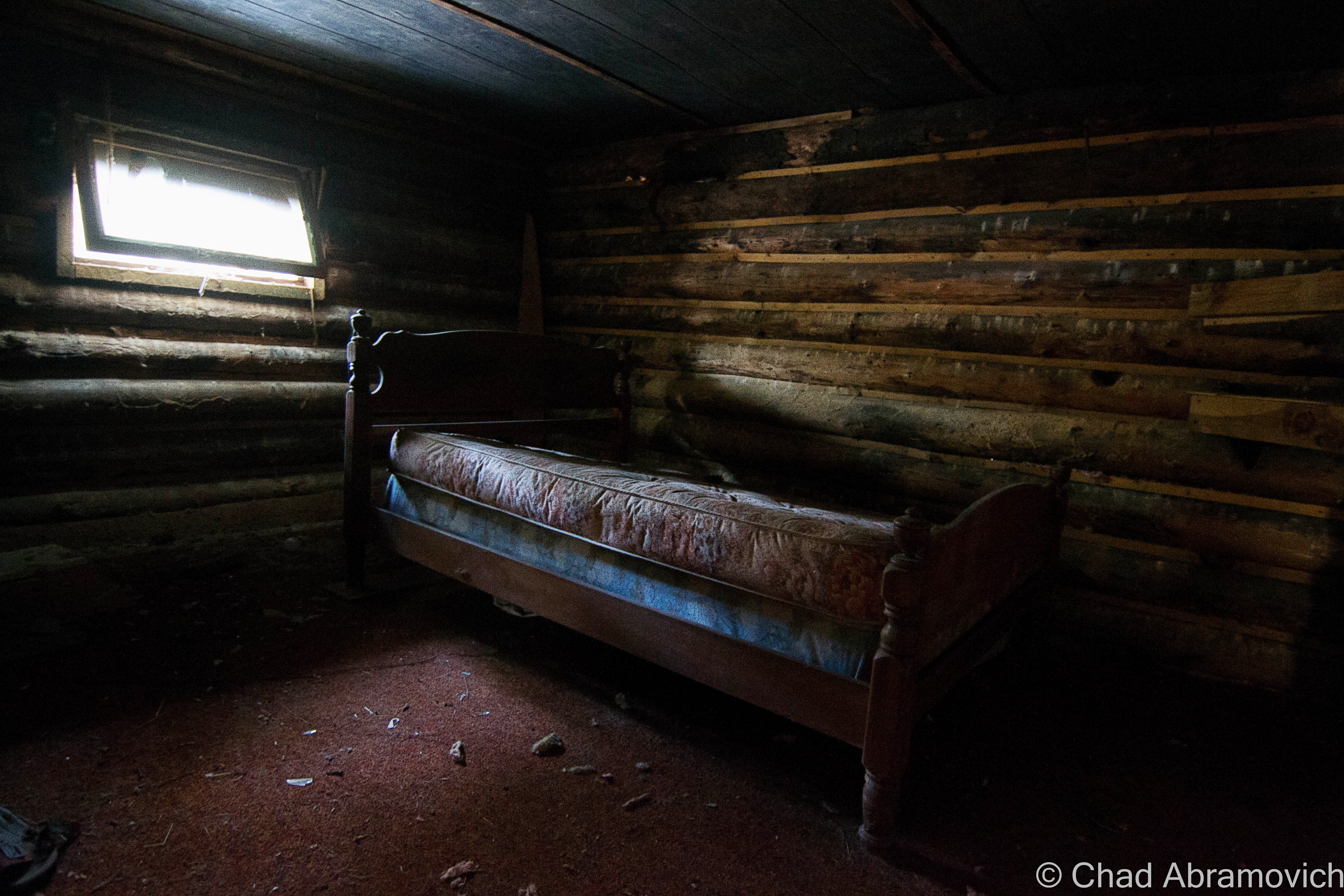
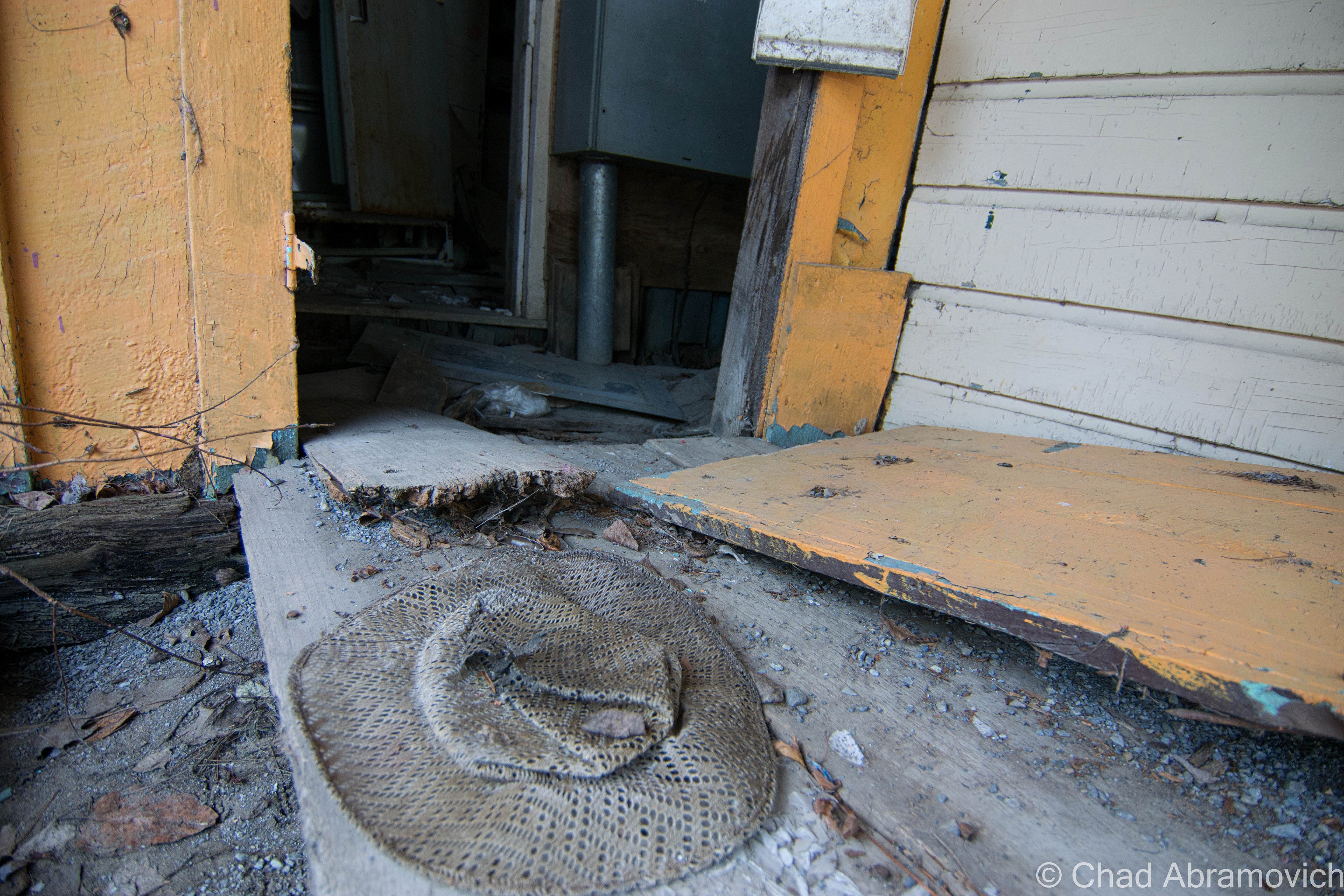
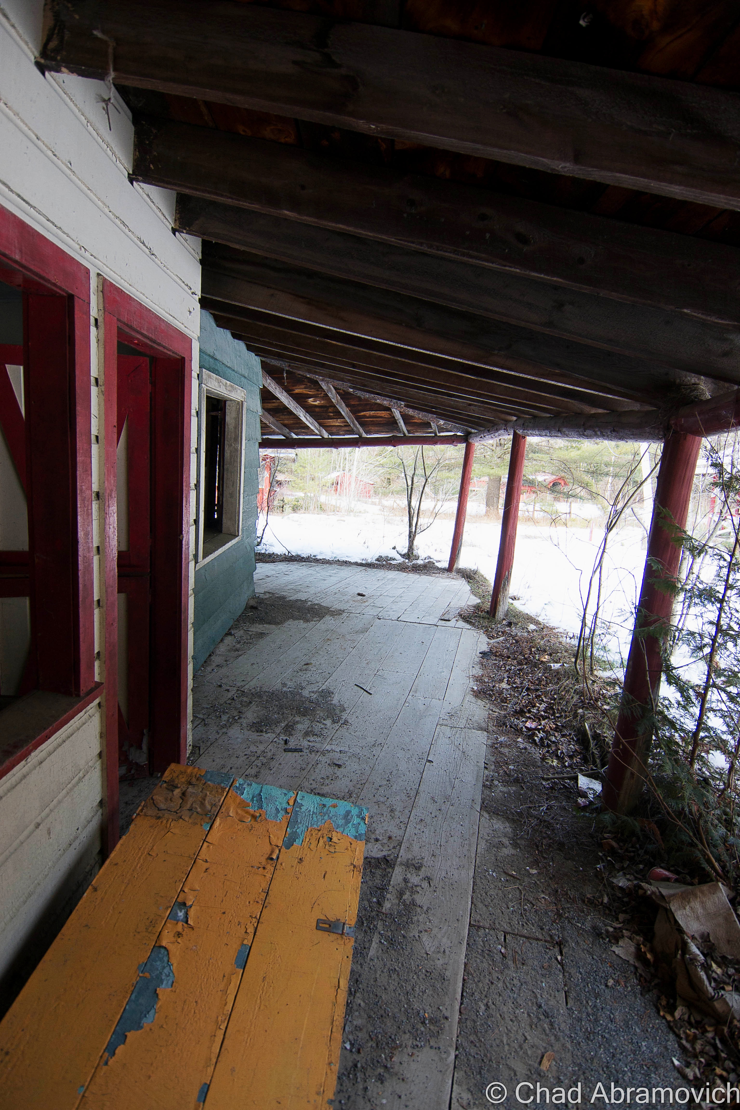
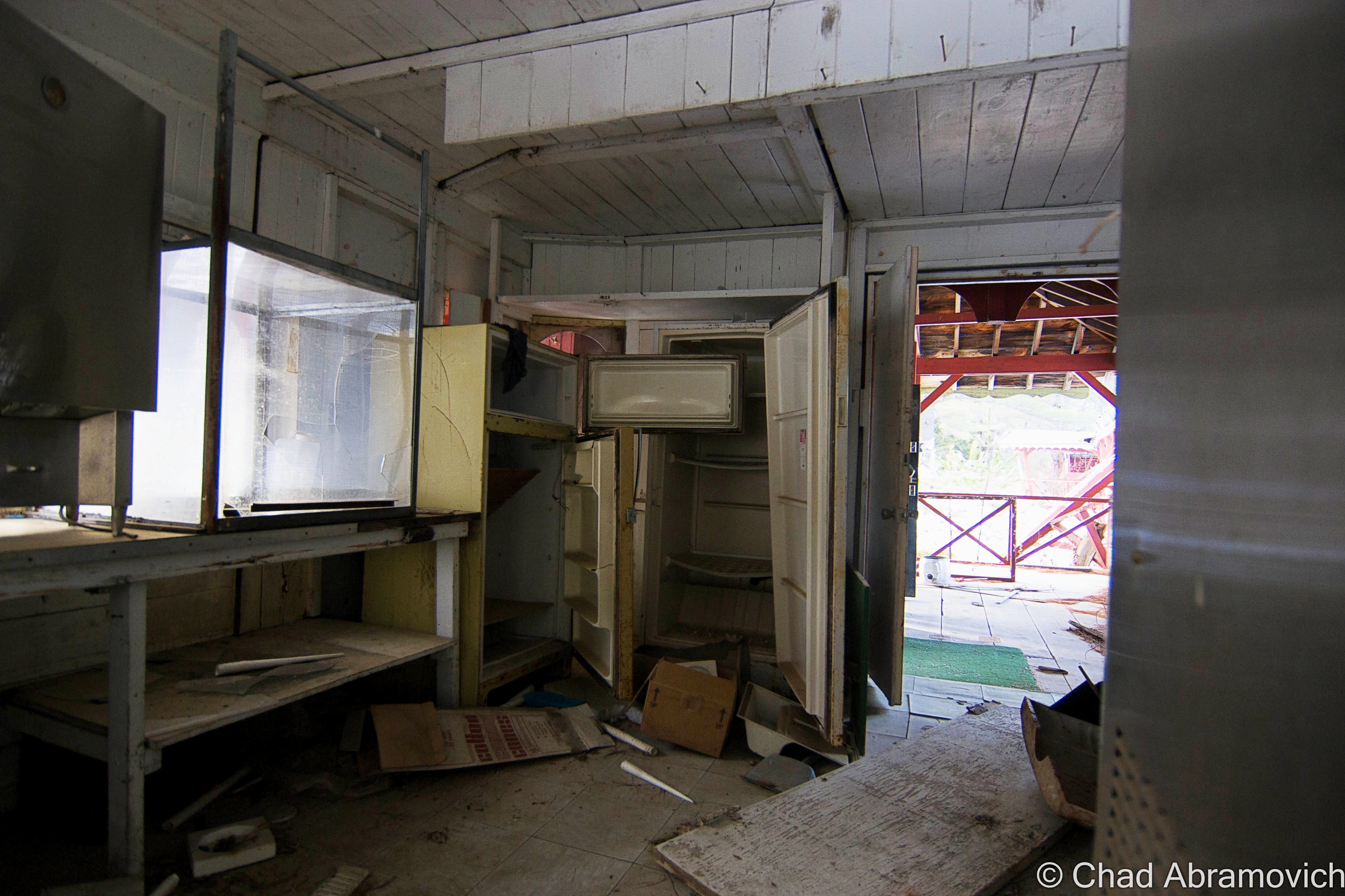
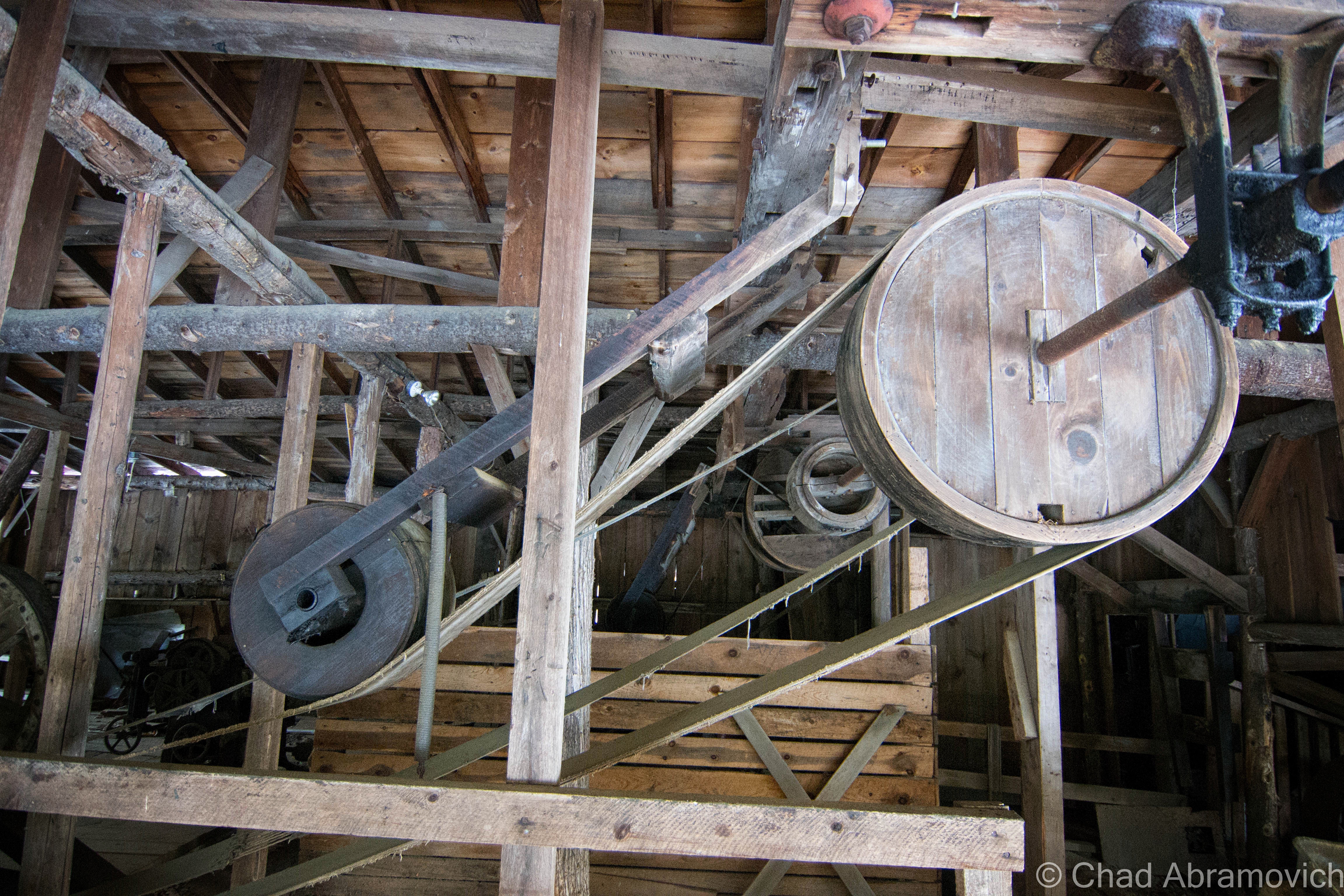
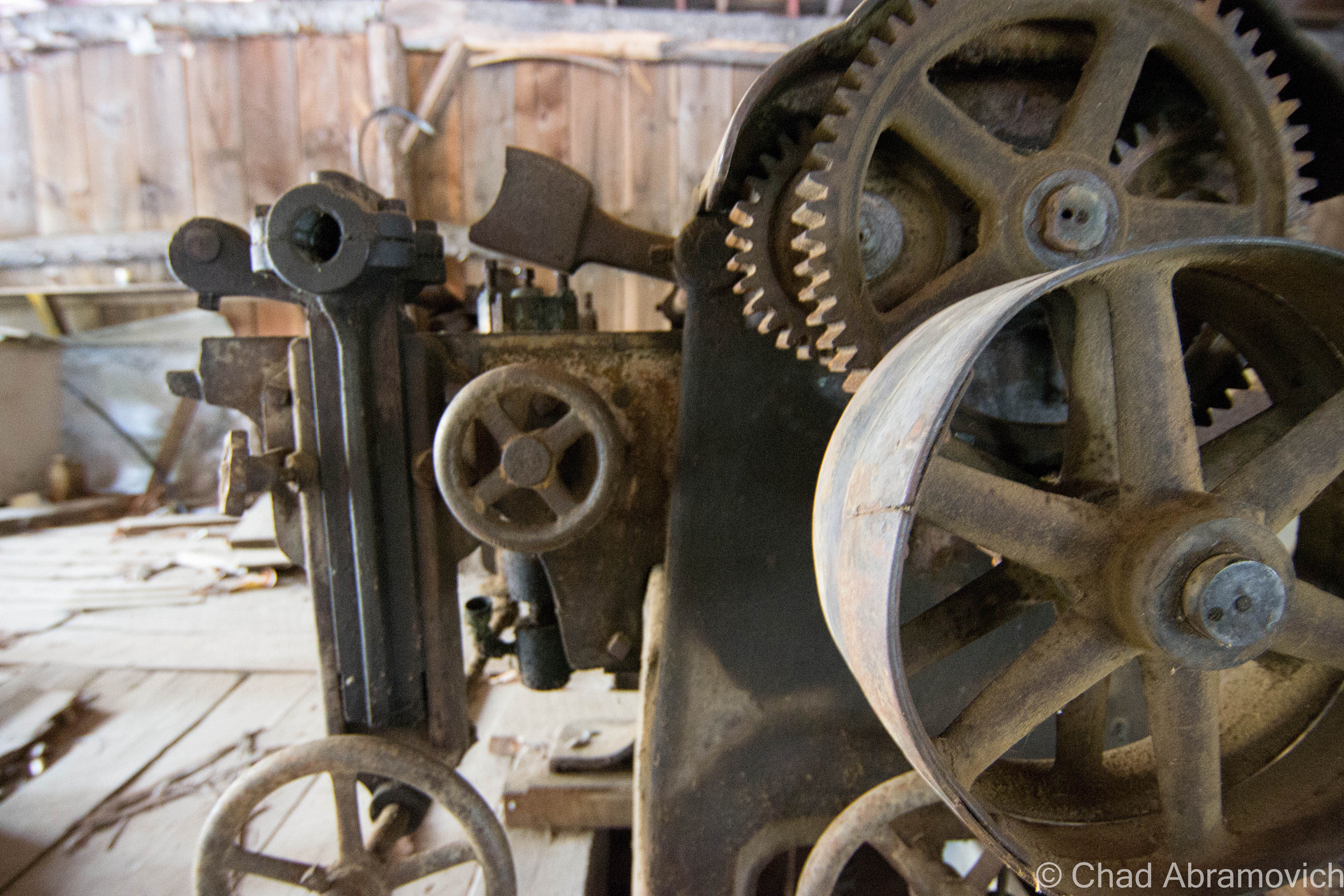
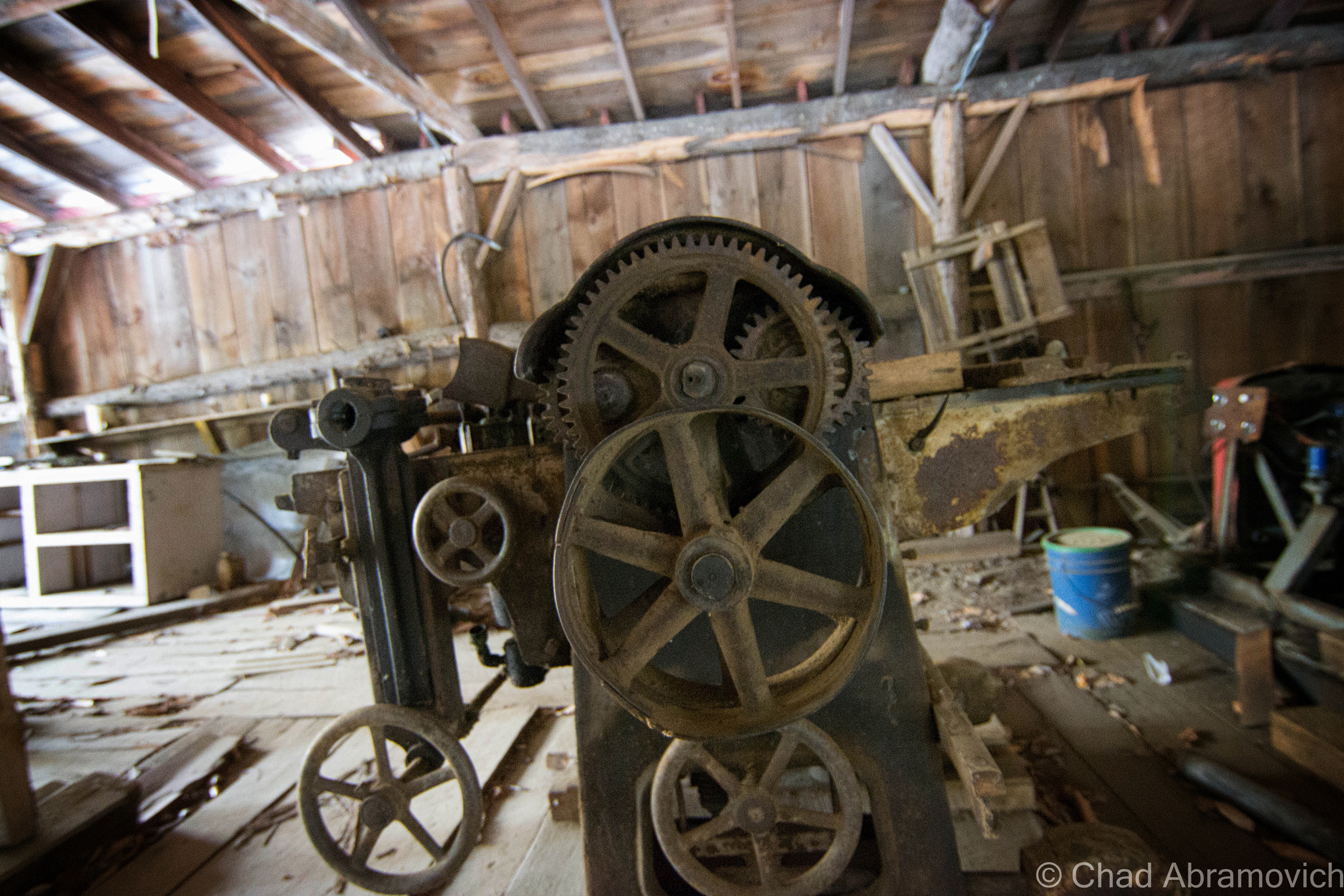
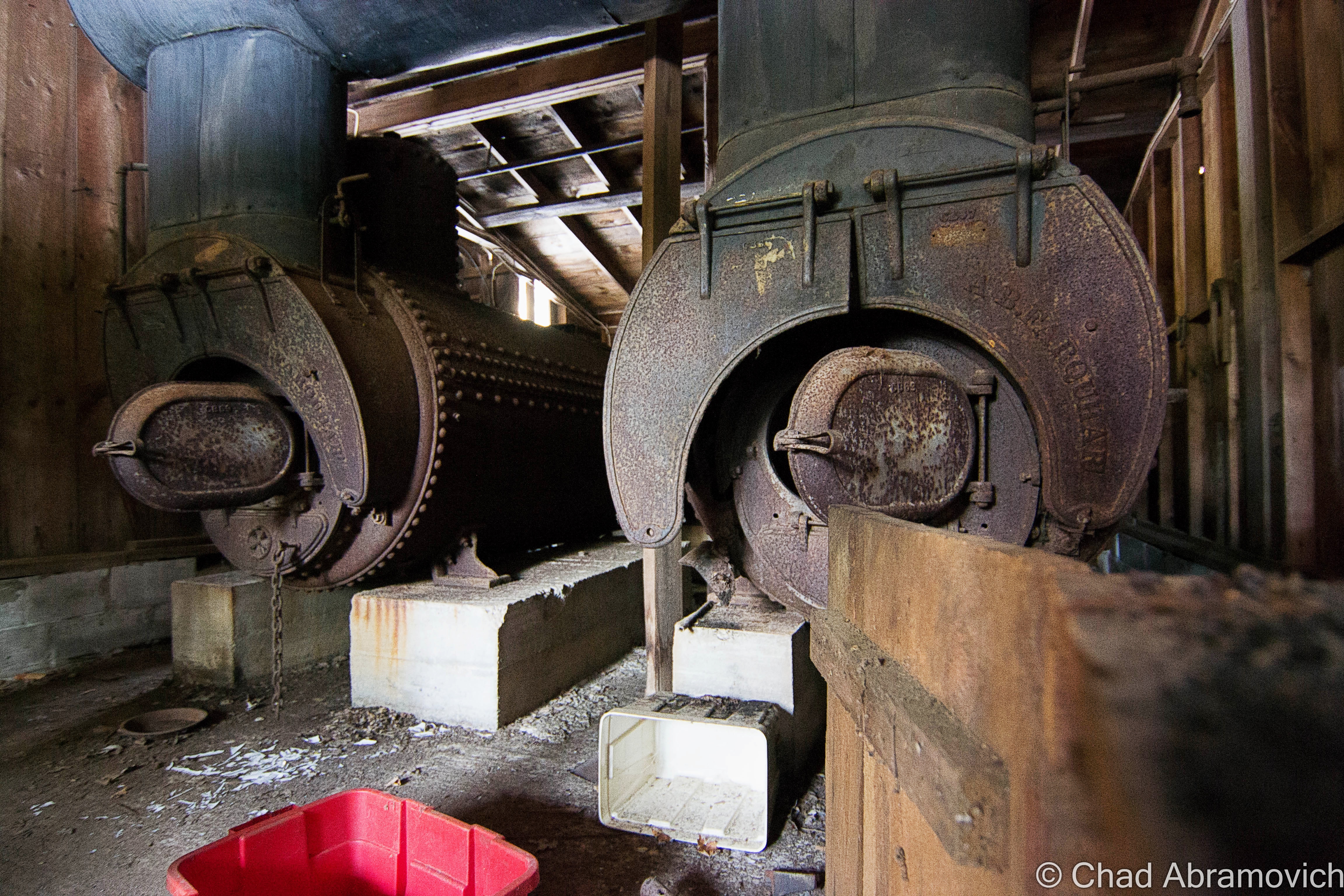
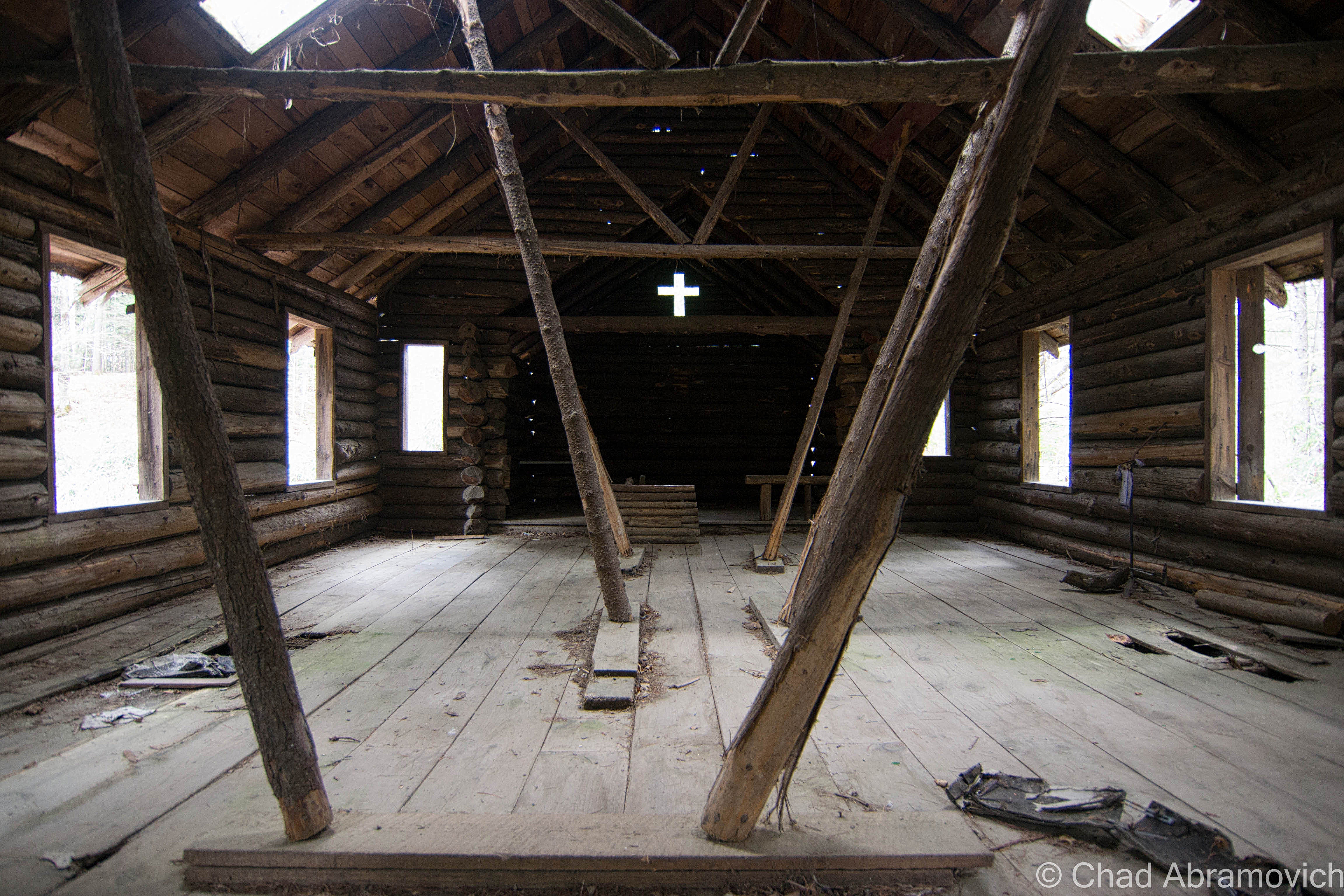
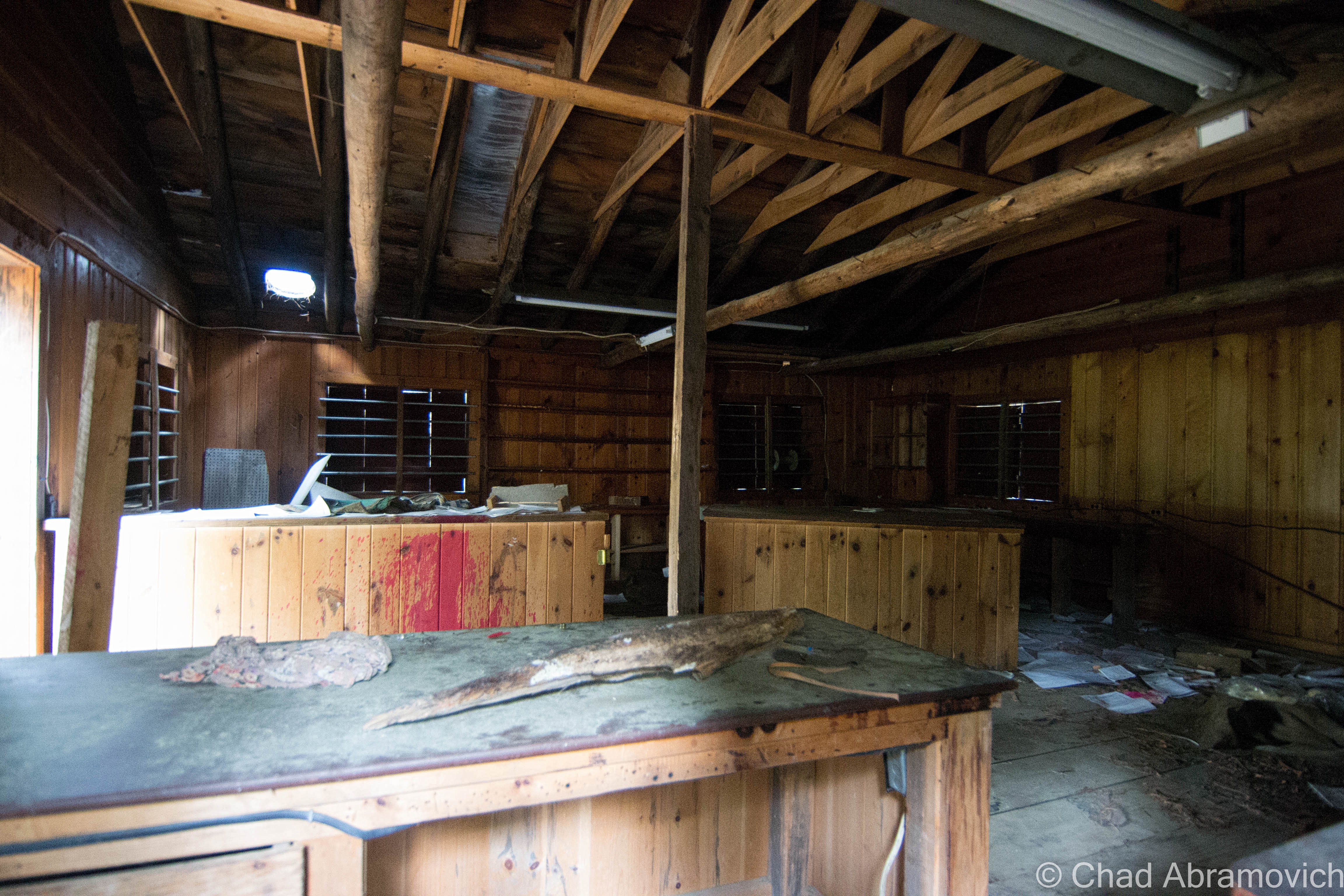
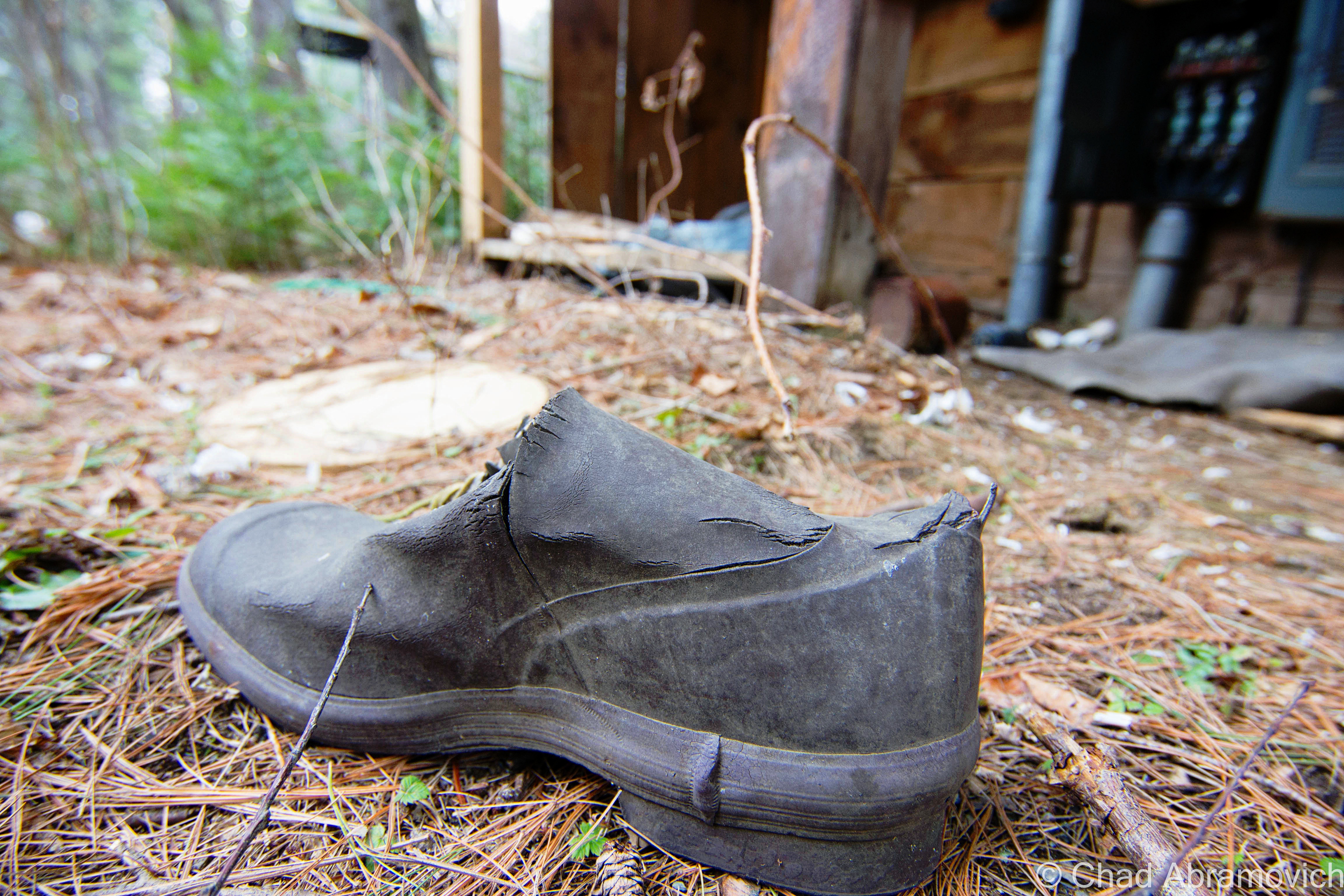
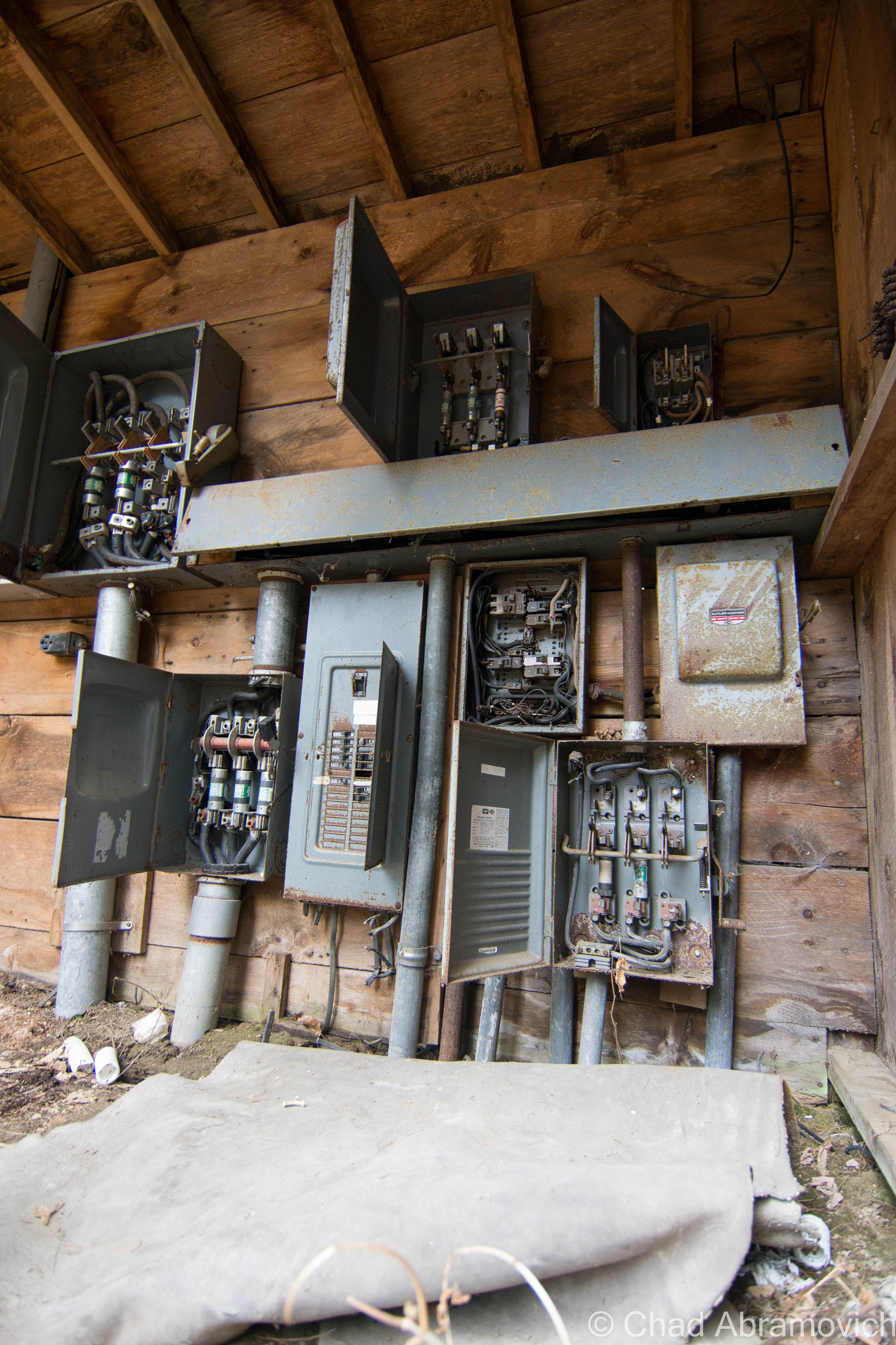
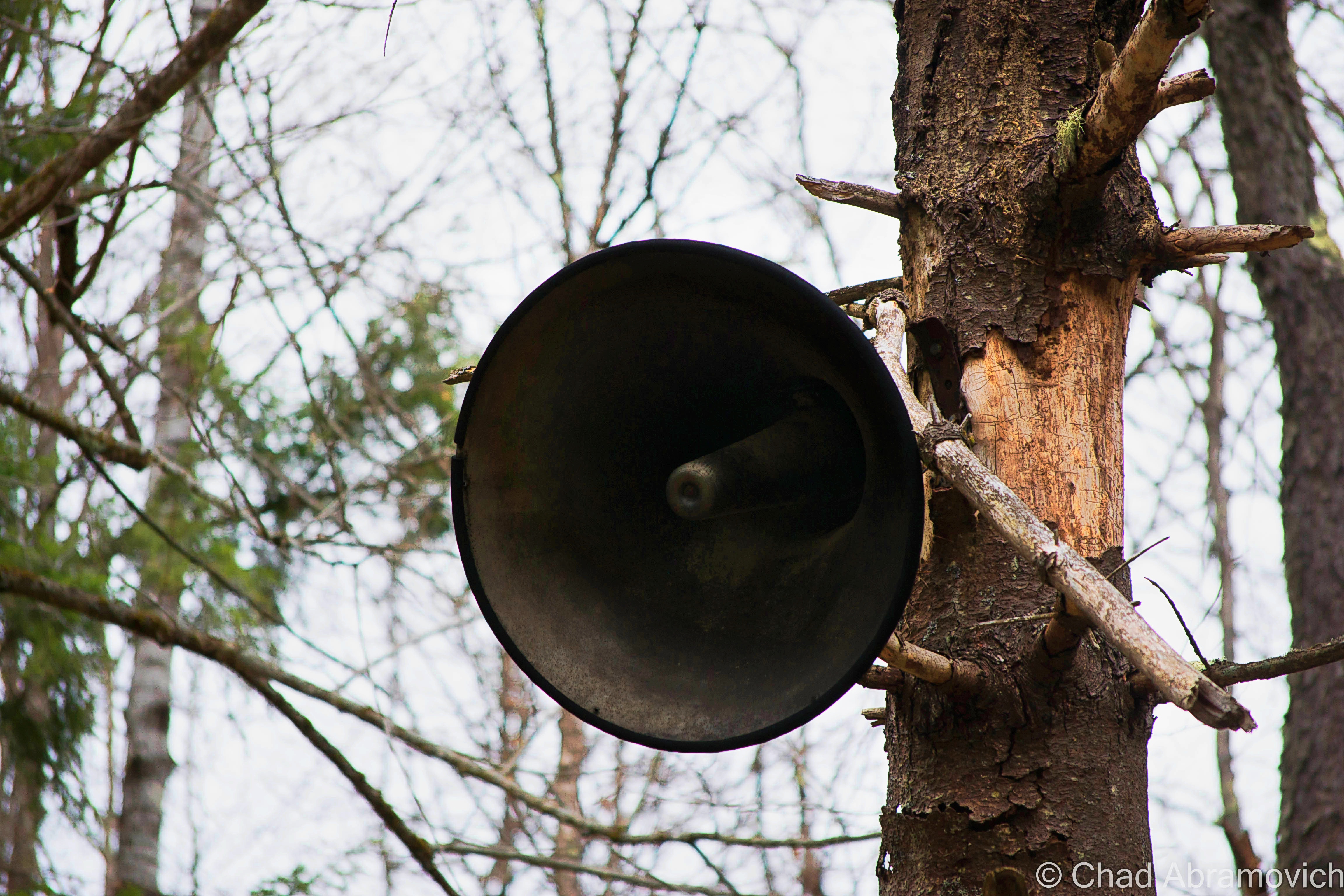
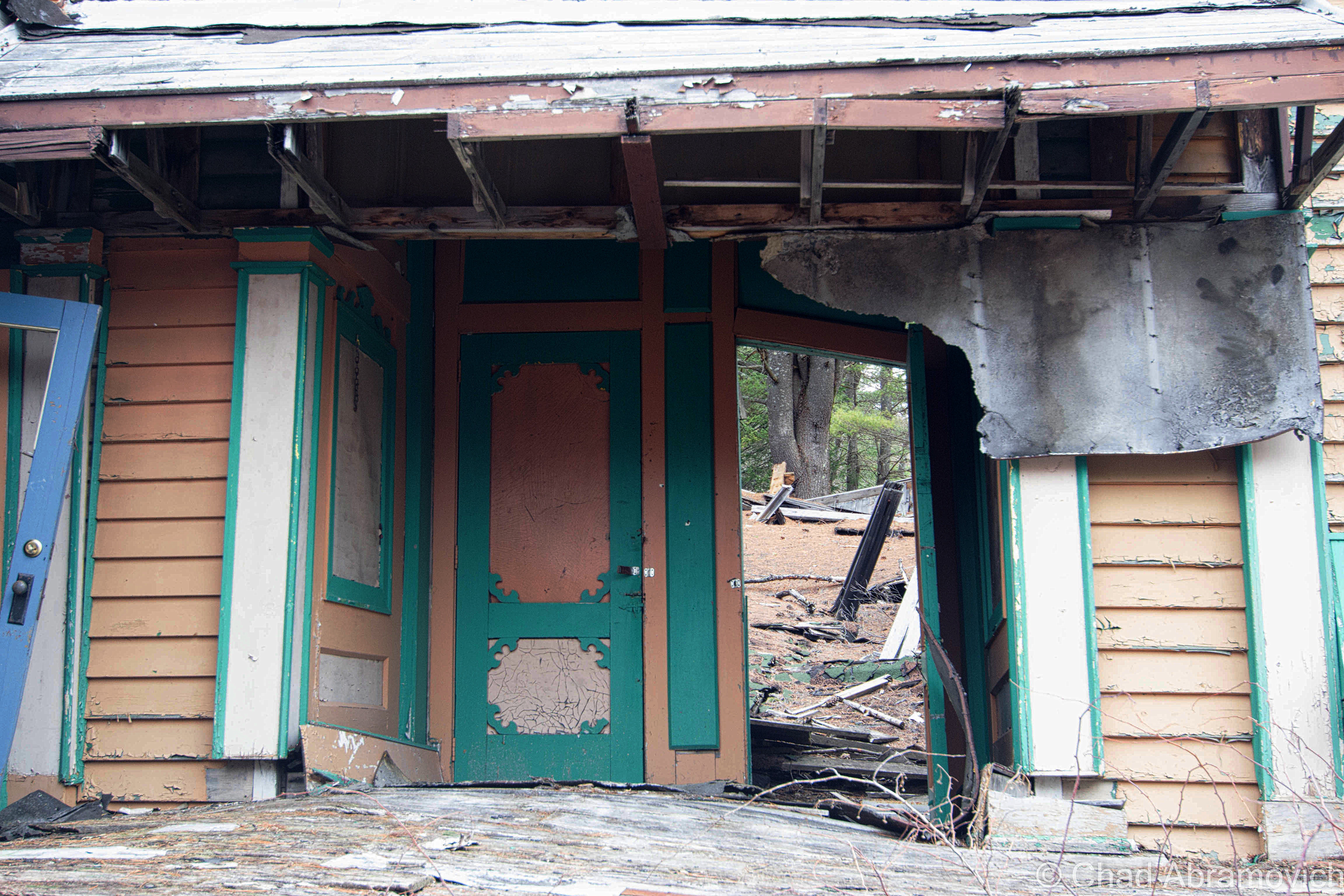
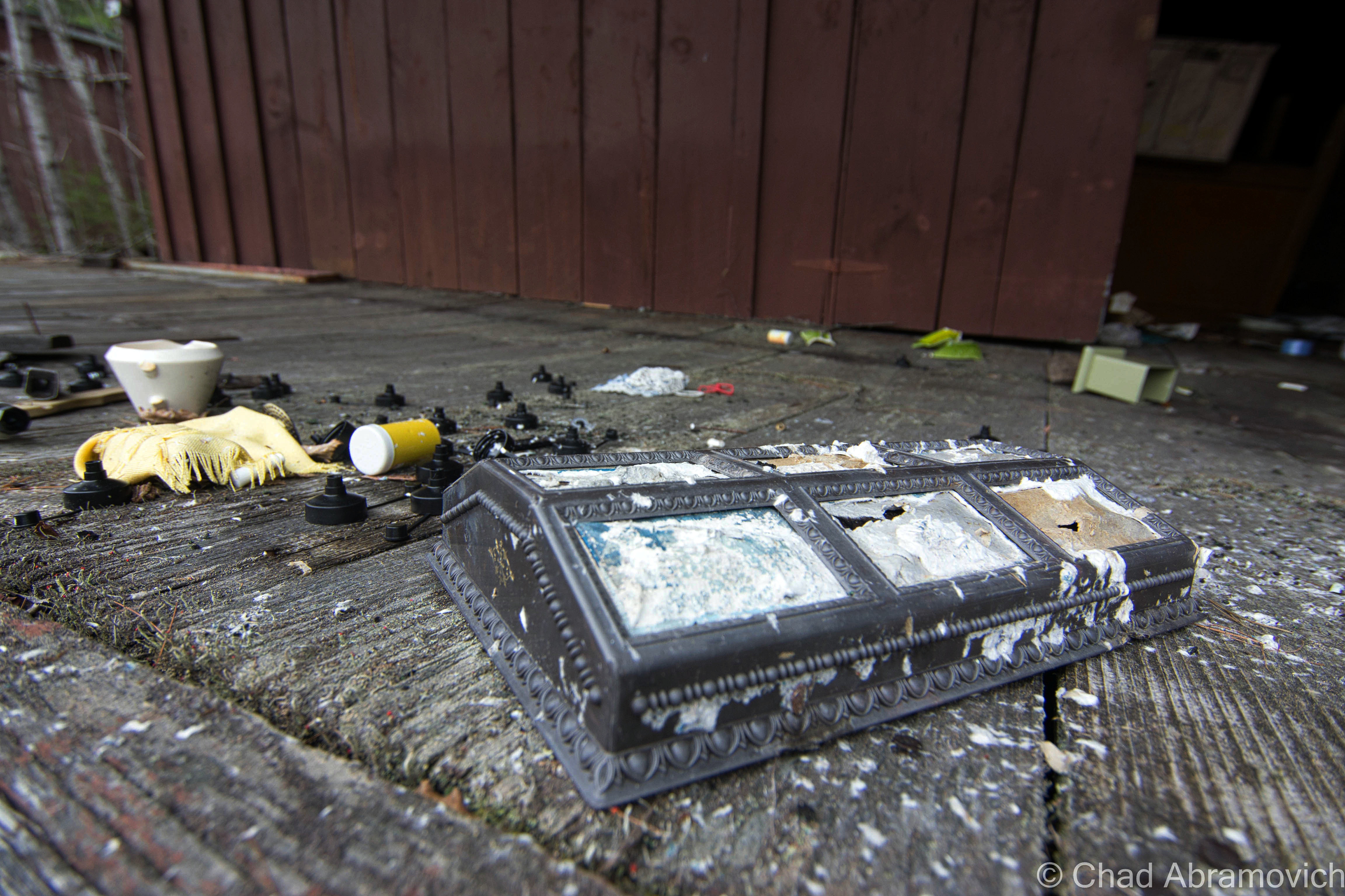
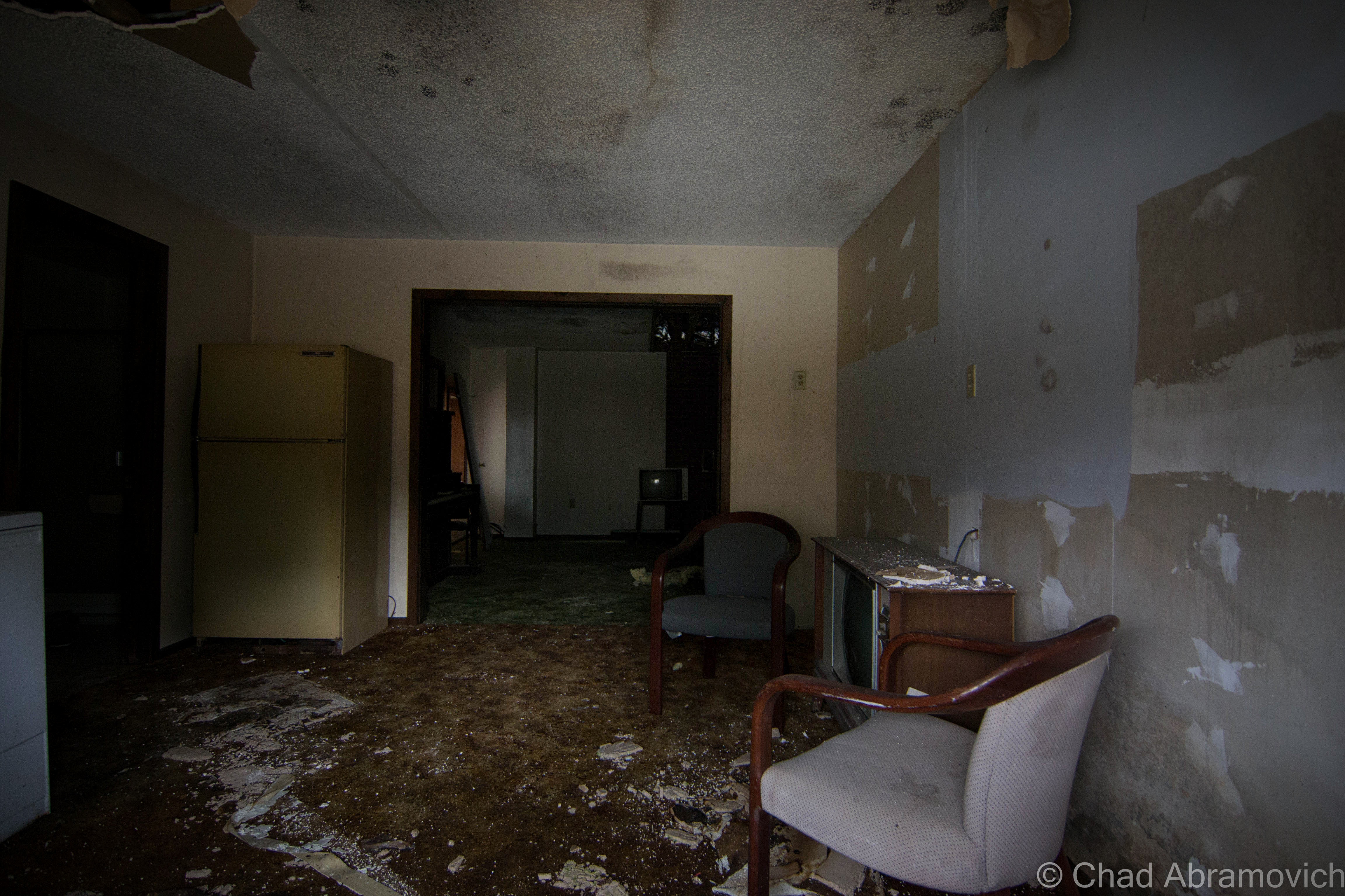
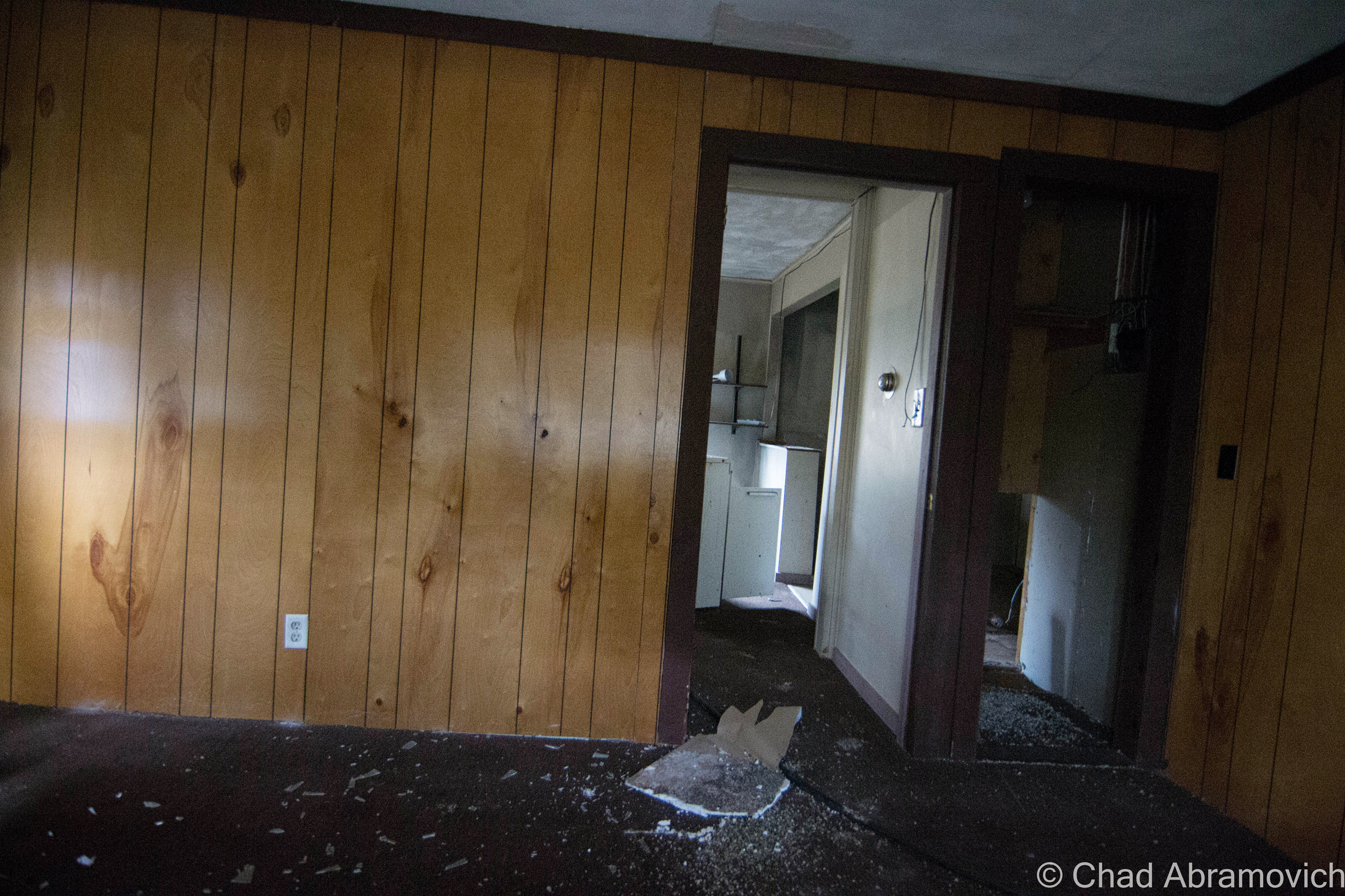
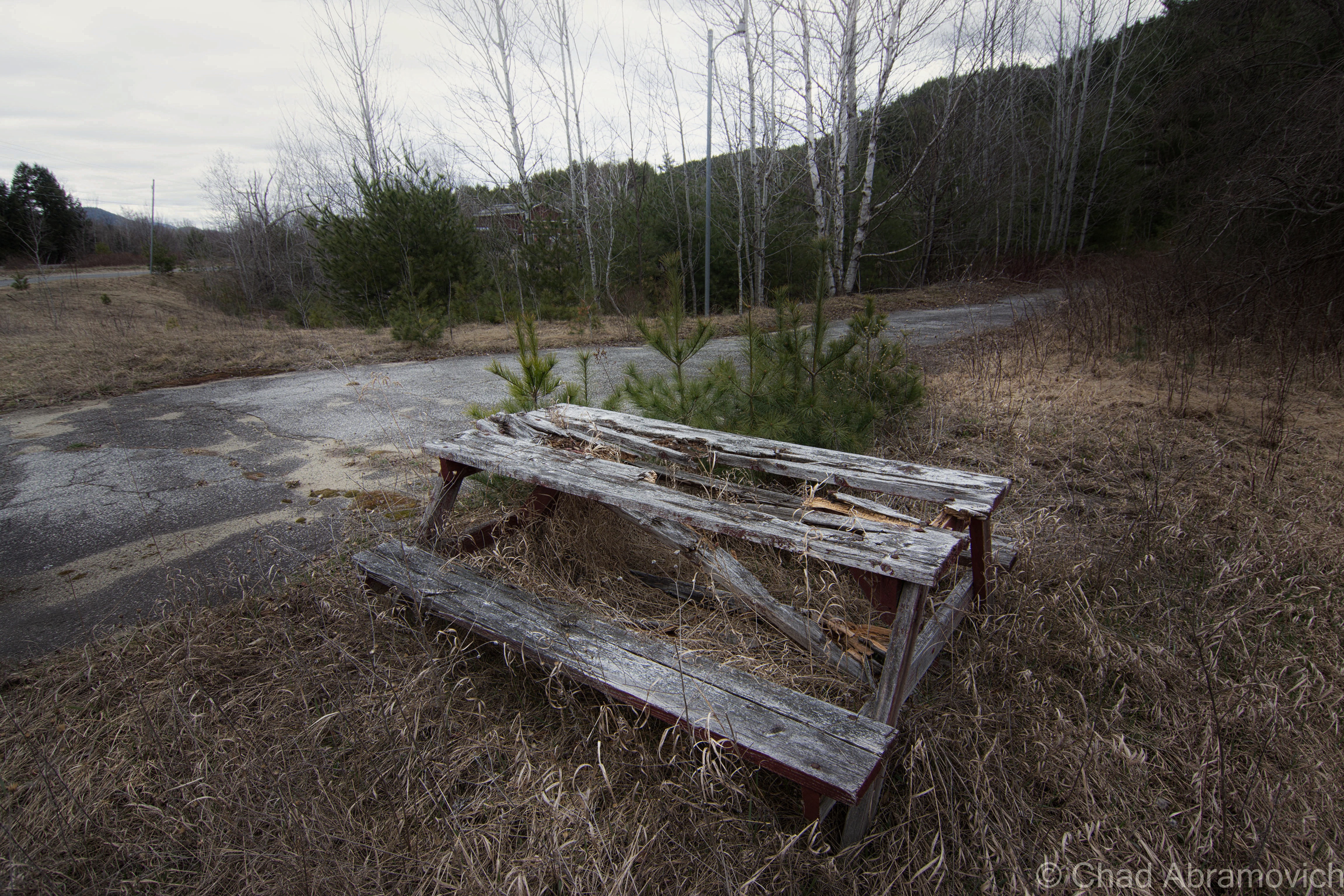
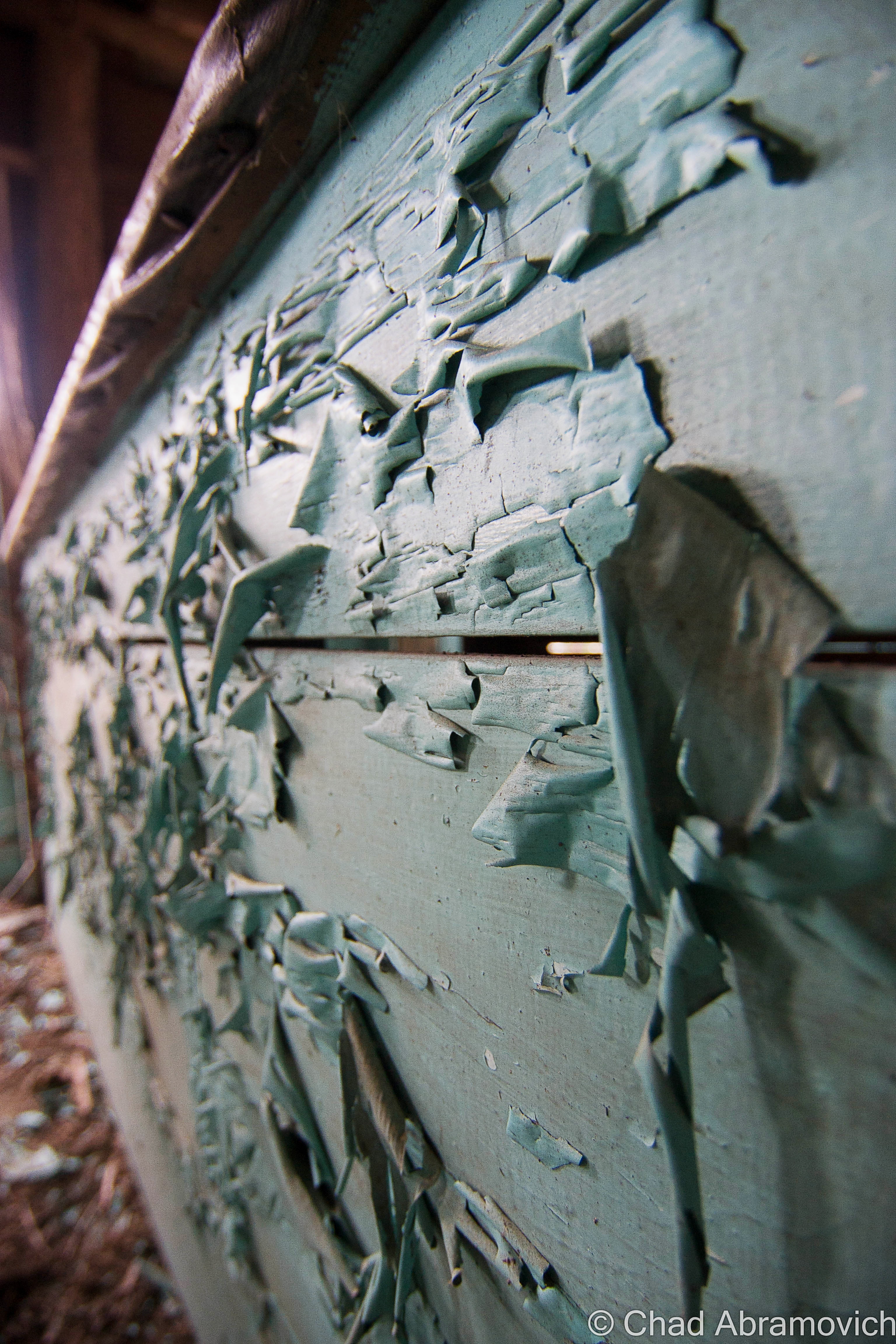
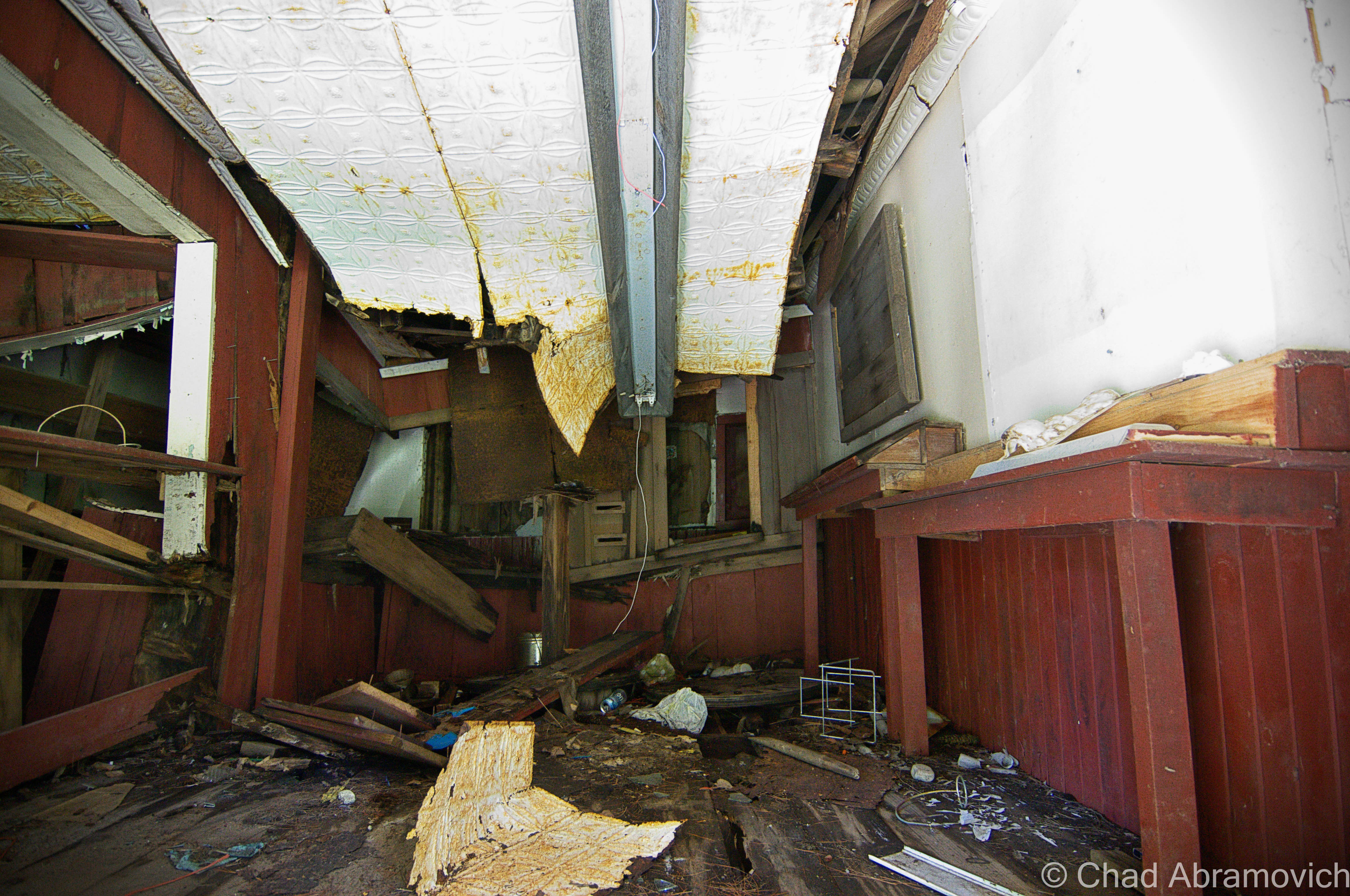
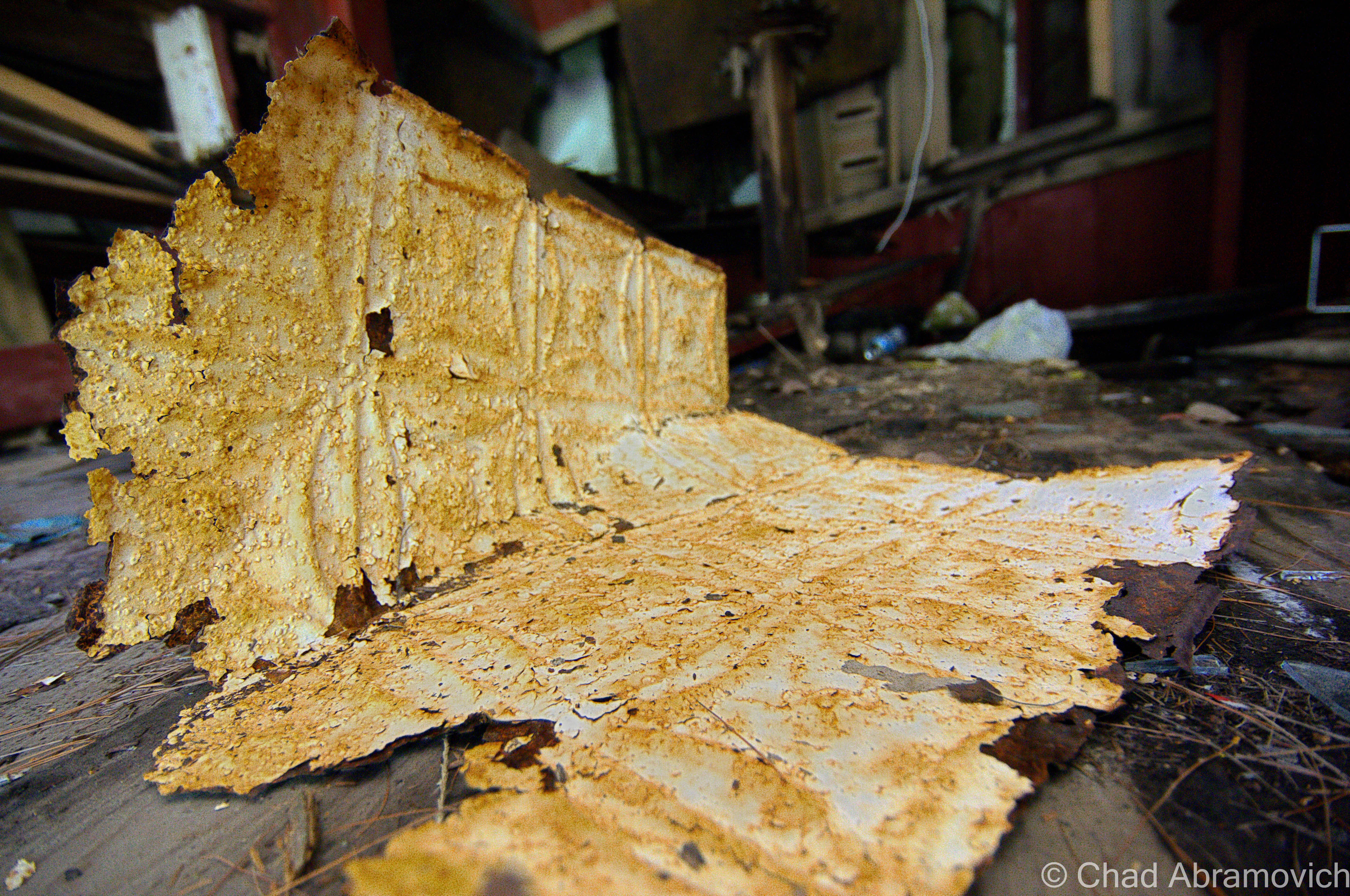
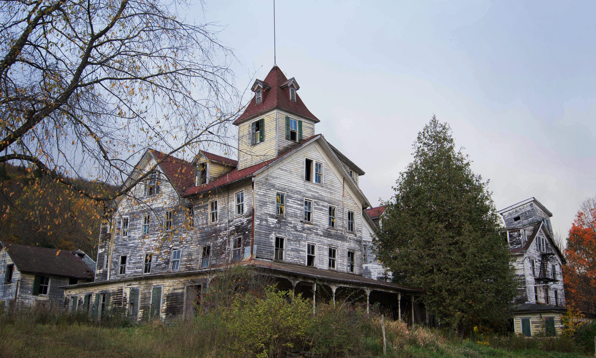
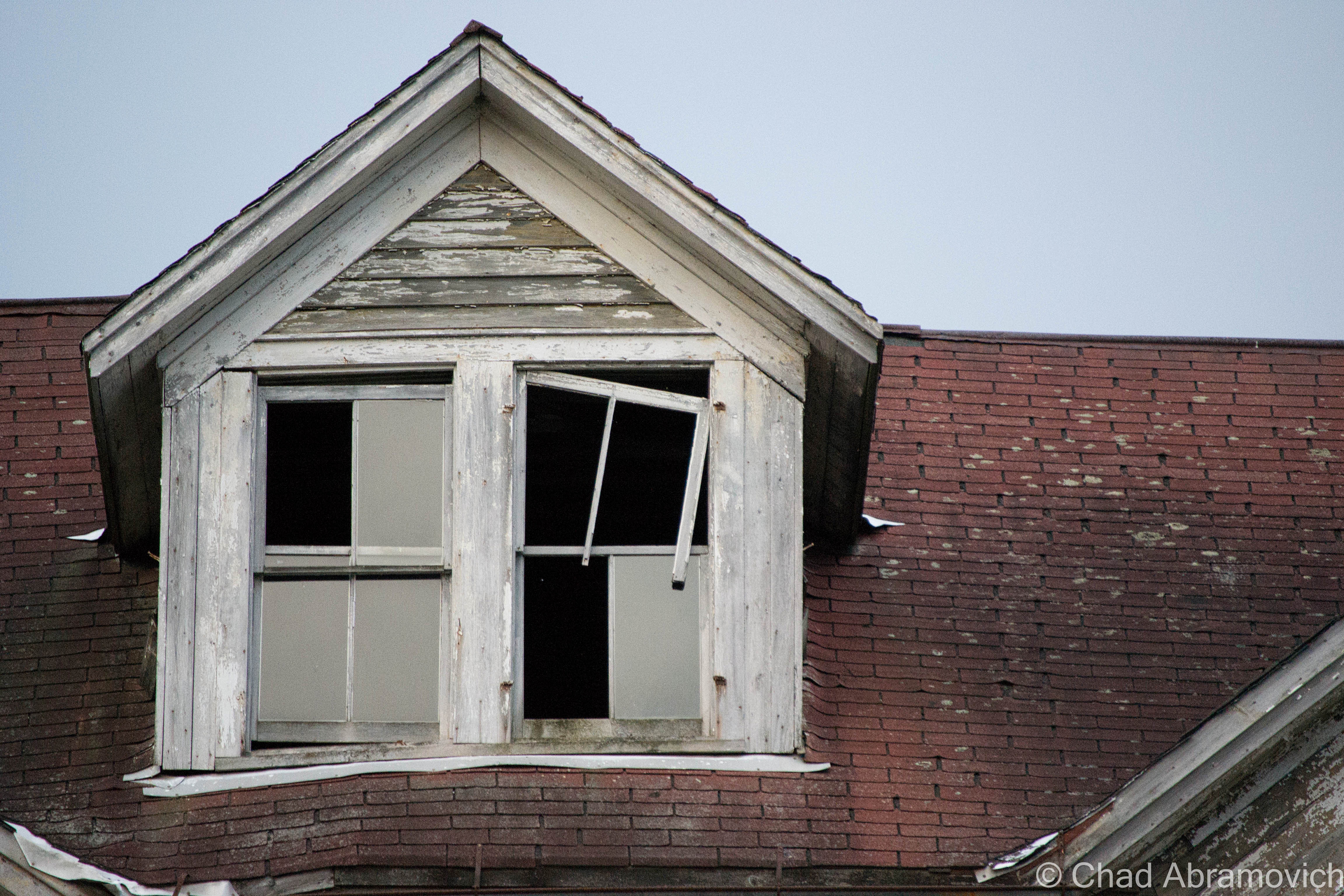
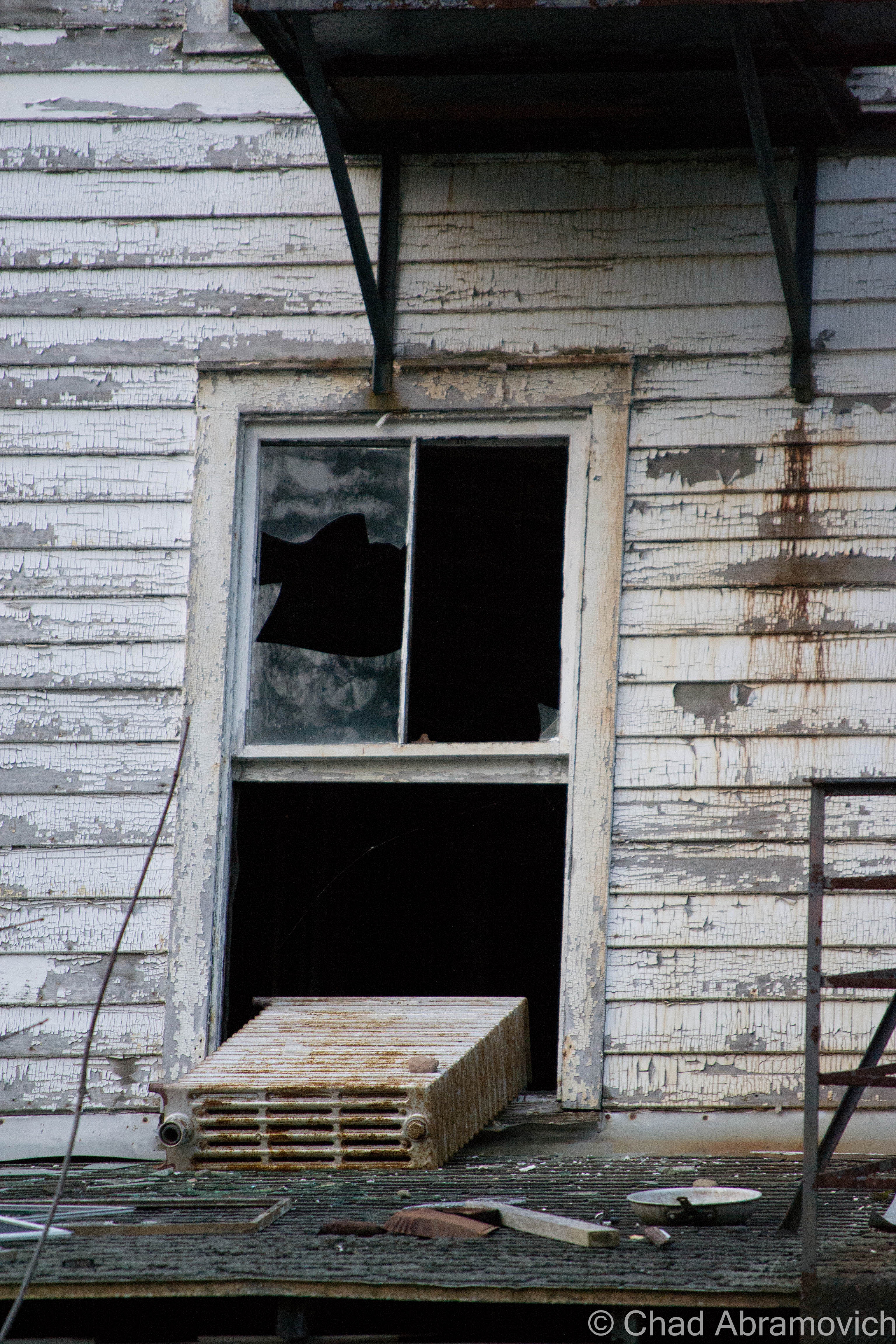
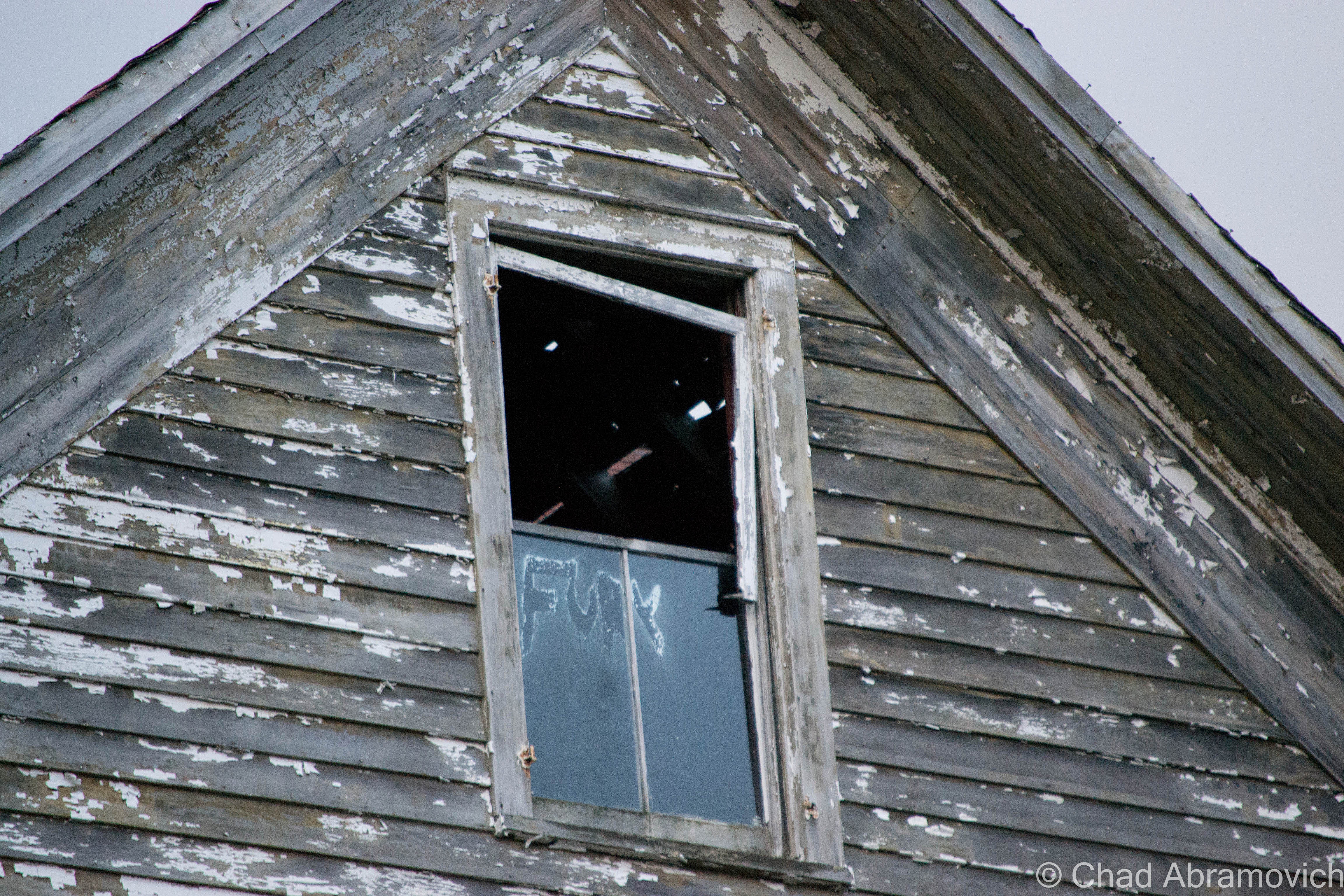
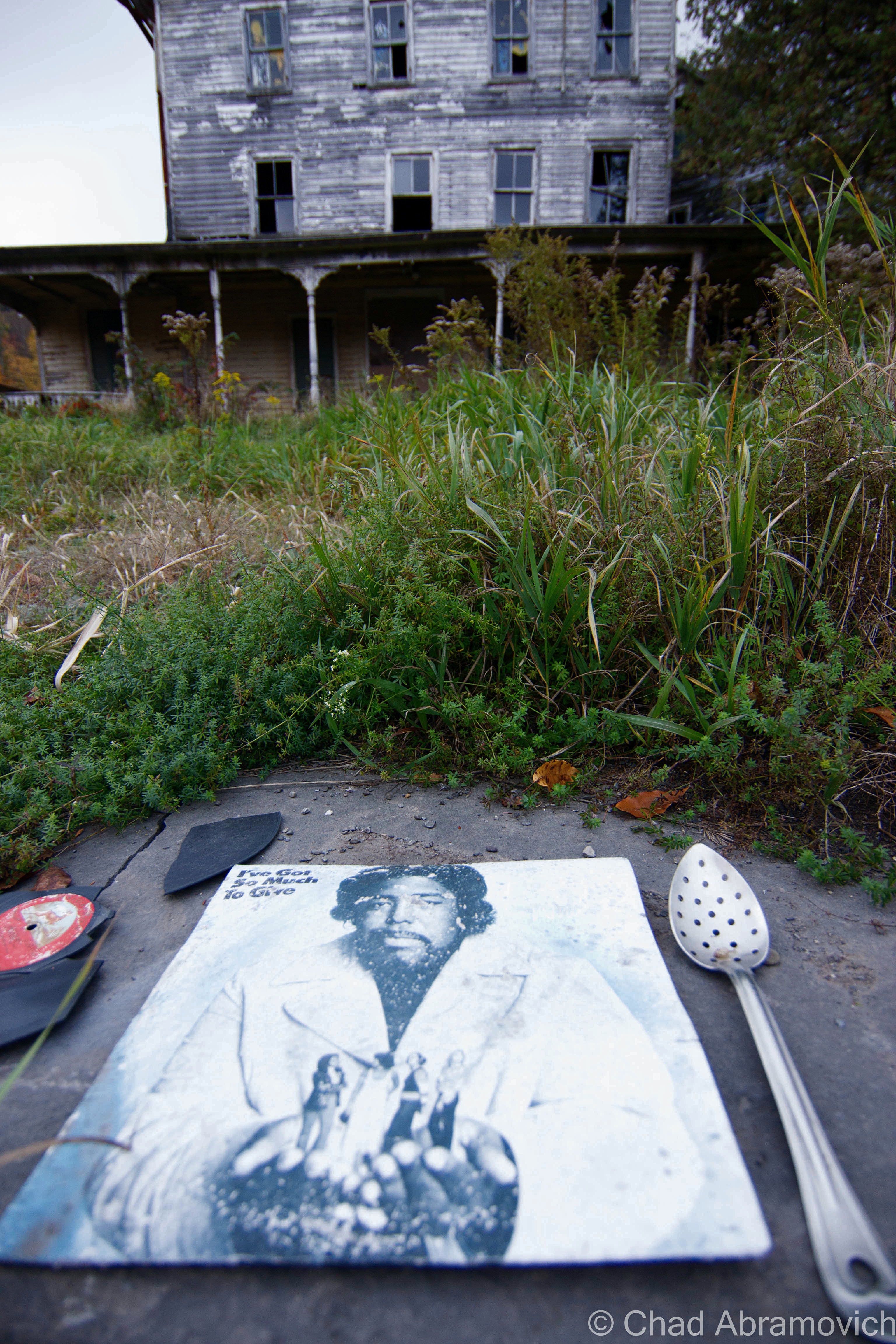
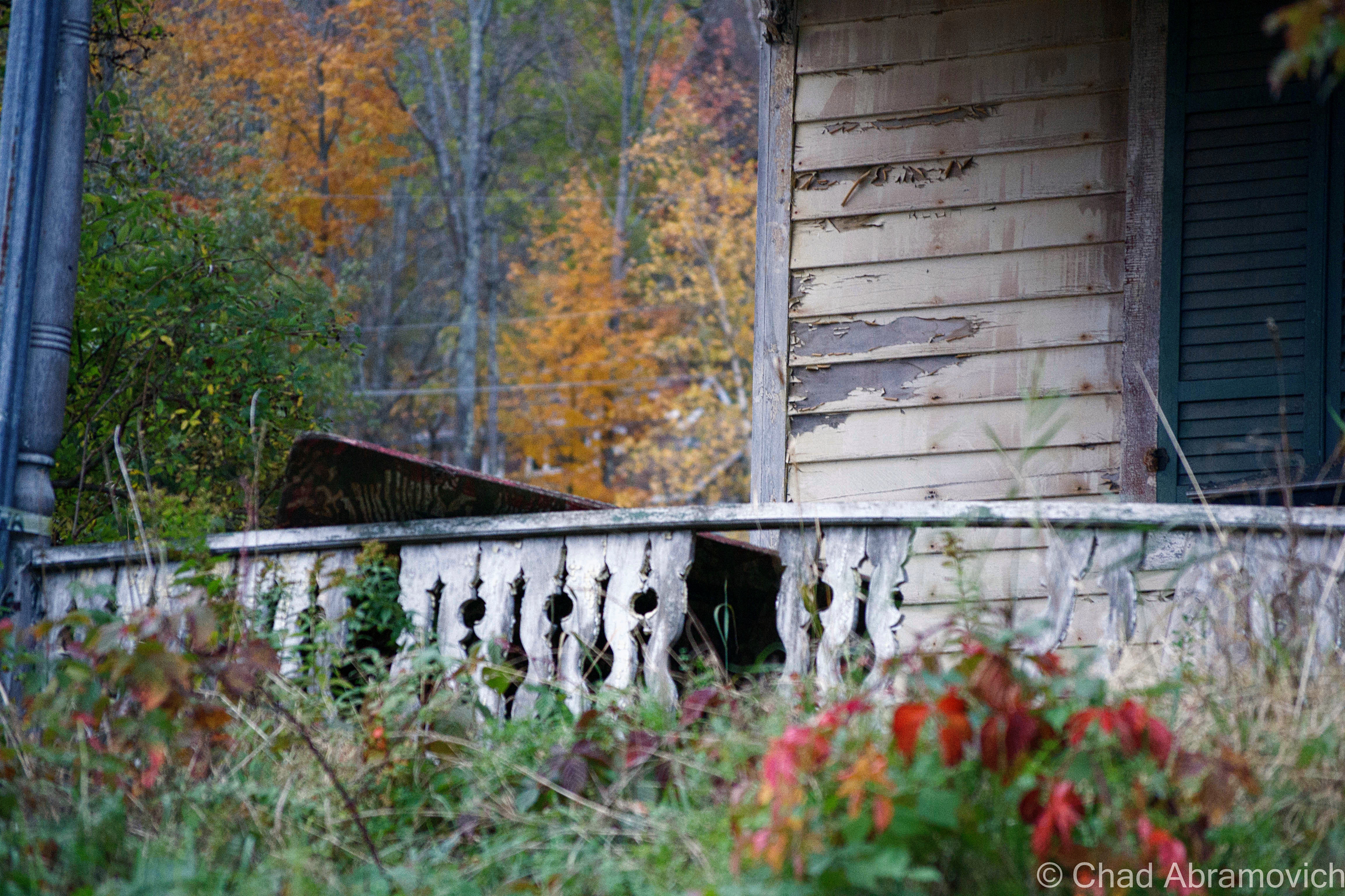
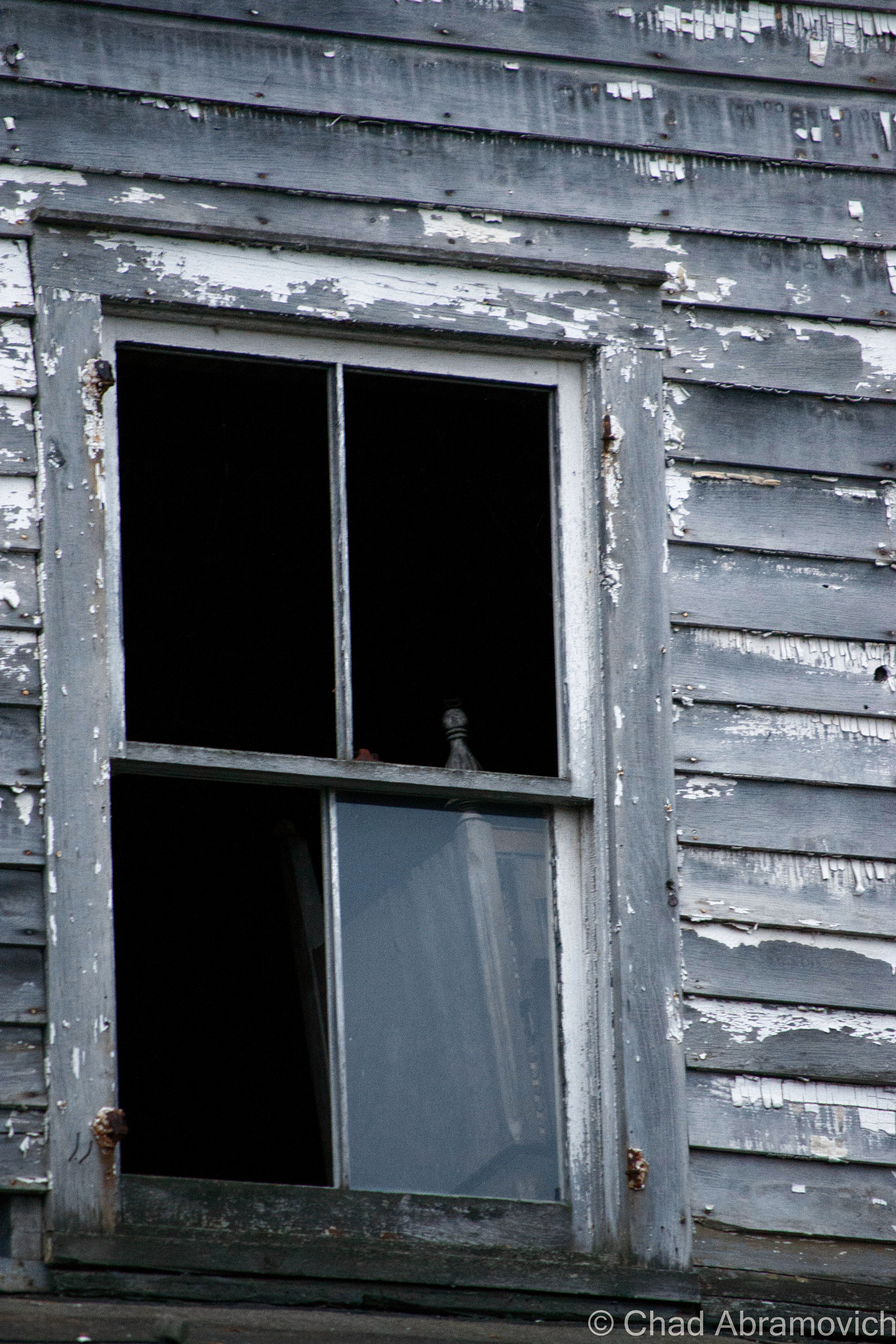
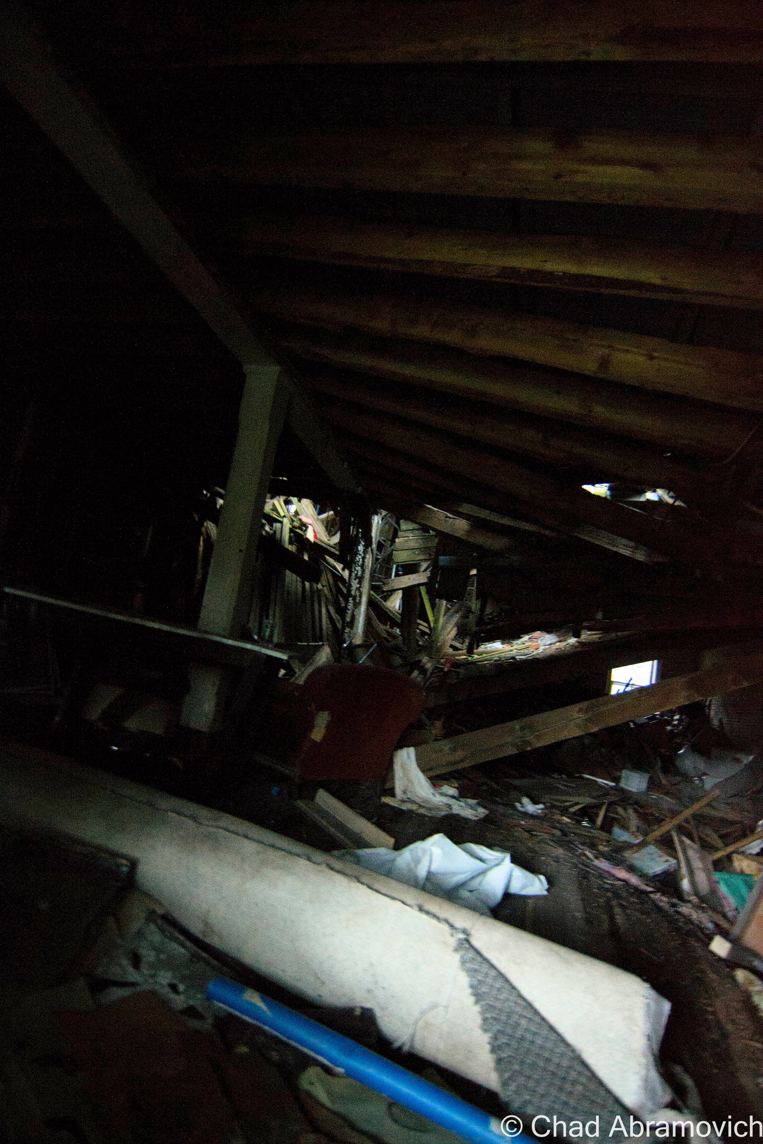
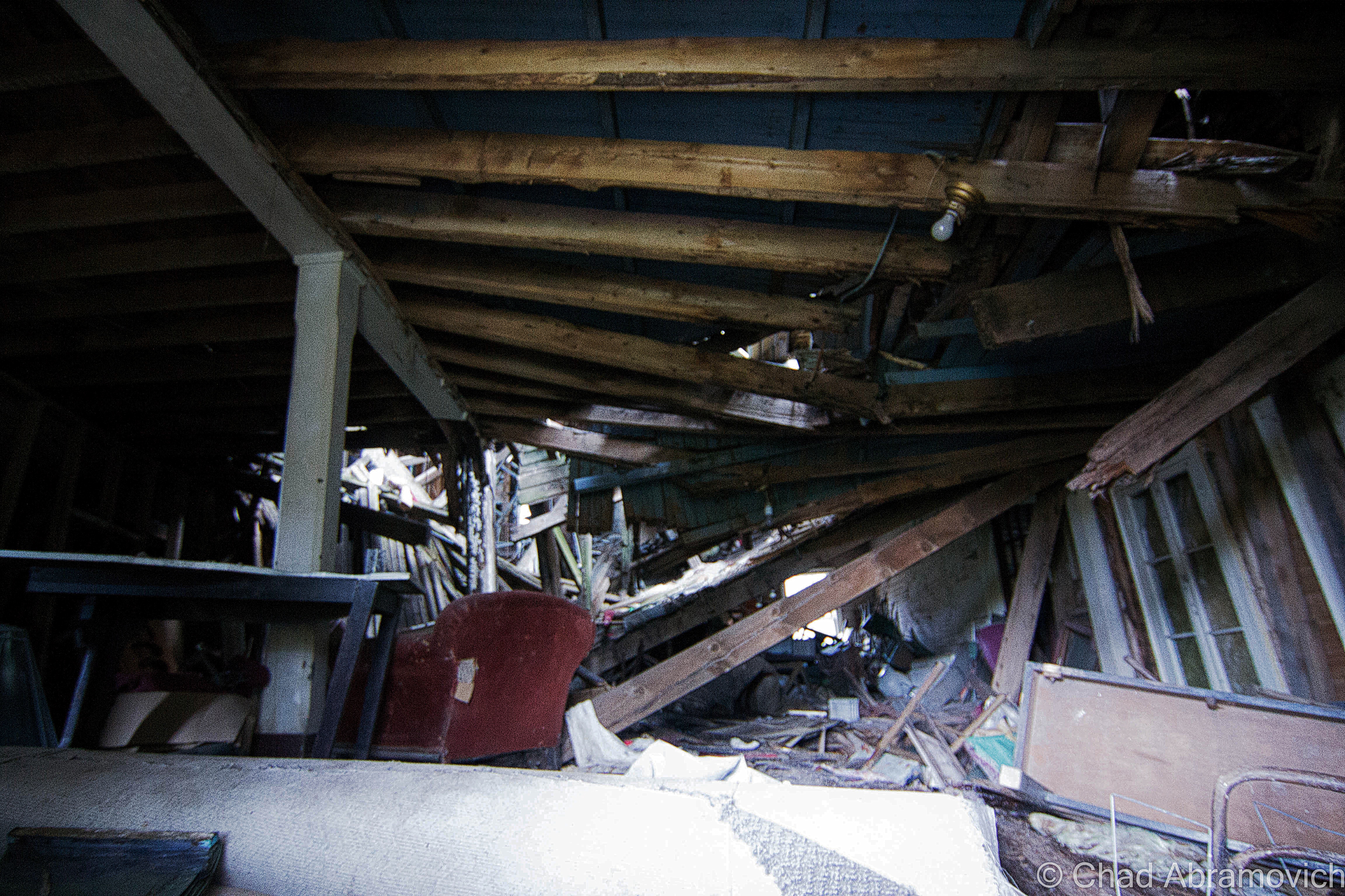
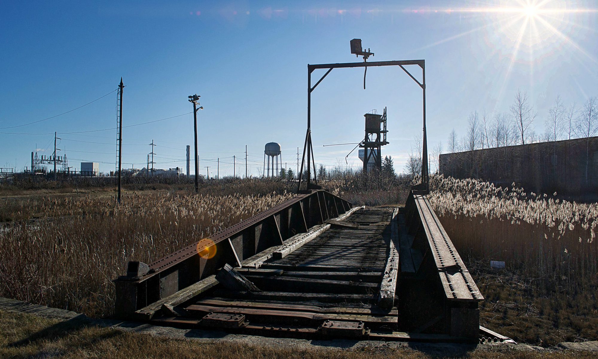
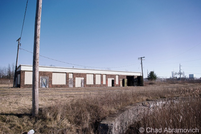
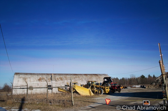
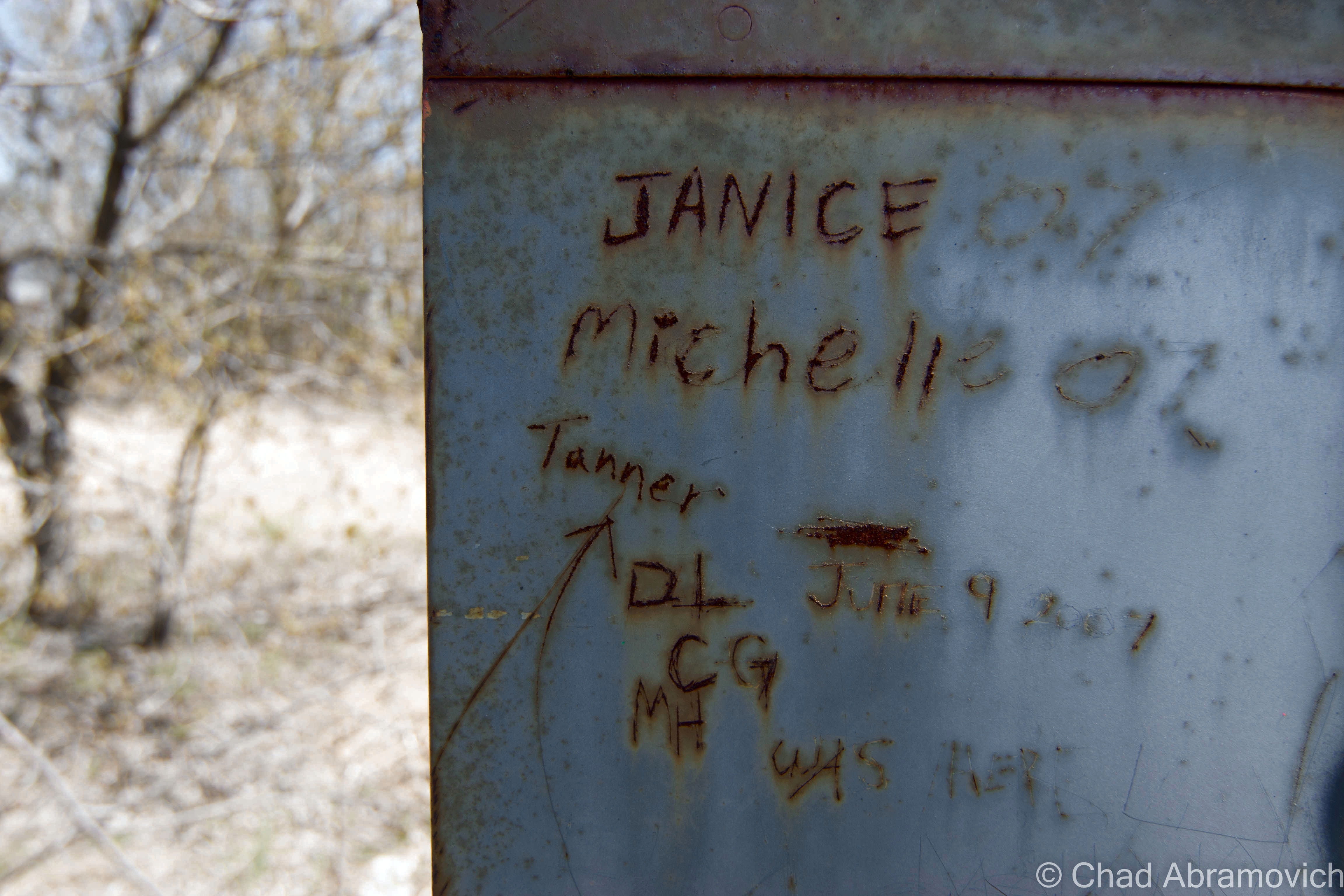
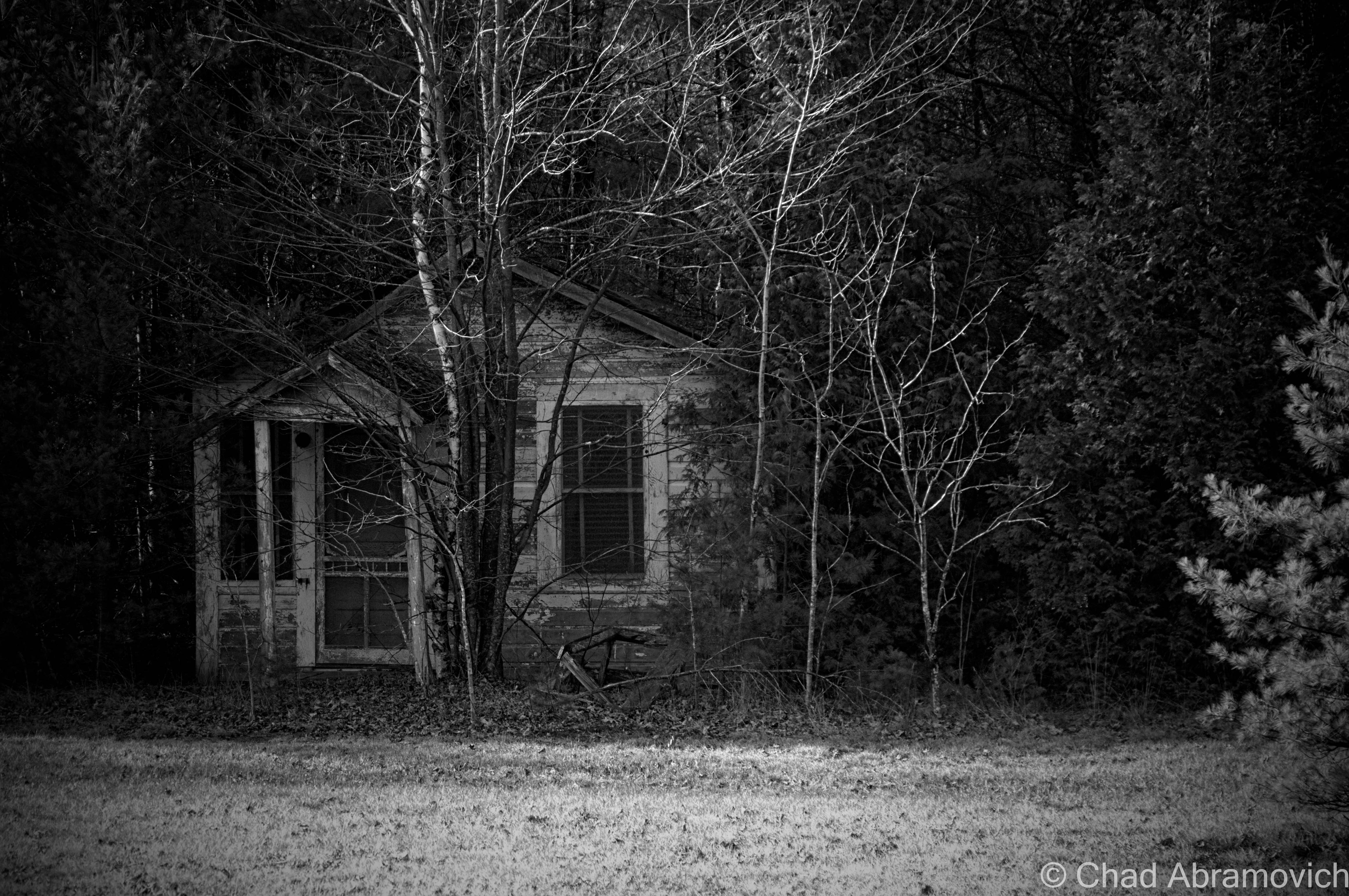
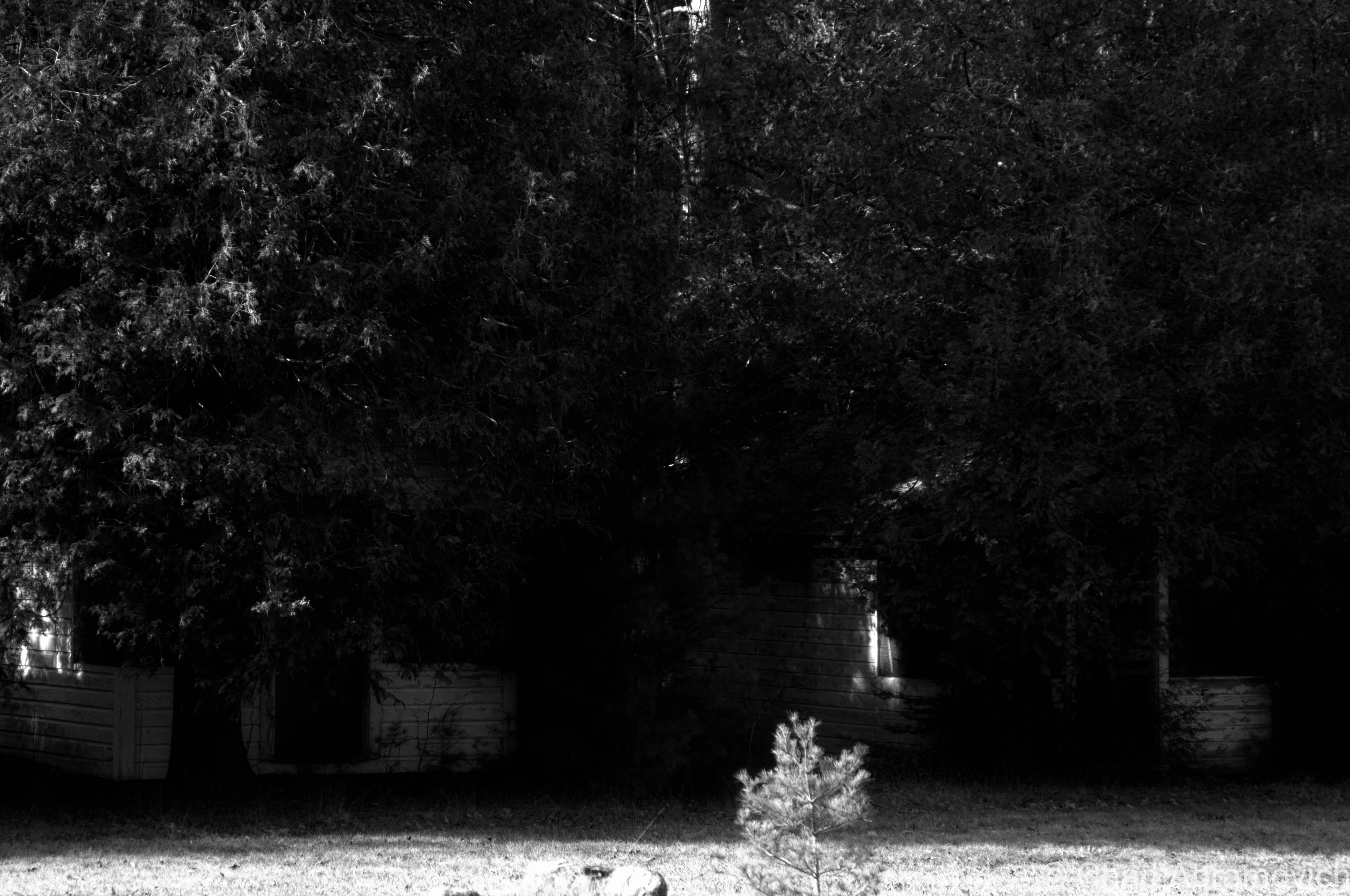
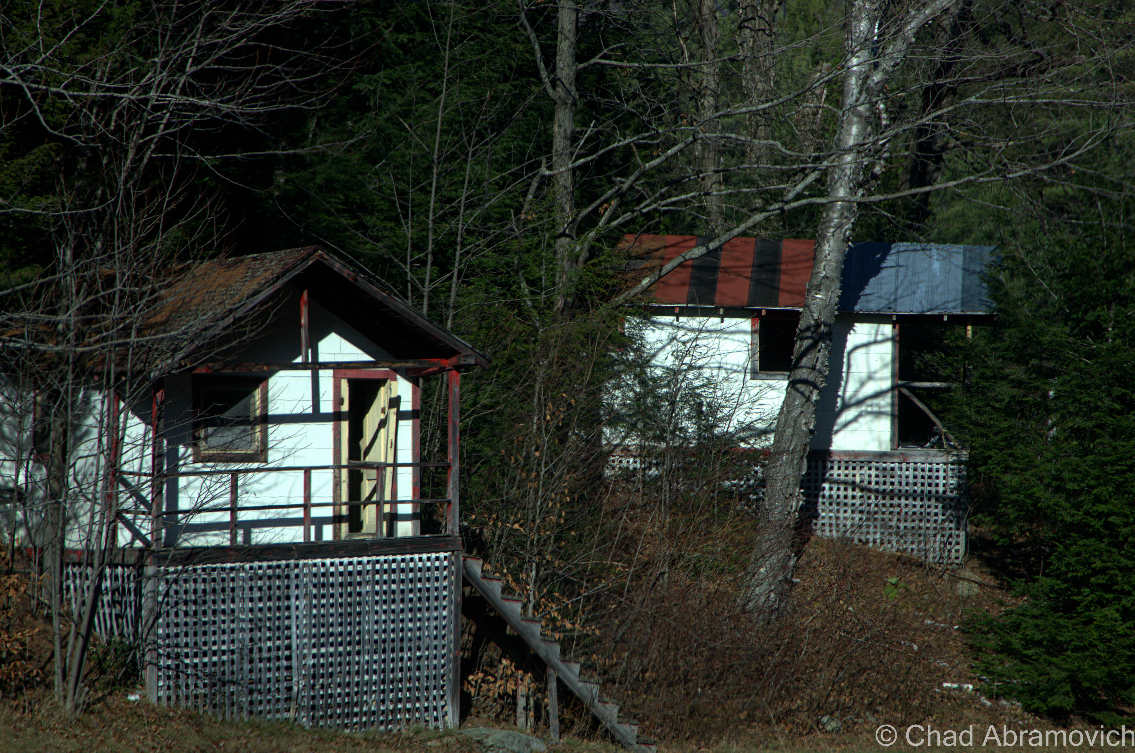
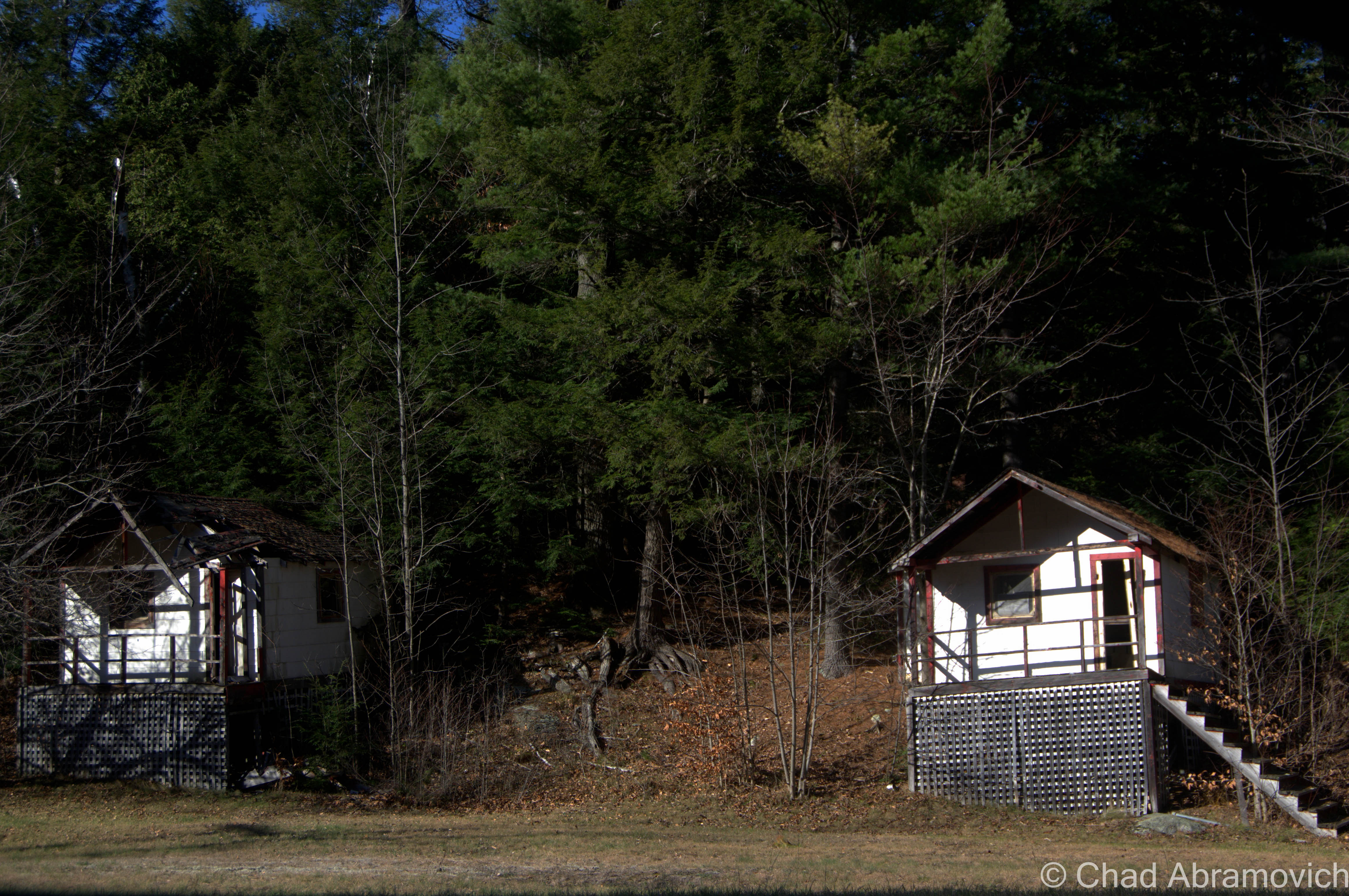
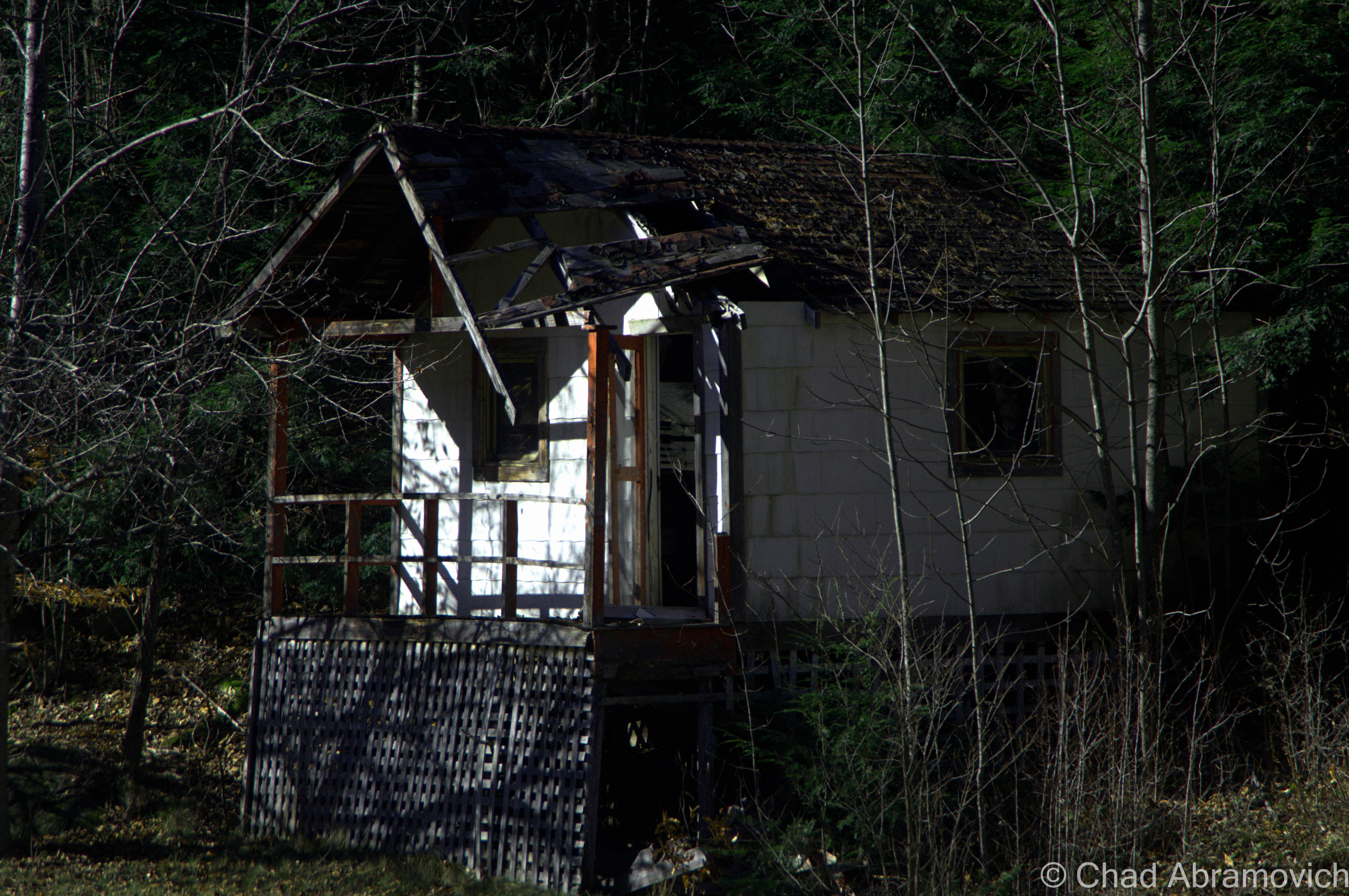
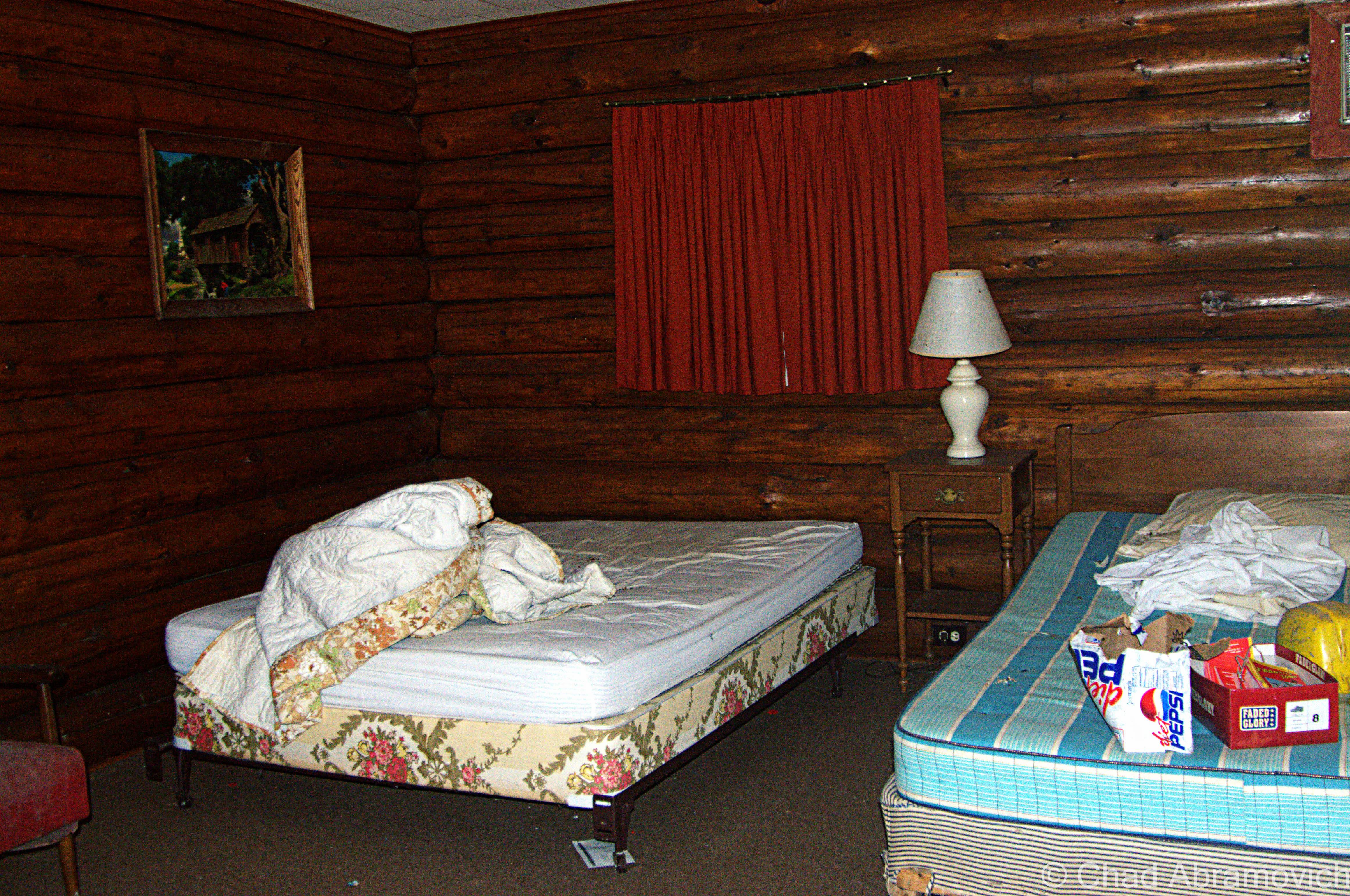
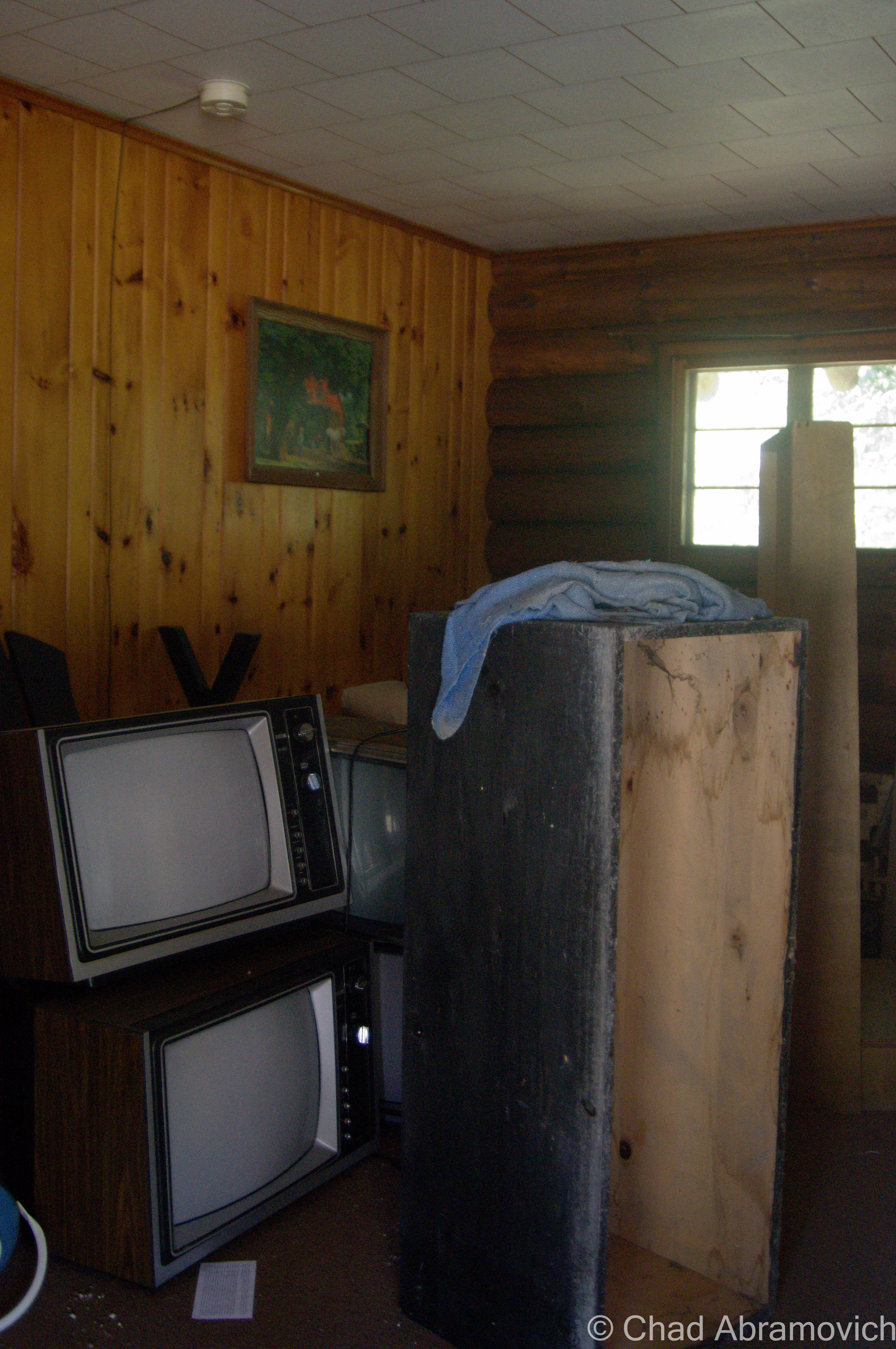
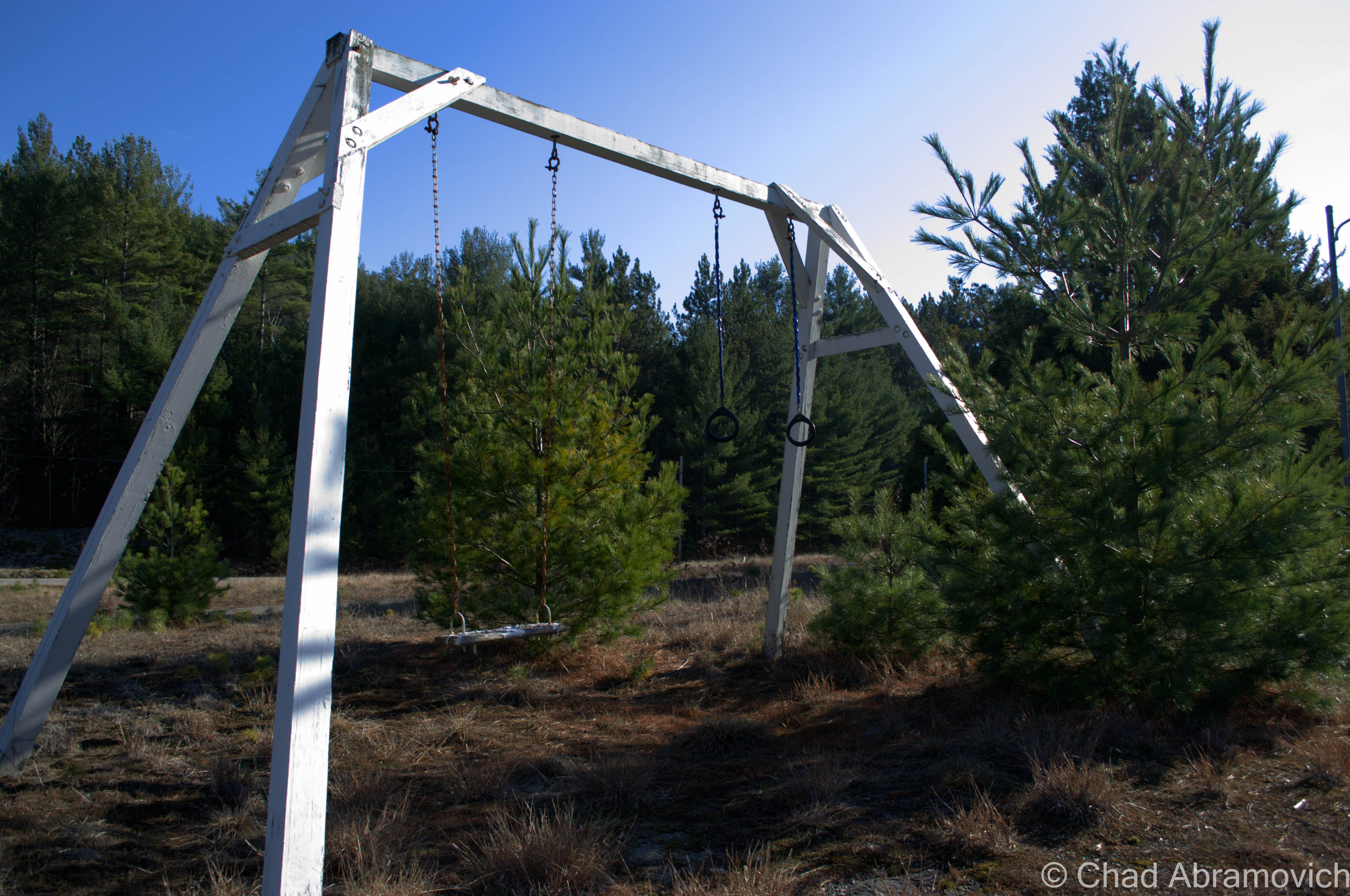
Today, awkward and fantastical ruins falling apart in silence underneath the Pines are all that remains of Frontier Town. A walk around the property reveals the tragic process of disintegration and entropy which is both sad and breathtaking to behold and makes me reflect on society’s impermanence.

I visited during the dark wintery cold of January, and returned during a far more pleasant 50 degree April Sunday, so my photos are a mixture of winter and early spring shots.

When I took my research to the internet, I found a cool Facebook page, Frontier Town Abandoned Theme Park Now And Then, with tons of great old photos to gaze at. It’s incredible what the transformative power of nature can do to a place in a short time.

I was really charmed by this place and its story. Researching it had a certain inspiring magic. I love how one guy who was a layman just decided to go for it, and managed to create something that’s had a humongous impact and subsequent ripple effects on the Adirondacks, and a generation of people who were coaxed by its remarkably creative atmosphere.  It’s a genuine example of the American dream. Who knows, maybe Arthur’s story can help inspire future dreamers (or amusement park builders).

Since I’ve posted this – the New York Department of Environmental Conservation and the Adirondack Park Preserve have rehabbed Frontier Town into a really cool looking campground and equestrian center – and named it in the park’s honor. I’m a bit sad to see it go but was excited to hear that the property is now fun and beneficial to town of North Hudson.

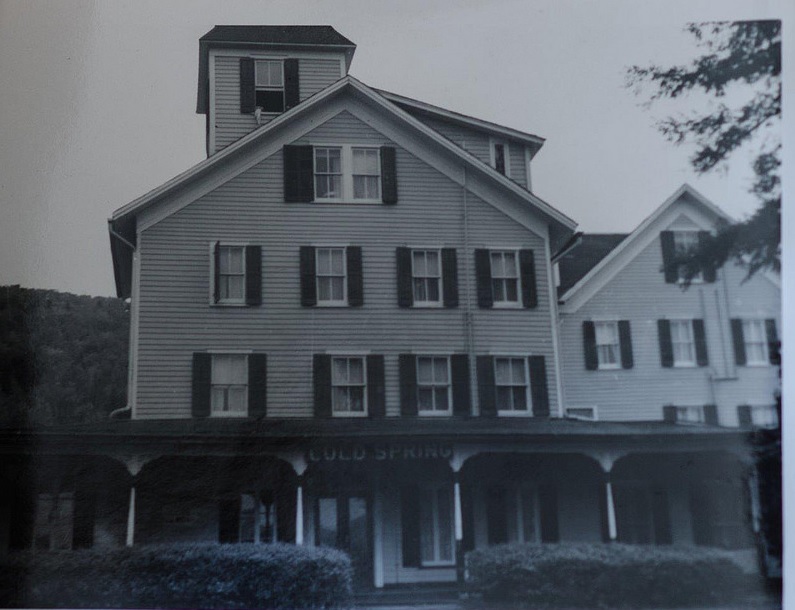
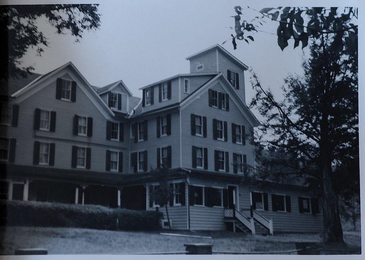
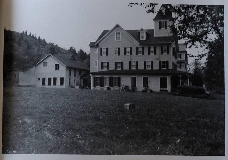
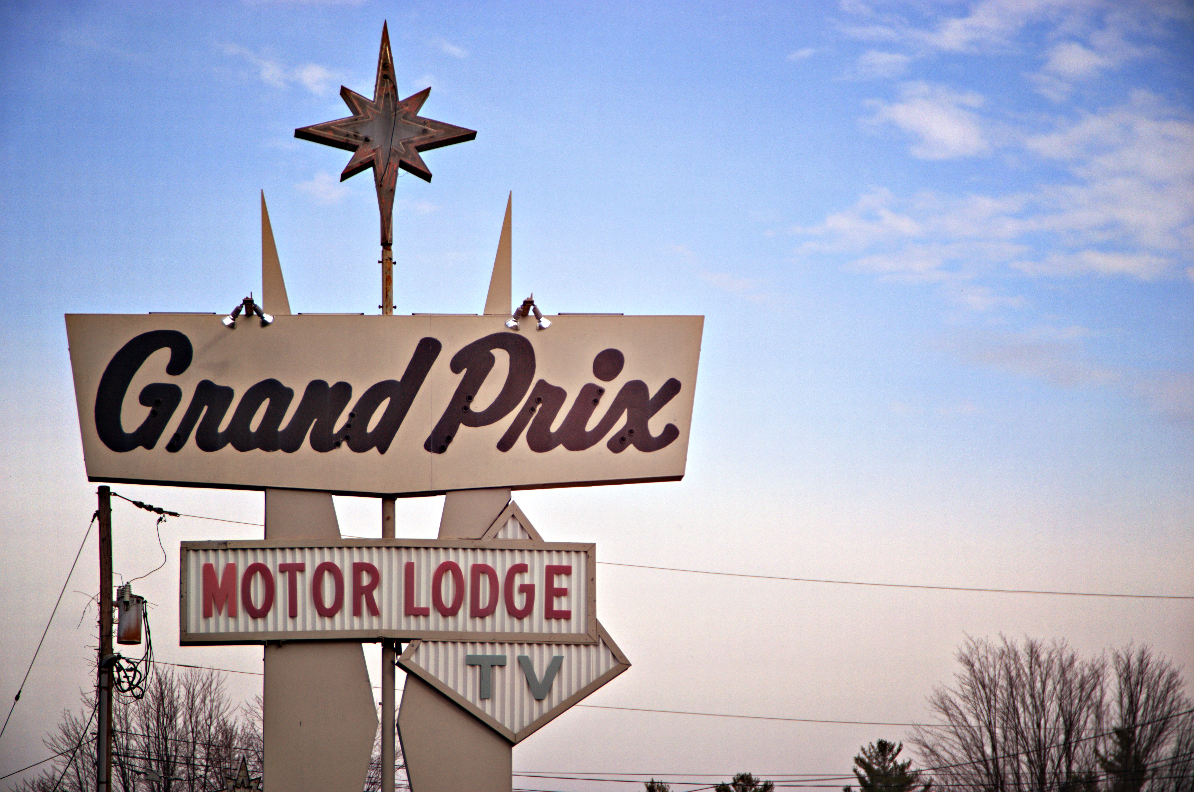
Frontier Town in its Postcard Prime
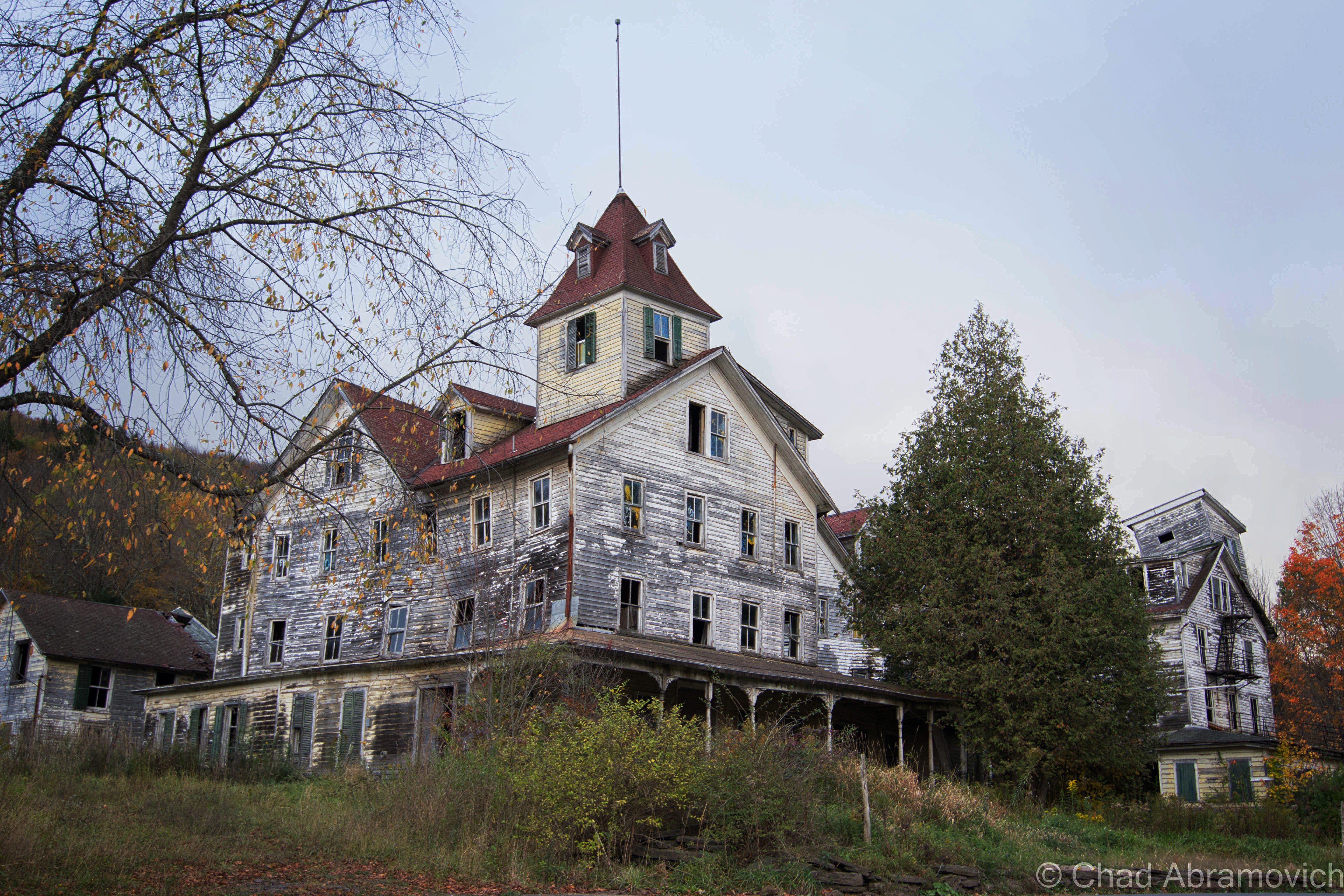
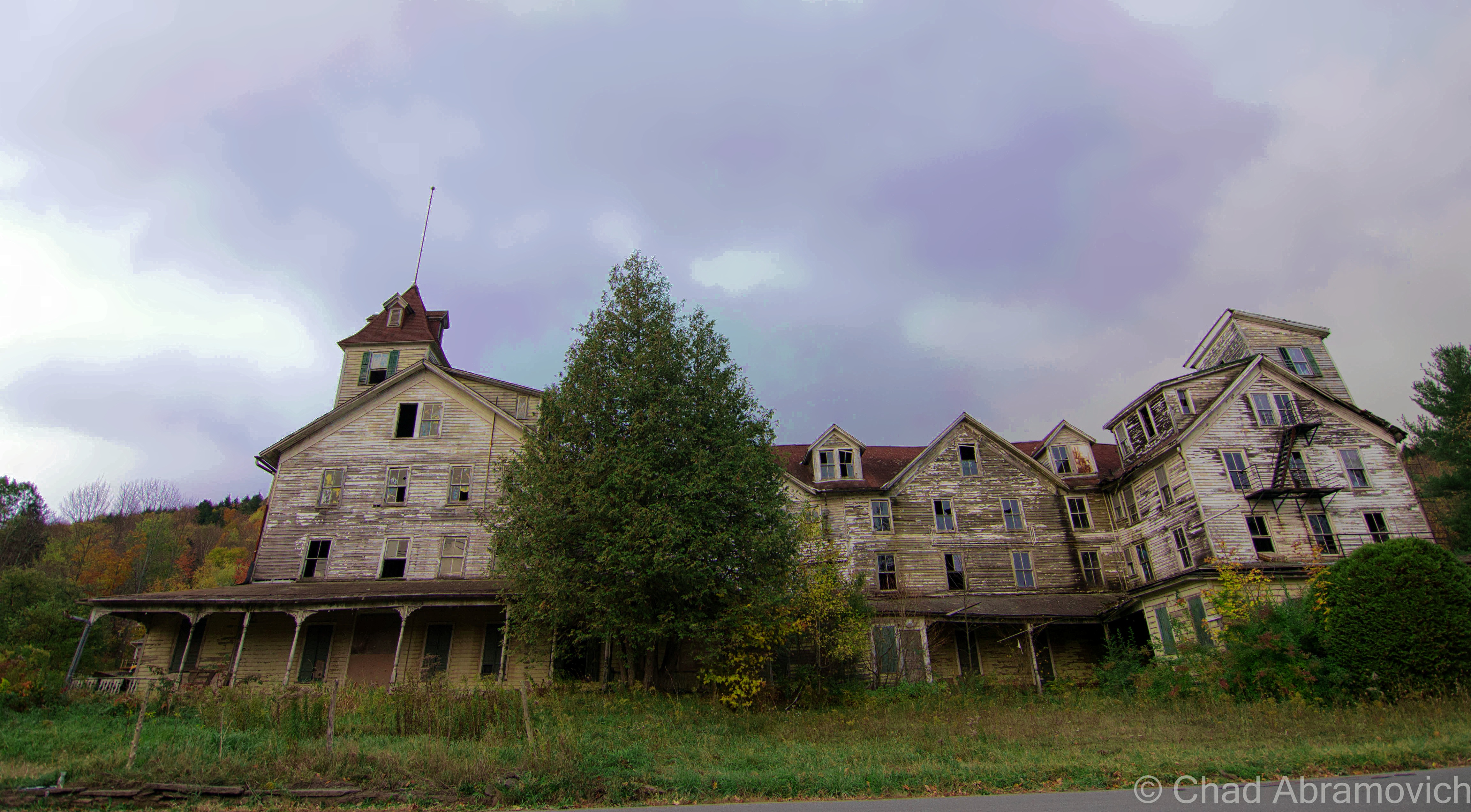
via cardcow.com
via cardcow.com
via cardcow.com
via cardcow.com
via cardcow.com

Frontier Town, 2015

DSC_0259_pe DSC_0299_pe DSC_0308_pe DSC_0314_pe DSC_0317_pe DSC_0324_pe DSC_0326_pe DSC_0329_pe DSC_0338_pe DSC_0344_pe DSC_0346_pe DSC_0353_pe DSC_0369_peDSC_0370_peDSC_0380_peDSC_0382_peDSC_0384_peDSC_0413_peDSC_0418_peDSC_0419_peDSC_0422_peDSC_0423_peDSC_0424_peDSC_0429_peDSC_0439_peDSC_0440_peDSC_0446_peDSC_0452_peDSC_0453_peDSC_0457_peDSC_0471_peDSC_0014_peDSC_0025_peDSC_0030_peDSC_0061_peDSC_0074_peDSC_0077_peDSC_0088_peDSC_0102_peDSC_0108_peDSC_0110_peDSC_0111_peDSC_0118_peDSC_0124_peDSC_0125_peDSC_0130_peDSC_0132_peDSC_0136_peDSC_0137_peDSC_0140_peDSC_0142_peDSC_0147_peDSC_0148_peDSC_0153_peDSC_0155_peDSC_0165_peDSC_0171_peDSC_0191_peDSC_0198_peDSC_0208_peDSC_0219_peDSC_0223_peDSC_0233_peDSC_0243_peDSC_0247_peDSC_0250_peDSC_0263_peDSC_0270_peDSC_0273_peDSC_0275_peDSC_0277_peDSC_0281_peDSC_0285_peDSC_0289_peDSC_0301_peDSC_0307_peDSC_0308_pe

Joining me for my adventure was my friend Bill Alexander, creator of Vermonter.com, who filmed our walk around the grounds. Check out his write up and video below!

Return, Summer 2015

As much as I openly complain about Facebook, and how I find social media more unnourishing and exhausting for me, I have to admit that it’s also been a huge boon in terms of networking and keeping this blog’s momentum in a direction that’s not backwards. Making friends when your an adult is a hard gig. Thankfully, I was able to network with and befriend other explorers over Facebook who dwell all over the east coast. Eventually, we started to organize meet ups with willing participants. In June, 2015, I would meet two cars worth of previously virtual photographer and explorer friends, and Frontier Town was one of our stops on a full day excursion. But, a day of exploring before we arrived in North Hudson had drained my camera batteries, so I only was able to get a few pictures under the coolness of a soft summer evening.

DSC_0126_peDSC_0089_peDSC_0097_peDSC_0101_peDSC_0103_peDSC_0116_peDSC_0118_pe

—————————————————————————————————————————————–

To all of my amazing fans and supporters, I am truly grateful and humbled by all of the support and donations through out the years that have kept Obscure Vermont up and running.

As you all know I spend countless hours researching, writing, and traveling to produce and sustain this blog. Obscure Vermont is funded entirely on generous donations that you the wonderful viewers and supporters have made. Expenses range from internet fees to host the blog, to investing in research materials, to traveling expenses. Also, donations help keep me current with my photography gear, computer, and computer software so that I can deliver the best quality possible.

If you value, appreciate, and enjoy reading about my adventures please consider making a donation to my new Gofundme account or Paypal. Any donation would not only be greatly appreciated and help keep this blog going, it would also keep me doing what I love. Thank you!

Gofundme: https://www.gofundme.com/b5jp97d4

Donate Button with Credit Cards

The Cold Spring House

It’s hard to describe a place like the deteriorating ruins of The Cold Spring House, especially if you’ve never had the experience of visiting it yourself.

The remaining residue of The Catskill Mountains and their heyday as a resort destination – hotels such as this one once catered to primarily Jewish clientele during the 20th century, looking for a little relaxation from the turbulence of New York City in the scenic Catskills.

Driving through the gripping, winding road through the Kaaterskill Forest, with wild rivers cutting through steep hardwood shrouded peaks that resembled worn saw teeth, it wasn’t hard to see the allure.

This is the first time I had ever been to the Catskills region before, and my target village of Tannersville made an attractive first impression, which I was incredibly relieved with after the problematic start to my day. It almost seemed like I would never make it to the Catskills, as numerous setbacks, construction projects, and traffic jams kept delaying travel time, each hour of precious daylight being swallowed by the oncoming October evening. Because we were making a 5-hour drive down from Vermont, I was determined to make this count.

Navigating the highways of New York, we passed by many derelict structures and sordid towns that were more depressing than anything, reminders of the decreasing amount of tourists in the region. It’s one thing to figure a portrait of a place from conversations with friends who grew up around there, and a few things I’ve read, but it was another type of cool entirely to gaze at what was coming through the view of the windshield.

As we approached Tannersville, the comedown daylight was filtered through a black sky foreshadowing fury that never seemed to come. The air was crisp, carrying the smell of dead leaves, as chilly mists began to settle on our faces. It felt like it was going to rain, but it never came, and the mists continued to be misleading.

There we were, staring up at the imposing ruins of the Cold Spring House, and it’s various stages of decay.

The slumping roofs and bending wooden frame ripped open several holes in the building, giving off dead weight that popped out windows and pushed various items through the glass. It was well into the evening now, but we had made it, with just enough light to photograph and do a little exploring. But the question was, where do I even start?

From what I know about the place, it was one of the earlier Catskills hotels, on the outskirts of the Borscht Belt, an area once a dazzling vacation-land now reincarnated as a collection of behemoth and storied abandonments. The Cold Spring House was a grand showpiece, which was very different from the closet cottages and revelrous resorts the area was known for at that time.

Built on what is now Spruce Street in the 1890s, it was the second largest hotel in Tannersville, as well as the first Jewish hotel in town – able to accommodate 200 guests at the base of mountains rising to around 2,200 feet. It started as a hotel called Bieber’s Cold Spring House but was sold in 1922 to Saber Khouri, and re-branded simply as The Cold Spring House.

According to a 1904 advertisement I was able to find online, the property featured expansive lawns, offering tennis and croquet grounds, surrounded by old trees offering comfortable shade on summer days. There were farms on the property that supplied the hotel with fresh milk and vegetables everyday, which were paired with what the ad boasted as excellent table service in the form of German and Hungarian cuisine. And of course, fresh spring water was offered – from the springs which the hotel derived its name from.

The hotel was also widely regarded for its popular classical concerts on the lawn. Two signature towers at opposite ends of the building, now slumping dangerously, were once observatories, giving guests extensive views of the mountains. Today, that view would be worth the price of your life.

What I found interesting about the advertisement was that it boasted such amenities as “sanitary plumbing and fire extinguishers on every floor” – items that we take for granted today, but around that time period, were new features and were only beginning to be enforced by laws. I’m sure that was a selling point – definitely a plus when I choose a hotel. But it makes sense. The time period was a time of transition. There was a nationwide push that required to implement such systems, but it was a costly expense to outfit these old buildings, and many old hotels couldn’t afford keeping up with the competition.

The advertisement also stated that the hotel was continuously expanding as it’s increasing popularity was luring more and more people to stay there each season. Older photos showed a much different building, with only one tower, and most of the western wing not yet added. The final product was a much larger and grander property – the brooding structure you see today.

But times certainly have changed. During the late 20th century, much of the region fell out of favor as a vacation destination. With an increase of automobile travel and an ever-burgeoning highway system, more Americans were driving, and could travel farther distances and see more places. Now, they no longer had to settle for the closest area available – a trend that I’ve seen so many times in humbled abandonments I’ve visited. Tannersville was no exception. Many vacation homes eventually were abandoned and hotels were shuttered. The Cold Spring House fell into the trend and was abandoned in the 60s, leaving quite the compelling ruin in its wake.

It literally hunches over Spruce Street in its old age, leaning in all directions. A symbol of human progress and the change of the times, something inevitable that tends to leave growing pains on the often bumpy road of advancement and the fodder of bandwagon fads. In an ironic sense, this more offbeat form of tourism can also serve as a poignant melding of public awareness, a chance to learn from our past.

Today, Tannersville is more known for it’s proximity to Hunter Mountain Ski Area than a summer destination, but while many Borscht Belt towns are still struggling, Tannersville seems to be in the middle of some sort of revival. As it was explained to me, people started to rediscover the town and were taken by its natural beauty. Old vacation homes began to be fixed up at expensive costs because of the bad shape they had deteriorated to, and more businesses have opened up on Route 23A.

As for the Cold Spring House though, I had the pleasant chance to speak with photographer Linda O’Donnell, who has been researching and documenting the building’s deterioration for the past several years. She informed me that the place has been scheduled for demolition since 2012, but demolition by neglect may happen before any actual bulldozers arrive on the property. It makes you wonder, when will the familiar become just history?

Dying Light

This was truly one of the most spectacular places I’ve had the chance to photograph (and a great change of scenery from Vermont!), but with its awe-inspiring profile came very tangible dangers. As I walked around and got to know the place better, I was able to recognize something very quickly. The building was far too dangerous to venture inside, and because of our late start, there was little daylight left. Peeking in through an opened window, I was met with an interior of collapsing floors, wooden walls intended to support the structure were crushed into an accordion-like resemblance, and various artifacts collected in indistinguishable piles of fragments covered in dust and lead paint speckles. The weight was so great in some places that many things had actually been pushed through the floor, which was already cracking on the added weight of my body. That musty old building smell wafted out from the opening, mixed with a heavy damp musk. To my far left, a staircase, illuminated by the dull light of broken windows, climbed above the wreckage and into the mysterious upper floors. Or what was left of them. Though I ached to go inside, that would have been an idea that probably would have been counterproductive to my travel plans, which were to leave intact and alive.

For a relatively rural back street, the traffic was thunderous, a constant roar of pick up trucks going by, and slowing down when they noticed me with my camera. Because New York State has very unforgiving rules against trespassing, and with me being in such a surprisingly public area where I would no doubt be trapped should I be caught, the odds were stacked against me.

I had no choice but to keep a safe distance. But the exterior alone was worth the drive. The tops of the building still wore it’s yellow paint job, the original color of the hotel, while the lower levels were weather worn into a dull grey and showed signs of various stages of rotten cavities that completely ate through the walls. Older photos showed a sign that read “Cold Spring” that hung over the porch near the front entrance, but when I visited, that was also long gone, the last clue to its identity.

Signs of human presence were everywhere. Graffiti was found on many of the upper windows, but not the good kind of graffiti. That also meant that some adventurous intruders made the trip to the upper floors…

I often find strange items left behind when I explore – and this was no exception. There was an interestingly large collection of abandoned records found all around the hotel, most on the front lawn, tangled in tall grass and cedar trees. Some of them were arranged specifically, with various items such as kitchen utensils and bottles filled with suspicious colored liquids in them, propped purposely around the sides. I didn’t recognize any of the artists – but some looked like they would have been right at home in some embarrassing 70s porno.

Just gazing up at the place and looking in the numerous windows offered many things to see. Radiators that had fallen out broken windows. A glimpse of a bedpost. Dark rooms with holes in the ceiling letting in the dying daylight. Old glass bottles left on windowsills. Then the wind blows, and the eerie creeks of a shutter can be heard, before it bangs loudly against a wall several stories above, you see the movement, and your pulse quickens as you jump to conclusions. Despite the reliable hum of noise outside, closer to the hotel, things faded into an uncomfortable silence that was almost loud in itself. It was quite startling considering it was just a short walk down the lawn that offered such a fast transition.

Not wanting to draw attention by staying too long, we left and began the journey back to Vermont, the Cold Spring House leaving a lasting impression.

ColdSpring
These are some great historical photos of the Cold Spring House in its heyday, which I found online accidentally and was kindly given permission to re-link by Flickr user Linda O’Donnell. Not sure of the dates, but it really gives you a sense of what this place used to be like.
ColdSpring2
Used with permission from Flickr user Linda O’Donnell
ColdSpring3
Used with permission from Flickr user Linda O’Donnell
ColdSpring4
Used with permission from Flickr user Linda O’Donnell

  The Cold Spring House Today

DSC_0861_pe DSC_0881_pe DSC_0888_pe DSC_0890_pe DSC_0893_pe DSC_0899_pe DSC_0916_pe DSC_0922_pe DSC_0924_pe DSC_0925_pe DSC_0929_pe DSC_0933_pe DSC_0935_pe DSC_0941_pe DSC_0942_pe DSC_0945_pe DSC_0946 DSC_0955_pe DSC_0961_pe DSC_0999_pe DSC_1000_pe DSC_1001_pe DSC_1002_pe DSC_1003_pe DSC_1004_peDSC_0981_pe DSC_0993_pe

Information:

There doesn’t seem to be a lot of information on this place. Most of what I was able to compile in this post came from speaking with various people, and a good article I found online from the Register-Star 

There is also a group on Flickr I found, dedicated to sharing memories and photos of it.

This is one of my favorite things I came across while researching. Here is a fascinating article and photographic journalism piece about the Borscht Belt

—————————————————————————————————————————————–

To all of my amazing fans and supporters, I am truly grateful and humbled by all of the support and donations through out the years that have kept Obscure Vermont up and running.

As you all know I spend countless hours researching, writing, and traveling to produce and sustain this blog. Obscure Vermont is funded entirely on generous donations that you the wonderful viewers and supporters have made. Expenses range from internet fees to host the blog, to investing in research materials, to traveling expenses. Also, donations help keep me current with my photography gear, computer, and computer software so that I can deliver the best quality possible.

If you value, appreciate, and enjoy reading about my adventures please consider making a donation to my new Gofundme account or Paypal. Any donation would not only be greatly appreciated and help keep this blog going, it would also keep me doing what I love. Thank you!

Gofundme: https://www.gofundme.com/b5jp97d4

Donate Button with Credit Cards

Disappearing Act: Burlington’s lost ravine.

Sometimes it seems that I could write a sizable book about Burlington, inspired by the seemingly endless tales of fabled places, strange stories and lost history that are begging to be known – their praises seldomly sang by a select and arcane few.

There are many weird and wonderful things that many of us see everyday. The world’s largest tower of filing cabinets makes its home in a weedy field in the South End, and there is a puzzling bridge to nowhere in the intervale that looms over the beltline.

And there are other intriguing mysteries that are more difficult to explain, and even harder to find. Tales of catacombs and tunnels running underneath downtown have been relayed to me, as well as an awesome and mysterious “subway like railroad tunnel” that supposedly runs underneath the Old North End still, years after being defunct and sealed up (which I have yet to find). But, out of all of Burlington’s peculiarities that have long since vanished, there is one that is still refusing to be completely forgotten.

I was interested in this mystery when I accidentally stumbled upon an old city map dating from the mid 1800s in the book Bygone Burlington. It clearly marked streets and familiar landmarks that still exist today. King Street, Main Street, Lake Champlain. But there was something else. The map clearly labels something that would be so conspicuous in today’s Burlington. Just east of present day South Winooski Avenue was a serpentine sunken trench of land that divided the city in a South-West and North-East direction, separating downtown from the hill section. A few bridges crossed the ravine and spurred off onto the hill and towards Colchester Avenue before making the journey to Winooski – the old map describing the ravine as wild and swampy. It was strange seeing this strange ditch co-existing with the city.


It’s obvious that this ravine no longer exists today. Or, so it would seem. As a matter of fact, the ravine is still very much there.

Burlington_1853_ChurchStreet_16x20web
This 1853 map of Burlington shows the former ravine

I knew I wanted to know more, and I set out to do some research. What I found was another interesting layer in Burlington’s story line.

In the beginning, it seemed that this fabled ravine was beneficial to the city. As Burlington prospered and grew during the 19th century, the city would need to meet the demands of a growing population. Old maps created around 1853 indicate that the Vermont Central Railroad purposely used the ravine as a direct route from the waterfront to the mills in Winooski. The former downtown train depot sat at what is now the corner of Main Street and South Winooski Avenue (known then as White Street), where the fire station is today. In 1862 the railroad was re-routed underneath North Avenue and through the intervale on its present day route. Later, in 1880, the ravine would once again serve a utilitarian purpose, and was chosen as the backbone of the city’s new and modern sewer system which was built using a network of stone and brick sluices and culverts that followed the path of the ravine into the lake – all discharging at a location somewhere near the end of Maple Street.

However, there was a population explosion in Burlington around 1880 and the demand for land was high. The ravine soon became a roadblock to progress. Tensions mounted when the existing sidewalks and bridges began rotting and crumbling, creating dangerous hazards and upset residents. The city then embarked on an ambitious project to fill the ravine, and in a classic act of 19th century urbanism, filled it with garbage. That’s how San Francisco reclaimed its now famous waterfront area, so why not Burlington? But, maybe 19th century urban planners didn’t see the problems behind building a city over decomposing garbage piles. But it happened, and the modern day downtown we all identify with was created in its wake.

Over time, people have been curious about the ravine as I have been, and began to pick at the pieces to this intriguing puzzle. And that seems to have raised some issues of debate. Some argue that the ravine was never there to begin with, and was simply an error on a map.

But other arguments prove otherwise. It is known that Burlington’s waterfront is reclaimed marshland, filled in with garbage and wood and old maps show a former branch of the Winooski River actually emptying into the lake here, near the present day Battery Street railyards. Some even speculate there are still remnants of this original tributary still running underneath the streets today, but performing an excavation now would be impossible, problematic and costly, leaving this as speculation.

But, you don’t have to do a lot of digging to find some answers, and In this case, the answers take the form of a long, narrow and seedy looking landmark that is a looming eyesore at the main entrance to the vibrant downtown area; The Midtown Motel. You might not guess by looking at it, but the dated structure was purposely built the way it is, because it sits on top of the former ravine and the layers of garbage that filled in the old cavity.  The motel opened in 1958 and has served everyone from tourists, young lovers looking for a little respite, and people just down on their luck – and because there were no places to stay in Burlington’s city center at the time, the Midtown Motel prospered.

But, before anything could be built on the property, local architect Benjamin Stein had to figure out how to fit both a motel and ample parking on the usable pieces of the property – the parts that would support development over the fragile layers of fill that cover the ravine.

The Midtown Motel
The Midtown Motel

To make it work, the architect needed to get creative. The narrow motel was elevated and the parking was put below it. The design embodied the International style of architecture, where functionality came first. The motel did well until the 90s, when it went downhill and began drawing seedy clientele, and a bad reputation to go with it.  Today the motel is out of business and vacant, and the city block it sits on is considered a “super block”- or, a block that is largely city owned and offers substantial redevelopment potentials. It is one of the only such blocks remaining in Burlington, meaning the value of the land is only growing. However, because the property’s unique setbacks, more delicate measures will have to be made before any large redevelopment projects are taken.

Just down the road from the Midtown Motel is another remnant of the ravine, one that the city hasn’t completely covered up yet. On King Street, there is a sizable and isolated geographical anomaly in the middle of the road itself – a dip in the stretch between Church Street and South Winooski Avenue.  From the bottom of the dip you get a good perspective of the raise in elevation around it, and how the city’s buildings have been configured and built. And there are some buildings on Saint Paul Street with exposed foundations, sections of the buildings that appear to have once been above ground.

The Strange Isolated Dip in King Street
The former Wilson Hotel on the corner of Church and King showcases evidence of changing elevation - the front door is on the second floor!
The former Wilson Hotel on the corner of Church and King showcases evidence of changing elevation – the front door is on the second floor!
This brick house on St. Paul Street shows that the first floor was at one point the basement.

It seems strange to think about a large trench that divides Burlington in half, a trench so large that it once even had its own toboggan club – but stranger things have happened in the throes of progress. If the entire present day city of Seattle was built literally on top of the original city, then Burlington’s ravine almost seems passively unimpressive to think about. The communities we visit today are drastically different from what they were 100 years ago, almost unrecognizable at times, which is both intriguing and inspiring. Who knows what else is buried underneath the ground you walk on.

Links:

The Midtown Motel in Seven Days

—————————————————————————————————————————————–

To all of my amazing fans and supporters, I am truly grateful and humbled by all of the support and donations through out the years that have kept Obscure Vermont up and running.

As you all know I spend countless hours researching, writing, and traveling to produce and sustain this blog. Obscure Vermont is funded entirely on generous donations that you the wonderful viewers and supporters have made. Expenses range from internet fees to host the blog, to investing in research materials, to traveling expenses. Also, donations help keep me current with my photography gear, computer, and computer software so that I can deliver the best quality possible.

If you value, appreciate, and enjoy reading about my adventures please consider making a donation to my new Gofundme account or Paypal. Any donation would not only be greatly appreciated and help keep this blog going, it would also keep me doing what I love. Thank you!

Gofundme: https://www.gofundme.com/b5jp97d4

Donate Button with Credit Cards

Railroads and Silos

It was an icy Winters day as me and some friends drove through the Champlain Islands; destination unknown. It was one of those situations where we were seeking a place to explore, hoping to find some inspiration and intrigue in the brown fields burned by the harsh blue skies. In the Winter, the Champlain Islands loose the comfort and allure brought with the Summer months, vanishing with the shivers and darkness of the later half of the year as if it were a completely different place.

Not having any real luck in the islands, we crossed the Alburgh bridge into New York, the sturdy ruins of Fort Montgomery were not being pitied by the season as they were battered by the choppy and relentless waters of Lake Champlain.

For a region with such an extraordinary history and important connection to the rest of the country, a surprisingly large amount of it has been buried (metaphorically and literally), the occasional historical marker is scattered across the geography, hinting at what once was.

Rouses Point, New York has always been a heavily trafficked locality thanks to it being a portal into Quebec. It’s where the dotted border lines of New York, Vermont and Canada all meetup, as well as Lake Champlain and Quebec’s Richelieu River, which were the area’s original super highways before the interstate systems were built.

Automobile, rail and boat traffic is all siphoned through the gateway community, and because there are always nuances, that also includes the more illicit of things, like rum runners, smugglers, the underground railroad, and a few wars fought by the British and the Americans skirmishing on Lake Champlain over the past hundred years. Seriously, Rouses Point was such a noteworthy place that the feds financed a fort to be built at the mouth of the Richelieu just in case British troops wanted to invade us through Canada. Only, the United States was a much younger nation then, which meant that no one knew exactly where the border was, and the fort was accidentally built in Canada, later returned to the U.S, and never actually used. It was eventually partially salvaged for parts, and a lot of the small village was built up with the bricks, stone and wood salvaged from the brawny structure. From what I was told, the present day village offices were built on top of a former prohibition era dumping site of all the paraphernalia that was confiscated. Today, a drive through Rouses Point is mostly simple wood frame houses, moored sailboats and a Dollar General, a ubiquitous find in Upstate New York.

The village really did well for itself when the Delaware and Hudson Railroad decided to build passenger and freight facilities here and a rail yard to accommodate. Though Rouses Point is a pretty obscure community overall today, just outside the village limits are the remains of the oldest and last remaining Delaware and Hudson roundhouse turntables. Being battered by fierce winds, our trip here was short as the numbness in my hands began to outweigh my increasingly diluted curiosity. What can I say, I hate the cold.

This building was formerly used for washing down the rail cars

dsc_0448_pe

Interestingly enough, most railroads, the D&H included, didn’t bother to wash their steam locomotives. Every so often, they would go over them with a mop soaked in kerosene to make them shine, but that’s about it. Roundhouses were built in the steam era as a way to store and maintain the locomotives, as well as repair and prepare them for their next trips. Other buildings on the site would be a coach shop, which was used to repair passenger stock, a cooling tower which was used for fuel, water tower for water, and in some cases a freight house where less than carload items were sorted and shipped out.

So, what is the reason that so many roundhouses are now abandoned?  In short, diesel engines need much much less repair than steam engines. When the steam engines faded away, so did the roundhouses.

This building was used for holding freight.
The original roundhouse

Alburg is a 45th parallel town, and one of a handful of Vermont communities that have found themselves in a weird moniker contention, where the United States Board on Geographic Names decided that they needed to standardize place names around the country in 1891. Every city or town ending in ‘burgh’ had their H dropped, pretty much so the mail would go to the right places and to make them easier to write on federal documents.

Well, over a hundred years later, a few Vermont towns decided that the dropped consonant was something to get up in arms about, with a few bringing it back, and the other few not caring that much.

Back across the bridge, in the pancake flat farmlands of the Champlain Island archipelago, the landscape is dotted with trailers, sagging farmhouses done in vinyl siding, and silver silos that reflect the coarse December sunlight from their gleaming surfaces.

There is a rural road off of Route 2 called Missle Base Road, a moniker that supports the notion that this cul-de-sac is different from other Alburg byways . Whether or not it’s misspelling is a VTrans blunder or intentional, it’s sort of a weird road name in a region that only has a sheriff to bring down the law. That street sign is overshadowed by a much larger and more intimidating sign. In fading lettering, it sort of reads “Stop! Authorized Personnel Only Beyond This Point” in attention grabbing orange, while even more faded text behind it once read “Town of Alburg” (spelled without its H)

A drive down bad tarmac puts you dead ending in front of 2 rusted Quonset Huts, a chain gate, construction equipment that has seen better days and a dune of road salt. You’re looking at the Alburgh town garage!
But the Quonset Huts give its past away. Underneath the salt pile is the reason for the huts construction; an atlas missile silo.

This is the site of one of Vermont’s 2 nuclear missile silos. But you’d never know it. Towards the back of the property, a rusting pile of junk and a dune of road salt sits on top of the closed silo bay doors, each concrete door weighing 45 tons, enclosing the dark dripping confines of the flooded silo below.

Peering down the silo today would be a wondrous gaze into man’s eternal battle with evil and glorious ruin, but if you had peered down this shaft in the early 1960s, you would have been gazing at the tip of a nuclear missile.

In the 1960s, the military was scrambling to build defenses against the potential of a nuclear apocalypse that the Soviet Union was scheming, with the Soviets doing the same thing with the role of the villain reversed. The Army Corps of Engineers constructed 12 sites in a ring around the Air Force base in Plattsburgh — 2 in Vermont, 10 in New York, and absolutely no expenses were spared, with each site costing between $14 and $18 million to build, each one coming with a brazen claim that each could withstand a direct nuclear attack.

But these mysterious and aggressive projects were quite a feat to build. Many workers died during their constructions, with urban legends reciting that some unfortunate souls became entombed in the concrete silo walls they were hired to produce. The thought of the cold walls and dark depths of the missile silo as someone’s last vision is an image is a poignant one.

Ironically, despite the large expenses invested in these agents of destruction, the pulses of these missile silos were short lived, only active from 1962 until 1965, thanks to leaps in progressive apocalyptic technology. To add to the uncertainty, many were disputing afterward whether the missiles would have been able to hit their targets, and even be able to lift off the ground.

But they left a lasting impression on the landscape. However today, they hold contaminated waste and shadows smothered with valiant ghosts.

Each launch site constructed included two Quonset huts, a utility shed and an antenna that could detect a nuclear attack up to 30 miles away. The silo itself was 52 feet wide and 174 feet deep, encased in a shell of incredibly thick and durable concrete.

After their demise, the sites were abandoned. Ownership was now the burden of their communities, including this one, which was, uh, gifted to Alburgh, who turned it into their down highway department headquarters and dumped road salt over the perforation. Others were looted, some were sold to private investors and military enthusiasts. According to lots of testimonies over the intervening decades, most of them flooded to some degree.

Because everything has a market, interest in these intriguing properties has picked up in recent years, thanks to curious buyers who see the old silos as great “fixer-upper” projects, especially for private homes. But due to their deteriorating conditions, these sites require a buyer with a lot of money, patience and time. One of the former sites, in Champlain, New York was found and purchased on eBay. The new owner plans to clean it up and live in the remaining Quonset hut, and possibly in the launch control center. Taking his project a bit further, he has created an intriguing website which tracks his progress cleaning up the site, and gives everyone else a cool and rare look into these fabled locations.

Alburgh’s site wasn’t phenomenally interesting, but I still thought it was cool. I snapped a few photos of the Quonset Huts, because that’s more interesting than a photo of a pile of salt. I’m pretty confident in my assumption that the town won’t be opening up those blast doors anytime soon, so it’ll have to do. A town garage that doubles as a weird monument to humankind’s strange tendency to destroy itself. 

dsc_0480_pe dsc_0481_pe dsc_0483_pe dsc_0484_pe dsc_0485_pe

As of 2015, it looks like the street sign was spell checked, but Google maps still uses the misspelled moniker for the road.

—————————————————————————————————————————————–

To all of my amazing fans and supporters, I am truly grateful and humbled by all of the support and donations through out the years that have kept Obscure Vermont up and running.

As you all know I spend countless hours researching, writing, and traveling to produce and sustain this blog. Obscure Vermont is funded entirely on generous donations that you the wonderful viewers and supporters have made. Expenses range from internet fees to host the blog, to investing in research materials, to traveling expenses. Also, donations help keep me current with my photography gear, computer, and computer software so that I can deliver the best quality possible.

If you value, appreciate, and enjoy reading about my adventures please consider making a donation to my new Gofundme account or Paypal. Any donation would not only be greatly appreciated and help keep this blog going, it would also keep me doing what I love. Thank you!

Gofundme: https://www.gofundme.com/b5jp97d4

Donate Button with Credit Cards

Rabbits, Rowboats & Roosevelts: Lake Bomoseen’s odd history

The largest lake entirely within Vermont’s borders, Lake Bomoseen in western Rutland County measures 9-14 miles long (depending on who you ask). It extends from Lily pad choked swamp lands in the small town of Hubbardton to the north, expanding into a broad center complete with an island, before narrowing into a slim passage way running just slightly below the interstate type highway of U.S. Route 4 to the south in Castleton.

And there is something compelling about this lake. Speaking to a few people about it along its shores, they all somewhat described they felt a strong pull to the lake – some sort of inexpiable connection of fondness towards it. And with the lake’s storied history with layers that are piled on more compactly than the slate piles crumbling into the lake on the west shore, it isn’t that difficult to understand.

(via CardCown.com)

The name Bomoseen is an Abenaki word which translates to “keeper of ceremonial fire”. The Taconic Mountains, which make up the rolling hills that run along both sides of the lake, are the slate-producing region of Vermont, and the area’s history parallels the rise and fall of Vermont’s slate industry. The area surrounding the lake contains several quarry holes and their adjacent colorful slate rubble piles as reminders of this period, many you can see tumbling down the western shores of the lake – a bizarre and stark contrast to the otherwise gentle landscape around it. Across the lake, you can still witness the overgrown cellar holes of the ghost town of West Castleton, a product of once prosperous times, now a landmark to what once was.

Weird Waters

If your into ghost stories, Lake Bomoseen have an interesting one. The story goes that one night in the 1800s, 3 Irish slate workers from West Castleton obtained a rowboat and decided to row to a tavern on the east shore to entertain themselves. But they never showed up. The next morning, their rowboat was found floating empty on the open waters of West Castleton bay, but no trace of their bodies were ever found. Locals say that on certain moonlit nights, the phantom rowboat can be seen moving effortlessly across the waters of Lake Bomoseen, making no disturbances in the water.

But if phantom rowboats don’t grab your attention, this mysterious body of water has a far stranger tale woven into its web of folklore. Towards the north end of the lake is a surprisingly undeveloped island (apart from an estate on the very southern tip). The island is long, densely wooded and rests a mere 30 feet away from the lake’s North West shore. But this island is known for something far more mysterious than its idealized lakeside real estate. It is here where Vermont’s entire population of giant rabbits are said to reside. As the name implies, they are distinctive because of their size, and more noticeable, their glowing red eyes. But how did the entire population of this elusive sub culture become to be contained on such a small island in Lake Bomoseen, and why?

I turned to Joseph Citro’s The Vermont Monster Guide for an explanation. In a pure Darwinian principle, they somehow hopped the 30 foot jump from island to mainland, and couldn’t get back. The bigger rabbits were the only ones who could make the jump, leaving the biggest of the big trapped on the isolated chunk of land in Bomoseen’s murky waters.  What happened next however wasn’t so bizarre; they did what rabbits did best, and multiplied.  As the years progressed, they became bigger and stronger. Legend has it that some have seen rabbits as large as Volkswagons and Saint Bernards somewhere amidst the dense evergreen foliage that climb the shores.  But these rabbits are by no means new phenomenon. As a matter of fact, the Abenaki may have in fact told tales of these oversized rabbits on the island. And today, it is not uncommon to see curious campers and adventurers boating and kayaking around the island trying to catch a glimpse of these unique cryptids – and as far as we know, they are harmless. Perhaps it comes as no surprise that residents began calling the narrow landmass Rabbit Island.

If giant rabbits and rowboats piloted by unseen forces aren’t good enough for you, Lake Bomoseen has another surprise, one that is concealed by the largest existing entity on the lake – it’s waters. And if the legends are true, this will definitely bring you a dose of rigor…

Around 1986, a man and his wife were fishing on the lake in their seventeen foot boat, when they saw an extraordinary creature moving beneath the water’s surface. It looked like a giant eel. The description created a picture of something eight to nine inches in diameter, and an astonishing twenty feet long! Well – they said it was longer than their boat anyways. Not wanting to attract the USO with their fishing bait, they reeled in and headed quickly back to shore.

So, is there really a giant eel lurking beneath the waters of Lake Bomoseen? Surely something so massive and so distinctively intimidating would have been seen by others? Not so much. As a matter of fact, this was the only sighting I was able to dig up, meaning either it was a one time phenomena, something far more innocuous, or maybe, people are just keeping quiet about it. After all, Vermonters are pretty good about keeping secrets…

State wildlife biologists weighed in on this, and said that generally, the size of eels can vary greatly, but it’s entirely possible that they can reach up to around five to six feet in diameter and weigh around fifteen pounds, and, they speculated that it was entirely possible that larger ones could exist in larger landlocked bodies of water. But Bomoseen, the lake in question, well, they sort of left that answer somewhere in the smoke.

(via CardCow.com)

A Famous History

Lake Bomoseen has been drawing tourists to its shores long before the year round camps and state routes began to ring its shores. As early as 1870, Lake Bomoseen began to establish itself as a tourism getaway. The Johnson farm, on the north end of the lake was said to be the first location around the lake to began hosting summer guests around this time. To reach the Johnson farm, guests crossed a float bridge, which actually did float on the surface of the lake. Still referred to as the Float Bridge, it now does just the opposite of float, as it’s fixed sturdily to land with granite, concrete and steel. Just take Float Bridge Road, still in existence at the north end of the lake.

Over the next couple of decades, more hotels sprang up around the lake. Even the ruins of nearby Hyde Manor brought guests to the lake by stagecoach.

Over time, something else began to make their appearance along the lakeshore as well; summer camps. One of the most famous was on Lake Bomoseen’s largest island – the secretive and elite Neshobe Island, which had a reputation that helped establish the aura of mystery for exclusive clubs and societies.

Purchased in the 1920s by Alexander Woollcott, author, actor and New York Times drama critic, the cottage and island became a retreat for the Algonquin Round Table, a group of journalists, editors, actors and press agents who met regularly at New York’s Algonquin Hotel starting in June 1919. Summer weekends were said to consist of cocktails and croquet on the island with Woollcott as host, and catered to notable guests such as President Theodore Roosevelt – who could be seen landing his seaplane on the lake during his arrivals.

The island was said to be beautiful, with rolling topography, mixed woodlands and miniature meadows filled with wild flowers. While local Vermonters left the islanders to their own business, it was the tourists who tried to invade their privacy (or so the accounts claimed). That was, until comedian, film star, and visiting guest Harpo Marx put a stop to it. One day, as a boat full of rowdy tourists invaded the island’s private beach for a picnic, Marx stripped naked, smeared himself with mud, grabbed an axe and ran down towards the startled tourists hollering and making animal noises. They never came back.

Today, the grand resorts and private clubs are gone, succumbing to disastrous fires and the changing times, and the lake has given way to a more dominating landscape of summer camps and private homes. But the lake is still quite active, and is just as beloved as it was a century ago. An official stop on Vermont’s Stone Valley Byway, and lined by several beaches, a state park, a popular golf club and lakeside restaurant that offers dock side conveniences (after all, Bomoseen is a boating lake), Lake Bomoseen still draws several crowds that all share a mutual love of the lake, but undeniably, a lot has indeed changed.

Below is an interesting video of Lake Bomoseen’s history, if you are so inclined.

[youtube=http://www.youtube.com/watch?feature=player_embedded&v=RIB4hfAvwrQ]

 Left Behind

Just south of Lake Bomoseen, where the road breaks from the shoreline for the first time, and the landscape returns back to woods, is a small and rotting remnant of Lake Bomoseen’s tourism heyday of yesteryear – an abandoned mini golf place. The faded and weathered sign over it’s sloping rental building reads “Bomoseen Golfland” with a rather creepy looking clown as its official mascot, something that conjures more of an image of sinister intentions than a round of mini golf.

Though I don’t know any of the history behind this small mom and pop operation, it most likely functioned during the mid 20th century and provided passing tourists and summer campers with some cheap fun for a few hours, and closed when the region’s tourism trends changed. Today, the ruins can still be seen from the side of Route 30, now desolate, weed ridden and forgotten, the water logged AstroTurf’s awkward green color a sort of gross presence to the otherwise natural landscape around it.

DSCN2407_pe DSCN2409_pe DSCN2414-2 DSCN2416 DSCN2417-2 DSCN2418-2 DSCN2419-2 DSCN2421-2 DSCN2424_pe DSCN2425_pe DSCN2426_pe DSCN2428

Overall, I spent a total of 10 minutes wondering the moldy grounds of Bomoseen Golfland. It wasn’t the most interesting place I have ever visited but it was creepy enough. The dilapidated wooden building with its peeling paint sat underneath a sky of broken lights,  smashed over the sad remnants of each mini golf obstacle. But it certainly is a monument to classic roadside Americana and a simpler time. And for that, I’m thankful I had the chance to visit.

—————————————————————————————————————————————–

To all of my amazing fans and supporters, I am truly grateful and humbled by all of the support and donations through out the years that have kept Obscure Vermont up and running.

As you all know I spend countless hours researching, writing, and traveling to produce and sustain this blog. Obscure Vermont is funded entirely on generous donations that you the wonderful viewers and supporters have made. Expenses range from internet fees to host the blog, to investing in research materials, to traveling expenses. Also, donations help keep me current with my photography gear, computer, and computer software so that I can deliver the best quality possible.

If you value, appreciate, and enjoy reading about my adventures please consider making a donation to my new Gofundme account or Paypal. Any donation would not only be greatly appreciated and help keep this blog going, it would also keep me doing what I love. Thank you!

Gofundme: https://www.gofundme.com/b5jp97d4

Donate Button with Credit Cards

The World’s Largest Tower of Filing Cabinets

I think this is one of the first Vermont oddities most Chittenden County denizens are introduced to, because of its easy to find location in a slowly gentrifying neighborhood. I lived in Burlington’s cool south end district for a few years before I moved onto other apartments, which I’m now regretting.

Sometimes the best adventures are in your own backyard. Or at least they can keep the doldrums away. One of my favorite ways to spend my days in Burlington was to go scouting. For what? That totally depended on wherever I walked with my camera. Thankfully, Burlington is a very cool and eclectic city.

Down on Flynn Avenue, you can’t avoid spotting the world’s largest tower of filing cabinets in a weedy field near Switchback Brewery. But…why?

These seemingly random filing cabinets were actually very much intentional. The strange tower was built in 2002 by local artist Bren Alvarez as an art project, and a silent jab at bureaucracy. It stands in the path of the ill-fated “Southern Connector“, an interstate highway that was never built – the blighted urban planning failure actually sits a block south, and was put on indefinite hiatus because of a swampy, polluted barge canal just a bit north. There are 38 drawers, each represents the number of years of paperwork accumulated by the project when the thing was fabricated.

But that’s not all this peculiar monument tells you. All over its rusting structure are urban hieroglyphics – hinting at local taggers and mysterious visitors who pass by and leave their marks in their own way. Names, pseudonyms and a rather cool map of Burlington are just a few of the things you can find etched onto the sides. Local lore has it that at the very top drawer, that lies slightly open, lies a hidden geocache – or at least some sort of mysterious object stashed up there, waiting for someone to see. But I couldn’t confirm is that was true or not. There definitely isn’t an official geocache listed on the website here.

DSC_0706_pe DSC_0697_pe

DSC_0692_pe DSC_0688_peDSC_0715_pe

DSC_0212_pe DSC_0213_pe

—————————————————————————————————————————————–

To all of my fans and supporters, I am truly grateful and humbled by all of the support and donations throughout the years that have kept Obscure Vermont up and running.

As you all know I spend countless hours researching, writing, and traveling to produce and sustain this blog. Obscure Vermont is funded entirely on generous donations that you the wonderful viewers and supporters have made. Expenses range from internet fees to host the blog, to investing in research materials, to traveling expenses. Also, donations help keep me current with my photography gear, computer, and computer software so that I can deliver the best quality possible. Seriously, even the small cost equivalent to a gas station cup of coffee would help greatly!

If you value, appreciate, and enjoy reading about my adventures please consider making a donation to my new Gofundme account or Paypal. Any donation would not only be greatly appreciated and help keep this blog going, it would also keep me doing what I love. Thank you!

Donate Button with Credit Cards

Gofundme: https://www.gofundme.com/b5jp97d4


Nostalgic Route 9: Abandoned Motels, Vintage Signs

Recently, I had my inaugural voyage to the Adirondacks of Upstate New York, an area I’ve became quite interested in. Lake Champlain, the massive body of freshwater roughly 500 square miles in size, forms the boundary between Vermont and New York, and with a limited amount of crossings to the next state, as well as a lack of reasons for your blogger to go visit, the state of New York was practically an unfamiliar exotic world to me, an undisputed disparity from the weird bubble that is Vermont. One of the most common things I hear flatlanders say about Vermont, is something like; “man, do you have any idea how weird Vermont is? Seriously, you guys are like a cult up here. It’s almost like you don’t belong in the rest of the United States”, and sometimes they eye me with momentary awe. And I’m immensely proud of that.

The Vermont side of the lake is gentler and up kept, while the New York side is wild and grungy, wallowing in its nostalgia. Boulders and forests slide into the lake, bordered by rural stretches of crumbling highways and tumbledown homes. The Adirondack experience is a multi-faceted one – a region that doesn’t give up all its secrets, but doesn’t hide its scars. A place that’s vast, desolate and intriguing.

Meeting up with a good friend who is familiar with the region, he agreed to show me around some of his favorite haunts on a rather pleasant November day. Crisscrossing the region’s roads in the most inefficient manor possible, we decided to dedicate our escapade to a particular hue; the scores of old motels, vacation cabins and awesomely unkempt vintage signage and their visage of deterioration.

Everything related to this goal can be found along U.S. Route 9, where much of the area’s notoriety once came from. The route cuts through this huge region in a north south direction between the Adirondack Mountains and Lake Champlain. At one point, Route 9 was the original superhighway to the North Country before the Adirondack Northway, also known as Interstate 87, was built. In Route 9’s well traveled heyday, it was crawling with people tromping through its roadside attractions, curio, and motels which made lasting impressions in some tangible way. Today, a journey down Route 9 is more of a reflection of one of the more grimy truths of reality; impermanence. It’s now a desolate and forlorn drive through almost uninterrupted miles of forest, which is often sick and scraggily looking, as the Adirondack Northway carries most traffic now. But it’s a fascinating drive to me.

The landscape changes dramatically from the unanimated city of Plattsburgh and neighboring town of Keeseville as Route 9 heads south towards the tiny town of North Hudson and the ruins of Frontier Town, a frontier themed amusement park that was once the blood and pride of an otherwise easily missed town. The areas around Plattsburgh and Keeseville are lined by mid century motel establishments and their gimmicky retro signs complete with wondering arrows, neon lights and sharp angles; all designed to capture the travelers’ attention. Further south, unvarying one room wooden cabins are scattered in the midst of otherwise scraggly fir forests and increasingly long distances of highway with no signs of life for miles. Depressed hamlets like Lewis and New Russia spring out of the untamed forest like some sort of northern mirage, but are easily forgotten within minutes.

We decided the best route to New York would be The Grand Isle Ferry. From there, it would be a short drive down Route 314 to the destination Route 9 in Plattsburgh. The winds were incredibly fierce, the lake was choppy and full of whitecaps. Because of this, the ferry ride over was twice as long, as the captain attempted to navigate the rough waters safely, the boat viciously rocking back and forth and the waves spraying over onto the deck. For the fun of it, we got out of the car and attempted to get a few pictures of the rough conditions, but my, uh, sea legs had 25 years of inexperience working against me. The boat was rocking so badly that it was almost impossible to gain my balance. Admitting defeat, it was back in the car for me.

The choppy waters of Lake Champlain from the Grand Isle ferry.

DSC_0857_pe

While taking pictures of this sign, the owner of the motel happened to be walking by, giving us a strange look. To relieve some of the tension, we told her we liked her sign, and asked how old it was. She scratched her head in thought, and said it's been here since the mid 50s.
While taking pictures of this sign, the owner of the motel happened to be walking by, giving us a strange look. To relieve some of the tension, we told her we liked her sign, and asked how old it was. She scratched her head in thought, and said it’s been here since the mid 50s. “I can’t believe you guys want to take a picture of it” she said laughing.

DSC_0889_pe DSC_0894_pe DSC_0906_pe DSC_0910_pe DSC_0918_pe

Out of the city limits now, Route 9 returns to stark wilderness. With the motels of Keeseville now gone, the desolation is now occasionally broken by crumbling roadside cabins shrouded in growth, with a decaying sign out front, their paint long faded and neon tubes hanging loosely around the sides.

Cabin Set #1

DSC_0948_pe DSC_0950_pe DSC_0952_pe DSC_0955_pe DSC_0960_pe DSC_0974_pe

Cabin Set #2

DSC_0982_pe

These cabins were practically in someone's front yard.
These cabins were practically in someone’s front yard.

Cabin Set #3

I found these to be interesting because of their unique hillside perch – and their remote location – there was nothing else around for several miles, making me think that these were sort of a “last chance” affair.

DSC_0989_pe DSC_0996_pe DSC_0999_pe

Now the landscape changed again from the cramped rustic abandoned cabins to abandoned motels.

Abandoned Motel #1

This abandoned motel seemed to be relativity up kept, its dated architecture looking almost as crisp as its heyday. The lawn was kept mowed, and the owners lived across the street in another former motel, which I suppose wasn’t very surprising.

DSC_0001_pe DSC_1006 DSC_1013_pe

Abandoned Motel #2

This motel was more desolate then the first one, done in a kitschy in a rustic log theme, which was inspired by the defunct amusement park, Frontier Town, which was just down the road. The crumbling parking lot had almost returned to a wild state overran with weeds, and the long front porch was becoming encroached with fir trees growing slowly inside it. This was the first place we noticed that hosted transient people. Some of the rooms had been broken into, and the obvious signs of human presence were everywhere, but thankfully none were around when we arrived.

An abandoned playground weighed down by the desolation of the forest.

DSC_0010_pe DSC_0021_pe DSC_0024_pe

Frontier Town

Down the road is the uninteresting town of North Hudson, nothing more then a collection of ramshackle homes and trailers amidst the scraggly woods. But years ago, North Hudson was home to one of the most beloved tourist destinations in the Adirondacks; Frontier Town.

In 1951, an enterprising man named Art Benson chose the woods of North Hudson to be the home for his new vision; a theme park that would bring the wild west to upstate New York. He had no income, no background in construction or anything related to running a theme park, and yet, with ambition and bearing his charismatic personality, he managed to pull off one of the most beloved tourist traps in the Adirondacks. Decorated like a primitive frontier town of the 19th century and amusing it’s guests with interactive dioramas from folklore, popular culture and history, the park continued it’s role as a compelling spectacle until 1983, when Benson sold the park to another development firm, who closed the park in 1989, and reopened it shortly after with new attractions to try and lure more people to make up for the park’s dwindling audience. By 1998, Frontier Town closed for good, after being discombobulated by dropping finances and the latest victim of changing trends; the new notion that it was now dated and politically incorrect.

The vast property was seized in August 2004 by Essex County for past-due property taxes. Today, the park is a humble collection of ruins rotting in the woods, or along Route 9, which is where the main entrance was. The property is skirted by a collection of abandoned motels and restaurants that now look rather out of place in town.

There have been a few special interest groups organized with the goal to restore Frontier Town, and have it labeled as a historic landmark. But so far, none have been successful. Nearby the property is the seedy Gokey’s Trading Post, which has a few pieces of Frontier Town memorabilia for those looking for some nostalgia.

To read more about Frontier Town, you can click this link to be taken to my blog entry on that.

Abandoned Motel at the entrance to Frontier Town

DSC_0027_pe

Those swanky chairs.
this motel also came with a simple playground for the kids, which admittedly looked more disappointing than fun
From the motel parking lot, one of the remaining buildings of Frontier Town could be seen - a former restaurant and gift shop against the late Adirondack sun.
From the motel parking lot, one of the remaining buildings of Frontier Town could be seen – a former restaurant and gift shop against the late Adirondack sun.
DSC_0046_pe
Driving through abandoned roads still adorned with battered street lamps and the ruins of the remaining buildings is an eerie experience. Years ago, this area used to be packed with tourists, noises and life – today the only sounds are the mountain winds and the hum of traffic from Route 9.

DSC_0048_peSide Note: There is a ghost town in the mountains behind Frontier Town. If you’re curious, click on here to read about it.

DSC_0052_pe
In addition to the numerous motels, cabins and restaurants that are abandoned here – we found out that the interstate exit that once served Frontier Town was also abandoned as well. This abandoned Citgo station sat a few yards away from the exit ramps. Here, a poor traveler pulled into the parking lot and was panicking. “Hey guys, do you know where a gas station is?” We told him there was on in Schroon Lake, 10 miles down the road. His face dropped. “shit. I don’t think I can make it” he sighed. We watched him pull out and turn onto Route 9. I hope he made it before it was too late.
Abandoned at Frontier Town

Frontier Town is such a large property that I would need to devote an entire day to see it, which I hope to plan.

“Dysfunction Junction”

Heading back up Route 9, we drove through a unique, bizarre intersection at Routes 9 and 73 in New Russia, a hamlet of Elizabethtown. When Route 73 hits Route 9, the lanes split off in separate directions, crossing each other in a crazed and seemingly random pattern before coming together again. Everytime I’ve driven through it, I’ve wondered: why does this intersection exist? And the first few times – Where do I go?

A chance find on a Google search provided me with some answers. The locals call this “Dysfunction Junction”. The intersection was built in 1958, using a design that has been instituted (with slightly variations) in other areas of the state. The design is a “bulb type-T intersection” that “favors the heavier right-turn movement from the upper to the lower left leg of the intersection. Sight distances are excellent and approach speeds are approximately 40 miles per hour.”

So why was this design chosen for this spot? We have to go back to Route 9’s heyday as the main artery from Plattsburgh and points South. Before the Northway was built, Route 9 suffered far worse traffic congestion as it does now. Before the construction, a simple stop sign was in place, which overtime was unable to handle the flow of moving traffic. The design allows Route 9 traffic to flow through without stopping, while anyone continuing on 73 would have to wait. Today, they’d probably build a roundabout instead. While this design may have made sense in the 1950s, today’s traffic patterns have changed. But not everything thinks it’s a bad design. “If you just follow the signs, you’ll be alright” says one indifferent local.

Photo: Adirondack Almanac

—————————————————————————————————————————————–

To all of my amazing fans and supporters, I am truly grateful and humbled by all of the support and donations through out the years that have kept Obscure Vermont up and running.

As you all know I spend countless hours researching, writing, and traveling to produce and sustain this blog. Obscure Vermont is funded entirely on generous donations that you the wonderful viewers and supporters have made. Expenses range from internet fees to host the blog, to investing in research materials, to traveling expenses. Also, donations help keep me current with my photography gear, computer, and computer software so that I can deliver the best quality possible.

If you value, appreciate, and enjoy reading about my adventures please consider making a donation to my new Gofundme account or Paypal. Any donation would not only be greatly appreciated and help keep this blog going, it would also keep me doing what I love. Thank you!

Gofundme: https://www.gofundme.com/b5jp97d4

Donate Button with Credit Cards