The Jones and Lamson Factory

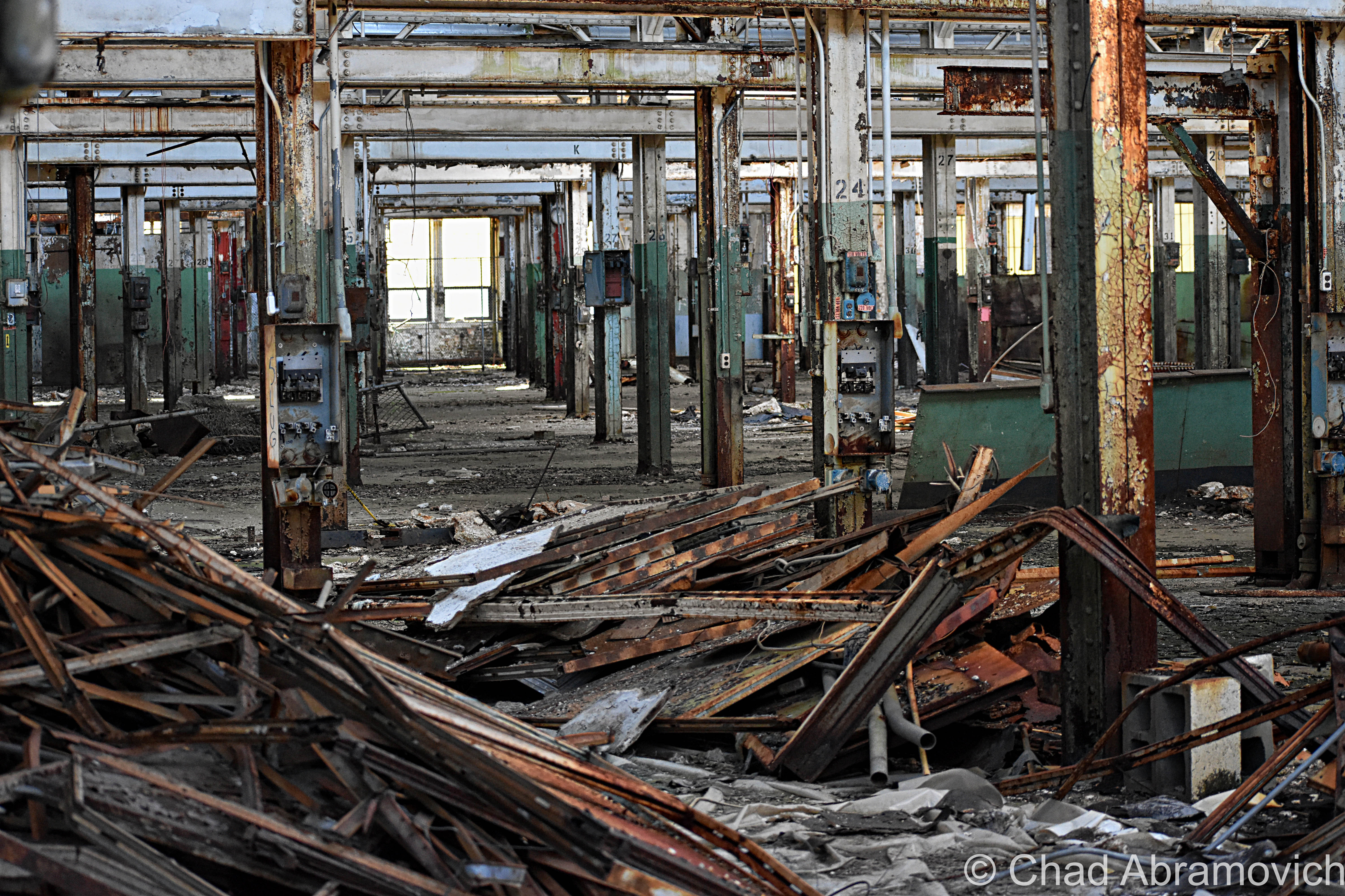
It’s kind of a rarity to find abandoned industrial lots in Vermont nowadays, so when I was made hip to the existence of this old factory in Springfield, I bumped it up to the top of my to-explore list. And I’m glad I did – it’s since been demolished.

On the banks of the town’s engine; the Black River, existed the ruins of a far-reaching factory – in both its size and its metaphor.

The origin of this building goes back to 1907 and the genesis of Springfield’s metamorphosis into a hub of innovation and industry – a culture that would become inexorable to the extraordinary marvels that enhanced Springfield’s legacy and is still an enduring source of discourse even after the bustle went bust.

Seriously, it’s rumored that Springfield, Vermont was such an adversary, that Hitler allegedly put it on his number two spot to bomb into oblivion had his Nazi party of terrorists ever atrocitied their way over here to America.

That all changed after the second world war’s hunger for humans ended. Job-seeking soldiers started coming back home, while machine tool contracts stopped coming in – and the town’s prosperity stalled, before succumbing to a steady multi-decade death rattle, leaving Springfield’s postmortem giving off incredulous vibes that anything I’ve talked about in the above paragraphs ever happened here.

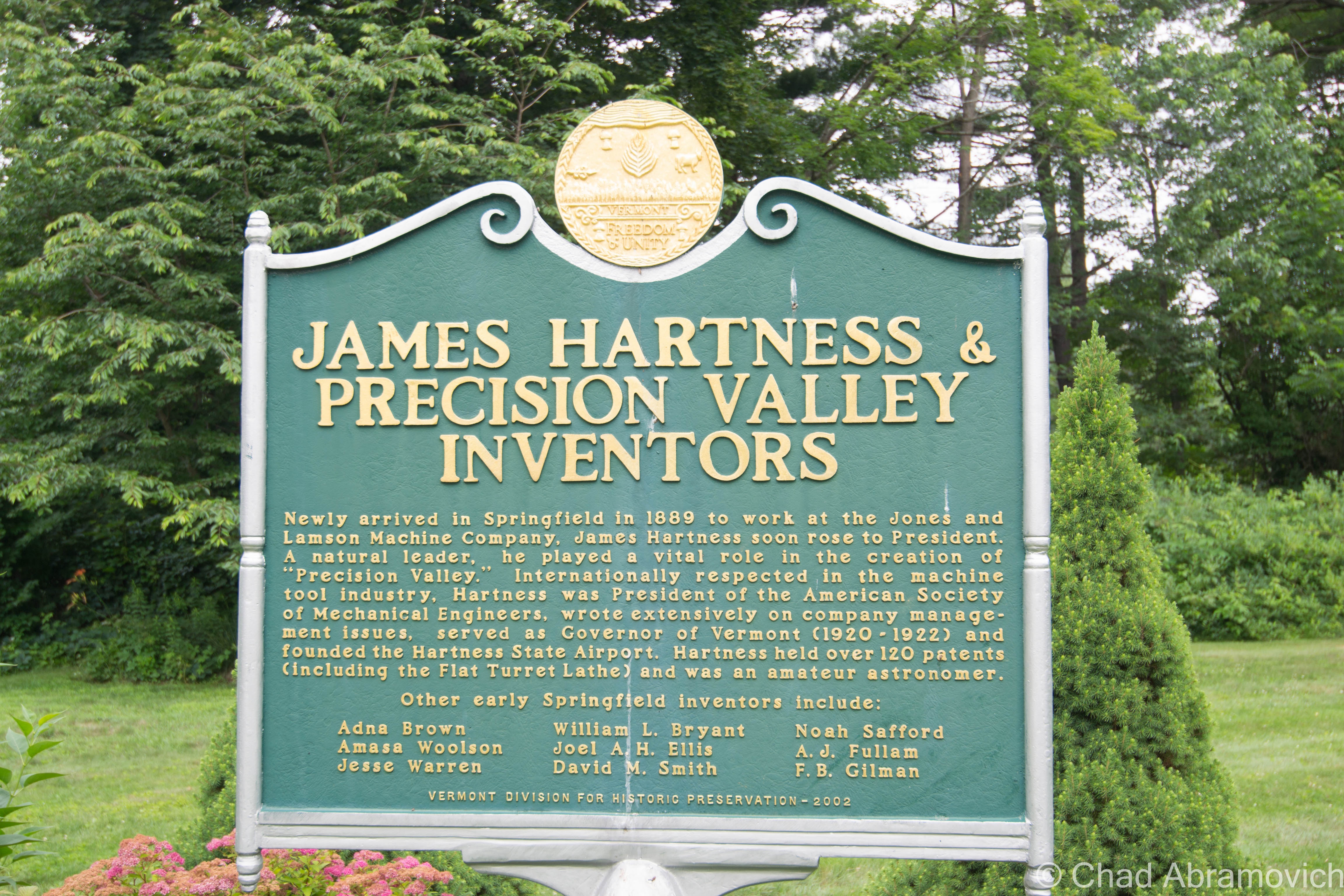
But, a lot of stuff used to be invented and then made here – until as recently as a few decades ago. So much so, that for about a good century – from the 1890s to the end of the 1980s – the region became to be known as “Precision Valley” – due to it practically inventing the precision tool industry, and had the highest per-capita income in all of Vermont. Even today, some locals still call their part of the state Precision Valley – which approximately is considered to be anchored from Springfield to Windsor (Windsor is another very cool little Vermont town worth a road trip). The most significant component of all this was the machine tool industry, and the decrepit factory that I’m gonna be blogging about was once the heavyweight of the genre.

In 1869, the Black River rivered too much and flooded and wrecked Springfield village, and as the town struggled to rebuild in the subsequent years, a big fire in 1880 basically undid all the progress and doubled down on the destruction. So a few Springfieldians schemed up a hook to lure people and investment.

Adna Brown, the general manager of Parks and Woolson – a manufacturer of woolen cloth finishing machinery that was both the first existing manufacturing complex and the last major mill to operate in Springfield – heard that the struggling Jones and Lamson machine tool factory up in Windsor was for sale, and was struck by cleverness. Jones and Lamson had been in business since 1829 and had made a smorgasbord of goods, from rotary pumps, rifles, machines to drill gun barrels, stone channelers, engine lathes, and sewing machines. Their old building is the present-day American Precision Museum, one of Vermont’s coolest archives that showcases many of the things invented in Precision Valley!

Brown put together a group of intrigued investors, and in 1884, persuaded the invoked of a new Springfield law that exempted any industry that would move to town from taxation for 10 years. It worked. 

Brown bought Jones and Lamson and moved it to Springfield in 1888. Construction started on the new J&L digs in 1907 on the banks of the Black River, and Brown’s good business sense kenned he’d need the right person to run the new enterprise.

After their first choice turned down the offer because he thought Springfield was too podunk for his liking, they settled for their next option, and little did they know that he’d turn out to be a renaissance tool man. That person turned out to be a young precocious machinist and inventor named James Hartness. Born on September 3, 1861 in Schenectady, New York, he already had experience from cutting his teeth working in machine shops in Connecticut since he was a lad, and used his know-how and indefatigable optimism to flip the company.

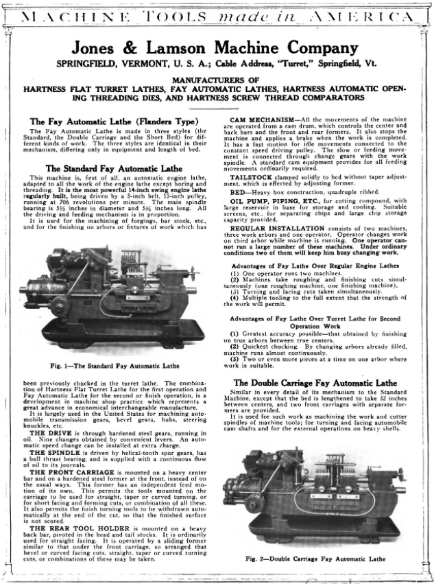
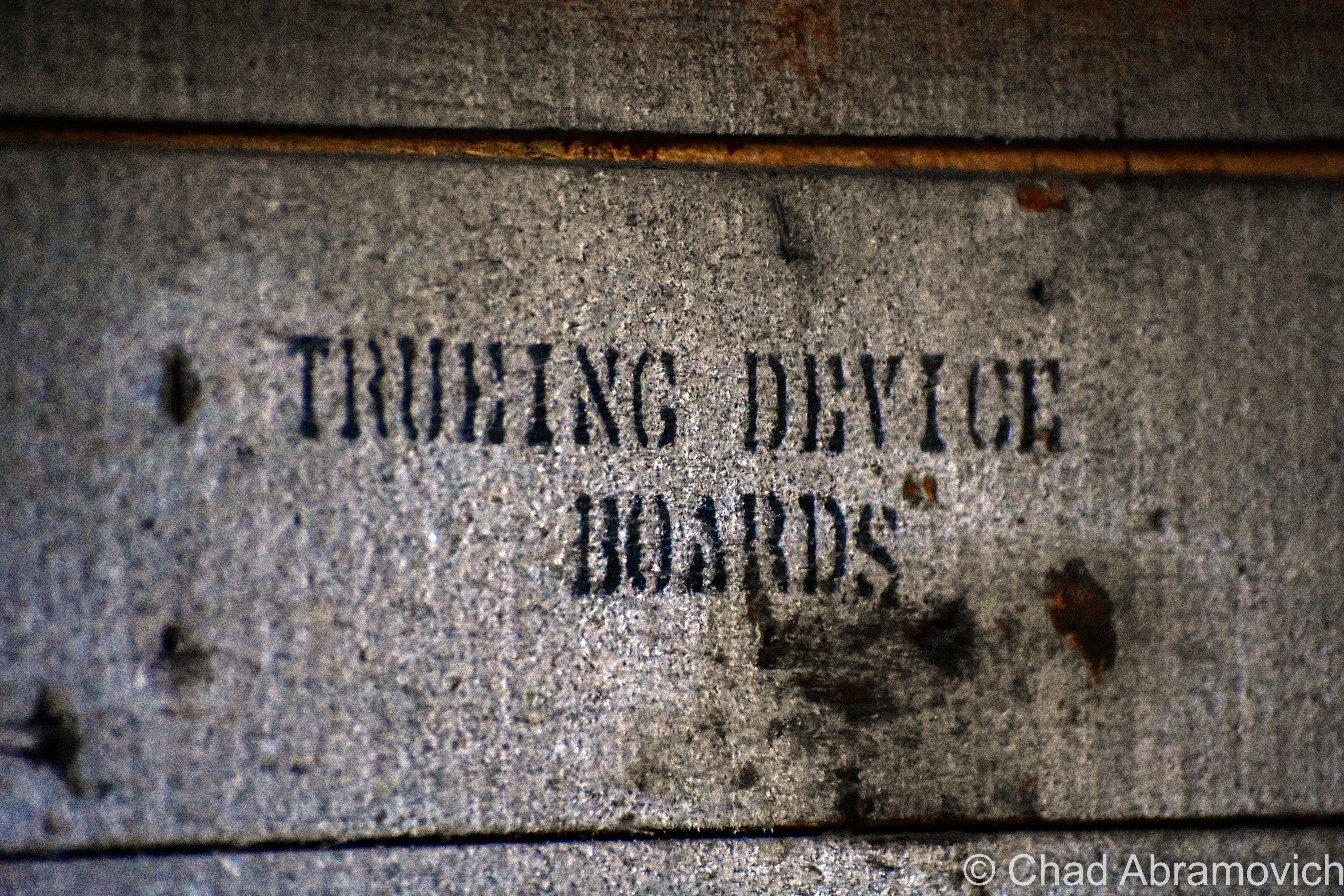
On his first day on the job, he decided that manufacturing so many different things was stupid, and declared that from that point onwards, J&L would only manufacture one thing; the eponymous Hartness Flatbed Turret Lathe, which he invented himself – the machine could shape wood, metal, or other materials by means of a rotating drive which turns the piece being worked on against changeable cutting tools.

The business decision was simple, extraordinarily effective, and a little bit revolutionary – something that seems kinda peculiar nowadays; manufacture a single item, and be really really good at it. And given Hartness’s subsequent rap sheet, it seems to work – and became inherent to the novel format.

Other turret lathe models existed, but Hartness’s was by far the most efficient – being able to mill and shape practically all lengths of metal and could combine multiple tasks with higher precision and longer cuts. It was so good, that it was nicknamed “the silent salesman”.

He also benefited pretty serendipitously from his invention, earning $1,000 a year plus a $100 bonus for every turret lathe the factory sold. Some weeks, he was bringing home more money than most Vermonters were making in a year. Hartness also gained a reputation for continuously advocating for better working conditions and more efficient company management to ensure the business would be as successful as possible. But he wasn’t unscrupulous. He also gained a reputation for pushing for the dignified treatment of the workers, which seemed a little bit weird then at a time of historic emerging social class strife, and still seems a little strange presently, in a modern America where the opposites our past generations fought to improve are becoming the norm again.

Hartness’s brilliance, though, came from the fact he didn’t just invent things, he sort of invented new versions of people and their latent talents. And that just happened to jive with his ideal of a company sticking to producing a single product to thrive.

For example, Hartness saw prospect in and hired an engineer and inventor named Edwin Fellows, who developed a machine that would accurately cut gears that he named a Gear Shaper. Hartness spun off the Fellows Gear Shaper Company in 1896, with its namesake operating as its manager. Fellows’ innovation would then opportunely overlap with the rise of the automobile industry a few years later.

After Fellows left J&L, Hartness needed to seek an engineer to replace him. He found William LeRoy Bryant, a student at the University of Vermont, who joined J&L in 1897 as a draftsman and worked closely with Hartness on the cross-sliding-head turret lathe, which is where Bryant took an interest in grinding. Building on a J&L lathe that used a chuck — a specialized type of clamp to hold a piece in place while it was shaped and bored — Bryant developed a new chuck that was both easier to use and more accurate. By 1909, Hartness conjured up another spin-off: the Bryant Chucking Grinder Company. And this pattern continued.

When Hartness hired Fred Lovejoy to replace Bryant at J&L, Lovejoy became an expert in small-tool design, and he eventually created interchangeable cutters that could be swapped in and out of machines. In 1916, Hartness provided the startup capital for the Lovejoy Tool Company, which awesomely still survives and operates in Springfield!

In 1912 Jones and Lamson acquired Philadelphia’s Fay Machine Tool Co, which made the Fay Automatic Lathe – which was designed for the automatic turning of work held between centers. The lathe was significantly improved by a team at J&L led by Ralph Flanders that would be so victorious, that it would ironically eventually evolve into the creation of CNC, which made the manually operated lathe obsolete because the new ones could now operate all by themselves.

Hartness and his prowess fueled Springfield’s combustive growth from the turn of the 20th century until well past World War II, and he did it by introducing one auspicious product after another, each named for its creator.

Because of this, Springfield astonishingly became the machine tool capital of the world.
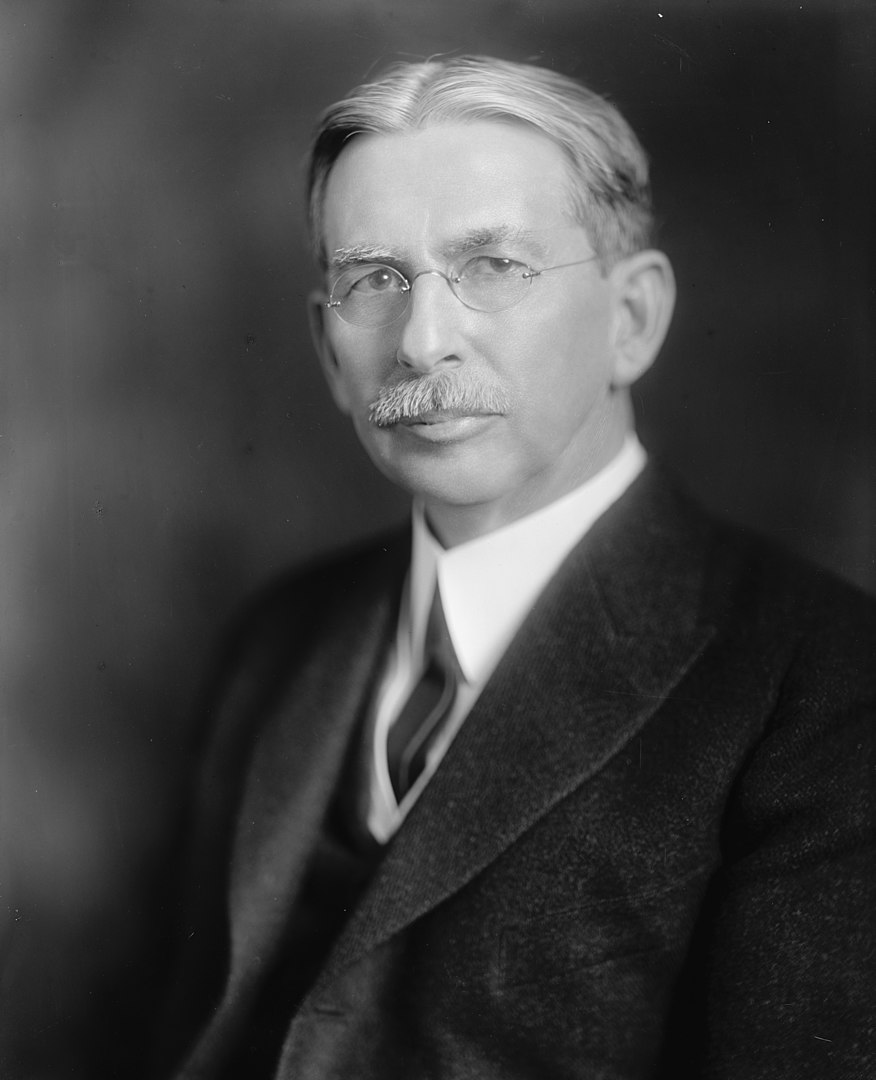
A later portrait of James Hartness | via The Library of Congress and Wikipedia
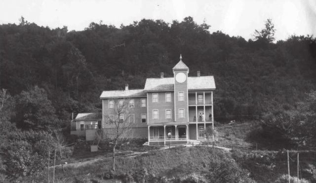
Old postcard of the brand new Jones and Lamson Factory, Springfield, VT. Circa 1094-1918. Present-day Clinton Street/VT Route 11 runs right out front.
Jones and Lamson Factory, circa 1917 | Via Vintage Machinery
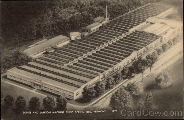
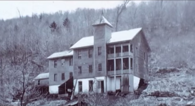
Old postcard of the sprawling former Jones and Lamson Factory in Springfield, circa 1973. The factory would expand to 270,000-square-feet over 12 acres. | Cardcow.com
A full page spread taken from Machine Tools Made In America (1921). This one includes both the Hartness Lathe and the Fay Lathe! – via MyCompanies Wiki
Advertisement from The Iron Age (Dec. 27, 1917) – via MyCompanies Wiki

However, in 1919, Hartness would break his own rule for the only time, when he collaborated with engineer, arctic explorer, and Springfieldian Russell Porter – and invented the optical comparator, a device to precisely measure screw threads that are still manufactured today – it’s so efficient, that any parts that are inspected can be magnified over 200 times, making the smallest flaws detectable!

Hartness and Porter’s mutual fascination with astronomy partially inspired this quantum leap, which is why Hartness wanted Porter to run the comparator business, but Porter was interested in literal bigger heights and decided to instead move to California, where he helped design the Palomar Observatory telescope, so in a rare move, Hartness decided to keep the comparator division close to his side in-house at J&L.

But before Porter departed, he and Hartness also founded The Springfield Telescope Makers – a club that operates in an accidentally trademark pink clubhouse atop Breezy Hill. The story of its standout color is, basically, when it was first built, its enthusiastic members were broke – so they went around to area hardware stores and asked if they’d donate some paint. They ended up with three gallons of barn red, two gallons of white, and a gallon or orange – which they mixed together and got hot pink, which is now emblematic. The clubhouse was christened Stellefane, which is Latin for “shrine to the stars” and not something that you can wrap your leftovers with, is now a national historic landmark, and is still home to both the club, and the annual Stellefane Convention of Amateur Telescope Makers.

Being an avid pilot – one of Vermont’s first – Hartness became president of the  Vermont Aero Club and donated land for Vermont’s first airport – Hartness State Airport – just north of Springfield, and had his pal Charles Lindbergh even stop by for a spell in 1927 after his world flabbergasting trans-Atlantic flight. He also served as governor of Vermont for a single term, from 1921 to 1923, but didn’t run for reelection after realizing that Vermont’s rural and poor economy of the time just wasn’t ready for his aims to further industrialize the state. He would die on February 2nd, 1934, and Springfield’s reliable factories became reverberating manifestations of the American dream. Until they didn’t.

This is a surreally enjoyable upbeat clip from a vintage informational film about the concerns and potential disasters of a dwindling economy after World War 2. At the 5:00 mark, the film showcases Springfield AND the Jones and Lamson Factory! Give it a watch – it’s pretty neat! You can get an idea of what the factory, and the town itself, used to be like in the atomic age! 


So, what went wrong here?

After Hartness’s death, Jones and Lamson continued to absolutely thrive and continue to become the industry benchmark for their craft, and was considered the zenith of Springfield’s enterprises, employing anywhere between 3,000-4,000 people for most of the 20th century.

So what exactly is the culprit for J&L’s, and Springfield’s, event horizon? Well, that’s a tumultuous conversation, because there isn’t just one thing at play, a lot of circumstances kinda just started to materialize on the scene and began shaking hands with one another – all contributing to Springfield’s ode to its fall-through.

Some locals point fingers at the machine tool unions, who in the 1970s, began to row with the companies about ensuring higher wages for their employees, and would hold a few long strikes to get their point across, something that, evilly, is sadly still being fought for today.

Another reason might be something that’s also been steadily plaguing America since around that time period – outsourcing jobs for cheaper labor costs. Many of these companies were family or locally owned, and when next-generation kin wasn’t interested in taking them over due to the more independent/free-spirited culture that was emerging, they were purchased by larger outside firms starting around the 1960s, which seems to be the beginning of Springfield’s ratchet blues. Detached management started to give the machine tool factories less control and began to fracture the former tight-knit inner communities.

But the bigger causality might just be the companies’ refusal to be self-aware. Japan had been studying American machine tool know-how and began to enter the market themselves – and they did so by dramatically innovating their products.

Around the 1980s, the Japanese hustled billions of dollars into the research and development of computerized machining centers that were faster, more accurate, no longer required a human operator, and cheaper than a J&L turret lathe. Back in Springfield, the factories were sticking to their traditional course, and while they were still making quality reliable machines, they began to become outdated in the new frontier of the trends, and eventually, obsolete, as the market shifted to foreign products that were offering more convenience for a cheaper purchase. I know “if it ain’t broke don’t fix it”, but unless these new fads aren’t just impractical enticements that won’t be good in the long haul, if you refuse to innovate and stay at pace with the competition, it can be a guaranteed ticket to extinction.

Unfortunately, that’s what happened to Springfield. 

What’s stressful is that, to be innovative, sometimes that takes substantial amounts of funds, and then, the wisdom just where you want them divested, and for smaller operations, that can be tough decision making, and sometimes, even a fatal conclusion. Hartness certainly had a special knack for it, so much so, that it was said that one bank eventually refused to give him any more loans because they thought he was too creative! I mean, Hartness would amass a little over 120 patents in his lifetime…

Jones and Lamson would be bought by a few different companies starting in the 1960s, and eventually go bankrupt in September 2001, but, the assets were sold to Bourn & Koch Inc. who coolly still continue to supply replacement parts for the extant J&L machines today. However – the optical comparators division of Jones and Lamson, called J&L Metrology, still exists! They’re the only company making optical comparators today in the United States, and are still headquartered in Springfield – attached to the ruins of the rest of the J&L empire (well, after moving to South Carolina for a stint but then coming back)!

The only other stalwart to exist from the ruins of the machine tool era is the Lovejoy Tool Company – who also still operate in town!

A good portion of the old Fellows Gear Shaper factory compound still exists too, and it’s been thoughtfully renovated into mixed commercial and industrial spaces – which is absolutely a preservation win!

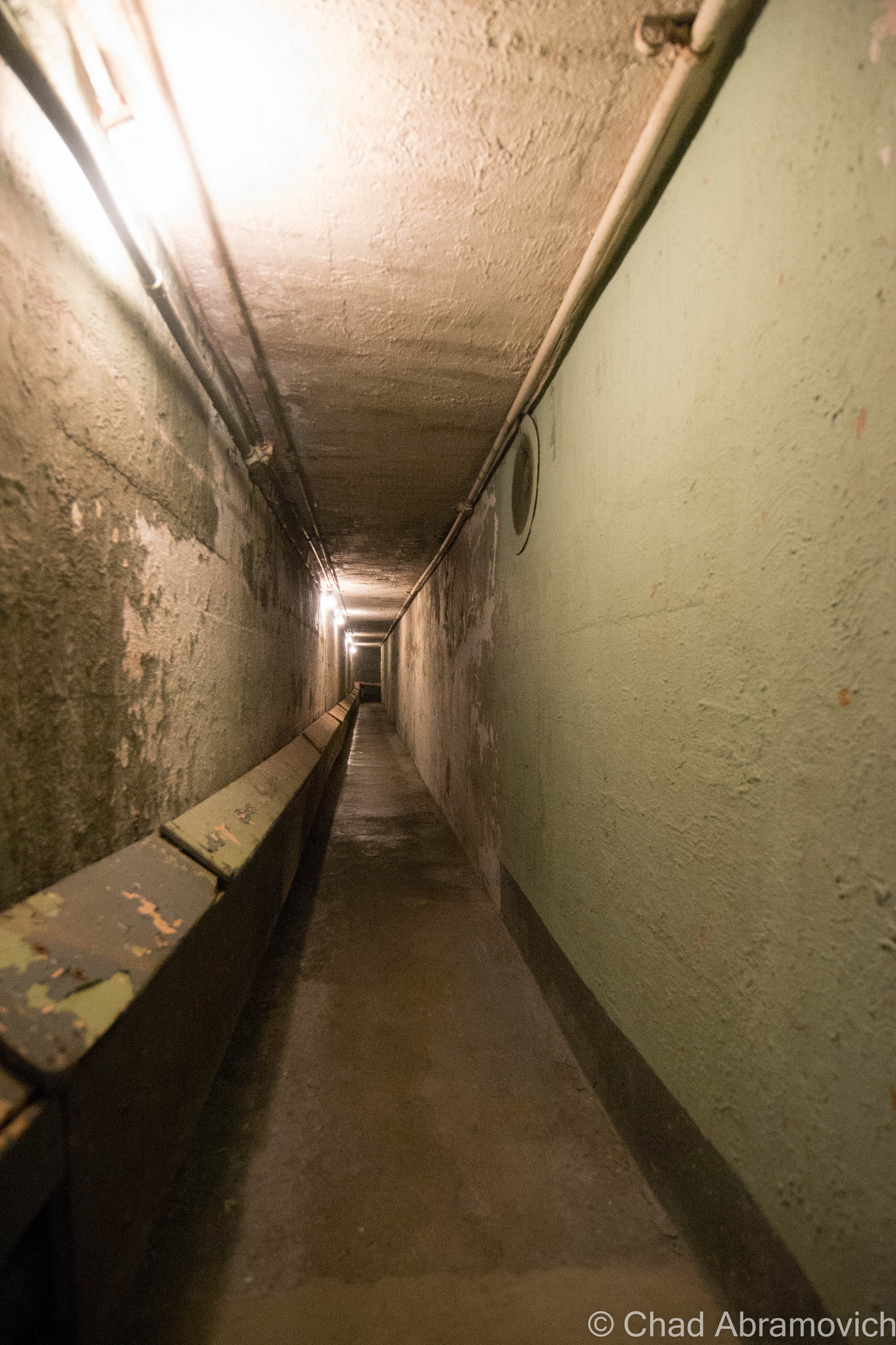
Another vestige of that age is the incredible Hartness mansion itself, which has been turned into a bed and breakfast (and at the time I’m writing this blog post, is up for sale according to Yankee Magazine). I’ve visited before and was excited to investigate the house’s most curious feature – an underground telescope connected to the house by a secret tunnel that also lodged Hartness’s private underground laboratory that’s now a museum to Mr. Hartness, The Stellafane Society, and Russell Porter. Man that was cool! Even today, there are rumors that still persist that Hartness built more secret tunnels and even secret rooms that branch out underneath Springfield that have been sealed up, or kept clandestine.

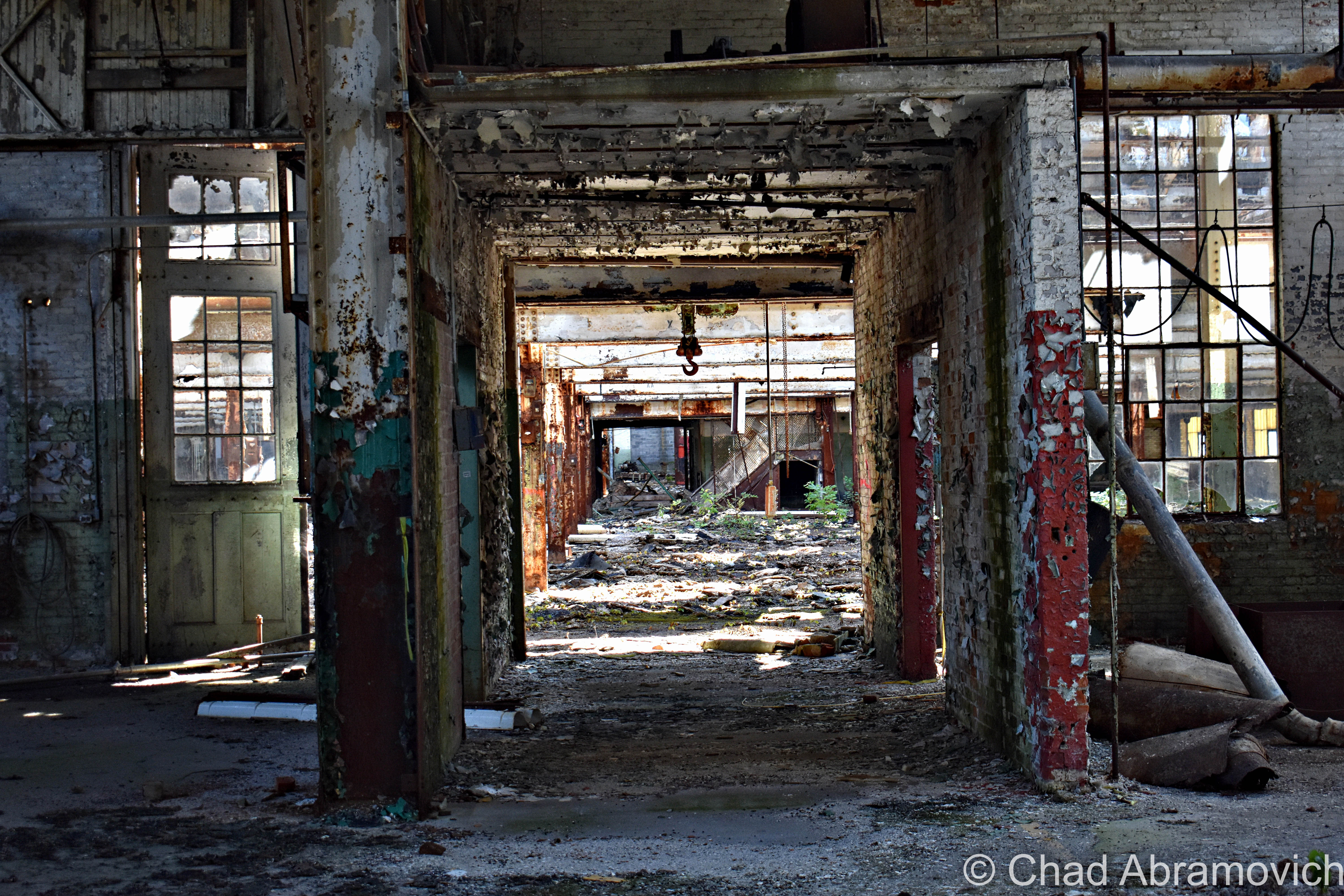
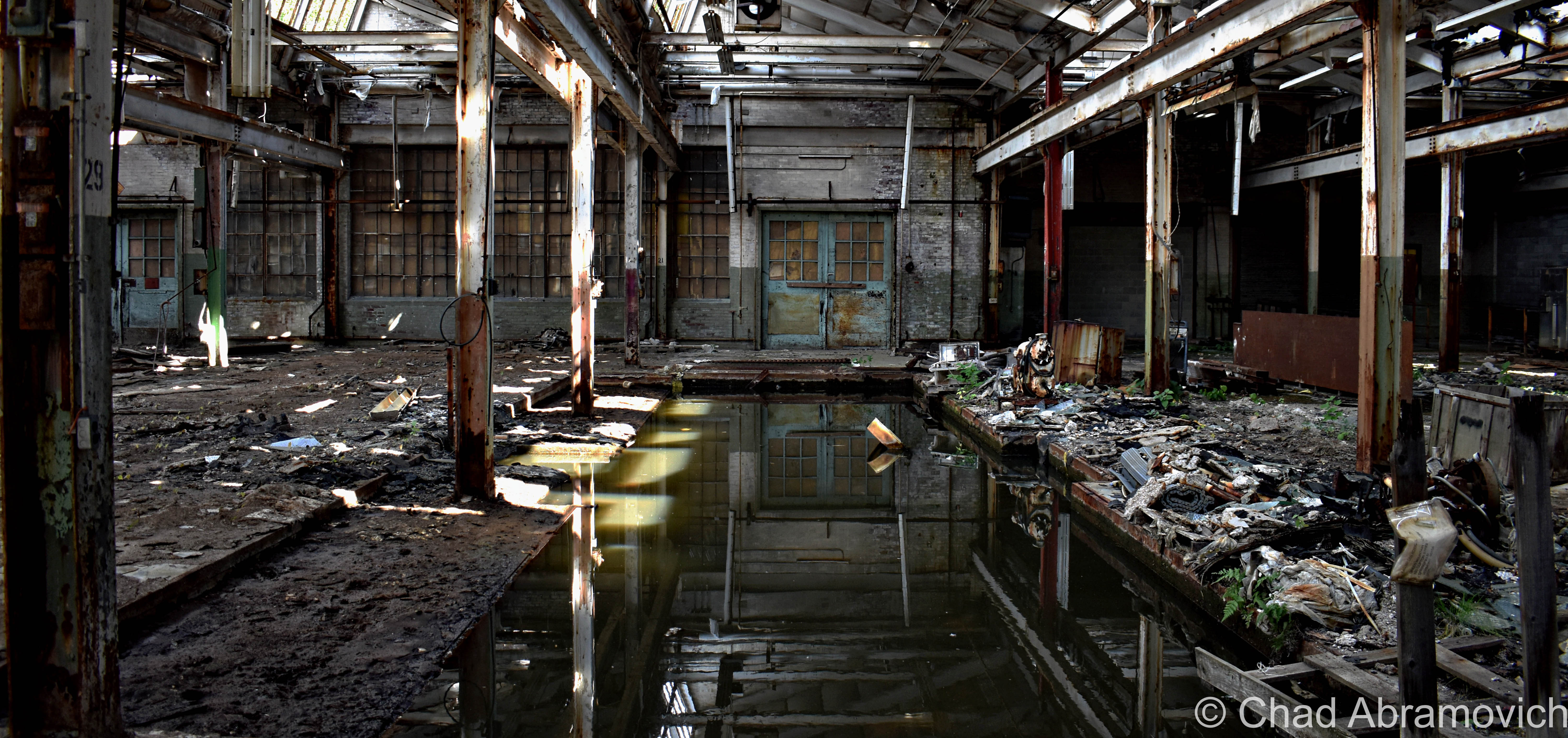
The Jones and Lamson factory had been abandoned since 1986, and for decades, its ruins became a conspicuous landmark that marked one of the main entry points into town. And it was an absolutely gigantic property: 270,000 square feet of decaying building that sprawled over 12 acres of land between the Black River and VT State Route 11, known as Clinton Street through that part of town.

In 2004, the Springfield Regional Development Corporation purchased the property in hopes to, well, do something with it, but its runaway deterioration and designation as a brownfields site – or – a property that’s enormously polluted by toxic materials, usually as the residual of former industrial use, kinda problematized any headway that could have been made. The old J&L factory played host to tons of industrial chemicals, including polychlorinated biphenyls (PCBs); trichloroethylene (TCE); and light, non-aqueous phase liquids (NAPLs), and to remediate hazards like those, you need to secure lots of capital and involve lots of bureaucracy.

In November of 2021, cleanup grants had been secured, and the factory was demolished, which I can’t help but be pretty bummed about. What a shame, it was such an irreplaceably neat building that I feel had the potential to morph into a great new resource for Springfield if given the love.

But – the plan is that they hope to sort of go full-circle with the lot, and lure another industrial gig to town that hopefully will continue to push back the boundaries of the unknown and isn’t just another awful Dollar General. The land is flat, which is pretty a valuable deal in Springfield because most of the village is built up around low-profile slopes that contort around the Black River. It’s also apparently hooked up into some of the fastest internet connections in all of Vermont, which is also a huge deal here given the state’s notoriously lacking rural infrastructure. It’ll be interesting to see what comes along – and I really hope that it’ll be something that will serve Precision Valley with dignity for another century. Springfield is absolutely a town worth rooting for!

An interesting side note to all this, is that because of the rich industrial history and current fading ghosts of the area, the town has kind of amassed a bit of a steampunk scene, which has since turned into a notable cultural festival.

Acreage

I was excited. I was meeting up with a friend from college I hadn’t seen in years who was getting ready to move out of state, so we figured an explore was a good way to part ways. And it was a lovely early fall afternoon – light jacket weather and foliage just barely starting to change into its death hues – the perfect adventuring weather. It had been a while since I’d had a good urbex – my soul was really jonesing for this excursion.

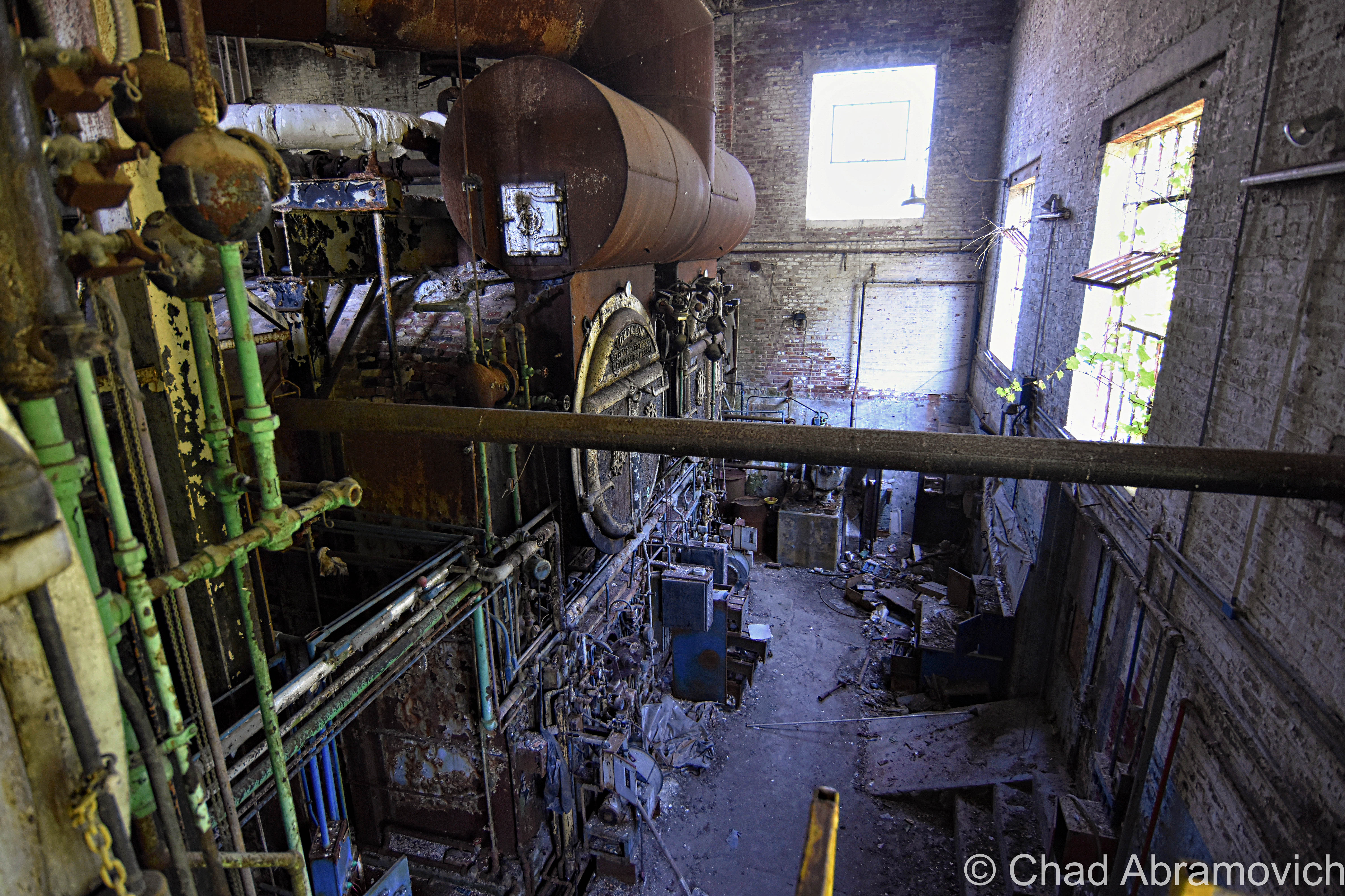
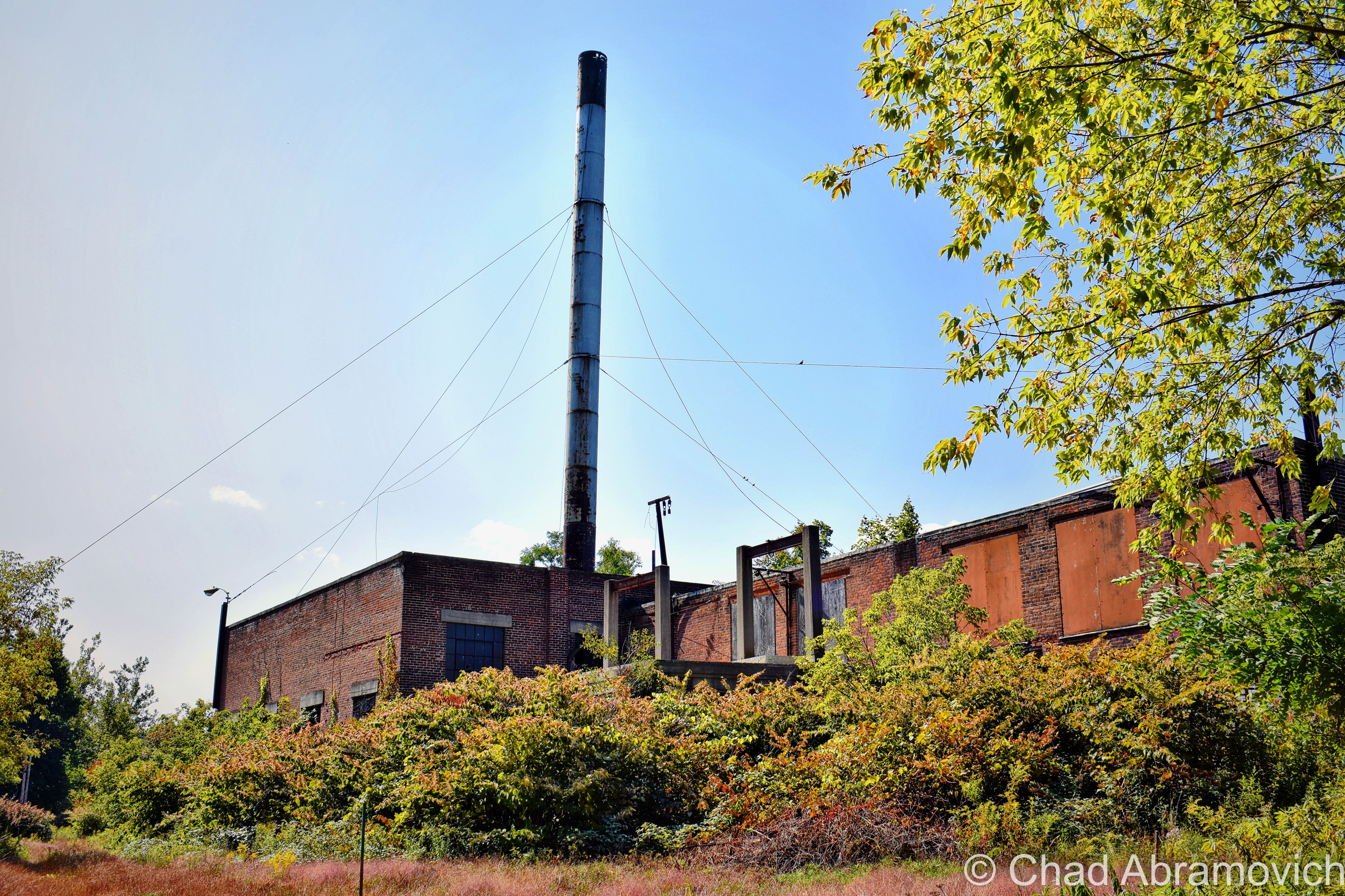
Finding a place to park that we hoped wasn’t suspicious, we casually made our way down the sidewalk, and then made a dash for it. The factory grounds had grown wild, and the brush was almost like it was alive – clinging and scratching with every tendril available, as we hastily stumbled our way towards the tall metal smokestack that marked the factory’s personal powerplant. We figured we’d start in there via squeezing through a hole in the door, and work our way over to the main factory building after. Man I’m glad I’m still a scrawny dude that can wiggle through holes in the walls and broken windows.

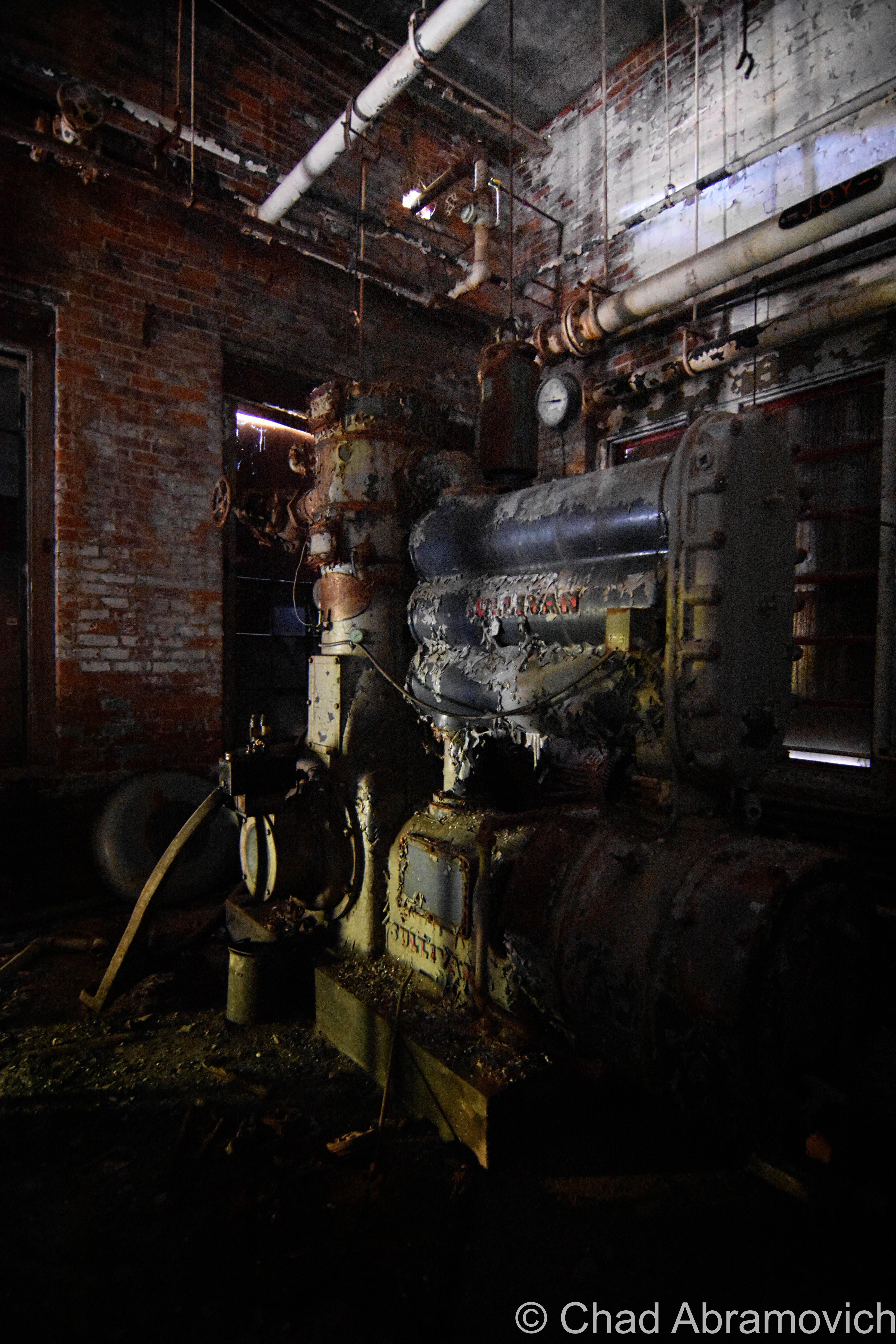
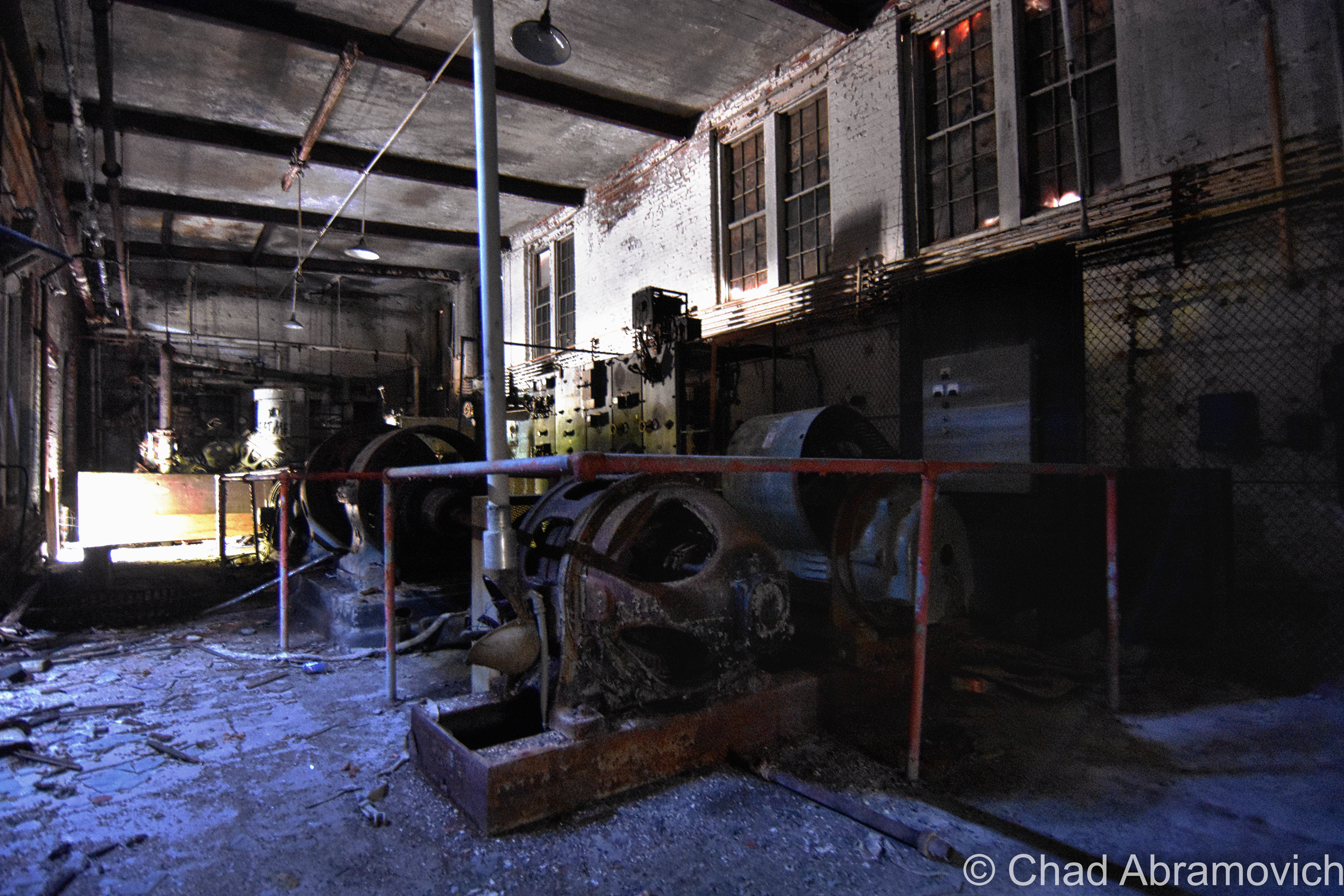
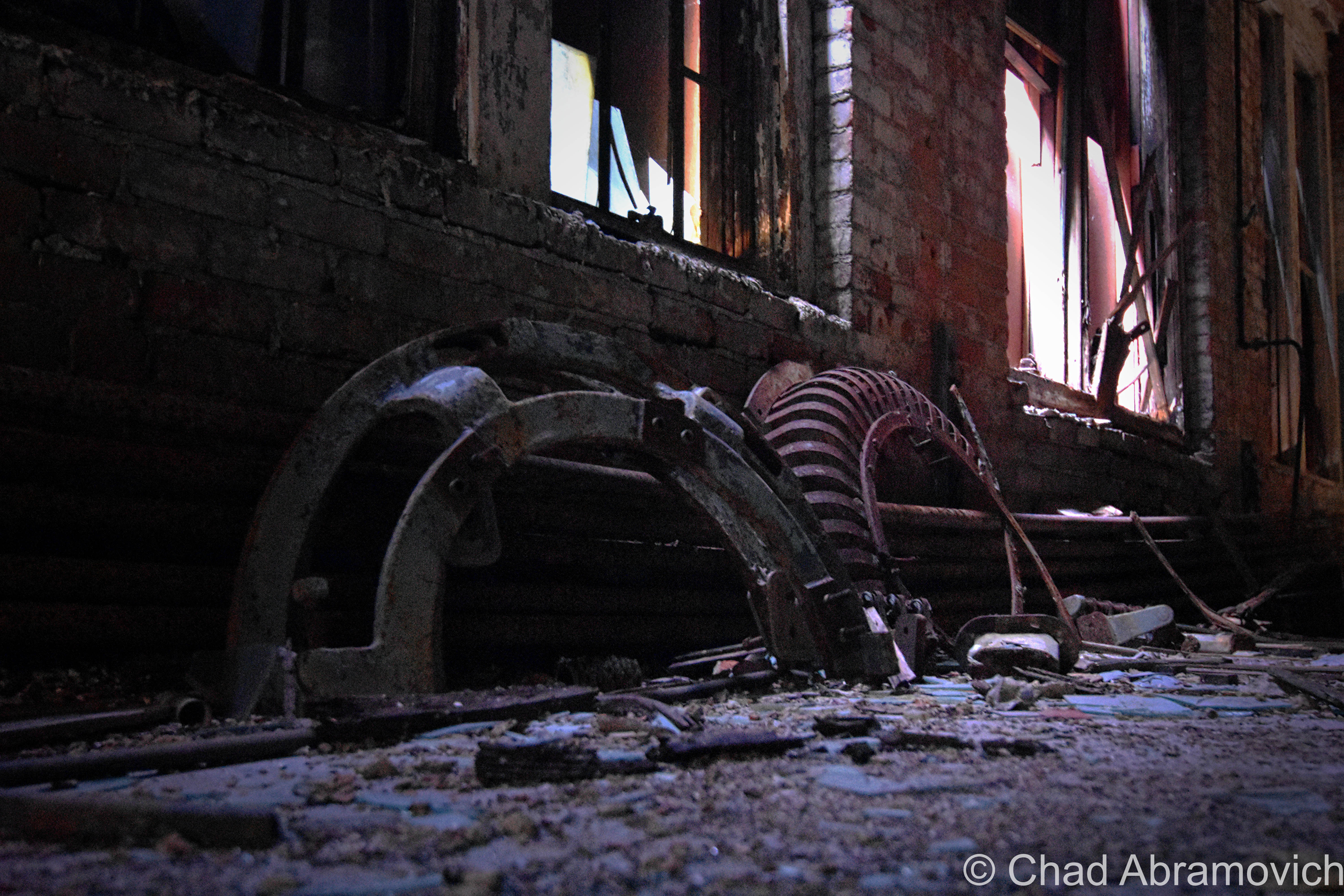
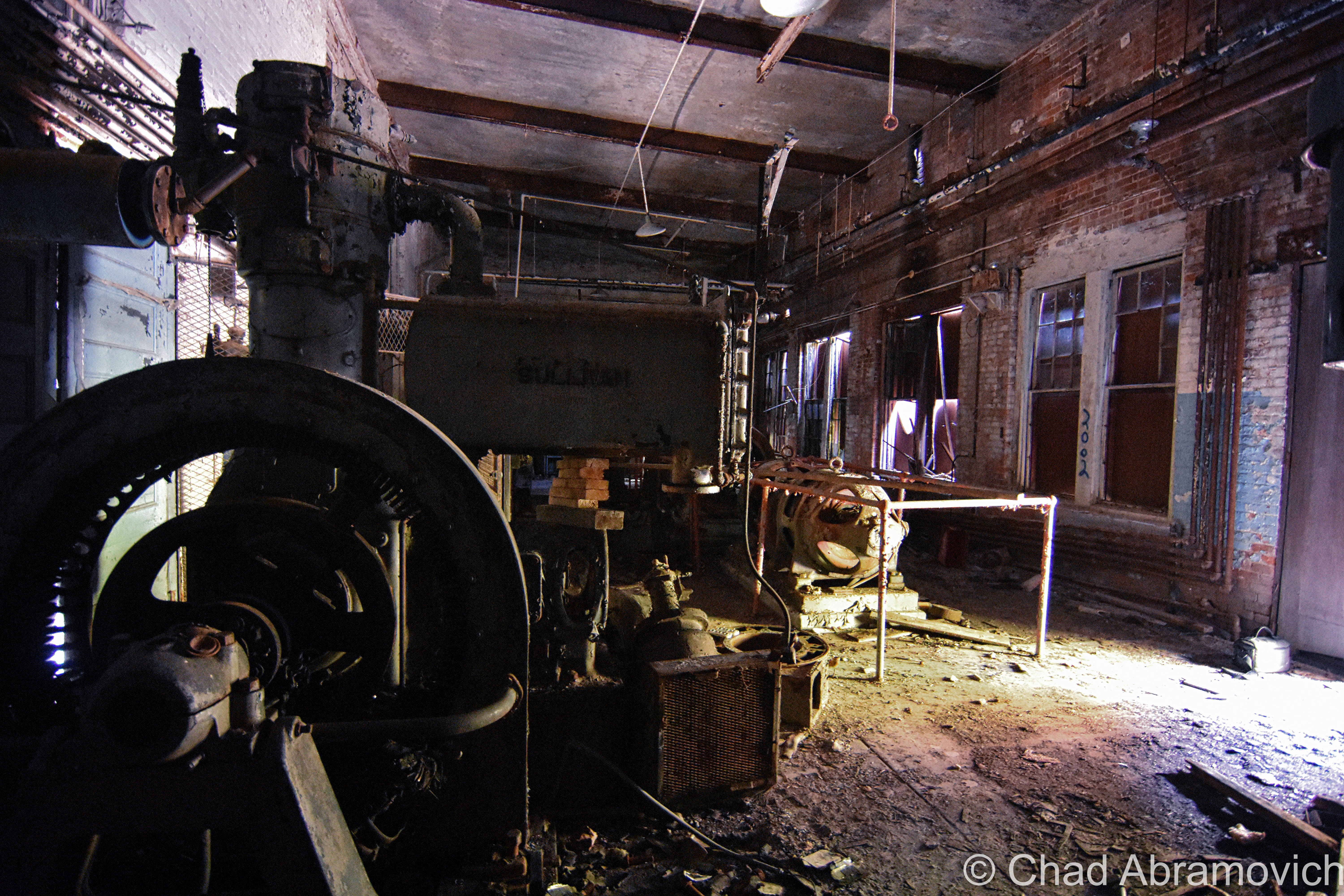
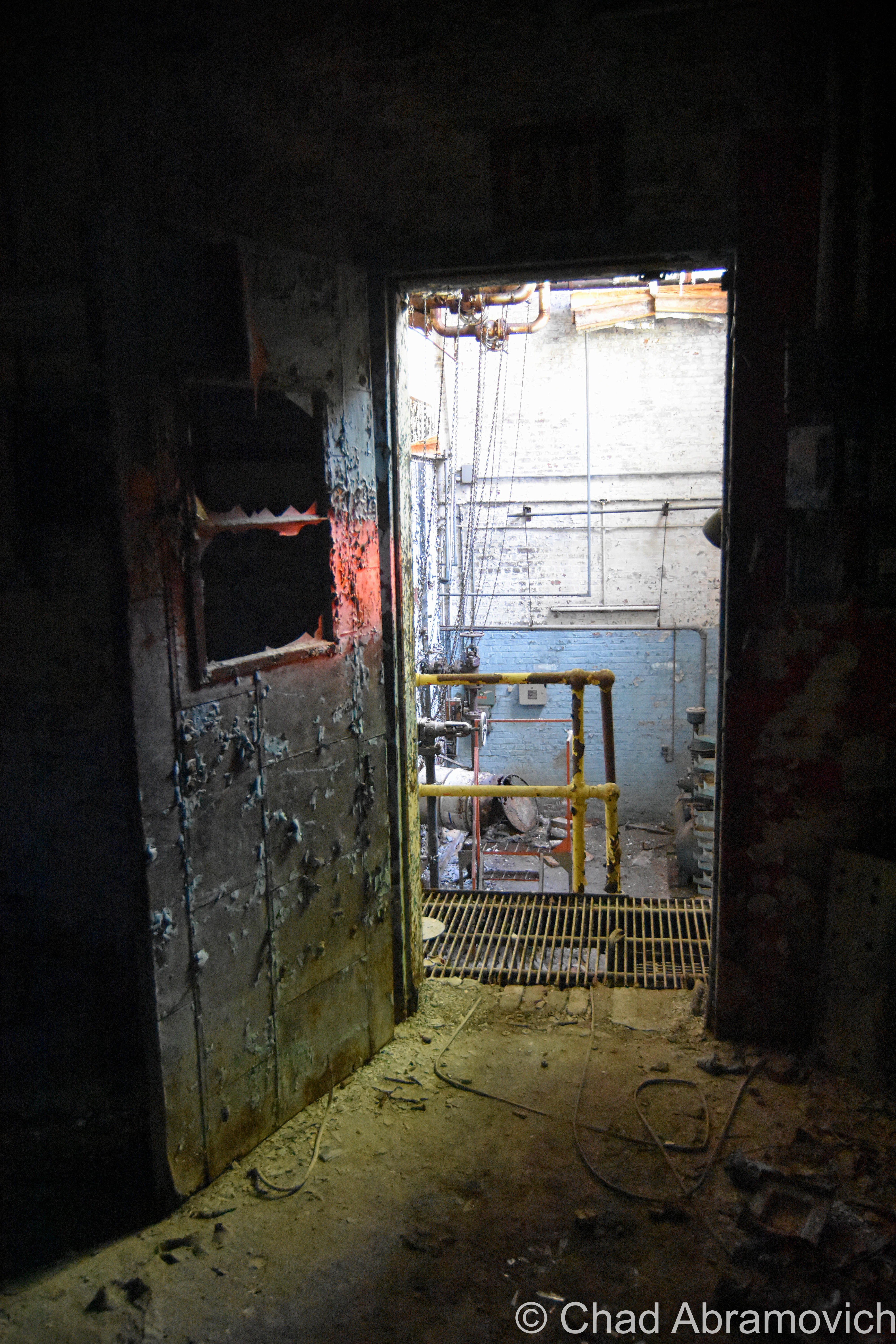
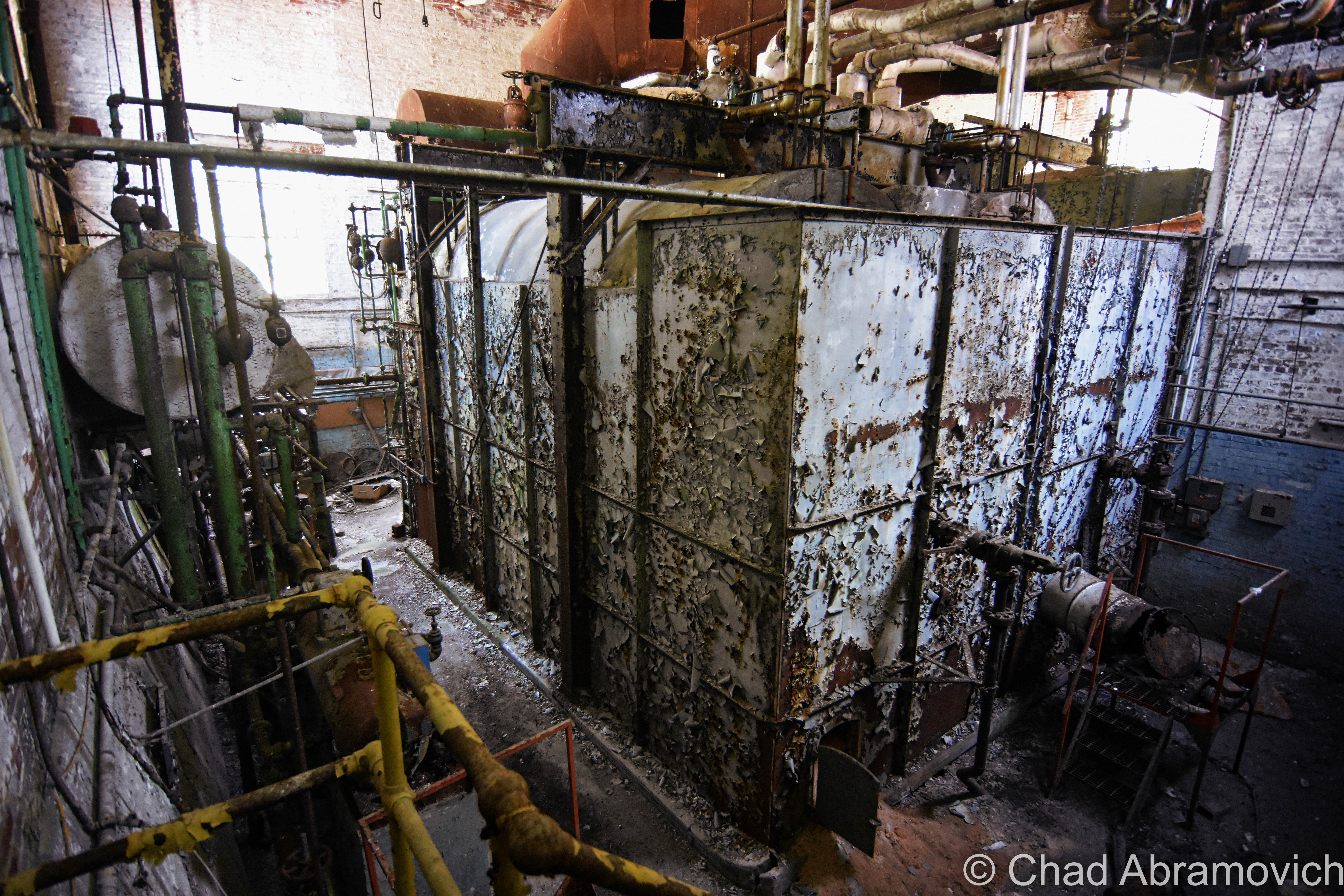
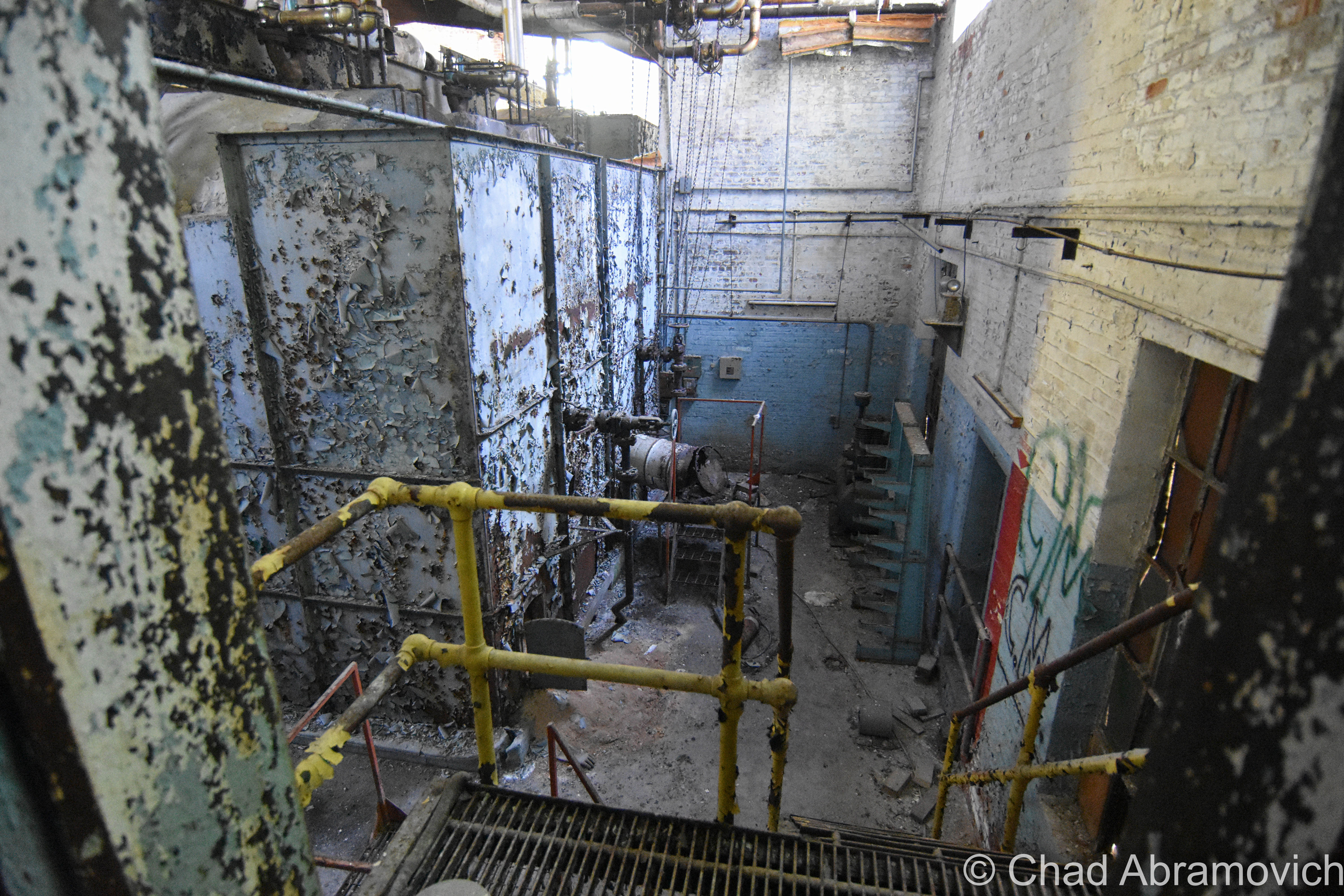
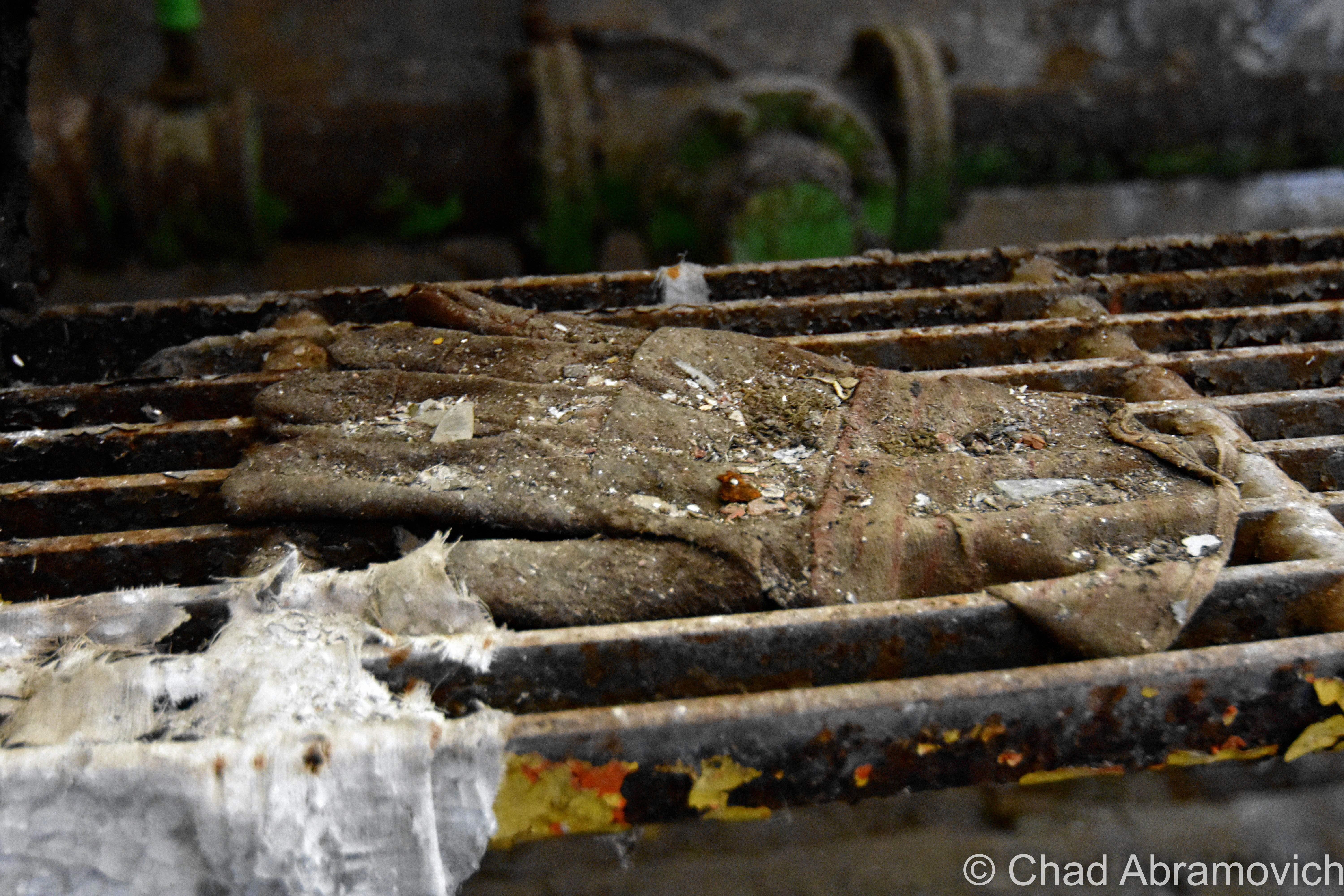
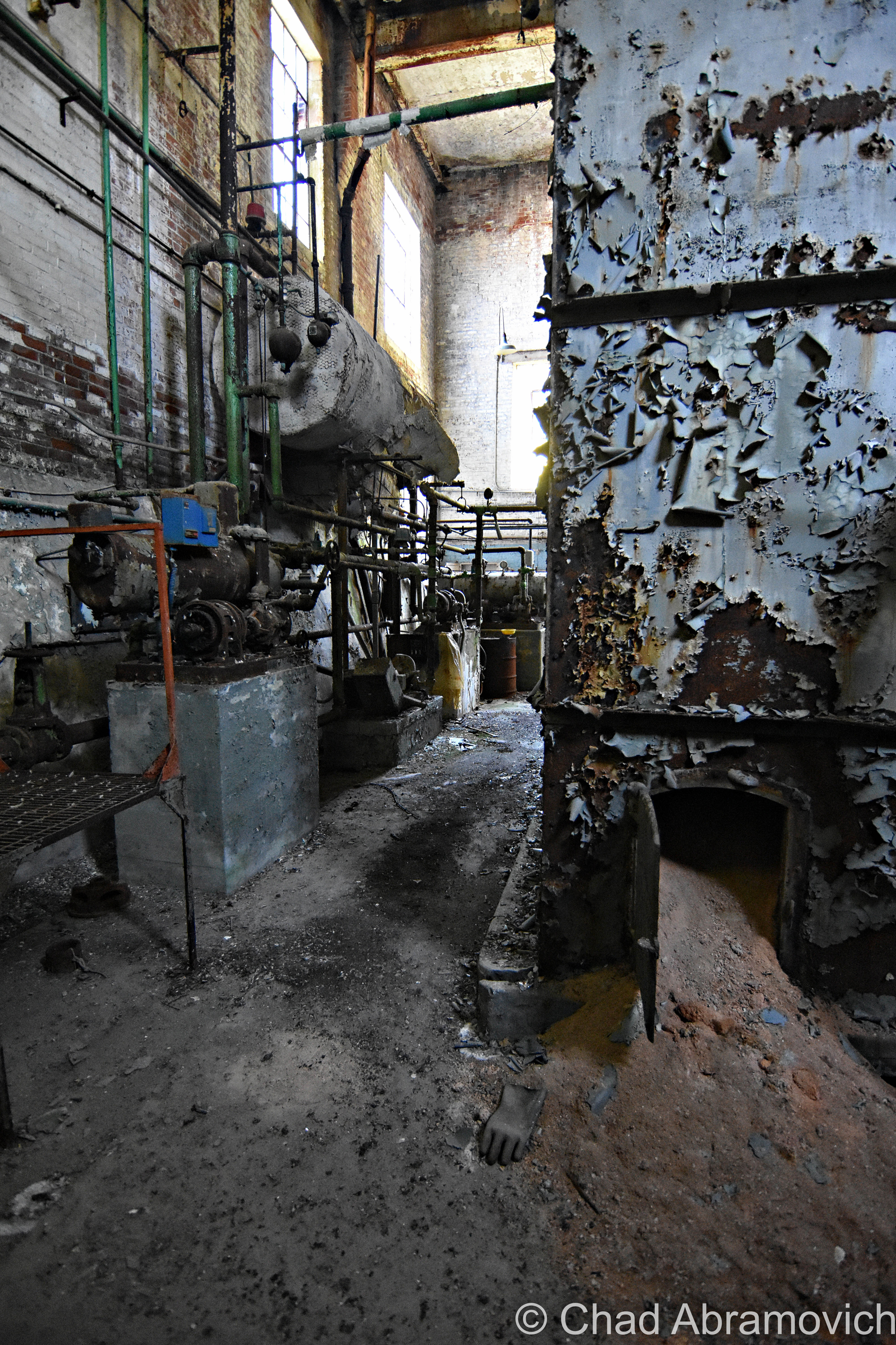
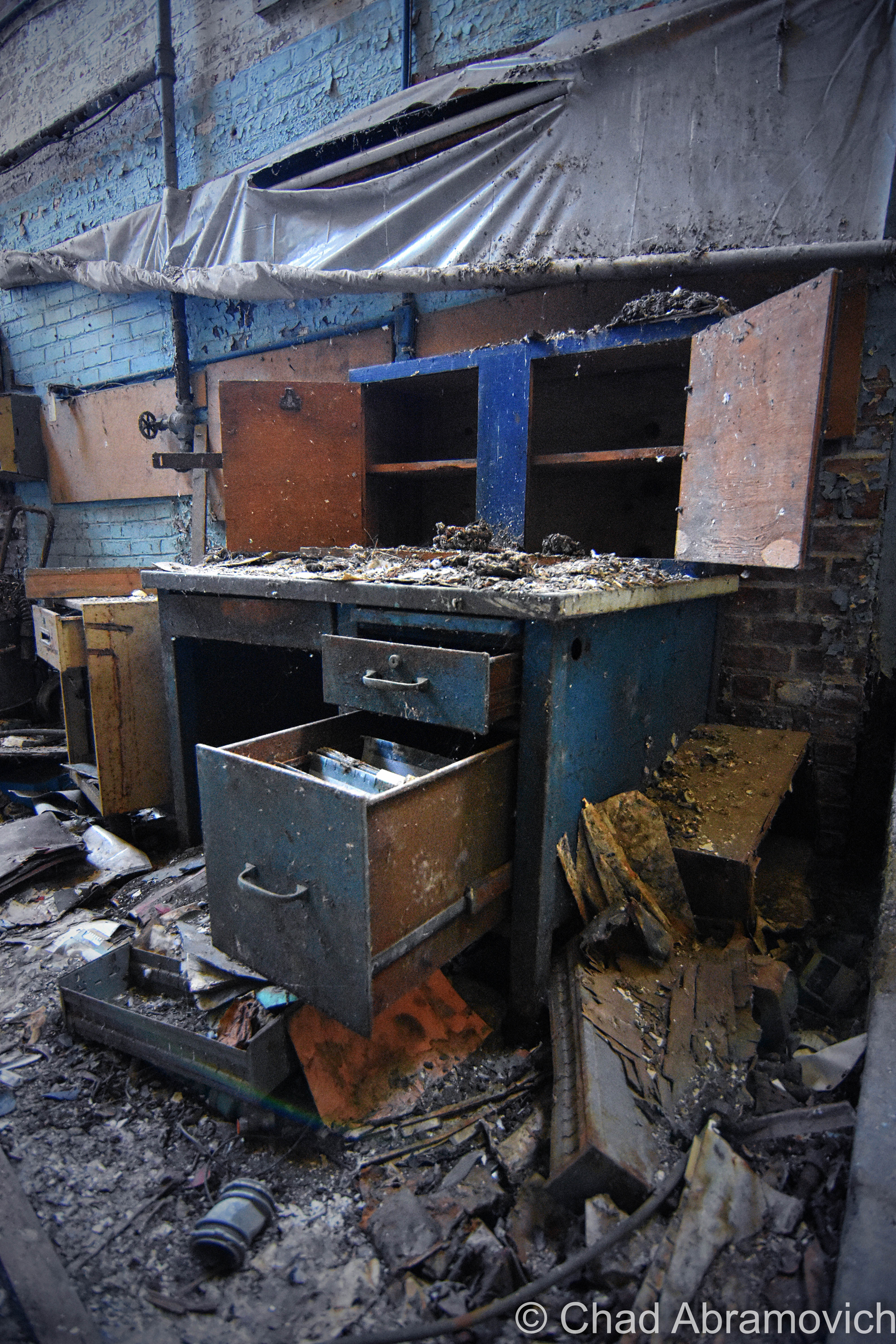
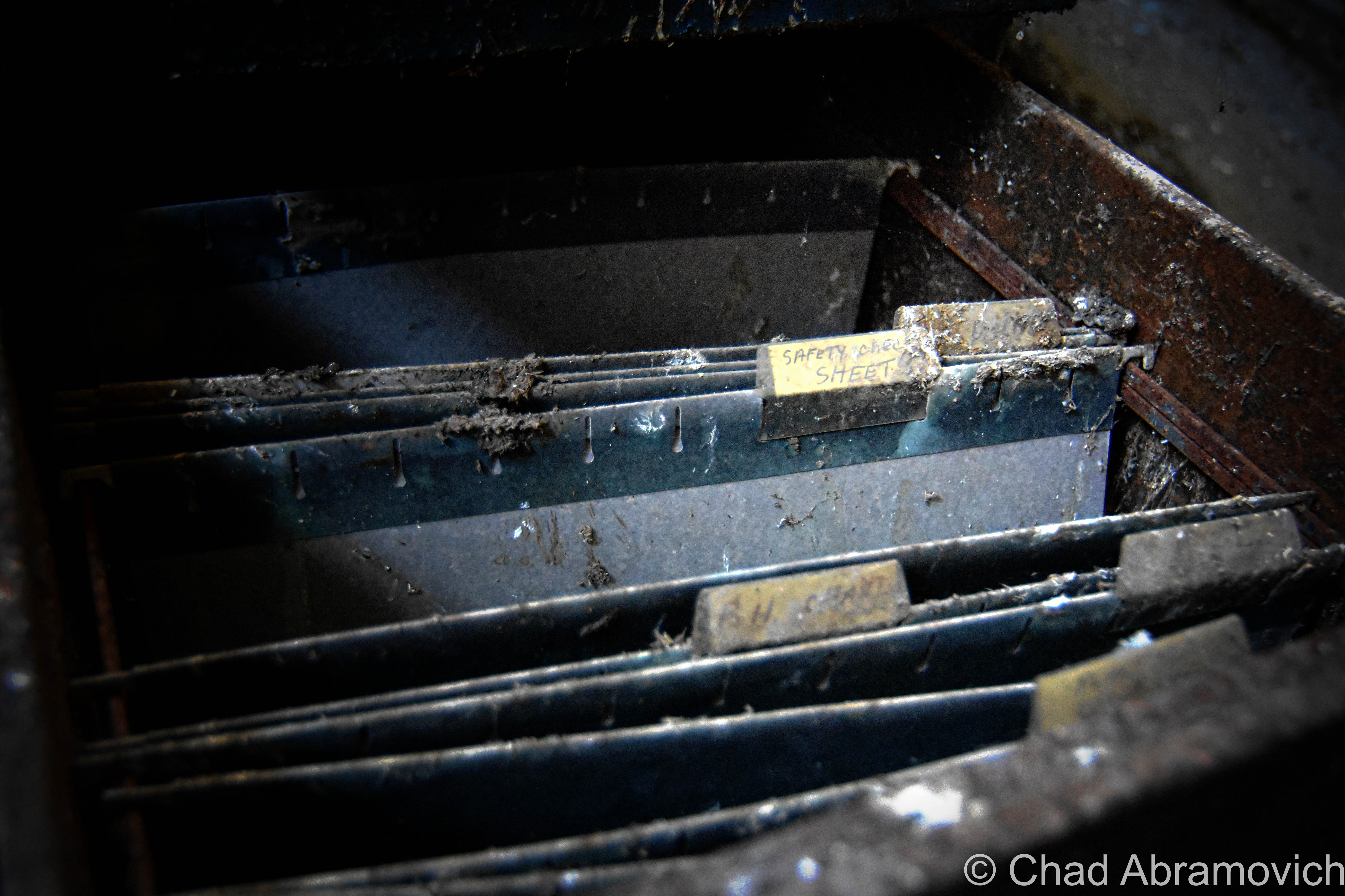
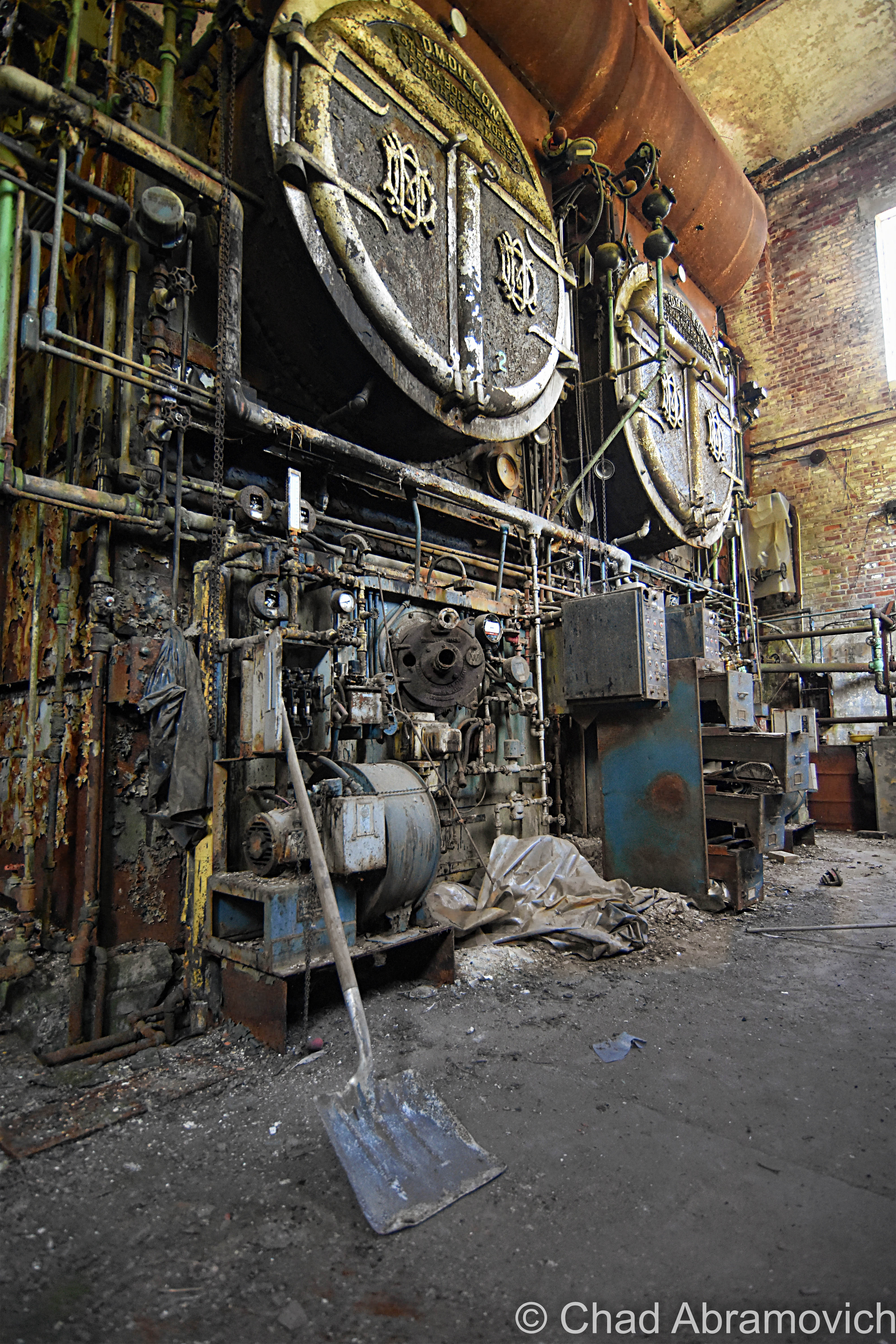
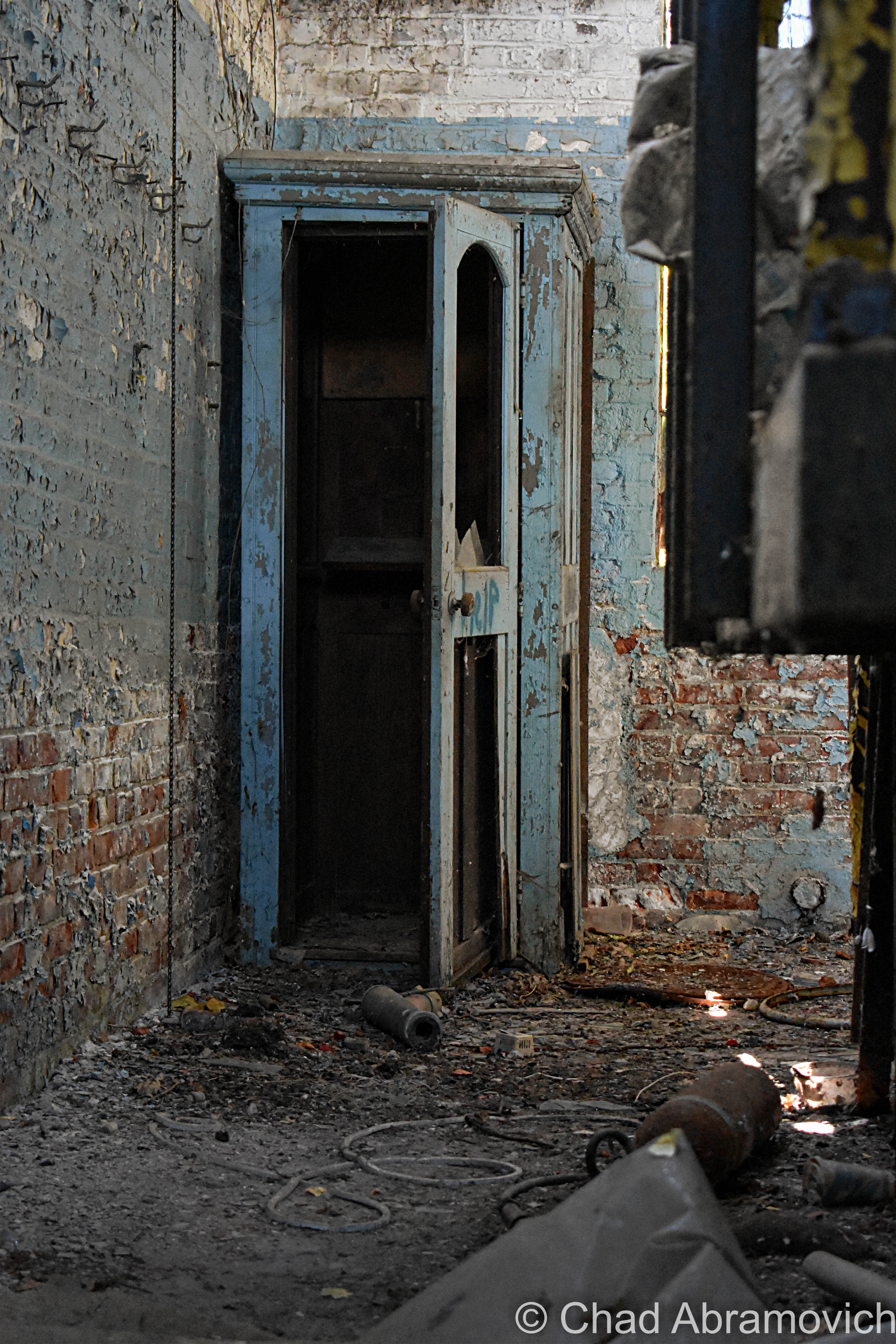
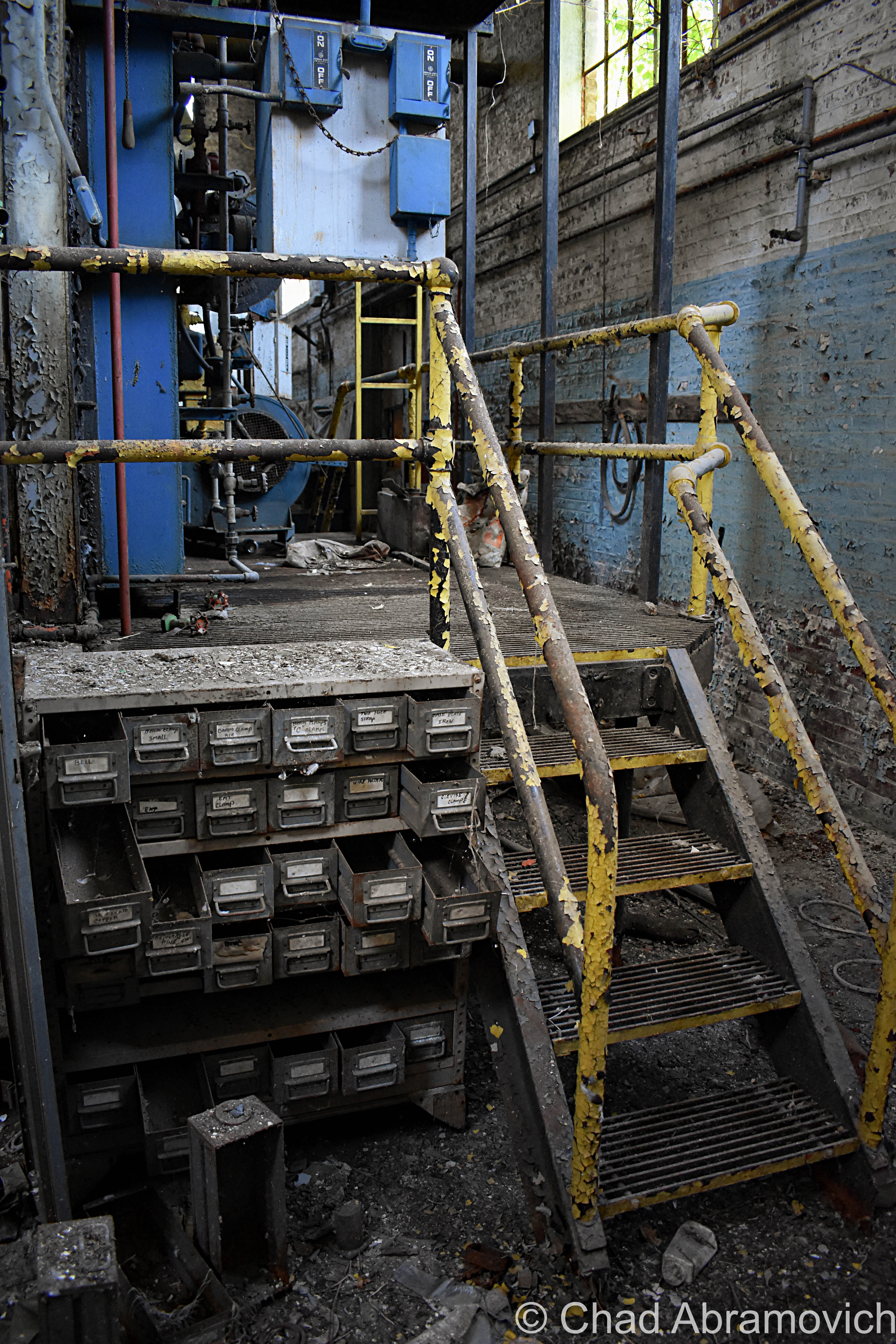
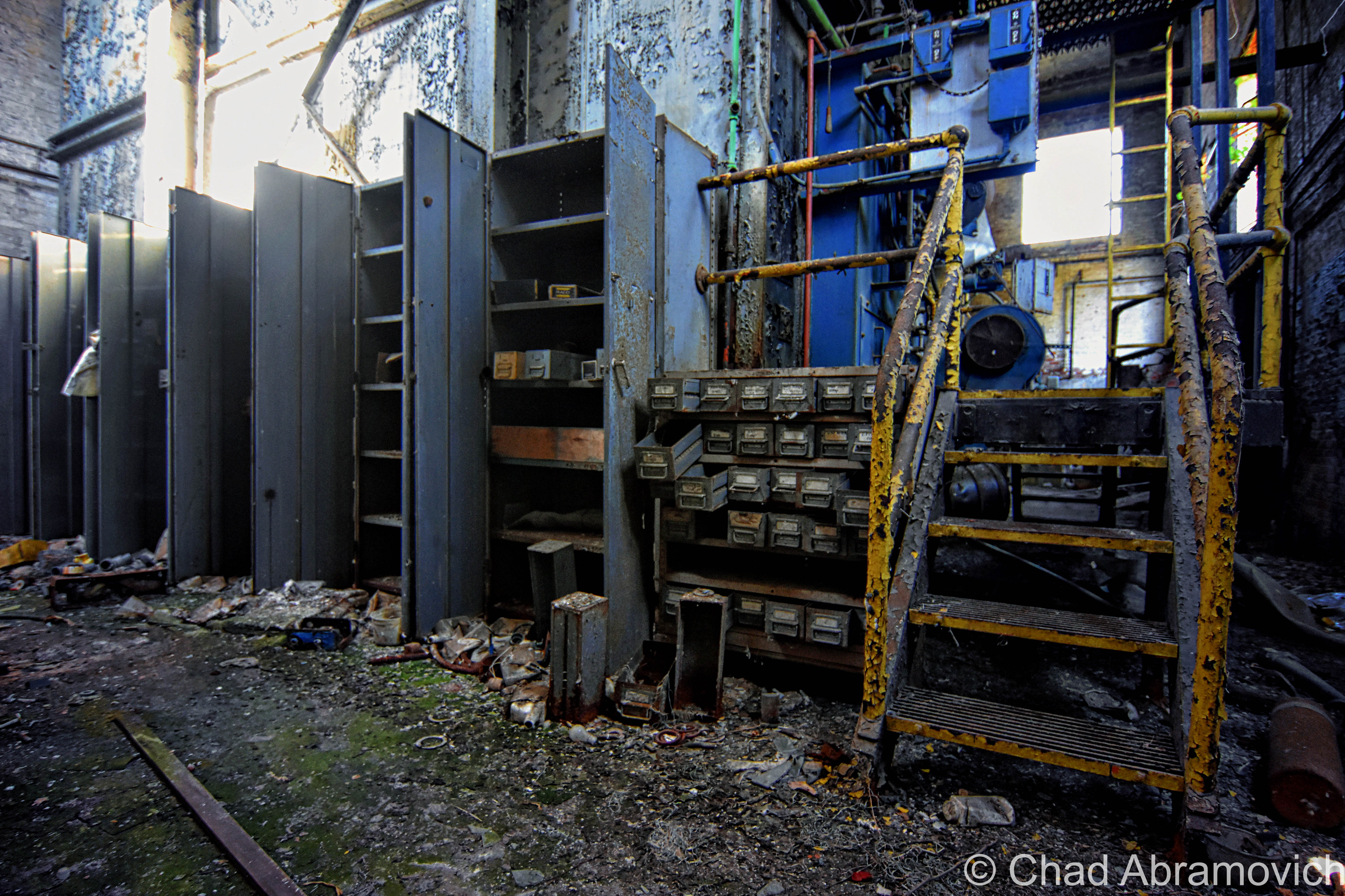
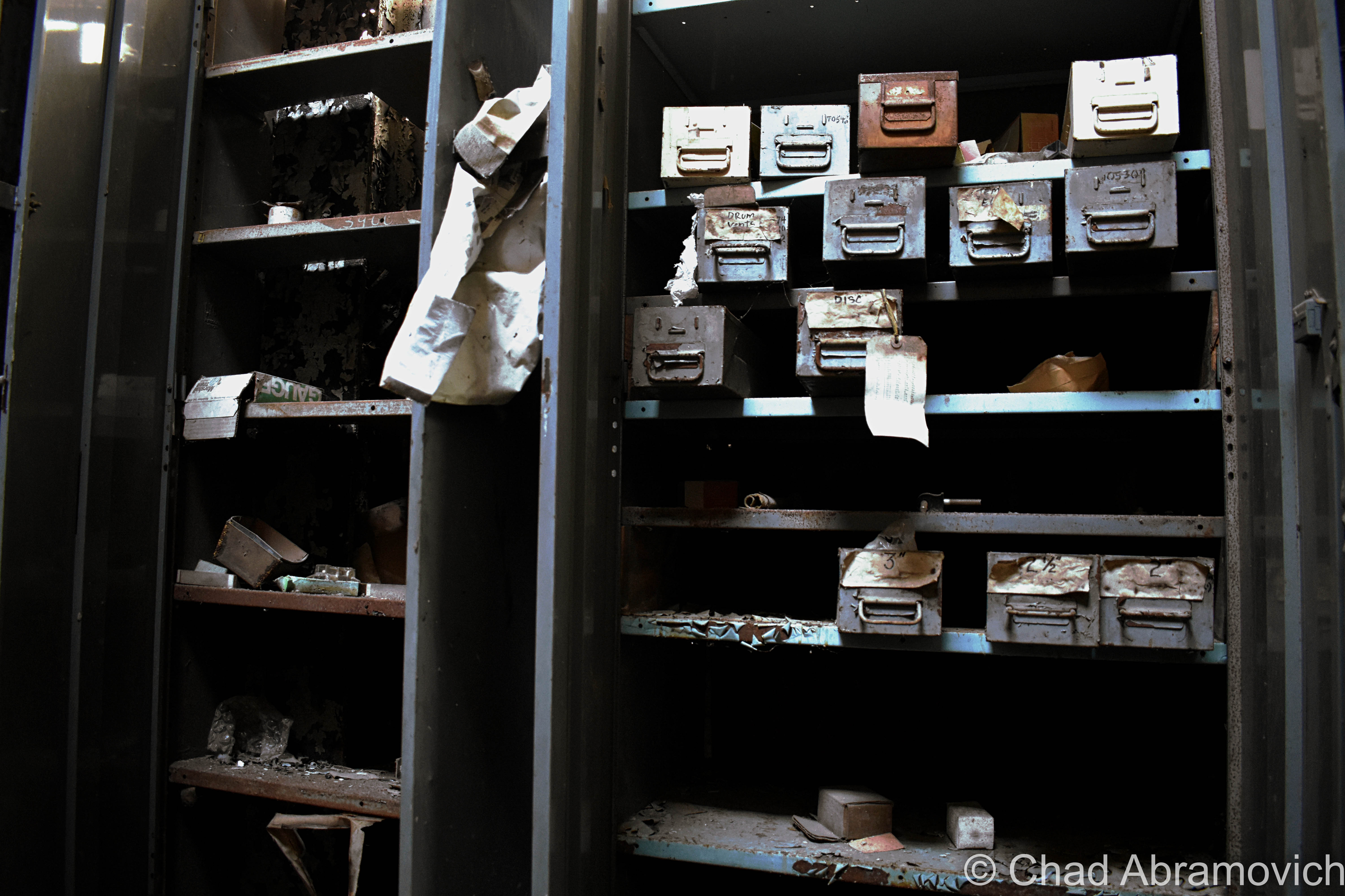
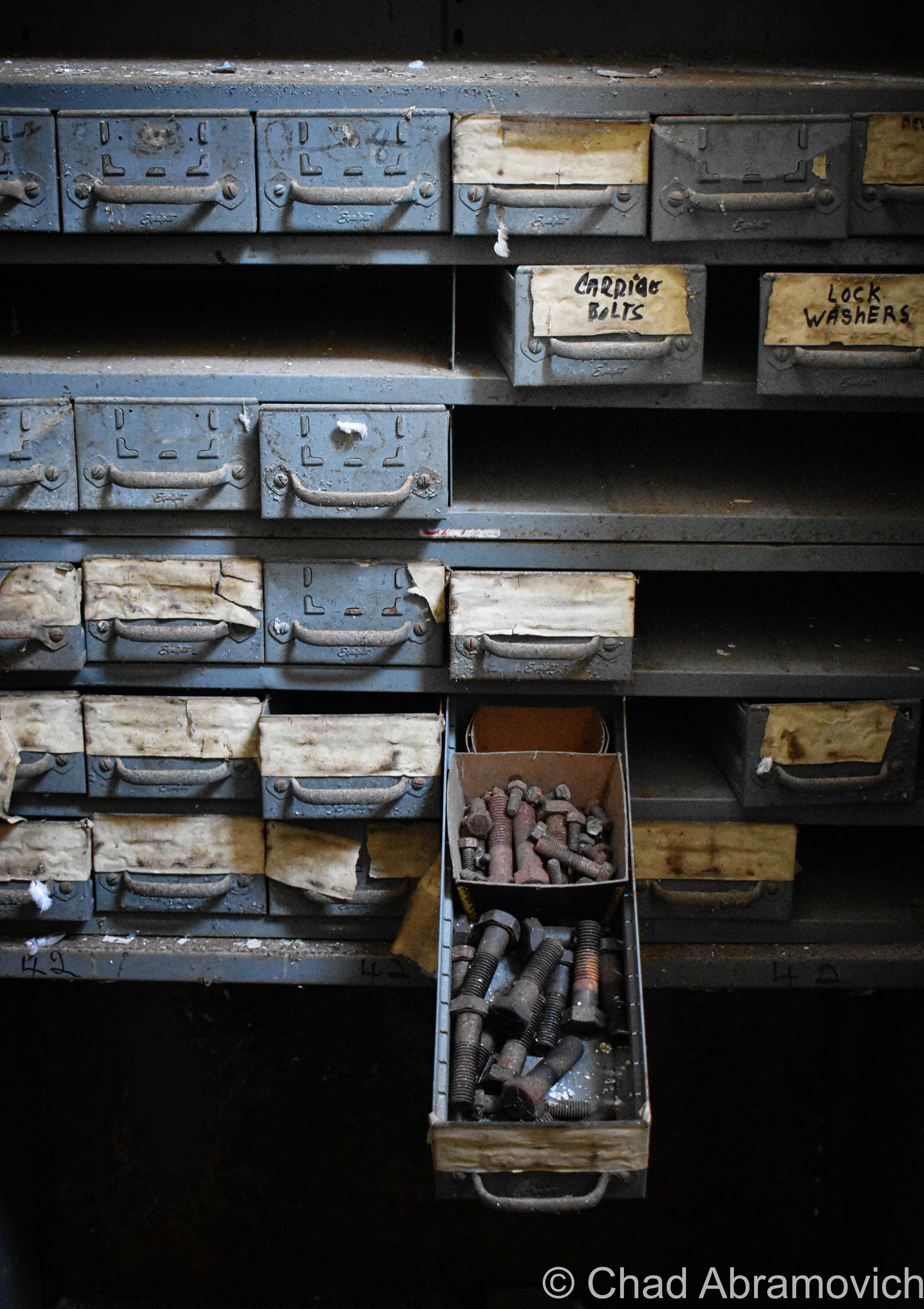
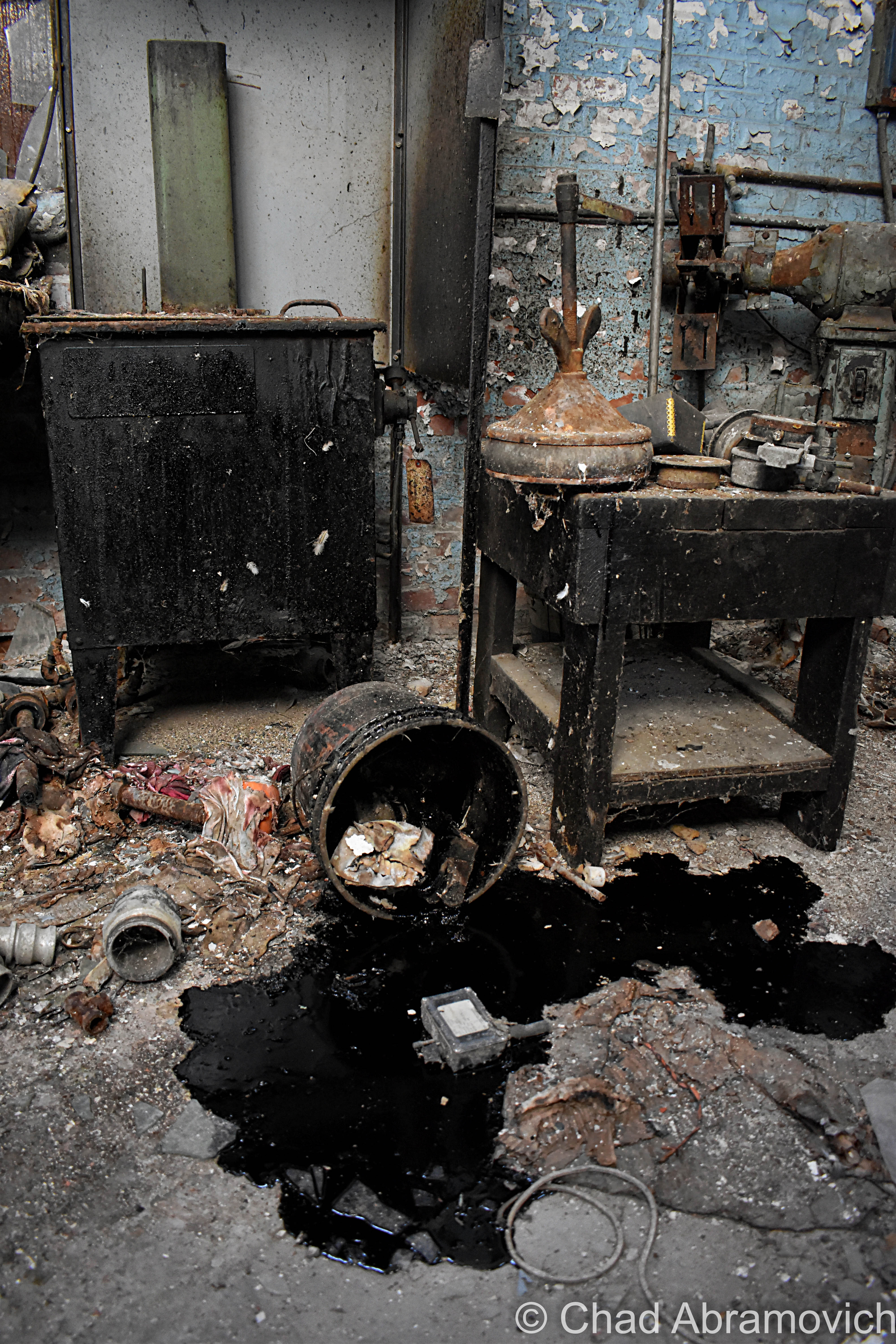
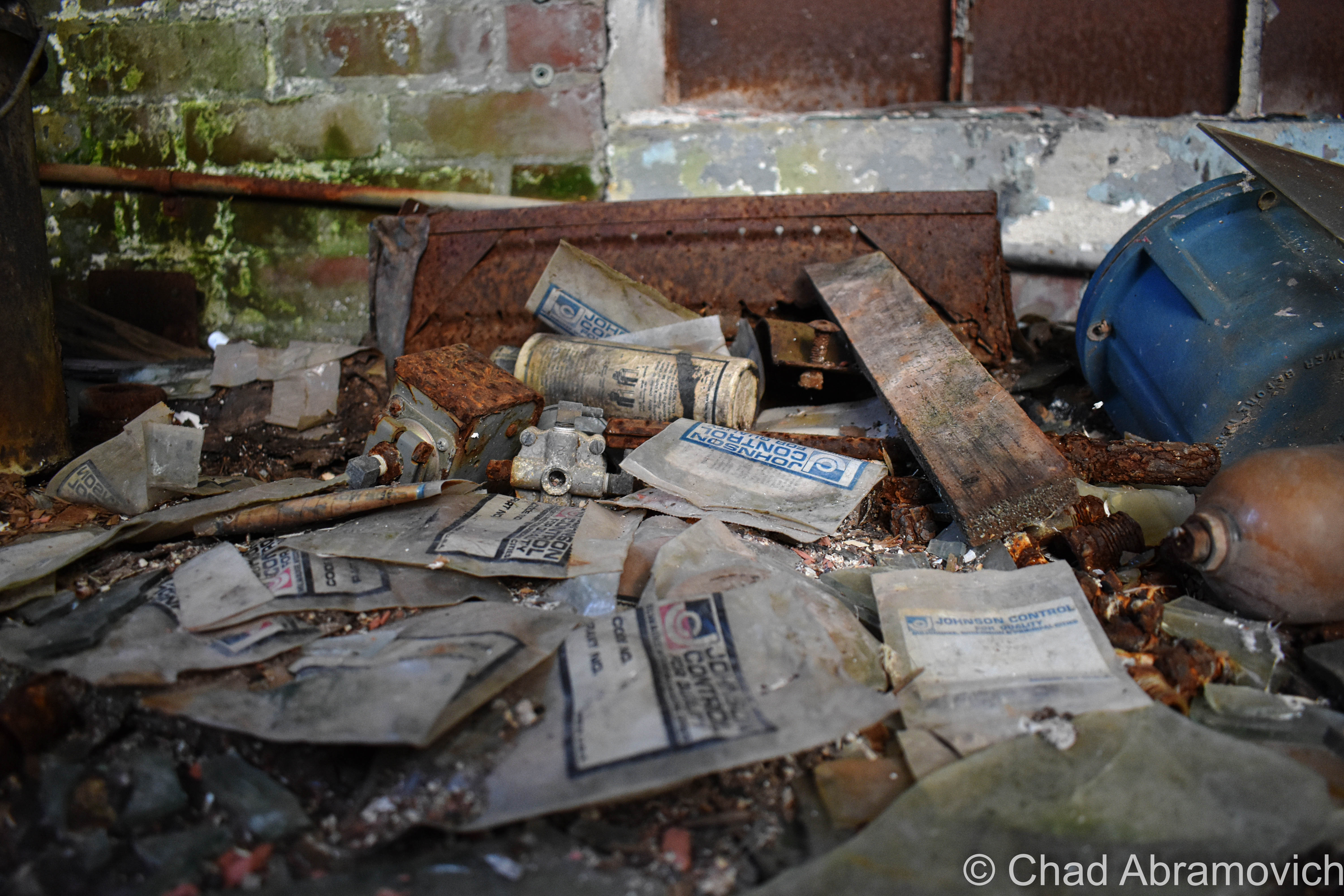
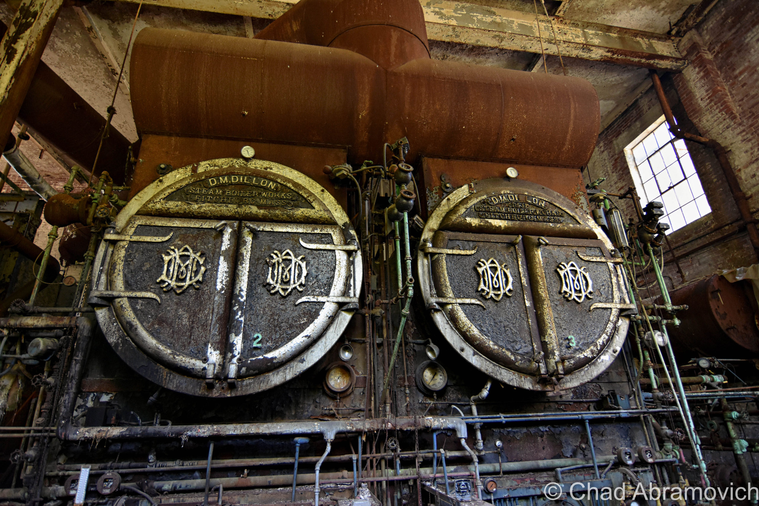
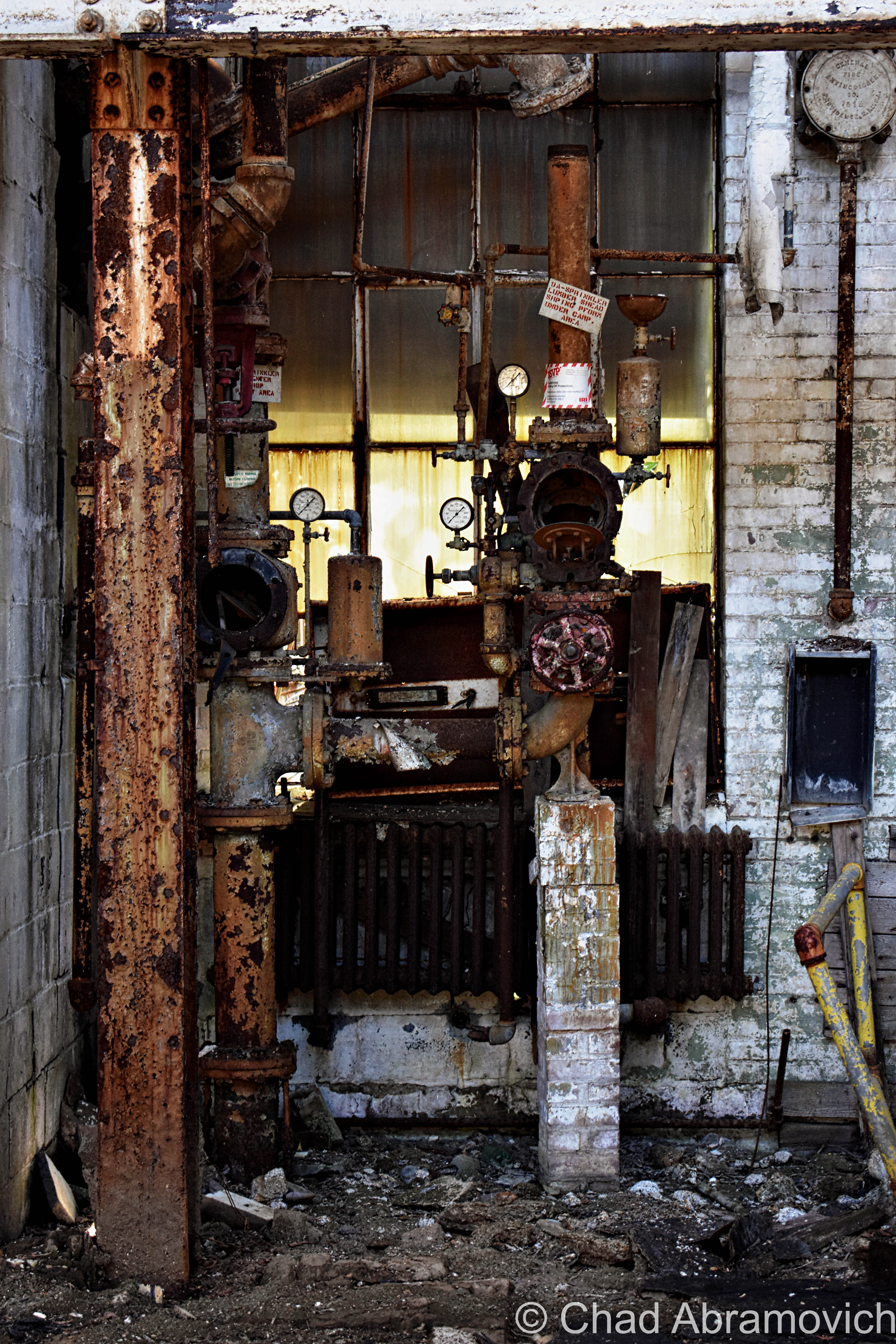
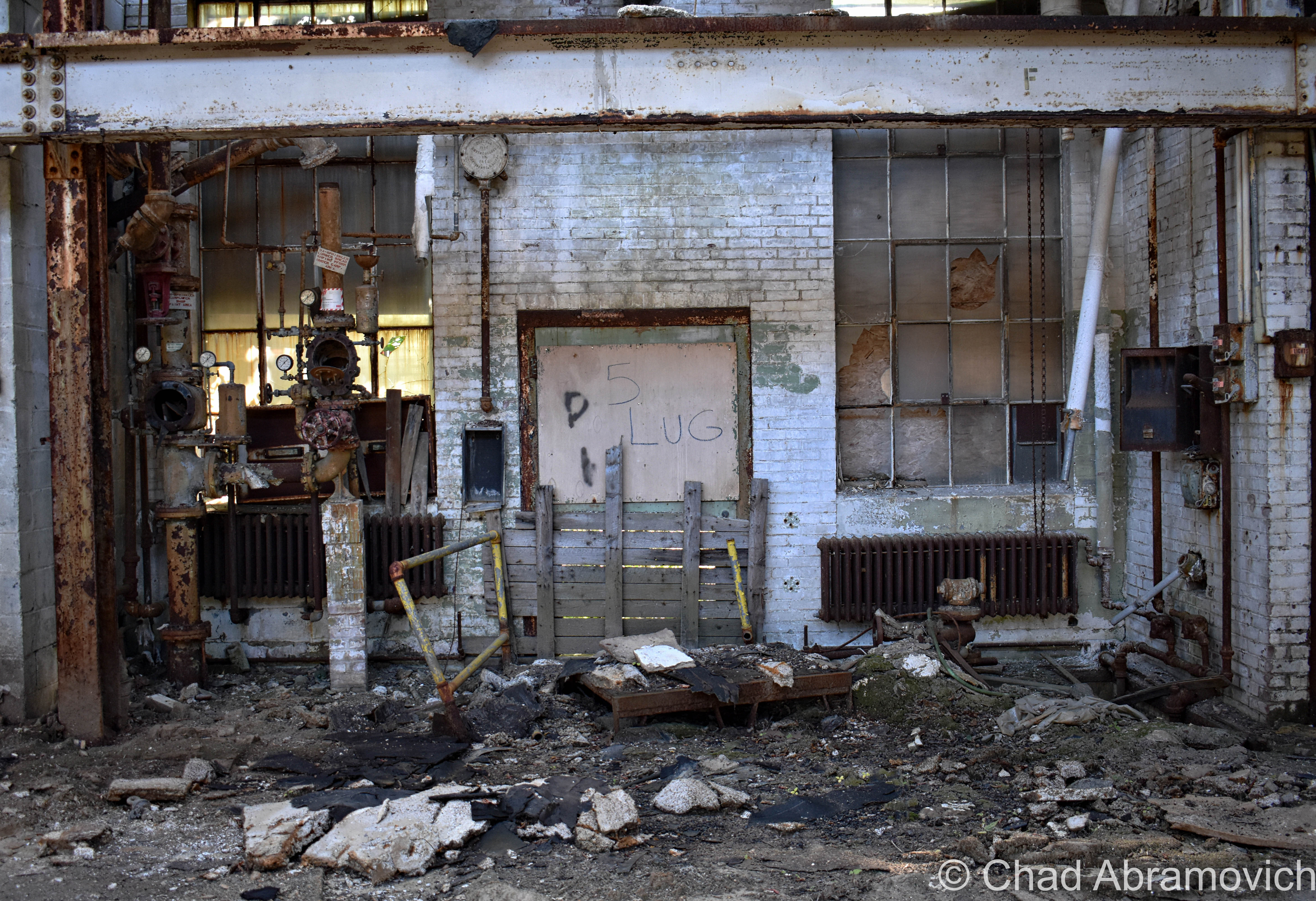
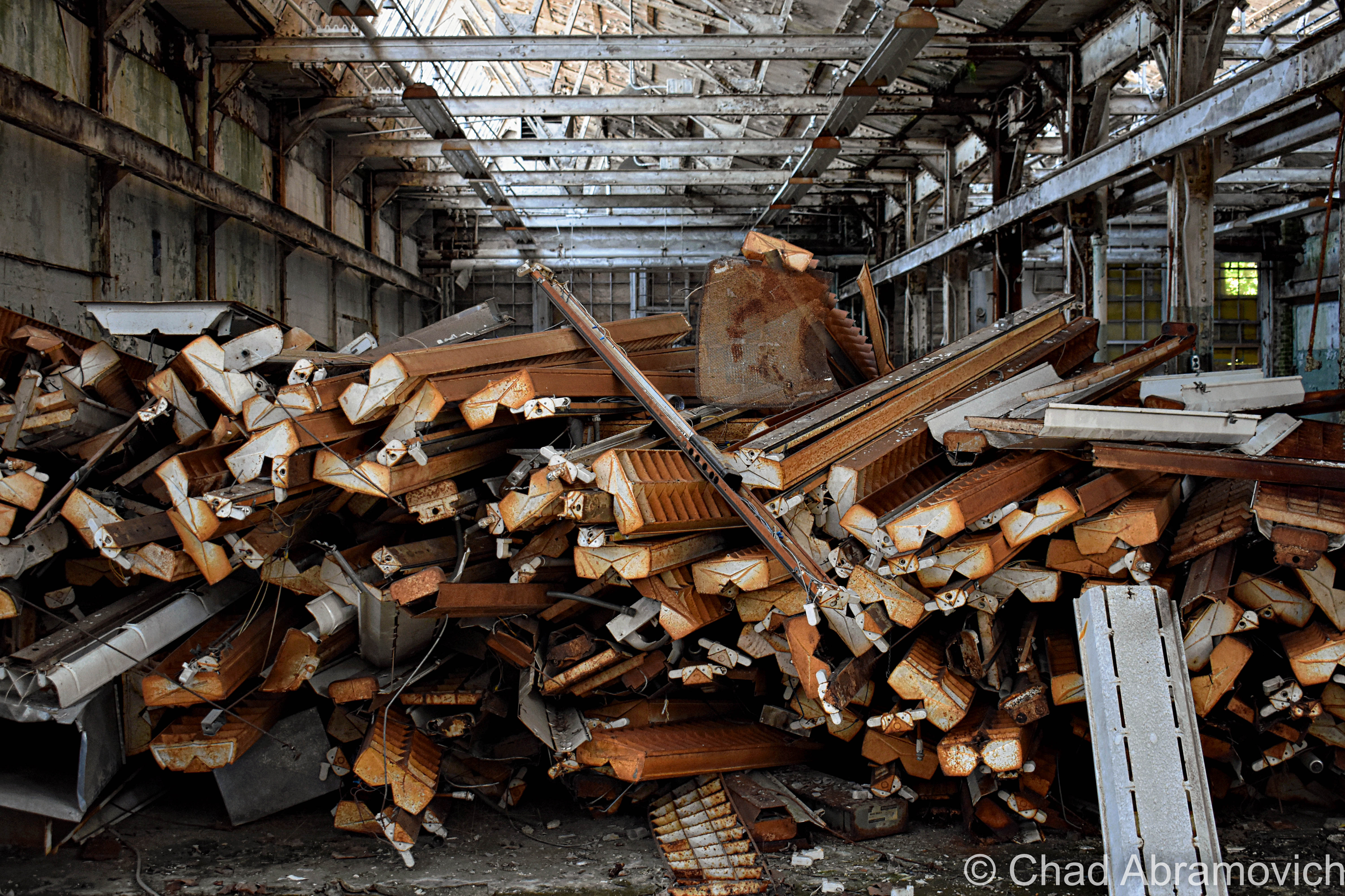
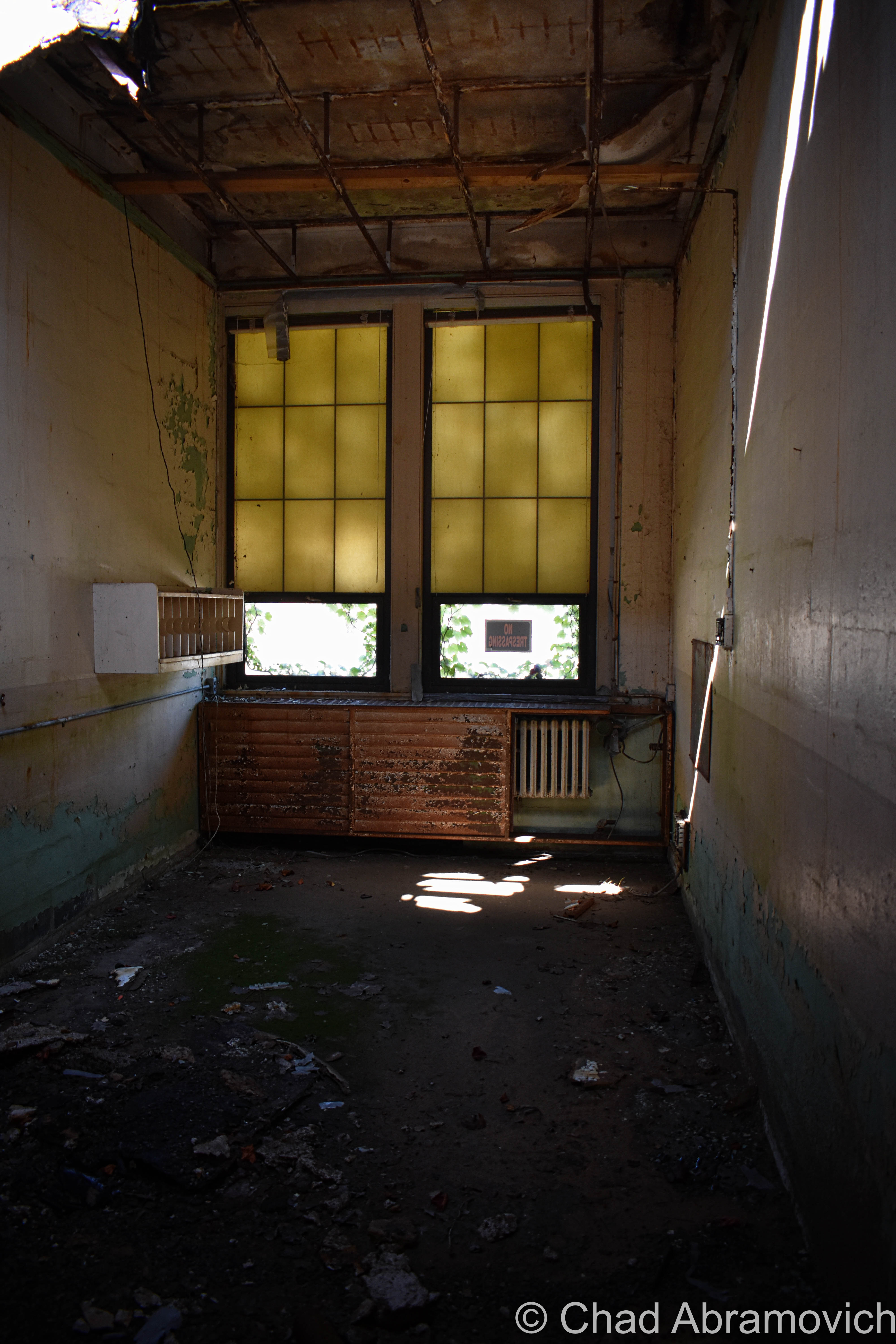
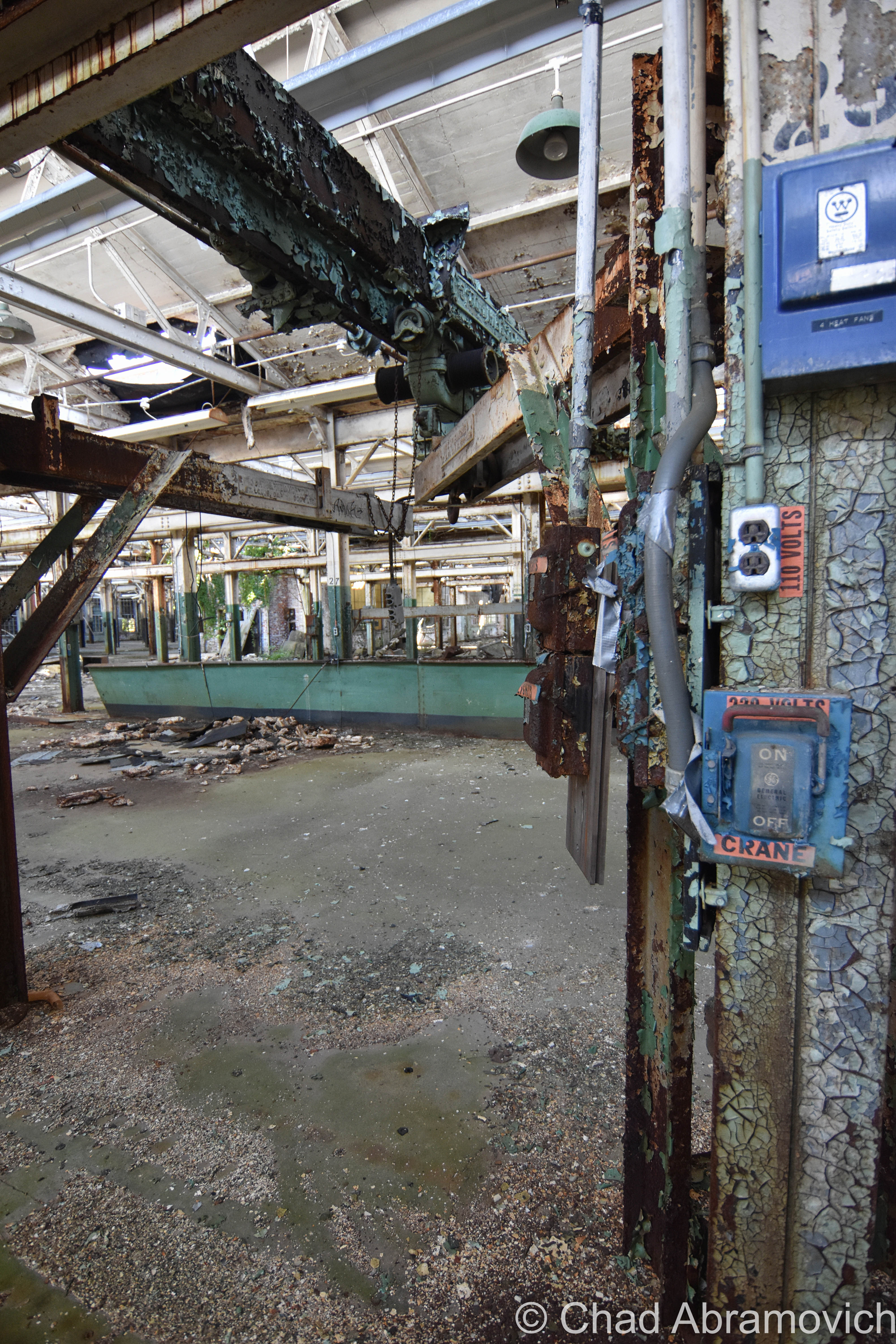
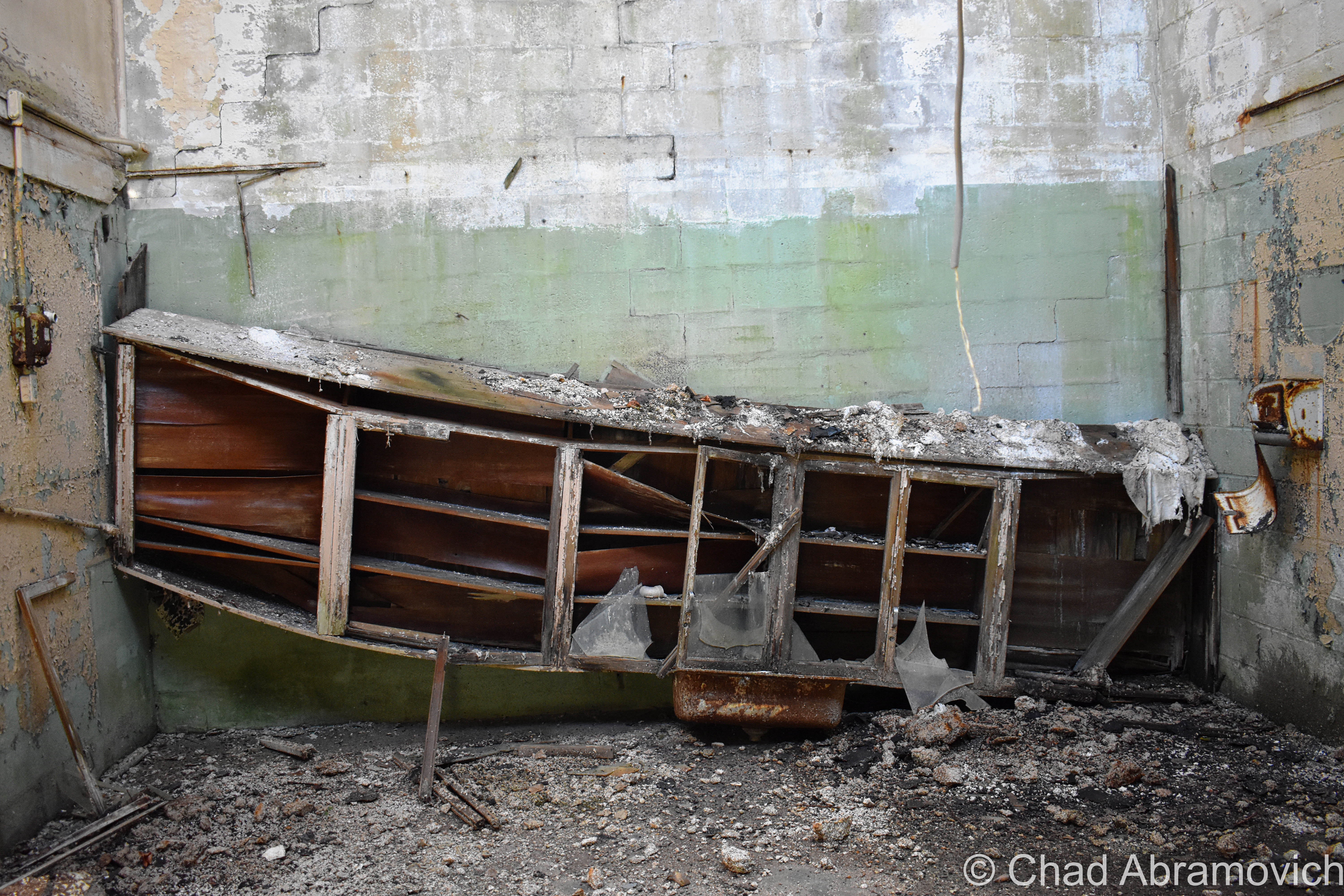
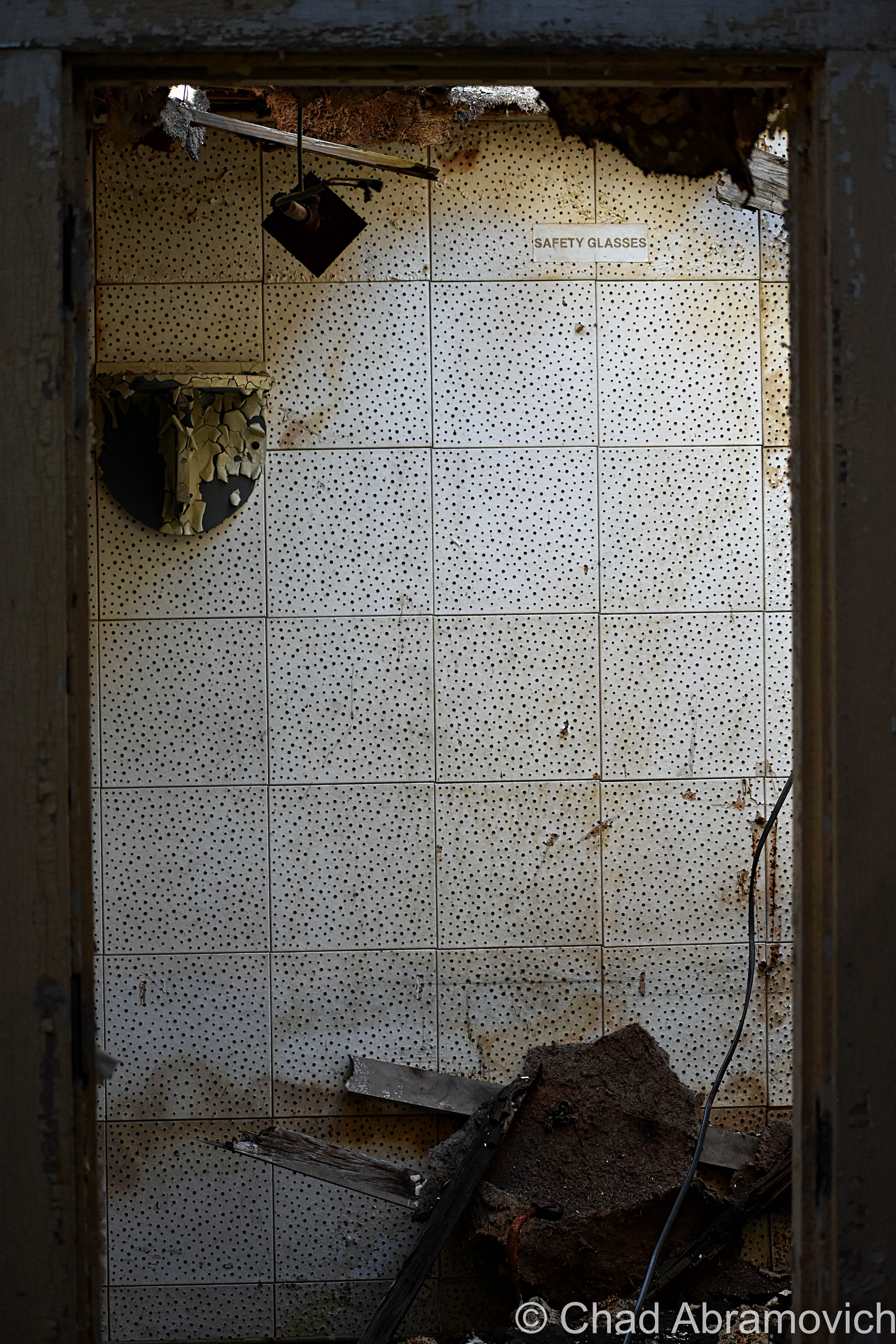
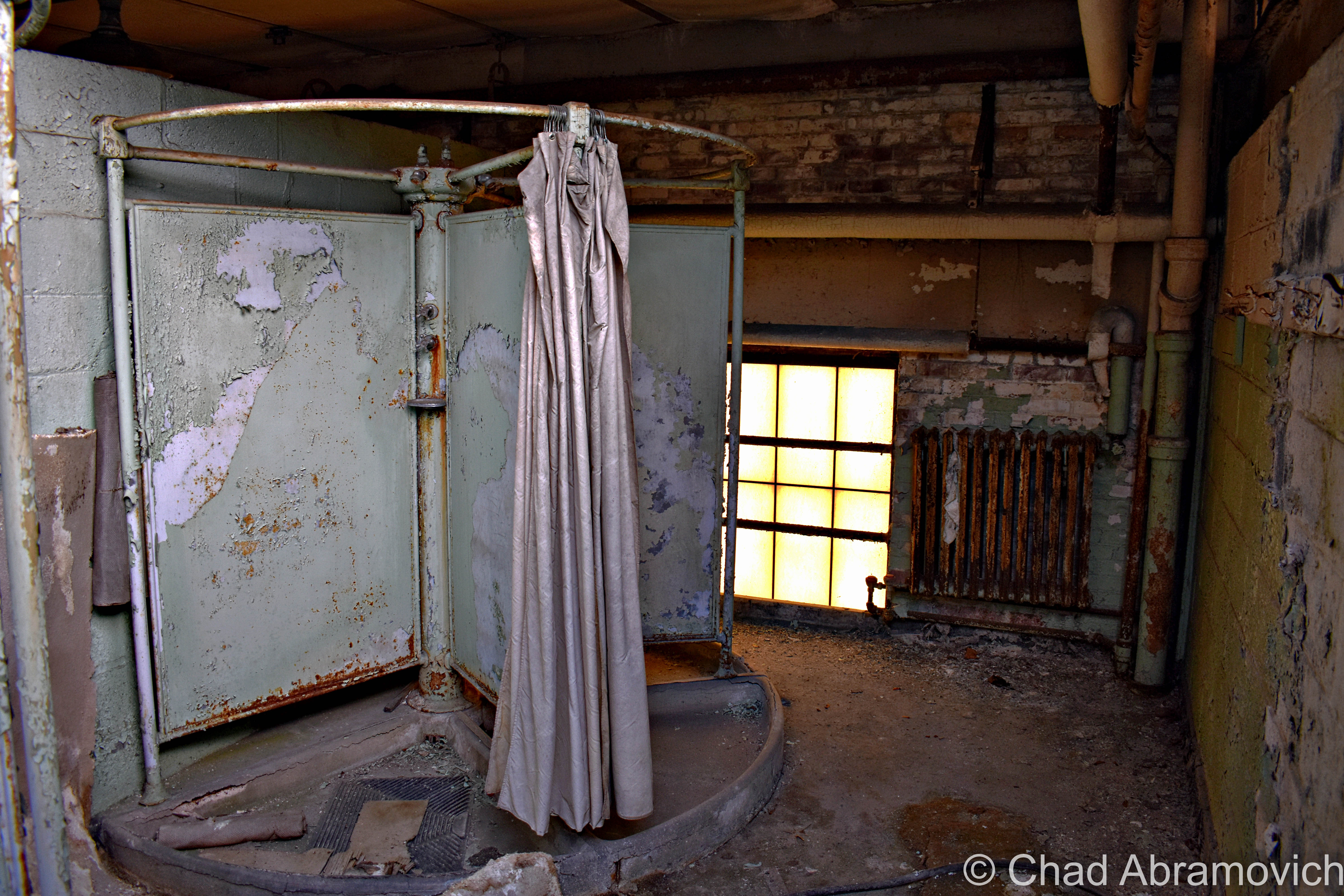
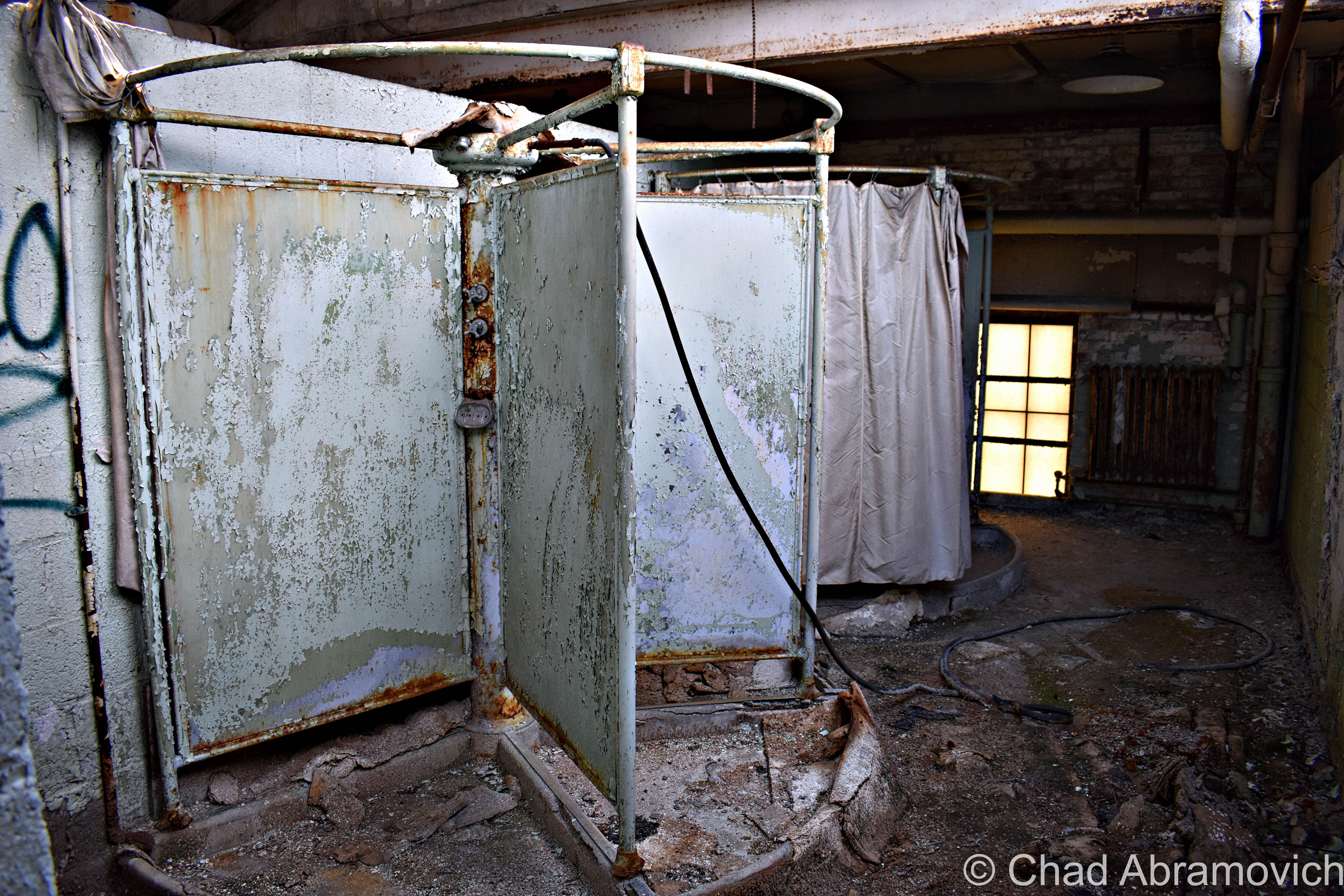
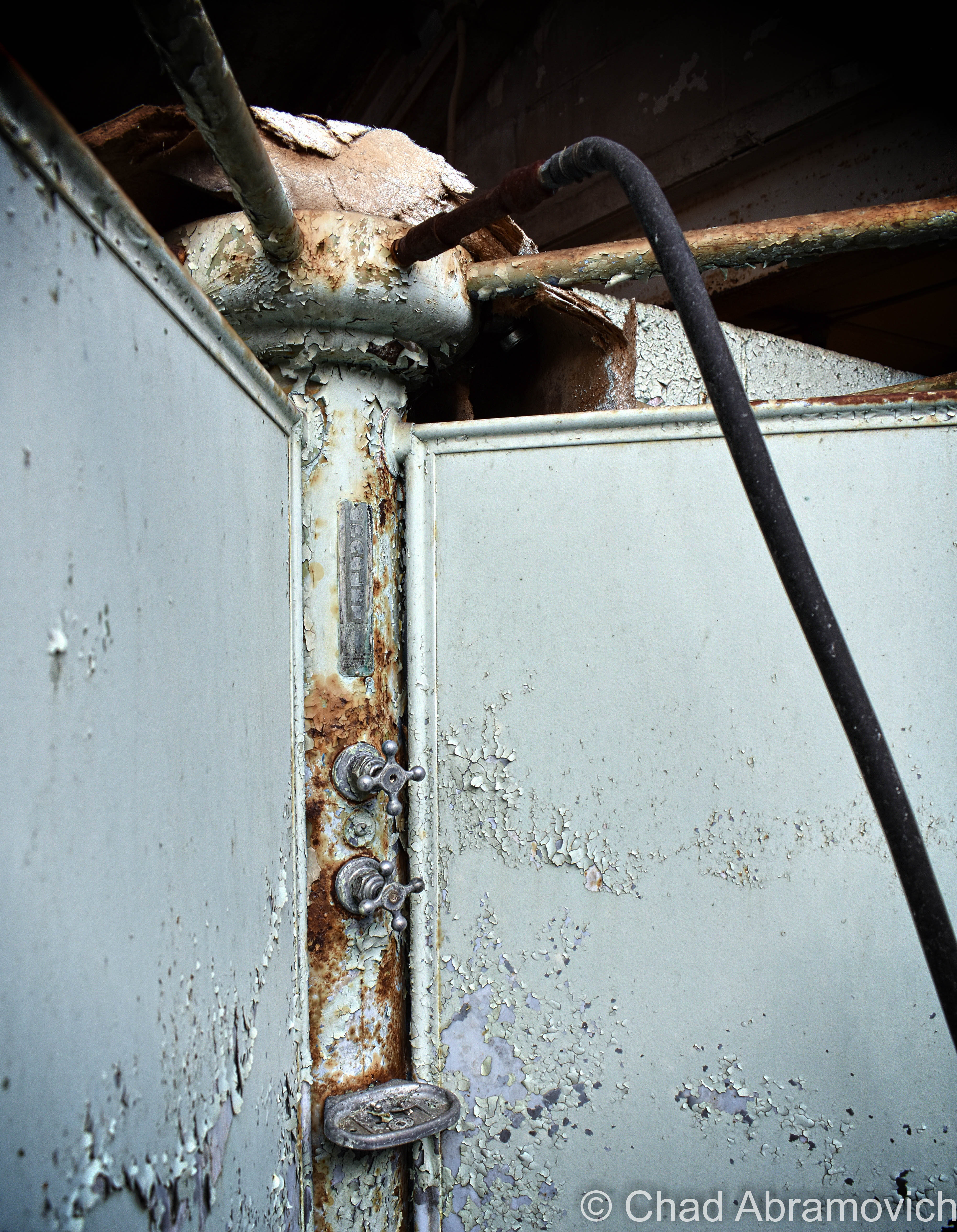
The power plant was a real unexpected treat, and my favorite portion of the grounds that we saw that day.  Unlike the main building, the generating station had most of its goodies still contained within drifting dust creating its own little universes in envelopes of light that scattered around the brawny boilers that were from an era that built things to last, and scores of gauges. Floors with hummocks of lead paint flakes and dirt. Desks and chests of drawers were still cluttered with miscellany and workshop brick-a-brack. This was definitely a pleasure to point my camera at.
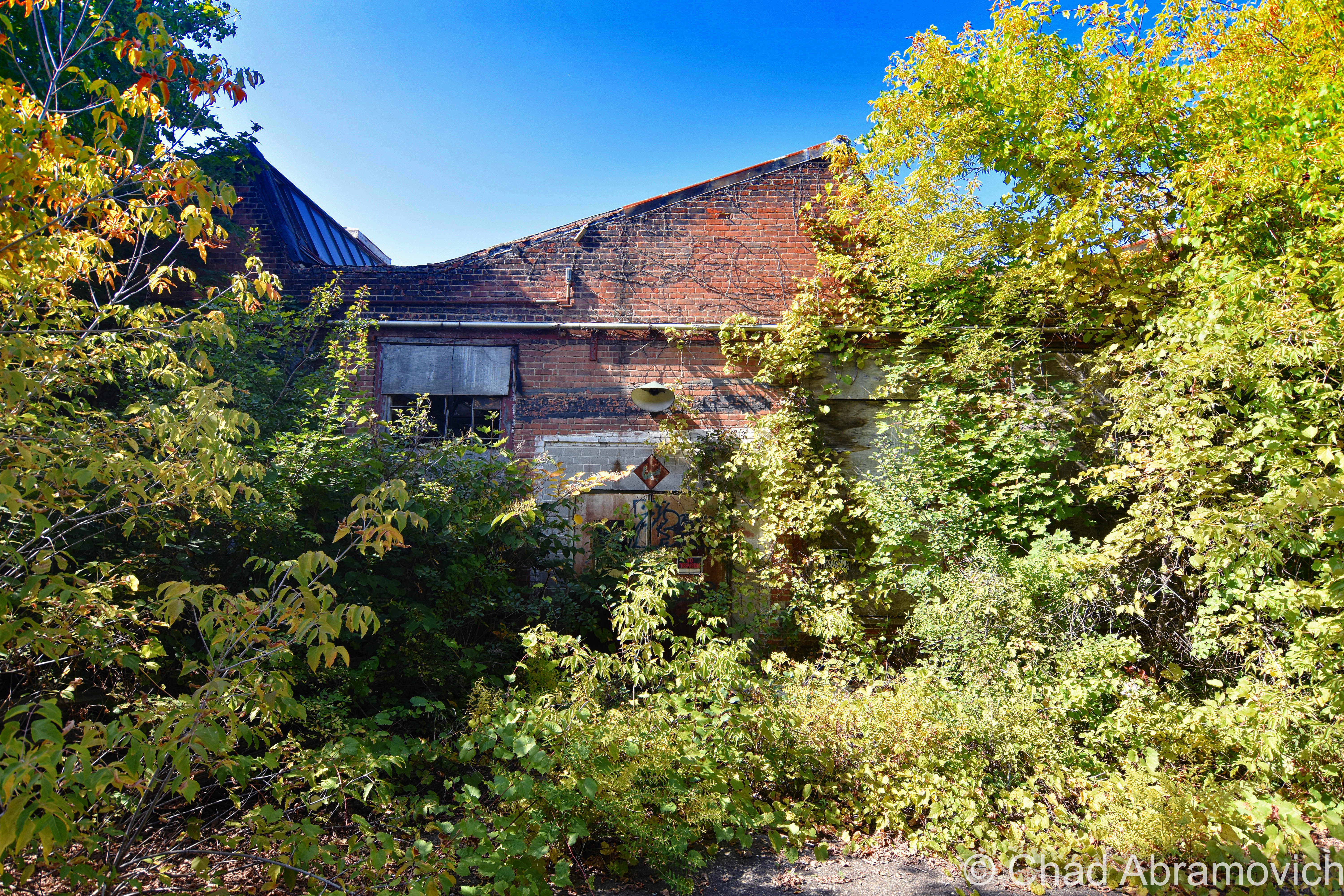
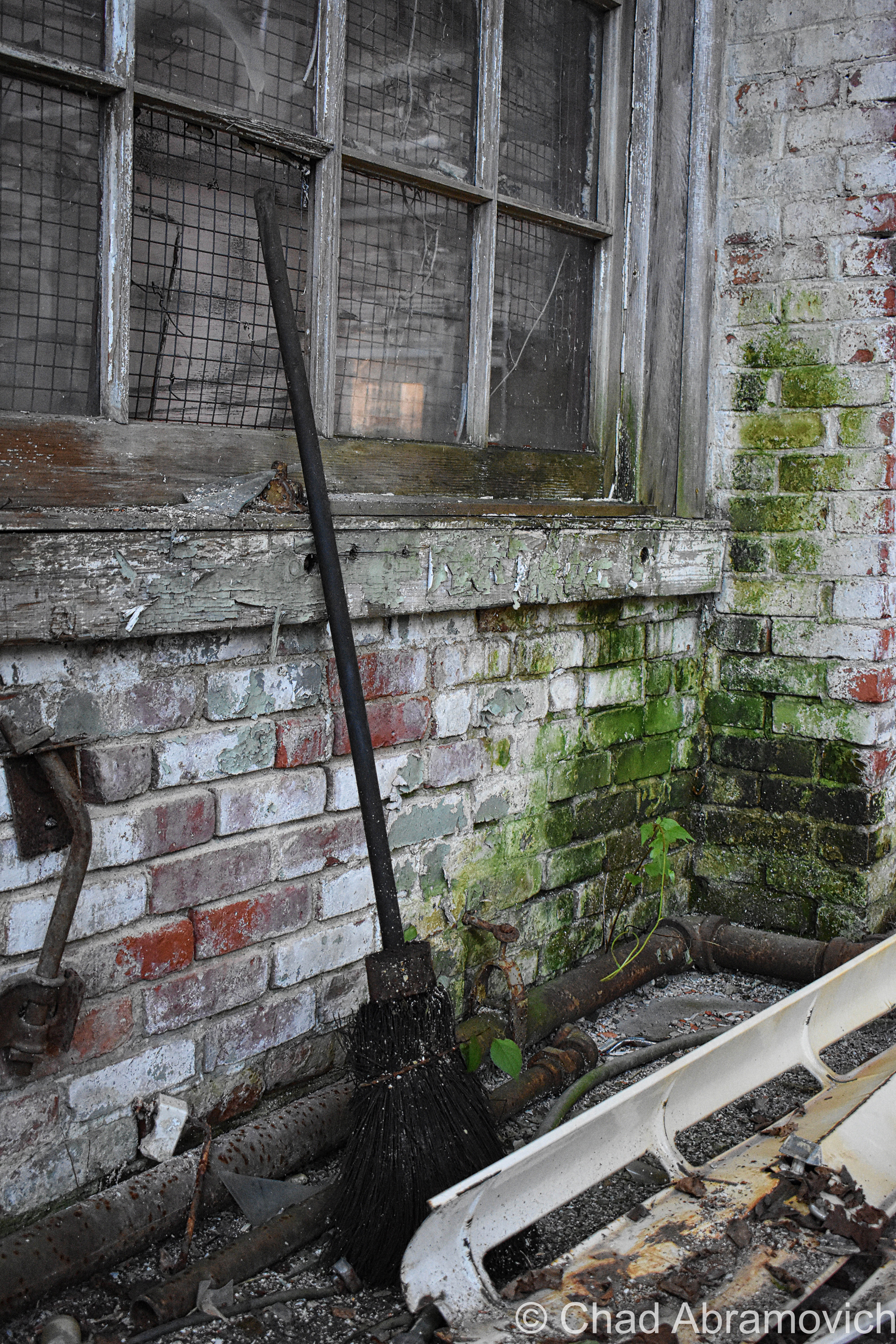
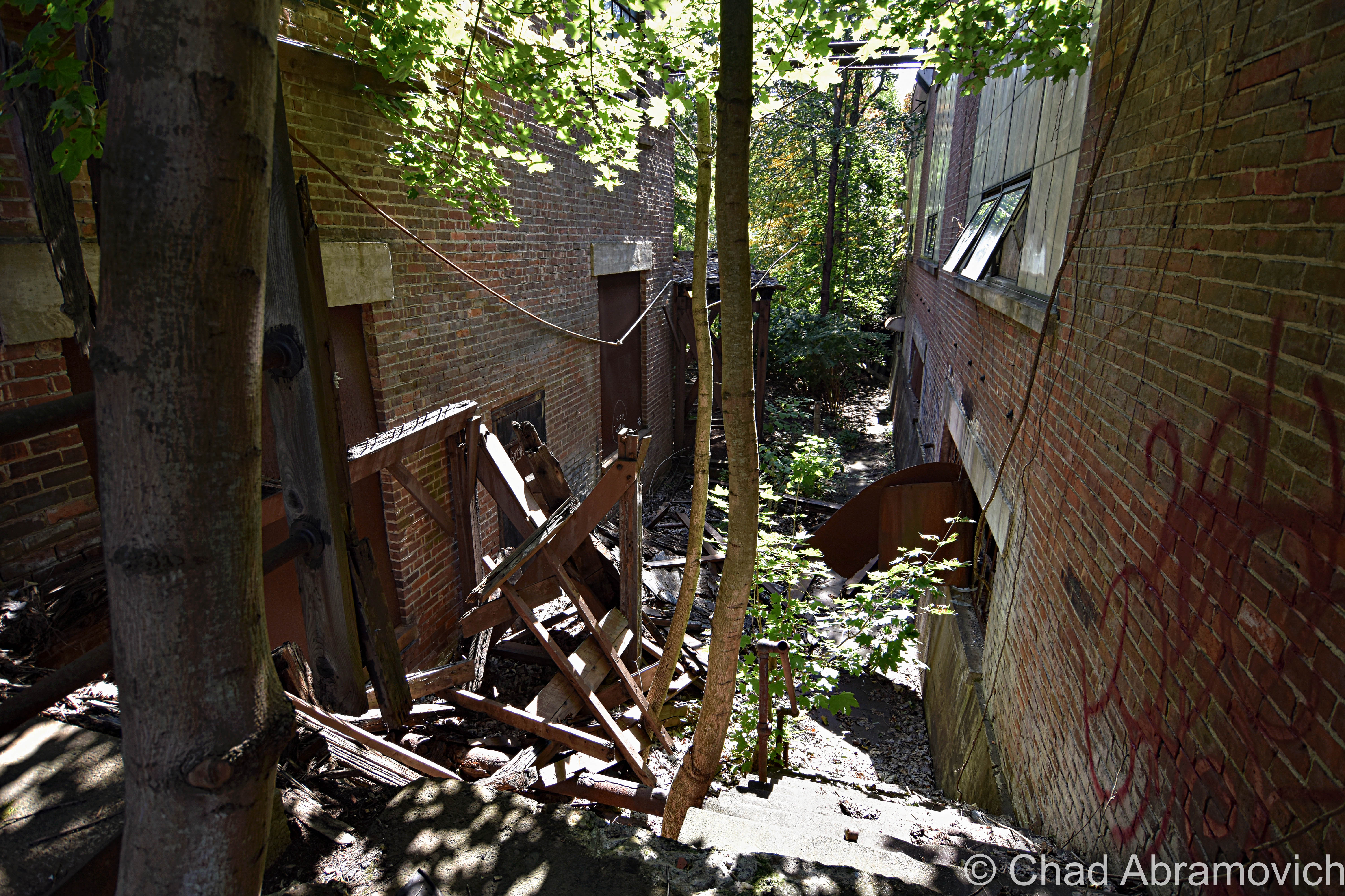
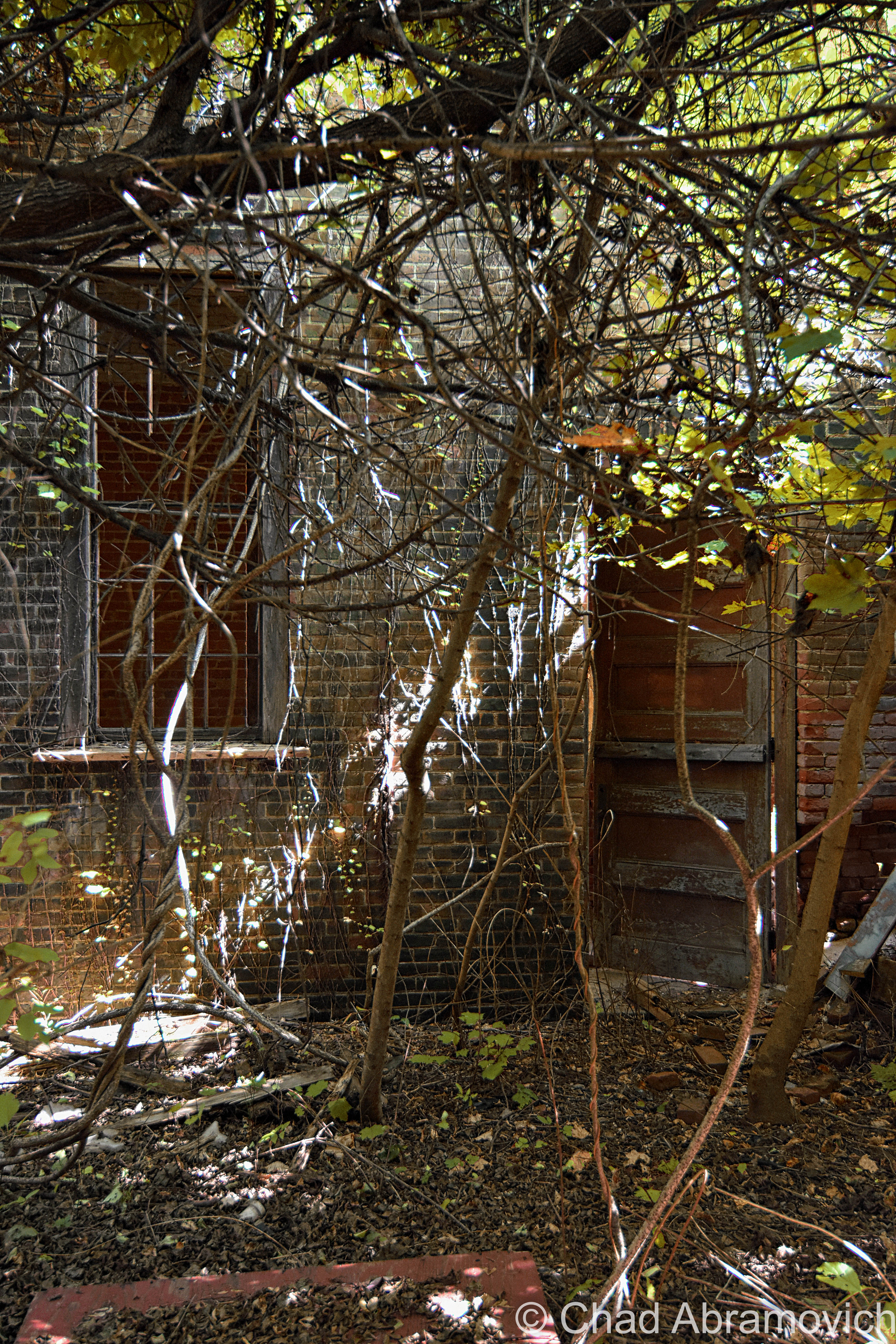
Afterward, we entered the jungle that has consumed the back fringes of the main building – found our way down a forgotten concrete staircase that was being slowly crumbled by encroaching trees that we were constantly shielding from smacking us in our faces, inside an outbuilding that had totally fused with nature, and contorted through a broken window.

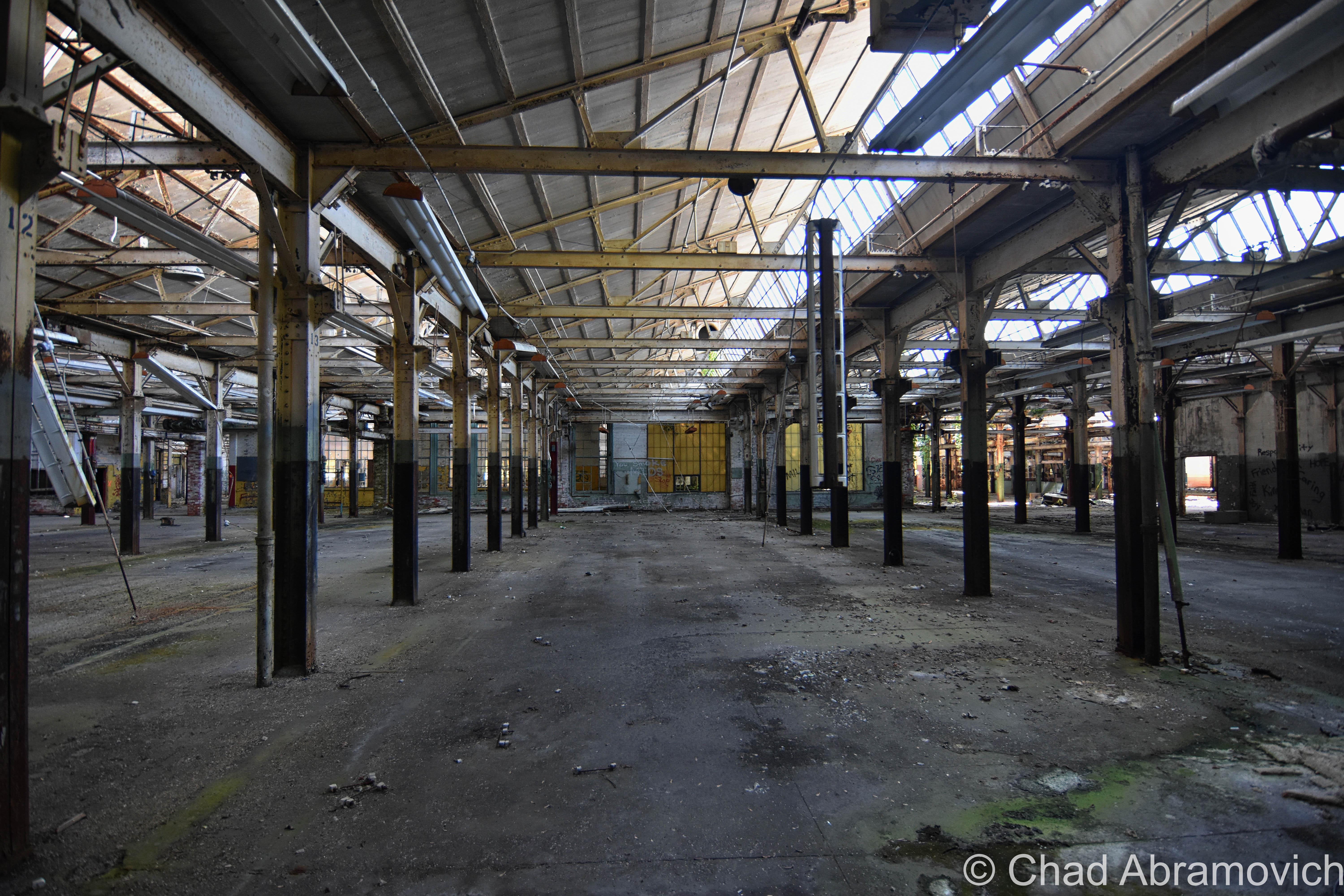
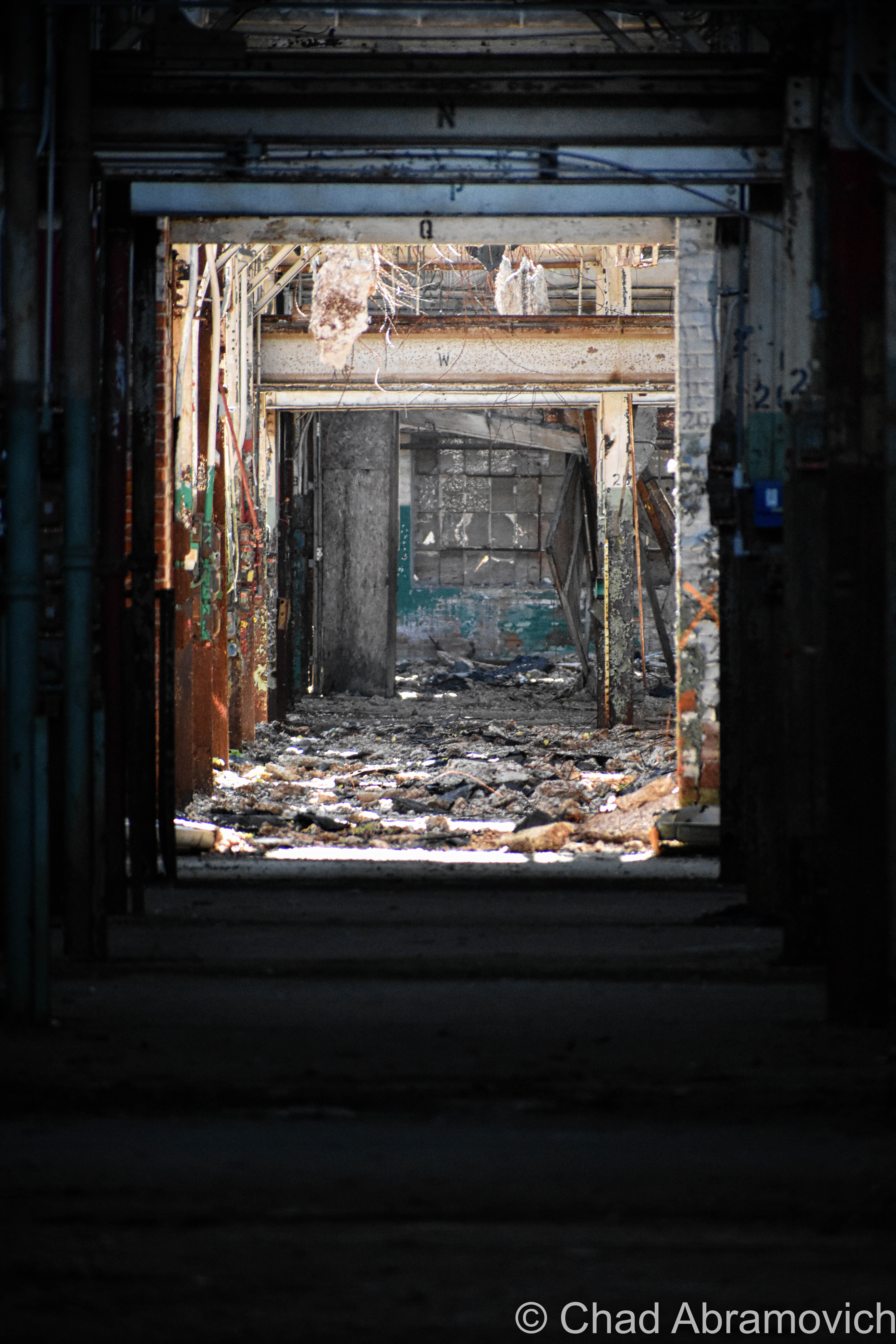
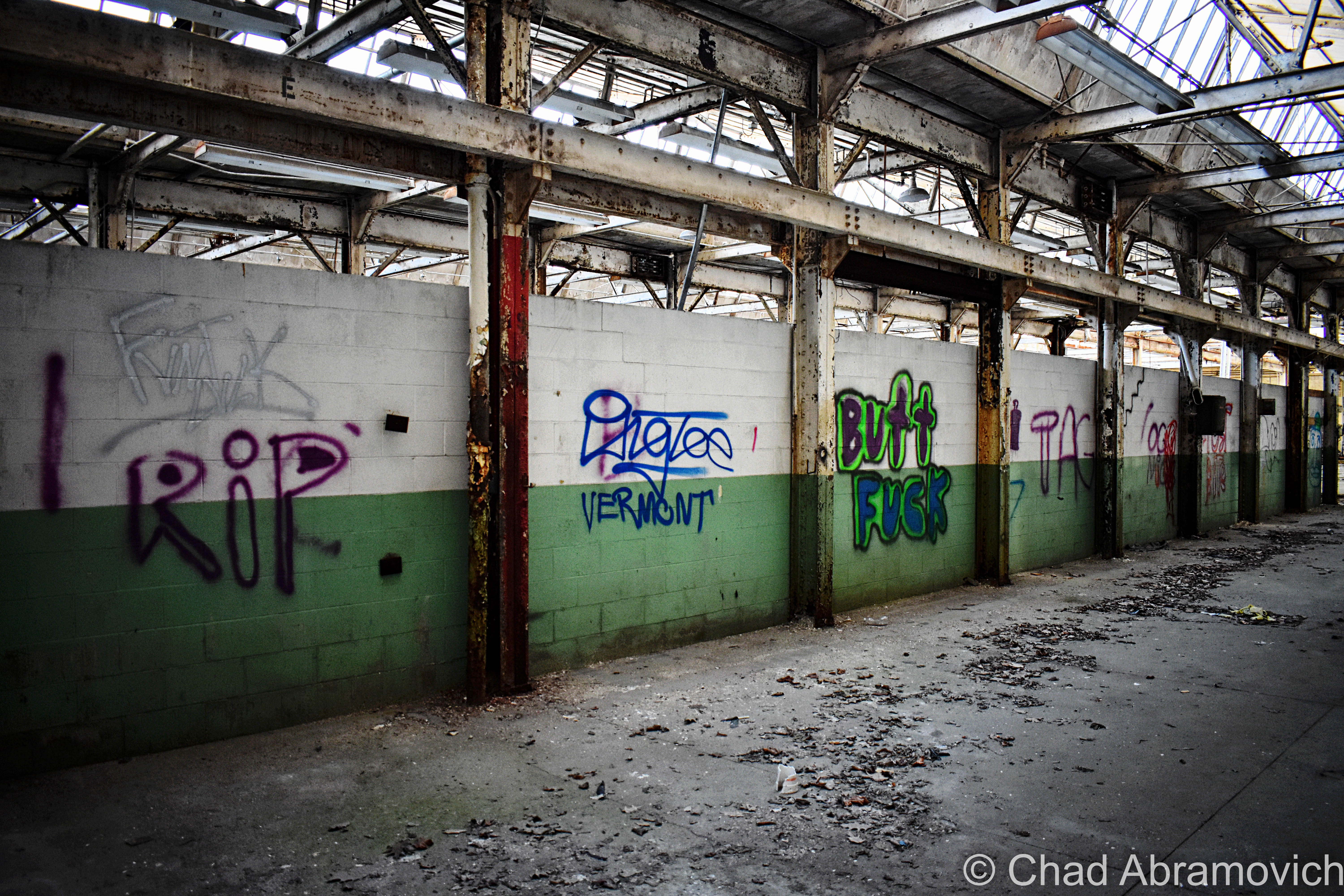
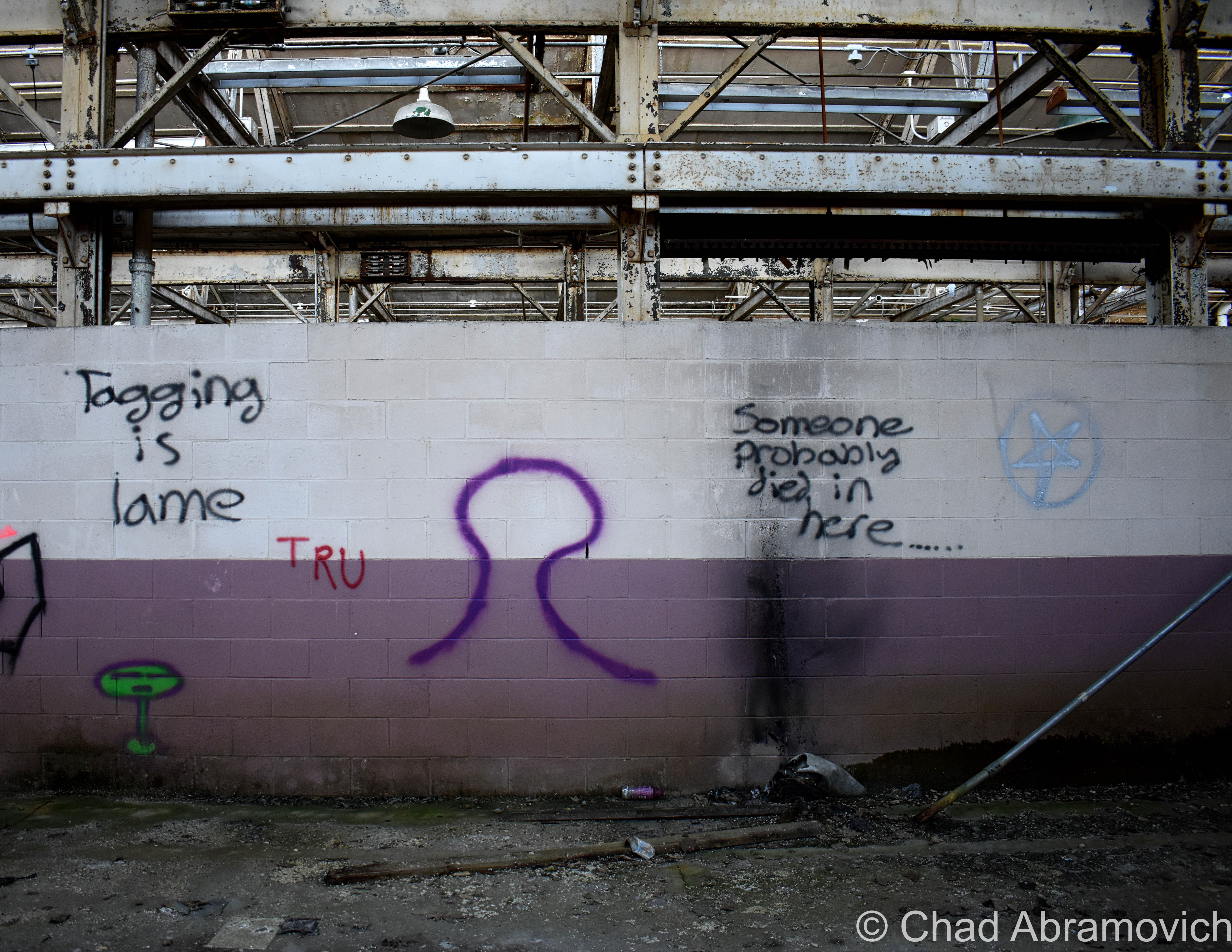
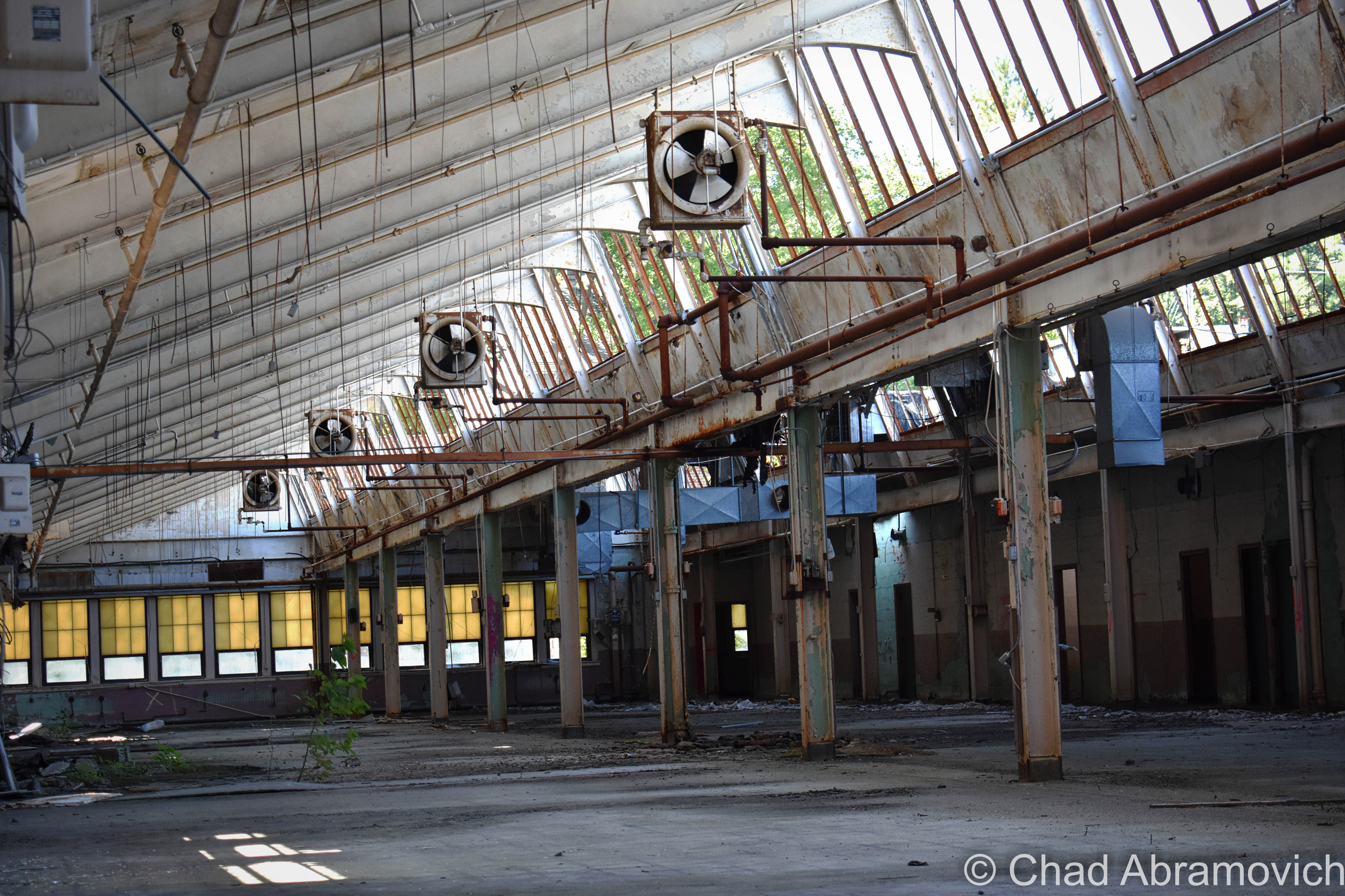
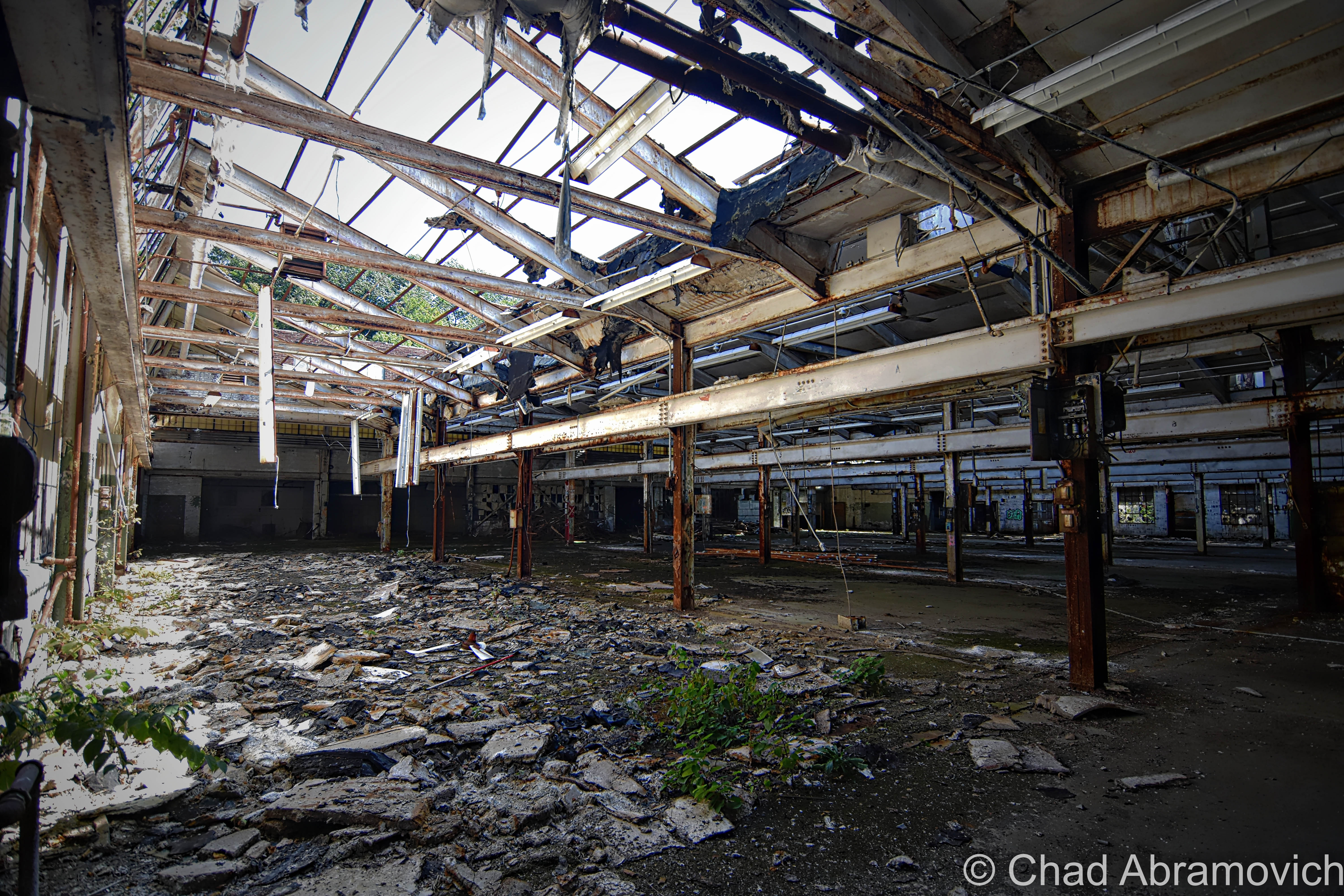
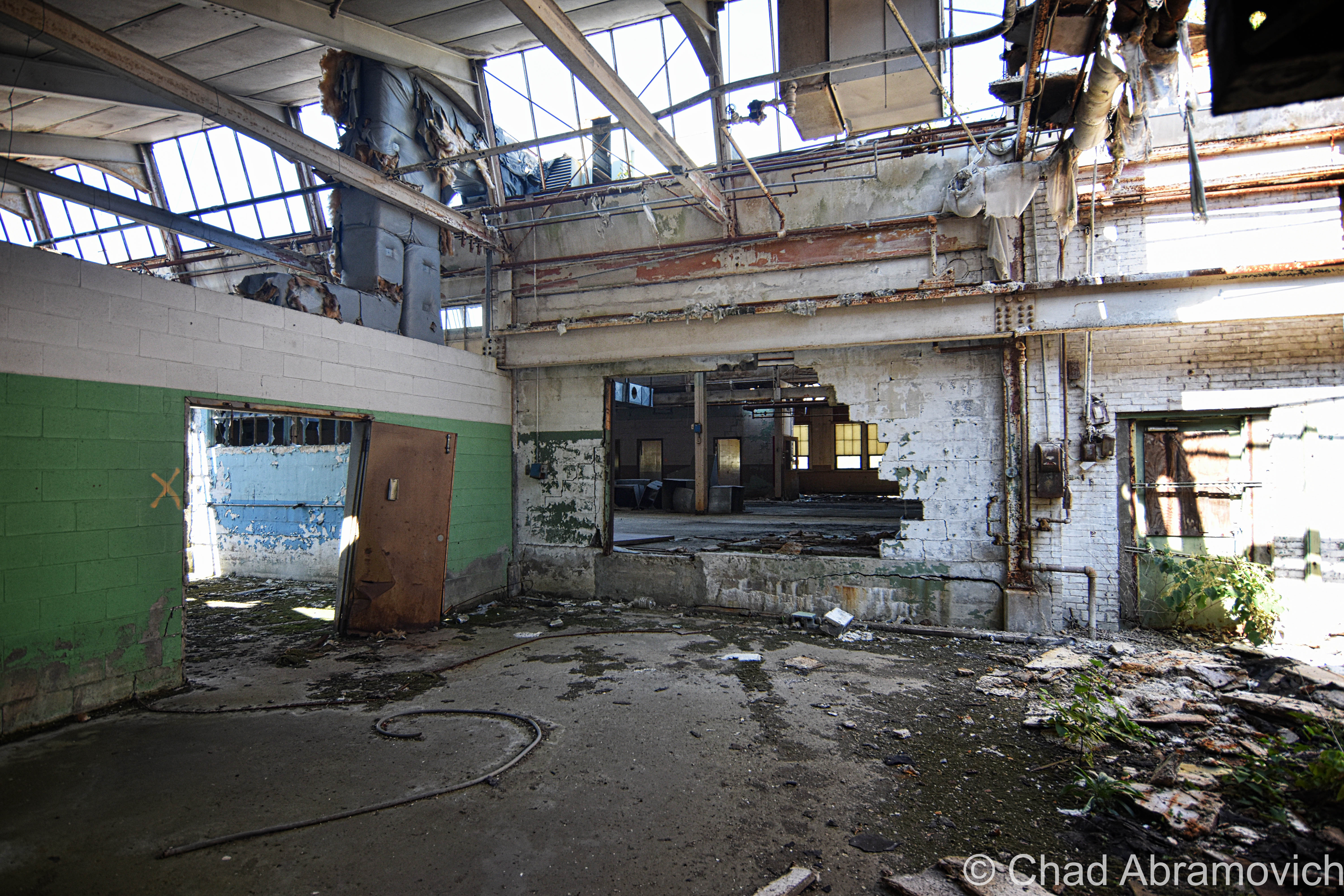
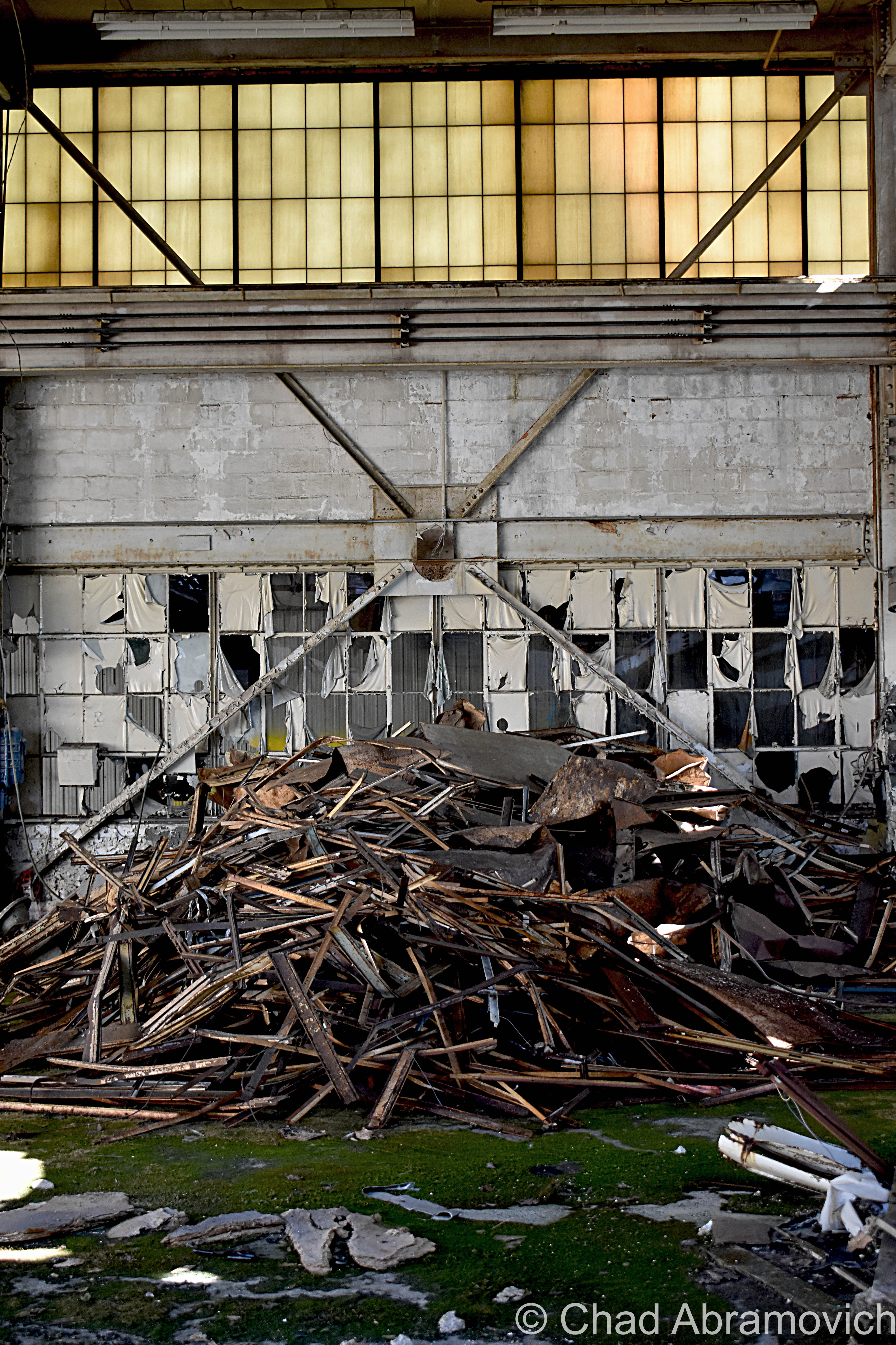
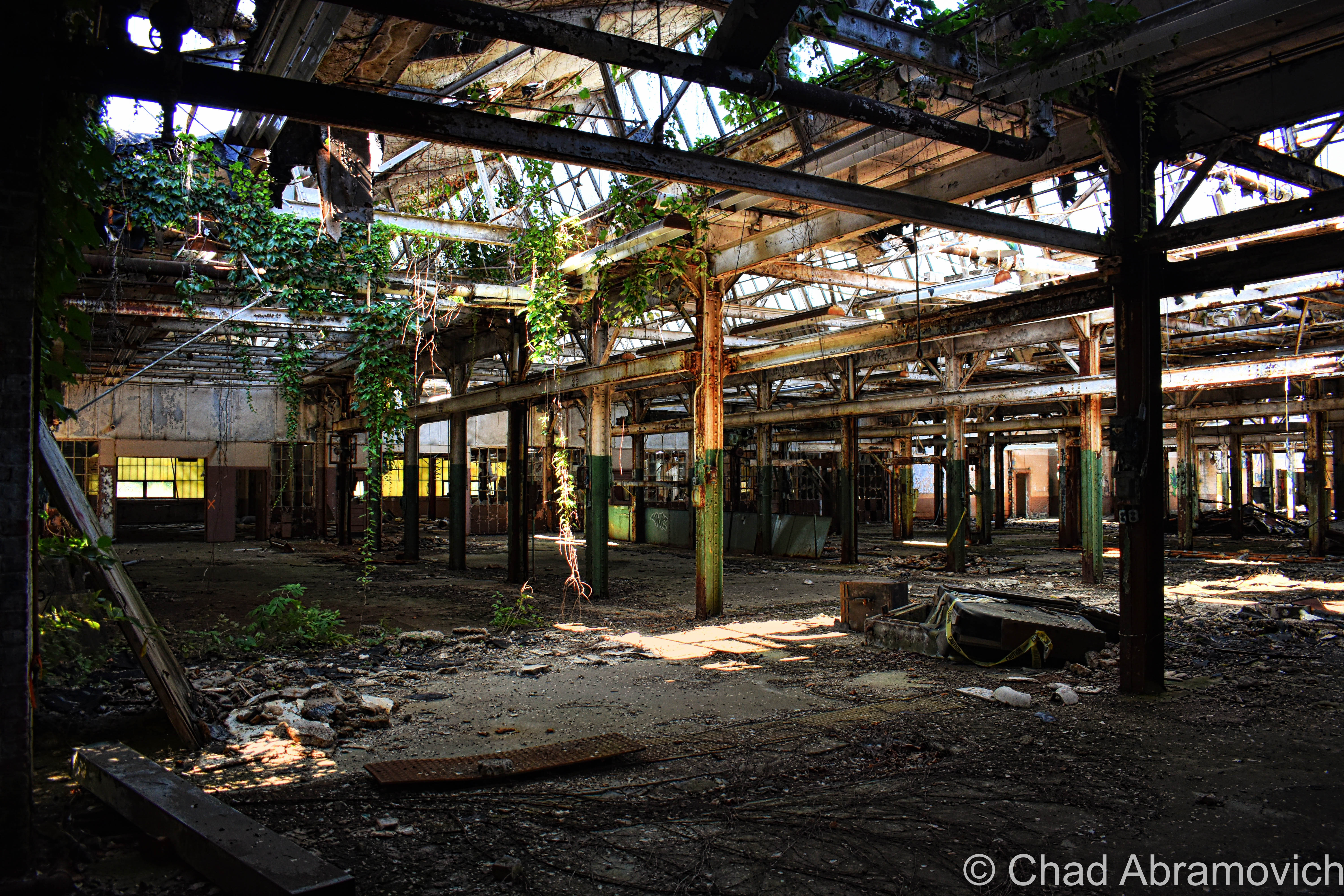
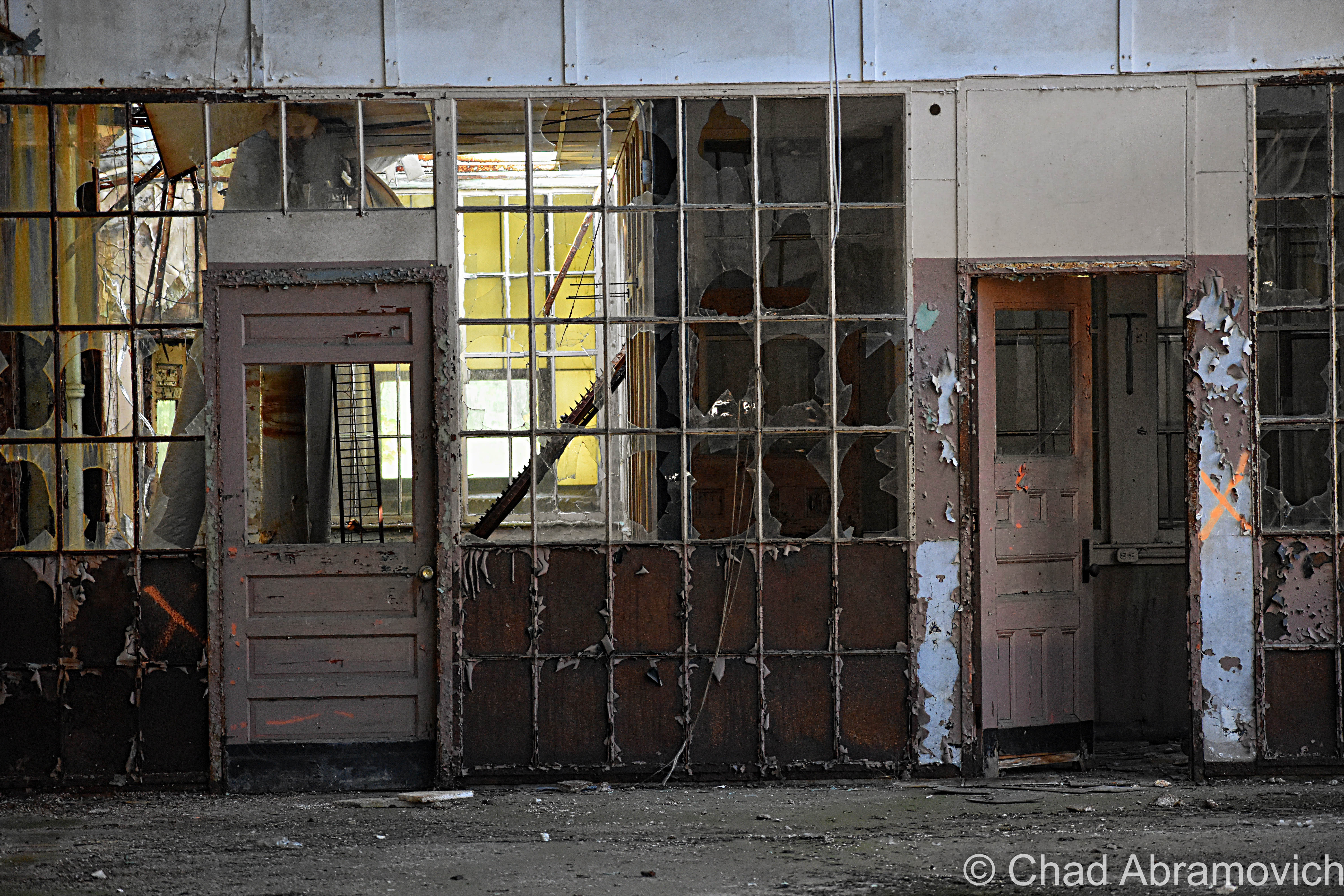
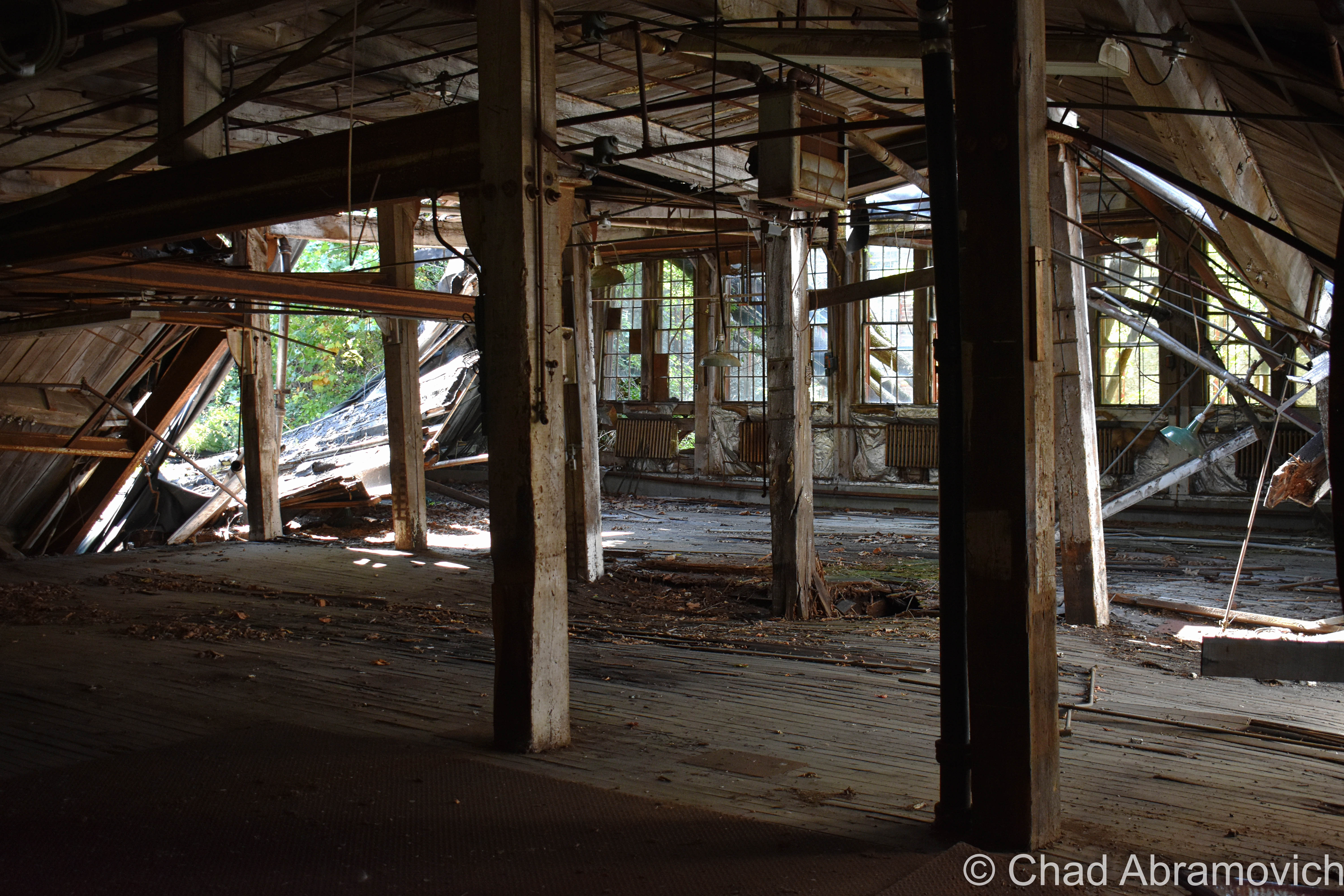
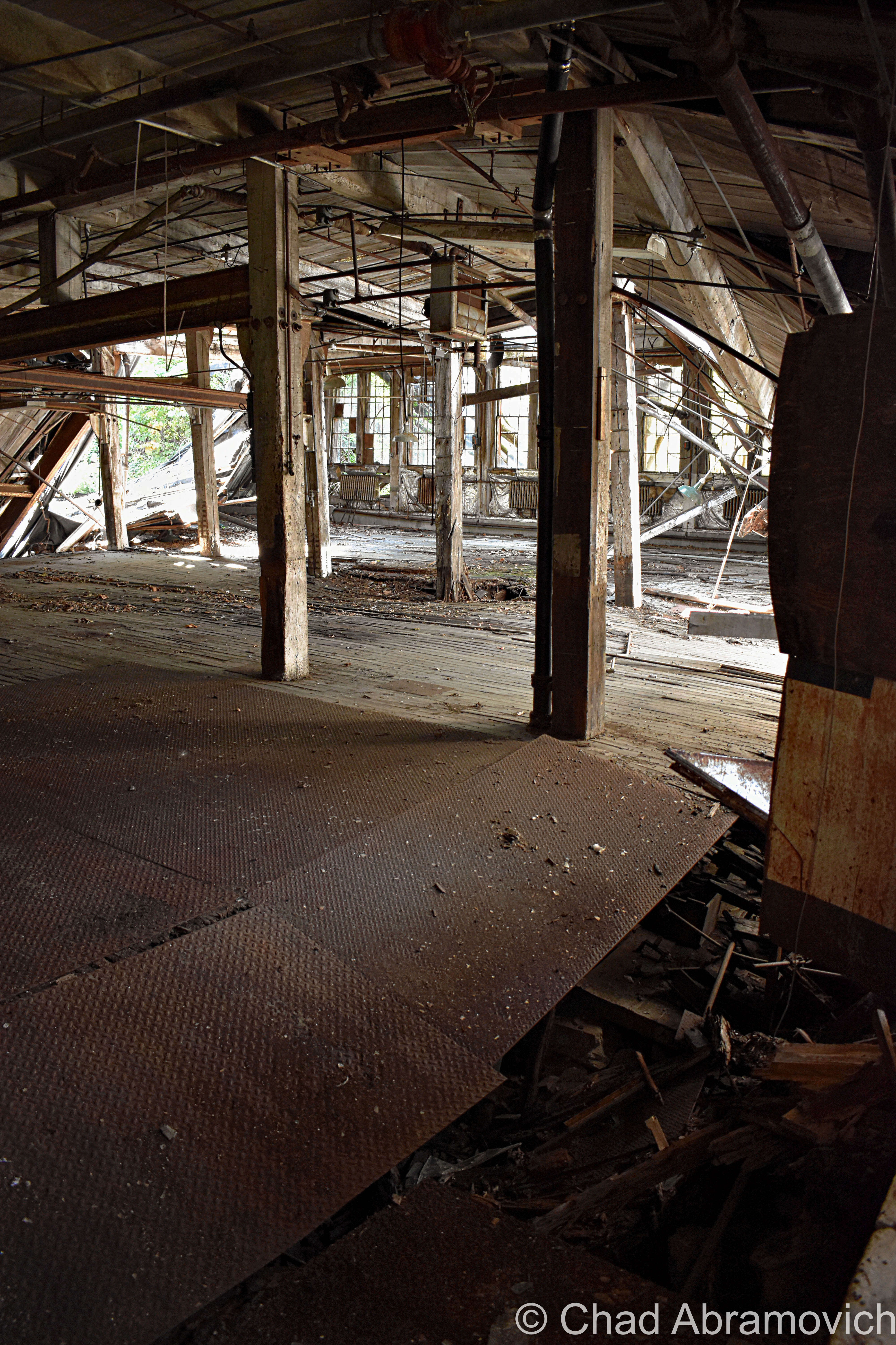
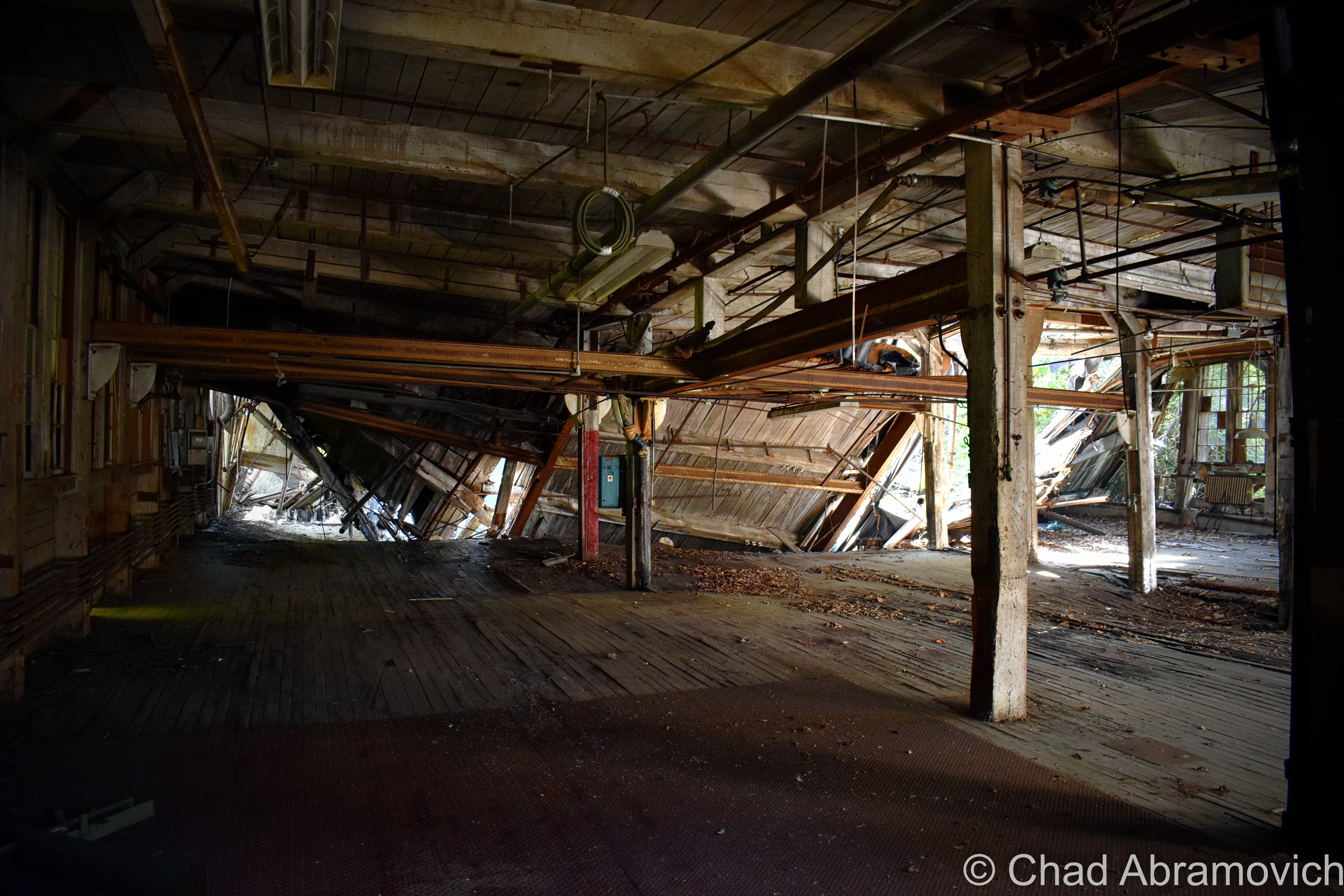
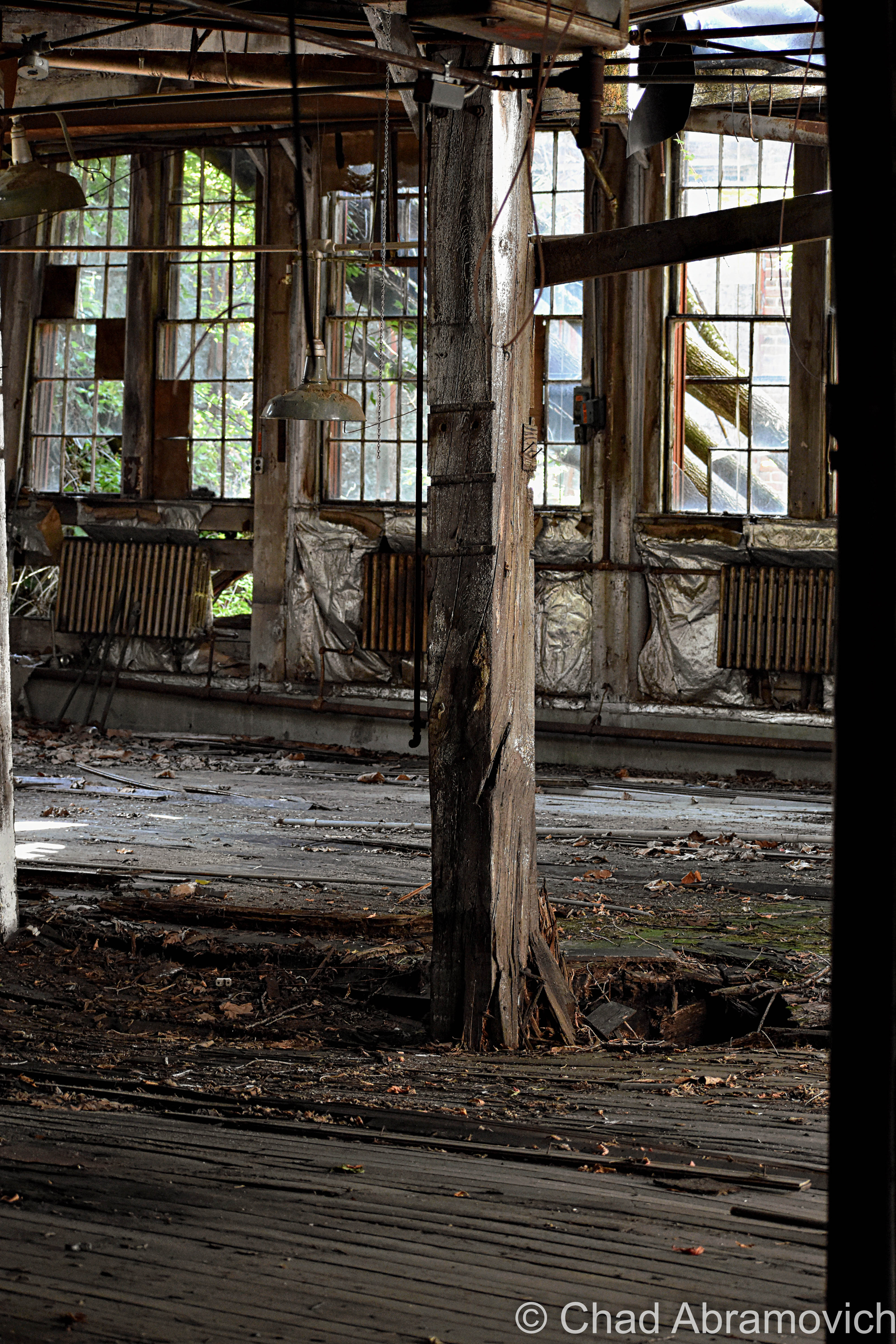
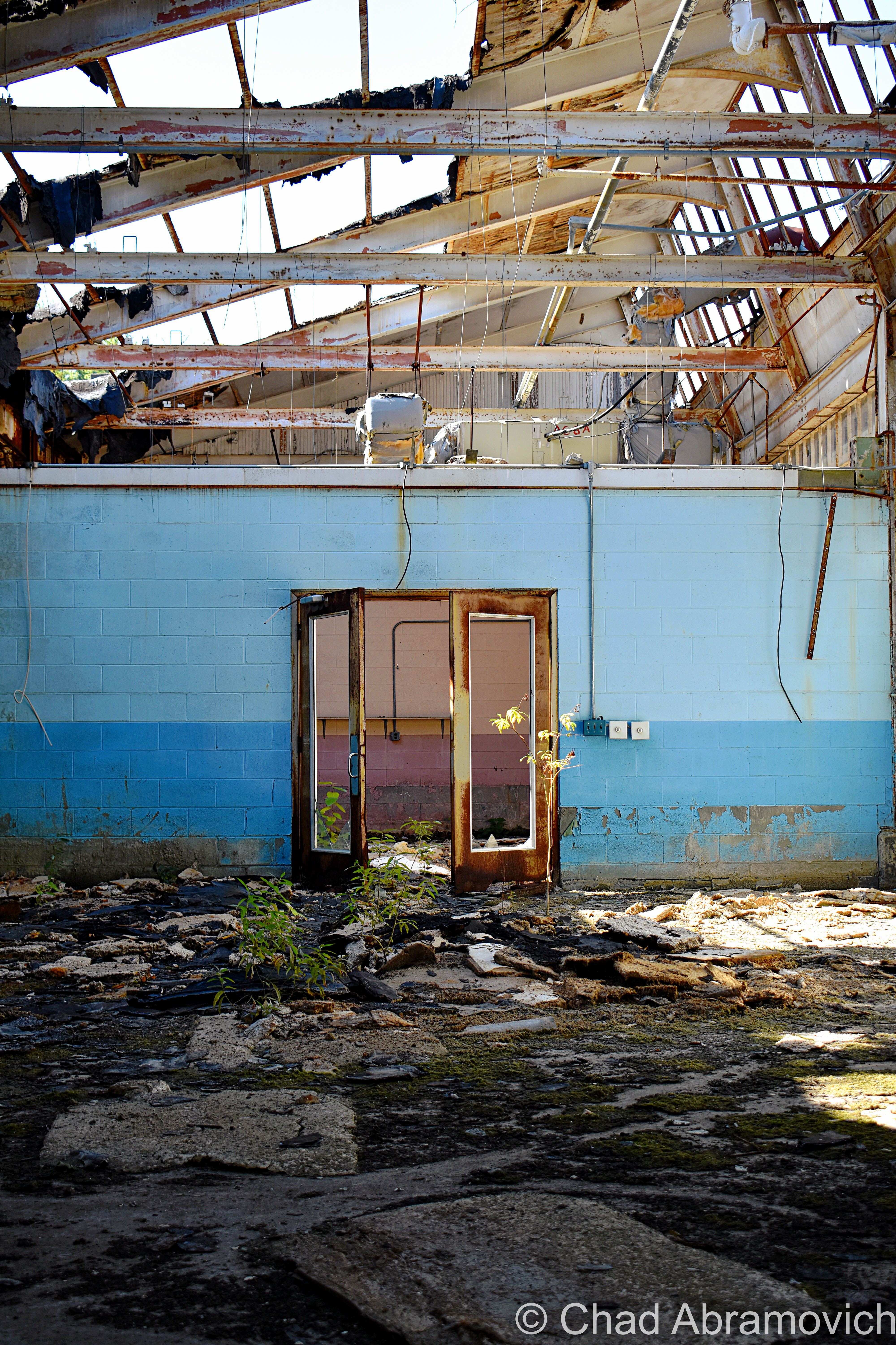
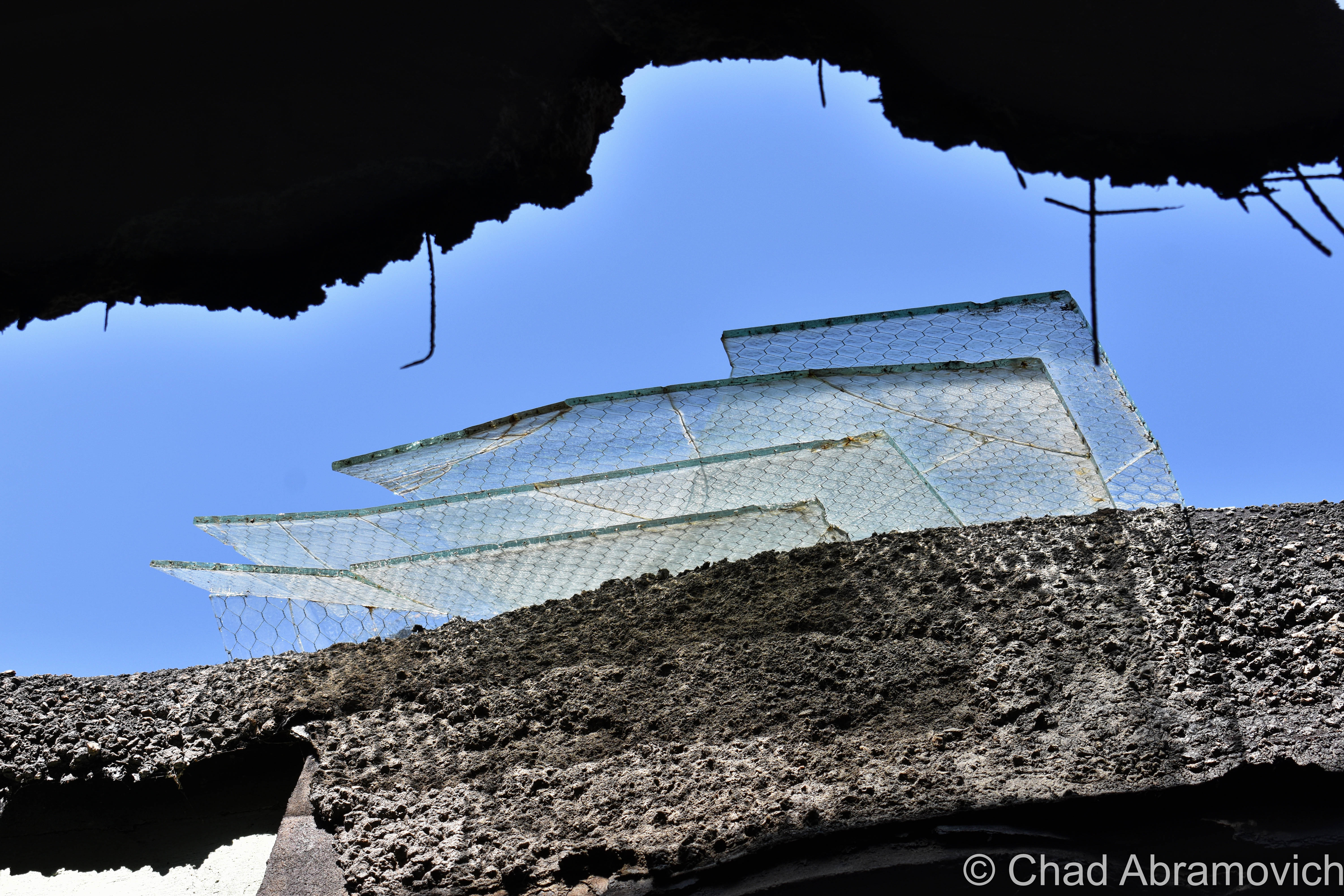
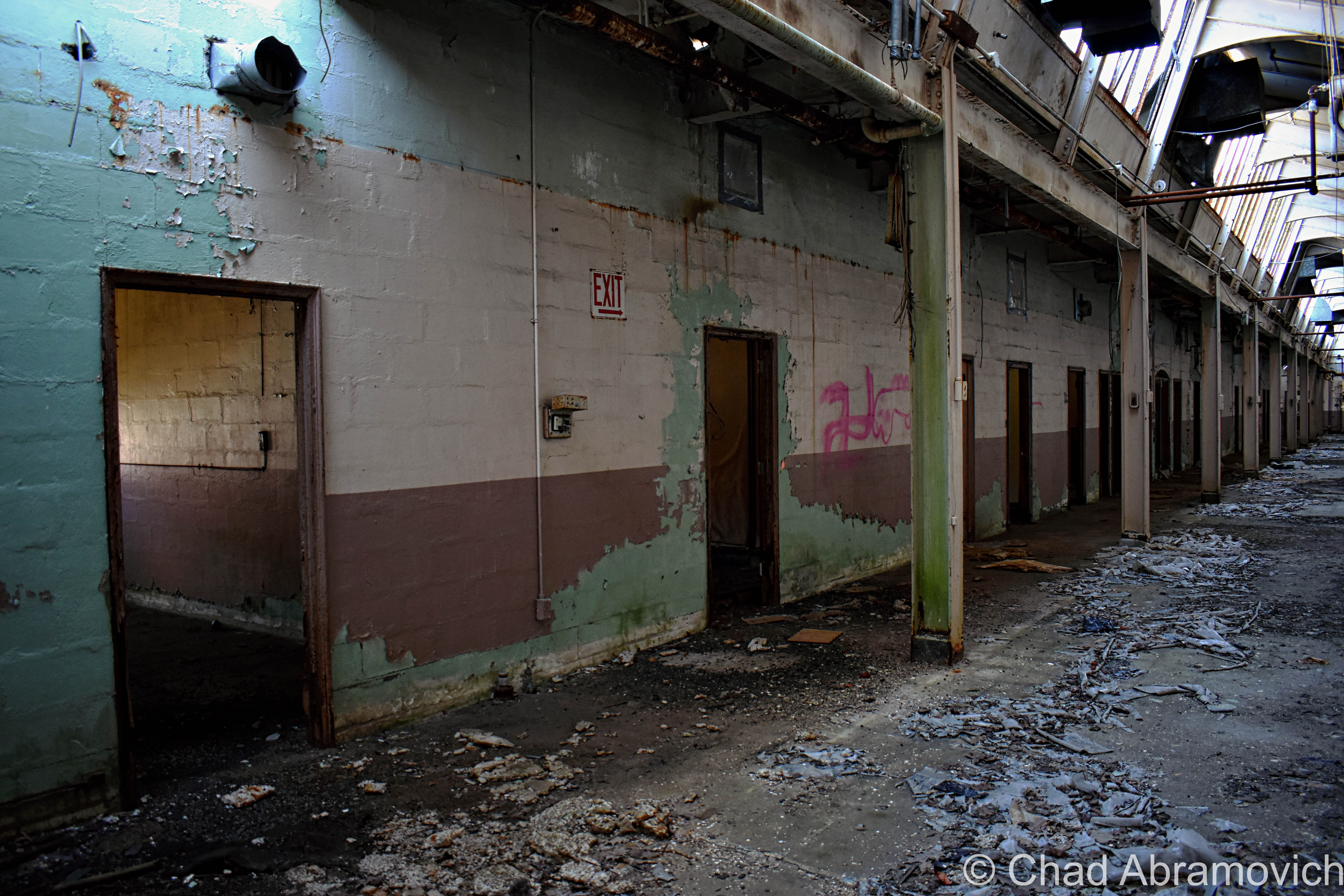
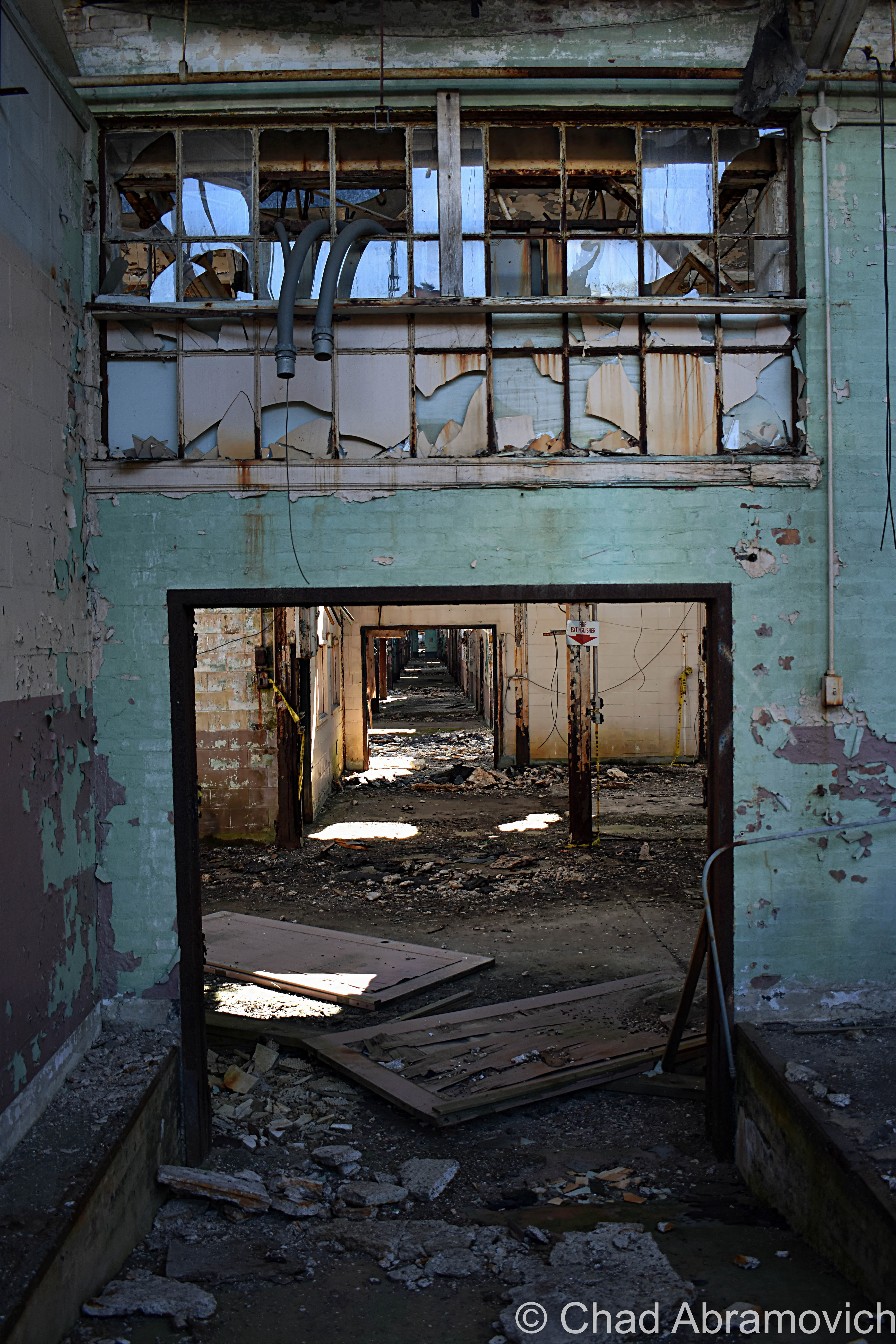
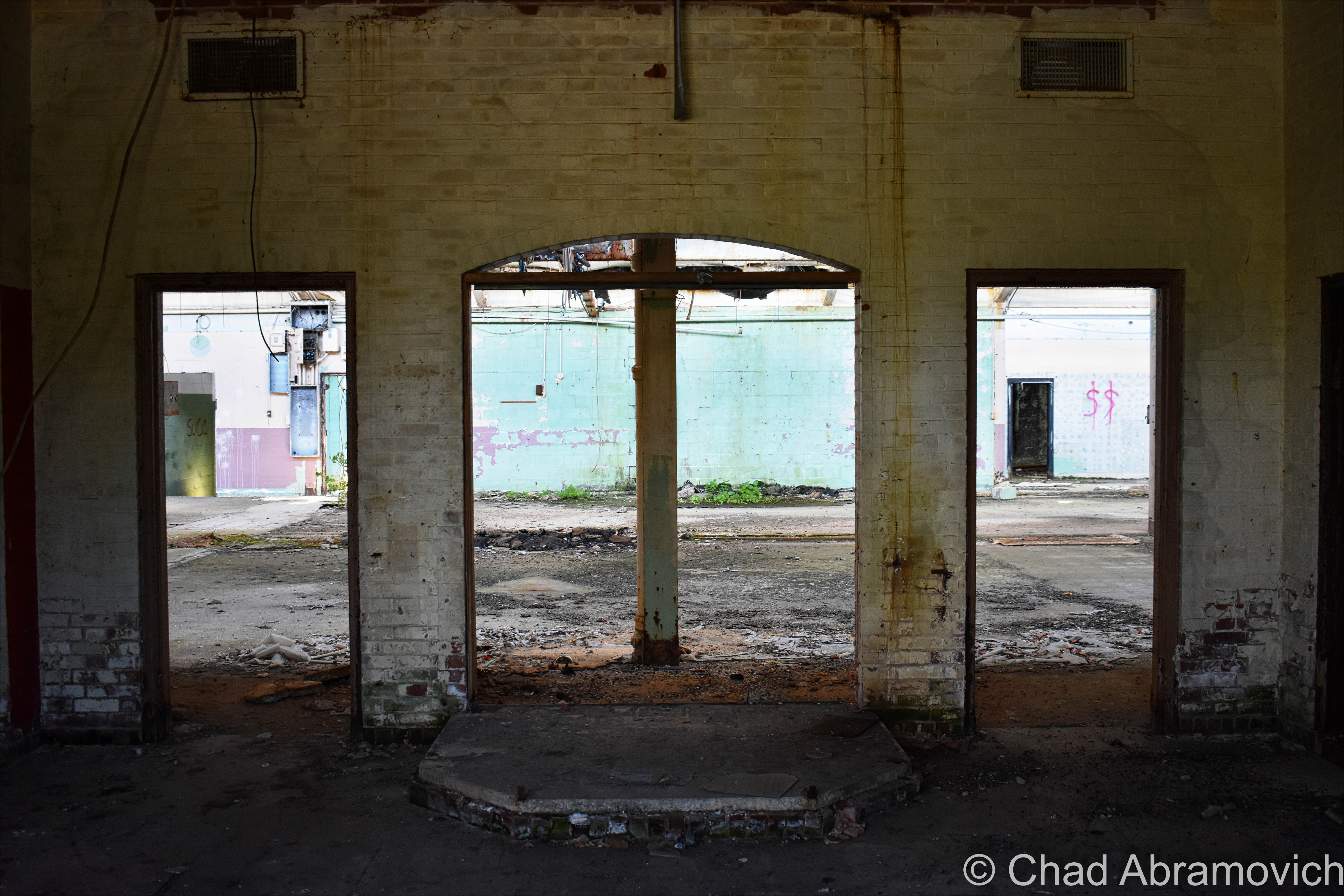
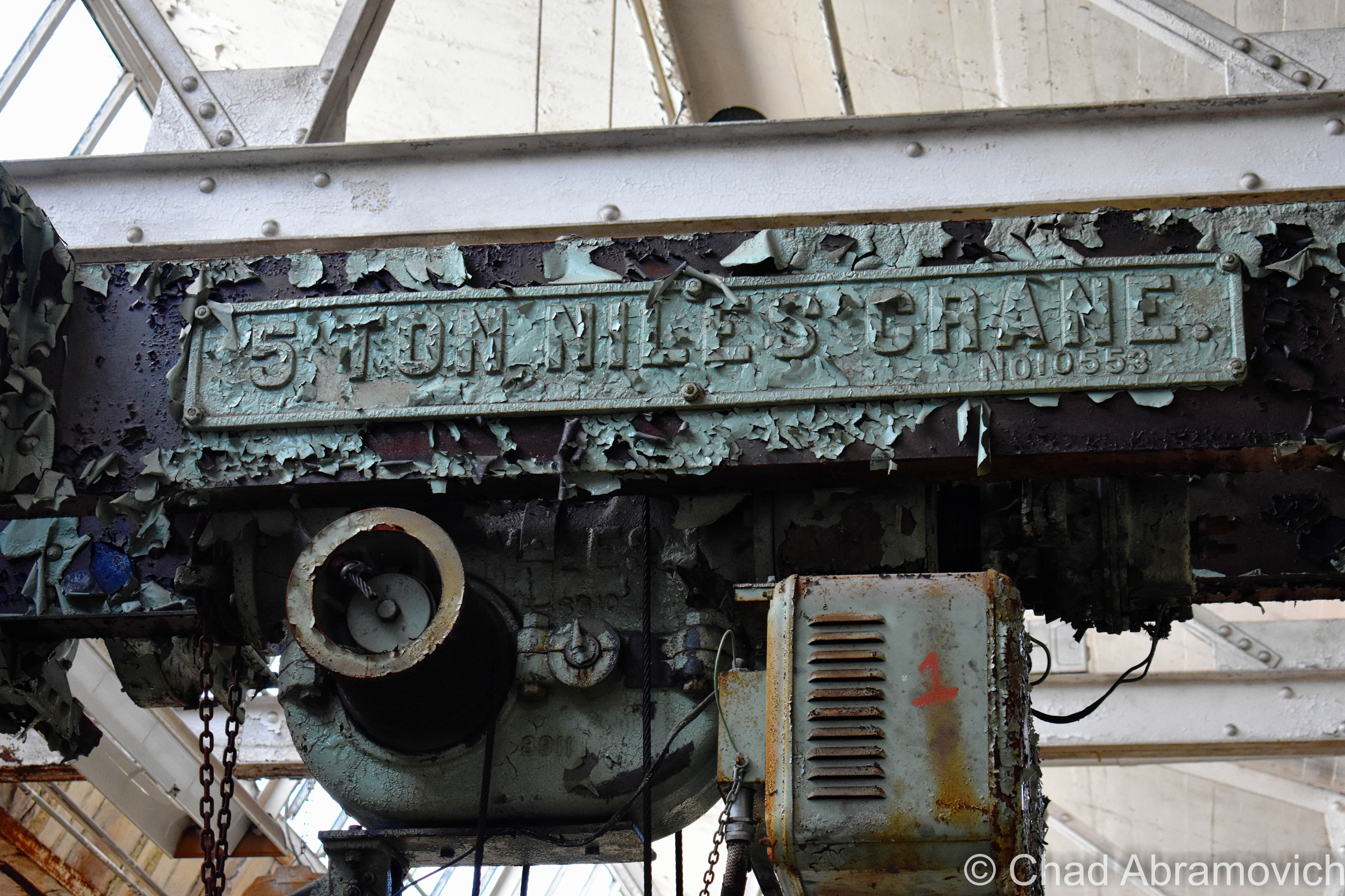
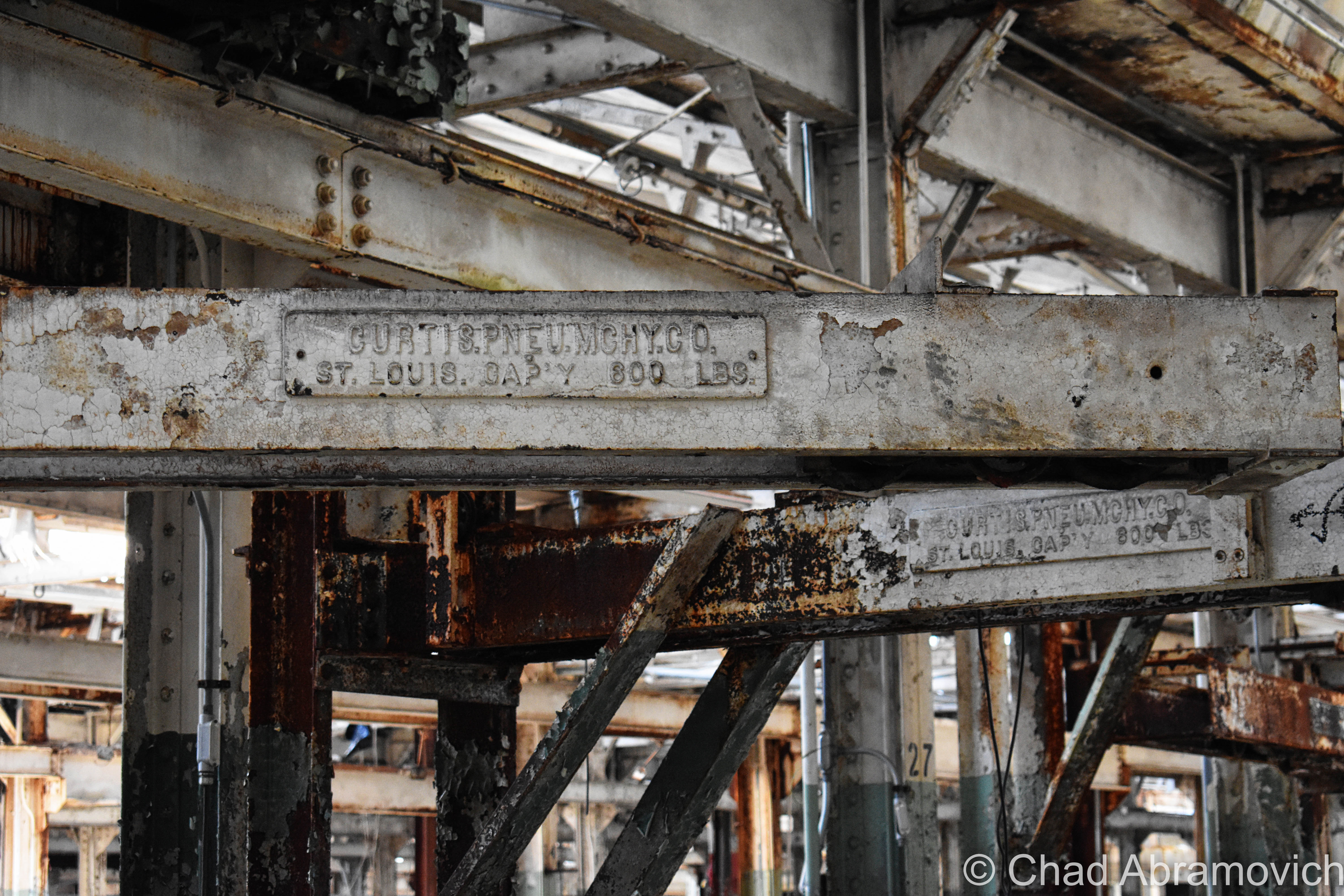
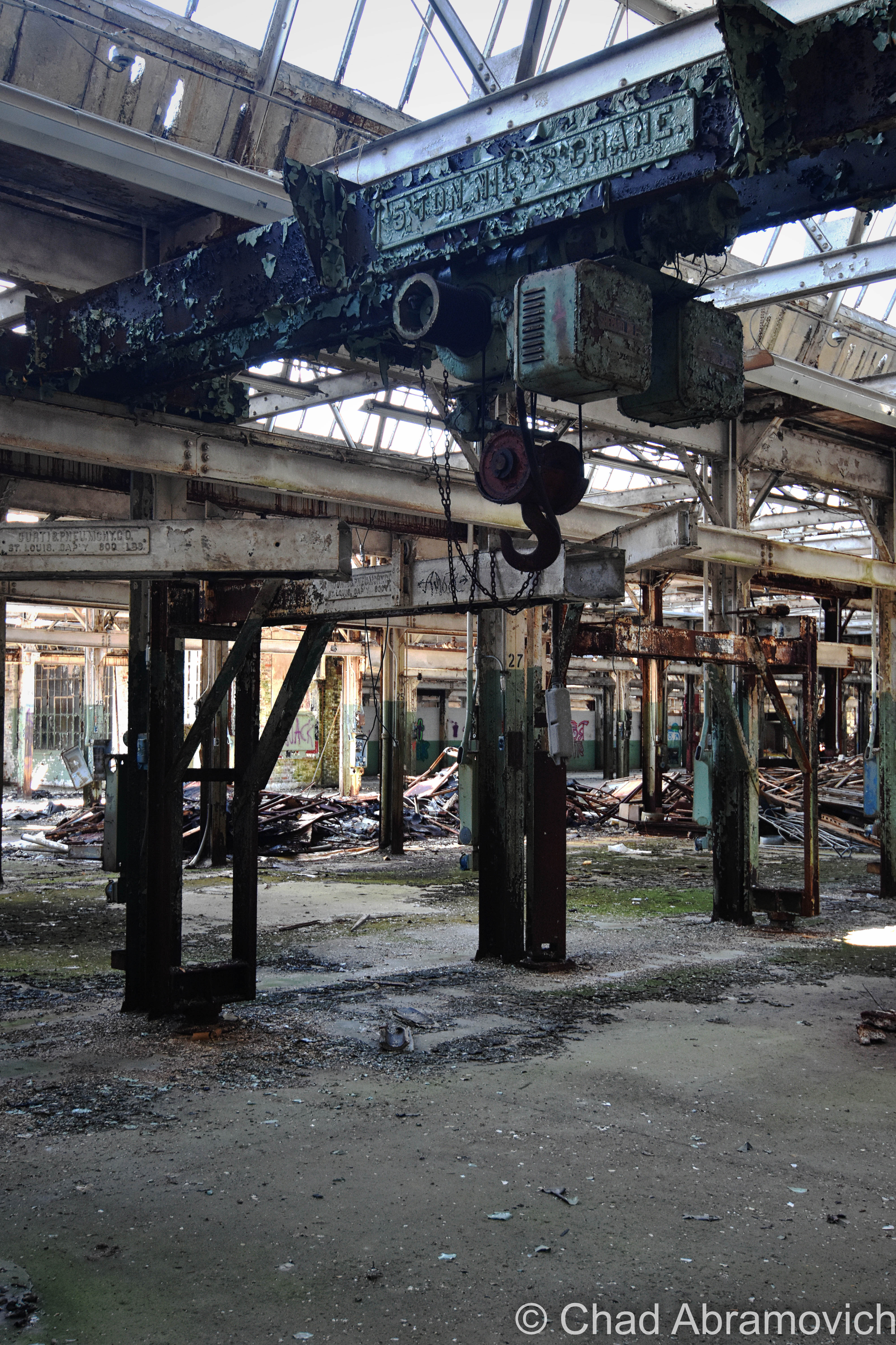
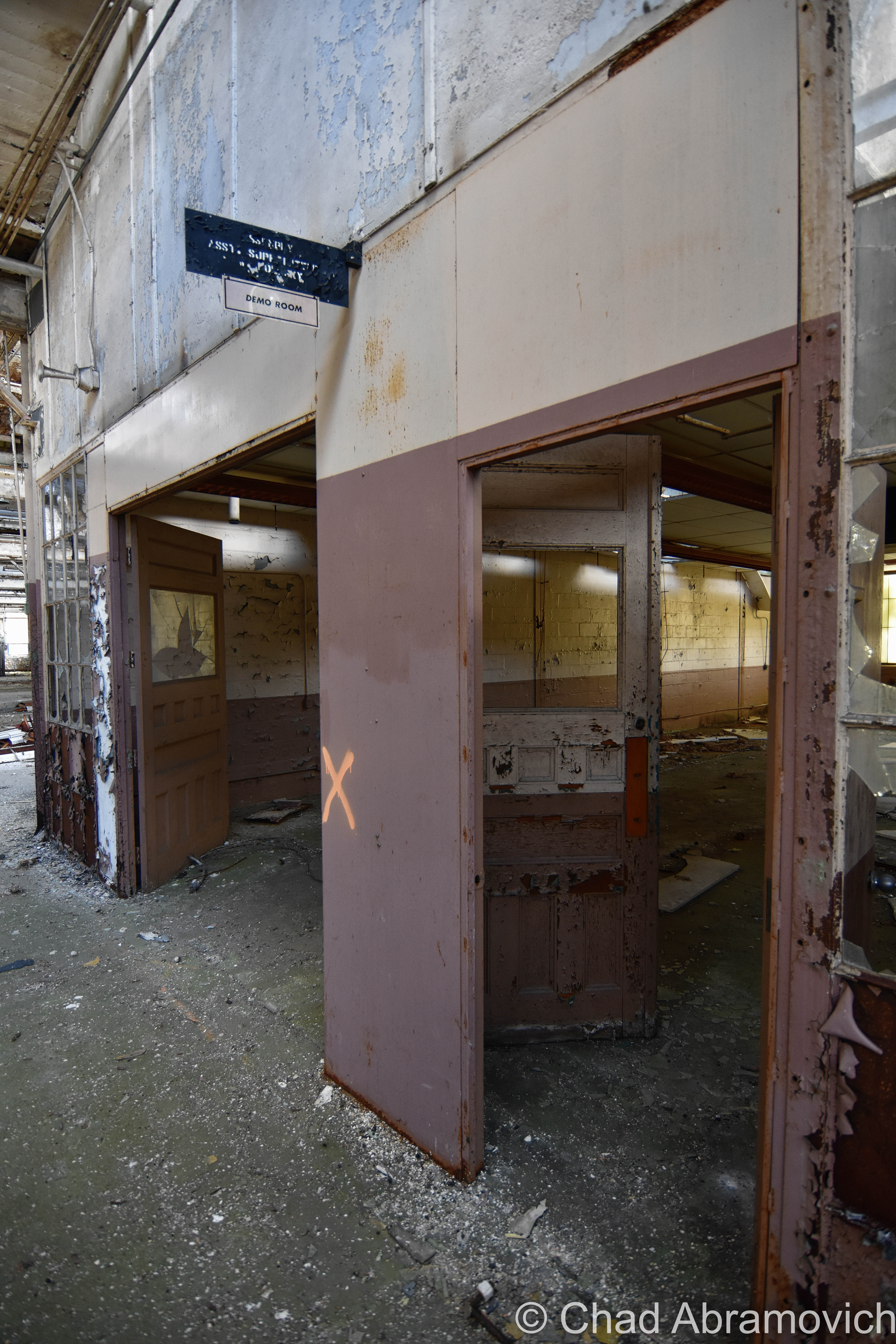
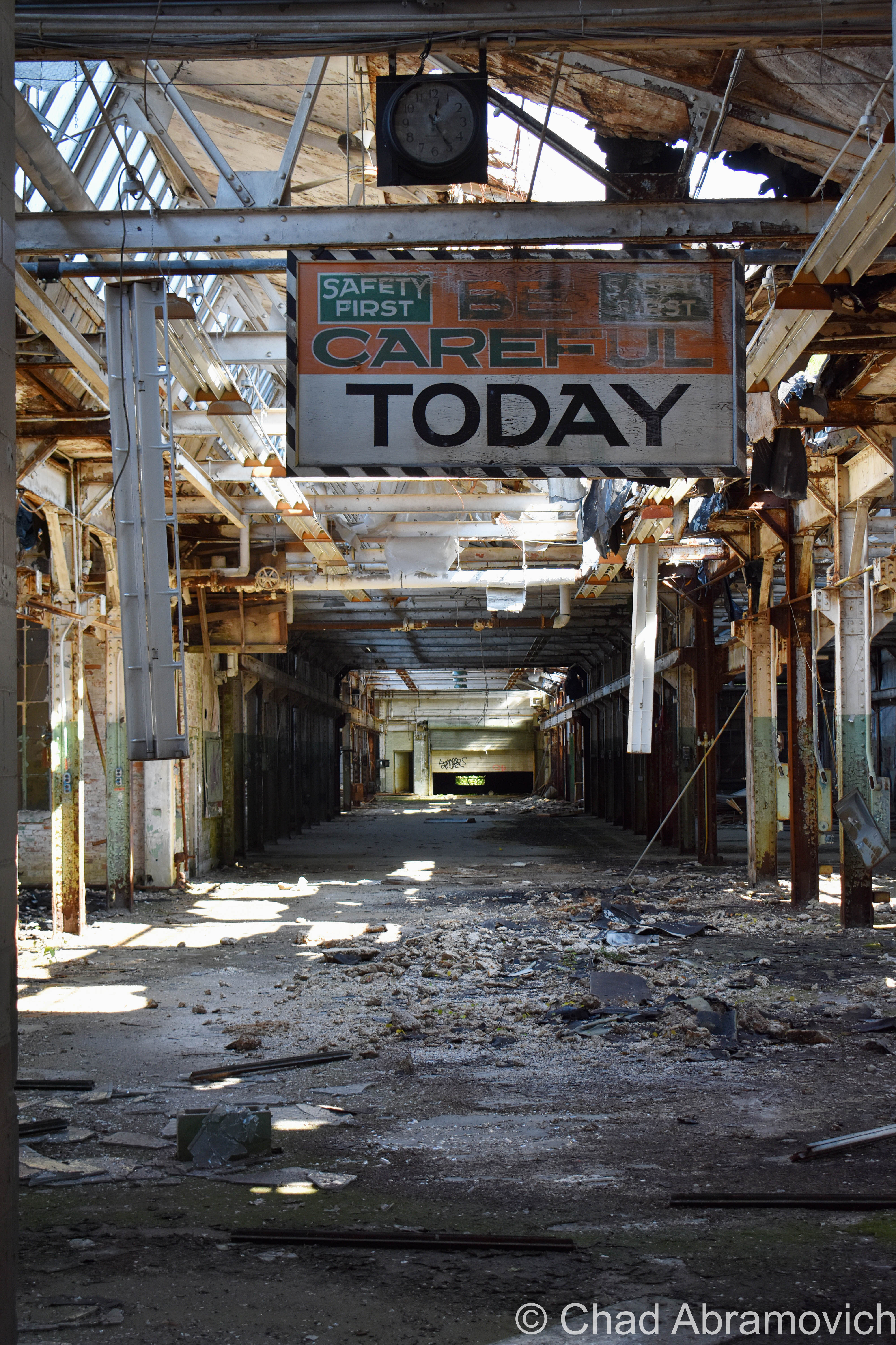
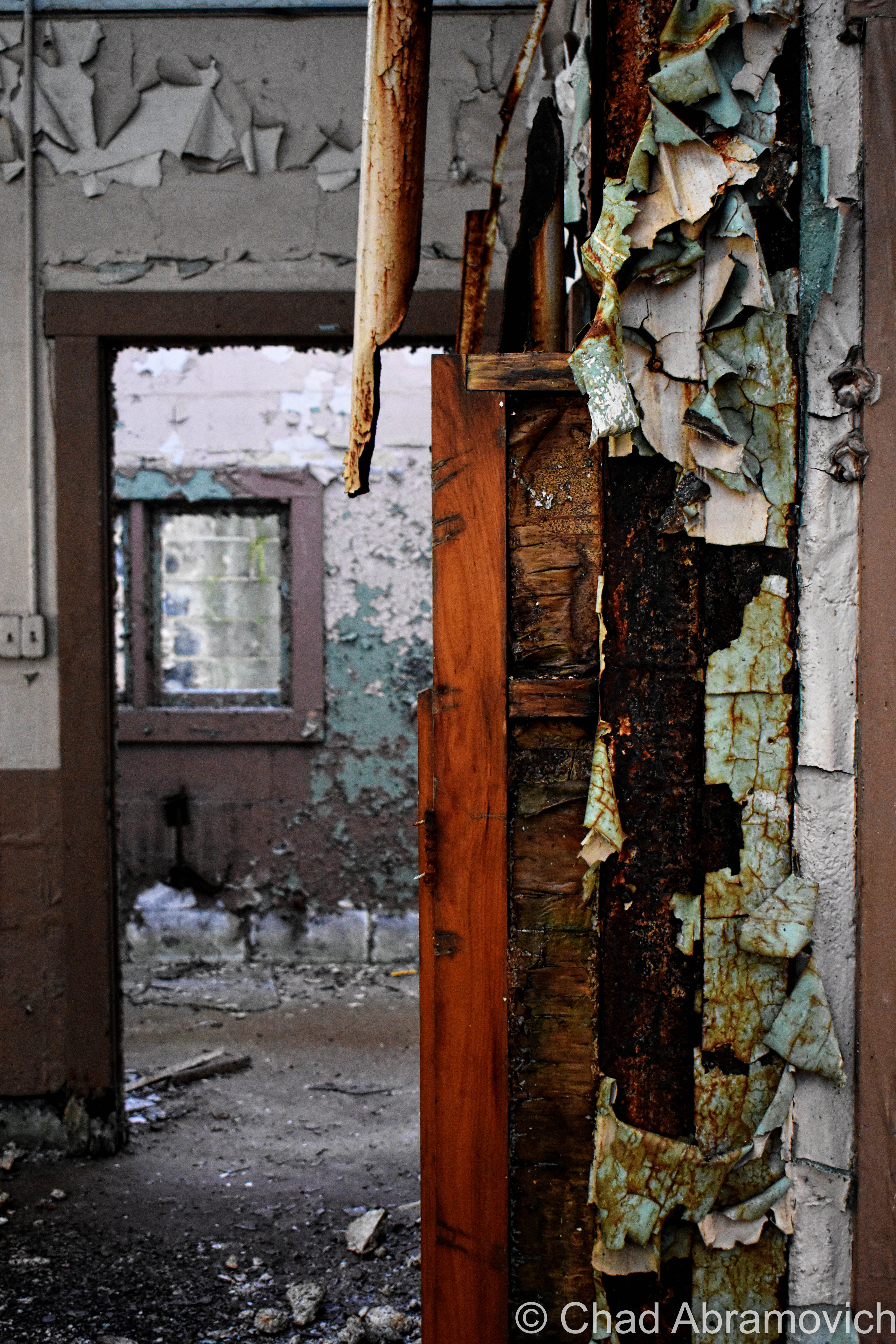
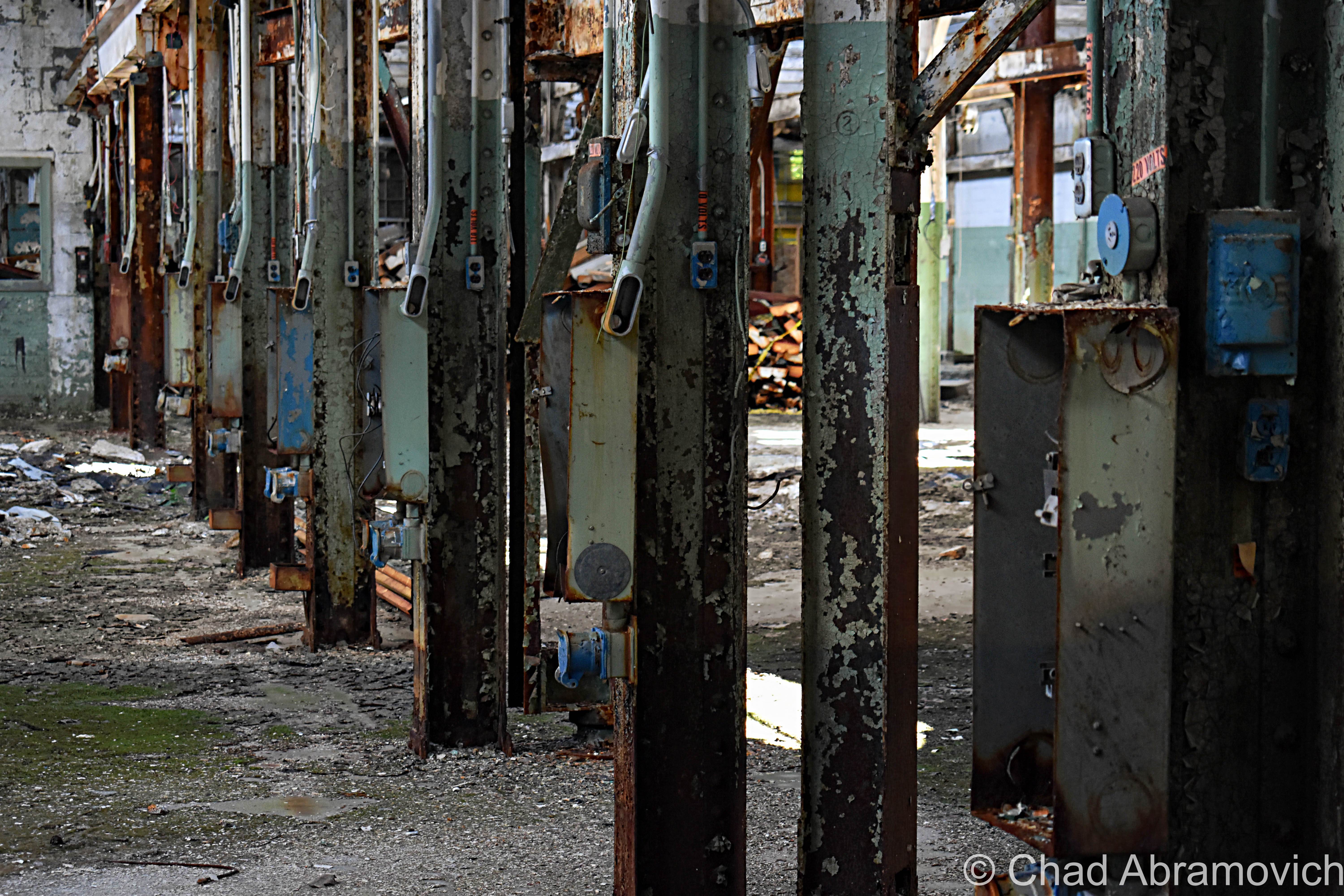
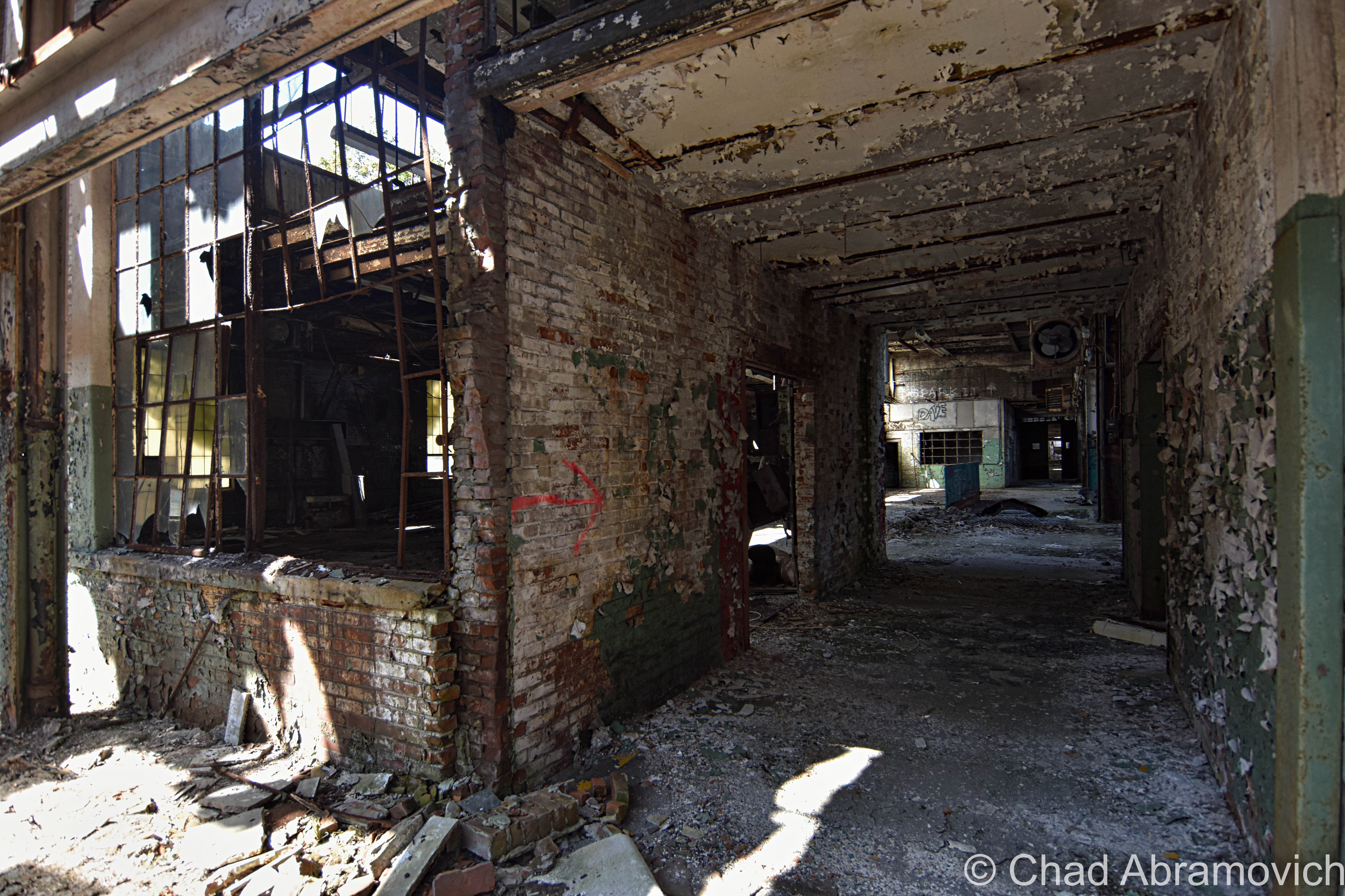
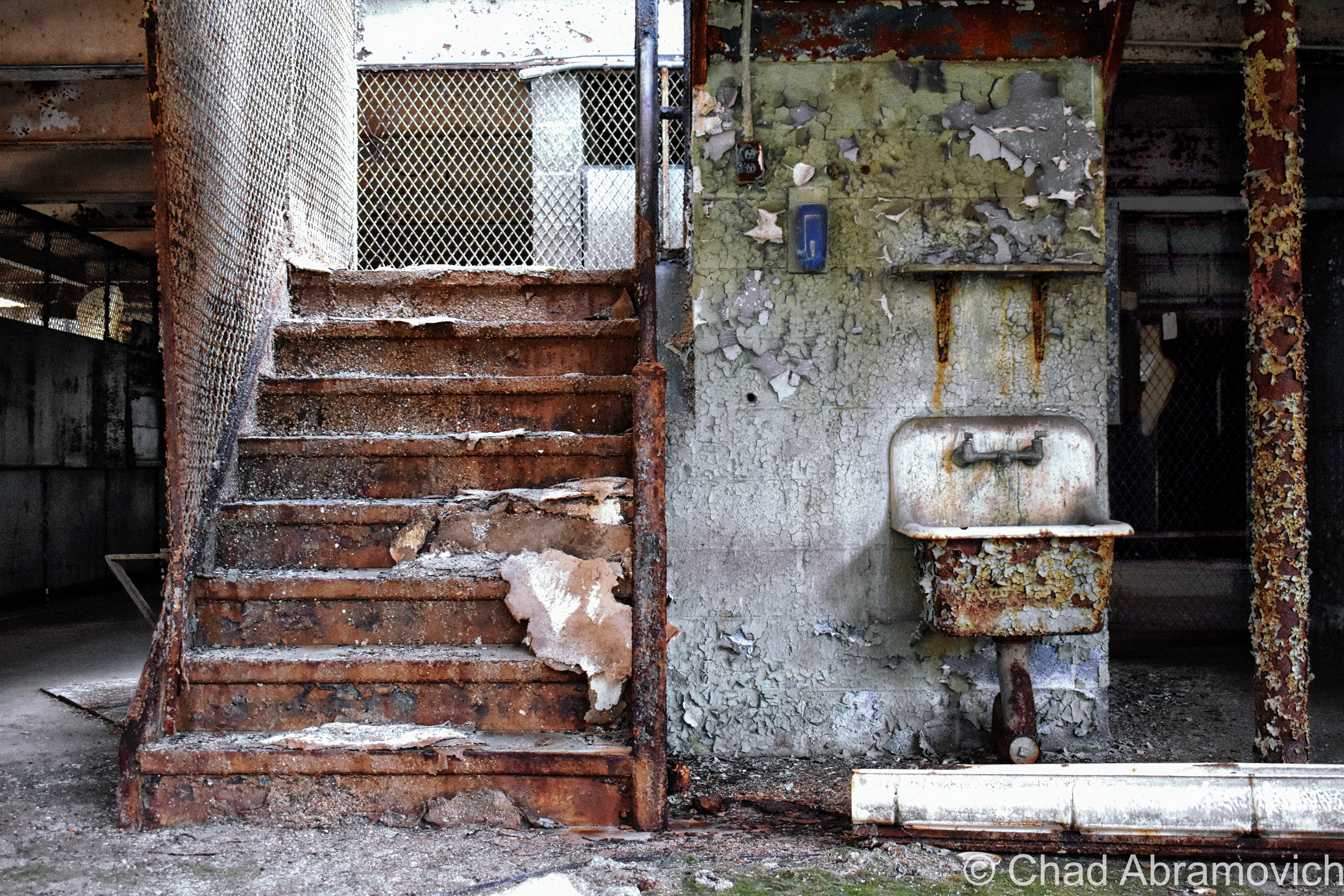
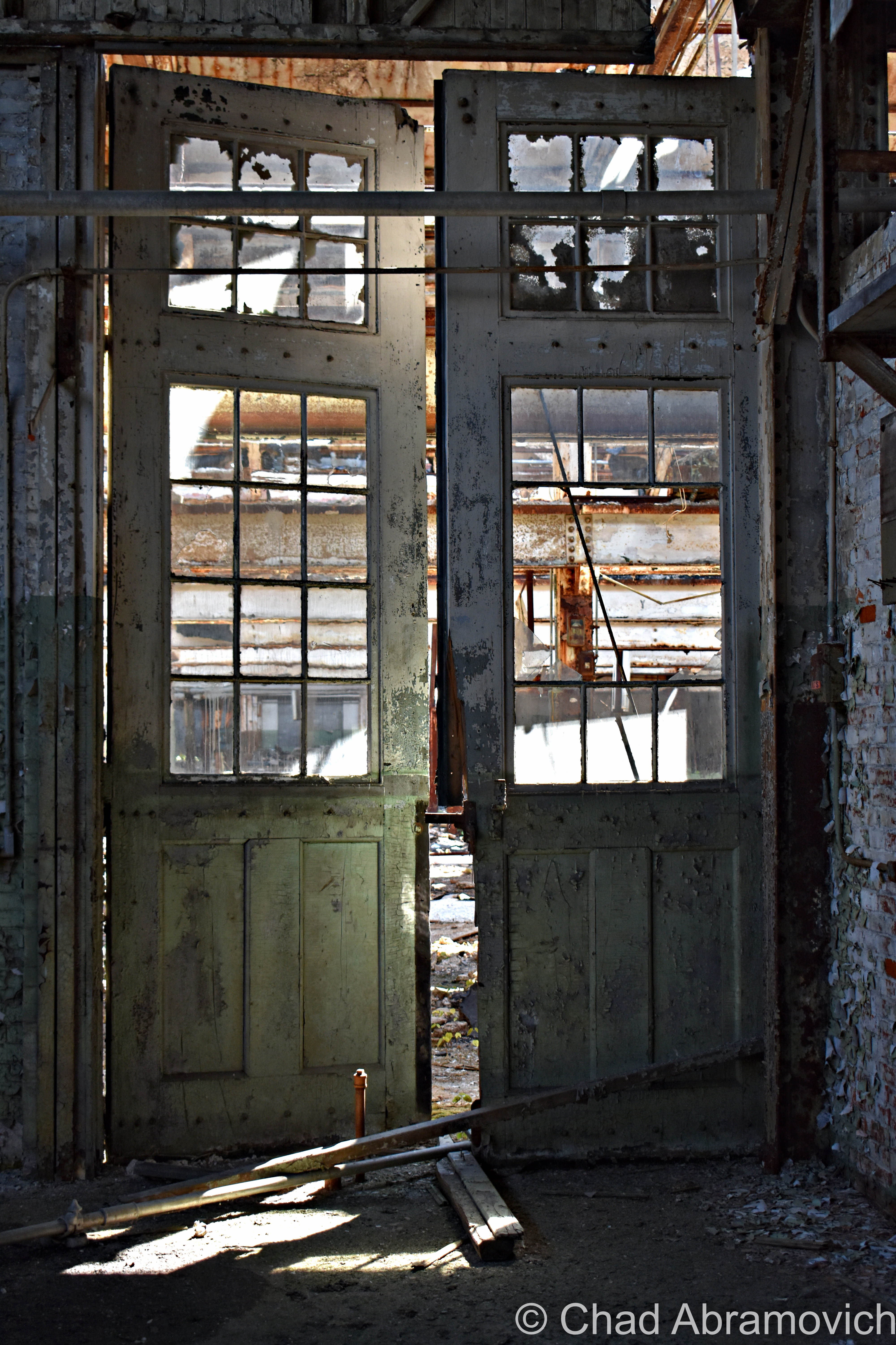
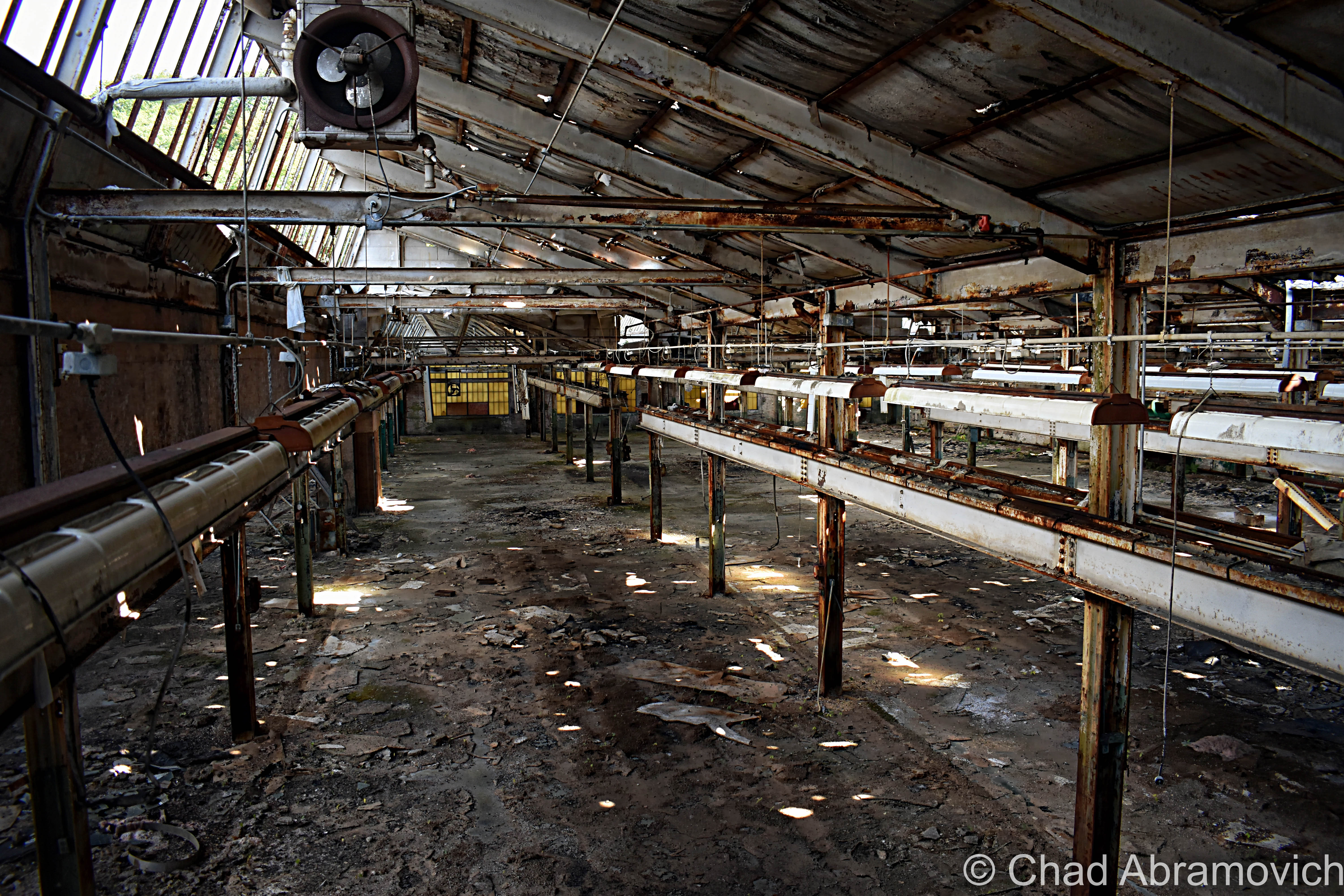
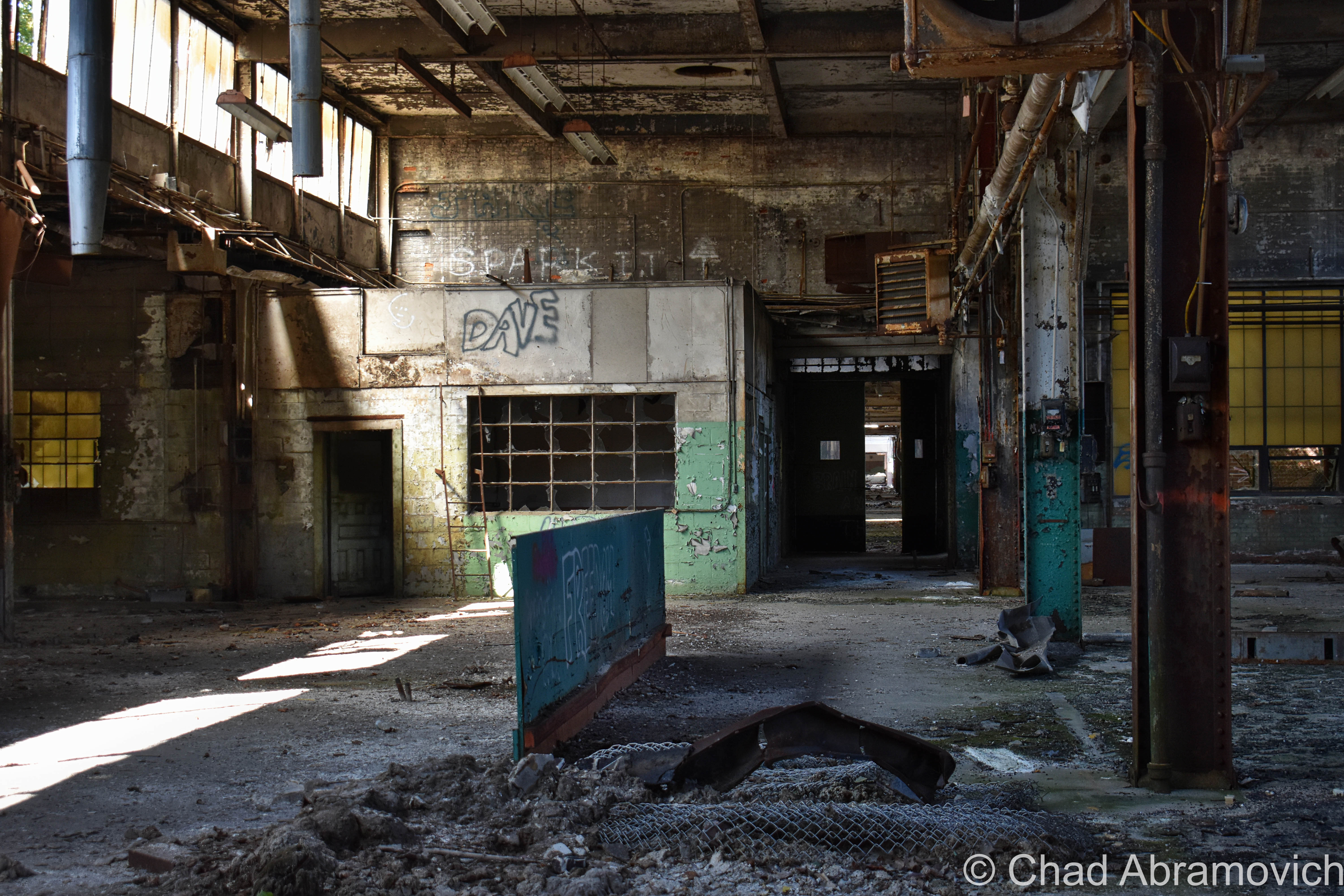
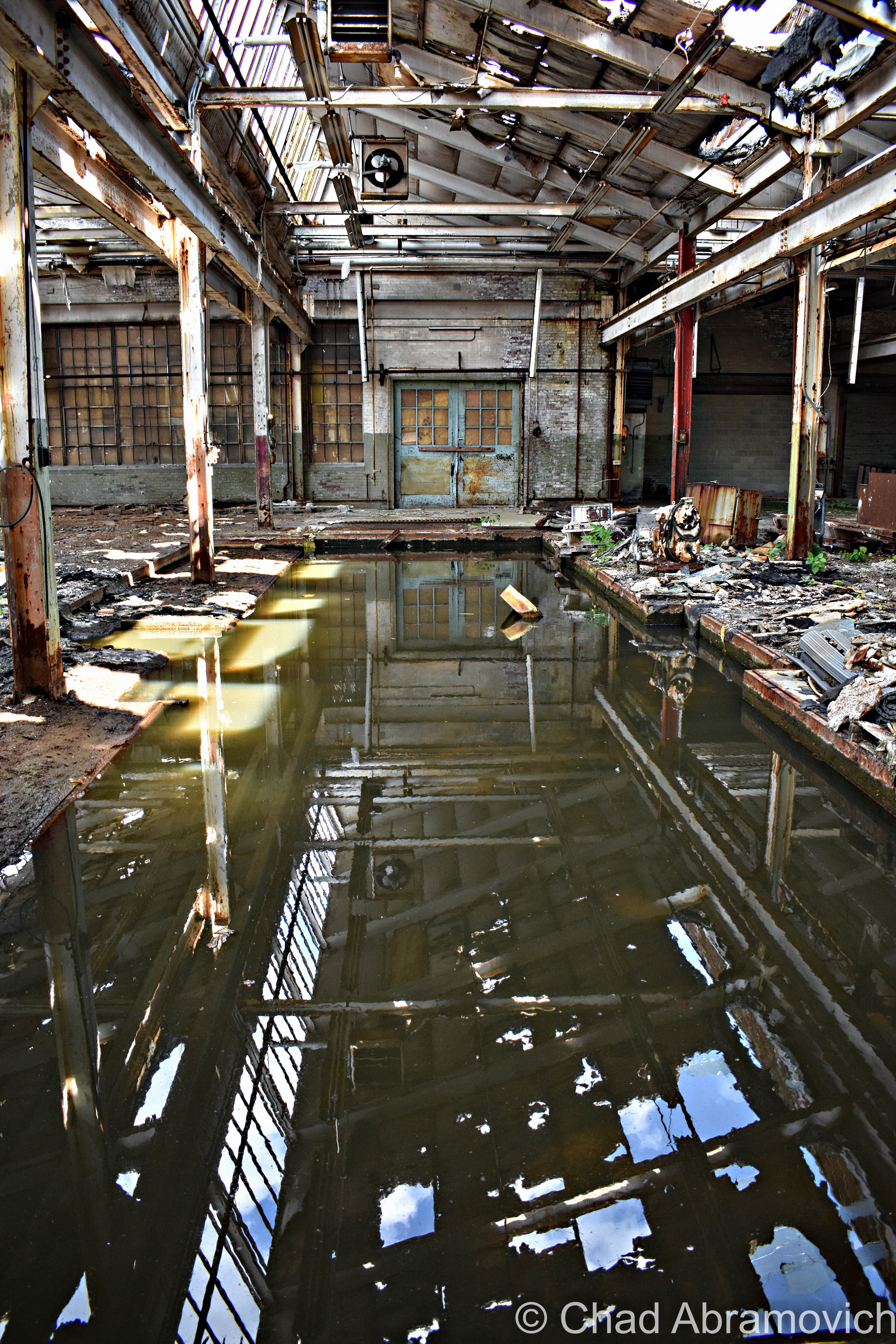
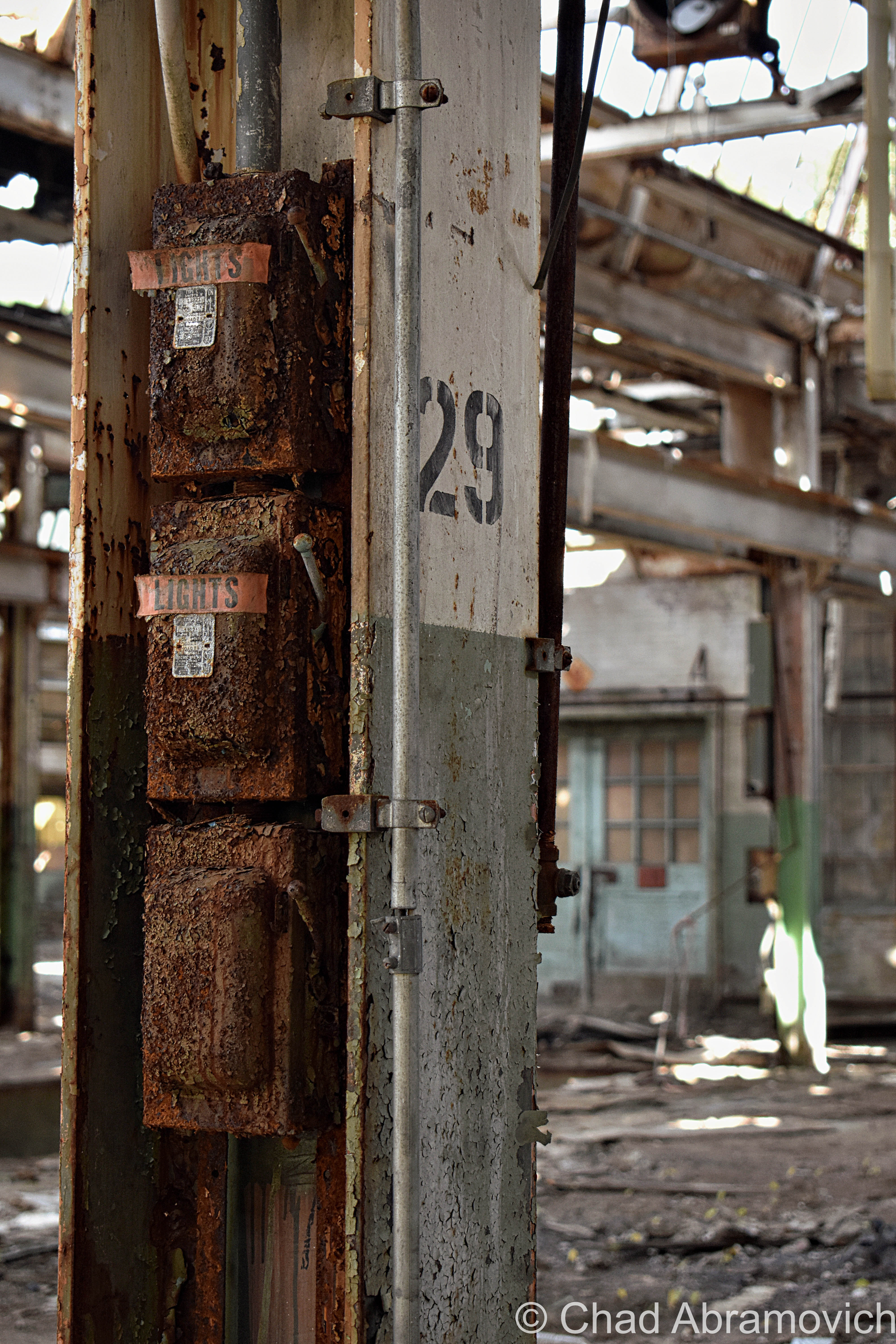
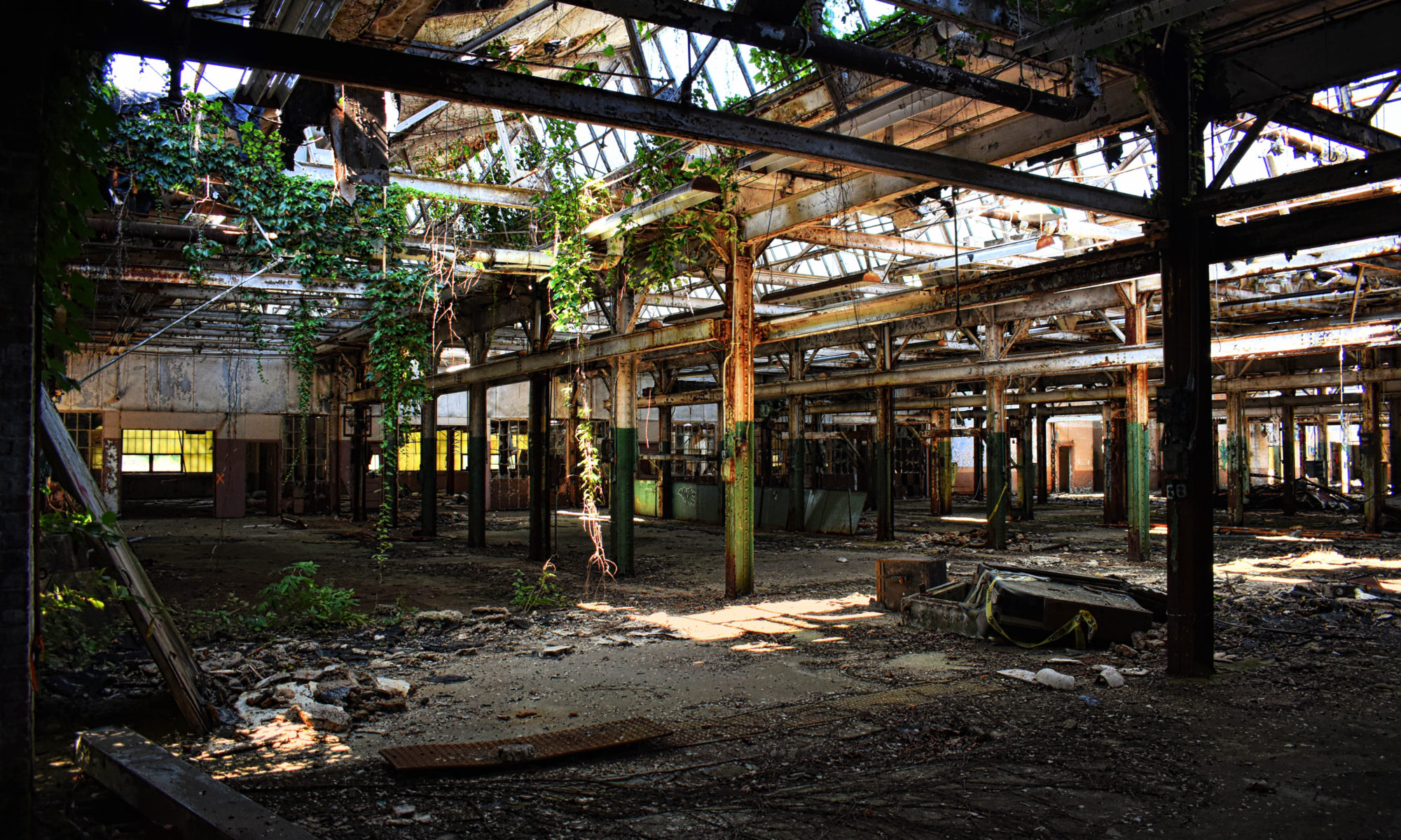
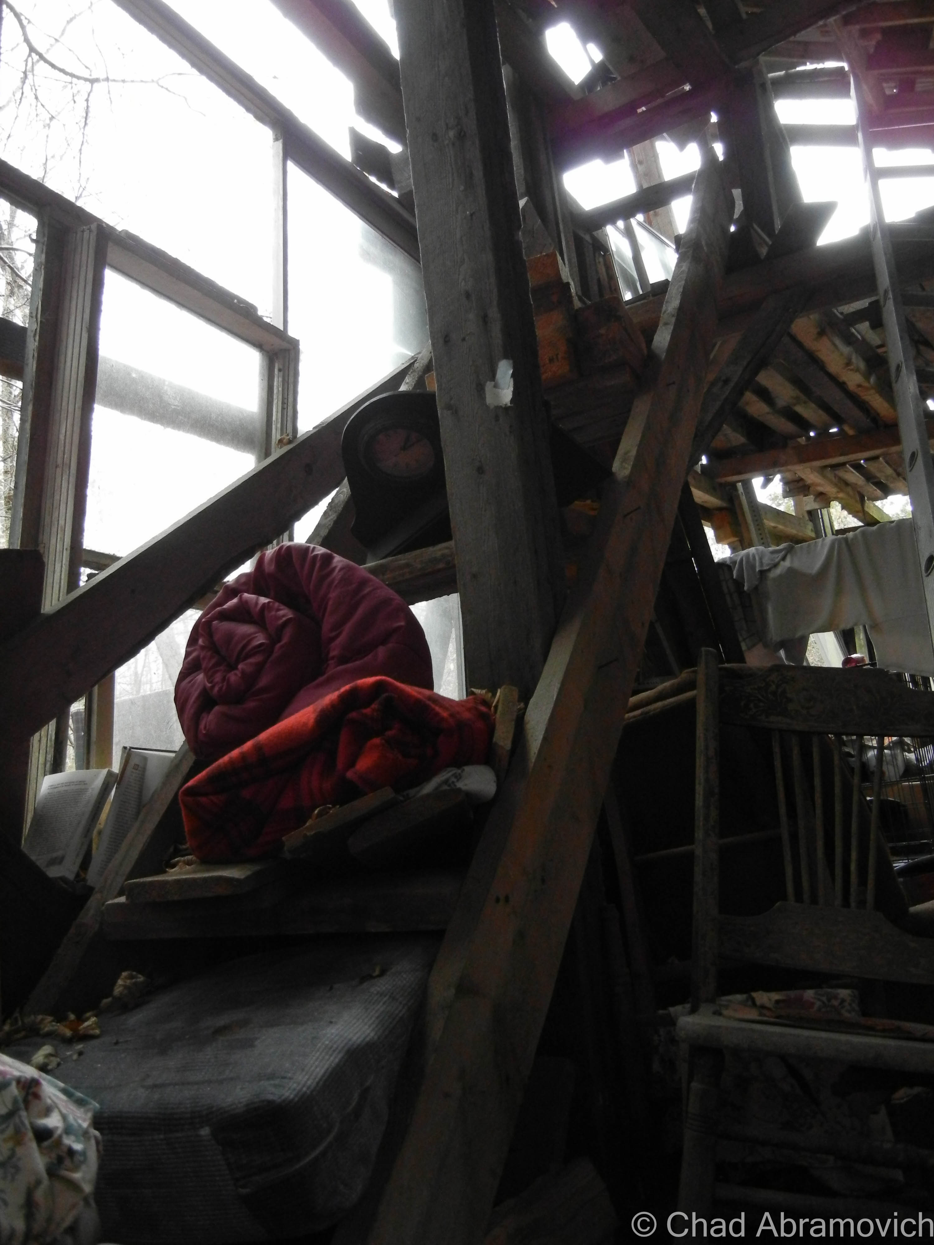
We wandered around for close to 5 hours and still didn’t see everything! The insides of the main plant were cavernous spaces infiltrated by glorious natural light that descended through awesome sawtooth roofs – a design I absolutely love. Lead paint, asbestos, and whatever mother nature blew inside lazily fell like snow, and nature was doing what it does best; reclaiming its territory. Trees and creeping vines had interestingly taken root on the roof and the grounds were thick with vegetation – vines fell down through busted sawtooth windowpanes and tendrilled into the atmosphere. A century of adaptations, renovations, and subsequent deferred upkeep had created a fantastic accidental pastiche on old bricks and steel girders.

Some things sagged down in fatigue, and other verdant things thrust upwards and willing. It seemed the new trees and vines almost created a muted cacoon within, where time oddly stopped and there were only wonders, a vacation world that we could borrow for a while. Strange audio hallucinations fell in all directions, and shadows waltzed behind steel beams and checkerboard walls of broken glass. Though I guess I was a bit disappointed I didn’t find a rusty old Hartness turret lathe still within, this explore was so much fun! (There IS, however, – a Hartness Turret Lathe on display at the American Precision Museum in Windsor!)

There was a tiny portion of this massive complex that was still an active business, J&L Metrology – the last remaining morsel of the greater Jones and Lamson enterprise. Their really utilitarian and ugly wing appeared to be added on much later – and it was something that I made a note of as we pulled into town hours earlier. The two spaces were divided by the original exterior brick wall, but there was a connecting pair of double doors that allowed whoever was at work over there inside the abandoned portion of the building, and that’s exactly what happened.

Just as I was snapping a few photos of some kind of rectangular cavity in the concrete floor that had long been turned into a pool of rainwater and who knows what else, those doors burst open, and some guy powerwalked into the abandoned factory with the trajectory that communicated he was on a mission – a mission that was suddenly interrupted by me.

His boots literally skidded to a halt on the gritty floor, snapped his head to his left, and gave me an appraising and surprised look through a squinty demeanor, then angrily huffed; ” Are you supposed to be in here?” I turned to look at my friend, who was still as a statue, turned back to the man, and decided that answering honestly was my best option, so with a shoulder shrug, I called over “I mean… probably not?” He just glared at me in a kind of tense silence, before pursuing his former mission – and stomped off deep into the huge spaces of light shafts and rusty steel. We both knew that was a good sign that we should leave, and we bolted.
I don’t have many pictures of myself, so thanks to my friend Jay for taking this candid shot of me doing my thing!

I’m disappointed that I never got a shot of the front exterior of the factory to include in this blog post, but I think there was some re-paving going on out front that day, and we were more focused on leaving before the cops were called on us. Unfortunately, I procrastinated a bit too long and never made it down to get that shot before the demolishing.

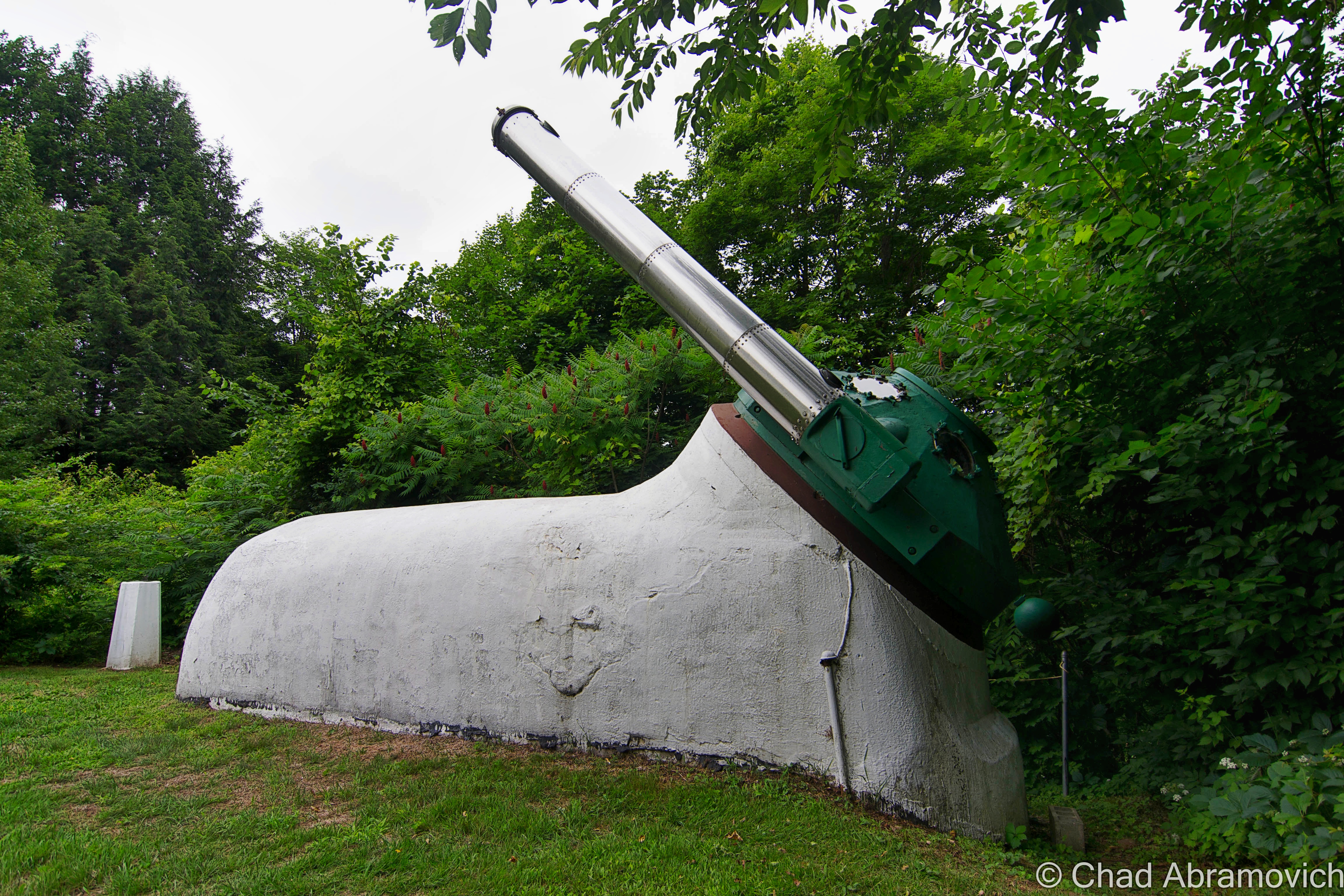
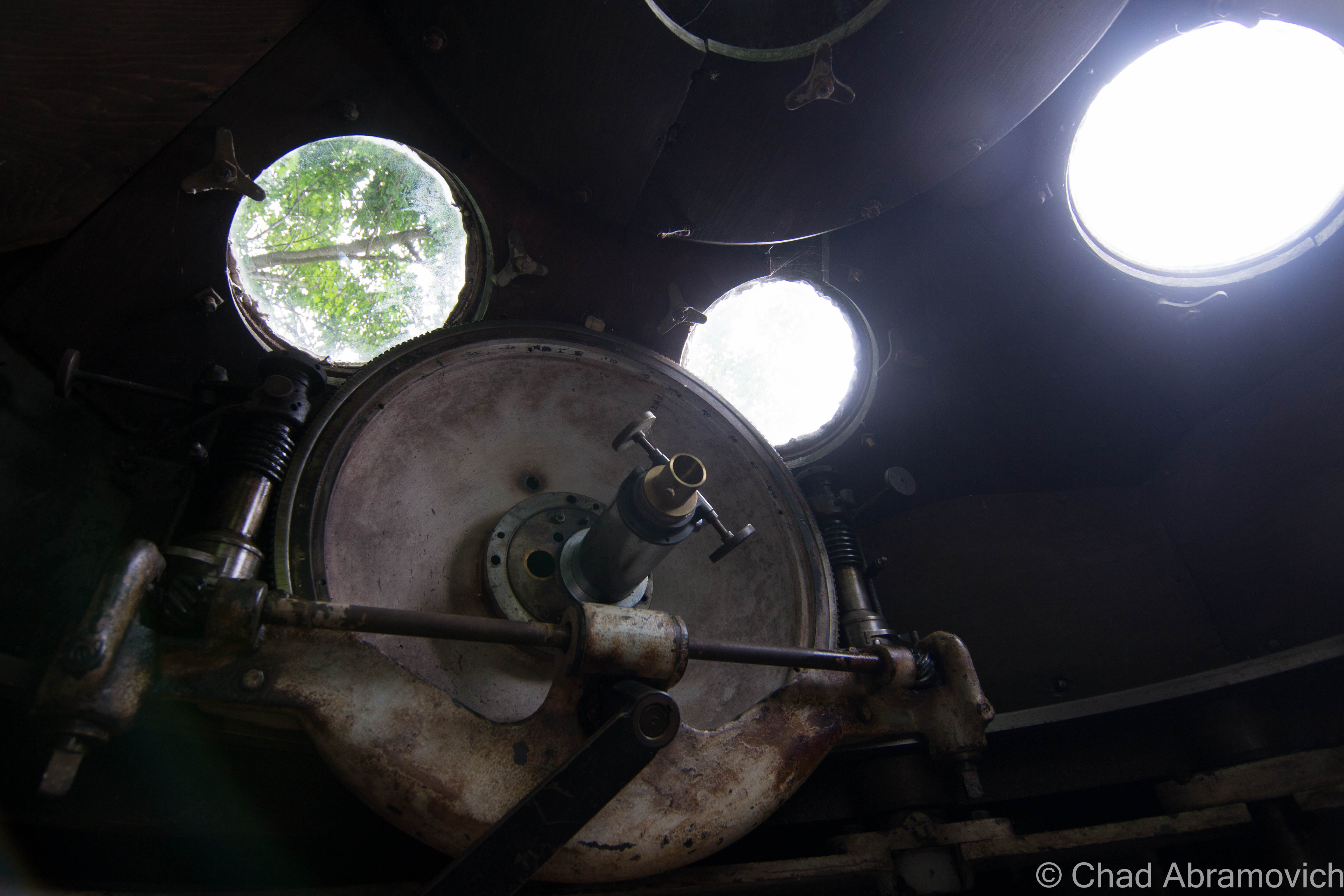
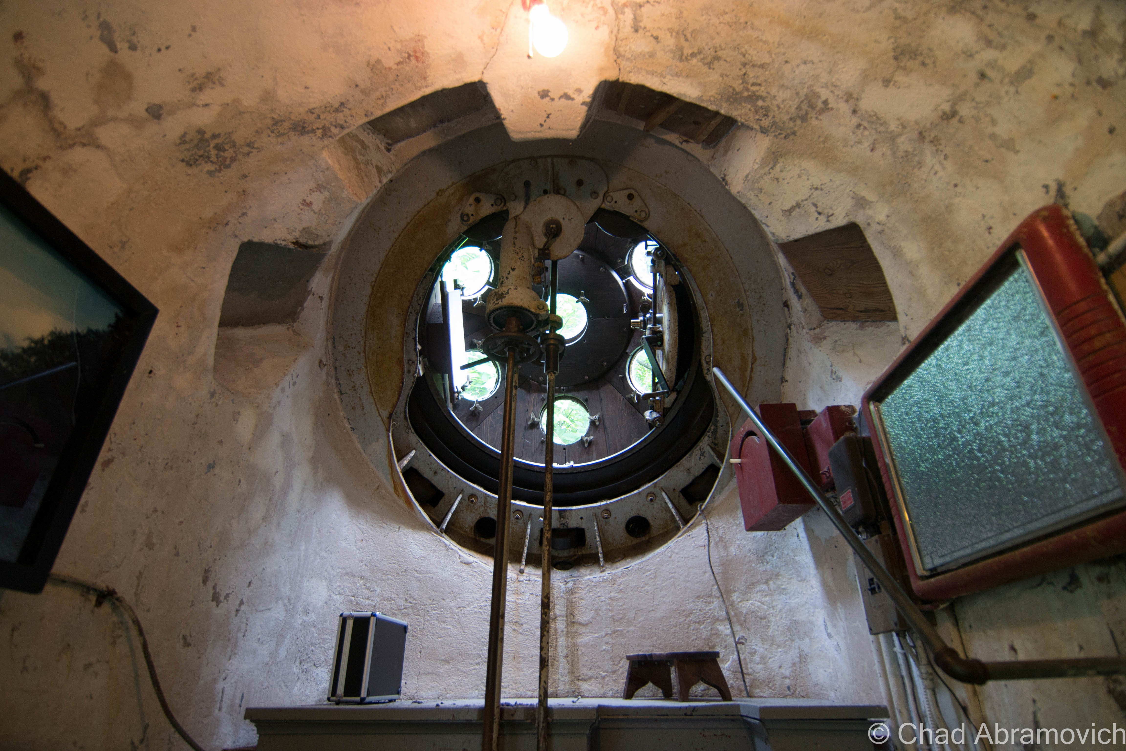
But something I did get to see, was Hartness’s aforementioned personal Equatorial-Plane turret telescope back on a rainy and humid June afternoon of 2015!

The rotating green turret rides on rollers supported by the white concrete structure, and it’s also where the stainless steel telescope tube with its ten-inch achromatic objective is installed, which is a modern upgrade to the original. Hartness developed the optics of the telescope to pass through a lens in the wall of the dome, which allowed him to stay warm in Vermont’s brutal winters.

The funny-looking protrusion is in front of Mr. Hartness’s stately former home – looking exactly like something a venerable turn of the last century tycoon would dwell in. At the time, the hotel offered free tours of the telescope and tunnel, no reservations needed, but because the property is currently a real estate listing, I’m not sure if the telescope is closed to the public or not, but absolutely hope that this treasure will continue to be shared with all the inquisitive.

I’ve always been someone that has loved human ingenuity and the magic of camaraderie, so this post was a lot of fun to research and write. So many amazing things happened in this era of America from the genius of common people that I just find so remarkable – and a little bittersweet thinking that we may never have another country-defining boom quite like it.

The earth is kinda played out, so it’s amazing that these strange new frontiers and discoveries can still be made in places like this that were once mapped, and then been forgotten.

For your consideration:

The Vermont Historical Society is one of my favorite organizations in the state – and they have a few nifty videos that briefly chitchat about both James Hartness and The Precision Valley. I’ve linked them below!

There’s a terrific archived article on Mr. Hartness, Springfield, and Jones and Lamson from Mechanical Engineering Magazine thanks to the Wayback Machine!

Are you wondering how a J&L Turret Lathe works? I was able to find a really cool dual brochure and scanned instruction manual from 1910 that includes illustrations!


Since 2012, I’ve been seeking out venerable examples of Vermont weirdness, whether that be traveling around the state or taking to my internet connection and digging up forsaken places, oddities, esoterica, and unique natural features. And along the way, I’ve been sharing it with you on my website, Obscure Vermont. This is what keeps my spirit inspired.

I never expected Obscure Vermont to get as much appreciation and fanfare as it’s getting, and I’m truly grateful and humbled. Especially in recent years, where I’ve gained the opportunity to interact with and befriend more oddity lovers and outside-the-box thinkers around Vermont and New England. As Obscure Vermont has grown, I’ve been growing with it, and the developing attention is keeping me earnest and pushing me harder to be more introspective and going further into seeking out the strange.

I spend countless hours researching, writing, and traveling to keep this blog going. Obscure Vermont is funded almost entirely by generous donations. Expenses range from hosting fees to keep the blog live, investing in research materials, travel expenses and the required planning, and updating/maintaining vital tools such as my camera and my computer. I really pride and push myself to try to put out the best of what I’m able to create, and I gauge it by only posting stuff that I personally would want to see on the glow of my computer screen.

I want to continuously diversify how I write and the odd things I write about. Your patronage would greatly help me continue bringing you cool and unusual content and keep me doing what I love!

Do you have any stories you’d like to share? Know of anything weird, wonderful, or abandoned? Email me at chad.abramovich@gmail.com

Donate Button with Credit Cards

The Vanished Town of Glastenbury and The Bennington Triangle

Those who know me know that I’m a huge cartography buff. That love really perpetuated when I was 10, when my mother bought me a DeLorme atlas of Vermont, and I became enthralled with it, thoroughly memorizing every detail I could. But what is it about maps that are so irresistible to me?

Maybe because of their limitless potential, and their ability to unlock the mysteries of our world. Maps tell us how things in this world relate to one another, they take data and turn it into something tangible, something understandable, and maybe something that provokes thought or feelings. Several different types of information can be conveyed at the same time, melding several different ideas into a united idea. Lines to convey topography, more lines to convey boundaries between rock layers, towns, states and countries. More lines for faults, colors for bodies of water, forest land and types of climates. Maybe it’s because maps provide some sort of order, putting everything where it needs to be. Or just the opposite. They’ve always helped me make sense of my thoughts and ideas, and even draw ideas from things that haven’t been categorized or plotted yet.

I loved getting to know the great state I lived in. But one place really stood out to me.

A perfect square, that yellow dotted line indicating it was the boundary of a town, with the word “Glastenbury” printed inside. But inside the square, there was nothing but contour lines, indicating several mountains and rugged wilderness. I was enthralled by the fact that this town apparently had nothing in it. In the very top left corner, in small print, was the word “Fayville”, plotted on a dotted line that seemed to be a secondary road, meandering its way from Shaftsbury deep into the hills, and ending in the middle of nowhere. Even for rural Vermont standards, this was pretty desolate. I knew there was something different about this place, it challenged my young and naive view of the world. Why wasn’t there anything in Glastenbury like other towns around it?

It had a mystery to it, and I wanted to know more. My first act of familiarizing myself with Glastenbury was to make the trip down to that curious place on the map called Fayville. Myself and a few friends departed in his pickup truck and drove up the bumpy forest road into a strange clearing in the middle of the hills. Here, underneath summer humidity, we found old cellar holes almost entirelly hidden by tall grasses, beneath the shade of gnarled apple trees. At the bottoms, under layers of decaying leaves and dirt were iron bands, old horseshoes, and other various relics that hinted at human habitation once being way up here. It now made sense, Fayville was a long abandoned village that still appeared on maps.

The remains of the Eagle Square sawmill in Fayville, circa 2009-08. Photo: UVM Archives and The Landscape Change Program.
The Eagle Square sawmill in Fayville. Now, ferns, earth and rocks are filling in the foundation. Photo: UVM Archives and The Landscape Change Program.

As we were wondering around, the once sunny July afternoon became dark and cloudy, as a gusty wind picked up and tangled the long grasses. And it came fast, so fast that none of us were aware of a change in weather until things got dangerous. We were suddenly at the mercy of a freak ferocious thunderstorm that seemed to emanate out of nowhere, and became so violent that we literally retreated down the mountainside, in fear of the dirt trail washing out, leaving us stranded in the middle of the national forest. But when we got back down to the flats in Shaftsbury, it was sunny and dry. To make things far stranger, gas station attendants in Arlington were baffled that a thunderstorm – especially one of that magnitude – had passed through the area without them noticing it. Freak storms are common in New England, it’s by no means a rare phenomena here, but the conditions were just right to make this a head scratcher. I still have no explanation to this day.

Over the years, I began to dive into research, and soon would discover that I had stumbled upon one of the most interesting stories I had ever heard, which remains as one of the earliest examples of what got me interested in Vermont curio. Eventually, I decided that I wanted to write about this place that has long held my attention, to pay it reverence for having an integral part of my life, and also, because I love a good story.

A modern day road map of Glastenbury – which is a little misleading. The black lined “roads” that are represented are actually forest service roads/snowmobile trails. US Route 7 and a small portion of Glastenbury Road in the left hand corner are the only real roads in town.

But Glastenbury is perplexing and complex, and something I found a little difficult to write about, mostly because there was so much information to take in. I wanted to be tactful with how I approached it, balancing the resilient history, excellent folklore, and my own thoughts. When I was finished, the only conclusion I could draw is that there is no conclusion. But I’m getting ahead of myself.

An Introduction

In southern Vermont, northeast of Bennington, lies an incredible area of backcountry. It’s a vast area, roughly 36 square miles of unbroken wilderness, with 12 peaks over 3,000 feet in elevation, the centerpiece being Glastenbury Mountain at 3,747 feet. Mostly occupied by the Green Mountain National Forest, this is a surprisingly large stretch of wilderness for Vermont. It’s name sake comes from it’s largest mountain, and the ghost town that used to be there which also bore the same name.

Glastenbury seems to yield a prolific Google search, but despite the hits, the information about the vanished community is vague at best, with much that seems to be copied and pasted from one website to the next. That’s where Tyler Resch’s invaluable book Glastenbury, History of a Vermont ghost townemerged beaconlike in the darkness.

The town of Glastenbury was charted in 1761 by land grabbing Benning Wentworth, governor of New Hampshire. Wentworth was quite the character – granting as many towns in then unestablished Vermont as he could, with the intention to provocatively challenge New York, which also claimed the same land. Of course, Wentworth’s grants doubled as a lucrative endeavor, as he made sure to set aside some acreage for himself.

But Wentworth had no idea of the local geography, and simply drew lines on a map. Though Glastenbury tips it’s hat to a legendary place in England, Vermont’s titular community seemed to be ill fated from the very beginning. The rough and forbidding terrain and short growing season didn’t lure any settlement until the 1800s.

Because they had a mountain of wood to burn, the town embraced the lumber and charcoal industry, and began to slowly prosper as it lured settlement and business. Though Glastenbury town itself is a large area, it only contained 2 small settlements near the western border; the logging town of Fayville in the north, and later, the settlement of South Glastenbury. While Fayville is more known by people looking at a map, South Glastenbury is normally what is profiled in every article I’ve read. The two villages were never connected, the mountainous terrain was so steep that roads were never built.

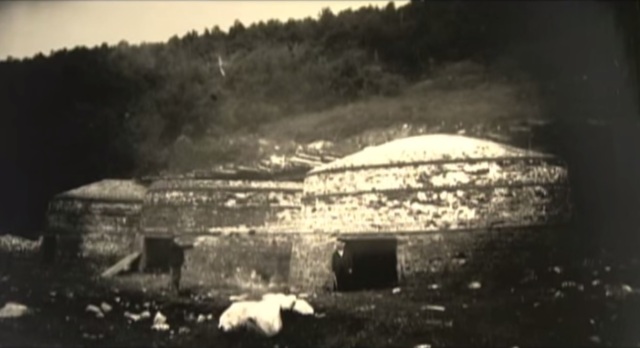
South Glastenbury became the heart of town, and the headquarters of the majority of the charcoal operations, with 12 brick kilns erected along the cleared hillsides. A massive loggers boardinghouse, and company store – the only store in town, were built to serve the village. A few homes, a meetinghouse and a crude one room schoolhouse were also built for the few kids who grew up there. Because South Glastenbury sat at the confluent of two different branches of Bolles Brook, where the headwaters met and began their descent down the mountains, the small village became known as “The Forks”.

Life here was tough. It was a wild town, sort of a last frontier in Vermont. It was the kind of place where men out numbered the women, and the law often didn’t exist.

An 1865 Rice and Harwood Map of Glastenbury and Woodford shows the village of Fayville in the top left corner of town. South Glastenbury hadn’t been settled yet | via: oldmaps.com

I’m not willing to pay the $20 image purchase fee – but the website historicmapworks.com has an 1869 Beer atlas map of Woodford that you can check out – and this is one of the few maps I’ve came across to feature South Glastenbury in it. The map is sideways, so look for “District 2”, beyond the Woodford town line, and the black dots that represent buildings plotted around Bolles Brook.

A girl, a man and a boy outside Glastenbury Camp, 1933. Photo: UVM archives – The Landscape Change Program
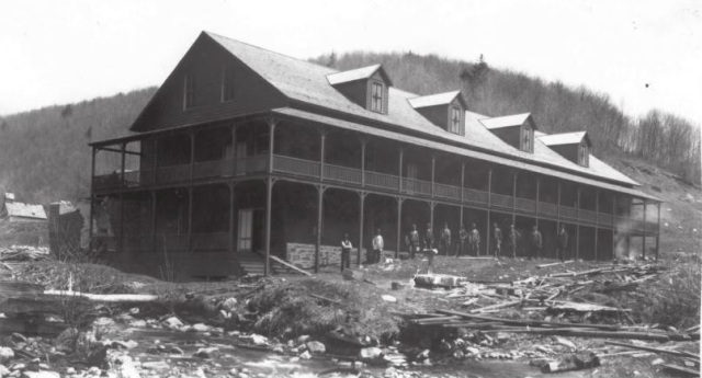
he Loggers Boarding House, and several residents posing for a photograph.
The Loggers Boarding House in South Glastenbury, with several of the woodsman posing for a photograph. Photo: courtesy of Images From The Past
kilns2
A few of the brick charcoal kilns in South Glastenbury.
South Glastenbury
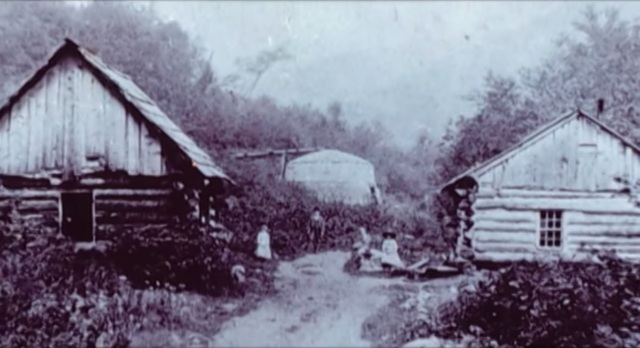
A strangely forlorn shot of South Glastenbury that really gives you an idea of what life was like for folks up there in the mountains. Primitive log homes and a charcoal kiln can be seen, with a few locals out front along the road. Photo: courtesy of Images From The Past

With a profitable timber industry came demands. People needed to get up into town, and lumber and charcoal needed to get down. The steepest railroad ever built in the United States was constructed as the solution, which started out as a sarcastic suggestion turned into a defiant reality. Starting in Bennington and ending at The Forks, The Bennington-Glastenbury Railroad was formed in 1872, the tracks climbing an astonishing 250 feet per mile at 9 miles long. But depending on a finite resource eventually created the end of the charcoal and logging industry and the mountains were logged until nothing larger than a sapling remained on the slopes.

But the railroad was still around, and they wanted money. The question was, what to do with it? In 1894, the railroad re-billed itself as The Bennington-Woodford Electric Railroad and the town reinvented itself as a tourist destination, using the railroad as a way to bring tourists up into South Glastenbury. The railroad switched over to using more reliable trolley cars instead of traditional rail cars, because they were stronger and more reliable, especially given the elevation they would have to climb.

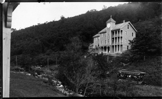
Much time and money were invested into retransforming the town – turning the brawny old loggers’ boarding house into a hotel and the former company store into a casino. No details were overlooked, and both buildings became showpieces. They wanted Glastenbury to stand out from other summer resorts. After painstaking labor and expenses, the town opened up as vacation destination in the summer of 1897, and had a successful first season.

However, the barren mountains stripped of all their trees, were very prone to flooding and soil erosion. A year later, a devastating flood washed out the tracks, putting an end to the town for good. It’s high elevation and isolation ensured that no one tried to rebuild it, and the buildings fell into ruin under the silence of the mountains.

A trolley full of tourists arrives in South Glastenbury. The casino can be seen in the background. Photo Source
newspaper3
A newspaper flyer advertising the upcoming opening of Glastenbury as a tourist destination
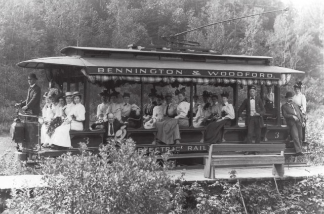
A classic image of The Bennington and Woodford Trolley, filled with nicely dress women on their way to Glastenbury.
A classic image of The Bennington and Woodford Trolley, carrying a load of women who are dressed to impress, up into Glastenbury. Photo: courtesy of Images From The Past
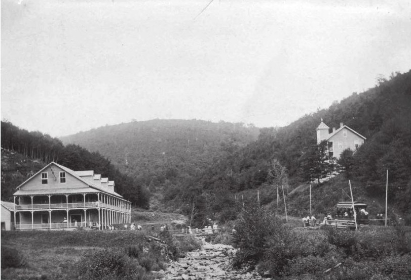
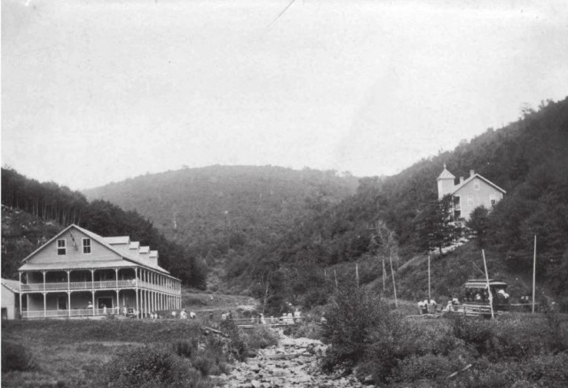
he tourist destination of South Glastenbury, with the hotel on the left, and the casino on the right. You can see Bolles Brook and the Trolley line to the right of the brook.
The tourist destination of South Glastenbury, with the hotel on the left (old loggers boarding house), and the casino (former company store) on the right. You can see Bolles Brook and the Trolley line to the right of the brook. A walk up here today has almost entire eroded that there was once human habitation here. Photo: courtesy of Images From The Past
Glastenbury
The casino. Photo: courtesy of Images From The Past
Another hotel at Glastenbury. The identity of this one however remains a mystery. Vaguely dated between 1890 – 1930. Photo: UVM Archives and the Landscape Change Program
A group of individuals hiking on Glastenbury Mountain. When the group came back in the morning, they came back to water that was three feet deep. August 16, 1918. Photo: UVM Archives and The Landscape Change Program
This one is a mystery to me. The image is captured “On The Trolley Line to Glastenbury”. The roof of the building reads “Loafmore” Dated 1910, a decade after South Glastenbury had been abandoned. Photo: UVM Archives and The Landscape Change Program.

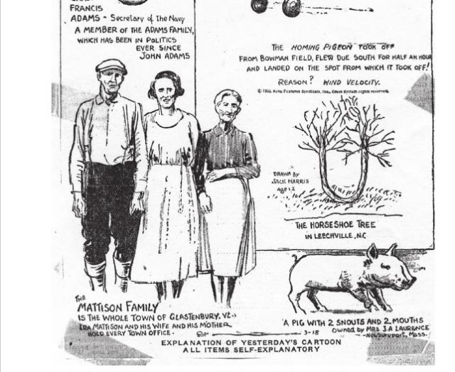
The population of Glastenbury dwindled down to almost nothing, which later got the attention of Ripley’s Believe It Or Not in the 1930s when they learned that all 3 members of the Mattison Family were the entire town, and held every office. Because of this, the state of Vermont disorgonized the town in 1937, the first time the state ever did such an act, and the area was reclaimed by the wilderness.

It’s even more interesting to think about that a town with such a galvanizing and unique history was actually so tiny in stature. Though many people who write about ghost towns robotically love to use descriptive terms such as “hub” or “thriving”, Glastenbury was really neither – it’s peak population climbed to around 241.

Apart from the town’s fascinatingly unique story line, it may be the obscure and inexplicable events that allegedly happened on it’s slopes that has really given the town it’s considerable attention. The area has since given birth to terrifying legends, if not actual monsters.

The casino, just a few years after its abandonment. It had already fallen into ruin by then.
The casino, just a few years after its abandonment. It had already fallen into ruin by then. Photo: courtesy of Images From The Past
Ripley's
A cartoon published in 1936 by Ripley’s Believe It Or Not featured the Mattison’s of Glastenbury.

“The Bennington Triangle”

While my love of maps inadvertently lead me to my interest of Glastenbury, their ability to organize information and draw conclusions was useless here.

Glastenbury Mountain and the surrounding area has long been considered one of Vermont’s most haunted places. In 1992, local author and folklorist Joseph Citro coined the term “The Bennington Triangle” to describe the area, and the designation not only stuck, it grew immensely in popularity. Over the years, the phrase has been been featured in books, websites and television shows, to the point where the name has taken a life of it’s own.

The theories and enthusiasm have quickly escalated and have continued to morph and stoke the fire. Many are quick to glamorize the region without being objective, only further propelling it into the blurred haze of fact and embellishment.

To better understand the hysteria here, let me try to summarize the more colloquial regional portrait for you.

It started with the native Americans, who refused to venture onto Glastenbury mountain. Fearing the land was cursed, they only used the land to bury their dead. But maybe it was because of a cross wind that met on the summit of the mountain. Even today, hunters will tell you that because of the disorienting winds, it’s very easy to get lost in the woods.

There is also a baffling legend of some sort of enchanted stone somewhere in the mountains, which is said to open up and “swallow” a human being in seconds if it’s stepped on. Another reason they avoided the place.

The weirdness continued when colonial settlers came to the area, whose vague and un-researchable accounts tell of weird sounds, noises and odors that would come from the mountain. But there are human things at work here as well, and those have been documented.

In 1867, there was an alleged wild man sighting, where a mysterious misanthropic specter would venture down from the woods (some accounts say he lived in a cave in Somerset) pull back his coat, and expose himself to unsuspecting women in Glastenbury and nearby Bennington. He was also said to brandish a revolver for intimidation. Whoever he was, he was eventually ran out of town and faded into obscurity.

On April 4th, 1892, Fayville mill worker Henry McDowell went haywire and murdered John Crawley by bashing him in the head with either a piece of wood or a rock, depending on the story. He fled town, but was later apprehended in South Norwalk, Connecticut, where he made a full confession. However, he was babbling on about voices in his head that wouldn’t leave him alone, and as a result, was sentenced in the Vermont State Asylum in Waterbury. But he escaped by hiding in a railroad car carrying a load of coal, never to be seen again. Some say he returned to Glastenbury, and others claim that he still remains hiding on the slopes to this very day. But by now, he would be an impossibly old man, which takes on an eerie resemblance to the tale of Doctor Benton coming from the mountains of New Hampshire.

On the opening day of Vermont’s first hunting season in 1897, 40 year old John Harbour, a respected Woodford resident, was mysteriously murdered at his deer camp in Bickford Hollow, a remote area in the hills south of Glastenbury. While hunting with his brother and family friend, they heard the blast of a rifle, followed by him crying out “I’ve been shot!”. They immediately turned around and searched for him, but it wasn’t until 11 AM the next morning when they found him, his legs protruding out from underneath a Cedar tree. However, something wasn’t quite right. His loaded gun sat neatly beside him, as if it was purposely put there. But something was wrong. His body was a distance away from where he was shot. They now knew that John had to have been moved. But by what? Did he crawl there after being shot? Did he receive human help, possibly by the shooter? There were no signs of him having walked or crawled to his final resting place, no clues at all.  The mystery remains unsolved to this day.

It was after these two murders that signaled both the beginning of Glastenbury’s slow decline, and the establishment of it’s reputation as a mysterious and haunted place. Sometime in the early 19th century, a stagecoach full of passengers were making their way over the mountains near Glastenbury, near present day Route 9 in Woodford. It was well past dark and a violent rain storm was washing out the road. The rain was coming down so hard, it soon forced the driver to slow down to a crawl as the thunder cracked the night sky. Things became so bad that the driver eventually came to a complete stop in the dark and wet mountain wilderness. As he hopped down from his perch with the lantern to get a good idea of the situation, he noticed something peculiar illuminated by lantern light. There were unfamiliar footprints in the mud just ahead of him.

The rain hadn’t washed them away yet, so they had to be fresh tracks the driver reckoned. His observations revealed that the tracks were widely spaced, suggesting that whatever had made them was tremendous in size. He noticed the horses were beginning to get spooked, but he just couldn’t stop thinking about those tracks. What made them? He soon hollered back to the passengers and asked for their opinions. At this point, the horses were going wild, which was spooking the driver. That meant that something was skulking nearby, and it might just be what made those tracks…

As the passengers began to step out, something dealt a savage blow to the side of the carriage. Now, all of the passengers scrambled out of the carriage, completely terrified. The blows kept coming, until the whole thing tumbled over on it’s side.

The quivering passengers and driver huddled together in the dark, the rain stinging their faces. Then the creature came into view. Though it was almost impossible to see, two large eyes could be made out staring at them. A vague detail described the brazen creature as roughly 8 feet tall and hairy, before it shambled back into the woods. Shortly after, whatever had attacked them had became dubbed as The Bennington Monster.

Another interesting theory suggests that the Bennington Monster is actually the horrifying transformation of the Glastenbury Wild Man. After he was chased out of the region, he took back to the woods and dwelled, becoming cannibalistic, deformed and insane, wearing animal firs and attacking lone stagecoaches coming over the mountains.

Strange Disappearances 

Giant hairy monsters that topple stagecoaches are all good for earning a place an official spook status, but it was the disconcerting events that took place after the town became disorganized in 1937 that have really cemented the area into the public’s imagination and paranormal concrete.

Glastenbury is where one of Vermont’s most frightening mysteries took place, and what’s more captivating is that it really didn’t happen all that long ago. Beginning in the last cold months of 1945, people from the area began to vanish without a trace.

The first one to disappear was 74 year old Middie Rivers. He was a native to the area and worked as a hunting and fishing guide. Because of his job, he was completely familiar with the woods. One day, Rivers led four hunters up onto the mountain. Things were going fine, until their trek back to camp. Rivers got a bit ahead of the group, and vanished completely. Expecting to catch up with him at the camp, the hunters began to panic when they didn’t see him there upon their arrival. Police and a group of volunteers combed the area for hours. But Rivers was an experienced woodsman, so they were fairly confident they would find him in no time. But search attempts continued for over a month, and no trace was ever found. Local lore has it that Rivers disappeared near Bickford Hollow, the same place John Harbour was murdered.

The next person to vanish is the most infamous of all the Bennington Triangle disappearances, the case most talked about. on December 1, 1946, 18 year old Paula Welden decided to take a hike on the Long Trail. she left her dorm at Bennington College and walked into the woods. She was easy to spot, because of her bright red coat. Plenty of people saw her that day, including on the Long Trail itself. But Monday came, and Paula didn’t show up for her classes. The college called the sheriff’s department. 400 students and faculty members assembled to help look for their missing classmate. A massive search party of 1,000 people, bloodhounds, helicopters and even a clairvoyant, combed the area diligently for weeks. A $5,000 reward was even offered! But on December 22, all efforts came to an end. There was no body, no clothes, no evidence, nothing. The quality of Paula Weldon’s search party was met with scrutiny, and because of this, it lead to the formation of the Vermont State Police. Another interesting detail I uncovered was that to this day, there are people who think it’s bad luck to wear red while hiking Glastenbury Mountain.

The third person to disappear was on Columbus Day in 1950. 8 year old Paul Jepson was waiting for his mother in his family’s pickup at the dump they were caretakers for. But when she came back, he was gone. Like Paula Welden, Paul was wearing a red jacket, so he should have been easy to spot, but Mrs. Jepson couldn’t find him anywhere. Frantic, she called for help, and another search was launched.

Hundreds of townsfolk joined the search, scanning the dump and the surrounding roads, even the mountains. They implemented a double check system, where as soon as one group finished searching an area, another group would search the same area. Even coast guard planes were brought in. But all was useless. Bloodhounds borrowed from the New Hampshire State Police lost Paul’s scent at the intersection of East and Chapel Roads. Local lore says that Paul’s scent was actually lost at the same place Paula Welden was last seen. After the search had been called off, Paul’s father disclosed a peculiar piece of information. Paul had mentioned that he had an inexplicable “yen” to go into the mountains lately. Paul’s disappearance made him the third to go missing in roughly the same area. Was there a pattern here?

Maybe. Or maybe not. It was said that there were pigs at the dump his family were caretakers for. One popular theory at the time which the newspapers suggested, was that Paul wondered off and was eaten by the pigs, thus explaining his disappearance.

Others speculate that Paul was actually abducted near East and Chapel Roads, carried away in a car. That would explain why the bloodhounds lost his scent. But we’ll never know for sure. Either way, the newspapers did what they do best and ran wild, and soon, others started to wonder what was going on here?

Two weeks later, On October 28th, 53 year old Freida Langer had left her family’s camp east of Glastenbury Mountain near the Somerset Reservoir to go hiking with her cousin. She was an experienced woodsman and was completely familiar with the area. About a half mile from camp, she slipped and fell into a stream. She decided to hike the short half mile back to camp, change her clothes and catch back up. She never returned.

When her cousin got back to camp, he was startled to learn that not only had she never came back, but no one even saw her come out of the woods.

Local authorities were quick to launch another search, alarmed at another unfathomable disappearance in the area. Once again, all efforts proved to be hopeless. They found nothing. The Bennington Banner picked up on the story, and raised a disturbing question: How did Langer disappear completely in an area she was so familiar with?

More Disappearances

On December 1st, 1949, James E. Tetford had been visiting relatives in northern Vermont. He boarded a bus in St. Albans, en route to the Bennington Soldiers home, where he lived. But he never arrived. Somehow, he had vanished without a trace without ever getting off of the bus. Even the bus driver had no explanation!

This account seems to be continuously accepted as proof of paranormal happenings, without further questioning the events. It’s worth mentioning that by the time James was actually reported missing, it was at least a week after the fact, when the Bennington soldiers home finally decided to call his relatives to figure out if he was actually coming back or not. By the time the police were involved in the investigation and got around to interviewing the bus driver and other passengers, it had been two weeks, and no one really remembered anything. But some information did arise. James was last seen by a friend of his when his bus made a stop in Burlington, and guessed he might have gotten off there, offering another possible explanation to his whereabouts. But regardless, his disappearance still remains a mystery. I don’t really see a connection here to the other disappearances, but I guess because it happened around the same time frame and James did live in the area, it has just been lumped into the big picture.

And perhaps one of the most arcane disappearance took place on November 11, 1943. As Author David Paulides tells in his book Missing 41137 year old Carl Herrick went hunting in the woods of West Townshend, about 10 miles northeast of Glastenbury. At some point during the hunt, Herrick and his cousin, Henry, were separated. Henry eventually made it back to camp, but Carl didn’t show up. As dusk began to fall and Carl still hadn’t arrived, Henry immediately contacted law enforcement, just as the snow began to fall.

The search for Carl lasted three days without finding a trace. But towards dusk on the third day, Henry stumbled upon Carl’s body. He was laying on the ground in the woods, motionless, his loaded rifle found leaning against a tree seventy feet away. Henry reported finding “huge bear tracks” around Carl’s body, but the official postmortem was baffling. Carl was reportedly squeezed to death, his lung was found to be punctured by his own ribs. What sort of bear squeezes a human to death? It would be an impossible act.

In Joseph Citro’s Passing Strange, (which was another heavy source for this article) he further mentioned a Burlington Free Press article dated October 25, 1981 reported that a trio of hunters disappeared somewhere near Glastenbury, and not surprisingly, that too remains unsolved.

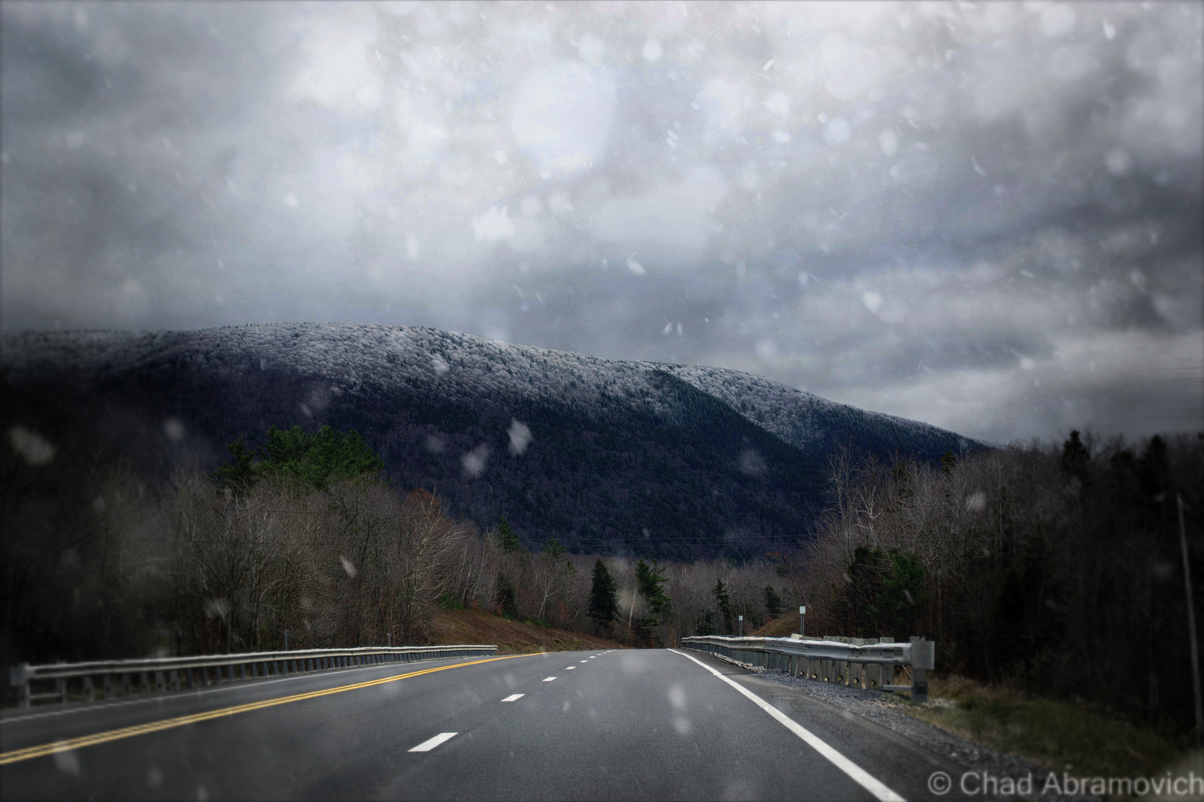
Snowfall over Glastenbury from Route 7

Additional Theories and Searching for Answers

If you take these other accounts into consideration, this raises the number of disappearances from four to nine, which begs the question, what happened here? Where could nine people vanish to without a trace?

This is what we do know. The victims ages ranged between 8 and 74 and were evenly divided between men and women. Time is also a pattern. The disappearances all happened during the same time of the year – the last 3 months – and many of them were last seen between 3 and 4 PM. The rest is up for debate.

Because of the vast scope of the wilderness area and it’s inaccessibility, the task of finding a body is difficult. The conditions could easily ensure that someone’s remains would never be found again, regardless of cause of death. Depending on who you ask, there is a pattern there.

Speculations abound, adding many more layers to this fabled region’s already weighted and transgressive reputation. Could the Bennington Monster still be stalking the slopes, carrying its victims to some cave on the mountain? Maybe. As recently as 2003, Winooski resident Ray Dufresne saw something peculiar on his drive down Route 7, near Glastenbury. What he first thought was a homeless man stumbling around in a snowsuit, turned into an alleged bigfoot sighting upon a closer look. That story immediately blew up and was even picked up by local news stations. While some skeptics dismiss it as a prankster in a Gorilla suit, others aren’t buying it, and plenty more sightings have been passed down by word of mouth from the Bennington area, all which remain unaccounted for.

Or maybe, could these unfortunate people have accidentally encountered that enchanted Indian stone, and were swallowed in seconds?

Alien abduction is another hypothesis. Many reports of UFO sightings and strange lights in the sky have been spotted over the Glastenbury wilderness over the last century. Most notably, a “flying silo” shaped anomaly was see over the skies of Bennington by Don Pratt in 1984, which seems to be the go-to example for extraterrestrial sightings in the area.

But my personal favorite was designated by John A. Keel, an American journalist and influential UFOlogist, who used the term “Window Areas” to describe these places, or, some sort of inter-dimensional doorway or vortex into another world. New England seems to have a fair share of them. The legendary Bridgewater Triangle in Massachusetts which has similar phenomena, and the summit of Mount Washington are two of the most notable.

Perhaps the most tangible answer could be something all too familiar, a serial killer. “The Bennington Ripper” and “The Mad Murderer of The Long Trail” were all monikers given to the possibility of a sinister suspect that lurked in the wilds, but no evidence was ever found to prove this. The police during that time were not familiar with serial killers or how they operated, so even if it was the work of such a killer, the facts would have gone undocumented.

Adding to the seemingly ever growing list of theories, this one might be the most plausible. Near the former village of South Glastenbury, there are a few old wells. Some speculate that Middie Rivers accidentally tumbled down a well while on his hunting trip. His party, being unfamiliar with the area, never thought to check. As for the others….

An odd footnote to all of this; the body of Freida Langer did eventually appear, seven months after she had vanished. But sadly, this wouldn’t be of any help. It was in an area that search parties knew they had combed thoroughly, near the flood gates of the Somerset Reservoir. It was a completely open area, and anything there would be impossible to miss. And yet, here she was. Or, what was left of her. Her remains were in such gruesome condition that no cause of death could ever be determined.

Even More Strangeness

Enigmatic situations aren’t contained to the past, things reportedly continue to happen here to this day. Countless internet searches have dug up numerous unusual tales posted on message boards and blogs from hikers, hunters and curiosity seekers.

In the book Haunted Hikes of Vermont, Author Tim Simard mentions a one time incident of hearing a ghostly train whistle while hiking along the West Ridge Trail, miles away from both any functional railroad track, and the old rail bed that runs up into South Glastenbury.

One harrowing account I was able to dig up took take place on Columbus Day in 2008. This time, 2 Long Trail hikers were making their way through the Glastenbury wilderness. While hiking, they ran into a young man named Dave, who helped rebuild fire towers along the trail. They started talking about the mountain’s reputation, which at this point seems almost impossible not to do if you’re visiting. They had heard about the disappearances and shrugged it off as out of control tall tales. But Dave had a weird story to tell of his own. Dave spent some time on Glastenbury mountain restoring the fire tower on the summit, and would work up there for extended periods of time.

While camping in Goddard Shelter, his friends reported that there were nights that he would sit up in his sleep and laugh uncontrollably, and other nights when he would wake up screaming. Dave was considered a down to earth and smart guy, so this behavior had his friends extremely concerned, and disturbed. He had never acted in such a way before. I’ll never know if Dave had any follow up episodes, or an explanation behind these bizarre actions, the thread ended there.

Another story I was able to dig up only adds to the unscrupulousness of the region. In the book Ghost towns of New England, Author Fessenden S. Blanchard spoke with Arlie Greene – the oldest surviving member of the Mattison family. Greene recalled the old days in Glastenbury, and one particularly enigmatic, and possibly nefarious, incident. Two local men went fishing on the Peters Branch – one went upstream and the other went downstream. One of them was never seen again. A short time after the disappearance of the fisherman, someone found a human skull sitting on a tree stump near the brook. Some speculated Panthers got to him, but others weren’t so sure…

Arcane Stone Cairns

Yet another mystery, dressed in the forest light and acting as silent witnesses to times gone by. This enigma is far more benign than the previous ones I’ve covered, but is still just as vexing. There are a series of inexplicable cairns scattered around the mountain, and no one is quite sure why they exist. There are theories to why they are there. Farmers built them long ago while clearing their pastures, or several passing hikers on the Long Trail built them, to act as beacons in bad weather. But nothing adds up. The cairns were built in high elevations where farming never took place, and most of them are located miles away from the long trail in heavily forested areas. So what are they? The work of the Bennington Monster? Perhaps playful hikers built them wanting to add another Glastenbury mystery? For now, these giant piles of stones offer no explanations.

One of the stone cairns on Glastenbury Mountain. Via rock-piles.com/Norman E. Muller. Photo: David Lacy

What About Today?

Though Glastenbury is a ghost town and designated wilderness area, it’s anything but deserted. A myriad of outdoor enthusiasts, hikers, snowmobiliers, college students, history buffs, paranormal investigators and hunters all flock here to the undisturbed wilderness – trekking up the expansive network of forest roads, hiking trails or silent waterways, all realizing just how special it is here.

Today, there are about 8 residents that chose to live in this strange paradise. They love it’s obscurity, and I can see why. There are no other towns quite like Glastenbury in the northeast – and with only one road in town, a winding dirt road that snakes its way in no less than 2 miles, privacy is in abundance. And if you know about Glastenbury, there seems to be a sense of pride that comes with your knowledge of this obscure area, if not something that conjures a romantic notion of fantasy. As a matter of fact,”Chateau Fayville”, the last original house in Glastenbury and the former Mattison homestead, was put on the real estate market – and it looks like a nice place.

But there are several people who aren’t all that enthusiastic about its menacing repute and “Bennington Triangle” folklore – mostly because they’re not a fan of ghosts, curses and the bad, inflated outlook it brings to the area. Skeptical people will be quick to assure you that everything has a perfectly logical explanation. As for me, I’m one of the skeptics.

So, is there truly something phenomenal about Glastenbury that has yet to be comprehensively explained? Do curses and monsters really claim their victims? Well….this seems to be a controversial subject of much enthusiastic debate. I’ve heard it all. At the end of the day, some people surmise firmly to their untenable thoughts. I suppose it’s all subjective.

During the height of the disappearances, the local media ran wild with the stories and theories, which not surprisingly, got out of hand, creating vicious accusations and conspiracy theories. If you’re a fact checker, it’s worth noting that Middie Rivers was the only actual person to vanish within the town of Glastenbury itself. All the others were in neighboring communities, many on the Long Trail in Woodford.

To add to this, Author Tyler Resch is one of those who thinks the area is widely exaggerated, and has created preposterous theories carried by inertia. He once noted that he was surprised that more people actually hadn’t vanished, because the wilderness is in fact so large, and it’s very easy to become hopelessly lost if you stray from the trails.

Others argue that numerous things could have happened to the missing hikers. They could have fallen down an old well, or gotten lost and frozen to death, perhaps taking shelter in one of the numerous caves on the mountain which few people ever venture near. Another theory is that they were the unfortunate meals of a Catamount or giant cat, which would surely dispose of any evidence of a body.

If you put all of these pieces that I’ve covered together and add the intrigue of a town attempting to survive against all odds but still vanishing into the wilderness, you can easily draw a conclusion about something creepy and supernatural existing here. After all, the region does have great triggers for spook stories. I’m personally awe struck that such a plethora of incidents are all linked to a single area.

But at the end of the day, everything is relative. 4 hikers did disappear, and people have claimed to see weird things in the woods. The only absolute truth about all of this is that people swear these things happened. Whether the culprit was something awesome and sinister or innate, is the quandary here. Who knows for sure.

In finality, the Bennington Triangle certainly isn’t in danger of being forgotten anytime soon.

Additional Stuff! (Because this entry wasn’t nearly long enough)

Youtuber Matt Garland made this awesome documentary on the Bennington Triangle, which is in my opinion, a great watch.

—————————————————————————————————————————————–

To all of my amazing fans and supporters, I am truly grateful and humbled by all of the support and donations through out the years that have kept Obscure Vermont up and running.

As you all know I spend countless hours researching, writing, and traveling to produce and sustain this blog. Obscure Vermont is funded entirely on generous donations that you the wonderful viewers and supporters have made. Expenses range from internet fees to host the blog, to investing in research materials, to traveling expenses. Also, donations help keep me current with my photography gear, computer, and computer software so that I can deliver the best quality possible.

If you value, appreciate, and enjoy reading about my adventures please consider making a donation to my new Gofundme account or Paypal. Any donation would not only be greatly appreciated and help keep this blog going, it would also keep me doing what I love. Thank you!

Gofundme: https://www.gofundme.com/b5jp97d4

Donate Button with Credit Cards

The Maggot Mountain State?

Writing about as many weird and esoteric things related to our small state as I can, I suppose no directory of Vermont oddities could exist without this intriguing story, because it directly relates to how our state got the most paramount piece to our identity; our name.

The mountains east of Rutland are a beautiful sight, especially in the fall when the dense hardwood forests that climb the slopes above Route 4 are burning in autumn hues as Vermont’s mountains die gloriously for the year.

When the leaves have fallen and the slopes are dusted with snow, leaf peepers are replaced with skiers and snowboarders as they flock in mass numbers to one of the East Coast’s most prominent mountain resorts, Killington.

Even though the 2010 census recorded Killington as having a year round population of around 811, the population almost triples in the winter months as thousands pour into the numerous resorts and motels lining the illustrious mountain road that snakes its way to the resort’s doorstep.

But before skiing and flatlanders were Killington’s claim to fame, it was already finding a place in Vermont history. And this is where my story officially picks up.

In school, we were taught that Samuel de Champlain was one of the first Europeans to set foot in what is now known as Vermont in 1609, along the lake that now bears his name (It’s worth noting that Jacques Cartier was said to have set foot here before him as early as 1535).

Champlain is also first credited in suggesting the name for this new land should be les Verts Monts, or “Green Mountains” in French.

Now, enter another interesting character: Rev. Samuel Peters.

Rev. Peters came to the area from his home state of Connecticut, with the intention of bringing some spirituality to godless Vermont. He traveled around central Vermont considering it his self described altruistic mission to bring sermons and baptisms to the impoverished rural communities. Along the way, he was taken by the mysteries of the mountains.

In the southern portion of the town of Killington is Killington Peak. Rising to a lofty 4,241 feet, it is officially the second-highest point in Vermont (Mount Mansfield is the first). It was here, in 1763, where the magnificent views of perpetual rolling green hills inspired the good reverend to christen the un-organized area Verd-Mont. Peters made his claim official by symbolically smashing a bottle of whiskey on the rocky summit.

14 years later, On June 2, 1777, the local legislature convened and made “Vermont” the official name of the newly formed republic. (Vermont wasn’t granted statehood until 14 years later, in 1791.)

Peters, however, was horrified and outraged at the announcement. What the new legislature didn’t realize was that the literal translation of Vermont (Ver-Mont) in French is “maggot mountain.” (Can you imagine “The Maggot Mountain State” on our license plates?)

Peters insisted they change the spelling to Verdmont as he originally proposed, and adamantly criticized them about the adapted form of the name, saying “the state had rather be considered a mountain of worms then an evergreen mountain!”

But the legislature didn’t listen. This dismissal consumed the reverend. Driven by obsession, he made it his mission to educate people about the great travesty that was done to him (with the concern for the future name of our state apparently secondary) — despite openly ignoring the fact that Samuel De Champlain had coined “les Verts Mont” for the region 154 years before his own unofficial christening.

At this point, few were willing to listen to Peters with many avoiding him, labeling him as a raving mad man, never allowing him to bask in the accolades of pride. This is where a slightly deeper look into the mysterious Rev. Peters is needed. A clergyman from Connecticut, Peters was the first reverend to come to the area on horseback in 1763.

Despite his well intended facade, the reverend was known to be a liar. His most notable example was the time he claimed to have a doctorate from the University of Cortona in Tuscany — a university which never existed.

The reverend was, indeed, something of a con artist. In 1794, he managed to persuade his fellow clergymen into electing him the first Episcopal Bishop of Vermont, an honor the Archbishop of Canterbury refused to consecrate.

It was said that Peters was not an easy person to get along with. Certainly his status as a Tory, or British sympathizer in times of the American Revolution, didn’t make him very popular around these parts. Given this information, it adds a little depth into why some Vermonters began to turn against him.

Not much is known about the later stages of Rev. Peter’s life. He would eventually die in New York City in 1826 in poverty.

Despite his questionable history, Peter’s love for the land that is now known as Vermont was sincere.

Links/Sources:

Vermont Wikipedia

History of Killington, VT

Samuel Peters on Wikipedia

Vermont: Records of the Governor and The State of Vermont (Google Books) 

Vermont: A Guide To The Green Mountain State (Google Books)

—————————————————————————————————————————————–

To all of my amazing fans and supporters, I am truly grateful and humbled by all of the support and donations through out the years that have kept Obscure Vermont up and running.

As you all know I spend countless hours researching, writing, and traveling to produce and sustain this blog. Obscure Vermont is funded entirely on generous donations that you the wonderful viewers and supporters have made. Expenses range from internet fees to host the blog, to investing in research materials, to traveling expenses. Also, donations help keep me current with my photography gear, computer, and computer software so that I can deliver the best quality possible.

If you value, appreciate, and enjoy reading about my adventures please consider making a donation to my new Gofundme account or Paypal. Any donation would not only be greatly appreciated and help keep this blog going, it would also keep me doing what I love. Thank you!

Gofundme: https://www.gofundme.com/b5jp97d4

Donate Button with Credit Cards

The French Hill Murder

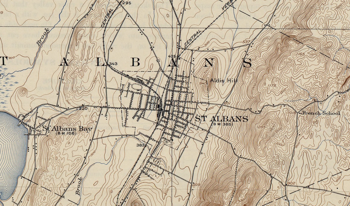
St Albans, Vermont, 1874. It seems that the summer brought more to town than sultry weather. The entire town was coping with a string of random and violent acts that were plaguing everyone’s peace of mind. A series of unsolved burglaries had the business community on edge, as well as a mysterious assault on a local physician who couldn’t identify his attackers. Later, a French Canadian man was killed in a stabbing incident, his attacker or attackers faded into the summer heat.

And then, on July 24th, something happened that finally caused the Railroad City to come apart at the seams.

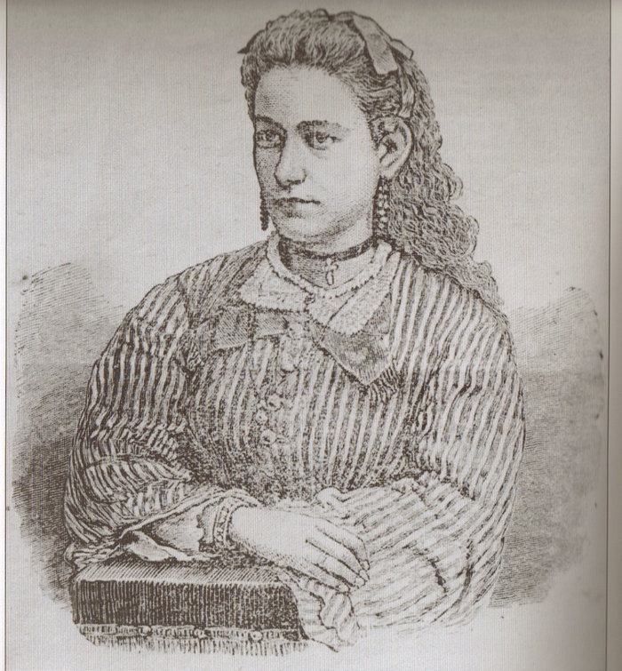
20 year old Marietta Ball had just been hired for a teaching position at a rural schoolhouse on French Hill during the summer months. She was described as a tall and slender young woman who was intelligent and kind hearted. She had blue eyes, light brown hair and weighed 130 pounds. Because she was a spinster, she didn’t mind the work or her rural location. French Hill, being a steep and remote hill area located east of the city, involved a steep climb up the west slope before dropping behind a ridge line to get to the schoolhouse. Even today, French Hill Road is steep and challenging, and in the winter it’s a white knuckle, break riding accent down to the safety of Route 104 below.

Marietta had arranged for room and board with a neighboring farm family, The Abels. After she would be finished at the schoolhouse, she would walk a lonely road that ran south from the schoolhouse just underneath the crest of the hill to get there. On the weekends however, she would stay with the Page family whose house stood at the very south end of the road, at the junction of today’s Vermont Route 36. But on that warm July evening, she would never reach her destination.

After much time had elapsed and Marietta hadn’t arrived, the Pages began to worry. Towards the evening, Mrs. Page’s concern got the best of her, and she began walking up the road to the nearby Collins residence to see if they had possibly seen her. As she walked up into the hills, the night air began to cool down and the sunset was burning with fiery vengeance. The Collins however were just as surprised that Marietta hadn’t shown up, and by 10 P.M., a search party was assembled.

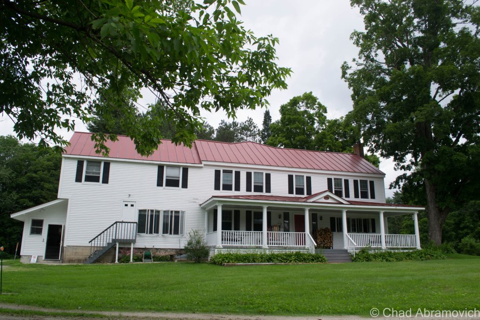
Marietta Ball's final destination, the Page Farm, still stands today.
Marietta Ball’s final destination, the Page Farm, still stands today.

Not long after setting out, the party’s lantern lights soon found what appeared to be the sight of an ambush in a nearby hollow. Near the site of the ambush was their first clue hinting that something sinister had taken place here; a makeshift mask that had been made from a piece of torn carpeting. Around 1 A.M., Frank Harris, a black man who was employed by Mr. Page, began shouting that he found a body. Through the haze of the lanterns keeping the wild shadows at bay, the gruesome remains of Marietta Ball began to take form.

Upon first assumptions, the party agreed that she had been sexually assaulted. But a later post mortem was conducted during daylight hours by a St. Albans physician named Dr. Fassett and a visiting New York physician, Dr. Janeway. Now they understood exactly what had happened. They noticed that her assailant had wrapped her head in her overskirt, which was a bit peculiar. Once that was removed, her brutal wounds were revealed. She had been savagely beaten to death. Her attacker must have had a moment of reconsideration, and made a clumsy attempt at hiding what he had done. They noted that her limbs were also re-positioned in an attempt to deceive whoever found her.
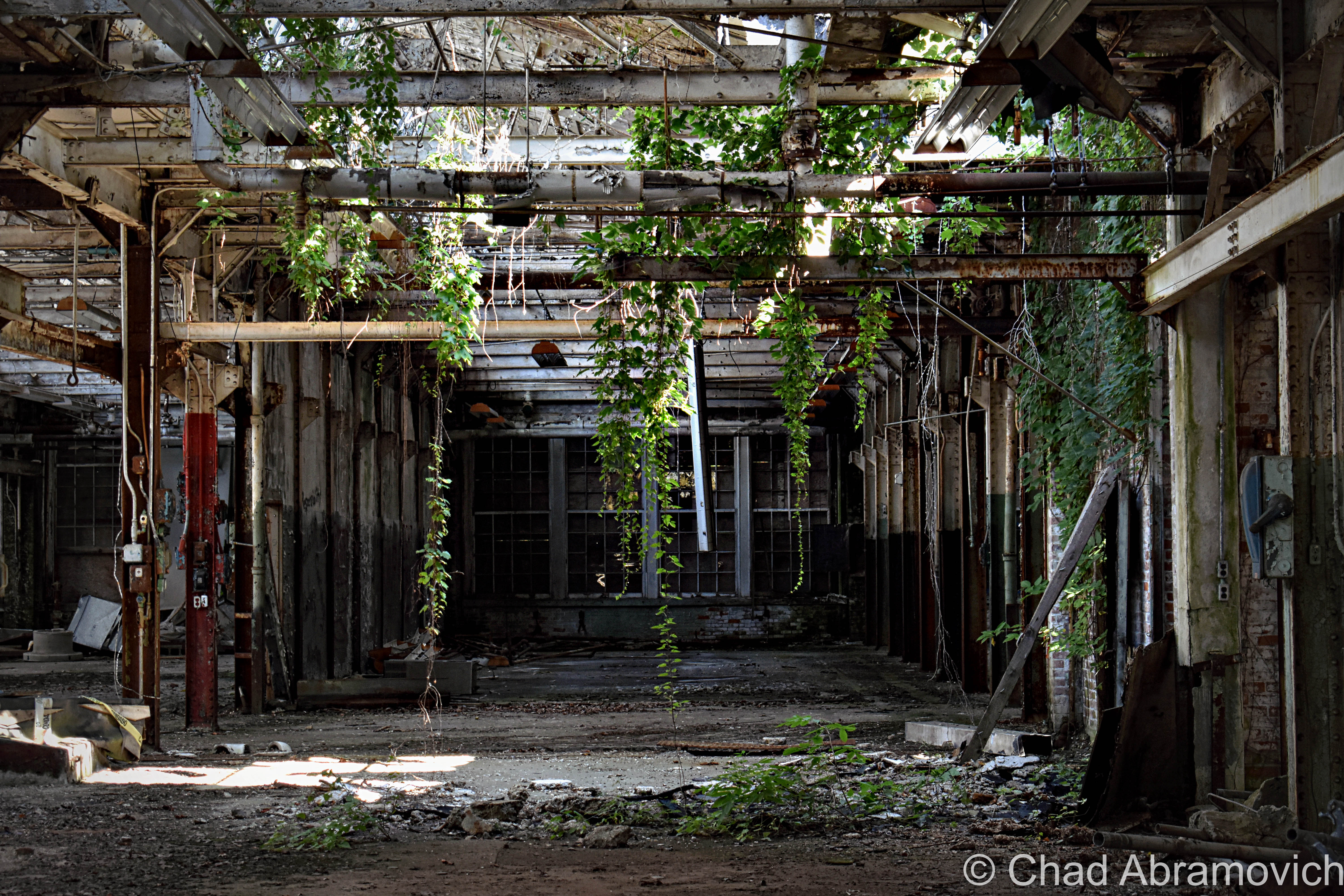
Marietta Ball
Marietta Ball

The town was outraged and their thirst for blood was ignited. Not long after Marietta’s body was found, the first of what would become several arrests were made. Frank Harris would be the first one taken into custody. A neighbor of the Page’s, Mrs Drinkwine, claimed that she left behind a fragment of the same carpet that was found at the crime scene in a rental house she owned. As it turned out, Mr. Harris was living in the house at the time of the murder, and Mrs. Drinkwine thought that was evidence. She insisted that she could prove the carpet was from the house by providing a sample of the same carpet in her own home, but her son became the voice of reason and told her that she shouldn’t make any accusations unless she knew they were true. Embarrassed, she dropped the matter and Frank Harris was released from custody with no grounds to hold him.
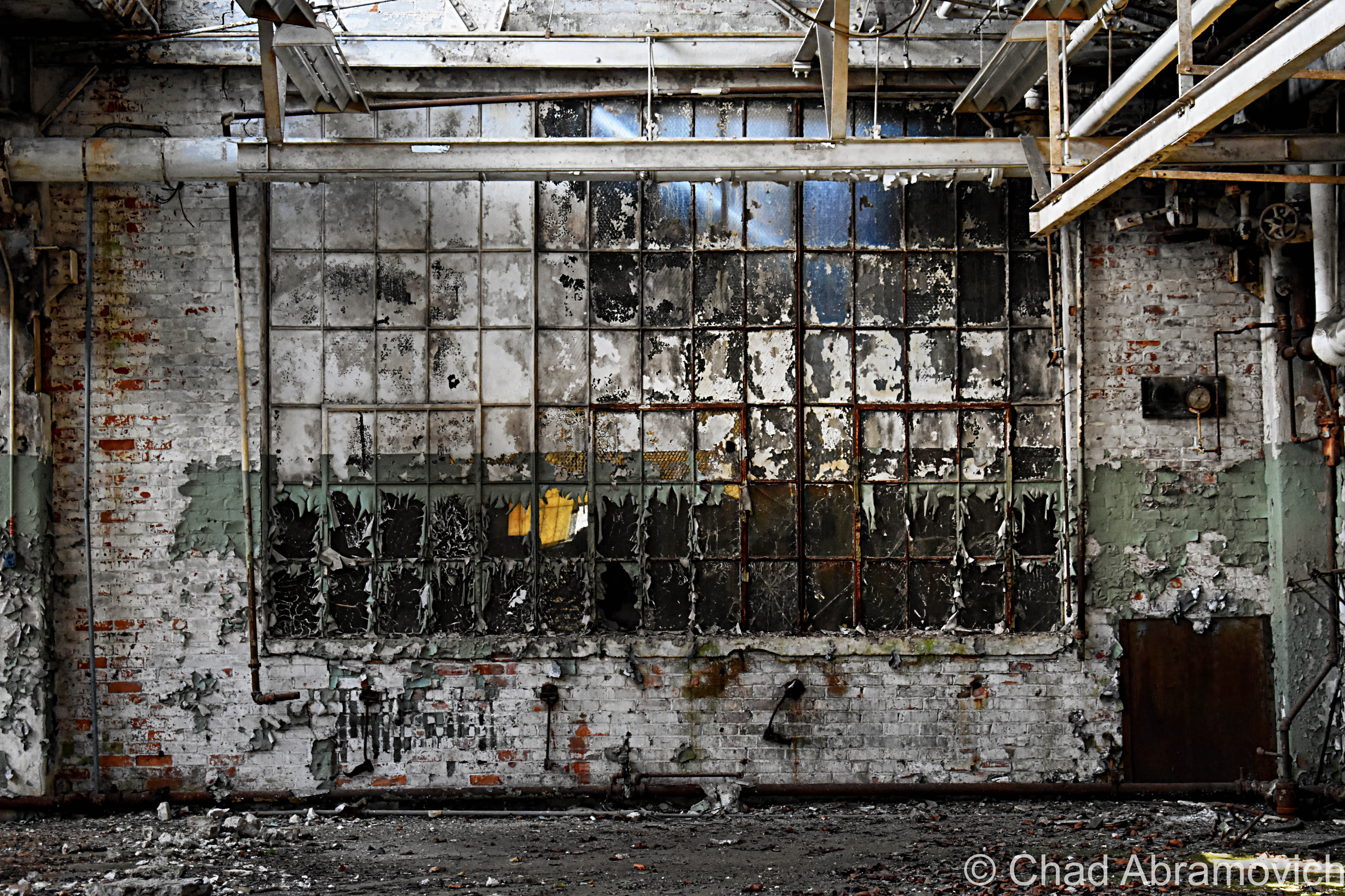
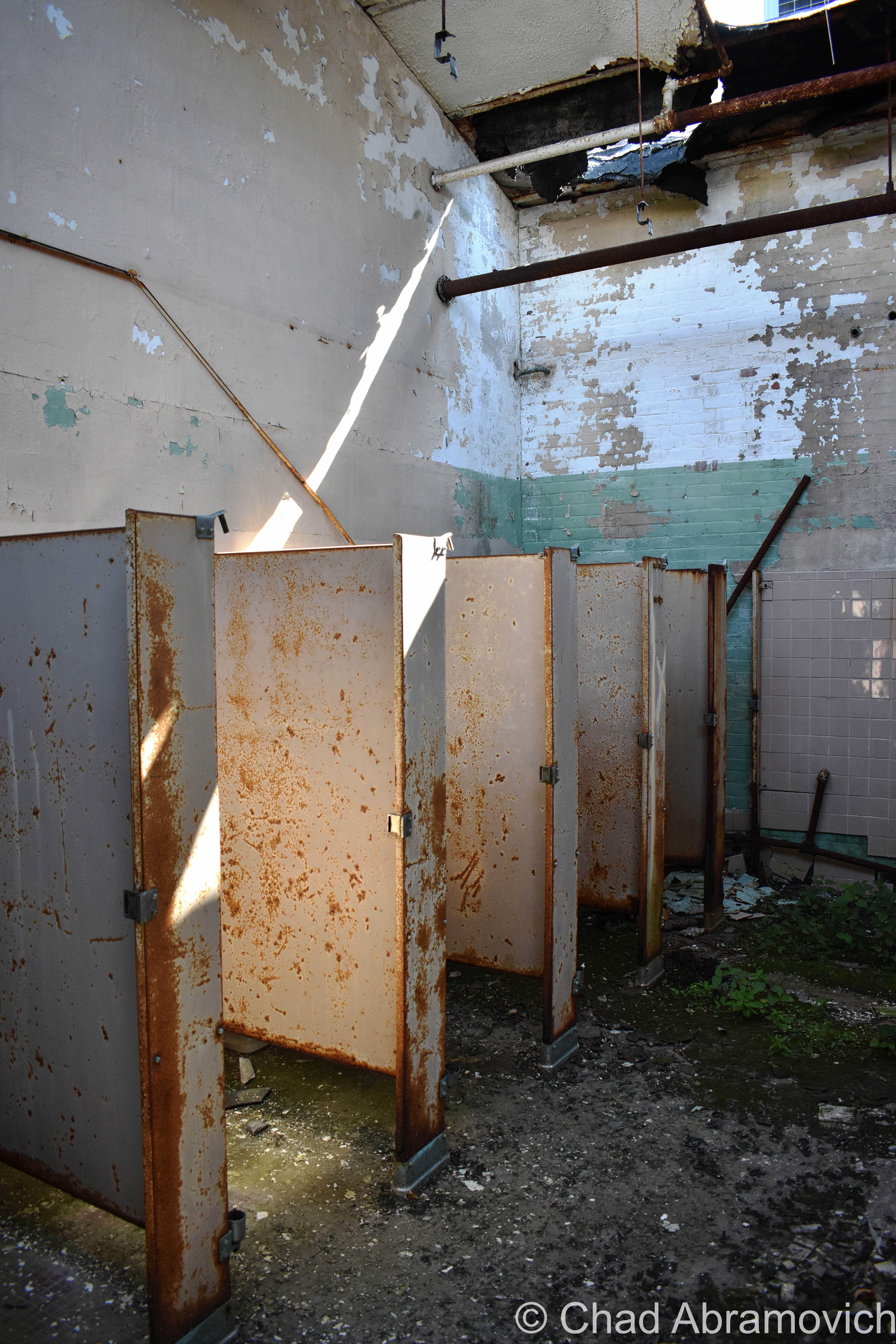
On July 27th, a search party was organized to search the area of the murder, in an attempt to find more evidence. Various items were soon discovered that belonged to her, including a ribbon from her hair and her damaged watch. The face of the watch had been smashed, it ceasing to function around 4:20. The search party assumed that was probably her time of death. Further investigation finally uncovered a rather large stone that had dried blood glazing its surface – they had found the murder weapon. But the frustrated party returned home with no evidence that could apprehend anyone.

Marietta’s funeral was also held on the 27th as the search party combed the slopes and marshlands of French Hill.

After Harris’s release from custody, a second suspect was immediately brought in, a former French Canadian student of Miss Ball’s named Revoir. It was known that he had been punished and removed from the school by her after an issue of conflict had taken place, which made him a suspicious character with a motive. But he also didn’t have enough evidence to be convicted, and was later released.

To add to escalating tensions and paranoia, rumors began to spread about an organized gang with sinister intentions who were hiding out in a swampy and inaccessible region of Fairfield known as Cedar Swamp. Some even blamed them for all of the burglaries and the assault on the local physician that happened before Marietta’s murder. Even today, the Cedar Swamp region of Fairfield is a mysteriously beautiful and remote location that remains almost as wild as it probably did then.
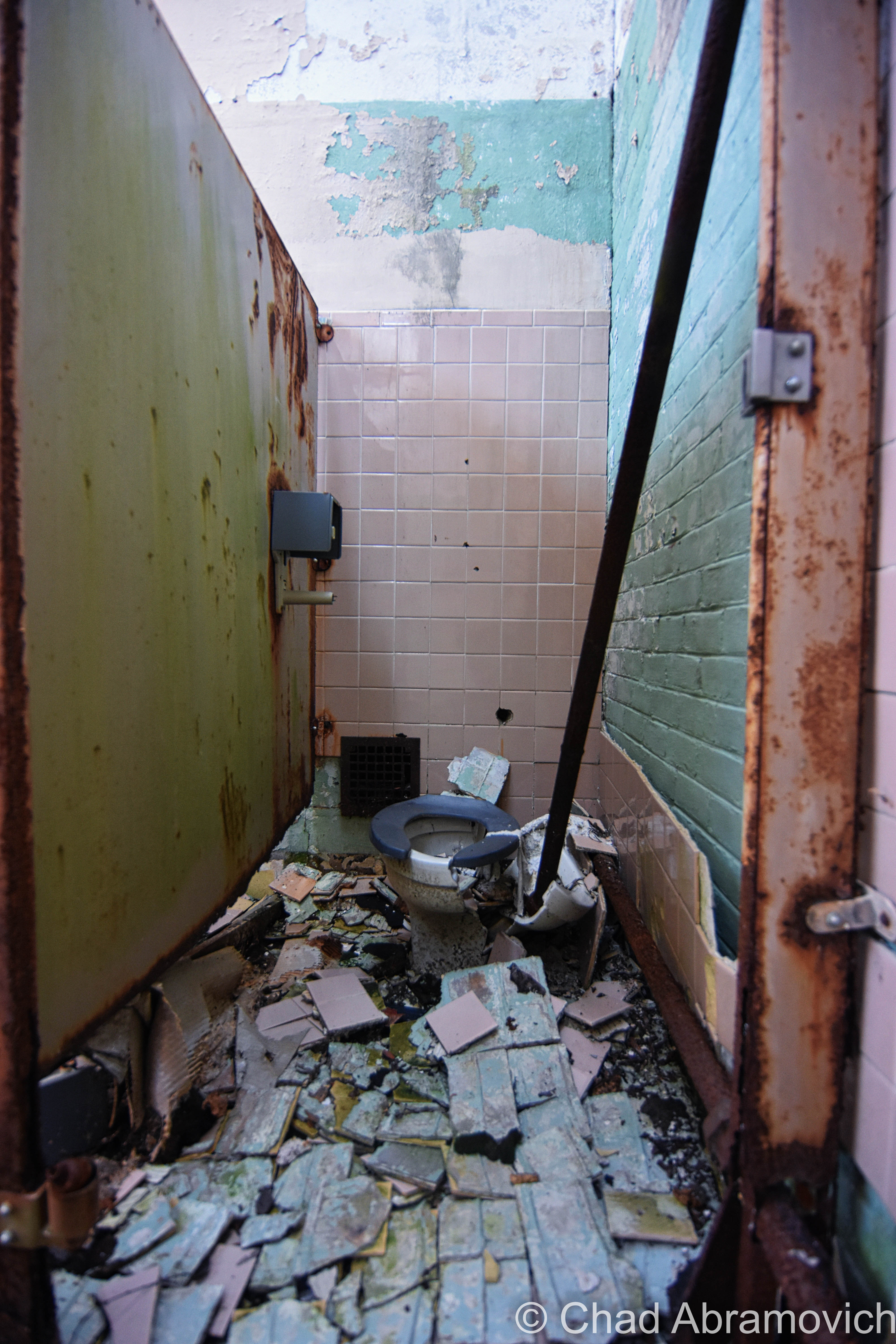
Soon, anyone who was labeled as suspicious by the ever growing tense population were detained and brought in for questioning. But because of a popular dislike at the time of “outsiders” (the lower classes, traveling beggars and minority populations), they sadly were most oftentimes the targets of suspicion and often found themselves in the wrong place at the wrong time. The local papers, desperate for updates on the story, printed anything they could regardless of factual information.

Now, rumor began to replace fact. Mrs. Page seemed to recall a strange man who was seen around the schoolhouse during the week before the murder, which helped aid the growing fear.

Another story accused an Irish engineer from The Vermont Central Railroad of being guilty, because a year ago he admitted he had feelings for Miss Ball but it was said that she rejected him. He didn’t take the rejection well and said some harsh words as a response, something about revenge or getting even. But upon further investigation, it was discovered that he was actually in his home at the time of the murder, and once again, the case was right back to where it began.
In a more bizarre case, a clairvoyant named “Sleeping Lucy” gave authorities a description of a man who she claimed to be the murderer, – the image of a man who came to her in a vision. Going by her description, they were actually able to find this gentleman, and he was arrested and interrogated. But despite admitting to knowing Miss Ball, by August 3rd, they had no grounds to hold him, and he was released.

By August 14th, St. Albans seemed to be in the clutches of obsession. The murder wasn’t fading into memory, it was a wildfire burning. There had already been several arrests and no convictions. Until now, the immigrant populations and the minority groups had been targeted, (Harris who was black, Revoir who was French and the train engineer who was Irish, etc) but that cup was full, and now the more esteemed members of St. Albans society began to be suspected.

The first to be suspected was the eldest son of ex-Governor Smith, George Gregory Smith. But it would be a full year before he would be be questioned, and that was only because of mounting public pressure for him to do so. And before his hearing, he openly challenged anyone who suspected him to show up and state their claim.
Others were accused as well. Friends turned on friends. If you were reported to even being in the vicinity of French Hill near the time of the murder, someone would mention your name to the police. Several people were brought in just for riding in their carriages down the hill into town. Someone else was supposedly suspected because she wore the same earrings as Miss Ball did.

Refusing to give way to the triumph of their enemies, more measures were taken. On June 25th, 1875, a group of citizens formed “The Union Investigation Society” to further embark down the long, dark road of the murder case. Among those who joined were Mr. Page and Mr. Collins. The group would then be divided into smaller groups who would be assigned to search certain districts of town.

Soon, another puzzling piece of information was unveiled. Georgia resident Eleazer Jewitt claimed that Marietta’s father, George Ball, had once told him that he knew that George Smith was the one who killed his daughter. But shortly after, Mr. Ball had reportedly gained a considerable amount of money and immediately left town for California. But before he left, he changed his story, and insisted that Frank Harris had killed her. So, did George Smith pay Mr. Ball for his silence?  A further investigation revealed that the money Mr. Ball had received was only $200, sent from his sons in California to pay for his trip there so he could live with them. An officer of the local bank assisted in his defense, and said that Mr. Ball had been in serious debt and did not inherit any amounts of money. To further prove this, a trip to his small farmhouse revealed all of his furniture to be cheap and purchased at various auctions. So Mr. Smith and Mr. Ball were both acquitted of their accusations.

Another curious piece of evidence came shortly after, a blood soaked handkerchief was found near the murder scene with the name “G.J. Ingram” monogrammed in it. But the police were at a loss. After an extensive search, no person with the name Ingram was found to be existing in the area.

After over a years worth of investigating and community outcry, the murder of Marietta Ball seemed to be as mysterious as when it first started. Many were accused, neighbors turned against each other and the community was easily a whole lot worse for wear. It seemed like the secrets would forever be lost to the cold ground of French Hill, the light of the moon masquerading those things that we’d never know.

But on October 14th, 1875, a shocking discovery was made. A French Canadian named Joseph LaPage was convicted of brutally murdering Josie Langmaid of Suncook, New Hampshire. And someone made a strange note that the way Josie was murdered was almost exactly the same as Marietta Ball’s murder. News traveled back to St. Albans and Mr. W.N. Abel of The St Albans Messanger recalled Joseph LaPage living in the French Hill area at the time of the murder. He contacted Justice Farnsworth of St. Albans, who immediately contacted officials in Suncook. LaPage had just became the latest suspect in the murder of Miss Ball.

Joseph LaPage

On January 13th, 1876,  Joseph LaPage was sentenced to appear in court, and was found guilty for both murders. On March 15th, he was sent to the gallows in Concord, New Hampshire. It was said that he loudly claimed his innocence from when he was first accused until just hours before he was hanged, when he choked out a sobbing confession. It seems the skeletons he was hiding finally found him.

But some questions remain. Why was Mr. Ball so determined to accuse George Smith of murder? What suspicions induced the community to suspect him to begin with? And who was G.J. Ingram? And there are some who argue that the evidence that linked Joseph LaPage to the murders wasn’t enough to convict him. So, if this is the case, did they hang the wrong person? Perhaps only the good night knows these answers as the softness of the summer attempts to sooth the community’s scars.

But this tragic tale has another ending. I was also told that Joseph LaPage was finally caught when his son, who somehow discovered his dark past, made his way to St. Albans and reported him to local authorities. But there doesn’t seem to be any record of this, making me believe this is the product of the re-shaping of a story as it travels through the years.

French Hill Today

Until recently, a friend of mine owned a beautiful piece of property on French Hill, comprised of mix woodlands and a vast beaver pond which, on summer nights, was a strikingly beautiful place to sit by under the songs of the cicadas, and she was the one who turned me onto this intriguing story and compelled me to research it.

She had no information about the murder until one day, an actual descendant of Marietta Ball stopped by her house, and asked permission to look around the property. Confused, she asked why, and the man filled her in on the story. He said he was looking for the place where Marietta’s body was found. But he also had a theory that Joseph LaPage’s house may have actually stood on the property as well, and was in hopes of finding the old foundation. Though the man couldn’t be certain, he assumed that after Marietta had been murdered, Joseph crossed a brook that ran through the property and went back to his house. But sadly, I’ll never know if he found what he was looking for.

But this was an interesting turn of events, because before that chance encounter, my friend swore her house was haunted. By what, she wasn’t certain. But both her and members of her family swore they felt uncomfortable in certain rooms of the house, and the stairway leading to the second floor. Feelings of being watched by some sort of dark entity were reported often. Now it seems a connection could be made. Was it in fact the ghost of Joseph LaPage who was haunting their house? Did he seek refuge on the wilds of French Hill in his afterlife? Or maybe, these uncomfortable feelings can be attributed to something else?

Another strange footnote to the story; Marietta Ball was buried in St Albans’ Greenwood Cemetery, and was given an elaborate headstone which was much nicer than most of the graves in the cemetery. But years of neglect and weather erosion have made the kind gesture into something sad and fading. Her grave site is also the only grave in the entire cemetery that faces East. I’ve heard a theory that it’s position was done deliberately, so it would be facing French Hill which arcs above the tree tops in the distance. Or maybe, it was a simple mistake?

So what lessons can we learn from this story? And will we remember them? I think its sad to say that the outcomes that were inspired by Marietta’s murder are very similar to what would happen even today. And when we rely on the justice system to handle such matters, can we honestly say that justice is really being served at times?  Or will these things be obscured by the solemn sounds of sirens wailing in the dark woods?

The "French School" indicates where the old school house once stood on French Hill Road, now nothing more than a foundation buried in the woods. The North-South road that runs to the left of it would have been the route that Marietta Ball had walked and met her unfortunate end on. Today, French Hill Road was extended to the East, and the road that Marietta walked became defunct. Only a short half mile portion remains of the original road, today's "Fred Lake Road".
The “French School” indicates where the old school house once stood on French Hill Road, now nothing more than a foundation buried in the woods. The North-South road that runs to the left of it would have been the route that Marietta Ball had walked and met her unfortunate end on. Today, the road that Marietta walked has long became defunct. Only a short half mile portion remains of the original road, a private road named “Fred Lake Road” The Page Farm is marked by the black dot at the southern end of the road, near the “902” elevation mark.

Links and sources: For a much more detailed look into the murder than what I have provided:

As it turns out, someone has written a good write up about the Suncook Murders

The Trial of Joseph LaPage, The French Monster, Philadelphia, 1876.

The very detailed write up “The East Hill Murders”, Ronald C. Murphy, 1983

—————————————————————————————————————————————–

To all of my amazing fans and supporters, I am truly grateful and humbled by all of the support and donations through out the years that have kept Obscure Vermont up and running.

As you all know I spend countless hours researching, writing, and traveling to produce and sustain this blog. Obscure Vermont is funded entirely on generous donations that you the wonderful viewers and supporters have made. Expenses range from internet fees to host the blog, to investing in research materials, to traveling expenses. Also, donations help keep me current with my photography gear, computer, and computer software so that I can deliver the best quality possible.

If you value, appreciate, and enjoy reading about my adventures please consider making a donation to my new Gofundme account or Paypal. Any donation would not only be greatly appreciated and help keep this blog going, it would also keep me doing what I love. Thank you!

Gofundme: https://www.gofundme.com/b5jp97d4

Donate Button with Credit Cards

Weird Chittenden

If you asked a Vermonter where the town of Chittenden was, a lot of people would probably be confused. Some would ask if you meant Chittenden County instead, and others would probably just shrug apologetically. If you do happen to know about this off beat community, chances are you know about the storied Eddy Brothers, who over a century ago vexed the world by conjuring shapeless entities and communicating with the unknown within their ramshackle farmhouse. Or perhaps you have stayed at the scenic Mountain Top Inn, a luxury Bed and Breakfast overlooking the icy waters of the Chittenden Reservoir, nestled within a remote mountain wilderness that is unbroken for miles.

But other than these two images, the town of Chittenden is little known to most, and I suppose that’s not a huge surprise. Chittenden is actually the largest town in the state, at around 74 square miles. But despite it’s vast size, the land remains divided by dense mountains, making the town largely unsettled with only a few dirt roads leading in and out.

But Chittenden is a curious place, its abundant wilderness holds and protects much of the town’s secrets and history in its own sense of time.

In the past few months, I had began to hear a lot of strange accounts and unusual tales about this small community, which sparked my curiosity. Chittenden had never struck me as one of Vermont’s weird locales, so this intrigued me, and I began my attempts at finding out more.

I began hearing vague accounts of unsettling happenings and arcane events in an area of town that locals call “New Boston”. Stories of witch hunts, secular rituals and sinister things like bodies being dumped under the shelter of the shadowy woodlands, the evidence feeding the hungry roots of the forest. For those who had visited, they explain that the feeling is off and heavy, a presence that unnerves you mentally and leaves you trying to re-familiarize yourself with your surroundings. I was told that a few paranormal groups from Rutland once claimed to capture a few EVPs of disembodied voices from a largely forgotten cemetery in the woods nearby.

To add to this growing mystery, it has been said that Chittenden is where Vermont’s only photographic evidence of an elusive cryptid was taken, something so infamous that it has long captured the minds of Vermonters and people from around the world for centuries; bigfoot.

Vermonter’s have claimed to see monsters and abnormally large animals in the woods for years, but it wasn’t until 1977 that a photograph was taken that may have offered definitive proof to the long debated mystery. Deep within the Green Mountain National Forest, a large stocky creature covered with silvery hair and had the head of a gorilla had been captured on film near a logging road. It had been standing behind the safety of some thick scrub, as if this creature had been watching the photographer. When news of it was unveiled, the picture was met with harsh speculation and curiosity. Many tried to not only debunk it, but cover up its existence while others hailed it as legitimate proof. Today, this mysterious photograph has not only largely been forgotten, but it has yet to be proved or disproved. As a matter of fact, it is theorized that the late Dr. Warren Cook from Castleton state College became interested in the photograph, only later to attempt to cover it up and dismiss its existence. Is it possible he was threatened by an activist group or some secret branch of the government? Or is it just a rumor that has found its way around successfully?

Despite all of this great information, I had reached a roadblock. My research however proved that the area’s existence seemed to be as mysterious as the stories surrounding it. I found an area of the Green Mountain National Forest by the same name, with a few hiking trails leading off into the silent woods. Apart from finding a future location for me to hike, it didn’t really answer my burning questions. So I emailed the Chittenden Historical society and waited for a reply.

Within a few days, I received an email from karen, who began to add some factual detail to this story.

Chittenden was named after Thomas Chittenden, Vermont’s first governor, and who Chittenden County to the north was named after. But despite the honorable gesture, the govenor had little to do with the town.

New Boston was the first actual settlement in Chittenden. Around 1813 economic hardships and slow settlement led to the area’s demise. Most families moved away and the town eventually became the property of mother nature again. A large area of town to the north was also settled and called “Philadelphia”, but with the harsh rocky terrain and slow settlement, the town was eventually disorganized and much of the land was granted to neighboring towns, the majority was annexed to Chittenden.

Later, the tiny village of South Chittenden would gain nationwide popularity due to a pair of sullen and simpleminded brothers; The Eddy Brothers. Spiritualism got its humble start in the small village of Hydesville, New York in 1848, when local residents Kate and Margaret Fox claimed that they had the ability to communicate with the dead in their sordid farmhouse. Bemused onlookers were treated to quite the show; The Fox sisters speaking with the unknown, and the spirits giving answers by using audible rapping sounds that everyone could hear!  Soon, their showmanship gained the attention of an ever growing leader of followers, and the nation began engrossed and captivated at the idea of talking to the dead. If spiritualism wasn’t a hoax, could this be proof that there was in-fact ghosts, and an afterlife?

By 1870, Chittenden, Vermont jumped on the spiritualism bandwagon when William and Horatio Eddy moved into the family farmhouse after their father had passed on, and treated the invited public to seances. This wasn’t a business ploy; the Eddy brothers claimed to have connections with things on the other side of the seance table from their youth, when they played with ghostly children, went into prolonged trances, allowed willing spirits to speak through their own vocals, and were eventually expelled from school for levitating desks and making books fly through the air. Their father Zepaniah, who was not only tired of the paranormal shenanigans his offspring were becoming intimate with, but he figured out that he could exploit their purported abilities, and sold them to a traveling side show. 14 years later, they returned after their fathers death and set up a show of their own in the dingy parlor of their farmhouse, and whatever things manifested themselves under the slow candles burning, attracted people from around the world. However, not everyone was convinced, and the Eddy’s were also met with lots of skepticism.

In 1874, Henry S. Olcott, a journalist from New York, visited the Eddy Brothers several times in hopes of proving them to be frauds. He eventually and maybe a bit begrudgingly wrote a book, “People From The Other World,” which was a journal of his experiences at their seances. However, he was never able to successfully debunk the Eddy Brothers, and his book remains as the best existing account of them today.

The Eddy Brothers, though an fascinating and important part of Vermont history, have already been talked about far too many times, in pain painstakingly researched detail by numerous Vermont Eddy enthusiasts, so I won’t jump into it any further when I feel that there is far better material existing that you could seek out. However, a few months ago, a friend of mine told me that he had met someone who had recently stayed in the Eddy Brother’s farmhouse. Though she had no knowledge of its history, she claimed that “weird stuff happens there”. But as luck would have it, as I was driving by, a member of the ski club who now owns the property was kind enough to introduce himself and give me a tour. How could I say no?

The Eddy Brothers Farmhouse Today, now the private High Life Ski Club

DSC_0080_pe

The old farmhouse was beautifully restored, and was a place I could easily see myself enjoying on Fall or Winter days (if I had the money) But one question was on my mind; if the room where the original seances were held still existed. The gentleman rolled his eyes and gave me a good hearted laugh. “That’s the thing, we don’t really know which room they they happened in” he said. “It honestly could have been any room in the house” He explained that he wasn’t on board the Eddy bandwagon, and had no idea of the house’s history until the club purchased it and he became a member afterwards. “Most everyone still refers to this place as the Eddy House” he stated “We’ll never live that one down”
Though the club wasn’t all that thrilled about the house’s occult reputation attached to it, they approached it humorously and kept accounts and information about The Eddy Brothers around the house.
An original picture of the Eddy Brothers Farmhouse. (I think circa 1920-1930). Notice the name “Lake View” above the porch? The Eddy Brothers Farmhouse used to be surrounded by a beautiful pond, the house sitting on a peninsula in the middle. Older photos of the farm show the barns sitting across the bays of the pond with the house in the foreground. However, In the early 1900s, the beaver dam burst, and within hours, the pond had drained. Today, the ravine where the former pond was can still be traced, now filled in with younger growth trees and countless berry bushes.
An original picture of the Eddy Brothers Farmhouse. (circa 1920-1930). Notice the name “Lake View” above the porch? The Eddy Brothers Farmhouse used to be surrounded by a beautiful pond, the house sitting on a peninsula in the middle. Older photos of the farm show the barns sitting across the bays of the pond with the house in the foreground. However, In the early 1900s, the beaver dam burst, and within hours, the pond had drained. Today, the ravine where the former pond was can still be traced, now filled in with younger growth trees and countless berry bushes.

When I asked Karen about the strange paranormal occurrences in the area, she was quick to assure me that they were all myths. Although, she did recall something strange happening there. There was a murder that took place around the New Boston area in the 1970s, in which a boot containing a foot was found. As far as I know, it was a cold case. “No body was ever found to go with the foot”. said Karen.

Today, there are grave sites, stonewalls and old foundations that are reminders of the vanished village. The name “New Boston” has been reused to designate the forest region around that area, which is scattered with hiking trials, snow mobile trails and old roads. Local youth also frequent the region for late night drives, with the purpose of getting creeped out.

Another interesting point of information was behind the strange names around town. I had been wondering why certain areas of Chittenden, and in other parts of the state were named after cities and areas in other states – Settlements with significantly larger populations that in a lot of cases, Vermont seems to shun. The answer was a comic one. Areas like Boston, Philadelphia, Michigan etc all received their names over a century ago, when these remote places were more remote then, and were considered so far out there that they might have been as far as Boston, or any other large American city at the time to most Vermonters. So in a quirky sense of Vermont humor laced with sarcasm, any remote and challenging region to travel too was often given the name “New Boston”.

The small town of Chittenden is saturated in local lore and fascinating history, weighted down by the heavy snowfalls that blanket the desolate mountain tops. But is there a reason behind all of the unusual phenomenon within the town lines ? Could the legendary Eddy Brothers have accidentally opened some sort of door into another world, allowing spirits to pass through at will? Or does the rocky soil beneath the town harbor some sort of ancient trouble? Or maybe, it’s just all coincidence.

Whether these amusing stories are real or just passed down by others who have the same interest, I suppose will never be known for sure. But perhaps the mystery is more exciting than the explanation.

Visiting New Boston

Pictured below are a few remaining foundations and gravestones of the settlement of New Boston. There probably is more, but it’s a question of where. The woods around Chittenden are vast and are good at holding their secrets. A few people reminisced with me earlier, and told me they remembered New Boston and the nice place it was. Some used to party out in the abandoned houses when they were in high school, and recall there being some remains. But if this is the case, we couldn’t find them on that brisk summer afternoon.

The forest road to New Boston, closed due to a very rainy summer and flash flooding.
The deep woods of New Boston

DSC_0096_pe DSC_0098_pe DSC_0104_pe DSC_0107_pe

 A Lost Door

This last bit of Chittenden weirdness may be the most obscure. Sometime around the 1970s, a local woman had claimed that one day while out for a walk, she found a mysterious doorway leading into a hillside, deep within the woods of Chittenden. Deciding to investigate, she gave the door a good pull, and it opened, revealing a stone spiral staircase that allegedly wound its way down far below the ground, fading into black shadow. The woman decided to make the run back home and grab a flashlight, and then come back. But she was never able to find the door again, leaving this fascinating story a lost one. Could this woman have in fact found a doorway leading deep into the Vermont mountains? What would she have found if she followed that staircase? It makes you wonder. Surely the construction of a spiral stone staircase leading to the subterranean world below Chittenden’s mountains would surely lead to something important, right?

Though this story is intriguing, others question whether it was just a yarn well spun. According to those I spoke with, her alibi just didn’t add up. She reportedly claimed she had been back a few times alone, but when she was asked to show someone else, she suddenly couldn’t recall where the door was… But in the end, I’ll suppose we’ll never know. After hiking the woods of New Boston, I recognized just how easy it could be for someone to get lost up there.

Another interesting footnote to this story; this isn’t the first time a mysterious door was found in a Vermont hillside. Years ago, another such door was supposedly found in the small town of Ryegate. However, when the family came back to investigate, the door had vanished completely.

—————————————————————————————————————————————–

To all of my amazing fans and supporters, I am truly grateful and humbled by all of the support and donations through out the years that have kept Obscure Vermont up and running.

As you all know I spend countless hours researching, writing, and traveling to produce and sustain this blog. Obscure Vermont is funded entirely on generous donations that you the wonderful viewers and supporters have made. Expenses range from internet fees to host the blog, to investing in research materials, to traveling expenses. Also, donations help keep me current with my photography gear, computer, and computer software so that I can deliver the best quality possible.

If you value, appreciate, and enjoy reading about my adventures please consider making a donation to my new Gofundme account or Paypal. Any donation would not only be greatly appreciated and help keep this blog going, it would also keep me doing what I love. Thank you!

Gofundme: https://www.gofundme.com/b5jp97d4

Donate Button with Credit Cards

Port Kent’s Mysterious Fireball

Auer Family Boathouse | Circa 1950. Photo from my family archives.

This is a peculiar tale I recall from my childhood. It was a cool summers night – late July, 1998. I was 10 years old and was spending the night at my Grandfather’s boathouse, situated on one of the most splendid locations in all of the state. Located where the Winooski River meets Lake Champlain in a sandy delta of twisted Cottonwood Trees and fragile swampland in the eye of Burlington’s aching heart, The Auer Family Boathouse is a historic relic, built during simpler times and witnessed Burlington and Colchester change around it. It played an unassuming role in notable events such as prohibition (my great grandfather made bootleg whiskey in a still there) and witnessed the transformation of the Island Line Railroad into the now landmark bike path – as bicyclists and tourists soon replaced the traditional fishermen as customers and visitors as the years and its youth passed on.

It was past 10 PM and a surreal oily blackness slipped over Lake Champlain, the waters and the night sky were indistinguishable from one another. But every now and then, the creaks and groans from the wooden docks rocking gently in the water assured any living soul that the lake was still there.

On the front lawn, my Grandfather had 2 large wooden swings which over looked the lake, and were a very pleasant place to sit and relax, swinging gently in the shadows of the night’s song. It was on one of these swings where my 10 year old self was that very night, my Grandfather sitting next to me enjoying random conversation while a gentle breeze blew through the Willows above our heads.

But our reverie was interrupted when our gaze was drawn across the lake. On the distant shores somewhere near Port Kent, the silhouettes fell apart as a giant ball of fire was suddenly propelled from the terra firma rapidly into the New York skies above. It’s light was brilliantly bright as it soured into the lonely night, now far above the ground below. We both watched and held our breath. Then, it simply disappeared. No explosion, no firework finale, nothing. It’s journey was short, it lasted less then 5 seconds at the most. I knew enough to know that it certainly wasn’t a firework. So what was it?

“Did you see that?” my Grandfather asked me, confusion in his voice. I told him I did, but had no answers. And to our surprise, it happened again! Another ball of fire shot straight up from the ground and into the atmosphere above, where it simply fizzed out. This time, I was able to get a better look at it. From where we were standing, on the Vermont side of the lake, the mysterious flying object seemed to be as big as a basketball, and was launched at incredible speeds. It’s bold brightness illuminated the shadows around it, it’s flames being shaped by the winds its fast velocity created, and then simply vanished effortlessly as if it never existed.

“Have you ever seen this before?” I asked my Grandfather. Surely someone who had spent his entire life living near the lake would have some answers, but he had never seen it before and had no idea what to say. Once again, the familiar ball of light shot up again for a third time and followed the same routine. After 7 times, the phenomena stopped entirely, disappearing into memory.

So what did we see on that cool summers night? Some sort of failed fireworks attempt? An arcane home experiment? Or maybe it was something more secretive – perhaps carried out under the orders of Plattsburgh’s military personal? But the base in Plattsburgh had been decommissioned for years by then.

To this day, neither of us have any answers. We asked some of my Grandfather’s neighbors, as well as some friends of mine who live near the lake, and some friends who lived on the New York side of the lake, and not only did they not have any answers, but no one else reported seeing it. The American Meteor Society  had no reports or mentions either. It was like that mysterious ball of fire never even existed – and I have never seen it since.

—————————————————————————————————————————————–

To all of my amazing fans and supporters, I am truly grateful and humbled by all of the support and donations through out the years that have kept Obscure Vermont up and running.

As you all know I spend countless hours researching, writing, and traveling to produce and sustain this blog. Obscure Vermont is funded entirely on generous donations that you the wonderful viewers and supporters have made. Expenses range from internet fees to host the blog, to investing in research materials, to traveling expenses. Also, donations help keep me current with my photography gear, computer, and computer software so that I can deliver the best quality possible.

If you value, appreciate, and enjoy reading about my adventures please consider making a donation to my new Gofundme account or Paypal. Any donation would not only be greatly appreciated and help keep this blog going, it would also keep me doing what I love. Thank you!

Gofundme: https://www.gofundme.com/b5jp97d4

Donate Button with Credit Cards

Emily’s Bridge?

Perhaps no other haunted location in Vermont is as fabled as Emily’s Bridge, and it’s arguable that because it’s a covered bridge, this storied construction turned celebrity is distinctively a Vermont monstrosity.  Look in any book of ghost stories and local lore written in the New England area, and Emily’s Bridge is almost sure to be included.

Growing up, I heard the legends of Emily’s Bridge, as most kids did. And as a curious teenager, I made a midnight expedition to the bridge as many other teenagers did, all hoping to catch a glimpse of Emily’s ghost and perhaps, witness her sorrow and fury firsthand. But the only monstrous thing we saw were other disrespectful teenagers in large numbers, partying and drinking at the bridge. My Emily’s Bridge interest died almost as soon as it started.

To put things in perspective here, let’s start off with the legend that started it all. Emily’s Bridge actually has an official name; The Gold Brook Bridge, but most Vermonters forgo that for it’s more popular nickname.

At first glance, this rustic and unremarkable covered bridge looks like the myriad of other similar bridges found in Vermont and New England, it certainly doesn’t look “haunted”. Built in 1844, this simplistic, one lane 50-foot span is the oldest covered bridge in the country. It’s builder, John N. Smith of nearby Moscow, an obscure hamlet within the town of Stowe, bragged that it would last forever. Perhaps he was right. But this bridge is infamous for its resident ghost rather than its historical and structural accomplishments.

So who is Emily, and why does she haunt the bridge? That seems to remain a mystery because no one is quite sure of her identity. The most commonly told story is that Emily was a young Stowe woman in the 1800s who fell in love with a man who for reasons unknown, her family disproved of. Her family forbid her to marry. In retaliation, the two love struck teenagers decided to elope on The Gold Brook Bridge at midnight.

Emily made it to the bridge and waited. The appointed hour came and went, and the man never showed up. She was devastated. She couldn’t go back home, everyone would find out what happened, and she would be humiliated as well as heartbroken. Seeing no other way out, she hanged herself from a rafter on the bridge. Now in spirit form, her bridge haunting occurrence apparently decides to bring terror and tomfoolery to certain folks who pass through the bridge. She’s still waiting for her long-departed lover, getting angrier and more despaired by the year.

Emily’s Bridge seems to be a sore subject for many Stowe residents, and quite honestly, I couldn’t think of many towns that a haunted covered bridge could be more out of place in.

Stowe is a small town that was rolled over by wealthy out of staters (known by Vermonters as “flatlanders”), because of it’s reputable ski resort on the lofty slopes of Mount Mansfield – Vermont’s tallest elevation.

The road that leads up to the resort is state route 108, which is lined with pricey alpine themed hotels and tourist attractions, before wedging through Smugglers’ Notch, a rocky mountain pass with a 200 year old history of titular smugglers, and more recently, tractor trailers and tour buses getting stuck up on the narrow switchbacked road despite the tons of signs telling larger vehicles not to drive there.

While Stowe likes the attention gained with the tourism industry, Emily’s Bridge draws the sort of attention many residents could do without. But, the two are hopelessly tangled up in one another.

That being said, I had already decided not to include the story of Emily’s Bridge in this blog. I didn’t want to write about the same Vermont stories that I found were in almost every book on weird things Vermont. I wanted to be different. But that was until I found myself having coffee with author, folklorist and friend Joseph Citro.

As par usual, our conversation turned to the bizarre very quickly. As the waitress came over and topped off our coffee, the steam instantly fogging my glasses, Joe looked at me with musing eyes. “Chad, you know the story of Emily’s Bridge, right?” He sort of laughed at his own question after he had asked it. Of course I had.

“Yeah Joe, hasn’t everyone?” I returned, snickering myself. “Ok, but do you know the real story behind Emily’s Bridge?” I took a sip of my coffee and looked at him, my attention grabbed.

This is where the story got good, in my own opinion. As it turns out, not only was Vermont’s most infamous ghost story a well-spun yarn, but he happened to know the woman who created the story. When all was said and done, I found the real story of Emily’s Bridge far better than the conventional one.

The story of Emily’s Bridge doesn’t go back to the 1800s, but rather much more recently, in the 1970s. A woman by the name of Nancy Wolfe Stead claimed that she was the one who created the story of Emily to scare local youth. There was a swimming hole somewhere near Stowe and Morrisville. She remembers making up the story of the bridge to amuse the kids. At the time, there was a huge surge in the occult and the paranormal in the flypaper that is popular culture, especially with films like The Exorcist that had recently debuted. She was also the one who came up with the name Emily.

Curiously enough, a little digging uncovered that no information about any Emily has been found prior to 1970. What Nancy probably didn’t expect however, was her story to grow in popularity. It soon spread far beyond the limits of Stowe. It is quite possible that the story of Emily’s Bridge became fixed in paranormal concrete when a woman named Valerie Welch started “Stowe Tours” and the bridge, and Emily, became part of the presentation.

I reached out to the Stowe Historical Society for answers, to see if they could offer anymore incite into Emily’s Bridge and the story behind it. A few days later, I received a friendly reply from a woman named Barbara Barawand. Now, the pieces of this complicated urban myth were slowly coming together.

Interestingly enough, there are no records of anyone named Emily dying on the Gold Brook Bridge. But, a tragedy did take place there. It happened around 1920 when a little girl fell off the bridge and died when her skull was dashed off the boulders below. There are reports from people who have had tea with an elderly woman who lives near the bridge, and she remembers when the accident on the Gold Brook Bridge happened. She was about 10 at the time.

To make things more interesting, the Gold Brook Bridge may not even be the “real” Emily’s Bridge. There used to be another covered bridge just down the road near the Nichols Farm near Route 100, until it burned down in 1932 and was replaced by the current concrete span still in use today. There were brief records of a death happening on the old covered bridge, but the details were lost with time. Could this have been the real Emily’s Bridge? Barbara suggests that if there is a ghost, it is a possibility that after the bridge burned down, the ghost sought refuge upstream in the Gold Brook Bridge, which is now Stowe’s last remaining covered bridge. Or maybe, the legend was simply transplanted to the other bridge.

It seems the story is just that, and the legendary bridge which has burned itself into memory of many isn’t the location it is most identified with. But there is more to this story. Reports claiming Emily’s Bridge was haunted didn’t manifest themselves into local folklore until around 1948, many years after the aforementioned suicide of Emily. The bridge became known as “the haunted bridge” but the story of Emily didn’t exist. So if the bridge had a reputation then, perhaps visitors were getting frightened by something entirely different? If so, what was it?

In addition to my growing research, I found that there are also various accounts of why Emily’s ghost haunts the bridge. In no particular order:

(1.) She hanged herself after her boyfriend failed to show up for a midnight rendezvous

(2.) On the day of her marriage she was trampled to death by runaway horses

(3.) She was on her way to her wedding,  her horse bolted, threw her out of the wagon (or off its back) and she fell to her death on the rocks below the bridge

(4.) Emily was fat, unattractive, middle aged and pregnant. Her boyfriend jumped off the bridge and died. Later Emily had twins who soon died. Brokenhearted Emily threw herself off the bridge and died.

(5.) Her boyfriend fell in love with another girl, and never showed up at the bridge, humiliating her.

(6.) After Emily began dating her lover, she became pregnant. Excited to break the news, she told him to meet her at the bridge. But he didn’t take it the way she expected, and was furious. Emily was humiliated and broken hearted, and venomously told him that if he left her, than she would tell everyone in town. At her threat, he acted hastily, and murdered her on the bridge to silence her forever. Some stories say he left town, and other stories say his guilty conscience got the better of him and he committed suicide.

But if this is the case, there would have had to be an eye witness who saw these events unfold on the bridge, or how would these details be known? As far as I know, there were no witnesses and no reports were ever made of a murder on the bridge.

And perhaps there are even more stories then that. I’m sure there are, but no one can find any real history to back any of this up, so the tales will continue to morph.

And if this wasn’t enough to ponder, I also want to bring another question into the light. If Emily did in fact commit suicide on the bridge, how would she have done so? The rafters of the bridge are a good height from the wooden planked floor. She would have had to make somewhat of an effort to climb onto one. And if she did, wouldn’t that have meant that she brought rope with her to do the job? To my knowledge, there aren’t all that many discarded coils of rope found near the covered bridge…

So, with all of this new information, how can all of the claims of paranormal activity that supposedly happen on the bridge be justified? Remember, the legend of Emily was proven to be nothing more than a hoax.

Knowing that information really makes me curious however. What could possibly account  for all of people who have all claimed to have run-ins with Emily on the bridge? All of these encounters that have been reported are various, and range from benign to terrifying.

The most common occurrence are photos taken by tourists that fail to come out, or perhaps the photographer will notice that the pictures include puzzling, blurry blemishes that weren’t present when the photo was taken. Some even have photos that are said to include the ghostly image of a girl standing in front of the bridge who was not there at the time of the photo. Others have seen inexplicable things like flashing white lights with no traceable source. Others hear a disembodied voice coming from nowhere, uttering words that can’t be understood. But in the rare occasion the voice can be understood, it has been said it sounds like a woman crying for help.

Some occurrences are more aggressive, perhaps even malevolent. Hats are whisked away on windless days. Temperatures in the bridge are known to be inexplicably warmer or colder then the temperature outside. One famous tale includes one man witnessing his windshield fog up on its own, and hand prints appearing on the windshield, but no one was around to make the prints. Encounters get far more violent. In the old days, horses crossing the bridge would unaccountably bolt in fear as phantom bloody gashes would appear on their bodies that were possibly left by ghostly nails. When horse traffic was replaced with the automobile, their paint jobs would be ruined by the same invisible claws. Even people have reported being scratched!

One group of teenagers even go as far as claiming they saw Emily. As they parked their car in the bridge, they said the form of a woman appeared in front of their car and began to approach them. Terrified, they scrambled to lock their doors. She stood outside jiggling the door handles for a few minutes, trying to get in. With no luck, her form eventually dissipated into the night air.

Other weird things have said to happen in and around the bridge. Gold Brook, a beautiful rocky brook that runs underneath the bridge may have some sort of bizarre property attatched to it as well. Some claim that on certain days, phantom music, which is said to resemble windchims or the soft strumming of a harp is said to come from underneath the bridge, but when curious listeners go to investigate, they can’t find the source of the music.

What’s going on here, and what can we make of all this? Could it really be Emily? Or perhaps another ghost who died on the bridge along time ago? Perhaps author Joseph Citro guessed best, when he lumped Emily’s Bridge into one of Vermont’s few “window areas”, or, geographical areas with strange supernatural properties, where unexplainable  occurrences are said to manifest, and maybe even portals to other worlds are said to reside. Or maybe it’s just the product of over active imaginations inspired by curiosity and an infamous urban legend?

There is no concrete answer, and no way to know just for sure. The story of Emily’s Bridge and the countless other historical facts, variations and paranormal claims from many people are so large in numbers and so conflicting, that it is almost impossible to pick at the pieces. So in the end, it’s up for you to decide.

One thing is for certain, however; Emily has become immortal, whether she actually existed or not.

Gold Brook, which runs below Emily’s Bridge. Gold Brook got its name after Abial Slayton found gold here after he got back from prospecting in California in 1849. He only got around $200 in gold, though, and gave up shortly after, but that didn’t stop people then, and even today, from still trying their luck at panning for gold in the brook.

** I’d like to sincerely thank Barbara Barawand from the Stowe Historical Society and Joeseph Citro for inspiring me to write this entry, and for providing me with this fascinating information.

Links:

If you’re curious, Emily’s Bridge actually has an official website. Or, as official as it gets anyways.

The official website of Emily’s Bridge

—————————————————————————————————————————————–

To all of my amazing fans and supporters, I am truly grateful and humbled by all of the support and donations through out the years that have kept Obscure Vermont up and running.

As you all know I spend countless hours researching, writing, and traveling to produce and sustain this blog. Obscure Vermont is funded entirely on generous donations that you the wonderful viewers and supporters have made. Expenses range from internet fees to host the blog, to investing in research materials, to traveling expenses. Also, donations help keep me current with my photography gear, computer, and computer software so that I can deliver the best quality possible.

If you value, appreciate, and enjoy reading about my adventures please consider making a donation to my new Gofundme account or Paypal. Any donation would not only be greatly appreciated and help keep this blog going, it would also keep me doing what I love. Thank you!

Gofundme: https://www.gofundme.com/b5jp97d4

Donate Button with Credit Cards

Yankee Shangri-La

It was nearing the end of October, the fires of fall had long faded, and winter was on its way. The winds were bitter now, and brought a fierce chill in the icy blasts that blew the remaining leaves from the trees. I ran into a friend of mine, and he seemed excited. He explained he had found an abandoned house earlier that morning en route to work, and wanted to go back and check it out. I decided to join, setting out into the wild backroads of the Northeast Kingdom.

By now, we had been traveling on remote dirt roads for a while, and we were at the point where most roads we passed didn’t have any street signs labeling them. We were in the middle of nowhere, without cellphone service. The hill began to get steeper, and the road turned into something that was probably more of a four wheeler trail. I could tell it hadn’t been maintained in a while, evident scars of previous road wash outs showed gravel deposits that had been pushed deep into the forests on the side. As his SUV bumped and jarred around, I kept my eyes open for anything matching his description of the house in question, while questioning if taking this road was such a good idea or not. Then, on the right side of the road,  I saw something.

As soon as I turned to my friend, he put the car in park. “This is it” he said, confirming my question. I stared out the window at this strange structure, and words escaped me. I had no idea what to make of it, I wasn’t even sure it was abandoned. Ok, it was pretty ramshackle, and it looked like it was on the verge of collapse. It didn’t look like it had electricity, and the “yard” was littered with old rusted cars from decades ago. But something didn’t feel right. There were several bright “No Trespassing” signs nailed to the trees in the front, as well as a few posted on the structure itself. That’s not so abnormal I thought to myself. That was until I saw a dog come towards the car. “Joe, there’s a dog outside…this place can’t be abandoned. Someone has to own that dog” I stated. But he had already opened his door and was climbing out of the car. “Let’s check it out” was his reply. Shrugging my shoulders, I followed him. The dog was a little bizarre, but my curiosity was stronger. Then to my surprise, two more dogs appeared behind the one that had made its way over to us. I know knew for a fact that this place was anything but abandoned.

A little unnerved now, I took my camera out from its bag, and got ready to take a picture of the place. If we drove this far, I might as well get one picture I thought to myself. I looked through the view finder, and as I lined up my shot, I noticed something else in my picture besides the building I wanted to capture. There was a woman staring at me, a questionable look on her face. Now things were going to get interesting I thought to myself.

I lowered my camera as a sign of respect, and she walked towards us, the dogs barking wildly. But to my surprise, they were friendly, as they kept nudging my hands and wagging their tails. “Can I help you?” asked the woman, who was now standing in front of me. I fought to choose my words carefully.

“Hello miss…I’m sorry, I didn’t realize….” she cut me off. “You didn’t realize anyone lived here.” she deadpanned, still looking at me quizzically. I had a hard time reading her, I couldn’t tell if she was angry or just as curious by our presence as we were with hers. “No, I’m really sorry. See, I was told this place was abandoned… I’m what’s called an urban explorer, I take pictures of abandoned places” She didn’t speak for a few moments, but the awkward silence was broken when she started to laugh. “Haha, well I have to say. I’ve been approached by many people before about my house, but I can honestly say you’d be the first ‘urban explorer’ I’ve ever met. Is that really a thing?” I laughed at that. “Yes ma’am, people actually take pictures of abandoned places for fun” I said that with a sense of pride in my voice. “And you’d be one of them” she retorted, a smile now on her face. “I’m really sorry, I didn’t mean any disrespect, honestly.” She waved her hand, dismissing my apology. “No need to apologize, I now know you weren’t here to cause trouble. Most people who do stop by tend to be more of a hell raiser then you”

“Do you get bothered often?” I asked, a hint of concern and innocent curiosity in my voice. “Plenty” she wasted no time in answering. “I have punk teenagers and driving up and down this road at all hours of the day, yelling vulgar things and throwing rocks at my house. I’ve even had people stop and try to explore the place. They’ve walked right into my living room before! I’ve had to chase them out!” That must be an amusingly awkward scenario for both parties. One one side, you are surprised to find out you are in someone’s living room, and on the other side, you are surprised to find a trespasser in your living room.

“Oh man, that’s terrible” I said. But honestly,what do you say to something like that? This whole situation was pretty unique, if not completely bizarre. But the woman was very friendly, she seemed she was almost grateful for our company. “I bet you’re wondering what this place is” she said, a grin appearing on her face. I looked at her, not really knowing what to say. Yea, I was very curious, but how do I phrase my answer without insulting what seemed to be this woman’s home. “Yes, the thought did cross my mind” I said laughing, trying to appear friendly as possible. She laughed too. “Well, you happen to be looking at my house!” She gestured her arm at her personalized property. I could tell she was proud of it. “Here, do you have a few moments?” she asked. “You drove all the way here, I might as well give you the grand tour if you’d like?”

I couldn’t believe this. One minute we were slated as suspicious characters, the next we were being invited into this woman’s home. I was incredibly humbled. “I would love a tour, but would I be imposing?” She assured me I wouldn’t be, and motioned for me to follow her. “Are you going to take pictures?” she asked me, as she eyed my camera. “I’d like too, but would you prefer me not too? I want to be respectful of you and your property”. She smiled at this. “No! Of course you can take pictures!” She then quickly looked at her house, her facial expression changing. “Oh wait! not yet! let me clean up a little first, I wasn’t expecting company” Her statement was sincere I could tell, but I couldn’t help laugh a little at the irony of her comment.

She led me and my friend up the very steep and slick bank to her “front door”. The slight incline was a lot steeper and more slippery then it looked from the road, I found myself gripping the nearby trees as I climbed. It took her no time at all to reach the door, she was used to the walk. “Be careful!” she said, her voice full of concern. I found my way up to her front porch area, a crude landing built with a collection of pallets and planks of wood. A rather large reclining chair sat in the corner that looked pretty comfortable, until I remembered that the chair was outside all year long. I put my hand on the side, and it sunk into the wet material. I had forgotten it had just rained. She was already inside now, picking up various items and putting them in chosen places. “I’m almost ready! Please, come in” she yelled. I did. The inside of the house looked no more different then the outside of the house. Except it was more inclosed and there was more furniture. I noticed her walls were lined floor to ceiling with bookcases, all filled with old books. “See my books?” she said with pride. “You probably guessed, I love to read” She was also an artist. She knit rugs and liked to oil paint, a few of her paintings sat in a corner nearby. She was a fascinating woman.

“So, tell me, you’re into taking pictures of abandoned houses?” she brought that up again. I laughed at this, as I have gotten the same reaction from so many others. “That’s a really interesting hobby. But then again, you’re a very interesting gentleman” she said with a smile on her face. I knew she had just complimented me. “I’m Chad by the way”, and held out my hand to introduce myself. The least I could do was tell her my name, she was friendly enough to invite me into her home. To protect her identity, I’ll disclose her name.

“So, let me tell you about my house” she said as we continued to walk around the inside. I kept watching my step, it was pretty cluttered inside and the ramshackle construction left me in a cautious mindset. Her story was incredible.

She fell in love with a man from Connecticut and had two children with him.He earned a very decent salary working at IBM and eventually, he retired because he had earned enough to live comfortably for the rest of his days. They had purchased property in the wilds of Vermont’s Northeast Kingdom, and it was here where they planned to build their dream house. They made the journey up in her beat up old Chevy van, where it broke down right on their arrival at their property. It hadn’t been moved from it’s resting place since. They ran into immediate obstacles such as zoning laws and permits for building a house, and running electricity and water to their remote mountain property. The land was ledge, so a lot of it would have to be professionally blasted to make way for any foundation.

Their arrival in the Green Mountain State wasn’t as welcoming as she had hoped, but she remained optimistic and kept her vision of her grand home and soon to be happy life in mind. But sadly, it wasn’t to be. Her lover (for reasons not exactly known) fell for another woman. She became teary eyed at this point of the story. “He just began to hate me…” she said. The tension in their relationship became unbearable, and he spontaneously up and left her to be with his new lover. As for the kids, with a little bribery and vulgar comments towards her, he convinced them to go with him. As her life crumbled in front of her, she now found herself stuck with a piece of rugged property, miles from civilization with no money, no house and no family. She couldn’t go anywhere, she had no one to turn too, she was alone.

But instead of giving up, she stayed strong, and harvesting her Yankee Ingenuity, she began to build her dream house. The materials came from sources of all kinds. Garage sales, scrap heaps, junk yards, things she found on the roadside, donations, anything she could find. Soon, her ramshackle castle began to take shape as she single handedly built the foundation, floors and ceilings of her home. “See these beams?” she said, as she pointed over head to some incredibly thick wooden beams that held the ceiling up. “I put those there, by hand, by myself” I couldn’t believe it. They looked like they would be far too heavy for anyone to lift alone, yet alone get them at that height, up that steep bank. “Ropes and pulleys” she said, sensing my confusion. “All hand made, right here on the property”. To say I was impressed was the greatest understatement of the moment. I was baffled. The house started out with one room, and over the years as she got more building material, more were added. She then expanded, and created a loft upstairs. She is an experienced builder and carpenter as it turns out, so she knew what she was doing. “It may not look it, but this place is actually incredibly sturdy. The strongest winds won’t knock this place over, and trust me, I’ve been hit by some bad storms before” she said. I was still in awe. “What do you do when it rains?” I ask, noticing the holes in the roof and walls. The rain doesn’t bother her. “if it rains, it rains” she says. “Most of my valuables are protected, and if a little gets in the house, it’s not the end of the world”. In her situation, simplicity and modesty were everything. You can’t get too attached to things. As for her children, she fought for custody – the one time she went to the state for legal aid. And was declined flatly. “It’s unfair” she said. “They take one look at my house, and judge me, tell me I’m unfit to be a mother”. Her eyes were filled with sadness again. “My kids don’t even come and visit. I don’t have a TV or an XBox, they want nothing to do with me” I remained silent.

“Want to know my favorite part of the house?” she asked me, her eyes now twinkling. “Sure, I’d love too” I said, smiling at her. She brought me over to a corner of the house with a large window. “See this? I come here on clear nights after the leaves have fallen from the trees and just look up at the stars. The skies are so clear here, you can see for miles with no light pollution. It’s my favorite place in the world”. I could only imagine just how wonderful that must have been. “What do you do in the winter?” I asked her. “Surely it gets cold around here”. She pointed to a beat up old camper parked behind the house that I didn’t see before. “I sleep in there. There is no heat in the house, so I have no choice”. That made perfect sense.

As for food and other necessities, she walks 7 miles into town where the nearest grocery store is, every week, rain or shine. She doesn’t drive, and doesn’t mind the walk. She actually enjoys the walks. “Everyone thinks I’m crazy in town. They all spread rumors about me. But they are so quick to judge what they don’t know” I understood what she meant on a personal level. Because of a learning disability I have, I’ve grew up feeling like a social outcast. Though we may be facing different scenarios, the pain is relatable.

“Do you ever think about selling this place?” I asked. “I’ve been approached a few times by various people, but I always refuse offers. This is my home now, I created this and I’m not going anywhere”

At this point, several hours had passed, and the daylight was disappearing behind the silhouette of Stannard Mountain in the distance. I knew I had to leave soon. But that was a melancholic feeling. In the short time I had gotten to know this woman, I had grown to really like her. Apart from her troubled past and fierce perseverance, she was kind and intelligent. She walked us out to the car, her dogs following her. “I can’t thank you enough” I started. “For everything” She could tell I was being sincere. “I should be thanking you, it was a pleasure to meet you. I hope you got all the pictures you wanted” I nodded my head and told her I did. I shook her hand again, and prepared to leave back to college, the image of a warm shower in my mind. “Hey!” she called out. I turned around. “If you are ever in the area again, feel free to stop by. I can make us some tea” I assured her I would. One day, I honestly hope to take her up on that offer.

Untitled_Panorama1

DSCN1651 DSCN1648 DSCN1640 DSCN1641

—————————————————————————————————————————————–

To all of my amazing fans and supporters, I am truly grateful and humbled by all of the support and donations through out the years that have kept Obscure Vermont up and running.

As you all know I spend countless hours researching, writing, and traveling to produce and sustain this blog. Obscure Vermont is funded entirely on generous donations that you the wonderful viewers and supporters have made. Expenses range from internet fees to host the blog, to investing in research materials, to traveling expenses. Also, donations help keep me current with my photography gear, computer, and computer software so that I can deliver the best quality possible.

If you value, appreciate, and enjoy reading about my adventures please consider making a donation to my new Gofundme account or Paypal. Any donation would not only be greatly appreciated and help keep this blog going, it would also keep me doing what I love. Thank you!

Gofundme: https://www.gofundme.com/b5jp97d4

Donate Button with Credit Cards