A Day At The Races: The Old Green Mountain Racetrack (and Pownal Peculiarities)

I remember first passing this ugly hulking blight as a young kid on a trip to Connecticut, and never forgot it. It took me until the past few years to really investigate it, though, because I assumed it was just going to be a boring empty building enclosing rows of old stadium seats. But damn, I really under-estimated the interest factor here.

This place is so incongruous and inconspicuous in contemporary Vermont, that many people are pretty surprised to find it actually ever existed at all. And though it was never a huge success, it was a standout place for this compartment of American culture and ran for most of the latter half of the 20th century.

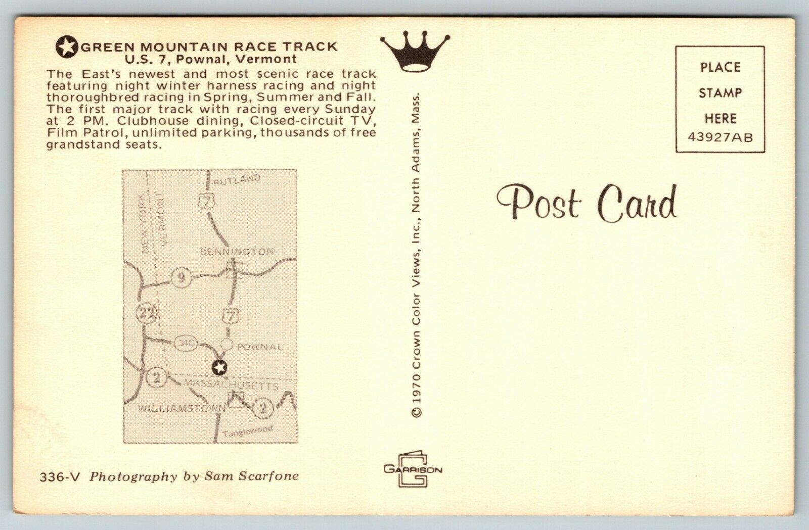
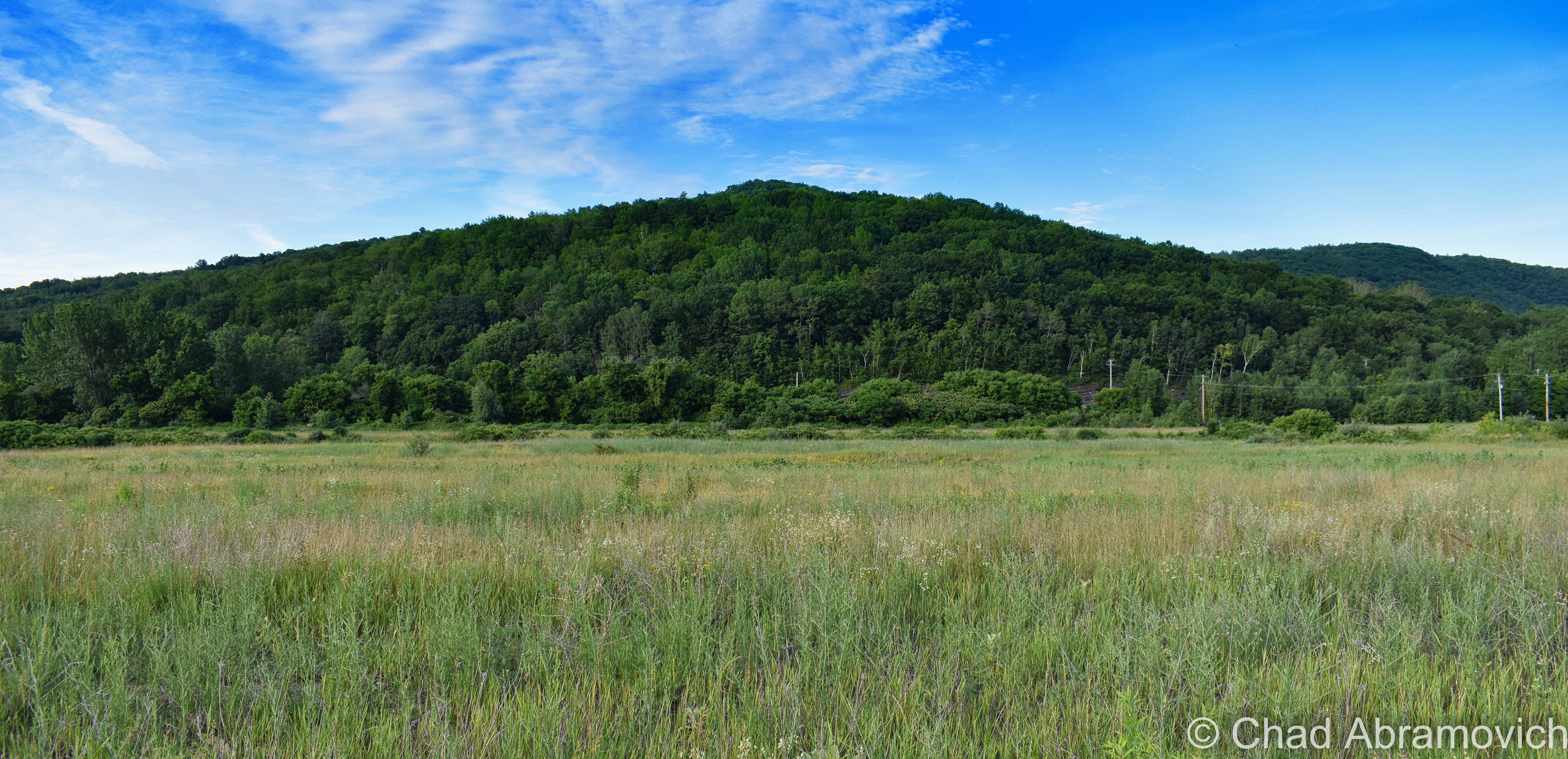
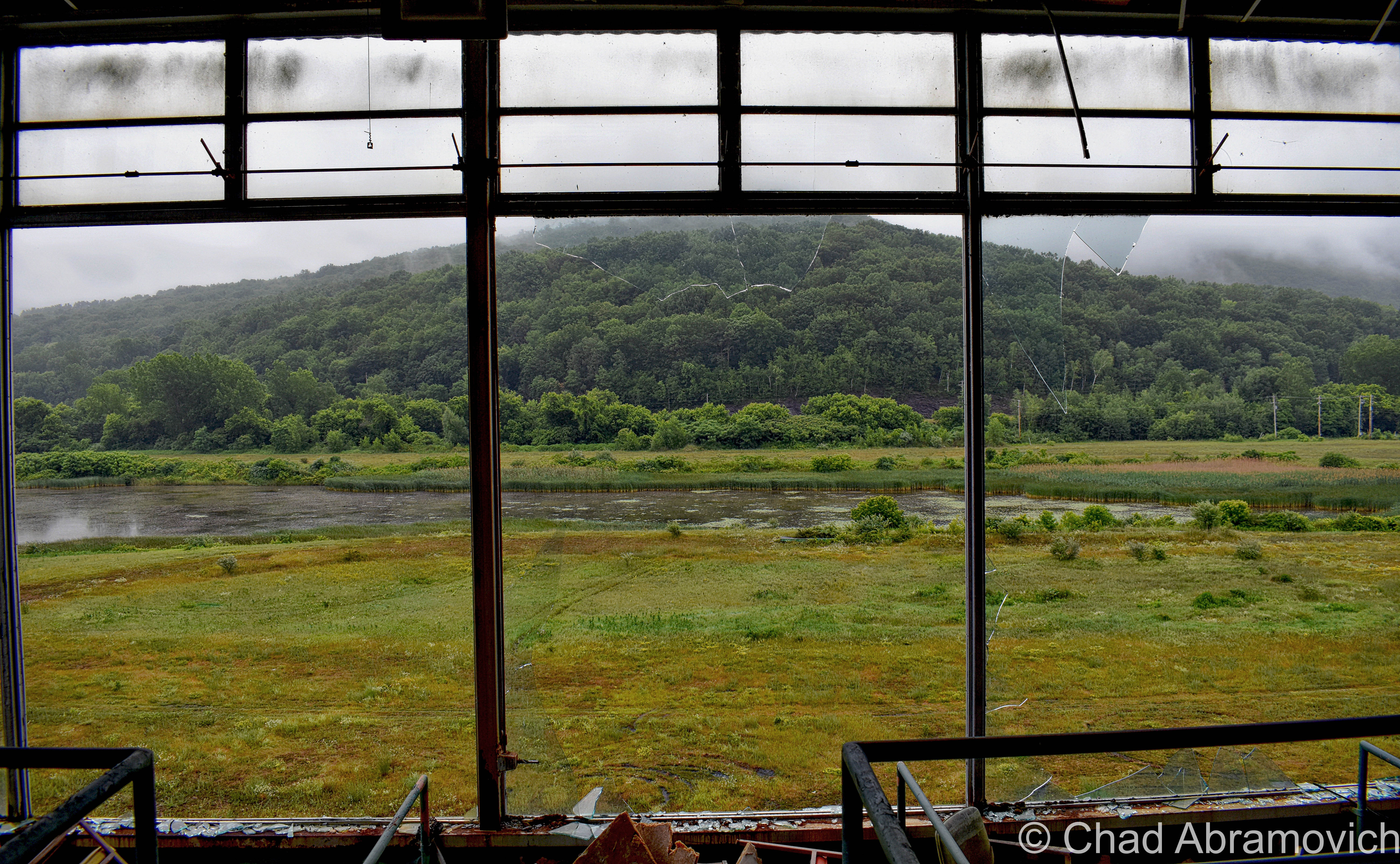
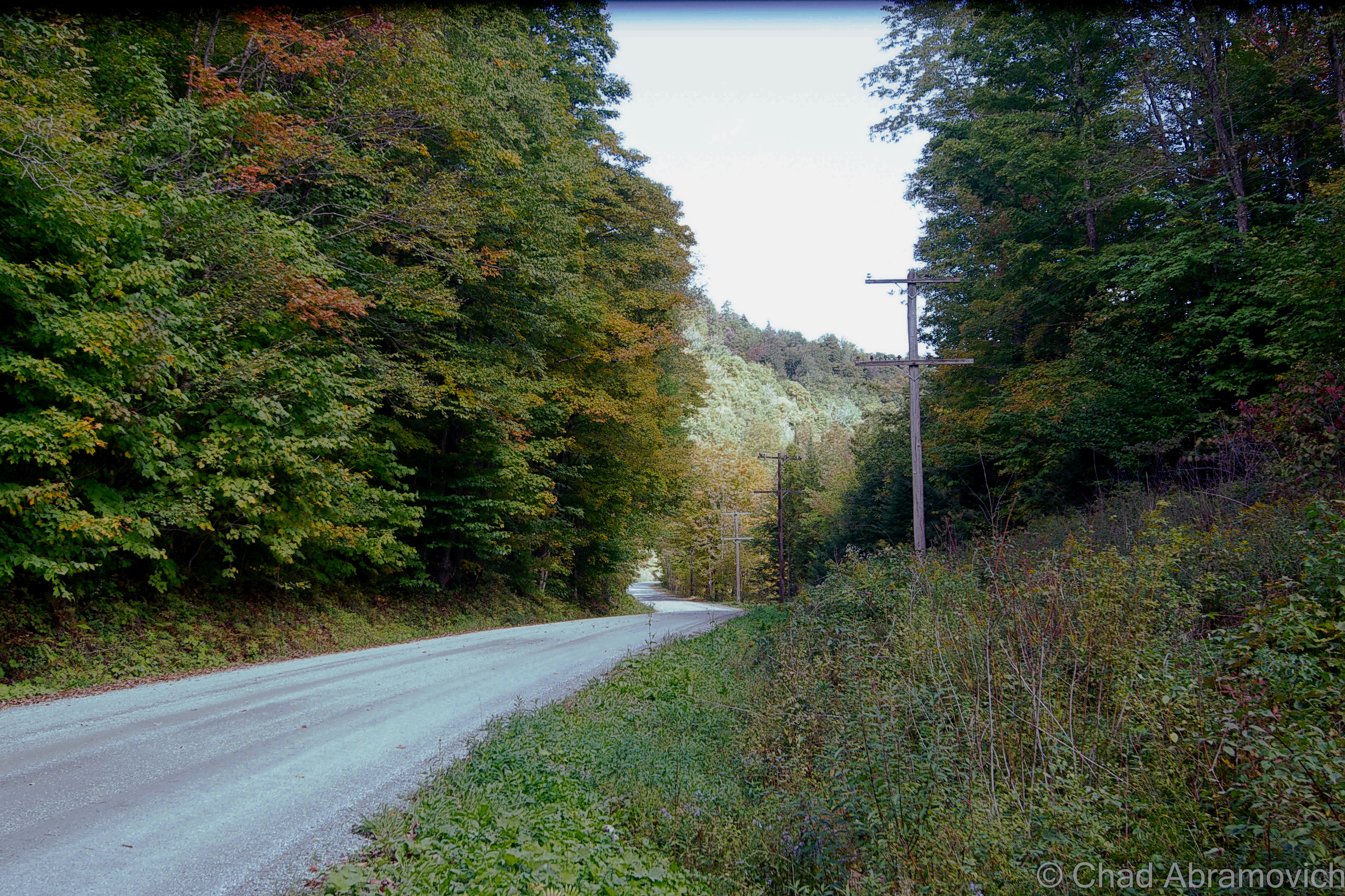
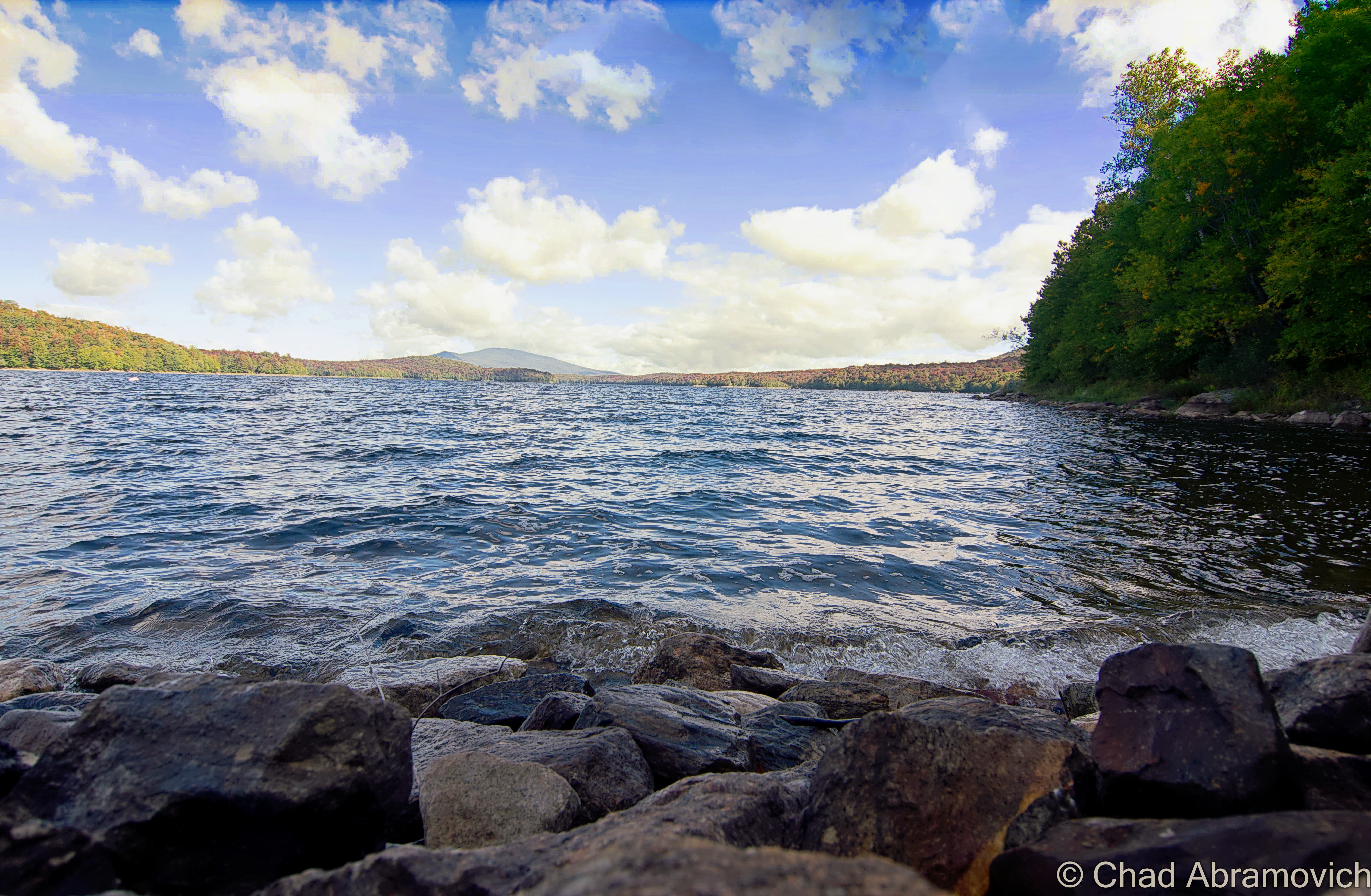
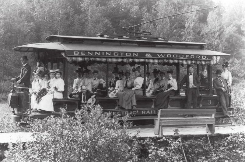
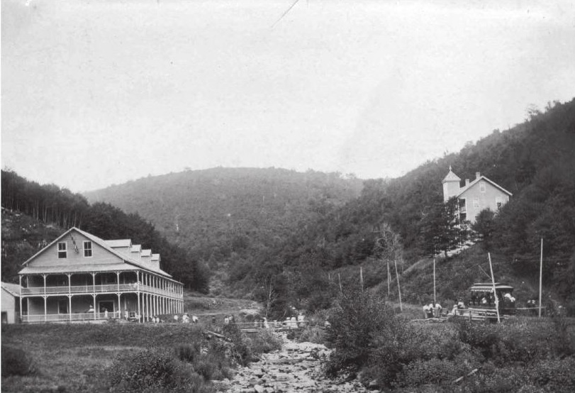
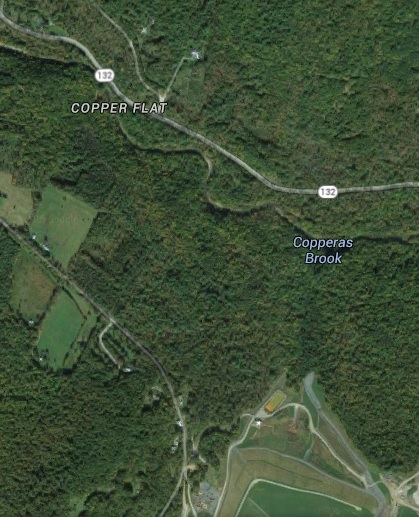
In the spring of 1965, a horse racing track started up in the hardscrabble town of Pownal – where three fascinating mountain ranges, the Green Mountains, Taconics, and Berkshire Hills, collide.

Its three creators’ idea was to duplicate the success of Saratoga, New York, and then compete with it by creating another track in a charming rural area – and the Pownal Valley, which has been literally viewed as one of America’s most photogenic, was chosen.

But it was also a very practical decision. Pownal is the extreme southwestern corner of Vermont – bordered to the west by New York State, and Massachusetts and their weird Berkshire Hills to the south. Pownal, being a primary portal into Vermont, is closer to the more urban burbs of southern New England and New York State than the rest of Vermont is, so the track effortlessly racked up a lot of visitors from the “flatlands”. 

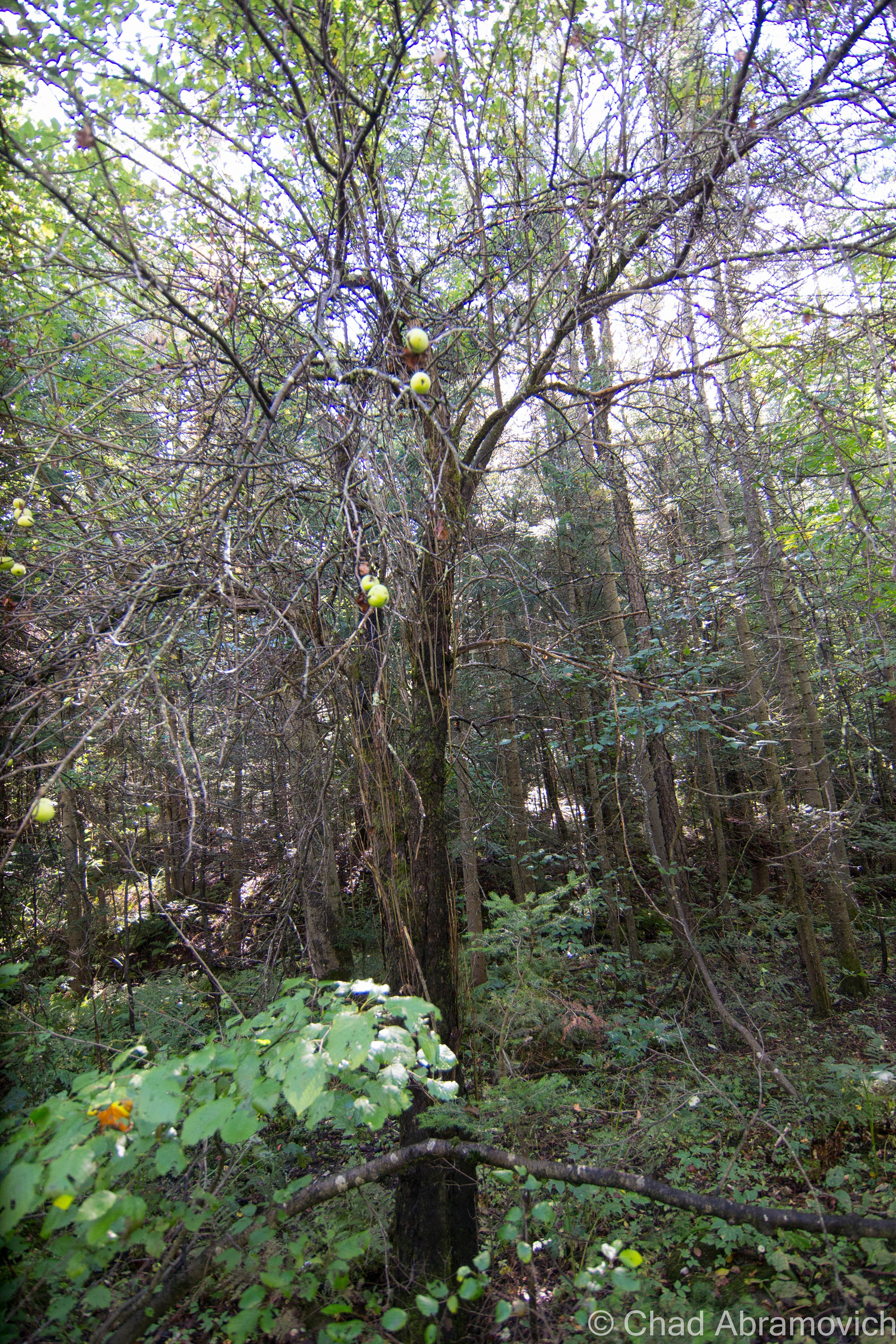
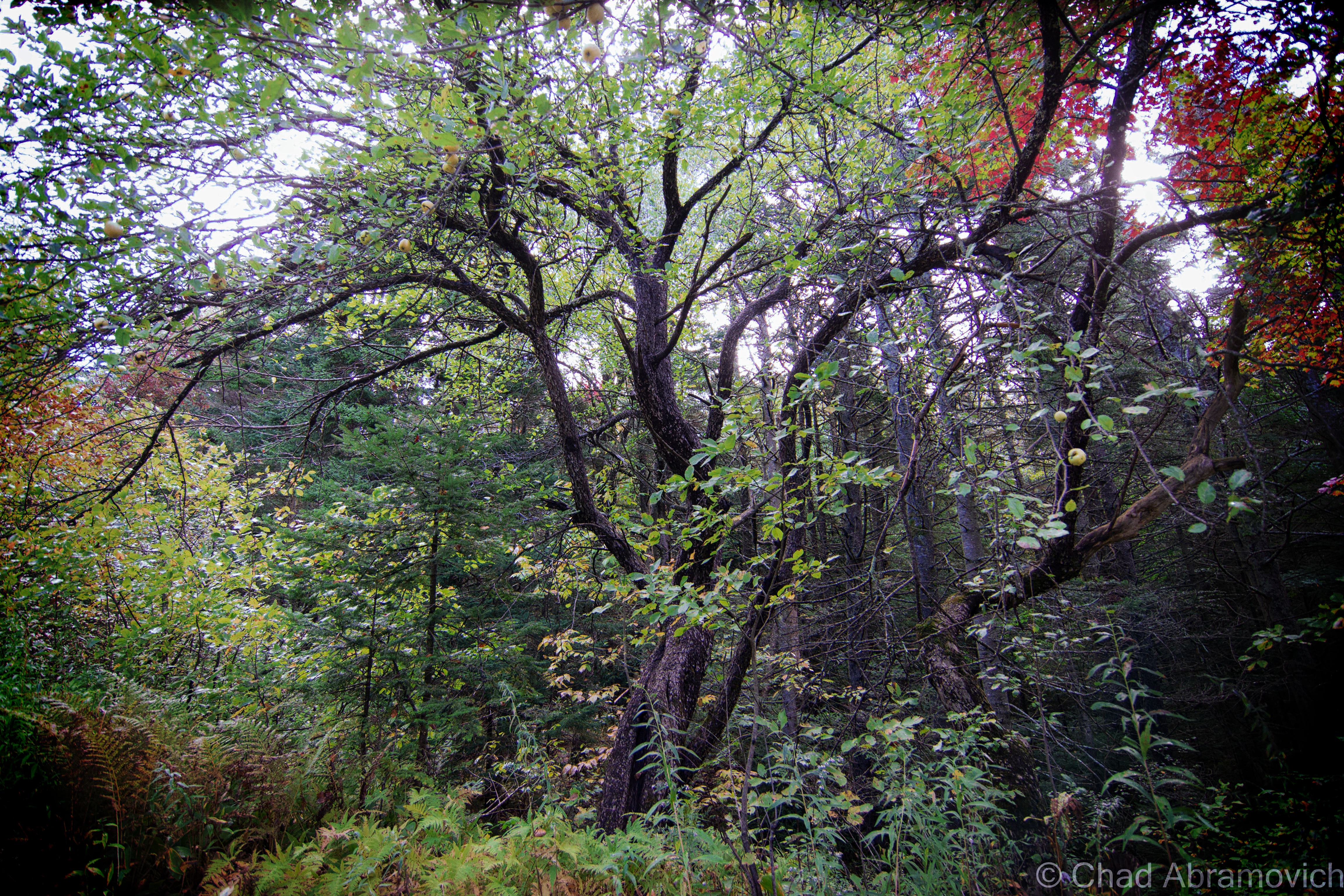
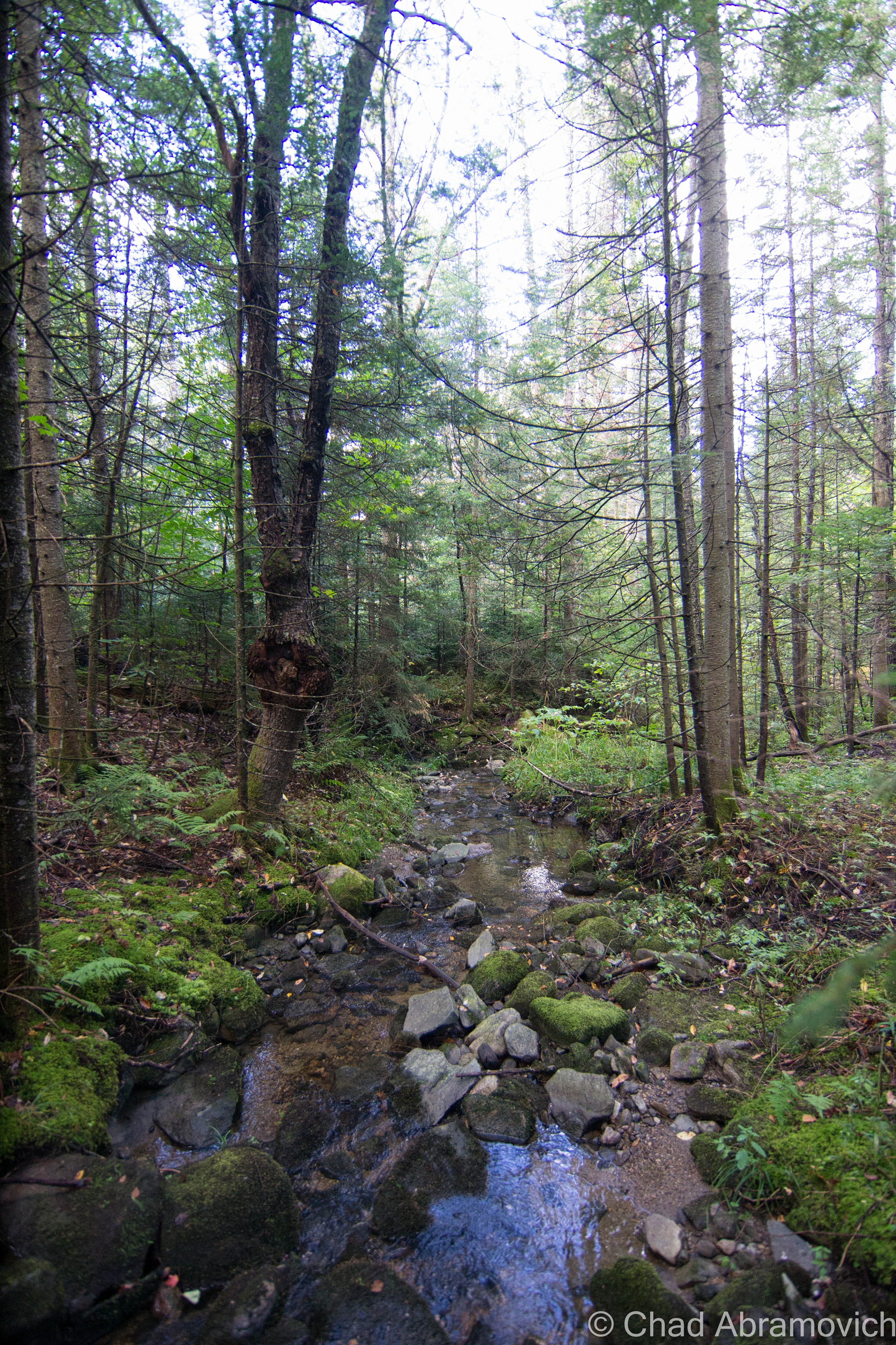
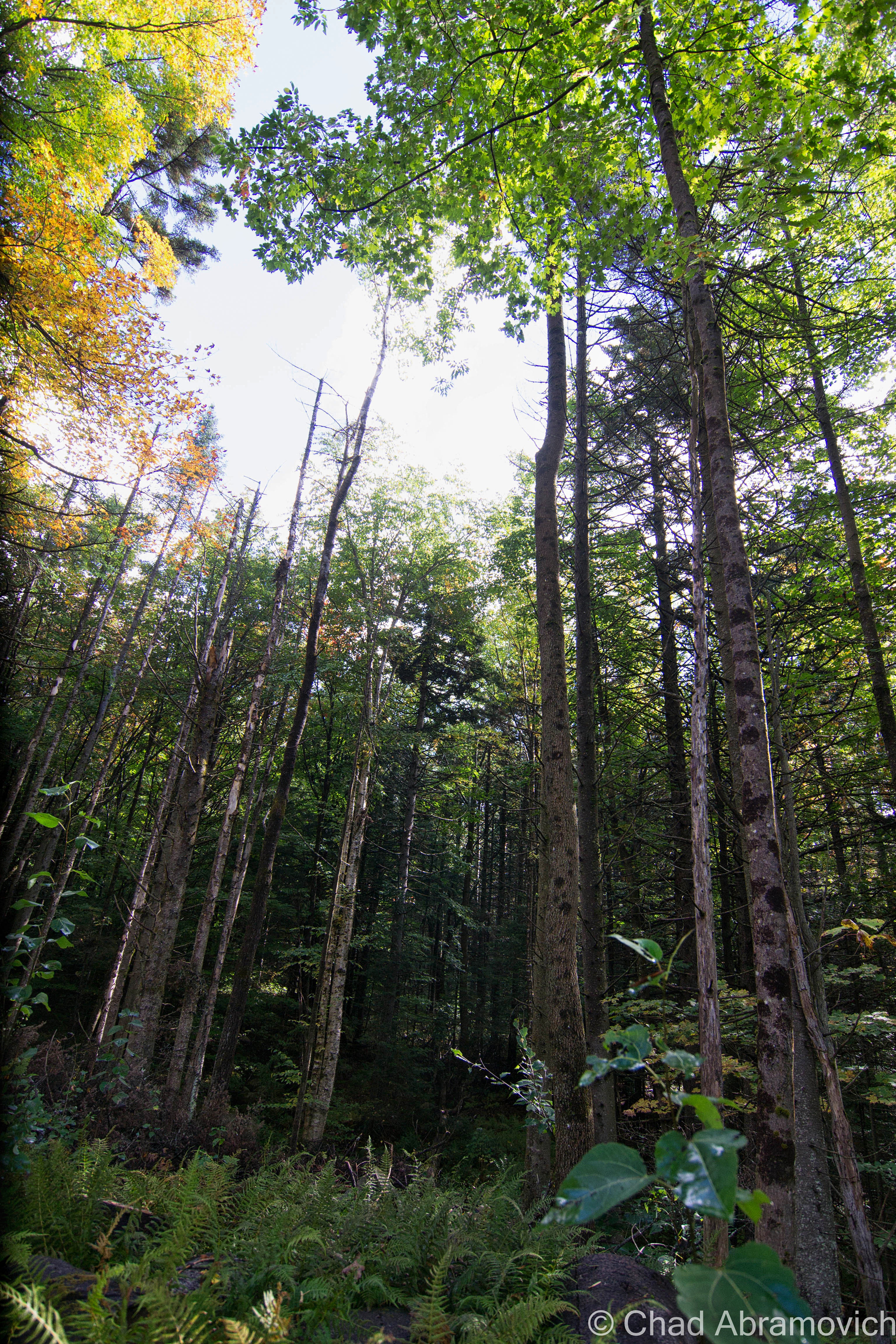
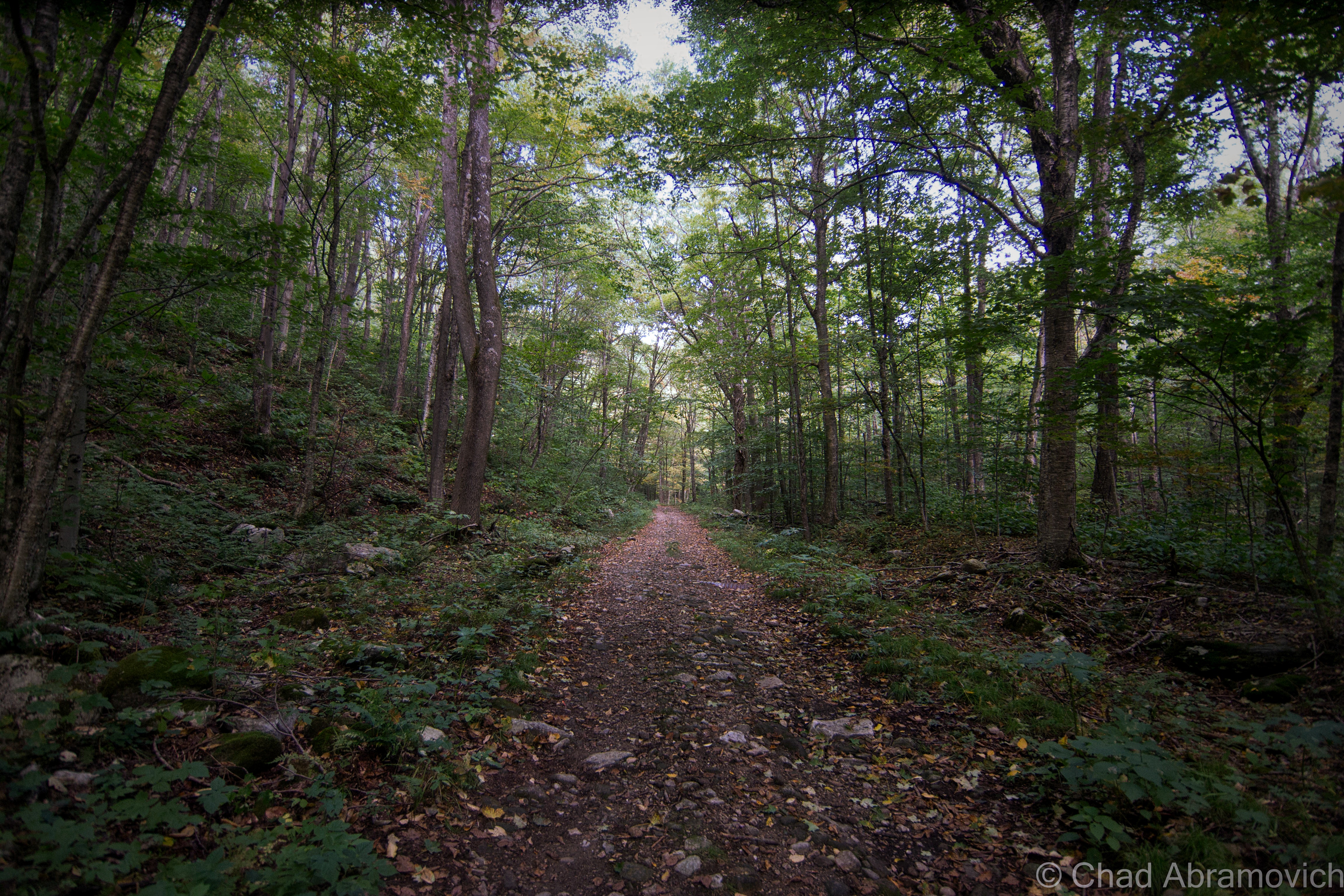
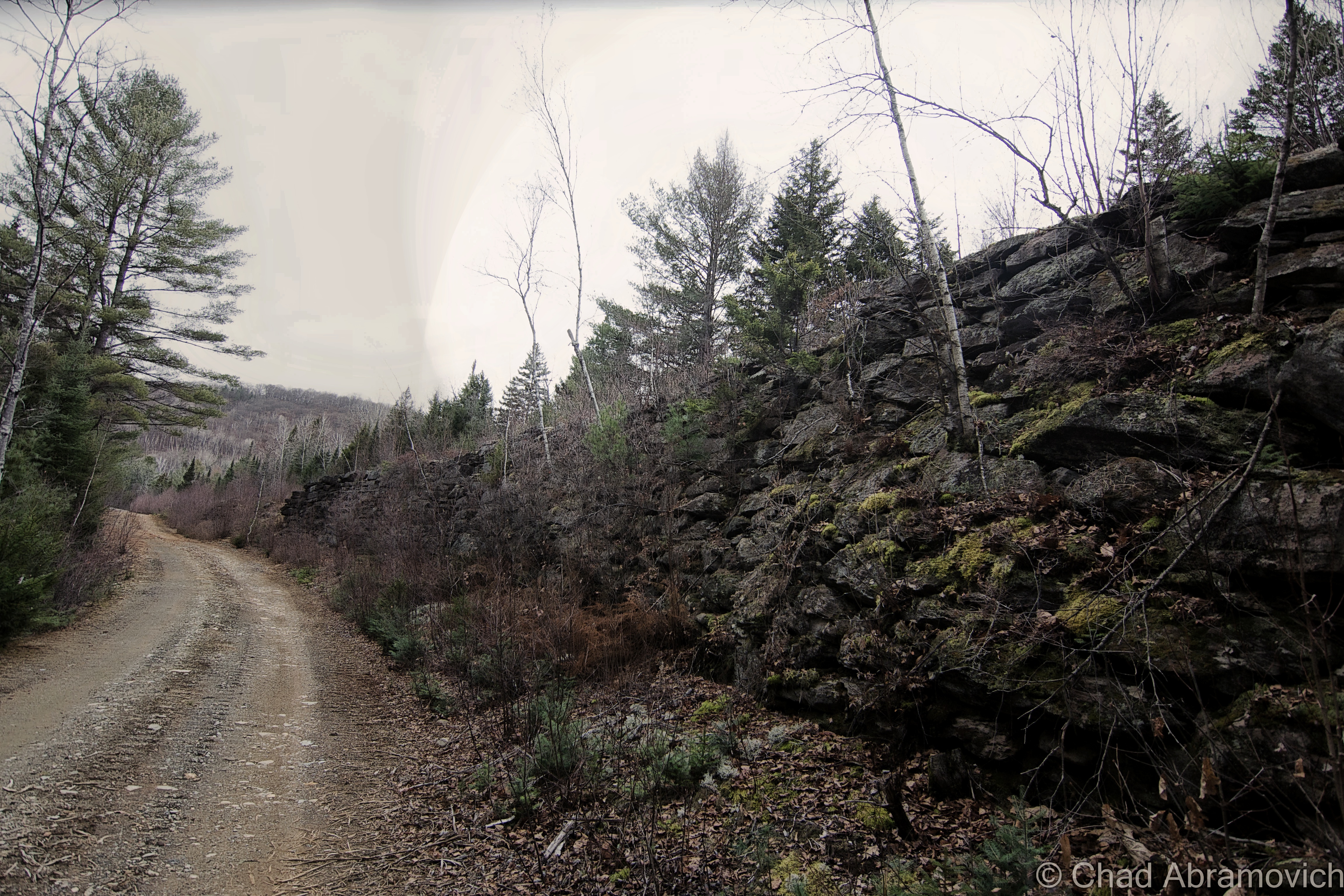
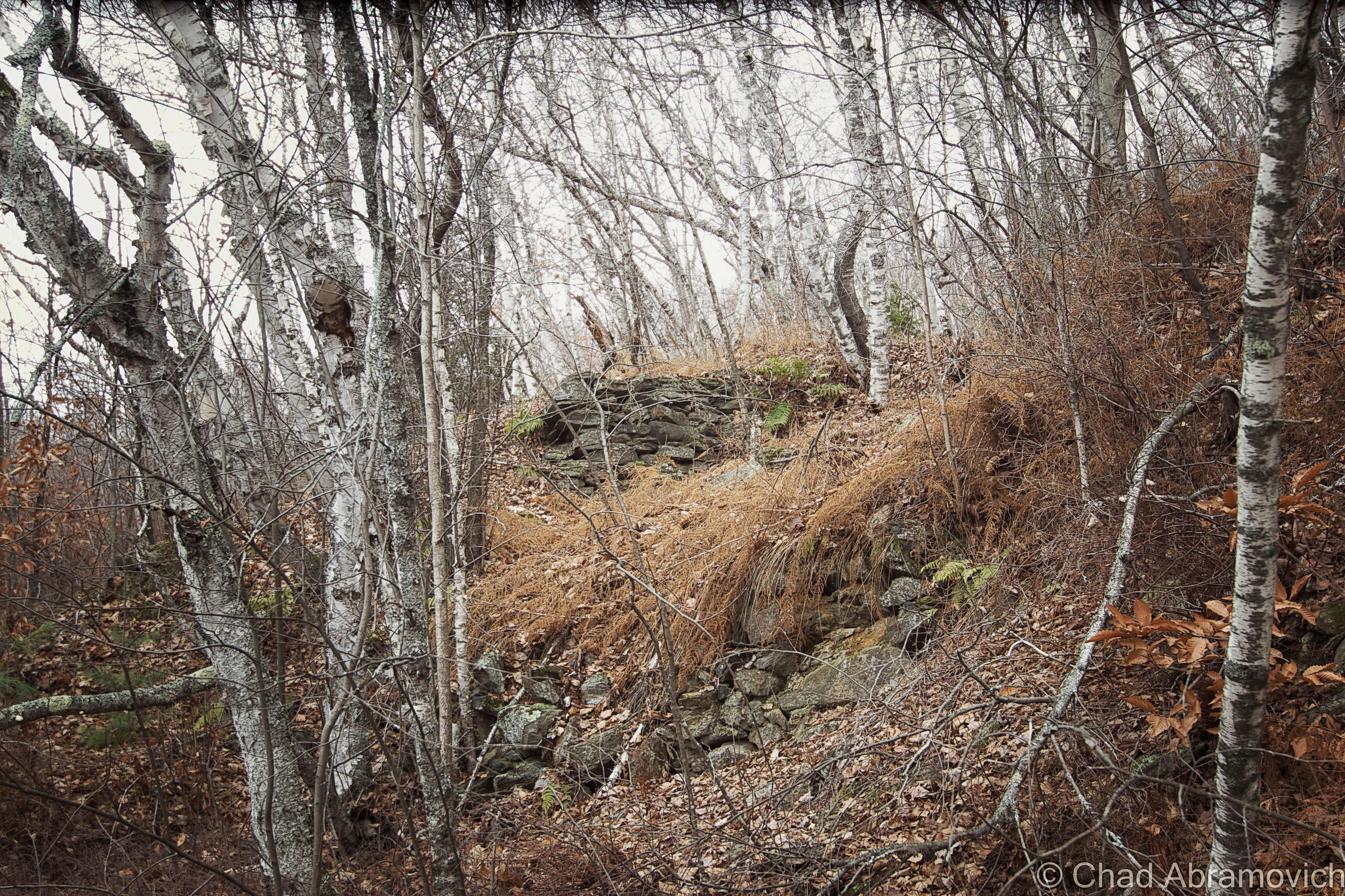
Pownal’s history is a small magnum opus for yarn spinners and history nerds like me because so much has seemingly happened there, while parts of town look like so much hasn’t happened there, and I’m sure even more tales molder away in the town’s backroad hovels and neat antiquated farms. (Seriously, some environs look like they have been untouched by modern headways –  like you’ve stumbled into a deep southern Appalachia, or as my friend calls it; “Pennsyltucky”.)

Perhaps that’s because there’s just something, well, weird about the town, something endemic and enigmatic that might be as old as its mountains, and that draws me in like a torch in search of a flame. The town definitely has a different kind of vibe to it than the rest of Vermont. I really like Pownal – it’s seriously one of the coolest towns in the state! When I sat down to put together my blog post from this explore, I couldn’t think of this old racetrack without thinking about all of the other amazing things that I’ve gleaned about this town over the years.

Originally, the area was inhabited by Mahicans, whose savage fate may have been foretold by prophetic rocks on a Pownal mountainside.

Its realm was the only part of what is now Vermont that was ever trodden on by Dutch colonizers from New York in the 1600s (The Albany/Hudson Valley region of New York has a really cool lingering trace of Dutch-inspired architecture, toponyms, and seemingly ancient muniments as a result! I’d love to do far more exploring/researching there)

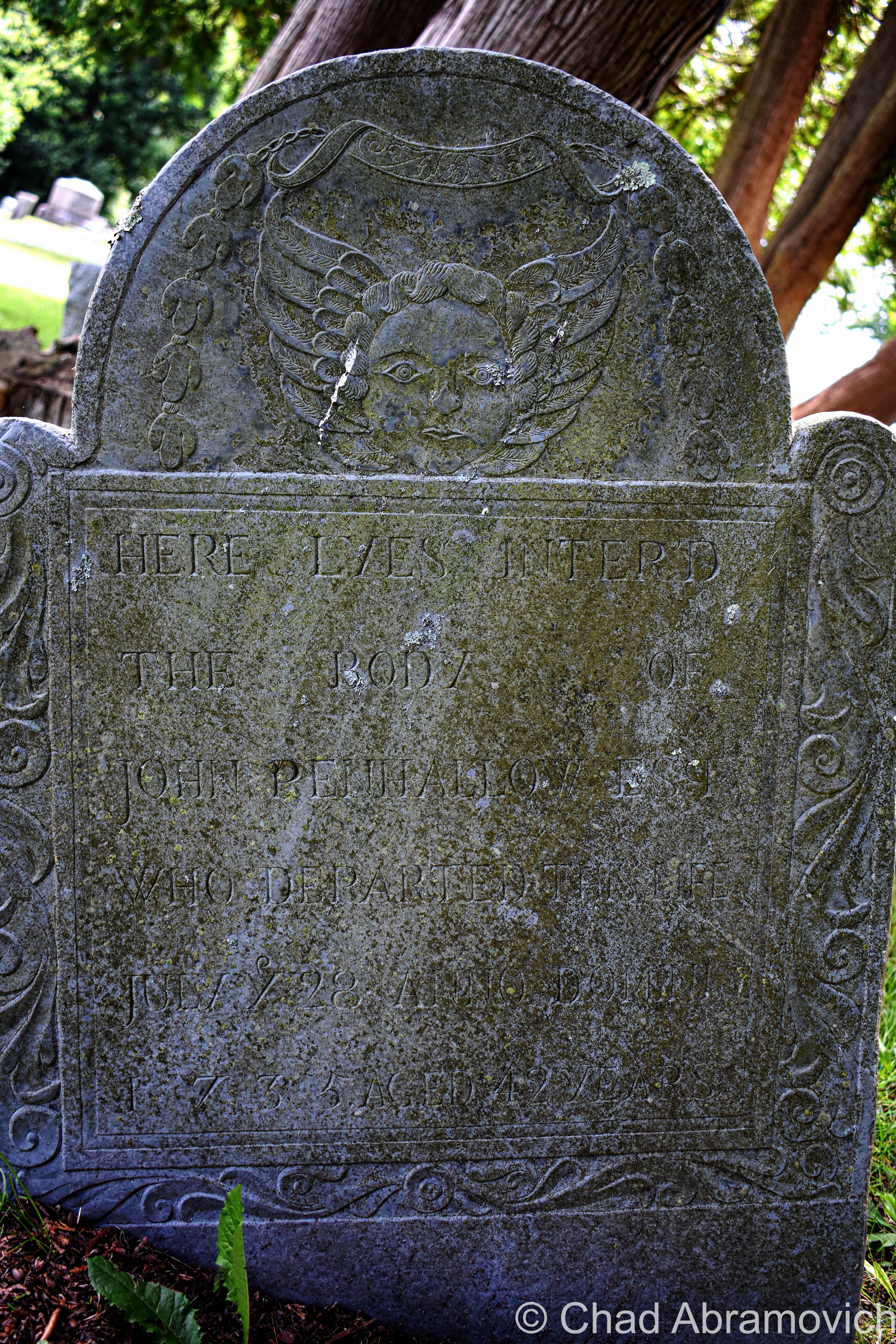
What might be the oldest home in Vermont is in Pownal village – The Mooar-Wright House – which was constructed around 1750.

Vermont’s only witch “trial” happened here in the early days of Pownal, where some folks victimized a Dutch widow named Mrs. Krieger for “possessing extraordinary powers,” whatever that meant. The obscure account was originally (and fortunately) recorded by lawyer and historian T.E. Brownell, and has managed to survive into the 21st century, though still pretty obscure.

I’ve read about a few Vermont women who were said to be witches, and usually, the accusations and “evidence” were in the camps of “consorting with the devil” or using “magic”, which lead to mischief like making cows stop producing milk, crop failures, townsfolk suddenly being inflicted by mysterious maladies, and innocuous stuff like predicting the weather before it happens. Other more sinister tales include the conjectured witch conjuring up a vast spectrum of malicious acts towards others she didn’t like.

I’ve been told that my great grandmother could predict the weather, held seances in her parlor, told fortunes she read in tea leaves, and once unwittingly shared a barn dance with the devil himself, but she seemed pretty well-liked and esteemed.

Unfortunately, widows were sometimes the prey of discrimination back then, because they were seen as not only a “burden” to the community, but they were easy targets because they had no family to defend them. Human beings are the real monsters.

Whatever it was that the widow Krieger was doing was seen as diabolical enough to condemn her, and a “safety committee” was organized to deal with it.

The Hoosac Valley: Its Legends And Its History by Pownal-ite Grace “Greylock” Niles tells that the committee sentenced widow Krieger (spelled “Kreigger” in her pages) to trial by ordeal, and gave her two choices. The first choice was she could climb a tree and wait for a group of men to chop it down. If she wasn’t killed outright, she was innocent. Or, she could face “trial by water” – which meant that a group of townsfolk cut a hole through the ice of the Hoosic River, bound her, and then tossed the poor woman into the frigid current. This surefire method stemmed from an old belief that water was sacred, and would undoubtedly sort these provoking preternatural things out. If she sunk, she was innocent, but if she floated, then that meant that she was in allegiance with the devil or some other variety of evil, and would have absolutely nothing to do with science/physics. I also noticed the confirming circumstances of the two methods contradict one another (if she wasn’t killed, she was innocent, versus if she was killed, she was innocent. What).

The widow Krieger chose the latter, thinking it was the safer choice, and sank like a stone. That was apparently good enough for those Pownal-ites who gathered for the show. Unlike neighboring Bay State witch hunters, though, these Vermonters seemed to be a bit more philanthropic, and a group of men suddenly panicked and scrambled down the riverbank to fetch her. Not only did she live through the ordeal, but I’m assuming things were really awkward afterward. As the committee resolutely said afterward; “If the widow Kreigger had been a witch, the powers infernal would have supported her”

Today, there’s a standout cliff near North Pownal that local parlance still knows as “Krieger Rocks” – both a homage to early Dutch influence and an informal parable of a hapless woman.

I also found this occurrence even more uncanny, because while the epoch of the infamous witch hysteria of Salem and southern New England occurred in the 1690s, Vermont’s lone delirium happened sometime in the 1760s, probably after 1761 when the town was charted. (Actually, Yankee witch based superstitions, though weakened, remained alive into the 19th century!)

Perhaps Pownal just needed to install a few witch windows? 

In October of 1874, Thomas Paddock, a well-respected farmer with an amicable character, suddenly found his property under a maelstrom from poltergeist-like activity.

Stones – varying in size from pebbles to a 20-pound boulder (!) rained down on his house and outbuildings, but neighboring properties were completely unaffected. The stones were found to be hot when handled, even on chilly nights, and a few of them reportedly defied gravity, and rolled uphill, or even up and over the peak of the roof after landing, almost as if they were propelled. Mr. Paddock dubbed whatever it was “the stone-throwing devil”, word got out, and for a brief time, it caused a sensation.

He even offered a reward of one dollar for anyone who could solve these shenanigans, but shortly after, the cache of tourists and newsmen cleared out when the odd activity finally stopped. Nobody was any wiser at what exactly happened at the Paddock farm, not even today (though cursory blame was attempted on a hired farm boy named Jerry, who coincidentally was in the vicinity of the falling rocks more often than not…) Interestingly enough, the farm just happened to be near-ish the Krieger Rocks part of town…

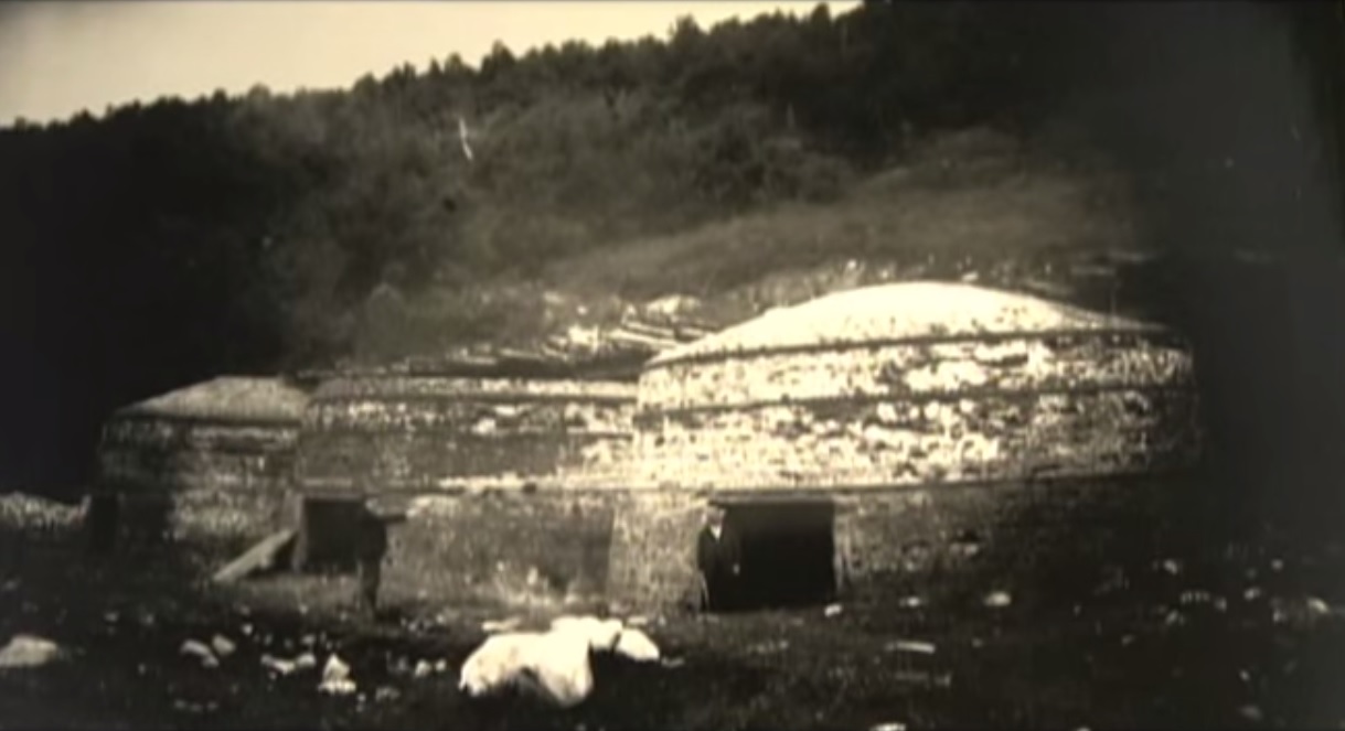
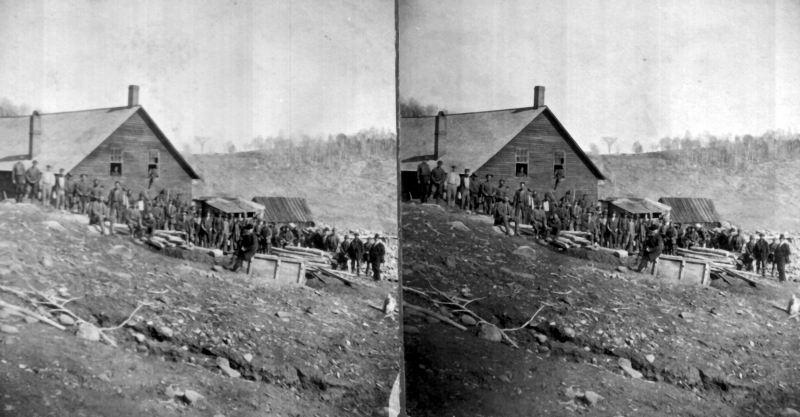
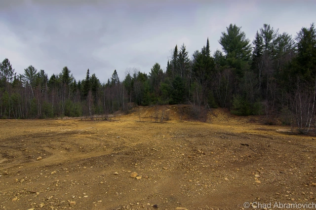
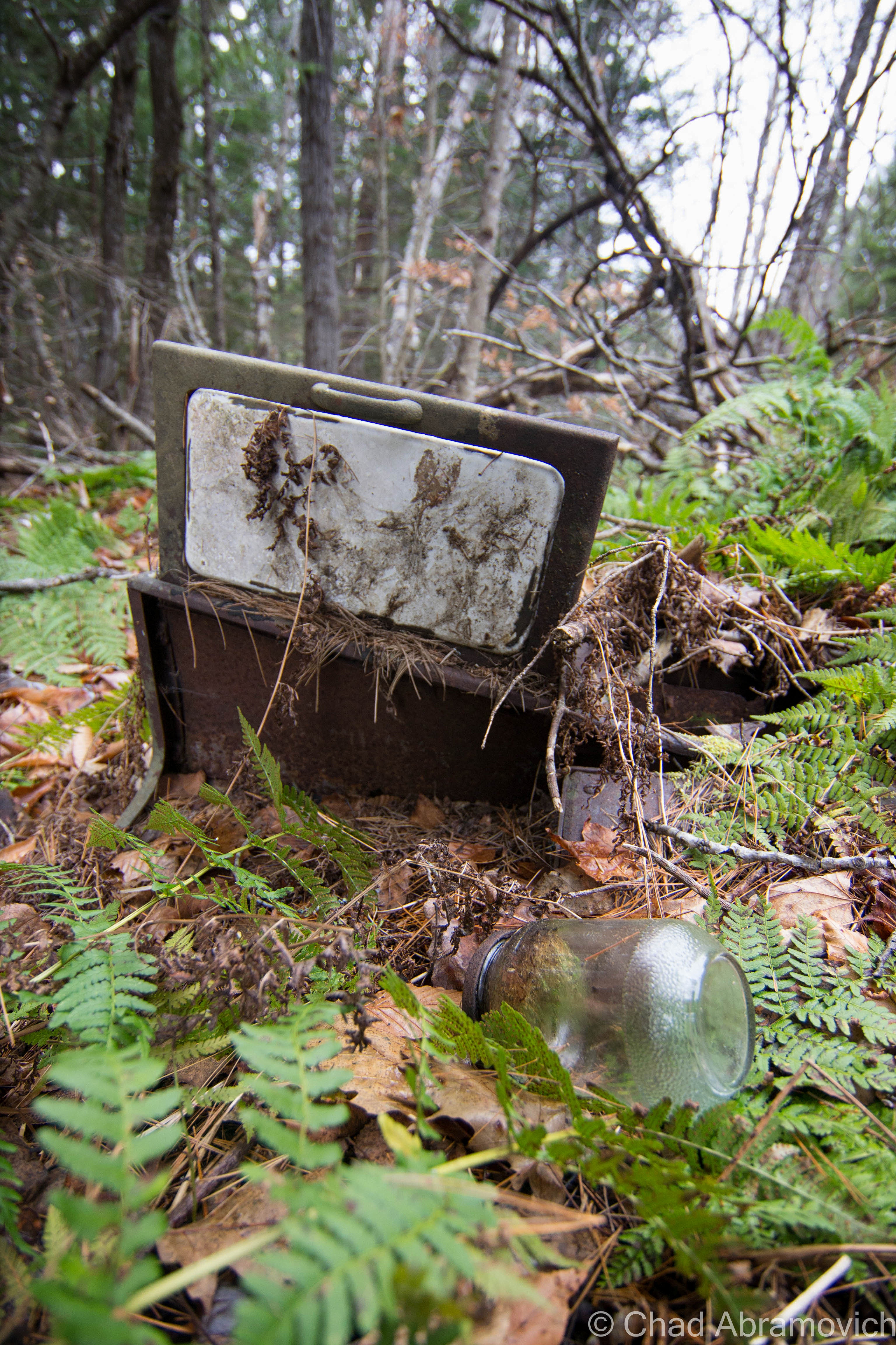
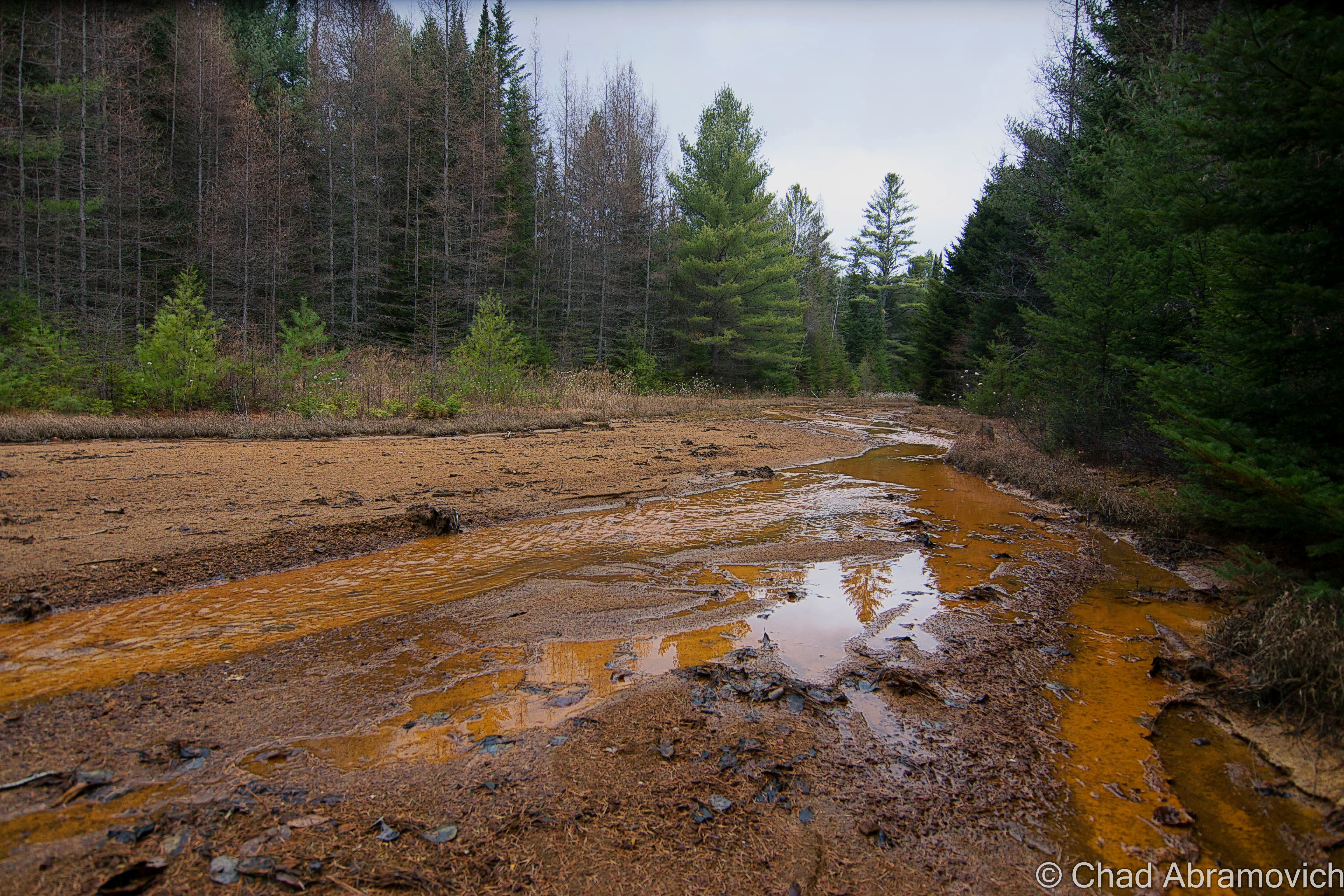
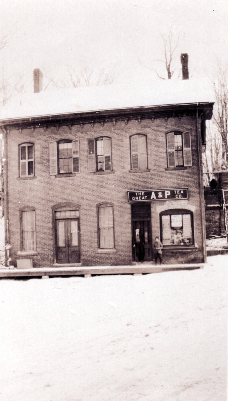
Local girl Addie Card, who once labored at the now-demolished and superfunded Pownal Tannery (a site I’m sorry I missed out on), was photographed by the now-famous documentarian Lewis Hines and the image became a barometer in his efforts to stoke public objection about turn of the last century child labor in America. A collection of dilapidated shacks off state route 346 on a dented dirt drive known as “French Hill” are original tenement houses of the old tannery and one of the last reminders that the place actually existed in North Pownal.  

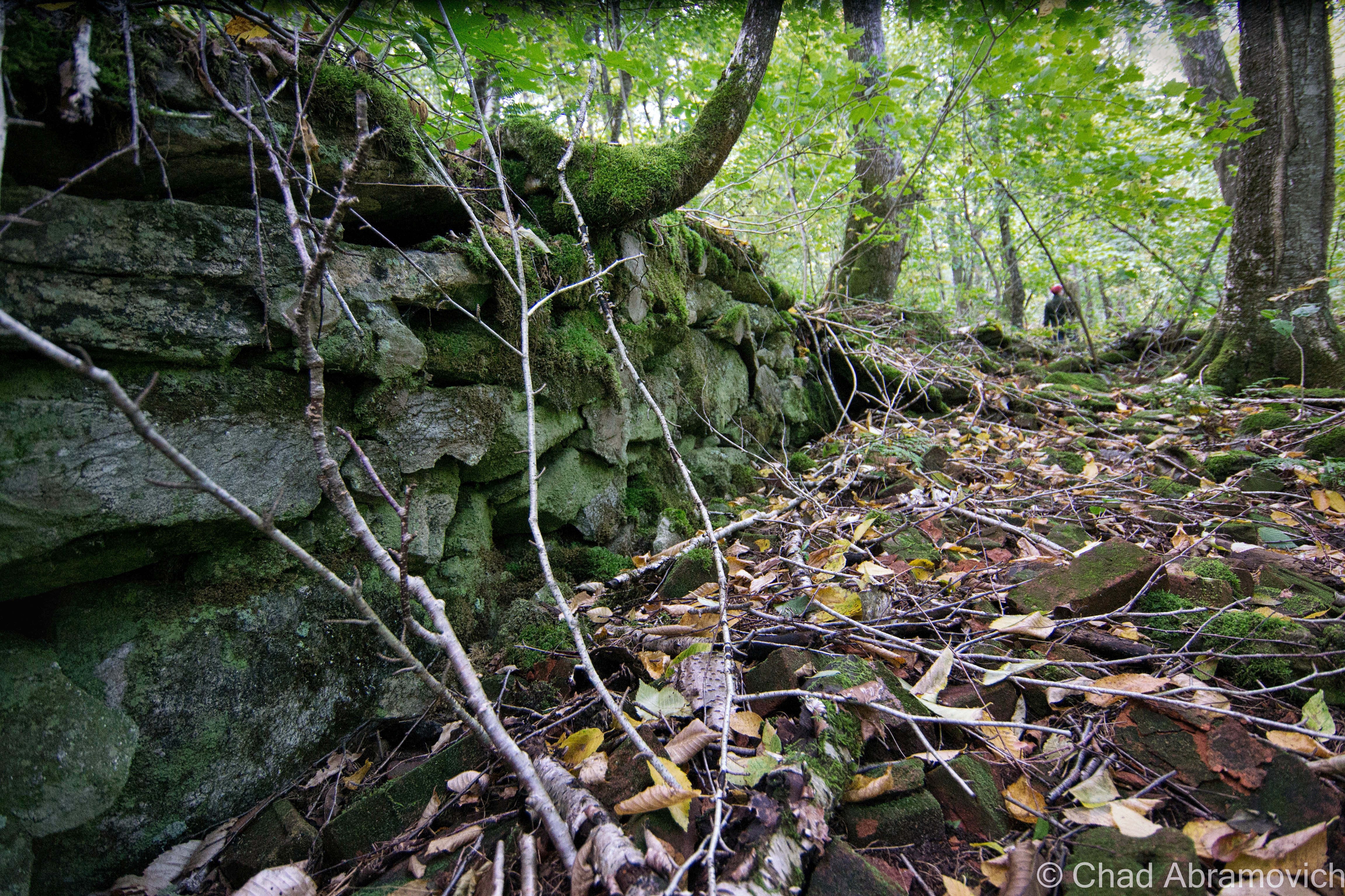
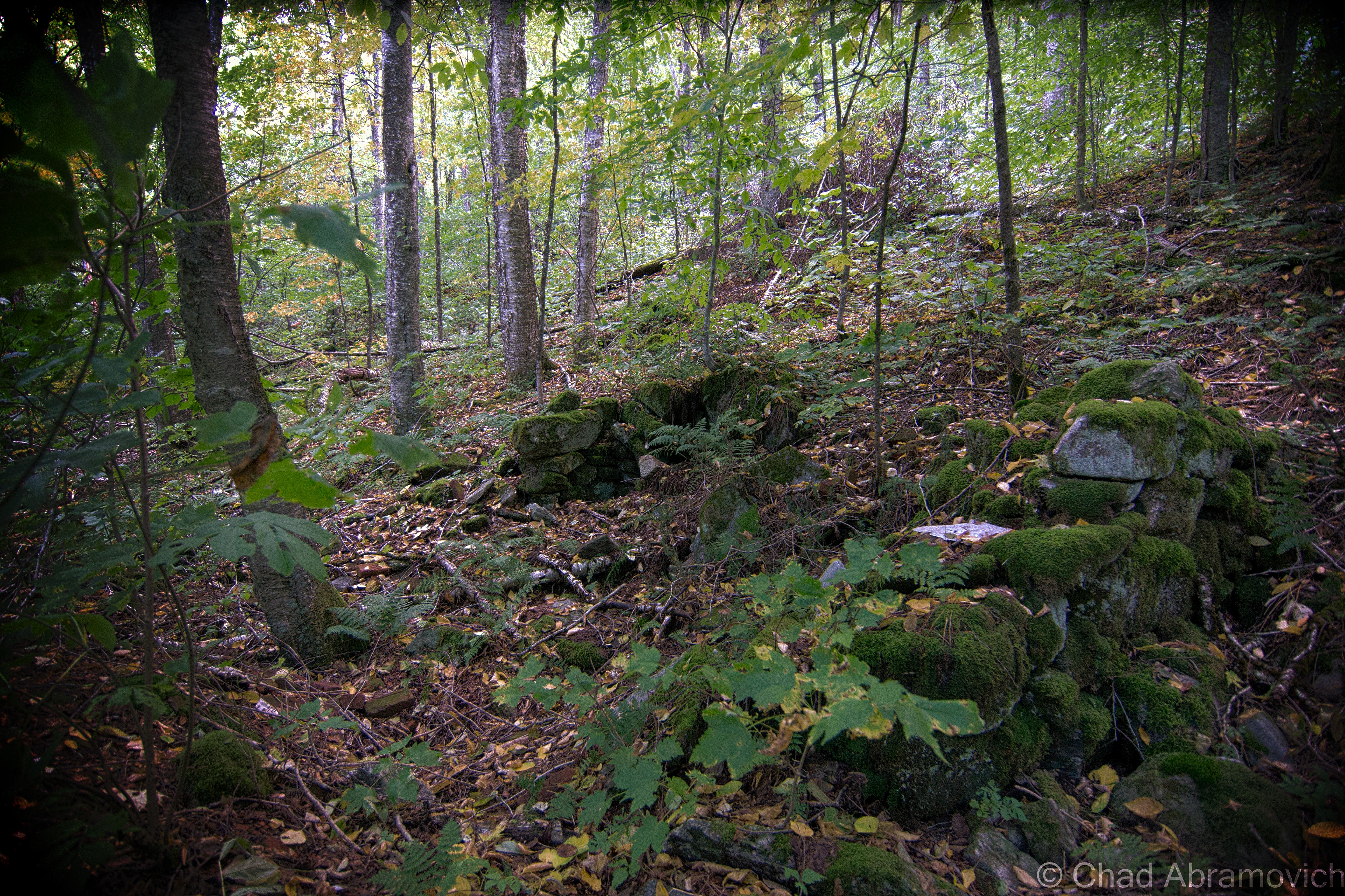
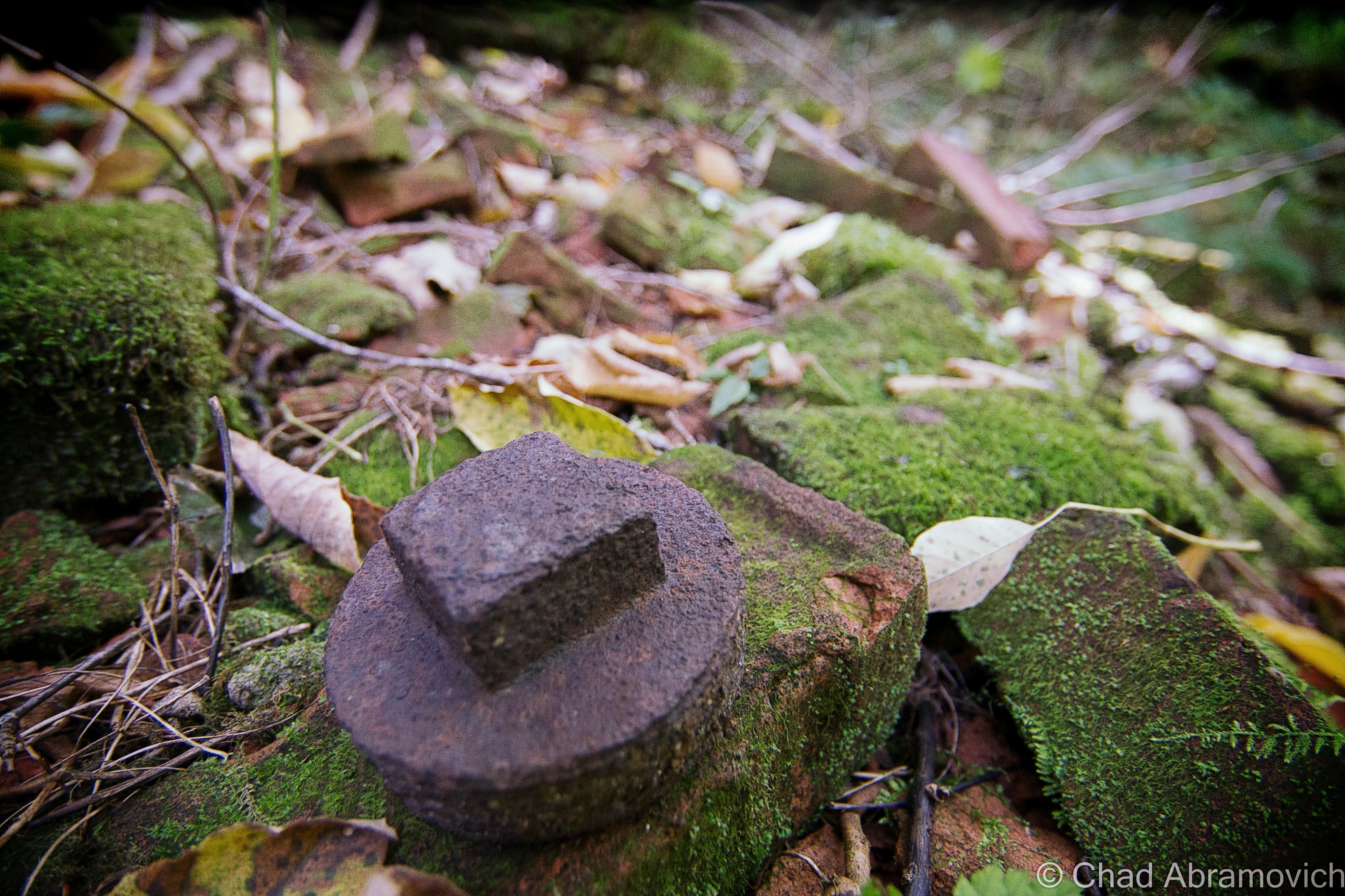
There’s still an existing and forgotten granite tri-point state marker erected by surveyors in the 1800s that’s now lost in the thick forests of the hills – some of those slopes still cooly contain colonial-era scrawlings on glacial deposited boulders of predecessing hikers and explorers – just some of the many relics I’m sure these hills contain. I know some people that hit a jackpot with their metal detectors around it. Who knows what else can still be found within the southern Green Mountains?

Another notable person with alleged wild talents was Clara Jepson, Pownal’s official seer – a profession that you don’t hear that much of in contemporary times (except maybe advertised on television at 3 AM). But until she died at 87 in 1948, she was the best-known clairvoyant in Vermont and created a pretty venerable reputation to back up her accumulated character.

Among her professed talents, she could allegedly hunt the location of lost or hidden objects, and was consulted on several cases, including one of the terrifying disappearances in the nearby mountains that would later become an area known as the “Bennington Triangle” (one of my favorite Vermont stories). According to witnesses, her answers would manifest themselves in a cryptic language within the folds of a lacy white handkerchief she would fondle during her sessions. (If anyone is old enough to recall ‘seeing’ her in real-time, or has any kind of story related to, I’d love to hear from you!)

It seems like Pownal’s always done things a bit differently, in ways that seem to almost be a few shades deeper into the mystic that’s masqueraded by a rough enchanting landscape, and maybe that’s augmented because of the town’s historically independent spirit, mountain isolation, and influenced by its border state surroundings. I honestly don’t think that this racetrack project could have happened in any other spot in Vermont.

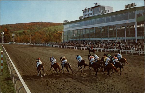
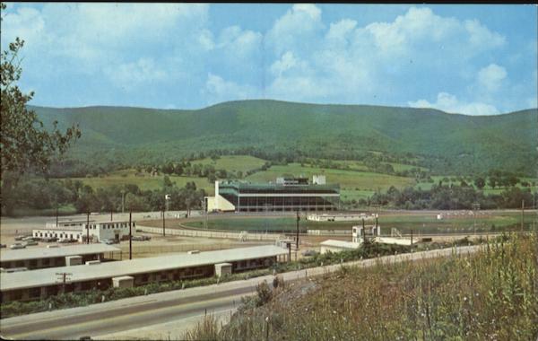
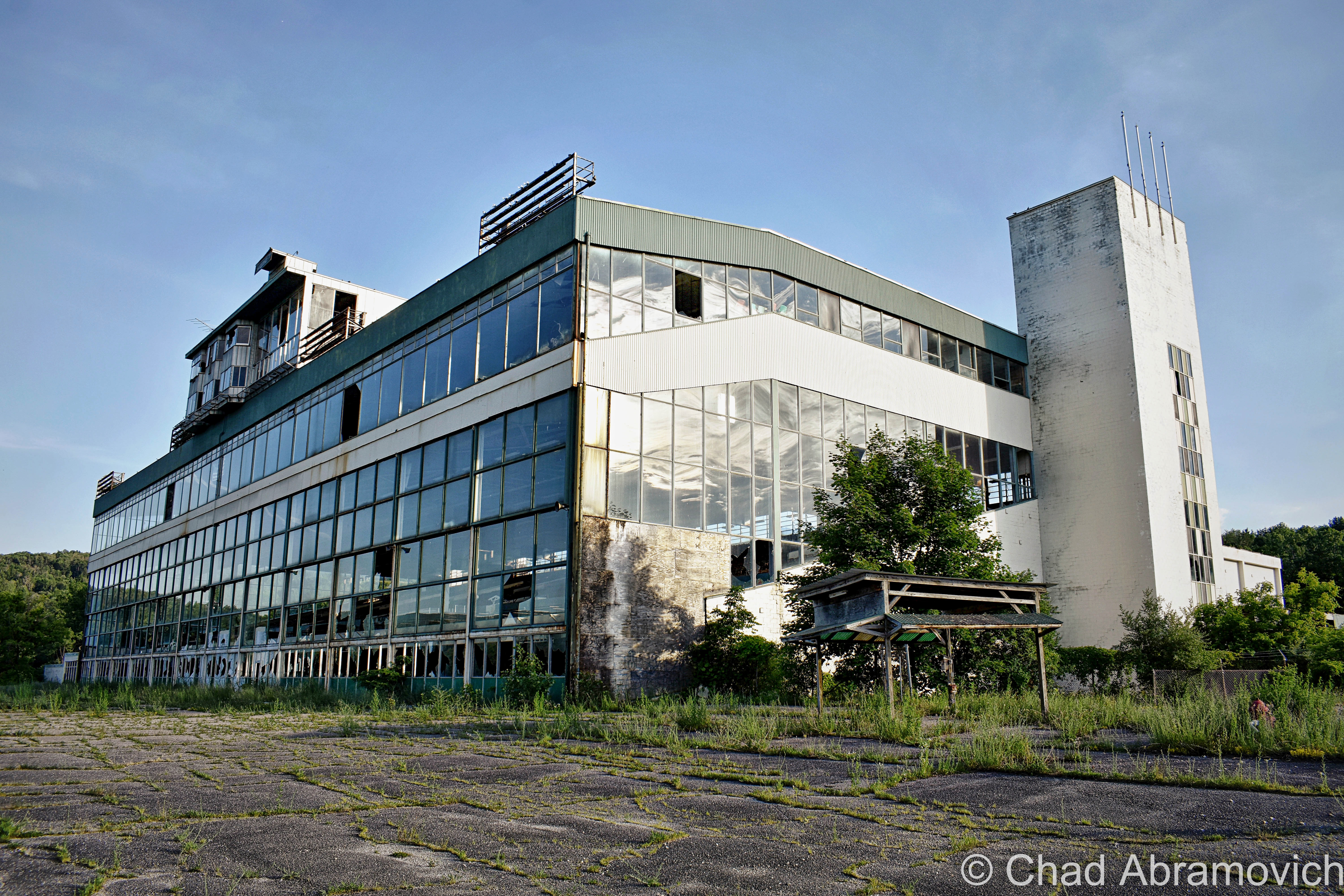
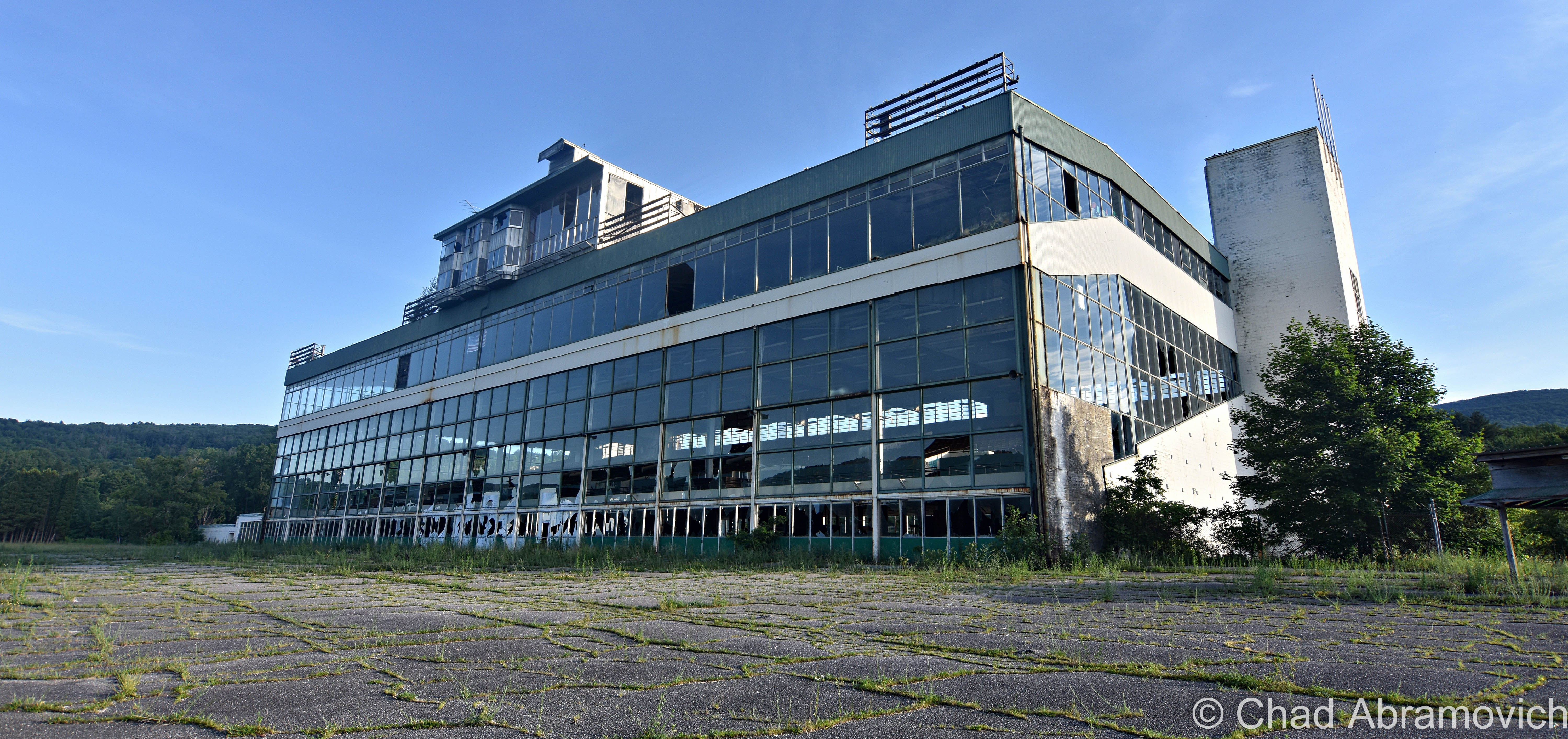
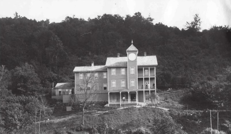
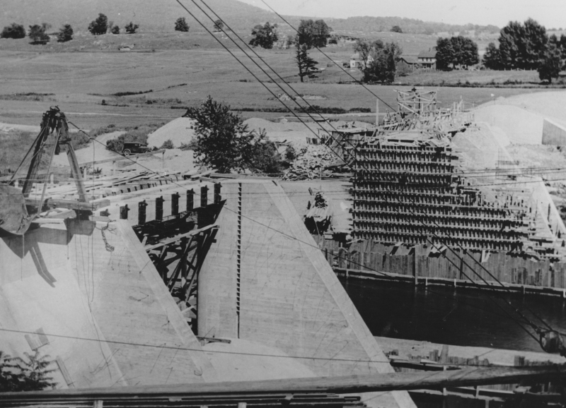
And speaking of the racetrack, it also seems to be the last big spike in Pownal’s histogram, for the time being anyway. The track opened in May of 1965 at a cost of six million dollars in a former cornfield along the Hoosic River.

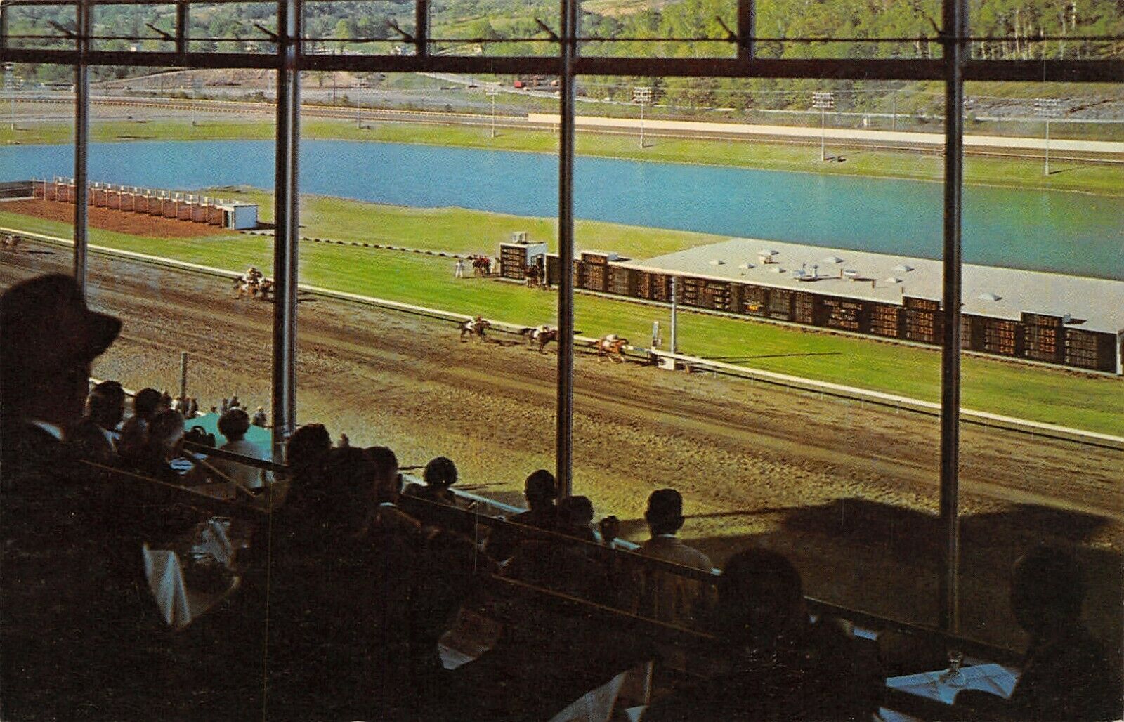
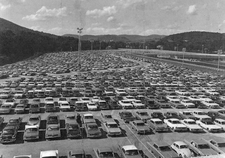
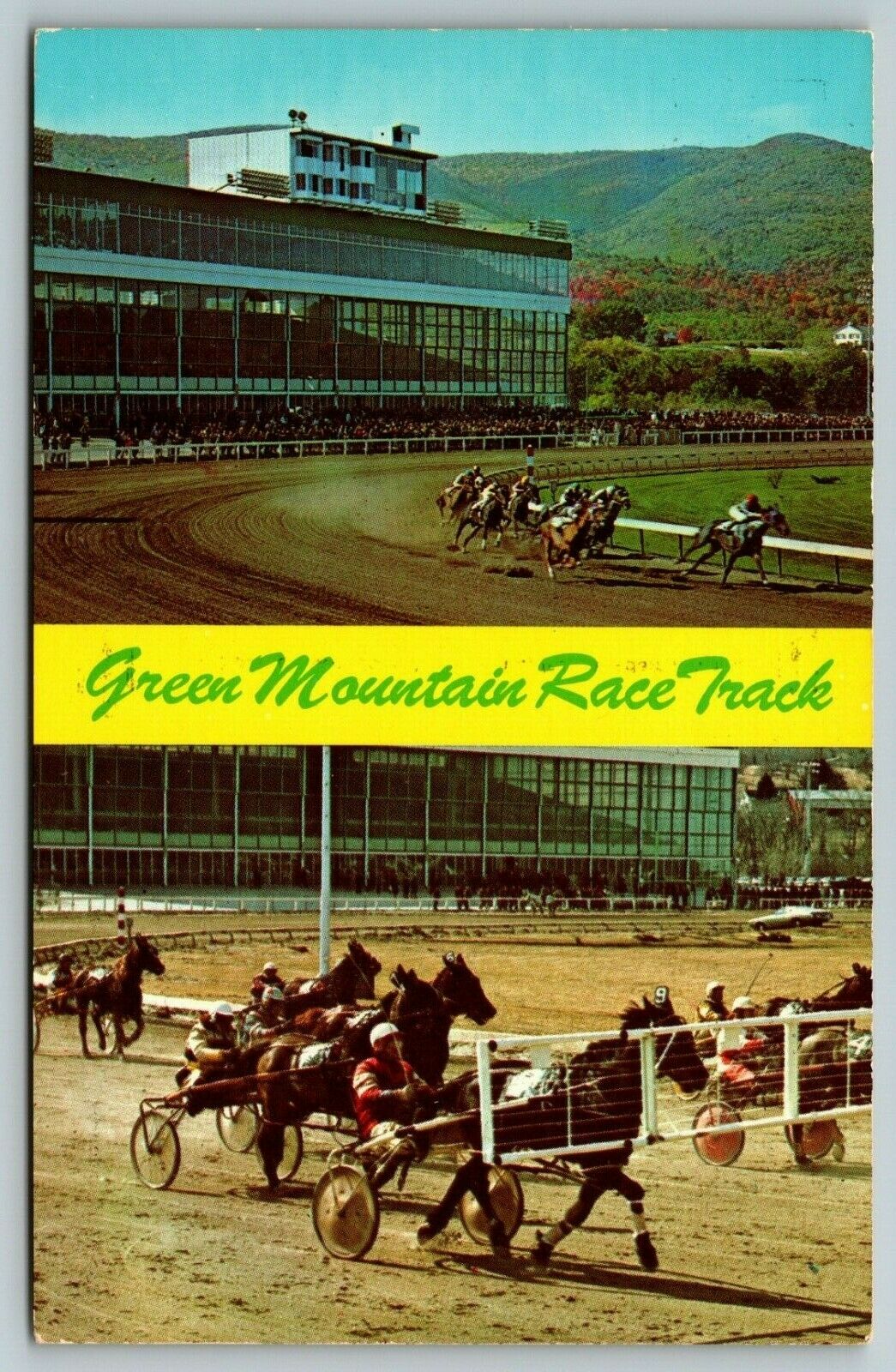
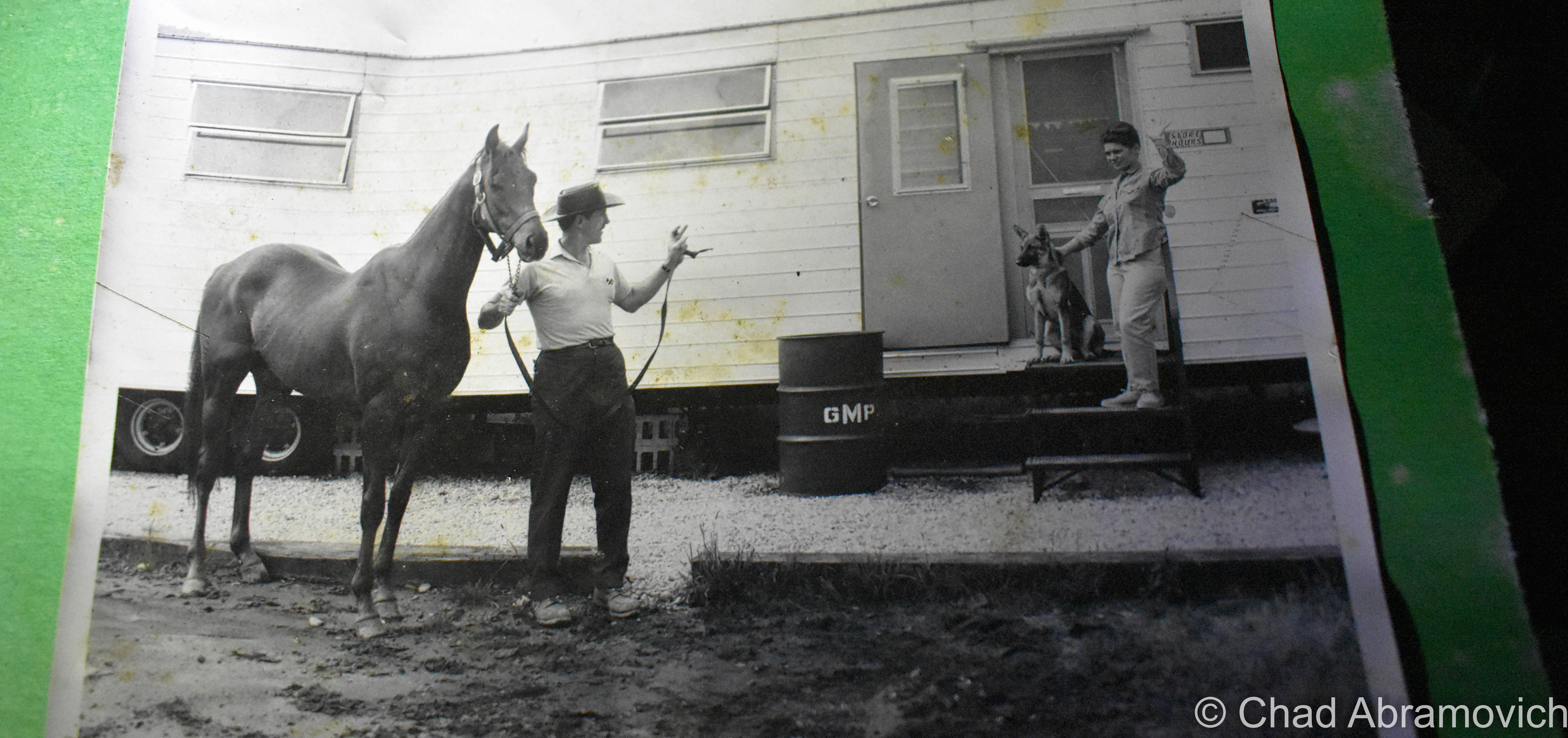
But from the start, Vermont’s only pari-mutuel racetrack failed to draw in the crowds that its investors were anticipating – the actual attendees were half that. But it kept on keeping on, despite quite a few subsequent telltale ownership changes, and oddly became kind of significant for east coast horse racing, ironically because of the efforts made just to keep the place buoyant. It was one of the earliest to do gimmicky nighttime races, and the first to do Sunday matches anywhere east of the Mississippi during the days of yore when the rest of the country still adhered to the blue laws. It created a sort of niche fanbase and wound up employing a lot of locals, which was a boon in a region with an economy that was becoming pretty hard-up. Casual tourists enjoyed the racetrack, too, and I was told it was a popular stop for folks who’d take Sunday drives through the mountains of Southern Vermont.

Old postcard of the Green Mountain Racetrack via CardCow.com
Old postcard of the Green Mountain Racetrack, with Route 7 in the foreground – via CardCow.com
Old postcard view from inside the grandstands.

A packed parking lot at the Pownal Track – sometime in the sixties.

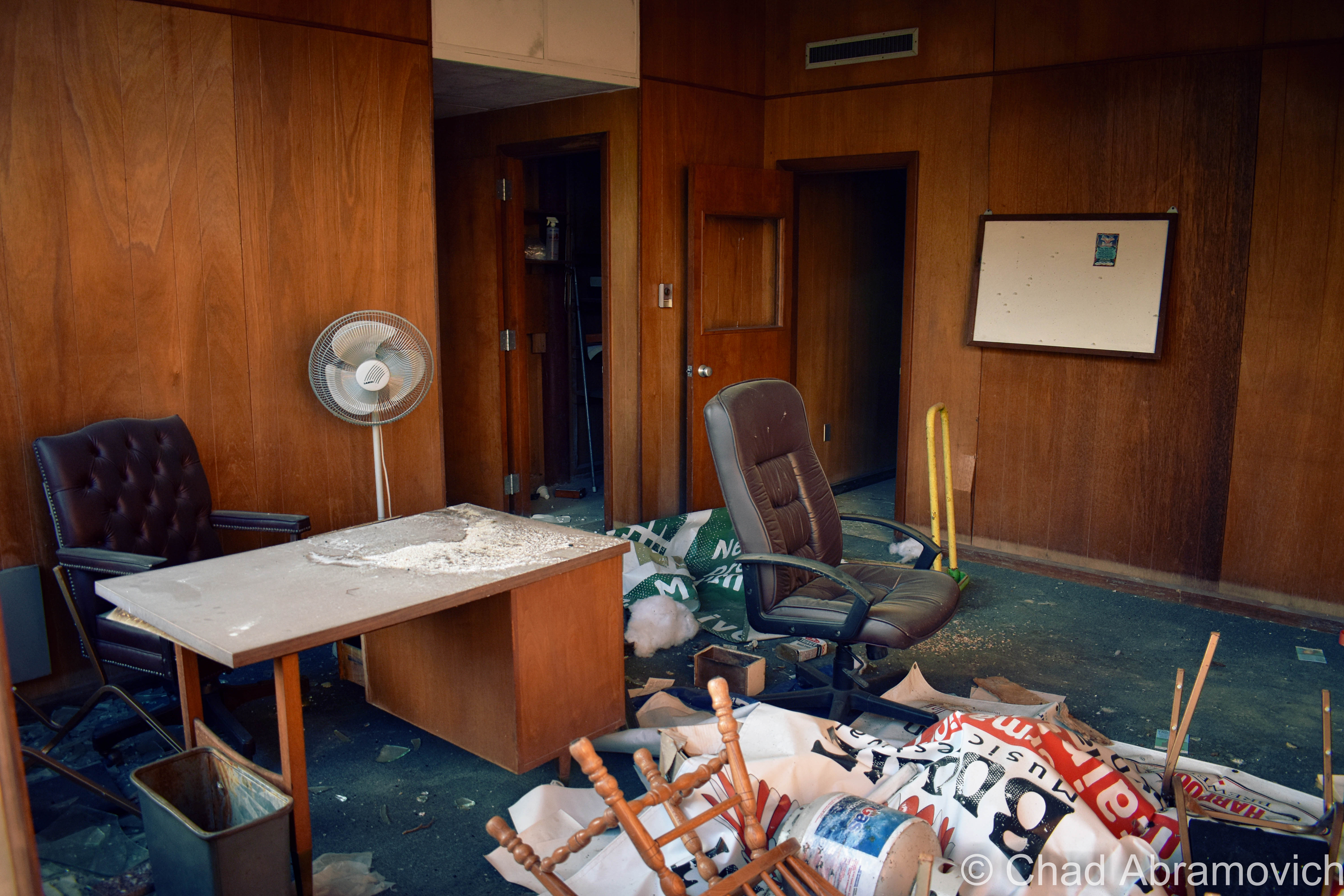
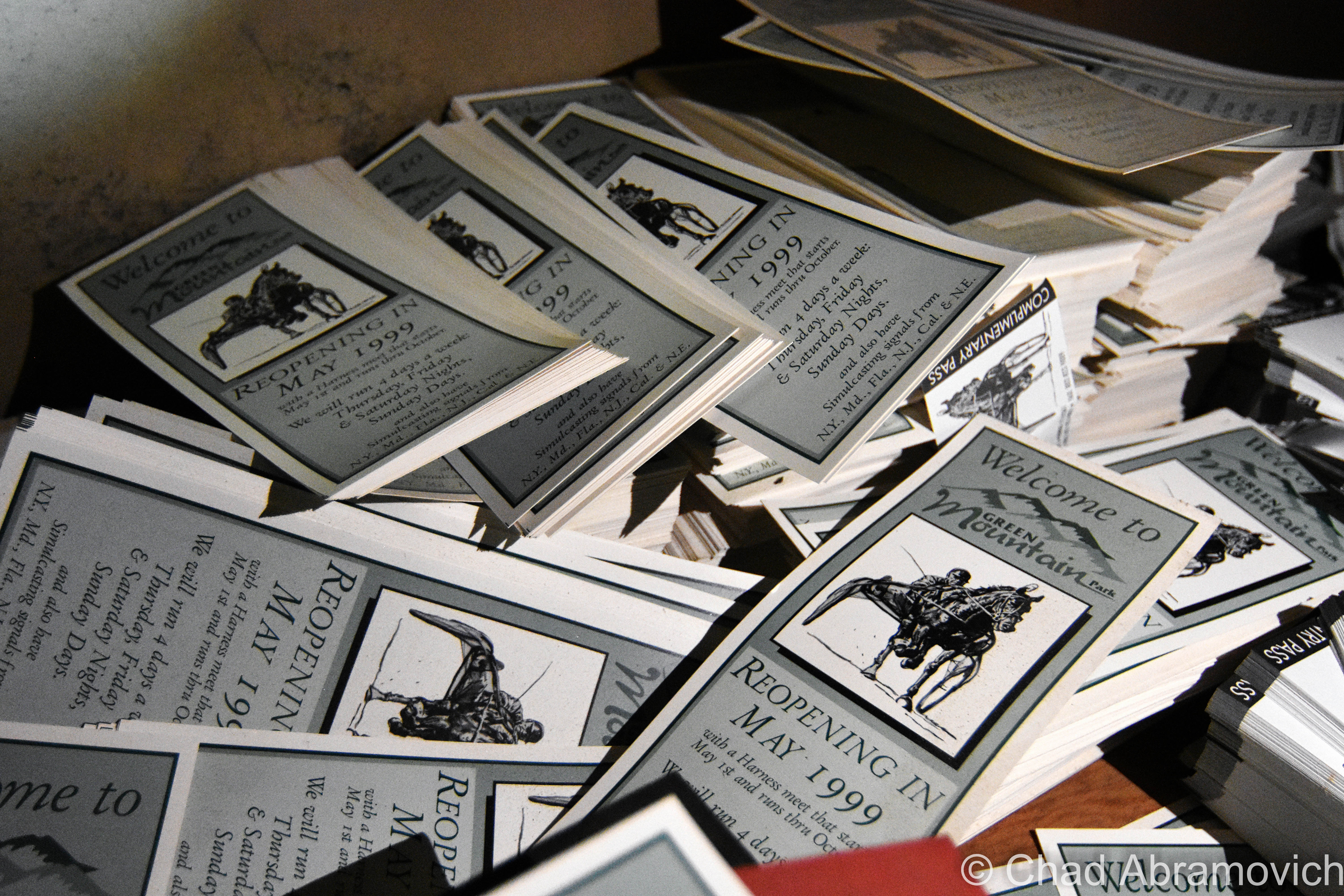
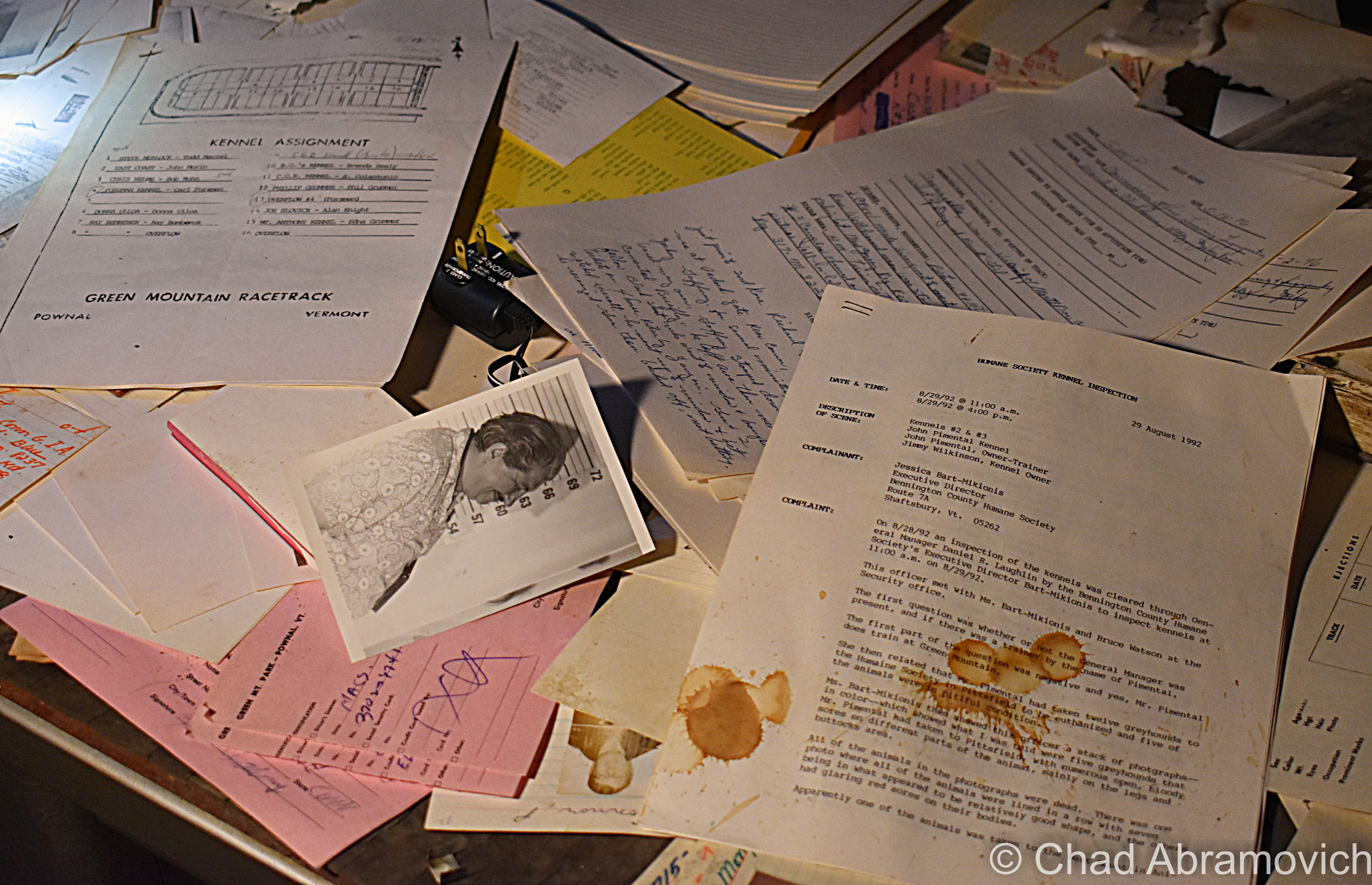
Twelve years later, horses were dropped from the itinerary, and Greyhound racing was the only thing occupying the oval (which I guess is the bottom echelon of these kinds of places, according to some nostalgia sites I browsed) until 1992, when the track closed for good – in part to animal rights activists, waning income, and the state making the activity illegal. A resurrection was attempted around the turn of the millennium but ultimately failed. It was strange seeing moldy flyers and banners ambitiously announcing its “grand re-opening” stored in soggy piles in the dank basement levels. I’d love there to be more economic prosperity for Pownal and Bennington County, but not in the form of animal exploitation.

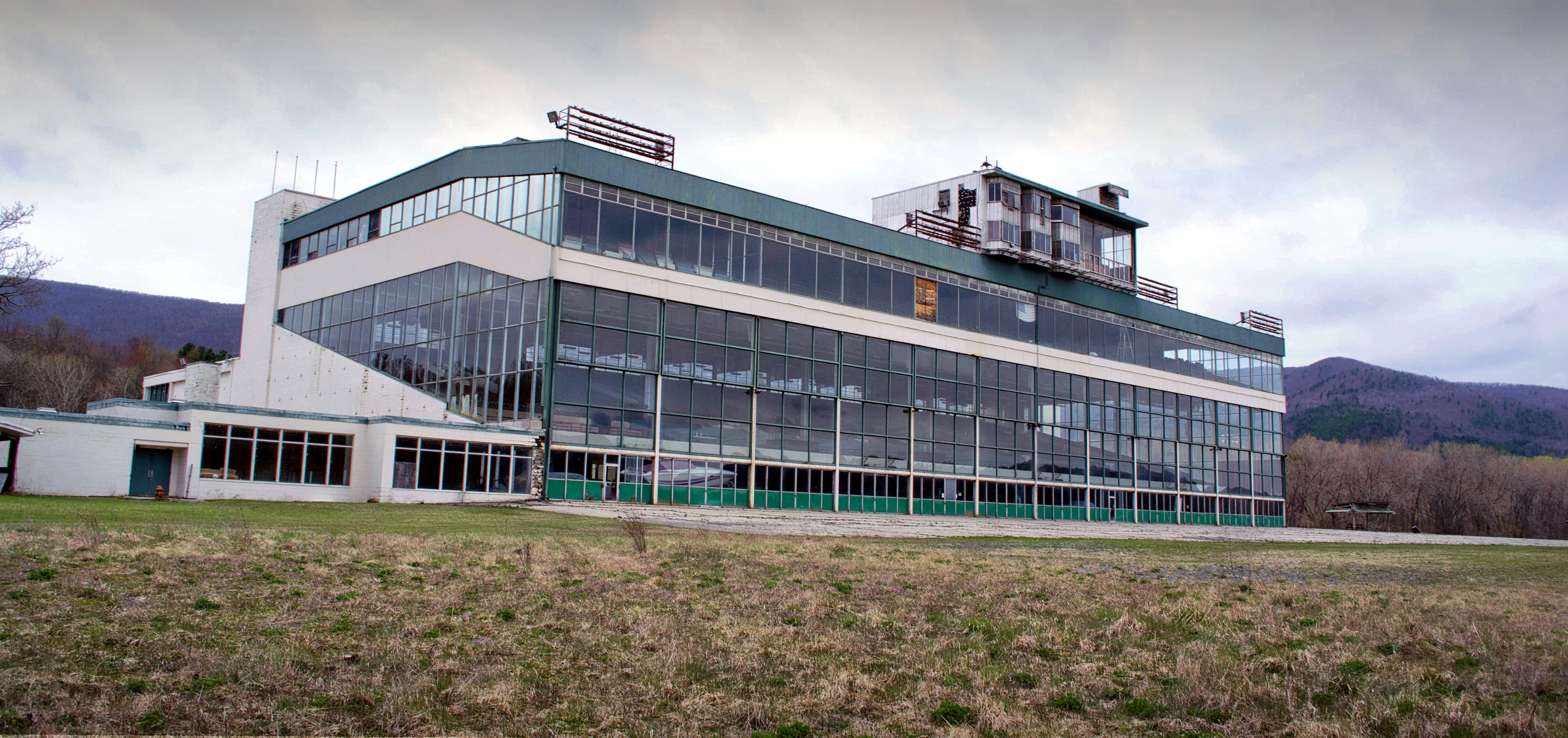
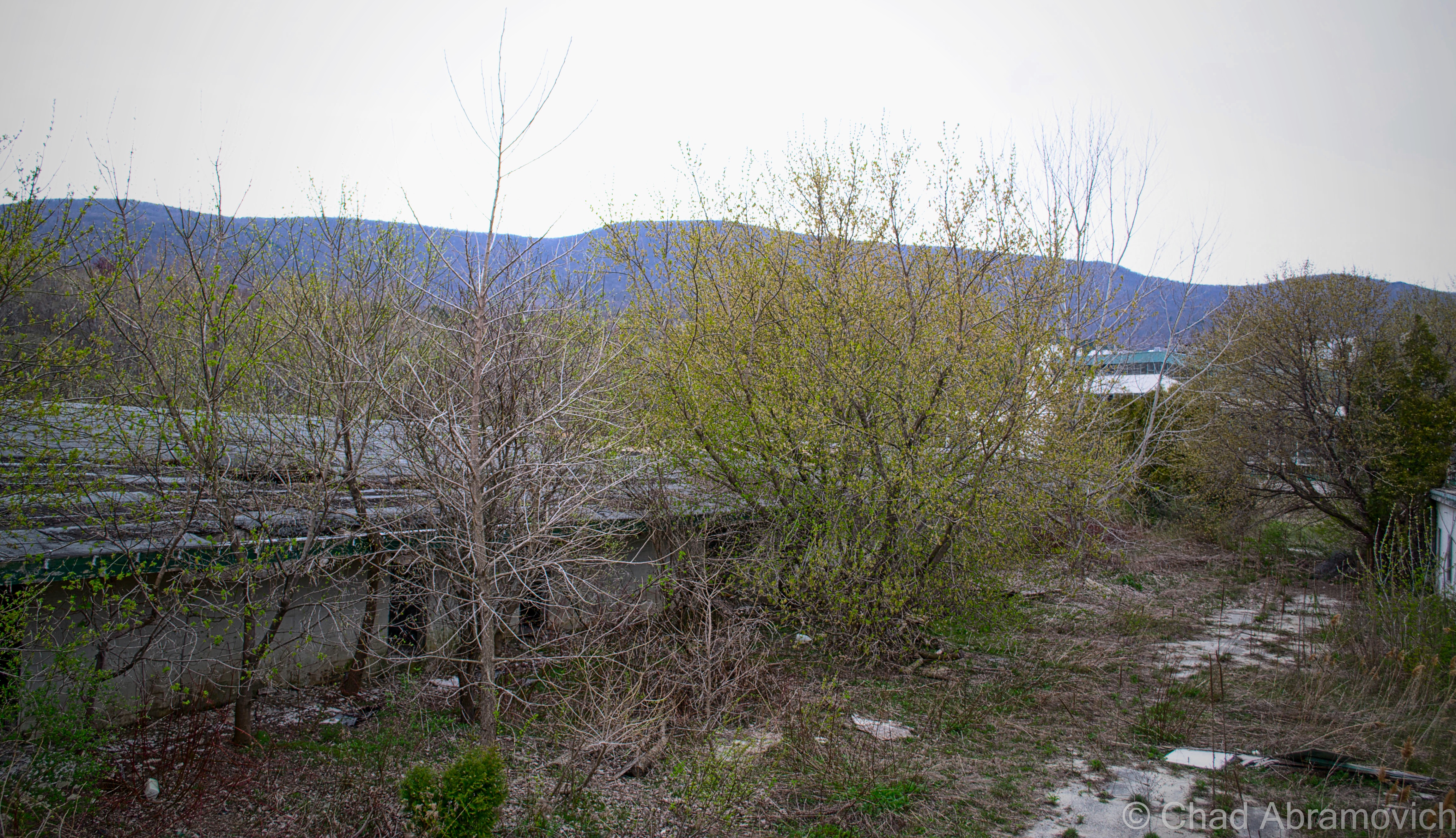
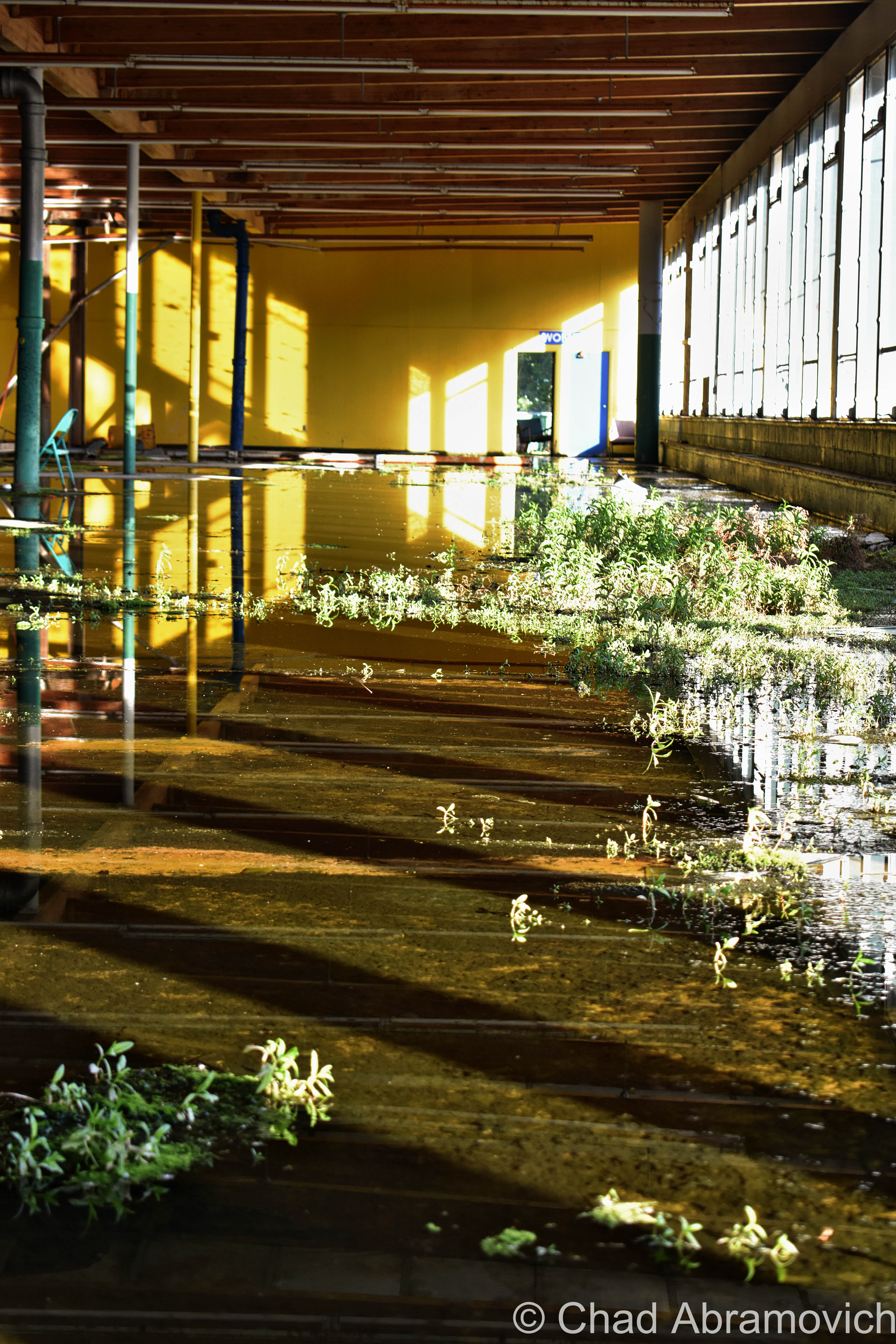
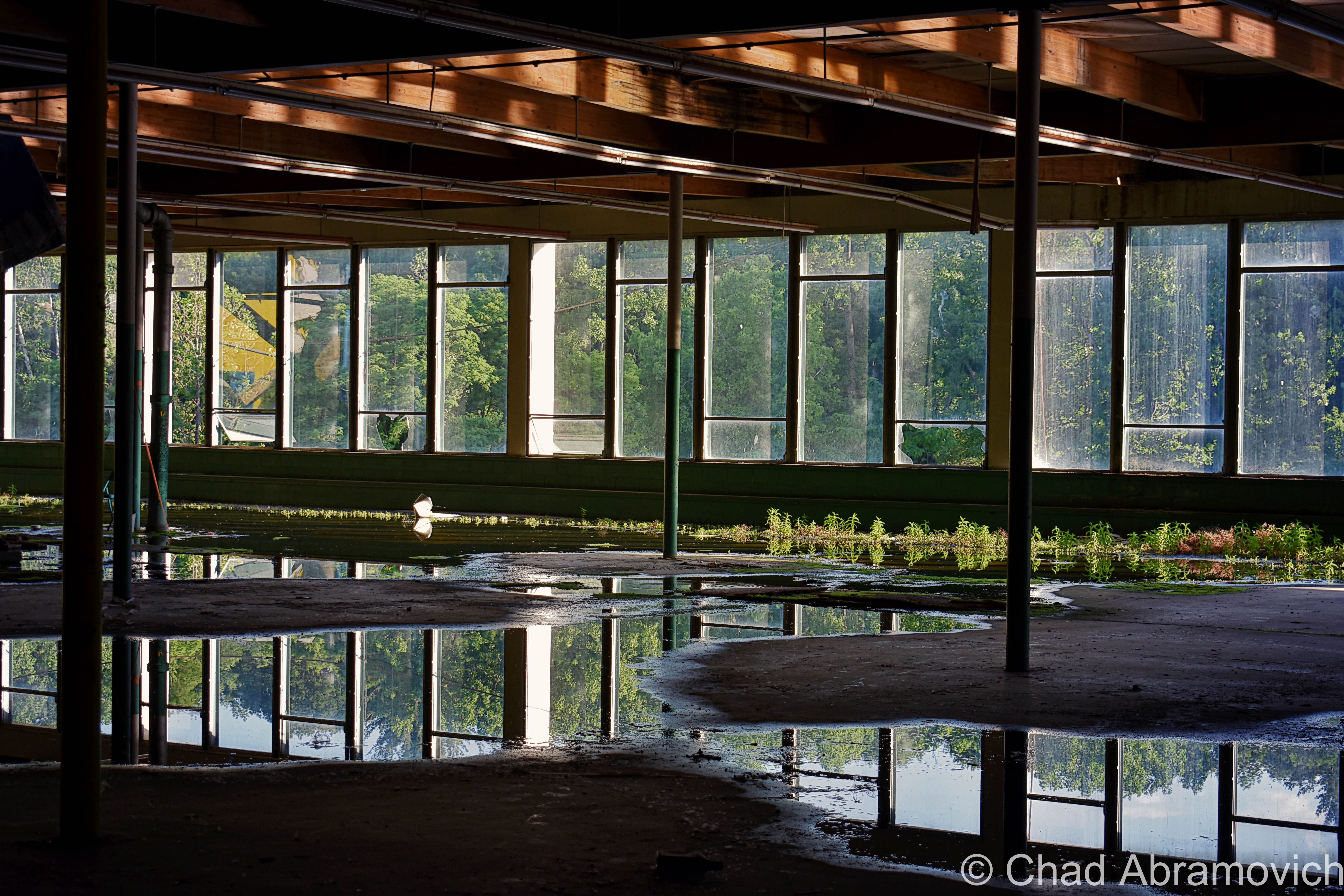
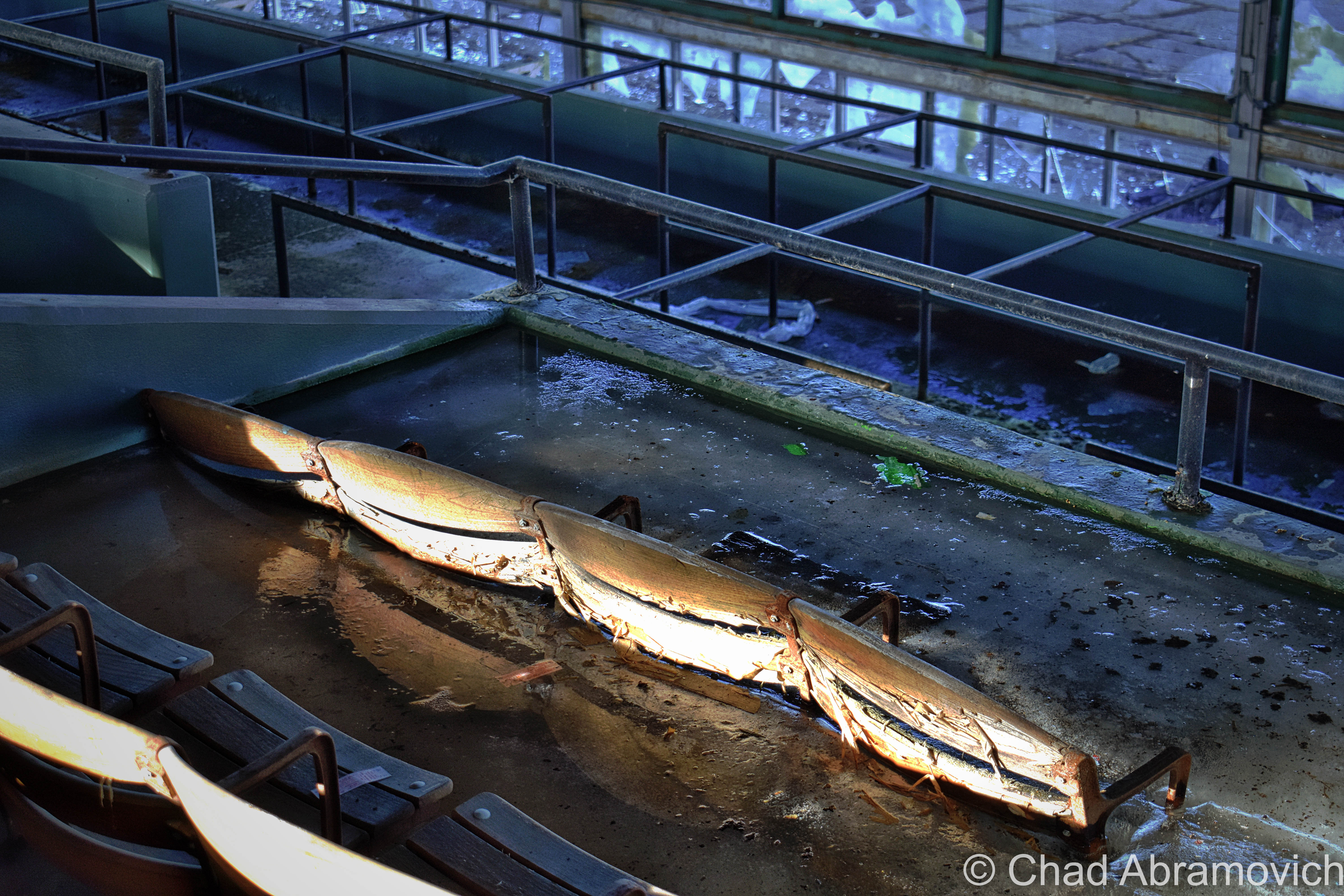
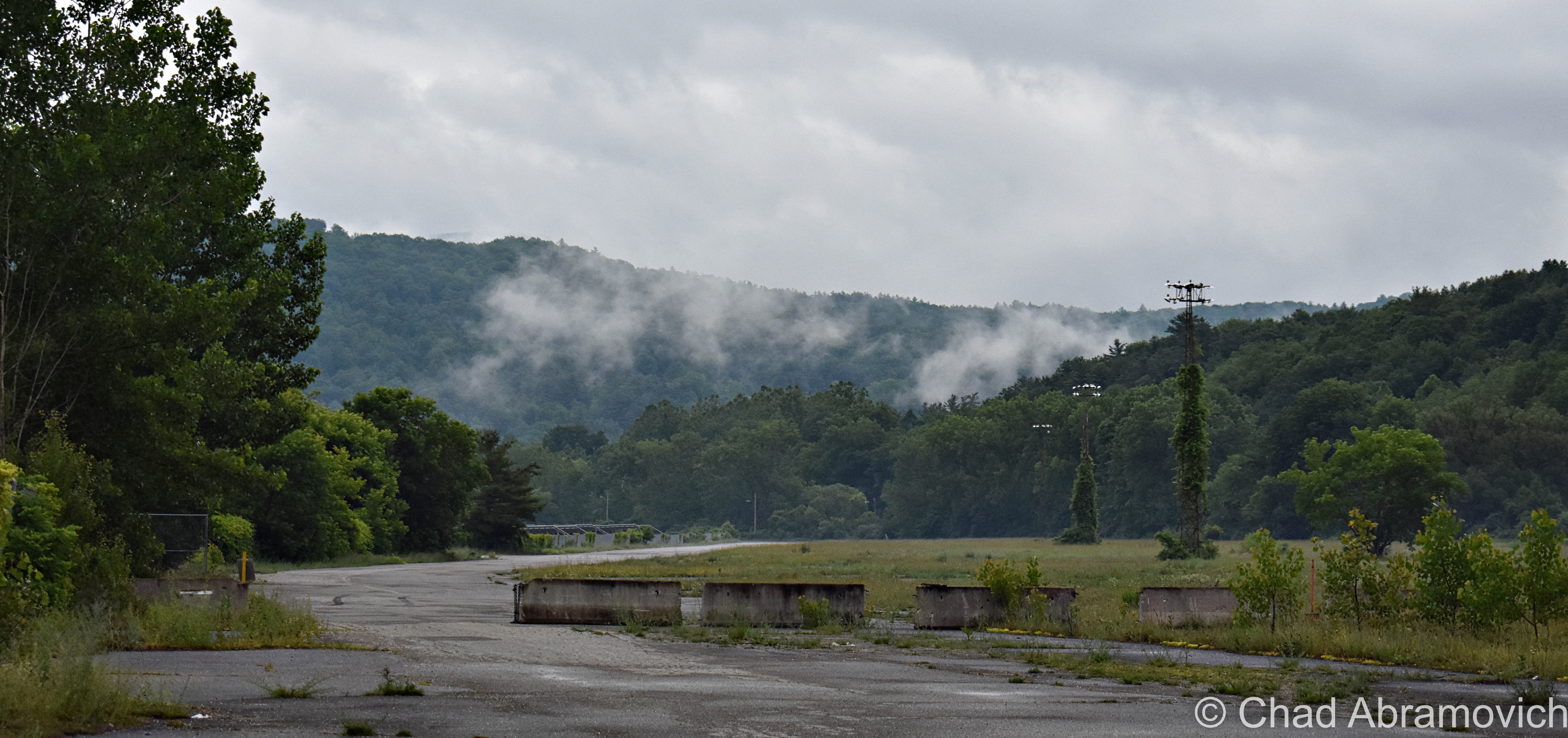
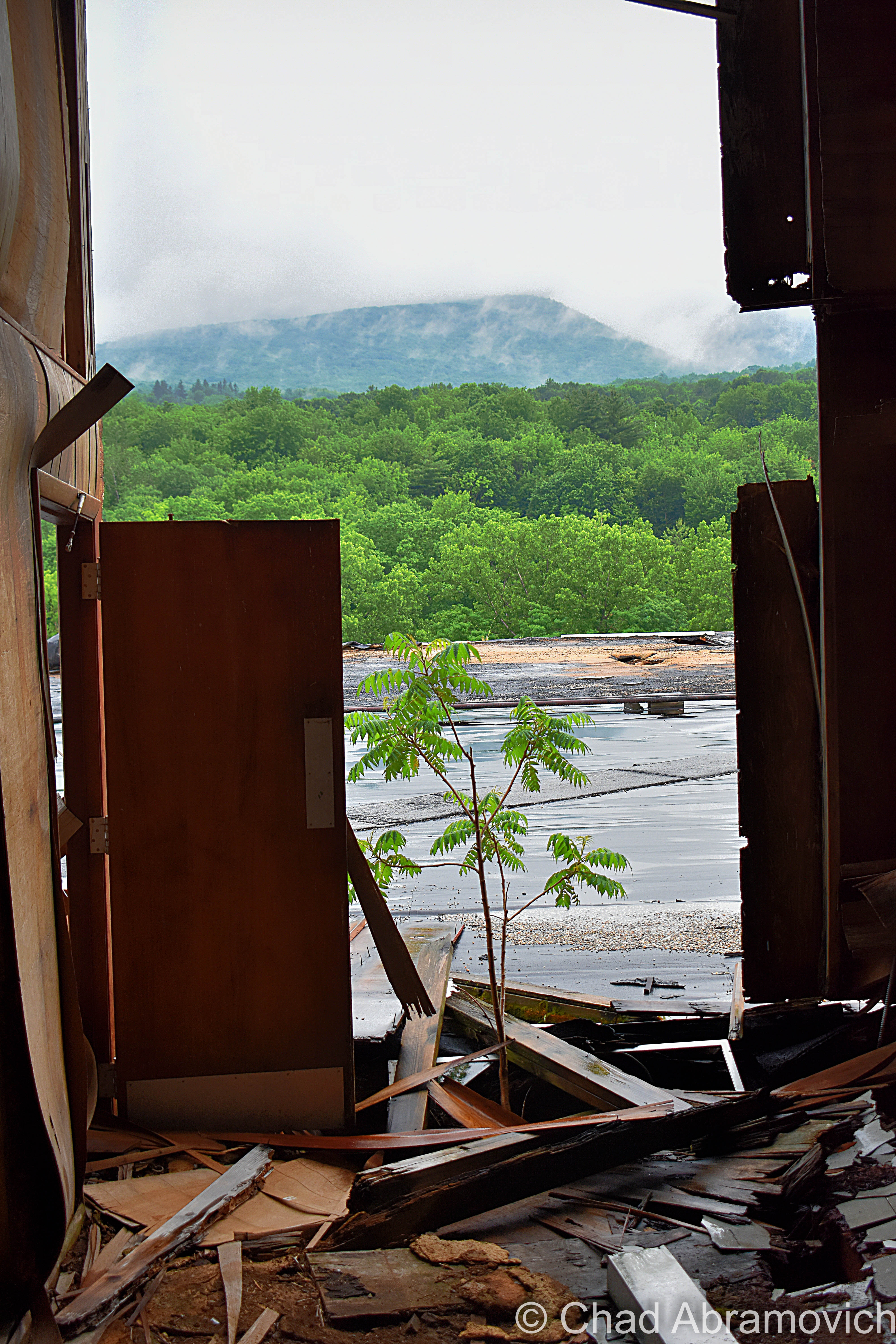
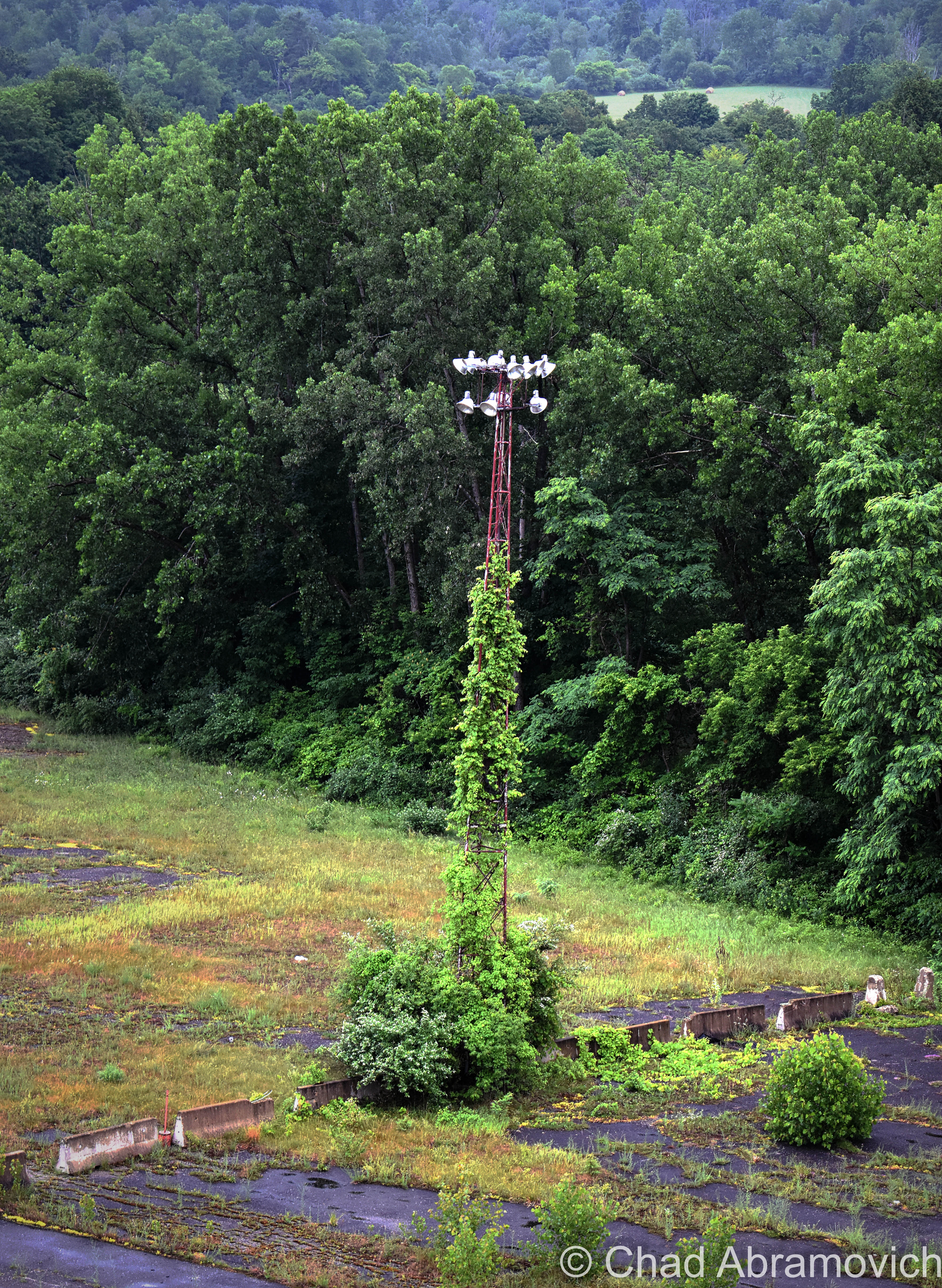
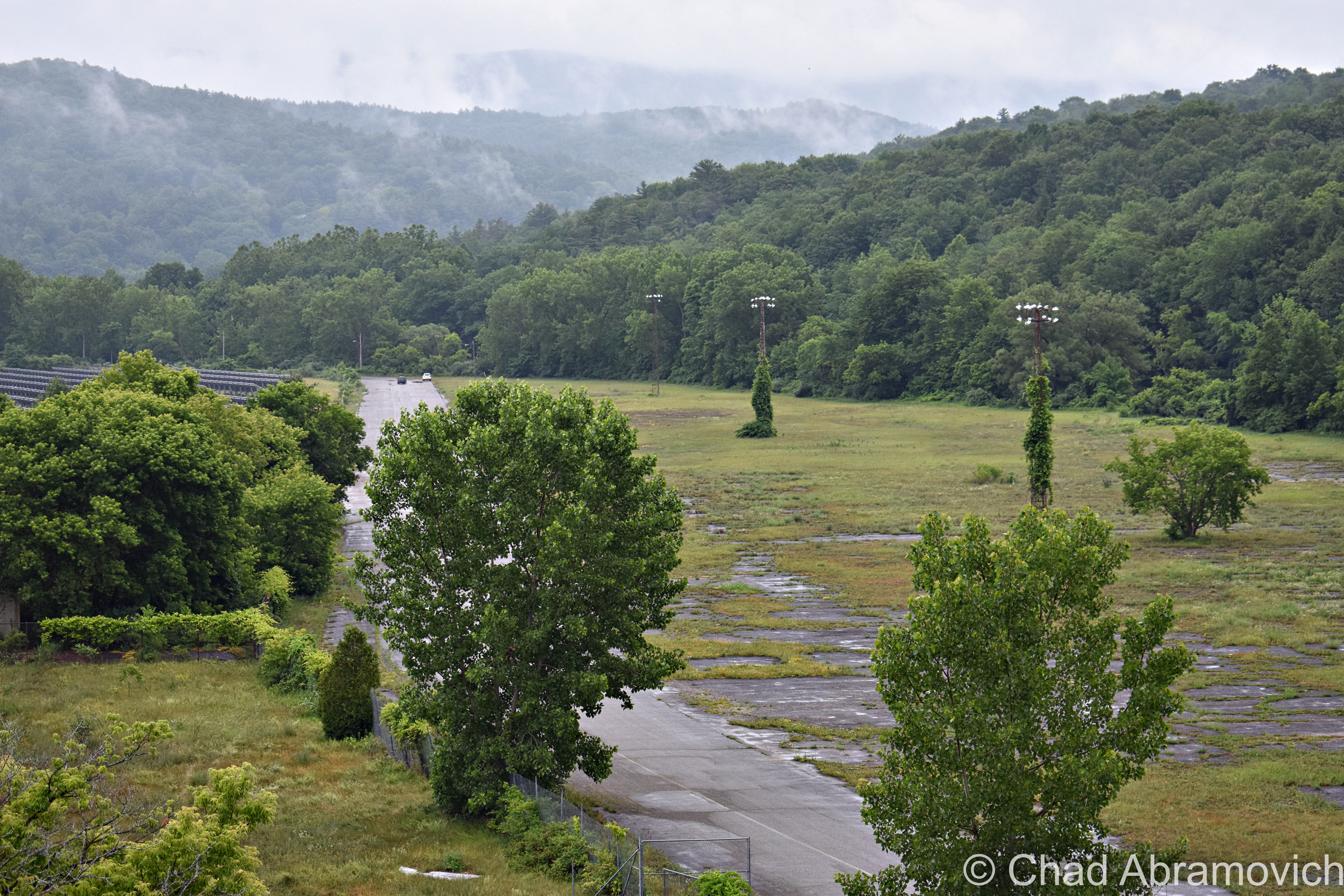
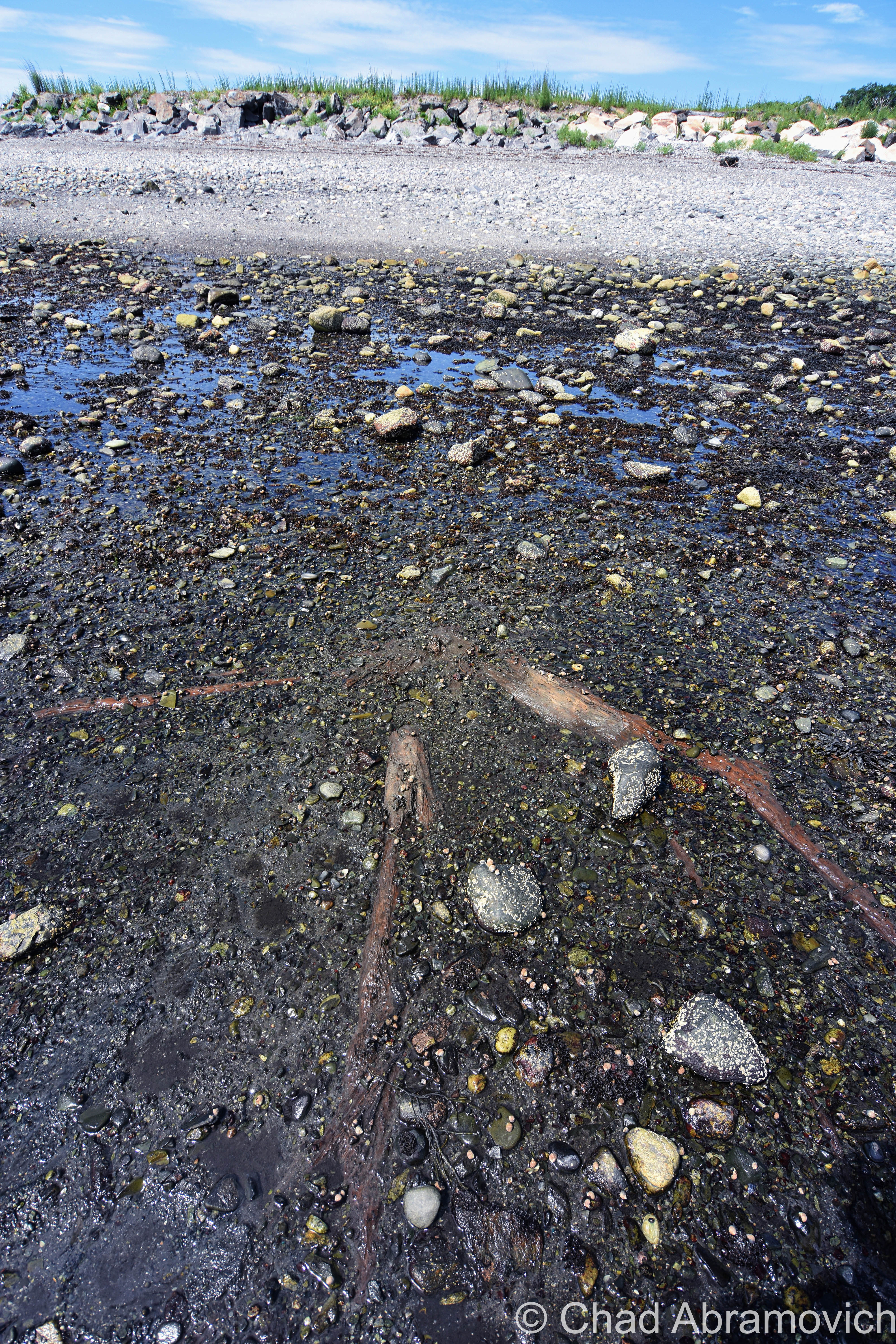
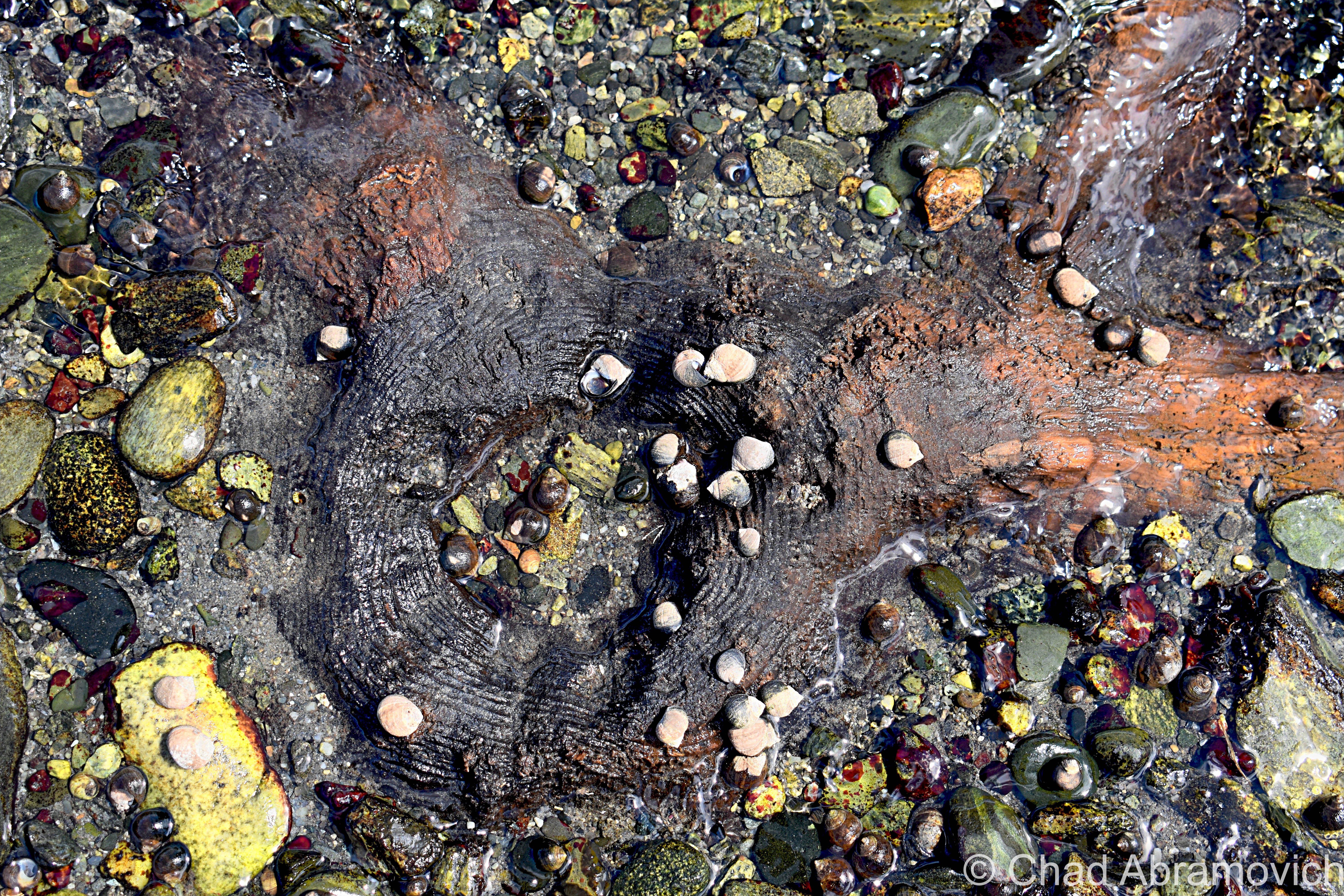
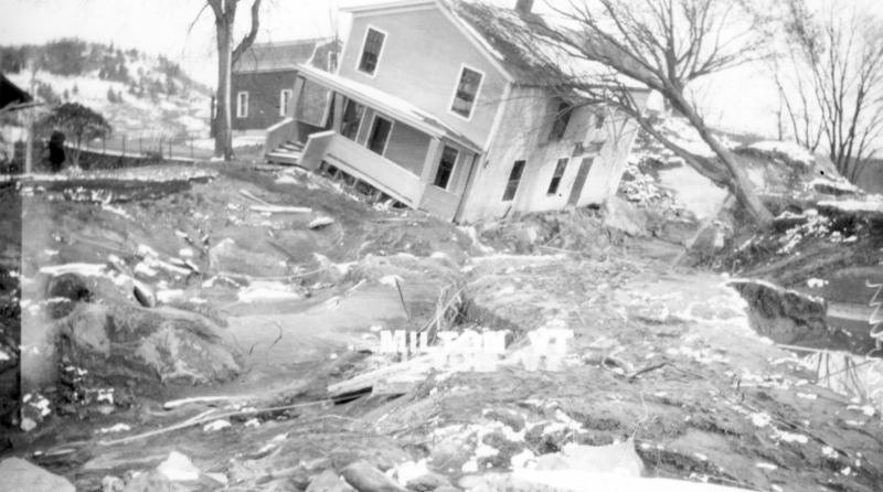
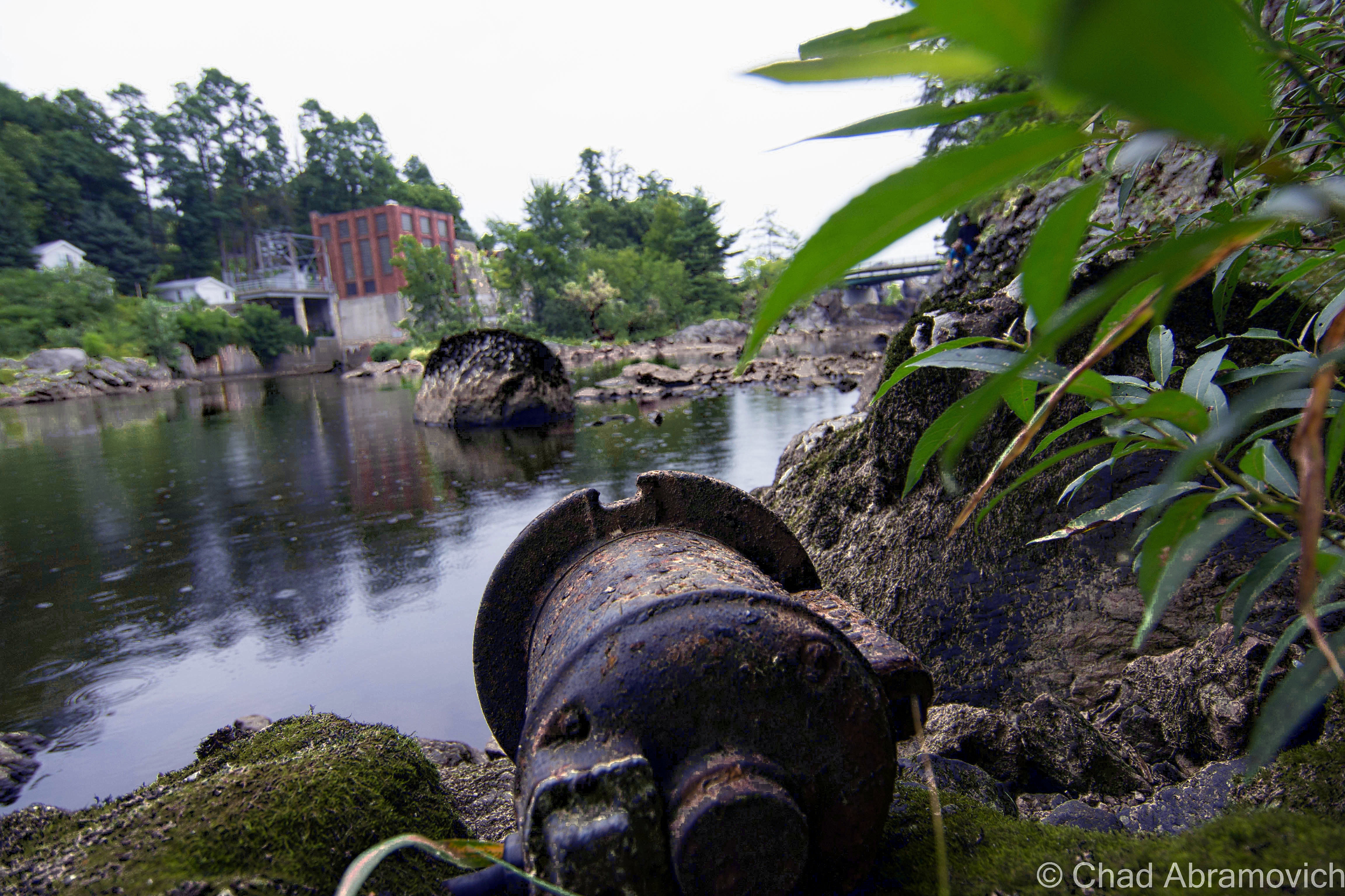
Today, the 144-acre property is abandoned, despite multiple failed attempts to do something with it, and it’s a real shame that nothing has happened yet. Further damage was done when the nearby Hoosic River, a perimeter defining watercourse that wears the Indian appointed name of many local toponyms that variate between “Hoosic” and “Hoosac” – and has a history steeped in local lore – flooded its banks significantly a while back and seeped into the lower levels of the building.

The site has so much potential – especially being off the most traveled road in Vermont. Lollapalooza held their festivities on the expansive grounds in 1996, and a few antique car shows also took advantage of the space between 2005 and 2008, which fits right in seeing as the iconic Hemmings Motor News is located up the road in Bennington in a rad, restored Sunoco station.

Williams College, a few miles south of the old track, even did a study about the property in 2011 and suggested everything from affordable housing, light manufacturing, or bringing back some agriculture.

Until any of that happens, you can’t miss the place. It’s an intriguing, conspicuous eyesore at one of the main entry points into the state – dominating a portion of the view as Route 7 begins to climb the mountains towards Bennington.

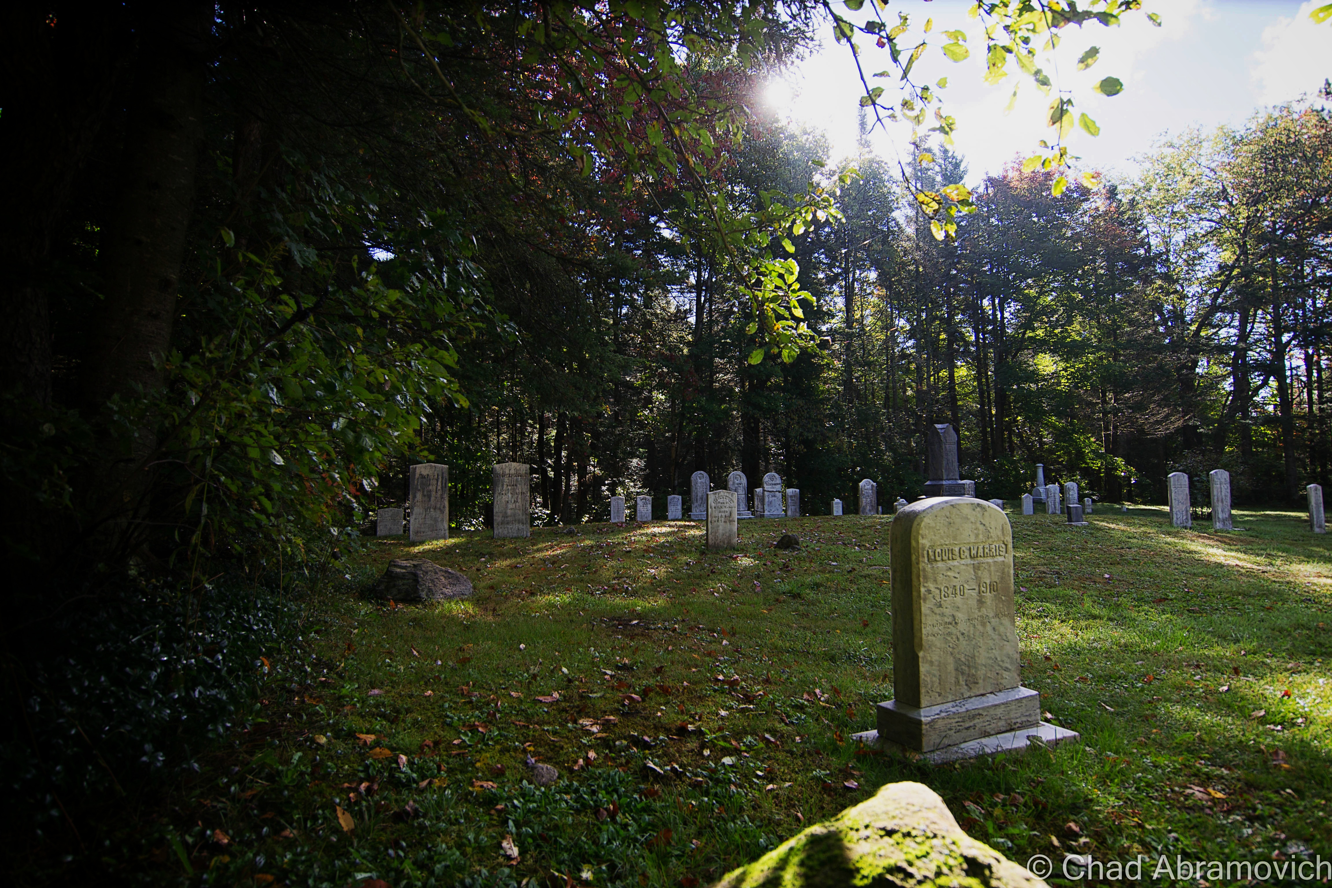
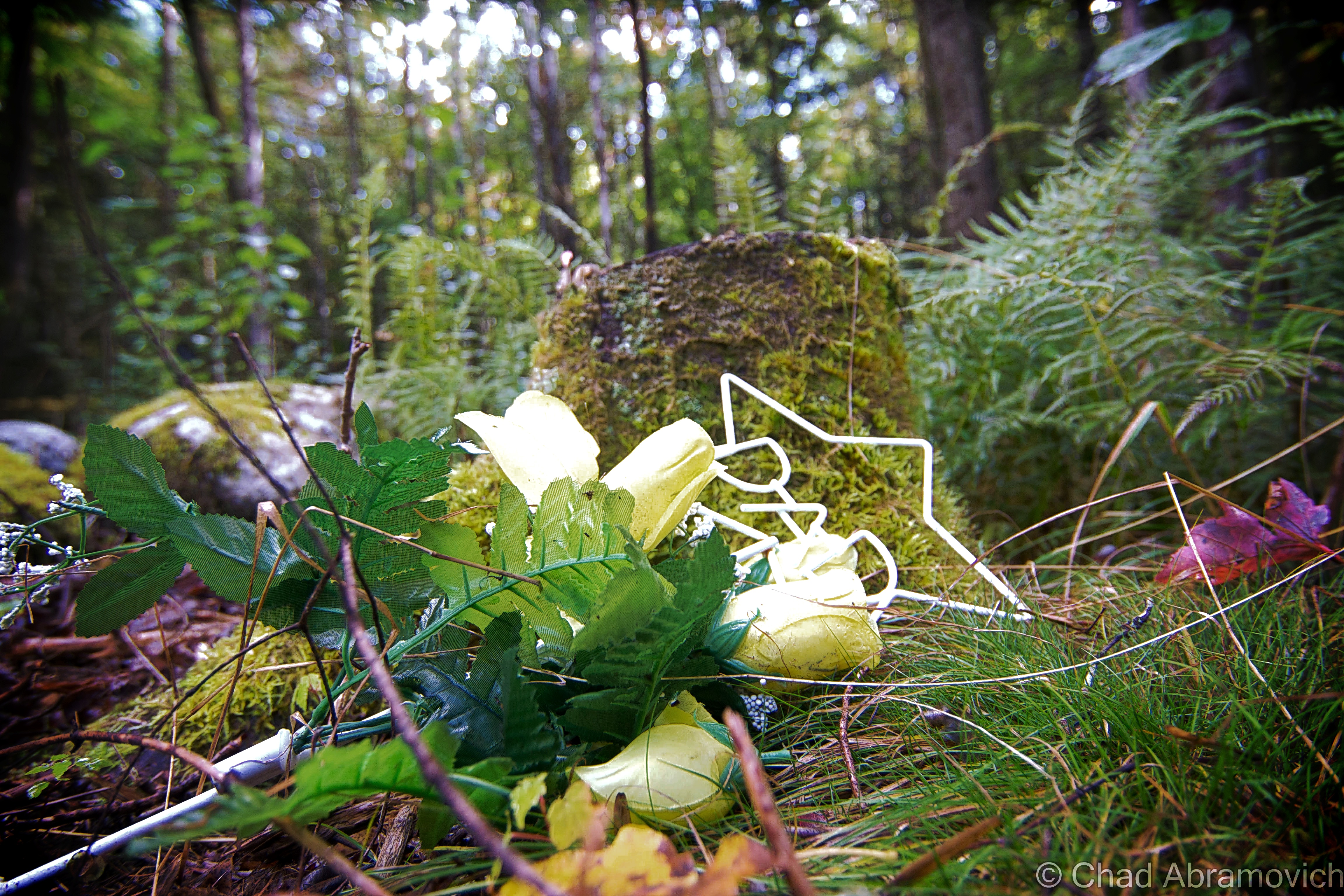
One of the biggest curiosities about this property to me was the name of its access road. The unassuming road is named after a cemetery, but I’ve walked around the grounds and I couldn’t spot any boneyards. It made me wonder – back in the day, moving an old cemetery wasn’t as big of a deal as it would be nowadays. Could there have been an old family plot from an old farm that was erased? Are there still corpses trapped underneath the sea of weedy asphalt that encircles the grandstands, or maybe underneath the earth of the old track?

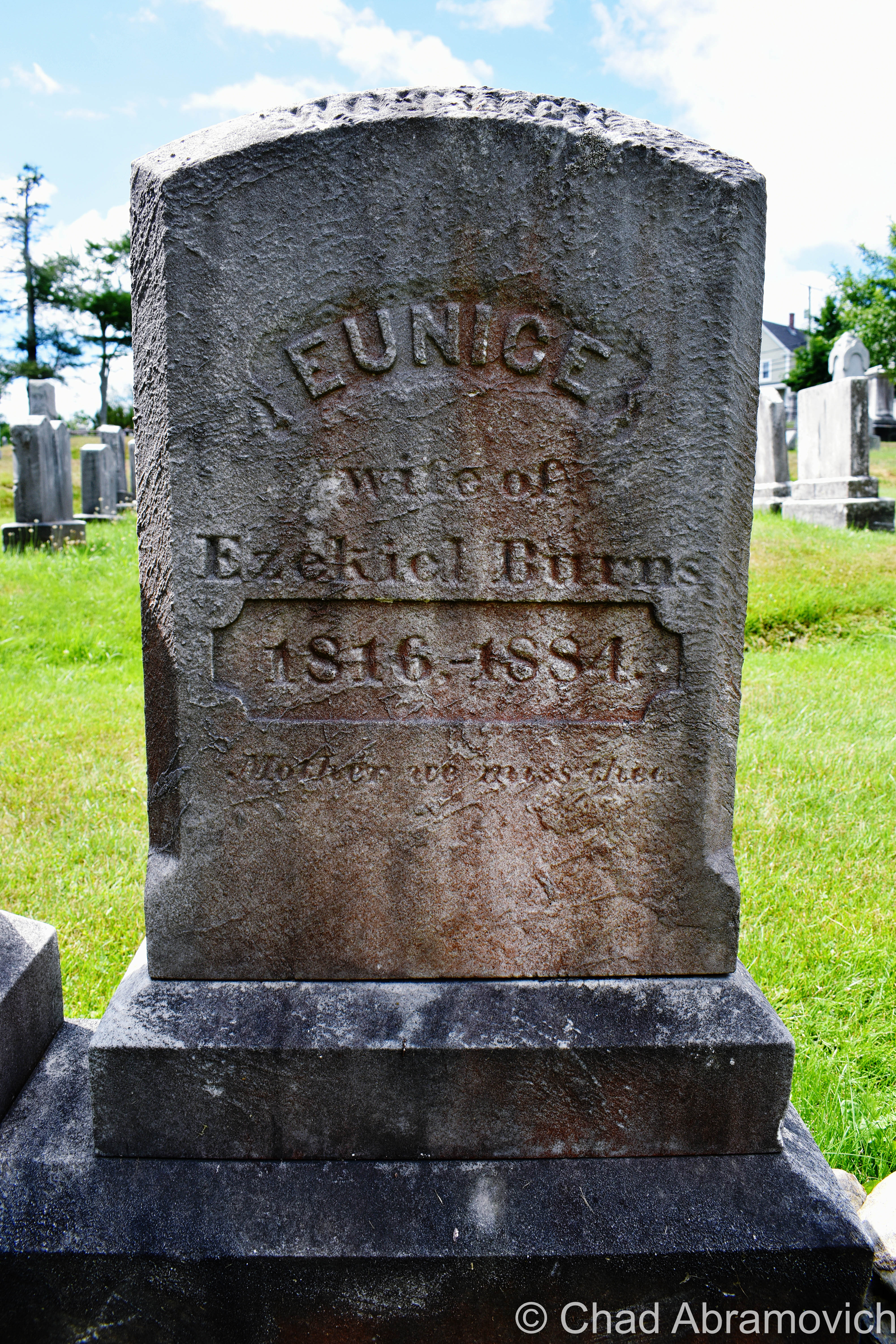
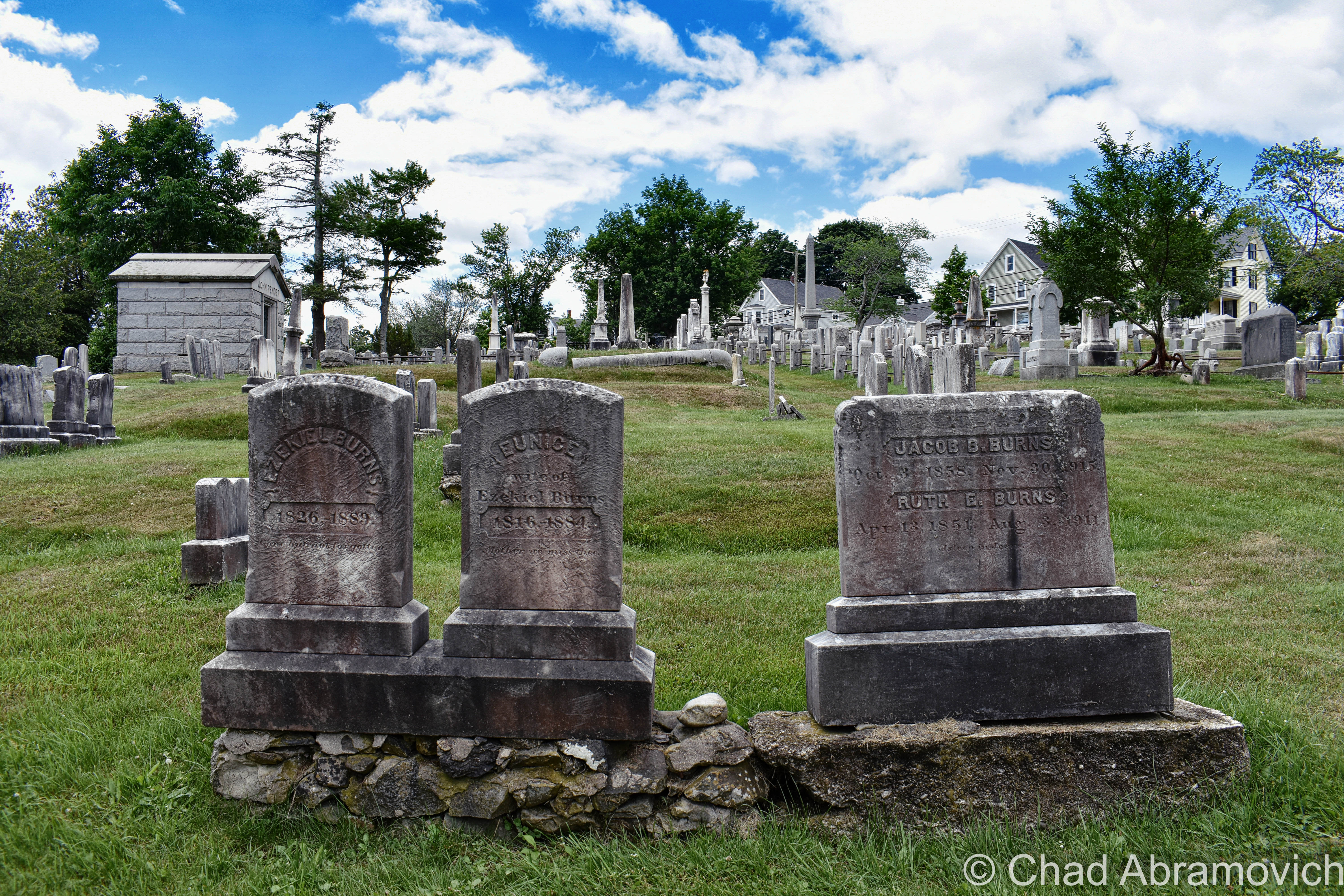
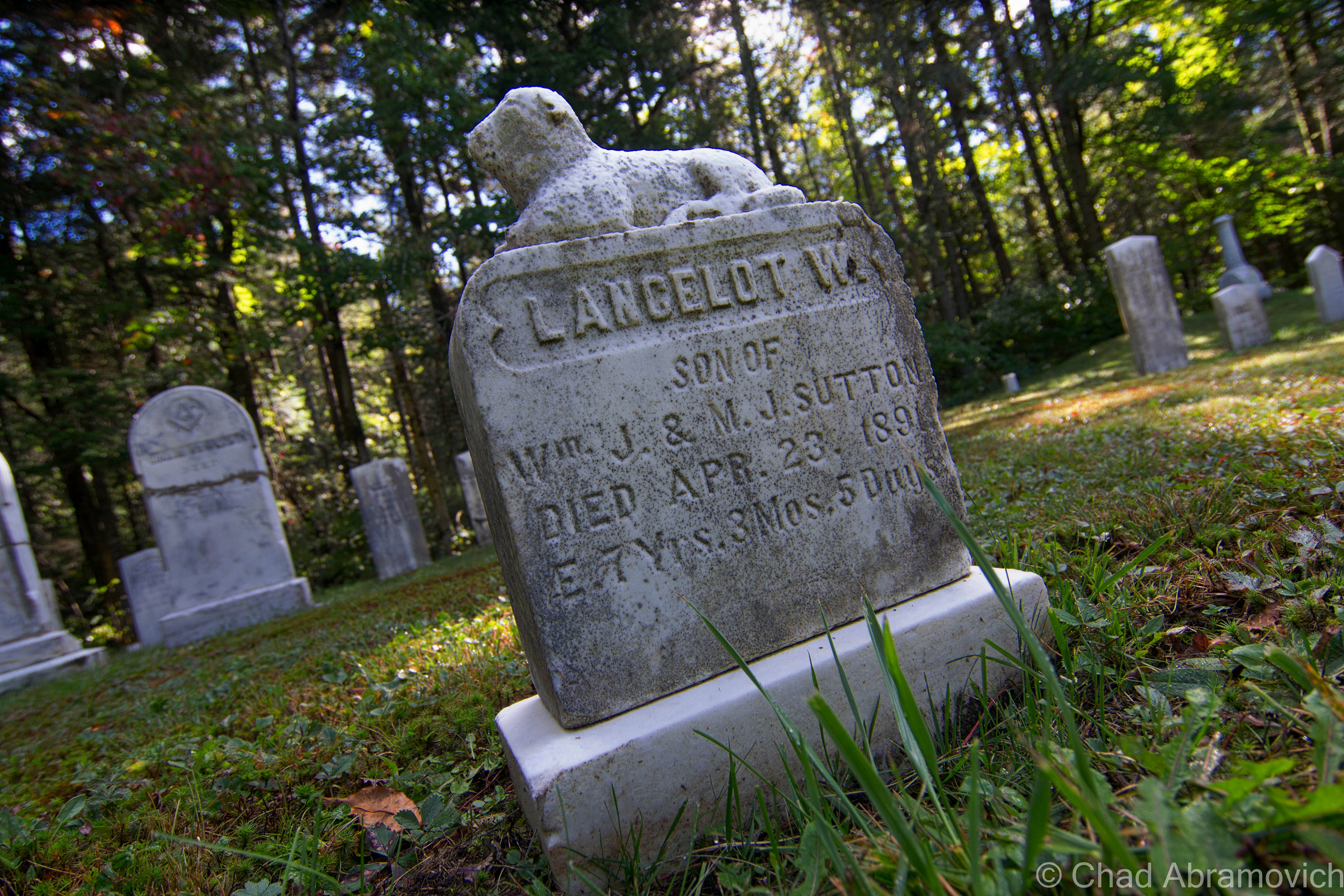
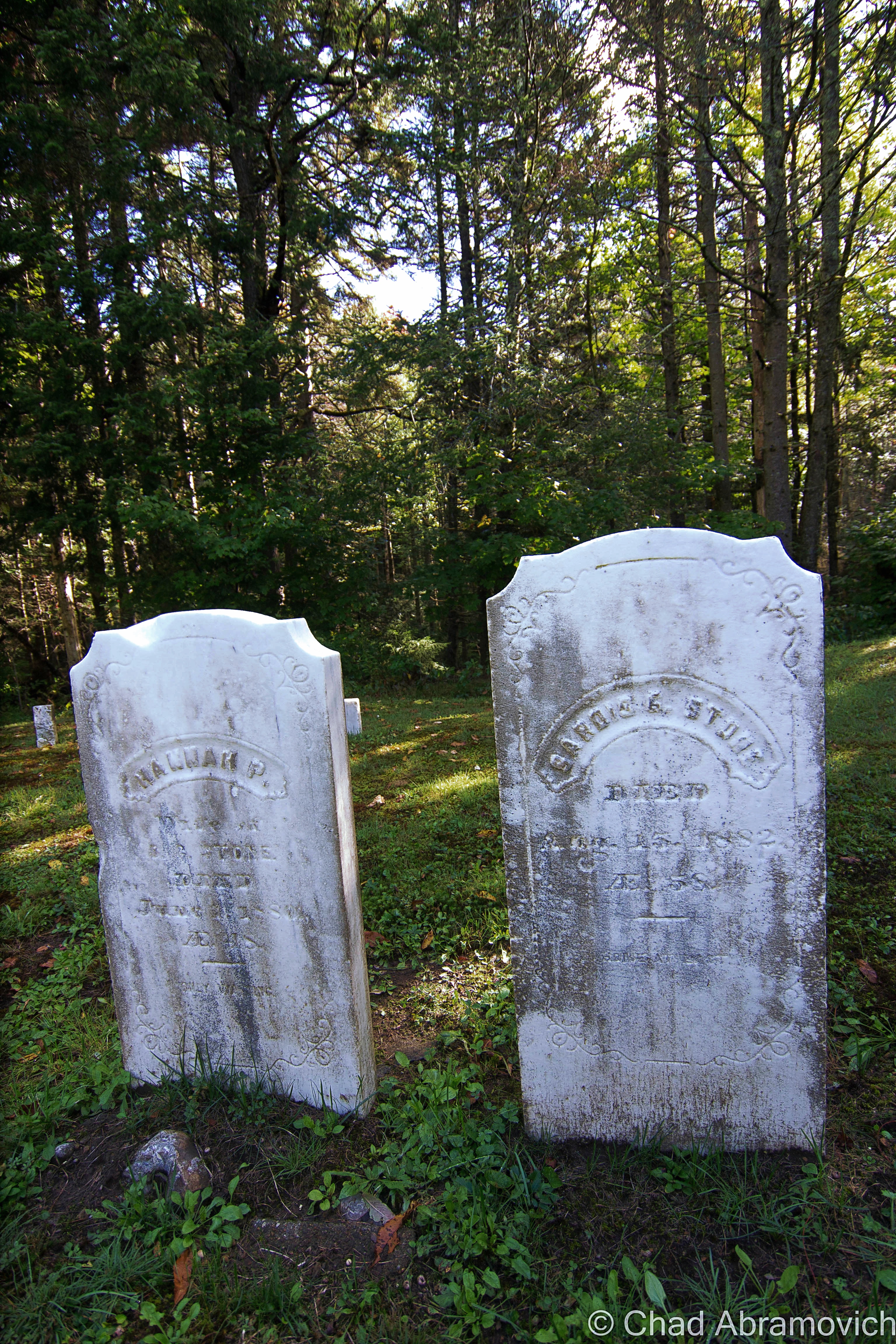
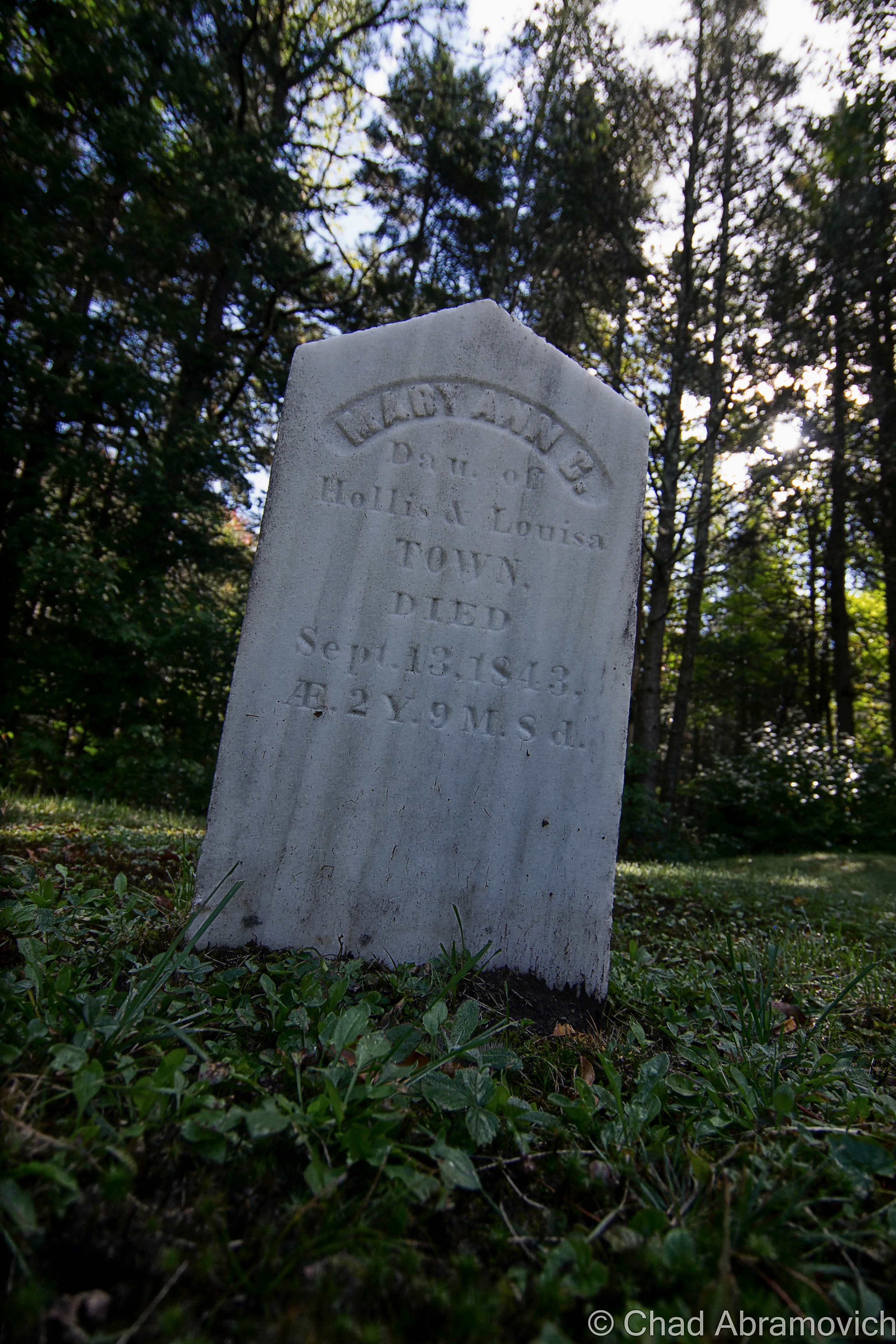
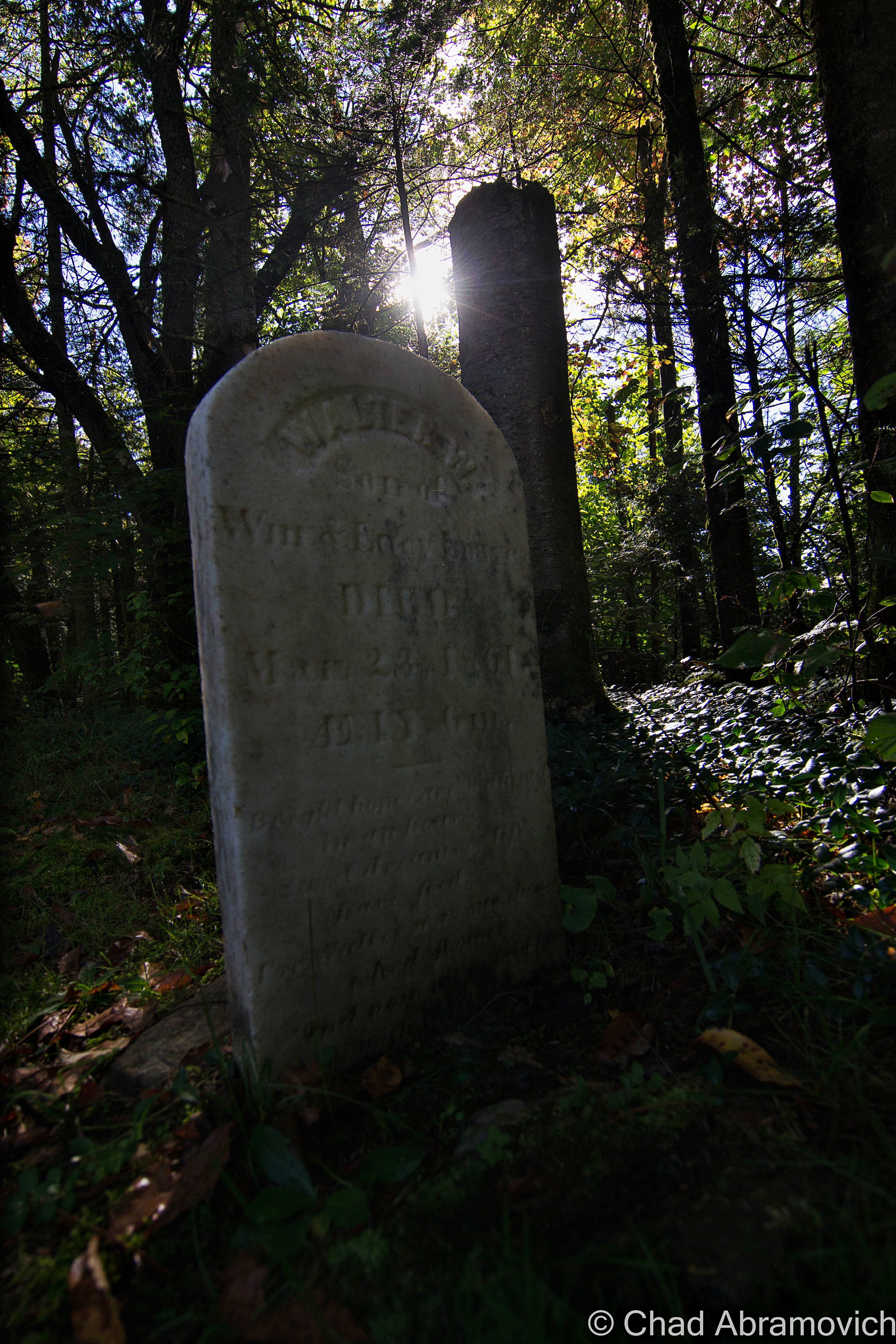
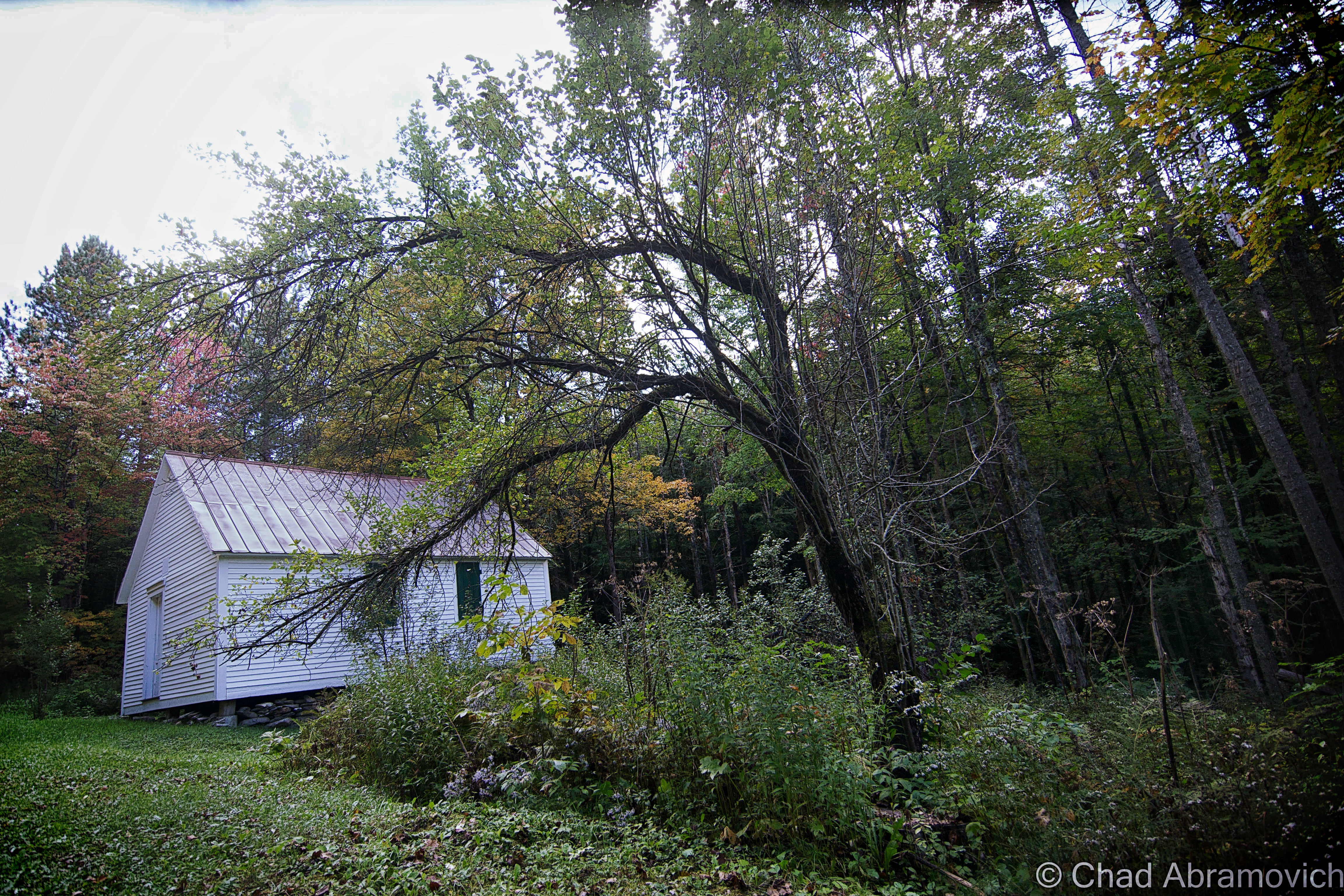
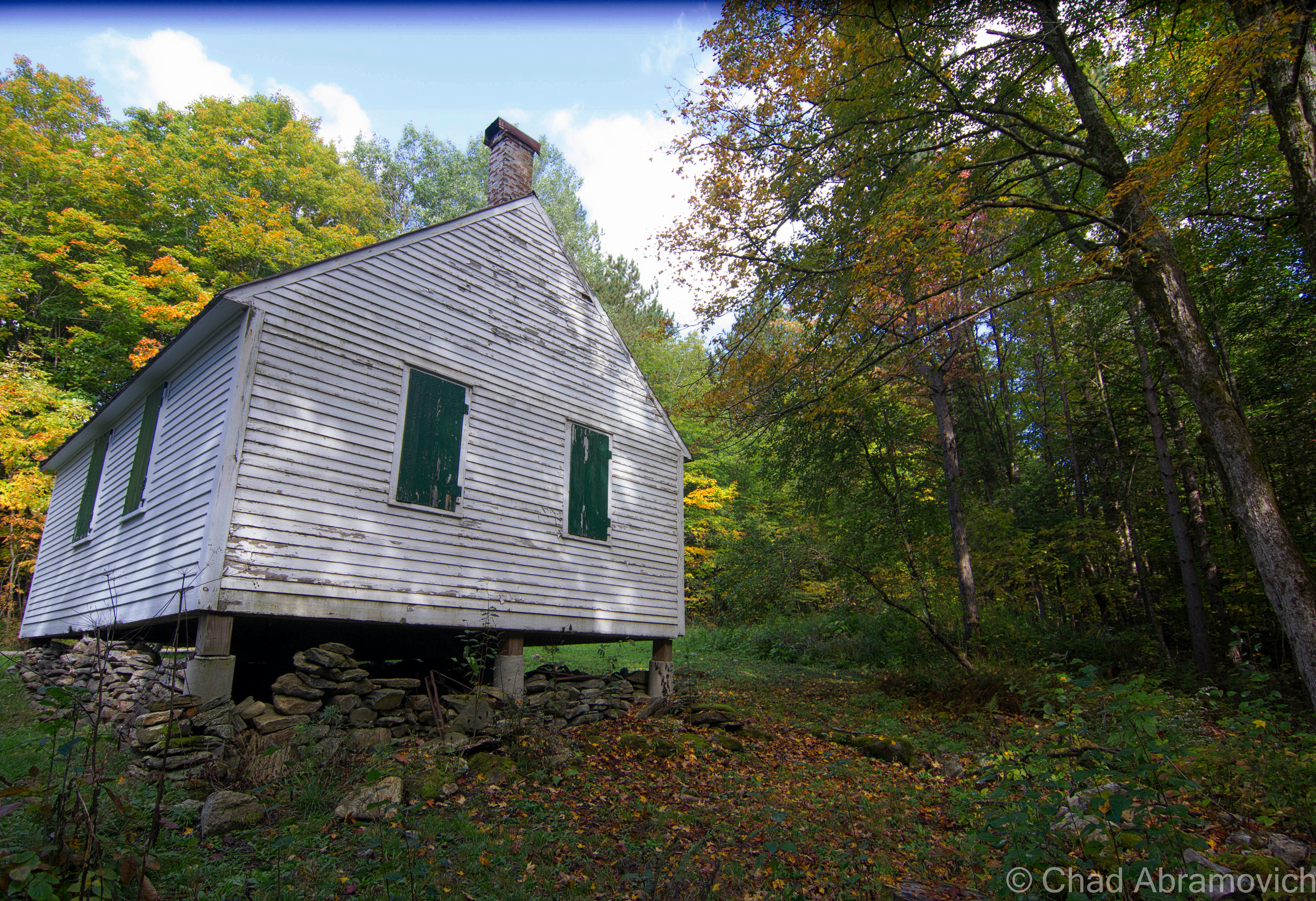
Well, according to Google, the cemetery still exists in a far-flung corner of the property, and it’s the oldest in town – with a gathering of faded and broken 19th-century headstones placed in the woods (Interestingly, Pownal has a lot of cool old cemeteries – and many of them are old farm family plots, which might seem kind of an odd concept in today’s world). I’ll have to give it a visit the next time I stop by.

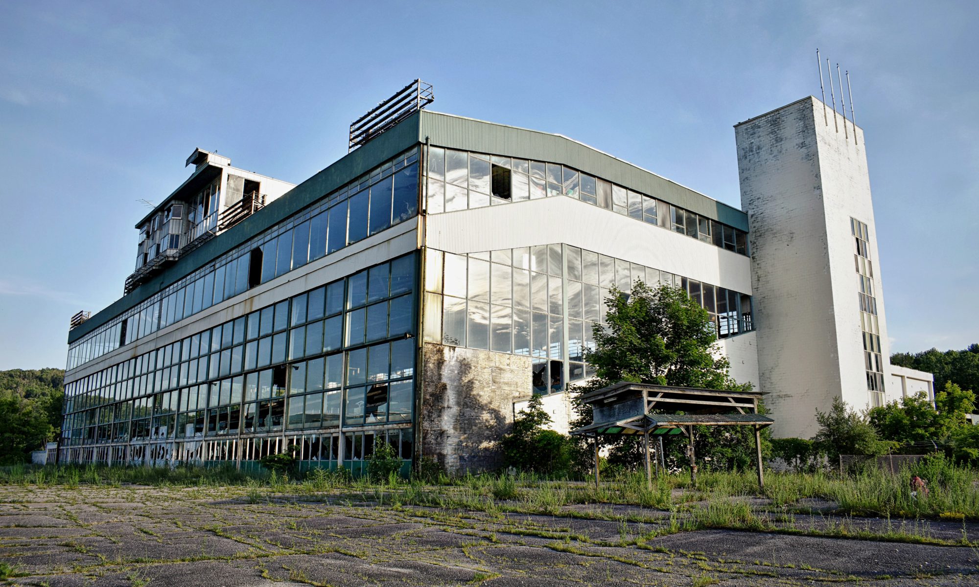
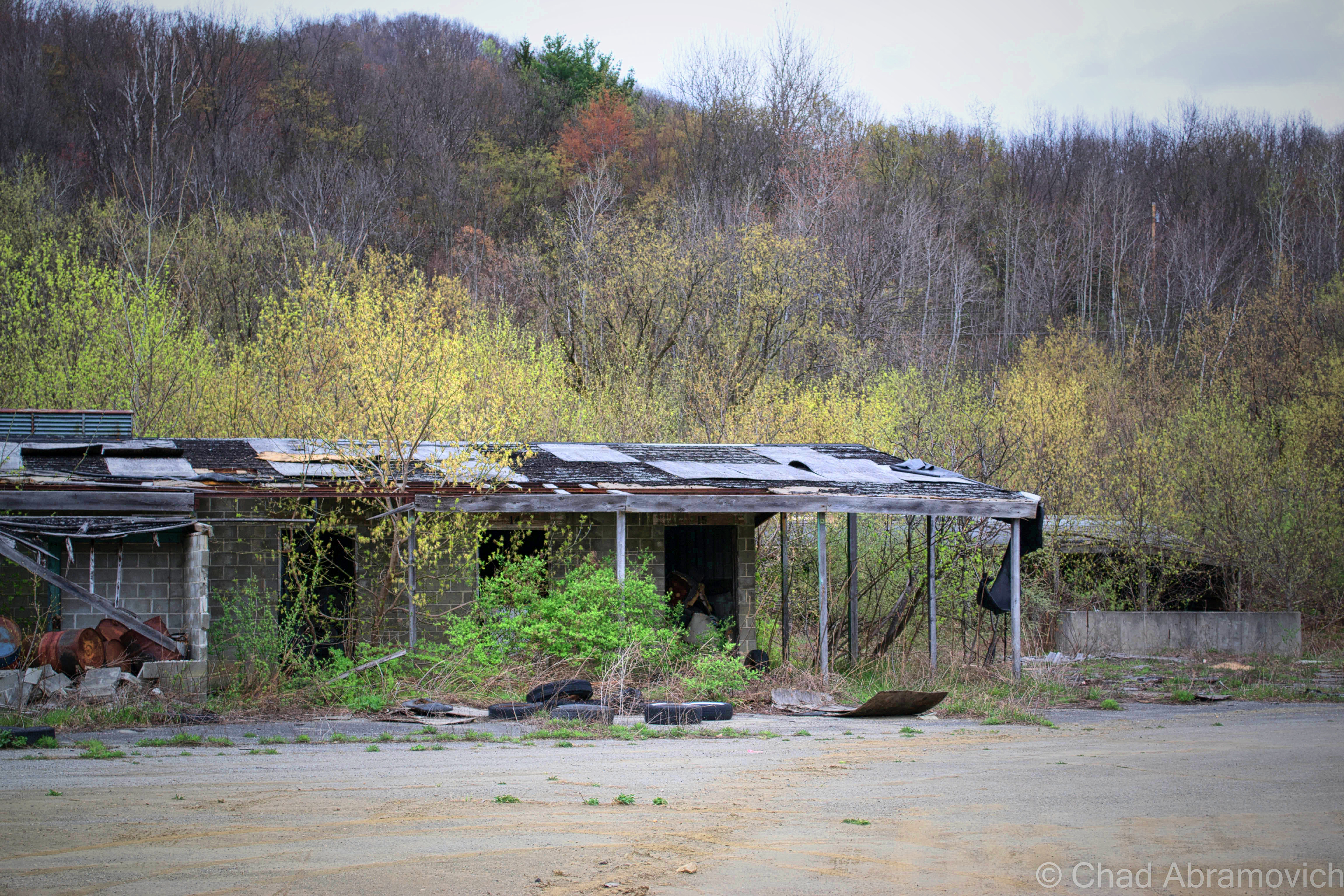
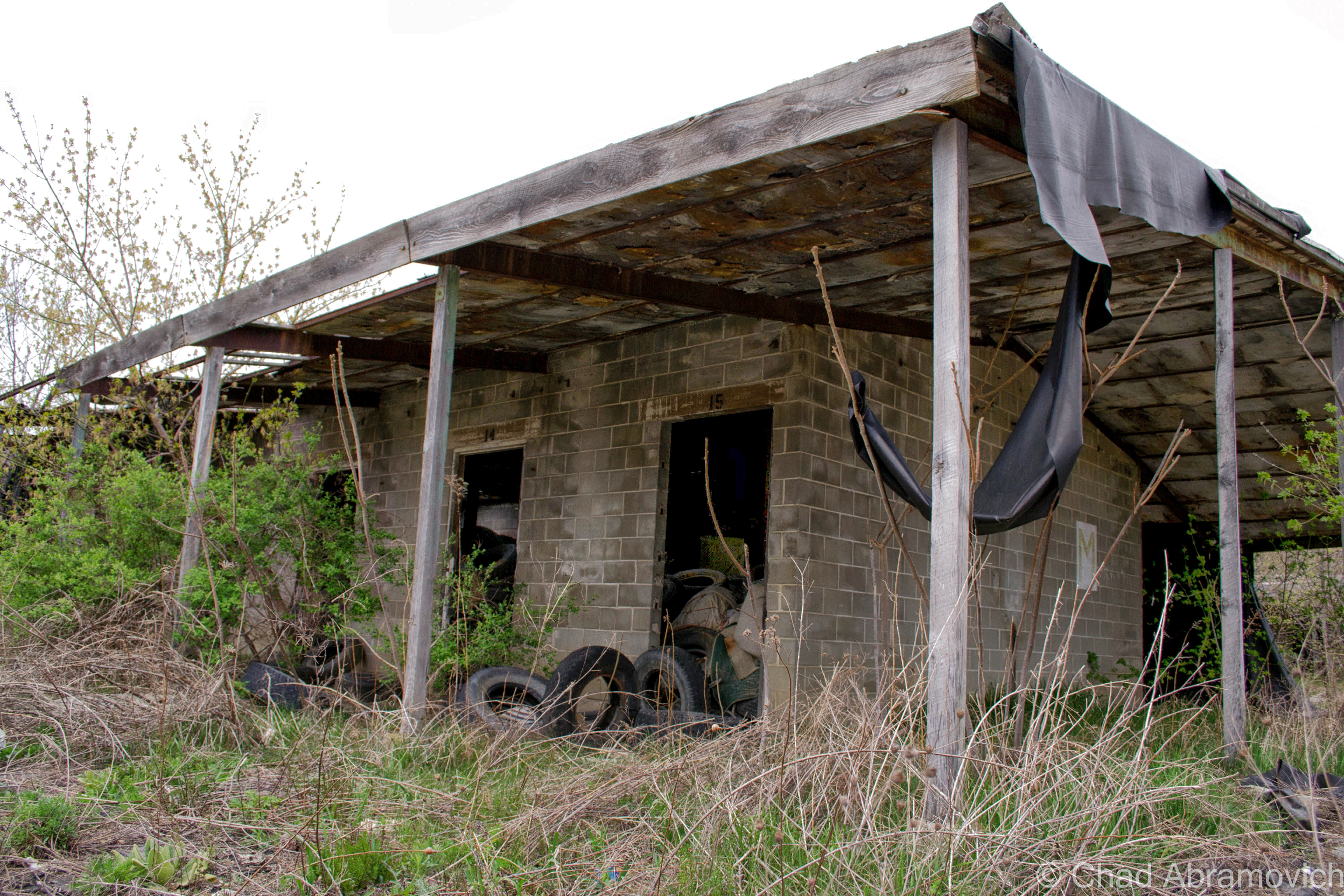
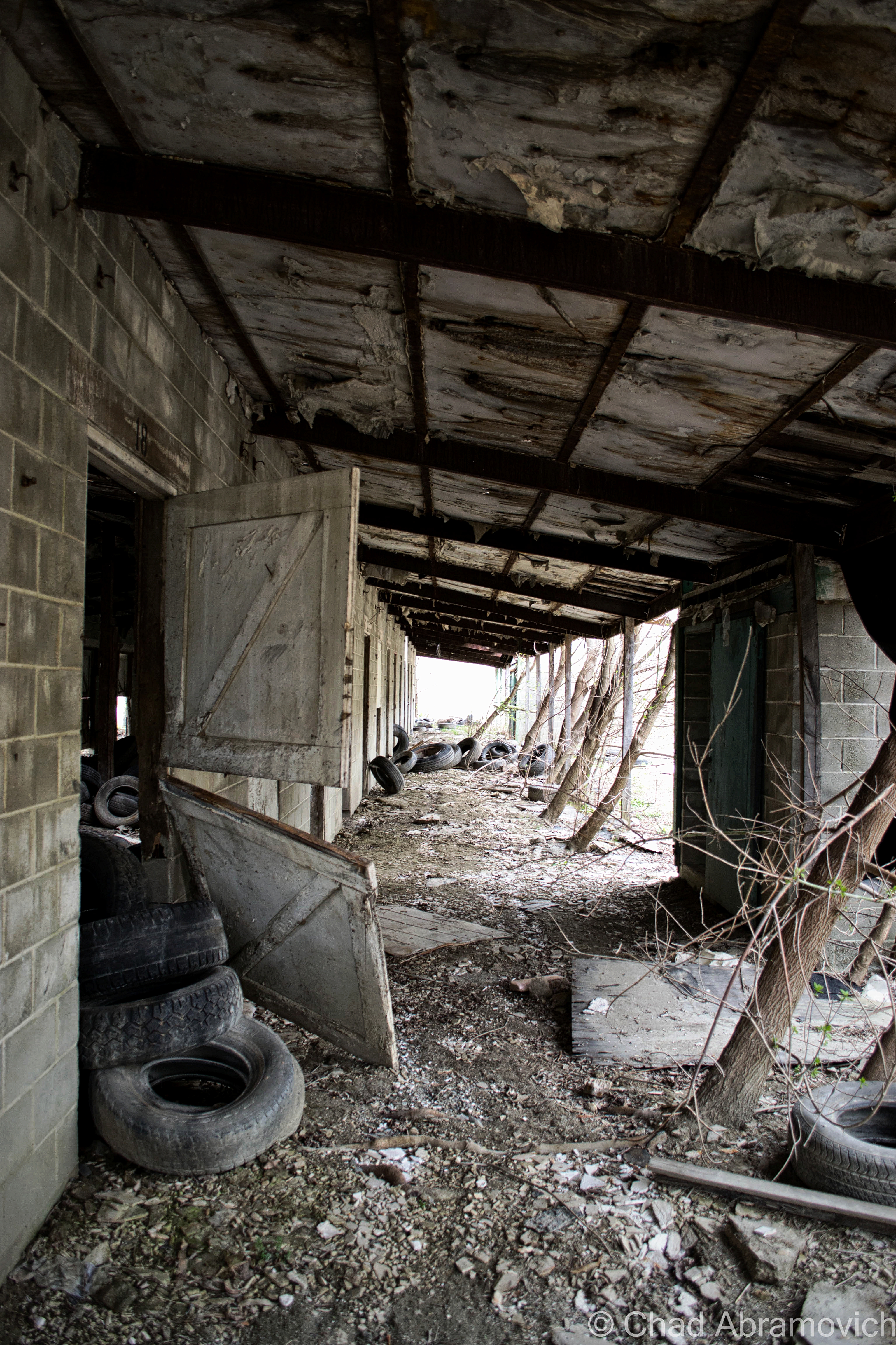
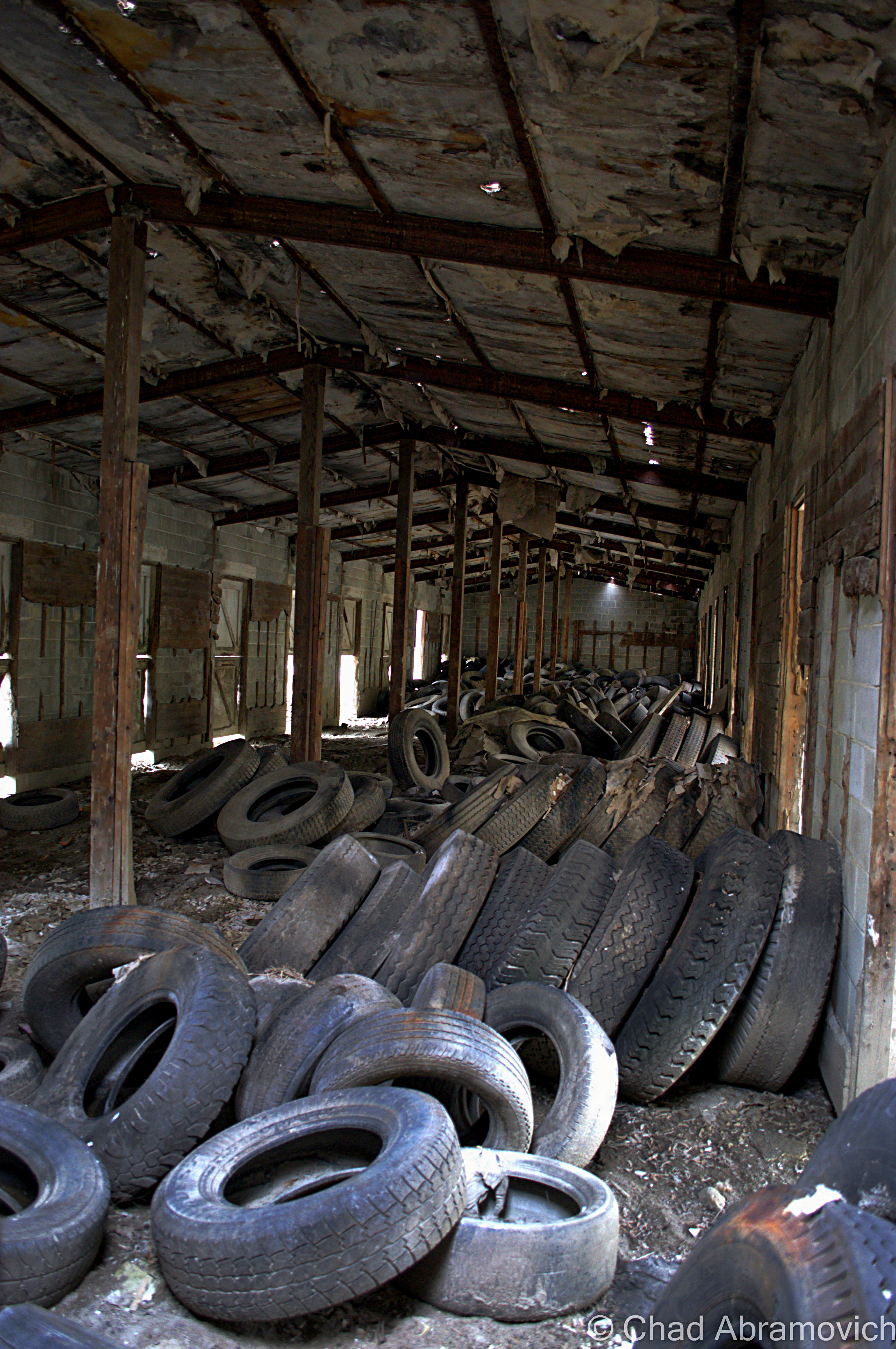
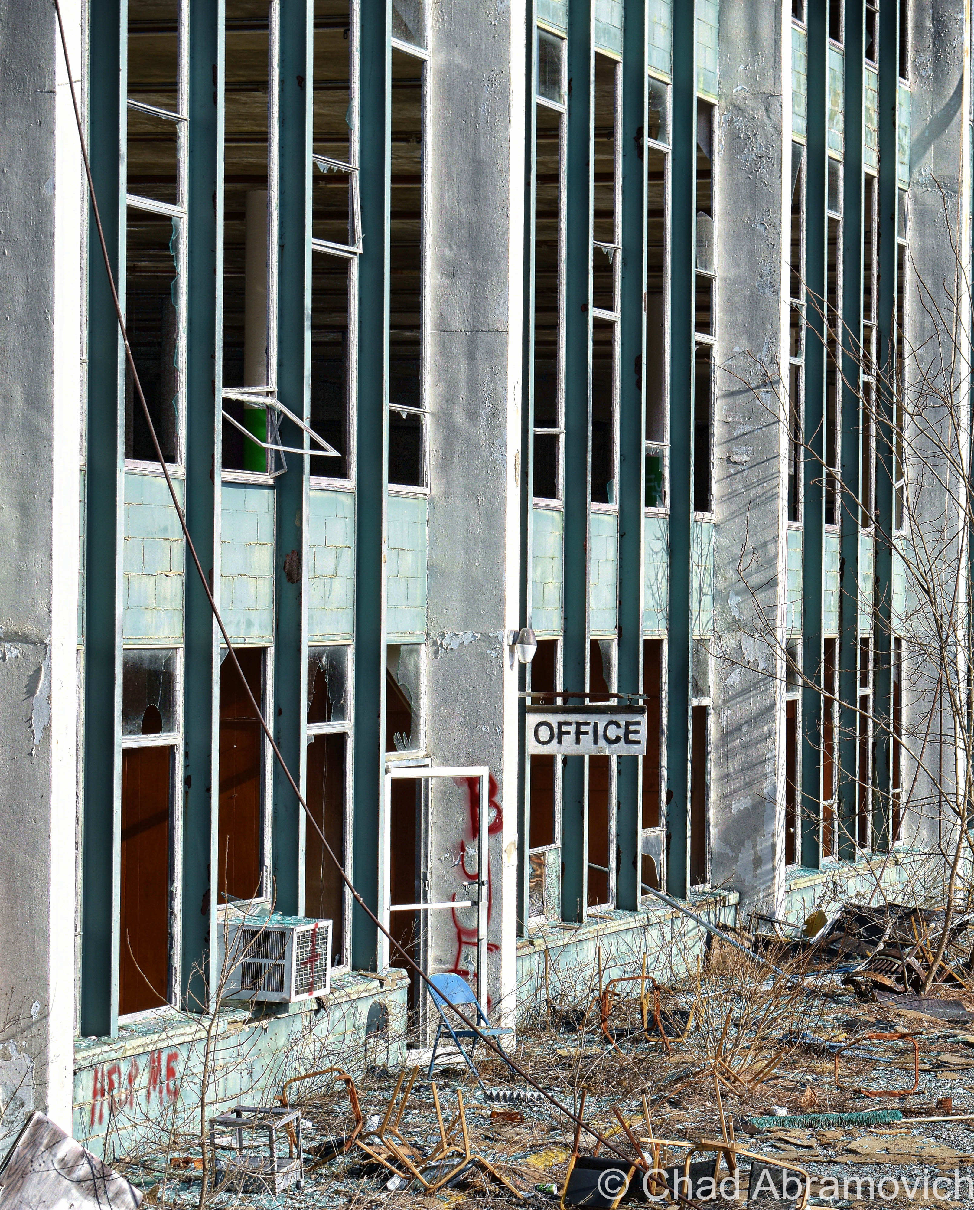
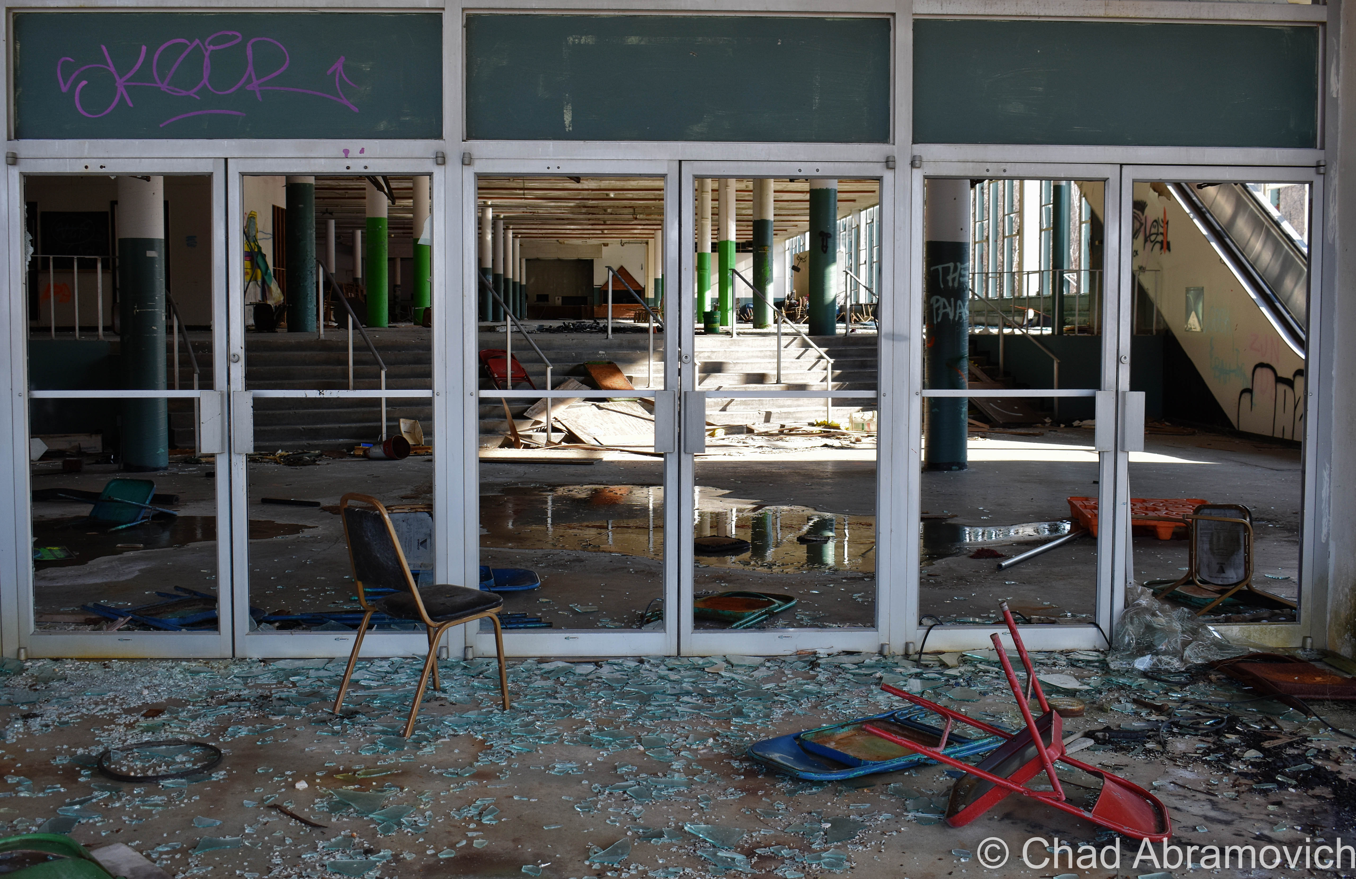
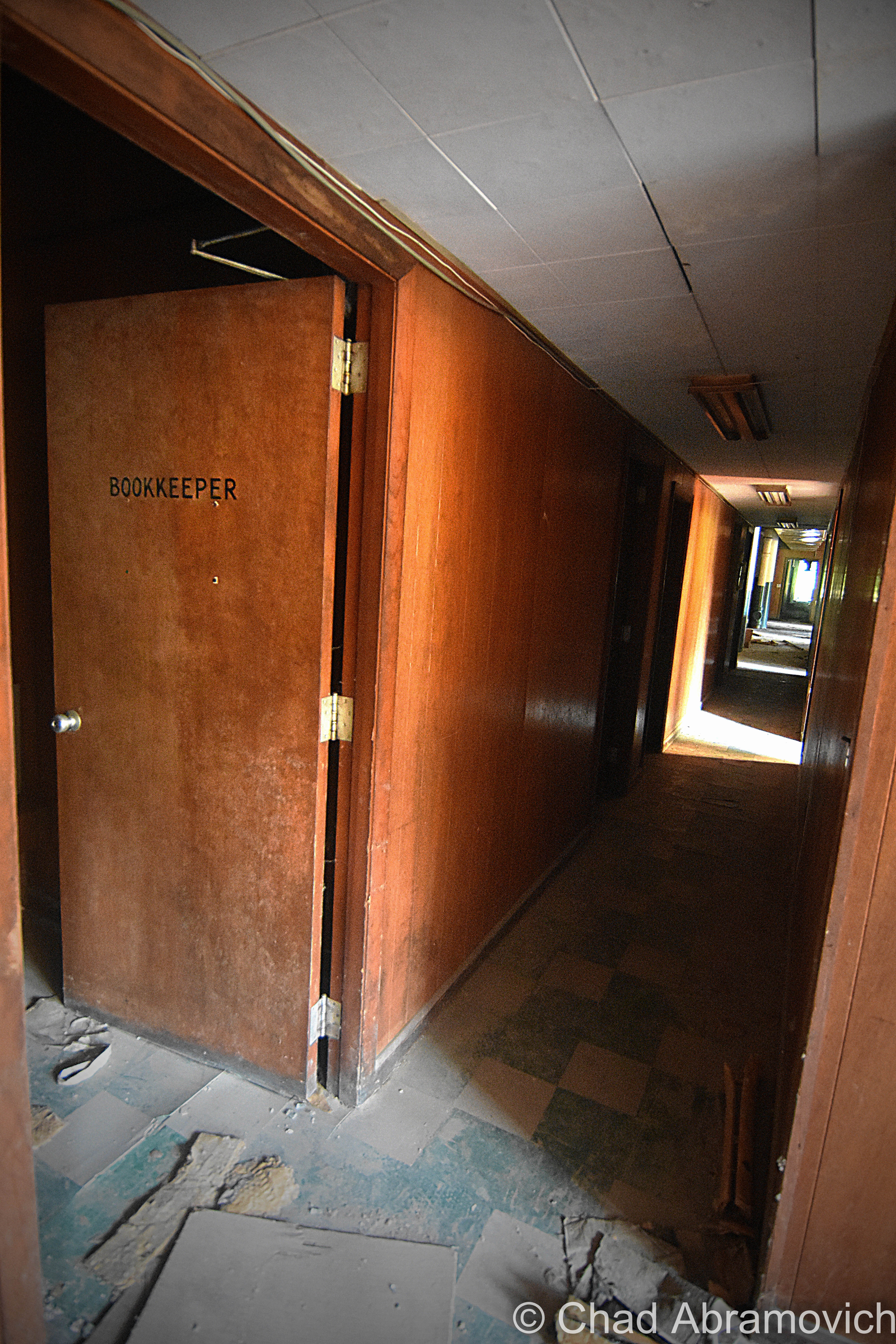
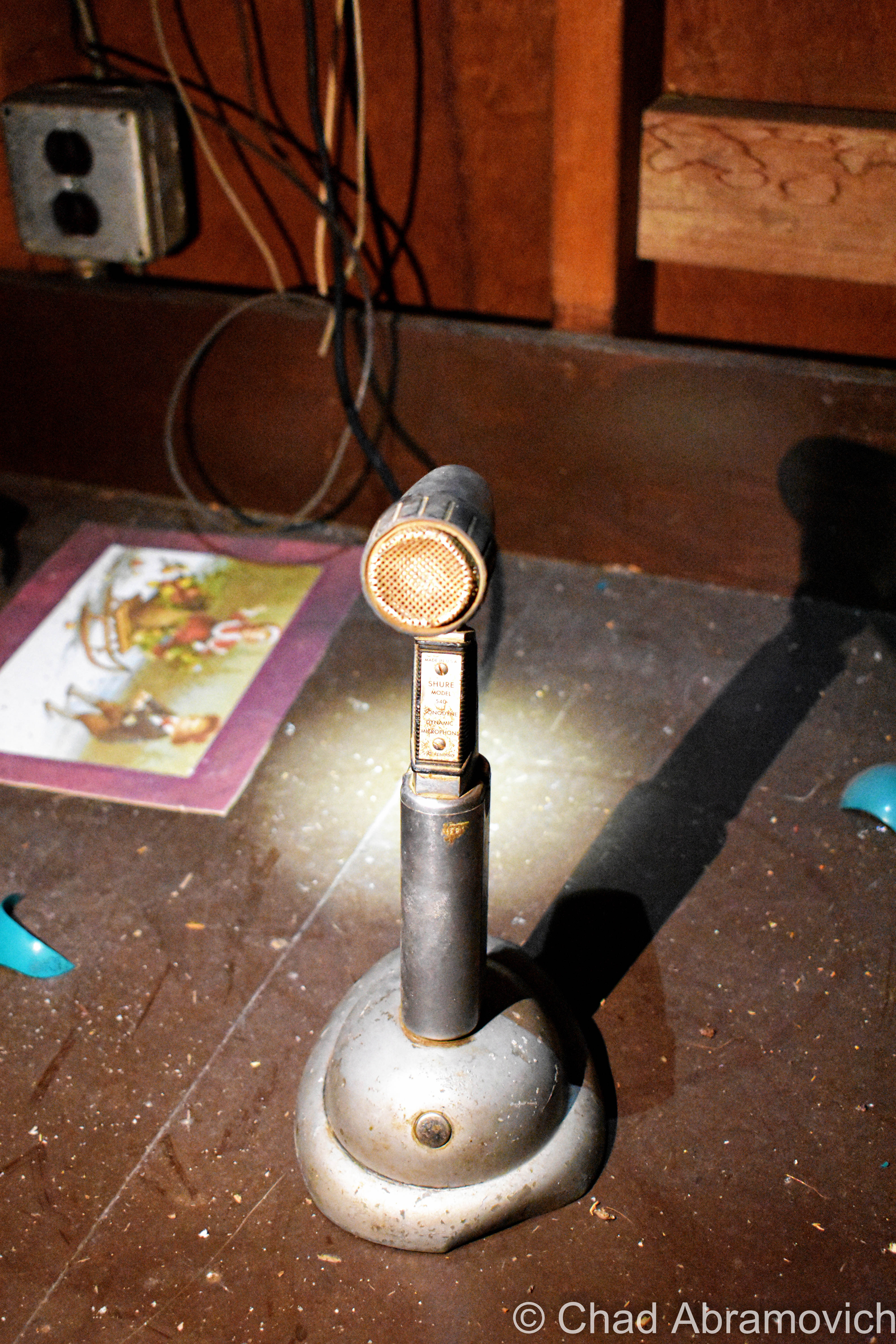
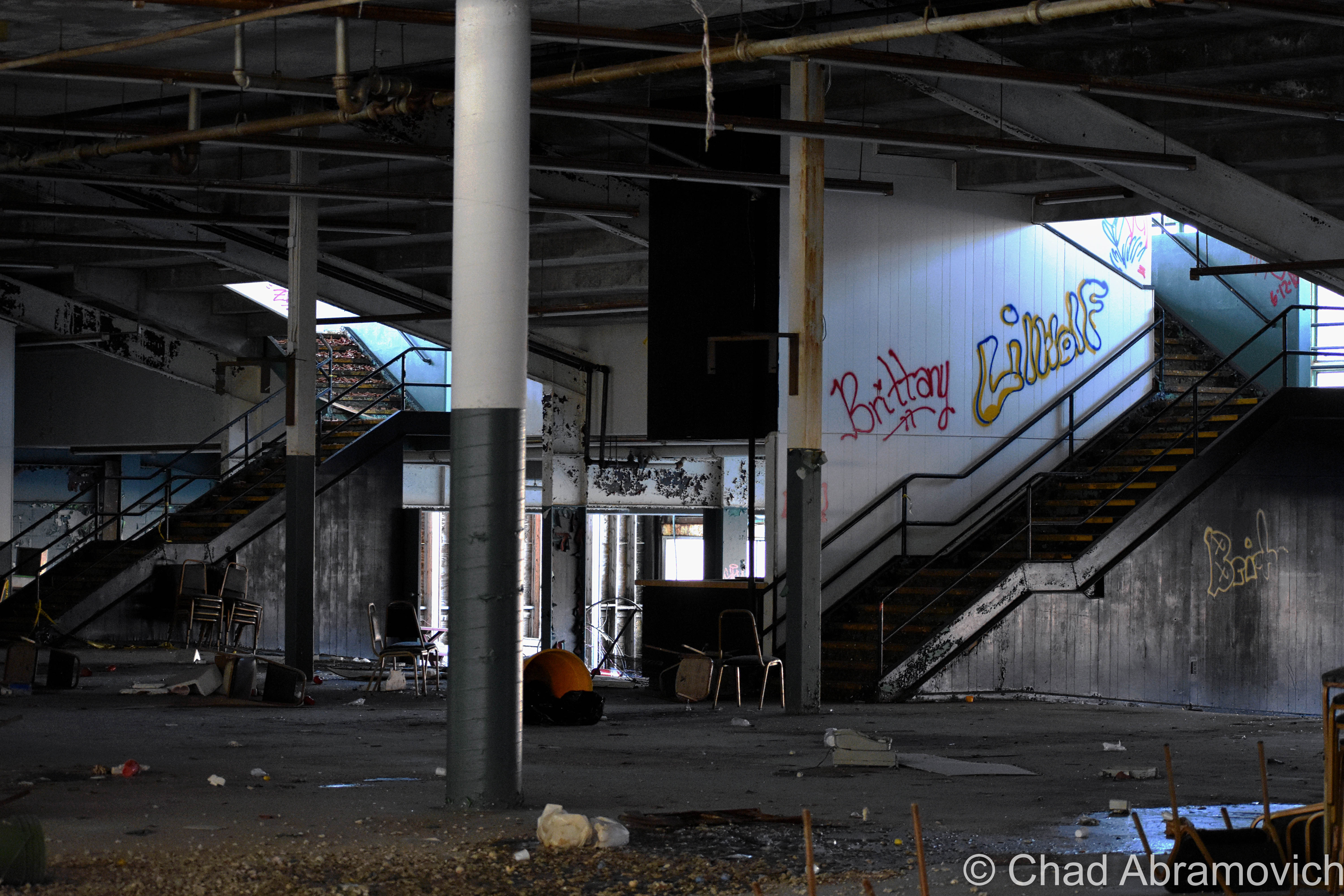
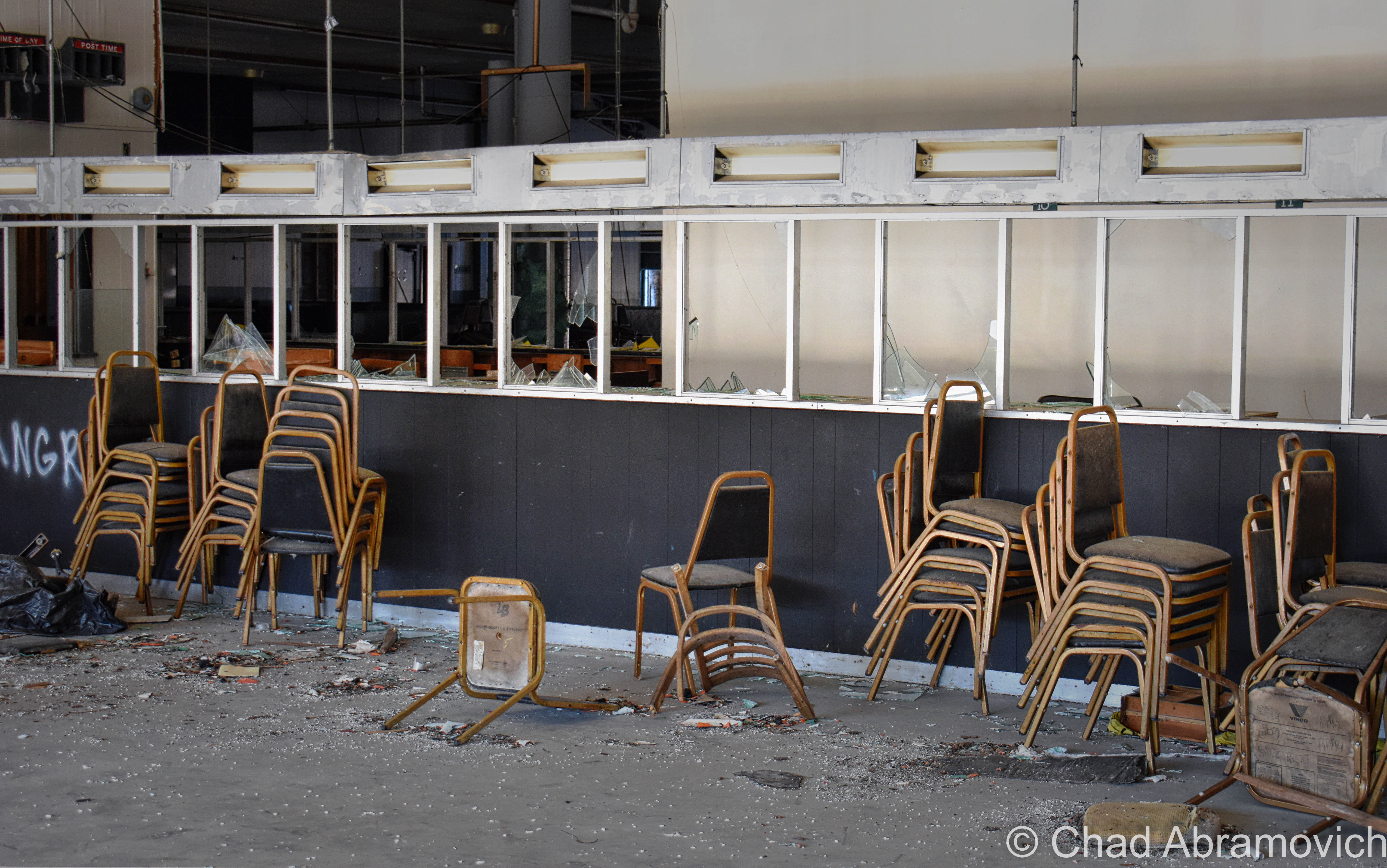
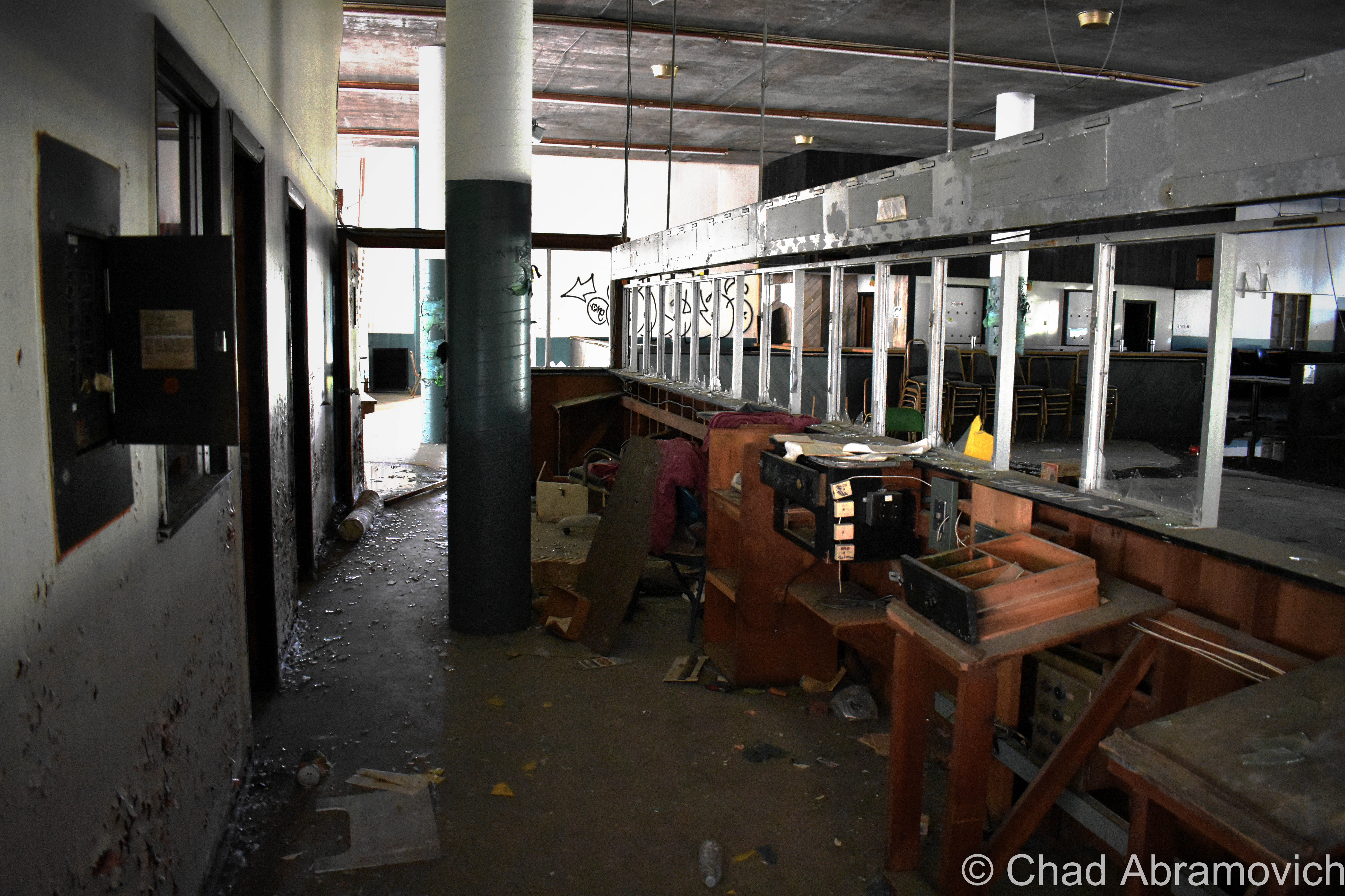
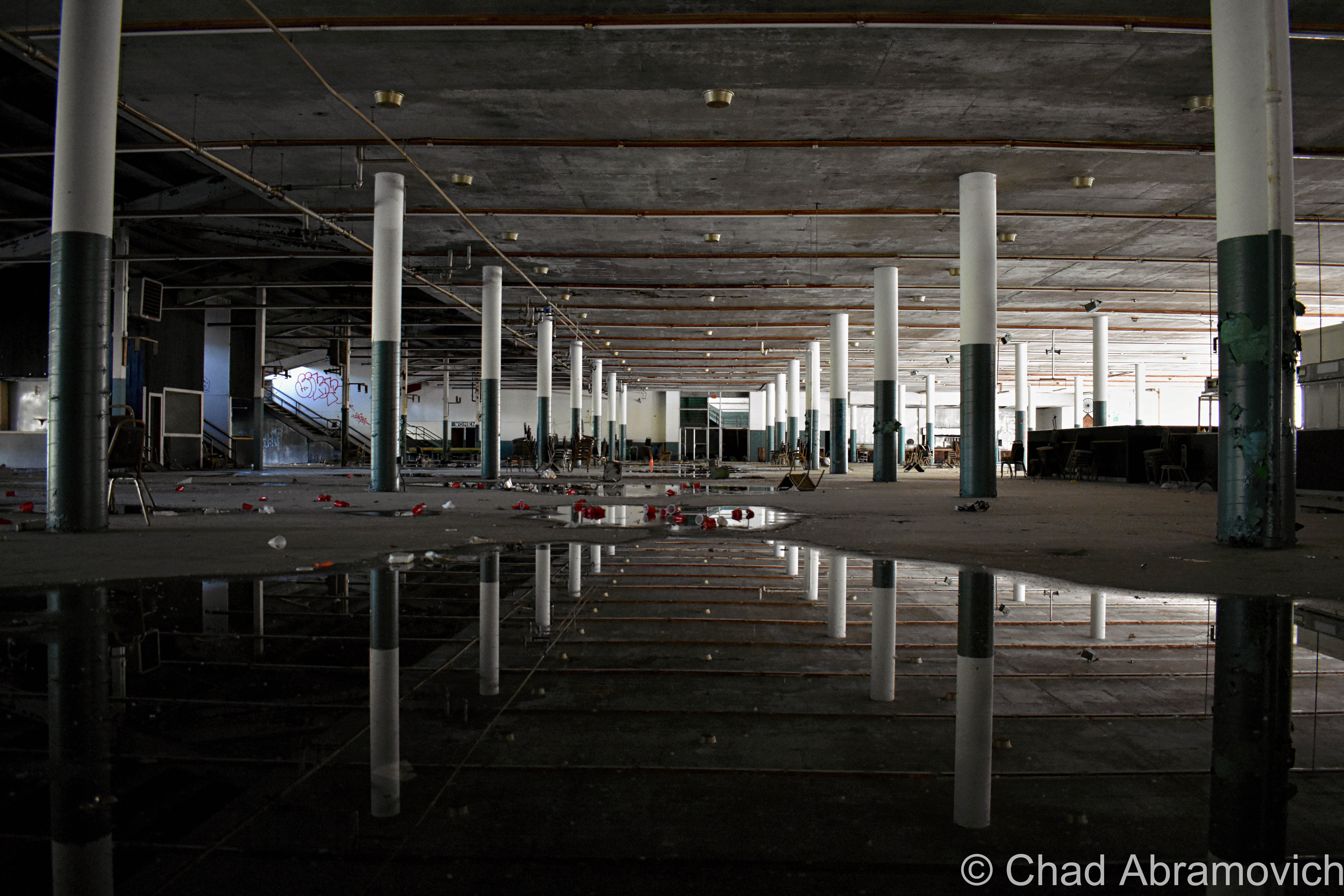
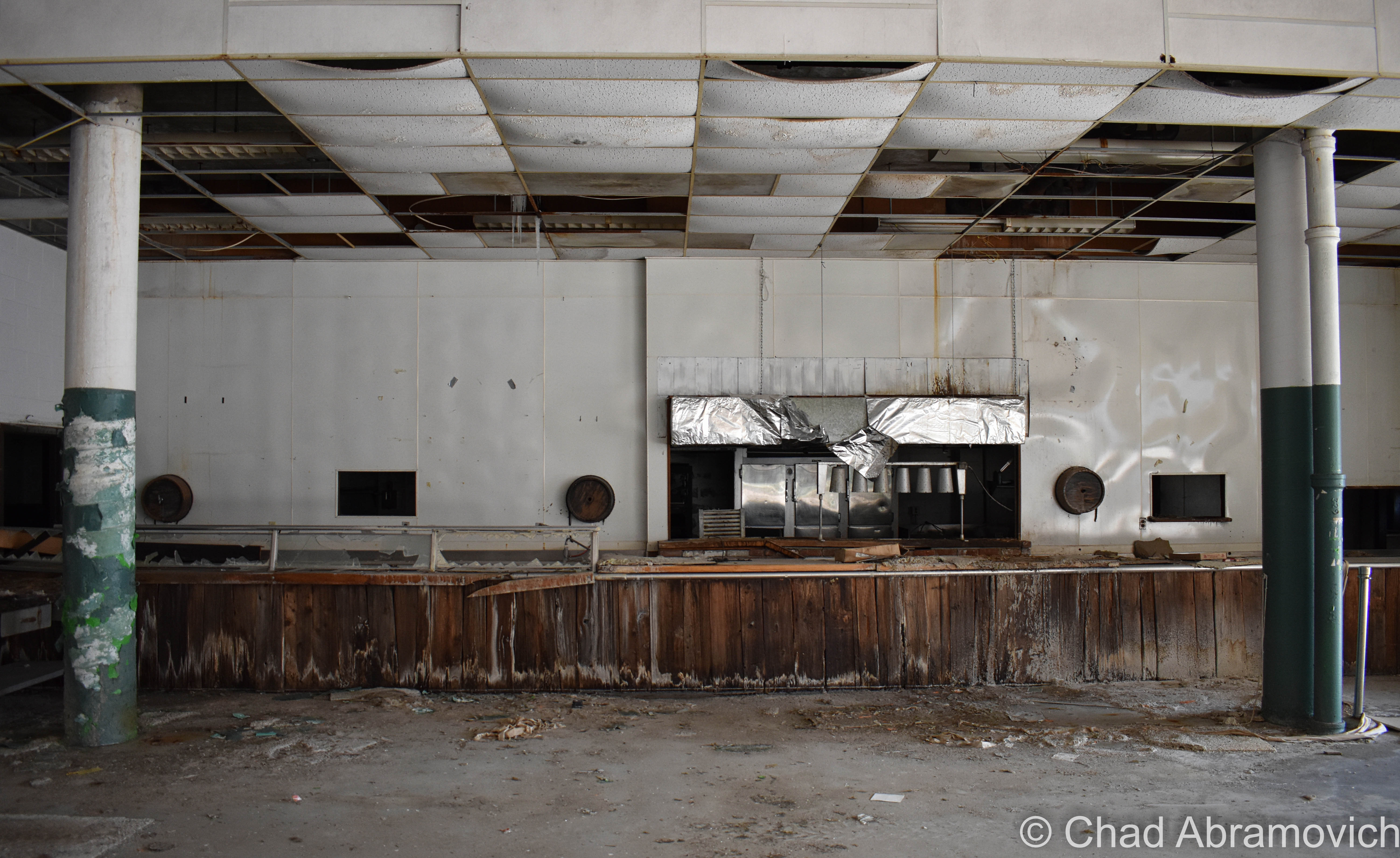
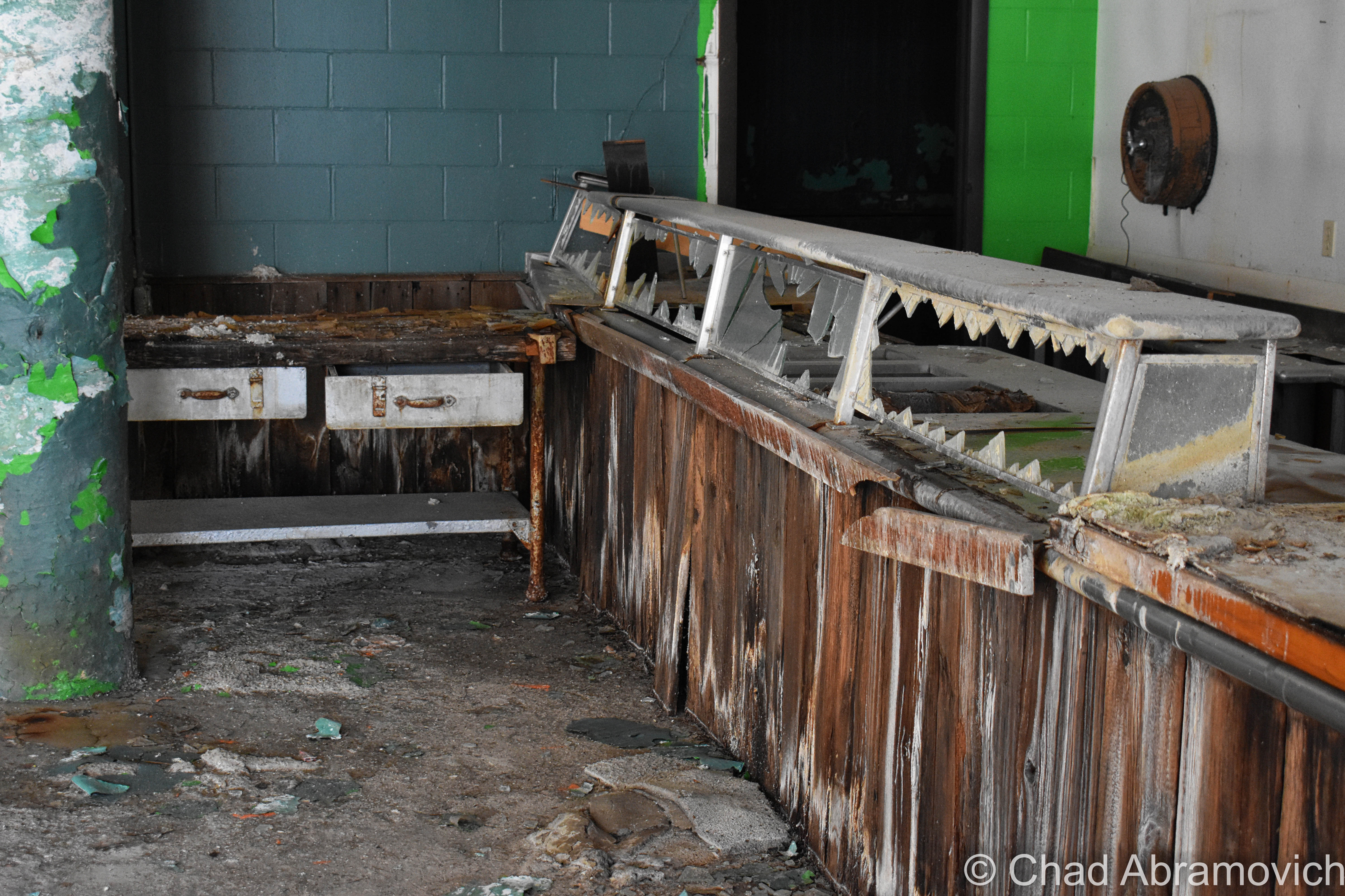
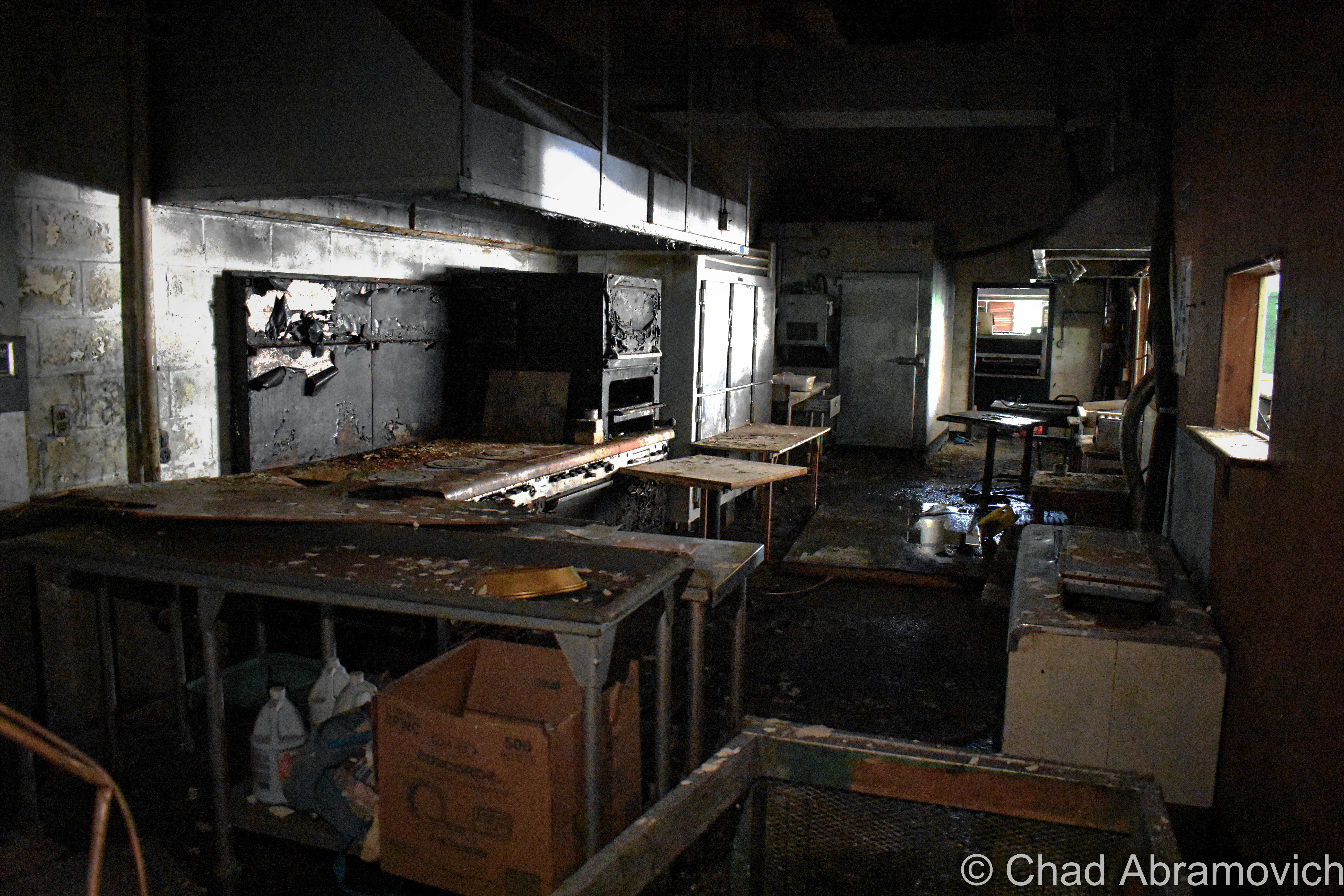
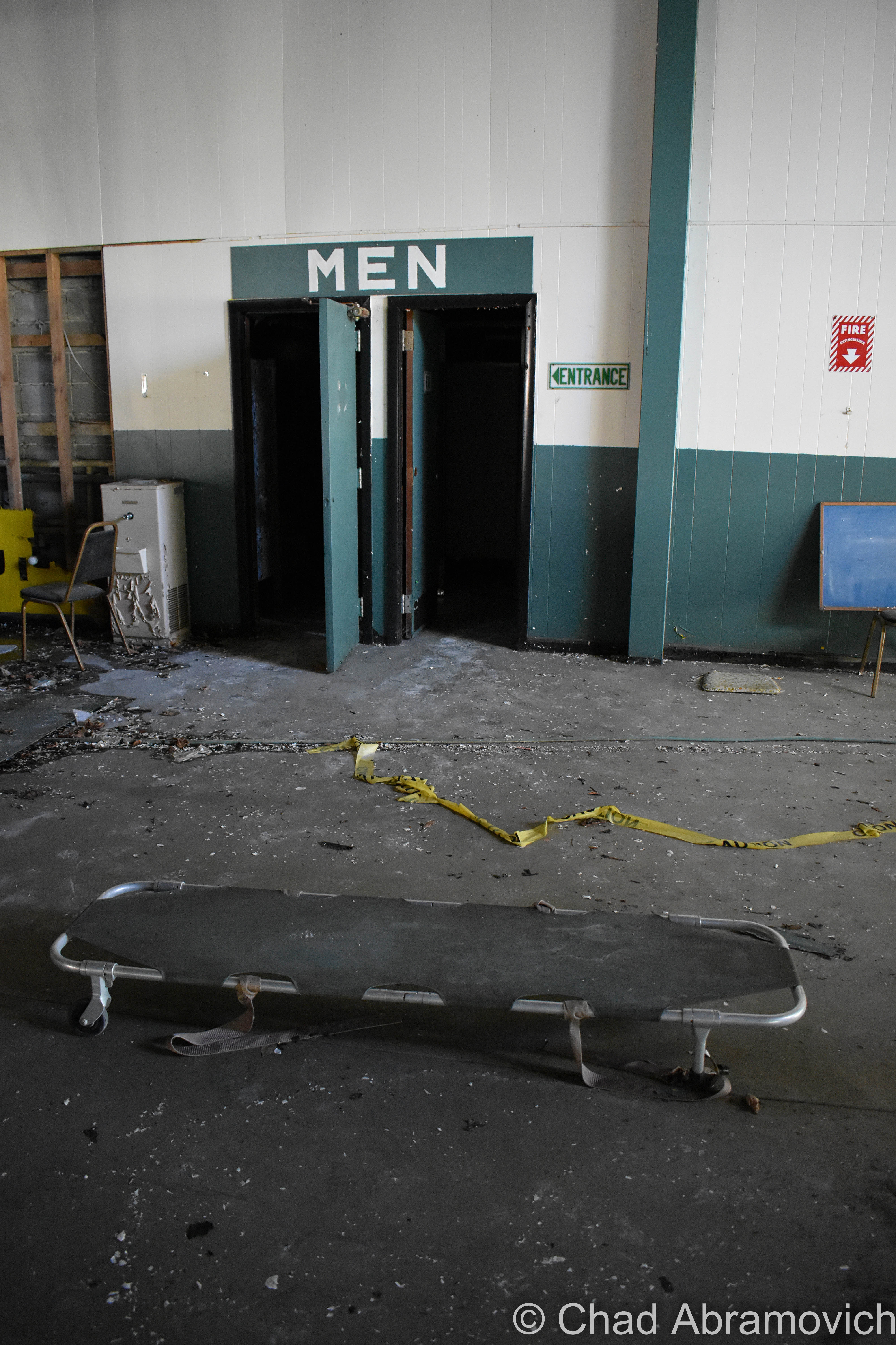
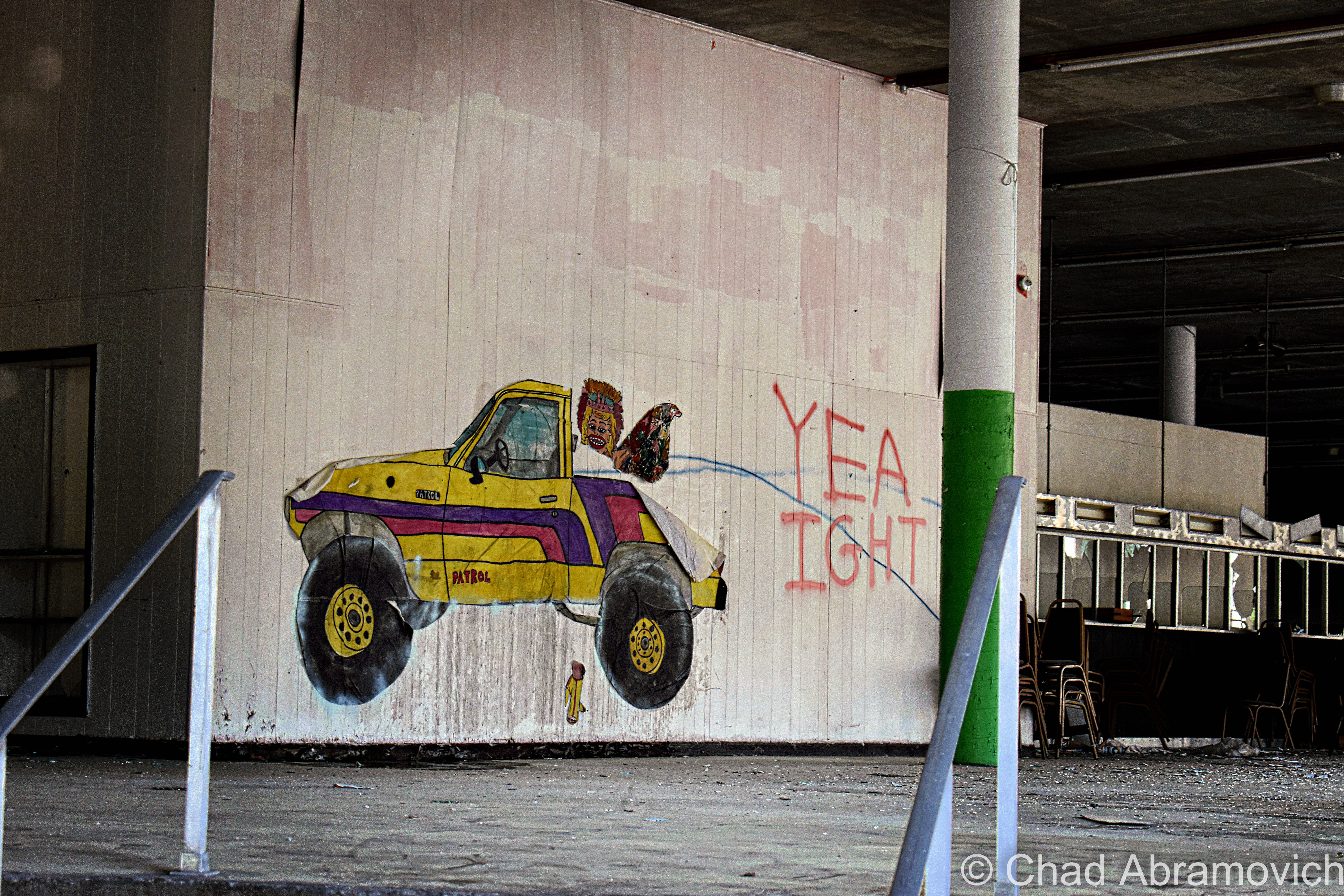
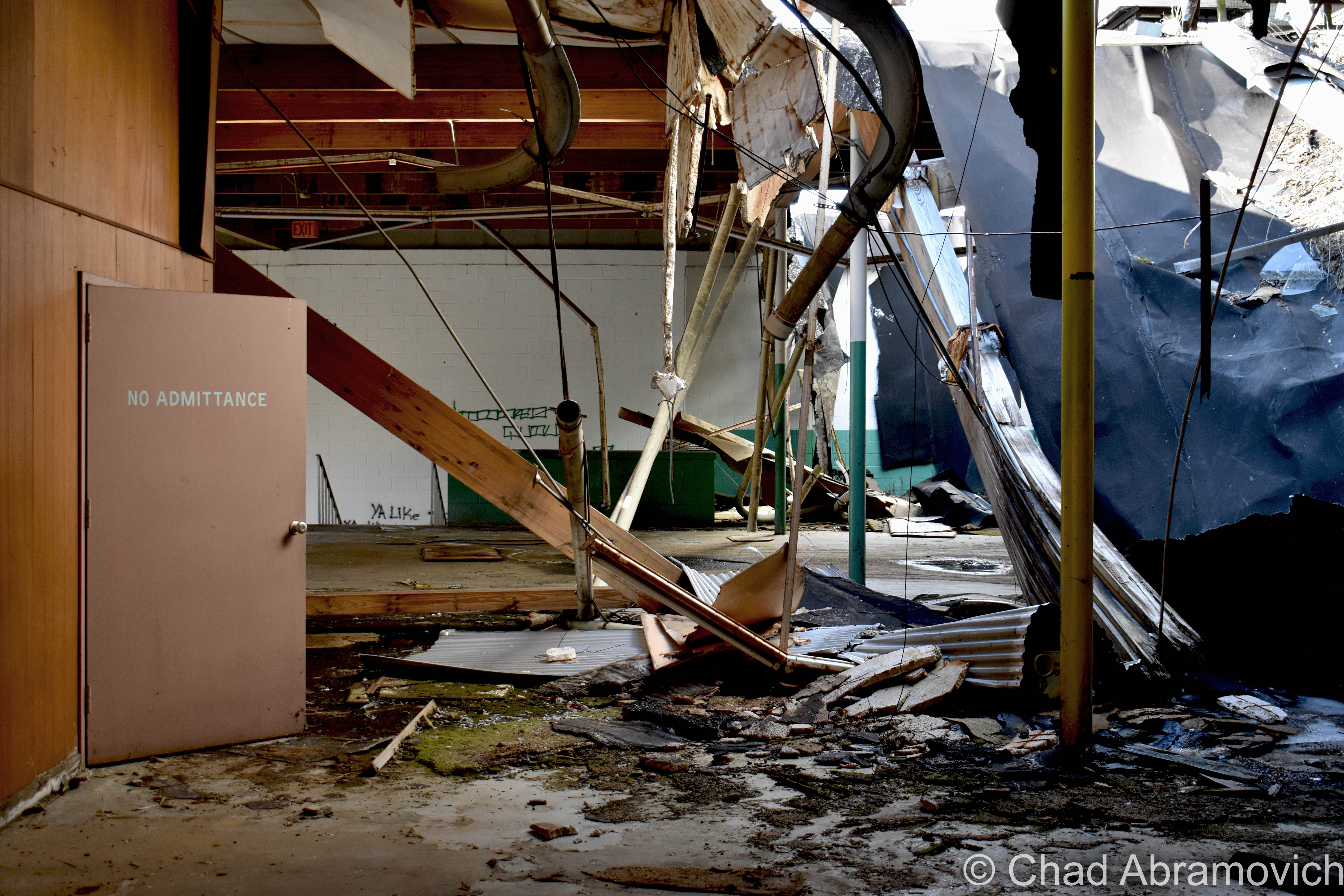
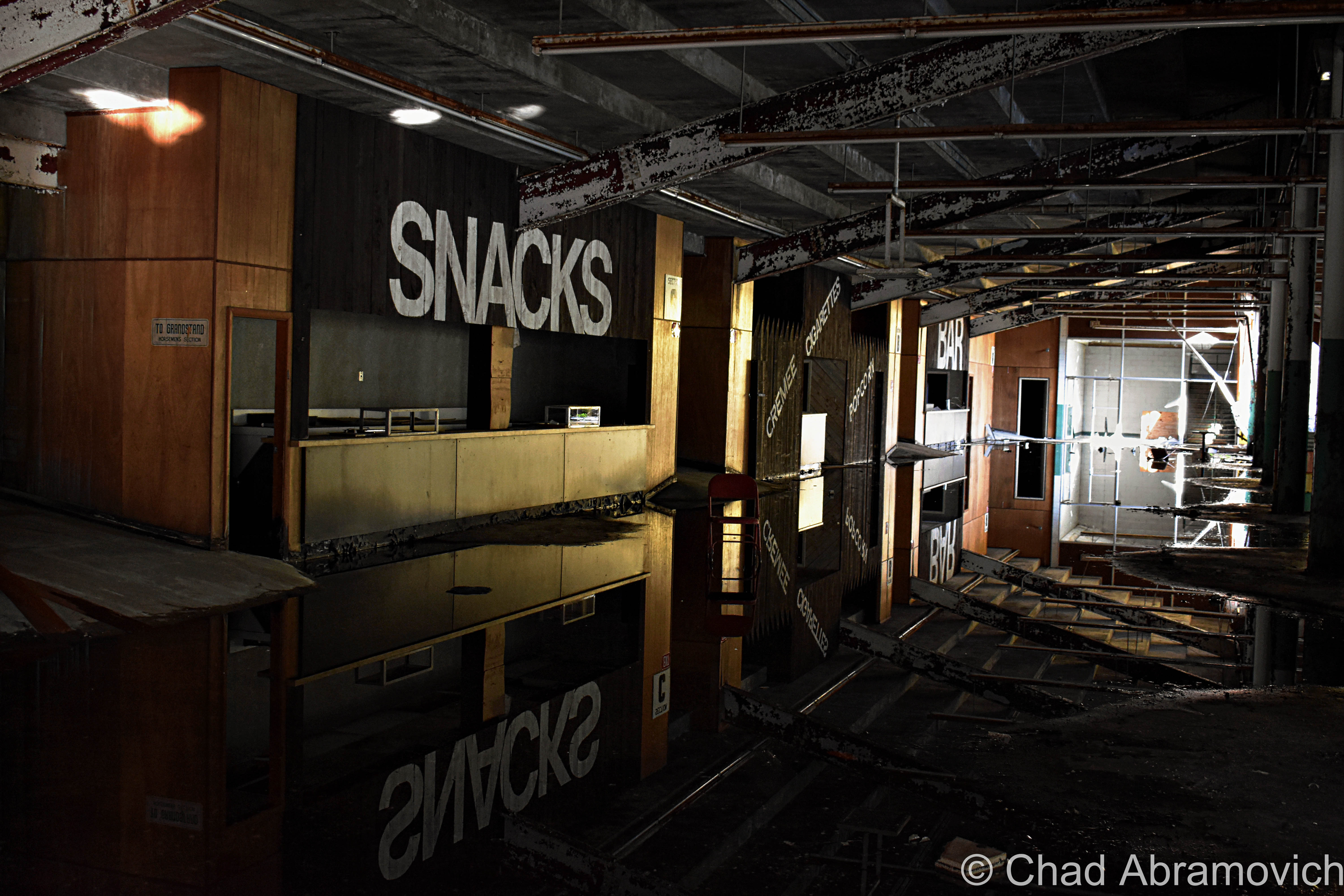
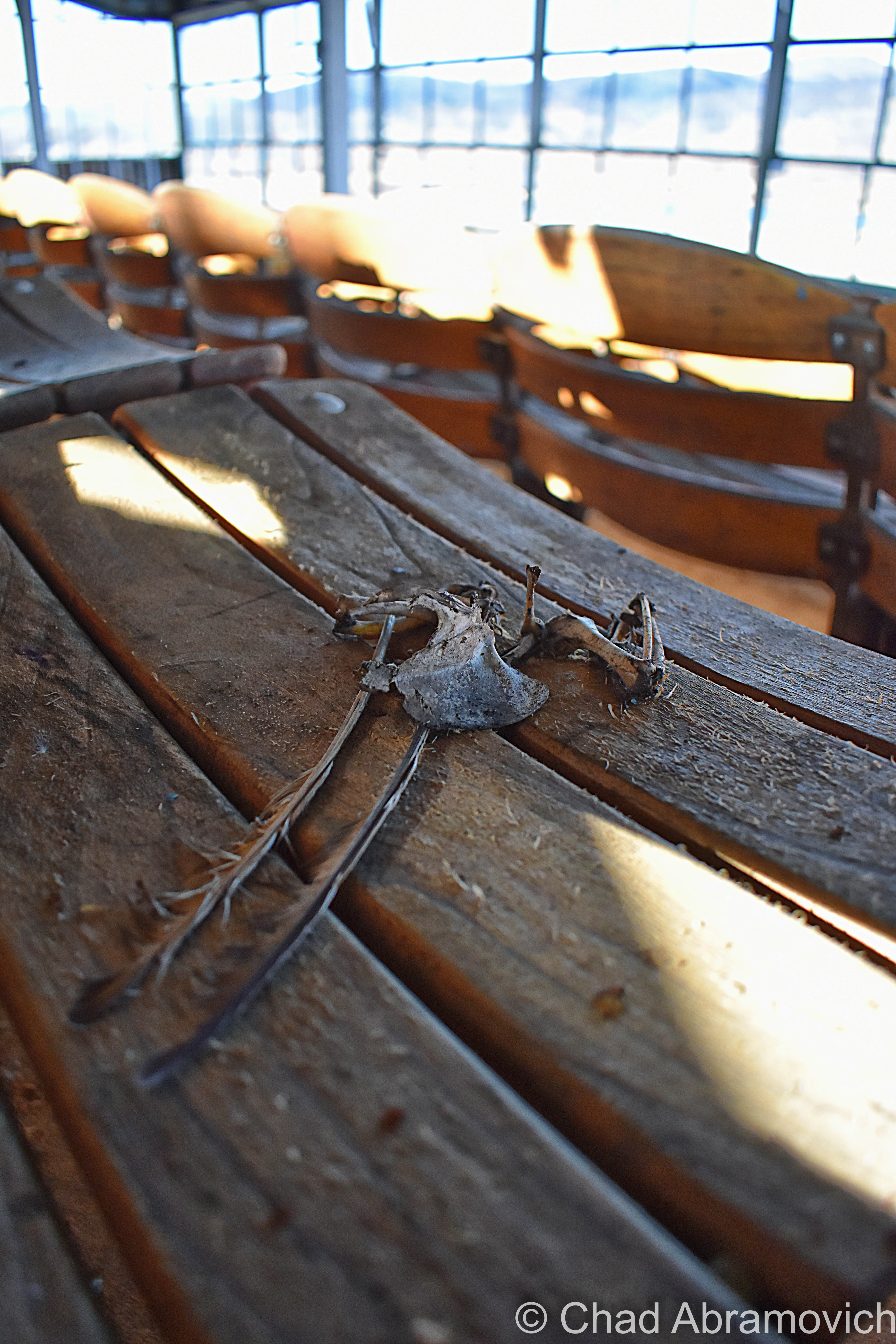
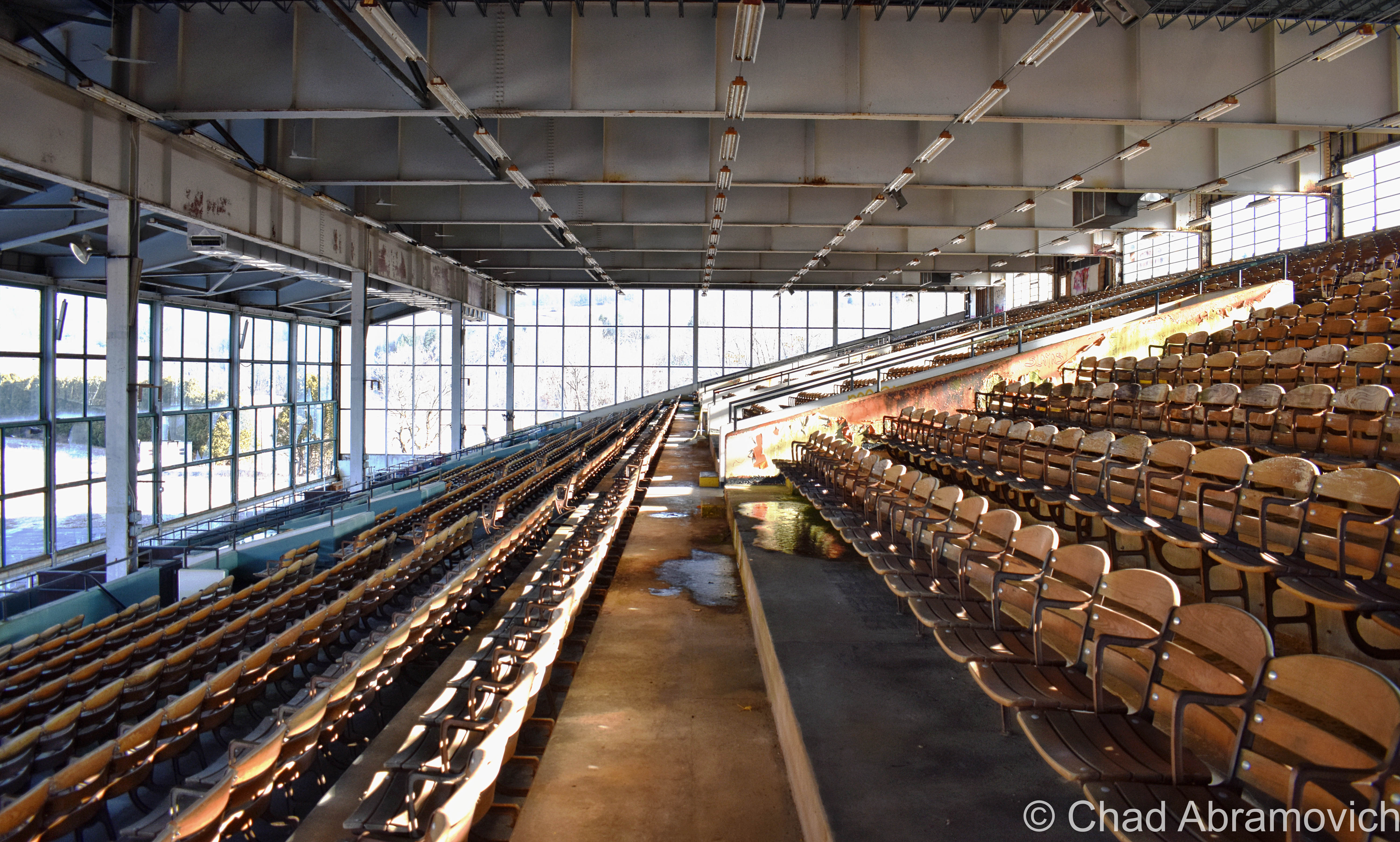
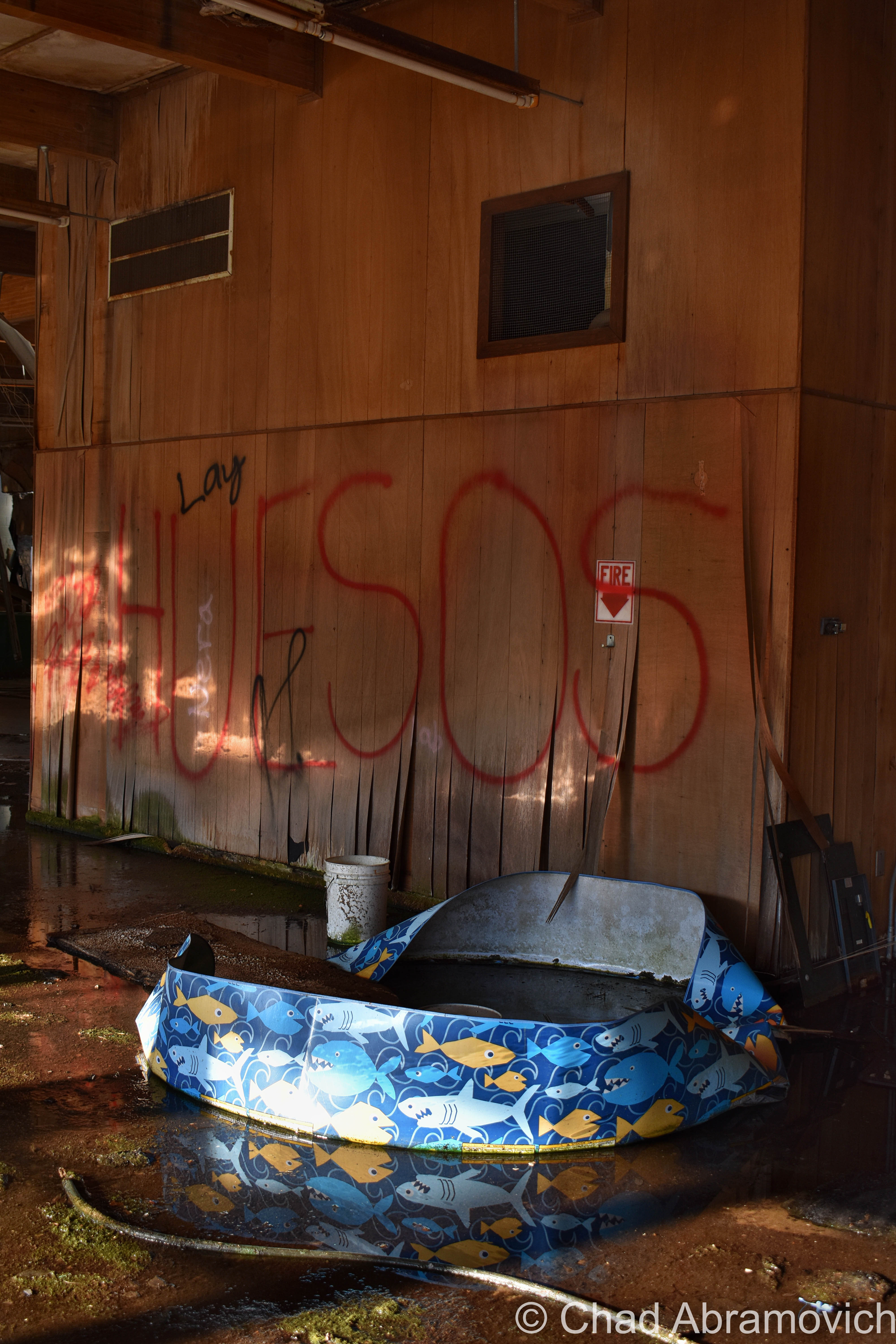
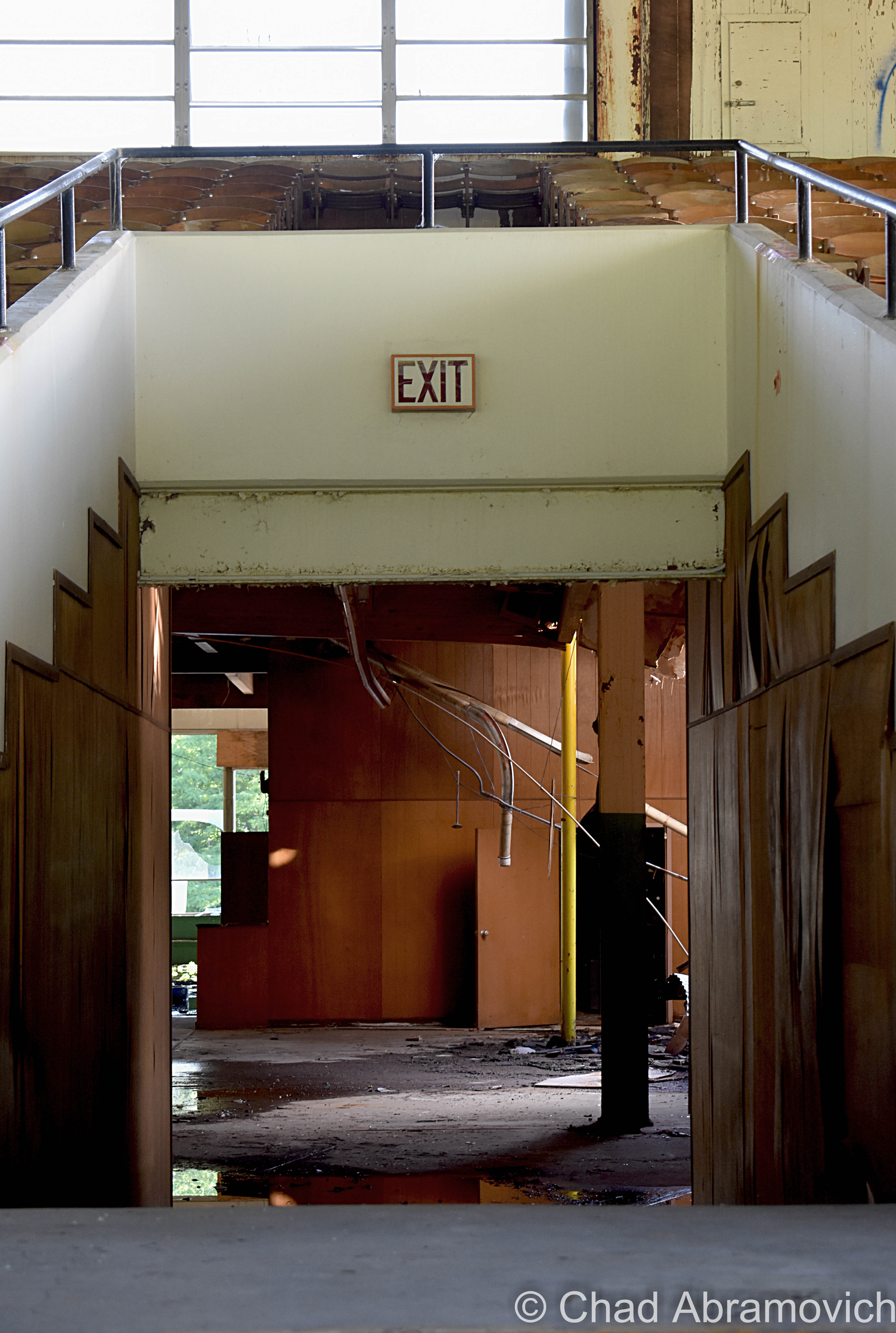
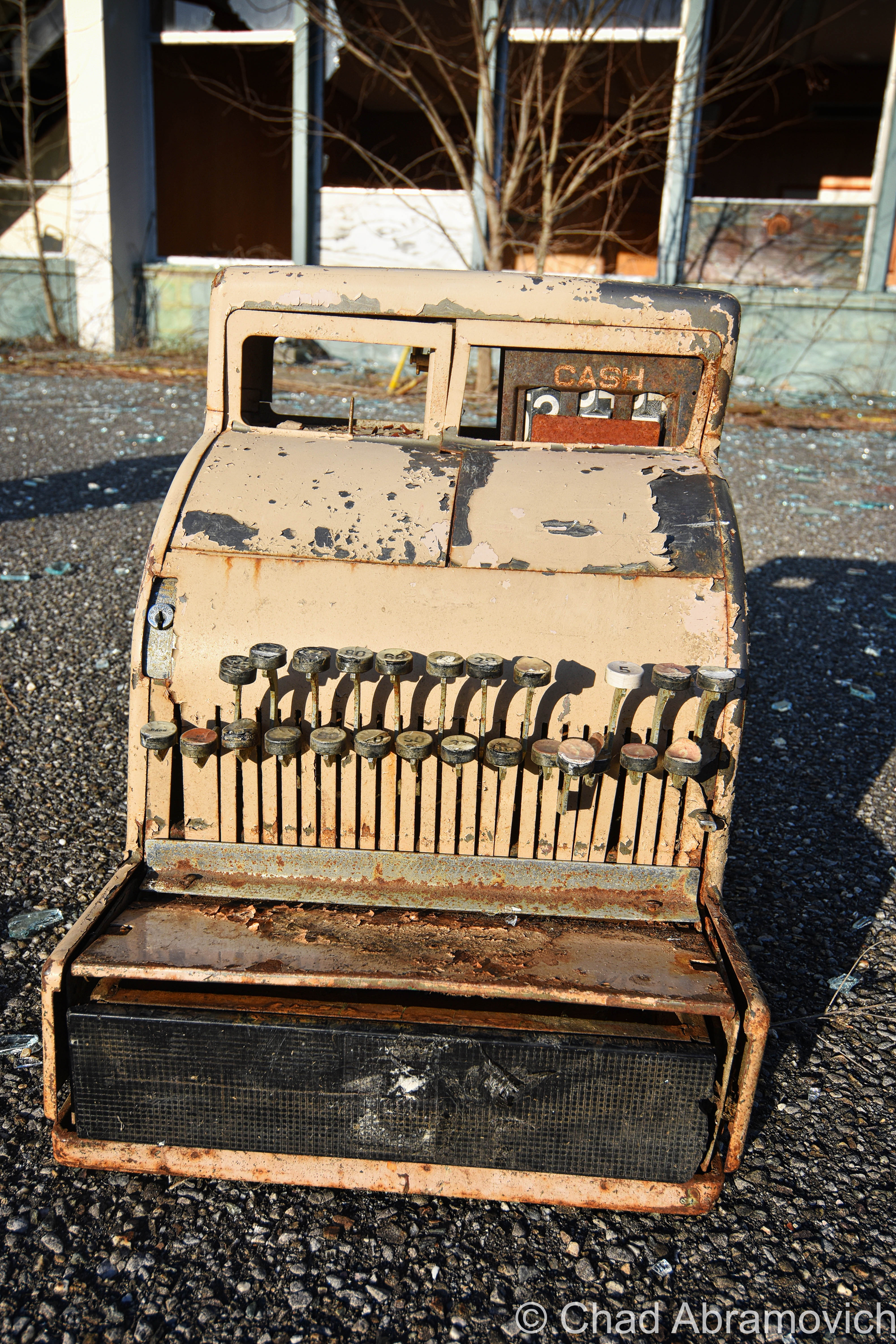
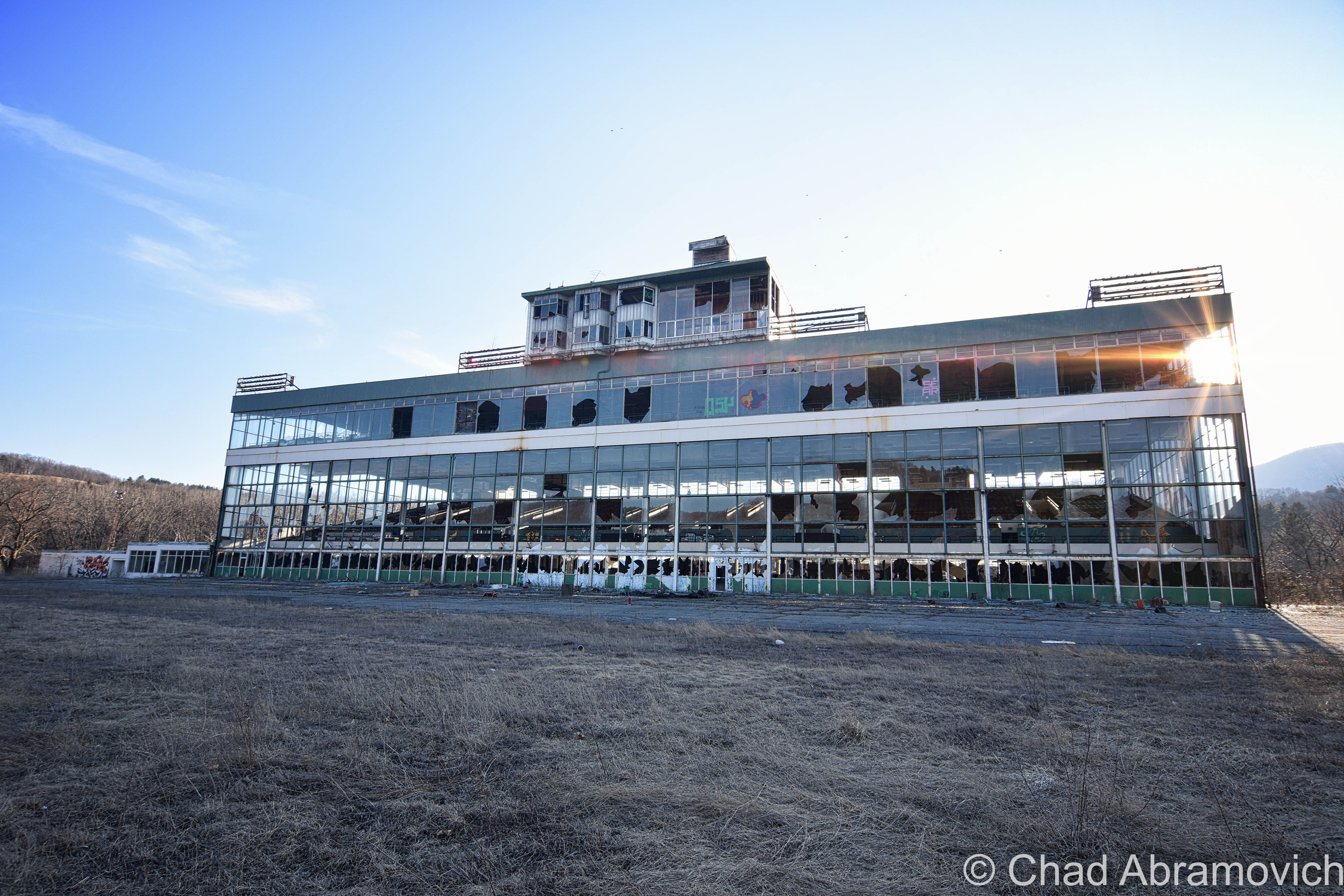
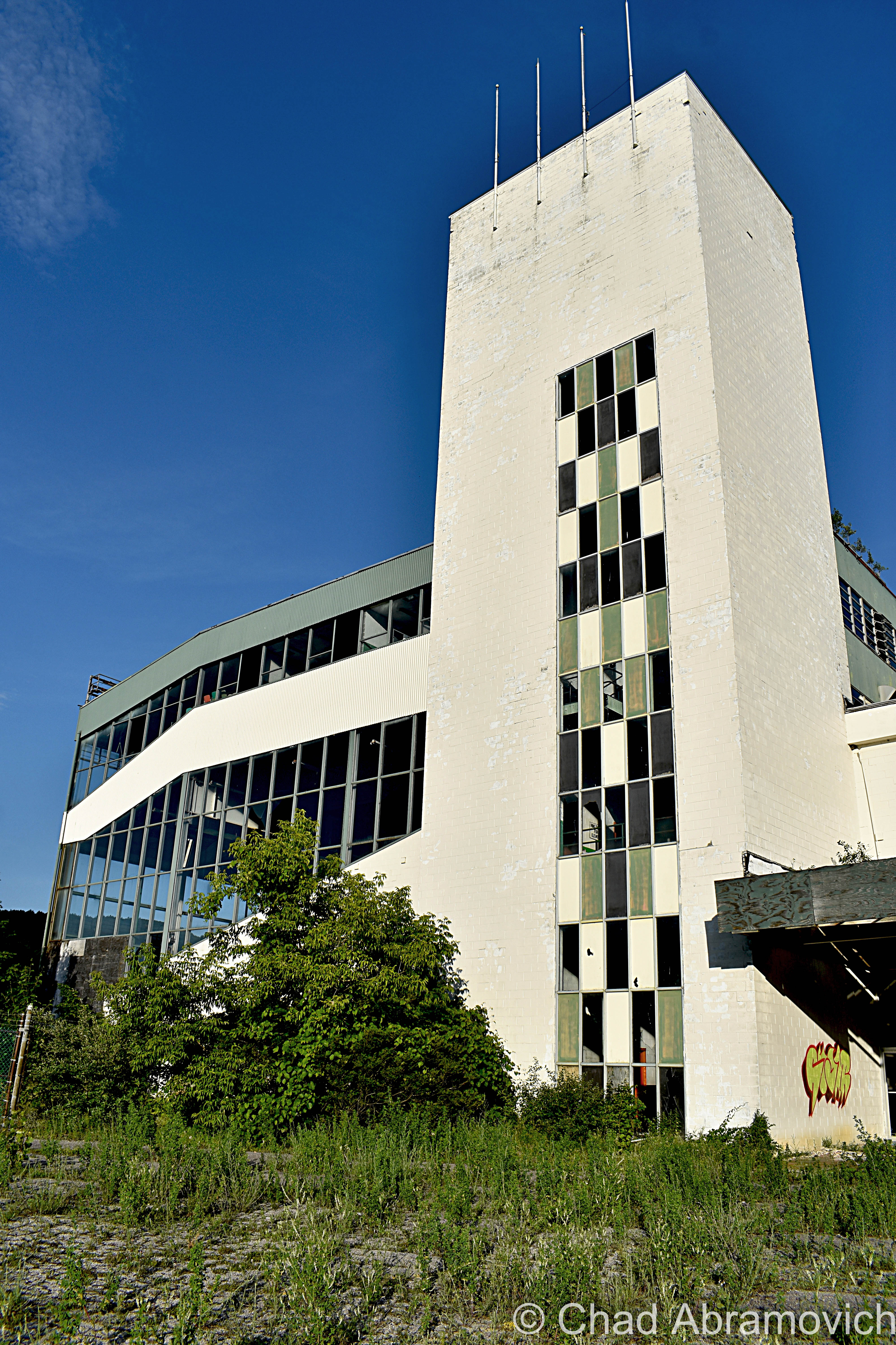
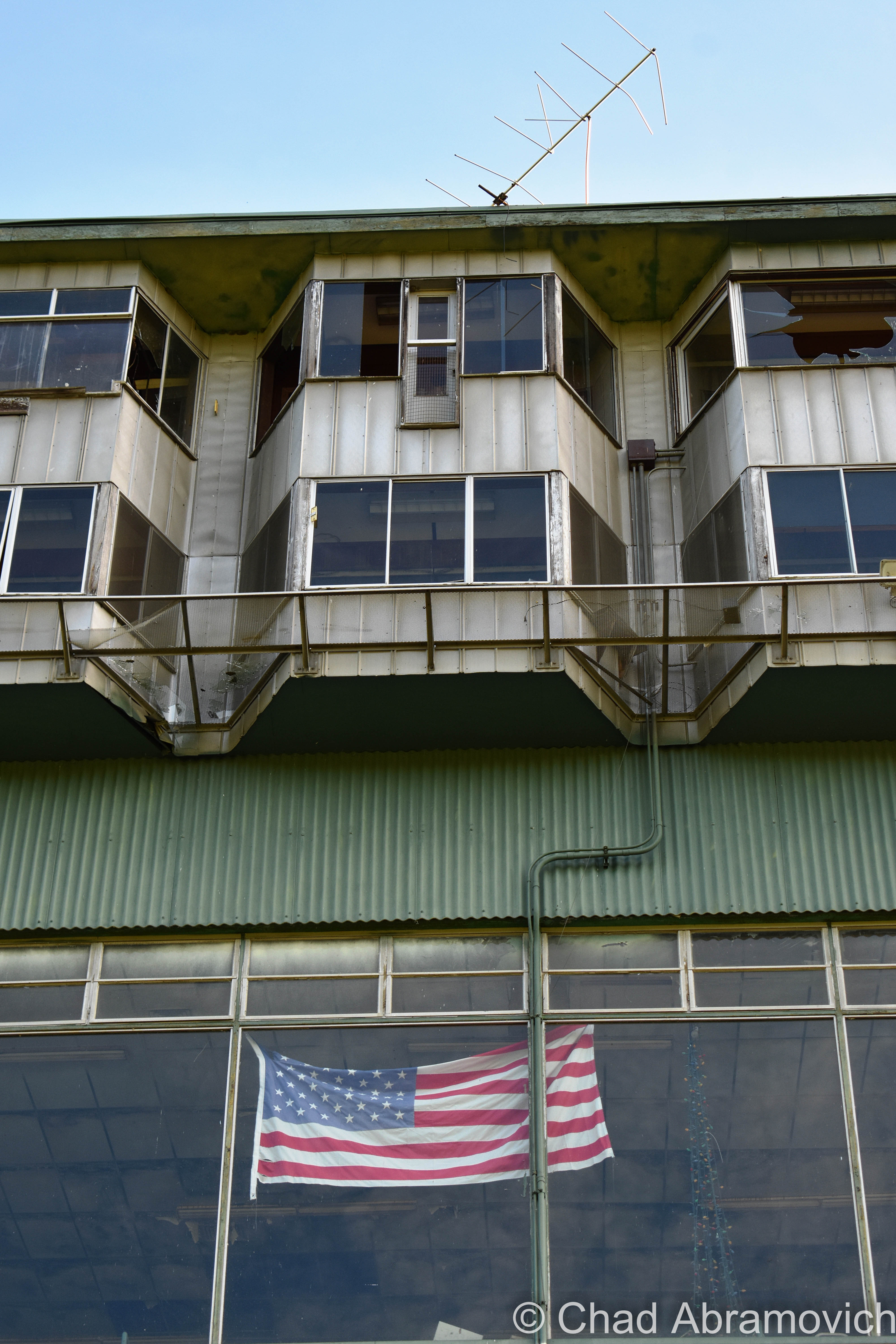
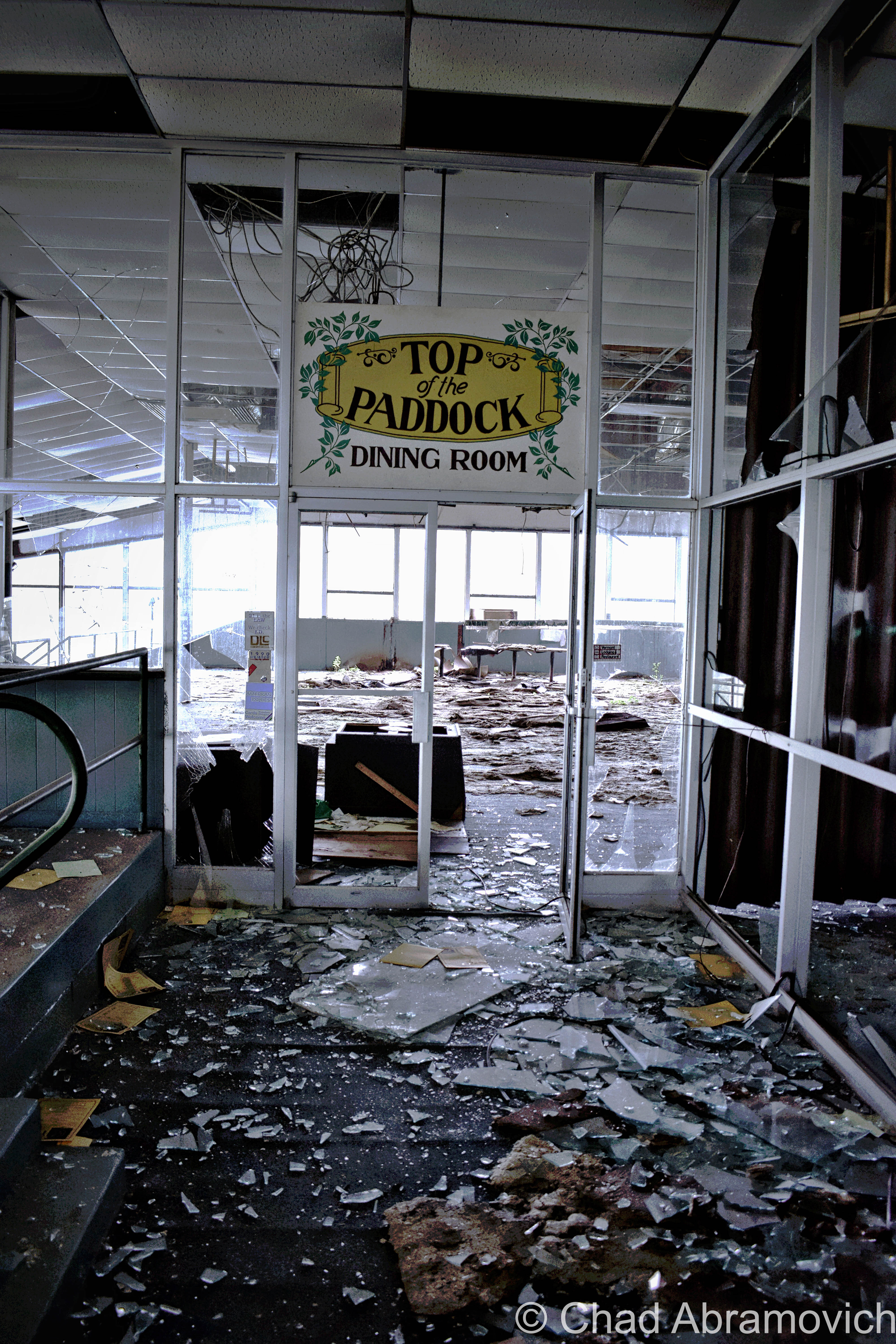
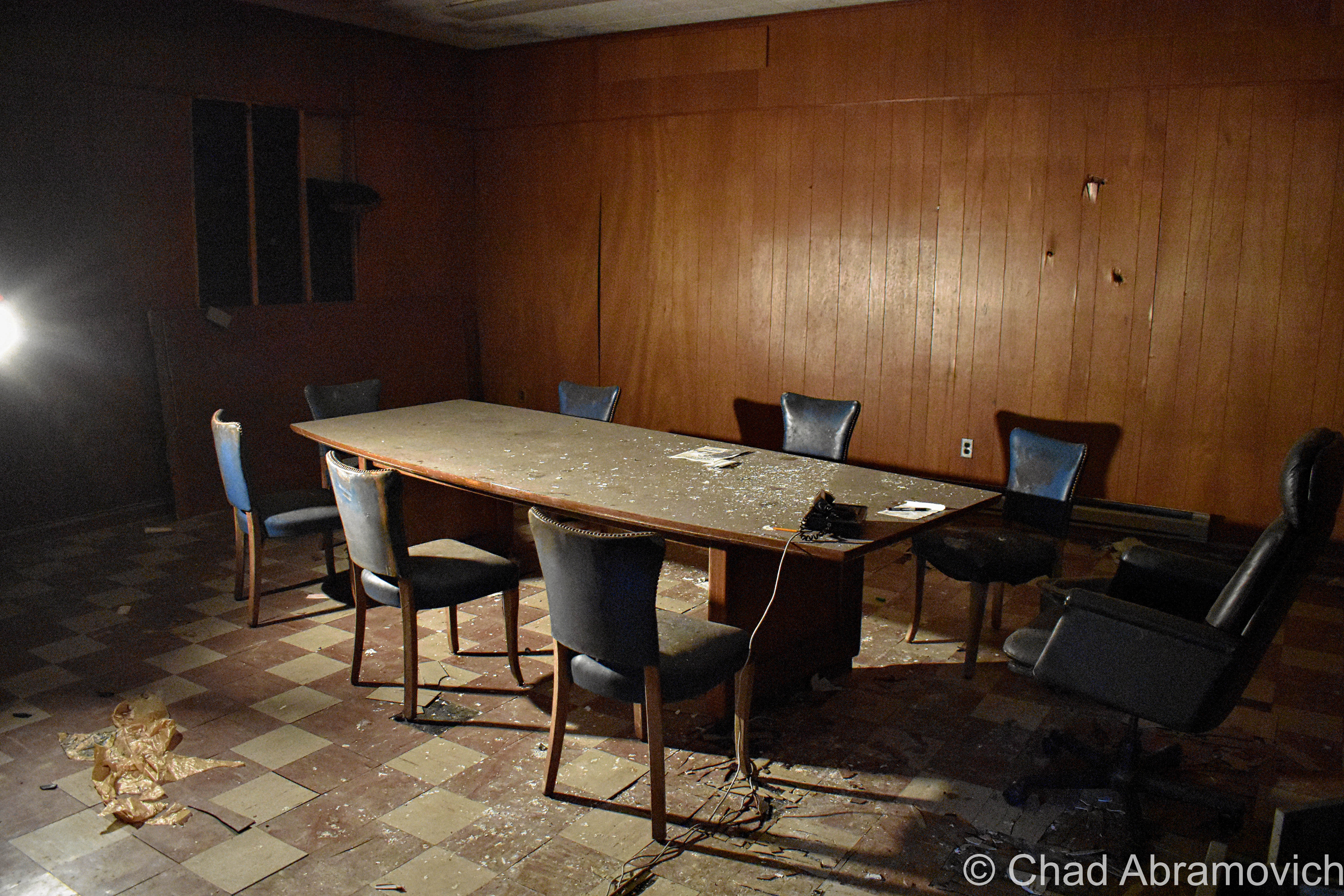
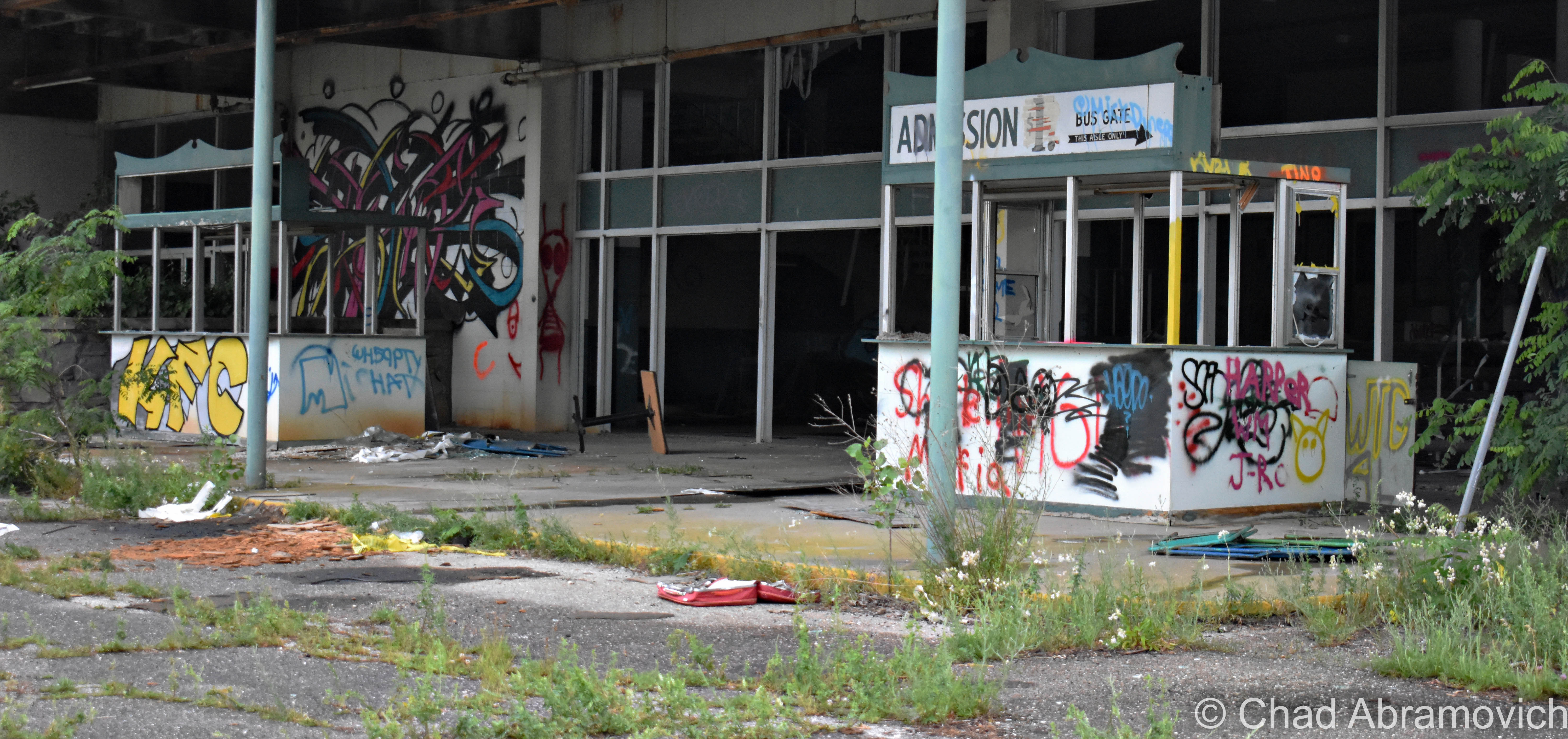
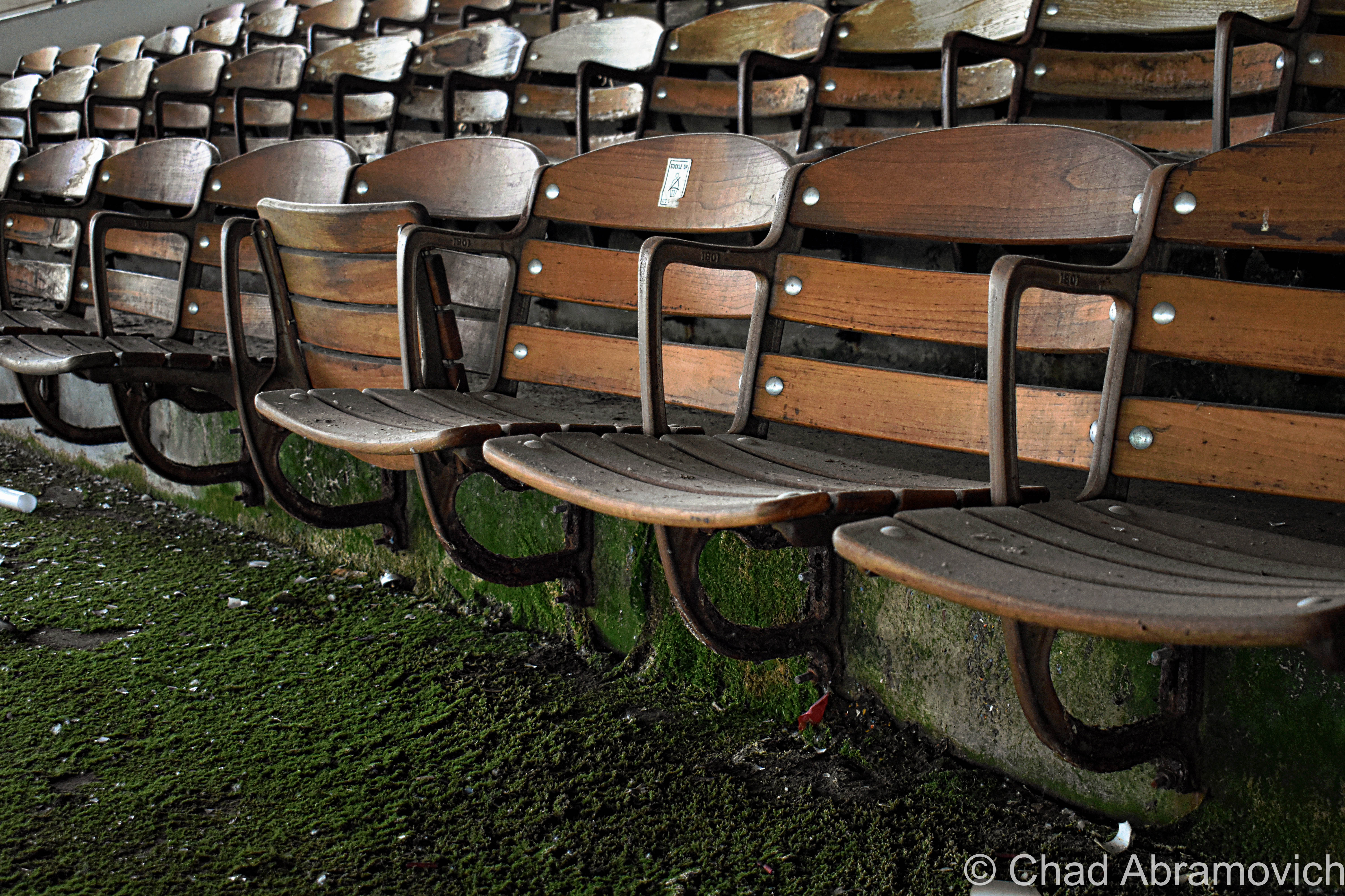
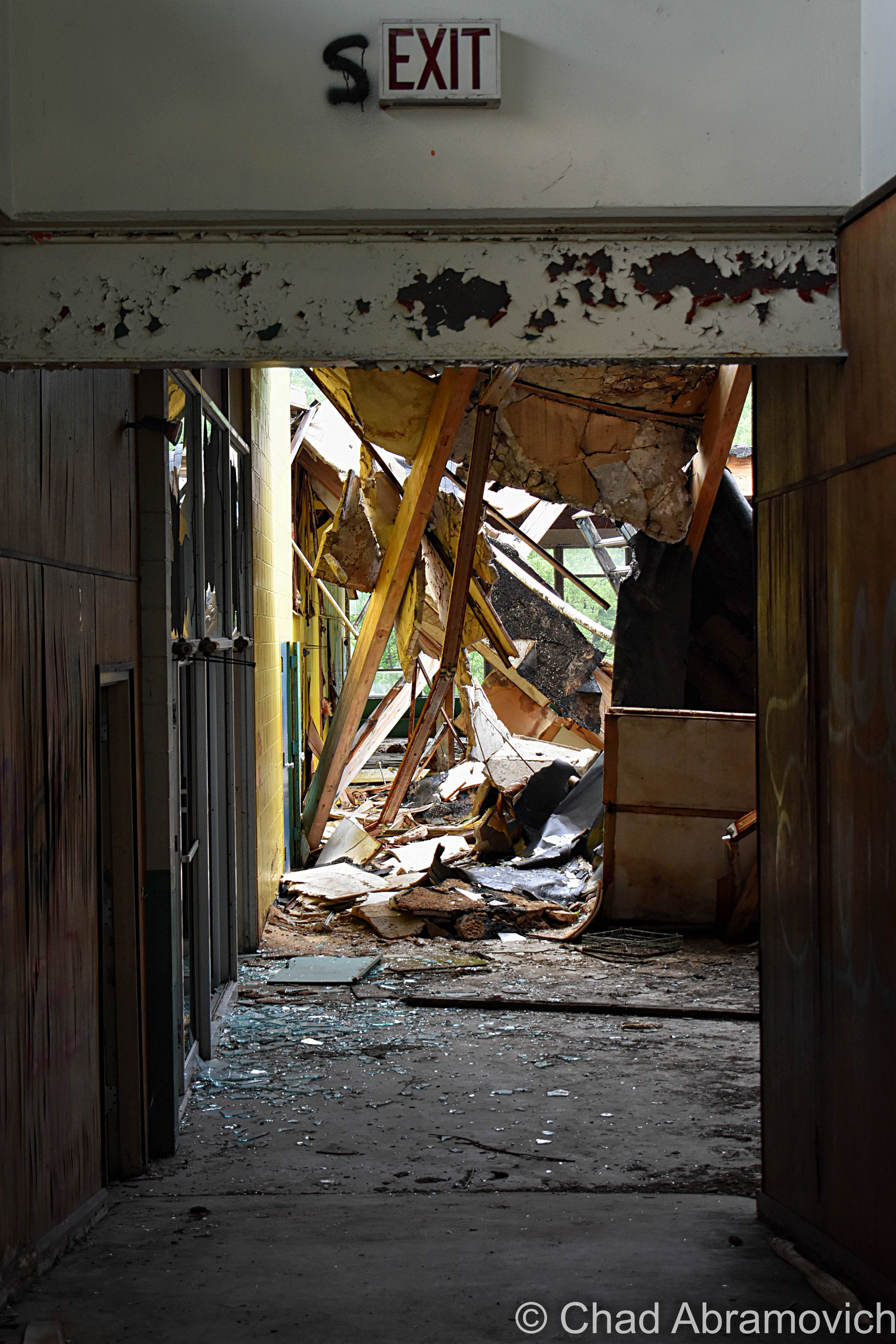
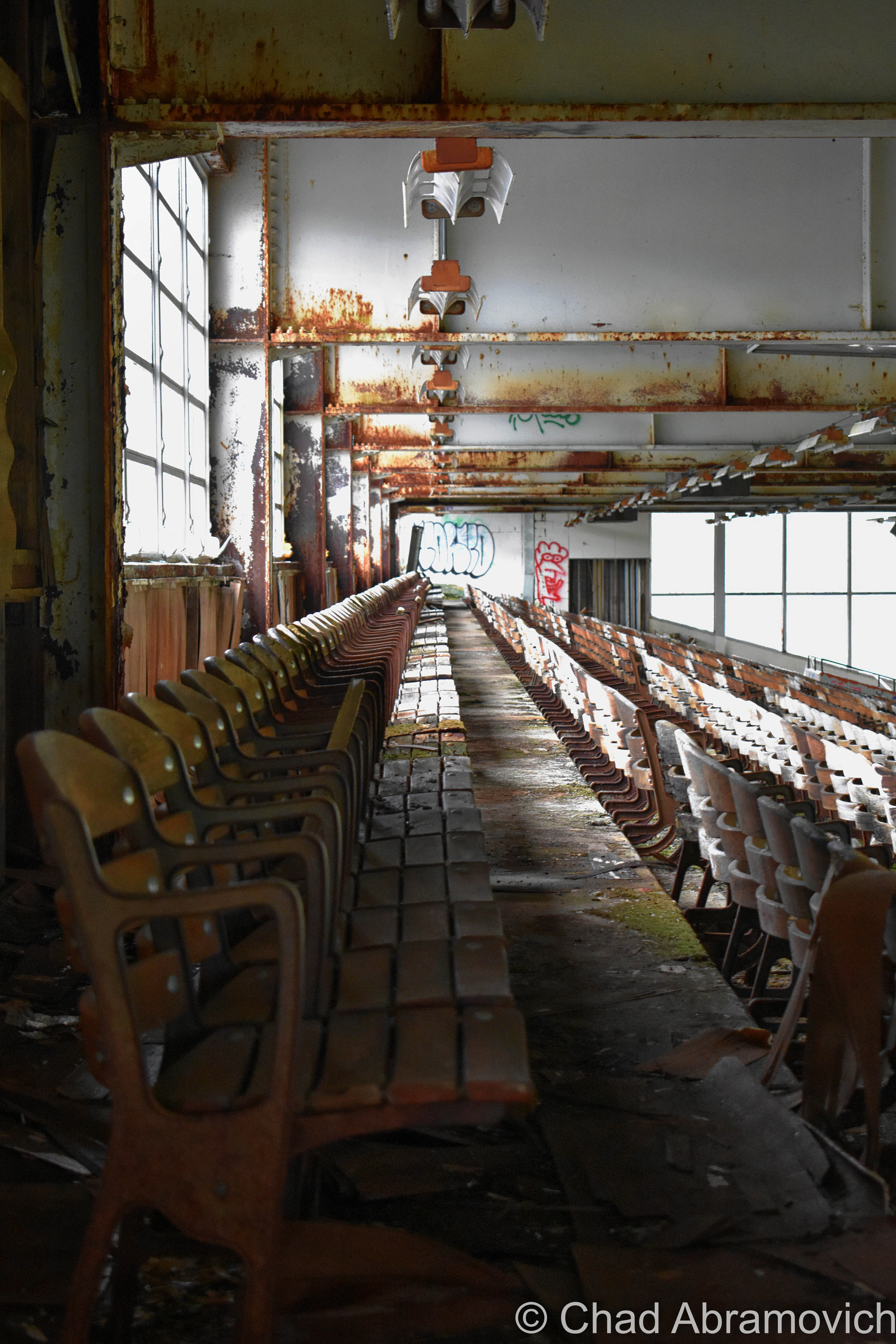
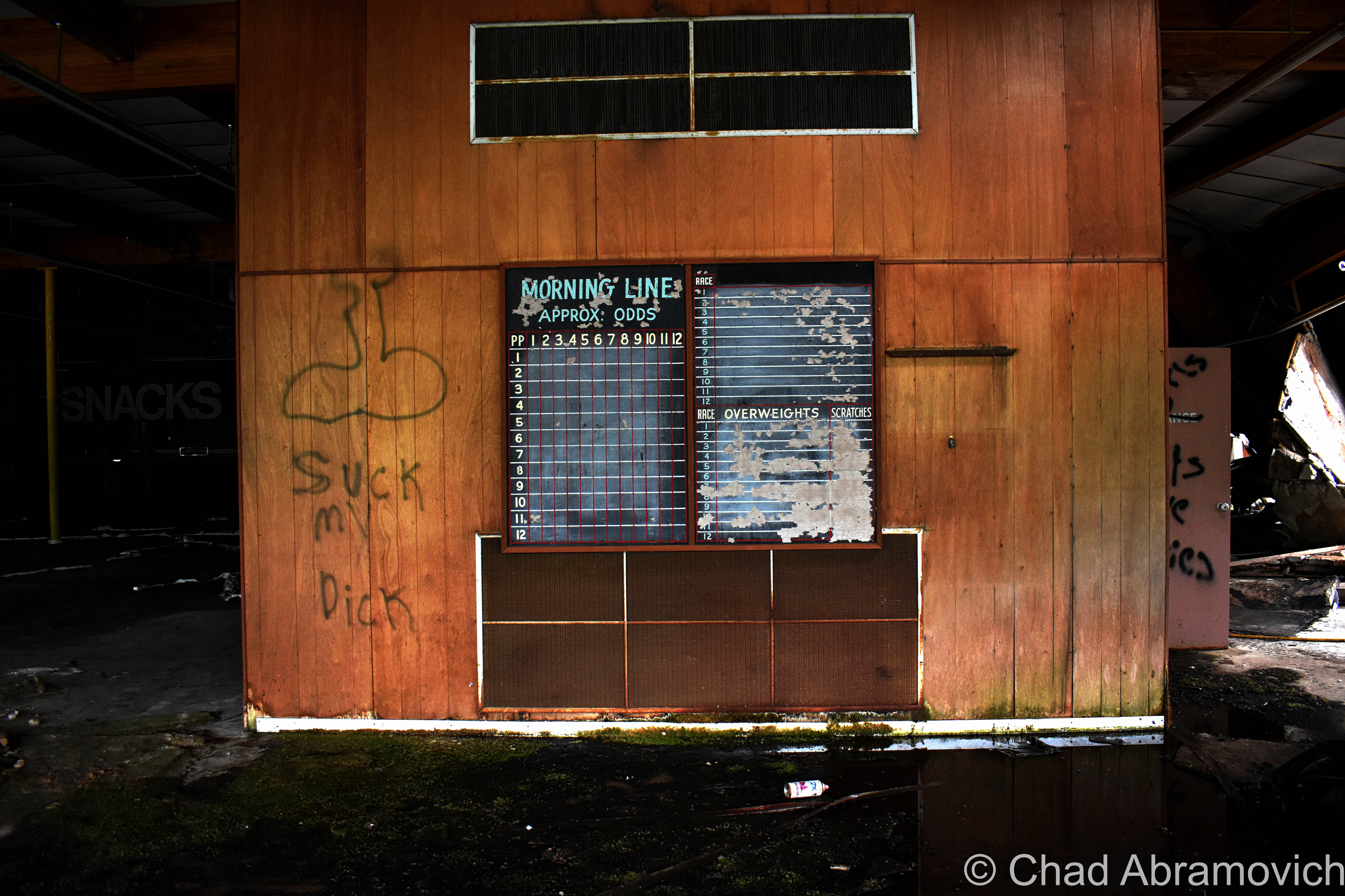
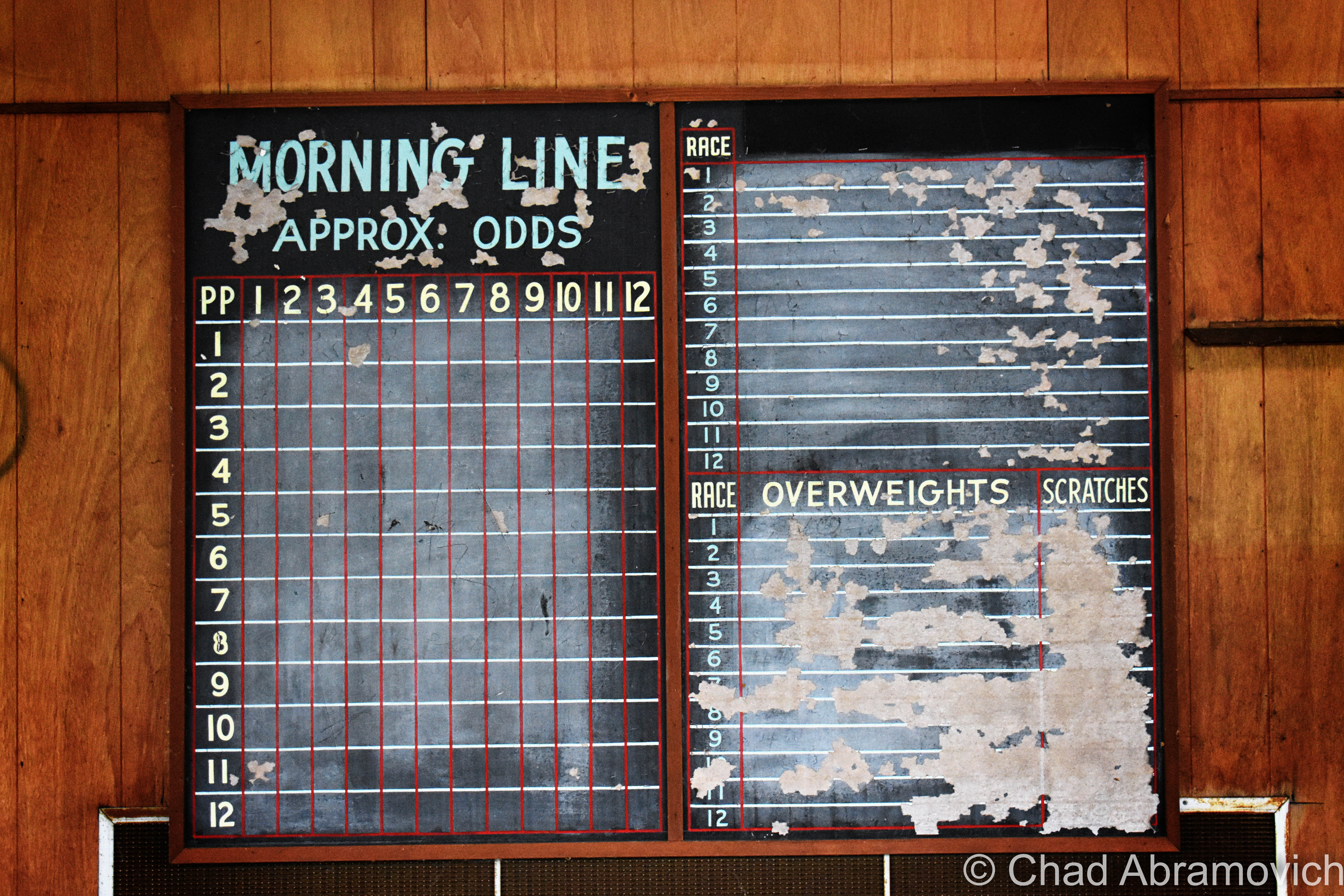
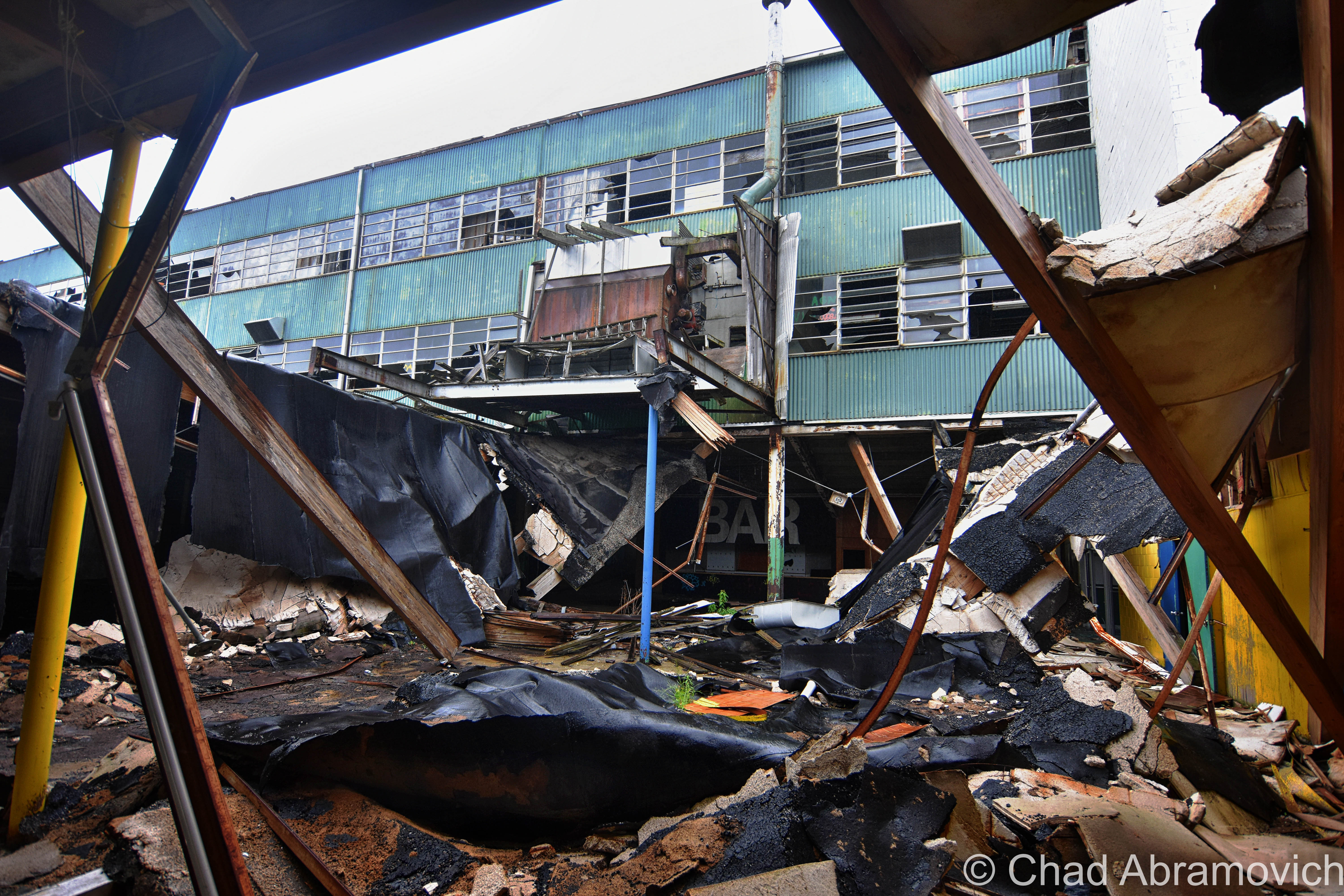
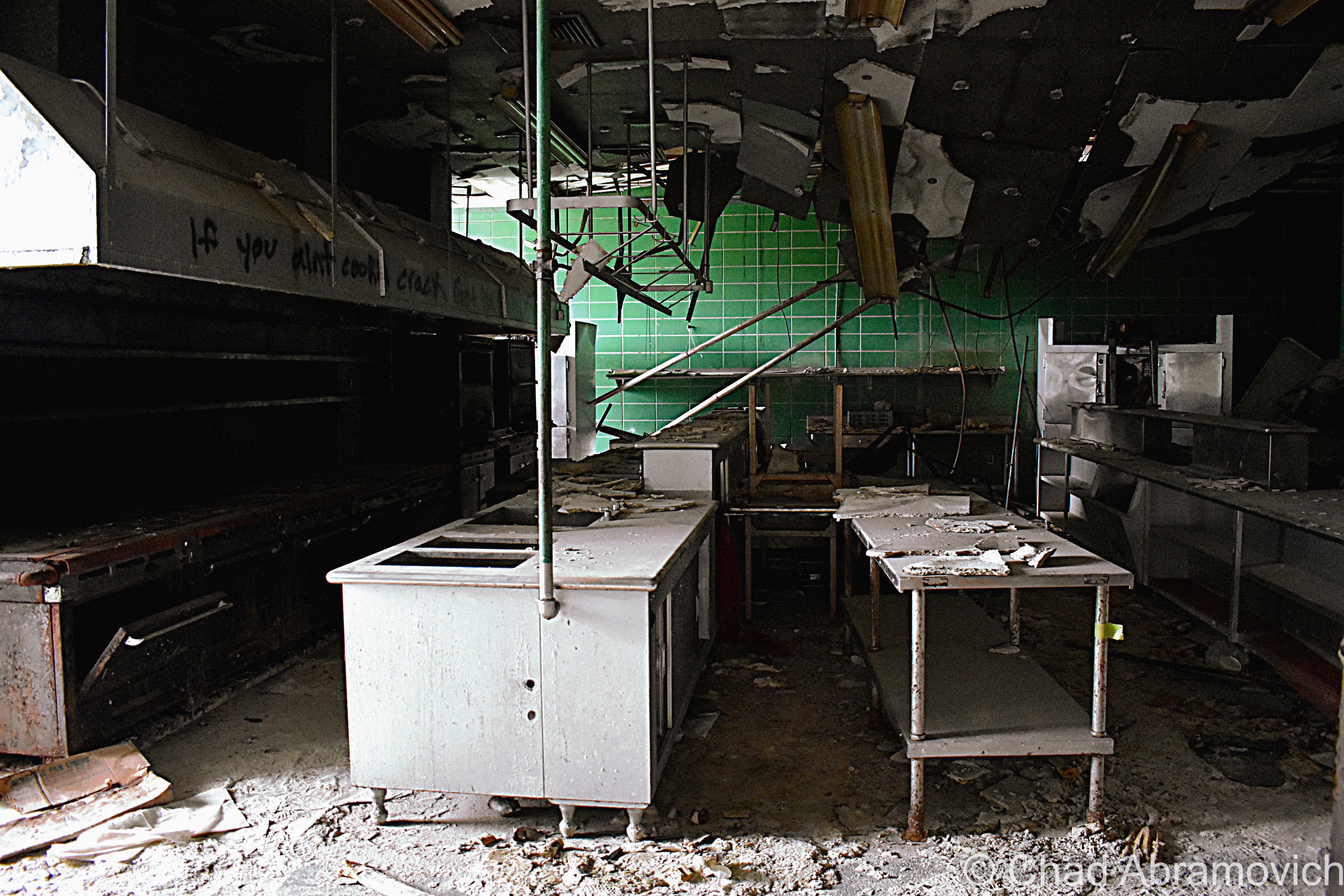
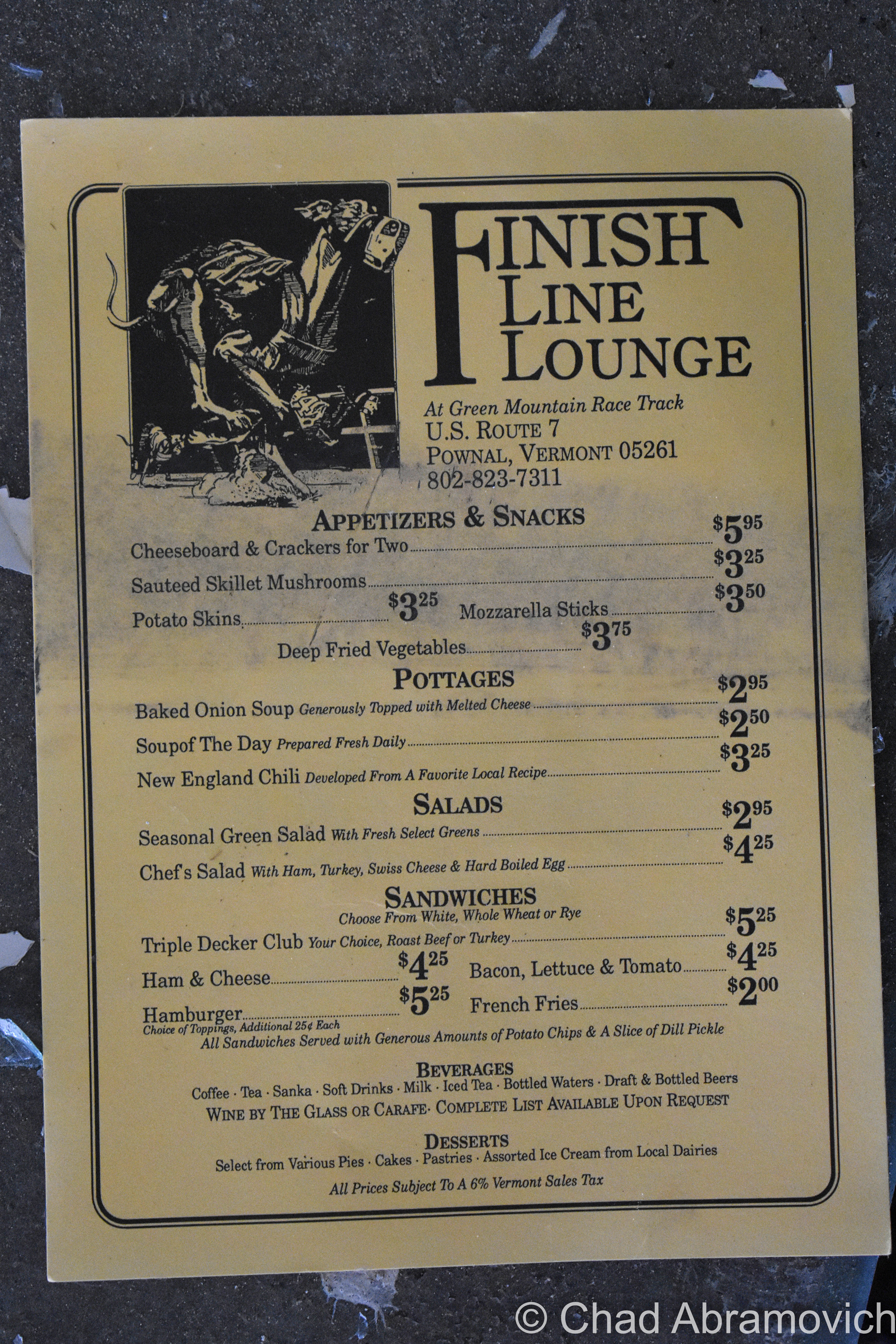
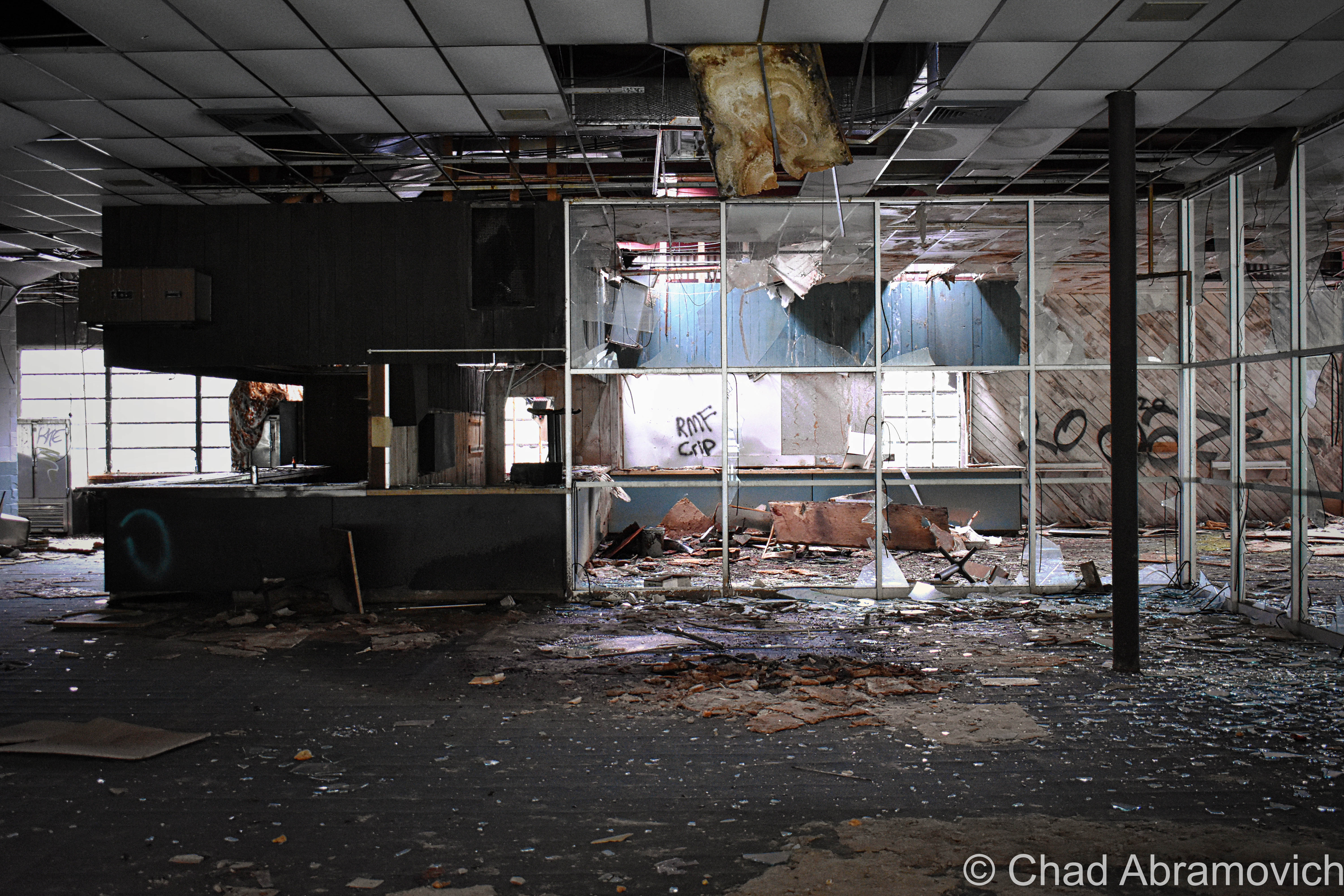
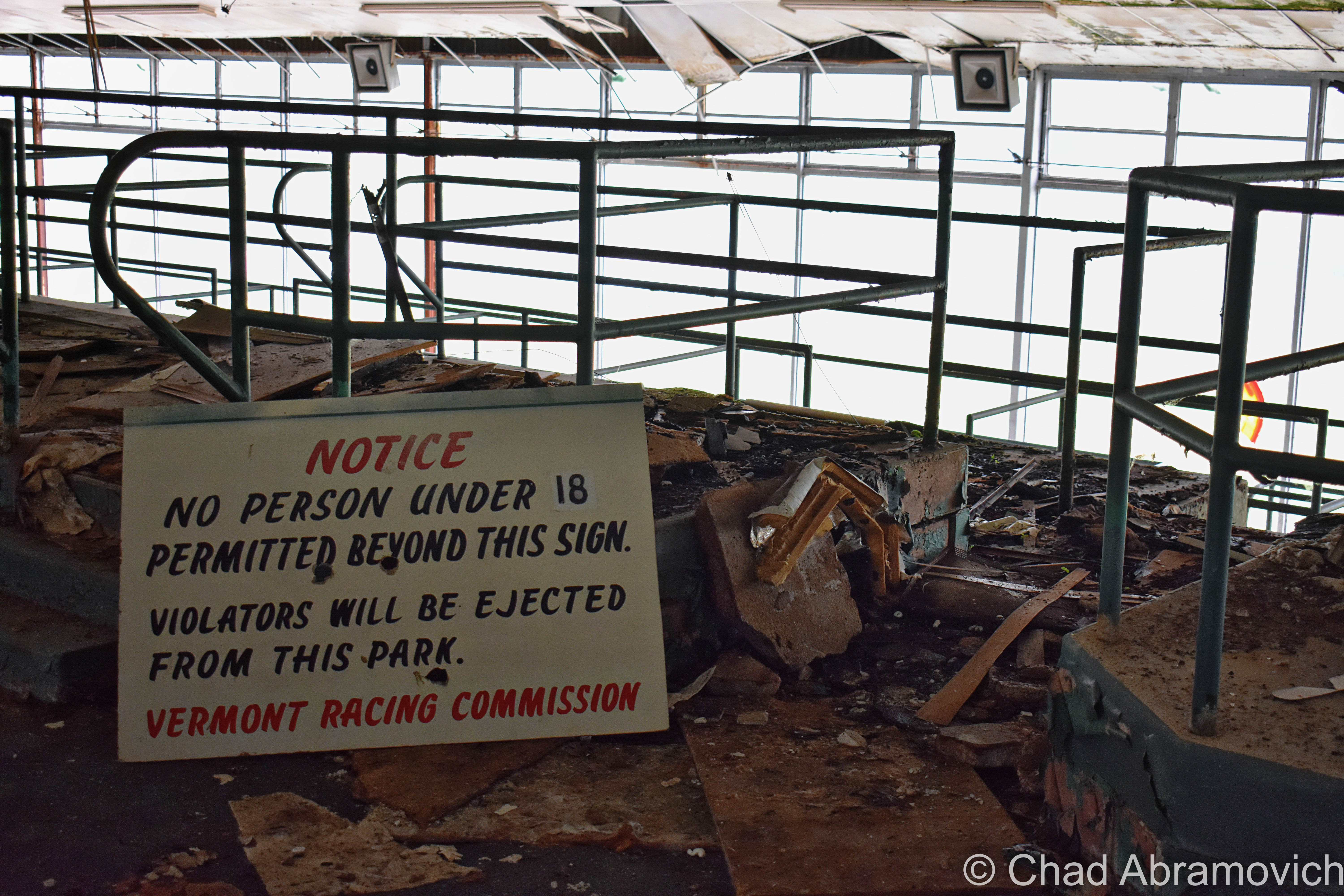
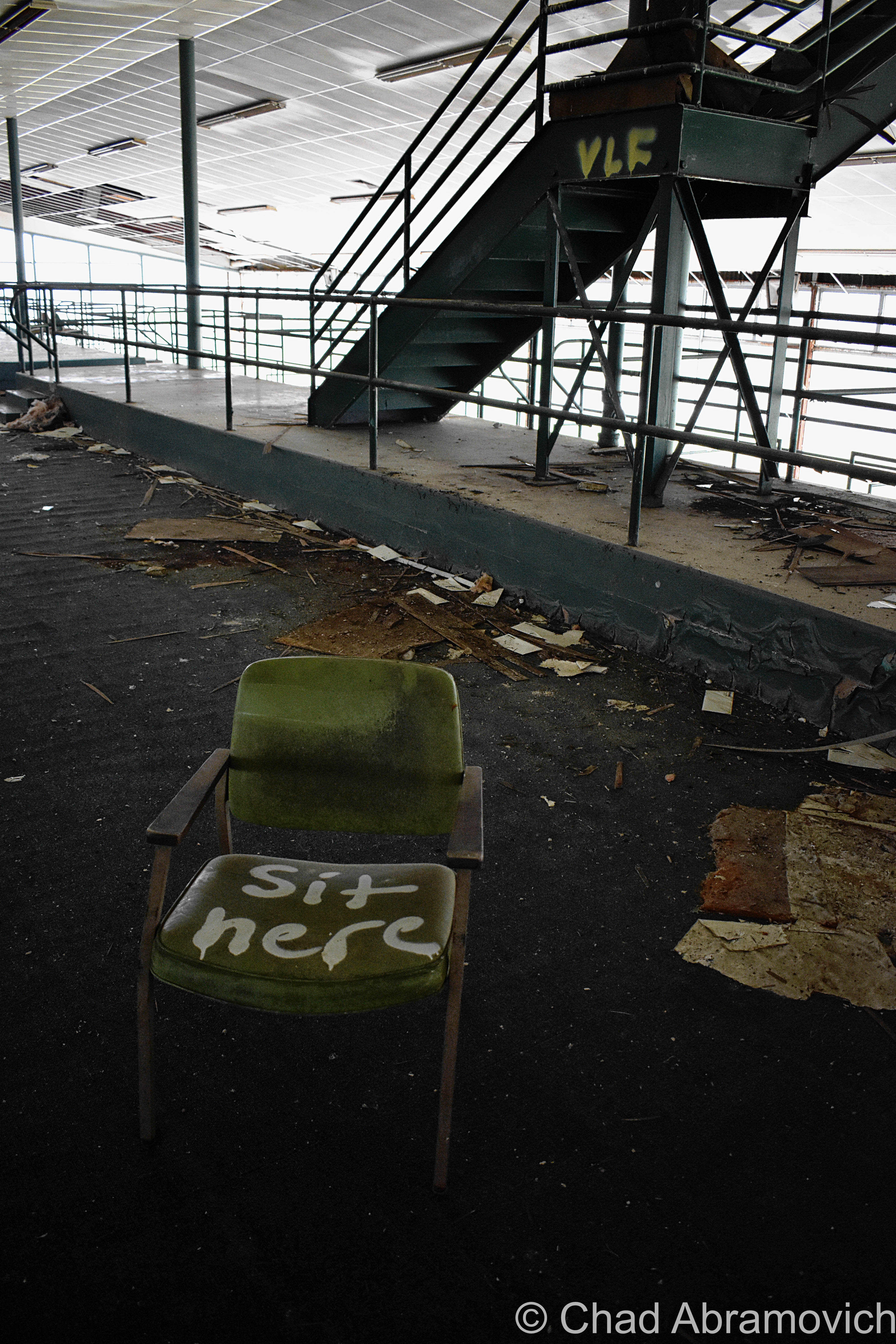
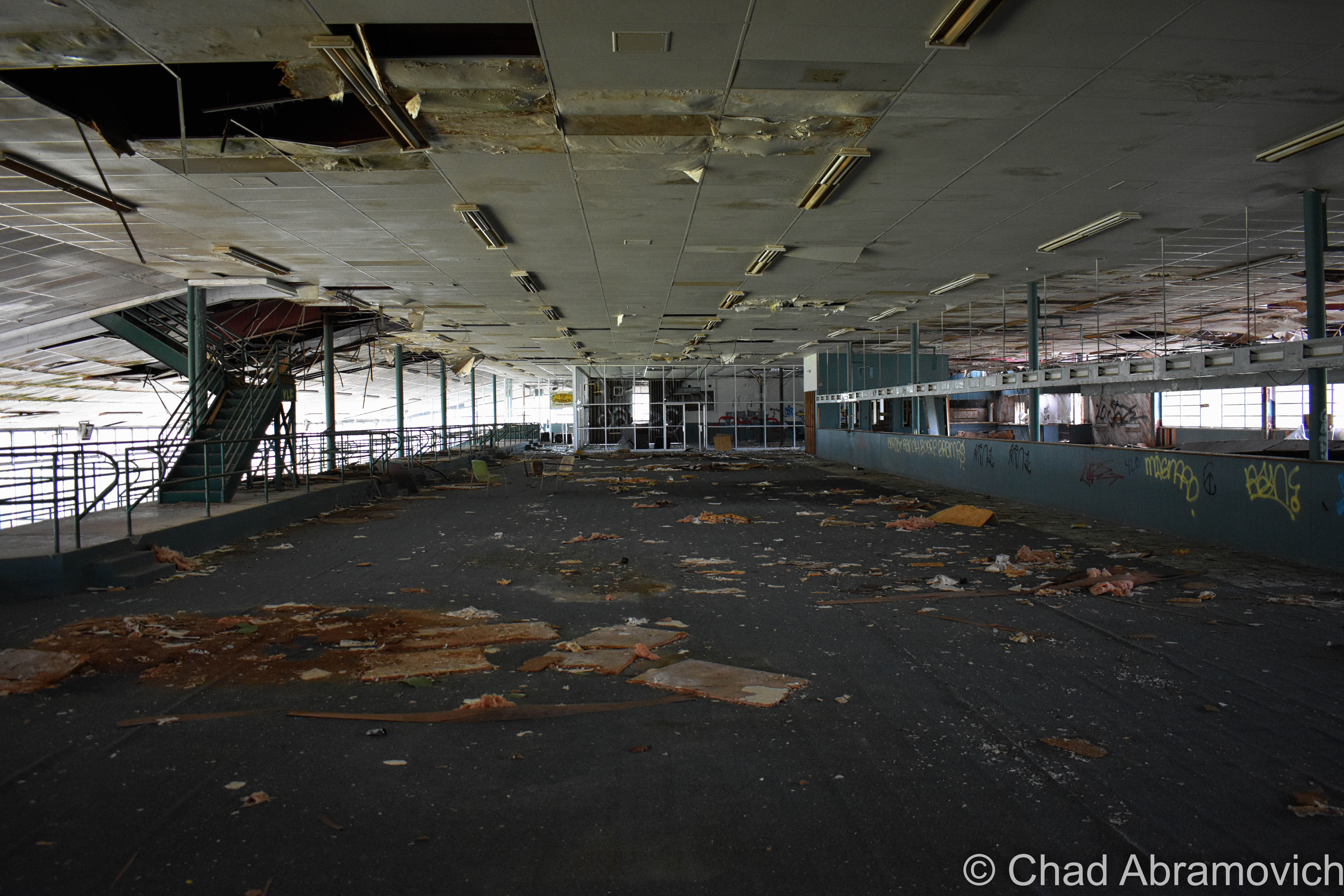
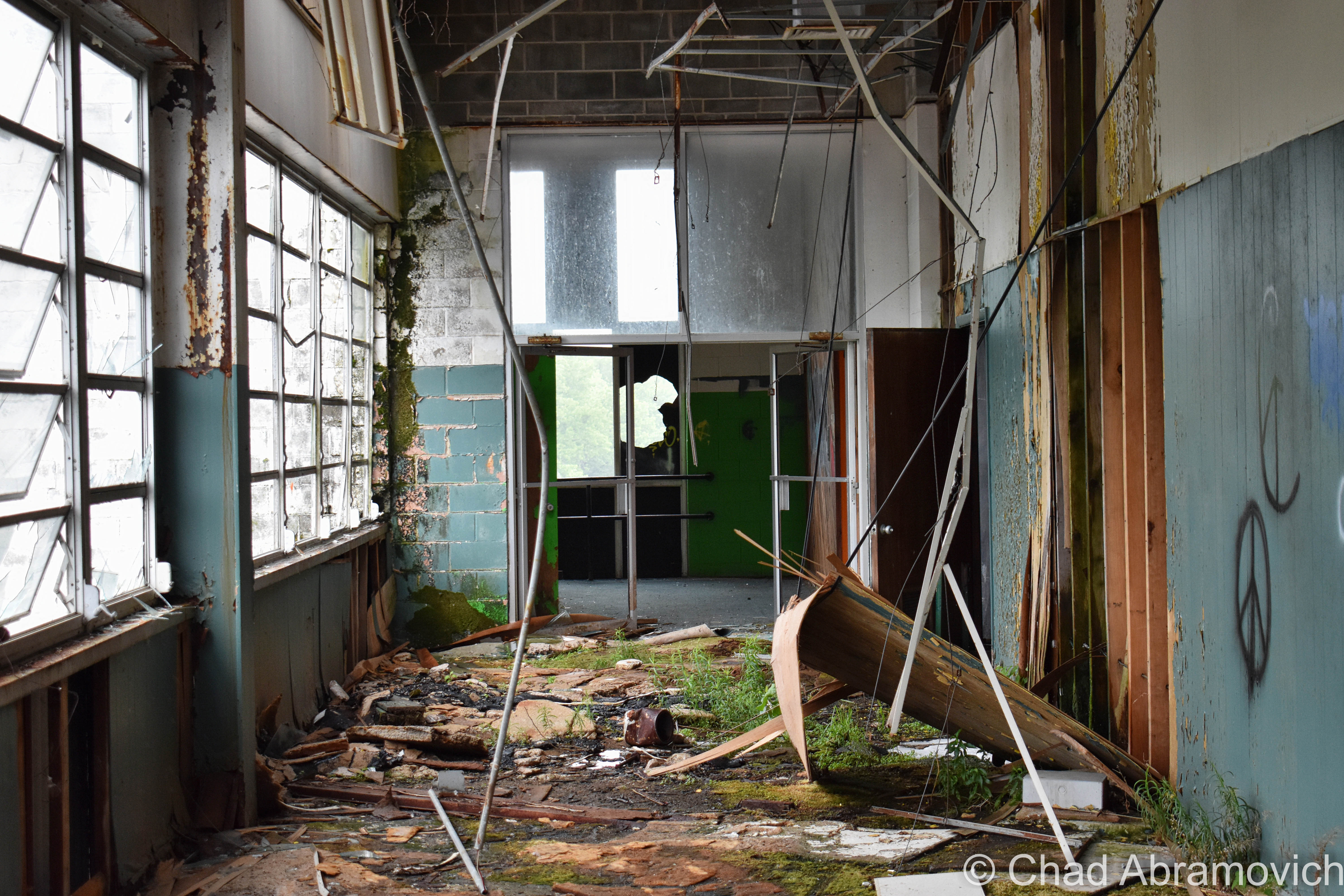
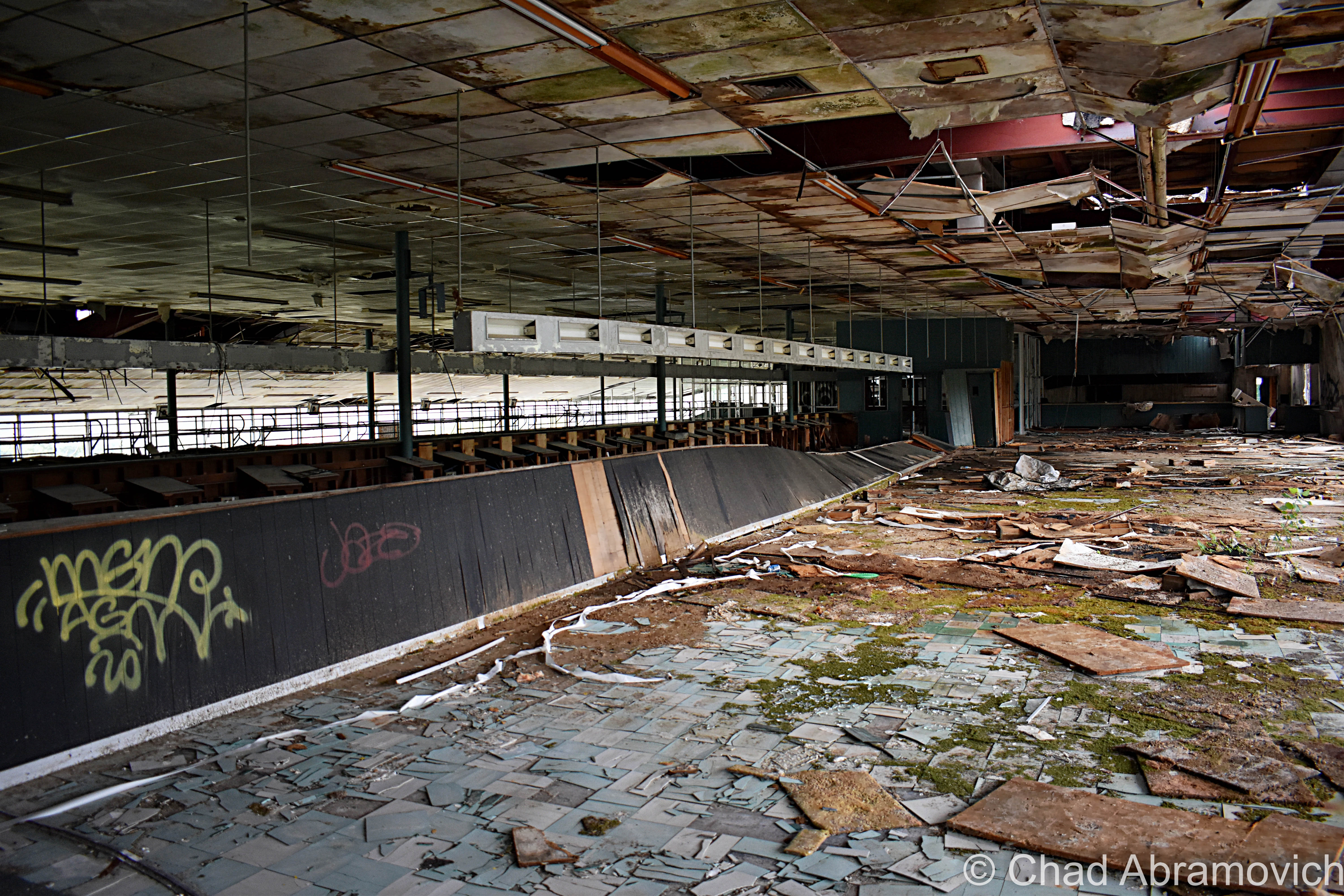
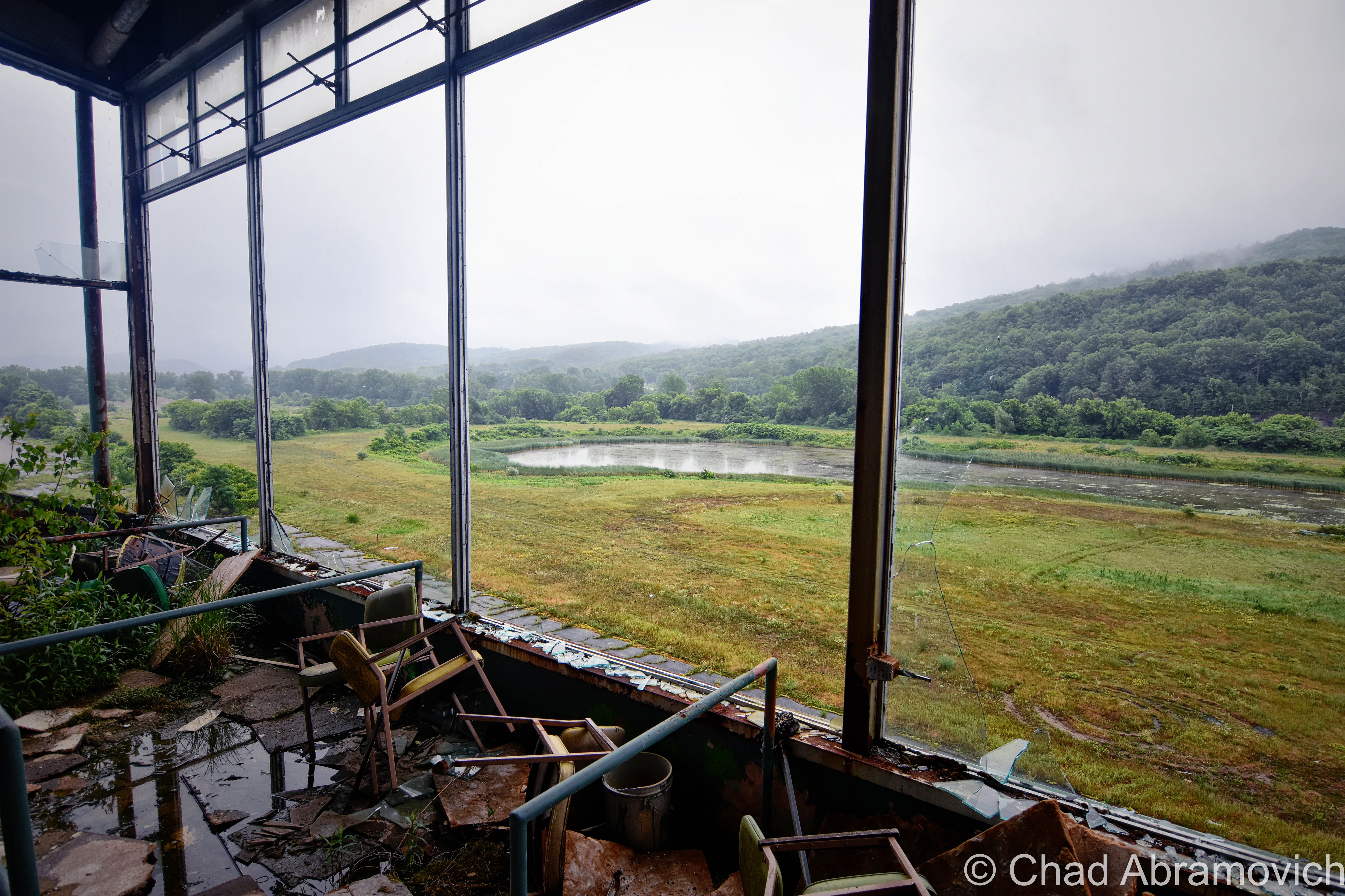
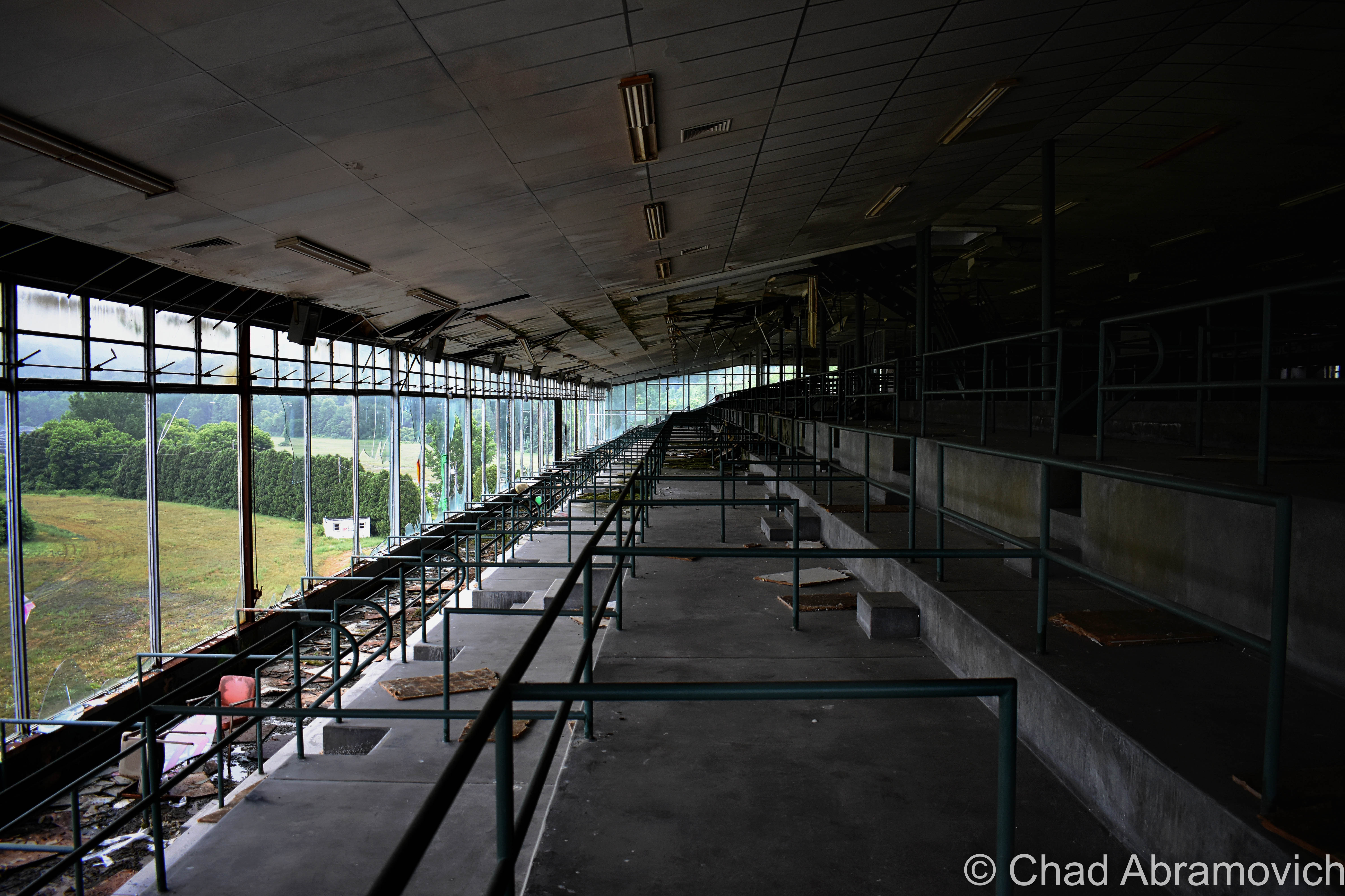
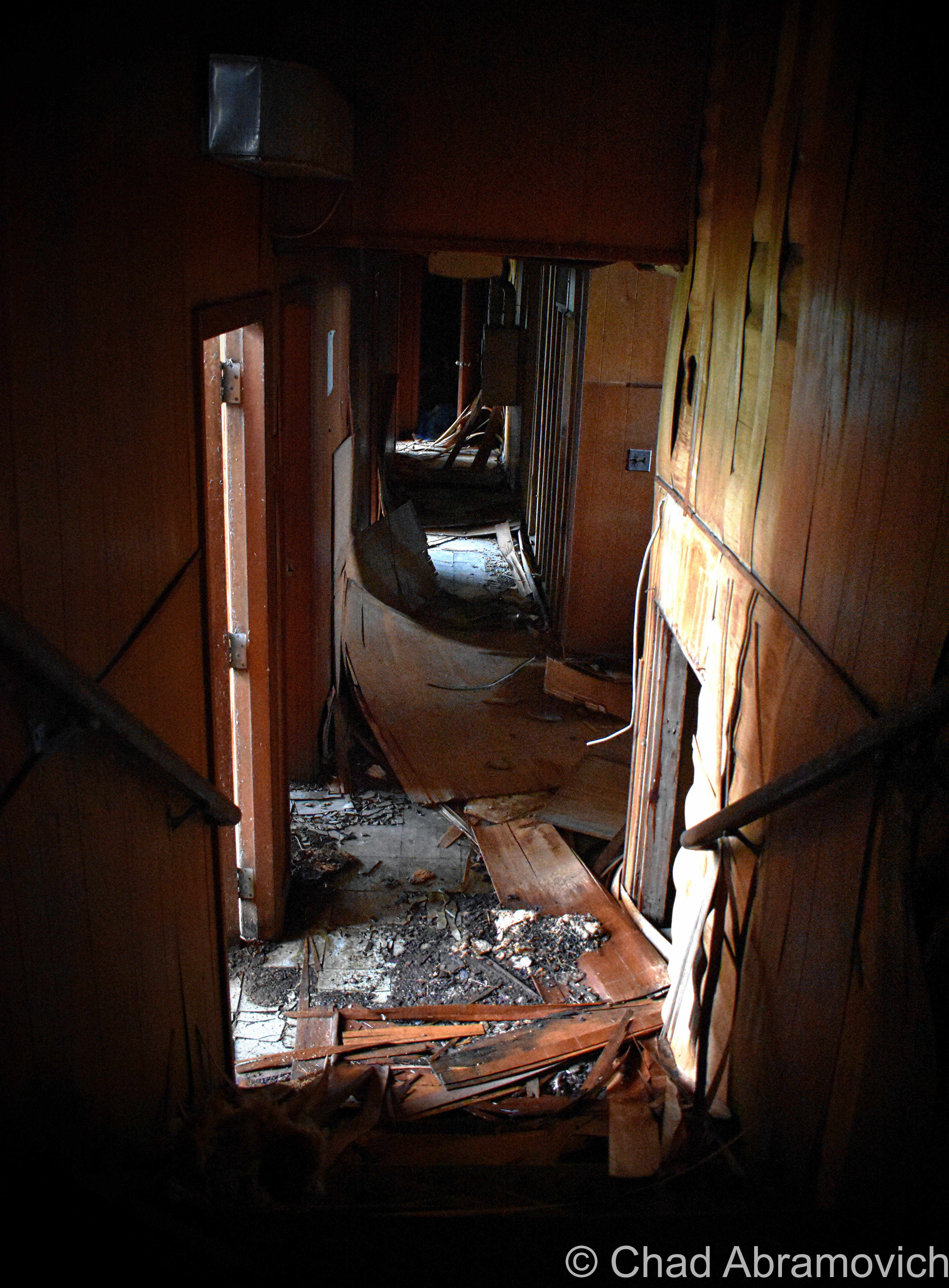
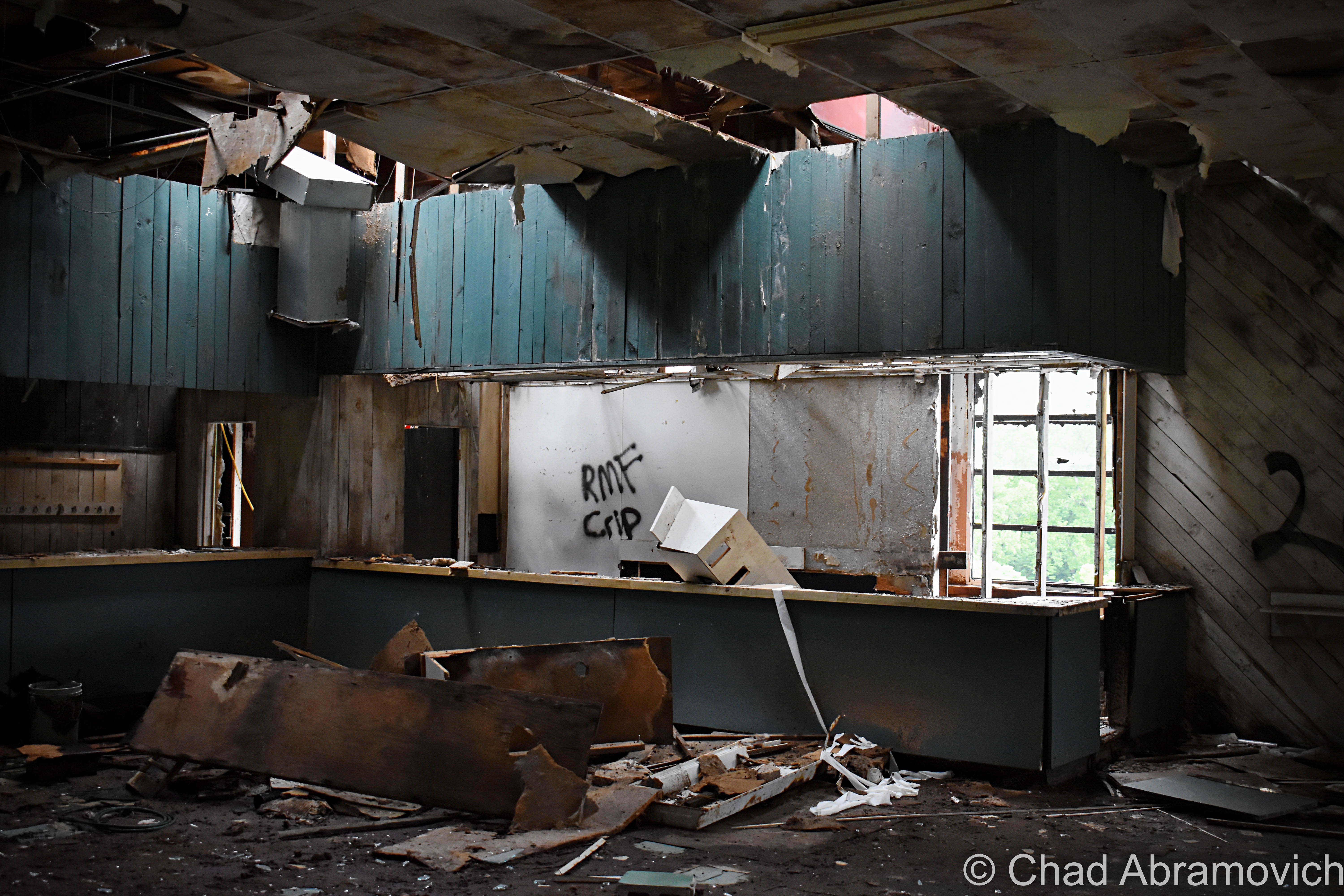
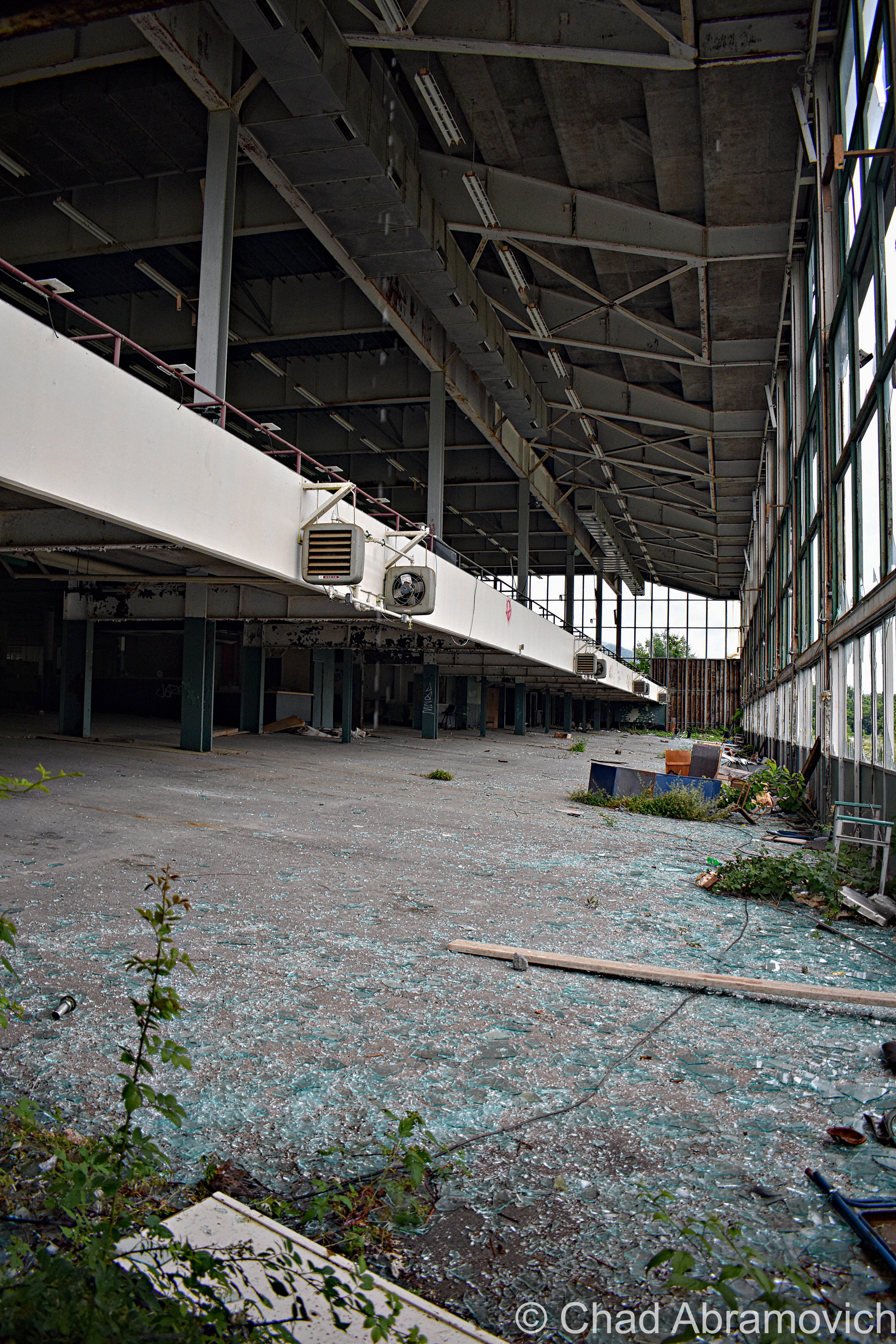
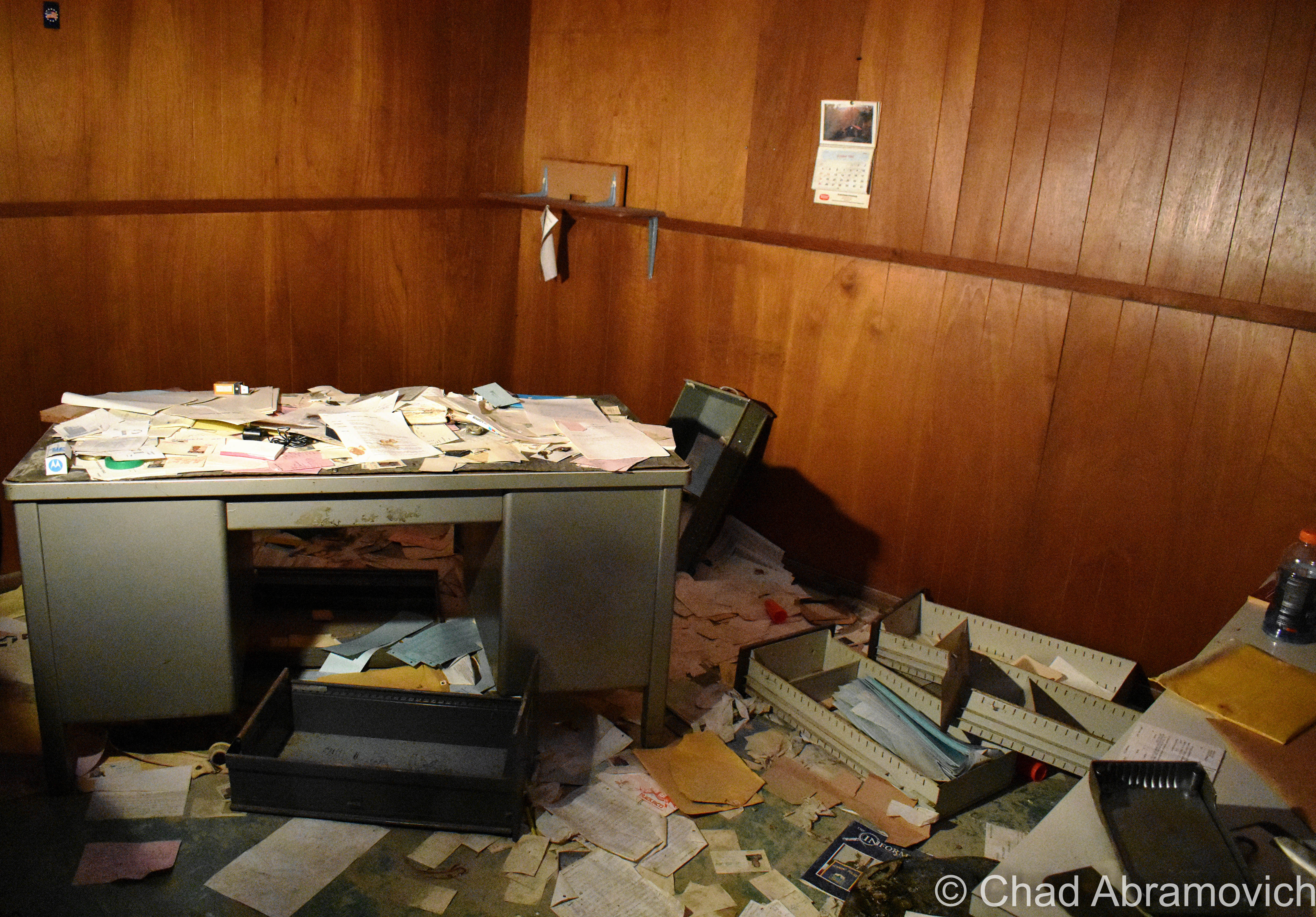
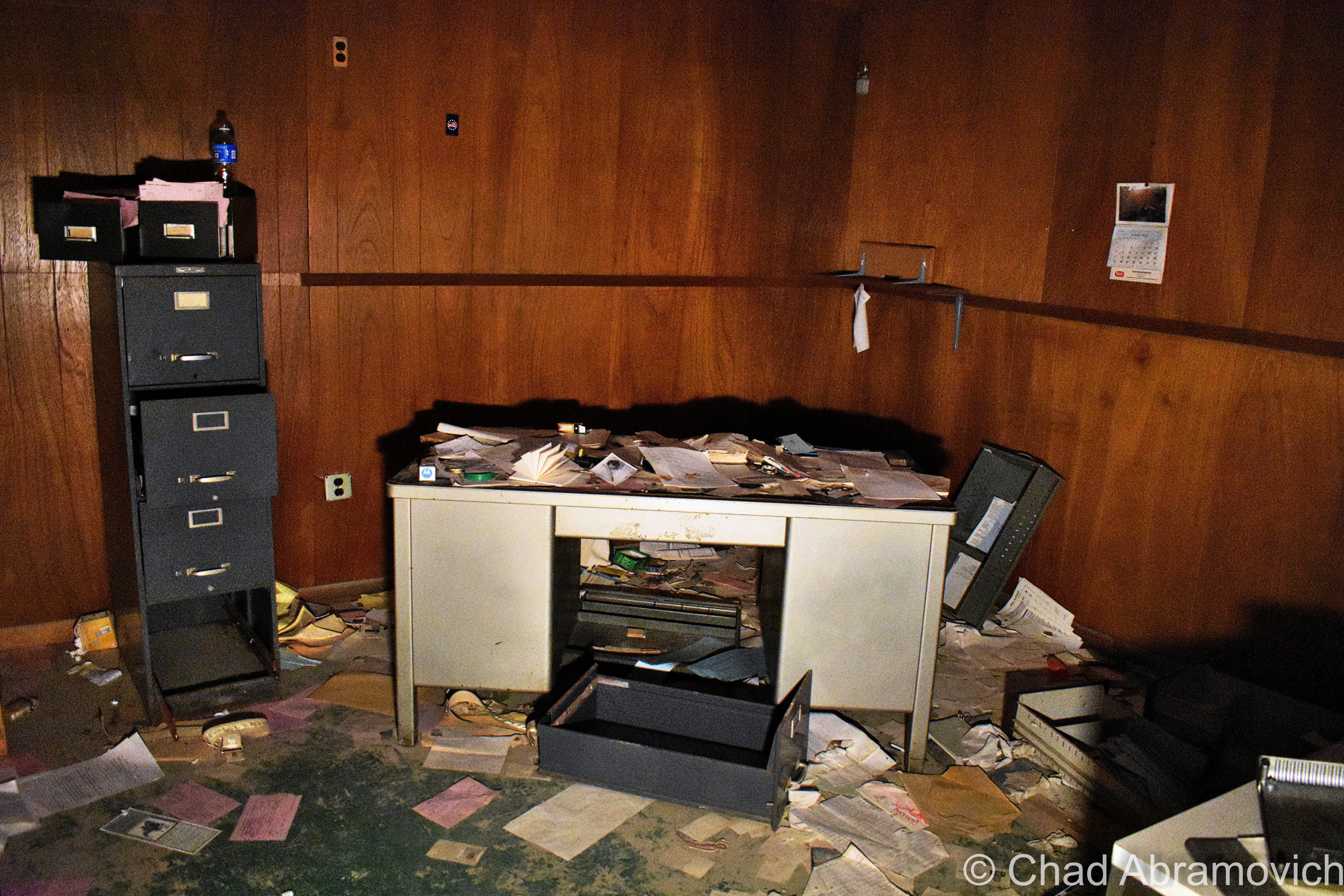
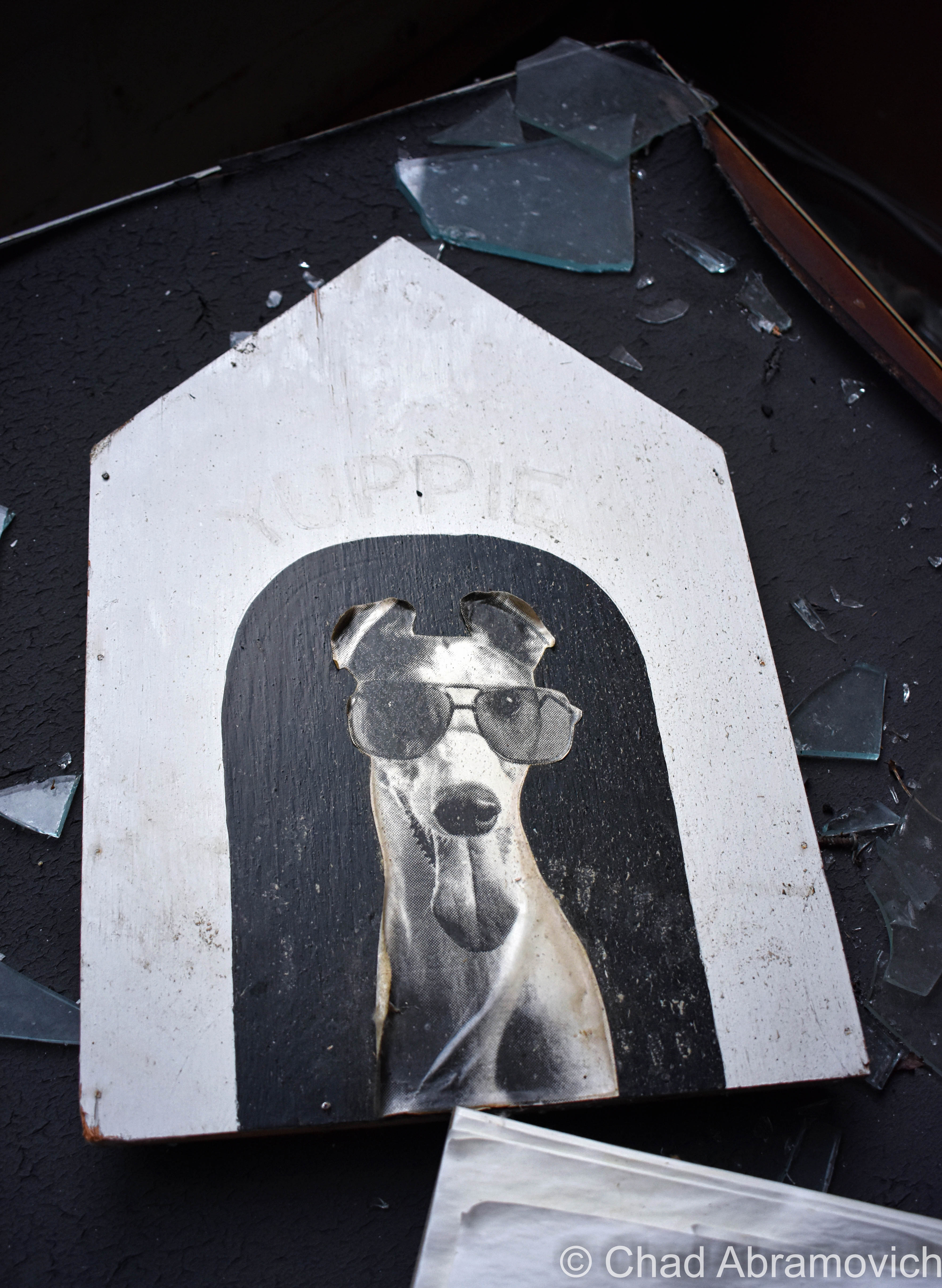
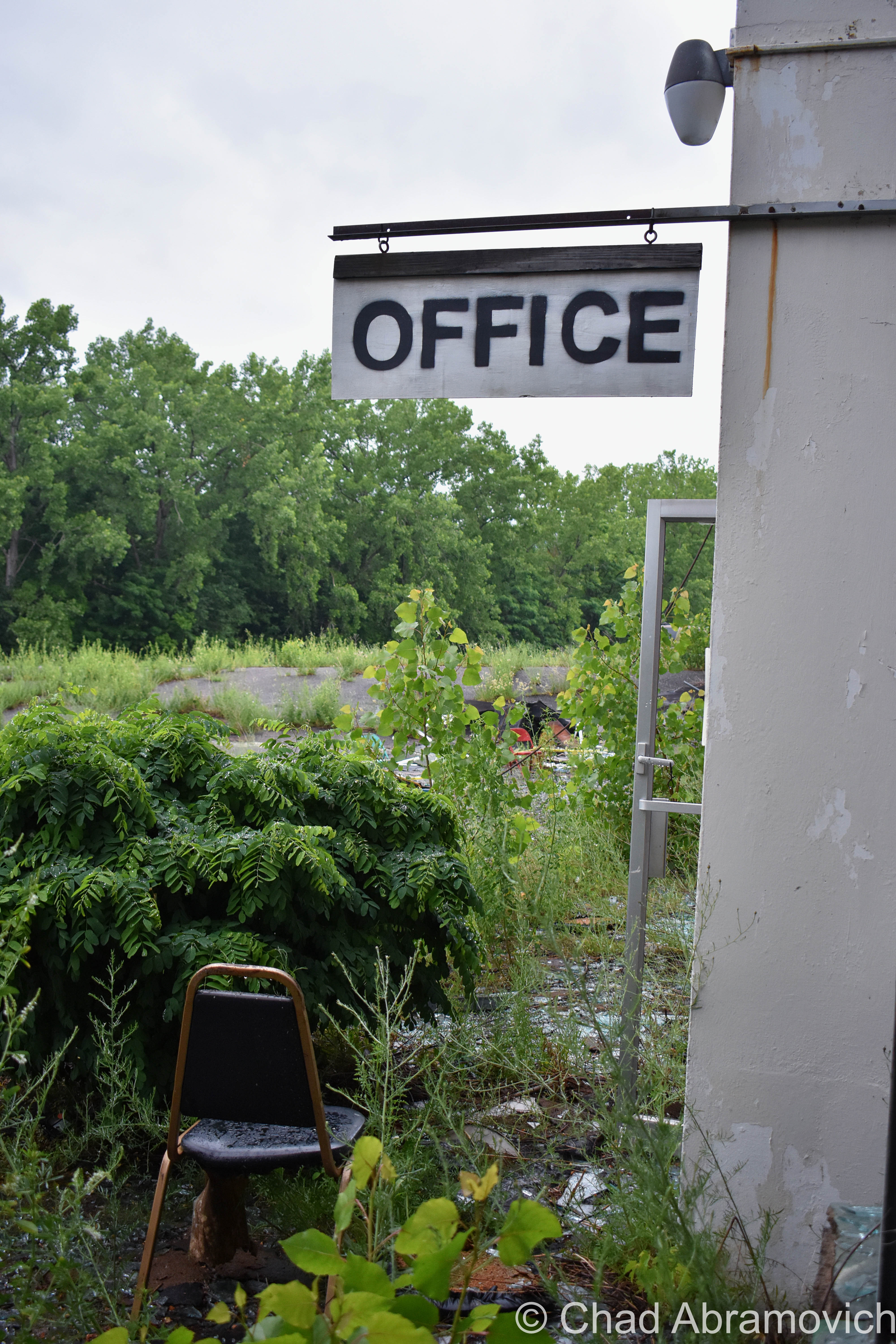
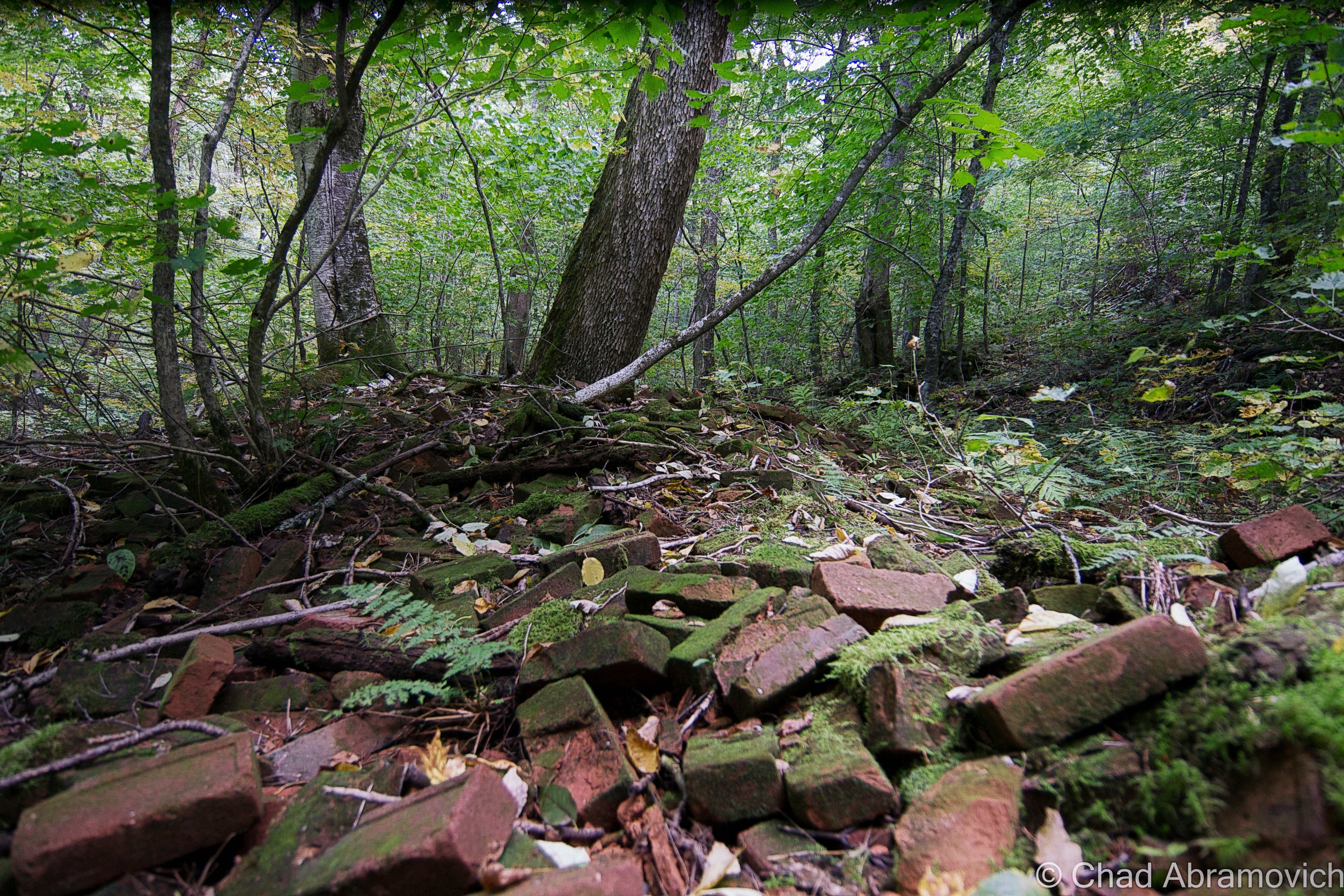
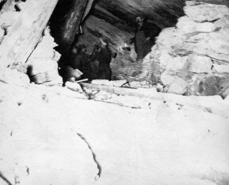
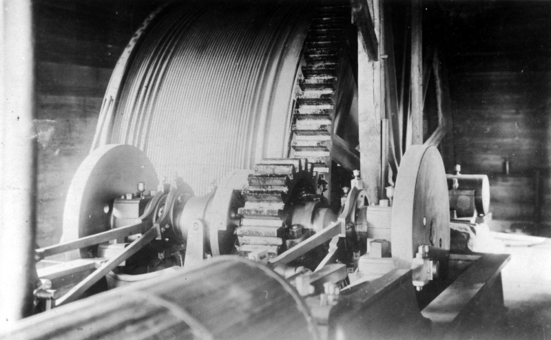
Many of the glum-looking crumbling cinderblock stables were razed for a solar farm, which is awesome, but the gigantic grandstands building still stood at the times of my visits, and was a spooky but really fascinating time capsule of the late sixties and early seventies, with its cold cement blocks and hideous fake vinyl wooden wall paneling – an architectural design element I hate. I especially admired the extinct fonts on all the office doors; “bookkeeper”, “telegraph”, “photographers suite” etc – that was pretty neat to see. One unifying theme to the property was the use of a particular dark green – thematic of its location in the Green Mountains, which was used on everything from the exterior paint job to the color of its graphic design marketing. The appeal, though, was a little curious. Everything about the place felt cheap and kinda sleazy.

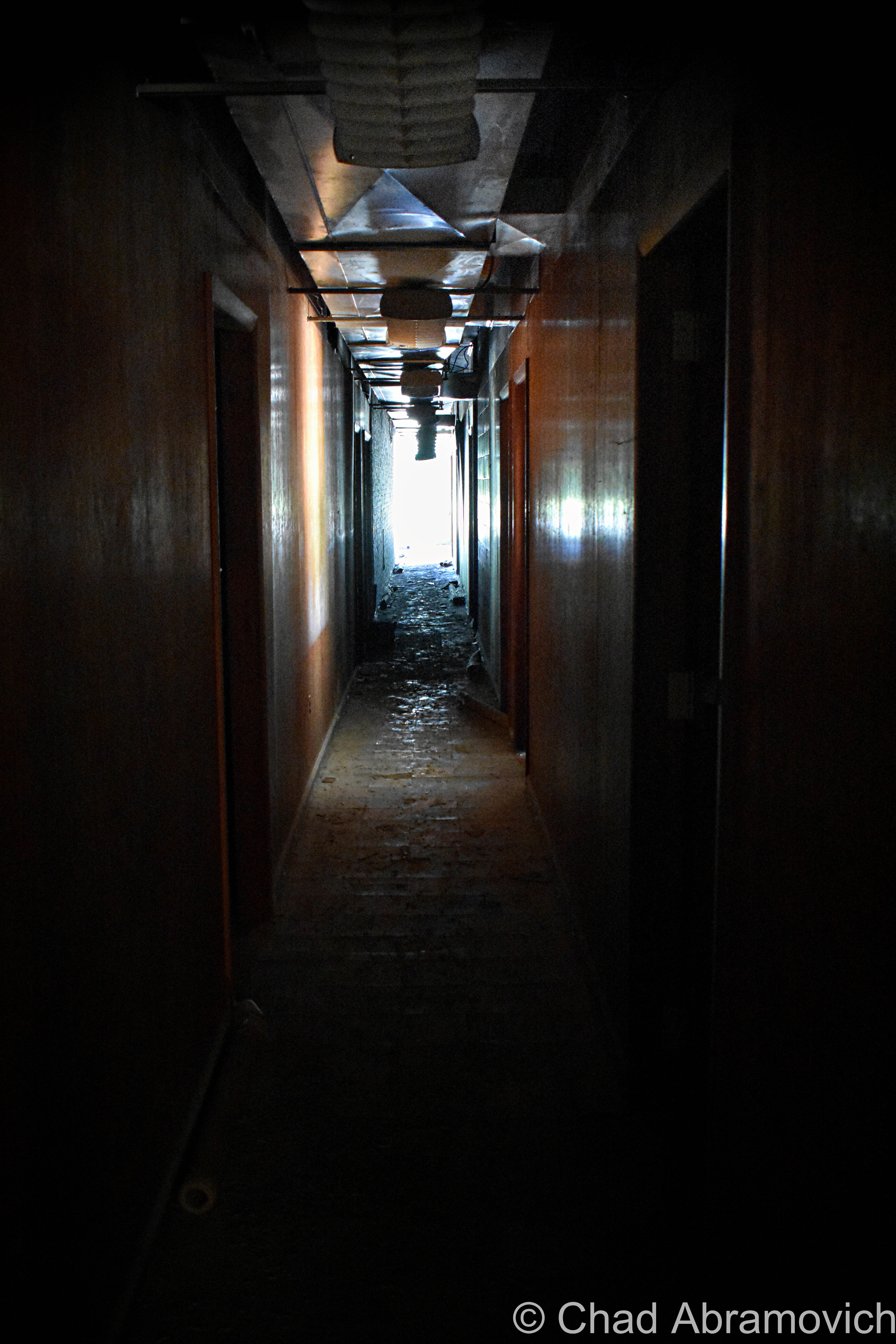
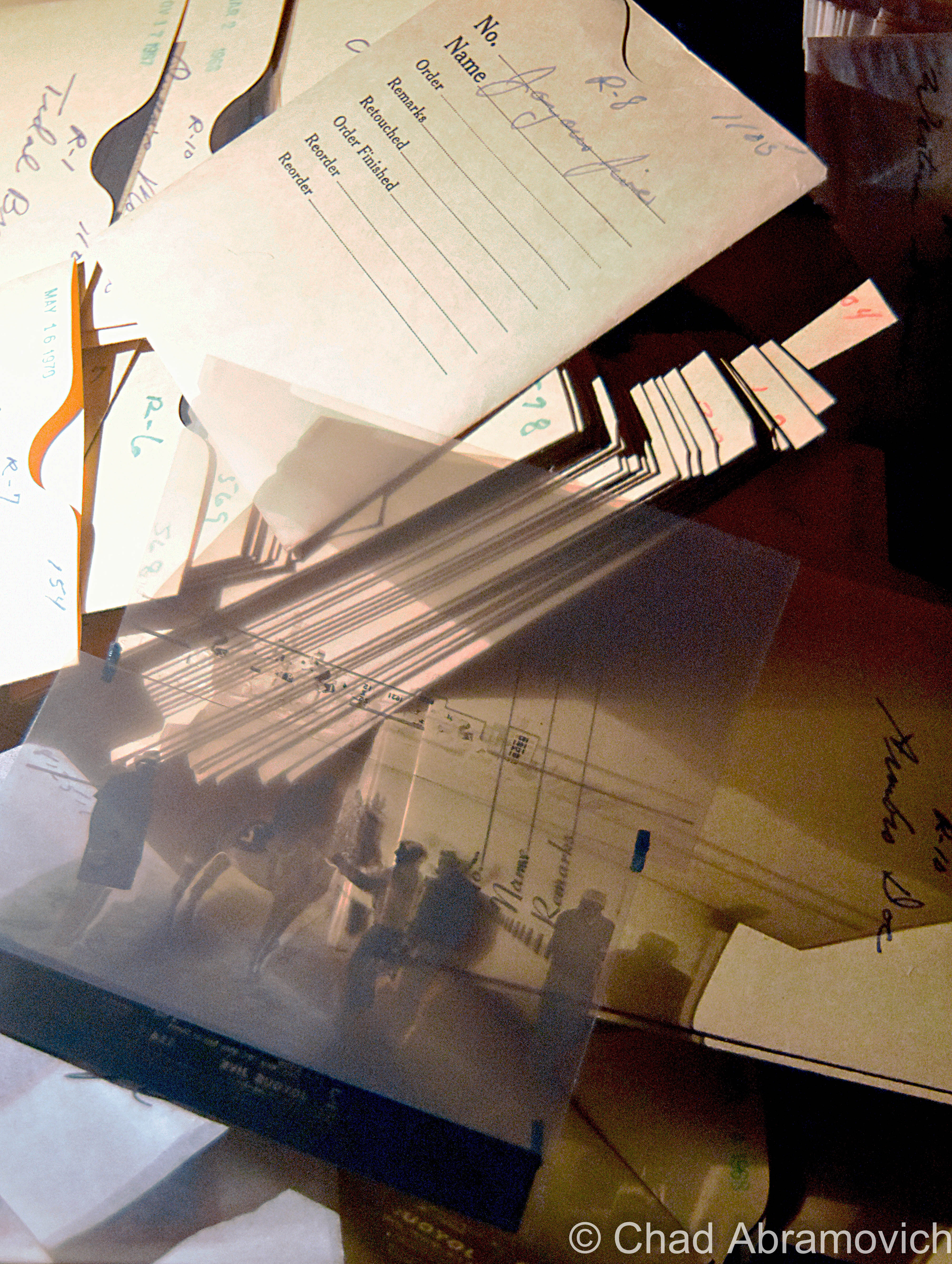
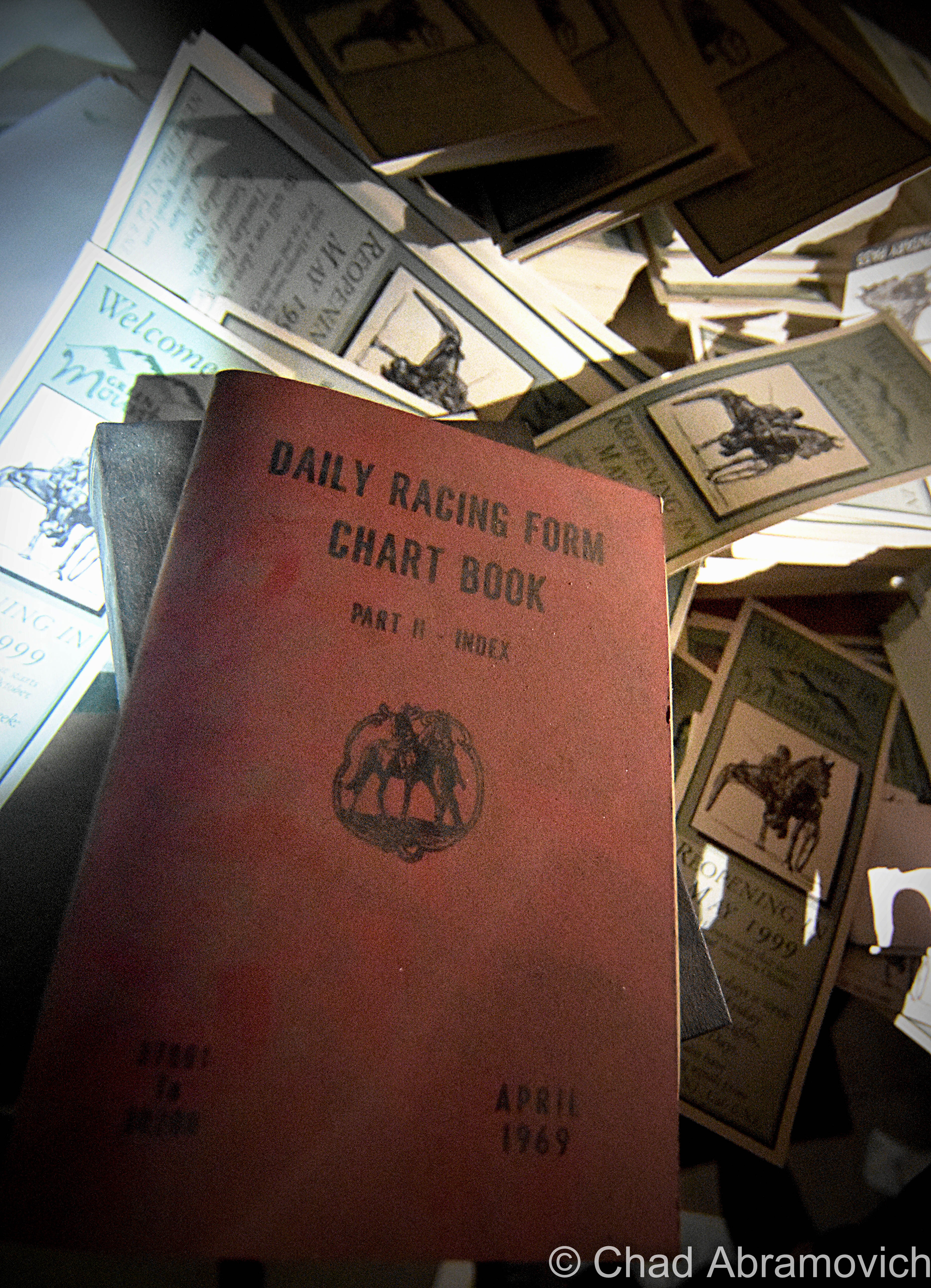
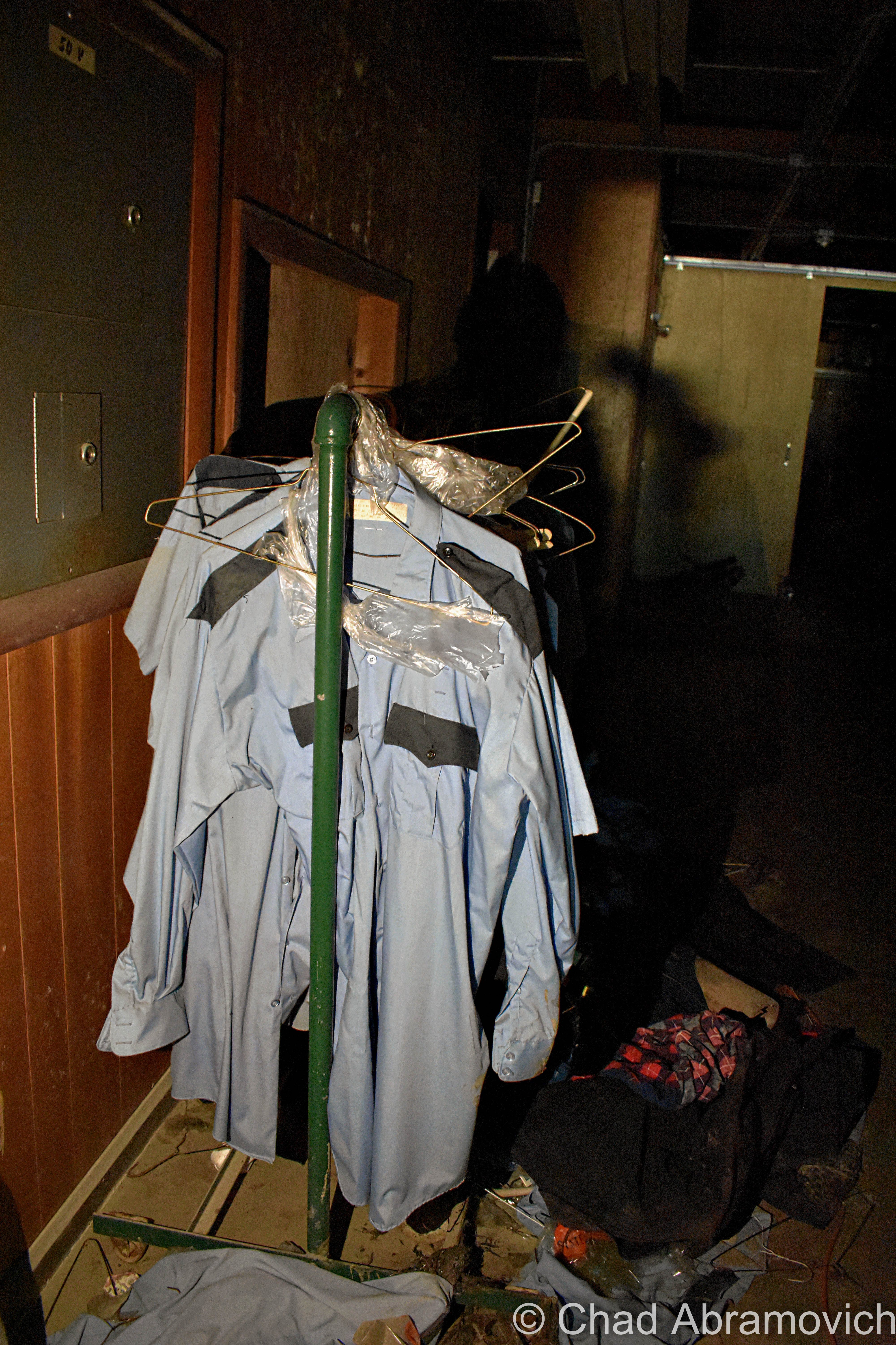
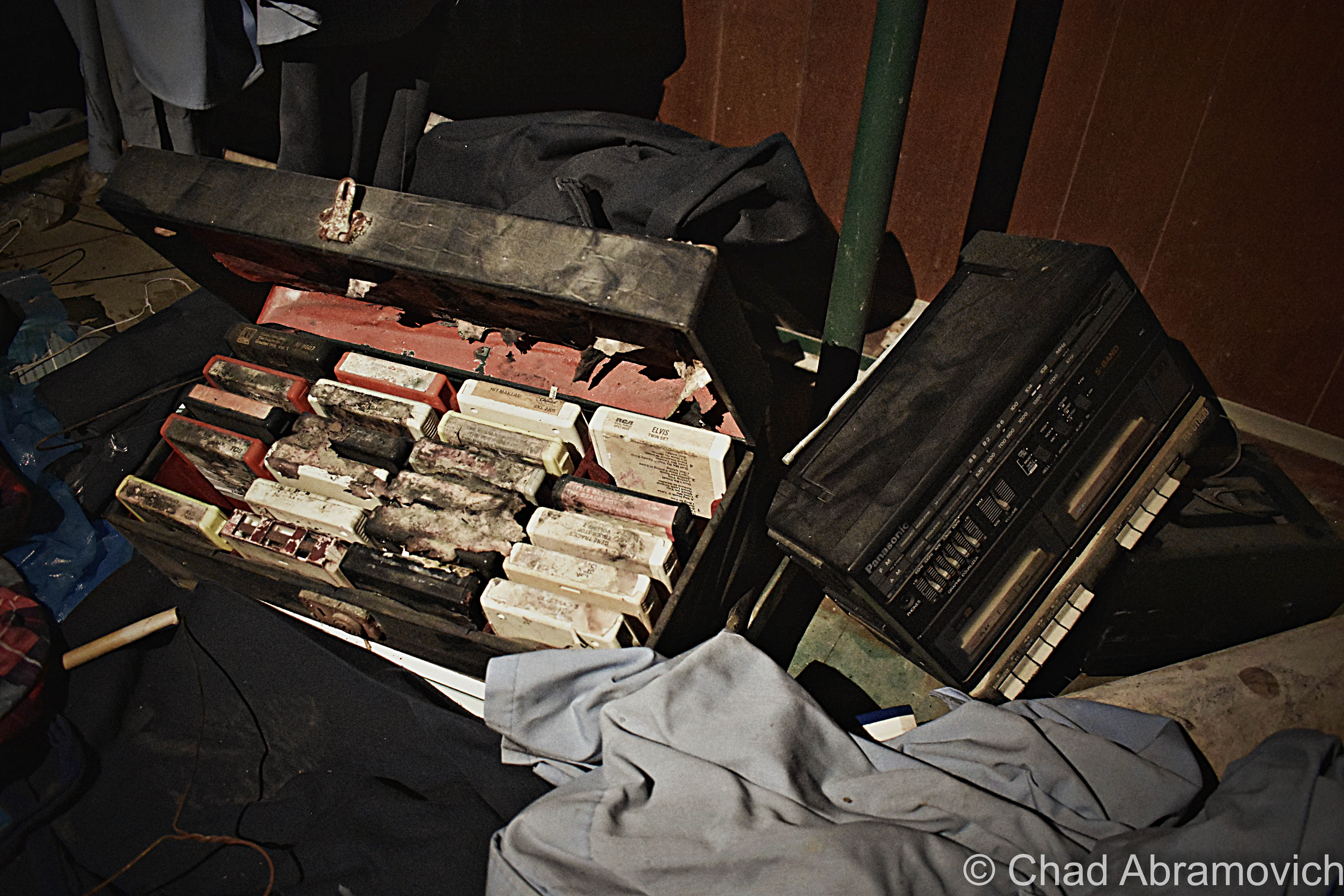
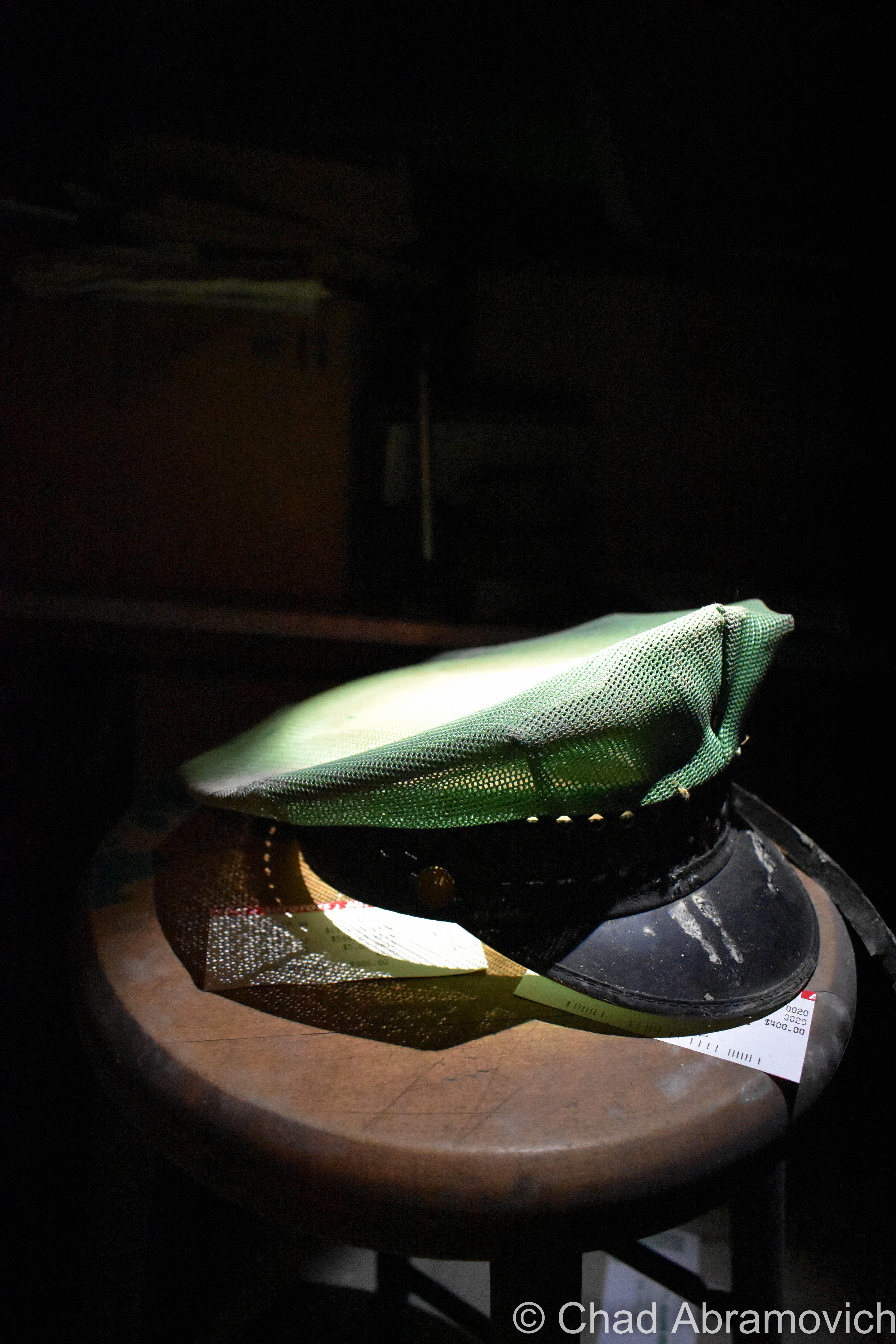
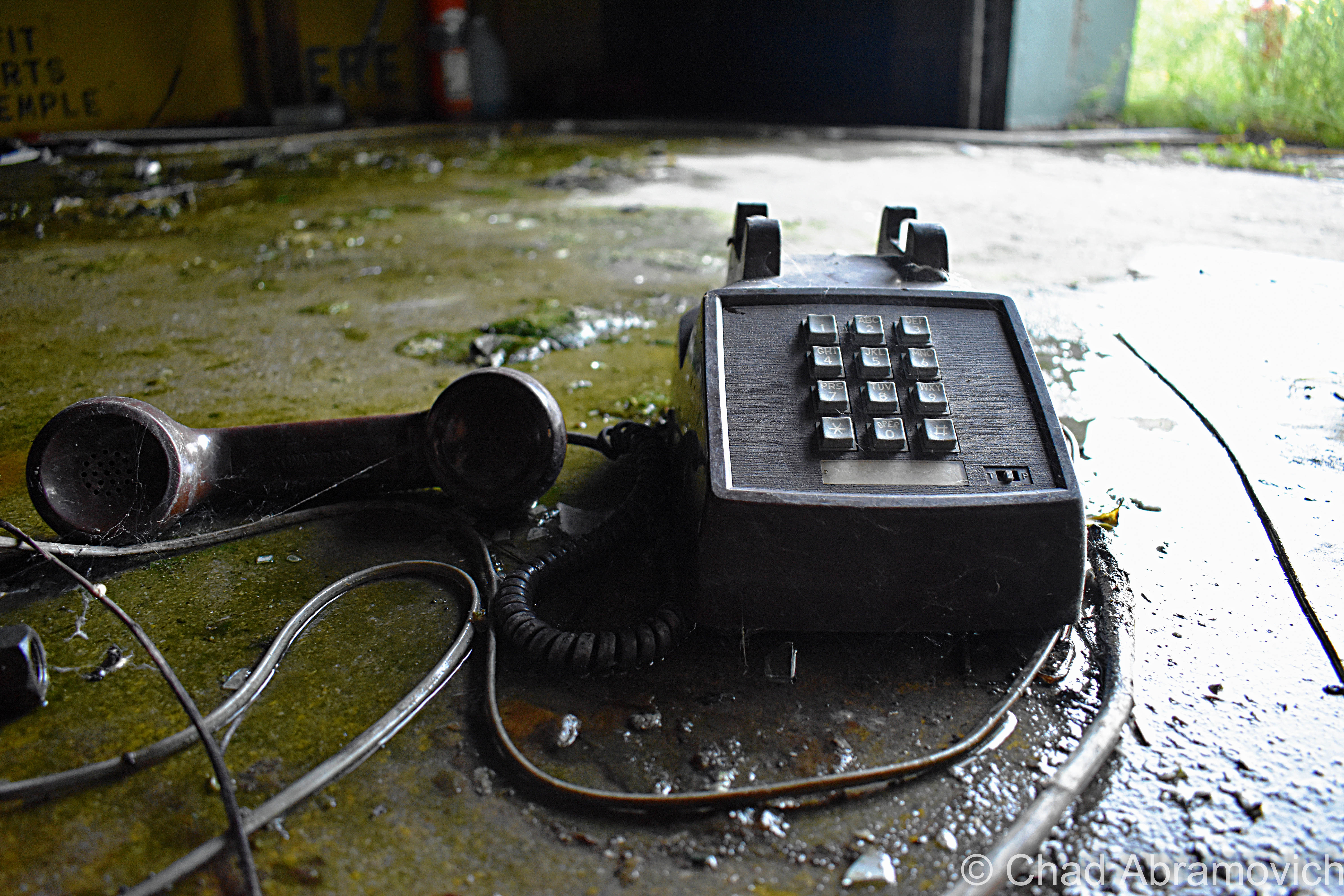
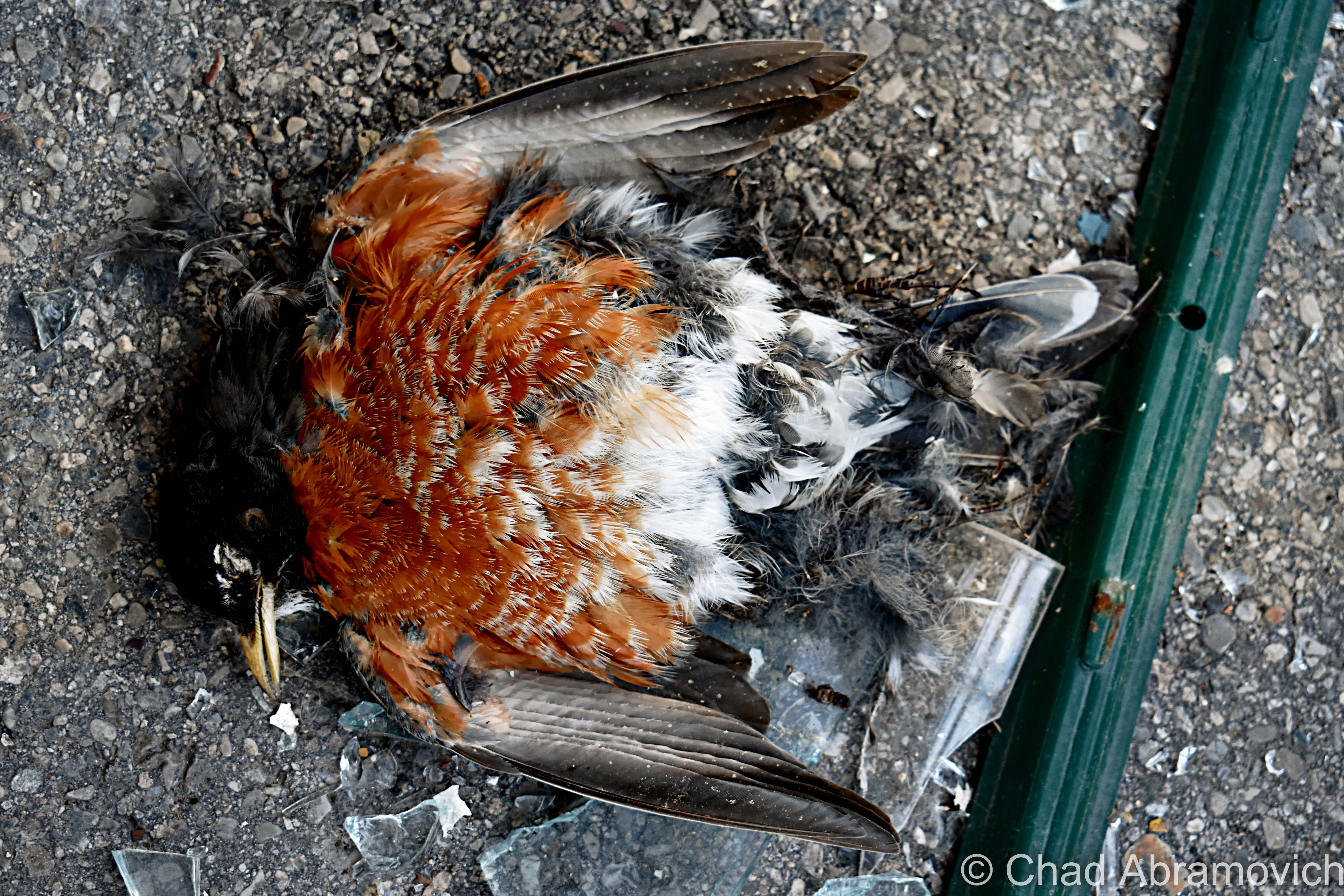
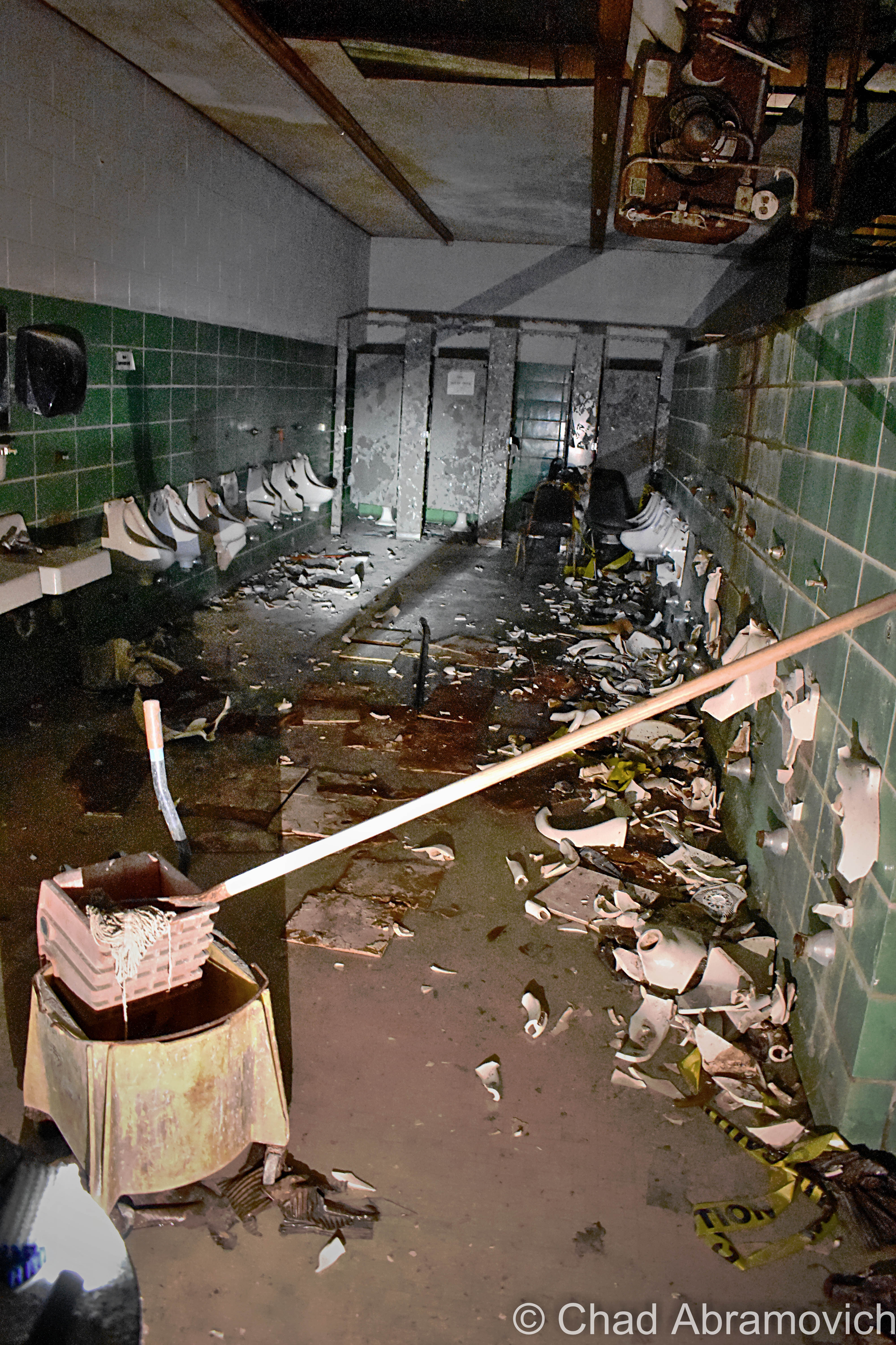
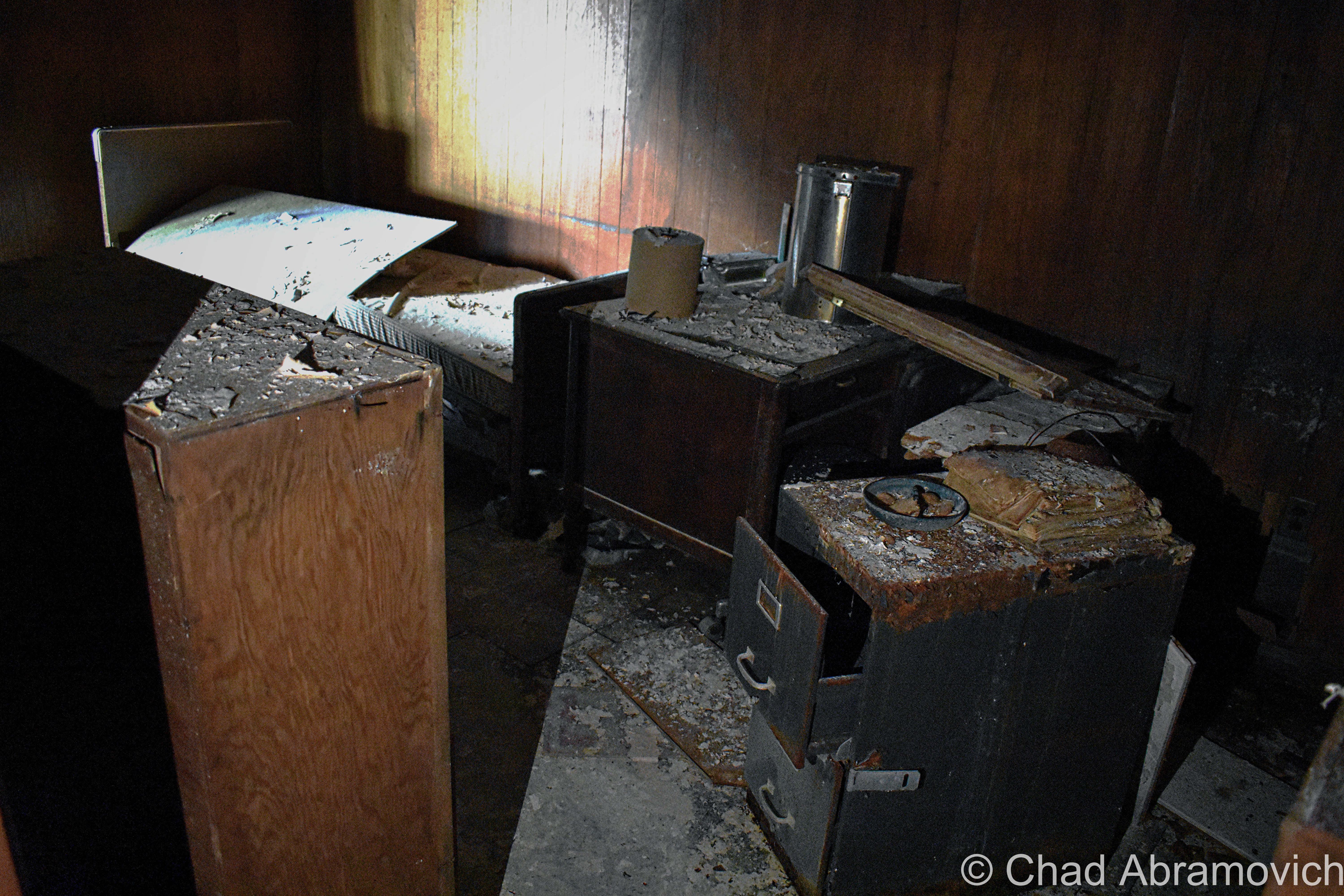
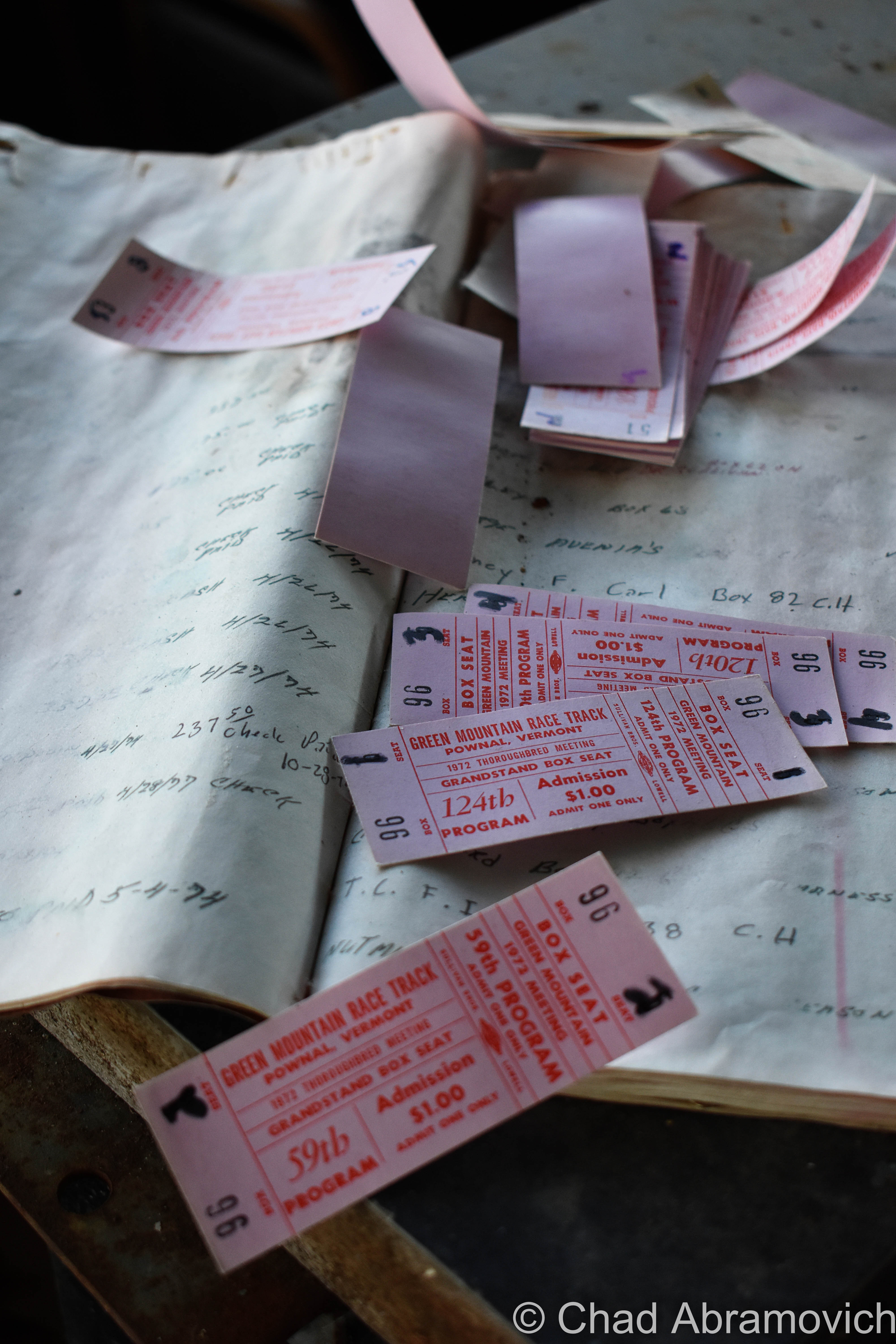
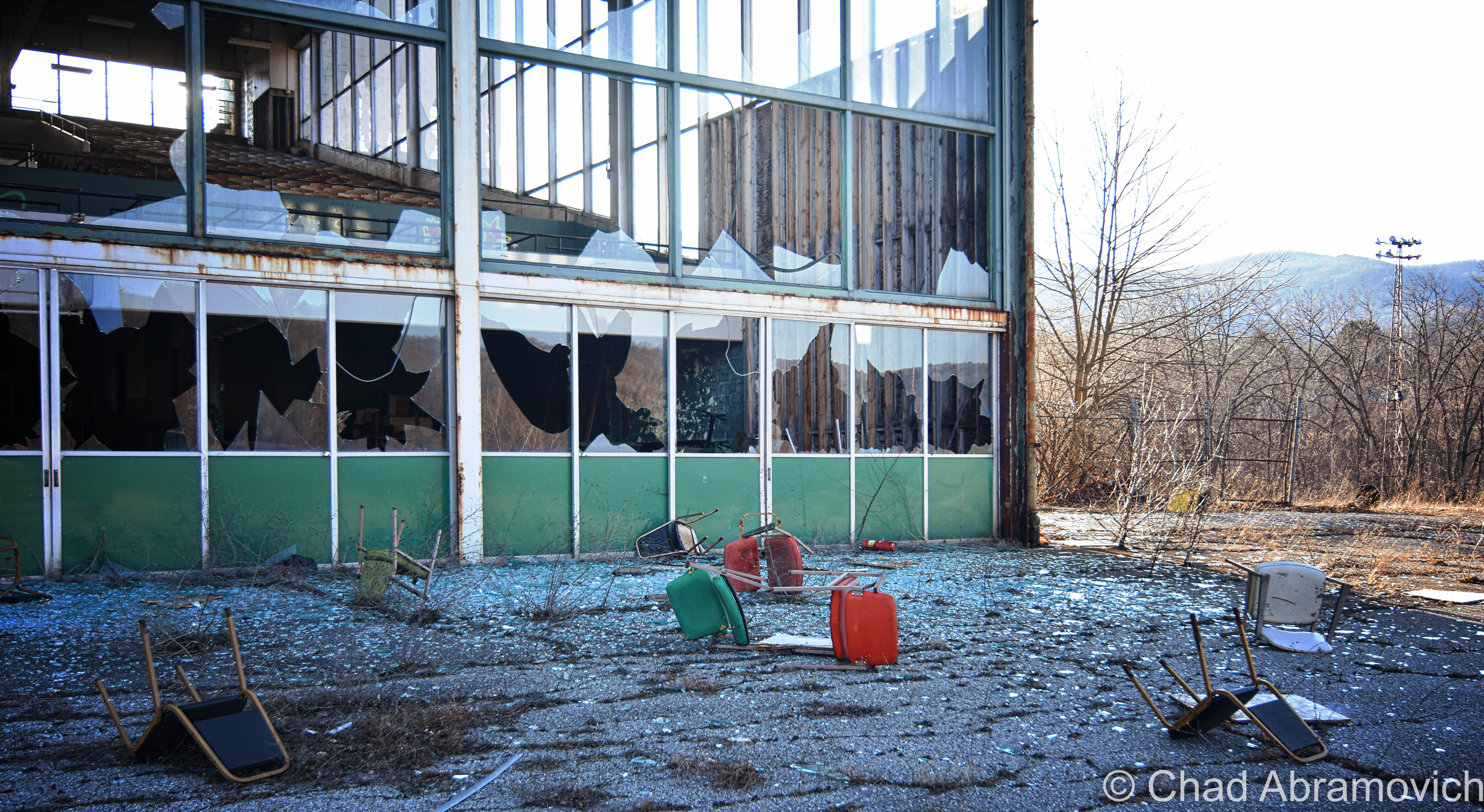
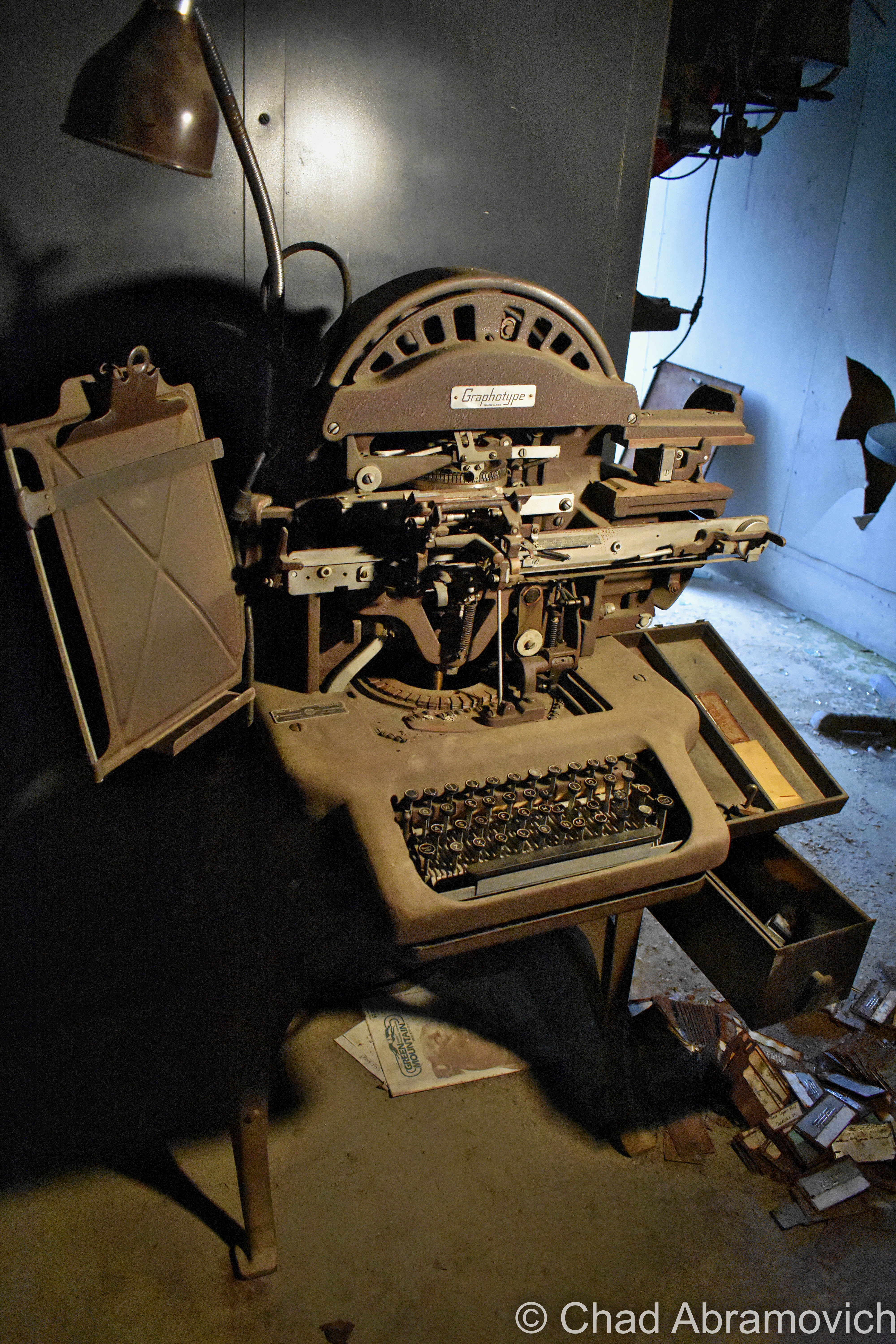
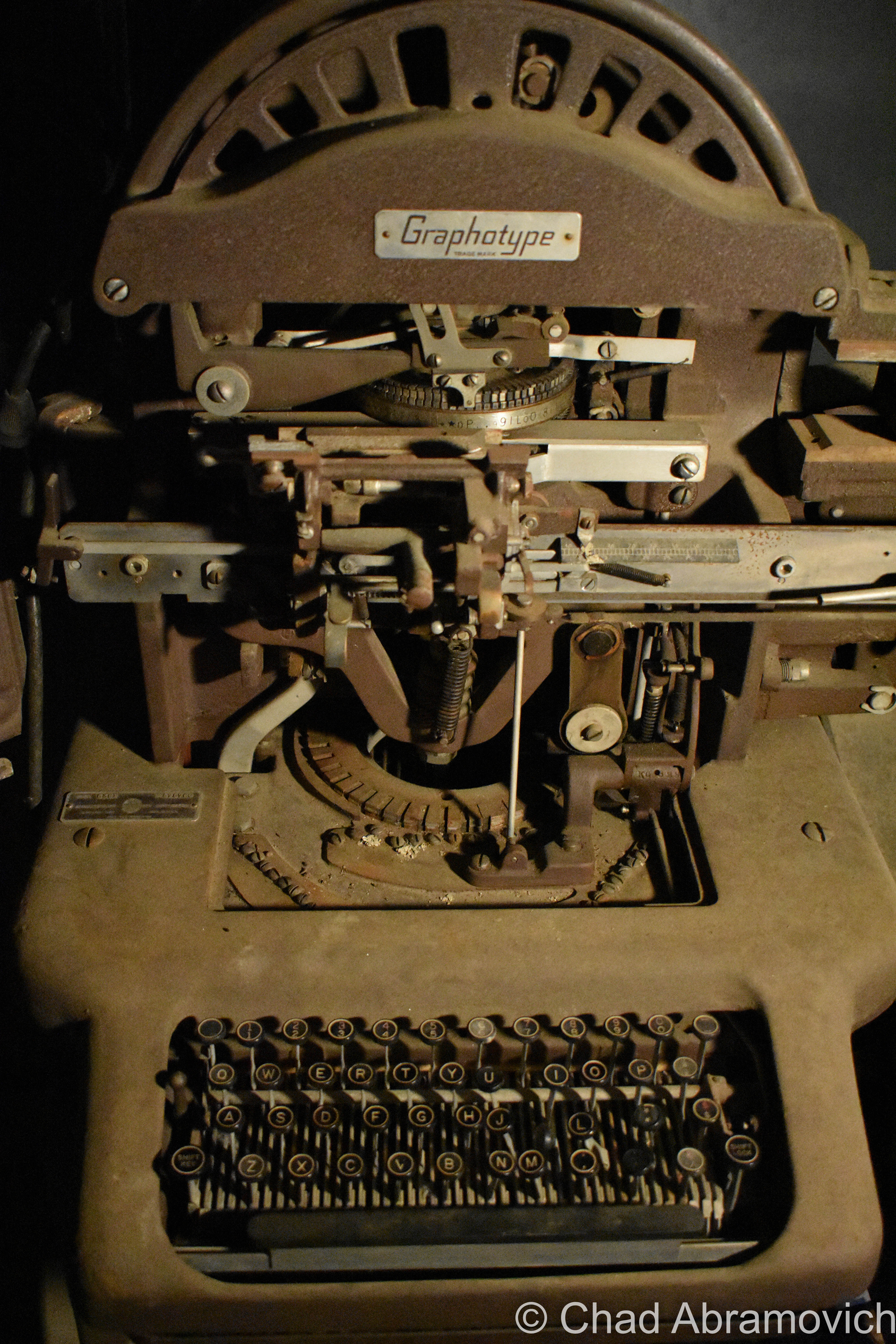
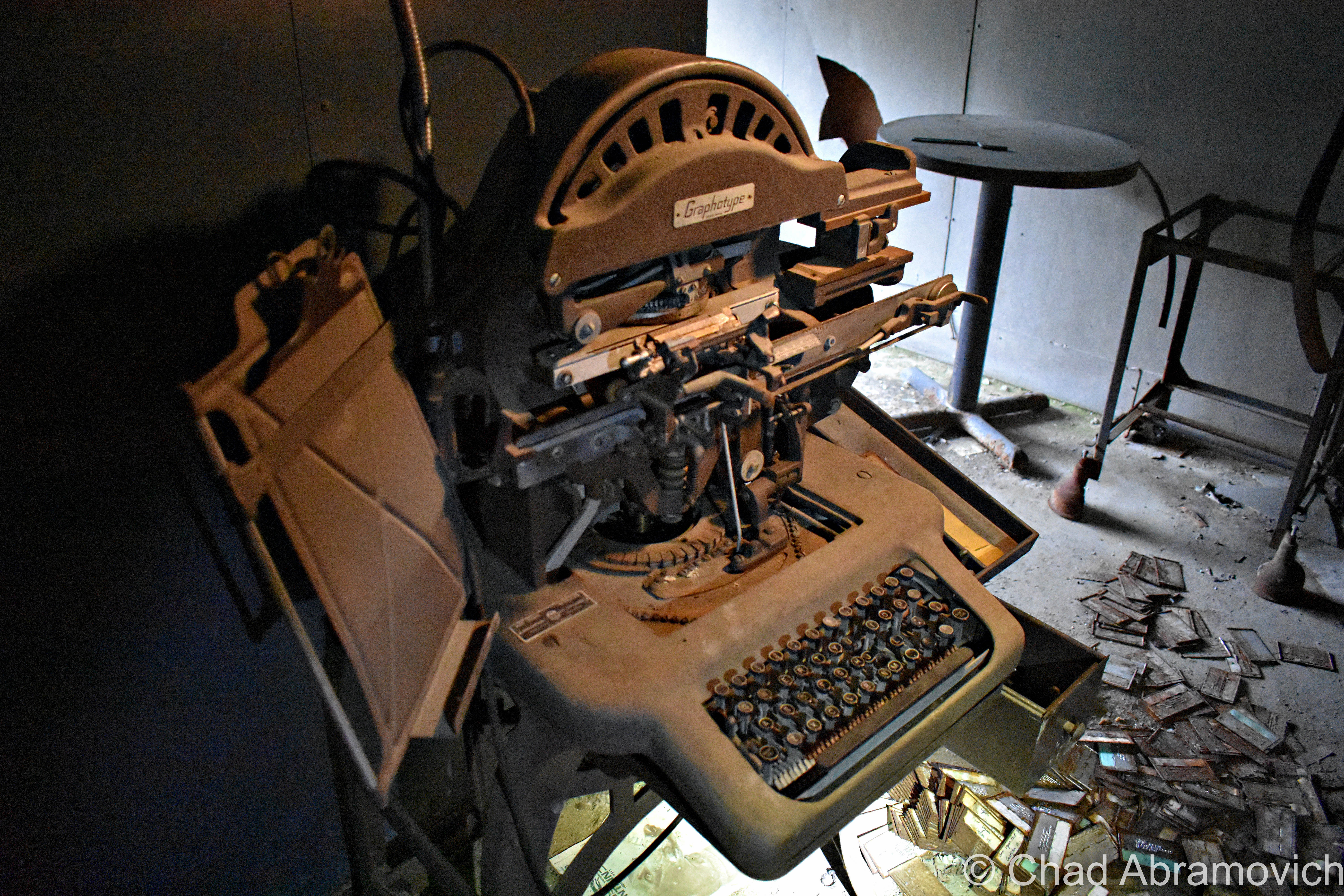
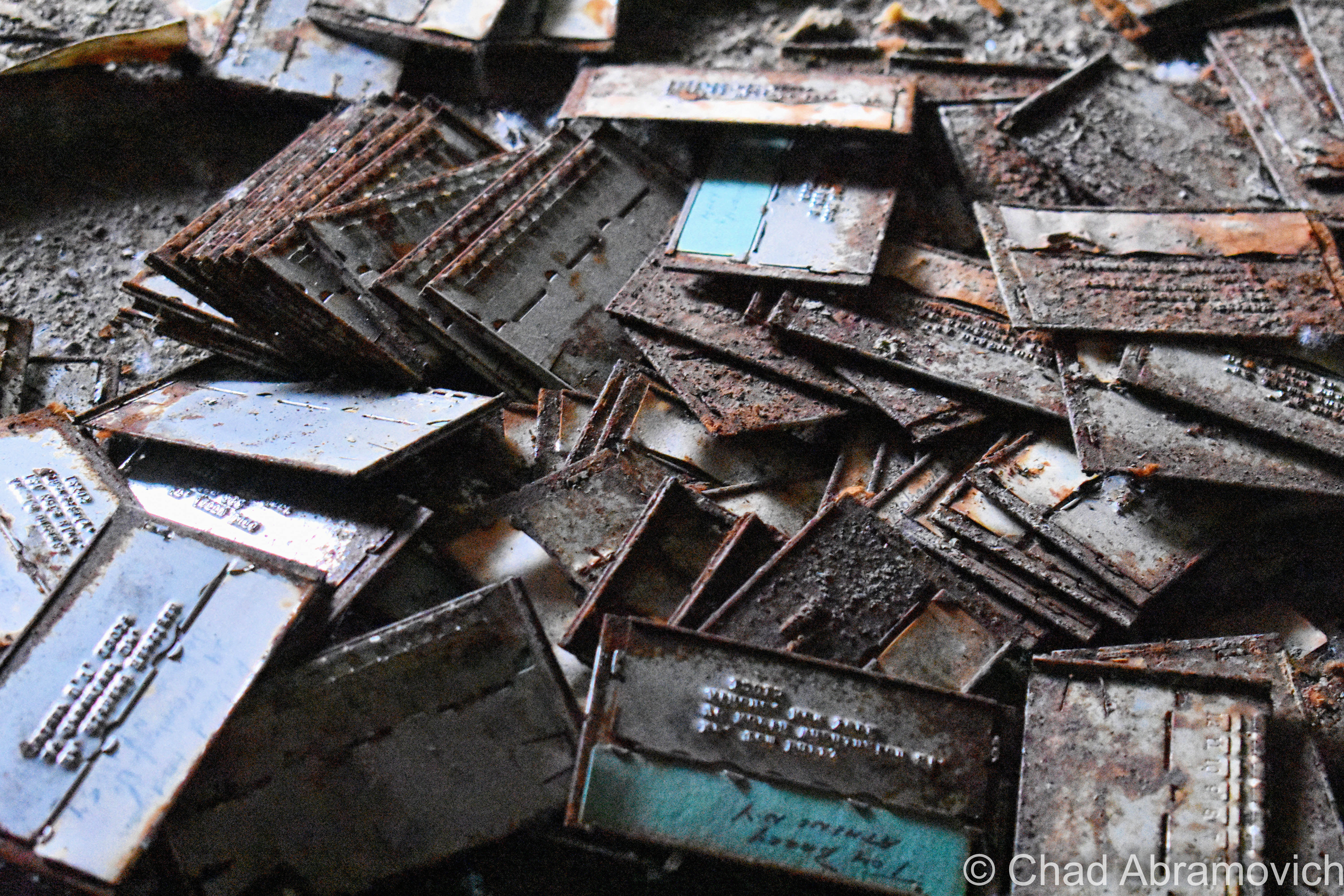
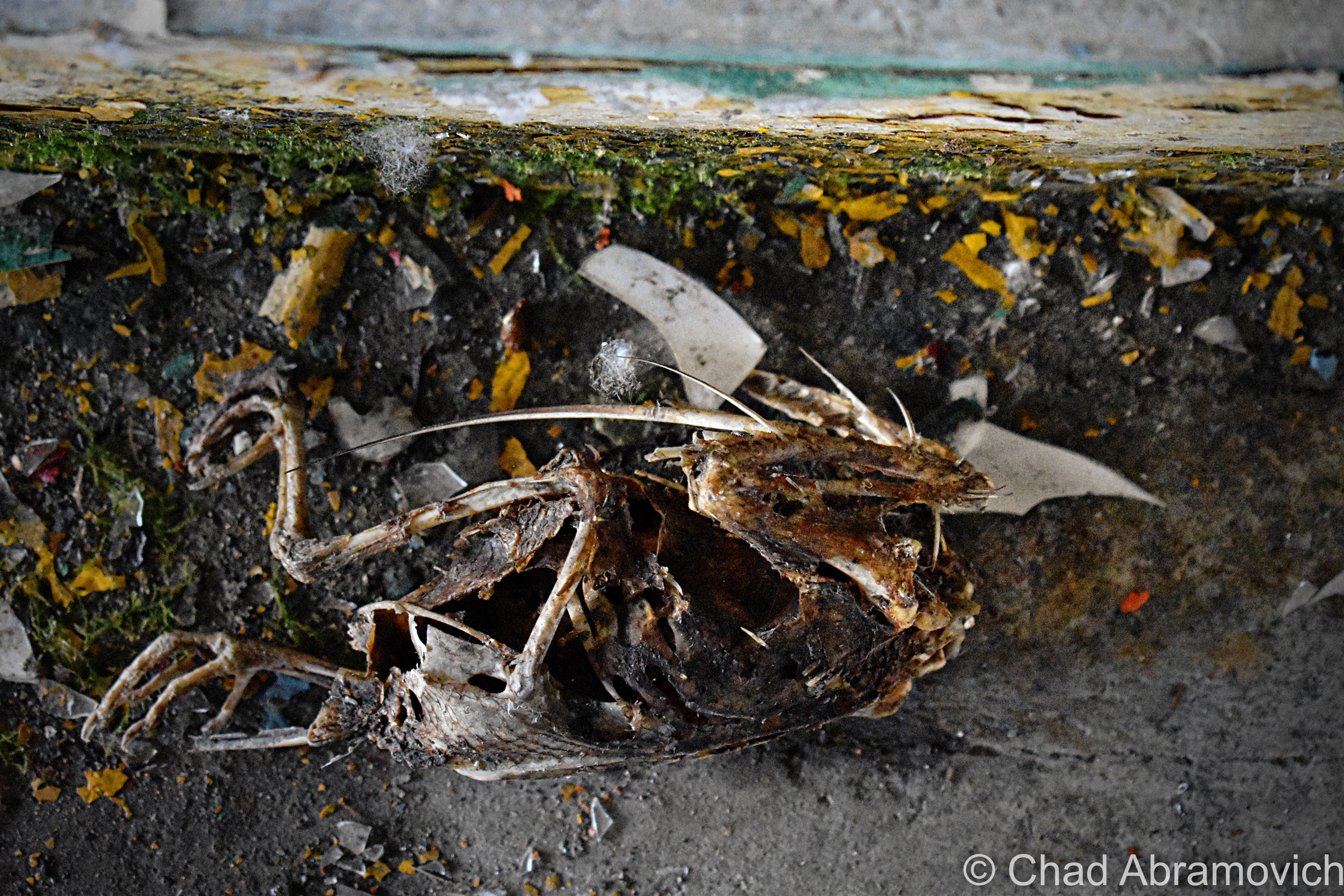
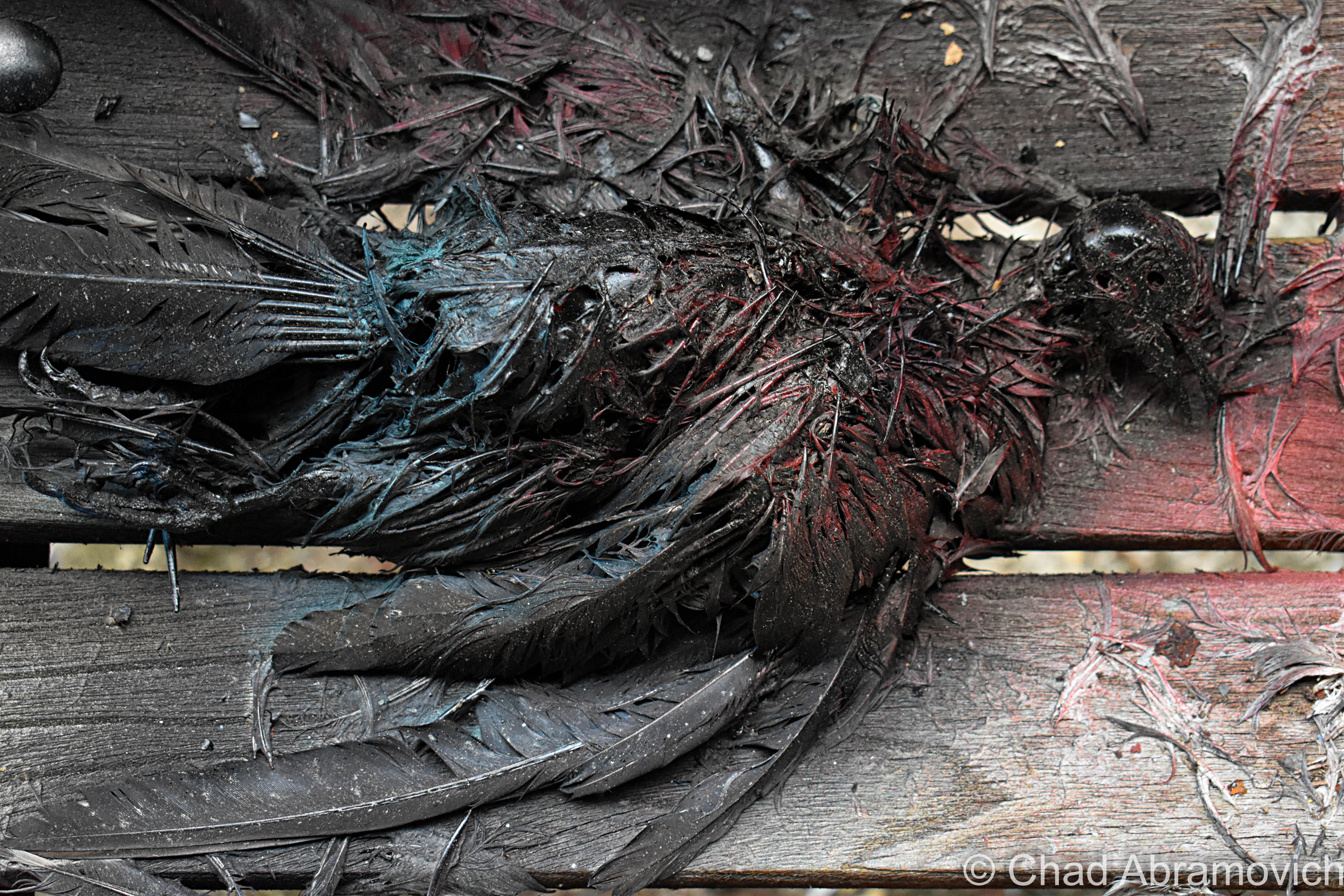
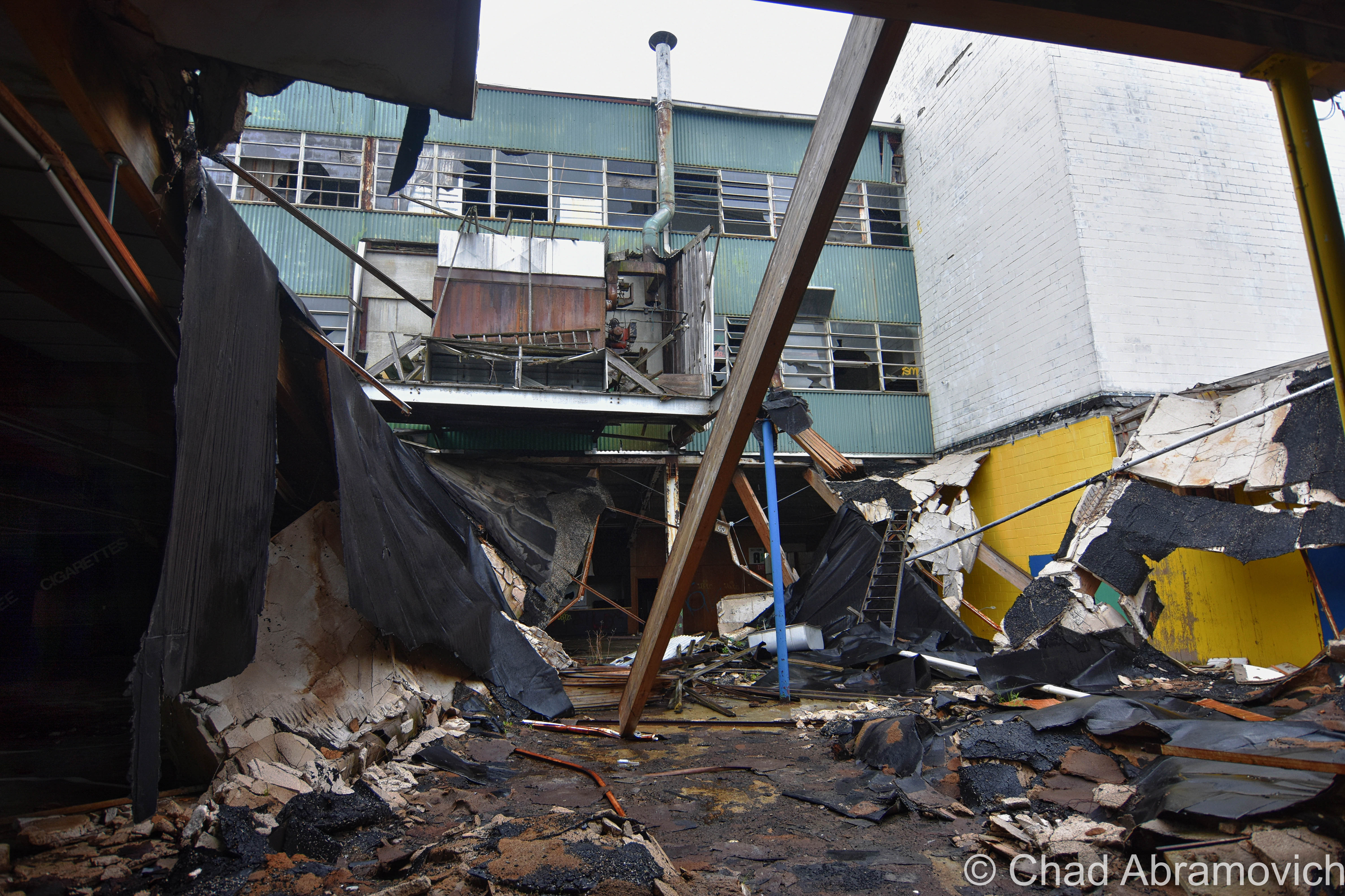
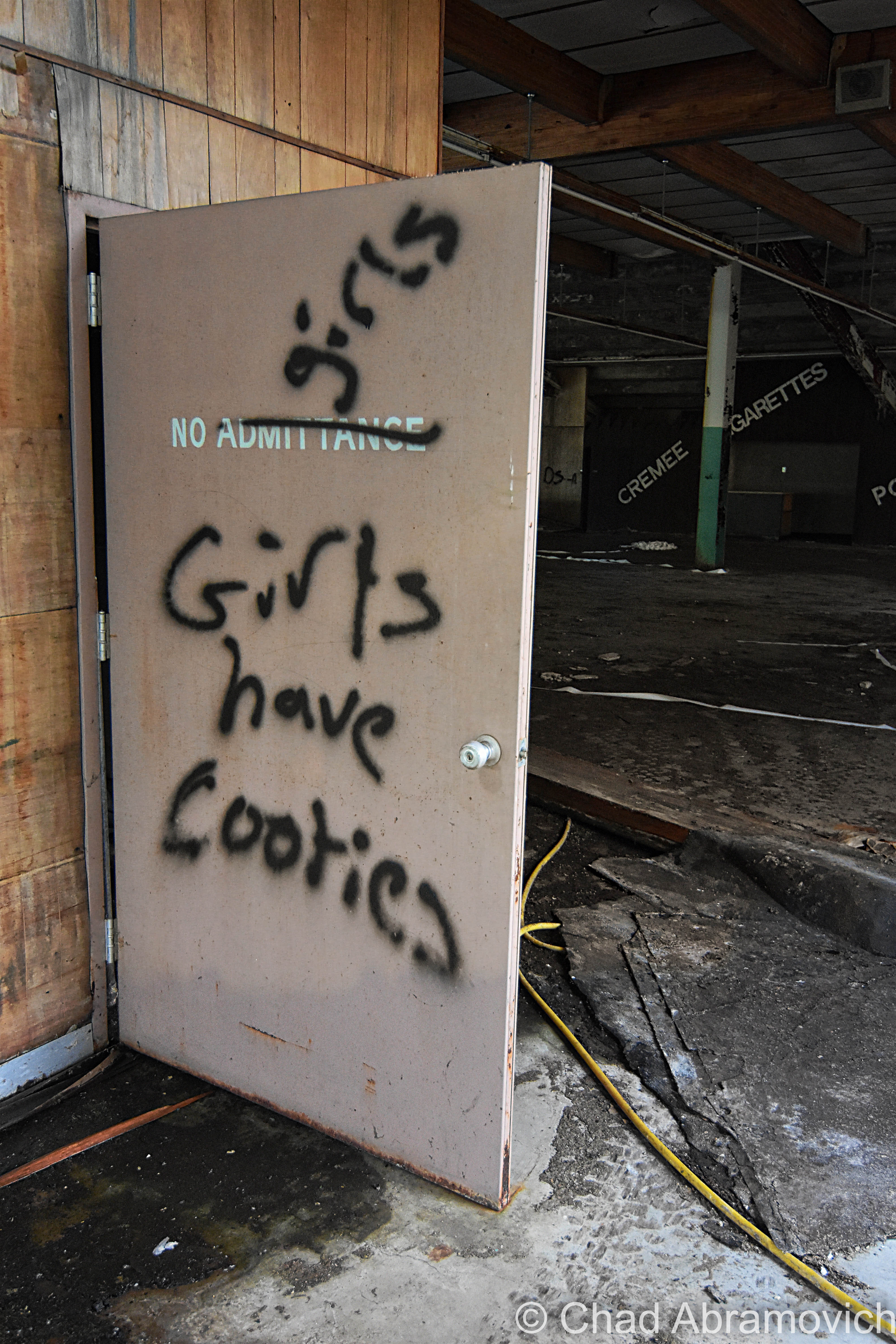
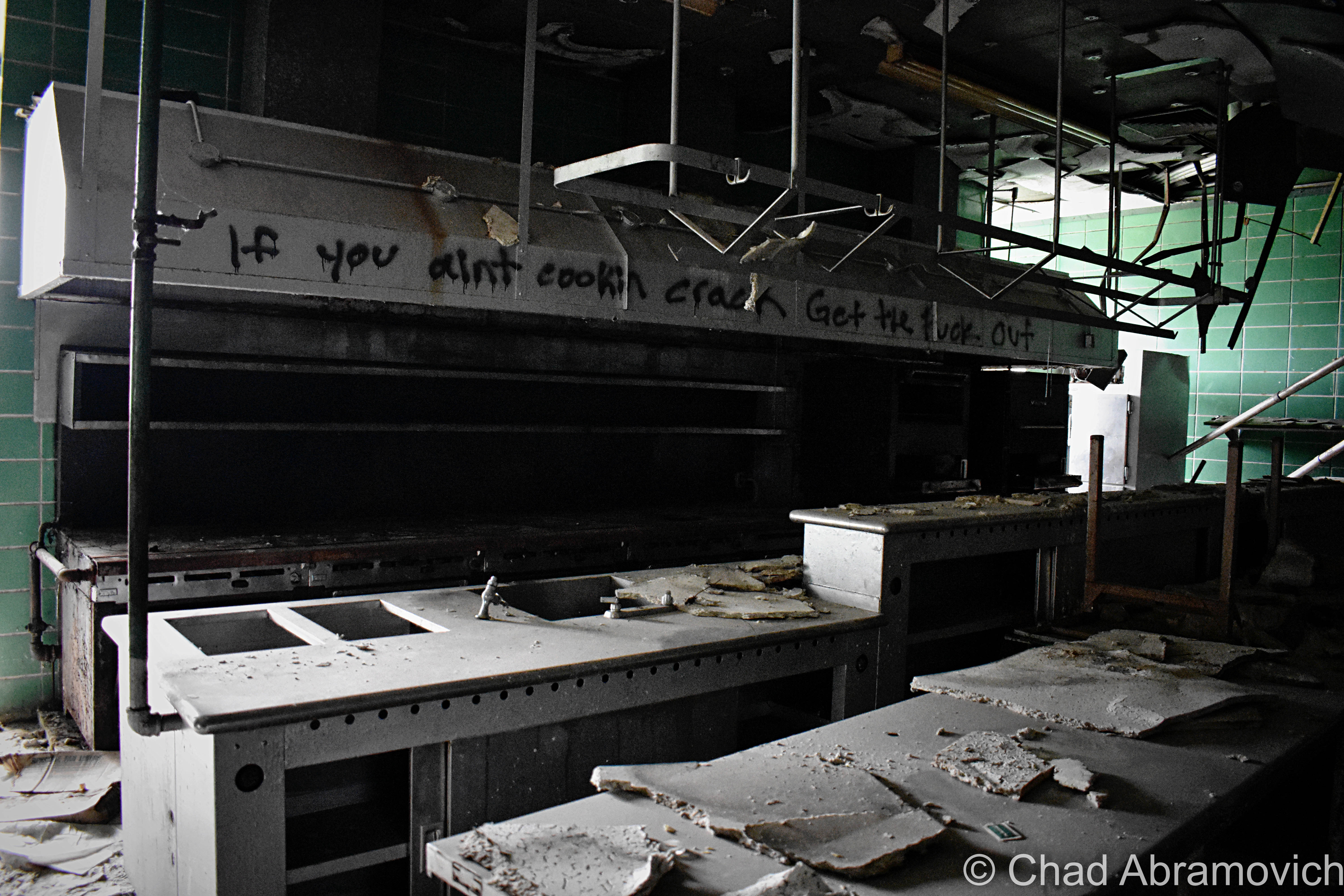
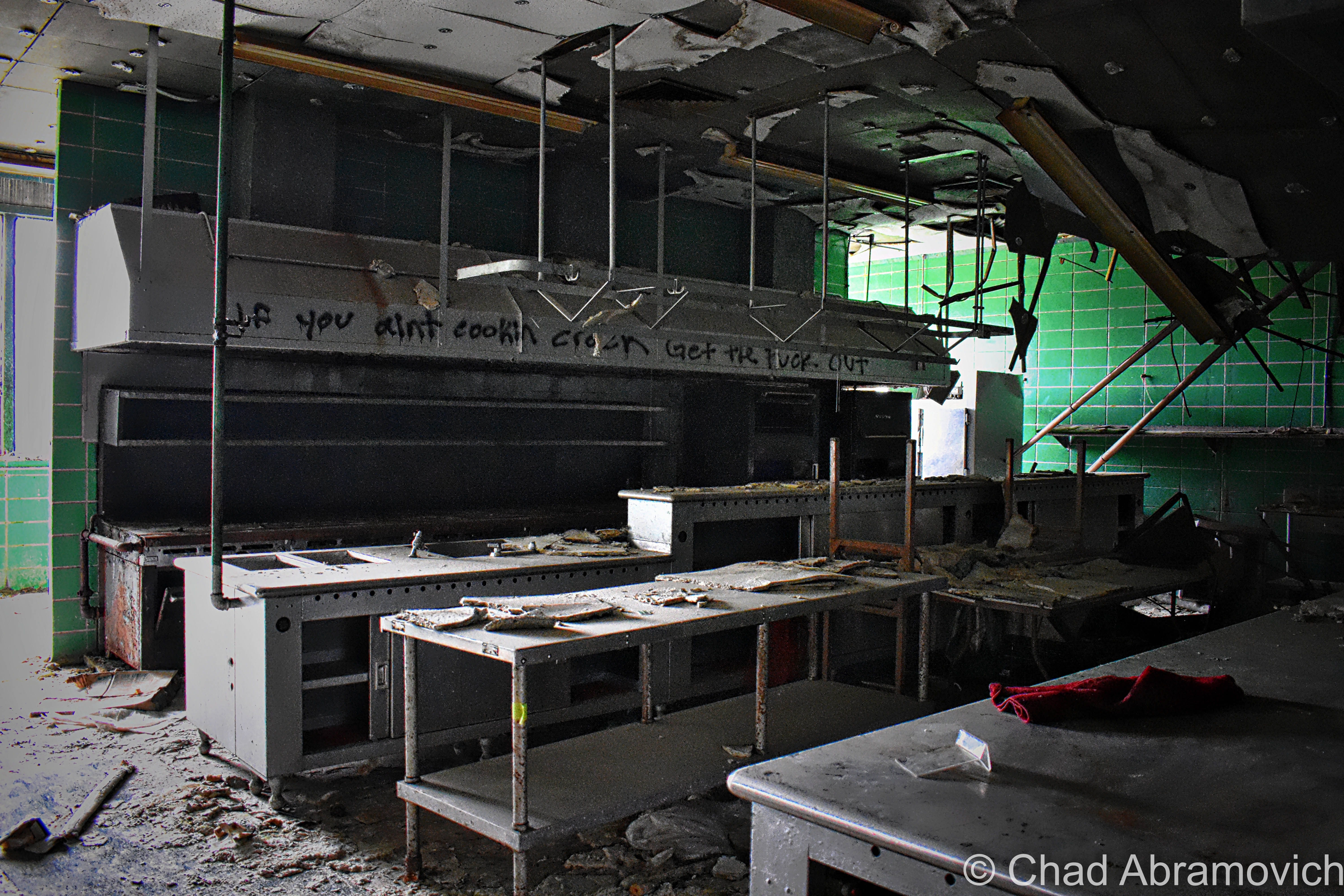
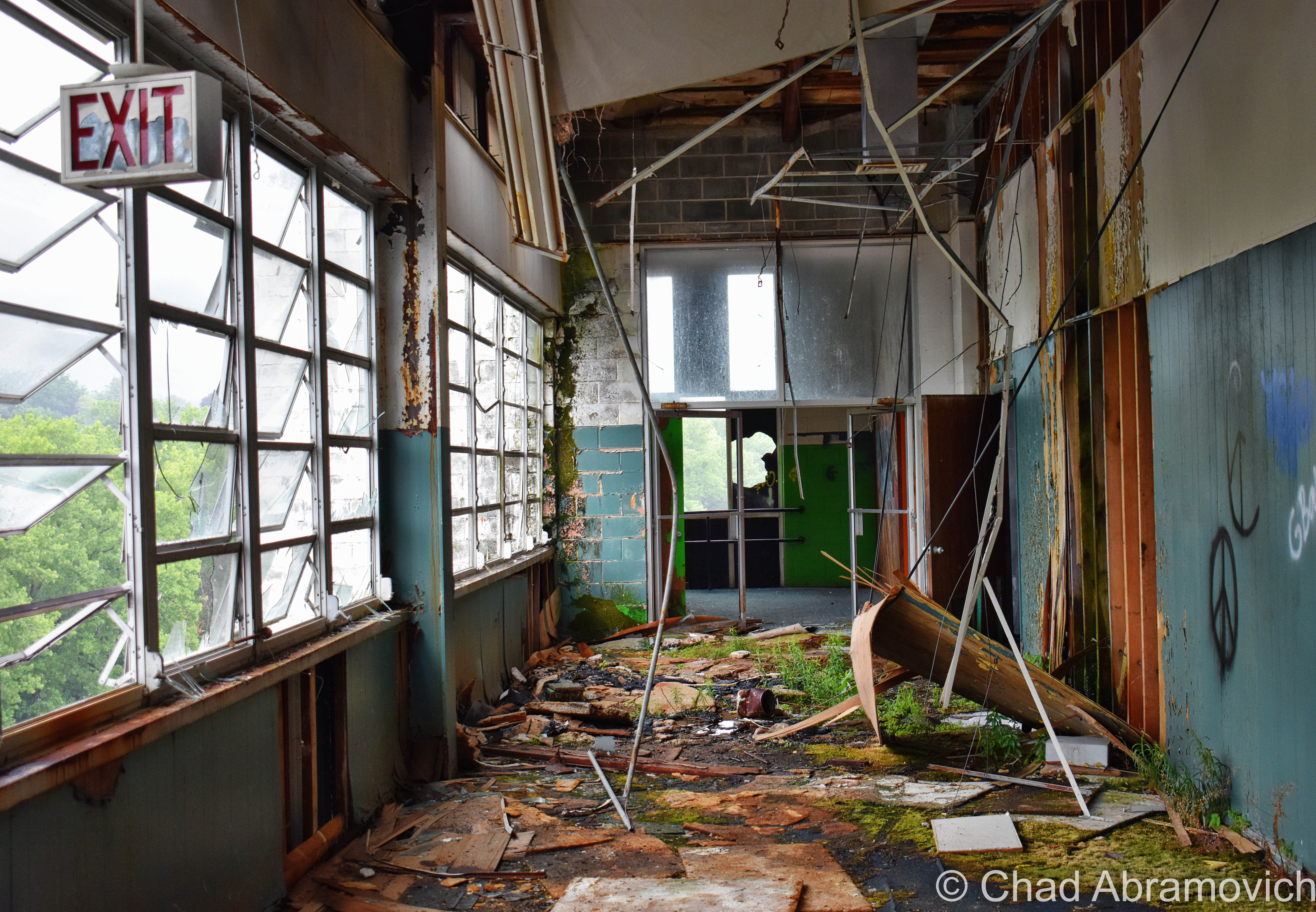
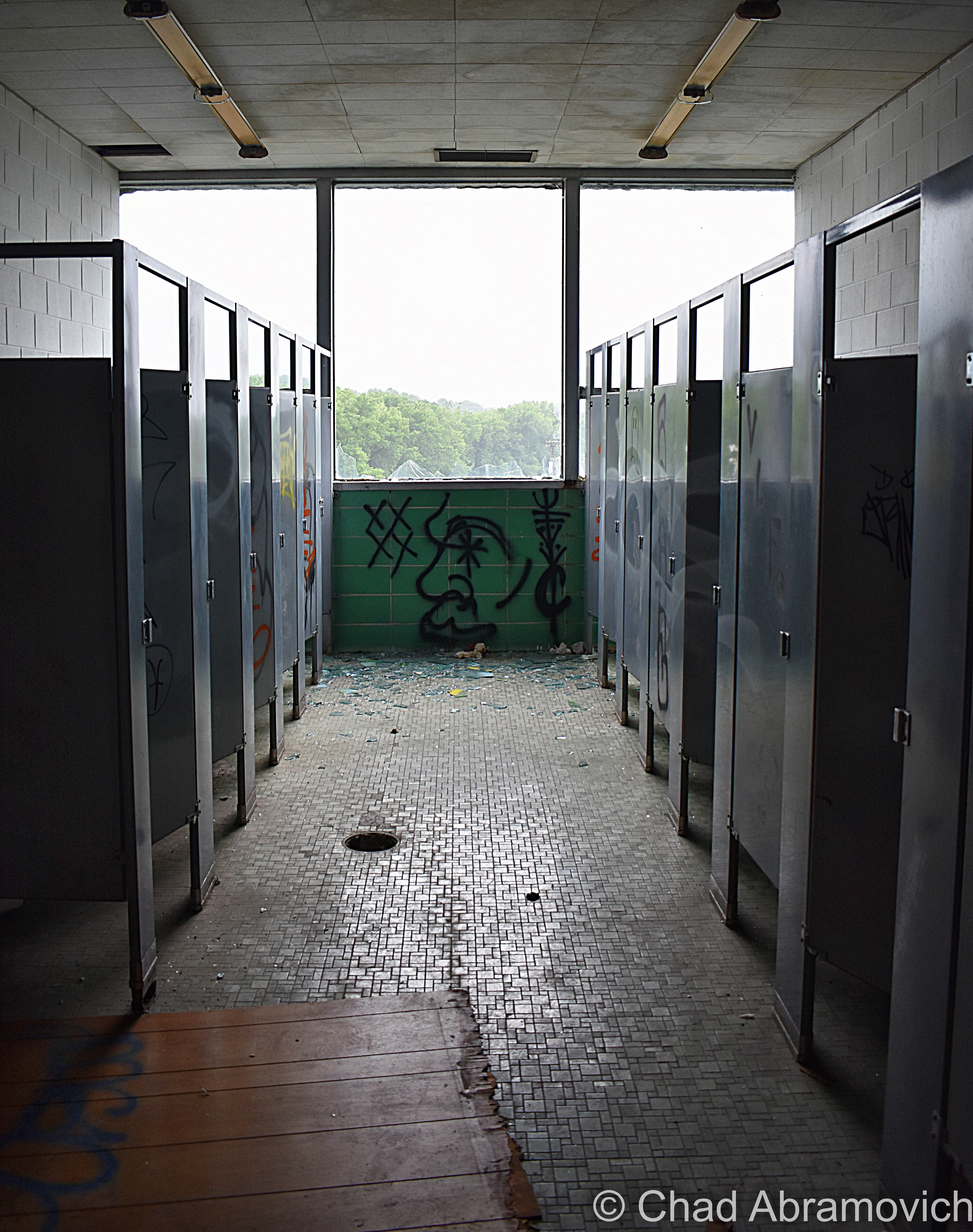
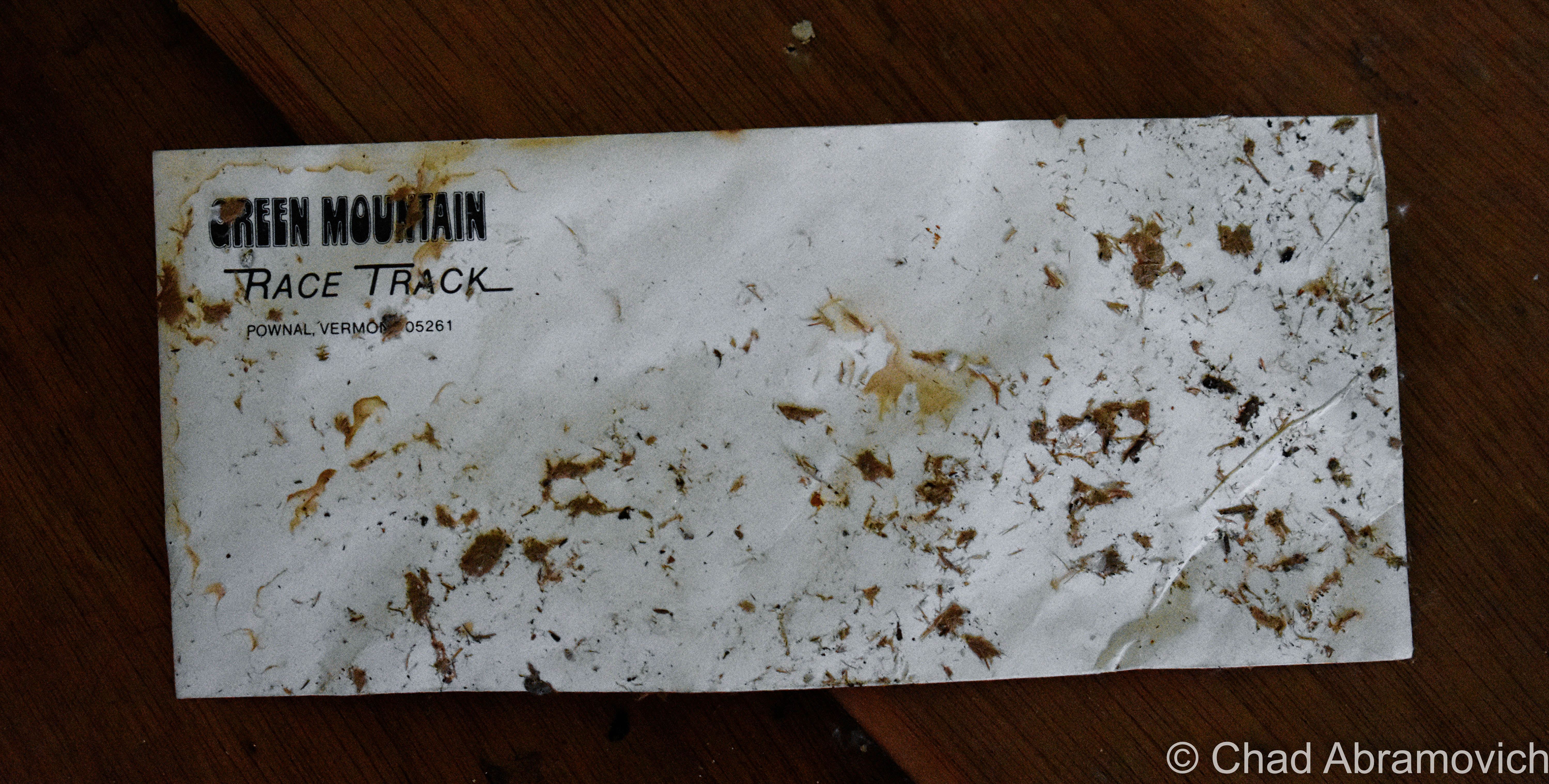
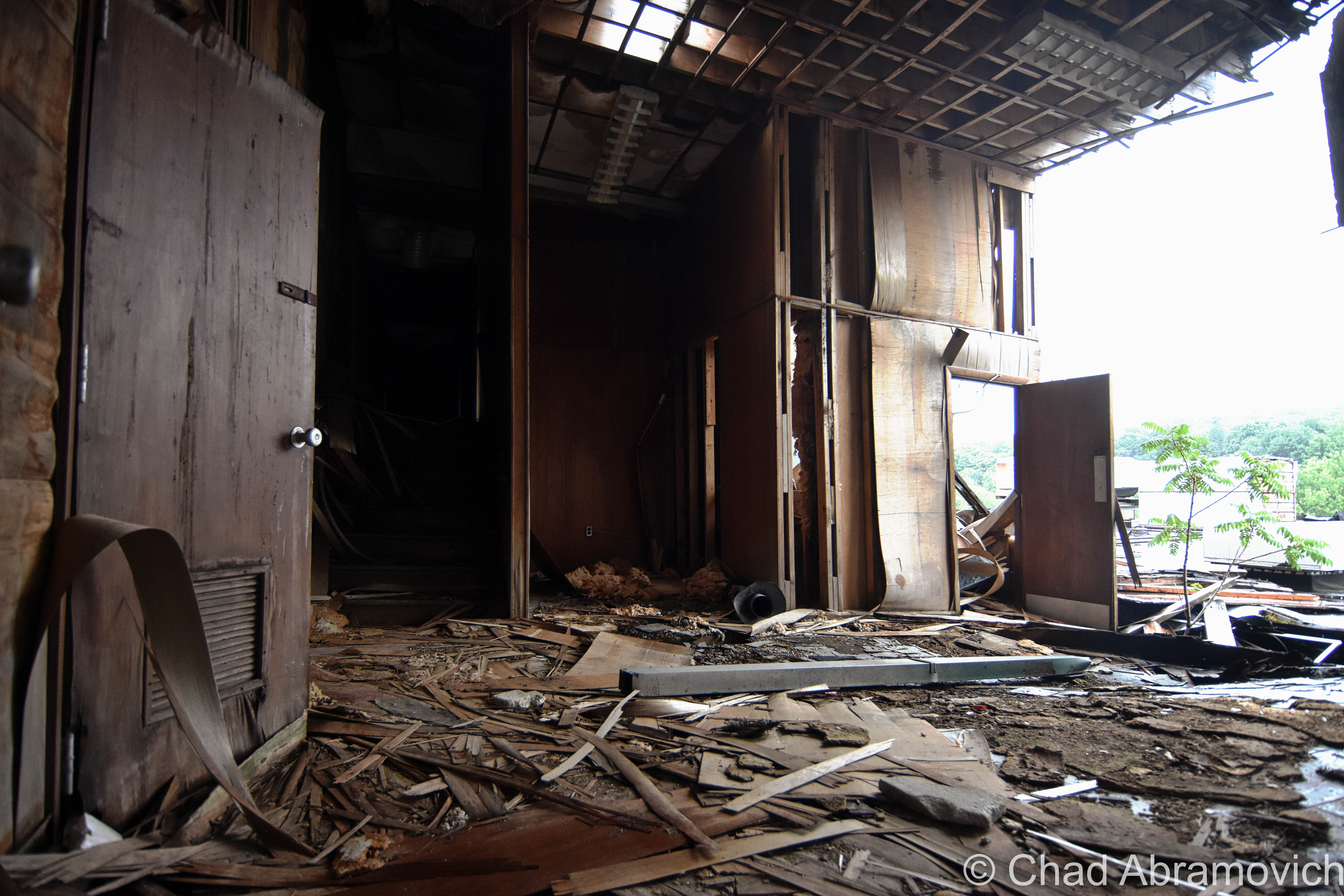
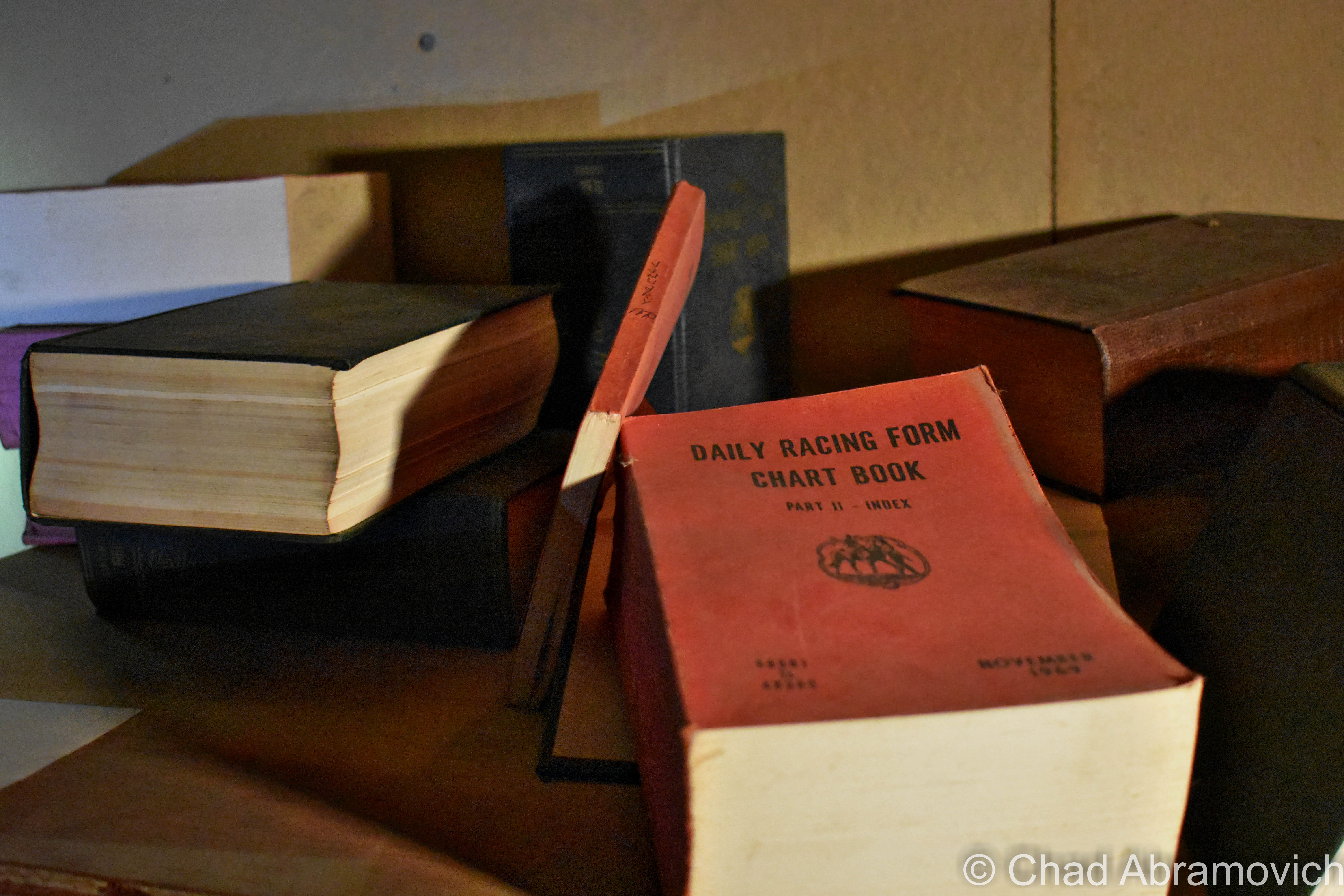
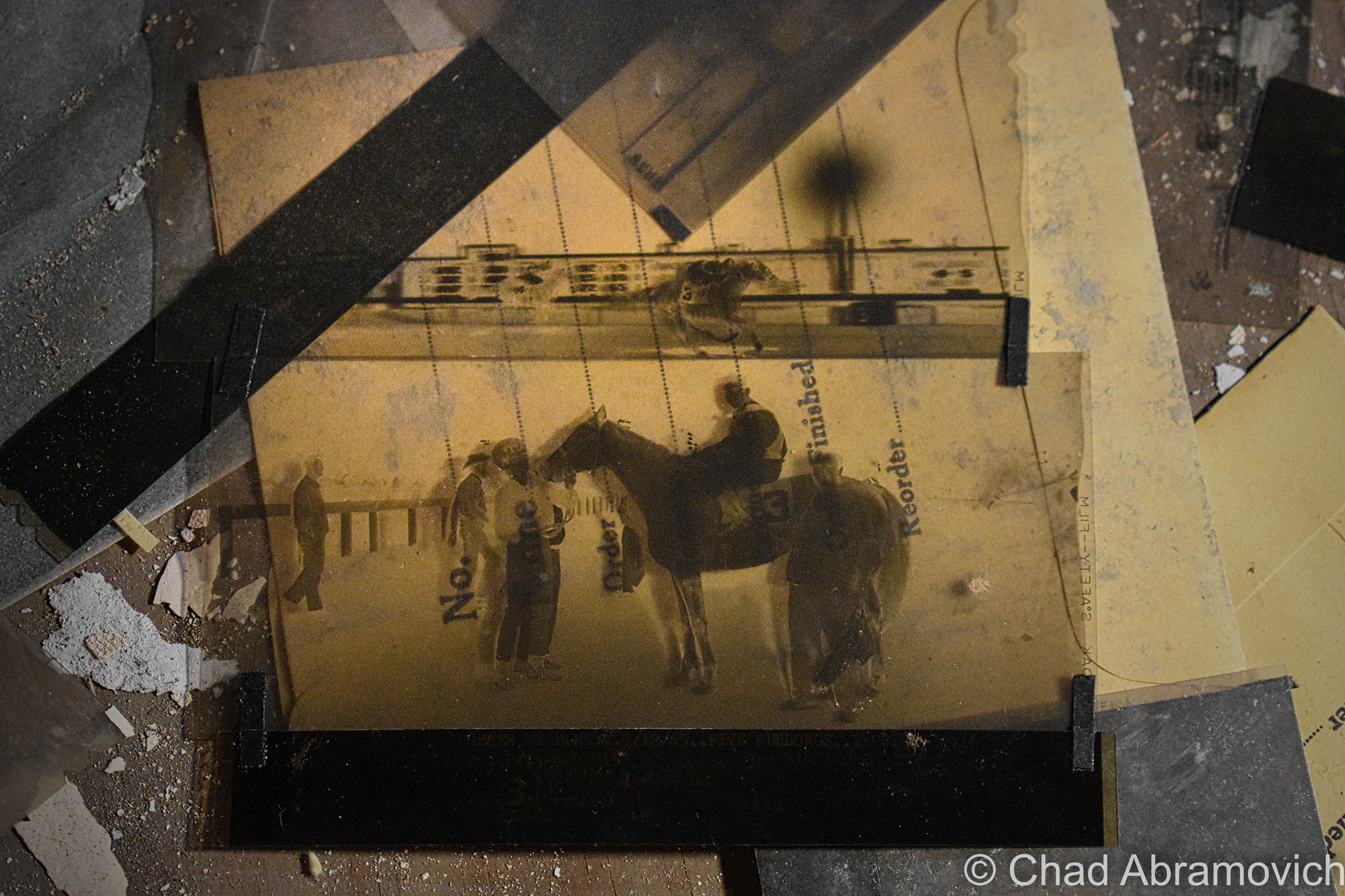
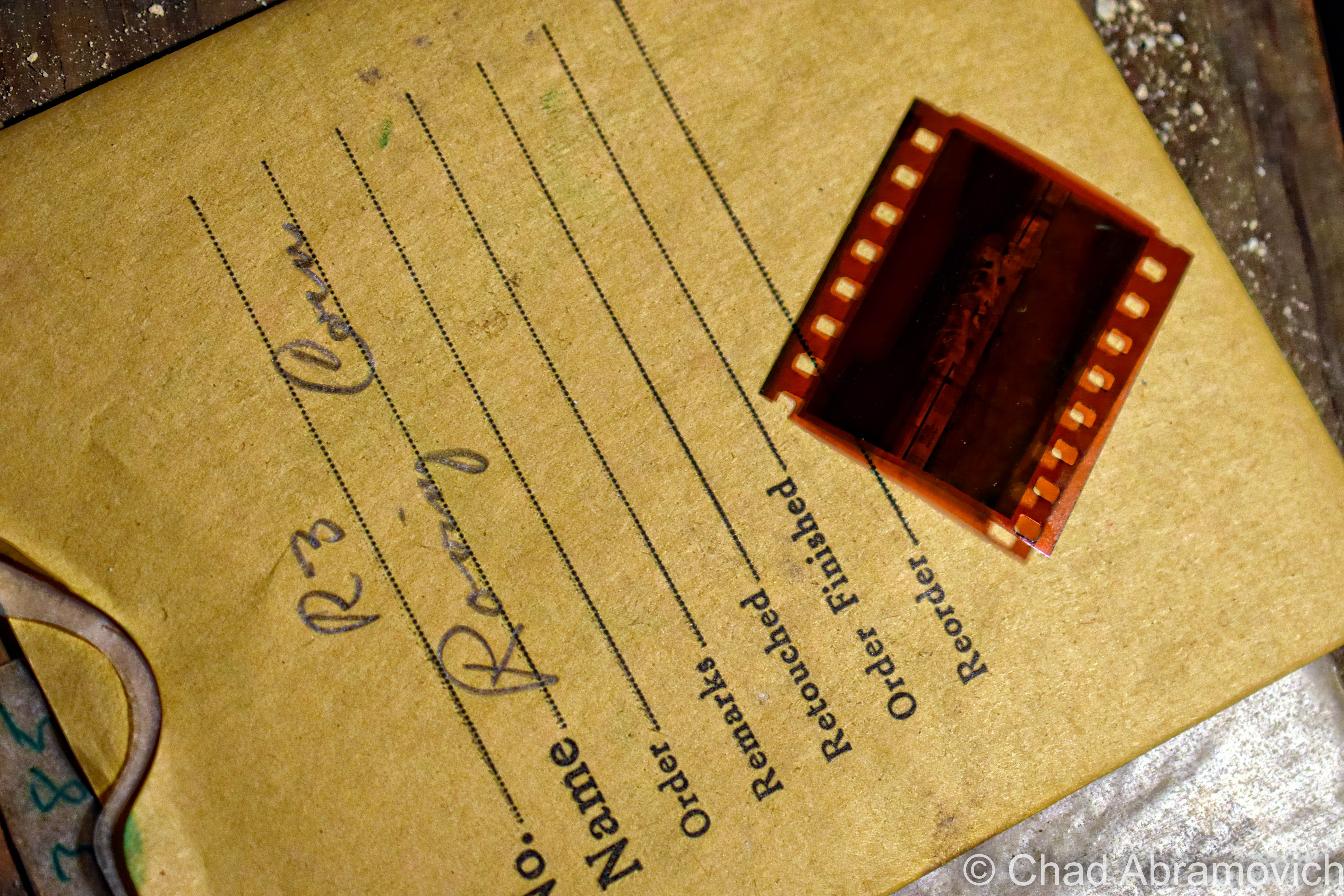
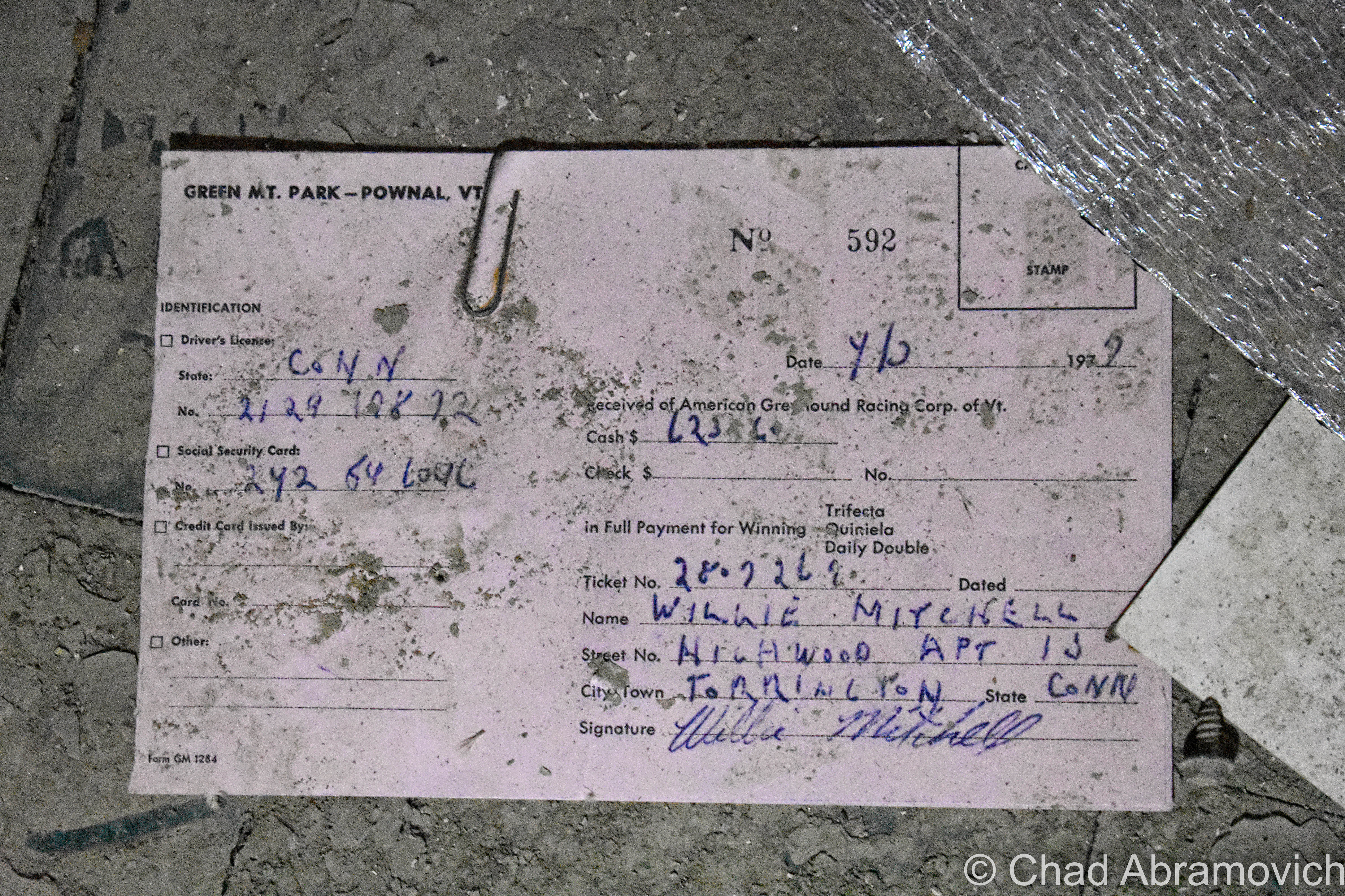
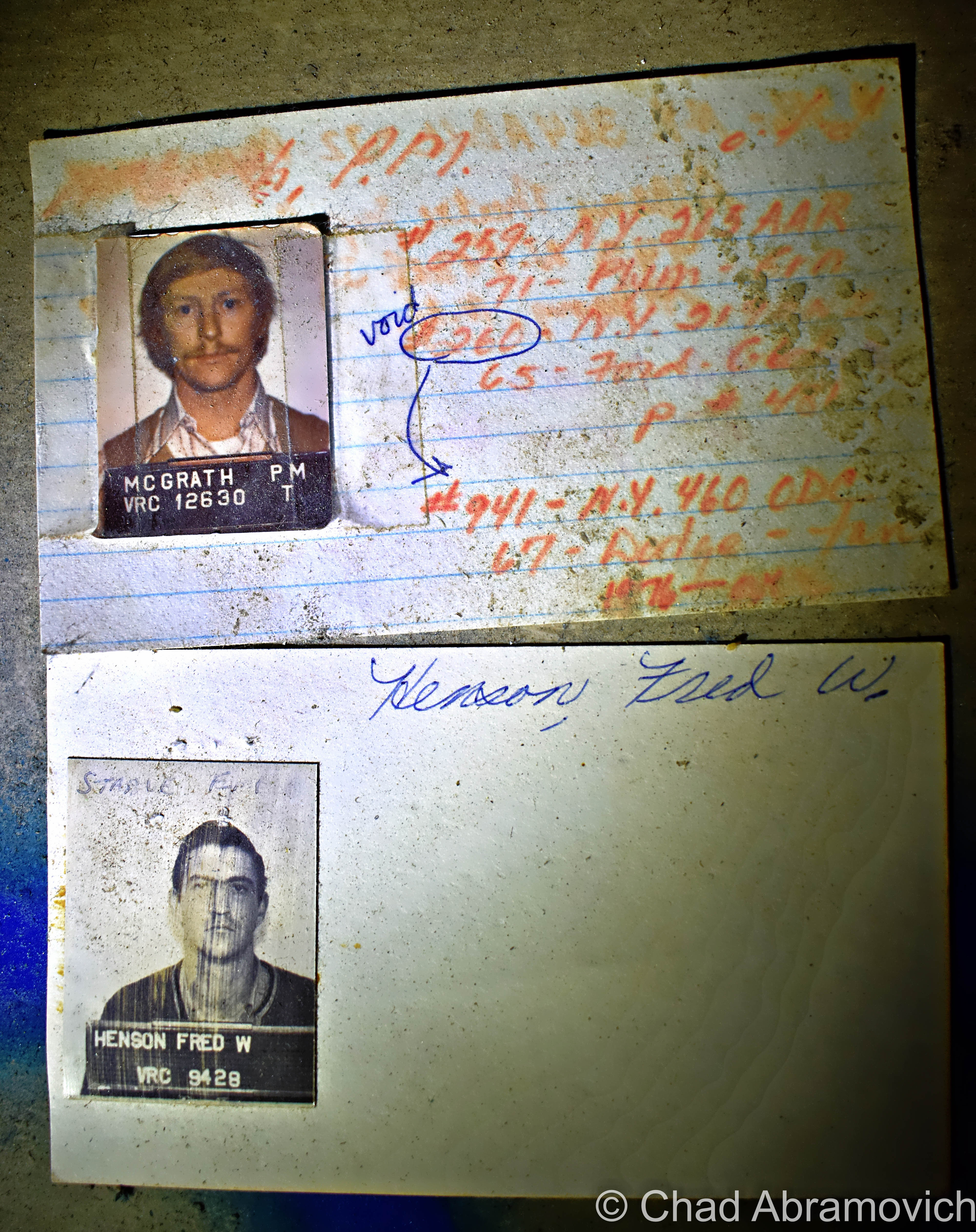
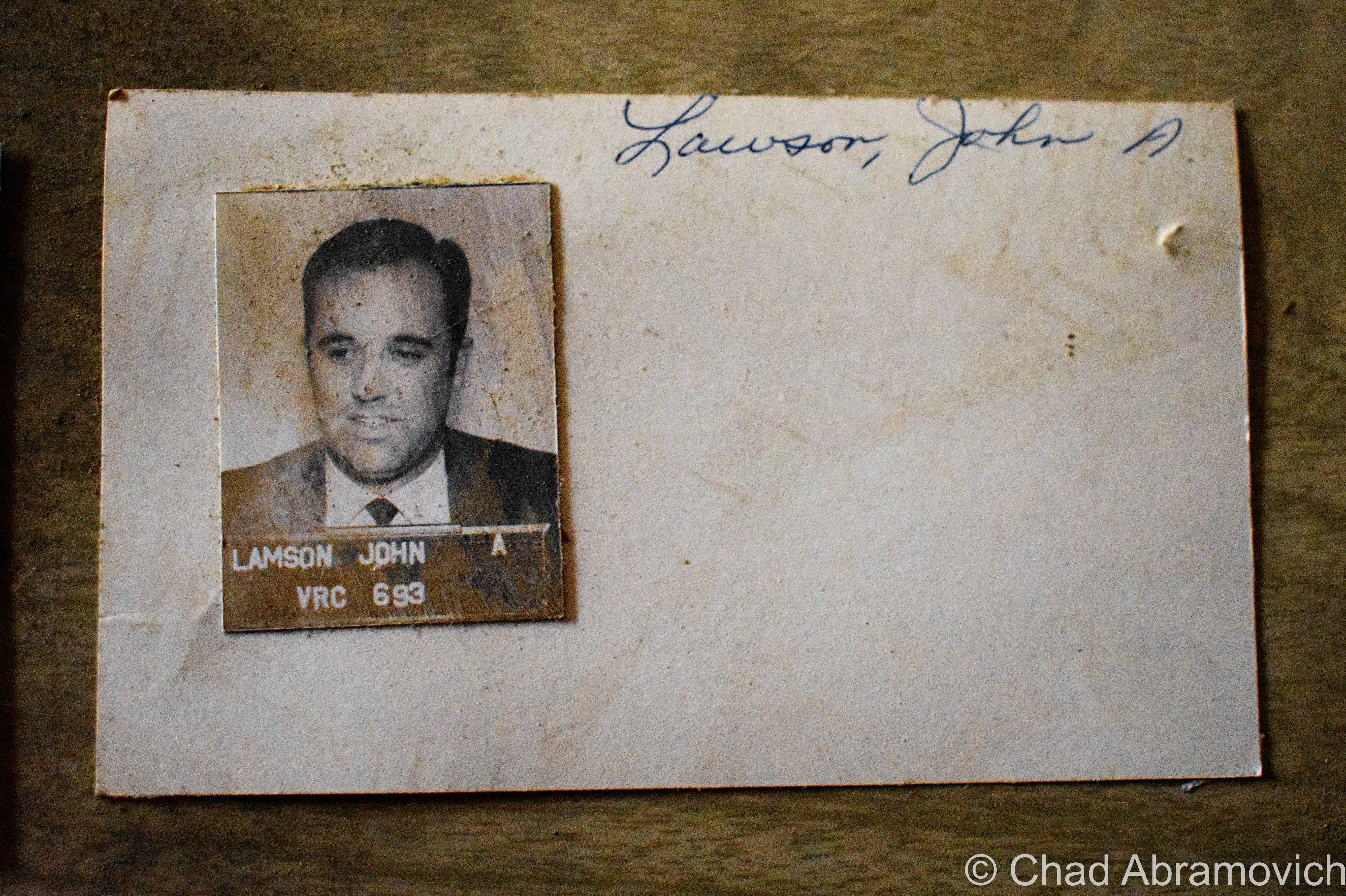
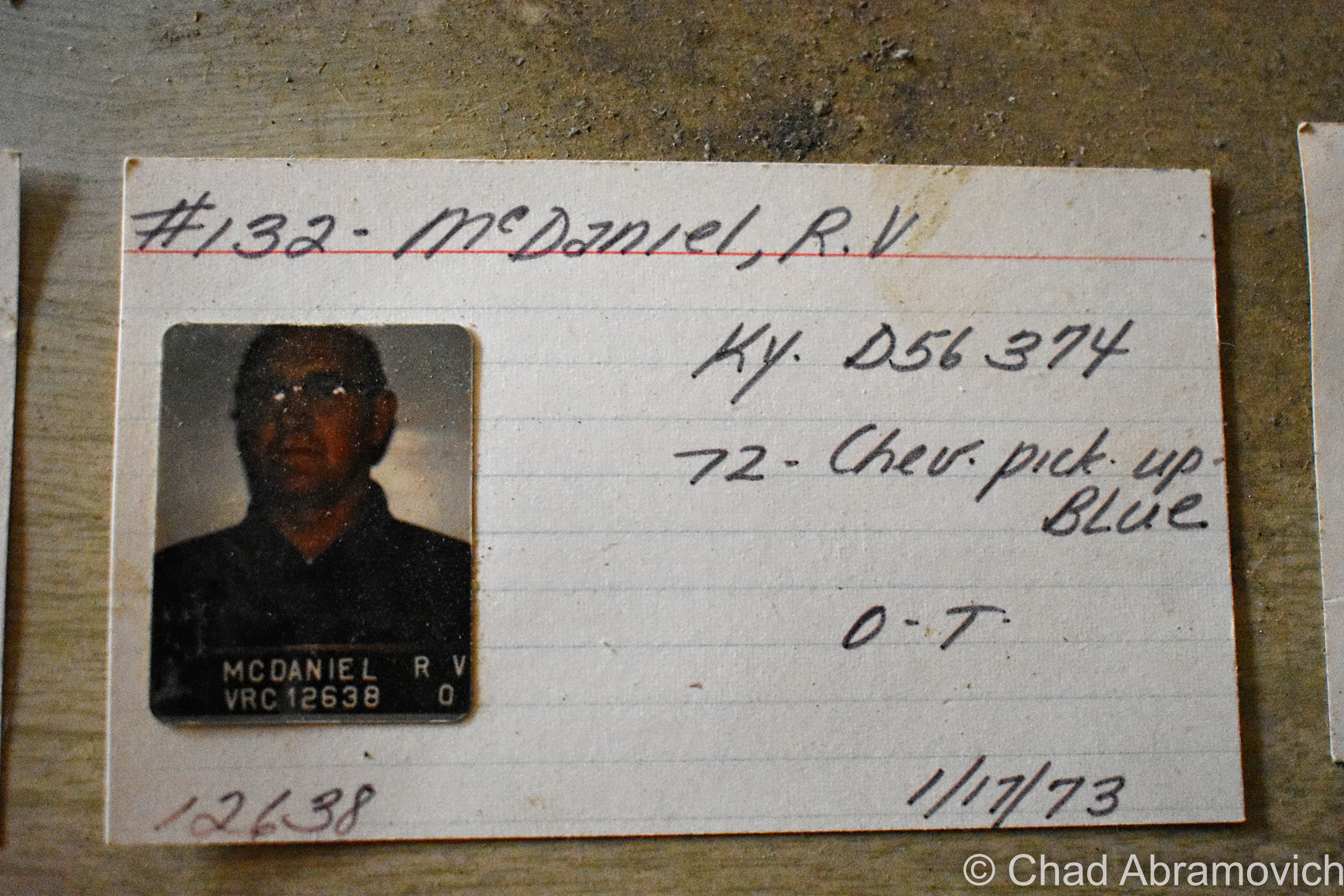
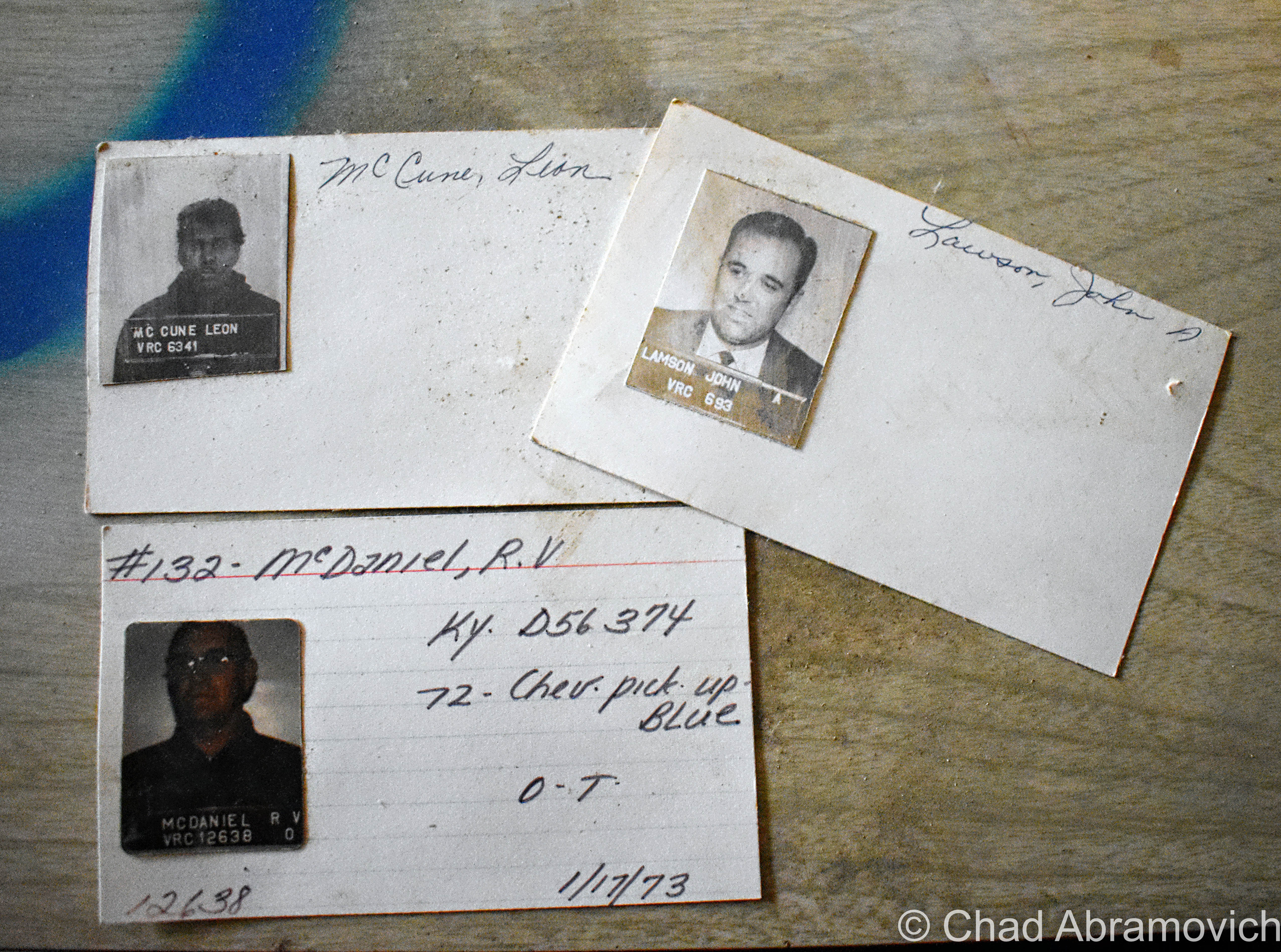
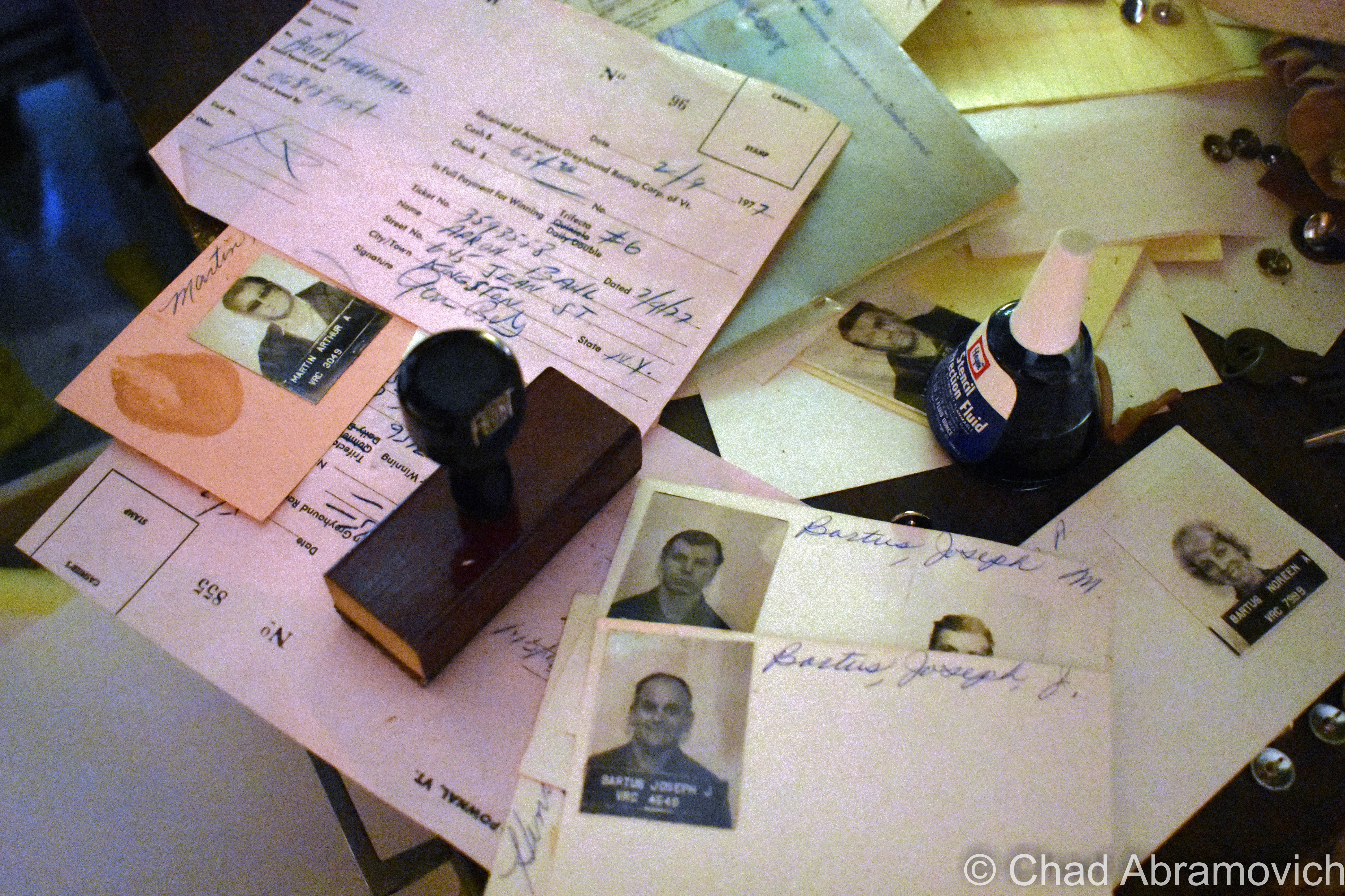
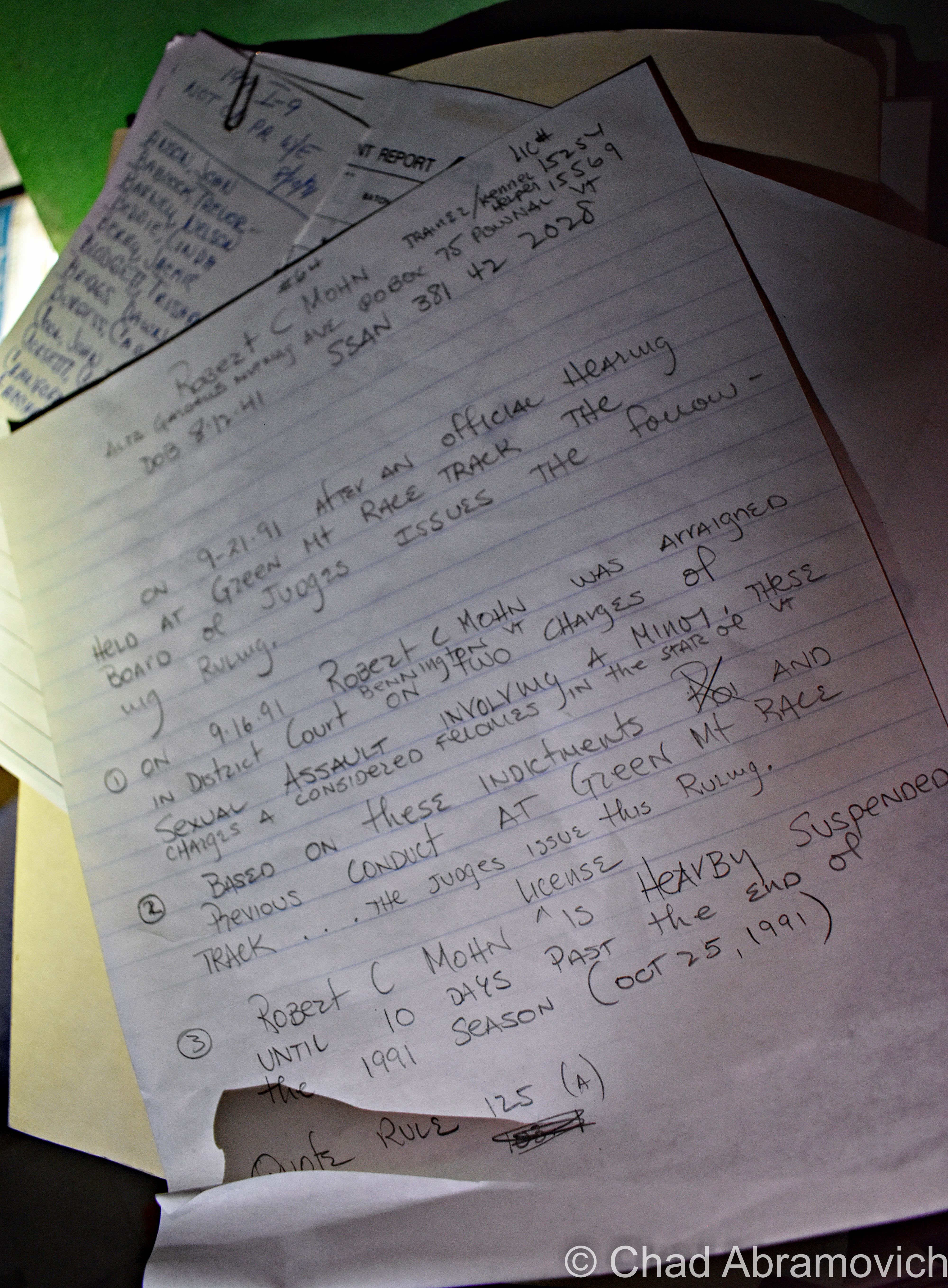
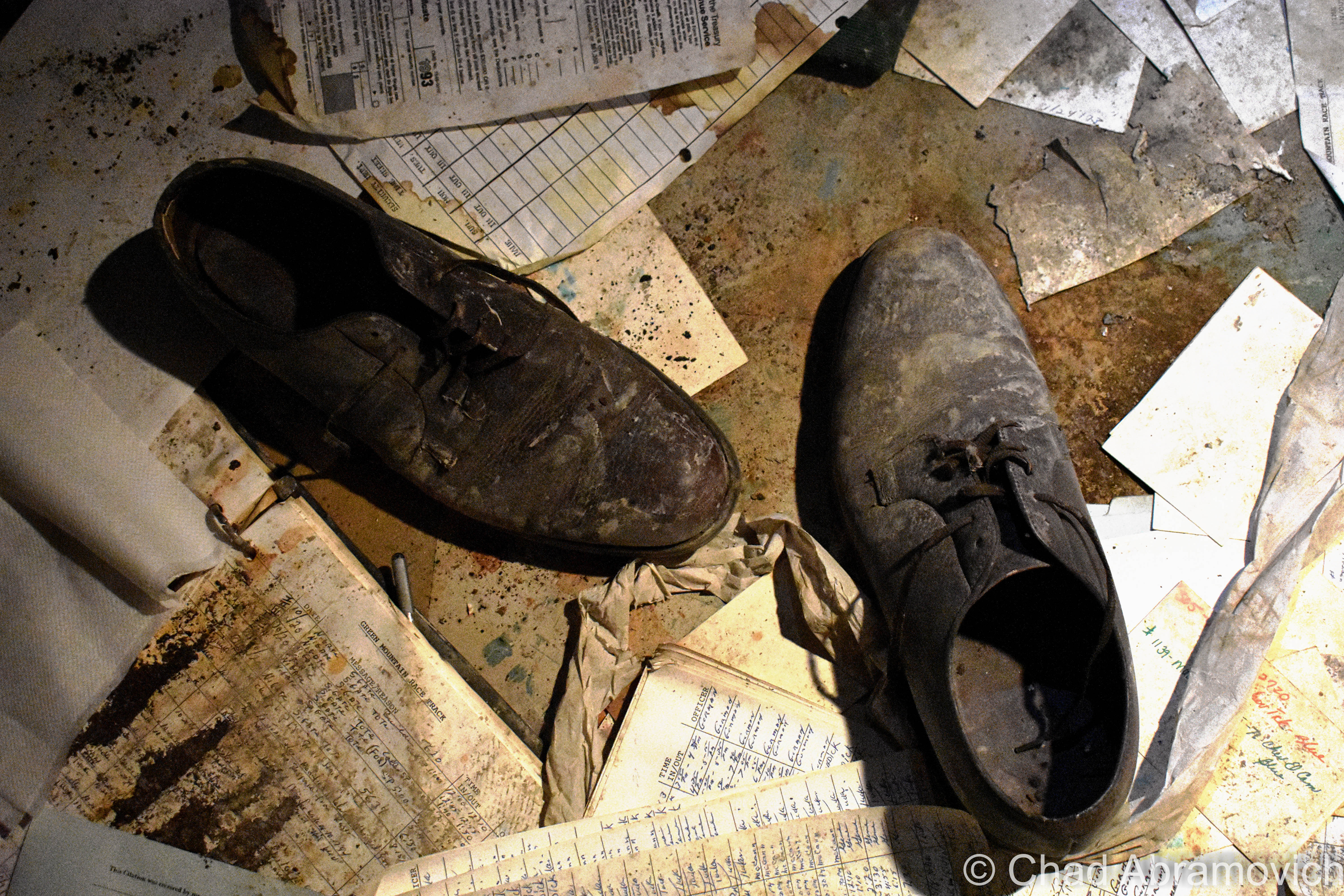
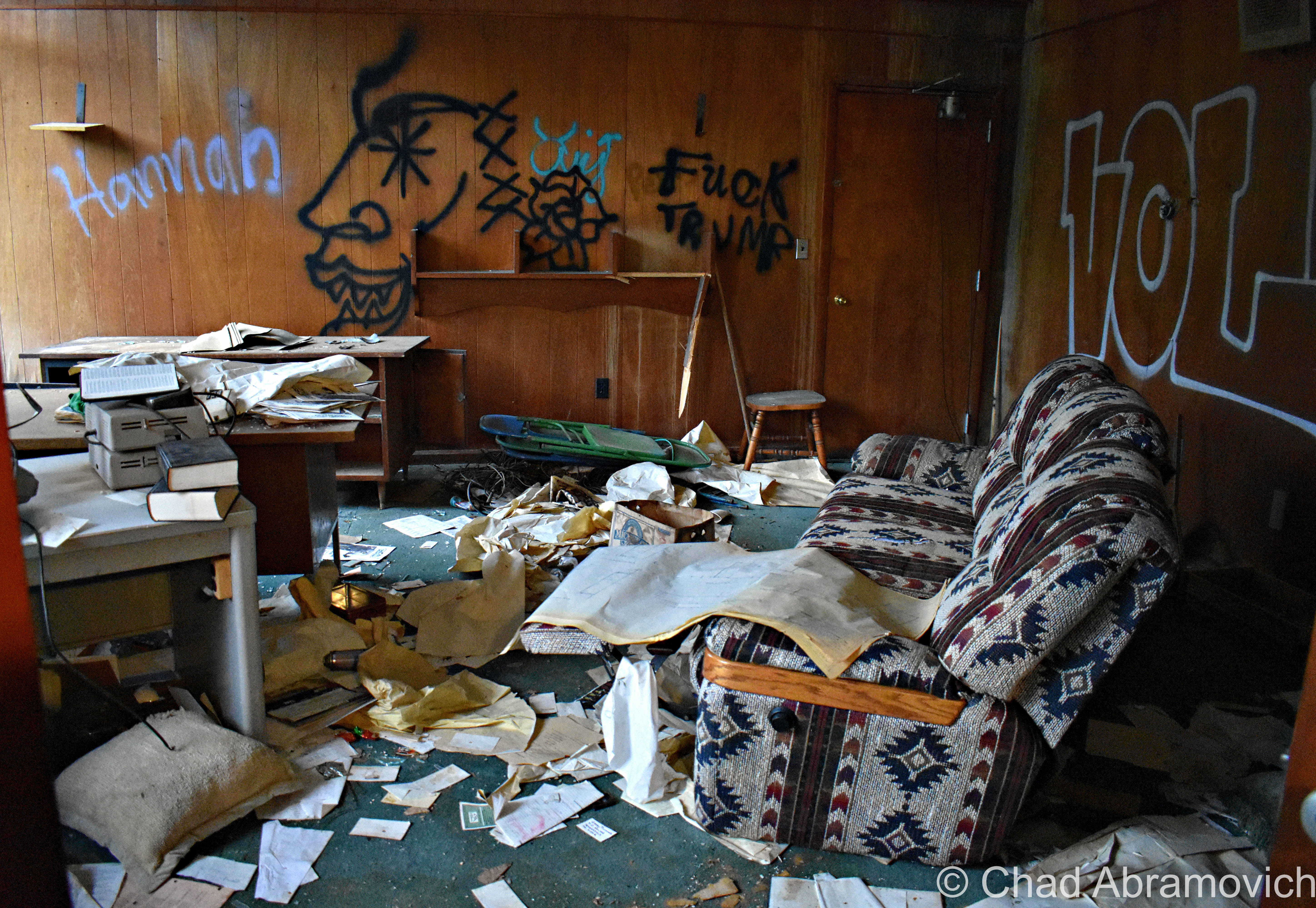
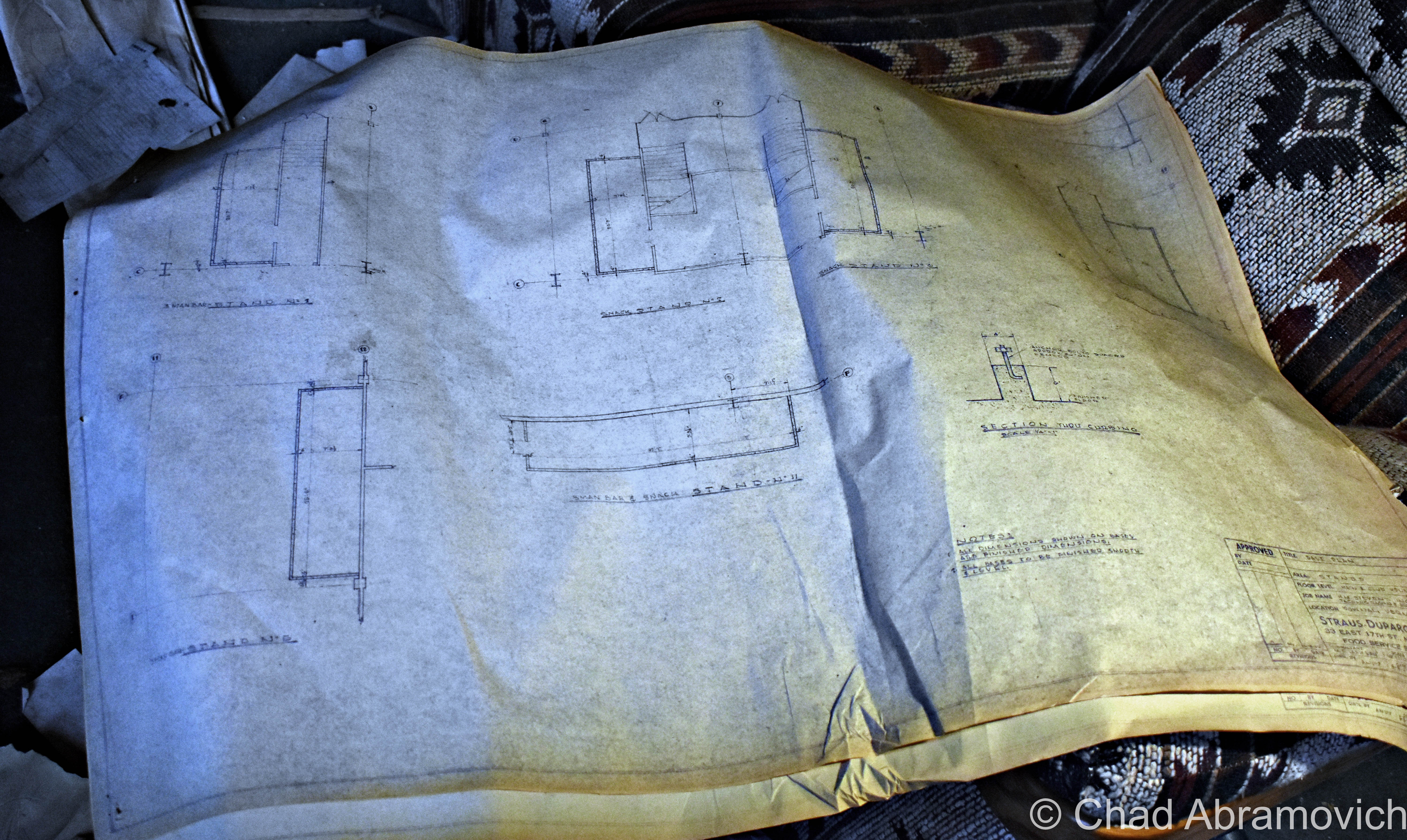
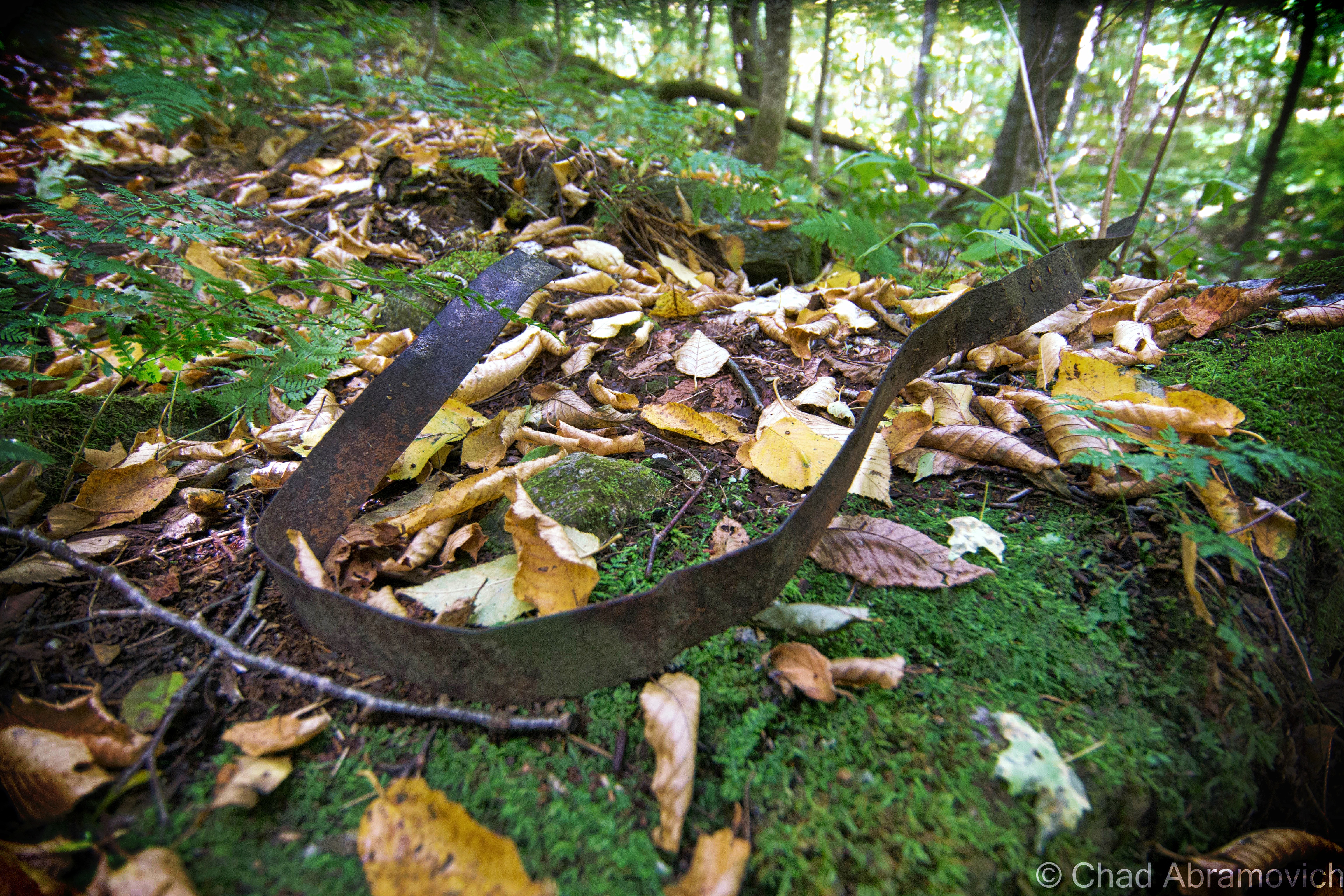
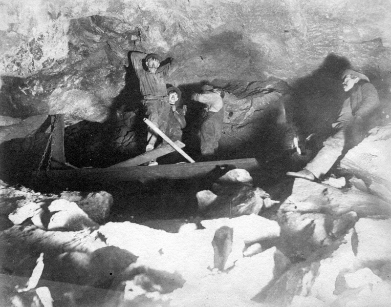
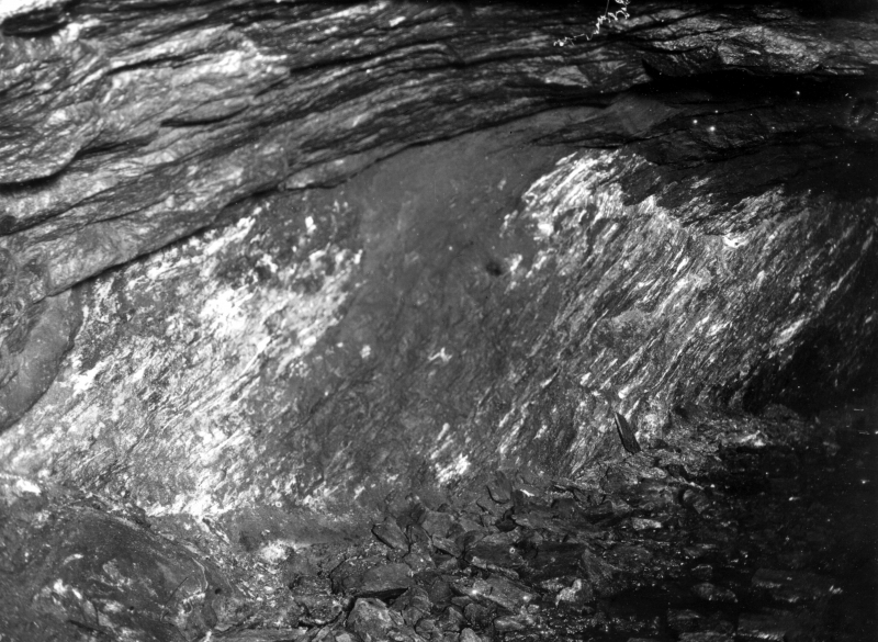
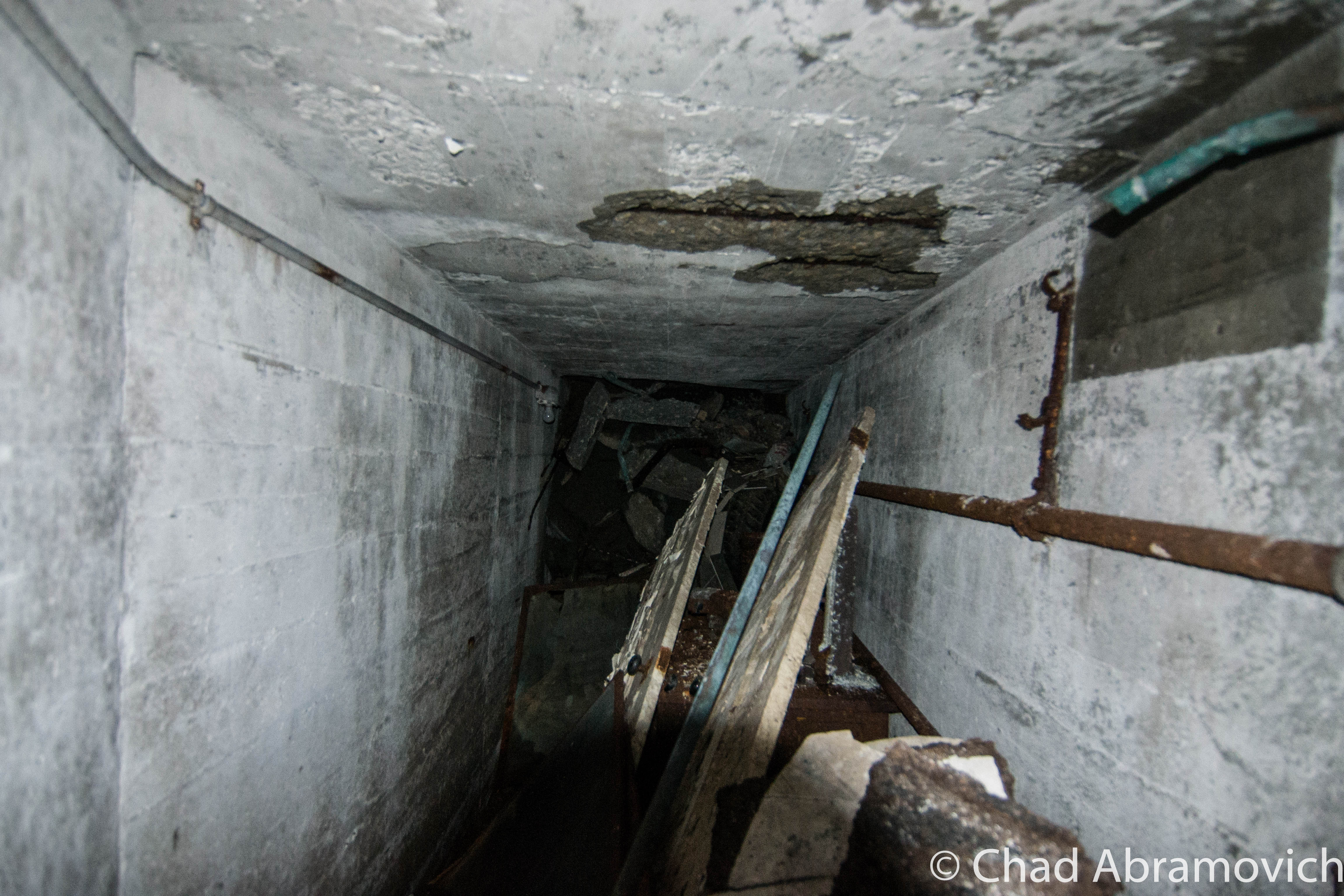
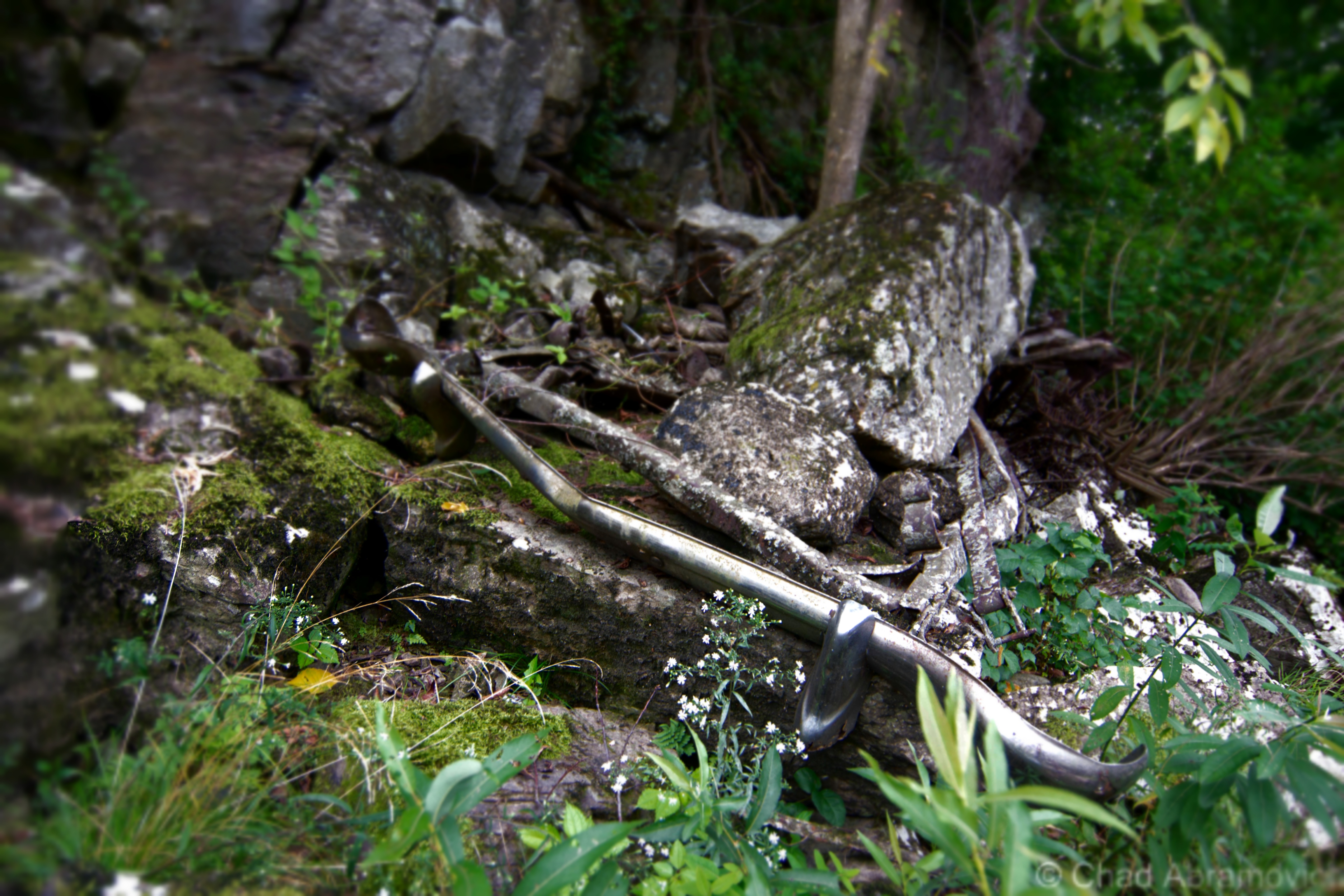
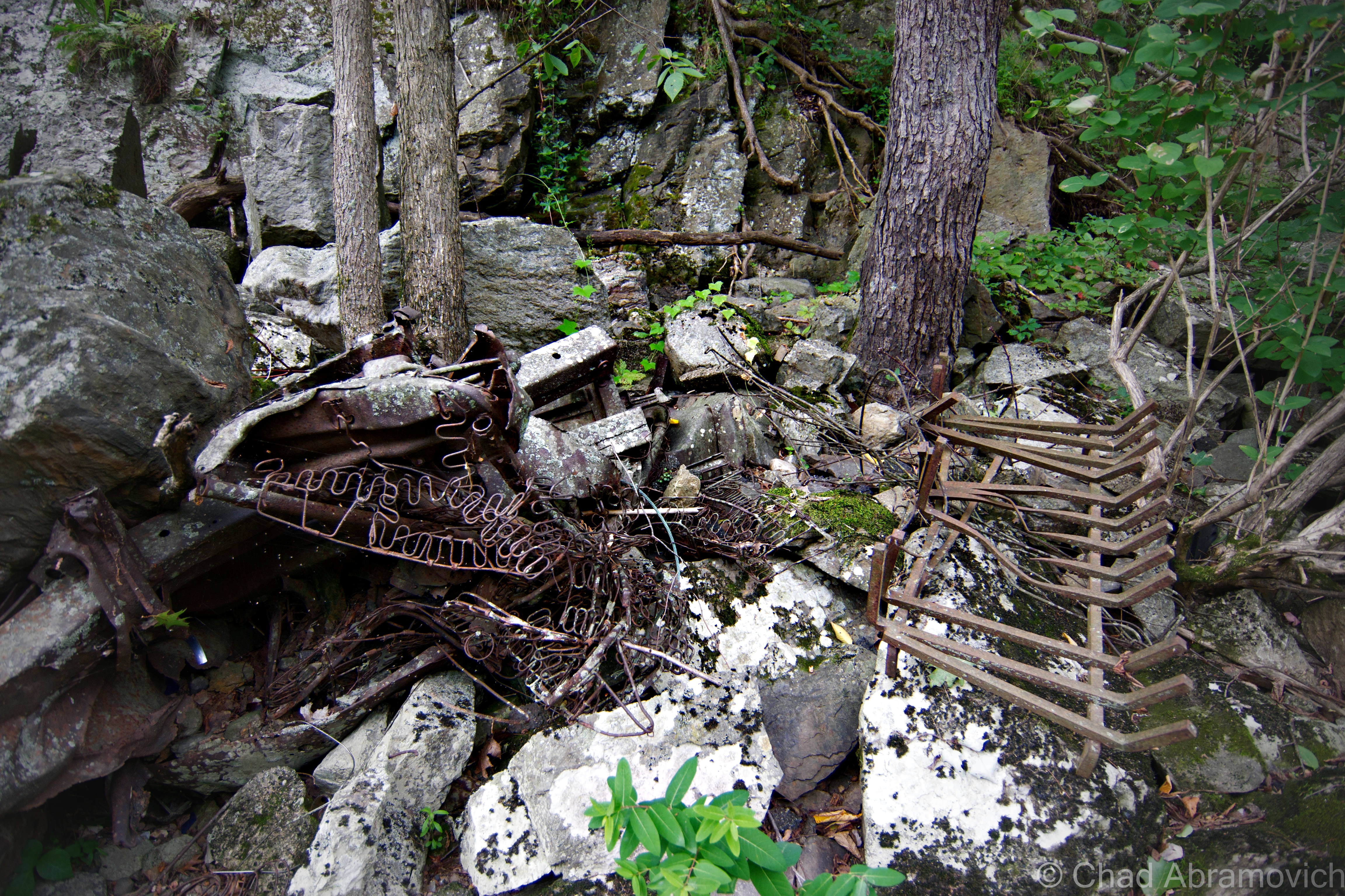
The building was an unassuming labyrinth of smelly and squalid offices and catacombs of dark and drippy maintenance and miscellany areas all filled with relics, gross puddles of goopy chemicals on the floors, and wandering birds.  The roof had long failed, and nature has been metamorphosing the structure in gross ways for over a decade.  One of the coolest things I found was the former track photographers suite, which was still filled with heaps of developed and undeveloped film of the old races. The basement had such a foul odor that, eventually, we had to dip back outside for some fresh air revitalization.

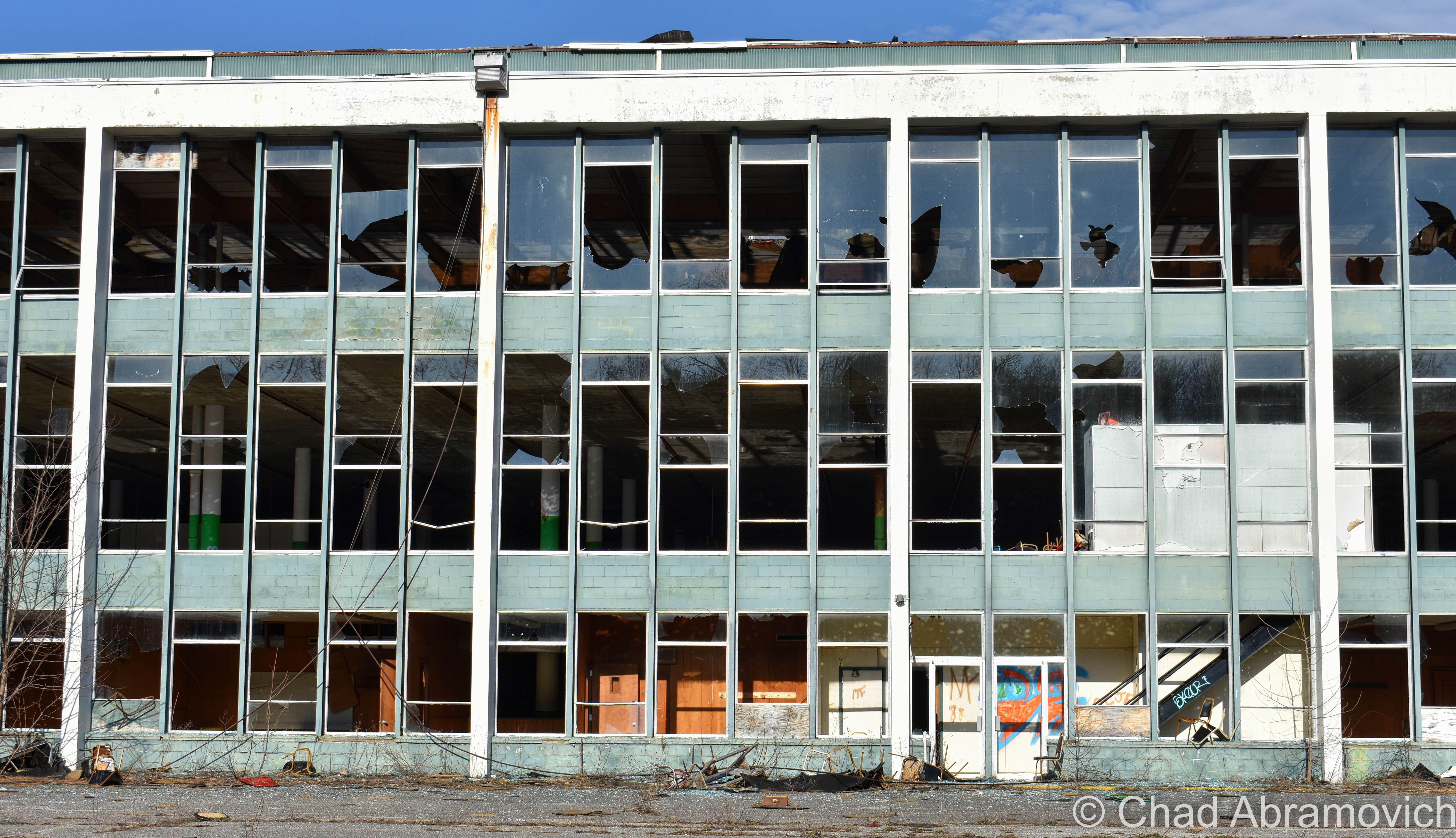
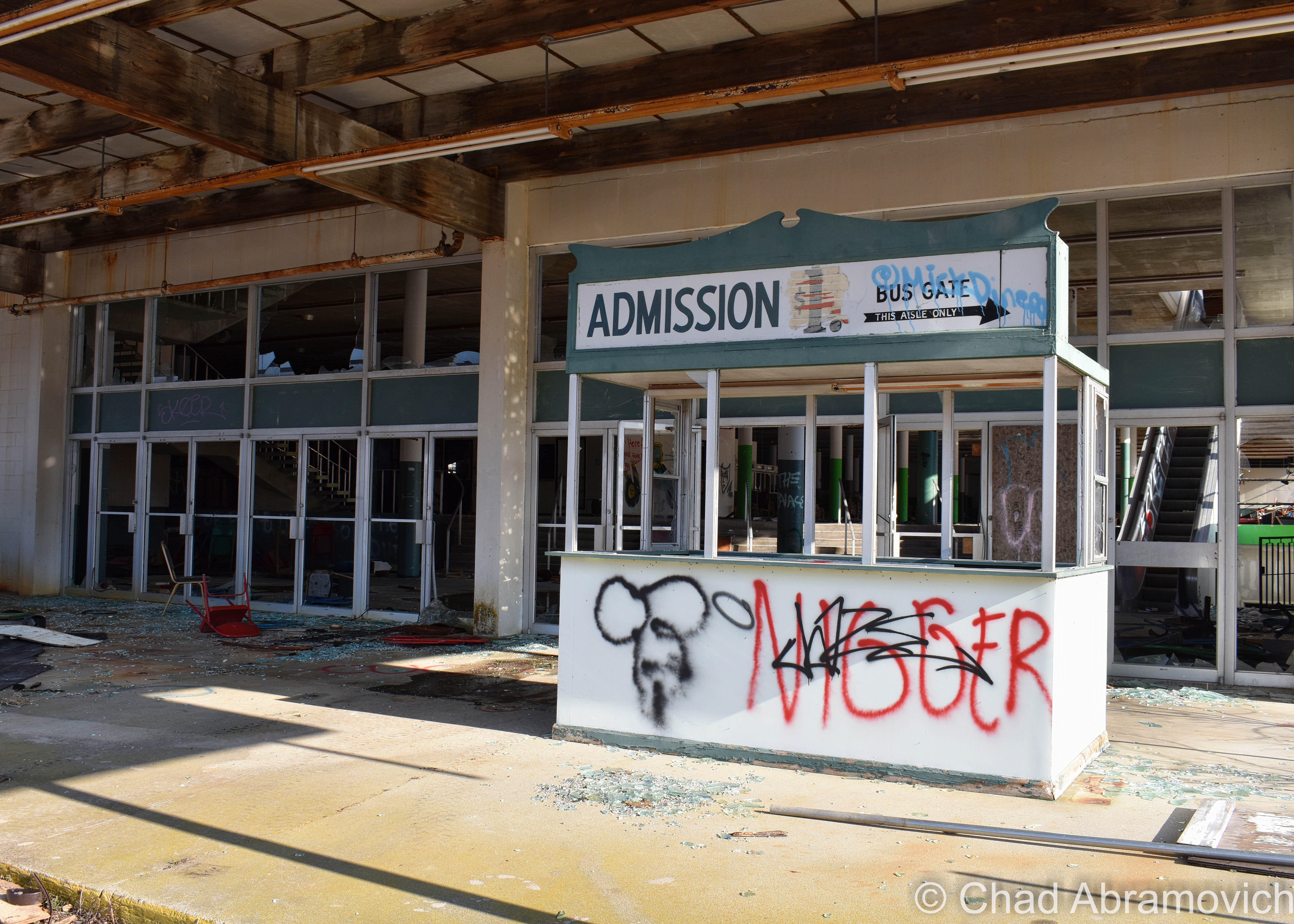
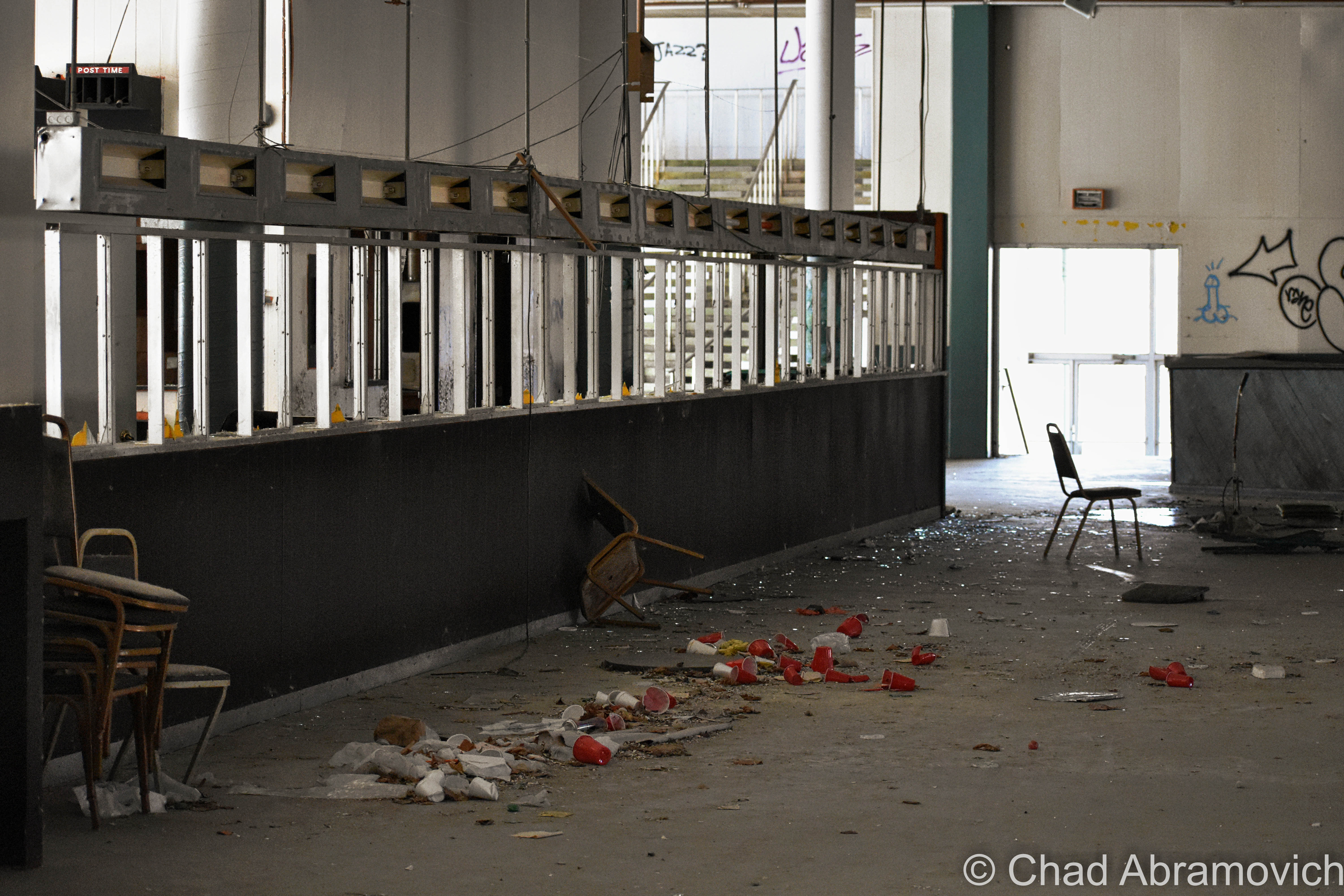
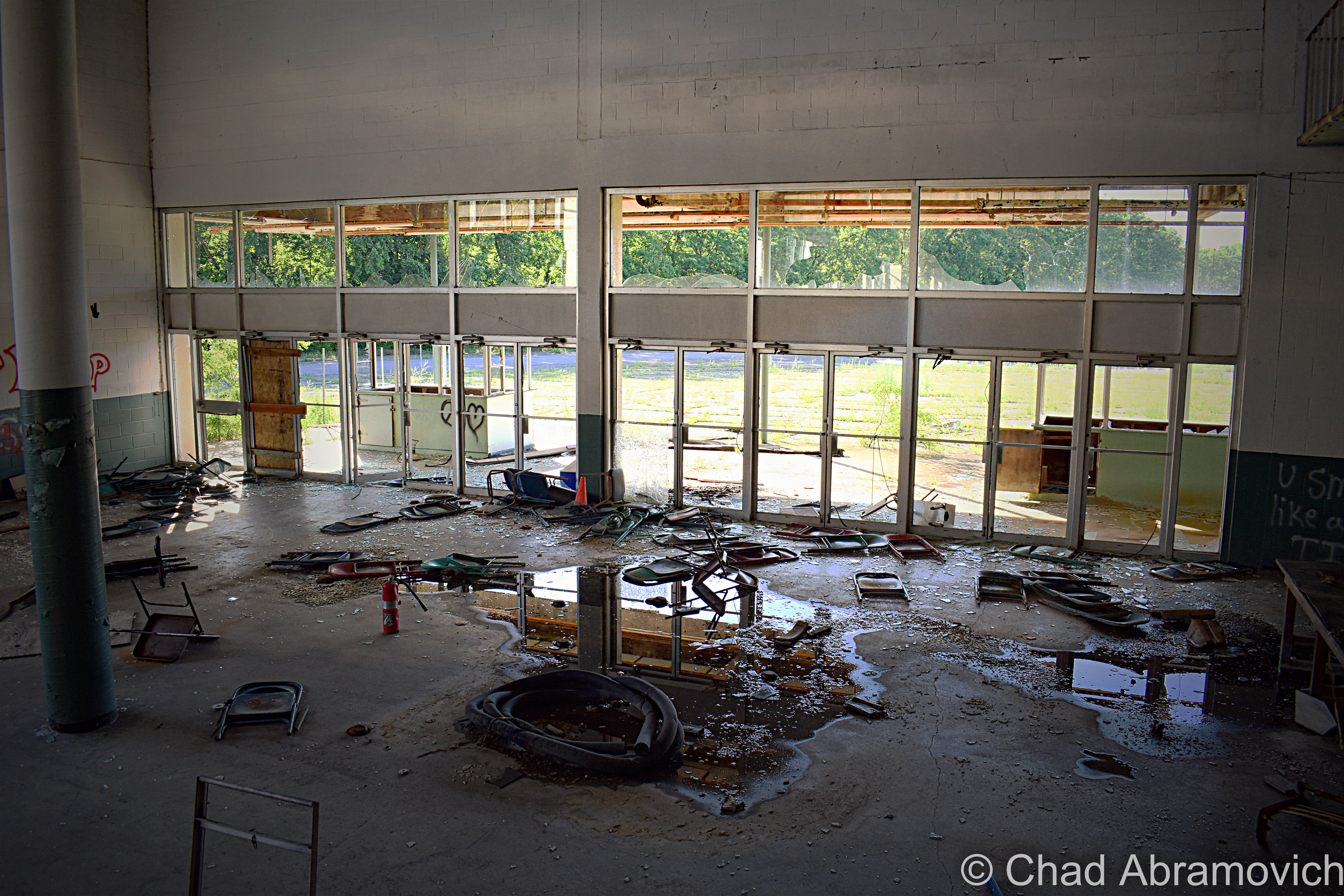
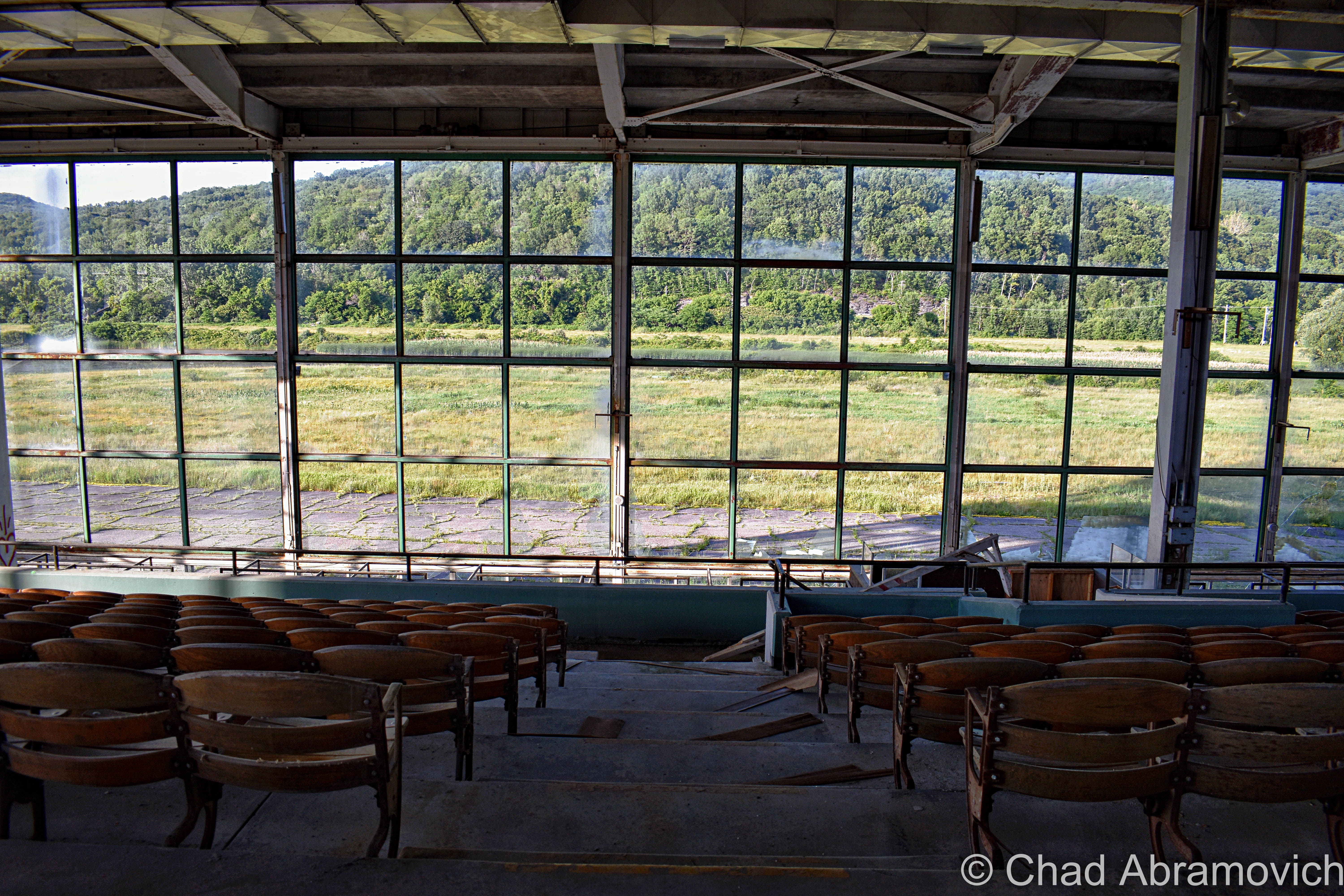
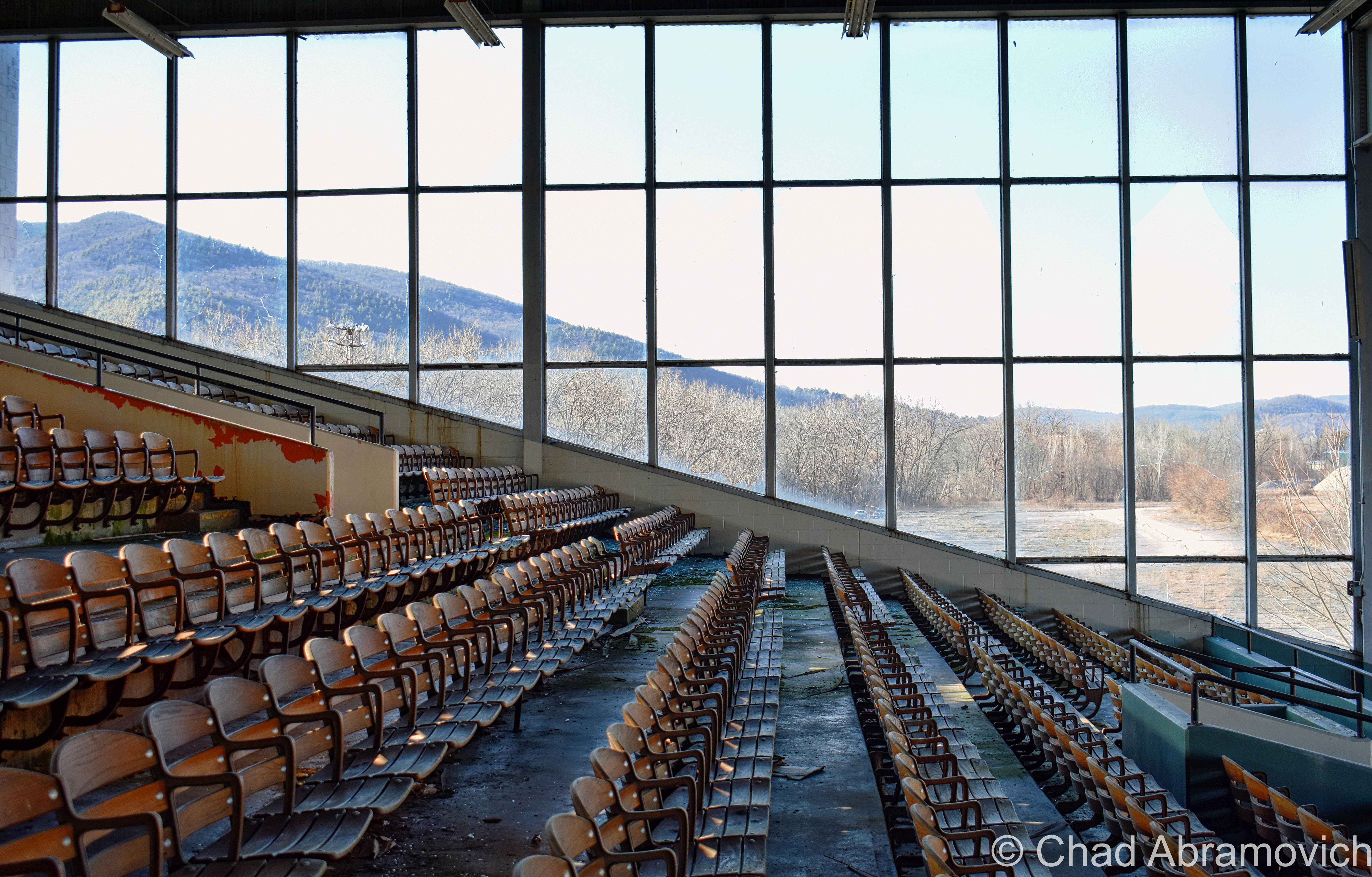
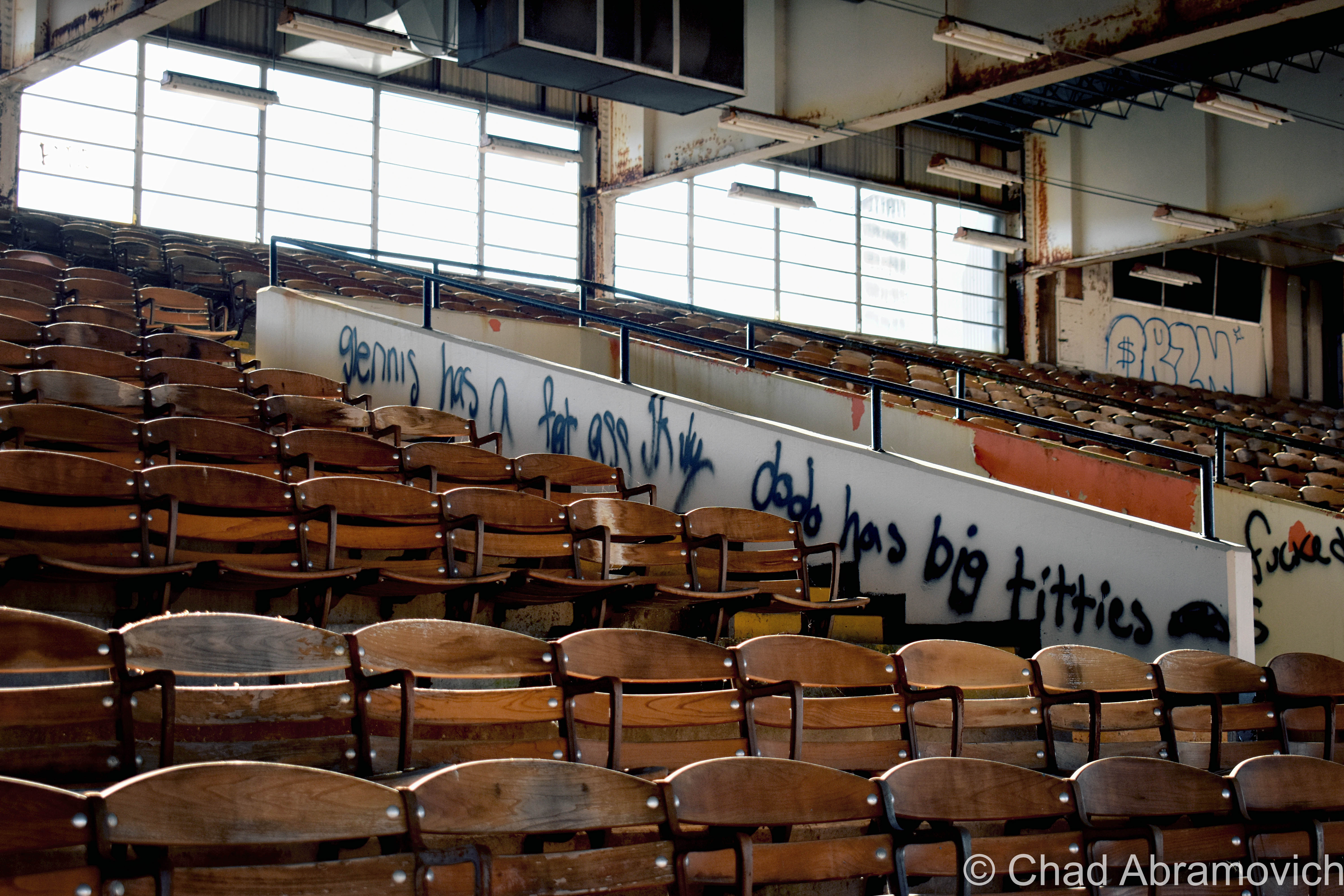
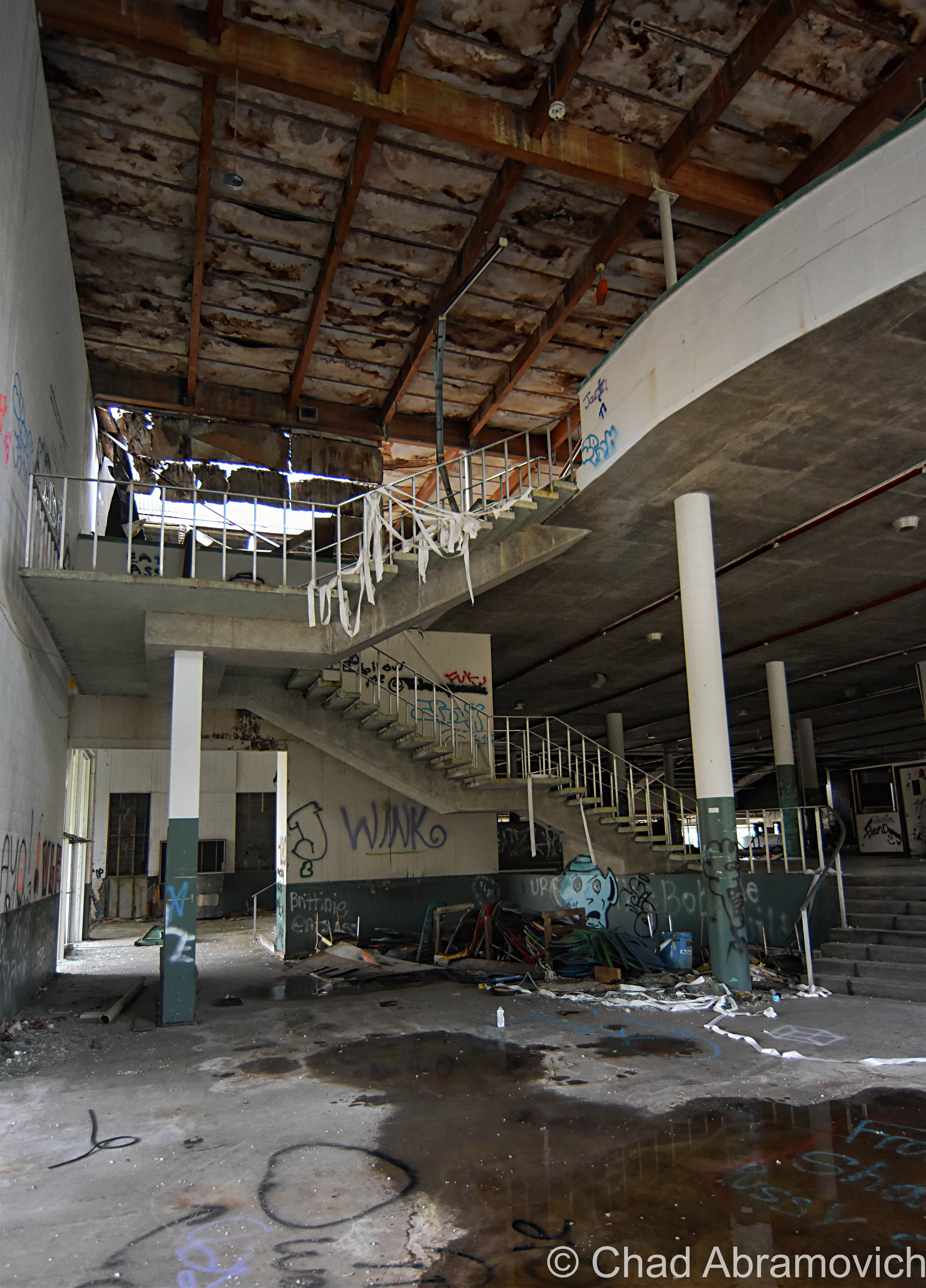
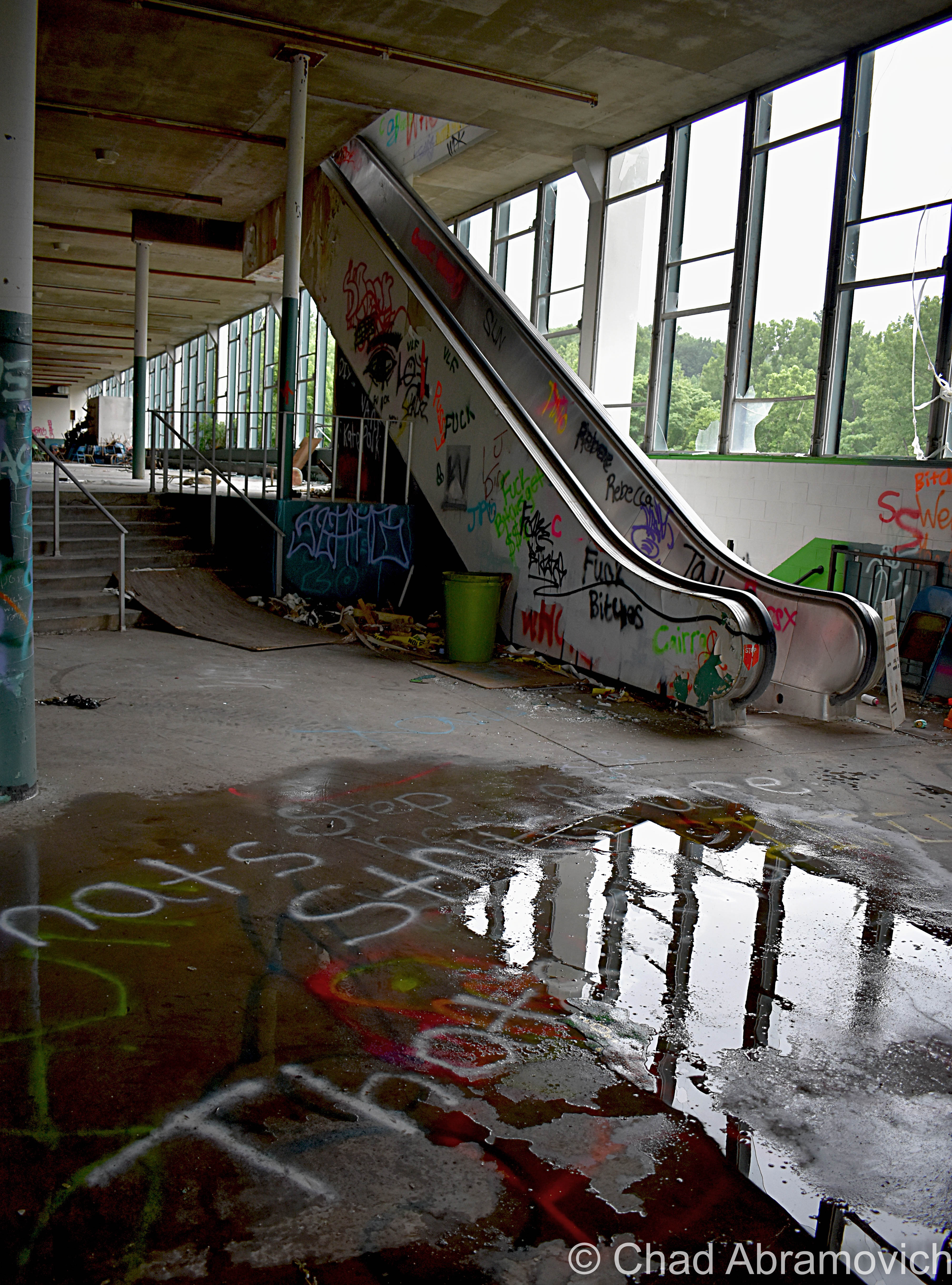
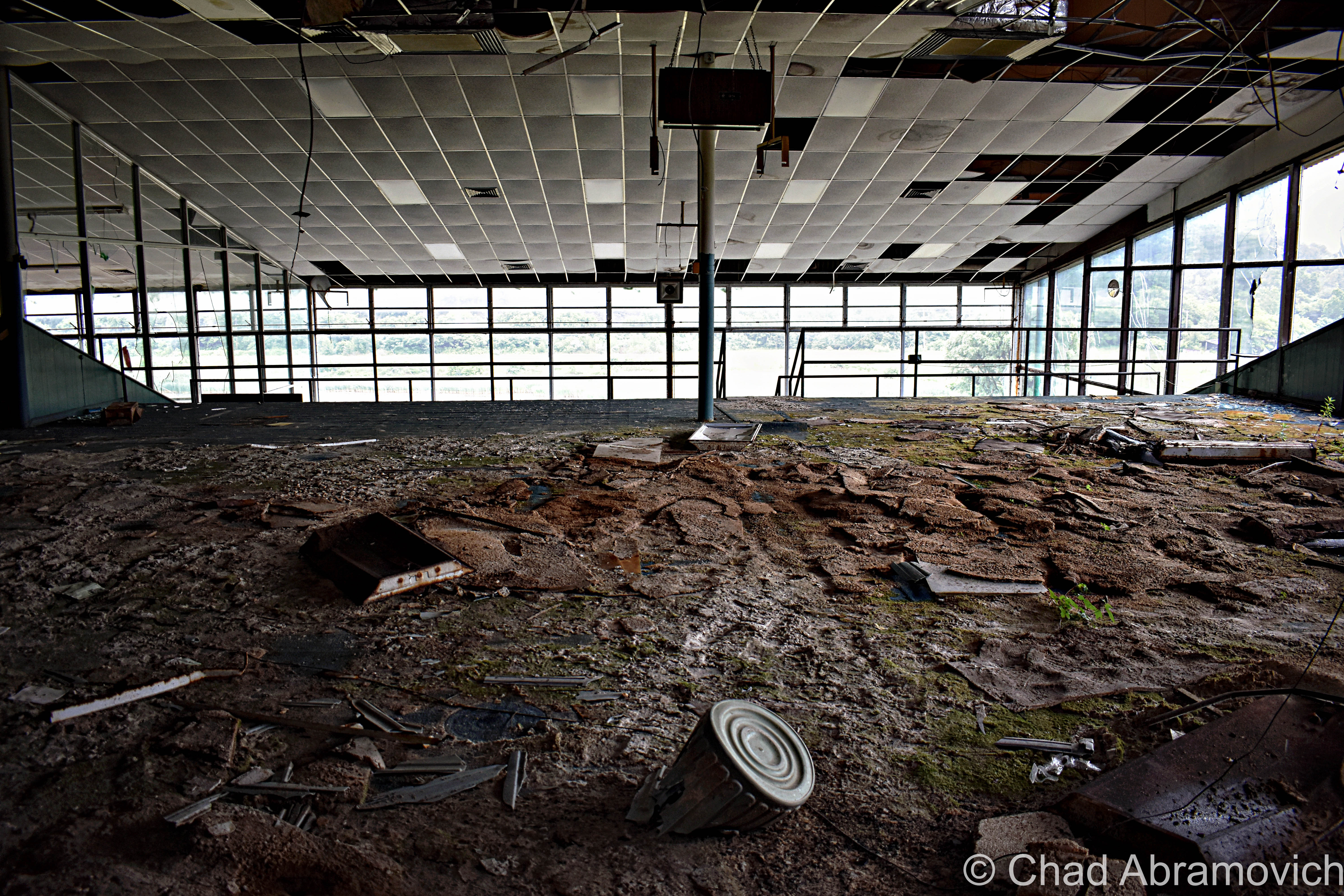
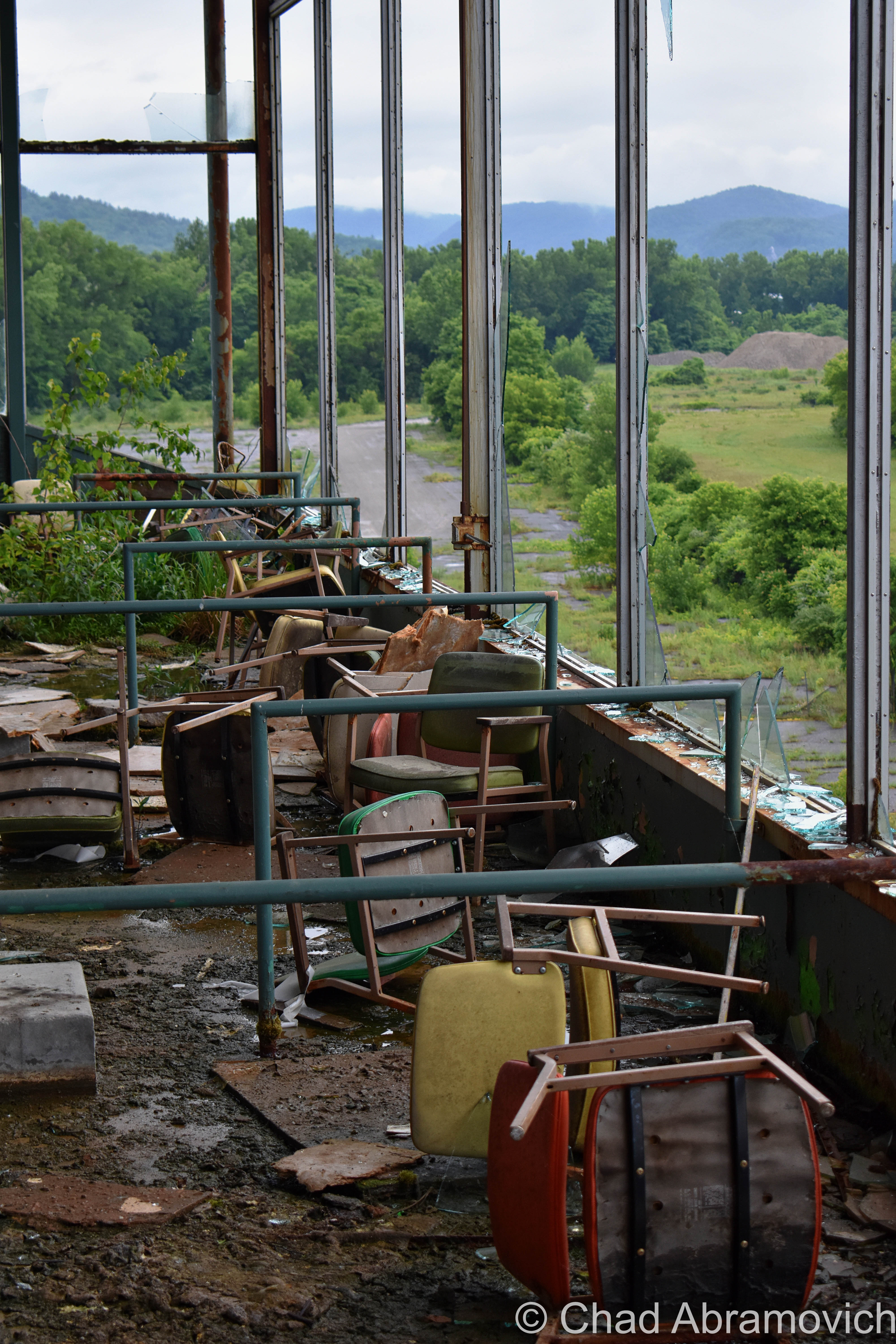
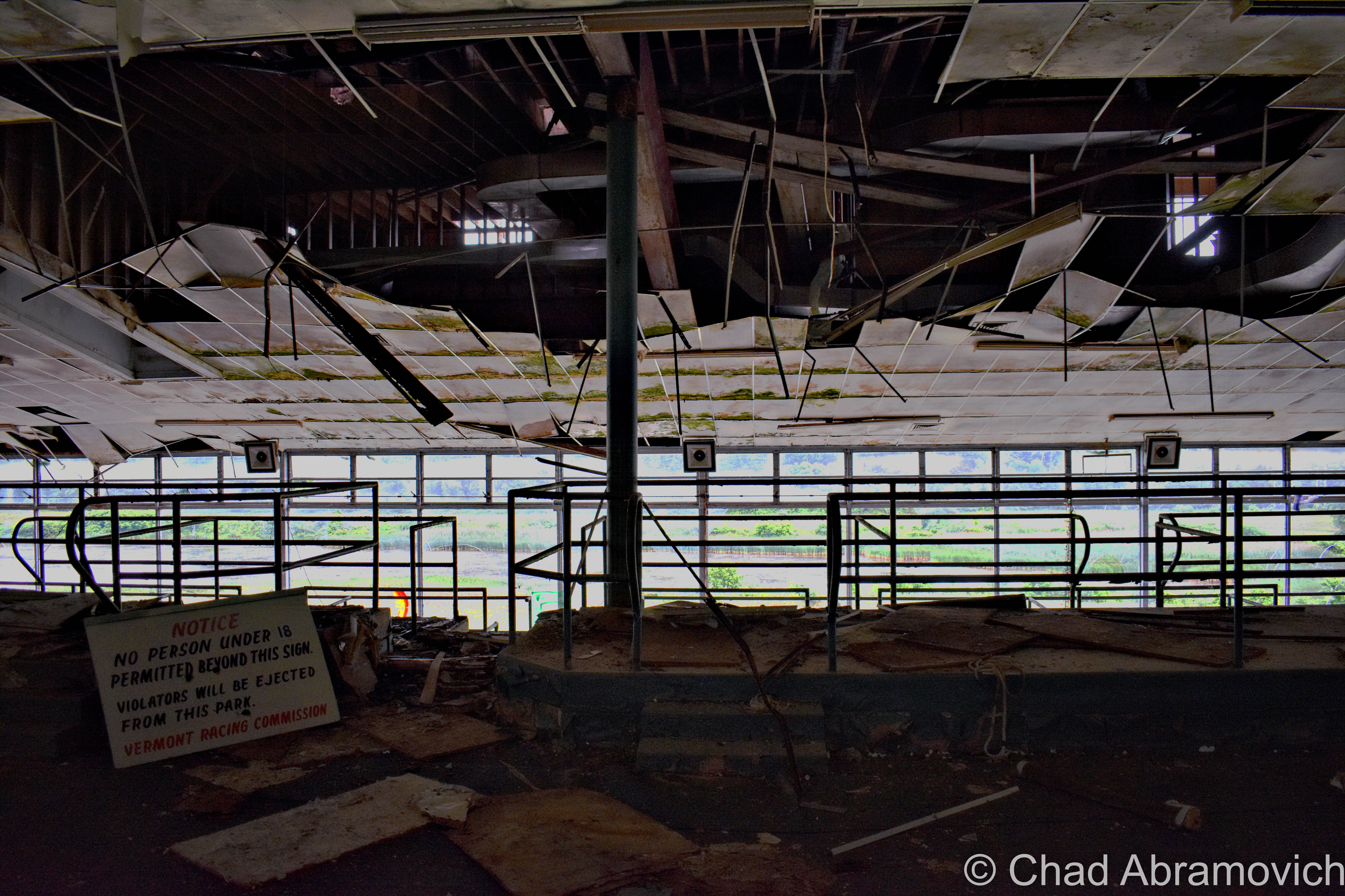
Upstairs, the former venue, snack bars, and grandstands are all cavernous spaces that have been trashed, smashed to smithereens, graffitied, succumbing to water and decay, and turning into terrariums, as moss and young plants have begun to take habitat on the floors and the rooftop. A whole colony of what was probably hundreds of pigeons had taken up residence on (and within the cavities of) the defective roof and constantly circled the large, mid-century structure.

It was a creepy explore, with lots of eerie sounds that croaked and carried through the wide spaces and dark crevices. The smell of rancid decay permeated everywhere.

Overall I thought this was a real bummer of a place – an attitude formed by the dated and ugly ruins, and the fact I’ve never enjoyed or supported the kinds of revelry that once went on here.

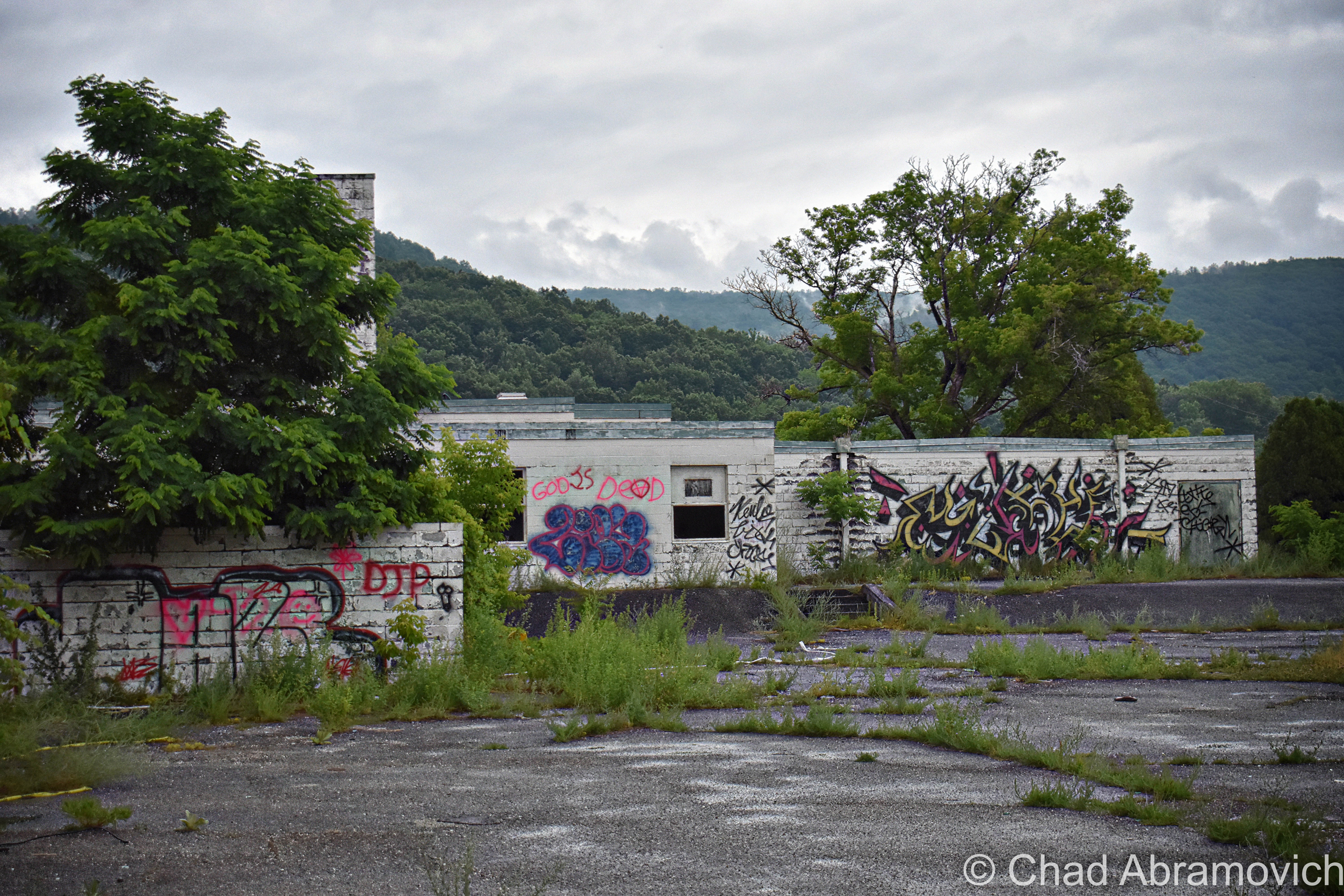
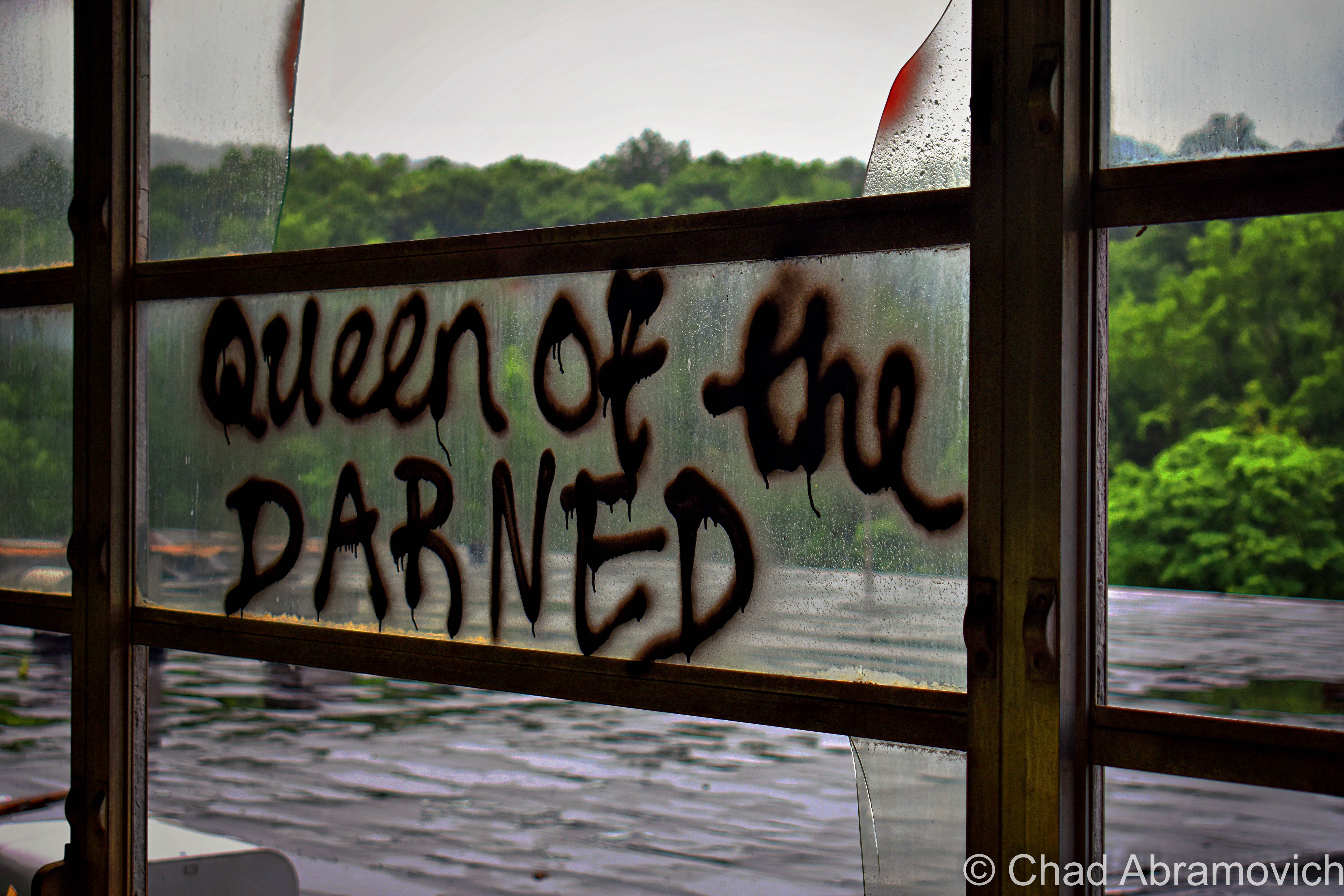
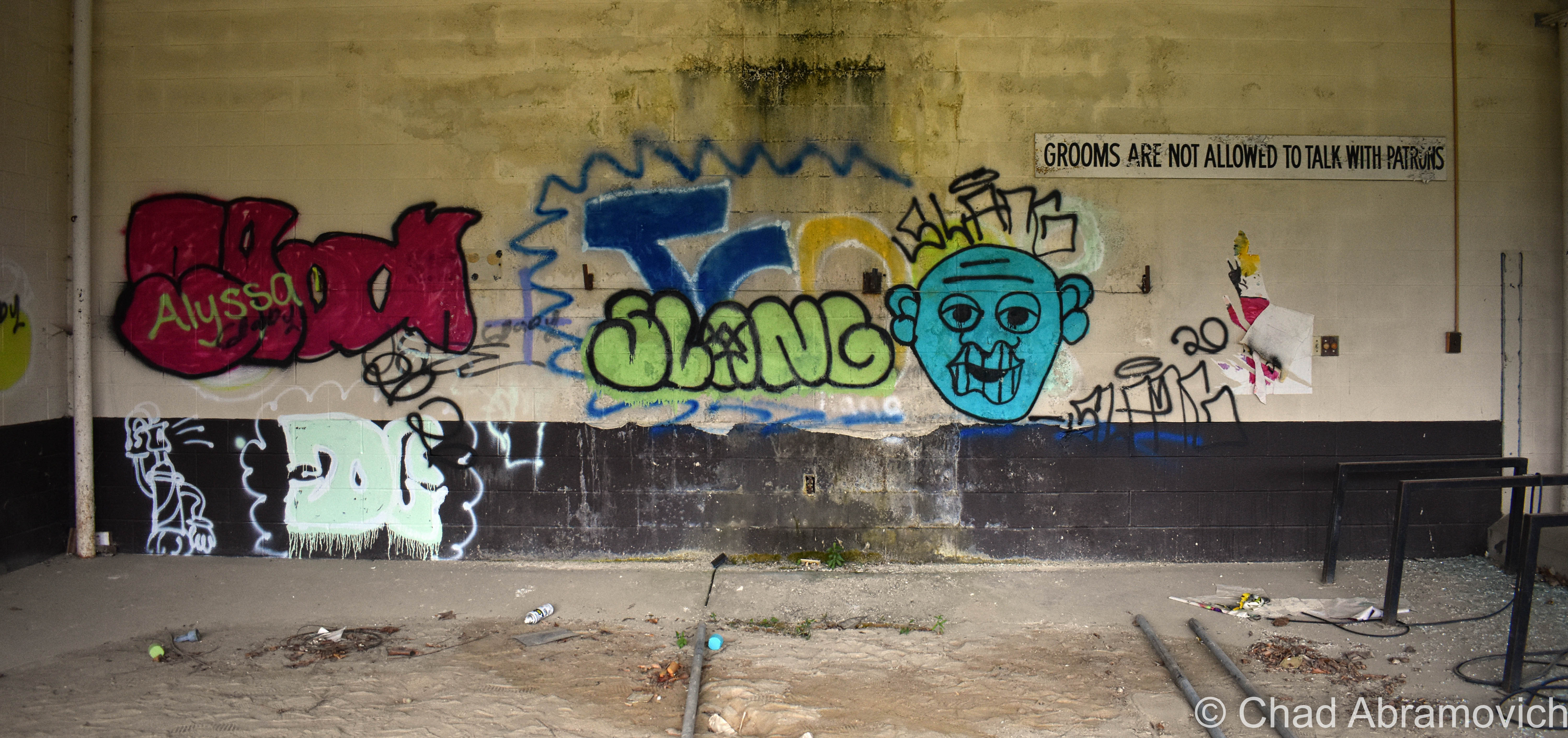
The real reason I chose to make multiple explores here was simply because of the fact that it exists, and my sense of wonder seduces me to explore as much of Vermont as possible – especially the abandoned stuff. And admittedly, a few visits had me appreciating it in a totally different light and discovered that it was a treasure trove of an explore and architecturally evocative of its time. But I found it a real shame that other people who’ve stopped by have decided to completely decimate this place and use it as a law-free zone.

The amount of destruction in the past few years was astonishing – I noticed a humongous difference between my visit in July of 2019 and March 2020, and towards the last months of its life, the bad road tar of the old parking lot and access road almost always had multiple cars – many with out of state plates, parked around.

The people that come here are quite a circus show of other amiable explorers, curiosity seekers, locals, and shady characters – it seems like many out of staters or area hooligans are using the old track as a law-free zone. A few people we ran into definitely made us uncomfortable.

Dusk was humming up, and as we were getting ready to leave, three boys on ATVs zoomed through the parking lot, and a Nissan Altima full of teenagers parked in the weeds in front of the building and had an “oh shit!” moment as we pulled out and all locked eyes as they were removing copious packs of Twisted Tea out of their trunk, while nearby, a young twenty-something couple was awkwardly trying to wedge a sign they had taken into the backseat of their Ford Focus.

I had this post sitting in my WordPress drafts for a while. Because I’m a perfectionist, I wanted to get the feeling right and make this post interesting and fun, but I was also concerned about posting the location. I realize that in the past few years, a larger amount of people have been using my blog to add places to their exploration checklists, and I’ve been really re-evaluating my responsibilities as a preservationist and a local weird worker, what I post, and how I write about it.

I already saw the racetrack morphing into a weird beacon for trouble, and I guess I didn’t want to add to it. Thanks to the internet, nothing is a secret anymore, and I’ve seen an alarming increase in the momentum of special places, in general, being over-touristed and ruined by unlikely people.

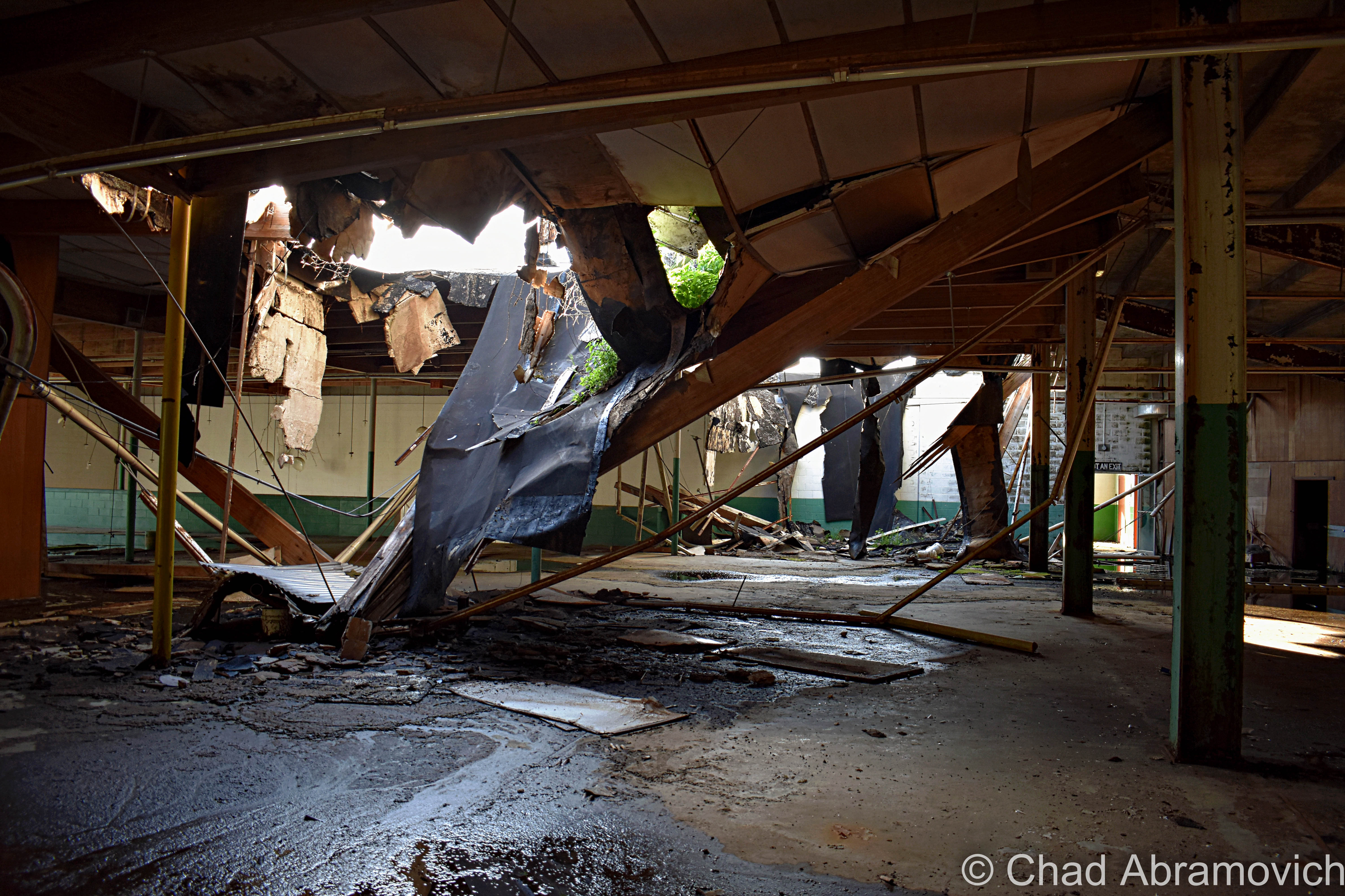
Unfortunately, at some point on the night of September 16th, 2020, a “suspicious fire” was started in the grandstands that used the wooden seats for fuel, and the entire building was cooked and even more destroyed than it already was. The fire fueled a local outcry of folks who are fed up with all the fools turned sightseers. This is one of the many reasons why I never give out locations. Practically everything you’ll see in my photos has been reduced to ashes, but the mangled and blackened shell sadly still looms beyond Route 7 looking pretty haunted. If you’re interested, the Berkshire Eagle has some illuminating drone photography of the damage.

I’m so grateful I had the chance to enjoy a few explores and make some fun memories here when I did, and am saddened by the loss of what oddly was such an uncommon wreck. There was so much more that I wanted to see, that now I never will.

I think that the Green Mountain Racetrack was uniquely special. Because of its smooth accessibility, its literal open-door policy intrigued all kinds of souls who decided to let their curiosities lead them here. I was scanning loads of posts on Instagram and was a bit startled to see just how many people not only have snooped around here, but were genuinely fond of this place in their own ways, and had fun making multiple trips here to satisfy the natural human urge of investigation. Abandoned places inspire that kind of magic that encourages us to forget about the chains of society and our inhibitions. When the news hit that this place burned down, people started commiserating.

This was a continued lesson for me not to take places for granted. I was just speaking to a good friend a few weeks ago about planning yet another return here because of all the fun we had last time – but we took this old track for granted, and now it’s gone. Everything is finite.

So here you go; a whole bunch of photos of the old Green Mountain Racetrack!

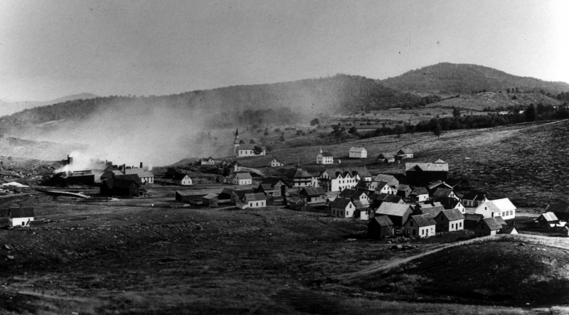
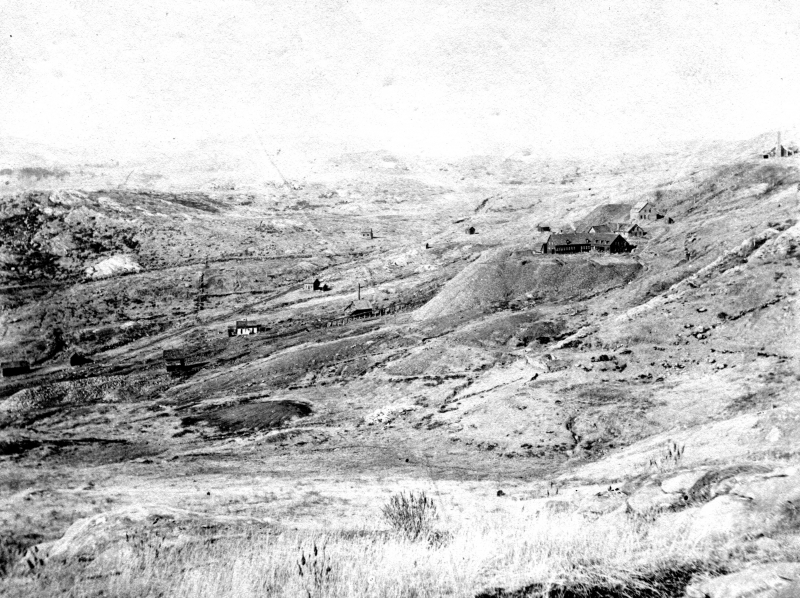
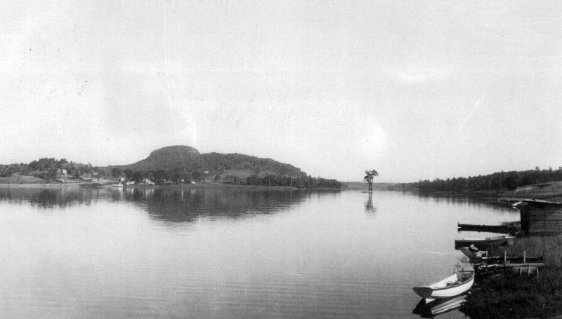
The Green Mountain Racetrack when I visited back in Spring 2011. 

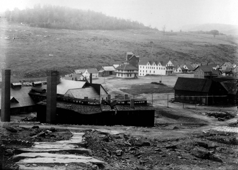
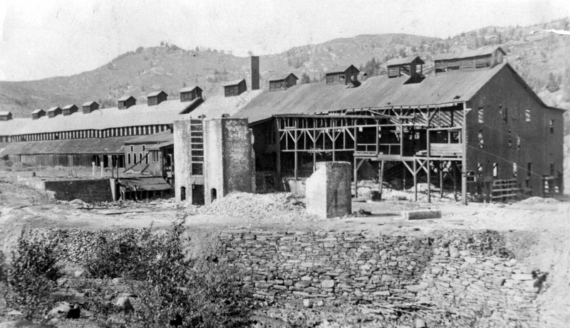
The Green Mountain Racetrack June 2019/March 2020

The old track oval, now a field growing wild. Looking at this image, I still remember this summer evening; the humidity dripping down my skin and shallow breathes in heavy air, with the gentle sound of rustling long grasses and a nocturne of peepers. The end of the Green Mountain range can be seen in the distance.

Green Mountain Racetrack June 2020

Photos from my last sojourn here. It was a sultry early summer day as mists slid of new green slopes vibrant against gloomy ashen skies and uncomfortable humidity that drenched us in sweat. The entire place reeked of something sodden and foul. It had started to rain, and the roof, which had long failed, was letting fetid water in which dripped down and baptized us and made the upper carpets like stepping on a wet sponge.

“You’ve been baptized – your soul belongs to the race track now” I joked as a trickle of mystery water dribbled down upon my friend’s head and shoulders. She involuntarily cringed at the sensation and shot me a glare.

Man oh man, I really miss this place.

I realize the noun “Paddock” means a field/enclosed area where horses are kept and exercised (duh, because it’s an old horse track), but I personally can’t help always think of the aforementionedly bedeviled Pownal farmer Thomas Paddock when I’ve passed under this sign, and all the inexplicable weirdness that went down (literally) on his local farm. Personally, I think that would have been a way cooler restaurant name reference.
A groovy old conference room in the basement

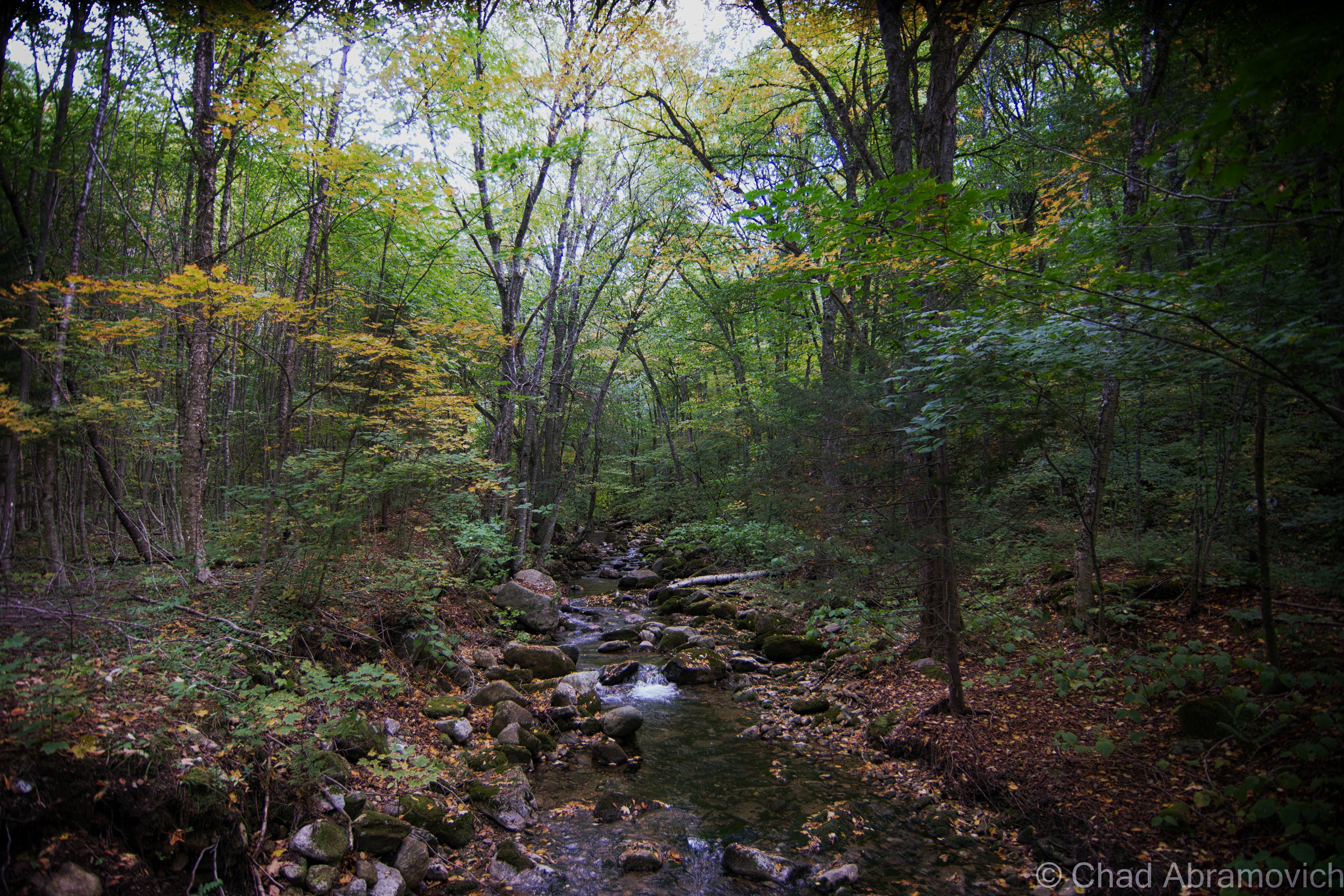
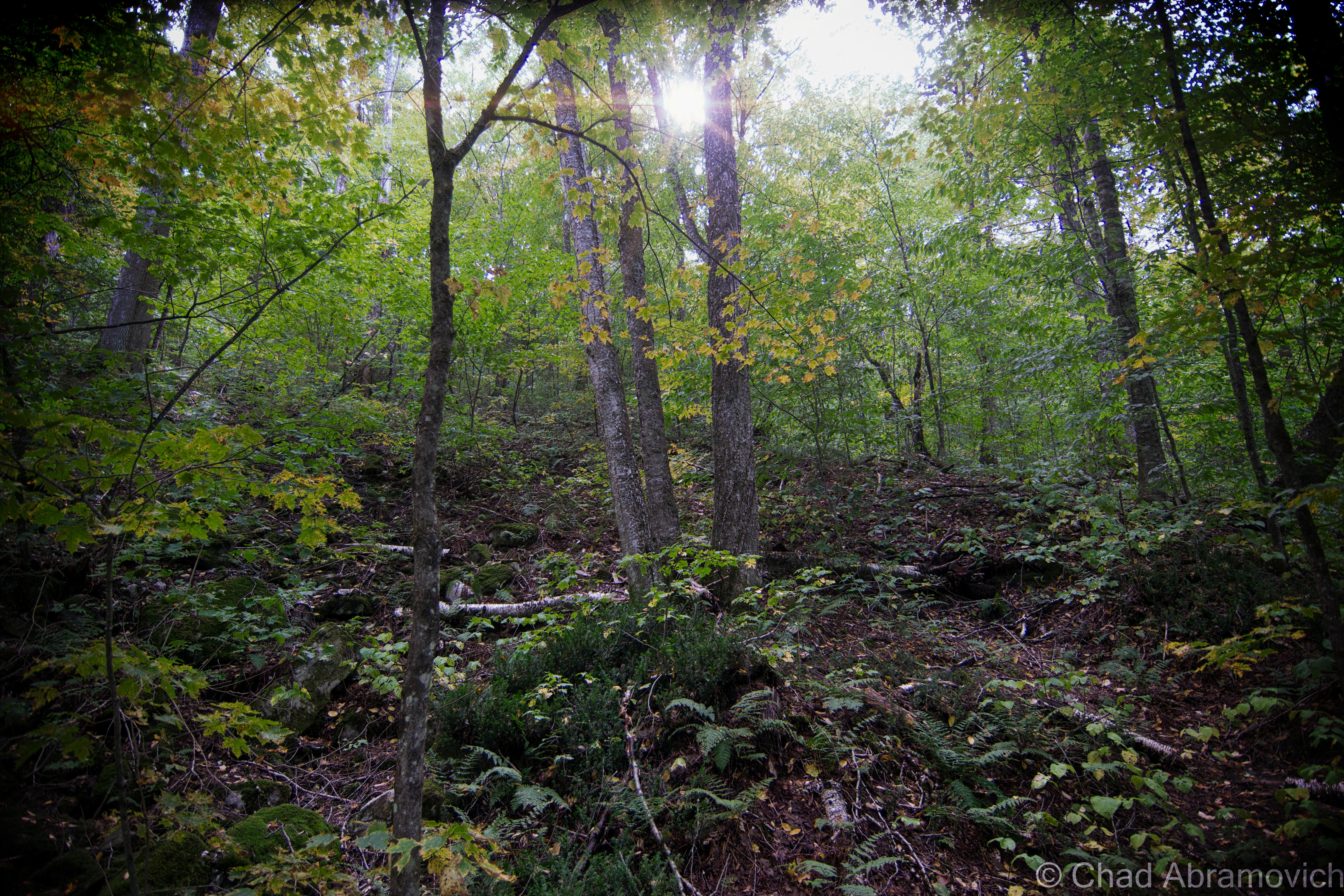
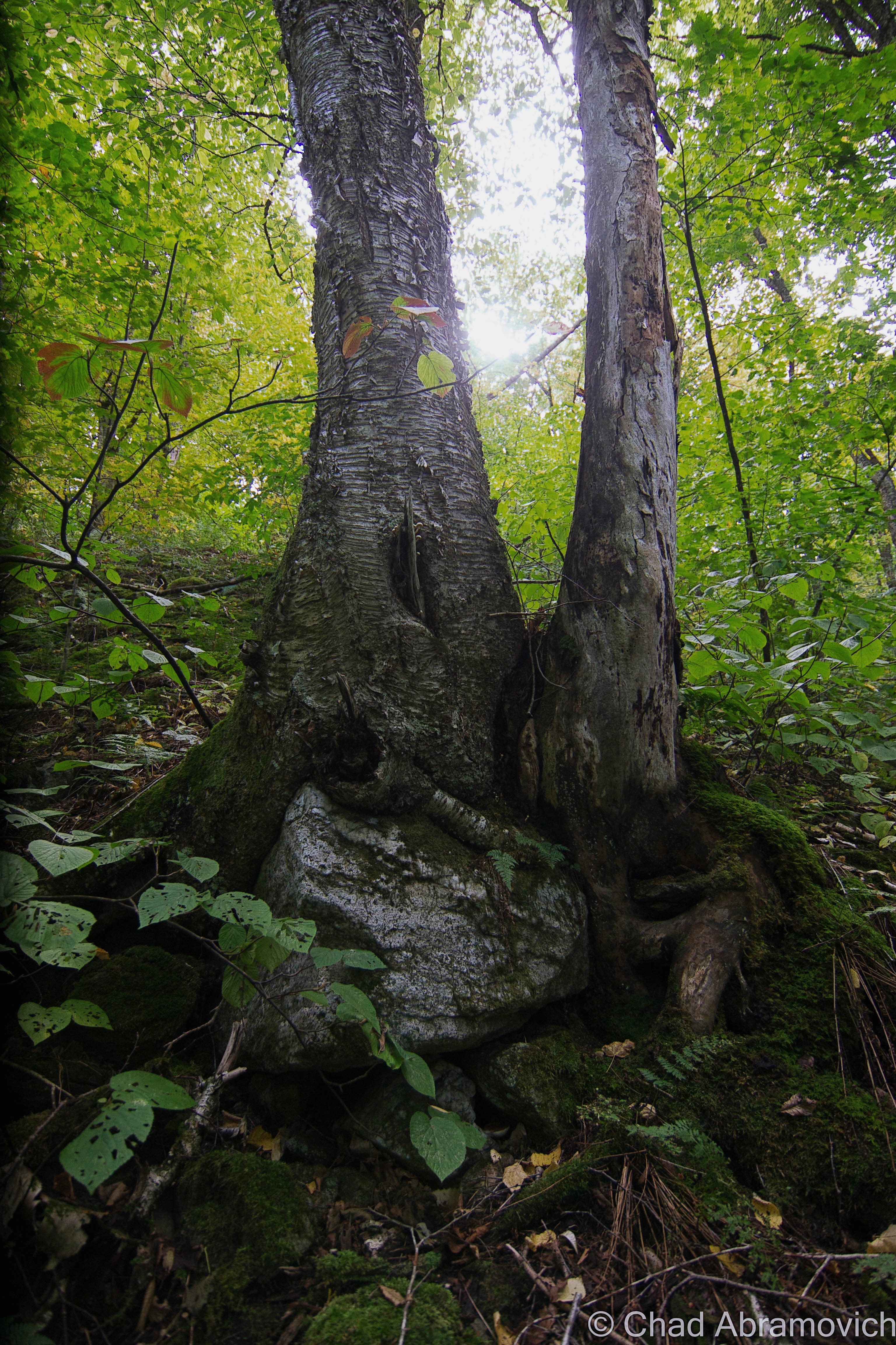
I’d really love to do more shunpiking and exploring around the Pownal area – it really is a gem of a town, with far-stretching vistas, old farms, backroads that convert into gnarly class D forest roads, and hidden swimming holes under mountain cascades.

When I was curiously searching for other people’s media from their explores here, I found quite a few talented folks who bring some great stuff to the table. Here’s one of my favorites; a great urbex video by explorer “Dark Exploration” (who, in my opinion, got wayyy better shots than I did!)

Check out this cool drone footage shot by Youtuber Dagaz FPV! It gives you a scope of just how big the property was and some rad POVs that I couldn’t capture. Maybe I should invest in one of these…


Are you from Pownal or the surrounding environs of Southern Vermont/The Berkshires/New York State? Or are you a Vermonter in general? I’m looking for weird and wild stories, wonderous places, incredible people, and especially abandoned locales! So if there’s something you’d like to share with me, I’d love to hear from you!

I’d also really love to grow this blog and present unique, meaningful, and extraordinary content that’s a departure from the same regurgitated stuff you find everywhere else online, and your help would be hugely appreciated! I have bad social anxiety, so I’m not always on social media as often as I probably should be.

Feel free to drop me a line at chad.abramovich@gmail.com

Also – if you appreciate me and this blog, perhaps consider making a donation at my PayPal below? The pandemic has hit my finances and my mental health pretty hard, so any amount is humbly appreciated. I’m also on Venmo if that works better.


Since 2012, I’ve been seeking out venerable examples of Vermont weirdness, whether that be traveling around the state or taking to my internet connection and digging up forsaken places, oddities, esoterica, and unique natural features. And along the way, I’ve been sharing it with you on my website, Obscure Vermont. This is what keeps my spirit inspired.

I never expected Obscure Vermont to get as much appreciation and fanfare as it’s getting, and I’m truly grateful and humbled. Especially in recent years, where I’ve gained the opportunity to interact with and befriend more oddity lovers and outside the box thinkers around Vermont and New England. As Obscure Vermont has grown, I’ve been growing with it, and the developing attention is keeping me earnest and pushing me harder to be more introspective and going further into seeking out the strange.

I spend countless hours researching, writing, and traveling to keep this blog going. Obscure Vermont is funded almost entirely by generous donations. Expenses range from hosting fees to keep the blog live, investing in research materials, travel expenses and the required planning, and updating/maintaining vital tools such as my camera and my computer. I really pride and push myself to try to put out the best of what I’m able to create, and I gauge it by only posting stuff that I personally would want to see on the glow of my computer screen.

I want to continuously diversify how I write and the odd things I write about. Your patronage would greatly help me continue bringing you cool and unusual content and keep me doing what I love!

Donate Button with Credit Cards

The Drowned Forest

I recently had a lot of fun voyaging around the tiny angle that is New Hampshire’s 18 miles of seacoast! I haven’t been down towards the Granite State’s coast since I was 10 years old, so the nostalgia was stimulating and the sunburn was painful!

A few friends were tandem on this seacoast excursion, and one of the few goals I had for this trip was doing a bit of oddity hunting – and I was pleased with the few curios that I had eagerly put on my list. Beyond that, we just had a blast shunpiking around random coastal towns in both New Hampshire and Maine.

The environment is a bit exotic to me, in a sense that serpentine salt marshes and beaches on a waterbody you can’t see the other side of aren’t found up in Vermont (but we do have lighthouses!). This part of New England also has redolent history and mystery that have been fermenting far longer than Vermont has existed! I was definitely imbued with some unabashed excitement the whole time.

After all these years I’d never forgotten just how great of a drive New Hampshire State Route 1A was.

Before we checked into our hotel in Portsmouth, I suggested we took the requisite tour up Route 1A (known as Ocean Boulevard for most of New Hampshire’s seaboard) and the shore with the windows down and the breezy salt air coming in (and our music blasting out).

Starting in the brashy and tawdry beach burb of Hampton Beach and its famed 3-mile titular stretch of sand that are both long-established New England summer destinations, we then ventured northwards around a few rocky points with squinty views of the faraway rocks that are the Isle of Shoals – a group of forlornly not-quite-barren islands split between Maine and New Hampshire that are famed for their isolation, and grim and mysterious folklore – the spectrums of which include murder, shipwreck, ghosts, and a treasure – all suitable footnotes of any northern New England ocean island. I’d like to take a ferry ride out there next time I’m in the area.

We then passed through scenic Rye, with numerous state beaches, tidal wetlands, and ostentatious money enclaves that line Ocean Boulevard, and then ended up in Portsmouth.

*iPhone photo. The rad shield for New Hampshire State Route 1A – the numbers represented within the silhouette of the “Old Man of The Mountain” – which was formerly a naturally anthropomorphic rock outcropping above Franconia Notch said to look like its name implies, which has since crumbled ironically due to its old age, and is now kind of an awkward state marketing icon. I had fun explaining this to one of my friends who is from the Midwest.

Portsmouth, New Hampshire is a rad little city. As its name implies, it started out as a colonial shipbuilding hub and morphed into a rowdy naval port town where the Piscataqua River junctions with the Atlantic around the island town of New Castle.

The Pisaquata River also has a pretty great Google review!

The name was minted by the local Abenaki people and might mean something close to; “a river with a strong current”, which I’d say is pretty dead-on, but the details are a bit hard to parse, and because of that, there is a lot of speculative lore behind its name! It’s also the third fastest-flowing navigable river in the world. Though the city has long declined from being an employed port, the oldest naval shipyard in the new world is still active here on an island in the Piscataqua – which once launched some of the most important American warships and the first nuclear submarines. Now the shipyard is kinda moribund, but still functioning.

And speaking of submarines – there’s one in a hole right off the Route 1 Bypass! It had me and my friend exclaim: “Hold up… that’s a motherfuckin’ submarine!” when we passed it.

It’s the new home of the USS Albacore! Lauded as “the forerunner of the future” in its heyday, this vessel was built by the skillful laborers at the Portsmouth Naval Shipyard in 1953 and was intended to essentially be a paramount experiment of both its physical design and technological wizardry – one that the Navy was really depending on. Its teardrop-shaped body became the standard design for all subsequent submarines – and proved that submarines could actually sustain themselves and function while being submerged!

It became the world’s fastest submarine in 1966 when it set an underwater speed record of 40 miles per hour, and, it was used to innovate sonar equipment!

Now, it’s a neat roadside oddity and museum that we didn’t expect to see. Though it was closed when we pulled up as dusk hummed in, it was worth getting a few mediocre iPhone shots of!

One of the most memorable features of the navy’s island lair – and the region itself – is a notorious abandoned naval prison designed as a dismal gothic nightmare – intentionally, I’m sure.

I guess it’s an unwritten cultural rule that if a prison is built on an island, it’s gonna eventually be known as “the rock”.

Like Alcatraz, the intimidating Portsmouth Naval dungeon also shares the same tag, even though it’s technically across the state line in Kittery, Maine – and when in operation, was one of the nation’s most feared military lockups that could hold a surprising 86,000 inmates. The guards, too, had something to fear, because according to folklore, if they let a prisoner escape, they would be finishing out the rest of the escapee’s sentence. And you’ll have something to fear if you decide to try and explore it, because you’ll most likely wind up being locked up (though probably at another facility). I have no doubt that there are other gristly tales of this “the rock” – and most likely, those are forever classified.

I’m a bit bummed that I didn’t get a shot of it while in Portsmouth, but it wasn’t until afterward that I discovered that there was actually a pretty good vantage point from a bridge that leads into New Castle. Oh well, I’ll have to get my shot next time I’m in town!

Via Wikimedia Commons

Nowadays, Portsmouth is a hip tourist town with loads of charm that front squiggly roads and brick sidewalks – part of that charm comes in the form of loads of colonial architecture that was the result of the burb being one of the most successful port cities in early America. It also comes from the fact that after the city was being gradually consumed by a multi-decade period of decline, a whole bunch of Portsmouthians found their civic pride in the 1950s, when the “urban renewal” contagion was spreading around America – which meant a proposal to bulldoze half of the city’s historic neighborhoods so they could put modern stuff in its place. Thanks to locals loathing that idea – the city has a fantastic array of impressively preserved old buildings from the city’s various stages of life that couldn’t be more archetypal New England, and lacks the antiseptic, banal, and cheap architecture that plague so many other American city centers today.

It also gives Portsmouth a wicked creepy vibe after dark when things get shadowy behind old houses, arboreal-tunneled streets, and replica historic gaslights. You definitely start to wonder what sort of fiendish monstrosities lurk in the black voids and eerie stillness that slides over the city from ocean mists.

And speaking of creepy things at night – this is a good time to transition into my first oddity excursion…

Grave With A Glow?

Back at the hotel room, I was doing some research a few hundred years deep into local cemetery records, trying to track down a particular corpse. Well – actually – her gravestone. You see, Portsmouthians have a mystery among them – an inexplicable phenomenon that might be solely unique to their city. As far as I know, anyways.

According to the vague legend – there’s a light coming from within Portsmouth’s sprawling south street cemetery at night – the result of 5 old rotyards eventually colliding into one over the centuries that Portsmouth has existed.

This is a radiance that might be preternatural, for it’s said to come from a tombstone.

Yup, I was trying to find a grave that glows, which was a bit of a task. There wasn’t a lot of chitter-chatter about this curious claim. I first discovered a brief snippet of it within Curious New England: The Unconventional Traveler’s Guide to Eccentric Destinations by Joseph A. Citro and Diane E. Foulds and was finally able to dig up a bit more sustenance on a blog entry I found, that now seems to have vanished.

What I found so intriguing about the claim is that the reason for the luminosity seems to be a mystery. There are no specter stories and it can’t be blamed on floating orbs or a reflective surface that mirrors nearby shine. I guess it’s an intrinsic feature.

The grave’s occupant, too, seems to be a rather unremarkable person, in a sense that she doesn’t seem to have any disquieting history to support her grave’s peculiar behavior. The usual plot twists to New England cemetery supernatural shenanigans don’t apply here. She wasn’t accused of being a witch, and she wasn’t done some sort of great injustice that made her utter a posthumous curse (though making her headstone glow for eternity seems like a pretty silly way to achieve retribution if you had that sort of power).

Though some morphed local lore takes a stab at answers and proposes that the stone glows because; it’s the grave of a murderer, a murder victim, or even that the gravestone itself has uranium (!) or a luminescent particle in its mix. Uranium in a gravestone is still amusingly easier to believe than this story is.

It just does its thing, apparently, and it has been for some time.

That’s another interesting detail – I haven’t been able to find any information on exactly when this marvel started to happen, or how long it’s been doing its thing for, or even any accounts of people who’ve seen it. Even a few locals I mustered up the courage to ask about it had no idea what I was talking about. It’s just been acting in that fashion for a while it would seem…

The naysayers who are aware of this tale scapegoat sources like the light of the moon, streetlights along Sagamore Avenue and South Street, the traffic light at the intersection of Miller, Sagamore, and South, or reflections from the sizable pond within the cemetery grounds, that for some reason, leap a considerable distance and hit just the one headstone. But if this is all to be believed, then even skeptics have to concede that it can’t be the moon, for the stone is said to glow perpetually, even on moonless nights.

With such a mysterious sensation allegedly happening within a few minutes of our hotel, how could I miss out on witnessing it for myself?!

One of my friends decided to humor me and come along, while the other one raised an unimpressed eyebrow at me and opted to stay at the hotel.

My skepticism was as thick as the summer humidity outside that night and I felt a little guilty, so to appease my friend for joining me on my midnight legend-chase that would most likely have no payoff, I told him we could get some night shots of the city afterward, which he was pleased to agree to.

Navigating Portsmouth’s gridless grid, the old-fashioned wood frame houses ominously glowing with jaundiced light from the streetlamps soon ended and the vast graveyard thick with indifferent shadows extended beside us behind its low delineating stone wall. It was really dark in there.

Despite how nearsighted I know I am, a greenish/white glow within an otherwise dark cemetery should have been easy to spot – but as far as first impressions went, we didn’t see anything except for the waning rectangular shapes of rows of headstones coupling with panoramic umbrae that seemed to be extra nebulous for some reason. It was actually pretty creepy.

From within the cemetery, we could discern the distance-weakened streetlights and an occasional flash of passing headlights, but there was nothing I could see that I’d mistake for an unceasingly glowing gravestone. It was a good thing that I did the research beforehand, too, because finding a grave in that cemetery at night would have been an unlikely task. Unless it glowed.

“What’s the name on the grave?” my friend asked as we walked around in the dark.

“Burns”

“Wait… seriously?”

“Yup, we’re gonna see if Mrs. Burns, burns”.

“Oh god, Chad…”

Our experience in the cemetery can be summarized succinctly; there were no glowing tombstones. Or tombstones doing anything that could be considered eccentric. We then drifted over to the Portsmouth waterfront, reveled in glorious summer weather as the water bells tolled distantly, and called it a night.

We did return the next day en route to another oddity I’m going to get into below, so I could get some documentation shots of the headstones for this blog post.

There, in broad daylight, were a set of 3 tombstones with the surname Burns on them joined at their base – 2 of them bonded by older looking stones and a third and unevenly distanced one on a newer concrete foundation. They were more or less unremarkable and dimmed by age and weather. In the middle was the anomaly – the grave of Eunice Burns, who died in 1884. The epitaph “mother we miss thee” engraved below her lifespan was actually kind of sad and made me wonder how she turned into a local folkloric figure.

We also had a brief wander around the cemetery – a sprawling yard of little grave capped hills and a long pond, and observed a fantastic array of weathered old headstones and their memento mori and stories – dating all the way back to the 1600s, when Portsmouth was spelled as “Portsmuth”.

“So, it didn’t glow last night?” asked my other friend facetiously as I was putting my camera gear back in my bag.

“Nope. But who knows, it might be glowing right now and we just can’t tell because it’s sunny out”.

These are just a few shots of some headstones that I found to be interesting as I was leaving!

The Drowned Forest & The Transatlantic Telegraph Cable

More often than not, some of the most interesting things come to me completely by accident.

This is one such case, while traveling the fantastic New Hampshire State Route 1A through the town of Rye years ago.

My obsessive observational habits mean that I try to take in everything around me at once when I travel. Studying the landscape and reading every sign I see.

As we came across a small marshy area along Route 1A, I noticed a standard New Hampshire state historical marker standing a ways back from the road in the yellowed tall grasses. I’m a huge fan of those state historic/points of interest markers installed on roadsides and usually try to glance at them if I see them.

But this wasn’t the typical sign denoting a battle or historical event. Instead, it had two words that seemed to jump out at me; “Sunken Forest“.

I wasn’t expecting that, and almost immediately, my mind began to percolate.

After all, the term “sunken forest” does provide a lot for the imagination – conjuring up eerie images of giant pines and cedars submerged in a viscous, murky world of diffused light, their branches sullenly and slowly swaying with the mercy of the tides, fish encircling places where only birds could once perch and ship keels making their way over their crowns. 

Did something like that exist in New Hampshire?!  

Well, sort of.

After doing some internet research,  I soon discovered that the reality was a little less phantasmagoric, but still pretty awe-inspiring!

Rye’s sunken forest is the extant remains of a living forest of Hemlocks, Cedars, and Pines – reduced to a range of slimy tree stumps and contorted roots in thick peat mud, many of them barely noticeable and almost always obscured by high tides most of the year.

The traces of former forests and other things that the oceans have adopted into their secretive world can be found along the northeastern coast from Massachusetts as far up as Nova Scotia – and sometimes, a particularly low low tide can reveal these things, or give them back.

This fossilized forest is from a time when the New England coastline extended approximately 75 miles outward, thousands of years ago! When the giant ice sheets that covered North America began to melt, sea levels increased and changed the coastal signature of the area, and eventually, the once-great softwood forest found itself unable to adapt to its new environment; underneath the ocean.

New Hampshire’s inundated forest is one of the easiest to view of all the still-surviving ones, which makes it all the more unique and tantalizing to track down.

But, “easiest” still means little here. The visibility entirely depends on the tides, which means actually seeing them is a rarity. And if the conditions are more ideal, the arrangement of nudged sediments, stones, and mud might also work for or against your efforts.

This oddity is bisected into 2 parts, which are either collectively known as “The Sunken Forest”, or isn’t. The one I tracked down, is the more frequently surfaced depending on the season and the tides, and is known to some as “The Drowned Forest” – which is mostly submerged in a rocky cove near the storied Odiorne Point. I like how graphic and violent sounding that name is, so I usually just go with that one. It also makes more sense logically to me, because the whole reason this oddity exists was because it was literally drowned.

Spring and summer are the best times to detect it, because in the latter part of the year, the low tides are only at night. Also, luck and persistence will help a lot too. Seriously. This was my third attempt at trying to see this – and not being from an area that has ocean frontage, this was also a required opportunity to teach myself about the tides.

The more of a chore-to-view is called “The Sunken Forest”, and is southwards down at the northern end of broad Jenness Beach – which mostly Houdinis itself except for once every few decades if conditions are just right. But, the Jenness Beach portion is also the best-preserved – with the stumps actually looking more like stumps, as opposed to up at Odiorne where centuries of ocean movement have grounded down the stumps almost level with the earth.

But when they are exposed, they have been carbon-dated to around 3,600-4,000 years old – and using dendrochronology, some of the tree stumps were shown to reach around 100 years old before they met their fate!

Finding this patch of remarkable flora was the main persuasion for me going to the New Hampshire shore – and it also was the thing that managed to twist my arm towards a beach. Not that I don’t like pretty places, but I’ve never been much of a beach person, mostly because I don’t really dig crowds or heatstroke.

By the time we arrived at Odiorne Point to meet low tide, though, it was already on the cusp of 100 degrees, and that heat just sucked the life outta me.

But I couldn’t contain my excitement as I made my way out into a rocky cove that wreaked of the fragrances that come with low tide. This was a special kind of ocean controlled oddity, sort of like when old shipwrecks will surface every now and then off, or on, New England beaches, so being able to actually behold it for myself was pretty rewarding – even more so knowing that within an hour or so, it would all be submerged again.

Scores of parents and even more kids were roving around the stony banks bracketed by seagrass stands and splashing around in the tide pools – most of them having no idea that they were in proximity to 2 very cool curiosities. But me – I was roaming around with my camera and prattling about seaweed-covered mounds that I was trying to differentiate from either being the oddity I was looking for, or just a regular sodden lump.

Some of the stumps and exposed contorted roots were almost inconspicuous in muddy sediments and other remains were found but sort of veiled below ankle-deep water with surface sun glimmer in the shifting tide pools.

Odiorne Point unassumingly has quite the history – many of the ruins that mark the point’s fluctuating timeline can still be detected – scattered through the state park that now occupies the land around the point.

The Abenaki and the Penacook gathered here for the copious resources like muscles and clams found in the tide pools, and It became the first spot in New Hampshire that seafaring Anglos set foot on a few centuries ago.

While century-old gravel pitting operations obliterated any traces of those original settlements (besides the oldest known cemetery in the state!), the brawny vestiges of a vital World War 2 coastal defense fort still exist within the park’s woods, as well as a conspicuously curious watchtower that can be seen 83 feet above the shingled homes of a small neighborhood off Route 1A that once was a satellite of the fort and was used for intelligence.

It’s the lone extant survivor of New Hampshire’s original 14 coastal World War 2 watchtowers, and is, for the most part, closed to the public. The tower is named after a neighboring natural landmark – Pulpit Rock – a jutting flat-ish topped rock formation that thrusts into a bouldery range of shoreline.

We had originally wanted to go check out the old gun mounts and batteries (and investigate rumors of secret tunnels), but by the time we were done with the Drowned Forest, I guess the heat had gotten to us and our enthusiasm, and we opted for the air conditioner in the car instead. I’ll be sure to put them on my itinerary the next time I’m in the area. Just look at these photos!

This turned out to be a conjoined oddity – the second item on my agenda happened to have been coincidentally laid down right through the Drowned Forest, and was much more obvious to detect!

You’re looking at the rusted umbilical of one of the first transatlantic telegraph cables – the first one to be installed on United States soil!

Landing of the Direct United States Cable at Rye Beach, right through The Drowned Forest – circa 1889. Notice how much more girth those stumps had then! | Via Atlantic-Cable.com

The 19th century was the sparking point for a wondrous period of advancement and invention for America. Communication – being one of the seminals of the human existence – was naturally pulled into the gravity of the changing methodology.

The telegraph could cut delivery of information from weeks to a matter of hours, or even minutes, by transferring a pattern of electrical signals called Morse Code between 2 receiving stations via a special wire, which would then have to be deciphered.

American businessman Cyrus West Field knew absolutely nothing about telegraph cables, but he had a lot of faith in their prospect, bellwethered that the telegraph was going to grow in importance, and wanted to capitalize on it in a way that nobody else was doing.

By the 1850s, underwater telegraph cables were beginning to run in small dimensions, like from Newfoundland to Nova Scotia, and across the English Channel.

Field utilized this information and thought bigger, literally. He wanted to establish a telegraph cable across the Atlantic – linking North America and Europe.

The idea also became a good way of international flexing, and the governments of America and The United Kingdom jumped on the bandwagon and helped fund the endeavor.

Because the cable was too large/heavy to load on a single ship, 2 appointed ships would sail from opposite ends of the ocean; Southern Ireland and Newfoundland, Canada, and meet in the middle to splice the cables together.

But, so many calamities bedeviled the journey that both governments and investors began to feel like fools after 3 failed attempts in 8 years.

Eventually, though, the first transatlantic cable finally happened in 1866, and it was a moving affair – with both governments lauding it as a paramount shift in human accomplishment. But, it took upwards of 2 minutes to send a single character because of the length, and then the cable was debased early on because of the voltage sent down it was too high. But, eventually, they got the kinks worked out, which pushed the project’s legitimacy card.

But – any messages destined for America still had to be sent down from the boonies of Newfoundland, which was often a slow or clumsy process. So, the Direct United States Cable Company was formed in 1873 by the Siemens Brothers, which routed another underwater telegraph cable down from Nova Scotia to Rye Beach, New Hampshire on July 15, 1874.

Because this was the first such cable to terminate on American soil – it was a big deal, and a huge crowd gathered at the beach the day of its installation – and garnished up some pretty dramatic Victorian newspaper illustrations in Harper’s Weekly with symbolistic ethereal light beams parting dark clouds onto the spot where the cable met the beach.

An official cable house was built that winter, which closed in 1921 when the cable’s usage significantly slowed down after its zenith during WW1 when it was kept busy practically 24 hours a day.

The cable house still cooly exists and is nowadays a nicely preserved private residence. It’s also why “Cable Road” has its curious name – something I wondered about when I read its name on Rye’s signature white and black street signs when I was a kid.

I tell everyone who feels like lending their ears that New England really is a special and strange place, maybe a few shades more so than the rest of this country’s iconic regions because of the comprehensive spectrum of spectacles that make themselves at home here, and these treasures are just a small representation of this. I was talking to a friend that lives in New Hampshire about The Drowned forest in particular, and he was delighted that something like that existed in his own backyard, and for years, wasn’t aware of it.

As I grow older, those are the types of discoveries that really fire me up more and more. Adventuring can really open up your mind. You don’t always need to go poke around a behemoth of an over-Instagrammed ruin to have a “real adventure”. The magic is kinda what you make of it.

The rusted remains of Rye’s transatlantic telegraph cable can still be spotted at low tide!

Here are a few links:

There’s a pretty fascinating documentary on the design and installation of the first transatlantic telegraph cable that I’ll link you below for your pleasure!

ALSO – if this kind of thing strikes your fancy – then definitely make sure to check out the website atlantic-cable.com – which was an integral part in my research on this curiosity!

The blog “Cow Hampshire” also has a good and more succinct blog post on it.

And – there’s another neat article on Hackaday

The Rye, New Hampshire Historical Society has some neat photos of the Drowned Forest from the 1800s.


Are you from New Hampshire or a fellow Vermonter? I’m looking for weird, wild, or hilarious stories, wonderous and odd places, incredible people, and especially abandoned locales! So if there’s something you’d like to share with me, I’d love to hear from you!

I’d also really love to grow this blog and present unique, meaningful, and extraordinary content that’s a departure from the same regurgitated stuff you find everywhere else online, and your help would be hugely appreciated!

Feel free to drop me a line at chad.abramovich@gmail.com

Also – if you appreciate me and this blog, perhaps consider making a donation at my PayPal below? The pandemic has hit my finances and my mental health pretty hard, so any amount is humbly appreciated. I’m also on Venmo if that works better.


Since 2012, I’ve been seeking out venerable examples of Vermont weirdness, whether that be traveling around the state or taking to my internet connection and digging up forsaken places, oddities, esoterica, and unique natural features. And along the way, I’ve been sharing it with you on my website, Obscure Vermont. This is what keeps my spirit inspired.

I never expected Obscure Vermont to get as much appreciation and fanfare as it’s getting, and I’m truly grateful and humbled. Especially in recent years, where I’ve gained the opportunity to interact with and befriend more oddity lovers and outside the box thinkers around Vermont and New England. As Obscure Vermont has grown, I’ve been growing with it, and the developing attention is keeping me earnest and pushing me harder to be more introspective and going further into seeking out the strange.

I spend countless hours researching, writing, and traveling to keep this blog going. Obscure Vermont is funded almost entirely by generous donations. Expenses range from hosting fees to keep the blog live, investing in research materials, travel expenses and the required planning, and updating/maintaining vital tools such as my camera and my computer. I really pride and push myself to try to put out the best of what I’m able to create, and I gauge it by only posting stuff that I personally would want to see on the glow of my computer screen.

I want to continuously diversify how I write and the odd things I write about. Your patronage would greatly help me continue bringing you cool and unusual content and keep me doing what I love!


Donate Button with Credit Cards

Off The Beaten Path in Southern Vermont

I woke up at 5 AM, was reminded that I wasn’t a morning person, and stumbled out my back door at 6. My friend was waiting for me in his parked car as the headlights cast a dull amber pallor onto quiet streets that were under the cold gray dawn. It was 41 degrees and I was all shiver bones in the new coming chill.

I stopped for a few gas station coffees and was rewarded with my early rise by wicked fog that obscured the landscape off route 7 in a glorious visceral veil that turned everything into mutated shadows. I caught some of it on my cell phone hanging around Dorset Peak, before it burned off.  

The weather lately has been prime for adventuring, and I’ve been aching to get out. This trip would give me that spark in my brains I was looking for. Feeding off my desire to visit as many obscure places as I can, I figured that two ghost towns in southern Vermont would be a great way to spend my day. These vanished places are probably some of the most obscure in the state. But everyone pays the price to feed, and I arrived back home exhausted and practically limping, so I suppose that can be gauged as one hell of an adventure. But I’m also someone who’d willingly drive 8 hours just to find an oddity, so a follow-up day of sluggish exhaustion was easily worth it for me.

Somerset

I’m willing to assume that plenty of Vermonters haven’t heard of Somerset. If you take a gander at a state atlas, it’s a narrow rectangle at the western edge of Windham County that nudges into eastern Bennington County – giving the latter county its block lettered “C” shape.

The entire burg is filled by the Green Mountain National Forest. It has a year-round population of 2 people and is only accessible by a forest service road that is all too easy to miss because of its small, squint-to-read street sign. But out of the two destinations I was planning on scouting, Somerset was the only one that was somewhat accessible by vehicle, so we started out with that one. I was still sipping my coffee which was getting unsatisfyingly cold, trying to shake off a road trip thematic Tom Waits song beating around in my head.

Somerset Road sort of plunges immediately down an embankment right off The Molly Stark Byway in woodsy Searsburg, and almost as quickly, turns to washboarded gravel after passing a few houses with scores of signs telling you that they’re not into people trespassing on their land. The increasingly destitute road now follows the Deerfield River and is thick with trees. We noticed that some older power lines had still been strung up along the road, and ran the length of the Searsburg portion. But it was evident these lines were archaic predecessors of modern day utility infrastructure. Some of the poles were leaning pretty horizontally as we got further down the road, and that’s when we noticed that they had glass insulators still on their lower rungs, now defunct as the power company had long clipped those wires and modernized things a bit a few feet higher up. Glass insulators were developed in the 1850s originally for telegraph wires, but were later utilized for initiative telephone wires and electric power lines, until the 1960s when they began to be phased out and simultaneously became a feature of interest.

I thought it was pretty cool to see them, and that there are still more or less untouched Vermont back roads that still exist. Older relics like these are becoming increasingly hard to find nowadays. And, apparently, there is a collectors market, clubs and even shows dedicated to them. Anything can have fanfare it seems.

dsc_0623_pe
The Somerset Road as it winds through Searsburg.
The blue glass insulators are on the bottom rung, while the modernized installation sits on top.

As soon as we hit the Somerset town line, which was marked by an omnipresently strange country icon of a bullet-perforated speed limit sign and an abrupt transition of bad gravel road to worse gravel road. The power lines stopped, and for the next several miles, we were deep in the type of woods where you really couldn’t see the forest through the trees, and they were all in the throes of their glorious descent into their perennial death.

There are really no places in Vermont like Somerset. Though there are 2 census documented year-round denizens, the amount of people gets to about 24-ish during the summer months – they’re all people who have camps there. In a 2011 interview done by WCAX, one of two Somersetians, Don Gero, explained that people don’t stick around here. Both residents are bachelors, and he quipped that because Somerset has no electricity or phones, women don’t want to live there. “They can’t use their hair dryers or wash their clothes” he said. He’s also not happy about the summer camping population, who are “two dozen too many” for his tastes, and paeaned for the good ol’ days when I guess none of them were there. Often, the current culture of these odd places is more interesting than the past events that created them.

Charted by Benning Wentworth back when Vermont wasn’t Vermont and its land was quarreled over by New York and New Hampshire, the New Hampshire governor and businessman (in no particular order) just drew a whole bunch of lines on a map and granted towns without knowing anything of the area’s geography. The most important thing was that New York couldn’t get their hands on any of the land, so he didn’t concern himself with pesky things like that. Vermonters decided they preferred anarchy, and would later orgonize an independent republic in 1777 with our own currency and postal service, and then, the 14th state in 1791 when we tried on our current name. 

Somerset is all mountains, far away from anything and hard to get to. Despite that it wasn’t great real estate to early settlers, 321 people tried to live here in the town’s 1880s apex. Logging was the only way to make a few bucks, so they deforested all of the area mountains. They attempted to have log drives down the Deerfield River, except for when it was low, which it was, a lot. 

The demand for timber was ravenous, and that convinced a railroad line to lay tracks up to the mills, which were a huge boon to the town, but also helped speed up its death. A town depending on a finite resource comes and goes like fads always do, and most of the trees in the area were hacked down, the inevitable consequence was that both the logging industry and the town became a literal washout. 

The town’s last hurrah was when the Deerfield River valley was eyed for a future facing wonder like hydropower and the cash it could bring. In 1911, the Somerset Dam began to take form. The dam was built by massive work crews of about 100 men in shifts, doing everything by hand and took about 3 years to complete. The reservoir did what reservoirs do best and collected the desired water, which submerged what was left of town and the railroad and the mills. 

At some point, there was an airfield in Somerset, which has also vanished. Today it’s a free and minimal amenitied national forest campground under the same name. According to campers who post reviews online, it’s either wonderfully remote or a place where amateur outdoors folk or “Massholes” go to belt loud music and litter. Given my experience at campgrounds, I’d say it’s probably both.

I also found out, which isn’t detrimental to your life if you don’t know, that you can take class D forest roads from Somerset all the way north to the Kelly Stand Road – a west-east oriented forest road that’s also one of Southern Vermont’s most scenic. If you enjoy shunpiking, finding more of these back road byways to explore is usually not a bad thing.

dsc_0554_pe
The Somerset Road in Somerset.
dsc_0563_pe
A small and mowed cemetery surprisingly pops out of miles of wilderness as you travel up the forest road. Many of the weathered and matching headstones were kids. One sad entombment was uniquely chiseled with a sheep on top, and quickly caught my wondering eyes. Lancelot was 3 years old. Life up here was tough, especially for kids.

dsc_0566_pe dsc_0567_pe dsc_0569_pe dsc_0570_pe

The further away from civilization we drove, the more apple trees started to distinguish appear from the northern forests. These apples trees appeared somewhat old, some of them were haunted by the thick woods and lack of sunlight needed to grow. Others still carried apple crops of various qualities, apple strands that are heirloom seeds, and are not commercially available anymore in an increasingly controlled GMO market, leaving these trees to one by one drift away or die off.
The further away from civilization we drove, the more apple trees started to distinguishly appear from the northern forests. I’m not sure how old some of these trees were, and if they were original to former Somerset residents, or planted after the national forest took over. These apple trees appeared somewhat haunted by the thick woods and lack of sunlight needed to grow. Others still carried apple crops which varied in how rotten they were. These apple strands that are heirloom seeds, and are not commercially available anymore in an increasingly lack of choice based GMO market, leaving these trees to one by one die off.
dsc_0586_pe
A brown and white national forest sign explained at the trees that were still able to produce apples were part of an “apples for wildlife program”,which is pretty self-explanatory.
dsc_0582_pe
I could have hung out in Somerset all day, it was just so beautiful and almost intimidatingly wild. All I’d need is a few Vermont microbrews to accompany me. This little brook paralleled the forest road, but I wouldn’t have found it if I didn’t stop to spark my interest in an old apple orchard.
dsc_0591_pe
Only 3 things remain of Somerset’s days as a town – one of them being its restored but locked one-room schoolhouse, also found a ways up the forest road. I heard it was a private camp, but not positive about those details. I’d love to see the inside. Or to live in a restored one-room schoolhouse.
dsc_0601_pe
The forests of Somerset. Are any of my blog followers into Geocaching like me? Somerset may be remote, but the area is loaded with caches!

dsc_0594_pe dsc_0598_pe dsc_0604_pe

The Somerset Reservoir is where the Somerset Road comes to an end, and in my humble opinion, one of the more stunning places in Vermont. The sinuous and currently blustery cold water body is about 5-6 miles long and undeveloped. The dam's roadside appearance is really just a high grassy wall with a nearby unmanned rickety tin shack that has a TransCanada logo sign plate on it. But atop the dam is this awesome view of one of Vermont's largest wilderness areas. I really wish I had brought a kayak or something. Seriously, places like this are therapy to me. I couldn't contain my approval and swore a few times to prove it.
The Somerset Reservoir is where the Somerset Road comes to an end, and in my humble opinion, one of the more stunning places in Vermont. The sinuous and currently blustery cold water body is about 5-6 miles long and undeveloped. The long form of Stratton’s rounded mountain top could be seen in the distance . The dam’s roadside appearance is really just a high grassy wall with a nearby unmanned rickety tin shack that has a TransCanada logo sign plate on it. But atop the dam is this awesome view of one of Vermont’s largest wilderness areas. I really wish I had brought a kayak or something. Seriously, places like this are therapy to me. I couldn’t contain my approval and swore a few times to prove it.

Glastenbury

Vermont author Joseph Citro introduced Connecticut’s faded hamlet of Duddleytown (which was really only a place name in the town of Cornwall named after the trio of brothers who bought land there) as “the granddaddy of all New England window areas” in his book Passing Strange, which to me made a pretty good lead-in to that chapter (it was actually the last sentence in his chapter on Glastenbury). I’d like to term swipe that to introduce Glastenbury on a more localized level, as the granddaddy of Vermont’s lost areas, for multifarious justifications.

Getting to the ill-fated town is nothing short of a challenge today, and was for the people who tried to make a life for themselves up there over a century ago. It’s isolation, stubbornly built up in an area of 12 peaks over 3,000 feet with no convenient access, makes it one of the most unique places in the Green Mountain State, then and now.

If you’ve been following my blog, you might know that I’ve been very interested in Glastenbury since I was a kid, and wrote about it extensively, my long winded self trying to pack as much detail as I could into a blog post. This entry expands on that.

To summarize things; the vanished town of Glastenbury was charted in 1761, and reflected the circumstances of its neighbor Somerset when it was naively plotted over some of the worst topography in the state. As a consequence, it wasn’t really until the 1850s when anyone paid interest to the town, when people figured out they had an entire mountain of wood to deforest for profit, and a logging/charcoal duality became Glastenbury’s only industry.

About 12 brick kilns for charcoal production were built in southern Glastenbury at an area known as “the forks”, because it was a distinguishable location where Bolles Brook split in two in a V-shaped parting of ways. A small and rough, lawless village designated as South Glastenbury grew up around these kilns, including a one-room schoolhouse, loggers boardinghouse and company store.

The steepest railroad ever built in the U.S. was developed to get up into South Glastenbury. The electric trolly line was the only element that made the town a pragmatic place; bringing down money making lumber and charcoal, and later, bringing up tourists. Many have no idea that aforementioned rail bed still exists, and if you follow it, will bring you deep into indistinguishable wilderness to the grave of the old town. Our adventure started well before we got out of the car when we navigated our way to the portal into the forest. 

Funny enough, Glastenbury is still technically a town, at least in the haze of Vermont law. A gaze at a state atlas, or a Google map search, will show you a dotted lined square that represents a town boundary, only, there is nothing within the square. It’s considered an unincorporated town – or, one of 5 Vermont communities with a population so low, that instead of a town government handling its affairs, those things are managed by a county or the state. Or the national forest service I guess. There are a few people who still do live in Glastenbury – populated by just 6 people ( their properties are pretty much clustered near the borders of either Shaftsbury or Woodford), who also have achieved somewhat of a level of intrigue beyond the strange phenomena that describes the town.

I’m going to stay quiet on the access road we took, because it’s pretty evident that the people who have their addresses there don’t want the crowds. (Like the folks in Somerset, they live in the boonies for a reason, only, these folks express their discontent via threatening scrawl) When we drove up the gravel roadway, we immediately began to pass some shabby looking properties, all of them with handwritten and somewhat threatening signs warning nonlocals not to park their cars there, or else.

Fearing our car would be cannibalized for its wheels in an uncomfortable back woods “we warned you!” sort of situation, we decided to find what we designated as the safest parking space on the road, far away from any discernable houses and no parking signs. Hoping that we didn’t make a stupid mistake, we trekked up the road on foot, found the forest road, and began our hike into one of the most fabled places in state mythology.

dsc_0633_pe
This is a shot of the trail slash old rail bed, miles into our hike. Unexpectedly to me, this might be the most grueling of Vermont hikes I’ve endured. The amount of rocks ravished my feet to a point where I was literally limping down the trail, silently no longer caring if I was there and begging to rest my weary bones in the car.
dsc_0680_pe
Further up the trail, we started to find original rail spikes from when the railroad was built over a century ago!
dsc_0638_pe
This was a sign that got me revved up. We began to notice chunks of Slag along the trail. Slag is a stony waste matter separated from metals during the smelting or refining of ore, and since Glastenbury was built around charcoal furnaces, there is plenty of the stuff in the woods today. We were even to find some rare green and blue slag. I’m not very savvy about the jewelry culture, but I guess you can polish and buffer up slag chunks pretty attractively and make accented miscellany from them. I dig them in their natural form, and grabbed a few chunks of the green for my collection of oddities.
The Bennington-Woodford Railroad ran electric trolleys up to South Glastenbury

We hushed our sound as we heard another one that was all too familiar to me. We heard an approaching 4 wheeler. Because of my suspicious nature and not knowing what sort of people were this deep up in the woods, I decided to relocate myself as far to the side of the trail as I could, give a friendly nod and let them pass. As they got closer, I saw it was a younger couple, a man and a woman, and they slowed down as they saw us. I decided to take the mutual encounter and get past my social anxiety and spark up a conversation with them.

Actually, I wanted directions, because we were beginning to second guess ourselves as to where we were, and if we could find any of the ruins, and I really didn’t want to leave disappointed.

The front handbrakes were pulled and their 4 wheeler slowed down to a stop. The gentleman, who was wearing a camo baseball cap and sunglasses smiled at us and wished us a good afternoon, his wife sat behind him silently observing us with a friendly expression. I returned the greeting and asked him if he could direct us to South Glastenbury.

“Oh, the forks?” he asked. That casual nickname drop meant that they were aware of it, and I nodded my head, my excitement immediately betrayed my casual expression I was trying to keep. I also thought it was pretty rad that locals today still use the place’s old handle.

“Yes, the forks. Are we close? Would it even be traceable in all this?” I gestured to the thick woods around me to make a point. “Well, yeah you can find it. But this is sort of the wrong time of year to be looking for that sort of stuff. Also, it’s bear season up here you know. Uhh, how’d you guys know about Glastenbury, just curious?” he asked us with a backdrop set to his tone.

I wasn’t quite sure if my candor had triggered a nerve, or how to give him a cropped statement of how Glastenbury found itself sticking to the flypaper of New England mythology, but I had a feeling he already knew that. “So, you know about Middie Rivers?” his wife spoke up. “Yeah, I do” I stated. There was no need to be superfluous there. But for those of you who are unfamiliar with Glastenbury and it’s monsters;

Local lore includes a froth of big hairy monsters, a cursed Indian stone that swallows humans, UFOs, mysterious lights, sounds and odors detected by colonial settlers, and numerous hikers walking off the face of the earth here between 1945 to 1950 – earning it the nickname; “The Bennington Triangle” in 1992, which has adhered itself to the flypaper of popular culture.

Fortean researchers like John A. Keel conjured up the term “Window Area”, which I had referenced at the beginning of this section, as a place where some sort of interdimensional trapdoor can be found. Well, that’s one theory anyways. New England is loaded with so-called “Window Areas”. Cryptozoologist and researcher Loren Coleman identified Massachusetts’ “Bridgewater Triangle”, using the term “triangle” to designate any odd geographical area. Joseph Citro followed up by coining “The Bennington Triangle” – both are said to be “window areas” It’s also one of my favorite terms to use when talking about this caliber of local weirdness.

Who knows where the flickers of truth are in all this. And that’s what makes everything so damn fascinating, because there is truth in these tales tall and true.

It’s also the mountain’s paranormal and controversial tales that attract modern day professed ghost hunting clubs and social media sensationalists, whose meddling are an affront to both locals and reasonable judgment, which really seemed to have damned the wilderness area.

Don’t get me wrong, these haunting stories are partially why I found myself hiking up the mountain, because of how impressionable they were and still are to me, but I find that there is also a line between being a civilized researcher, and becoming one of the monsters you’re chasing and exploiting it on a tawdry clickbait website with a headline that reads something like “{insert subject} will give you NIGHTMARES!”

Middie Rivers

The elderly Middie Rivers was the first of a handful of people who reputedly disappeared in the mountains in or near Glastenbury. Anyone who tells the story of southern Vermont’s Shangri-La recants that Rivers was an experienced woodsman who, while leading other hunters on the mountain, got a bit ahead on the trail, and was never seen again.

“None of that is true”, his wife said declaredly. “Rivers wasn’t a hunter or an experienced woodsman at all! He was actually from Massachusetts, and he had borrowed a rifle from his brother-in-law, who he was hunting with. He’d probably never even hunted before, and certainly never guided other hunters up here. The only thing that’s true about that story, is that he did disappear.”

“One theory is that he might have fallen down an old well. That seems pretty plausible to me”, I added. She nodded her head. “Yup, that’s what we think too. I mean, there are plenty of them up in the hills. But vanishing without a trace…people love to say that, because it backs up the mystic or, I don’t know, the ghostly impression about this place. They’d rather believe that than the facts, because it’s more interesting” she furrowed her brows and cut herself off in annoyed contemplation – like she knew what she wanted to say but couldn’t get it out. I was loving this conversation. “I know a bit about Middie Rivers” she continued after a moment. “I know a lot of stories and legends, passed down by relations to him. The Loziers – that’s the family who is related to him – we knew/know them, they passed down all sorts of stuff to us growing up. They have a camp up in Glastenbury still, like us. I even have a picture of Middie Rivers”.

“Ah, that explains the 4 wheeler then. I was a little surprised to see you folks! I assumed this was just a hiking trail or forest road”.

“Yup, we’re one of two camps in Glastenbury on this trail. My wife’s father built it years ago. We were grandfathered in. After the national forest took over, no one else was allowed to build up here or drive up this trail anymore. As it is, we need a special permit to have 4 wheelers so we can ride up here” – the husband cut in. “Did you see all of the gates?” I nodded in confirmation. We had to crawl underneath a few of them just to advance our hike. He continued; “We used to have friends up all the time, they used to come up in huge parties on ATVs up the trail. Now you can’t do that. It’s ridiculous, but hell, we’re not going to fucking lug all of our shit up to the camp on foot” – he then gestured to a cooler on the back rack of his 4 wheeler to emphasize his point. I got it. My friend and I had been walking for over an hour now, and I was already exhausted. “Our camps have been here for a long time – they started out as plywood cabins with dirt floors, and over the years as they were passed down, we’ve improved them a bit. No one else can build up here now.”

“I mean, it’s really probable that Middie could have fallen down a sink hole”, his wife interjected herself back into the already broadening conversation. “Sinkholes?” I asked, hoping I delivered a cue to get any sort of further information. “Ayuh, it happens more often than you think. Sinkholes swallow hunters all the time! There’s tons of them up here. People have hunted this mountain all their lives and still report getting turned around in the woods and intimidated here.”

“Because of the cross winds that meet on Glastenbury Mountain?” I prodded, a showing a little pride in my research. She nodded her head.

“I’d love to hear more about Middie Rivers, or any stories you guys have, if you’d be interested in chatting? I can give you my email or something?” I attempted. I couldn’t help it, I live for stuff like this. There is just something underneath my skin, a desire to make sense of everything. I’m definitely the type to overload myself with information.

At this point, his wife broke out in a lopsided grin and told me that she wasn’t interested in speaking any further about Glastenbury, without actually telling me she didn’t want to speak anymore about Glastenbury. “Well, we’ll be on our way now” said her husband, his thumb pushing the ignition and the engine promptly firing up. He gave us directions that were incredibly vague, but given the lack of wayfinding points, were the best he could do with people who’ve never been in those woods before. I thanked the both of them, tipped my hat in gesture, and both groups parted our opposite ways down the trail.

The Forks

It didn’t take long before we were unclear of the given directions and insecure about how much we remembered. It didn’t help that there were plenty of brook forks along the trail, tripping my thoughts up to think that any of them could be the forks.

As we continued our trek up the trail, we sighted something that sort of sketched us out. I’m laughing to myself as I type this sentence, but it was a cozy looking, nicely upkept log cabin which was probably one of the camps the baseball capped guy was talking about. There was an open lawn area out front that was mindfully mowed and solar panels on the roof, with an outhouse in back.  It’s hard to explain what it is about off grid living, or seeing a home way out in the boonies, that sends odd reactions that crawl up your spine. I suppose that so many of us are just accustomed to being hooked up to utility poles (in some more repressive states, it’s actually against the law to be off the grid), that this sort of makes us subconsciously weary, like there is something “weird” about the arrangement, and easy to stereotype the people that chose to live like that and how they’re of their own sort. But then I remember that I’d live like that too if I could.

But still, I picked up my pace a bit, wanting to get out of sight of the cabin and back into the woods. Then, we ran into another fellow on a 4 wheeler. This time, our approaching character was an older gentleman. We side-stepped off the trail again, nodded our heads, and went through the same rounds of introductions as last time.

“The forks, huh? Well, I mean….you can’t make out much of the old hotel foundation anymore, but it’s right off this trail. Nothing much left of the kilns. Might be some iron bands, maybe bricks.” Then he pointed to an offshoot 4 wheeler trail that ran through an area thick with prickers and berry bushes. “There’s more kilns up that knoll there” he said, his wisdom rolled confidently off his tongue wrapped up in his heavy Vermont accent. “Oh, uh, that trail looks like it goes behind the camp we just passed,” I said uncomfortably. Though my hobby of exploration often involves trespassing, I wasn’t about to skulk around someone’s land up in those hills, especially inhabited land. People in the boondocks have guns. “They aren’t home are they?!” He said, a little wonderment in his inotation.

“No, we didn’t see anyone when we walked by”, I returned, grinning at his unexpected humorous reaction.

“Oh, good!” he said, his enthusiasm almost made me crack up. I wondered if they got along or not. “But yeah – there’s more of em’ down that trail. Well, I’ve never seen them, but I know they’re there!” This time, I didn’t contain my mirth. I liked this guy. I asked him to clarify our misdirections a bit, and he gave us some of the most Vermont directions I’ve ever gotten – far superior to the ones I got when searching for some of our state’s mysterious stone chambers.

“Well, when you get to the forks, take a right instead of the left crossing over the brook, then go up the mountain a ways but still make sure to parallel the river – look down and you’ll eventually see the kilns. Or what’s left of ’em anyways. ” Just then, a Glastenbury traffic jam formed behind the old timer on his 4 wheeler, as three teenage rednecks on dirtbikes pulled up and sort of just looked at my friend and I stoically, the last one in line revved his engine impatiently while refusing to make eye contact and tried to flaunt his, I don’t know, machismo? Or maybe he was just impatient. I shook his hand and wished him a good afternoon, and we were on our way.

More walking down the trail later, and we approached a very standout fork in Bolles Brook and the rail bed portion of the trail we were on ended and transitioned into a slender path beyond a wooden bridge that crossed the brook. We had found the forks.

The village of South Glastenbury circa 1897. Bolles Brook is in the middle of the photo. The hotel (former logger's boardinghouse) is to the left, with the double story porch, and the casino (former company store), is up the hill a ways to the right. You can also see the electric trolly on the lower right hand corner of the photo - the same tracks we hiked to get up into town.
The village of South Glastenbury circa 1897. Bolles Brook is in the middle of the photo. The hotel is to the left, with the double story porch, and the casino is up the hill a ways to the right. You can also see the electric trolly on the lower right corner of the photo – the same tracks we hiked to get up into town. This is my favorite picture of Glastenbury.
dsc_0641_pe
This is “the forks” or Bolles Brook today. The village of South Glastenbury is practically intractable.
dsc_0642_pe
Taken on the forest road bridge that crosses Bolles Brook. Someone cryptically carved either “The Kilns” or “The Kill” on the railings.
The Glastenbury casino, 1897. I really like the architecture on this old building, like the multi-story porches and the clocktower. You still get a good sense of how isolated it was.
dsc_0645_pe
You can’t really tell, but this landslide filled in pitted portion of hillside is a foundation. This is where Glastenbury’s casino used to be. The logging and charcoal industry decimated the forests of Glastenbury, so the townsfolk, with a lot of urging from the railroad who didn’t want to go broke, developed South Glastenbury into a mountain tourism getaway. The loggers’ boardinghouse became a hotel and the company store became a casino. It was open for business by 1897 after much painstaking work was put into sprucing up the area, and visitors loved it. Glastenbury must have been pretty cool in its day, way up in the mountains over 2,000 feet. And during the time of inconvenient travel, it must have been a novelty. But a year later, a flood destroyed the tracks to a quality beyond repair, and it successfully killed the town. Most of the buildings just rotted away and fell into their cellar holes, and the national forest took control of the area in the 1930s.

dsc_0649_pe

dsc_0652_pe
“Well….” I dragged out the word, in a reverie of run down indecisiveness. “Should we try to scout the hillside a bit? See if we can find anything?” I asked. My friend enthusiastically agreed, not being constantly annoyed by an abused foot throbbing in pain. So, off the trail we went, regardless of the reminders that we were in “The Bennington Triangle” and “this is how people disappear” that my brain was trying to communicate with me. To my relief, which quickly muted by lethargy, my friend ecstatically yelled; “I found bricks!”
dsc_0656_pe
I clambered over to where his form was through the foliage and found myself stumbling over piles and piles of bricks that practically made up the slope we were on. Further up the hill, we began finding some old stone foundations filled in by a century of erosion.

dsc_0662_pe dsc_0668_pe

I read that there were very few photos of any of the charcoal kilns in Glastenbury. Here's one of the few I was able to find.
I read that there were very few photos of any of the charcoal kilns in Glastenbury – and the few that do exist are only after the kilns went defunct. Here’s one of the few I was able to find, with two men standing nearby.
dsc_0671_pe
The further up the slopes we ventured, our efforts paid off. I began finding tons of moss covered bricks and bent up iron bands from the old charcoal kilns! I was so excited to find artifacts that have survived the ravages of time – things that help us reconstruct our past culture.
dsc_0678_pe
A contorted iron band from one of the old kilns.

Visiting the peaceful and secluded location of Glastenbury town was a strange experience. Knowing the lore and the history there sort of make you look at this otherwise banal stream crossing in the woods through a different set of lenses, ones that makes professed monsters a bit more discernable. Unless there is just something in Bolles Brook that made/makes the locals morbidly imaginative.

On our way down the mountain, we saw a couple fellas standing barefoot in the chilly waters of the brook smoking pot – a scent that followed us halfway through the rest of our hike. One gave us a toothless smile and a wave, and kept on giggling at whatever it was they were talking about. I won’t deny that they picked a nice afternoon for woodsy shenanigans.

Thankfully, our car was as we left it when we got back, and we sluggishly made our way back down to Bennington to grab a burger.

My friend and fellow explorer Josh is into video editing and decided to film our oddysey. Cinematography is something I keep saying I’m going to get into more, but my laziness and reserved nature always seem to prevent that from getting a checkmark on my list. If videos are your thing, and you want to see my friend and this blogger being sort of goofy/awkward while tromping through the woods, I’ll link you below.

Things worth mentioning:

If any of you are interested further in Glastenbury, I’d highly recommend author Tyler Resch’s venerable book about the history of the town. I have a copy of it in my library.

I’d also like to suggest Joseph Citro’s Passing Strange, a detailed compendium of New England folklore and weirdness. It was one of the first books I bought as a kid, and my worn out copy is still with me. Both of these books helped further my research and curiosity.

If you missed it, here is my first post on Glastenbury, if you want more on the town’s history and ghastliness.

—————————————————————————————————————————————–

To all of my fans and supporters, I am truly grateful and humbled by all of the support and donations throughout the years that have kept Obscure Vermont up and running.

I spend countless hours researching, writing, and traveling to produce and sustain this blog. Obscure Vermont is funded entirely on generous donations that you the wonderful viewers and supporters have made. Expenses range from internet fees to host the blog, to investing in research materials, to traveling expenses. Also, donations help keep me current with my photography gear, computer, and computer software so that I can deliver the best quality possible. Seriously, even the small cost equivalent to a gas station cup of coffee would help greatly! Especially now, as my camera is in need of repairs and I can’t afford the bill, which is distressing me greatly.

If you value, appreciate, and enjoy reading about my adventures please consider making a donation to my new Gofundme account or Paypal. Any donation would not only be greatly appreciated and help keep this blog going, it would also keep me doing what I love. Thank you!

Donate Button with Credit Cards

Gofundme: https://www.gofundme.com/b5jp97d4

Underneath The Ground

Vermont’s visage is one of scenic mountains and an eye magnetic lack of industry, which makes the state a notable contrast from its neighbors. But a few decades ago, our Green Mountains were combed with industry that depended on the state’s naturally occurring topography and it’s profitable innards. Many of the state’s rural areas have once been cannibalized for their precious commodities that lay underneath the ground, and if you look below the surface, many small communities still bear the scars from irresponsible practices and their related pollution.

No one is exactly sure how copper was discovered in Vermont, but according to hazy hearsay, it’s inception to the state economy was pretty much circumstantial. Legend says that farmers and landowners in what’s now Orange County (or more specifically, Vershire) began noticing the indicatory rusty discoloration in snow drifts on their properties while out tapping Maple trees or out while fox hunting towards the late 1700s.

One story tells of a farmer’s young daughter falling into a hammock ( a raised mound of dirt) while out walking the family farm in Vershire, and coming back to the house with her leg covered in an orangy muck, which caught her father’s attention.

That discovery ensured that a few decades later, businessmen were compelled to begin mining for copper in Vermont’s newly emerging copper “belt”.

Though the boom was contained in a pretty small area limited to southern Orange County, its mines became fabled for a brief time for their voluminous outputs that took insufferable work to tease out, one of them becoming the largest copper producing mine in America for a brief time.

Vermont’s copper belt, in Orange County | USGS

The northernmost was the Pike Hill mine in biblically named Corinth – the old name said to be chosen because of its establishment and reputation, so any new settlers would get the idea that the wilds up that way would be accommodating and amiable to them. Another guess is that it came from a village in old England, only, no settlers were ever recorded to have connections to that one, and the UK’s Corrinth is so small that even modern atlases don’t always pick up on it. As for Vermont’s Corinth, though, a lot of other United States’ Corinths were said to come from this one!

Not much remains of Pike Hill’s mine, except for a few scattered stone foundations and a very orange hillside scarred up by 4 wheeler trails off a tight dirt road.

Corinth town clerk Nancy J. Ertle answered my email to her ebulliently.

“I live up by the mines and actually have been in them. Which is really cool! We go in in the winter when the water is frozen and you can walk on ice since the shafts are full of water.” I’ll have to stop in and chat with her in person next time I’m in the area.

Vershire’s Ely Mine was said to have a more intriguing discovery. It was said that as early as the late 1700s, inconspicuous trails of sulphury smoke and fireballs were seen over the forests of John Richardson’s farm on Dwight Hill in Vershire. But it wasn’t until after a rainstorm in 1812 that would clear up any speculation, when his daughter Becky stepped on and sunk up to her knee in a mound that looked like a “burnt outcropping” while walking the property. Realizing she was stuck fast, she began to holler for help. When she was pulled out, her leg was found coated with an orange mud and the hole filled with an odorous sulphury mess.

Encouraged by this colorful evidence, in 1820, a group of local farmers got together and formed The Farmers Company and began purchasing mineral rights in the area in order to produce copperas. By 1833, the aforementioned Richardson farm was surveyed by an Issac Tyson, described as “probably the leading industrial chemist of the day”. Tyson was the first to attempt drilling at what would be known as the Ely mine. Around 1833, he started boring an adit (a horizontal tunnel) to intersect the vein from the southern side of the hill, but two years later and ninety-four feet without striking ore, Tyson’s partners lost faith in the project (possibly influenced by the financial panic of 1834) and pulled out despite Tyson’s protests.

But by now, the tantalizing word that copper was underneath Vermont’s hills was out, and more people wanted in. In 1854, The Vermont Copper Mining Company was created and immediately picked up where Tyson left off. They purchased the property for $1,000 and ironically, they only needed to dig an additional four feet in Tyson’s discontinued adit to strike the vein he was looking for.

One of the original investors in the mine was a New Yorker named Smith Ely, who would eventually take control over the mine and company after the civil war, which produced a huge demand for copper. With a new national ban on foreign copper, the need for domestic production stirred an uproar. Under Ely’s leadership, the mine that now wore his last name became a significant operation and would grow to become the largest copper mine in the United States for a time, reaching a peak employment by November 1881 – of 851 curious and voracious miners.

Of those toiling in those dangerous and rather grim conditions were both adults and children, some as young as ten. Most were Cornish and Irish immigrants, with the rest of the employment being made of Germans, Italians and Canadians. This stereoview of the Ely miners was taken sometime between 1860 and 1883, according to vague photograph records. | UVM Landscape Change Program
Of those toiling in those dangerous and rather grim conditions were both adults and children, some as young as ten. Most were Cornish and Irish immigrants, with the rest of the employment being made of Germans, Italians and Canadians. Cornish miners specifically had a reputation for being rough, rowdy and reckless, which made them sought-after employees for many American construction feats. This stereoview of the Ely miners was taken sometime between 1860 and 1883, according to vague photograph records. I especially enjoy the miners hanging out the second story windows. | UVM Landscape Change Program
A group of men wearing long pants and shirts, one carrying a lamp, enters one of the small and dark mine shafts at Ely, being supported by wooden poles and piles of rocks. | UVM Landscape Change Program
A group of men wearing long pants and long shirts, one carrying a lamp, enters one of the small and dark mine shafts at Ely, being supported by wooden poles and piles of rocks. Conditions were dangerous. Old records tell of miners packing their ears with cotton to prevent themselves from going death from the loud noises of the drilling. There was no workplace safety protocols and no protection, so miners often had to think creatively when they were concerned with prognostics. The men who were employed in the industry were often just as tough as the harsh environment they worked in. Some old timers who actually recall the copper mines stoically allude to just how obscene they were, described as the sort of place where a man did what he had to do.| UVM Landscape Change Program
A group of men deep down in what they called "The Back Stopes", or the deepest section of the Ely mine, which was supported by steel L-beams and more loose rocks that fell from the shaft walls. Gotta make use of all those rocks I suppose. | UVM Landscape Change Program
This compelling photo shows a group of men deep down in what they called “The Back Stopes”, or the deepest section of the Ely mine, which was supported by steel L-beams and more loose rocks that fell from the shaft walls. Gotta make use of all those rocks I suppose. It definitely takes someone with a particular cast of mind to labor in conditions like this | UVM Landscape Change Program
This is what the miners were looking for. This is the main body of Chalcopyrite ore at Ely, aka, Yellow Copper. | UVM Landscape Change Program
This photograph taken circa 1860 shows a large wheel wound with heavy cable, which is most likely used to pull mining cars to and from the site. There is a smaller gear that is propelled by the engine in the bottom left of the image. | UVM Landscape Change Program
This photograph taken circa 1860 shows a large wheel wound with heavy cable, which was most likely used to pull mining cars to and from the site. There is a smaller gear that is propelled by the engine in the bottom left of the image. | UVM Landscape Change Program
A mine crawling with bodies required a village to be built, and one of more than 100 buildings was constructed over hillsides dumped with a gamut of mine related waste byproducts and very little vegetation.
A mine crawling with bodies required a village to be built, and one that would eventually be made of more than 100 buildings was constructed over hillsides melding with a gamut of mine related waste byproducts and very little vegetation. |UVM Landscape Change Program
The village and the mine collectively became known as Copperfield, which would eventually become more prominent than Vershire, the actual town the mine was in. To make things a bit more interesting, Vershire would briefly change it's name to Ely in 1878, but was changed back to Vershire just 4 years later when the mine fell on financial troubles it would never recover from.
The village and the mine collectively became known as Copperfield, which would eventually become more prominent than Vershire, the actual town the mine was in. To make things a bit more interesting, Vershire would briefly change it’s name to Ely in 1878 because of the huge financial success of the mine, but was changed back to Vershire just 4 years later when the mine began to spiral into bankruptcy. Not to be confused with the village of Ely, where the copper was loaded into trains and shipped to Boston. It still retains it’s name today and can be found at the junction of VT 244 at Route 5 in Fairlee, though now days it’s little more than a few old farmhouses near some railroad tracks. | UVM Landscape Change Program

In 1876, Smith Ely’s grandson Ely Goddard would take over the mine. His first act of business was to change his last name to Ely-Goddard in honor of his grandfather. His next act would be to  make himself more at home, by constructing himself a lavish vanity project in the middle of the village; a mansion which he named Elysium (pictured in the photo above, the white building with the central copula), a reference to the ancient Greek concept of the afterlife, and perhaps demonstrating some of his exaggerated swagger with a play on his last name. The mansion was regarded as one of the finest feats of architecture in otherwise hardscrabble orange county, and soon became a place where grand parties would be held where Ely-Goddard’s rich friends from New York, Newport RI and as far away as Paris would come and have nights of debauchery while the miners whose dwellings encircled the mansion enclave were close to starving.

The Ely’s entrepreneurial spirit earned them some lauded accolades in the Green Mountains, including Ely-Goddard being elected to the house of representatives in 1878, and the company lawyer Roswell Farnum being elected governor in 1880, which was no doubt a period that was very kind to the mining industry. Or maybe I’m just being cynical.

The ore was mined from adits that went deep into the mountains. It was roasted for 2-3 months in beds, giving off sulfur fumes, and was then taken to the smelters, huge furnaces lined with brick. A chimney flue ran up the side of the hill to take away the worst of the smelter emissions, but not far away. A contemporary description says that "the country around the village is ... completely destitute of vegetation....For some distance around, all vegetable growth is sparse and stunted. And pervading everything is a most beastly odor from the roasting beds." (To this day, a century after the mine was closed, nothing grows around the smelter site.)| UVM Landscape Change Program
The ore was mined from adits that went deep into the mountains. It was roasted for 2-3 months in beds that gave off vile sulfur fumes and then taken to the smelters, huge furnaces lined with brick (the long rectangular building pictured above). Tall brick chimneys were built up the side of the hill to take away the worst of the smelter emissions, but not far enough, as most of the smoke pretty much permeated around the slopes and the village, creating acid rain which decimated the landscape around the mine. A written historical account of the pollution I was able to dig up says that “the country around the village is … completely destitute of vegetation….For some distance around, all vegetable growth is sparse and stunted. And pervading everything is a most beastly odor from the roasting beds.” To this day, a century after the mine was closed, nothing grows around the smelter site.| UVM Landscape Change Program
This photo from 1860 shows the extensive pollution from the mining operations; a wasteland of tailings piles, slag and wood scraps from older mine structures. | UVM Landscape Change Program
This photo from 1860 shows the extensive pollution from the mining operations; a fetid place of tailings piles, slag and wood scraps from older mine structures. | UVM Landscape Change Program
A view of the Ely mine, Copperfield and West Hill taken around 1900, after the mine's abandonment. The landscape is a barren and desolate one, devoid of vegetation. | UVM Landscape Change Program
A view of the Ely mine, Copperfield and West Hill taken around 1900. Eventually, they built buildings on top of the huge tailings piles because they grew so large. The landscape is a barren and desolate one, devoid of vegetation. | UVM Landscape Change Program

But having an upper hand in politics couldn’t save the mines against more profitable opportunities out west. As a result, the price of copper began to fall as domestic supplies increased. Mining in Vermont was hard. The deposit veins produced little copper that required more work than payoff to access, and most mines were far away from convenient transportation corridors. In 1881, Smith Ely sold his shares in the mind to Ely-Goddard and the newly in the picture Francis Cazin, a German engineer who planned on saving the mine by profusely dumping money into it. But it didn’t work, and Ely-Goddard blamed and fired Cazin, who sued the company in retribution.

On June 29th, 1883, all the bad financial investments and a newly emerging series of lawsuits caught up with the company. By now, the Ely mine boasted the largest copper mining shaft dug in Vermont, unconfidently considered to be anywhere between 3,400 feet, to 4,000 feet deep. For a comparison, our largest mountain, Mount Mansfield, is 4,395 feet. But despite the efforts, only about 3% of what miners were carving out was actually marketable copper, and the cost of operations, such as hoisting apparatuses, pumps that kept the shafts from flooding and the tons of wood needed to burn to keep the smelting processes going, had drained their bank account.

Their solution was posting a sign telling miners that the mines would be closed until they agreed to take a pay cut, which of course didn’t go over so well. The miners who had already gone two months without pay, revolted in what is sometimes called The Ely War, which is both considered the most important instance of labor unrest in Vermont and to my surprise, almost never talked about. Having already worked for months without paychecks, the miners had reached their limits of toleration and went on strike. They raided the company store, started destroying company buildings in the village, acted without foresight and broke the pumps that kept the shafts from flooding to make the mines unprofitable for the owners, and stole all the gunpowder and threatened to do further extensive damage with it if they didn’t get their pay.

To add insurance, they all marched to Smith Ely’s house in West Fairlee chanting “bread or blood!” The startled Ely, who was desperate to get the angry mob off his lawn, assured them that they would all get paid. But instead, he sent out a distressful telegram to governor Barstow and the national guard was deployed to arrest the rioters.

The militia marched into Copperfield underneath the stars, found the strike leaders and arrested them in their beds. As the sun rose above the martian landscape around the mines and the other miners awoke from their beds, they saw their strike leaders indignantly being marched down the main drag in irons. The so-called Ely War was over. Another interesting account I found online told of a different, more earnest story.

On the morning of July 6th, 184 members of the national guard marched into Copperfield expecting to find an unruly mob of miners waiting for them but instead found eerily quite buildings built upon slag pile debris. The miners, who were waking up by then, noticed the national guard soldiers walking around town, and went out to converse with them. After telling them their grievances, the national guard sympathized instead of incarcerated and gave the miners all their food rations before getting back on the train.

As these stories often end, the miners were never compensated, and the company went bankrupt by 1888 because ironically, they weren’t able to meet their obligations because of all the damning facts pointing to the company’s inevitable death. And, the mines were now underwater.

Because the mine was now virtually useless, it changed ownership a few times with hopes of re-opening before becoming permanently defunct by 1920. Elysium was sold for $155 and moved to Lake Fairlee, which can still be seen today off state route 244, and the Copperfield Methodist church can now be seen in tiny Vershire village off state route 113, while the rest of the buildings became forsaken and slowly disintegrated to dust.

This is one of the smelting sheds at the Ely mine, taken around 1960, decades after it's abandonment, the wobbly structure still stands. | UVM Landscape Change Program.
Some urban exploring far before my time! This is one of the smelting sheds at the Ely mine, taken around 1960, decades after it’s abandonment, the wobbly structure still stands, regardless of glassless windows, slumping roof and walls that were more hole than wall. | UVM Landscape Change Program.
An abandoned entrance to one of the mines at Ely, summer 2006. | Collamer Abbott/UVM Landscape Change Program

My friend Eric, a close friend from my college days, grew up in West Fairlee down the road from the Ely mine, which is how I found out about the place to begin with. So in the dying days of 2015, as the temperature dropped precipitously, we set out in his Subaru to go walk around his old high school stomping grounds.

Driving down state route 113 with Montreal’s Stars playing softly from his iPod, we entered tiny Vershire, a name that’s an agglomeration of Vermont and New Hampshire, and is either pronounced “Ver-shur” or “Ver-sheer”, depending on who you are. It seems like it’s a trivial bone of contention between Vershire-ites. After the closer of the Ely mines, Vershire lost scores of its population until it dwindled to just 236 inhabitants in 1960, making it the smallest town in already low populated Orange County. According to the 2010 census, the population has since grown to 730.

Off the town’s main drag, which is the destitute state route 113, there is an easy to miss intersection with an evocatively incongruous name; Brimestone Corner. While I’m not sure of the story behind this curious name, I have my own theory. There are plenty of locales in Vermont named after the Christian personification of evil, such as Satan’s Kingdom on Lake Dunsmore, and Devil’s Den in Mount Tabor, to name a few. Superstitious settlers gave the suggestive geography their names years ago, when remote and rough patches of wilderness were foreboding, shadowy and full of rocks which made farming almost impossible. It seemed to make sense to them that the Devil himself called these places home. However Brimstone Corner got its name, I love the fact that it still appears on modern day map engines like Google.

Brimstone Corner
Google Maps.
I love the sedentary enjoyment of getting lost browsing Google maps. Even though Vermont's copper belt is little more than a ghost, it's residue still sticks around in the form of names. Places like "Copperas Brook" and "Copper Flats" near South Strafford are a testament to what created the region.
I love the sedentary enjoyment of getting lost browsing Google maps. Even though Vermont’s copper belt is little more than a ghost, it’s residue still sticks around in the form of names. Places like “Copperas Brook” and “Copper Flats” near the Elizabeth Mine Superfund Site in South Strafford are a testament to what created and later haunted the region. | Google Maps.

Death often ends a story, but in the cases of some forsaken places, they can also extend a bit in their celebrity. I’ve covered a few of them in this blog, and the Ely mine would fit right in I’d say. Exploring the historical oddity with Eric also meant that I got some of the inside details of it’s strange and seemingly nefarious local lore that has more or less simultaneously garnered such a reputation and earned it some infamy with area youth, curious visitors and allegedly bad dudes that aren’t necessarily connected to the mafia.

There’s a corollary in the world of abandoned mines that the empty real estate is a great place for humanity’s more ghastly truths. Apparently sometime in the early 2000s, vicinity pets began to go missing, mostly dogs. Eventually, curious visitors to the mine found several decomposing dog corpses stashed within Ely’s dank mine tunnels. Later, the pieces would be put together and it appeared that local boys had been kidnapping and killing their canine victims. I also heard that human remains have been found underneath Dwight Hill as well, but I’m not completely sure of the veracity of both these tales.

In keeping with both traditions of mine shafts being a desirable place to dump unwanted variables or pesky things that could be considered evidence and sometimes buried secrets are difficult to keep buried, there was a local man who made good profit a decade or so ago, by kindly offering to dispose of rural Vermont’s endless junked tire population. Only, he was just dumping them at Ely, which was already considered a Superfund site that the time, and was somehow caught and penalized. A huge mound of tires still sits towards the upper part of the property that ring a beaver dam below a steep birch tree clumped ridgeline. That part of the mine was eerily quiet, the only sound was our boots clomping through deceptive ground that was more mud than ground, the unmistakable odor of sulphury perfume inhaled by my nose that doesn’t belie the truth of the matter here.

Eric also recalls the plight of schoolhouse brook which formed the line diminishing edge of his backyard, and how he recalls fish swimming in its shallow waters as a kid, but as he grew and the river grew shades murkier, lifeforms were reduced significantly.

There was a strange beauty to the landscape though that also helped to establish the aura of mystery that tends to surround these sites. The ruins at Ely are a simple yet compelling depiction of our collective history here, a testimony to both prowess and irresponsibility. Not much remains at all of its legacy here because of a massive cleanup initiated in 2011, which I couldn’t help be a bit disappointed by, but in the end, there is something about these old mines and their stories that yield an irresistible intrigue to me. Oddly enough, I read that the property is also eligible to be inducted on the national register of historic places, but I’m a little lost as to what that distinction would actually do for the property.

Observing the beaver dam, I couldn’t help but wonder if it was around when the mines were active, or more of a recent addition after the chaotic operations became ghosts. Beaver dams are built to last by design, which makes them historical landmarks, and there are plenty of still existing ones that have actually predated many of our settlements.

DSC_0801_pe
The mine’s presence in the area was immediate from the road. The former smelter area is a stained, stony wasteland of yellow colored gravel and stone foundations encroached by brush.
DSC_0805_pe
With the November winds battering us in a spiteful fashion, we set out onto the huge property. A packed class D forest road lead us from the roadside up the hill towards the mine, passing a literal garbage dump along the way, containing everything from an old stove, literal hills of glass bottles, an old truck, and a gamut of relics from twinkie wrappers to empty boxes of bullets.
DSC_0808_pe
This sludgy waterway of rust is called Ely Brook, which runs through the property and brings all of the waste into other area rivers. The EPA proclaims that acid mine drainage is the primary cause of pollution here, or, the outflow of acidic water laced with high metal concentrations from both within the mines and the large waste dump piles. The tailings on the property are rich in metals and sulfides. As water passes over and through the tailings, sulfuric acid is produced and the metals within the tailings are dissolved and mobilized.  In 2001, the Vershire wasteland got it’s designation as a Superfund site, which meant federal dollars went into cleaning it up. Or, more realistically, attempting to keep the place in a state of arrested progression, making sure it can’t pollute the area environment anymore than it already has. Cleanups began in September of 2011.
DSC_0815_pe
The brawny stone walls of the former ore roast bed site still stand, despite the intrusion of new growth trees through it.
DSC_0827_pe
According to the EPA, there was about 100,000 tons of tailings and slag piles left on the property. Though cleanup has gotten rid of the stuff nearest the road, towards the back of the property is still filled with gigantic dunes covered with mangy looking birch trees, the only arboreal growth that will take root here. The poles are EPA installations, used to monitor the water quality and detecting any leaching of contaminants.
DSC_0829_pe
According to a battered tin sign spayed with bullet holes near the road, The Ely Gun Club calls the shots for the huge property today, which allows hunters and gun enthusiasts to enjoy the property, which is practically the only thing you can do on it. We found much evidence of this on top of one of the tailings piles.
DSC_0831_pe
From the top of one of the domineering tailings piles, we were treated to some great views of Vermont’s low profile hills, and in the distance, the gray saw tooth edged forms of New Hampshire’s brawny White Mountains.
DSC_0838_pe
Some old foundations could still be detected amongst the birch trees and tall weeds.
DSC_0840_pe
At first, we thought this stone-lined hole in the ground was an old well, but now I’m not so sure once I discovered that below the water’s surface, there were dark subterranean passageways that lead back beyond a discernible line of sight.
DSC_0045_pe
The Ely mine shafts are dangerous and unpredictable. With so little experience, I opted against going that far inside. At least until I can head back with an experienced tour guide.

The Elizabeth Mine

Though I didn’t largely cover the Elizabeth Mine in this blog entry because it’s already lengthy enough, Its very much worth noting. You can’t mention copper in Vermont without an acknowledgment of this place.

It holds the distinction of being the oldest running copper mine in Vermont, and once the largest in the country, running for 150 years before following the trend of Vermont’s other mines and closing for good in 1958. The property was also inaugurated into the Superfund family of sites and underwent a massive clean up in 2010, which also cleared out an awesome collection of buildings that looked like a Klondike ghost town.

But because of the mine’s unique historical status, parts of it have been left alone. Such as the mineshafts. Why? Because according to someone who wrote to me, this is the mine that supplied the northern/union army with copper during the civil war, which in itself is very cool.

Over my Instagram account, I spoke with my friend Mark Byland, who was part of the crew who installed solar panels over the now partially cleaned up mine site – and both of us were fascinated by the fact that Vermont had such a large production mine.

In Mark’s email to me, he said that the mine today is full of ticks, rats, and ‘other creatures’ that now occupy the nearly 6 miles of underground workings.

They set up their materials near one of the old dynamite shacks but were requested not to go snooping around the existing building, and there was a guy from the miners union posted on site as they worked to make sure there was no tomfoolery. But he does remember taking a glance at the completely exposed second floor and seeing a set of plans hanging around on a dilapidated desk in plain sight.

“There were a plethora of core sample boxes stacked up with more samples than you could imagine. Some really fascinating cross sections of what lies beneath” Mark enthusiastically wrote.

They were also told that the numerous shafts are all in danger of collapse, and were directed to stay out.  Some of the shaft rooves had already collapsed, tearing open new holes in the ground. One of the project leads told a story about how he dropped a few rocks down one of the air shafts and never heard it hit the ground.

“I managed to find an old map of the shafts and it shows where they had
worked the interior, from the top down. Basically, that whole hillside, where the exposed pit is, where people go swimming in naturally exfoliating Ph 5+ water, is completely hollow underneath.”

Mark elaborated. “It seems like everything there is sort of protected by the most awful dread one could imagine. There’s an endless sense of spiritual presence, as the place is kind of one big gravesite for all the lives lost during its 200-year history.” Though Byland did note that it seemed that conditions at Elizabeth treated the miners far more humanely than what workers over at the Ely mine had to endure.

There was also a railroad that continuously ran from the top of the mine to the bottom, delivering ore to the processing facility. Some parts of the train cars and the engines are still junked somewhere on the mine property to this day.

Not much of anything remains of the Elizabeth, apart from a uniform green state historic marker on aptly named mine road in tiny South Strafford and a few uninteresting but politely demolished foundations.

But it’s the colossal open cut mines, dubbed to the point as the north and south cuts, that still remain on the property that are worth the surprisingly steep and deceptive hike up scrapped rock faces where former tailings piles were left, to the edge to gaze down at these huge and dangerous big digs of showmanship. Before the ruins were essentially dismantled, some lucky folks admitted to finding good-sized chunks of pure copper ore there were still there.

The south cut is known by cavers as quite the challenging adrenaline rush, and the north cut which is a more eroded copy of the south cut, is flooded and draws cliff jumpers and people looking for a place to cool off during the summer.

To get an astonishing idea of just how much waste this mine generated, subsequently left behind and then was cleaned up – check out Dave Gilles’ bewildering photo of the mine tailing waste dunes left on the nearby hillsides that come in a crayon box of colors. There were a lot of his photos geotagged over the mine site on Google maps.

URL linked from Panoramio – taken by photographer Dave Gilles from Laval, Quebec. Click on the photo to be taken into his account.

On the backroads that serpentine the hills and hollows around Vermont’s first big dig are the remnants of ramshackle old row houses for employee lodging and assembled tar paper shacks where former miners and present old-timers refused to up and leave after the mines closed in the 50s – vowing a cryptic Yankee stoicism about exactly what kind of things went on up there…

My ending spiel on all this is, well, I just thought the place was fascinating. 1000 feet deep and 6 miles of tunnel workings. That’s some shit. Right under my boots.

DSC_0056_pe
The south cut and it’s adits in the winter of 2016, covered with layers of dangerous ice.

DSC_0059_pe DSC_0914_pe DSC_0900_pe_pe


Sources/For More Information

Lots of research materials went into writing this piece, including:

EPA Superfund Ely Mine Site | EPA PDF booklet on the Ely Mine, which features both a handy map of the site as well as a map that illustrates how the acid drainage runoff effects the area watersheds.

http://www.usgennet.org/usa/vt/county/orange/vershire/

A short history of the Ely Mine by Paul Donavan

The Ely War, VPR | The Ely War, Virtual Vermont Internet Magazine

The blog, Vermont Deadline, which I just pleasantly discovered.

Paul Donavan, a Vermont mine enthusiast,  has a very cool website that includes his photographs of his ventures into the mines, as well as a great drawn map of Ely mine’s subterranean passageways. This gave me a good idea of the lay of the land. **I’d especially recommend my favorite of his photos, a set of slimy and disused rails still can be found underground in the Ely mines.

UVM Landscape Change Program, which is becoming one of my go-to sites for historical photographs and Vermont history.

I was very interested in exactly how copper was made, and got a good amount of information from this site

For other copper or Vermont enthusiasts like myself, you might enjoy this good documentary on copper mining in Vermont:

—————————————————————————————————————————————–

To all of my amazing fans and supporters, I am truly grateful and humbled by all of the support and donations through out the years that have kept Obscure Vermont up and running.

As you all know I spend countless hours researching, writing, and traveling to produce and sustain this blog. Obscure Vermont is funded entirely on generous donations that you the wonderful viewers and supporters have made. Expenses range from internet fees to host the blog, to investing in research materials, to traveling expenses. Also, donations help keep me current with my photography gear, computer, and computer software so that I can deliver the best quality possible.

If you value, appreciate, and enjoy reading about my adventures please consider making a donation to my new Gofundme account or Paypal. Any donation would not only be greatly appreciated and help keep this blog going, it would also keep me doing what I love. Thank you!

Gofundme: https://www.gofundme.com/b5jp97d4

Donate Button with Credit Cards

Milton Mysteries: The Tunnel Underneath Main Street

This old postcard may be one of my favorite finds from the Milton archives. Published by Raymond A. Coburn, who owned the pictured general store in Milton from 1908 until the flood of 1927. This image of “downtown Milton” depicted a cartoonish almost satirical image of what town had the possibility to be like in the future. That vision included blimp taxi service to South Hero, which I still think would be sort of cool. Today’s Milton of the future has a CCTA bus line. | photo: Milton Historical Society.  

My thoughts on Vermont weirdness often drift back to Milton, my former hometown. I suppose this is where I would further enhance that sentence with an explanation, but to be honest, I’m having trouble coming up with an angle on this. It’s where I grew up, and something about spending a third of my life there has just tattooed it into my framework. It’s where my love of the weird and the offbeat began from inside a quiet suburban bedroom, and began to proliferate outwards – which would become one of my most distinguished aspects of my personality, and why this blog now exists.

I often tote the Milton Creamery as the first abandoned building I've ever explored and became fond of, but more accurately, it was this ramshackle barn on the North Road I used to pass when I'd ride the school bus home. As a kid, I awarded it the moniker;
I often tout the Milton Creamery as the first abandoned building I’ve ever explored and became fond of, but more accurately, the first forsaken place I would ever lay eyes on was this ramshackle barn on the North Road I used to pass when I’d ride the school bus home. As a kid, I awarded it the moniker; “the broken barn”, which wasn’t all that creative but oh well, at least it was memorable. My mom was even cool enough to drive a little 6 year old me there a few times so I could explore it. Today, the faded relic is barely recognizable as the forest has almost consumed it. This was taken circa 1994, and is a scanned photograph.

As I grew older, I let my burning curiosity get the best of me, and began writing down all the urban legends and stories from my childhood, and all the accounts told to me over the years. This was a ritual I began to love, because I was quickly finding out that Milton was a fascinatingly storied town!

Its geographical area is unassumingly large, ranking 10th largest in land area and 8th in population (10,352 bodies at the 2010 census). All of that space is a perfect for hemming in obscure things and historical oddities. In the 1920s, aviation enthusiast and innovative inventor Paul Schill built an airport in town, where Sears and Ace Hardware are today (which accounts for the pancake flat plot of land along Route 7). But his goal of putting Milton on the map as an aviation manufacturer hot spot died in the beginnings of the great depression after he declared bankruptcy. In the later half of the 20th century, we were one of the premier racing towns in the northeast, with the Catamount Stadium (something I’d love to write about in great detail) and a drag strip drawing enthusiasts from around the region. These things have also became faded ghosts with the changing of the times.

Over the years, Milton would be a place where I would begin to shake hands with a lot of ghosts. Some were metaphorical; conjured from inflicting wounds laid upon to me. I began learning a lot about my Aspergers diagnosis in this town and still remember my lonesome youth rolling and stumbling, figuring out how I processed information in different ways from the rest, and how I often felt powerless because I didn’t feel like I understood the world around me, learning the rules out with the wolves.

But some of these ghosts were real. A former friend once told me about how their Bert’s Mobile Home trailer was haunted by the ghost of a little girl, who particularly liked a long narrow hallway connecting the bedrooms behind the living room. Though I’ve spent quite a bit of time there in my past life, I never had a run in with her. But I do recall the hallway always being dark and creepy, even during the day, which is a good breading ground for spook stories. When I asked the family about the girl, it became more complex and amorphous like these stories always tend to do; there were no records of any young girls growing up or dying there, making this story a weird mystery. But, they somehow knew she was there.

There is said to be a house on Main Street where things literally go bump in the night, perhaps because it used to be a funeral parlor in the last century. Weird lights and objects in the sky have been reported around 900 foot Cobble Hill for a few decades, and local lore tells of a haunted island in man-made Lake Arrowhead where a young woman was murdered by her jealous stricken husband in the late 30s, when he became enraged after the men of town kept admiring her. And, I’ll always remember this arbitrary point of non-trivia about Hobbs Road. Though the paved thoroughfare was named after a farming family, my friend once joked to me as he was reading the directions I wrote down so he could find my house; “I noticed that your neighborhood was off Hobbs Road…did you know that Hobbs is an old name for the devil?”

The more curious I became, the more I began to take comfort in the quiet company of weirdness and lore. Some mysteries I would have the pleasure of investigating, others still remain lost somewhere in the haze. Either way, both sets of ghosts would successfully haunt me for years to come.

Underneath The Ground

One of the most impressionable stories from my childhood told of a clandestine tunnel that started in the basement of the Joseph Clark mansion and ran underneath several old homes on Milton’s Main Street.

The stately Joseph Clark mansion, perched on a slight rise above Route 7, used to be the town offices and library back in the 1990s, which was the time when I picked up on the story. According to some, one of the house’s long dead builders is still there, and may be responsible for the next part of the story.

Kids in the library used to do what kids do best, and venture into places they weren’t supposed to. One of those places was the tunnel. But some would come running back up the stairs, visibly shaken, and tell the librarian that they were chased away by a man in the tunnel they thought was a security guard, whose presence was announced by the sound of heavy footsteps approaching them and then a glimpse of his tall dark form. But, the librarians would be confused and explain that the library had no security guard.

Unfortunately, that was where the story went cold. Was there really a tunnel underneath Main Street, connecting many of the town’s oldest homes together? If so, what was it used for? Popular theories guesstimate that it was constructed for use in the underground railroad.

Lorinda Henry of the Milton Historical Society was kind enough to sit down with me and help me in my search for answers. Meeting in the Milton Museum, which is pretty much the town attic that sits in an old church, we dug through countless unlabeled binders and boxes, but sadly, any information containing the tunnel wasn’t in their archives, or had long been lost. But the builder of the Clark mansion, however, was well documented.

The Joseph Clark Mansion
The Joseph Clark Mansion | Photo: UVM Landscape Change Program

After Milton’s official chartering in 1763, settlement was lackluster for the next 30 years. West Milton on the lower Lamoille banks, became the first part of town to be developed. A few miles up the river was a part of town that was known as Milton Falls, which would be the area around present day Main Street. In 1789, Elisha Ashley would survey the first east-west road in the Milton Falls section of town, by running a straight line from the Westford/East Road intersection, to a stump on the Lamoille River. Noah Smith, one of Vermont’s first lawyers, owned most of the land around what would become Main Street and Milton Village.

Joseph Clark was one of the earliest settlers in town, and his business endeavors made him both one of the wealthiest and most influential residents in Milton. He came to Milton in 1816, a year known by Vermonters as eighteen hundred and froze to death, because of the unseasonably frequent snow and frosts that caused widespread crop failure across the northeast. It’s no surprise that some superstitious Vermonters saw this as the coming of the end of the world.

But while the crops were failing, Clark and his partner Joseph Boardman saw opportunity in the rich pine forests that covered most of Milton, and hired crews to harvest the fine timber. The logs were floated up Lake Champlain to Montreal, before they were shipped to England, many to become used by the Royal navy. By 1823, he would purchase a sawmill in West Milton to process the raw timber. But by 1830, woodlands were replaced by agricultural land, and Clark decided to invest in other opportunities. He would build a gristmill in Milton Falls, then move into the brick mansion on Main Street that now bears his name. Later, he would build himself a two story brick office building where Main Street meets River Street, today’s Route 7. Clark’s move and investment in Milton Falls would lure more people and business endeavors there, and make that the new hub of town.

Joseph Clark's Gristmill, where present day Ice House Road runs over.
Joseph Clark’s Gristmill, where present day Ice House Road runs over. | Photo: UVM Landscape Change Program

Here, the Lamoille River and gravity worked together to form about 5 waterfalls in a few miles of one another constricted in a rocky gorge, before relaxing at West Milton. These falls were ogled and soon sought after for industry. Some however also envisioned bravado and a way to kill boredom. In the 1800s, a growing number of young people in the northeast were jumping in barrels and going over any waterfalls they could find, which would achieve both getting mentioned in the newspaper and sometimes death. I once heard many years ago that around that time, a local boy and self-described dare-devil went over Clark’s Falls in a barrel. But to my huge disappointment, I couldn’t find any verification or information on this man or his leap over the falls. I liked that anecdote enough to include it in this entry though.

Railroads were rapidly spreading their steel arteries across the United States, bringing people, opportunity and growth with them, and because these things were vital for business exploits, this caught Clark’s attention. Partnering with John Smith of the Central Vermont Railroad, they worked to get some tracks built through Milton. In 1845, Milton had a rail line and accompanying train station, and that benefited the town greatly. After the civil war, the railroad brought vitality to the town’s burgeoning summer tourism industry and industrial mainstays like the former Creamery, a building which has shaped my love of exploring and photography.

Clark would continue to remain active in town affairs until his death in 1879. The house was passed down to family members until 1916, when Joseph’s granddaughter, Kate, deeded the house to the town of Milton to use as the town offices, and remained so until 1994 when it was reverted back to a private residence.

Lorinda speculated that the former gristmill behind his mansion could have warranted the construction of a tunnel, which would have sat where present day Ice House Road is. The house was built on a slight ledge, which would have made the tunnel a more convenient way to travel from one place to another, especially in the grueling Vermont winters. But there was no way to know for sure.

The mill and most of the development near the river were washed away during the flood of 1927, making investigations almost impossible.

It was later told to me that someone knew of a “thick iron door” found in the basement of Joseph Clark’s former office building on the corner of Route 7 and Main. This was one of the few buildings on River Street to survive the flood of 1927, so that claim seemed pretty credible to me. (But if it were built at a later date, I would be really curious about that mystery as well)

Joseph Clark's Office Building on the corner of RIver St (Route 7) and Main. Milton denizens today may recall it by it's former reincarnation, as Irish Annie's Pub.
Joseph Clark’s Office Building on the corner of River St (Route 7) and Main. Milton denizens today may recall it by its former reincarnation, as Irish Annie’s Pub, which was sort of a hole in the wall affair where the brick facade almost fell into the road a few years ago. | Photo: UVM Landscape Change Program

Geography would aid me here. The building was built into a ledge that forms the beginning of Main Street hill. Right above sits the Clark mansion. This means that a door in the basement wall would have lead to some sort of subterranean chamber, which may have been a tunnel.

The historical society told me of a former resident and her mother who once lived there, and claimed to have seen the iron door themselves. The facts seemed to be finally adding up here, but it seems my request for information was a few years too late. The building has since been sold, and it’s current owner denies the existence of a door firmly and doesn’t want to talk about such things. I attempted to reach out to the previous owners who brought forth the iron door sighting, but they had told the historical society so long ago, that their contact information had since vanished.

The Irish Annie's building (now vacant) - where the supposed iron door is said to be. Main Street is to the right, which runs up the hill. The Clark Mansion sits behind it.
The Irish Annie’s building (now vacant) – where the supposed iron door is said to be. Main Street is to the right, which runs up the hill. The Clark Mansion sits behind it. Photo: Google.

Another suggestion illustrated that the tunnel once ran all the way up the hill to the abandoned creamery on Railroad Street. And sure enough, there is a walled up door in the basement that once did lead to a tunnel. Could this be the proof I was looking for? I did a little digging around (literally), and talked to a former employee. As it turns out, the door did lead to a tunnel, but it wasn’t the tunnel. It ran significantly shorter, just over to the brick building next door which was also owned by the creamery at the time (now converted to a private residence). But that tunnel also had its notoriety. Former creamery employees and older Miltonians wistfully admitted that they used to sneak down and party in that tunnel, those shindigs usually included spirits and cigarettes, while the creamery was in operation and even in the years after it’s closing.

The Creamery Tunnel, sealed off at it's other end.
The creamery tunnel, sealed off at its other end.

The tunnel story seemed to be disappointingly falling apart. Though it was cool to think about – practically, it didn’t make sense. If we stick to the theory of a tunnel running all the way underneath Main Street, why would such a long tunnel need to be constructed? What was it’s purpose? To further deteriorate the story, the stately homes on Main Street were all built around different times, meaning their construction most likely didn’t accommodate the existence of a tunnel. And to prove this, I had spoken with a few Main Street residents who had never even heard the story of the tunnel, but all assured me the only way into their homes were through the front or back doors.

Vicious Waters and Dislocation

It wasn’t until some time later, after this project had been pushed to the back of my to-do list that something came up which immediately pulled it from memory. A Facebook commenter who knew that I was attempting to get to the bottom of this sent me a message and shared a personal account with me. As a kid in 1960s Milton, he used to play with his buddies down near the river, and he recalled seeing a cave like opening set back in the cliffs near the dam. Popular labeling at the time dubbed it as a tunnel. He even remembers his parents admonishing him and telling him not to go near it because it was likely to be dangerous. He never did, but speculated that it may be what I’m looking for. He also said that some of his friends claimed to get inside, but couldn’t recall any more than that. For all we knew, they may have been embellishing the truth.

One gloomy summer afternoon in August, I set out with a few friends to dig around the Lamoille banks, trying to find the telltale opening. That part of town has long been awarded an odd moniker by local youth who call it The Vector, which is a robust sounding name, but I can’t seem to relate it’s actual definition to the rocky gorge spanning from the Route 7 bridge to the bottom of twisting Ritchie Avenue. But the name has proven very successful at sticking into the flypaper of local culture. I grew up knowing that area as The Vector, and still do.

An early stereoscope view of the area known as The Vector, early 1800s, before the dams and industry. The Lamoille River gorge was a wild place. Photo: UVM Landscape Change Program
An early stereoscope view of the area known as The Vector, early 1800s, before the dams and industry. The Lamoille River gorge was a beautiful wild place. Photo: UVM Landscape Change Program
Early explorers on the Lamoille River near Milton Falls, early 1800s. Photo: UVM Landscape Change Program
Early explorers on the Lamoille River near Milton Falls, date unknown. Explorer Samuel De Champlain called the river la Mouette, from all the gulls he saw when he navigated it, but it’s solidified name came from an error years later when an early map maker forgot to cross his t’s. The waterway is the only Lamoille River in the world. Photo: UVM Landscape Change Program
Ritchie Avenue is one of Milton's more impressive thoroughfares. The quiet road follows the pools of the Lamoille River before dropping down a series of ledges offering great views of the Lamoille and the towns rolling hills that stretch out to Lake Champlain. The distracting road was built to accommodate the construction of a pulp mill down in the vector, which once employed over 100 people. A strike in 1925 closed it, and the flood of 1927 destroyed it.
Ritchie Avenue is one of Milton’s more impressive thoroughfares. The quiet road follows the pools of the Lamoille River before switchbacking down a series of ledges yielding great views of the Lamoille and the low profile hills that undulate to the shores of Lake Champlain. The distracting road was built to accommodate the construction of a pulp mill down in the vector in the early 1900s, which once employed over 100 people who all built homes in town, which accounts for why so many houses on upper Cherry Street look similar. A strike in 1925 closed it, and the flood of 1927 destroyed it. Most of the area has been transformed into a kayak launch area and substation for Green Mountain Power, but some of the twisted remains and chunks of brick walls from the old place can still be seen at the bottom of the hill. I used to hang there as a teenager and explore the river’s islands, caves and rapids. | Photo: UVM Landscape Change Program
The incline railroad that carted lumber at the pulp mill, ran up the steep banks and towards where present day Mackey Street is. Years and years ago, someone told me that one of the rods or bolts from the supports could still be seen in those woods today, if you know where to look. But I can't verify this, as I haven't been able to find it.
The incline railroad that carted lumber at the pulp mill, ran up the steep banks and towards where present day Mackey Street is. Years and years ago, someone told me that one of the rods or bolts from the supports could still be seen in those woods today, if you know where to look. But I can’t verify this, as I haven’t been able to find it, which sort of makes this a similar tantalizing mystery like NYC’s Central Park and the famous lost survey bolt from it’s creation. | Photo: UVM Landscape Change Program

While doing our amateur urban archaeology, we found a surprising amount of items along the river banks, in the waters and even stashed in crevices that ran like veins through the crumbling rock ledges. Broken pieces of China plates, old glass bottles, rusted tools and even the remnants of an old truck lay trashed down in the rocky gorge, things that blurred the lines of being considered an artifact or garbage.

I knew this area was hit hard during the flood of 1927 and artifacts, cars and even entire homes were swept up in swollen brown tides down this part of the river, depositing much that still rests below wet rocks and Hemlock trees today. I even was able to dig up old newspaper accounts that were printed when the disaster was happening. One vivid memory was reported by a woman, who watched an entire house be swept down the river, almost entirely intact. She said she was able to look inside a broken window and see someone’s bed that had been turned down, as if the person was just about to turn in for the night.

The flood of 1927 is mentioned frequently in conversation of Vermont history, as the flood completely rearranged Vermont culture and infrastructure, and the after-efforts built much of the state we know today. The UVM Landscape Change Program archives had lots of photos of Milton pre and post flood, which gave me a startling impression of what was lost. This is the former town square, Milton's
The flood of 1927 is mentioned frequently in conversation of Vermont history, as the flood completely rearranged Vermont culture and infrastructure, and the after-efforts built much of the state we know today. The UVM Landscape Change Program archives has lots of photos of Milton pre and post flood, which gave me a startling impression of what was lost. This is the former town square, or “Downtown Milton” (1890). Joseph Clark’s office building can be seen on the immediate right, and was the only building in this photograph to survive the flood and exist into present day Milton. Phelp’s Store, which wasn’t photographed, also still stands underneath modern day red vinyl siding. Today, Route 7 is more or less, built right over this area.
Starting on November 2nd, an estimated four to nine inches of rain drenched Vermont and turned rivers into raging destructive torrents. Because it was late Autumn, the dry ground was unable to absorb the water. Soon, Milton residents watched as the Lamoille River turned River Street into an accurate description of it's name. Photo: UVM Landscape Change Program
Starting on November 2nd, an estimated four to nine inches of rain drenched Vermont and turned rivers into raging destructive torrents. Because it was late Autumn, the dry ground was unable to absorb the water. Soon, Milton residents watched as the Lamoille River turned River Street into an accurate description of it’s name. Photo: UVM Landscape Change Program
Flood waters on River Street in Milton, 1927. Photo: UVM Landscape Change Program
This is one of my favorite photos I was able to dig up, because it awesomely depicts the destructive powers of nature. In this blurry shot, it shows the Star Theater sink and wash away before a crowd of onlookers. Photo: UVM Landscape Change Program
Post flood damage. Photo: UVM Landscape Change Program
By November 5th, it was over, and the post flood damage was phenomenal. Photo: UVM Landscape Change Program
The remodeled town square after the flood, with Joseph Clark's office building and Phelp's store the only surviving buildings. Photo: UVM Landscape Change Program
The remodeled town square after the flood, with Joseph Clark’s office building and Phelp’s store the only surviving buildings. The Gold Medal Flour advertisement on the back of Phelp’s Store survived until the building was renovated years ago, and sadly sided over. Photo: UVM Landscape Change Program
One of more popular tales of Milton lore is of the village underneath Lake Arrowhead. Basically, people claimed that downtown Milton was flooded underneath the lake when it was built, meaning there are a collection of soggy farmhouses at the bottom of the lake. As a kid, I even heard stories of scuba divers diving into the lake and setting foot on the roof of a house. After extensive digging, I was able to find this picture. This shows River Street, or Route 7 north of the bridge, which is now the Lake Arrowhead Causeway. These houses all sat where Route 7 is now.
One of the more popular tales of Milton lore is of the village underneath Lake Arrowhead.Basically, part of old Milton still remains below the lake after the area was submerged. As a kid, a friend’s mom told me that she knew someone who scuba dived down to the bottom and set foot on the roof of one of the old houses, which I thought was incredible. Then I would find this picture, which would offer some clarity to my fascination. This shows River Street north of the falls. The buildings pictured would be all underwater today, near where Route 7 runs along the lake. When plans to flood the area were made known, homes and businesses were moved and the new road would be built atop a raised dirt bed 90 feet high, still refered by old timers as “the fill”. But local lore maintains that some properties that were too damaged by the flood, somehow weren’t hauled off, and remain at the dark soggy bottom today. If there is in fact stuff down at the lake bottom today, I’m sure it would be in pretty rough shape, but with other stories around Vermont of sunken villages, would also be believable.| Photo: UVM Landscape Change Program.
In 1936, The Public Electric Light Company began constructing a dam above Clark's Falls, which would create the 750 acre Lake Arrowhead and provide a source of hydroelectricity. At the time, the Burlington Free Press lauded it as a technological marvel.
In 1936, The Public Electric Light Company began constructing a dam above Clark’s Falls, which would create the 750 acre Lake Arrowhead and provide a source of hydroelectricity. At the time, the Burlington Free Press lauded it as a technological marvel.| Photo: UVM Landscape Change Program
Luman Holcombe, a longtime Milton resident and respected community physician, was the one who suggested the name
Luman Holcombe, a longtime Milton resident and respected community physician, was the one who suggested the name “Arrowhead Mountain Lake” in 1937, because on still days, the reflection of nearby Arrowhead Mountain in the water forms to make an arrowhead. The cluster of trees in the middle of the lake are growing from the allegedly aforementioned haunted island. I also like the boats in the picture. The lake is a relatively dead place now days.| Photo: UVM Landscape Change Program

A better understanding of the flood also gave me a better understanding of the area I was going to explore. Not surprisingly, its popular with people who like to metal detect who are still finding things transplanted from the flood and years onwards, so seeing all of this rubbish down there wasn’t a shocker. But something didn’t quite fit. One odd find was that a certain crevice seemed to be filled with trash – but it was put there by someone. This wasn’t naturally occurring. Someone had been down there at one point, trying to fill it up…

After a while of picking at the pieces and dislocating rocks, we were able to catch a peek deeper into the crevice, which expanded far back into a dark rocky chasm. It was evident that there was, in fact, more to see, and it did extend backwards, but I knew it wasn’t what I was looking for. Granted, the space had long been filled in by dead leaves and garbage, but it seems too narrow for what could be considered a tunnel. No man could seemingly fit back there, without the aid of tools and a great deal of ensuing noise. Either way, I stopped my efforts.

DSC_0878_pe
The collection of items we were able to dig out of the crevice in the cliffs. All of the following photos were taken in the dying days of summer, 2014.

DSC_0874_pe DSC_0884_pe DSC_0886_pe DSC_0887_pe DSC_0891_peDSC_0873I came up empty on August’s exploration, but in October, another lead would unexpectedly manifest itself, and it was promising. Meeting up with childhood friend Zach, I found myself in a location I normally avoid, a hole in the wall bar and pool joint in Essex Junction.

I was there to speak with a friend of Zach’s, someone who grew up in the Clark mansion and knew the building well. The house still belongs to her family today. When Zach had mentioned I was interested in the Clark tunnel, she said she needed to meet me in person.

And, she happened to be the bar tender who served us our drinks. Those who know me well are aware of the great cosmic relief that I often feel far more in my element in a location that is “off limits” to society, as opposed to legally being inside a dimly lit bar  underneath a perfume of cigarettes and sweat. But she was all smiles, and her enthusiasm put me in a good mood. “Oh man, that house is definitely haunted!” she exclaimed. Though that wasn’t exactly my crux, I had to chuckle. “As the story goes, the house might be haunted by Joseph Clark?” I questioned, now amused.

“Nope” she replied. “We actually think it’s a woman”. Old records state that Clark was once married to a Colchester woman; Lois Lyon, which possibly could explain this. Over the years, she and her family have heard the sounds of high heals clacking on hardwood floorboards upstairs, and of course, whenever one would go and investigate, the second floor would be empty. She also recalled the upstairs being creepy as a kid, a place she wasn’t all that fond of hanging around in. Other accounts like phantom cold chills and the unmistakable feeling of being watched upstairs she also said were pretty common. But damn it, was there a tunnel? 

Much to my pleasure, the mystery was finally confirmed. There was a tunnel, and she has seen it! Now to get to the bottom of things.

Opacity 

In the cellar walls of the Clark mansion is the clear outline of a door that sits well below the grassy lawn, now sealed up. But the distinctive outline of a door cleared up all skepticism. Also in the basement was another relic I found to be very cool – a massive cast iron safe that once belonged to Joseph Clark still sat in the wall. Though much of the mansion had been renovated over the centuries due to its many reincarnations, a few authentic pieces of the place still remained. She explained to me that the tunnel had to be sealed up, because local kids kept getting into the tunnel and using that as passage inside the building, where they would steal and break things. This happened even after the building reverted back to a private residence in 1994, so actions finally had to be taken. What a shame. By now, the tunnel is more or less unsafe to enter as well, due to neglect over the years.

However, I don’t want to deceive you folks. This information was directly given to me from the niece of the current building owner, that owner also declined my phone calls to seek a tour of the place, which disappointed me a bit.

So the fabled tunnel is now proven to exist. But where does it go? It runs down to the basement of the defunct Irish Annie’s Pub at the bottom of the hill. Its original purpose was so that Joseph could travel from his office to his house conveniently, but over the years, it’s very nature of being direct and discrete inspired a few other uses. During prohibition, it was reinvented as a smugglers’ tunnel, which allowed rum runners to transport goods into a speak easy that once operated out of the basement of Irish Annie’s. Astonishingly, the remnants of the actual speak easy can still be seen today below the building, which really hasn’t changed all that much. The basement is a traditional old Vermont cellar, low ceilings, stone walls, and filled with things that crawl. The old iron door into the tunnel is still there too, the very door I was told about so long ago.

Were there other tunnels? Maybe. But the affor-mentioned flood of 1927 and post-reconstruction completely wiped any other leads I could possibly have. And as for that tunnel or cave near the Vector, I wasn’t successfully able to find that either. Perhaps something is still there, just filled in with erosion or a rock slide over the years. Though my lead at The Vector was a bit of a disappointment, I soon found out about other caves in the gorge with their own lore. Some rumored to be the hideouts of smugglers in the embargo act days of the 1800s and dry 1920s, and transitioned as hangouts by local youth and now, cavers looking for a thrill. Some are only accessible by kayak, weather permitting, and offer creepy claustrophobic excursions into dark spaces.

This blog entry has been one of my favorite pieces to write so far. By trying to do research on what I assumed would be a straightforward topic, I kept stumbling on more information and stories that continued to morph and blurred whatever side of the line between reality and fantasy you wanted to be on, far too many for your blogger to fit in this already lengthy article.

One night while sitting in the living room of a former friend’s house, his dad told me their old farmhouse was built in the early 1900s, out of an old barn built in the 1800s, and was dragged to Milton by oxen from its former position where the airport in South Burlington is now. I guess the house contained many other cool details, but sadly we’ve since lost touch.

Another favorite find of mine was a few years back, when a WW2 medal belonging to a Nebraska man was found stuffed in a VCR cassette and stashed inside a tree. No one knew exactly how the medals ended up in Vermont, or why.

Milton is a cool town, and the people who live their have their share of extraordinary stories. I have quite a few other Milton points of interest and esoterica that I plan on writing about in the future. Until then, thanks for the inspiration Milton.

————————————————————————————————————————————————————

If you missed it, I was recently interviewed by Stuck In Vermont and Seven Days. If you’d like to learn a little bit more about your blogger, feel free to check out my interview.

—————————————————————————————————————————————–

To all of my amazing fans and supporters, I am truly grateful and humbled by all of the support and donations through out the years that have kept Obscure Vermont up and running.

As you all know I spend countless hours researching, writing, and traveling to produce and sustain this blog. Obscure Vermont is funded entirely on generous donations that you the wonderful viewers and supporters have made. Expenses range from internet fees to host the blog, to investing in research materials, to traveling expenses. Also, donations help keep me current with my photography gear, computer, and computer software so that I can deliver the best quality possible.

If you value, appreciate, and enjoy reading about my adventures please consider making a donation to my new Gofundme account or Paypal. Any donation would not only be greatly appreciated and help keep this blog going, it would also keep me doing what I love. Thank you!

Gofundme: https://www.gofundme.com/b5jp97d4

Donate Button with Credit Cards