Aiden Lair

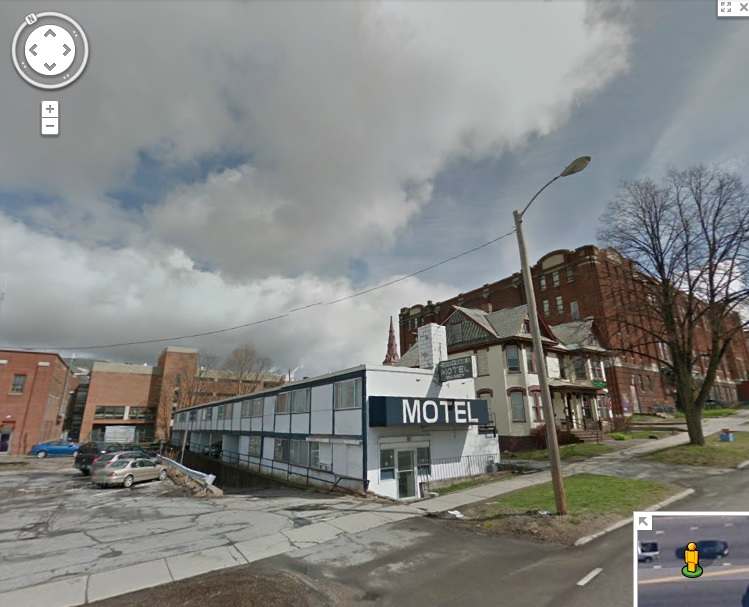
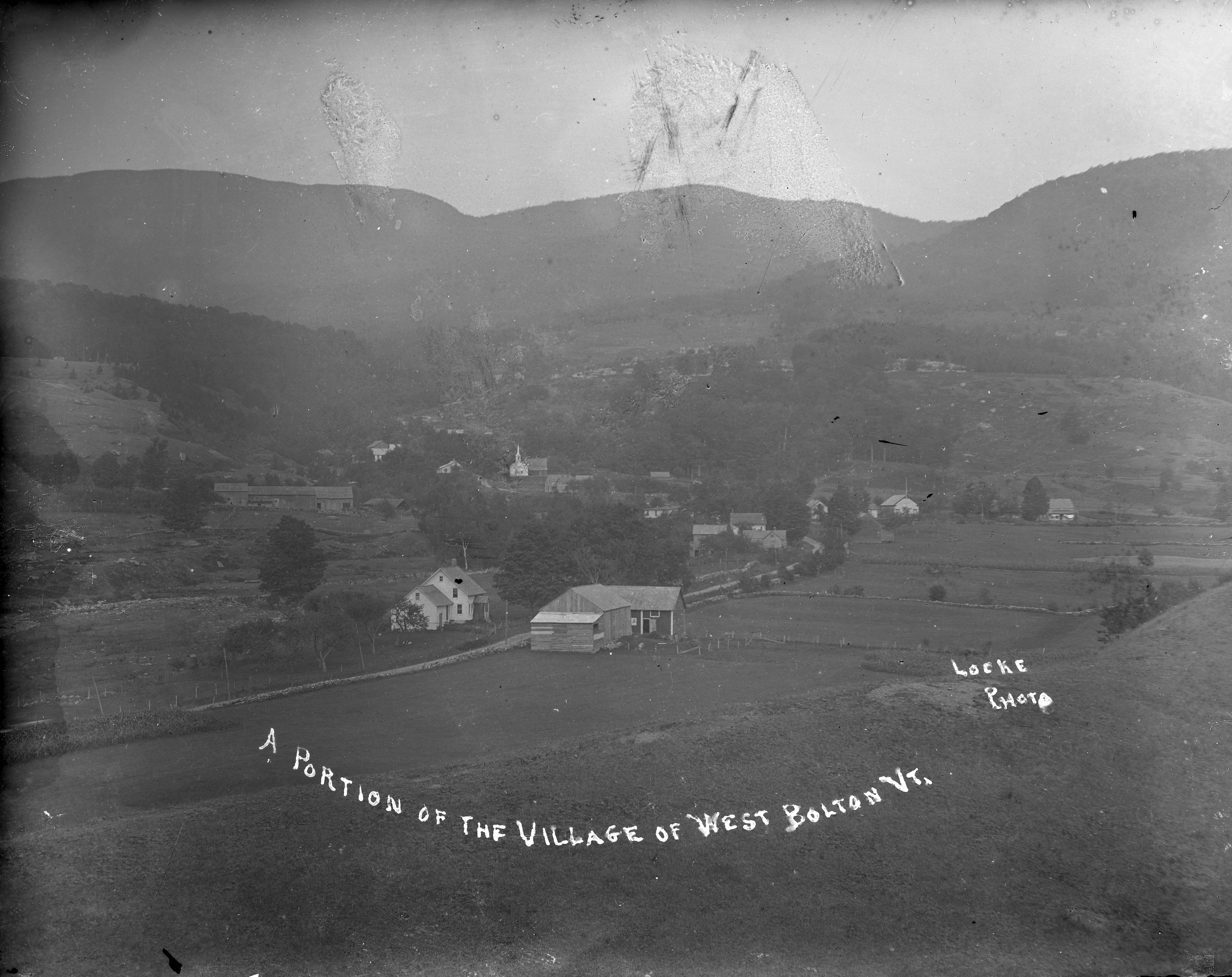
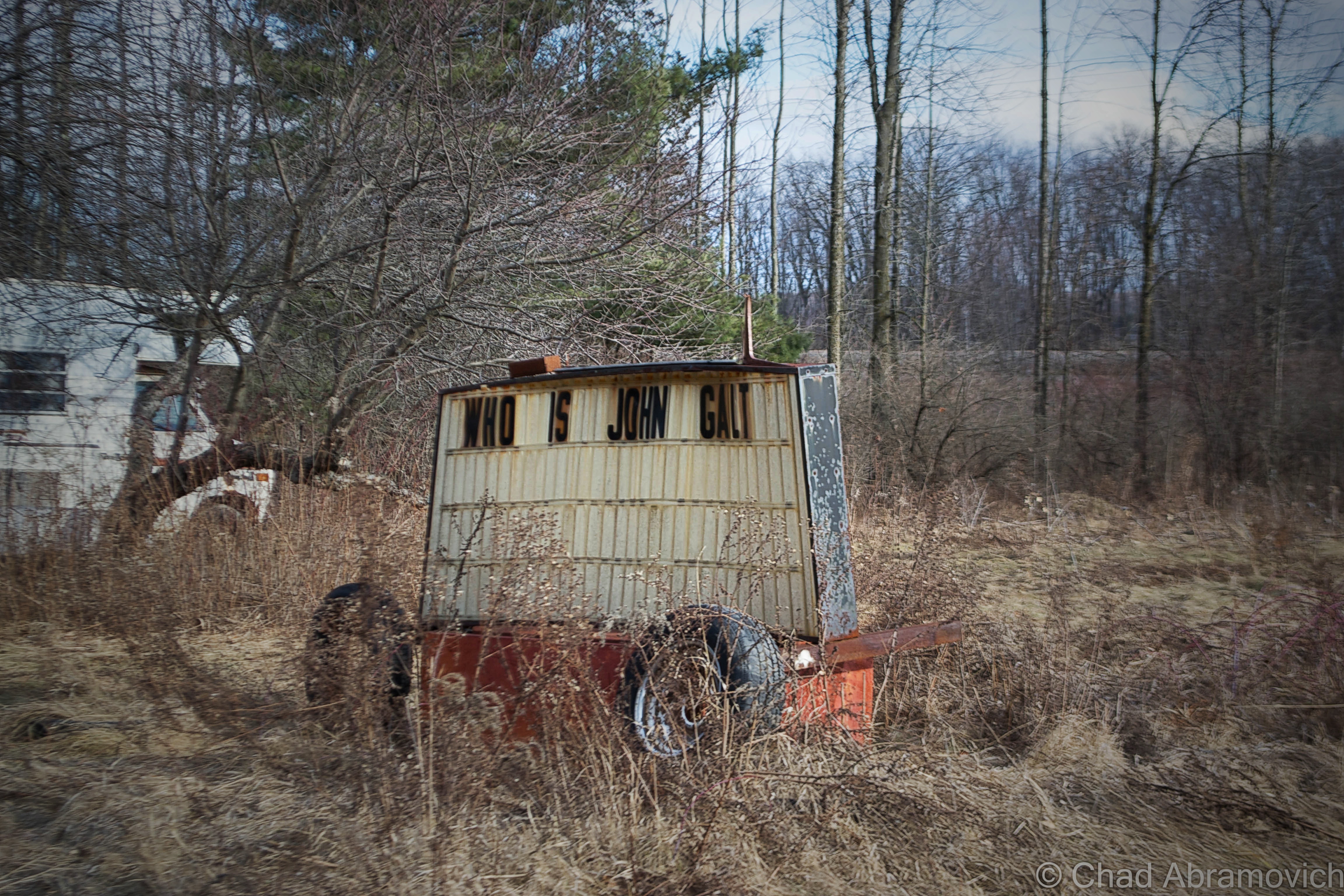
My travels to New York state often start with the same question; Who is John Galt? Usually, I cross into New York via the Crown Point Bridge over Lake Champlain, and I always find myself observing this busted sign on dysfunctional wheels with two cryptic messages arranged on both sides. I’ve found plenty of questions, but no answers.

Good friend, mentor and fellow explorer Dan Koopman of Environmental Imagery tells me that the sign used to have a smorgasbord of anti Obama hate messages on it’s dented sides, which I assume was the work of the mysterious and aforementioned John Galt, ruler of the titular Galt’s Gultch, which seems to be a collection of ramshackle campers alongside the railroad tracks. I recall him showing me the sign years ago, but it seems the sign has gotten a bit more enigmatic and stagnant since then. I always make a point to look whenever I pass, to see if there is a new message. So far, nothing.

After a little internet research, the search term John Galt introduced me not to a New Yorker, but to a character created by author Ayn Rand from her novel Atlas Shrugged, which I’ve never read. The gist isGalt is a philosopher and inventor who believes in the power and glory of the human mind. Galt stood for the ideals of free thinking, individualism and Egalitarianism rather than a society embracing conformity oppressed underneath the government.  That’s something to think about on your commute.

DSC_0004_pe DSC_0002_pe

Though Dan was the one who introduced me to his stomping grounds of New York state years ago, on this trip, I would venture to the exotic world upstate with another friend and adventurer Eric Hodet of Cabbages and Kings. We made a quick pit stop for gas in Port Henry, a jaded village that climbs up some steep ledges above Bulwagga Bay.

Port Henry, Home of Champ

Though we once had a very short lived christening as the 6th great lake, Lake Champlain is still pretty great, being shared by 2 states and Quebec. It is also large enough to completely conceal an elusive unidentified swimming object of monstrous proportions. “Champ”, which I suppose isn’t the most creative name for a lake monster, is said to take on a Plesiosauric resemblance, and is most often depicted as your typical water dinosaur, with it’s defining humped back, small head, long neck and ending with a long tail.

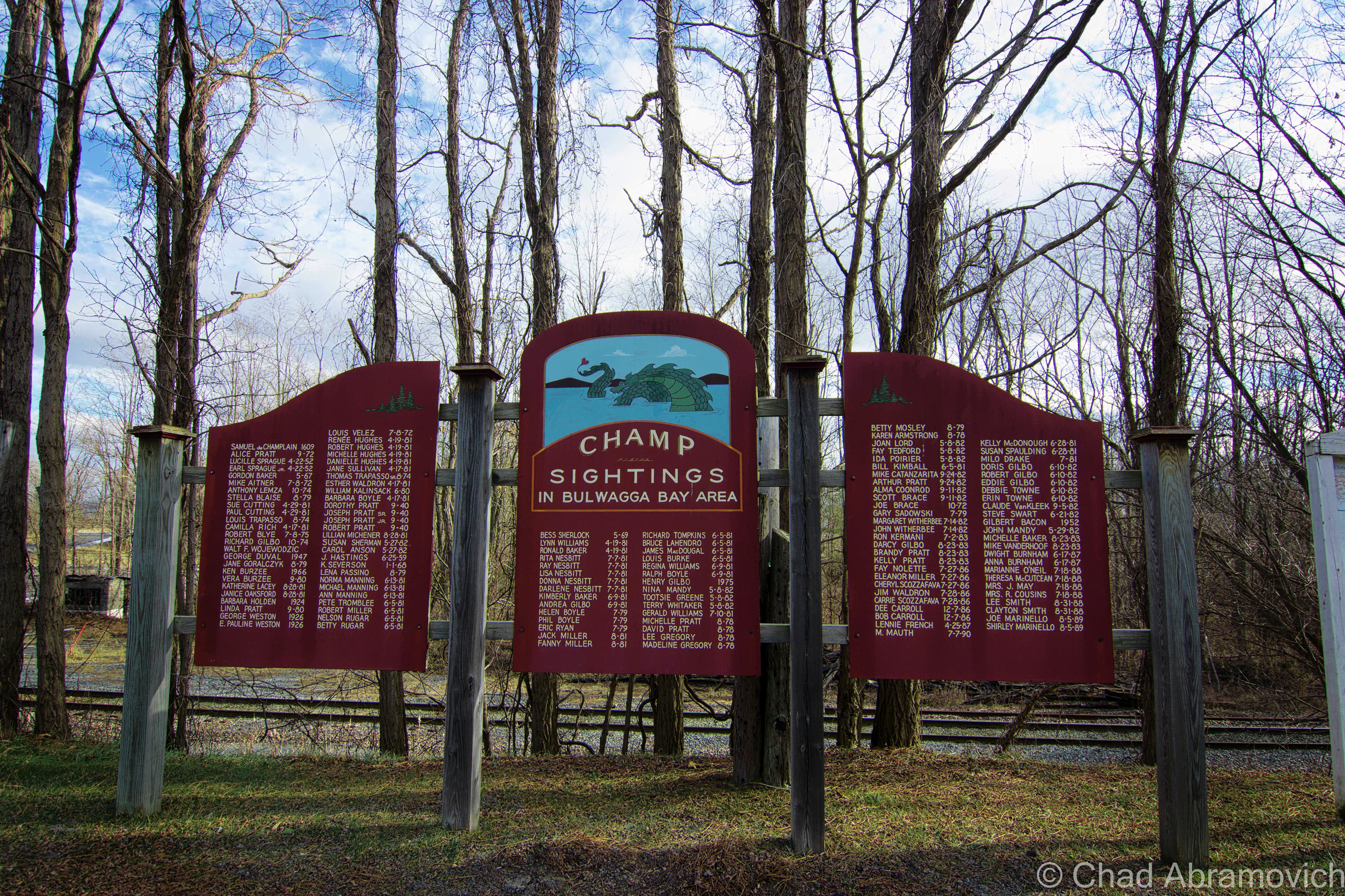
Of all places that border Lake Champlain, Port Henry proudly claims itself to be the home of Champ, the lake’s renown lake monster, and they take that distinction pretty seriously. So much so in fact that the first Saturday of August is designated as Champ Day, which brings a street fair and entertainers, with the centerpiece being, a Champ float.

What’s made the legend of Champ so important, apart from the various marketing campaigns, bumper stickers and business names, is the numerous eyewitness sightings, consisting of a rather long tradition of reports. French explorer Samuel De Champlain’s journals told of a sighting of some strange beast near Isle La Motte when he first traveled down the Richelieu River into the lake. But his records were lost to knowledge until the 1800s, when the first verifiable report of a Champ sighting came into public consciousness. It captivated the public so much that P.T. Barnum once offered a reward for its capture, dead or alive. More interestingly, in the 1970s, Champlain’s records were once again studied, and it was discovered that the intrepid explorer’s account may have been mistranslated, making his sighting officially unofficial. Instead, it was most likely that Champlain saw a Garfish, which still live in the lake today.

But what really propelled allegations into fixation was in 1977, when Sandra Mansi captured a photograph of what she claims is Champ. The photograph in question shows something that vaguely takes on Champ’s described appearance rising out of the waters of the lake – but a sense of scale is hard to determine here. Was it actually Champ? A giant Sturgeon? Or maybe, just a piece of driftwood?

Regardless of Champ’s existence, countless sightings have been reported over the years, and people hold firm to their stories. My grandfather even claims that he saw it – as well as quite a few other people, whose names have been memorialized on a wooden memorial south of the Port Henry on Route 22. The sightings unsurprisingly start with Samuel De Champlain in 1609, and escalate into the 21st century. Even local celebrities like WCAX’s Gary Sadowsky made it on the list. The dates stop at 1989, which raises a few questions. Have there been any reported sightings in Bulgwagga Bay since then? Are any plans to extend the list?

DSC_0011_pe

I’ve sort of made it a point not to write about Champ in this blog, because admittedly, I’m just not all that interested in the Champ hype. But it’s almost impossible to not pick up some information about it along the line, and I found myself slowly giving in, because some of it is actually pretty interesting. This is probably my favorite; Documented sightings of Champ actually predate those of the Loch Ness Monster by fifty years! I find this amusing because most cryptozoology enthusiasts consider Champ to be “America’s Loch Ness Monster”, but maybe it should be the other way around?

To be fair, Lake Champlain is a large lake, with depths said to be beyond 400 feet in some places near the Charlotte-Essex ferry crossing. With many areas uncharted, I suppose it’s possible that something could live harmoniously in the lake undetected. That, and scientists did discover a sonar sound emanating from the depths of the lake that was so unique, they named it after the lake monster (they did, however, claim that the odd sound did not belong to Champ)

So, why did Port Henry land the distinction of being the home of Champ? The first modern day sighting of Champ was reported here in 1819, by a “Captain Crum” in Bulwagga Bay. His eyewitness report illustrated a rather graphic spectacle of a black monster resembling a seahorse with three teeth, large eyes, a white star on its forehead and a red band around its neck. So I guess that’s as good of a reason as any.

Ironville, Birthplace of the Electric Age!

When traveling to unfamiliar territory, one of the first impressions of a community you take in is their welcome sign. The small town of Ironville’s sign stood out from the others I’ve noticed (apart from Port Henry’s, of course). The sign had a pretty groundbreaking claim written along the bottom in capital letters; “Birthplace of the Electric Age”. That left me and my friend scratching our heads a little. But a little après-adventure research was able to put the pieces together for me.

The hills around Ironville were known for their rich iron ore deposits, and mining activities brought great prosperity to the rural region. Curious about the natural magnetic rocks in the area, Joseph Henry, an early pioneer in electricity and professor of mathematics and natural philosophy in Albany, was interested in the phenomenon of magnets and how they worked. He traveled to the Penfield Iron Works in town where he obtained some high quality Iron to study. His goal was to attempt to create magnets of his own. At the time, magnets worked by wrapping bare wire around an Iron core, creating magnetic fields. But they were short lived, as the fields always rapidly collapsed into the iron core. Henry then got an idea; why not insulate the wires?

He attached his new prototype to a battery, the only known producer of electricity at the time, and created the world’s first electromagnet – and the key component to making all-electric power possible today. Eventually, Ironville became the first town to use electricity for commercial use. It was this breakthrough that would inspire Vermonter Thomas Davenport to invent the electric motor, and eventually, a world ran by electricity would become the norm.

Aiden Lair

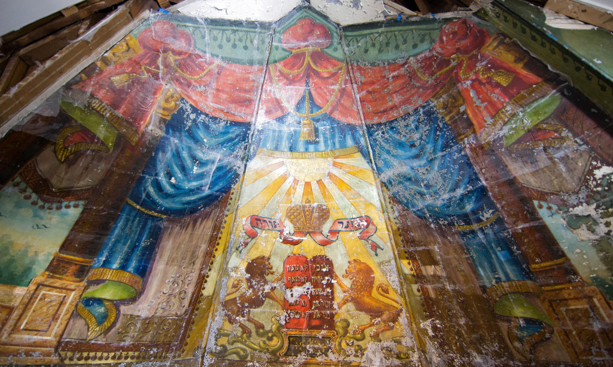
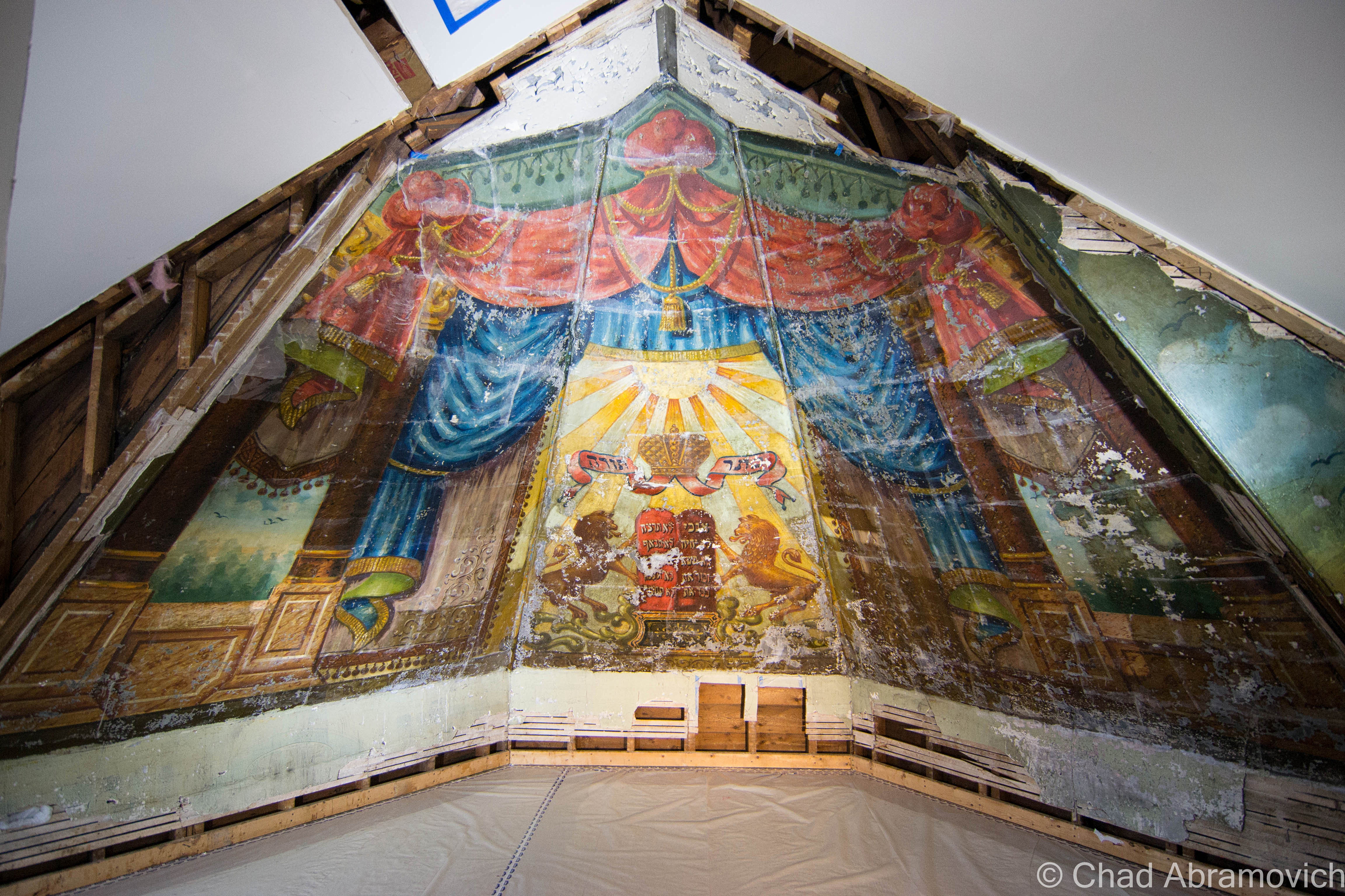
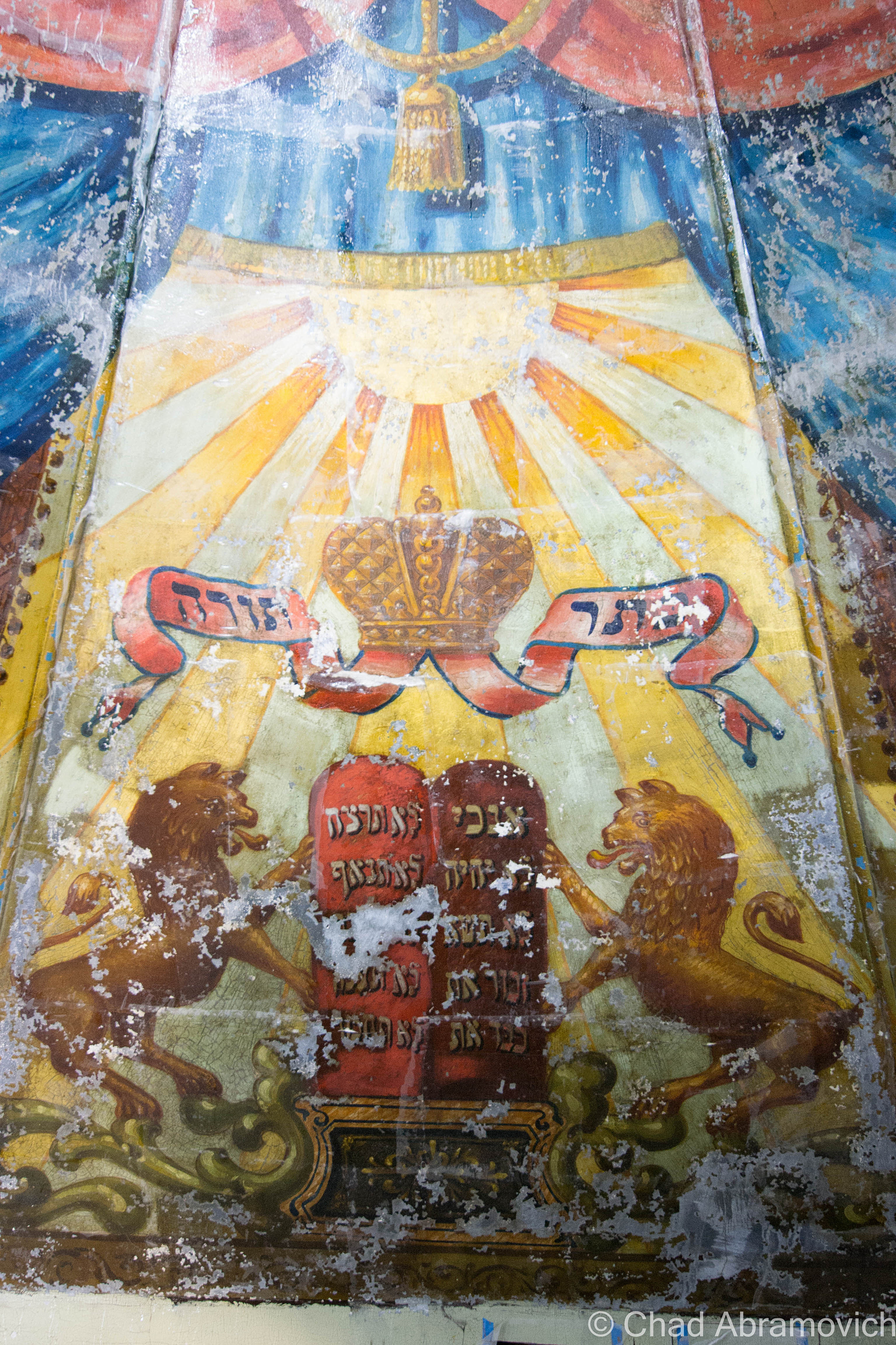
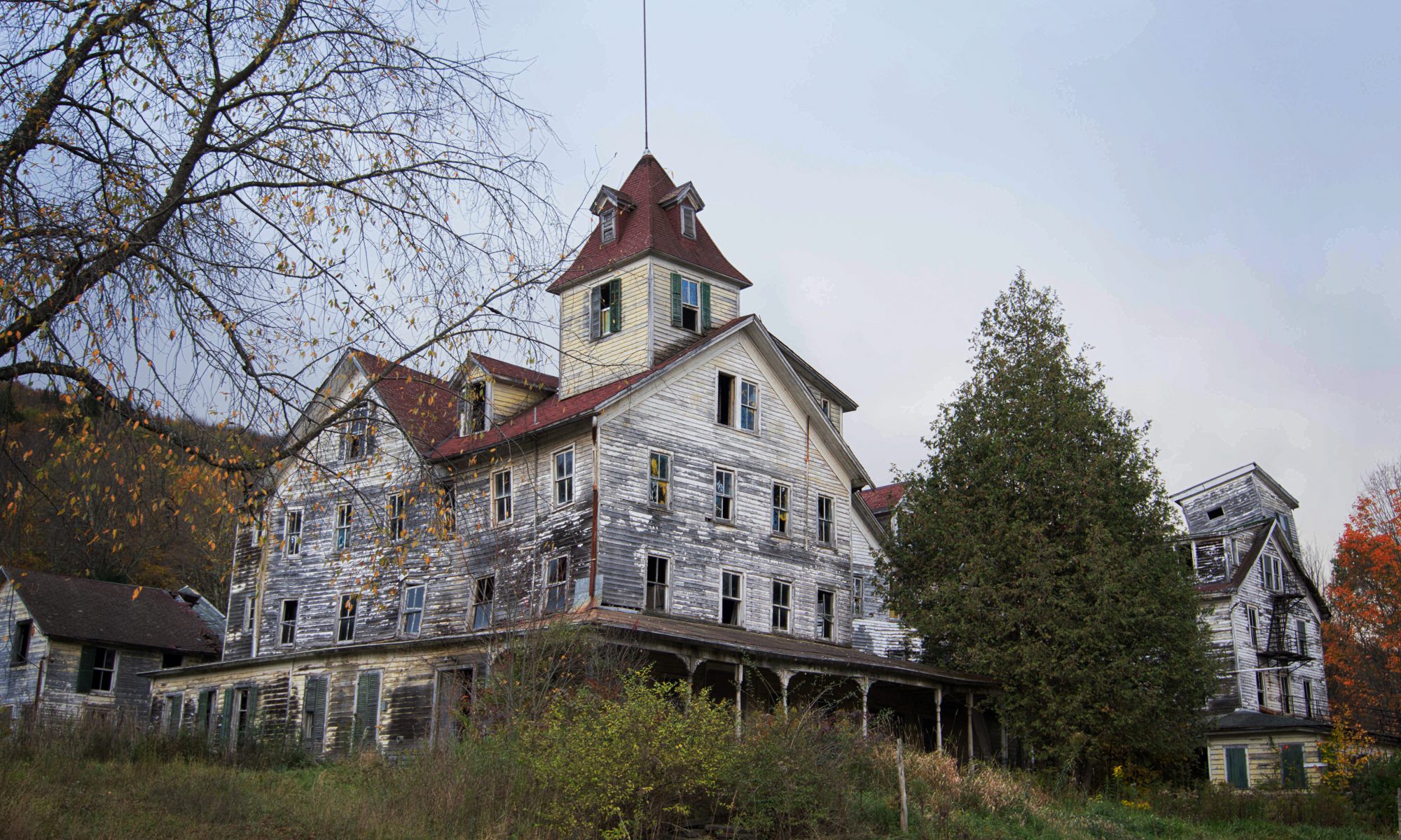
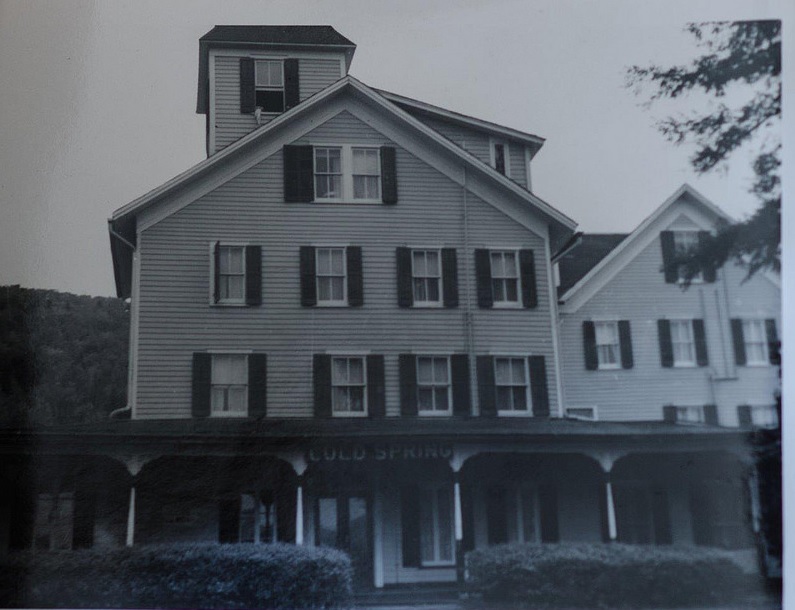
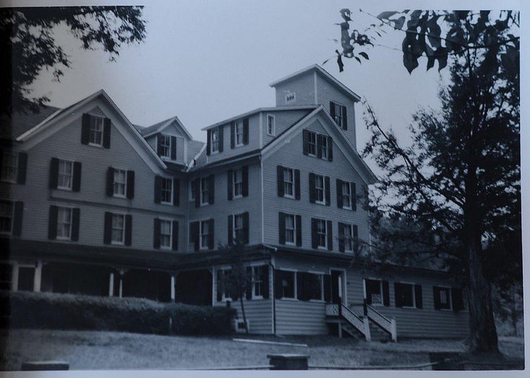
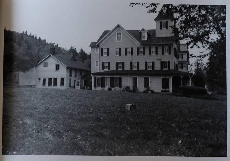
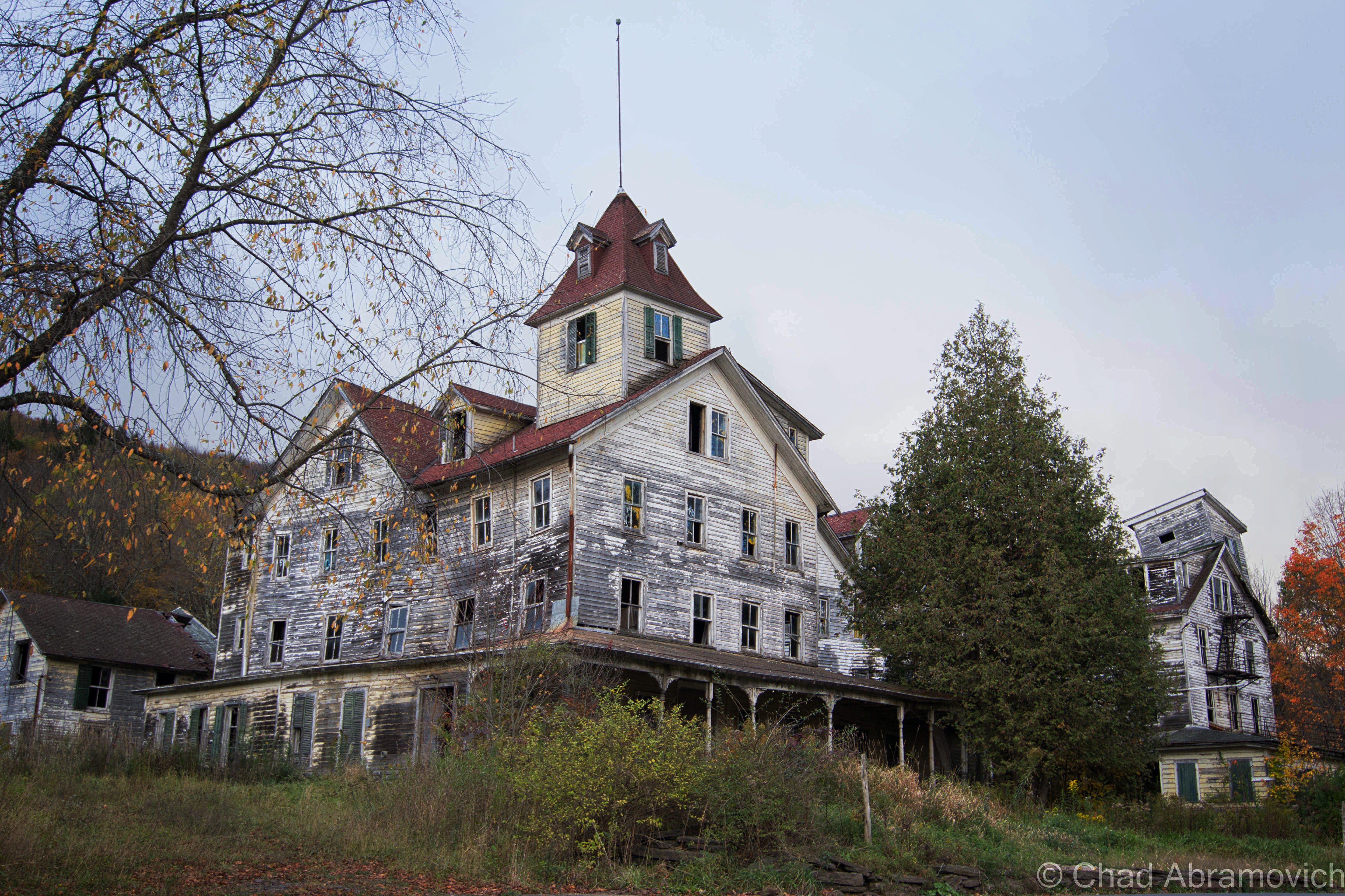
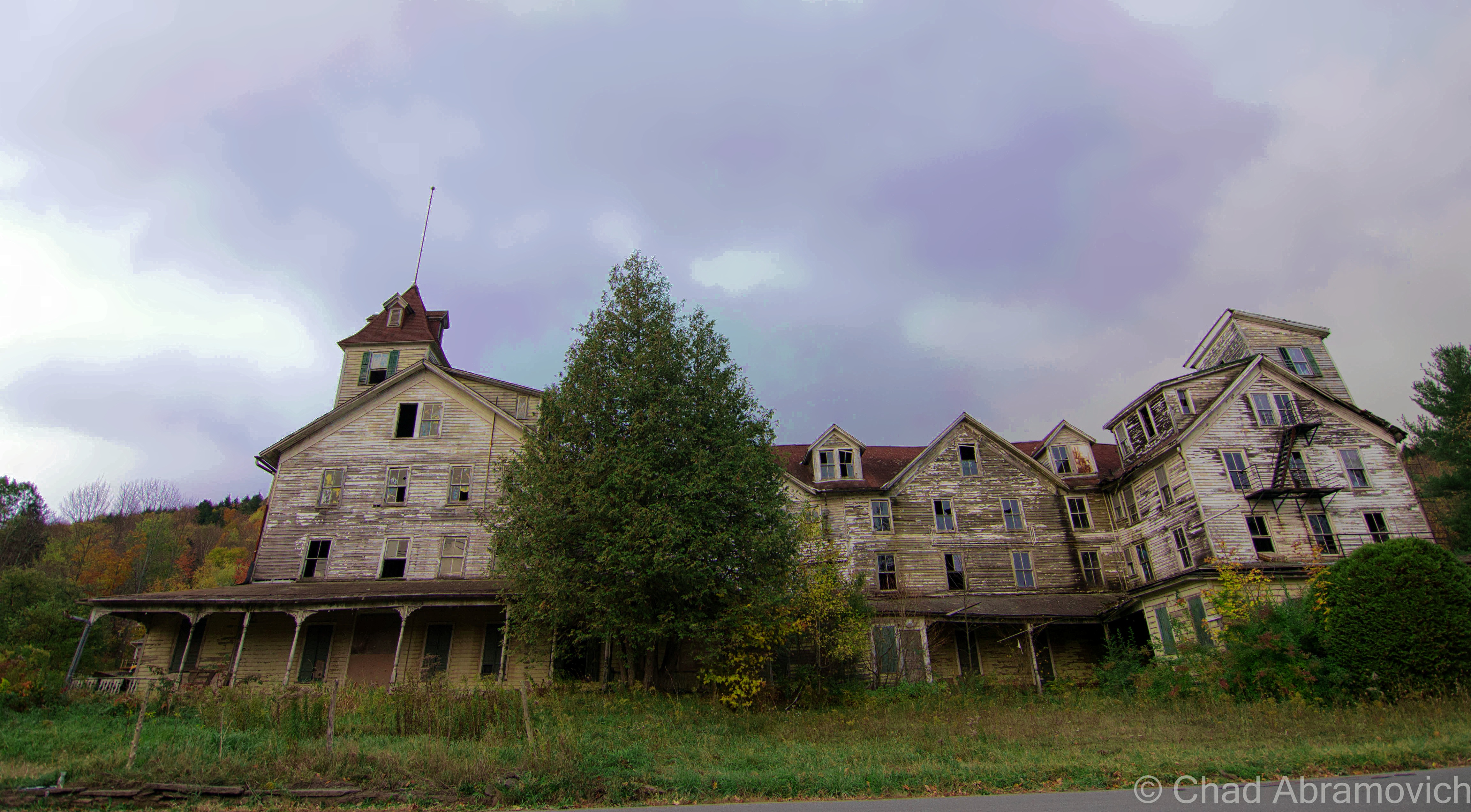
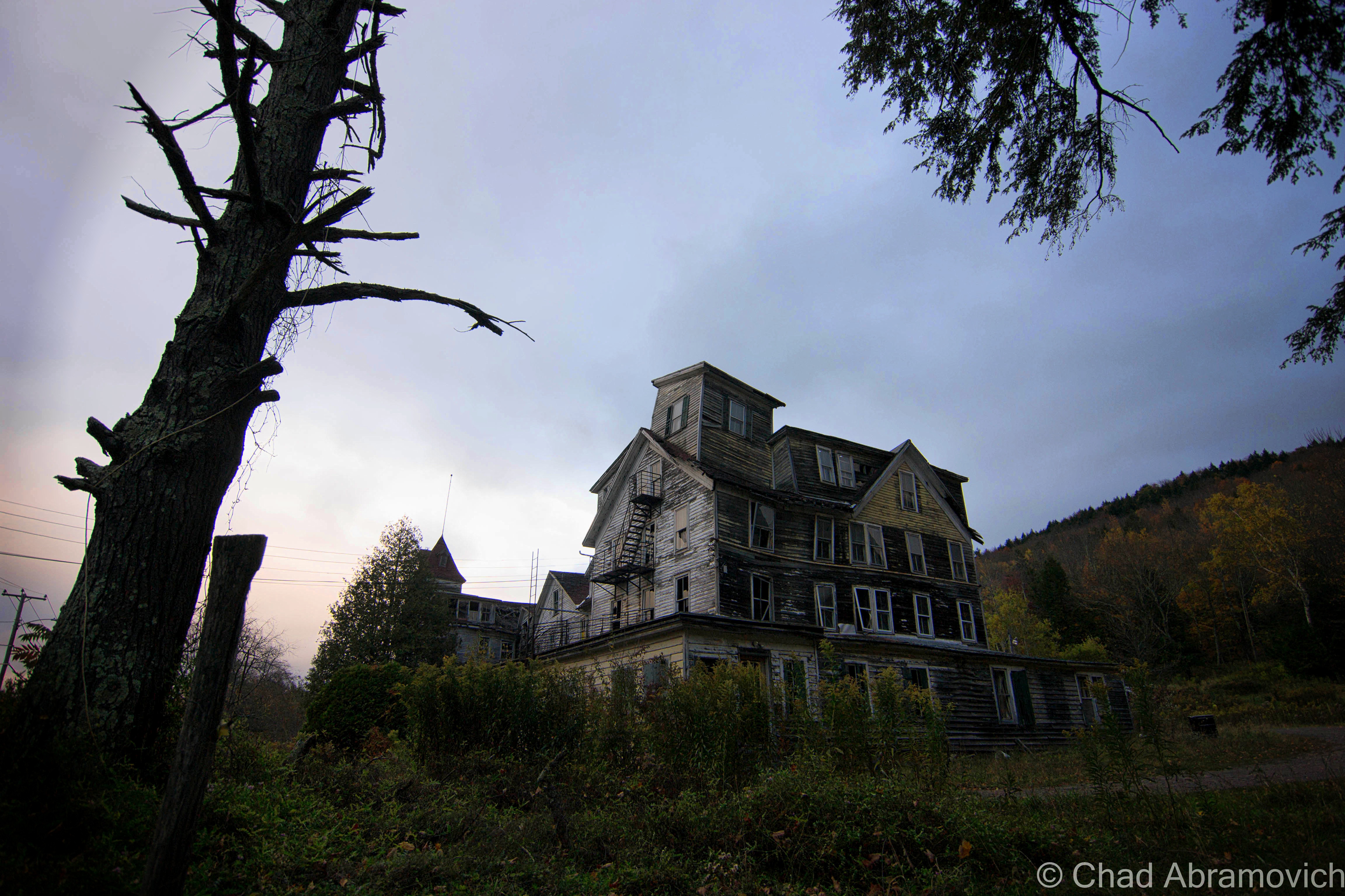
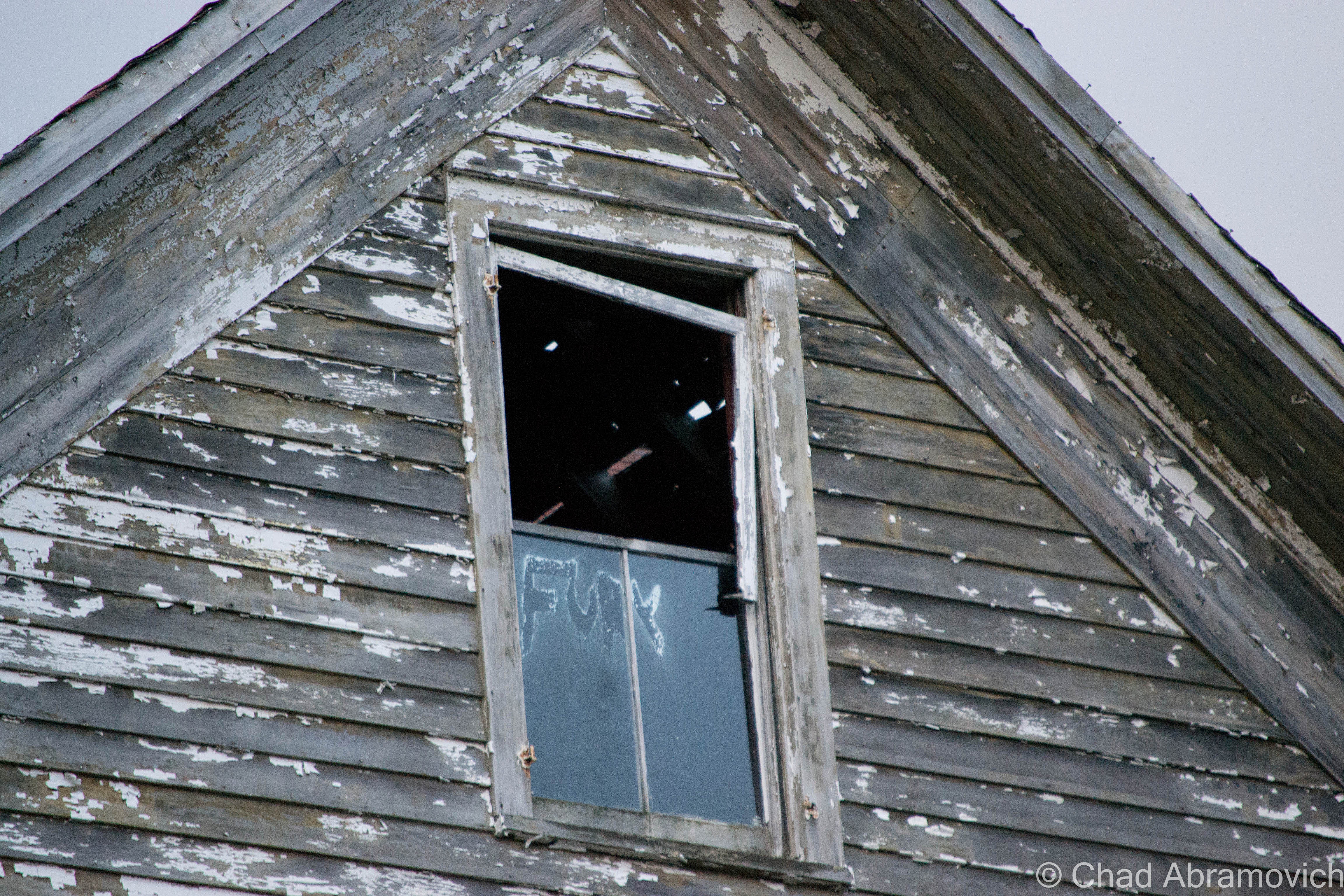
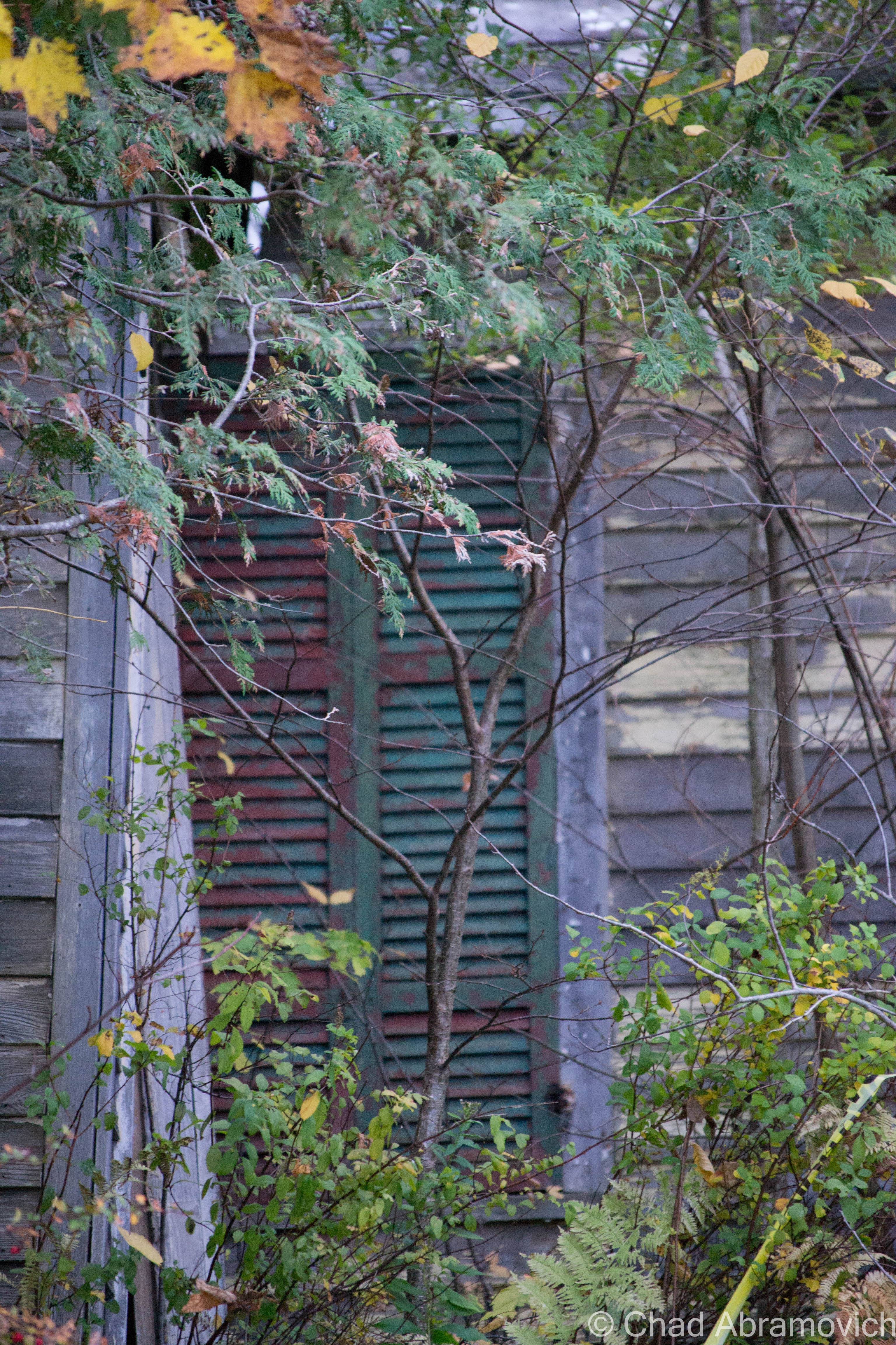
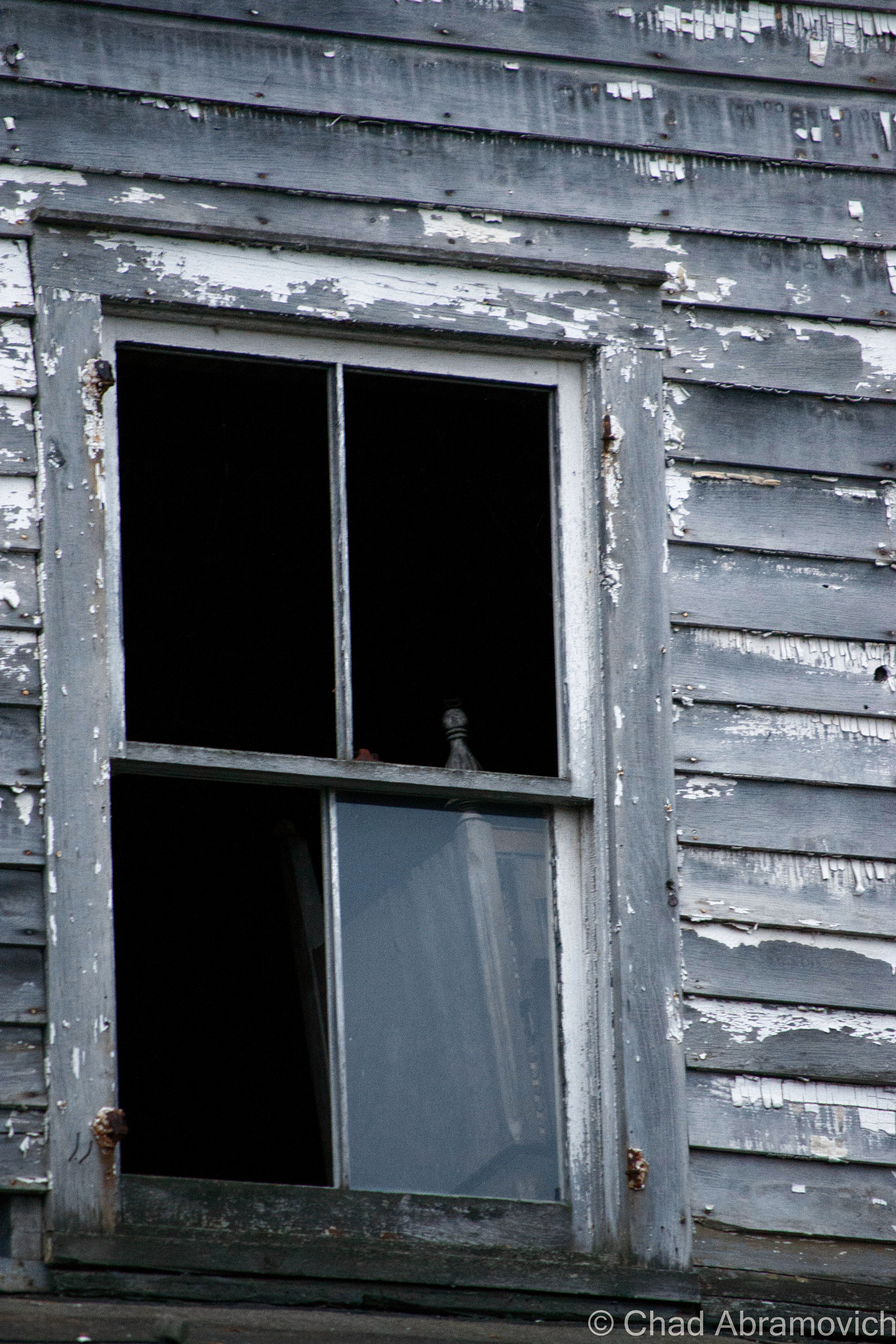
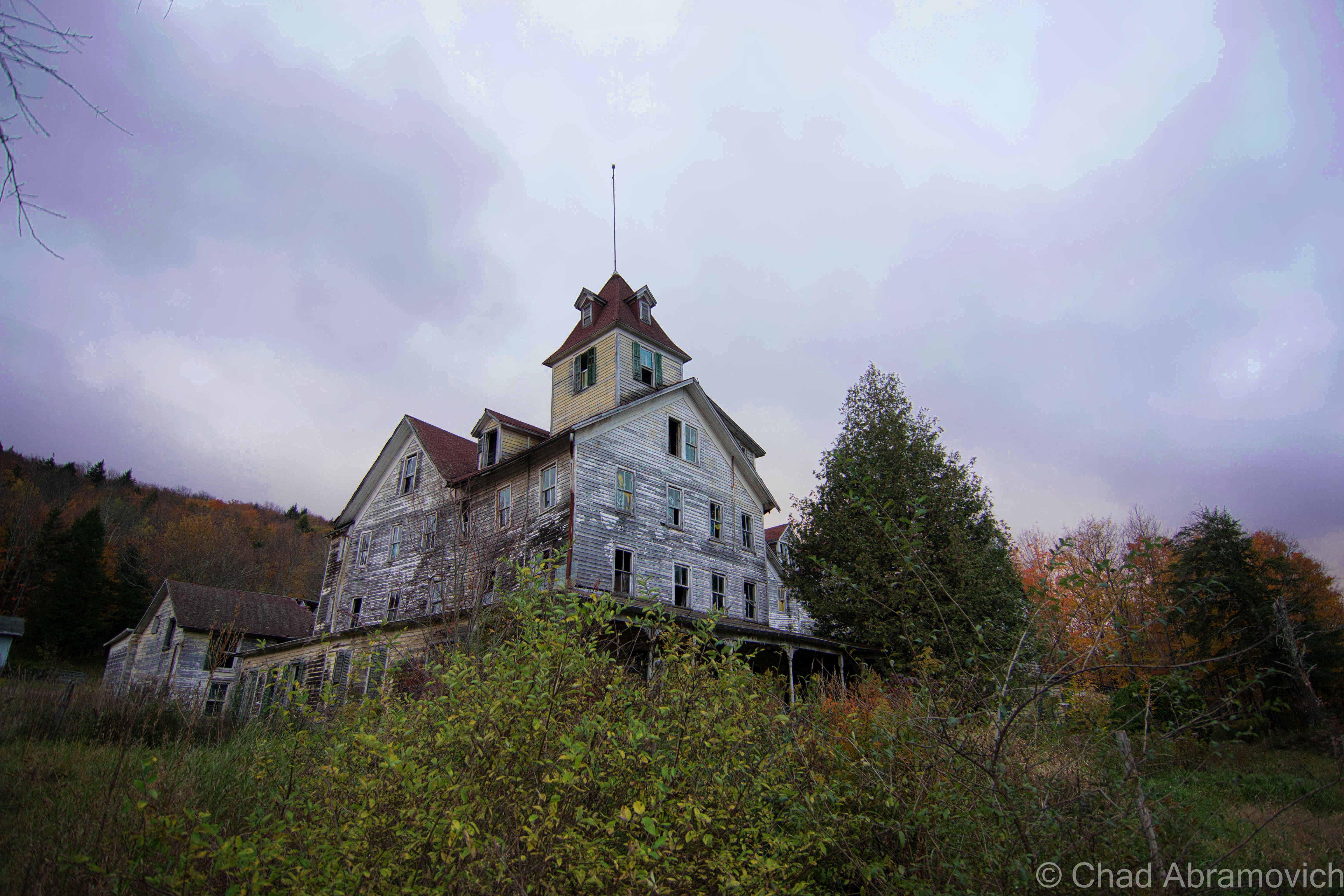
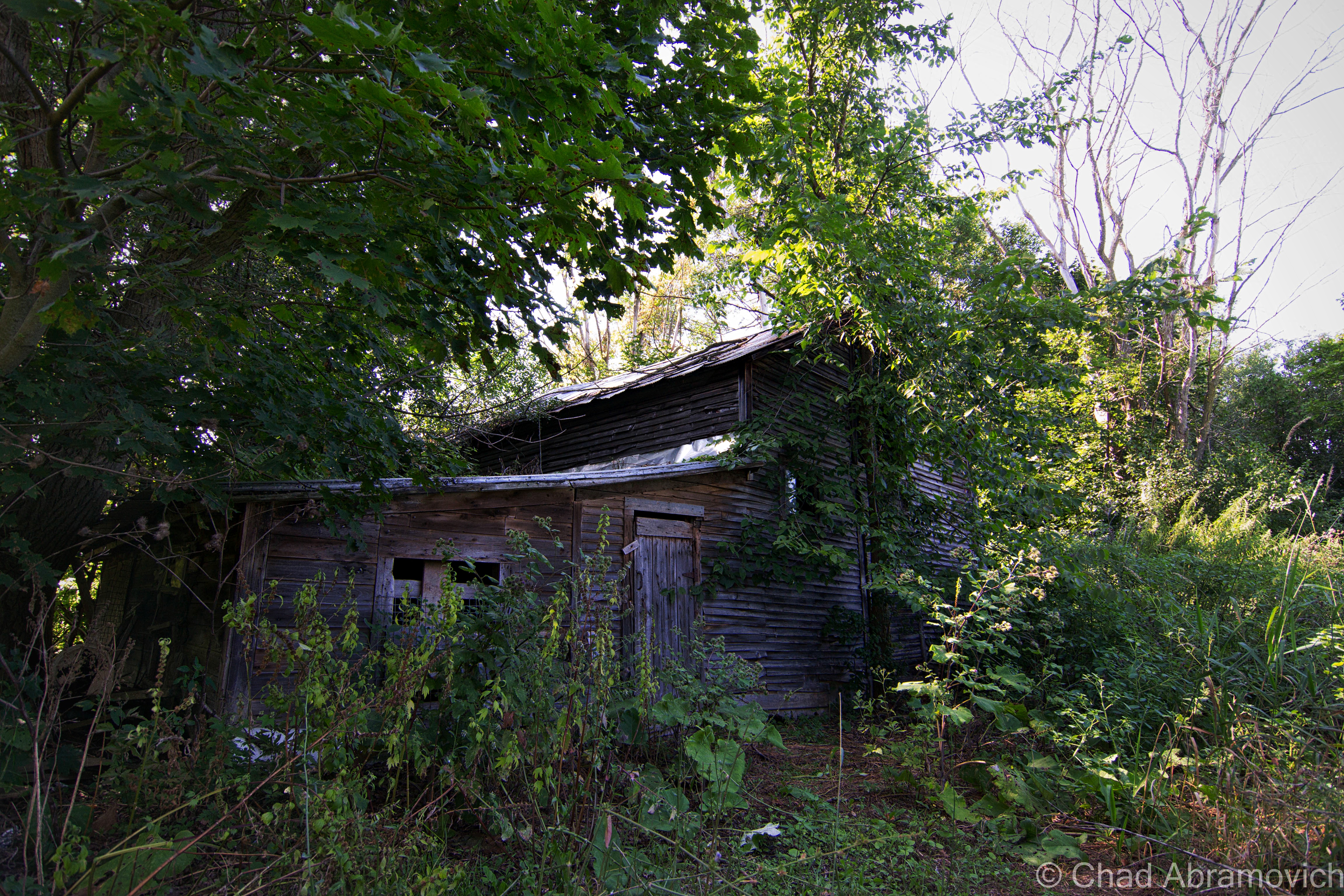
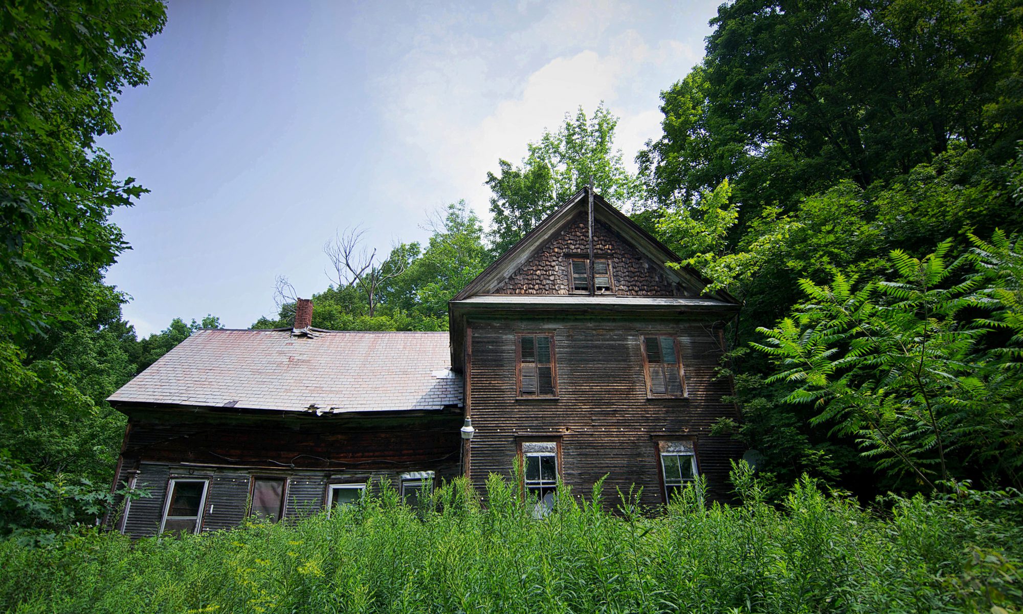
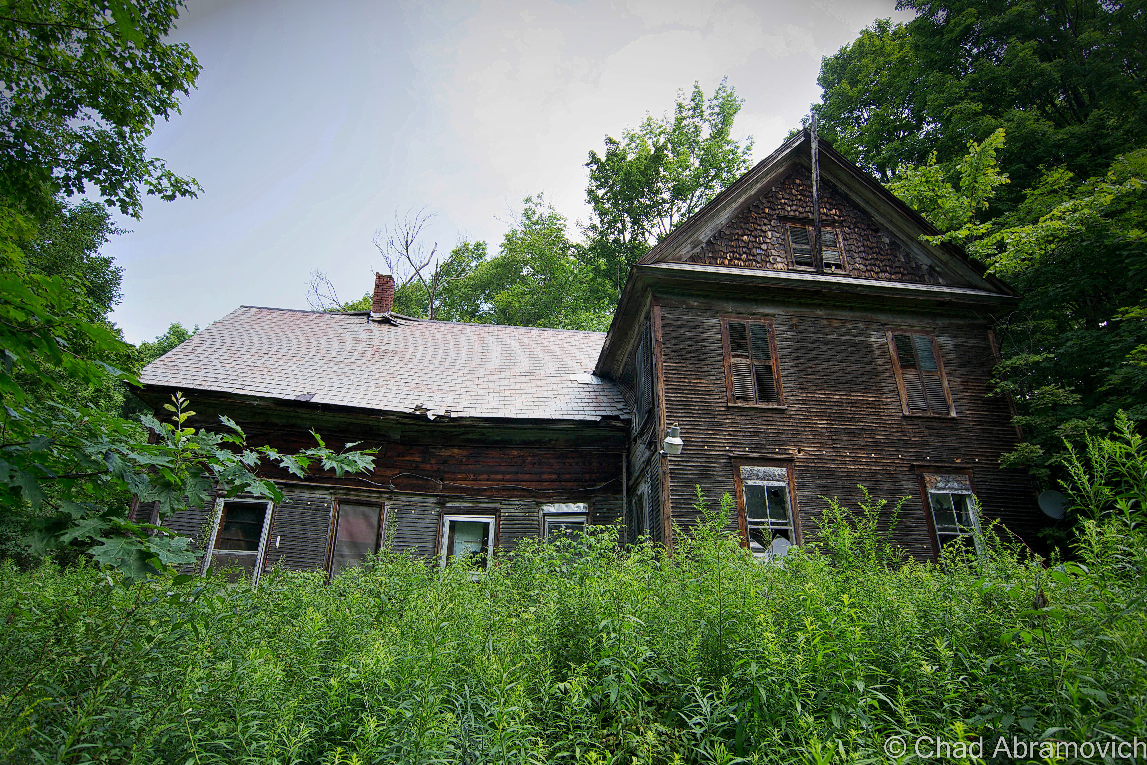
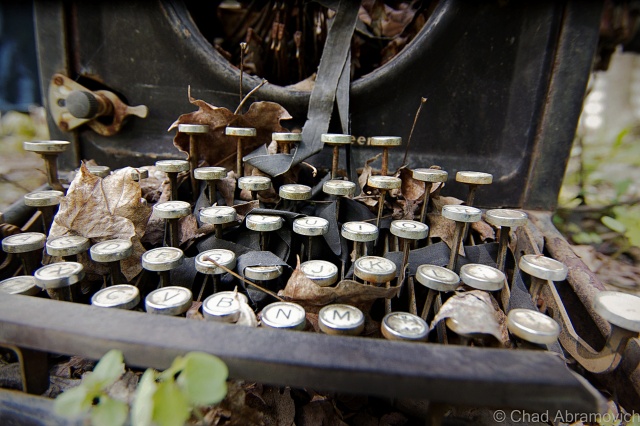
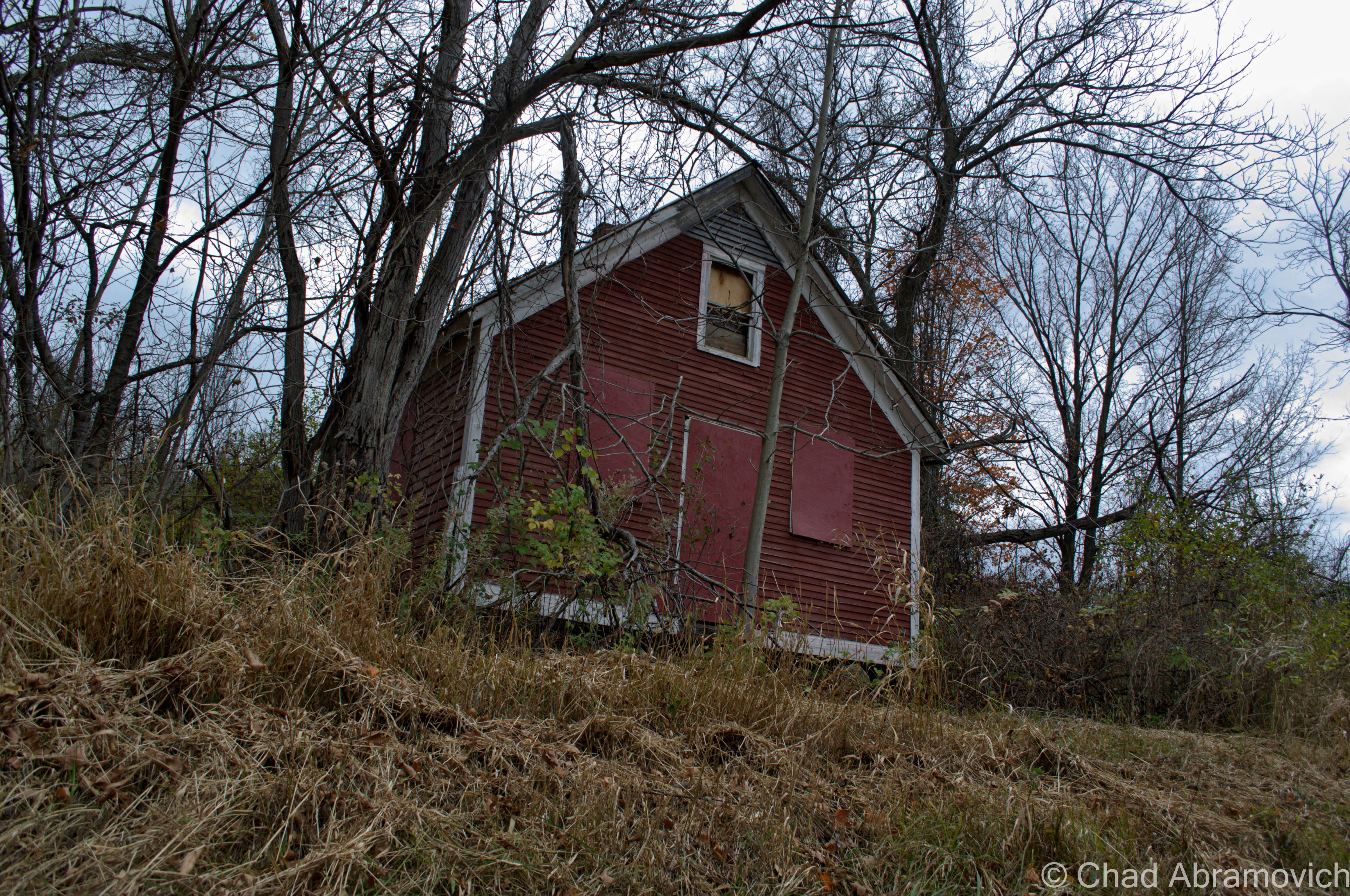
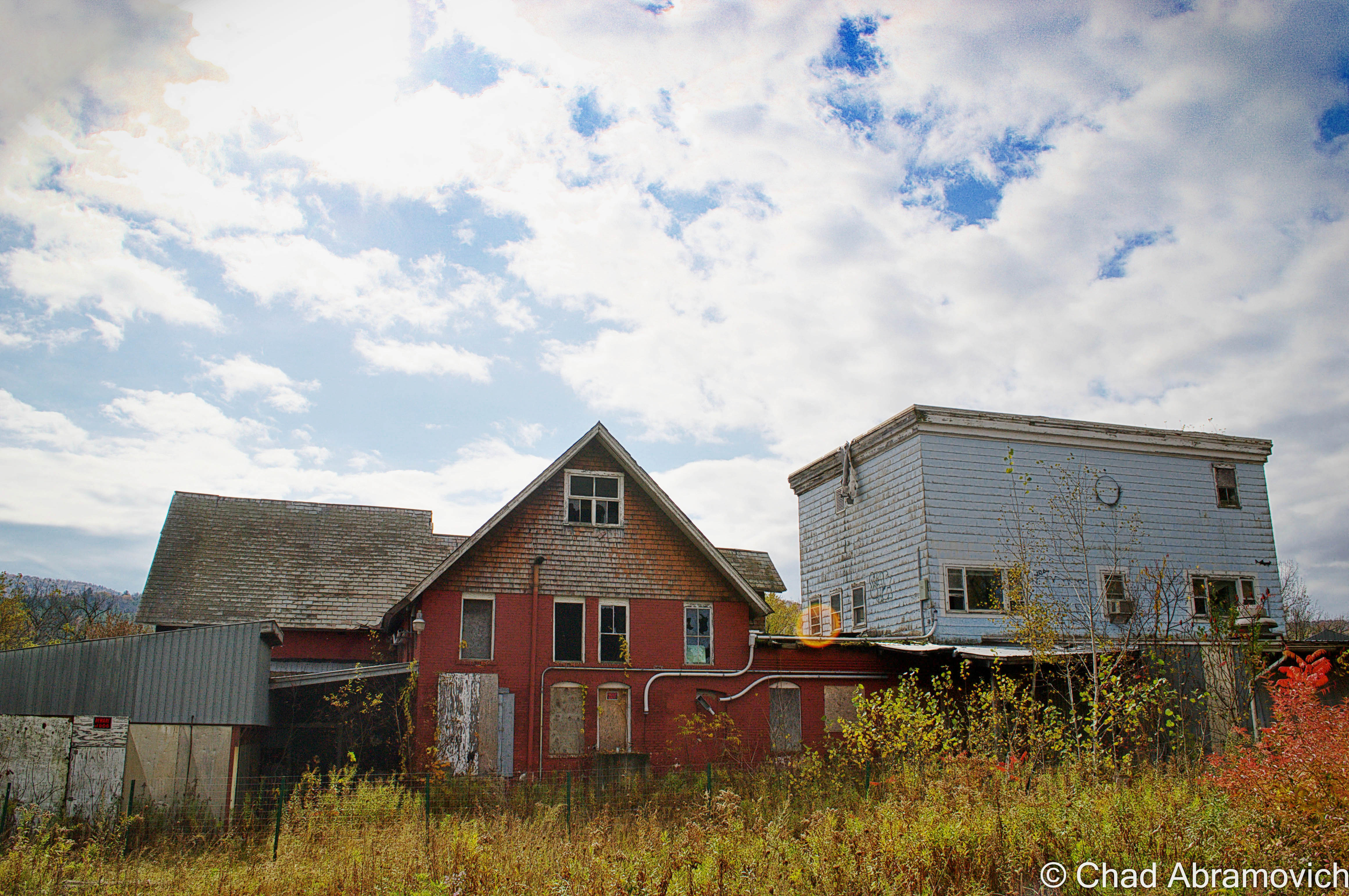
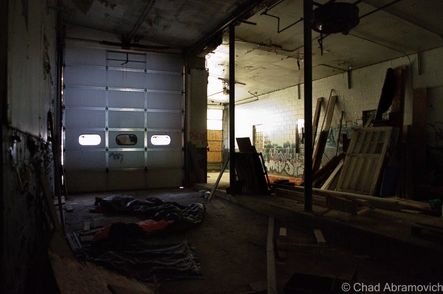
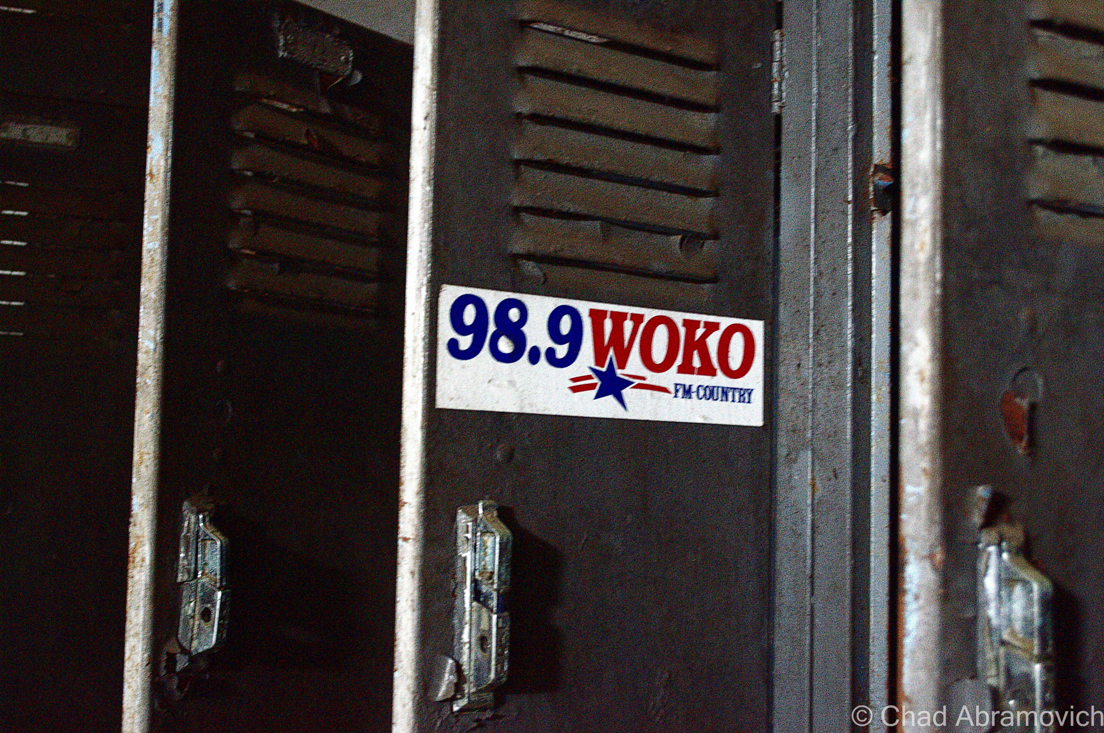
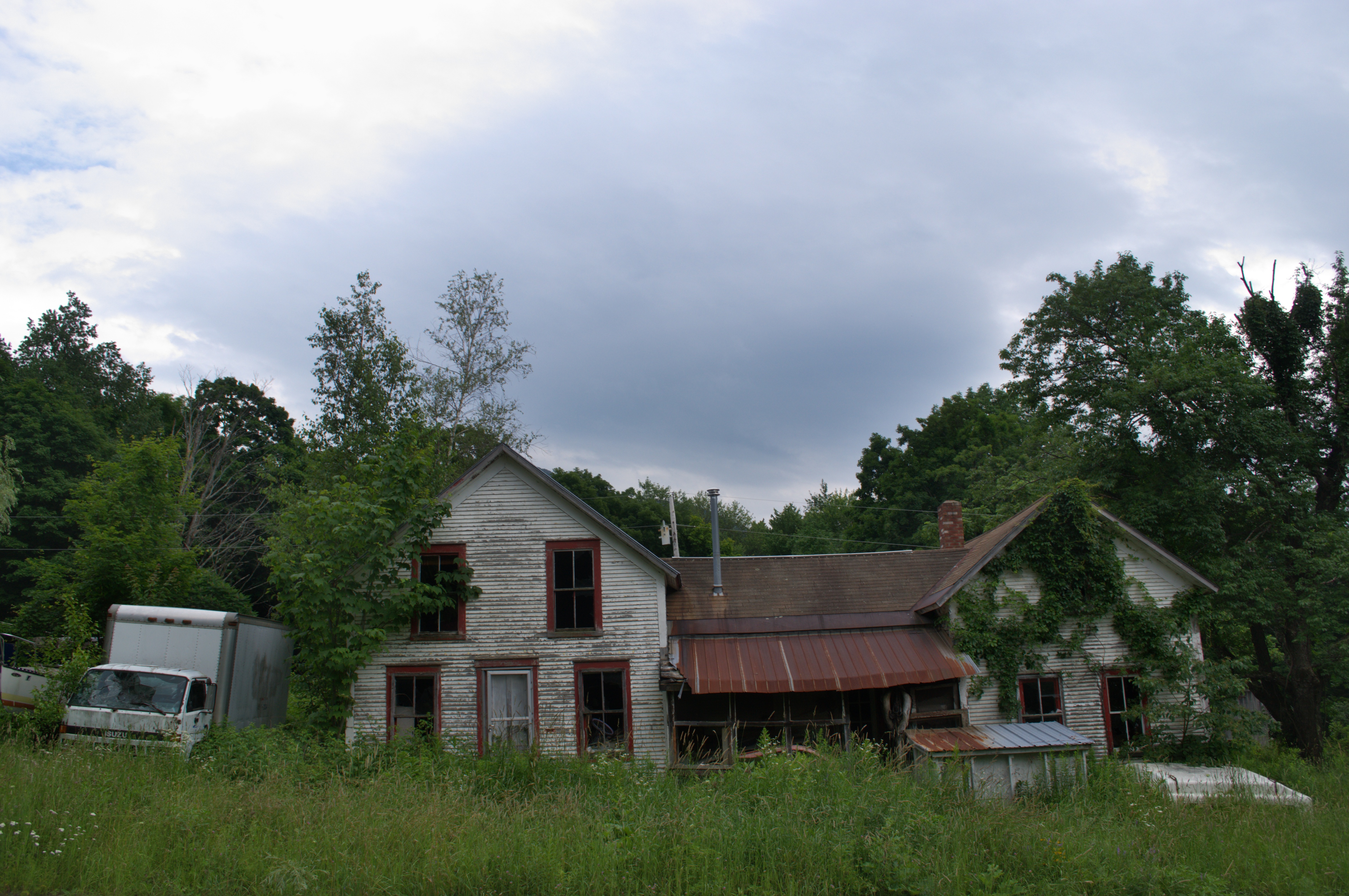
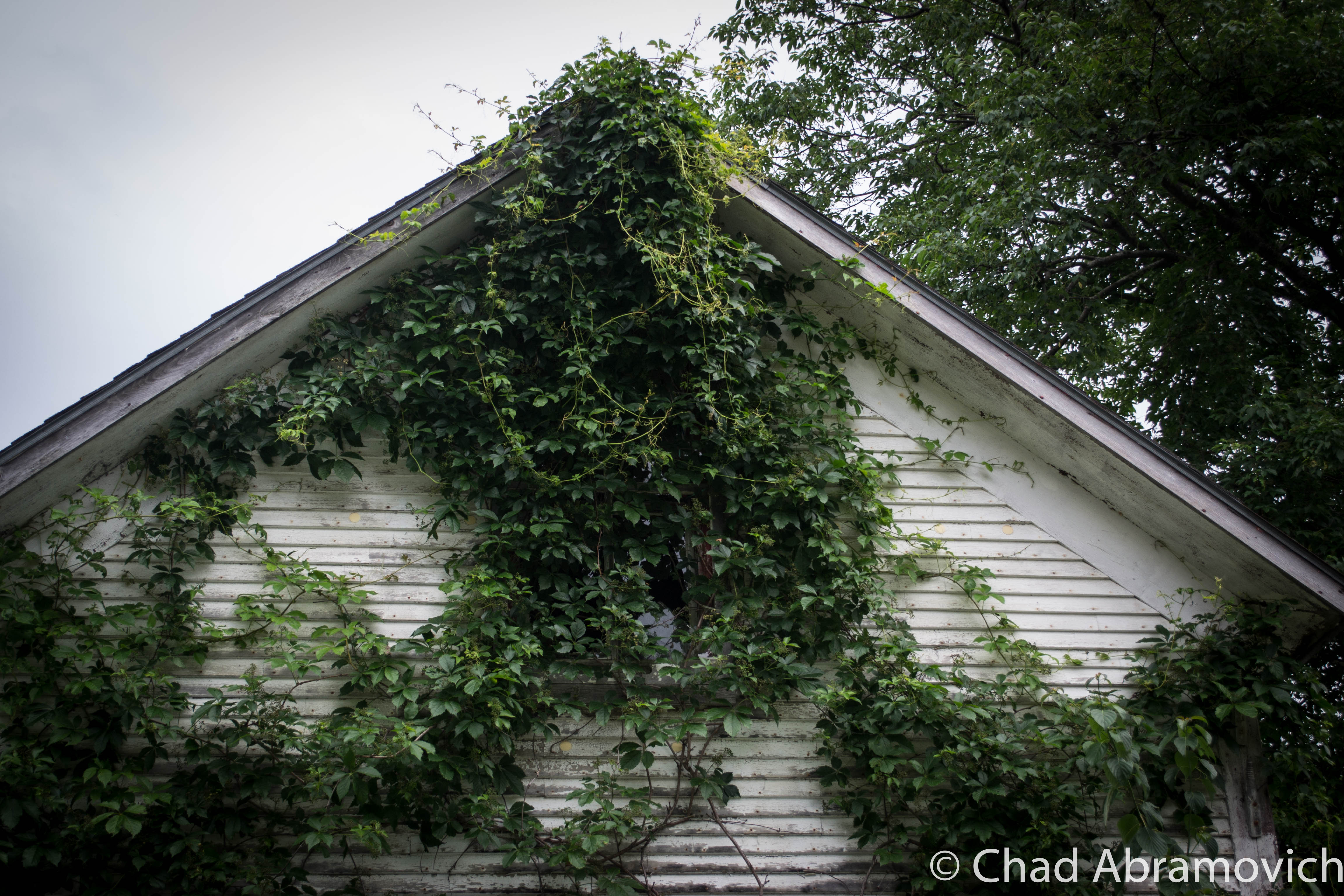
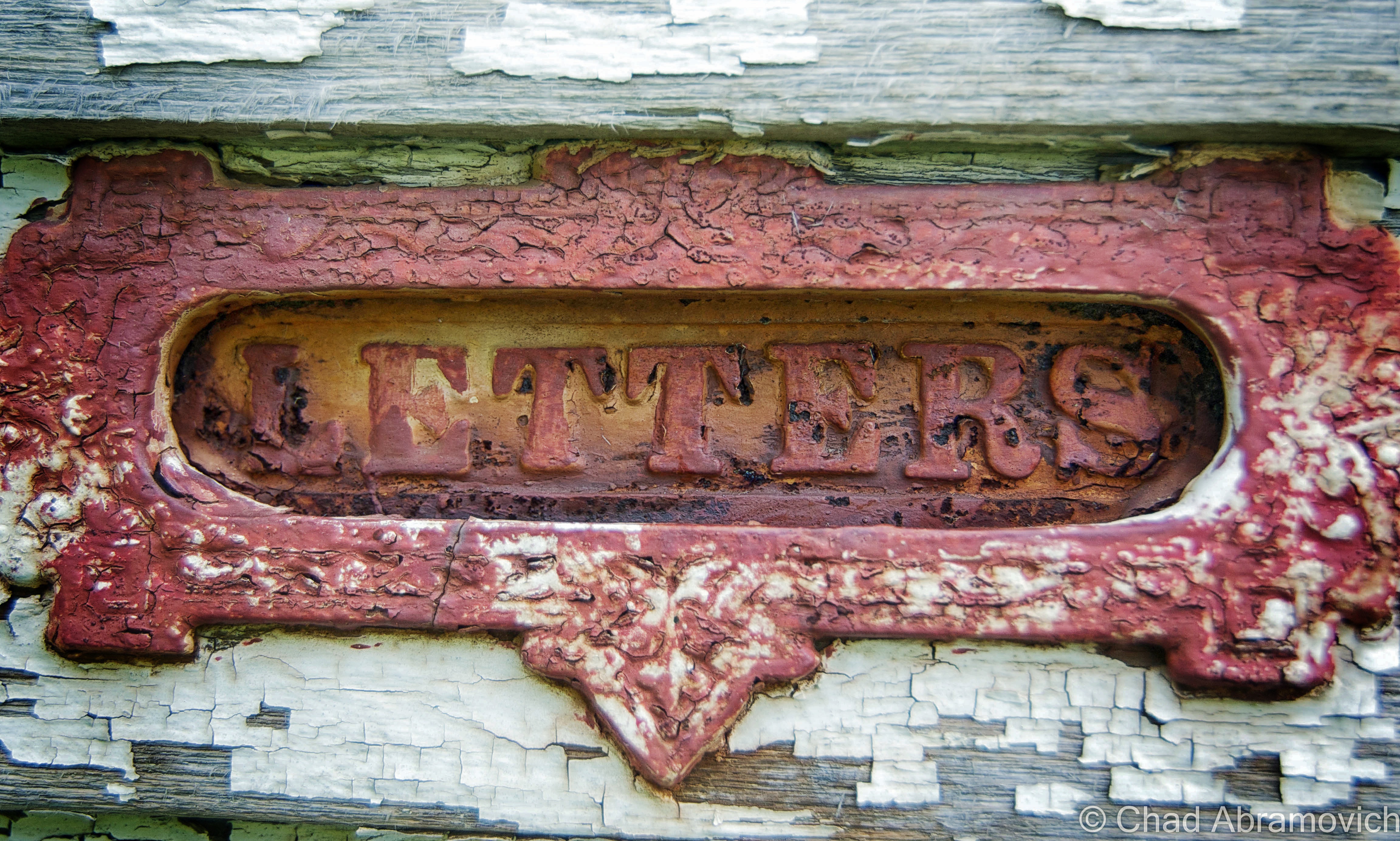
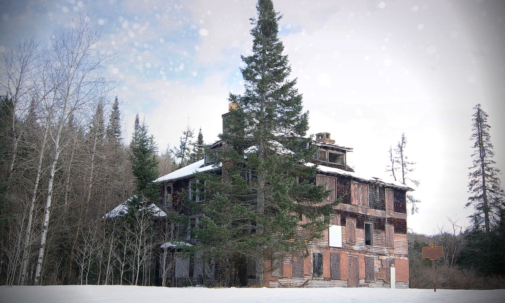
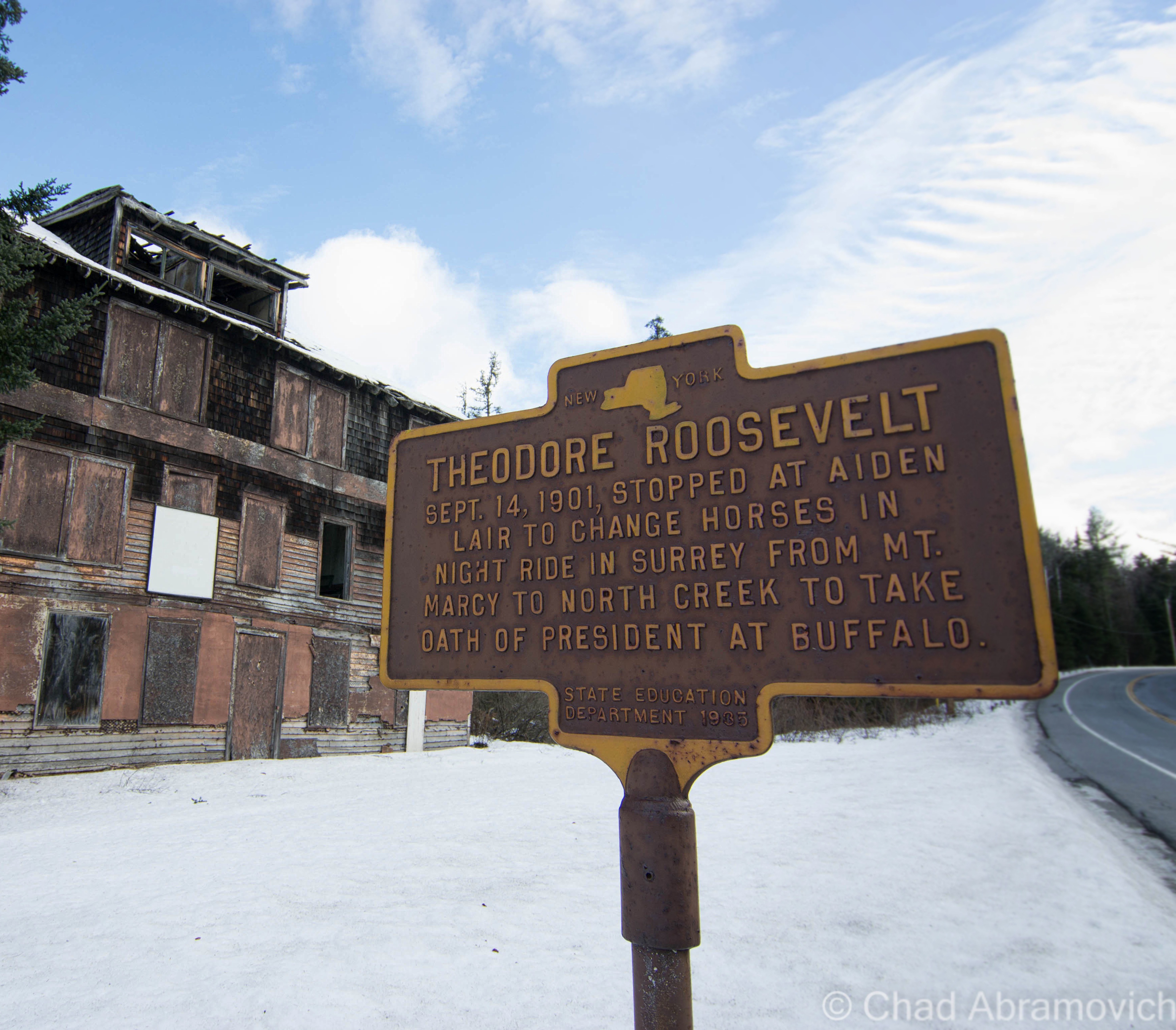
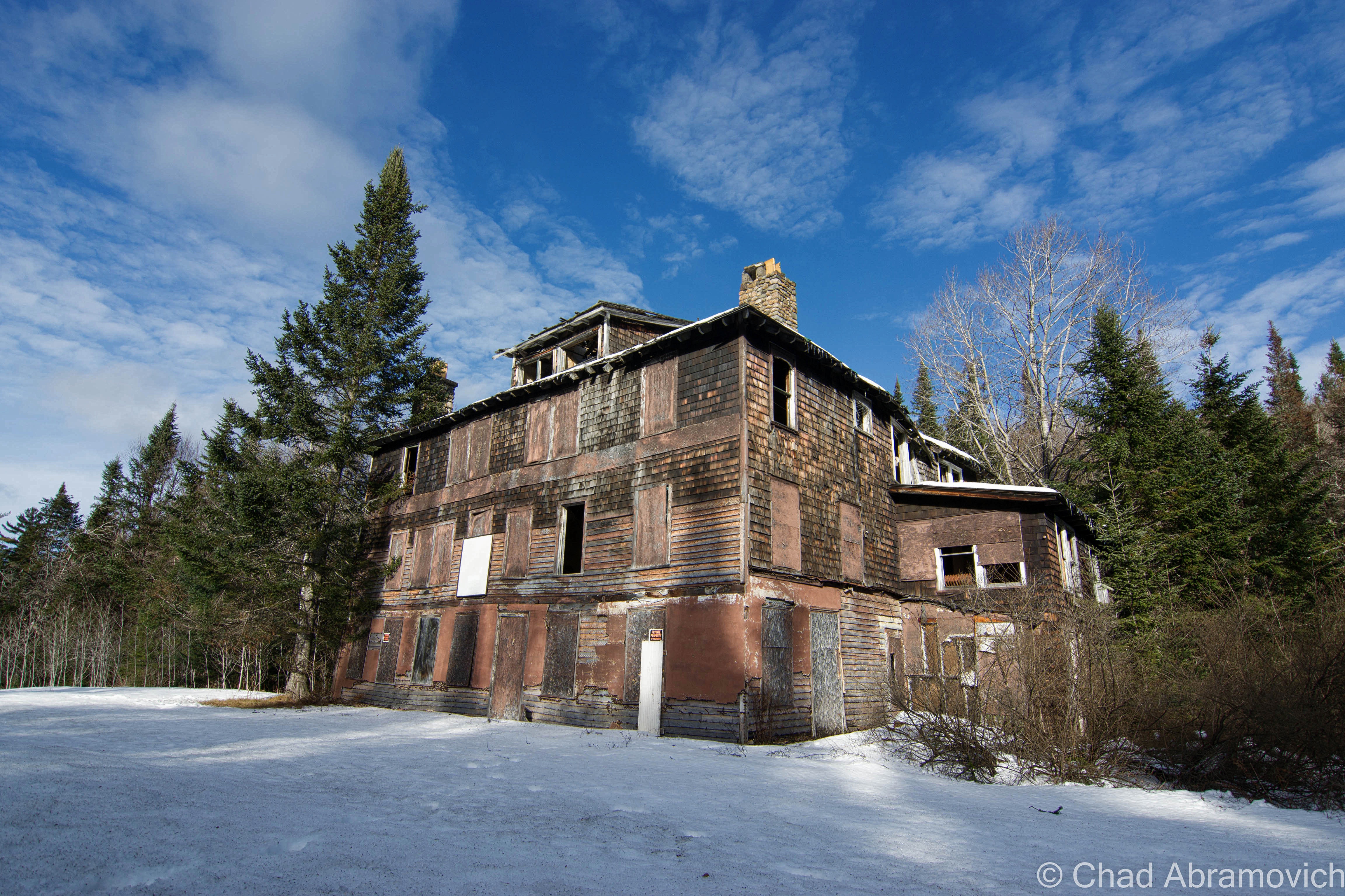
The real reason for visiting upstate New York was to visit Aiden Lair, a sizely rotting wooden building, deep within the forests of the Adirondacks.

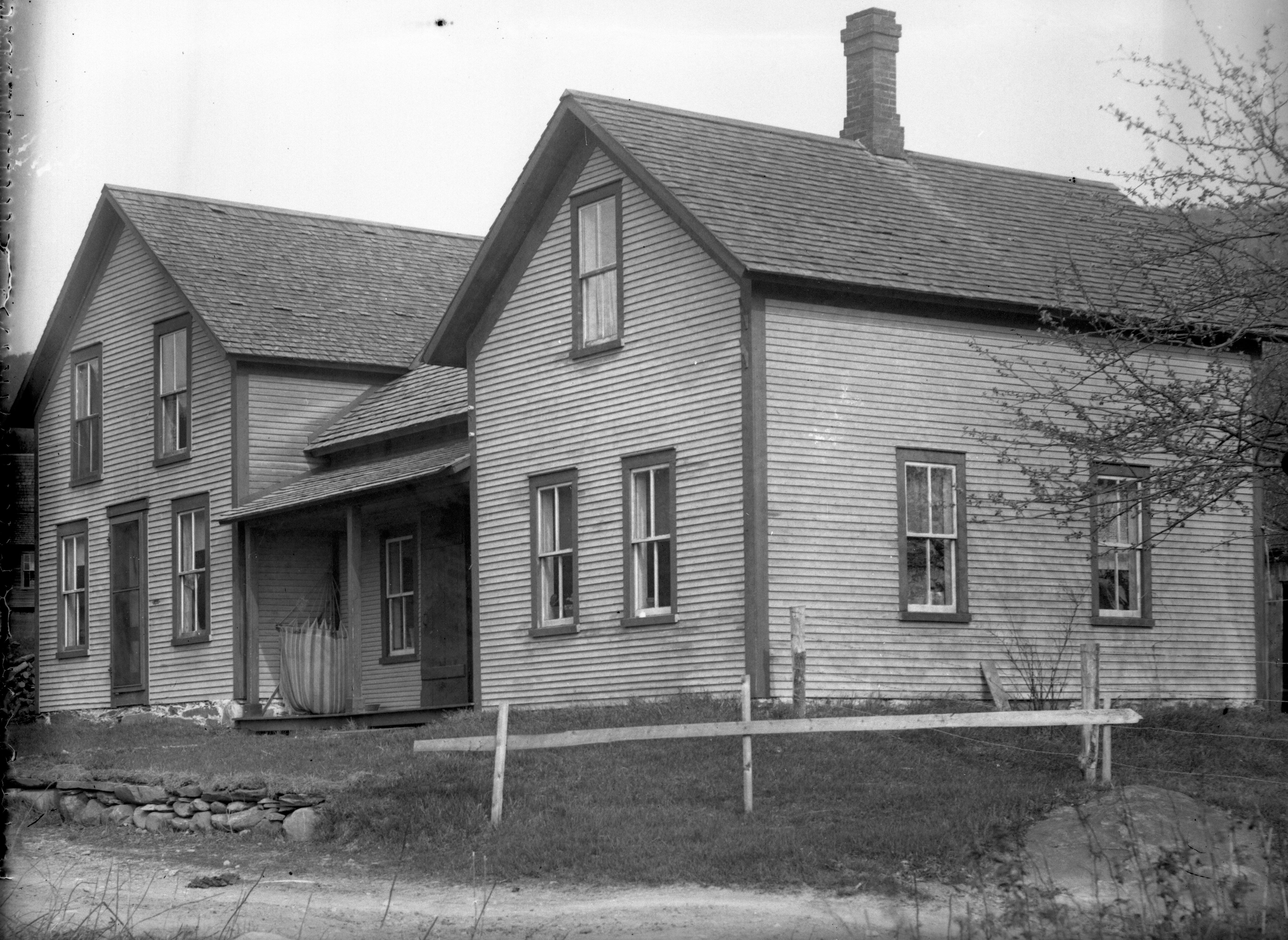
The history of Aiden Lair begins around 1850, with the construction of a crude log cabin to house travelers and hunters going into the interior of the Adirondacks, at a time where the rugged region was only beginning to be more accessible. The cabin eventually burned down, and in 1893, the first Aiden Lair lodge was built, a grand Adirondack hunting lodge ran by an Irishman named Michael Cronin.

The original Aiden Lair Lodge, early 1900s. (via town of Minerva website)

But the lodge truly gained notoriety for being a vital part of the so called Midnight Ride of Theodore Roosevelt in 1901, which would be the first stop of a remarkable presidency.

Being president of the United States can have contingent natures with the responsibility, and I don’t think there are many American presidents that have been more fit for the role than Theodore Roosevelt.

On Sept. 6, 1901, President William McKinley was in Buffalo attending the Pan American Exposition when he was shot by Leon Czolgosz, a hot tempered anarchist. At the time, vice president Theodore Roosevelt was a guest of the Vermont Fish and Game Club in Isle La Motte. When word reached Roosevelt on the attempt on the president’s life, he immediately left and traveled to Buffalo.

But McKinley’s surgeon insisted he was fine, and that he would surely recover. Roosevelt, no longer feeling needed, decided to travel to join his family who were vacationing at the Tahawus Hunting Club. He had campaigned laboriously during the election of 1900 – an effort which involved much traveling and speech giving. Some rest and relaxation in the Adirondacks sounded damn good.

In Tahawus, Roosevelt decided that a great way to kick off his vacation would be to have an afternoon hike up Mount Marcy, the tallest elevation in the state. He sought out some guides and set out up the slopes. While relaxing near Lake Tear-of-the-Clouds, the source of the Hudson River, a foot messenger named Harrison Hall found him and gave him word that McKinley’s condition had worsened, and it didn’t look good.

According to local lore, Roosevelt’s reaction after reading the message was to say  “Gentlemen, I must return to the clubhouse at once,” before calmly finishing his lunch, and then making the 12 mile hike back to Tahawus in 3 hours.

Roosevelt was reluctant to go back to Buffalo unless he was truly needed. He was just there, and that would be a long trip to make for a false alarm. But soon, another telegram came with news came that president McKinley was dying. Roosevelt set out for Buffalo immediately, but first, he had to get to the nearest train station which was 35 miles away at North Creek. That would be an arduous journey on muddy rut choked roads in the middle of the night, through vast mountainous wilds, a journey that would take at least 7 hours to complete today. The 35 mile stretch would have to be completed on horseback, with a stop somewhere in between to switch the exhausted horse for a fresh one. He departed Tahawus and made the grueling journey to Aiden Lair Lodge in Minerva, where he would switch horses.

A team of wagon drivers were organized, and would switch off driving Roosevelt at different legs of the trip, until they made it to the train station. David Hunter, the superintendent of the Tahawus Club, drove the first leg, a 10-mile stretch from the Tahawus Club to the Tahawus post office. The first stretch took two hours to complete because the road was practically washed out due to rainy conditions. From there, he would swap drivers again until he would get to Aiden Lair Lodge in Minerva.

By the time he got to Aiden Lair around 3:30 AM, he was already president. McKinley had died at 2:15 AM, while Roosevelt was still rushing through dark wilderness and rough roads. Though word had reached Aiden Lair, Michael Cronin decided not to tell Roosevelt. The staff knew he was dealing with great stress, and tried to urge him to rest there for the remainder of the night, and leave a day break. But Roosevelt was having none of it, and hitched up his team. Cronin drove him the remaining 16 miles, partially in an altruistic gesture, but mostly because if anything were to happen to Roosevelt en route, he was threatened that he would be held accountable. The wagon barreled and slid down slippery and sinuous mountain roads, with Roosevelt himself holding the lantern in front of the wagon so they could see where there were going. They made the journey in an hour and 41 minutes.

By the time they arrived, the news had been broken. A telegram awaited him with the news of McKinley’s death at the train station. Roosevelt boarded the train en route to Buffalo and his oath of office. Apparently, Roosevelt’s final leg of his ride achieved so much fame that other drivers had attempted to make the same route and beat the time, but no one has been able to succeed. As far as I know.

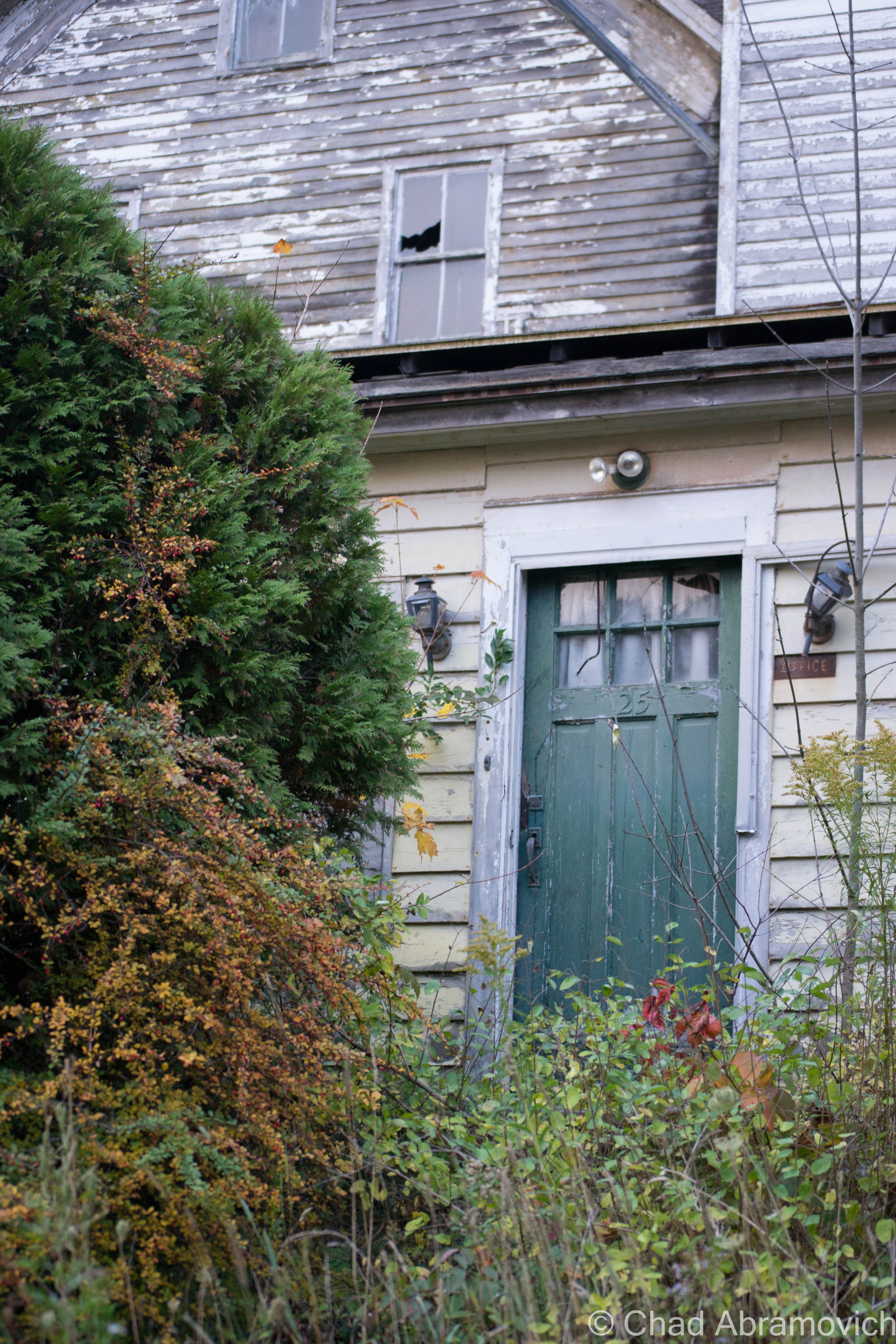
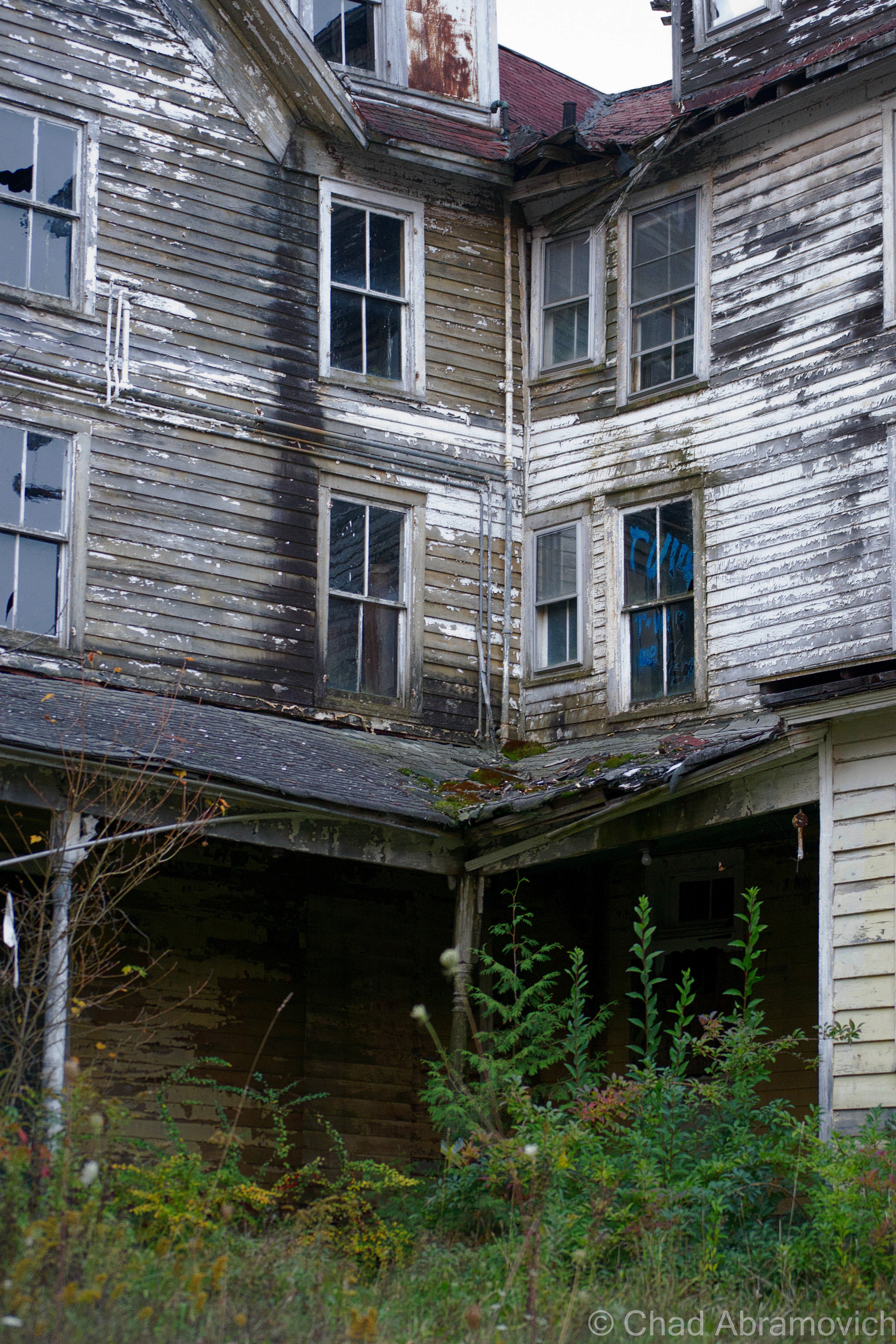
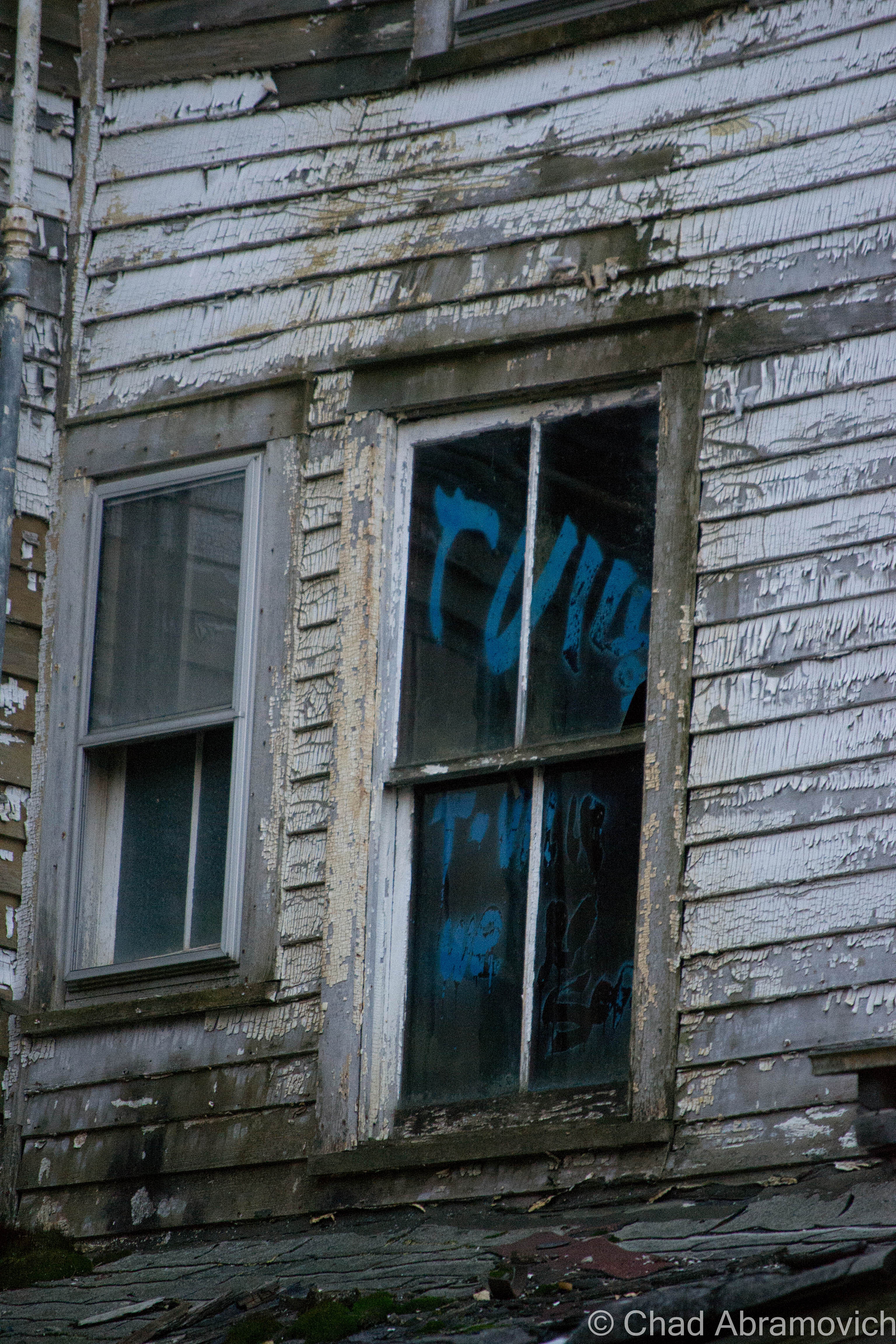
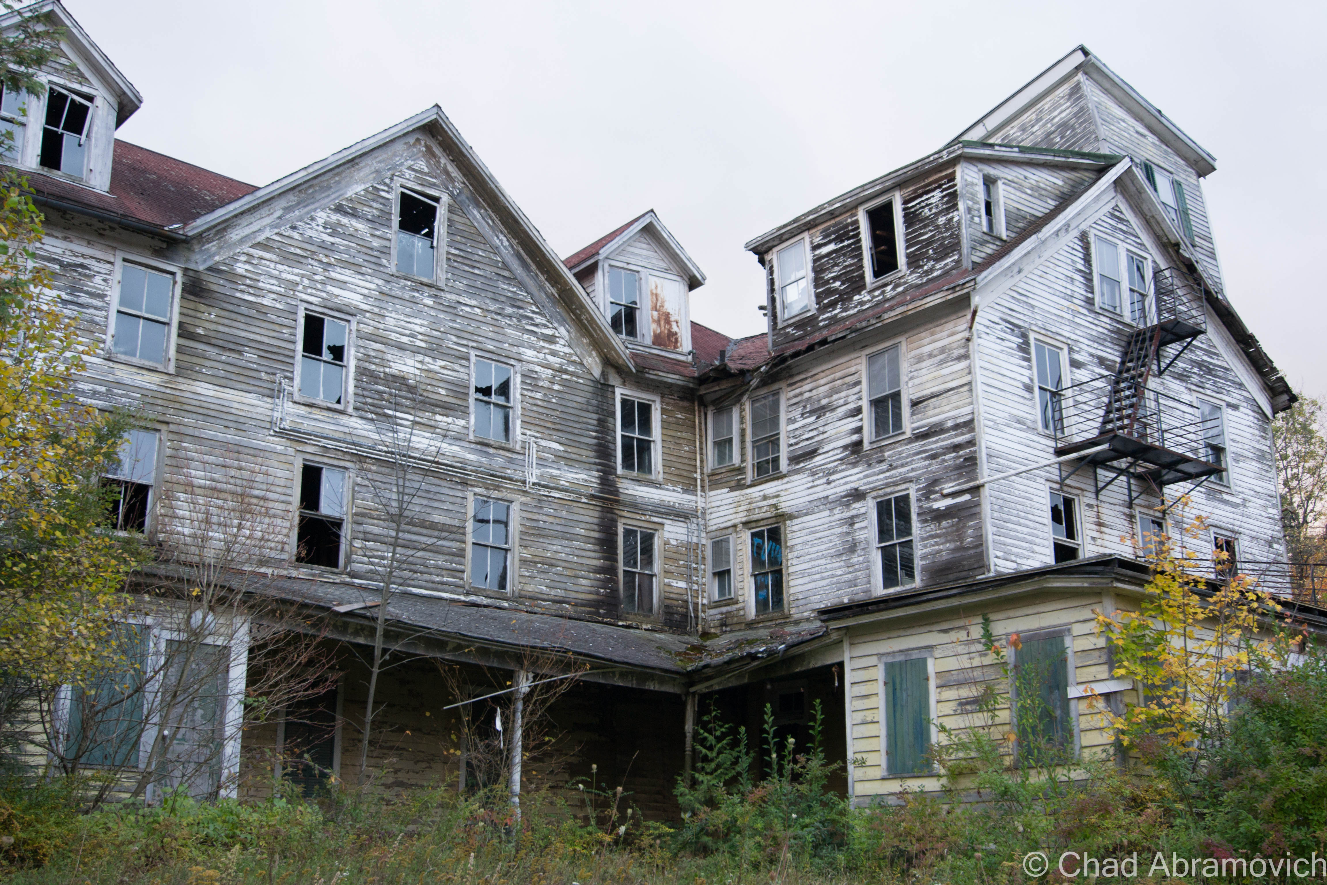
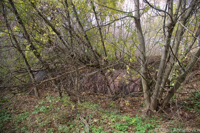
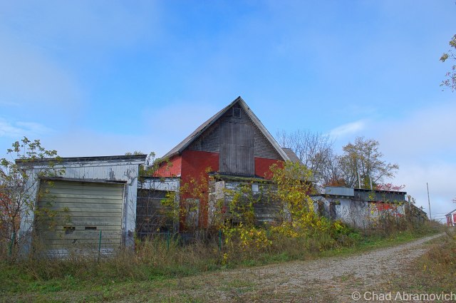
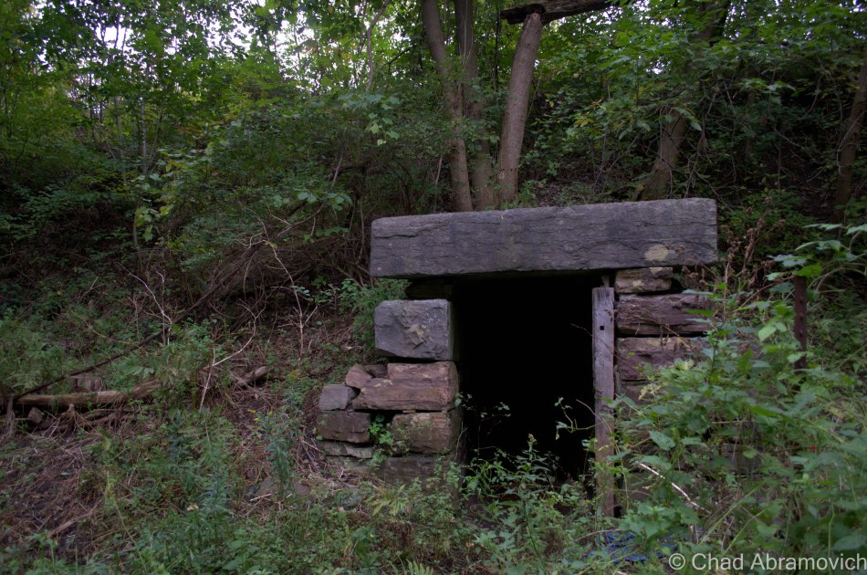
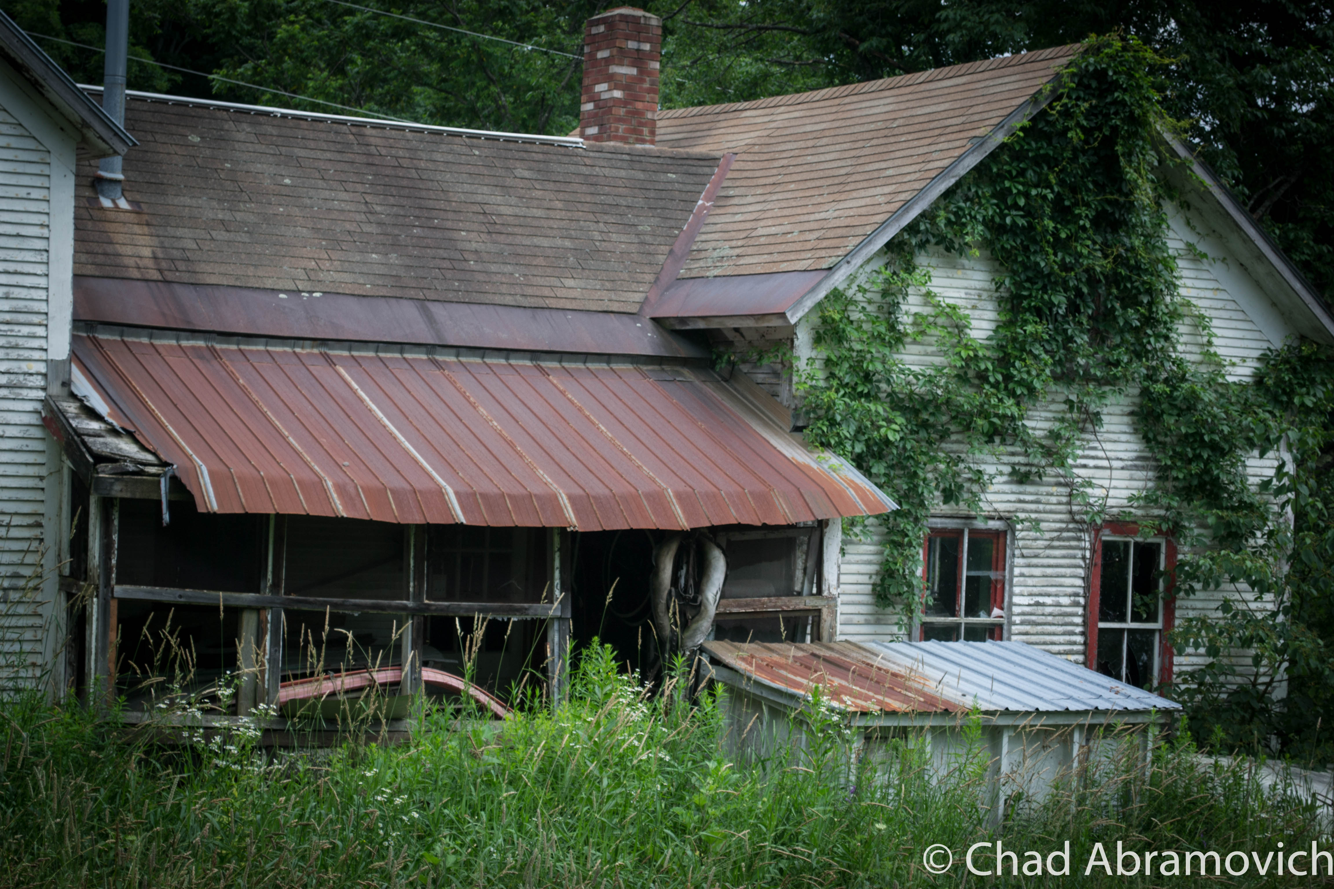
But, there is a little deception here. Though it makes a good story, the ramshackle building that skulks behind the the state historical marker on the side of the road is actually not the Aiden Lair that Roosevelt stopped at. The first hotel burned down in 1914, and a new 20 bedroom hotel was built shortly after, the 16,000 square foot decaying wooden structure you see today.

Though Mr. Cronin seemed to play an important part in the earliest hours of Roosevelt’s new found presidency, cosmic relief would pay a visit to the Irishman. Not long after the midnight ride, A New York Tribune article from April 1914 ran a headline that announced: “Roosevelt Guide Crazy.” Michael Cronin was hospitalized for mental health reasons. The lodge burned a month later, and was rebuilt by his family without his help. He died shortly after.

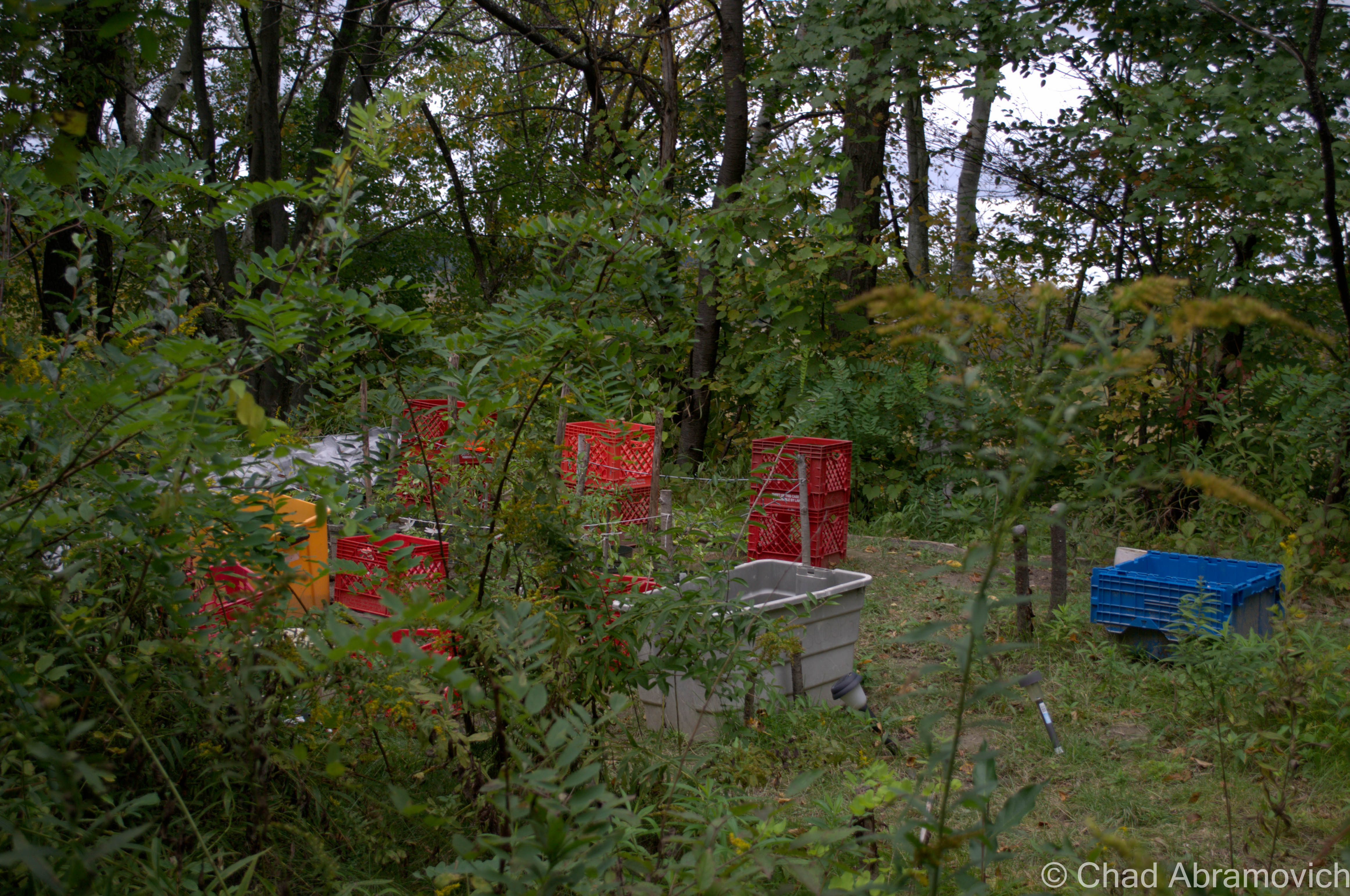
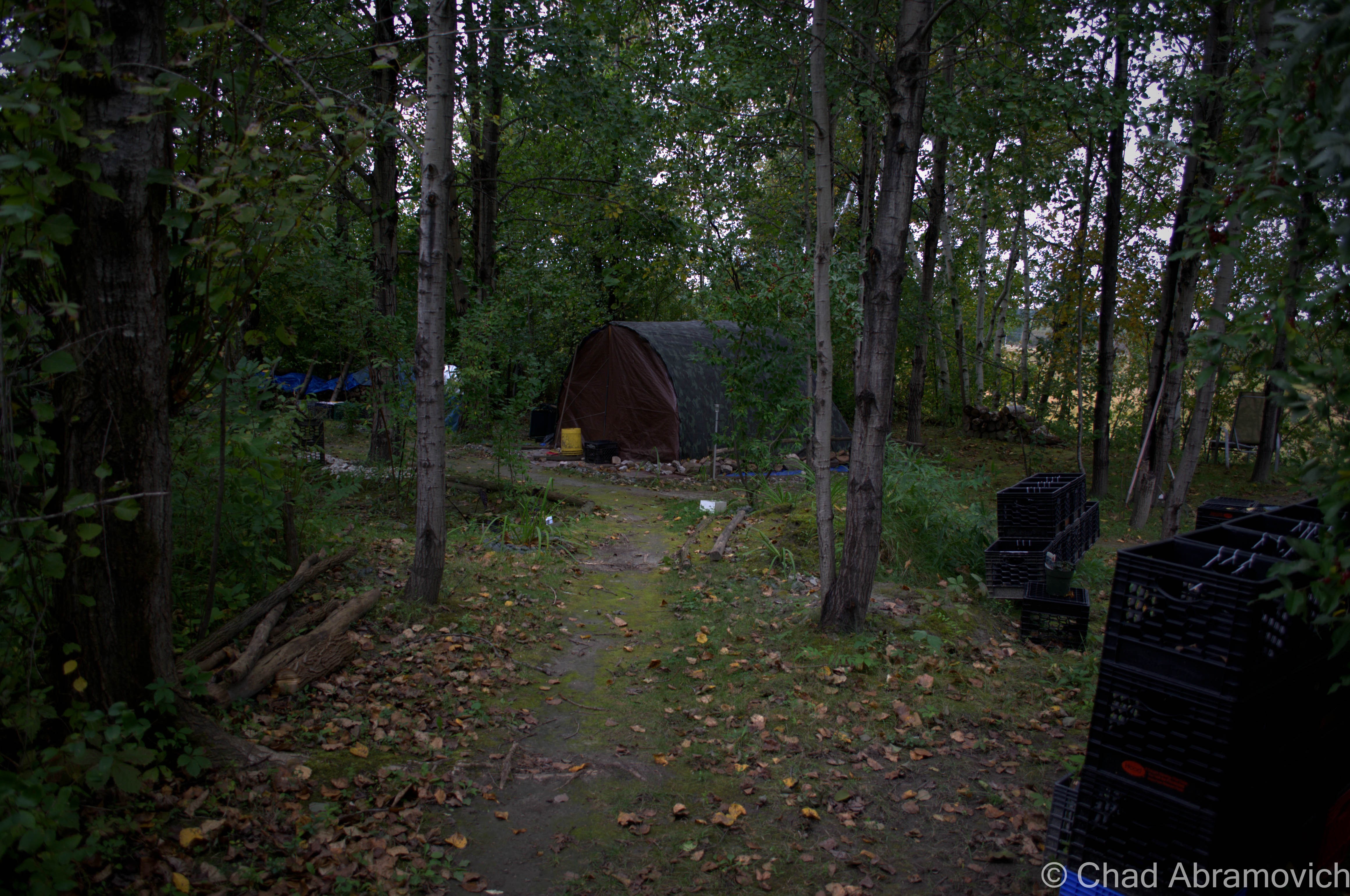
The hotel continued to serve travelers to the Adirondacks from hunters, outdoor enthusiasts and as the times changed, skiers and snowboarders heading to Gore Mountain, until the 1960s, when Adirondack hunting lodges began to go out of style and Aiden Lair closed for good. According to a segment of Adirondack Attic on North Country Public Radio – a gentleman from Albany bought the property a few years ago, with the intentions of restoring and reopening it, to continue it’s storied legacy. But the hurtles of renovations and reaching out to historic preservation proved to be too much, and it has since faced demolition by neglect – rotting in a state of limbo.

The current Aiden Lair Lodge
Topographical map of Minerva, NY circa 1901. Aiden Lair was prominent enough to be plotted as a standout place on the map (upper right hand corner)

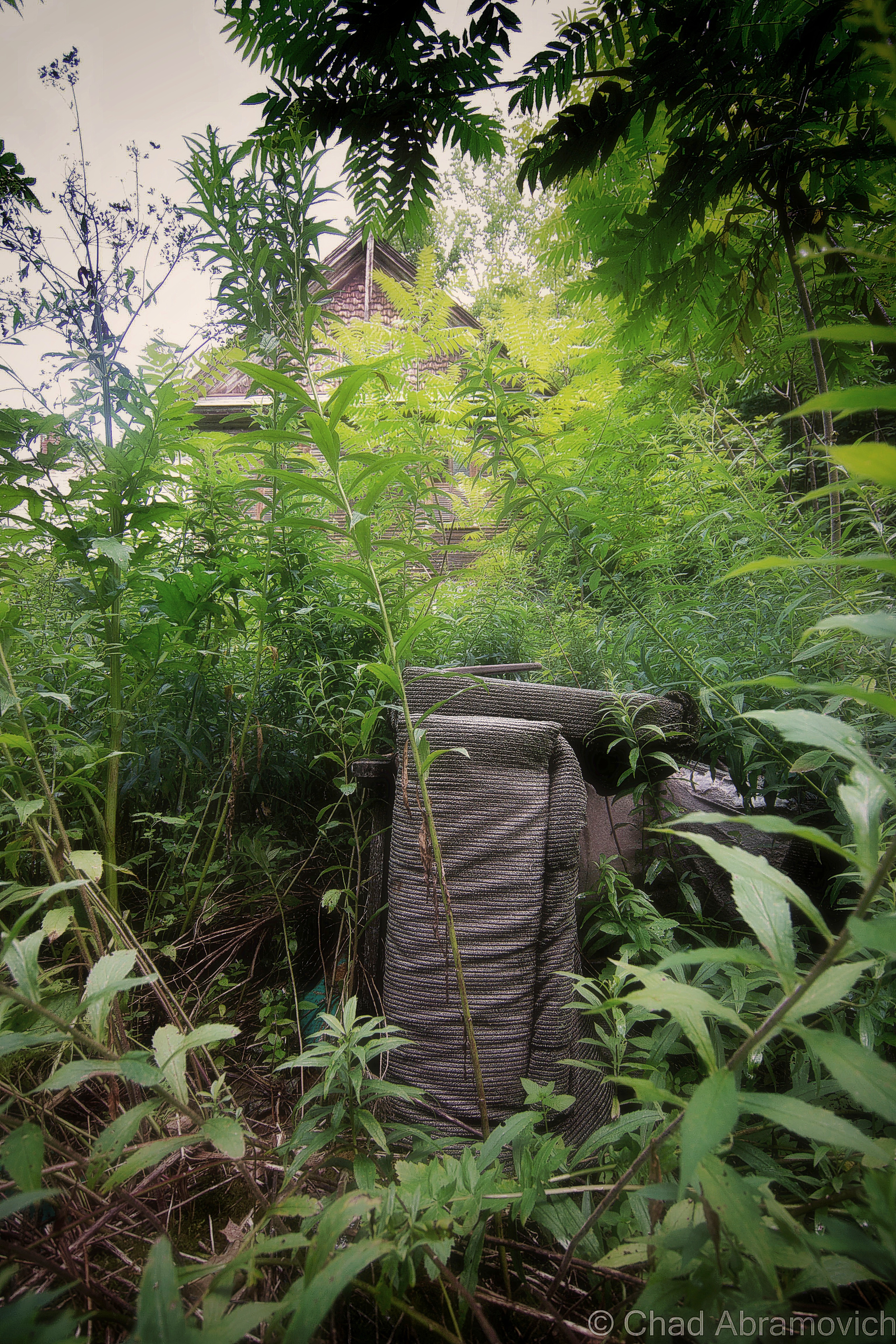
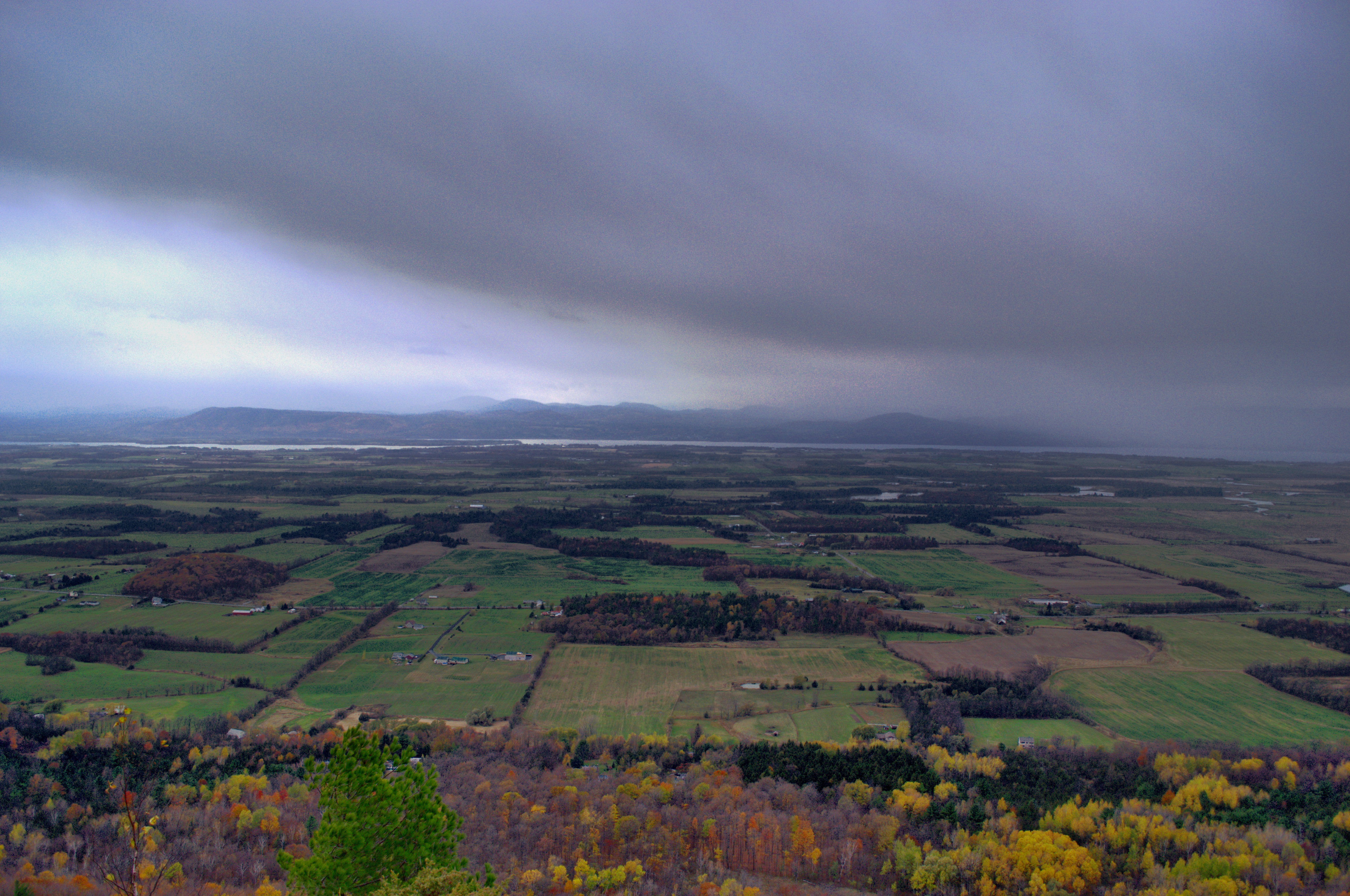
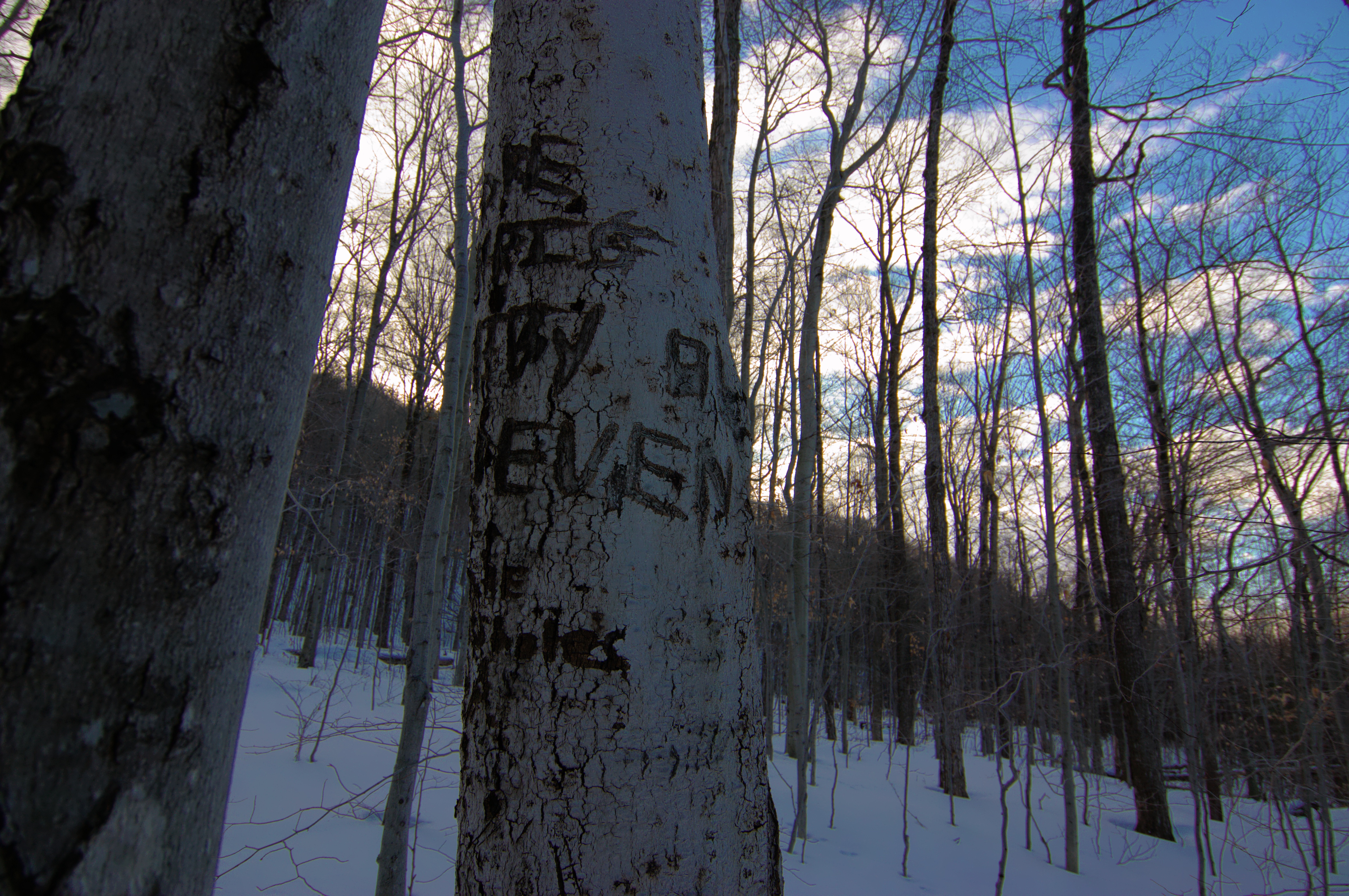
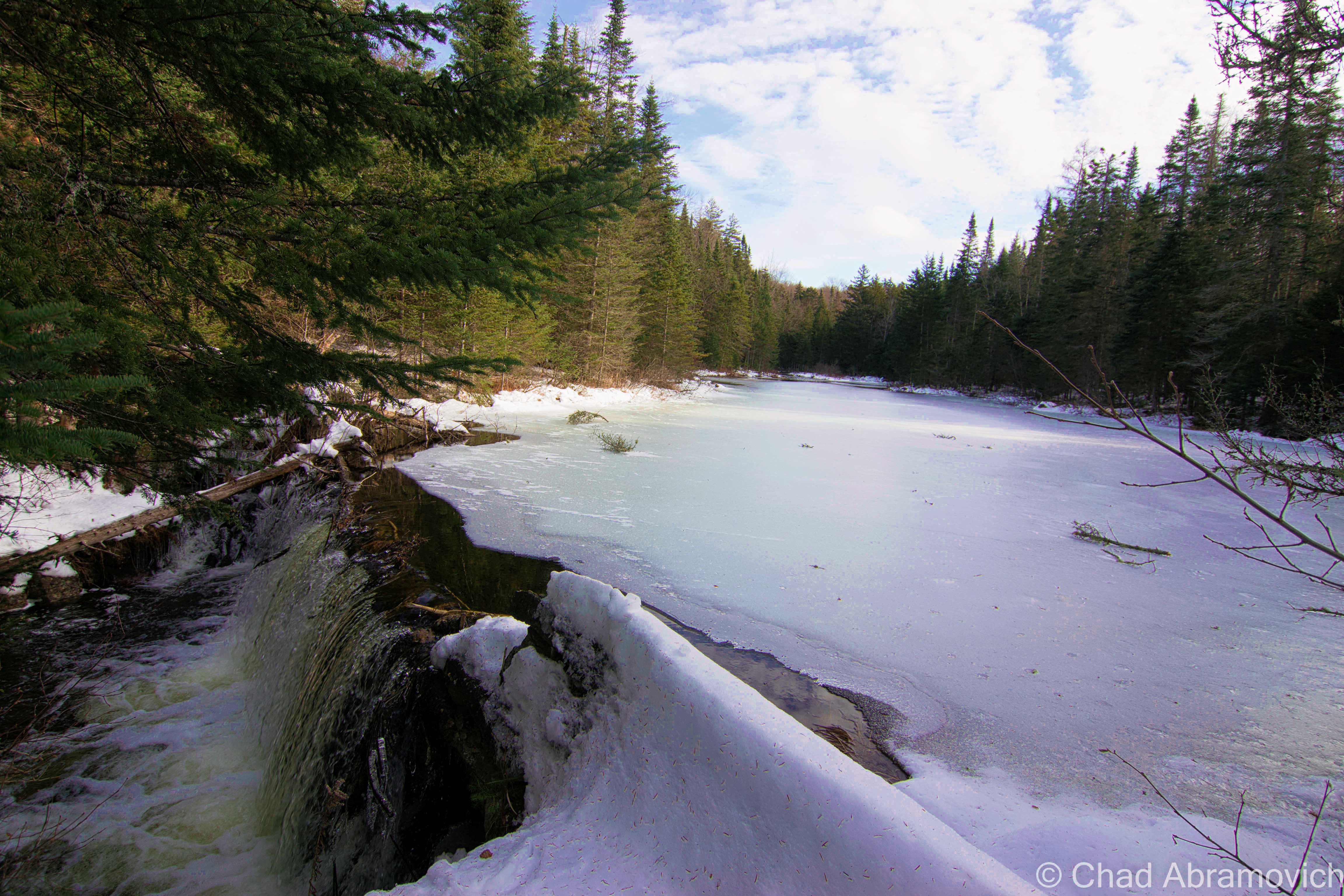
I drank copious amounts of Stewart’s Shop coffee before the long drive up to Aiden Lair, fighting the urge to pass out in the car. Long drives with the heat on and a prior week of insomnia tend to do that to me. It was much colder in Minerva. The temperature had plummeted to 11 degrees somewhere along the ride from Schroon Lake, and there was at least a foot of snow in the high peaks. Immediately after exiting the truck, my hands and face stung painfully, and I found myself not being able to control my shivering. But we didn’t travel 2 hours just to turn around, so onward we trudged.

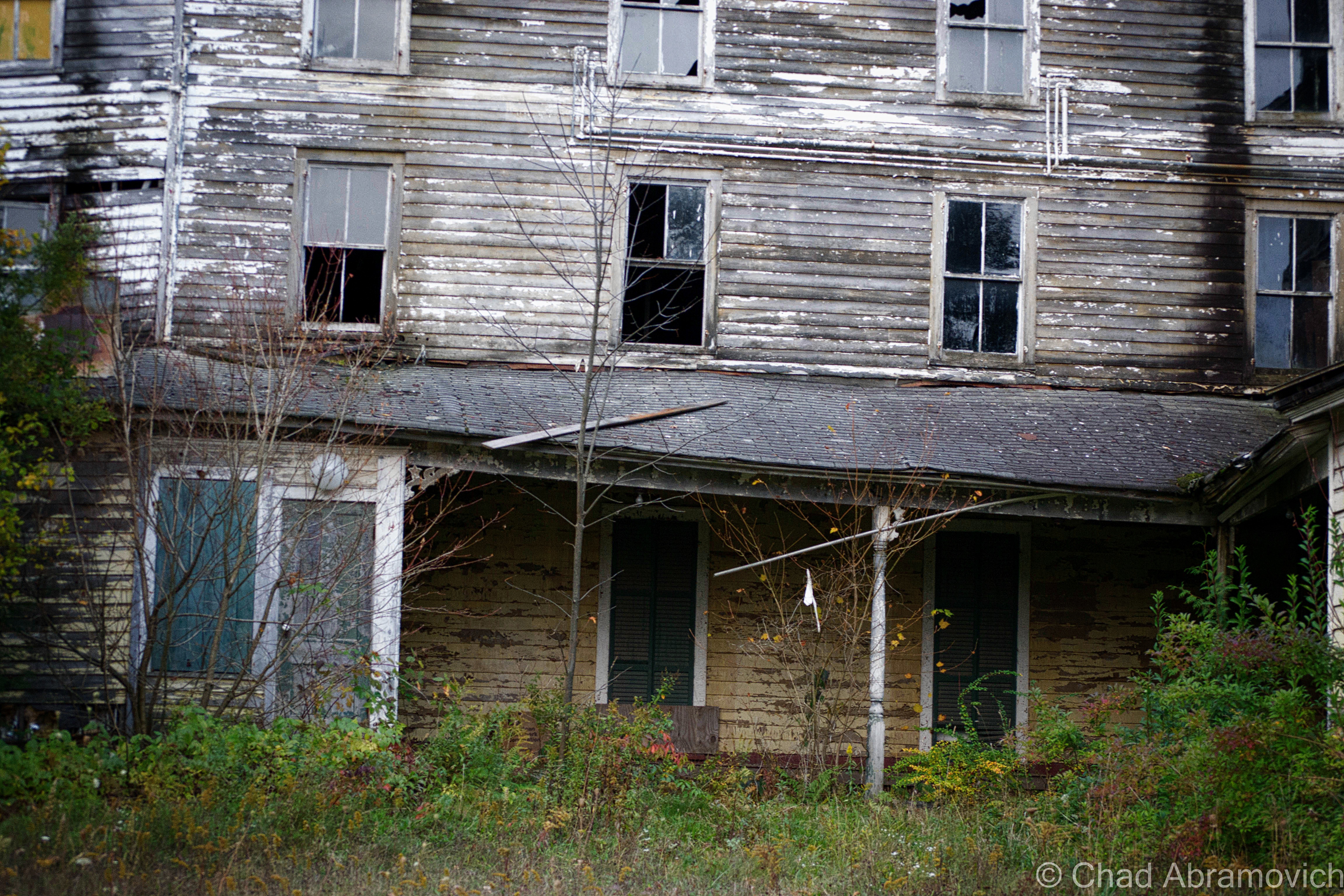
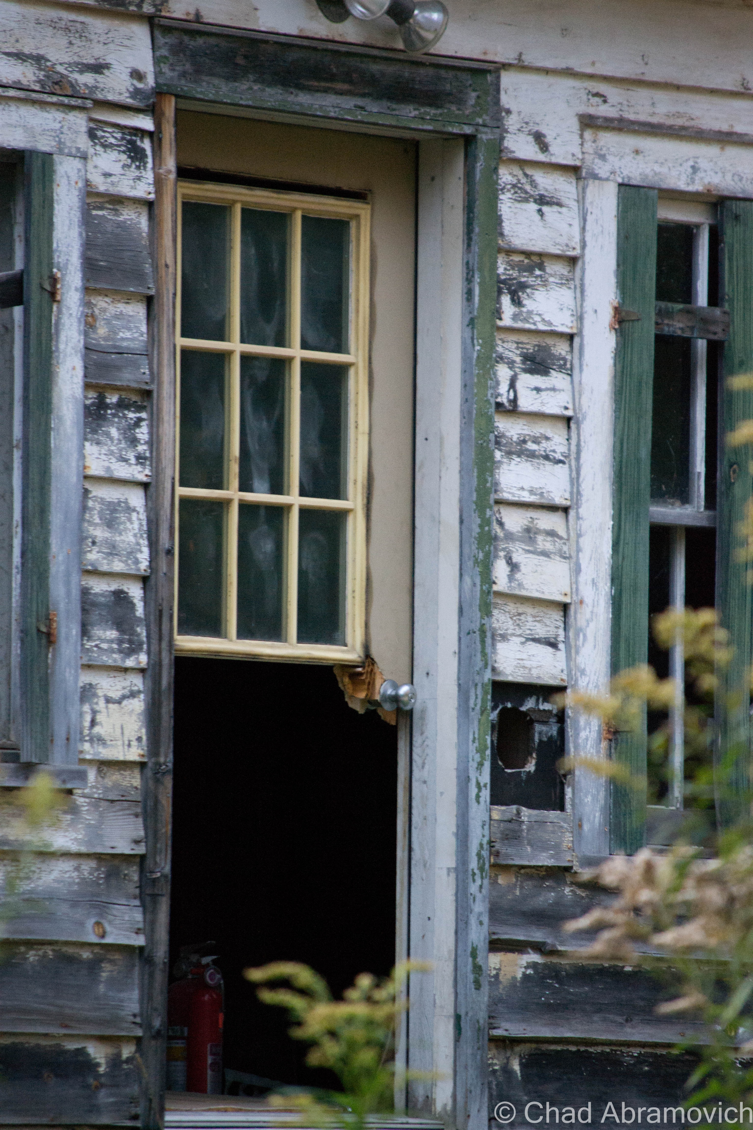
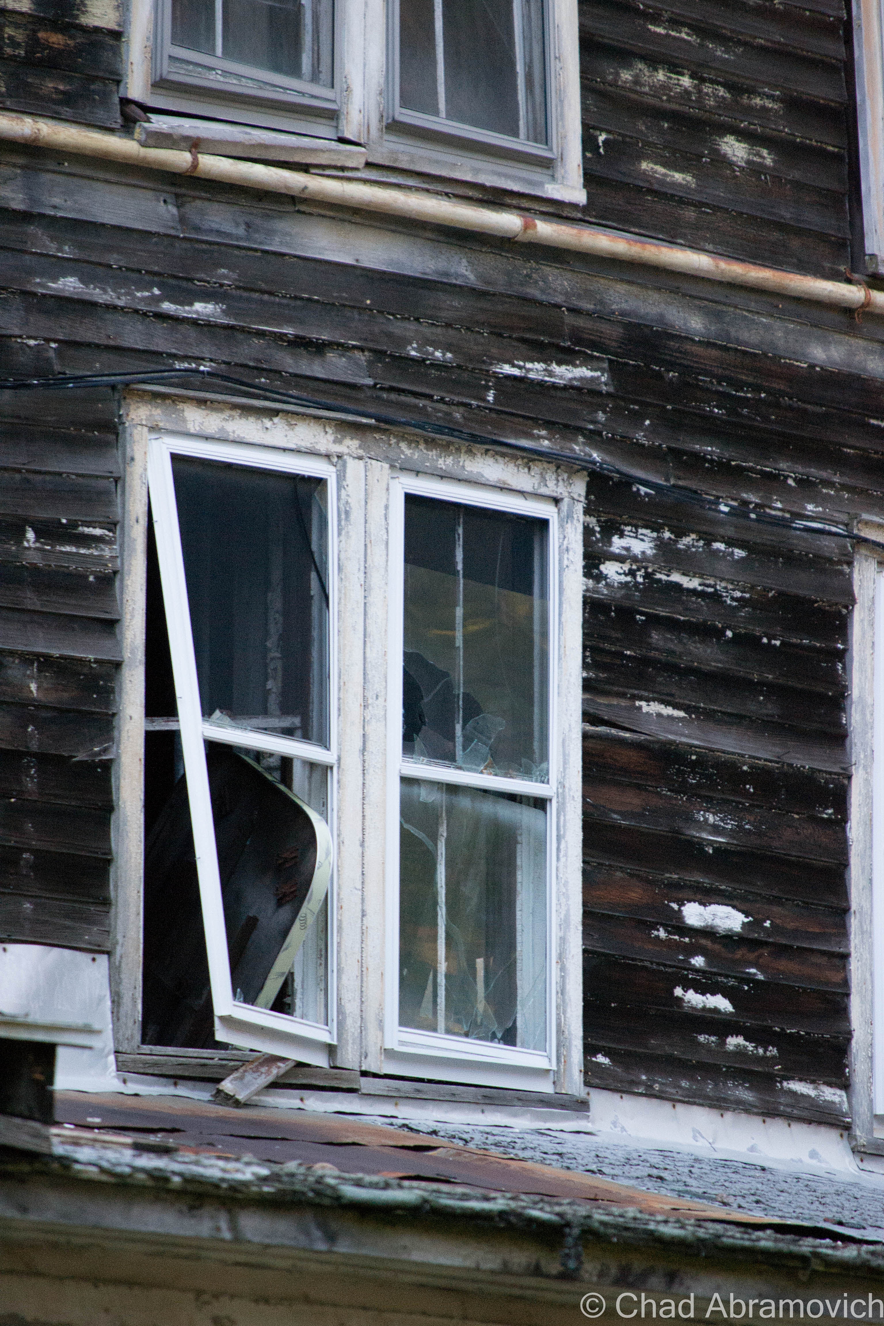
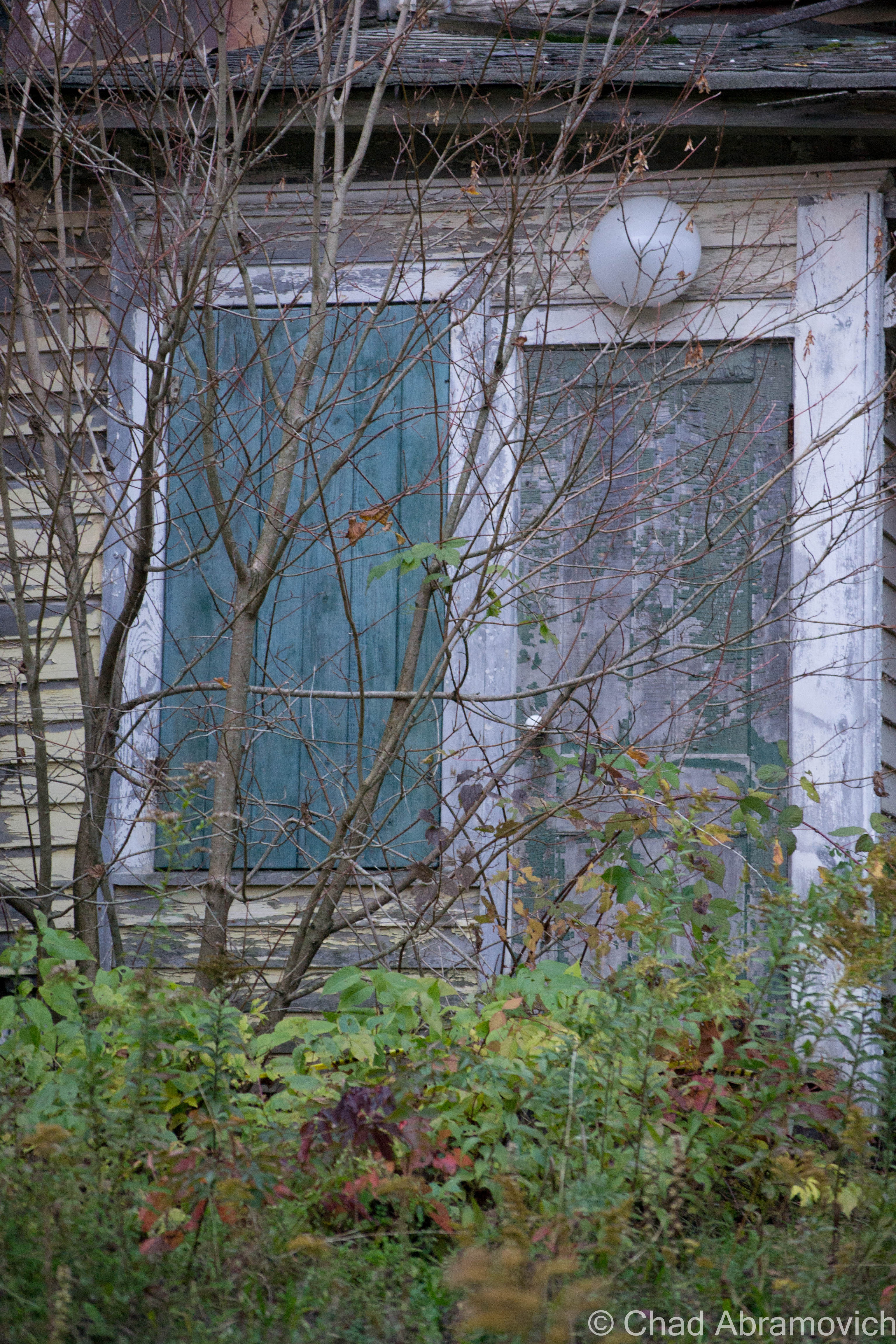
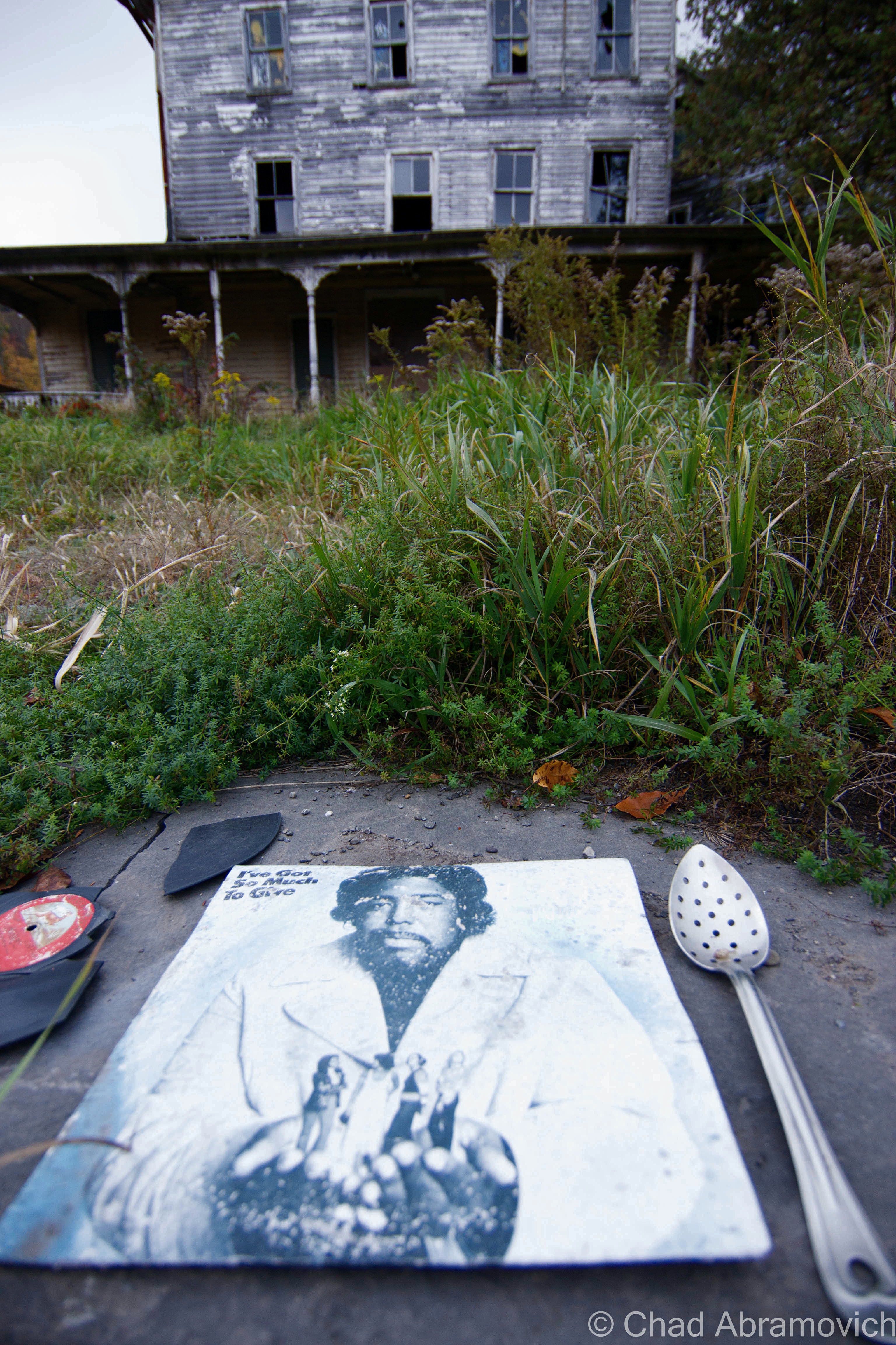
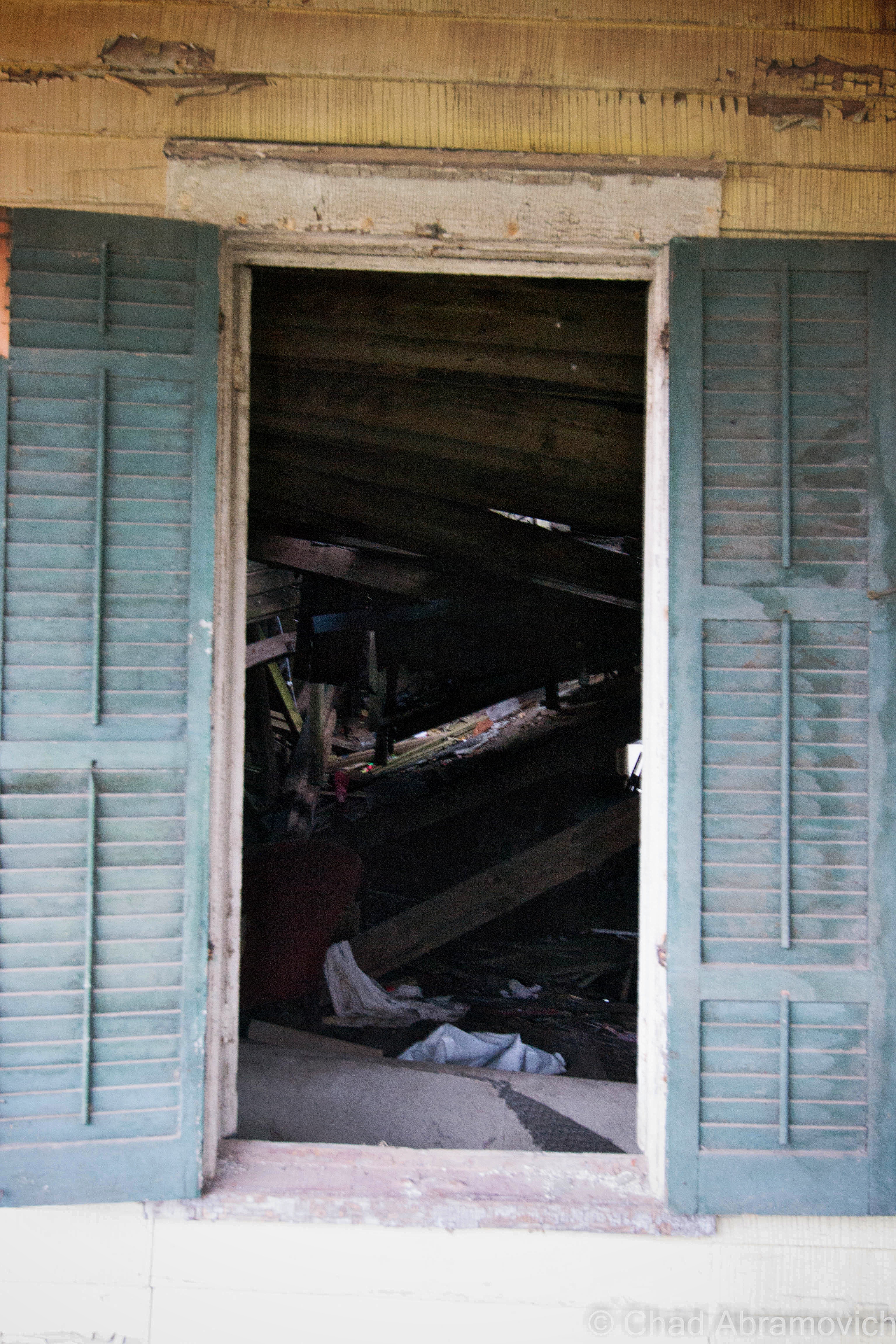
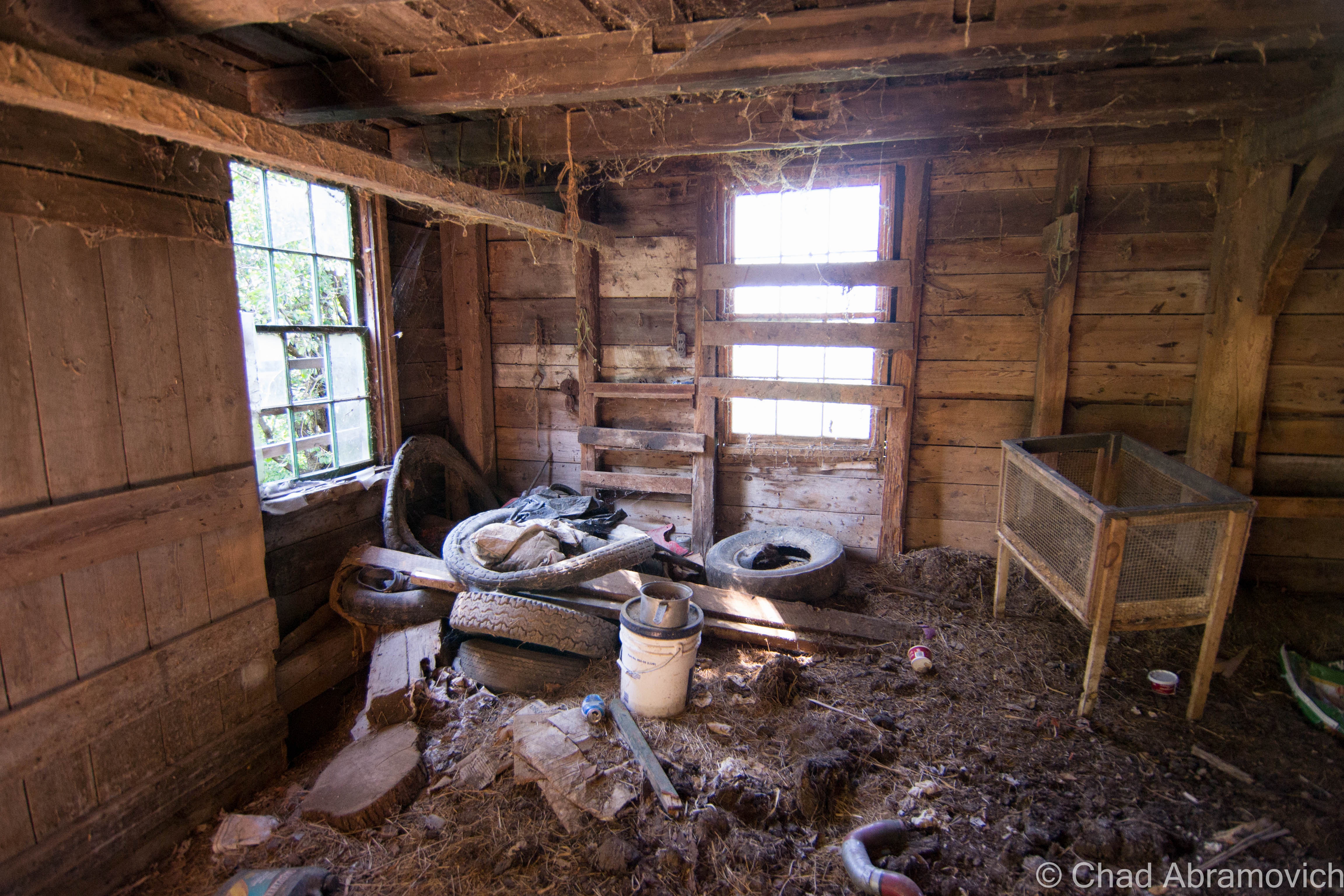
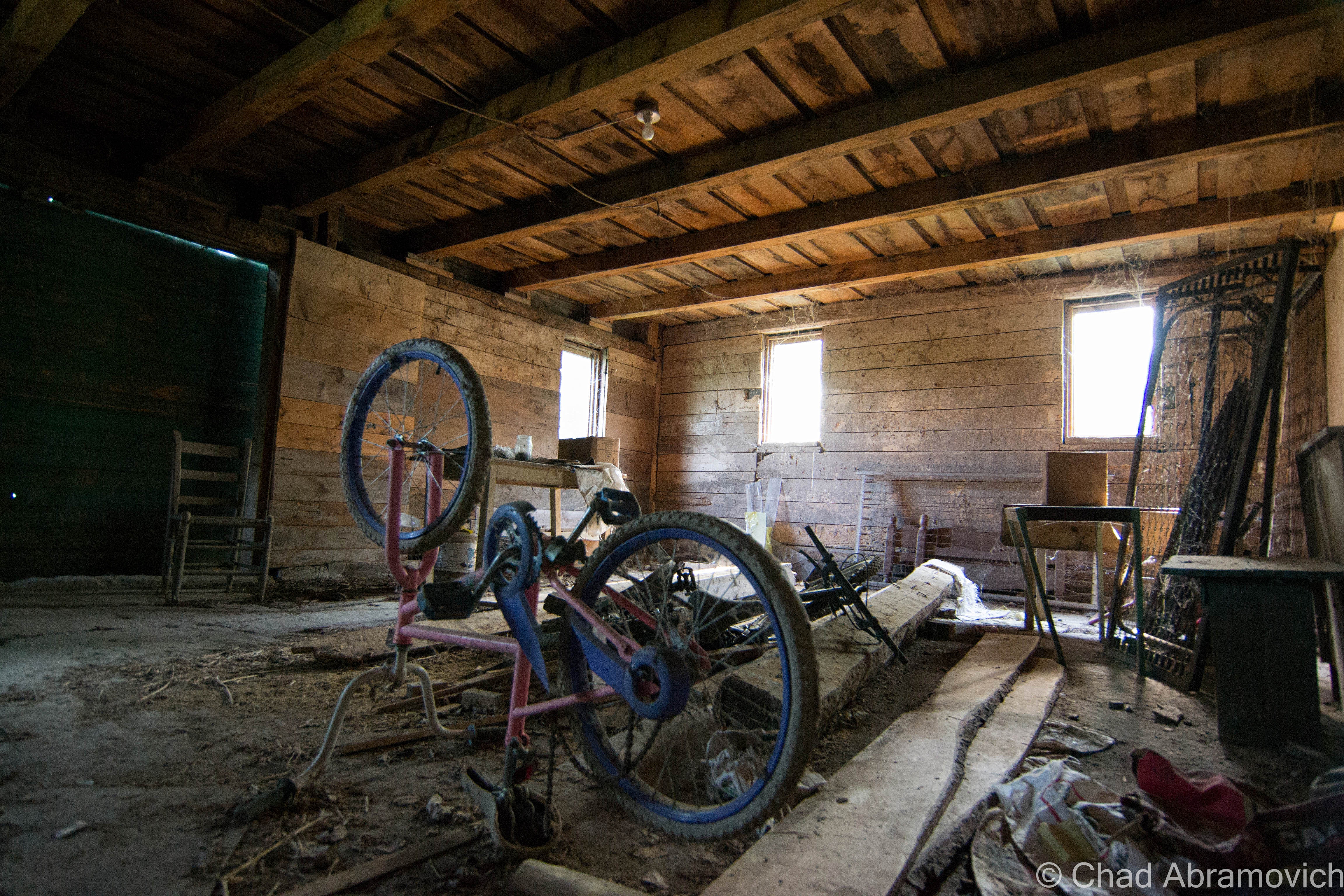
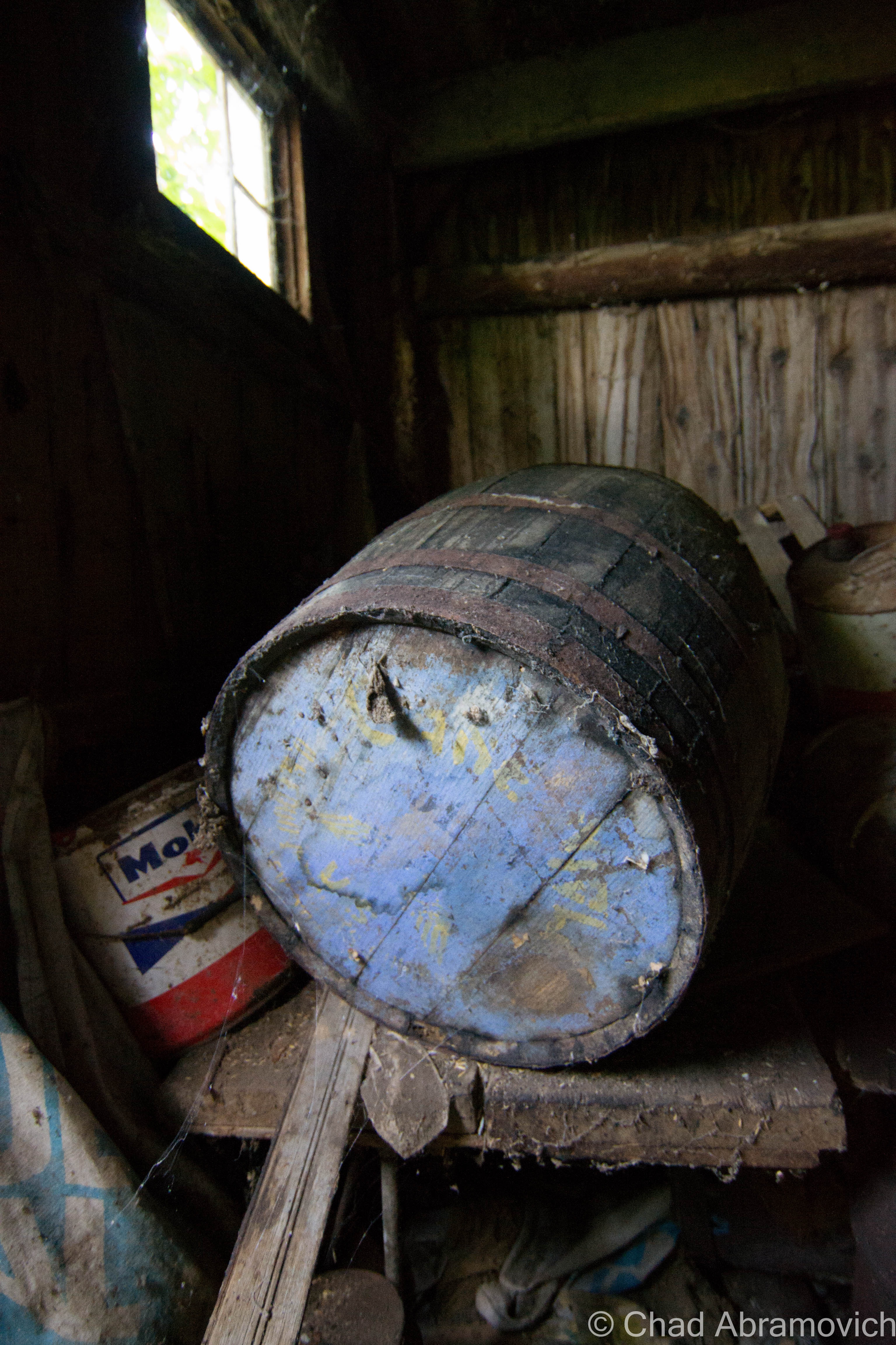
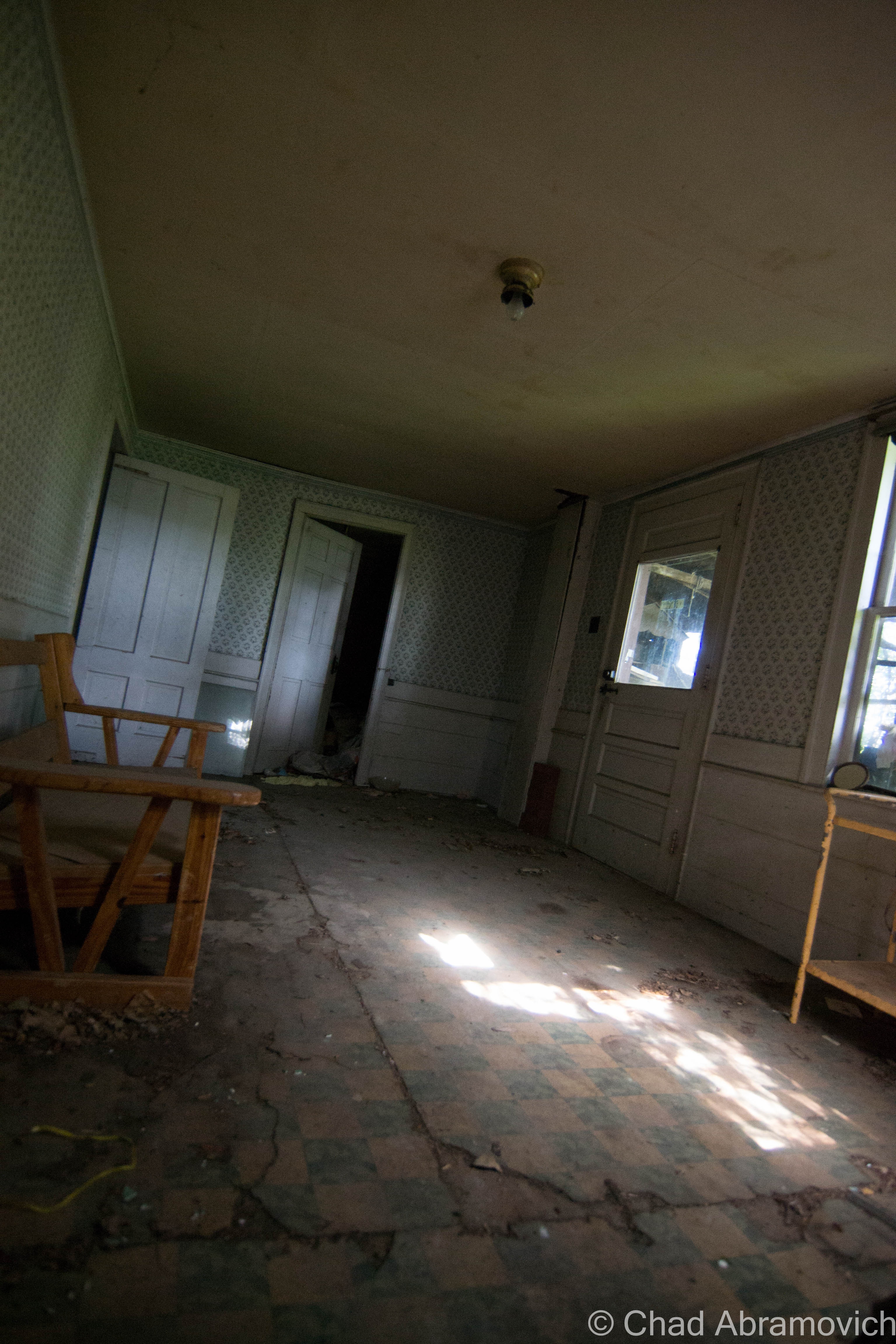
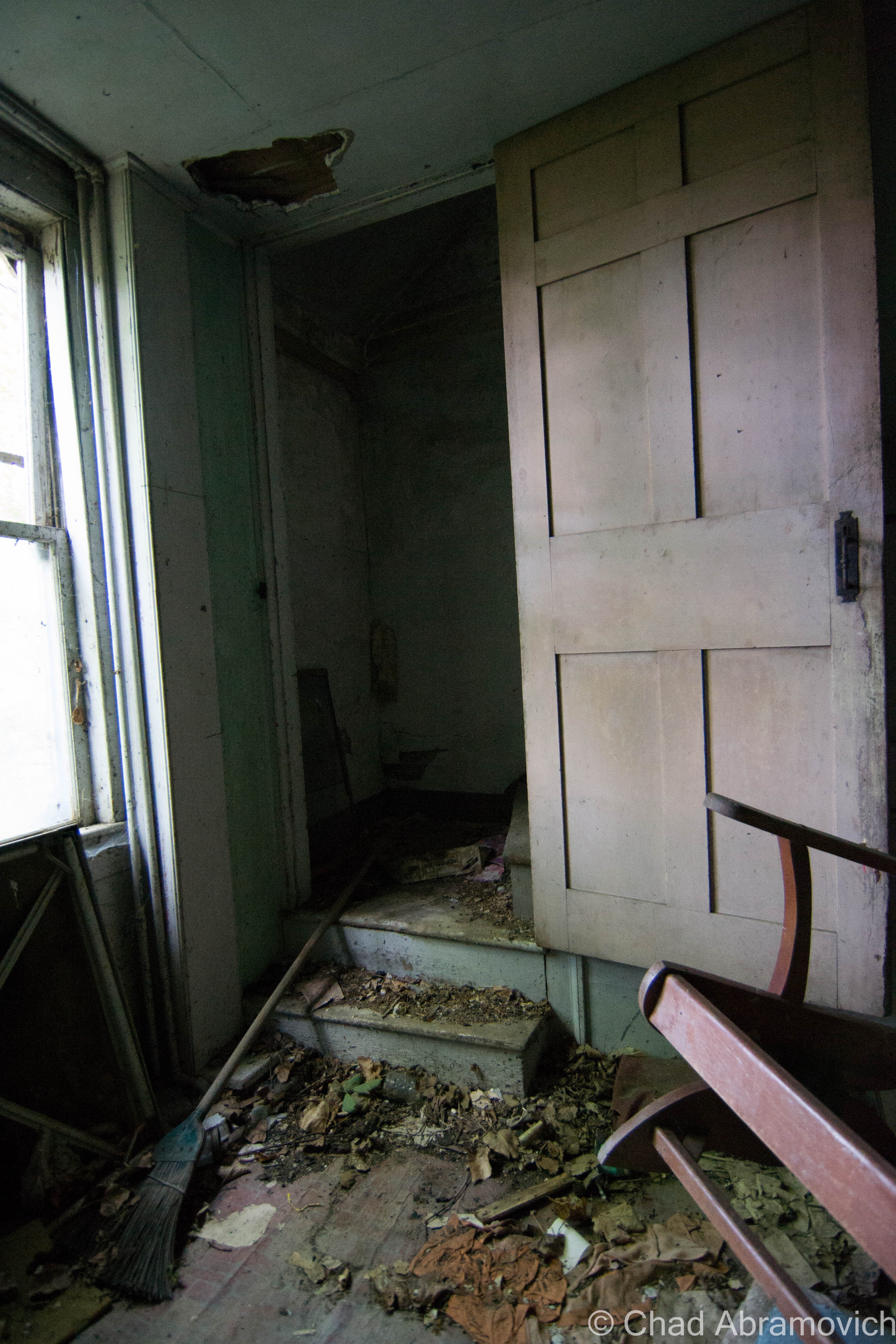
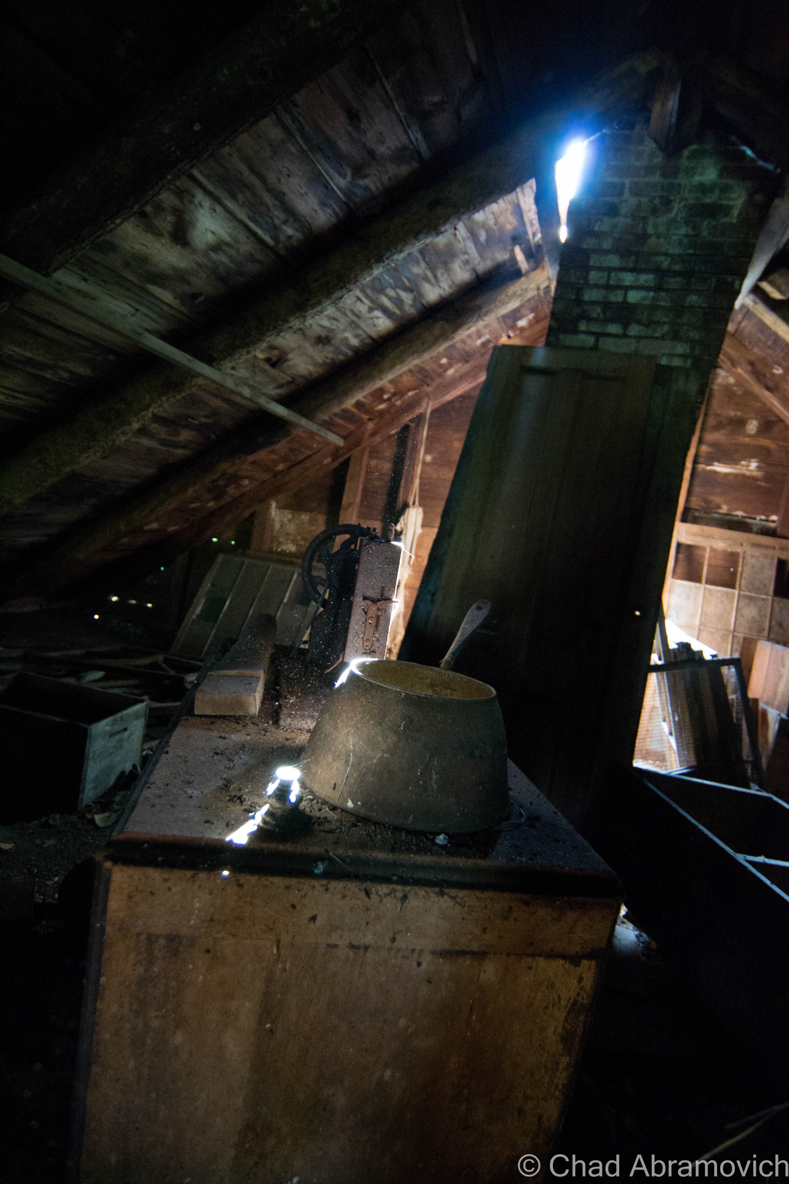
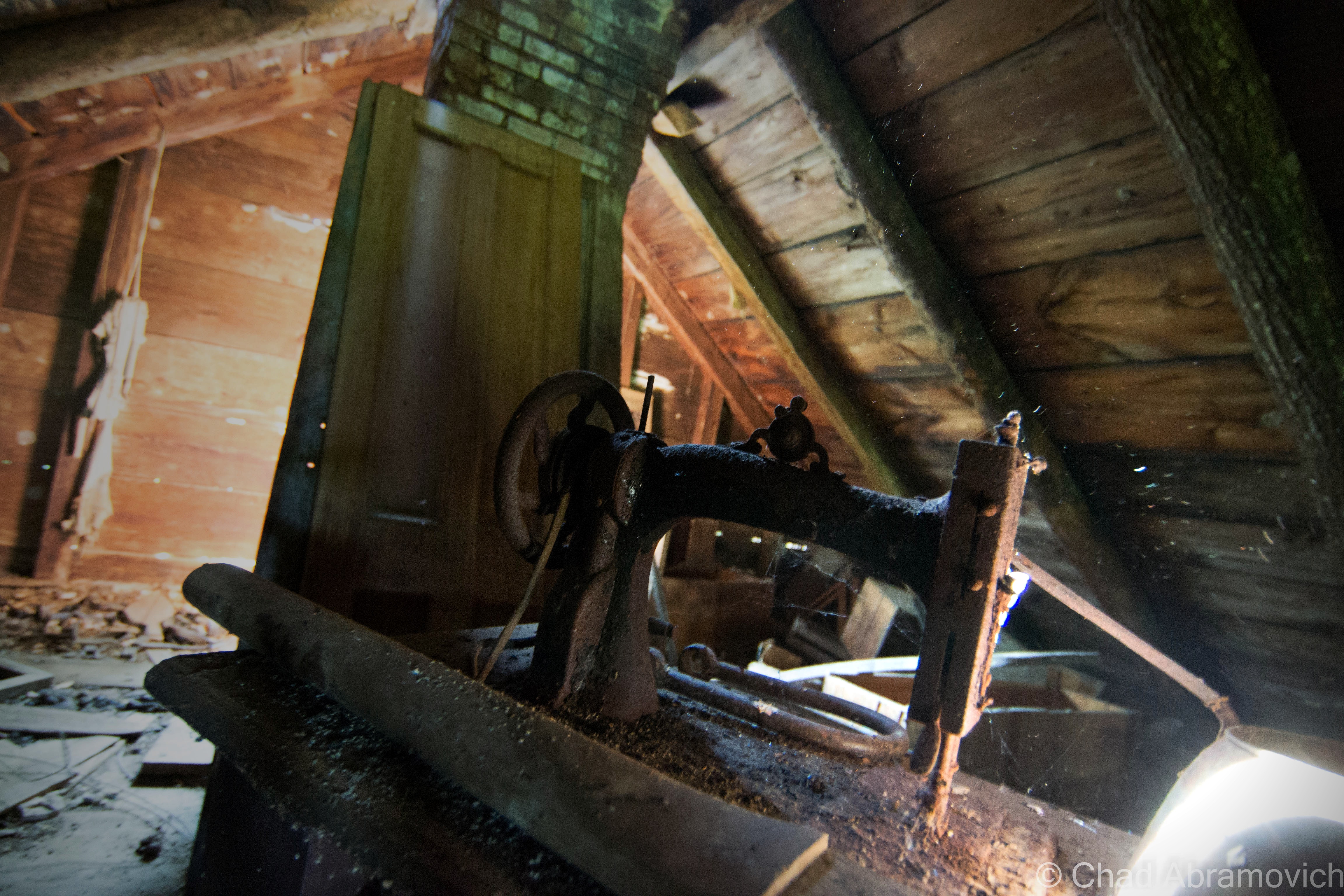
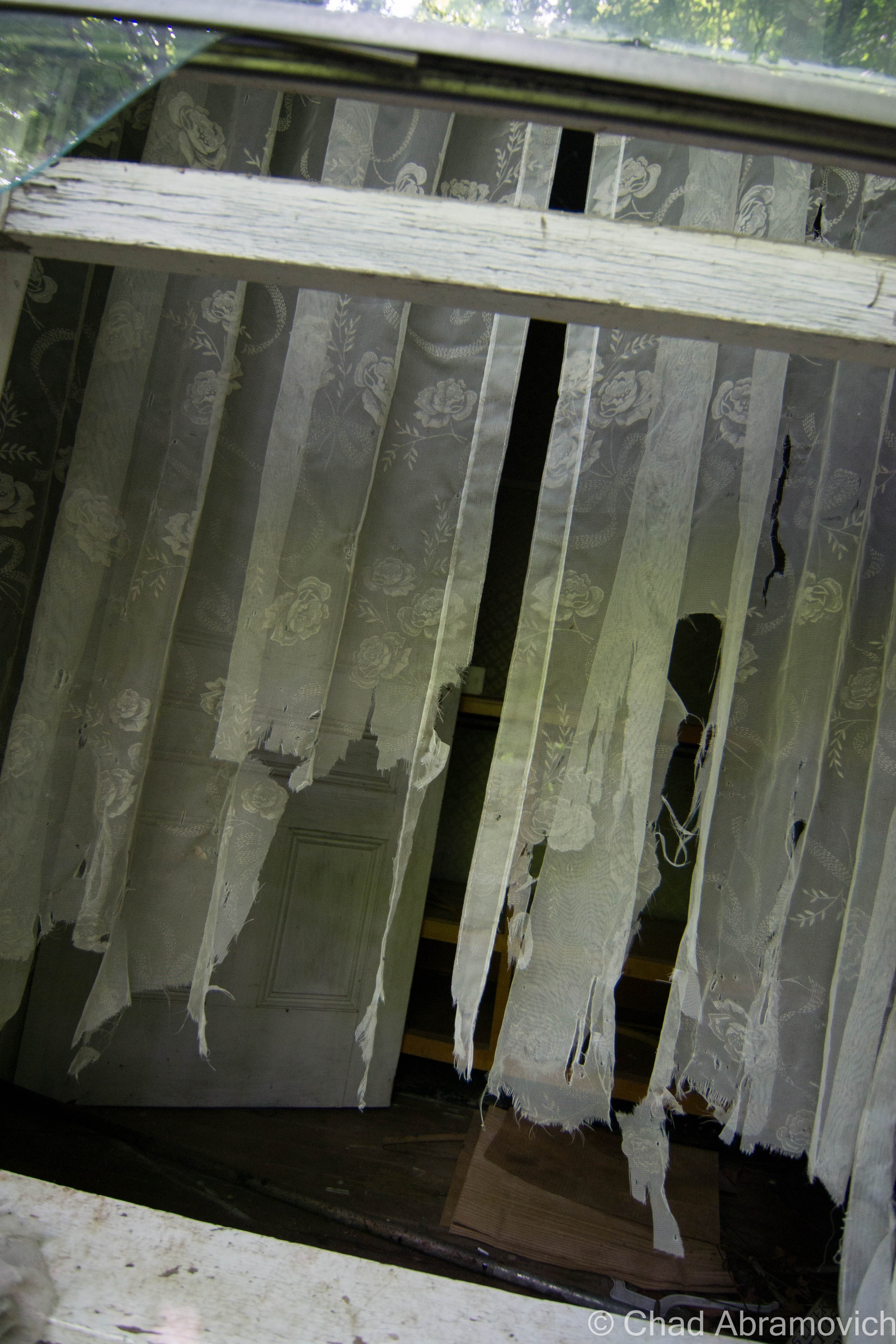
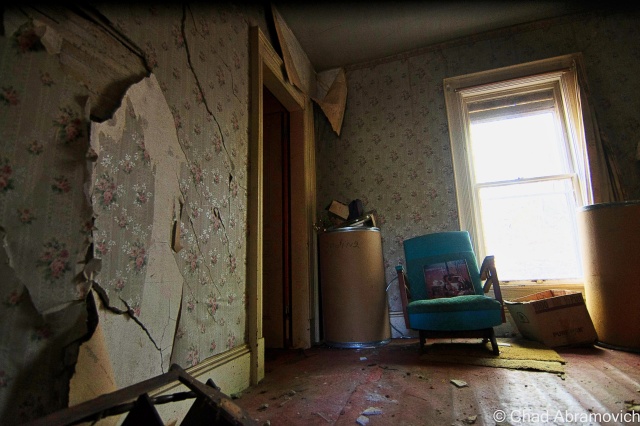
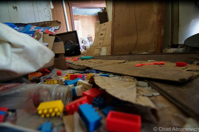
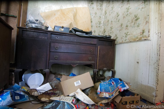
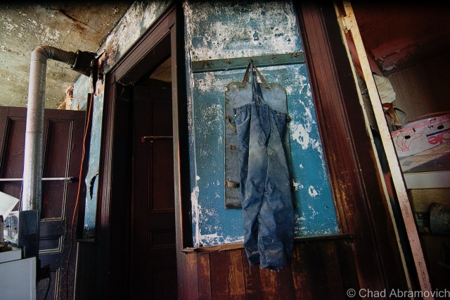
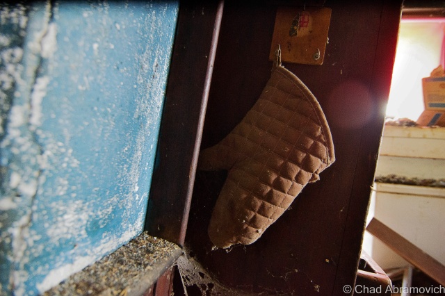
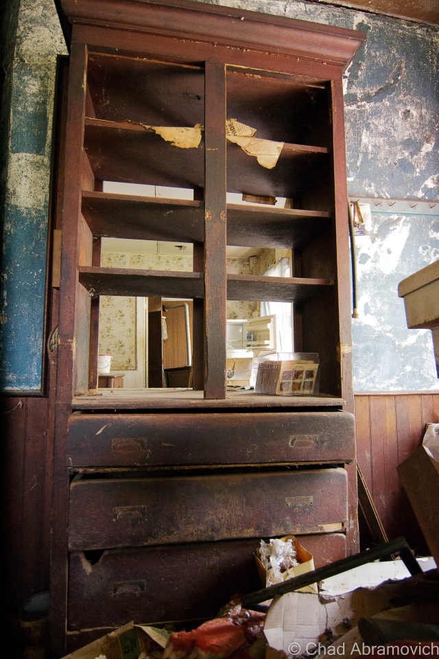
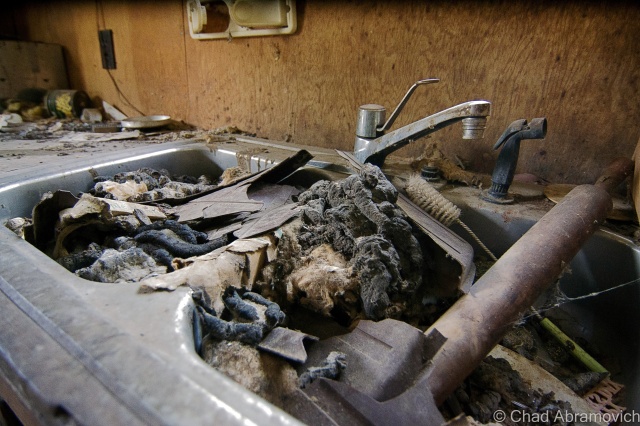
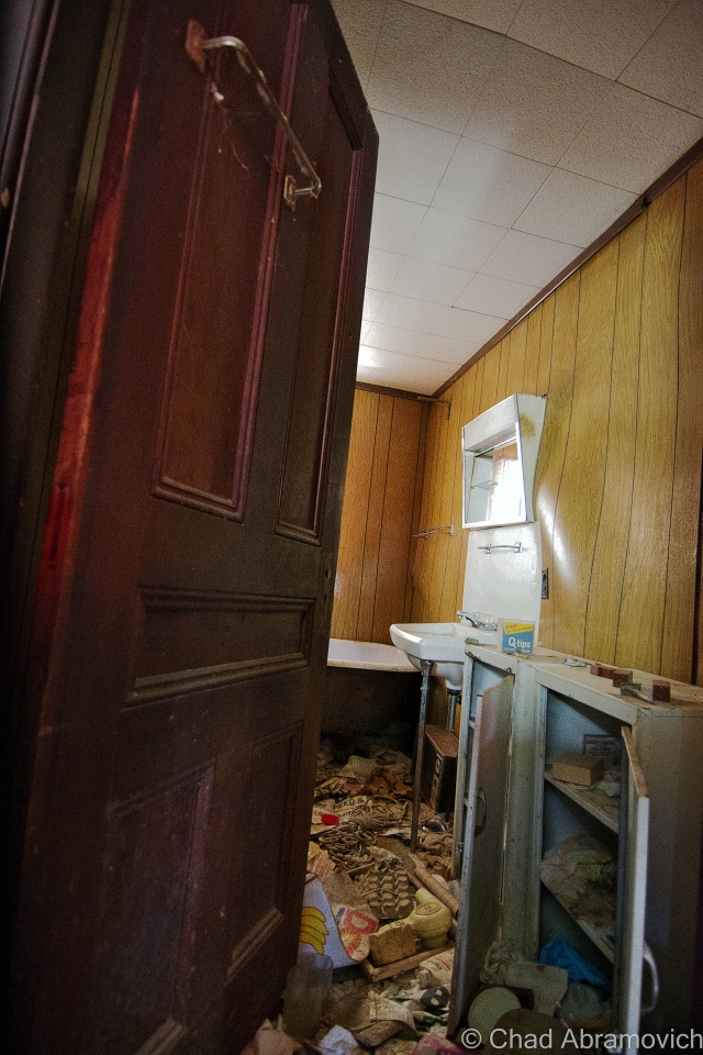
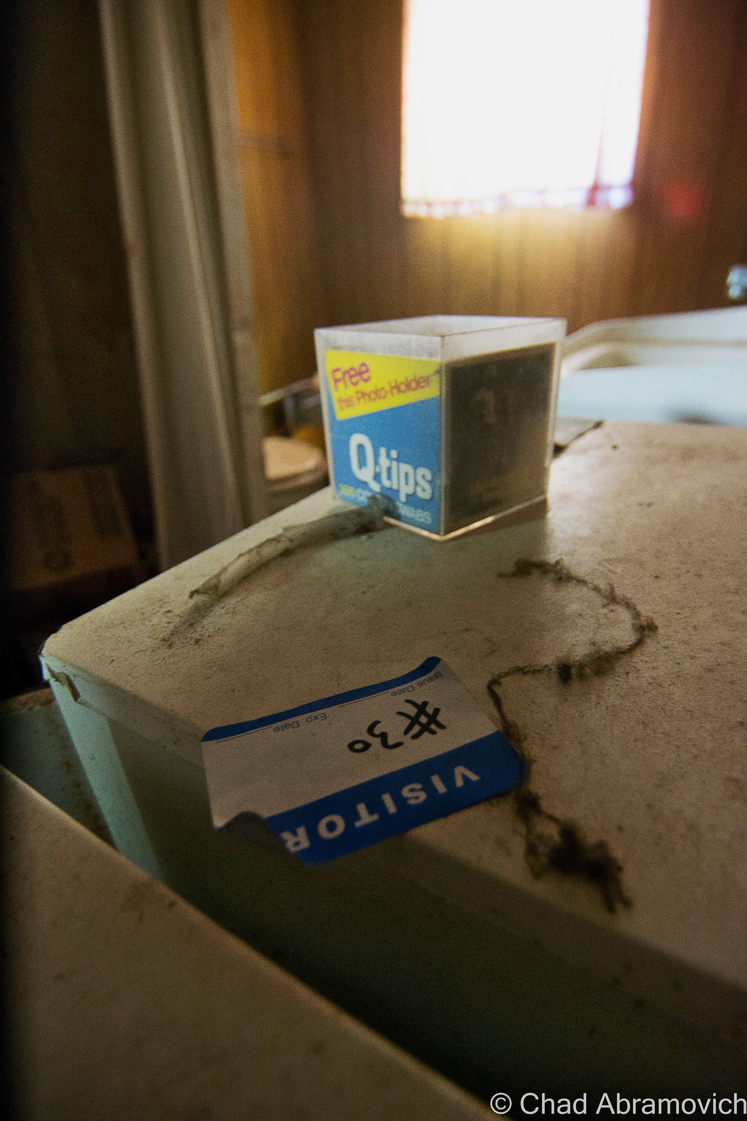
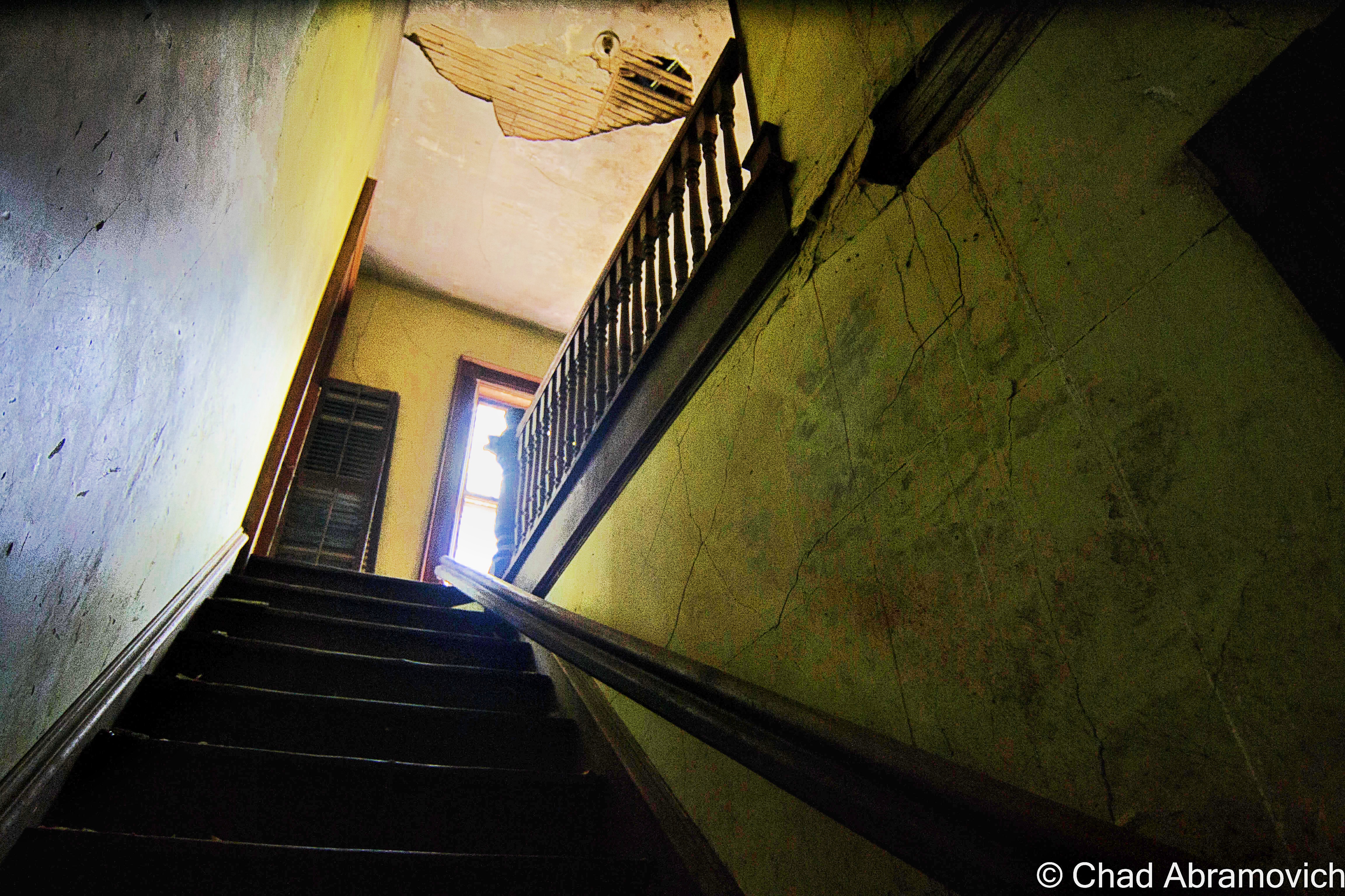
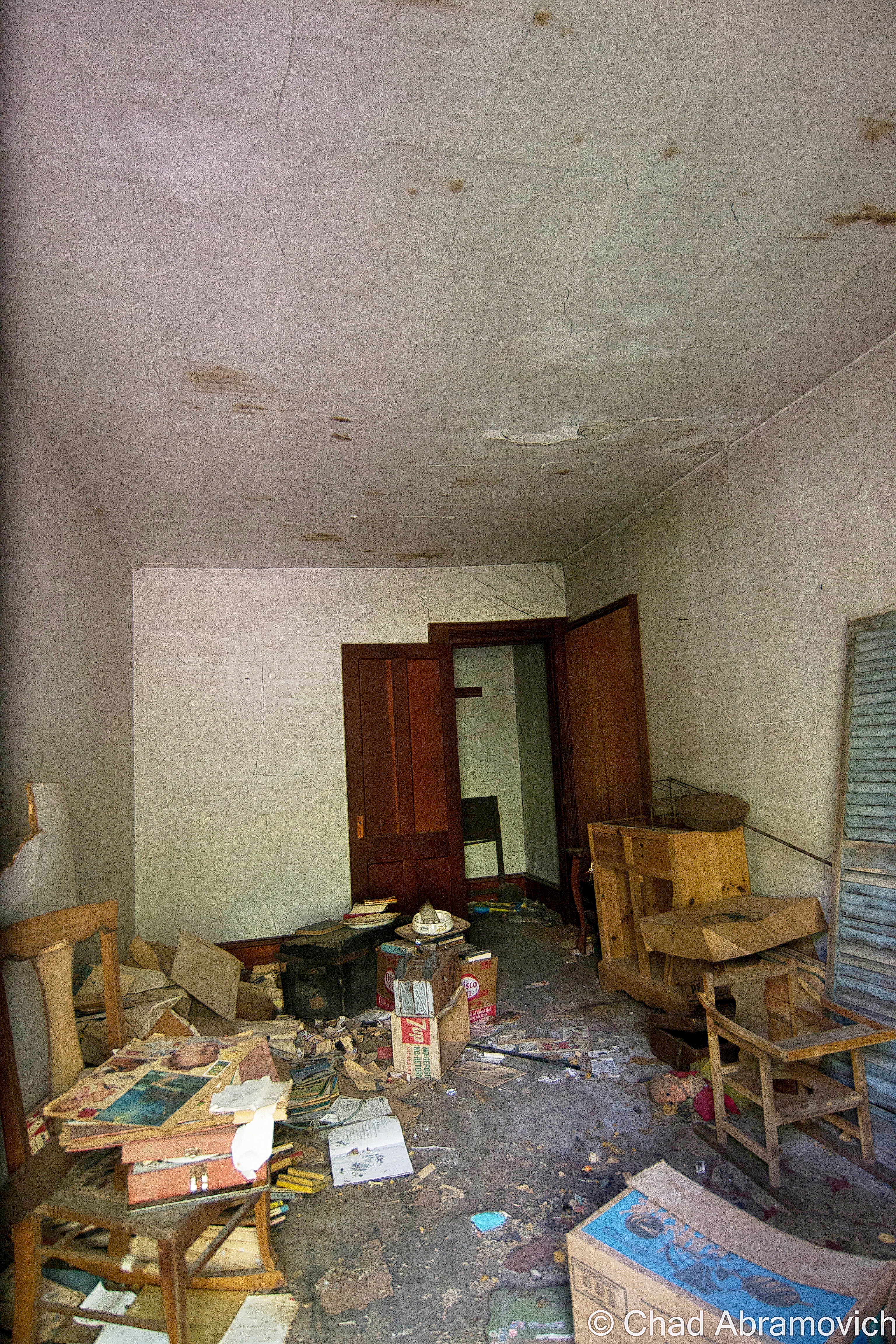
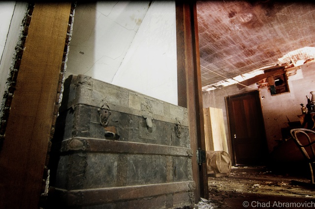
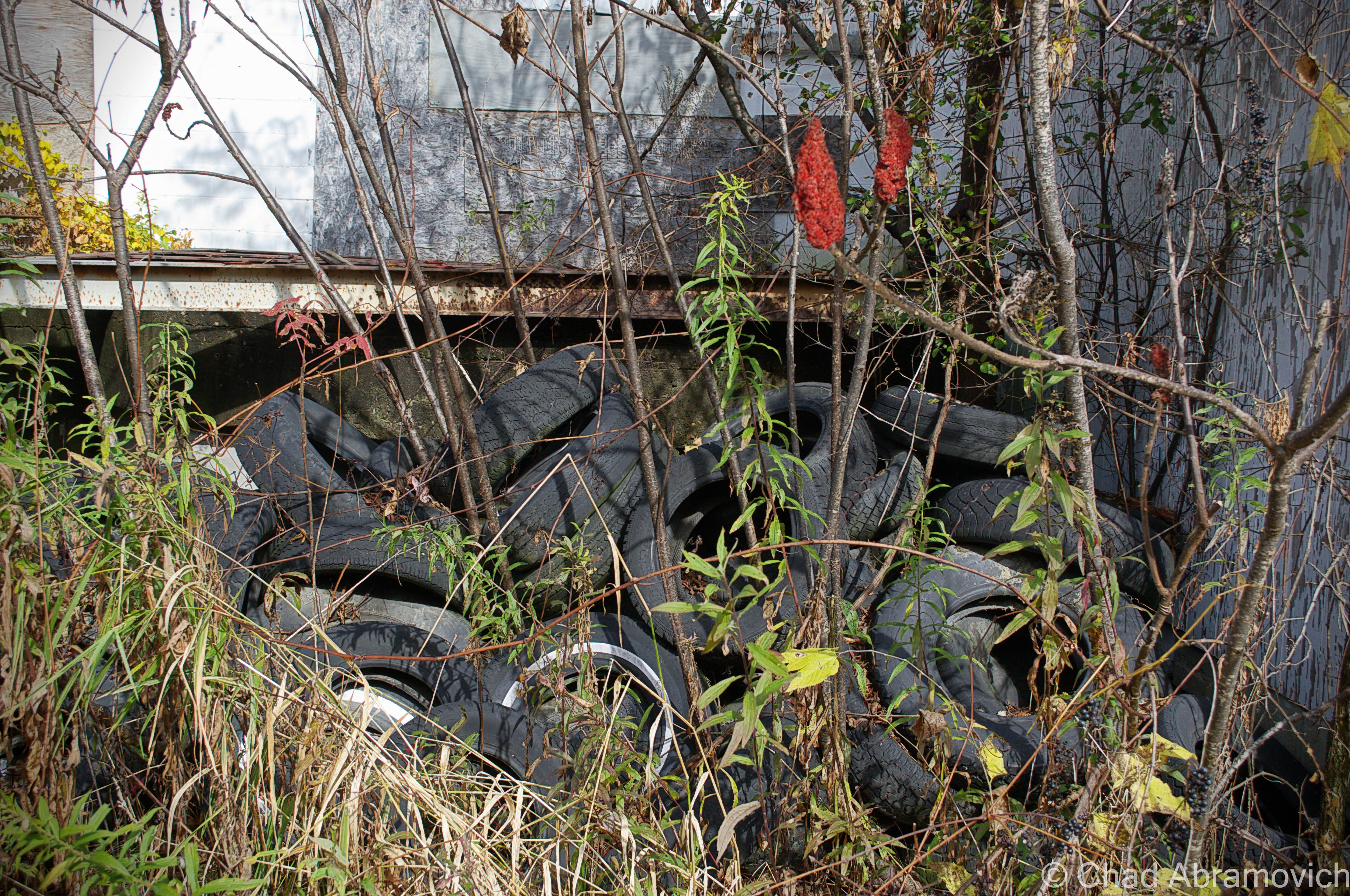
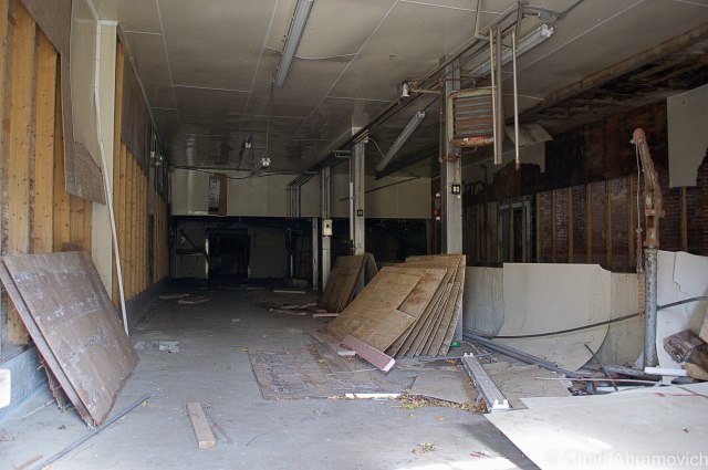
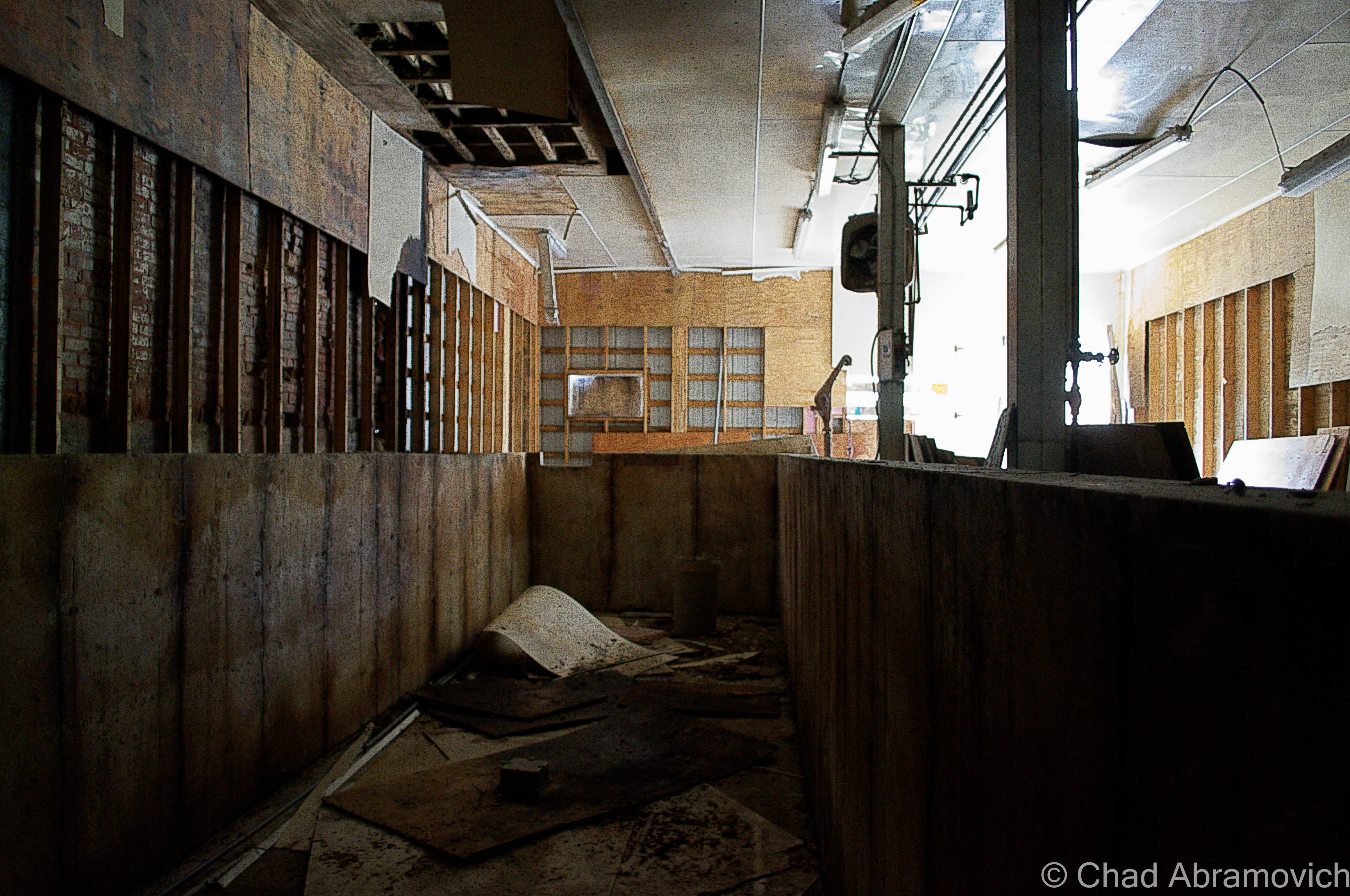
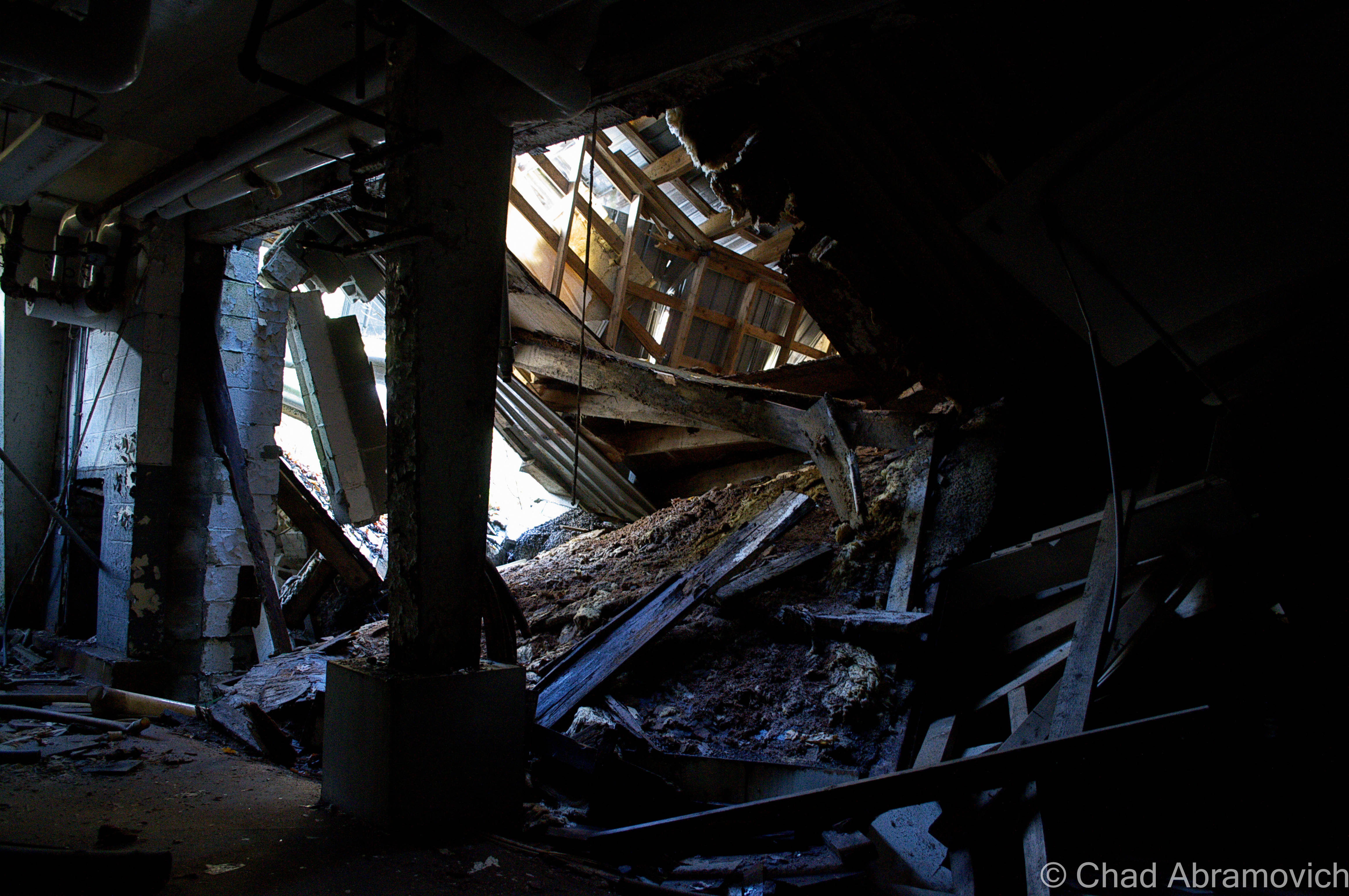
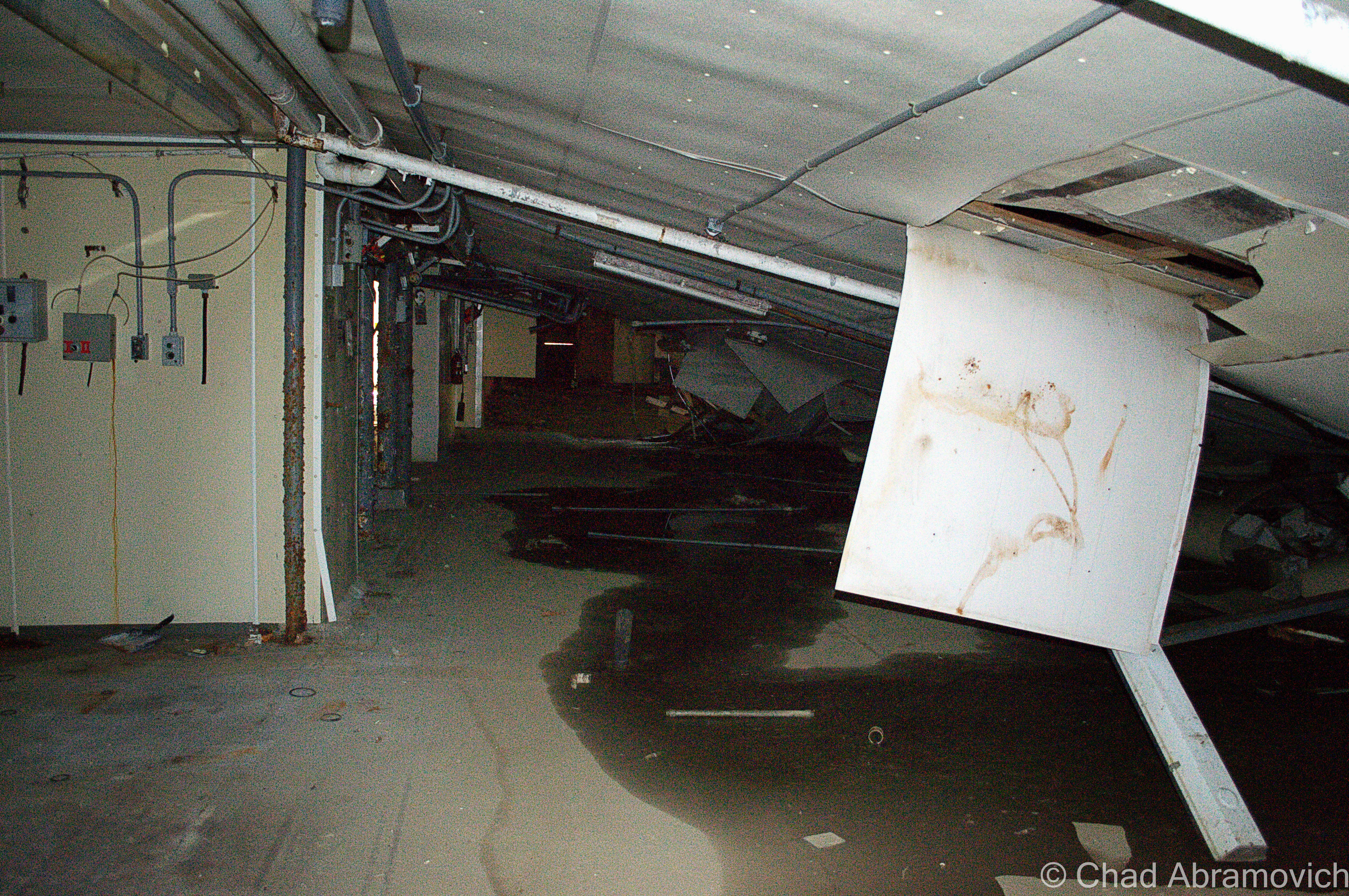
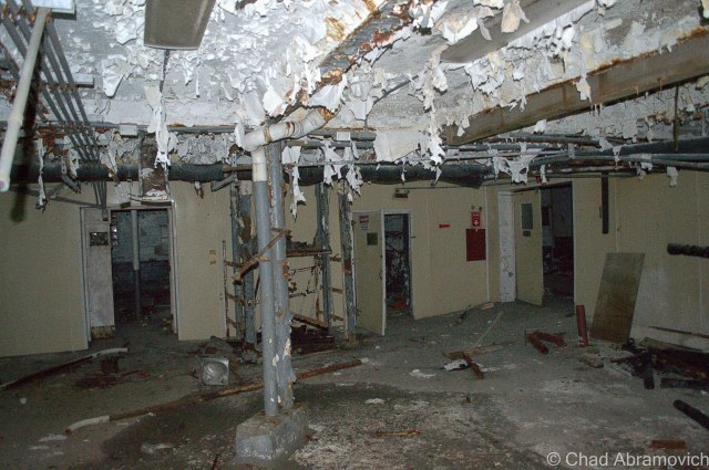
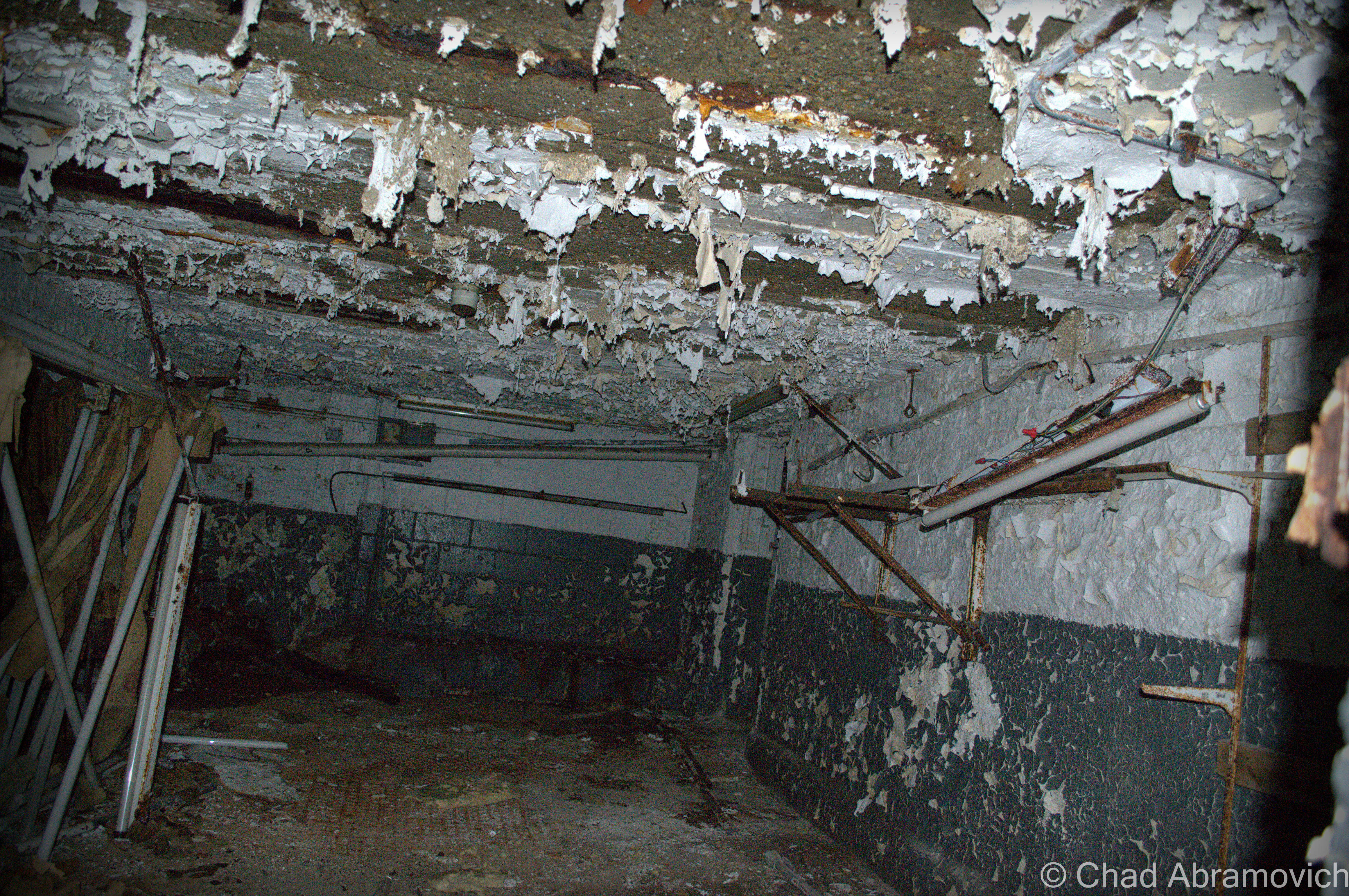
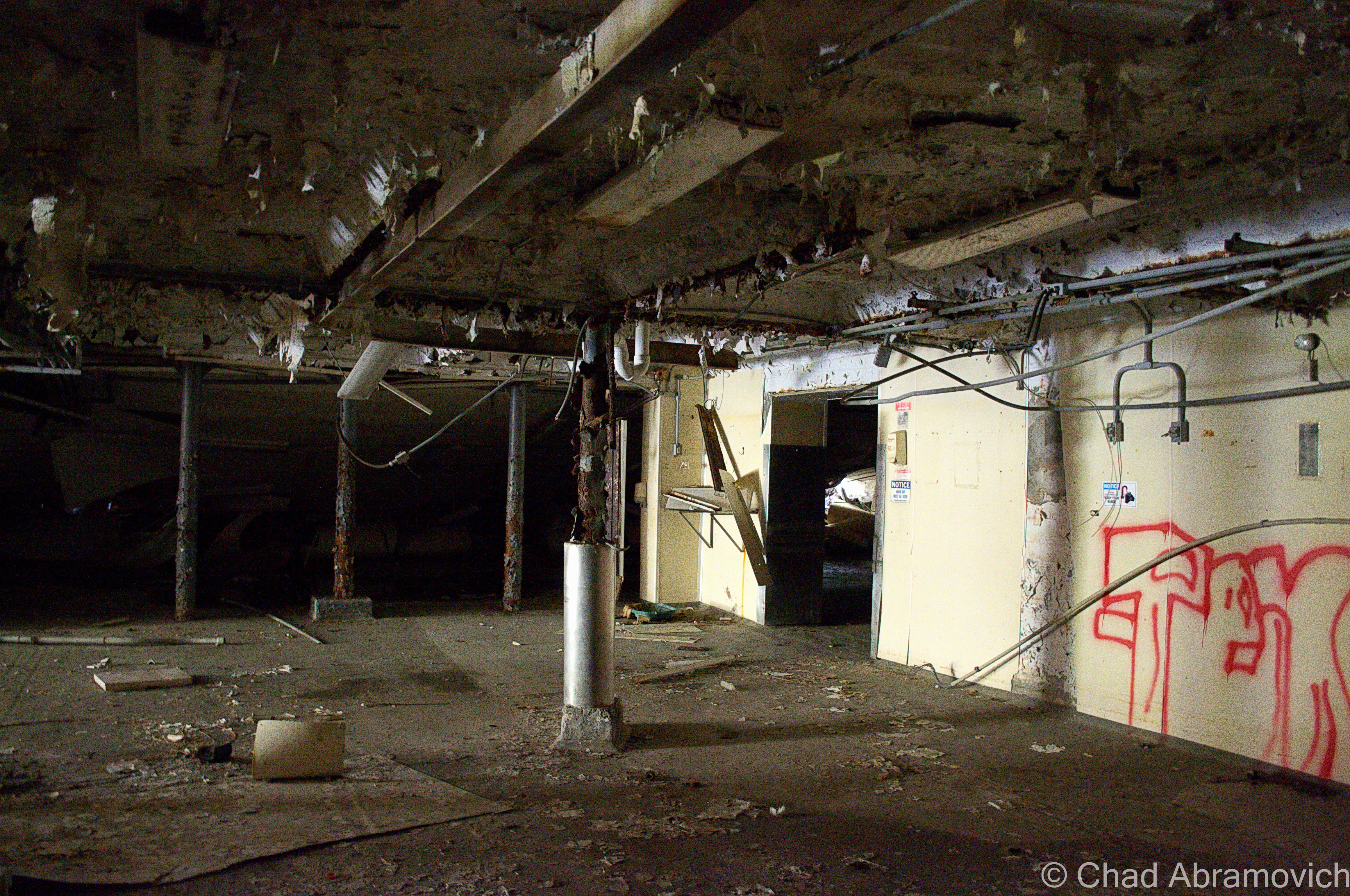
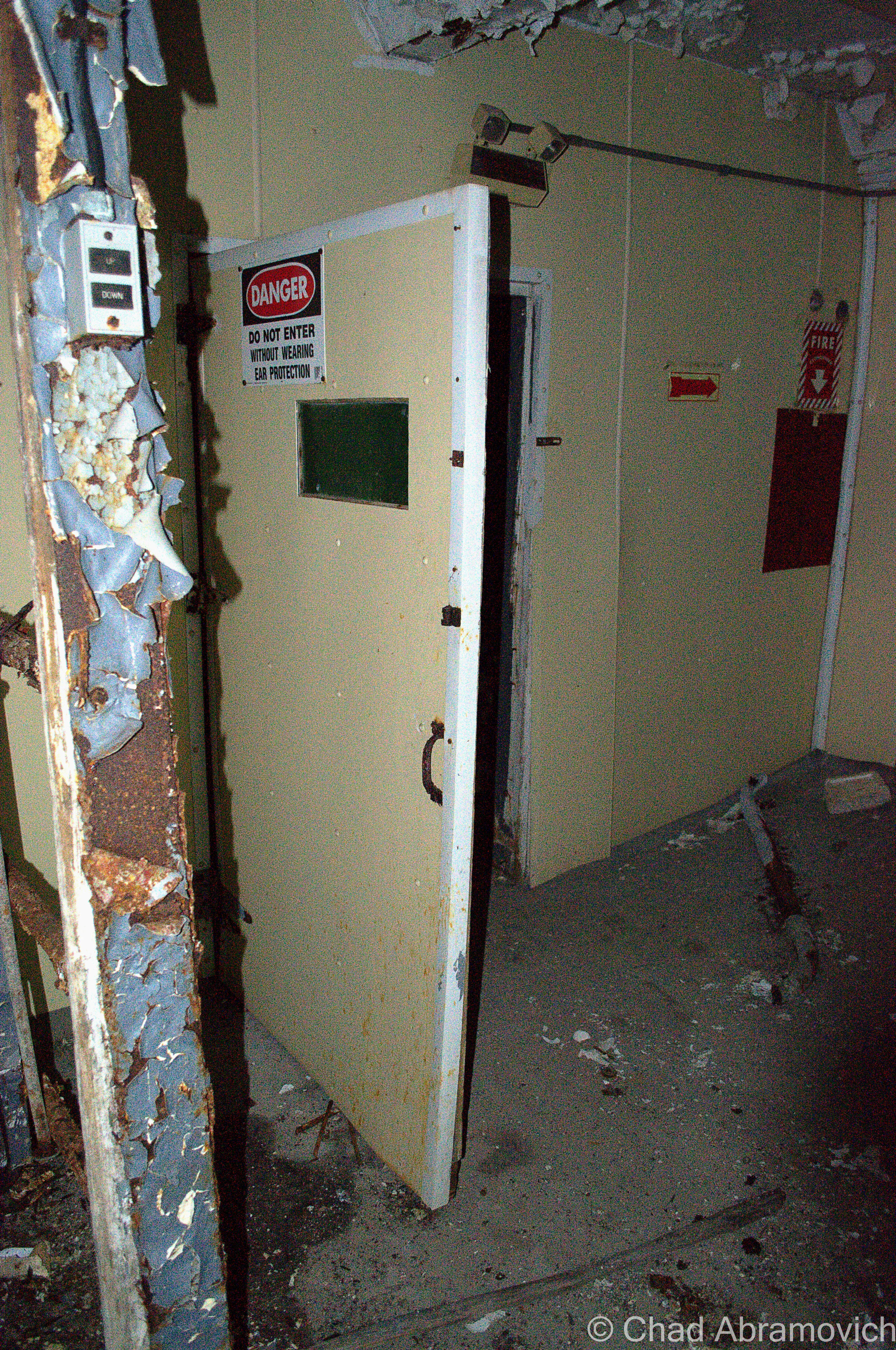
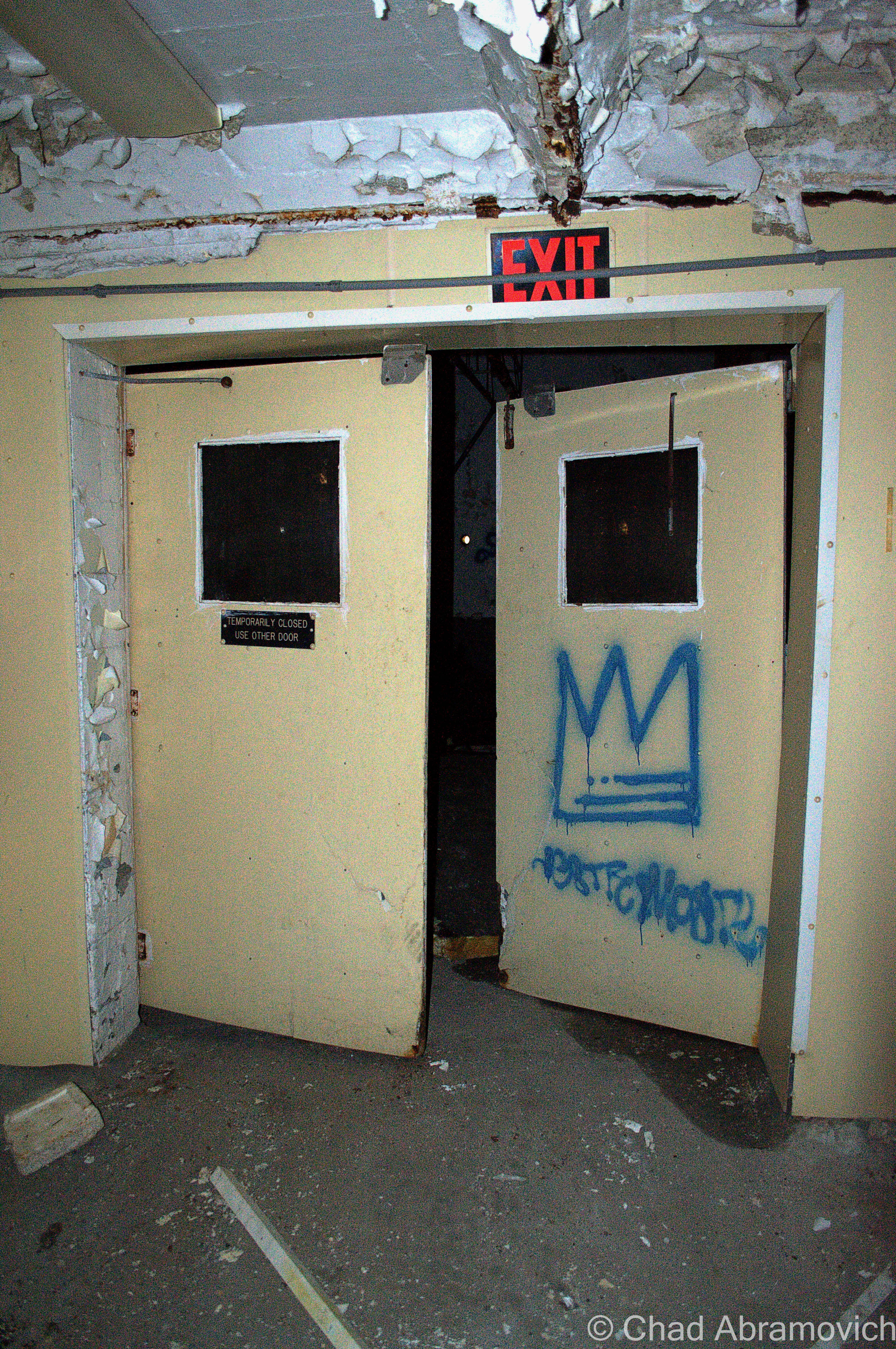
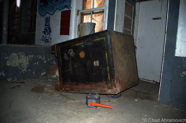
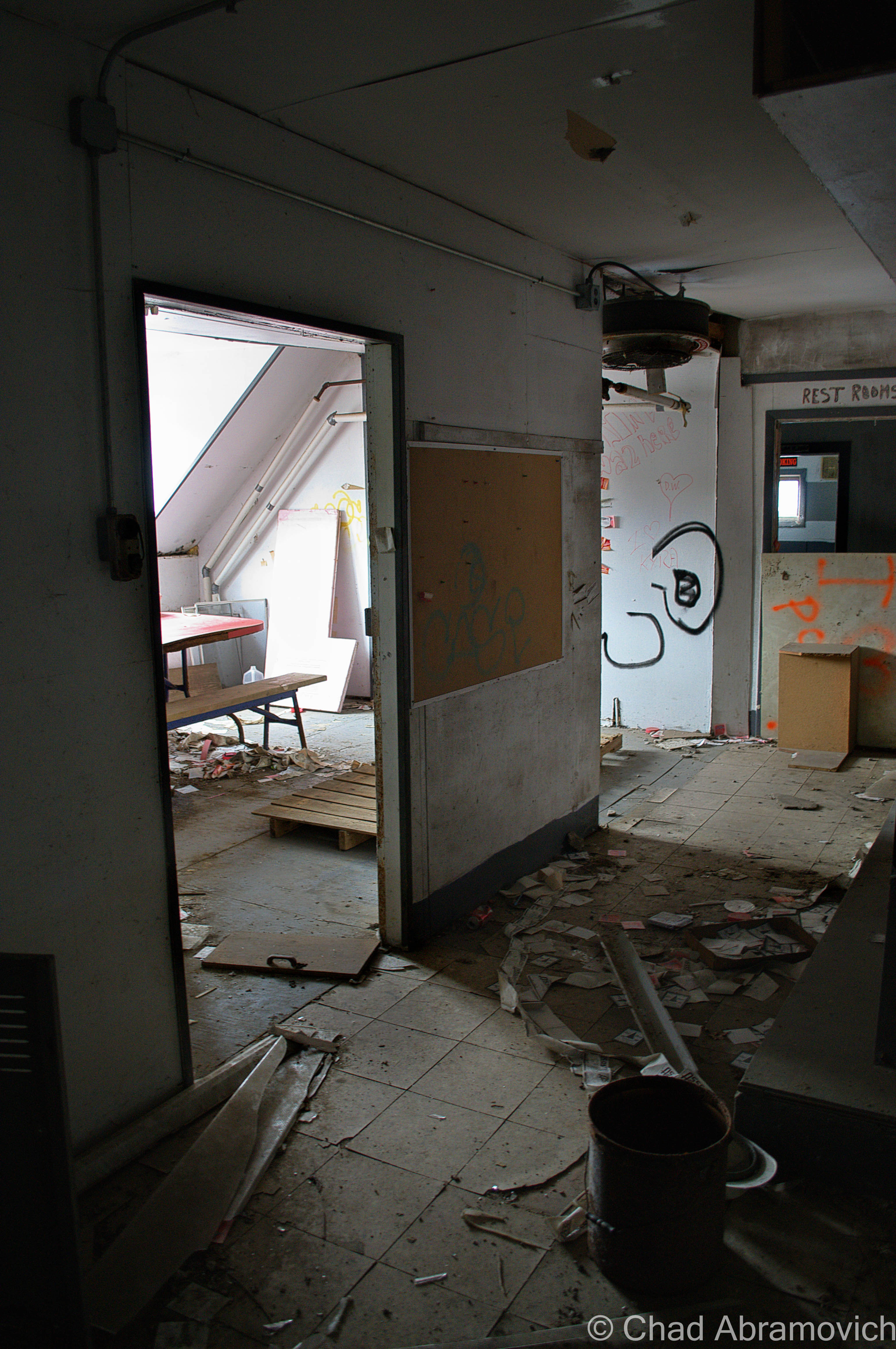
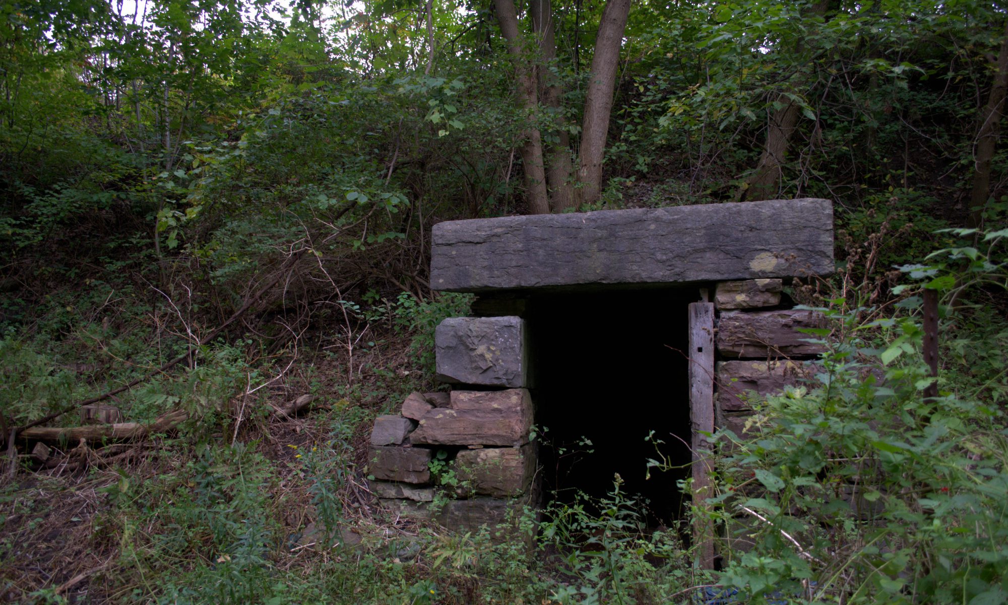
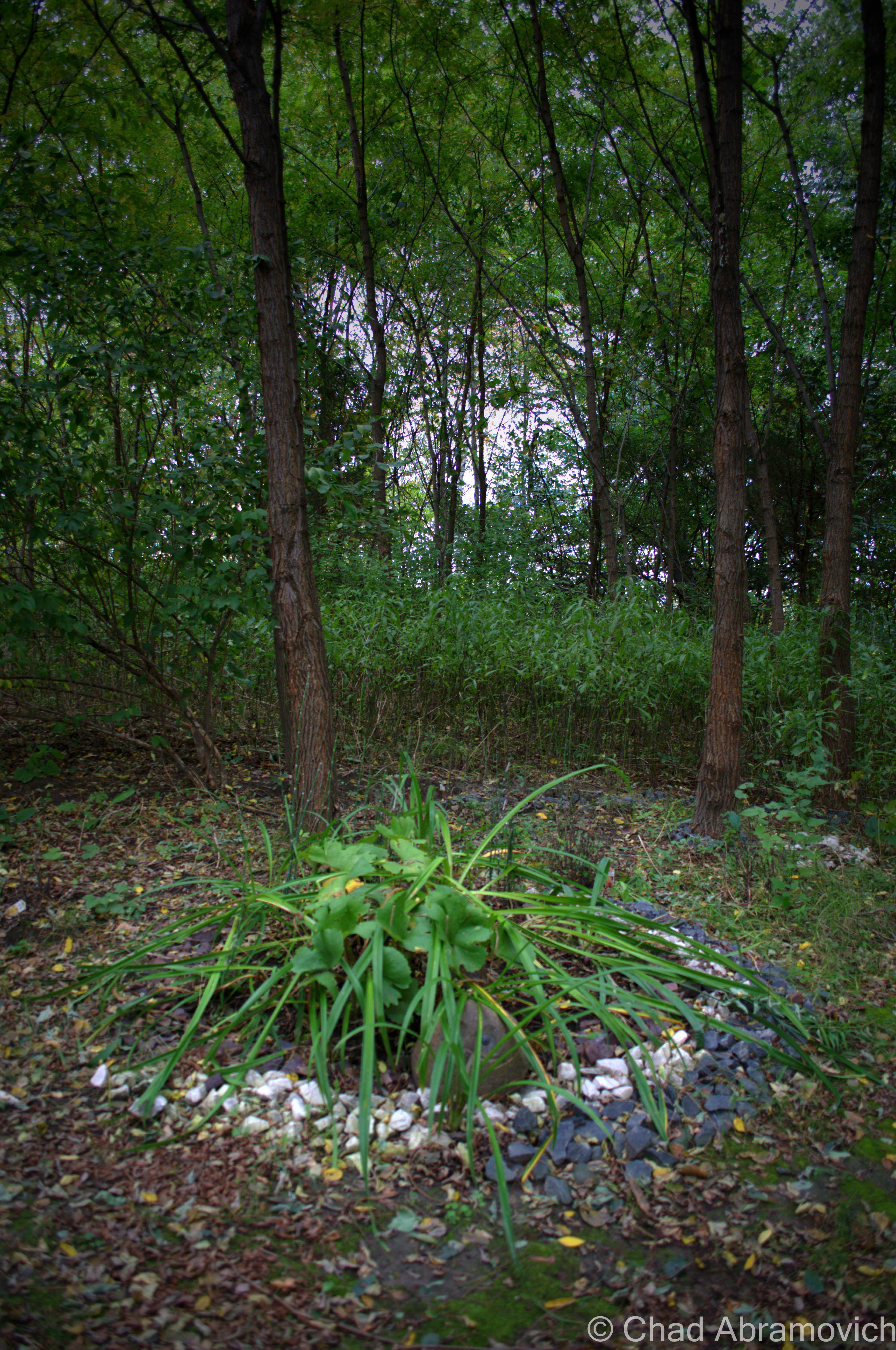
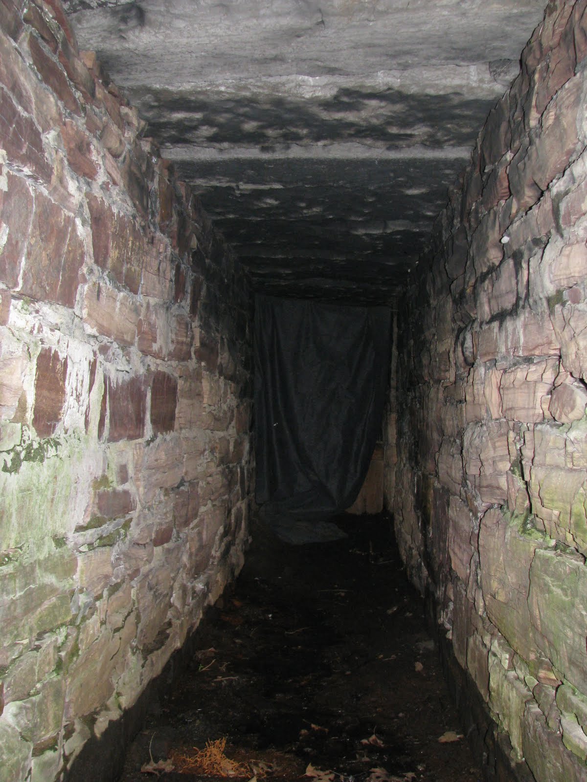
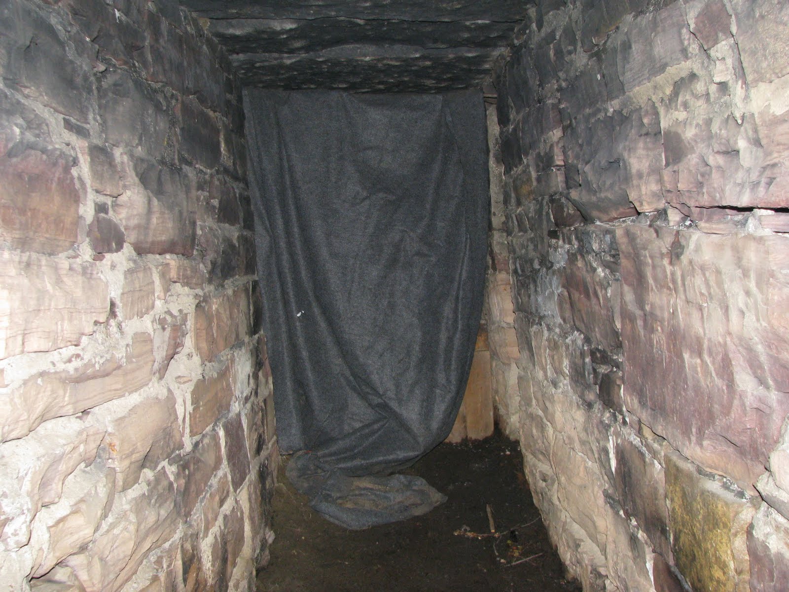
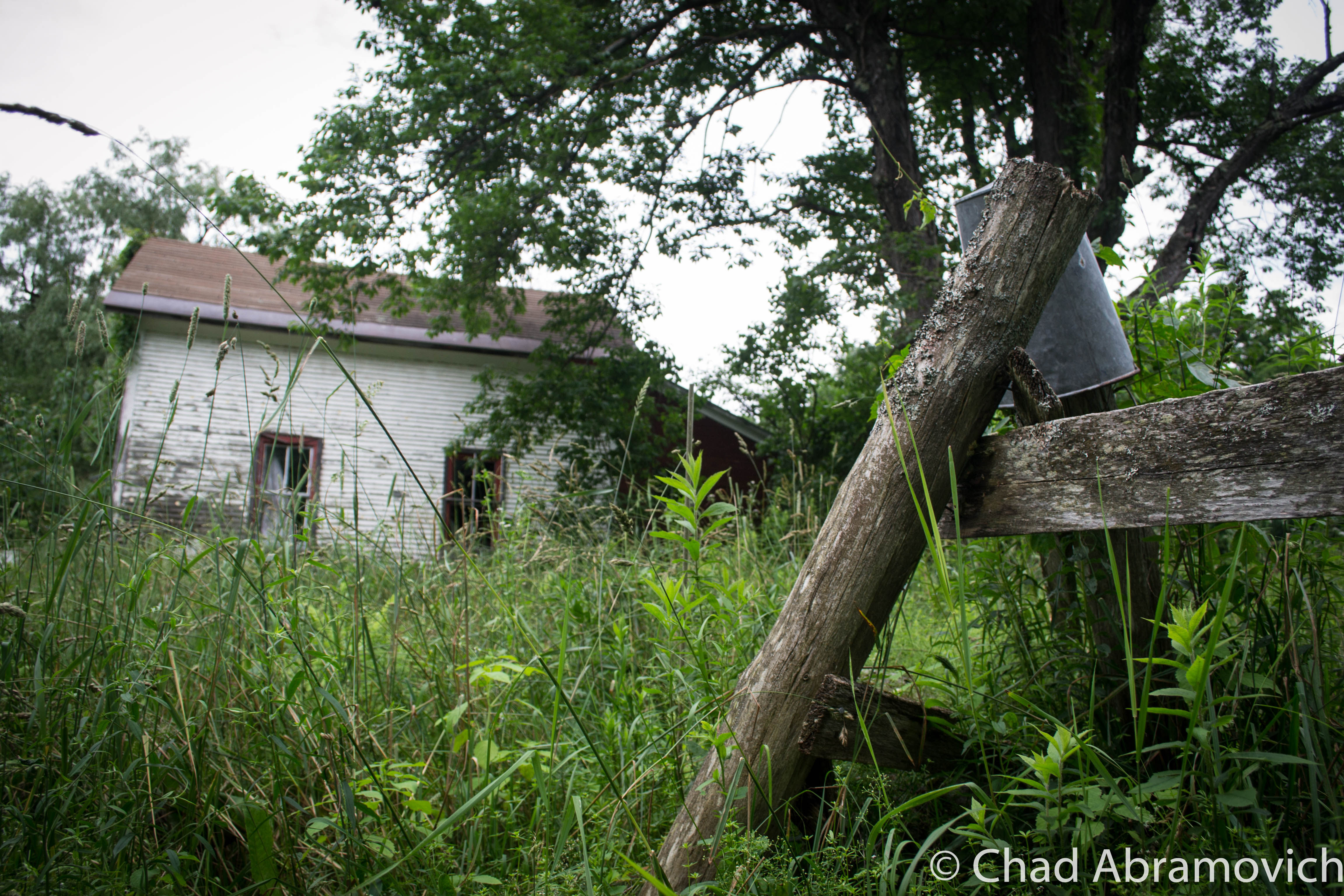
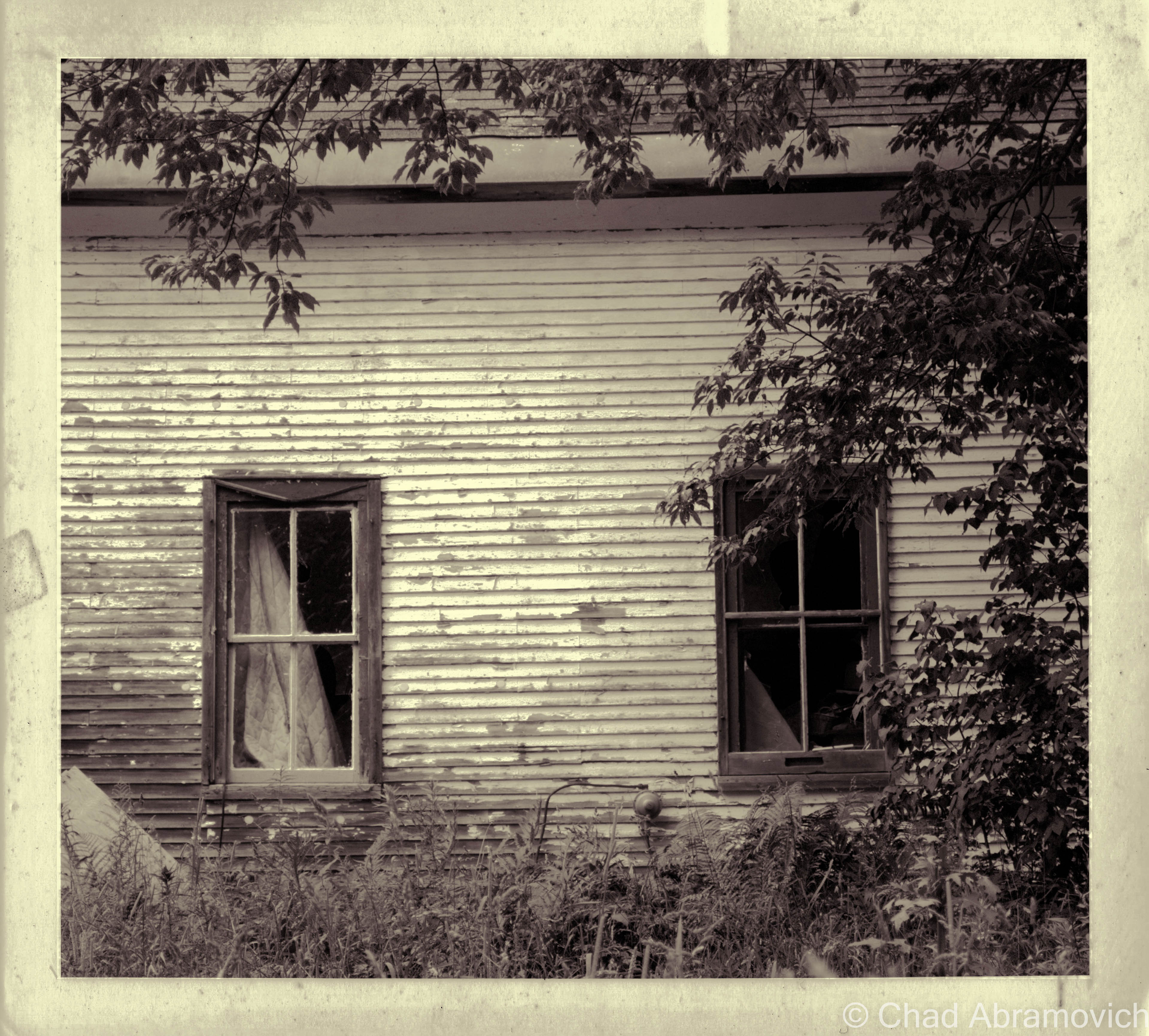
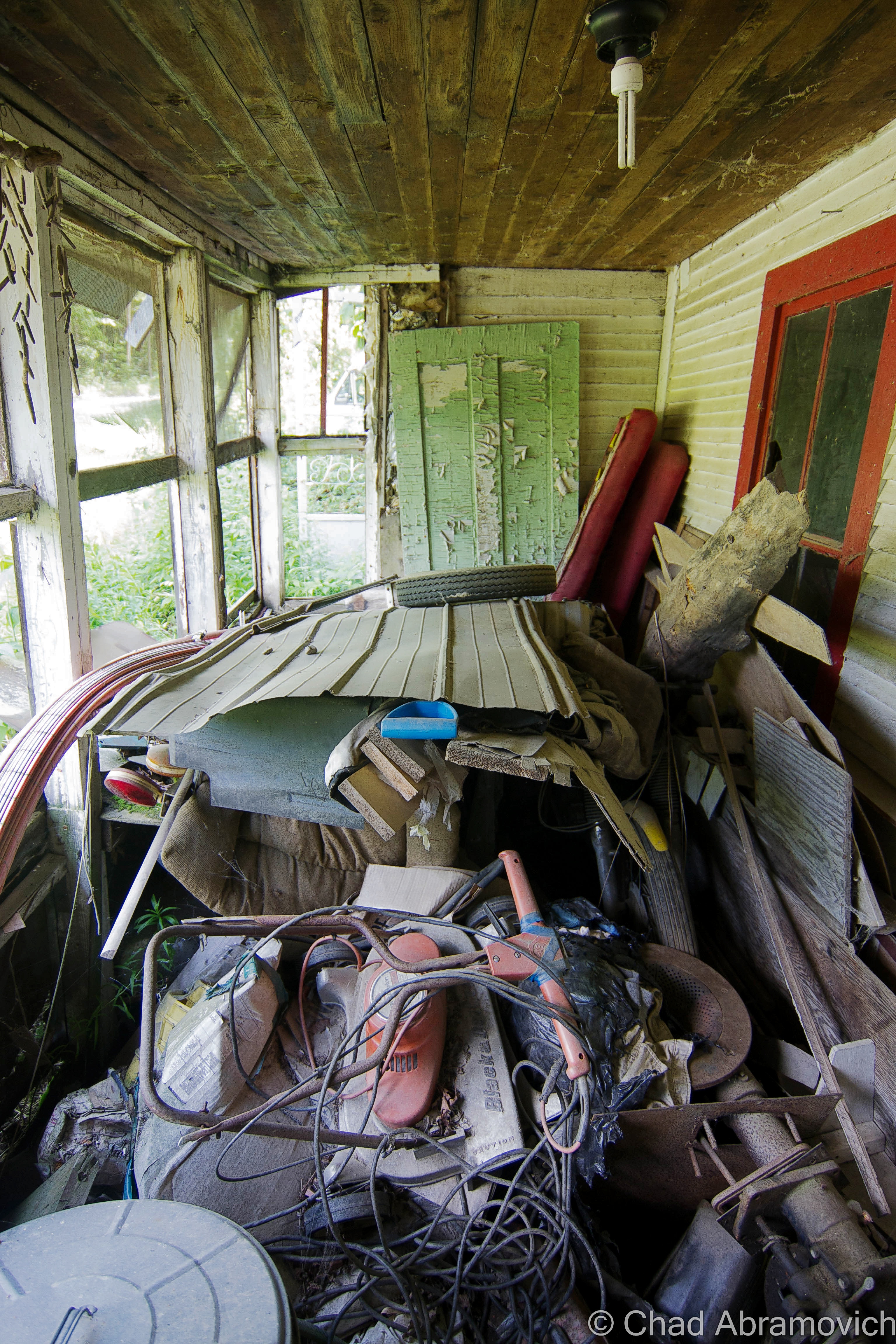
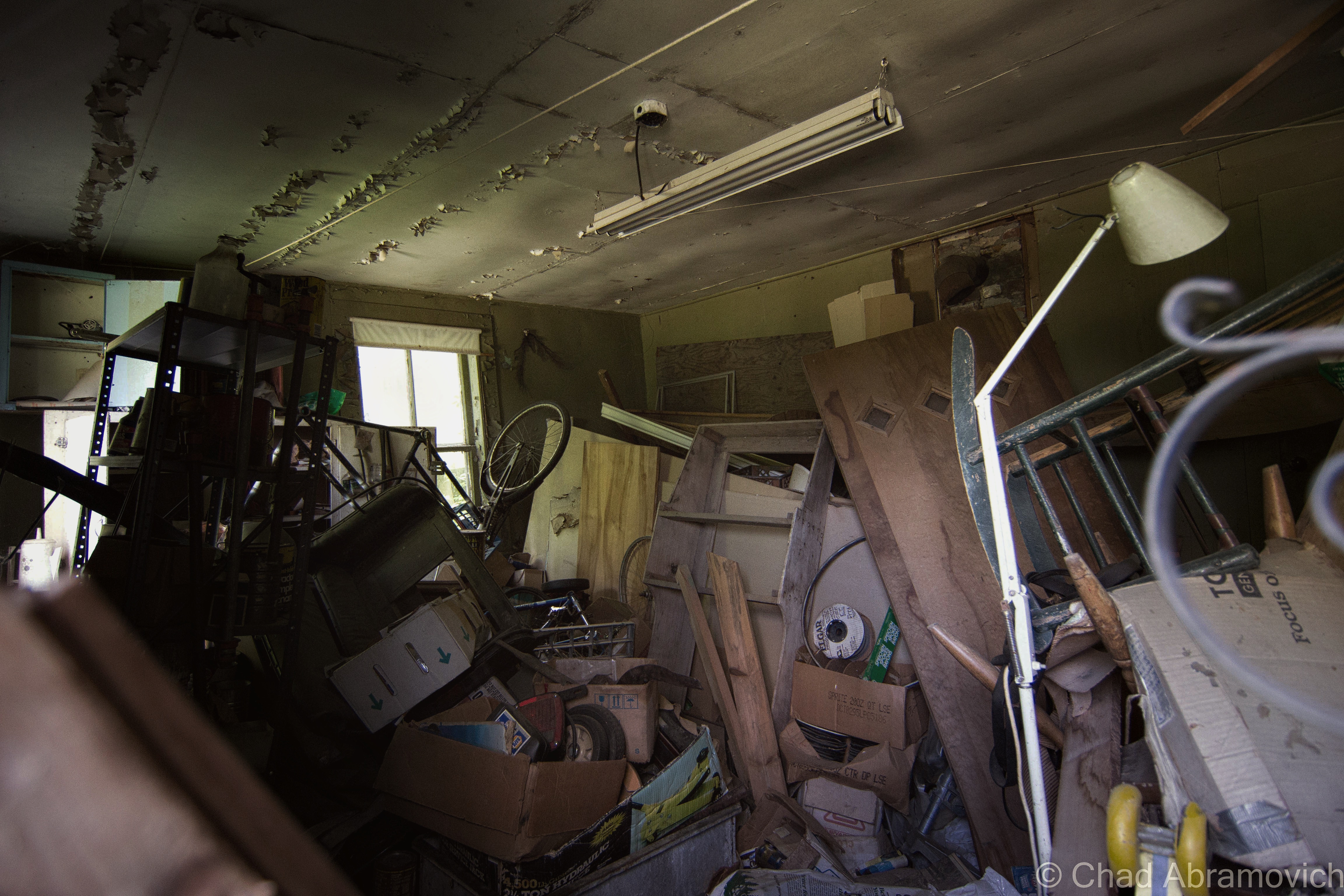
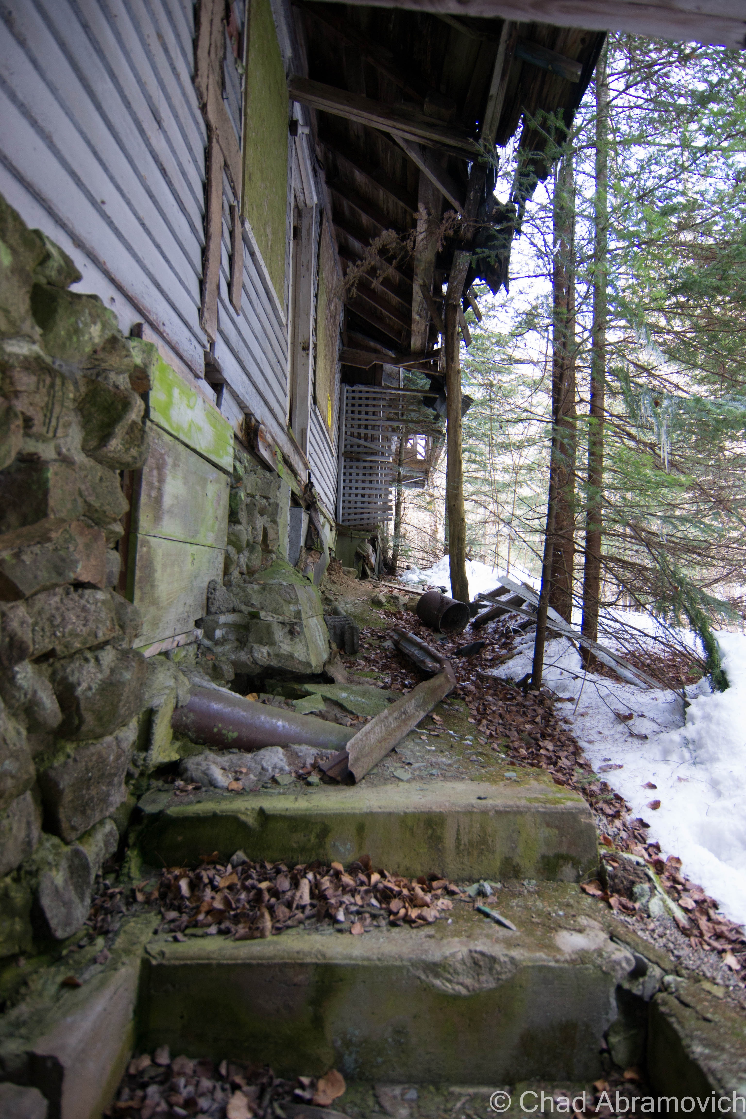
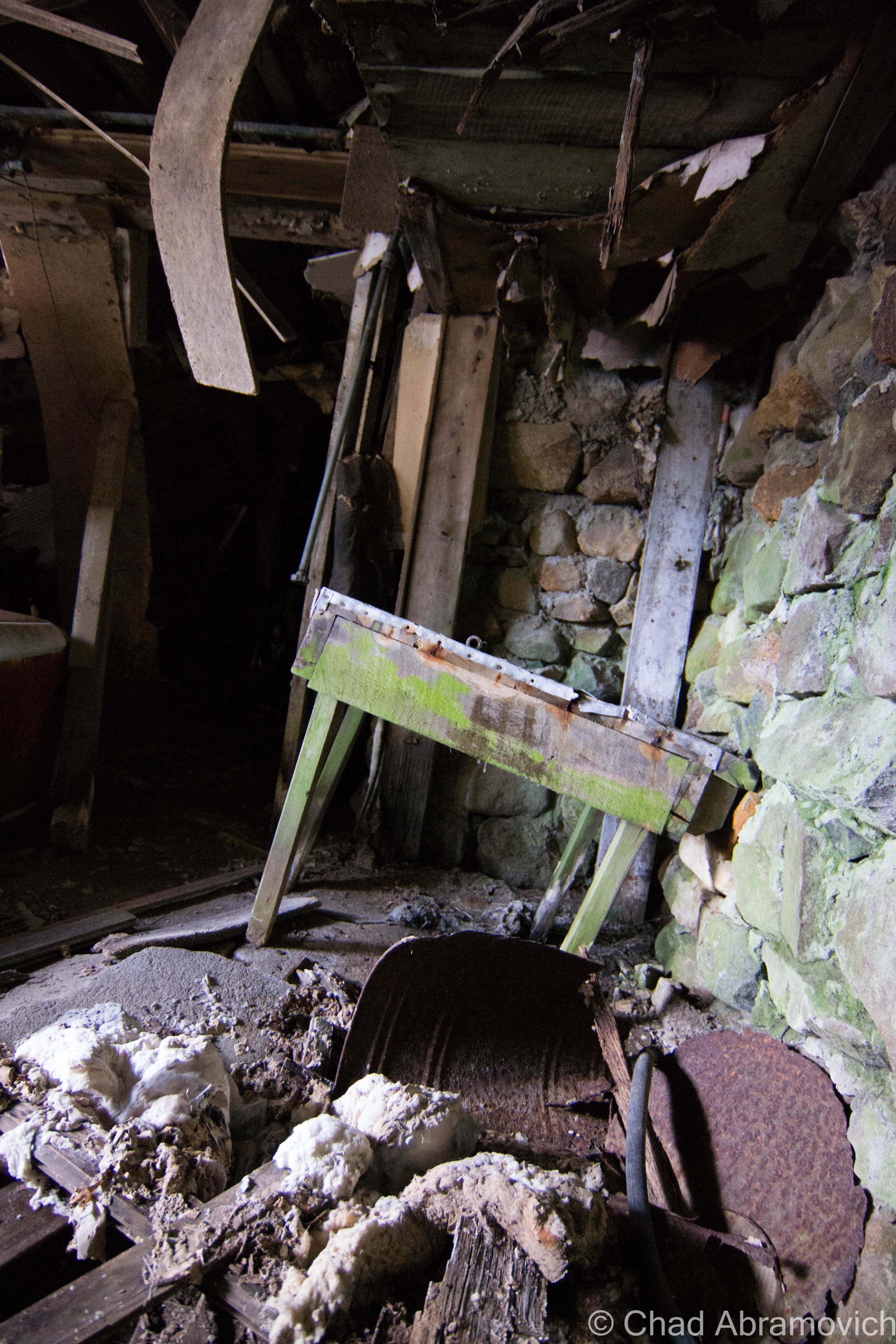
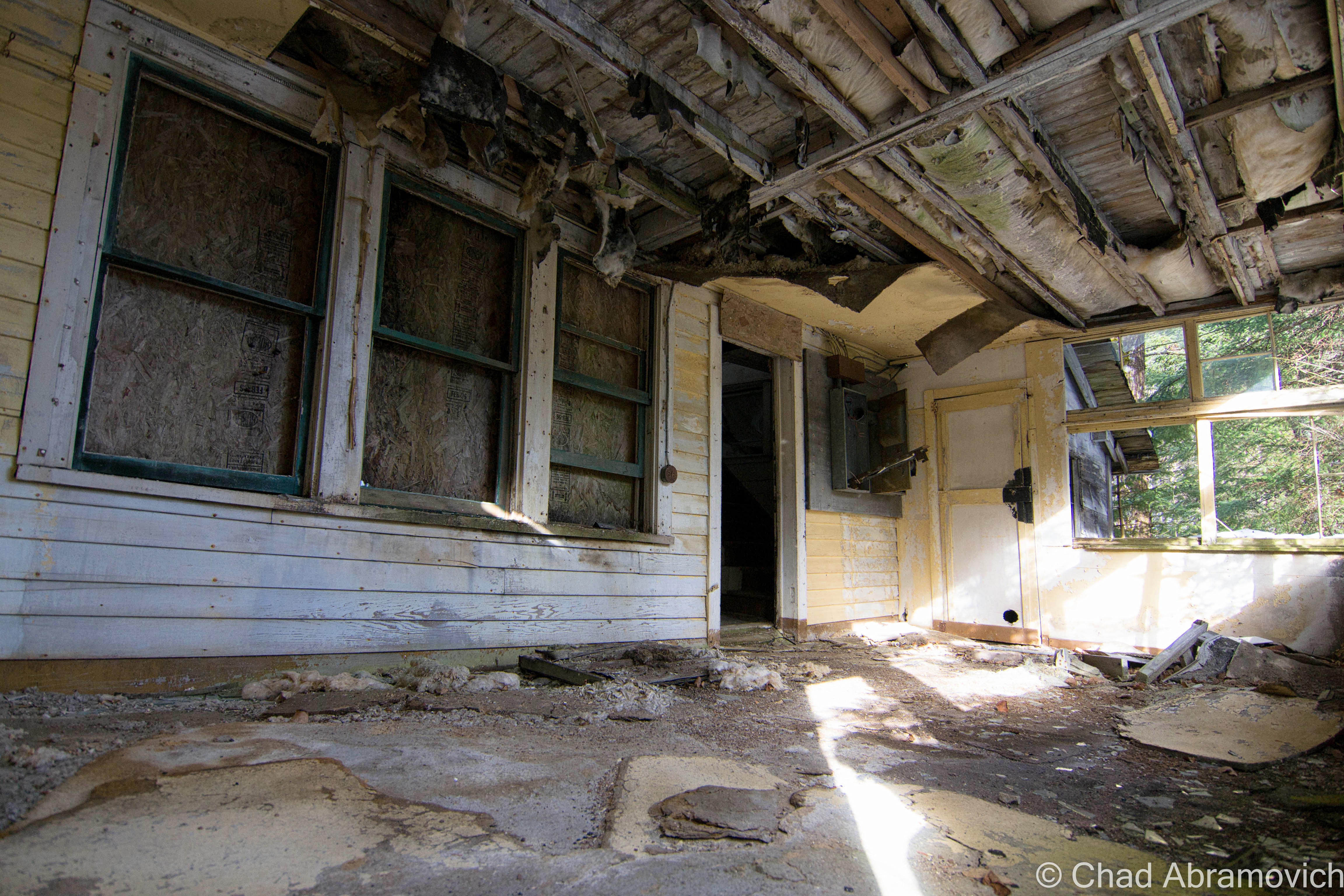
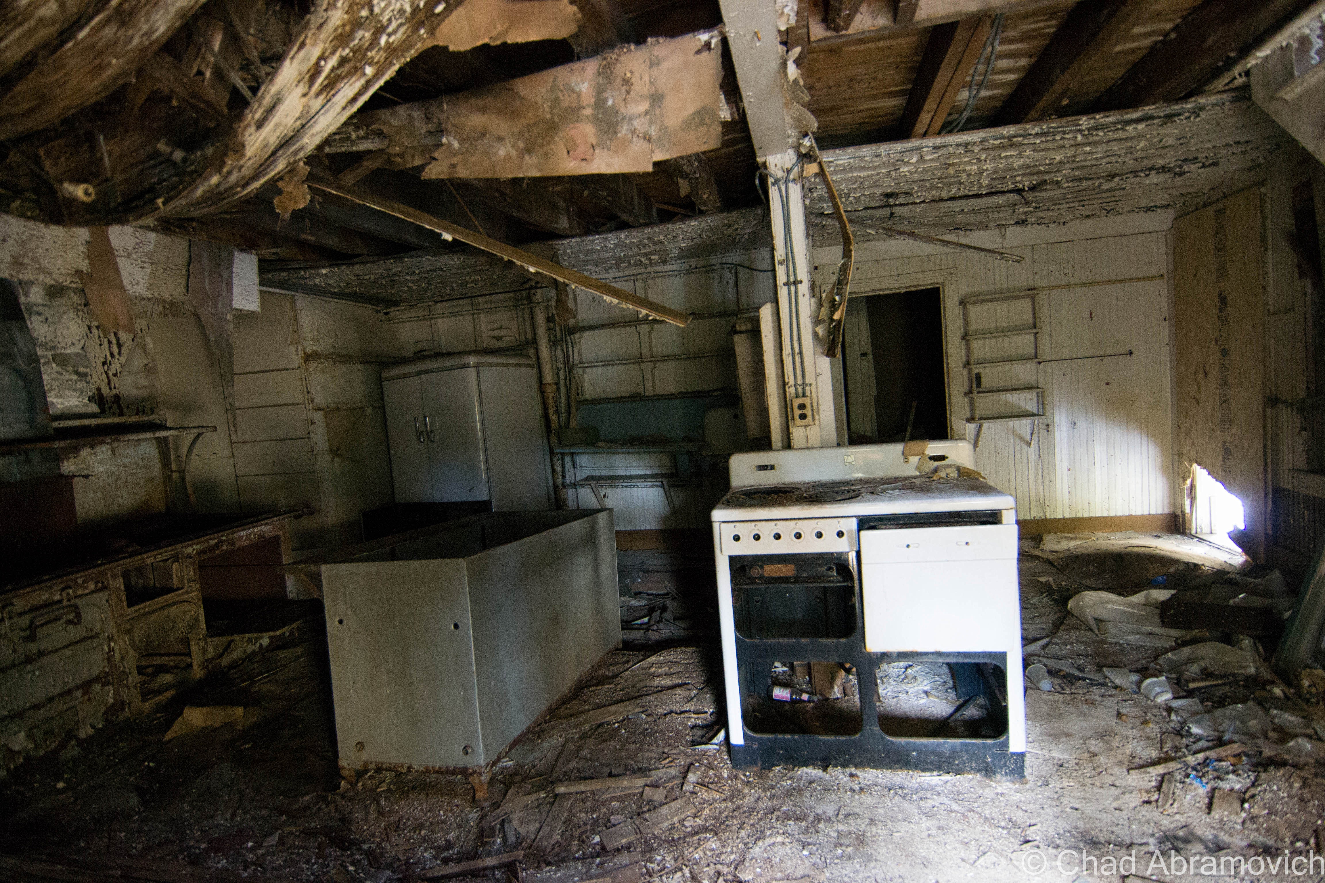
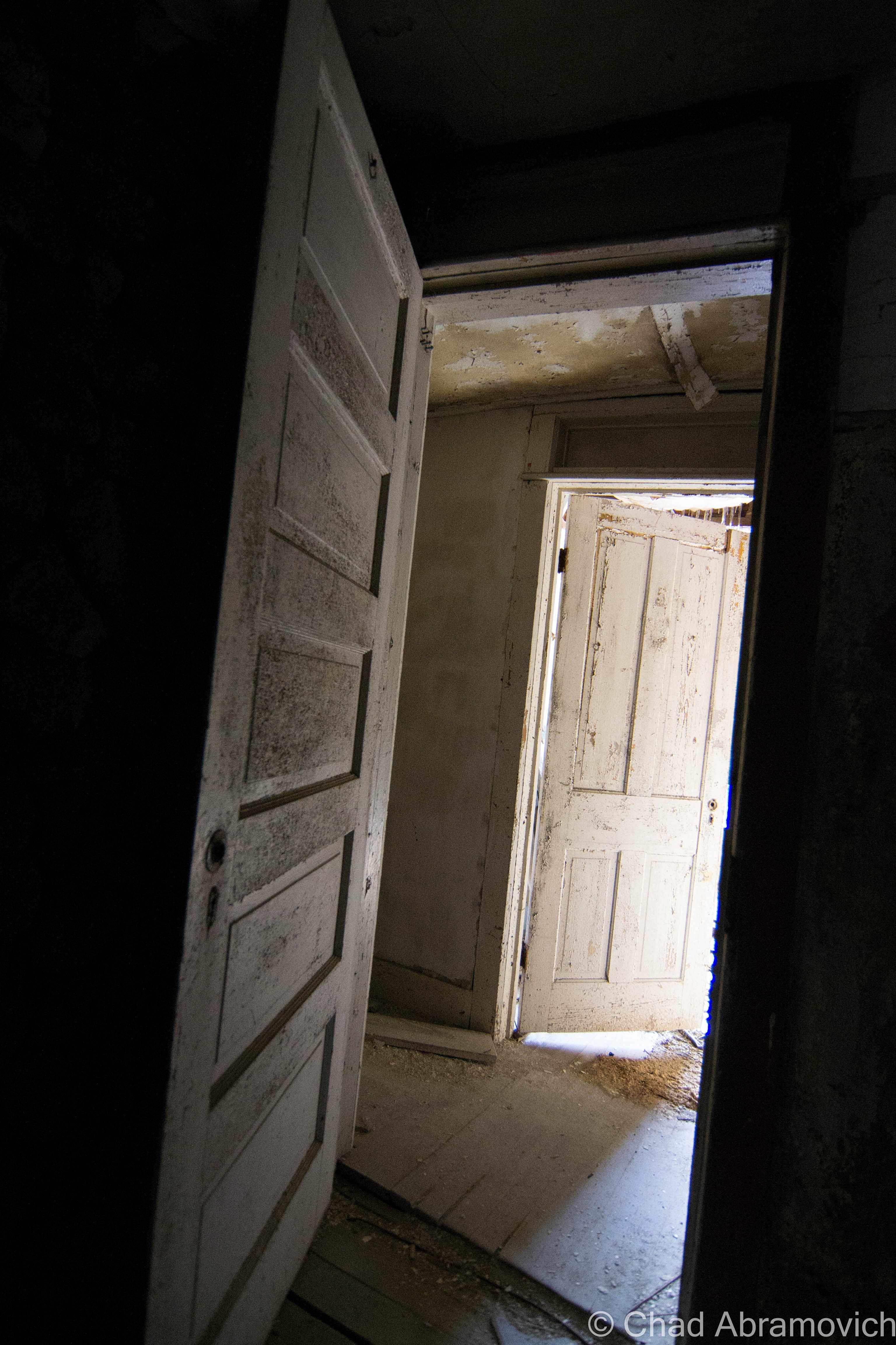
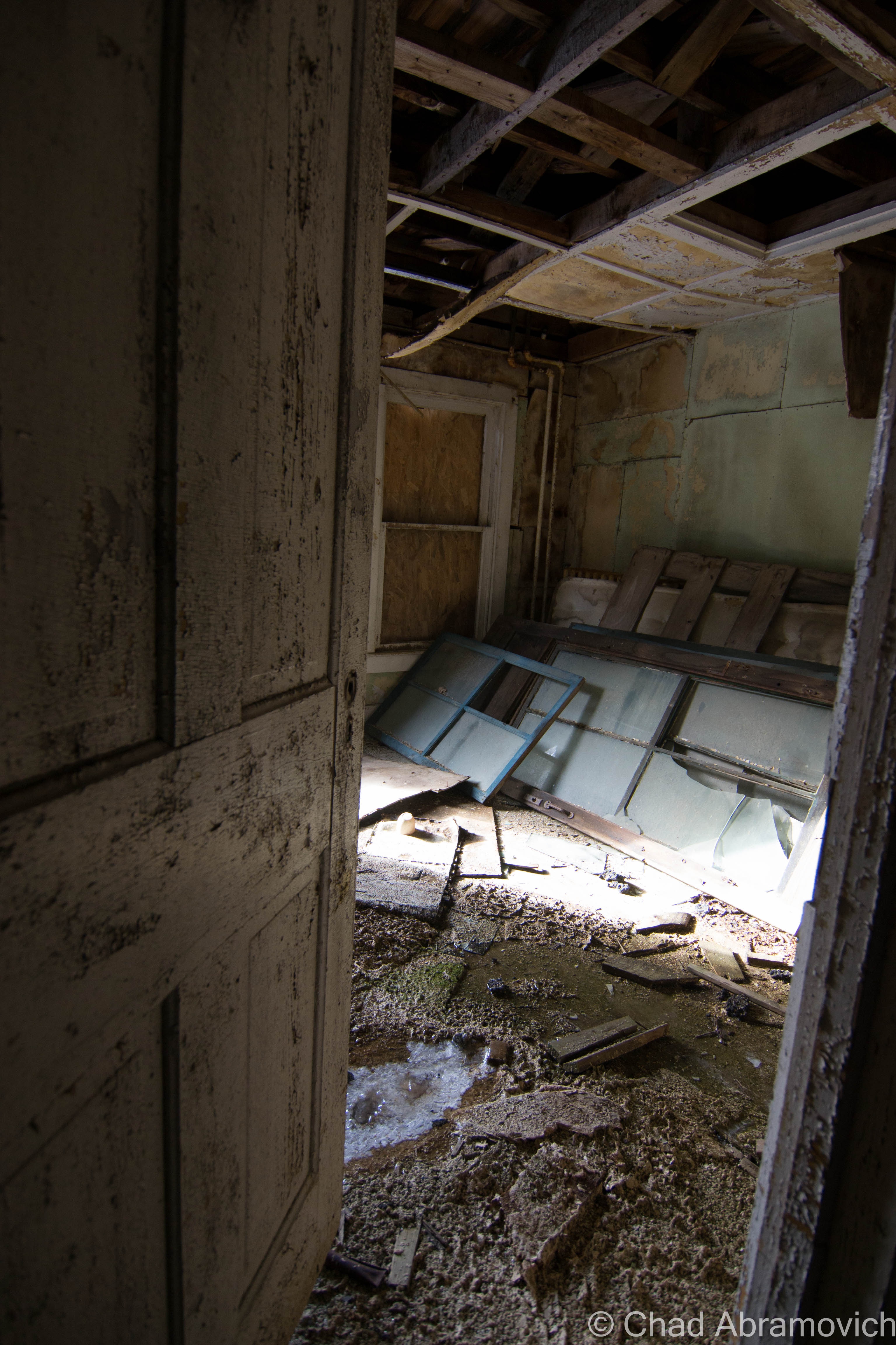
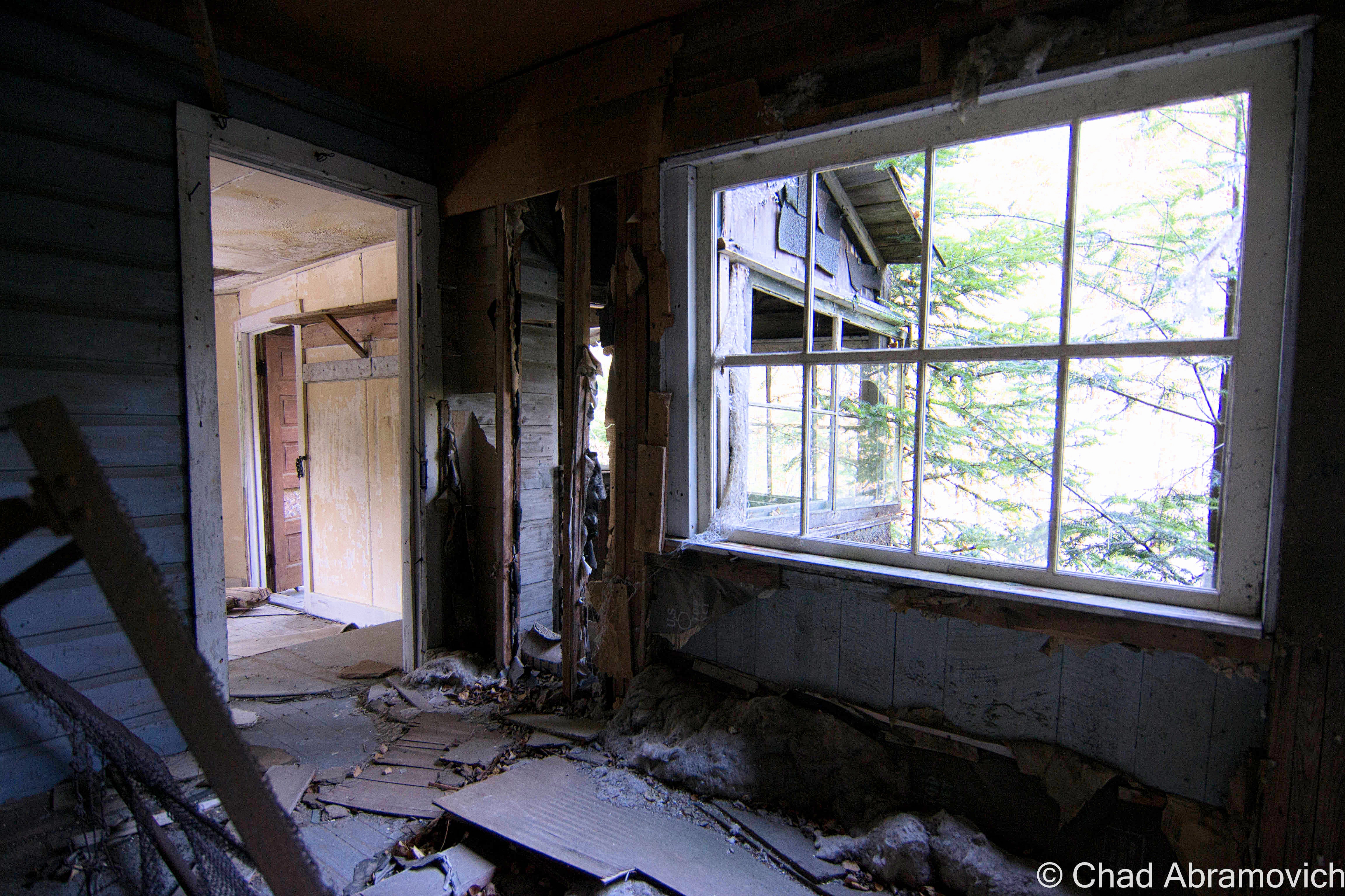
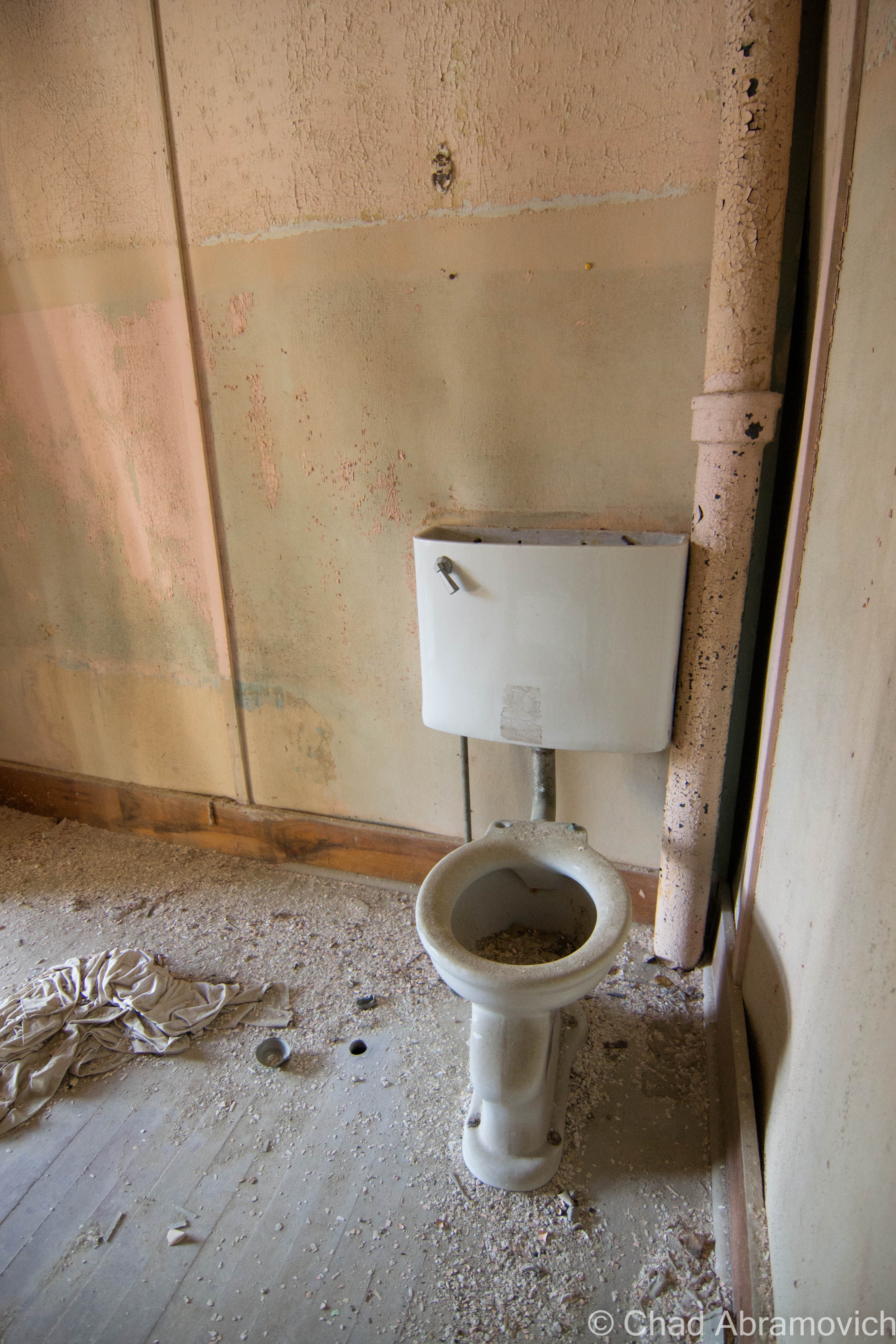
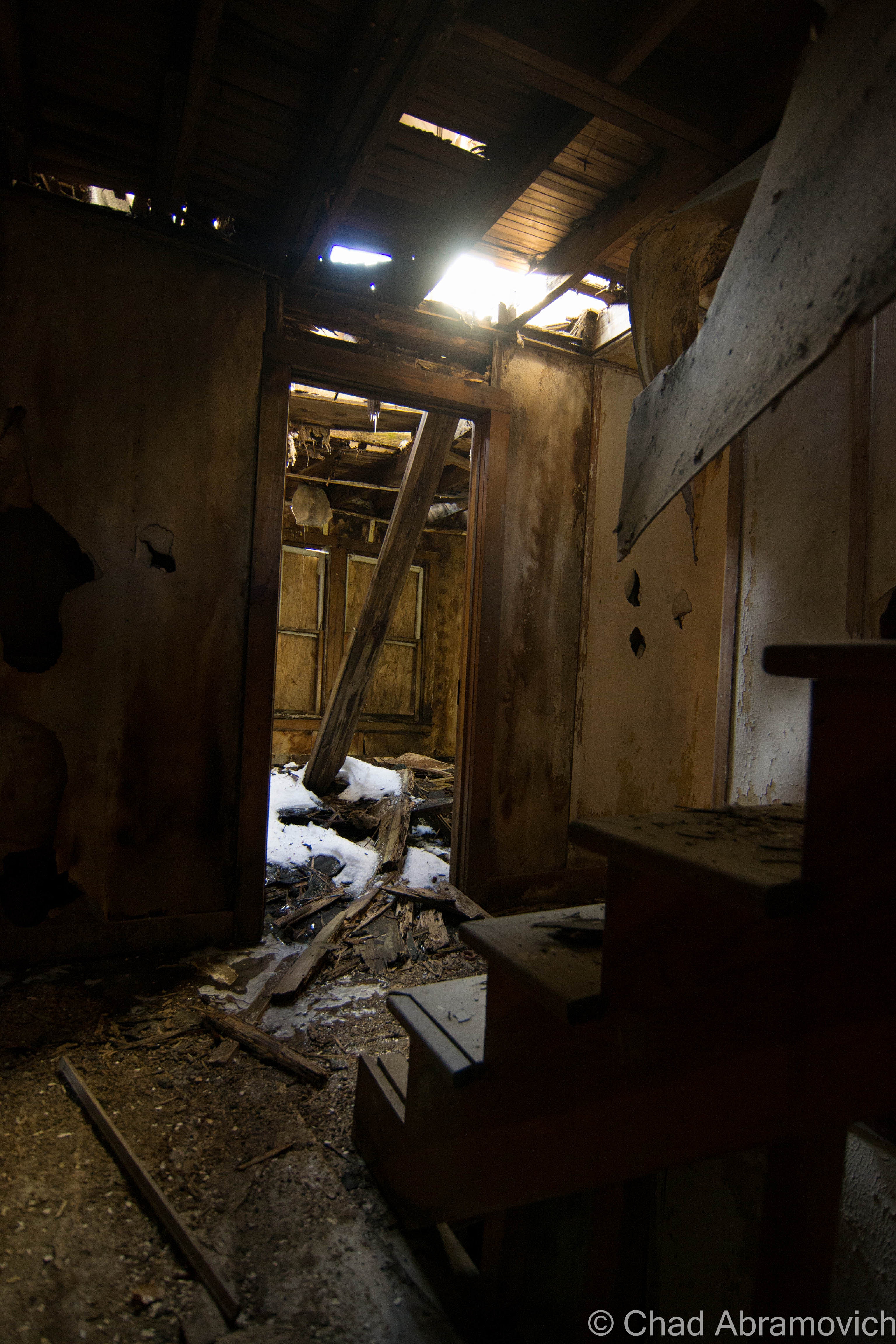
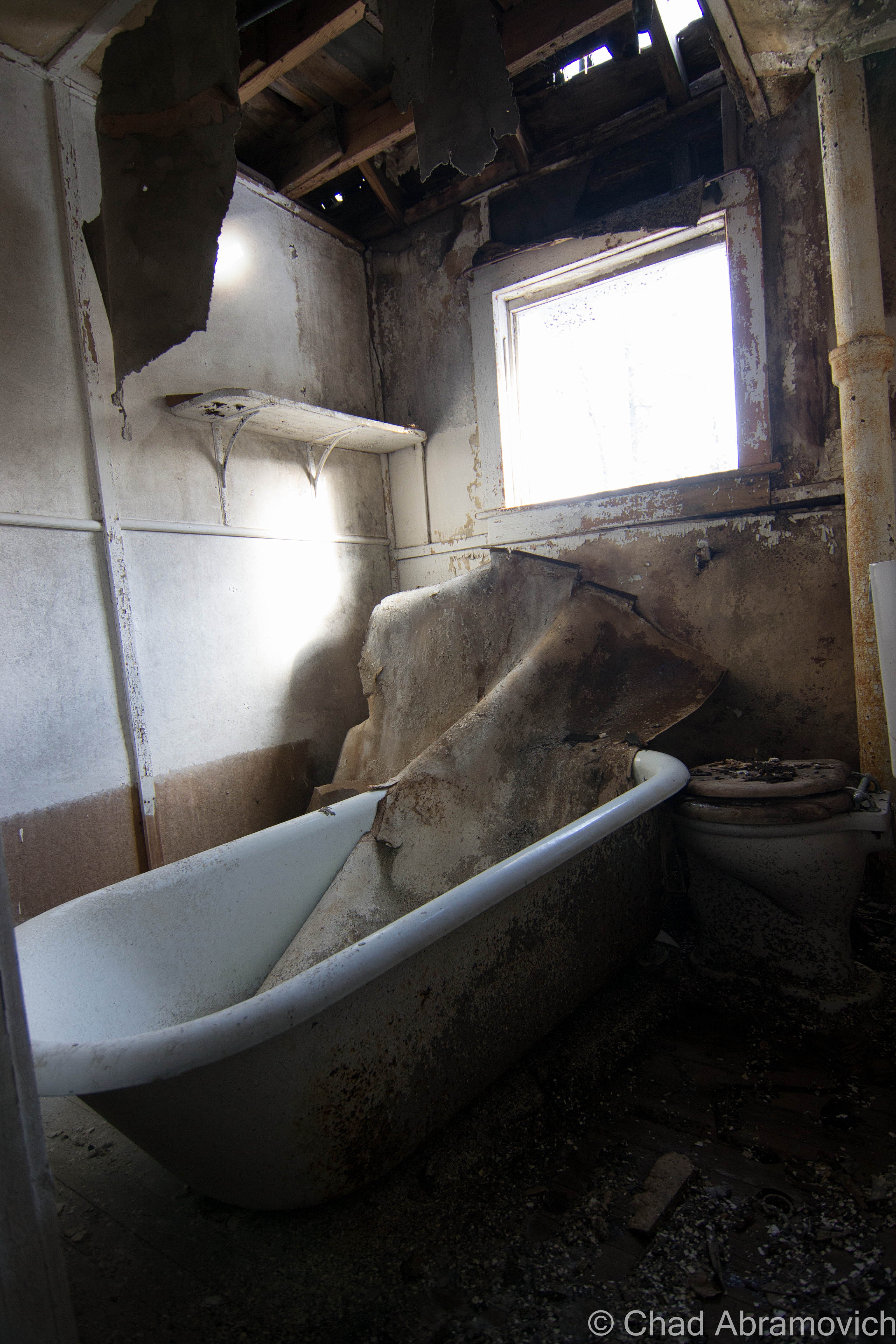
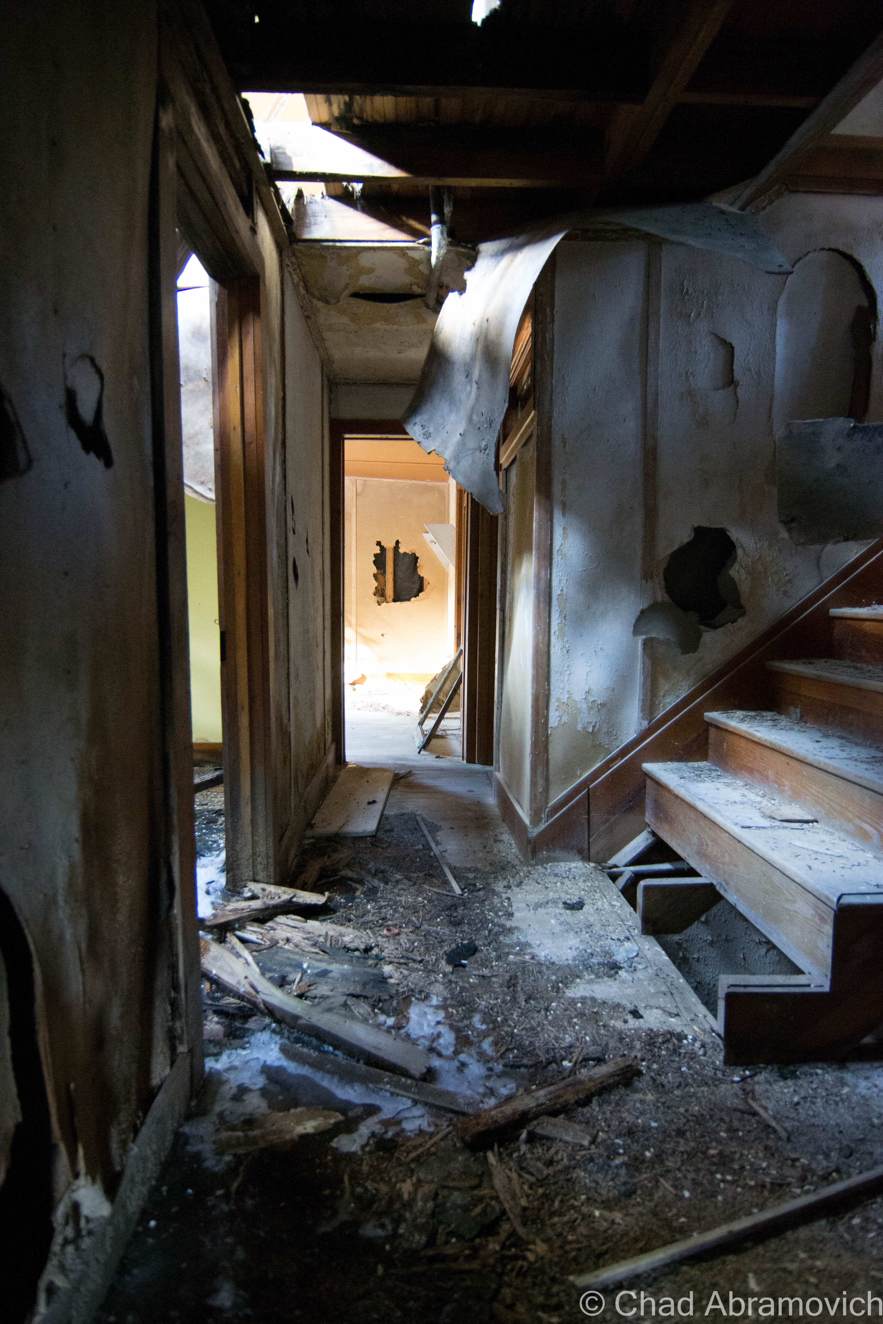
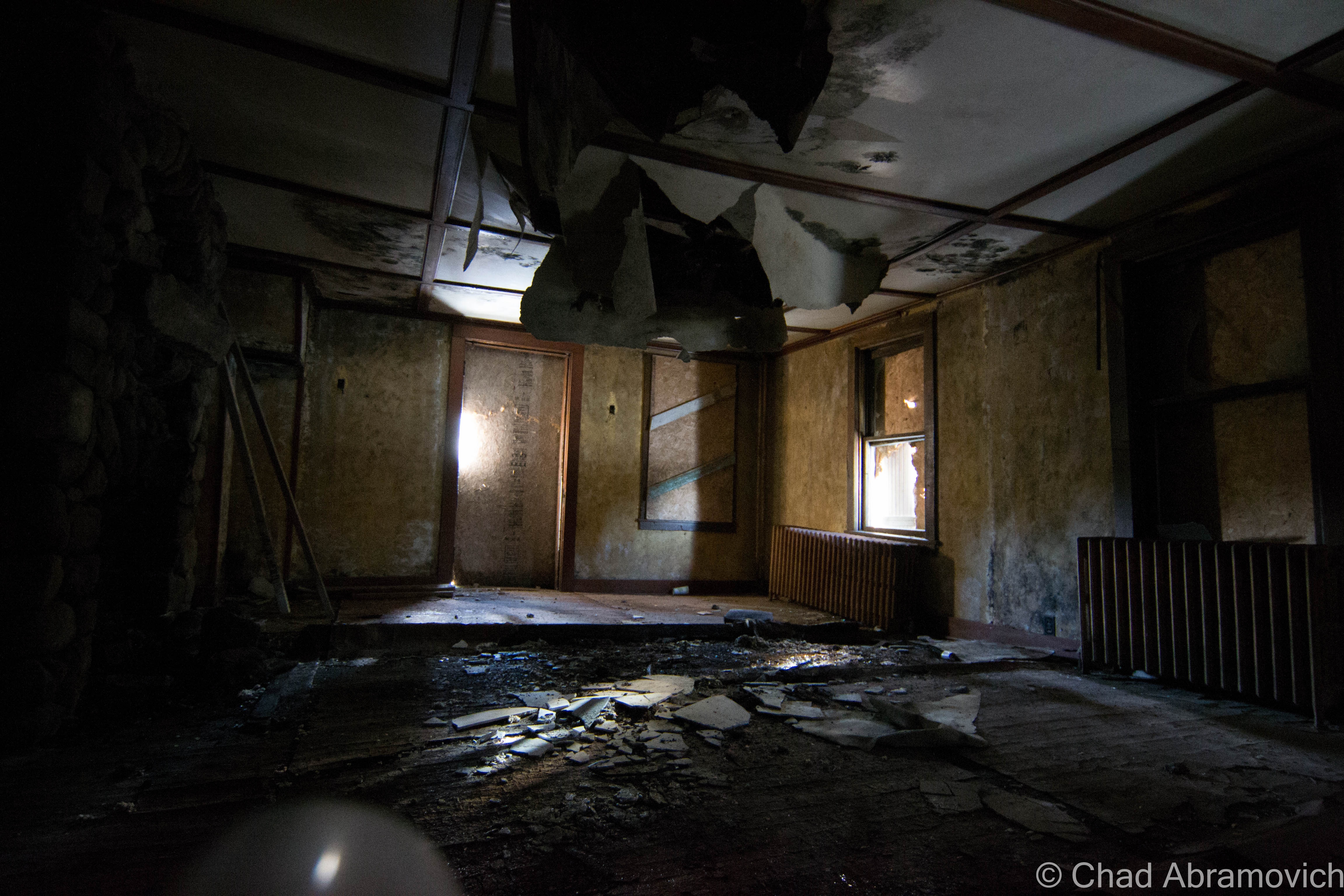
I hadn’t had any expectations to get inside Aiden Lair, as I heard it was sealed up very well, but we found a door around back, near an old dam that created a small pond. The bottom had been kicked out, leaving a human sized hole to crawl through onto a rotting sun porch – the afternoon sun was pleasantly warming the peeling yellow lead paint that speckled the weather beaten floors.

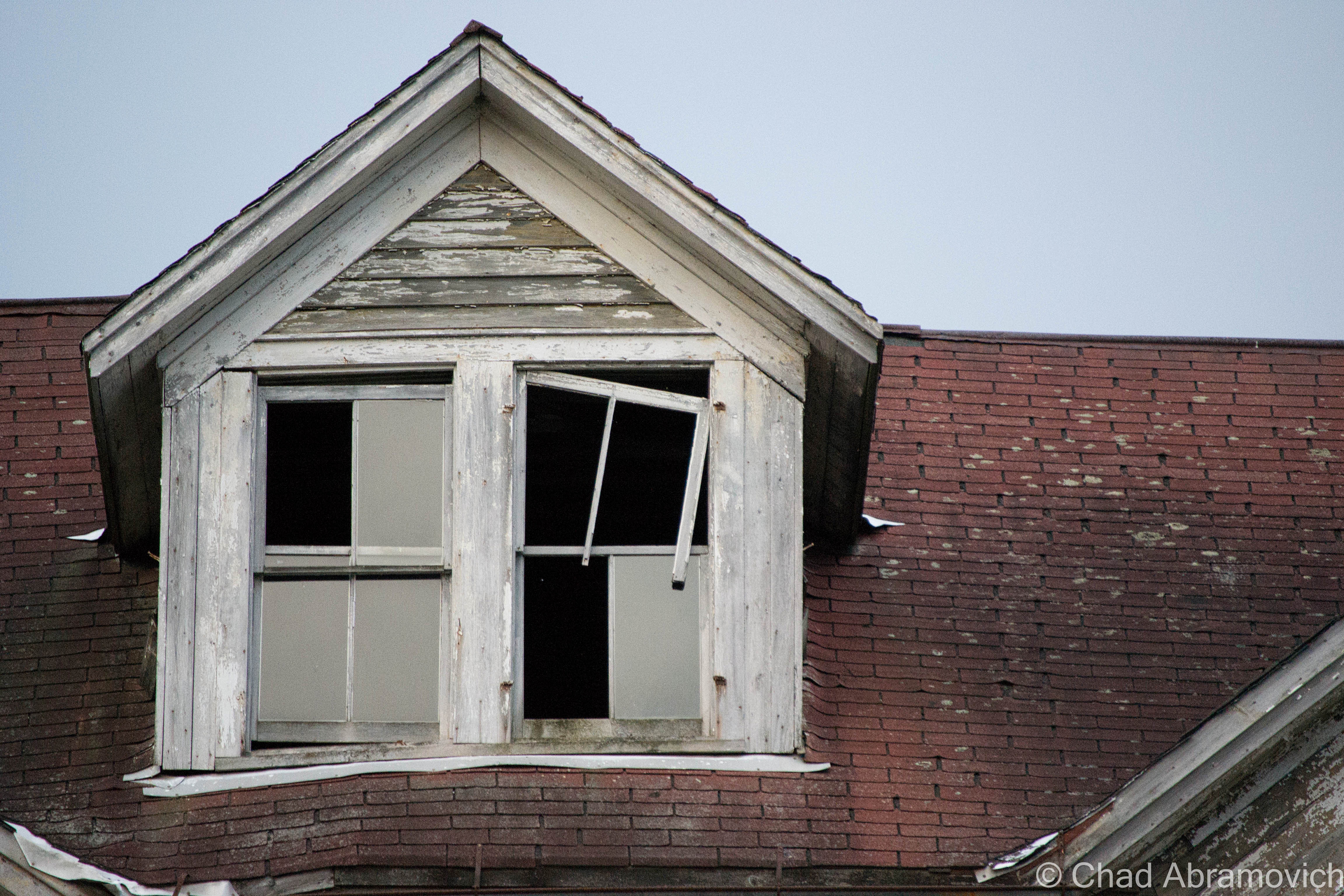
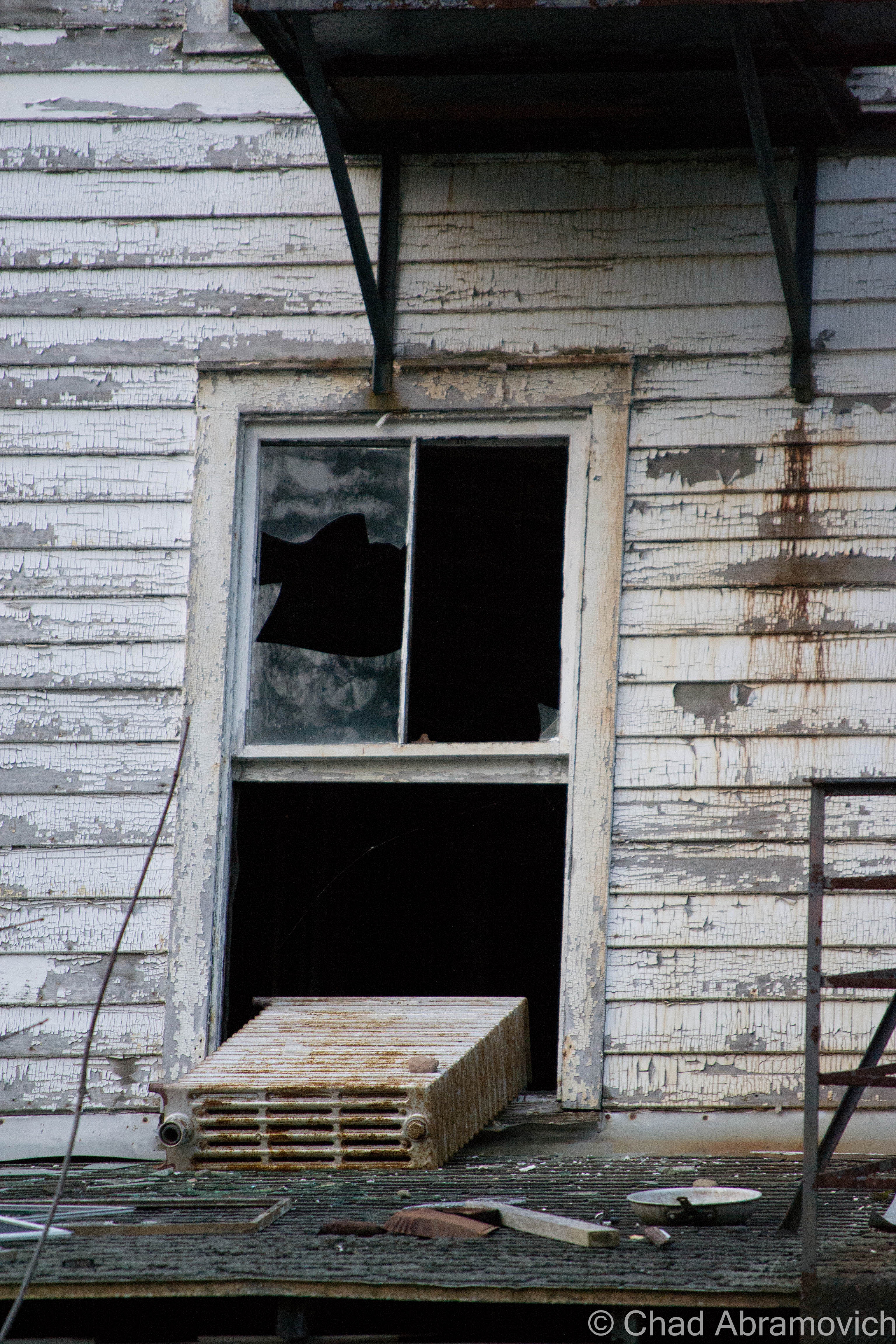
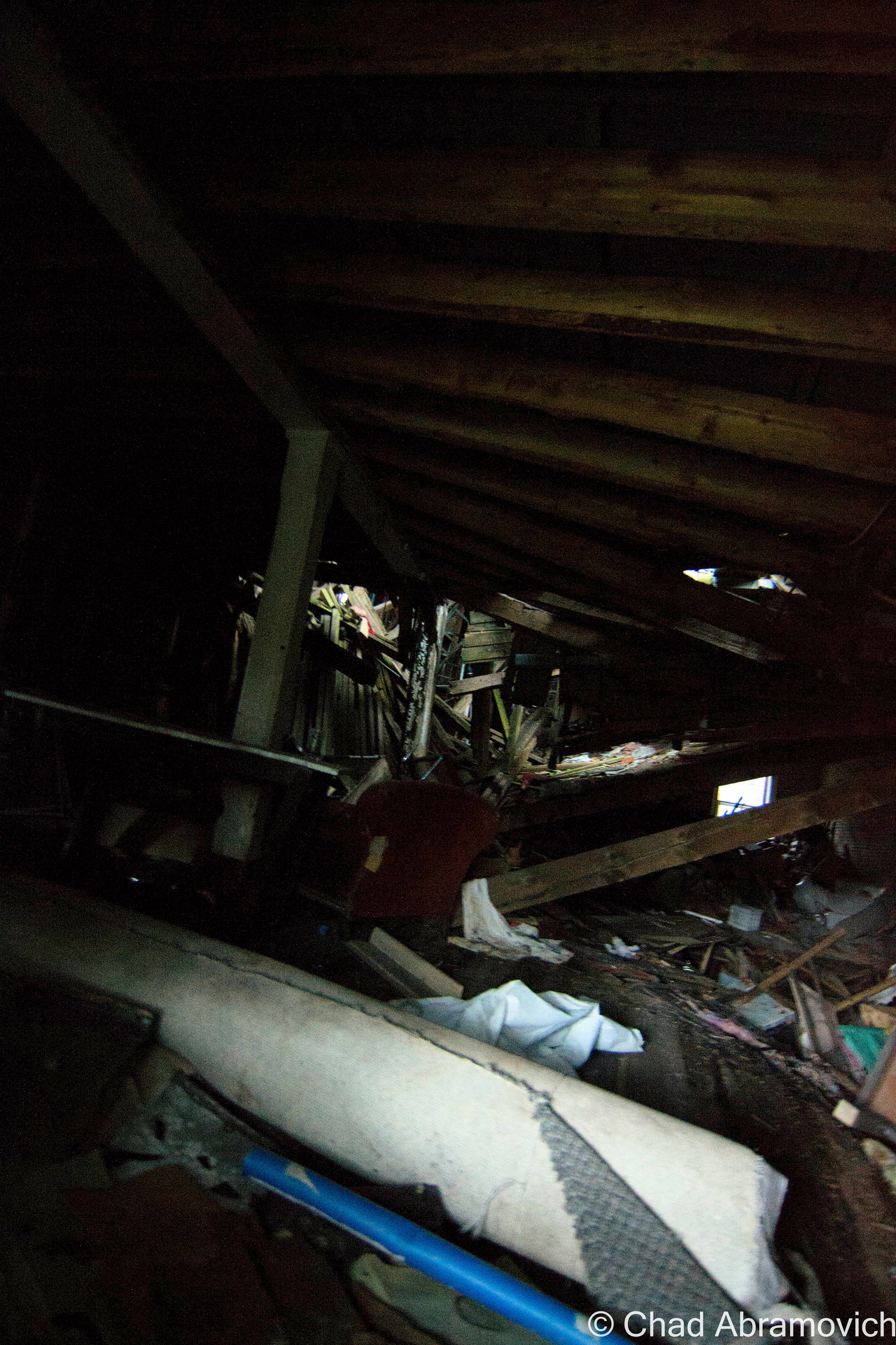
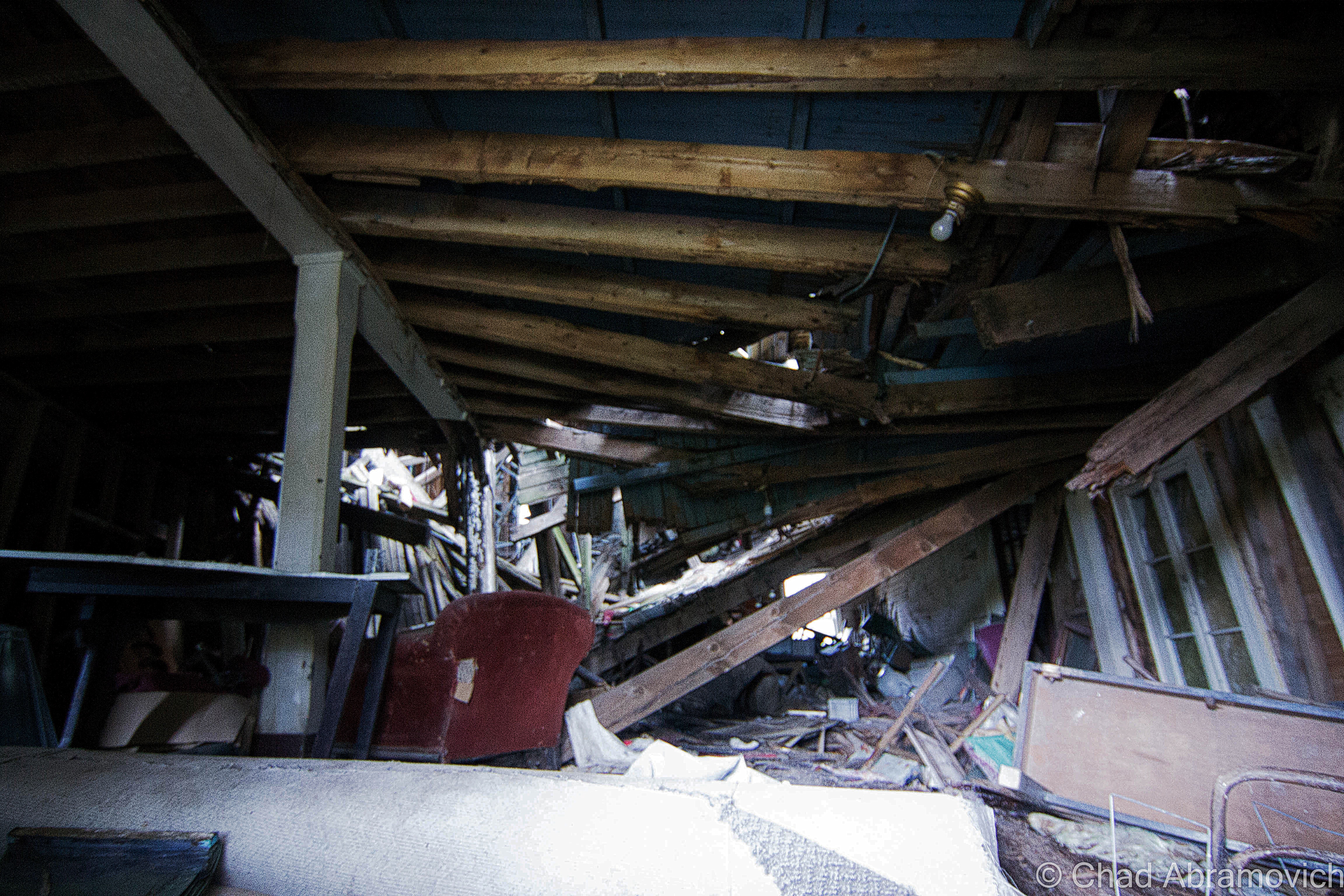
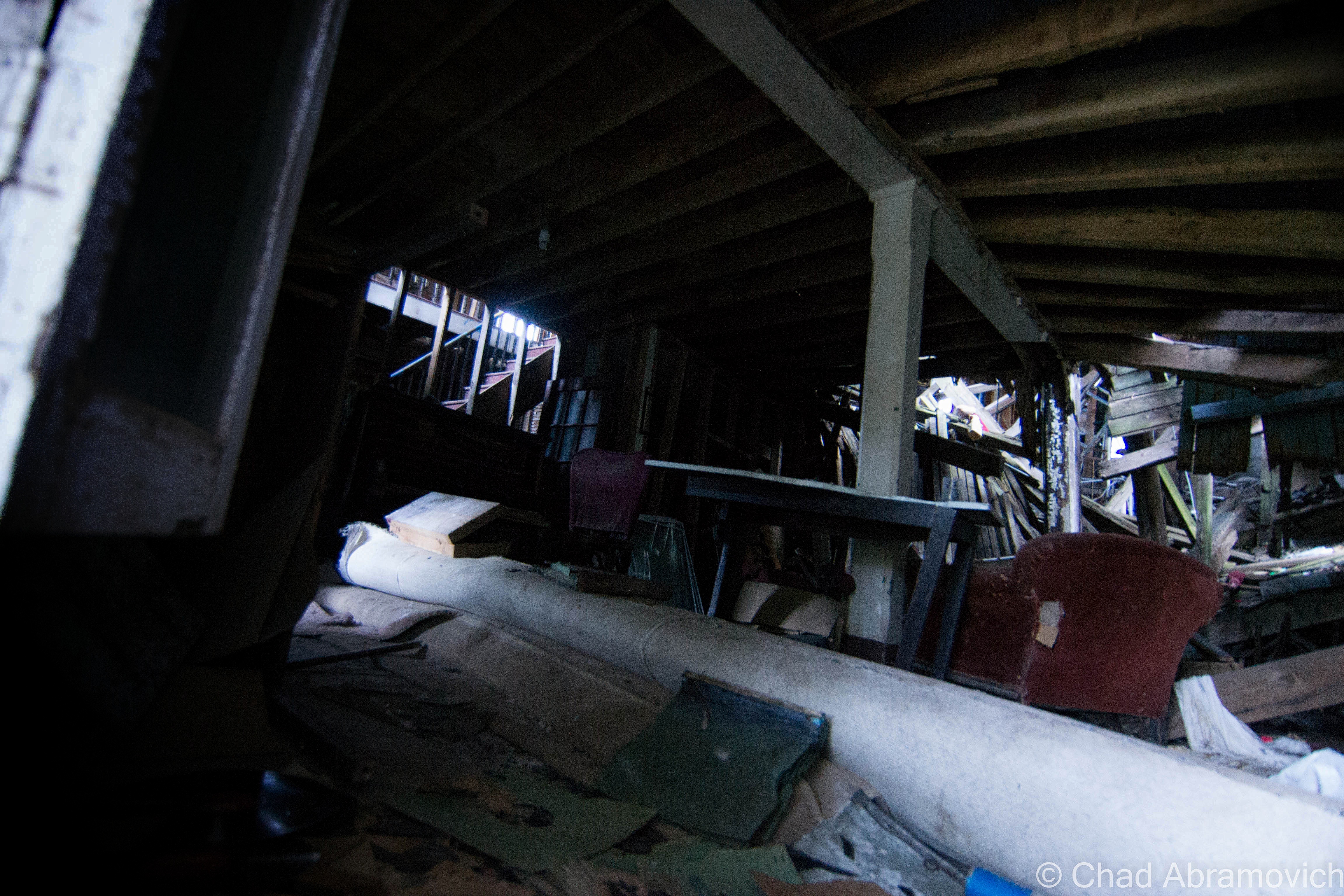
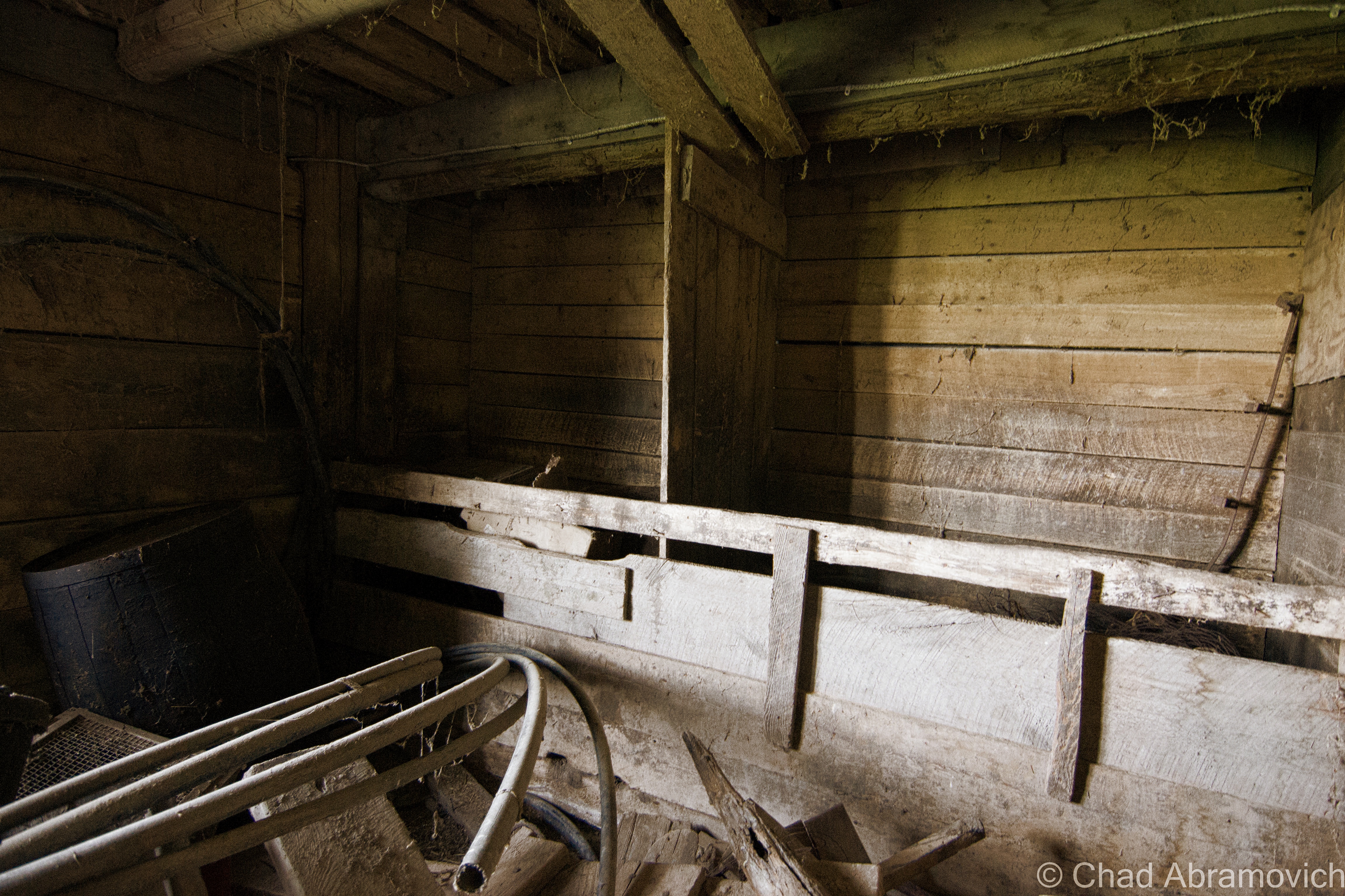
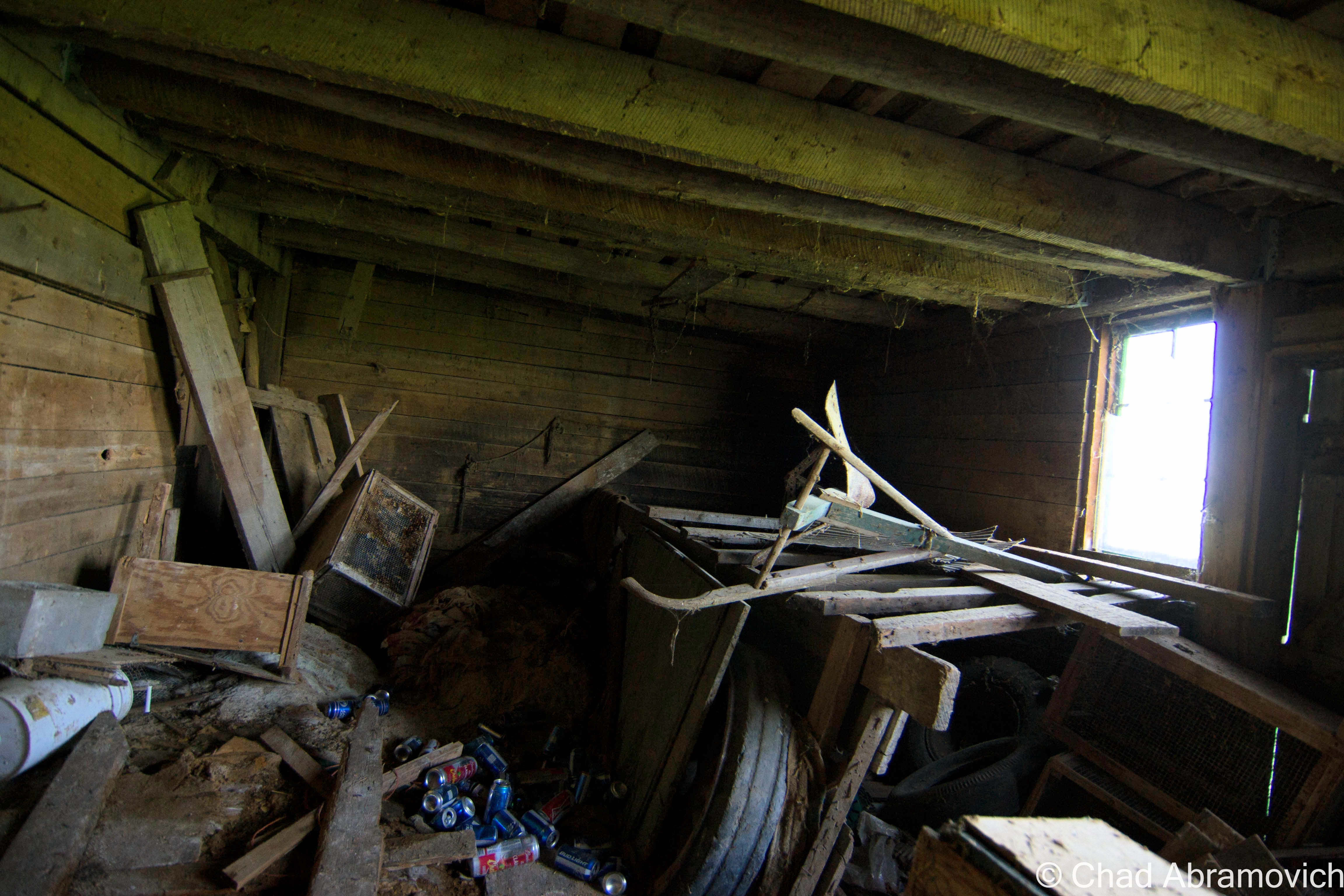
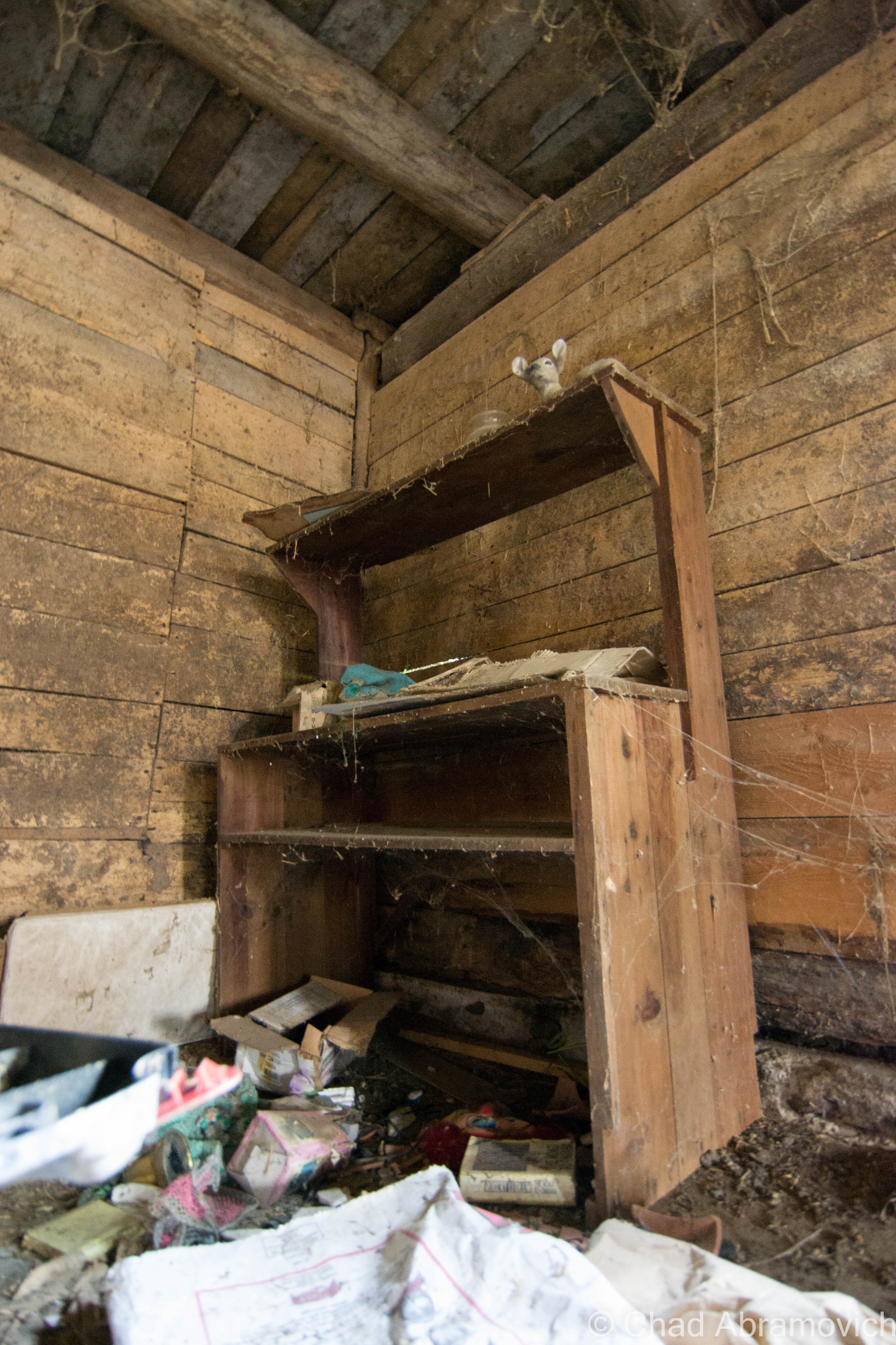
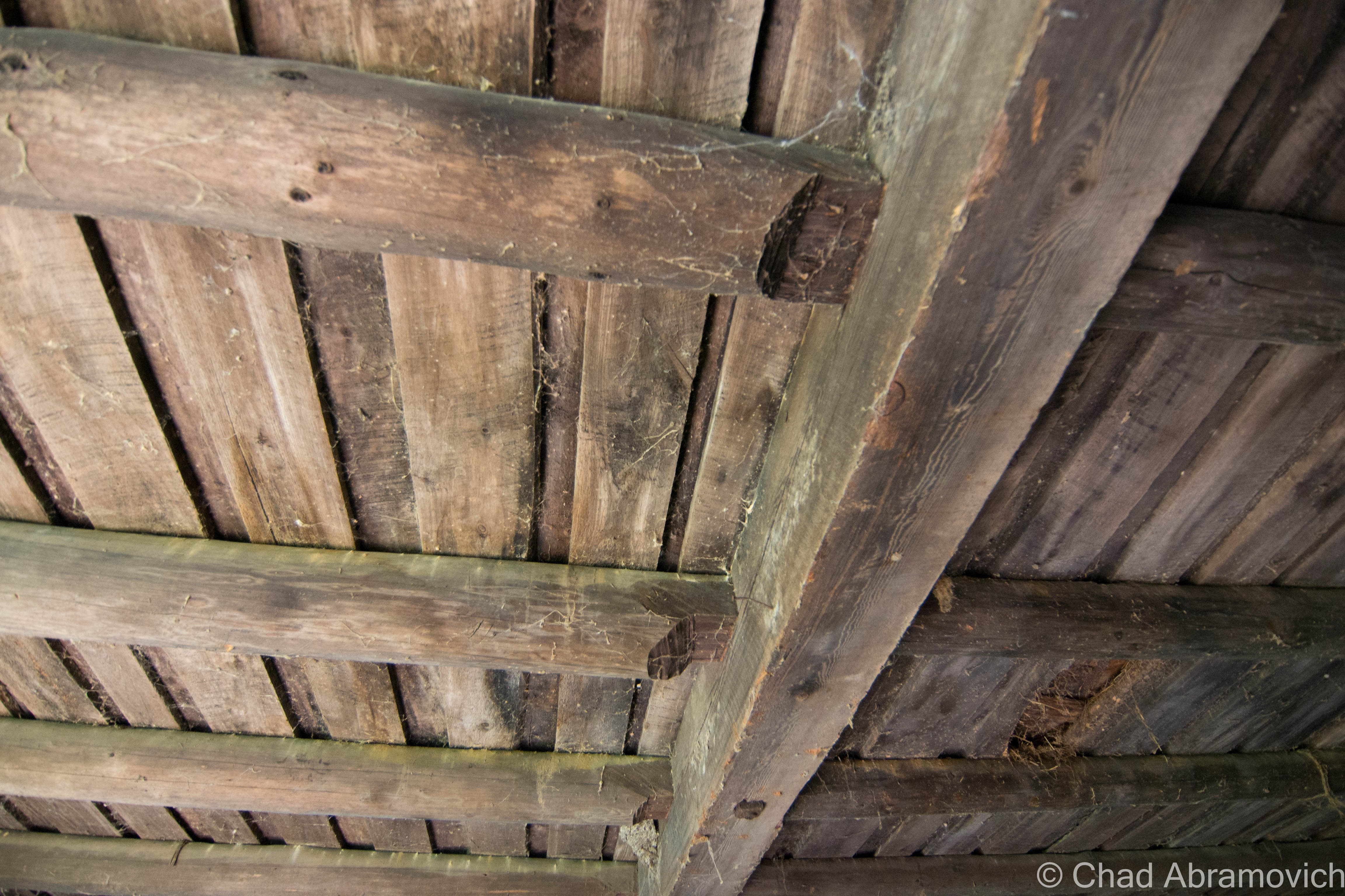
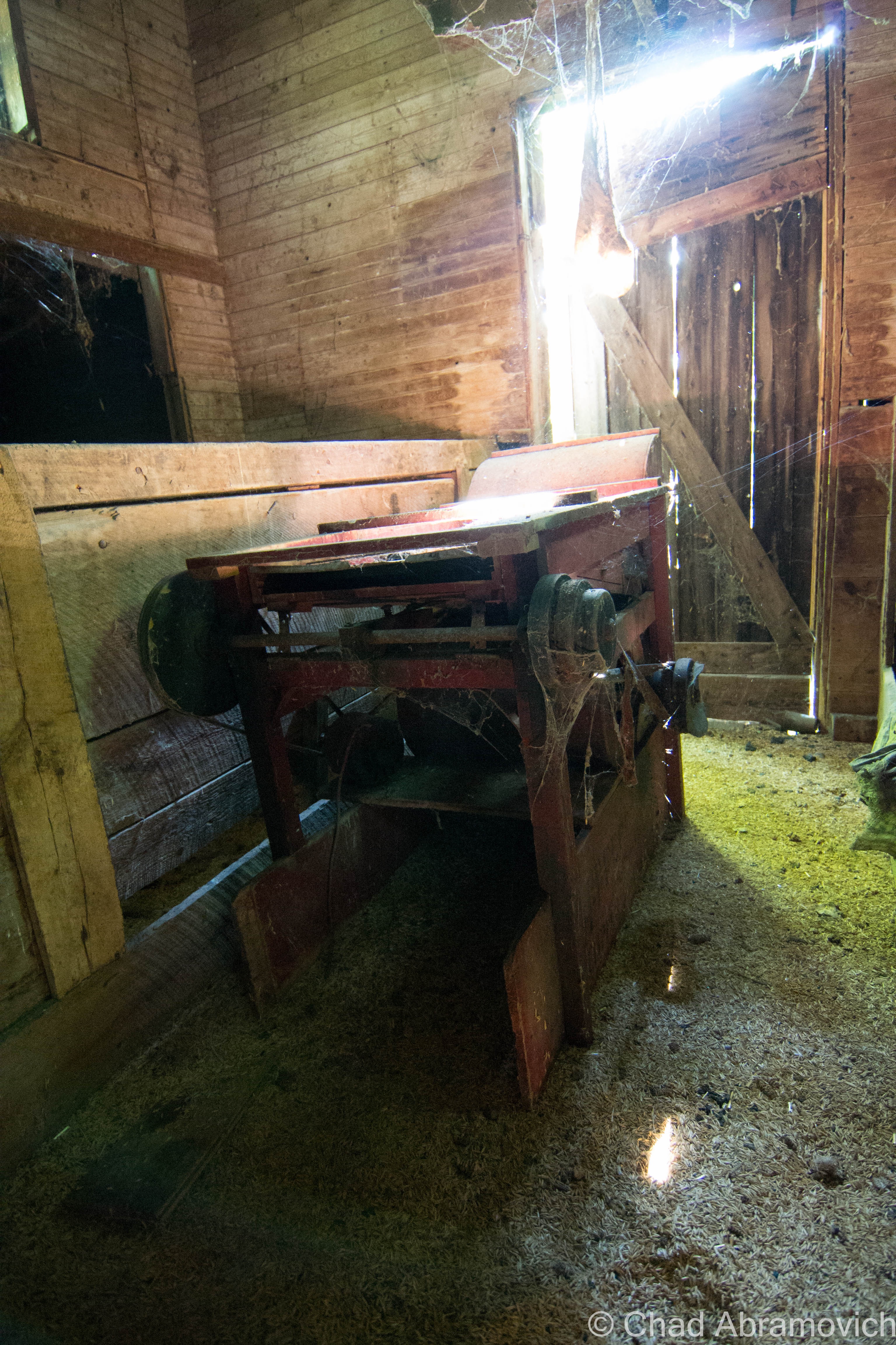
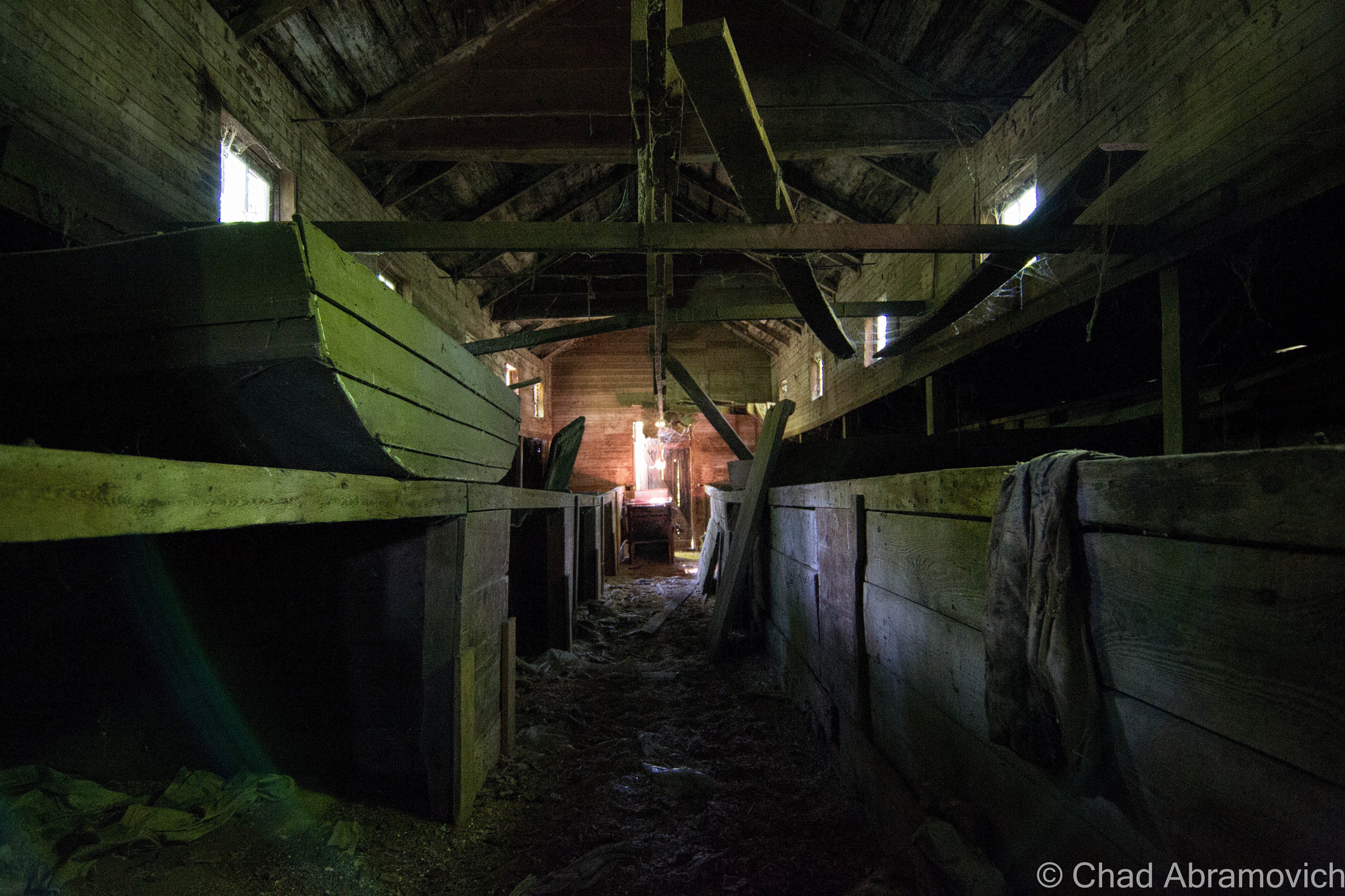
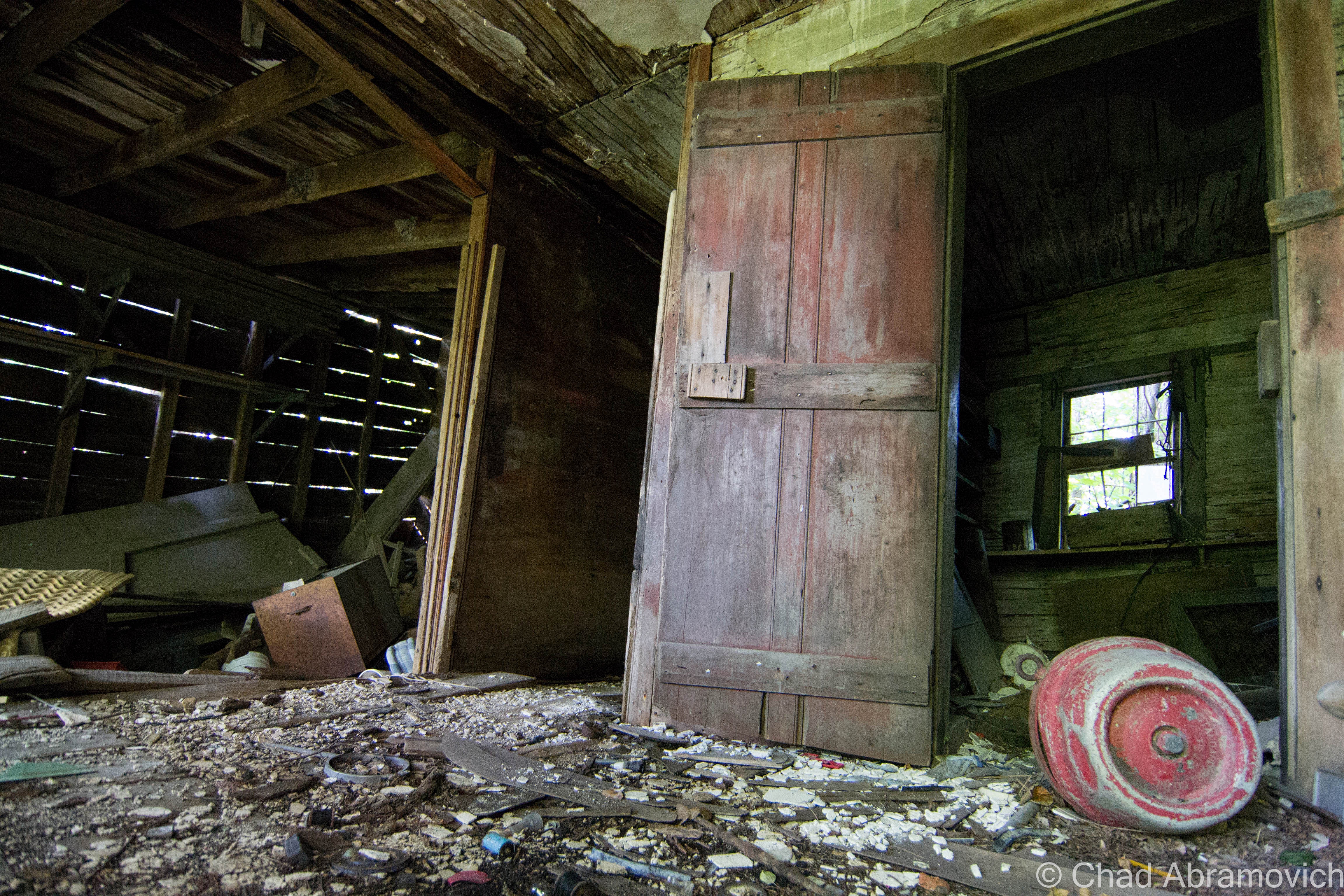
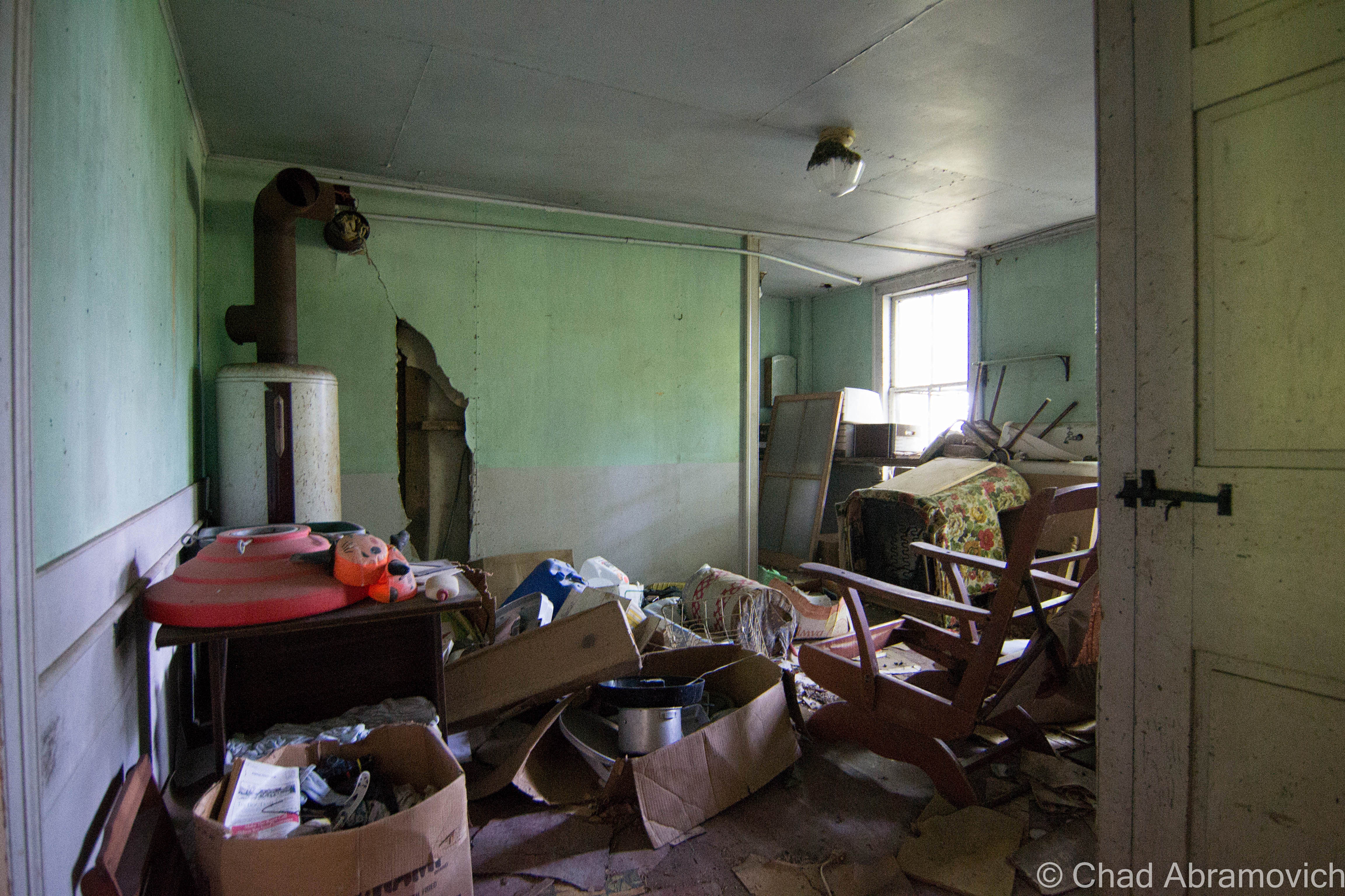
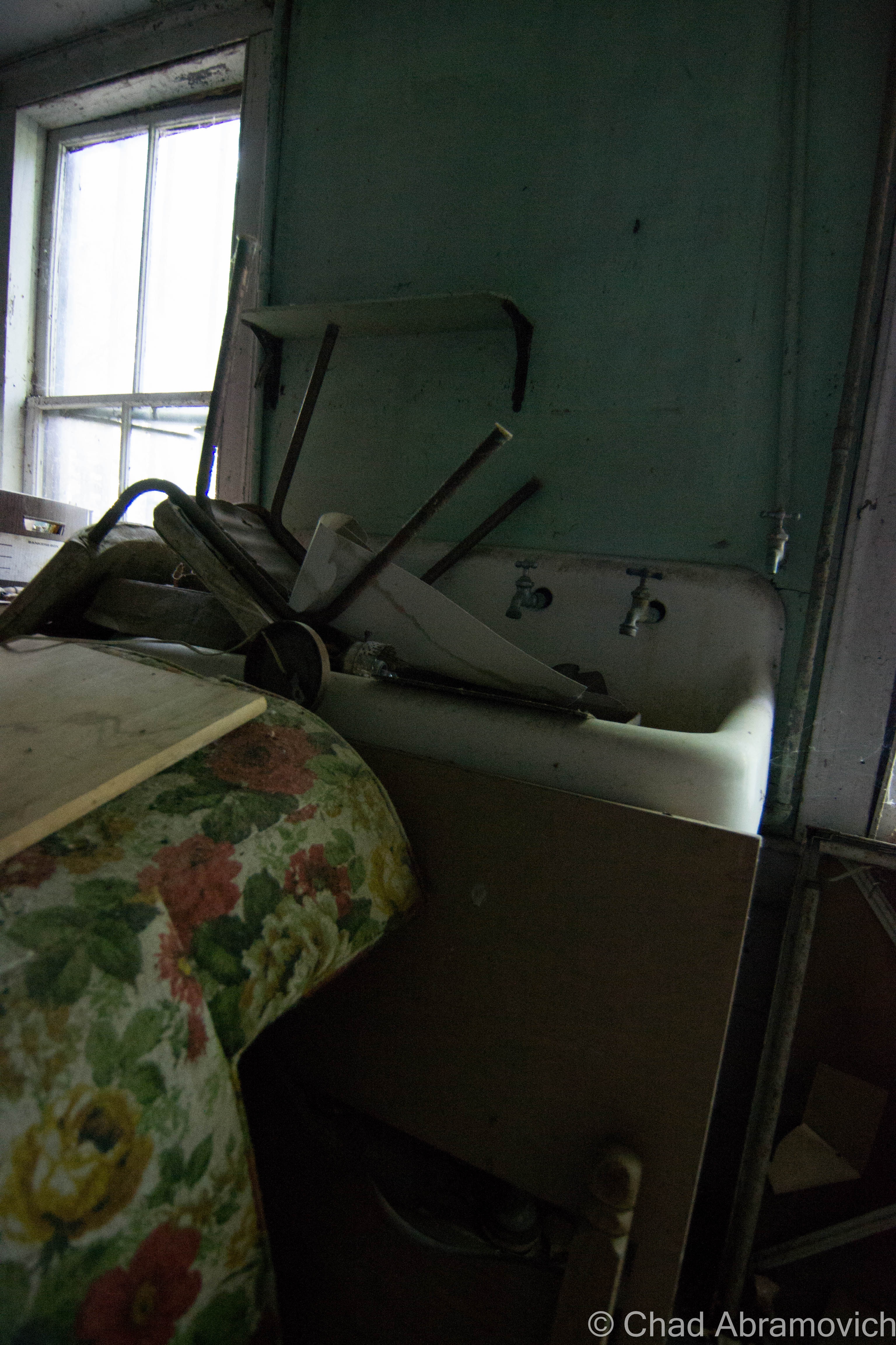
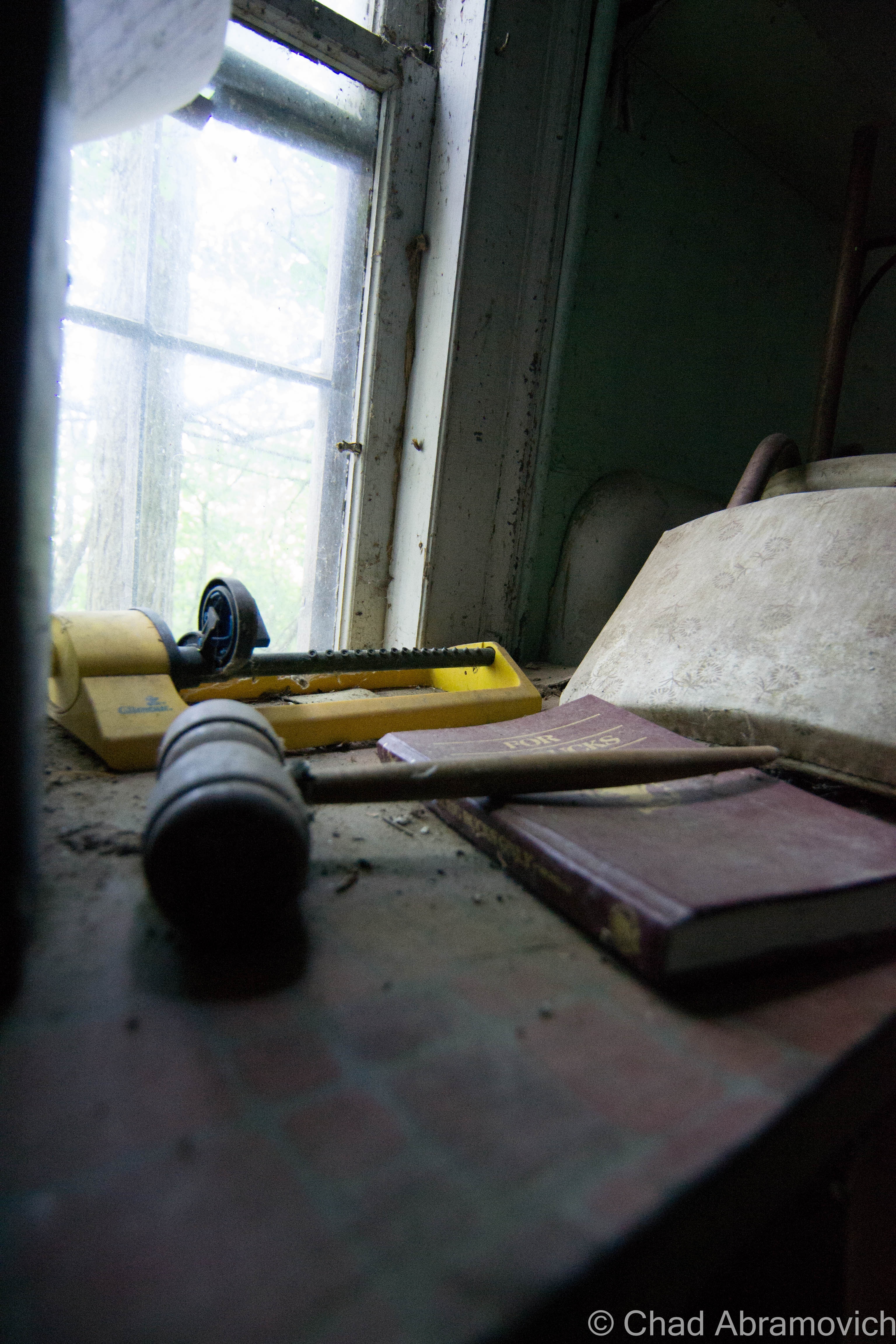
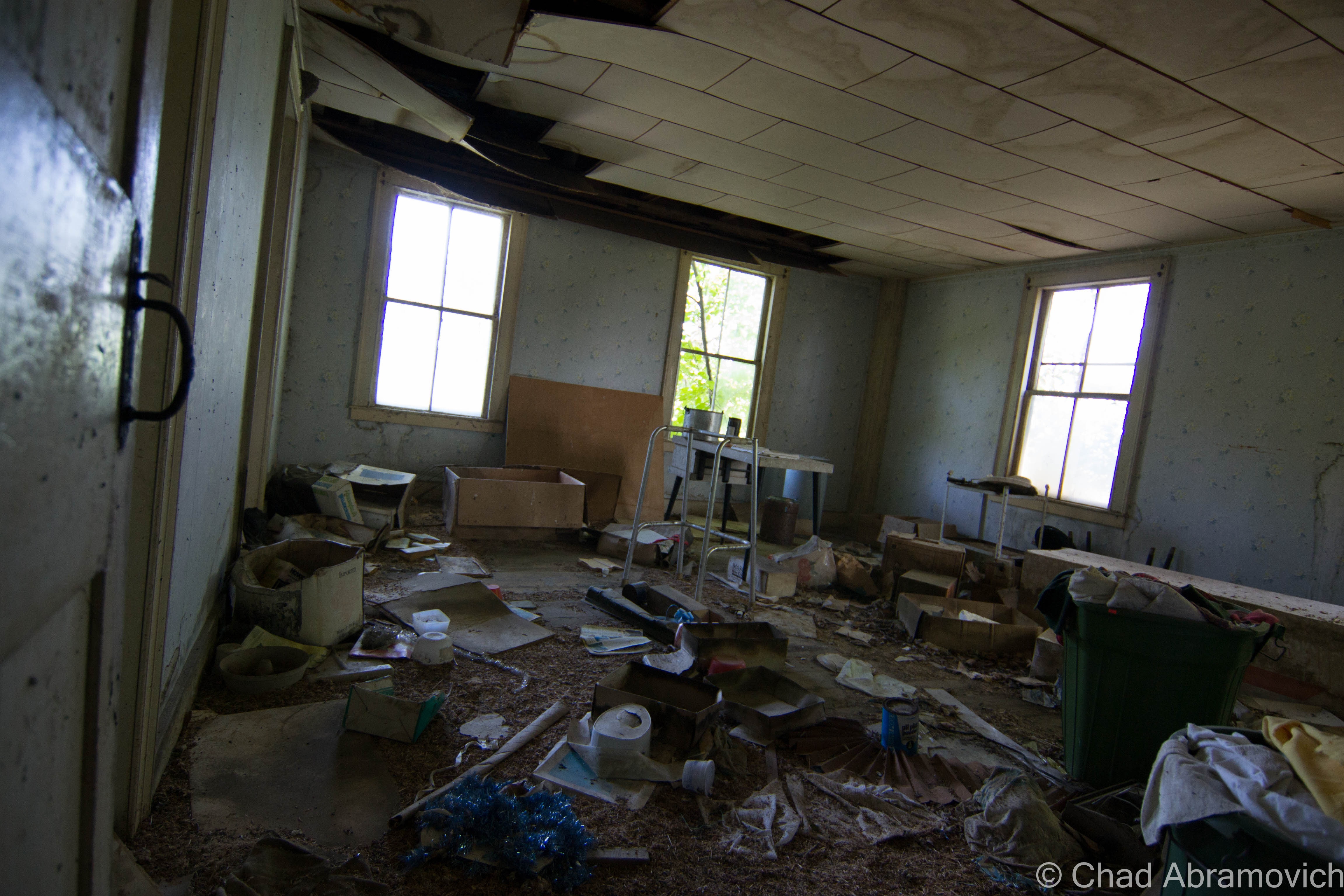
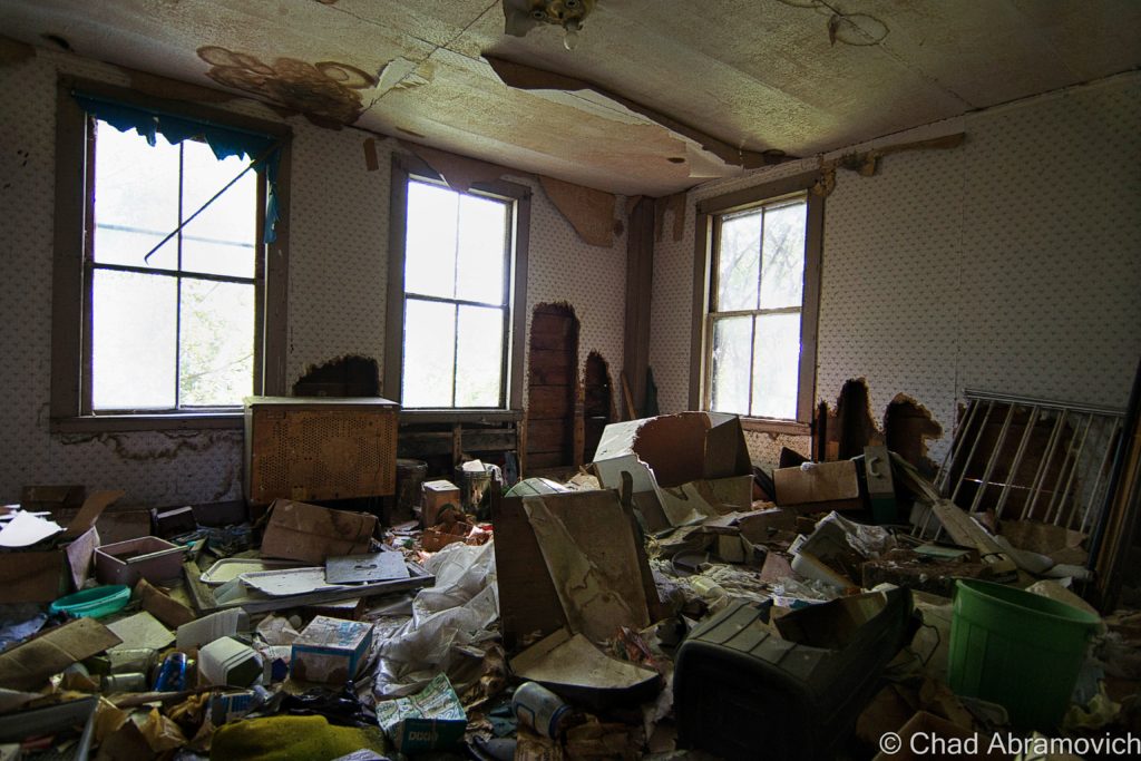
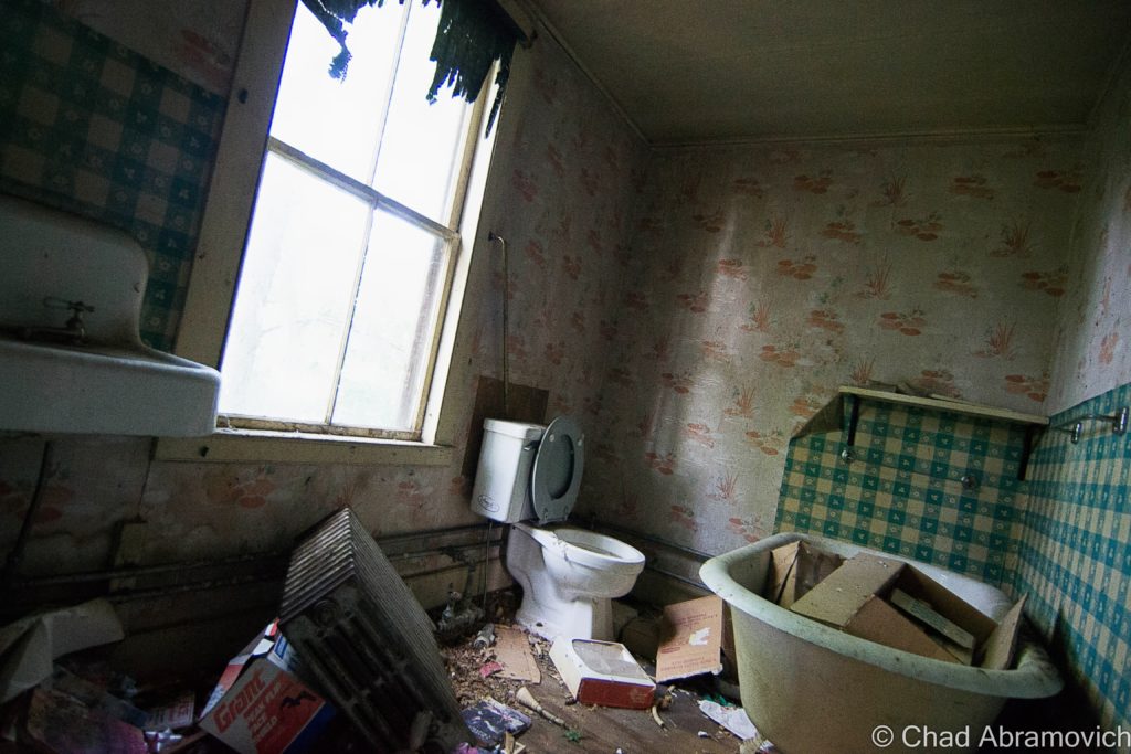
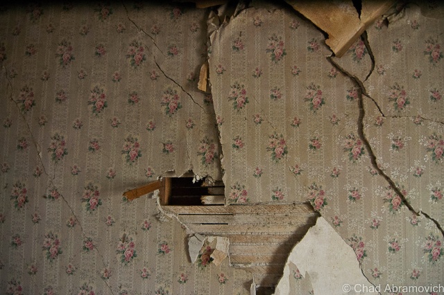
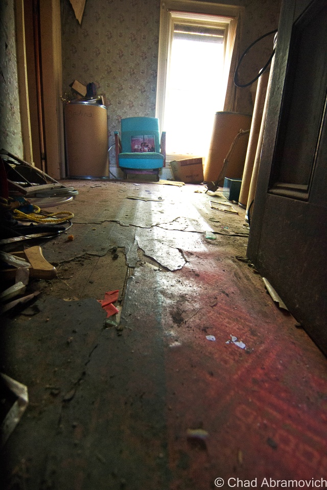
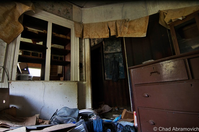
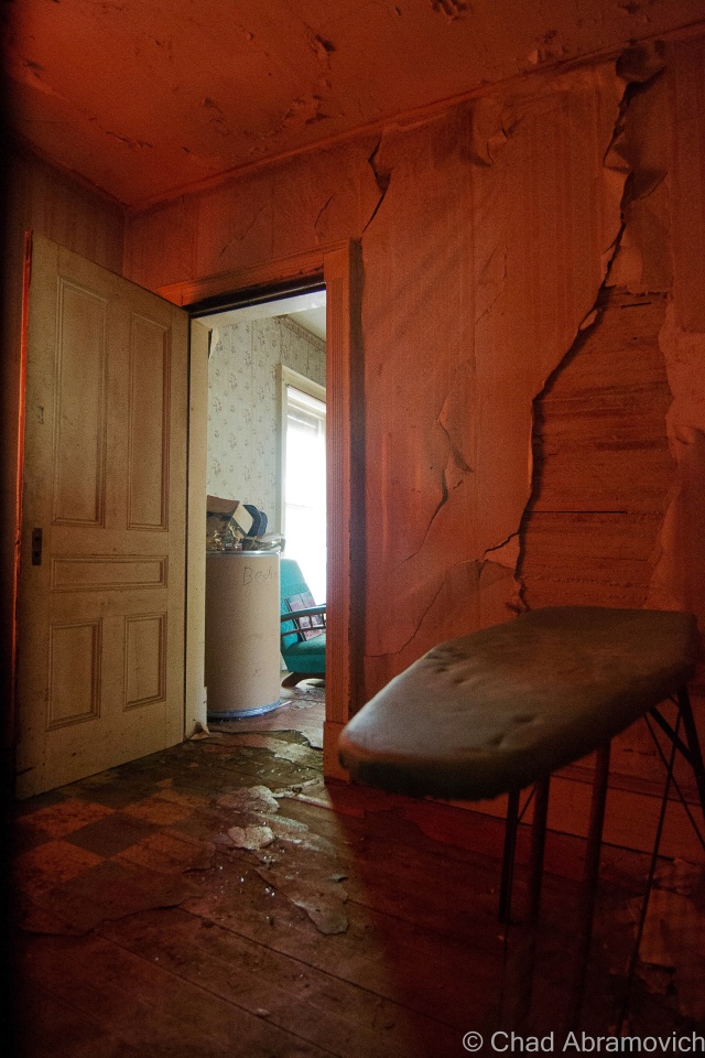
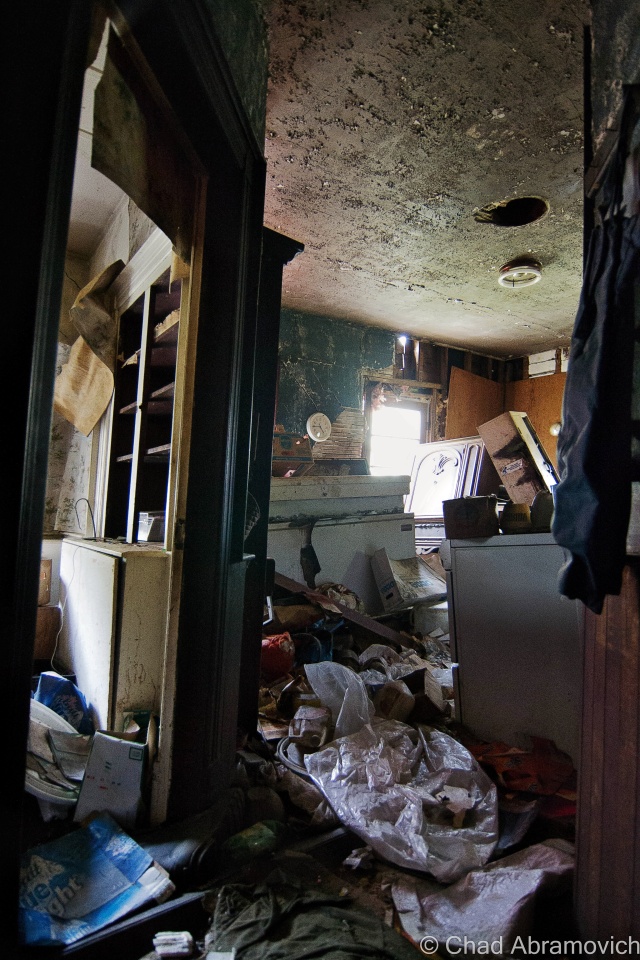
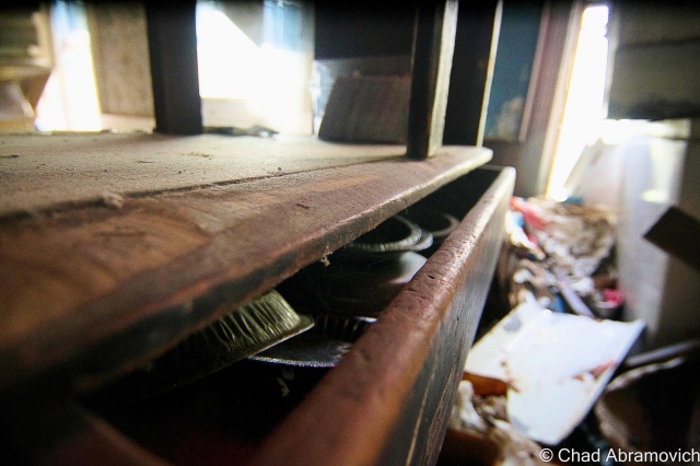
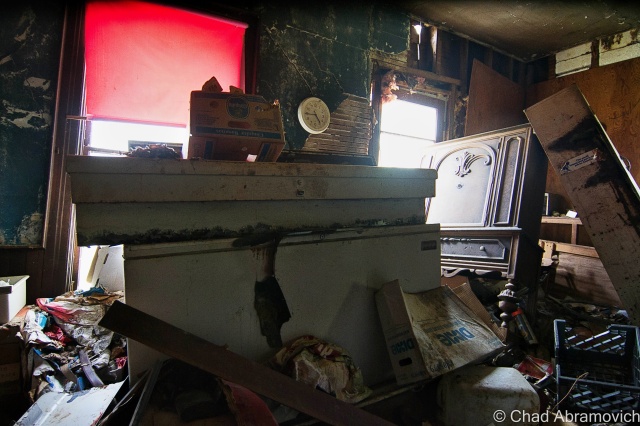
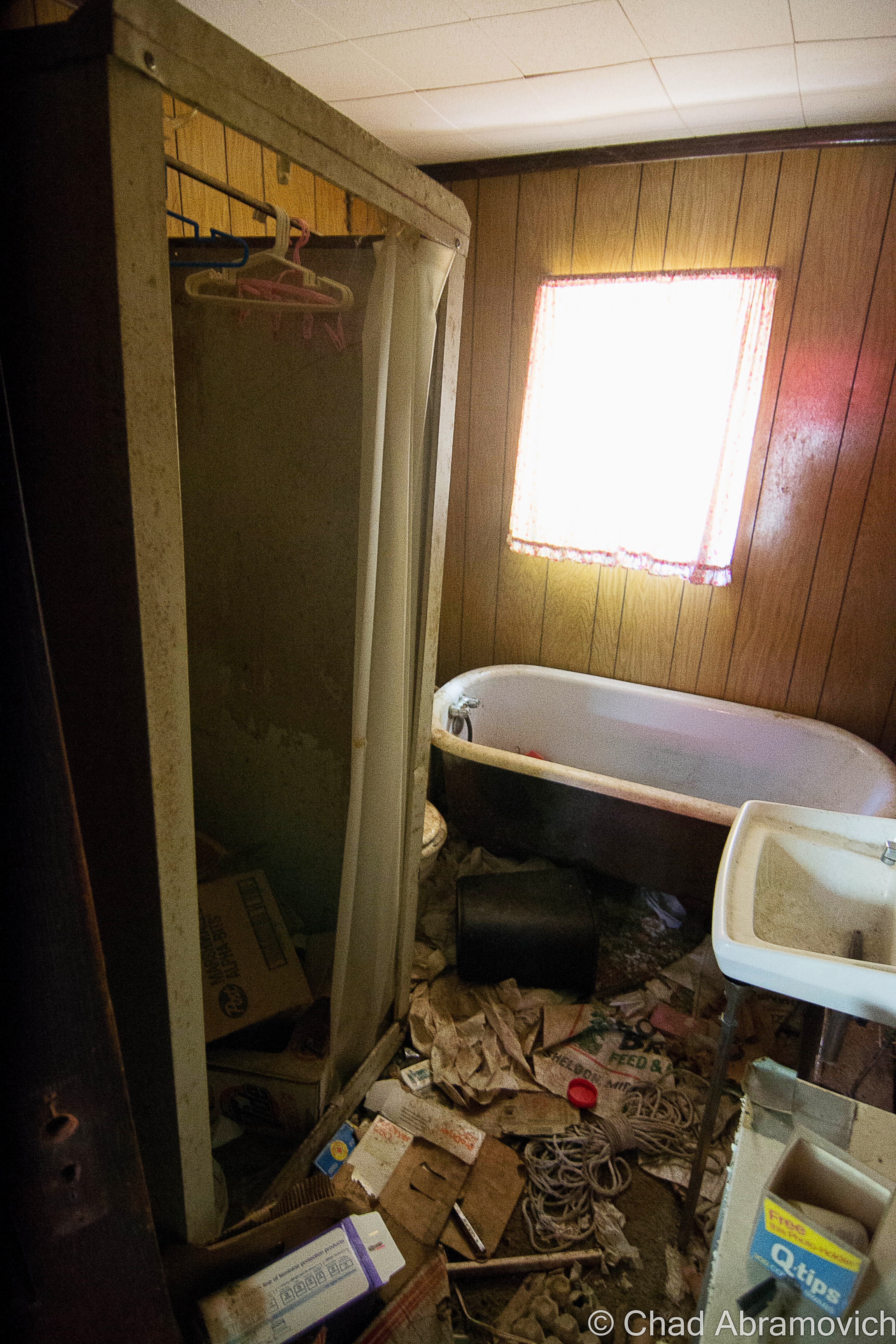
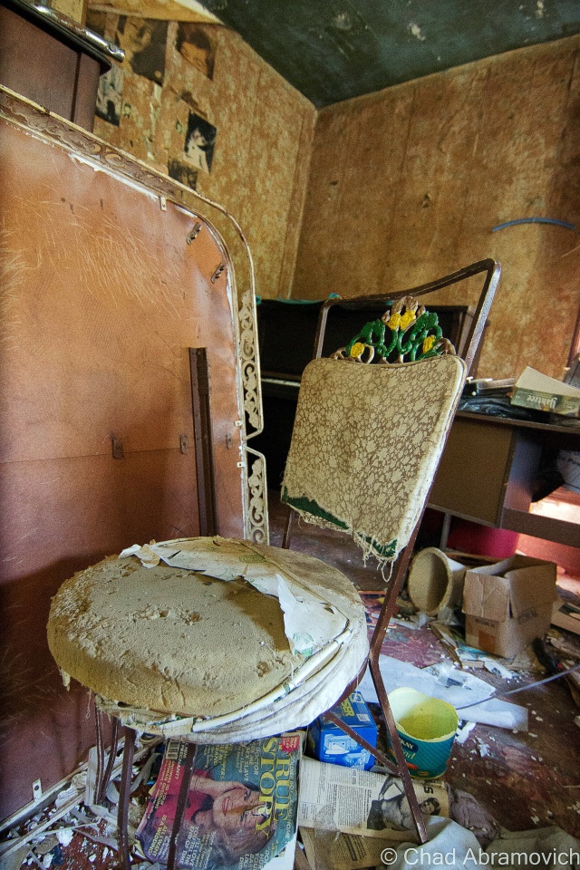
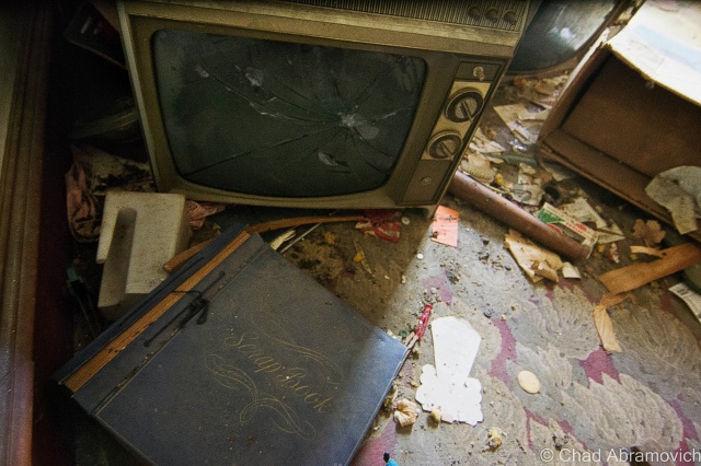
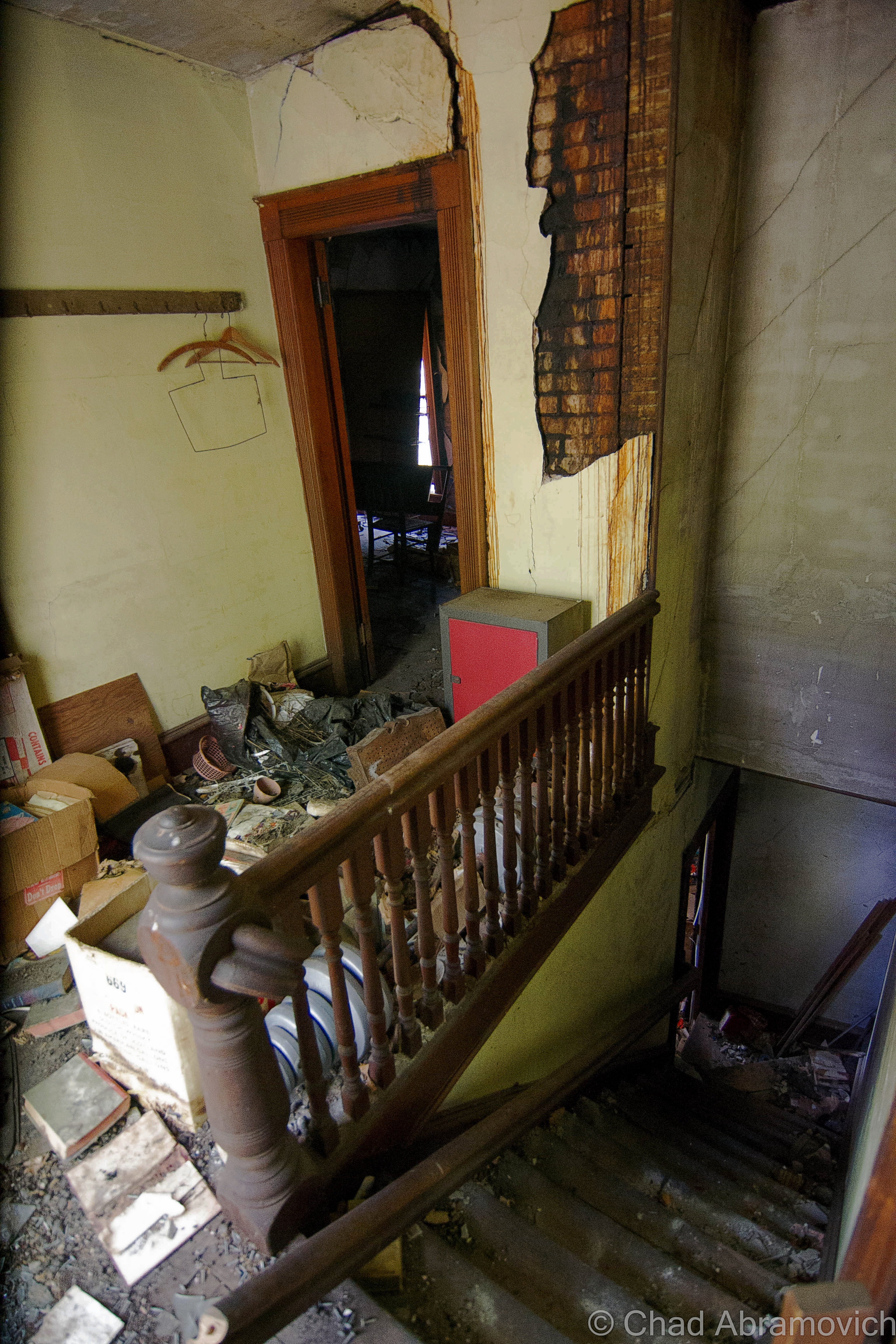
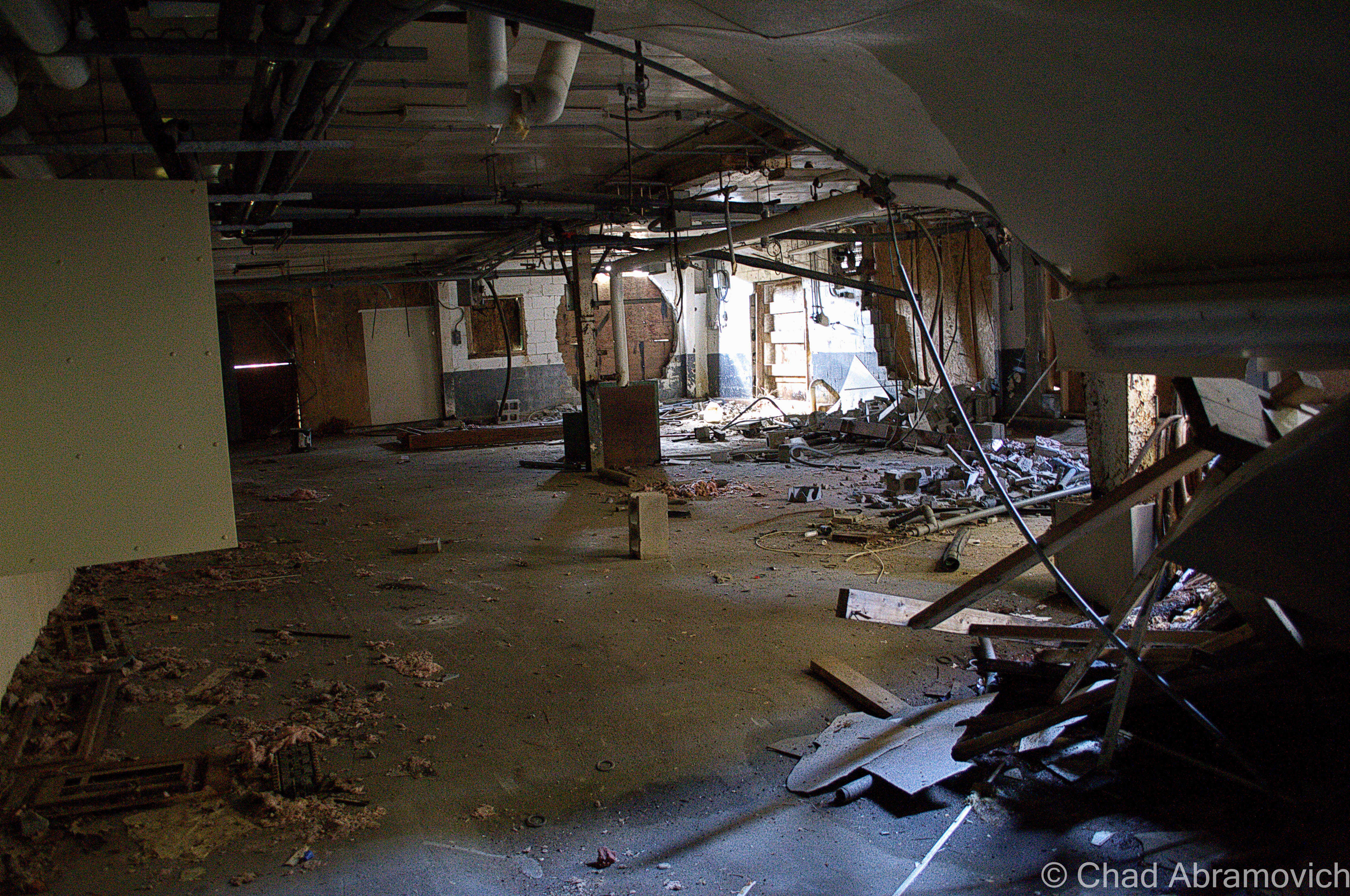
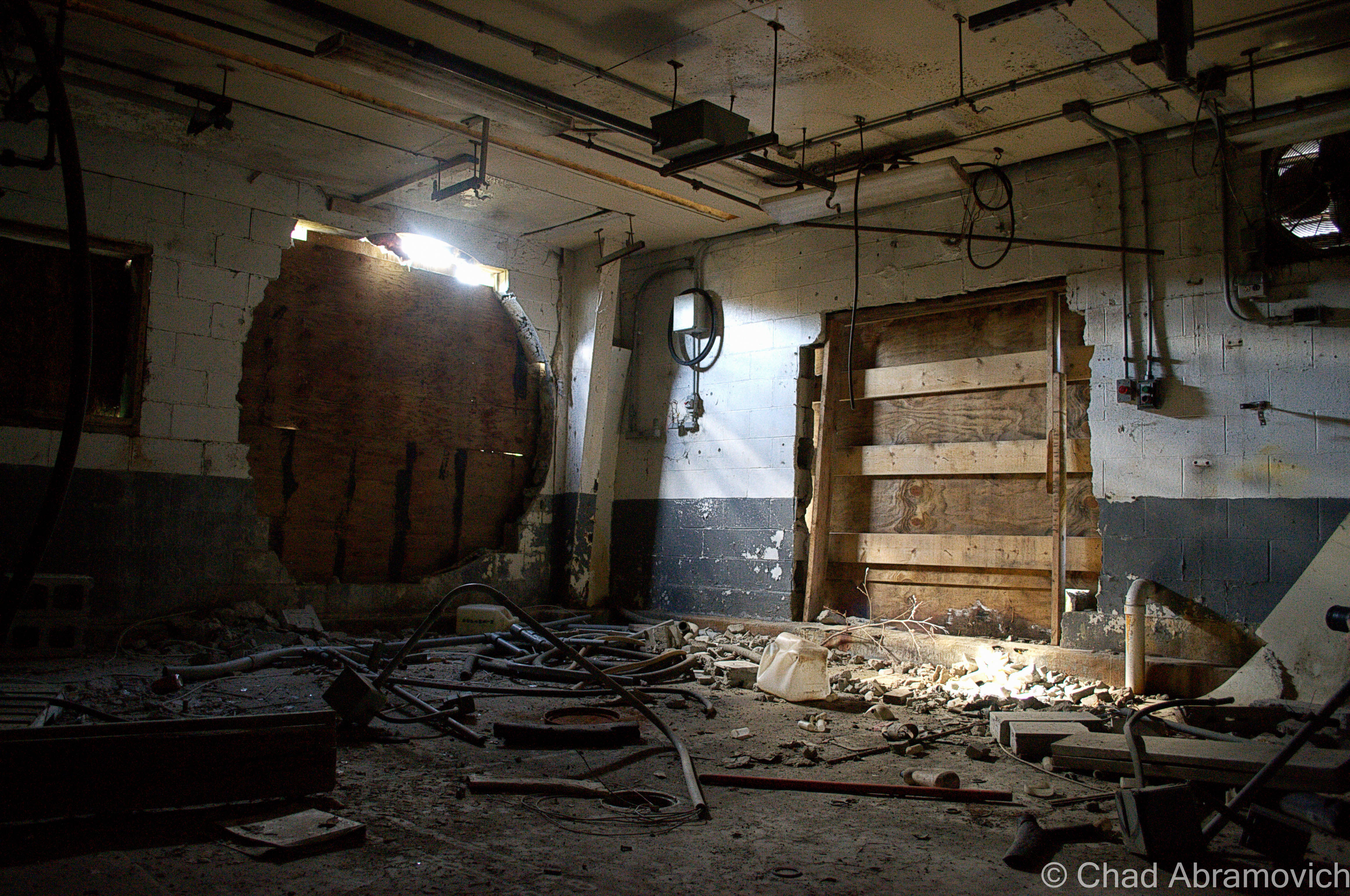
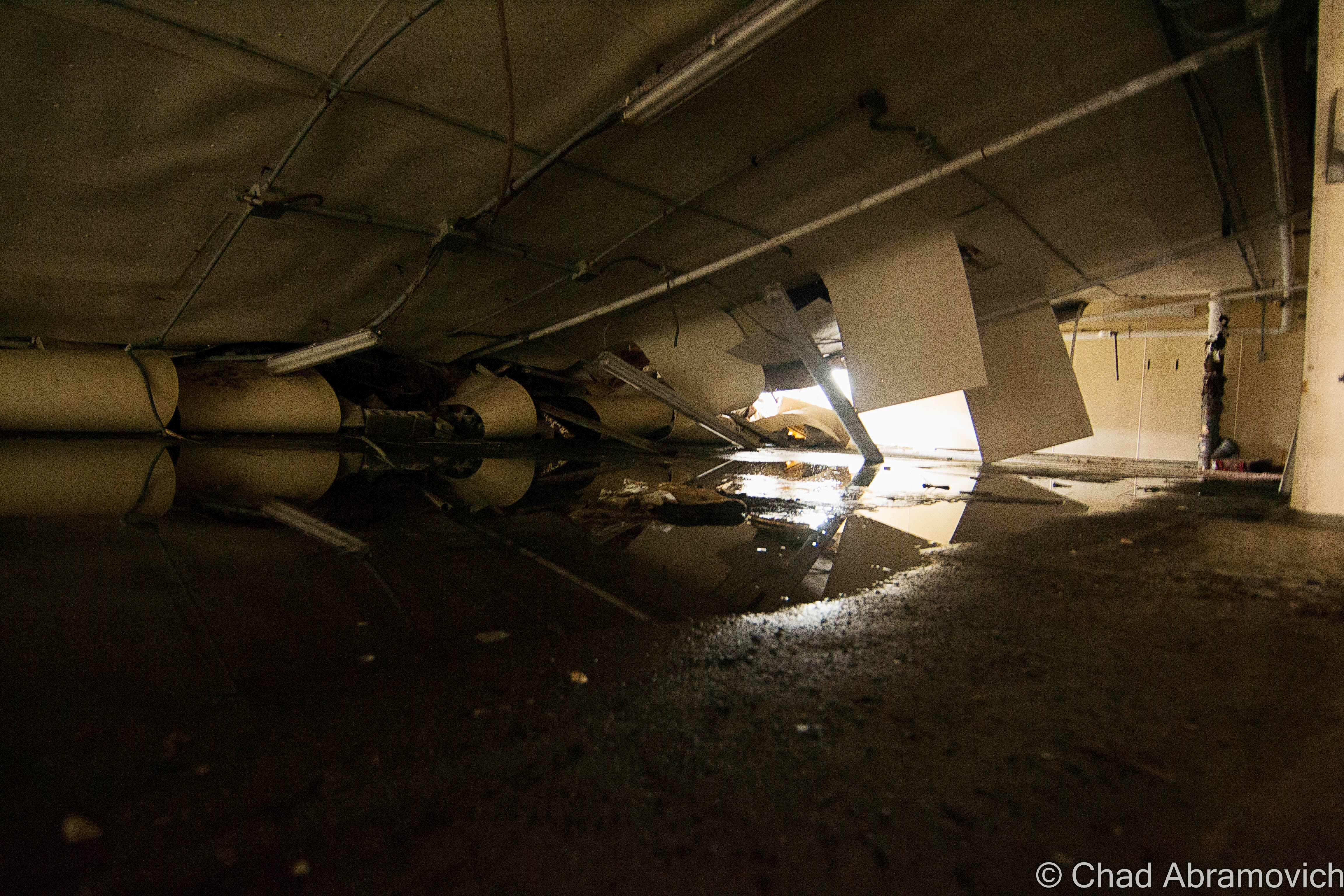
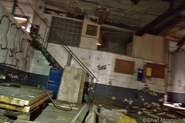
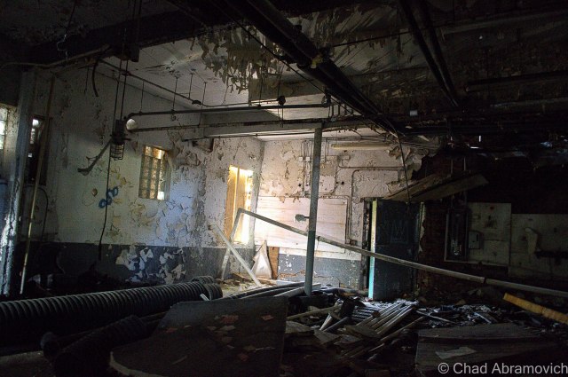
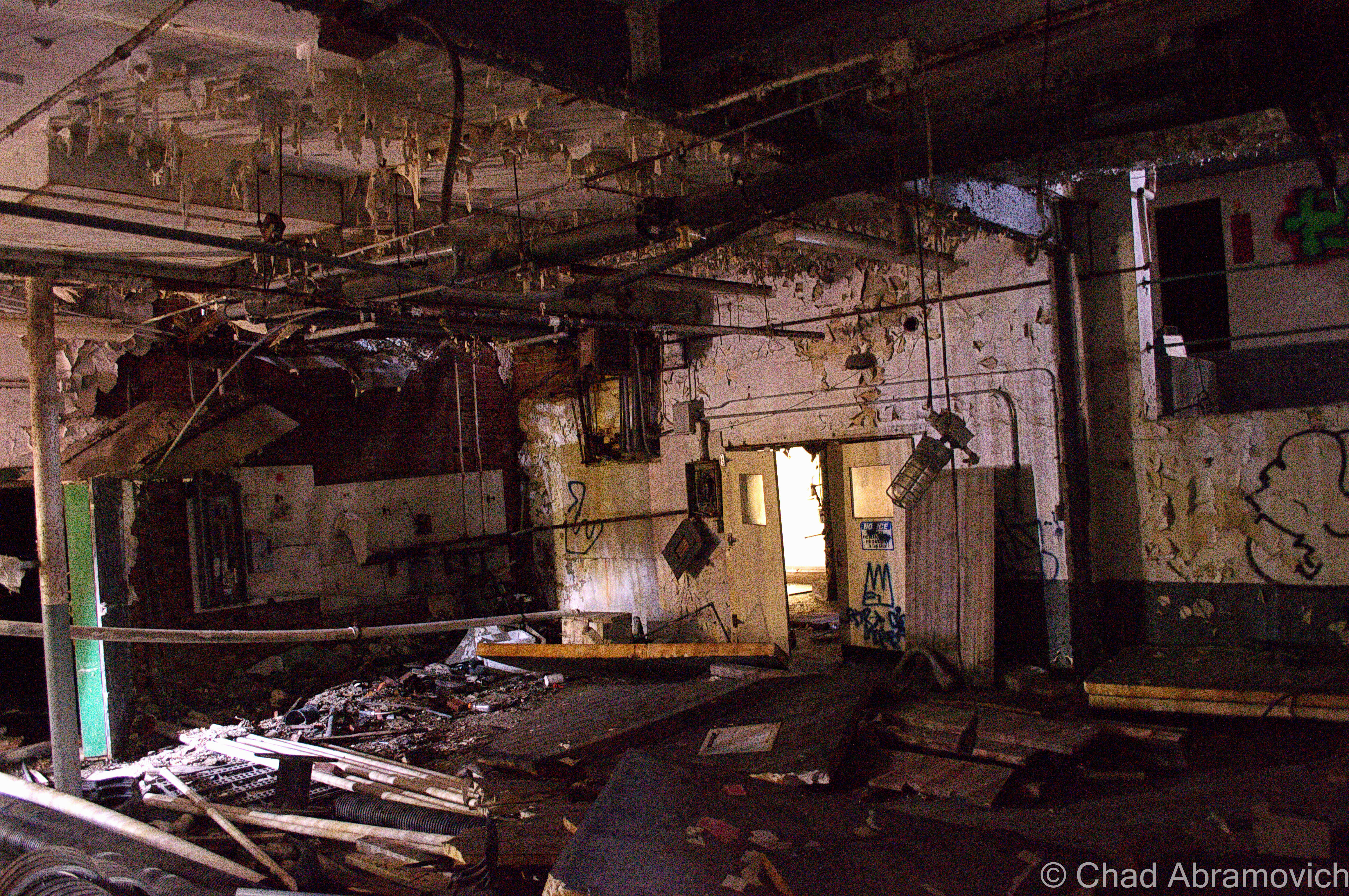
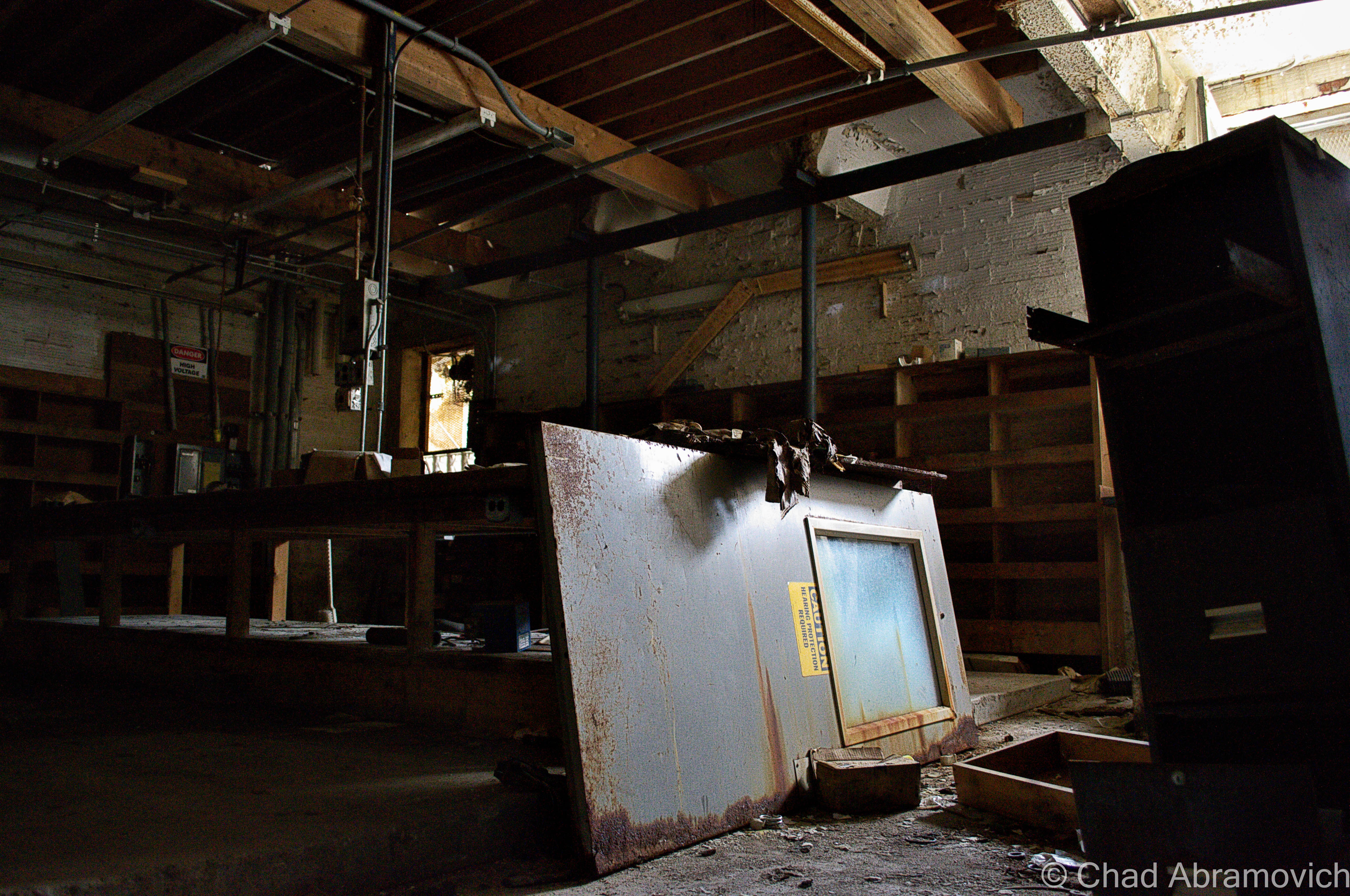
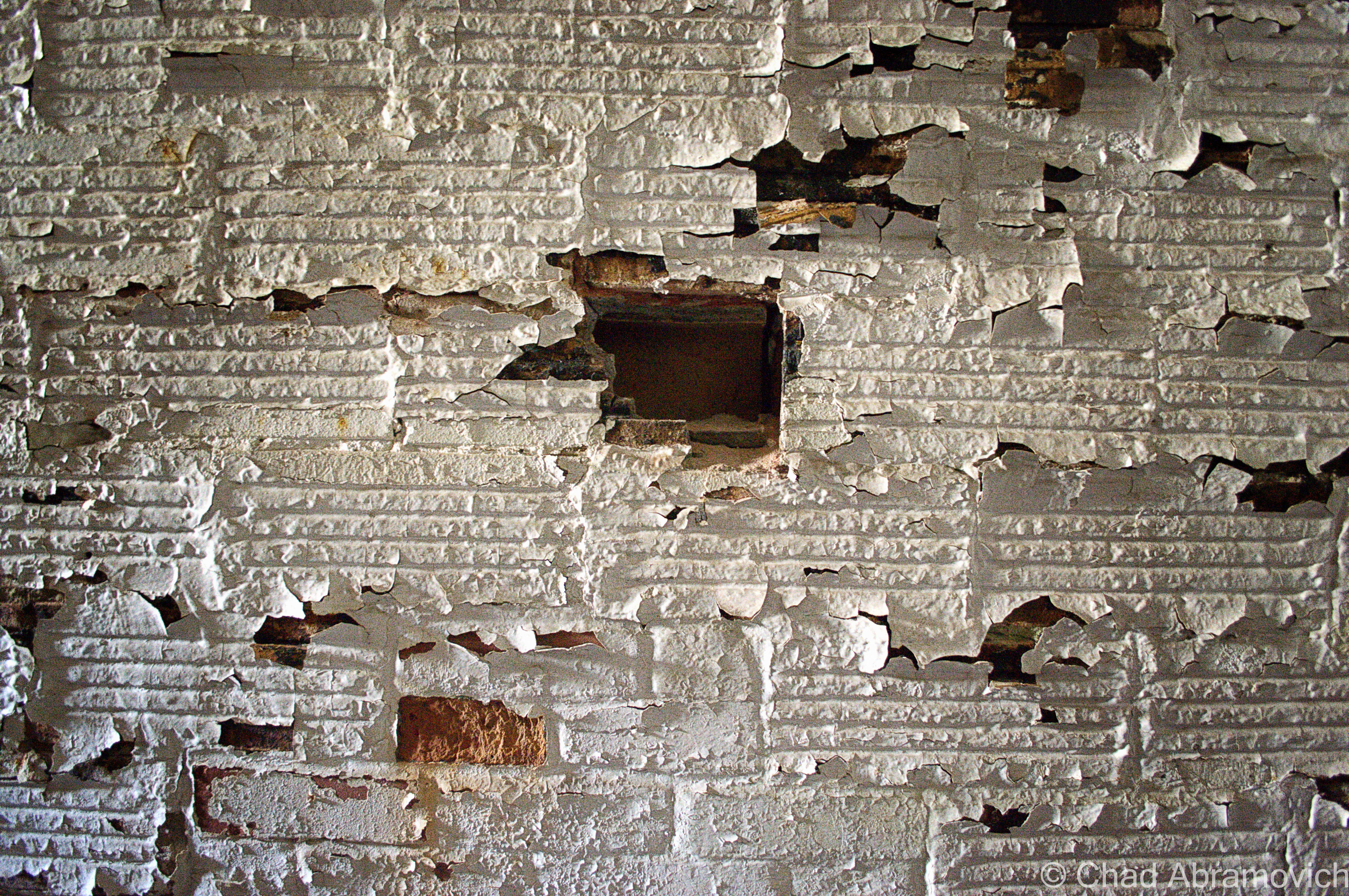
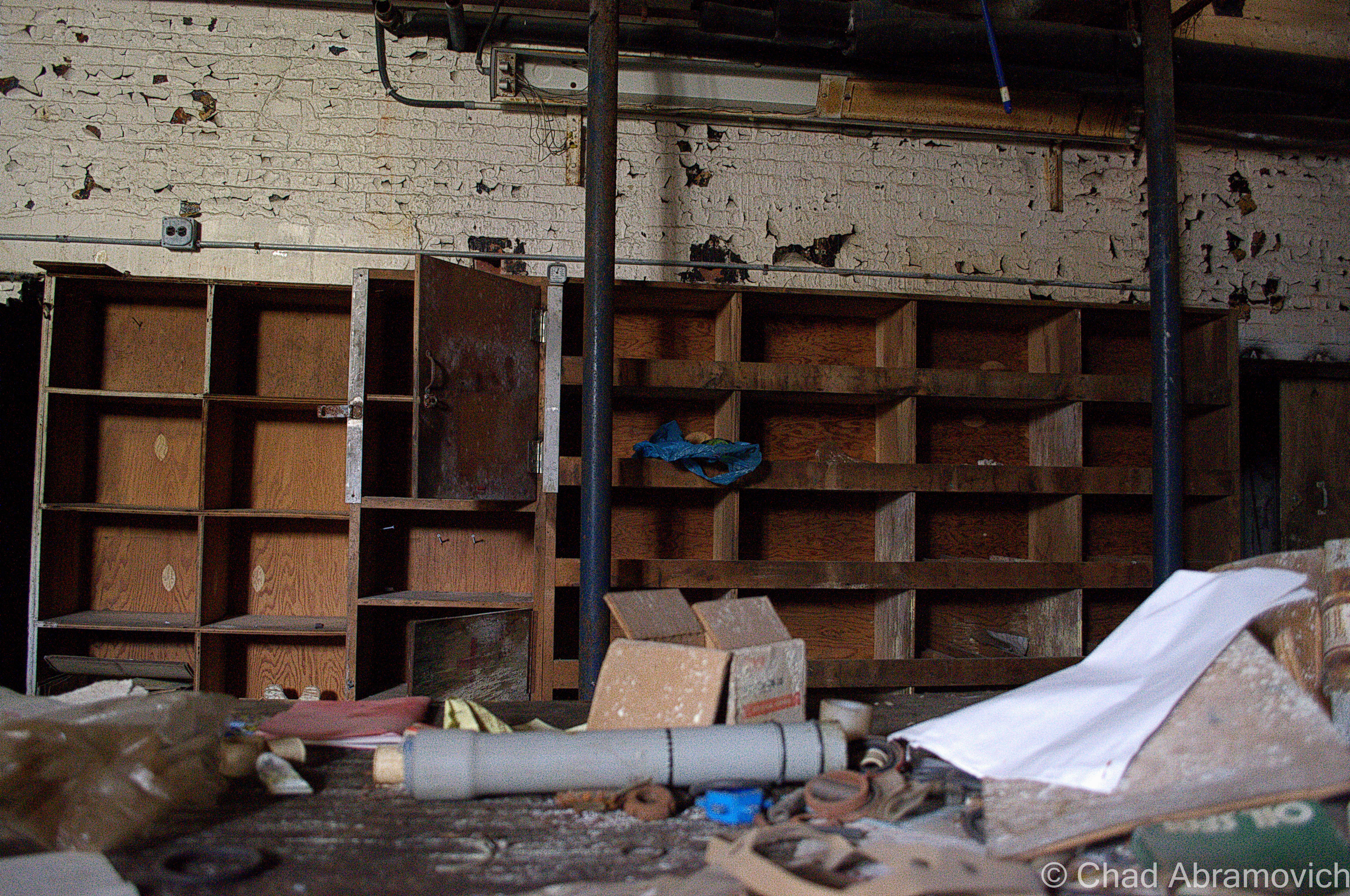
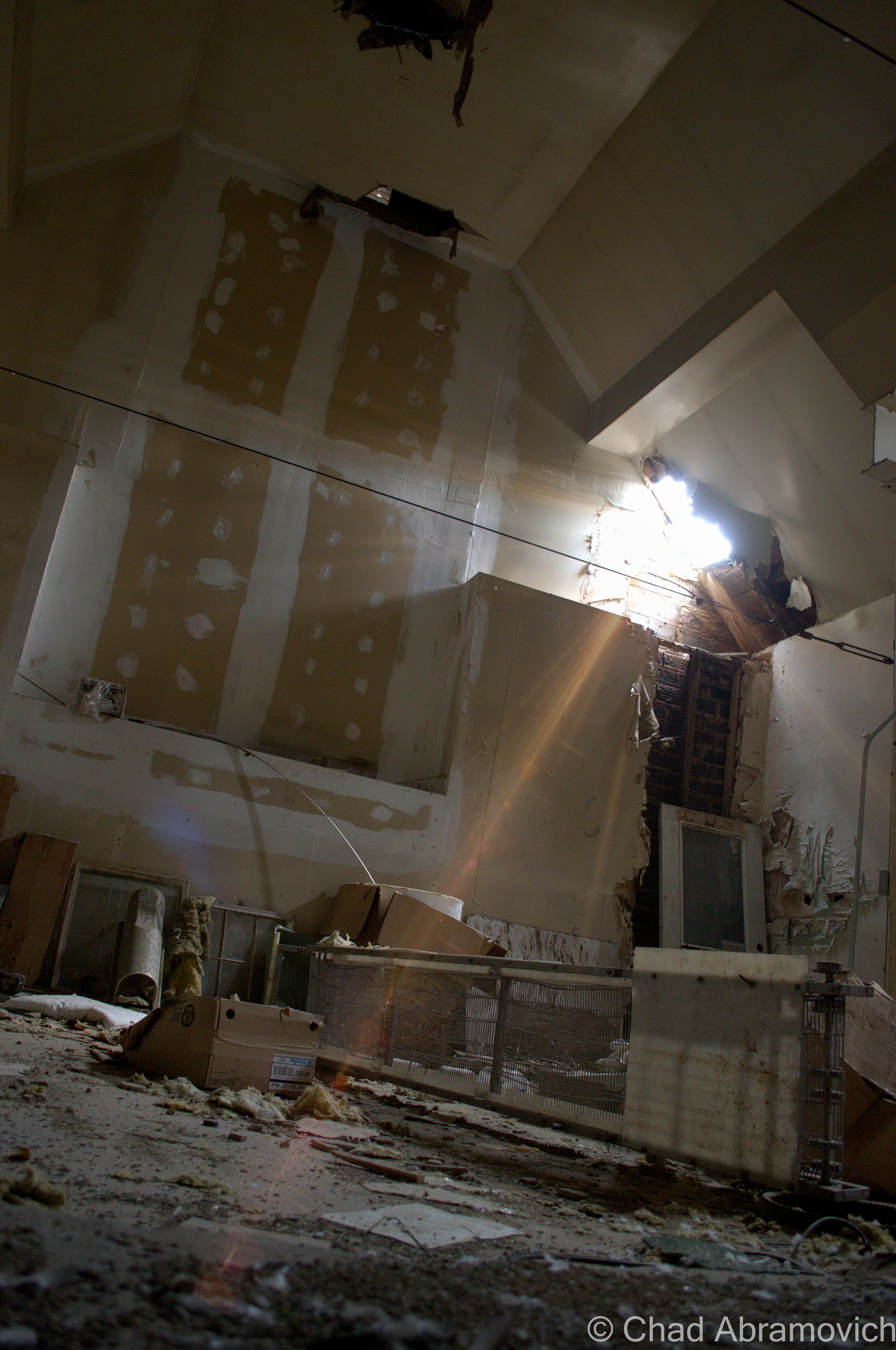
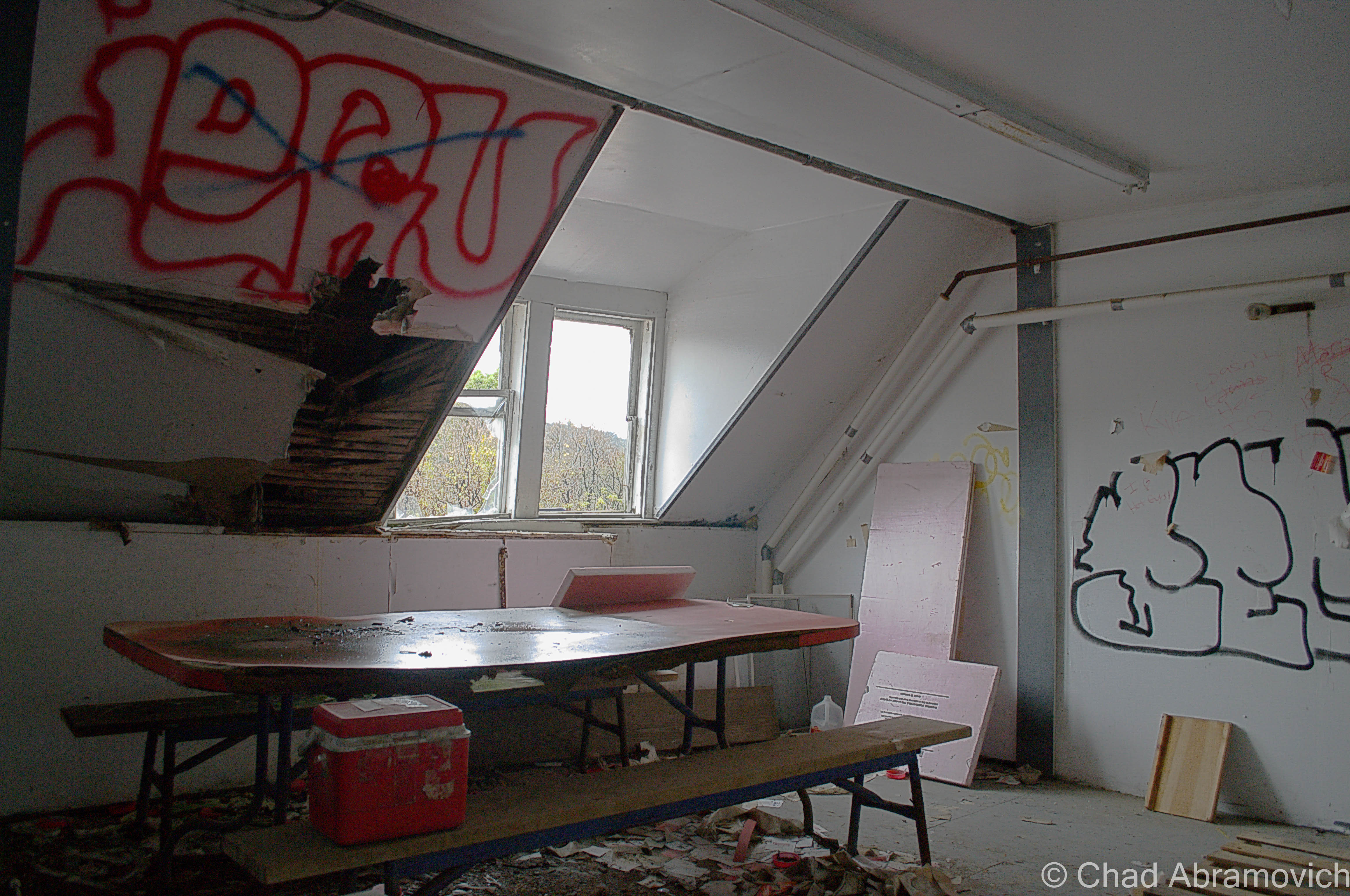
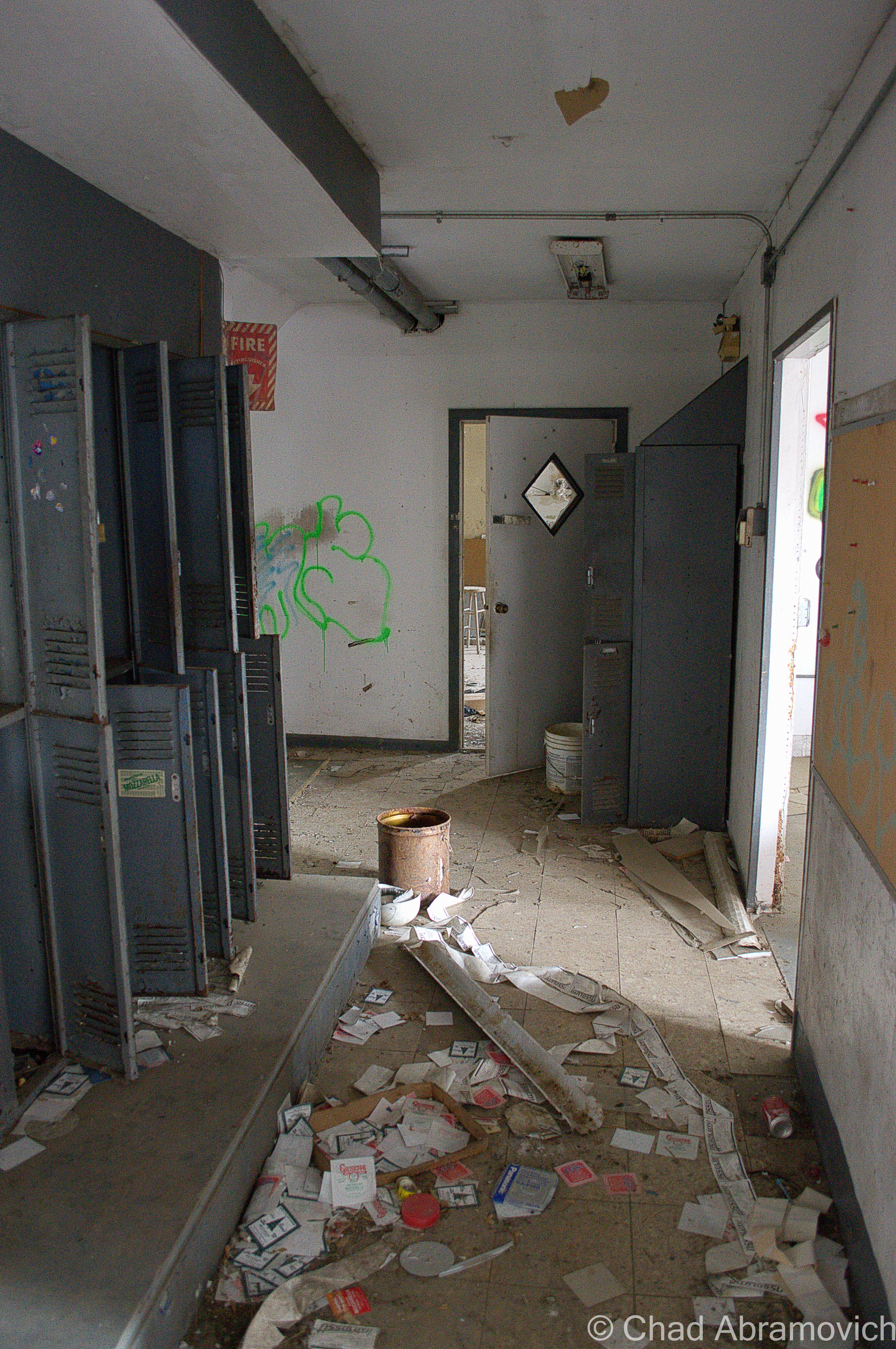
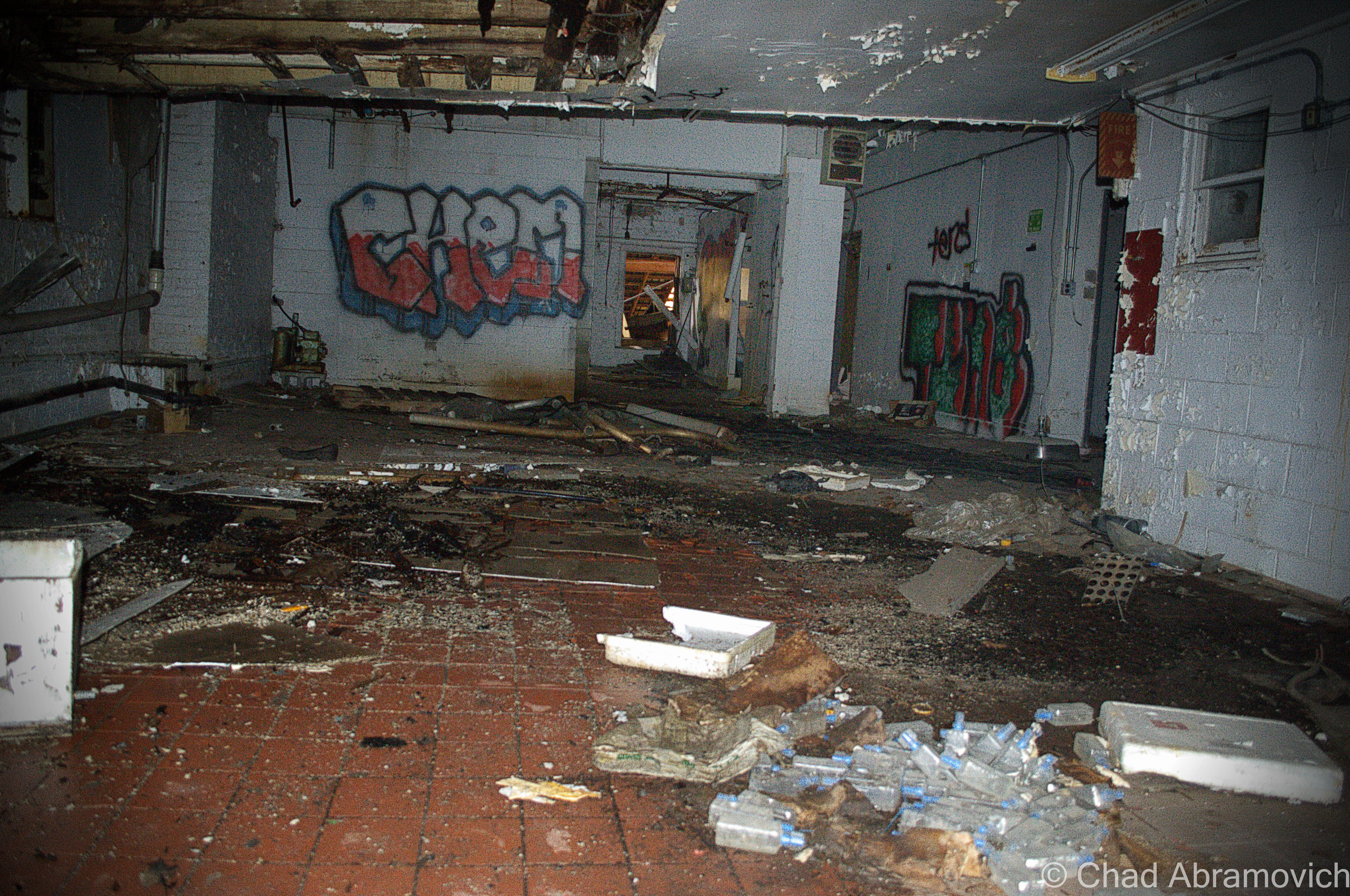
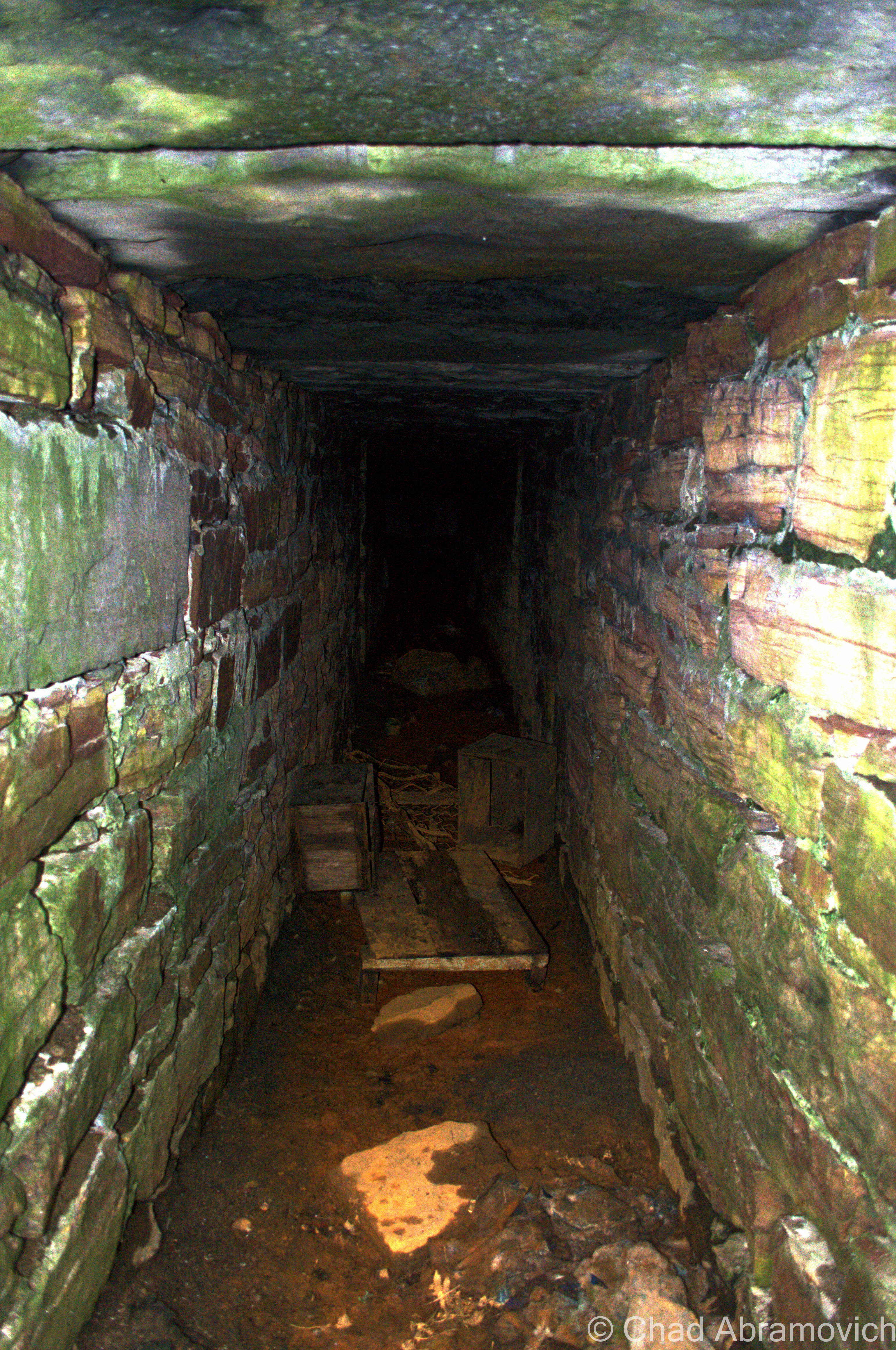
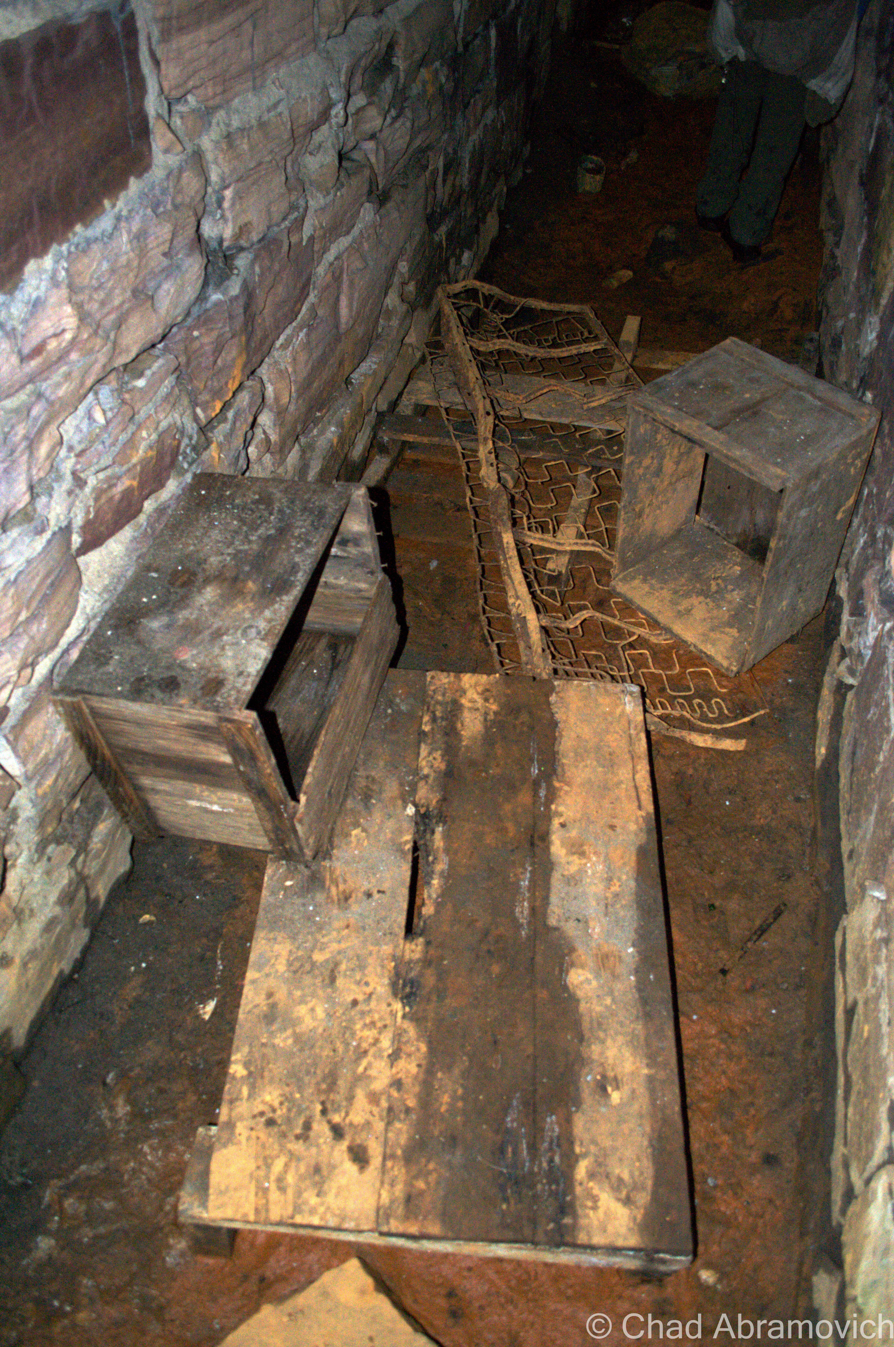
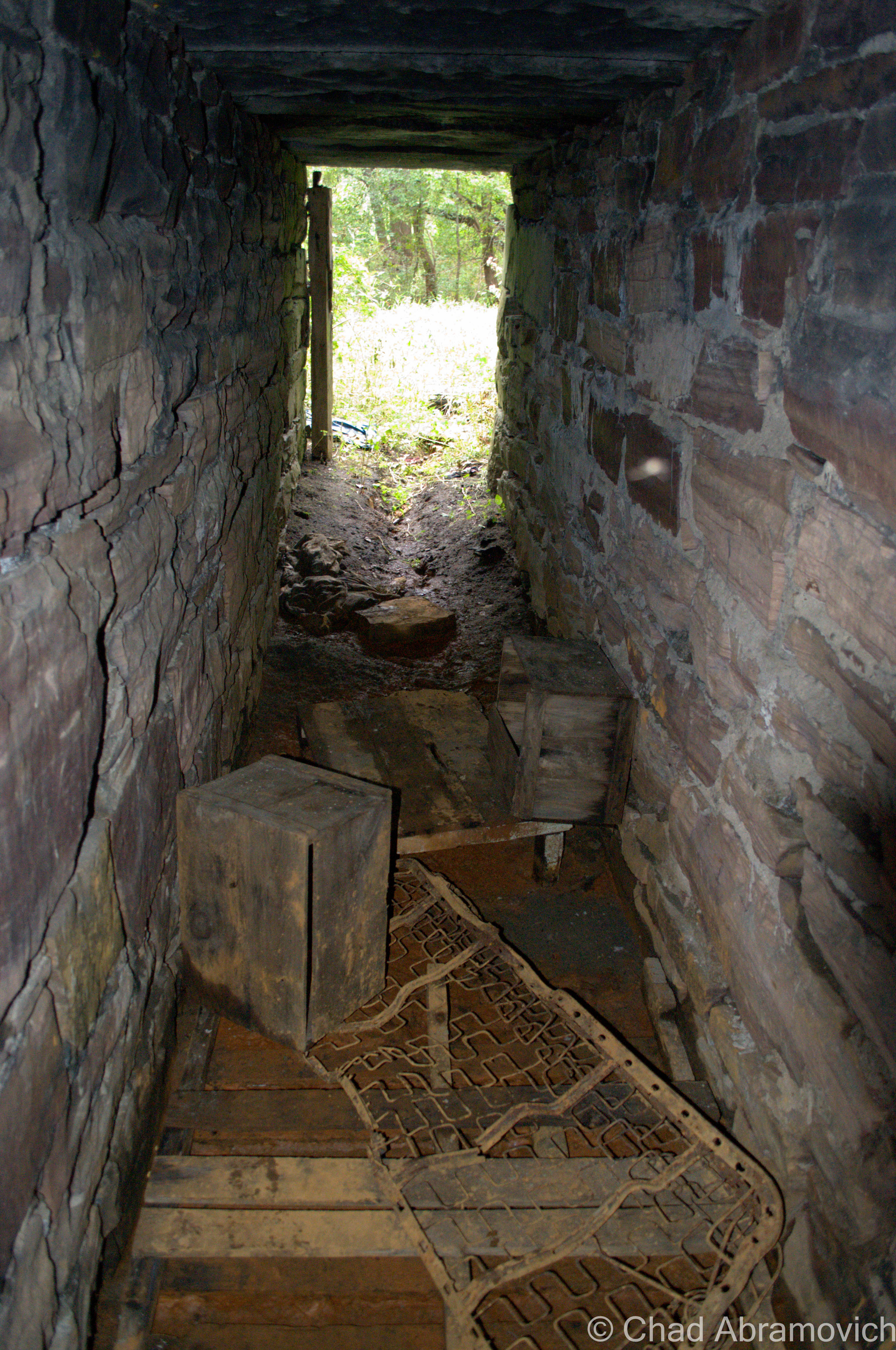
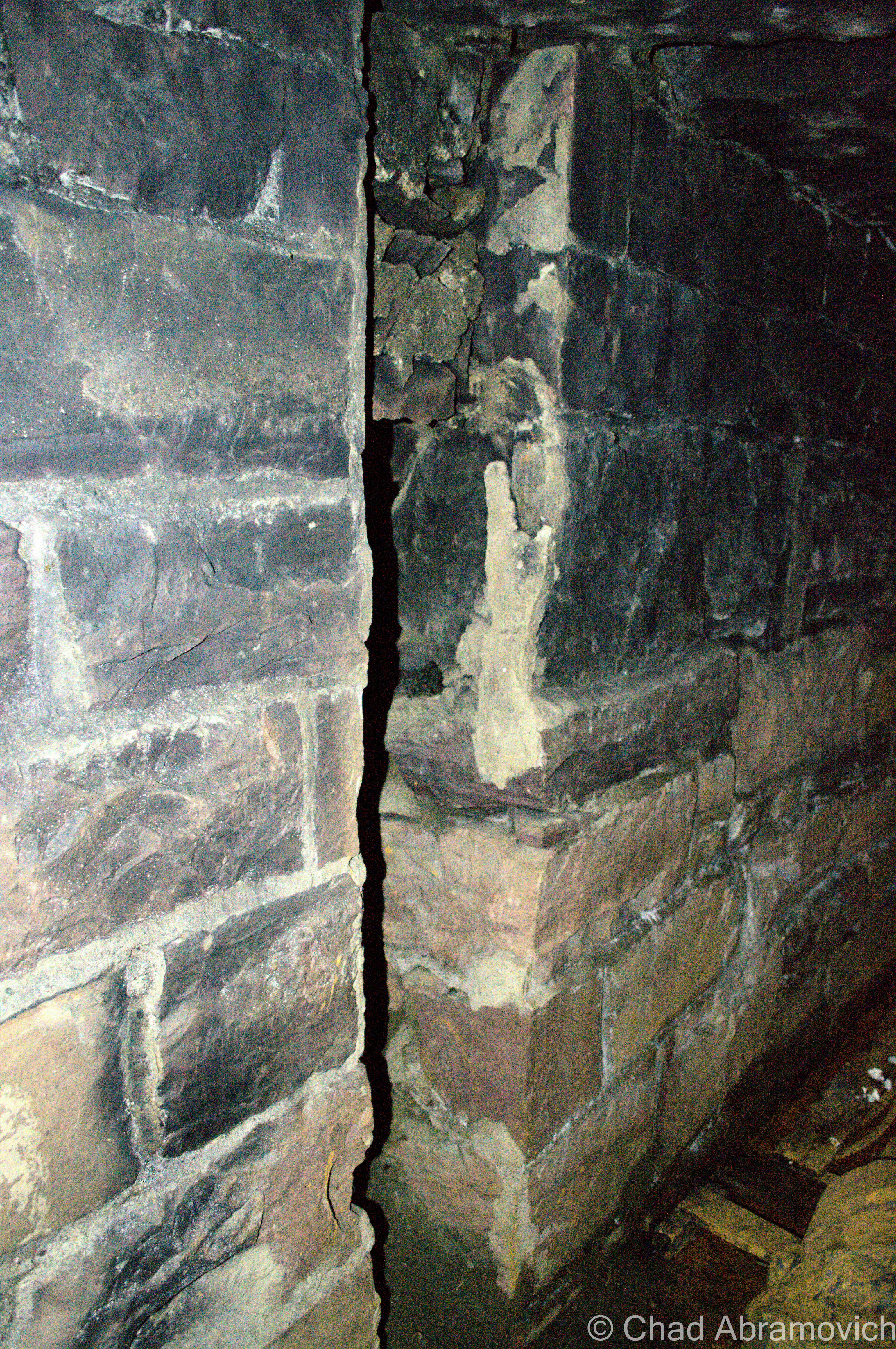
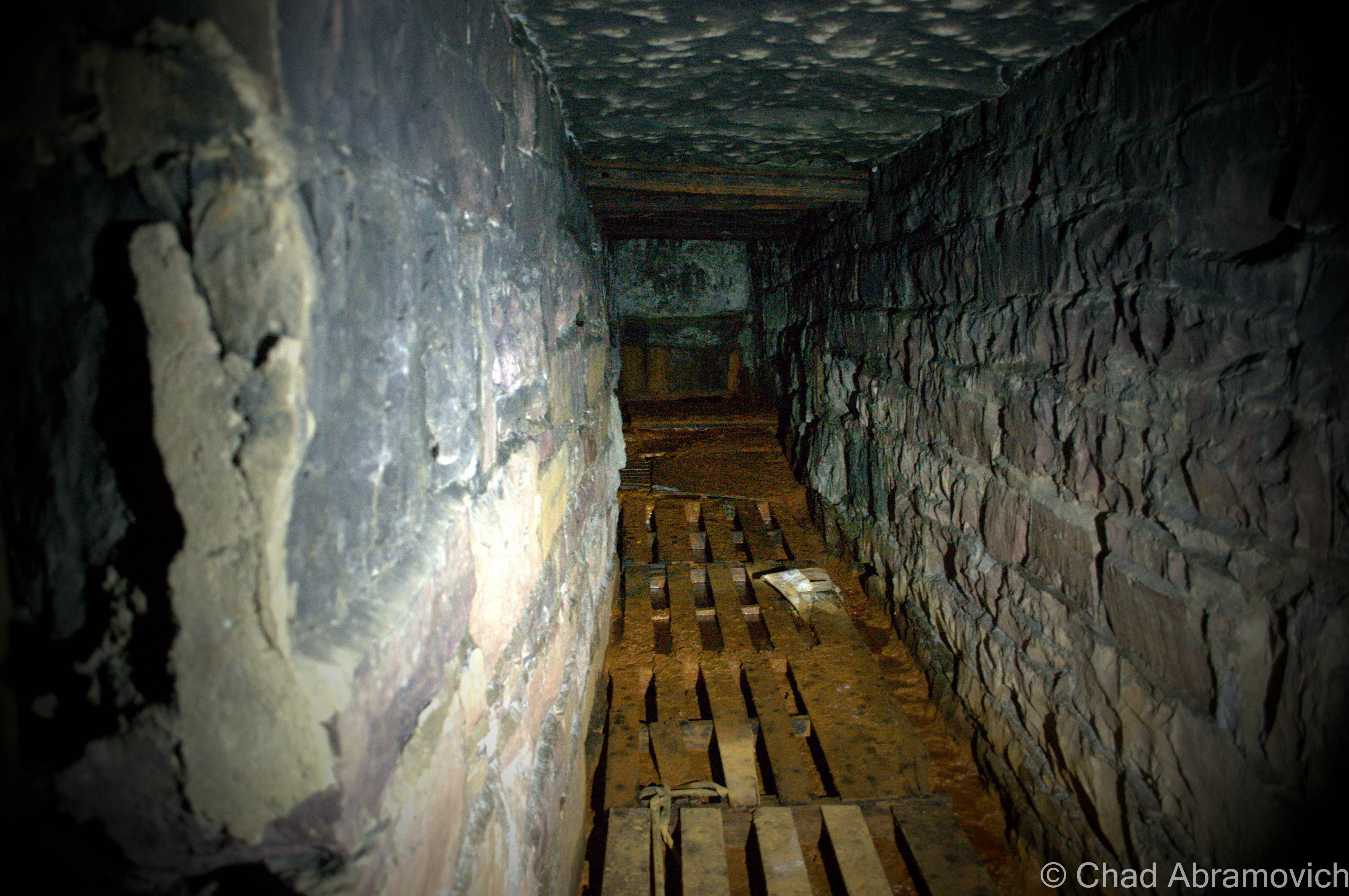
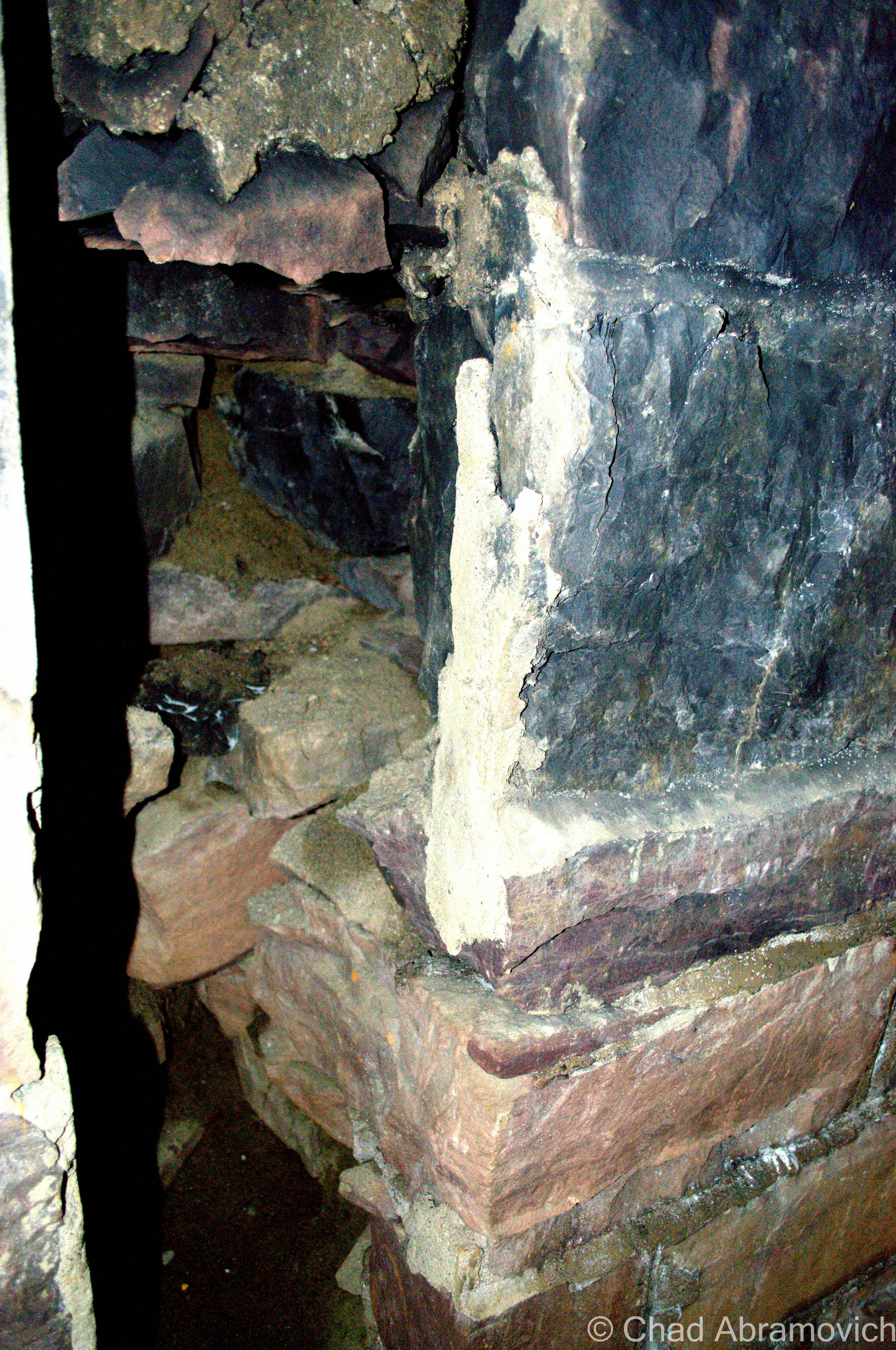
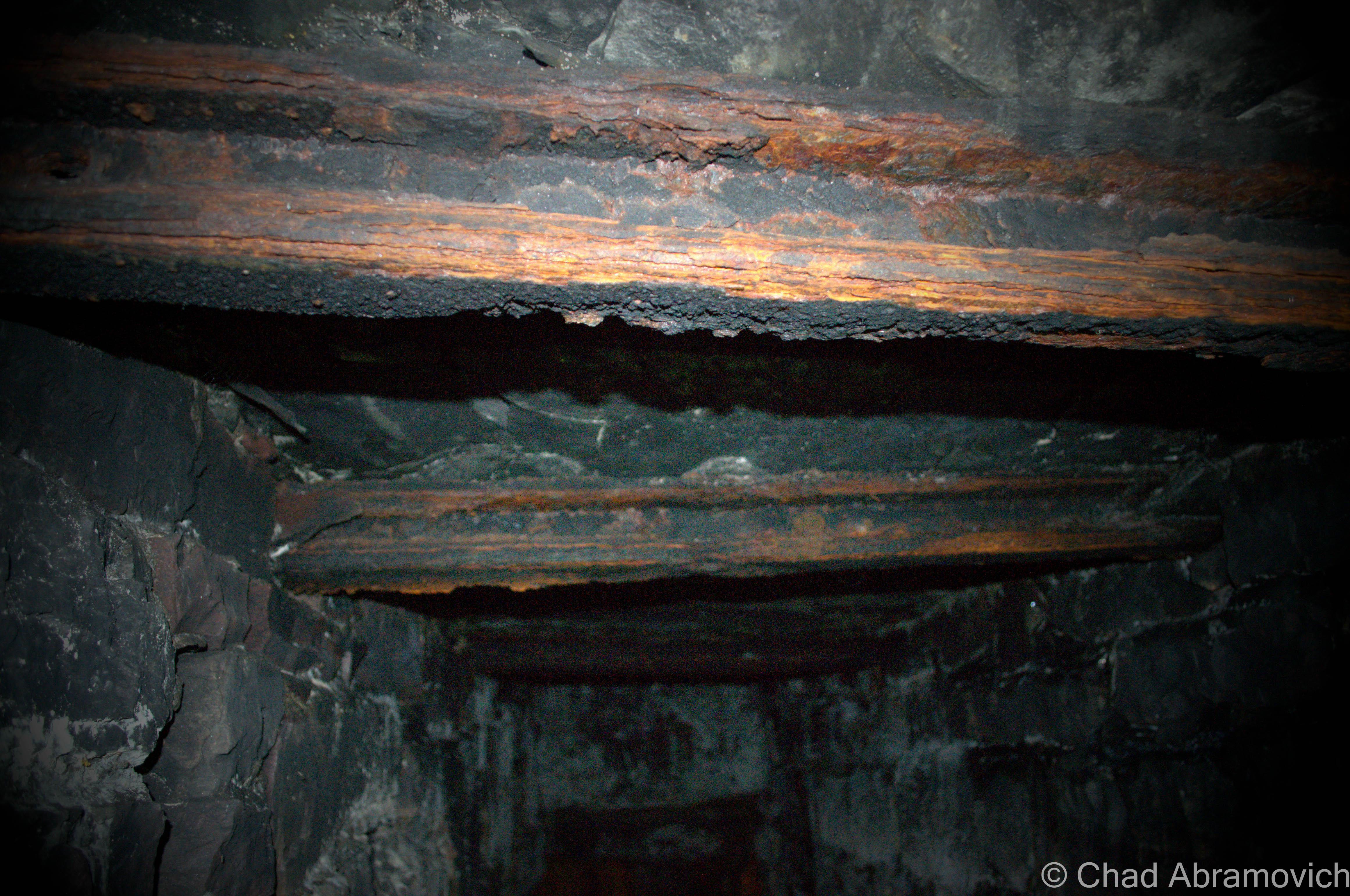
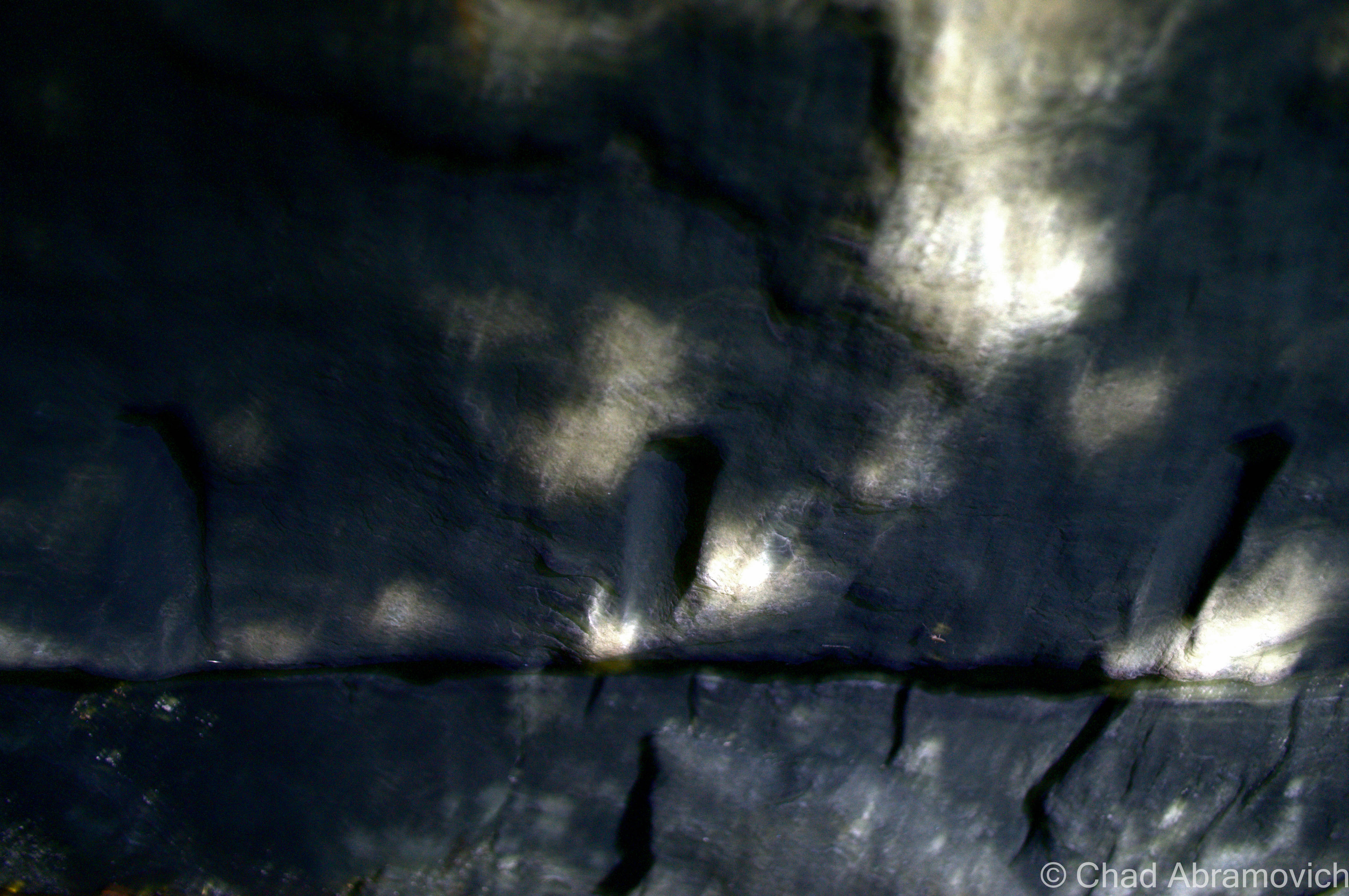
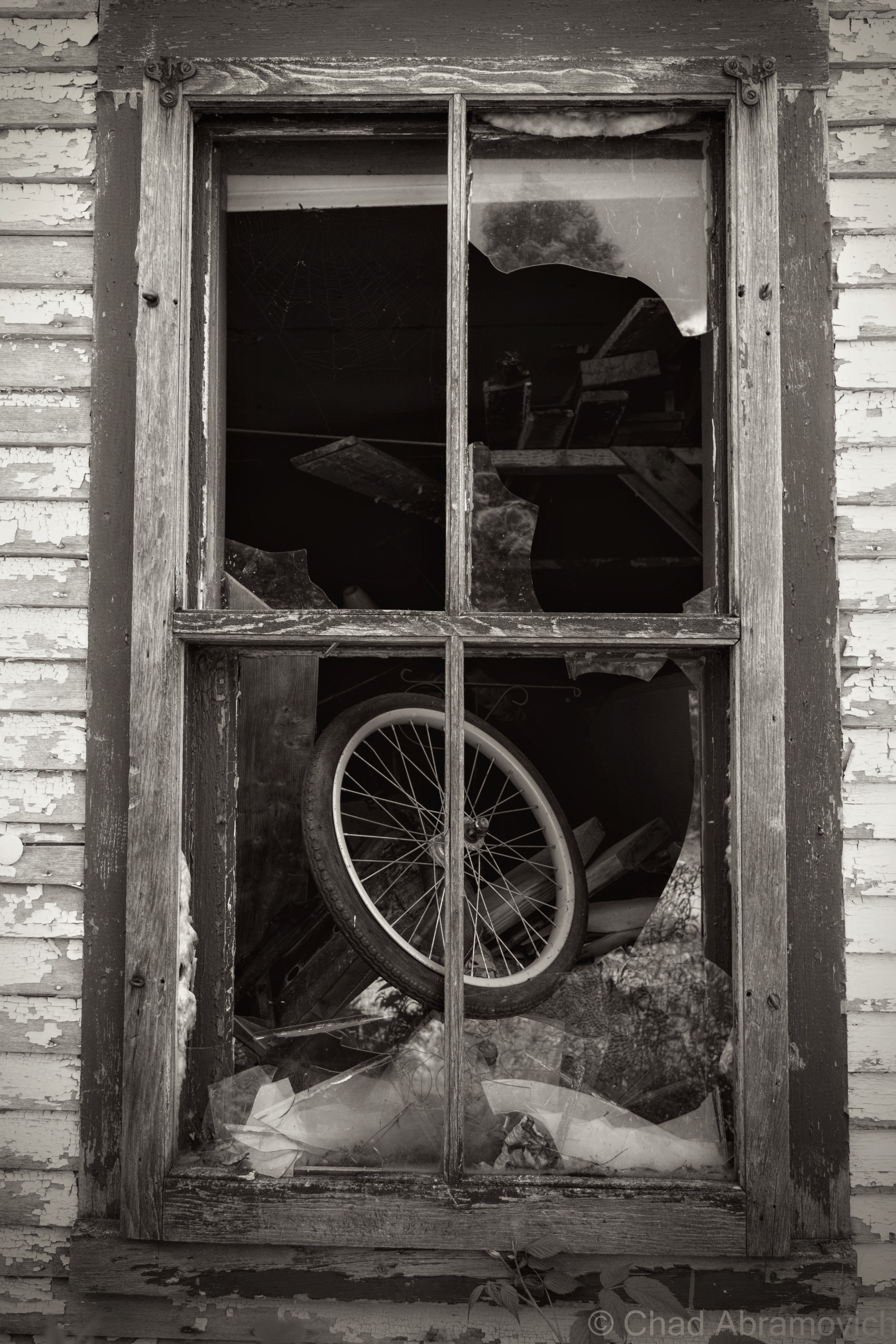
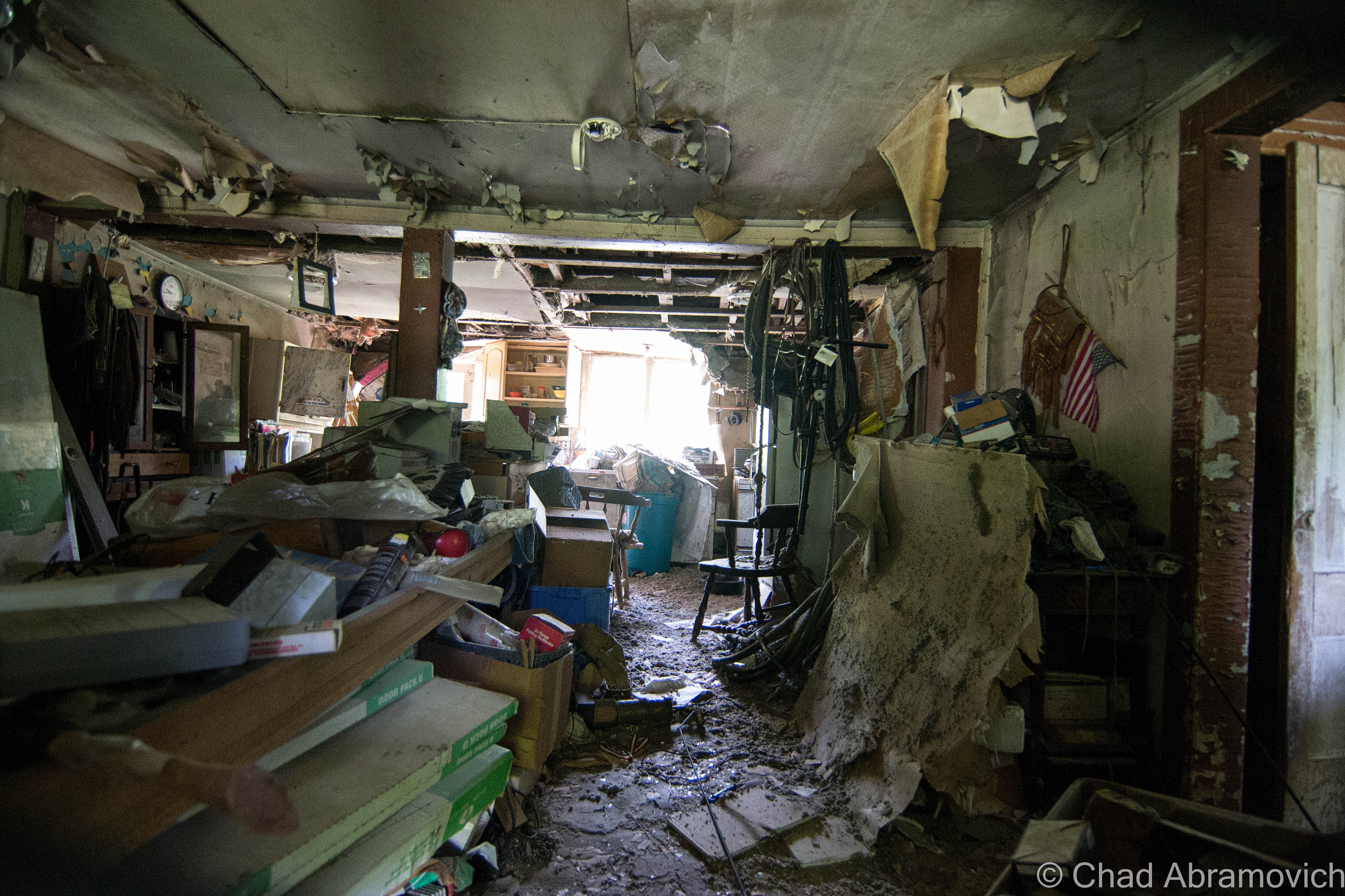
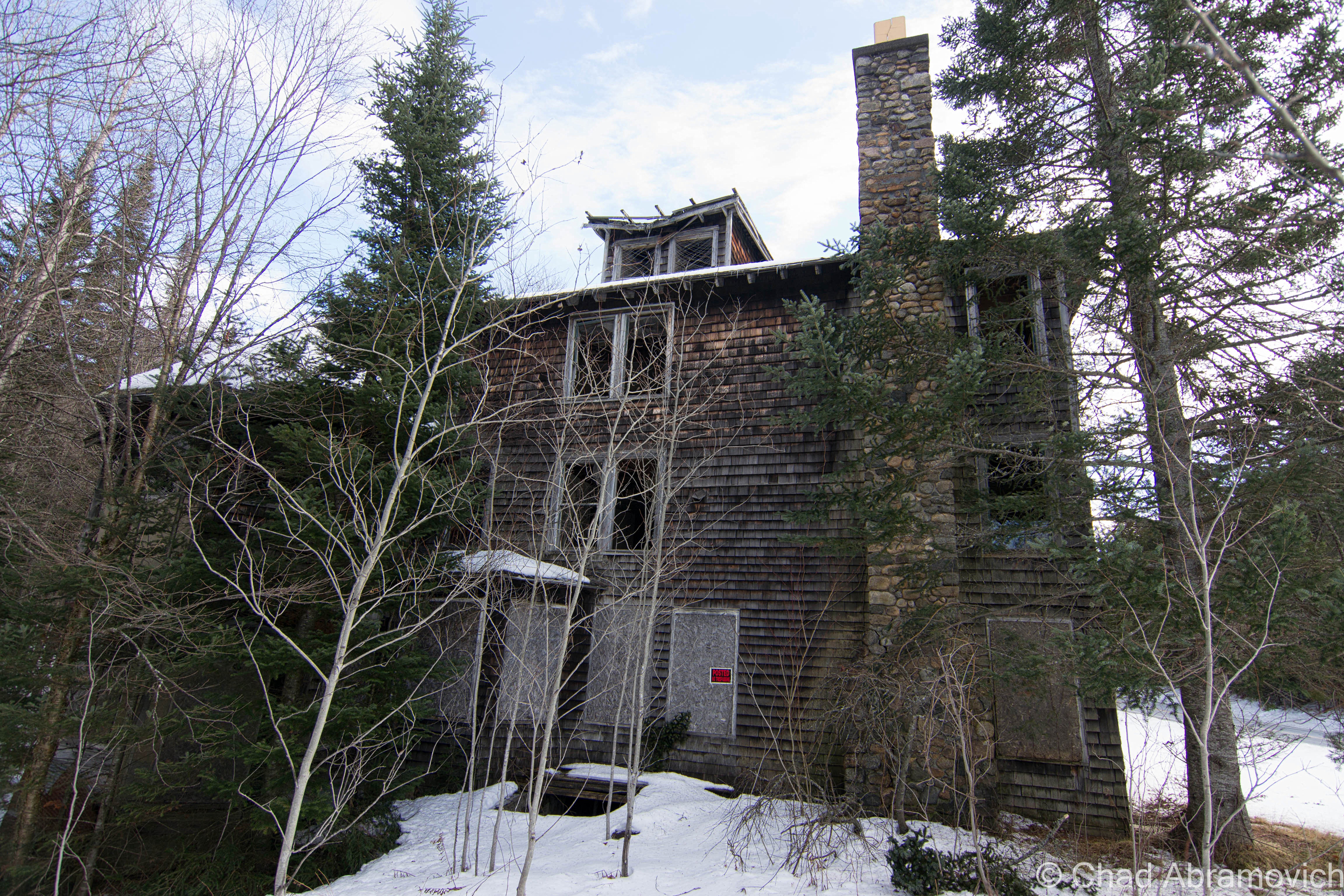
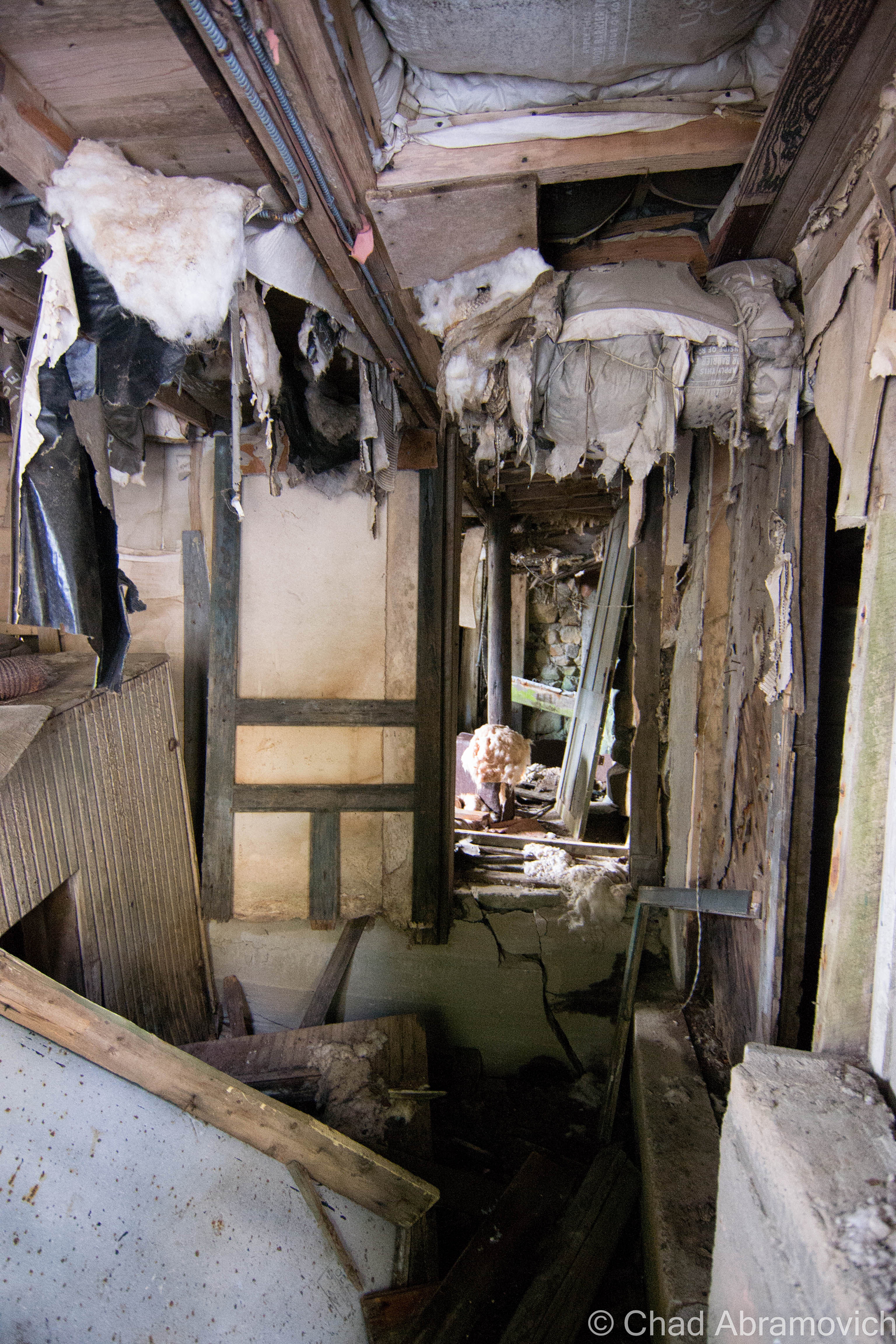
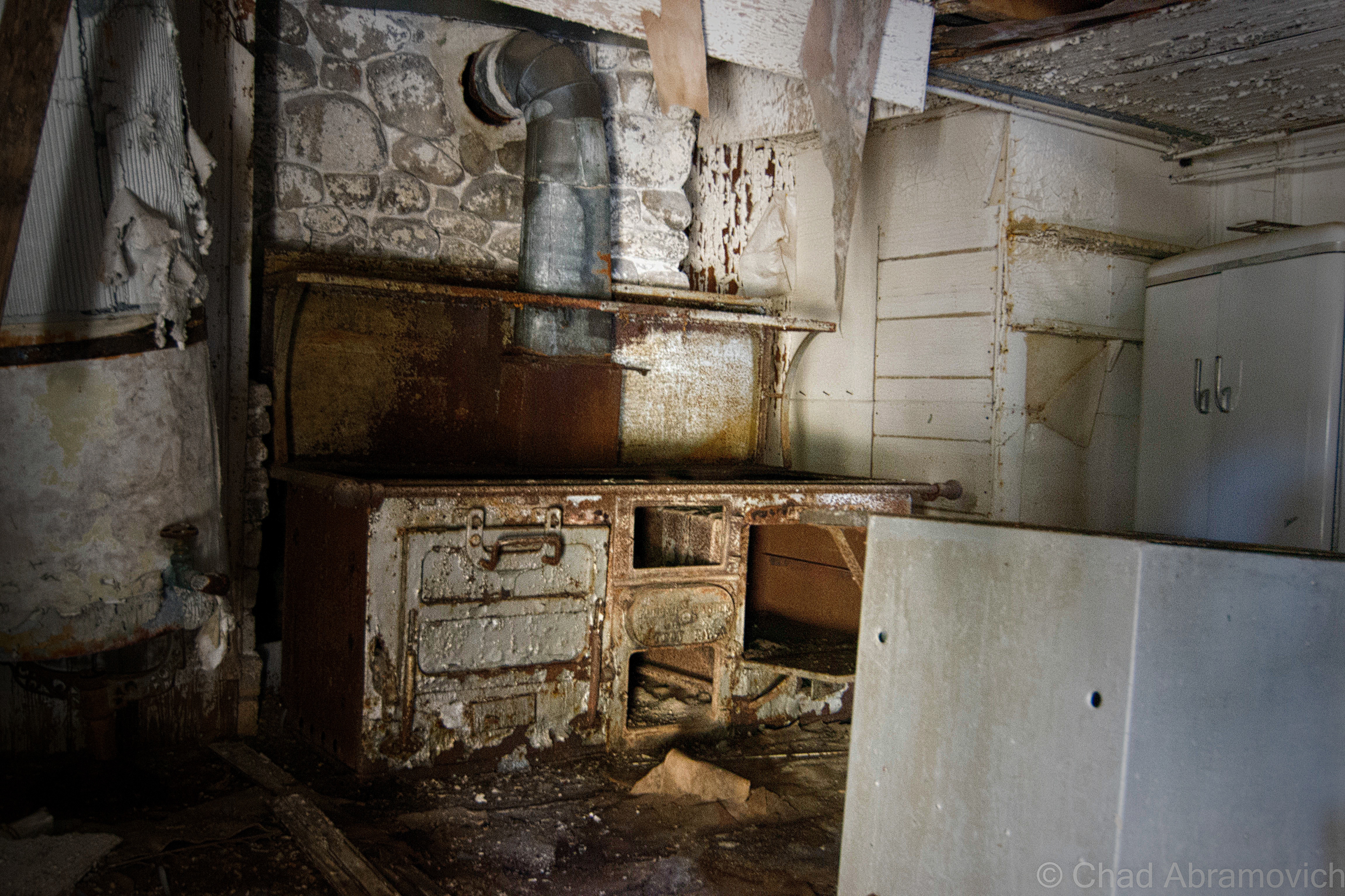
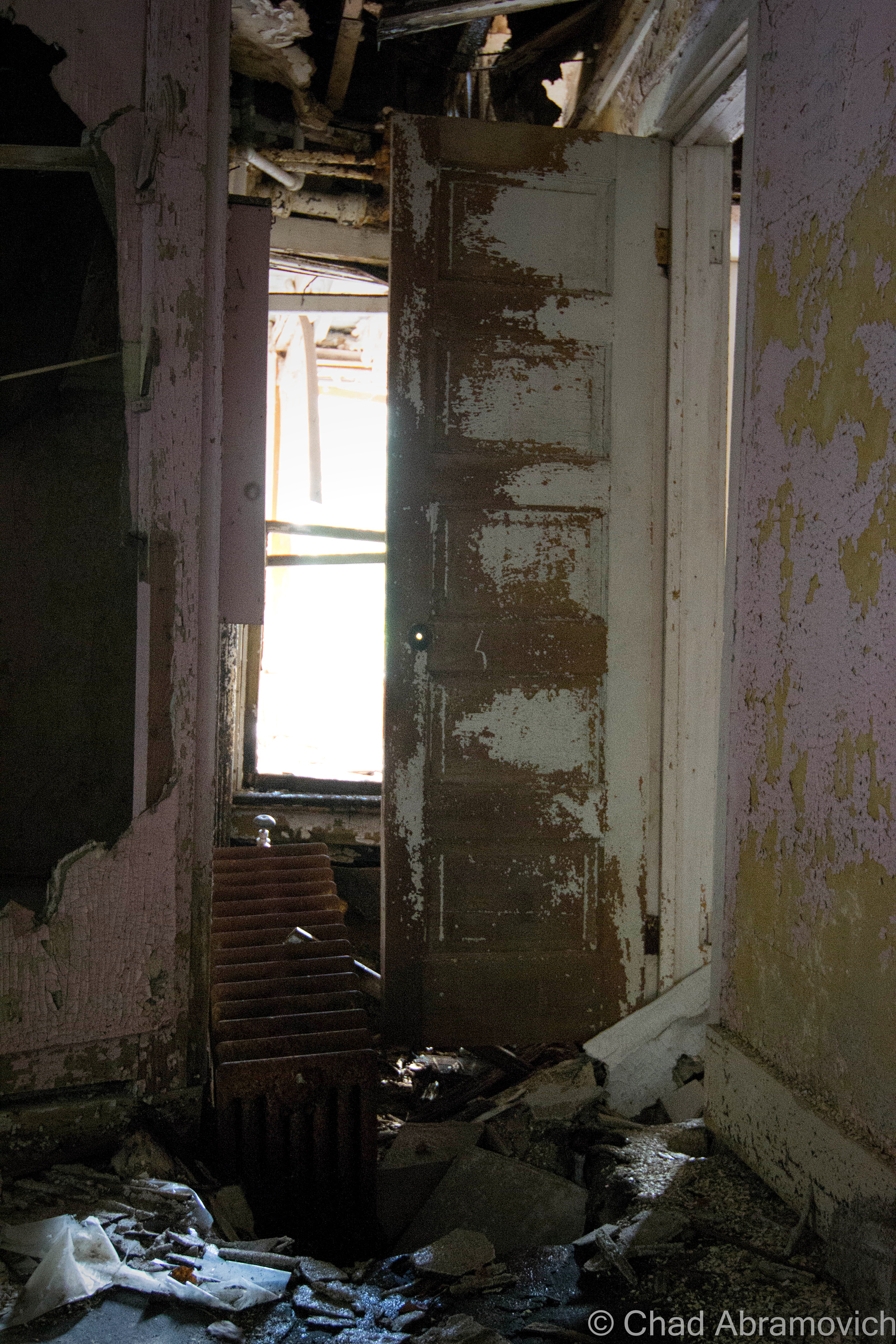
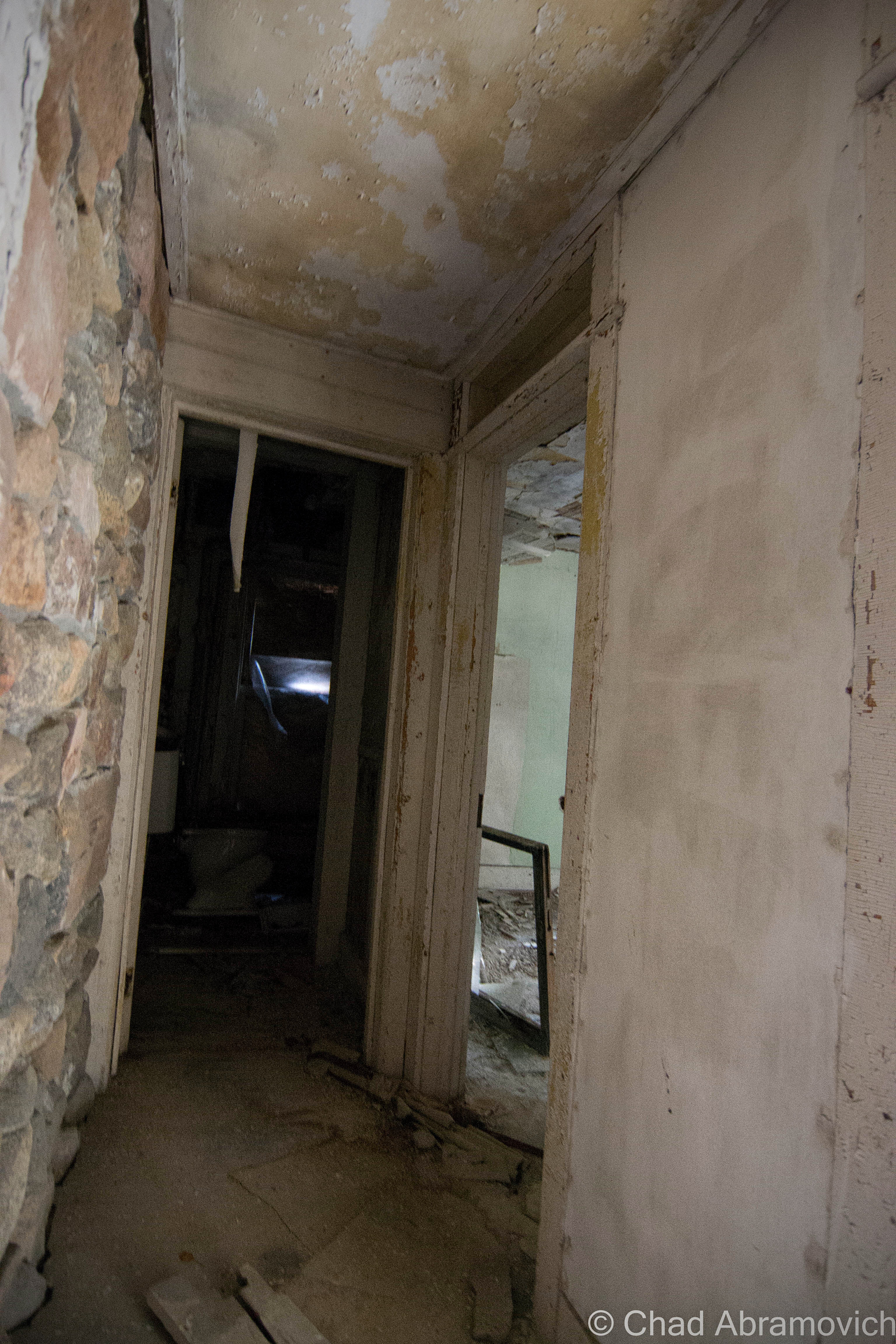
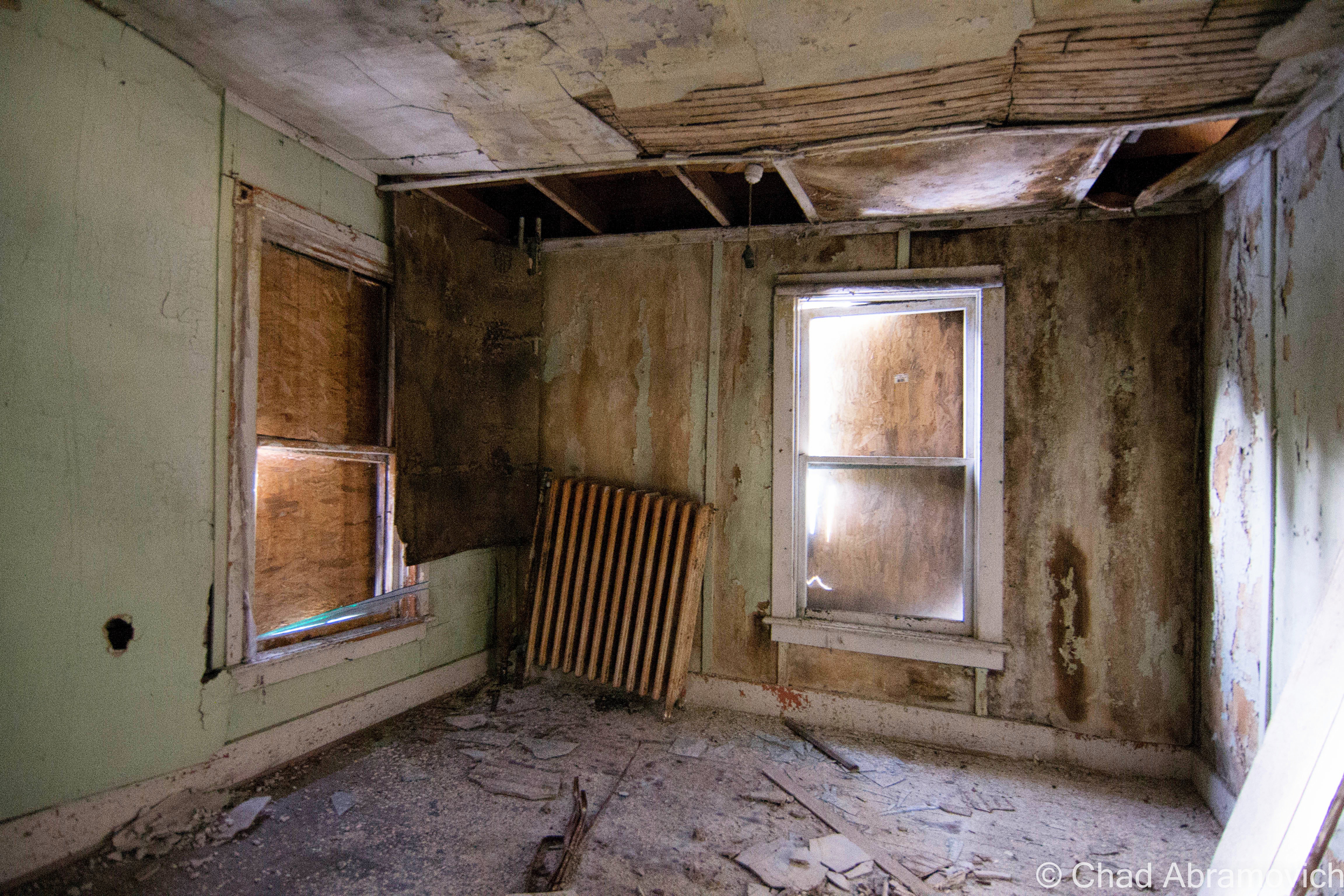
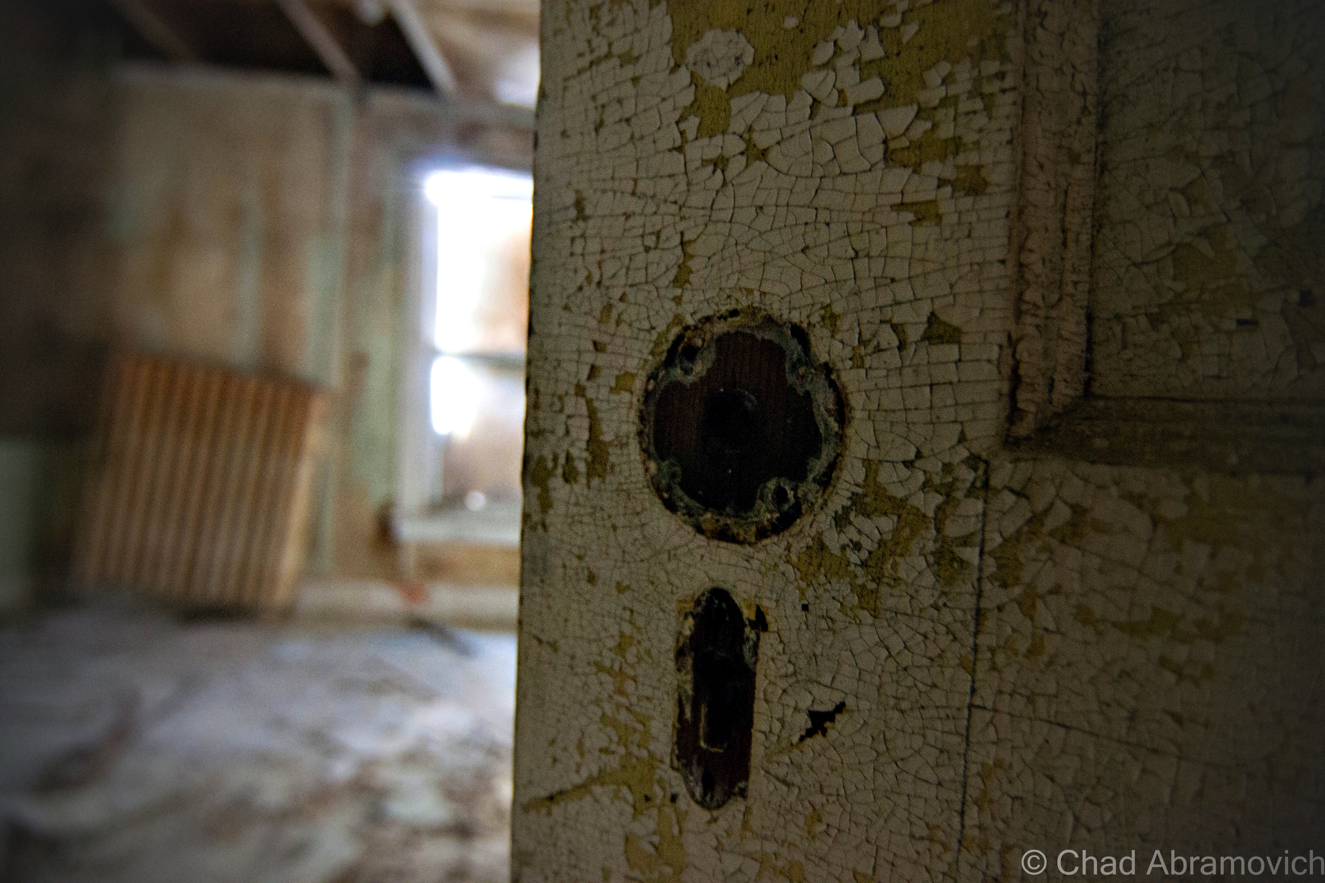
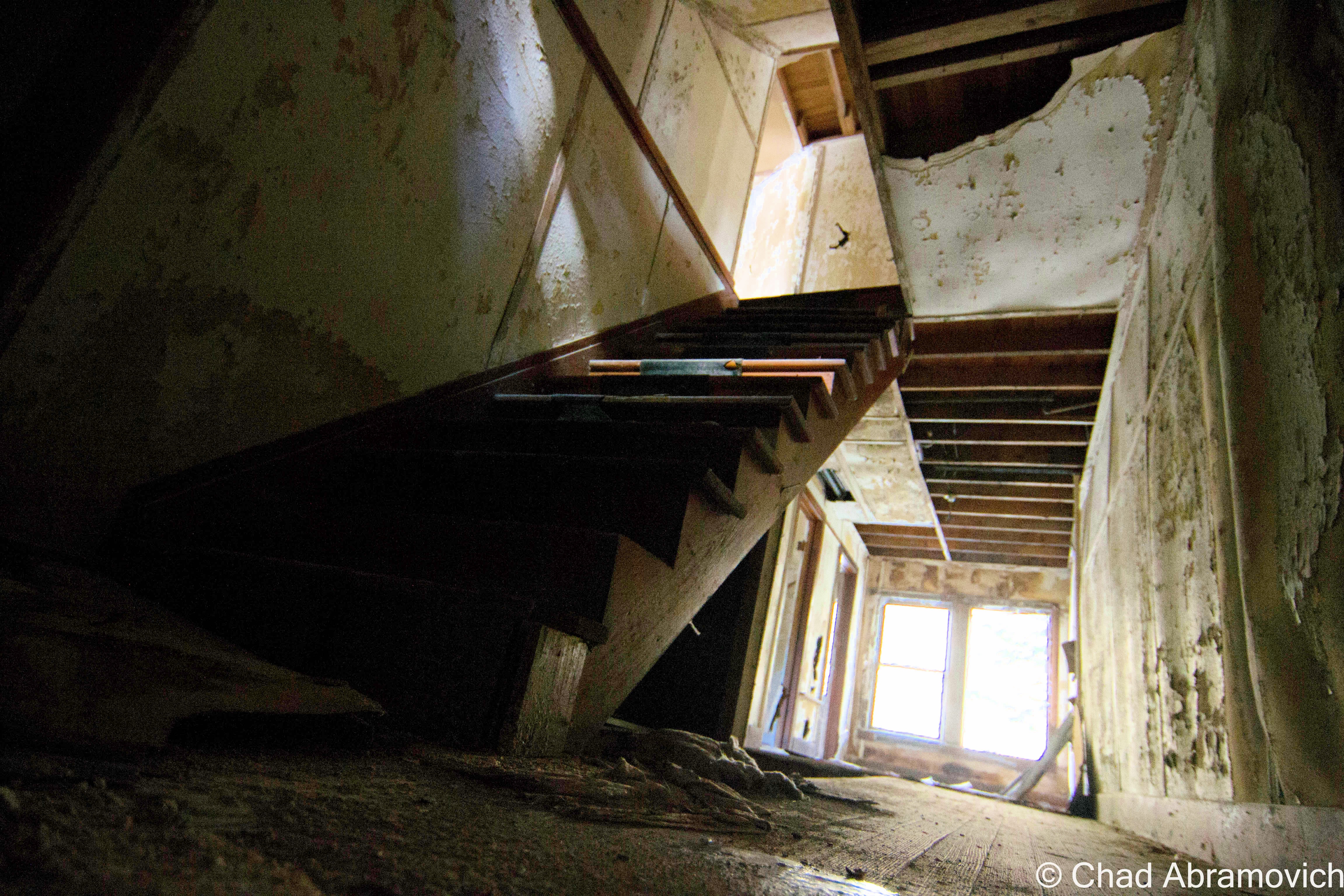
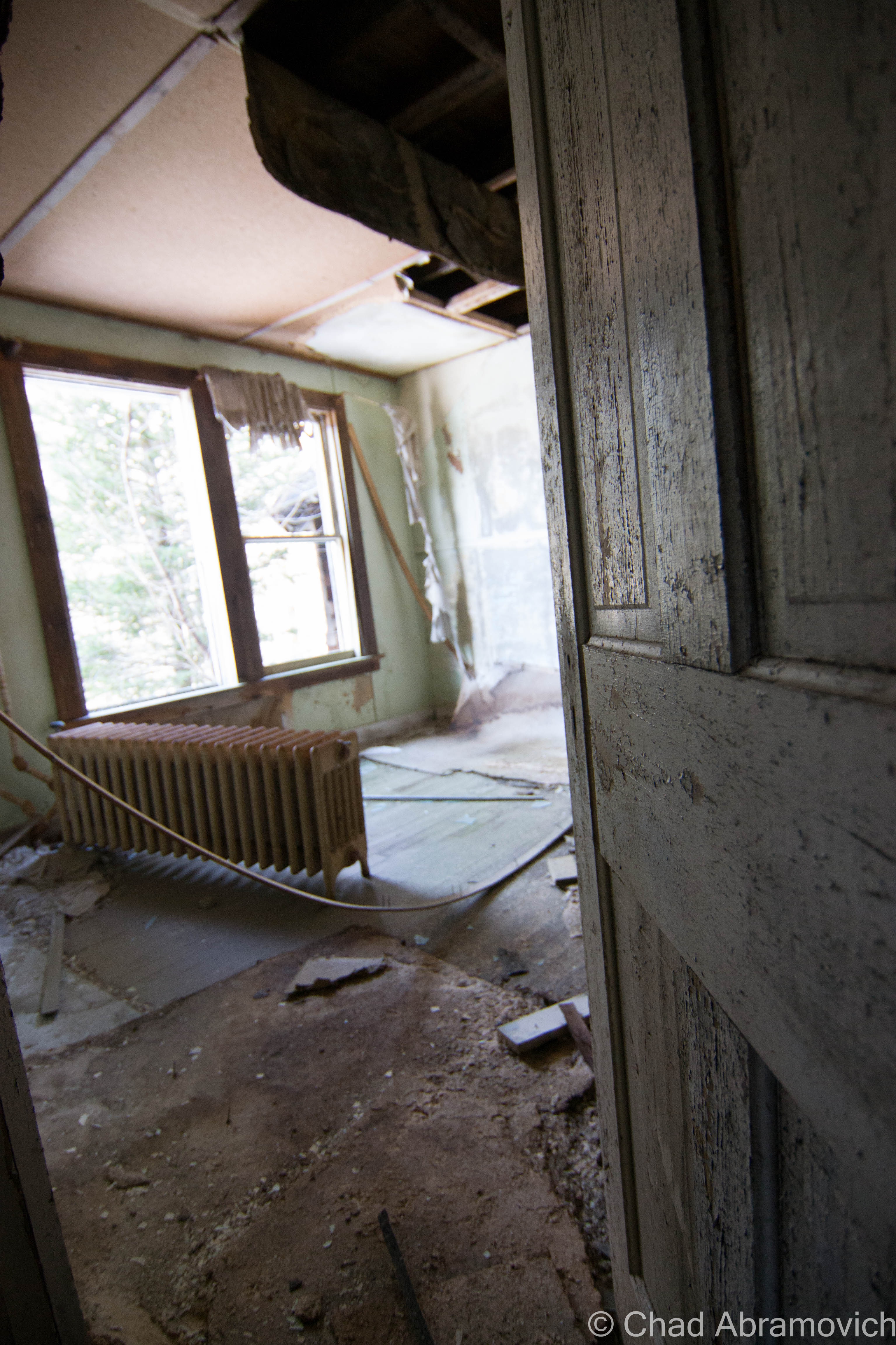
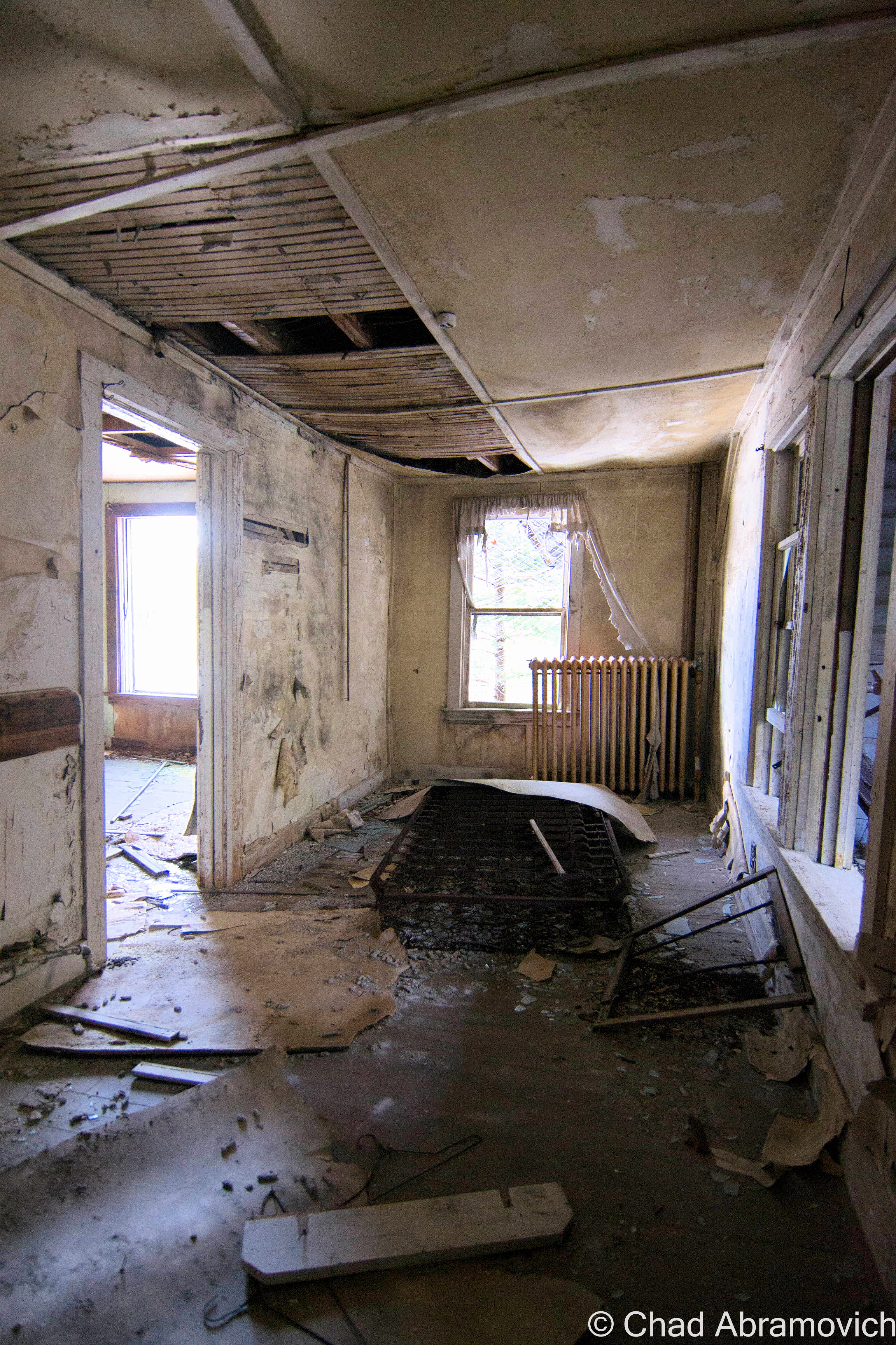
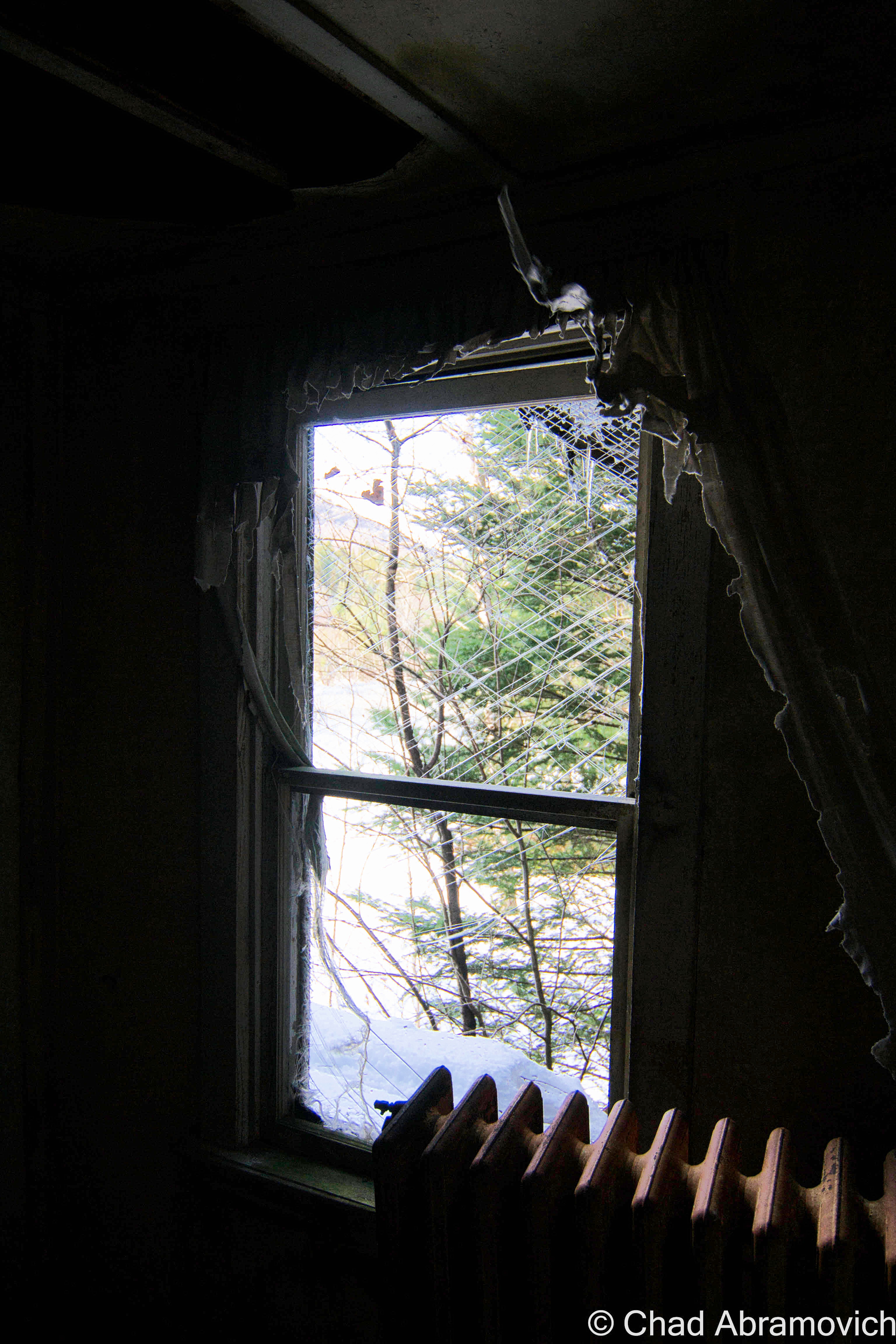
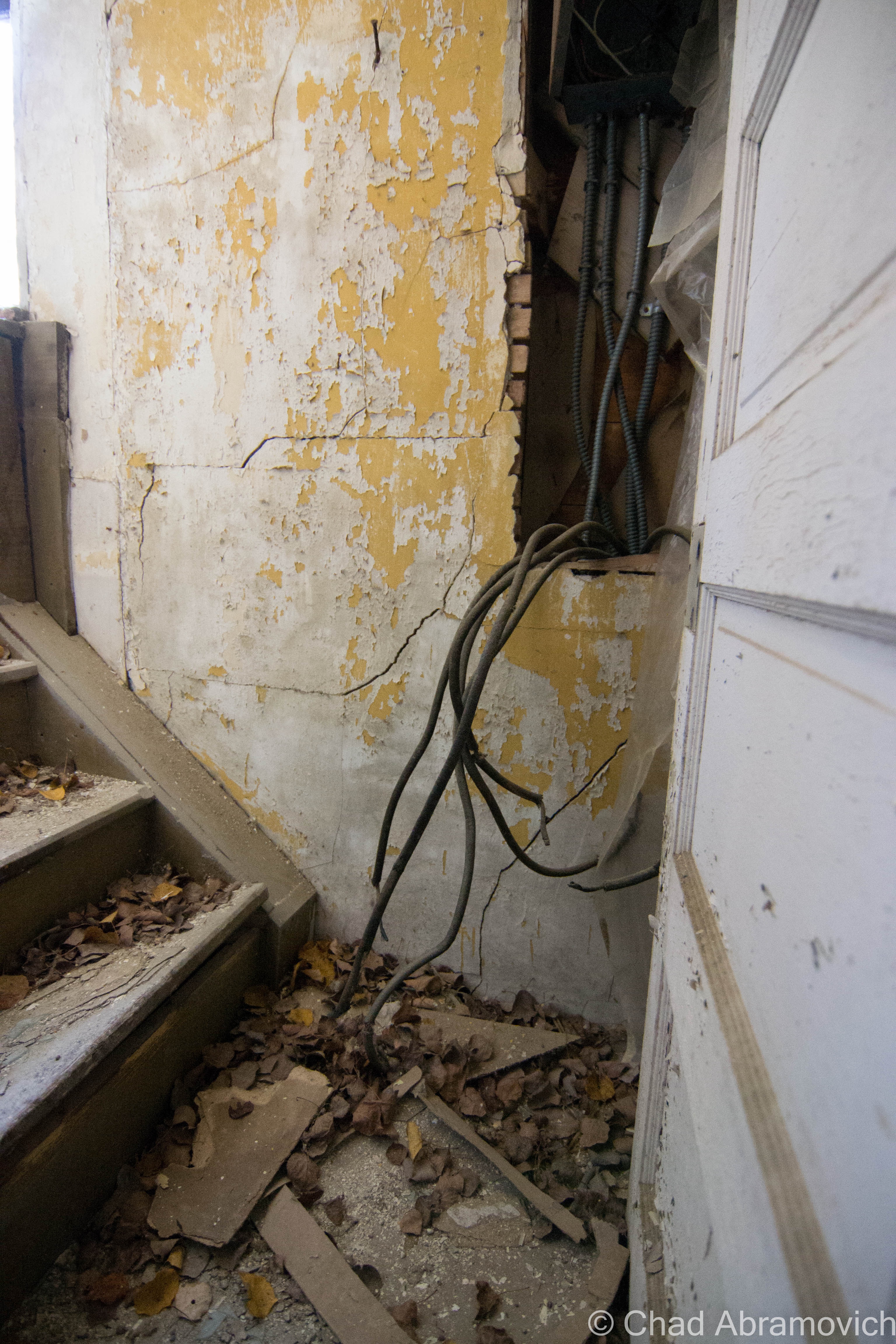
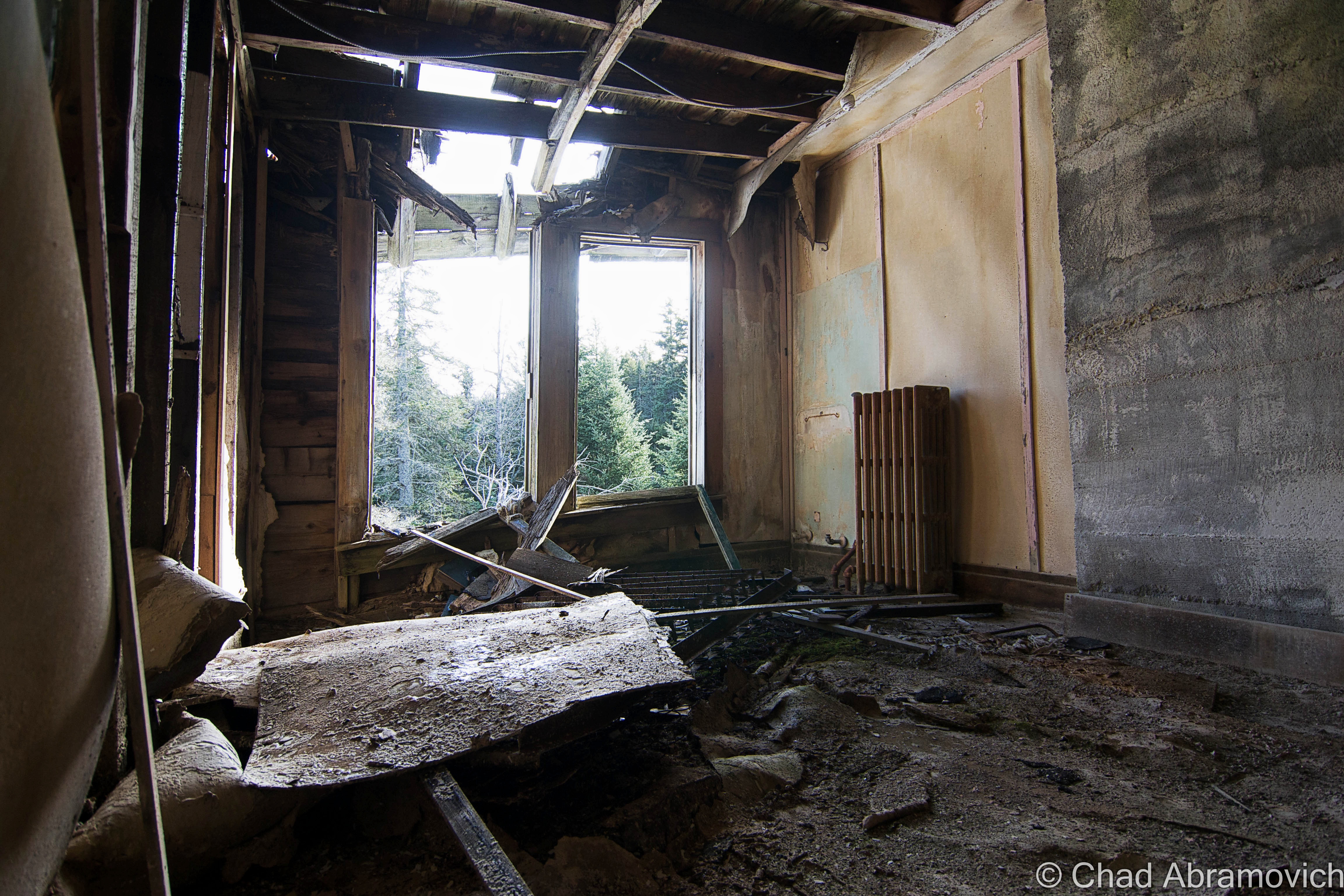
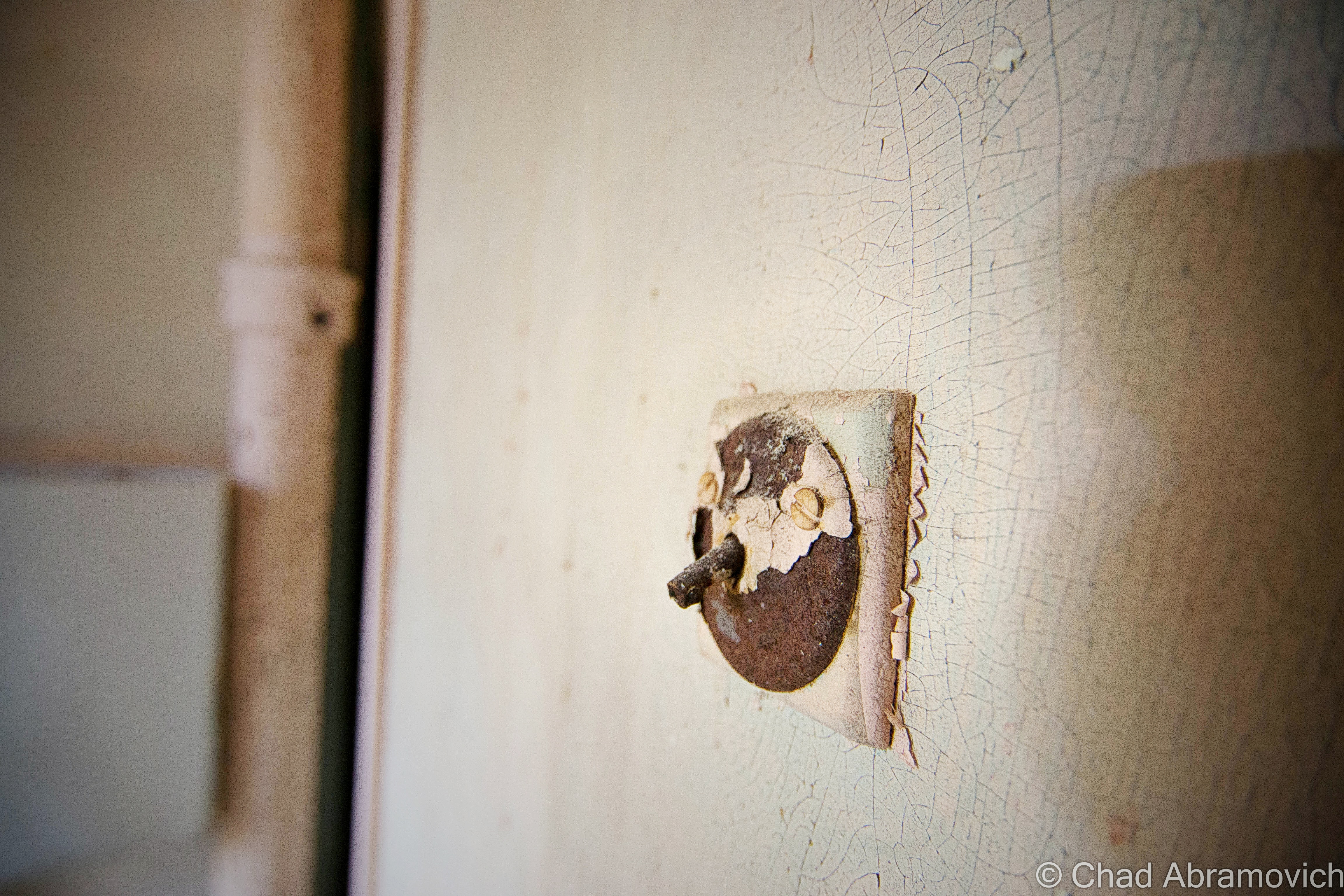
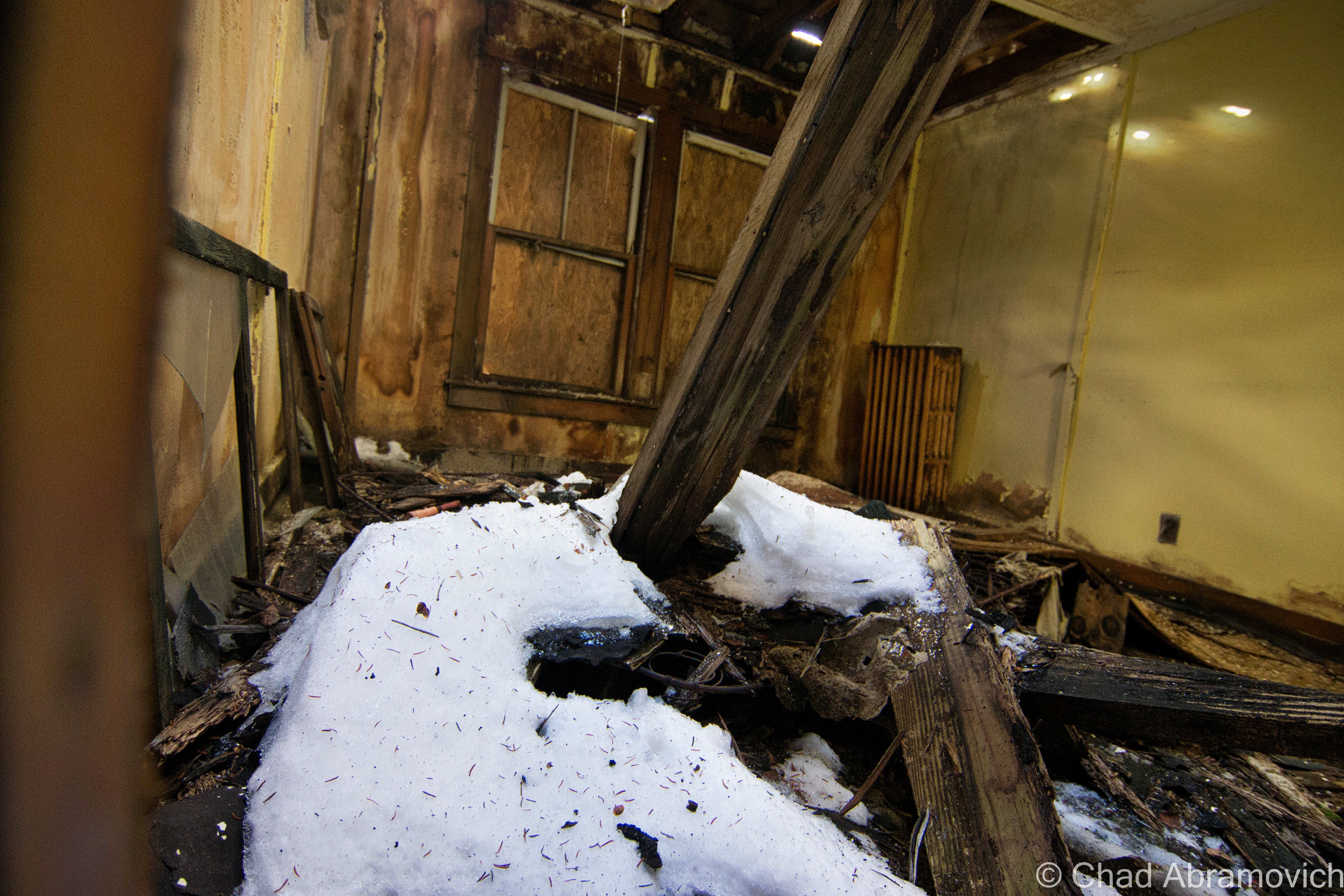
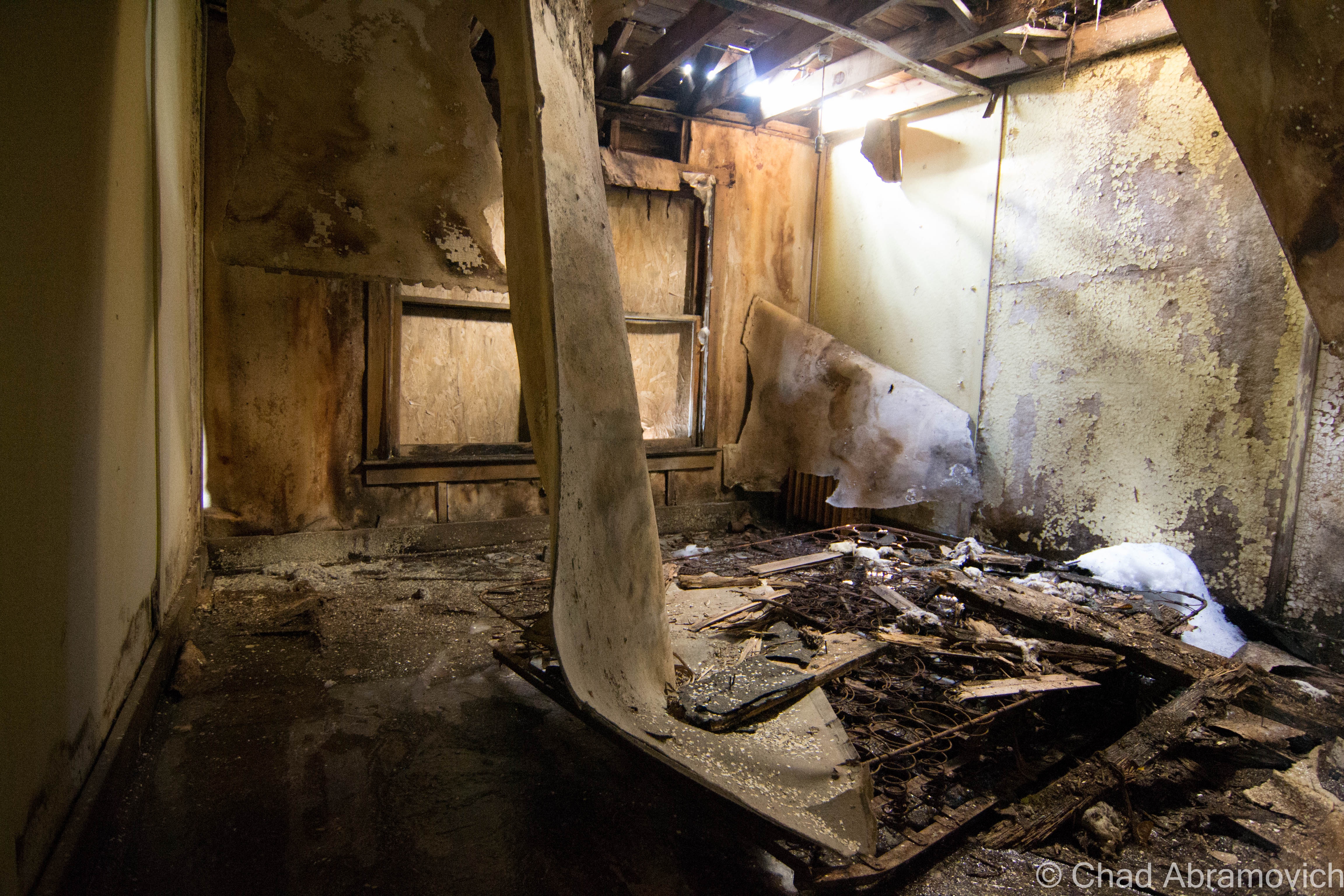
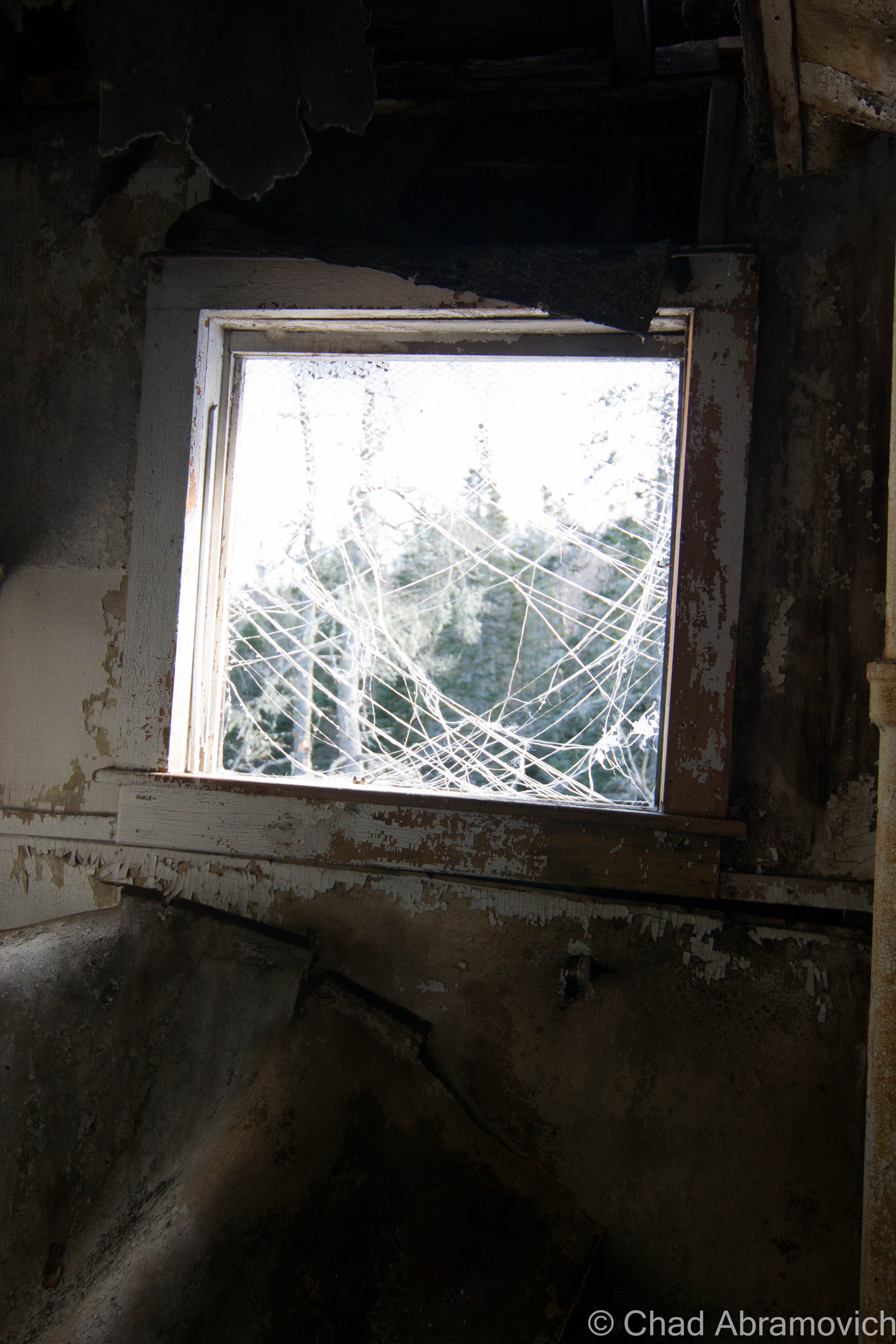
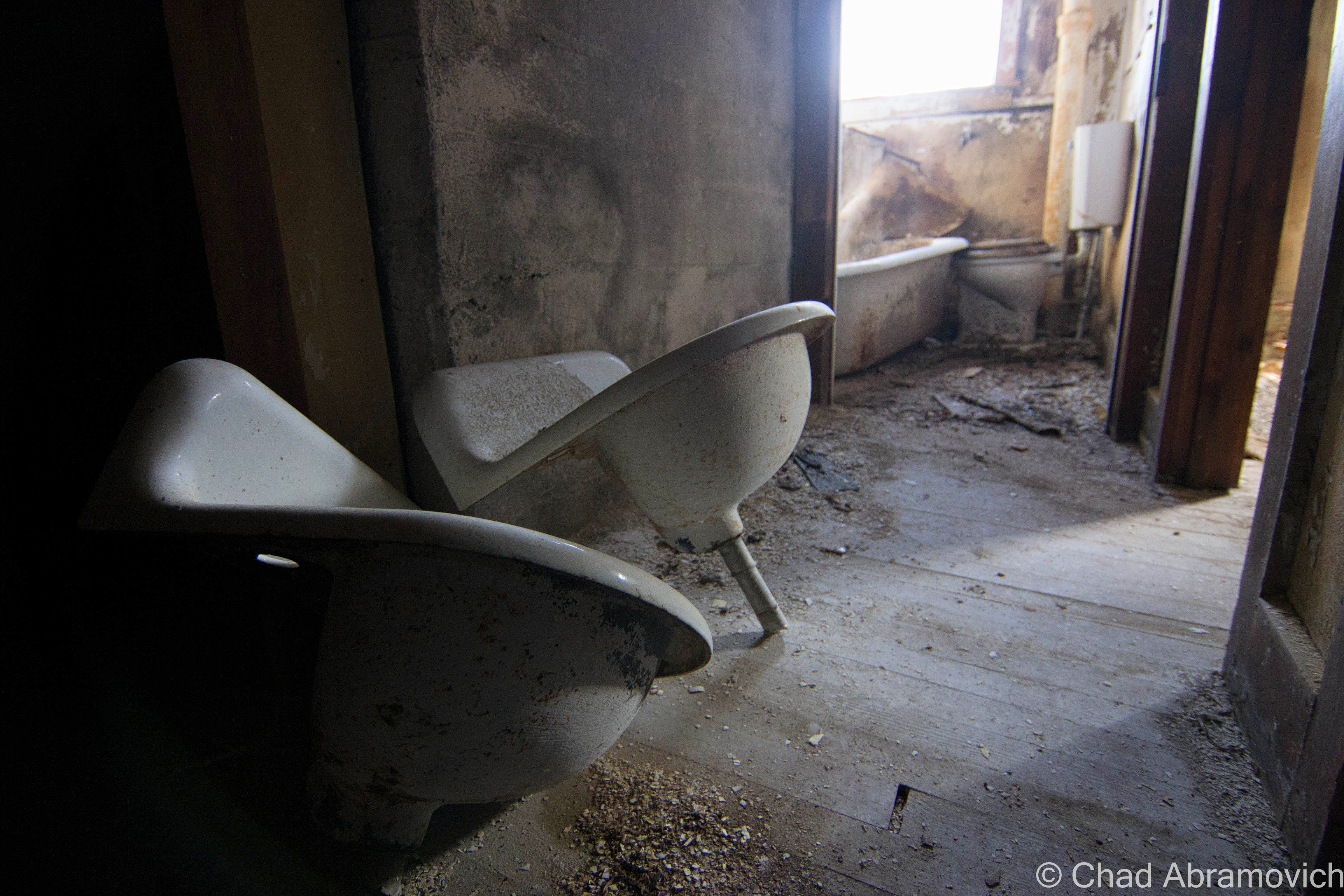
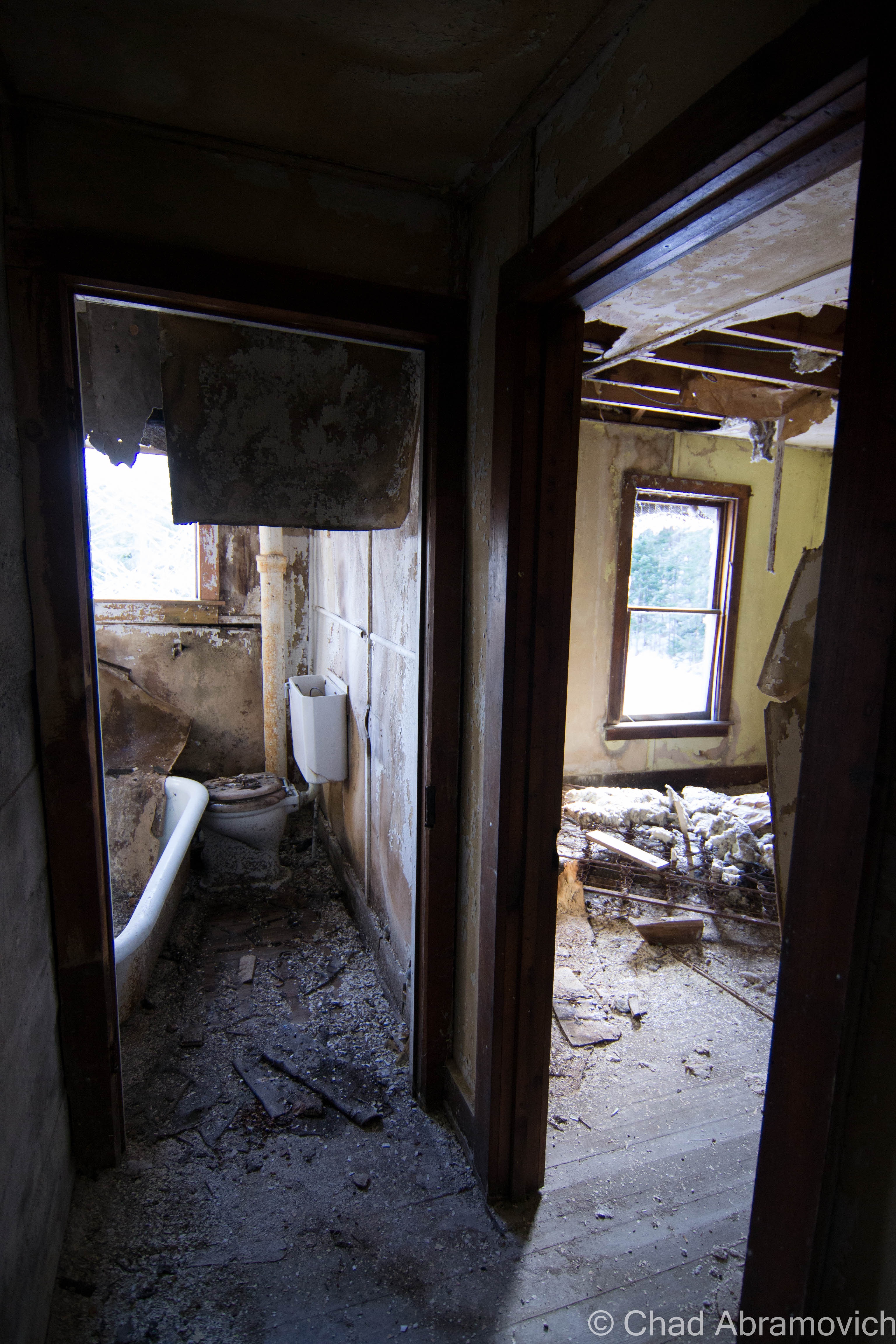
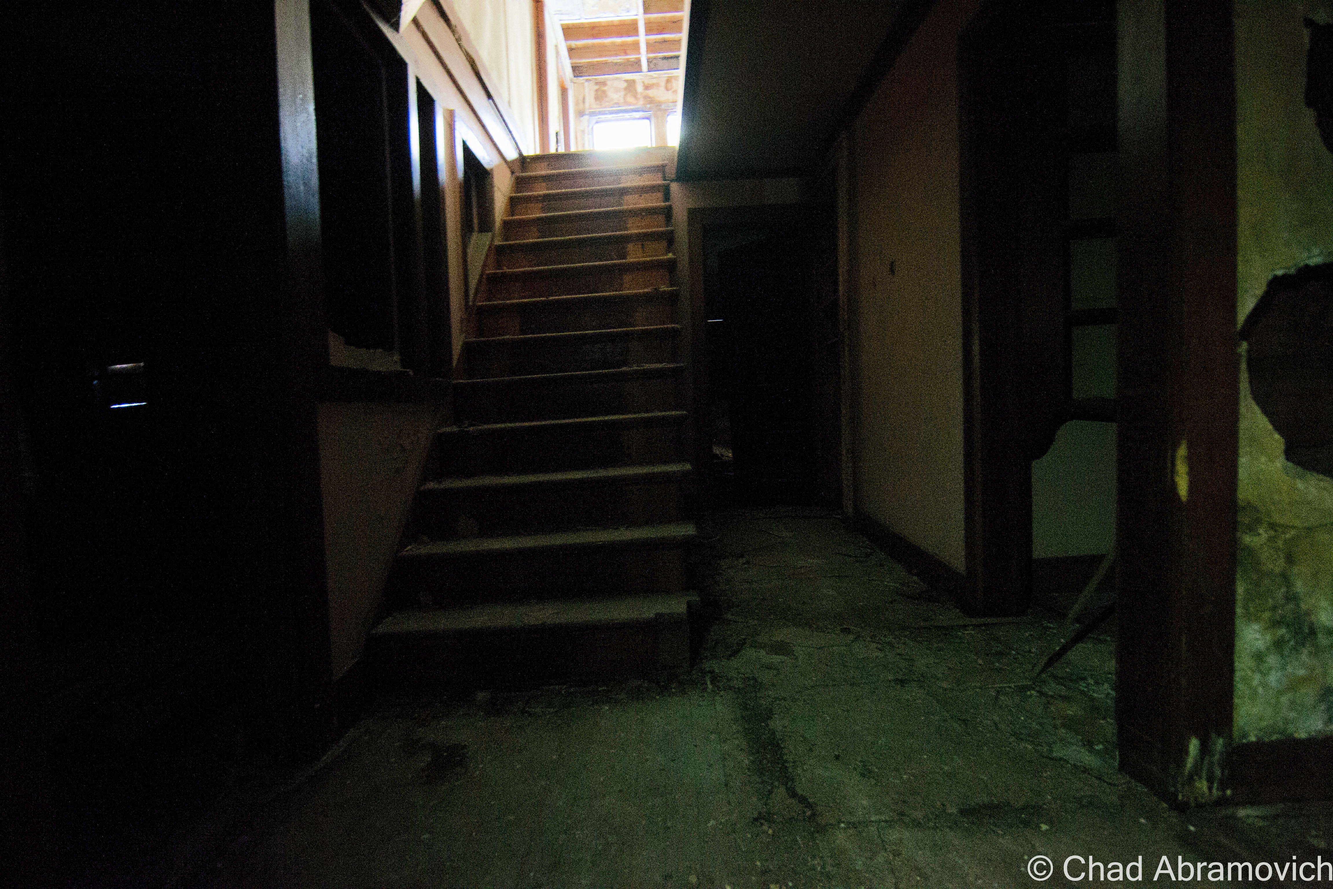
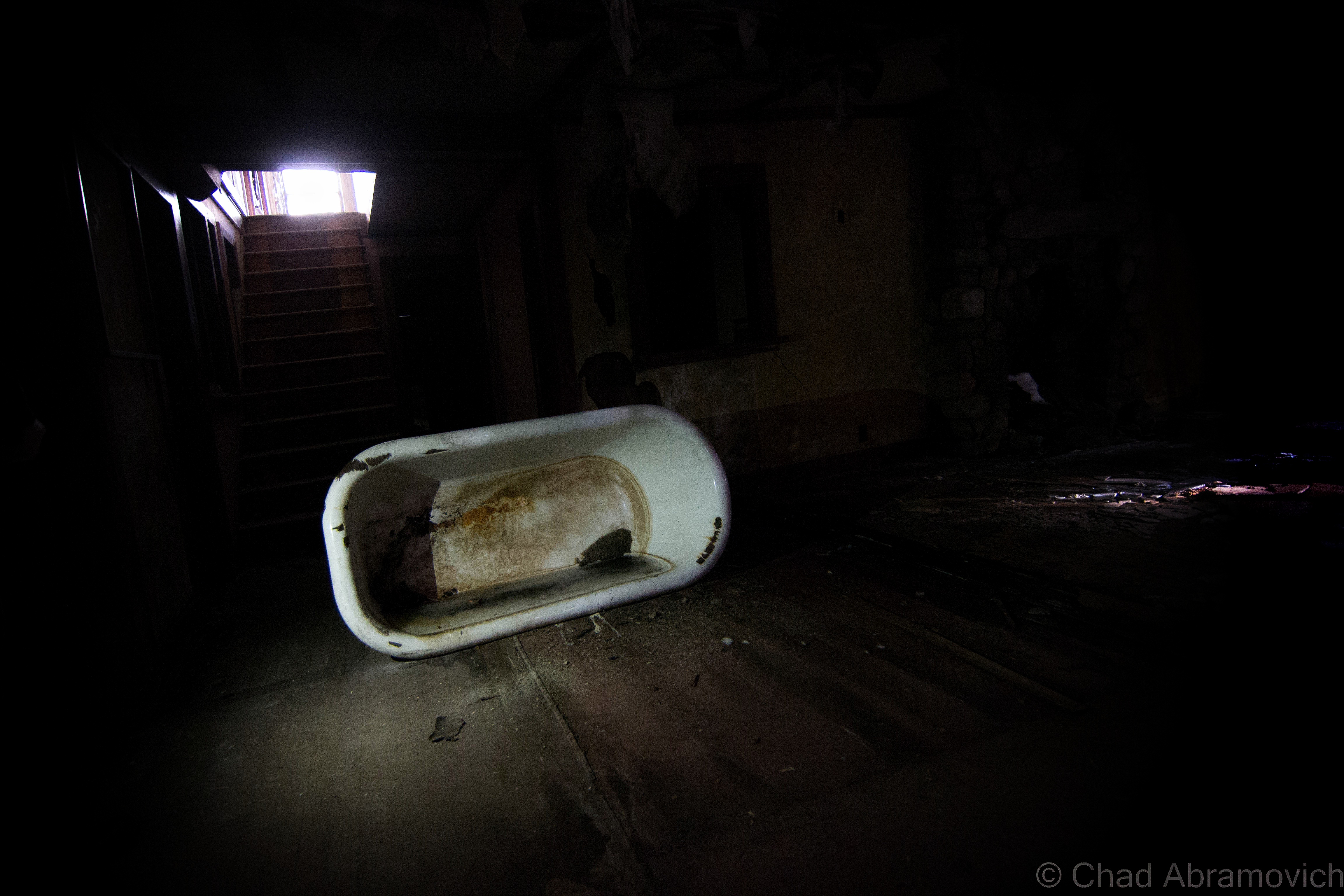
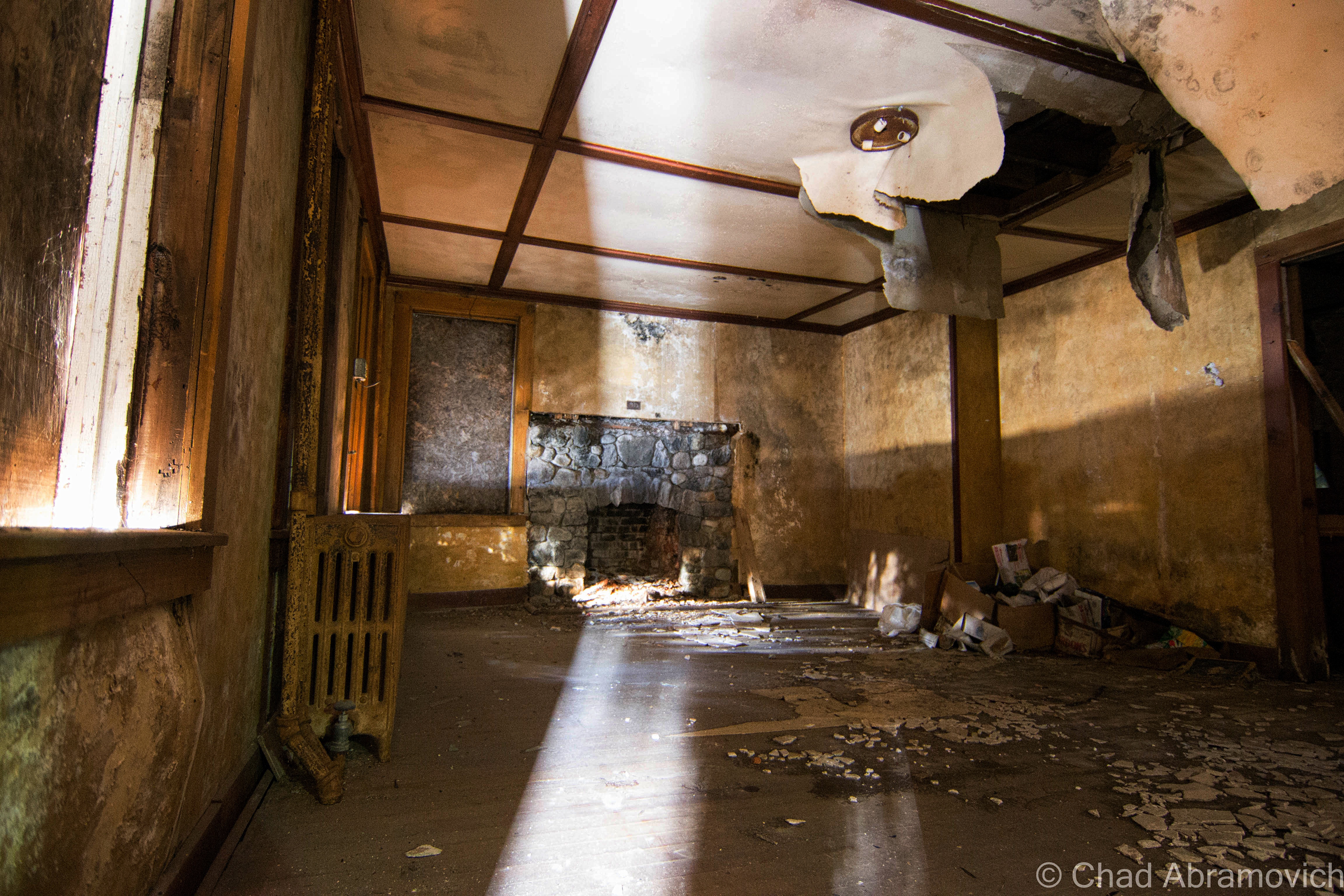
I gazed into the interior dubiously. Because the floor had already begun to sag underneath the weight of my hands as I pulled myself up, I wasn’t sure if this was going to be worth the risk or not. The lack of maintenance has caused serious damage to parts of the buildings – especially the roof. The damage has festered its way down to the stone cellar, causing the entire structure to rapidly fall apart from the mercurial freezing and thawing of the seasons.

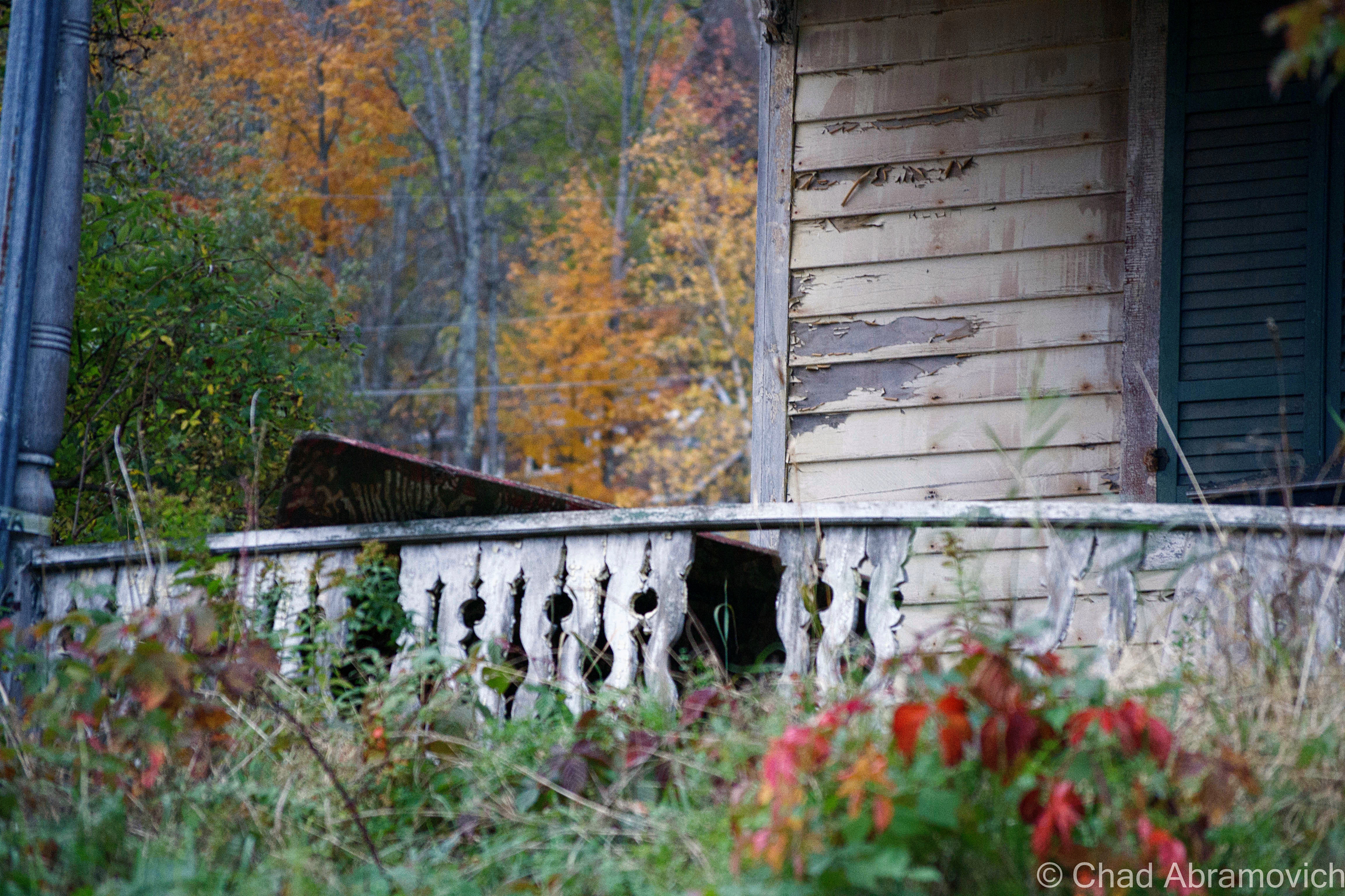
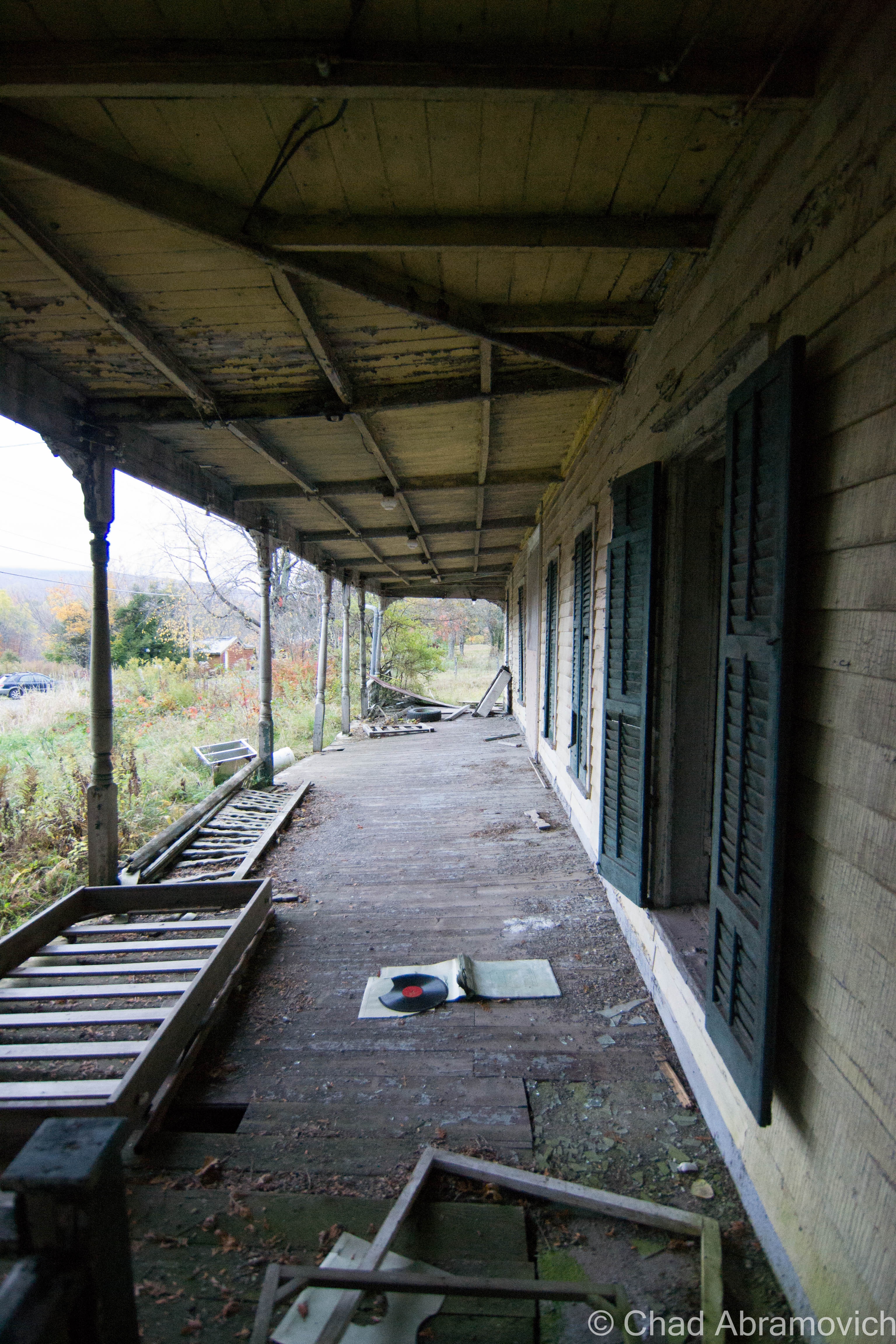
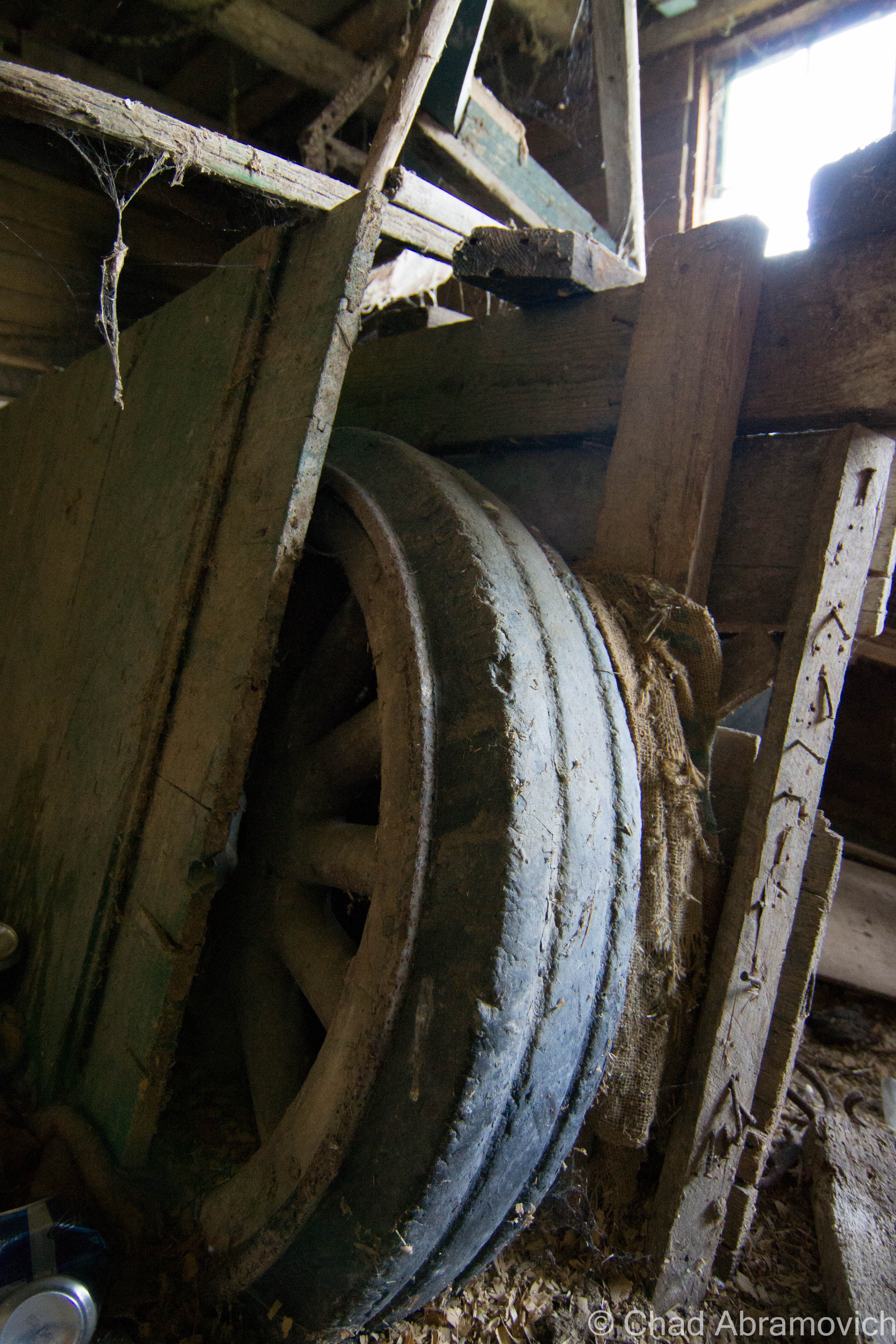
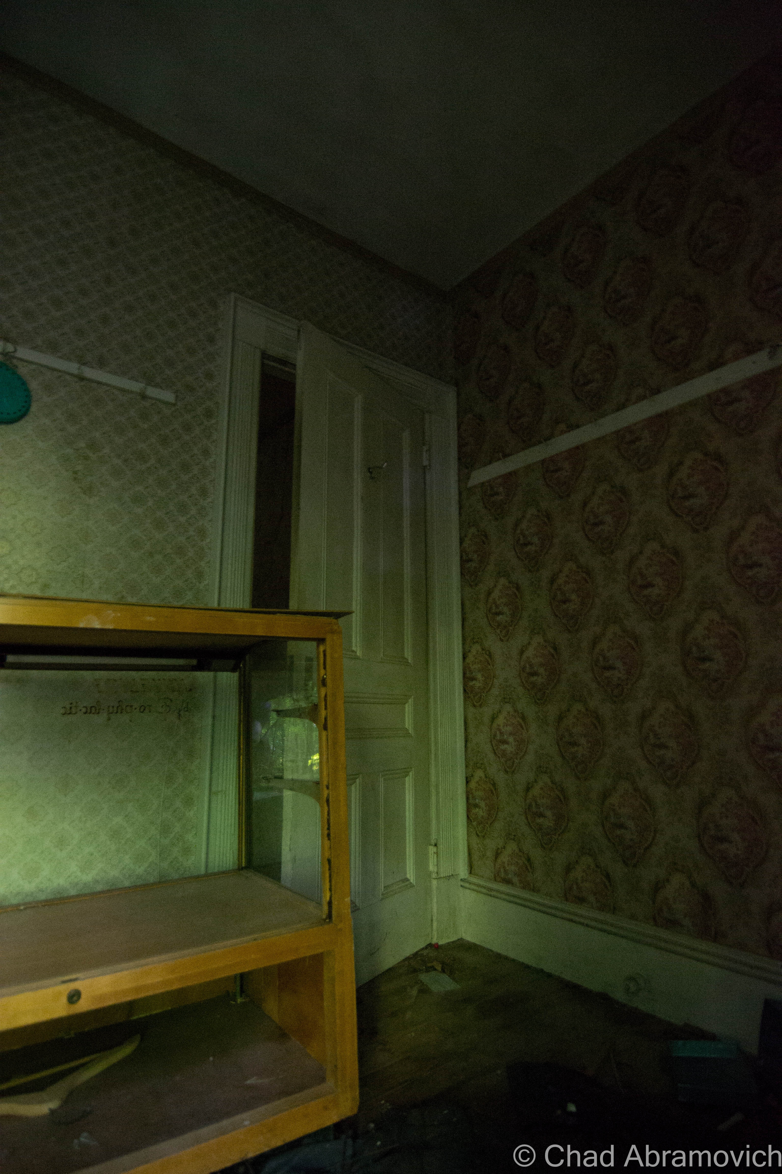
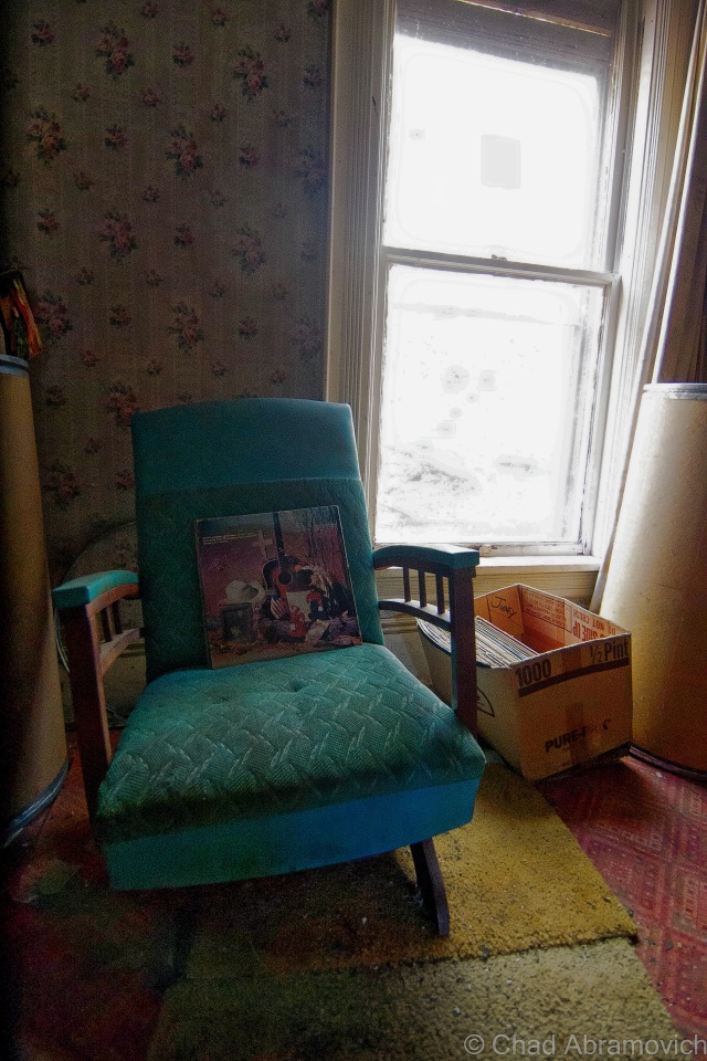
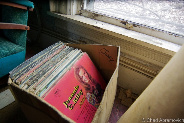
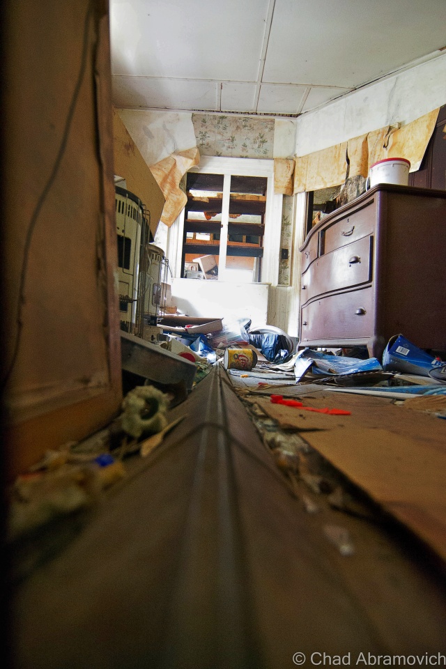
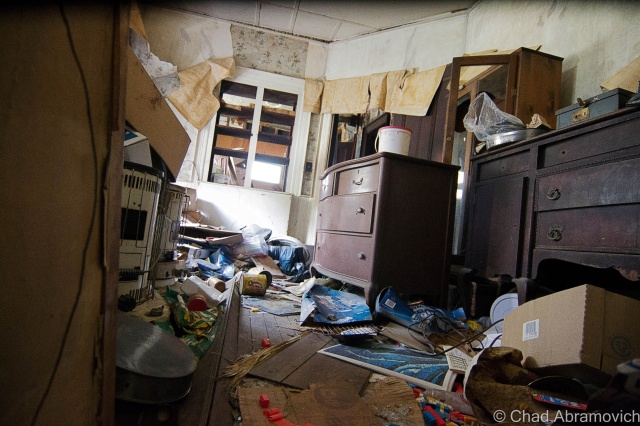
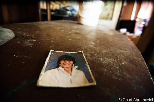
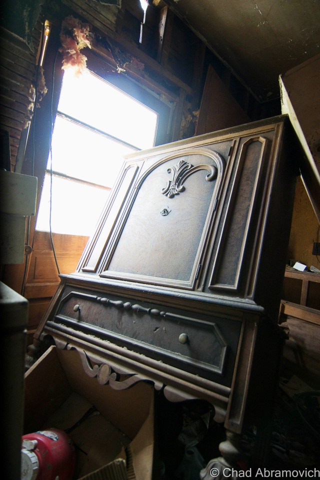
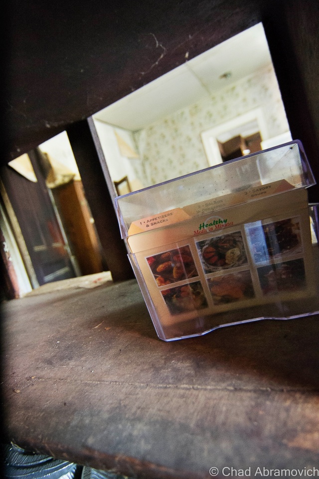
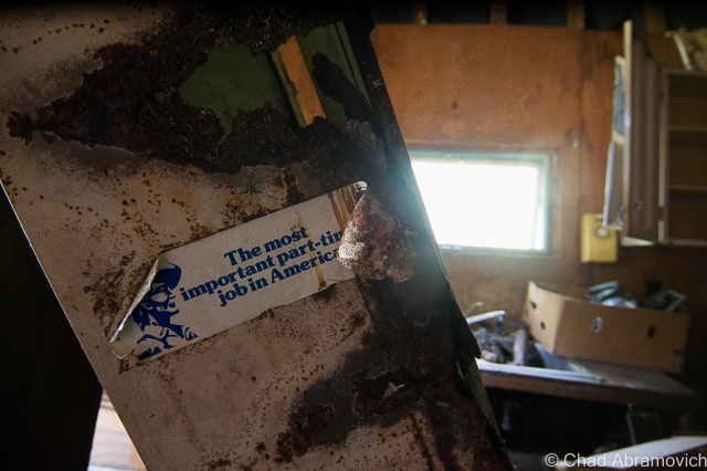
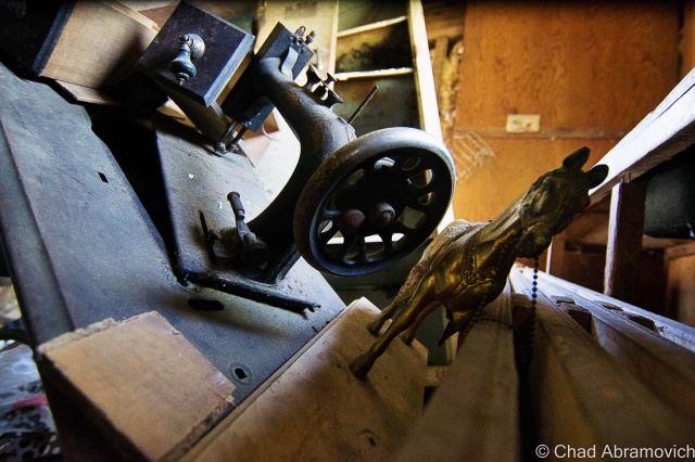
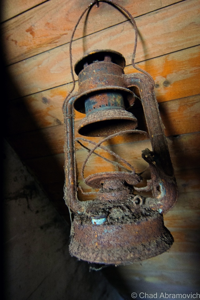
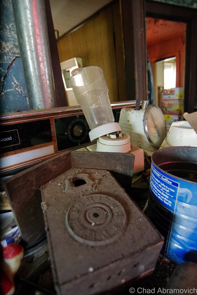
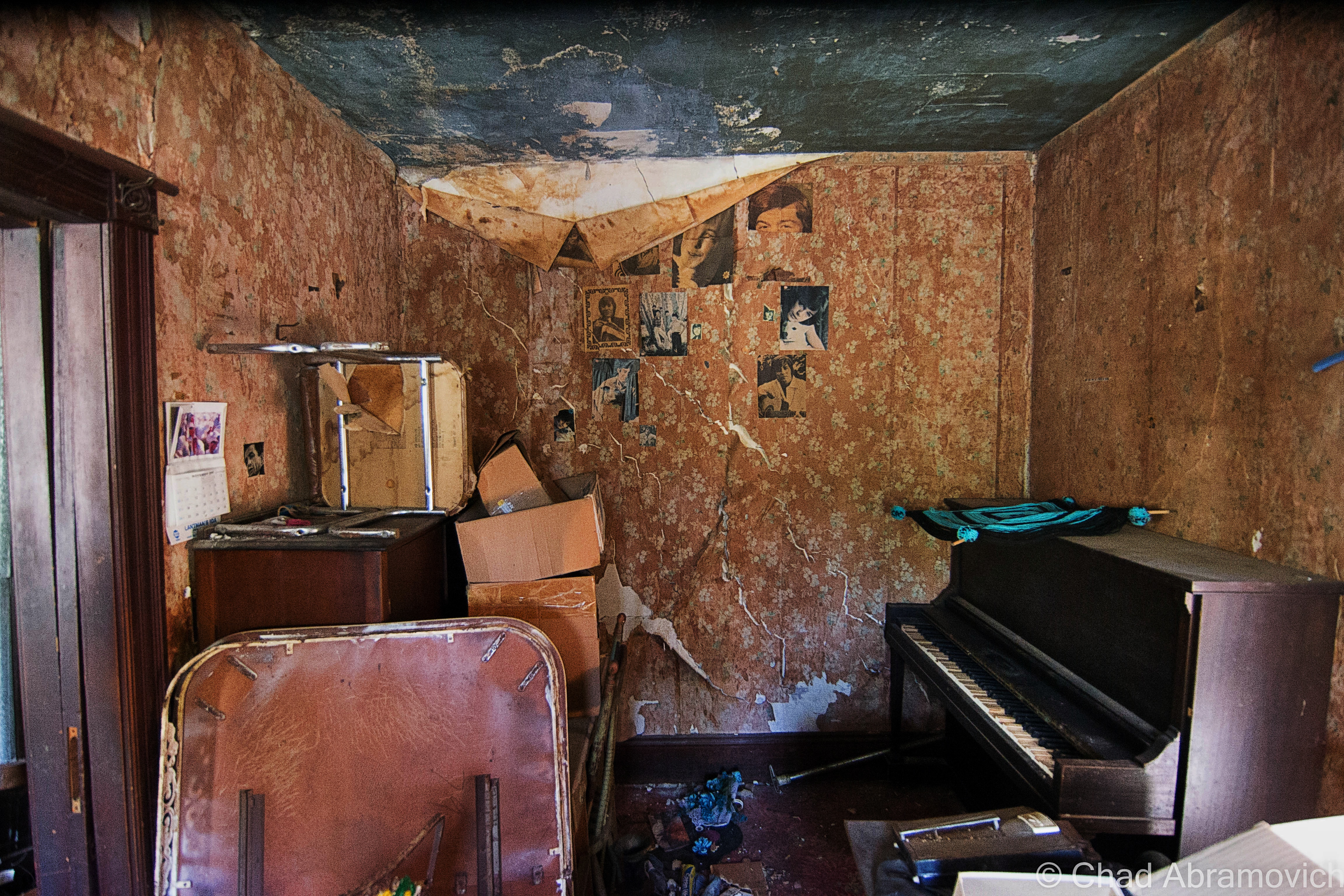
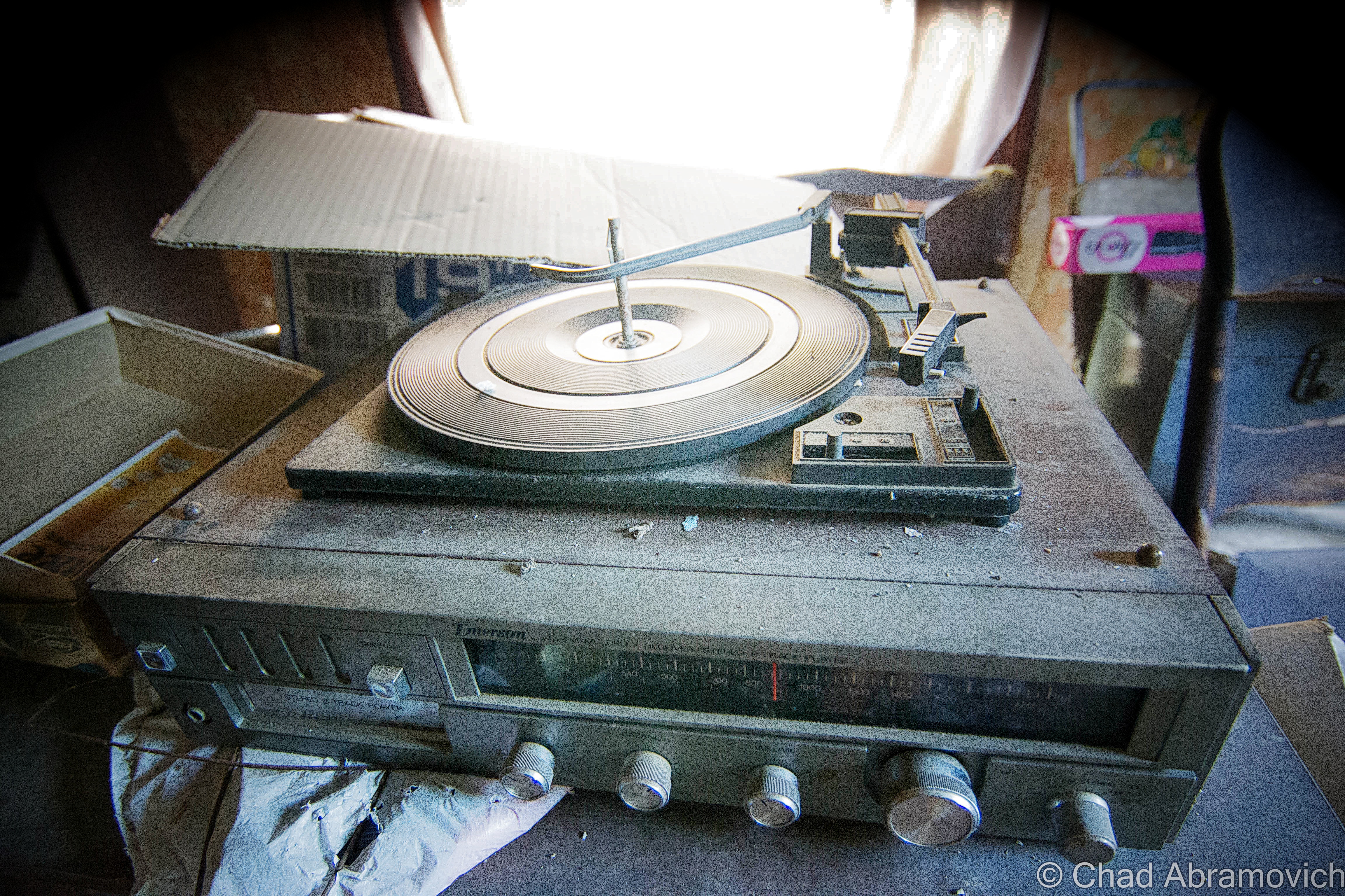
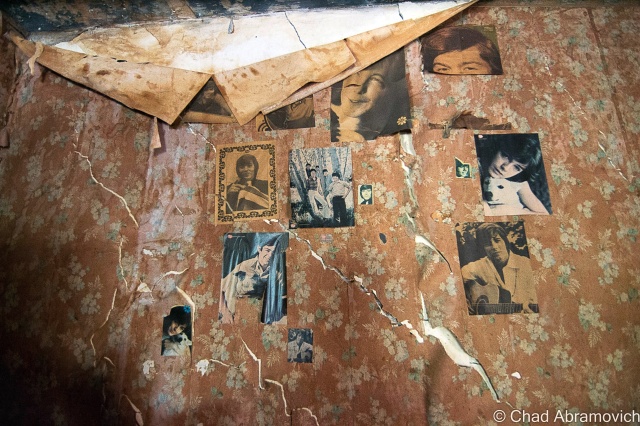
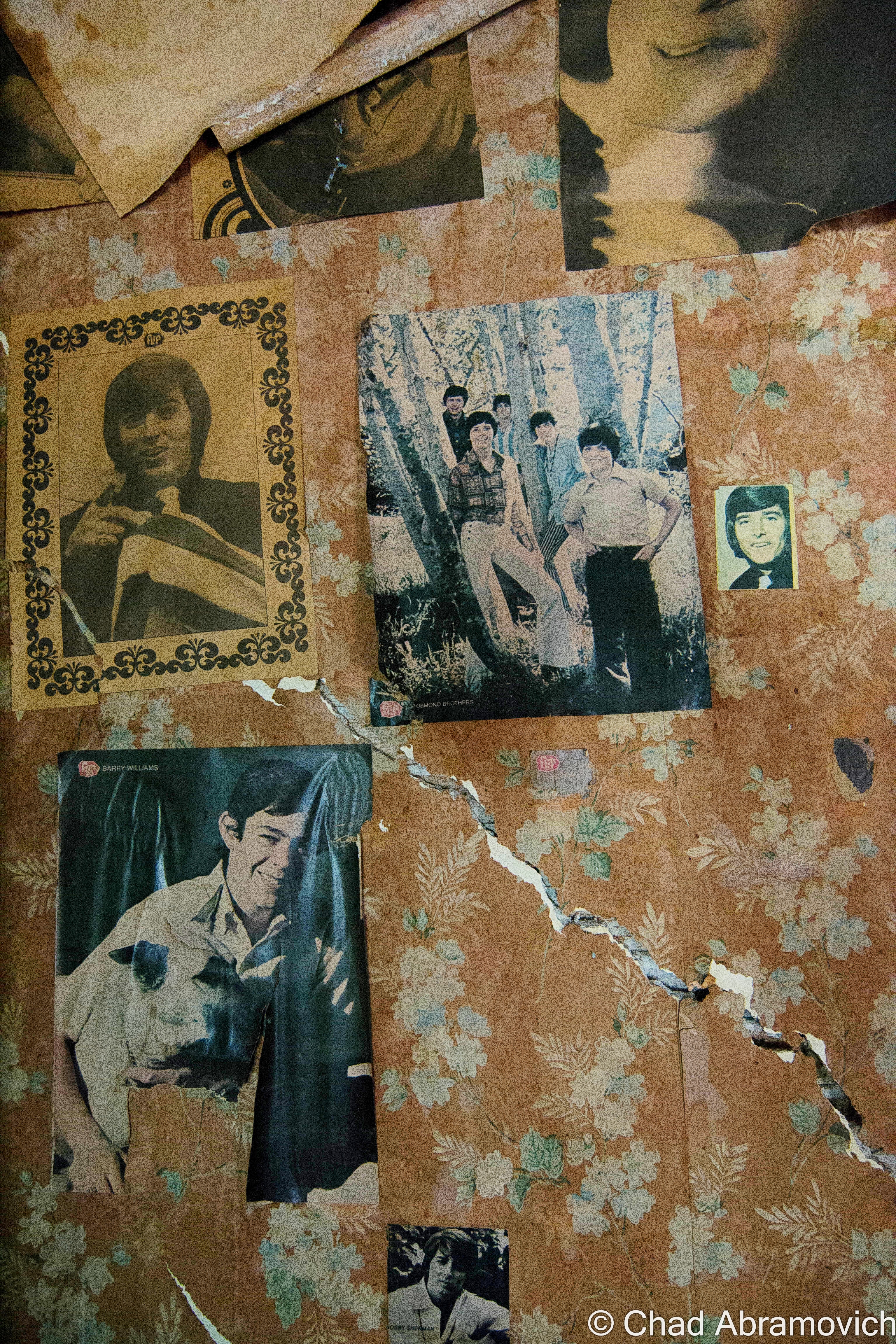
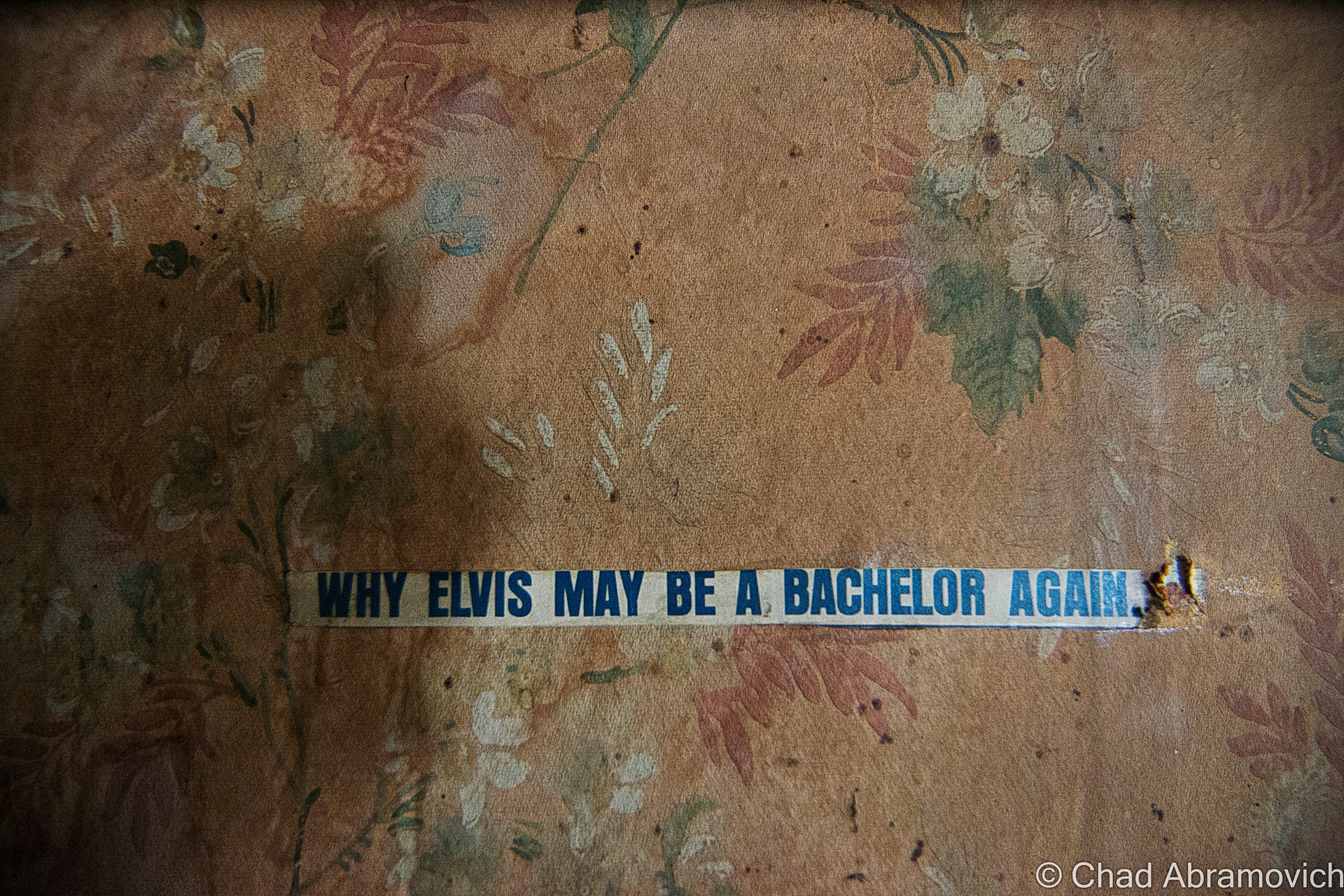
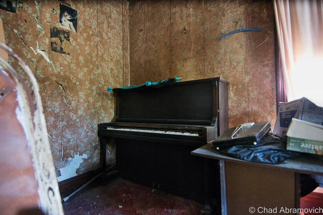
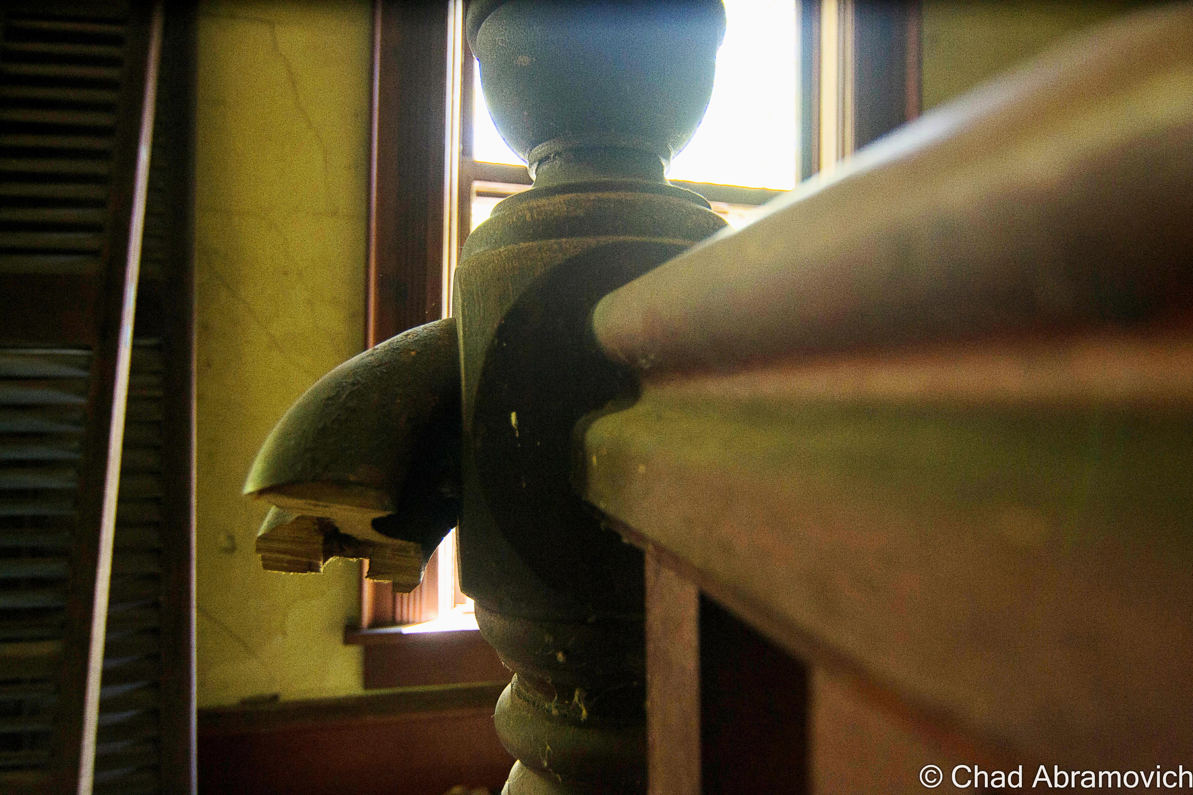
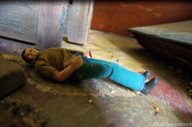
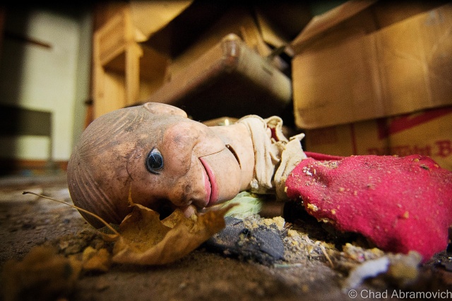
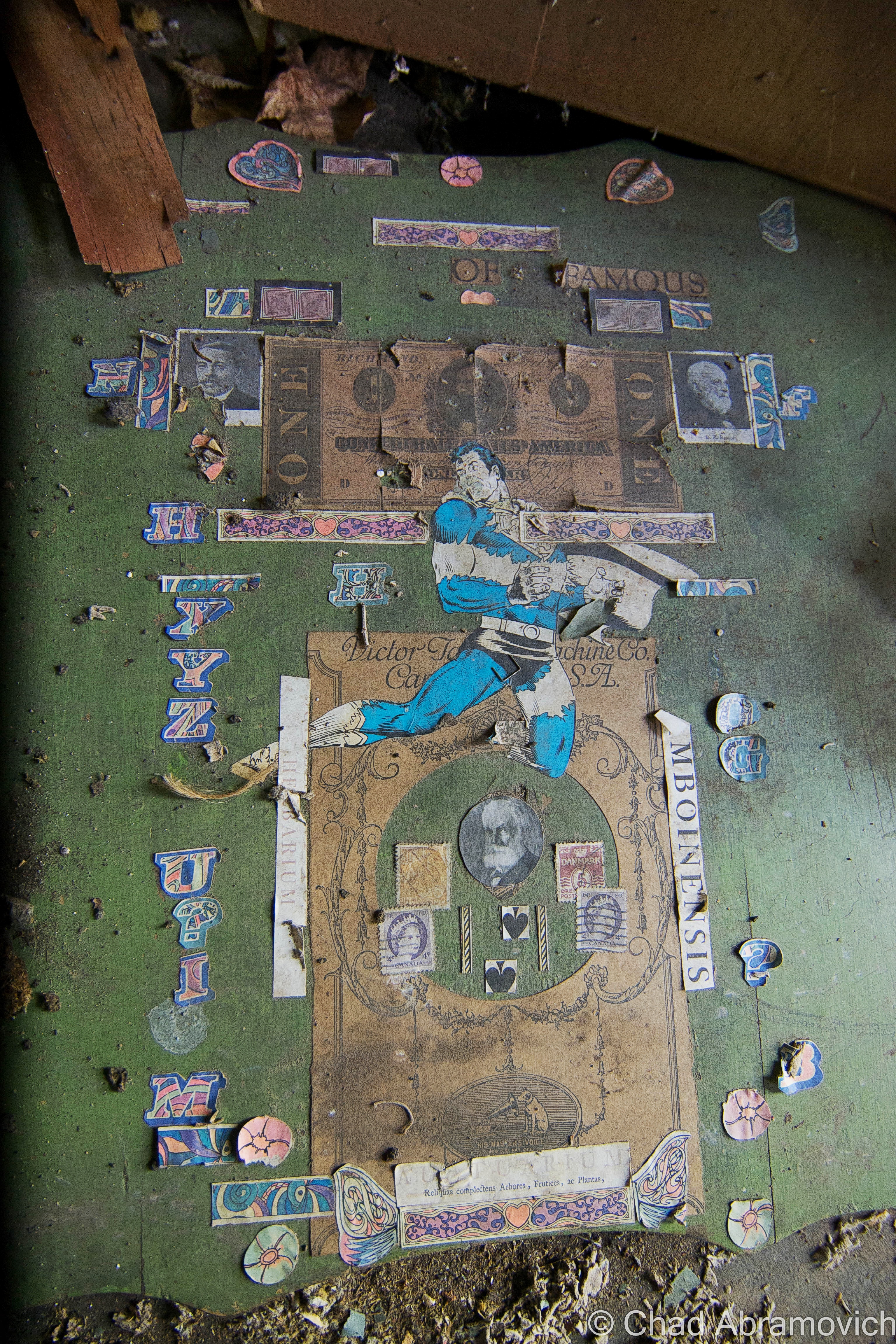
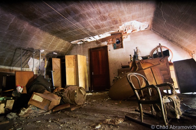
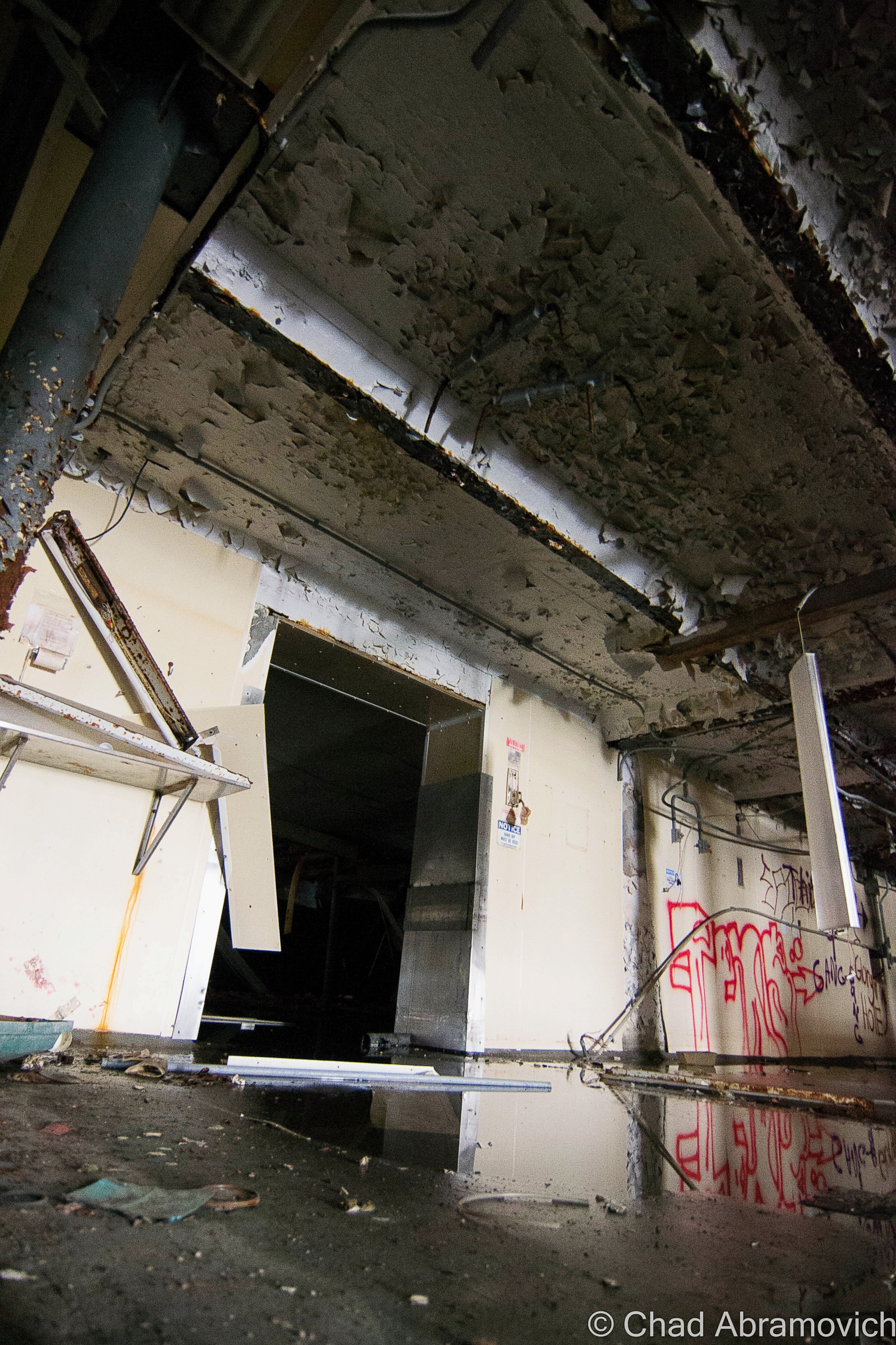
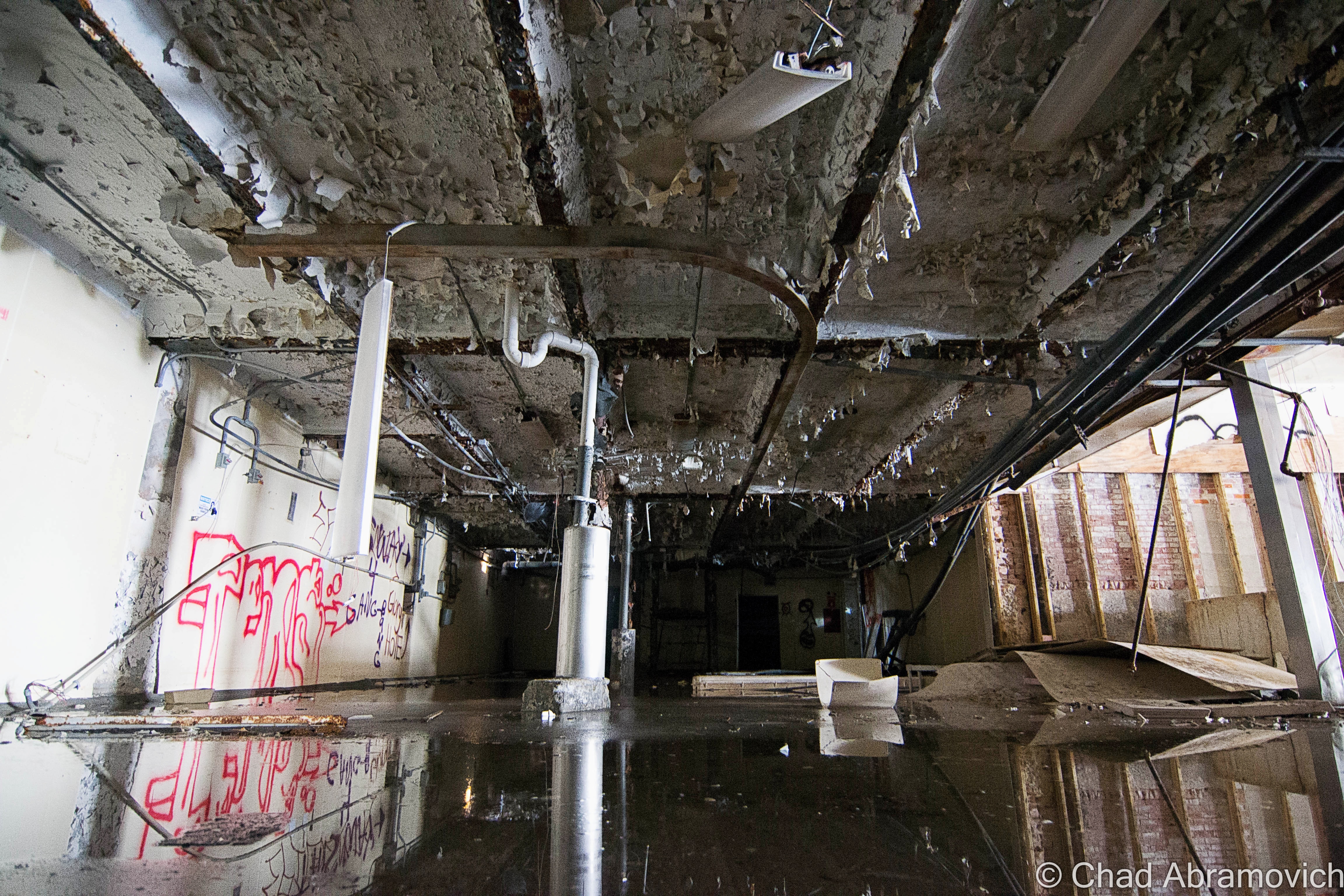
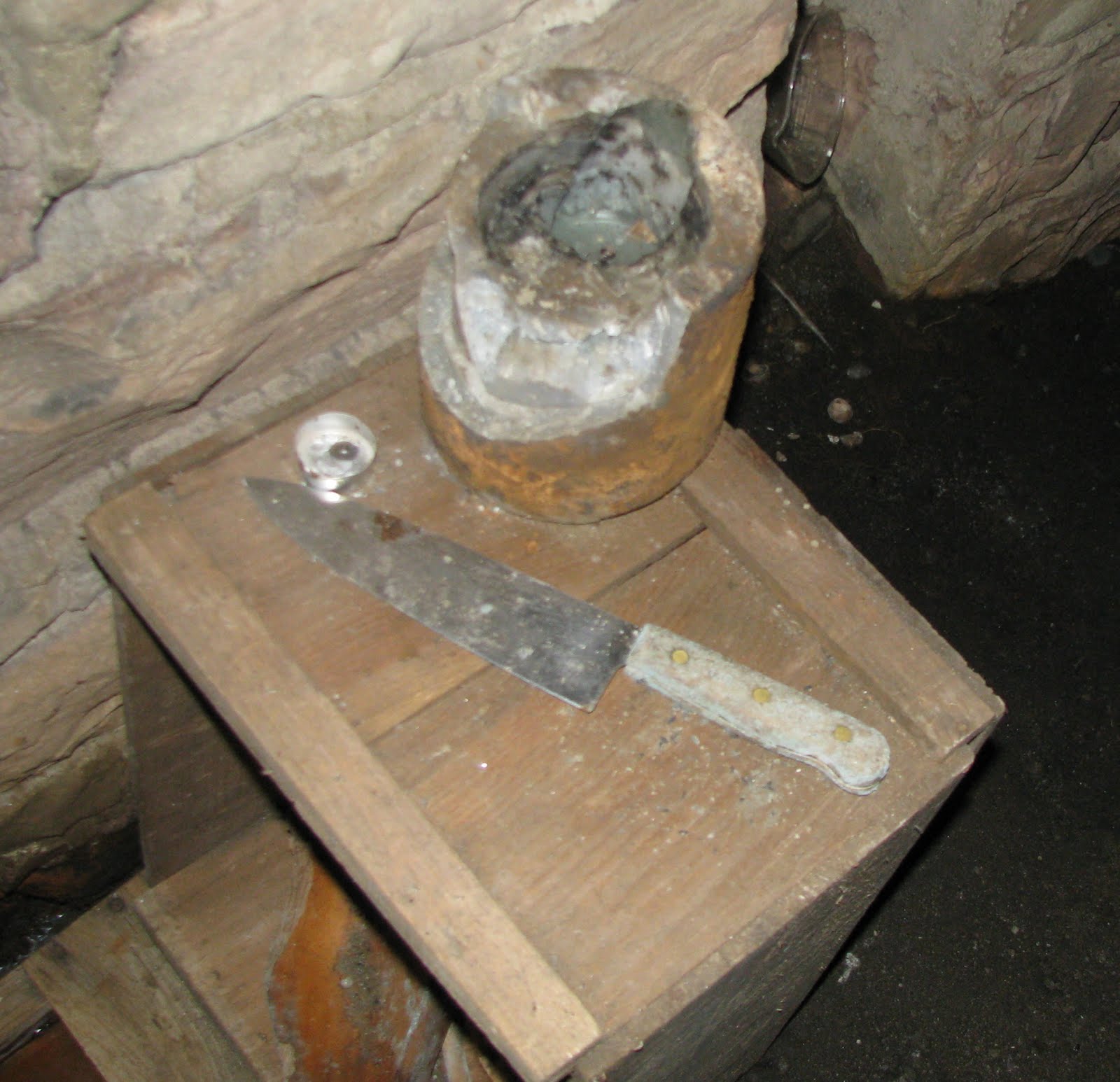
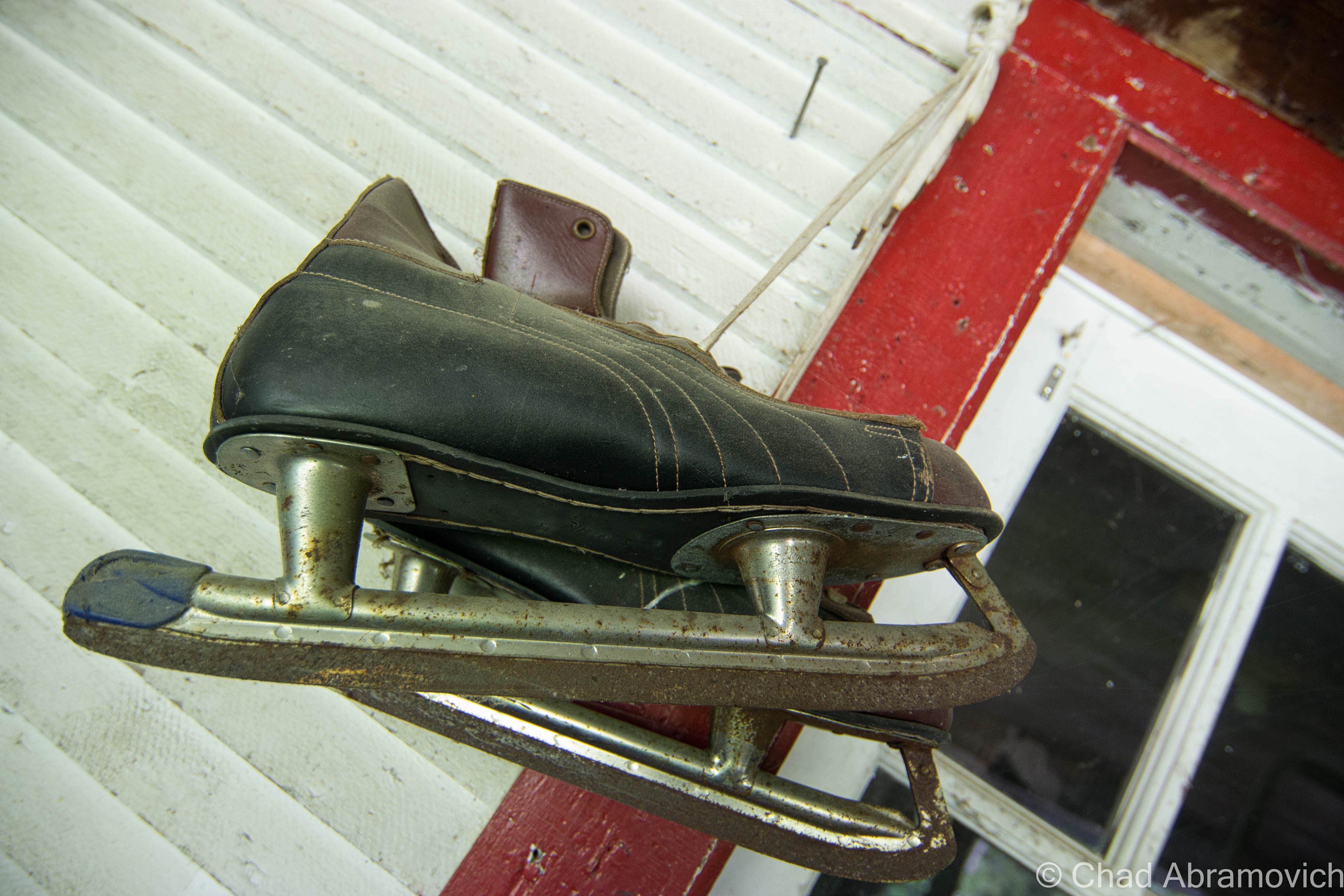
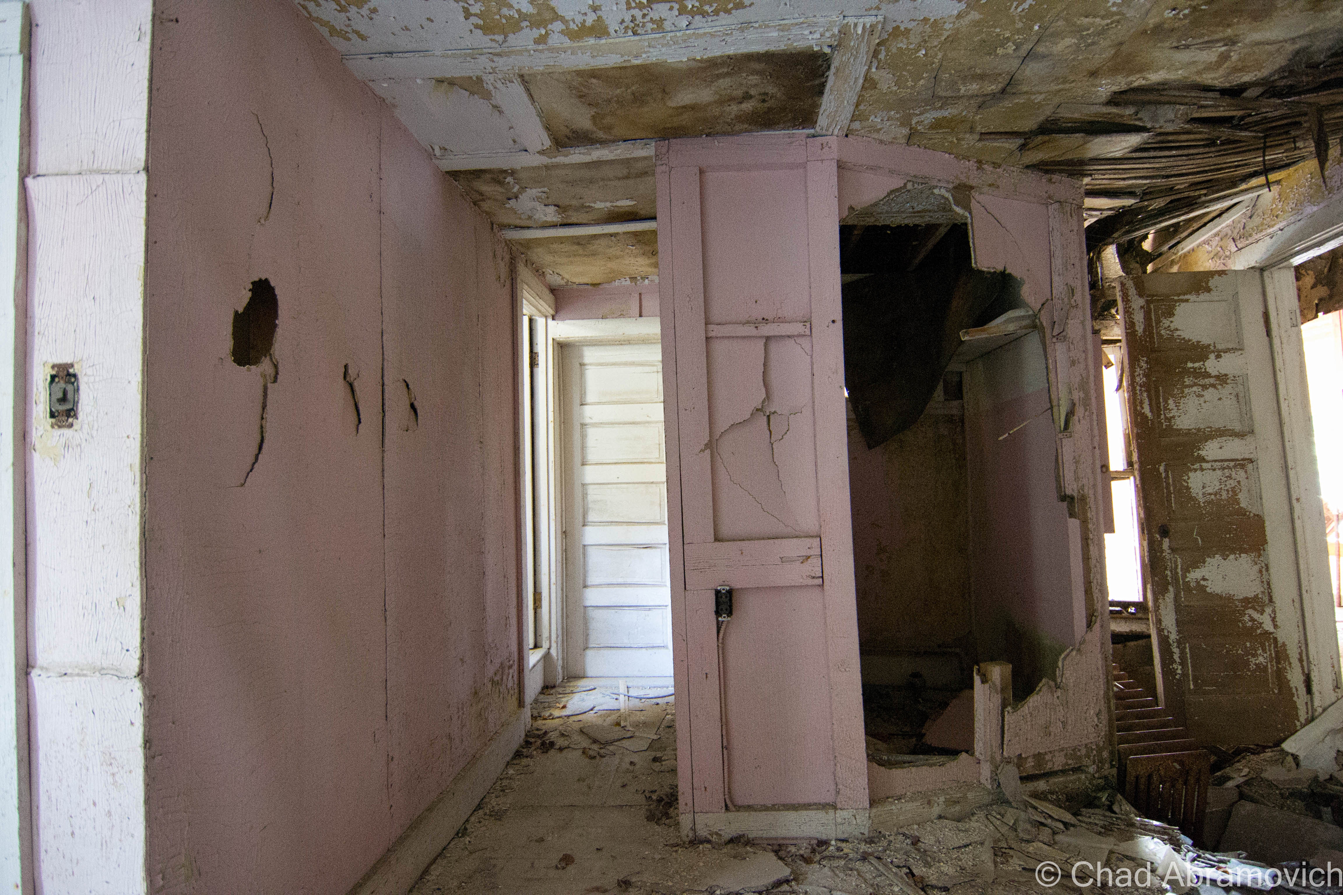
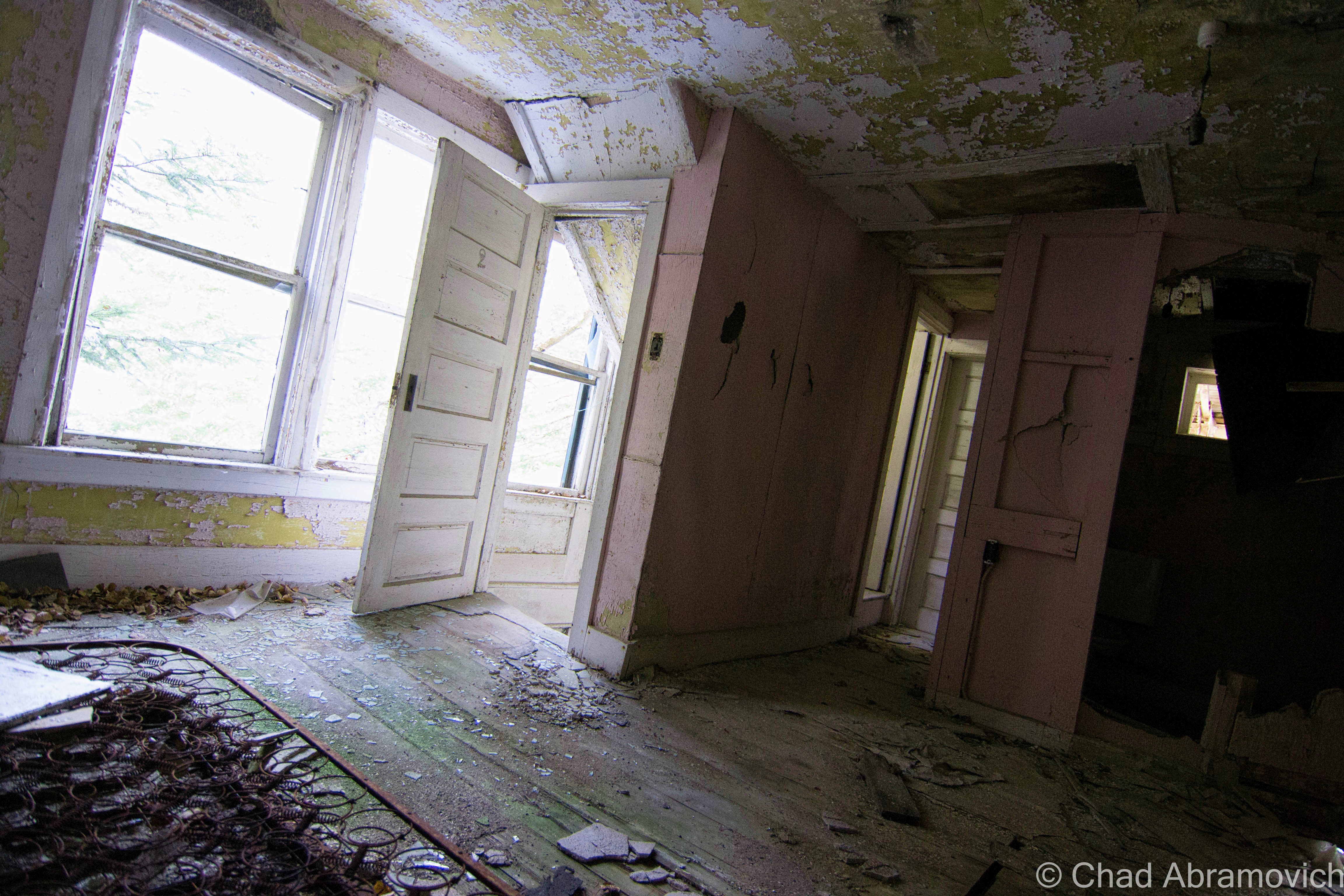
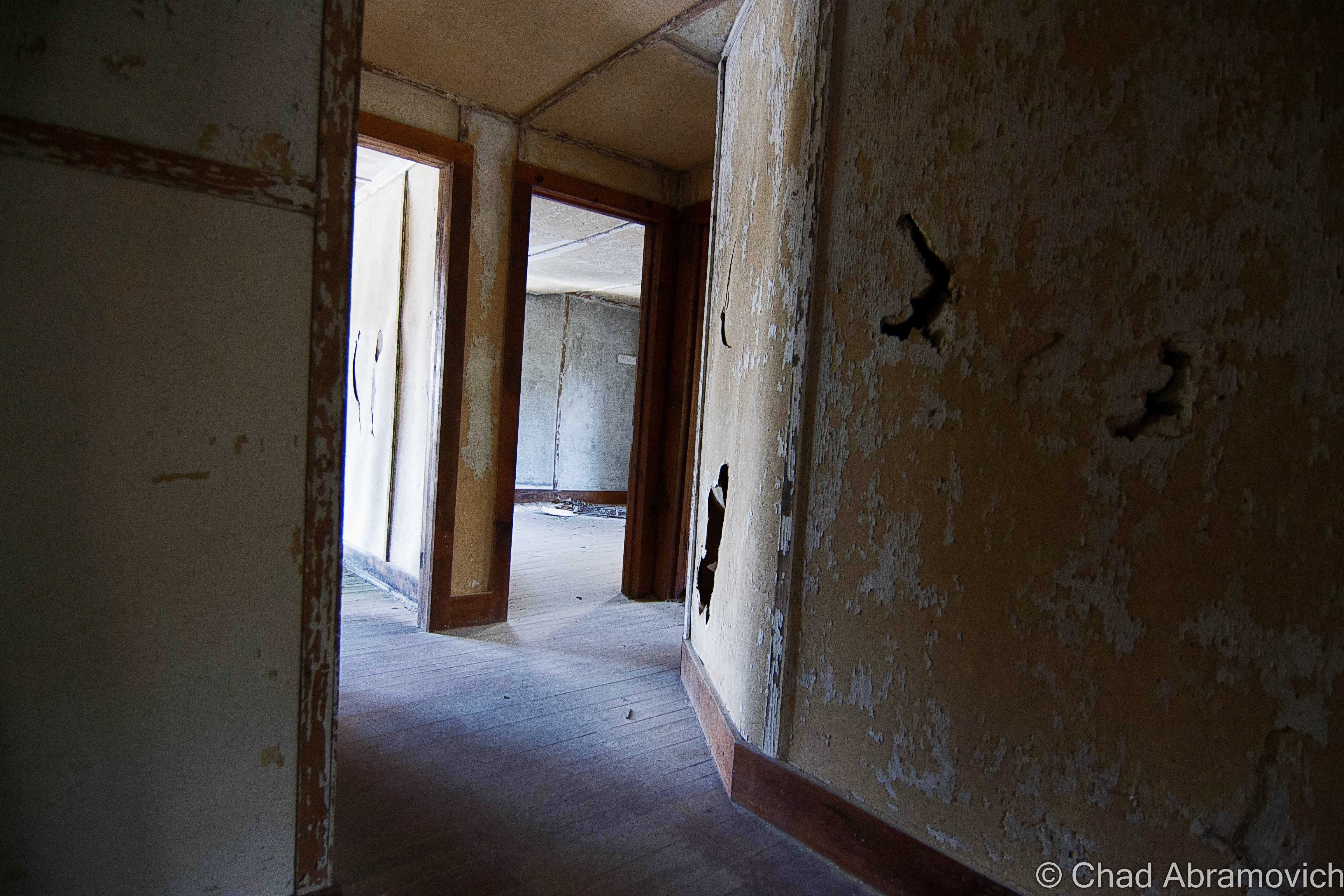
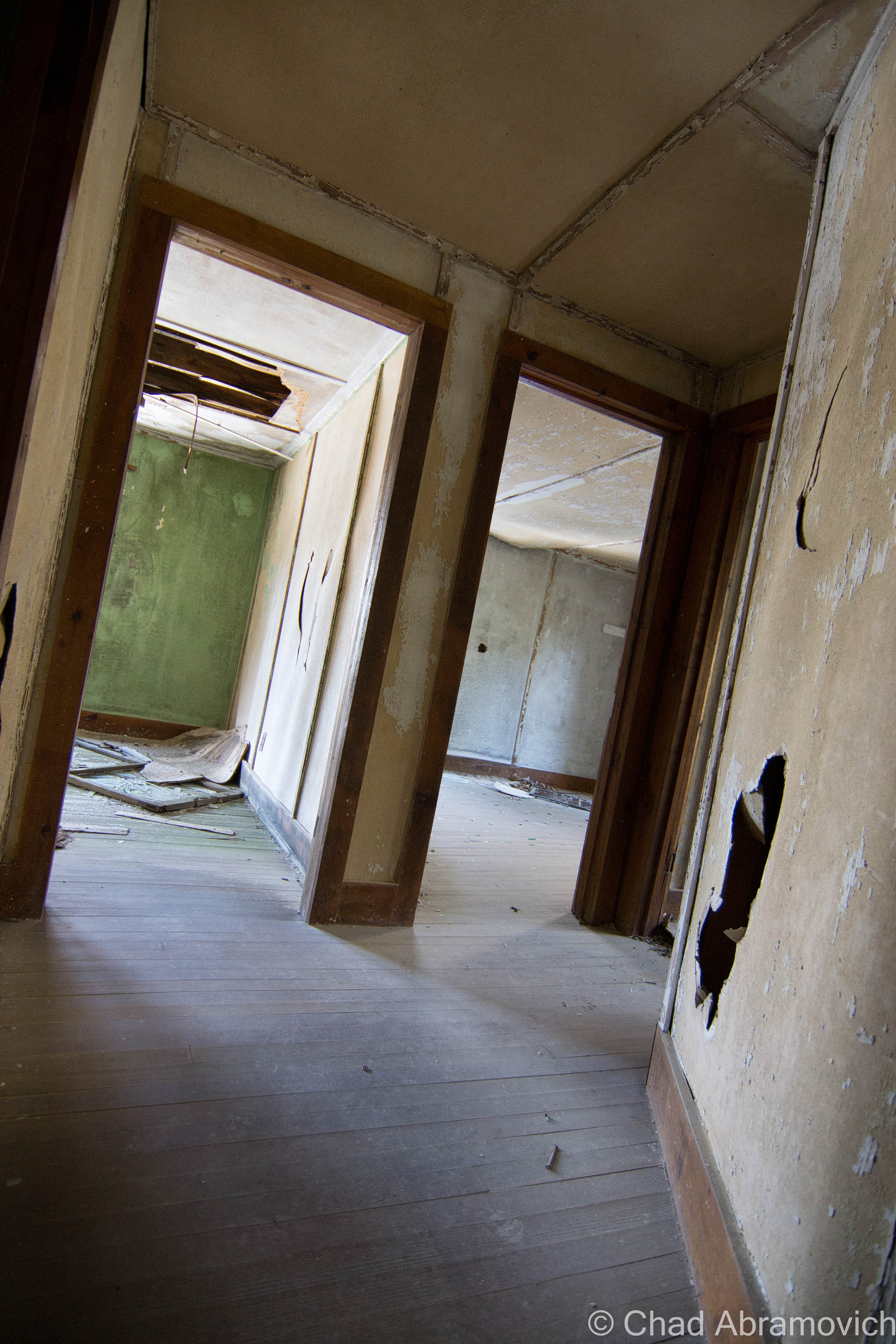
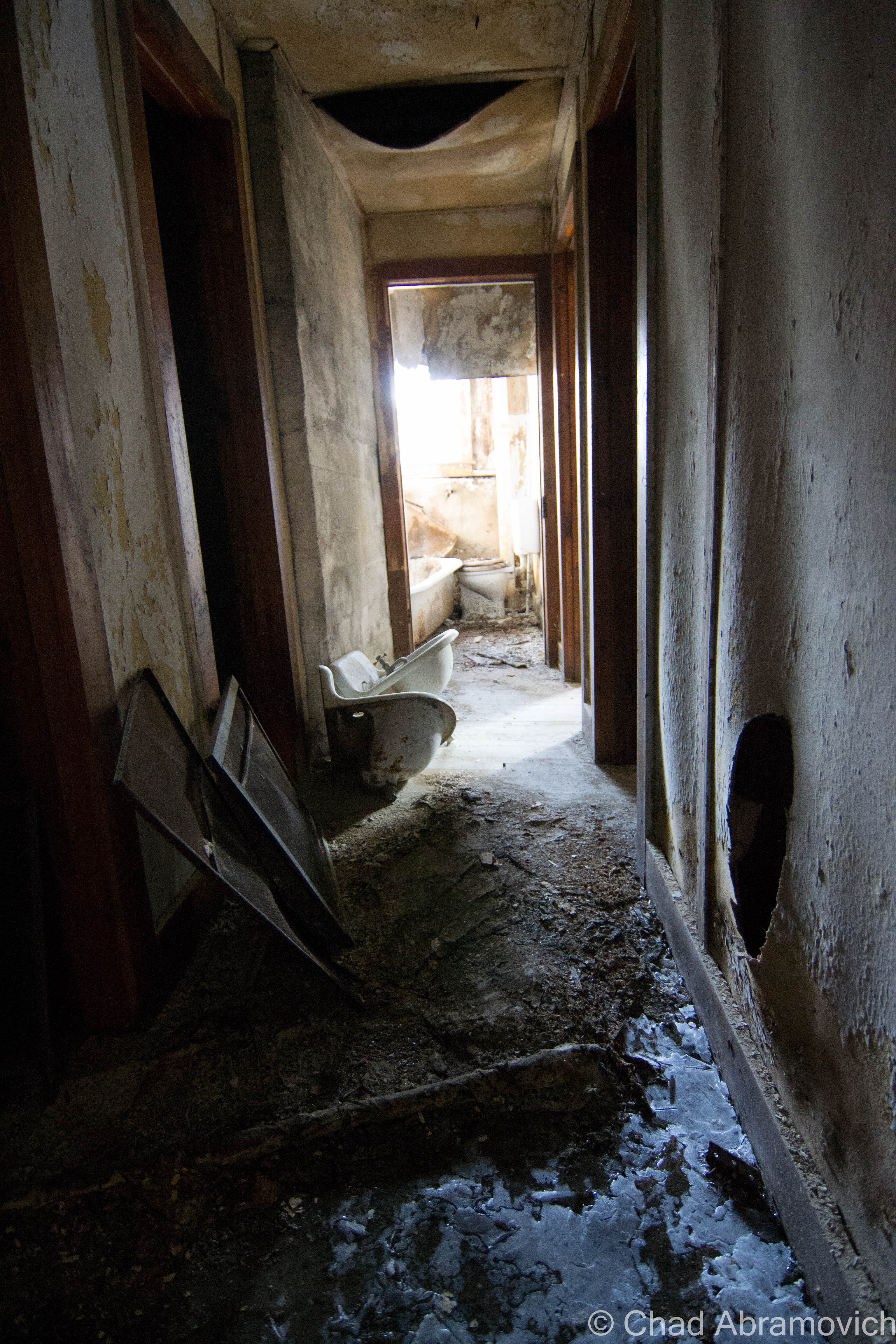
Aiden Lair was a now formidable and sizable husk of a building, devoid of most of its original details that have been effaced with time. Being on the upper floors in cramped rooms flourishing with mold that discolored disintegrating walls and suspicious water dripping down my neck, I found it almost difficult to believe that this was once a respected and comfortable place to want to be. But some beautiful details remained. Two massive and classic Adirondack stone fireplaces could be found illuminated by my flashlight, and a balcony overlooking Stony Pond Brook had that identifying mountain woodwork on the railings that many Adirondack lodges have synonymously featured in their architecture.

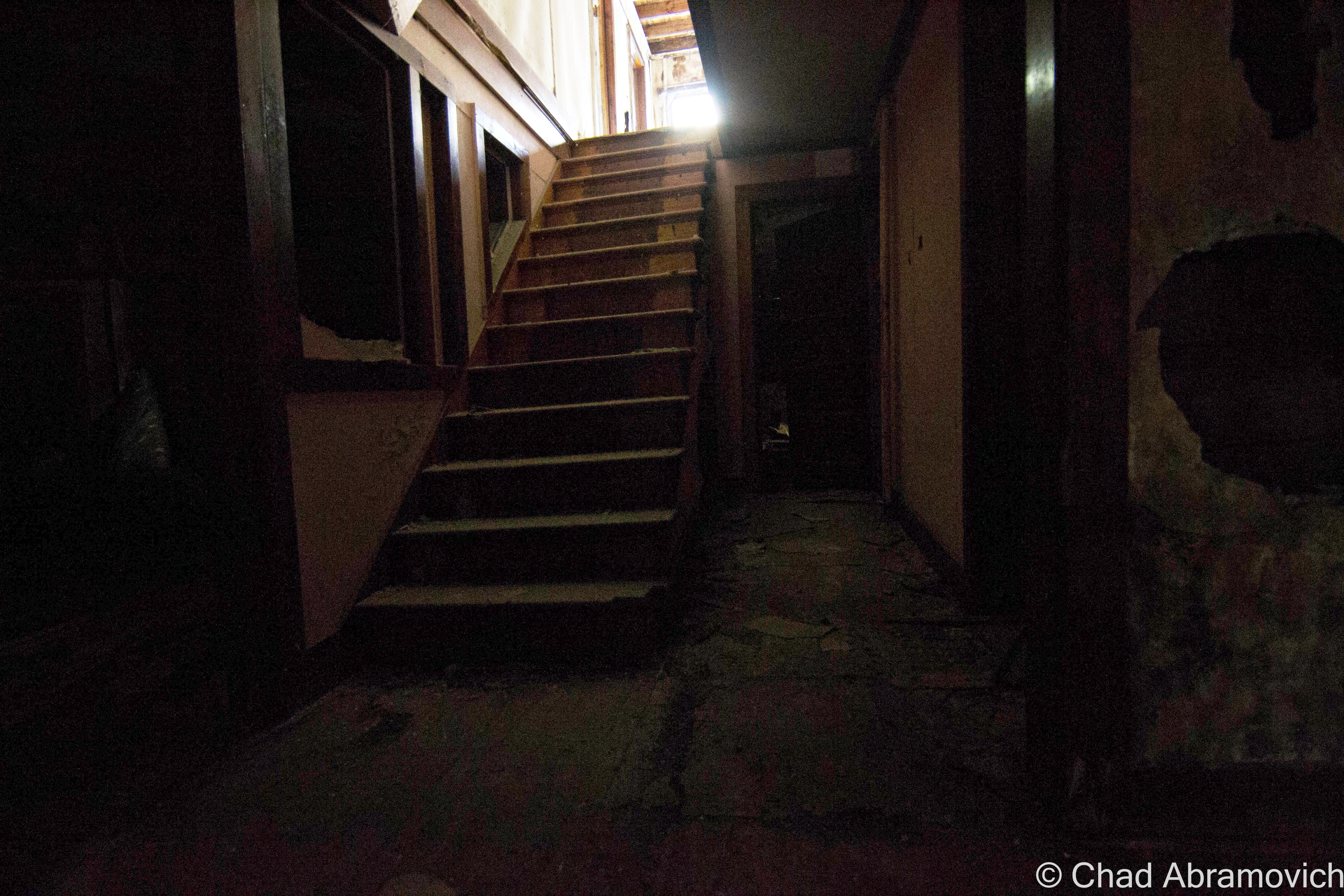
The vastness of the floor plan took me by surprise as well. Though it looks relatively tiny from the outside, once inside, it becomes apparent at just how much there is to see. I was quite surprised with how many hallways and rooms there were. We were humbled at least once when we found ourselves loosing our bearings.

The cold was having deleterious affects on my nervous system. At this point, I was already trembling in my coat, and I was beginning to get hasty. The floors throughout the entire building were so perilous, that we were exploring at a very slow crawl of a pace. This is definitely one of the most dangerous places I’ve ever been in to date.

The place was incredibly silent, void of life, so sound carried through remarkably well, not being obstructed by competition. The cold rushing waters of Stony Brook could be heard inside, and provided some white noise behind the clomping of our boots and steady breathing. The movement of a door banging against a wall from a gust of wind flickered in our peripheral vision – making us someone else was inside with us. Another urban explorer perhaps, or a cop…

I’ve always thought that the term “lair” in the name was a little ominous sounding, but after seeing it’s state of slow collapse and dark places within, that part of the name now seems very fitting.

When writing these blog posts, and comparing my photographs to historical ones when these places were in their prime, it’s almost surreal. A place that was once frequented and celebrated in many ways, now is forsaken and seemingly unwanted; a burden. We human beings are sentimental creatures, and those sentiments can transcend far beyond other humans. Man made things, constructed from wood, stone, mortar and slate also have powerful emotional bonds to otherwise utilitarian objects, and as they were once so easily loved, they can also be so easily lost.

Admittedly, the cacophony of all that we were taking in here can make you want to stay for quite some time to enjoy it all, finding a different world that doesn’t exist in the superfluous found outside. But, there was much wanted heat back in the truck…

DSC_0111_pe_pe DSC_0257_pe_peDSC_0110_peDSC_0114_pe DSC_0117_pe DSC_0125_pe DSC_0132_pe DSC_0136_pe DSC_0141_pe DSC_0146_pe DSC_0147_pe DSC_0151_pe DSC_0154_peDSC_0157_pe DSC_0159_pe DSC_0162_pe DSC_0166_pe DSC_0172_pe DSC_0175_pe_pe DSC_0177_pe DSC_0178_pe DSC_0179_pe DSC_0181_pe DSC_0182_pe DSC_0191_pe DSC_0192_pe DSC_0194_pe DSC_0197_pe DSC_0198_pe DSC_0202_pe DSC_0204_pe DSC_0205_pe DSC_0209_pe DSC_0211_pe DSC_0215_pe DSC_0218_pe DSC_0219_pe DSC_0221_pe DSC_0222_pe DSC_0223_pe DSC_0227_pe DSC_0229_pe DSC_0233_pe DSC_0234_pe DSC_0235_pe DSC_0237_pe DSC_0240_pe DSC_0241_pe DSC_0242_pe DSC_0244_pe DSC_0245_pe DSC_0248_pe DSC_0249_pe DSC_0250_pe DSC_0252_pe

The Glebus Count

I’m a bit of a weirdo, so it’s great that I’m also friends with weird people, with plenty of inside jokes between us. This one is definitely a time honored one, now being practiced for a few years running. Whenever we travel to the northern reaches of the empire state, we found ourselves engaging in something that I call “The Glebus Count”. What is this strange ritual?

While Vermont seems to have it’s fair share of real estate agencies represented, across the lake in the high peaks region, one name reigns supreme on red and white signs emblazoned with a bold, down to business, san serif font; Glebus. They’re everywhere. I’m not kidding. Almost every piece of property that listed as for sale has a Glebus sign in front of it, with the occasional other Realtor found in between. But who are they kidding, they’re not Glebus! Over time, we began to start pointing out when we’d come across one of their signs, and soon, that turned into trying to count as many as we pass during our trip. You’d be surprised at just how easily you’re drawn into it.

“Who do you think this guy Glebus is? He’s pretty much selling everything in upstate New York” The best satire we came up with thus far, was that the mysterious man had to have an old timey name evocative of infamous business moguls from the golden age of unprecedented capitalism- something like, say, Cornelius Glebus, (according to their website, his actual name is Gary) and he could be found in his real estate lair sitting in a gilded throne drinking wine from a chalice. Sometimes it’s those long drives that inspire the best conversations that you probably wouldn’t have elsewhere. You know what I’m talking about. It’s unintentionally became such a integral part of my treks here that I feel it’s that if I’m writing about upstate New York, it wouldn’t be fitting unless I included it.

Next time your in the high peaks, see how many Glebus signs you can count. And if you were curious, we counted 21 on this trip.

Glebus Glebus2

—————————————————————————————————————————————–

To all of my amazing fans and supporters, I am truly grateful and humbled by all of the support and donations through out the years that have kept Obscure Vermont up and running.

As you all know I spend countless hours researching, writing, and traveling to produce and sustain this blog. Obscure Vermont is funded entirely on generous donations that you the wonderful viewers and supporters have made. Expenses range from internet fees to host the blog, to investing in research materials, to traveling expenses. Also, donations help keep me current with my photography gear, computer, and computer software so that I can deliver the best quality possible.

If you value, appreciate, and enjoy reading about my adventures please consider making a donation to my new Gofundme account or Paypal. Any donation would not only be greatly appreciated and help keep this blog going, it would also keep me doing what I love. Thank you!

Gofundme: https://www.gofundme.com/b5jp97d4

Donate Button with Credit Cards

The Lost Shul Mural

The ballad of hiding things behind walls is a pervasive one that’s well sung. I’ve always had a fascination with things lost and re-discovered, and often can’t help wondering what sort of clandestine things exist in the mundane world we see everyday, and if uncovered, what sort of power would it have on it’s discoverers?

Years ago, I remember an old farmhouse in Colchester that was getting a face lift. As the rotting clapboard siding was removed, work grinded to a stop when laborers found quite the surprise underneath. The entire side of the humble dwelling was covered in Barnum & Bailey circus posters from the 1890s. This is an old trick used by Vermonters, who used any material they could to help insulate their houses during the long winters. Newspapers and in this case, circus posters, were all utilized. Though at the time the posters were the modern day equivalent of junk mail, today they remain as important relics of human history and culture, and of course, valuable collectors items. It’s always made me wonder just what else could be found behind a seemingly innocuous wall or structure, and what sort of stories could be told. Sadly, I never got the chance to to photograph those Barnum & Bailey posters, but recently, a new opportunity would come my way.

A lost mural, 104 years old, found deep within the walls of a former Old North End synagogue turned apartment building, was on public exhibition for 2 short weekends before being restored and moved to a new location. On a gloomy monotone Sunday of bland whites and cold winds, I found myself on the second story of a wooden building on Hyde Street, coming face to face with something spectacular. It was a strange feeling, seeing something so luminous and mysterious in the middle of a sterilized room with new stark white drywall and plywood floors.

Though it spent years in a state of limbo and neglect, the delicate surface and fading paint were remarkably well preserved and still were very successful in moving the observer. Arranged in a compilation spanning dramatically angled ceiling panels that forms the inside of a wooden turret, the mural is lively, dimensional and complex, featuring several scenes with incredibly ornate details.

The tour guide of the affair explained that the mural’s survival is nothing short of lucky itself. If it wasn’t for the original slate roof that caps the historic wooden building, the mural would have been already long lost. Between Vermont’s infamous cold winters, and the drastic temperature changes between interior and exterior, the naturally occurring elements are bad for preservation and great for corrosion. When the mural was walled up, the paint and wall insulation were sharing direct contact with each other, thus transferring moisture from the insulation to the mural face. It was really amazing that it survived in the condition it did.

But what’s the story here? Why is this painting so important? And why was it walled up?

Around 1880, Jews from the Kovno area began to migrate to Burlington, and soon began to congregate together for worshiping, establishing an insular neighborhood known as Little Jerusalem. In 1889, The Chai Adam Synagogue was built on Hyde Street, two years after the first synagogue, the Ohavi Zedek, was built. It was the second synagogue constructed in the Old North End.

In 1910, Lithuanian immigrant Ben Zion Black immigrated to Burlington. The son of an artist, he had attended several art academies in Kovno and was showing interest in the theater, especially theatrical writing. The move to Vermont however was out of love. In Lithuania, he had developed strong feelings for actress Rachel Saiger, who came to audition for a play he had written. Her parents however disapproved of the relationship, and in 1905, decided it would be best if they brought her with them to join family in Burlington. But he wouldn’t be deterred, and after 5 years of sending her postcards and letters, he eventually also moved to Burlington, and the two married in 1912.

When he arrived in Burlington, he was commissioned $200 to paint a mural in the Chai Adam synagogue in the Old North End, in the style of the wooden synagogues of Eastern Europe.

The congregation could gaze admirably at an eye catching optical illusion of an open sky with birds in flight that can be viewed through openings underneath suspended shrouds of heavy and colorful curtains adorned with tassels and ruffles. The centerpiece are the brazen Lions of Judah planted regally on both sides of the ten commandments, written in Hebrew, with the crown of Torah floating above, all bathed in golden rays of the sun. As I was taking everything in, an animated woman and her son raised a good question; if the artist was thinking of the landscape of the Champlain Valley and birds found in Vermont when he was painting the scene.

But this mural was unique for some other curious details it contained apart from the familiar tropes carried over by tradition. Black included angels and musical instruments in his work, elements that were banned on the Sabbath and were considered taboo by the community, thus creating some displeasure by some worshipers. While his evocative mural made lasting impressions on some, others weren’t that pleased, and he was never hired to paint another mural again.

Decades later, the synagogues in Burlington merged together, and the Chai Adam took on a secular life in 1939 as a dry goods store and then, a carpet warehouse, before eventually being converted into apartments in 1986. Though the synagogue was painted from floor to ceiling originally, most of the artwork was destroyed during the renovations when it was being converted into an apartment building. The only reason the remaining part of the mural had survived was because of the fact that it was covered by a wall and forgotten. The mural lay in darkness until 2012 when it was uncovered, and this time, the community was determined to make sure this treasure wouldn’t become lost again, or worse, destroyed.

Called “The Lost Shul Mural”, the name can stem from the term Shoah, or, The Holocaust. The mural comes from a formerly widespread tradition of Eastern European synagogue paintings that were almost entirely wiped out during World War 2, when entire Jewish communities vanished. Since then, remaining Jewish folk art has almost nearly been wiped out due to a myriad of reasons, from war, weather and neglect. The Lost Shul Mural in Burlington may be the only surviving example of it’s type in America.

Now, efforts are underway to preserve it. In a laborious and delicate process, the paint and plaster have to be stabilized to prevent any further flaking. Once the mural is prepared, the roof of the Chai Adam Synagogue will be removed, a steel frame will be constructed around the mural, and it will be transported to it’s new home at the Ohavi Zedek Synagogue. Then, it will be cleaned and restored to it’s former glory, making it available for Vermonters to come view it’s story.

You can read more about the project, the mural’s history, and donate to the fundraiser on the official project website

DSC_0929_pe DSC_0933_pe DSC_0934_pe


Good Read: A blog post by architectural historian Samuel Gruber explains why the mural is so significant.

—————————————————————————————————————————————–

To all of my amazing fans and supporters, I am truly grateful and humbled by all of the support and donations through out the years that have kept Obscure Vermont up and running.

As you all know I spend countless hours researching, writing, and traveling to produce and sustain this blog. Obscure Vermont is funded entirely on generous donations that you the wonderful viewers and supporters have made. Expenses range from internet fees to host the blog, to investing in research materials, to traveling expenses. Also, donations help keep me current with my photography gear, computer, and computer software so that I can deliver the best quality possible.

If you value, appreciate, and enjoy reading about my adventures please consider making a donation to my new Gofundme account or Paypal. Any donation would not only be greatly appreciated and help keep this blog going, it would also keep me doing what I love. Thank you!

Gofundme: https://www.gofundme.com/b5jp97d4

Donate Button with Credit Cards

The Cold Spring House

It’s hard to describe a place like the deteriorating ruins of The Cold Spring House, especially if you’ve never had the experience of visiting it yourself.

The remaining residue of The Catskill Mountains and their heyday as a resort destination – hotels such as this one once catered to primarily Jewish clientele during the 20th century, looking for a little relaxation from the turbulence of New York City in the scenic Catskills.

Driving through the gripping, winding road through the Kaaterskill Forest, with wild rivers cutting through steep hardwood shrouded peaks that resembled worn saw teeth, it wasn’t hard to see the allure.

This is the first time I had ever been to the Catskills region before, and my target village of Tannersville made an attractive first impression, which I was incredibly relieved with after the problematic start to my day. It almost seemed like I would never make it to the Catskills, as numerous setbacks, construction projects, and traffic jams kept delaying travel time, each hour of precious daylight being swallowed by the oncoming October evening. Because we were making a 5-hour drive down from Vermont, I was determined to make this count.

Navigating the highways of New York, we passed by many derelict structures and sordid towns that were more depressing than anything, reminders of the decreasing amount of tourists in the region. It’s one thing to figure a portrait of a place from conversations with friends who grew up around there, and a few things I’ve read, but it was another type of cool entirely to gaze at what was coming through the view of the windshield.

As we approached Tannersville, the comedown daylight was filtered through a black sky foreshadowing fury that never seemed to come. The air was crisp, carrying the smell of dead leaves, as chilly mists began to settle on our faces. It felt like it was going to rain, but it never came, and the mists continued to be misleading.

There we were, staring up at the imposing ruins of the Cold Spring House, and it’s various stages of decay.

The slumping roofs and bending wooden frame ripped open several holes in the building, giving off dead weight that popped out windows and pushed various items through the glass. It was well into the evening now, but we had made it, with just enough light to photograph and do a little exploring. But the question was, where do I even start?

From what I know about the place, it was one of the earlier Catskills hotels, on the outskirts of the Borscht Belt, an area once a dazzling vacation-land now reincarnated as a collection of behemoth and storied abandonments. The Cold Spring House was a grand showpiece, which was very different from the closet cottages and revelrous resorts the area was known for at that time.

Built on what is now Spruce Street in the 1890s, it was the second largest hotel in Tannersville, as well as the first Jewish hotel in town – able to accommodate 200 guests at the base of mountains rising to around 2,200 feet. It started as a hotel called Bieber’s Cold Spring House but was sold in 1922 to Saber Khouri, and re-branded simply as The Cold Spring House.

According to a 1904 advertisement I was able to find online, the property featured expansive lawns, offering tennis and croquet grounds, surrounded by old trees offering comfortable shade on summer days. There were farms on the property that supplied the hotel with fresh milk and vegetables everyday, which were paired with what the ad boasted as excellent table service in the form of German and Hungarian cuisine. And of course, fresh spring water was offered – from the springs which the hotel derived its name from.

The hotel was also widely regarded for its popular classical concerts on the lawn. Two signature towers at opposite ends of the building, now slumping dangerously, were once observatories, giving guests extensive views of the mountains. Today, that view would be worth the price of your life.

What I found interesting about the advertisement was that it boasted such amenities as “sanitary plumbing and fire extinguishers on every floor” – items that we take for granted today, but around that time period, were new features and were only beginning to be enforced by laws. I’m sure that was a selling point – definitely a plus when I choose a hotel. But it makes sense. The time period was a time of transition. There was a nationwide push that required to implement such systems, but it was a costly expense to outfit these old buildings, and many old hotels couldn’t afford keeping up with the competition.

The advertisement also stated that the hotel was continuously expanding as it’s increasing popularity was luring more and more people to stay there each season. Older photos showed a much different building, with only one tower, and most of the western wing not yet added. The final product was a much larger and grander property – the brooding structure you see today.

But times certainly have changed. During the late 20th century, much of the region fell out of favor as a vacation destination. With an increase of automobile travel and an ever-burgeoning highway system, more Americans were driving, and could travel farther distances and see more places. Now, they no longer had to settle for the closest area available – a trend that I’ve seen so many times in humbled abandonments I’ve visited. Tannersville was no exception. Many vacation homes eventually were abandoned and hotels were shuttered. The Cold Spring House fell into the trend and was abandoned in the 60s, leaving quite the compelling ruin in its wake.

It literally hunches over Spruce Street in its old age, leaning in all directions. A symbol of human progress and the change of the times, something inevitable that tends to leave growing pains on the often bumpy road of advancement and the fodder of bandwagon fads. In an ironic sense, this more offbeat form of tourism can also serve as a poignant melding of public awareness, a chance to learn from our past.

Today, Tannersville is more known for it’s proximity to Hunter Mountain Ski Area than a summer destination, but while many Borscht Belt towns are still struggling, Tannersville seems to be in the middle of some sort of revival. As it was explained to me, people started to rediscover the town and were taken by its natural beauty. Old vacation homes began to be fixed up at expensive costs because of the bad shape they had deteriorated to, and more businesses have opened up on Route 23A.

As for the Cold Spring House though, I had the pleasant chance to speak with photographer Linda O’Donnell, who has been researching and documenting the building’s deterioration for the past several years. She informed me that the place has been scheduled for demolition since 2012, but demolition by neglect may happen before any actual bulldozers arrive on the property. It makes you wonder, when will the familiar become just history?

Dying Light

This was truly one of the most spectacular places I’ve had the chance to photograph (and a great change of scenery from Vermont!), but with its awe-inspiring profile came very tangible dangers. As I walked around and got to know the place better, I was able to recognize something very quickly. The building was far too dangerous to venture inside, and because of our late start, there was little daylight left. Peeking in through an opened window, I was met with an interior of collapsing floors, wooden walls intended to support the structure were crushed into an accordion-like resemblance, and various artifacts collected in indistinguishable piles of fragments covered in dust and lead paint speckles. The weight was so great in some places that many things had actually been pushed through the floor, which was already cracking on the added weight of my body. That musty old building smell wafted out from the opening, mixed with a heavy damp musk. To my far left, a staircase, illuminated by the dull light of broken windows, climbed above the wreckage and into the mysterious upper floors. Or what was left of them. Though I ached to go inside, that would have been an idea that probably would have been counterproductive to my travel plans, which were to leave intact and alive.

For a relatively rural back street, the traffic was thunderous, a constant roar of pick up trucks going by, and slowing down when they noticed me with my camera. Because New York State has very unforgiving rules against trespassing, and with me being in such a surprisingly public area where I would no doubt be trapped should I be caught, the odds were stacked against me.

I had no choice but to keep a safe distance. But the exterior alone was worth the drive. The tops of the building still wore it’s yellow paint job, the original color of the hotel, while the lower levels were weather worn into a dull grey and showed signs of various stages of rotten cavities that completely ate through the walls. Older photos showed a sign that read “Cold Spring” that hung over the porch near the front entrance, but when I visited, that was also long gone, the last clue to its identity.

Signs of human presence were everywhere. Graffiti was found on many of the upper windows, but not the good kind of graffiti. That also meant that some adventurous intruders made the trip to the upper floors…

I often find strange items left behind when I explore – and this was no exception. There was an interestingly large collection of abandoned records found all around the hotel, most on the front lawn, tangled in tall grass and cedar trees. Some of them were arranged specifically, with various items such as kitchen utensils and bottles filled with suspicious colored liquids in them, propped purposely around the sides. I didn’t recognize any of the artists – but some looked like they would have been right at home in some embarrassing 70s porno.

Just gazing up at the place and looking in the numerous windows offered many things to see. Radiators that had fallen out broken windows. A glimpse of a bedpost. Dark rooms with holes in the ceiling letting in the dying daylight. Old glass bottles left on windowsills. Then the wind blows, and the eerie creeks of a shutter can be heard, before it bangs loudly against a wall several stories above, you see the movement, and your pulse quickens as you jump to conclusions. Despite the reliable hum of noise outside, closer to the hotel, things faded into an uncomfortable silence that was almost loud in itself. It was quite startling considering it was just a short walk down the lawn that offered such a fast transition.

Not wanting to draw attention by staying too long, we left and began the journey back to Vermont, the Cold Spring House leaving a lasting impression.

ColdSpring
These are some great historical photos of the Cold Spring House in its heyday, which I found online accidentally and was kindly given permission to re-link by Flickr user Linda O’Donnell. Not sure of the dates, but it really gives you a sense of what this place used to be like.
ColdSpring2
Used with permission from Flickr user Linda O’Donnell
ColdSpring3
Used with permission from Flickr user Linda O’Donnell
ColdSpring4
Used with permission from Flickr user Linda O’Donnell

  The Cold Spring House Today

DSC_0861_pe DSC_0881_pe DSC_0888_pe DSC_0890_pe DSC_0893_pe DSC_0899_pe DSC_0916_pe DSC_0922_pe DSC_0924_pe DSC_0925_pe DSC_0929_pe DSC_0933_pe DSC_0935_pe DSC_0941_pe DSC_0942_pe DSC_0945_pe DSC_0946 DSC_0955_pe DSC_0961_pe DSC_0999_pe DSC_1000_pe DSC_1001_pe DSC_1002_pe DSC_1003_pe DSC_1004_peDSC_0981_pe DSC_0993_pe

Information:

There doesn’t seem to be a lot of information on this place. Most of what I was able to compile in this post came from speaking with various people, and a good article I found online from the Register-Star 

There is also a group on Flickr I found, dedicated to sharing memories and photos of it.

This is one of my favorite things I came across while researching. Here is a fascinating article and photographic journalism piece about the Borscht Belt

—————————————————————————————————————————————–

To all of my amazing fans and supporters, I am truly grateful and humbled by all of the support and donations through out the years that have kept Obscure Vermont up and running.

As you all know I spend countless hours researching, writing, and traveling to produce and sustain this blog. Obscure Vermont is funded entirely on generous donations that you the wonderful viewers and supporters have made. Expenses range from internet fees to host the blog, to investing in research materials, to traveling expenses. Also, donations help keep me current with my photography gear, computer, and computer software so that I can deliver the best quality possible.

If you value, appreciate, and enjoy reading about my adventures please consider making a donation to my new Gofundme account or Paypal. Any donation would not only be greatly appreciated and help keep this blog going, it would also keep me doing what I love. Thank you!

Gofundme: https://www.gofundme.com/b5jp97d4

Donate Button with Credit Cards

Disappearing

A favorite activity of mine is to go shunpiking – cruising around Vermont’s back roads and letting my eyes and mind soak up whats out there. A few nights ago while traveling down a straight-of-way in Addison County, a pancake flat paved rural roadway surrounded on both sides by expansive hay fields, I came across a forested island in the middle of a vast expanse of nothing – a small patch of surprisingly dense hardwood trees, tall grasses, and the Vermont state flower, the Clover.

Behind the growth, I noticed there was something man made here that was coexisting with the small jungle – the second story of a sordid farmhouse could be seen above a fortress of clinging vines that were almost consuming the structure. Slowing down to take a better look, I realized there was yet another abandoned house across the street that was nearly invisible, and behind it, I could make out the shapes of a scattering of barns and sheds, all falling and fading. I had stumbled on an abandoned farm.

Pulling off into what was once probably a driveway, I basked for a moment in the silence that hung around the farm. The sounds of crickets and the smell of clover came through the open windows, and the breeze gently rustled the trees. As I was sitting in my late summer reverie, movement caught my eye. From behind the abandoned farmhouse I was near, a solitary figure rode into the opening on a bike, through thick grass and tanglewoods that I assumed were probably very difficult to bike through. Manning the bike was a haggard looking fella, who appeared to be in his 40s, outfitted in moth-eaten clothing and a rather new looking bike helmet. He approached the car, and I braced for his encounter the best I could, giving him a small smile, waiting to see what was about to unfold.

“What are you doing here?” was his first question, which I predicted as much. “I’m just turning around, took the wrong road” I said calmly and cautiously. “Do you own this land? I’m sorry, I didn’t mean to bother you”. “Oh, I worked here for over 30 years, so I pretty much do own the land” he began. “The farm is abandoned now, the family is pretty much all dead. I still come by almost every week and check up on things though” “Oh wow, that’s pretty incredible. This place looks like it has a lot of history” I observed. And that seemed to light an internal fire – a simple initiation of conversation, and suddenly, his reserves were taken down, and he opened up to me. “Oh man, the stories I could tell you”. I smiled at him and explained my passion for stories and history. His eyes lit up like flashbulbs. “Actually – do you have some time, I can show you around?”

Next thing I knew, I had my camera in hand, and was ignoring my better senses as I followed a total stranger through thick tall grasses, well out of sight from the relative safety of the road out front. He introduced himself as Ivan as we went to shake hands. Putting blind faith in this gentleman, I allowed him to lead me around the property and we began to talk about the shifty ways of time, his stories cutting deep into history.

“I started working here when I was 10, back in the 60s”, Ivan began. “I used to carry hay bails from the fields to the barn all day long. That’s how I got these” he snickered, as he flexed his muscles. “I used to work all day long, never took a water break. People always used to warn me I’d get dehydrated, but I never did” he said proudly.

We found ourselves standing in front of a barn. “These barns are over 150 years old, built from Oak, Cherry and Ash, all cut right here on this property. There used to be a mill over there” he gestured to now open pastureland. He walked over and wedged a sliding door open, it made a loud groaning noise as the door grinded against the building. The entire facade seemed to tremble at this disturbance.

Inside was a forgotten world. Incredibly thick quilts of spiderwebs clung to brawny timber beams and fell from the ceilings like snow, getting tangled in my hair. Hay scattered on the dirt floors 30 years ago was still there, matted and molding. Certain rooms were packed wall to wall with various artifacts. wooden apple crates, tires with wooden rims, old bikes, desks and shelves filled with various artifacts and paraphernalia, accounts of over 150 years of farming now sitting forsaken underneath swirling dust and sunlight coming in through dirt streaked windows. On our way out, he noted me looking at the apple crates. “I love these things. I have a few of them in my apartment, holding books and stuff” I commented. “Oh yeah, I love those old crates too. There used to be an apple orchard right behind this barn. Over 100 trees! I remember, we all used to eat so many apples – they were great on a hot summer day. They tore them all out a few years ago, the entire orchard”

Making our way through the tall grasses, we made our way across the property. In a neighboring barn almost completely concealed by tree growth, he pointed out that that particular barn was used exclusively for trapping. The farmers used to trap unlimited beavers, otters and raccoons on their property and the nearby creek, and used to bring all the pelts to hang and dry in that barn – where a long narrow hallway ran between two sets of walls where the hooks still were hanging.  “This barn used to be full of hides – all the walls would be covered” he reminisced. “We used to either eat them or sell them. Any bit of money helped” It was a strange image, staring at those filthy and barren walls that afternoon underneath filtered light streaming through broken boards. I noticed a dated industrial grain sorting machine at the very end of the narrow hall. He told me that the farm used to also produce its very own grain. The floor was still coated in ankle high piles of the stuff and it had gotten in my shoes. Standing inside, there was a moment of silence as we took in our surroundings, and weird sounds seeped throughout, the soft summer breeze clearing my mind.

Wondering back around one of the abandoned houses, he told me that after the farm started to go out, the house was rented out to people outside the family. The last occupiers apparently stole a great deal from the farm. Valuable antiques such as firearms, milk jugs and other artifacts they had been taken. Most of the original family had died off, all but one member, who is now well into her senior years, and still lives nearby. She’s tired and doesn’t have the want to upkeep the farm anymore, and is almost completely unaware of it’s slow collapse. “It’s a real shame” he said. “Once she dies, a guy wants to buy the place, come in and bulldoze all the barns, the houses, everything. They want to expand the fields and farm this area. Everything here will be lost”.

Walking across the road, he brought me over to another abandoned farmhouse. “Back in the 60s – this used to be filled with people from California. Used to come up here by the bus loads – there must have been at least 20 or so people living in this house. They were the ones who were in charge of keeping this farm running ship shape”

The door to the house opened effortlessly, swung inwards and banged against the neighboring wall – the sound was like a shotgun blast in the somber interior. Inside, the life was gone, but something kept on creeping on, the floors creaked as the past walked by. The interior was what I expected to find in an old Vermont farmhouse. Faded linoleum floors, porcelain sinks, peeling wallpaper and rooms filled with garbage. There were holes where stove pipes used to run and heat the house, and an the exposed skeletons of an electrical system that looked like it was done haphazardly years ago. “There used to be rows of bunk beds in these rooms – they all used to sleep in here” he pointed out as he swung open a door of an upstairs room.

As we walked back down the stairs, he paused at one door we hadn’t opened yet – the basement door. The entire farmhouse had shifted and slumped over the years, almost trapping the door in its frame, but after a few hard tugs, it wrenched free, sending splintered fragments of crown molding in the air. The basement was pitch black, and the old wooden stairs were no longer standing. “You know, I’ve always wondered if there was like a chest full of gold or something down there” Ivan said as he scanned the darkness with his eyes. I was now curious. Was he making a joke? But he was quick to explain. “Back when I was growing up – I heard stories that the older members of the family had hidden gold coins around the farm. There was some sort of currency scare in the 1800s where people assumed paper money was going to loose its value, so they all started to switch to gold coins. I guess I heard they had a few stashes hid around the houses” Hidden treasure was certainly intriguing to me, so I asked him if he had ever found any of these alleged gold coins perhaps hidden under a floorboard or in the pipe of a woodstove. “Nope, never. I think it’s just a story” he said.  With a little research later, I discovered that there was in fact a large scale panic in the mid 1800s, The Panic of 1837, where wages, prices and profits went down, and unemployment and a general distrust of banks went up. As a result, I’ve heard other stories of old Vermonters investing in gold currency, something they were confident was dependable and safe, and kept it around the house as opposed to opening an account at a bank. Even if his intriguing story was a rumor, or if he was simply trying to spin a yarn, it did have its roots in historical accuracy.

Now outside the house, he brought me over to another barn and stared up at a rusted basketball hoop rim that was hung above one of the entrances. “Used to play here a lot as a kid to pass the time” he recalled nostalgically. “We used to have games, me and the Californians. Was thinking about going out for the basketball team in high school, but I never did”

“How often do you come by?” I asked Ivan, now curious by our chance meeting. “About every week” he replied. “I like to check up on the place, to make sure things are alright, to make sure it’s all as it should be”. It seemed Ivan was waiting in vain for something to happen – throbbing, and wincing, not knowing who to love or who to blame.

Getting ready to leave, I reached out to shake his hand, and sincerely thank him for his grand tour. It always means a lot when people open up to me – those experiences suddenly become shared experiences, and effect both parties involved. “It’ll sure be sad when this place goes, that’s for sure. Just down the road, the neighboring farm already sold parts of their land to other people, and they built houses on them” I knew too well what he was talking about. “Yeah, that’s pretty common. A lot of the farms I remember growing up around have succumbed to development now” My comment seemed to strike him off his feet. “What? Oh no…I’ve never really left town, haven’t really been anywhere I guess. So I wouldn’t really know” he said wistfully, he almost seemed to grieve from the disease of change and urbanism. I felt badly for him, it seemed all he wanted was a sense of place, but there was only silence and heavy humidity.

It’s always interesting to think about how many great stories are still existing in Vermont that have gone untold, and are in danger of completely disappearing. Images of proud men slick with sweat sticking to tractor seats and labor that would break the summer’s back. Farm life isn’t a romanticized escape from the bustle of modern life, it’s sadly an often thankless, lynchian job of back breaking work with little to show for it. But it also is a labor of love and devotion matched by earnest gazes and blue skies that have seen the same troubles as us. Exploring abandoned places like this sometimes compels you to look for answers to your own questions, but all I seemed to find is everything seems to change. As the world progresses into a future that seems like a dream now, countless more farms may find themselves like this one. It’s an experience like this in a haze of turbulent innocence, where you get a hard reminder that nothing stays the same.

Update, August 2015

A month of so after I had posted this blog post, I received a Facebook inbox message from the owner of this property. I opened it hesitantly, thinking that it’s contents would be angry and accusative, but to my very pleasant surprise, he was actually telling me he digged my blog, and loved this particular entry. But one thing was bothering him. He asked me about my tour guide, Ivan, and said that the family never employed anyone under that name on the farm before. A bit befuddled, I gave him a detailed profile of the guy. “I knew it!” He started. “His name isn’t Ivan, he lied to you. That was Tom, the town drunk. He’s the guy who set the meetinghouse on fire a few years ago, then tried to come here and light up one of our barns”. I certainly didn’t expect that.

DSC_0797_peDSC_0781_pe DSC_0782_pe DSC_0783_pe DSC_0786_pe DSC_0789_pe DSC_0792_pe DSC_0795_pe DSC_0796_peDSC_0809_pe DSC_0799_pe DSC_0804_pe DSC_0805_pe DSC_0859_pe DSC_0810_peDSC_0811_peDSC_0855_peDSC_0815_peDSC_0819_peDSC_0820_peDSC_0821_peDSC_0827_peDSC_0830_peDSC_0849_peDSC_0852_peDSC_0858_pe

—————————————————————————————————————————————–

To all of my amazing fans and supporters, I am truly grateful and humbled by all of the support and donations through out the years that have kept Obscure Vermont up and running.

As you all know I spend countless hours researching, writing, and traveling to produce and sustain this blog. Obscure Vermont is funded entirely on generous donations that you the wonderful viewers and supporters have made. Expenses range from internet fees to host the blog, to investing in research materials, to traveling expenses. Also, donations help keep me current with my photography gear, computer, and computer software so that I can deliver the best quality possible.

If you value, appreciate, and enjoy reading about my adventures please consider making a donation to my new Gofundme account or Paypal. Any donation would not only be greatly appreciated and help keep this blog going, it would also keep me doing what I love. Thank you!

Gofundme: https://www.gofundme.com/b5jp97d4

Donate Button with Credit Cards

House of the Syrup Folk

There is always that one place that stands out from the rest – and on a breezy August morning, I stood in front of what has to be the most unnerving house I have ever explored, and it was the question of why that really bothered me the most…

Skulking off a quiet backroad underneath the canopy of dense forests, on a slope with at least a 9 percent grade – this fading weathered house sits in the forest like an infected sore – a strange world where nature slowly undoes the deeds of man, with skin so thick, it’s empty eyes were like knives, not worried about who was receiving them.

The awkwardness started from the moment I got out of the car, and got a good look at the place over a forest of thorns and vines that had been tangled in the wind – a solitary trail sleuthed its way through the growth towards the house. Something had been through here recently. Staring up at it’s faded and splintery facade that almost matched the wilderness around it, there was something unsettling about the place. You could actually feel it’s age, and you could smell the smells – that typical old house perfume and rot that hung around the property like musk. Through the broken windows, the interior was pitch black, with secrets smothered in dirt. Though my fears weren’t routed in anything empirical, my skin was trembling.

Deciding to get a better look at the place, I proceeded to stumble through the grass. I was already regretting it. The thorns immediately sliced my arms and legs to ribbons, and I began to stumble over things that were previously hidden. Rusted trailers, oil barrels, broken glass and a knotted web of disused sap lines lay along the weedy floor, all covered in condensation which coated my boots, and made me slip more than once. Just getting over towards the place was turning into an adventure. Bees swarmed from flower to flower, and unseen creatures slithered in the grass, making the stalks snap and rustle.

Standing at the foot of it’s darkness, I noticed some things that immediately made me stop my pursuit. There was a new looking satellite dish on the side of the building, and an even newer looking utility box. But, there was no electrical hookup to the house. Some of the wires sat exposed, pulled out of the walls, and chewed on. Could someone actually live here? There were giant holes in the wall, and half the windows had long been shattered, but from my experience, that isn’t always evidence…

Upon closer investigation, I noticed an odd sight. Someone had actually taken the time to pick up the large fragments of broken window glass, and set them back into the wooden window frames. Other windows were barricaded from the inside, with chairs pushed up against them holding curtains in place. Someone made vague attempts to keep people out it seemed, but just around the corner, there was a door that was wide open, and a broken window would easily allow access. What was going on here? Peering inside a window, the interior of the house was cast in shadow, further and further, until there was nothing but strange land. A cold dampness settled on my face, and I could taste the musk as it settled in the air on my tongue.

I couldn’t explain it, I was incredibly uncomfortable at this point. I felt like something was watching me, like something was lurking just beyond the lens of my camera, offering no explanation. Though the inside of the house was smoldering in an entombed silence, there were strange noises coming from the places out of reach, like something was moving, something unknown saying, if I stay here, trouble will find me. To add to my unnerved state, tree branches around the house started to snap, but no one was around.

Eventually, I trekked back towards the road and rejoined my friend, who had opted not to go any closer to the place. I guess I couldn’t really blame him at this point. “I heard weird noises coming inside – I decided to leave” I said when I saw his questionable face. “Oh, I thought I heard something as well” he said. “I thought it was the syrup folk or something coming by” I stopped. “syrup folk?” He then pointed to the labyrinth of active sky blue sap lines that criss-crossed around the property. Though I now understood what he meant, there was something cryptic, almost ominous (and probably uniquely Vermont) about the term “syrup folk” that really stuck with me, hence the name for this blog post.

Though my trip here was discomforting, it’s these sort of experiences that often can be regarded as some of our finest ones – allowing you to discover what’s deep between your own skin and bones. And at the very least, they make for the best stories.

As we were about to leave, just to confirm my suspicions that something was inside, a raccoon popped it’s head out of the third story window, through a broken section of shutter, stared at us for a few seconds, than dipped back in to the deep cold darkness inside.DSC_0702_pe_pe_pe

DSC_0707_pe_peDSC_0706_pe_peDSC_0711_pe_peDSC_0712_peDSC_0755_pe_peDSC_0754_pe_peDSC_0746_peDSC_0744_pe_pe DSC_0753_pe DSC_0758_pe DSC_0760_pe DSC_0762_pe

This conjured up a few "Breaking Bad" jokes.
This conjured up a few “Breaking Bad” jokes.

DSC_0732_pe DSC_0766_pe DSC_0767_peDSC_0630_peDSC_0632_peDSC_0640_peDSC_0641_peDSC_0653_peDSC_0655_peDSC_0660_peDSC_0662_peDSC_0668_peDSC_0669_peDSC_0670_peDSC_0673_peDSC_0674_peDSC_0677_peDSC_0681_peDSC_0683_peDSC_0686_peDSC_0687_peDSC_0688_peDSC_0694_peDSC_0696_peDSC_0697_peDSC_0701_peDSC_0704_peDSC_0707_peDSC_0709_peDSC_0712_peDSC_0717_peDSC_0721_peDSC_0724_peDSC_0726_peDSC_0732_peDSC_0735_peDSC_0740_peDSC_0750_peDSC_0756_peDSC_0758_peDSC_0762_peDSC_0763_peDSC_0765_peDSC_0766_peDSC_0767_peDSC_0774_peDSC_0771_pe_peDSC_0776_peDSC_0778_peDSC_0780_peDSC_0783_peDSC_0790_peDSC_0793_peDSC_0795_pe


—————————————————————————————————————————————–

To all of my amazing fans and supporters, I am truly grateful and humbled by all of the support and donations through out the years that have kept Obscure Vermont up and running.

As you all know I spend countless hours researching, writing, and traveling to produce and sustain this blog. Obscure Vermont is funded entirely on generous donations that you the wonderful viewers and supporters have made. Expenses range from internet fees to host the blog, to investing in research materials, to traveling expenses. Also, donations help keep me current with my photography gear, computer, and computer software so that I can deliver the best quality possible.

If you value, appreciate, and enjoy reading about my adventures please consider making a donation to my new Gofundme account or Paypal. Any donation would not only be greatly appreciated and help keep this blog going, it would also keep me doing what I love. Thank you!

Gofundme: https://www.gofundme.com/b5jp97d4

Donate Button with Credit Cards

Mysterious Snake Mountain

Fog shrouded the barren farmlands as icy winds sputtered and spinned outside the car as we moved down Route 22A through the flats of Addison County. There is something about late Fall, the odd transition period of old and the rebirth of Spring that is strangely ideal for adventuring. There is a certain melancholy about this time of year that rides the winds that blow in off the lake, something that a good adventure can temporarily alleviate. Things are more vulnerable in the Fall, and more raw. These thoughts were confirmed as the hulking and lengthy form of Snake Mountain loomed ahead in the fog and cold rain.

There is something mysterious about Snake Mountain that is conjured by its isolation. Sitting right in the middle of otherwise pancake flat farmland in the heart of Addison County, the sprawling monadnock raises a lofty 1,287 feet above the valley below – its craggy ledges the only surface that managed to capture the sun’s warming gleam. It’s not a widely recognized area. As a matter of fact, not many seem to know you even can hike the mountain, making it all the more alluring.

Snake Mountain is the focal point of the 1,215 acre wildlife management area of the same name, forever protecting the mountain and a 9500-year-old kettle lake known as Cranberry Bog, which according to the fish and wildlife department, formed shortly after the retreat of the last glacier in Vermont. But it’s a discrete area, one that isn’t clearly marked and still remains uncongested by mobs of tourists.

When I was younger, I was told that the dense and disparate patch of wilderness used to be called Rattlesnake Mountain, and its ledges and boulders were home to the only venomous reptile in the state (which isn’t true – Fair Haven’s Rattlesnake Ridge is bestowed that honor). But if the strange urban legends are true about this enclave of no man’s land in the middle of the county, then there are far more sinister things that haunt the wooded slopes and bogs. Snake Mountain is also reportedly home to a strange cryptid dubbed as “The Black Beast of Snake Mountain”, which supposedly stalked the slopes and terrorized unsuspecting farmers back in the 1920s and 1930s.

Though I couldn’t find a description of this brazen creature, it was said to lurk behind barns and houses that surrounded the mountain, and if encountered, its said to be savage. According to The Vermont Monster Guideone woman was attacked by this elusive creature one night while driving home after a visit with a neighbor.  It began to chase her vehicle as she panicked and began to pick up speed down a winding road that carved along the base of the mountain. To her surprise, not only was this thing managing to keep up with her car, it was catching up! Not wanting to get in a car accident, she pulled off into the first farm she saw, and it wasted no time in jumping on top of her car and began to claw at the roof. Now in hysterics, she did the only thing she could think of; she wailed on her horn. The noise grabbed the attention of the family who owned the farm, who soon appeared on the front porch in curiosity. But as soon as the floodlights were turned on, the women ran back into the house screaming at the first sight of the terrifying encounter. The men ran in shortly after to grab their guns, but when they came back outside, the animal had vanished into the Addison night.

The stories continue. Another account reported it would also jump down from tree limbs and scare children working on nearby farms. Every attempt to shoot at it was a failure, it would always vanish successfully, leaving nothing but shaken onlookers and a terrifying memory. It seems the mysterious Black Beast faded into memory and folklore, and to this day no evidence exists of what exactly was terrifying isolated residents back in the 1920s.

And now, here I was underneath gloomy grey skies battered by chilly winds and rain, staring up at my destination. The summit appeared more distant and forlorn underneath the shifting clouds that wouldn’t open up the sky. My only thoughts at the moment were how my coffee didn’t seem to be working. Although the lore about the mountain was wondrous, that wasn’t why I was there. There is also a human mystery about Snake Mountain, one that was palpable underneath shedding foliage and autumn stillness.

At the entrance to the hard to find Wilmarth Woods trail, sits an old building that looks like it may have served a nearby farm at one point, or perhaps a very tiny one room schoolhouse. Though it has been boarded up, the strange urban legends I’ve heard still swirled in my head. Stories of people peaking through the windows and seeing dusty mason jars filled with odd colored liquids and cryptic contents floating lazily inside them were alluring and most likely far fetched. Regardless of the accuracy behind that claim, the boarded windows ensured I wouldn’t be finding any answers today.

DSC_0151_pe

Embarking up The Wilmarth Woods Trail, it winds its way through thick brush, past the remnants of ancient mangled farm machinery and eventually follows the rather broad and rocky remnants of an old carriage road that snakes its way up the rocky hills and silent forests – the pungent smell of wet leaves and mud hung heavy in the air. Though my starting point was sluggish, I soon couldn’t help be taken by the beauty and therapy of the forest.

While trekking through the woods, they begin to tell a seperate story, adding to the mountain’s cryptic reputation. The birch stands at the base of the mountain are covered in ambigious tree carvings – it seems that every bored teenager in Addison County has made it to Snake Mountain to carve the name of their loved on into a tree, or to tell the world that they were there. Some carvings were remarkably old, dating back almost 30 years. These youth hieroglyphics are cool to see and read as you make your way up the slopes. 

13249243565_fbe25bd79e_o


The carriage road continues to playfully climb the mountain and dip through shadowy dales until it reaches a particular point of interest at the summit – the reason for the carriage road’s existence. Sitting on top of magnificent views of Addison County and the rugged Adirondacks in the distance lies a crumbling concrete slab that buts right up to dizzying ledges. This is the foundation of the former Grand View Hotel. Built in 1870 by Jonas N. Smith, this hotel was built during an era when many mountaintops across the Northeast were being developed into resort properties, offering fresh country and and grand views to its eager clientele. Some even claimed that fresh country air would be an ailment to whatever health issues that were plaguing you. Because of the hotel, Snake Mountain became briefly known as Grand View Mountain. In 1925, the hotel was ravaged by a fire, leaving a smoldering pile of ruins scattered along the wind swept summit. Today, the foundation and steel rods that held the building in place are still visible, along with some of the best views anywhere.

DSC_0153_pe

The weather worn foundation of the former Grand View Hotel and Champlain Valley splendor in the background.
DSC_0159_pe
One of the original pipes, its jagged stump still protruding from the foundation surface
DSC_0174_pe
The small town of Addison, visible through the mists upon Snake Mountain.
Snake Mountain Panorama

From up here on the top of Addison County, a strange silence climbs into your head. Your thoughts become more lucid, and you get a strange sense of scale as you look at the patchwork fields and gleaming silos below you. The strange connection of you being apart of this uncertain game called life which is played at the bottom of the ledges at your feet, and loneliness up there in the deep. Snake Mountain offers a great excuse to get out for a easy and rewarding day hike. And there is no better therapy to what ails you than nature.

Links:

More about Snake Mountain via The Fish and Wildlife Department. 

How to get there:

From either approach on Route 22A, make a turn on Wilmarth Road. Follow it the short distance until it intersects and ends with aptly named Mountain Road, which runs along the base of the mountain. Take a left, and follow Mountain Road a short distance until you see a dirt parking lot to your left. The Wilmarth Woods Trail head is just before the parking lot on the right side of the road. Look for the dilapidated red building.

—————————————————————————————————————————————–

To all of my amazing fans and supporters, I am truly grateful and humbled by all of the support and donations through out the years that have kept Obscure Vermont up and running.

As you all know I spend countless hours researching, writing, and traveling to produce and sustain this blog. Obscure Vermont is funded entirely on generous donations that you the wonderful viewers and supporters have made. Expenses range from internet fees to host the blog, to investing in research materials, to traveling expenses. Also, donations help keep me current with my photography gear, computer, and computer software so that I can deliver the best quality possible.

If you value, appreciate, and enjoy reading about my adventures please consider making a donation to my new Gofundme account or Paypal. Any donation would not only be greatly appreciated and help keep this blog going, it would also keep me doing what I love. Thank you!

Gofundme: https://www.gofundme.com/b5jp97d4

Donate Button with Credit Cards

Modern Fossils

Strangely Isolated from its central village location and untouched for more than 30 years – this place has the eerie kind of remoteness where every noise heard inside its cavernous and dark interior is startling, and the thought of this once being an active business with a vibrant human presence borders on the absurd.

What was once a prosperous creamery seemed to have suffered the same inevitable fate as other Vermont creameries. Fluctuating milk prices and the high costs of expenses were much higher than the final paychecks distributed to local dairy farmers, and the eventual pressure from larger industrial creameries made smaller operations like this one obsolete. And as gravity came, the good times couldn’t be reinvented. Built in the early 1900s, this rural creamery operated for most of the century, shipping it’s milk and dairy products locally and beyond to exotic destinations like Boston and New York City. In the last years of it’s life, it became a cheese factory, before finally shutting down in 1999 after a landslide of problems the business couldn’t circumnavigate.

Because of the thick forests that obstruct it from view, it was only when I walked right underneath its shadow that I got a good impression of the place. A sizable melding of wood and brick that eventually raises to 4 stories, the complex is made up of rambling additions that marked periods of the creamery’s success, now a chaotic collection of decaying ruins surrounded by young forests and actively farmed fields. From the outside, the warping geometry of the wooden structure is showing signs of neglect and pride that has long vanished into the smoke – the building slowly burying its storied legacy.

Inside, once you are enveloped by cold and filthy shadows, no order prevails. As you walk around, you begin to adapt to your surroundings as you notice the uncomfortable stillness that creeps over your skin. Your boots crunch over plaster dust and broken glass and lead paint rains from the ceilings. You experience feelings of vertigo as you maneuver your way around collapsing ceilings that are masqueraded by the dark. The floors are littered with debris and dirt. Wooden tables sit underneath years of dust which obscure the artifacts left behind. Fading signs that comically demand you partake in sanitation efforts still hang on warped vinyl walls, an almost laughable concept amongst the utter filth that hangs around you. Certain hallways were plagued so badly by water damage that my boots sank into the tiles like a sponge as I passed. It’s easy to lose yourself in the dark and desolation, but someone else has been here. Graffiti can be seen on dingy white walls where offices once resided. As you take a moment to take it all in, the wind blows a lose piece of rusted mangled tin – the sound echoes throughout the building as you immediately tense up. And on this lovely Autumn day as the Green Mountains blazed outside broken windows, an odd sense of tranquility permeated through the hallways.

This decrepit place is apparently well known to local kids who are revved up everything and wild like hurricanes. It makes sense. Small town kids love the mystic of places like this, just as I did. Although, my visits were one of reverence, and these kids seem to erroneously view the old creamery as a “law free zone”. According to a police officer who saw me go in with my camera and pulled me out a gun point, the powers that be have to enter the sketchy property far more than they’d like too. The reasons range from those aforementioned kids stashing stolen property there, drug labs and drug usage, and activities that range on the more destructive, such as arson attempts or scrapping. Because the property is designated as a brownfields location because of heavy contaminants as asbestos, lead paint and heavy metals, little can be done with the otherwise prime piece of real estate without lots of money for state approved clean up and permitting, and so far, no developers are interested enough in investing.

Sort of like how the abandoned creamery in my hometown was a local rite of passage for kids, the creamery in this burg is of the same culture. A friend and frequent exploring companion used to work at a restaurant nearby, and one night as he was offhandedly conversing with their teenage dishwasher, the youth told him animatedly “Oh, yeah, I know the old creamery! I fell through the floor there a few weeks ago!” Good times, I’m sure.

A historic postcard view, circa 1938

creamery1938_pe

Fall 2013

DSC_0028_peDSC_0025_pe_peDSC_1006_peDSC_1007_pe DSC_1012_pe DSC_1020_peDSC_1021_pe DSC_1027_pe DSC_1026_peDSC_0527_pe DSC_0529_pe DSC_0530_peDSC_1035_peDSC_1041_pe DSC_1049_peDSC_1046_peDSC_1047_pe DSC_1048_peDSC_1053_pe DSC_1058_pe DSC_1061_pe DSC_1063_peDSC_1069_pe DSC_1071_pe DSC_1075_pe DSC_1079_pe DSC_1086_pe DSC_1089_pe DSC_1092_peDSC_1095_peDSC_0001_peDSC_0004_peDSC_0005_peDSC_0011_pe

—————————————————————————————————————————————–

To all of my amazing fans and supporters, I am truly grateful and humbled by all of the support and donations through out the years that have kept Obscure Vermont up and running.

As you all know I spend countless hours researching, writing, and traveling to produce and sustain this blog. Obscure Vermont is funded entirely on generous donations that you the wonderful viewers and supporters have made. Expenses range from internet fees to host the blog, to investing in research materials, to traveling expenses. Also, donations help keep me current with my photography gear, computer, and computer software so that I can deliver the best quality possible.

If you value, appreciate, and enjoy reading about my adventures please consider making a donation to my new Gofundme account or Paypal. Any donation would not only be greatly appreciated and help keep this blog going, it would also keep me doing what I love. Thank you!

Gofundme: https://www.gofundme.com/b5jp97d4

Donate Button with Credit Cards

The Cryptic Tunnel

Somewhere underneath an unremarkable section of industrial railroad tracks, is a stone tunnel with an enduring mystery. Who built it, when and why all seem to be accomplishments that was never passed down to the modern world, and yet, this intriguing piece of Vermont curio oddly exists untouched in the stretches of the state’s largest metropolitan area – its presence not noticed by the majority unless you’re one of the select few that know about it.

If you manage to find it, you can hear the hum of traffic nearby, the various noises that scream from a nearby generating plant and the voices of passing on-goers that carry out though the woods. And yet, here the tunnel sits in an enclaved world protected by treacherous railroad banks covered in thorns and foliage and the remnants of several homeless camps scattered around basins of coal black ooze – an ominous warning for those who decide to leave their world and enter this one.

And once you approach the tunnel entrance, a foul blackness that cannot be penetrated descends deep into the bowels of the hillside.

Stories abound about this strange tunnel. Speaking to a friend of mine, he was able to recall plenty of bizarre urban legends and strange lore about it. There was said to be a forbidding barred gate which lies somewhere inside, and macabre tales of dead bodies being discovered deep in the far recesses. I knew I had to see such a place!

We conversed further, as I became eager to get to the bottom of this. The most interesting detail about this tunnel is what makes it so enigmatic. No one seems to be quite sure about why it exists, or when it was constructed.

But there are plenty of theories as to why it was built. Some speculate that it was once a cow tunnel, a way of transporting livestock from one pasture to another which were divided by the railroads. And if you take modern day agro-industrial farming methods into account, the cows of yesteryear were smaller – making the tunnel’s size a realistic possibility. But if this was the case, then why does it dead end into a dripping stone wall some 60 feet from the entrance? Other theories are that when development came to the area, the property owners across the tracks discovered the entrance and sealed it up. But there is no proof of this, so we’re back to speculating. Was the tunnel built one way, or did it have another entrance?

Some speculate that the tunnel was built to house railroad supplies, such as dynamite and rail ties during construction in the mid 1800s – however, this too is only a theory. For a simplistic project, this seemed like a strangely labor intensive storage shed.  Too add further confusion, we still aren’t really sure if the tunnel predates the railroad or not, which leads me to the most intriguing possibility.

There are some that romanticize about the tunnel being so archaic that it predates Columbian settlement here in the United States. The stones are old, hand hewn and placed to form the walls and ceiling in baffling rhythmic precision in their uneven size and form- so it is a possibility. After all, it is now an accepted theory that Celtic copper miners once came to Vermont before the Europeans did some 3000 years ago, to harvest our vast copper resources when Europe was in the midst of a copper shortage. Upon doing so, they left their legacy here by building several mysterious stone structures and tunnels that lay scattered across the state, some even showcasing ancient inscriptions evocative of that time period. Today, these strange mounds are a topic of hot debate amongst archaeologists. However, Vermont’s ancient stone structures were all constructed differently than the tunnel in question, and it doesn’t quite fit the picture here. Mortar was also used in the construction, meaning that the tunnel is relatively newer than what the first throngs of European explorers would have ran into.

With no specialist making a visit to the tunnel to officially verify the age of its construction, this theory can only be that. And we’re right back to where we started. But one thing is for certain, if you can find it, you can see it for yourself. And that’s what I planned on doing.

Visiting The Tunnel

It was a warm September day when myself and a friend went searching for this elusive tunnel. But the question was, how would we find it? The foliage around the tracks was so thick and unforgiving, that it would be impossible to distinguish a simple stone tunnel underneath so much that competed for our attention.

Eventually after we had been walking the tracks for a good while, we decided to just jump off into the woods, literally, and see if we could get a better view of the steep banks that slumped below the railroad bed. If there was a tunnel here, we’d have to be on ground level to see it. But this literal jump proved to be an adventure we didn’t take into account. Weeds, thick trees with hanging vines and a “ground” made from soggy marshlands and layers of rotting trees was the landscape we were now fighting against, and walking around in it was treacherous and tiresome.

People Of The Sticks

Throughout this desolate and unforgiving landscape, we began to notice a web of sinuous trails that were well worn, and disappeared behind the thick veil of foliage. Making a conscious risky decision, we picked one and followed it. Little did we expect to find what looked like imaginative landscaping attempts. In the middle of nowhere.

DSC_0738_pe

My friend thought the eyes were 2 miniature security cameras. Though we were far away from civilization at this point, we both involuntarily tensed up at the thought.
Following the path brought us right to the front door of the exact thing I expected and yet didn’t want to see – a homeless camp. Tents, sleeping bags and shopping carts were stashed underneath thick foliage that clinged to my jacket.


Further down the path, we stumbled into more development. This however seemed to be a clandestine farming operation, the farmers were nowhere to be seen thankfully.


Finally, after an extensive amount of time searching, we had found the fabled tunnel.

DSC_0755_pe
There looked like there once was a wooden door that covered the entrance, but had long been ripped off.

With the overwhelming evidence of homeless camps littering the immediate area, we approached cautiously. Who knew if anyone was sleeping (or perhaps, waiting) inside the dark depths of the tunnel, waiting to strike. Taking out a flashlight, we shined the LED light straight down the center of the shaft, illuminating the gloomy interior, and called out “hello?” a few times. The tunnel was empty, and in we went.

Inside the tunnel, we had to crouch down and ignore the uncomfortable feeling of dripping water coming from the stone roof. Immediately, we were met with the discarded remains of a homeless camp. Boots, a mattress, what appeared to be a few old wooden crates and a few knives that sat in pools of a foul orange slime that seemed to coat the entire tunnel floor. We noticed 2 odd features of the tunnel, one being 2 man made slits in the stone walls that stretched back to about my elbows – just wide enough to store small objects in. In the second, farthest section of the tunnel, the ceiling was supported by what looked like stolen railroad ties, their red rust stood out brilliantly in the flashlight beams.

Traversing this tunnel was no easy feat. The floor was slick and slippery. Not long after entering, our boots were covered with thick orange slime that offered us no traction. The further we ventured back, the more rotted the wood and debris became, almost disintegrating underneath our feat as the tunnel clearance became smaller and smaller. As we stood inside, trying to figure the great mystery about the place, it was impossible. The shadows of the past span so fast that everything the tunnel gave to me was blurred.

DSC_0761_pe DSC_0763_pe

DSC_0765_pe DSC_0768_pe DSC_0772_pe DSC_0773_pe

Railroad ties that spanned the ceiling were used in some of the tunnel’s construction
interesting markings on the tunnel ceiling

As I was inside, I recalled my friend telling me further about his adventure in this tunnel Years ago. On his expedition inside, he came across a peculiar find. He had ventured inside, and not long after, he noticed his flashlight beam illuminate a thick grey blanket that was hanging across the interior, which was most likely deliberately placed, creating the illusion that the tunnel was actually much shorter than it actually was. Carefully talking down the faux wall, it opened up another several feet of tunnel that rambled off into the dark, before finally ending again at a real stone wall. He guessed that a homeless person who wanted to keep curious visitors away from his home in the end of the tunnel, created the wall for a bit of anonymity and security.

This picture taken by Joe Citro shows the gray blanket draped across the interior he encountered.

I was warned of the possibility of finding knives or other sinister artifacts inside. It seems Joe Citro found just that. (photo: Joe Citro)

The reality of the mysterious order of people who frequent and possibly live the dank tunnel was a sobering reality, and only added to the deepening mystery. Another friend told me stories of him finding actual knives next to a makeshift bed – and told me to be cautious while exploring. So until some information takes form, or a developer decides to seal it up – the tunnel will continue to baffle curious visitors and harbor the fallen.

Disclaimer: You’ll notice I didn’t give away the location of the tunnel. That was intentional, in order to protect special and endangered locations like this one. So please, don’t ask.

—————————————————————————————————————————————–

To all of my amazing fans and supporters, I am truly grateful and humbled by all of the support and donations through out the years that have kept Obscure Vermont up and running.

As you all know I spend countless hours researching, writing, and traveling to produce and sustain this blog. Obscure Vermont is funded entirely on generous donations that you the wonderful viewers and supporters have made. Expenses range from internet fees to host the blog, to investing in research materials, to traveling expenses. Also, donations help keep me current with my photography gear, computer, and computer software so that I can deliver the best quality possible.

If you value, appreciate, and enjoy reading about my adventures please consider making a donation to my new Gofundme account or Paypal. Any donation would not only be greatly appreciated and help keep this blog going, it would also keep me doing what I love. Thank you!

Gofundme: https://www.gofundme.com/b5jp97d4

Donate Button with Credit Cards

Disappearing Act: Burlington’s lost ravine.

Sometimes it seems that I could write a sizable book about Burlington, inspired by the seemingly endless tales of fabled places, strange stories and lost history that are begging to be known – their praises seldomly sang by a select and arcane few.

There are many weird and wonderful things that many of us see everyday. The world’s largest tower of filing cabinets makes its home in a weedy field in the South End, and there is a puzzling bridge to nowhere in the intervale that looms over the beltline.

And there are other intriguing mysteries that are more difficult to explain, and even harder to find. Tales of catacombs and tunnels running underneath downtown have been relayed to me, as well as an awesome and mysterious “subway like railroad tunnel” that supposedly runs underneath the Old North End still, years after being defunct and sealed up (which I have yet to find). But, out of all of Burlington’s peculiarities that have long since vanished, there is one that is still refusing to be completely forgotten.

I was interested in this mystery when I accidentally stumbled upon an old city map dating from the mid 1800s in the book Bygone Burlington. It clearly marked streets and familiar landmarks that still exist today. King Street, Main Street, Lake Champlain. But there was something else. The map clearly labels something that would be so conspicuous in today’s Burlington. Just east of present day South Winooski Avenue was a serpentine sunken trench of land that divided the city in a South-West and North-East direction, separating downtown from the hill section. A few bridges crossed the ravine and spurred off onto the hill and towards Colchester Avenue before making the journey to Winooski – the old map describing the ravine as wild and swampy. It was strange seeing this strange ditch co-existing with the city.


It’s obvious that this ravine no longer exists today. Or, so it would seem. As a matter of fact, the ravine is still very much there.

Burlington_1853_ChurchStreet_16x20web
This 1853 map of Burlington shows the former ravine

I knew I wanted to know more, and I set out to do some research. What I found was another interesting layer in Burlington’s story line.

In the beginning, it seemed that this fabled ravine was beneficial to the city. As Burlington prospered and grew during the 19th century, the city would need to meet the demands of a growing population. Old maps created around 1853 indicate that the Vermont Central Railroad purposely used the ravine as a direct route from the waterfront to the mills in Winooski. The former downtown train depot sat at what is now the corner of Main Street and South Winooski Avenue (known then as White Street), where the fire station is today. In 1862 the railroad was re-routed underneath North Avenue and through the intervale on its present day route. Later, in 1880, the ravine would once again serve a utilitarian purpose, and was chosen as the backbone of the city’s new and modern sewer system which was built using a network of stone and brick sluices and culverts that followed the path of the ravine into the lake – all discharging at a location somewhere near the end of Maple Street.

However, there was a population explosion in Burlington around 1880 and the demand for land was high. The ravine soon became a roadblock to progress. Tensions mounted when the existing sidewalks and bridges began rotting and crumbling, creating dangerous hazards and upset residents. The city then embarked on an ambitious project to fill the ravine, and in a classic act of 19th century urbanism, filled it with garbage. That’s how San Francisco reclaimed its now famous waterfront area, so why not Burlington? But, maybe 19th century urban planners didn’t see the problems behind building a city over decomposing garbage piles. But it happened, and the modern day downtown we all identify with was created in its wake.

Over time, people have been curious about the ravine as I have been, and began to pick at the pieces to this intriguing puzzle. And that seems to have raised some issues of debate. Some argue that the ravine was never there to begin with, and was simply an error on a map.

But other arguments prove otherwise. It is known that Burlington’s waterfront is reclaimed marshland, filled in with garbage and wood and old maps show a former branch of the Winooski River actually emptying into the lake here, near the present day Battery Street railyards. Some even speculate there are still remnants of this original tributary still running underneath the streets today, but performing an excavation now would be impossible, problematic and costly, leaving this as speculation.

But, you don’t have to do a lot of digging to find some answers, and In this case, the answers take the form of a long, narrow and seedy looking landmark that is a looming eyesore at the main entrance to the vibrant downtown area; The Midtown Motel. You might not guess by looking at it, but the dated structure was purposely built the way it is, because it sits on top of the former ravine and the layers of garbage that filled in the old cavity.  The motel opened in 1958 and has served everyone from tourists, young lovers looking for a little respite, and people just down on their luck – and because there were no places to stay in Burlington’s city center at the time, the Midtown Motel prospered.

But, before anything could be built on the property, local architect Benjamin Stein had to figure out how to fit both a motel and ample parking on the usable pieces of the property – the parts that would support development over the fragile layers of fill that cover the ravine.

The Midtown Motel
The Midtown Motel

To make it work, the architect needed to get creative. The narrow motel was elevated and the parking was put below it. The design embodied the International style of architecture, where functionality came first. The motel did well until the 90s, when it went downhill and began drawing seedy clientele, and a bad reputation to go with it.  Today the motel is out of business and vacant, and the city block it sits on is considered a “super block”- or, a block that is largely city owned and offers substantial redevelopment potentials. It is one of the only such blocks remaining in Burlington, meaning the value of the land is only growing. However, because the property’s unique setbacks, more delicate measures will have to be made before any large redevelopment projects are taken.

Just down the road from the Midtown Motel is another remnant of the ravine, one that the city hasn’t completely covered up yet. On King Street, there is a sizable and isolated geographical anomaly in the middle of the road itself – a dip in the stretch between Church Street and South Winooski Avenue.  From the bottom of the dip you get a good perspective of the raise in elevation around it, and how the city’s buildings have been configured and built. And there are some buildings on Saint Paul Street with exposed foundations, sections of the buildings that appear to have once been above ground.

The Strange Isolated Dip in King Street
The former Wilson Hotel on the corner of Church and King showcases evidence of changing elevation - the front door is on the second floor!
The former Wilson Hotel on the corner of Church and King showcases evidence of changing elevation – the front door is on the second floor!
This brick house on St. Paul Street shows that the first floor was at one point the basement.

It seems strange to think about a large trench that divides Burlington in half, a trench so large that it once even had its own toboggan club – but stranger things have happened in the throes of progress. If the entire present day city of Seattle was built literally on top of the original city, then Burlington’s ravine almost seems passively unimpressive to think about. The communities we visit today are drastically different from what they were 100 years ago, almost unrecognizable at times, which is both intriguing and inspiring. Who knows what else is buried underneath the ground you walk on.

Links:

The Midtown Motel in Seven Days

—————————————————————————————————————————————–

To all of my amazing fans and supporters, I am truly grateful and humbled by all of the support and donations through out the years that have kept Obscure Vermont up and running.

As you all know I spend countless hours researching, writing, and traveling to produce and sustain this blog. Obscure Vermont is funded entirely on generous donations that you the wonderful viewers and supporters have made. Expenses range from internet fees to host the blog, to investing in research materials, to traveling expenses. Also, donations help keep me current with my photography gear, computer, and computer software so that I can deliver the best quality possible.

If you value, appreciate, and enjoy reading about my adventures please consider making a donation to my new Gofundme account or Paypal. Any donation would not only be greatly appreciated and help keep this blog going, it would also keep me doing what I love. Thank you!

Gofundme: https://www.gofundme.com/b5jp97d4

Donate Button with Credit Cards

The Land of Boulders and Bears

It seems this year it rains every time the summer sends her best. The weather hasn’t been ideal for adventuring, with a string of floods and road washouts. So when a rare overcast afternoon came my way, I took advantage of it.

Getting together with a good friend, we set off for West Bolton, a remote area located high in the slopes of the Green Mountains, only accessible by a labyrinth of back roads that twist their way up steep hills. But as soon as we left Route 117, we were greeted with washed out dirt roads and attention grabbing orange cones as our car bumped and jarred its way into the mountains.

With Motown soul coming through the radio, I gazed up at the mountains in my reverie, the fogs soluble on the summer canopy. It was wild country up here, and the change of scenery was lifting my spirits, as I felt like I was coming back from what seemed like a ruin.

There was one particular house I wanted to see, and as we ascended up a slight turn, it’s ramshackle facade came into view with tall grass and vines and a rusting tin roof under the promise of rain.

I loved this old house. The front lawn had grown wild and covered the piles of discarded junk that surrounded the house, their forms almost indistinguishable. All of the old farmhouse windows were broken, and from its vulnerable wounds, the inside could be seen. The inside appeared to be chaotic and filthy. Most of the windows had mysterious mounds of debris in front of them, some of it threatening to spill out onto the lawn. Other windows had quilts and bed sheets nailed over them from the inside, and were long moth ridden and disintegrating. But my line of sight faded into the contrasts as the heavy shadows soon swallowed my visibility, keeping the house’s secrets lost in the dark. The battered metal screen door hung open near the front lawn, stopped by the tall grasses. The remnants of a rotting wooden fence occasionally protruded from the growth.

Looking at this old house now, and its depleting condition and fading paint, it’s almost as if this property is wistfully saying “this past century went like a life out of me”

With a surprising steady flow of traffic for a rut chocked back road, and tall grass that obscured our vision, we decided it was best (to my disappointment) not to venture too close to the sagging property. That decision may have proved to be very smart, as we heard scurrying through the grass and the sounds of claws on wooden siding. Some kind of animal had just crawled into one of the broken windows.

With some quick research, I was able to find some old photos of the house, which offered an interesting glimpse into what once was. The first thing I found out was it had an official name; The Pease House, named after its founding family. The wide open spaces and cleared hill meadows that surrounded the house have long returned to woods – this house a last enclave of Bolton’s former life as the area continues to meld with the untamed mountains above.

The determined people who once cleared the land and built this house, the ones who once knew the front porch and the doorways and cherished the moonlight on hot summer nights, now nothing more than dust – a deadpanning reality at how fragile urban infrastructure is, and how easily things can become lost.

The reasoning for its current abandonment is unknown to me, but as someone informed me, it is owned by someone. Perhaps sometimes, we are the ghosts we don’t believe in.

The Pease House circa 1860s

West_Bolton019

West_Bolton036 West_Bolton049

The Pease House Today

DSC_0147_pe

DSC_0743_pe DSC_0746_pe DSC_0758_pe DSC_0761_pe DSC_0766_pe DSC_0740_pe DSC_0775_pe


West Bolton is a name lost to history. What used to be a small village in the mountains, complete with 2 churches, a sawmill and general store, is now nothing more then a name on the map, with a scattering of private residences and a more well-known golf course that wears the same name.

The town of Bolton is mountainous, rocky and gave the early settlers more work than they bargained for.  It’s no surprise that Bolton is referred to as  “the land of boulders and bears.” The town has more than twenty mountains of over 2,000 feet, and nearly as many more just under that height – creating natural barriers to trade and travel in the town, along with isolation that would meet the pioneering families under the stars. Today, it’s rugged slopes create outdoor recreation opportunities in the form of skiing and snowboarding at Bolton Mountain, tons of rock climbing opportunities and the infamous Bolton potholes, a beloved swimming hole that the locals despise because of the hoards of disrespectful visitors who flock there.

Even driving along Interstate 89, which seems to be the most traveled route in town which also doesn’t technically let you off in Bolton, the awesome vertical cliffs that the highway cuts through are testaments to Bolton’s nickname. Though many of Bolton’s bumps remain unnamed, one vertical drop earned its namesake from a man who committed suicide from it years ago. Alan’s leap is seemingly well solidified amongst the locals for its views and it’s perception of a moment of morbidity. Vermont is known for its grueling winters, and Bolton’s position literally on the spine of the Green Mountains means it gets dumped on rather spitefully once the temperatures drop below freezing. A blog commenter recalled that two women who lived down the road from one another both committed suicide because of the internal darkness they faced brought on by the perennial death of the year.

Historical records tell stories of bears coming down from the mountains and mass slaughtering sheep flocks around the village of West Bolton. The bear problem was once so bad that Bolton once had the honor of being the town with more bears slain in its borders than any other town in Vermont.

In the 1930s, The Government bought around 6,000 acres of land around West Bolton and Jericho for the Ethan Allen Training Site, and much of the village of West Bolton was destroyed in the name of progress. Today, all that remains are a few foundations sitting in the quiet woodlands above boulder logged streams and old Apple Trees hinting at the site of a former farm.  I was told that UVM mapped the area and had a walking tour for a while in the 1990s.

The surrounding woods along the back roads that travel along the ridge lines and swamps are congested with “US Property, NO Trespassing” warnings on almost every tree.

West_Bolton011

DSC_0149_pe

One of the few remaining foundations we were able to find is the site of a former church, now nothing more than its front stairs.

Nearby was the old West Bolton Cemetery, which is still maintained. It was oddly quiet here, with a solemn weight that seemed to hang over the Maples and hollows. There was also an amusing sign attached to the front gate, humorously prohibiting ATVs from riding in the local cemetery. Within 10 seconds of us seeing this sign, a group of ATVs came up the dirt road towards the cemetery, 4 of them packed with 2-3 riders on each one. They slowed down as they approached the fence, revved their engines obnoxiously for several minutes, then took off down the road sending gravel and dust in their wake. Maybe they didn’t like the new sign?

DSC_0169_pe


I sometimes enjoy walking through older cemeteries to admire and become intrigued with unique epitaphs, symbols alluding to secret societies, and other oddities that have been chiseled onto the aging headstones. There is always a story to be told. One of my favorite finds in West Bolton was this etching of a hand, with a finger dramatically pointing up to the skies above. In the 1800s, it was sometimes common for this to appear on headstones, with the intention of saying that without a doubt, this deceased soul did in fact go to heaven. But no one knows for sure if this gesture was telling any profound truth or not. And I suppose you don’t have to go ghost hunting in your afterlife to find out.

DSC_0184_pe

As seen in “Downtown” Jonesville.

—————————————————————————————————————————————–

To all of my amazing fans and supporters, I am truly grateful and humbled by all of the support and donations through out the years that have kept Obscure Vermont up and running.

As you all know I spend countless hours researching, writing, and traveling to produce and sustain this blog. Obscure Vermont is funded entirely on generous donations that you the wonderful viewers and supporters have made. Expenses range from internet fees to host the blog, to investing in research materials, to traveling expenses. Also, donations help keep me current with my photography gear, computer, and computer software so that I can deliver the best quality possible.

If you value, appreciate, and enjoy reading about my adventures please consider making a donation to my new Gofundme account or Paypal. Any donation would not only be greatly appreciated and help keep this blog going, it would also keep me doing what I love. Thank you!

Gofundme: https://www.gofundme.com/b5jp97d4

Donate Button with Credit Cards