Off The Beaten Path in Southern Vermont

I woke up at 5 AM, was reminded that I wasn’t a morning person, and stumbled out my back door at 6. My friend was waiting for me in his parked car as the headlights cast a dull amber pallor onto quiet streets that were under the cold gray dawn. It was 41 degrees and I was all shiver bones in the new coming chill.

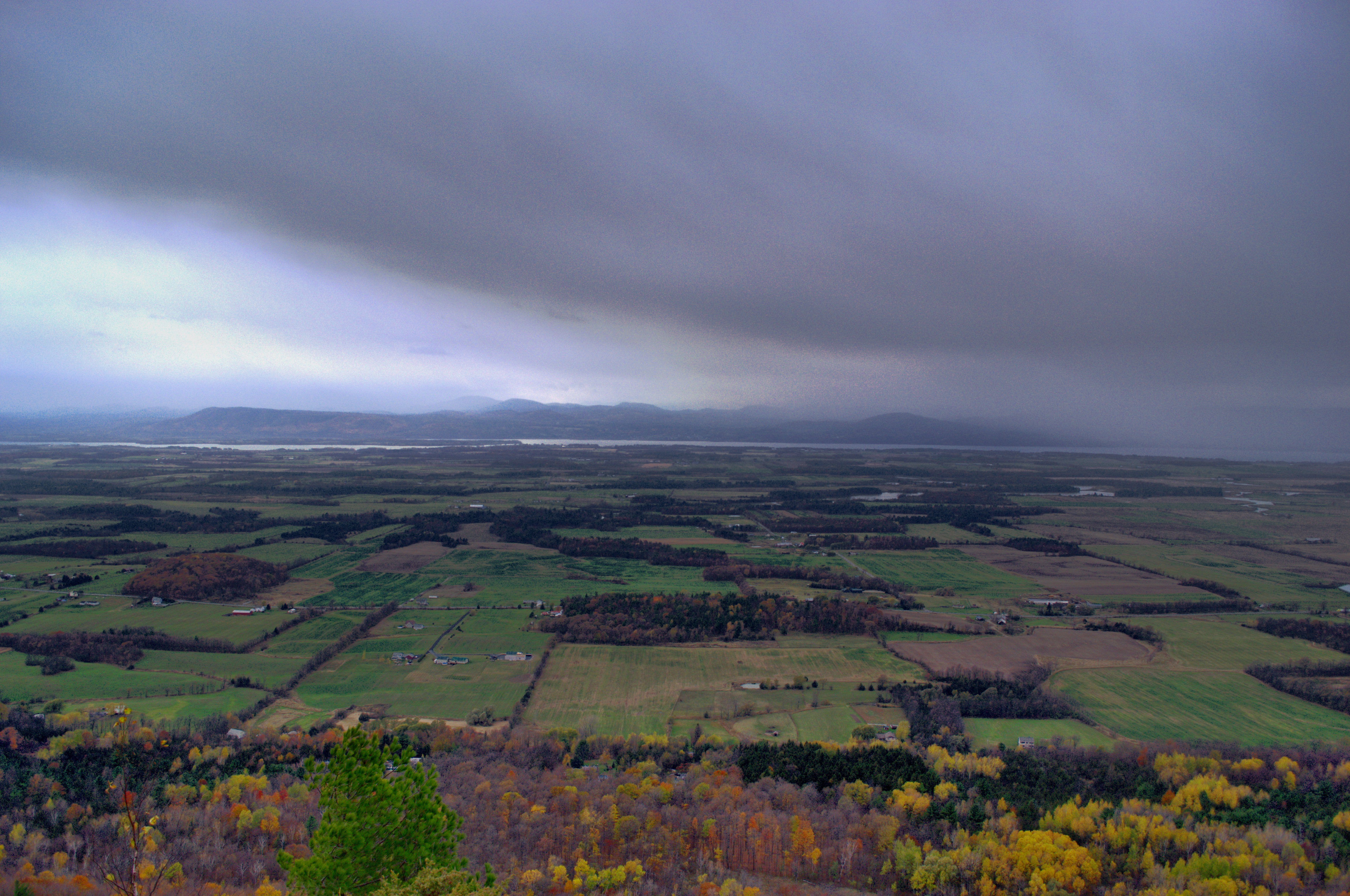
I stopped for a few gas station coffees and was rewarded with my early rise by wicked fog that obscured the landscape off route 7 in a glorious visceral veil that turned everything into mutated shadows. I caught some of it on my cell phone hanging around Dorset Peak, before it burned off.  

The weather lately has been prime for adventuring, and I’ve been aching to get out. This trip would give me that spark in my brains I was looking for. Feeding off my desire to visit as many obscure places as I can, I figured that two ghost towns in southern Vermont would be a great way to spend my day. These vanished places are probably some of the most obscure in the state. But everyone pays the price to feed, and I arrived back home exhausted and practically limping, so I suppose that can be gauged as one hell of an adventure. But I’m also someone who’d willingly drive 8 hours just to find an oddity, so a follow-up day of sluggish exhaustion was easily worth it for me.

Somerset

I’m willing to assume that plenty of Vermonters haven’t heard of Somerset. If you take a gander at a state atlas, it’s a narrow rectangle at the western edge of Windham County that nudges into eastern Bennington County – giving the latter county its block lettered “C” shape.

The entire burg is filled by the Green Mountain National Forest. It has a year-round population of 2 people and is only accessible by a forest service road that is all too easy to miss because of its small, squint-to-read street sign. But out of the two destinations I was planning on scouting, Somerset was the only one that was somewhat accessible by vehicle, so we started out with that one. I was still sipping my coffee which was getting unsatisfyingly cold, trying to shake off a road trip thematic Tom Waits song beating around in my head.

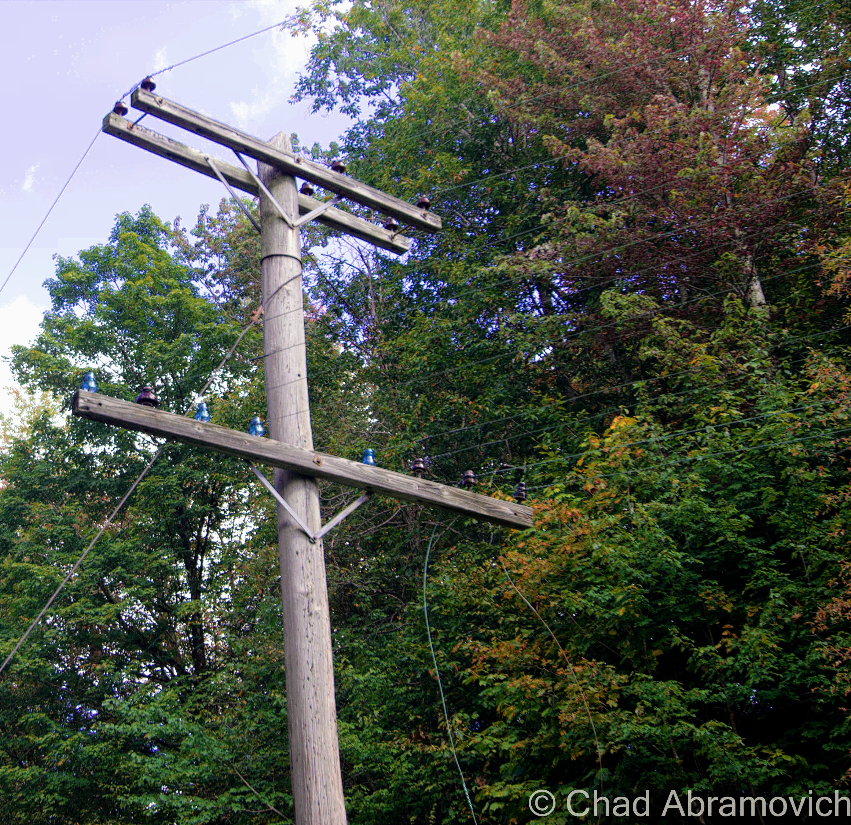
Somerset Road sort of plunges immediately down an embankment right off The Molly Stark Byway in woodsy Searsburg, and almost as quickly, turns to washboarded gravel after passing a few houses with scores of signs telling you that they’re not into people trespassing on their land. The increasingly destitute road now follows the Deerfield River and is thick with trees. We noticed that some older power lines had still been strung up along the road, and ran the length of the Searsburg portion. But it was evident these lines were archaic predecessors of modern day utility infrastructure. Some of the poles were leaning pretty horizontally as we got further down the road, and that’s when we noticed that they had glass insulators still on their lower rungs, now defunct as the power company had long clipped those wires and modernized things a bit a few feet higher up. Glass insulators were developed in the 1850s originally for telegraph wires, but were later utilized for initiative telephone wires and electric power lines, until the 1960s when they began to be phased out and simultaneously became a feature of interest.

I thought it was pretty cool to see them, and that there are still more or less untouched Vermont back roads that still exist. Older relics like these are becoming increasingly hard to find nowadays. And, apparently, there is a collectors market, clubs and even shows dedicated to them. Anything can have fanfare it seems.

dsc_0623_pe
The Somerset Road as it winds through Searsburg.
The blue glass insulators are on the bottom rung, while the modernized installation sits on top.

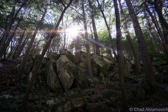
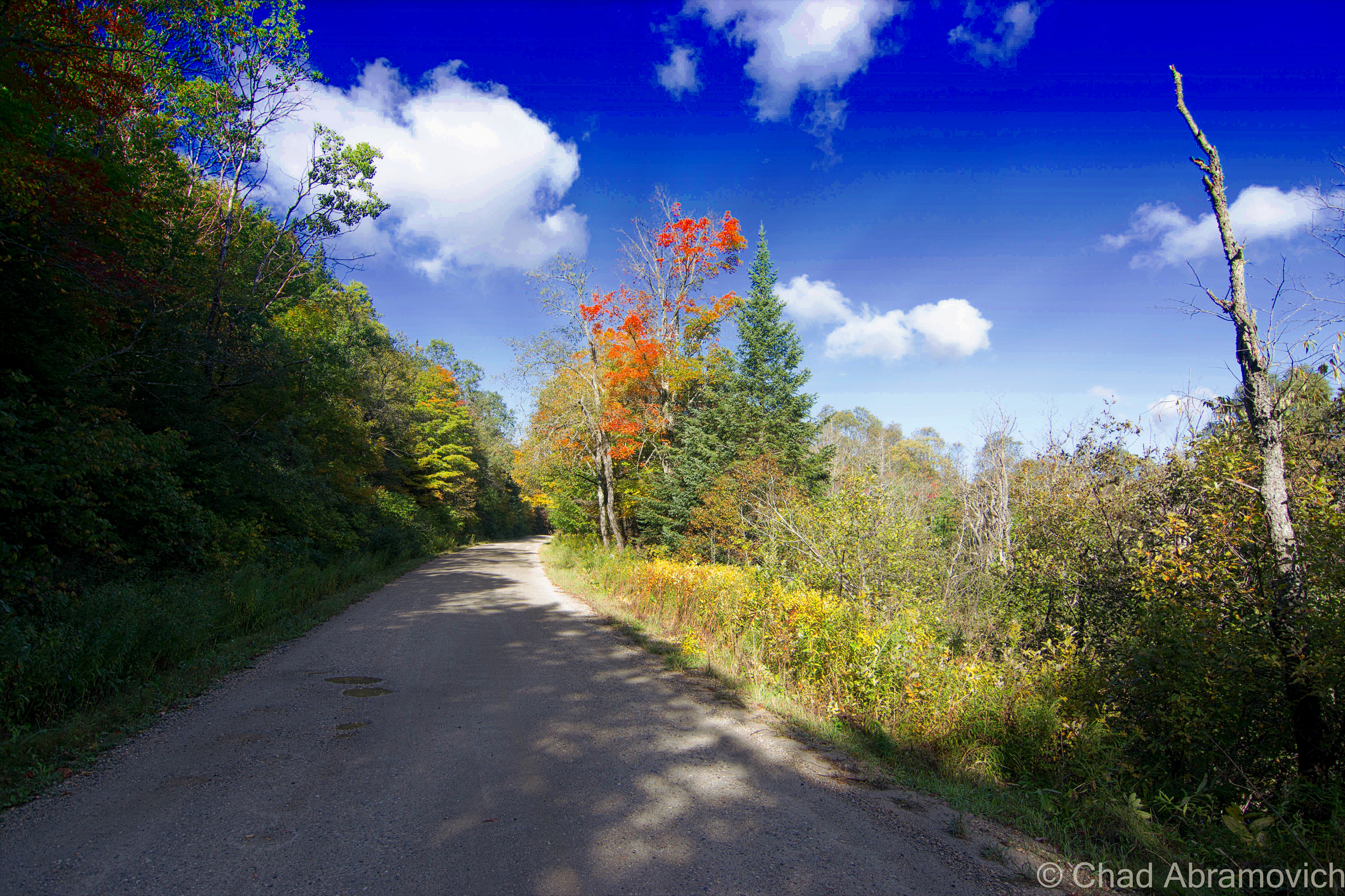
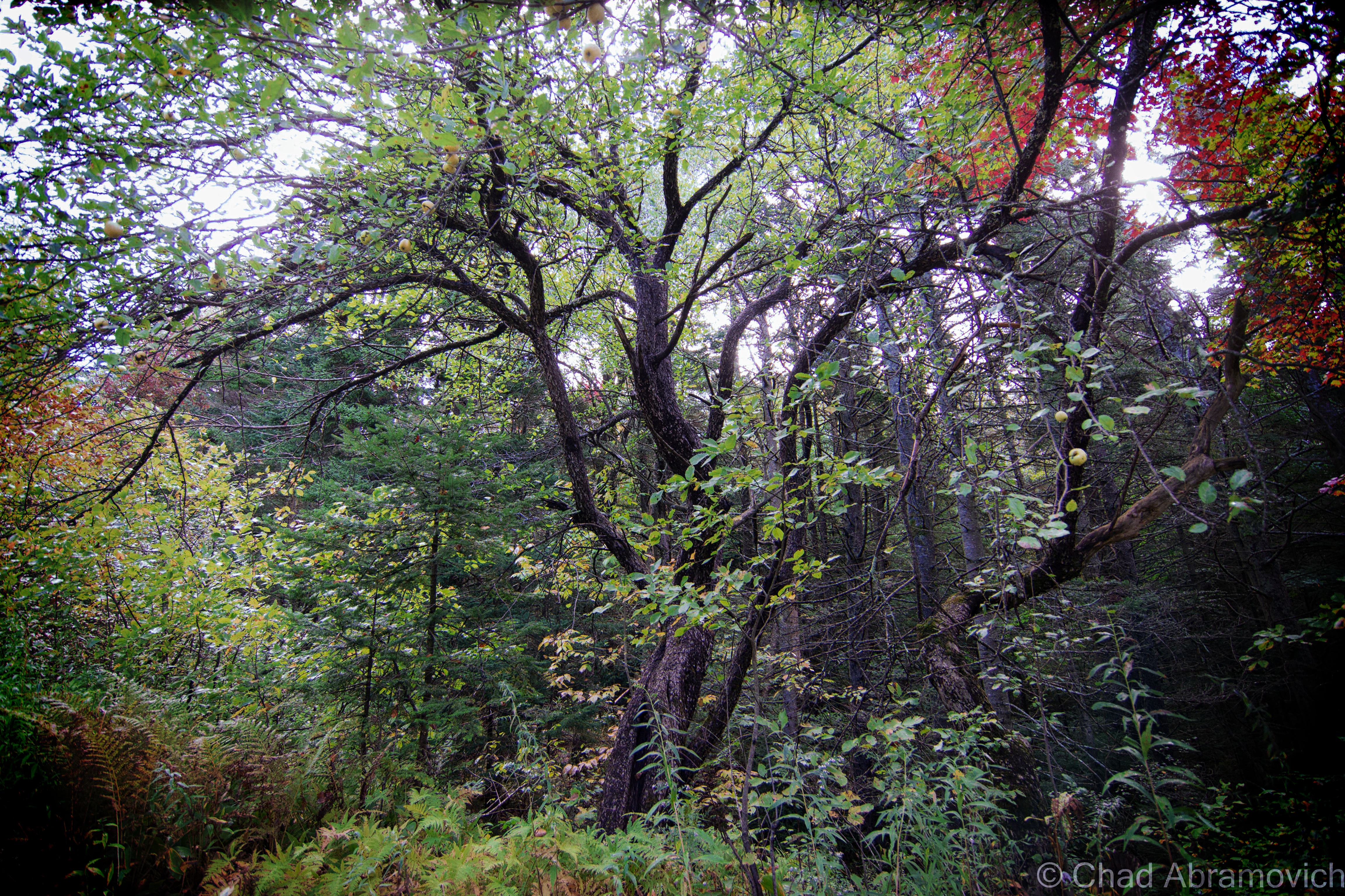
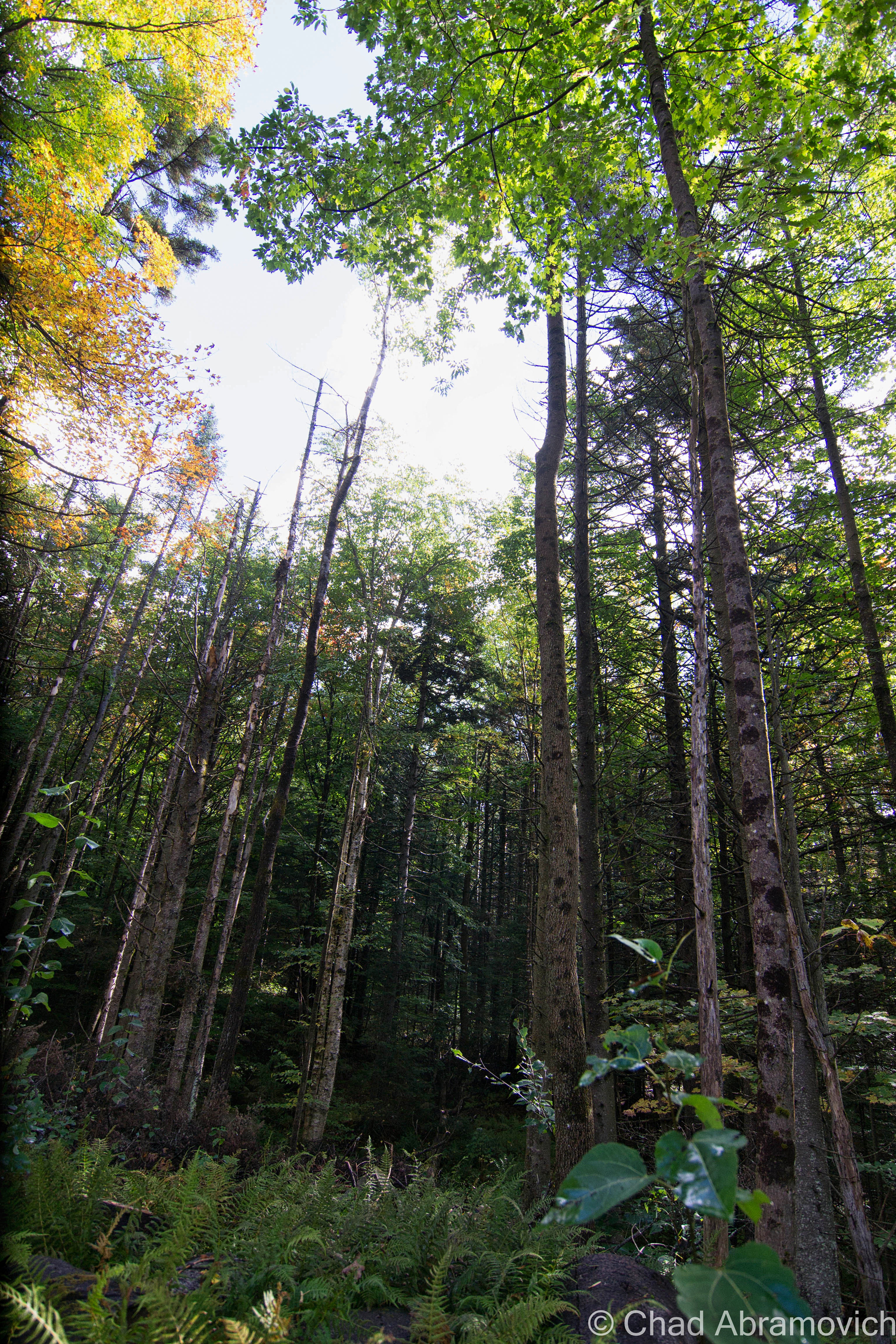
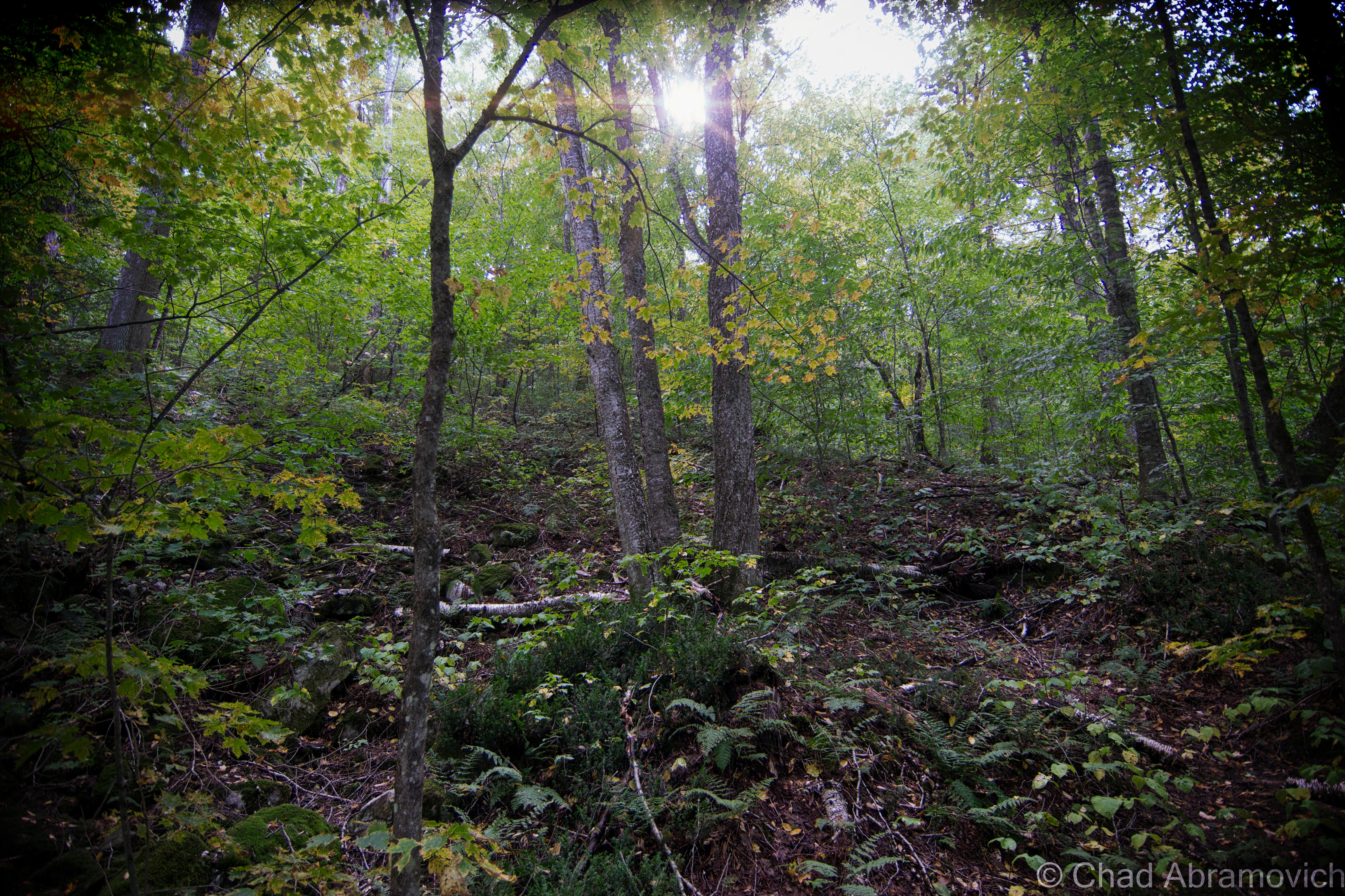
As soon as we hit the Somerset town line, which was marked by an omnipresently strange country icon of a bullet-perforated speed limit sign and an abrupt transition of bad gravel road to worse gravel road. The power lines stopped, and for the next several miles, we were deep in the type of woods where you really couldn’t see the forest through the trees, and they were all in the throes of their glorious descent into their perennial death.

There are really no places in Vermont like Somerset. Though there are 2 census documented year-round denizens, the amount of people gets to about 24-ish during the summer months – they’re all people who have camps there. In a 2011 interview done by WCAX, one of two Somersetians, Don Gero, explained that people don’t stick around here. Both residents are bachelors, and he quipped that because Somerset has no electricity or phones, women don’t want to live there. “They can’t use their hair dryers or wash their clothes” he said. He’s also not happy about the summer camping population, who are “two dozen too many” for his tastes, and paeaned for the good ol’ days when I guess none of them were there. Often, the current culture of these odd places is more interesting than the past events that created them.

Charted by Benning Wentworth back when Vermont wasn’t Vermont and its land was quarreled over by New York and New Hampshire, the New Hampshire governor and businessman (in no particular order) just drew a whole bunch of lines on a map and granted towns without knowing anything of the area’s geography. The most important thing was that New York couldn’t get their hands on any of the land, so he didn’t concern himself with pesky things like that. Vermonters decided they preferred anarchy, and would later orgonize an independent republic in 1777 with our own currency and postal service, and then, the 14th state in 1791 when we tried on our current name. 

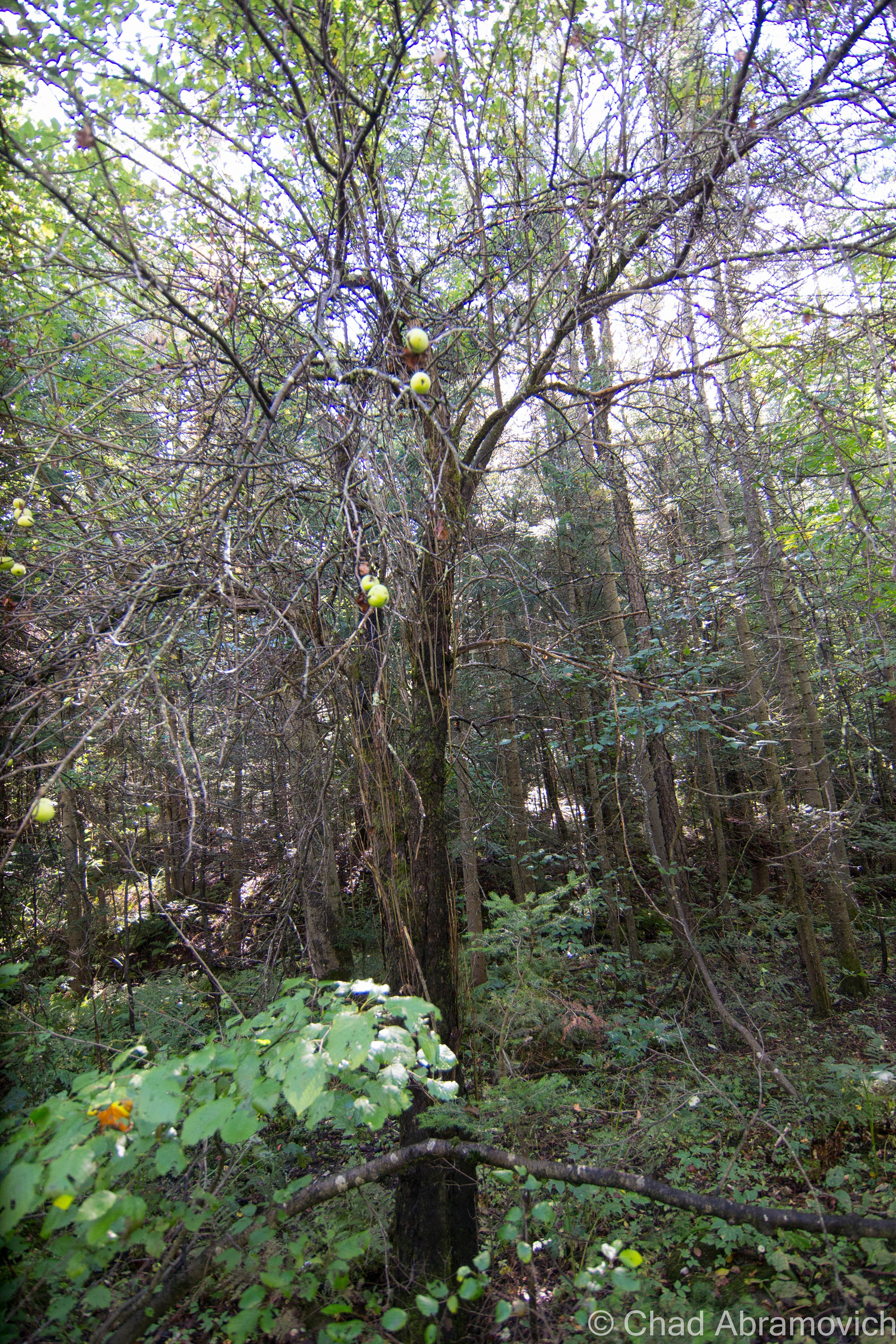
Somerset is all mountains, far away from anything and hard to get to. Despite that it wasn’t great real estate to early settlers, 321 people tried to live here in the town’s 1880s apex. Logging was the only way to make a few bucks, so they deforested all of the area mountains. They attempted to have log drives down the Deerfield River, except for when it was low, which it was, a lot. 

The demand for timber was ravenous, and that convinced a railroad line to lay tracks up to the mills, which were a huge boon to the town, but also helped speed up its death. A town depending on a finite resource comes and goes like fads always do, and most of the trees in the area were hacked down, the inevitable consequence was that both the logging industry and the town became a literal washout. 

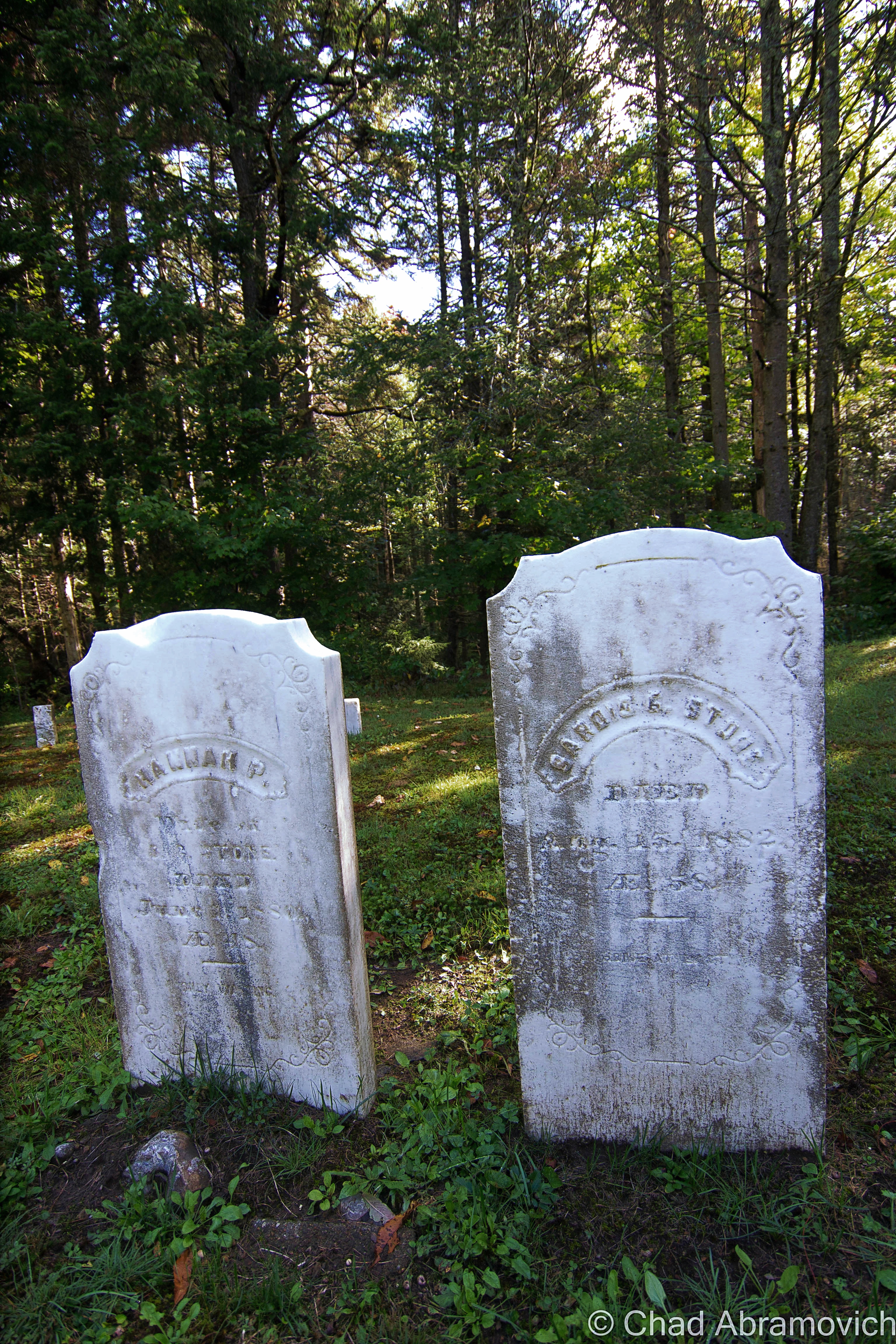
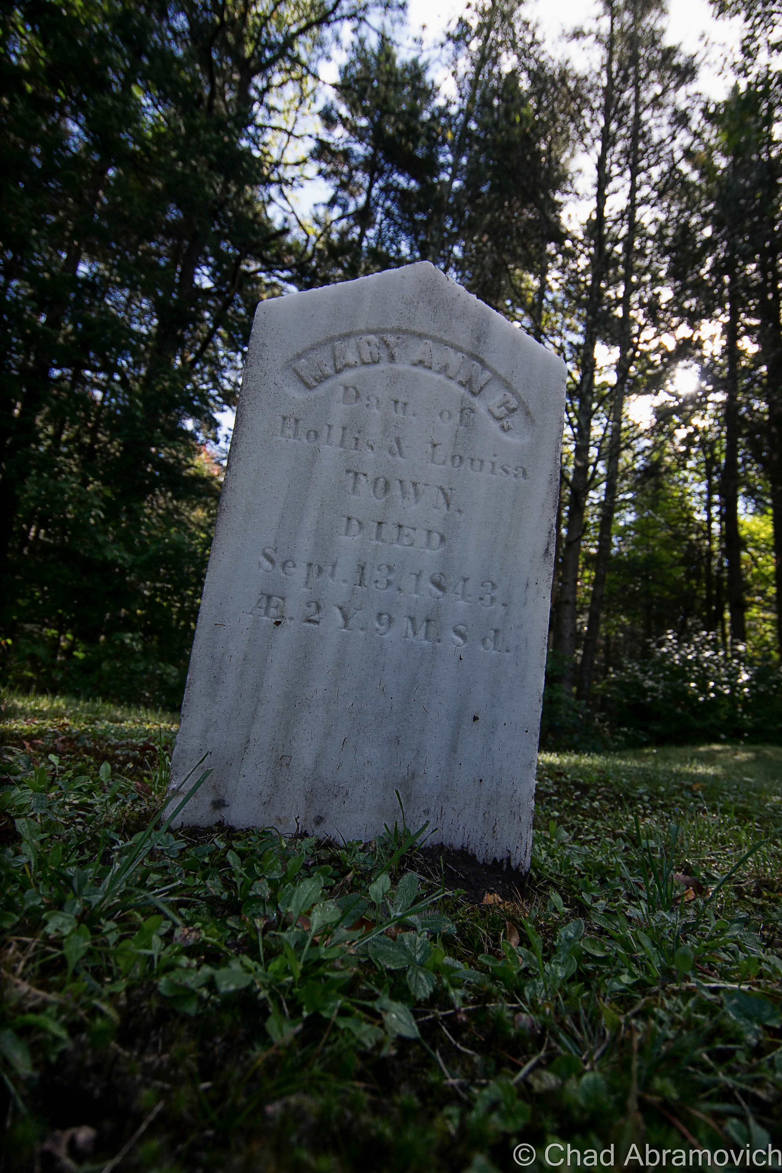
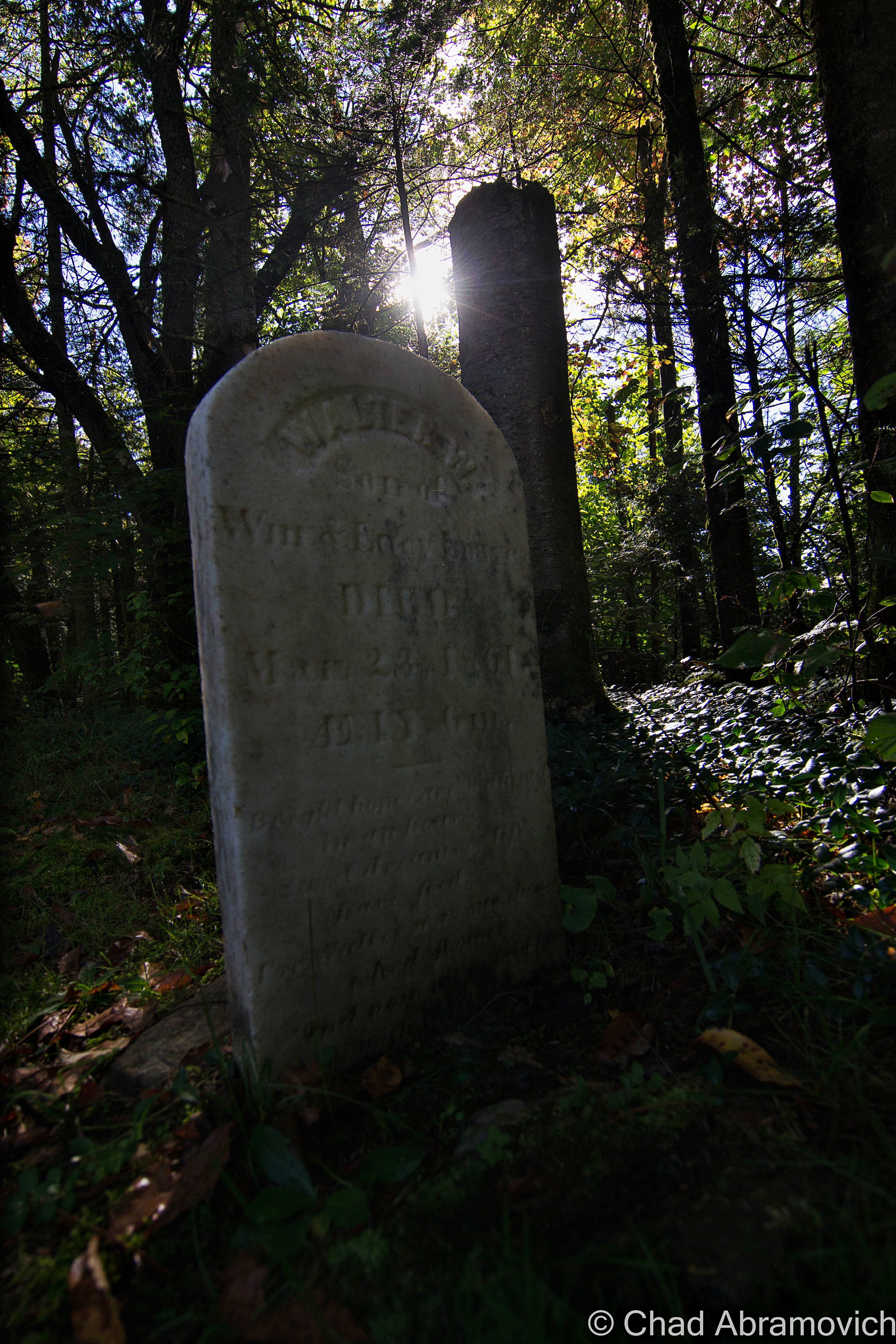
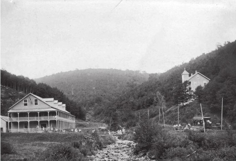
The town’s last hurrah was when the Deerfield River valley was eyed for a future facing wonder like hydropower and the cash it could bring. In 1911, the Somerset Dam began to take form. The dam was built by massive work crews of about 100 men in shifts, doing everything by hand and took about 3 years to complete. The reservoir did what reservoirs do best and collected the desired water, which submerged what was left of town and the railroad and the mills. 

At some point, there was an airfield in Somerset, which has also vanished. Today it’s a free and minimal amenitied national forest campground under the same name. According to campers who post reviews online, it’s either wonderfully remote or a place where amateur outdoors folk or “Massholes” go to belt loud music and litter. Given my experience at campgrounds, I’d say it’s probably both.

I also found out, which isn’t detrimental to your life if you don’t know, that you can take class D forest roads from Somerset all the way north to the Kelly Stand Road – a west-east oriented forest road that’s also one of Southern Vermont’s most scenic. If you enjoy shunpiking, finding more of these back road byways to explore is usually not a bad thing.

dsc_0554_pe
The Somerset Road in Somerset.
dsc_0563_pe
A small and mowed cemetery surprisingly pops out of miles of wilderness as you travel up the forest road. Many of the weathered and matching headstones were kids. One sad entombment was uniquely chiseled with a sheep on top, and quickly caught my wondering eyes. Lancelot was 3 years old. Life up here was tough, especially for kids.

dsc_0566_pe dsc_0567_pe dsc_0569_pe dsc_0570_pe

The further away from civilization we drove, the more apple trees started to distinguish appear from the northern forests. These apples trees appeared somewhat old, some of them were haunted by the thick woods and lack of sunlight needed to grow. Others still carried apple crops of various qualities, apple strands that are heirloom seeds, and are not commercially available anymore in an increasingly controlled GMO market, leaving these trees to one by one drift away or die off.
The further away from civilization we drove, the more apple trees started to distinguishly appear from the northern forests. I’m not sure how old some of these trees were, and if they were original to former Somerset residents, or planted after the national forest took over. These apple trees appeared somewhat haunted by the thick woods and lack of sunlight needed to grow. Others still carried apple crops which varied in how rotten they were. These apple strands that are heirloom seeds, and are not commercially available anymore in an increasingly lack of choice based GMO market, leaving these trees to one by one die off.
dsc_0586_pe
A brown and white national forest sign explained at the trees that were still able to produce apples were part of an “apples for wildlife program”,which is pretty self-explanatory.
dsc_0582_pe
I could have hung out in Somerset all day, it was just so beautiful and almost intimidatingly wild. All I’d need is a few Vermont microbrews to accompany me. This little brook paralleled the forest road, but I wouldn’t have found it if I didn’t stop to spark my interest in an old apple orchard.
dsc_0591_pe
Only 3 things remain of Somerset’s days as a town – one of them being its restored but locked one-room schoolhouse, also found a ways up the forest road. I heard it was a private camp, but not positive about those details. I’d love to see the inside. Or to live in a restored one-room schoolhouse.
dsc_0601_pe
The forests of Somerset. Are any of my blog followers into Geocaching like me? Somerset may be remote, but the area is loaded with caches!

dsc_0594_pe dsc_0598_pe dsc_0604_pe

The Somerset Reservoir is where the Somerset Road comes to an end, and in my humble opinion, one of the more stunning places in Vermont. The sinuous and currently blustery cold water body is about 5-6 miles long and undeveloped. The dam's roadside appearance is really just a high grassy wall with a nearby unmanned rickety tin shack that has a TransCanada logo sign plate on it. But atop the dam is this awesome view of one of Vermont's largest wilderness areas. I really wish I had brought a kayak or something. Seriously, places like this are therapy to me. I couldn't contain my approval and swore a few times to prove it.
The Somerset Reservoir is where the Somerset Road comes to an end, and in my humble opinion, one of the more stunning places in Vermont. The sinuous and currently blustery cold water body is about 5-6 miles long and undeveloped. The long form of Stratton’s rounded mountain top could be seen in the distance . The dam’s roadside appearance is really just a high grassy wall with a nearby unmanned rickety tin shack that has a TransCanada logo sign plate on it. But atop the dam is this awesome view of one of Vermont’s largest wilderness areas. I really wish I had brought a kayak or something. Seriously, places like this are therapy to me. I couldn’t contain my approval and swore a few times to prove it.

Glastenbury

Vermont author Joseph Citro introduced Connecticut’s faded hamlet of Duddleytown (which was really only a place name in the town of Cornwall named after the trio of brothers who bought land there) as “the granddaddy of all New England window areas” in his book Passing Strange, which to me made a pretty good lead-in to that chapter (it was actually the last sentence in his chapter on Glastenbury). I’d like to term swipe that to introduce Glastenbury on a more localized level, as the granddaddy of Vermont’s lost areas, for multifarious justifications.

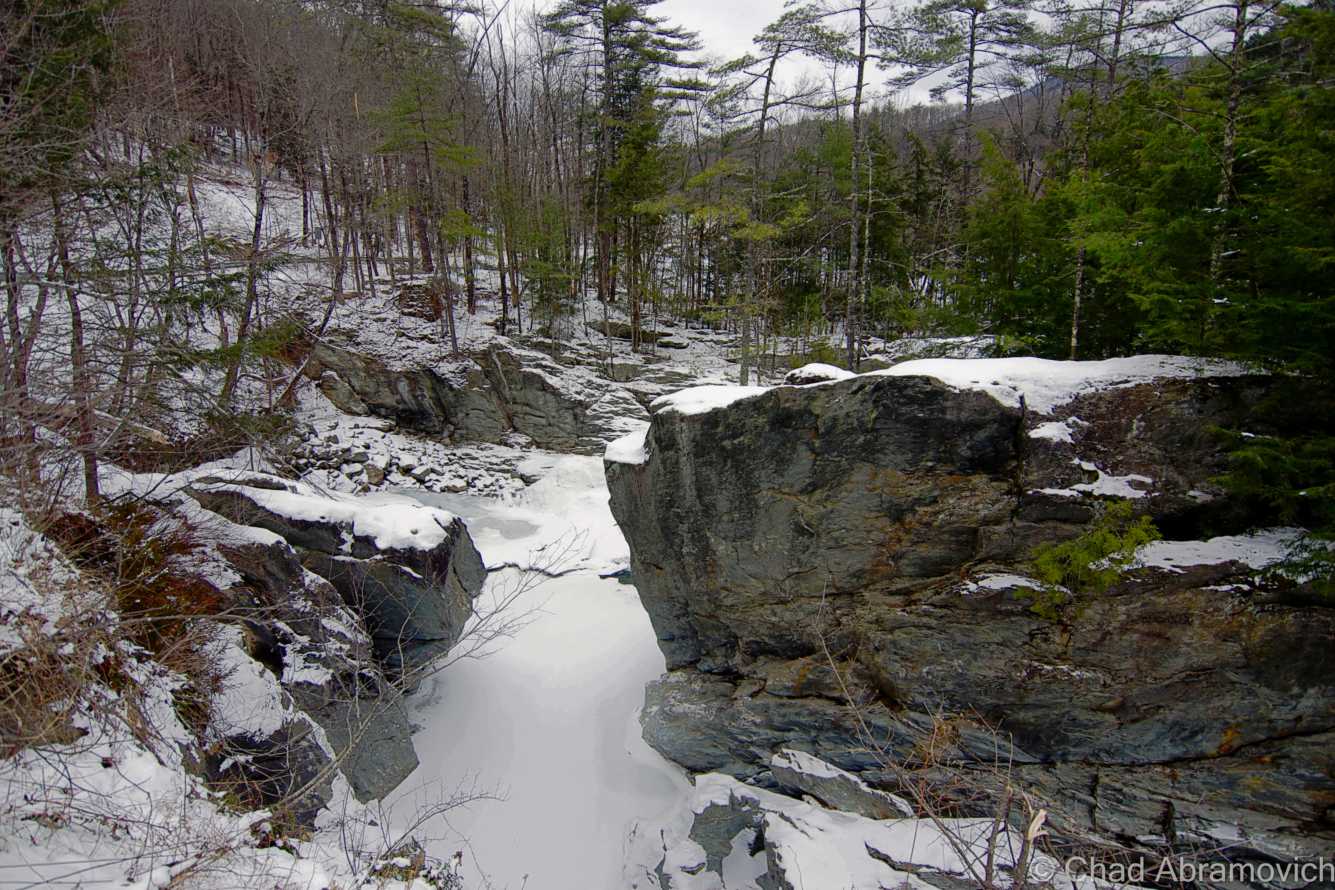
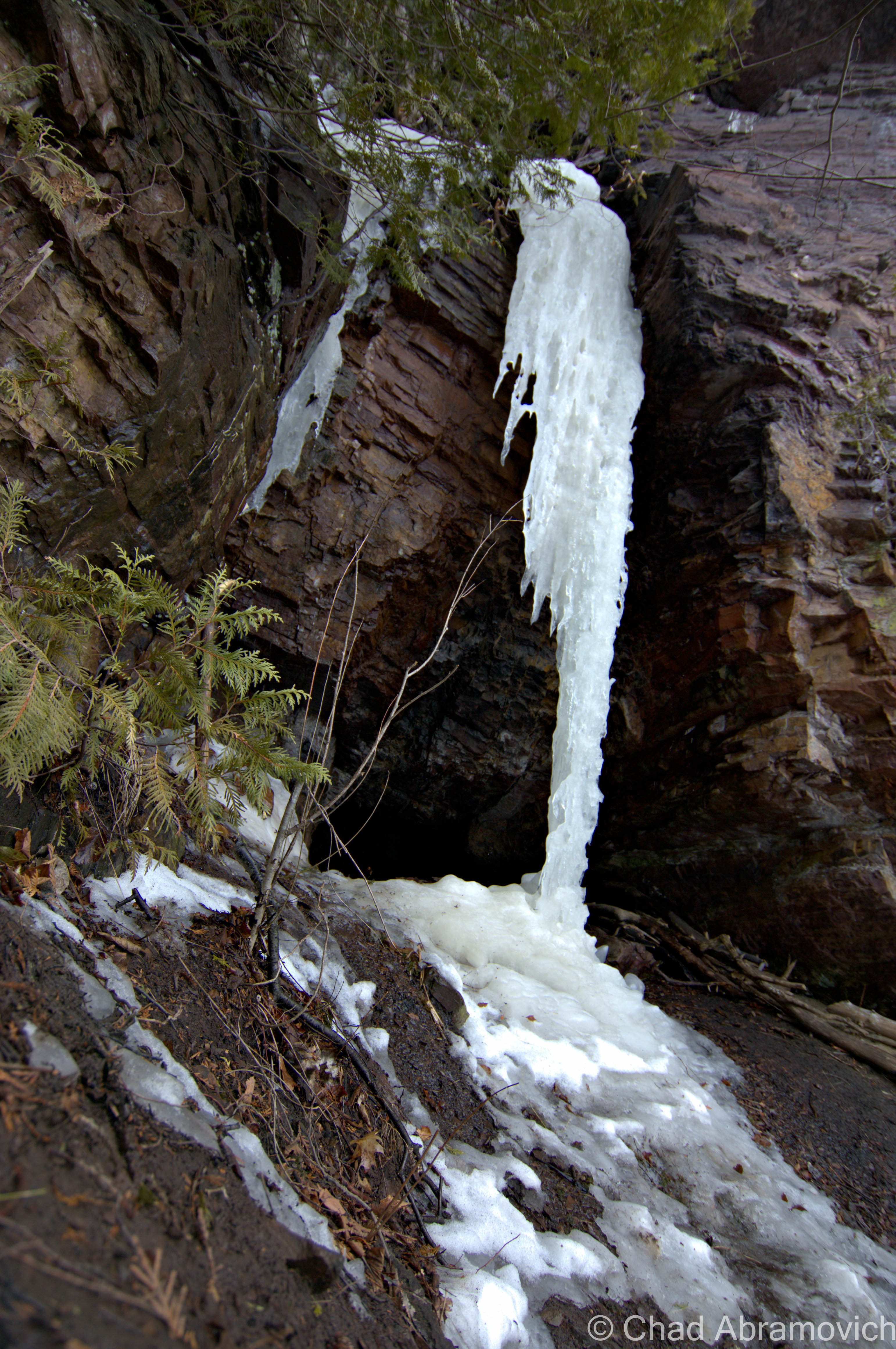
Getting to the ill-fated town is nothing short of a challenge today, and was for the people who tried to make a life for themselves up there over a century ago. It’s isolation, stubbornly built up in an area of 12 peaks over 3,000 feet with no convenient access, makes it one of the most unique places in the Green Mountain State, then and now.

If you’ve been following my blog, you might know that I’ve been very interested in Glastenbury since I was a kid, and wrote about it extensively, my long winded self trying to pack as much detail as I could into a blog post. This entry expands on that.

To summarize things; the vanished town of Glastenbury was charted in 1761, and reflected the circumstances of its neighbor Somerset when it was naively plotted over some of the worst topography in the state. As a consequence, it wasn’t really until the 1850s when anyone paid interest to the town, when people figured out they had an entire mountain of wood to deforest for profit, and a logging/charcoal duality became Glastenbury’s only industry.

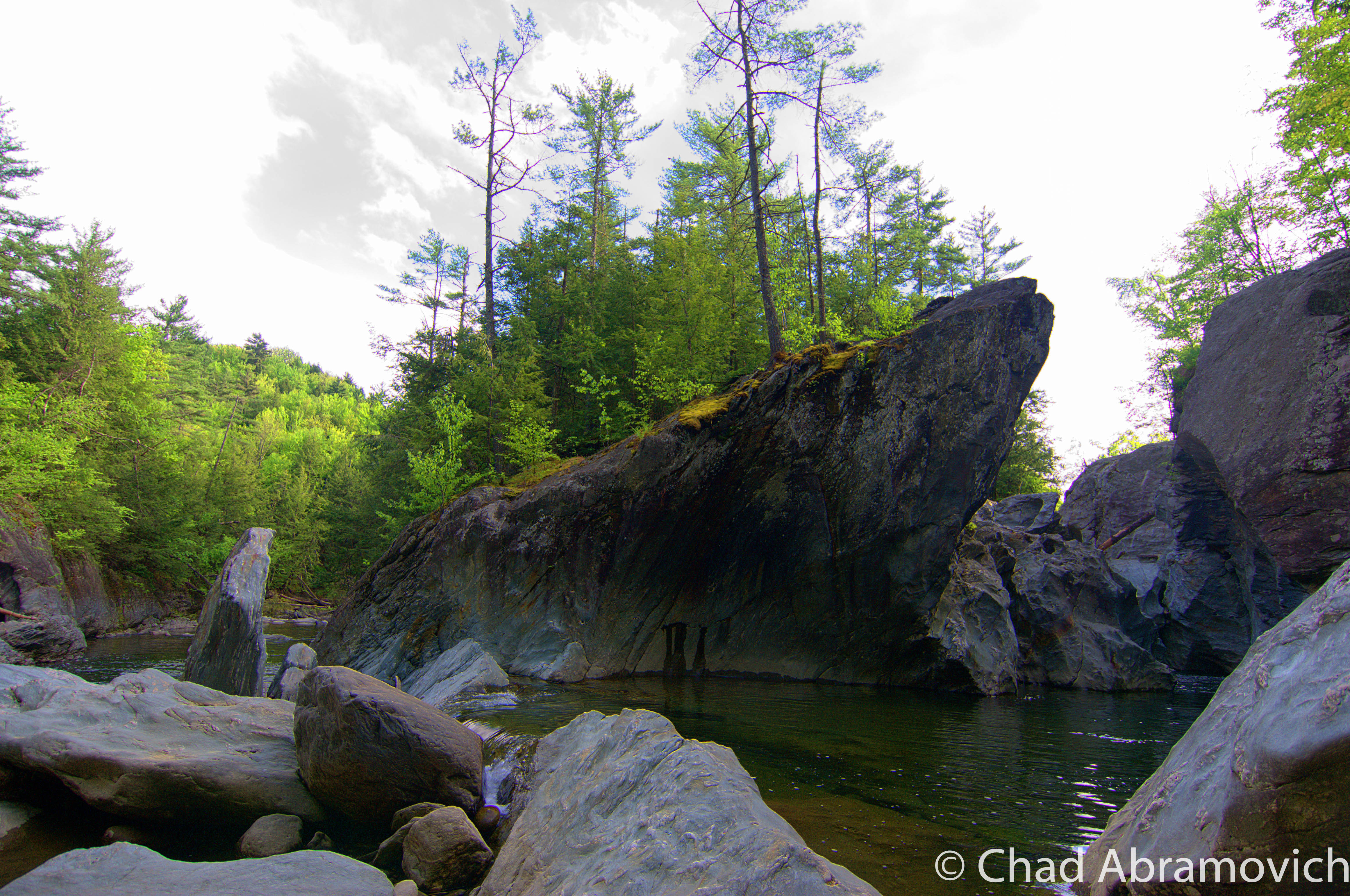
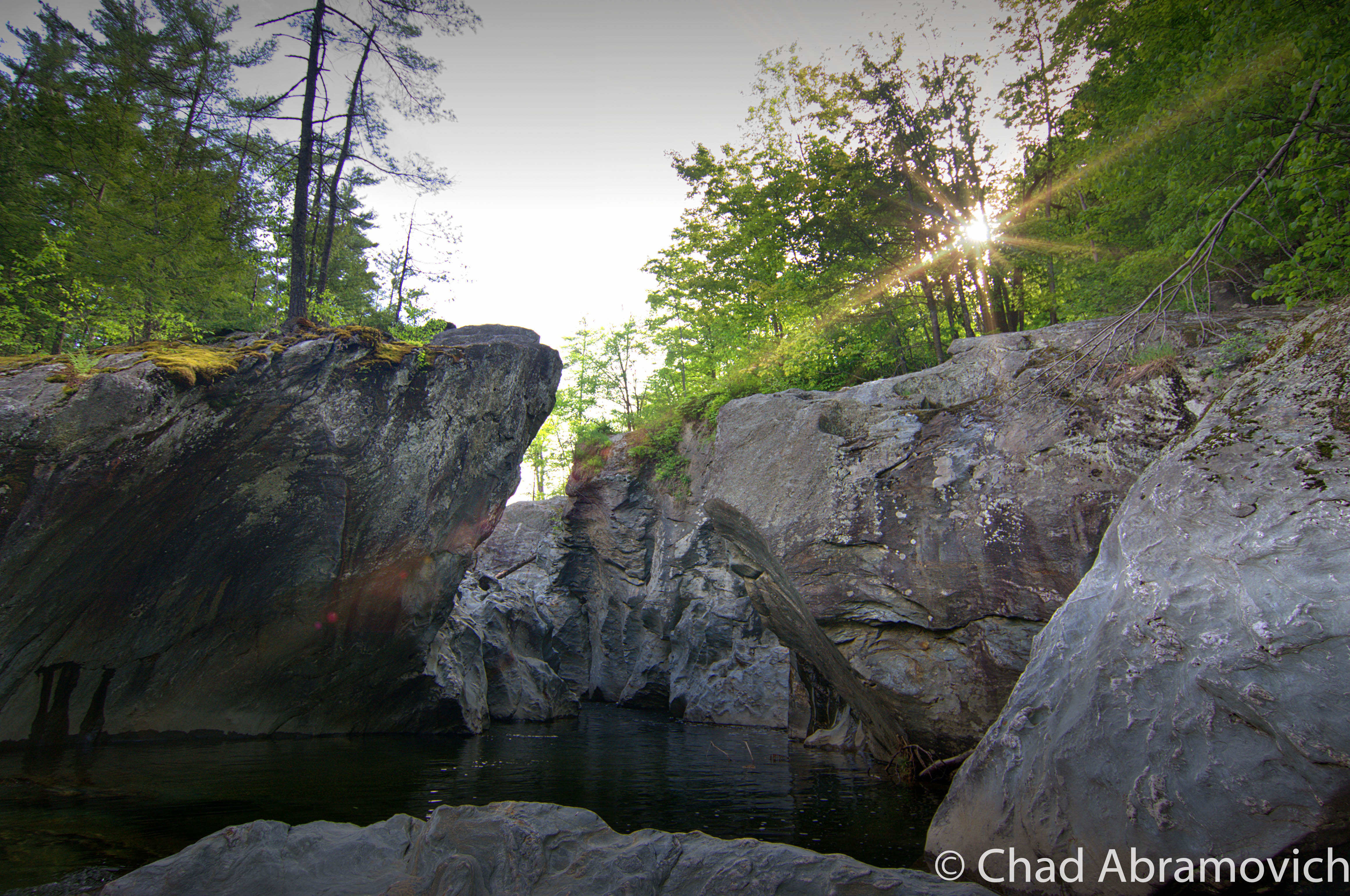
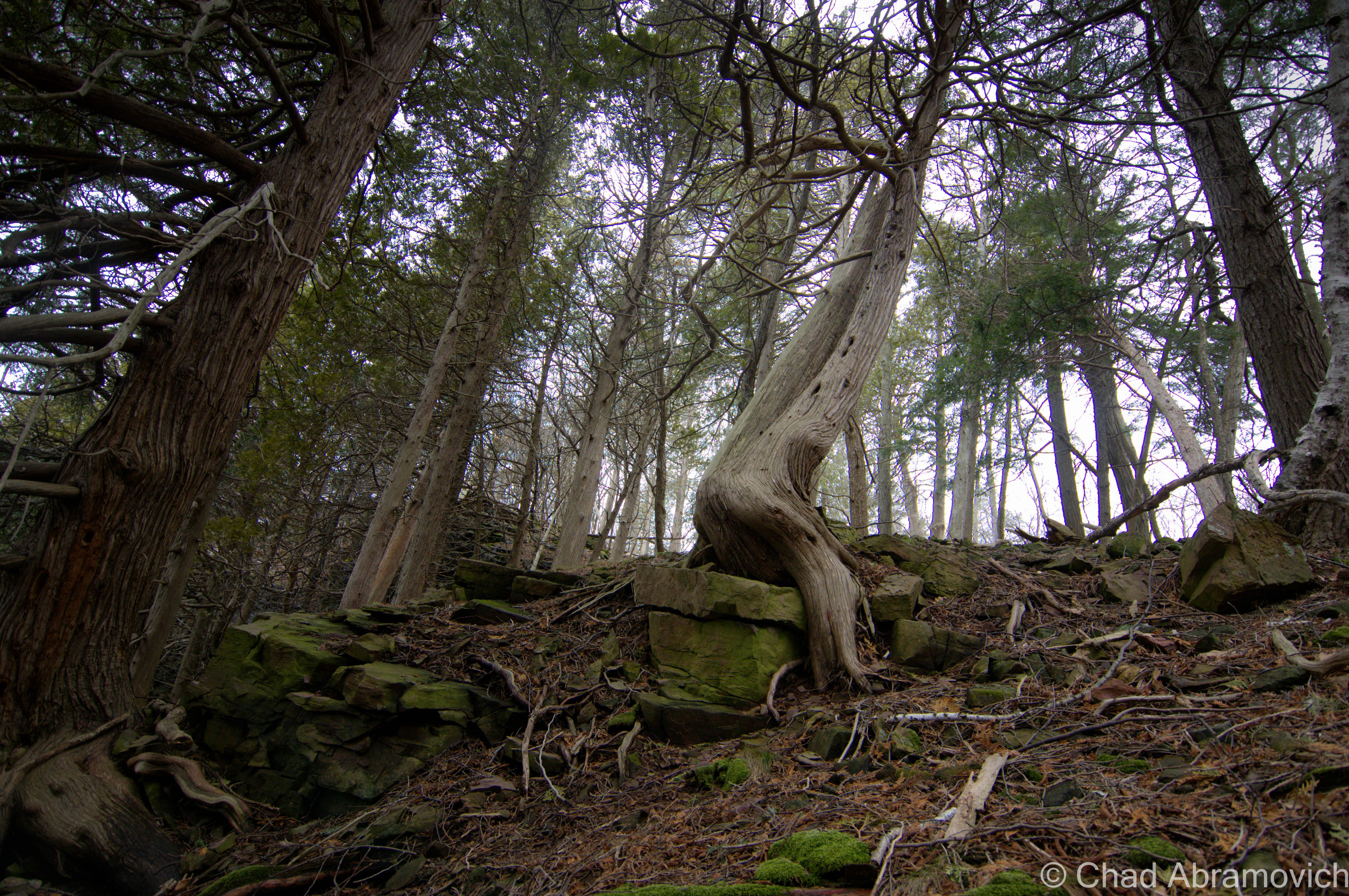
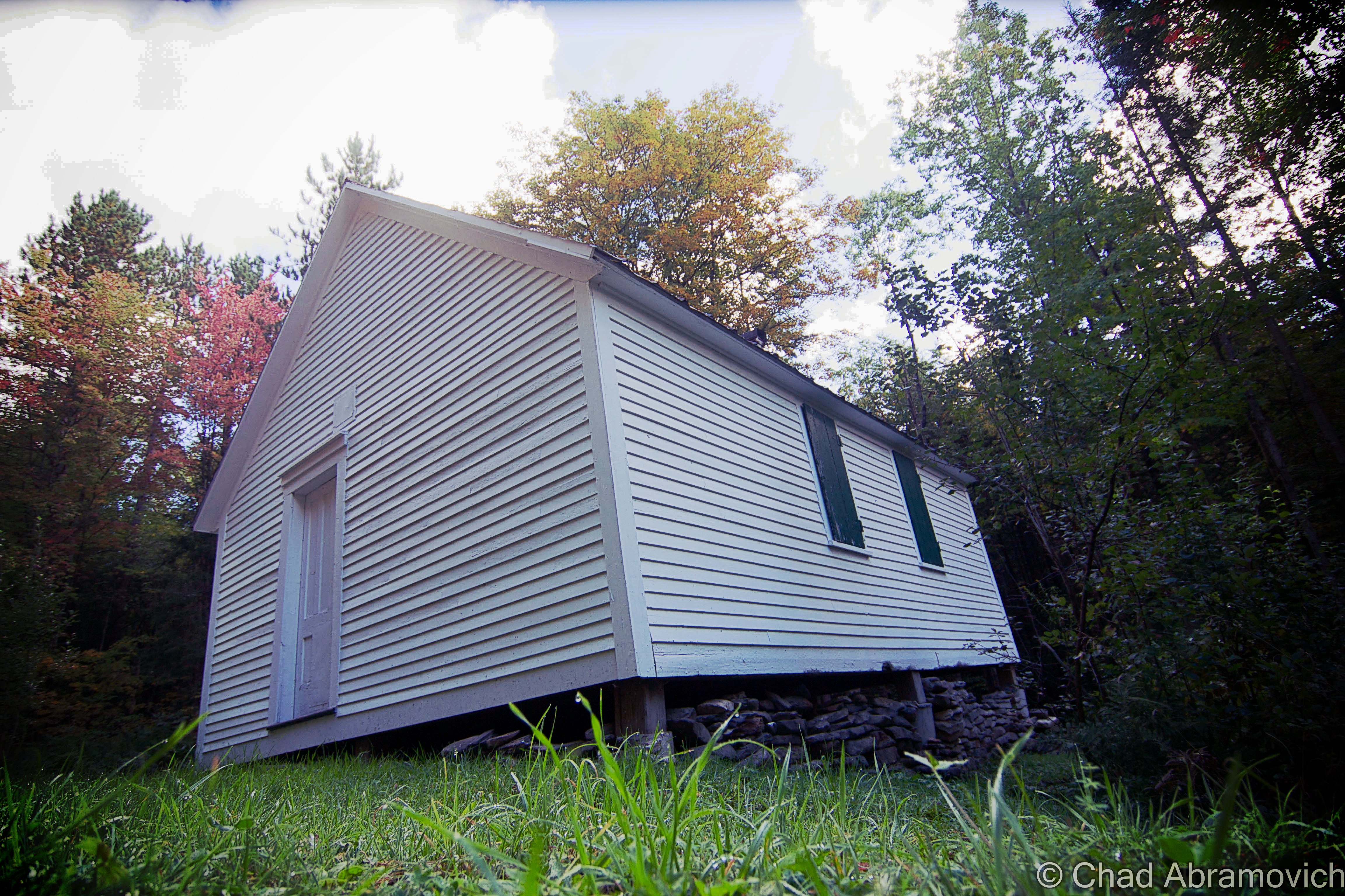
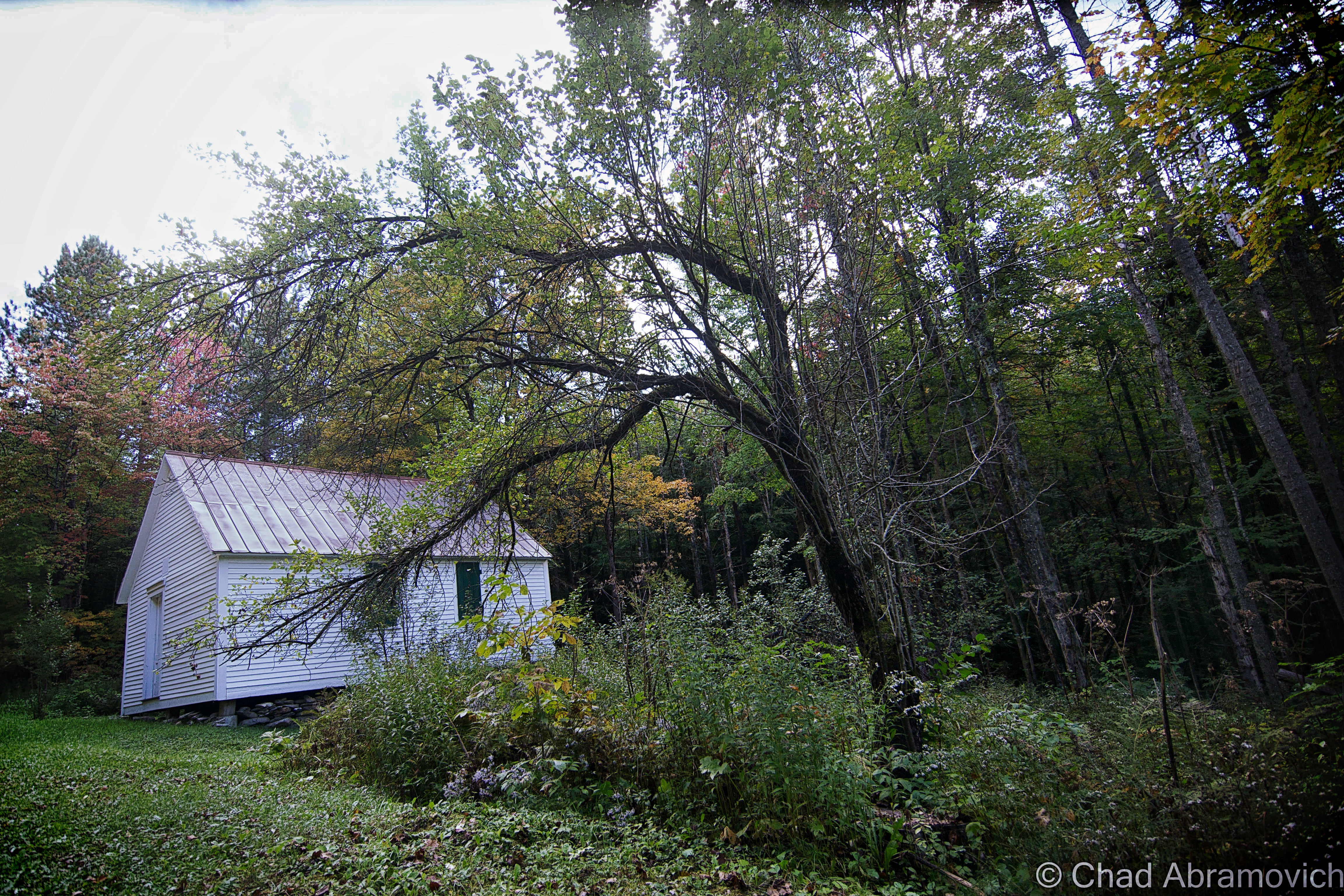
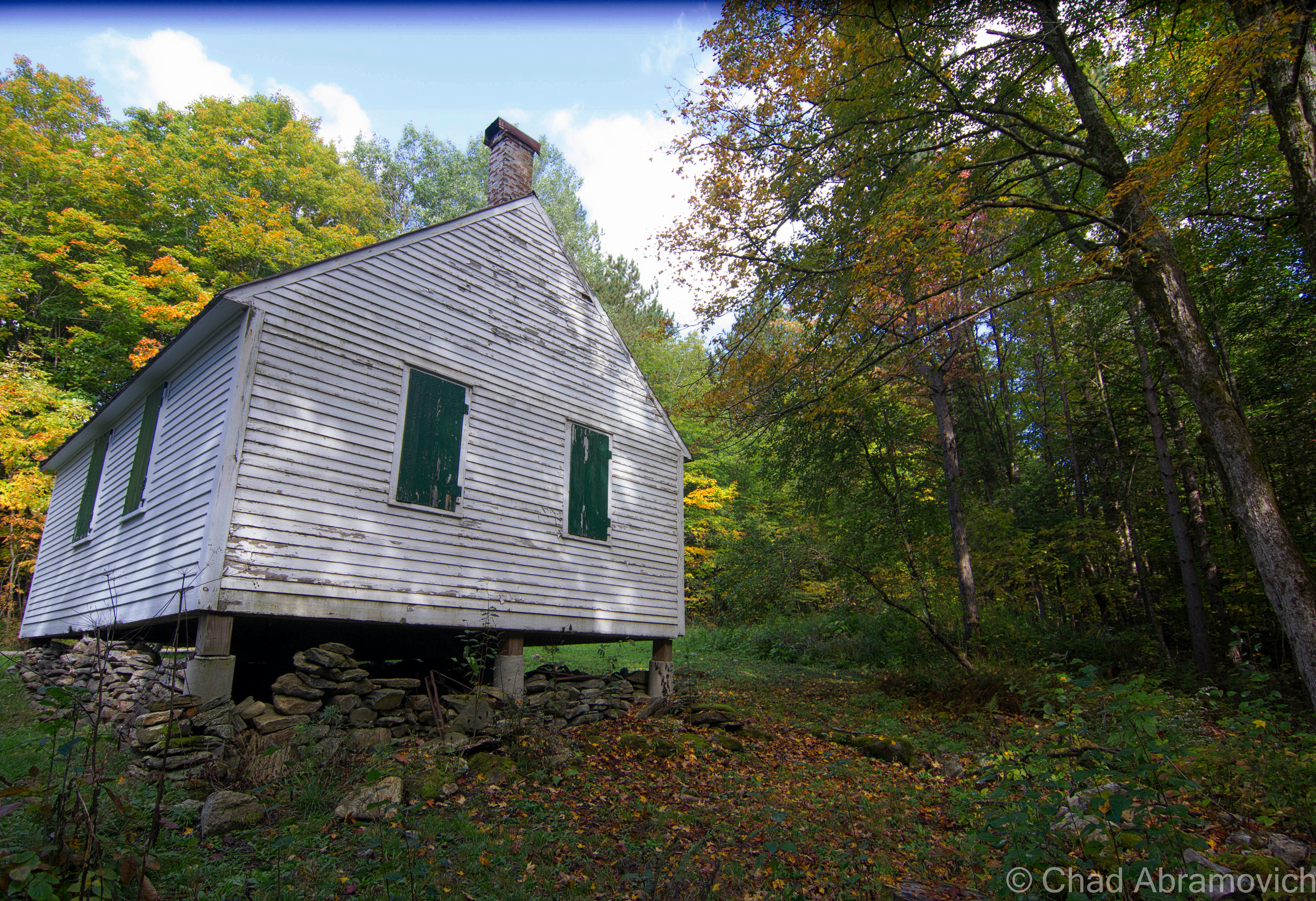
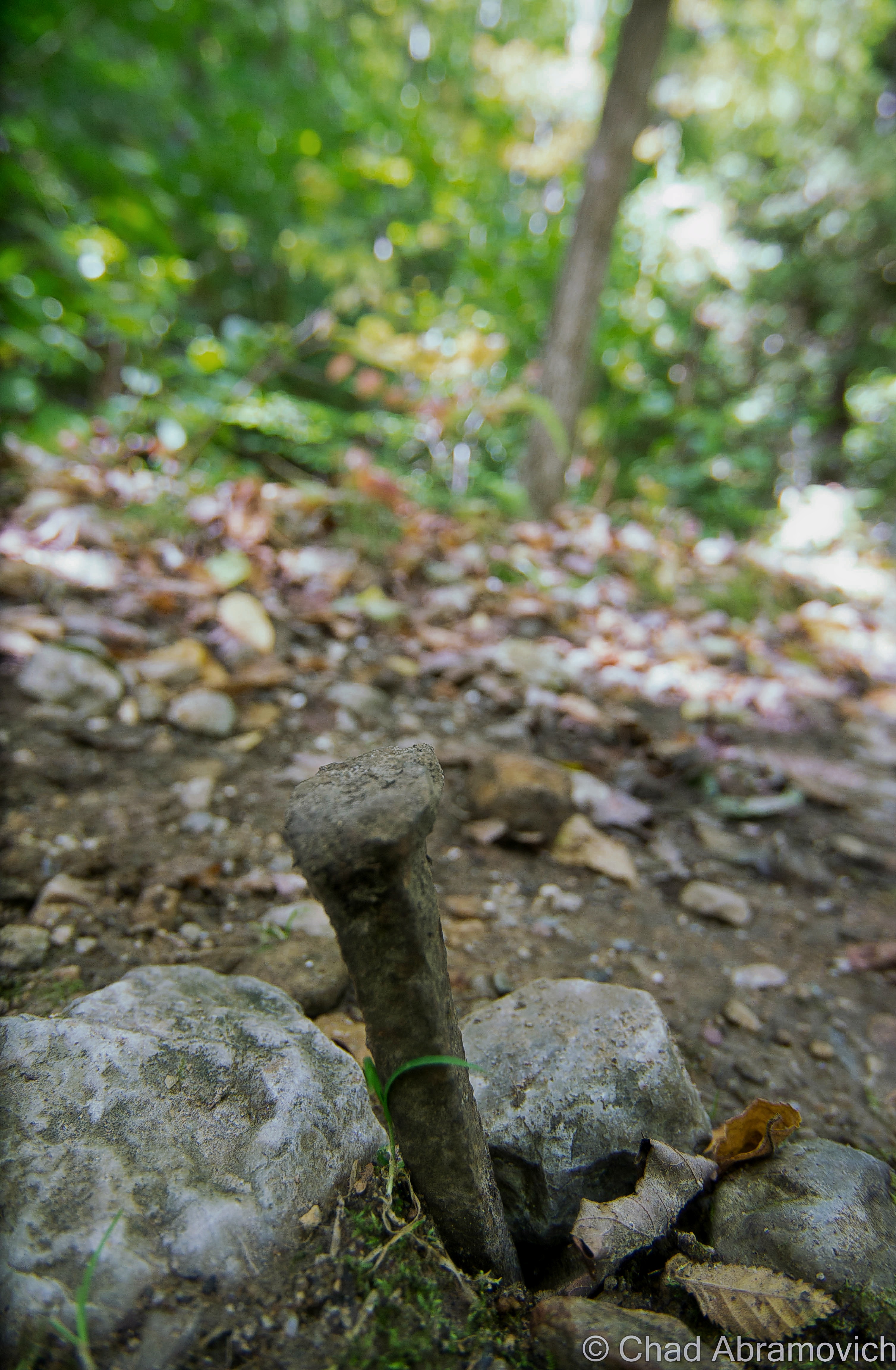
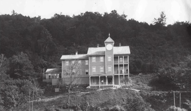
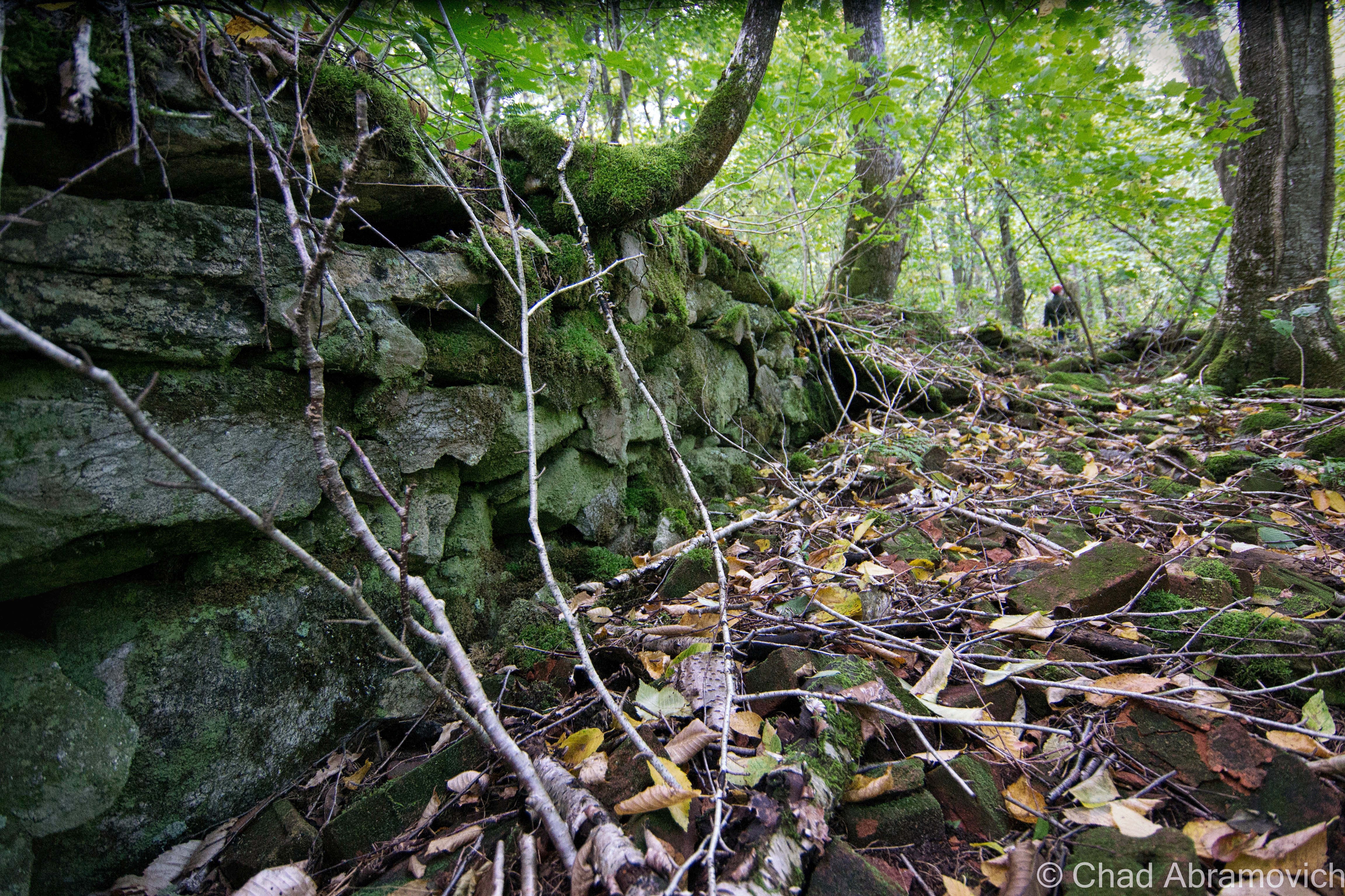
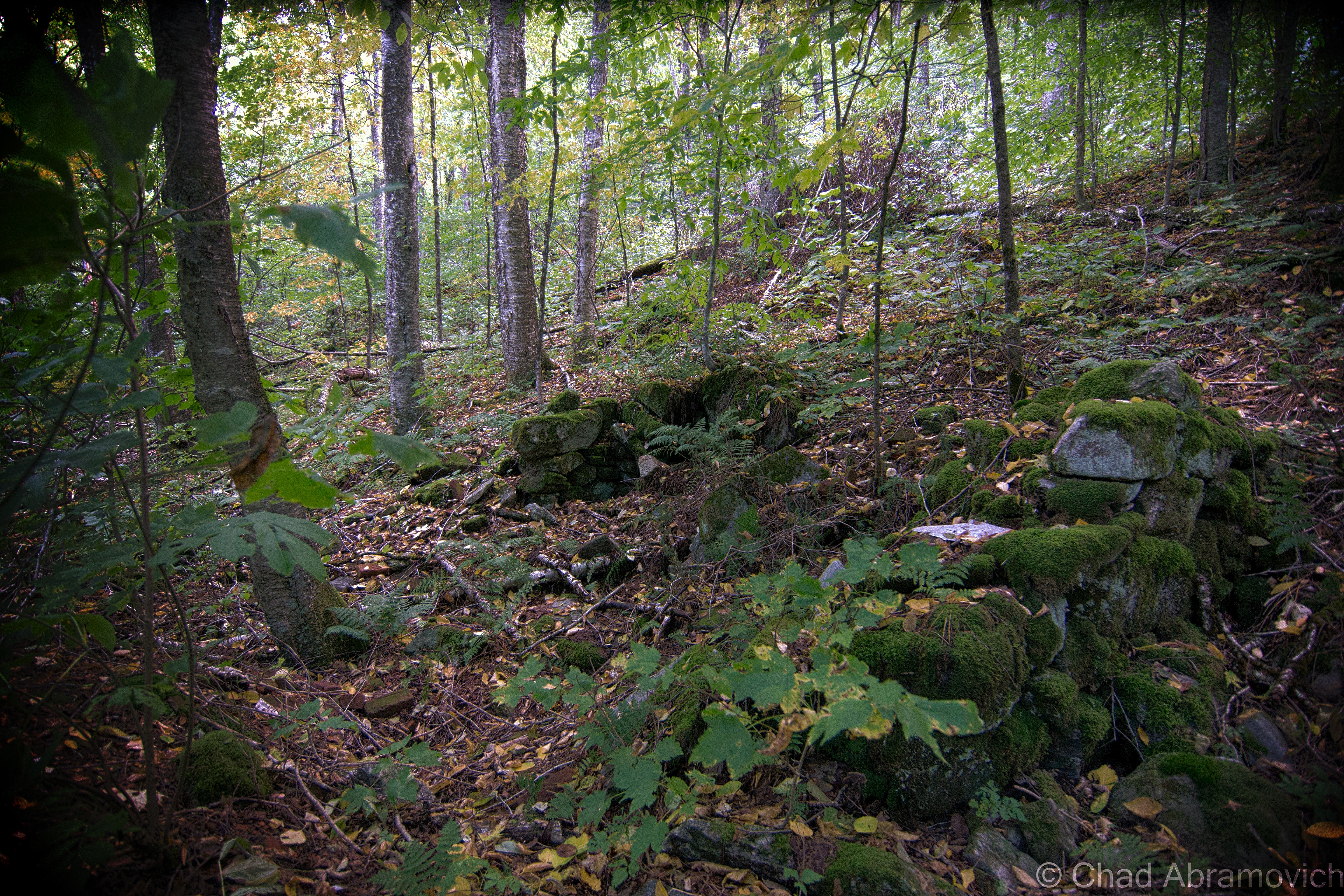
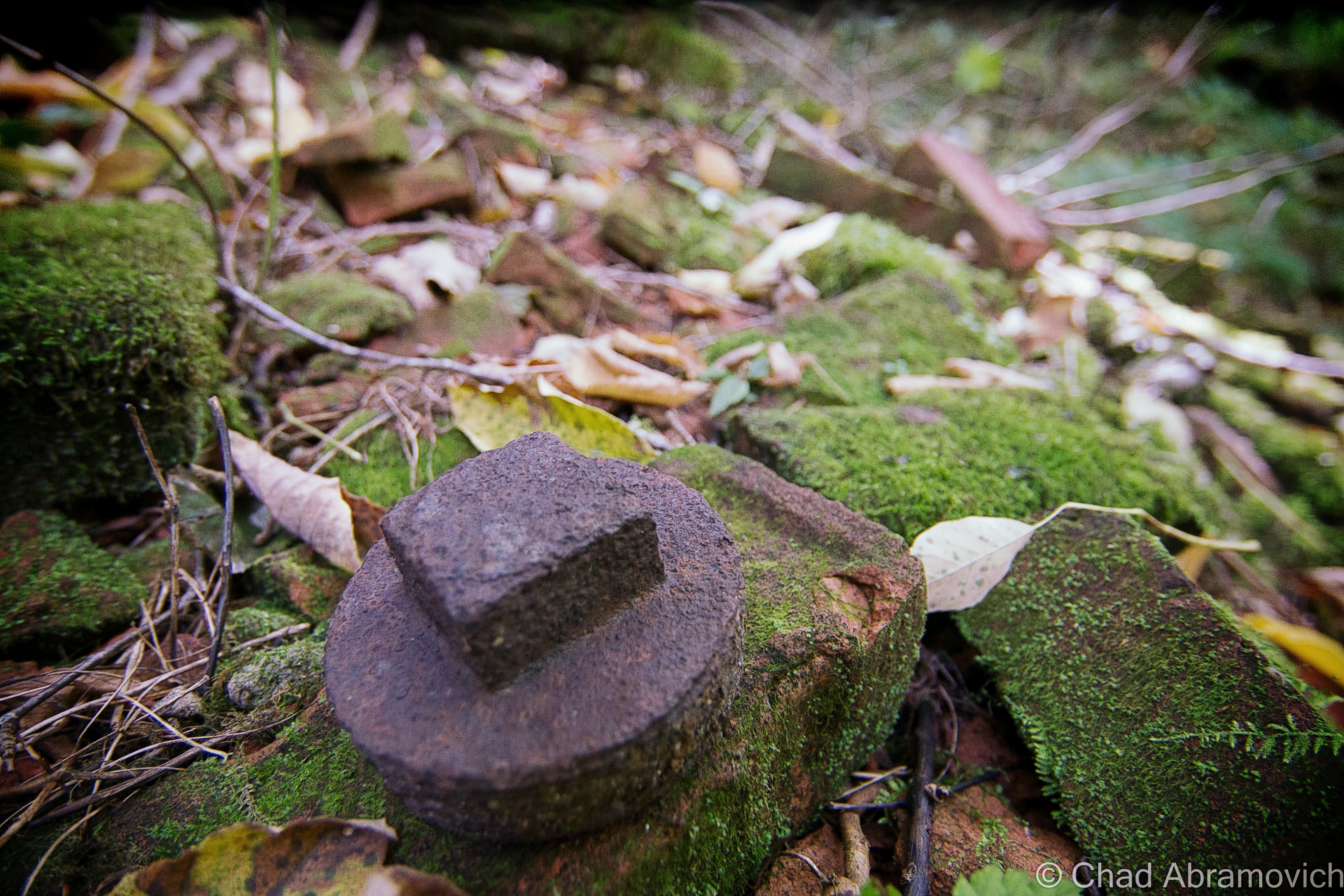
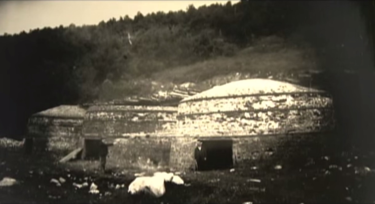
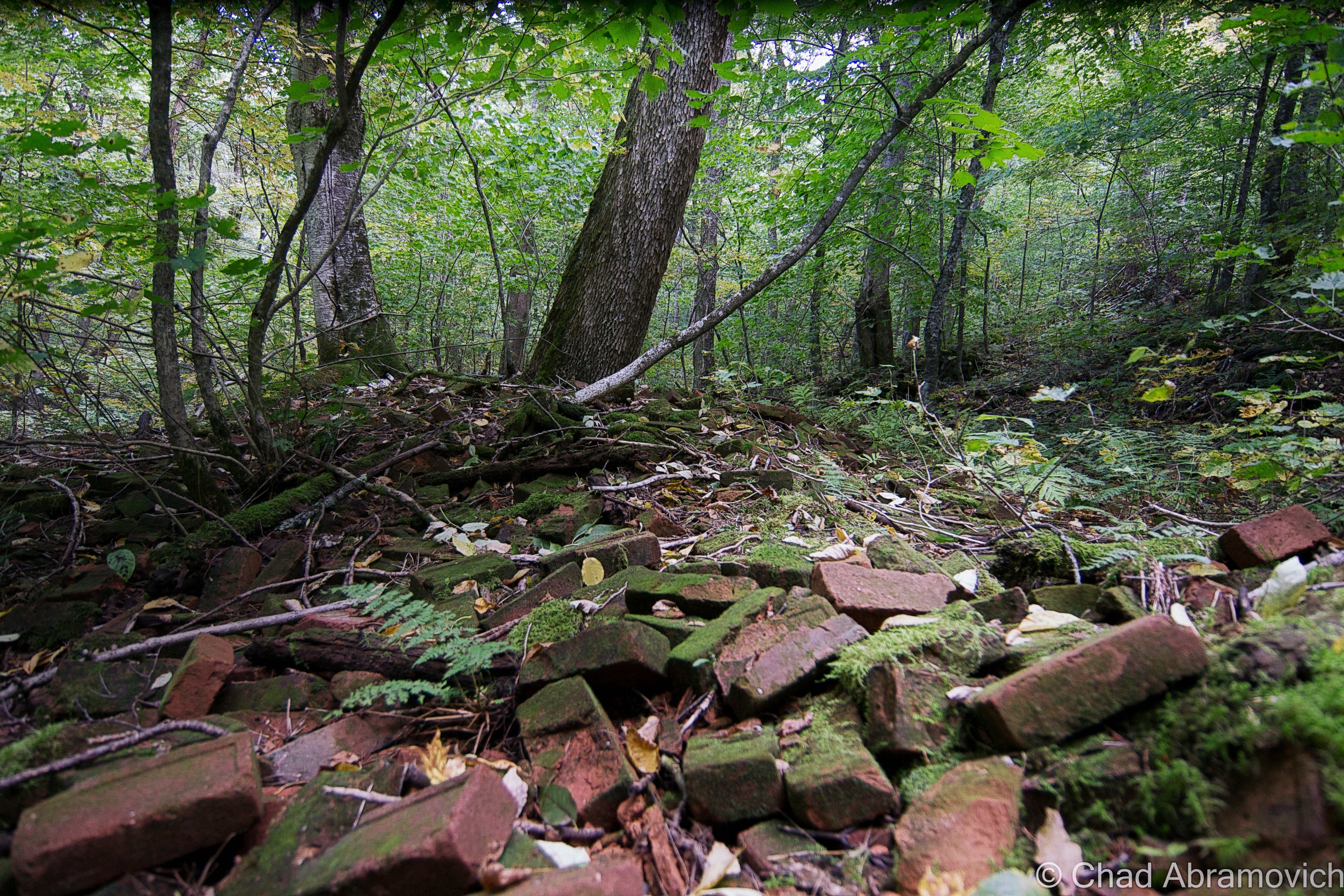
About 12 brick kilns for charcoal production were built in southern Glastenbury at an area known as “the forks”, because it was a distinguishable location where Bolles Brook split in two in a V-shaped parting of ways. A small and rough, lawless village designated as South Glastenbury grew up around these kilns, including a one-room schoolhouse, loggers boardinghouse and company store.

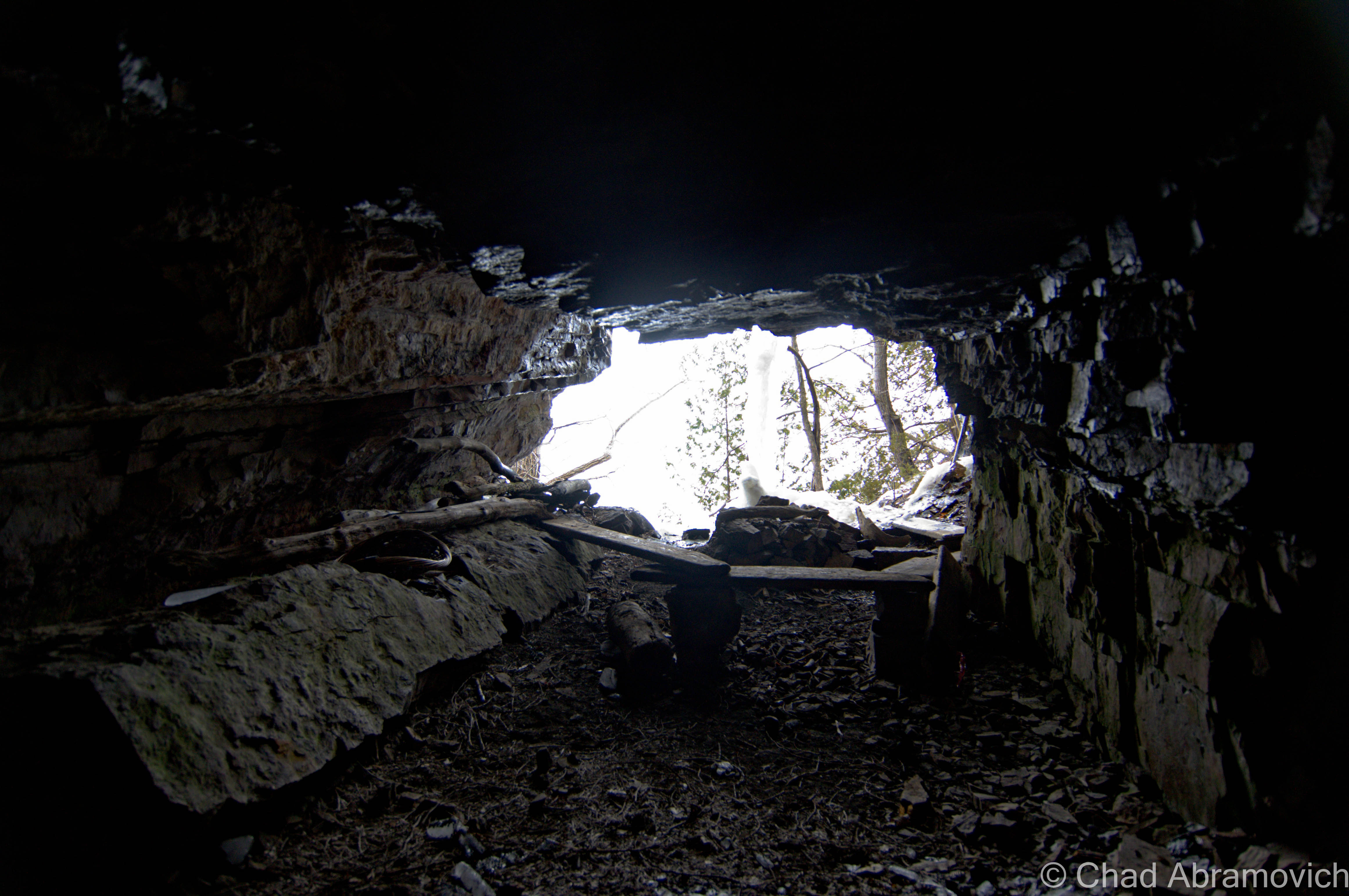
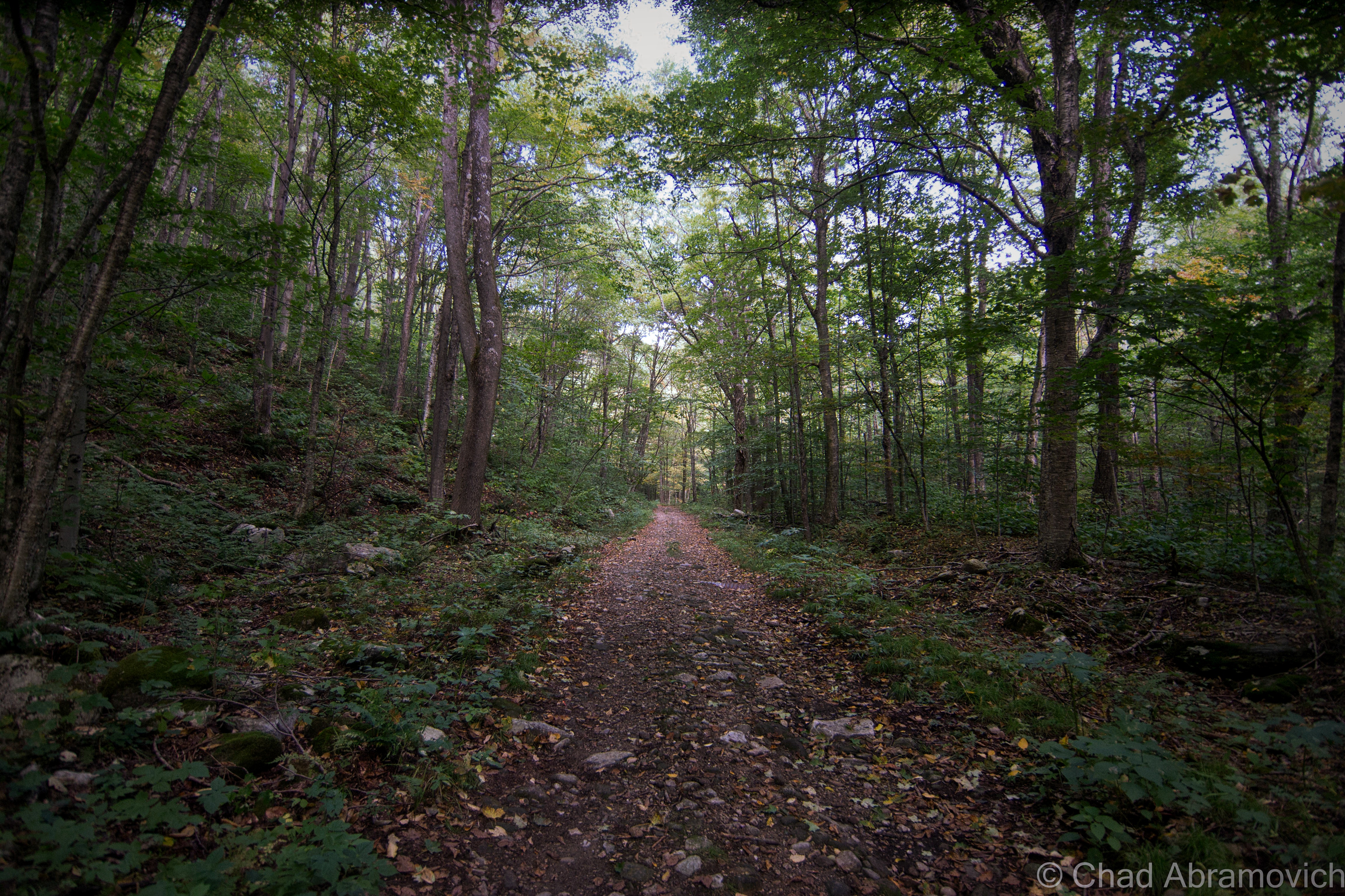
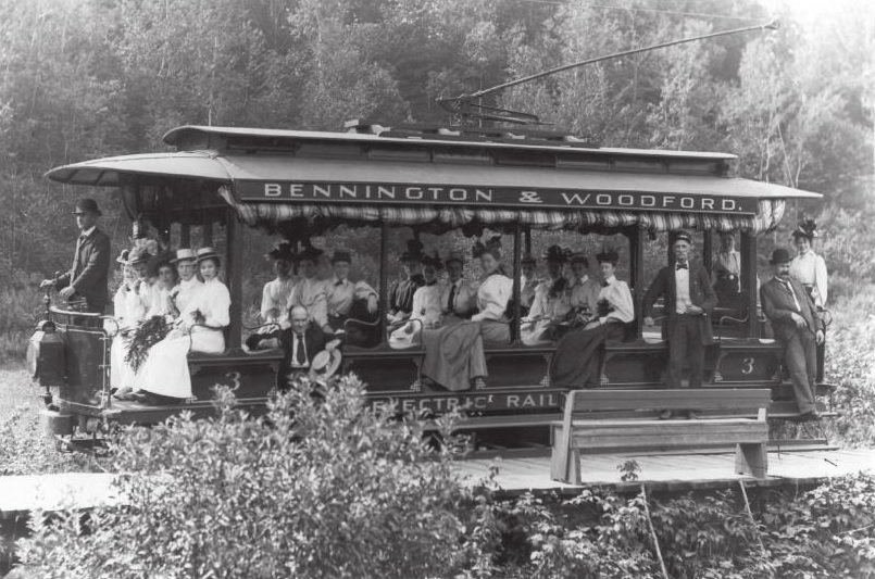
The steepest railroad ever built in the U.S. was developed to get up into South Glastenbury. The electric trolly line was the only element that made the town a pragmatic place; bringing down money making lumber and charcoal, and later, bringing up tourists. Many have no idea that aforementioned rail bed still exists, and if you follow it, will bring you deep into indistinguishable wilderness to the grave of the old town. Our adventure started well before we got out of the car when we navigated our way to the portal into the forest. 

Funny enough, Glastenbury is still technically a town, at least in the haze of Vermont law. A gaze at a state atlas, or a Google map search, will show you a dotted lined square that represents a town boundary, only, there is nothing within the square. It’s considered an unincorporated town – or, one of 5 Vermont communities with a population so low, that instead of a town government handling its affairs, those things are managed by a county or the state. Or the national forest service I guess. There are a few people who still do live in Glastenbury – populated by just 6 people ( their properties are pretty much clustered near the borders of either Shaftsbury or Woodford), who also have achieved somewhat of a level of intrigue beyond the strange phenomena that describes the town.

I’m going to stay quiet on the access road we took, because it’s pretty evident that the people who have their addresses there don’t want the crowds. (Like the folks in Somerset, they live in the boonies for a reason, only, these folks express their discontent via threatening scrawl) When we drove up the gravel roadway, we immediately began to pass some shabby looking properties, all of them with handwritten and somewhat threatening signs warning nonlocals not to park their cars there, or else.

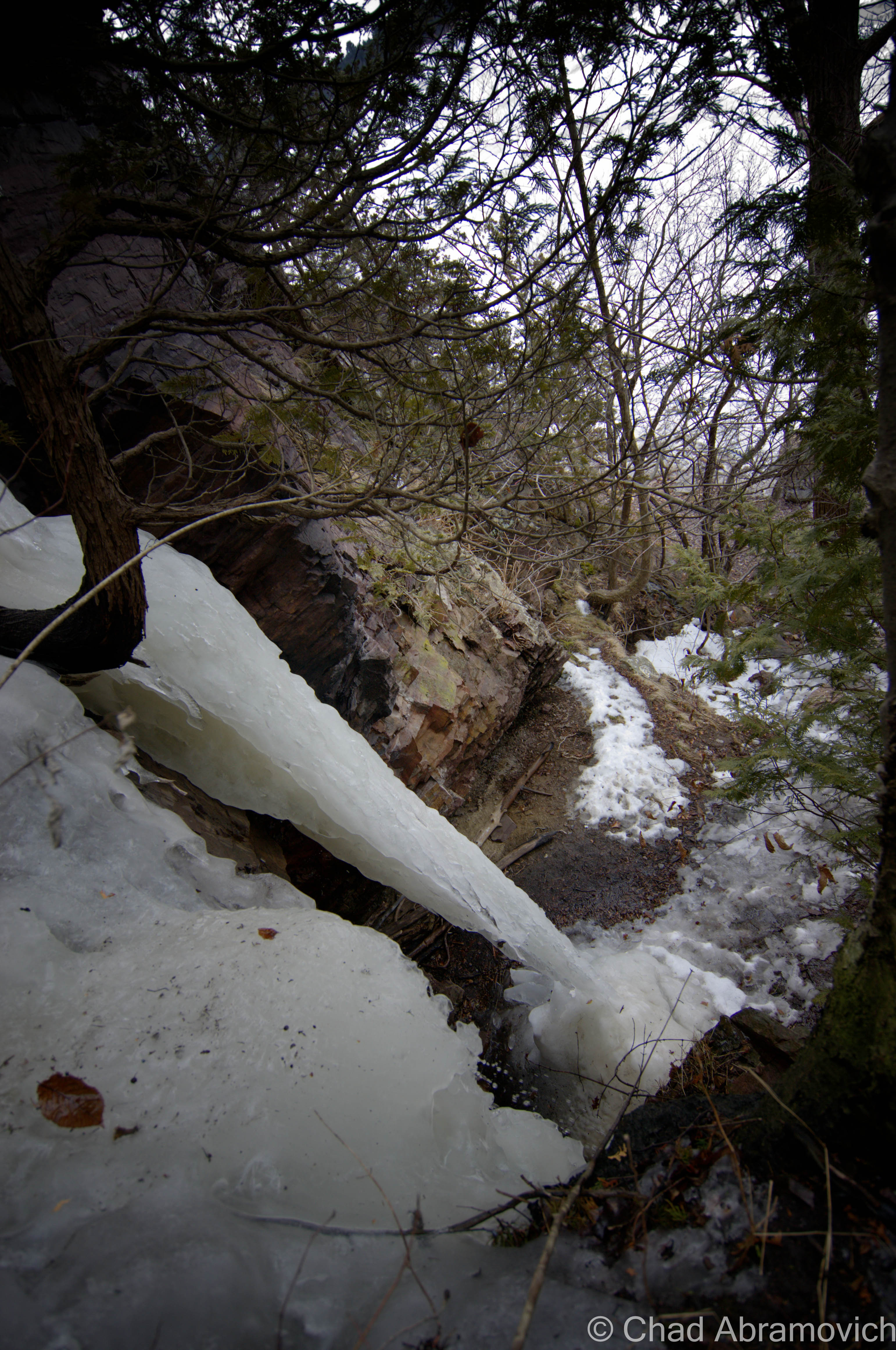
Fearing our car would be cannibalized for its wheels in an uncomfortable back woods “we warned you!” sort of situation, we decided to find what we designated as the safest parking space on the road, far away from any discernable houses and no parking signs. Hoping that we didn’t make a stupid mistake, we trekked up the road on foot, found the forest road, and began our hike into one of the most fabled places in state mythology.

dsc_0633_pe
This is a shot of the trail slash old rail bed, miles into our hike. Unexpectedly to me, this might be the most grueling of Vermont hikes I’ve endured. The amount of rocks ravished my feet to a point where I was literally limping down the trail, silently no longer caring if I was there and begging to rest my weary bones in the car.
dsc_0680_pe
Further up the trail, we started to find original rail spikes from when the railroad was built over a century ago!
dsc_0638_pe
This was a sign that got me revved up. We began to notice chunks of Slag along the trail. Slag is a stony waste matter separated from metals during the smelting or refining of ore, and since Glastenbury was built around charcoal furnaces, there is plenty of the stuff in the woods today. We were even to find some rare green and blue slag. I’m not very savvy about the jewelry culture, but I guess you can polish and buffer up slag chunks pretty attractively and make accented miscellany from them. I dig them in their natural form, and grabbed a few chunks of the green for my collection of oddities.
The Bennington-Woodford Railroad ran electric trolleys up to South Glastenbury

We hushed our sound as we heard another one that was all too familiar to me. We heard an approaching 4 wheeler. Because of my suspicious nature and not knowing what sort of people were this deep up in the woods, I decided to relocate myself as far to the side of the trail as I could, give a friendly nod and let them pass. As they got closer, I saw it was a younger couple, a man and a woman, and they slowed down as they saw us. I decided to take the mutual encounter and get past my social anxiety and spark up a conversation with them.

Actually, I wanted directions, because we were beginning to second guess ourselves as to where we were, and if we could find any of the ruins, and I really didn’t want to leave disappointed.

The front handbrakes were pulled and their 4 wheeler slowed down to a stop. The gentleman, who was wearing a camo baseball cap and sunglasses smiled at us and wished us a good afternoon, his wife sat behind him silently observing us with a friendly expression. I returned the greeting and asked him if he could direct us to South Glastenbury.

“Oh, the forks?” he asked. That casual nickname drop meant that they were aware of it, and I nodded my head, my excitement immediately betrayed my casual expression I was trying to keep. I also thought it was pretty rad that locals today still use the place’s old handle.

“Yes, the forks. Are we close? Would it even be traceable in all this?” I gestured to the thick woods around me to make a point. “Well, yeah you can find it. But this is sort of the wrong time of year to be looking for that sort of stuff. Also, it’s bear season up here you know. Uhh, how’d you guys know about Glastenbury, just curious?” he asked us with a backdrop set to his tone.

I wasn’t quite sure if my candor had triggered a nerve, or how to give him a cropped statement of how Glastenbury found itself sticking to the flypaper of New England mythology, but I had a feeling he already knew that. “So, you know about Middie Rivers?” his wife spoke up. “Yeah, I do” I stated. There was no need to be superfluous there. But for those of you who are unfamiliar with Glastenbury and it’s monsters;

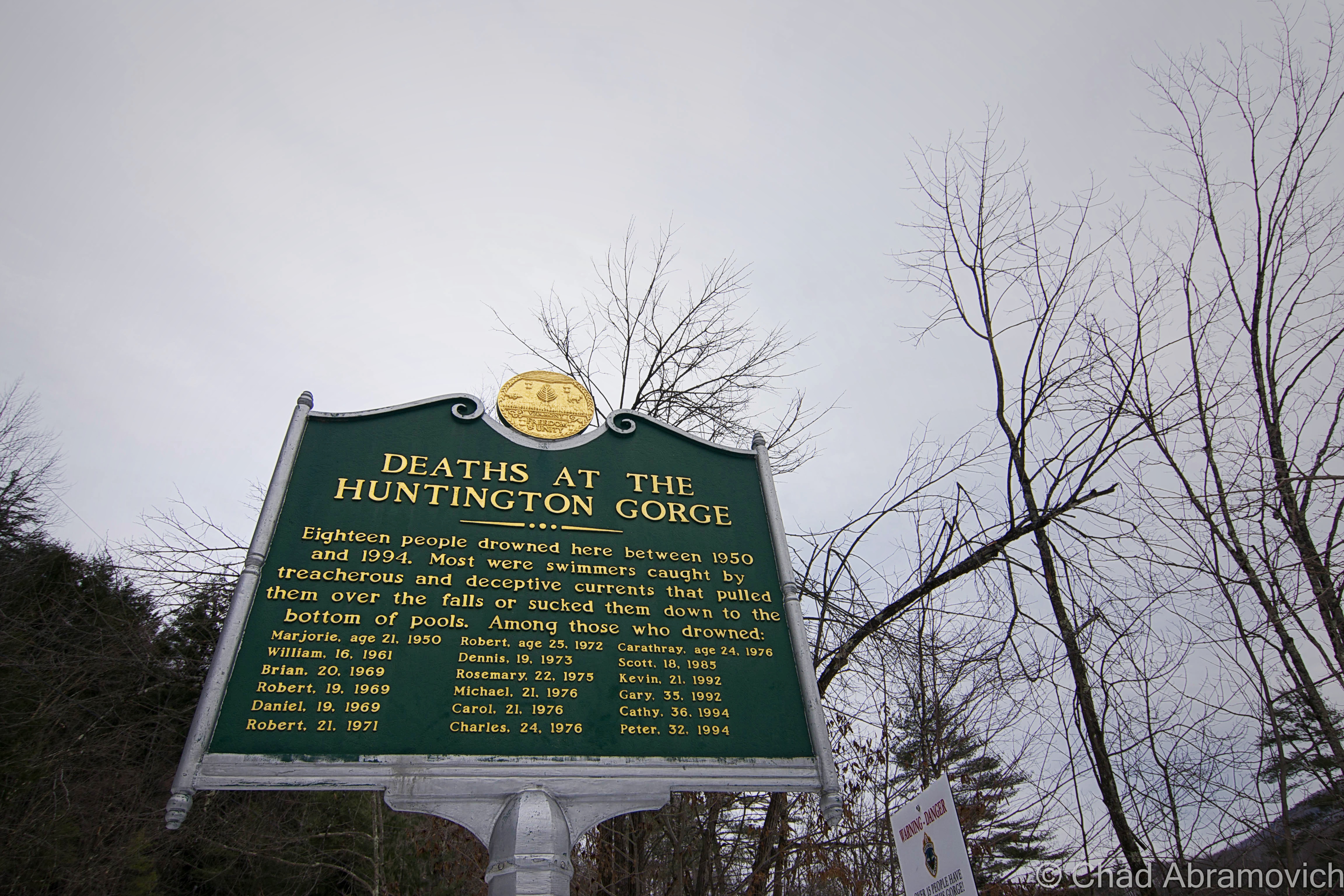
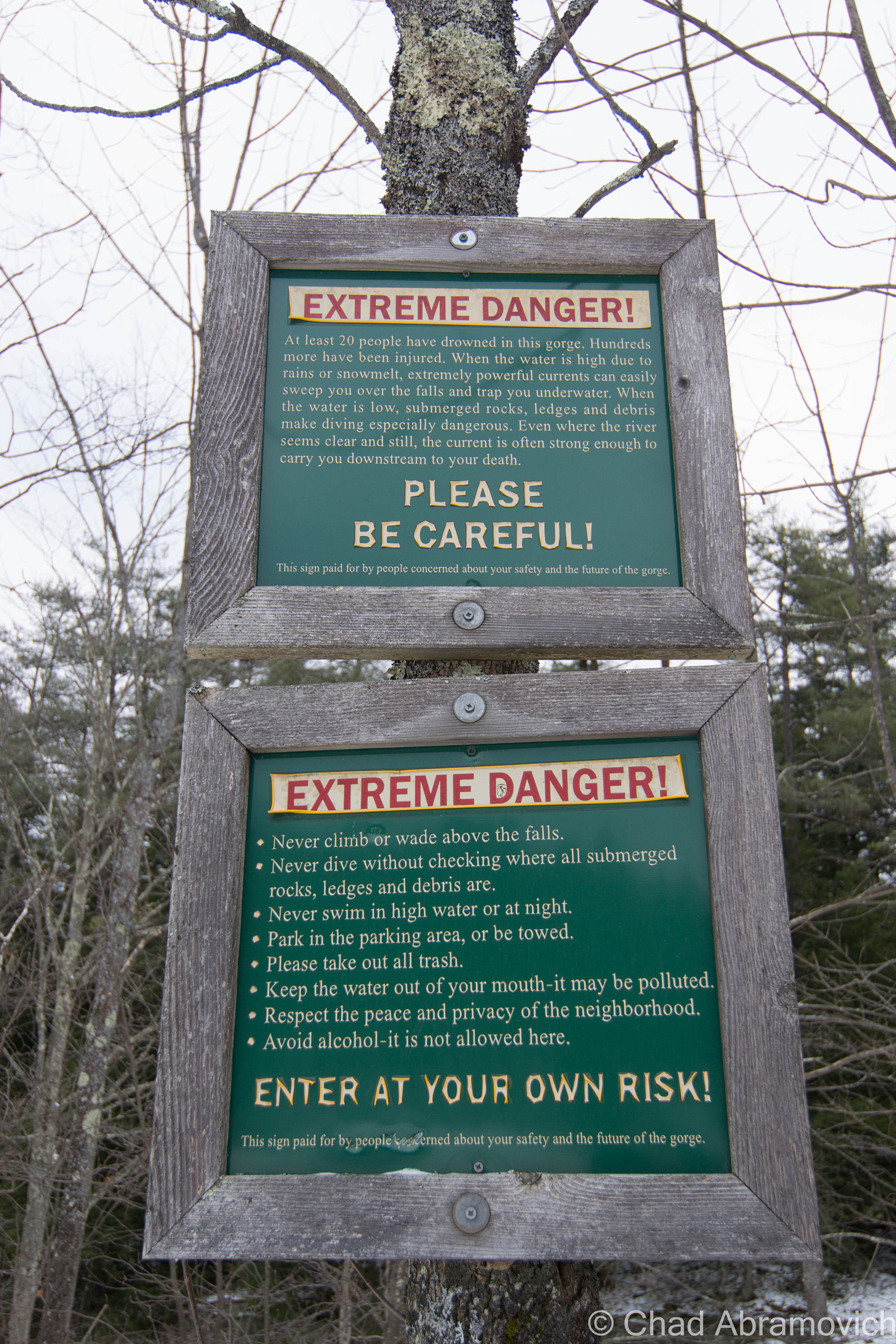
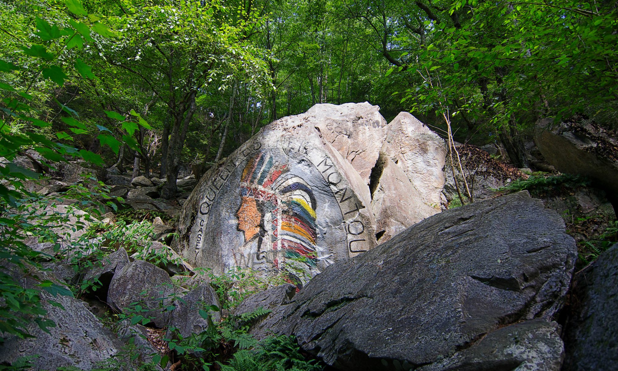
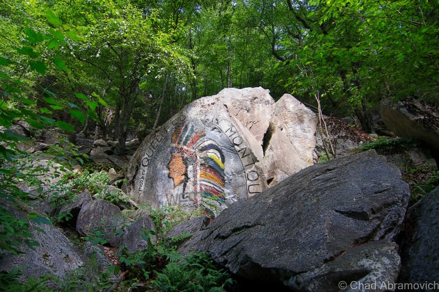
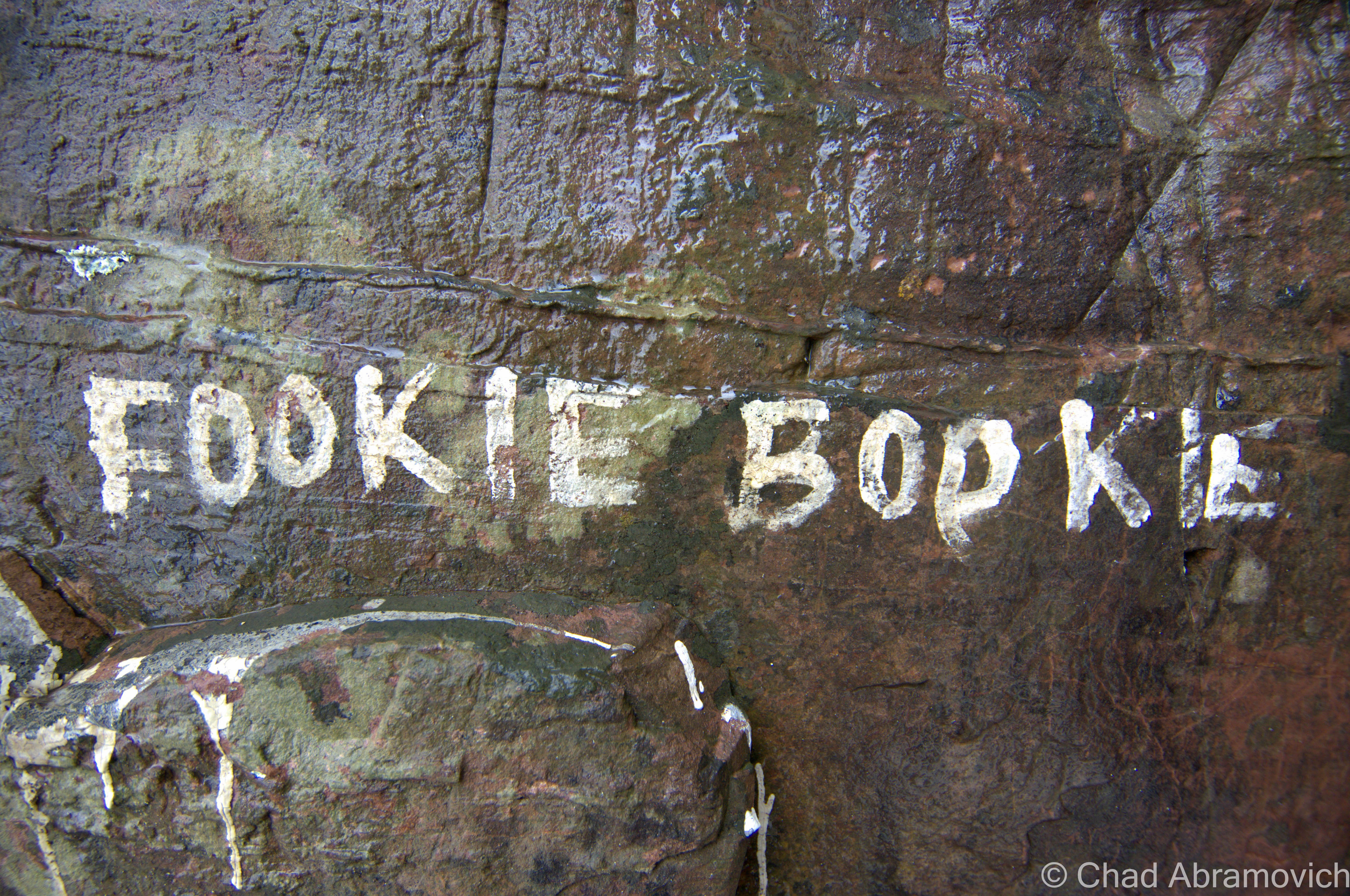
Local lore includes a froth of big hairy monsters, a cursed Indian stone that swallows humans, UFOs, mysterious lights, sounds and odors detected by colonial settlers, and numerous hikers walking off the face of the earth here between 1945 to 1950 – earning it the nickname; “The Bennington Triangle” in 1992, which has adhered itself to the flypaper of popular culture.

Fortean researchers like John A. Keel conjured up the term “Window Area”, which I had referenced at the beginning of this section, as a place where some sort of interdimensional trapdoor can be found. Well, that’s one theory anyways. New England is loaded with so-called “Window Areas”. Cryptozoologist and researcher Loren Coleman identified Massachusetts’ “Bridgewater Triangle”, using the term “triangle” to designate any odd geographical area. Joseph Citro followed up by coining “The Bennington Triangle” – both are said to be “window areas” It’s also one of my favorite terms to use when talking about this caliber of local weirdness.

Who knows where the flickers of truth are in all this. And that’s what makes everything so damn fascinating, because there is truth in these tales tall and true.

It’s also the mountain’s paranormal and controversial tales that attract modern day professed ghost hunting clubs and social media sensationalists, whose meddling are an affront to both locals and reasonable judgment, which really seemed to have damned the wilderness area.

Don’t get me wrong, these haunting stories are partially why I found myself hiking up the mountain, because of how impressionable they were and still are to me, but I find that there is also a line between being a civilized researcher, and becoming one of the monsters you’re chasing and exploiting it on a tawdry clickbait website with a headline that reads something like “{insert subject} will give you NIGHTMARES!”

Middie Rivers

The elderly Middie Rivers was the first of a handful of people who reputedly disappeared in the mountains in or near Glastenbury. Anyone who tells the story of southern Vermont’s Shangri-La recants that Rivers was an experienced woodsman who, while leading other hunters on the mountain, got a bit ahead on the trail, and was never seen again.

“None of that is true”, his wife said declaredly. “Rivers wasn’t a hunter or an experienced woodsman at all! He was actually from Massachusetts, and he had borrowed a rifle from his brother-in-law, who he was hunting with. He’d probably never even hunted before, and certainly never guided other hunters up here. The only thing that’s true about that story, is that he did disappear.”

“One theory is that he might have fallen down an old well. That seems pretty plausible to me”, I added. She nodded her head. “Yup, that’s what we think too. I mean, there are plenty of them up in the hills. But vanishing without a trace…people love to say that, because it backs up the mystic or, I don’t know, the ghostly impression about this place. They’d rather believe that than the facts, because it’s more interesting” she furrowed her brows and cut herself off in annoyed contemplation – like she knew what she wanted to say but couldn’t get it out. I was loving this conversation. “I know a bit about Middie Rivers” she continued after a moment. “I know a lot of stories and legends, passed down by relations to him. The Loziers – that’s the family who is related to him – we knew/know them, they passed down all sorts of stuff to us growing up. They have a camp up in Glastenbury still, like us. I even have a picture of Middie Rivers”.

“Ah, that explains the 4 wheeler then. I was a little surprised to see you folks! I assumed this was just a hiking trail or forest road”.

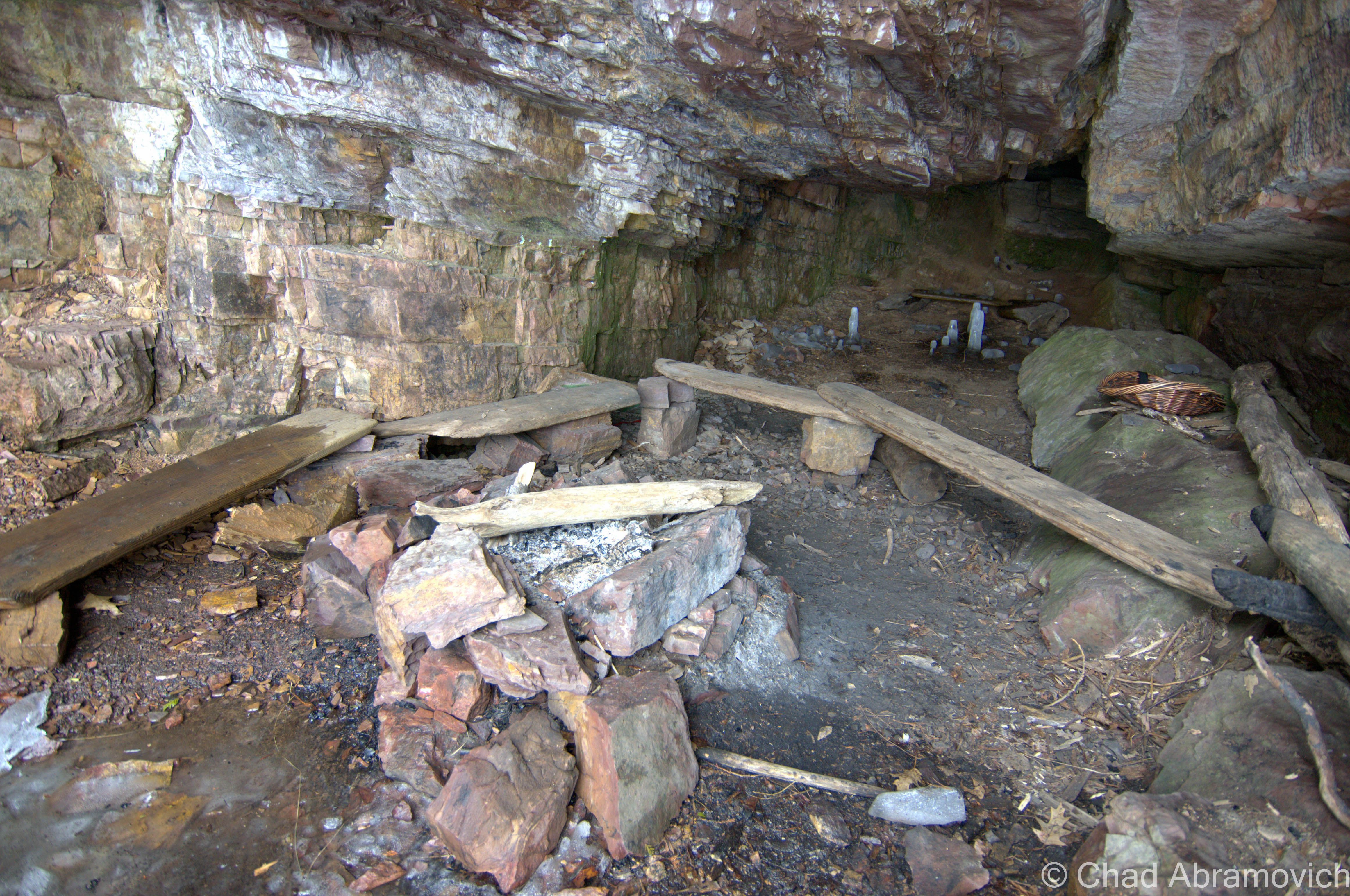
“Yup, we’re one of two camps in Glastenbury on this trail. My wife’s father built it years ago. We were grandfathered in. After the national forest took over, no one else was allowed to build up here or drive up this trail anymore. As it is, we need a special permit to have 4 wheelers so we can ride up here” – the husband cut in. “Did you see all of the gates?” I nodded in confirmation. We had to crawl underneath a few of them just to advance our hike. He continued; “We used to have friends up all the time, they used to come up in huge parties on ATVs up the trail. Now you can’t do that. It’s ridiculous, but hell, we’re not going to fucking lug all of our shit up to the camp on foot” – he then gestured to a cooler on the back rack of his 4 wheeler to emphasize his point. I got it. My friend and I had been walking for over an hour now, and I was already exhausted. “Our camps have been here for a long time – they started out as plywood cabins with dirt floors, and over the years as they were passed down, we’ve improved them a bit. No one else can build up here now.”

“I mean, it’s really probable that Middie could have fallen down a sink hole”, his wife interjected herself back into the already broadening conversation. “Sinkholes?” I asked, hoping I delivered a cue to get any sort of further information. “Ayuh, it happens more often than you think. Sinkholes swallow hunters all the time! There’s tons of them up here. People have hunted this mountain all their lives and still report getting turned around in the woods and intimidated here.”

“Because of the cross winds that meet on Glastenbury Mountain?” I prodded, a showing a little pride in my research. She nodded her head.

“I’d love to hear more about Middie Rivers, or any stories you guys have, if you’d be interested in chatting? I can give you my email or something?” I attempted. I couldn’t help it, I live for stuff like this. There is just something underneath my skin, a desire to make sense of everything. I’m definitely the type to overload myself with information.

At this point, his wife broke out in a lopsided grin and told me that she wasn’t interested in speaking any further about Glastenbury, without actually telling me she didn’t want to speak anymore about Glastenbury. “Well, we’ll be on our way now” said her husband, his thumb pushing the ignition and the engine promptly firing up. He gave us directions that were incredibly vague, but given the lack of wayfinding points, were the best he could do with people who’ve never been in those woods before. I thanked the both of them, tipped my hat in gesture, and both groups parted our opposite ways down the trail.

The Forks

It didn’t take long before we were unclear of the given directions and insecure about how much we remembered. It didn’t help that there were plenty of brook forks along the trail, tripping my thoughts up to think that any of them could be the forks.

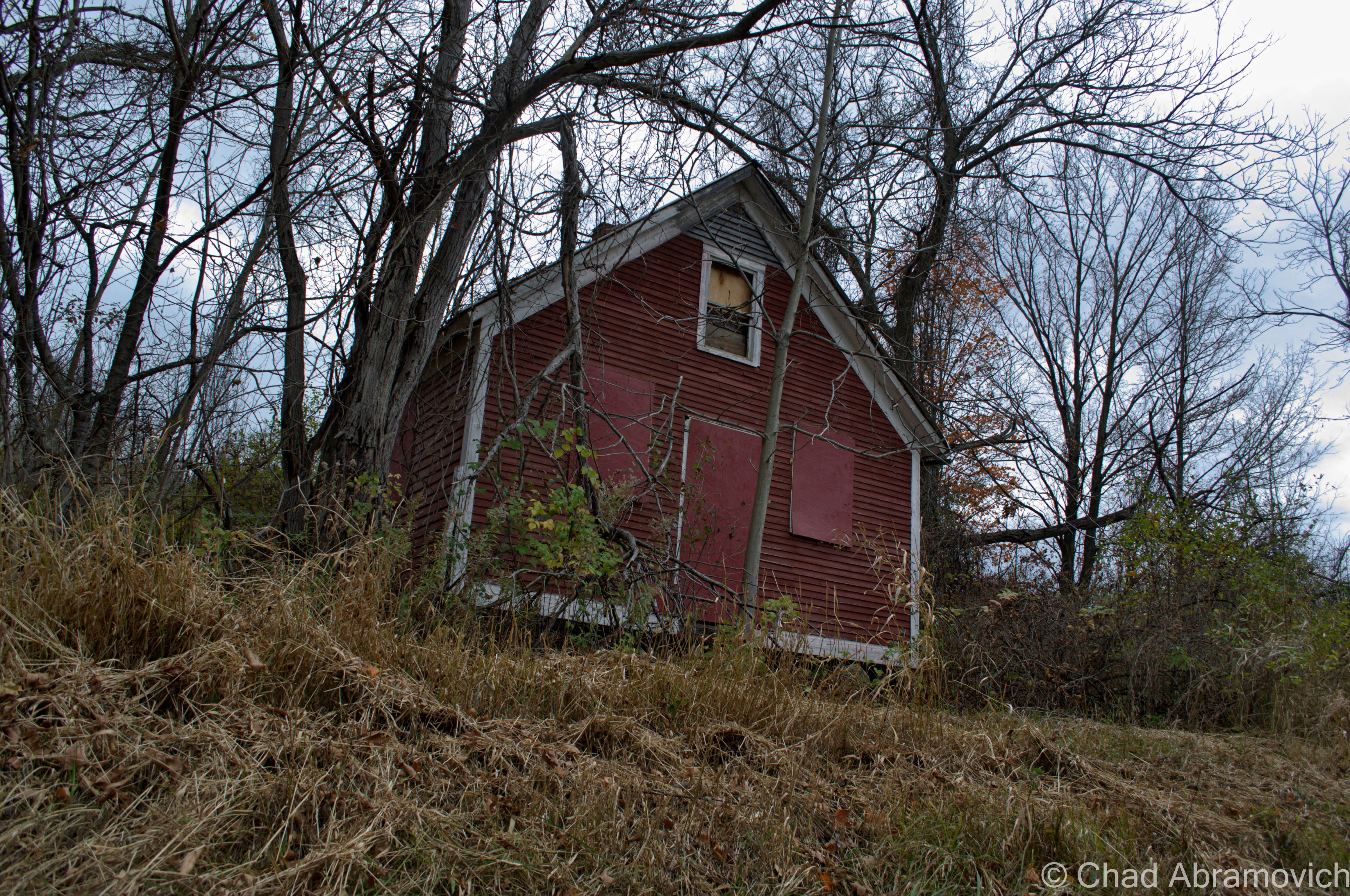
As we continued our trek up the trail, we sighted something that sort of sketched us out. I’m laughing to myself as I type this sentence, but it was a cozy looking, nicely upkept log cabin which was probably one of the camps the baseball capped guy was talking about. There was an open lawn area out front that was mindfully mowed and solar panels on the roof, with an outhouse in back.  It’s hard to explain what it is about off grid living, or seeing a home way out in the boonies, that sends odd reactions that crawl up your spine. I suppose that so many of us are just accustomed to being hooked up to utility poles (in some more repressive states, it’s actually against the law to be off the grid), that this sort of makes us subconsciously weary, like there is something “weird” about the arrangement, and easy to stereotype the people that chose to live like that and how they’re of their own sort. But then I remember that I’d live like that too if I could.

But still, I picked up my pace a bit, wanting to get out of sight of the cabin and back into the woods. Then, we ran into another fellow on a 4 wheeler. This time, our approaching character was an older gentleman. We side-stepped off the trail again, nodded our heads, and went through the same rounds of introductions as last time.

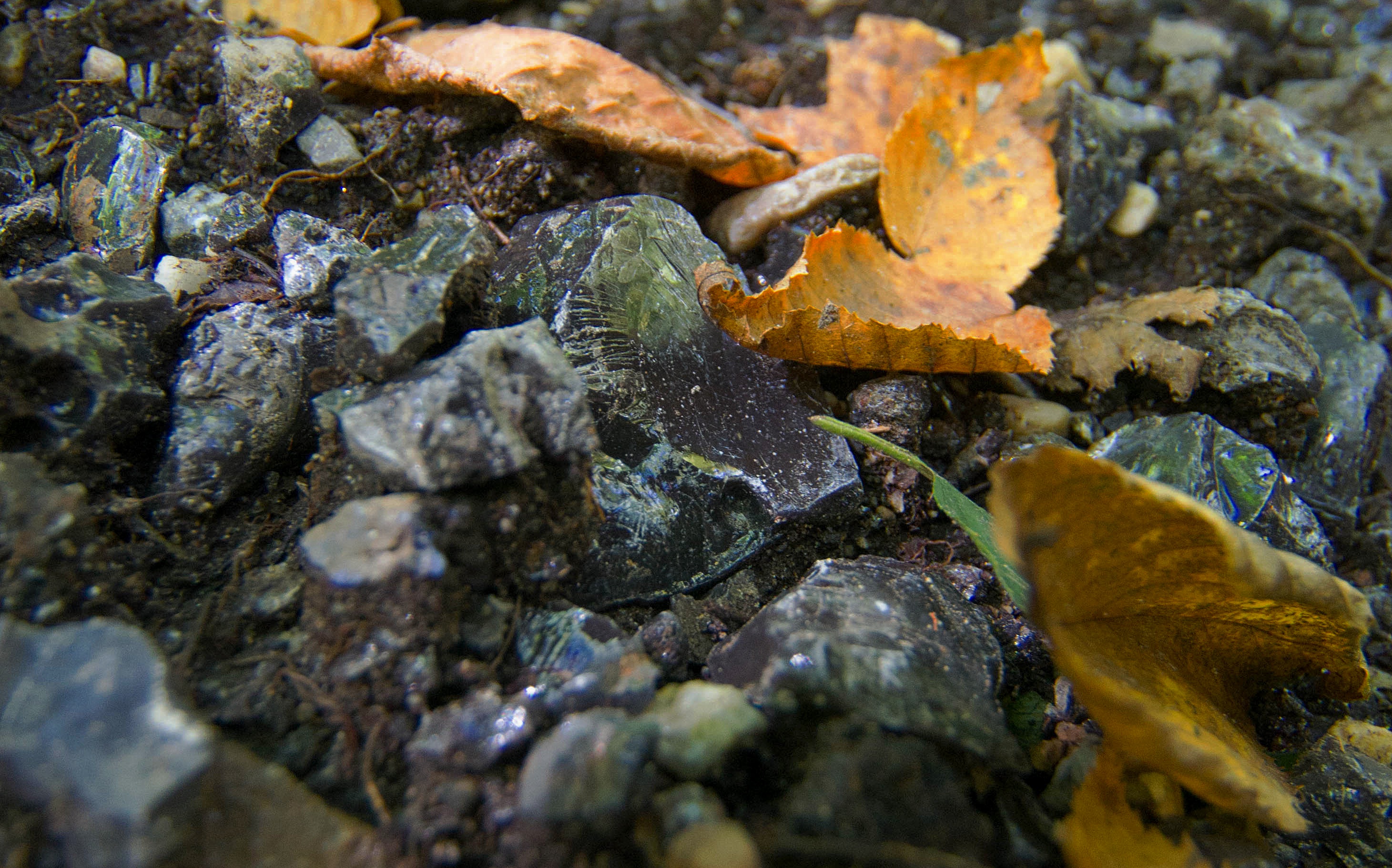
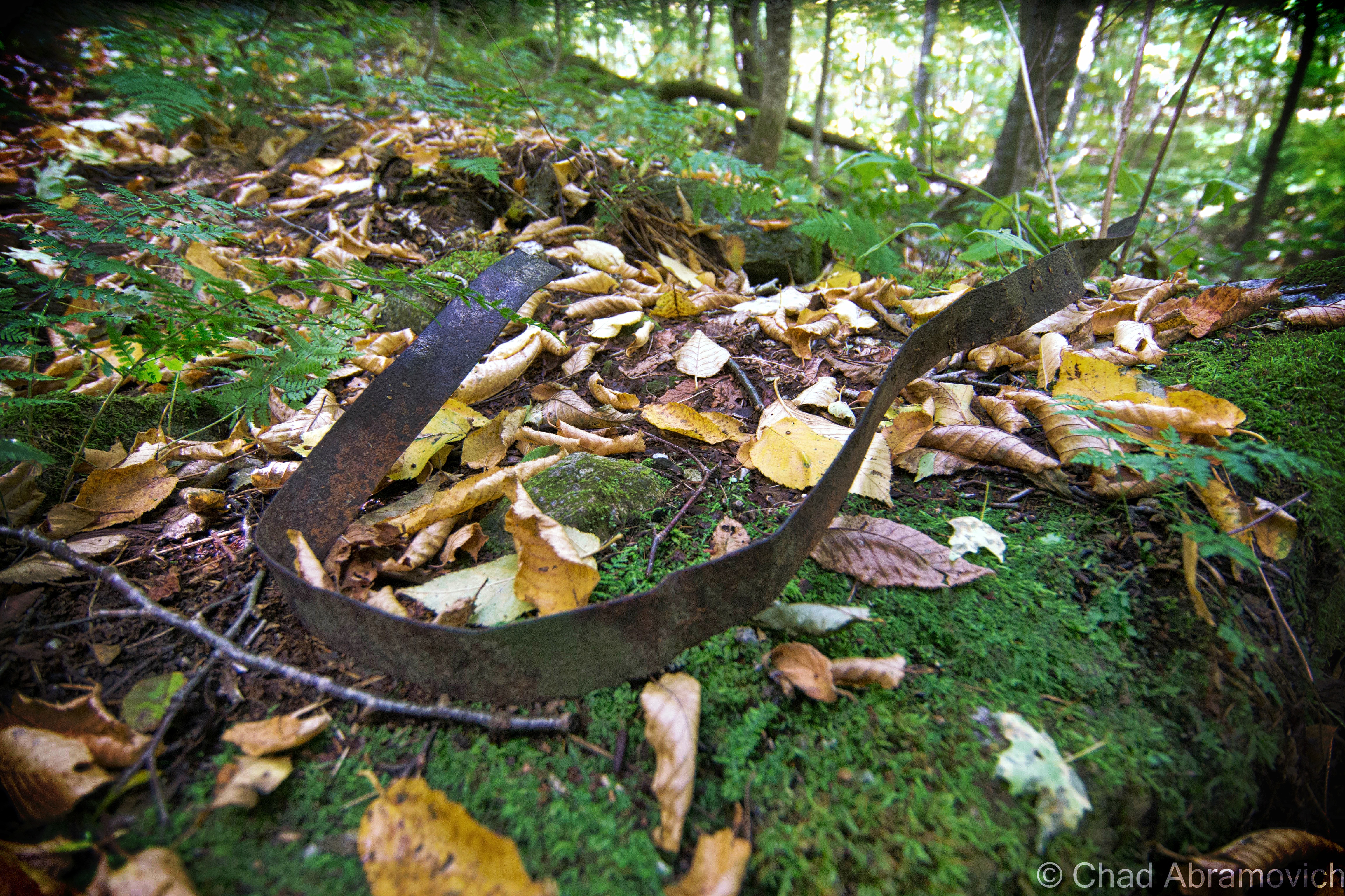
“The forks, huh? Well, I mean….you can’t make out much of the old hotel foundation anymore, but it’s right off this trail. Nothing much left of the kilns. Might be some iron bands, maybe bricks.” Then he pointed to an offshoot 4 wheeler trail that ran through an area thick with prickers and berry bushes. “There’s more kilns up that knoll there” he said, his wisdom rolled confidently off his tongue wrapped up in his heavy Vermont accent. “Oh, uh, that trail looks like it goes behind the camp we just passed,” I said uncomfortably. Though my hobby of exploration often involves trespassing, I wasn’t about to skulk around someone’s land up in those hills, especially inhabited land. People in the boondocks have guns. “They aren’t home are they?!” He said, a little wonderment in his inotation.

“No, we didn’t see anyone when we walked by”, I returned, grinning at his unexpected humorous reaction.

“Oh, good!” he said, his enthusiasm almost made me crack up. I wondered if they got along or not. “But yeah – there’s more of em’ down that trail. Well, I’ve never seen them, but I know they’re there!” This time, I didn’t contain my mirth. I liked this guy. I asked him to clarify our misdirections a bit, and he gave us some of the most Vermont directions I’ve ever gotten – far superior to the ones I got when searching for some of our state’s mysterious stone chambers.

“Well, when you get to the forks, take a right instead of the left crossing over the brook, then go up the mountain a ways but still make sure to parallel the river – look down and you’ll eventually see the kilns. Or what’s left of ’em anyways. ” Just then, a Glastenbury traffic jam formed behind the old timer on his 4 wheeler, as three teenage rednecks on dirtbikes pulled up and sort of just looked at my friend and I stoically, the last one in line revved his engine impatiently while refusing to make eye contact and tried to flaunt his, I don’t know, machismo? Or maybe he was just impatient. I shook his hand and wished him a good afternoon, and we were on our way.

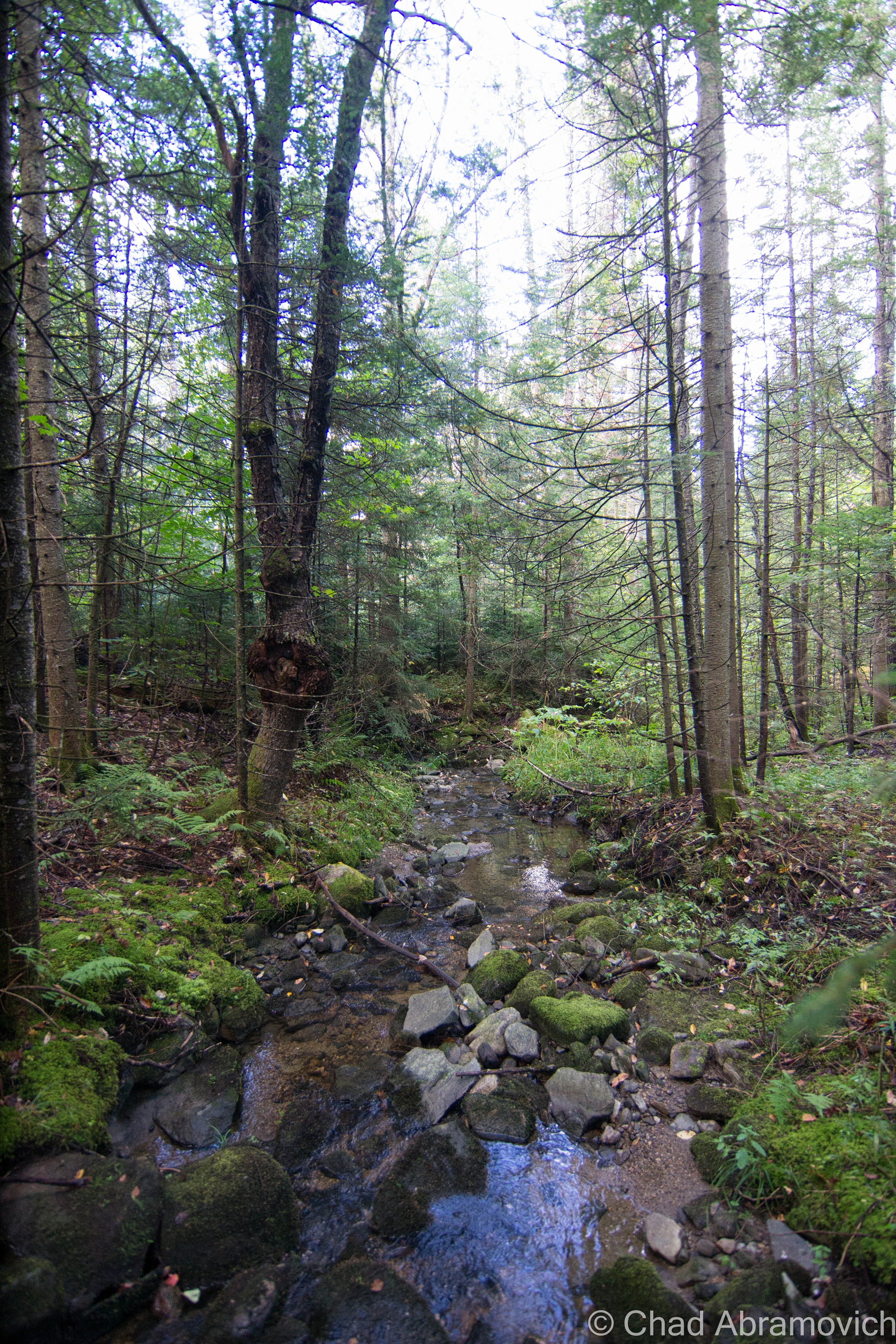
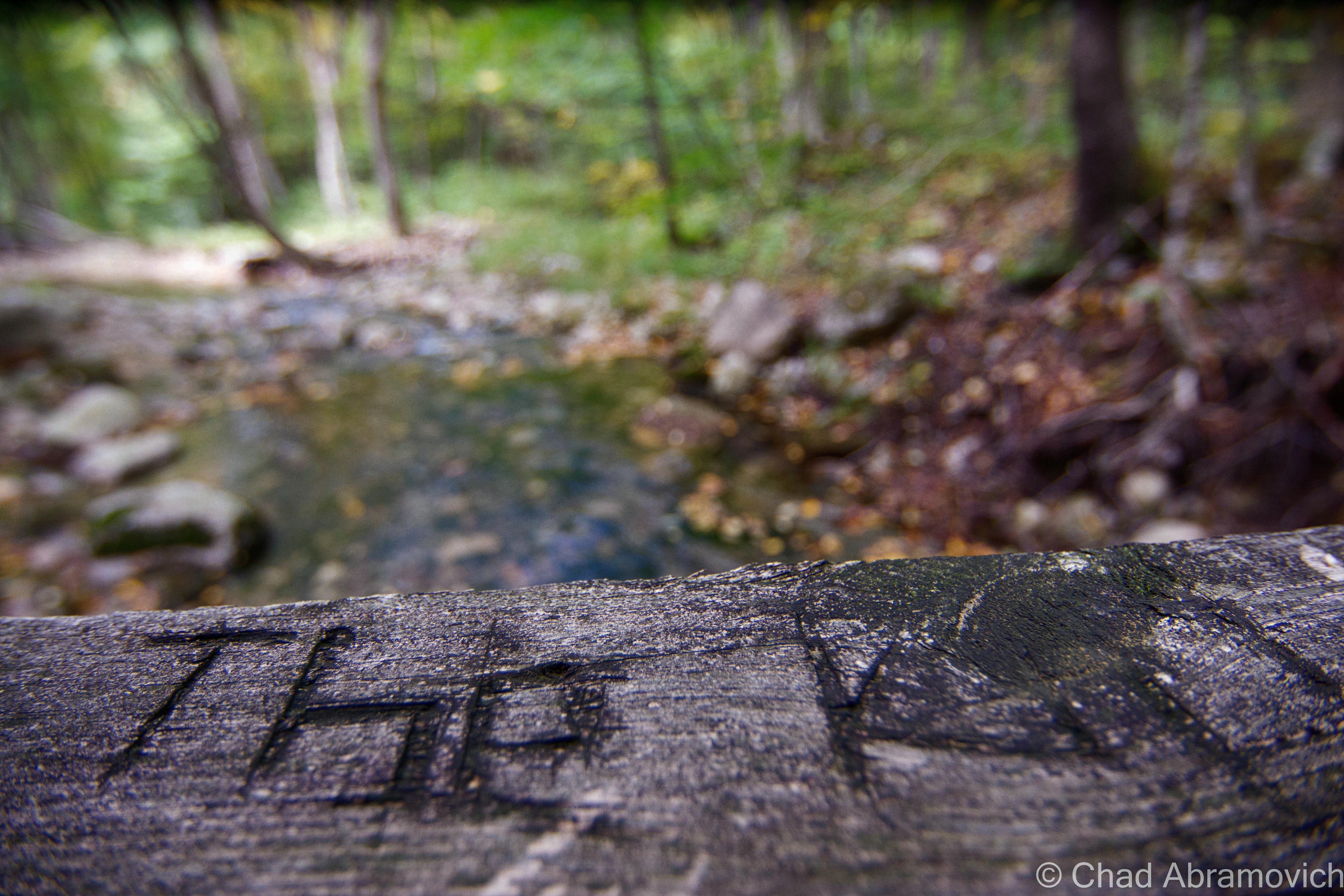
More walking down the trail later, and we approached a very standout fork in Bolles Brook and the rail bed portion of the trail we were on ended and transitioned into a slender path beyond a wooden bridge that crossed the brook. We had found the forks.

The village of South Glastenbury circa 1897. Bolles Brook is in the middle of the photo. The hotel (former logger's boardinghouse) is to the left, with the double story porch, and the casino (former company store), is up the hill a ways to the right. You can also see the electric trolly on the lower right hand corner of the photo - the same tracks we hiked to get up into town.
The village of South Glastenbury circa 1897. Bolles Brook is in the middle of the photo. The hotel is to the left, with the double story porch, and the casino is up the hill a ways to the right. You can also see the electric trolly on the lower right corner of the photo – the same tracks we hiked to get up into town. This is my favorite picture of Glastenbury.
dsc_0641_pe
This is “the forks” or Bolles Brook today. The village of South Glastenbury is practically intractable.
dsc_0642_pe
Taken on the forest road bridge that crosses Bolles Brook. Someone cryptically carved either “The Kilns” or “The Kill” on the railings.
The Glastenbury casino, 1897. I really like the architecture on this old building, like the multi-story porches and the clocktower. You still get a good sense of how isolated it was.
dsc_0645_pe
You can’t really tell, but this landslide filled in pitted portion of hillside is a foundation. This is where Glastenbury’s casino used to be. The logging and charcoal industry decimated the forests of Glastenbury, so the townsfolk, with a lot of urging from the railroad who didn’t want to go broke, developed South Glastenbury into a mountain tourism getaway. The loggers’ boardinghouse became a hotel and the company store became a casino. It was open for business by 1897 after much painstaking work was put into sprucing up the area, and visitors loved it. Glastenbury must have been pretty cool in its day, way up in the mountains over 2,000 feet. And during the time of inconvenient travel, it must have been a novelty. But a year later, a flood destroyed the tracks to a quality beyond repair, and it successfully killed the town. Most of the buildings just rotted away and fell into their cellar holes, and the national forest took control of the area in the 1930s.

dsc_0649_pe

dsc_0652_pe
“Well….” I dragged out the word, in a reverie of run down indecisiveness. “Should we try to scout the hillside a bit? See if we can find anything?” I asked. My friend enthusiastically agreed, not being constantly annoyed by an abused foot throbbing in pain. So, off the trail we went, regardless of the reminders that we were in “The Bennington Triangle” and “this is how people disappear” that my brain was trying to communicate with me. To my relief, which quickly muted by lethargy, my friend ecstatically yelled; “I found bricks!”
dsc_0656_pe
I clambered over to where his form was through the foliage and found myself stumbling over piles and piles of bricks that practically made up the slope we were on. Further up the hill, we began finding some old stone foundations filled in by a century of erosion.

dsc_0662_pe dsc_0668_pe

I read that there were very few photos of any of the charcoal kilns in Glastenbury. Here's one of the few I was able to find.
I read that there were very few photos of any of the charcoal kilns in Glastenbury – and the few that do exist are only after the kilns went defunct. Here’s one of the few I was able to find, with two men standing nearby.
dsc_0671_pe
The further up the slopes we ventured, our efforts paid off. I began finding tons of moss covered bricks and bent up iron bands from the old charcoal kilns! I was so excited to find artifacts that have survived the ravages of time – things that help us reconstruct our past culture.
dsc_0678_pe
A contorted iron band from one of the old kilns.

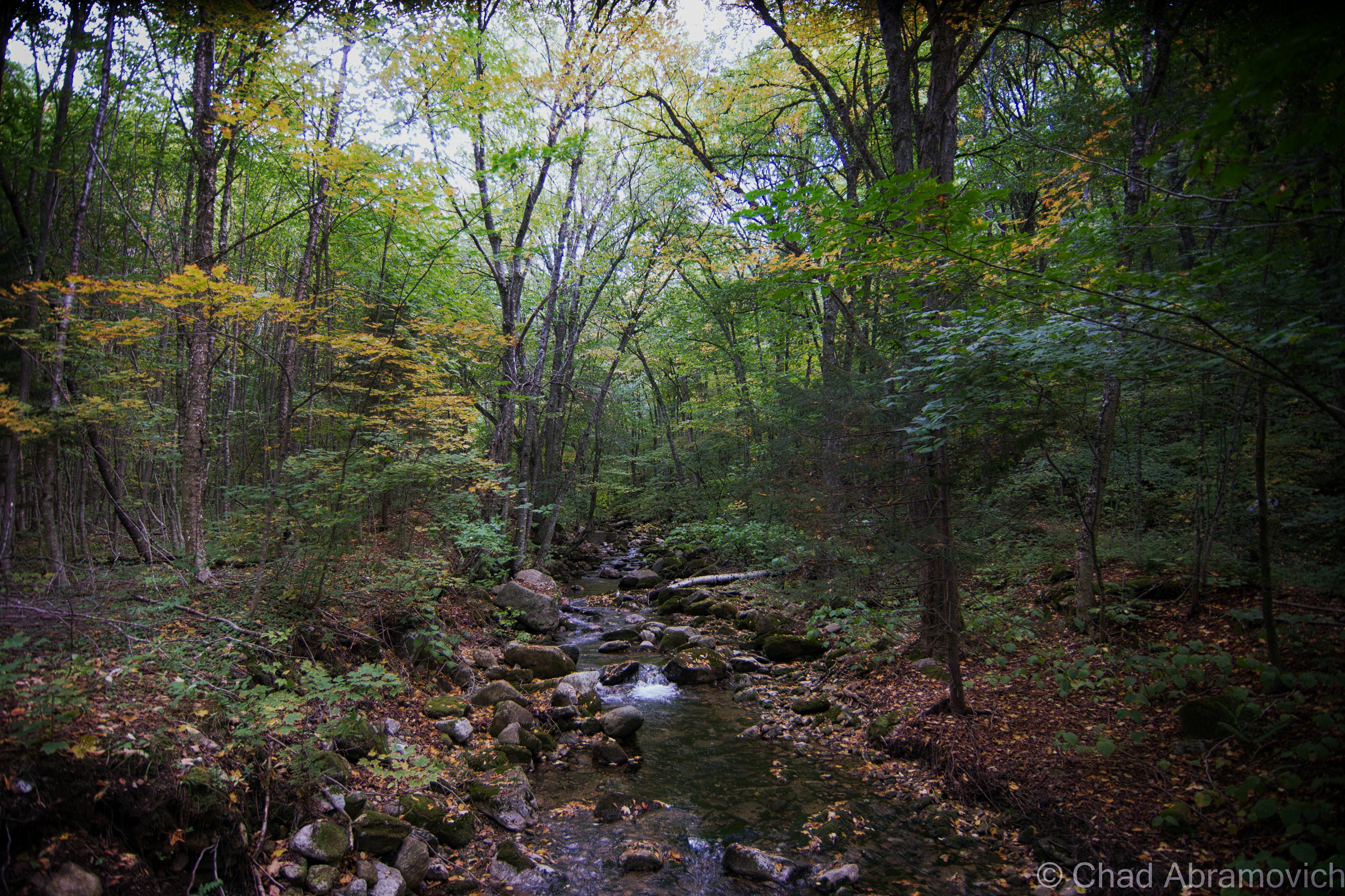
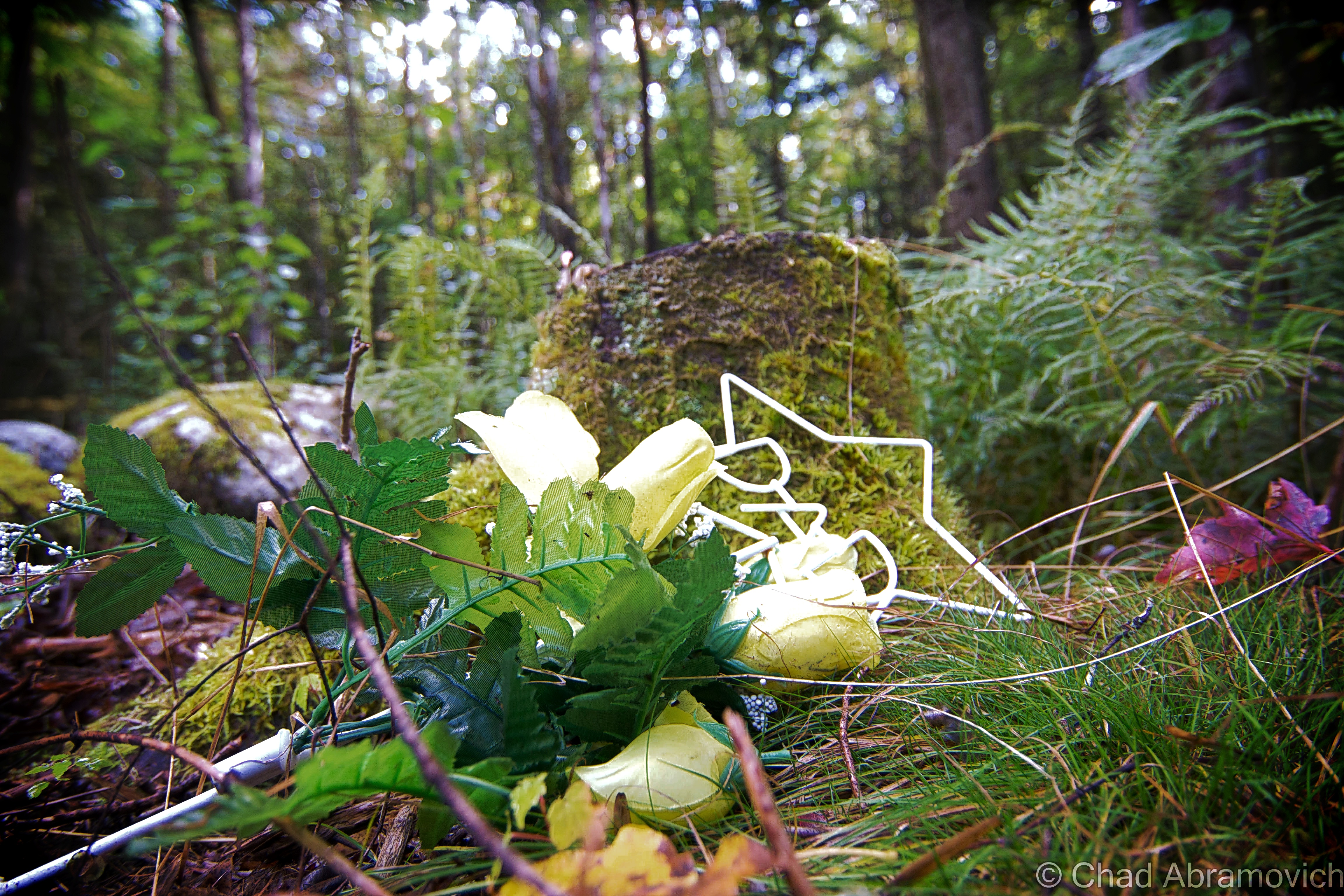
Visiting the peaceful and secluded location of Glastenbury town was a strange experience. Knowing the lore and the history there sort of make you look at this otherwise banal stream crossing in the woods through a different set of lenses, ones that makes professed monsters a bit more discernable. Unless there is just something in Bolles Brook that made/makes the locals morbidly imaginative.

On our way down the mountain, we saw a couple fellas standing barefoot in the chilly waters of the brook smoking pot – a scent that followed us halfway through the rest of our hike. One gave us a toothless smile and a wave, and kept on giggling at whatever it was they were talking about. I won’t deny that they picked a nice afternoon for woodsy shenanigans.

Thankfully, our car was as we left it when we got back, and we sluggishly made our way back down to Bennington to grab a burger.

My friend and fellow explorer Josh is into video editing and decided to film our oddysey. Cinematography is something I keep saying I’m going to get into more, but my laziness and reserved nature always seem to prevent that from getting a checkmark on my list. If videos are your thing, and you want to see my friend and this blogger being sort of goofy/awkward while tromping through the woods, I’ll link you below.

Things worth mentioning:

If any of you are interested further in Glastenbury, I’d highly recommend author Tyler Resch’s venerable book about the history of the town. I have a copy of it in my library.

I’d also like to suggest Joseph Citro’s Passing Strange, a detailed compendium of New England folklore and weirdness. It was one of the first books I bought as a kid, and my worn out copy is still with me. Both of these books helped further my research and curiosity.

If you missed it, here is my first post on Glastenbury, if you want more on the town’s history and ghastliness.

—————————————————————————————————————————————–

To all of my fans and supporters, I am truly grateful and humbled by all of the support and donations throughout the years that have kept Obscure Vermont up and running.

I spend countless hours researching, writing, and traveling to produce and sustain this blog. Obscure Vermont is funded entirely on generous donations that you the wonderful viewers and supporters have made. Expenses range from internet fees to host the blog, to investing in research materials, to traveling expenses. Also, donations help keep me current with my photography gear, computer, and computer software so that I can deliver the best quality possible. Seriously, even the small cost equivalent to a gas station cup of coffee would help greatly! Especially now, as my camera is in need of repairs and I can’t afford the bill, which is distressing me greatly.

If you value, appreciate, and enjoy reading about my adventures please consider making a donation to my new Gofundme account or Paypal. Any donation would not only be greatly appreciated and help keep this blog going, it would also keep me doing what I love. Thank you!

Donate Button with Credit Cards

Gofundme: https://www.gofundme.com/b5jp97d4

The Hungry Gorge

The deadliest place in Vermont is simultaneously one of it’s least dead places. The head of the state’s public safety commission once dubbed the Huntington Gorge as “the deadliest place in the state”, and according to those who make it their business to track this sort of stuff, this is considered the most dangerous swimming hole in all of New England. But despite that macabre distinction, in the summer the chasm is absolutely crawling with bodies, energy, and canned beer, all which dive impetuously off of the dangerous cliffs.

It’s not hard to see the appeal to this spectacular rocky crevice carved deep into the Richmond hills. Vertical undulating cliffs rise intimidatingly around a twisting boulder deposited river that corkscrews through several waterfalls, ranging from 6 to 12 feet in height, underneath a ceiling of evergreen trees. But this stunning crevice successfully conceals real dangers, masking strong currents that can easily whisk an unsuspecting person away. With high levels of water rushing rapidly down a steep rise constricted in a narrow spot, it’s an easy place to be greeted by the grim reaper.

Some refer to the spot by its unofficial nickname; “The Hungry Gorge”, probably because of the place’s appetite for human beings. Since 1950, a great number of people have lost their lives here, but just how many people is up for debate apparently. A few books, newspaper articles and the Richmond town records list the number at 25, but other accounts say the number is probably high as 40. The victims’ ages so far range from between 15 and 30, and all lost their lives by drowning. This information may even be out of date by the time I actually get around to publishing this entry. The casualties even include heroic would be rescuers, including a state police officer who attempted to retrieve a body and drowned in the process. And the numbers continue to grow, despite numerous attempts to stem the death tolls.

The most tactile approach happened in 1976 when a band of locals got together and blasted away a dangerous underwater chute where several swimmers had gotten swept into and trapped by strong currents. But the gorge continues to take lives.

In 2005, a 19-year-old UVM student became another statistic when he slipped on some rocks and plummeted fatally into the gorge. Frazzled people wanted a solution. There were demands to make the gorge off limits entirely, with heavy trespassing fines as intimidation to visitors. Some even wanted to build a giant wall around the gorge. That same year, Gary Bressor would purchase the property for $20,000 to preserve it and keep it open to the public, so future generations can continue to enjoy the unique area – or as others would argue, so future generations can die here. It’s a matter of perspective I guess.

The purchase made other gorge goers happy, unequivocally saying that anyone can enjoy themselves here, you just need some common sense and some information – something I’d agree with. Bressor was one of those people as well, so he bought the land to stop the quarreling over what to do with it and formed the Huntington River Gorge LLC, who wish to protect and preserve the natural area. Because it’s now under private ownership, an official ban isn’t possible.

But why do so many seem to die here? Apart from entrapping geography, the answer may lie within its tourist population. Many people who drown here are out of towners, who aren’t aware of the gorge’s concealed dangers, seeing things through youthful impunity. The surprising and frustrating thing about Huntington Gorge is that some of the deaths here could have been easily avoided. According to my research, a few deaths were related to drug or alcohol use before diving in. And sometimes, well, accidents just happen.

The locals know when to avoid the gorge, especially when the river is swollen with high runoffs from snow melt or rainwater, and they know where the safe parts are to swim. Some people have lived near the gorge all their lives and have never set foot down there.

A drive up Dugway Road, the dirt thoroughfare that runs along the rim of the gorge, reveals a plentiful amount of parking ban notices and warning signs nailed to any available tree or fence post that would be visible through a windshield. At the top of the gorge sits an official dark green state historic marker chronologically listing deaths here over the years. But the dates end ominously in 1994 which was probably around the time the sign was erected, and an updated replacement hasn’t been commissioned yet – if it ever will. There is talk of even more signs are planned to be erected when the project gets official zoning approval. But, knowing how human nature works, those signs won’t be of much help unless the visitor actually chooses to heed their warnings. Despite the dangers, this swimming hole remains widely popular, partially because of it’s harrowing reputation, or maybe some just have a perverse interest in tragedy. Humans have always had a fascination with death after all. That’s partially the reason why I visited. Also because I run a blog on Vermont weirdness, and love being outdoors.

Regardless, it’s easy to fall for this site’s charm and majestic splendor. Even in the dead cold of winter when I first visited, it was impressive. Icy waters churned over the surfaces of halfway frozen waterfalls and the cacophony of solid vs. liquid echoed up over the gorge walls. But I stayed well away from the edges, because a very slick layer of ice had glazed over the rocks, and I definitely didn’t want my name emblazoned on a tragedy induced warning sign.

Having a blog has offered quite a crash course on social culture. One of the benefits is befriending cool people through it. My friend Timothy is one such person. We hit it off last fall and even went on a few adventures together. He grew up down the road from the gorge as a kid and agreed to show me around on a sultry summer day.

After a morning of metal detecting at a ghost town and being pestered by mosquitoes, a dip in the Huntington River sounded fantastic, and visiting with someone who was intimate with the place excited me. I wanted to know it’s secrets and it’s stories. But within minutes of arriving, I wanted to go home. The gorge was thick with people in sports jerseys and cheap beer. Timothy groaned and said he missed the days when the gorge something that really only the locals knew about. Today, it’s all overran with bros and frat boys he complained, who, at least on that particular day, were making quite the ruckus as a crew who set up camp on a rock below were challenging someone’s manhood as they waited to see if the guy would jump off the cliffs as a group of distantly perched girls laughed snootily at them. There’s nothing wrong with people flocking to a great spot on a hot summers afternoon, it just wasn’t my particular scene.

Subsequently, the growth of the college kid crowd pushed out a lot of the locals from the gorge said my friend. When he was younger in the 90s, he loved spending his summer days there as he developed a fascination with diving off of the cliffs. Doing this, he got to know several of the old timers who were very familiar with it and knew all of its secrets and idiosyncrasies, like the best places to jump, when to go, and places to avoid. During this time, he explored every nook he could and got very familiar with it. During one of his dives, he found a wheel from a car that was from the early 20th century. On his other expeditions, he told stories of caves he found, and how if you were patient enough after diving into a pool near the falls, minnows would swim into you, hundreds if you had the patience. There are even certain rocks that have seen so many people sunning themselves or used as a launching point to jump off of that they have grooves in their surfaces now. “I remember always trying to make it down there before ten in the morning when I was a kid – that was always before the crowds would come down – and you’d always see the usual people, all jumping off the ledges and trying to out-do one another in the flamboyance of their dives. But it was all in good fun, and some of those guys were really good. Others looked up to them. Everyone knew each other, it was sort of like a club”. Today, those characters may have more or less, vanished from its boulder strewn walls. To my surprise, one of the last vestiges of older crowds to still hang out here, are nudists. We saw a few on our trek down the ledges to the river.

But the gorge is so popular, its entangled its way inside the frothy forefront of local legends. Some put enough emphasis on the gorge in conversation as if it’s the only swimming hole in the area, sort of like how Vermonters refer to Lake Champlain as “the lake”, even though Vermont has numerous other bodies of water.

As we were cringing at the site of a 20 something-year-old girl try to park an orange VW Bus, which was continuously ending in a position where two of the four wheels would be lifted off the road, my friend postulated that he thinks some of the locals might be hanging out at the upper gorge again. The upper portion of the gorge was the original gathering spot for visitors, and the locals hung out at the lower portion away from the crowds, until bad press moved most of the frenzy down to the lower gorge. But here’s the thing; both parts of the gorge are just as dangerous as one another. The only difference is that one area has been stained by hysteria and numerous signs about death, and one hasn’t.

Not surprisingly, a location with such grim stories attached to it has also spawned a few ghost stories. The only one I heard was years ago, where an unsuspecting swimmer was resting on some rocks and got a creeping feeling that someone was watching them. When they gazed around, they noticed a fully clothed teenage boy staring at them, standing on top of a large boulder down river a bit. But they noticed he was sopping wet, and he was standing there still as a stone. Concerned, the swimmer went to stand up, thinking that the boy may have needed help, but when they turned back around, he was gone. It was an open area, so he couldn’t have managed to clamber back up the gorge walls without being detected. But somehow, he had completely vanished. Whether these grim cautionary stories are preternatural occurrences or a local method of driving people away is anyone’s guess.

But the Huntington Gorge’s grim veneer isn’t exclusive. All swimming holes have the potential to be monstrous places if the right circumstances are applied. And seemingly, it seems to be a certain shade of visitors who ruin these sort of places, as opposed to the places themselves. A bit north, the landmark Bolton Potholes are a good example.

Bolton town is an often interstate passed Chittenden County fringe town where it’s old designation as “the land of boulders and bears” is undiluted verisimilitude. It’s charted land acreage is mostly taken up by steep rises in elevation, which suck for farming, but are great for outdoor recreational pursuits like a ski area and part of the 250 mile Long Trail.

A go-to summer relief for many area Vermonters, the potholes are where 3 impressive glacial waterfalls that pour into emerald-tinted holes are formed where Joiner Brook plunges about 45 feet down the Bolton slopes. It’s a cool area, but now days, the site also draws other sights in the form of large herds and obnoxious visitors, who litter, crowd the road and party there which bothers both long time visitors and denizens of the road that runs alongside of it. I used to go there as a teenager, but not so much anymore, opting for quieter locales.

Every action has a reaction, and now, there is talk of possibly closing it or restricting access to the public. Maybe. There is also a fight against that, wanting to keep these special places accessible for present and future Vermonters, which blew up on the Vermont subreddit page. Only time will tell, I guess. I’m more on the side of using common sense, and that it would be a shame to loose our state swimming holes – a deep-rooted tradition up here which is something that we tend to dig a lot. They’re free, all inclusive, and often outlandishly beautiful. The type of thing that summer memories up here are made of. But if you trash the place, well, your part of the problem.

If you visit, just be careful.

DSC_0604_pe DSC_0590_pe DSC_0606_pe DSC_0553_pe DSC_0532_pedsc_0409_pedsc_0408_pe

—————————————————————————————————————————————–

This summer, my camera has developed some technical problems that are above my ability to fix them, and I’m trying to save up some money to have it diagnosed by a professional, and then for subsequent repairs. Because my camera is self designated as the most important item I own, this is a real bummer for me. Any donations would be hugely appreciated.

As you all know I spend countless hours researching, writing, and traveling to produce and sustain this blog. Obscure Vermont is funded entirely on generous donations that you the wonderful viewers and supporters have made. Expenses range from internet fees to host the blog, to investing in research materials, to traveling expenses. Also, donations help keep me current with my photography gear, computer, and computer software so that I can deliver the best quality possible. Seriously, even the small cost equivalent to a gas station cup of coffee would help greatly!

If you value, appreciate, and enjoy reading about my adventures please consider making a donation to my new Gofundme account or Paypal. Any donation would not only be greatly appreciated and help keep this blog going, it would also keep me doing what I love. Thank you!

Donate Button with Credit Cards

Gofundme: https://www.gofundme.com/b5jp97d4

Wizard’s Glen

Ever since we started narrating our folklore collectively as a species, we’ve always marked the wildest places of our topography as incubators of contagion shotgun blasts for the darkest, grimmest things our human minds can create, existing in a variety of forms. These tales often like to hang around well into the intervening years where they should become obsolete, and yet, they don’t. We all deal with the dangers of the world in different ways. Sometimes, carrying on the traditions of talking about these kind of fabled places is a way of dealing with these dangers. And sometimes, these monsters reveal the most about humanity.

Wizard’s Glen in the Berkshires is a wild, picturesque depression between two steep-sided hills. Intersected by a lone, narrow and often washed out dirt road with it’s to-the-point name of Gulf Road, you are welcomed into this attention-grabbing area by tons of boulders that are stacked up the hillsides, some covered with some impressive and patriotic graffitic murals instead of the flippant teenage rabble I expected to find in such an area.

The name “Gulf” interested me before I even began to think about Wizard’s Glen.  The noun is a distinctive part of the obscure Vermont vernacular. Gulfs are known to the rest of the world as a large area of the sea or ocean that’s almost entirely surrounded by land, expect for its mouth. A Vermont gulf is a landlocked one – found in our mountains. We know them as deep ravines (or more dramatically, an “abyss”) that run between two parallel mountains or rises. To my knowledge, us Vermonters were/are the only ones to use the word in that sense. Vermont actually goes as far as to erect road signs to let travelers know that you’re passing through one. Granville, Proctorsville and Williamstown Gulfs come to mind, all of which are great drives. But finding a gulf outside of Vermont, even only in the form of a street name, was sort of cool to me. There is also a Gulf Road in New Hampshire near Brattleboro.

This particular Gulf Road runs east to west over the bumps that are the Berkshires. Both entry points are unobtrusive and start out as an unremarkable suburban street with storm drains, crumbling curbs and cobra head street light fixtures that run to the very point when suddenly, the pavement ends, and the obsessively trimmed lawns cease to exist, and you’re in a surprisingly sizable wilderness area that runs for about 1.8 miles between Lanesborough and Dalton. But at the slow speeds you are forced to crawl on this winding roadway, it feels much longer.

Wizard’s Glen

The area known as Wizard’s Glen, vs. the rest of the area that’s not known as Wizard’s Glen, co-exist very inconspicuously with each other. If it wasn’t for the wayfinding graffiti marked boulders, I would have driven right by it.

I got out of the car and noticed the temperature was a pleasant few degrees cooler, and the forest was soluble underneath a still silence. I immediately began to get interactive with my environment and started clambering on top of the boulders and under Hemlock boughs and inside the caves and crevices of undetermined pasts.

Godfrey Greylock described the diminutive gorge in 1879 as being “as though and angry Jove had here thrown down some impious wall of Heaven-defying Titans. Block lies heaped upon block; squared and bedeviled, as if by more than mortal art…”

I have to say, the stories about this place were far more waggish than it’s real life locality would suggest, which only intrigued me more. This place has spawned plenty of strange tales of the supernatural and the dreadful, and many of them are almost as old as New England is.

Someone had told me that the hollow is known for its strange sounds and echo-related properties, and claimed that if you banged on one of the rocks with a hammer, it would make a noise sounding like you were smashing the keys of a xylophone, while inexplicably, the surrounding boulders wouldn’t. However, that enticing theory was disappointingly proven false. Well, at least it didn’t work for me.

It was here that Indian priests and shaman centuries ago performed rituals, ceremonies and incantations amongst the rocks in the ravine known for its echoes. Because they revered this area to have special properties, it was said they even offered human sacrifices here to Hobomocko, the spirit of evil. There is a flat, broad square-ish rock known as “Devils’ Alter” where these cryptic sacrifices were said to be imposed. The rock today has faint traces of red stains on it, which some say is the remaining blood from the aforementioned occurrences – but the reality is the stains just come from iron in the rocks.  The unique name Wizard’s Glen was actually derived from these legends. And it makes sense – it’s aesthetically the type of place where strange happenings can’t be easily dismissed.

The best known story of the glen is of John Chamberlain, a hunter from Dalton about two hundred years ago whose whopper of a story was passed on in Godfrey Greylock’s book Taghconic: The Romance and Beauty of The Hills in 1852, when he interviewed Joseph Edward Adams, a ninety-year-old man who had heard it from the hunter eyewitness himself.

Chamberlain had killed a deer and was carrying it home on his shoulders, when he was overtaken in the hills by a storm. The tired man decided to take shelter in a cavernous recess in Wizard’s Glen. But despite his fatigue, he was unable to sleep and wound up laying awake, lying on the earth with his wide open in the dark. He was suddenly amazed when, according to him, he saw the woods bend apart, disclosing a long aisle that was mysteriously lighted and contained “hundreds of capering forms”. As his eyes grew accustomed to the new faint light, he made out tails and cloven feet on the dancing figures. One very tall form had wings, who the hunter thought to be the devil himself.

As Chamberlain lay watching the through the spiteful deluge from his cave shelter, a tall and painted Indian leaped on Devil’s Alter, fresh scalps dangling around his body and his eyes blazing with fierce require. He muttered a brief incantation and summoned the shadows around him. They came with torches that burned blue, and began to move around the rock singing some sort of harsh chant, until a sign was given, and a nude Indian girl, shrieking, and fighting, was dragged and flung viciously onto the rock.

The figures now rushed towards her brandishing sharpened weapons in their outstretched arms, and the terrified girl let out a shrill cry that the hunter said haunted him for the rest of his life. The “wizard”, (who I’m assuming is the prominent figure with the wings), raised an ax, as the rest of the group waited apprehensively for the oncoming carnalish blood bath. Lightning flashed and quickly illuminated the dark pocket of woods, and Chamberlain noticed the the girl’s face quickly fell on his. The look she gave him tore at his heartstrings. He gathered as much courage as he could, and decided to act. Grabbing his bible he traveled with, he ran towards the debauchery in self-righteous fashion, clutching it in front of him and hollering the name of his god. There was a crash of thunder. The light faded, the demons vanished and the hunter was left sopping wet in the middle of the woods in silence. When morning came, he had almost convinced himself that it was all a dream, until he realized his deer had vanished.

Though not much is really known about Chamberlain, it was apparently well documented at the time that he was “no lover of the Indian race,” which may explain more about the content or the intent of this fanciful legend than anything. In my humble opinion, this eyebrow furrowing story probably shouldn’t be taken as verbatim of a real event. Even as mythology or folklore, it lacks essentially what most of these tales are built on; meaning.

There is no good evidence that any Native American group up in our part of the country even conducted human sacrifices, but I do believe that Wizard’s Glen held some sort of ritualistic importance to the area’s original natives.

Hobbomocco is a real Algonquin deity, though, and was more so associated with darkness and the night. His name is related to all Algonquin words for death and the dead, and has no relation to the Christian idea of Satan, unless misinterpreted by, well, a Christian. In the Algonquin viewpoint, Hobbomocco is actually a side or nuance of the natural world, a potential source of dangerous visions and power, which can be obtained through communication, sort of similar to Voodoo deities, and how it’s said that with enough persuasion, you can persuade them to either carry out good or evil intentions.  I think the rather dramatic story of Wizard’s Glen may be more of a manifestation of the friction between two clashing cultures and their ideas, where everything else is sort of devalued, open for interpretation, or simply cast away.

There is also said to be a talus “cave” known cryptically as Lucky Seven Cave somewhere in the glen. However, after some time clambering around and almost rolling my ankle, I couldn’t find any opening that could shelter a human who wasn’t a small child, so either it’s long toppled, or I just didn’t have good directions. Some speak of covens, convergences and rituals still being practiced in the cave and around the site, given the various paraphernalia and shitty beer cans that you can find there. I find it interesting that this site may still be attracting modern day wizards, witches or spiritualists, or people that think they are these things, but when I visited, I had the beautiful place all to myself under the heat of the day, despite the fact that it’s a geocache location and the famous Appalachian Scenic Trail crosses Gulf Road near the glen, just east of there.

Historic post card image of Wizards Glen, via cardcow.com. Date unknown.

DSC_0862_peDSC_0877_pe DSC_0880_pe DSC_0858_pe

More Wild Places

While I’m on the topic of gulfs, I’d highly recommend checking out what may be Vermont’s most beautiful; Granville Gulf, a rugged and impressive wilderness area of moss laden cliffs, ferns and waterfalls.

If you’re curious about more of our regional wild places with extraordinary folklore attached to them, my blog entry on Glastenbury and the popularly dubbed “Bennington Triangle” may be worth a read. It’s certainly one of my favorite Vermont tales to tell.

—————————————————————————————————————————————–

To all of my fans and supporters, I am truly grateful and humbled by all of the support and donations throughout the years that have kept Obscure Vermont up and running.

As you all know I spend countless hours researching, writing, and traveling to produce and sustain this blog. Obscure Vermont is funded entirely on generous donations that you the wonderful viewers and supporters have made. Expenses range from internet fees to host the blog, to investing in research materials, to traveling expenses. Also, donations help keep me current with my photography gear, computer, and computer software so that I can deliver the best quality possible. Seriously, even the small cost equivalent to a gas station cup of coffee would help greatly!

If you value, appreciate, and enjoy reading about my adventures please consider making a donation to my new Gofundme account or Paypal. Any donation would not only be greatly appreciated and help keep this blog going, it would also keep me doing what I love. Thank you!

Donate Button with Credit Cards

Gofundme: https://www.gofundme.com/b5jp97d4

The Hidden Cave

The awkward transitional period between the death of winter and the explosion of spring is a rough one. Looking at the cracked surface of a grey Lake Champlain, the landscape seemed warn down and tired. But there was something different. A warbling, trembling uncertainty rumbled below the atmosphere as the lake surface cracked and groaned, and the distant sounds of water tumbling down dirty cliffs meant snow melt. It meant Spring, and everything was fragile.

Walking along a cold cobblestone beach underneath sentinel cliffs, amazed at how all the trees above me were growing and surviving from their strange perches amidst crumbling stone, I let my cabin fever get the best of me, and started climbing up ledges and over trees, enjoying the “warm” afternoon.

My hands and feet slipped constantly in the muddy banks, a sure sign that mud season is right around the corner. Gripping onto the skeletons of exposed tree routes and getting filth all over my jacket, I found myself staring up at a frozen waterfall of snow runoff, and behind it, the telltale blackness of a crevice in the cliff face. I decided to get closer.

DSC_0835_pe

As I got closer, and decided it was safe enough to approach without falling down what I had just climbed up, I realized it was more than just an indent in the rocks, I was starting at the mouth of a cave.

DSC_0850_pe

Of course, when you stumble upon a cave, natural instinct is to go inside and check it out, and that’s what I did. This cave was a constant surprise. What I had assumed to be small was actually a very decent sized chamber that went far back underneath the ledges. Greeting me almost right away was a very cool site, a makeshift bench made from driftwood hauled up from the nearby beach, and a DIY fire pit, with the scatterings of ash still inside.

DSC_0843_pe

Further behind the sitting area, some artifacts had been left behind. A wicker basket was placed on a rock table, with a pair of Zebra striped glasses left inside.

DSC_0837_pe

Now the cave was getting narrow and the ceiling was getting lower, ice water was dripping down the back of my neck. For an awkward section, I had to crouch down on my knees to get back further, and just when I thought I had reached the end, the cave suddenly opened back up again and created a sort of second chamber, with a rock seating area along the back wall, and some cool stand alone ice formations on the frozen cave floor.

DSC_0841_pe

DSC_0838_pe

It was definitely a cool place, something I’d most likely build myself if I had more ready access to a cave. I wondered, who put the effort into making this cool cliff side hangout, when and why? And maybe the best question, how many people know about it? But all was a mystery. Even the few marks of cave graffiti very neatly painted on the walls offered no incite.

DSC_0847_pe

At the top of the waterfall
Looking up the ledges

The cave was an awesome discovery, and I can imagine it being the perfect place to hang out on cool summer nights. I know when I left for a walk today, I never expected to find a hidden hangout spot underneath a cliff. You never know what you’ll find if you don’t venture off the beaten path.

—————————————————————————————————————————————–

To all of my amazing fans and supporters, I am truly grateful and humbled by all of the support and donations through out the years that have kept Obscure Vermont up and running.

As you all know I spend countless hours researching, writing, and traveling to produce and sustain this blog. Obscure Vermont is funded entirely on generous donations that you the wonderful viewers and supporters have made. Expenses range from internet fees to host the blog, to investing in research materials, to traveling expenses. Also, donations help keep me current with my photography gear, computer, and computer software so that I can deliver the best quality possible.

If you value, appreciate, and enjoy reading about my adventures please consider making a donation to my new Gofundme account or Paypal. Any donation would not only be greatly appreciated and help keep this blog going, it would also keep me doing what I love. Thank you!

Gofundme: https://www.gofundme.com/b5jp97d4

Donate Button with Credit Cards

Mysterious Snake Mountain

Fog shrouded the barren farmlands as icy winds sputtered and spinned outside the car as we moved down Route 22A through the flats of Addison County. There is something about late Fall, the odd transition period of old and the rebirth of Spring that is strangely ideal for adventuring. There is a certain melancholy about this time of year that rides the winds that blow in off the lake, something that a good adventure can temporarily alleviate. Things are more vulnerable in the Fall, and more raw. These thoughts were confirmed as the hulking and lengthy form of Snake Mountain loomed ahead in the fog and cold rain.

There is something mysterious about Snake Mountain that is conjured by its isolation. Sitting right in the middle of otherwise pancake flat farmland in the heart of Addison County, the sprawling monadnock raises a lofty 1,287 feet above the valley below – its craggy ledges the only surface that managed to capture the sun’s warming gleam. It’s not a widely recognized area. As a matter of fact, not many seem to know you even can hike the mountain, making it all the more alluring.

Snake Mountain is the focal point of the 1,215 acre wildlife management area of the same name, forever protecting the mountain and a 9500-year-old kettle lake known as Cranberry Bog, which according to the fish and wildlife department, formed shortly after the retreat of the last glacier in Vermont. But it’s a discrete area, one that isn’t clearly marked and still remains uncongested by mobs of tourists.

When I was younger, I was told that the dense and disparate patch of wilderness used to be called Rattlesnake Mountain, and its ledges and boulders were home to the only venomous reptile in the state (which isn’t true – Fair Haven’s Rattlesnake Ridge is bestowed that honor). But if the strange urban legends are true about this enclave of no man’s land in the middle of the county, then there are far more sinister things that haunt the wooded slopes and bogs. Snake Mountain is also reportedly home to a strange cryptid dubbed as “The Black Beast of Snake Mountain”, which supposedly stalked the slopes and terrorized unsuspecting farmers back in the 1920s and 1930s.

Though I couldn’t find a description of this brazen creature, it was said to lurk behind barns and houses that surrounded the mountain, and if encountered, its said to be savage. According to The Vermont Monster Guideone woman was attacked by this elusive creature one night while driving home after a visit with a neighbor.  It began to chase her vehicle as she panicked and began to pick up speed down a winding road that carved along the base of the mountain. To her surprise, not only was this thing managing to keep up with her car, it was catching up! Not wanting to get in a car accident, she pulled off into the first farm she saw, and it wasted no time in jumping on top of her car and began to claw at the roof. Now in hysterics, she did the only thing she could think of; she wailed on her horn. The noise grabbed the attention of the family who owned the farm, who soon appeared on the front porch in curiosity. But as soon as the floodlights were turned on, the women ran back into the house screaming at the first sight of the terrifying encounter. The men ran in shortly after to grab their guns, but when they came back outside, the animal had vanished into the Addison night.

The stories continue. Another account reported it would also jump down from tree limbs and scare children working on nearby farms. Every attempt to shoot at it was a failure, it would always vanish successfully, leaving nothing but shaken onlookers and a terrifying memory. It seems the mysterious Black Beast faded into memory and folklore, and to this day no evidence exists of what exactly was terrifying isolated residents back in the 1920s.

And now, here I was underneath gloomy grey skies battered by chilly winds and rain, staring up at my destination. The summit appeared more distant and forlorn underneath the shifting clouds that wouldn’t open up the sky. My only thoughts at the moment were how my coffee didn’t seem to be working. Although the lore about the mountain was wondrous, that wasn’t why I was there. There is also a human mystery about Snake Mountain, one that was palpable underneath shedding foliage and autumn stillness.

At the entrance to the hard to find Wilmarth Woods trail, sits an old building that looks like it may have served a nearby farm at one point, or perhaps a very tiny one room schoolhouse. Though it has been boarded up, the strange urban legends I’ve heard still swirled in my head. Stories of people peaking through the windows and seeing dusty mason jars filled with odd colored liquids and cryptic contents floating lazily inside them were alluring and most likely far fetched. Regardless of the accuracy behind that claim, the boarded windows ensured I wouldn’t be finding any answers today.

DSC_0151_pe

Embarking up The Wilmarth Woods Trail, it winds its way through thick brush, past the remnants of ancient mangled farm machinery and eventually follows the rather broad and rocky remnants of an old carriage road that snakes its way up the rocky hills and silent forests – the pungent smell of wet leaves and mud hung heavy in the air. Though my starting point was sluggish, I soon couldn’t help be taken by the beauty and therapy of the forest.

While trekking through the woods, they begin to tell a seperate story, adding to the mountain’s cryptic reputation. The birch stands at the base of the mountain are covered in ambigious tree carvings – it seems that every bored teenager in Addison County has made it to Snake Mountain to carve the name of their loved on into a tree, or to tell the world that they were there. Some carvings were remarkably old, dating back almost 30 years. These youth hieroglyphics are cool to see and read as you make your way up the slopes. 

13249243565_fbe25bd79e_o


The carriage road continues to playfully climb the mountain and dip through shadowy dales until it reaches a particular point of interest at the summit – the reason for the carriage road’s existence. Sitting on top of magnificent views of Addison County and the rugged Adirondacks in the distance lies a crumbling concrete slab that buts right up to dizzying ledges. This is the foundation of the former Grand View Hotel. Built in 1870 by Jonas N. Smith, this hotel was built during an era when many mountaintops across the Northeast were being developed into resort properties, offering fresh country and and grand views to its eager clientele. Some even claimed that fresh country air would be an ailment to whatever health issues that were plaguing you. Because of the hotel, Snake Mountain became briefly known as Grand View Mountain. In 1925, the hotel was ravaged by a fire, leaving a smoldering pile of ruins scattered along the wind swept summit. Today, the foundation and steel rods that held the building in place are still visible, along with some of the best views anywhere.

DSC_0153_pe

The weather worn foundation of the former Grand View Hotel and Champlain Valley splendor in the background.
DSC_0159_pe
One of the original pipes, its jagged stump still protruding from the foundation surface
DSC_0174_pe
The small town of Addison, visible through the mists upon Snake Mountain.
Snake Mountain Panorama

From up here on the top of Addison County, a strange silence climbs into your head. Your thoughts become more lucid, and you get a strange sense of scale as you look at the patchwork fields and gleaming silos below you. The strange connection of you being apart of this uncertain game called life which is played at the bottom of the ledges at your feet, and loneliness up there in the deep. Snake Mountain offers a great excuse to get out for a easy and rewarding day hike. And there is no better therapy to what ails you than nature.

Links:

More about Snake Mountain via The Fish and Wildlife Department. 

How to get there:

From either approach on Route 22A, make a turn on Wilmarth Road. Follow it the short distance until it intersects and ends with aptly named Mountain Road, which runs along the base of the mountain. Take a left, and follow Mountain Road a short distance until you see a dirt parking lot to your left. The Wilmarth Woods Trail head is just before the parking lot on the right side of the road. Look for the dilapidated red building.

—————————————————————————————————————————————–

To all of my amazing fans and supporters, I am truly grateful and humbled by all of the support and donations through out the years that have kept Obscure Vermont up and running.

As you all know I spend countless hours researching, writing, and traveling to produce and sustain this blog. Obscure Vermont is funded entirely on generous donations that you the wonderful viewers and supporters have made. Expenses range from internet fees to host the blog, to investing in research materials, to traveling expenses. Also, donations help keep me current with my photography gear, computer, and computer software so that I can deliver the best quality possible.

If you value, appreciate, and enjoy reading about my adventures please consider making a donation to my new Gofundme account or Paypal. Any donation would not only be greatly appreciated and help keep this blog going, it would also keep me doing what I love. Thank you!

Gofundme: https://www.gofundme.com/b5jp97d4

Donate Button with Credit Cards

The Patch Hollow Massacre

Why do remote and wild places captivate us so much? Maybe it’s because these inaccessible places don’t easily give their secrets or their history – forcing the curious adventurer to truly dig for answers (sometimes literally). Or maybe it’s because here, our imaginations run wild as we find ourselves detached from the modern comforts and the familiarization of our backyards. We seek these places for their inspiring beauty, and ask for the answers to our questions which burn in our veins of desire. Anything can happen out there.

Vermont’s mountains hold quite a few ghastly secrets. Perhaps the most well known story to come out of the Green Mountains is the legend of The Bennington Triangle and the now vanished town of Glastenbury. It was here on the wild slopes of Glastenbury Mountain where 5 innocent people dissapeared without a trace between 1945 and 1950 – no clues or remains were ever found, but the theories were more than plentiful.

I’d like to tell a story just as sinister and lesser known, in a place just as remote and wild. But this story is more gruesome because it can be proved, and its catalysts are human rather then paranormal – hinting that sometimes the most dangerous things on Earth can be ourselves. I’m especially fond of this story for it’s obscurity, and that it’s darkness happened near one of my favorite places.

Patch Hollow

The Long Trail travels north from Glastenbury, over the peaks of Southern Vermont’s Green Mountains, dips down and back up the steep gulf around Route 140, and descends upon a wild and desolate area above Wallingford called “Patch Hollow”.

Running in a north-south direction, Patch Hollow is a deep trench of land high in the Green Mountains, formed by the steep slope of Bear Mountain to the west, and the more gentle Button Hill to the east. In the center of this densely wooded bowl is a large swamp, its green waters occasionally protruded by the skeletons of dead trees that twist towards the Wallingford skies above. In 2008, the beaver dam broke with such a force that it sent a large wall of water plowing down the steep hillsides, carving a jagged gorge into the land and completely taking out a chunk of Route 140, the bafflingly large boulders that were transported down the hill still rest along the roadside today.

The power of Mother Nature is both awesome and awe inspiring, and Patch Hollow is indeed a wild place. I know this hollow personally, as I grew up hiking here and riding my 4 wheeler through the few trails that traversed the rough terrain (and are not for the inexperienced rider). But what I didn’t know at the time, was that there used to be a settlement here – one with a gruesome tale attached.

My first thoughts of any sort of community way up in Patch Hollow, far above the valleys amused me. Looking at the stark wilderness today, it seems almost unrealistic. This is where a lesson in Vermont history comes in handy. When towns were being settled, and the first roads were being cleared, often they were built through the highlands and the mountains because the valleys were prone to flooding and washouts. This means that at one time, Patch Hollow was on the main road through town. In the book “History of Wallingford, Vermont” by By Walter Thorpe, he writes that a settlement of at least 5 families once made their home here. But there are no clues that are left that would point to the bloody struggle that took place at here, not even a hint that civilization was once rooted in this sunny dale.

So what happened here? The story goes back to May 11, 1831. One of the settlements in the hollow was owned by Rolon Wheeler, a “man of violent passions and jealous disposition,” according to an account written in 1911. Wheeler was reportedly guilty of sexual acts with his wife’s sister — a situation that when was leaked, created a great deal of resentment from the community.

Some community members from Wallingford and nearby Shrewsbury were so resentful that they decided to go as far as form a mob – with the intent of tar and feathering him. The threats were made so publicly that Wheeler was forewarned and took measures to defend himself. He fashioned a knife from a large file and barred his door.

On the night of May 11, your classic angry mom scenario formed two parties from Shrewsbury and Wallingford, and set out for Patch Hollow for some justice. Equipped with jugs of rum, a bucket of tar and a sack of feathers, both parties made their way into the mountains. The party from Shrewsbury never made it – getting lost in the woods instead. Their pride damaged – the reality of getting lost over powered the want for vigilante justice, and the group returned home.

The Wallingford group didn’t share the same fate, and did arrive at Wheeler’s house. They eventually forced their way in by prying a hole in the gable end of the roof. Three men leaped into the house and struggled with Wheeler in the dark. Wheeler stabbed one man in the side and another was slashed an excessive amount of 14 times. The door to the cabin was unbarred and more people poured into the cabin. In the scuffle, someone was killed. The angry mob stopped being belligerent and went to get a better look at their prize.

But, in all the haste, they made a fatal, and rather embarrassing mistake. They killed group member and friend, Issac Osborne by mistake…Wheeler was nowhere to be found. After a few minutes of trying to comprehend the situation, the group noticed that a set of clothes had been strewn across the cabin floor. The picture was clearer now. Wheeler had escaped the hands of one of his attackers by wrestling out of his clothes, crawling under his bed, and prying up some floorboards before escaping beneath the house.

A moment of realization was then sparked under the watchful eye of the Patch Hollow shadows. The mob panicked, most likely all scared because they committed murder that night, and hastily fled the house. Later, Dr. John Fox of Wallingford would visit the scene, which he recounted as “the most terrible sight he could recall.”

By the light of a candle, Fox saw “the livid body of Osborne on the bed and cabin literally soaked in blood.”

After escaping his blood stained house, Wheeler decided that spending the night naked in the woods was a safer decision than venturing back into town. Before dawn he stole a shirt from a clothesline, walked to the Hartsboro section of town (now a ghost town and a road of the same name) and hid in a barn. Needing clothes, he spent part of the day crudely weaving a dress from rye straw he found in the barn, and then retreating to his sister’s home in Pawlet. But after all that, Wheeler was finally caught.

He was arrested and put on trial in a makeshift court held at the Baptist Church in Wallingford — the only building in town that could hold the crowds eager to watch the proceedings. In the end, he was found innocent under terms of self defense.

The mob who assaulted him didn’t get off so easily. Two of his attackers were fined $60 each,while three others were fined $40. Justice was served, just not in the way the angry mob had expected.

After the court hearing, something strange happened to Patch Hollow. Perhaps the tragic events of that chaotic night left its scar in the minds of everyone who partook, forever troubling the land. Or maybe it was just “bad for business”. After that bloody incident, Patch Hollow became abandoned shortly afterwards and to this day, no one has tried to rebuild it.

Today’s Patch Hollow is quieter, as the mountain forests reclaimed the land, the only visitors now are the countless hikers that loyally hike the Long Trail to get lost in the Vermont woods for little while, letting the wilderness and the solitude quell their thoughts.

How To Get Here:

Take the Long Trail North from the Route 140 trail head in Wallingford, or South from The Clarendon Gorge just off Route 103 in Shrewsbury.

Links:

For those who are further interested in The Bennington Triangle, there is a great documentary on the area’s history on Youtube

[youtube=http://www.youtube.com/watch?v=fdyysF0VC20]

[youtube=http://www.youtube.com/watch?v=rBPMp8H3x3w]