Abandoned Dairy Farms

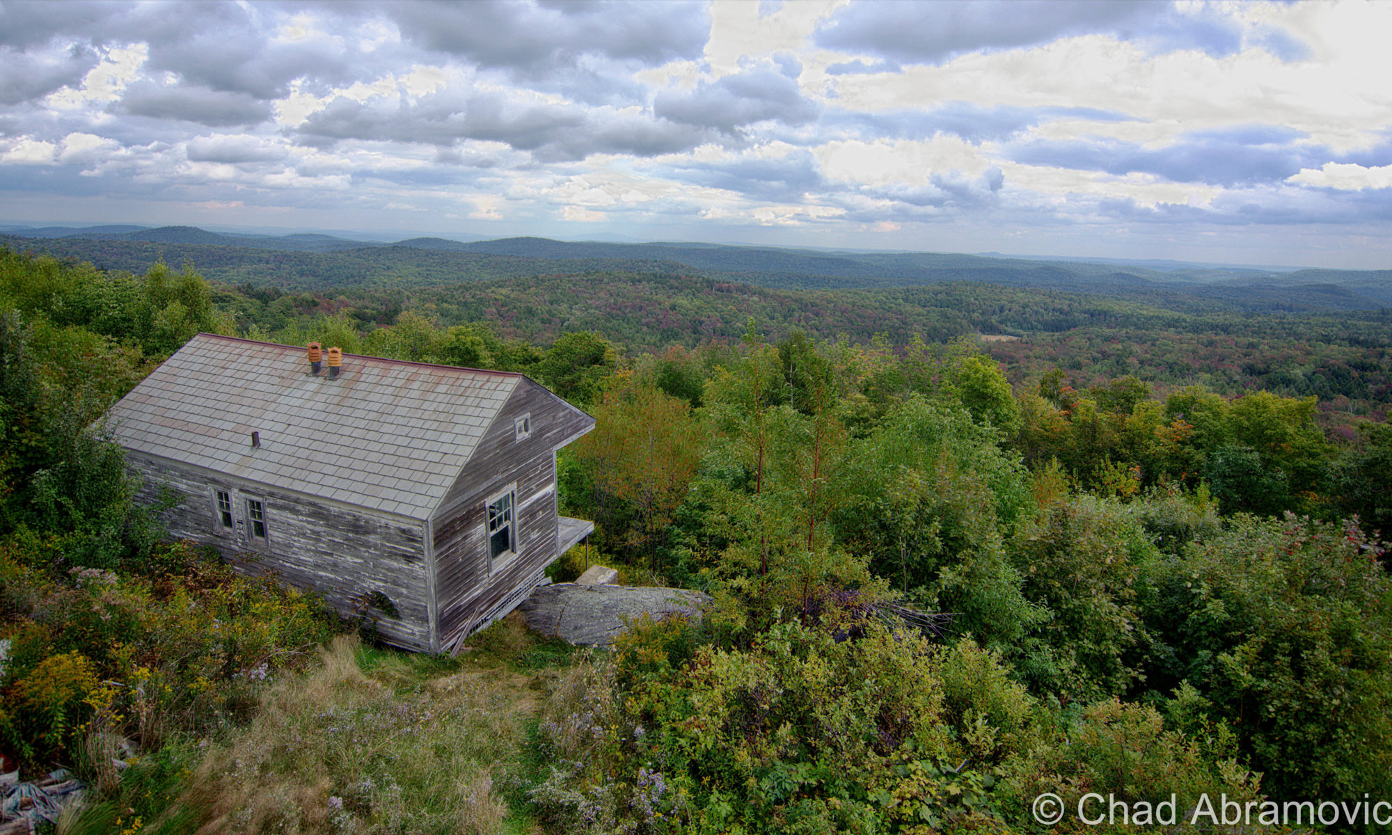
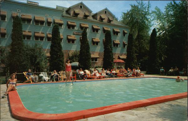
For a blog about obscure Vermont, I’m a little surprised that an abandoned farm hasn’t made the rounds in my posts yet.

Every state has stereotypes that give an oversimplified image of what it’s supposedly all about. Massachusetts is all paved suburbia and Dunkin Donuts, Maine has the ocean and fanfare for an acquired taste called Moxie, and Vermont is a bunch of farms and home to Ben and Jerry’s.

Well, in Vermont’s case, that’s not that far from the truth. Vermont is the most rural state in the nation and to prove it, we have a bunch of statistics with the word “small” in them. We have the second smallest population, the smallest largest city, the smallest tallest building, the smallest state capital, and are the 45th smallest of the states.

Growing up in Vermont, your friends most likely fall into two categories. You love it here, or you think it’s wicked boring. Personally, it’s what we don’t have that I think makes Vermont so great. There are no casinos here, no billboards, few malls and chain stores, and no amusement parks (unless you count the Pump House at Jay Peak?). And in all that space in-between our 9 cities are a lot of farms and their variations.

Agriculture has strong roots up here. Generations of Vermonters have been farmers because you did what you had to do to get by. In such a detached state, other jobs often weren’t here so you had to be self-reliant, until very recently with the emergence of the internet and a growing commuter culture. This hardscrabble lifestyle may very well have infused our culture with that independent-minded, self-sufficient ethos, devising that ‘you-can’t-get-there-from-here’ Vermonter who is crusty, stoic and has abundant old school common sense.  Stories of old farmers who toiled in the barn all day and then bootlegged whiskey at night to make enough to save their farms can still be uttered by old timers should you ask them about it.

Many surmise that this was the reasoning behind all the Poor Farm Roads that can be found across the state, because so many Vermonters were farmers who lived around the poverty line, but the actuality is more depressing. Poor Farms were institutional farm complexes that were sort of an early form of welfare, created and supported by public taxes, where anyone who couldn’t support themselves would wind up and were made to labor their days away on by doing farm work. In return, they had food, a bed, and clothes. But from what I heard about them – they were often gloomy places, and many unfortunates spent their lives there and went to the grave there. There’s a Poor Farm Road in the town I grew up in, but by the time I was aware of its namesake, most of the place had long been developed by cookie cutter rural suburbia and erased, minus one old barn which the local kids would tell me used to be part of it, and according to them, had bars on the windows and shackles still on the wall. But a trip down to the end of the road as a late teenager revealed it was just a dilapidated barn without the lingering despair.

In the 1800s, historical records say that the state was 3/4 deforested with most of the land used for sheep grazing, and later, dairy – which gave us a more cows than people ratio. Over the last century, that proportion has directly reversed, and now 3/4 of the state is back to being forested, and we now have more humans than cows – though I’m still heckled about that by flatlanders. The trend reversal started to develop during the last century when aggravated Vermonters moved westward for literal greener pastures with less rocks. We lost about half our population then, and a sizable number of towns around the state still haven’t recovered the lost numbers of their 1800 population peaks.

A good example would be the out of the way southern Vermont town of Windham. The town sharing a name with its positional county had over 1,000 bodies, a half dozen villages and 2 post offices in 1820, but by 1970, had a headcount of just 150.

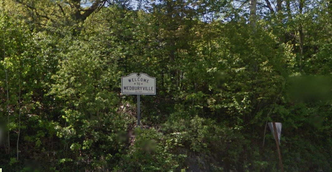
There is a place name on state maps in the town of Sunderland curiously labeled”Kansas” (there’s also a tinier “East Kansas” a mile or so east), and the odd name is said to have came from a curmudgeonly old farmer who in the 1800s, kept making empty threats to his family, other Sunderlandians, and anyone else who’d listen, that he was so fed up with his rocky fields that he was going to sell his farm and move to Kansas. Only, he never did, and died right there in Bennington County. That part of town became known as Kansas by the locals and soon became a wayfinding moniker.

Vermont still has plenty of agricultural affairs left, but with milk prices not equaling the cost of production, dairy is slowly and steadily dying. Farmers are even callously getting flyers with suicide prevention hotline numbers on them in the mail.

But despite dwindling farms around the country, smaller horticultural farms are taking root all over the state and growing – mostly supporting modern-day farm to table fads, which means Vermont’s emerging restaurants and craft breweries can come blazing through wearing the future on its sleeve.

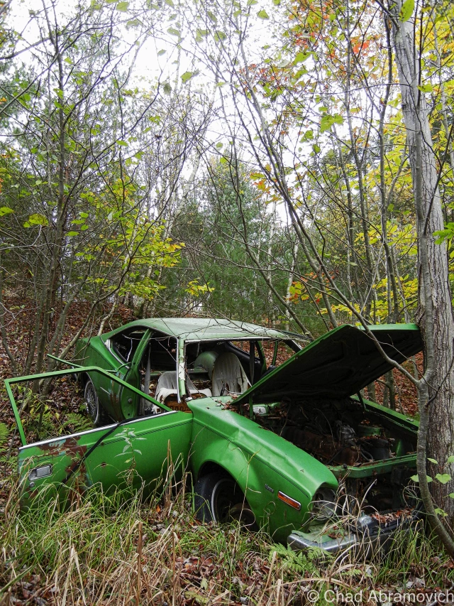
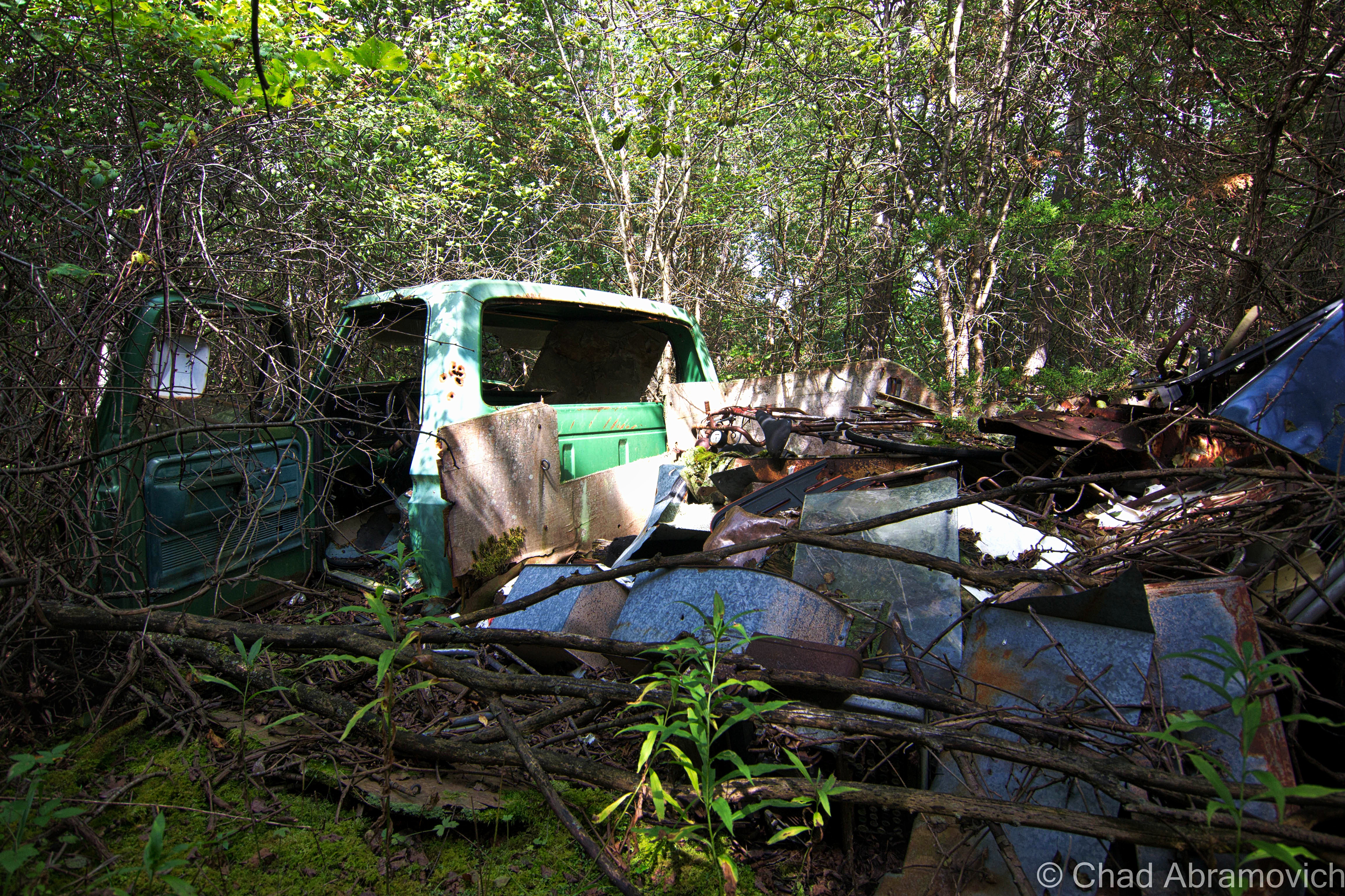
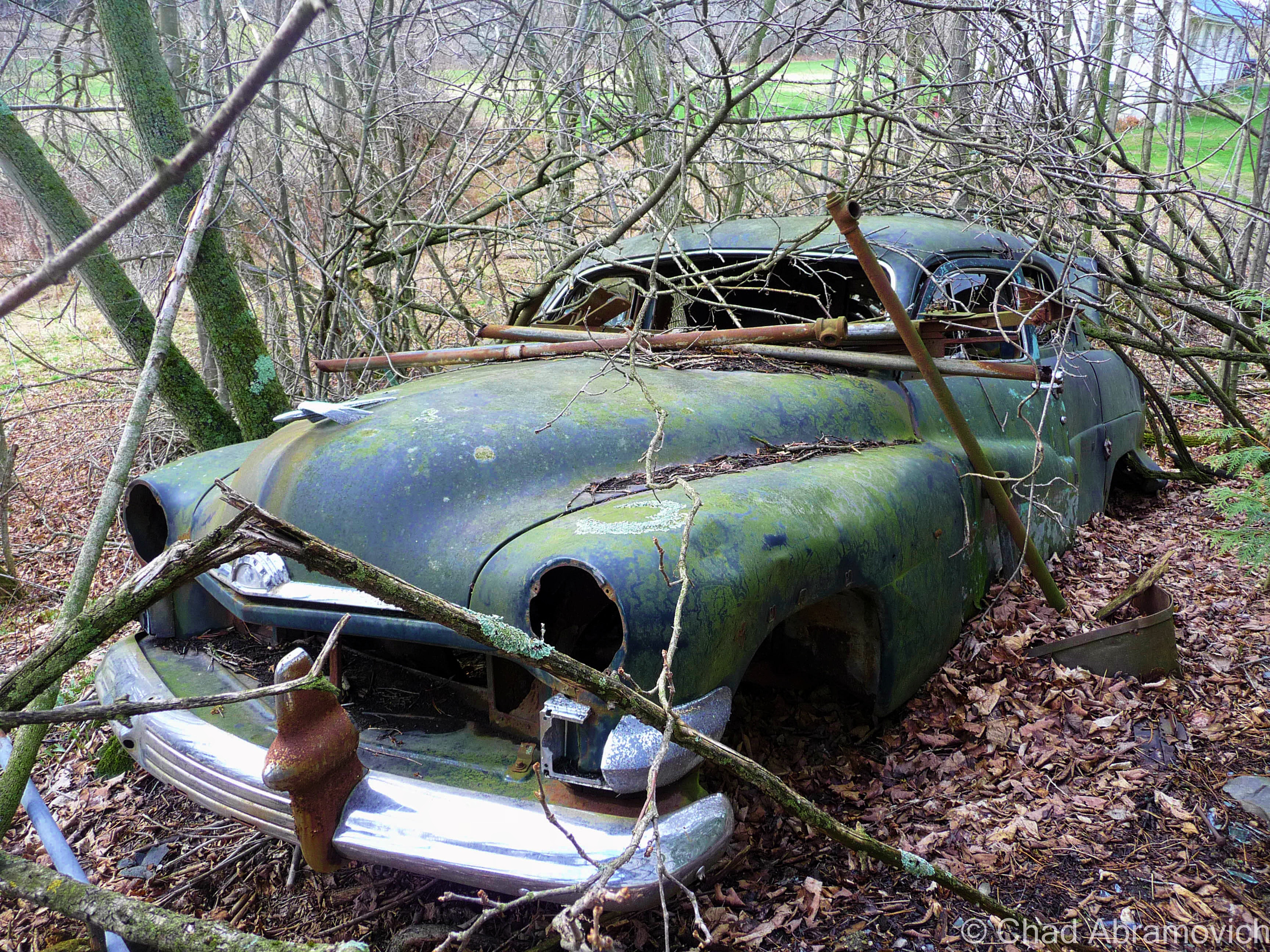
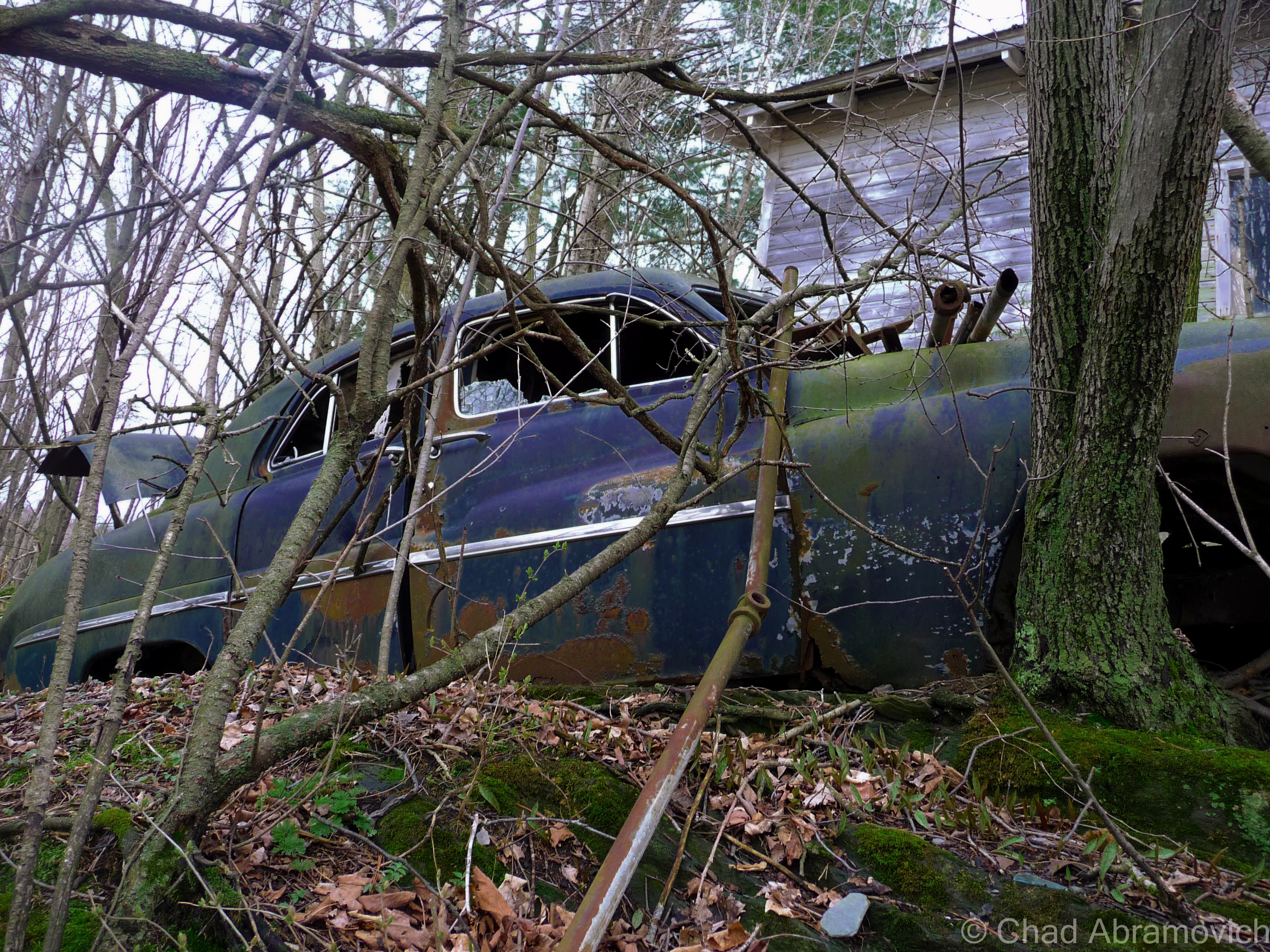
As a kid, I grew up playing in the woods of an old farm behind my house. Most of the land wasn’t tended and had grown up into a mature forest by then. We used to cut 4 wheeler trails through the growth and explore the old farm roads and examine artifacts from yesteryear we’d come across, like old barbed wire fences, a neon green AMC Hornet pushed into a ravine, and the prime find – the grimy miscellany of the old farmers’ junkyard. We used to salvage stuff from the heaps of junked appliances, tires, and barn mementos and use it to build forts with. Old tin, a couch, the front seats from an old Ford Mustang, even an old woodstove. We made some cool hangouts from the refuse we excitedly recycled.

Milton – this fading green AMC Hornet lies on a steep bank behind a rural stretch of railroad tracks, on the edge of a patch of thick swampland. it looks as if someone pushed (or quite possibly drove) the car down the hill, where it lays to rest.

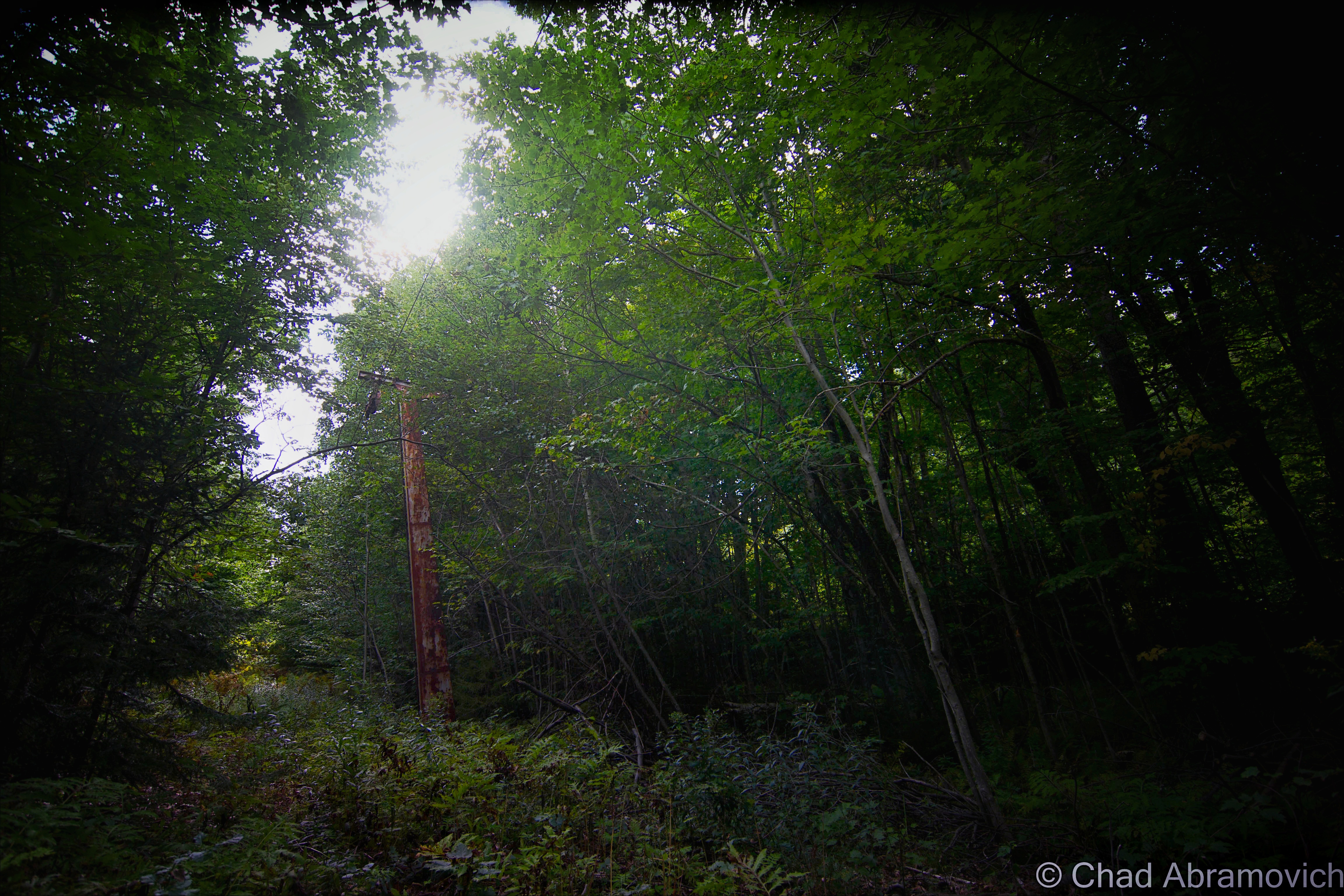
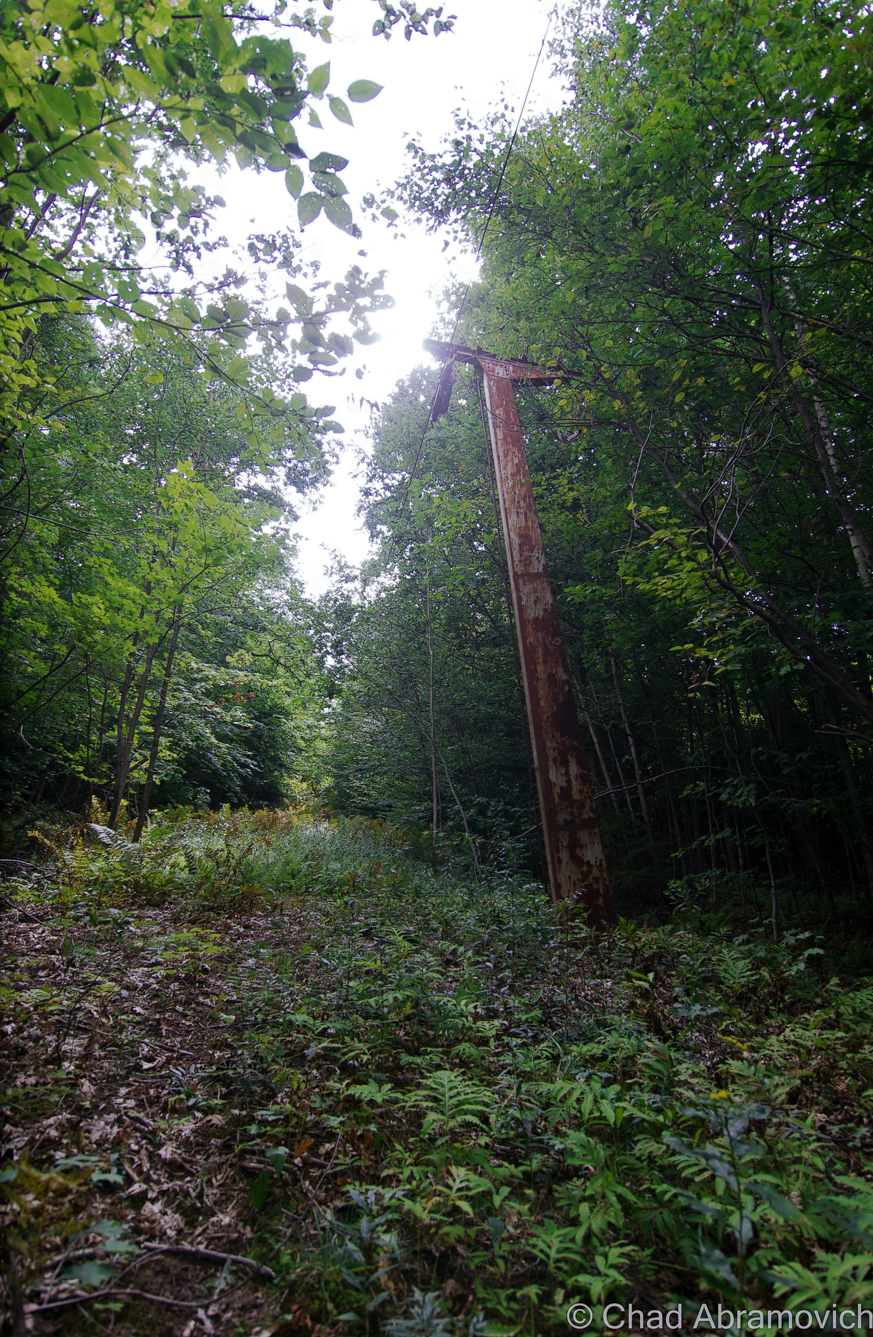
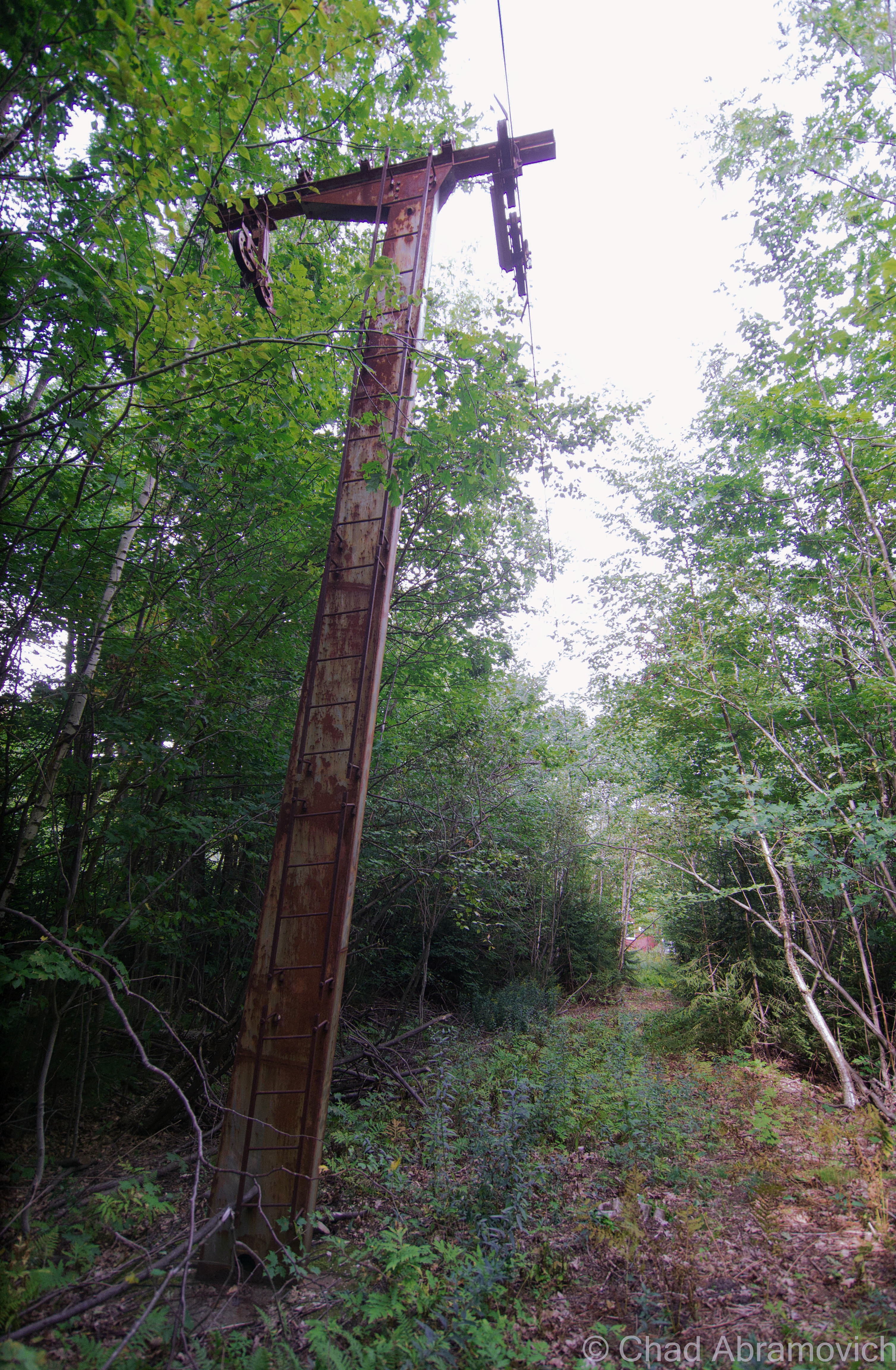
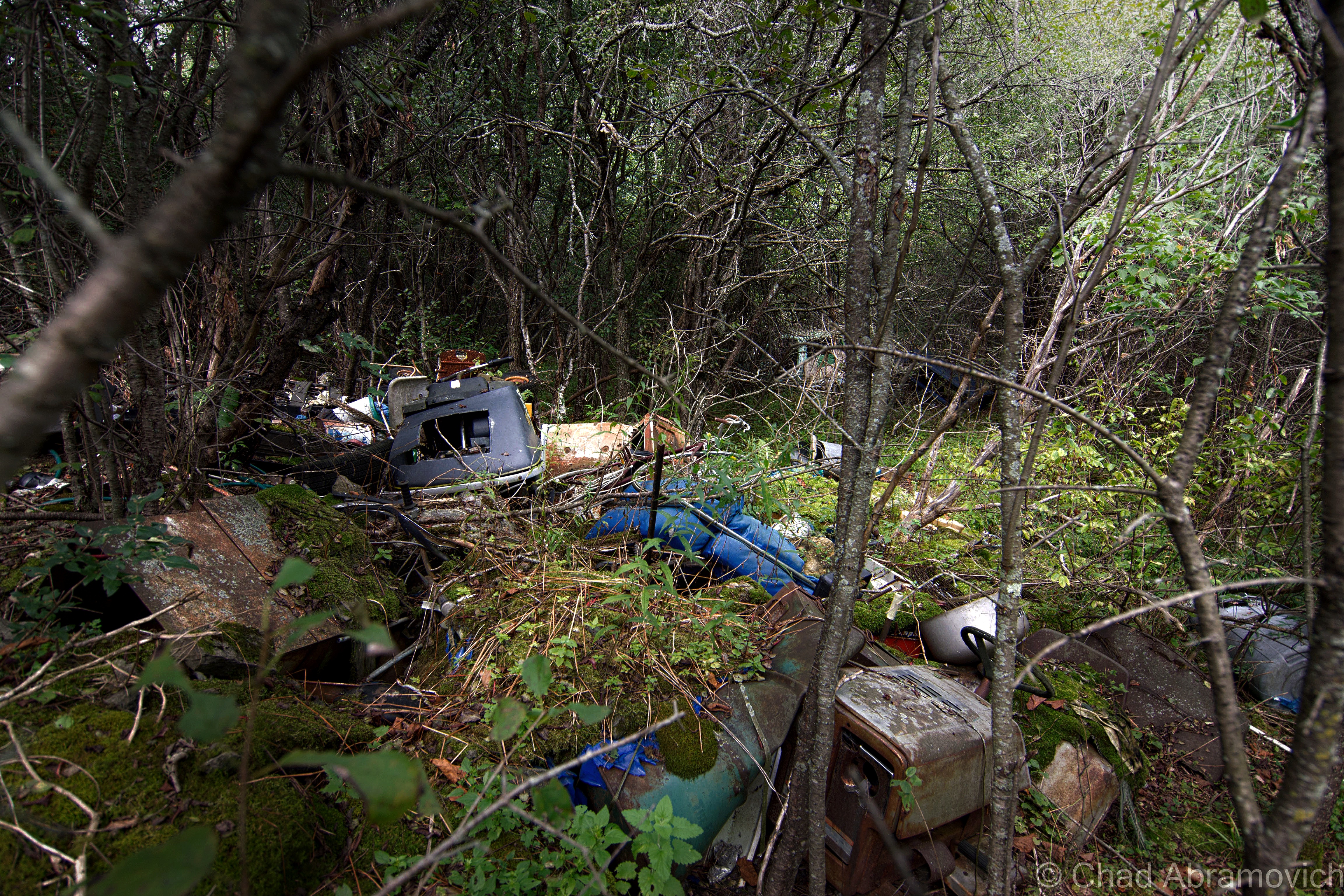
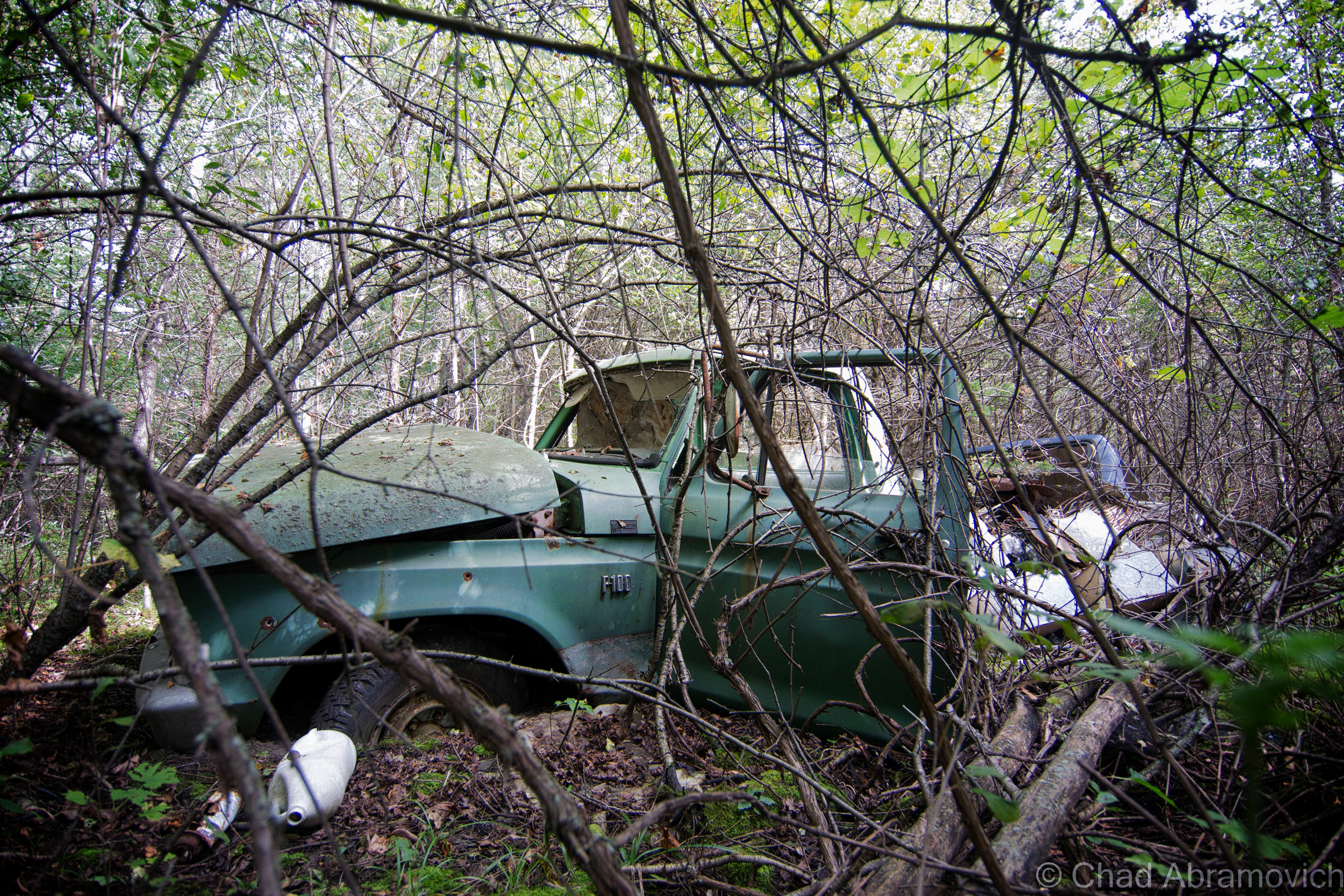
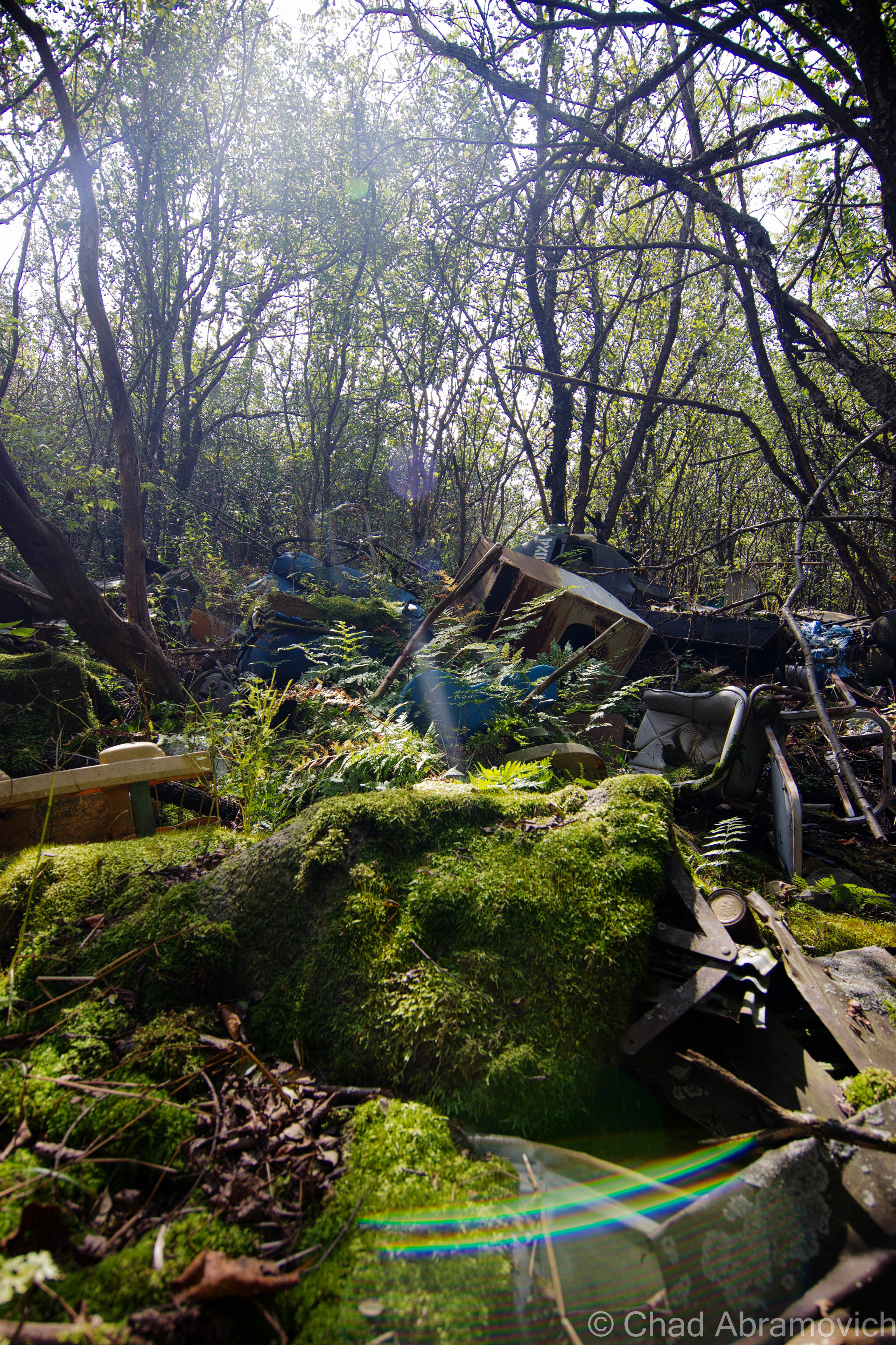
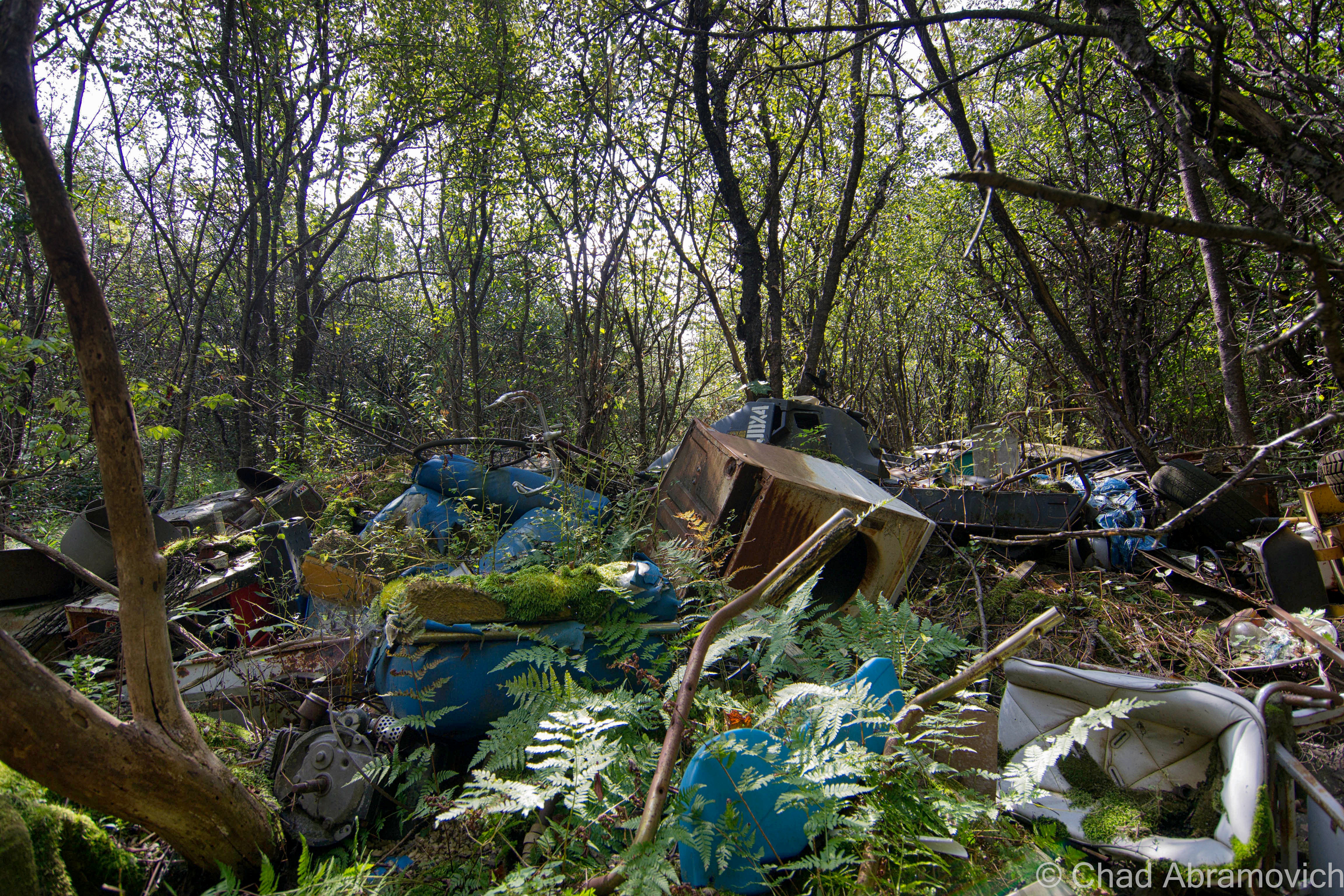
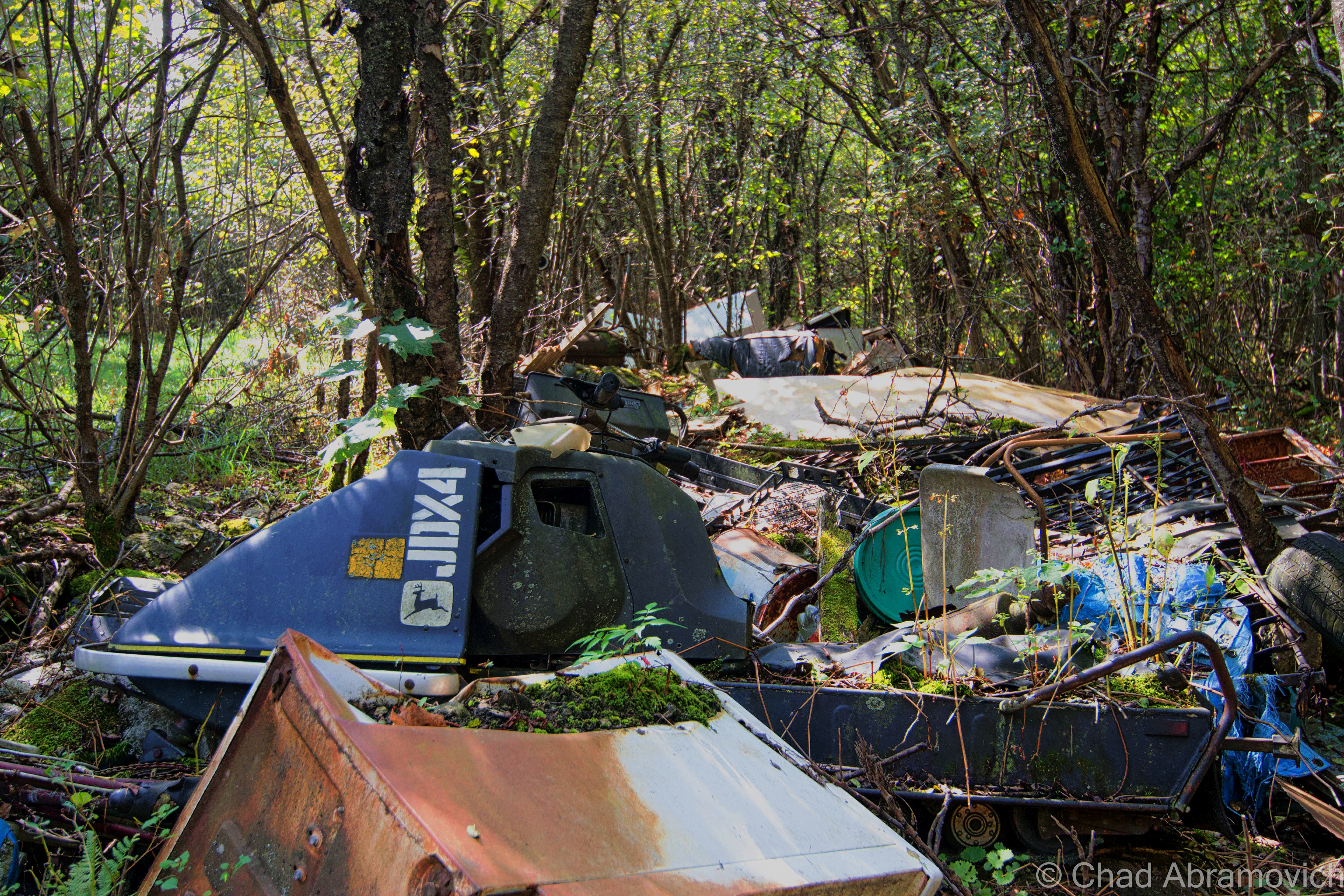
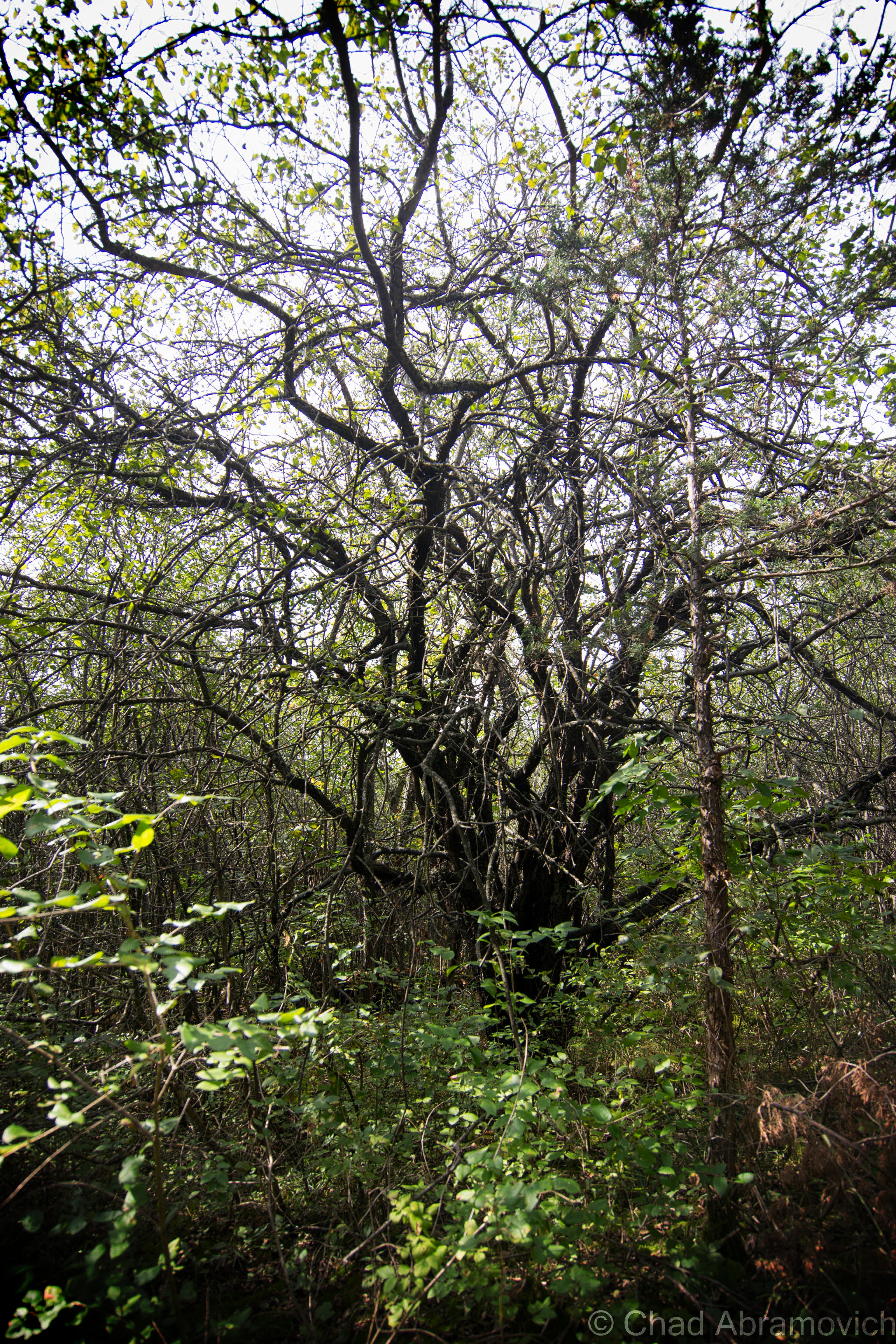
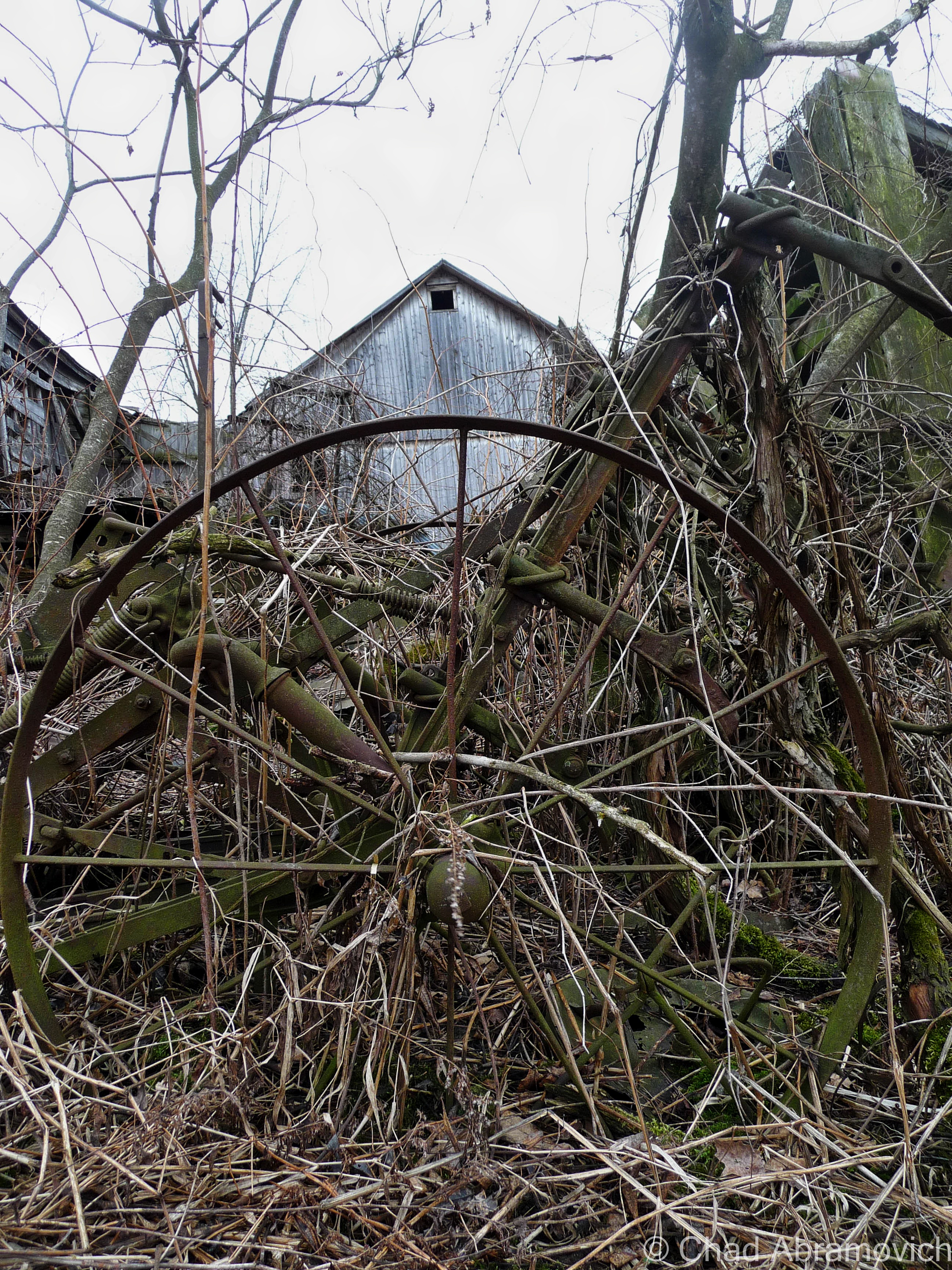
A friend of mine got in touch with me and said she had a new location up her sleeves, an abandoned farm up in the north part of the state, the dumping ground part of it was on her property and she hadn’t gotten around to doing anything about it yet. I thought it was weird that I live in Vermont and haven’t explored a farm yet. So on a beautiful autumn day, I met up with her and she led me through some overgrown tangle woods of nettles, dead apple trees and mangey looking cedar trees that turned the area into a dark entry. A few minutes into our walk and the already fallow landscape began to change, and I began to notice mounds of discarded anything covered in moss and fallen leaves that had been dumped underneath the dead canopy.

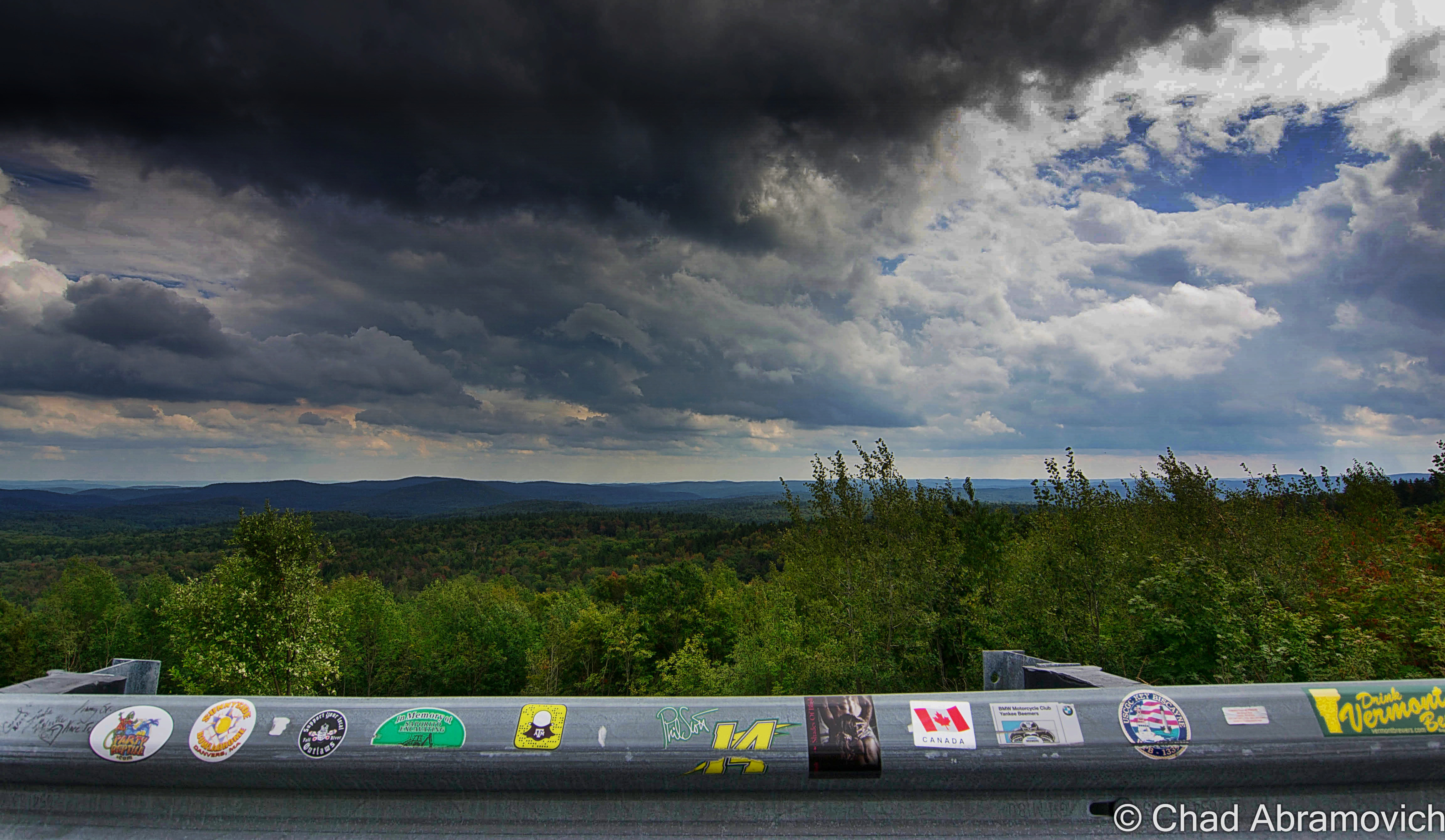
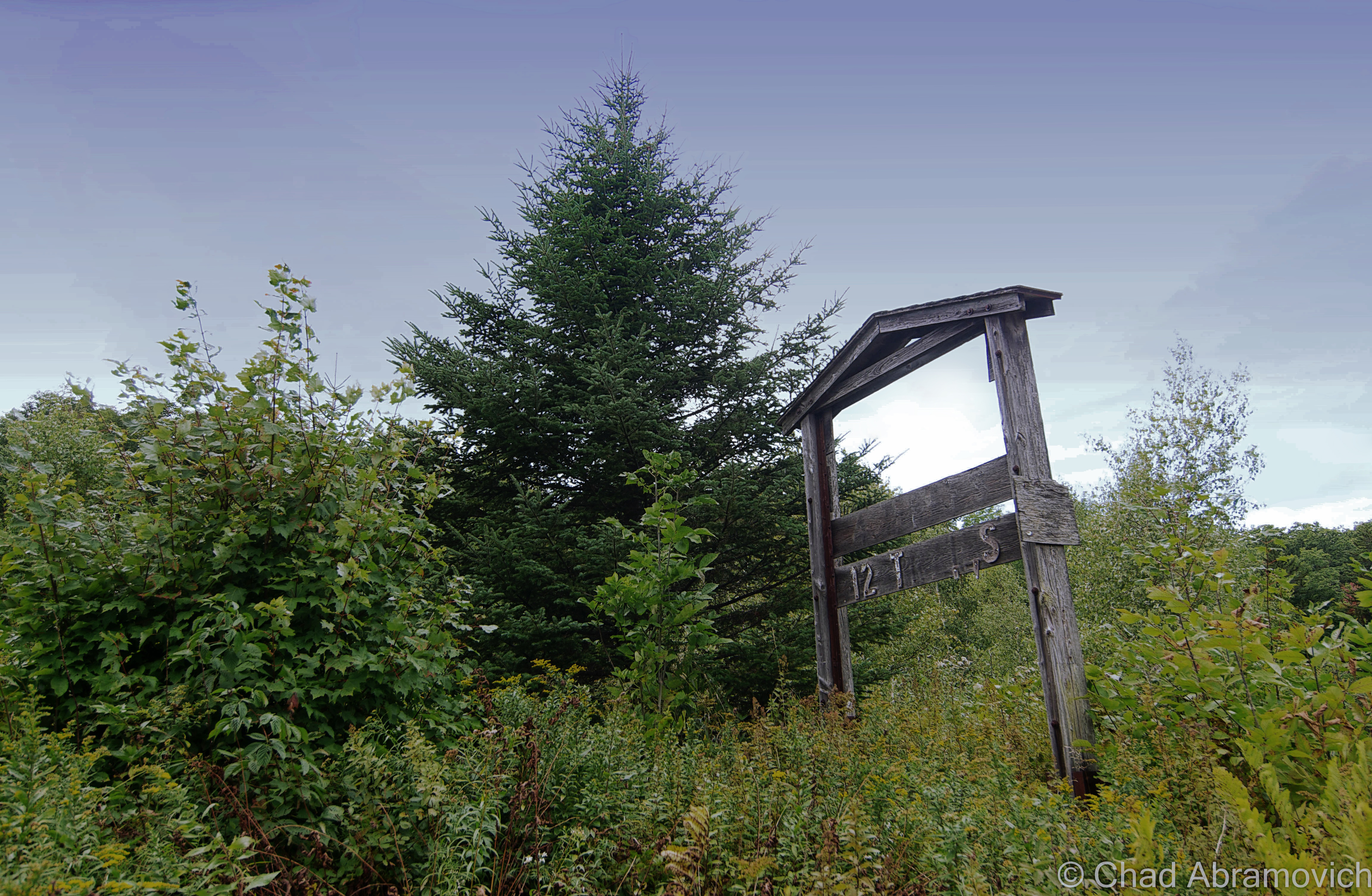
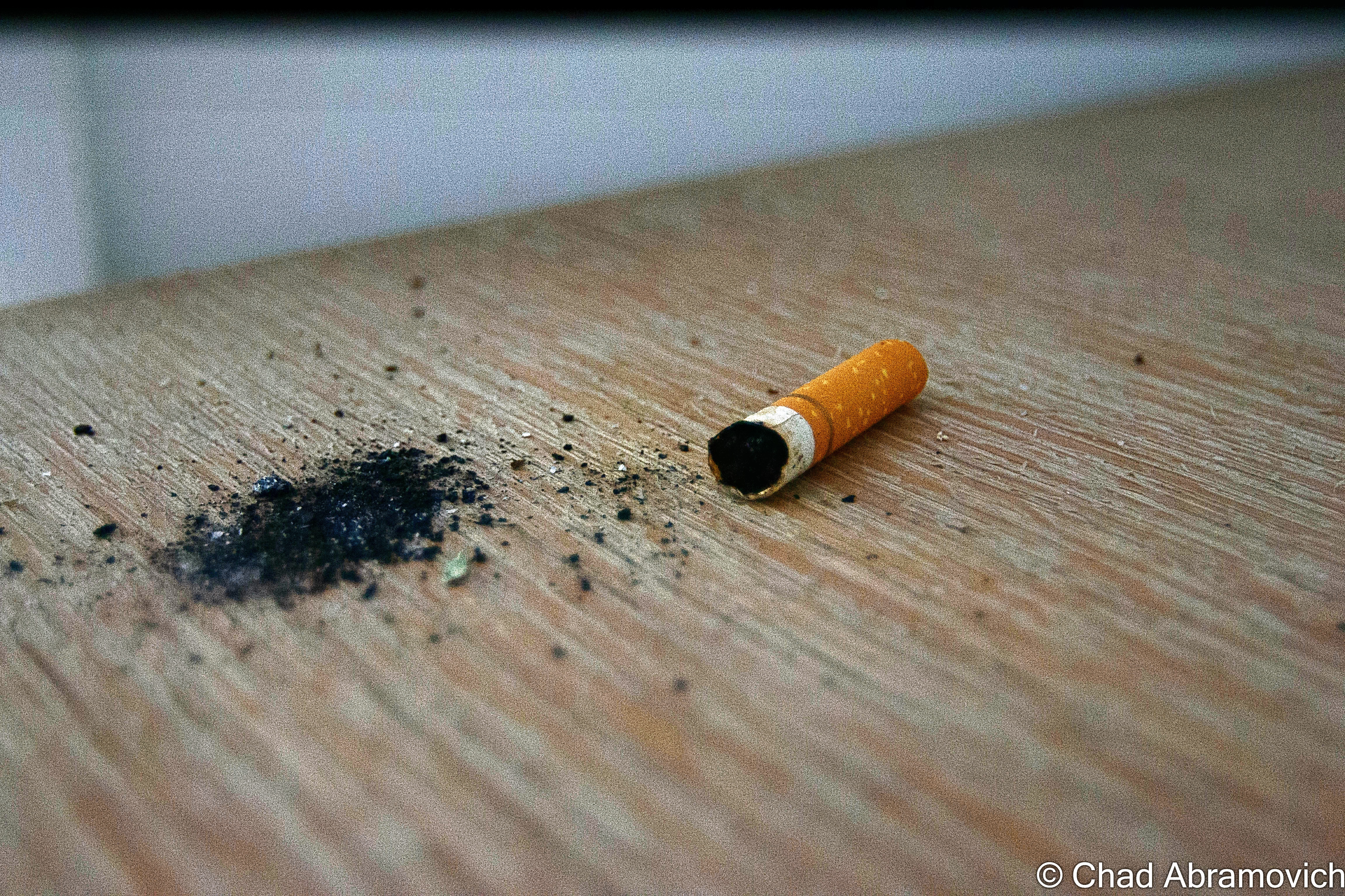
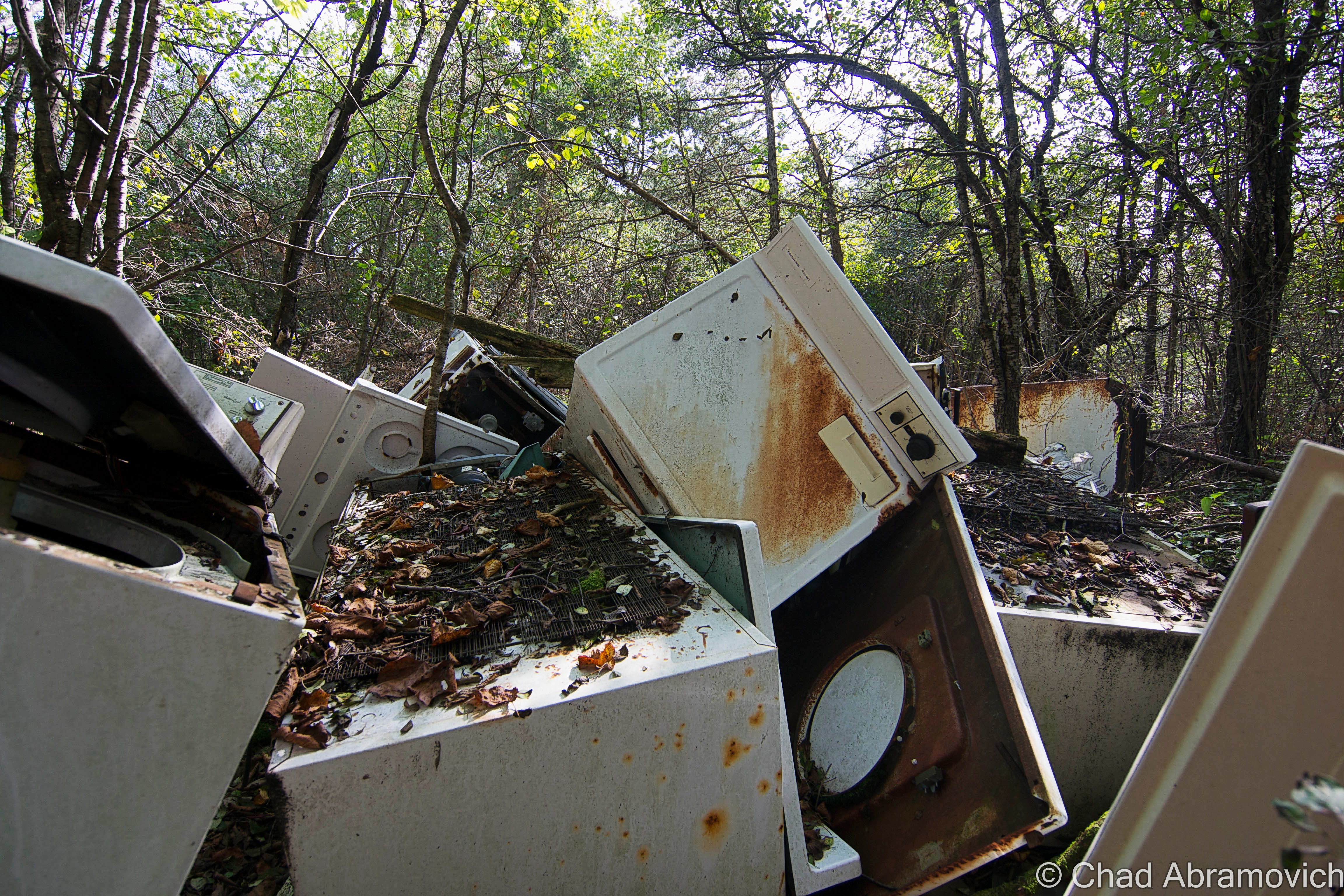
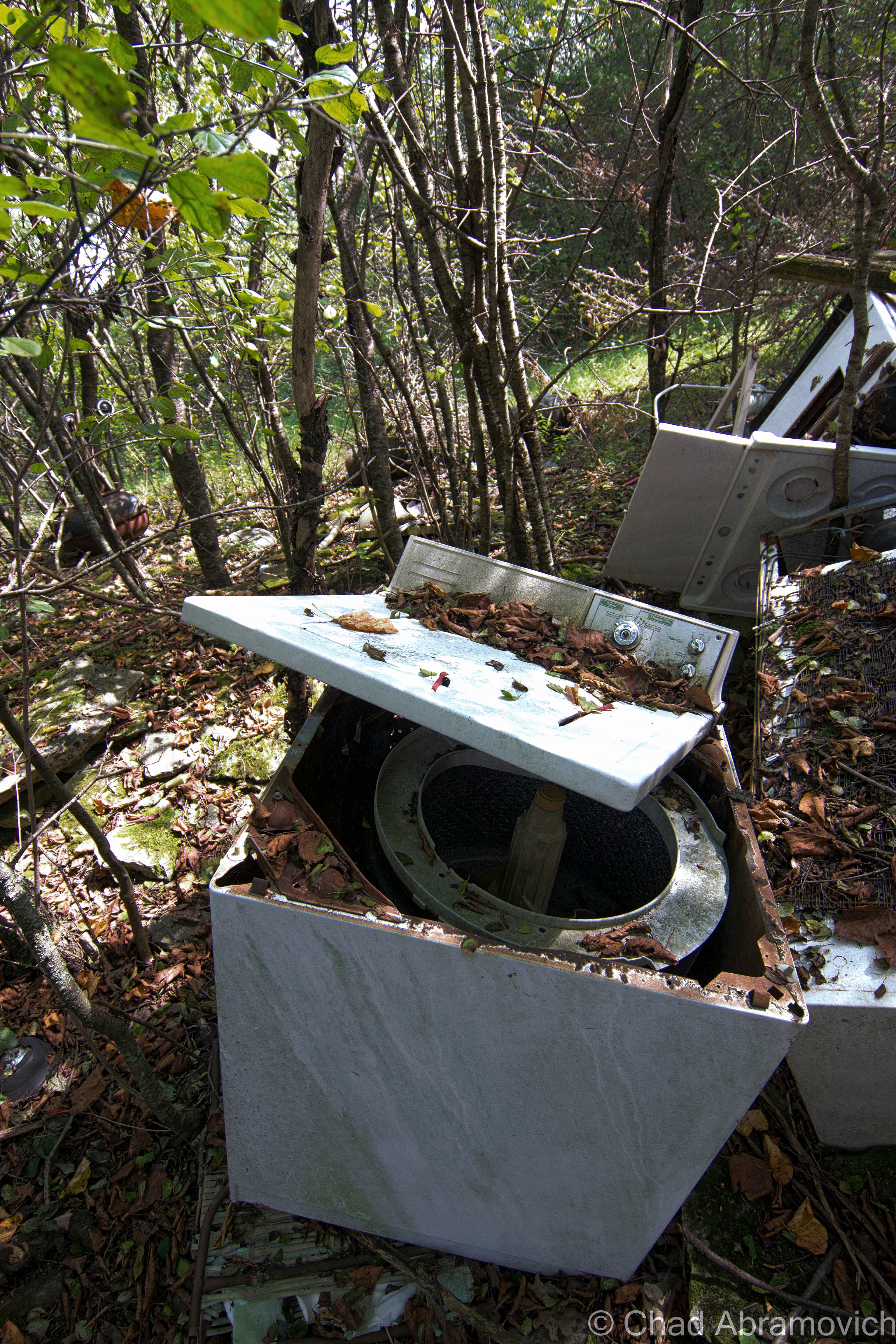
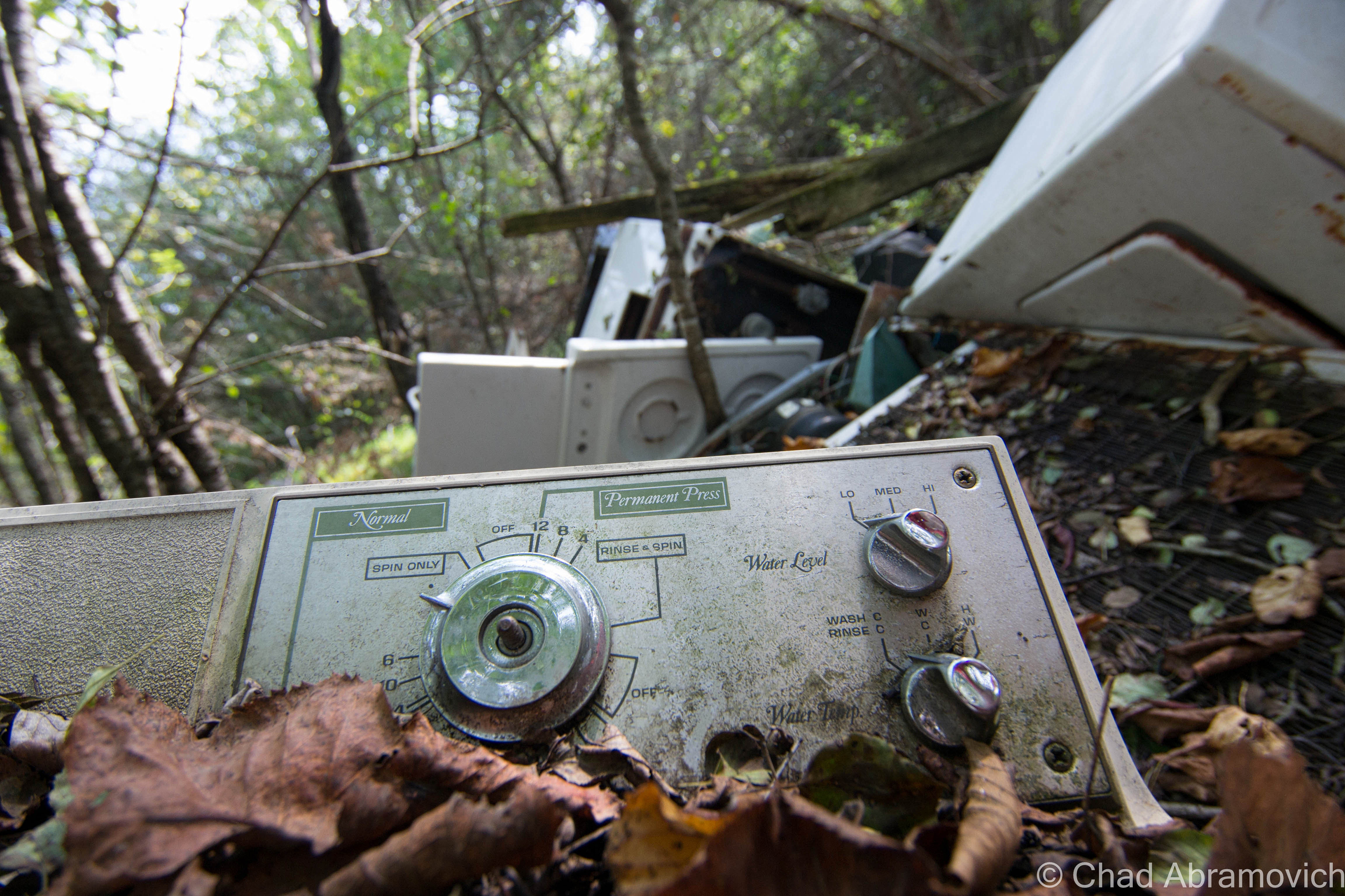
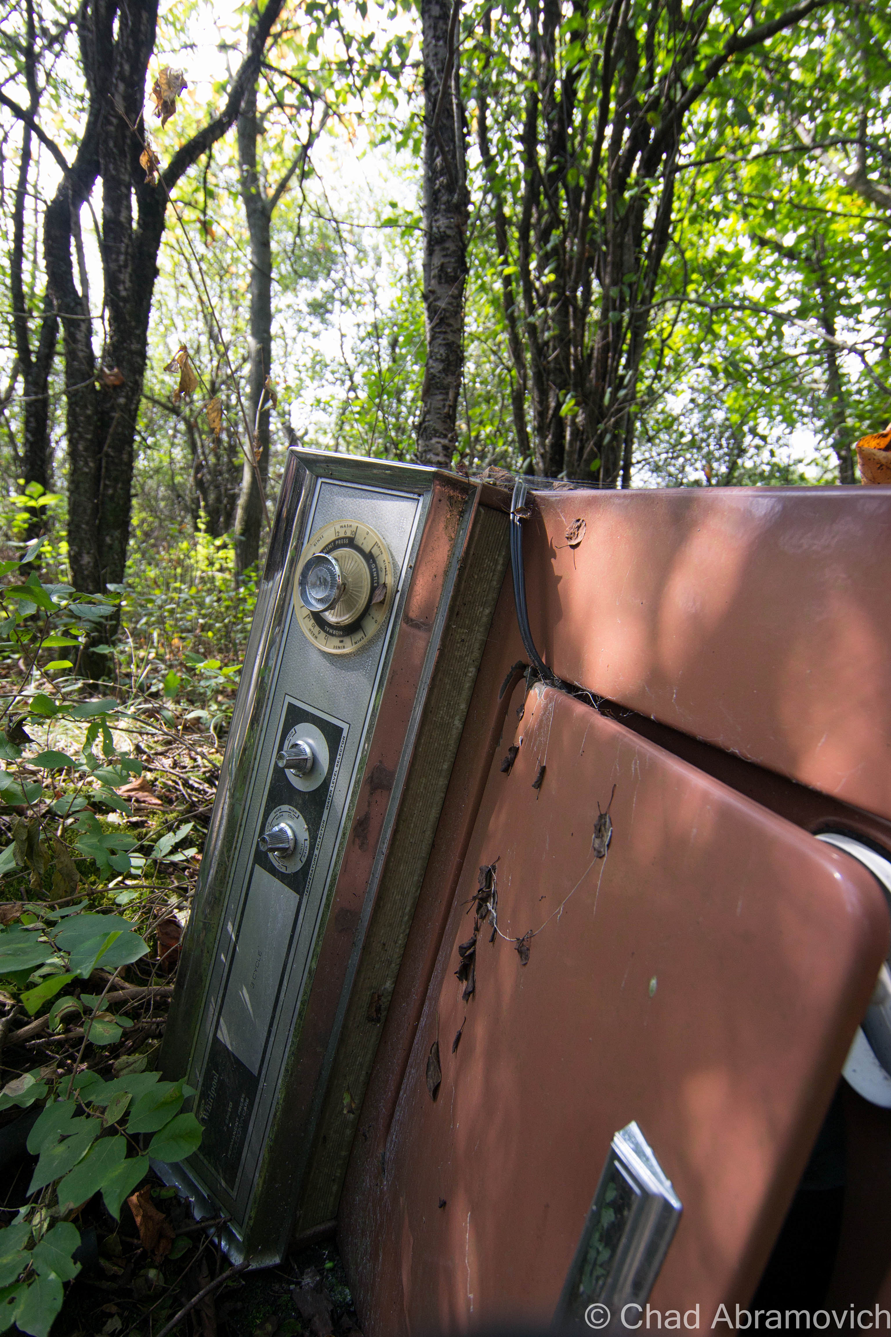
A walk through the Vermont woods can often be revealing. It’s not uncommon to find relics from a different Vermont left to disintegrate below the trees. And in my opinion – our ruins are often one of the coolest things about the human race. We create amazing structures and accomplishments or inhabit these laborious lifestyles and let the aftereffects rot without much of a thought, leaving people like me to eagerly trace their occurrences that blur the line between litter and urban archeology. And out of any time of the year, you can be most appreciative of our habit to ruin than the fall, when visibility is best.

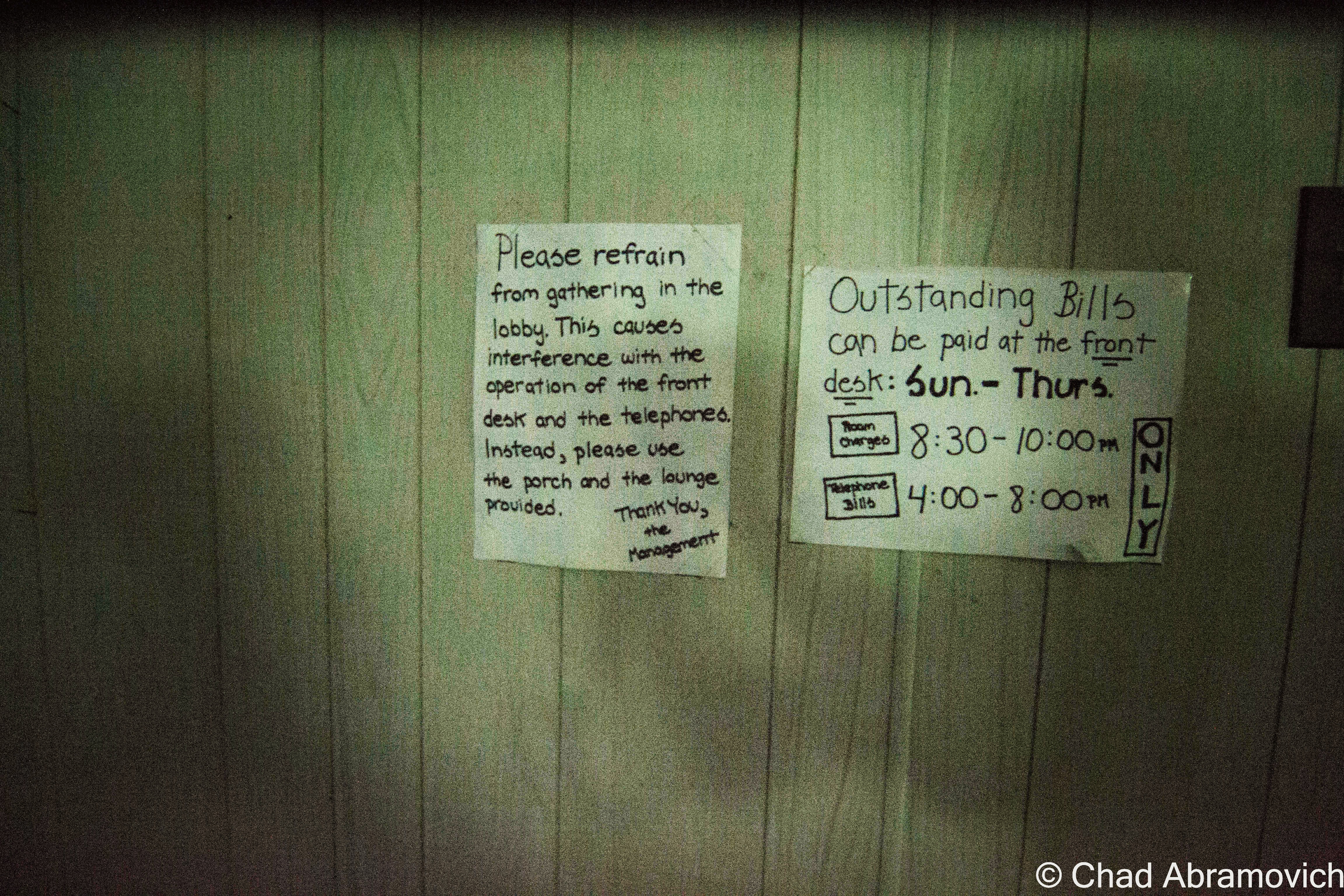
There was a time not that long ago, when Vermonters didn’t dig today’s Green culture. Back then, the most efficient and convenient way to get rid of anything you deemed as garbage, was to make the disposal quick and uncomplicated. This was often accomplished by dumping those items on a far corner of the farm, or let gravity take it down a river bank. Over time, these items accumulated, festering in the woods long after the farm went defunct, or their traces bleeding into our waterways or soil.

How times have changed. Today, a growing chunk of Vermonters are building a culture that feels how we coexist with our environment is a virtue, and villainize those things that don’t fall into place. And if you’re not one of those people, well, it’s also the law. But as is the trend, the movement also shakes things up, especially farmers who find it expensive and laborious to abide by new regulations, or the costs of implementing new laws or infrastructure by a government that many are losing faith in.

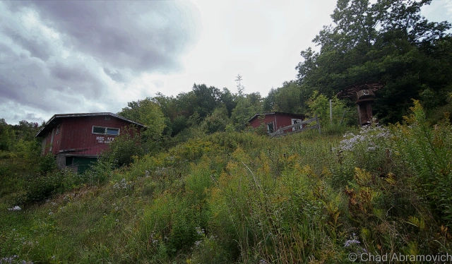
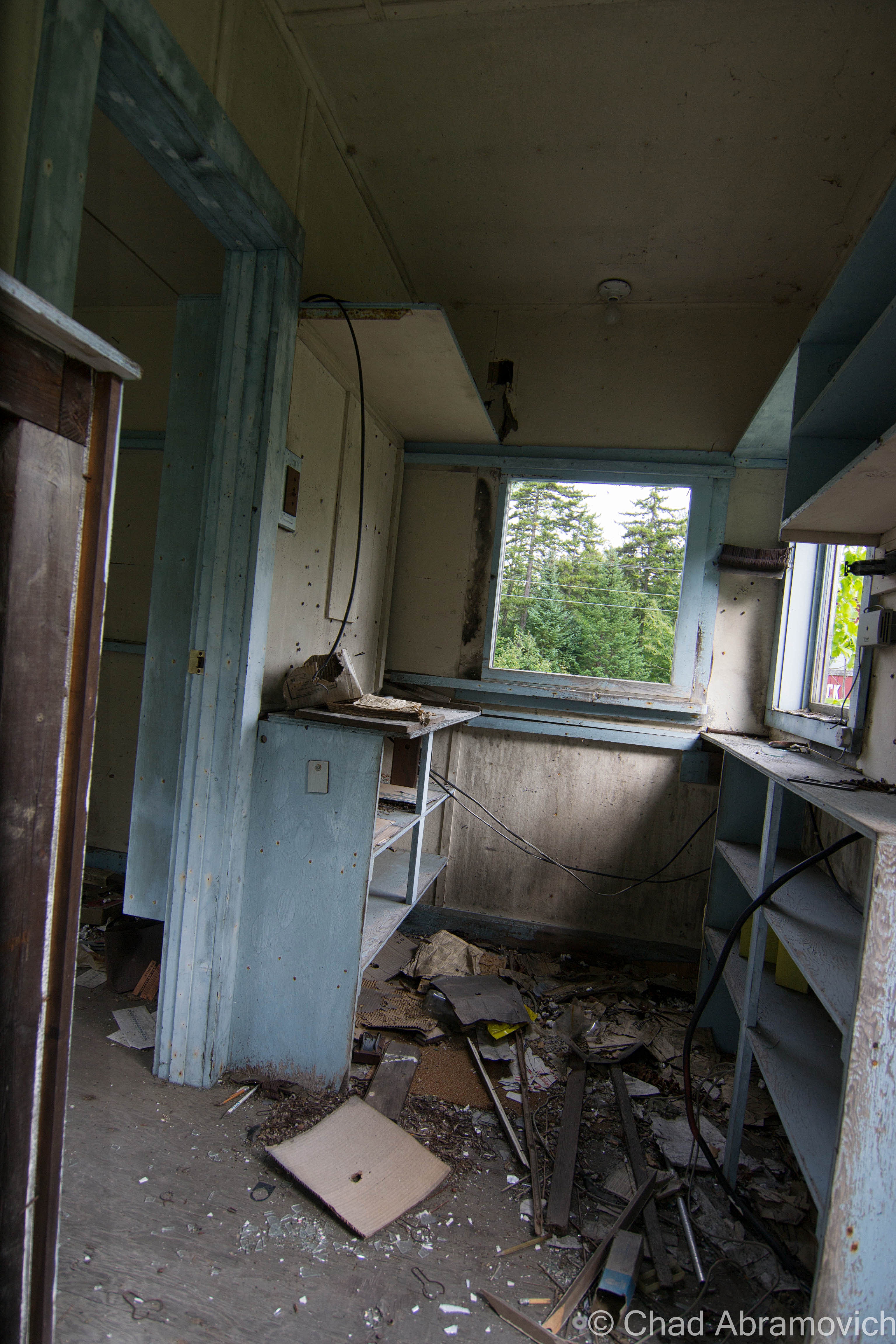
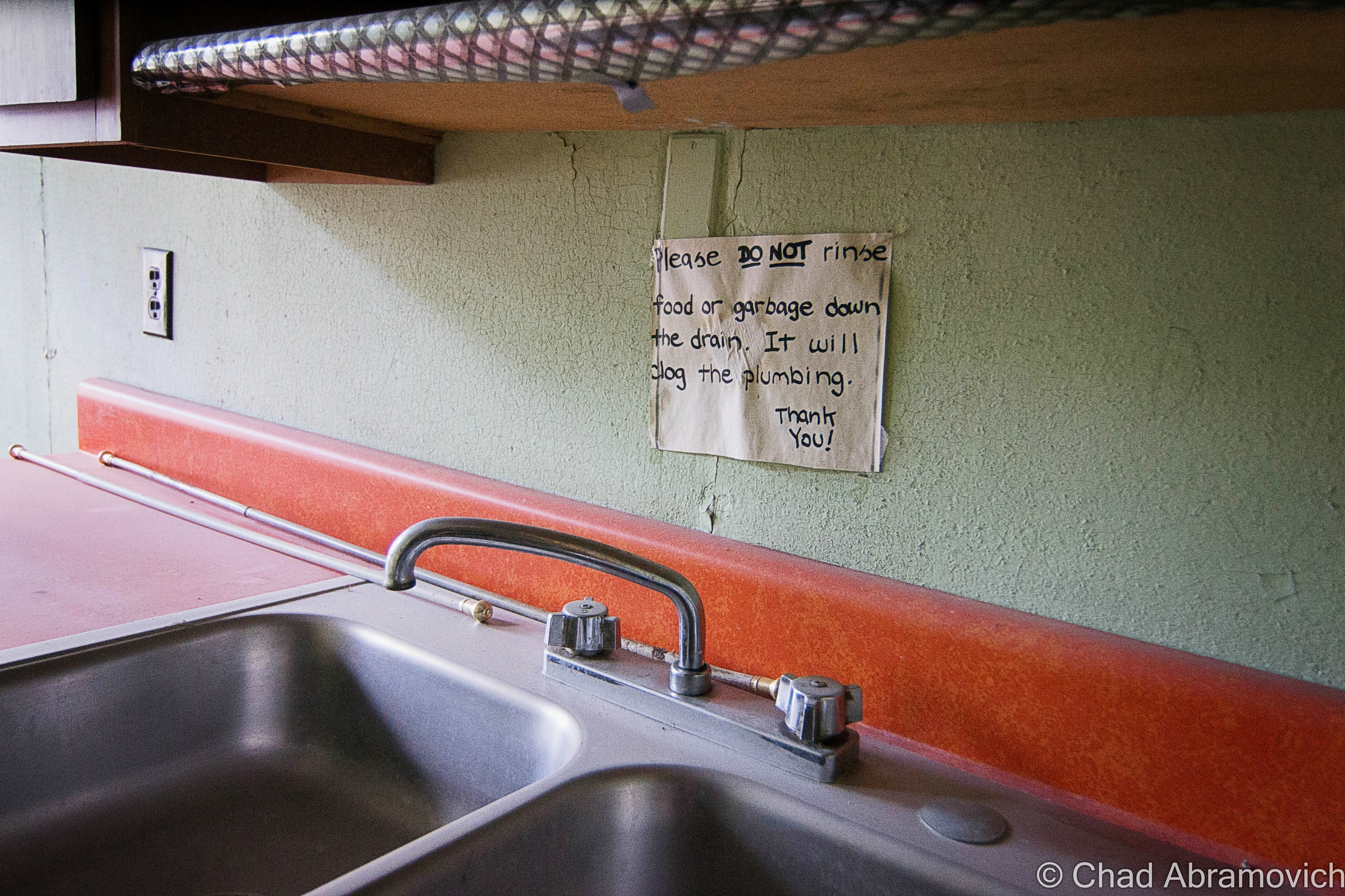
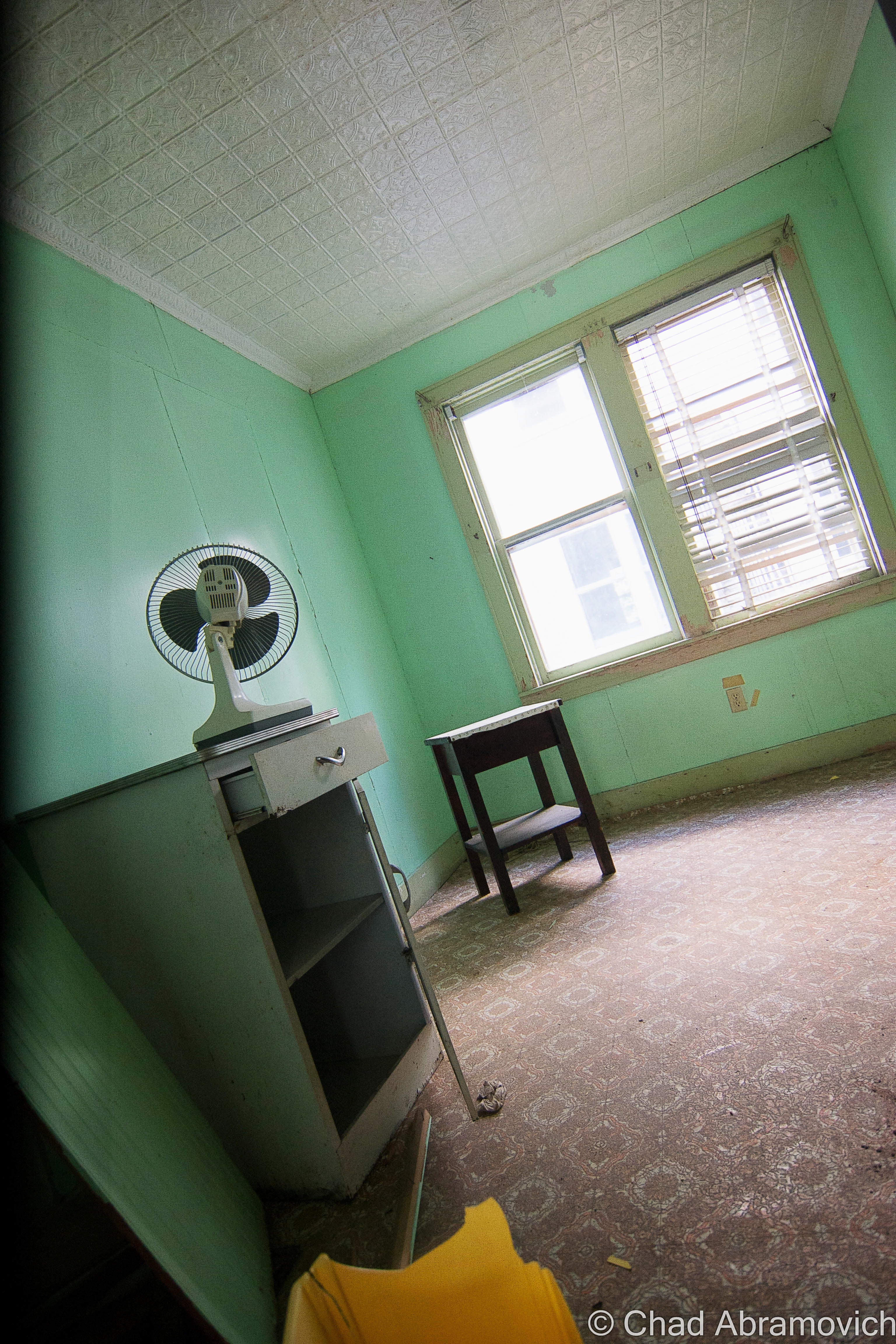
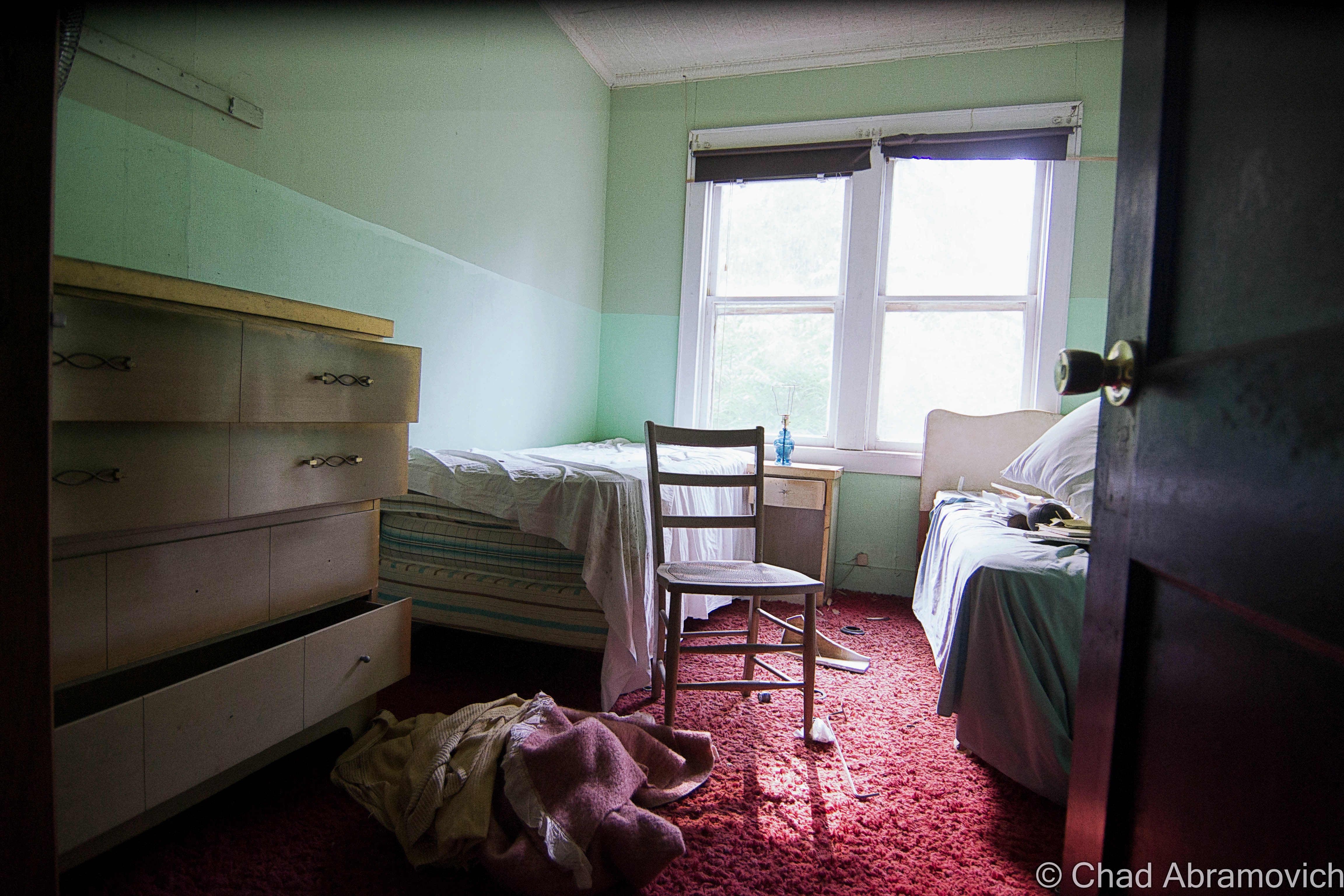
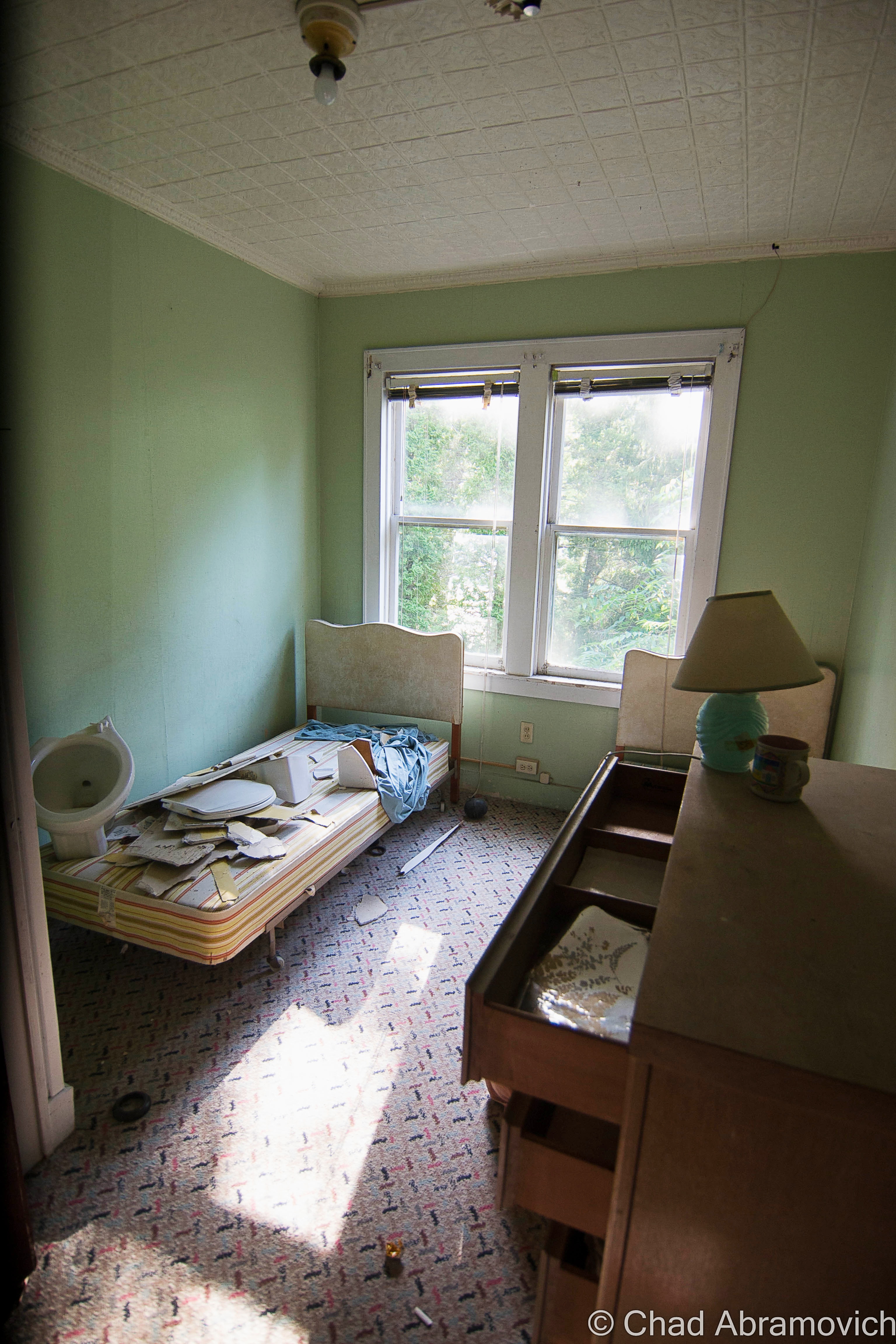
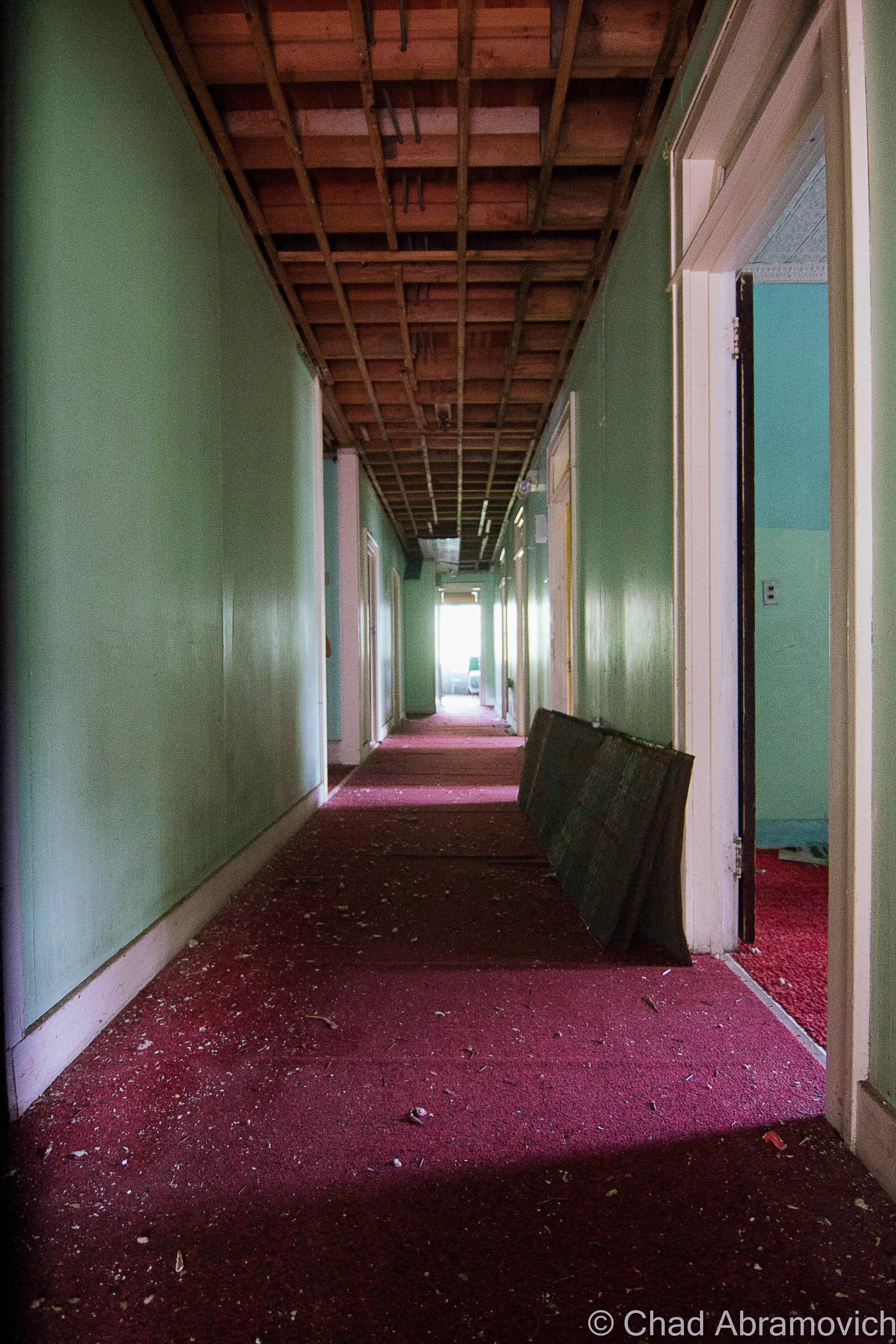
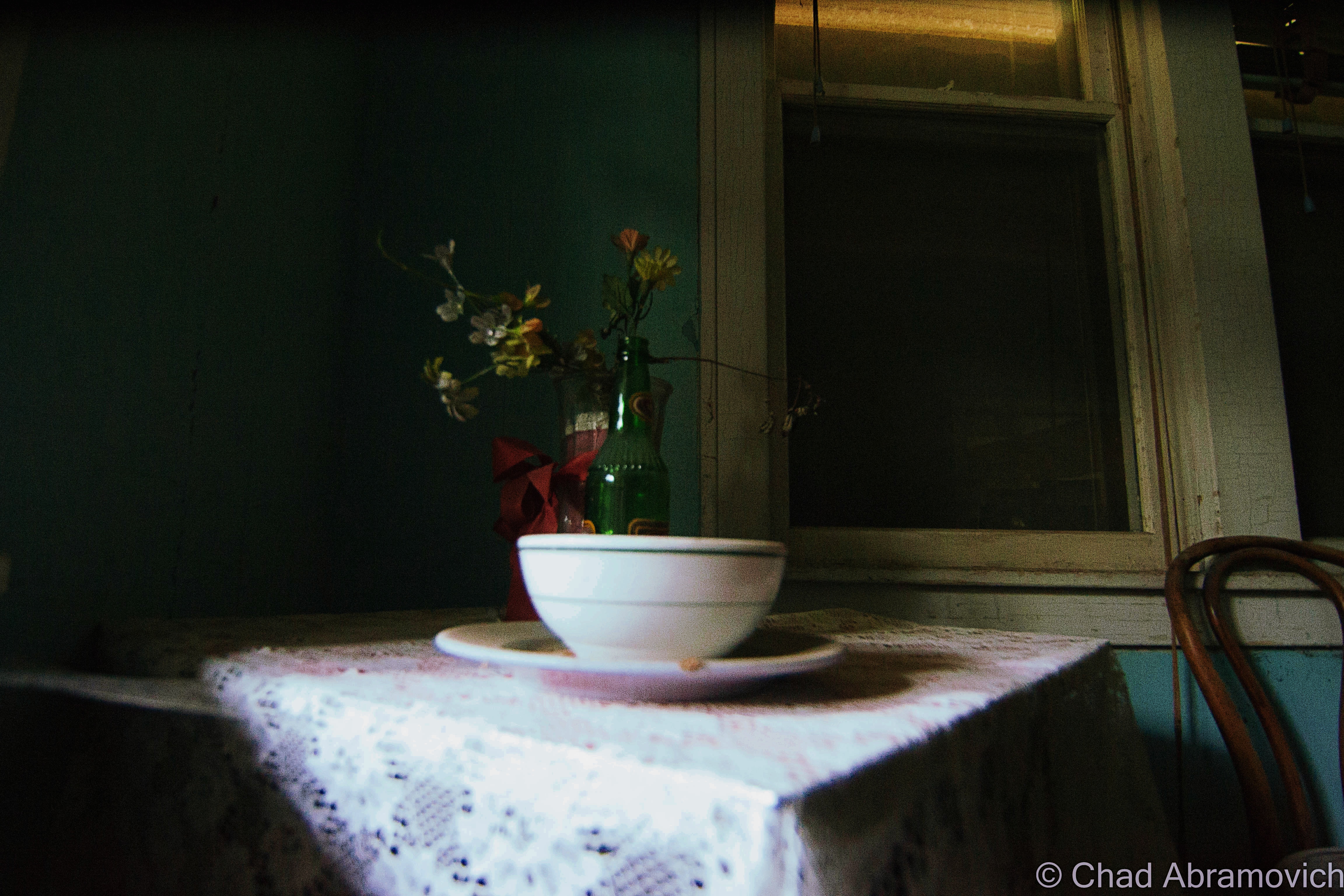
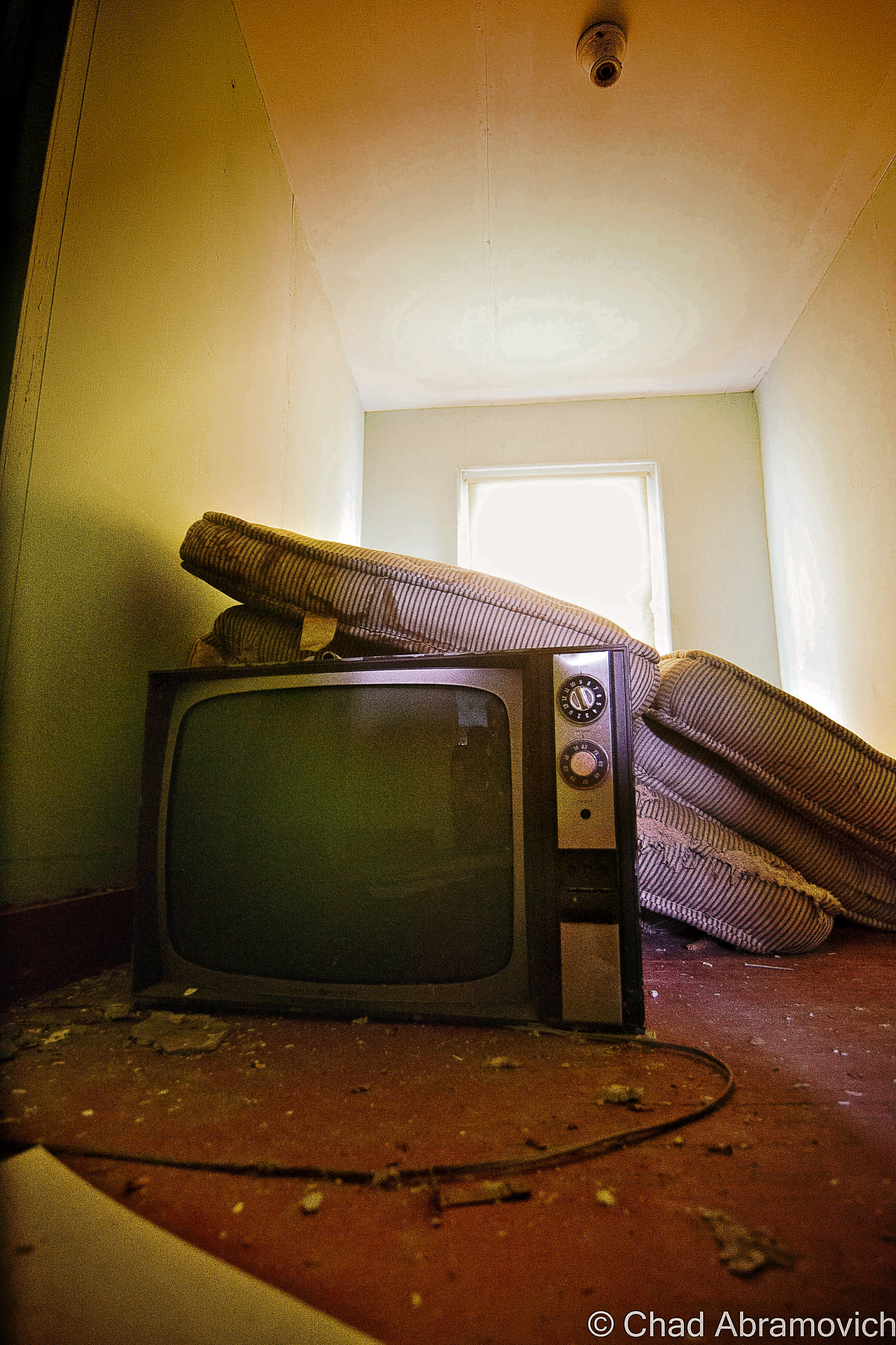
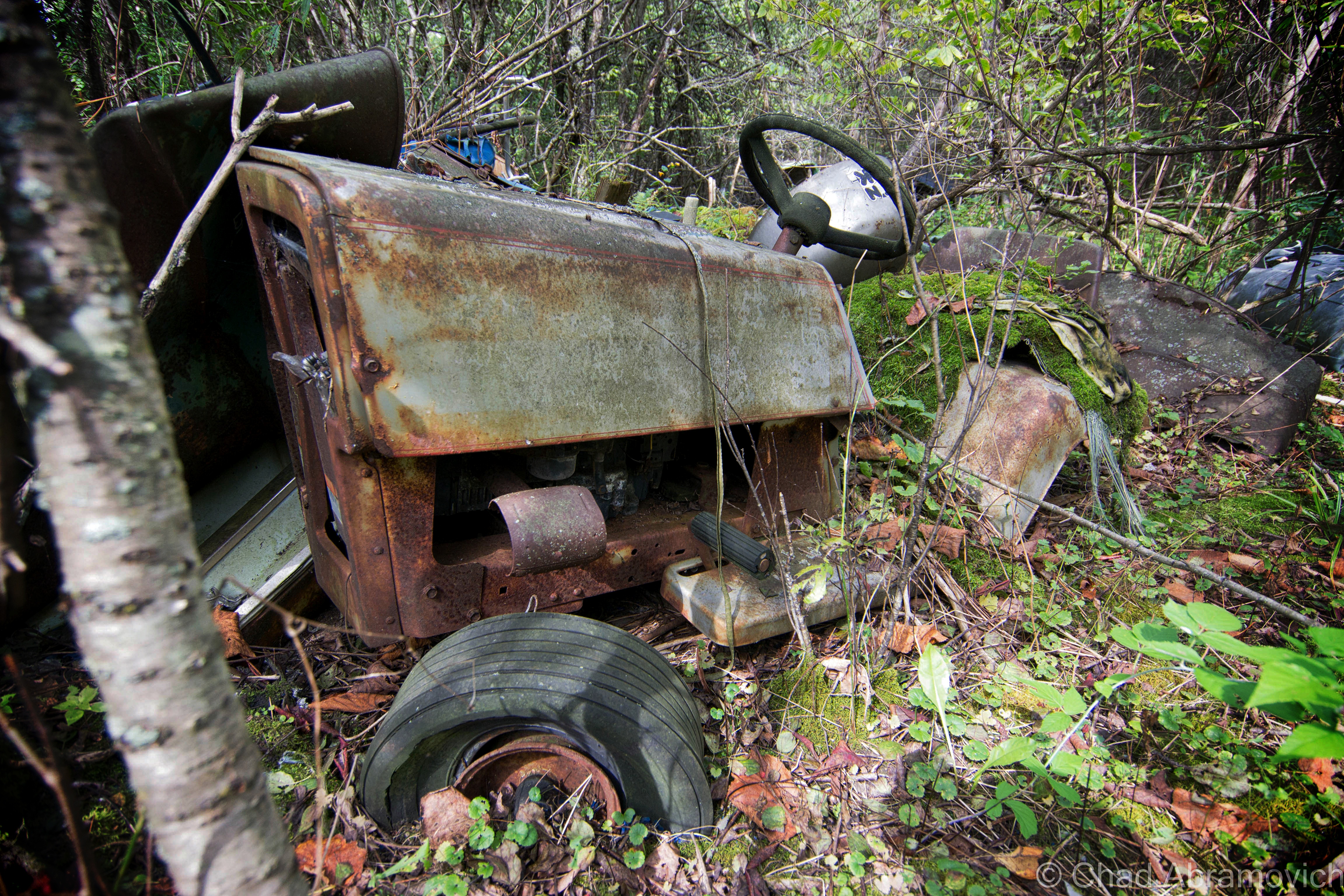
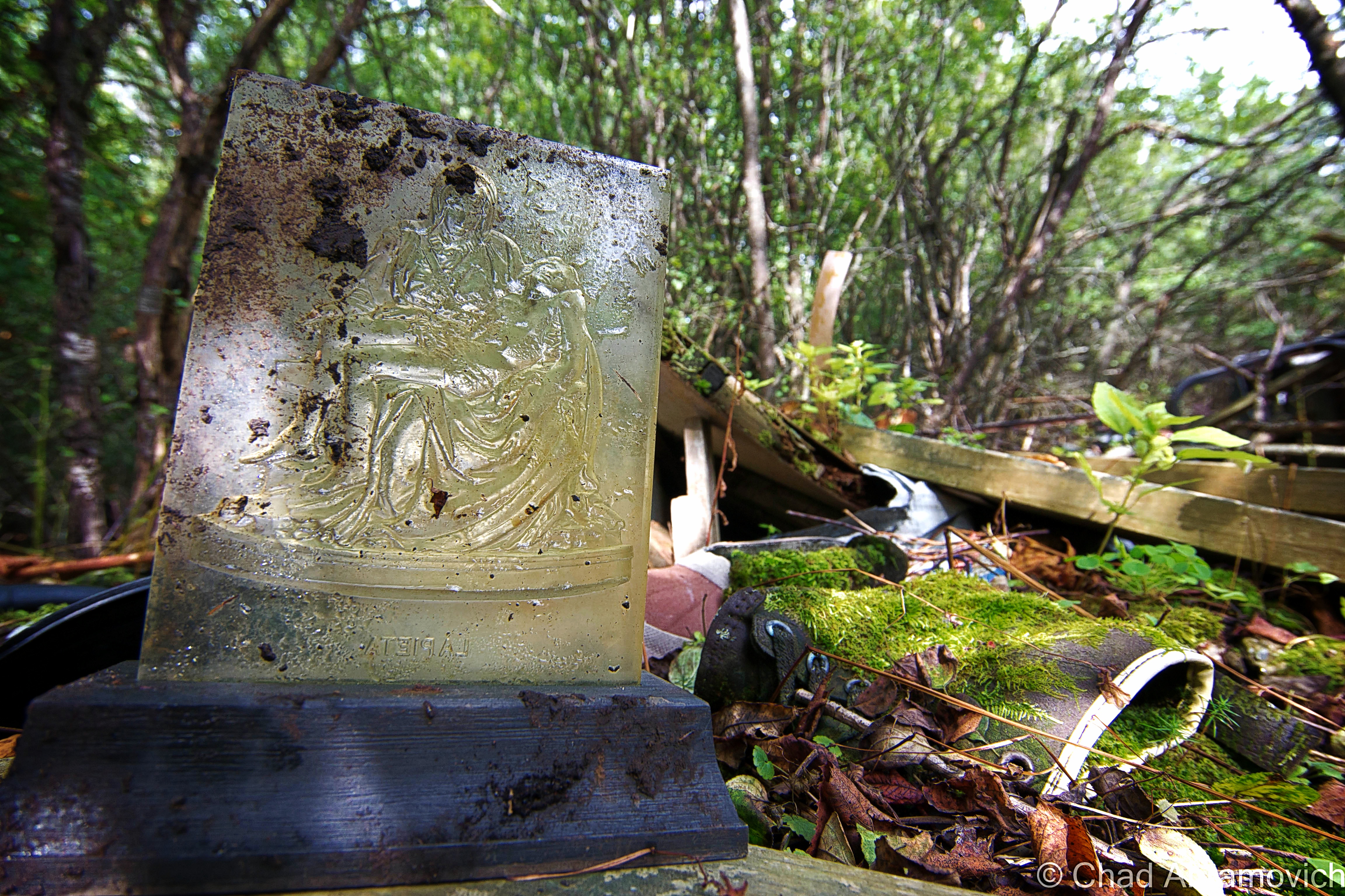
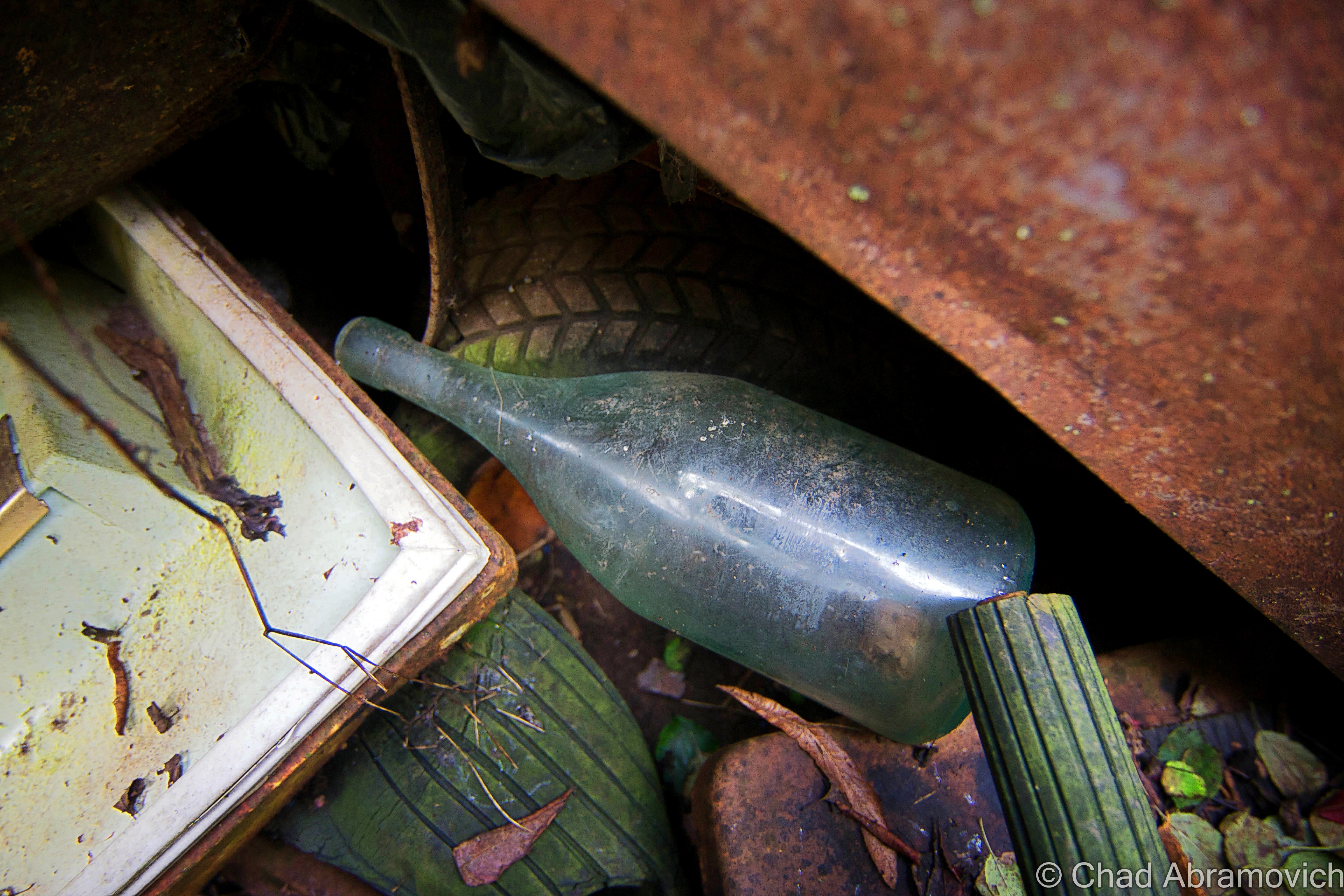
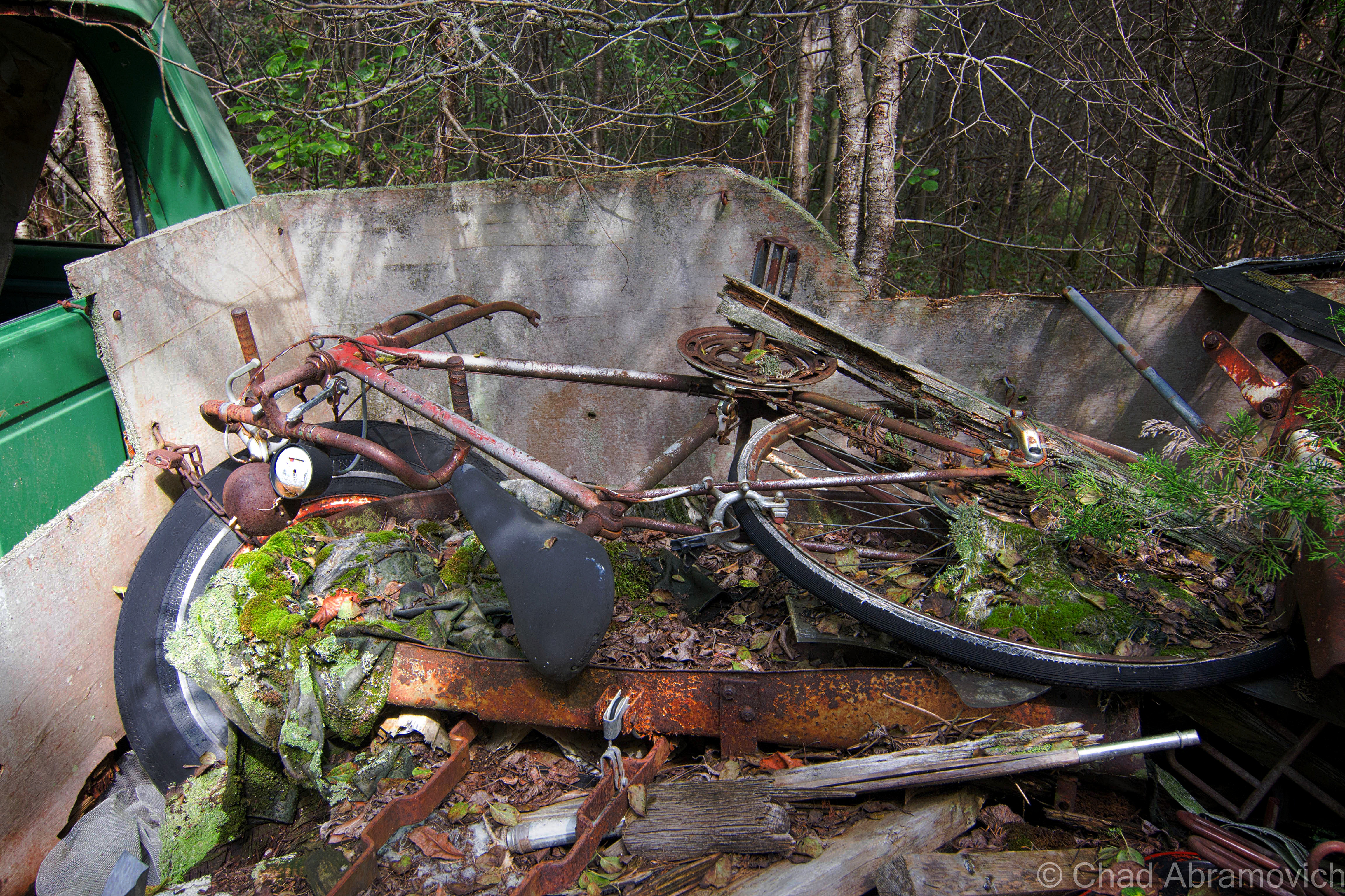
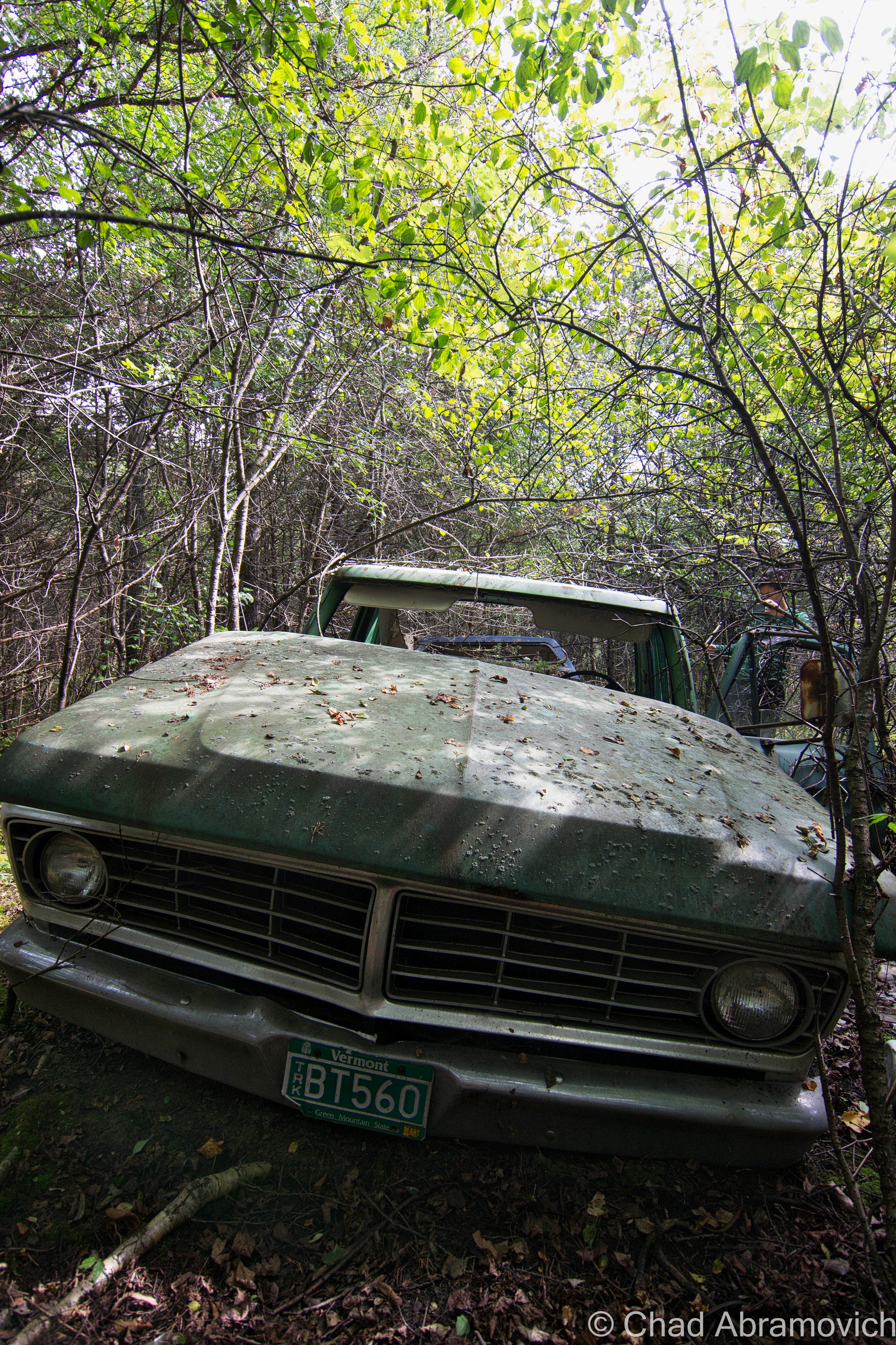
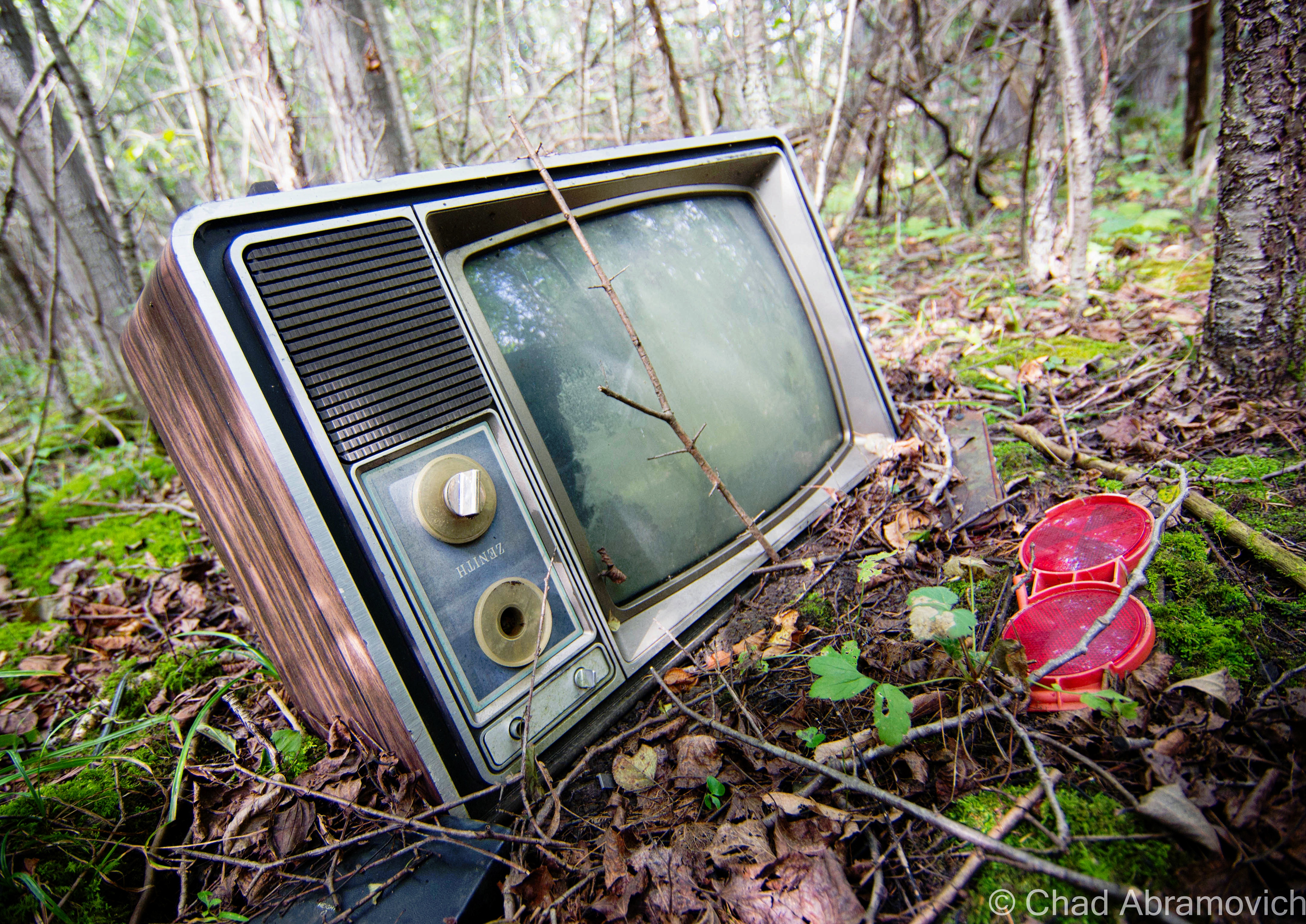
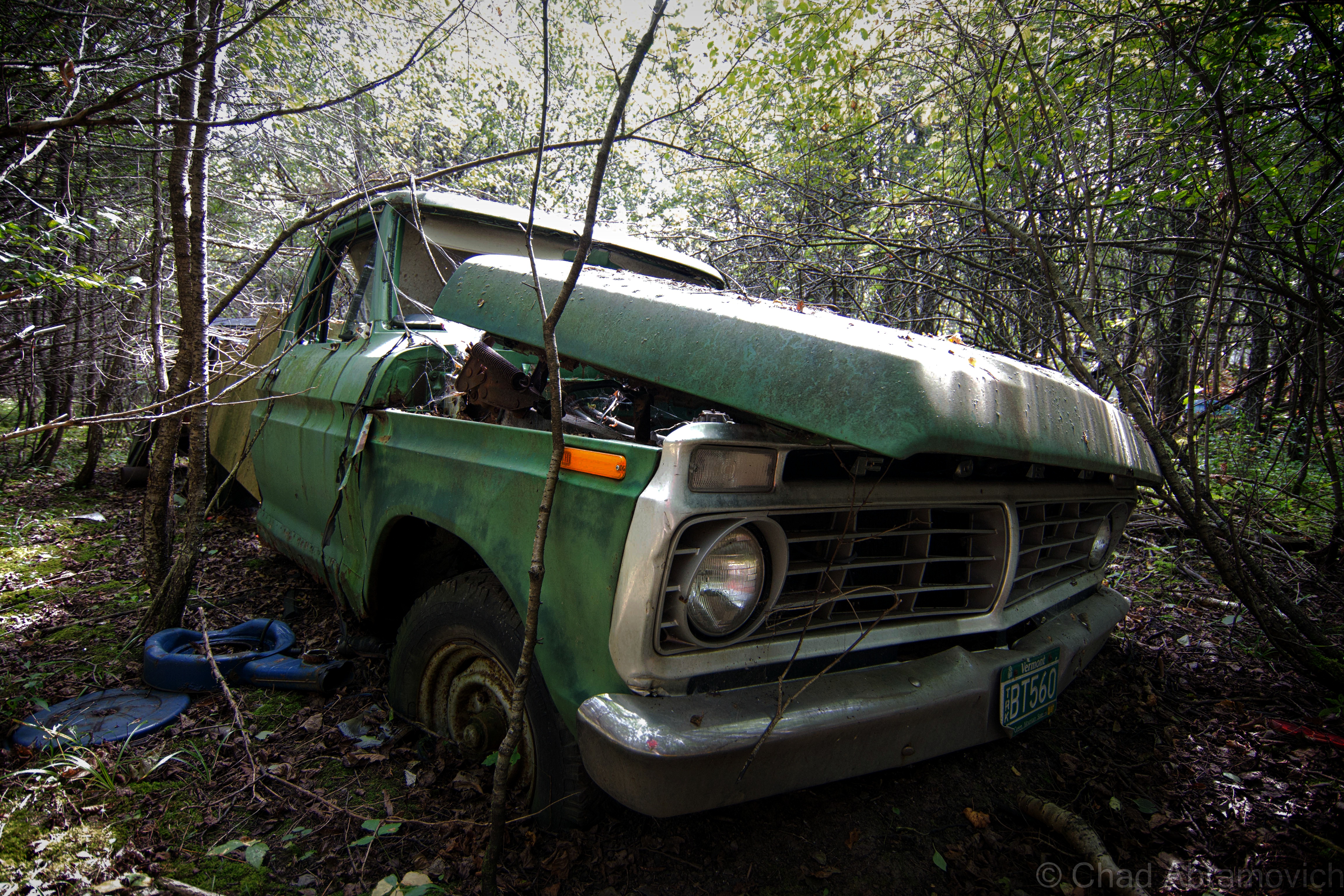
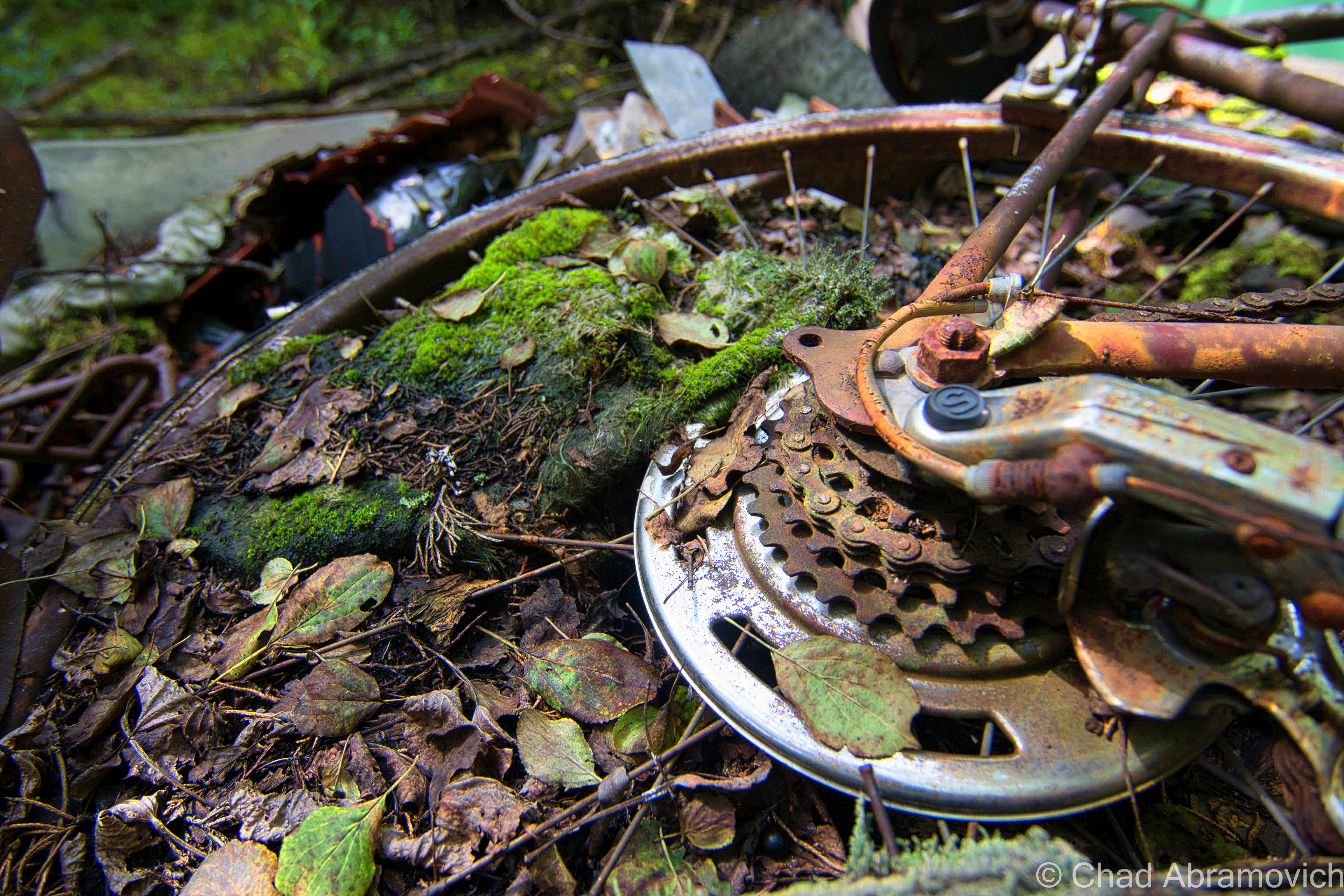
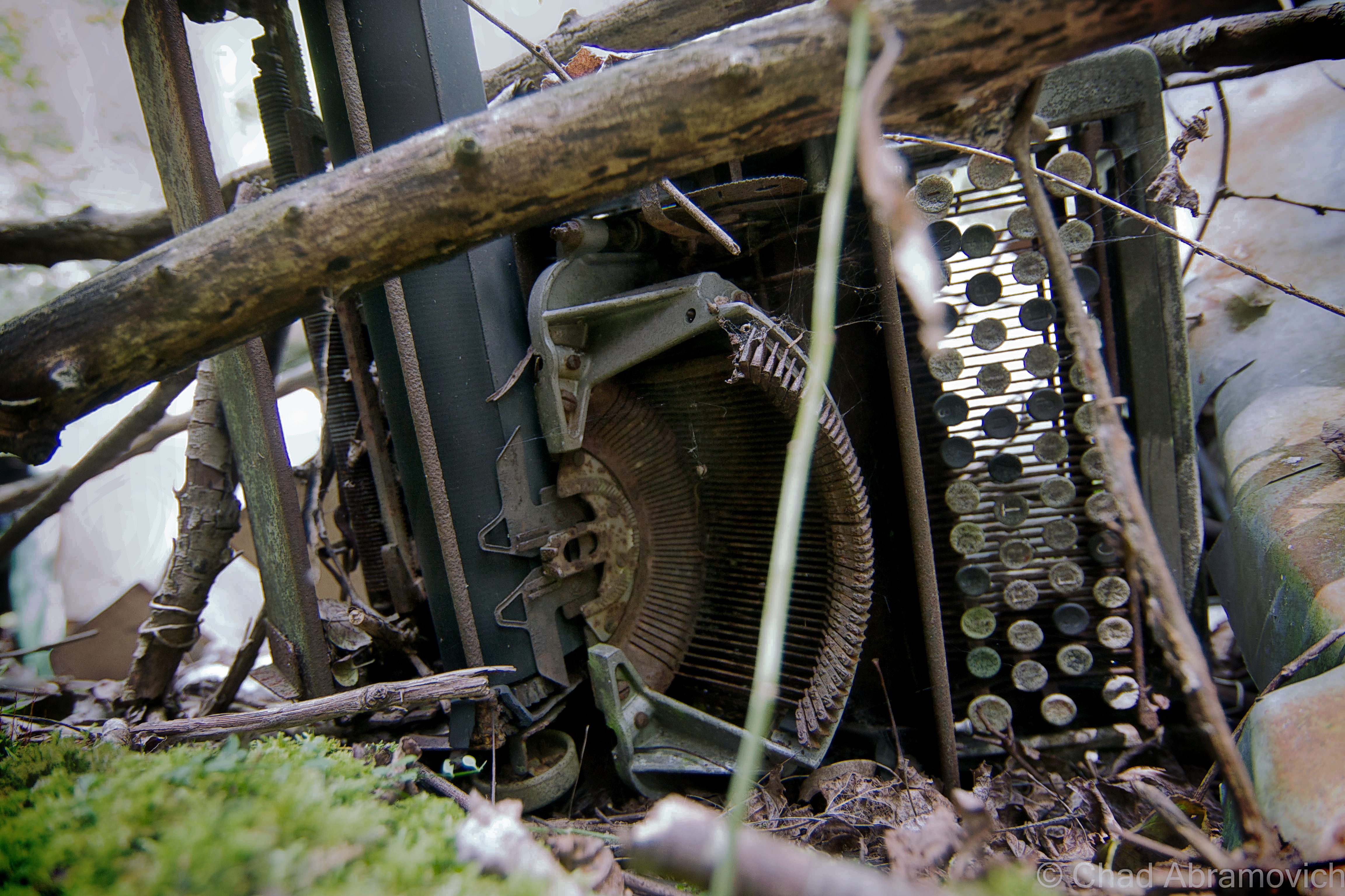
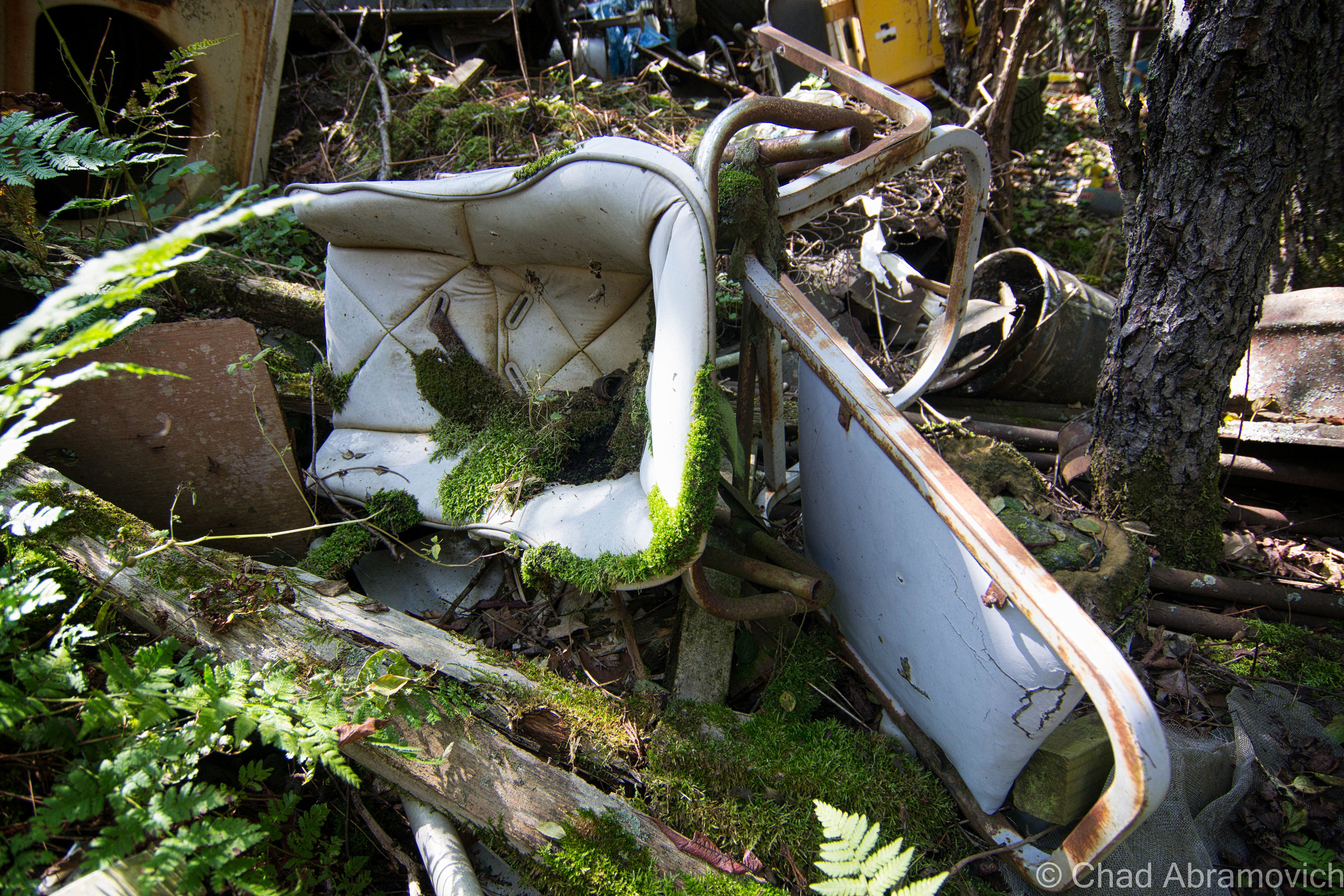
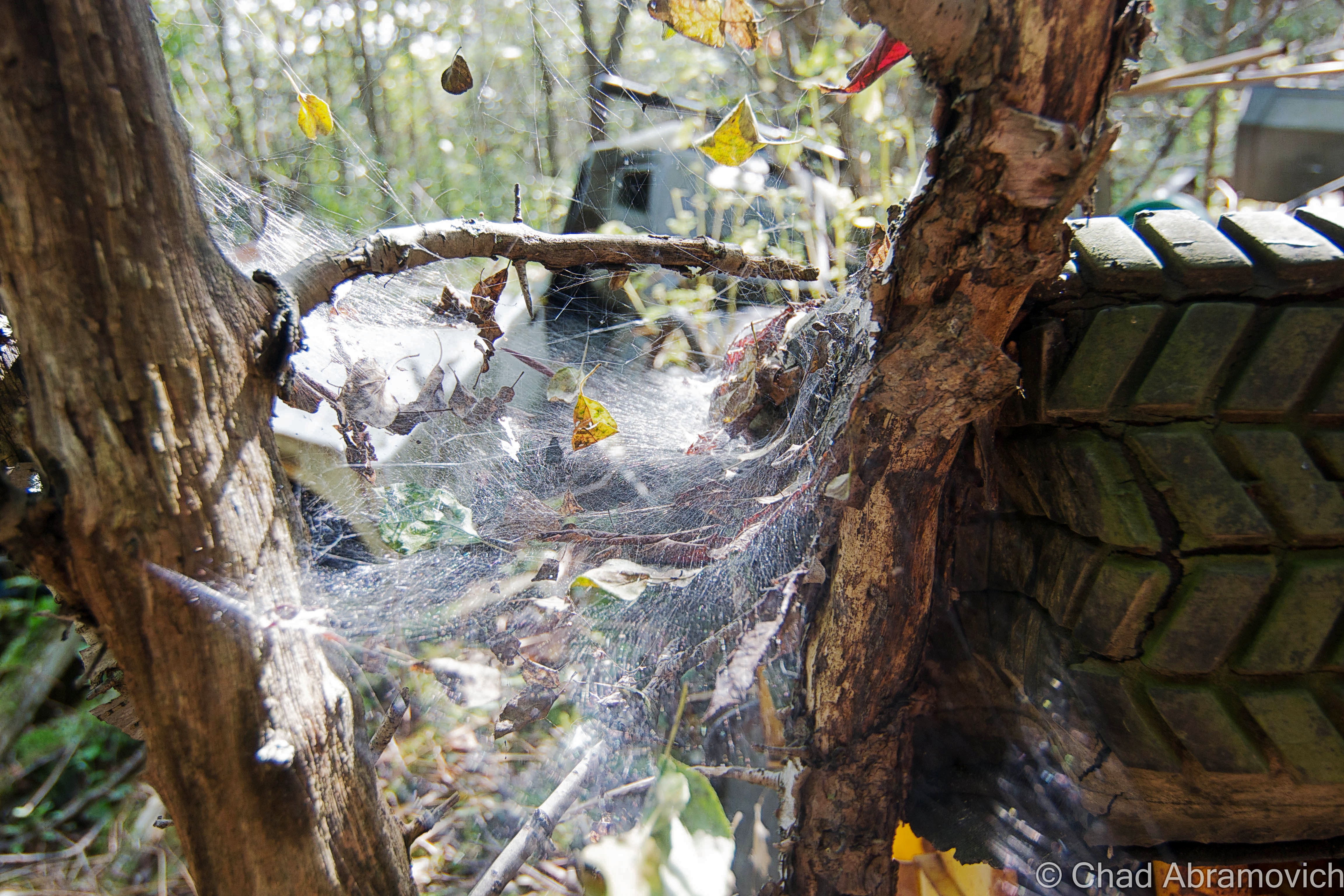
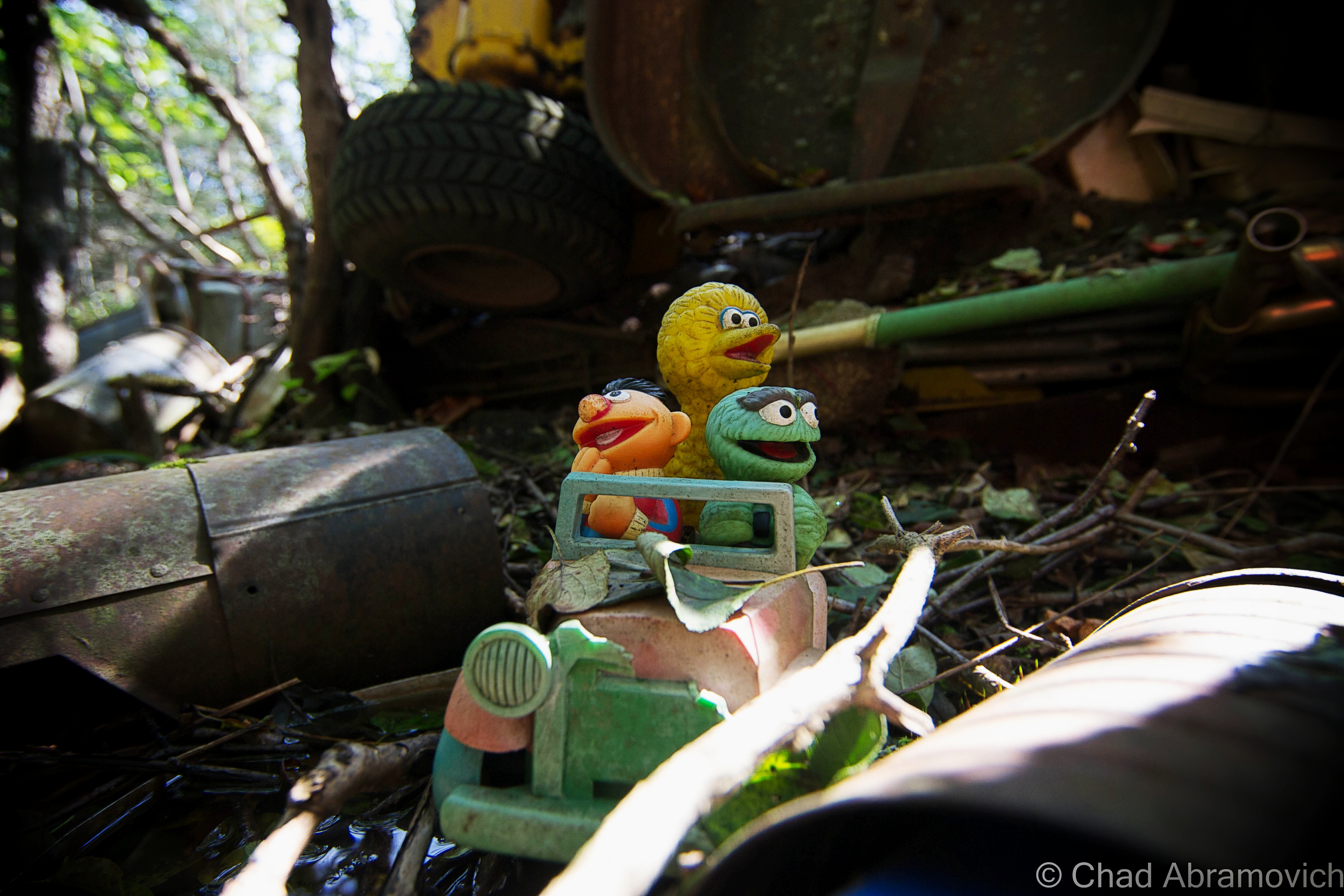
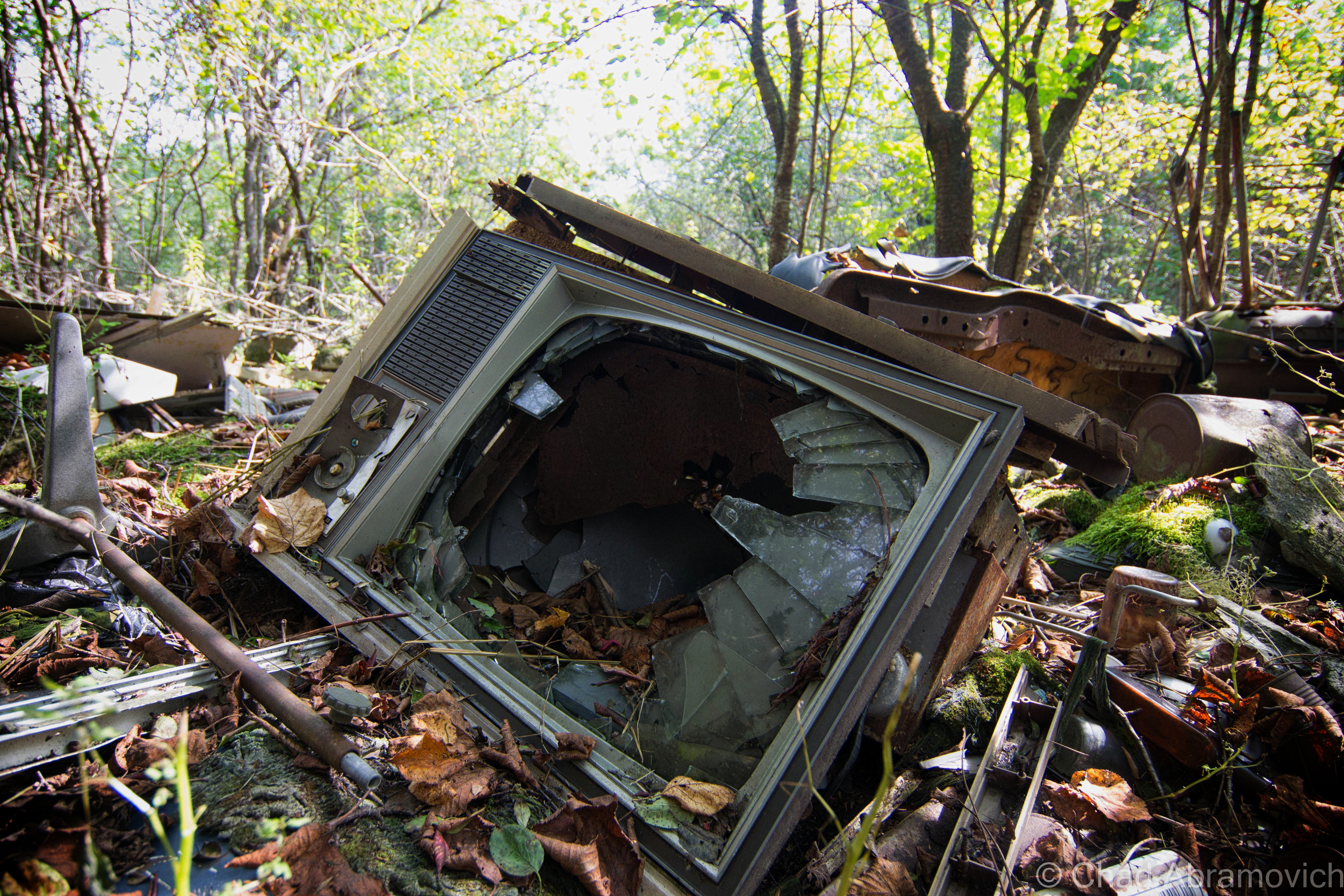
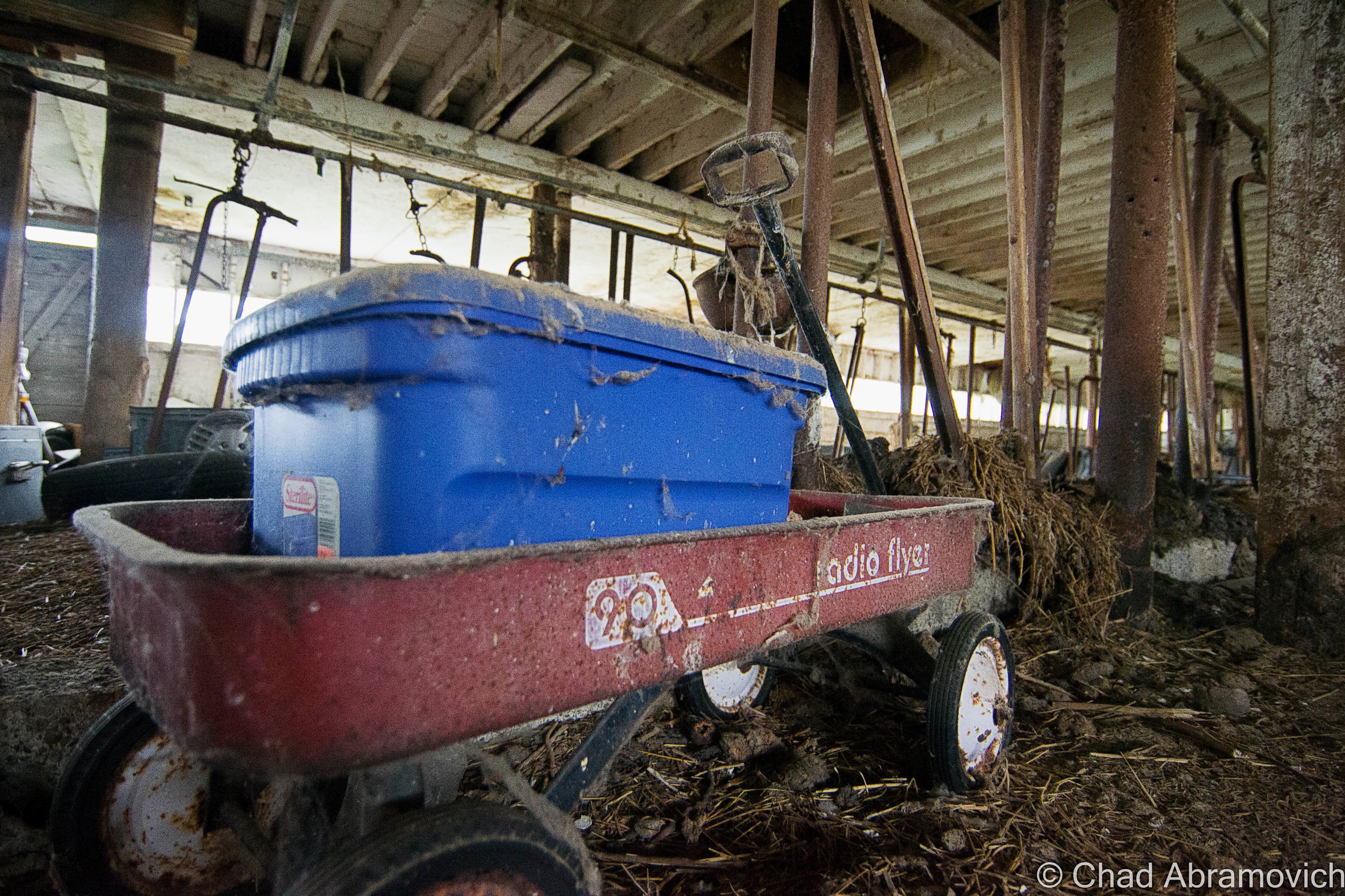
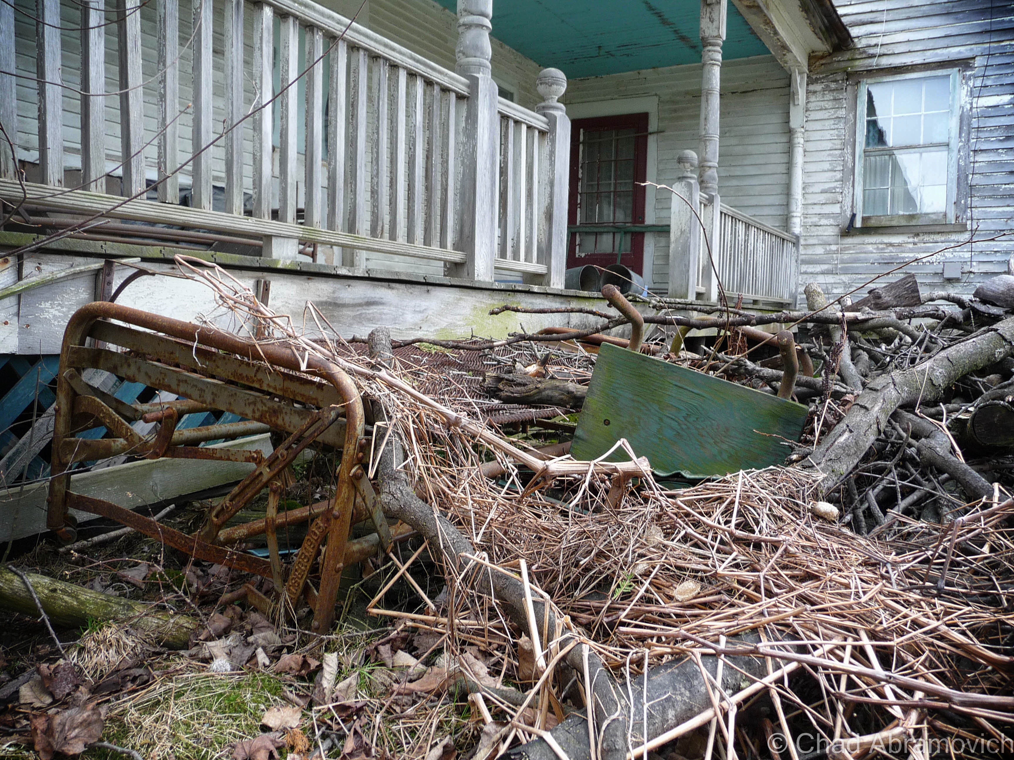
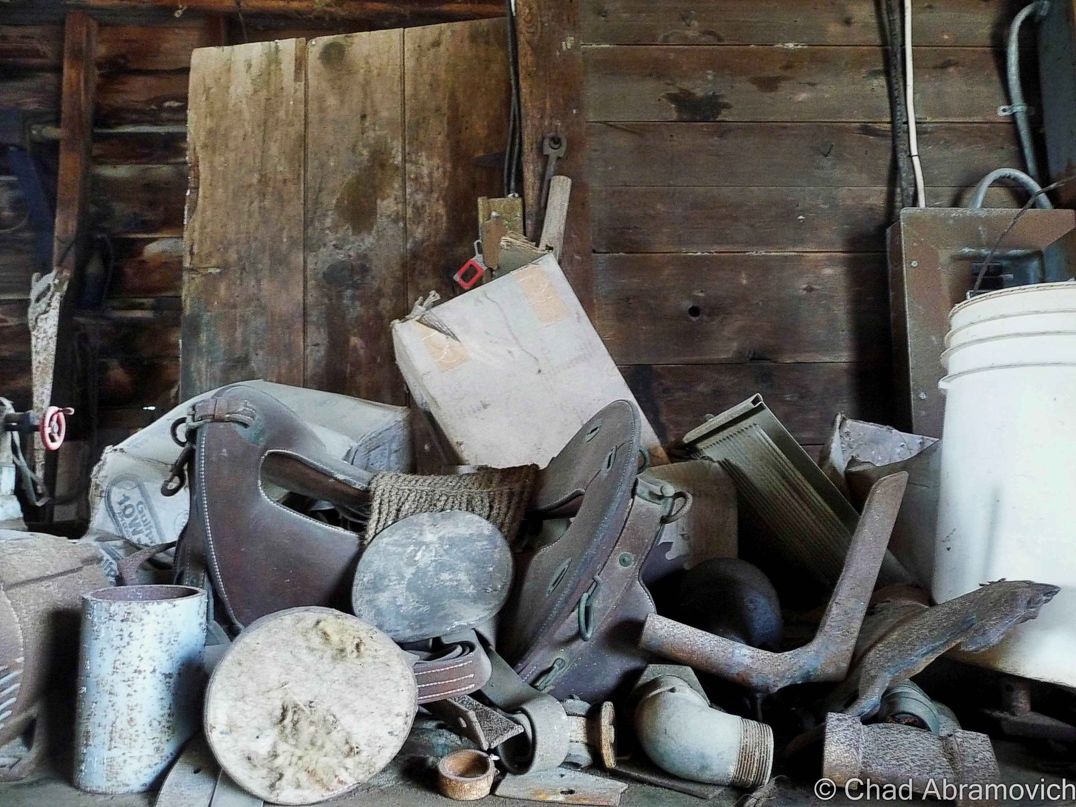
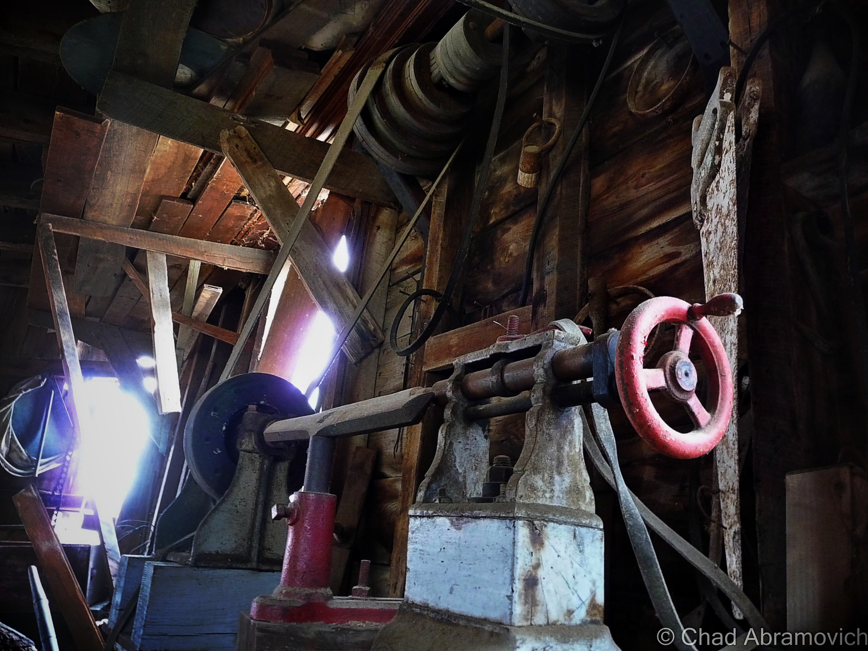
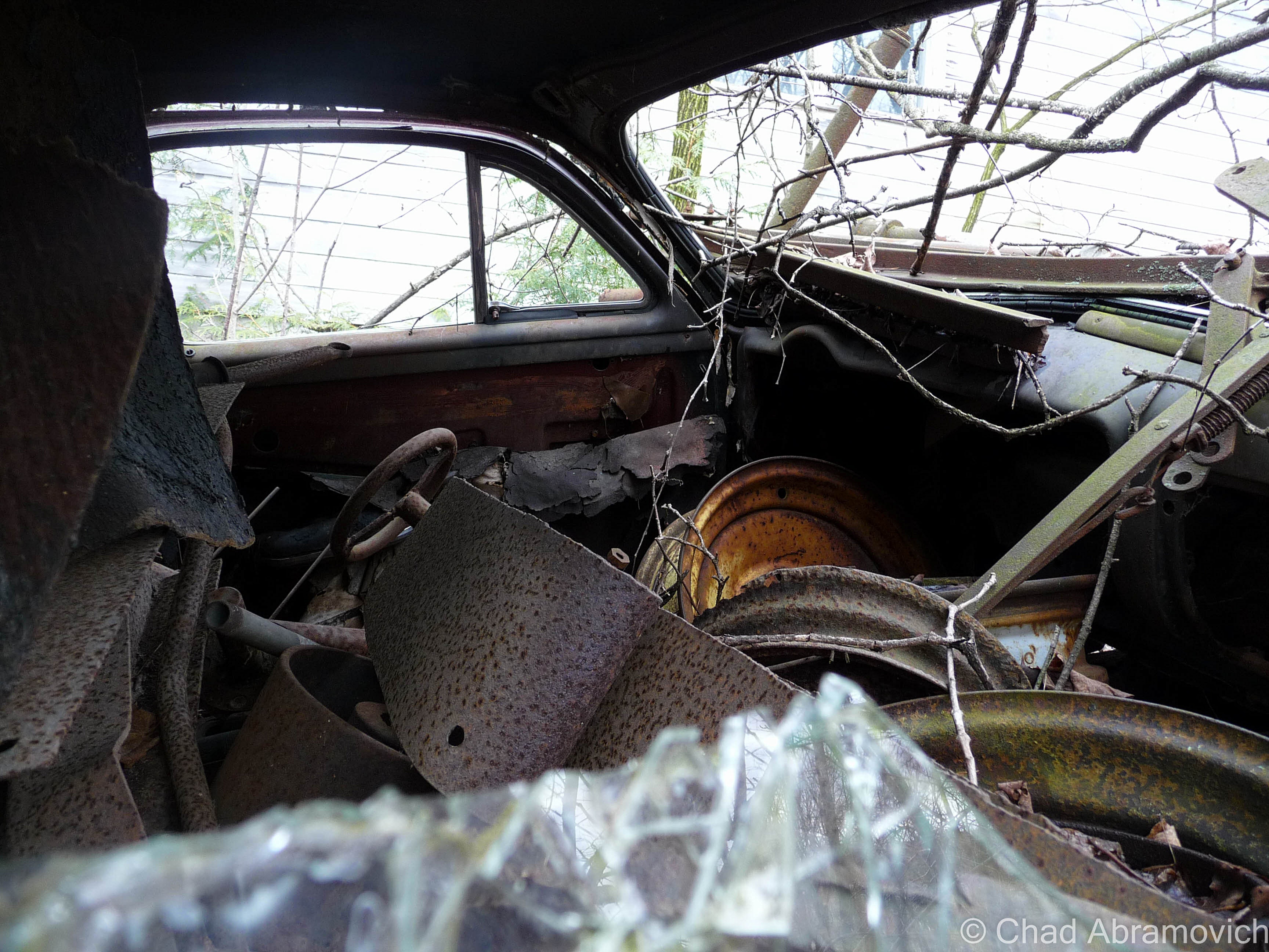
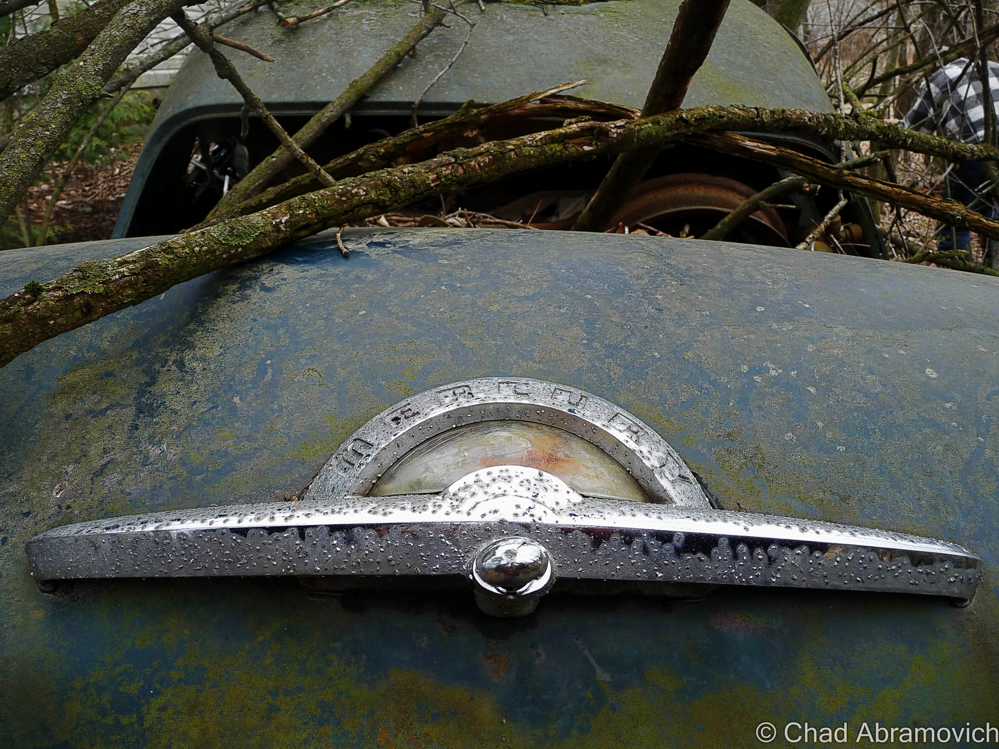
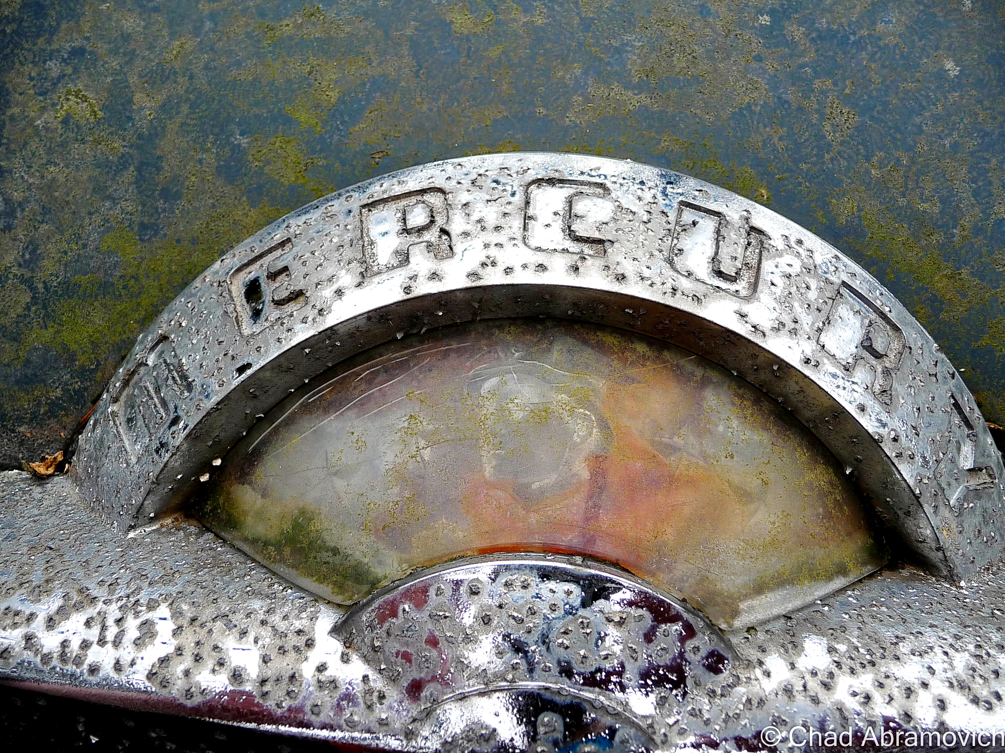
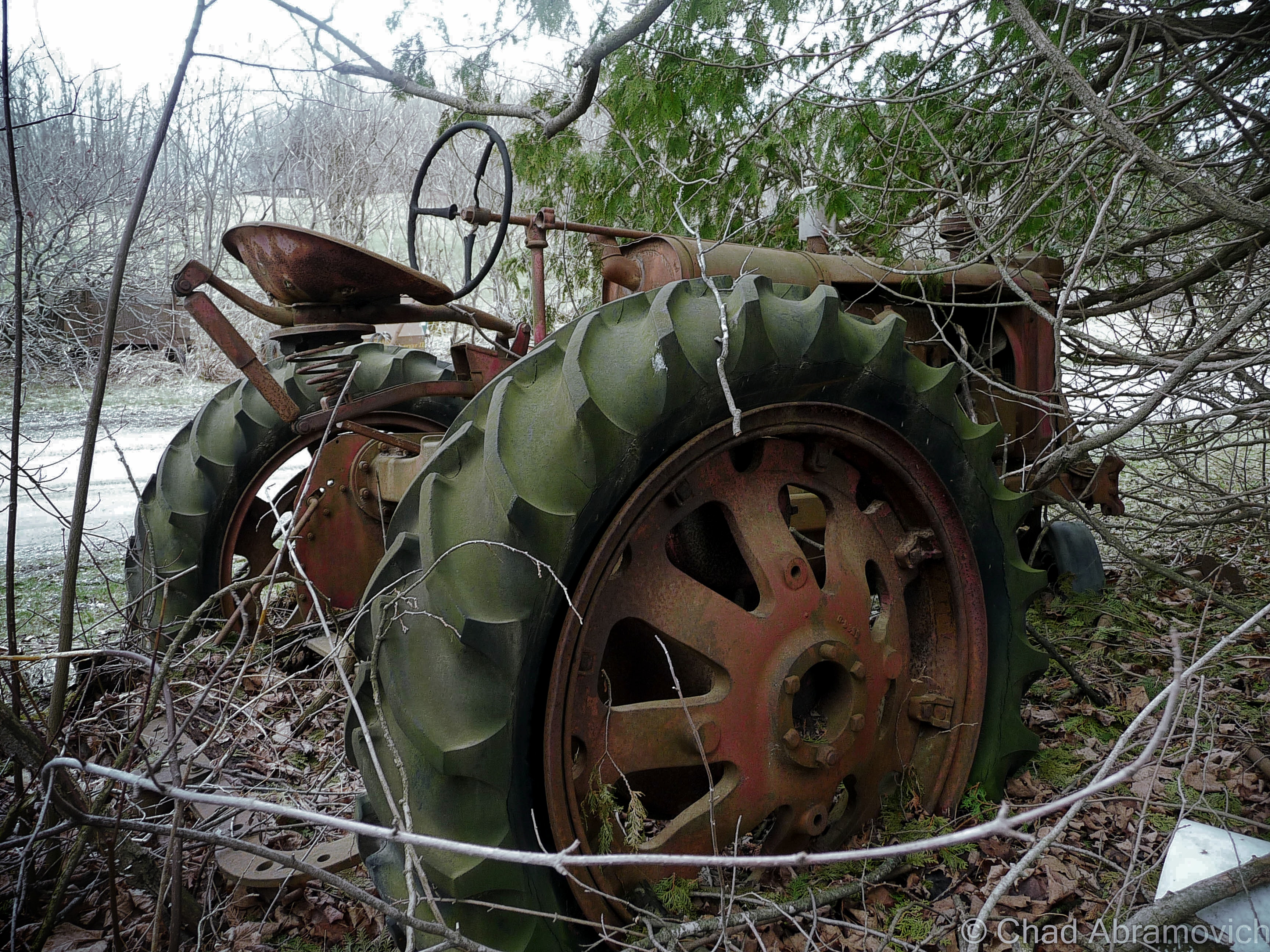
A lot less of Vermont is farmed now days, and much of the land has returned to forest, but these rusted and forgotten vestiges of the past still remain, now moldering in the silence of the wilderness. This particular junkyard had an eyebrow-raising amount of stuff brought there. Old tractors, snowmobiles, knob televisions, a Ford truck, religious paraphernalia, antique glass bottles, creepy childrens toys decaying in the weather, a small mound of old appliances, and so much more in depths farther down than I felt good about digging to reach. There is even rumored to be some traces of an old prohibition era still coffined back here, but there was so much to sift through, I probably wouldn’t have been able to recognize it if I was standing on it.

“I thought you’d like this, seeing how you’re into old stuff” said my friend as she went to unscrew the top from her iced tea, humorously not following me further into the collection of trash. “I figured I’d show you before I clean this all up”

“Oh, when is that happening?” I called out as I wobbled and stumbled my way over a mound of shifting garbage that squeaked and rustled underneath my crooked feet.

“Welllll…….one day.” she assured me, a tone of defeat in her voice.
dsc_0101_pedsc_0106_pe dsc_0109_pe dsc_0110_pe dsc_0111_pe dsc_0113_pe dsc_0115_pe dsc_0118_pe dsc_0119_pe dsc_0125_pe dsc_0128_pe dsc_0129_pe dsc_0131_pe dsc_0132_pe dsc_0133_pe dsc_0134_pe dsc_0140_pe dsc_0141_pe dsc_0144_pe dsc_0147_pe dsc_0150_pe dsc_0154_pe dsc_0156_pe dsc_0157_pe dsc_0160_pe dsc_0162_pe dsc_0165_pe

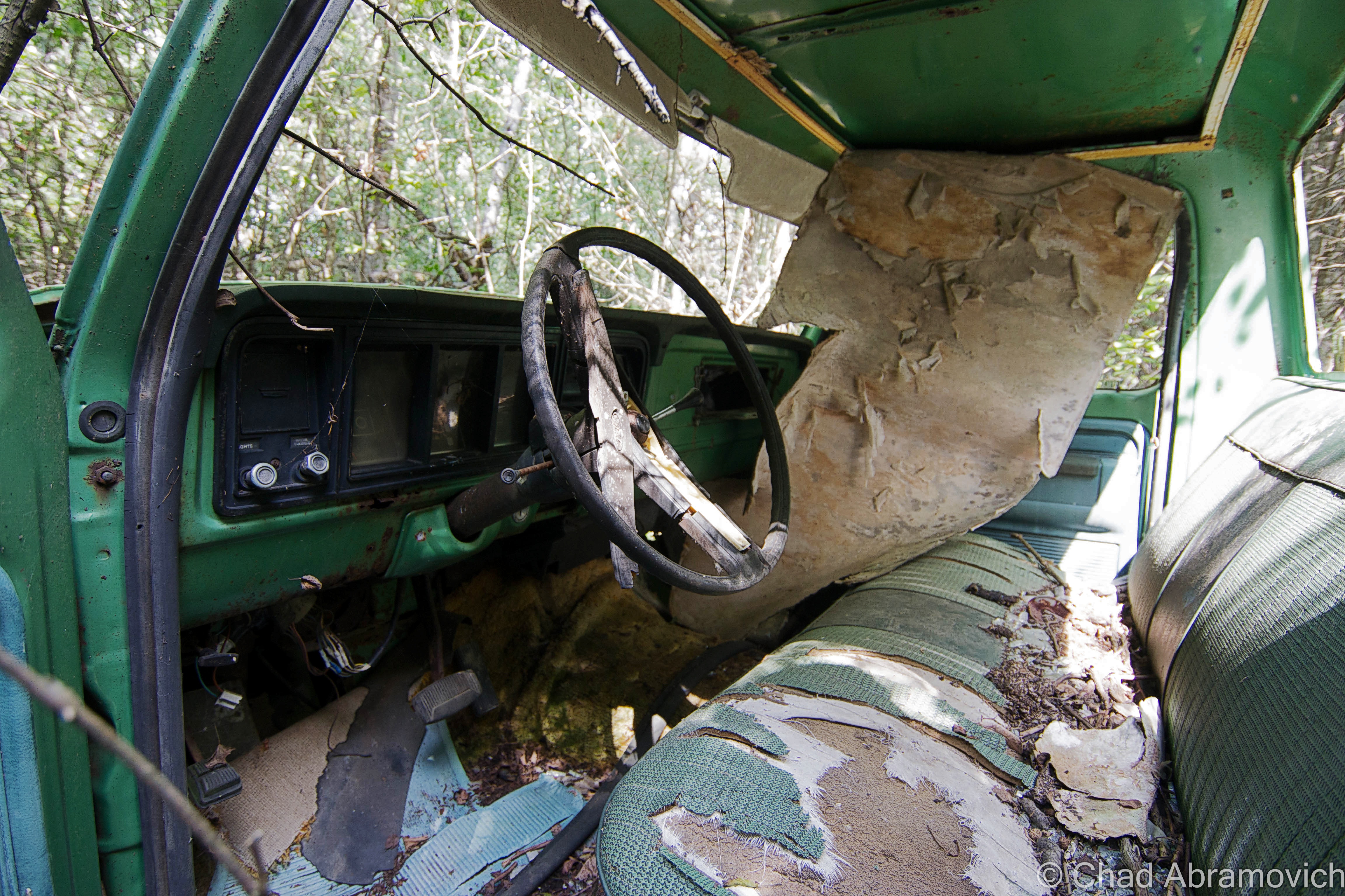
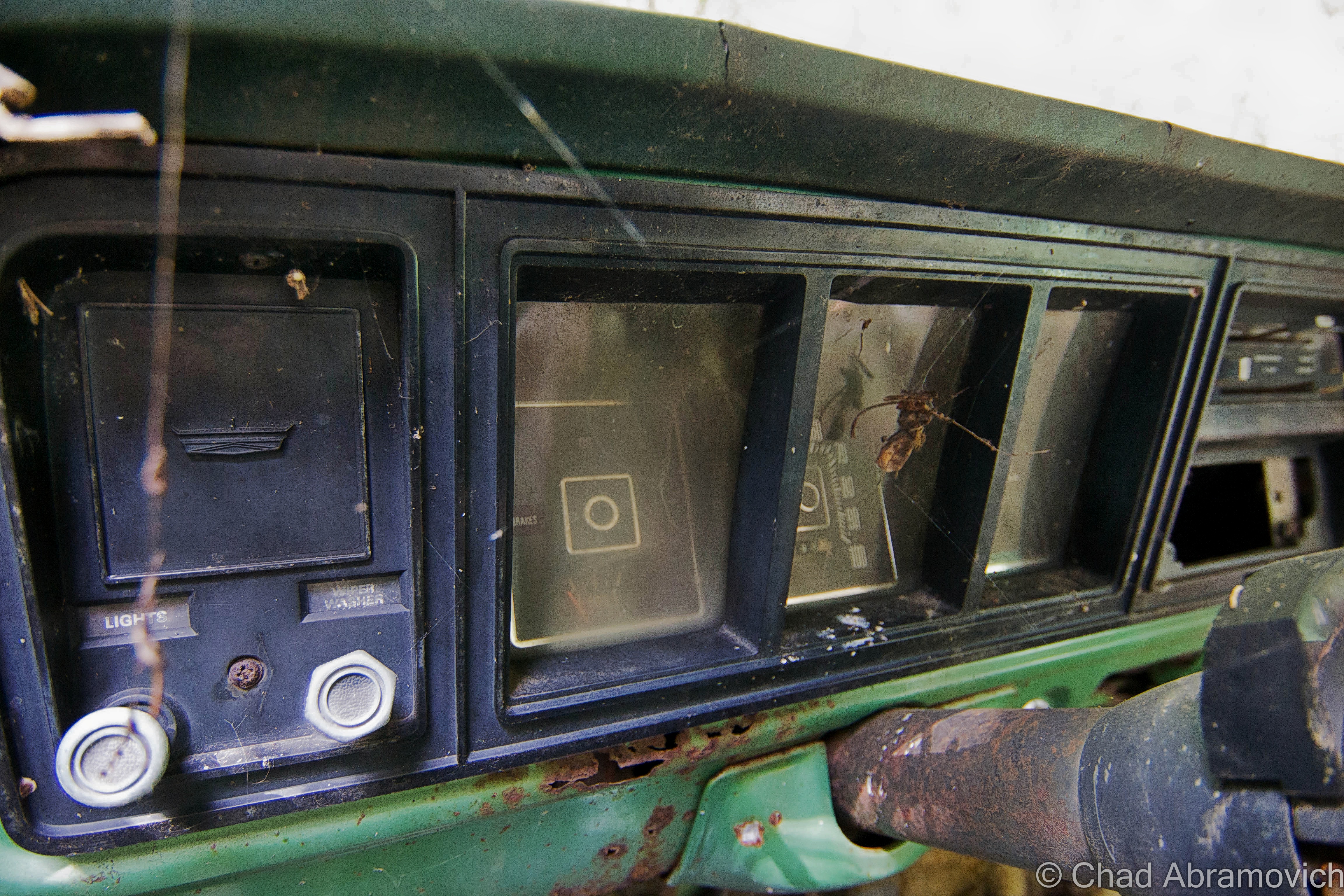
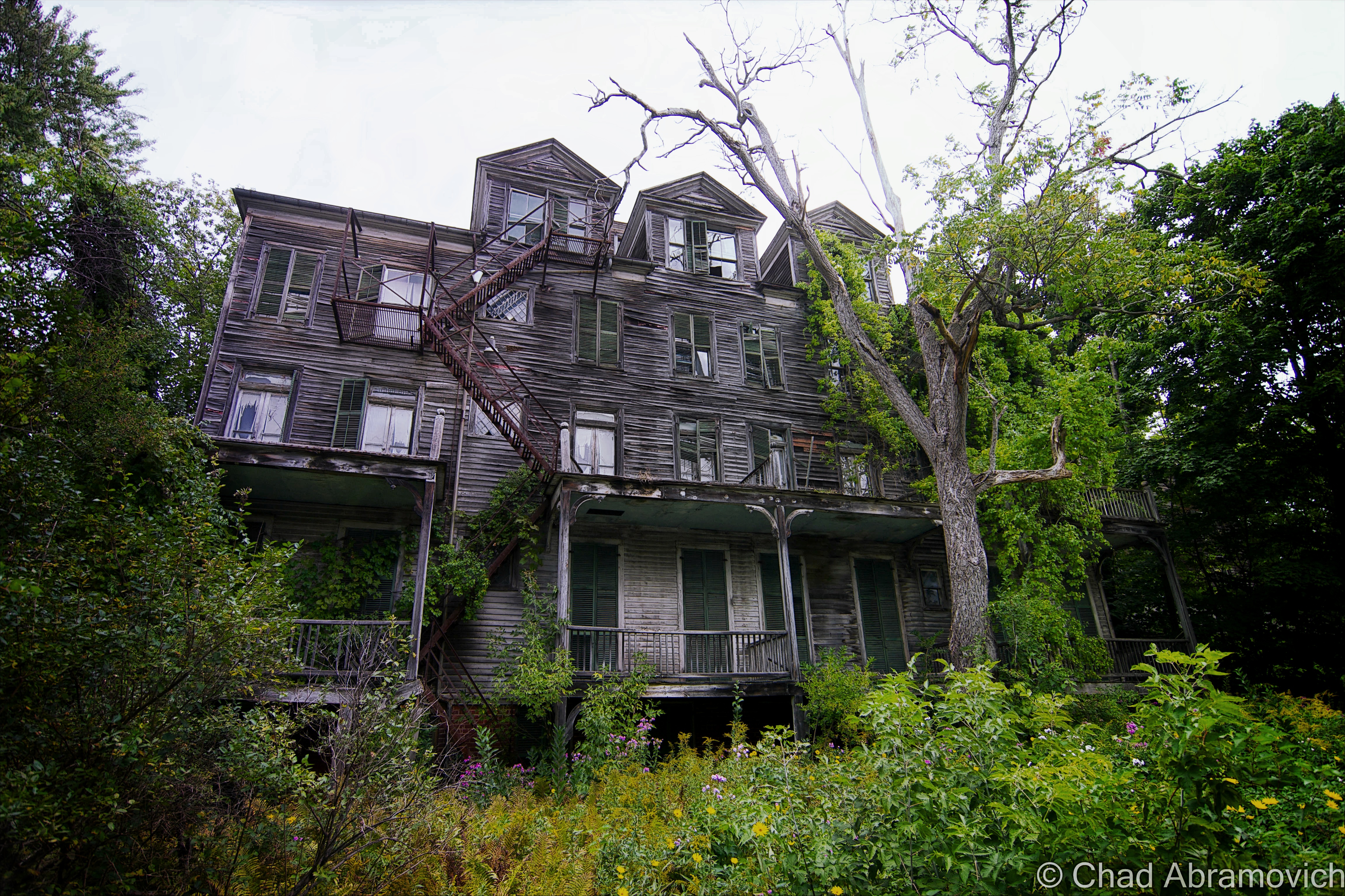
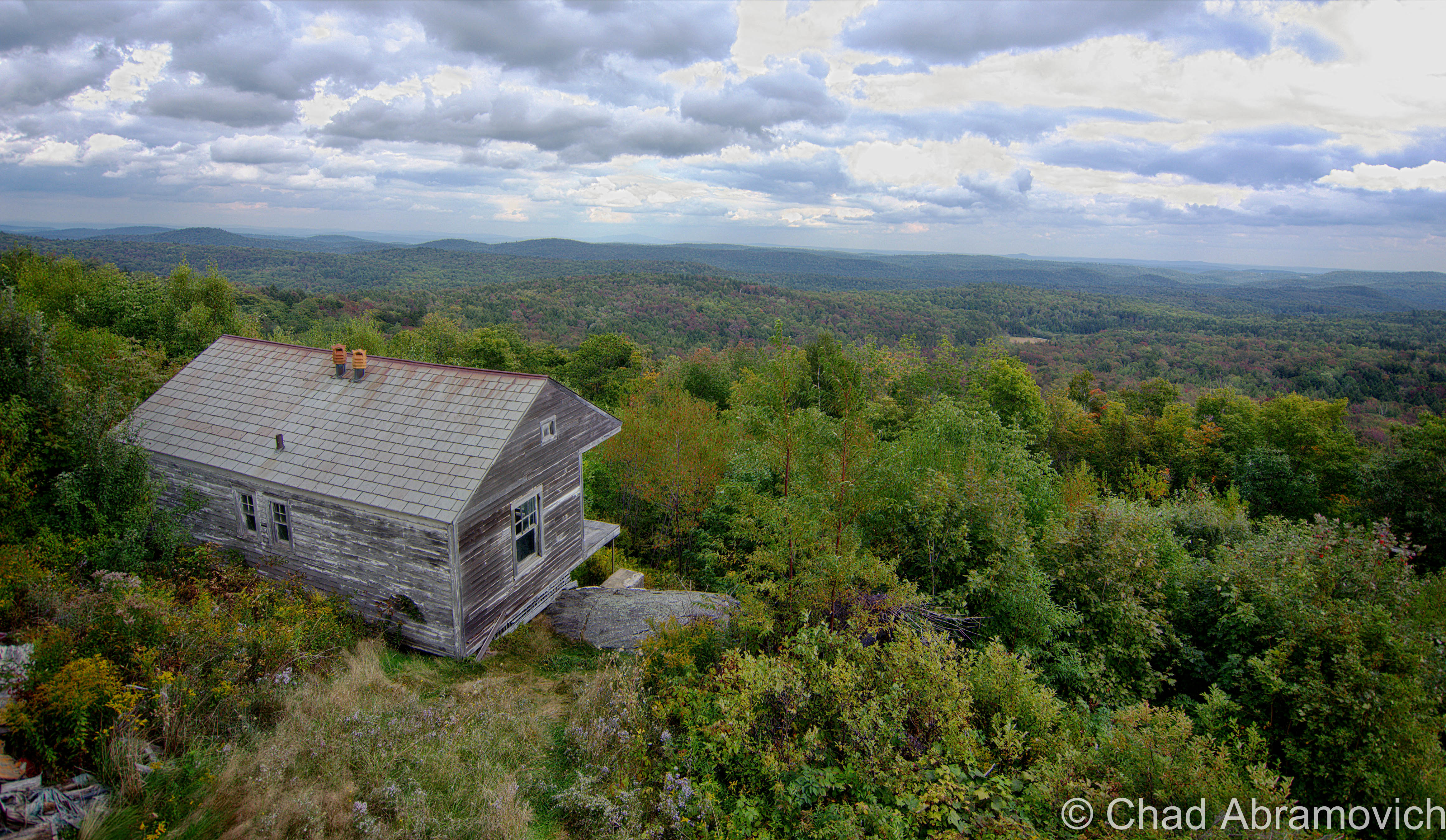
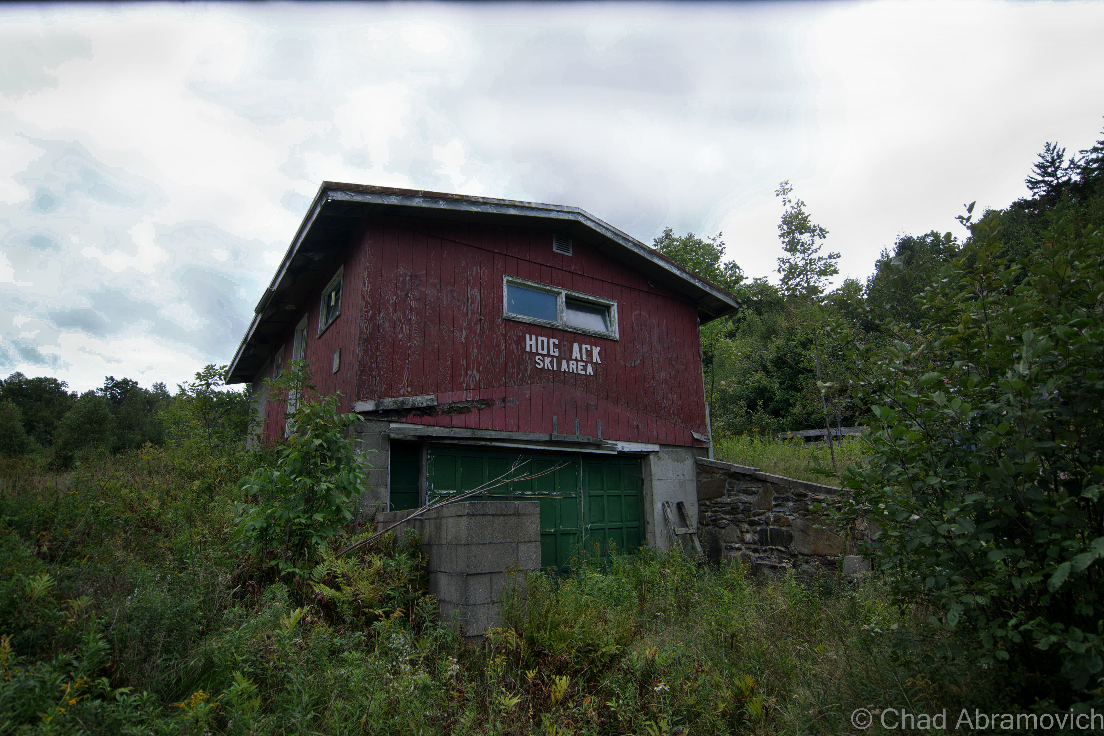
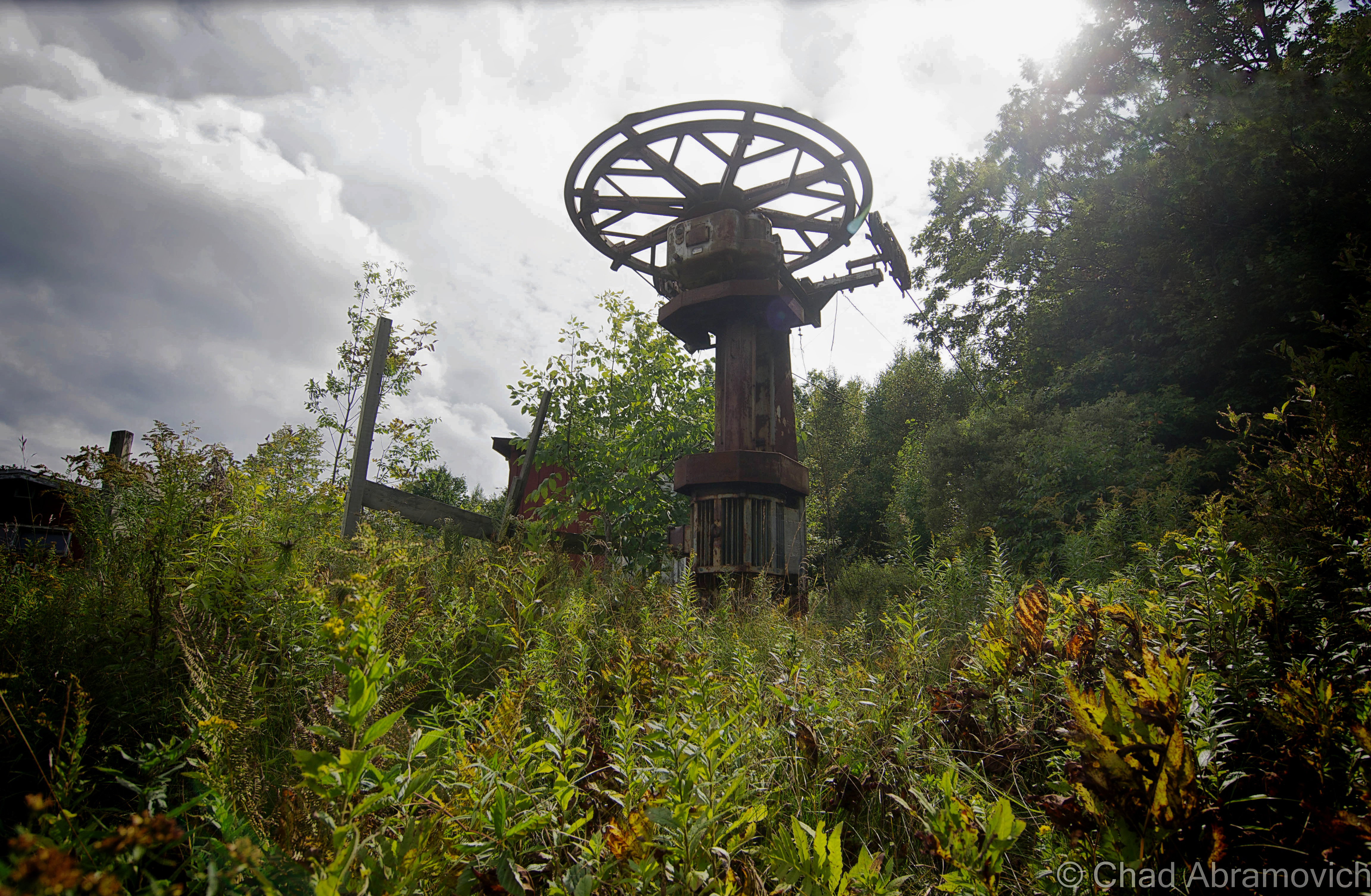
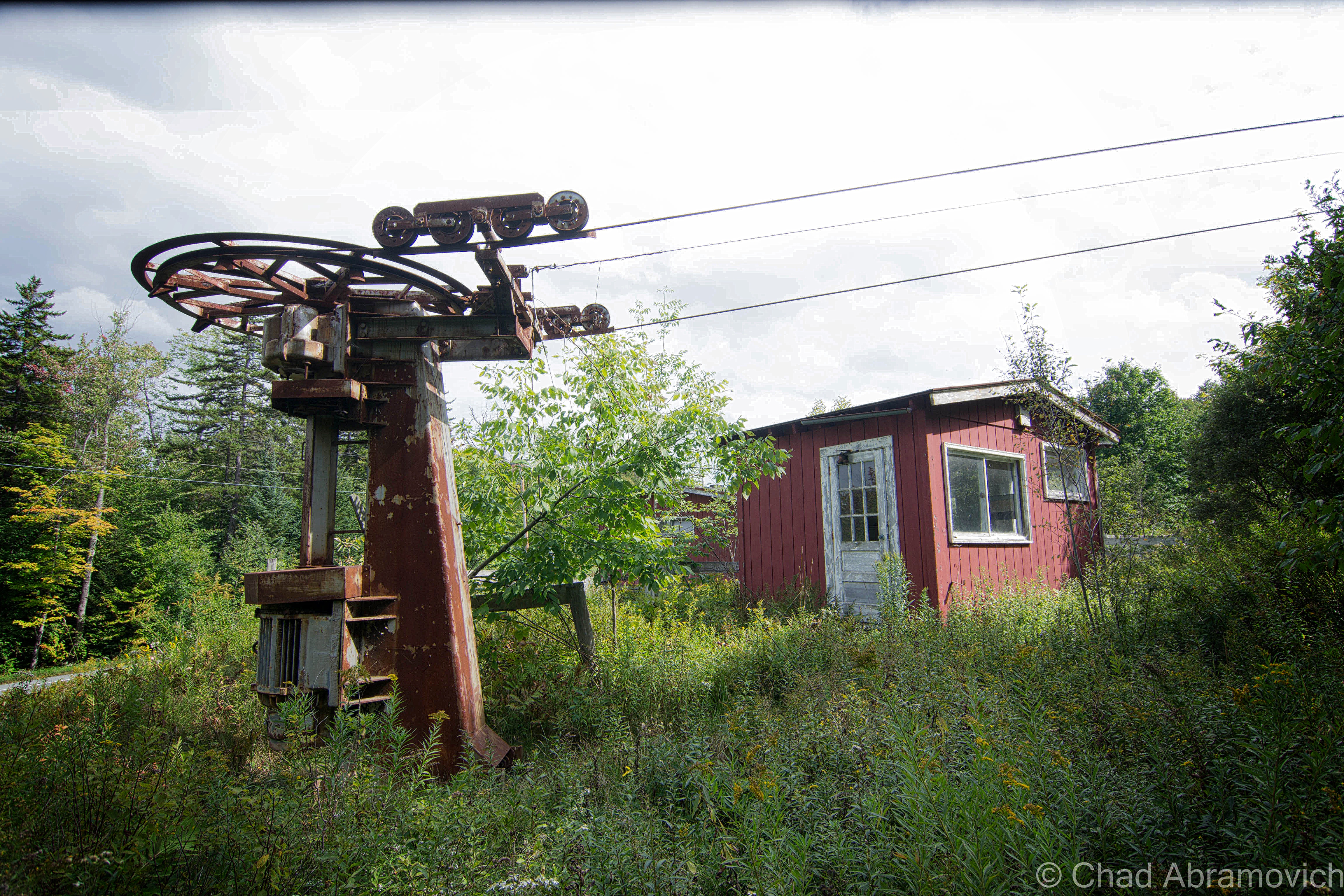
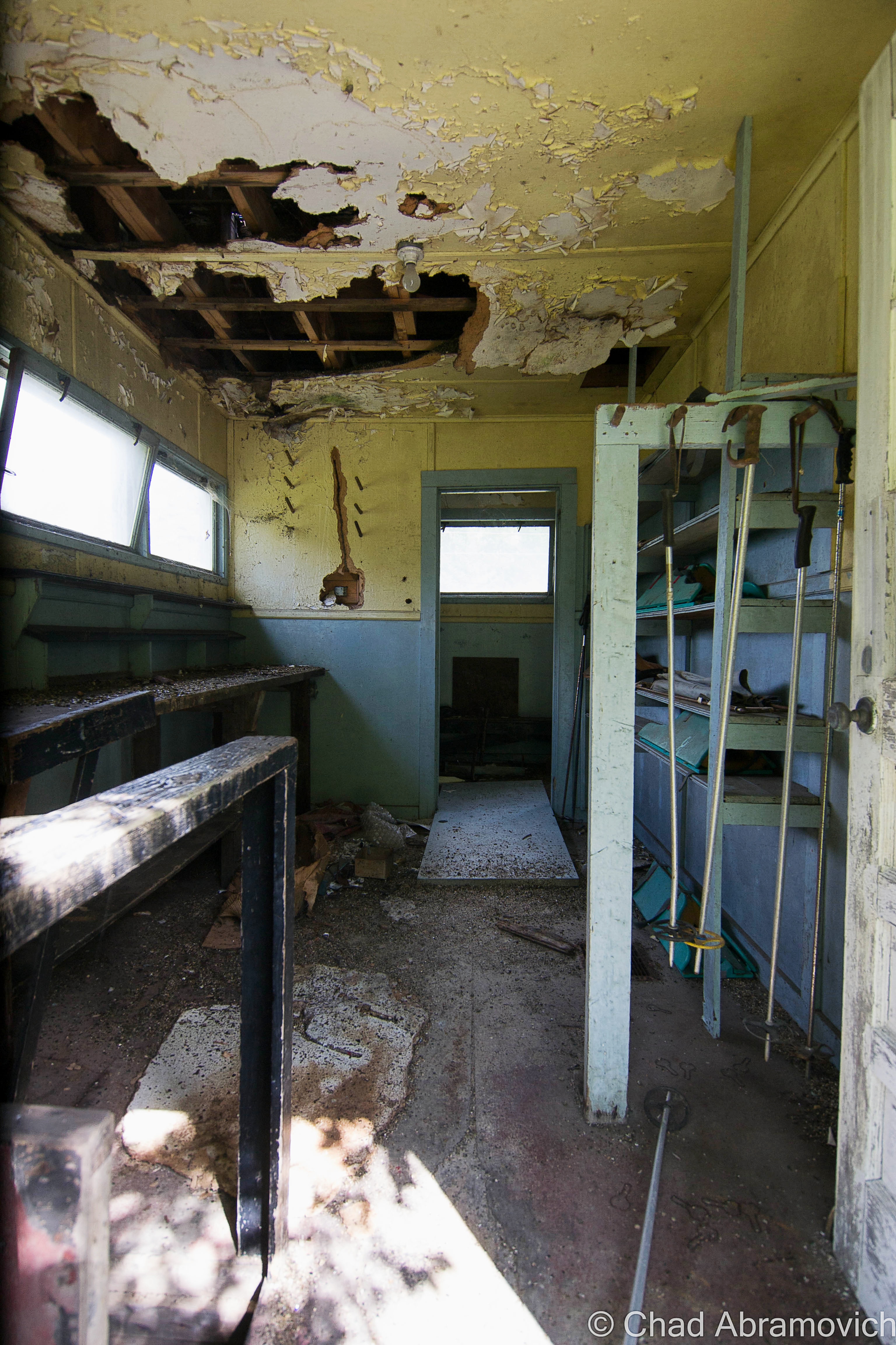
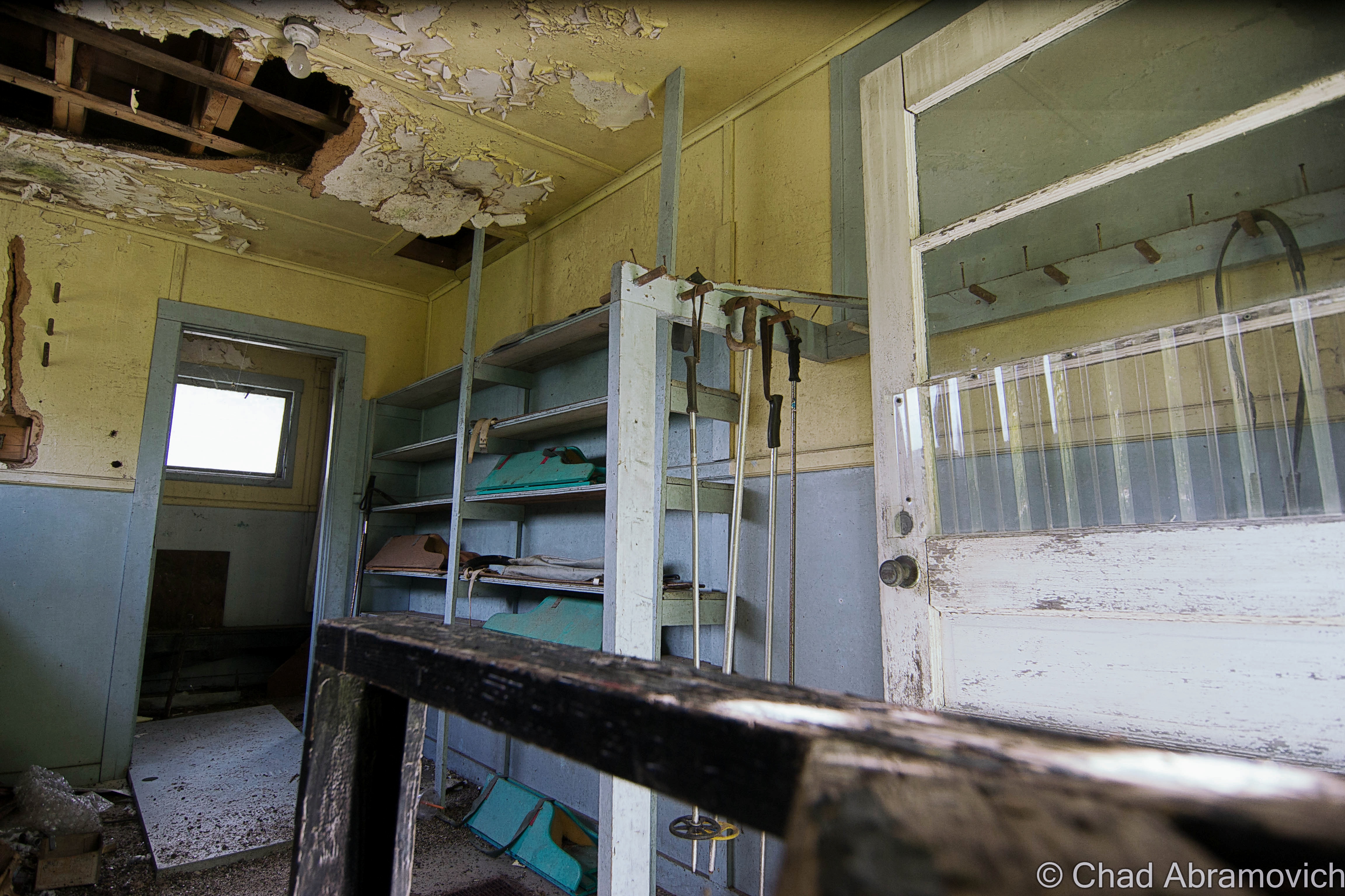
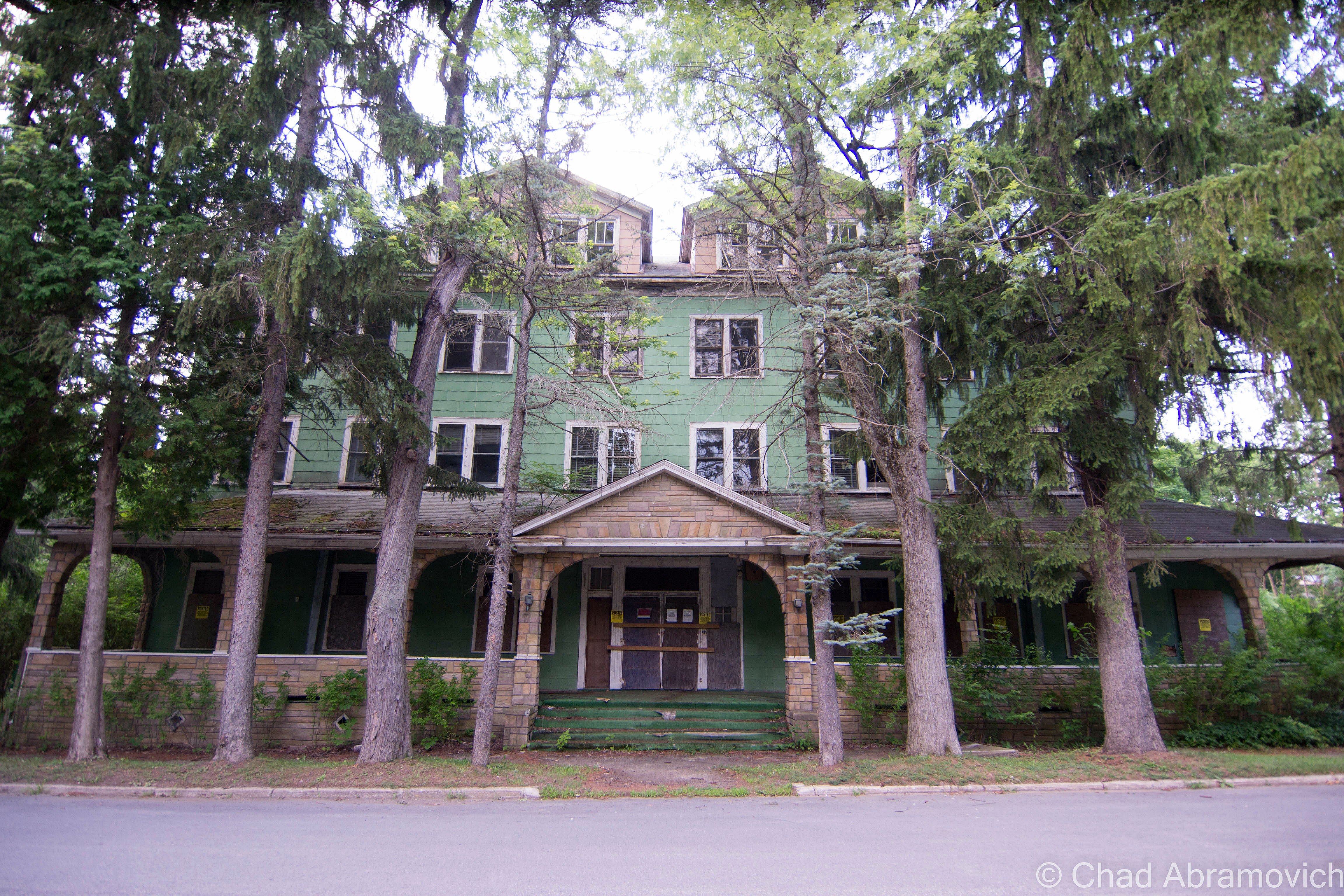
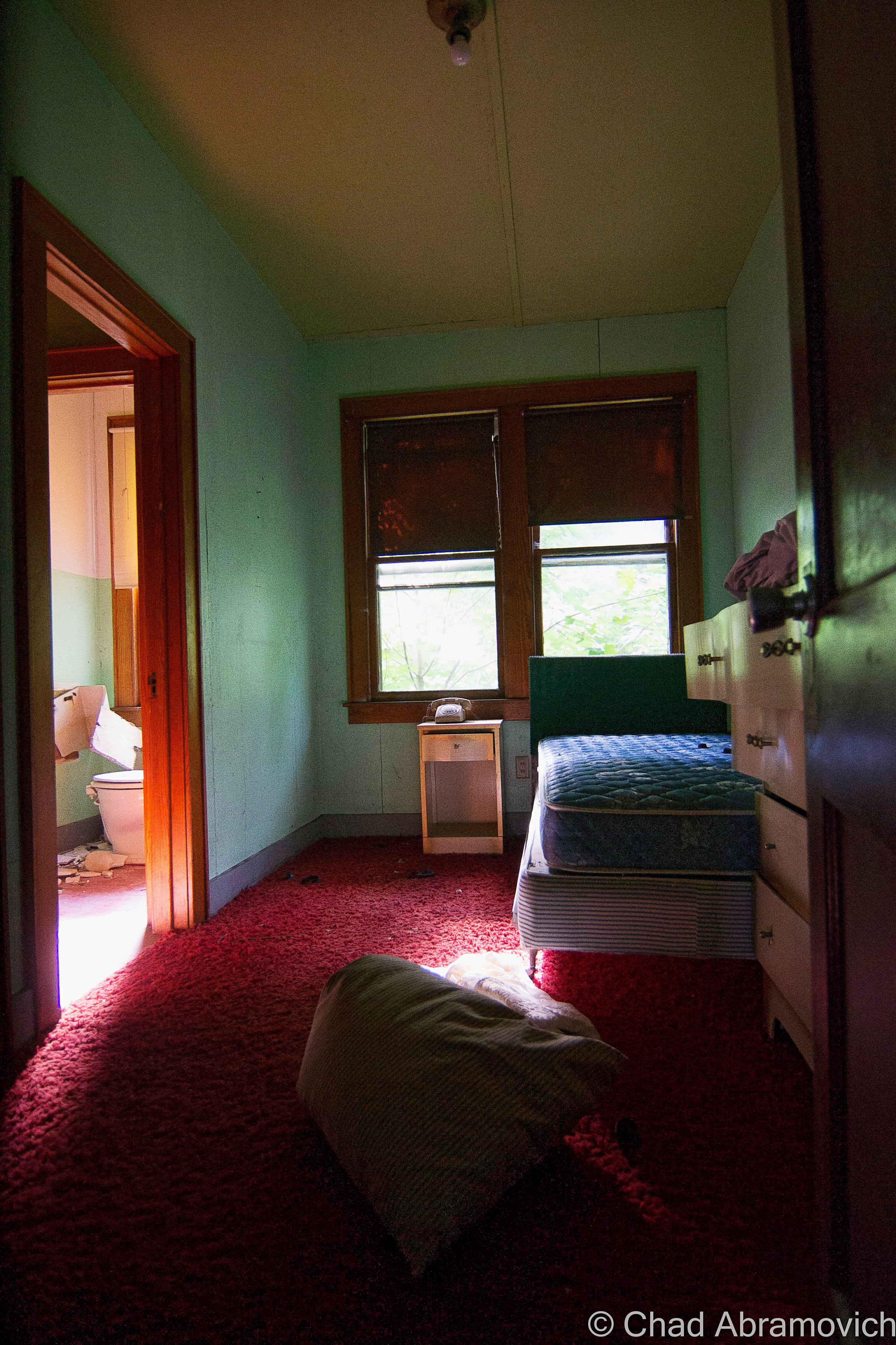
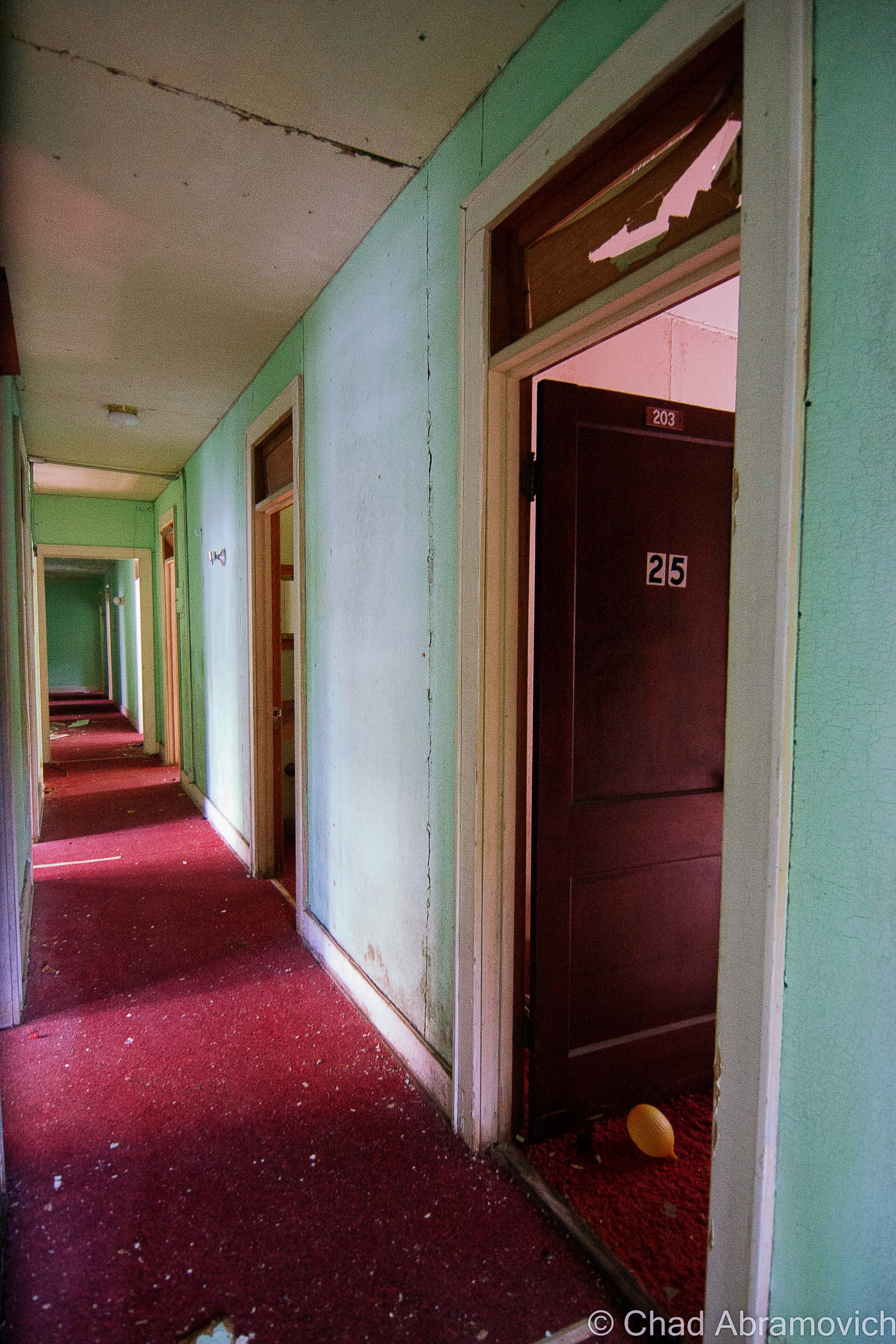
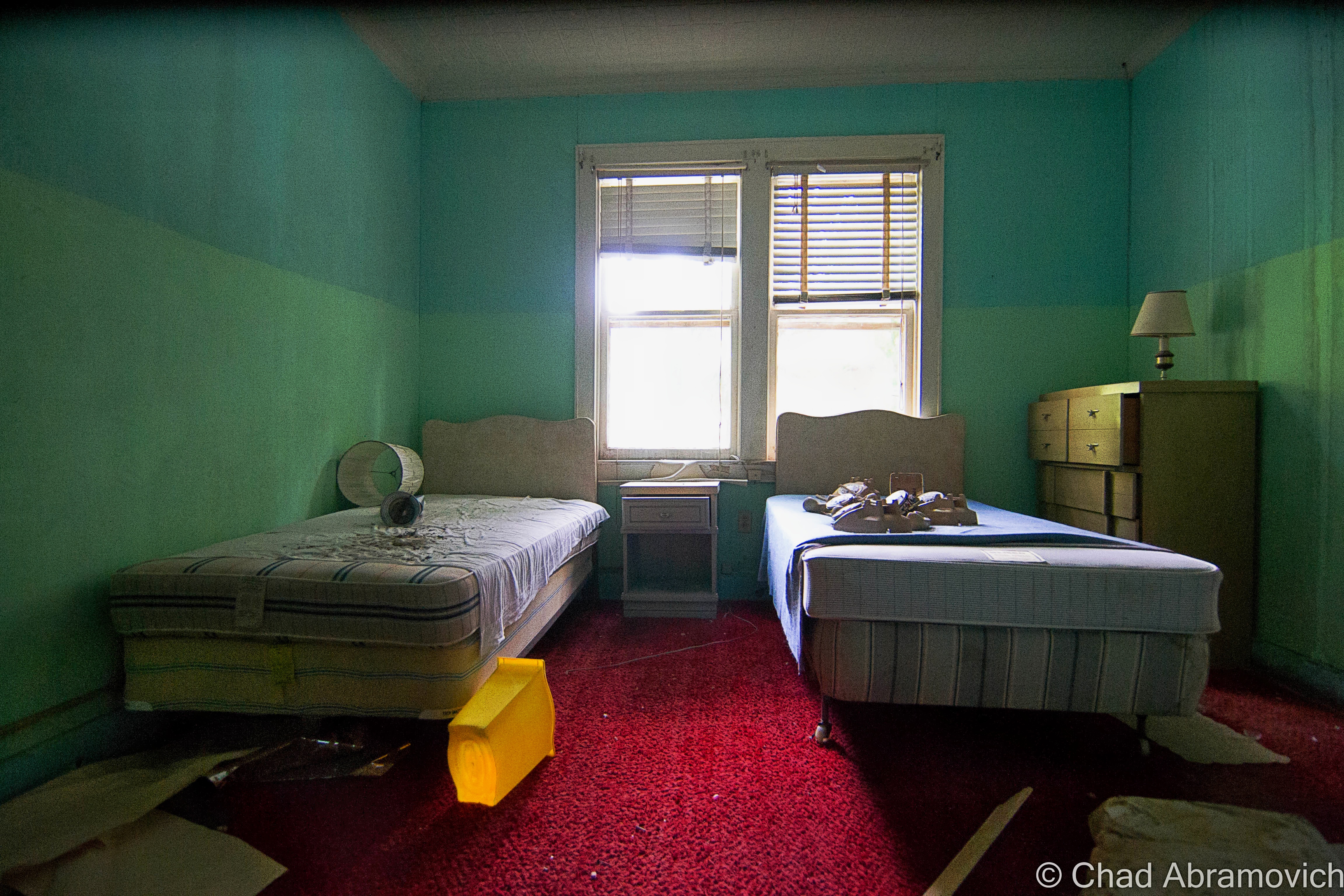
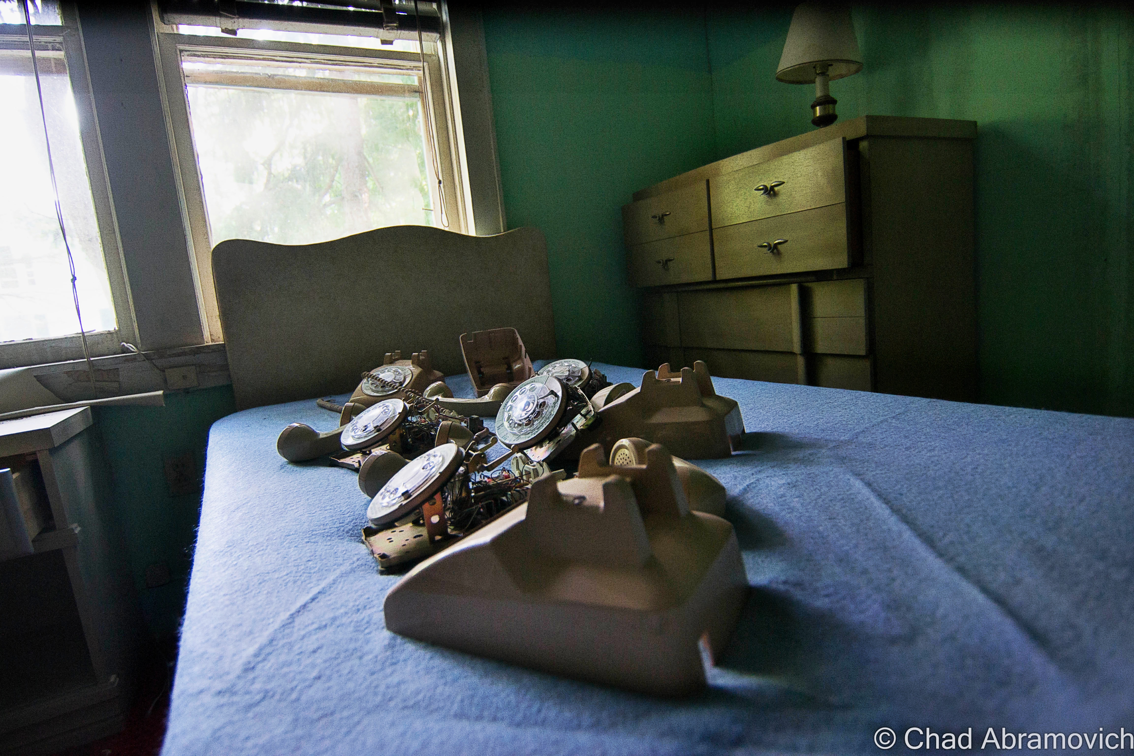
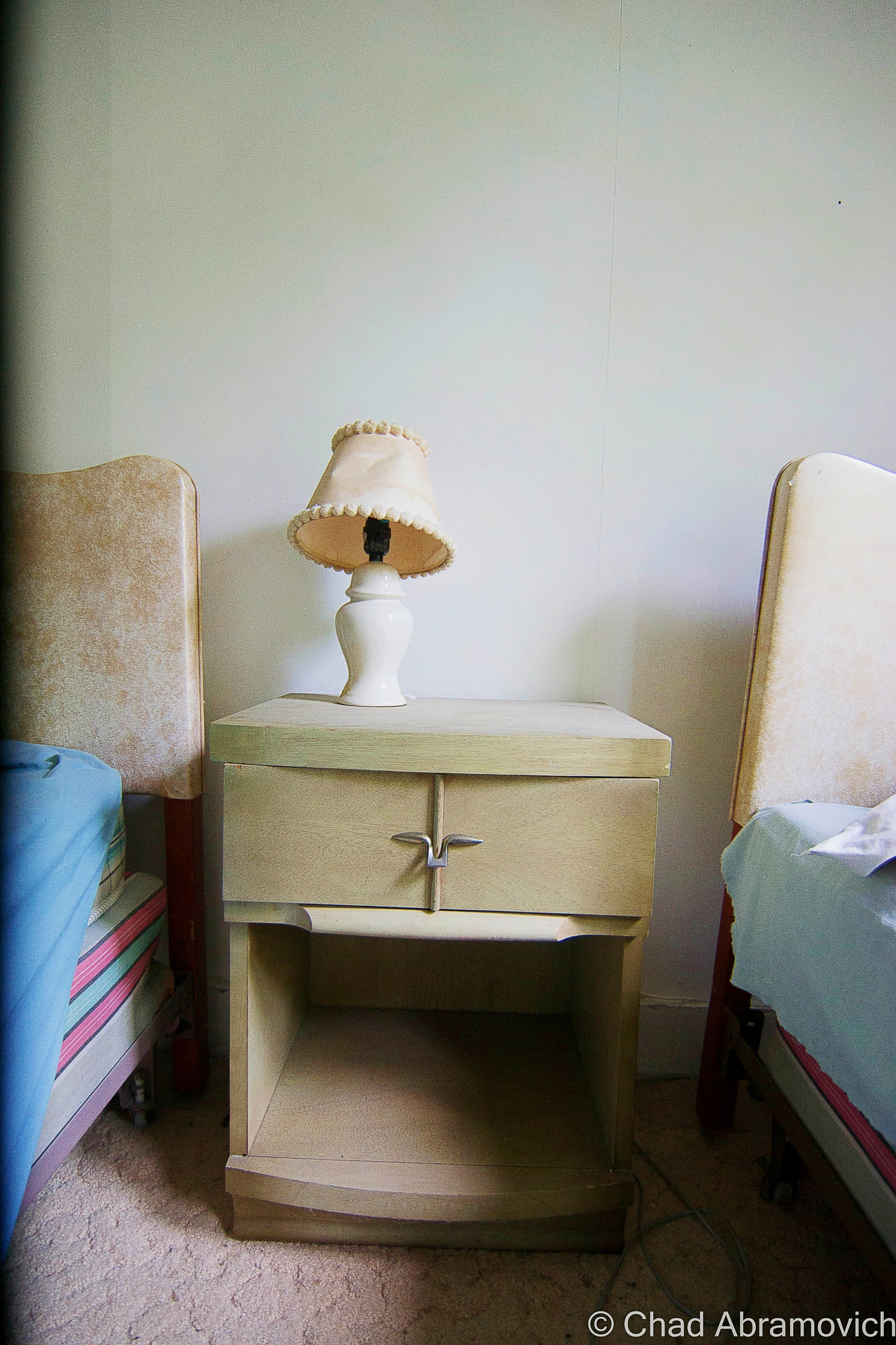
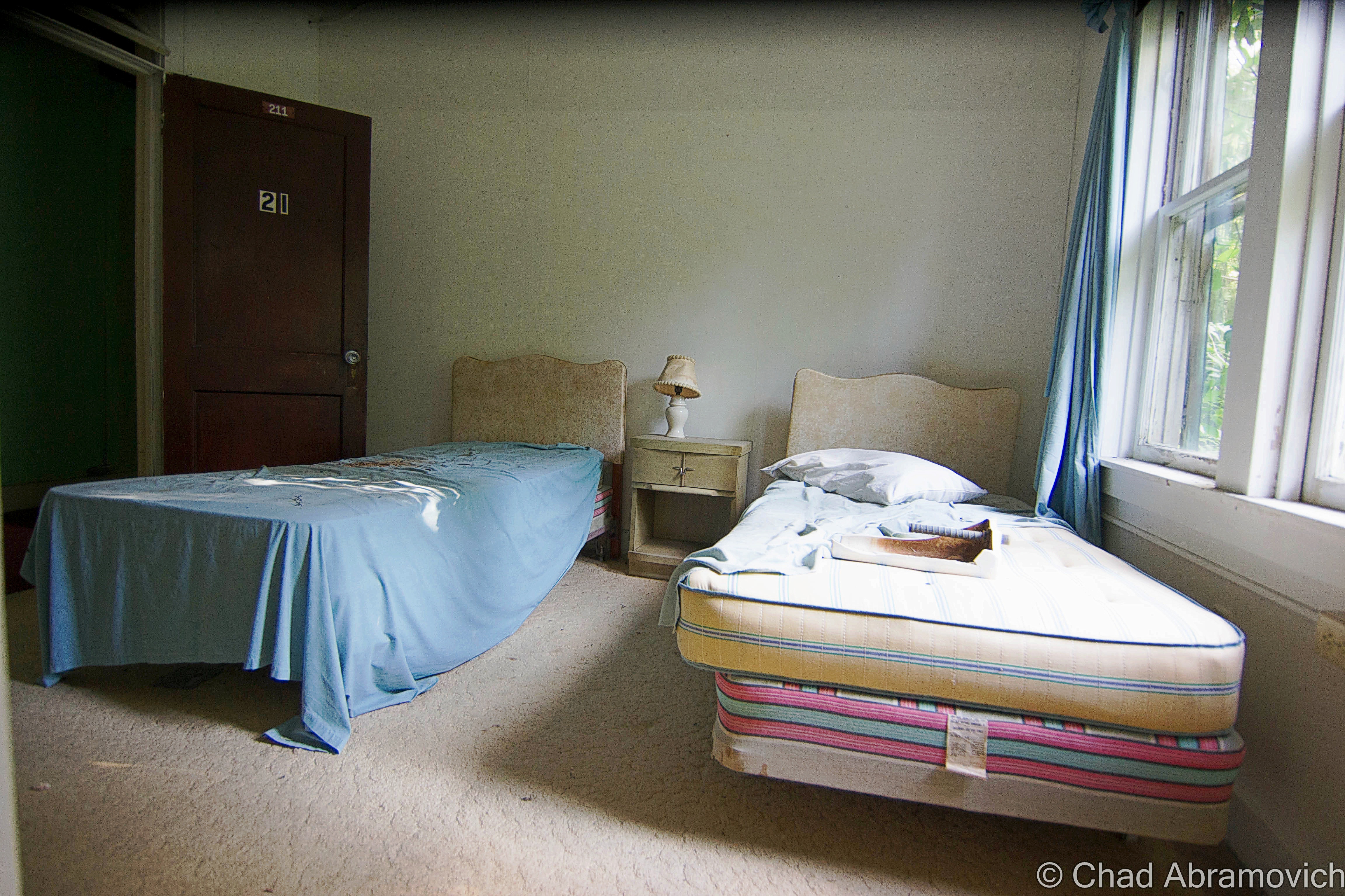
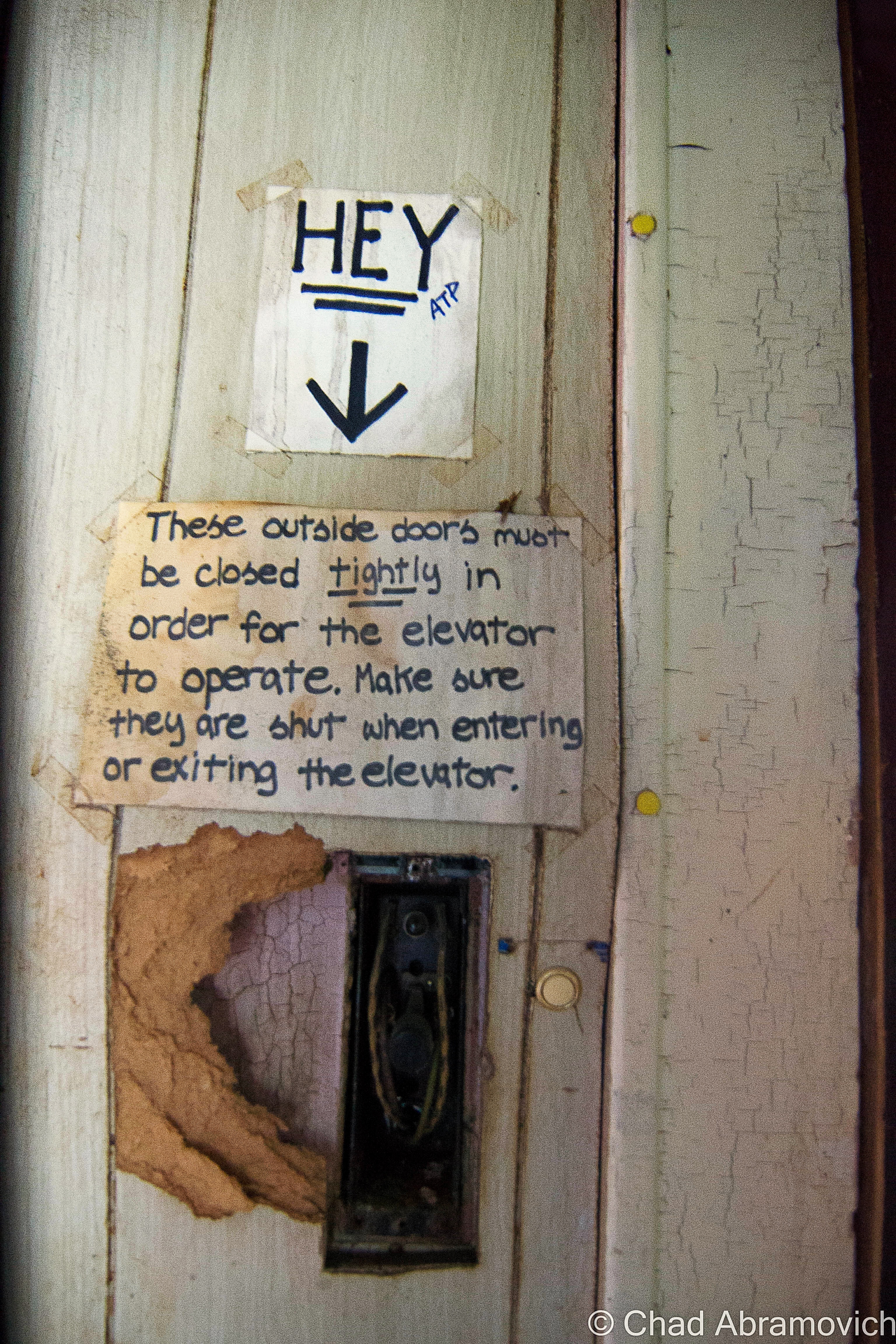
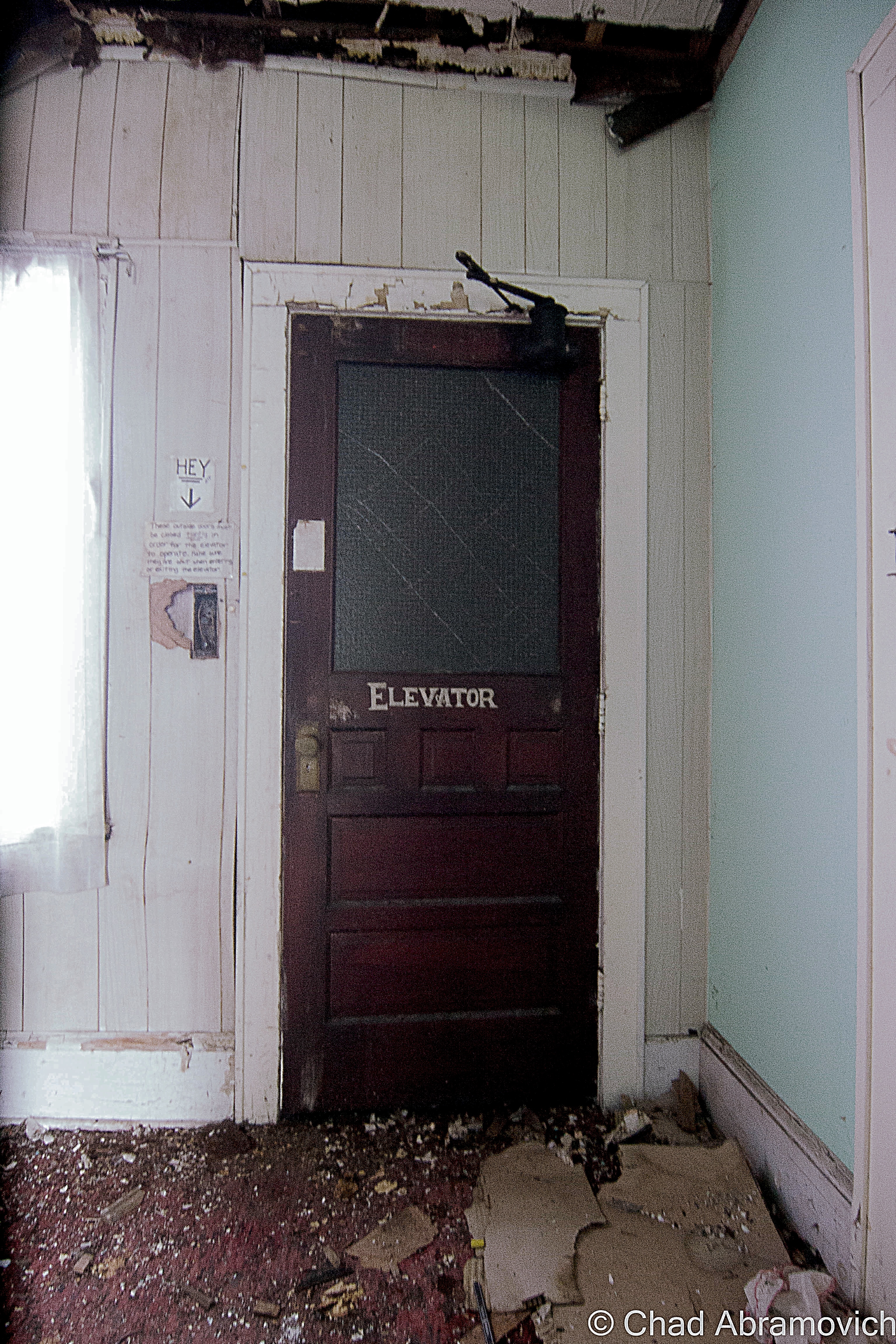
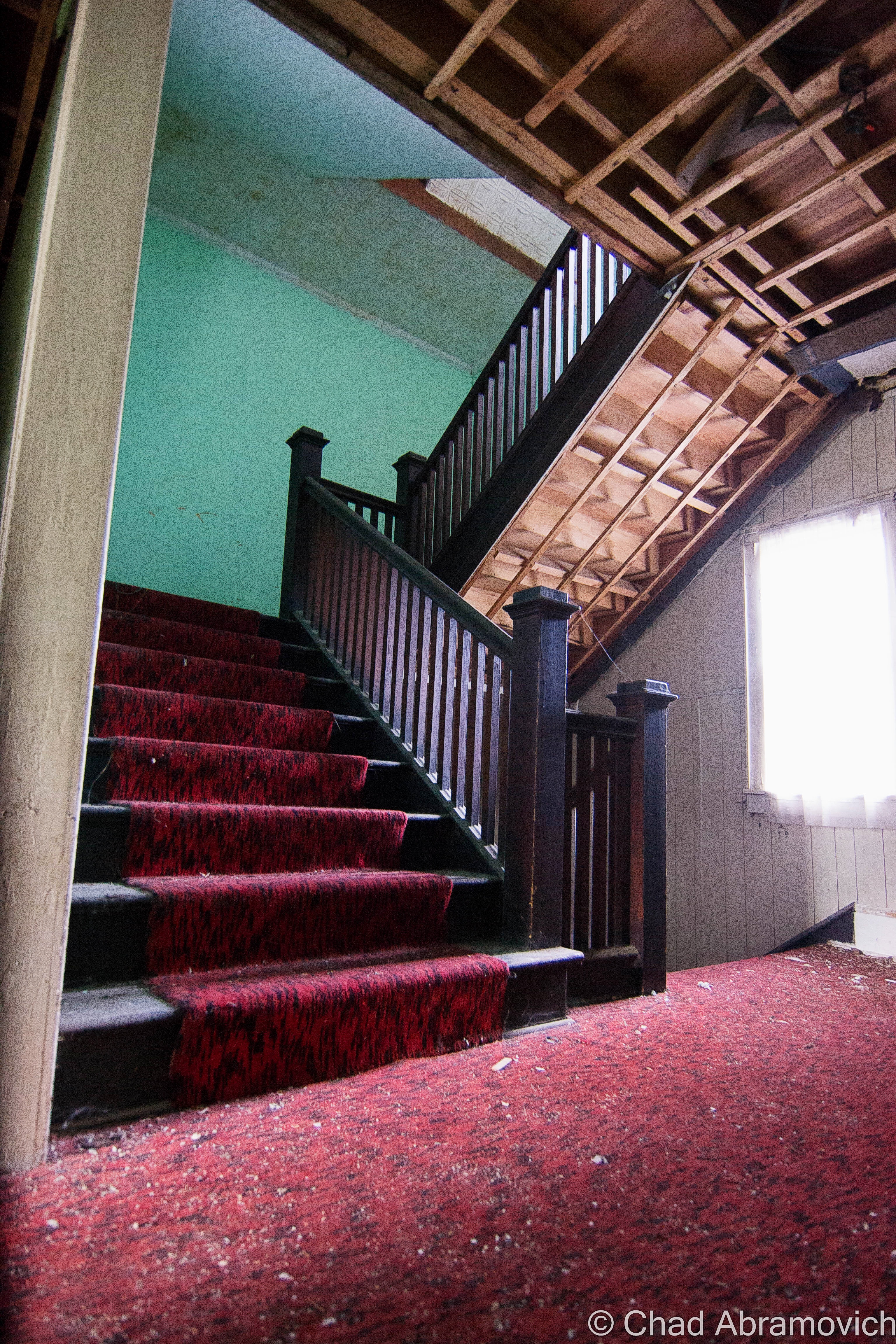
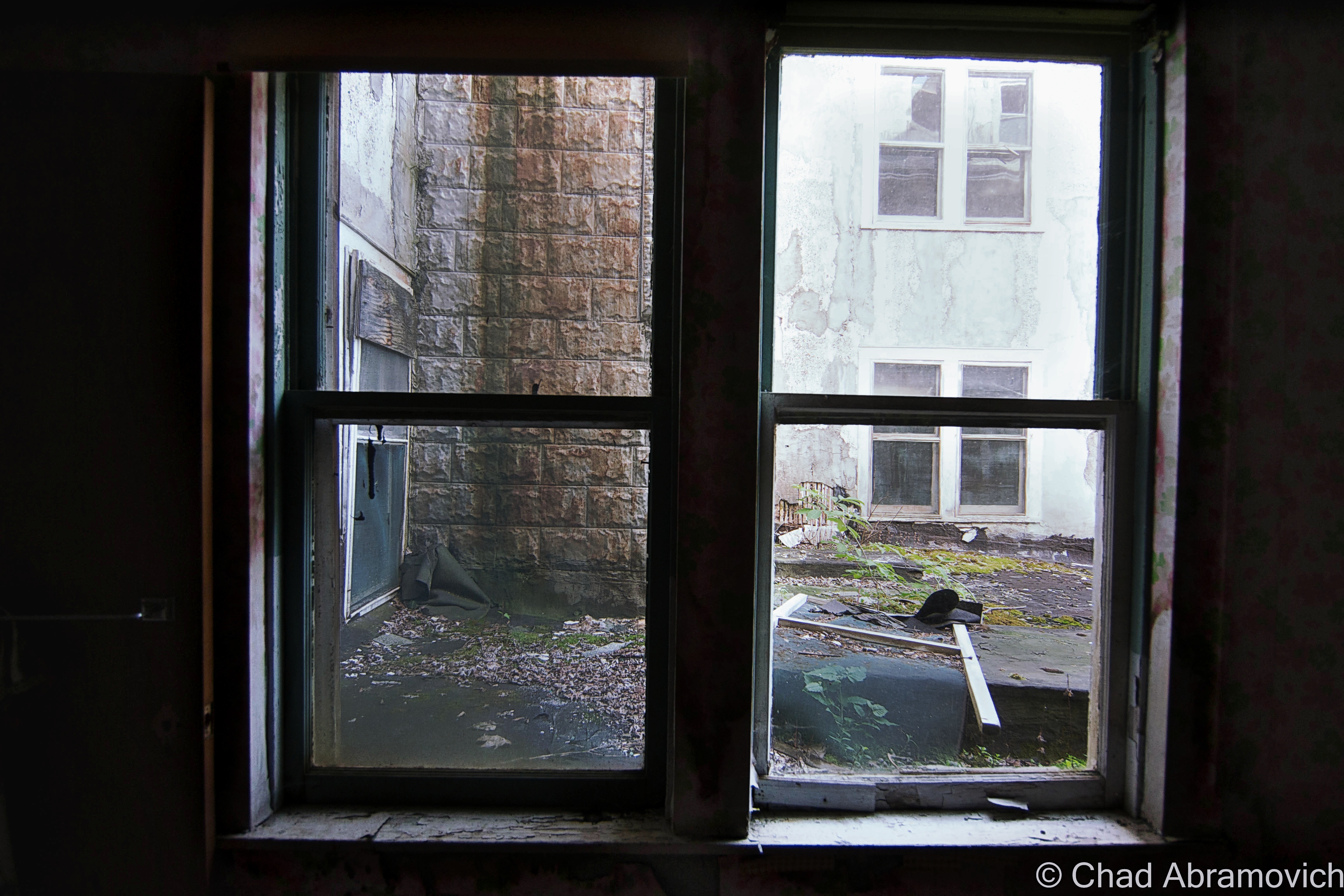
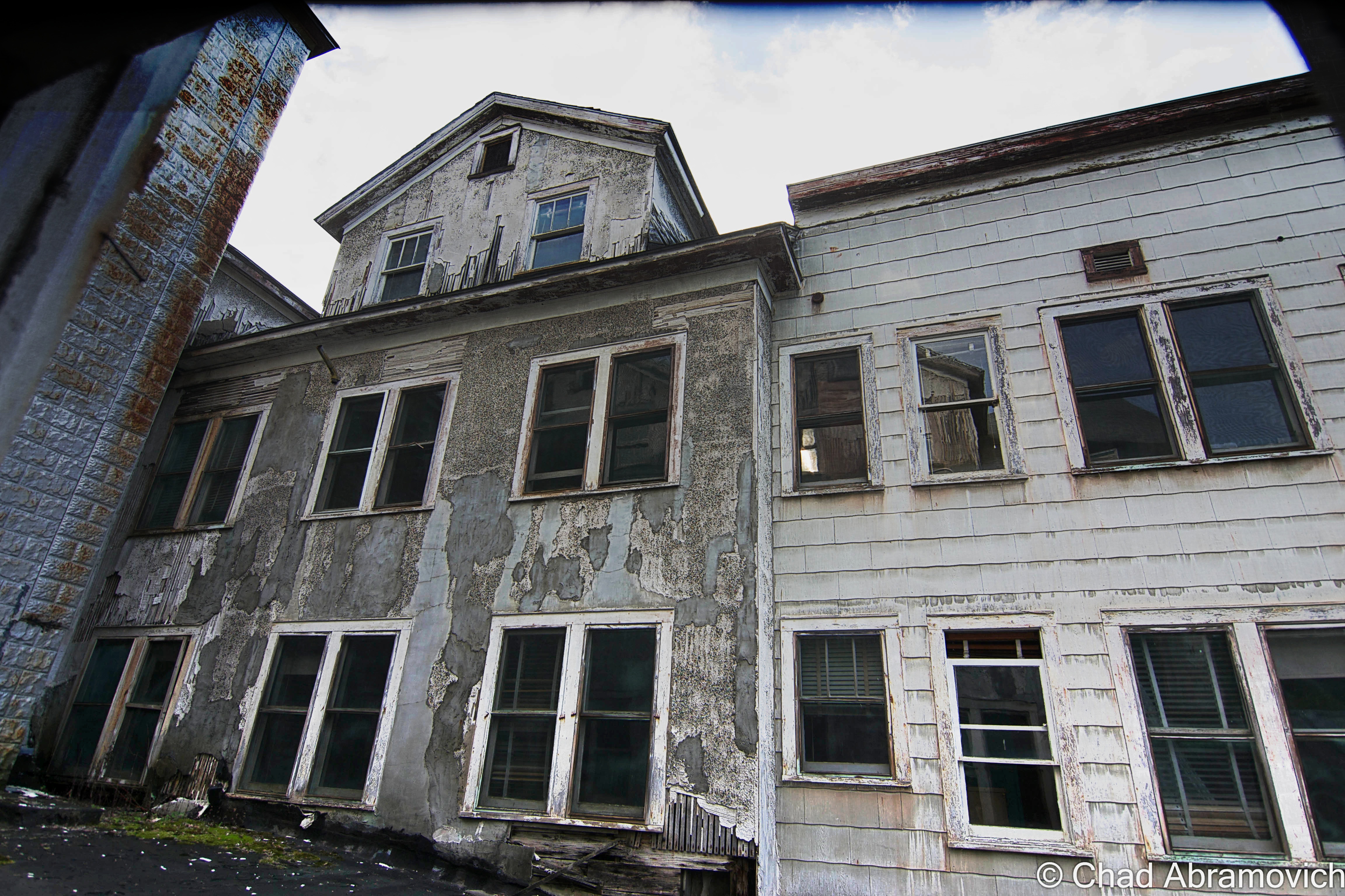
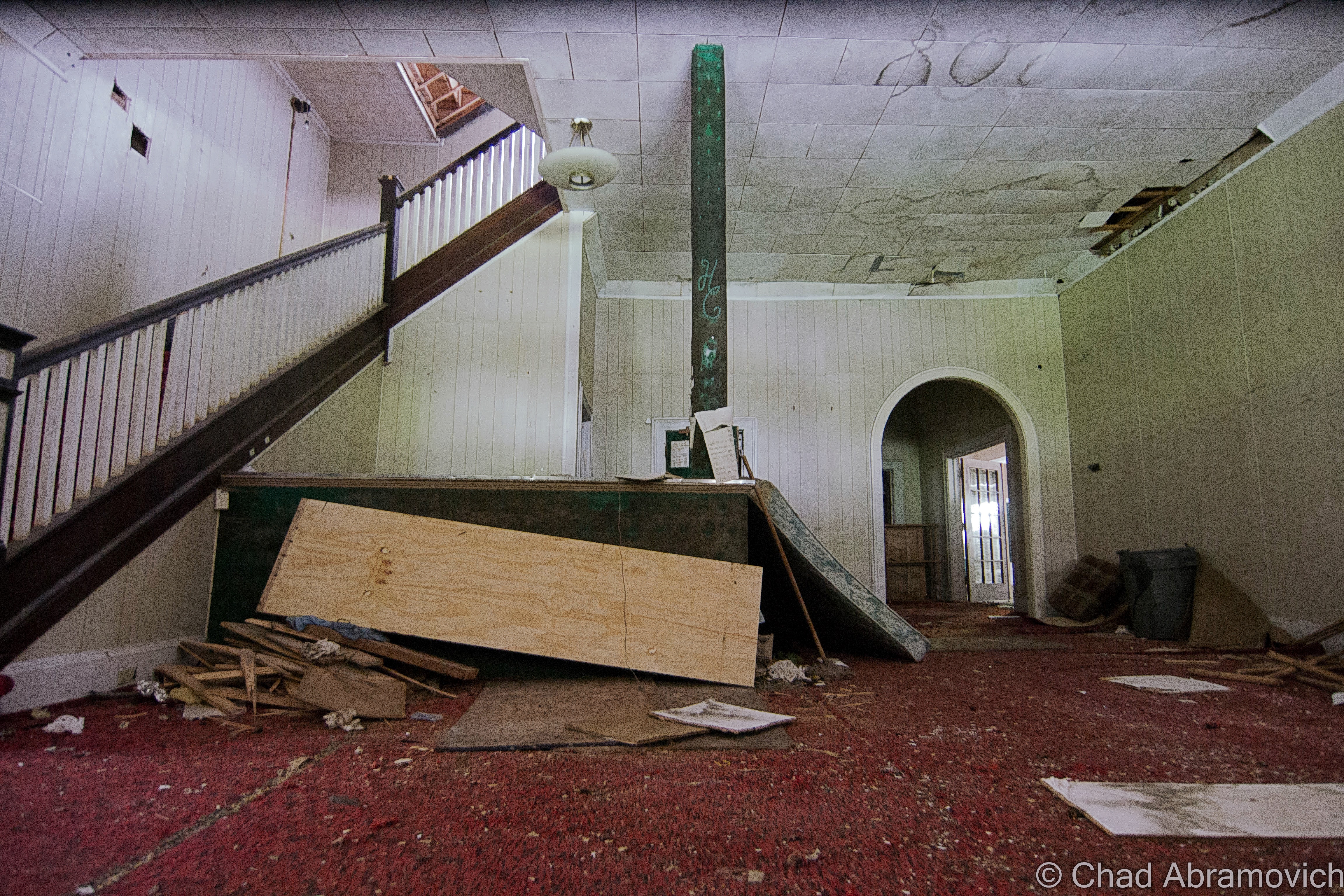
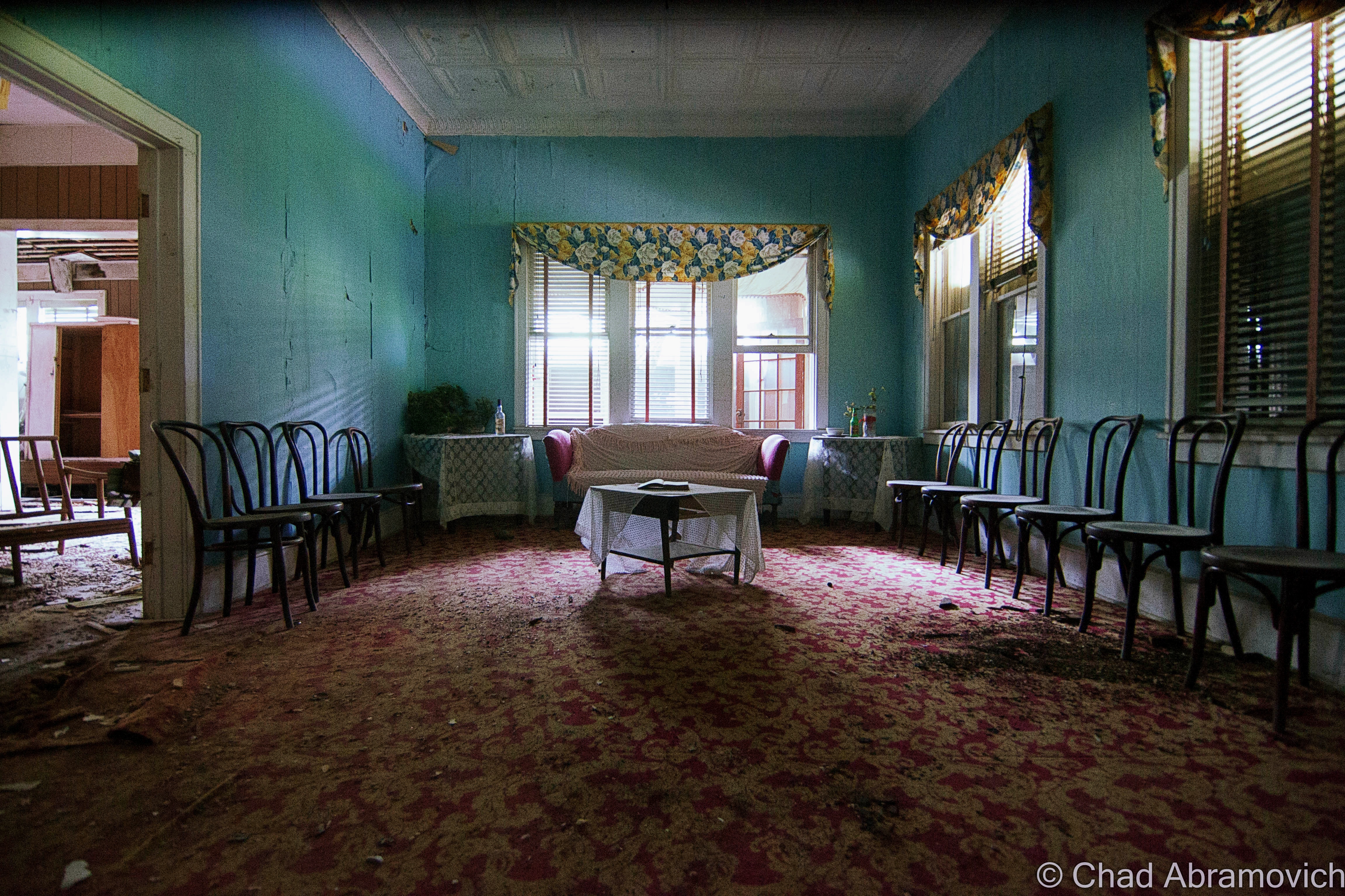
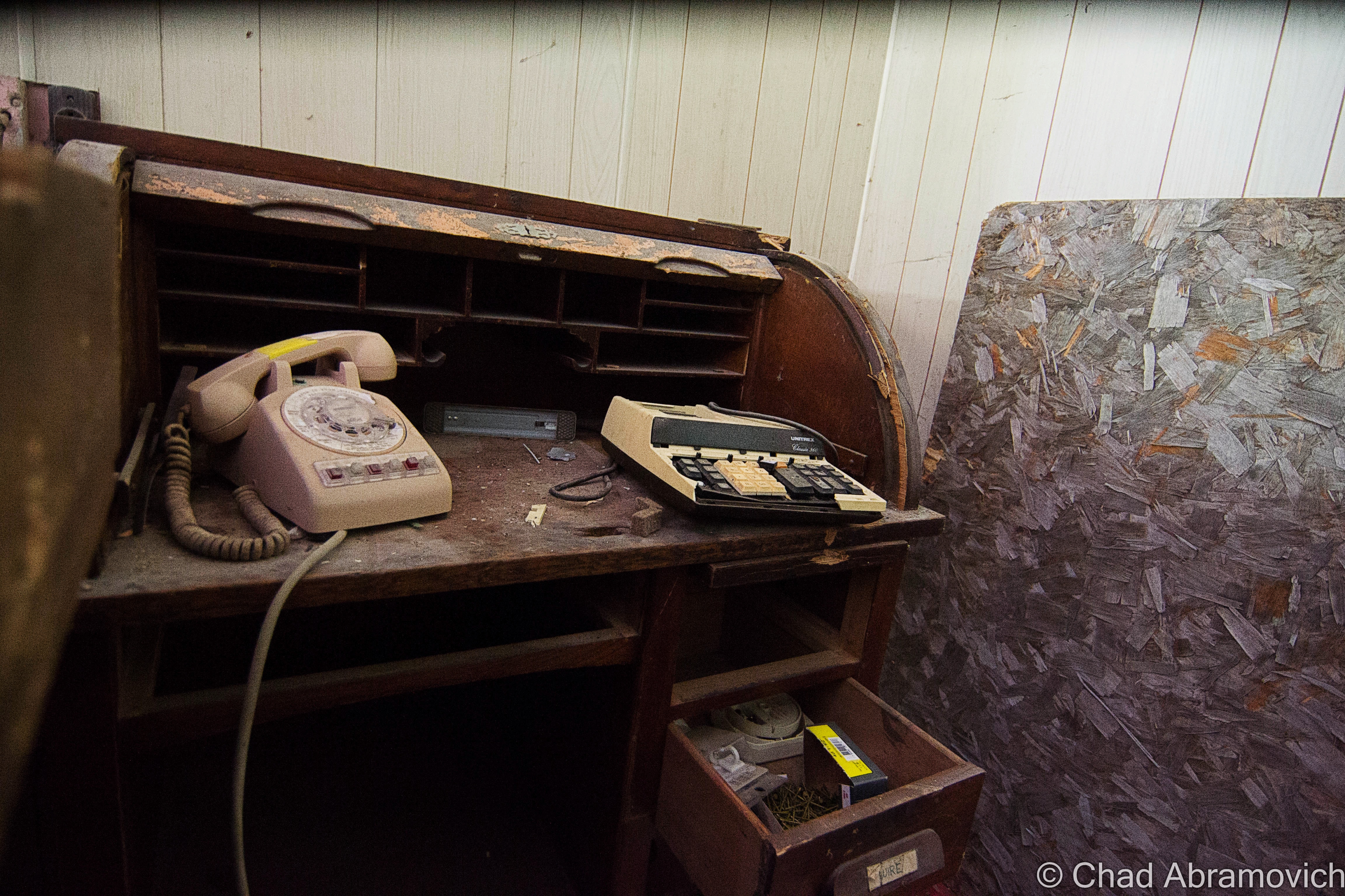
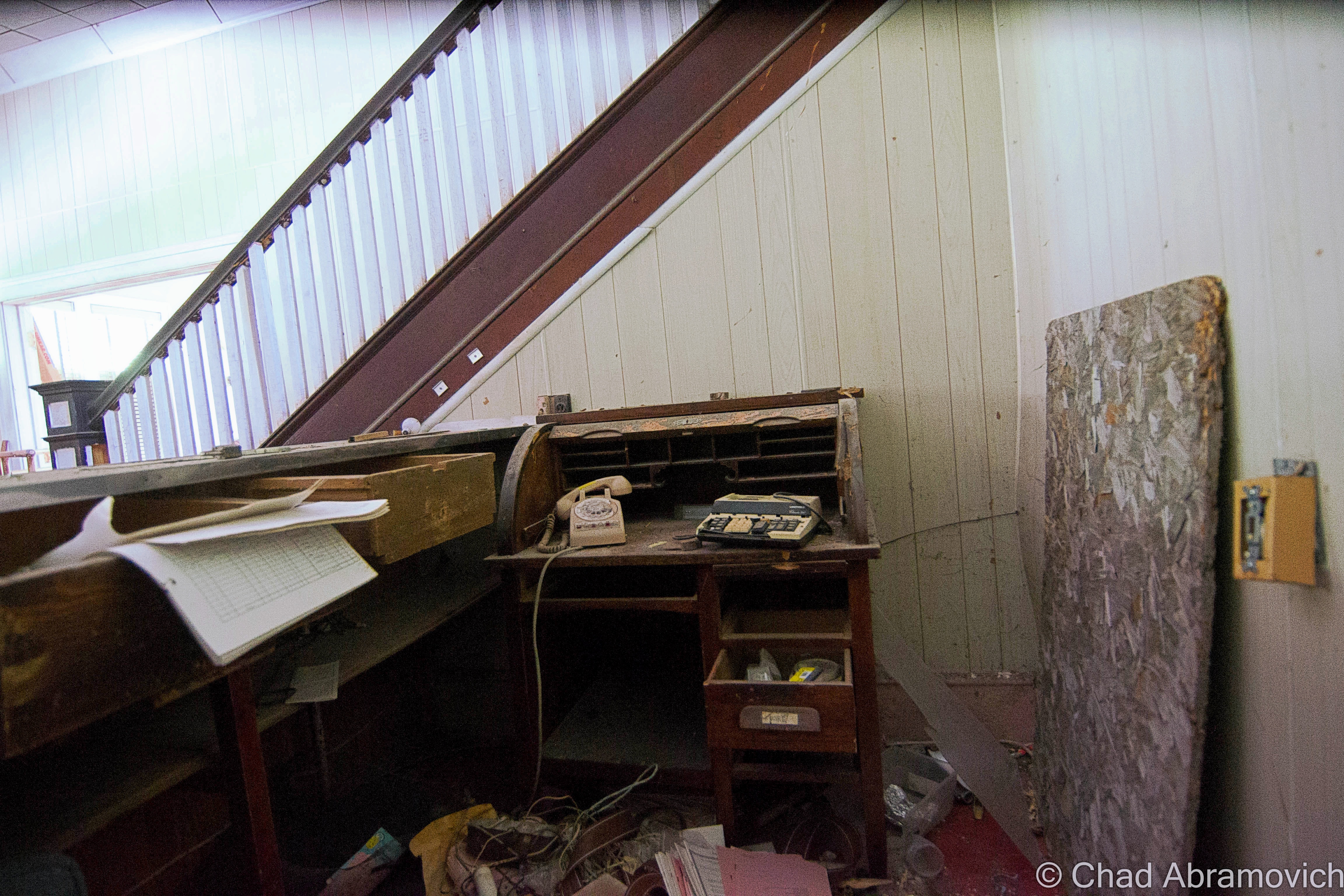
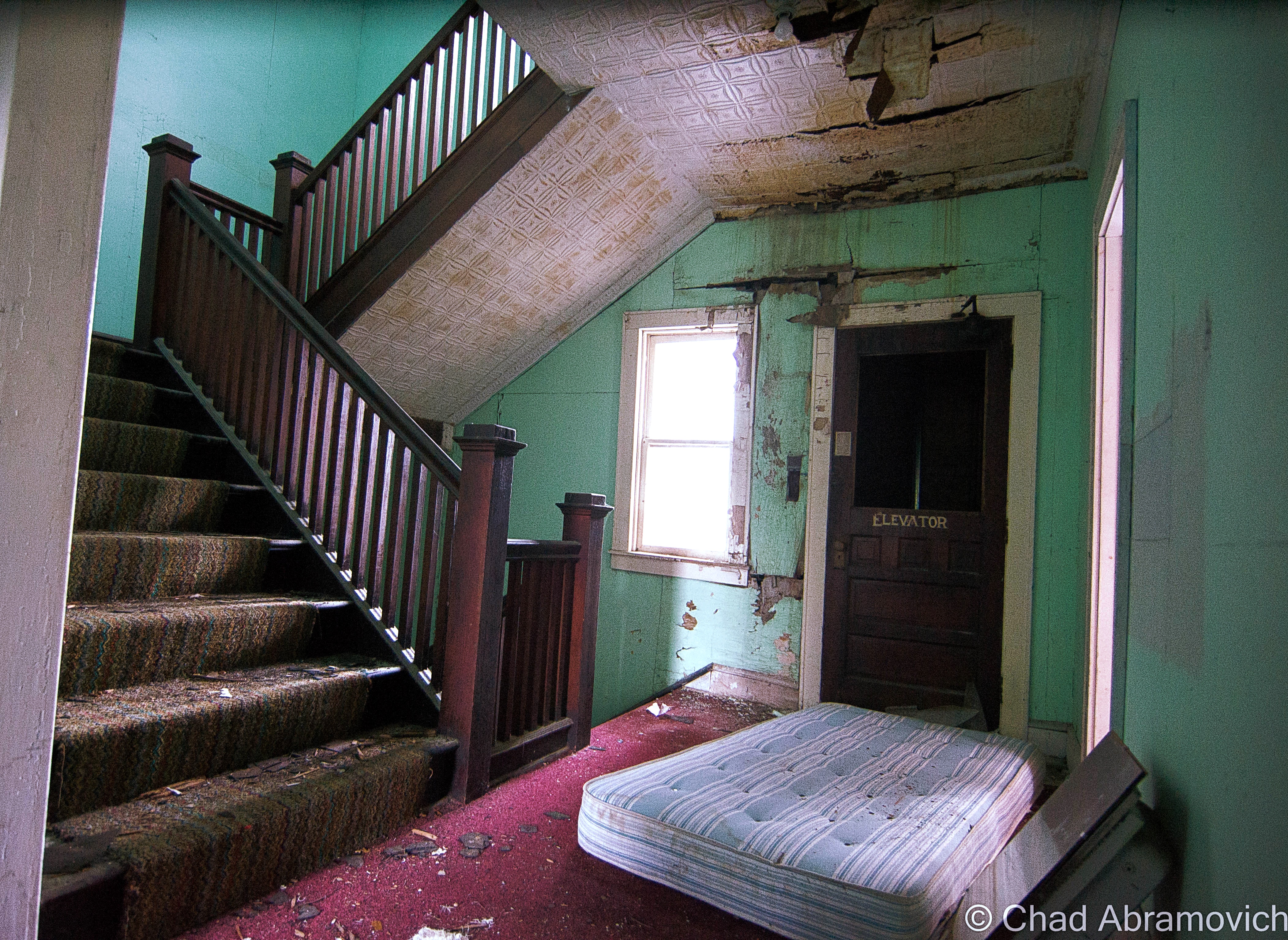
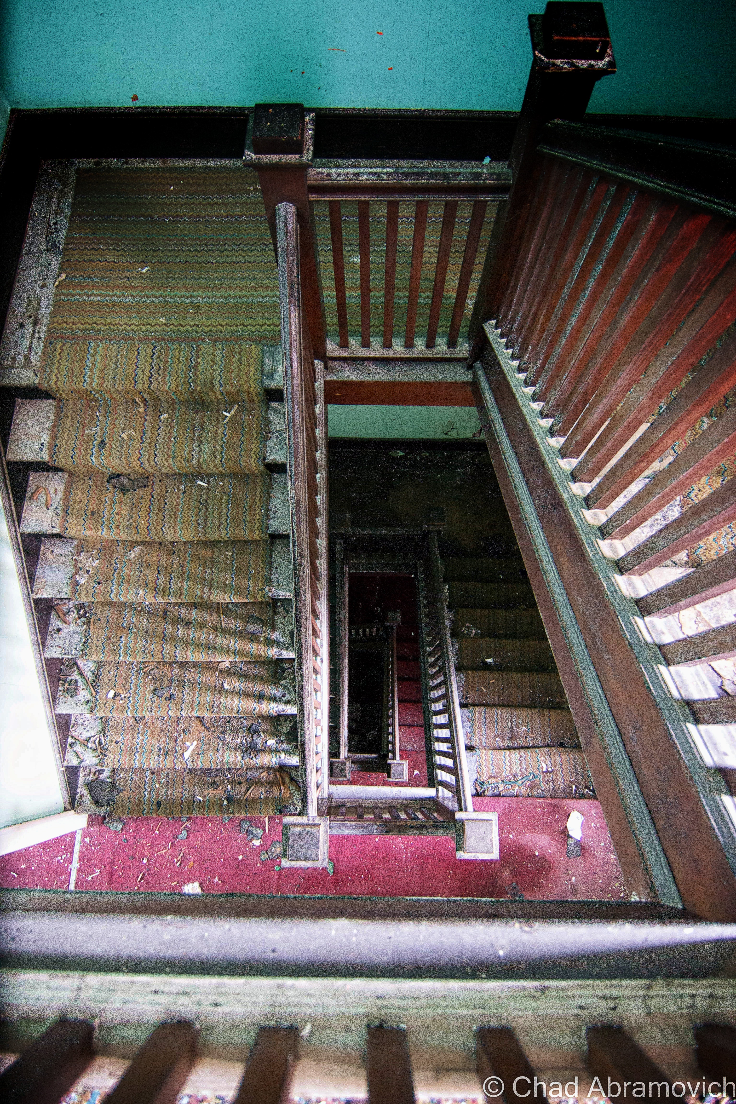
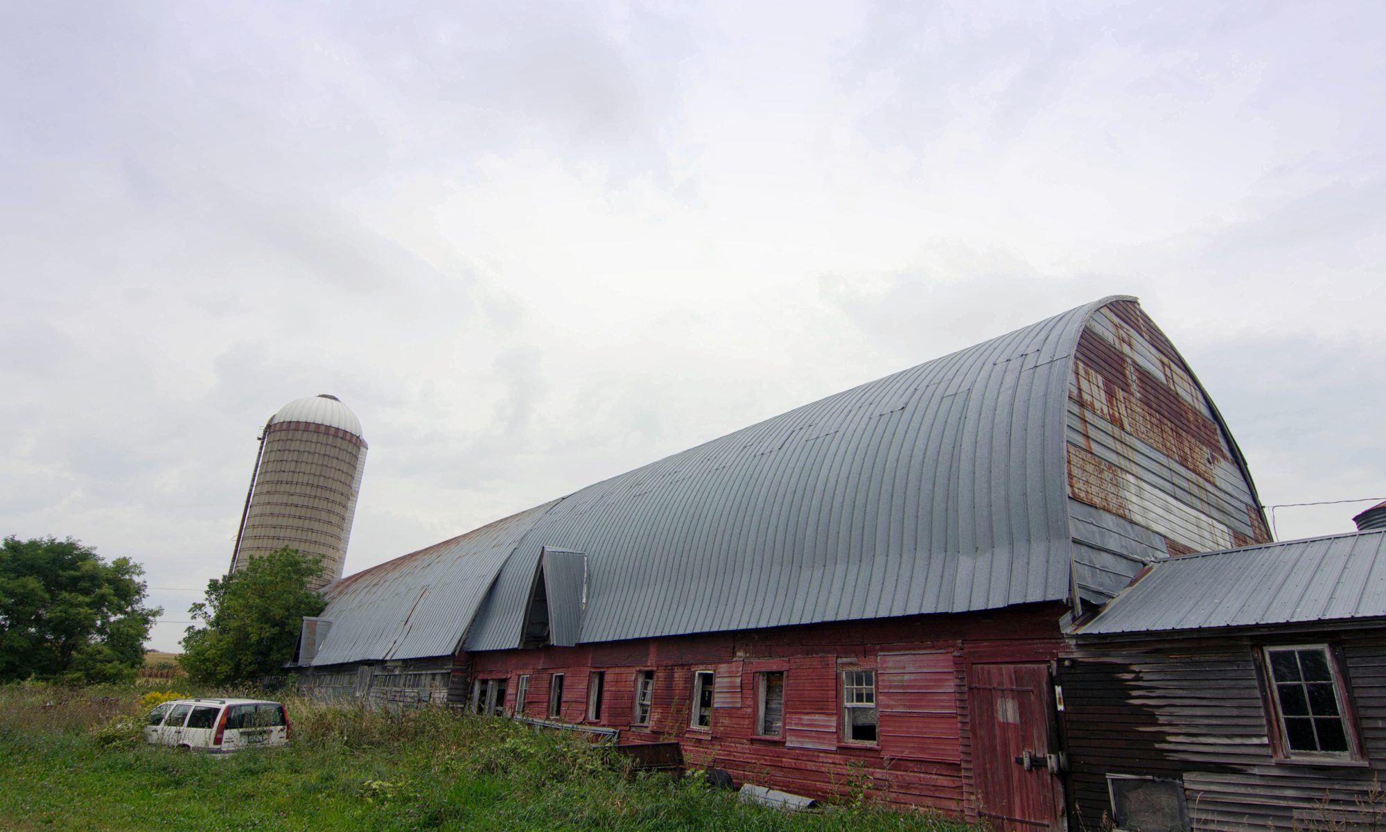
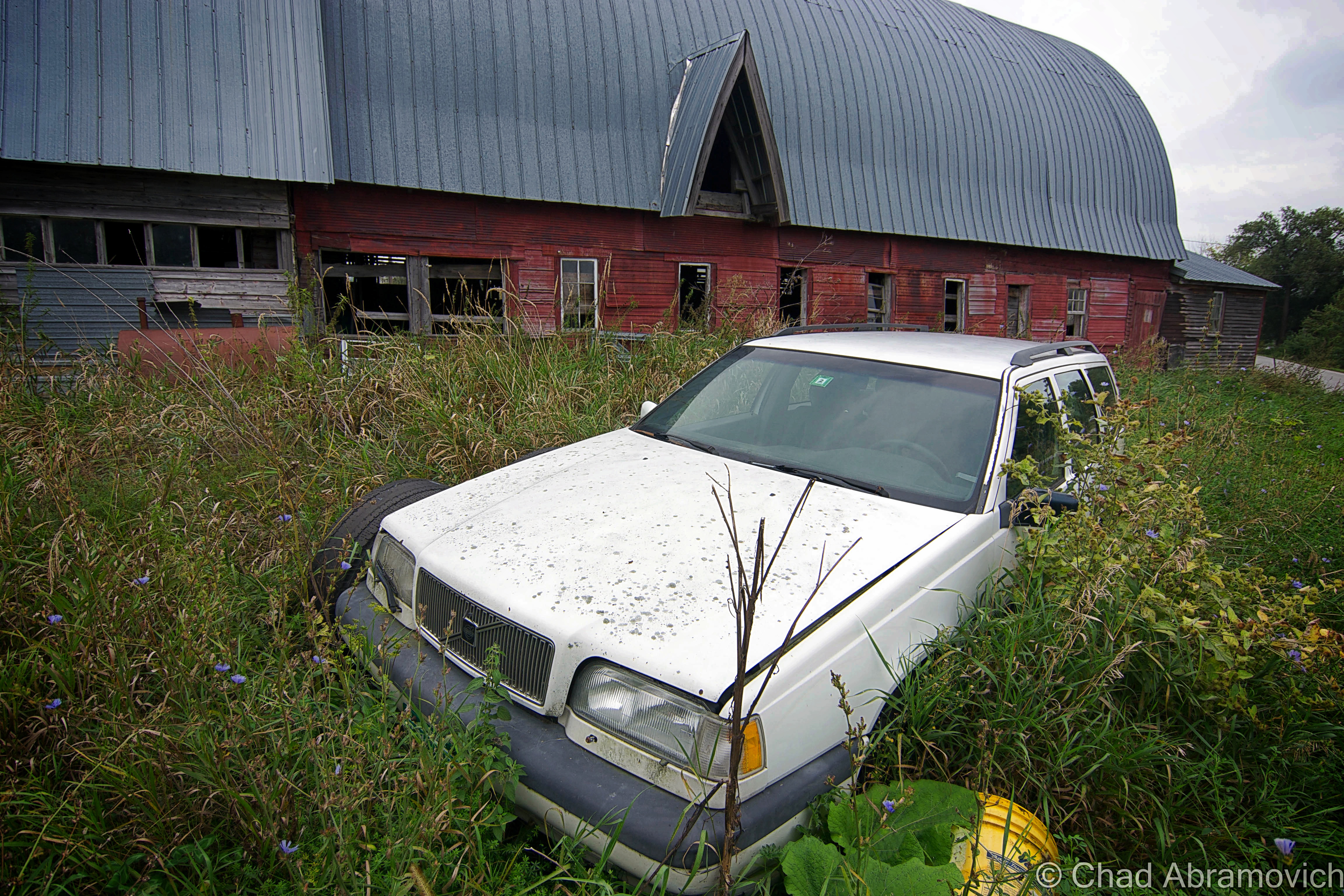
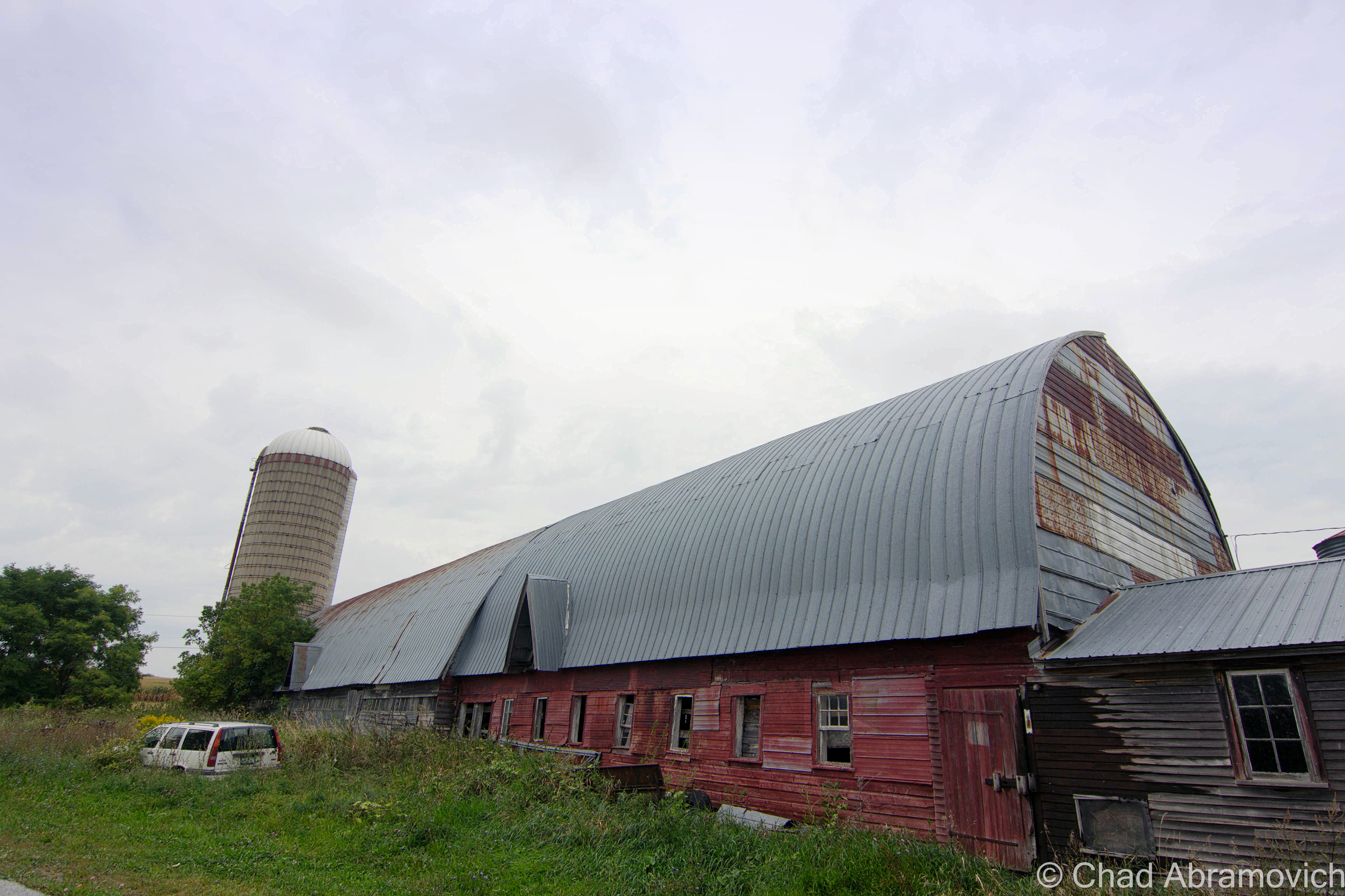
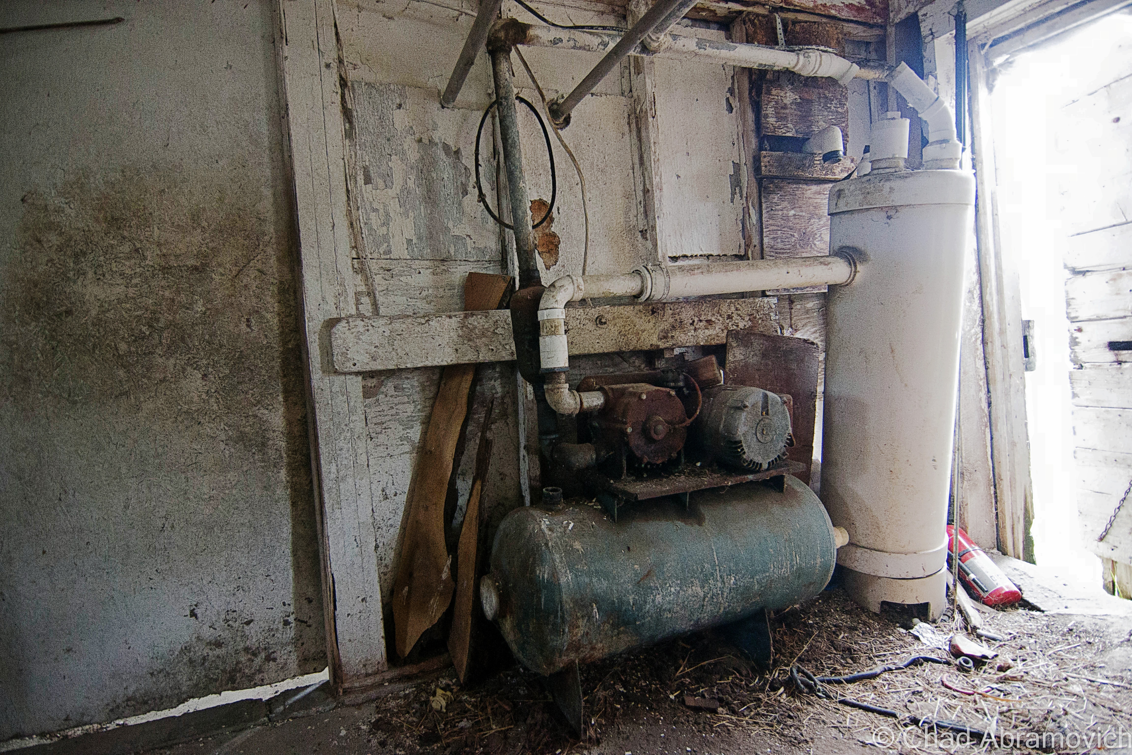
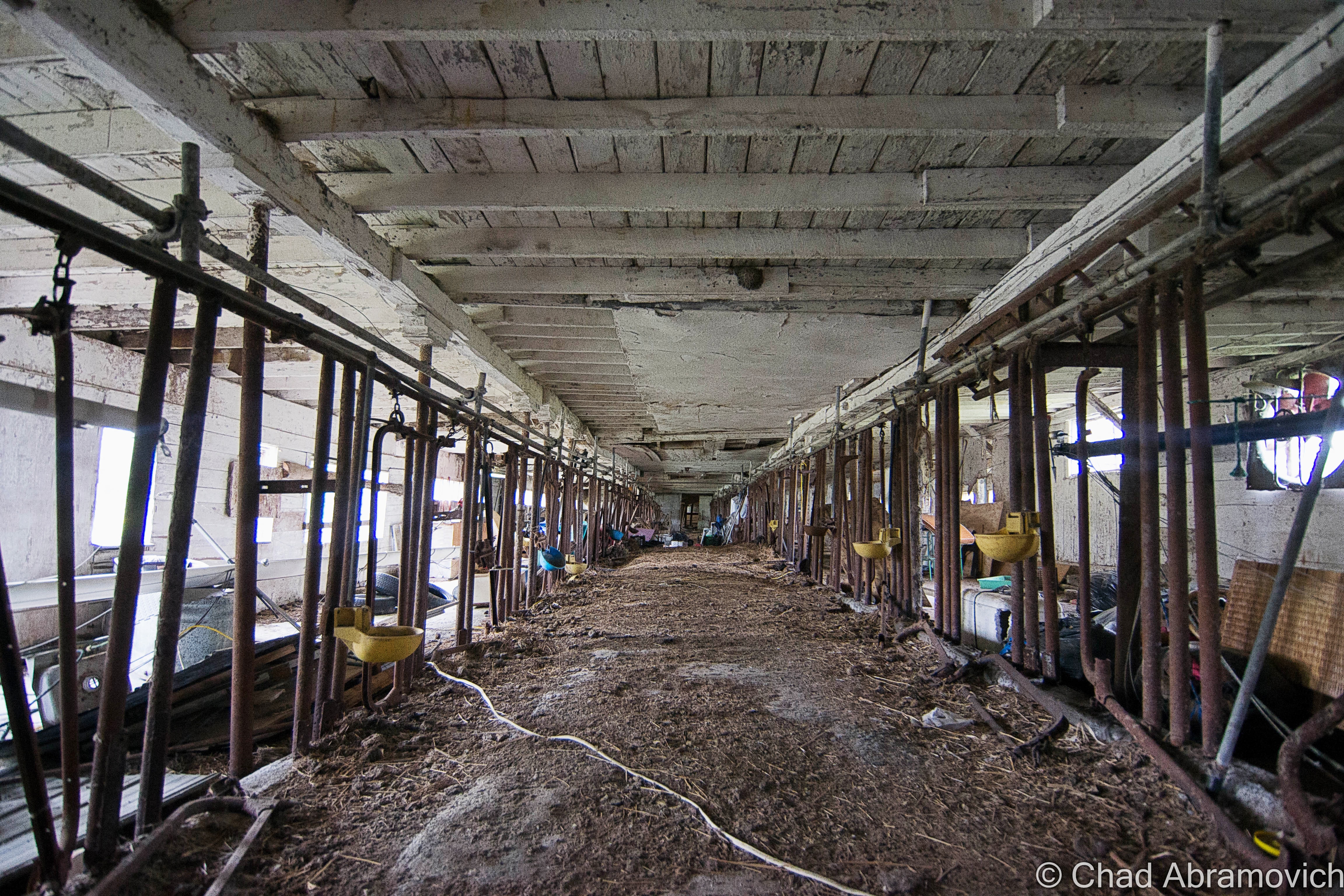
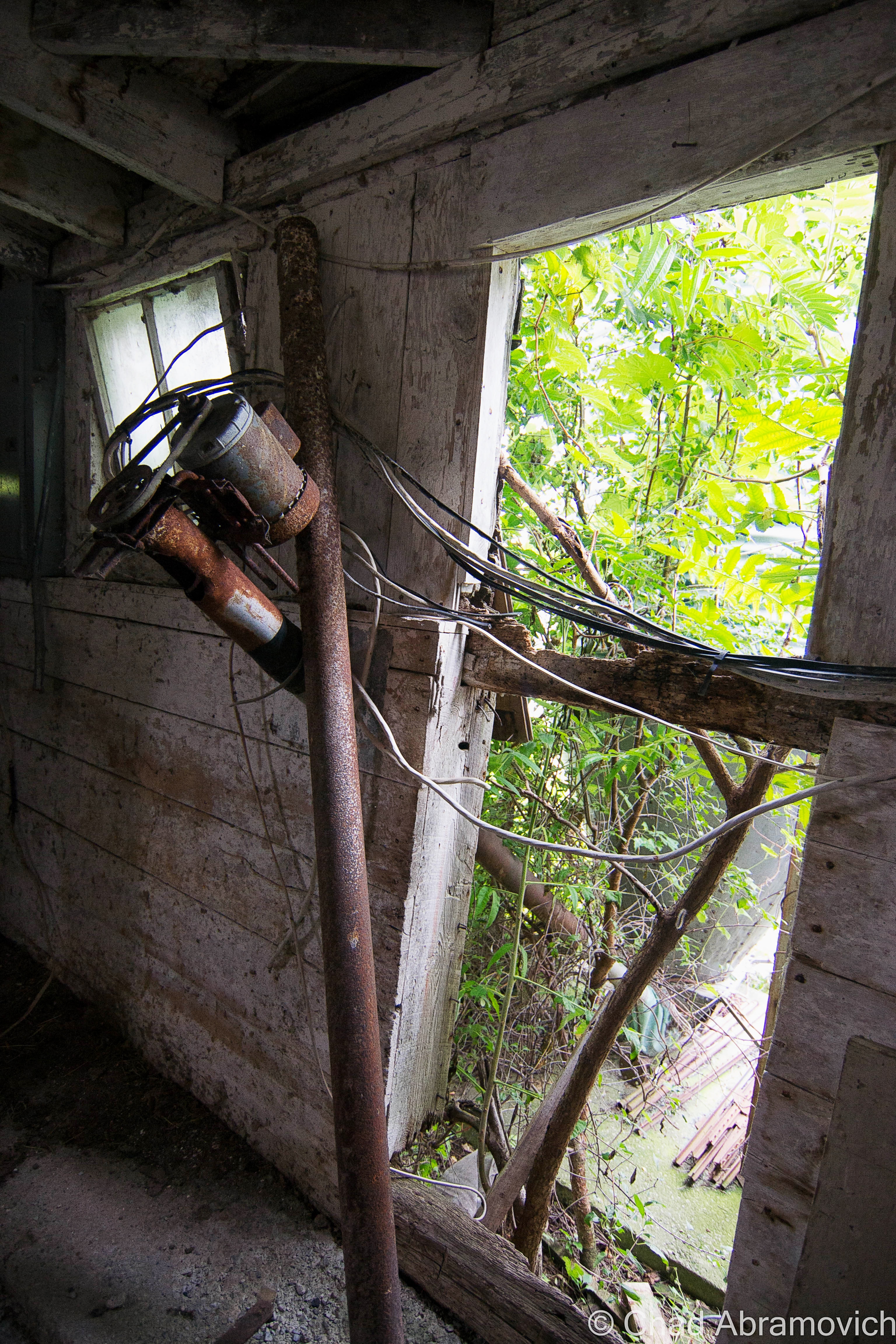
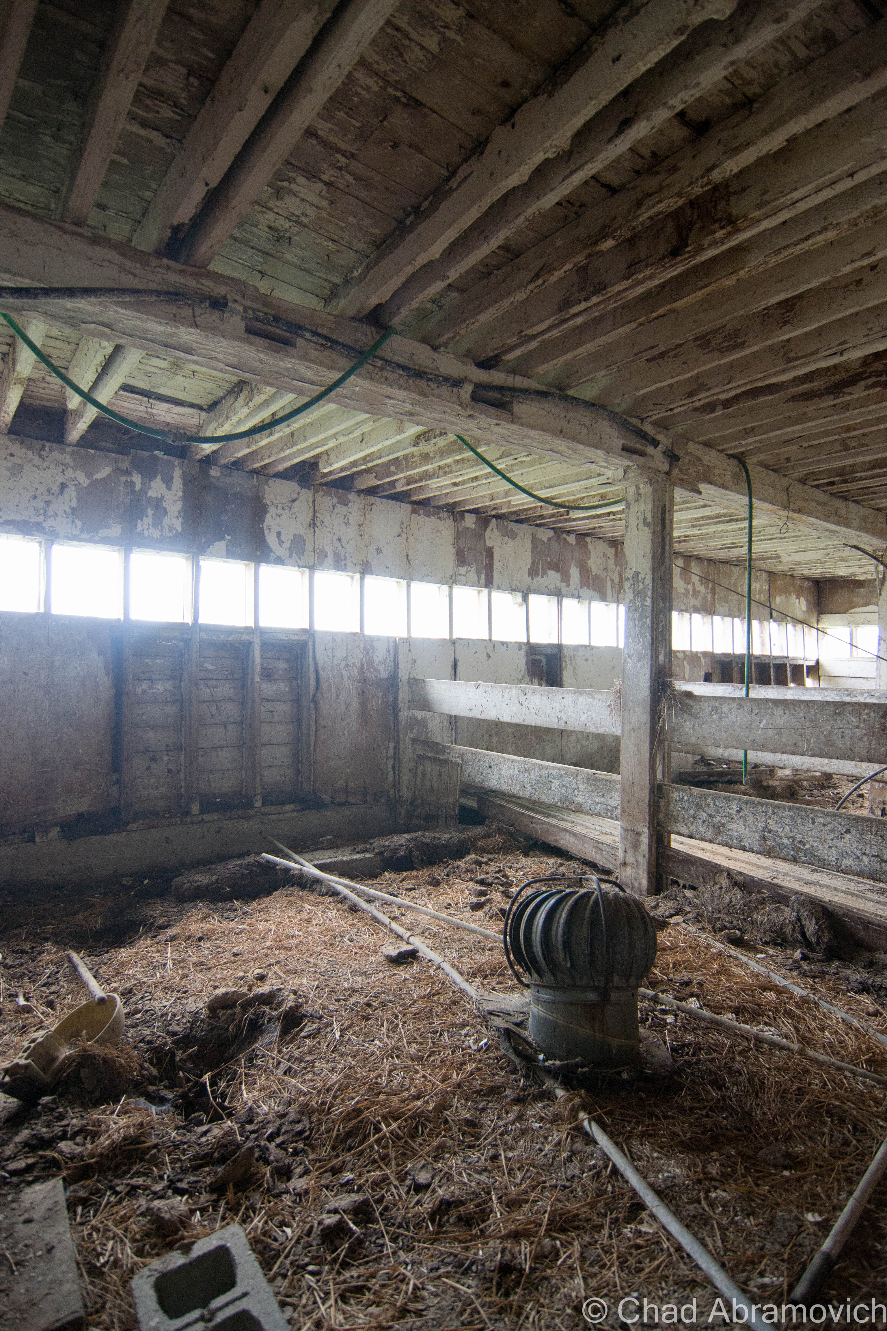
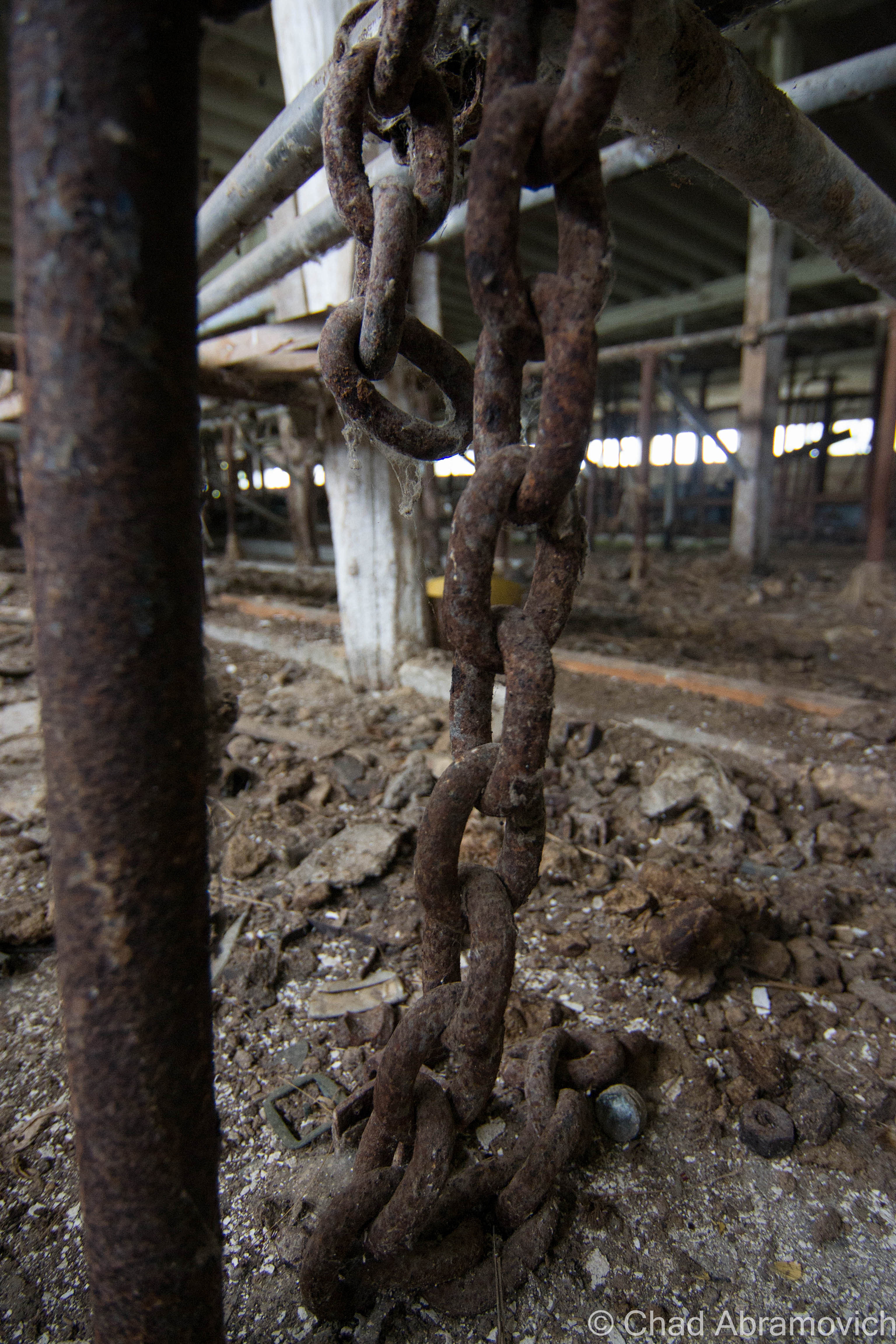
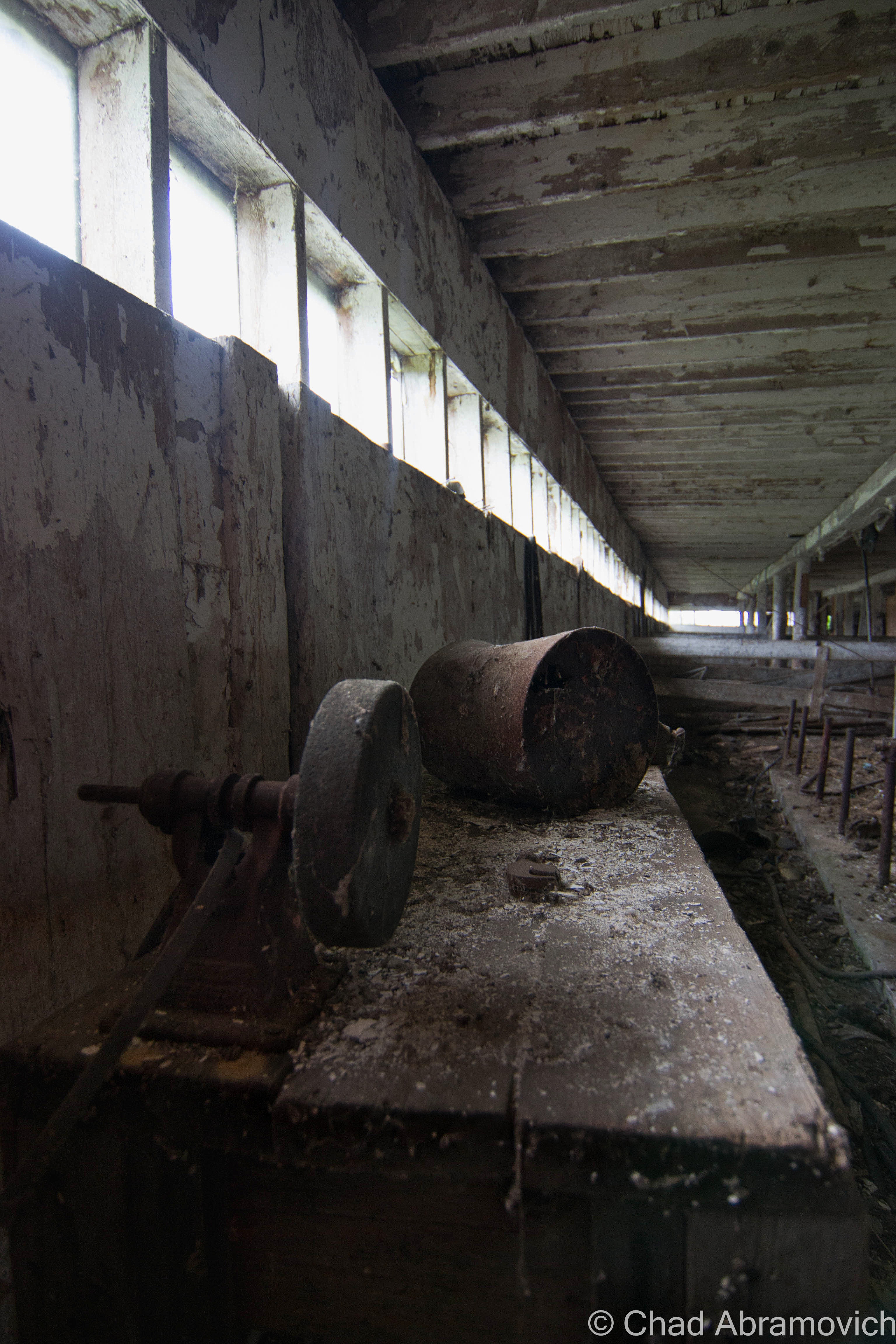
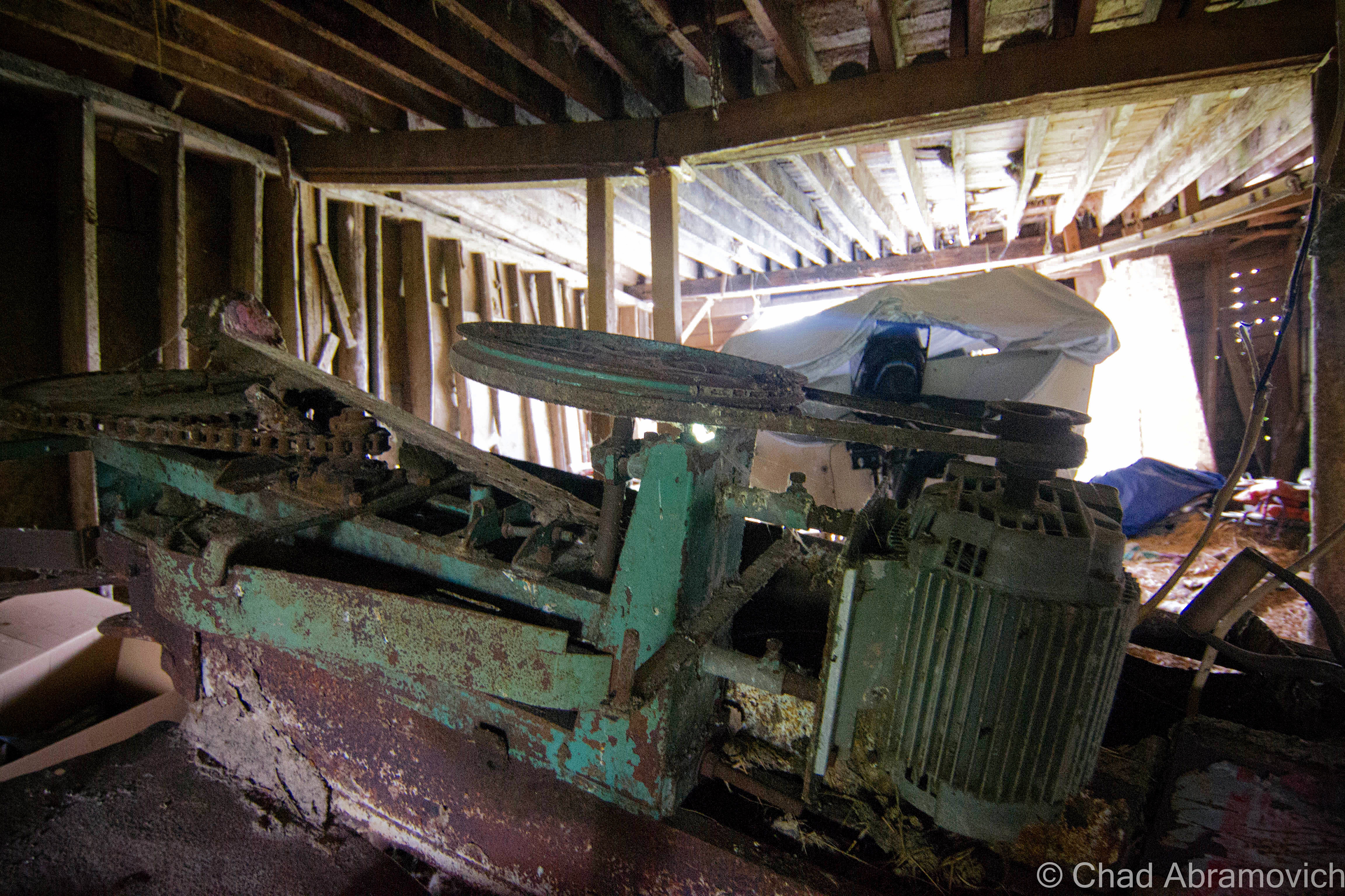
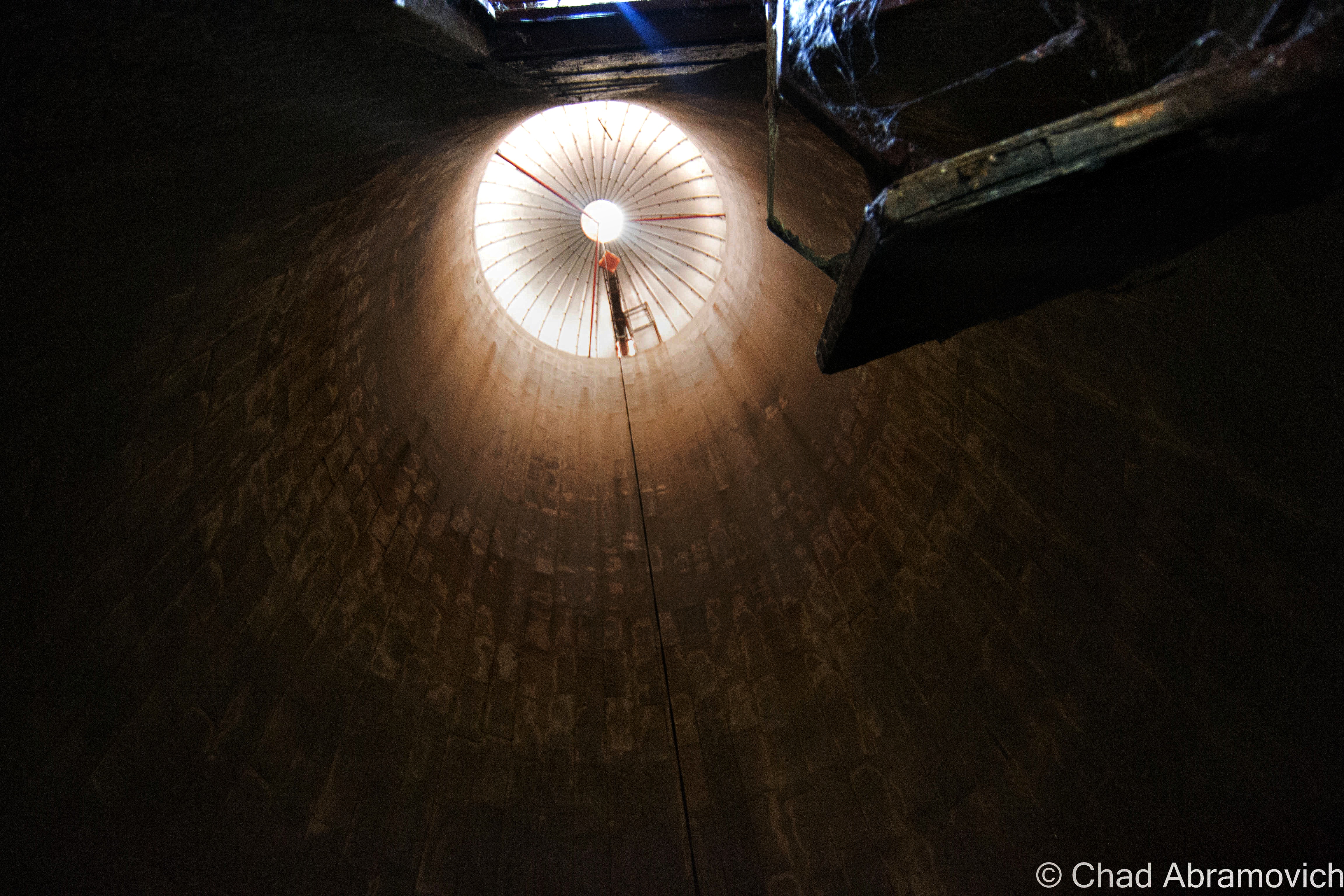
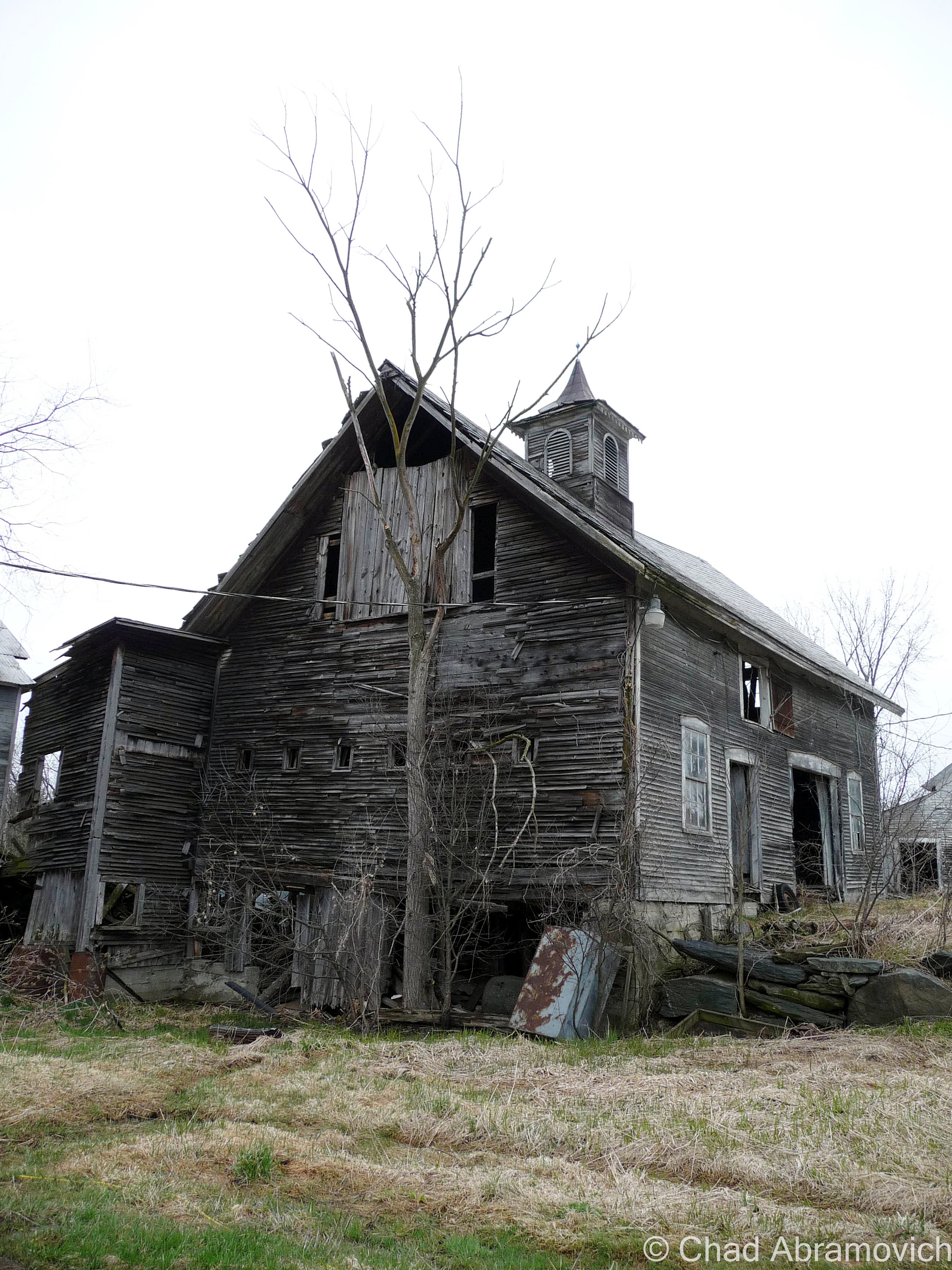
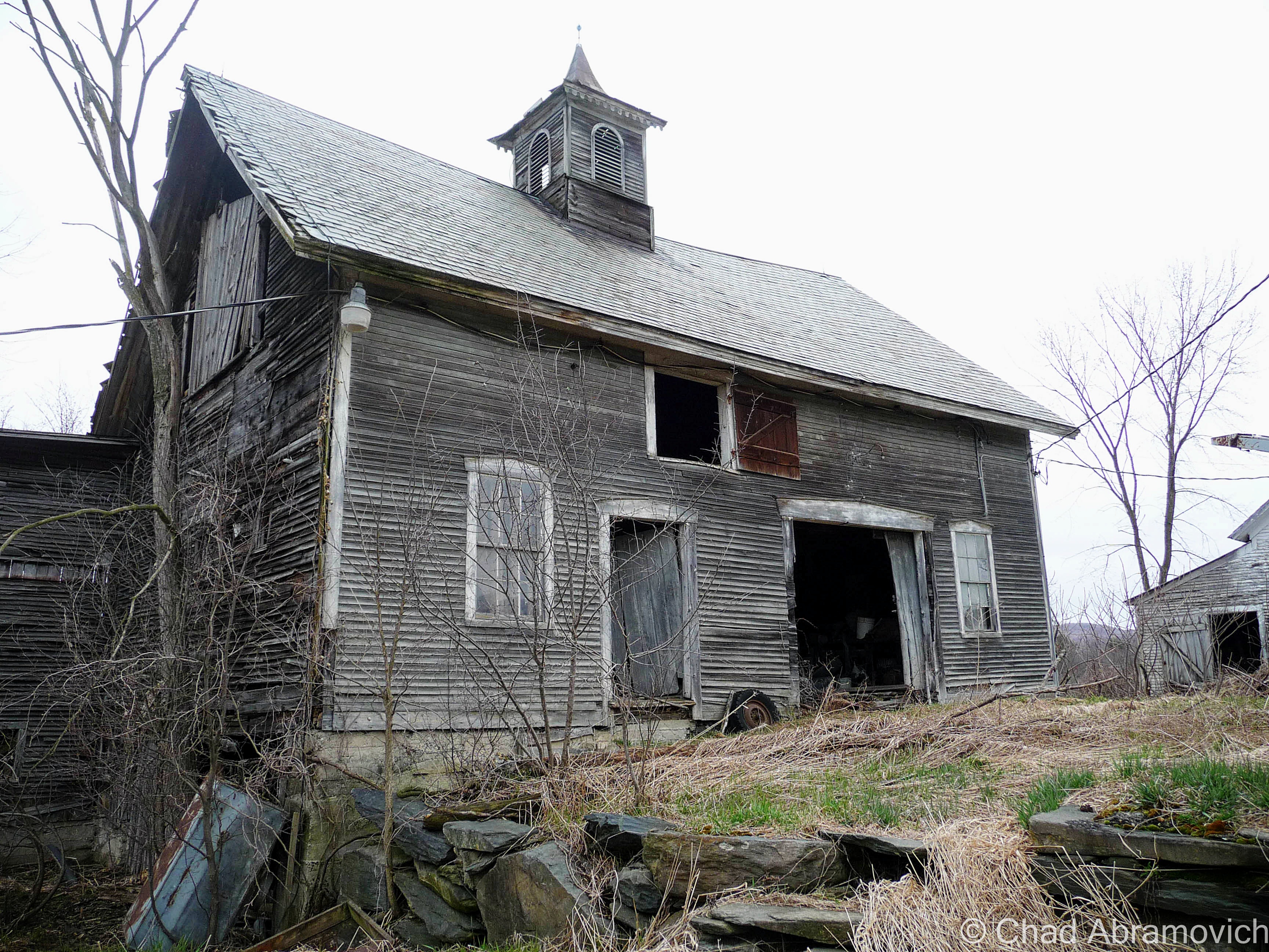
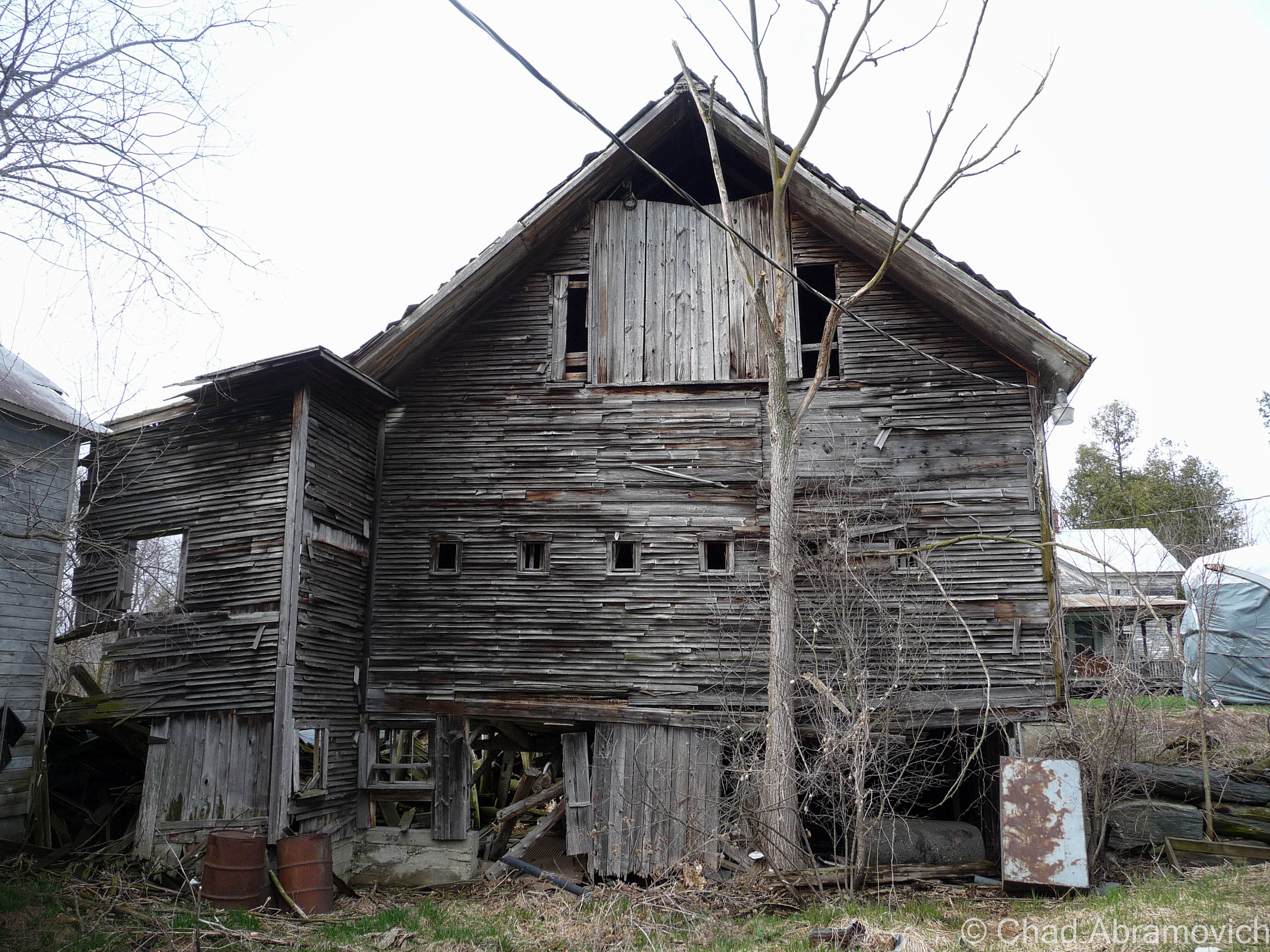
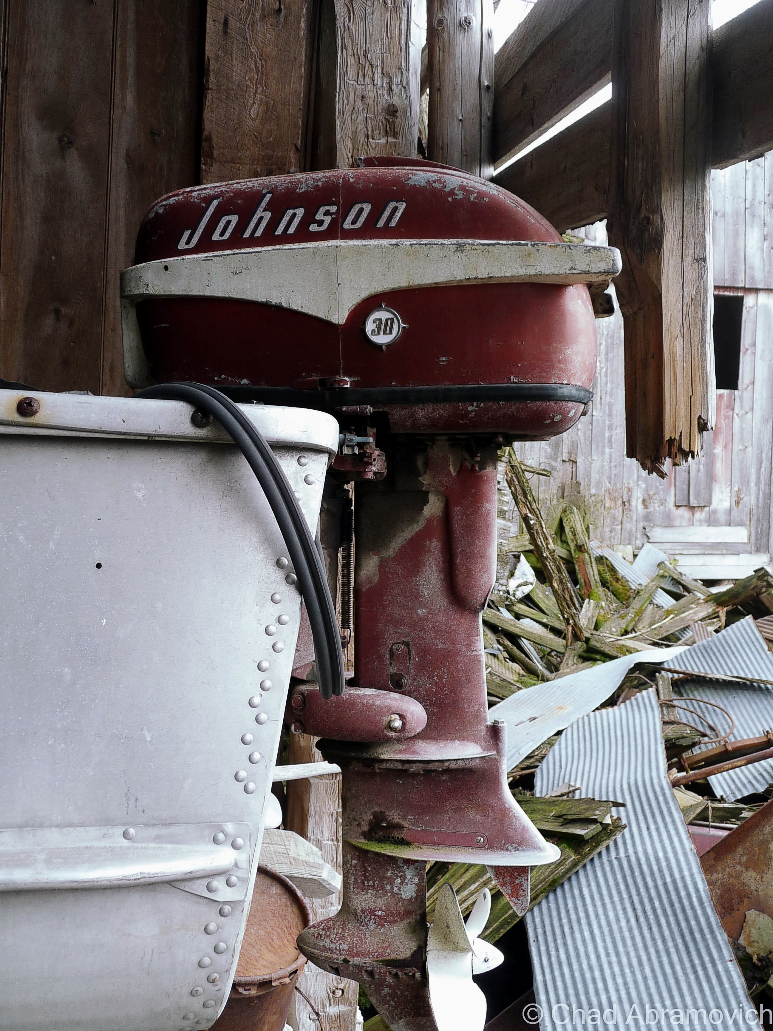
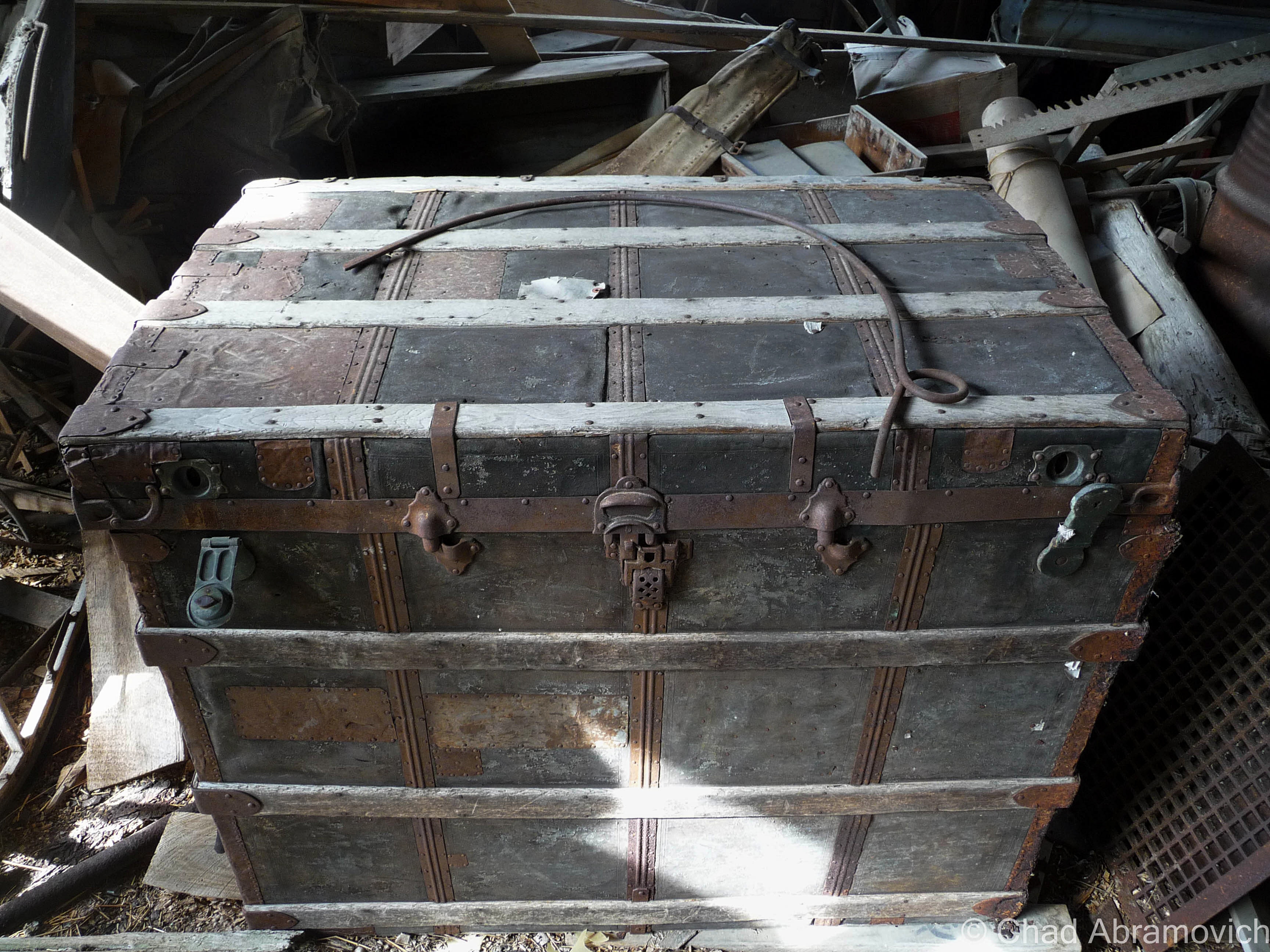
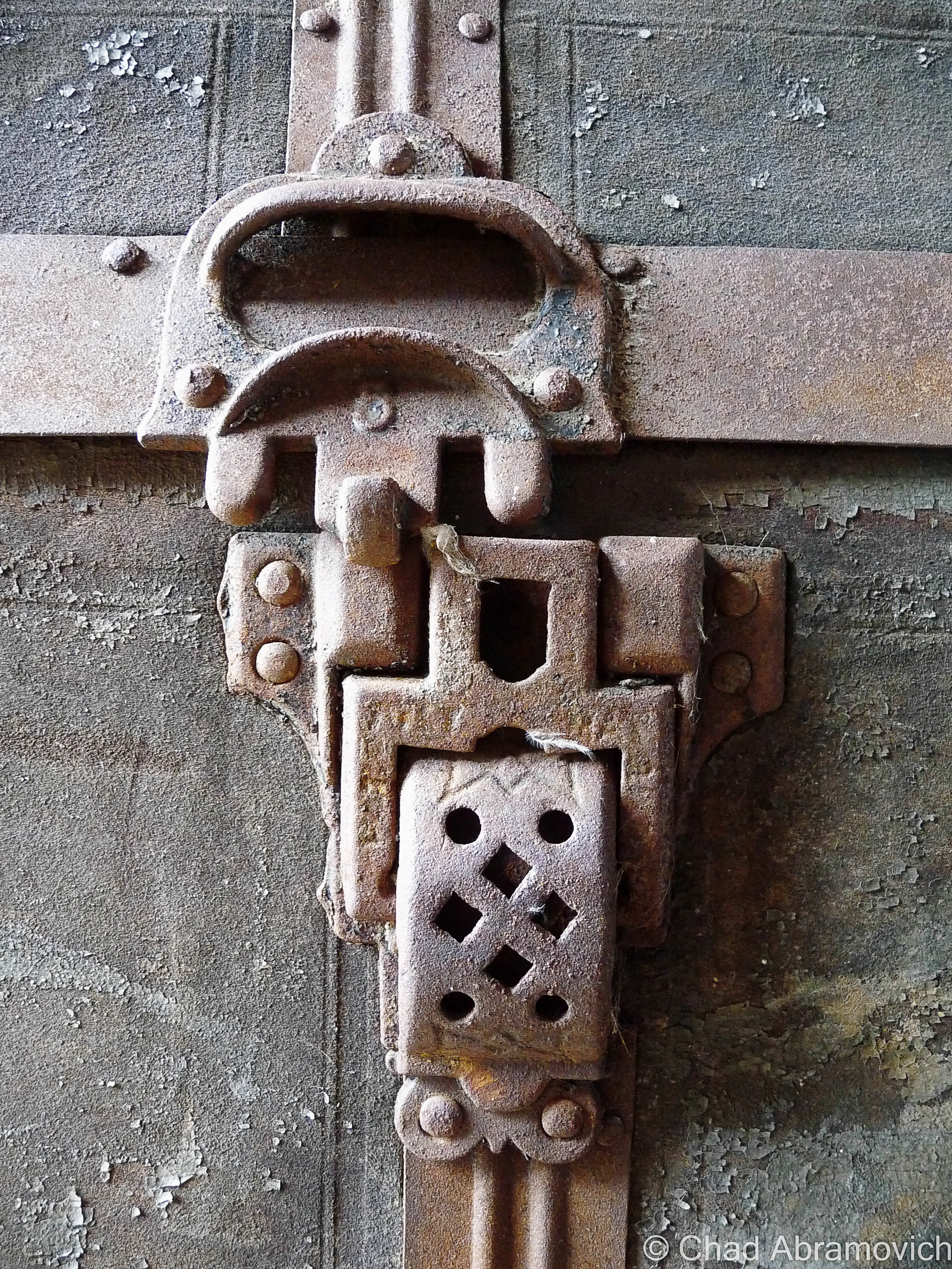
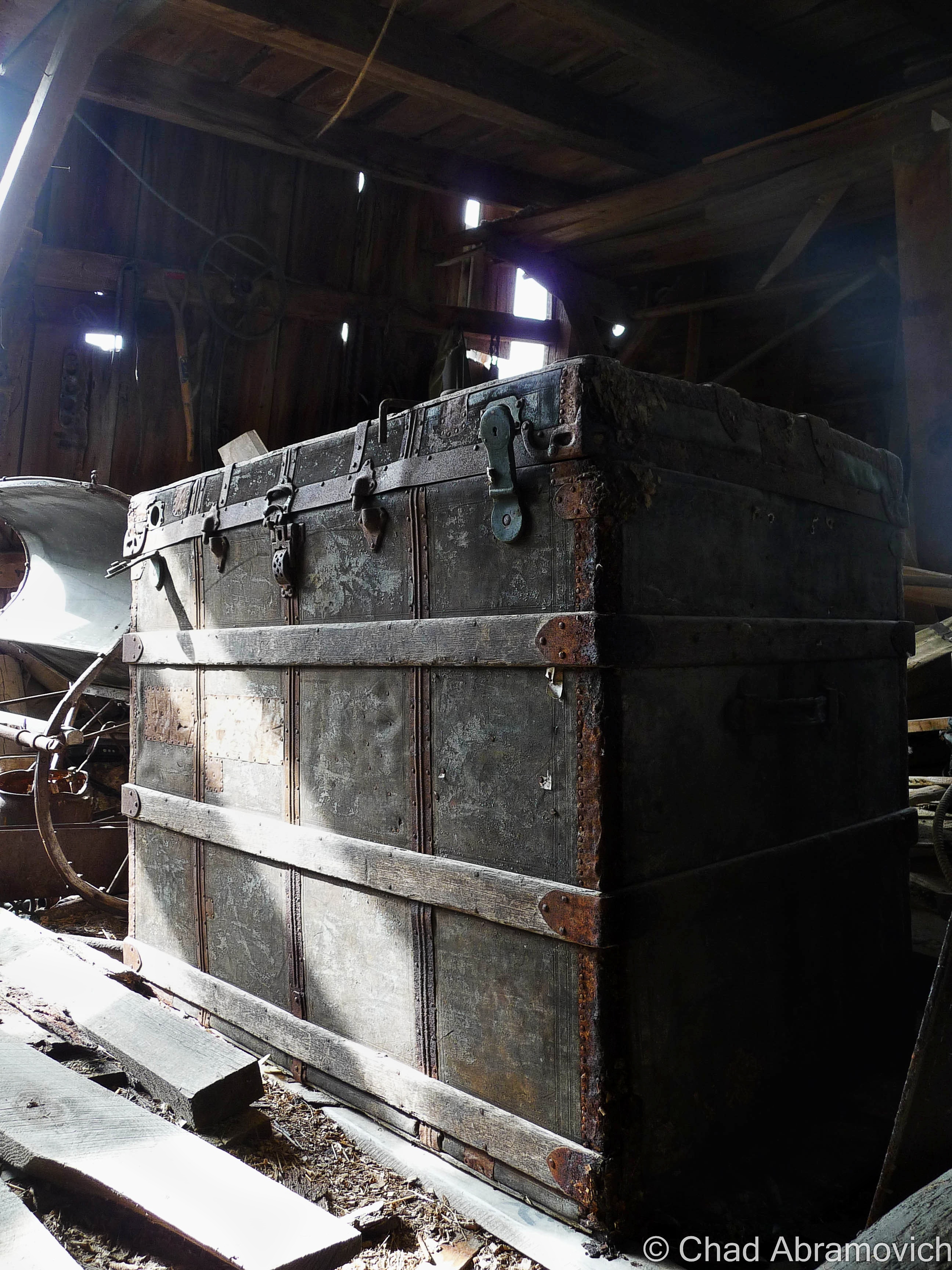
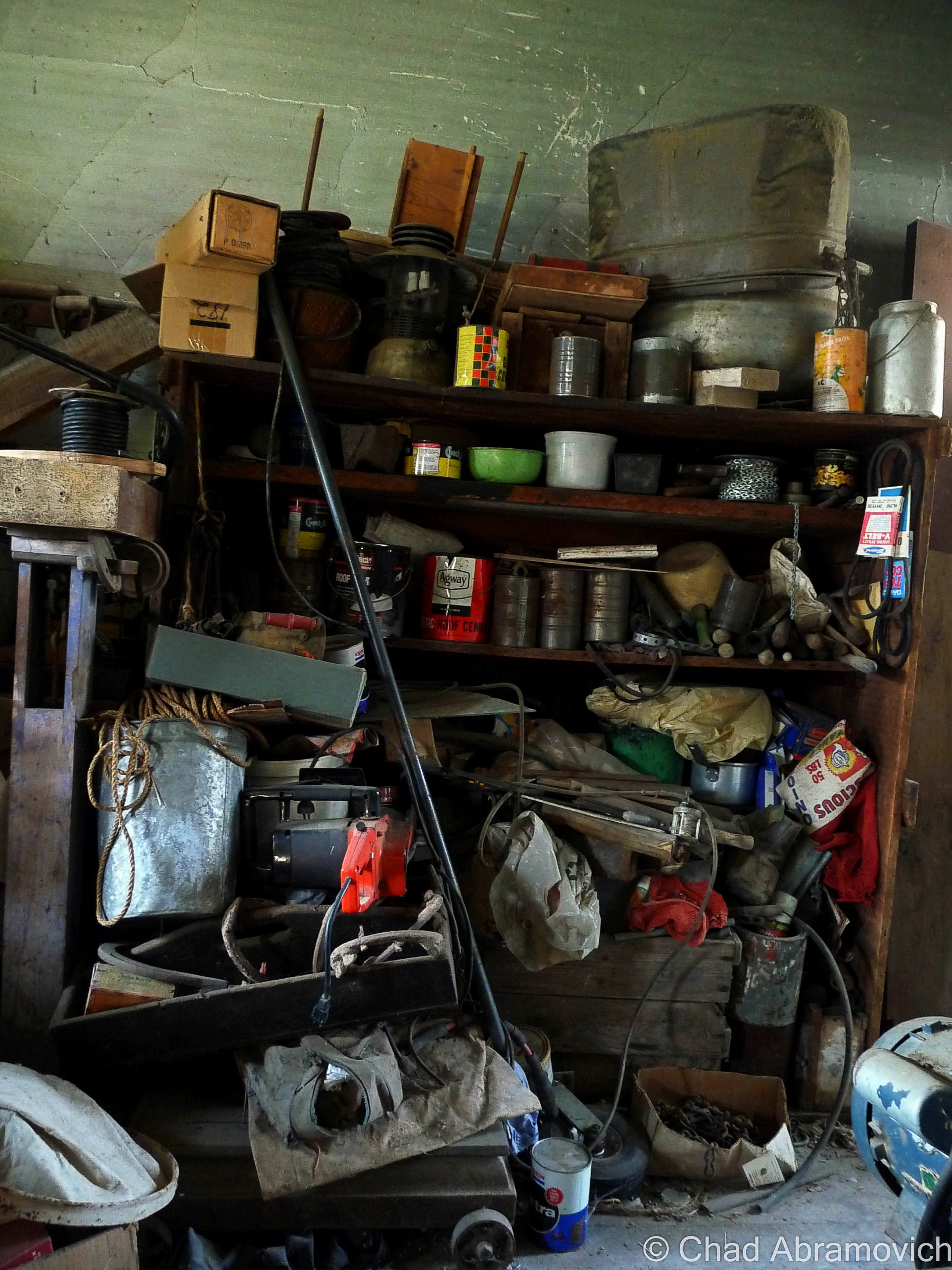
Further down the road, there was the most important cog in the farm machine, the dairy barn, which excited me lots because you never know what you’ll come across in an old Vermonter’s barn. Barns are vital storage spaces, workshops and in some cases, awesomely bizarre museums.

Traditionally, a Vermont farmer would put more money and effort into keeping up the barn than anything else they owned. So much, that many of them would let their houses fall into ruin if they had to make that hard choice of where to divvy up their cash. That even goes as far as the demolition process if the construction gets too far gone. As an old timer up in the Northeast Kingdom once explained to me; “Why tear down a perfectly good barn when it’ll just fall down when it’s ready?”

According to my friend and tour guide, the old barn was close to 100 years old, filled with accumulations of its years. As a side hobby, I’m a picker when my finances allow it, and I used to love shunpiking around rural Vermont and checking out barn finds, yard sales or whatever treasures or weirdness I could spot on our backroads, so I was already wondering what I’d find inside this old barn.

The fading red structure didn’t appear to be in bad shape, or really even abandoned. If I had just passed by, I’d probably thought it was just another working farm. We pulled over in some tall grass and began to tromp our way through the threshold.

I think barns and farms play some role in lots of Vermonters lives, even if you don’t have one of your own, chances are, you know someone who does. I remember my childhood of playing in my paternal grandparents’ dusty old barns on their farm up near East Montpelier, finding ones near Chittenden County to store our 78 Toyota Landcruiser in for the winter, and spending some of the best days of my youth riding my 4 wheeler through sugarbushes and meadows on a 250 acre farm and some of the most beautiful land I’ve had the privilege of having access to in East Wallingford. Now days, I’ve been apartment jumping around the Burlington area, but man, I wish I had a barn of my own where I could set up a workshop and have a place to do projects and space to store the 4 wheeler I would most definitely buy.

While I’m on the subject – do you folks know why red happens to be the ubiquitous choice of barn attire? Simply put – red paint is cheap. But the why behind that answer actually has to do with dying stars. Pretty much; red paint is made from Iron. Iron is created when a star eventually collapses. The ground is loaded with iron, or, an iron-oxide compound called red ochre that makes a good pigment. The ground is loaded with red ochre because when stars die, they explode, and physics decrees they generate a bunch of iron as the result, which is pretty cool.

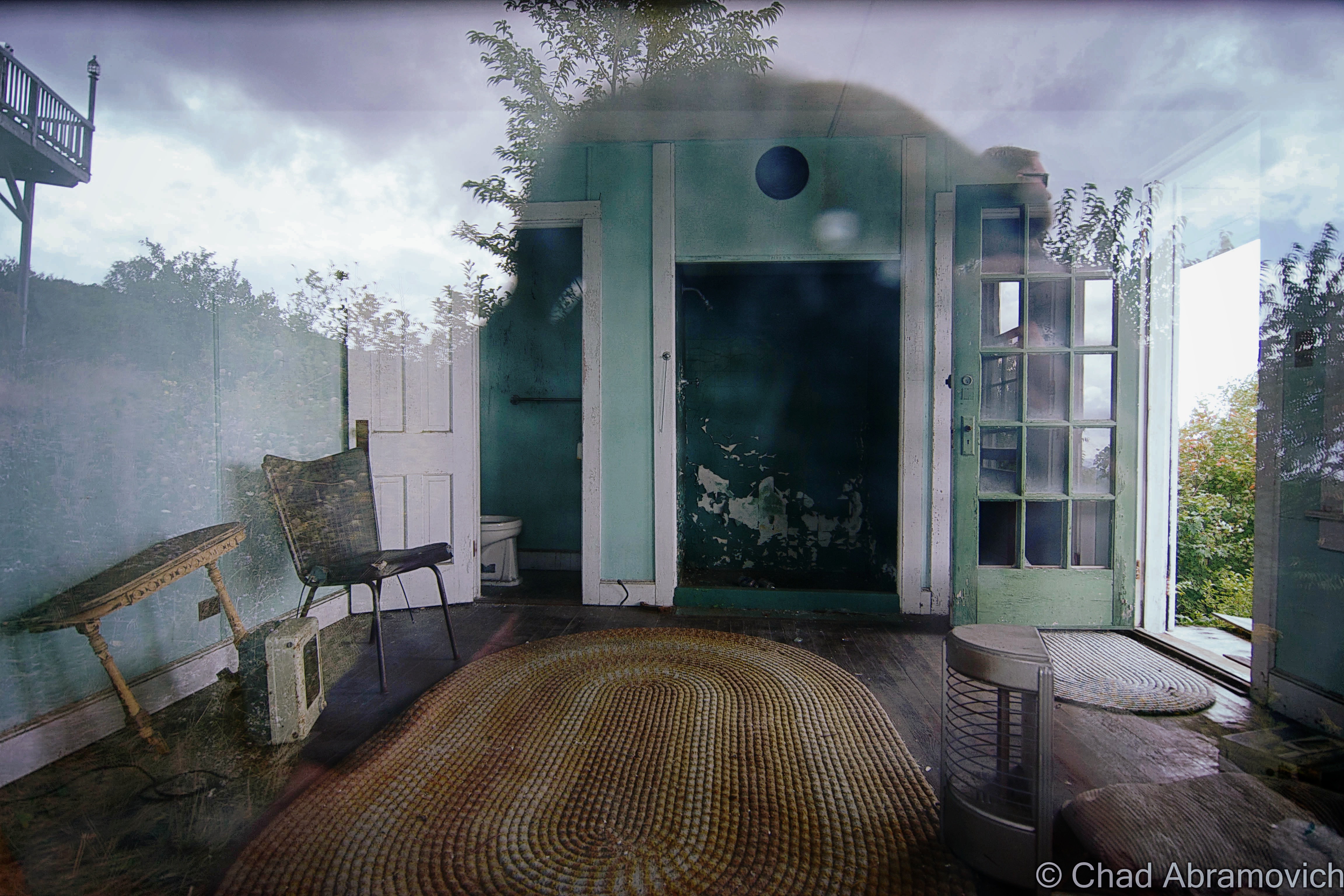
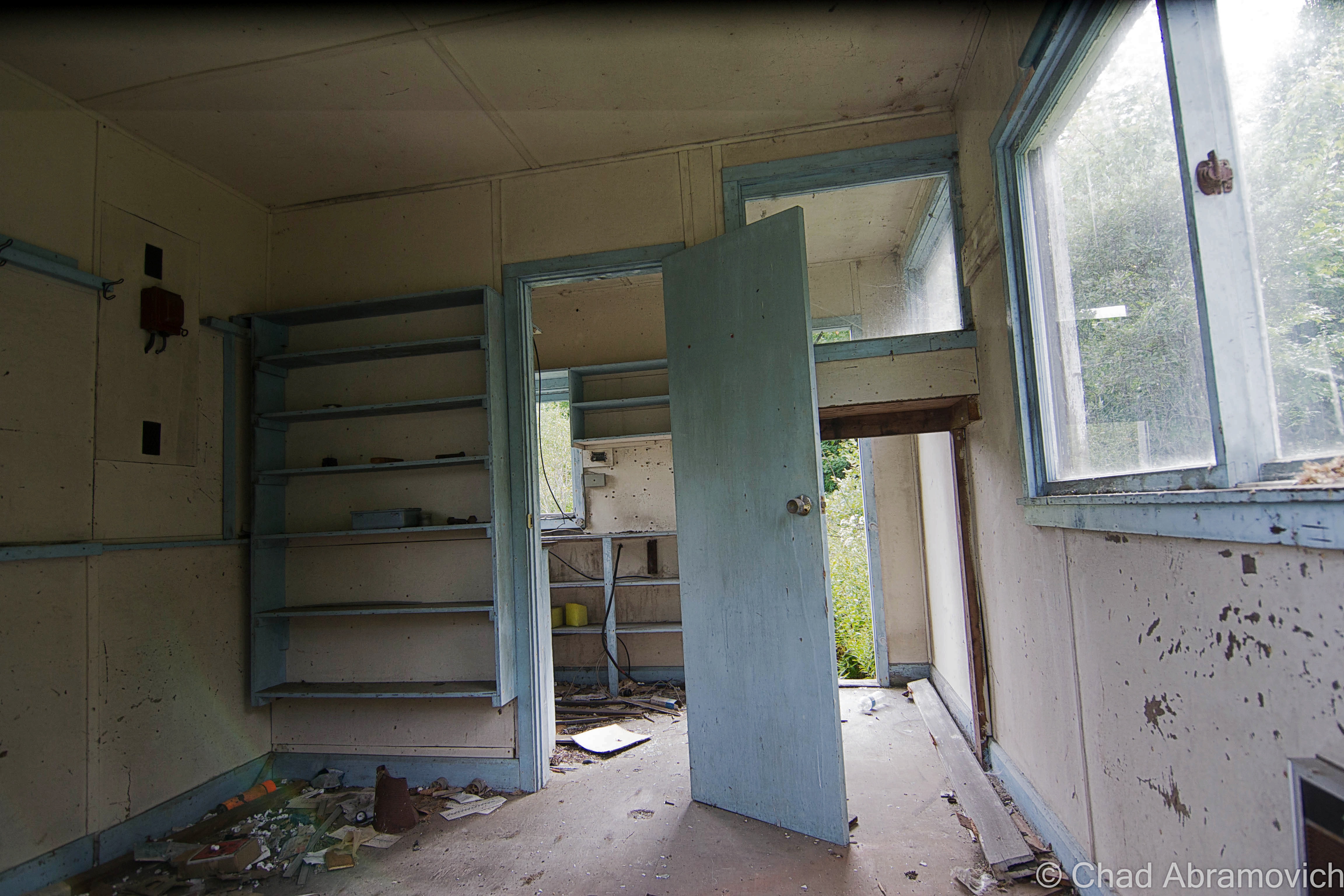
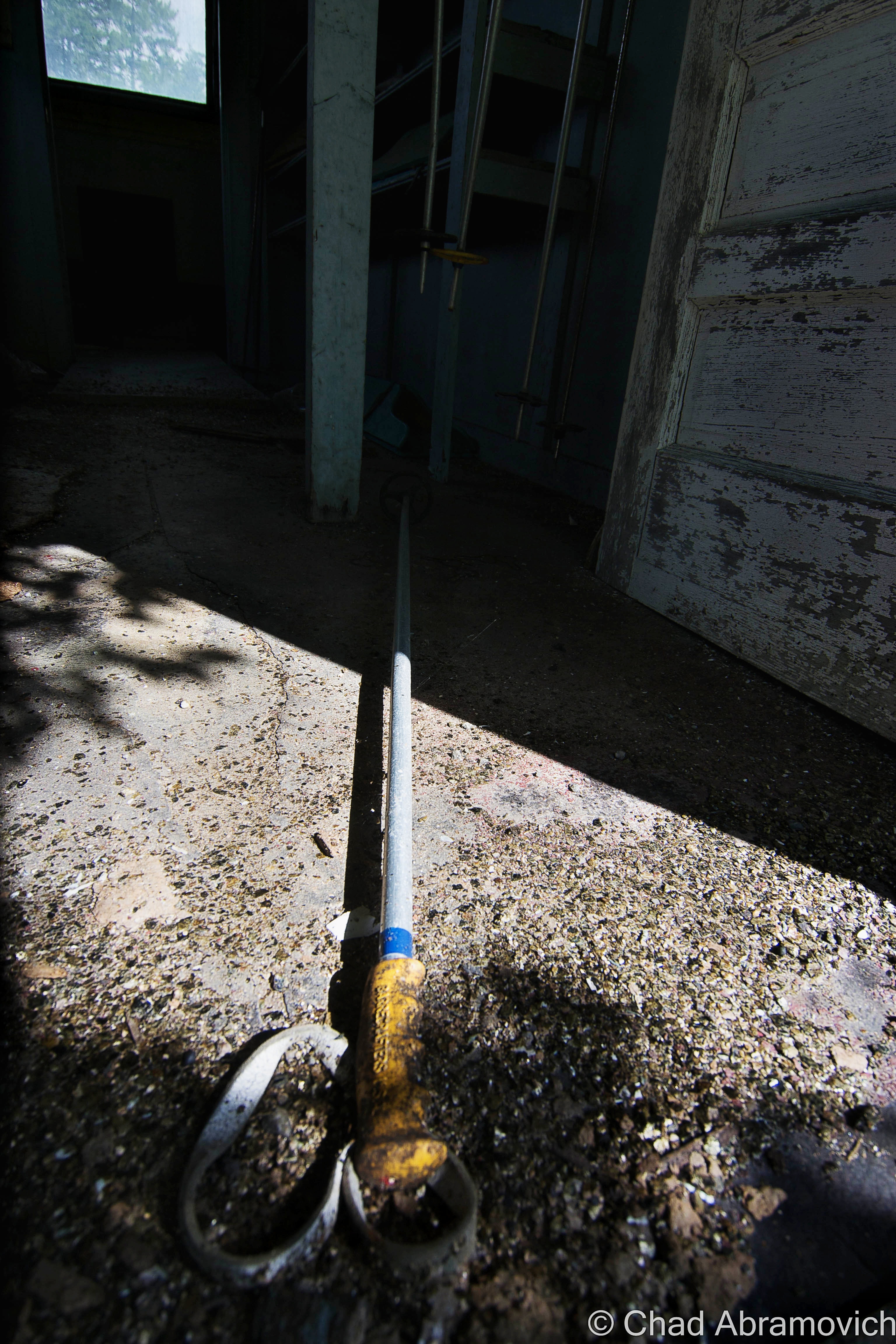
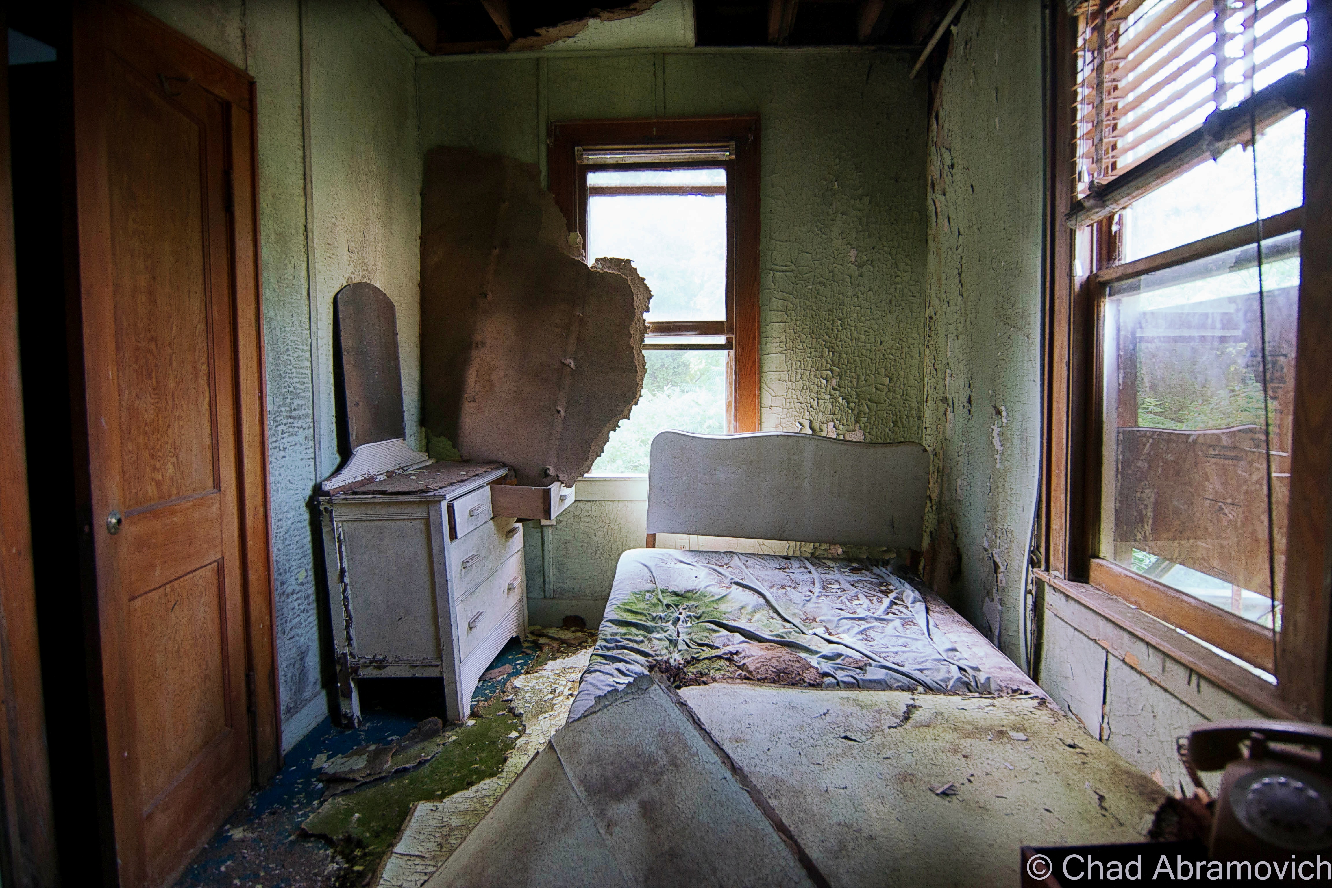
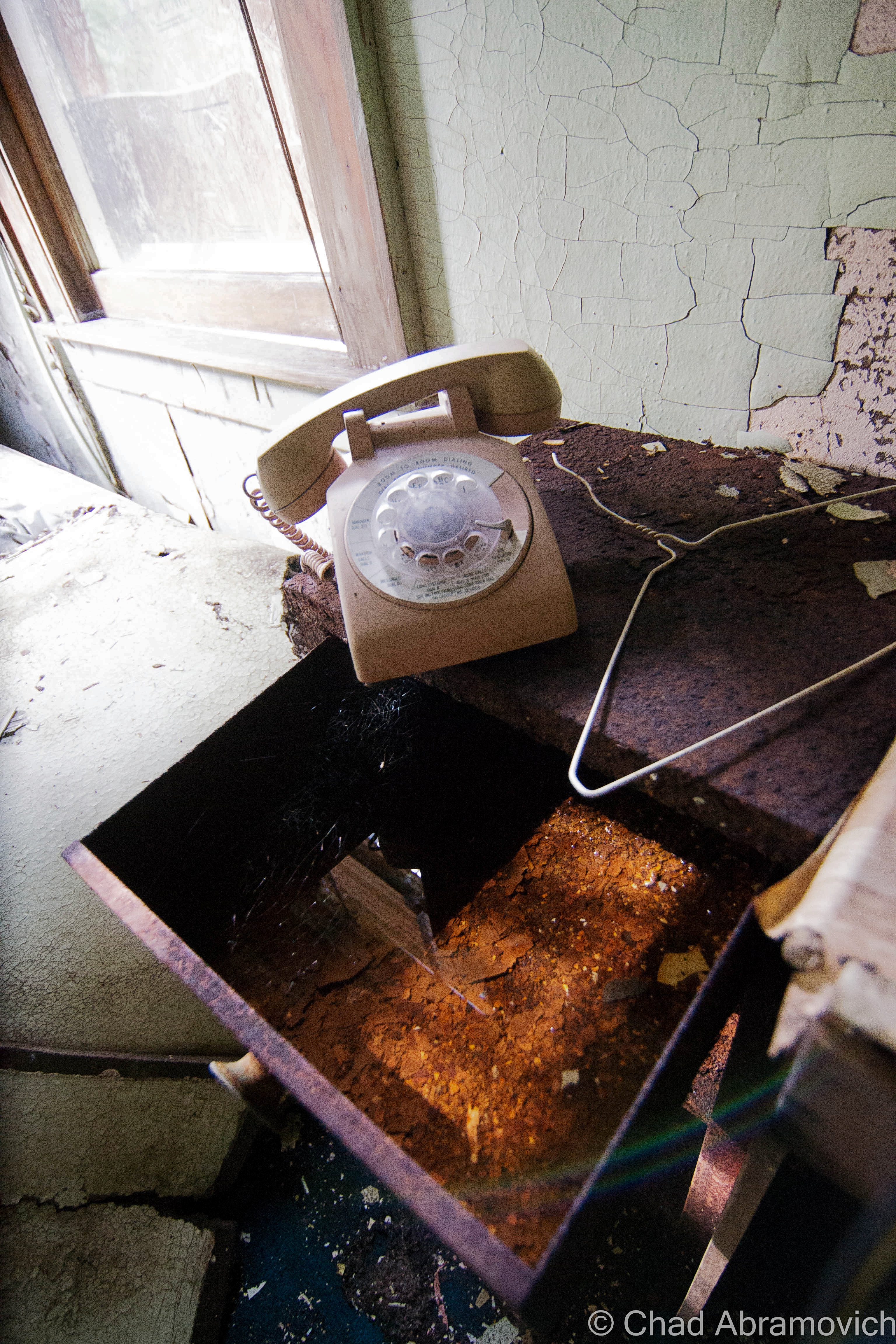
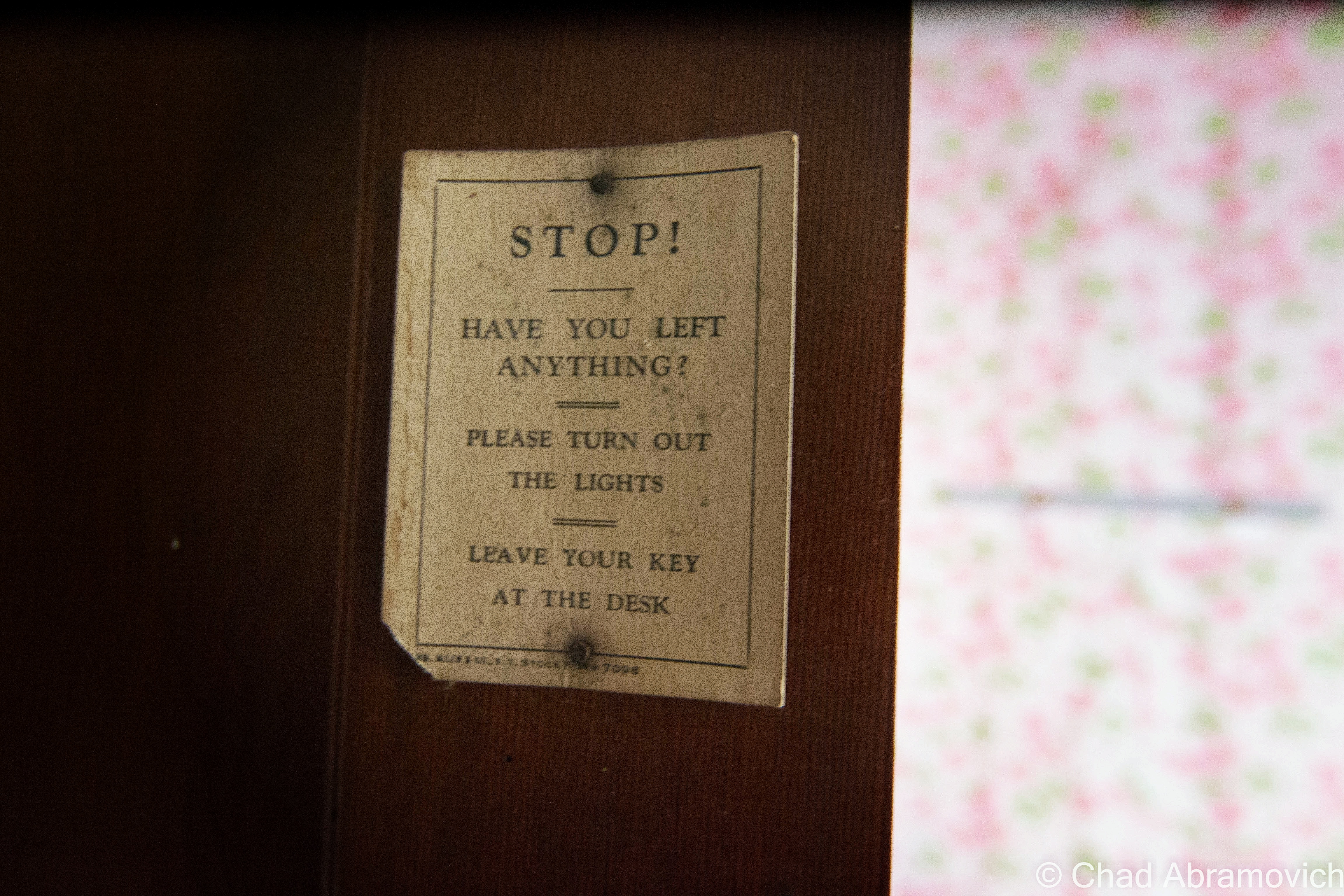
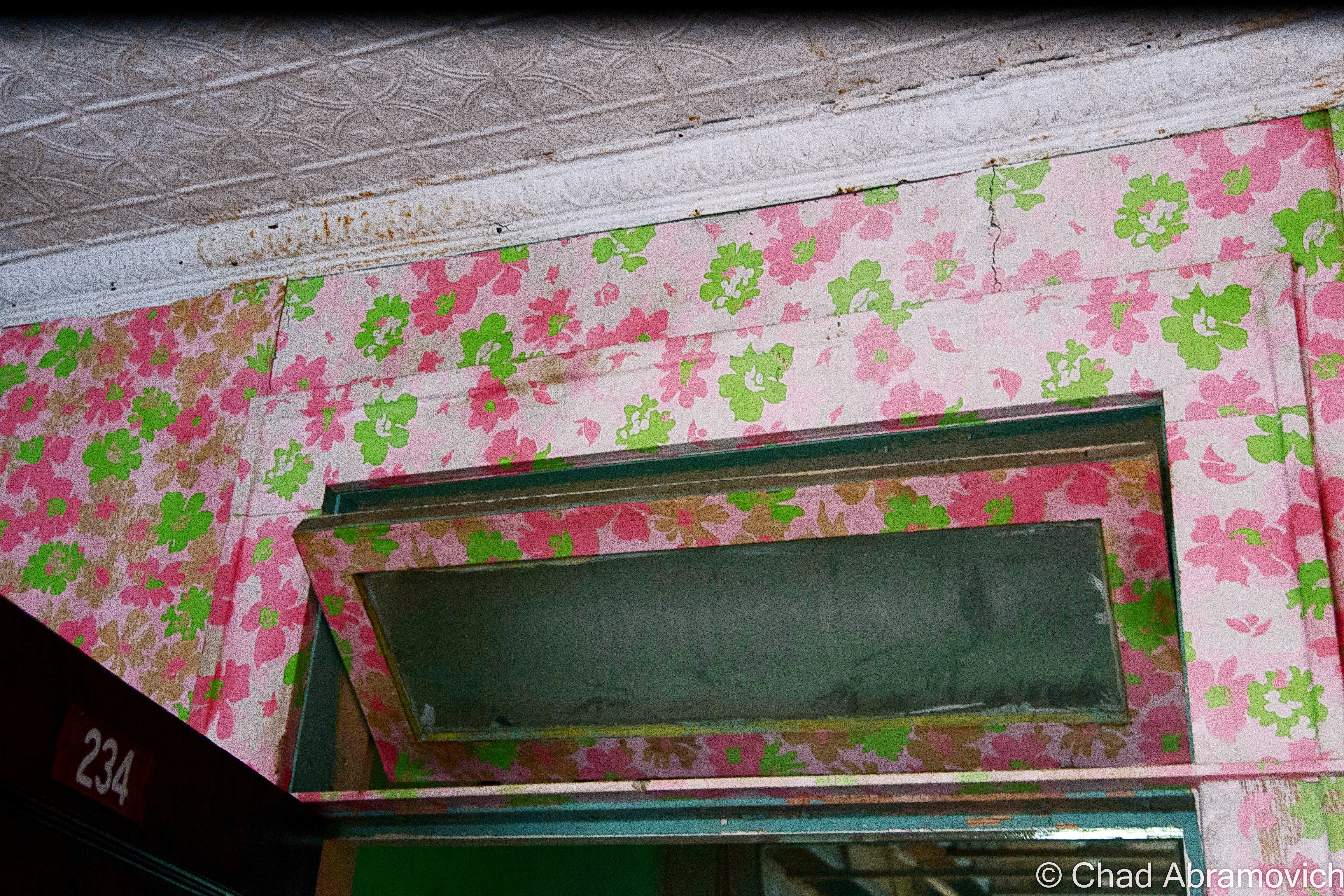
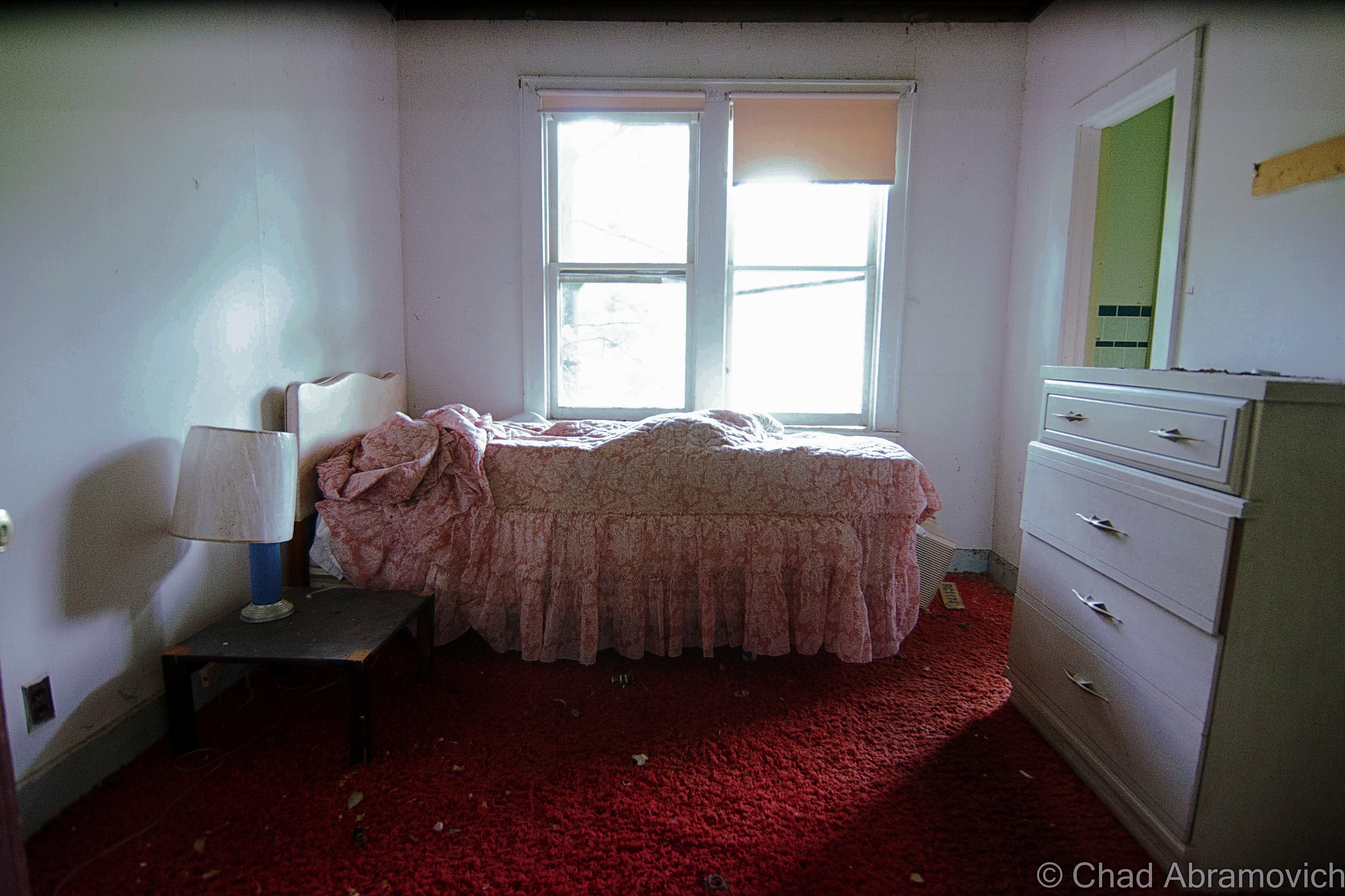
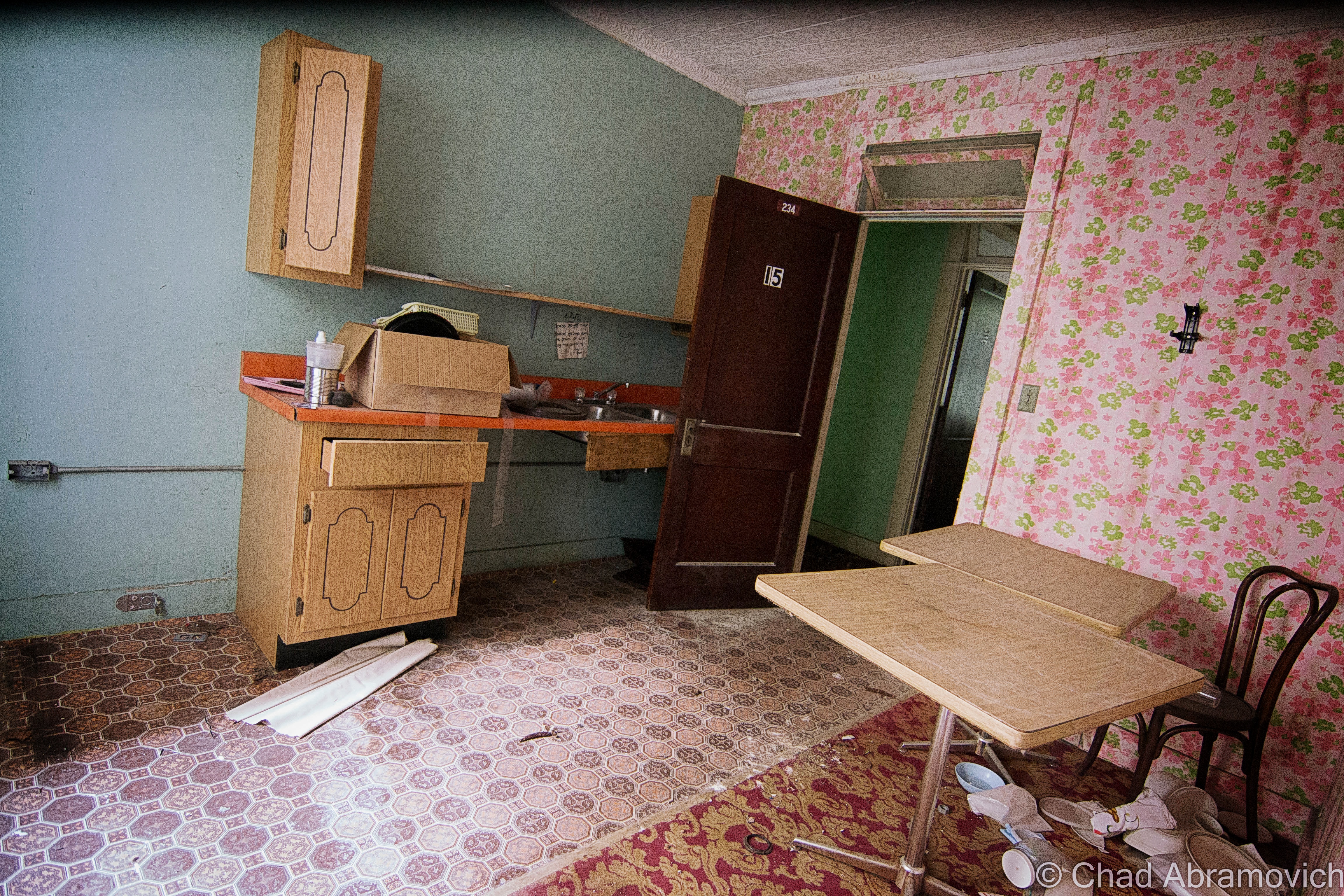
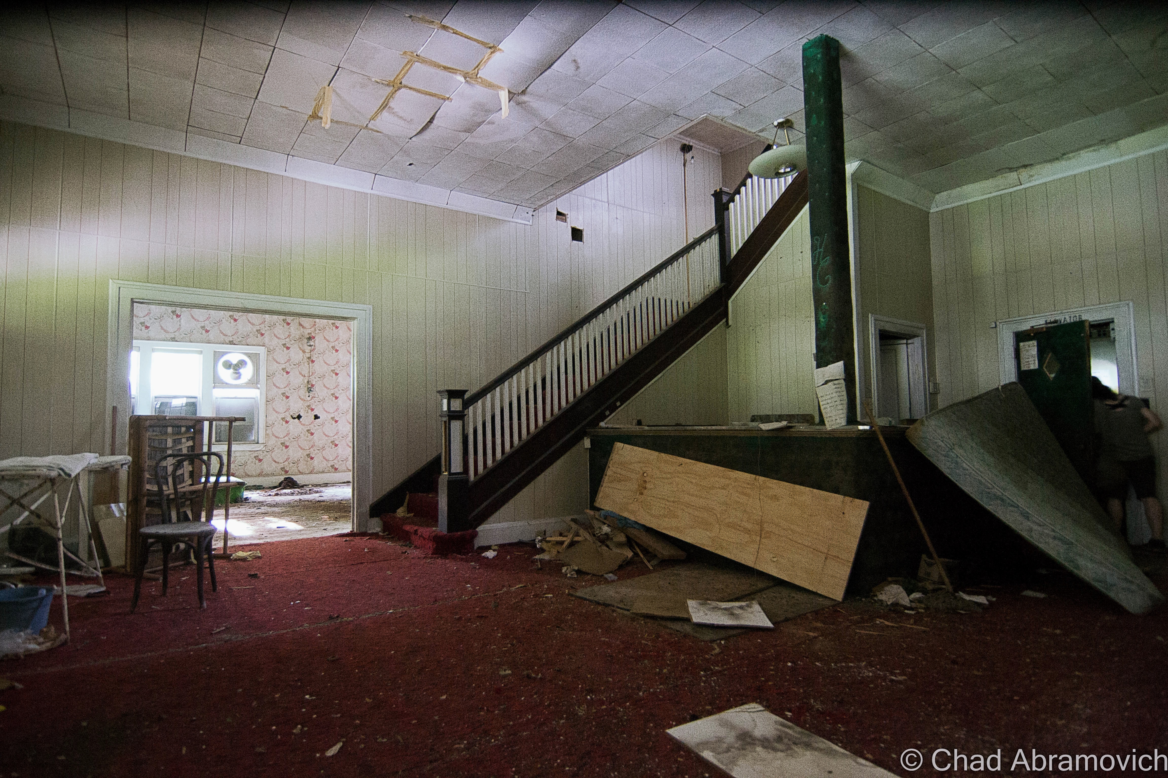
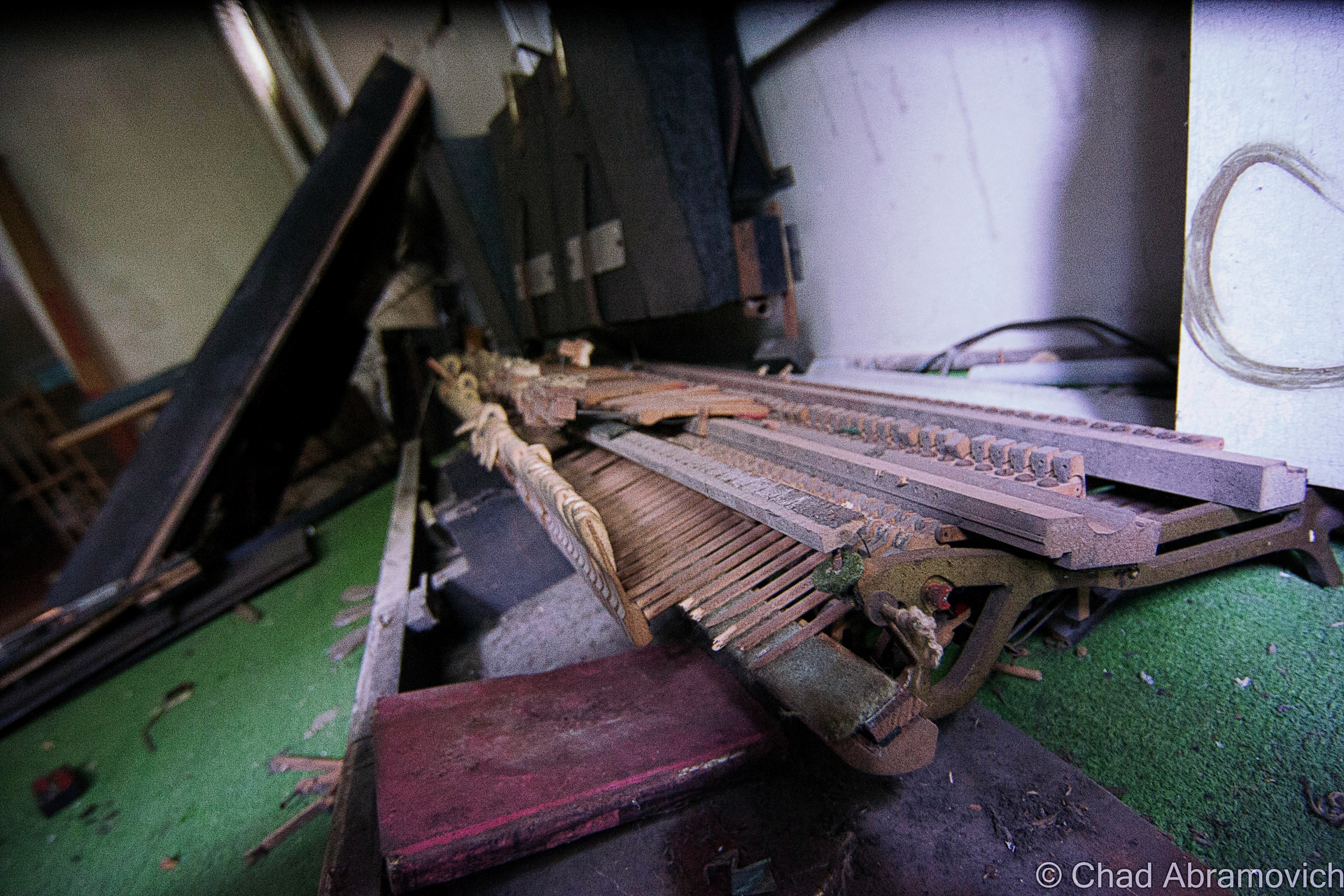
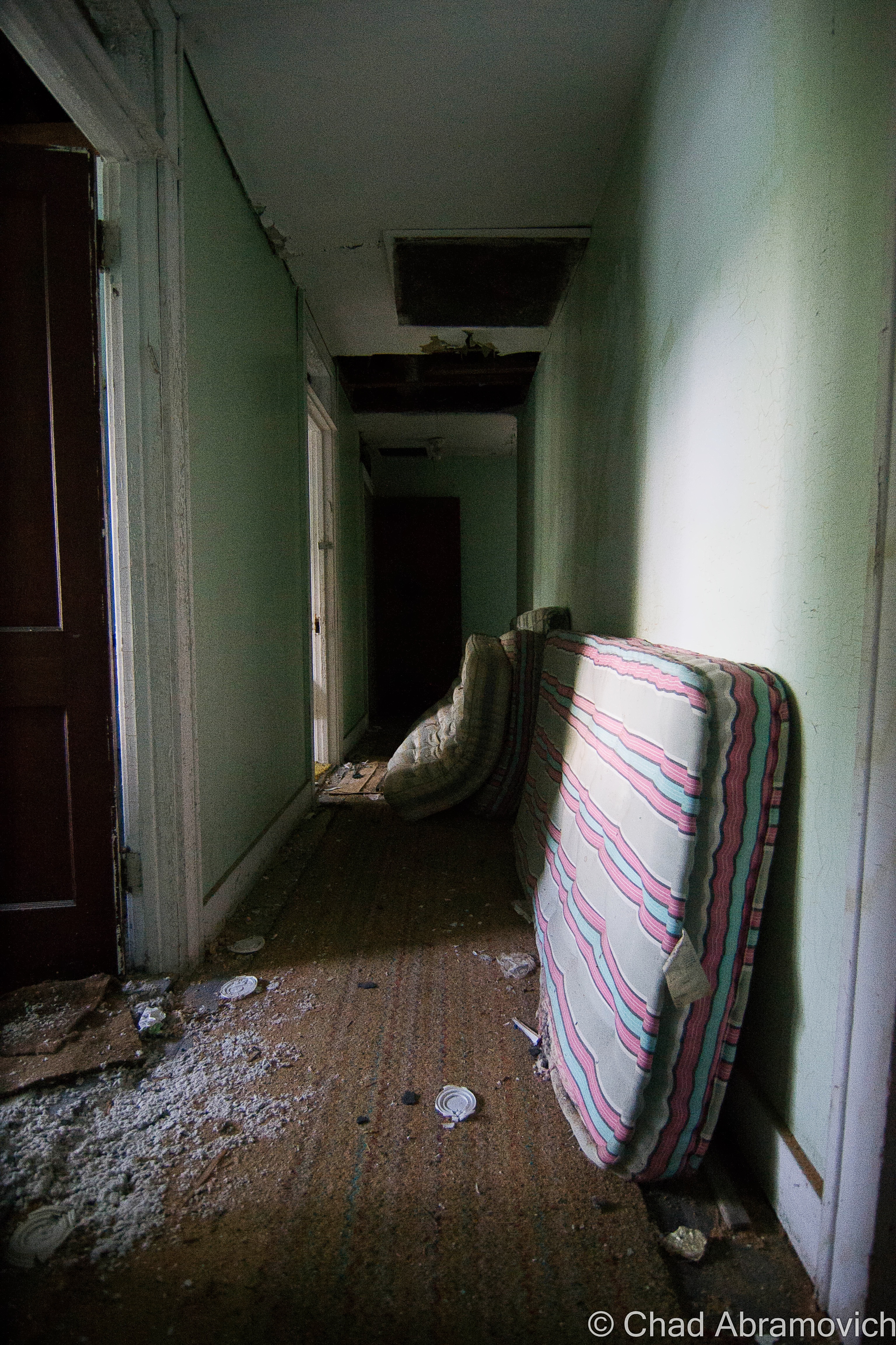
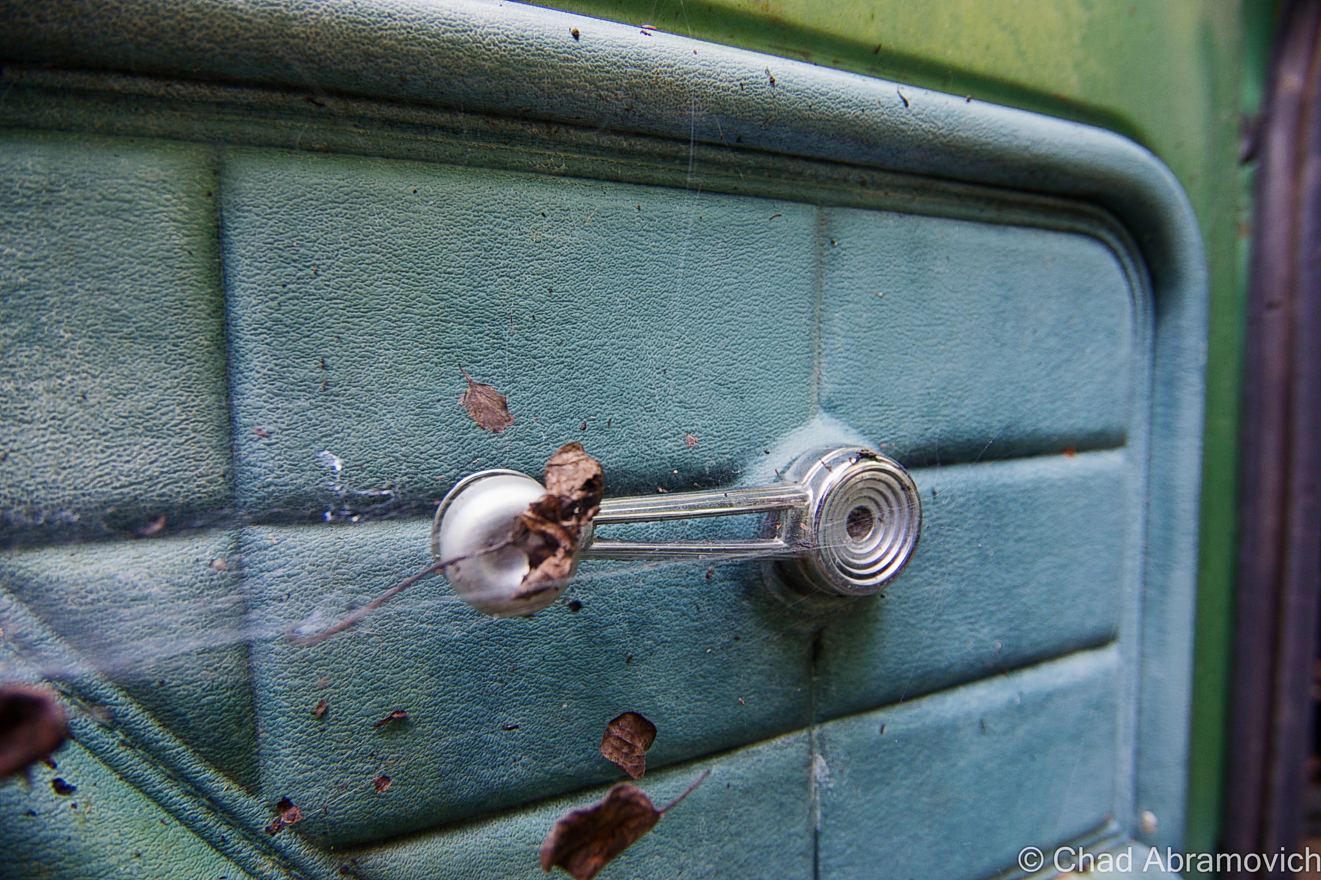
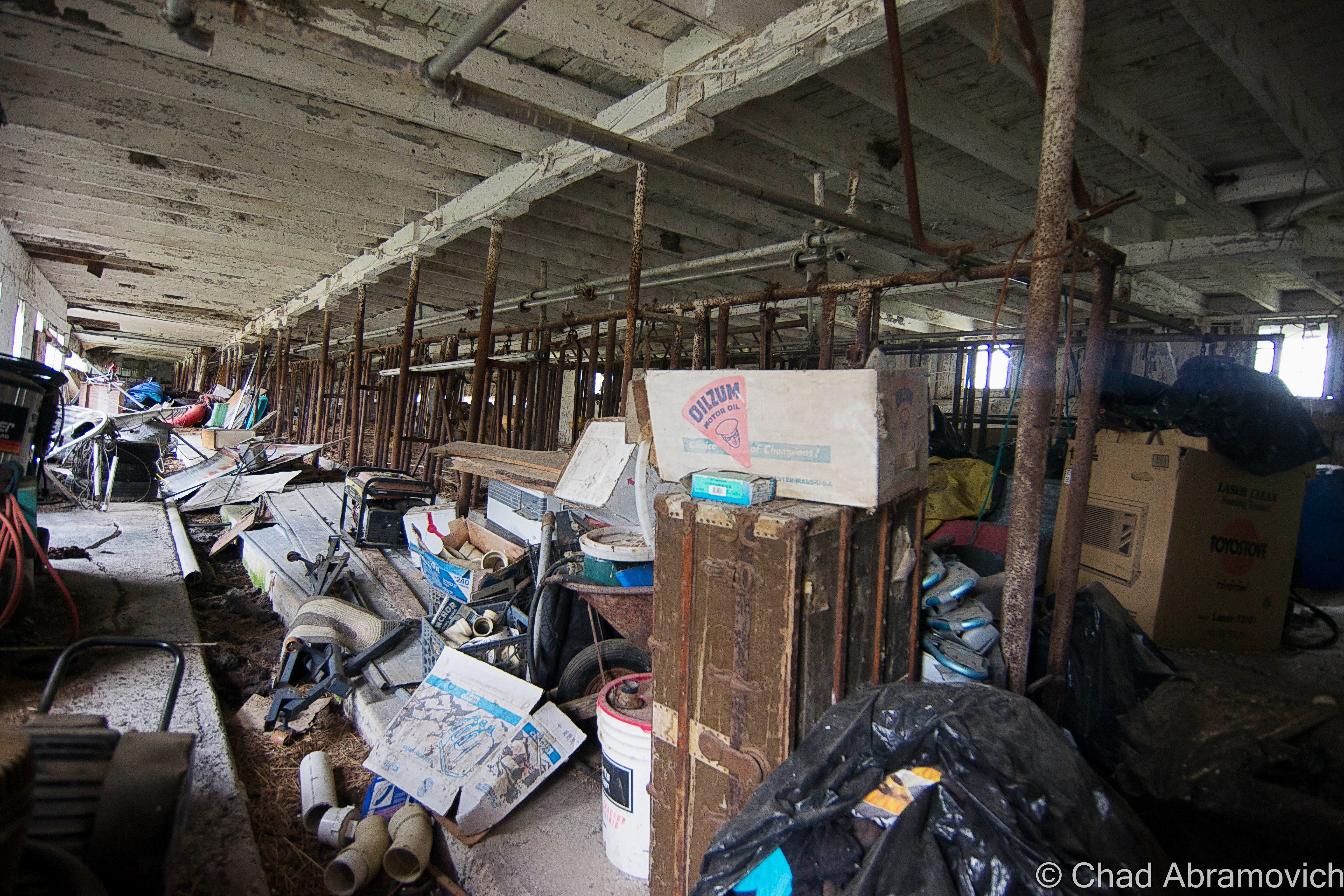
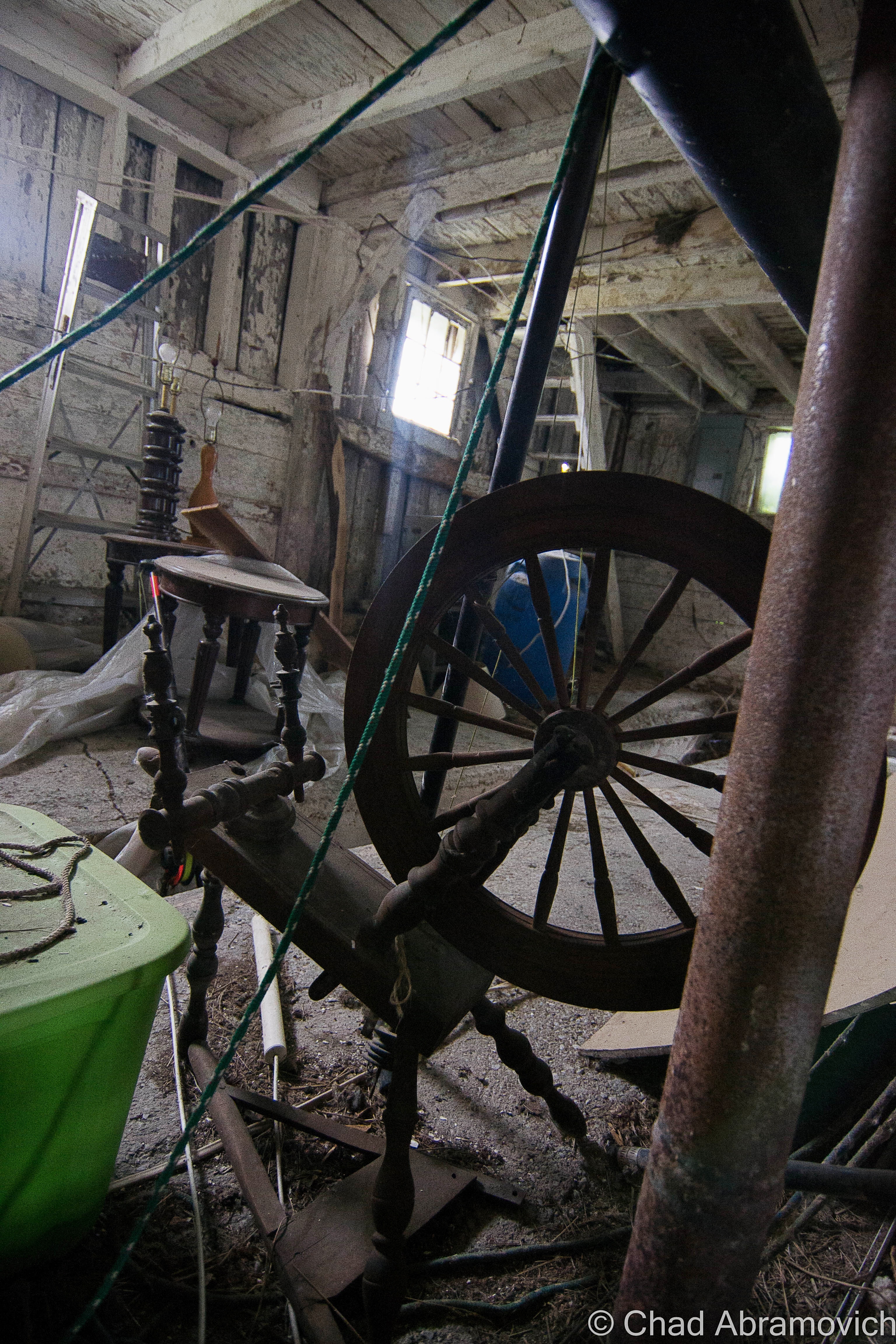
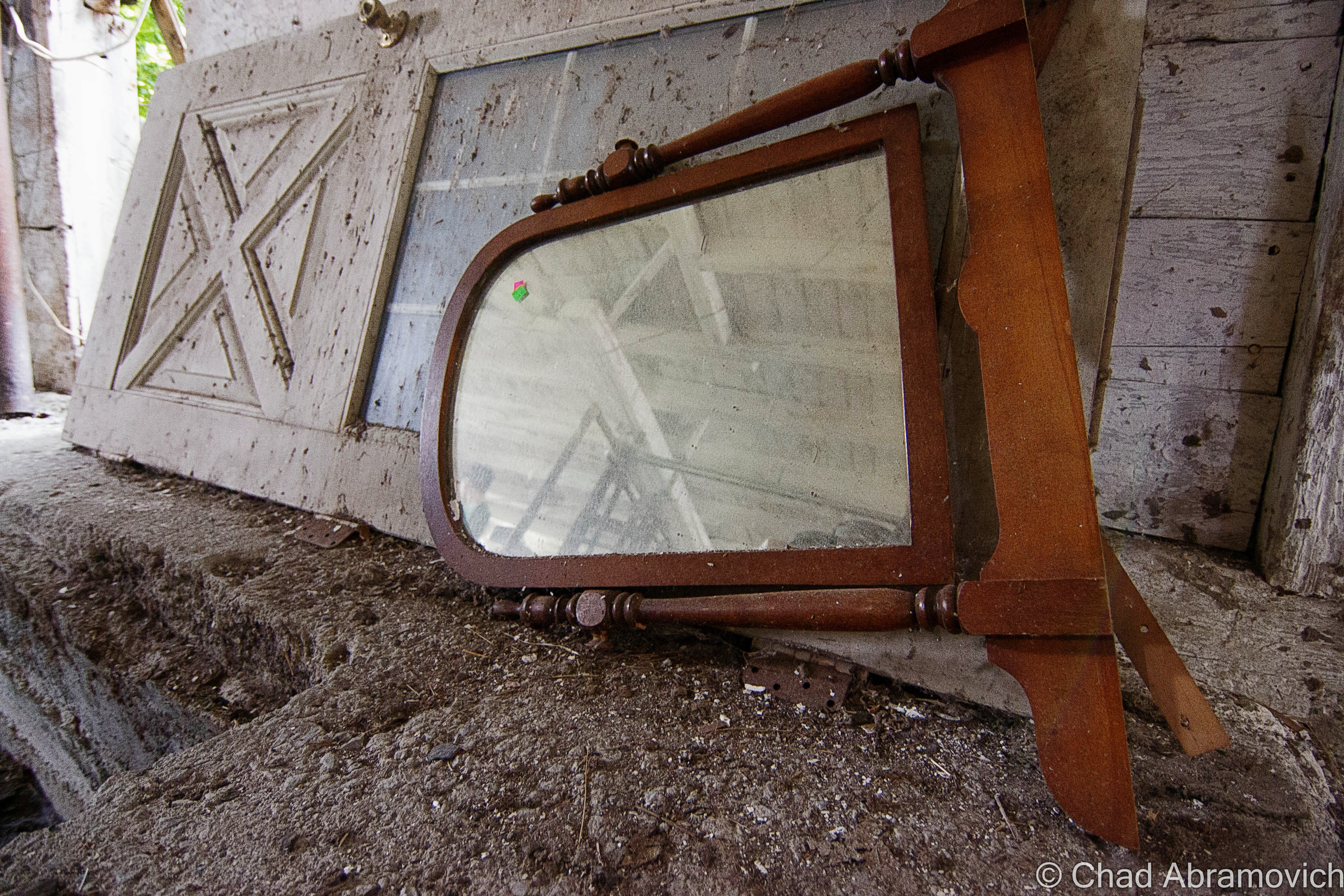
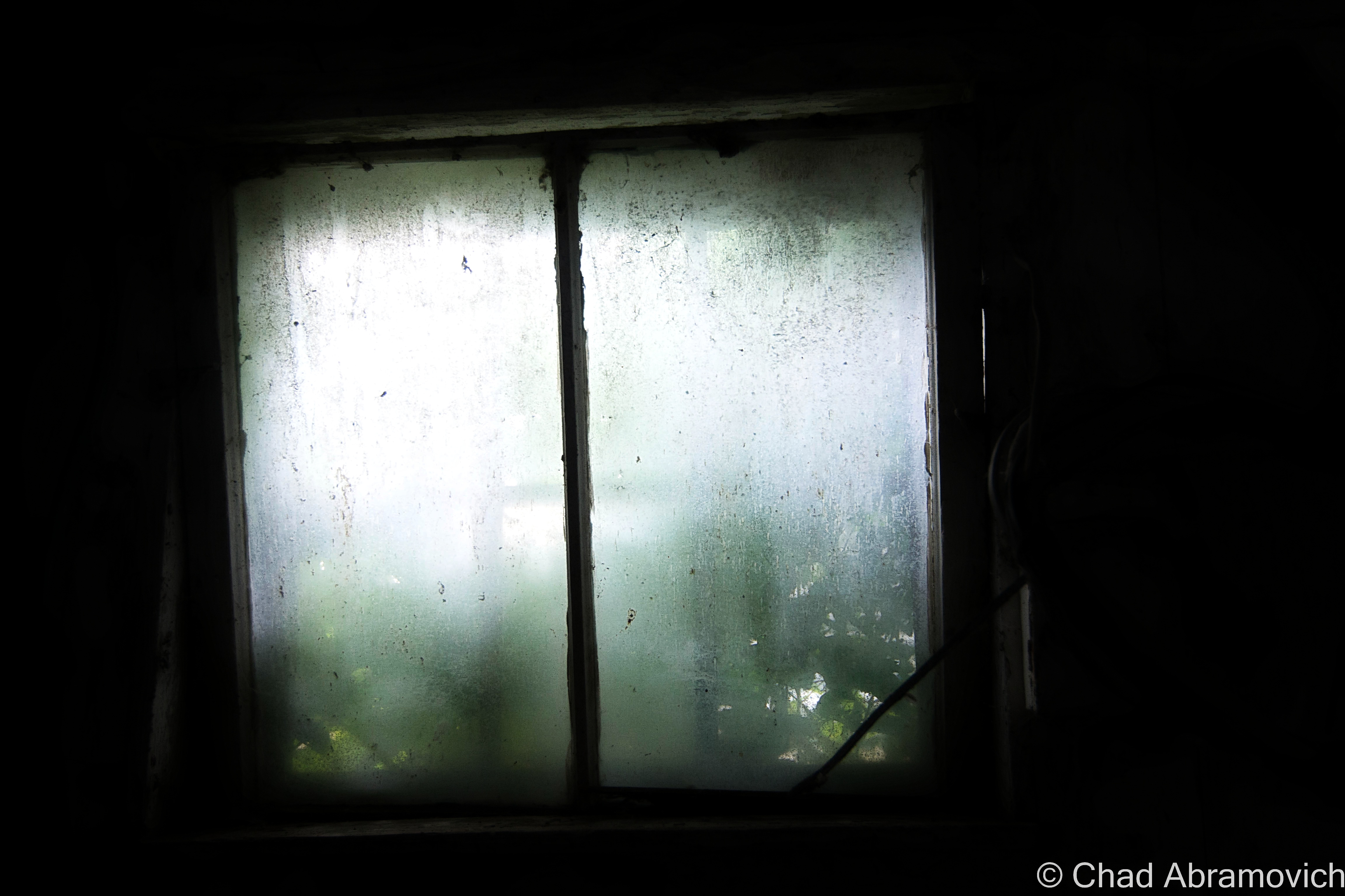
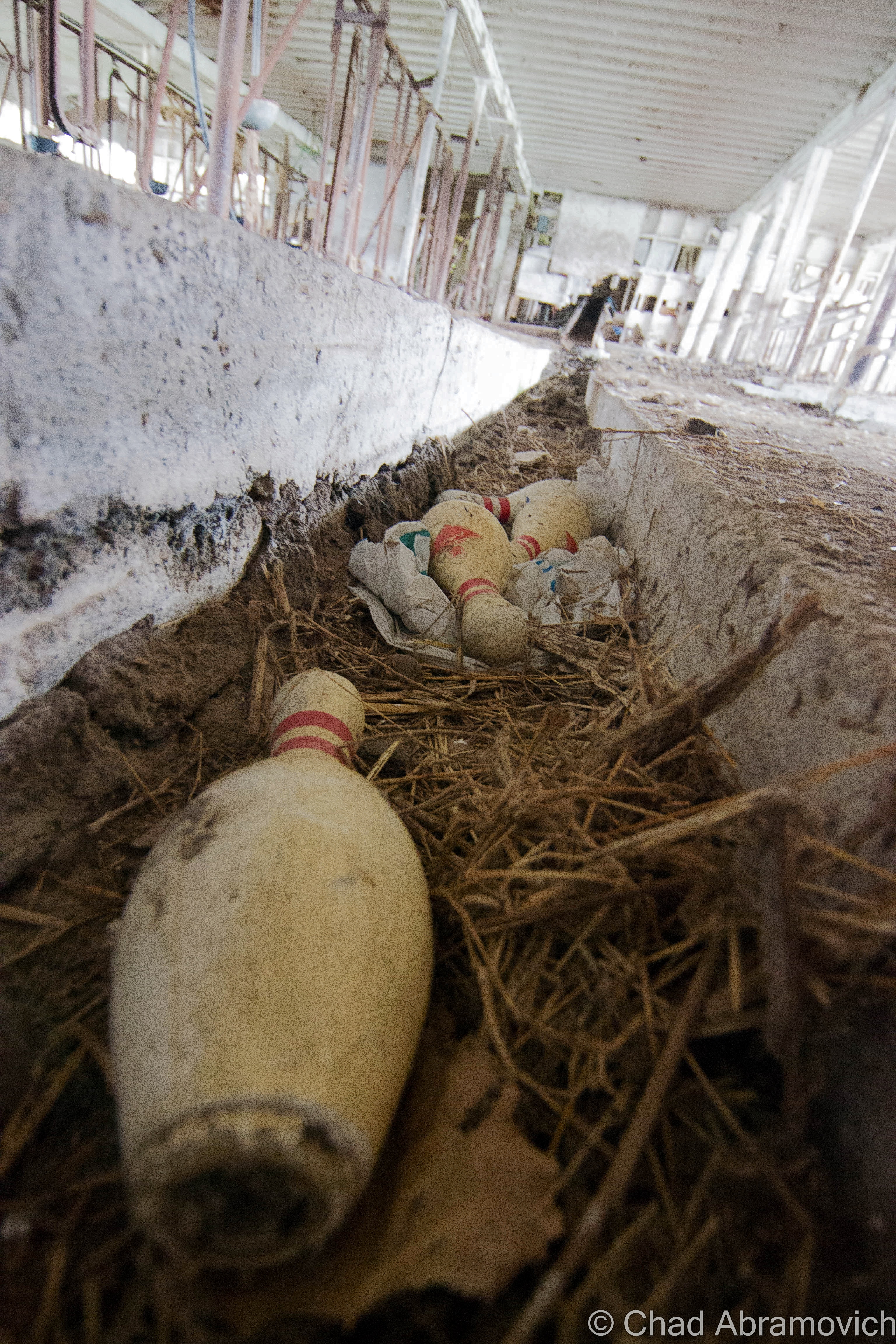
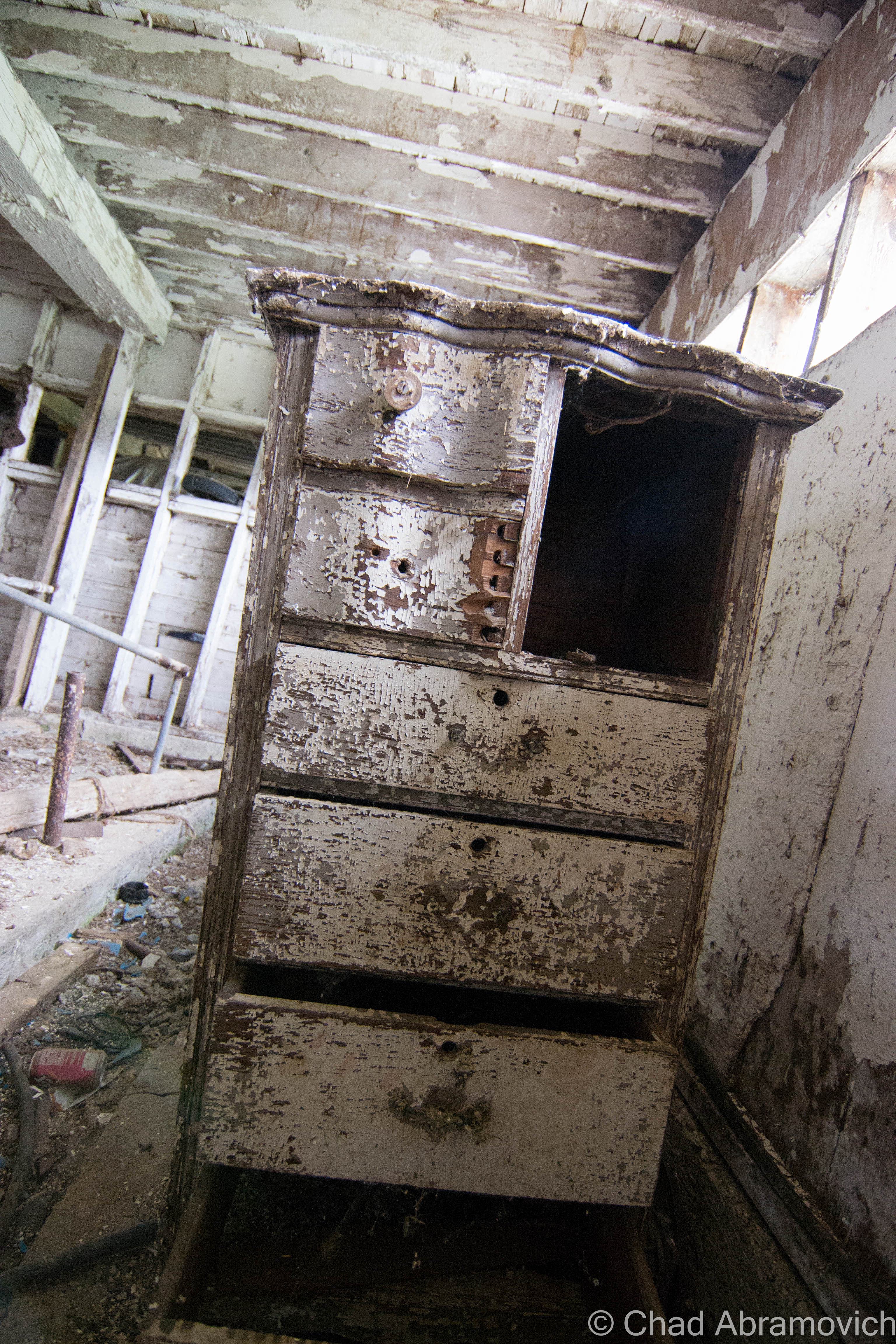
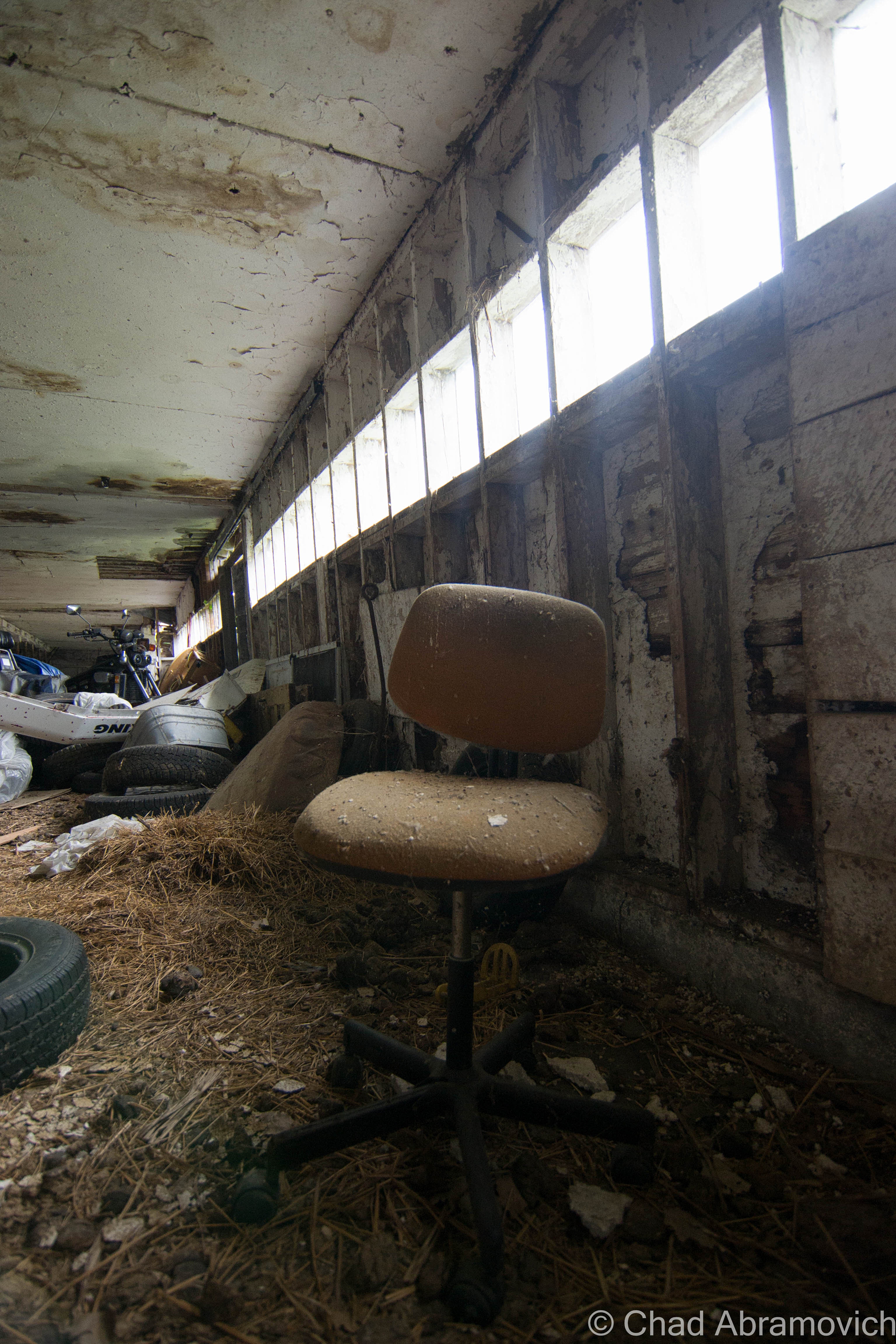
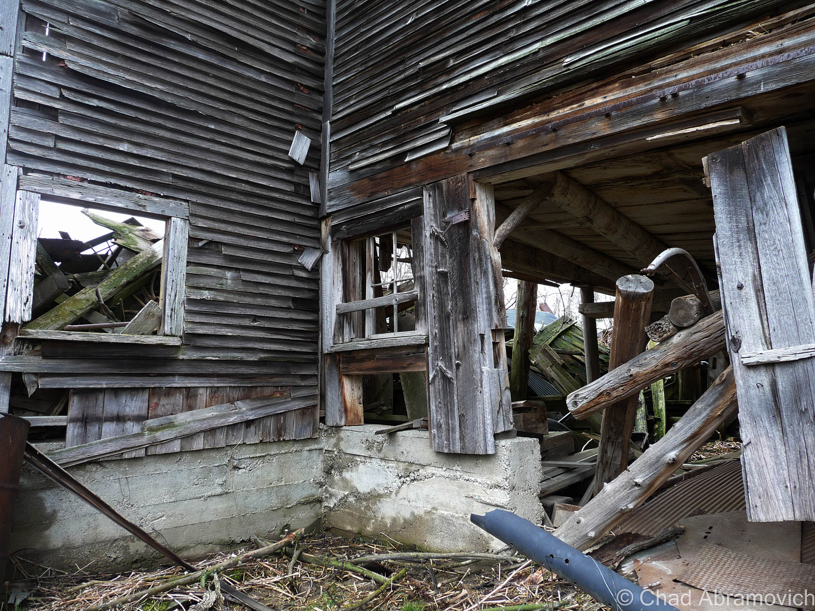
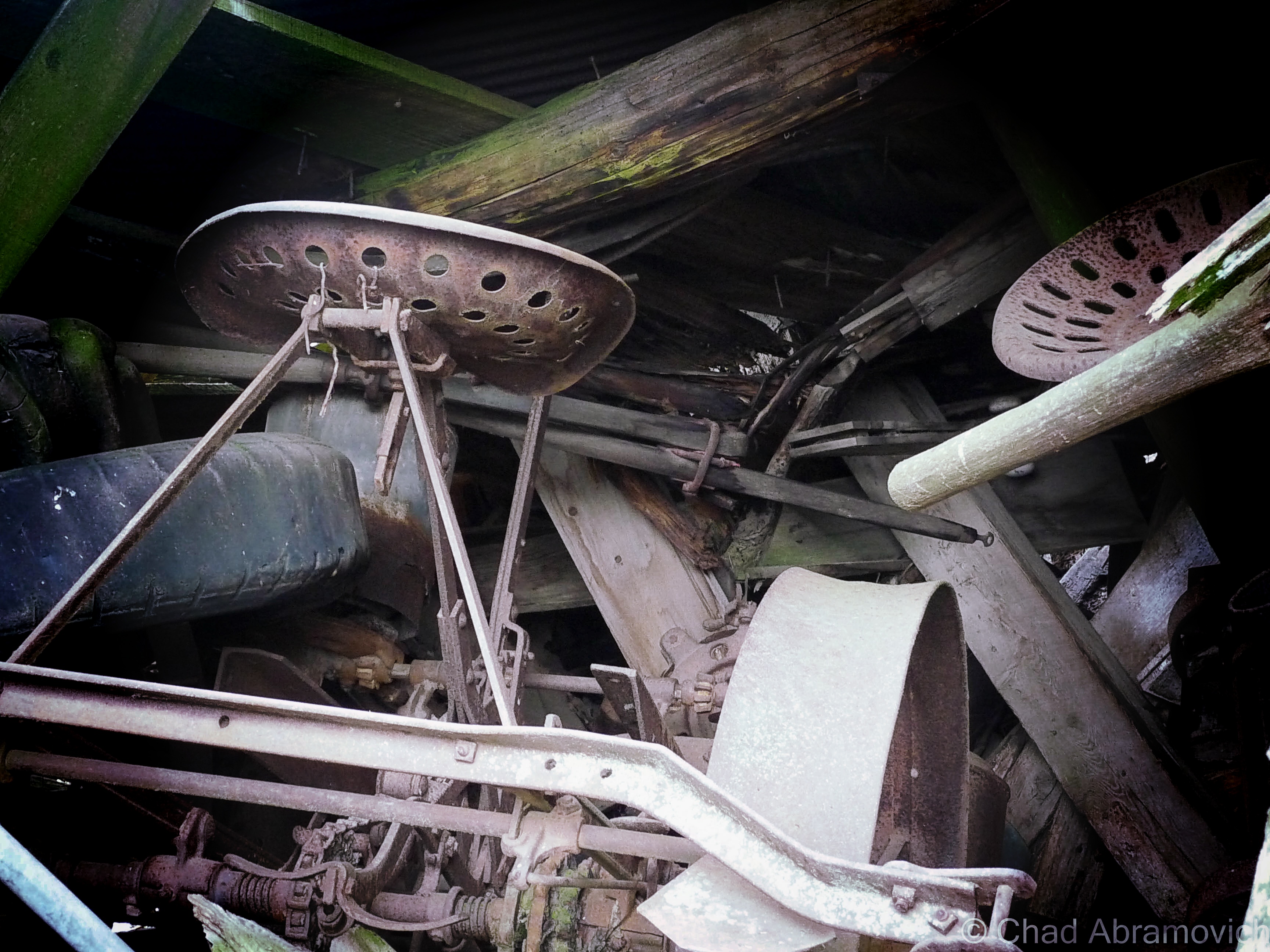
The dusty whitewashed interior of the barn was pretty cool as well. In typical Vermont tradition, the old farmhands never threw anything away, so the spaces were stuffed with antique furniture, busted farm equipment, and some unexpecteds like a collection of bowling pins. I know barns usually lived double lives thanks to Yankee ingenuity, like this great story on State 14, of an old one in tiny East Granville that formerly was the town’s dance hall that the current owners wish to restore. Maybe these guys used their barn as a makeshift bowling alley to pass the doldrums?

Walking around through hay that stuck to my boots, I realized the barn was a little worse for wear than I had thought. Structurally, it’s wooden floors and walls were beginning their slow descent into wasting away, and some of the older items stored inside were rotting to a point beyond saving.

dsc_0310_pe dsc_0250_pedsc_0255_pedsc_0260_pedsc_0262_pedsc_0264_pedsc_0266_pedsc_0267_pedsc_0270_pedsc_0277_pedsc_0280_pedsc_0282_pedsc_0283_pedsc_0285_pedsc_0287_pedsc_0290_pedsc_0292_pedsc_0297_pedsc_0298_pedsc_0300_pe

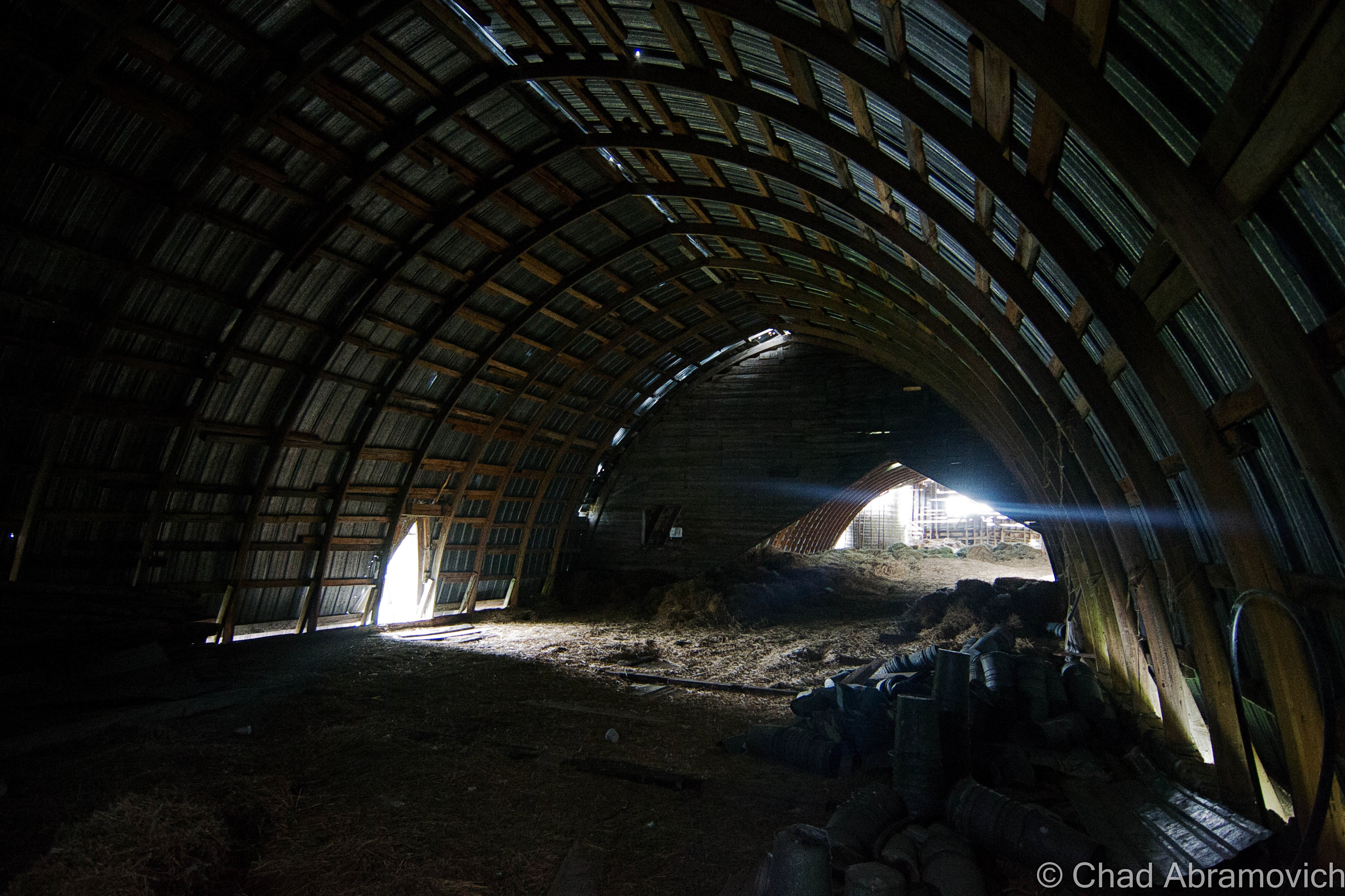
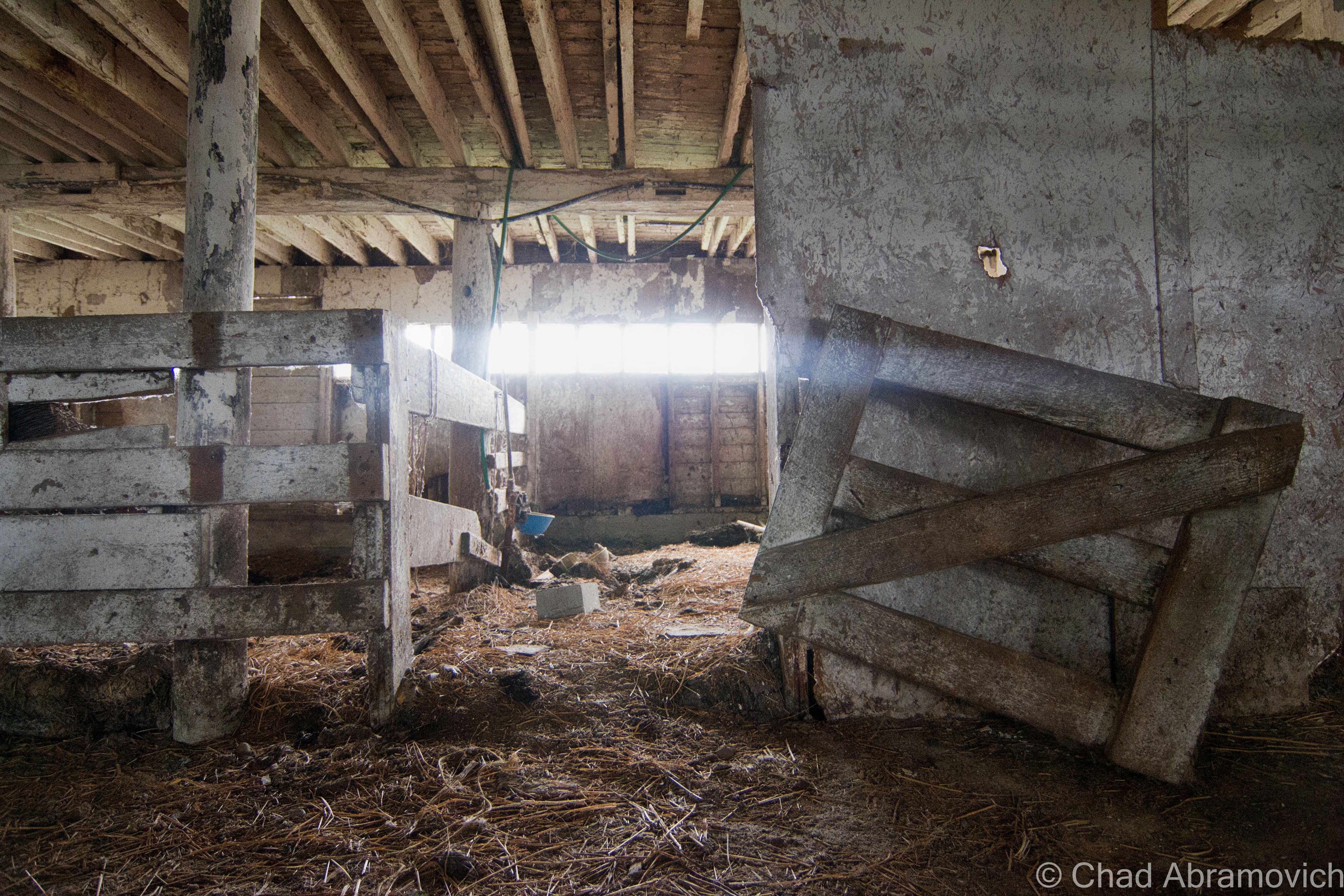
While I was writing up this post, I remembered another old barn I had checked out many years ago, and decided to dig up the old photos. I want to say these were taken by an insecure me with my Nikon point and shoot, around the spring of 2010. I figured I’d include them in this post as well. It’s sort of funny how years ago, I thought the only way I would be any good at photography was to get myself a top-grade camera, but looking back, I think that heading out with my old point and shoot actually forced me to become more creative and observant with a limited focal distance and zoom range. Man, young Chad had so much to learn. The equipment sure helps, but it’s really the photographer behind the gadgets that makes the difference.

During that spring, I needed to get out of the house to clear my head, and one of the best ways for me to do that was to go shunpiking – one of my favorite activities still.

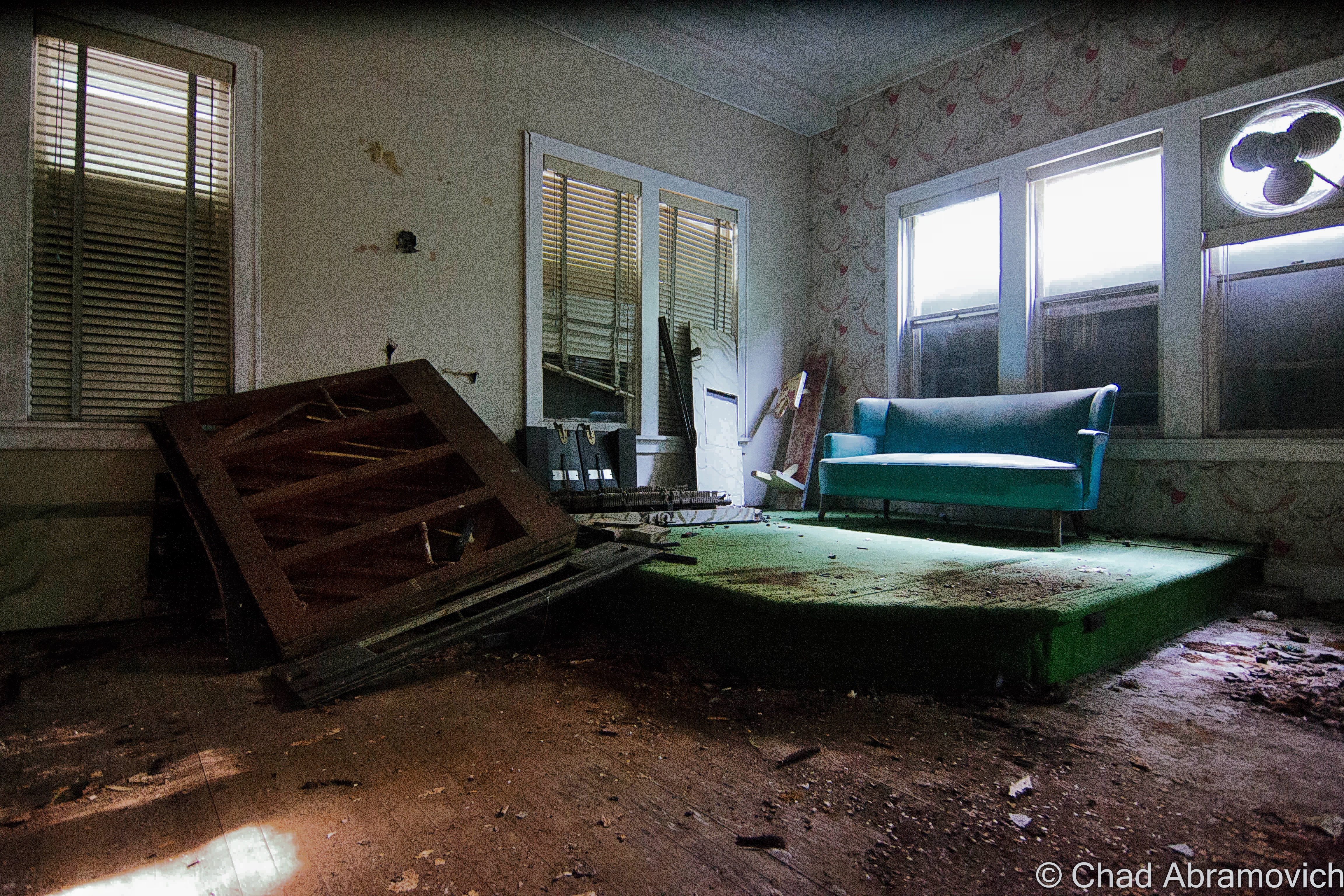
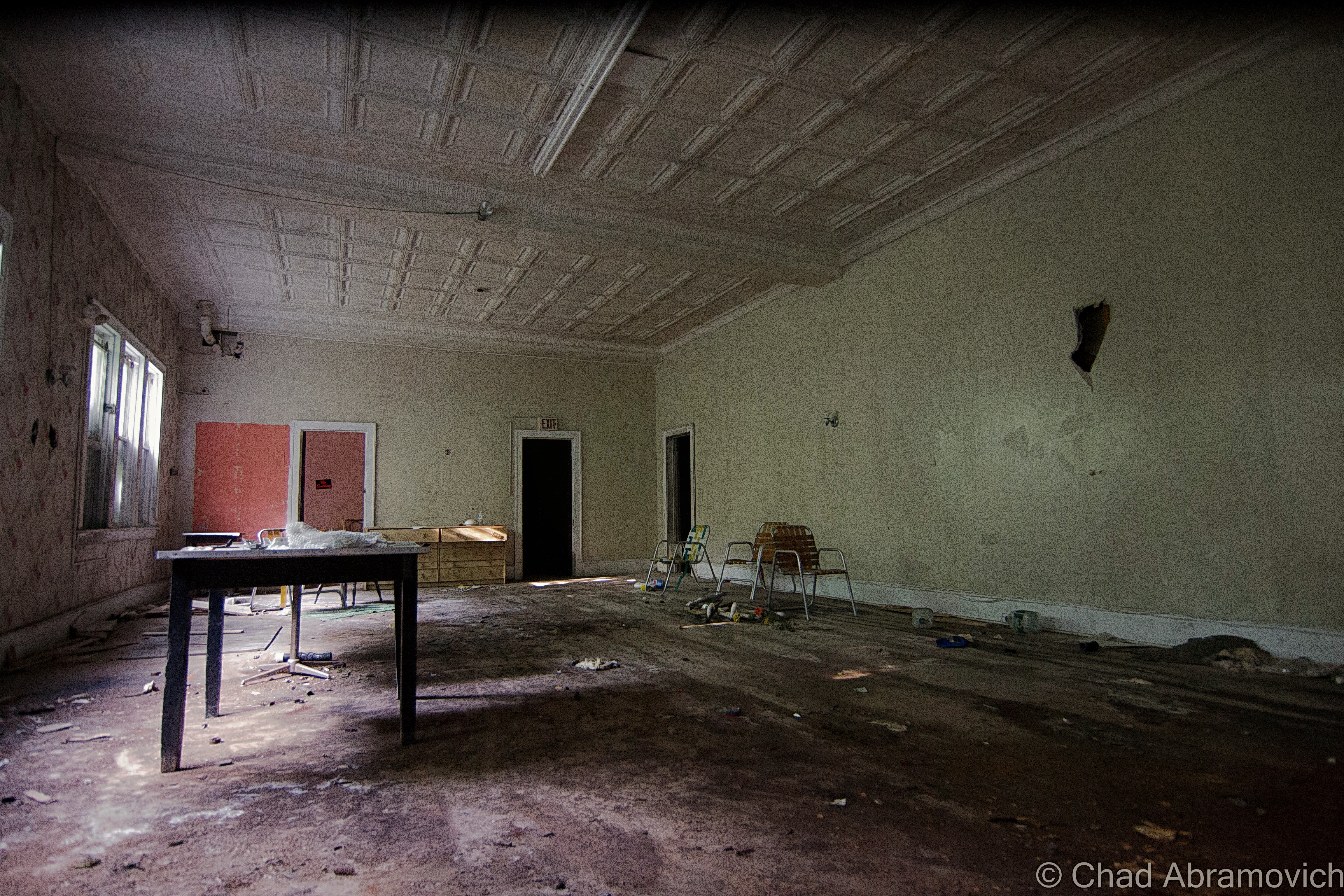
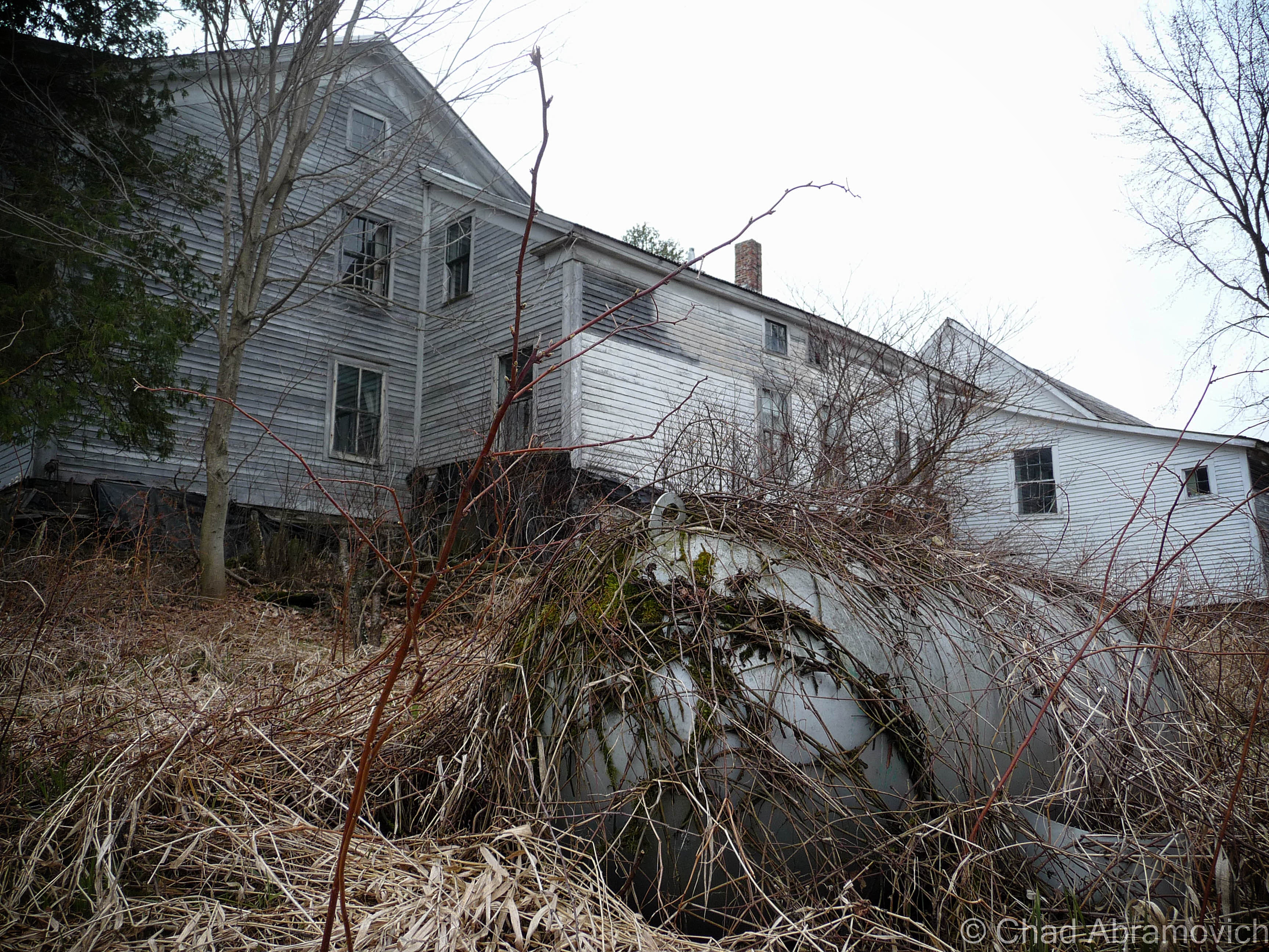
I found myself on some swampy backroads up in Franklin County. With the windows down and the wet Spring perfume coming through, I found myself passing by an abandoned farm, and next door, a rundown ranch house where the owning family still dwelled.

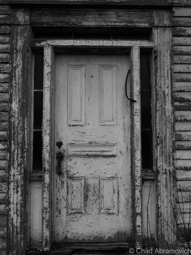
They agreed to let me skulk around their abandoned farm, but their elderly teenage son thought I was a weirdo for being interested in their place. Well, I am a weirdo, but I’ll never forget his furrowed eyebrow look and accompanying chuckle. According to him, the town actually condemned their old farmhouse when it began to violate building codes as it aged. So they moved into the ranch next door, which honestly didn’t look much better.

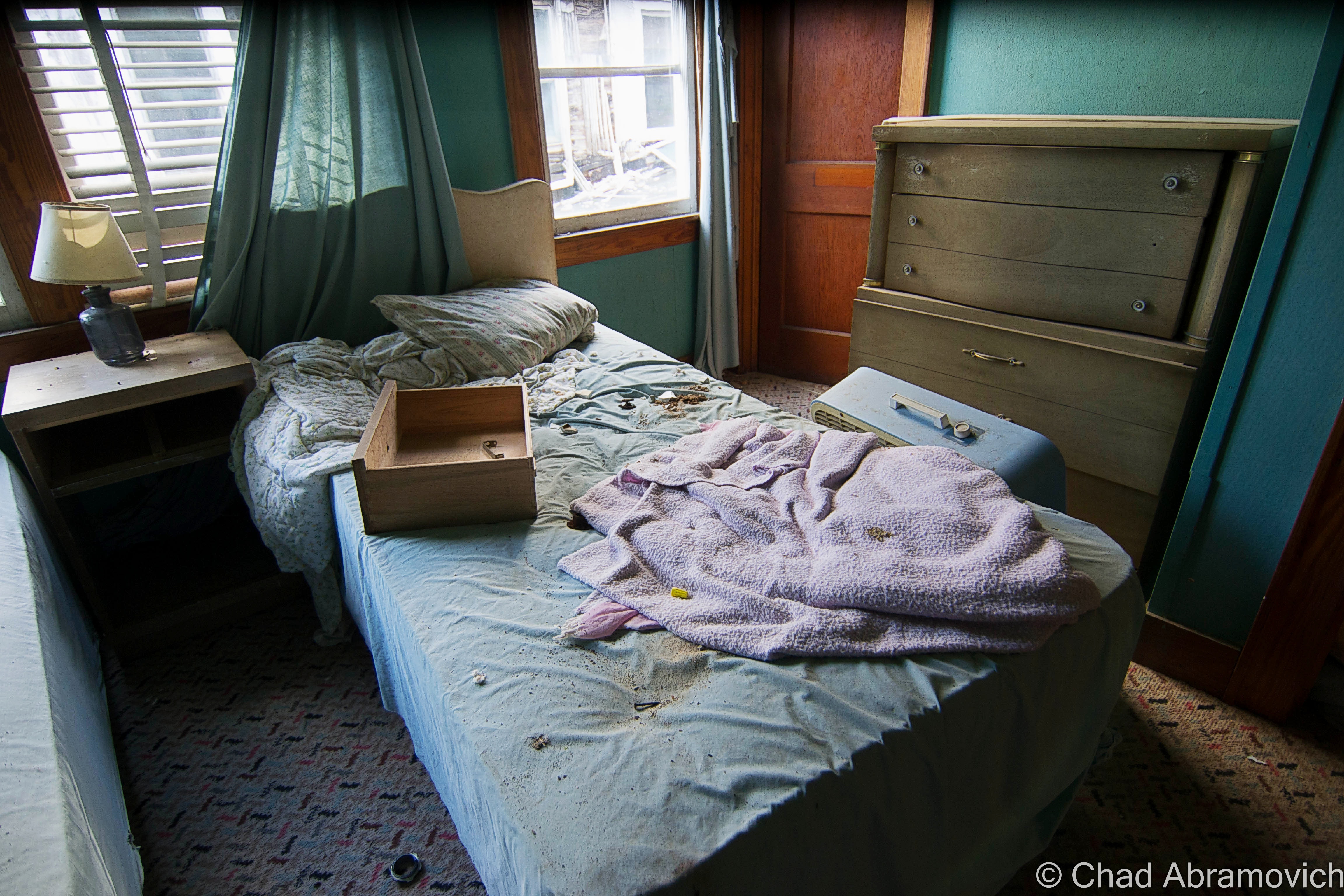
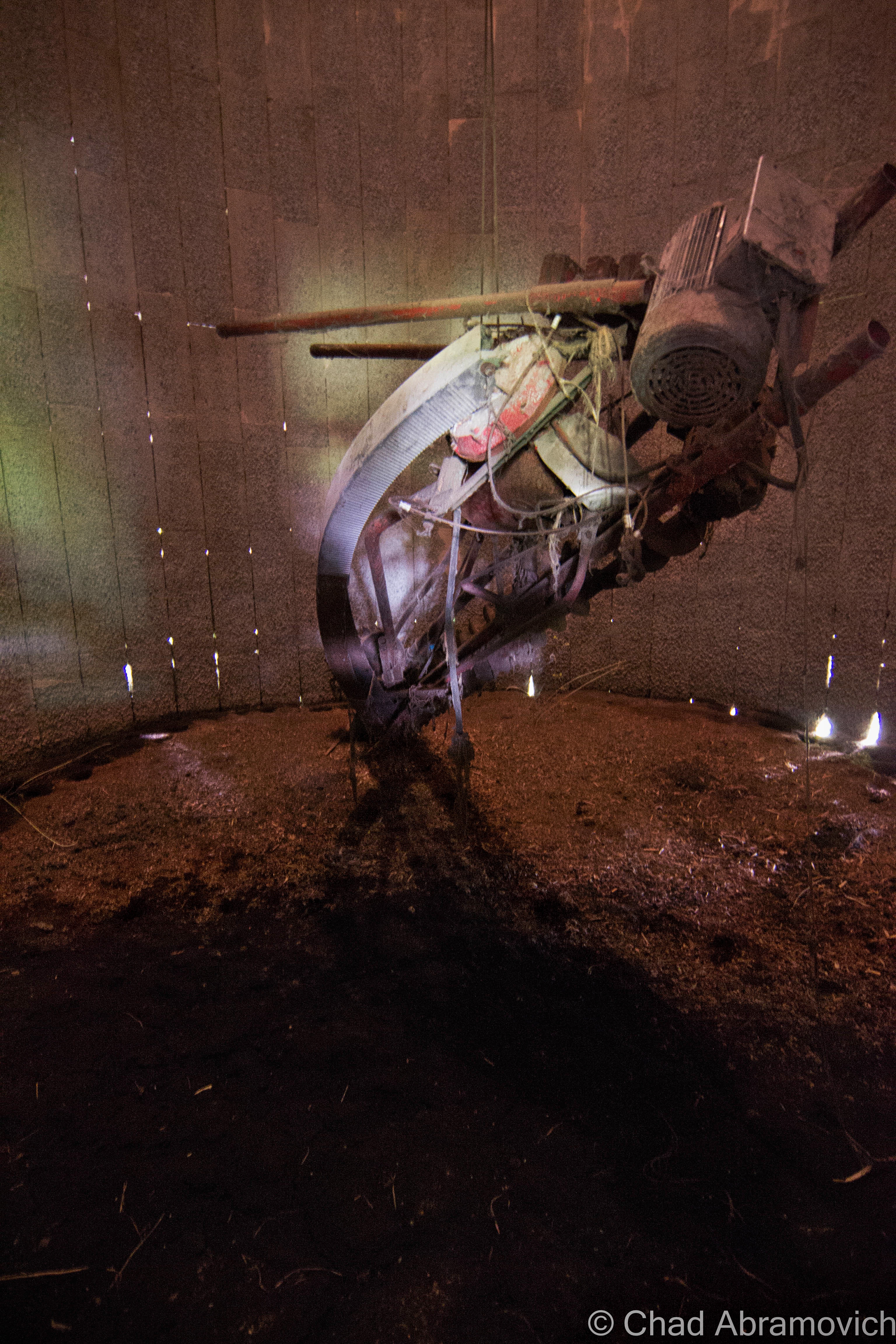
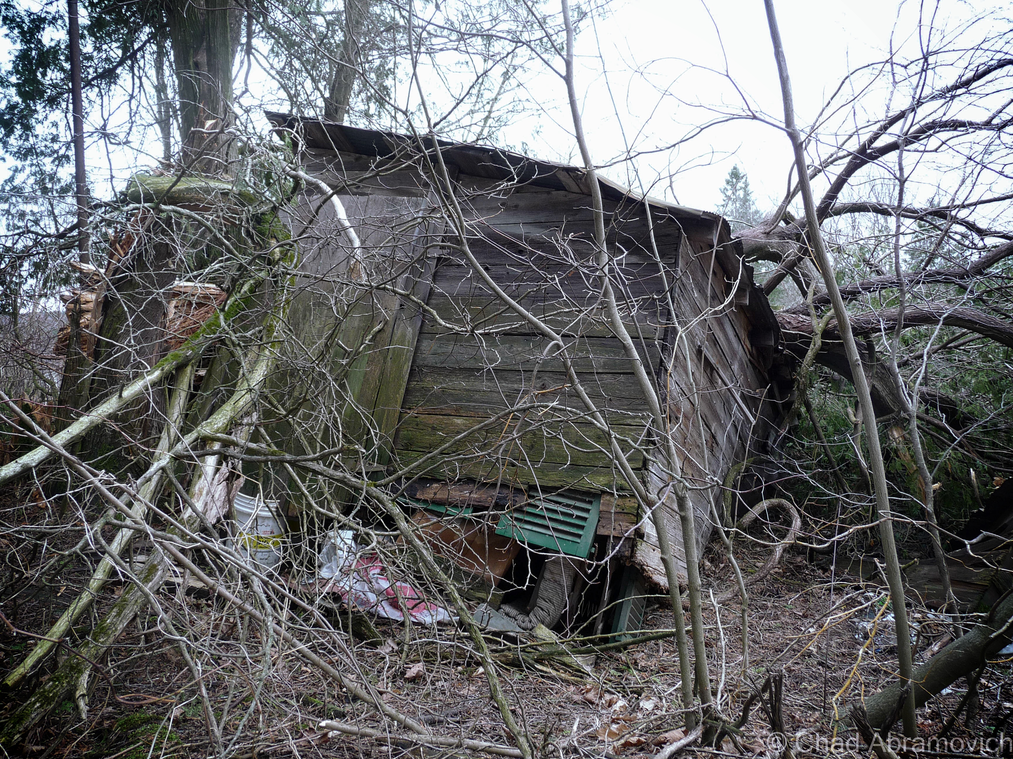
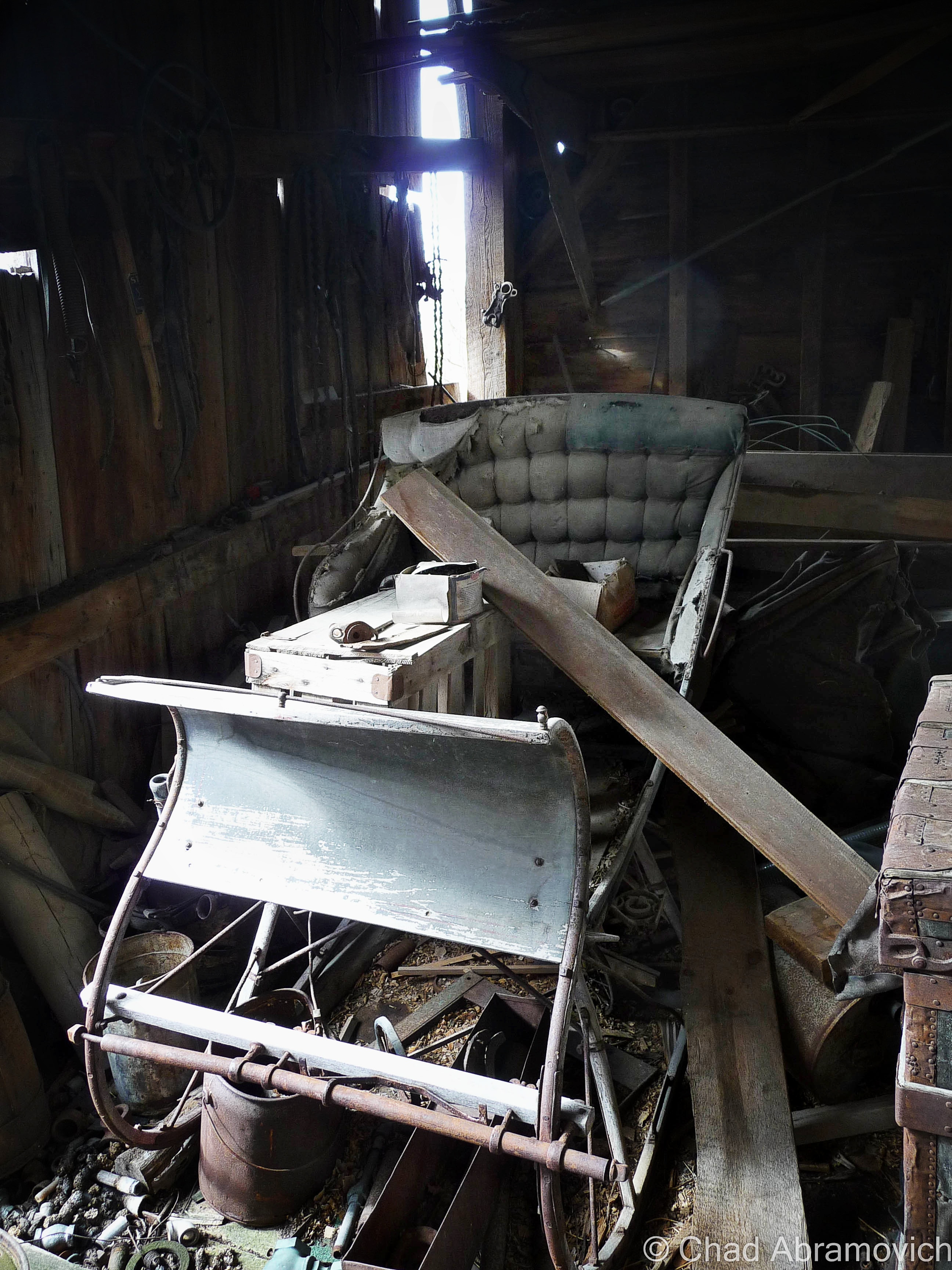
The best feature of the property was a tumbledown dairy barn covered in gray decay. The ramshackle structure was worth the potential threat of tetanus. The interior was filled with the debris of century old farm equipment, hidden doors and other relics. Like a beautiful antique sleigh.

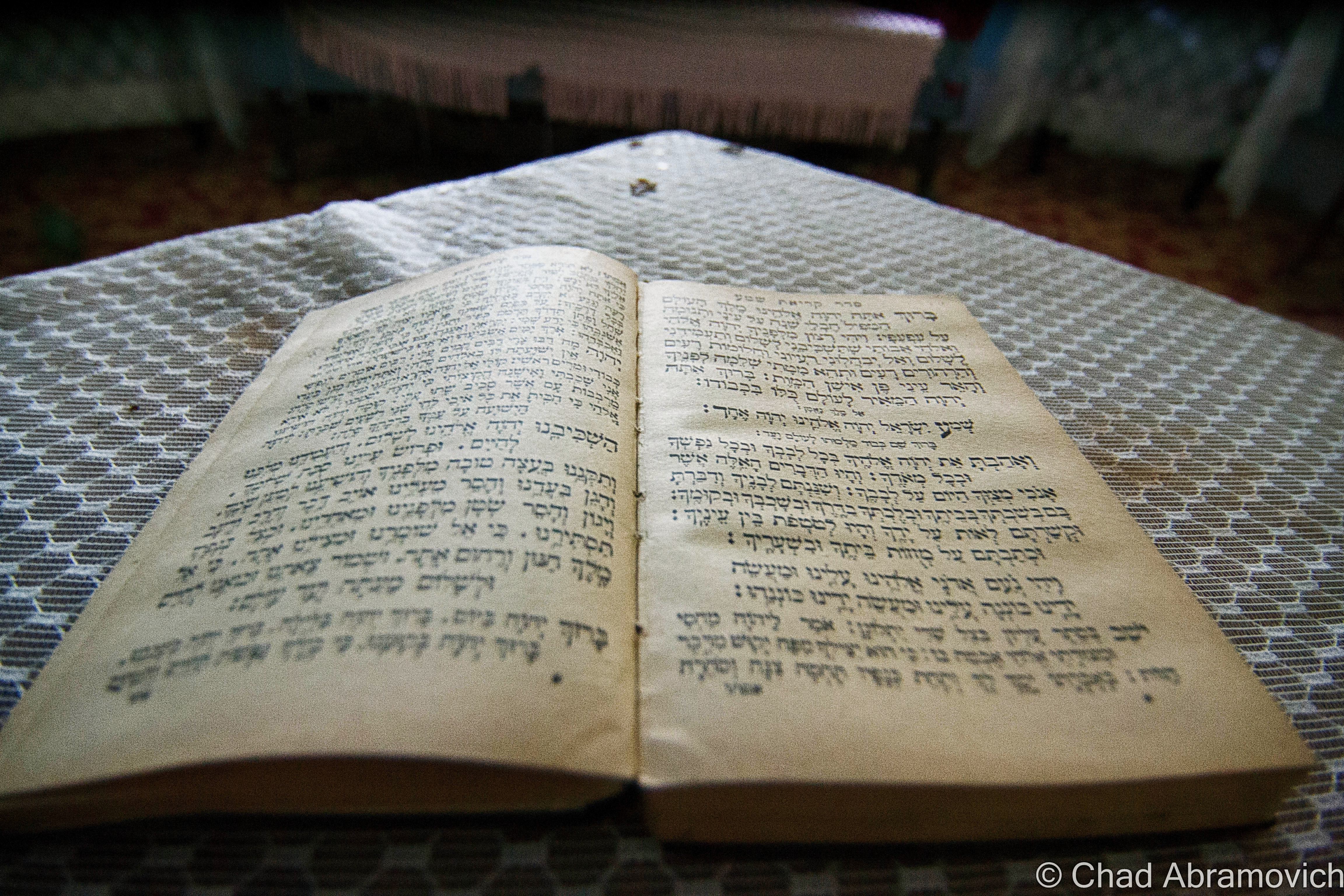
I even found a century plus old book underneath some floorboards in an abandoned barn, which raised a few questions. Why was this book concealed under the floor? What else was below my boots?

I’m not into theology, but it was pretty cool. As a graphic design major, I really appreciated the headlining typography. Finding old religious paraphernalia hidden in Vermont buildings isn’t rare it seems. Around the same time, an acquaintance I knew found someone’s leather bound, ornate family bible from 1848 under his floorboards, along with a handgun and the skeleton key to his basement door, which they had never been able to access until then. The decaying book was scrawled with various notes and births/deaths of a family who used to live in his old house in Milton. The place was built in the 1840s as a hotel, and also functioned as a bar, vaudeville theater and silent movie house and an odd fellows hall, before being converted into shoddy apartments.

p1020221_pe p1020230_pe p1020239 p1020240_pe p1020243_pe p1020250_pe p1020251_pe p1020252_pe p1020254_pe p1020257_pe p1020259_pe p1020260_pe p1020261_pe p1020262_pe p1020263_pe p1020264_pe p1020268_pe p1020273_pe p1020280_pe p1020283_pe p1020284_pe p1020286_pe p1020288_pe p1020290_pe

—————————————————————————————————————————————–

To all of my fans and supporters, I am truly grateful and humbled by all of the support and donations throughout the years that have kept Obscure Vermont up and running.

As you all know I spend countless hours researching, writing, and traveling to produce and sustain this blog. Obscure Vermont is funded entirely on generous donations that you the wonderful viewers and supporters have made. Expenses range from internet fees to host the blog, to investing in research materials, to traveling expenses. Also, donations help keep me current with my photography gear, computer, and computer software so that I can deliver the best quality possible. Seriously, even the small cost equivalent to a gas station cup of coffee would help greatly!

If you value, appreciate, and enjoy reading about my adventures please consider making a donation to my new Gofundme account or Paypal. Any donation would not only be greatly appreciated and help keep this blog going, it would also keep me doing what I love. Thank you!

Donate Button with Credit Cards

Gofundme: https://www.gofundme.com/b5jp97d4


Hogback Mountain and A 100 Mile View

Queen Connie

Vermont’s roads are pretty regulated, so there isn’t much here in terms of weird or kitschy personalized properties that people like to put into the broad category of roadside Americana – which includes a perpetually growing compilation of the same genre (nonstandardized) but vary widely in sentiment and imagery.

But, that doesn’t mean obscurities can’t be found along Vermont’s byways. Take the tiny farm town of Leicester, whose most famous denizen can be seen lumbering over the small oval-shaped lawn of Pioneer Auto Sales, right along the side of Route 7 either before or after you approach the tiny village center – which is pretty much an intersection with a few houses and a newly reopened gas station that now has a growler filling station.

“Queen Connie”, which it’s sometimes referred as when it’s not called “that big gorilla holding the VW bug”, is a huge 20-ft. tall, 16 ton, concrete ape, holding up a progressively rotting Volkswagon Beetle in one of her upraised arms, while the other arm is stretched out, palm upward, acting as a place where someone could grab an uncomfortable seat and a gimmicky photo opportunity.

But how did something like Queen Connie end up in aesthetic conscious Vermont? And what’s the story behind it? Actually, the answer is pretty straight forward – according to what I was told anyways. The owner of the car dealership had commissioned local artist T.J. Neil to do some concrete work around his pool at home. He was impressed with Neil’s work, and casually suggested another project; to do something cool to spruce up his business. Neil surprised him by suggesting a hyperbolized gorilla – his only reason was because he wanted to see it holding up a car. In 1987, Queen Connie was constructed using steel reinforced concrete, and she’s been observing activity on Route 7 with a disgruntled facial expression ever since, and for Vermonters who are into the weird, might be one of their first forays into oddity hunting.

Though I’m glad Vermont isn’t carelessly overdeveloped like other states, emblems like this are a pejorative thing to build here in the present tense, so it makes it all the more enjoyable.

dsc_0785_pe
Your blogger and local weird worker, posing for a photo.

dsc_0110_pe

Up The Molly Stark Trail

I was heading down to explore parts of southern Vermont with a friend. My summer turned into a lot of stress and setbacks, and I felt like my life was becoming as standard as my white apartment walls. My prescription was a long drive, and the lure of autumn’s sway just makes road trips better. Passing through my favorite town of Wallingford always cures a frown on my face, and as we got farther south and the trees began to turn gold in the hills around Mount Tabor and Dorset, I enthusiastically recalled a defunct marble quarry I hiked to last summer.

Route 7 turns into a limited access highway through most of Bennington County, until it reverts back to full access in Bennington and brings you right into its historic downtown district, the center of town being where it intersects with state route 9. I took a quick jaunt up the hill to the Old Bennington neighborhood to take a few photos of one of my favorite buildings in Vermont, The Walloomsac Inn, then ventured up route 9 eastwards into the mountains.

dsc_0399_pe
The Walloomsac Inn, my favorite haunt in Bennington.

Route 9, also known as The Molly Stark Trail or The Molly Stark Byway as the state issued scenic byway signs tell you –  is one of my favorite drives in Vermont, and the same sentiment could probably be said for quite a few other people. It’s an extraordinary road to gawk at through the windshield of your car, and even better when you’re stopping to get out and look around. The mountain road twists and turns through the innards of the national forest and gains elevation and grade pretty much as soon as you get beyond Bennington’s limits as it starts to climb the first of many hills and parallels the boulder filled Walloomsac River. To be honest, lots of things on this road vie for your attention.

A sense of awe and anticipation builds in me when I see a trademark brown and white national forest sign, telling drivers that there are various access spaces to Vermont’s Green Mountain National Forest for the next 15 miles or so. That includes the massive Glastenbury wilderness, one of Vermont’s largest undeveloped areas, but more known for the titular defunct town and about 2 centuries worth of weirdness that culminated on its many slopes and took off like a contagion shotgun blast into paranormal sensationalism. But it”s hard not to be fascinated by the large expanse of wilderness. The huge area holds ghost towns, a slew of trails and forest roads, man-made feats of engineering, and plenty of mysteries. Just ask the Geocaching community.

We passed through forested Woodford, the highest town in elevation in Vermont at around 2,215 feet, then descended into Wilmington. Which is where I unintentionally found some local curio. A green 1915 iron truss bridge first caught my eye, because it was obviously abandoned, as indicated by all the trees growing through it. The underwhelming replacement was a simple concrete and steel span that bridged the river inches away. As I was gazing at the bridge, I noticed a strange white sign across the bridge that was put up on a small weedy embankment that welcomed me to “Medburyville”, and gave me a precise census of 31 people and 26 pets who I guess lived somewhere nearby in the rural area.

I was at a loss here. The area around the sign was pretty much an undeveloped light wilderness area, and I knew that we had already crossed the Woodford/Wilmington town line. I’m a pundit on Vermont geography and had never heard of Medburyville before, so I was pretty curious. What was/is Medburyville? A local parody or some kind of irony? A name of an obscure back road Wilmington neighborhood?

My camera was acting up, so looks like Google street view will have to suffice for an image of the sign.

I was curious if there was a mystery or story here, so I sent an email to the Wilmington Historical Society. In their reply, Julie Moore explained that Medburyville was a village in Wilmington, but was erased when the Harriman Reservoir was constructed for the purpose of flood control. There was a mill, several houses and a railroad line that ran through the area at one point.

Today there is only a small aluminum sign that raises more questions than answers. Just a few feet from what was/is the Medburyville area is a narrow arm of the aforementioned reservoir, which is experiencing pretty low water levels lately so it was more sandbars than water when I drove by. Local lore has it that when the reservoir is low, a slimy church steeple from the former village is exposed, but I didn’t see anything that day that looked out of place in a reservoir.

Another obscure footnote is that there once was a placename along the reservoir that had the post office address of “Surge Tank” – a name of a temporary settlement that sheltered the men who built the Harriman Reservoir dam that had it’s own recognized post office. The post office also moved around between Readsboro and Whittingham – depending on wherever construction was happening. I still see Surge Tank sometimes on obscure place name lists. Like Medburyville, Surge Tank is long gone, and without a sign to commemorate it.

Back on the road, the forests occasionally break up a little and you got a positioning glimpse that you were right in the middle of the green mountain chain. Unlike some parts of Vermont where a high elevation isn’t surrounded by other mountains and instead reduces off into valleys, the mountains around Wilmington and Marlboro stretched as far as the vistas, with various 440 million-year eroded summits slanting into other rounded domes. A few “runaway truck ramps” with large yellow signs and rhythmic blinking lights were a reminder that the undulating byway had the potential to be more dangerous than scenic for other drivers, and judging by the scars and pit marks in one of them, it had been used recently.

The “100-Mile View”

But it was the so-called “100-mile view” in Marlboro that was the most impressive. I’m not sure if that name is superlative or not, but I suppose it doesn’t really matter because the view is awesome. From a large wooden deck with coin functioning viewing apparatuses for the tourist crowd, you can see what’s left of southern Vermont before it transitions into the Berkshire Hills, and the bumps of southern New Hampshire, including Mount Monadnock.

One of the ramshackle old lodging cabins from a deceased ski resort, which I was about to hike to, sits on the edge of a drop off below the overlook, and might be one of the most photographed site among the sights. I took a walk down, and there was a laminated sign taped to the twisting floorboards telling people like myself to keep out – it’s not actively maintained (as evident by the peeling paint) and can be dangerous if the building decides to tumble down the hill. But I was able to get a shot through a dusty old window along the side and gaze curiously at a few items of older furniture left inside.

I live in Vermont’s largest city, and dig the scene there, but sometimes my hometown is just too oversaturated with people for my taste. I really ache for having access to land like I did when I was younger, where I could go 4 wheeling and hiking and just let out the things storming in my mind. So my predilection was that I could sit on that porch all day or night and gaze off into the distance in my own reverie, listening to Gregory Alan Isakov albums. 

dsc_0413_pe
It seems like I was racing storms all day as I traveled around the state yesterday. They finally caught up with me at the top of the Molly Stark Trail, one of Vermont’s most scenic byways. Someone once told me how the few street signs (mostly stop signs) in Greenland’s research bases and camp cities are completely coated with stickers. It’s a way to get the story of its visitors or inhabitants. Where you’re from, what you like, what you stand for, etc. I thought that was pretty cool, and remembered that when I saw the guardrail that hemmed in the road atop Hogback Mountain. Though that’s not quite the case in Vermont, I’ve seen a few guardrails covered in visitor mementos, many just confessing fannish love for various companies or organizations, alongside sharpied graffiti, names and dates. Appalachian Gap on state route 17 has a similar theme.

dsc_0422_pe

The cluster of tourist buildings that sort of delineate the maximum height of land between Bennington and Brattleboro were all once a part of Hogback Mountain, a defunct ski area cut out of the slopes of Mount Olga which has mostly been recovered by nature.

Hiking Around Hogback Mountain

Hogback was one of the longest lasting family owned traditional ski resorts in the state, and arguably is one of the best lost ski areas in Vermont to explore, though you’d probably guess either of these things while driving by the few diminutive red buildings sitting in tangled underbrush along a slight rise above the wide shoulder of route 9. You’d probably never guess the property was even a ski hill unless you were able to catch the white lettering affixed to the former first aid building that reads “Hog ark Ski Area”, which in all honestly would be a memorable name for a functioning ski hill.

I decided to walk down from the overlook and have a look around at the property. Good thing I wore jeans – the land was wild with tangled undergrowth, and most likely, ticks. Having been bitten by one a month ago, I didn’t want to go through that debacle again. A few old buildings, the rusted bones of an old lift line and a squint-to-make-out overgrown ski trail could still be traced.

Vermont is the land of skiing (and snowboarding) and our pioneering ski hills ranged from extremely plain rope tow affairs to more detailed mom and pop establishments.

If you’re a New Englander, I’d say we’re pretty lucky to have a great site like the New England Lost Ski Area Project. Between that and the book Lost Ski Areas of Southern Vermont by Jeremy K. Davis, I got a startling impression of how many ski areas we once had just in the lower part of Vermont, and how many of them have been, well, lost.

Hogback Mountain itself seemed to be something special. The ski area warranted a pretty long chapter in Davis’s book and a long entry on NELSAP – considering other areas had merely a few sentences. It has a lot of history, so much I had to condense it a bit for the sake of keeping people reading this blog post.

The truth seemed to be that Hogback was envisioned by a community of people who loved skiing, and the consequences were real. Hogback opened for the 1946-47 ski season on prime real estate owned by Harold White, and was operated by the Hogback Mountain Ski Lift Company out of Brattleboro, as well as several of the families who owned the various businesses along route 9, like the White’s who owned the gift shop, the rental shop, the Marlboro Inn and other rental properties. The Douglass’s who were involved with the ski shop, and the Hamelton’s who were involved with the skyline restaurant.

It featured a Constam T-Bar which could move 900 skiers an hour and was the highest capacity lift in the country at the time. Old brochures and trail maps promote the ski hill’s location in Vermont’s “snow belt”, a high annual snowfall area of the Green Mountains which at the time, received an average of 120 inches. The Vermont winters of today are a bit more disparate.

Hogback’s highest elevation was about 2,400 feet (the base area being at around 1,900), which helped preserve the natural snowfall much better than lower area ski hills, which made it so beloved. I observed some older trail maps, and discovered that Hogback had a unique layout. You’d begin your day along route 9 where a hotel, gift shop and Skyline Restaurant were, and ride a rope tow to the practice slope, but intermediate or expert level skiers would have to transport over to a different face of the mountain to access the main T-Bar and more advanced trails.

hogbacktm1
A trail map from the 1970s -Hogback Mountain had 12 trails to ride on. To give you an idea of the weird layout and a wayfinding point: number 21 is the first aid building, and below it is Route 9. The first aid building is abandoned and still visible from the road today. That is also where the practice slopes/beginners area was. The more advanced trails were over on another side of the mountain, where numbers 3, 4 and 6 are.

Over the years, the laid back ski hill caught enough popularity from a top notch ski school, excellent snowfall and a gorgeous mountain where skiers would admire spruce trees crusted in snow. In the 50s, it started to expand, and would continue that momentum through the 70s. More trails were cut down the slopes and made easier accessible by a Pomalift and the addition of 4 more Doppelmayr T-bars. There was also a Quonset Hut brought to the property that served as a ski-in snack hut.

Seriously, this place was a big deal. A lot of the history or accounts I read about the mountain was that plenty of southern Vermont kids learned to ski here. It also helped develop a local interest in ski races and became home to the Southern Vermont Racing Team. If a nearby community, like Brattleboro, had an outing club, they probably went to Hogback. The mountain developed a pretty enthusiastically devoted fanbase. The ski school changed instructors a few times over the decades, each new presence contributing to it in their own way.

One of my favorite images I found of Hogback. Love the front of those old cars parked along Route 9, with equipped skiers ready to ride. The hill was literally along the roadside. | Photo: UVM Landscape Change Program.
One of my favorite images I found of Hogback. Love the front of those old cars parked along Route 9, with equipped skiers ready to ride. The trails were literally along the roadside. | Photo: UVM Landscape Change Program.
People on skies at Hogback, circa 1953. I read stories about how wooden shacks were built around the property and used as warming huts, with pot belly stoves inside burning wood continuously. There were signs nearby warning skiers not to get too close. Several learned the hard way when the back of their nylon packs had melted off. | Photo: UVM Landscape Change Program
People on skies at Hogback, circa 1953. I read stories about how wooden shacks were built around the property and used as warming huts, with pot belly stoves inside burning wood continuously. There were signs posted nearby warning skiers not to get too close because of the heat. Several learned the hard way when the back of their nylon packs had melted off. | Photo: UVM Landscape Change Program
Skiers getting on a T-Bar, circa 1956. | Photo UVM Landscape Change Project.
Skiers waiting in line. Sometime vaguely between 1930-1950. | Photo: UVM Landscape Change Program
T-Bar lift, circa 1948. | Photo: UVM Landscape Change Program.

But towards the 1980s, snowfall began to change to a lack of snowfall. Between not enough natural snow to ski on, rising costs of operation and increasing competition from bigger resorts that were becoming more common on the scene in Vermont mountains, the small mom and pop ski hill eventually couldn’t compete. Hogback’s story is similar to most of Vermont’s lost ski areas. Not being able to compete or stay consistent, most of them became fading ghosts.

Abandoned ski hills are interesting real estate. What do you do with them? Some have subsumed away in the caprices of nature and others re-opened or became private operations. In Hogback’s case, the Vermont Land Trust and a group of adamant people worked pretty tirelessly over the years to secure the funds to purchase and secure the land to save it from becoming a condominium development with a marketed quintessential nature-esque type of name. The purchased acreage was then transferred over to the town of Marlboro, and the cool Hogback Mountain Conservation Area was the result. It’s now glorious protected land, with an abandoned ski hill in the middle that Vermonters can enjoy.

Some of the old ski trails are still maintained and pruned, so hikers, snowshoers and cross-country skiers can still enjoy them. Though, for me anyways, I found that finding those trails was a bit of a challenge.

To my delight and surprise combination, if you bushwhack through some waist-high tangle weeds and growth, you can still find some of the old ski trails, which were still hikable! Well, it’s subjective I guess, but I thought it was achievable. Using the linear rusted cables of the former chairlift as wayfinding points, I decided a short early autumn hike was a good idea. The trail oddly cleared out the farther up I climbed, until both the trail and the lift sort of ended in a blissful and fragrant silence. I was a little bummed I didn’t find an old chairlift or more paraphernalia. If I had gone up farther, I would have eventually stumbled upon the Mount Olga fire tower, which I’m told had splendid far reaching views. You can get there far easier than scrambling up Hogback Mountain, by hiking over via Molly Stark State Park. 

My list of places to visit in Vermont alone is so long, it’s hard to cross stuff off of. I’ll get up there one day.

dsc_0434_pe dsc_0437_pe dsc_0439_pe dsc_0444_pe dsc_0445_pe dsc_0447_pe dsc_0450_pe dsc_0453_pe dsc_0459_pe dsc_0462_pe dsc_0466_pe dsc_0468_pe dsc_0470_pe

There were still old ski poles left behind in the first aid building

—————————————————————————————————————————————–

To all of my fans and supporters, I am truly grateful and humbled by all of the support and donations through out the years that have kept Obscure Vermont up and running.

As you all know I spend countless hours researching, writing, and traveling to produce and sustain this blog. Obscure Vermont is funded entirely on generous donations that you the wonderful viewers and supporters have made. Expenses range from internet fees to host the blog, to investing in research materials, to traveling expenses. Also, donations help keep me current with my photography gear, computer, and computer software so that I can deliver the best quality possible. Seriously, even the small cost equivalent to a gas station cup of coffee would help greatly! Especially now, as my camera is in need of repairs and I can’t afford the bill, which is distressing me greatly.

If you value, appreciate, and enjoy reading about my adventures please consider making a donation to my new Gofundme account or Paypal. Any donation would not only be greatly appreciated and help keep this blog going, it would also keep me doing what I love. Thank you!

Donate Button with Credit Cards

Gofundme: https://www.gofundme.com/b5jp97d4


Time Will Tell

Everything changes, a truth that I’ve always fought a stubborn battle with. This town, once rolled over and turned into a sought after destination built around its exploitable mineral springs, has since witnessed its appeal, it’s many hotels, and it’s identity all become ghosts.

In the 19th century, natural springs were discovered in a hollow near town that had high levels of sulfur, magnesium, and iron in them – which were thought to have medicinal properties if mixed just right – that exact recipe changing quite a bit over the intervening mineral springs craze period, depending on what serial publication you subscribed to. Some even professed that these waters were the equivalent to the fountain of youth. The village capitalized on that, and its efforts were successfully rifled.

In a time period in America where a sizable roster of traditions and foundational history were sparked and now only largely recalled – it’s main drag eventually became dressed up with handsome grand hotels that you’d expect to see from that era, many rising above 4 stories and wearing broad porches and clapboard facades as its reputation swelled to an estimated 10,000 visitors coming in every summer, including the likes of the Vanderbilt’s, which is a name everyone loves to tote about if they had any relation to their area.

Business and tourism stopped coming around during the roaring 20s and the depressed 30s, but after World War 2, the diminutive village was rolled over again by the Jewish community of New York City, who brazenly decided that if they were going to face discrimination in the area’s existing vacation towns, than they’d make a place of their own – and with the natural springs and a bunch of existing hotels and infrastructure, the village was opportune for investment.

But the area and its springs were recanted by the 1980s, and it’s increasingly run down appearance as well as the construction of an interstate highway miles north that moved traffic away from the village, only helped to make it forsaken. What hasn’t been torn down today of those aforementioned hotels were left to transition into decrepitude, and strangely memorialize a haunting tradition of wreck that has plagued more than this town. The village today is pretty archetypal small-town America, it’s just littered with a surprising number of abandoned hotels that mark time and make us pause. Unlike many small towns out east – it was built using the grid system like you’d find a city or planned development to be oriented like. That arrangement accounts for the number of bathhouses and hotels that were once packed in the ravine the community sits in. But today – many of these bygone structures have been torn down because of how dangerous they got, leaving many of the “blocks” as woodlots occasionally interrupted by a stop sign. I liked all the patches of forest in between some pleasantly up-kept old houses, it gave the area lots of character.

I had traveled a few hours out of Vermont to explore one of the remaining ruins, a forsaken property ensnared by sickly looking pines that were once intended to landscape, now left to their own devices and slowly intend on consuming the unattended street the large structure molders on.

From what I was able to dig up, it was built around 1927 as a sister hotel to a much more opulent establishment behind it, now also in ruins. But, this was intended more as a long stay property. Guests here would rent rooms by the week or month.

When you checked in, you were given two sets of keys. One for your room, and another to a kitchen unit across the hall. It seems most floors, apart from the fourth floor had them. This may have also been an afterthought – as a desperate attempt at a creative solution when business began its slow descent and they found themselves with a surplus of hotel rooms that weren’t generating profit.

It seems that the business kind of limped along towards its later years, in a weird fluctuating state of wondering if it was alive or dead, just barely making it into the 21st century before closing in 2004.

Having a bummer of an experience a few years ago at another abandoned hotel in this town when I was chased away by a very disgruntled woman who power walked out her front door with four dogs on a leash and howled at us a reminder of how we were trespassing, I was really hoping for a good experience this time around.

Meeting up with a good compadre from my college days, whose meetups always seems to happen inside a smelly abandoned building of some sort, we set off for an adventure.

It started off awkward, which turned my nerves up a bit loud. This is the kind of burb that everyone takes the time to look at you suspiciously or slow down their car when you walk by if you’re not a local. But after getting off the main drag, things got pretty quiet, and though it was already a hot and sultry evening, there was a slight breeze that brought the perfume of wildflowers.

I read somewhere that the springs still made the town smell like “rotten eggs”, but I didn’t detect that at all. I’m a little sorry I missed the springs themselves because I was later told that there is a dipper handy at the sulfur springs near one of the old bathhouses, and you can still sample them today.

Getting in proved to be a bit more challenging than anticipated. But then again, I did say I wanted an adventure…

After climbing up a wobbly and very evidently out of code fire escape while doing some acrobatic maneuvers that might have vaguely impressed a free climber, we found ourselves stepping carefully over the threshold into a completely different atmosphere.

The silent interior immediately began to smother us with its festering rot, exhaust from its past and advancing water damage. The floors ebbed and groaned beneath our feet as our boots sank into the stretched, threadbare carpets. We actually spent a good 5 minutes or so debating whether we actually wanted to enter or not, because the floors were so deceptively sketchy.

This was not the kind of place you wanted to find yourself injured and incapacitated inside of. But, because you’re reading this blog post, that means we decided the reward was greater than the risk.

Once we got away from the northern section of the building, conditions were surprisingly disparate. Rooms were strange time capsules, in decent states of preservation. It was fun scrutinizing over mid-century furniture, beds, rotary phones and even nob television sets that could still be observed, and better yet, mildly free of vandalism. Clothes, blankets, bars of soap, and other miscellany had been left behind. Most of the doorways had transoms, another feature which you don’t see in modern construction. Many of the bathrooms didn’t have bathing facilities though, and the ones that did were only stand up showers. I read that patrons would do that at the springs, I guess.

There was a heaviness to the place that I just couldn’t describe. Me and my friend both exclaimed that our good moods grew cold and were replaced by a feeling of depression. The narrow hallways, cramped rooms and perpetual shadow that fell on the building built a rather grim atmosphere that looked so gone and hollow, only reinforced by its ugly outdated decor that seemed to bring a big broken heart of an existence.

I had heard from a few other friends and explorers that his hotel was shockingly preserved, thanks to it being very unknown in the emergent “urbex” frenzy of the internet. I even saw striking pictures online of a clean front desk with house plants still sitting on its countertop – it made the hotel look like it was simply closed for the weekend as opposed to years. But when I tromped around, it seems that this place too eventually fell victim to the less respectable aspects of human nature. Entire stretches of authentic tin ceiling, a feature of old buildings which I really love, had been pulled down. We didn’t see it on the floors, so I assume it was scrapped and sold for cash. Decor like light fixtures, an ugly yet obligatorily photographable landmark piano and the front desk had been clobbered. Some features, like an original old fashioned elevator with grate doors and a brawny yet ornate safe was still more or less in great condition and tucked away in the dark innards of the hotel.

But it was the relics from the place’s operational days that gave us a weird impression. Though we were only amateur archaeologists, we had noticed there were several signs that had been taped to walls around the hotel, all handwritten by the same person. The signs, now water stained and curling at their corners, were either yelling at guests or yelling at employees, with words like “no” capitalized and triple underlined, which added a bit of discomfort to the place. I have no idea what sort of place this was in its heyday, but finding all these signs made me assume that in its last days, it seemed like a drab, down on your luck sort of experience. I bet Anthony Melchiorri would have made a disapproving beeline towards the general manager’s office if he read one of those signs.

Every level up the grand staircase was a bit more to bear. The fourth floor was nauseating. It was 92 degrees outside, but upstairs the mercury was boiling towards 100, and the air was stale and fetid, making our breaths labored and my eyes water. Hornets seemed to have colonized the upper levels, coming through structural instability and it’s broken wooden windows. Plenty of them were swarming around us as we attempted to explore the upper corridors.

We wound up putting some arm muscle into opening one of the old wooden windows, which hideously groaned in their frames and sent a dusting of grit and lead paint down on our shoulders, but the fresh air coming in from outside was wonderfully refreshing. Far more than it’s view.

We appeared to be looking at the inside of the “U” shape of the building, and from that perspective, we could see just how bad the exterior damage was. To my disorientation, it was still pretty bright outside. The inside gave no impression of that due to just how dark it was already getting. As we descended back down the stairwell, I could see the crumbling form of another abandoned hotel from the dirty windowpanes, just over the treeline. This may be one of the only places I’ve visited where you can see more than one abandoned property from another abandoned property.

We left when the shine of the sun wasn’t reaching its way in anymore, and the black vibes came. The talked about restoration of a grander hotel just north of it suggested completely razing this property in its new set of plans, for a parking lot. Structurally, I think the only sensible move would be to demolish it. Though I’m all for preservation, this building is now far too gone. But these rumors have been circulating for years, and the hotel still stands.

I really needed this explore. I needed to get revved up about something and be underneath a spell that only the intoxication of an adventure can bring my way. If you’ve seen my Stuck in Vermont video interview, I talked about how and why this activity, this hobby, is meaningful to me. And this road trip really served as a valuable reminder. I had been losing my wits underneath suffering some terrible anxiety the past weeks, and this was such a relief.

Exploring educates me about several things, and often the stories and nuances of the places featured in my blog parallel the human experience. At least I find. Like the atmosphere of a place you explore affecting you, we are imbibed by our weather, as are the people around us. I flourish in the presence of passion and love, and when I’m doing my thing, I wear that grin and those cherry bombs on my sleeve for all to see. I’ve learned that anxiety doesn’t get me anywhere, but I feel it anyway. Sometimes, like this hotel or other places finding themselves inducted into the fables of the fallen, you can’t be entirely responsible for your own fate. And maybe most prevalent, life always moves on and our stories are always more connected than distance implies. There’s a story to every corner of these places.

Post card prime, date unknown. via cardcow.com

DSC_0006_pe DSC_0008_peDSC_0013_pe DSC_0011_pe DSC_0020_pe DSC_0029_pe DSC_0035_pe DSC_0040_pe DSC_0042_pe DSC_0048_pe DSC_0050_peDSC_0047_peDSC_0038_peDSC_0037_pe DSC_0057_pe DSC_0058_peDSC_0055_pe DSC_0061_pe DSC_0066_pe DSC_0068_pe DSC_0069_pe DSC_0072_pe DSC_0077_peDSC_0108_peDSC_0111_peDSC_0084_peDSC_0103_peDSC_0088_peDSC_0113_peDSC_0116_peDSC_0117_peDSC_0120_peDSC_0122_peDSC_0123_peDSC_0127_peDSC_0131_peDSC_0132_peDSC_0136_peDSC_0140_pe

—————————————————————————————————————————————–

To all of my fans and supporters, I am truly grateful and humbled by all of the support and donations through out the years that have kept Obscure Vermont up and running.

As you all know I spend countless hours researching, writing, and traveling to produce and sustain this blog. Obscure Vermont is funded entirely on generous donations that you the wonderful viewers and supporters have made. Expenses range from internet fees to host the blog, to investing in research materials, to traveling expenses. Also, donations help keep me current with my photography gear, computer, and computer software so that I can deliver the best quality possible. Seriously, even the small cost equivalent to a gas station cup of coffee would help greatly!

If you value, appreciate, and enjoy reading about my adventures please consider making a donation to my new Gofundme account or Paypal. Any donation would not only be greatly appreciated and help keep this blog going, it would also keep me doing what I love. Thank you!

Donate Button with Credit Cards

Gofundme: https://www.gofundme.com/b5jp97d4