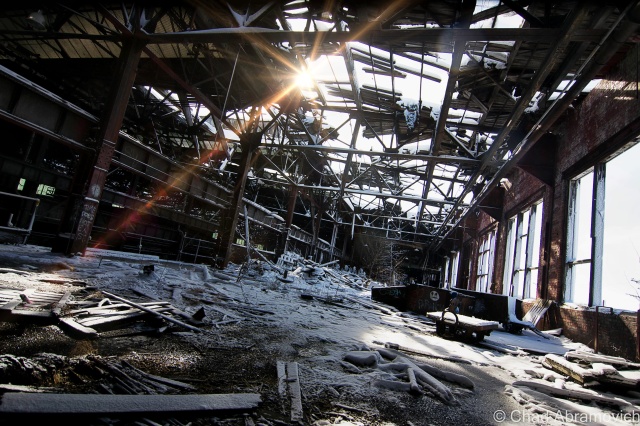
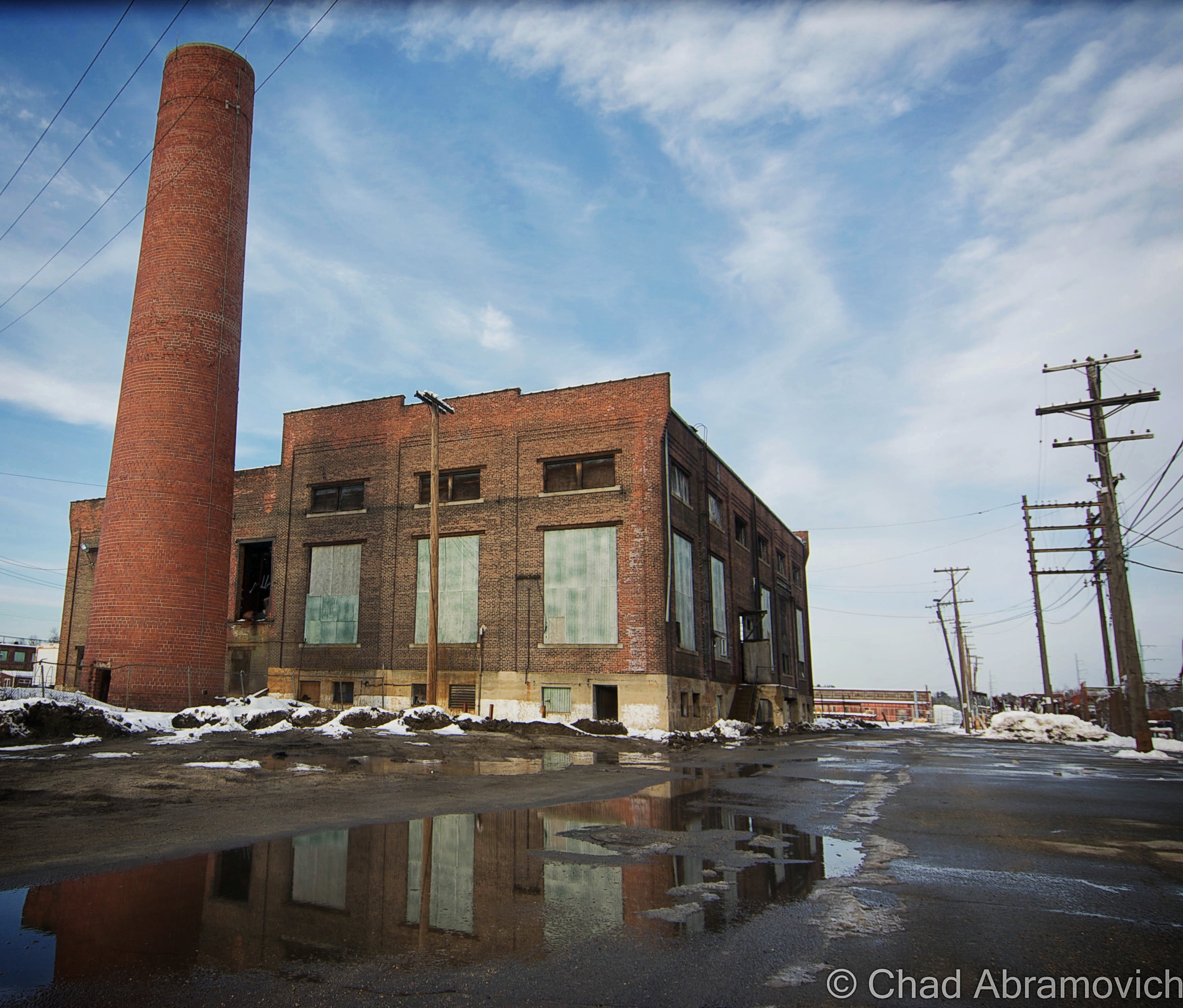
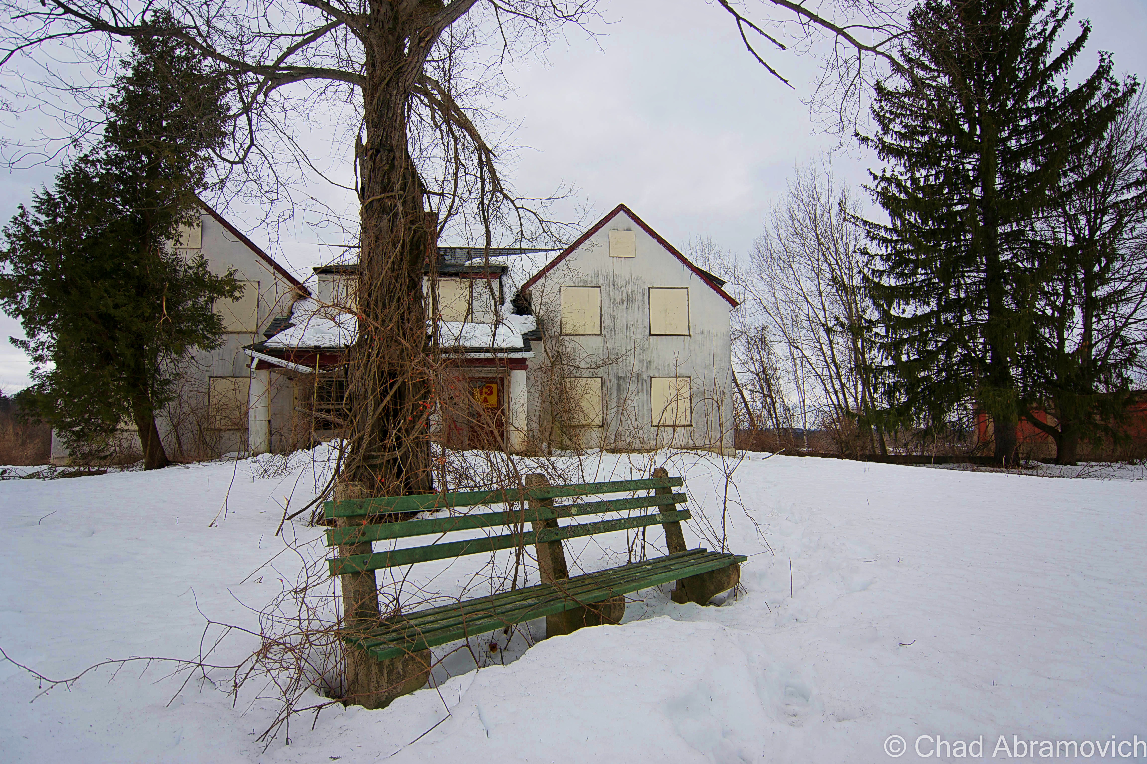
“Wow, how does a place like this even exist?” mulled my friend aloud, lost in her own luminous reverie. I had seen photos of this beautiful dereliction online, but I was just as awed, as the stagnant cold inside stung my hands.
The early morning wintry cold was still hanging over the misty hills of Bolton flats in a hundred shades of blue as we departed for southern New England. While we drove we sat in silence, with heated seats, coffee and the wonderful sounds of Caspian coming through my iPod. After a few hours, Vermont’s brown frozen hills gave way to eight lanes of interstate traffic and lots of Dunkin Donuts signs.
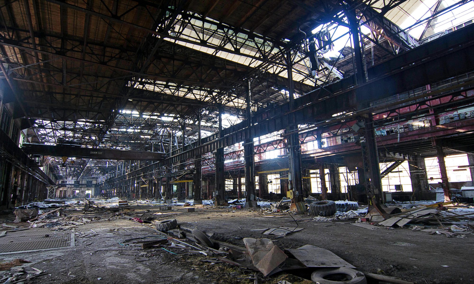
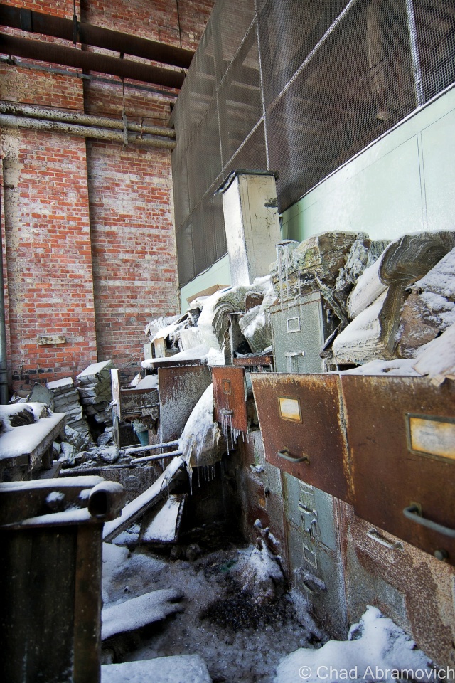
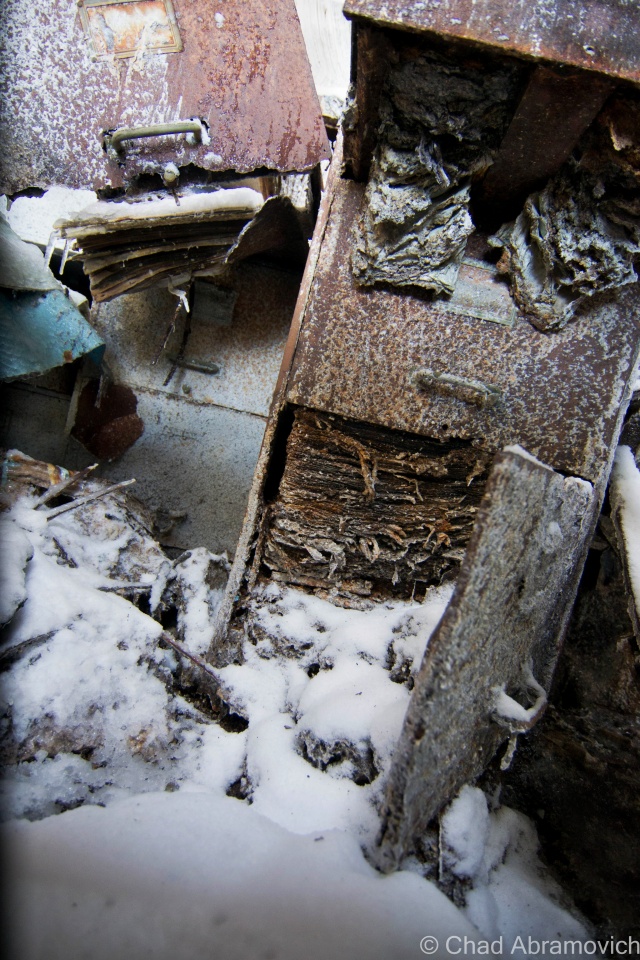
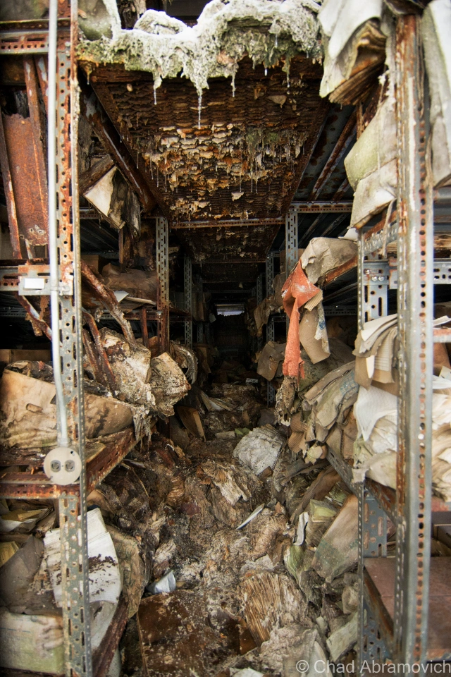
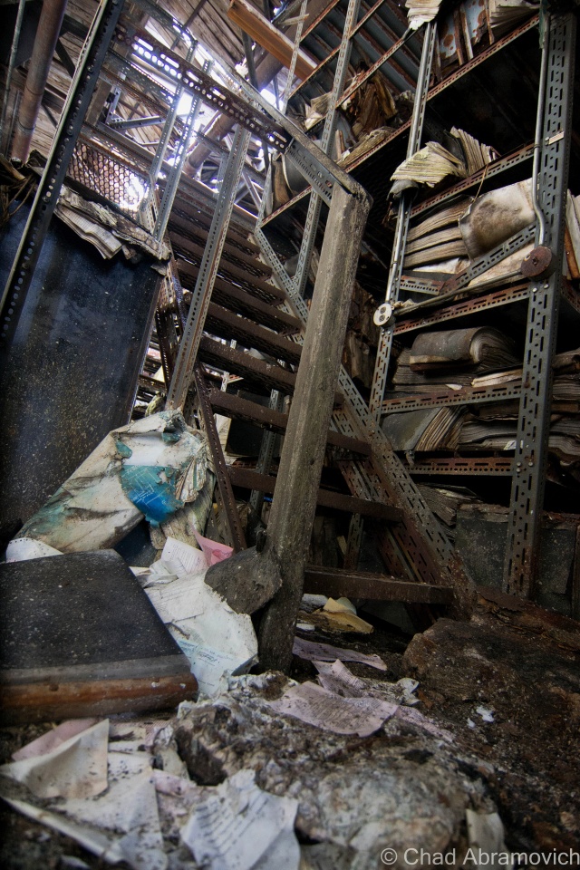
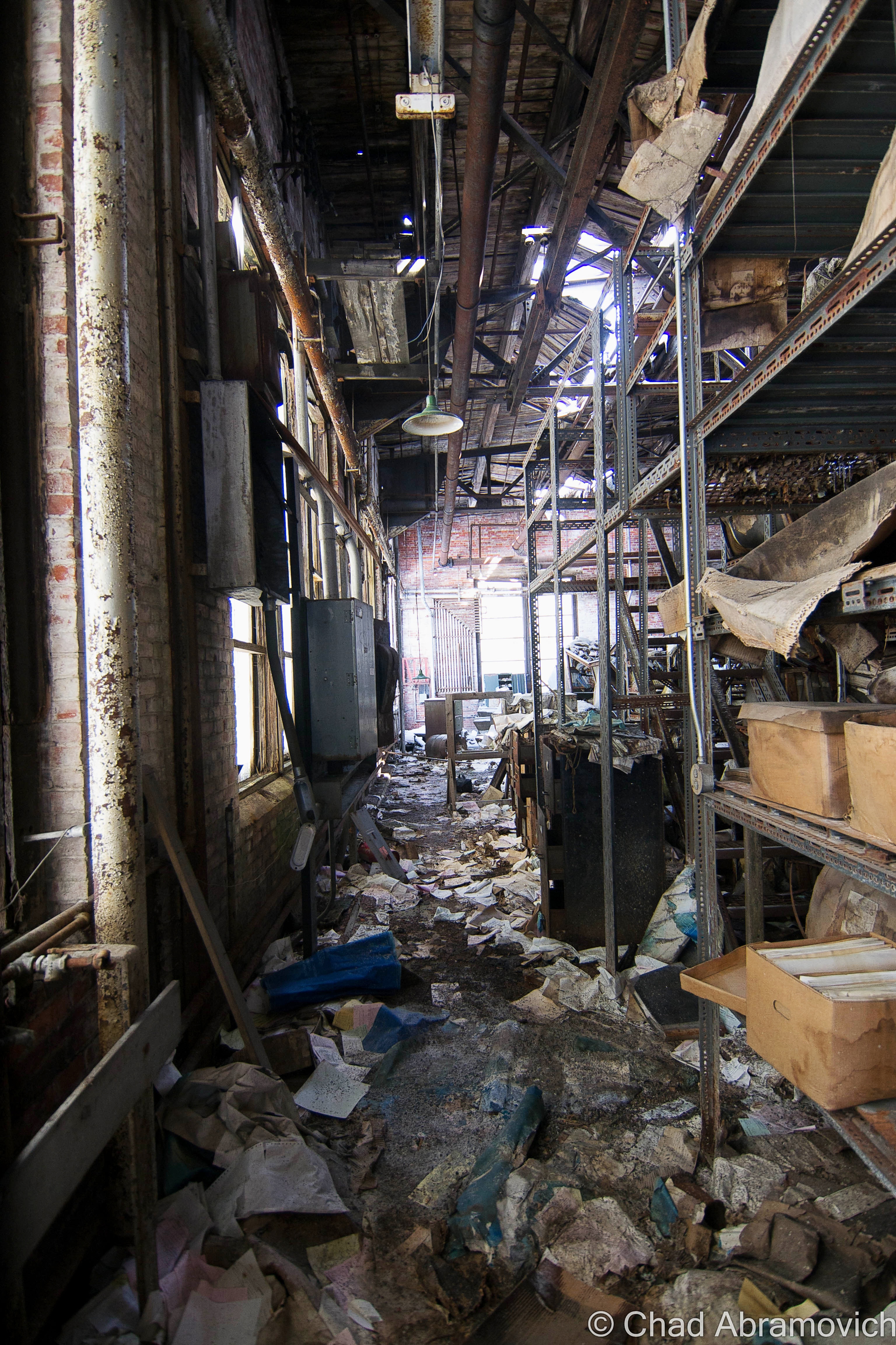
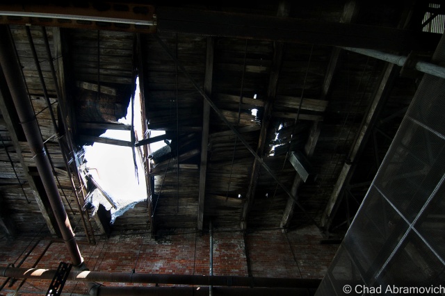
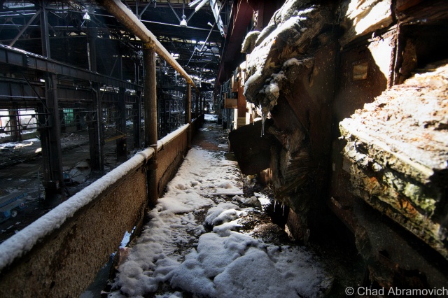
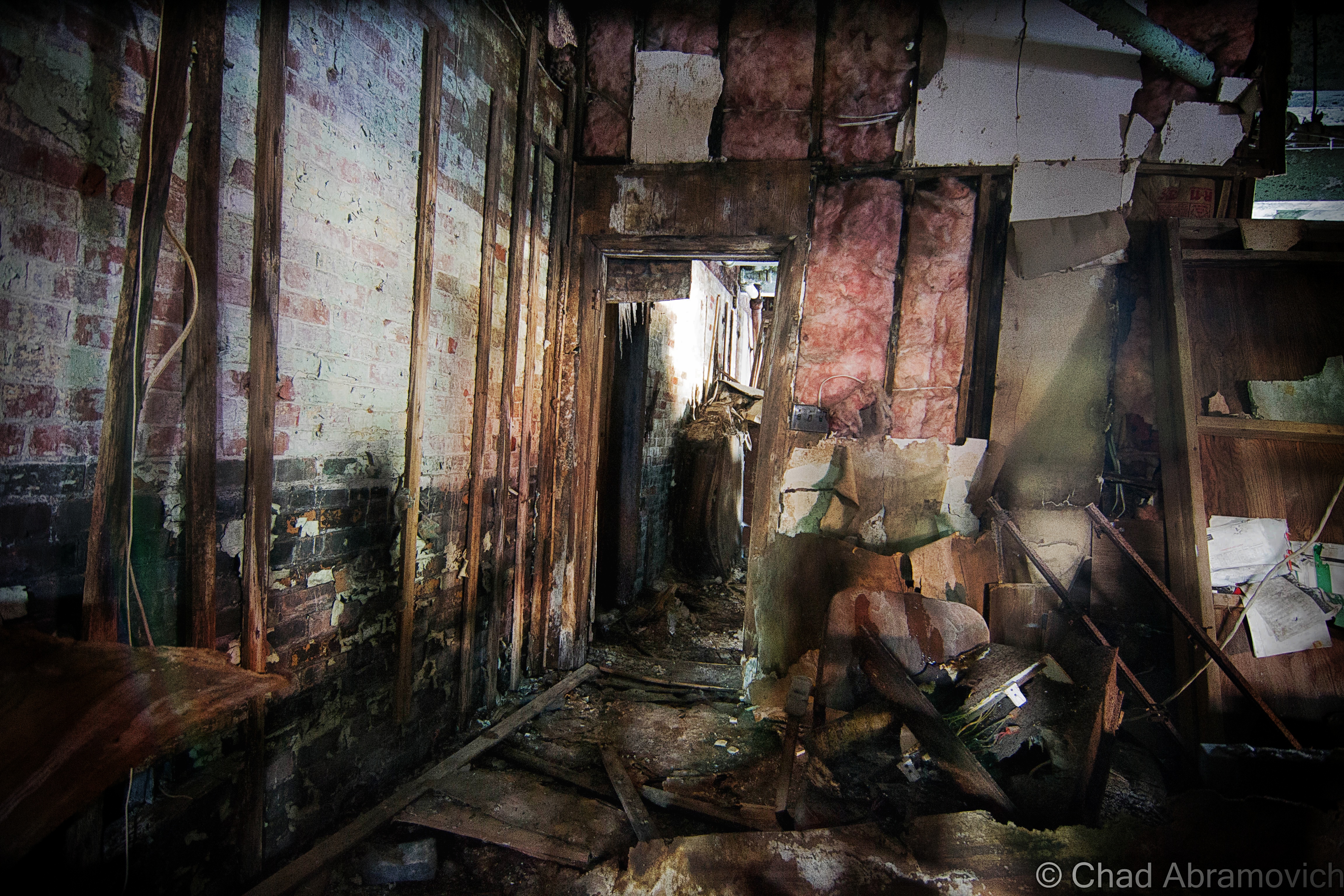
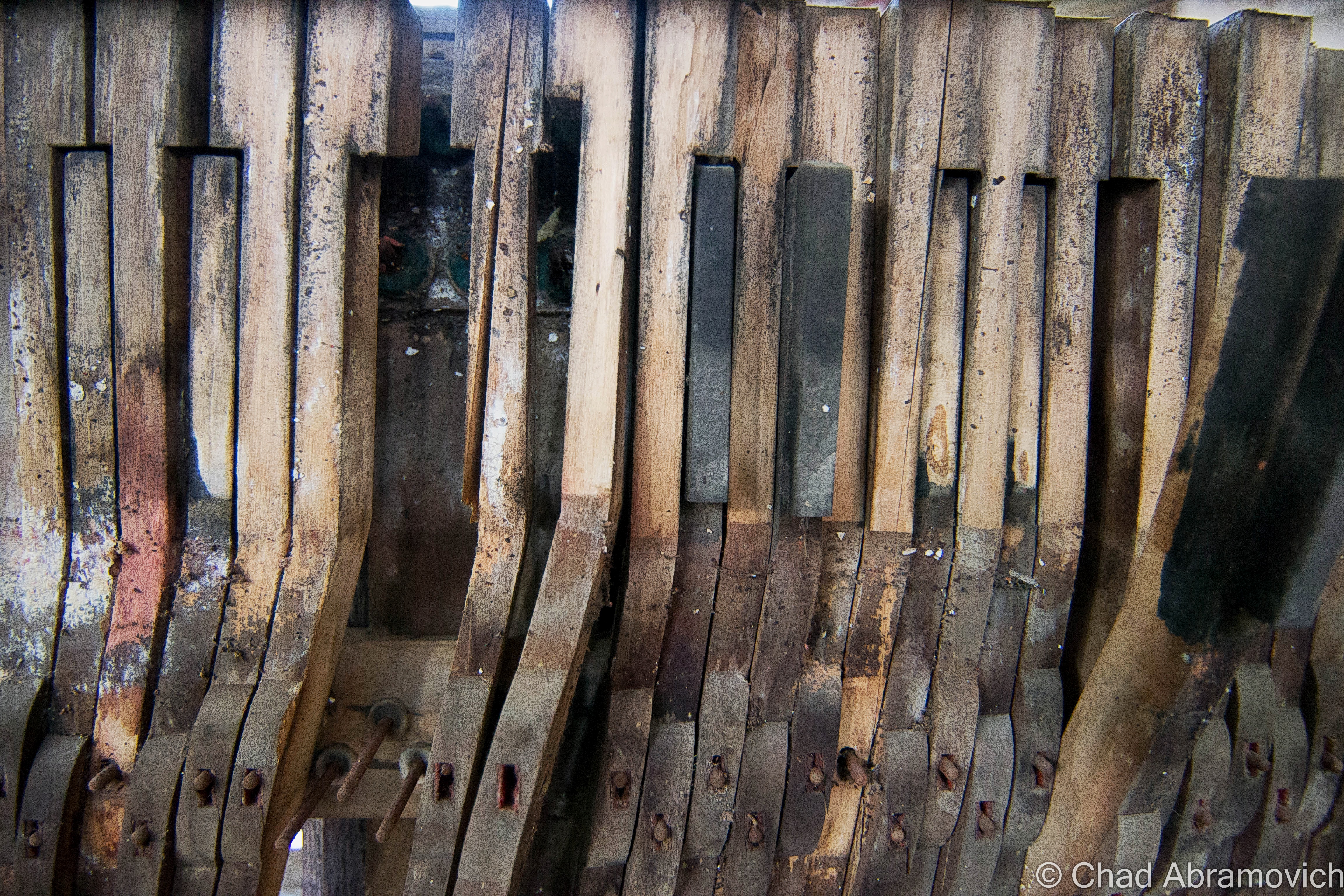
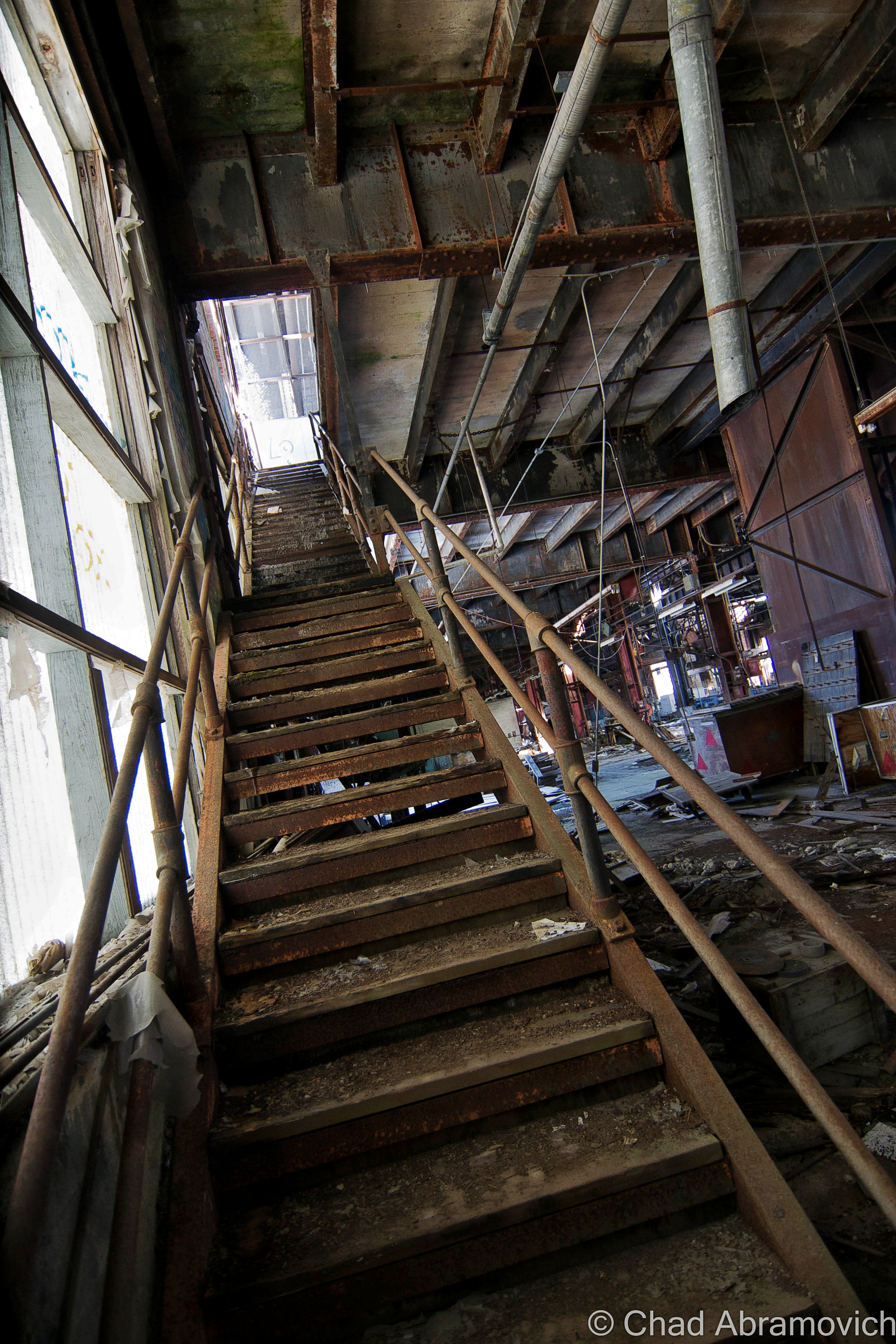
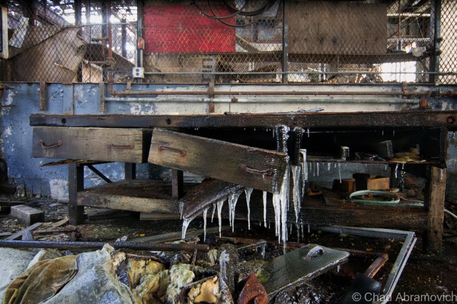
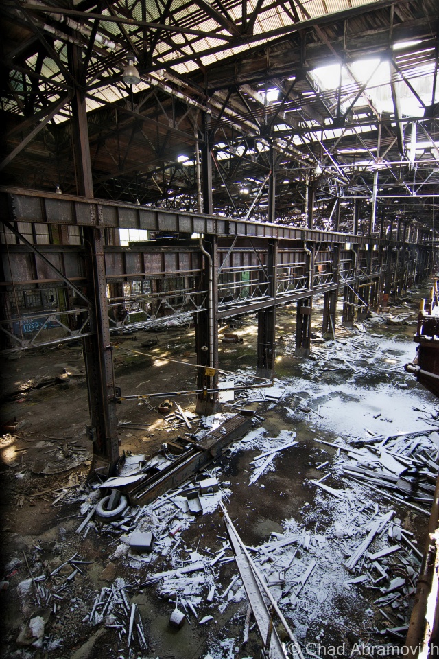
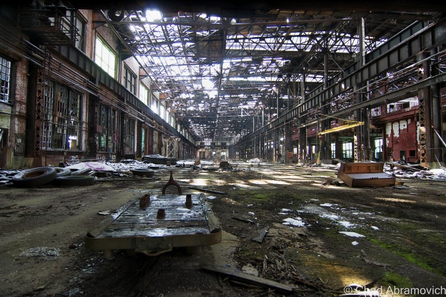
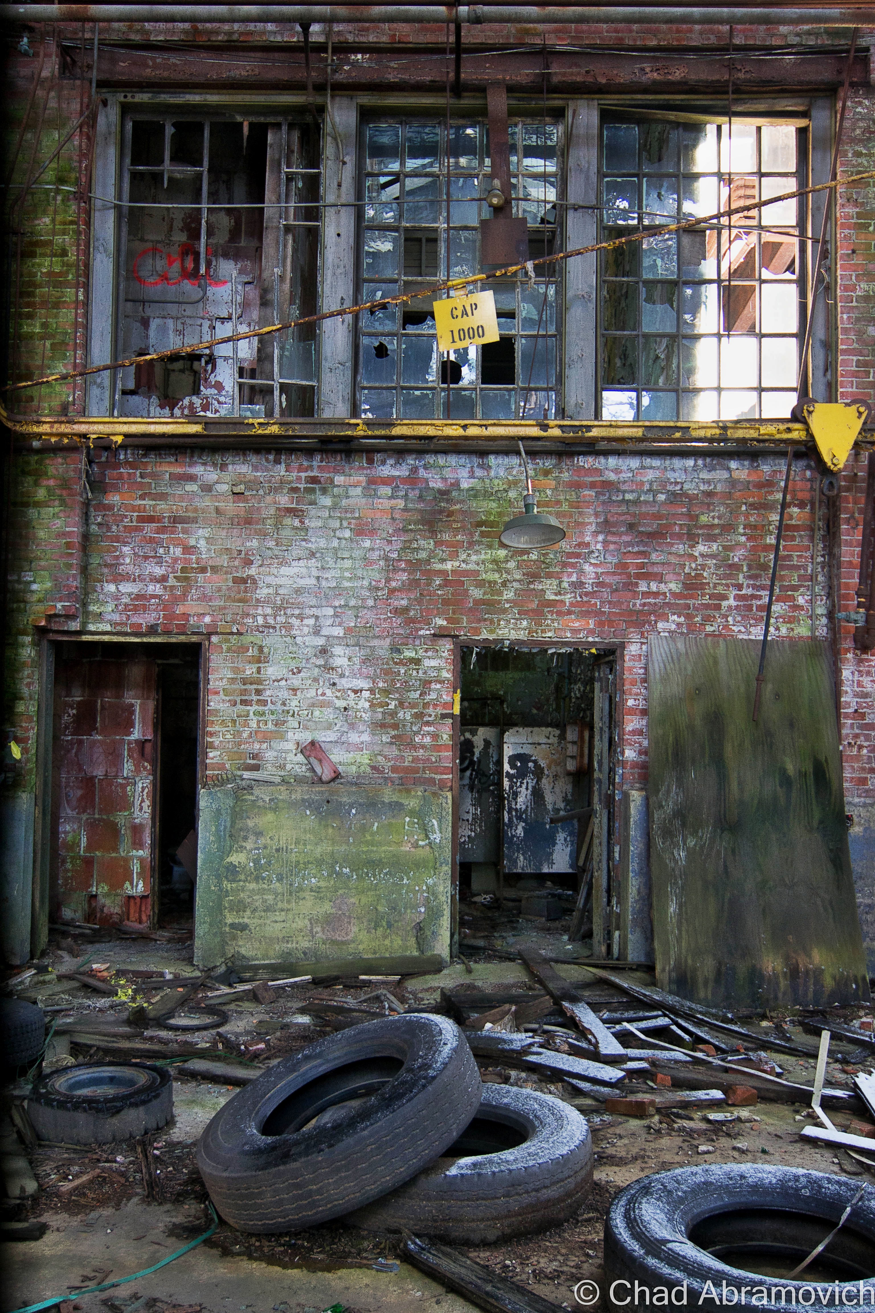
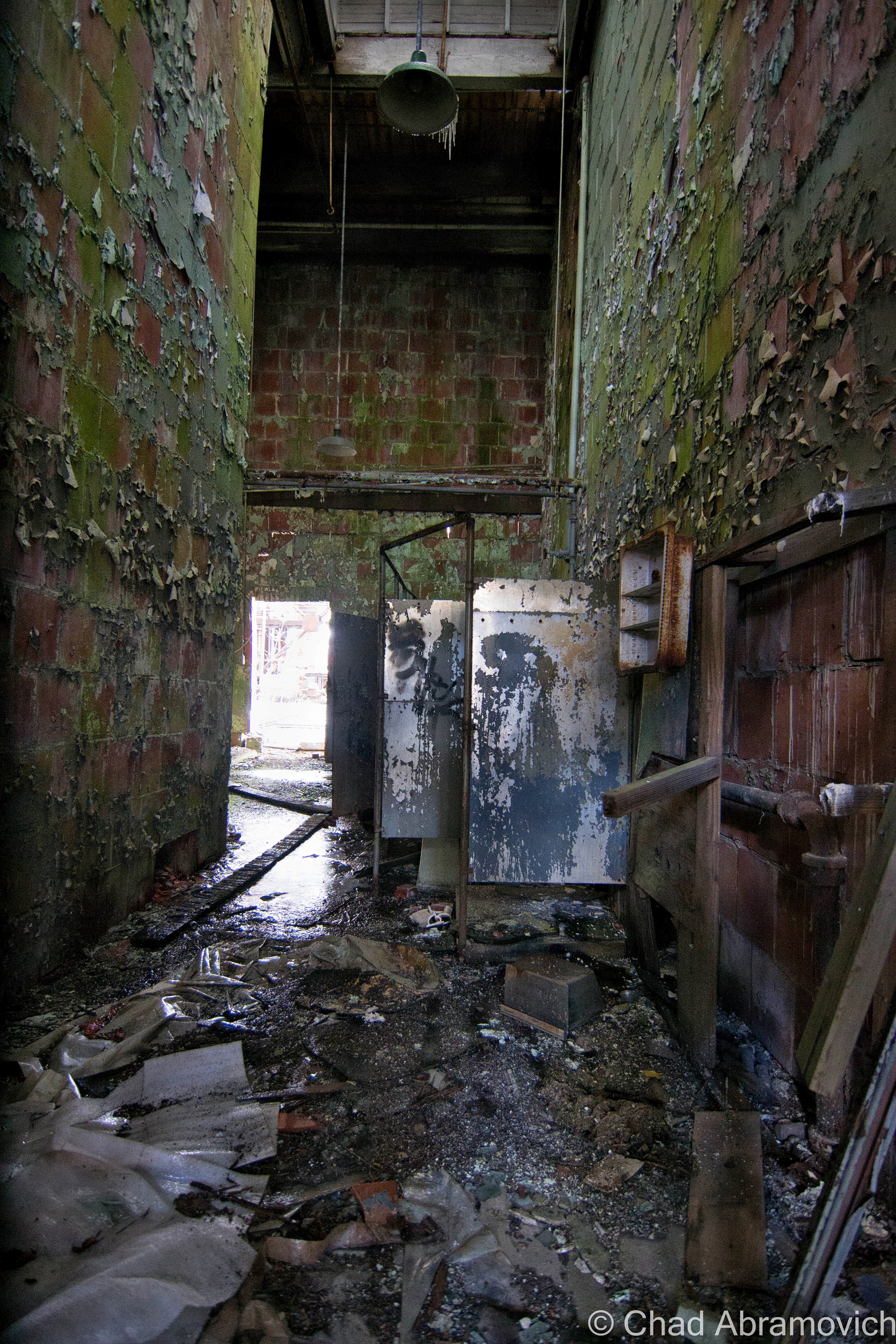
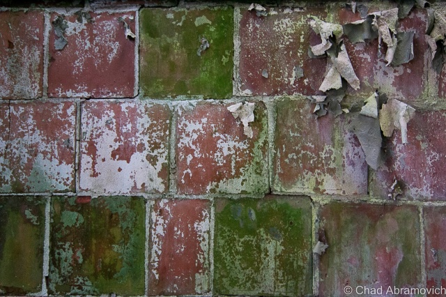
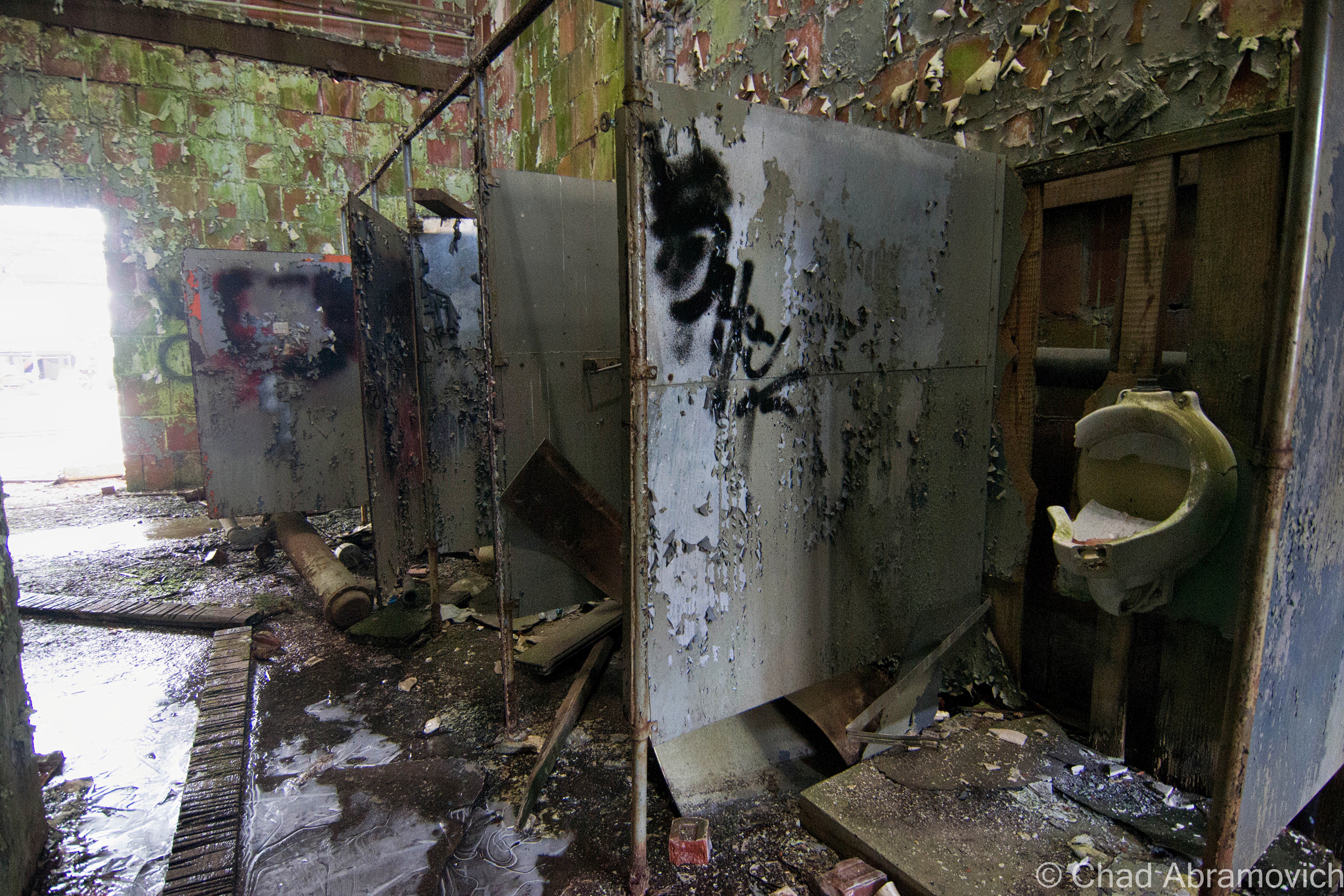
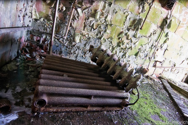
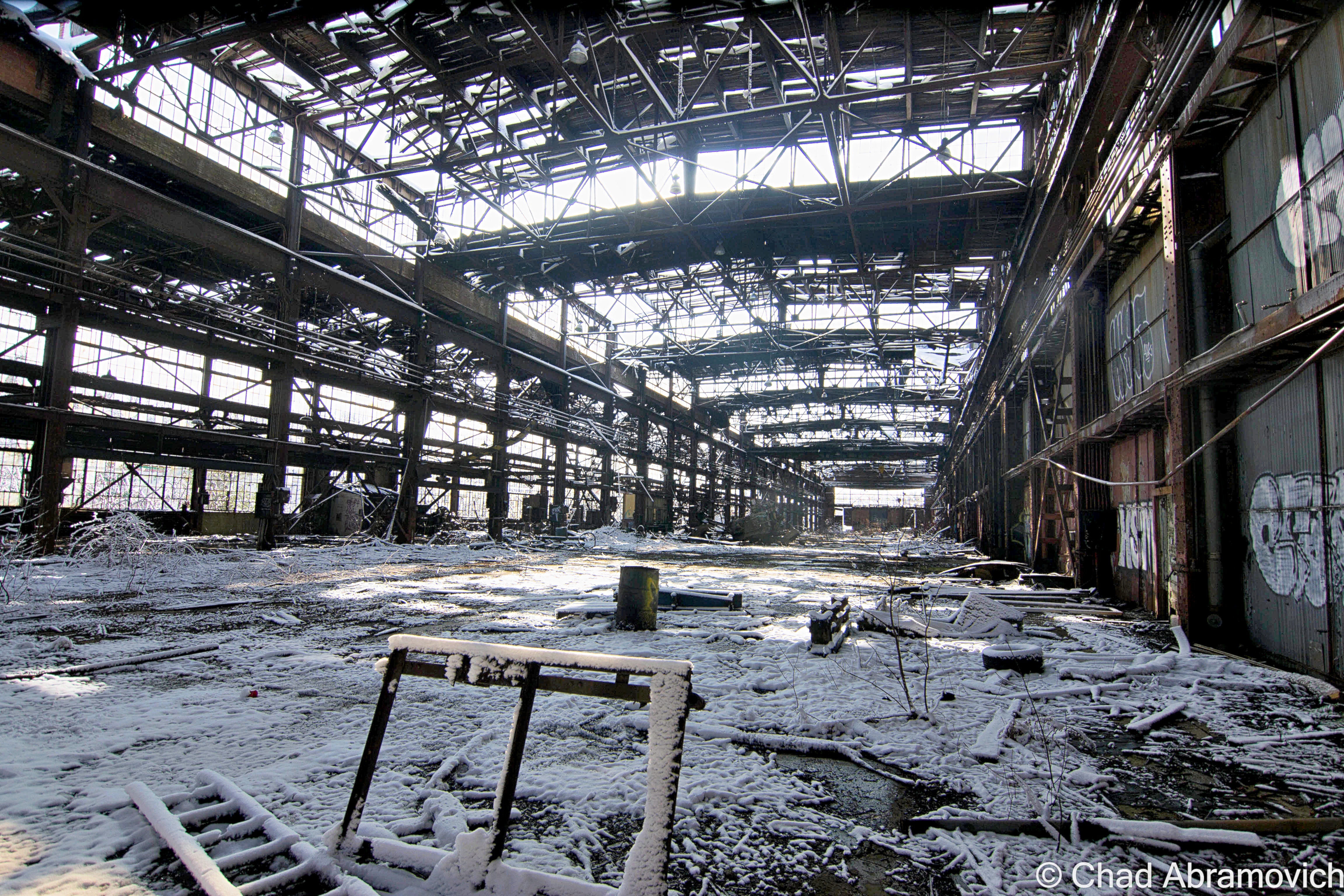
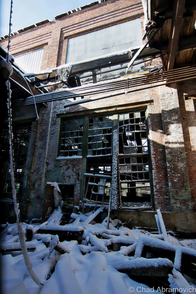
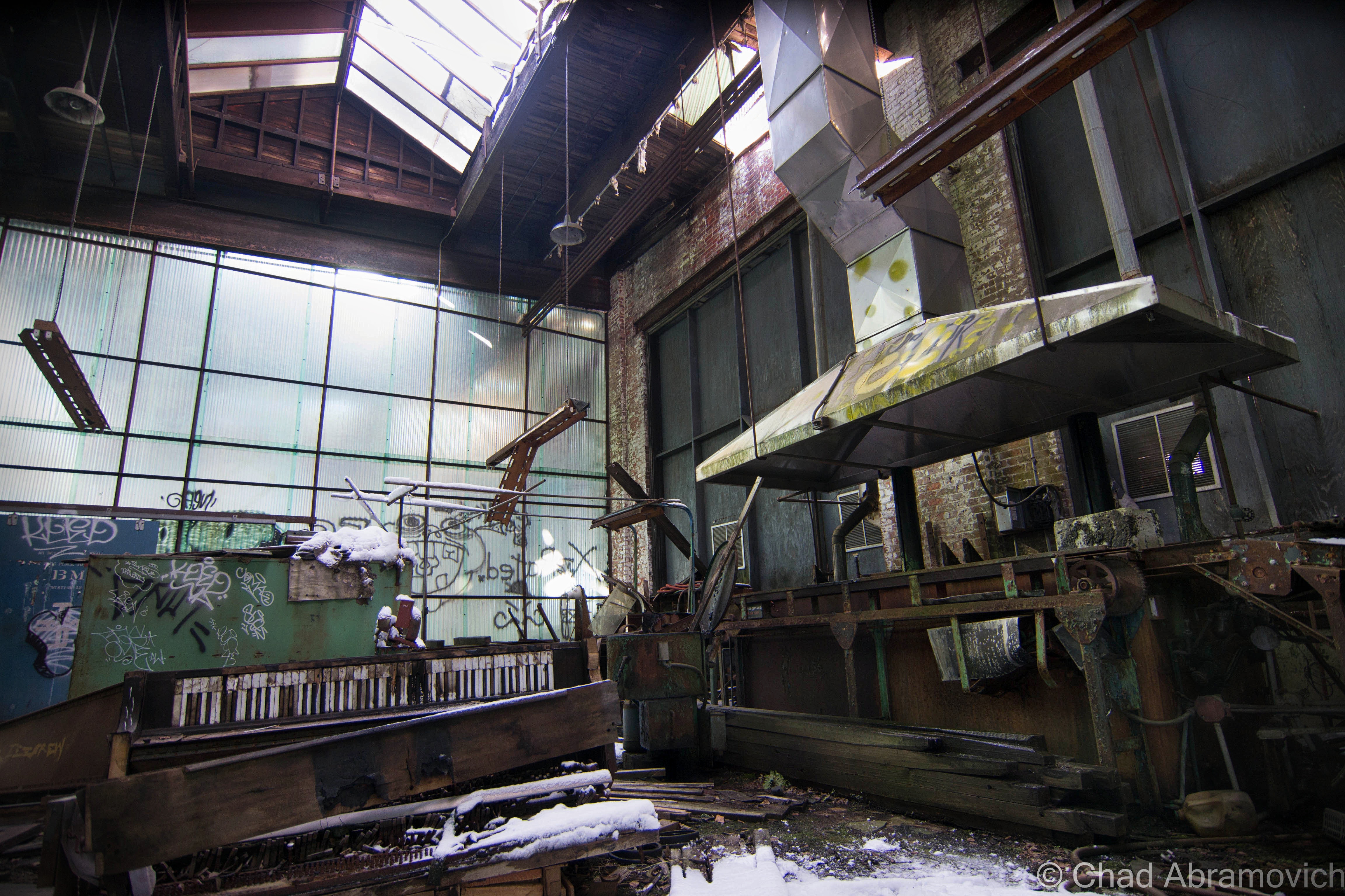
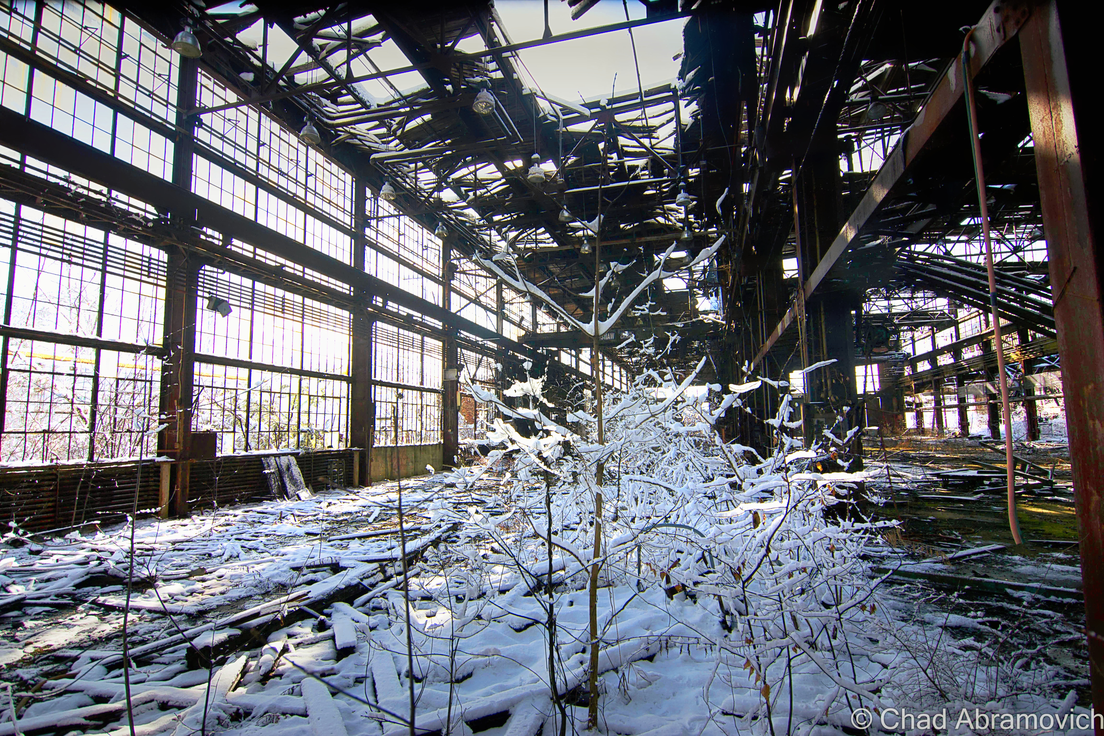
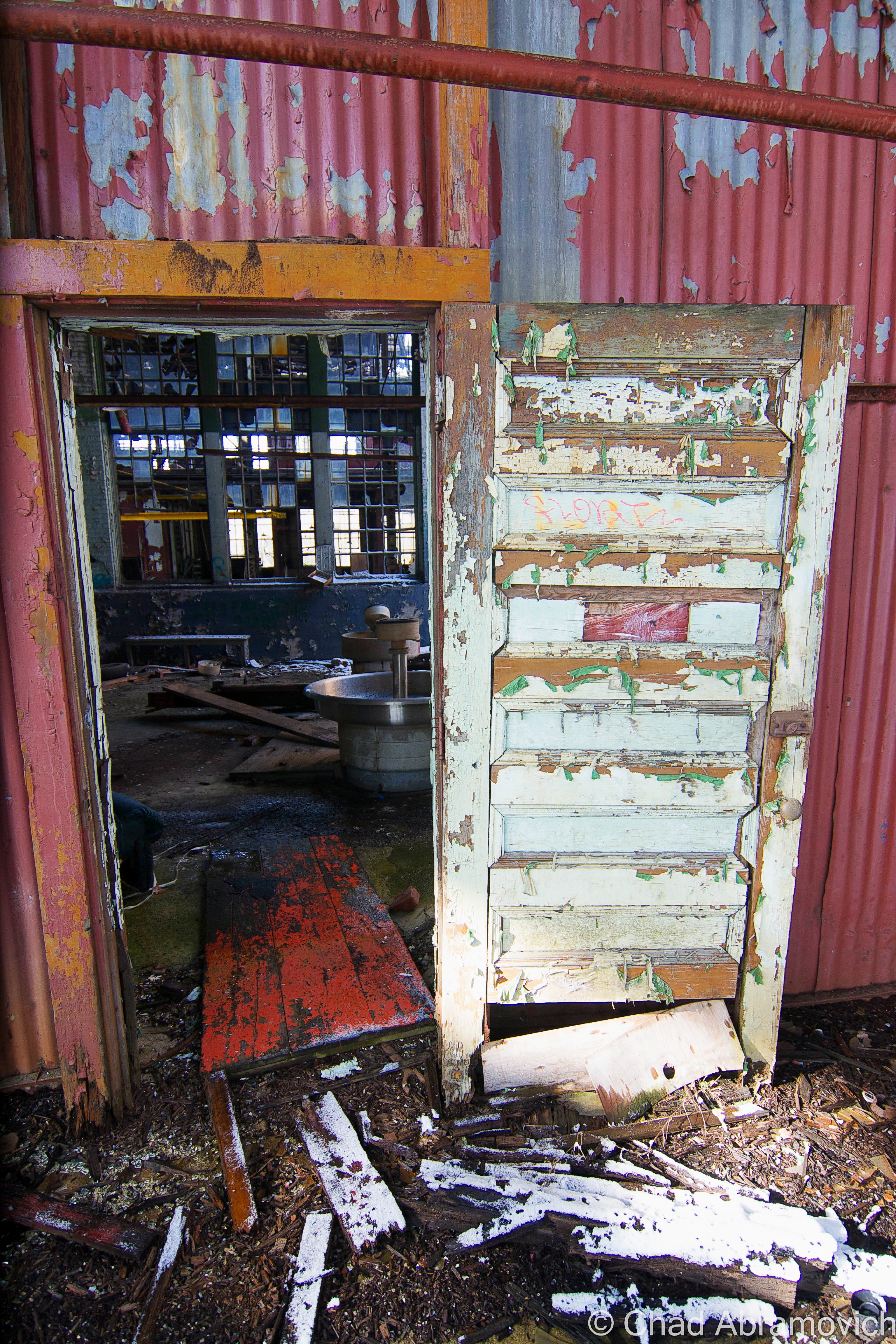
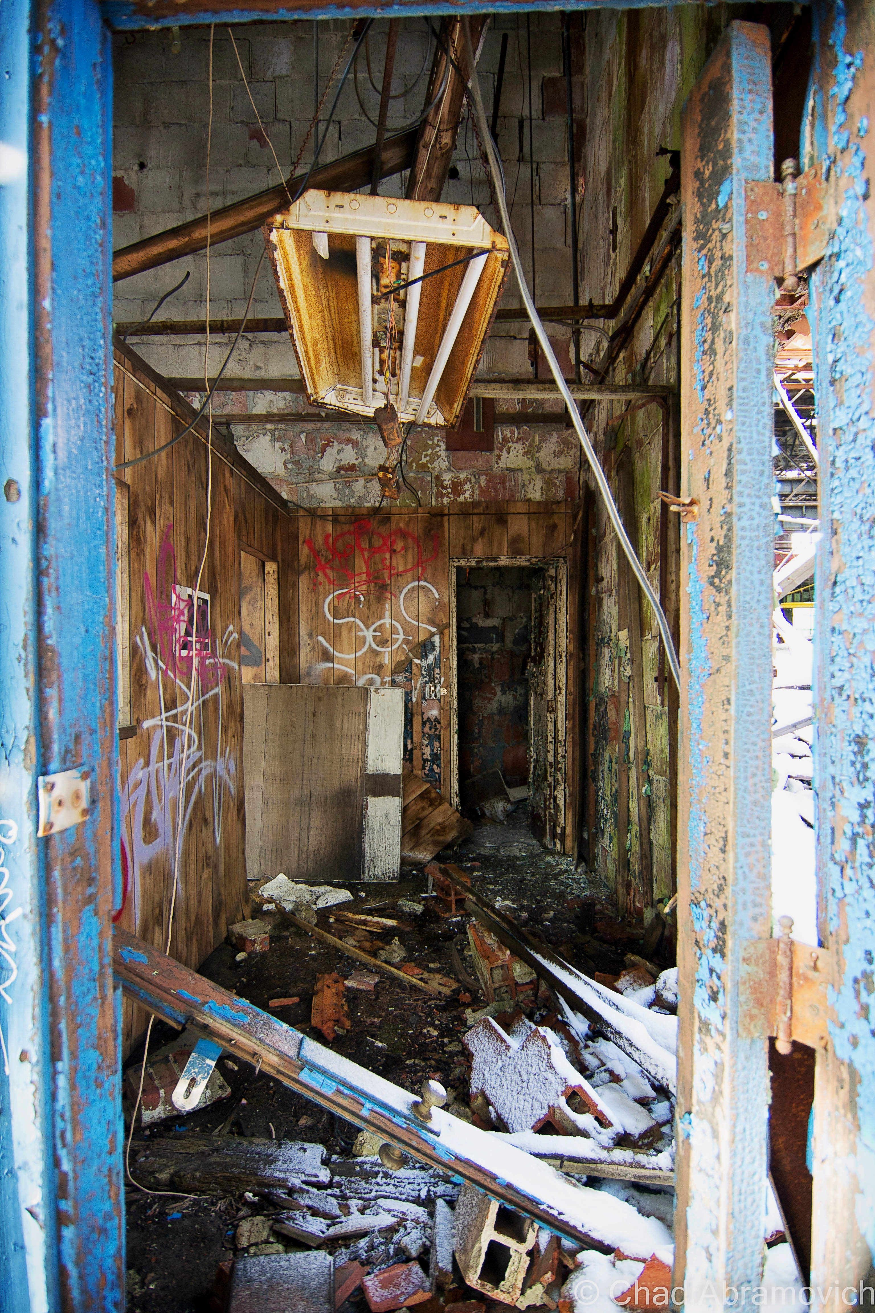
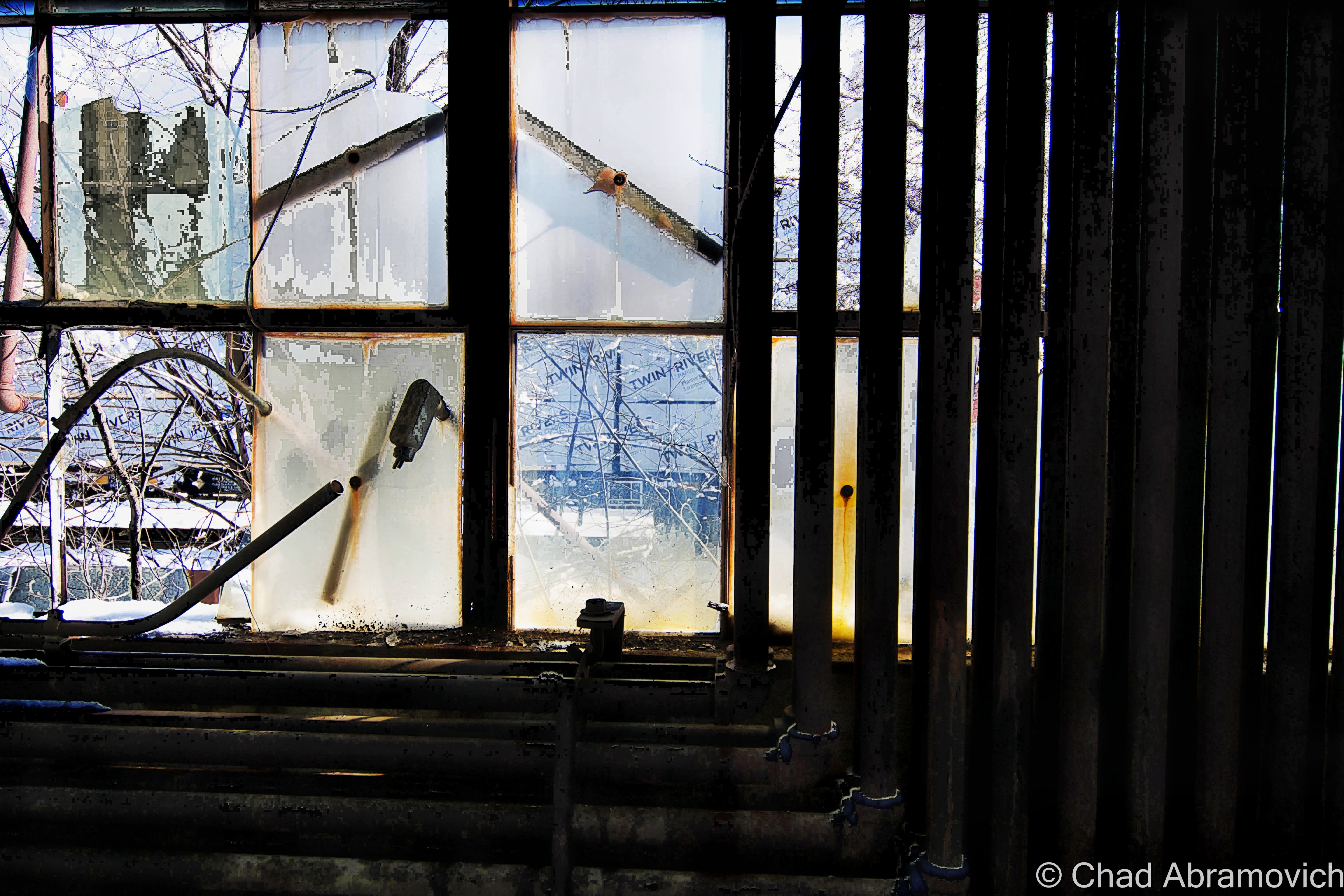
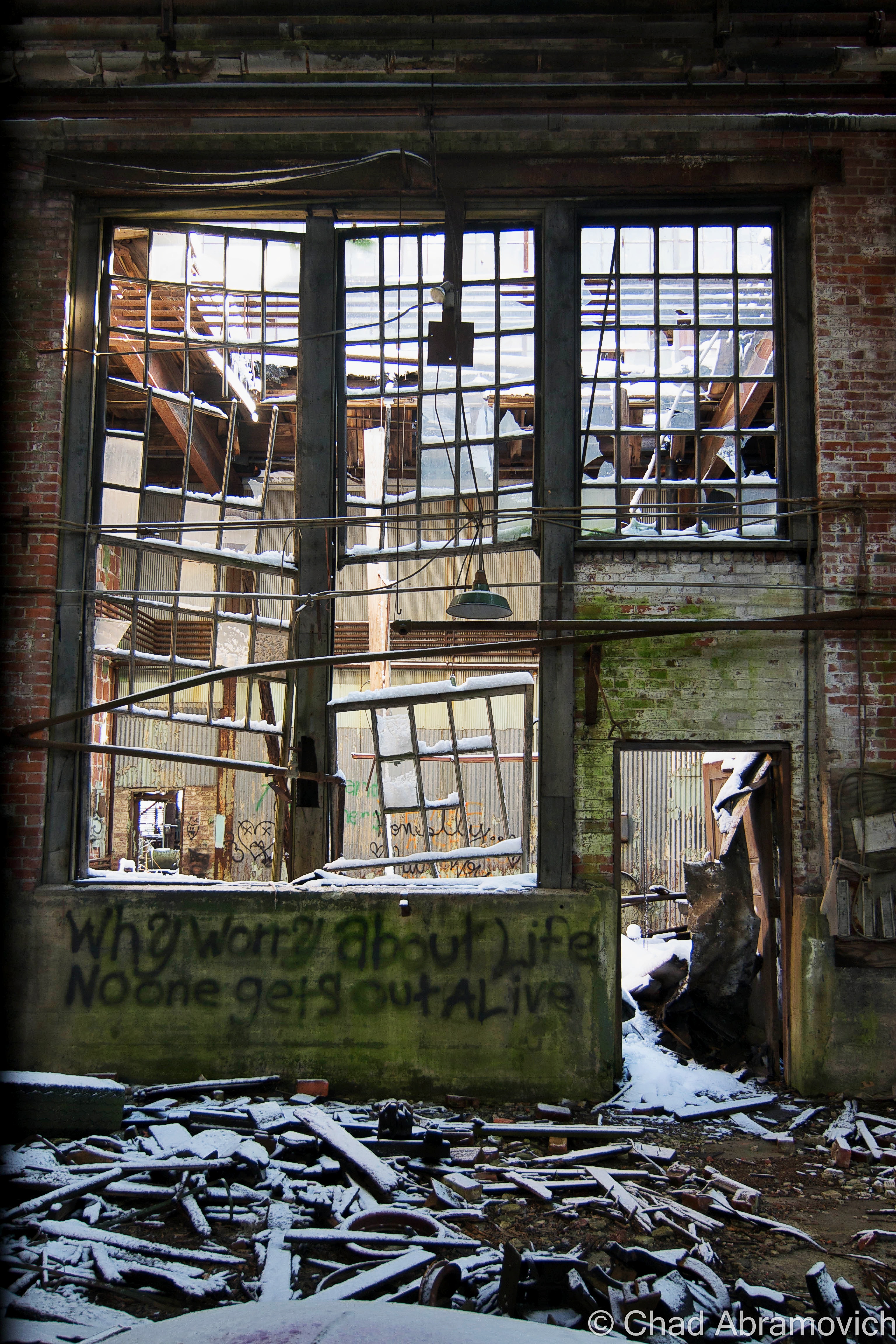
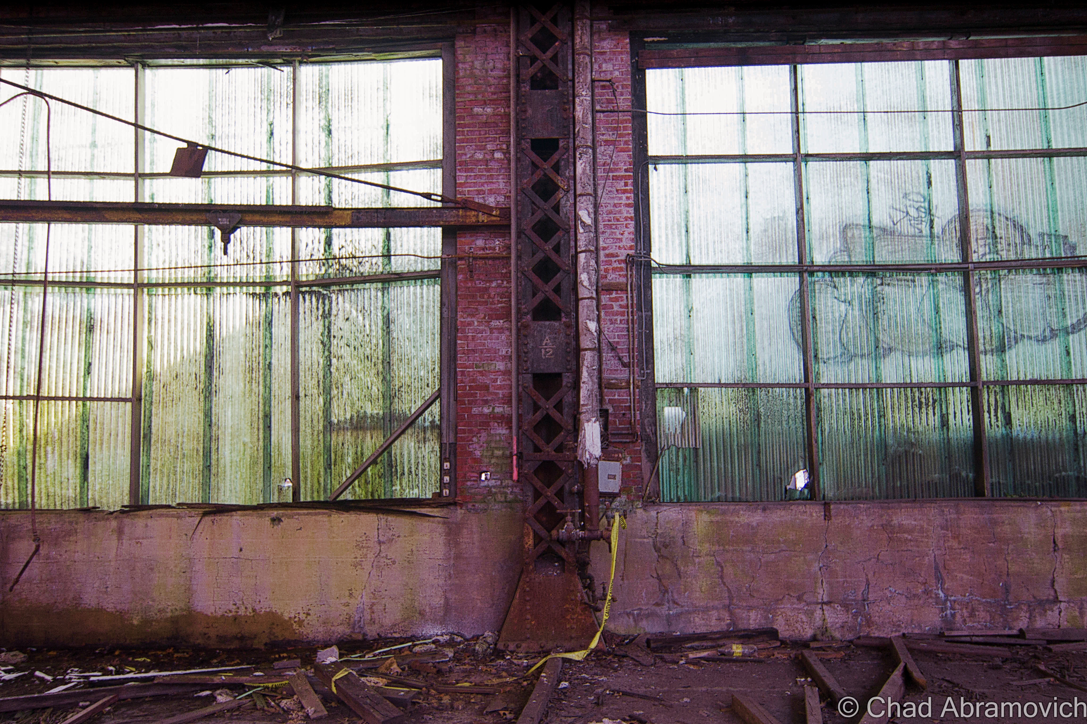
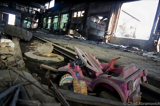
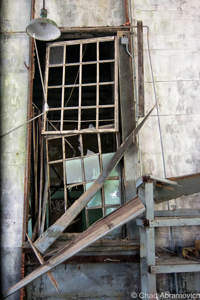
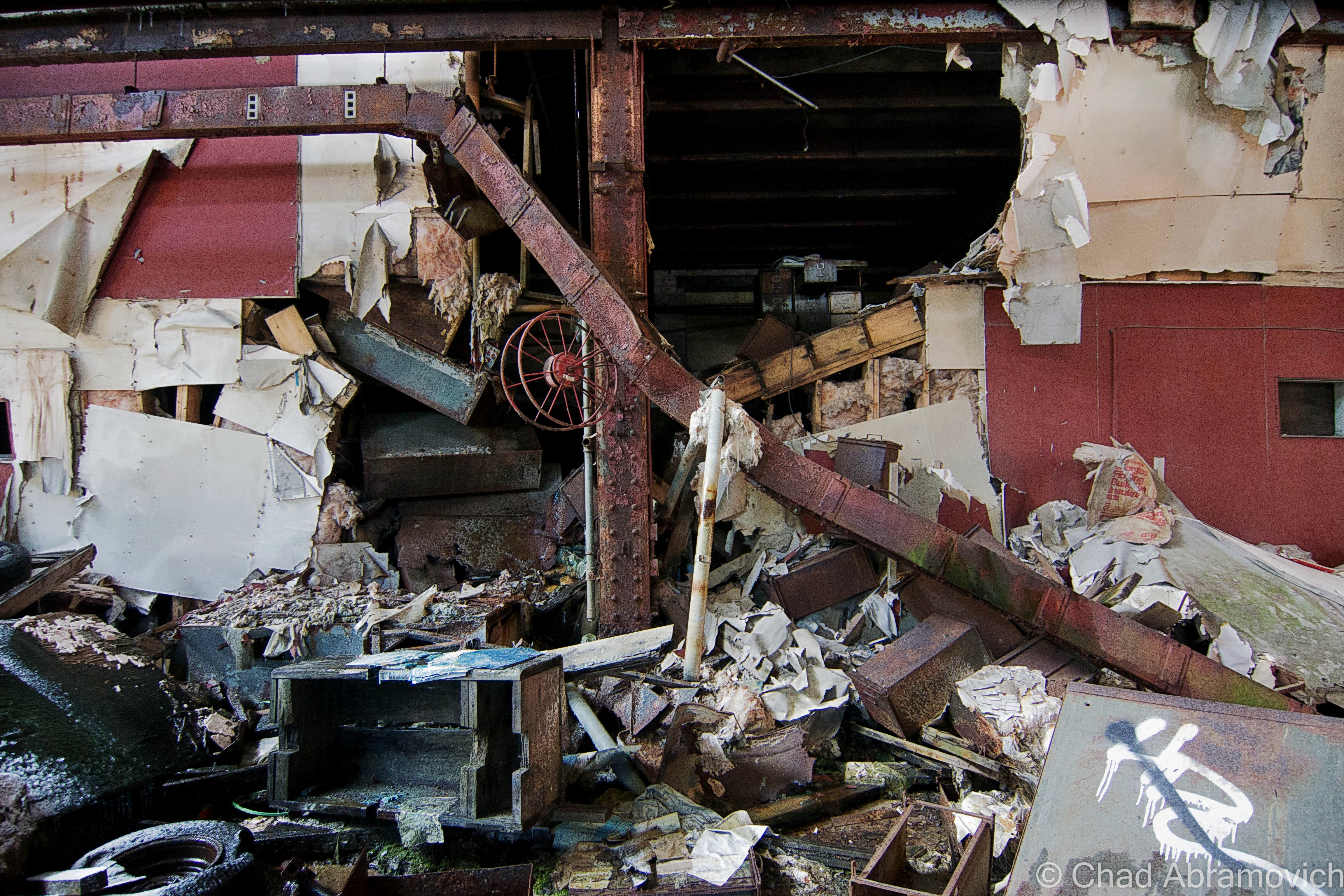
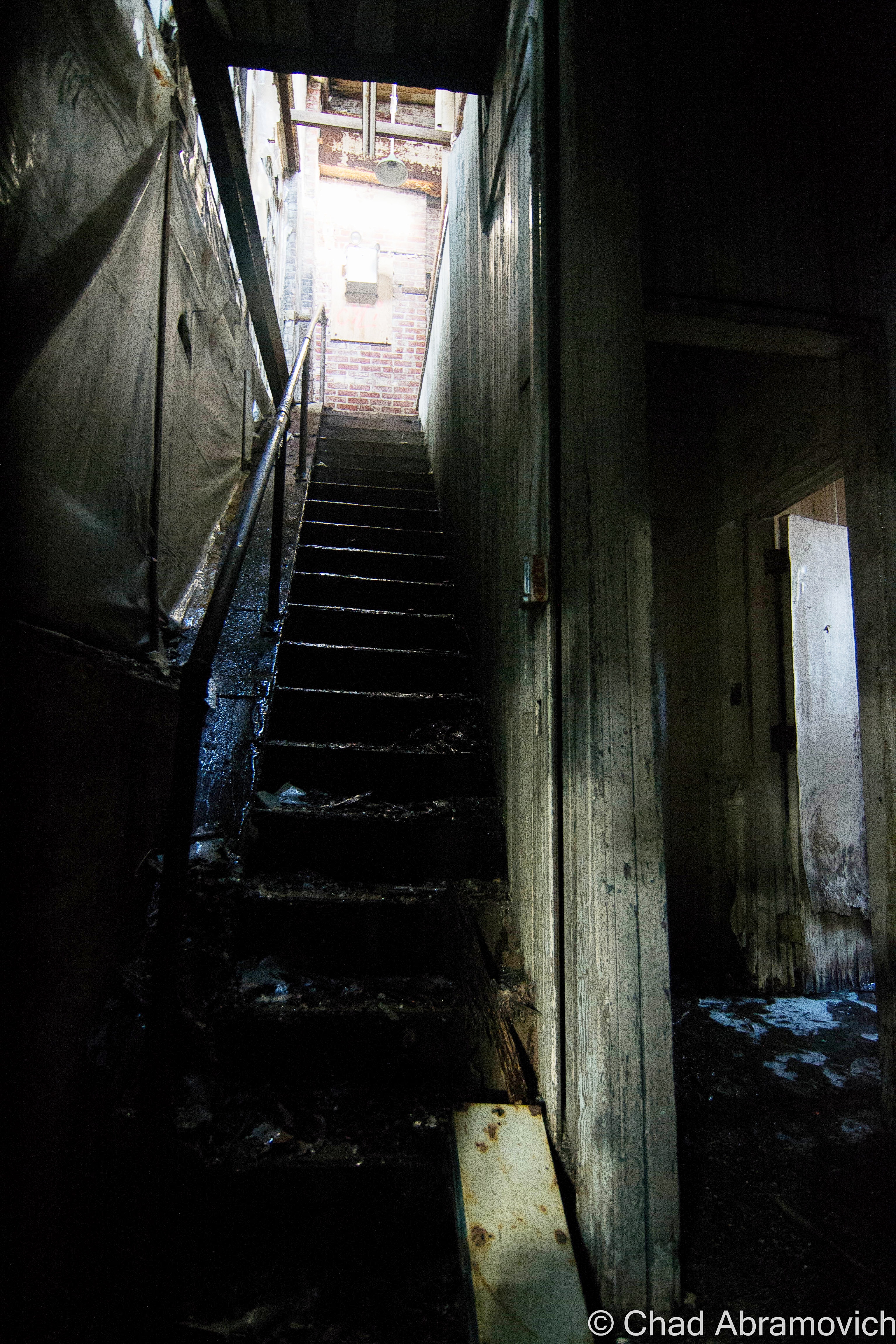
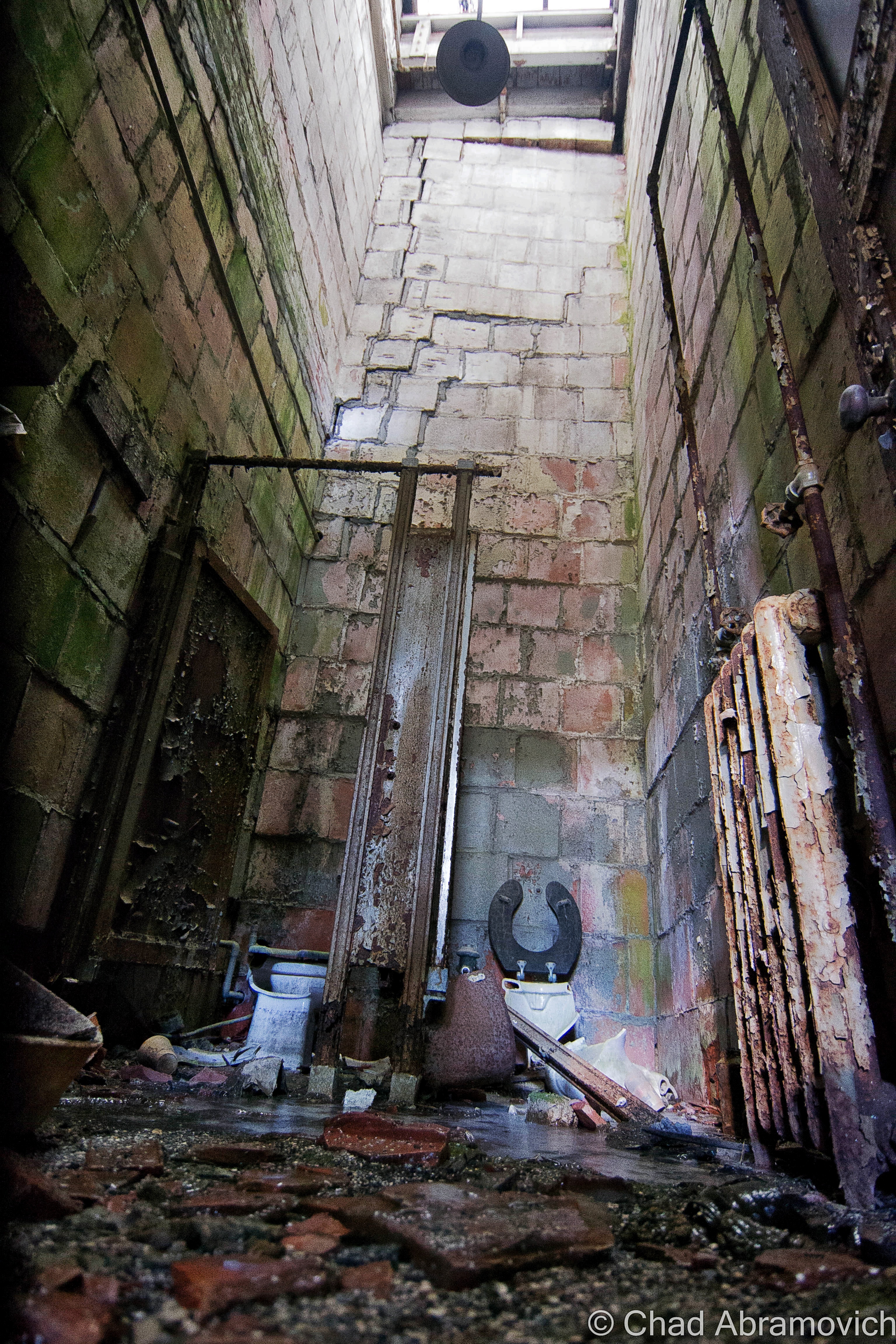
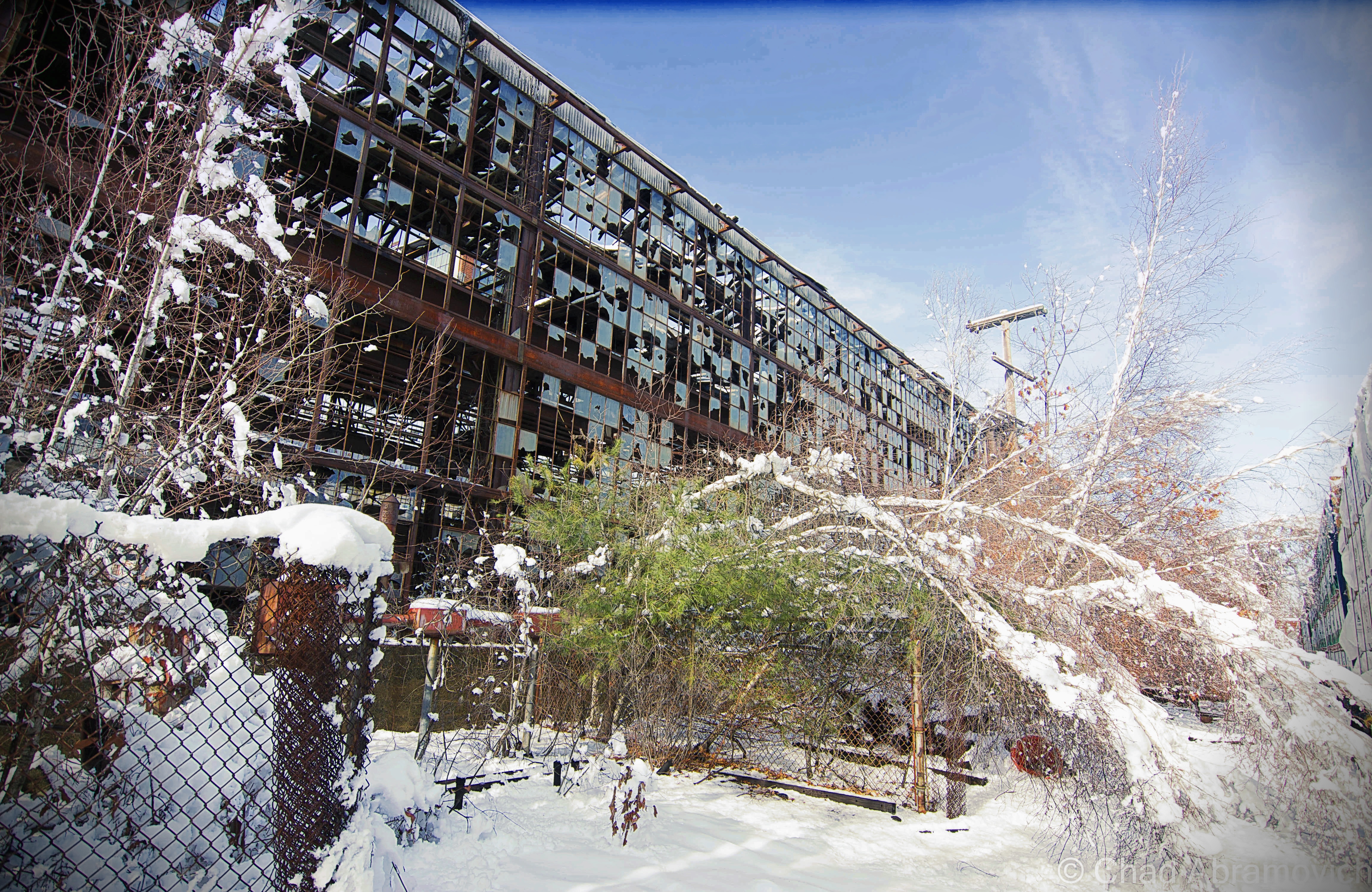
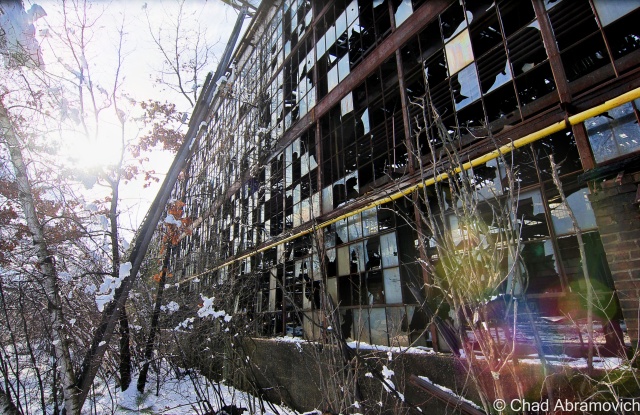
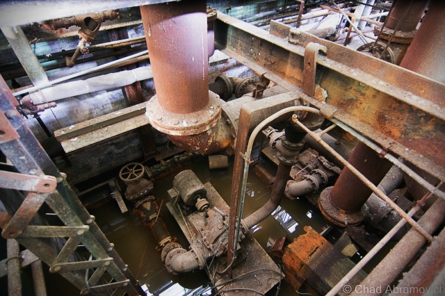
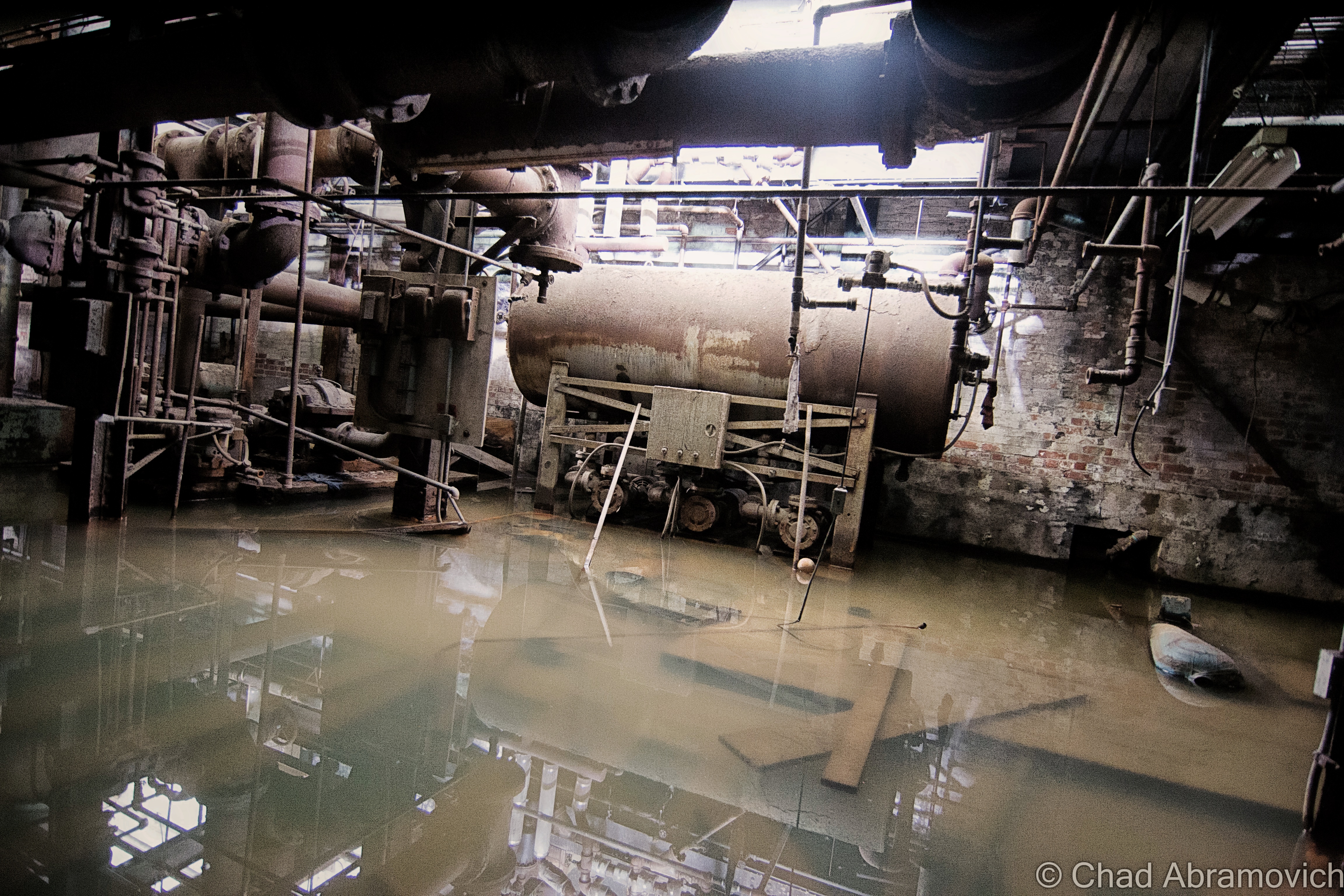
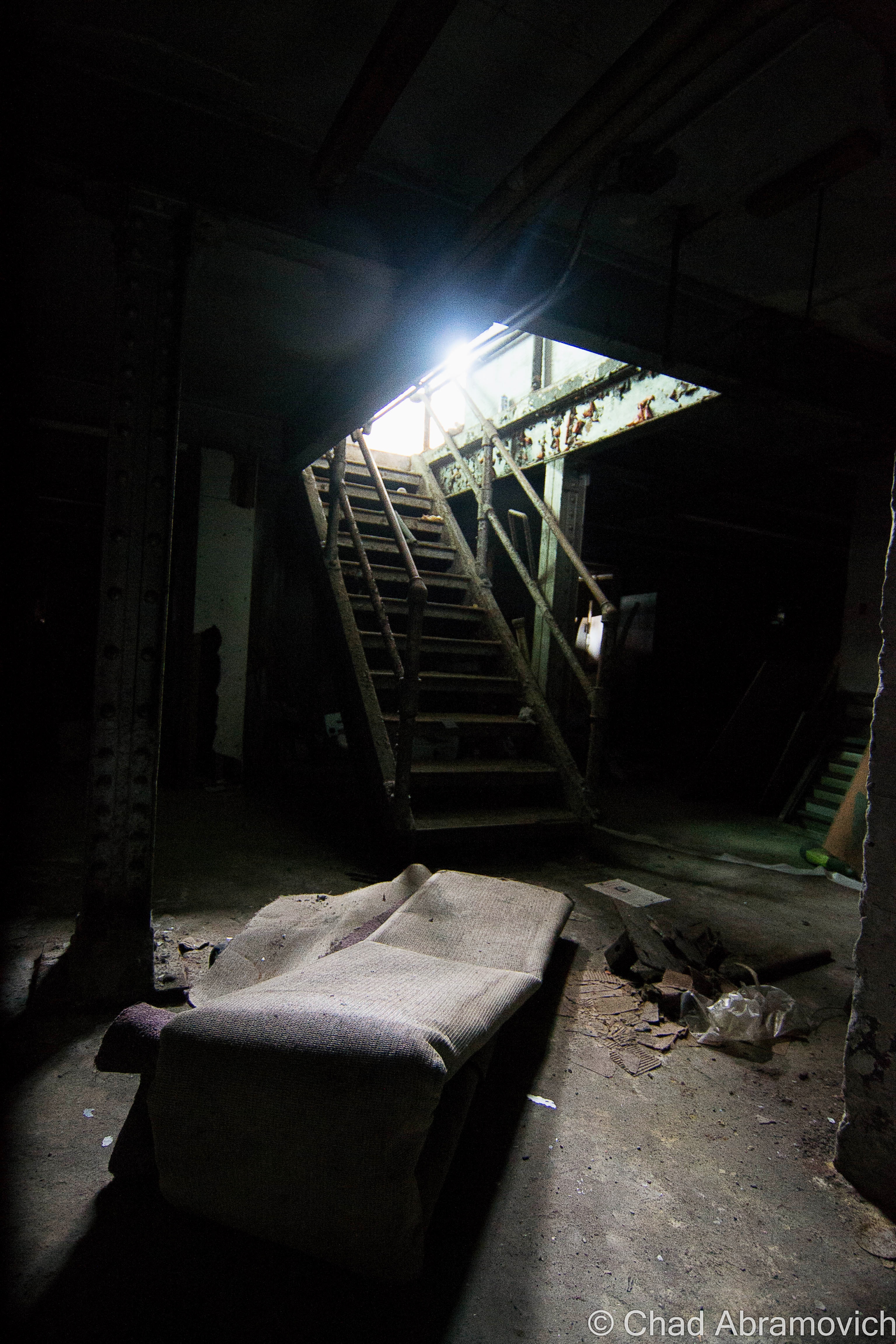
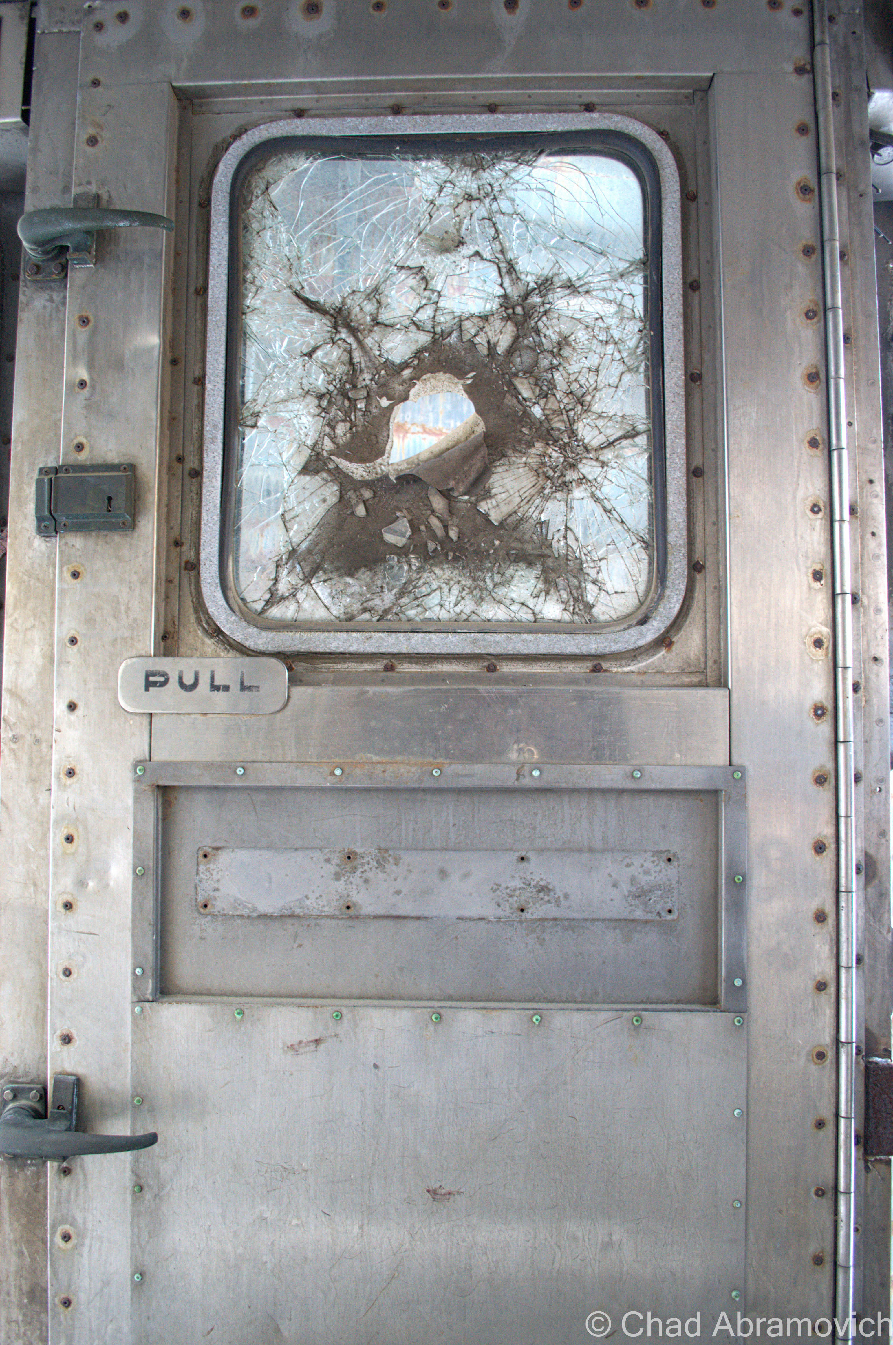
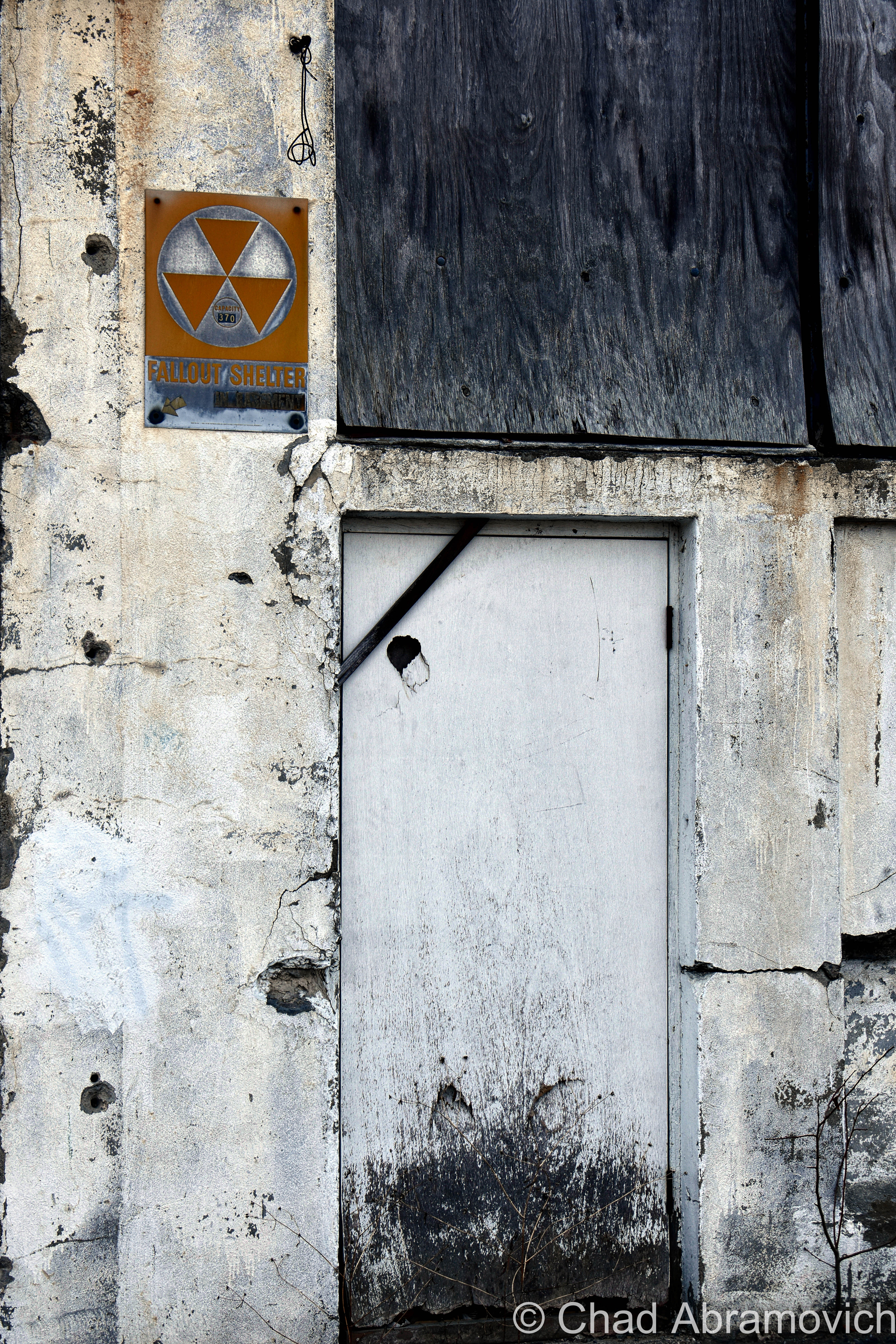
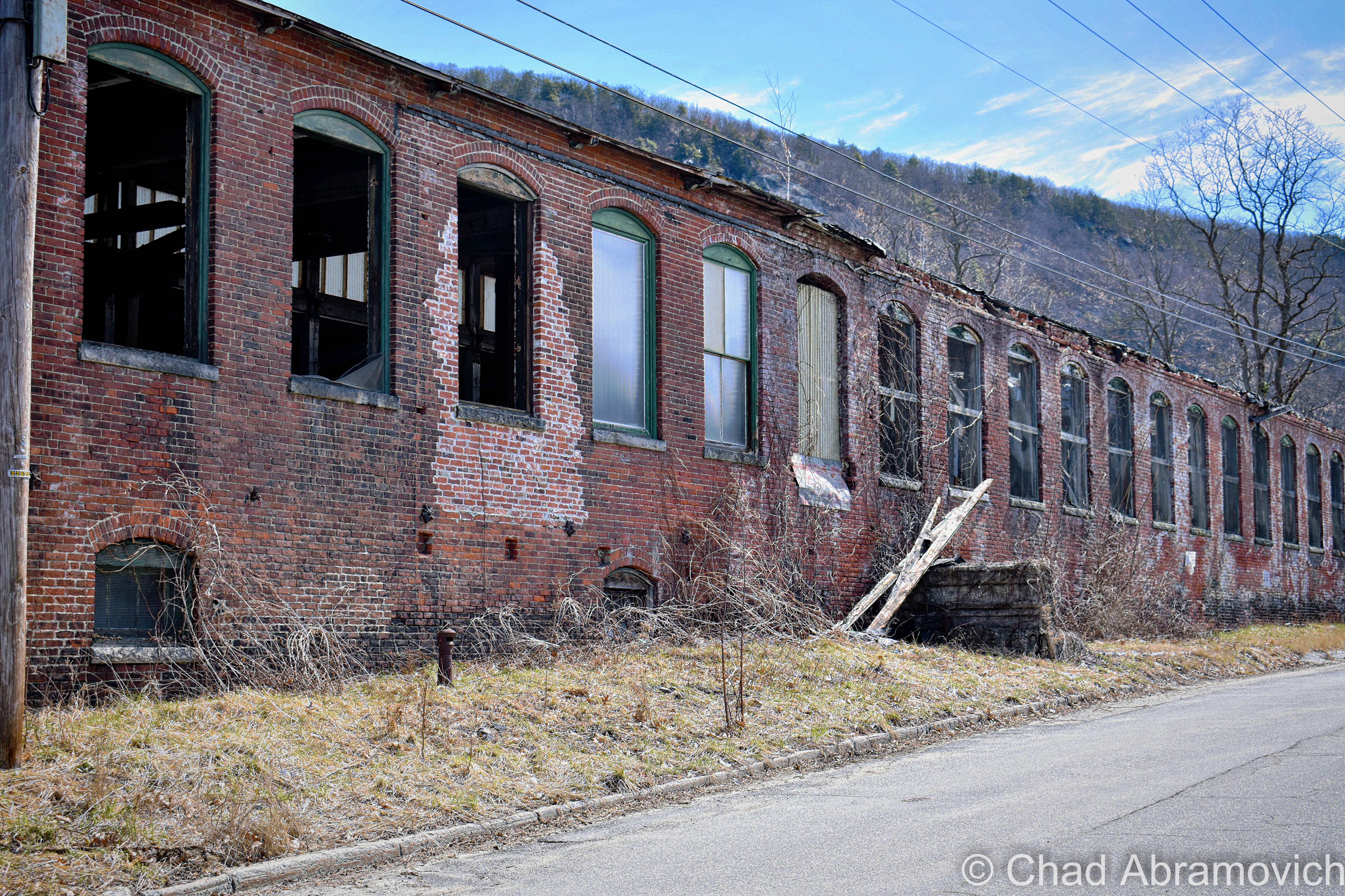
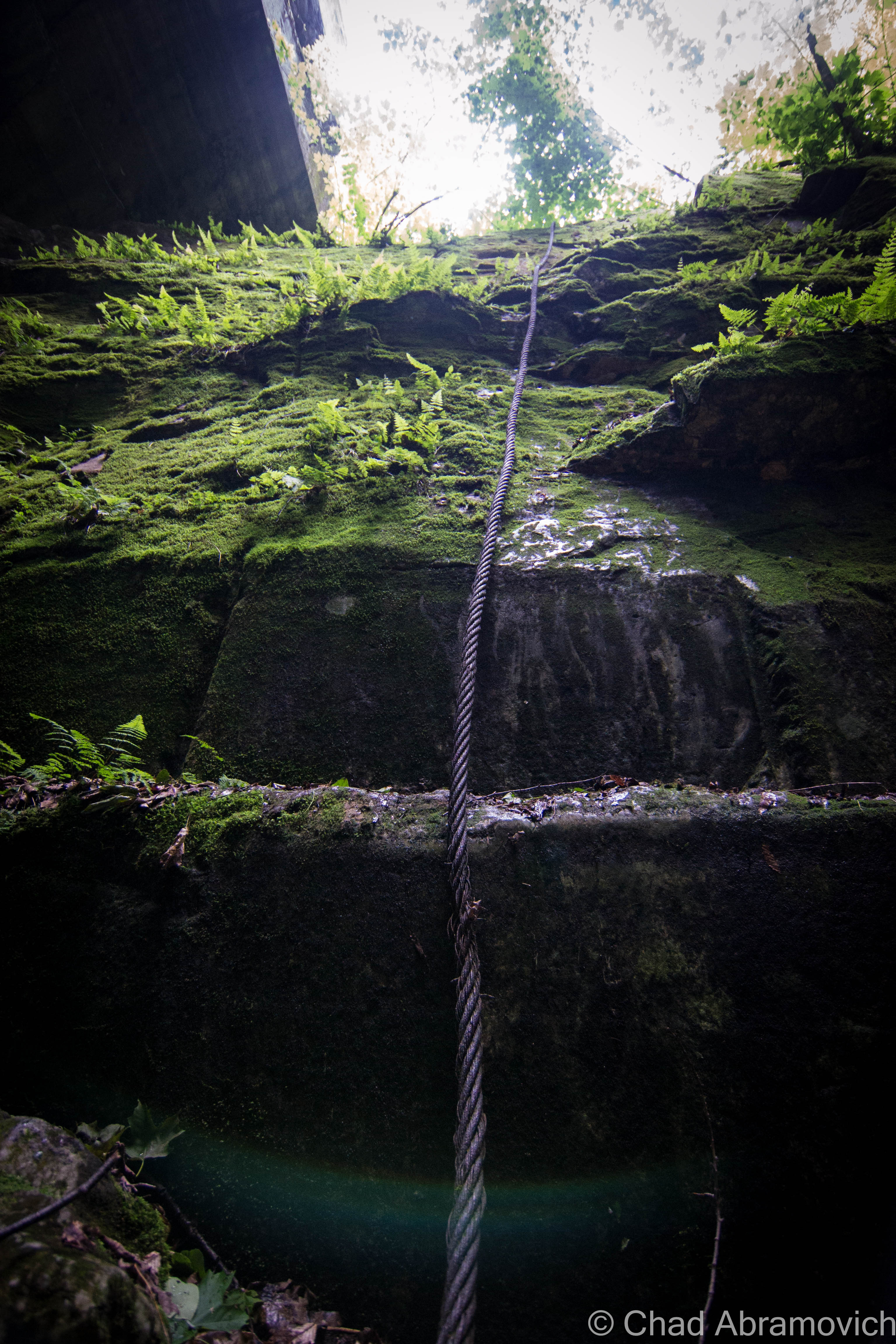
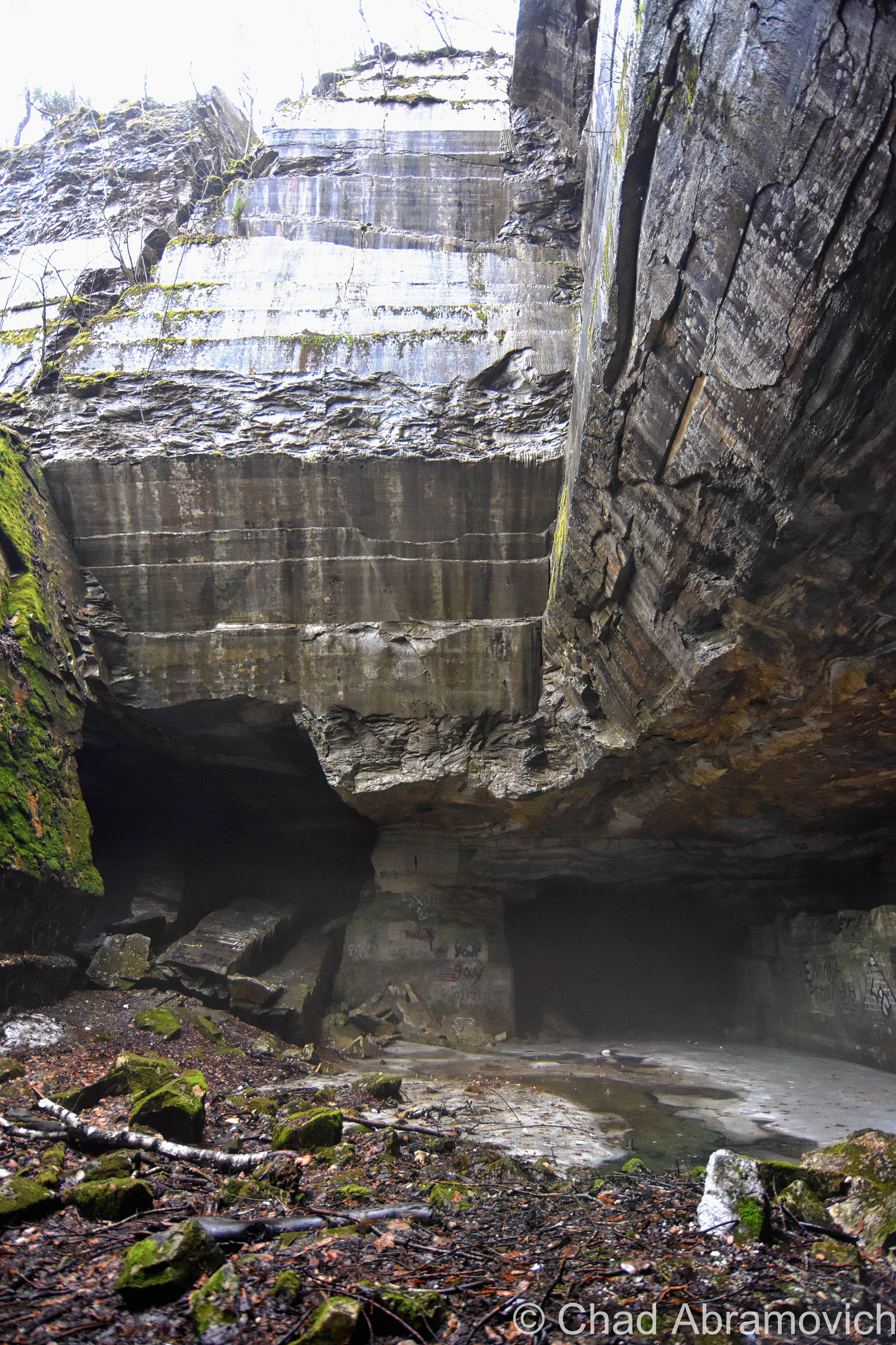
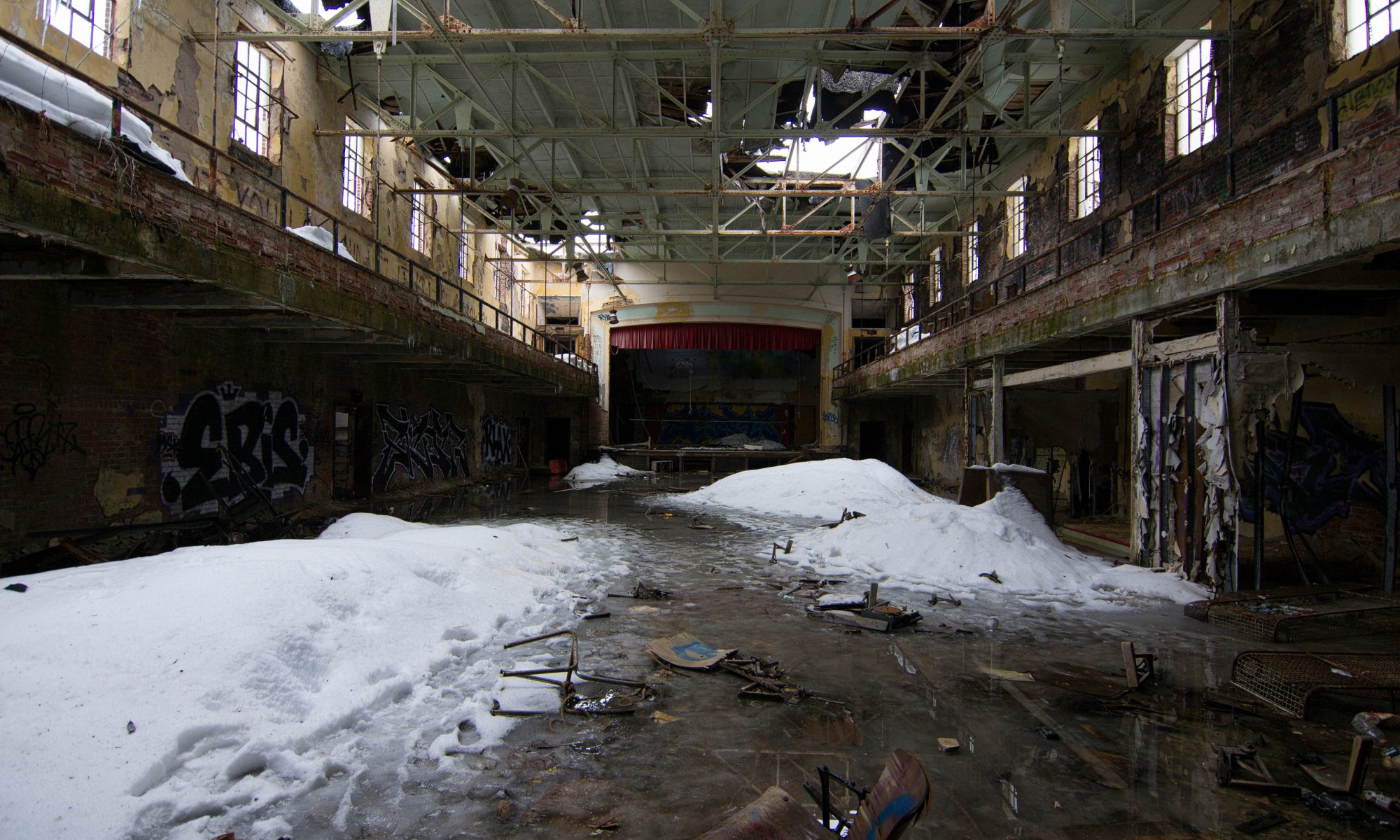
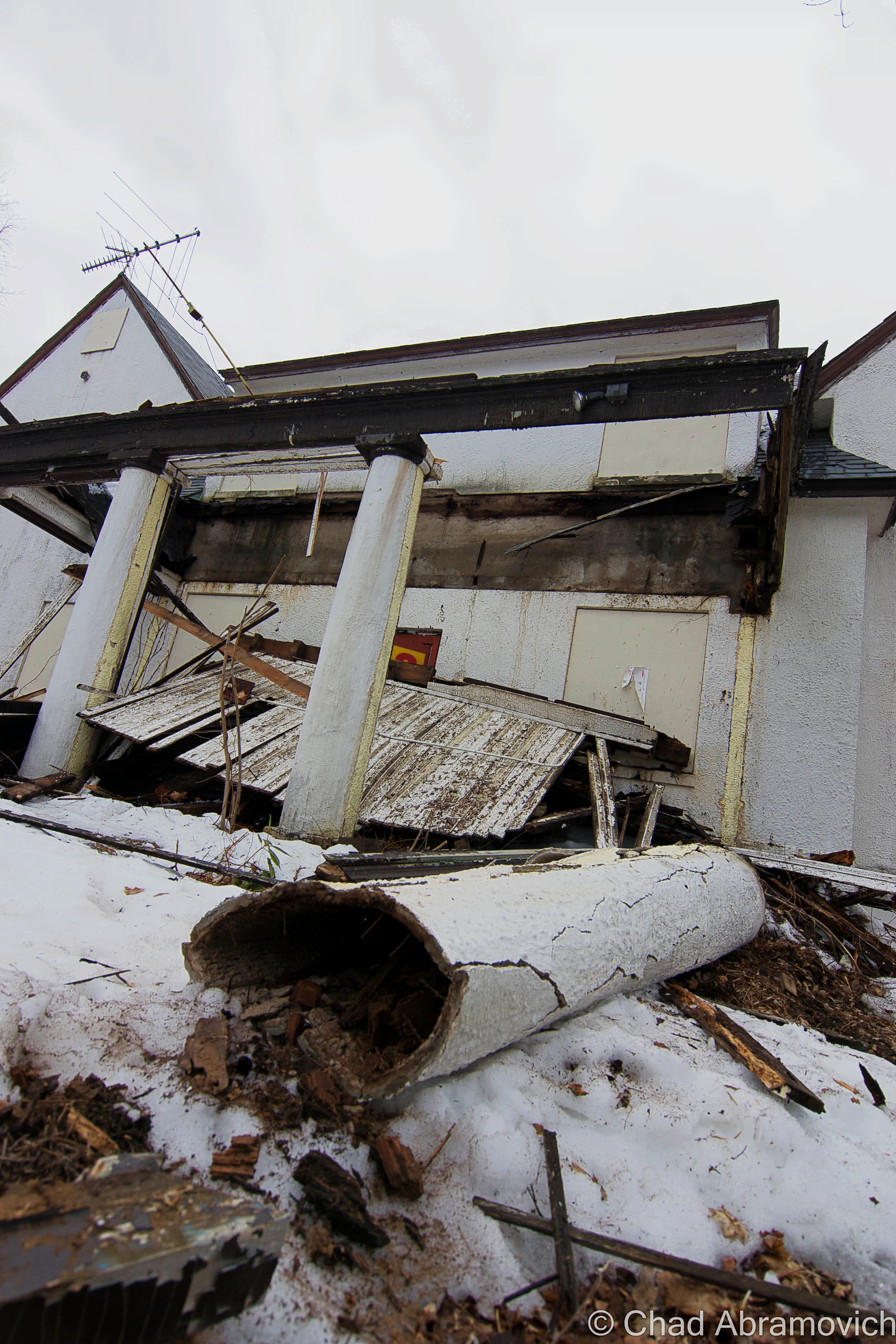
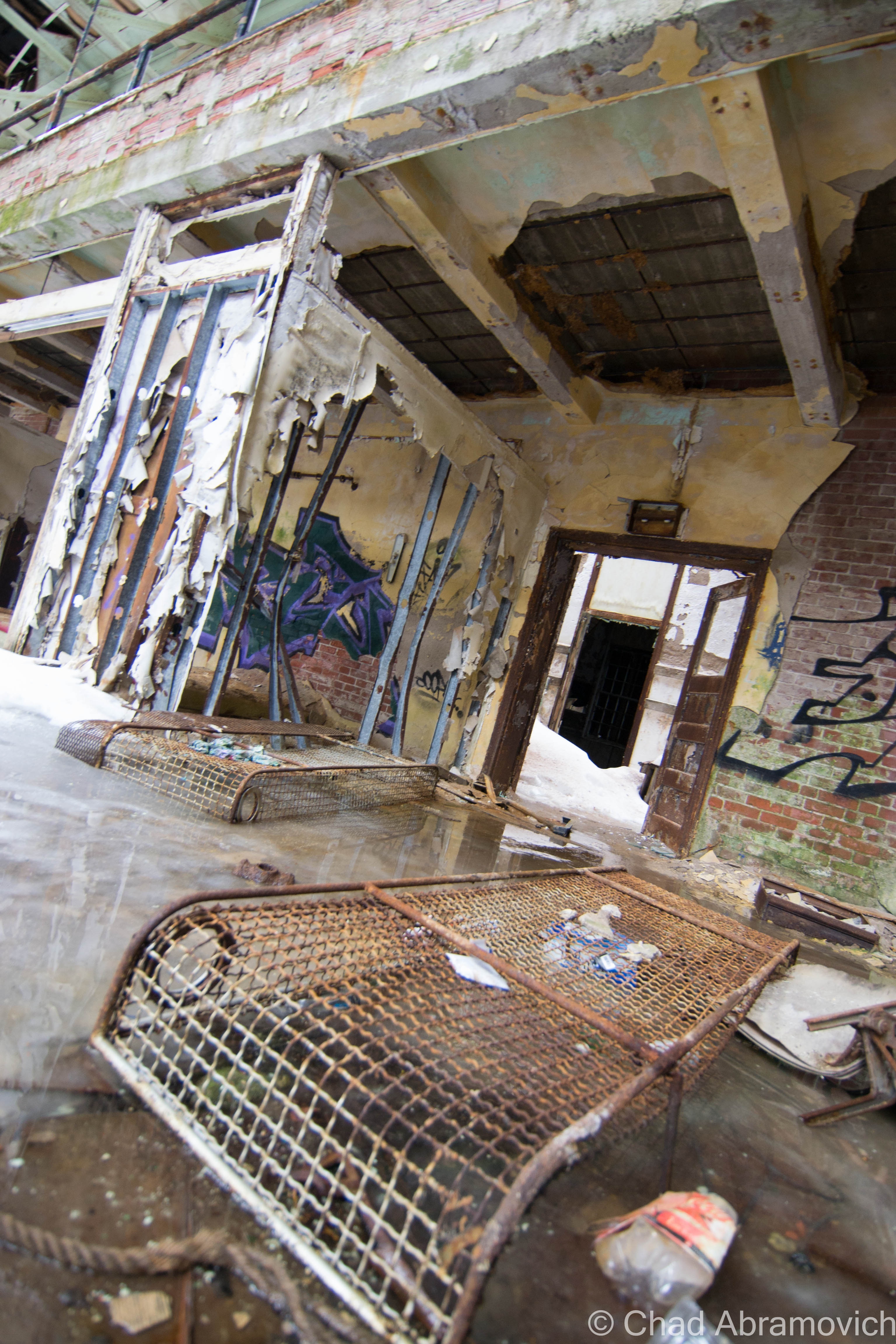
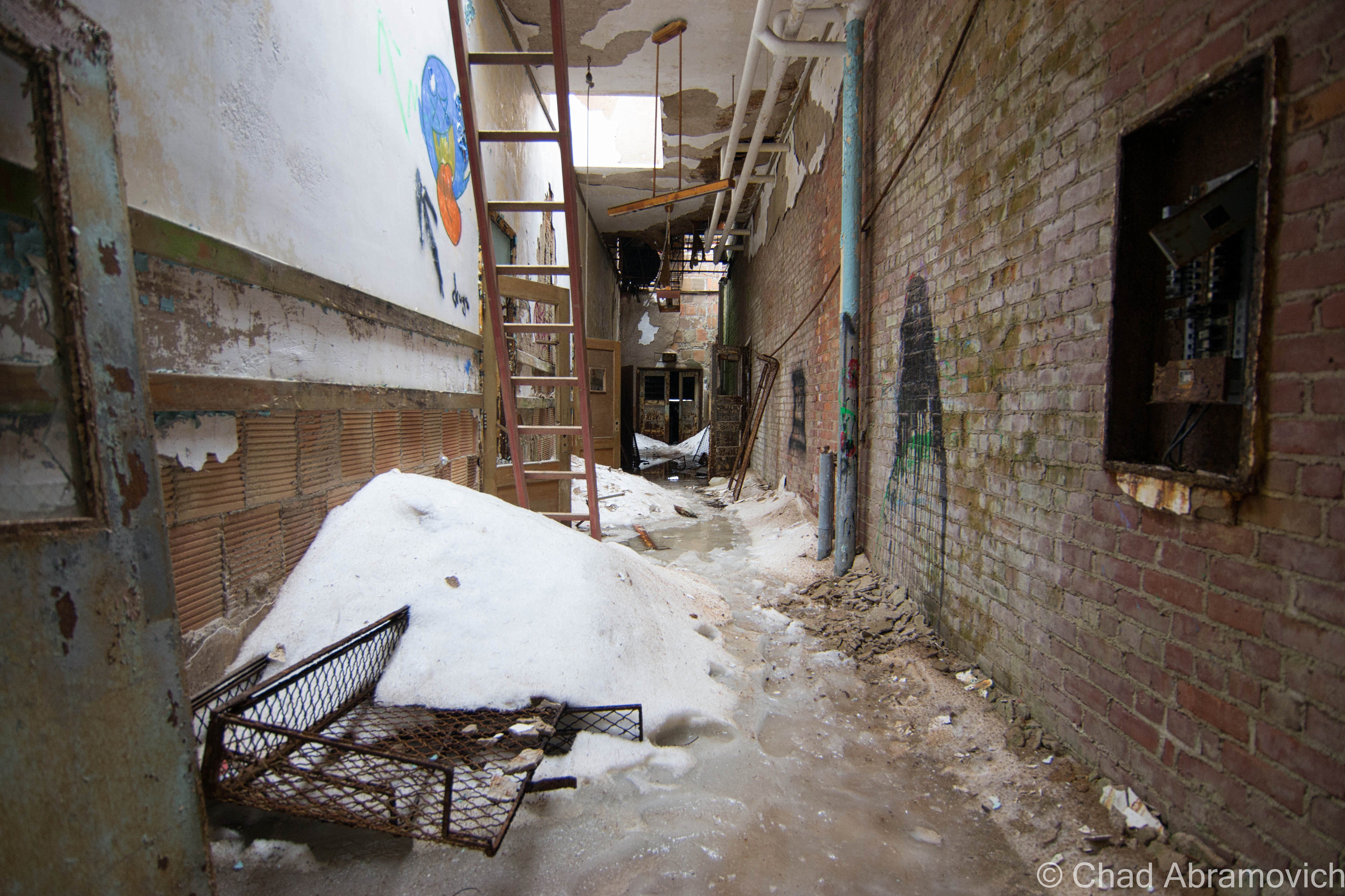
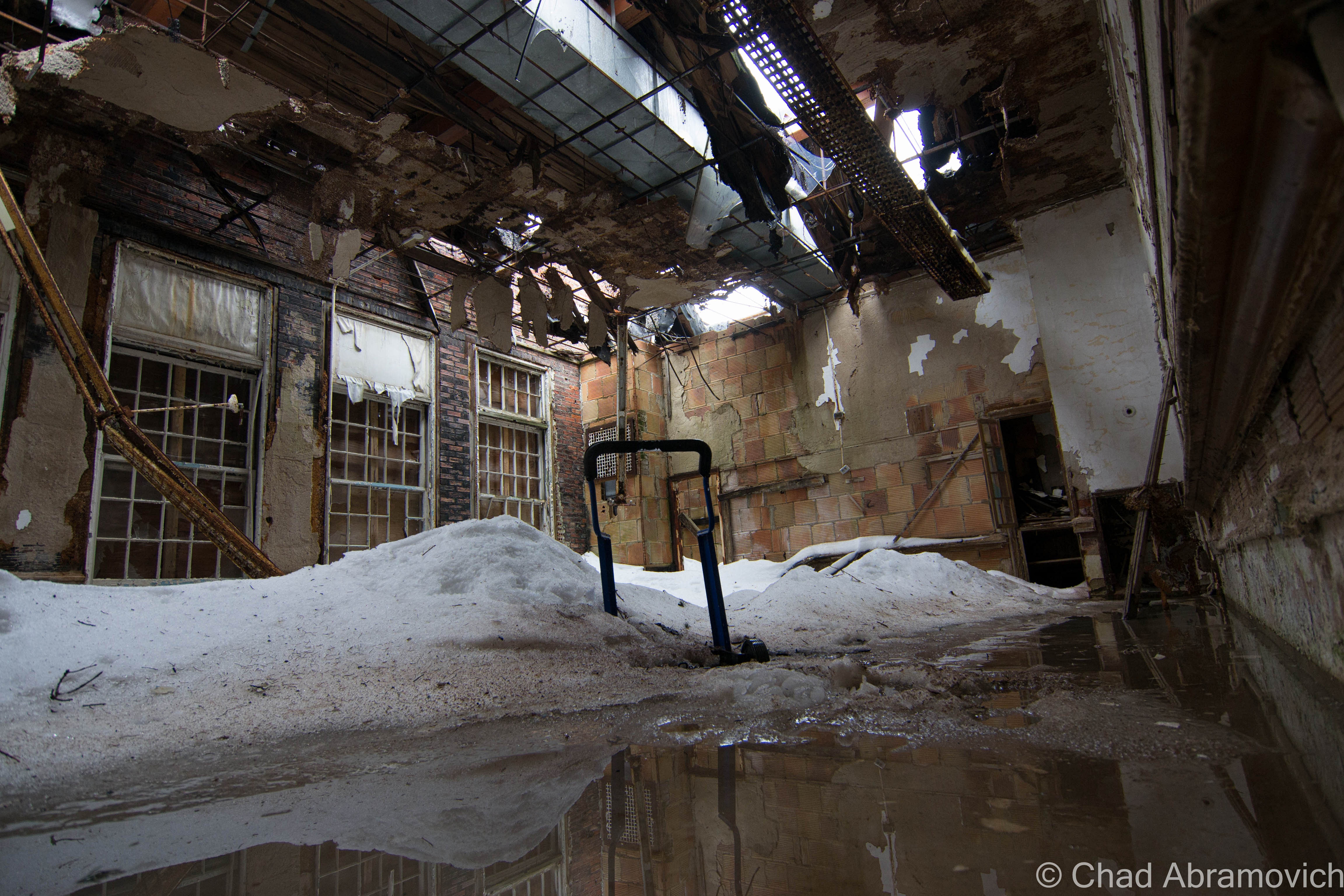
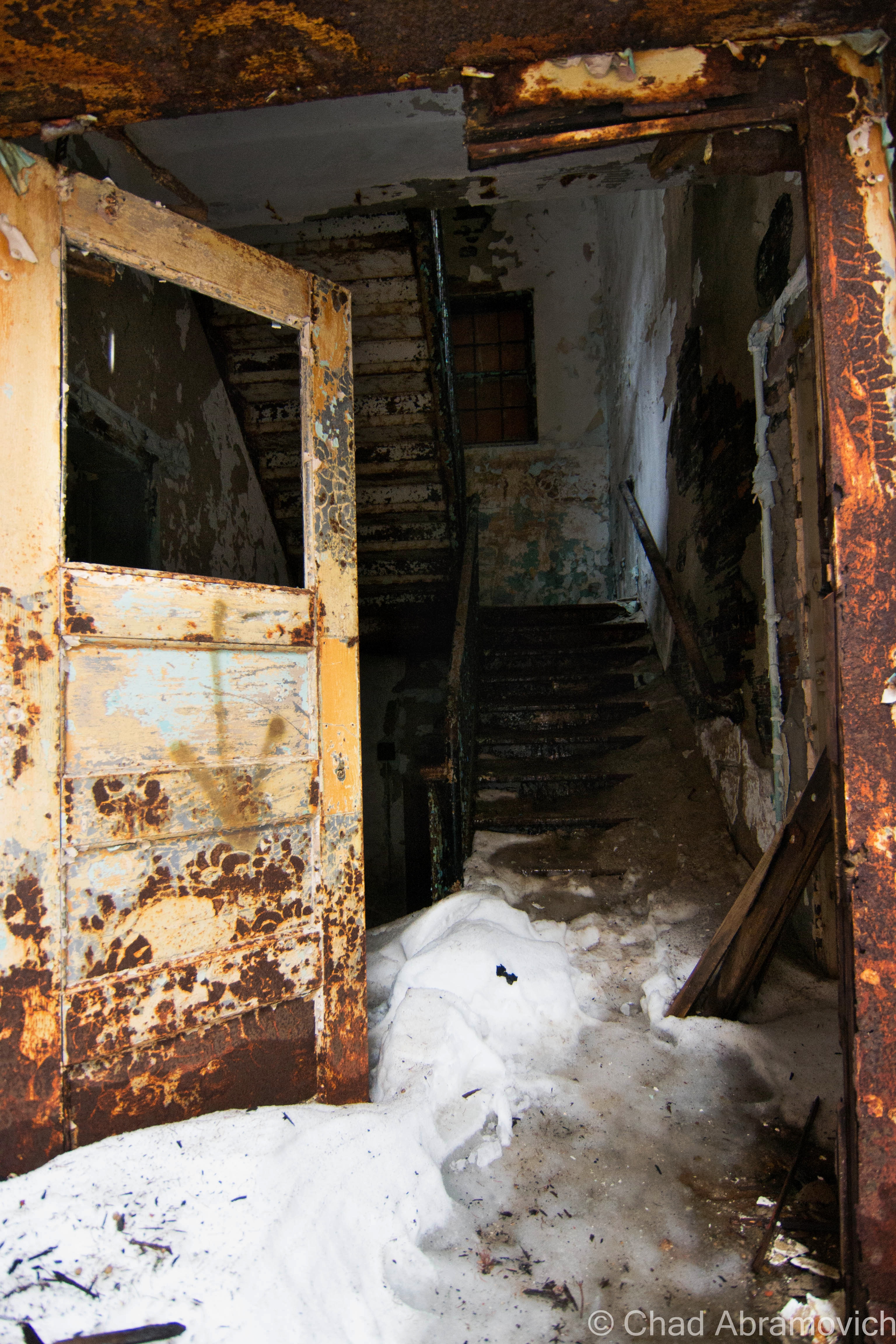
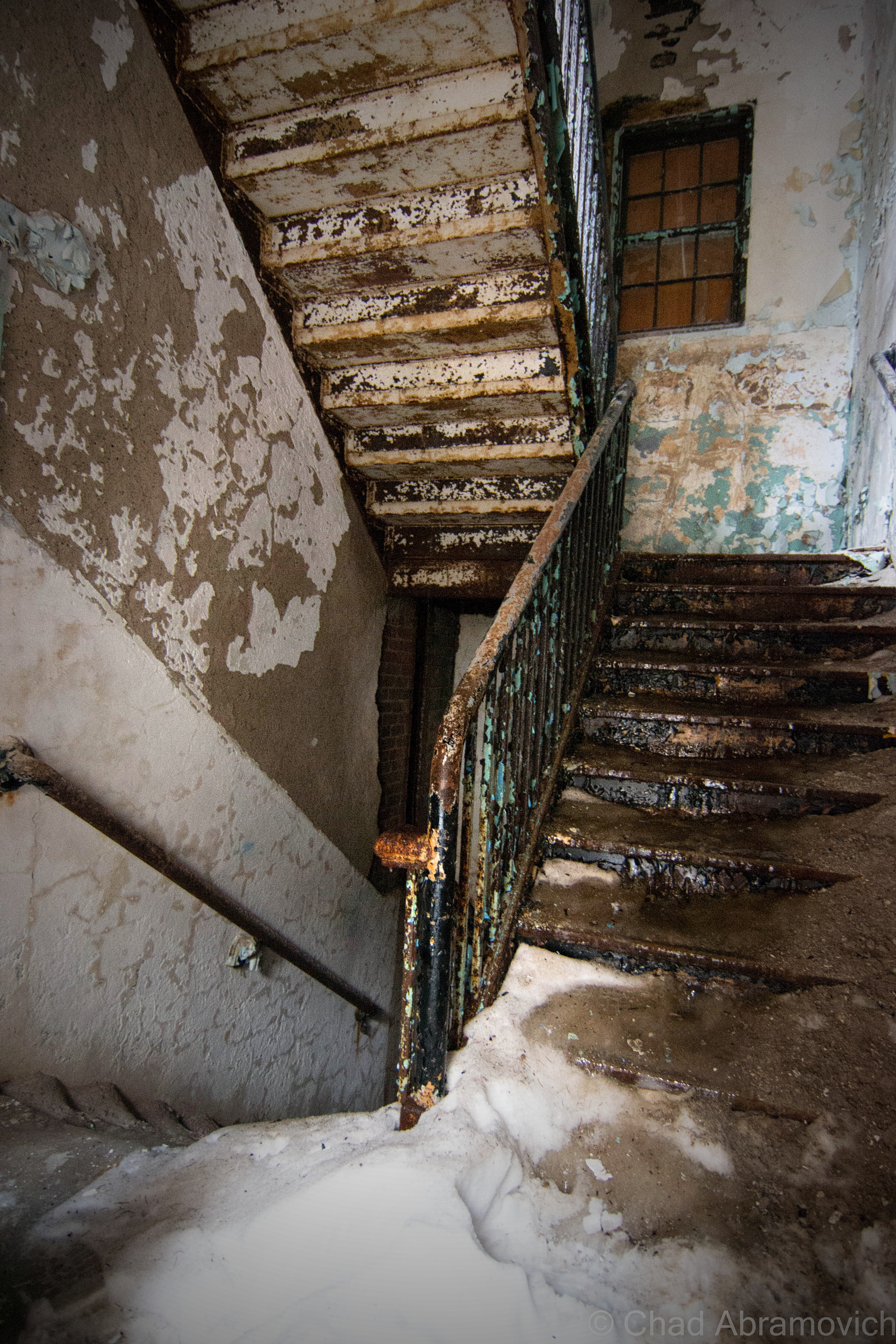
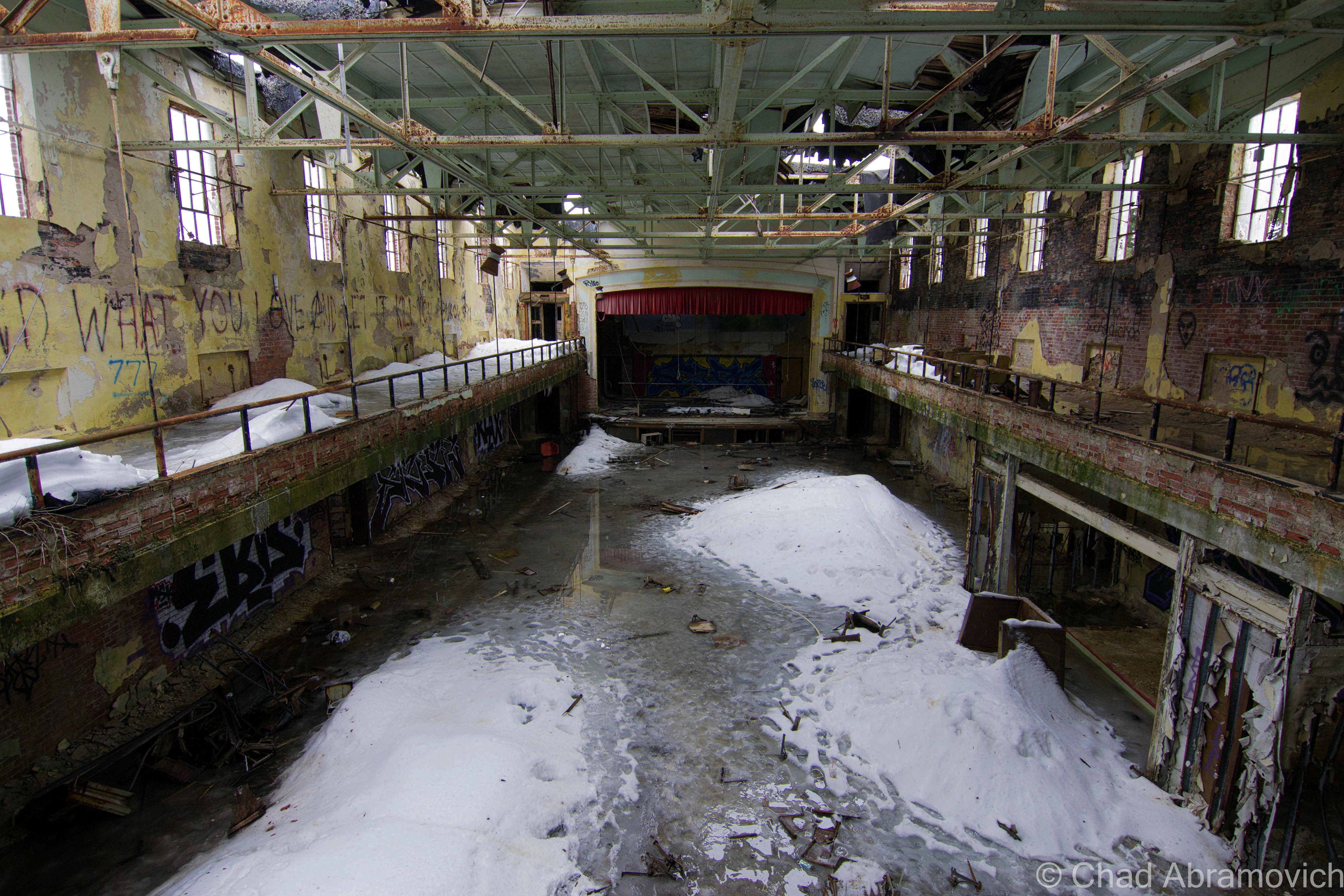
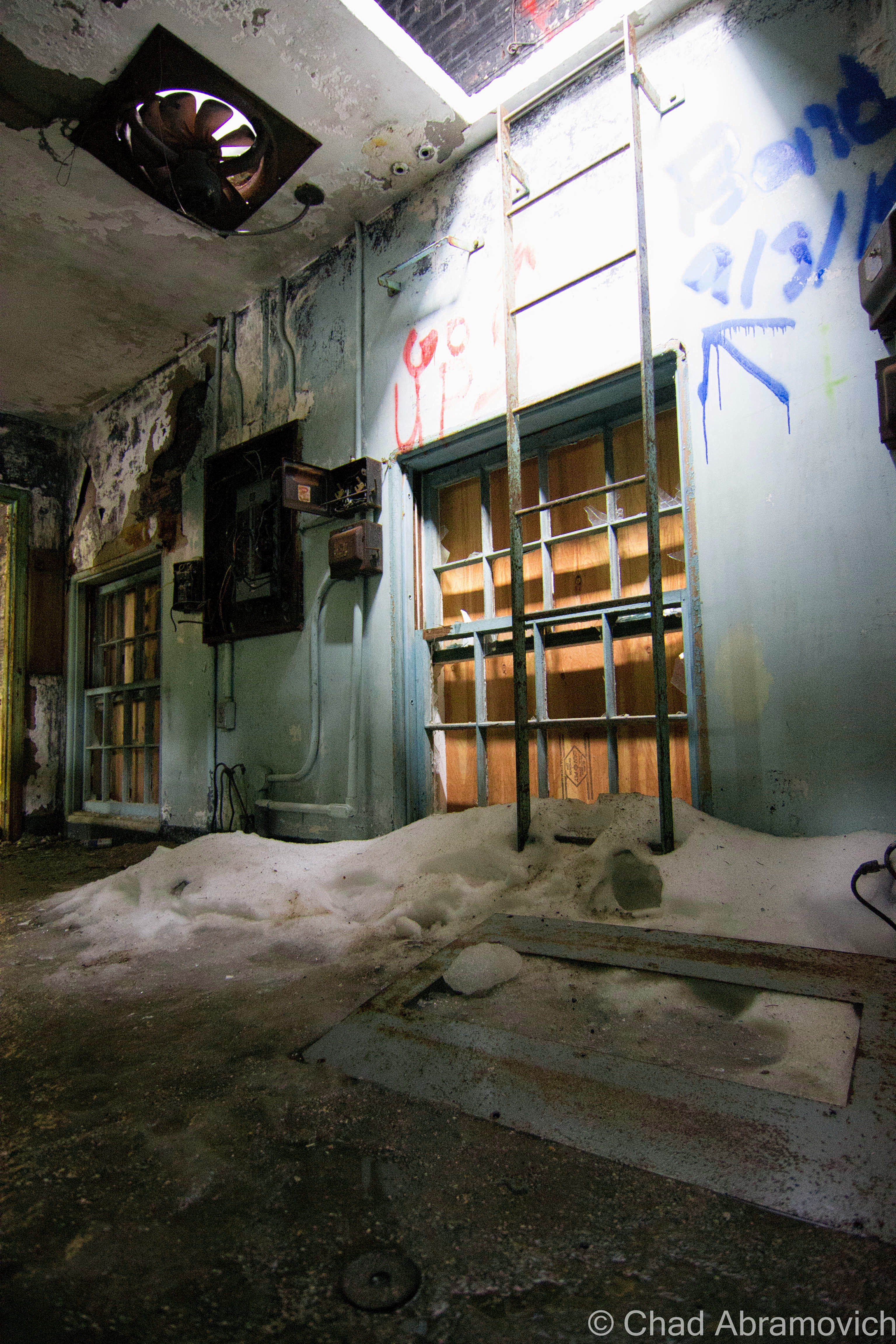
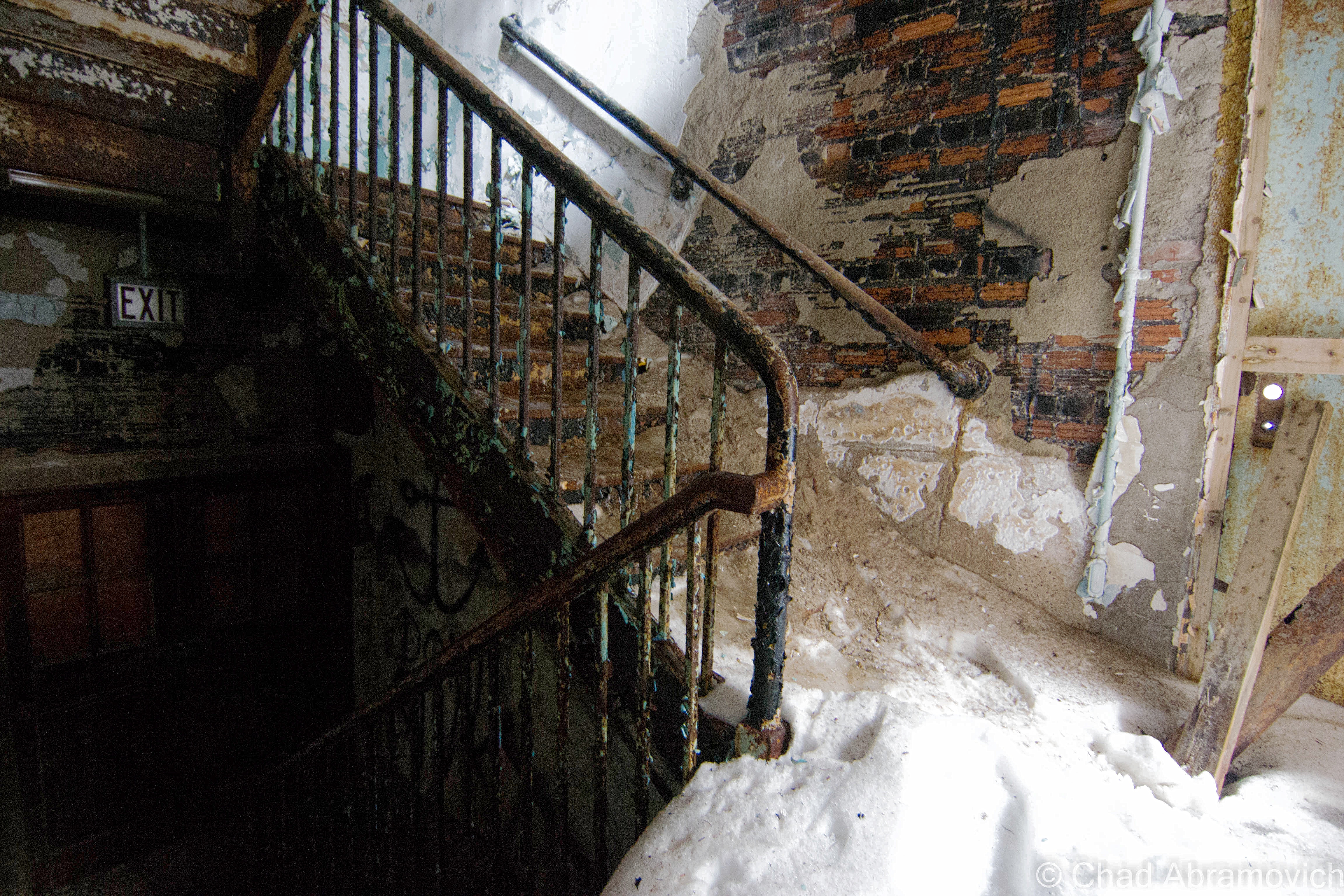
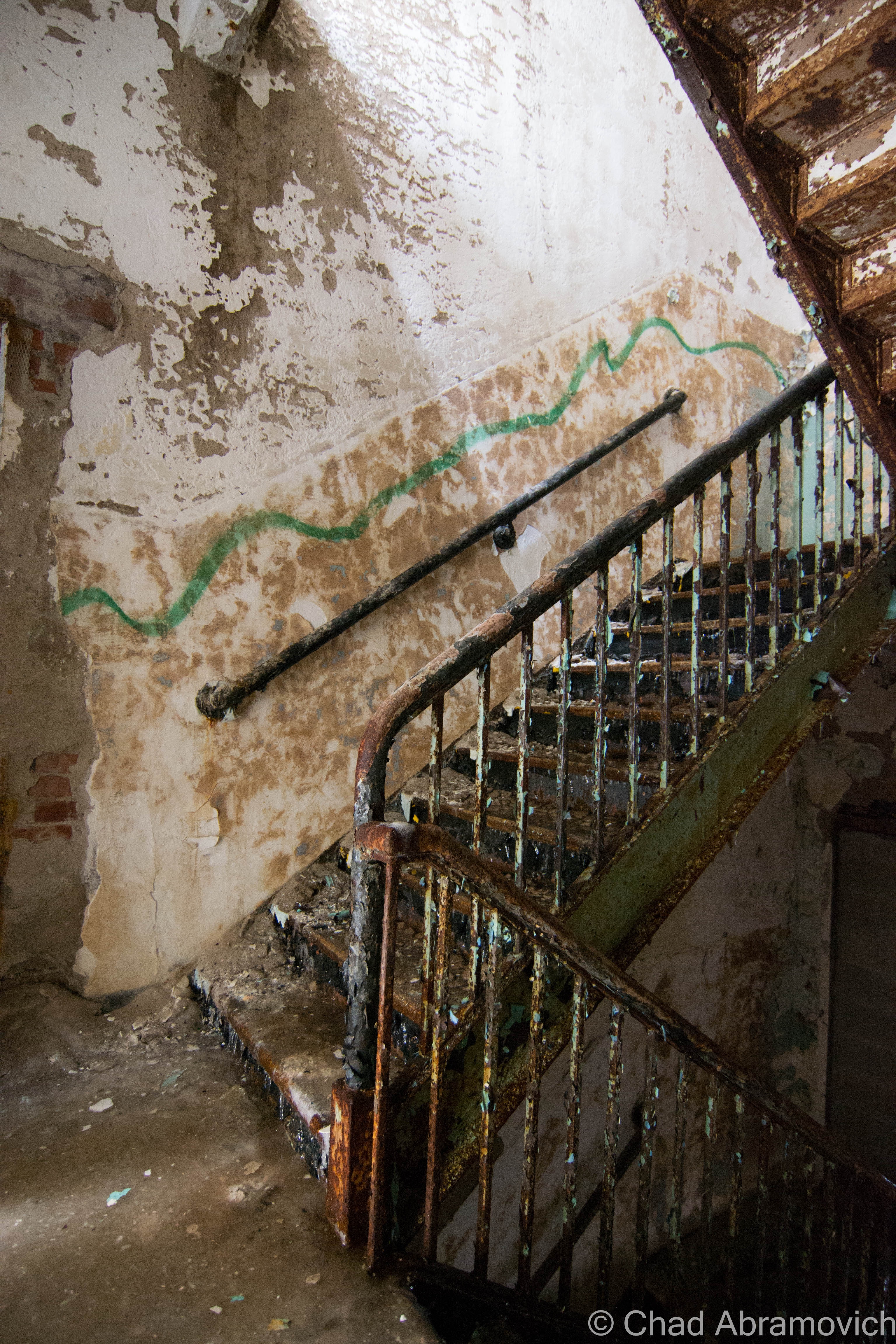
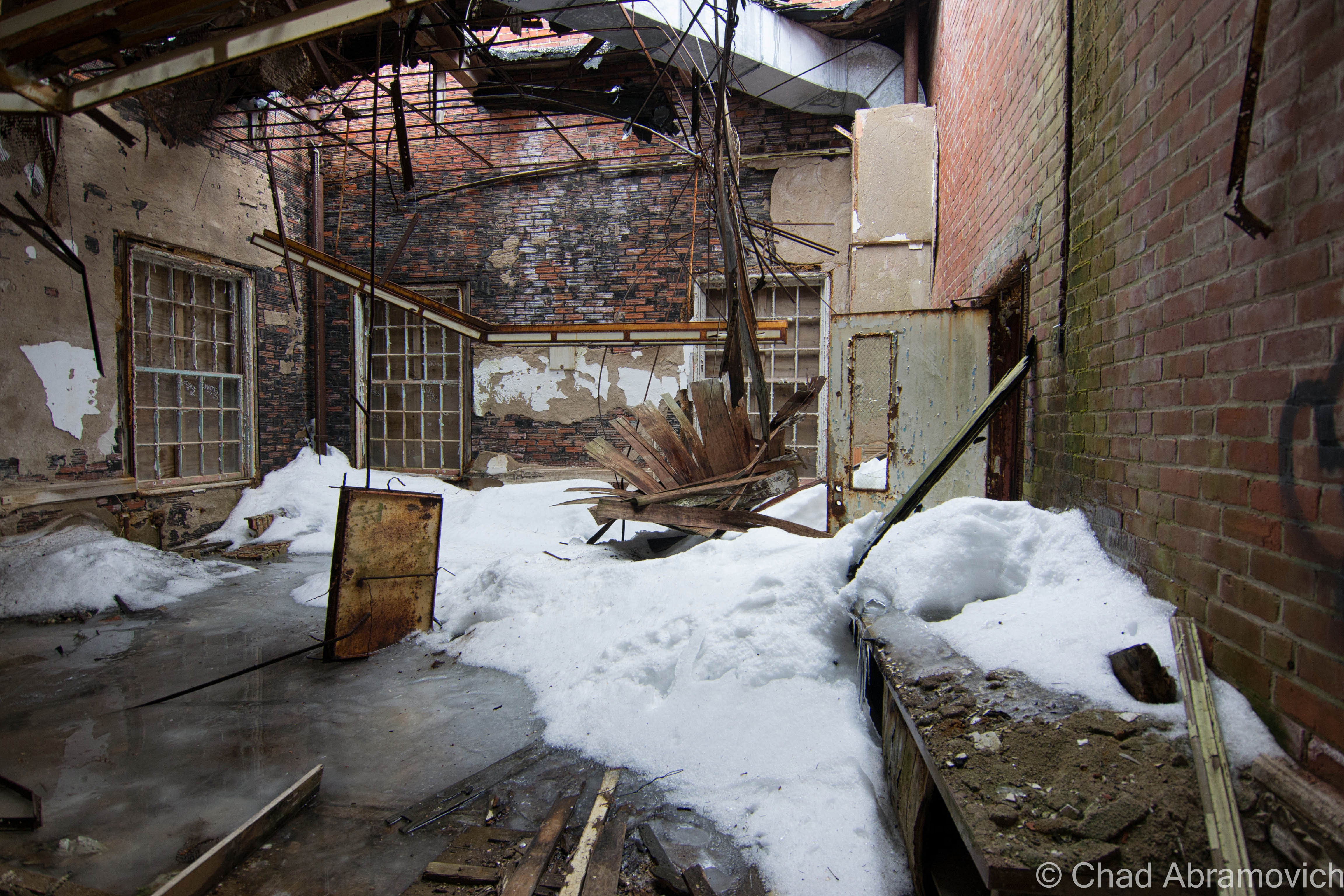
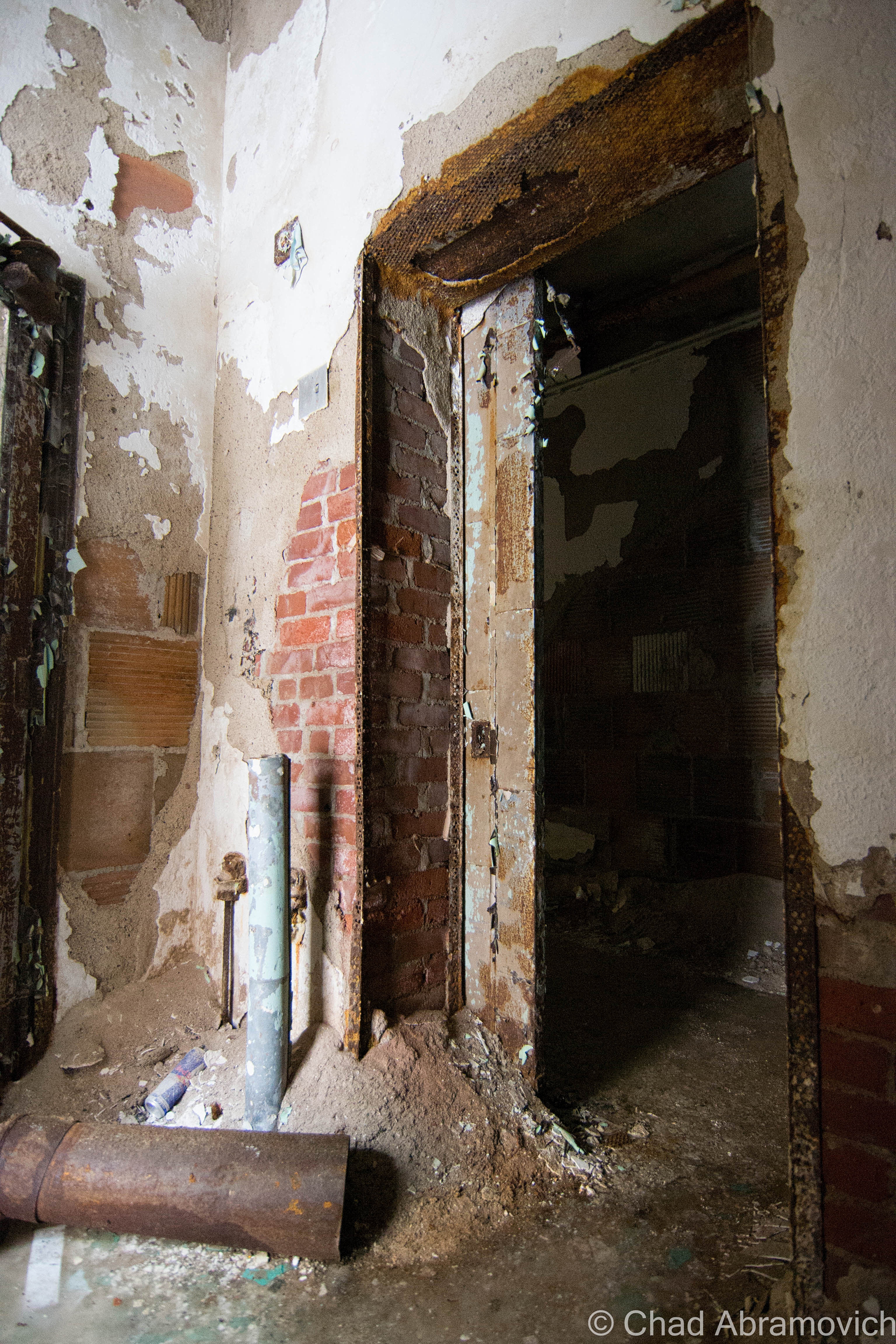
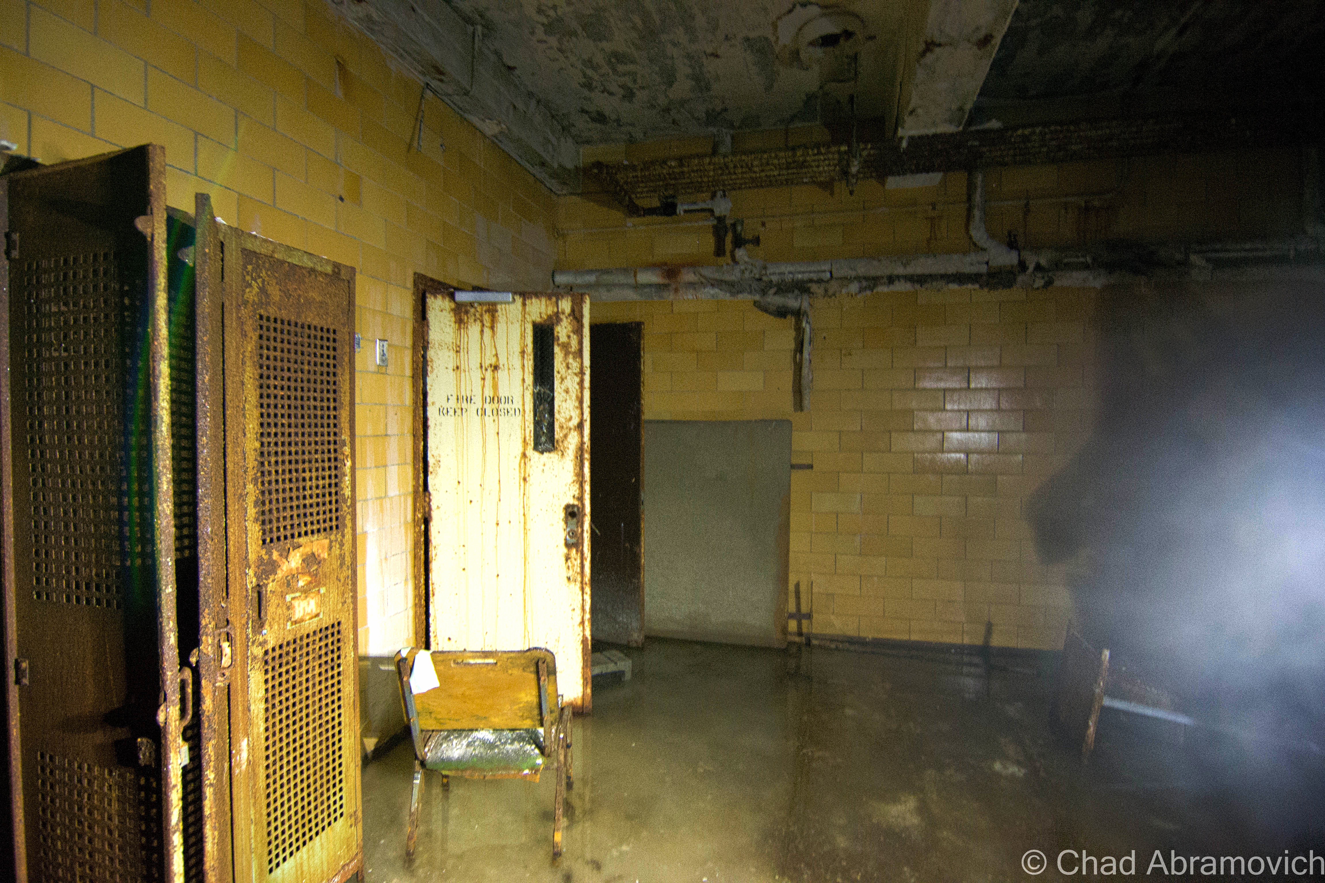
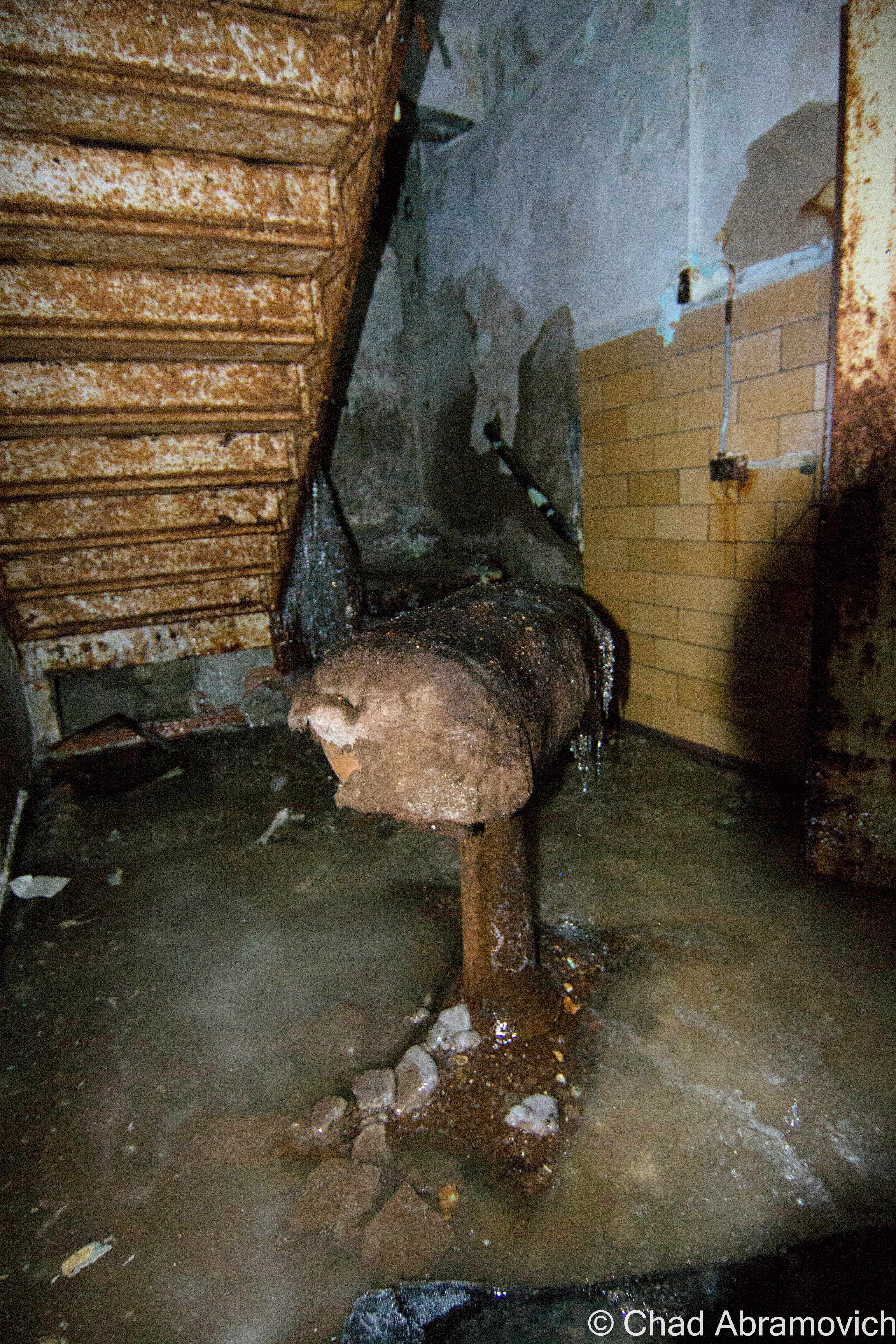
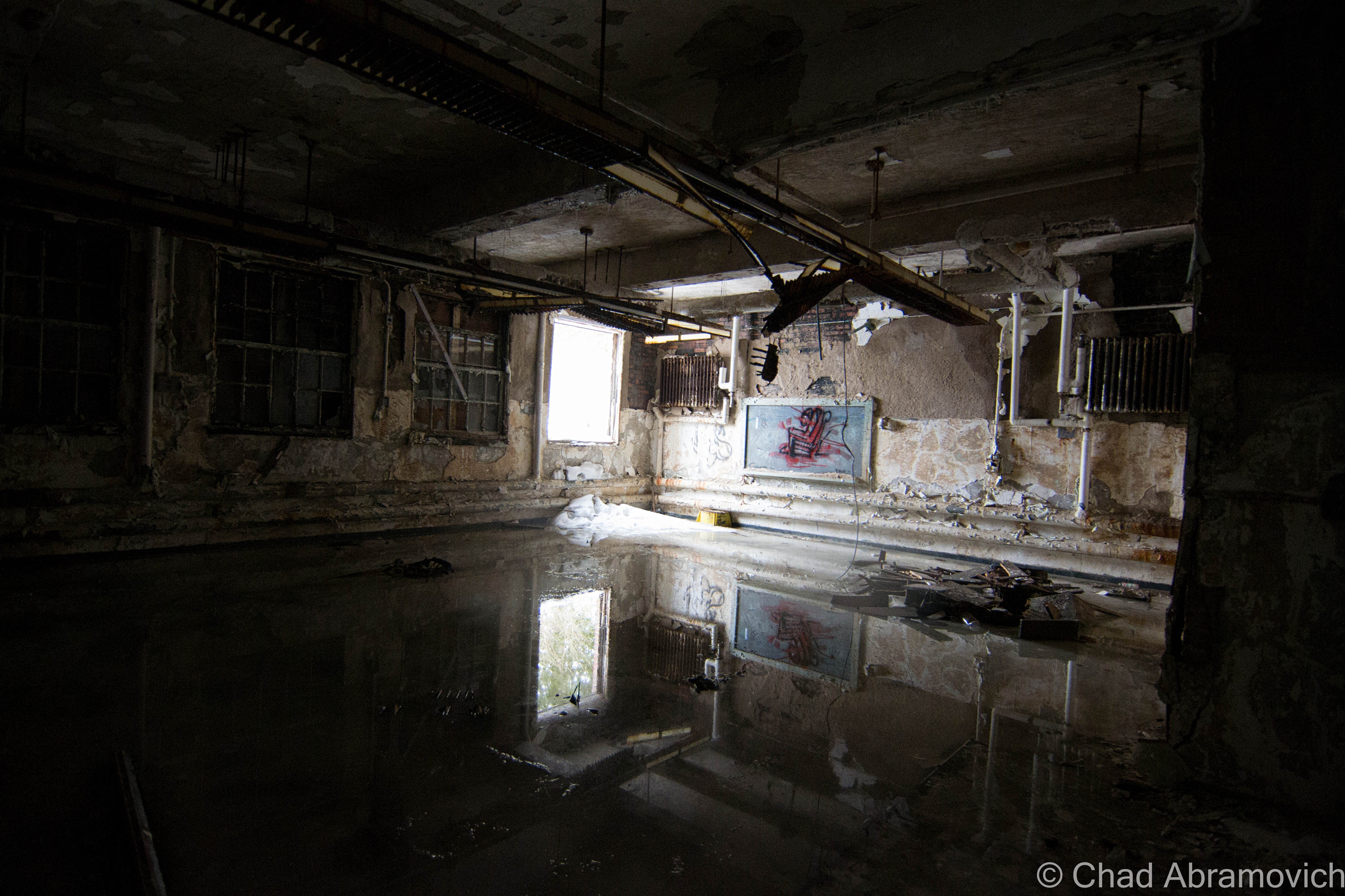
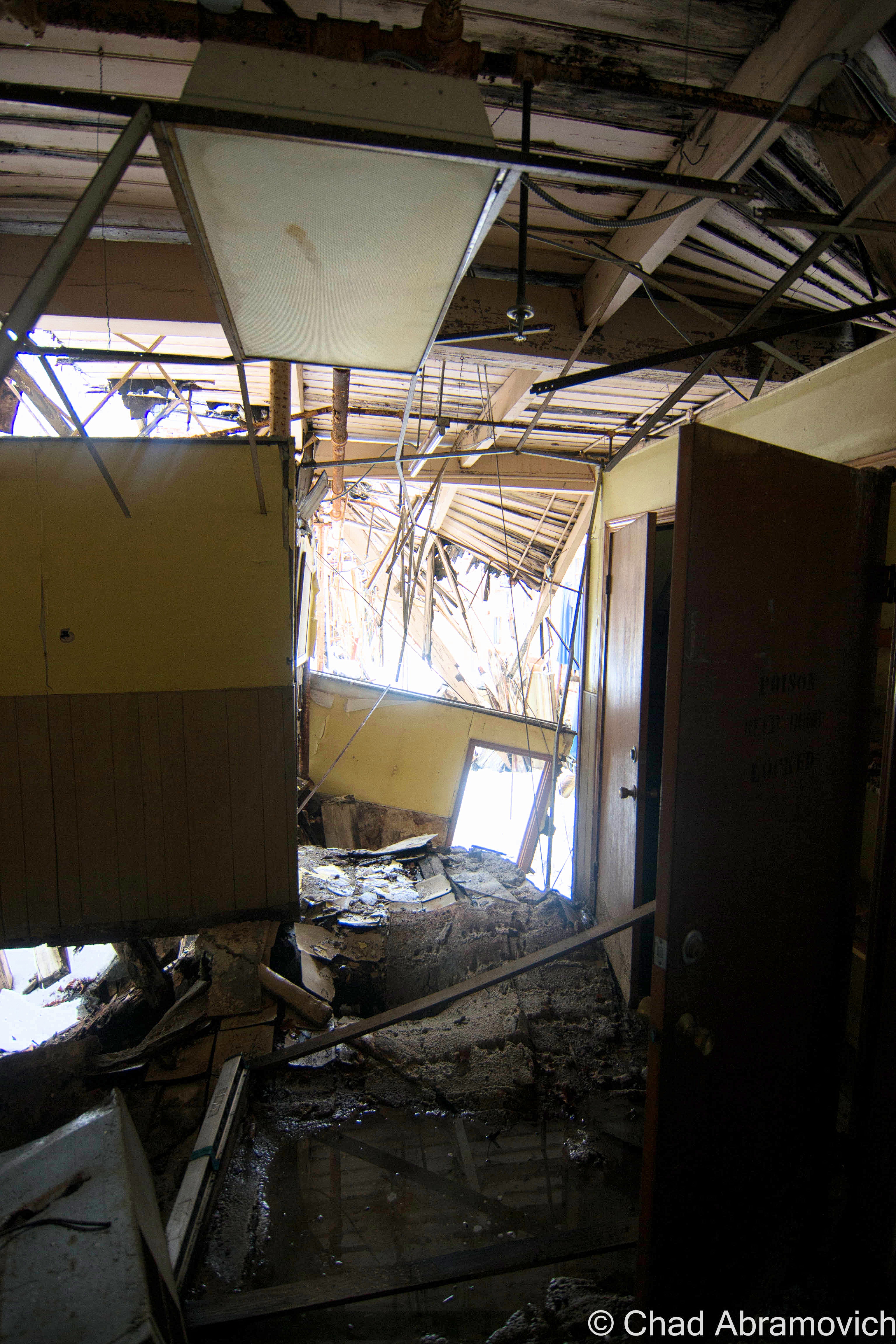
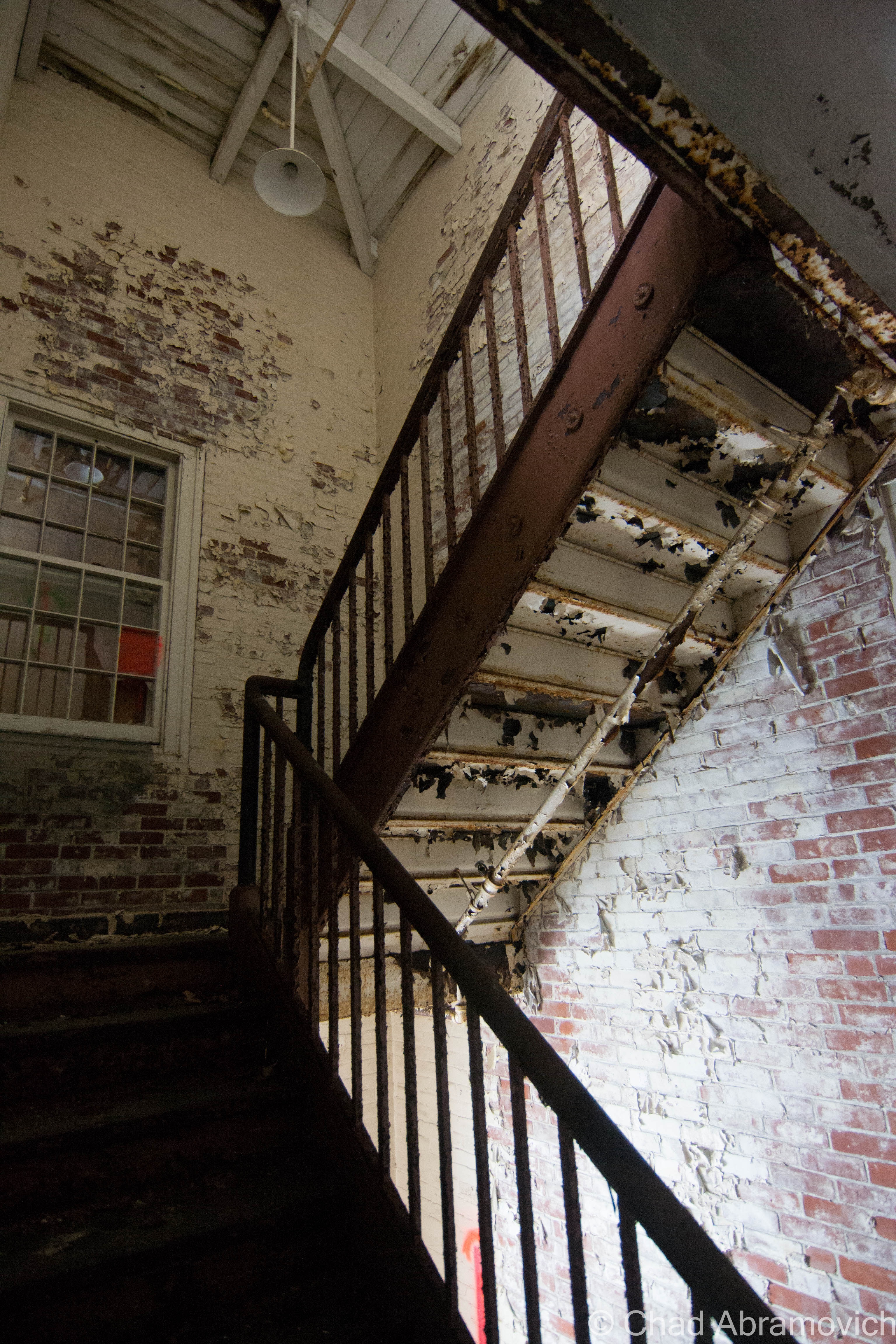
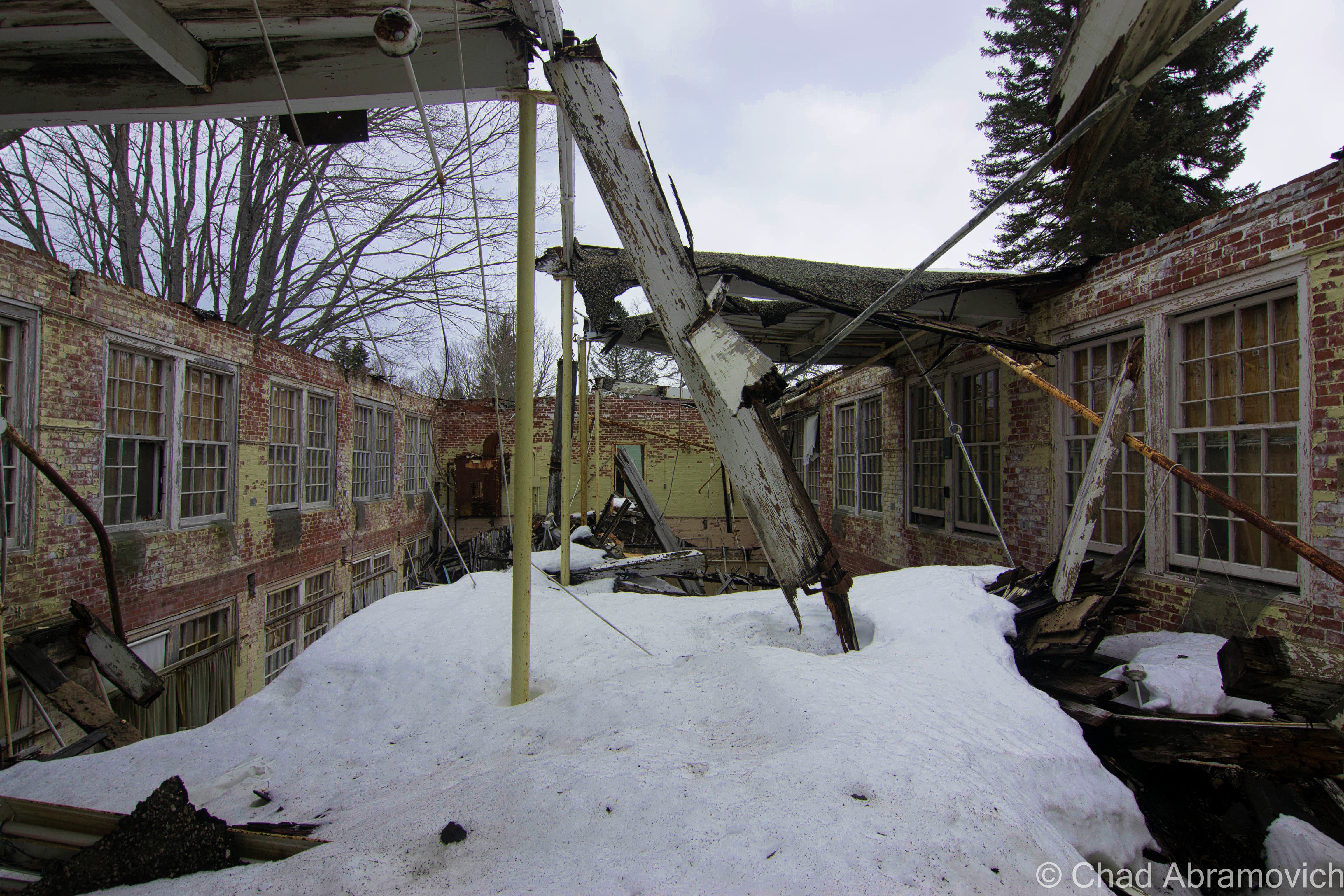
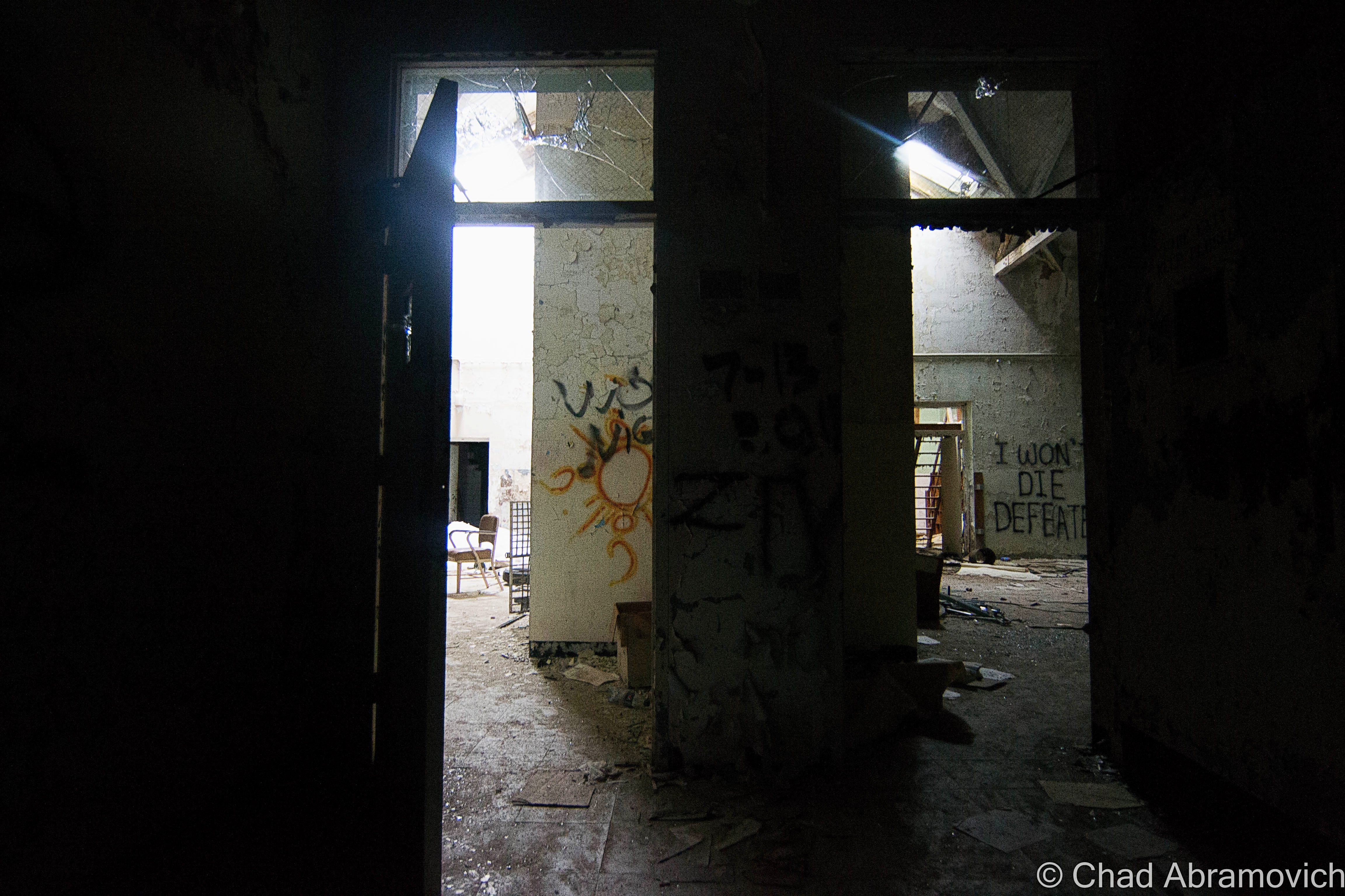
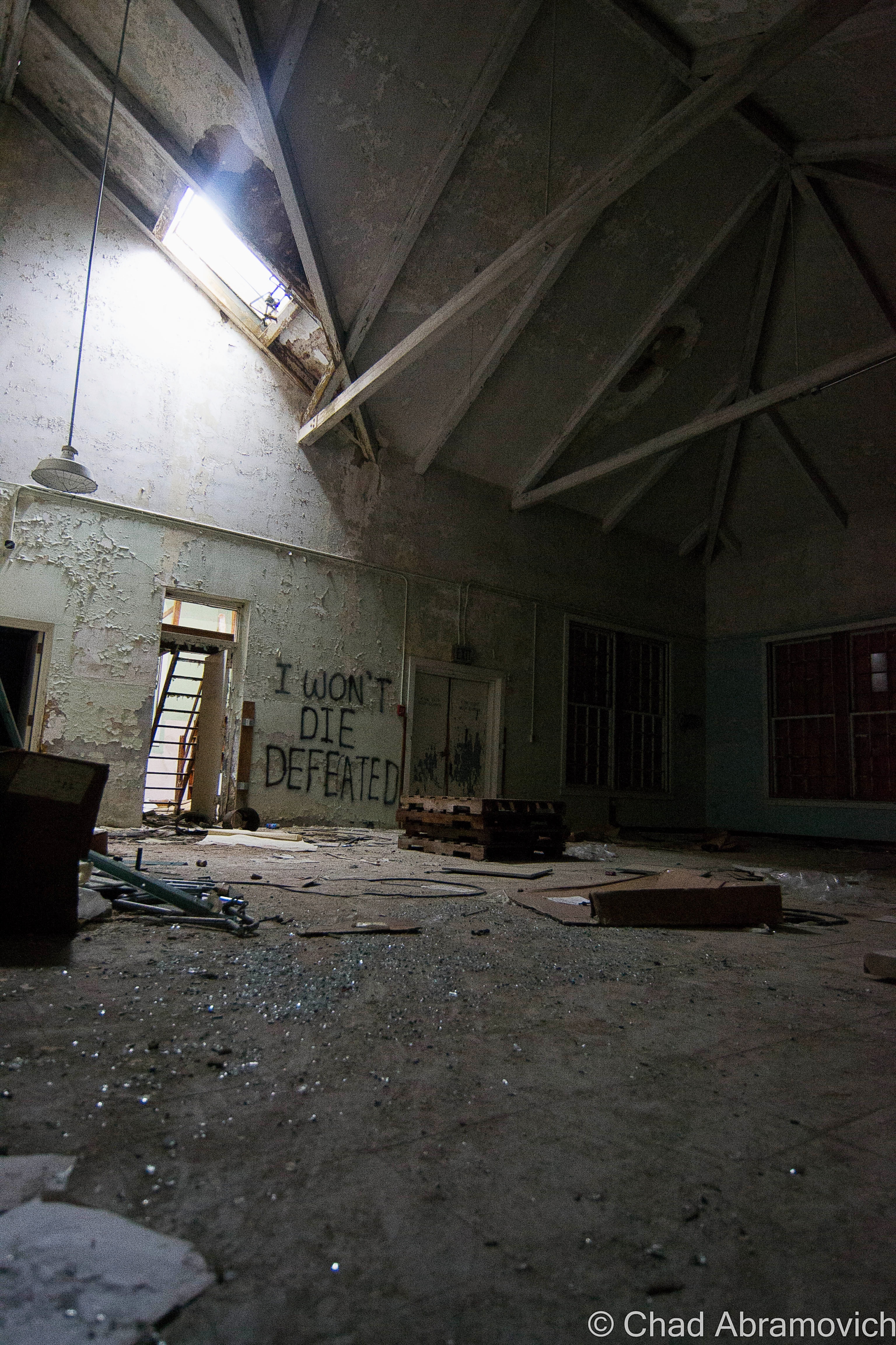
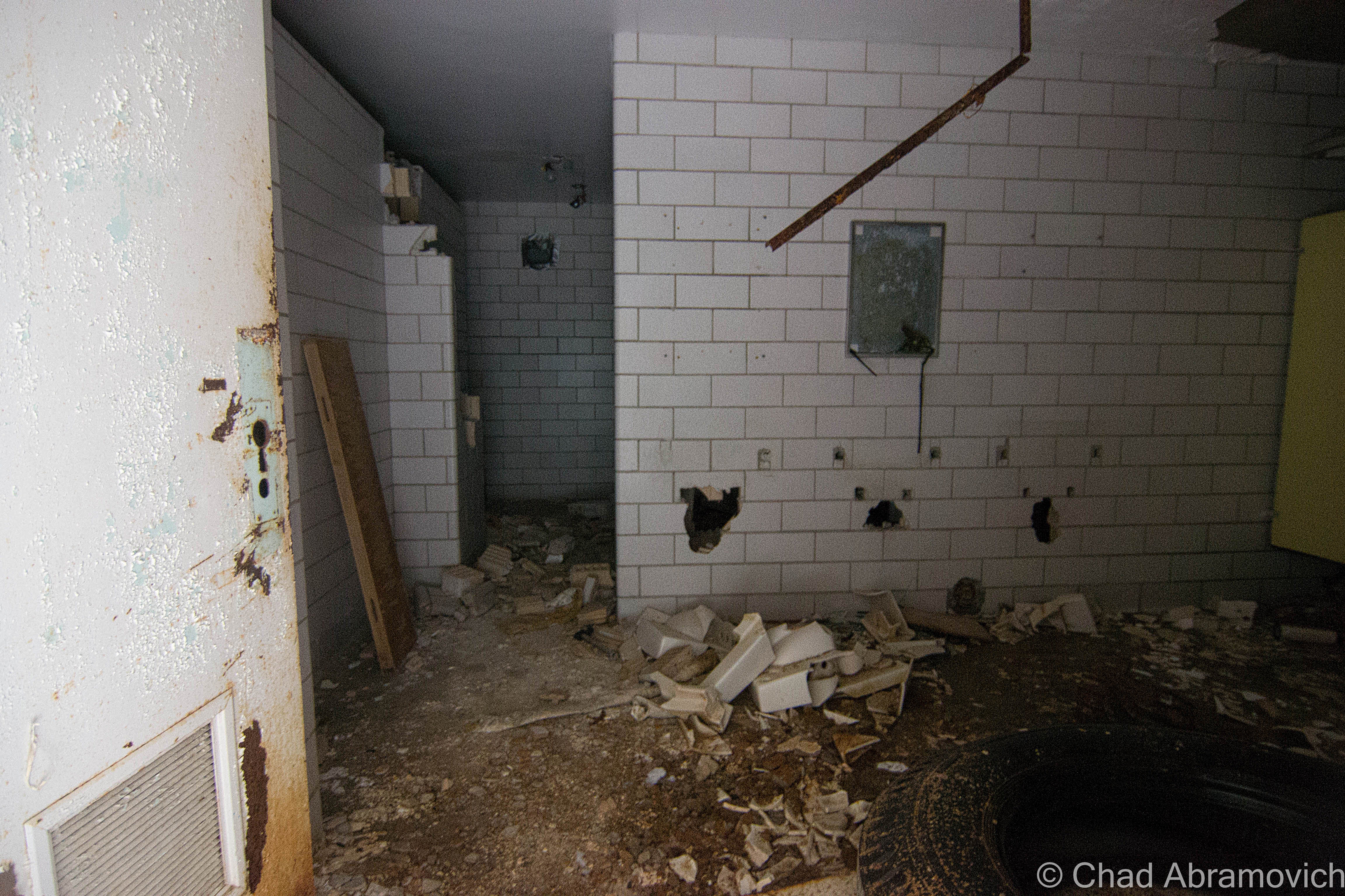
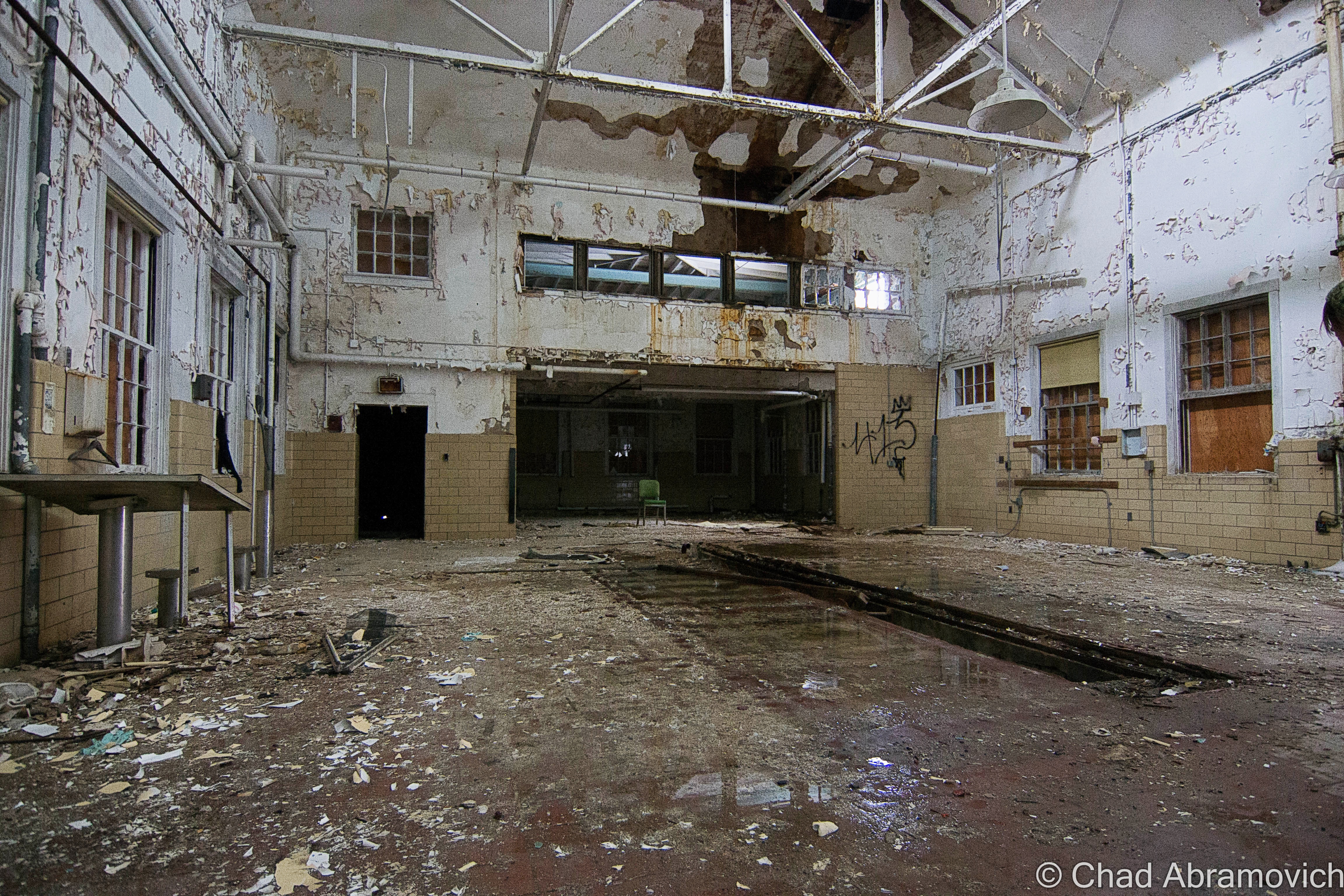
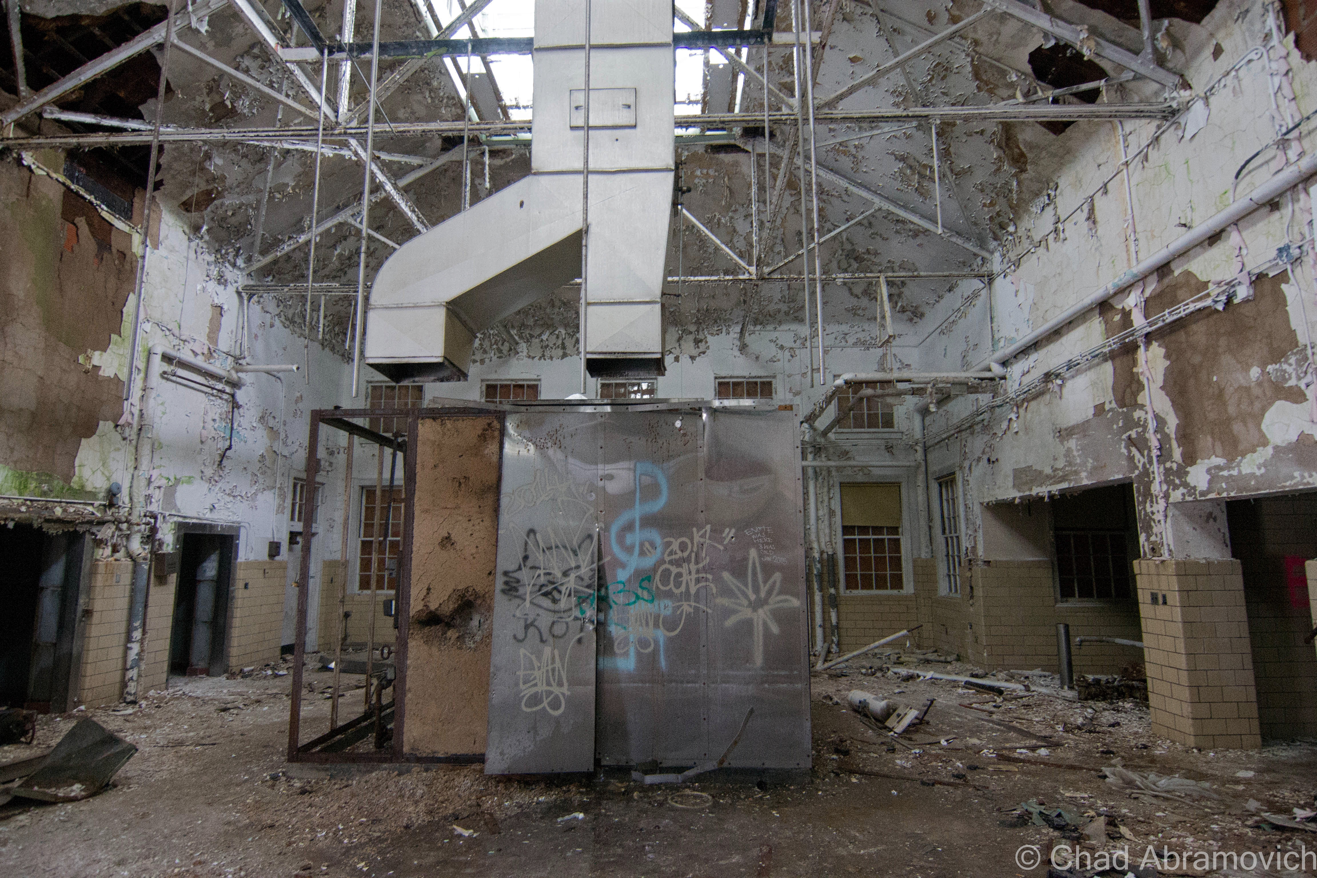
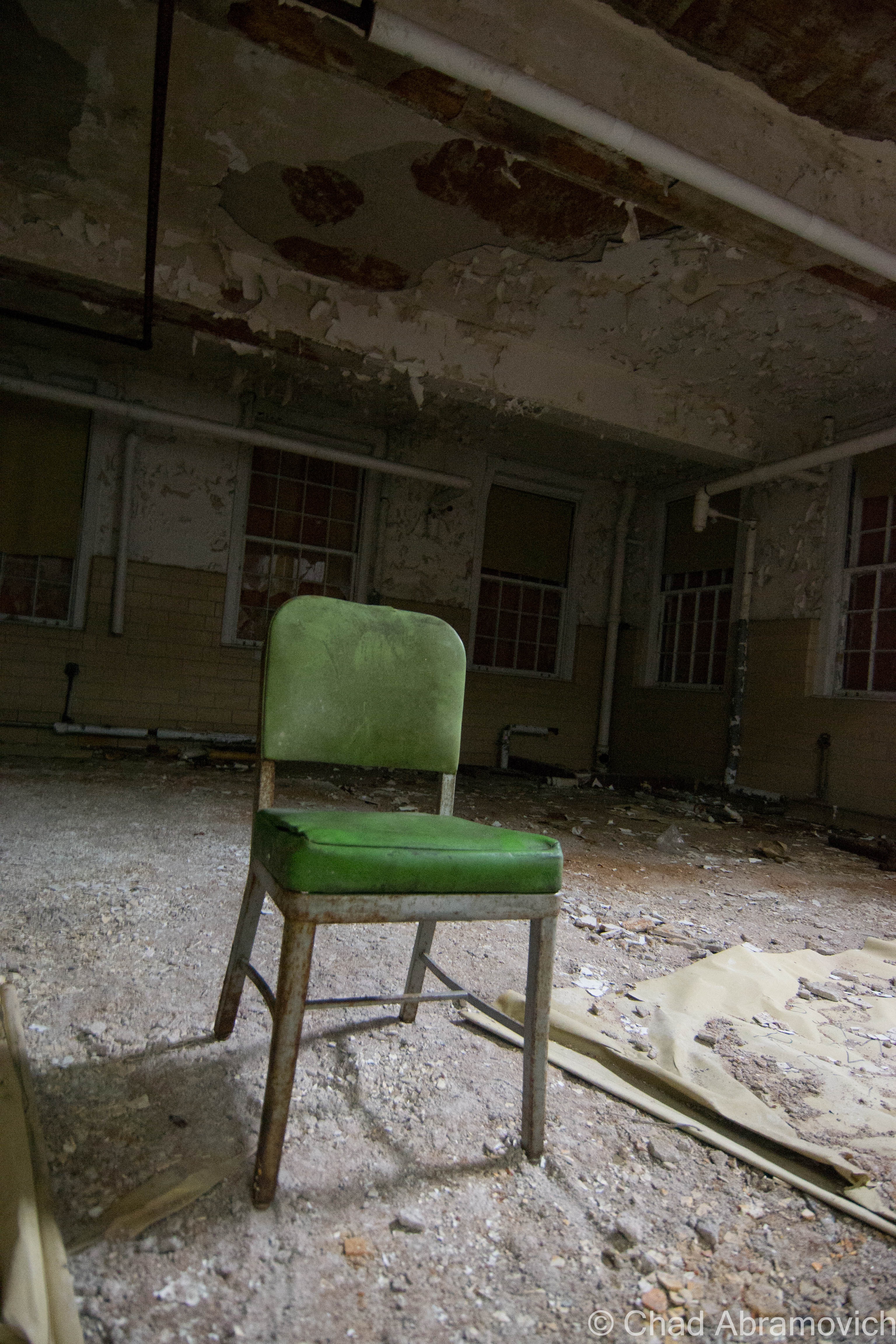
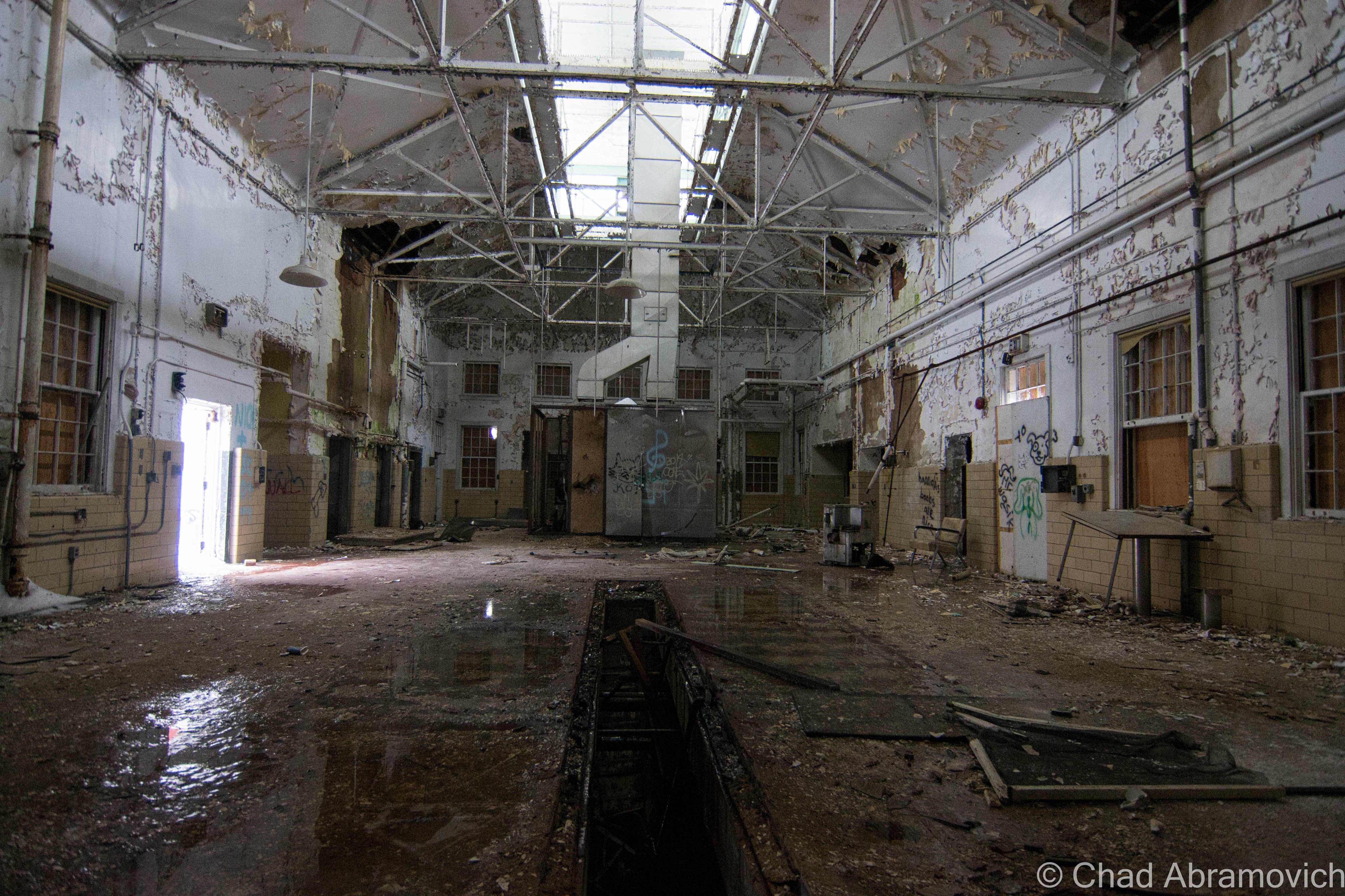
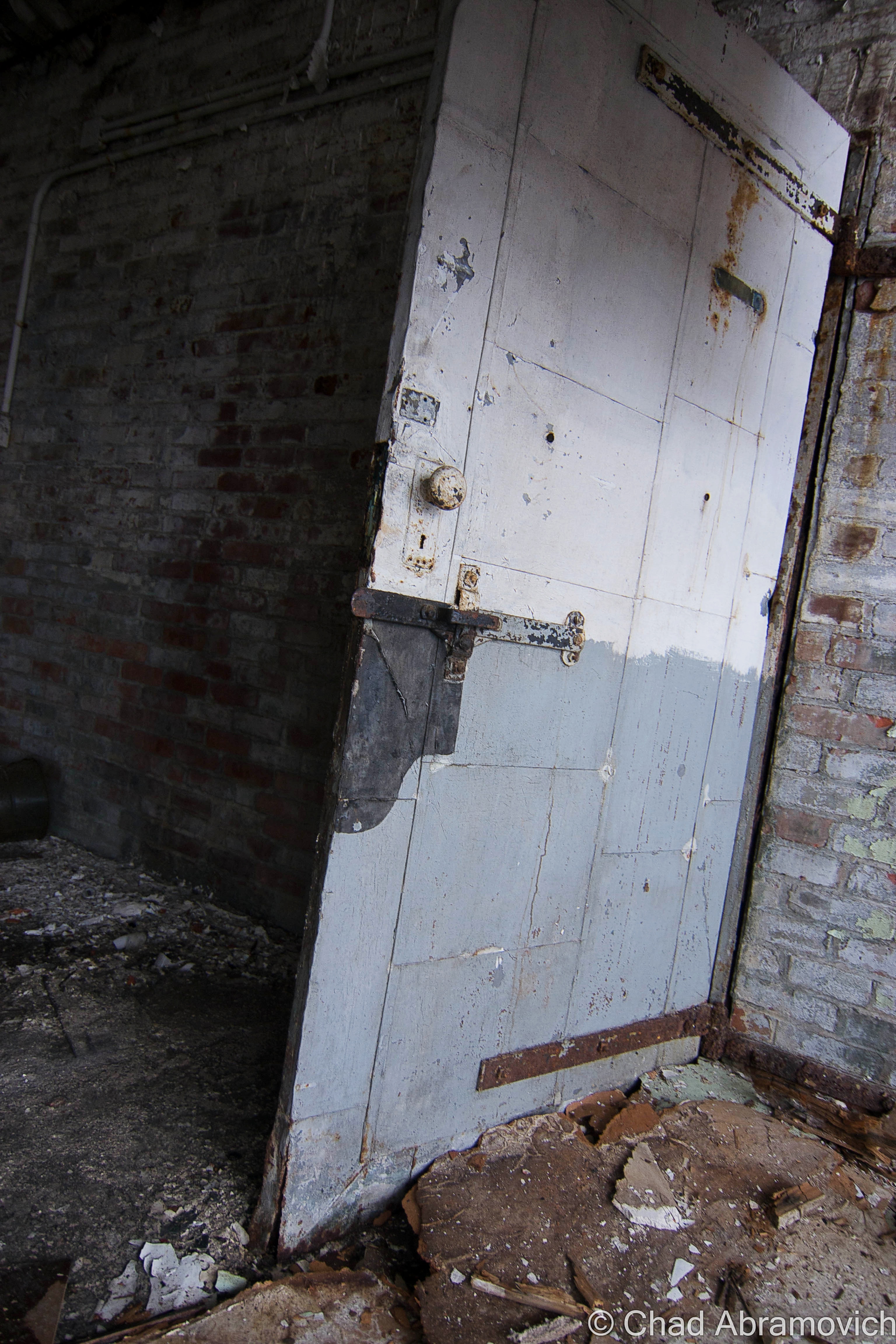
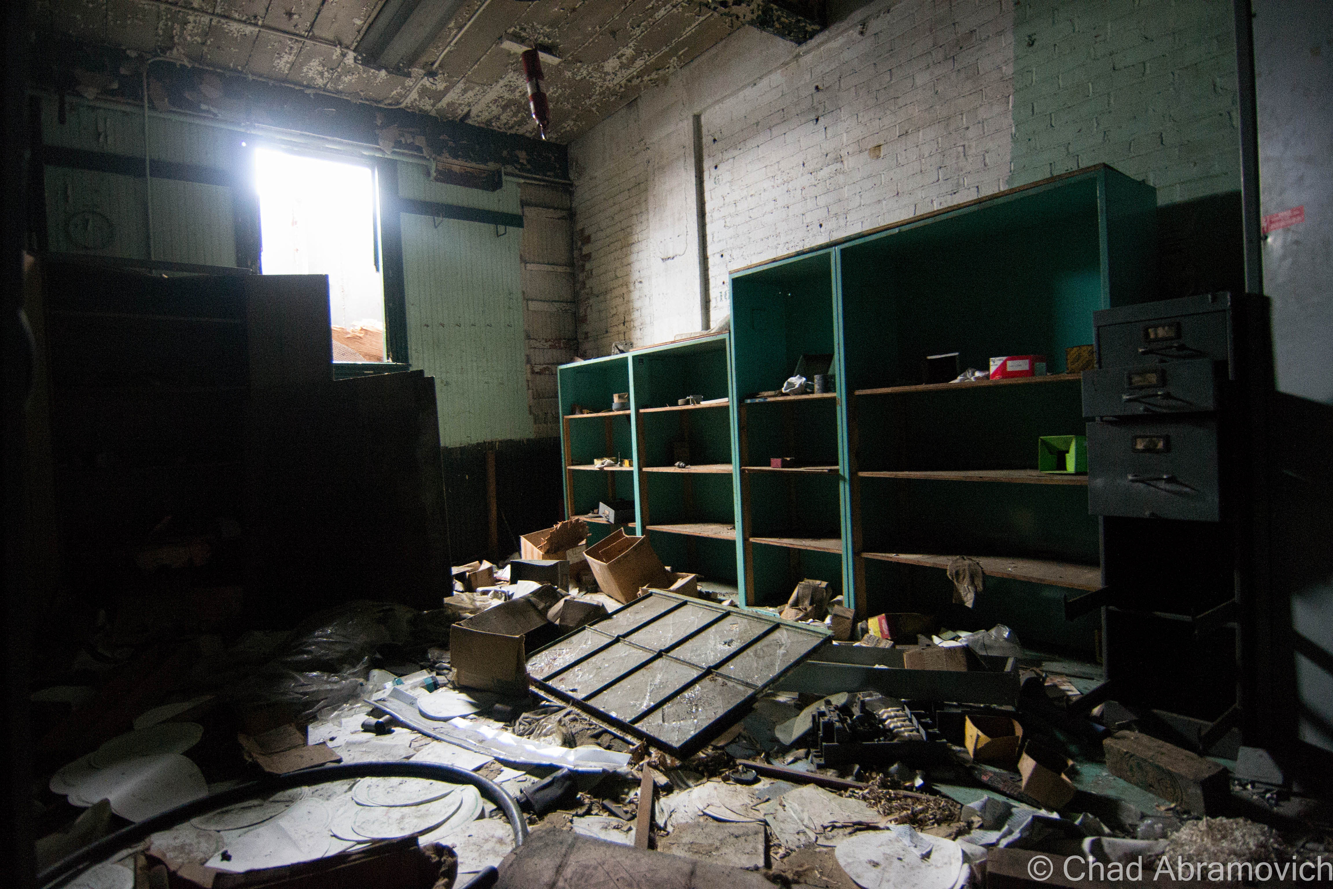
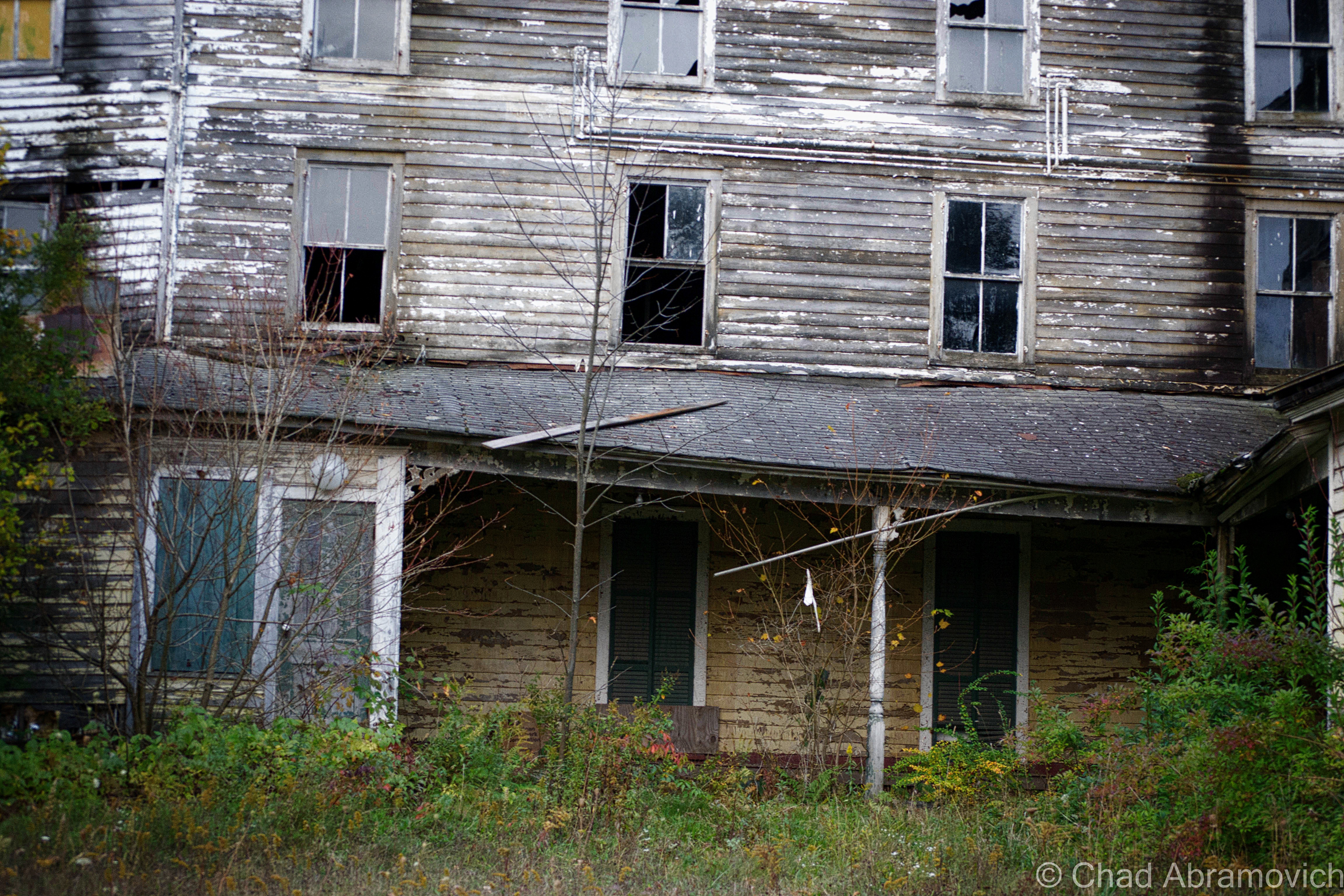
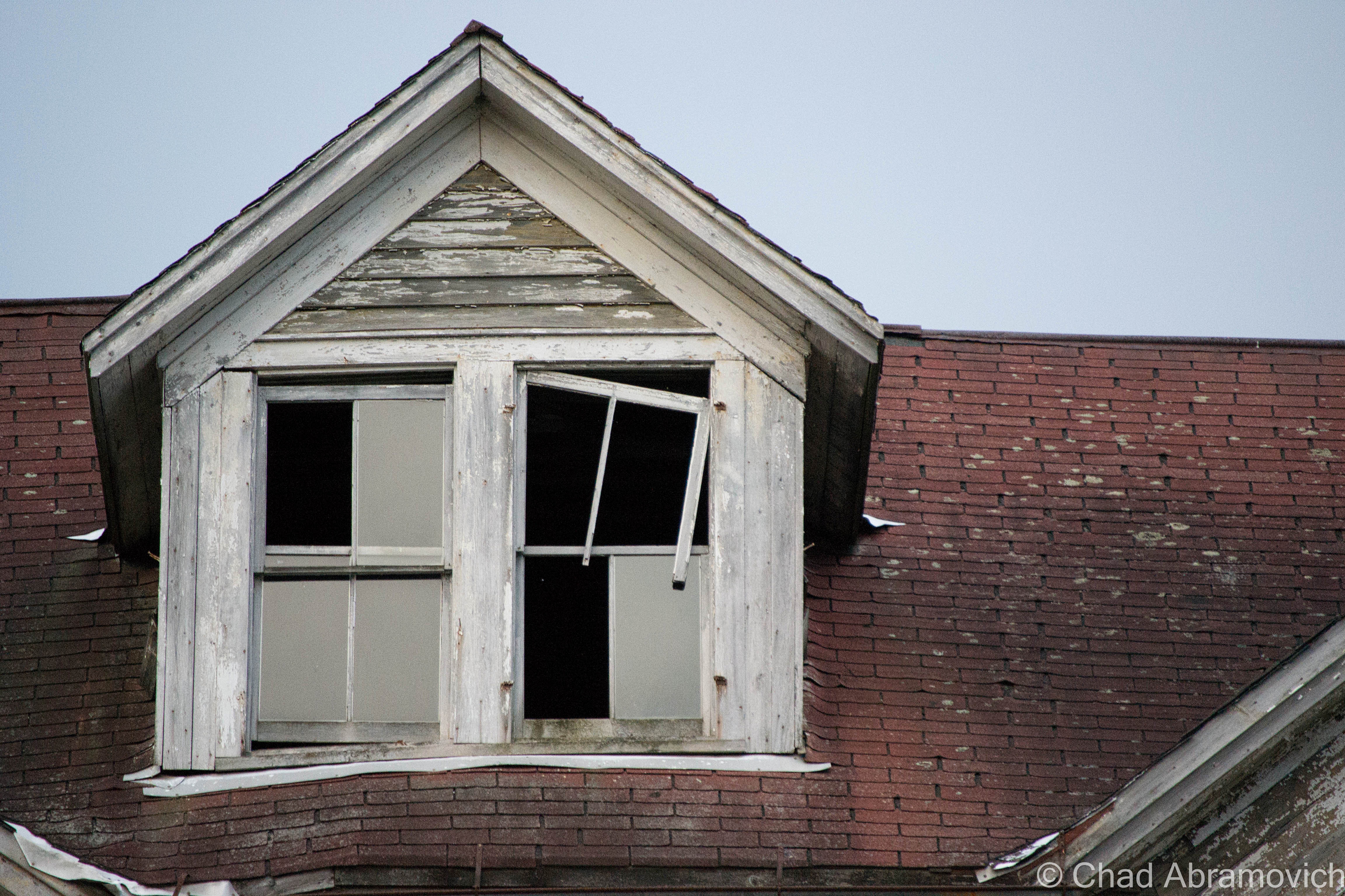
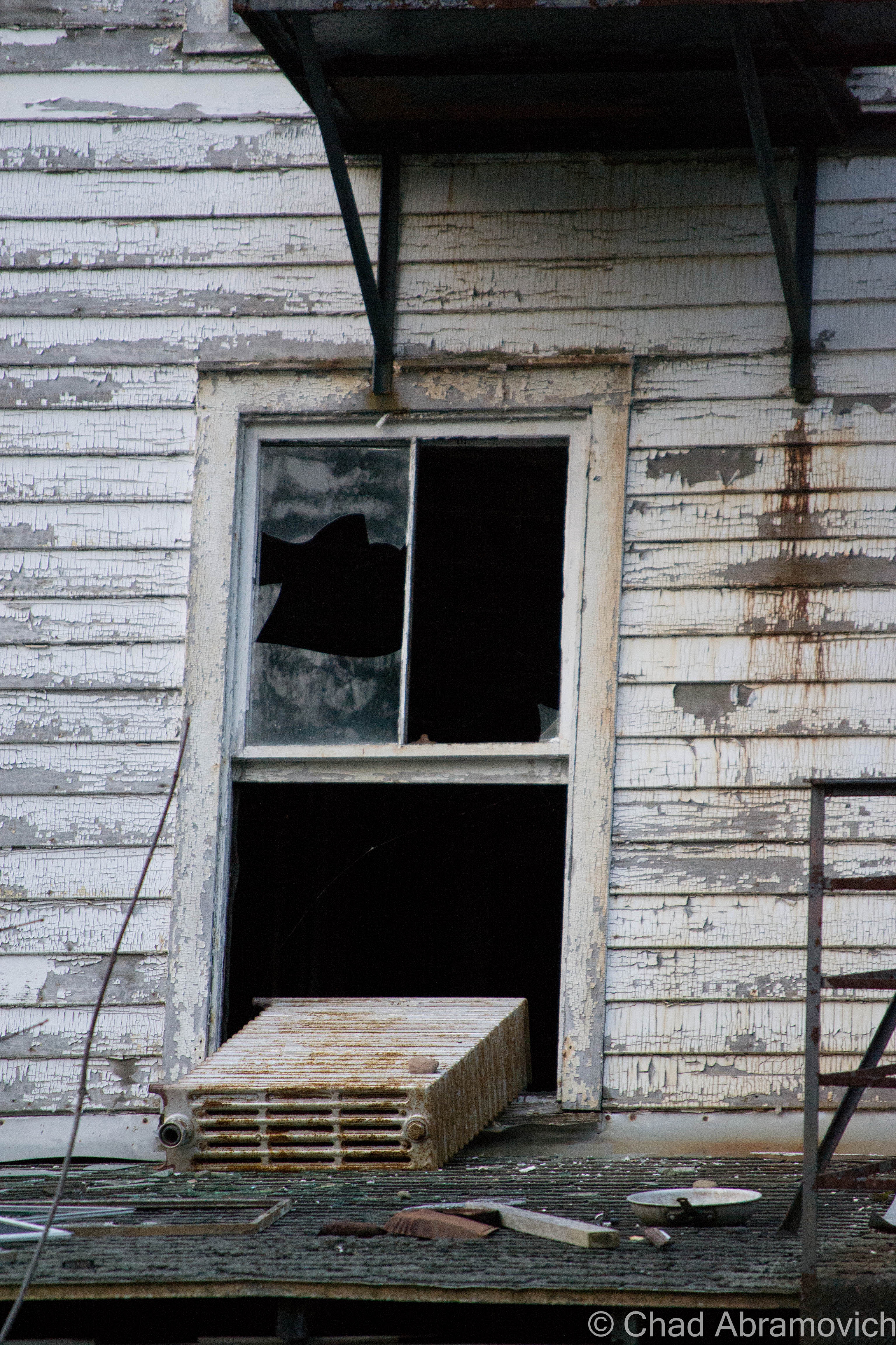
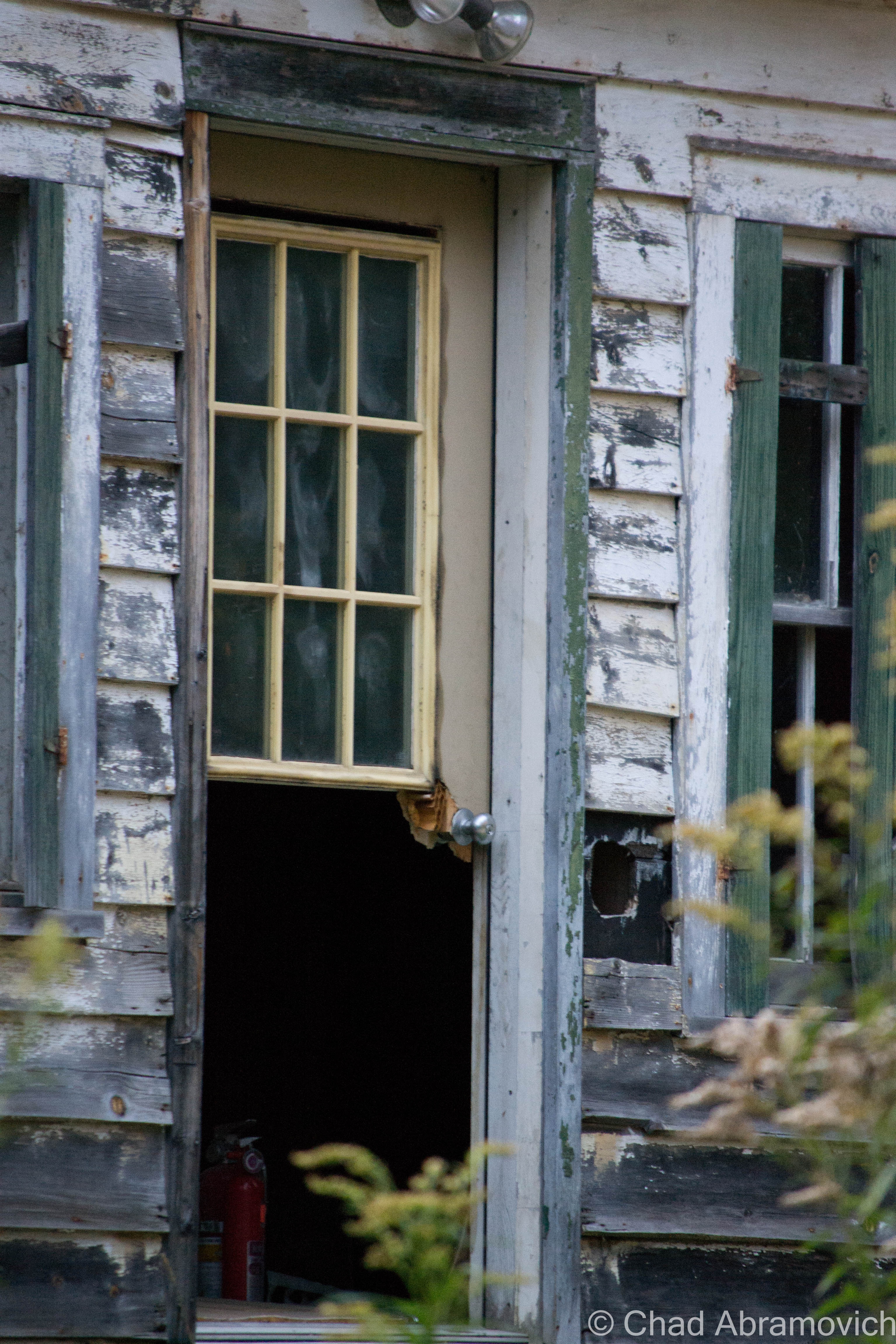
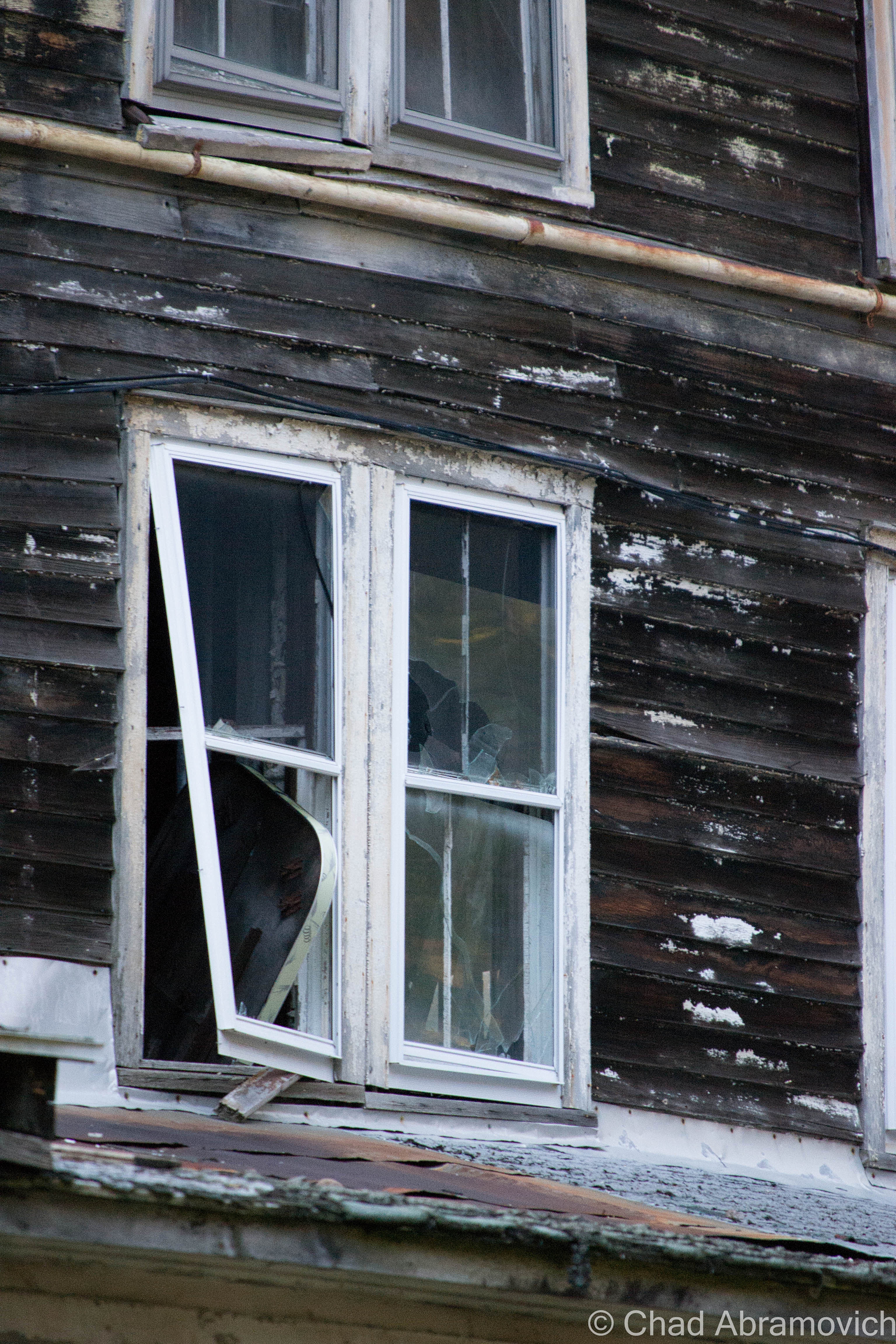
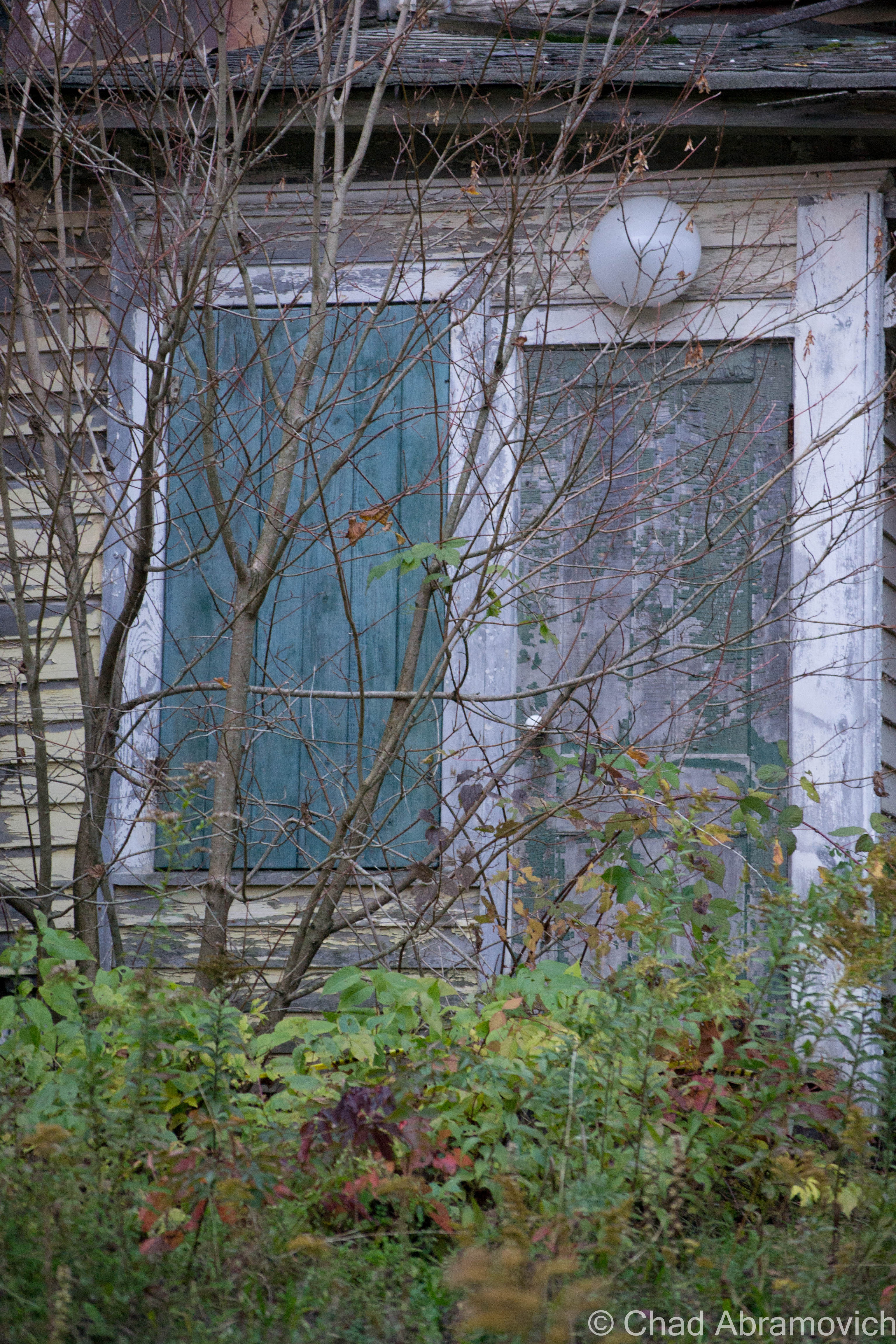
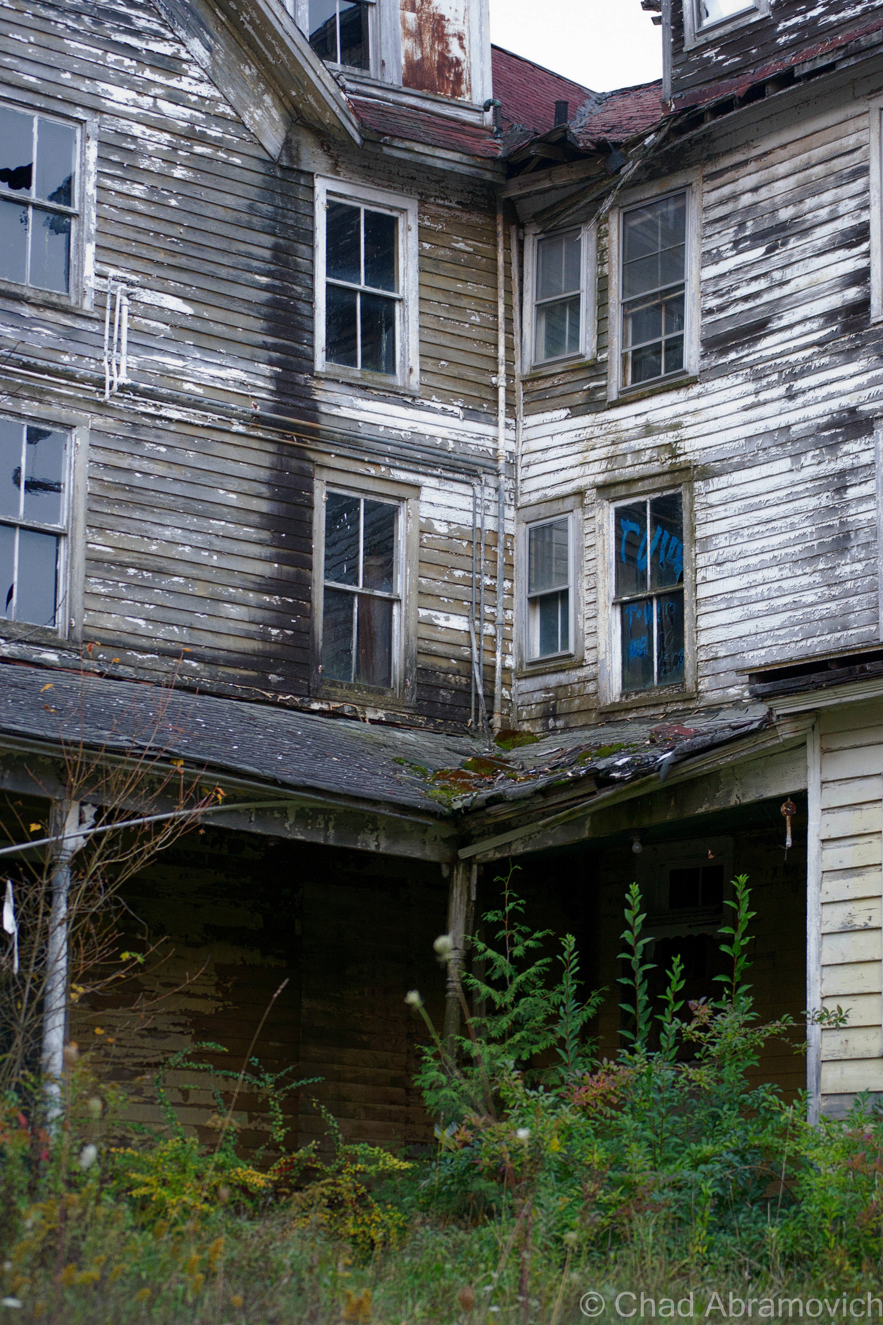
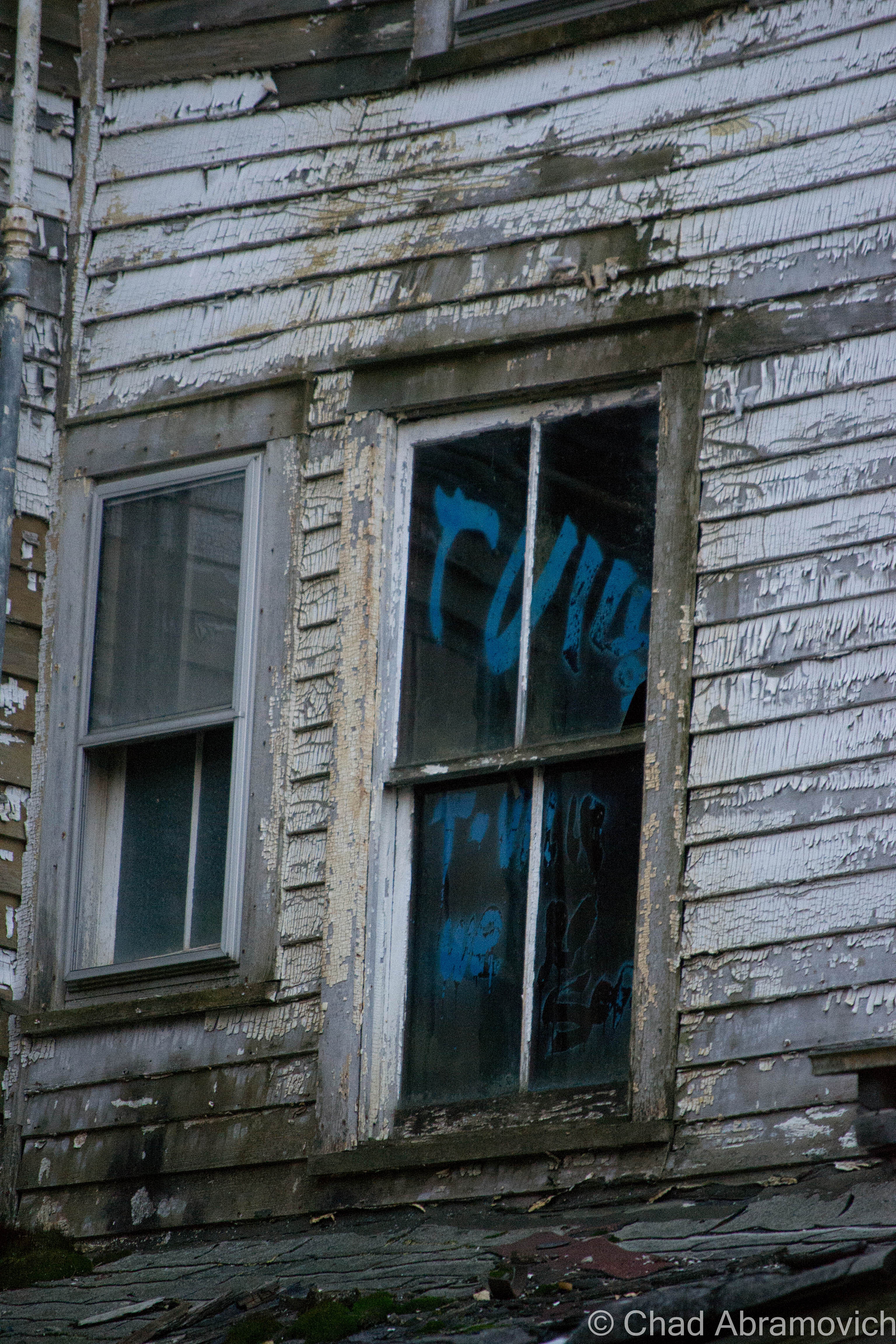
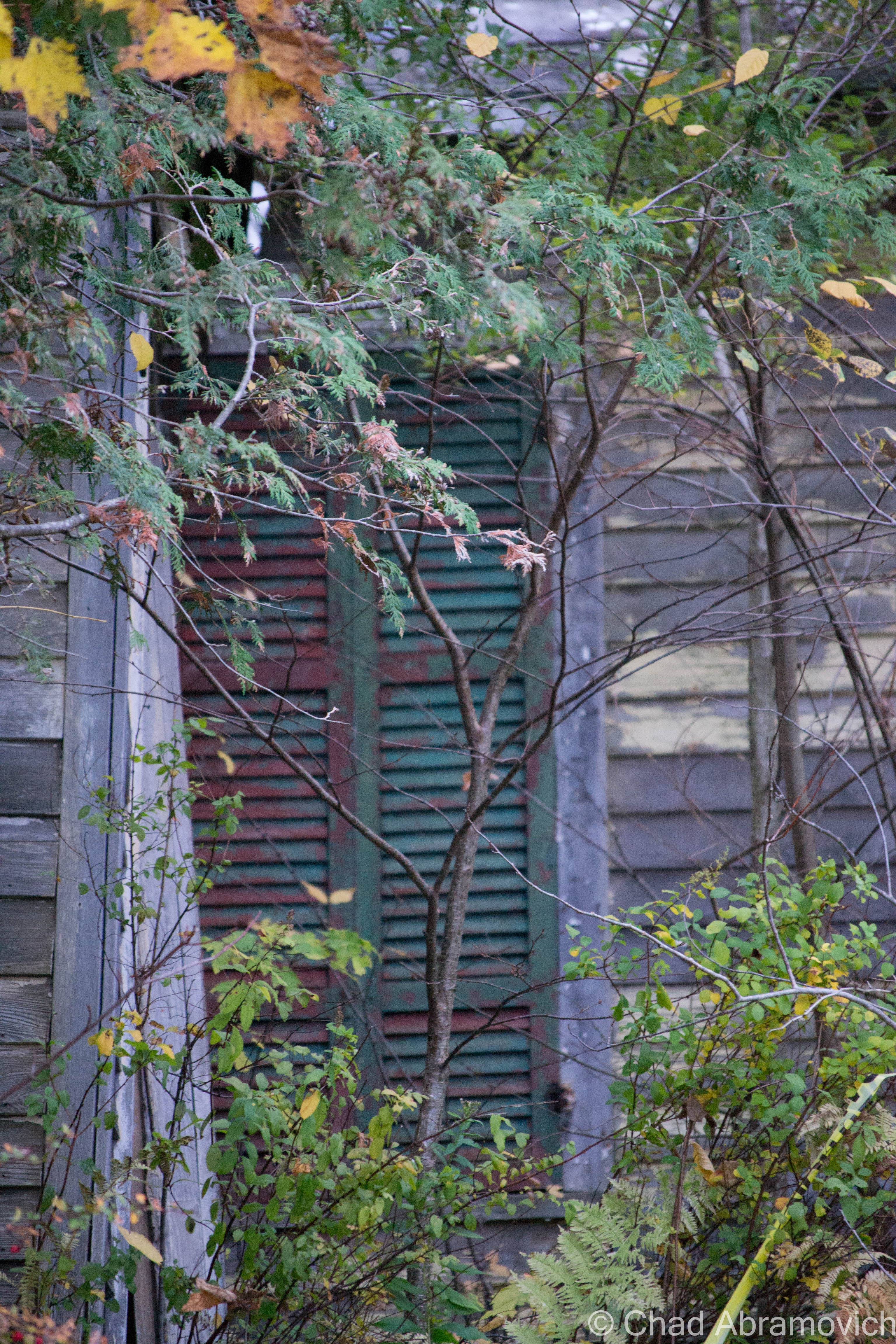
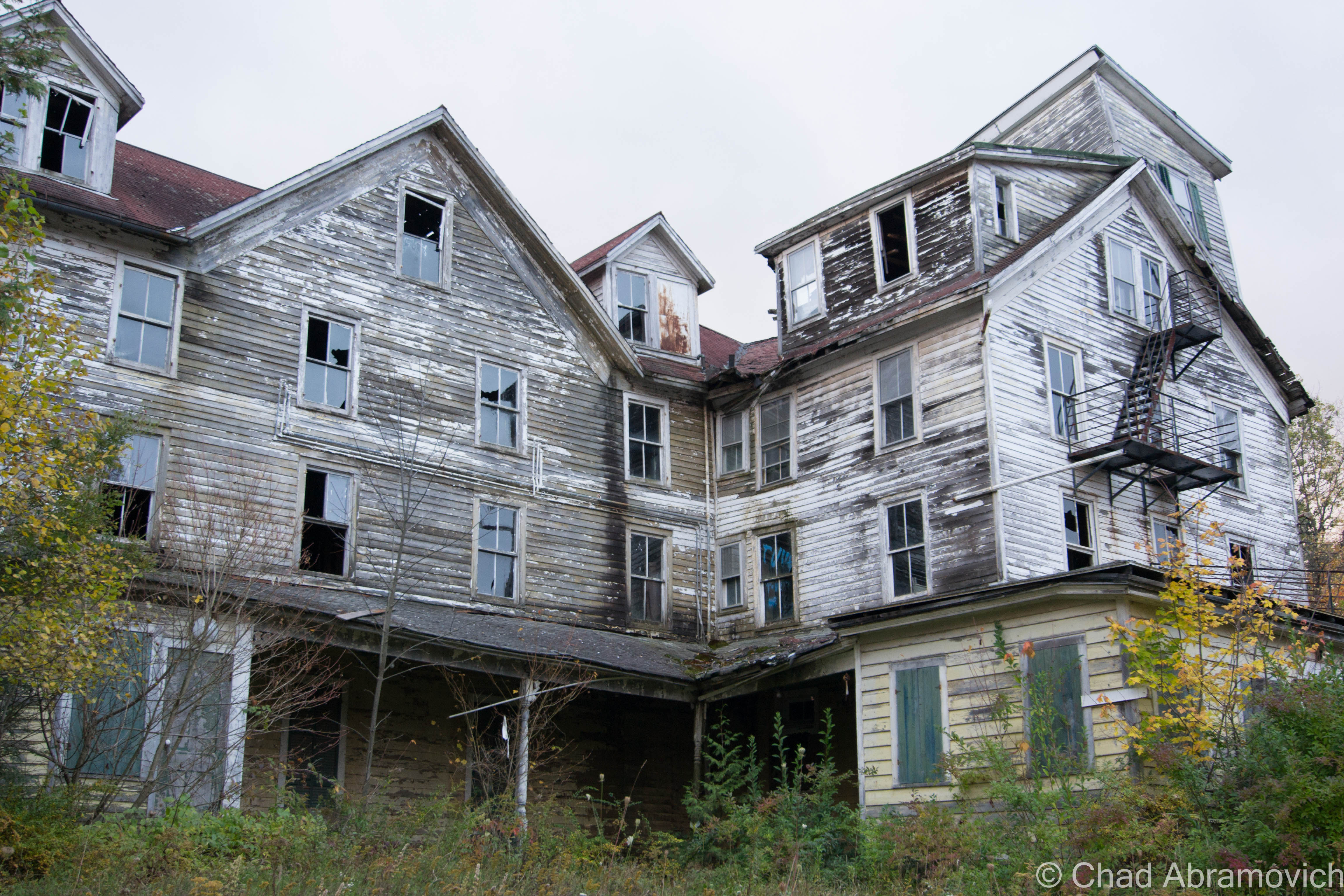
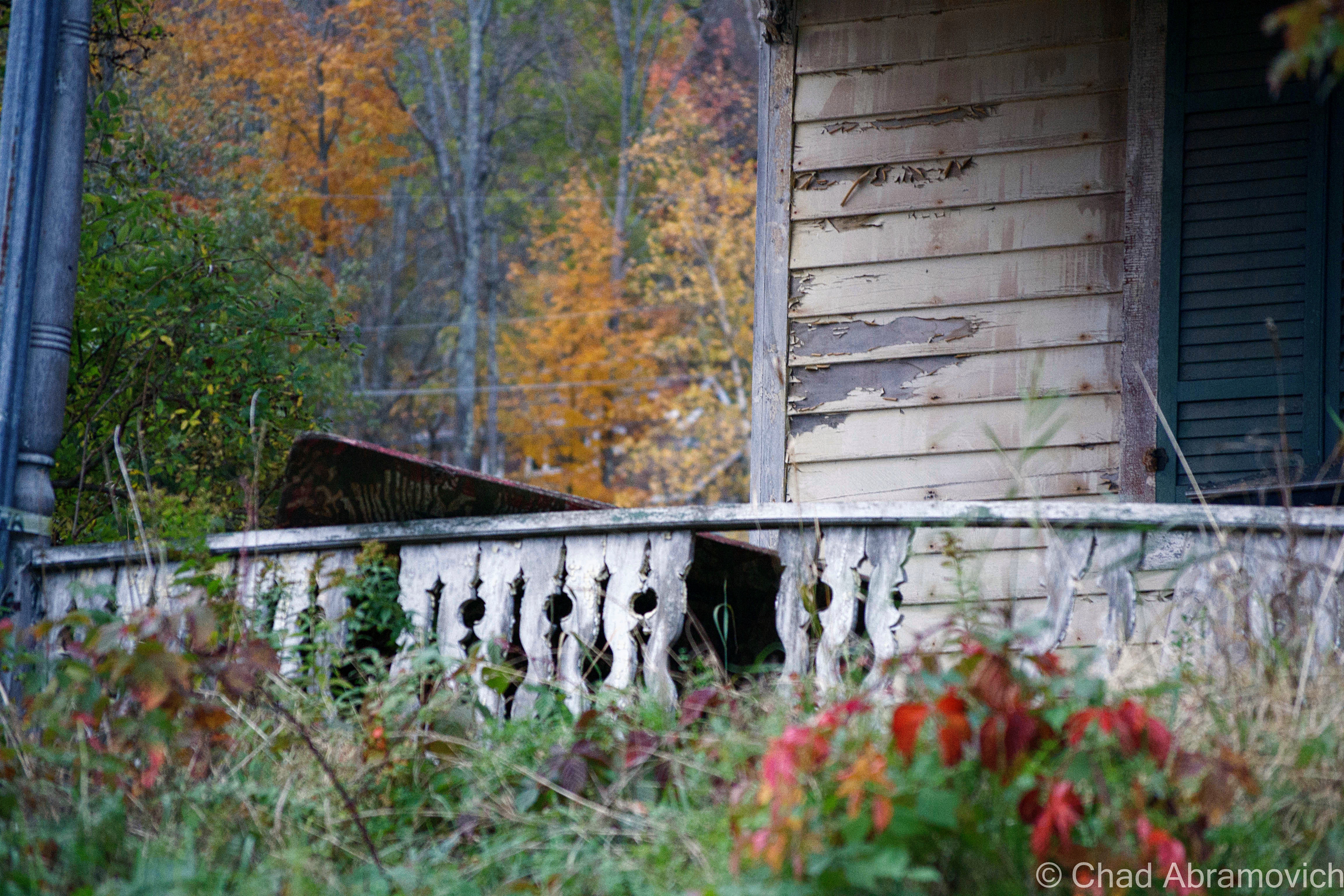
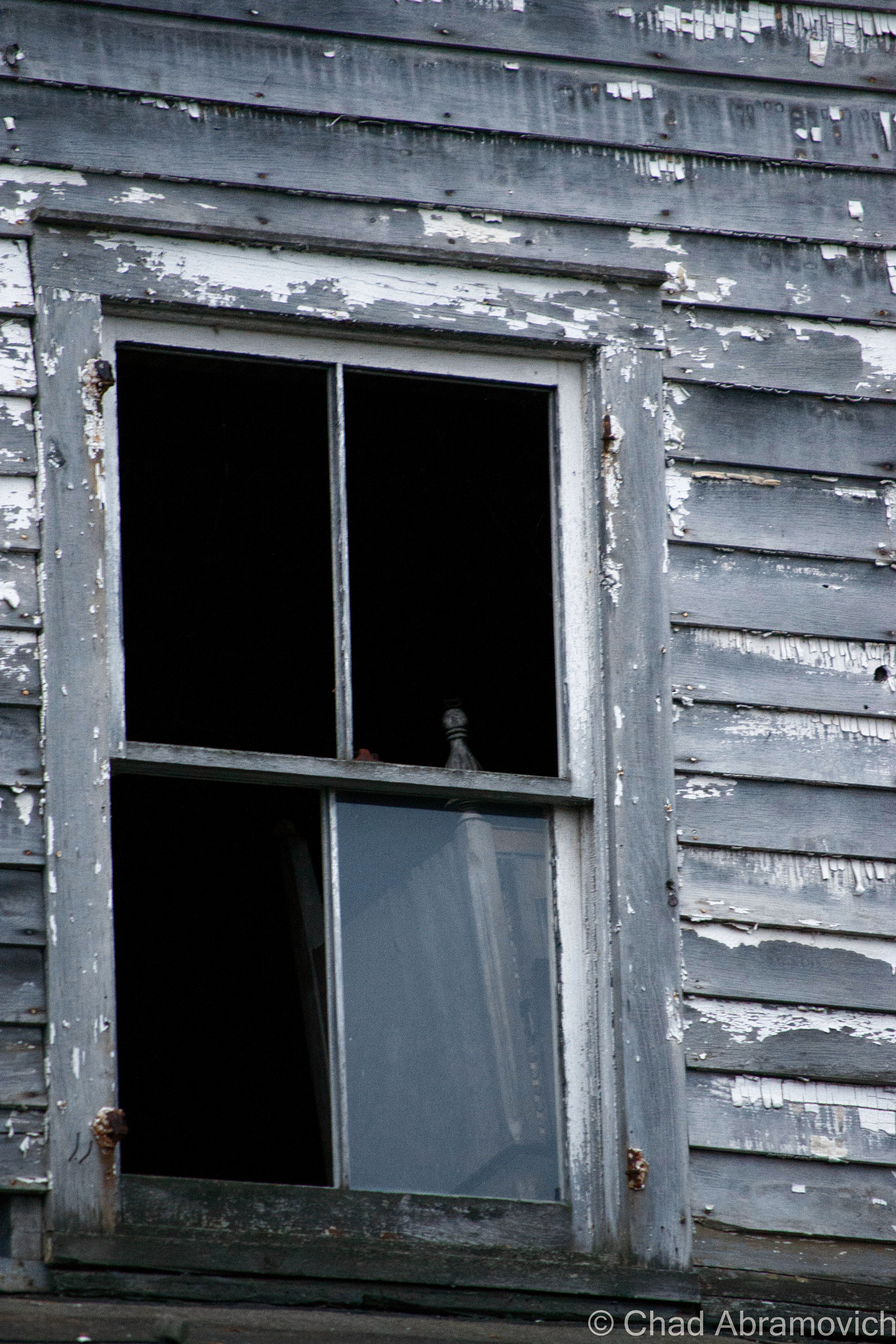
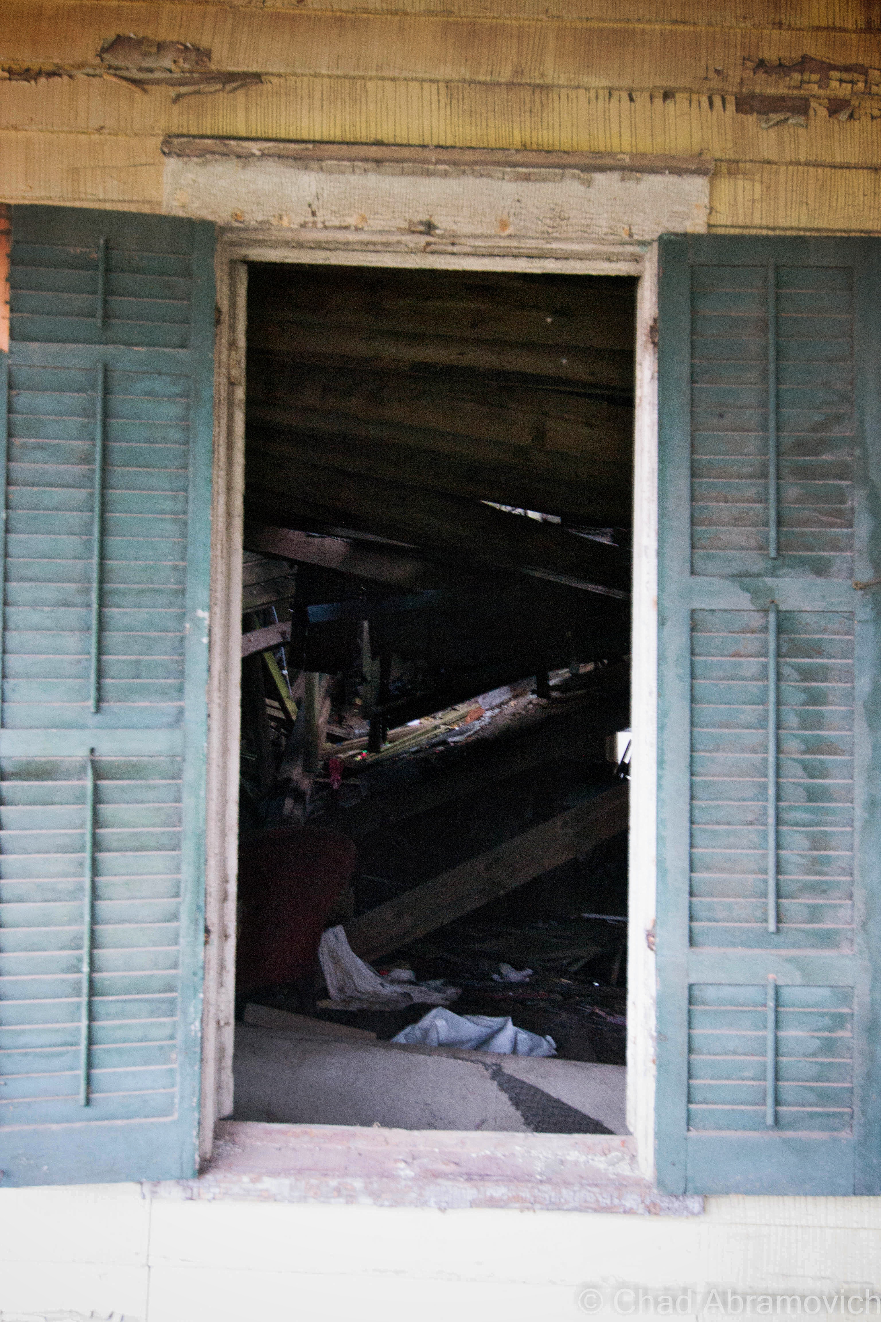
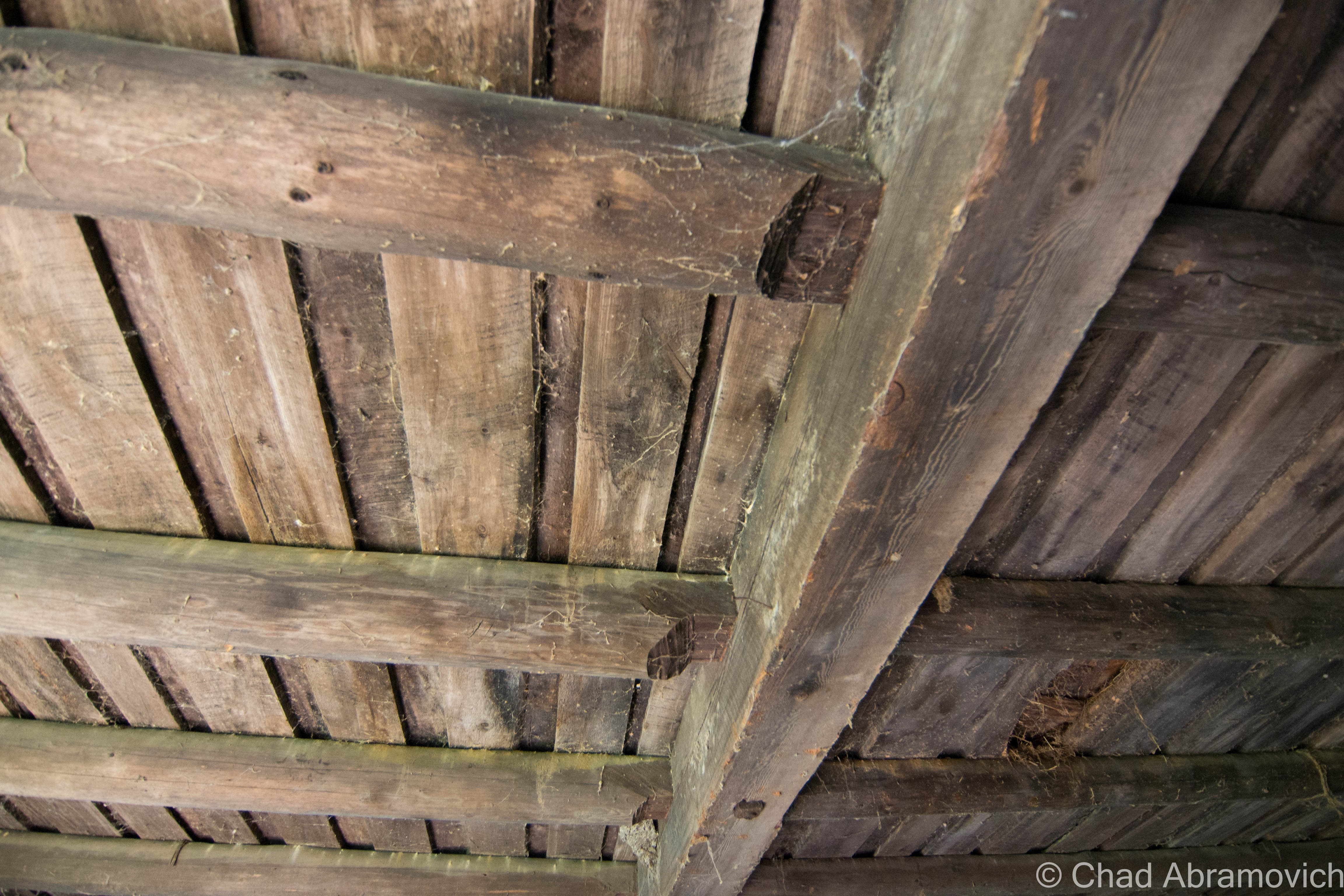
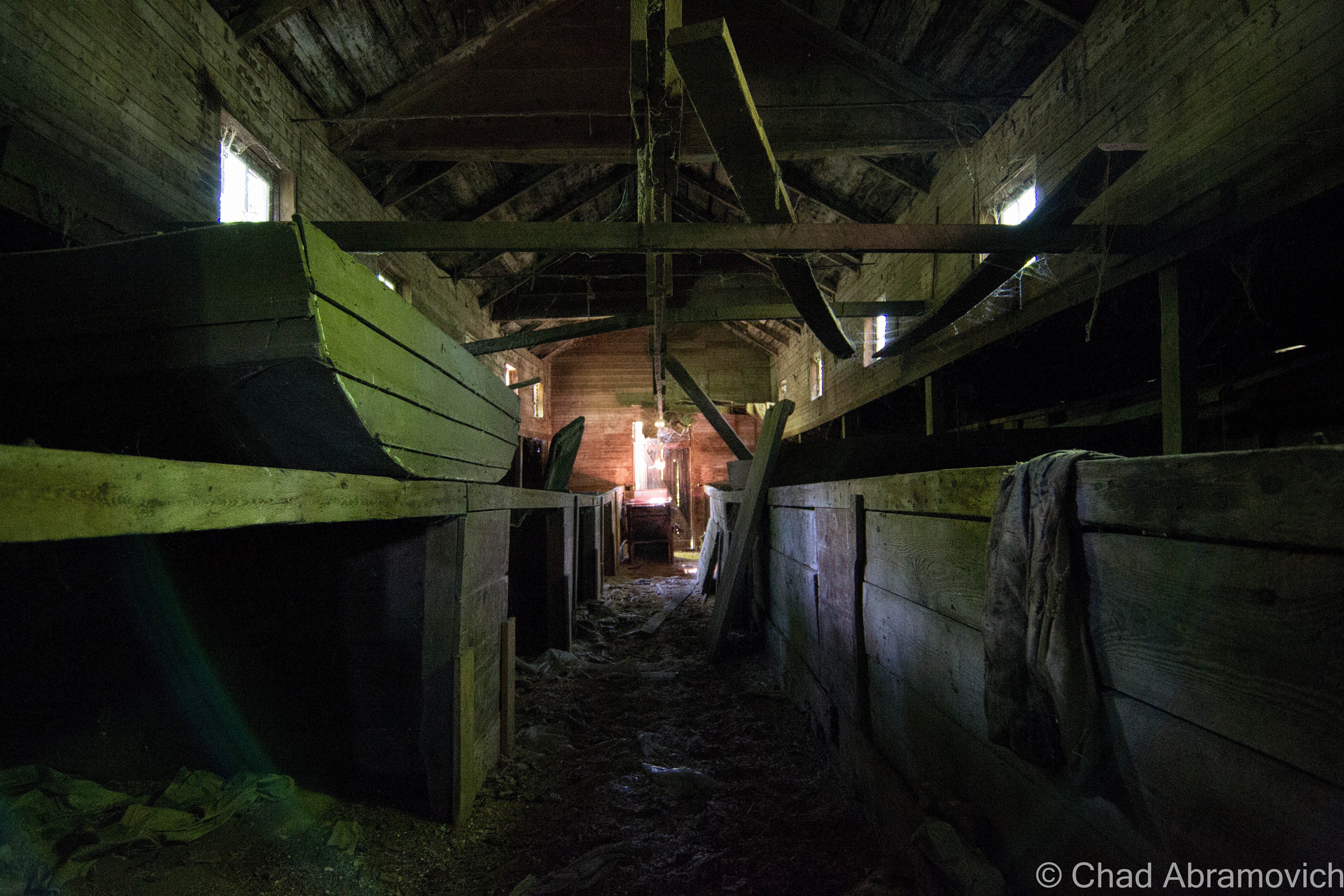
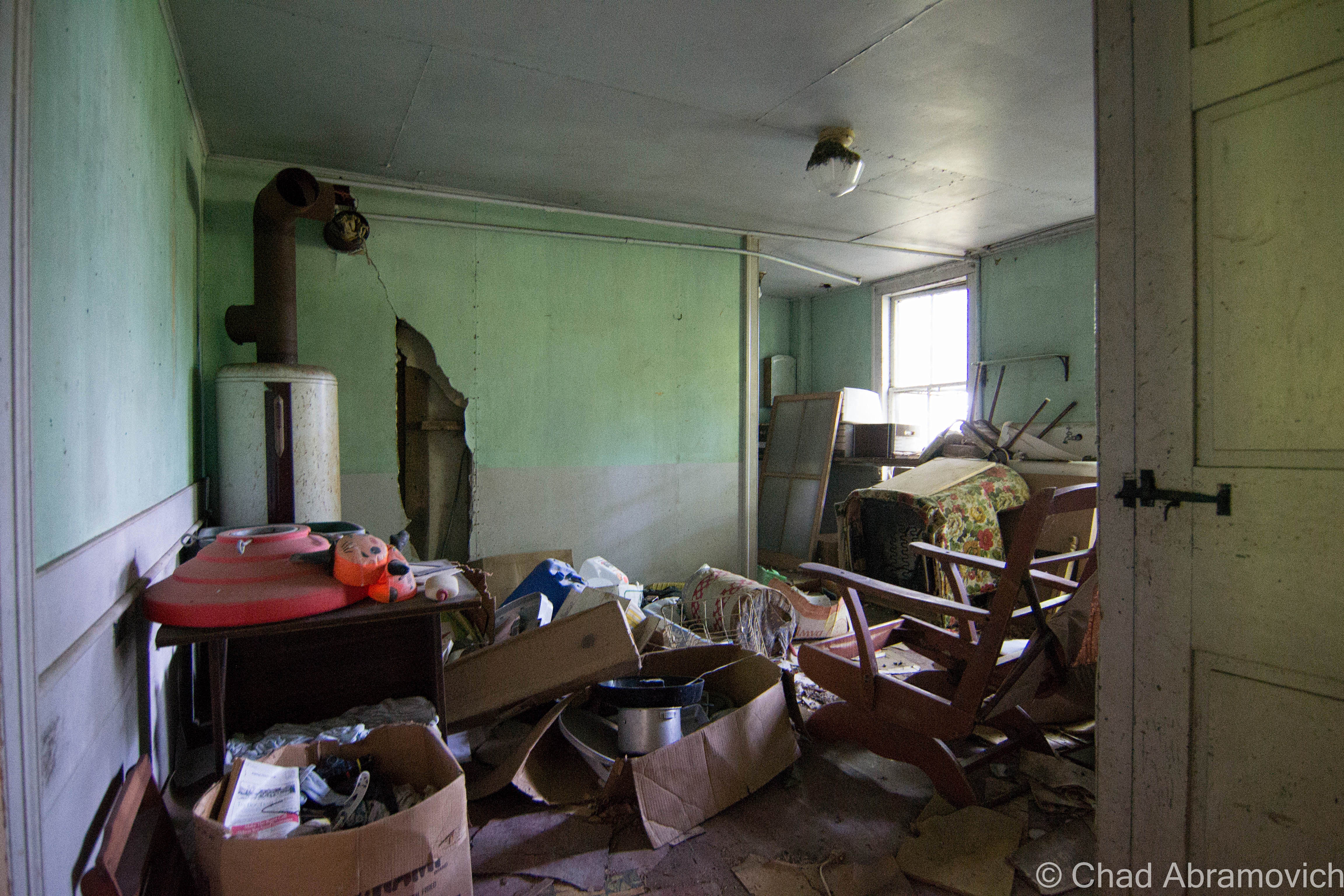
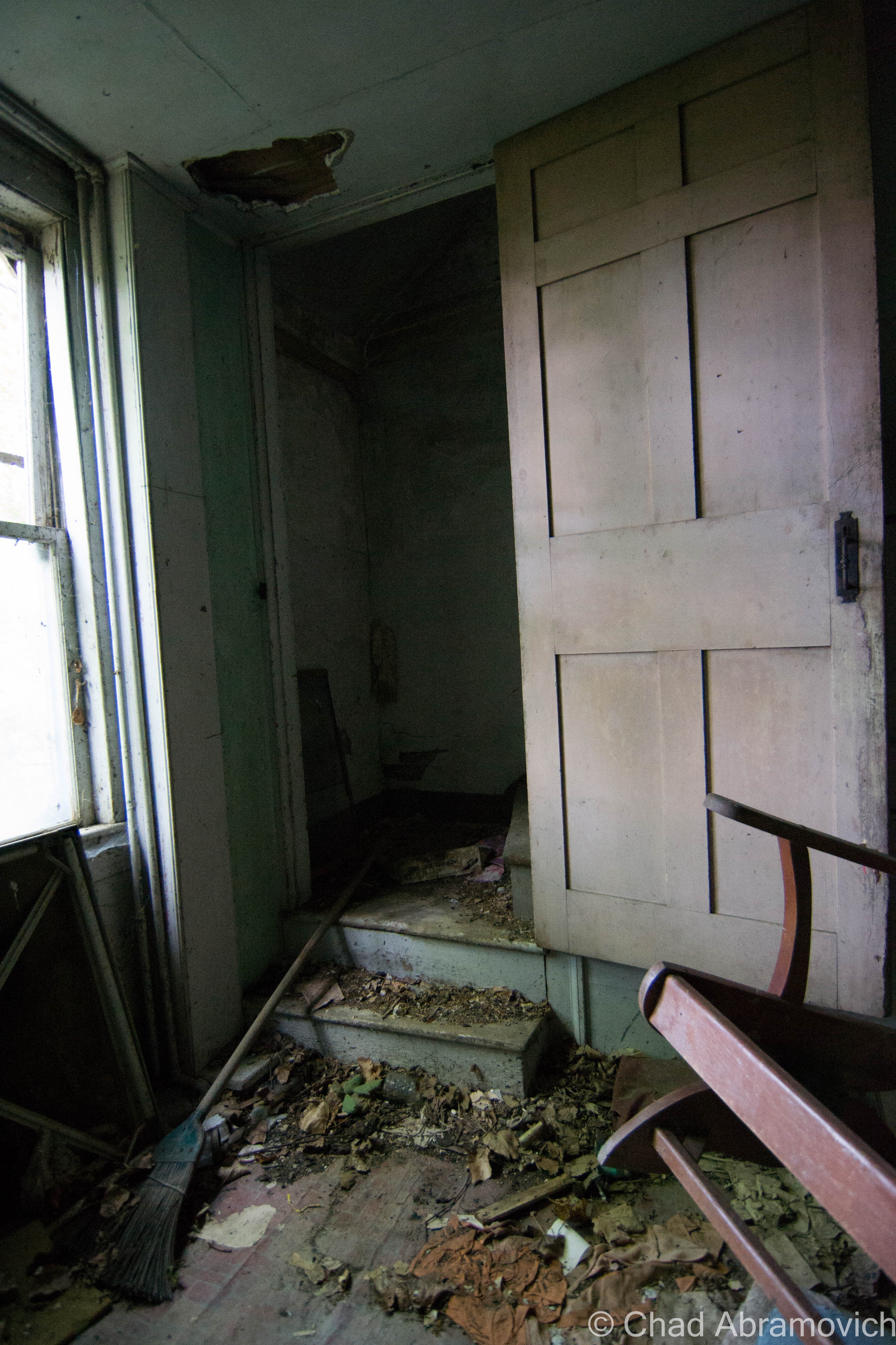
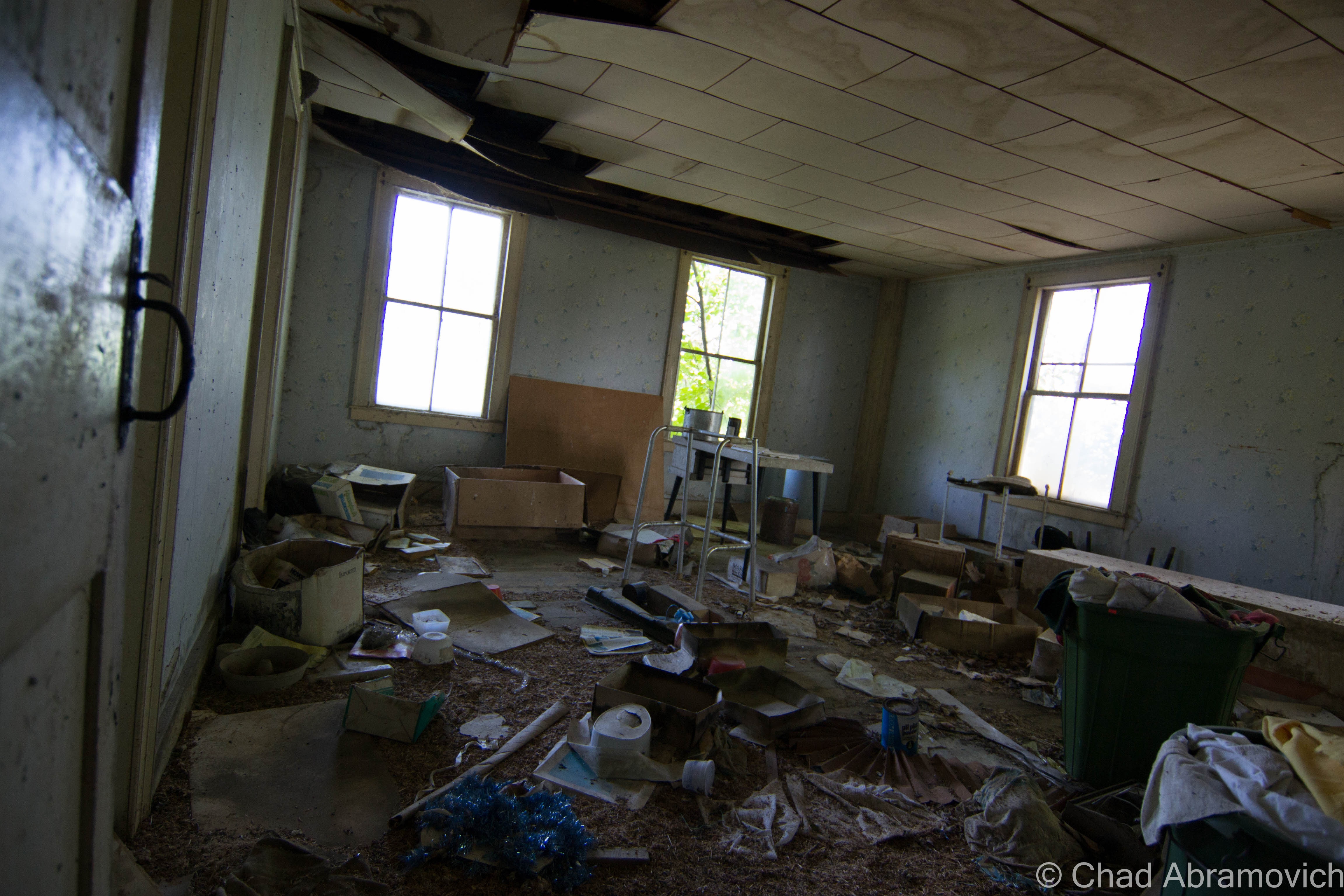
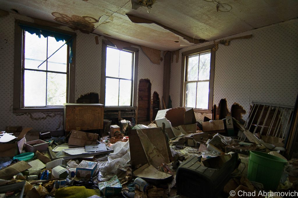
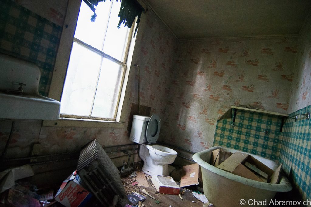
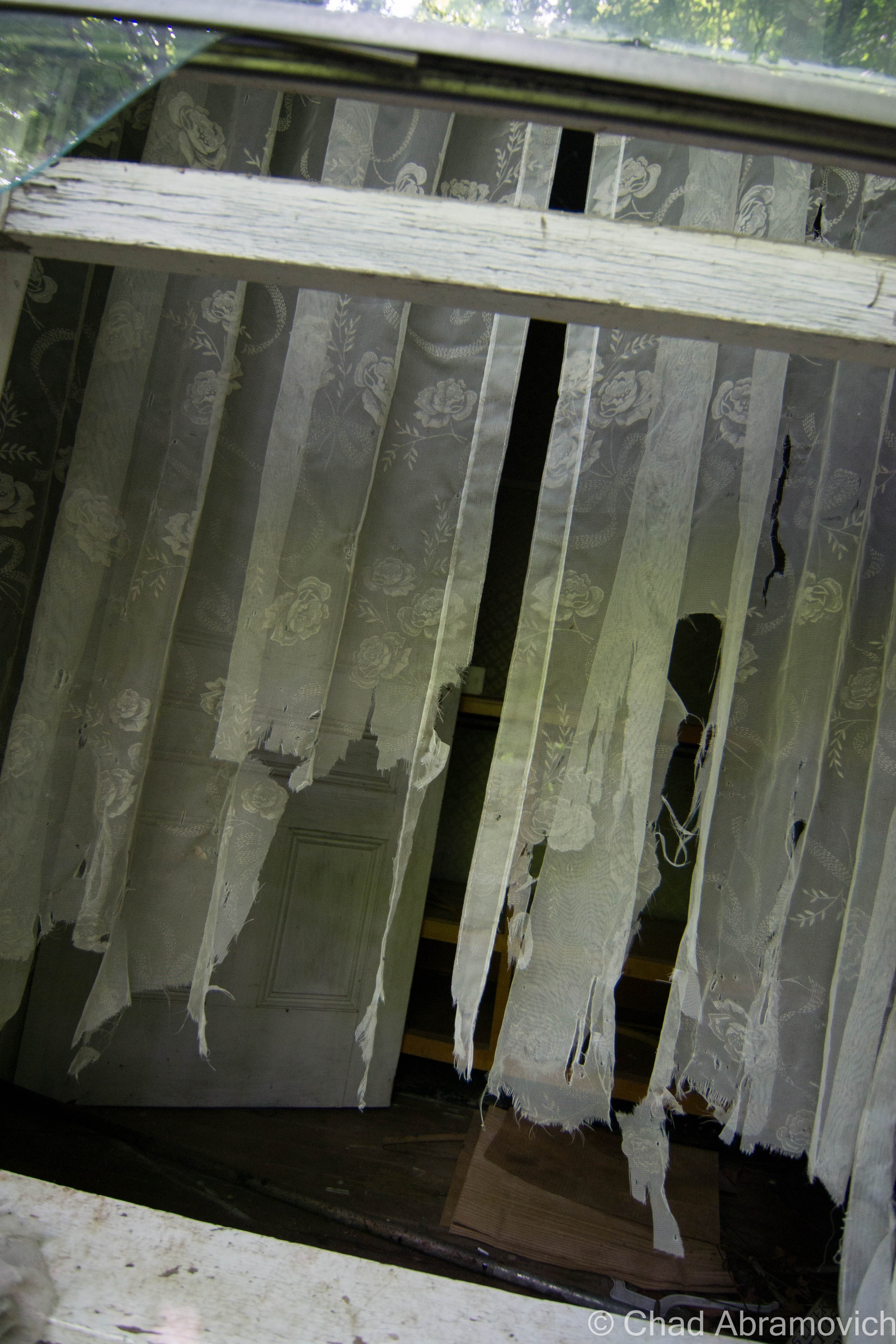
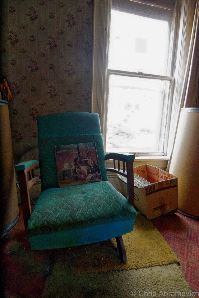
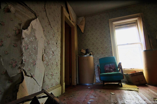
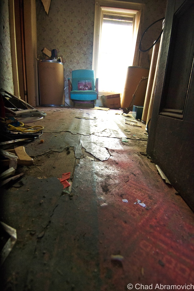
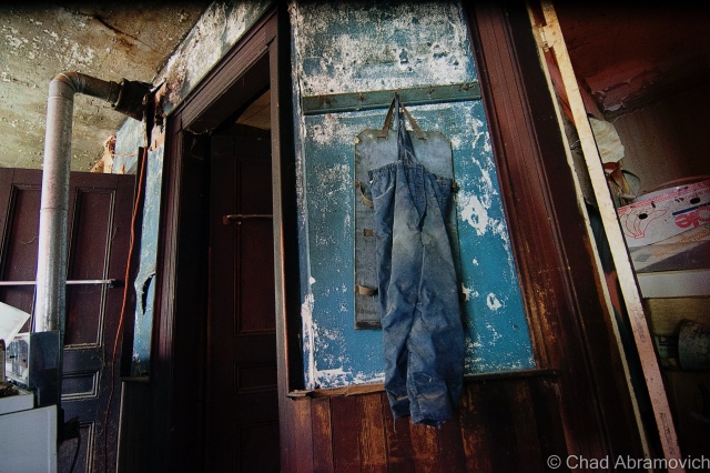
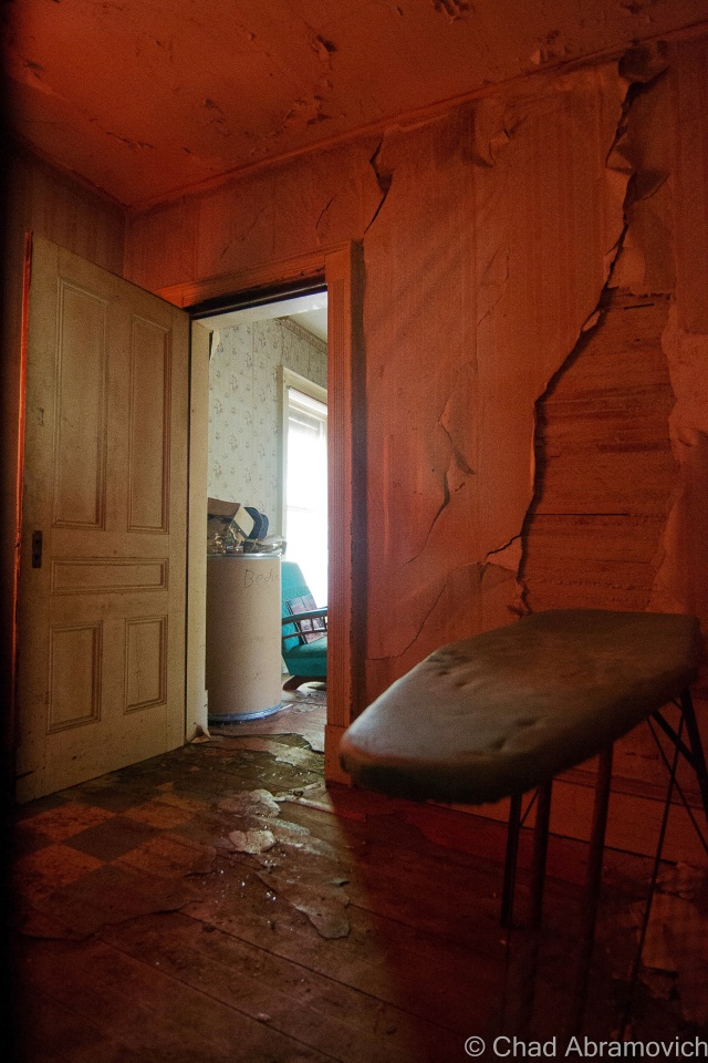
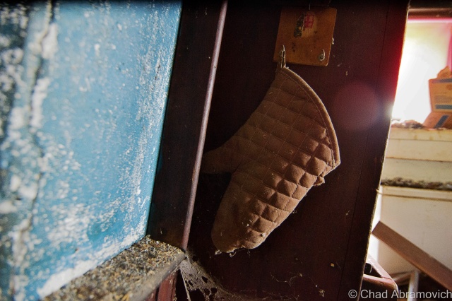
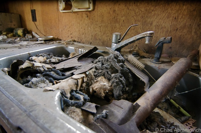
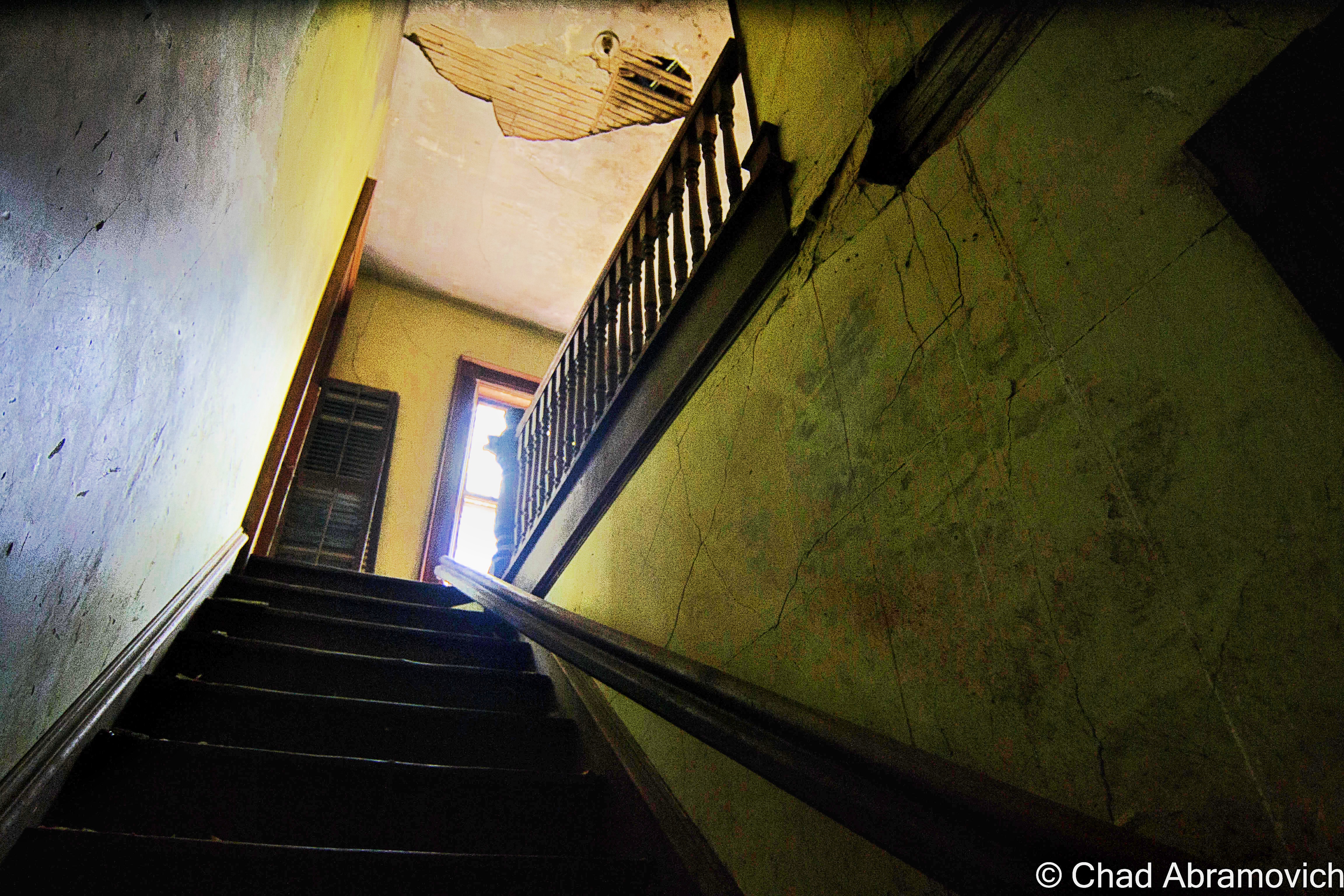
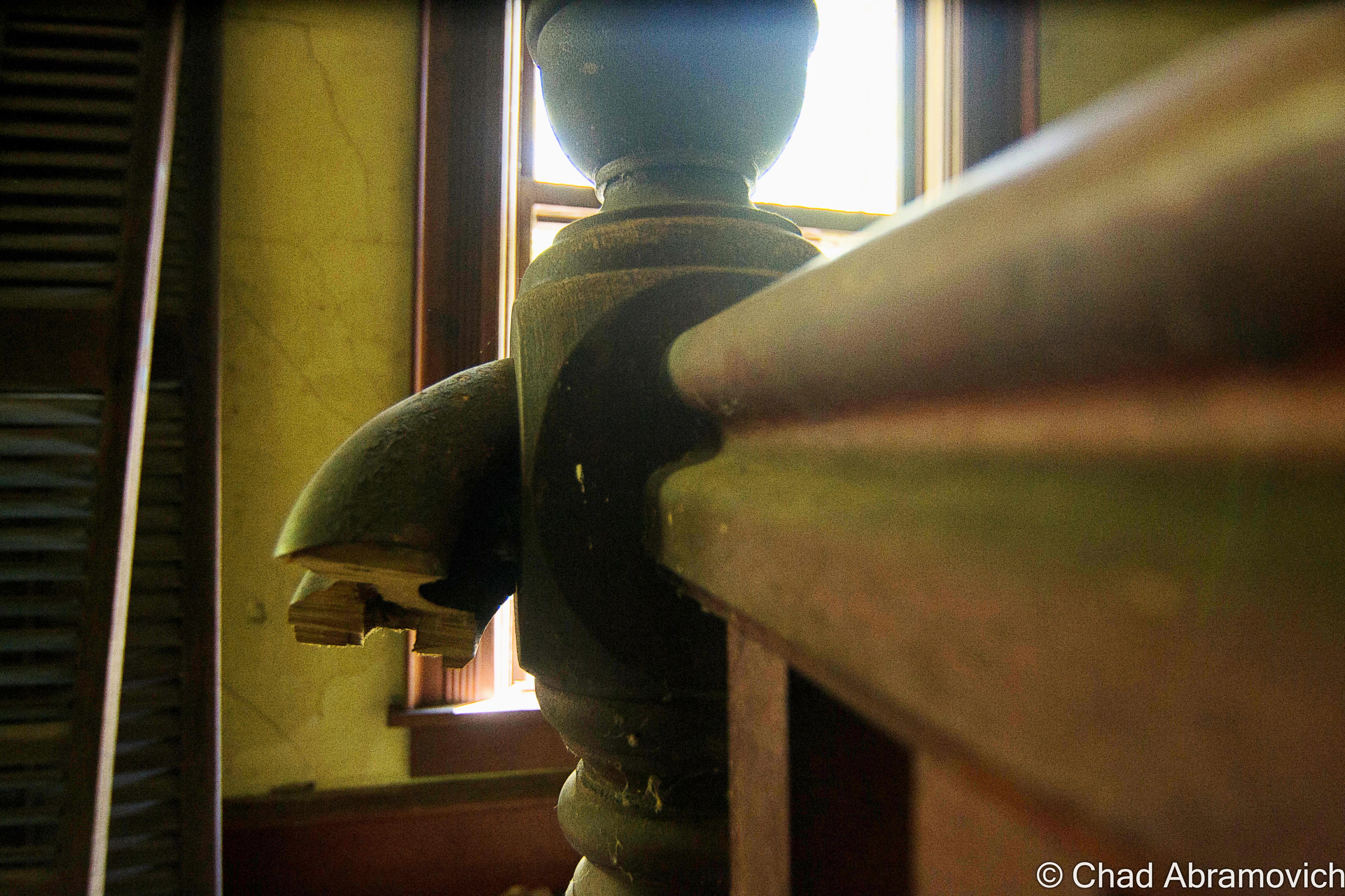
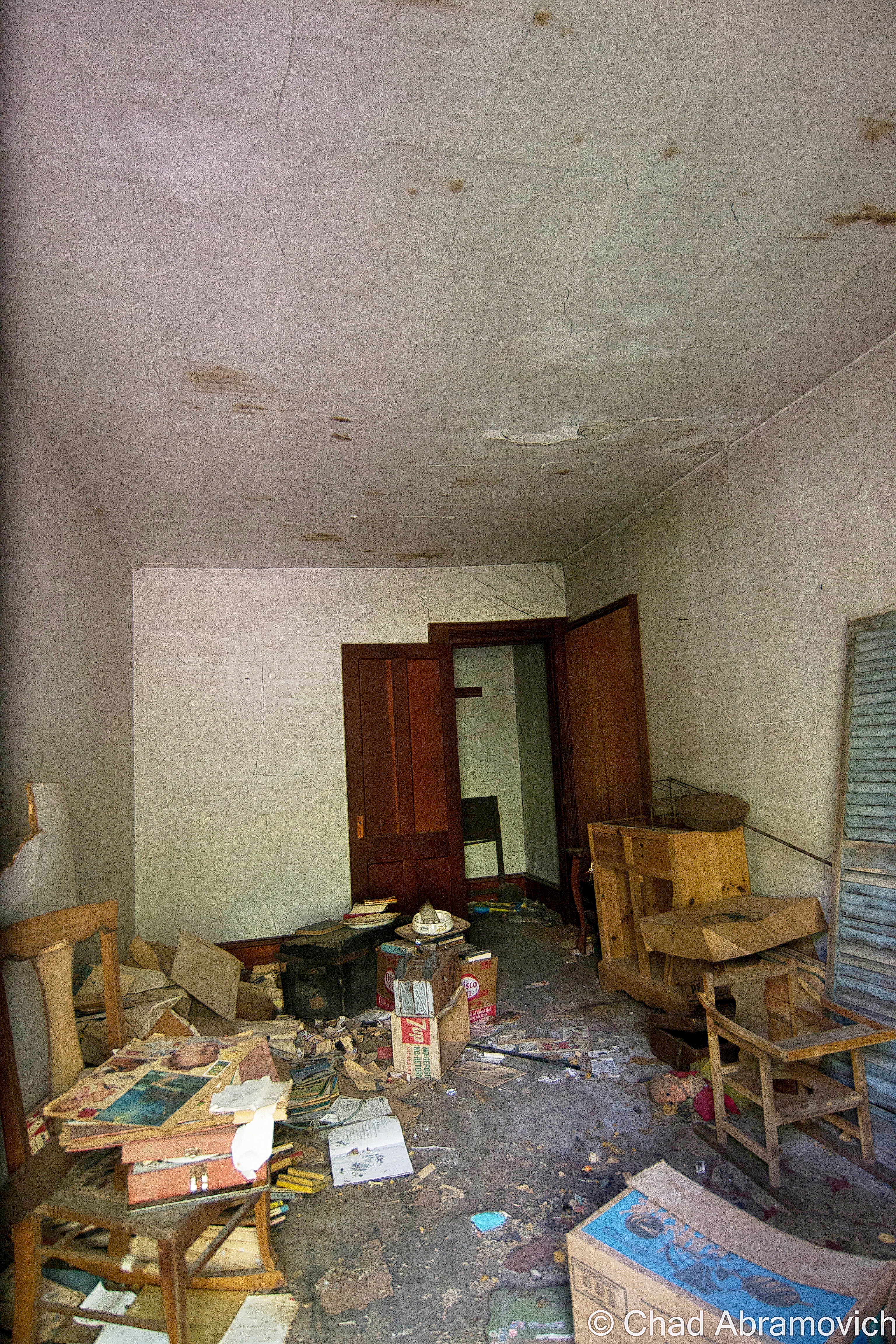
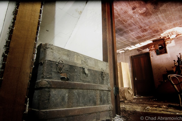
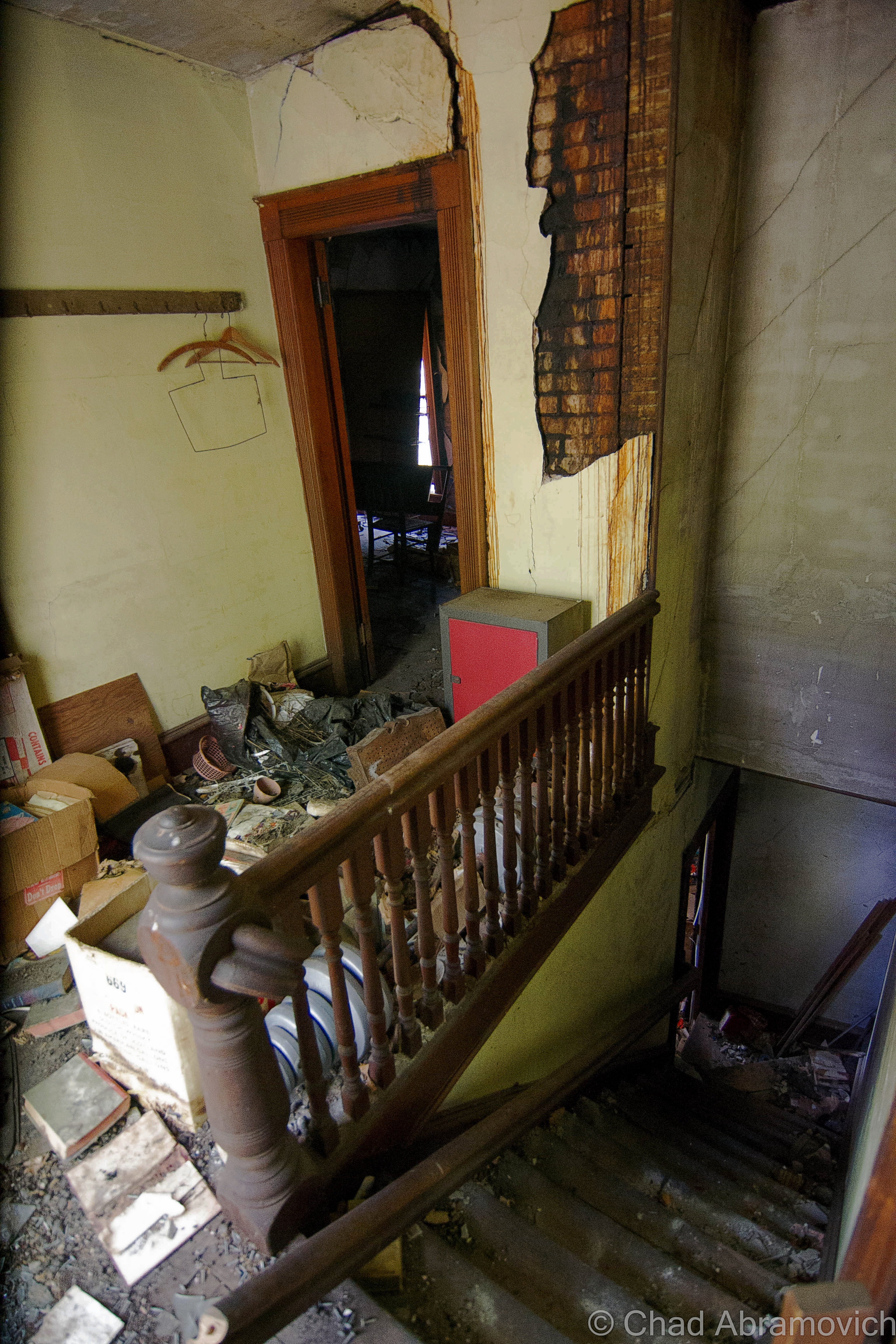
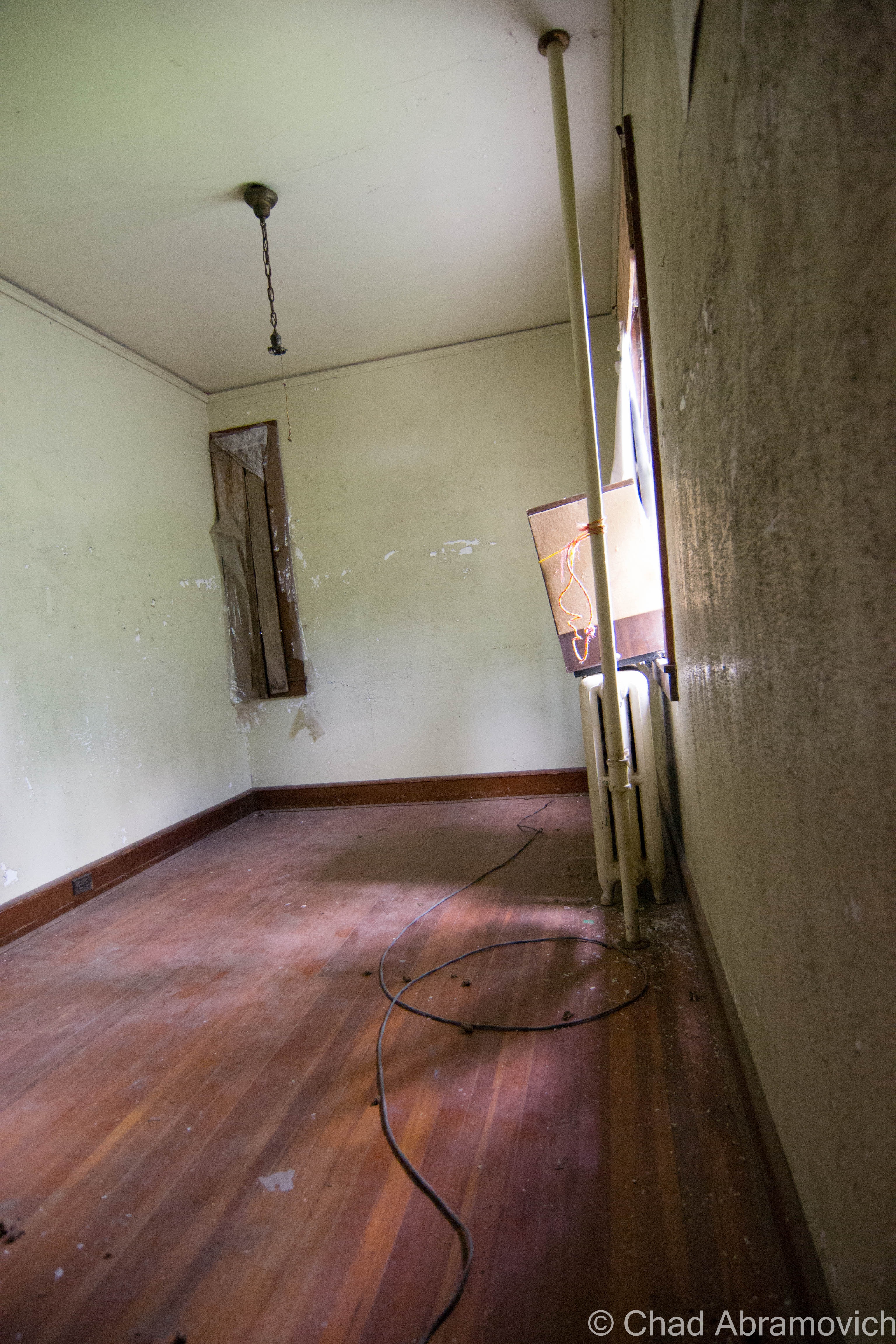
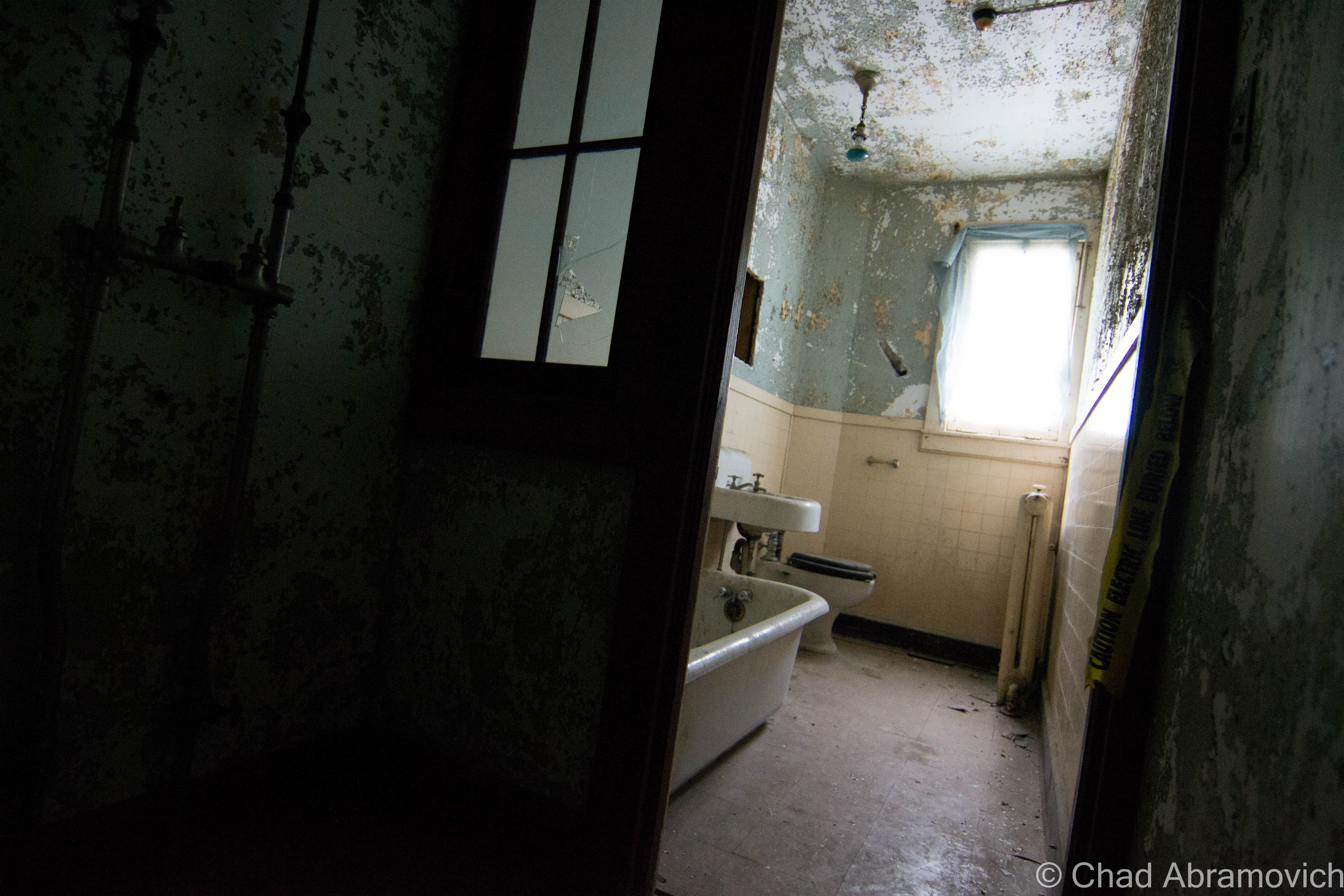
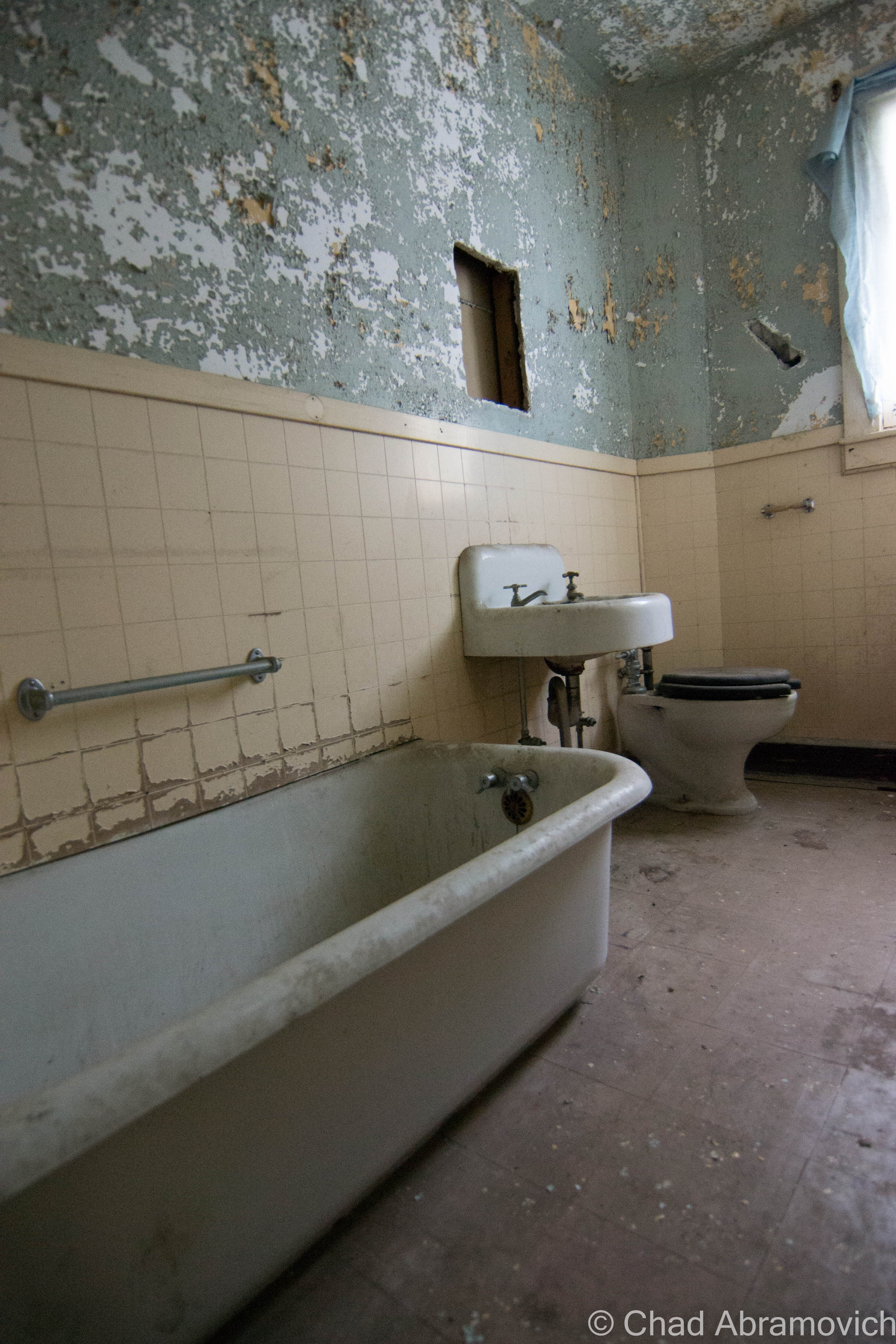
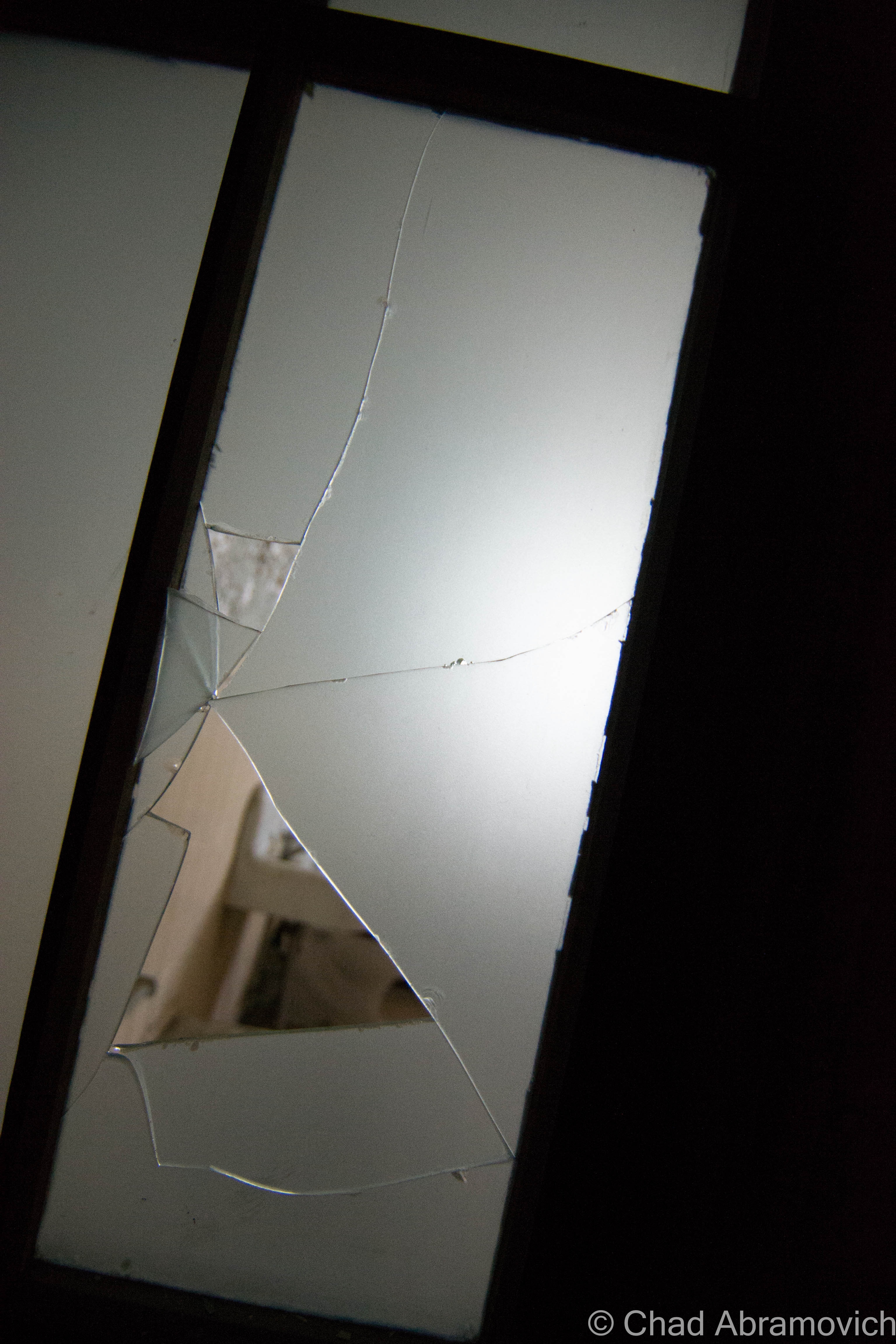
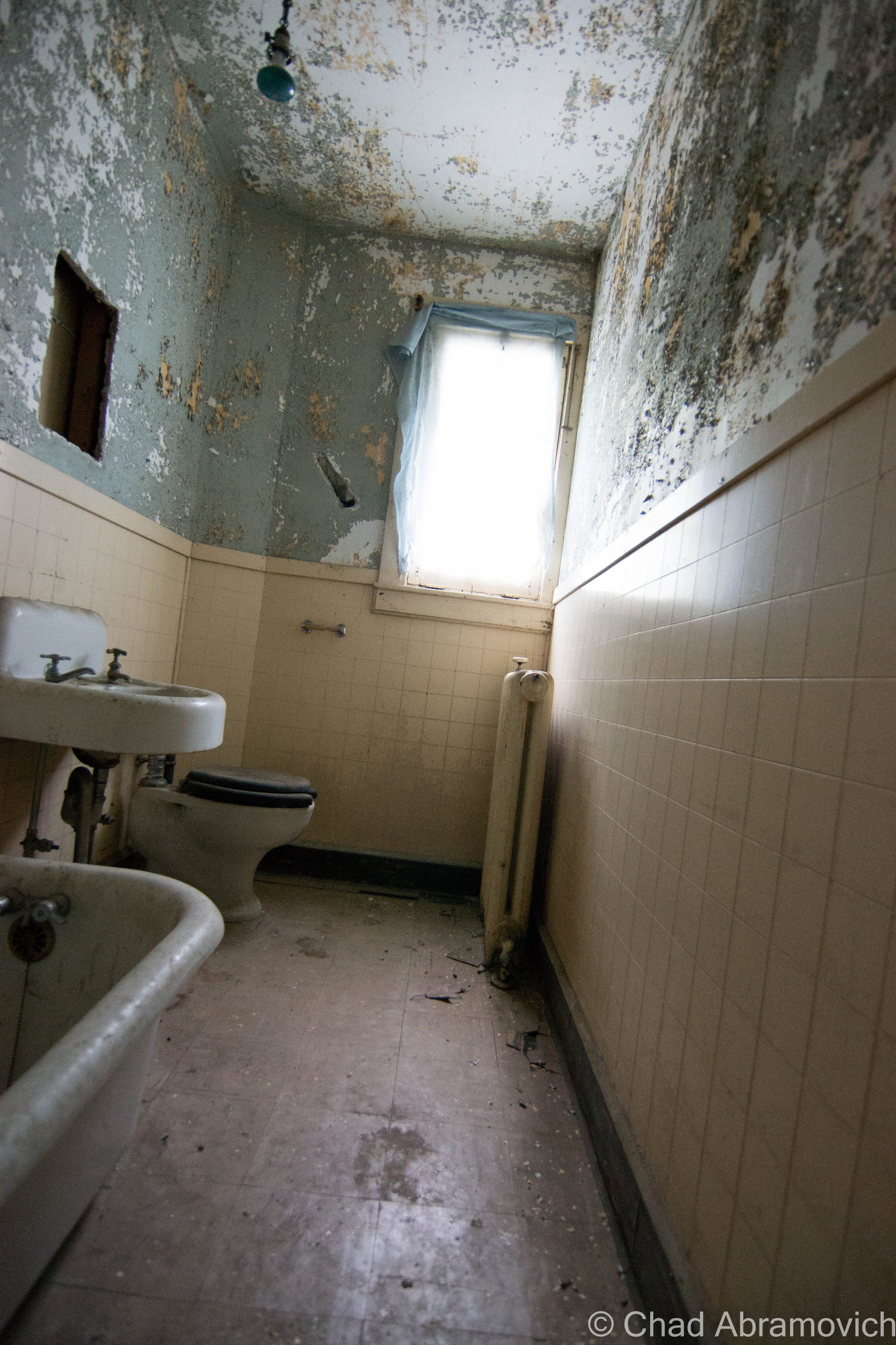
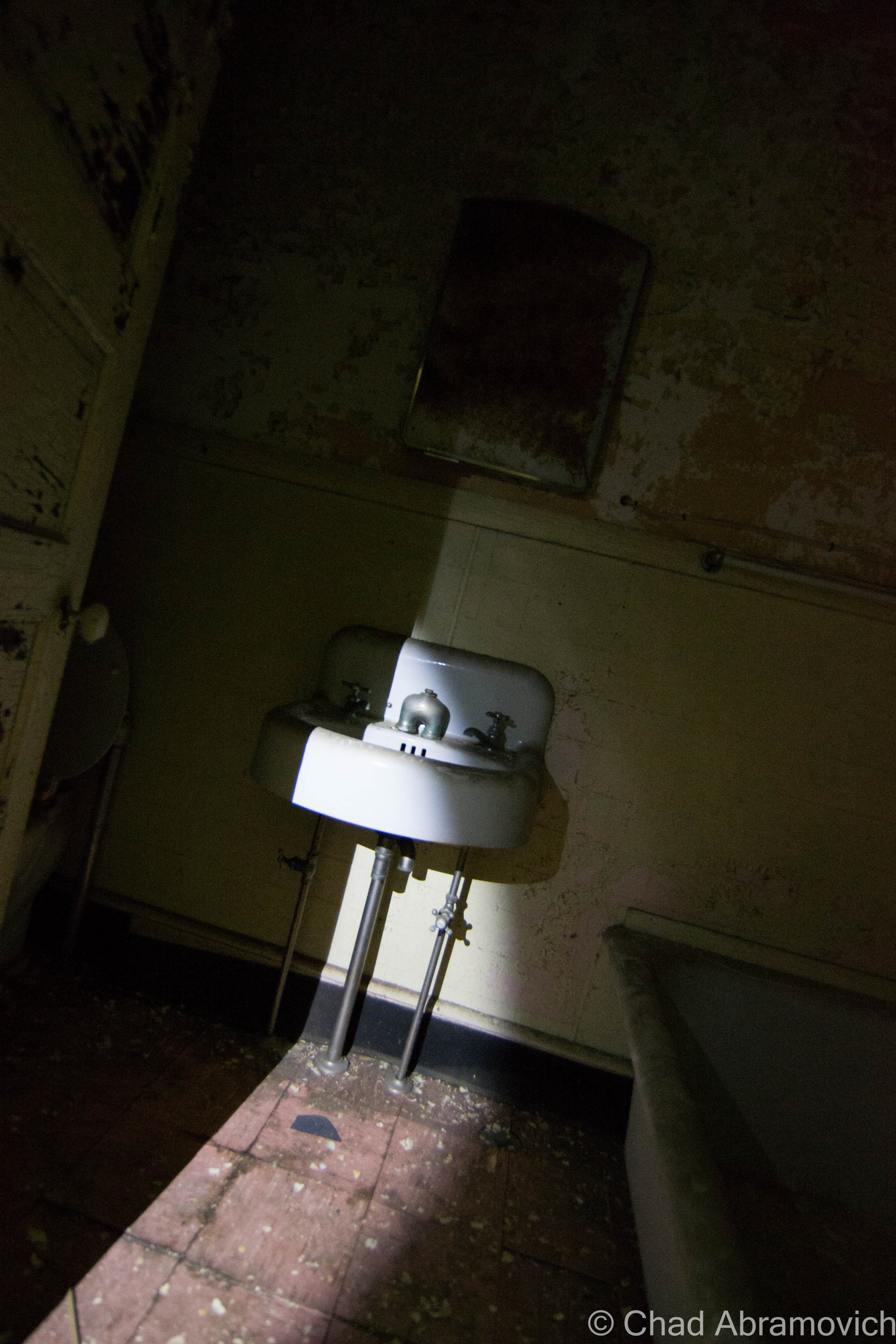
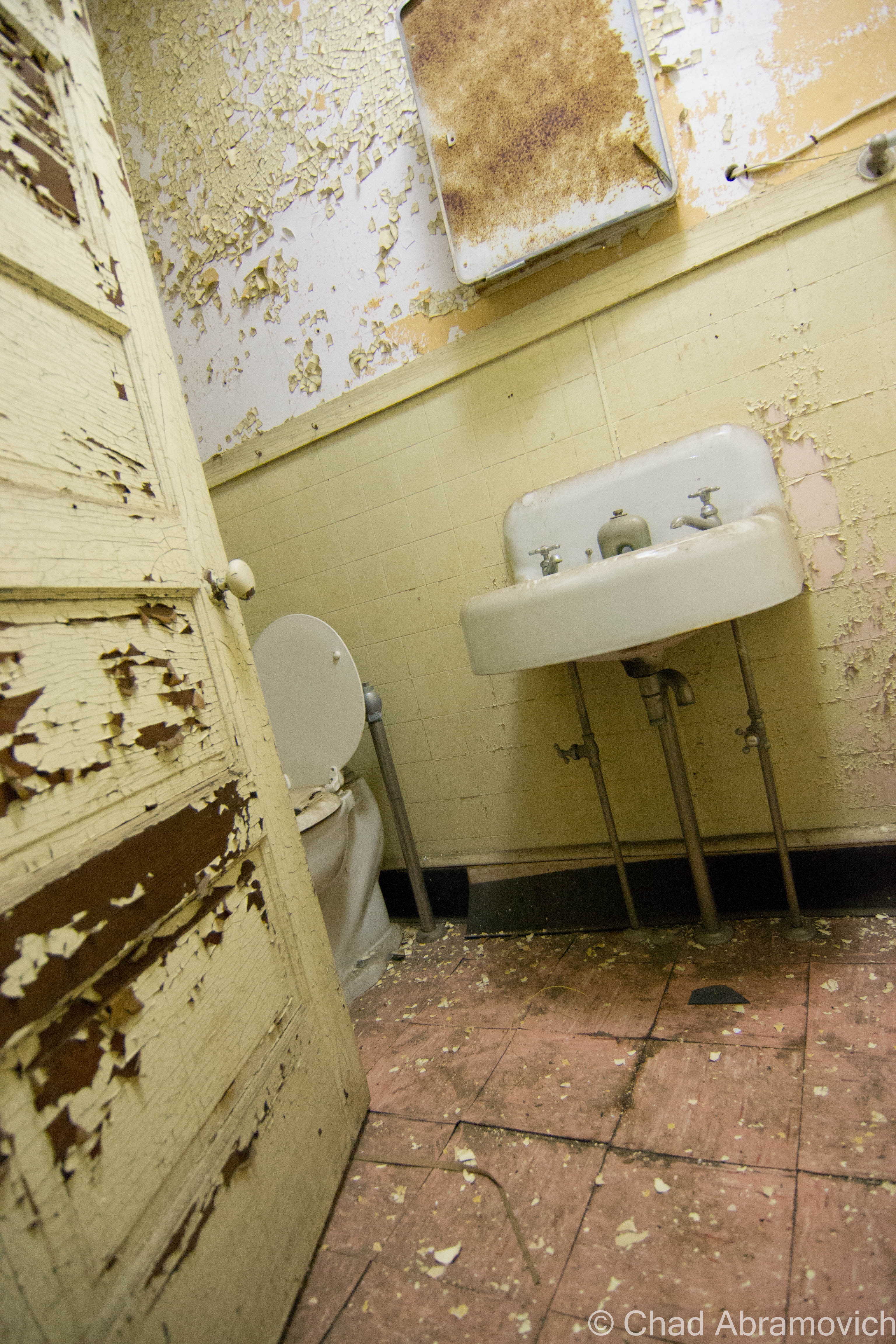
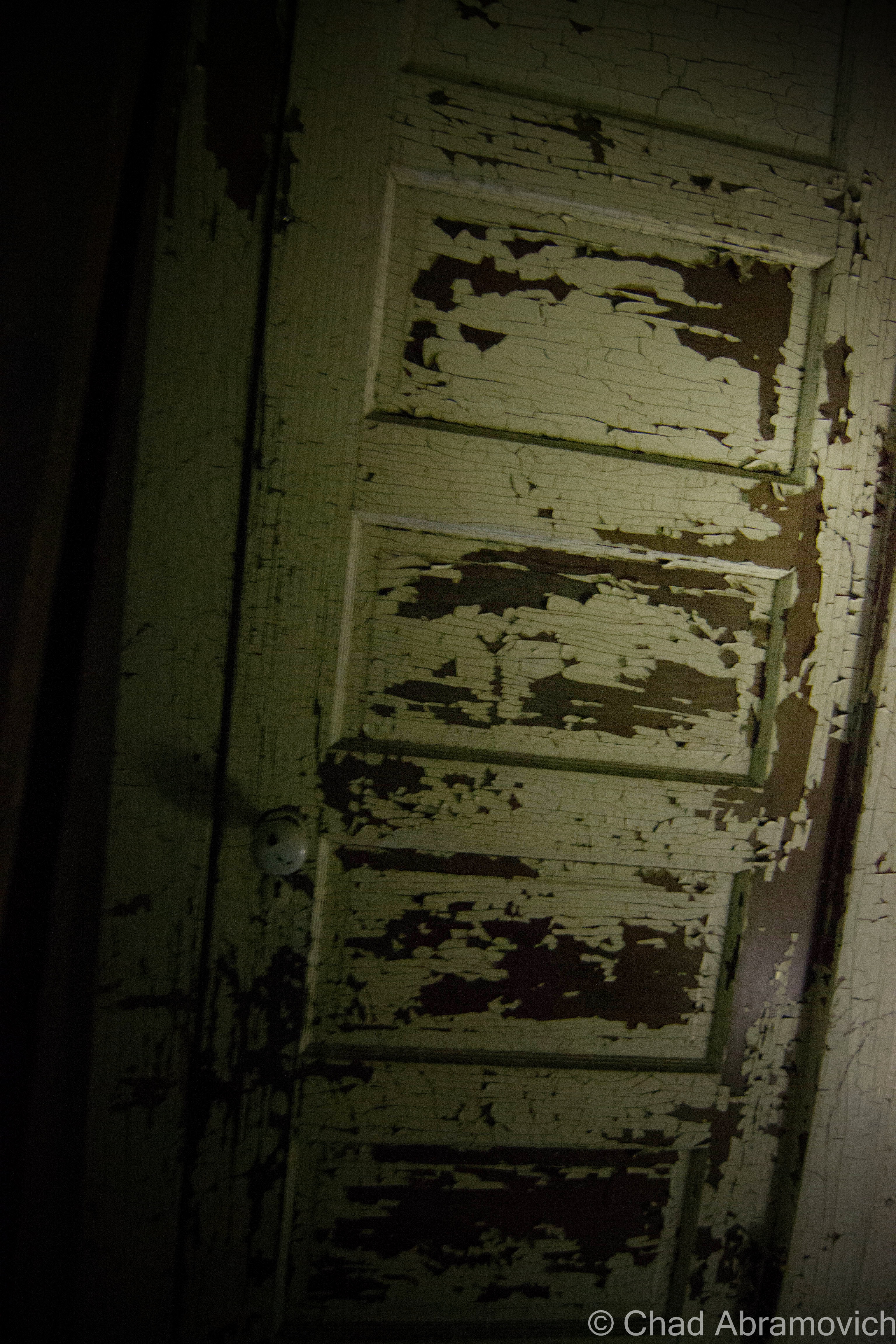
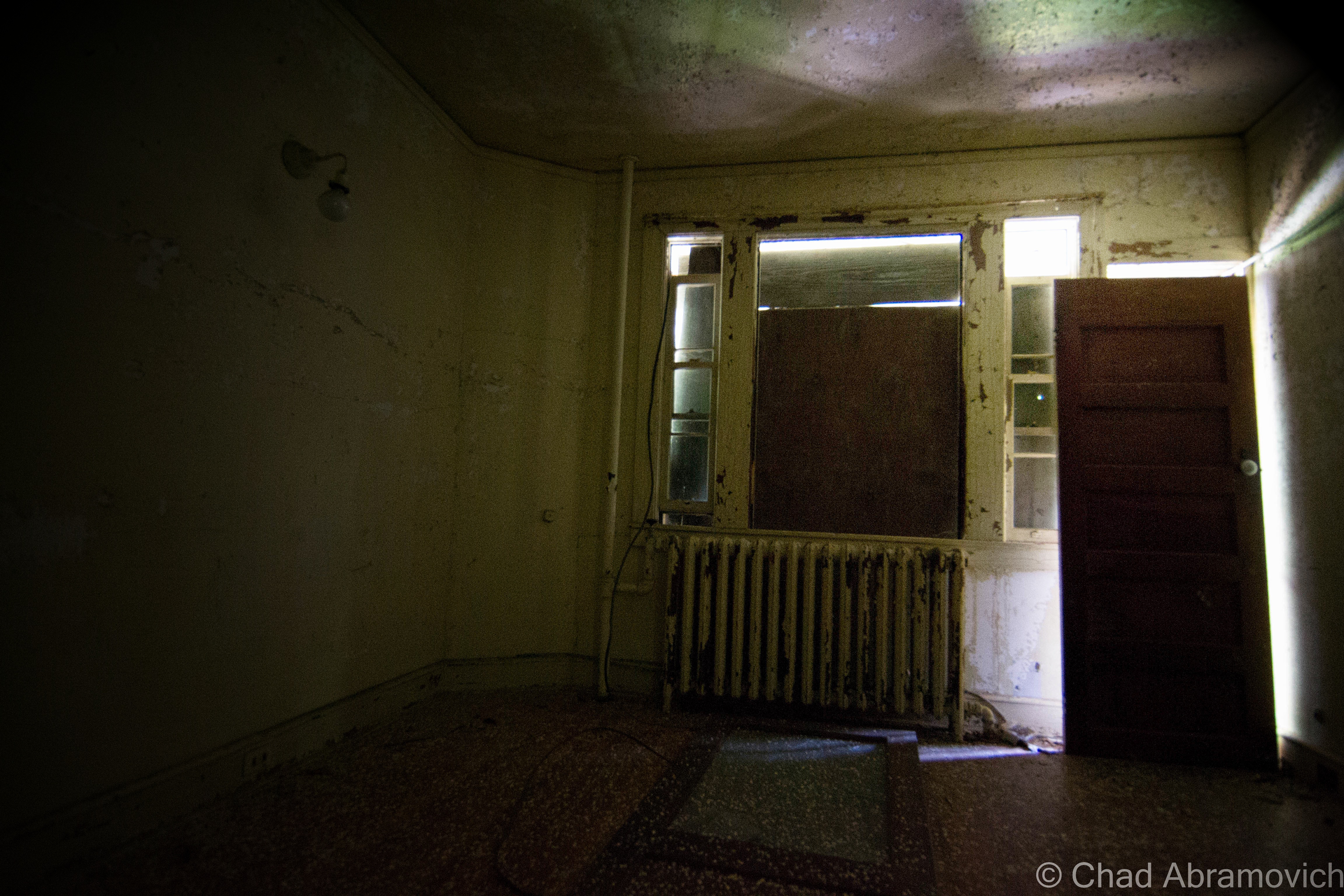
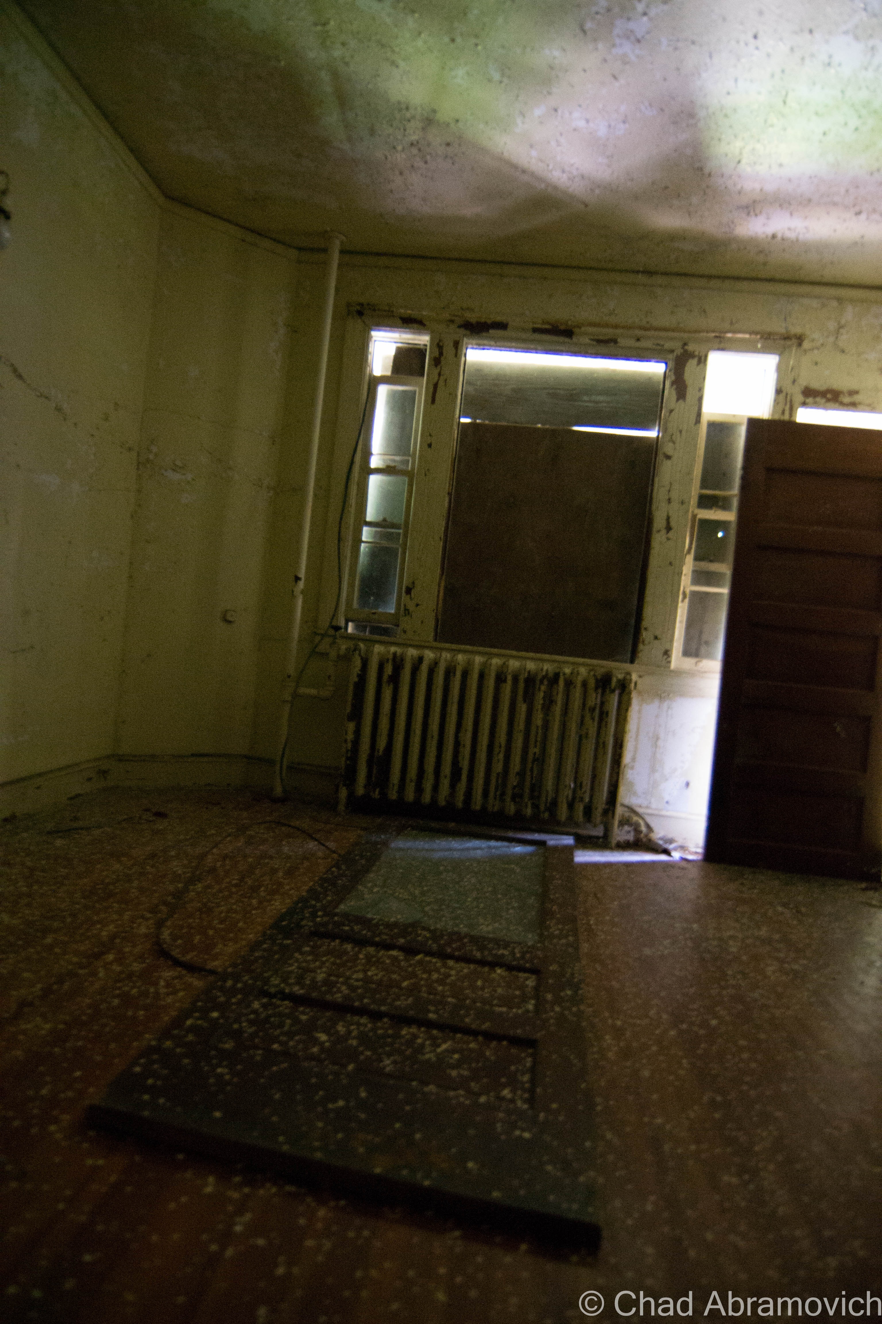
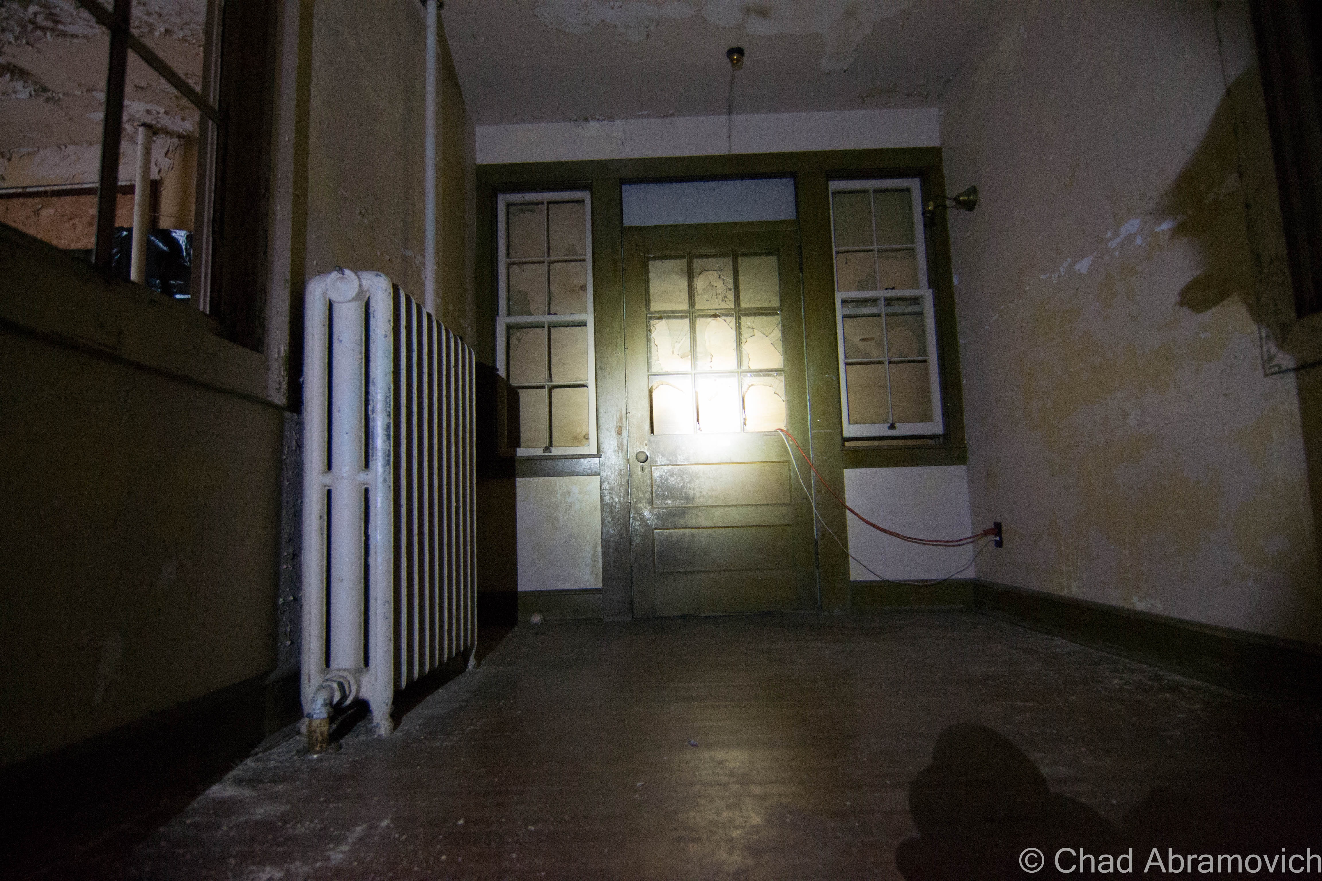
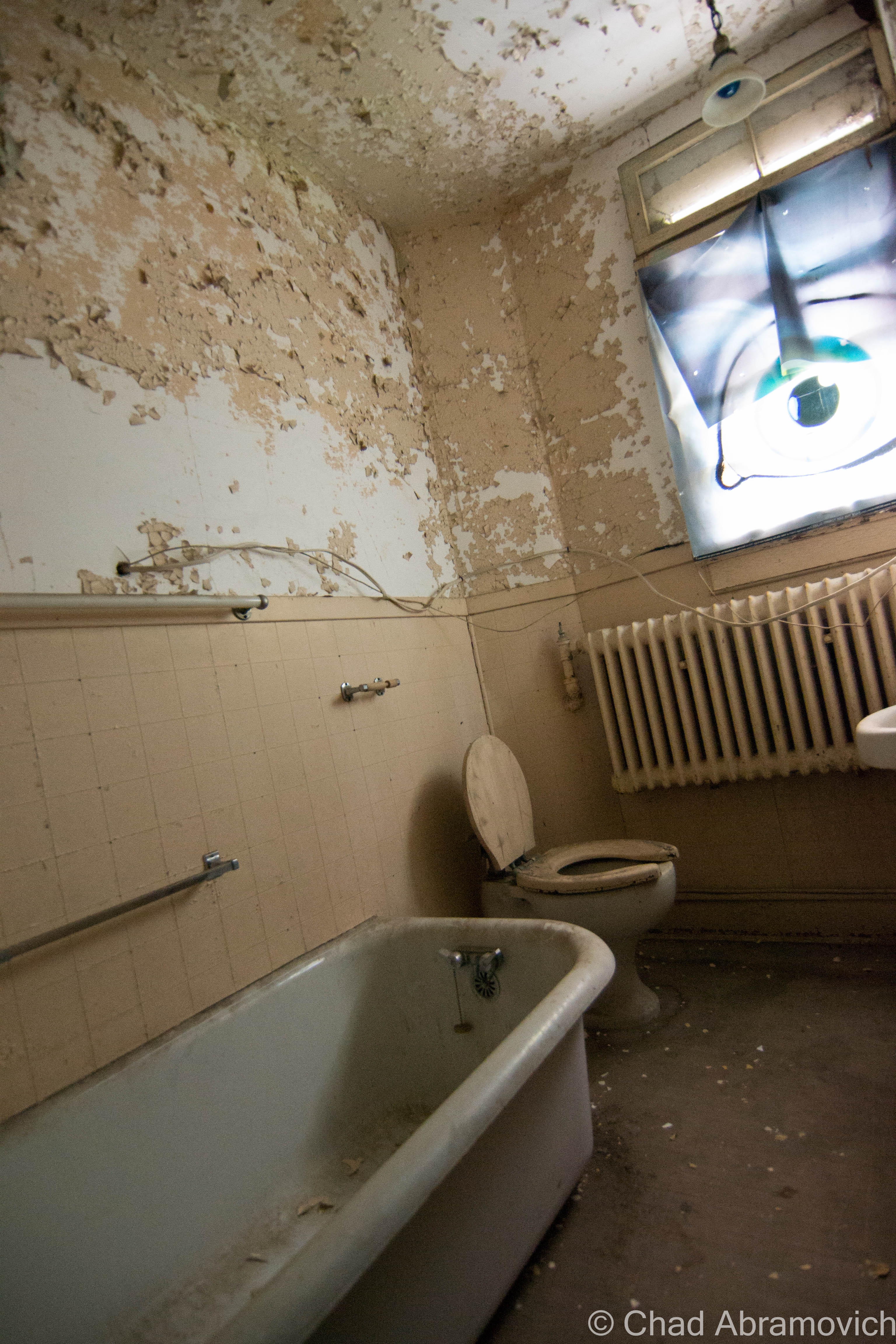
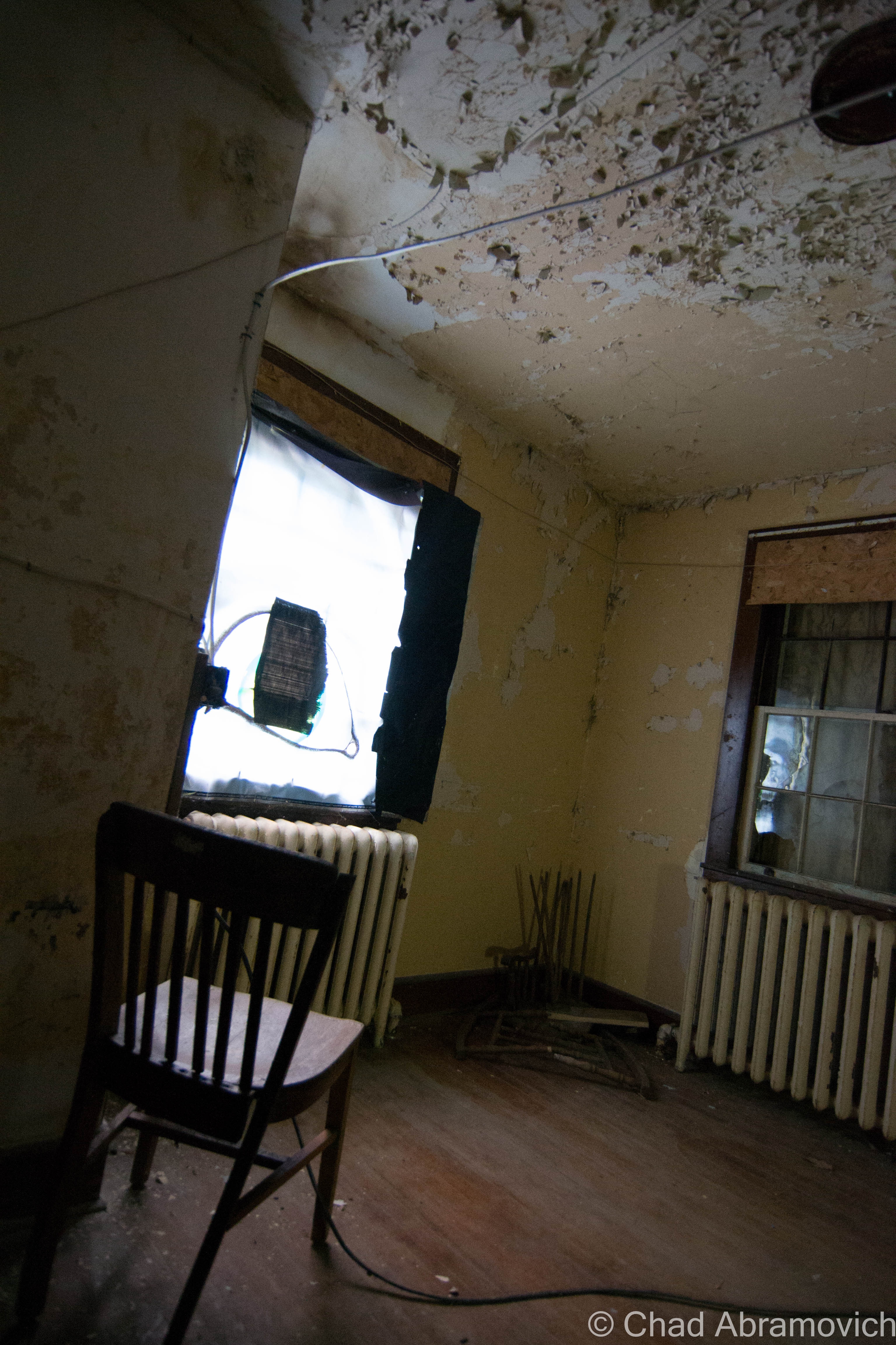
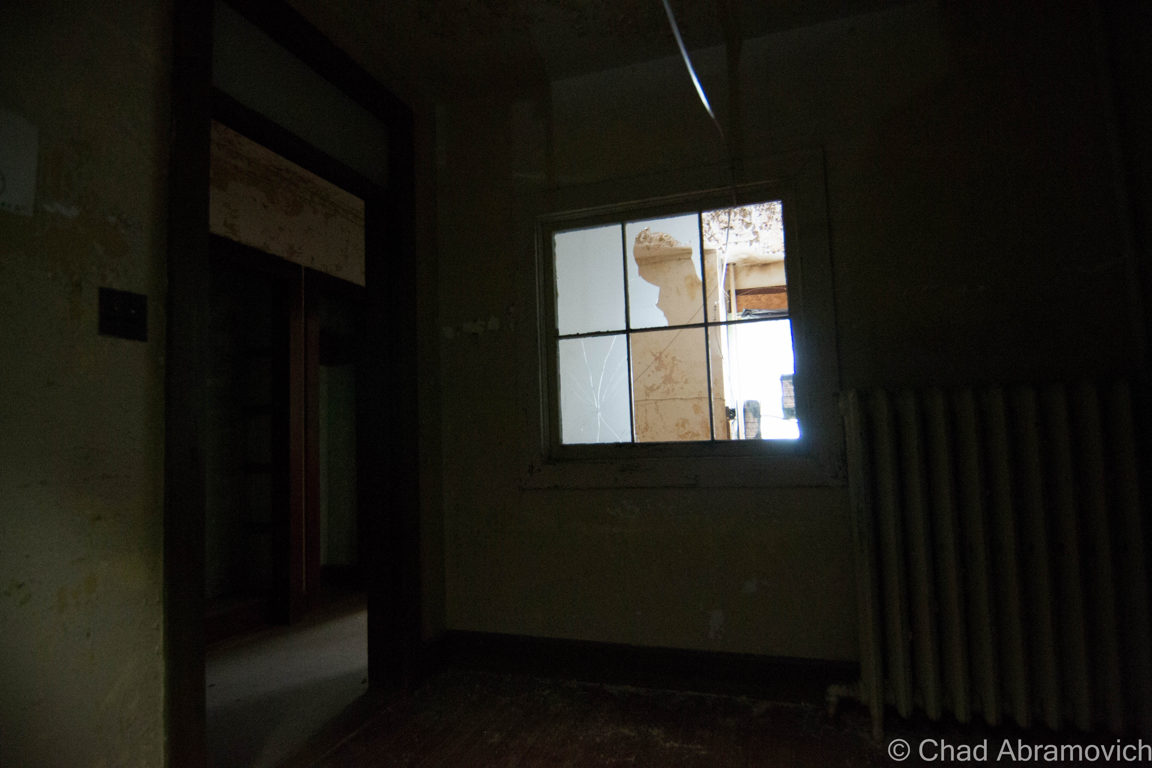
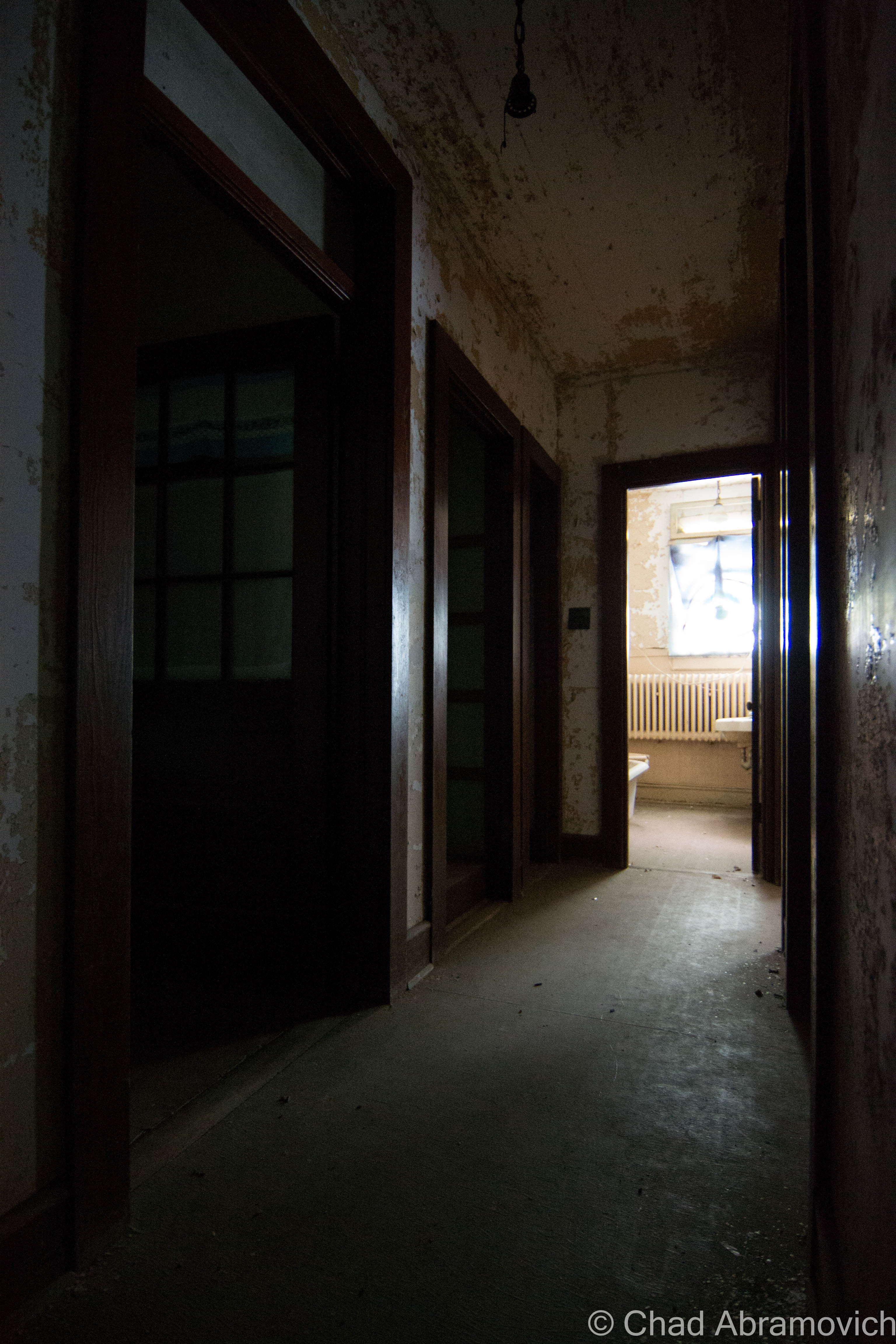
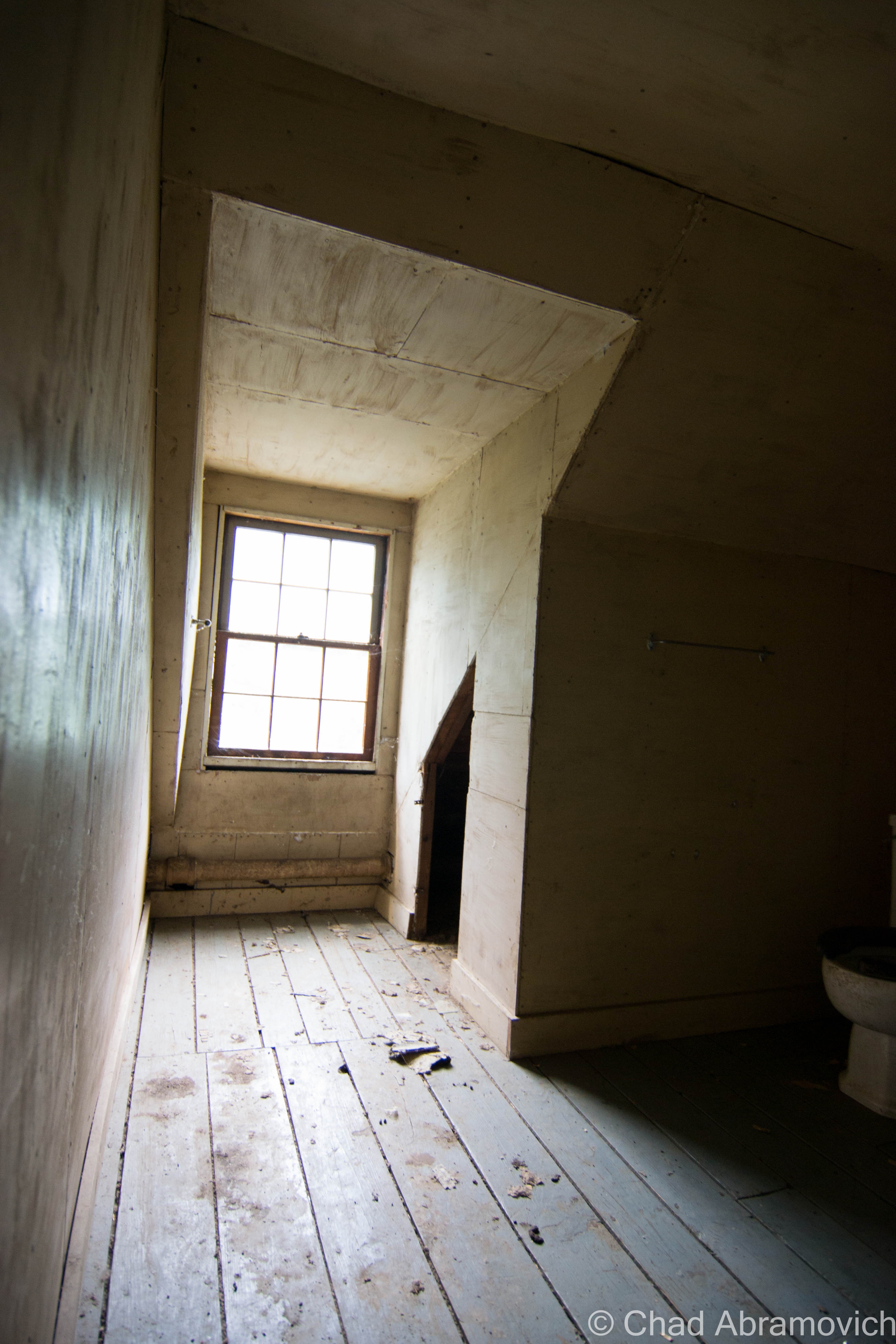
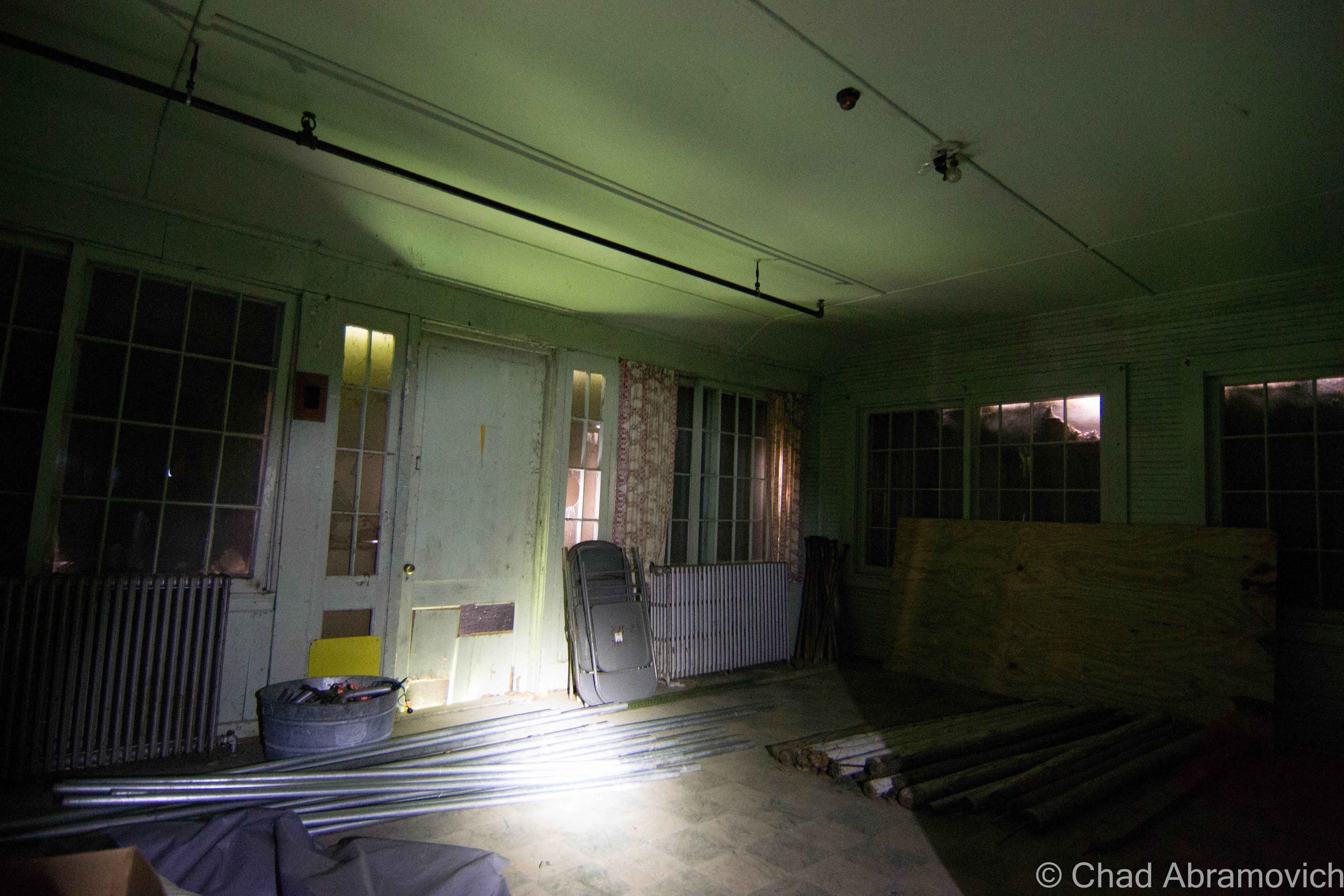
Thirty-two years of fluctuating New England weather and zero upkeep had rotted out the drafty interior. The metal stairwells became stretches of rusty spiderwebs, some were completely untrustworthy. The snow that fell through between broken roof was so loud that you would have thought it was thundering outside. The thick brick walls oozing with slime and glazed by ice blocked cell phone reception pretty well. I received a few texts sent by my friend asking me where I was, hours after she had sent them and on the road back to Vermont, which I guess meant that contact in case of emergencies would have been pretty unaccommodating.
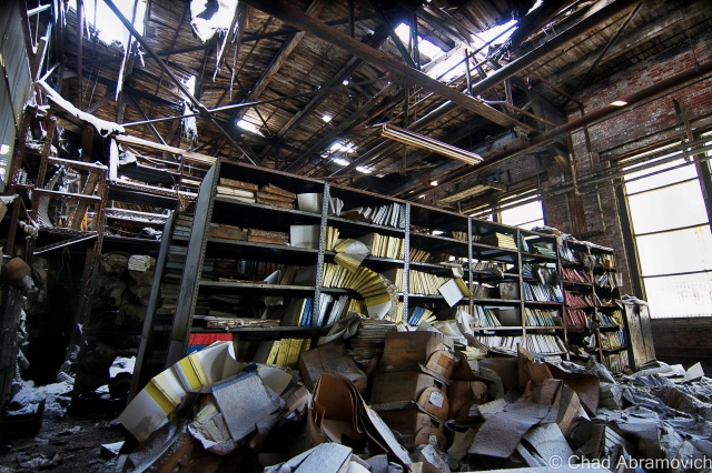
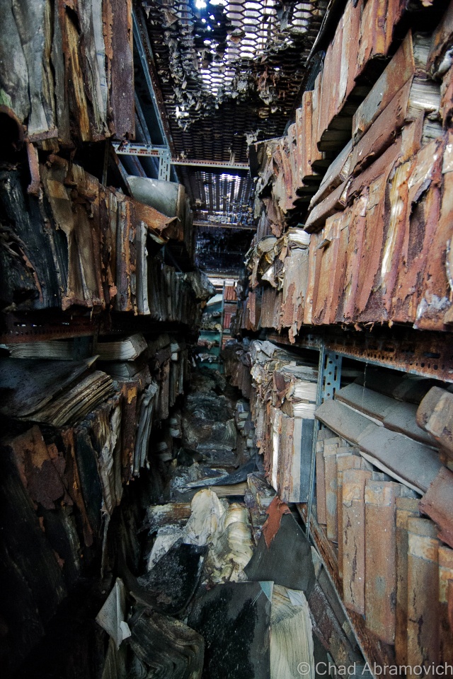
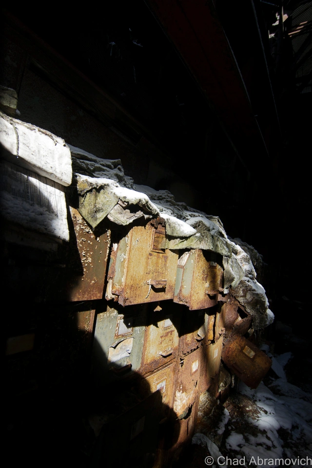
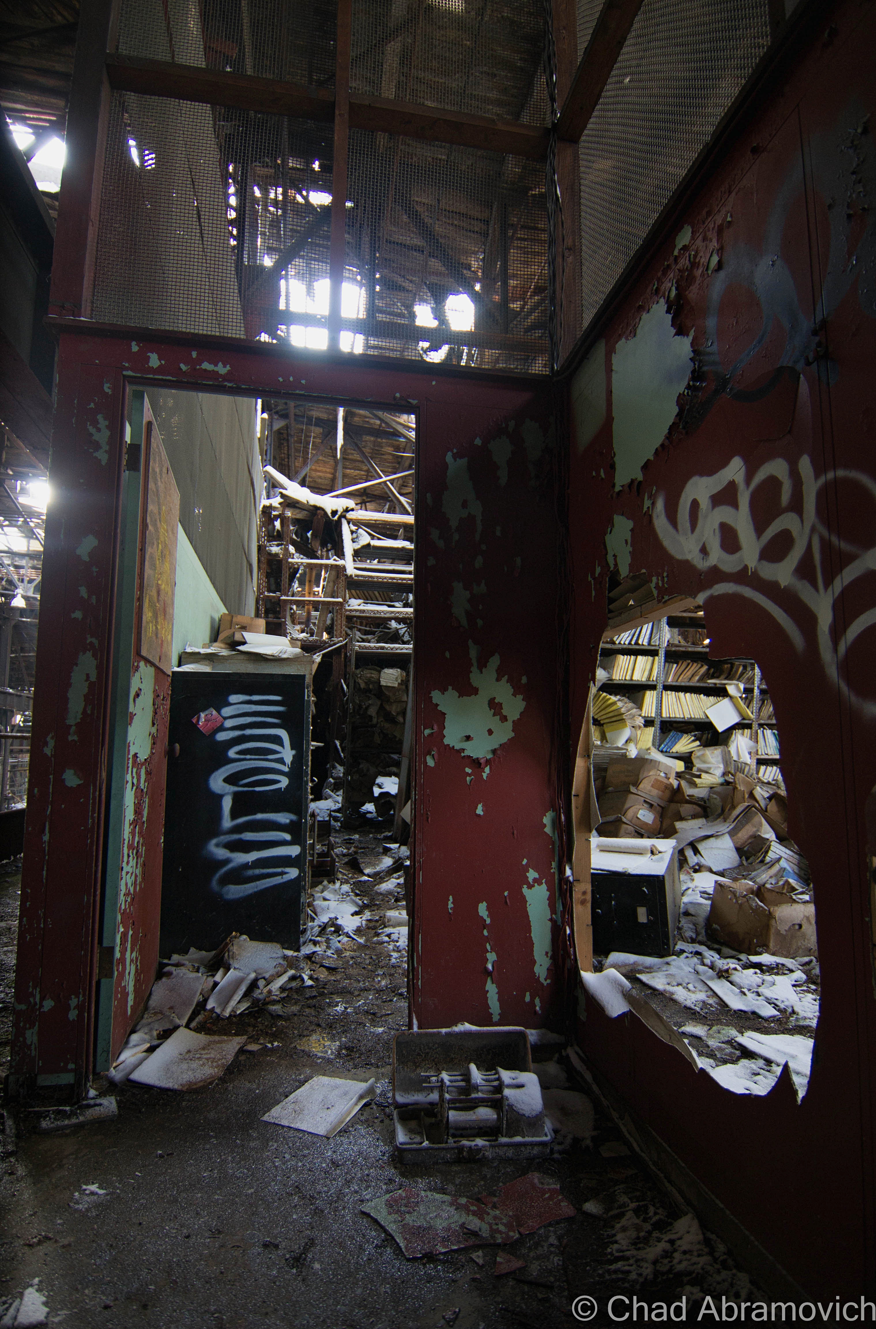
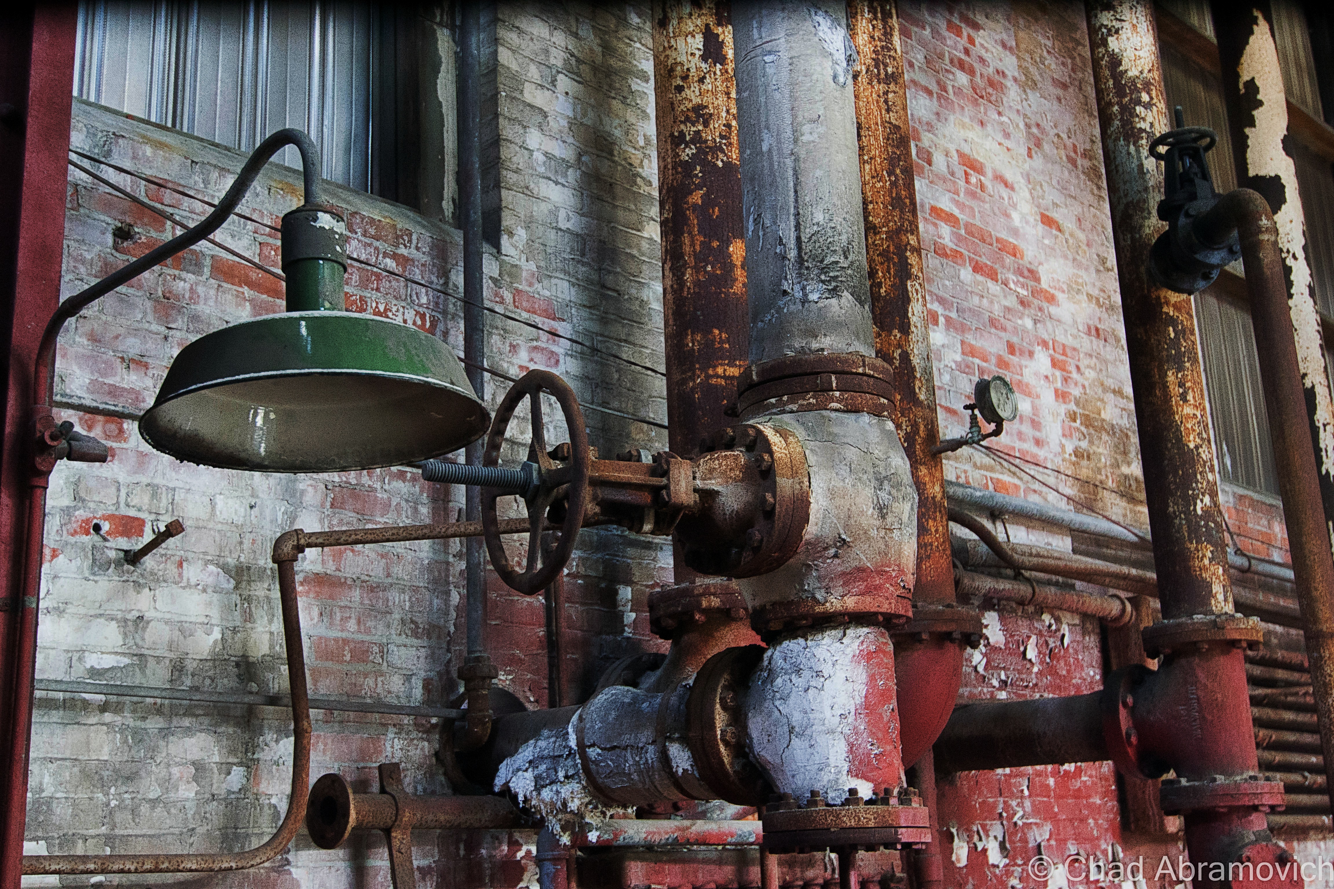
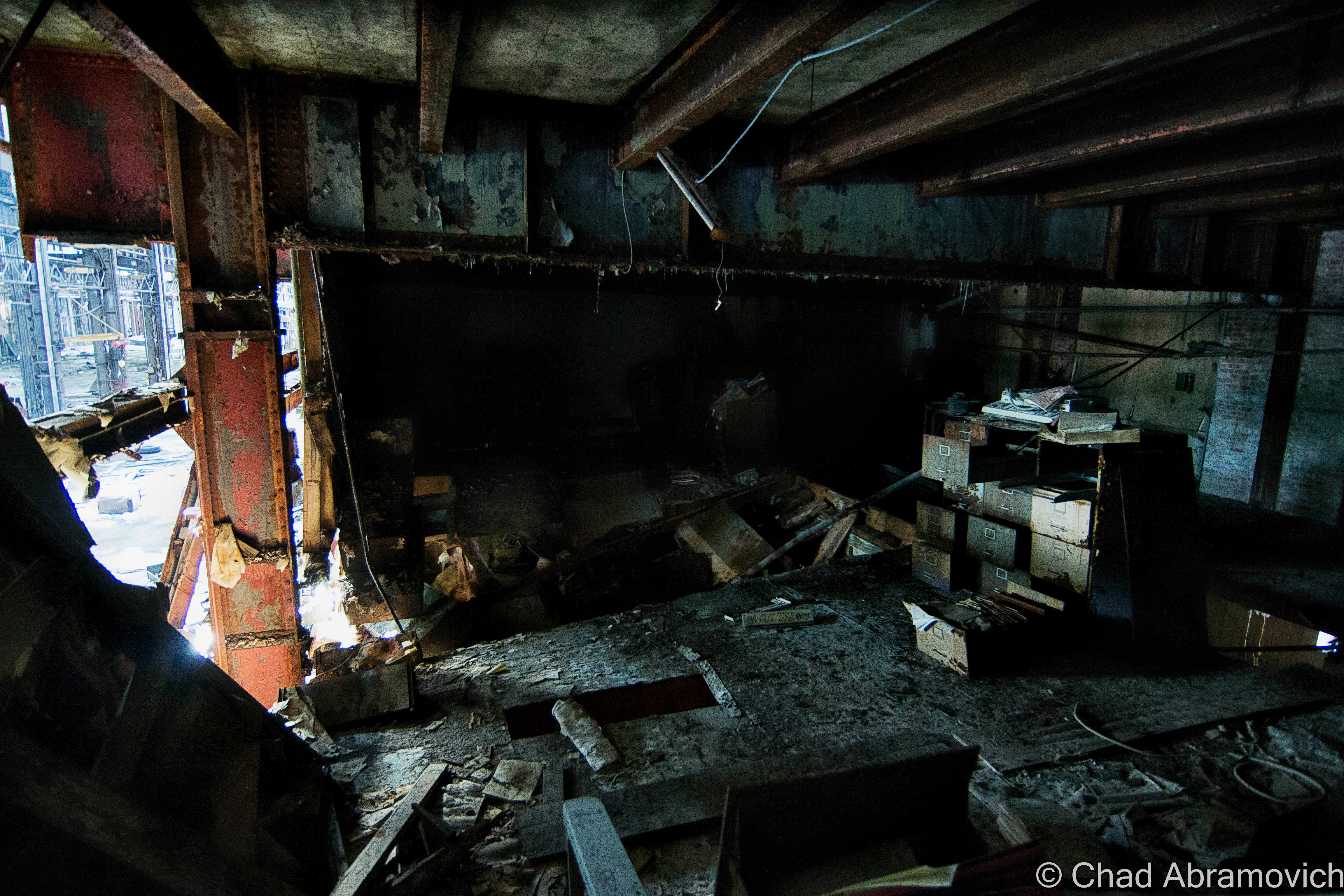
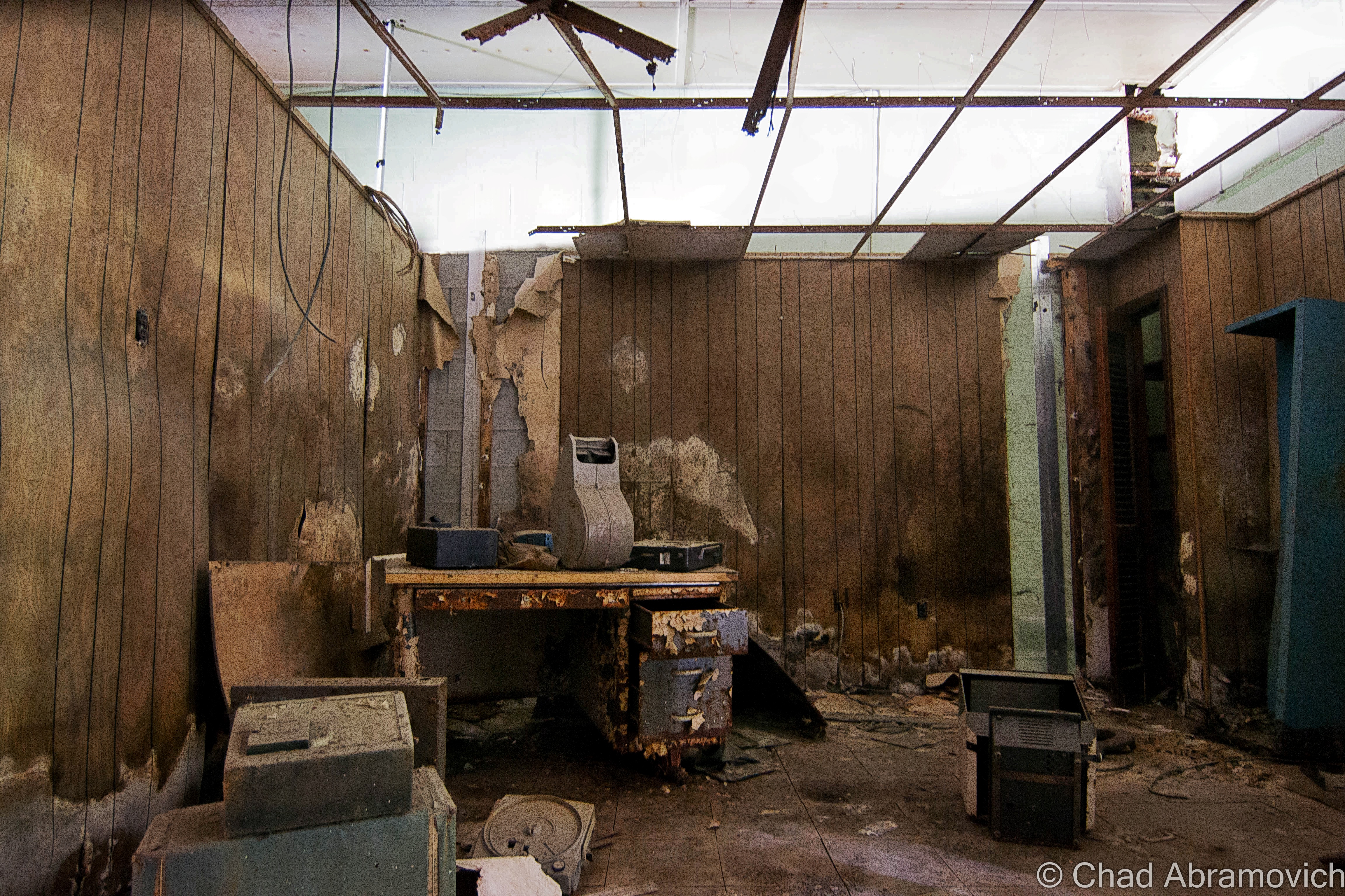
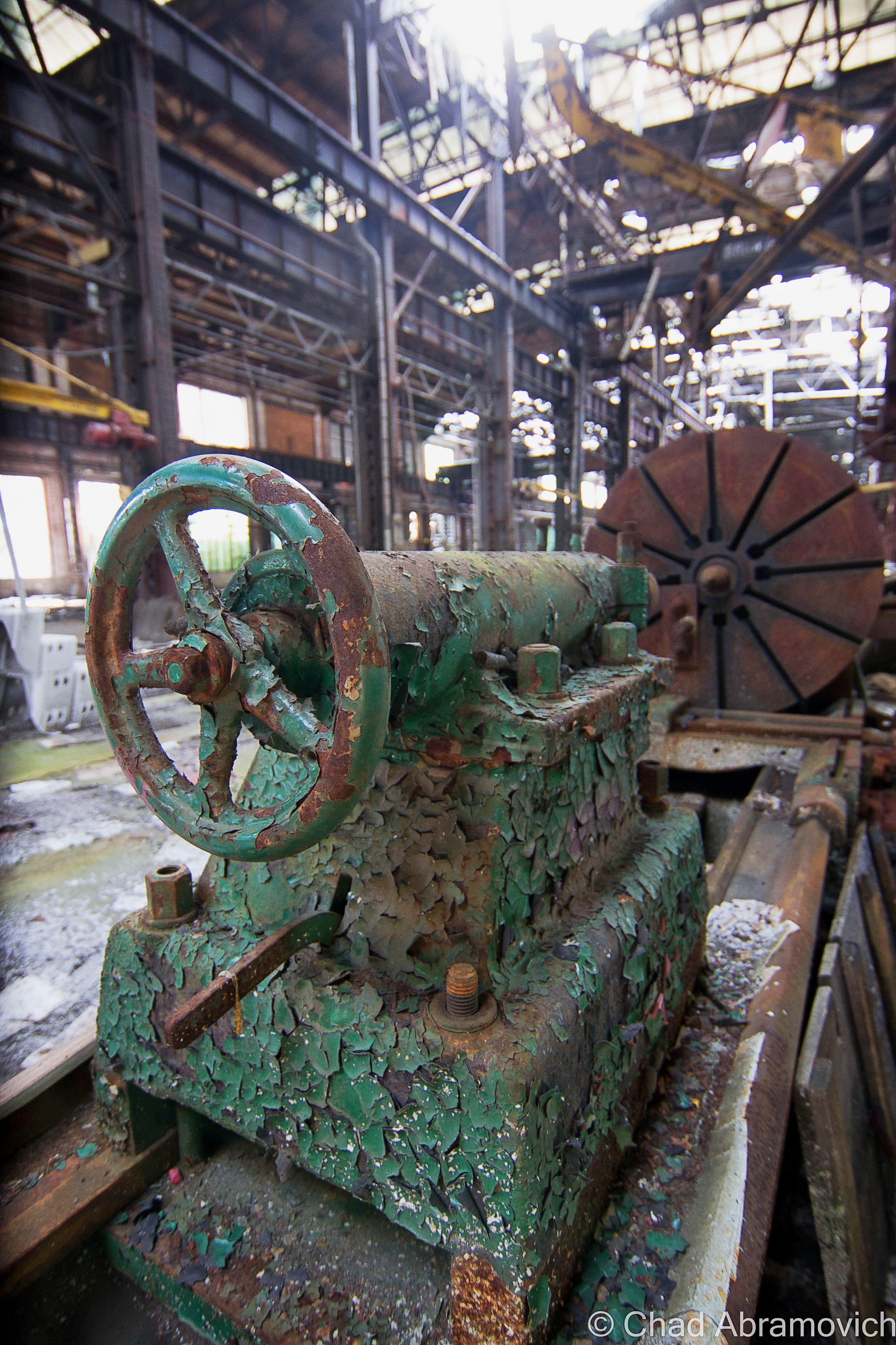
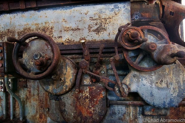
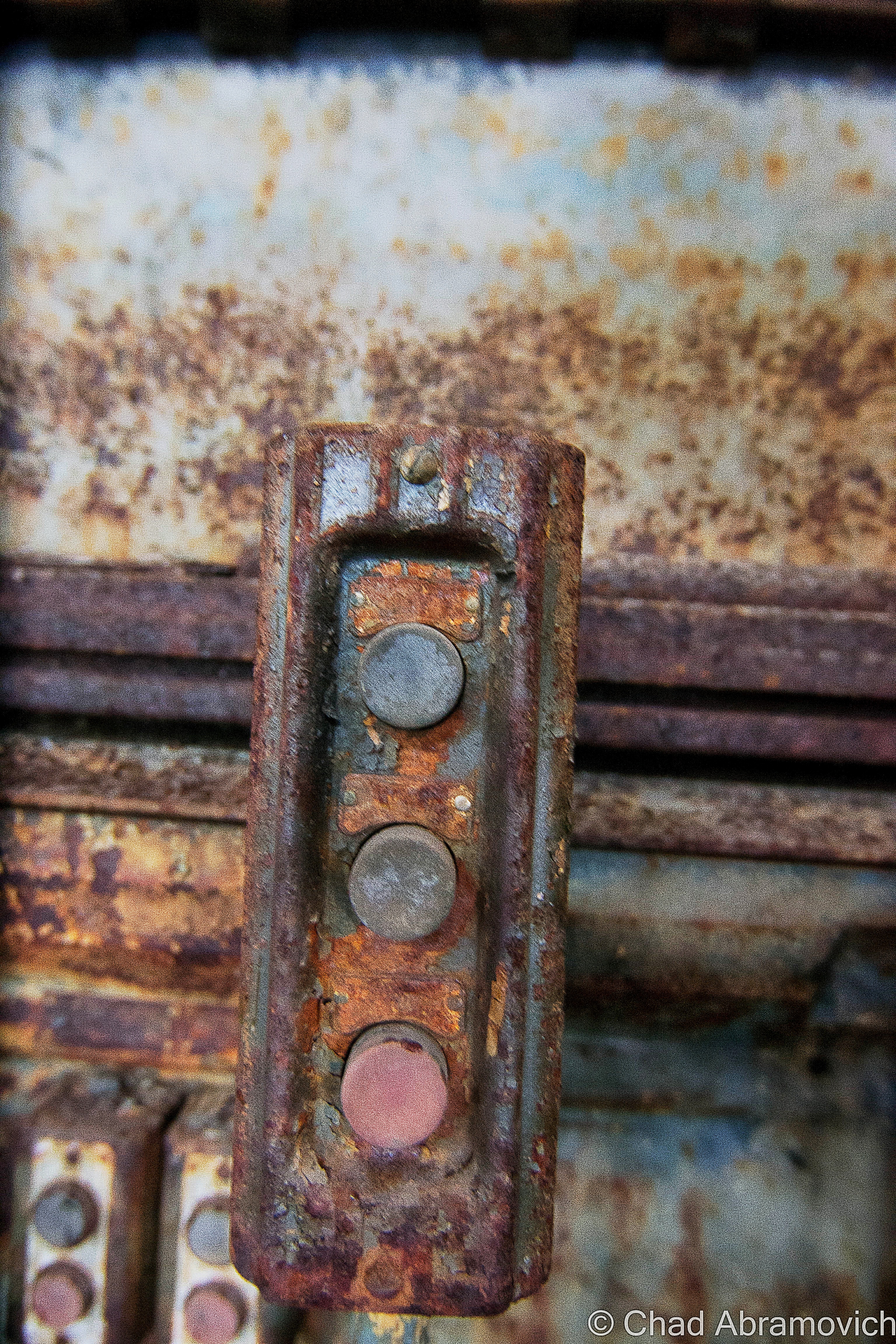
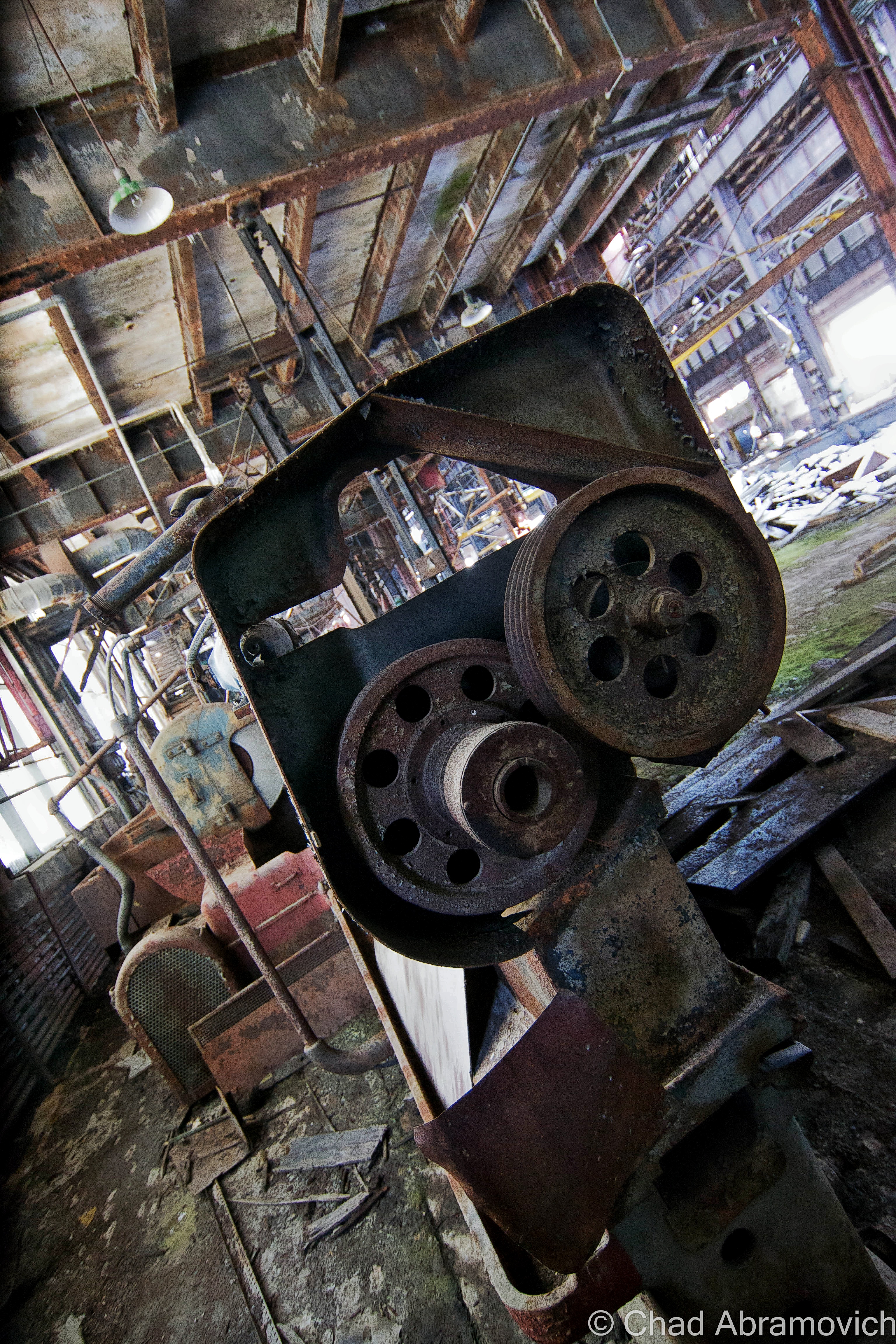
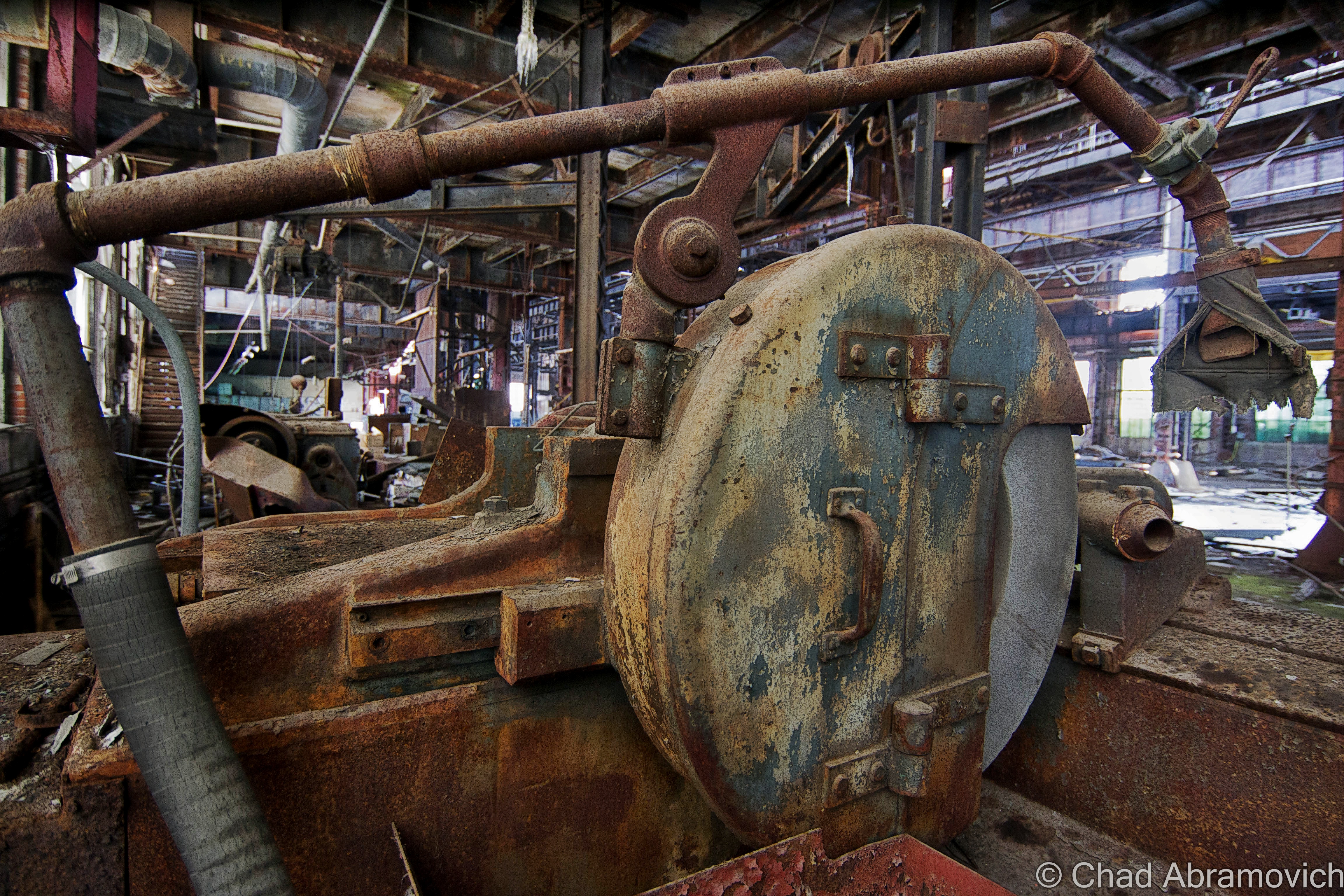
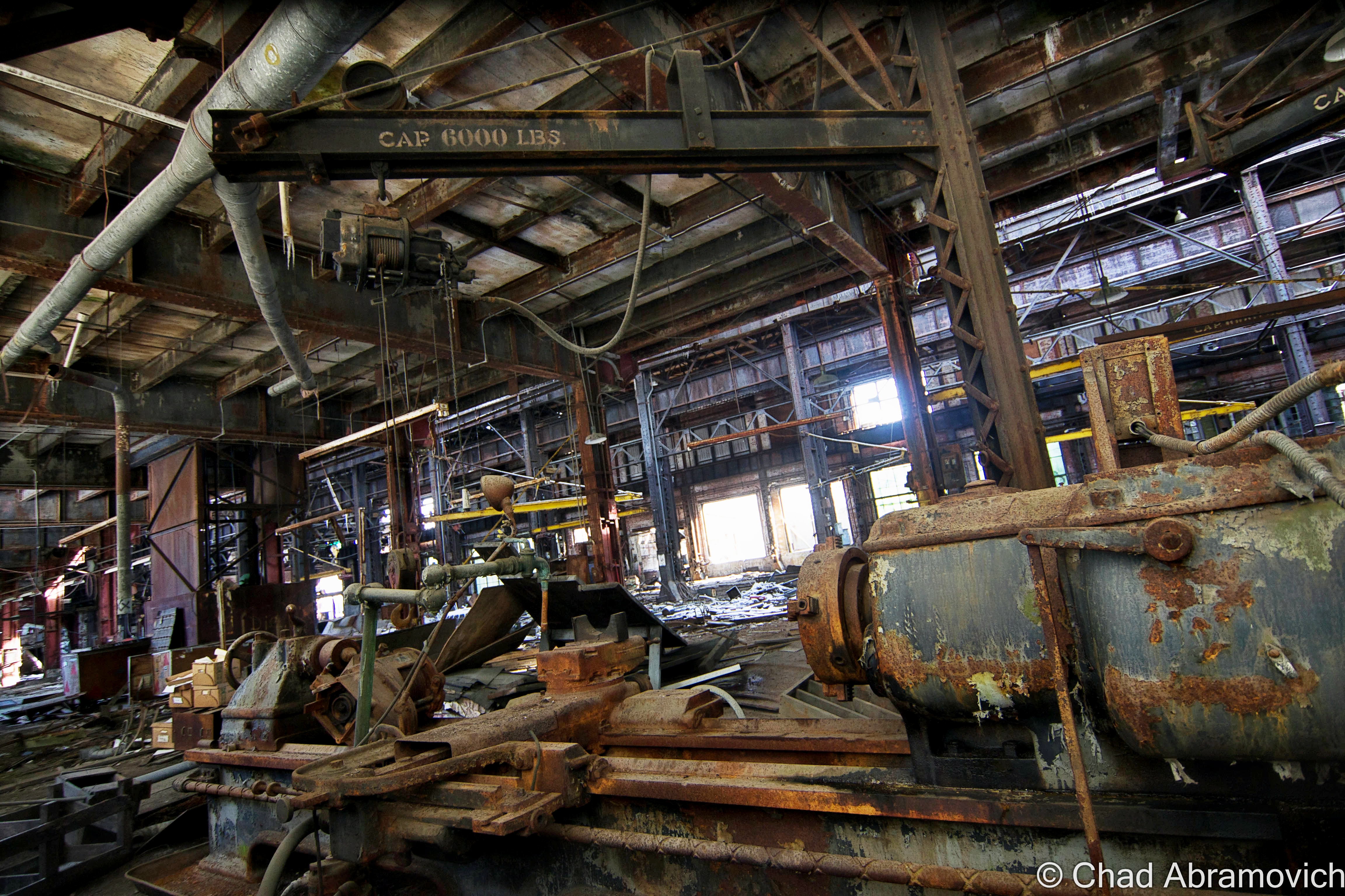
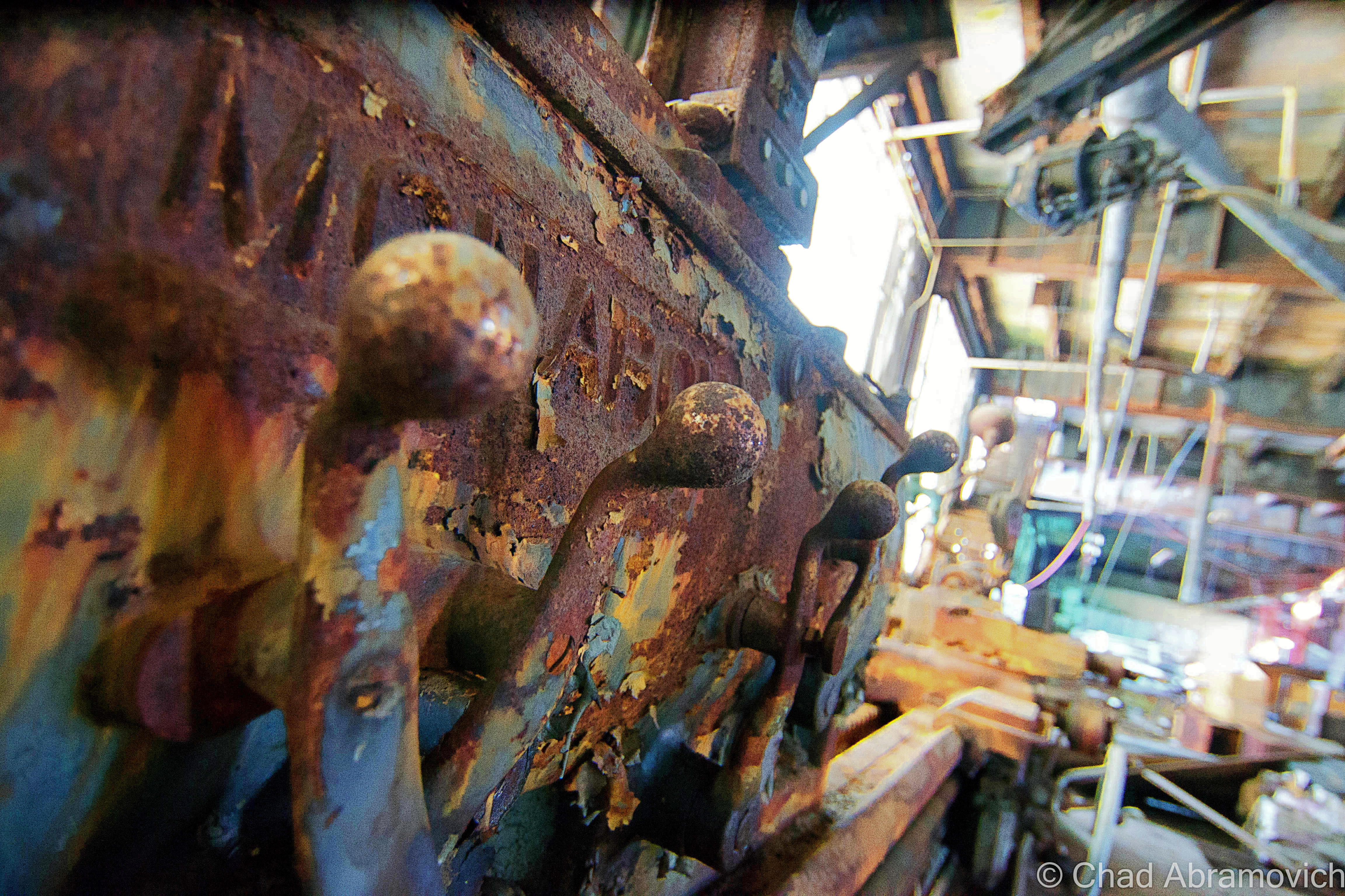
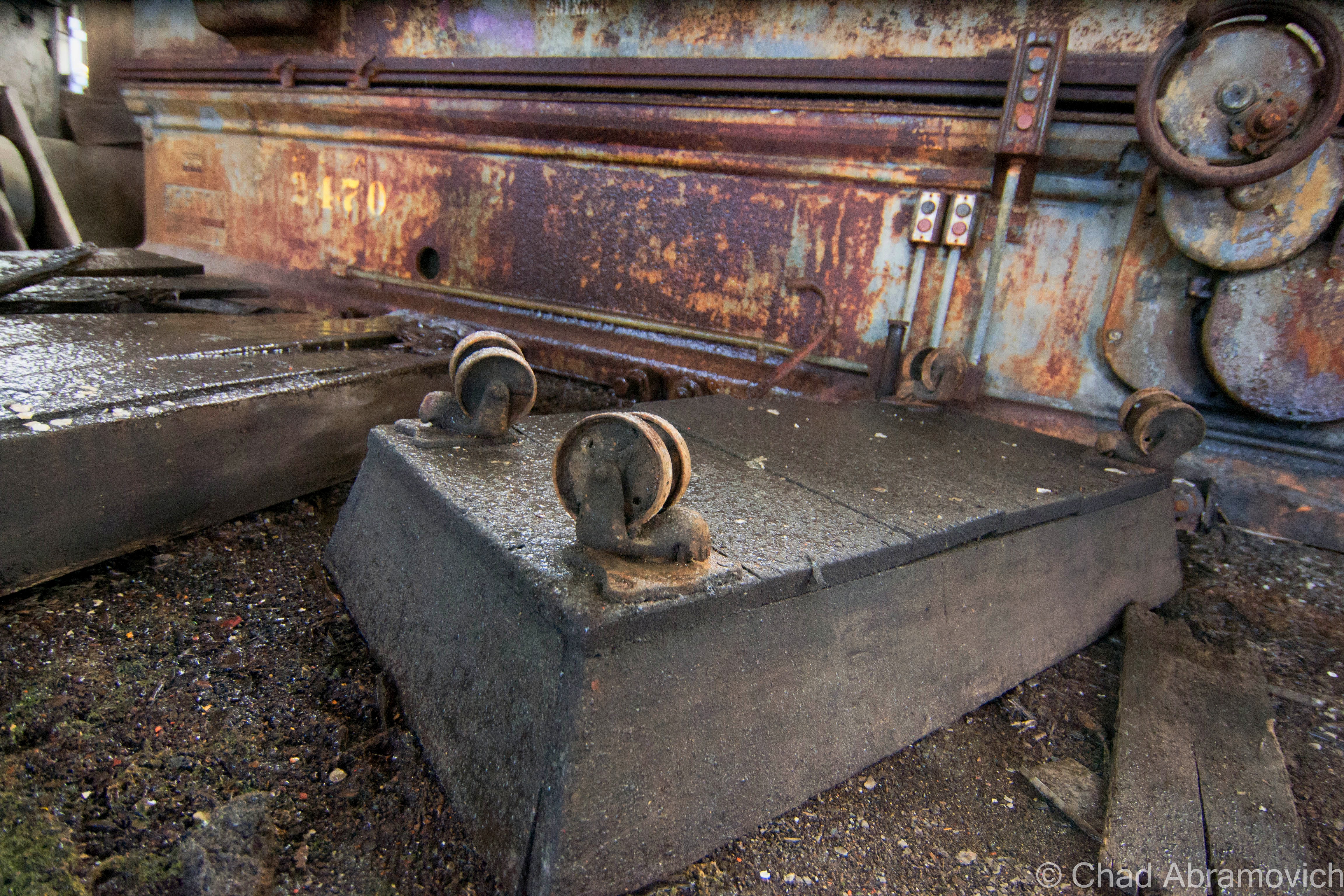
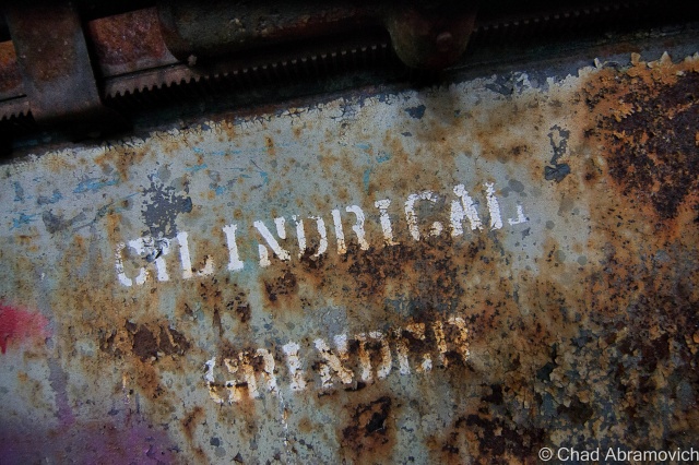
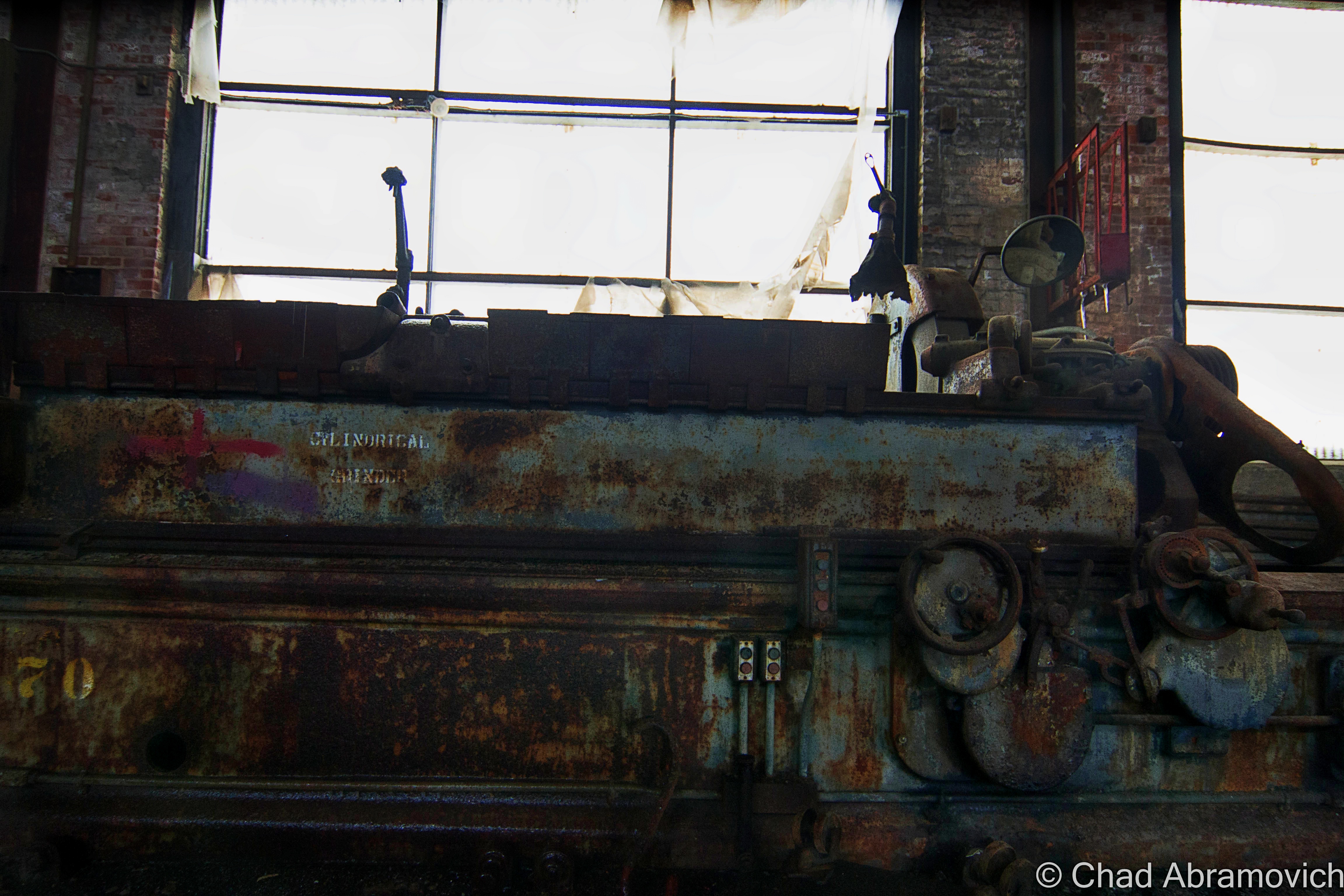
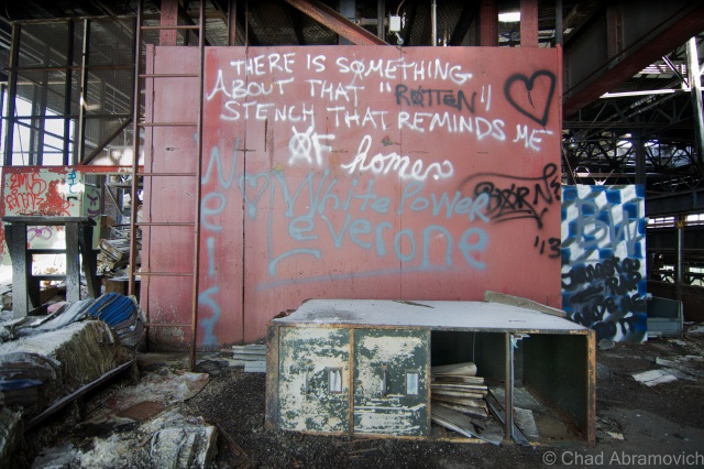
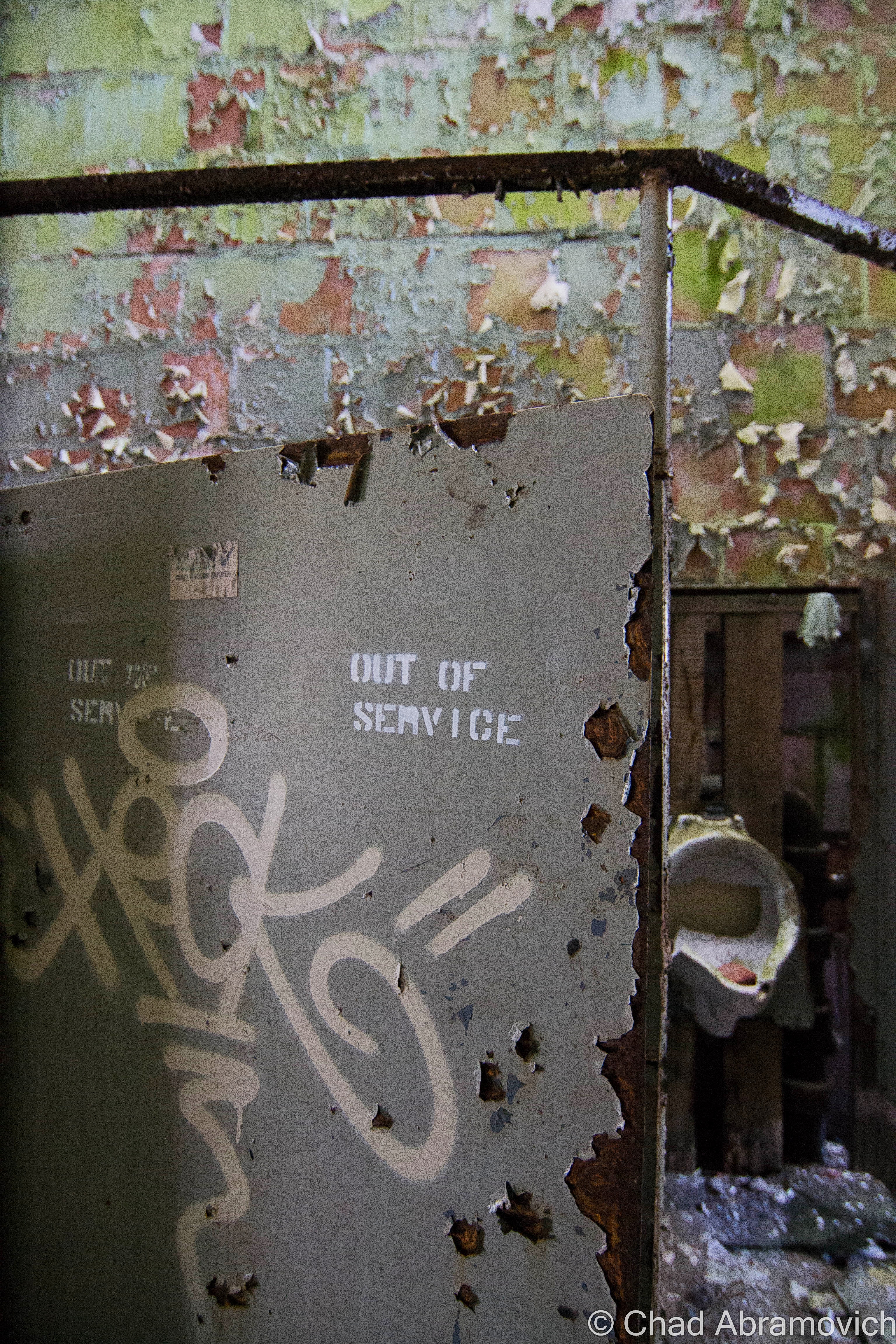
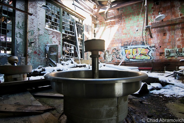
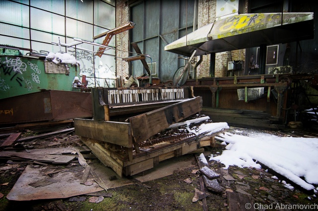
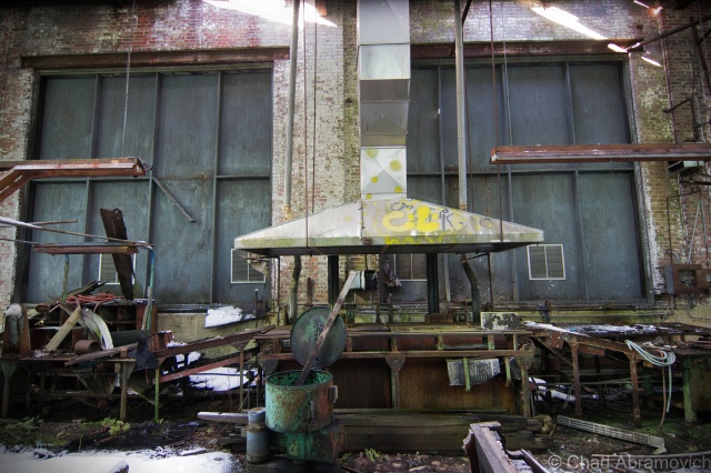
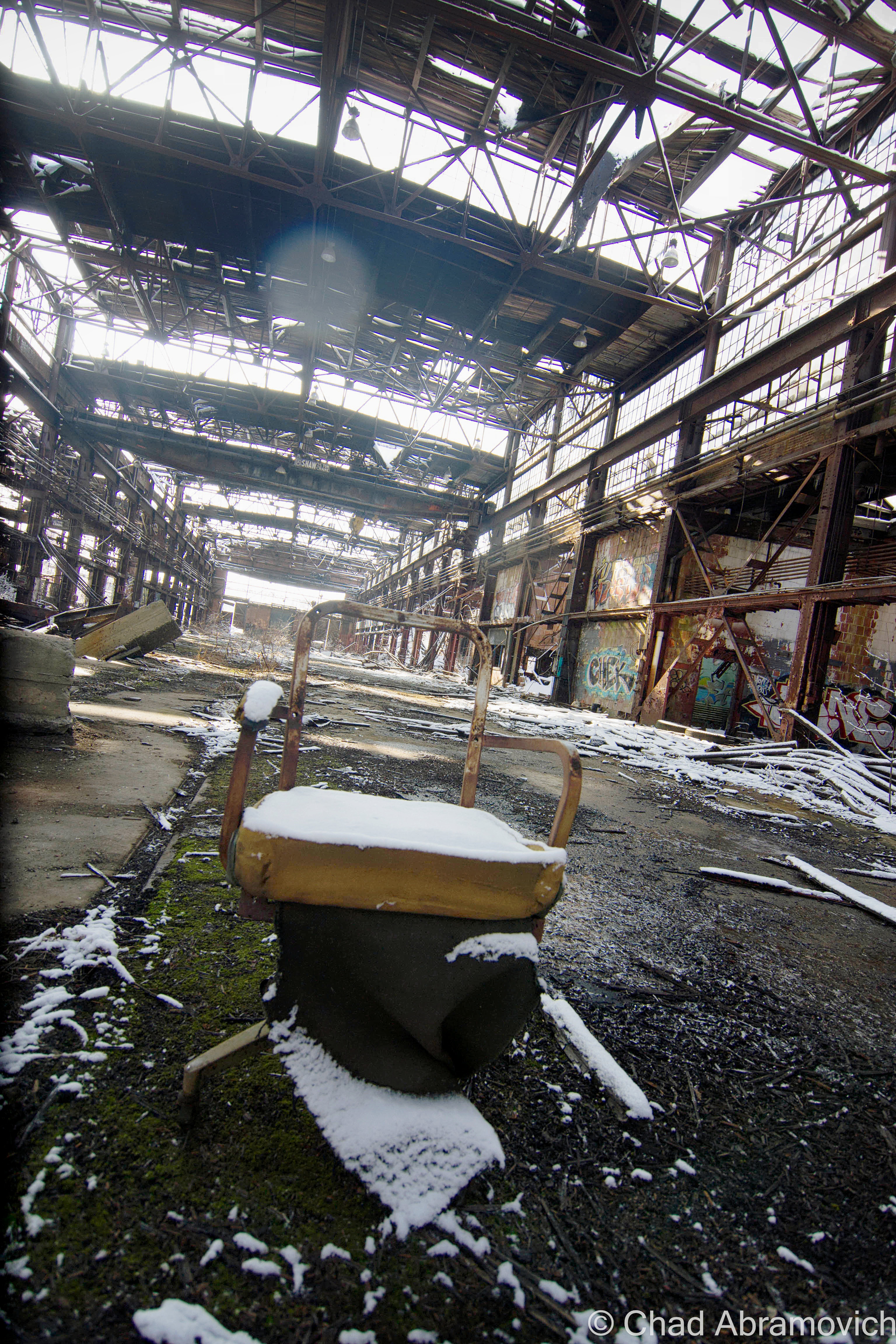
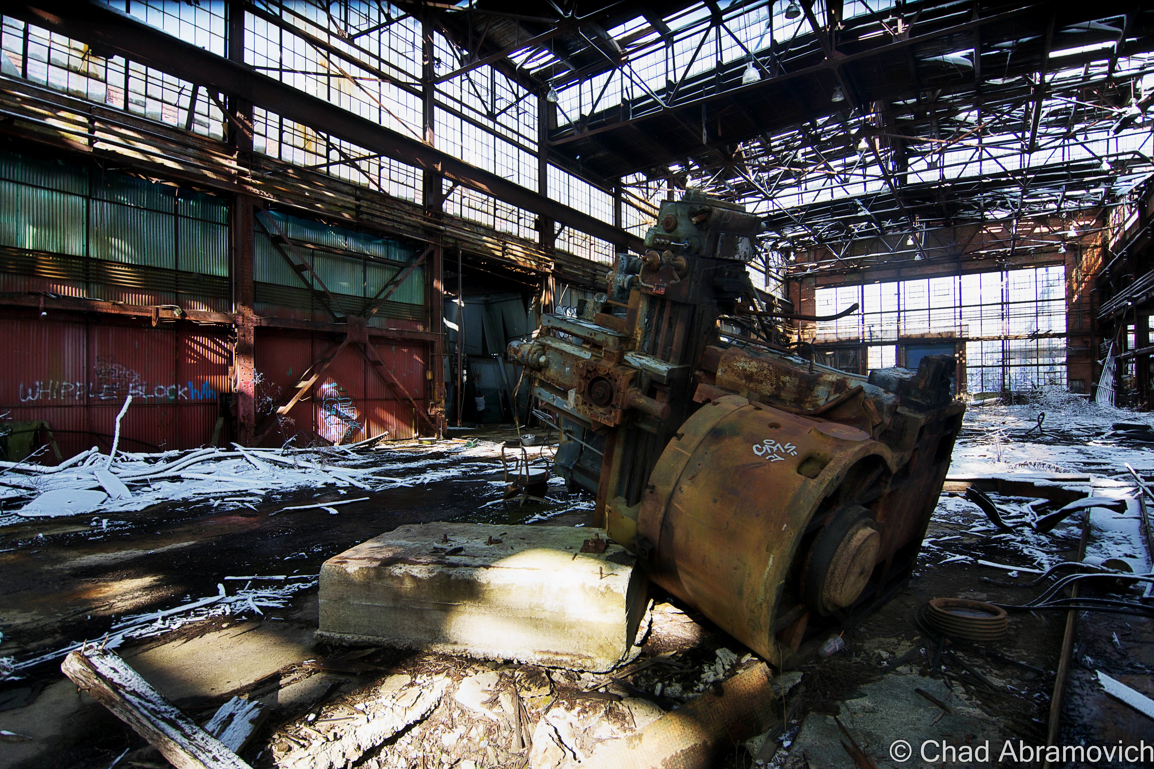
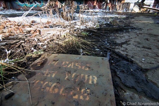
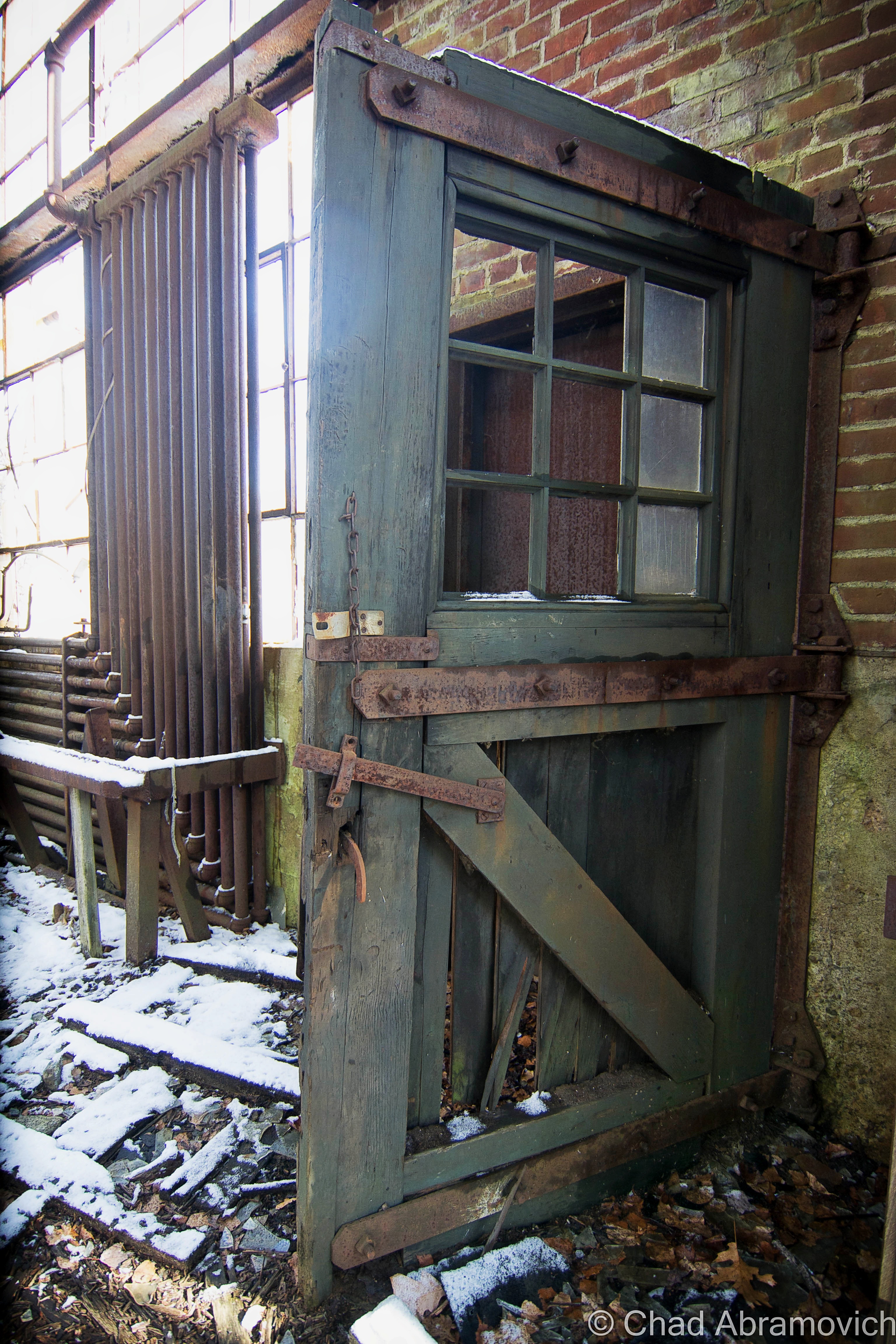
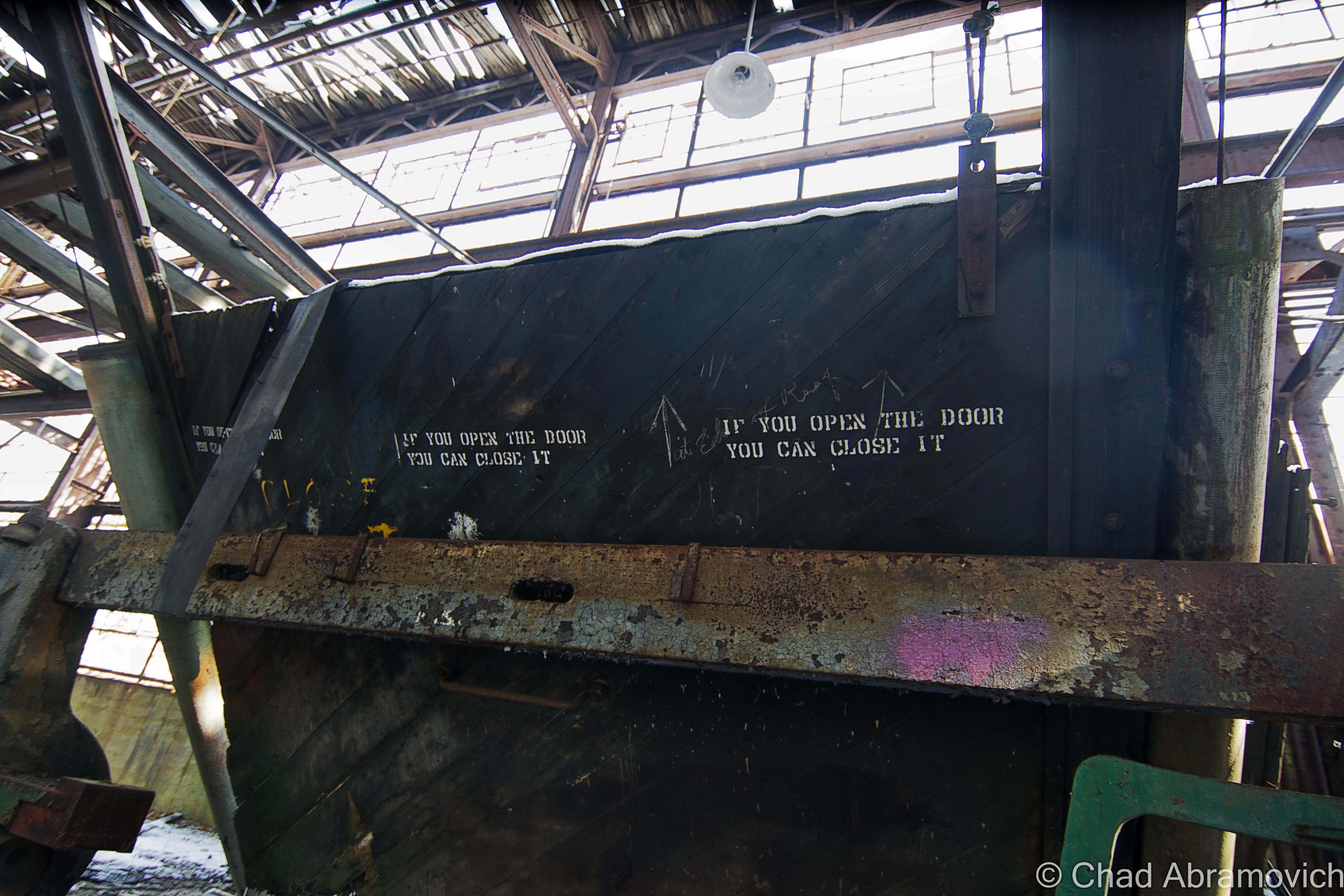
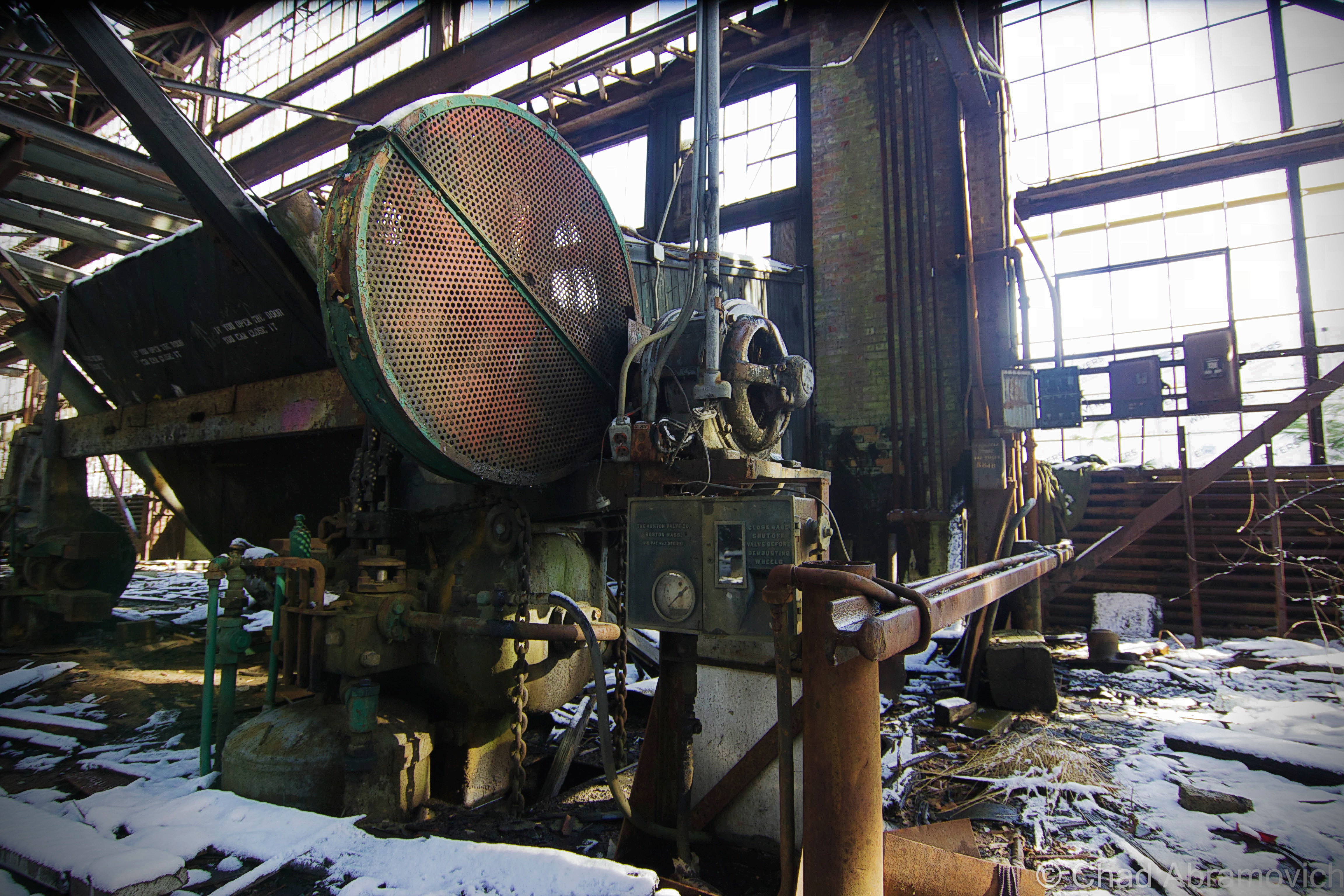
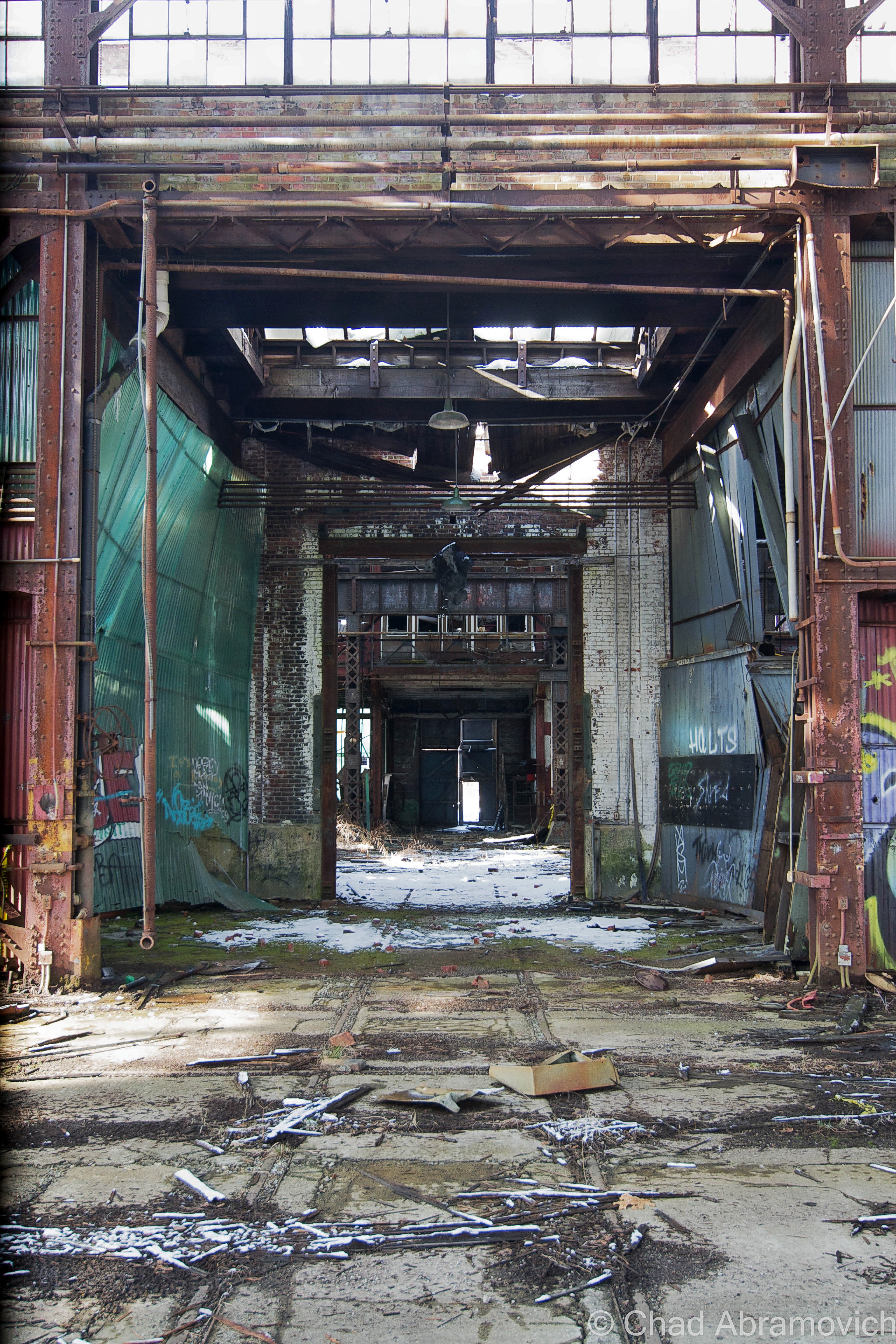
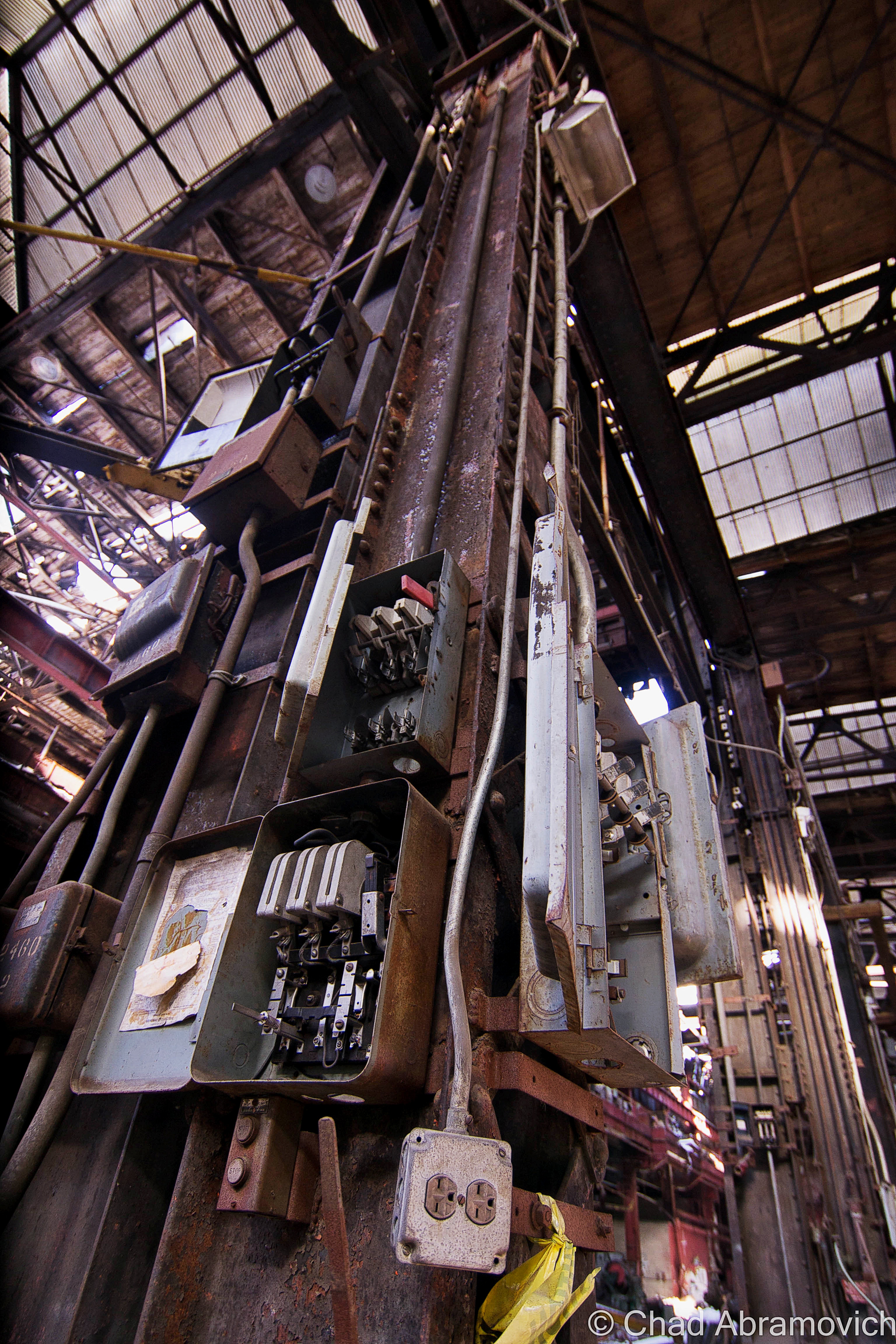
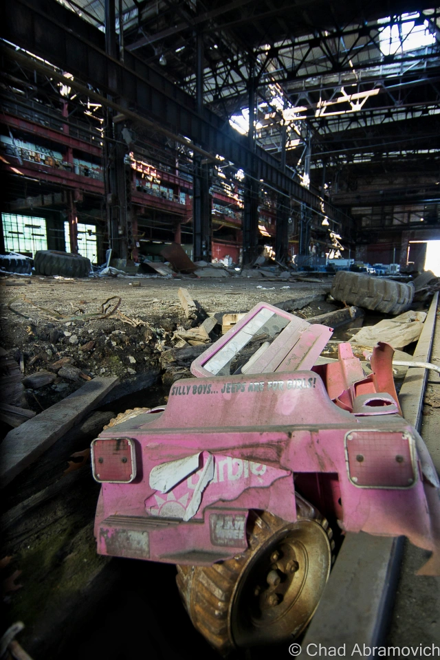
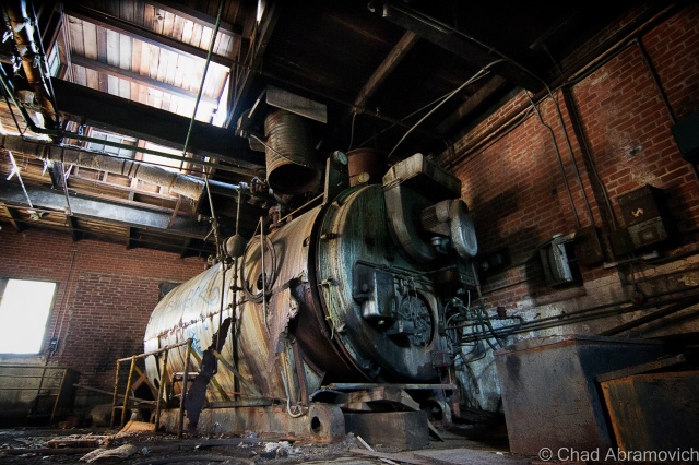
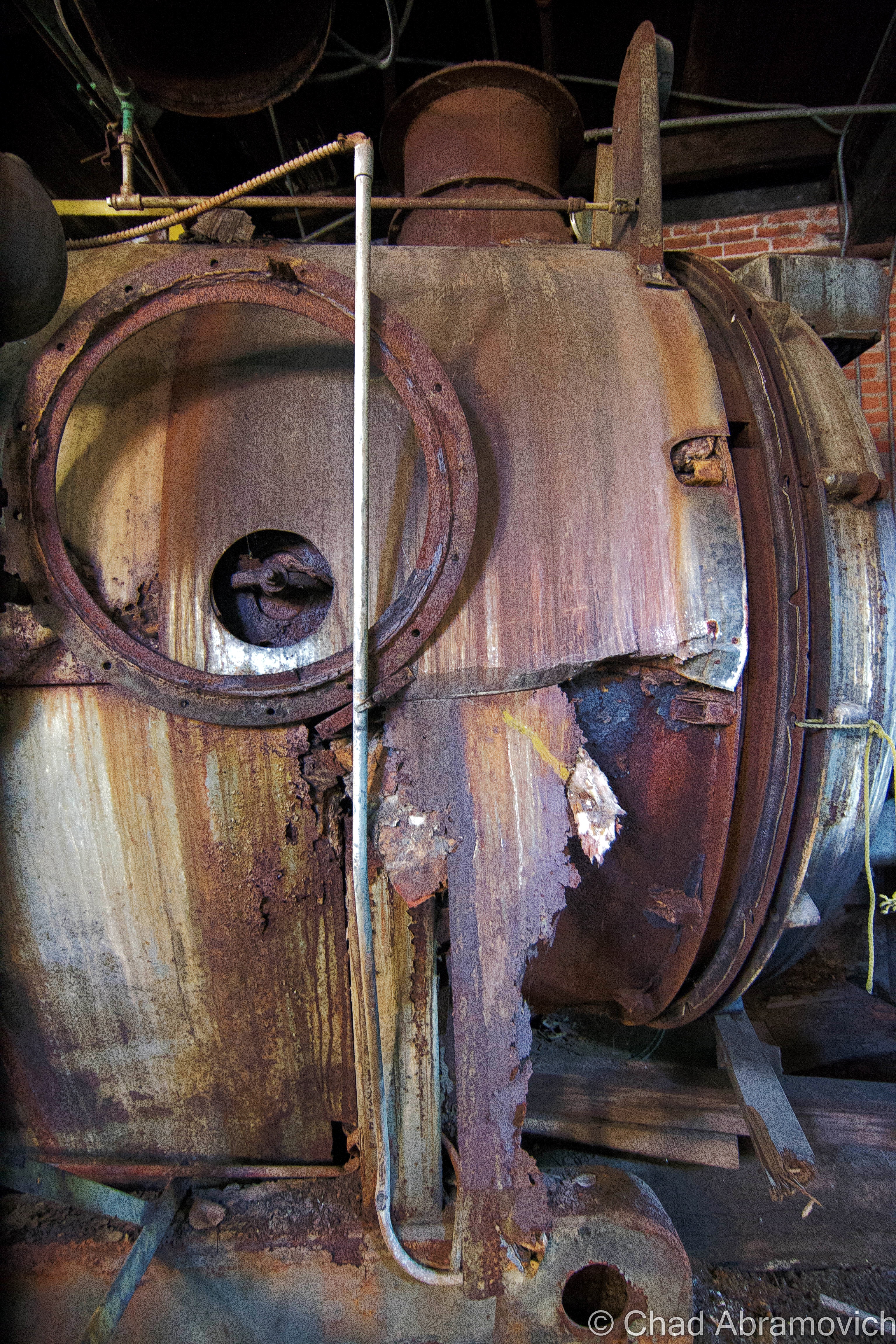
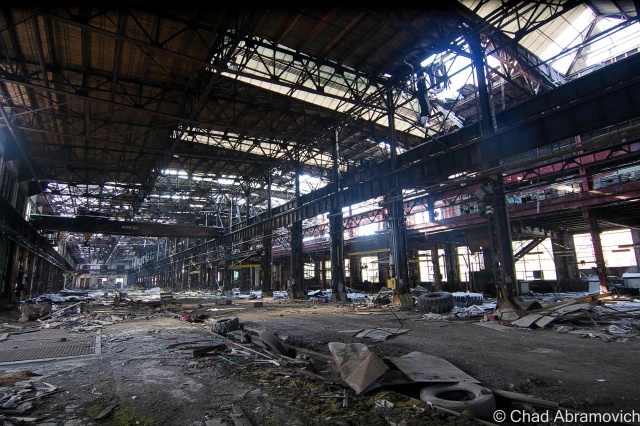
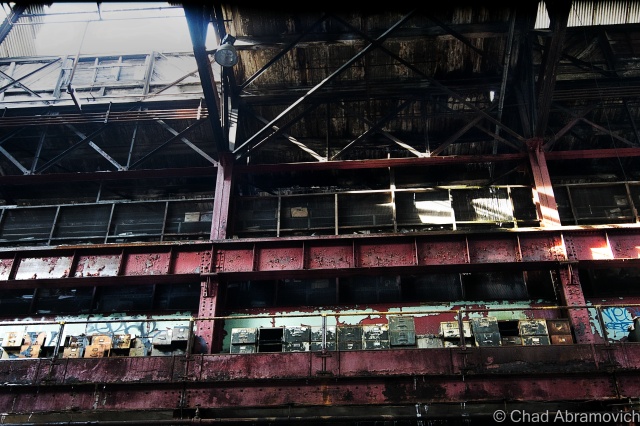
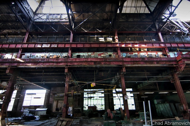
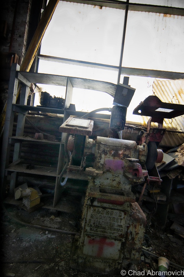
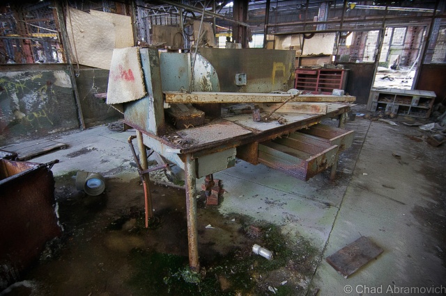
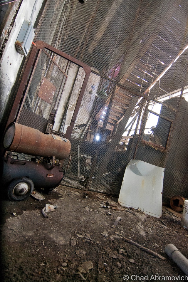
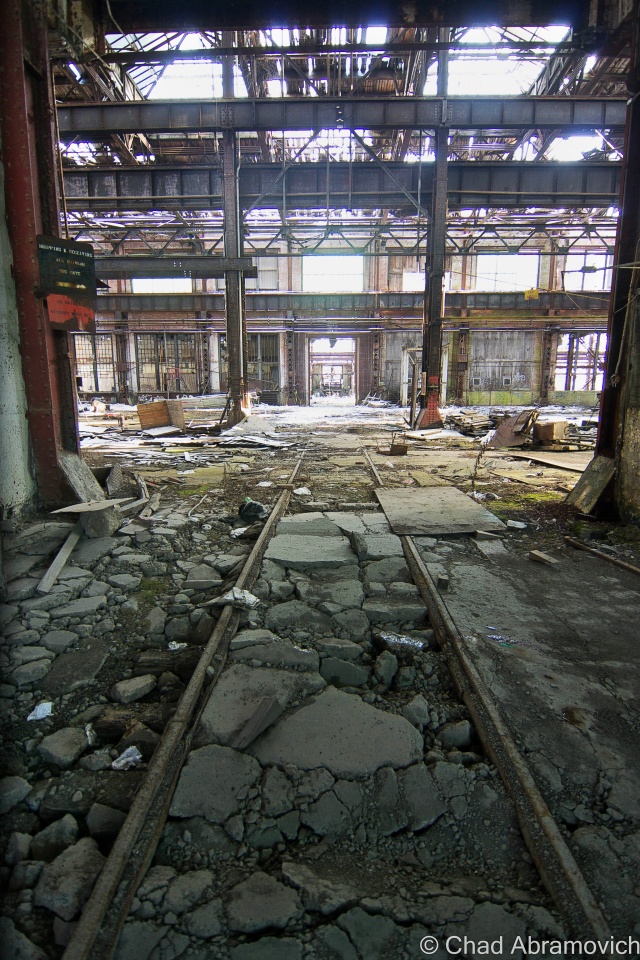
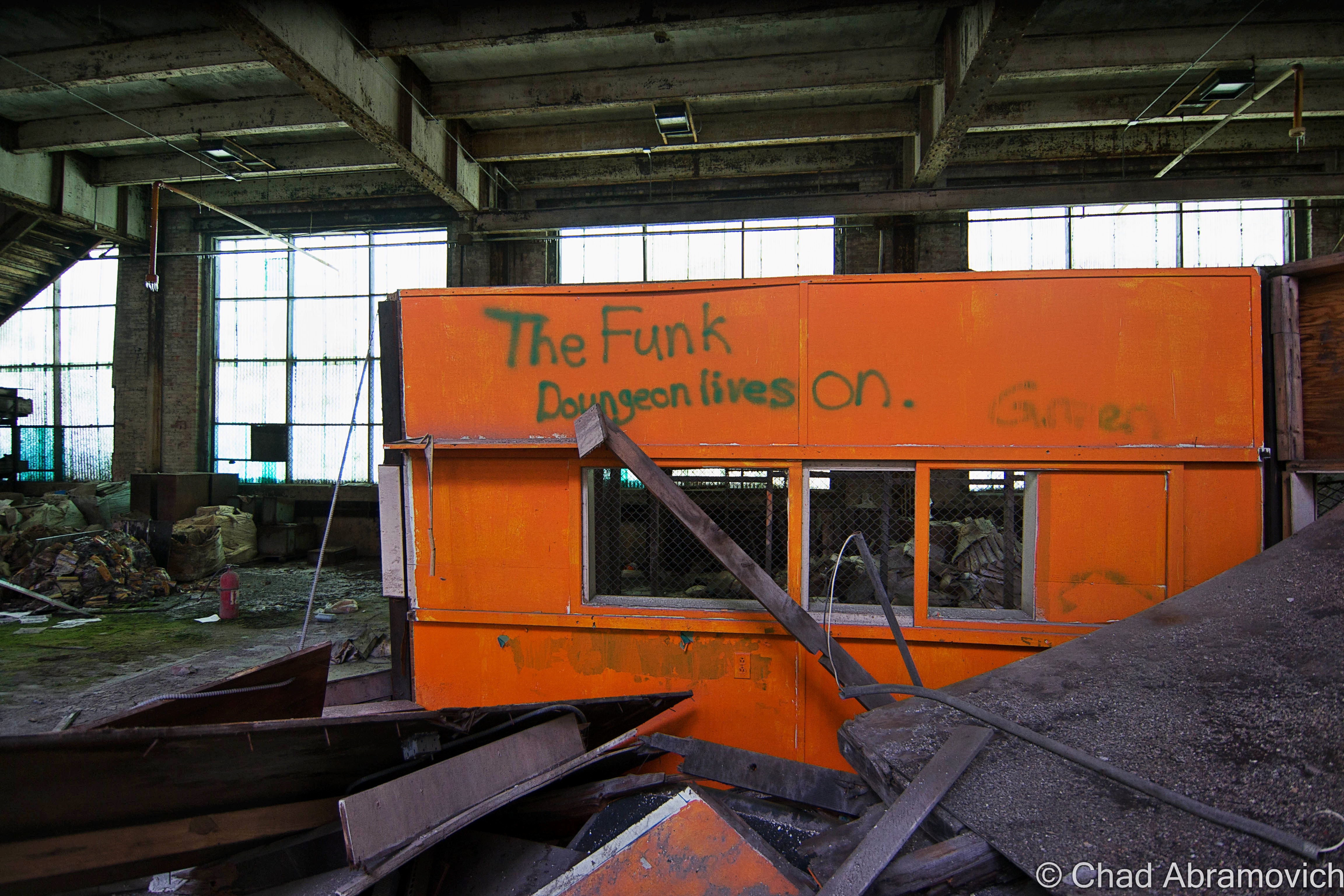
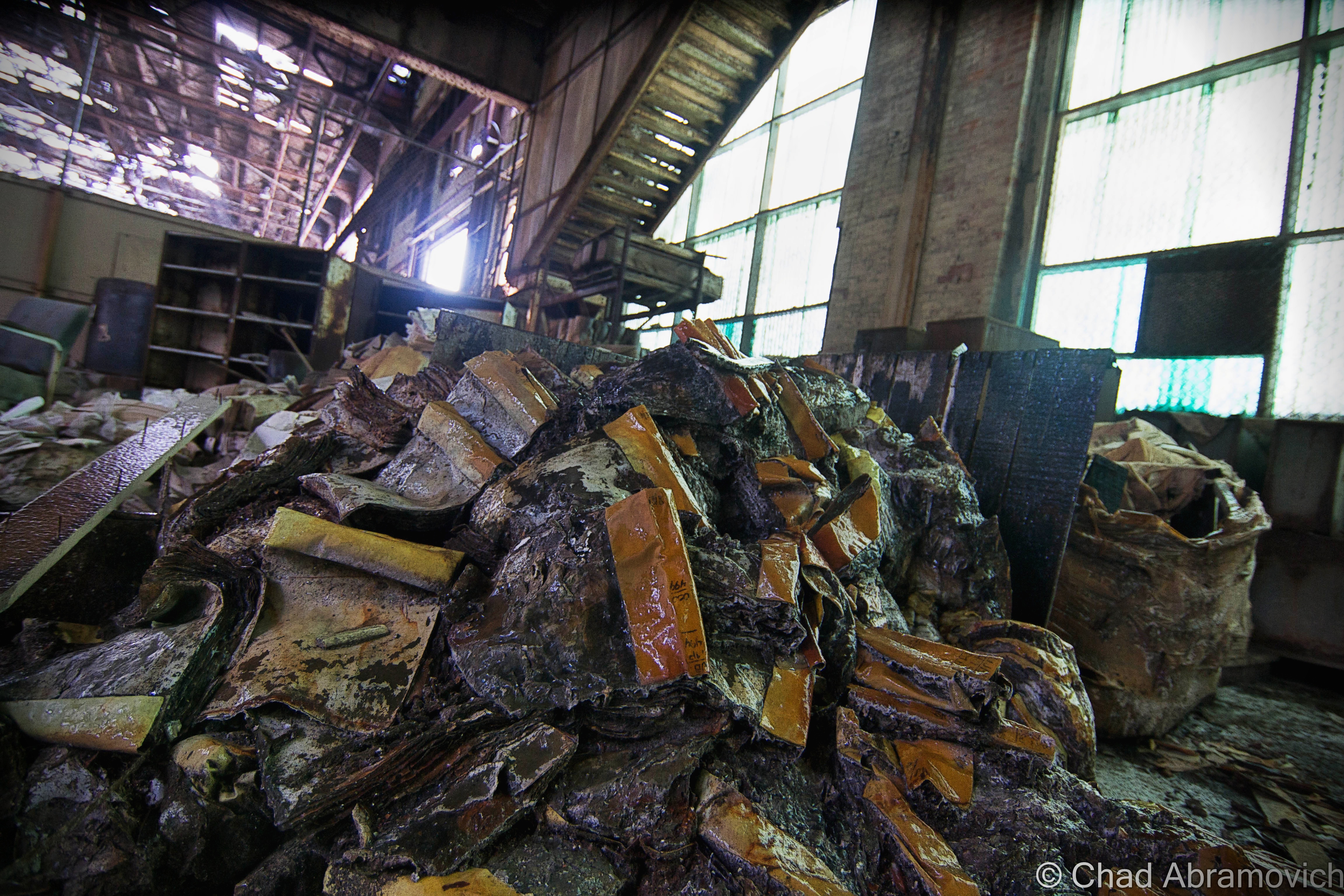
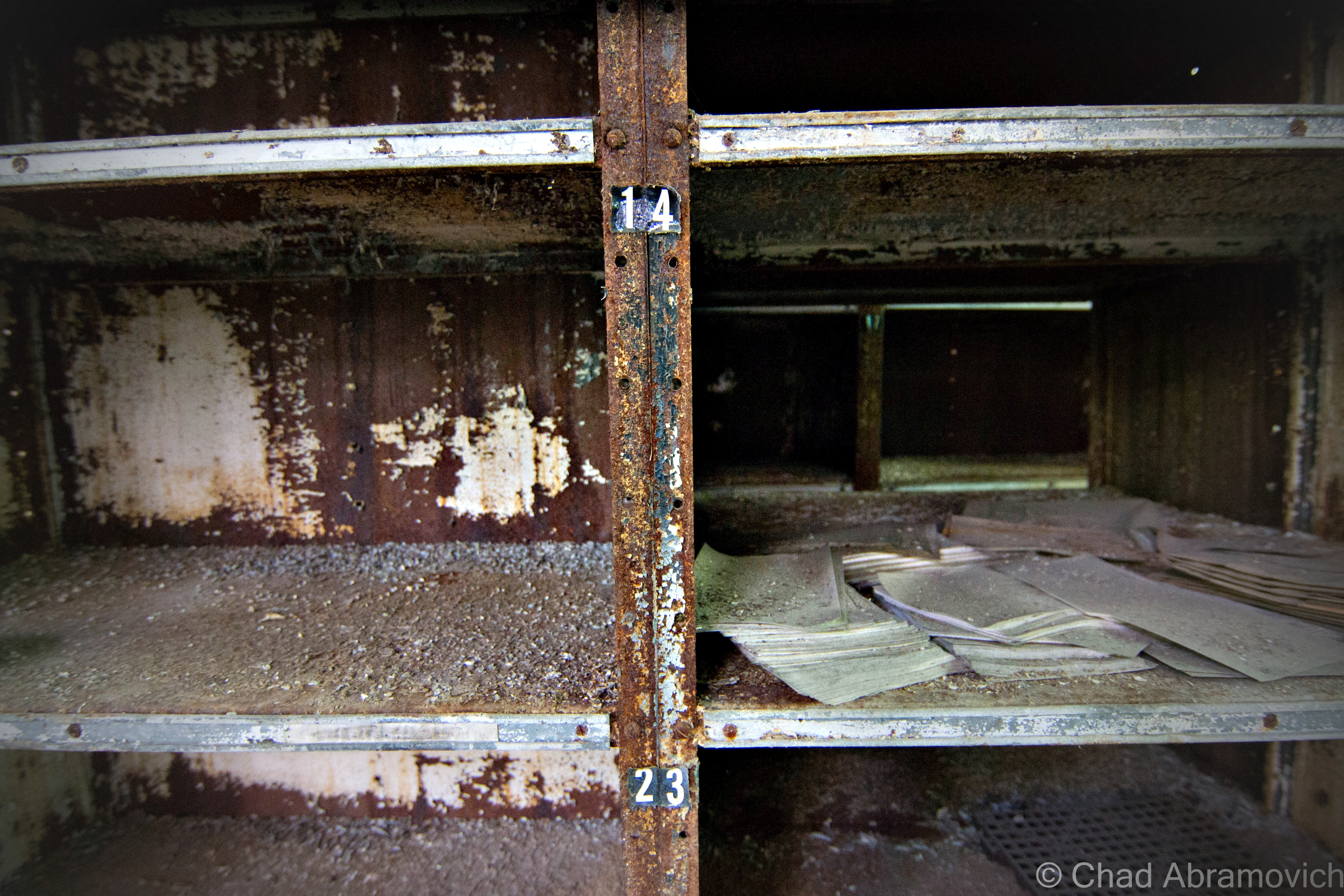
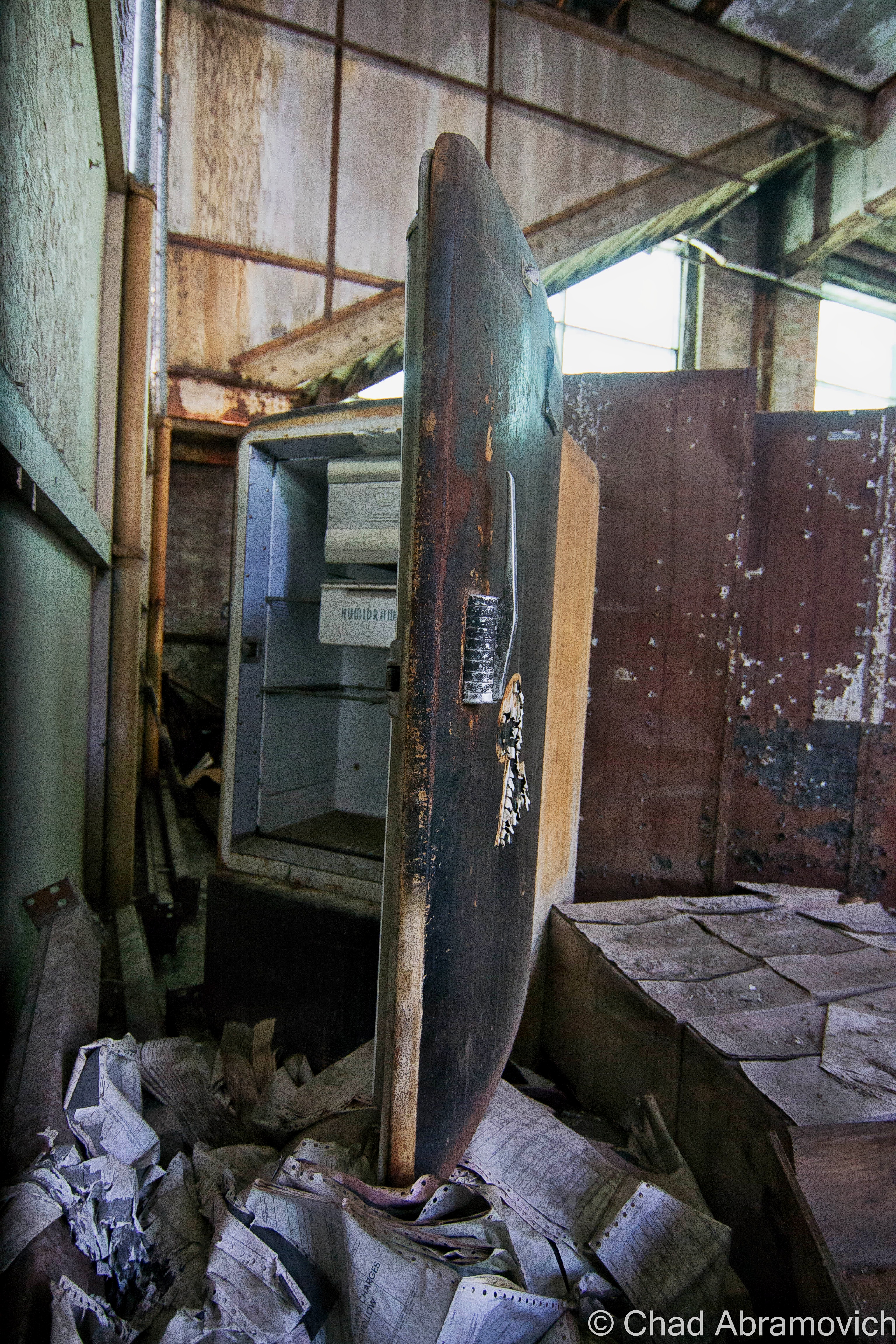
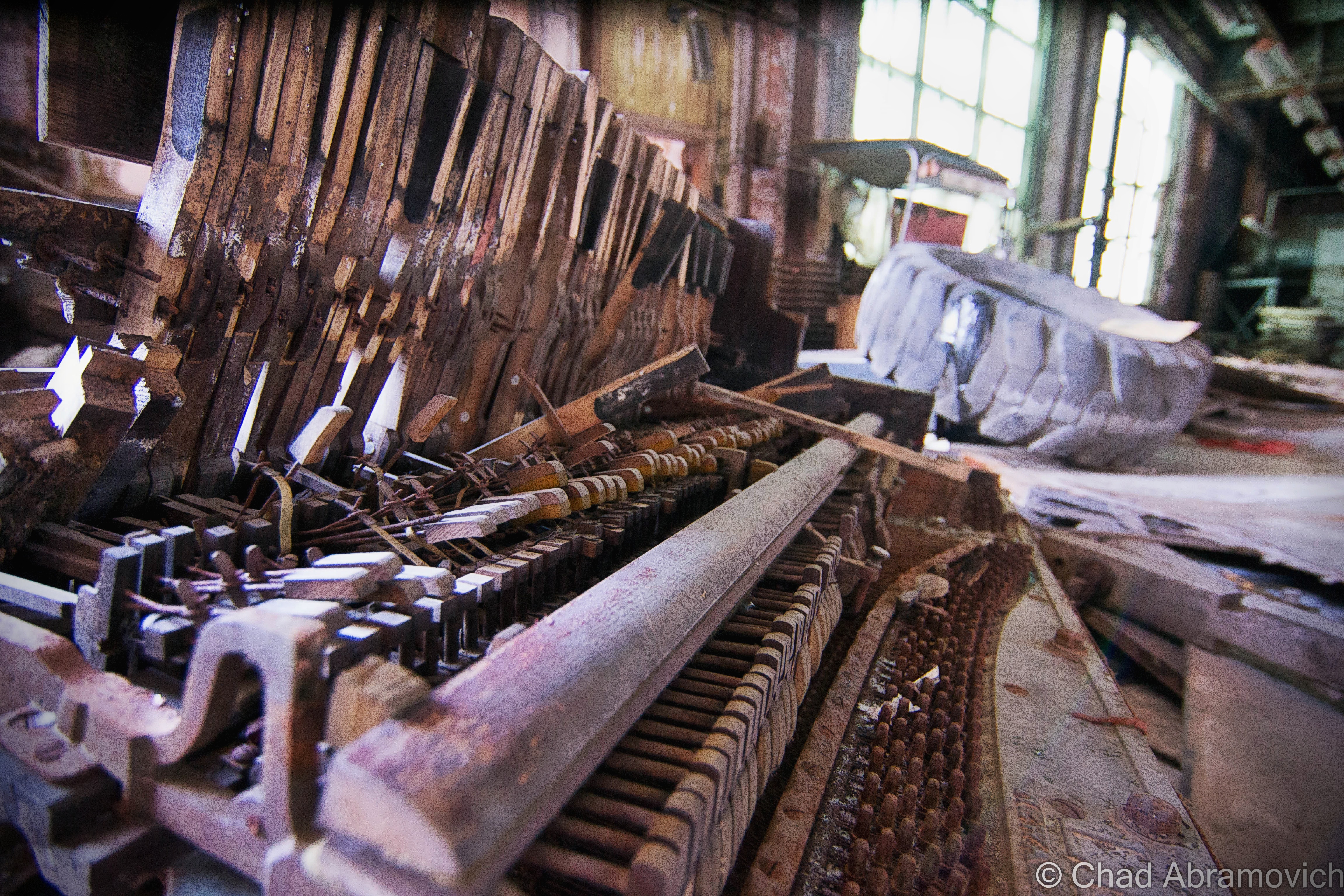
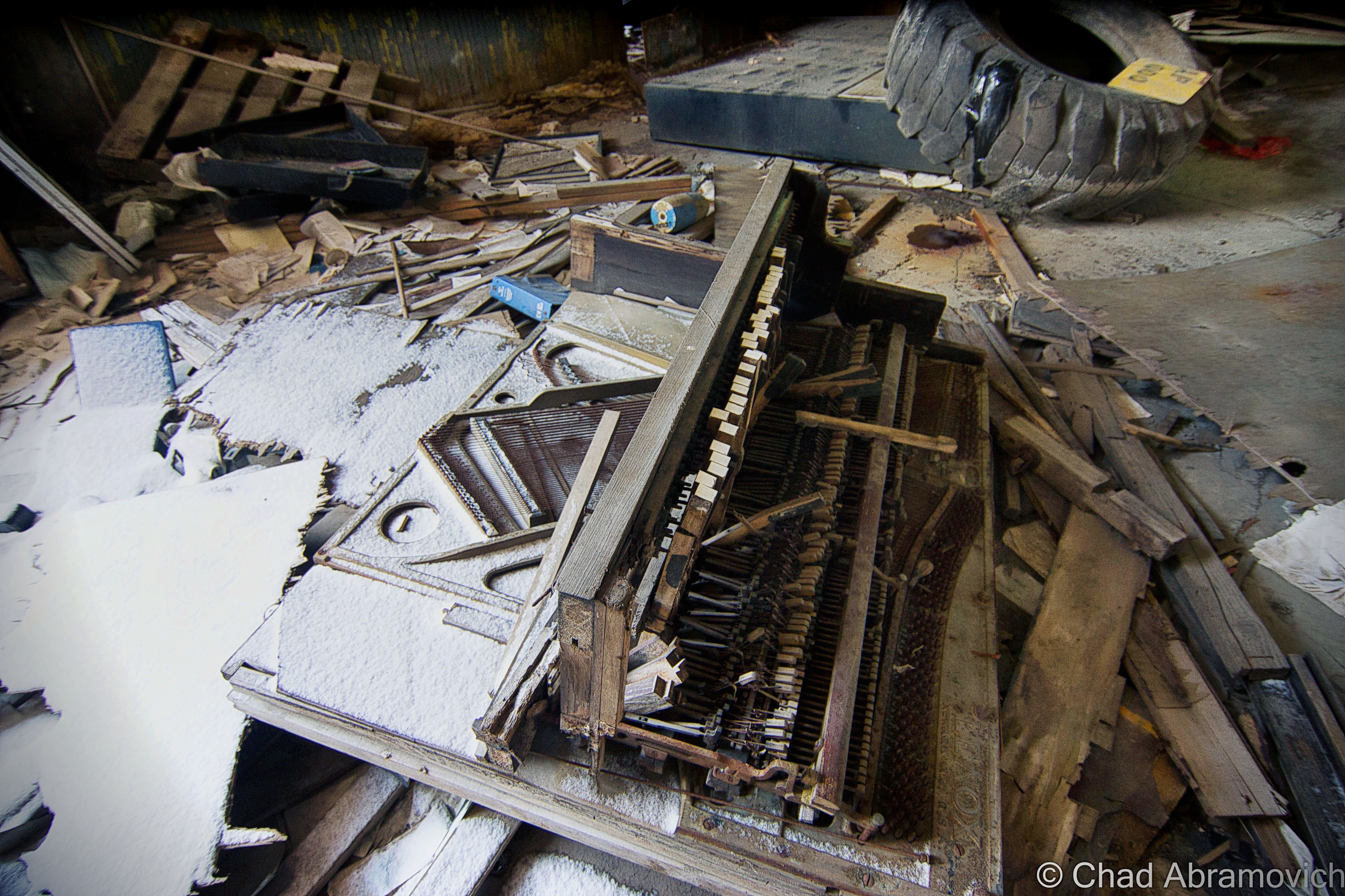
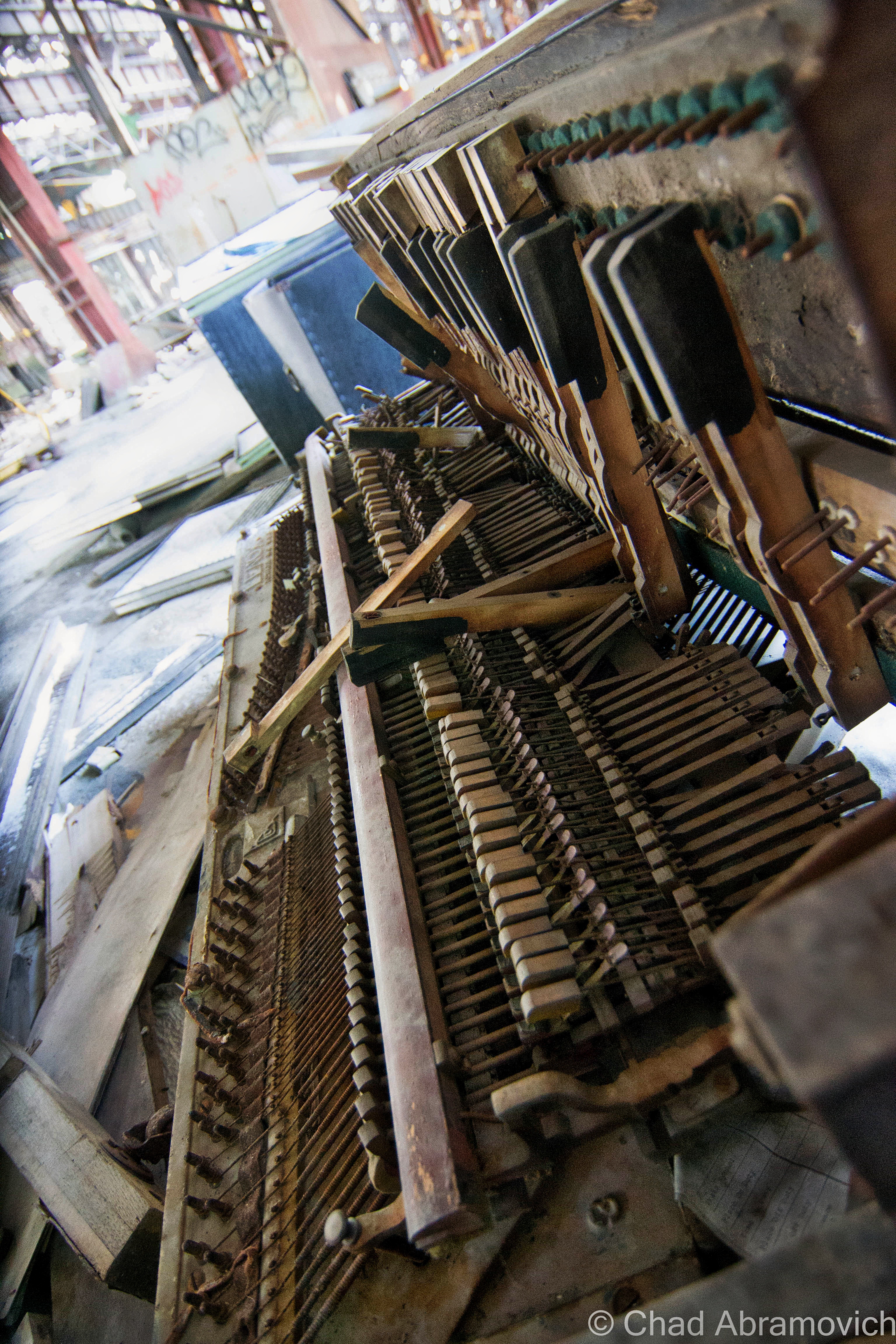
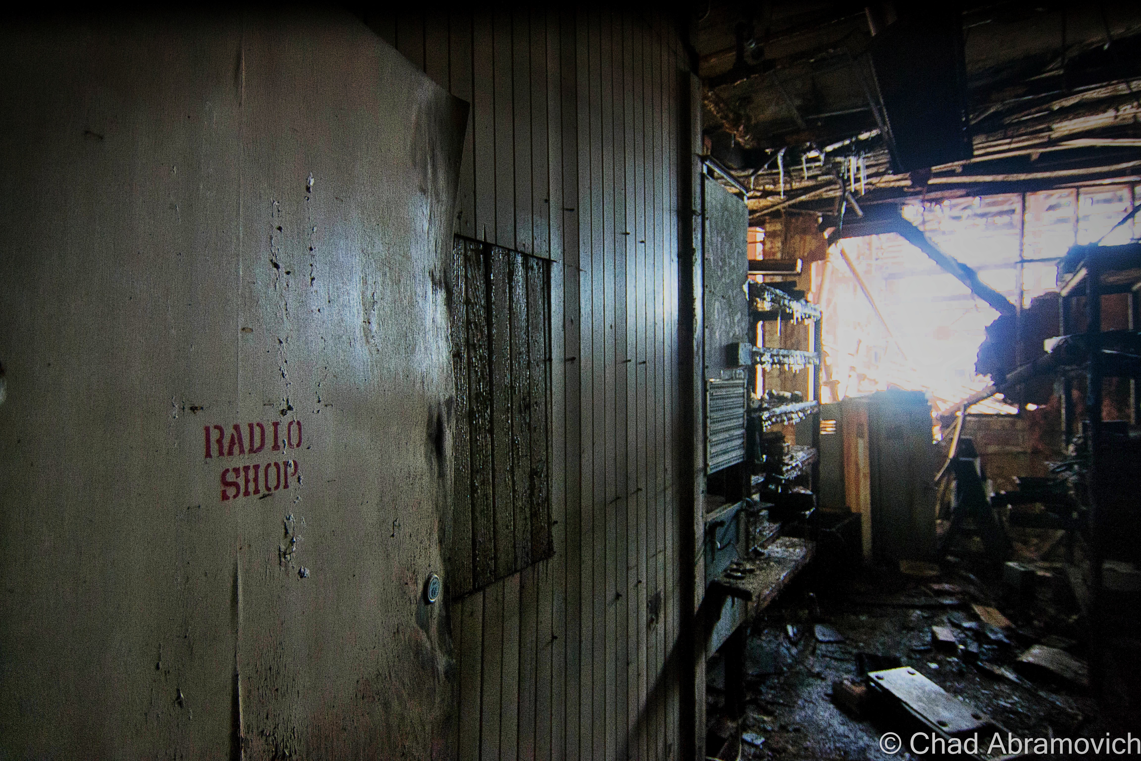
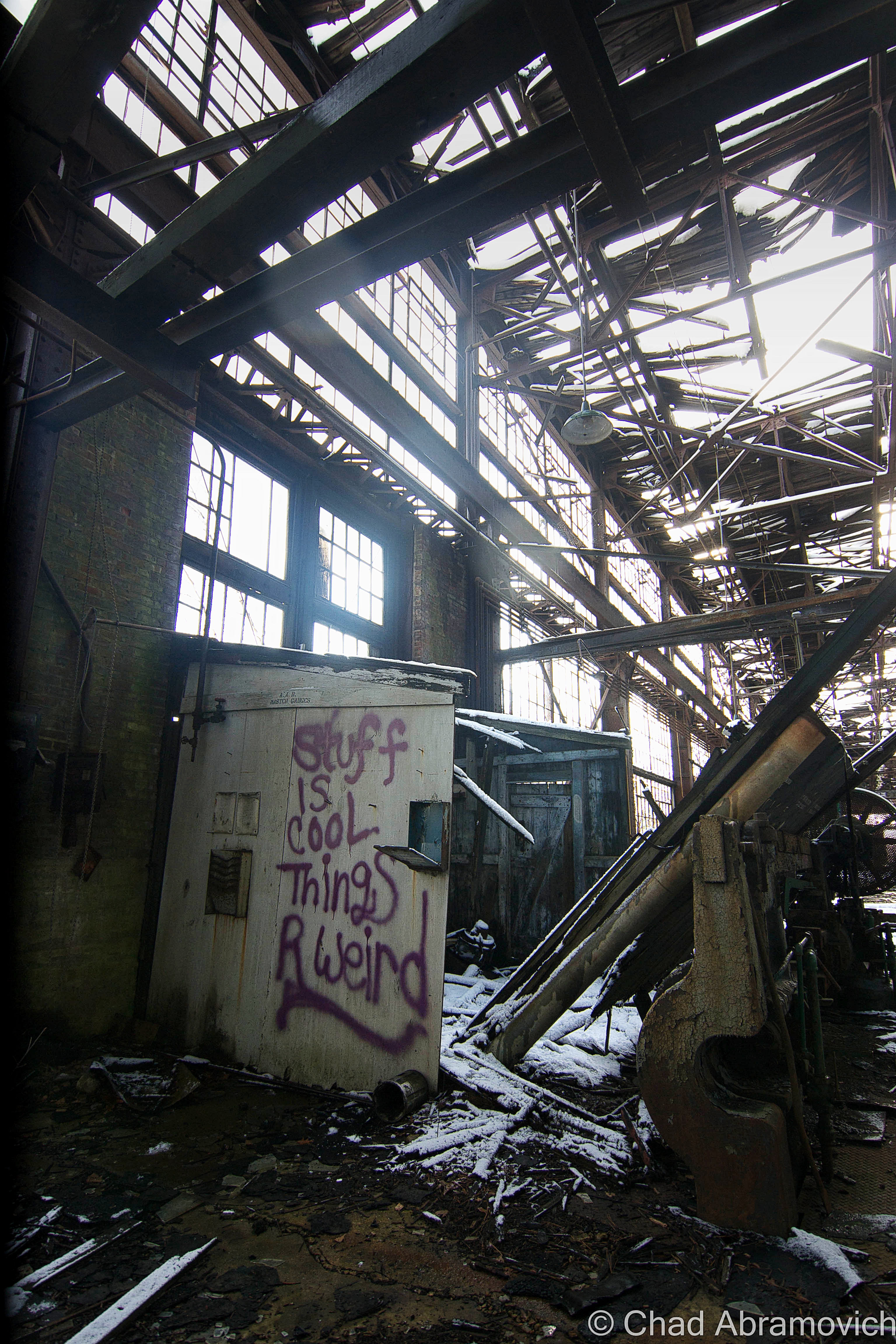
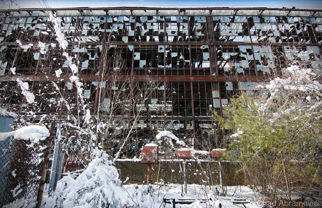
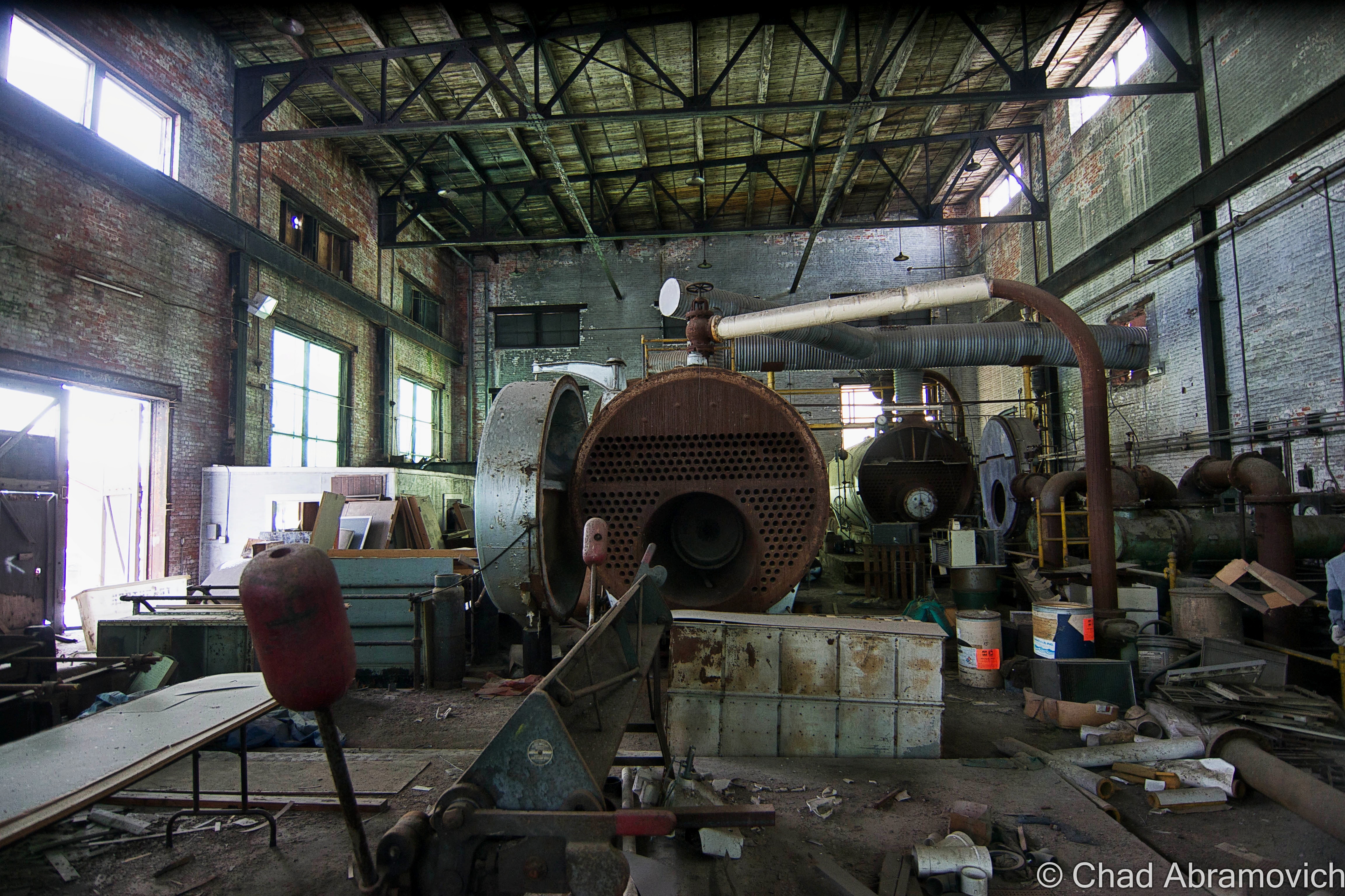
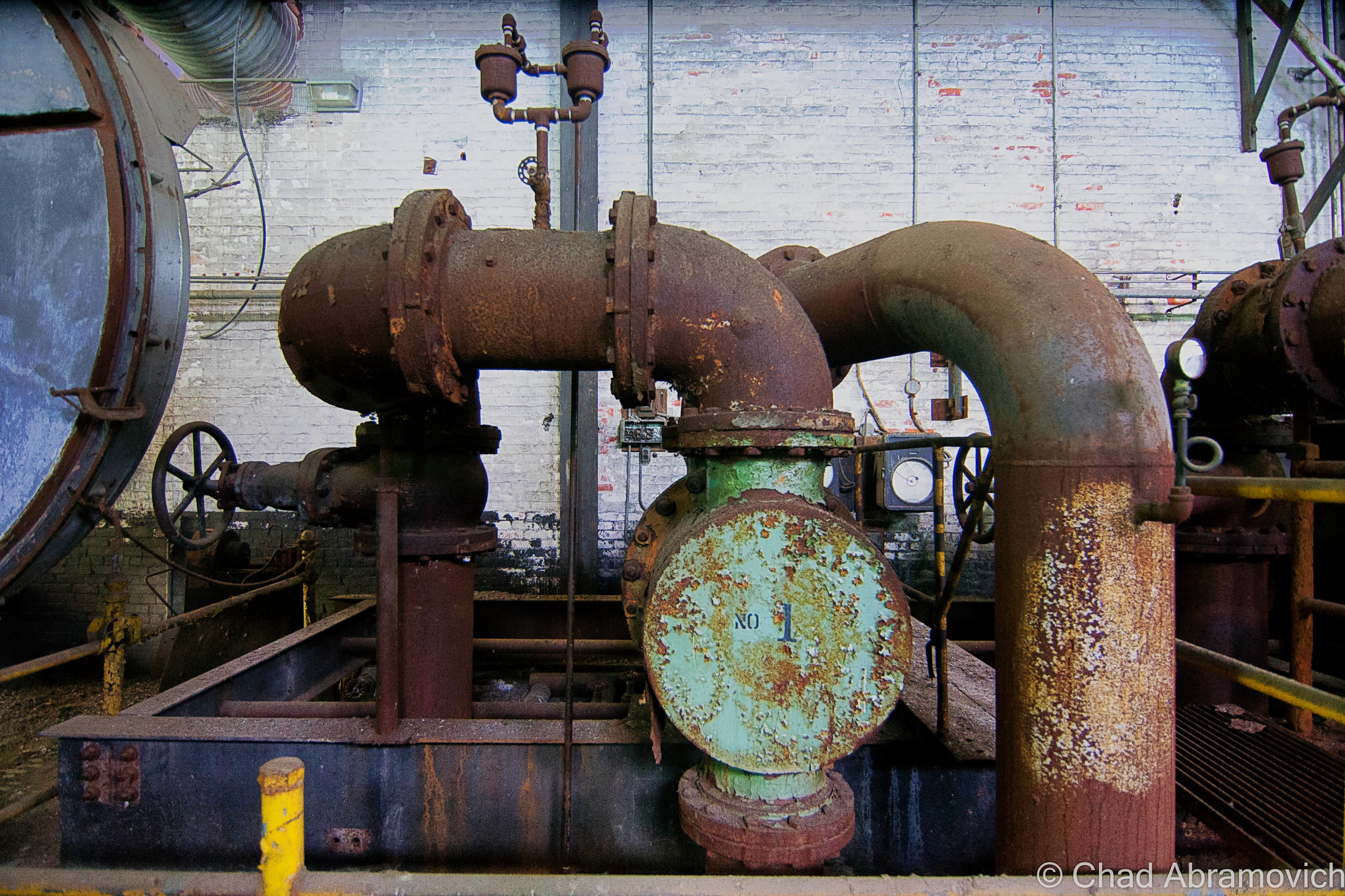
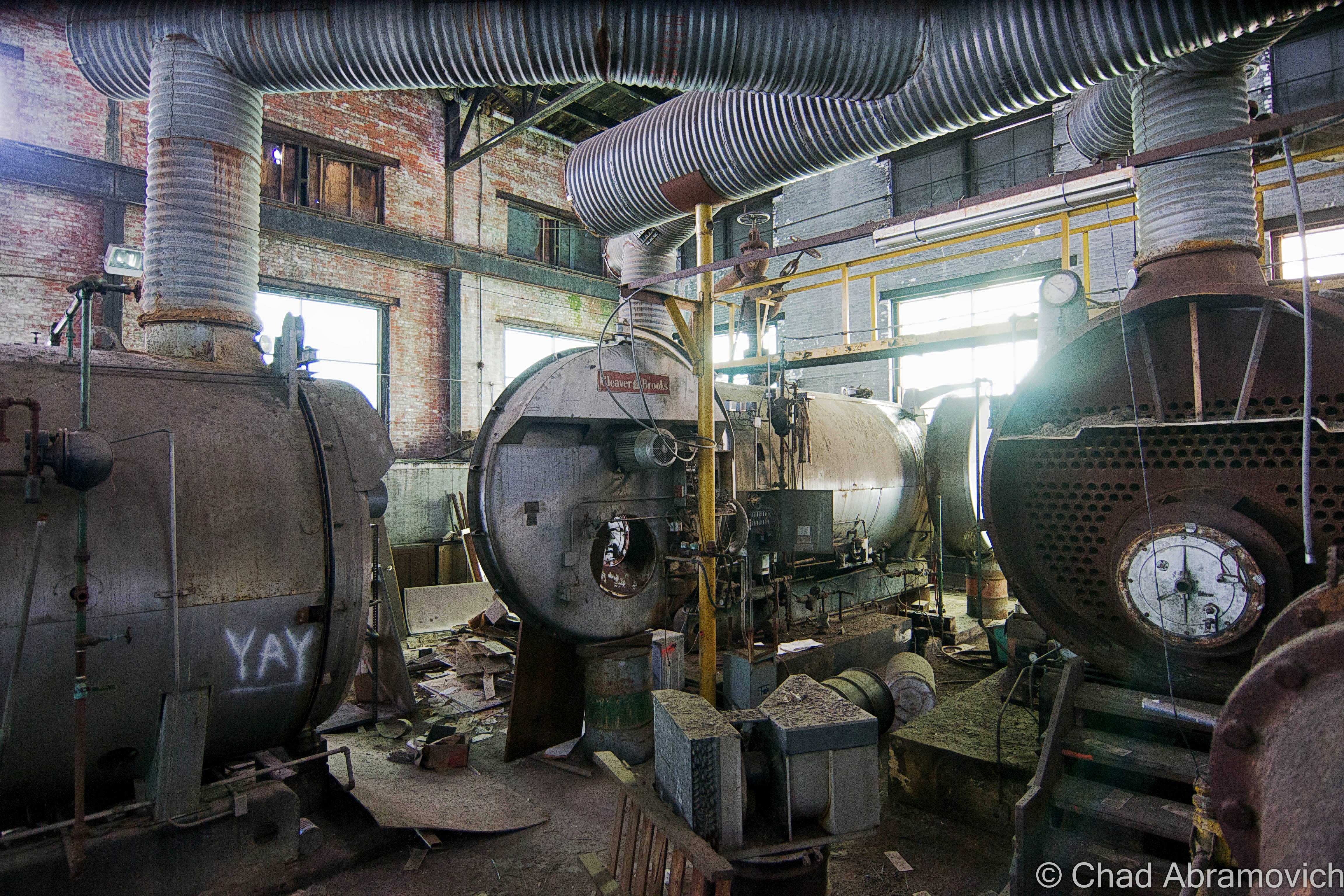
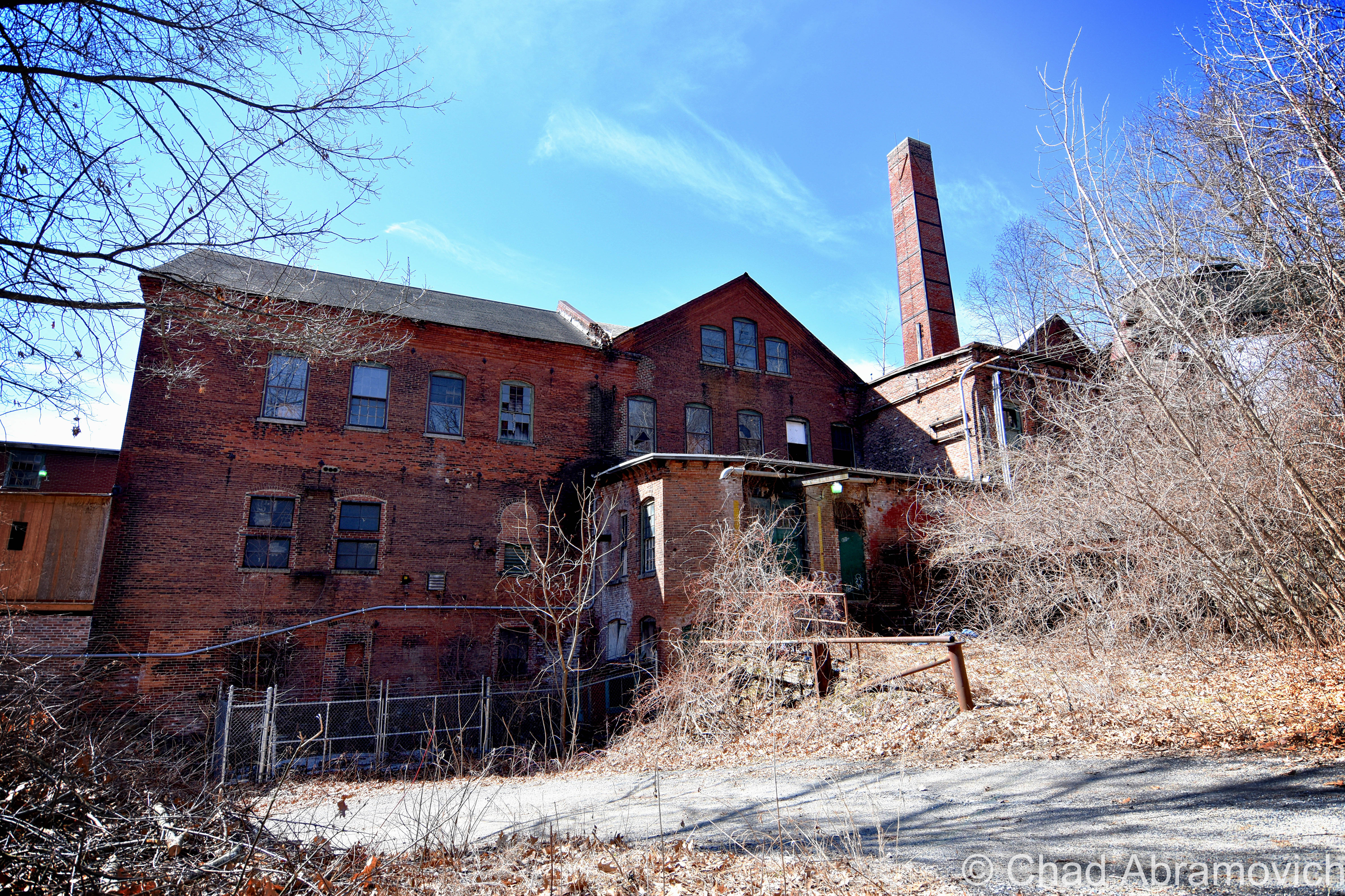
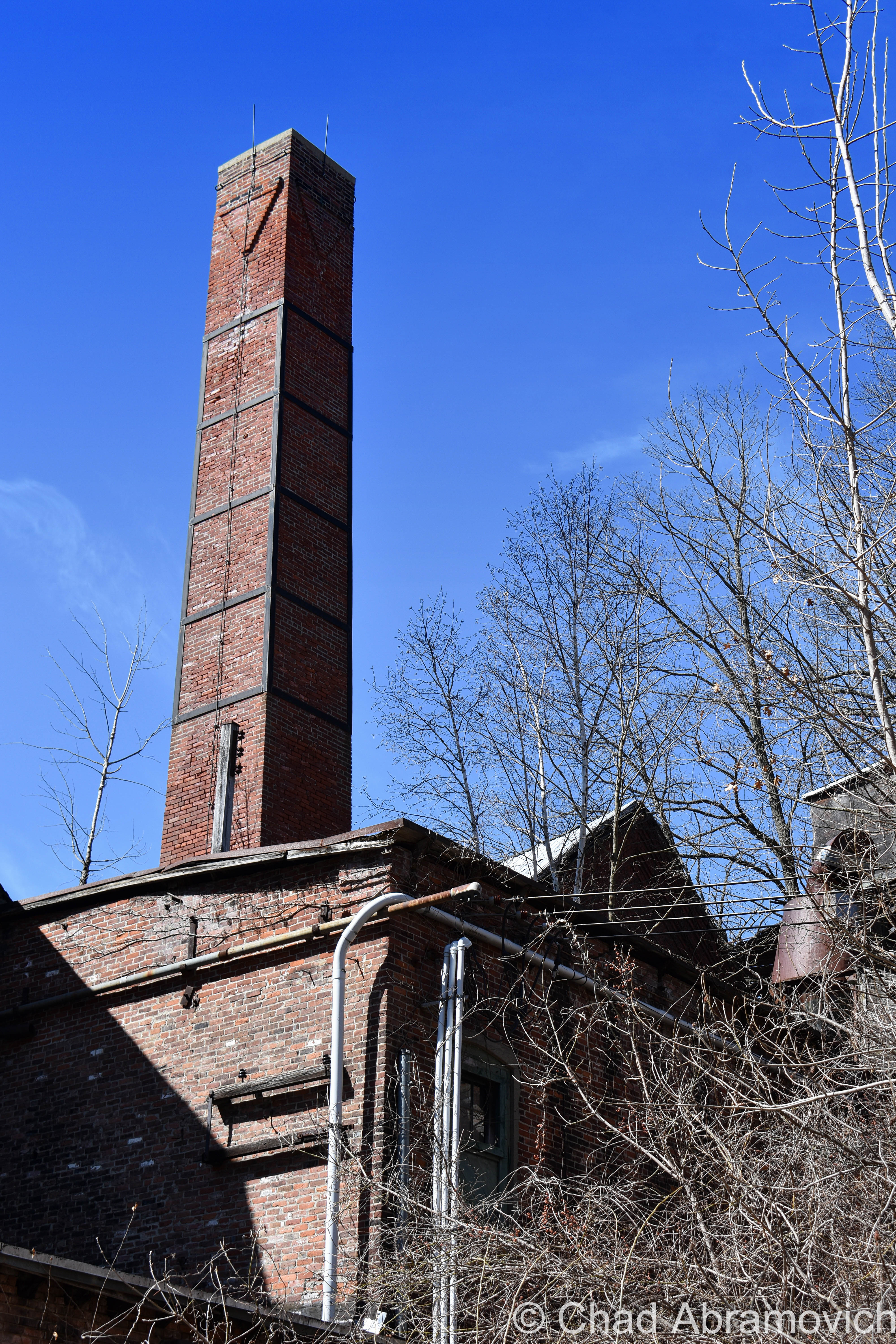
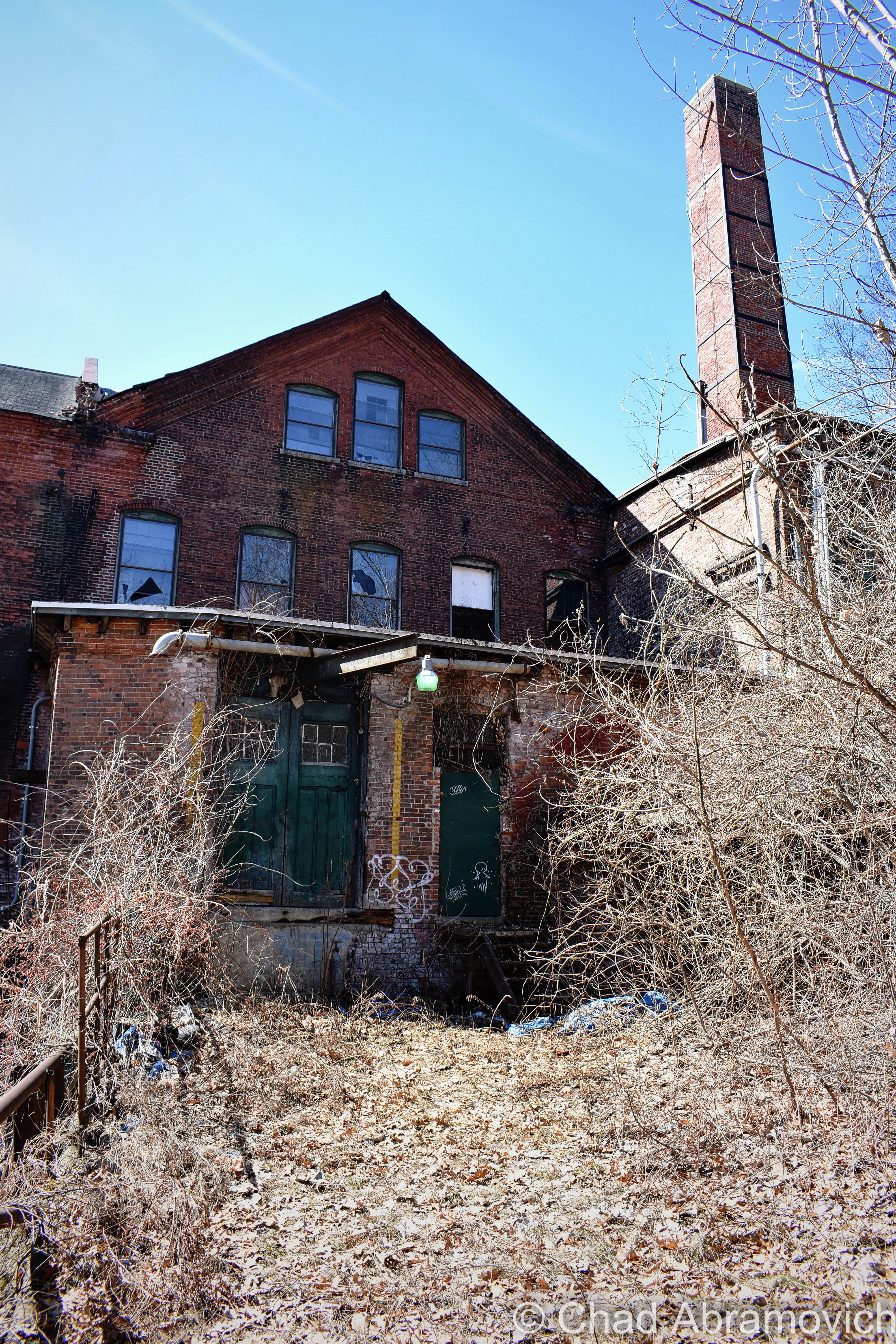
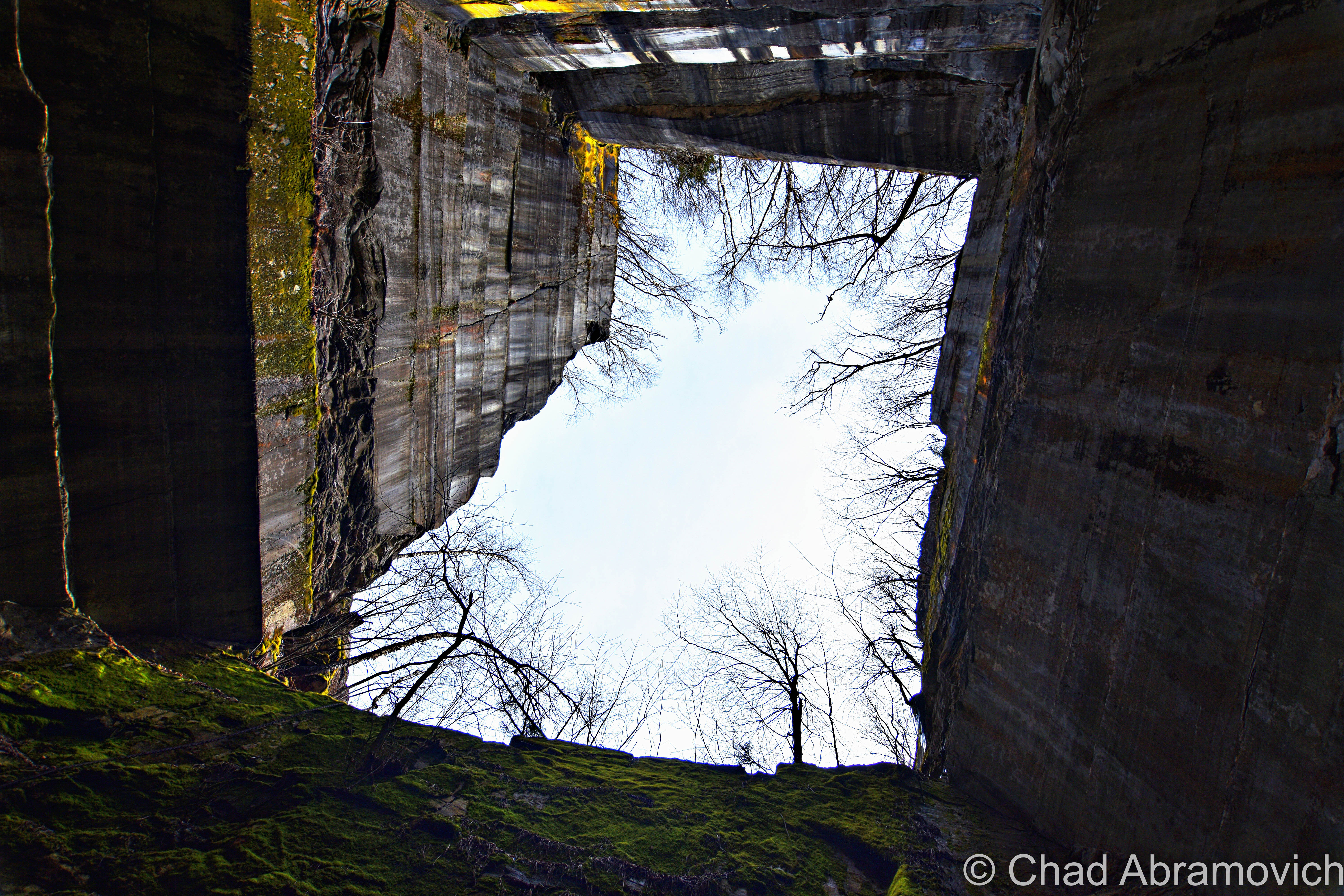
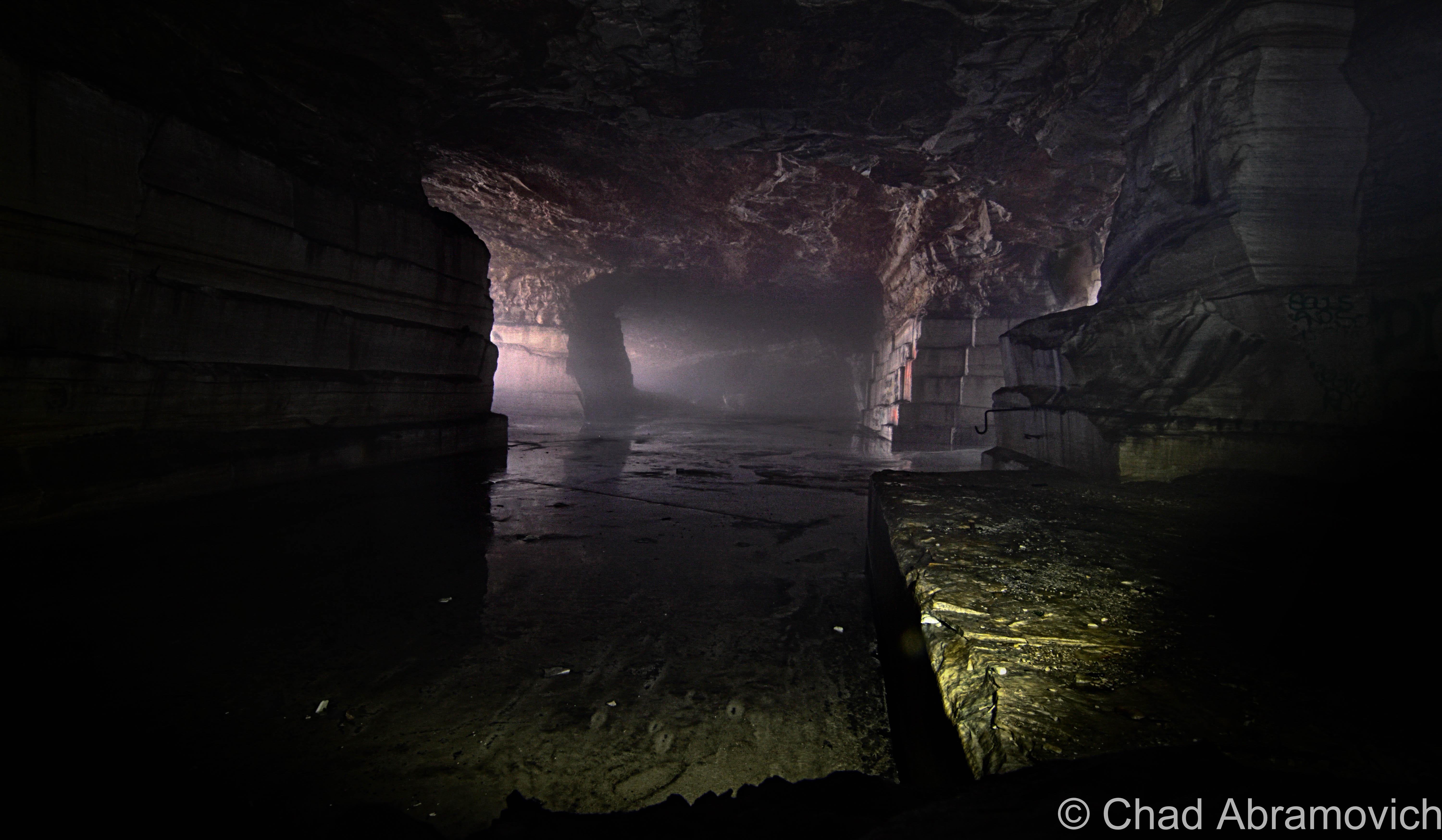
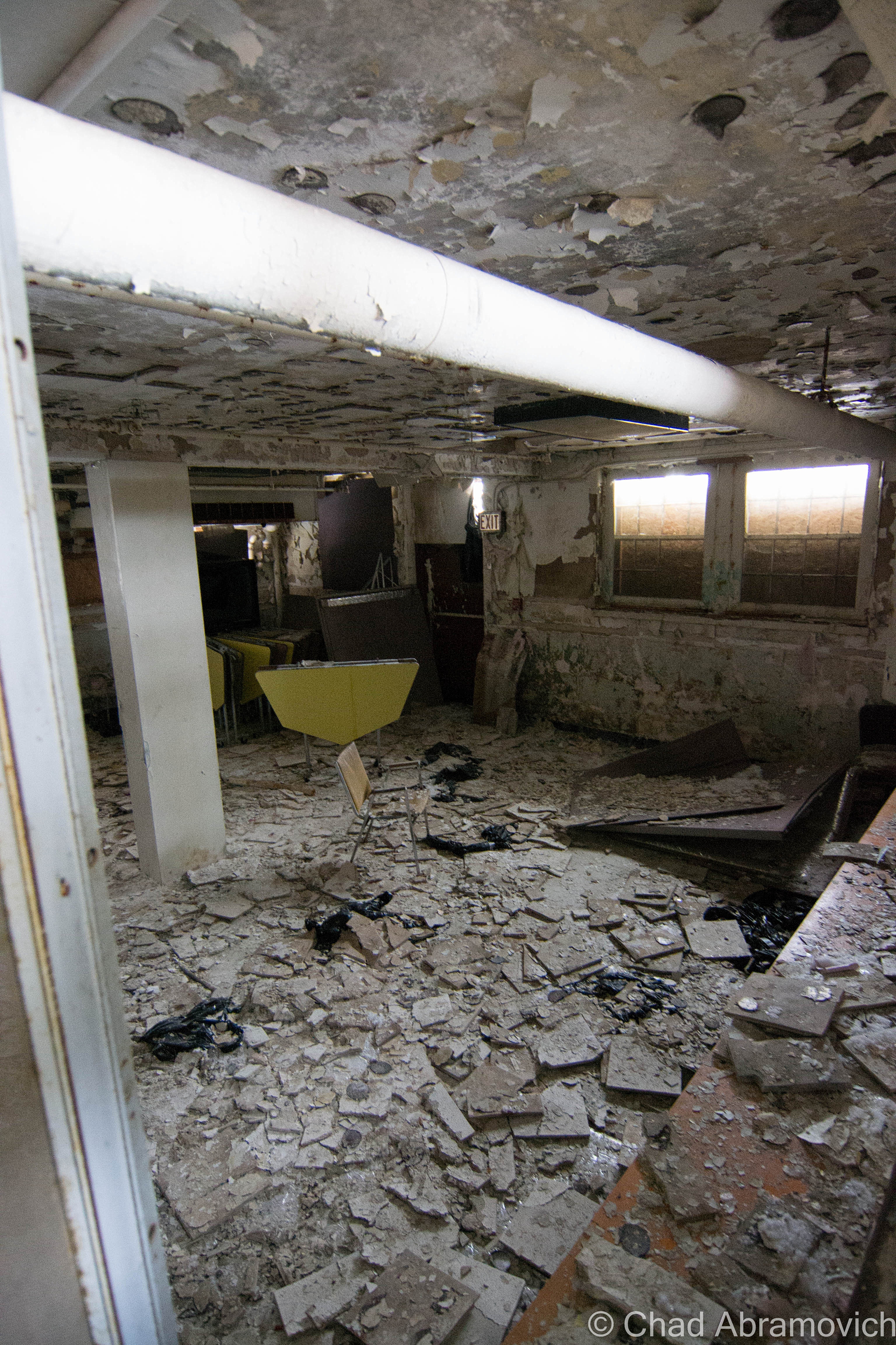
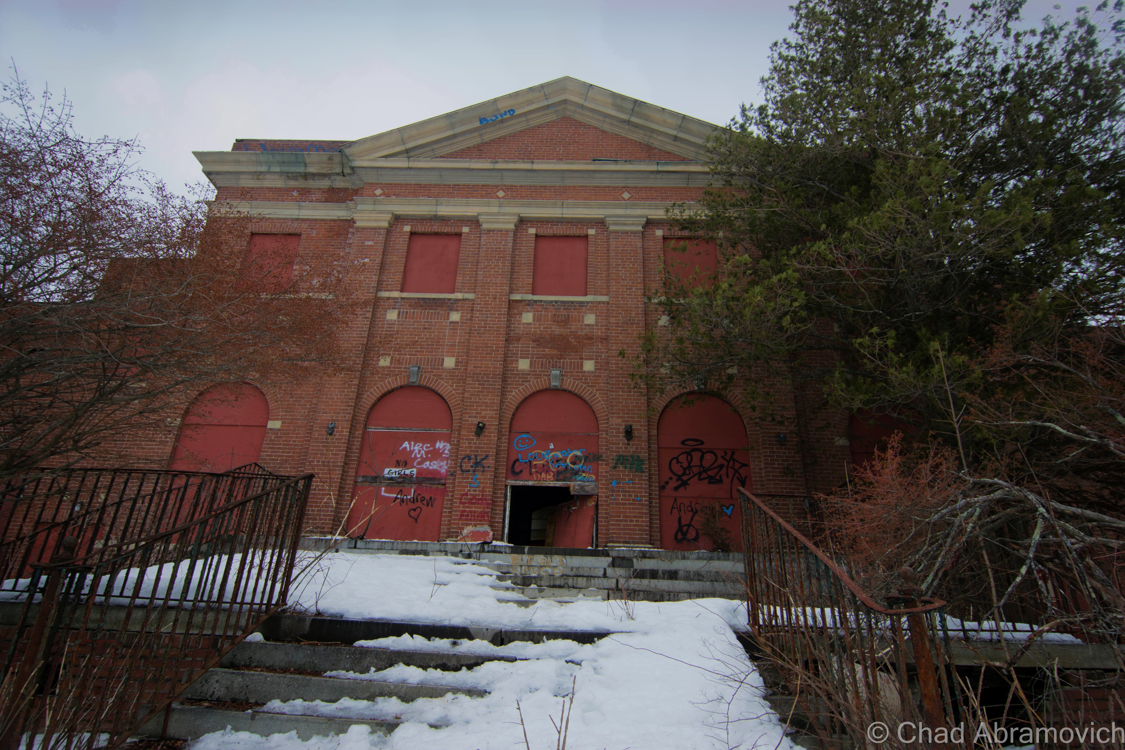
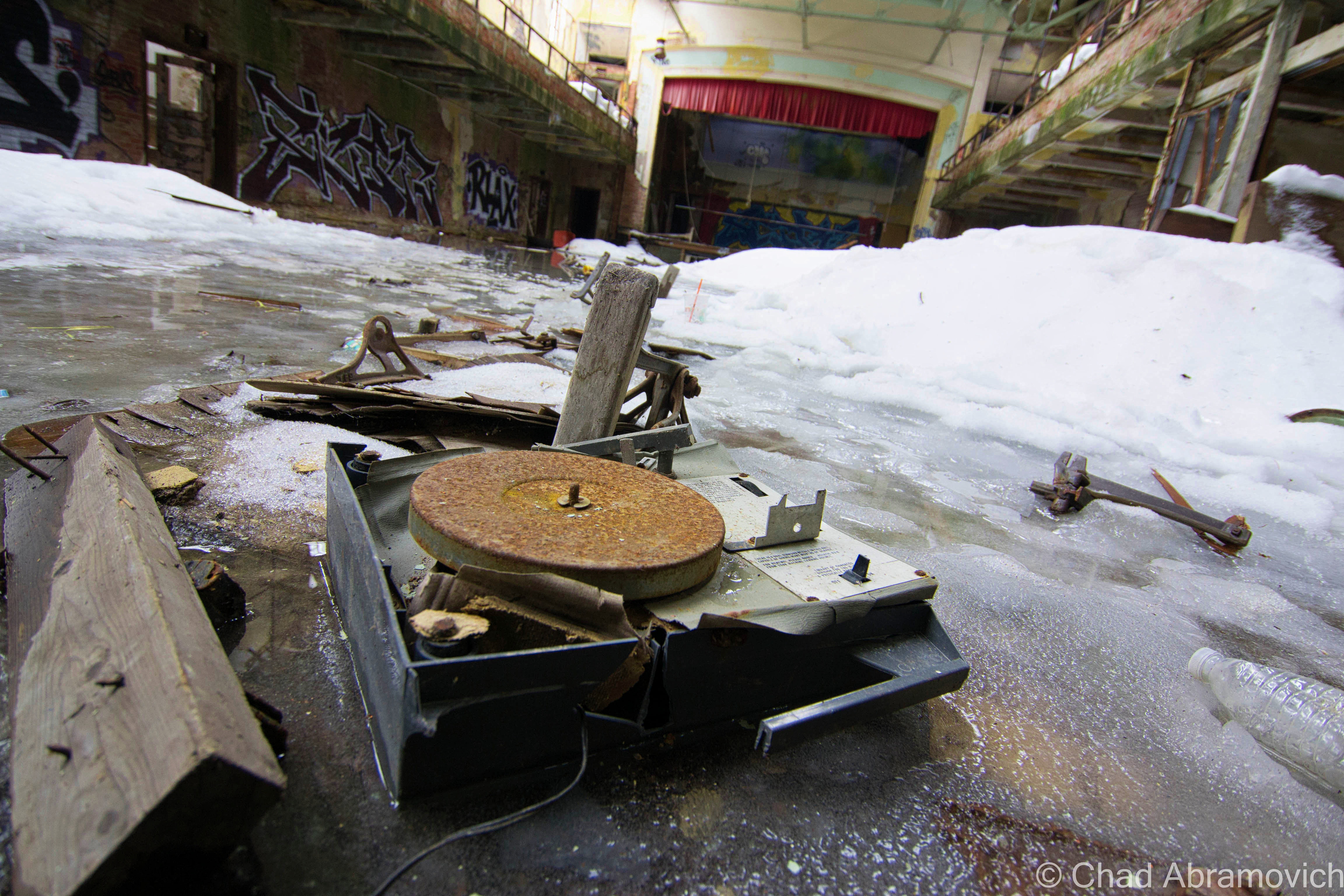
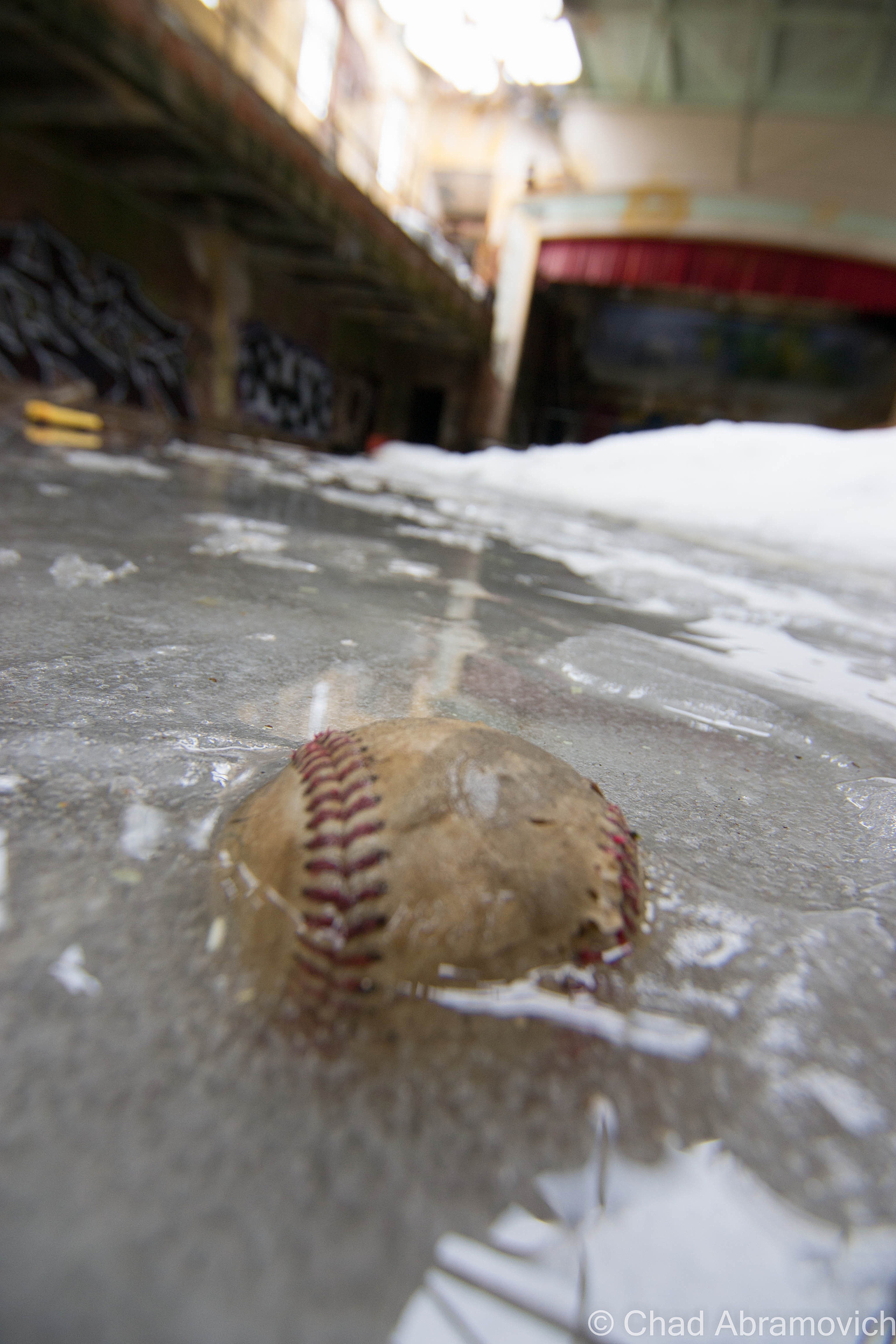
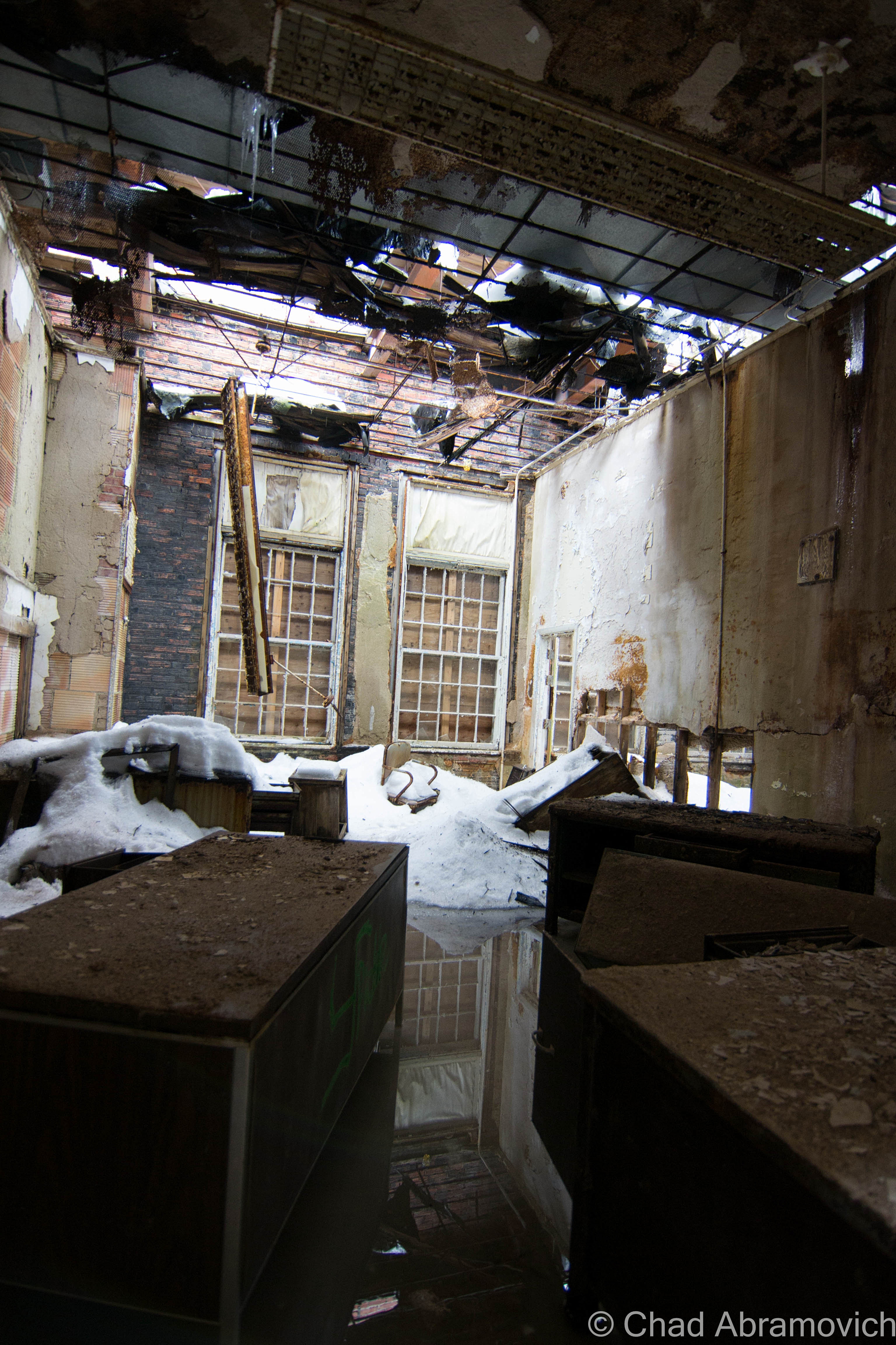
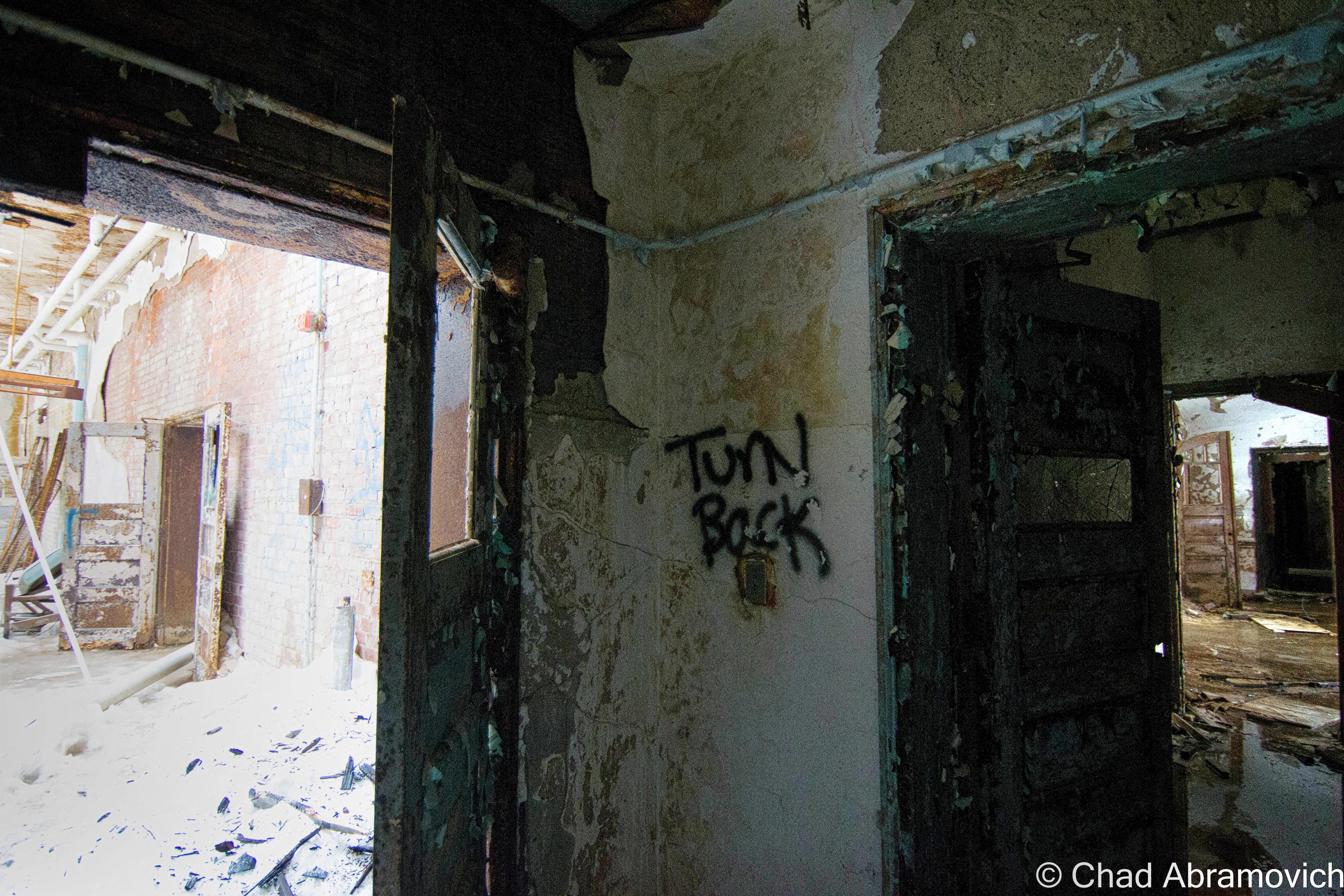
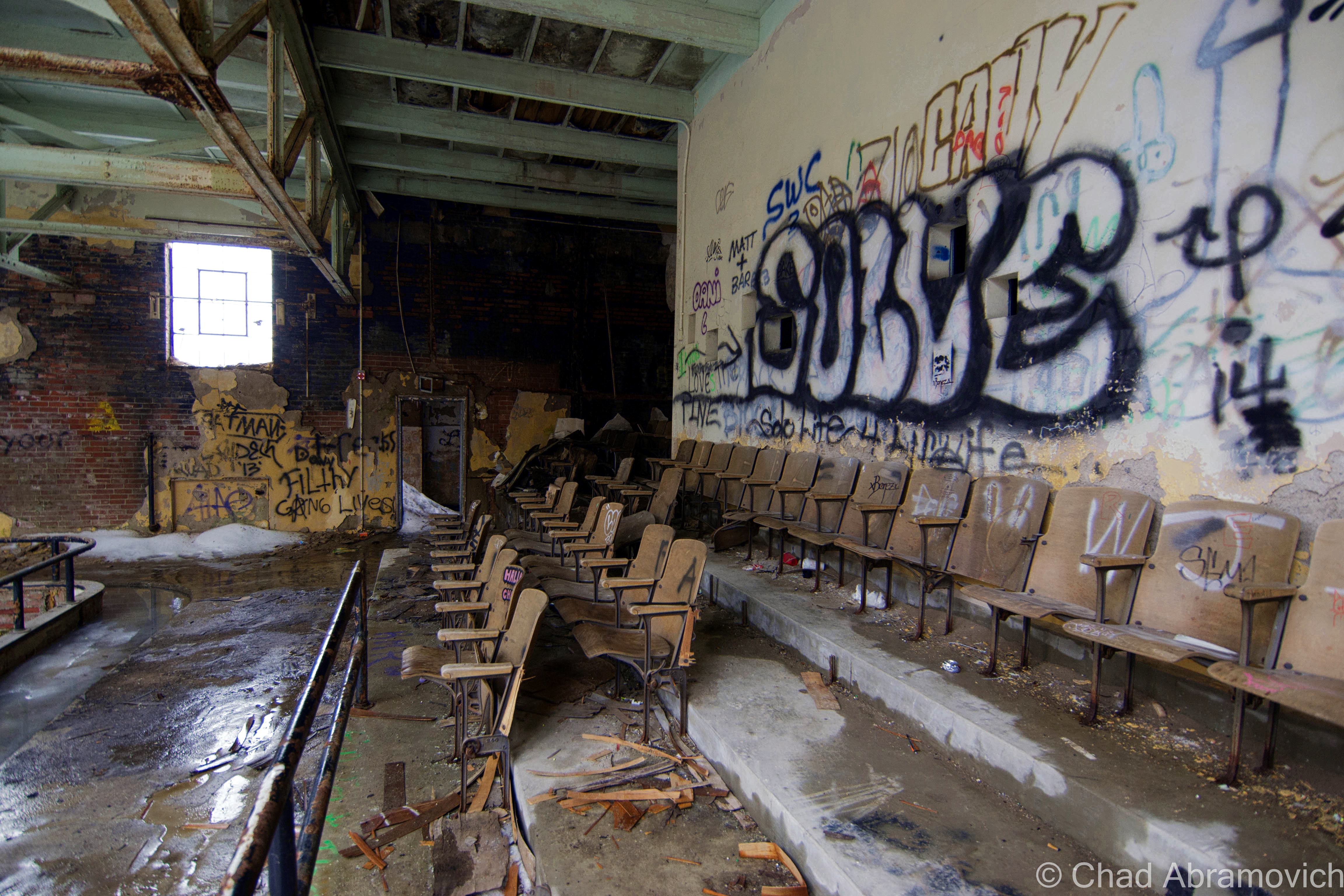
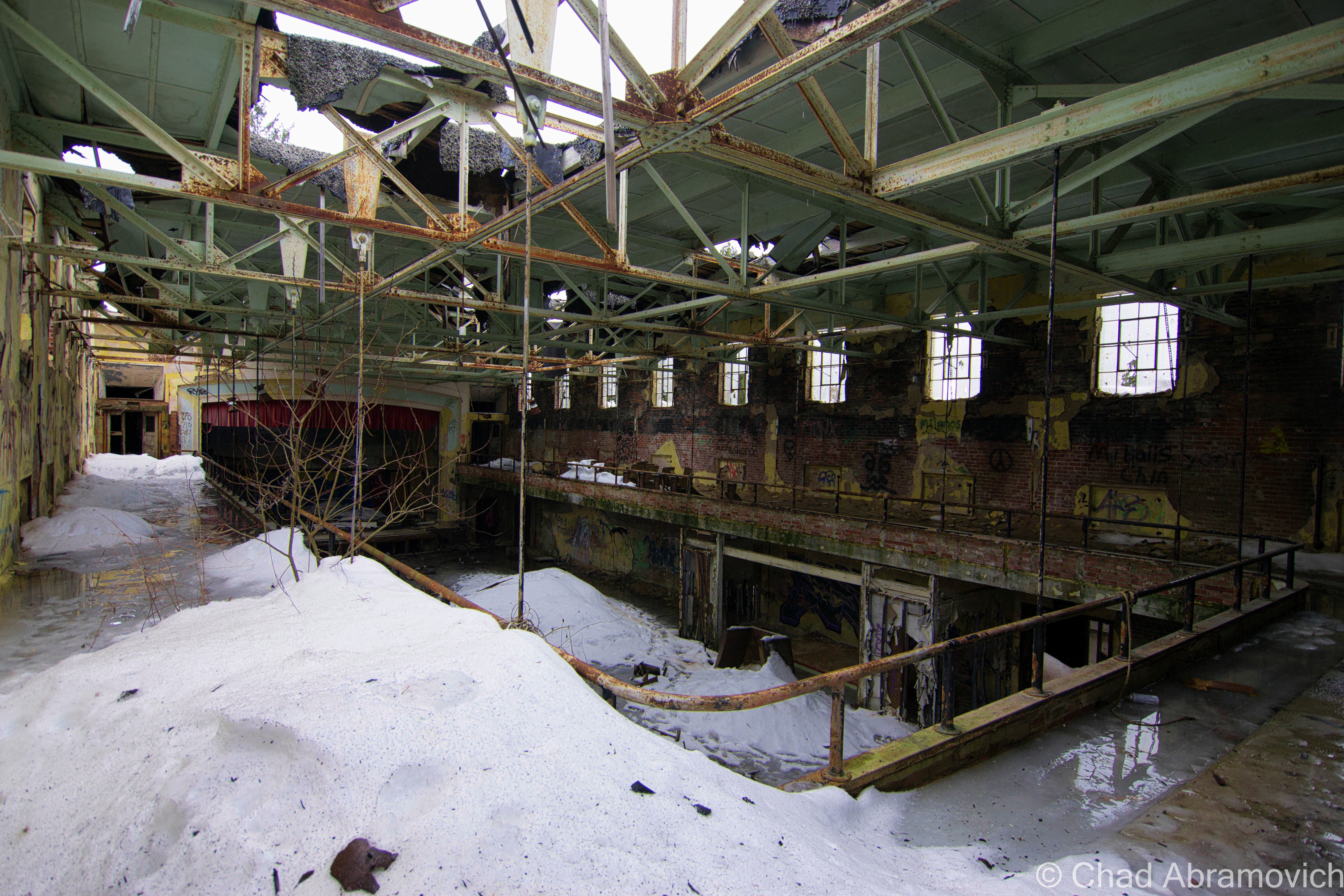
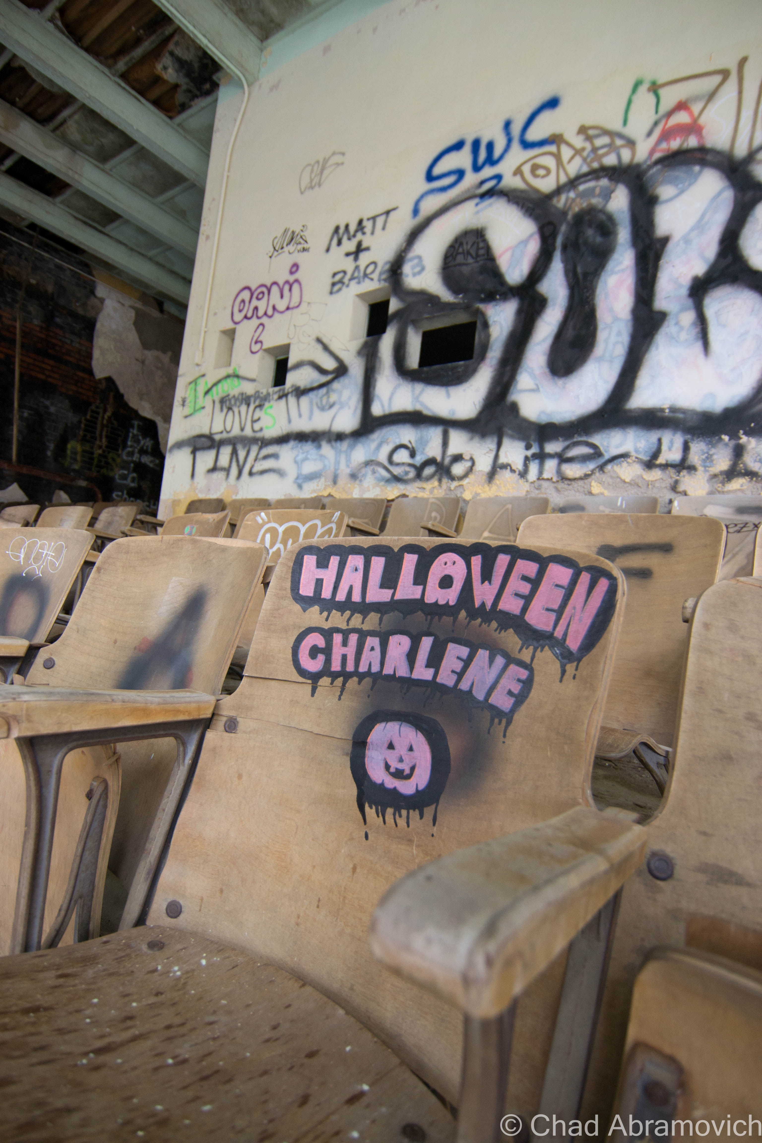
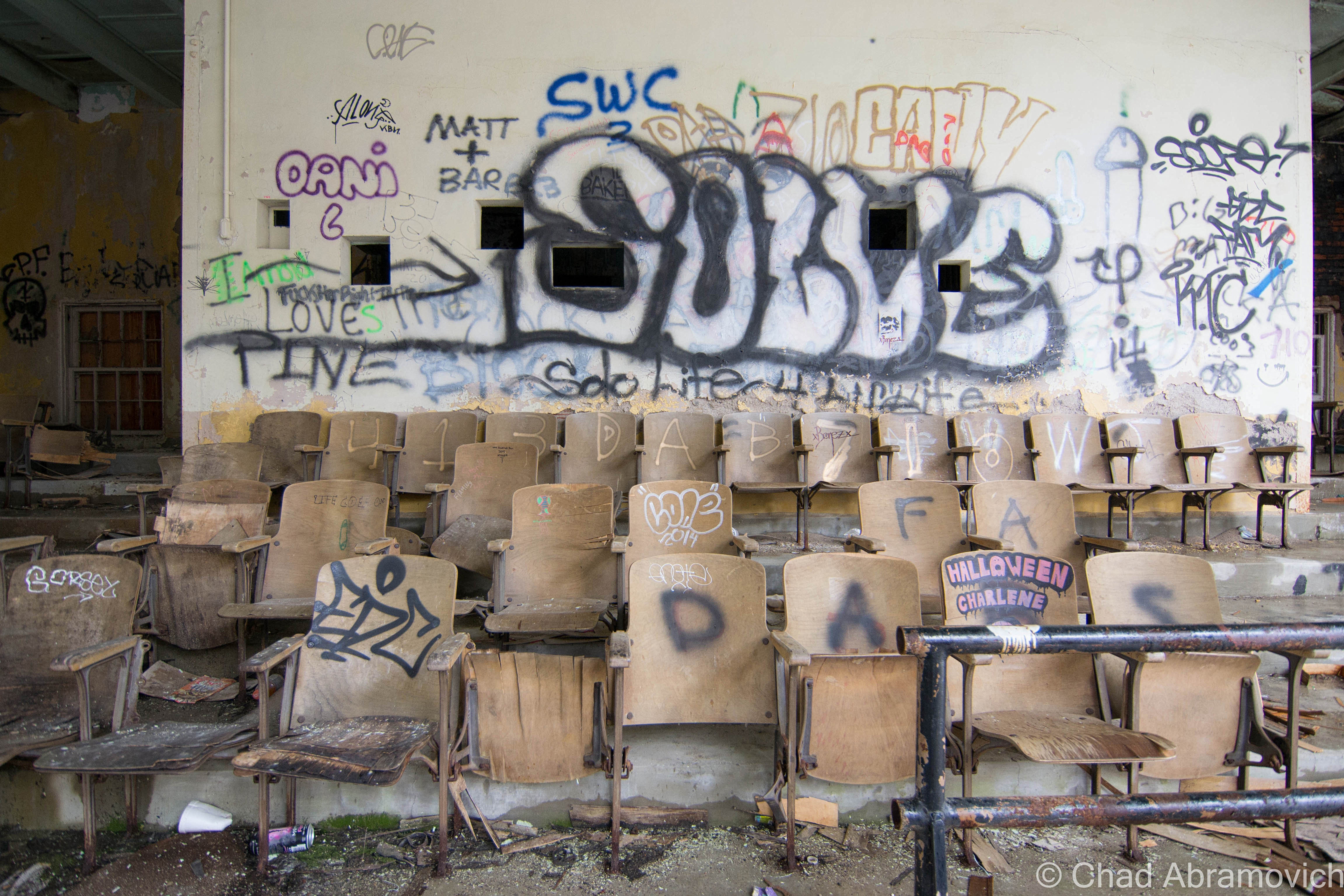
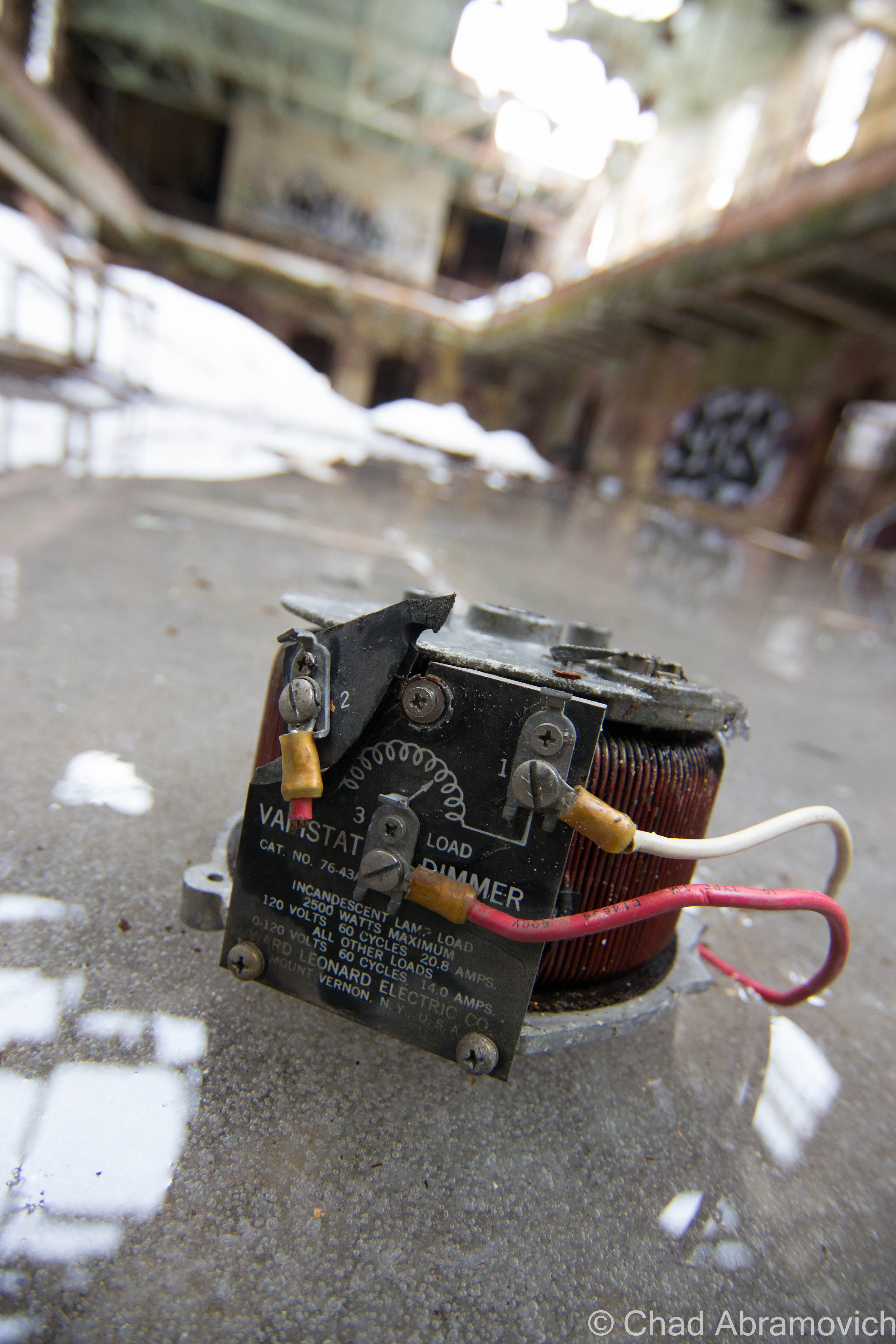
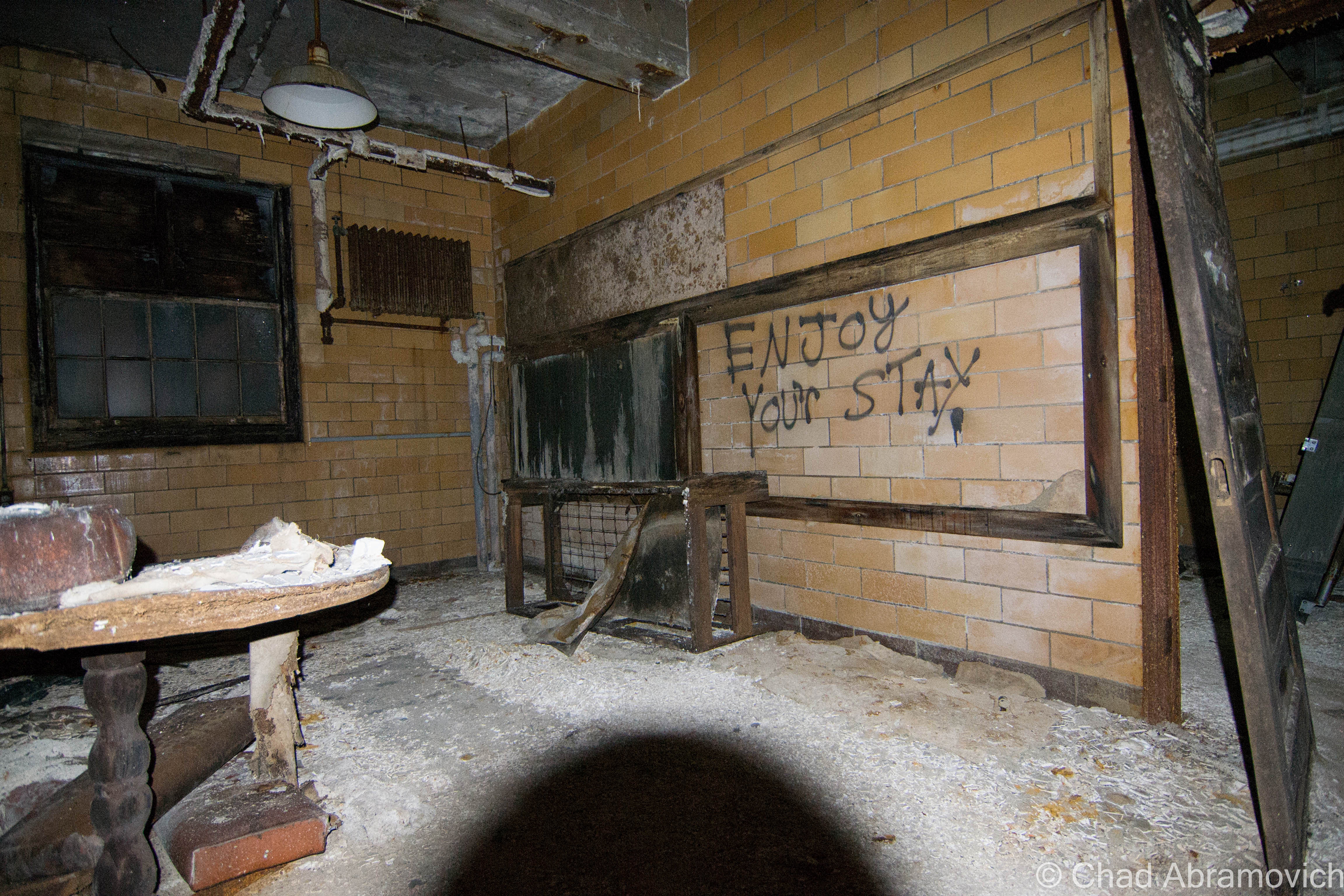
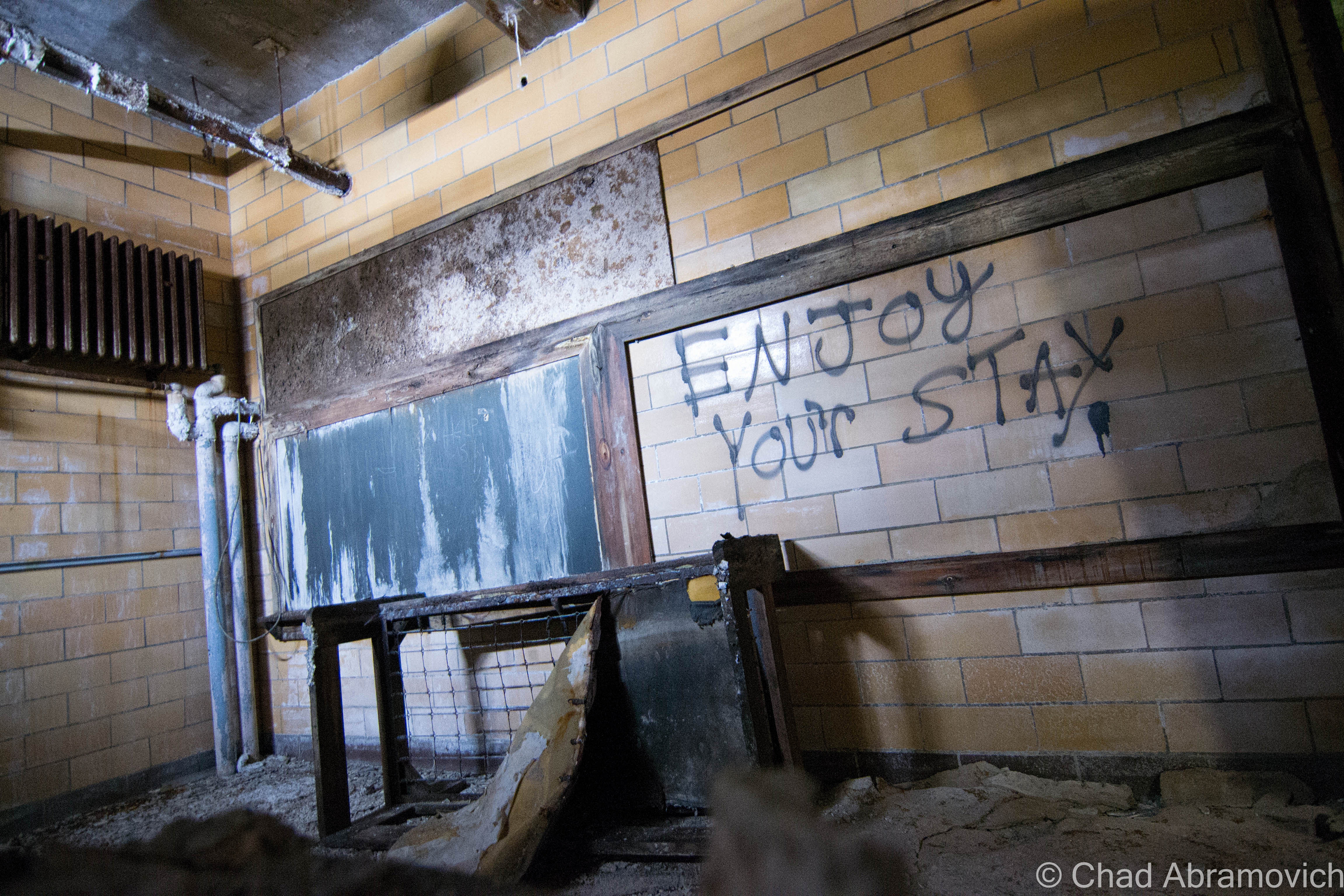
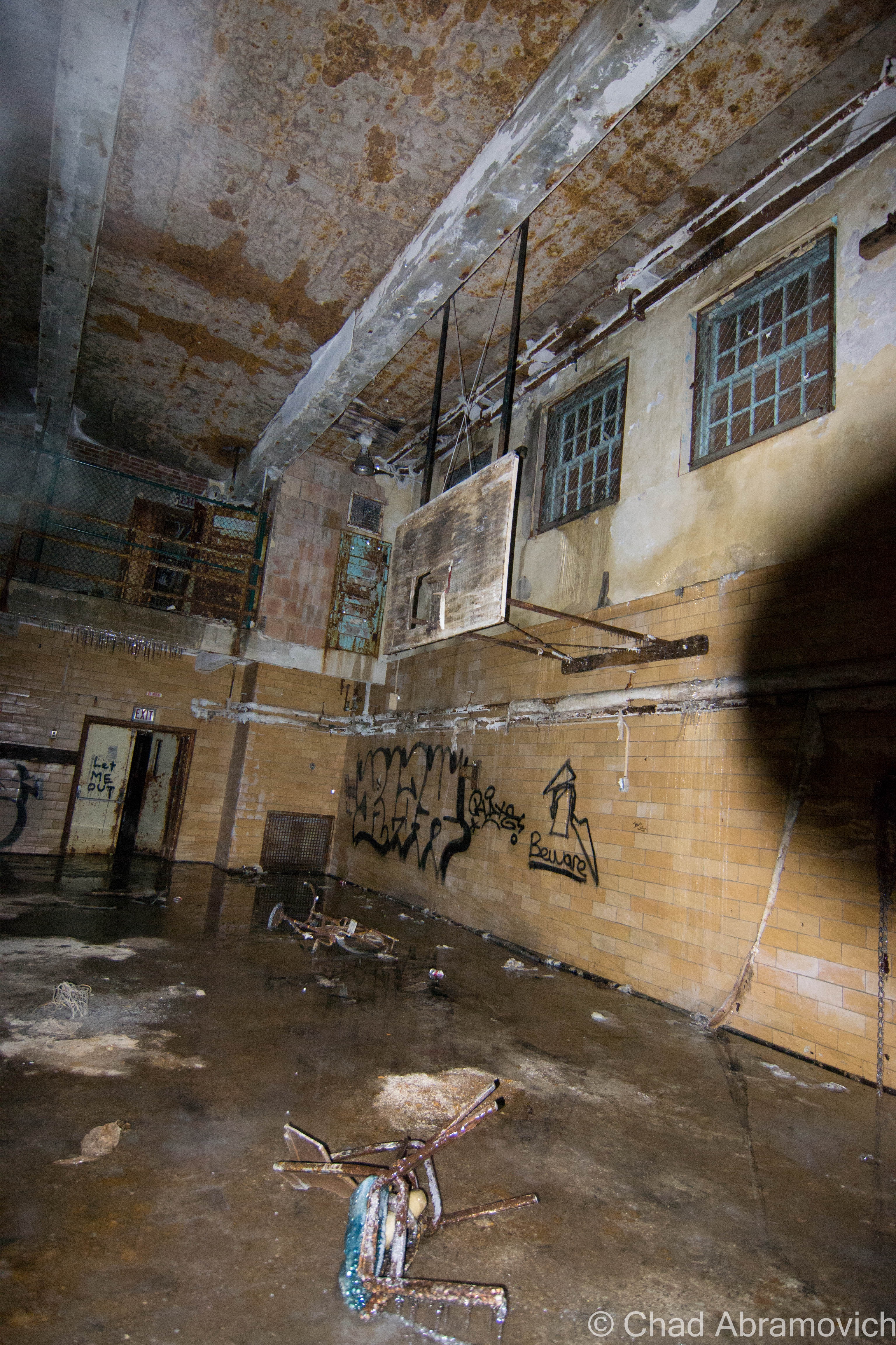
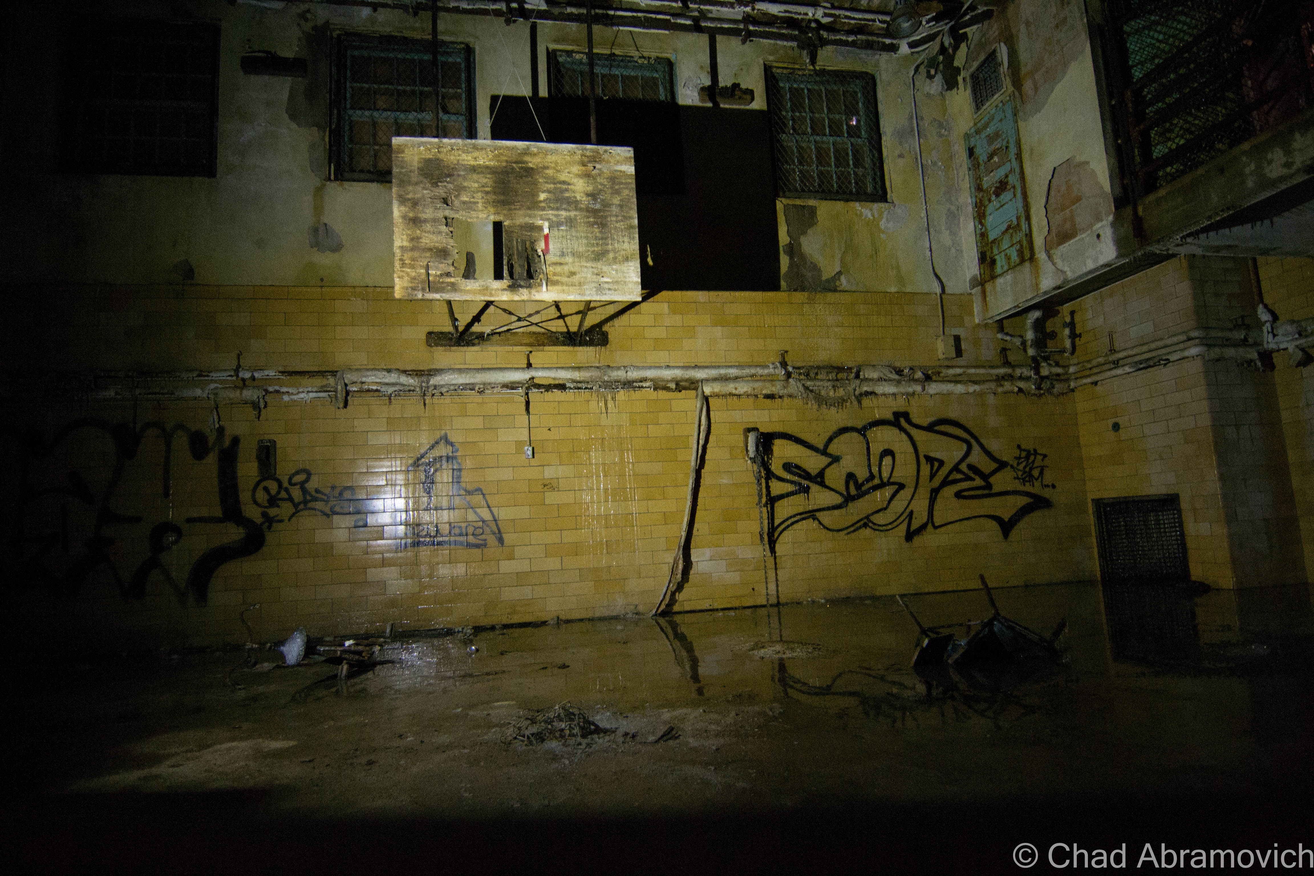
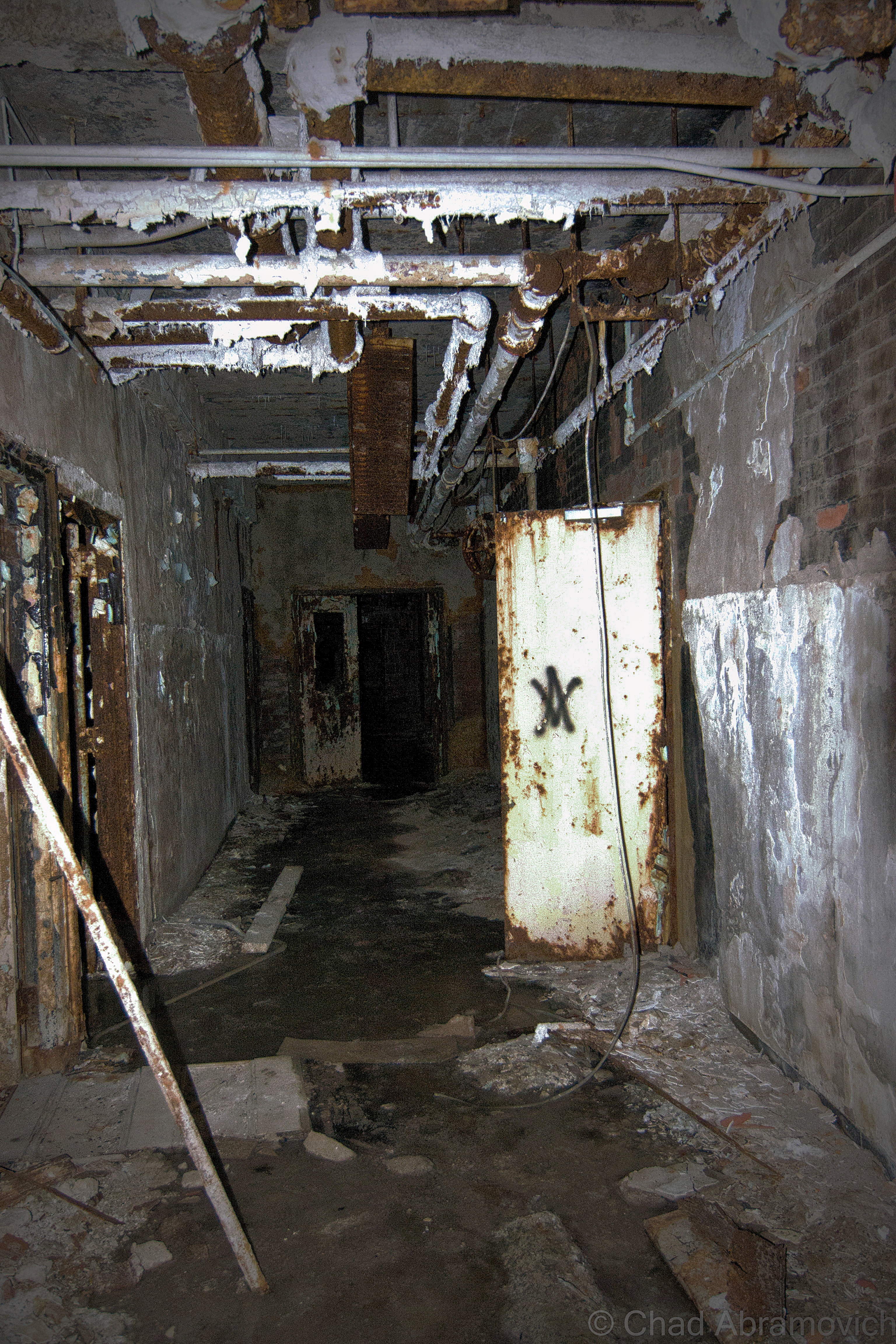
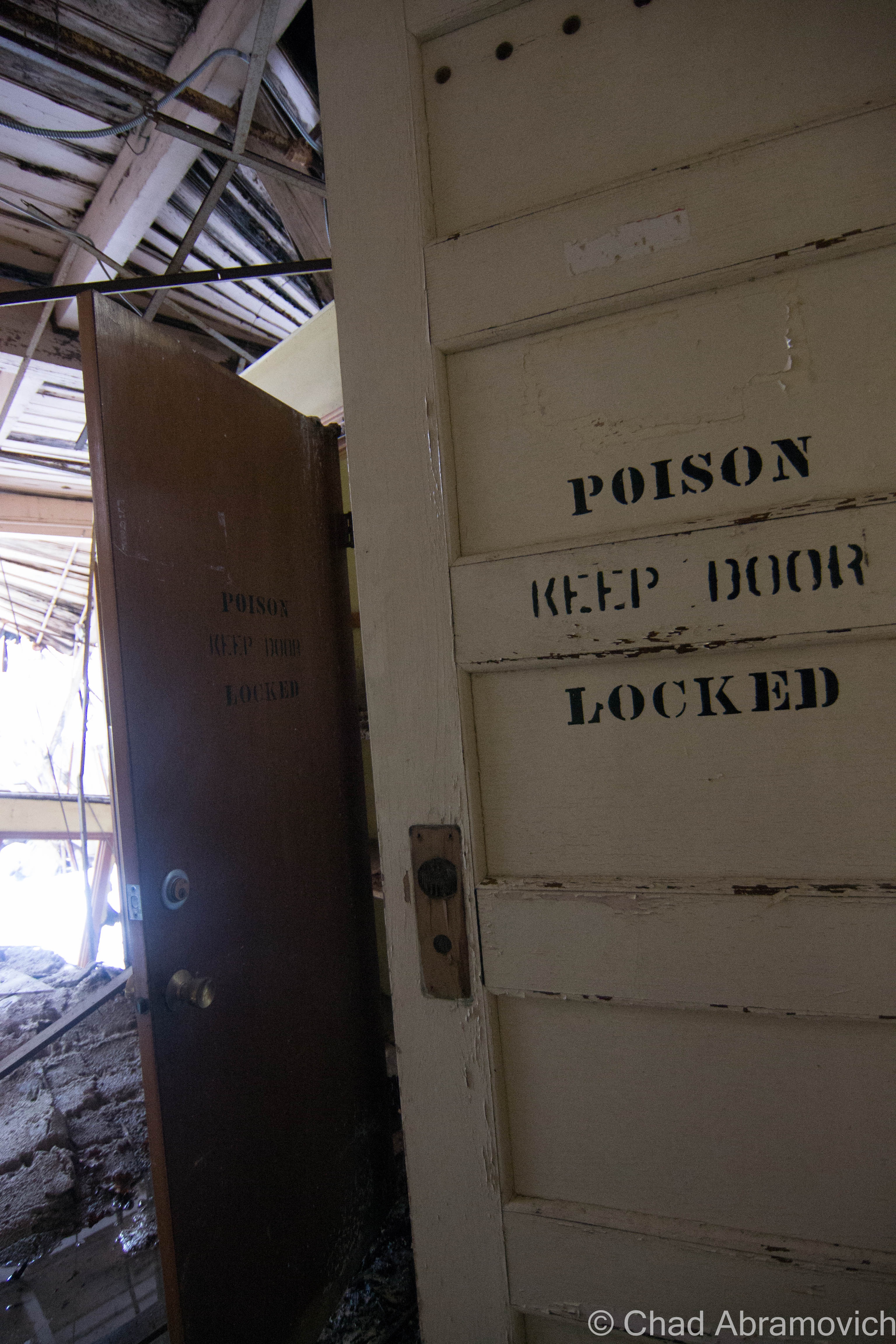
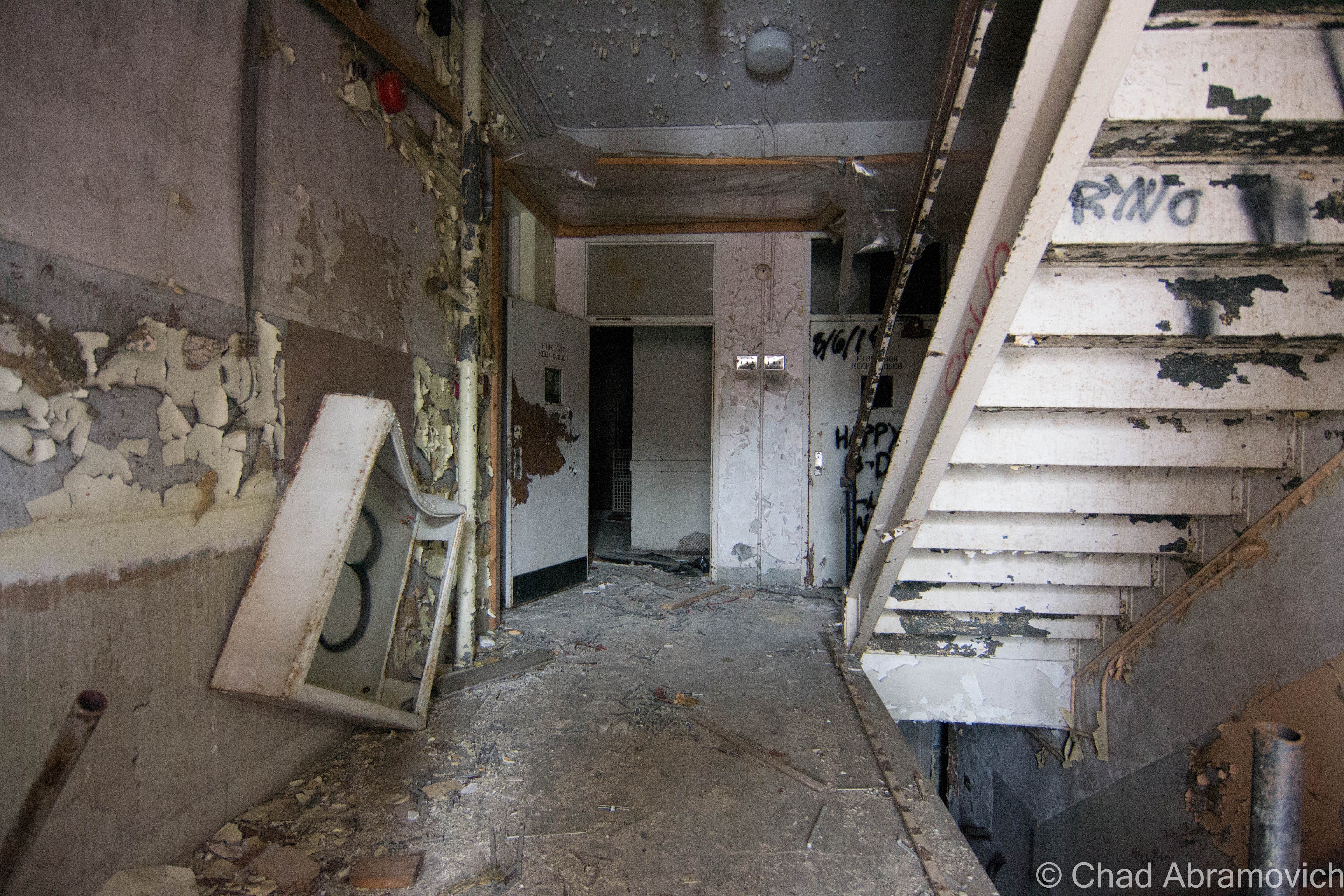
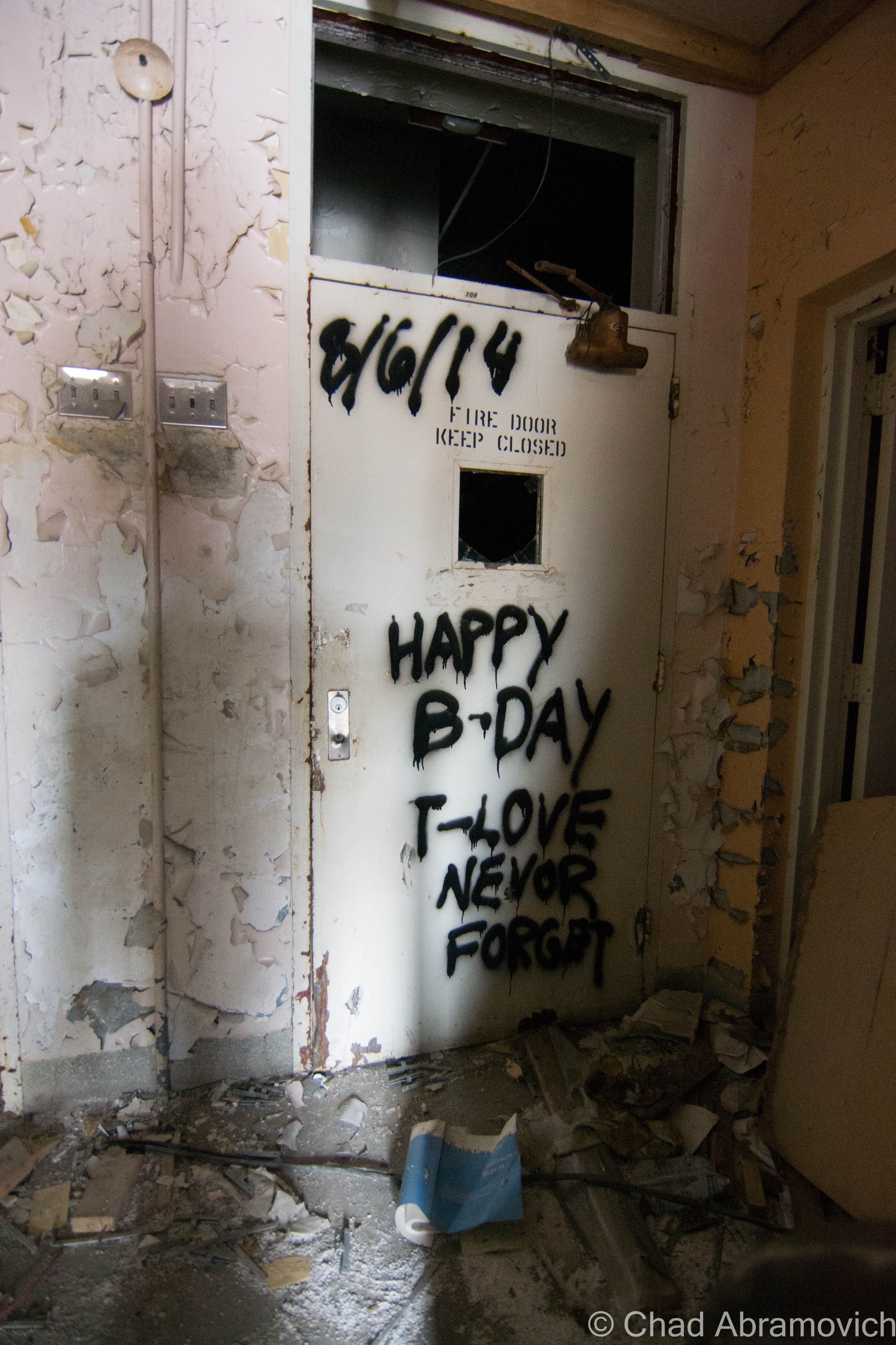
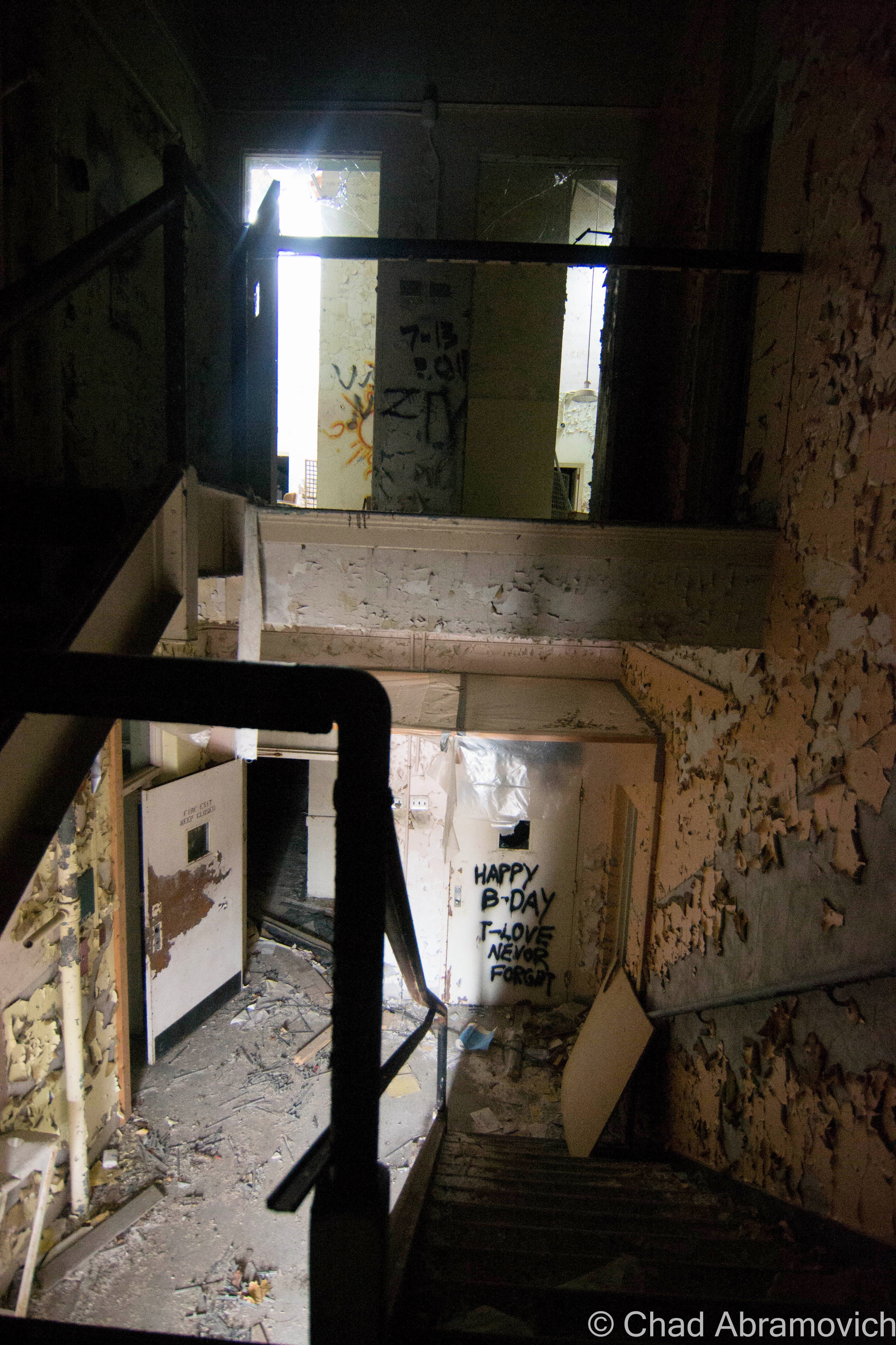
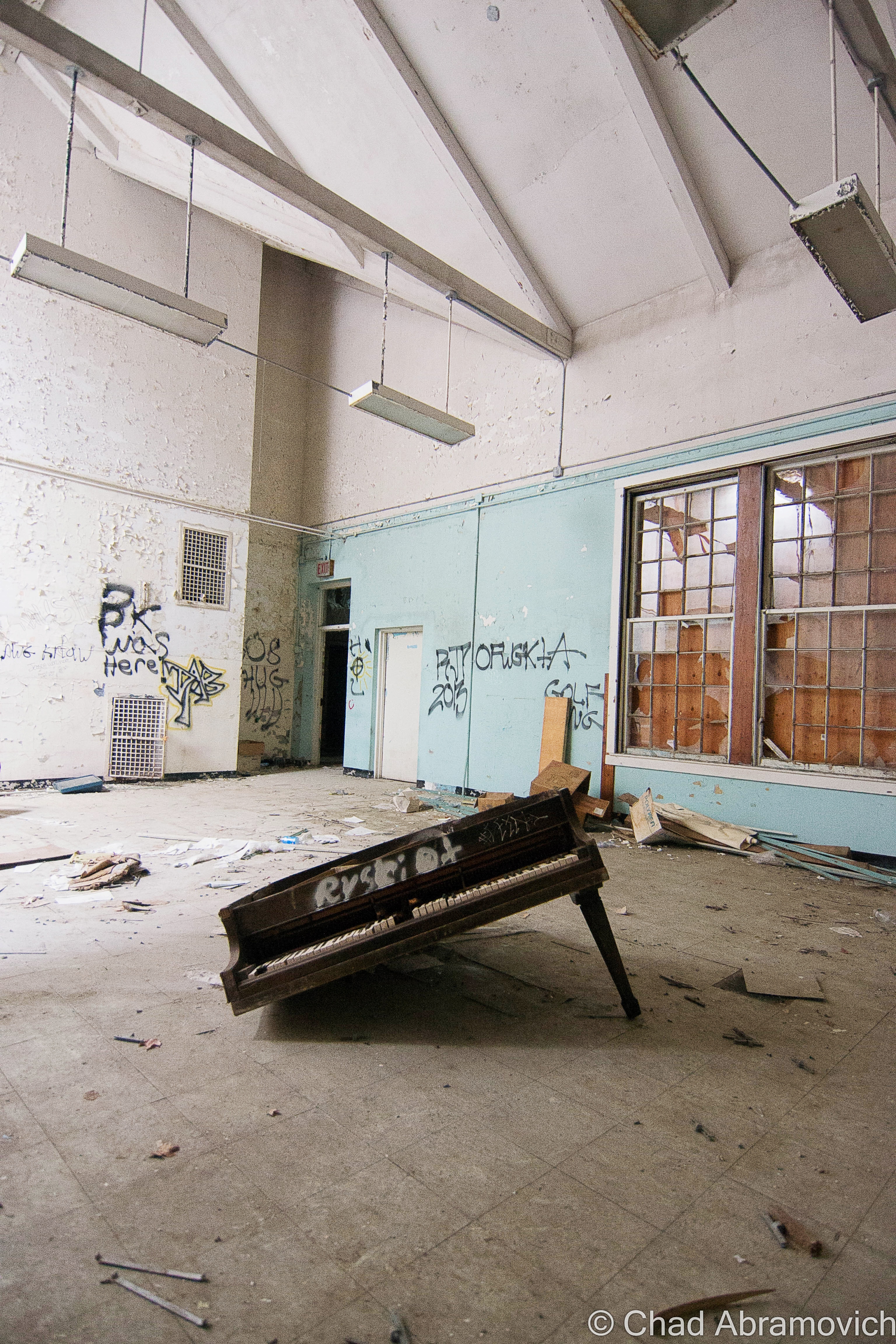
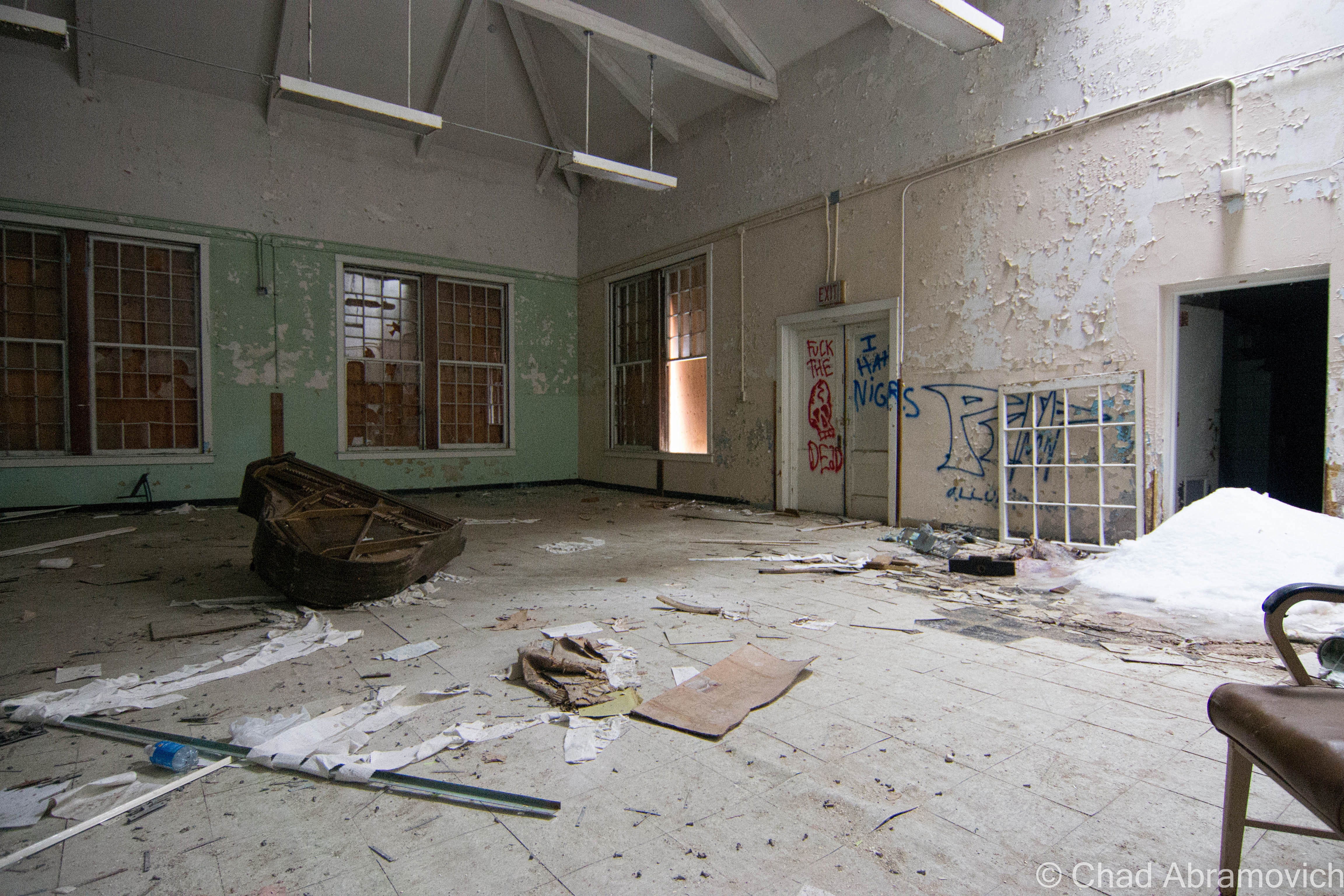
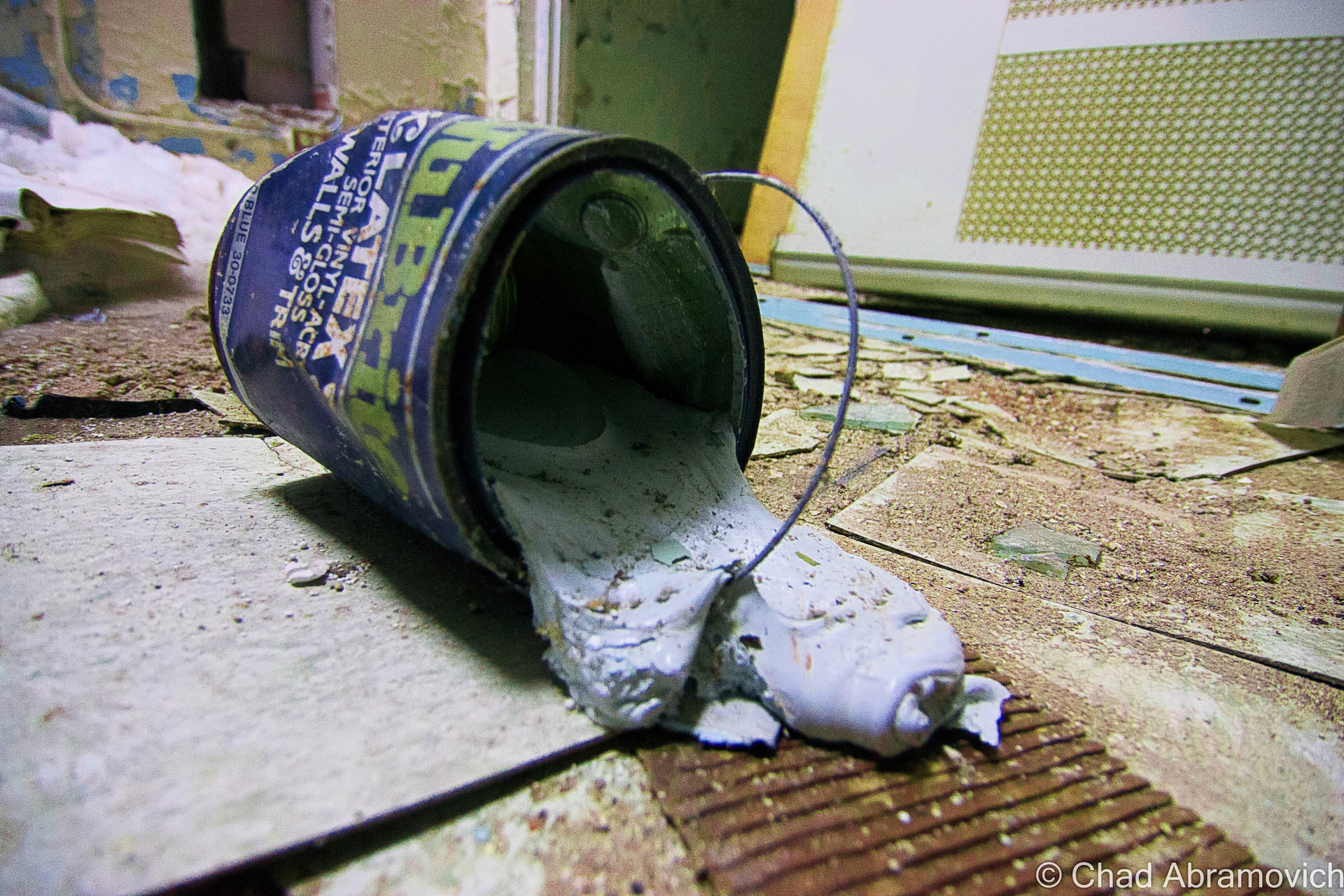
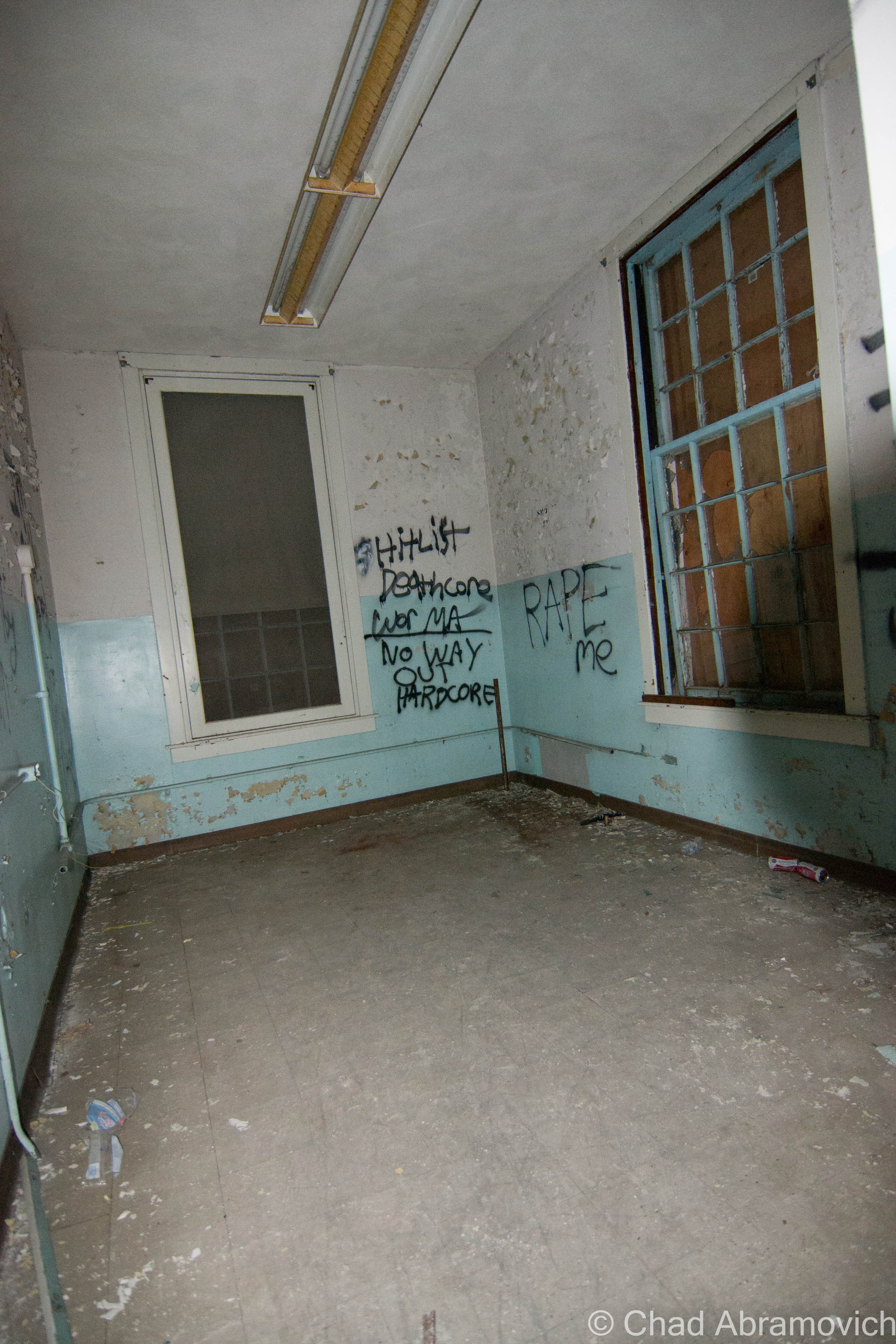
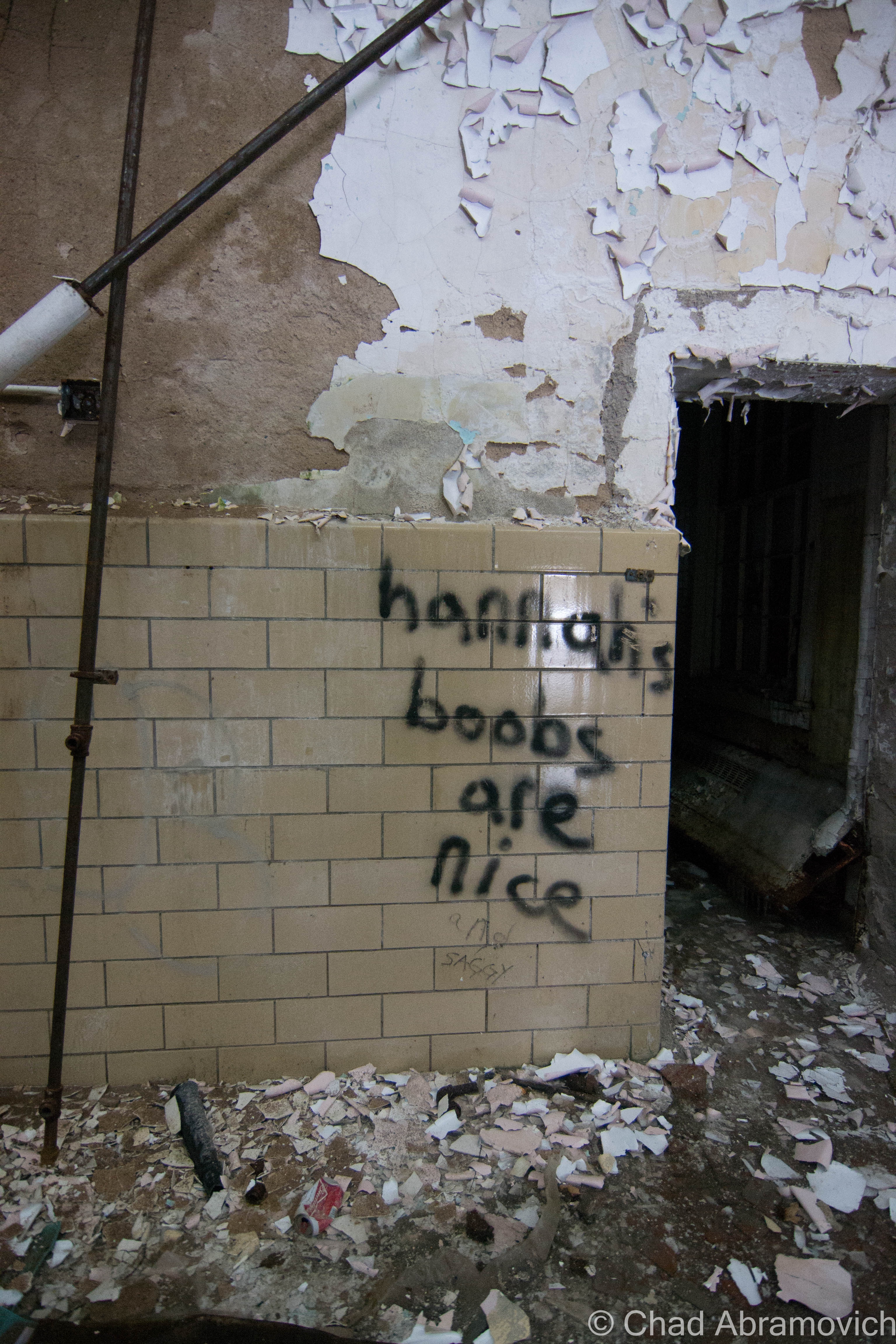
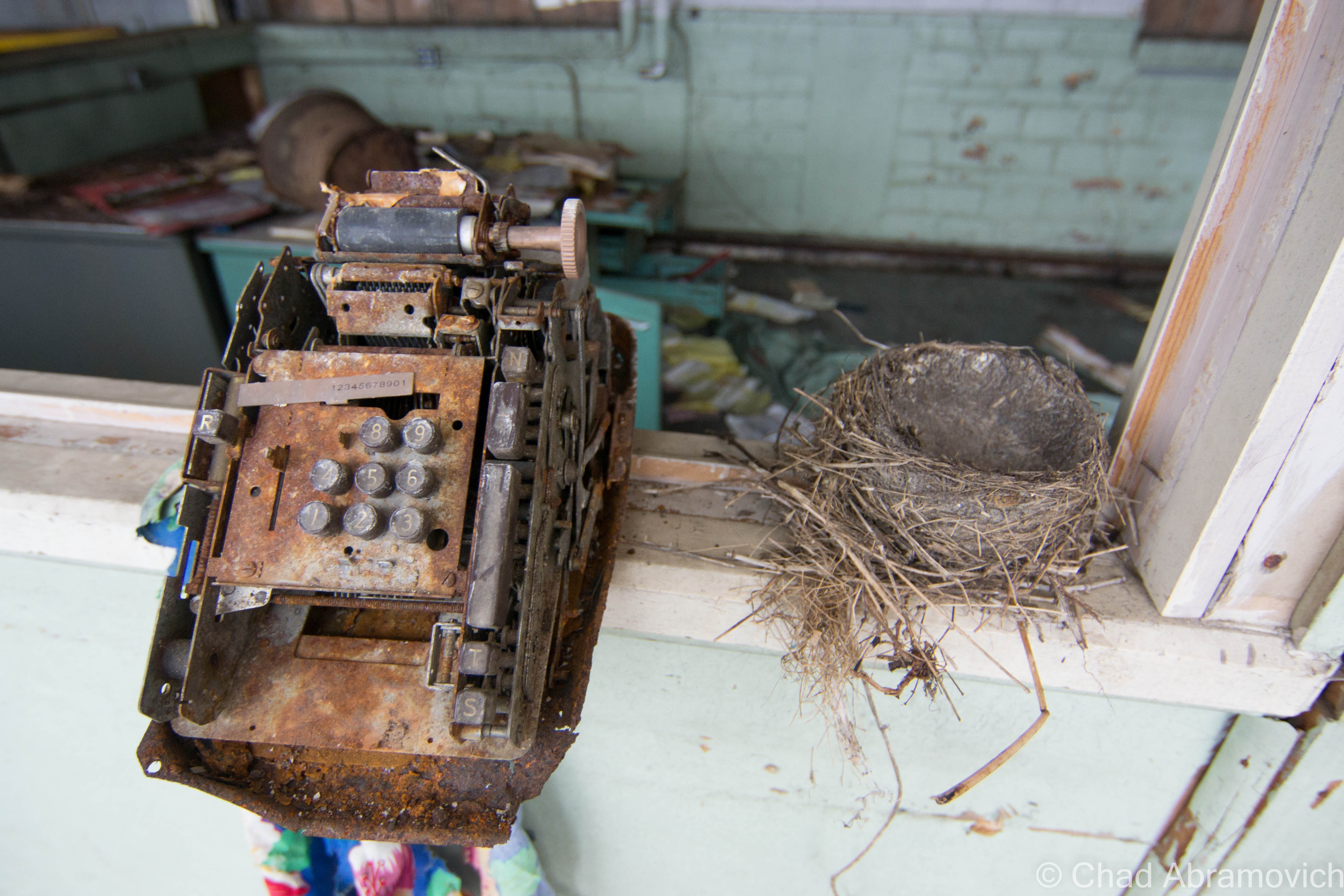
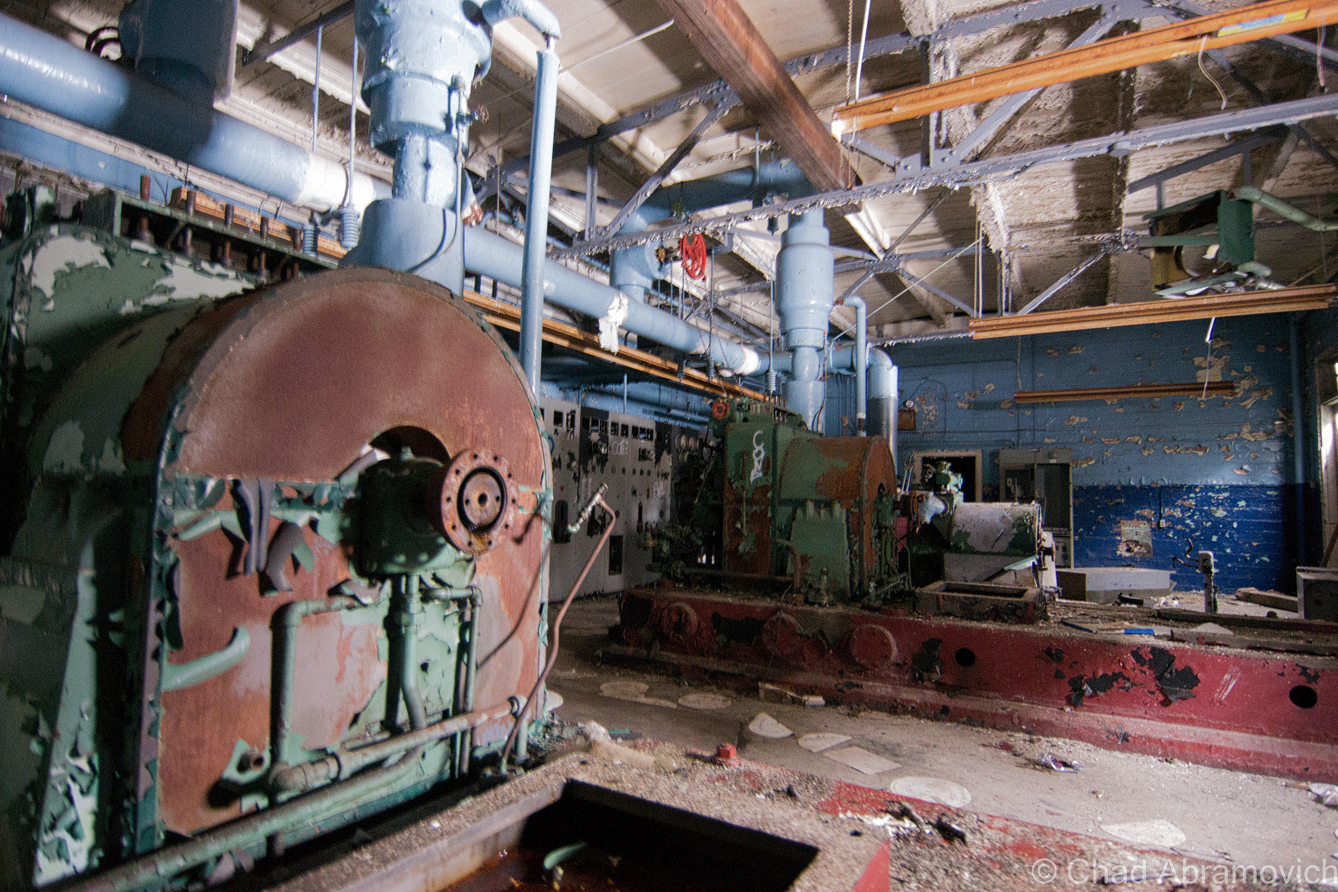
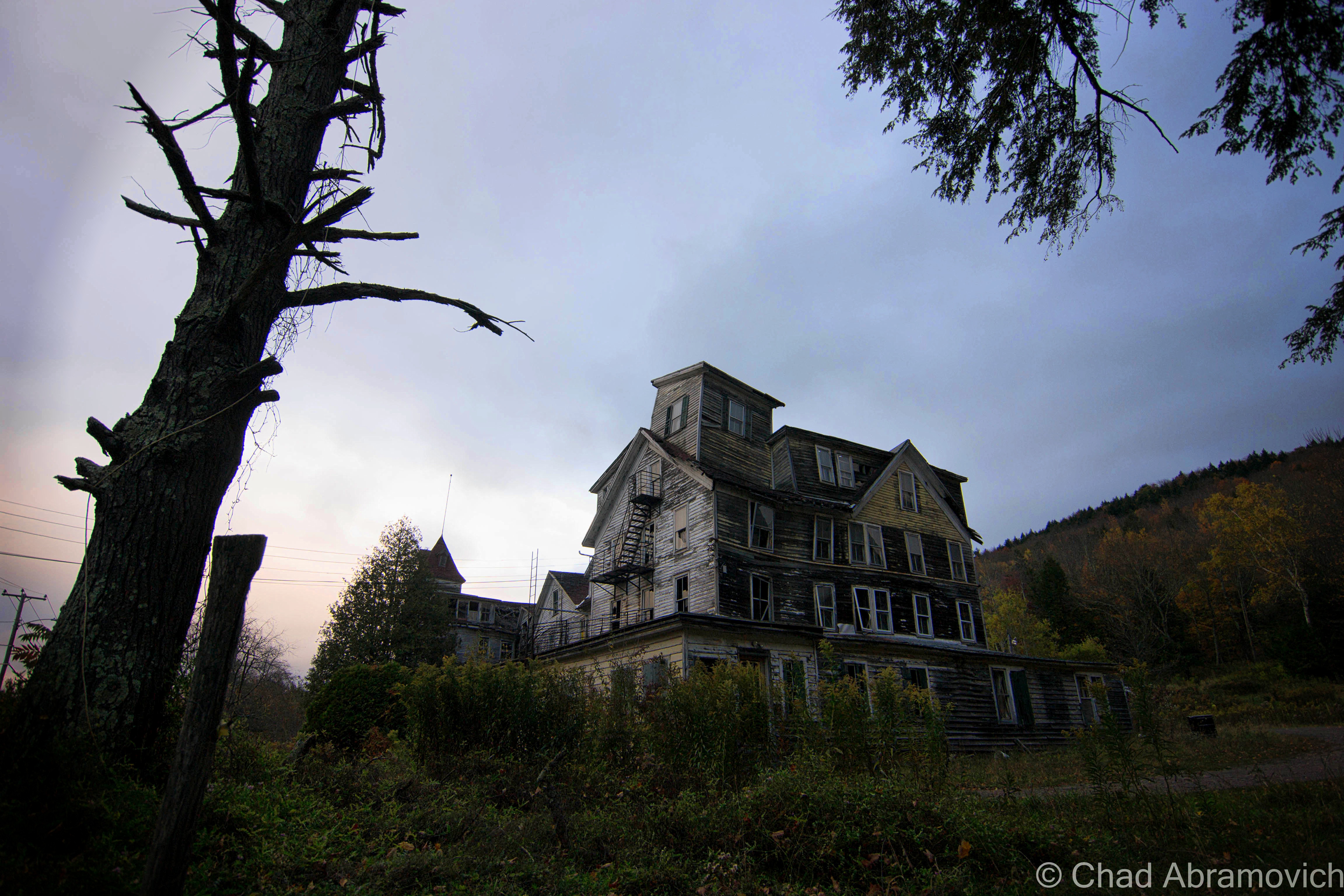
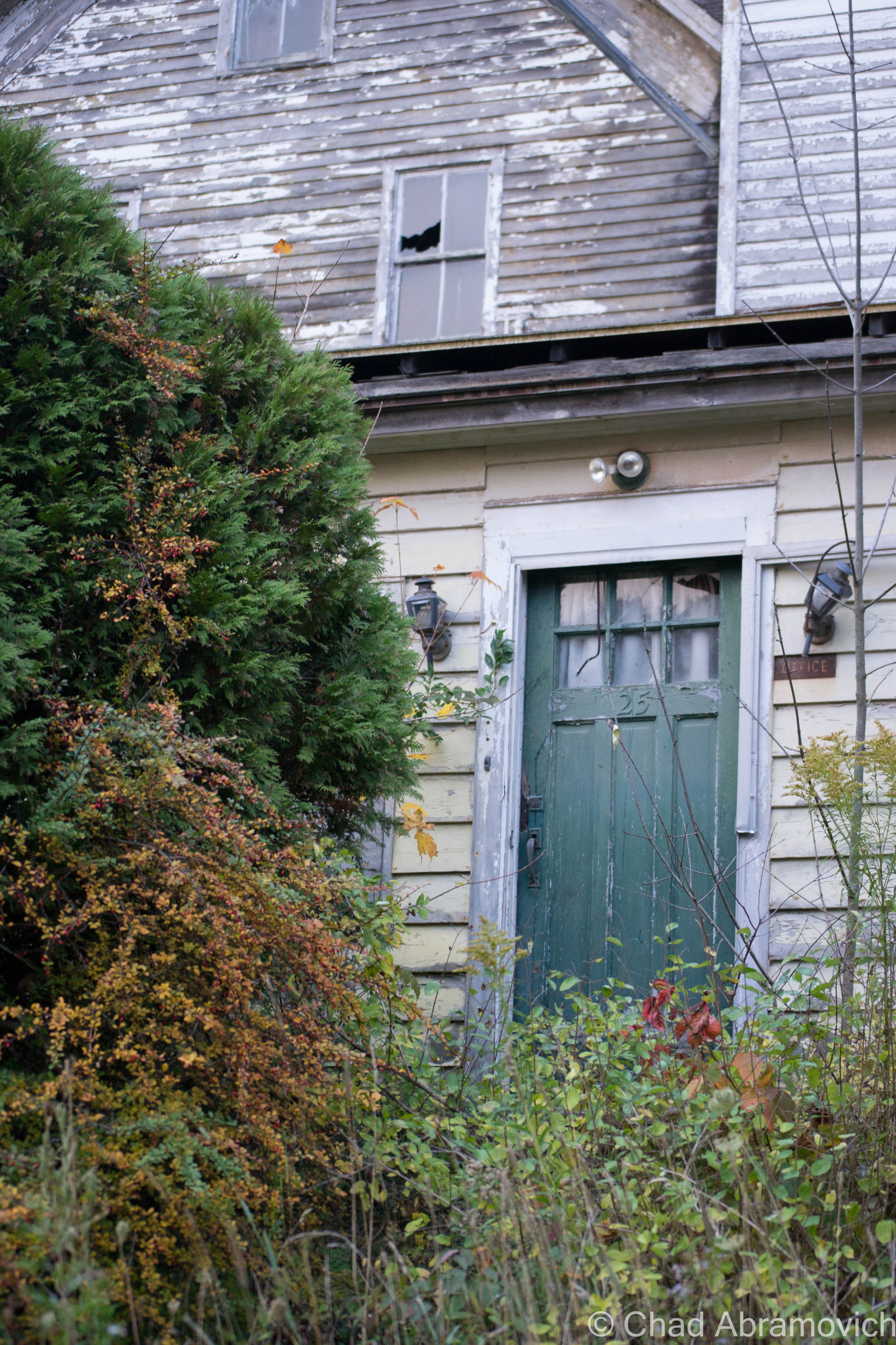
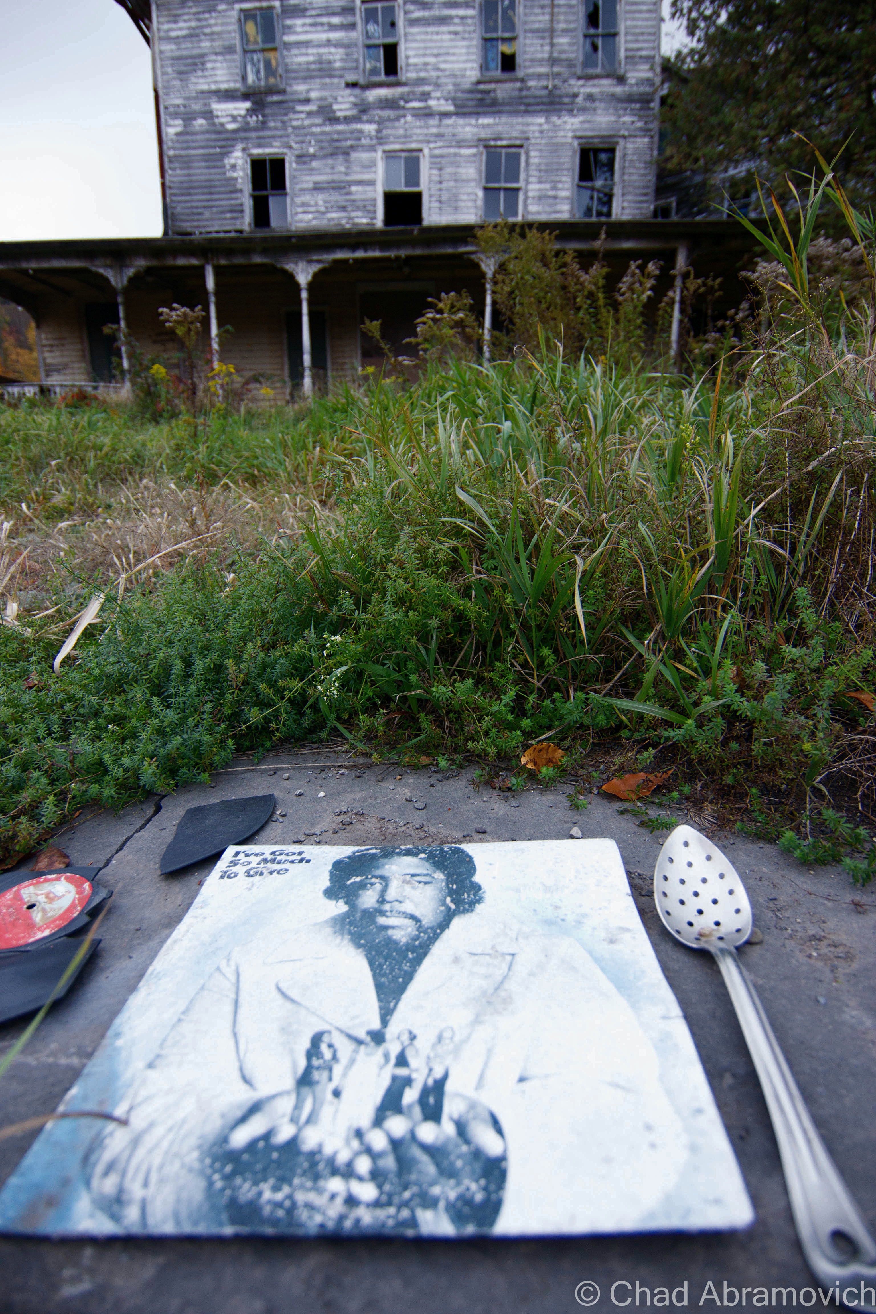
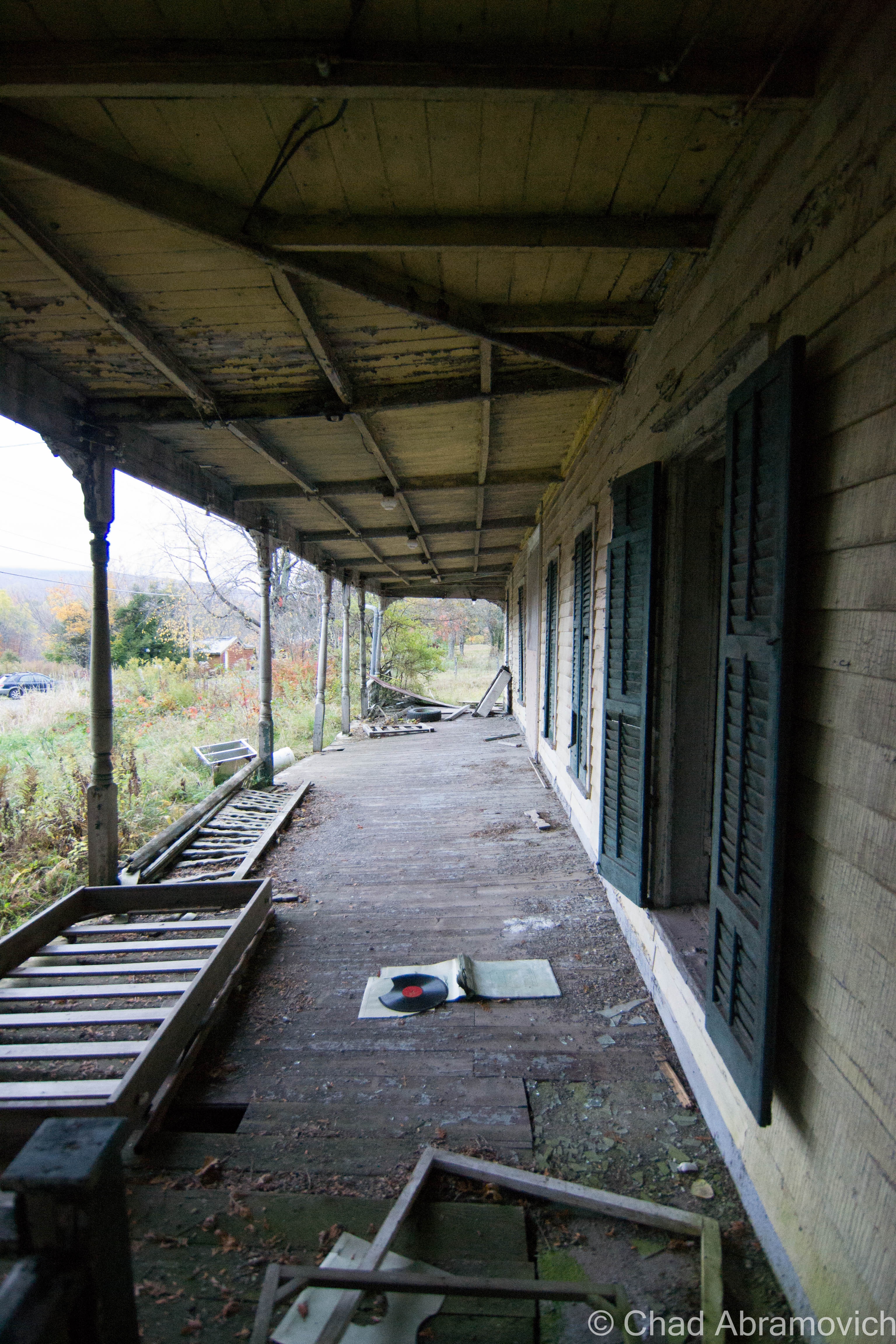
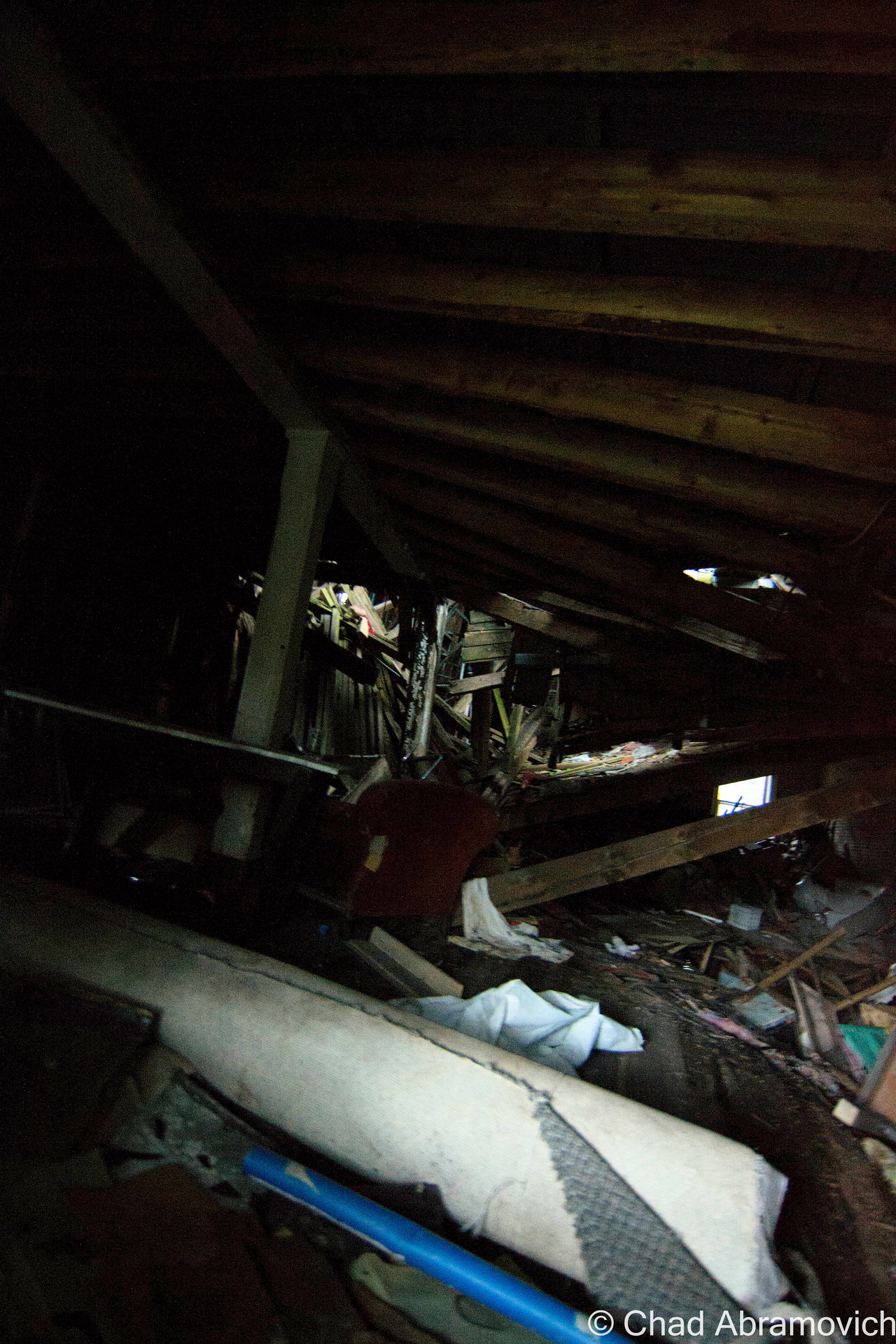
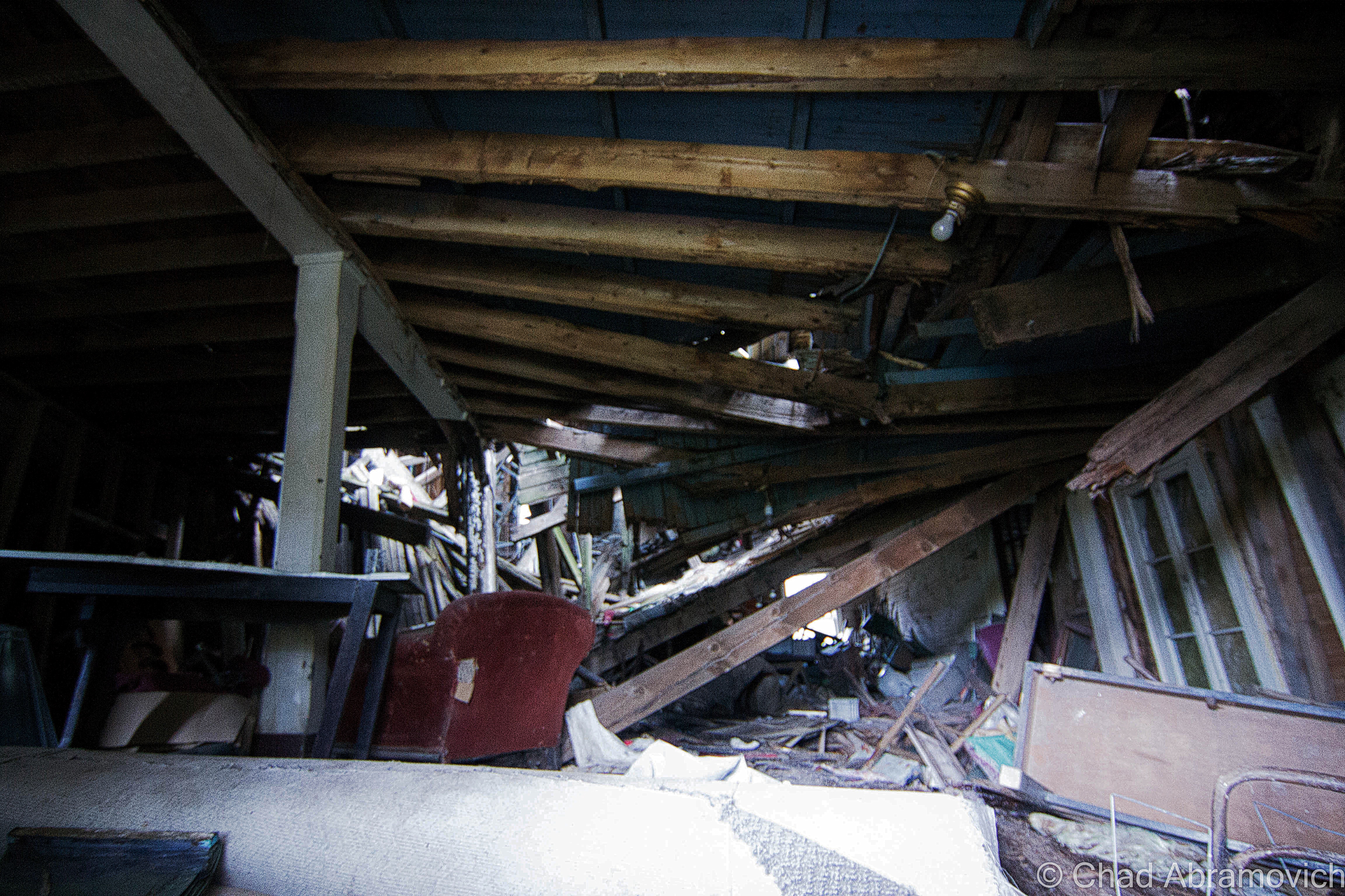
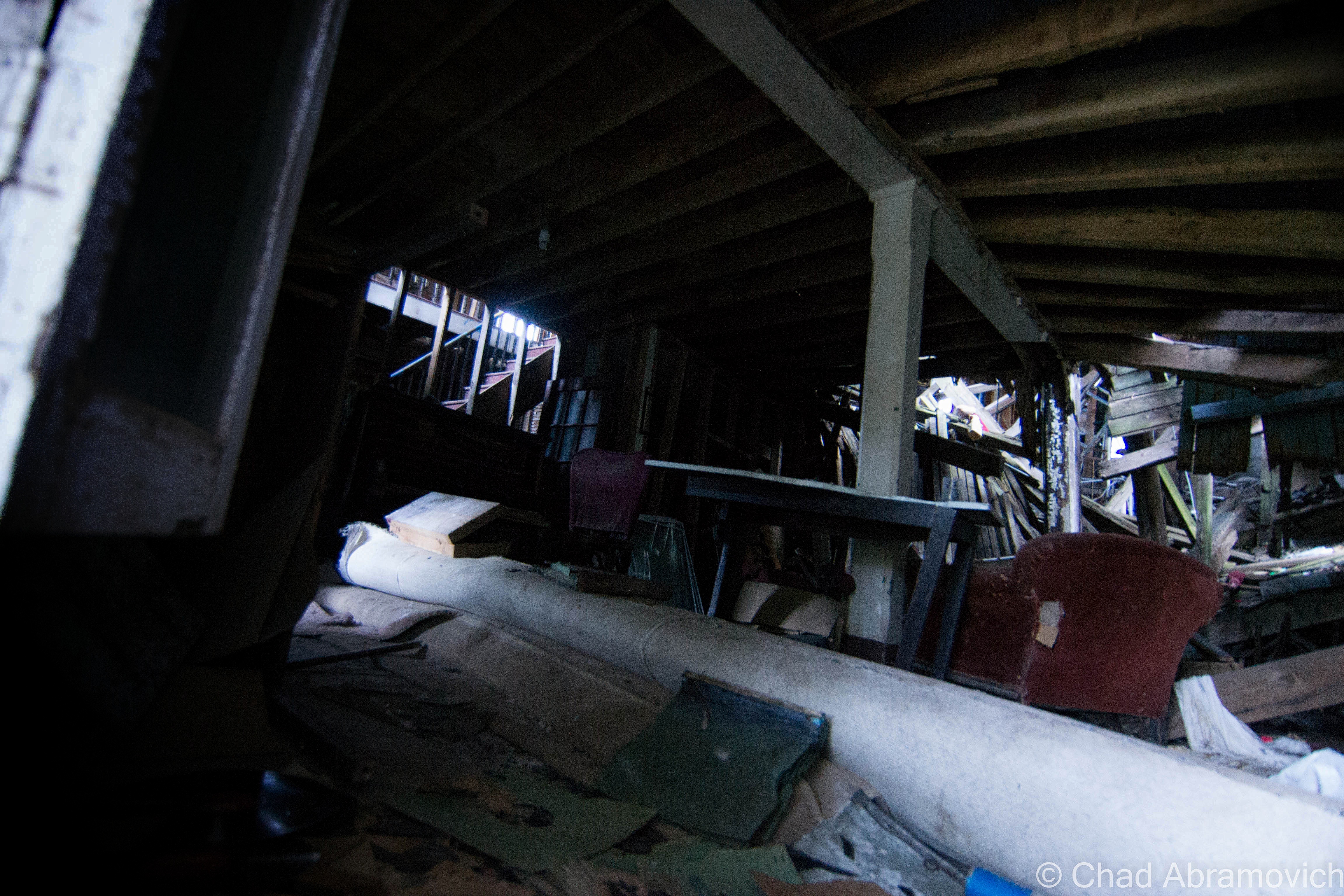
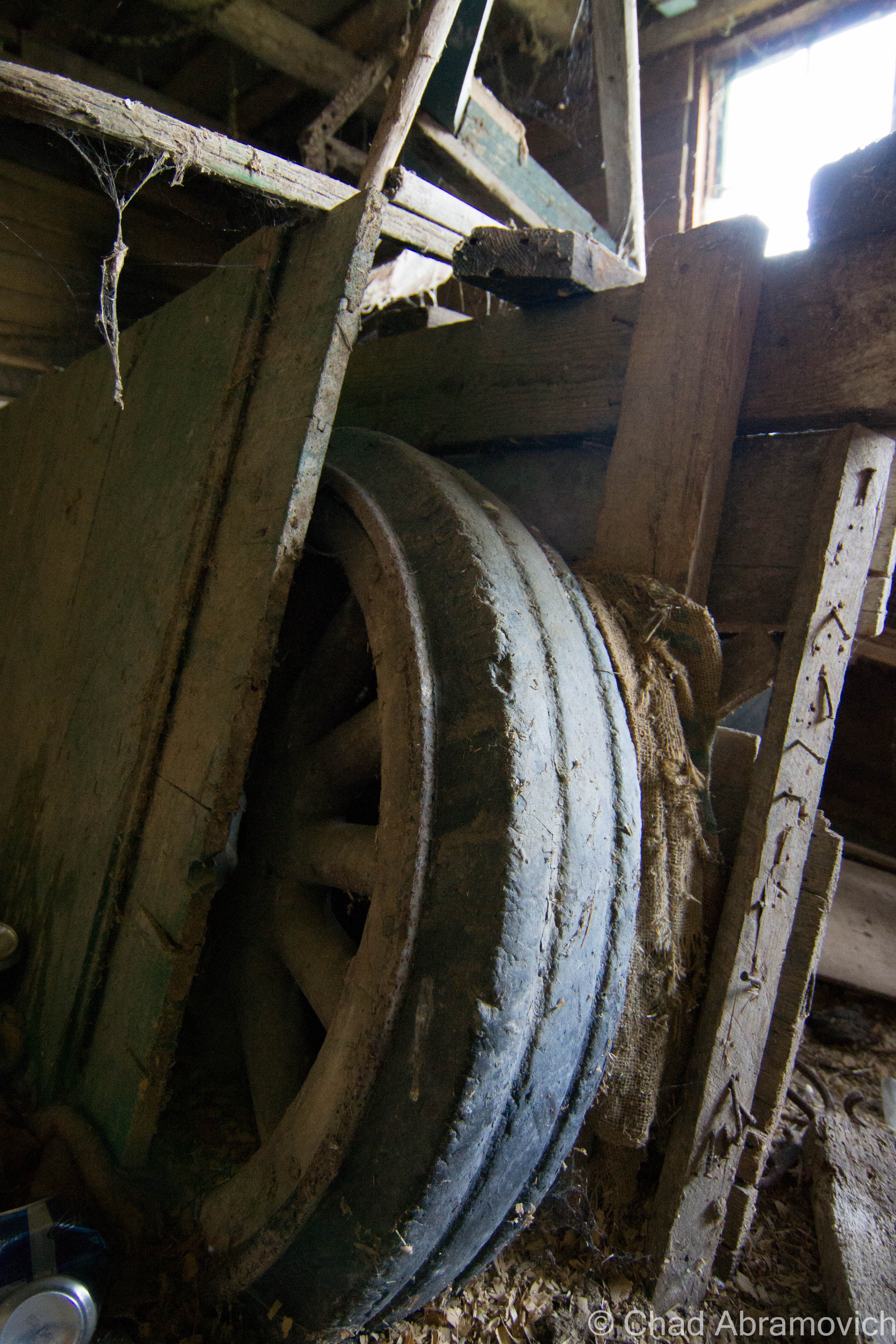
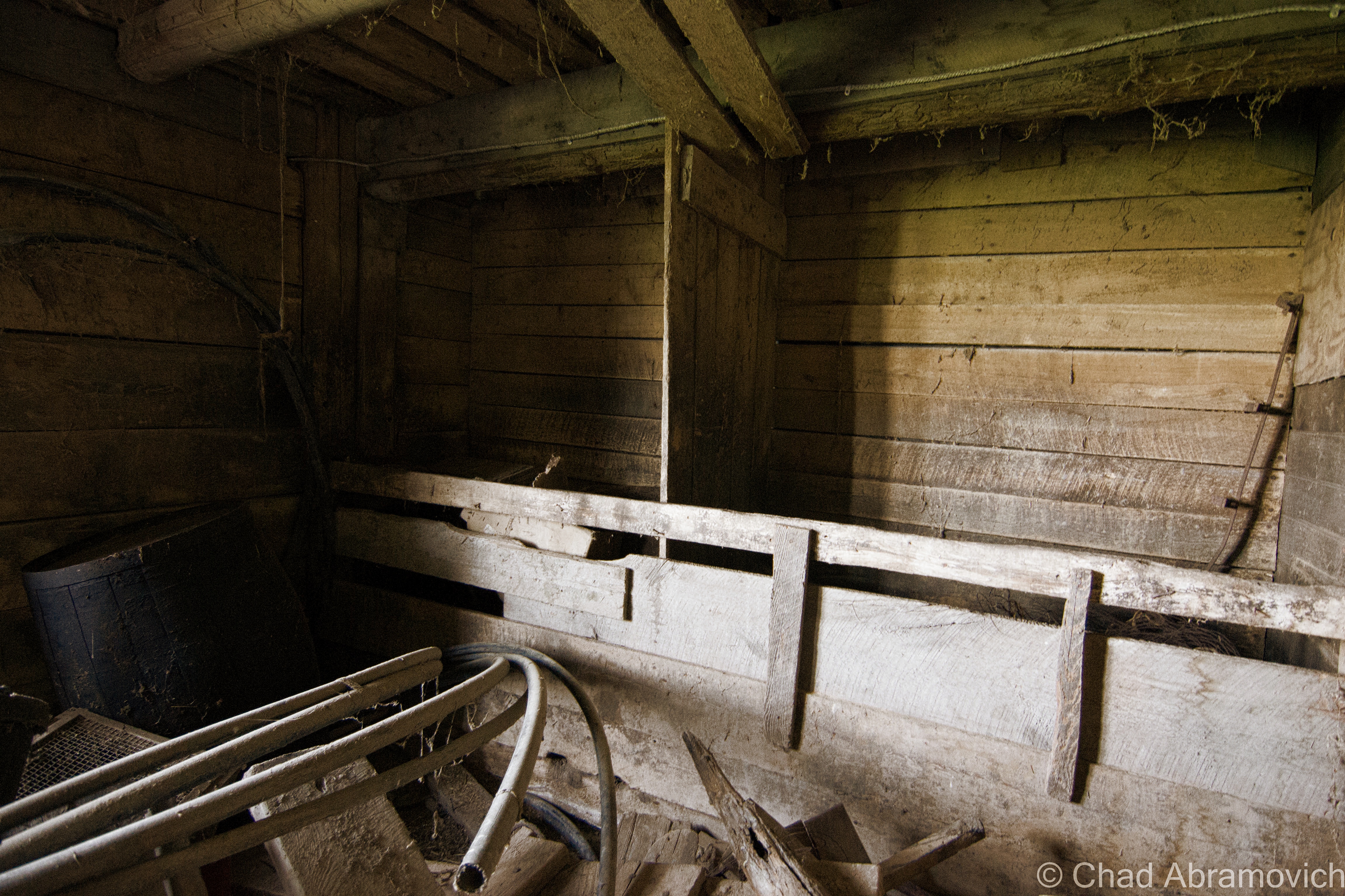
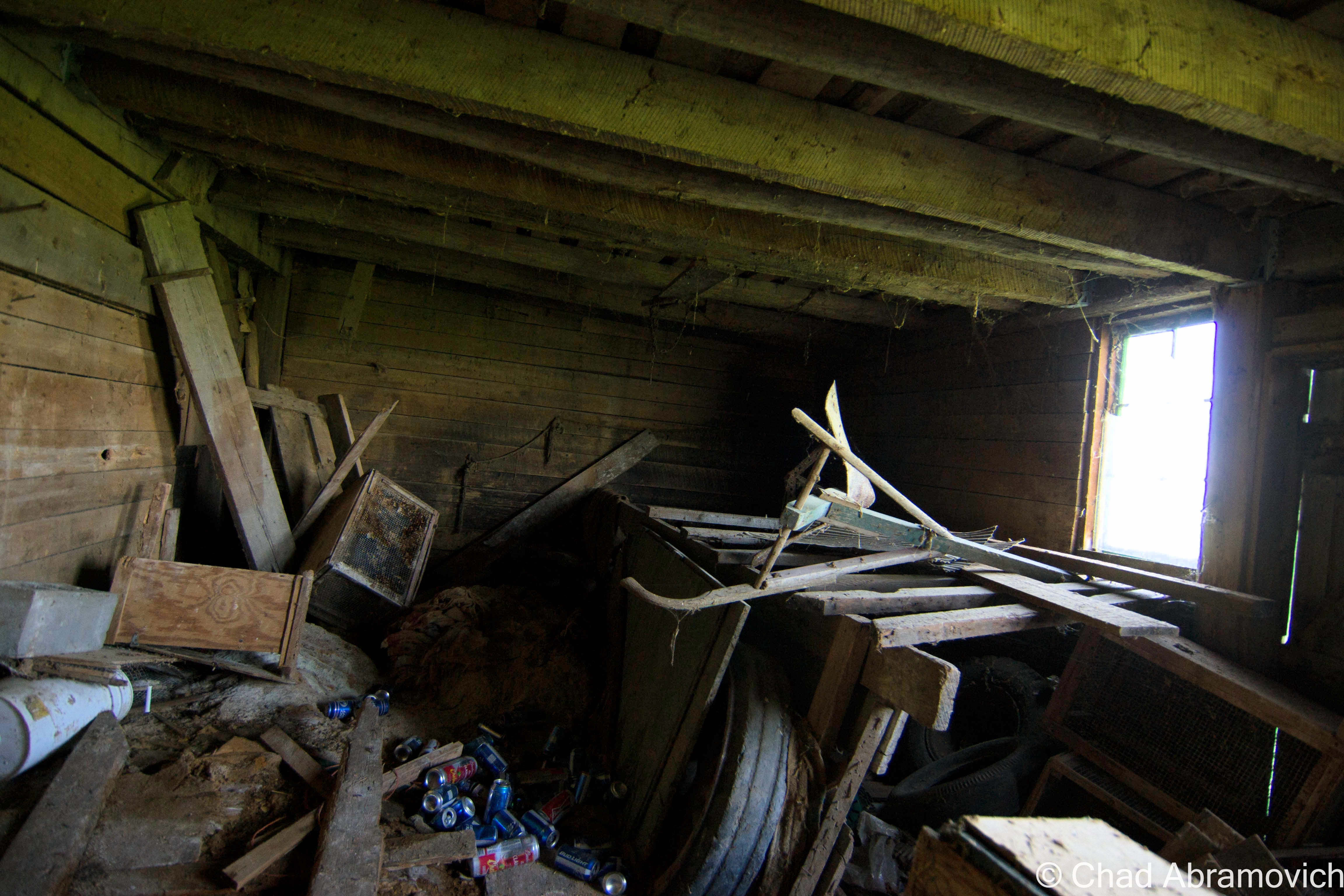
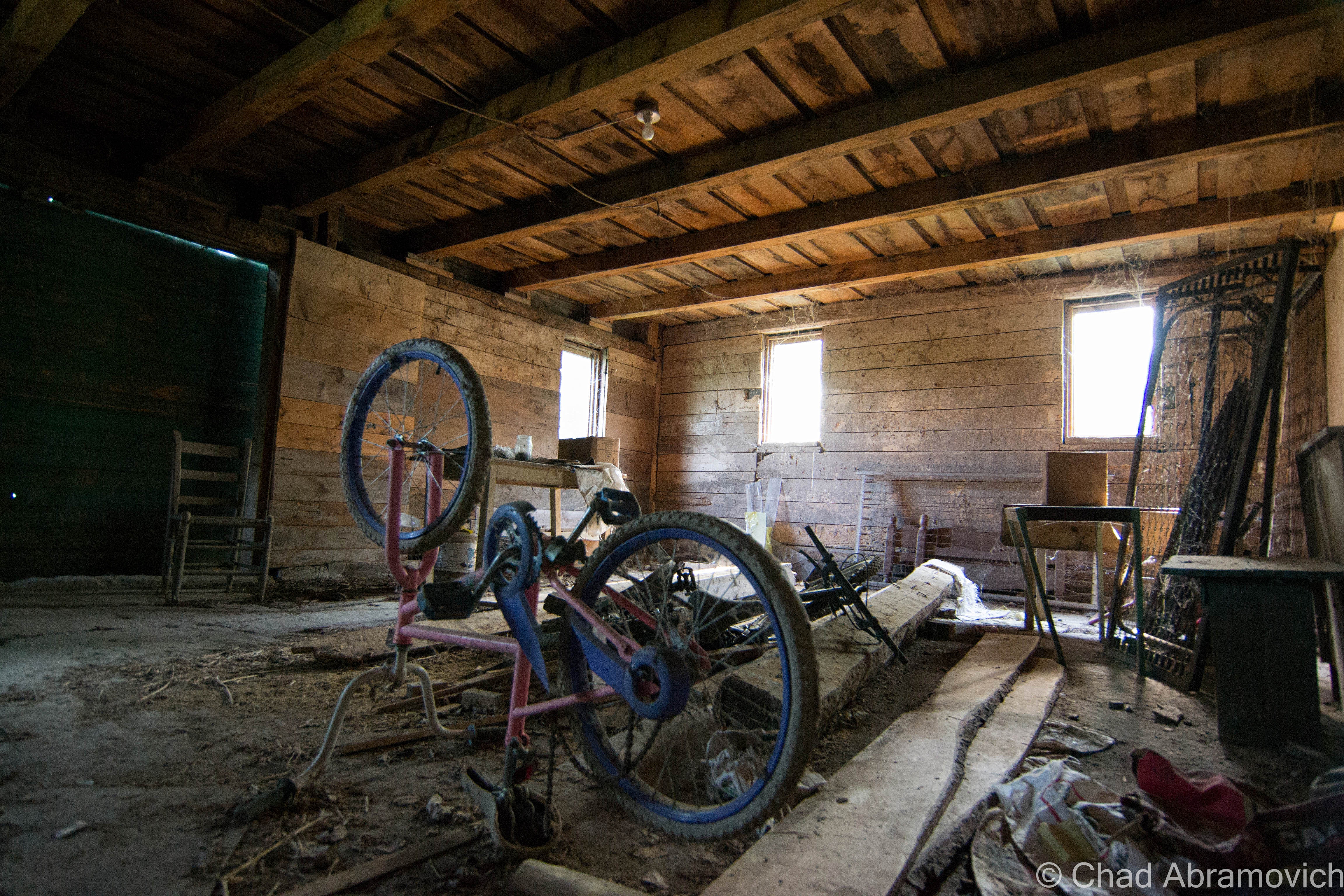
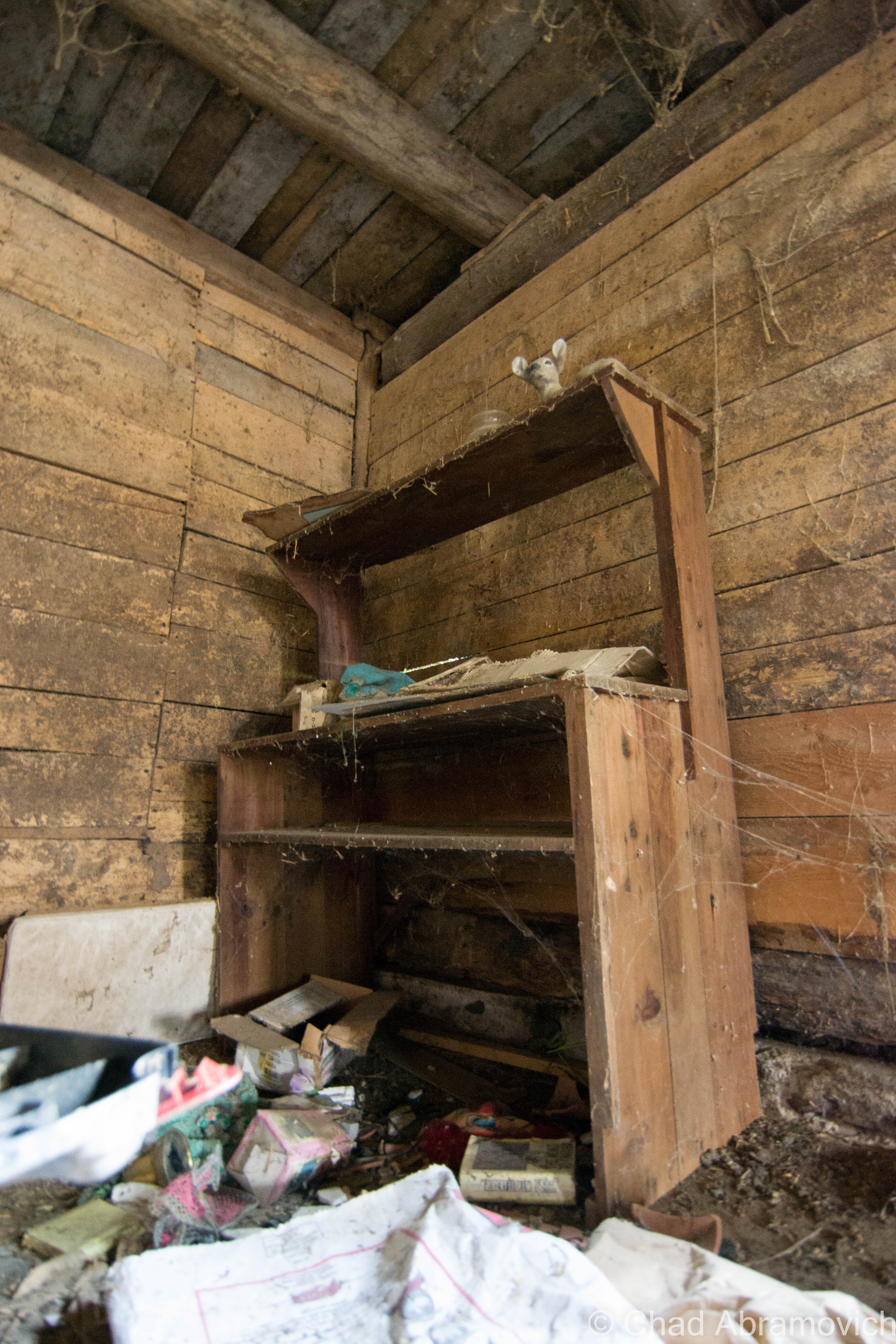
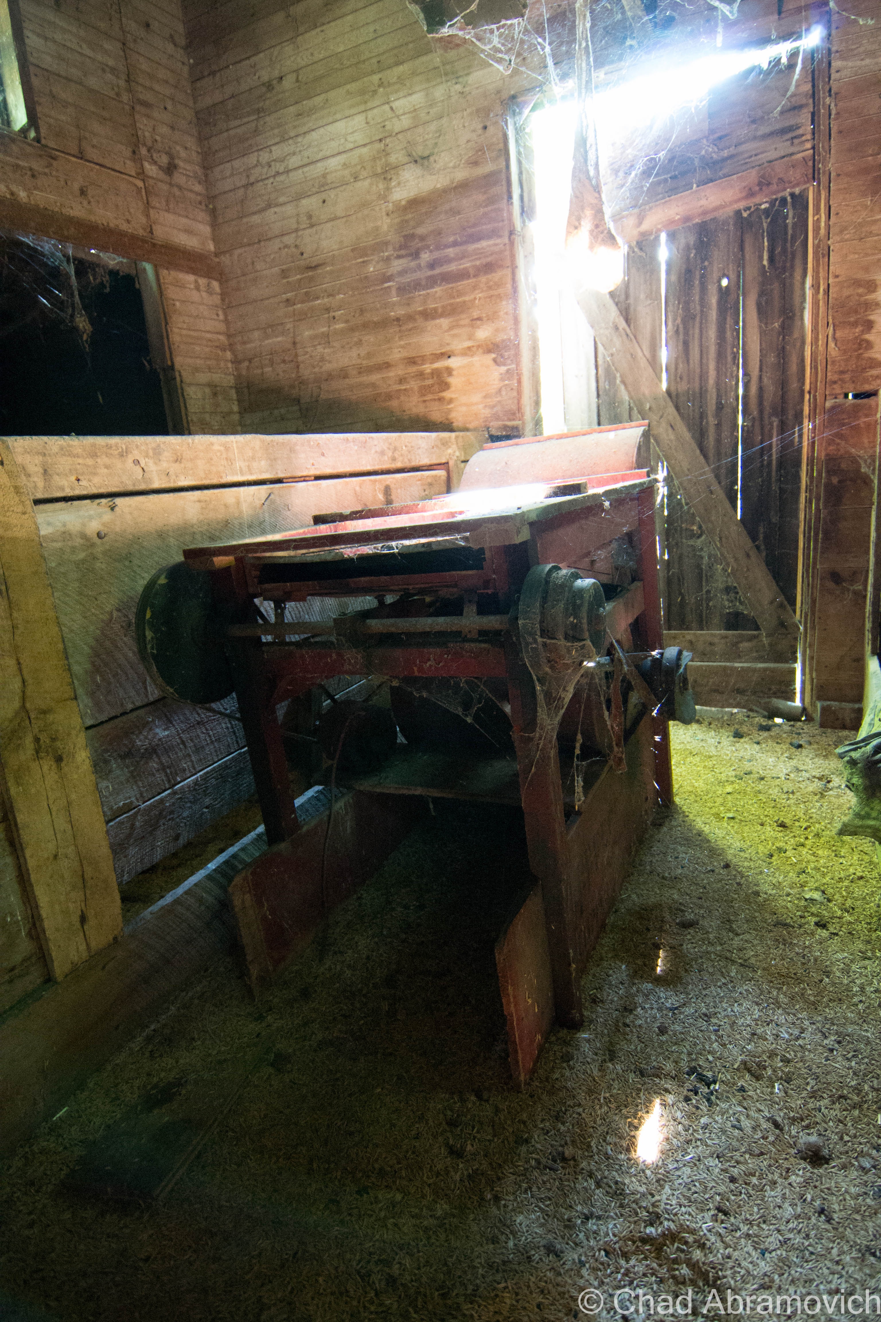
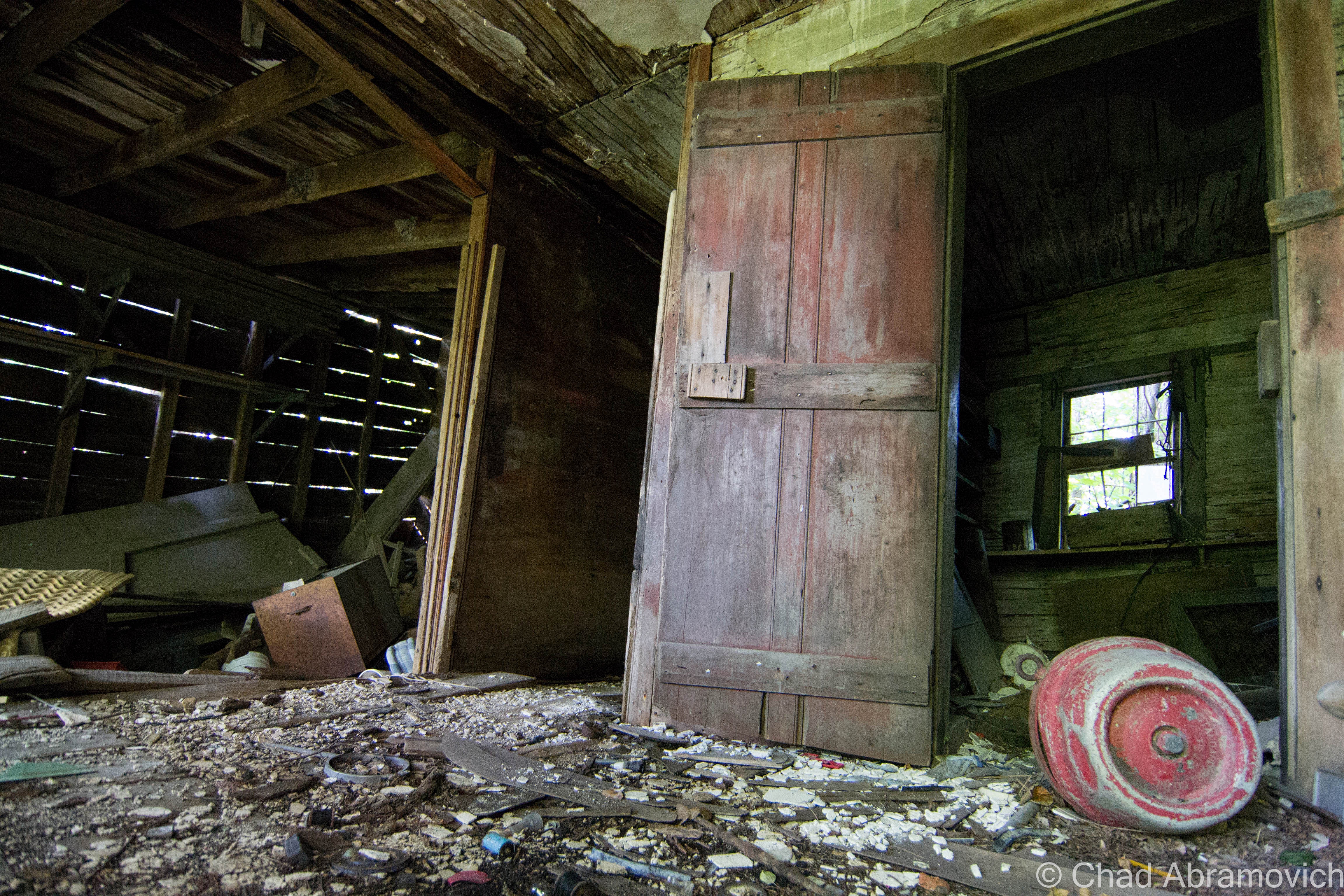
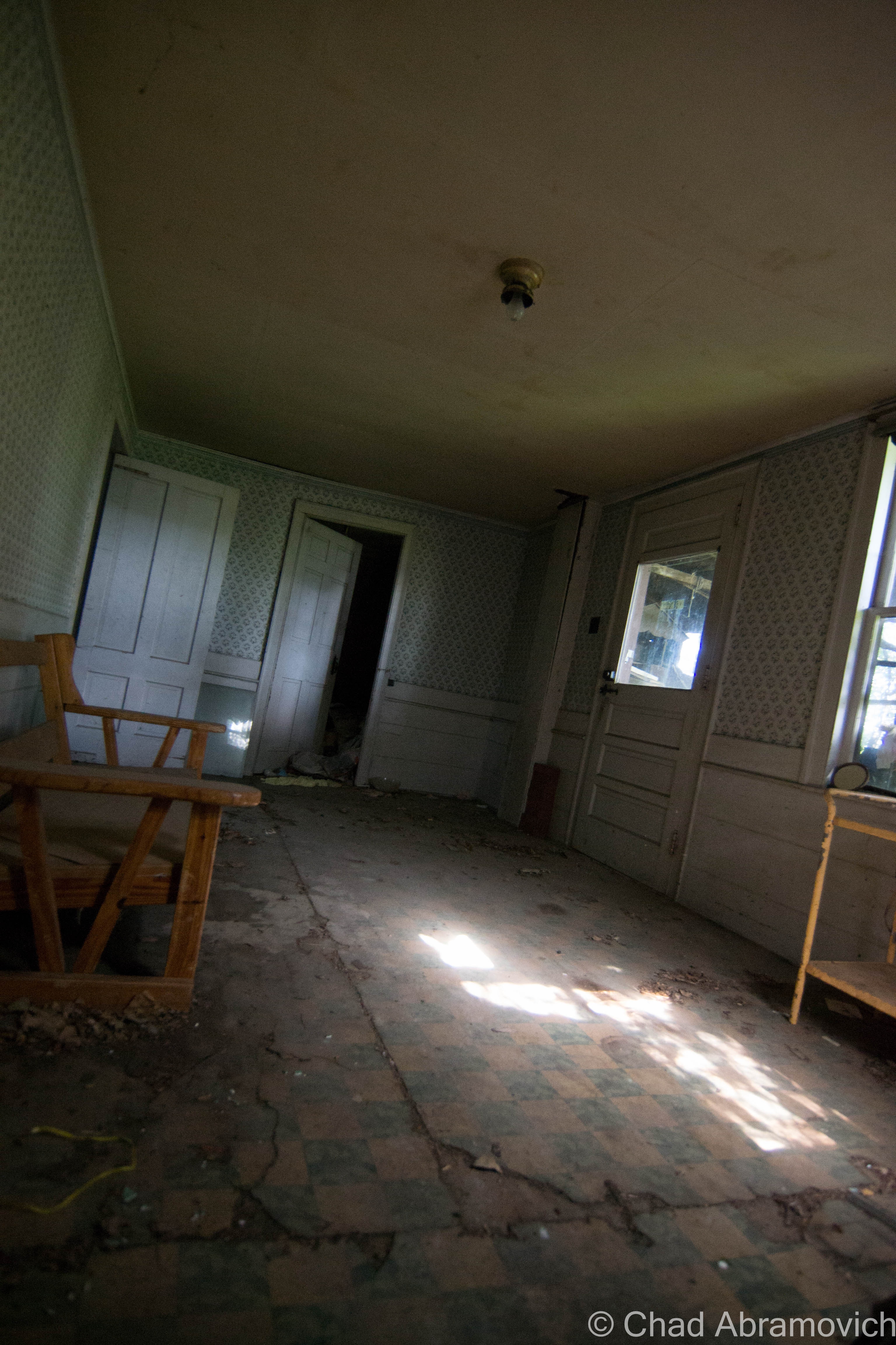
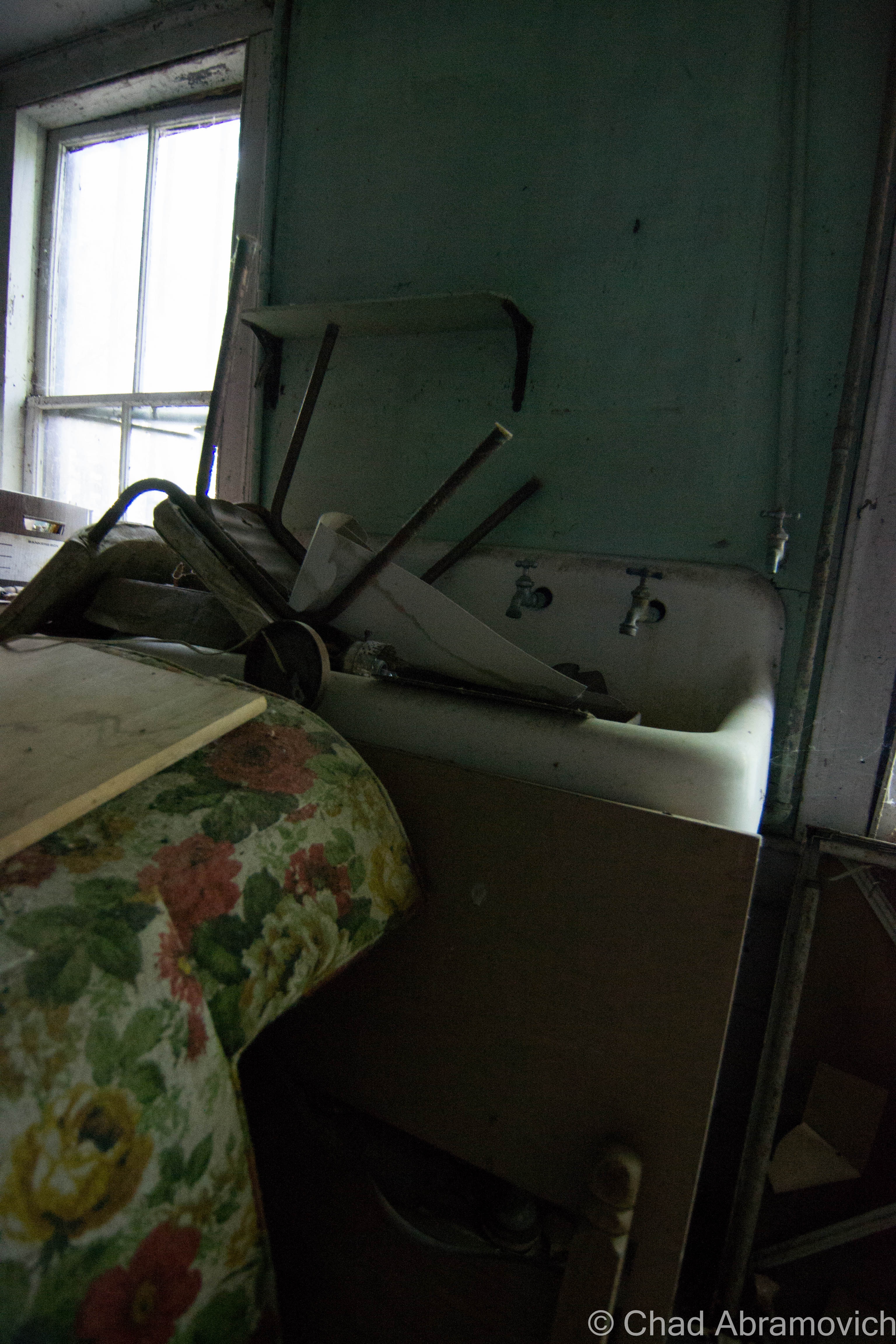
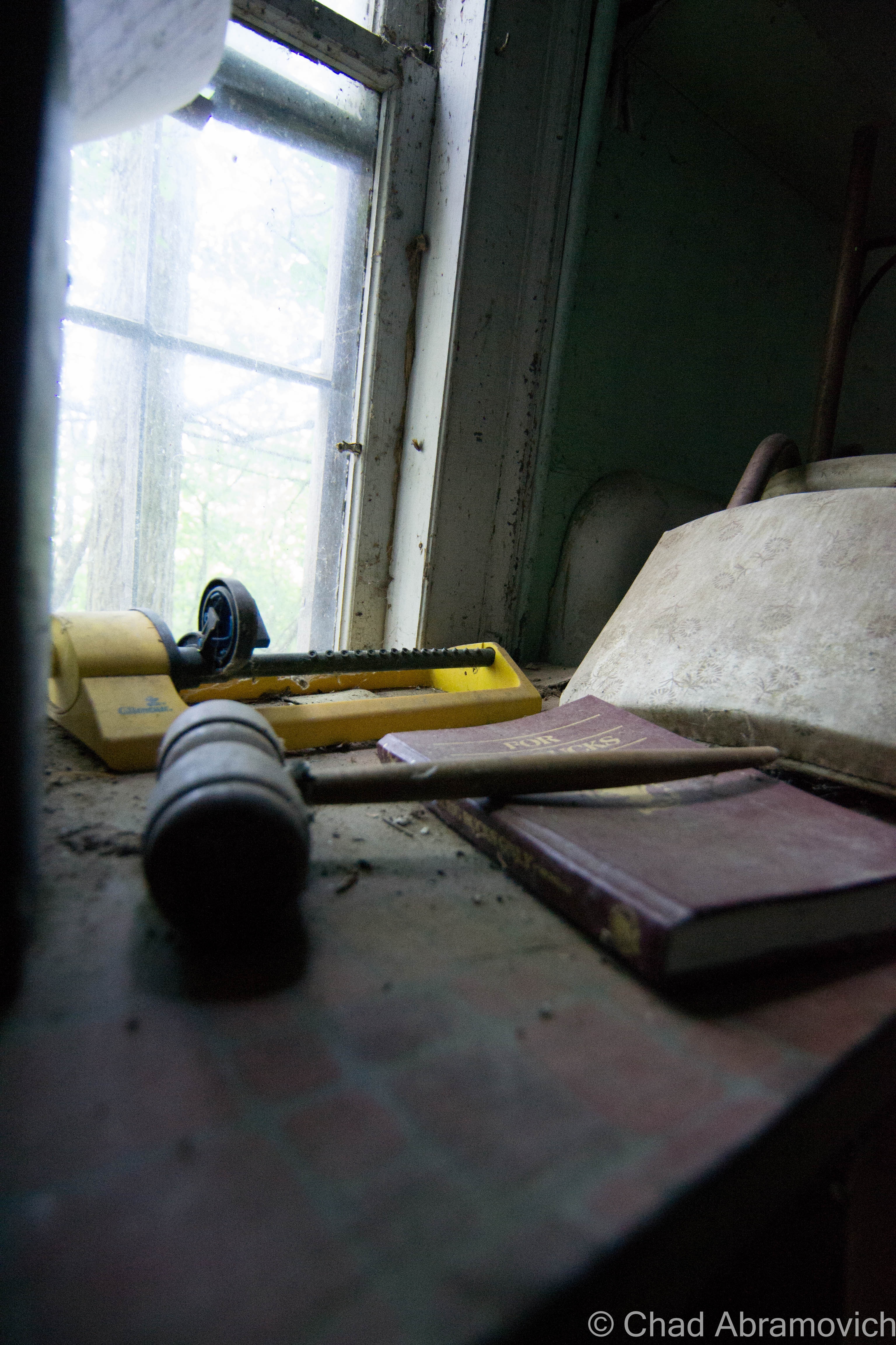
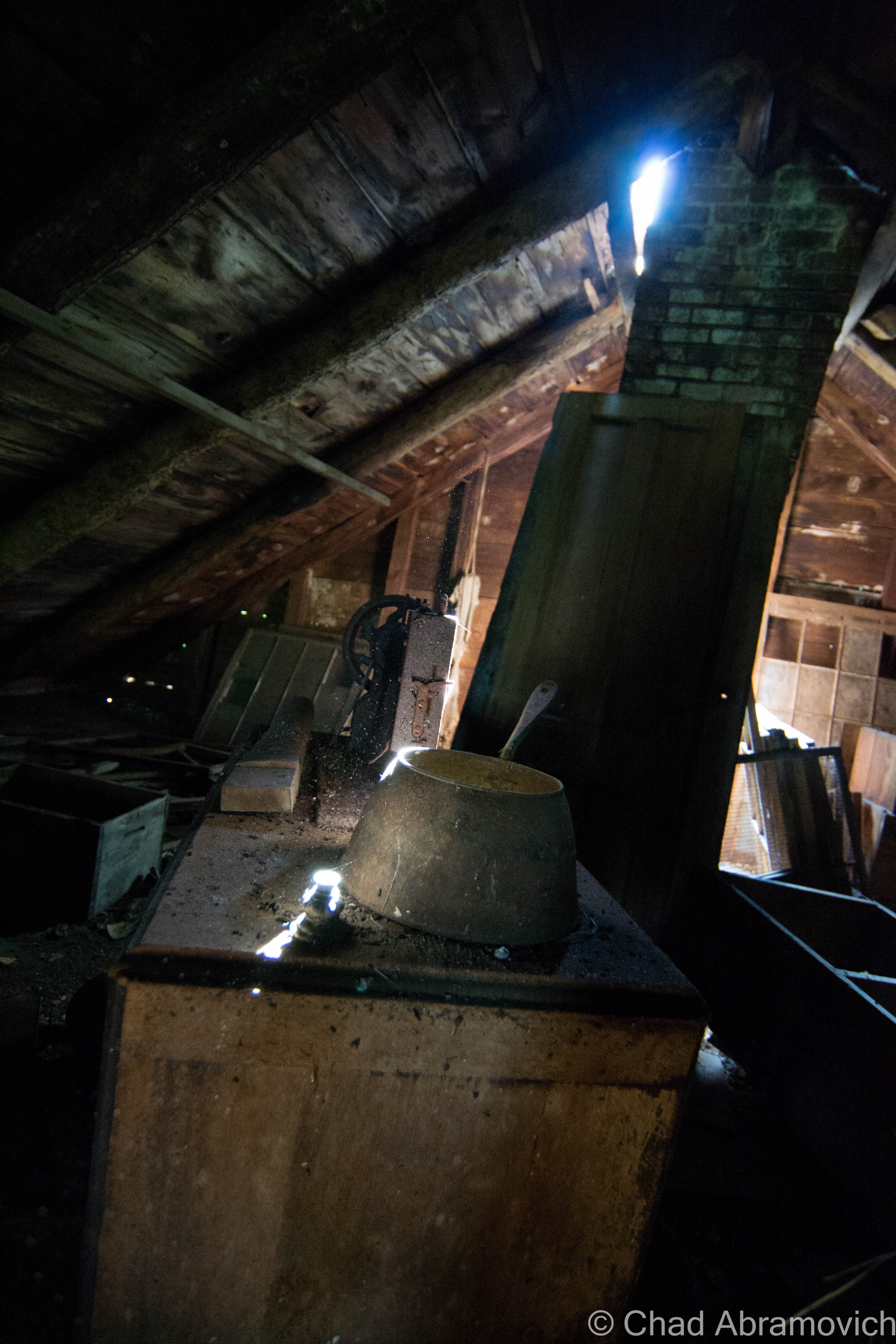
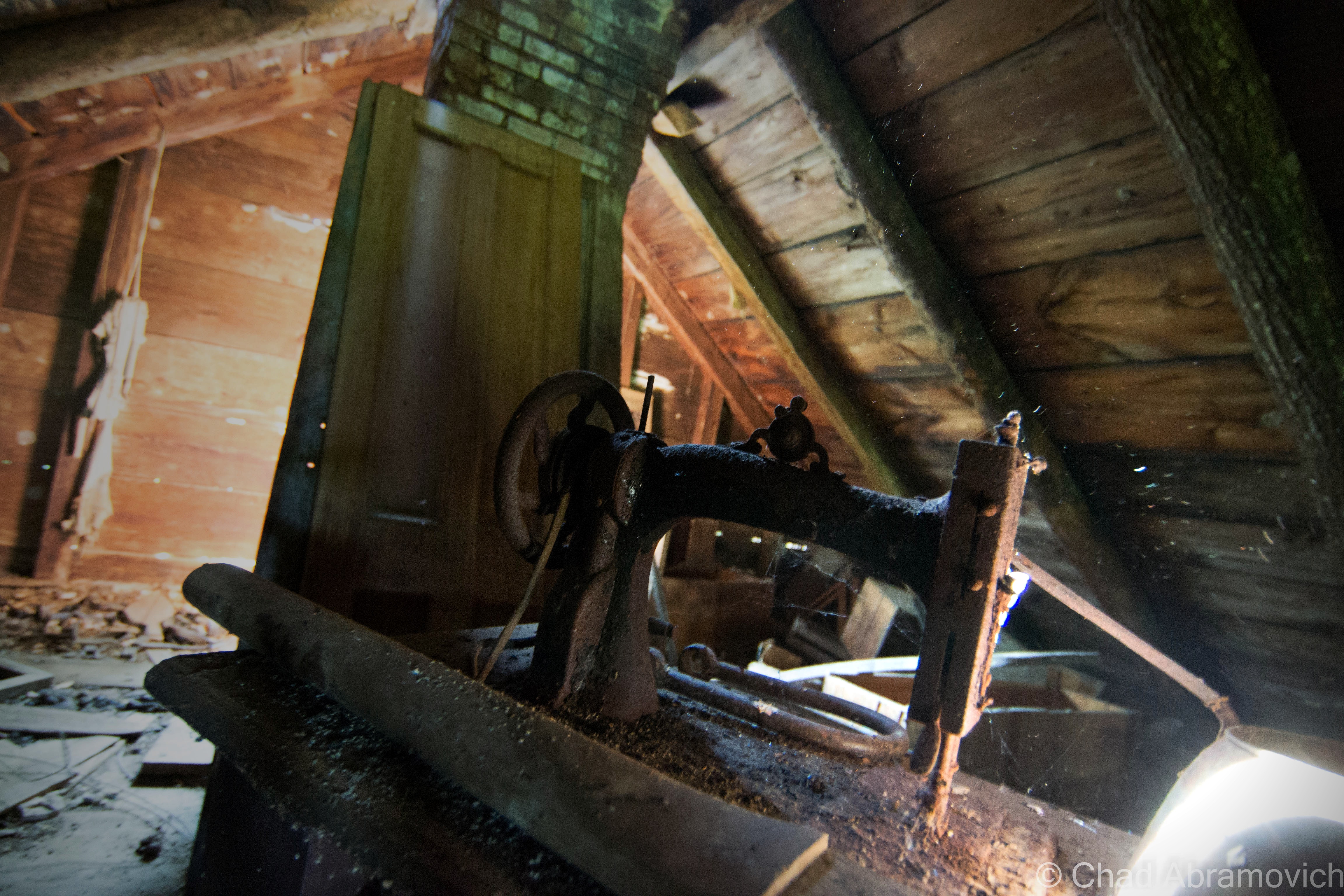
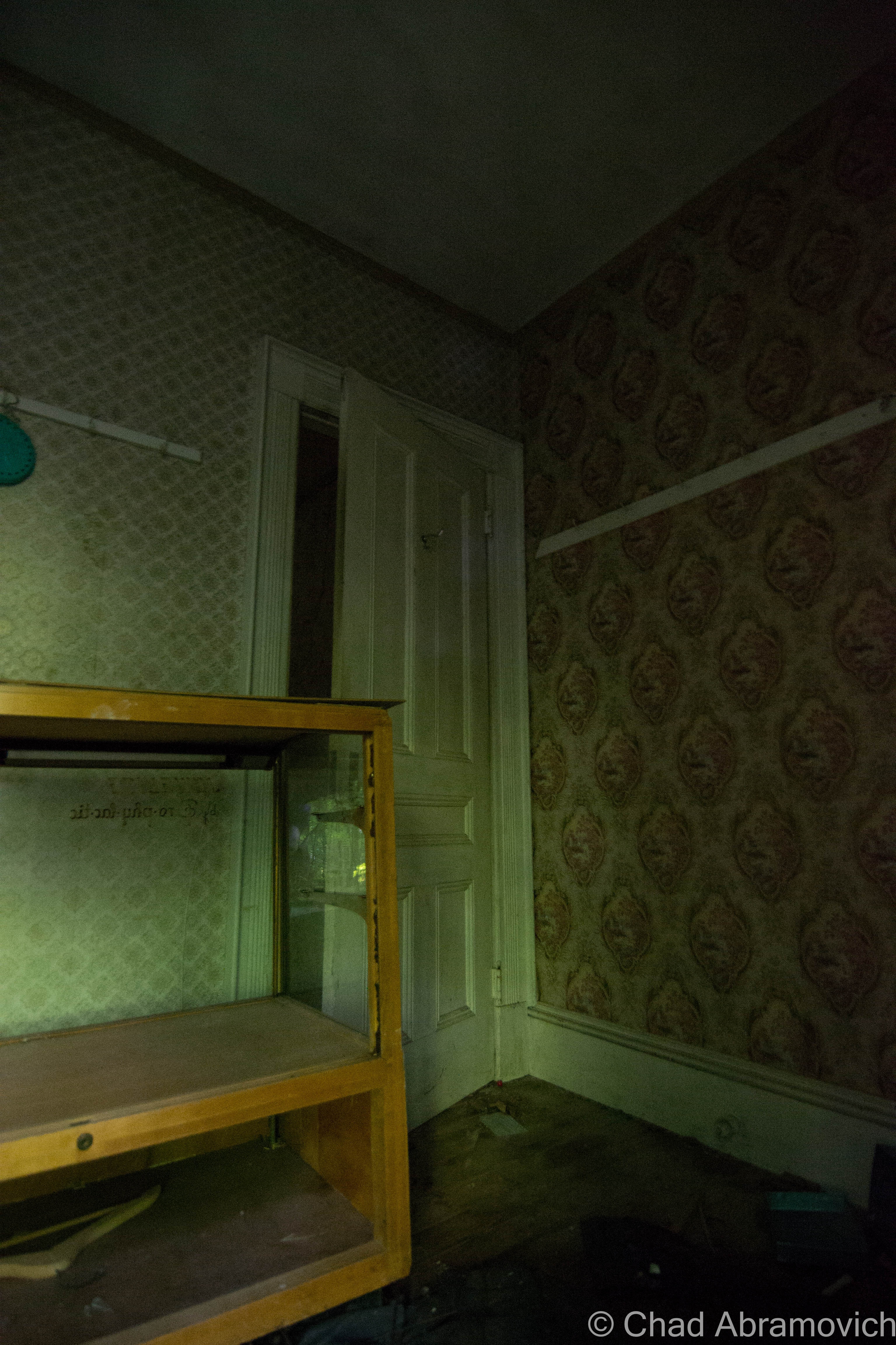
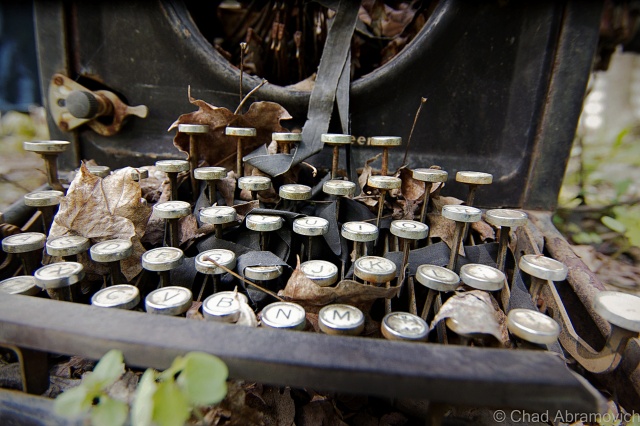
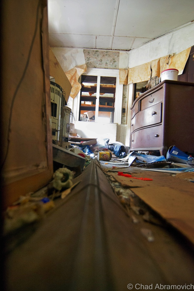
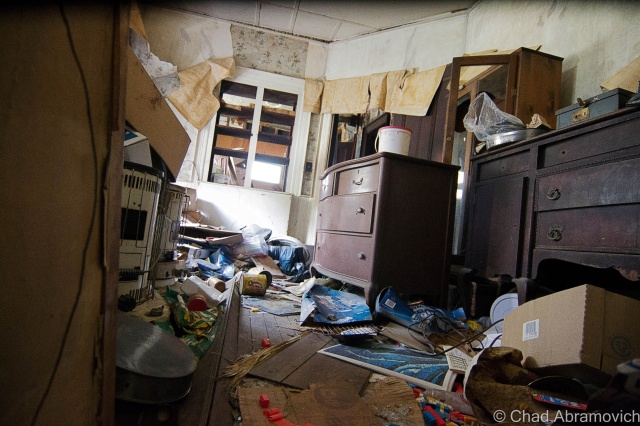
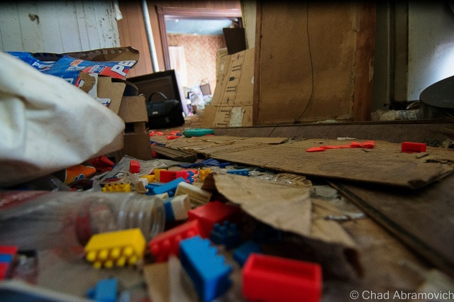
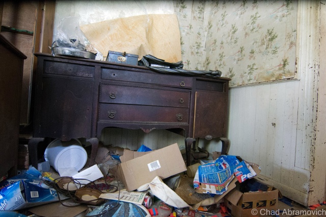
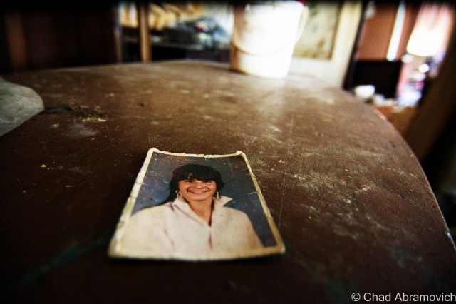
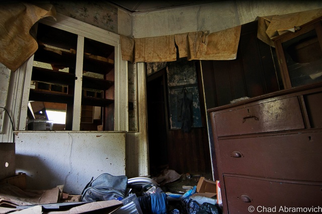
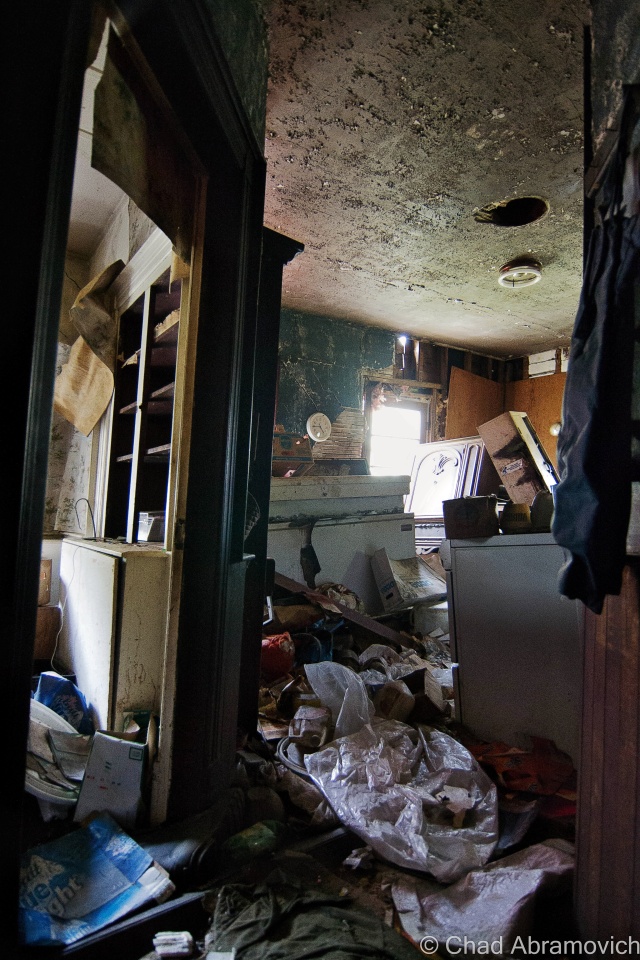
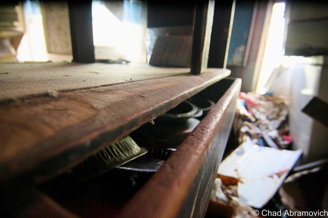
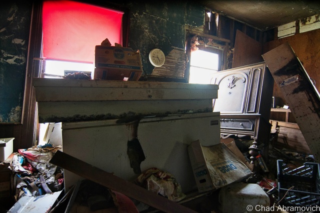
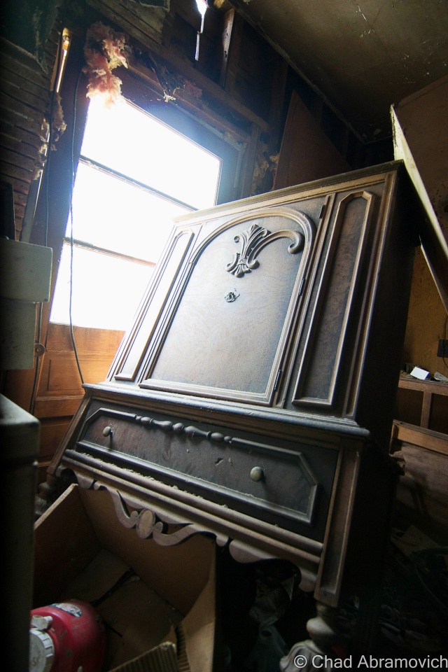
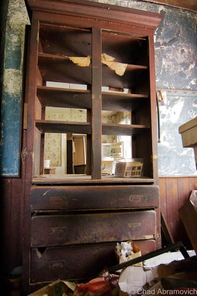
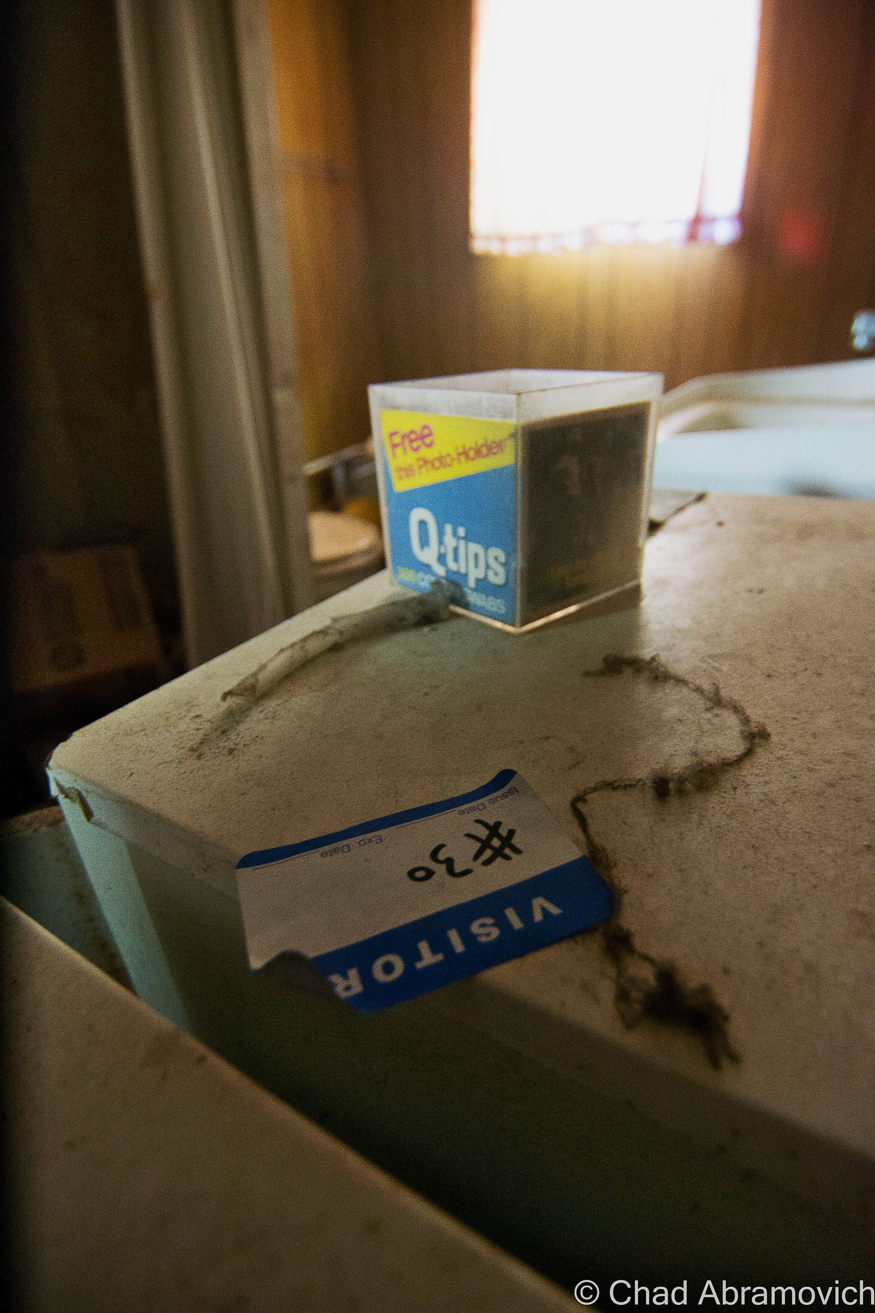
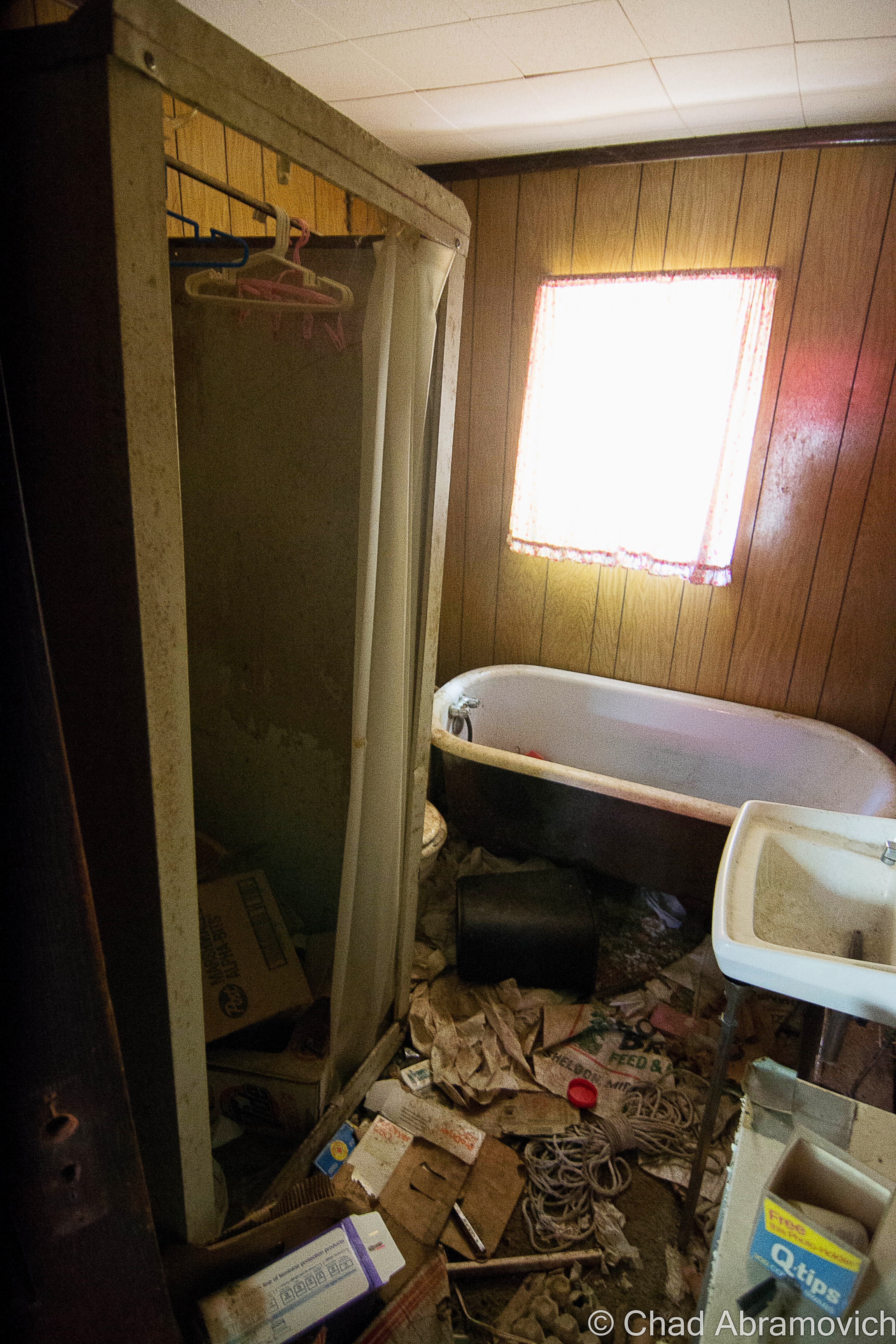
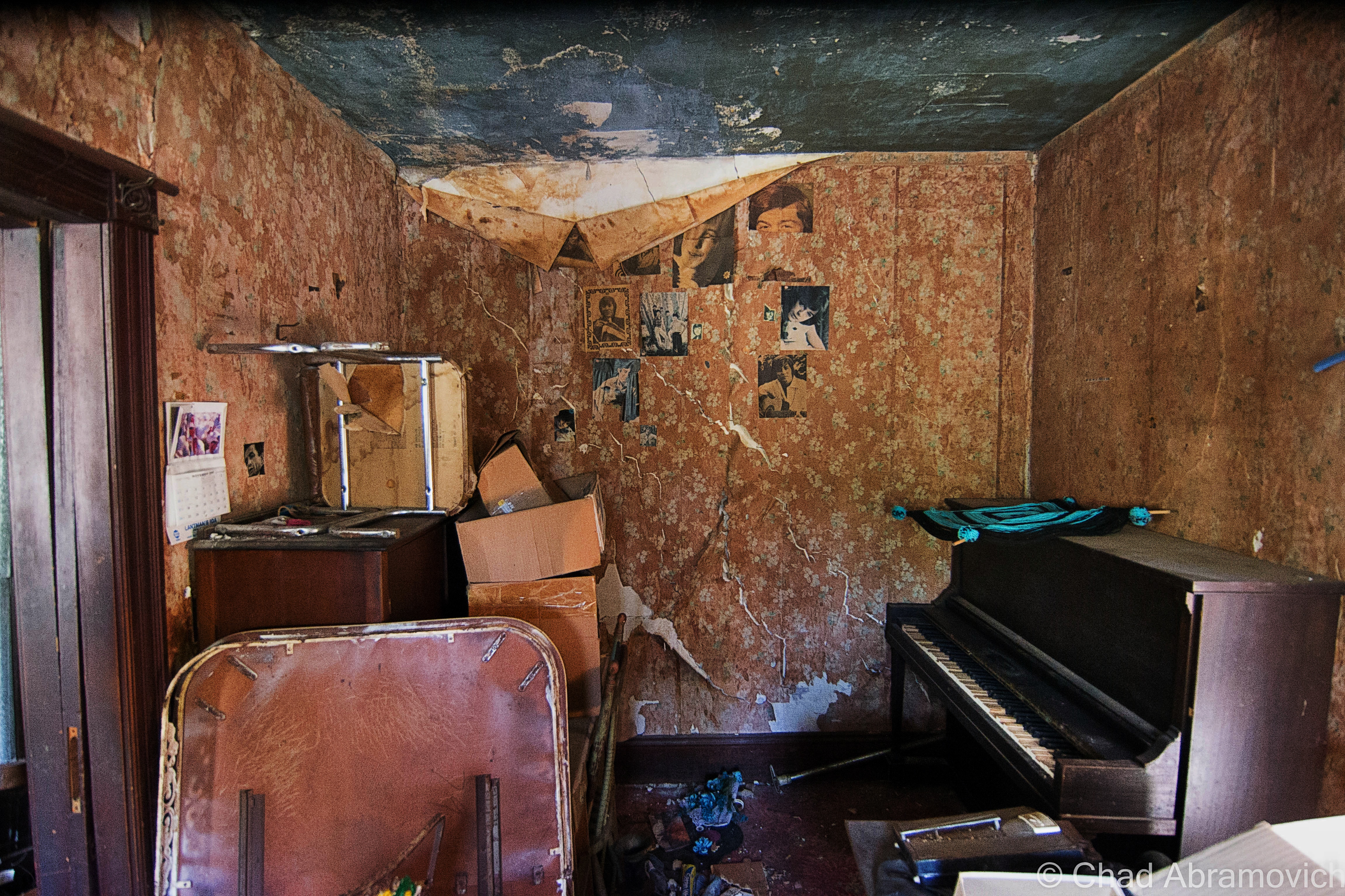
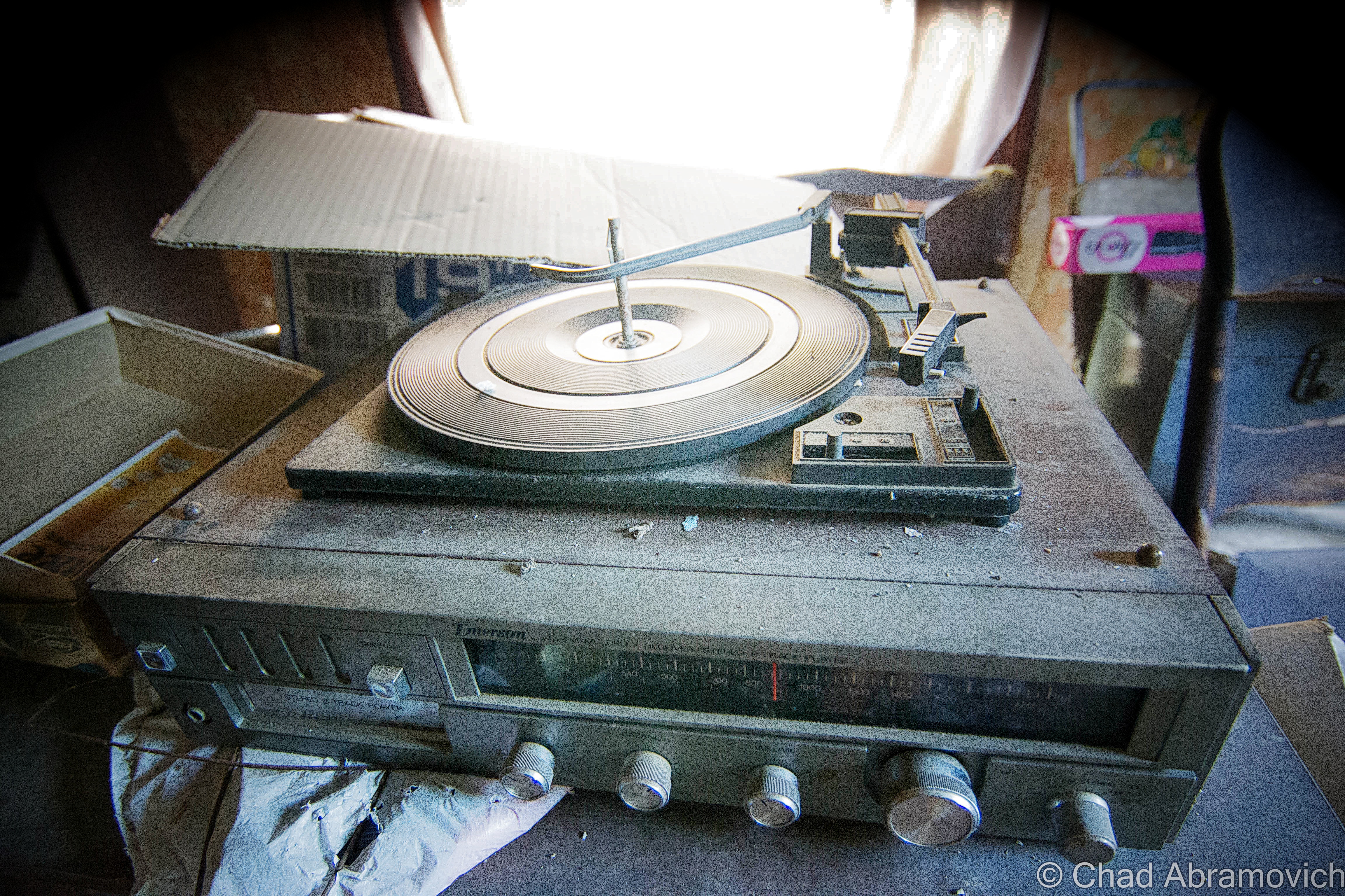
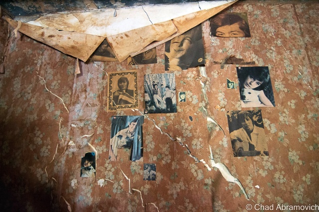
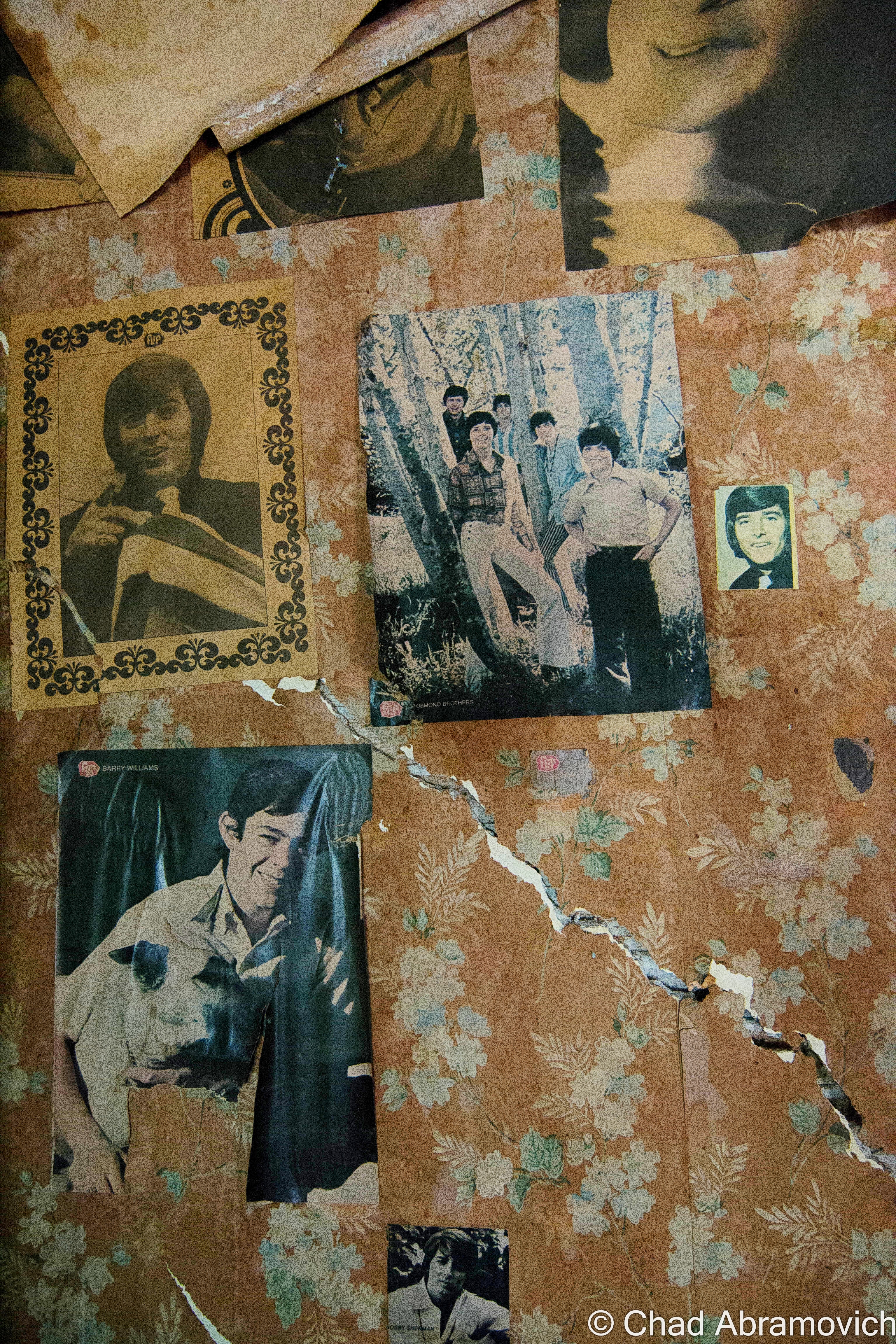
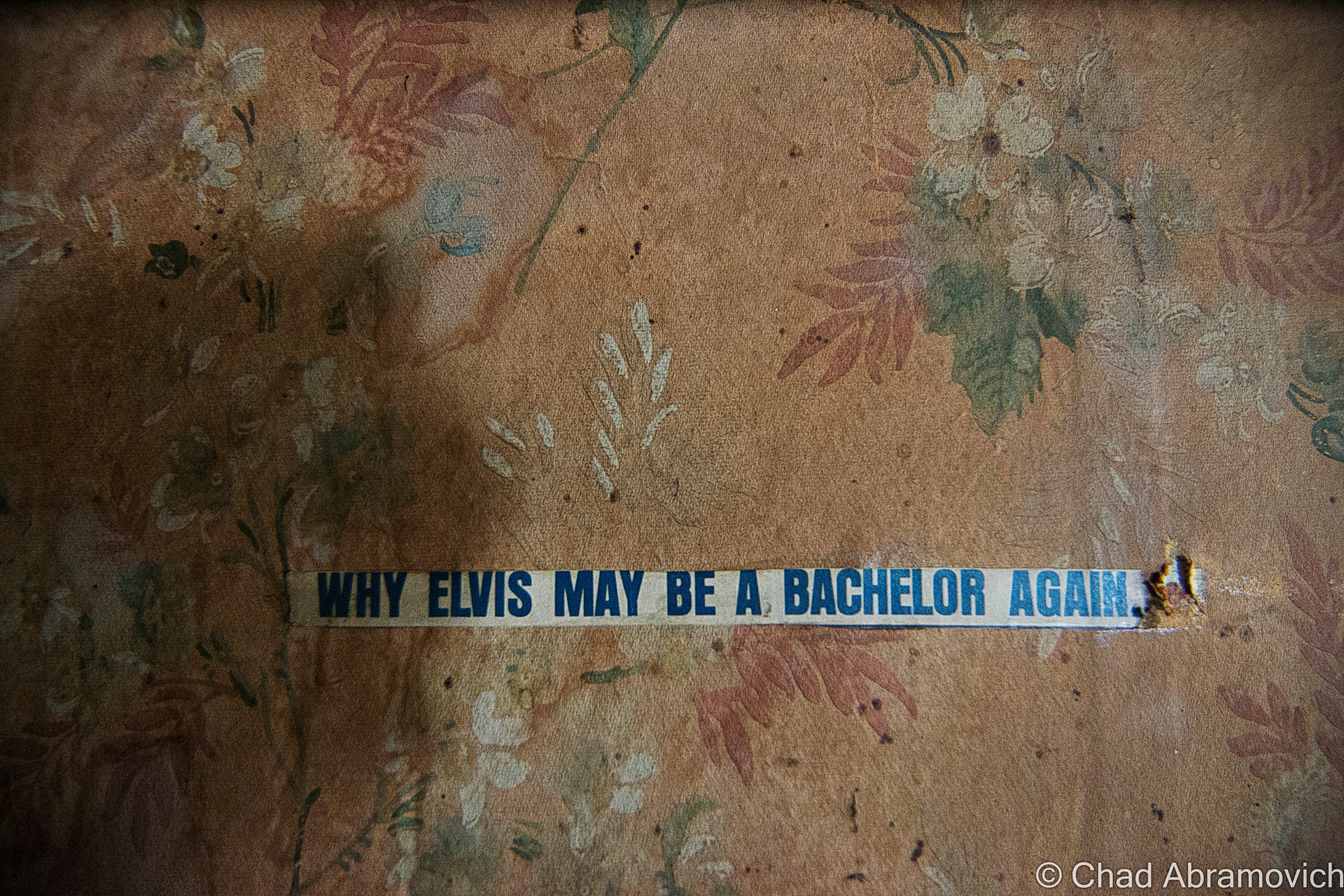
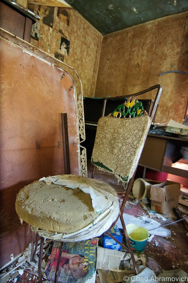
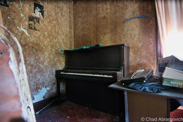
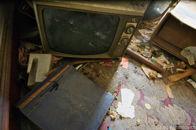
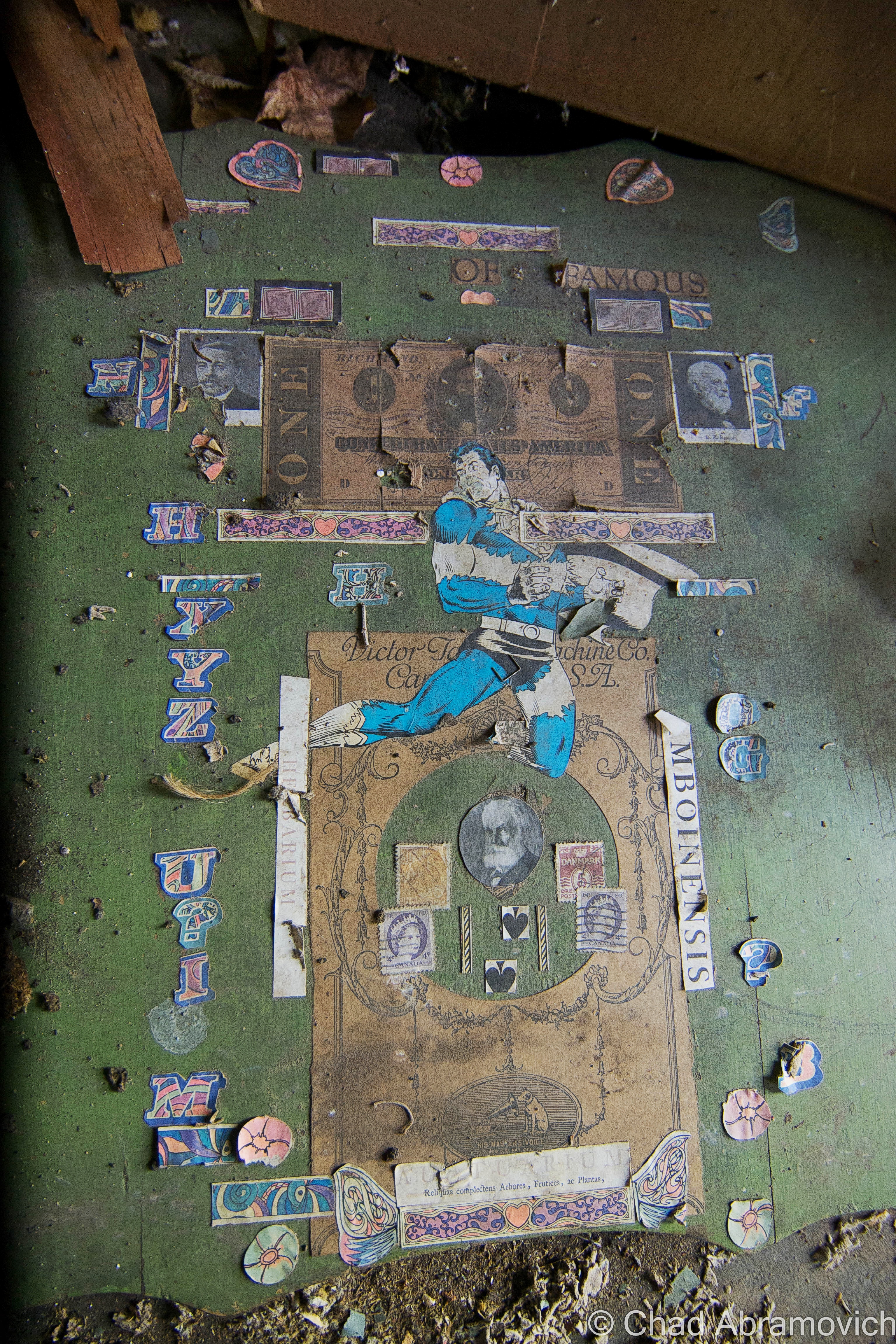
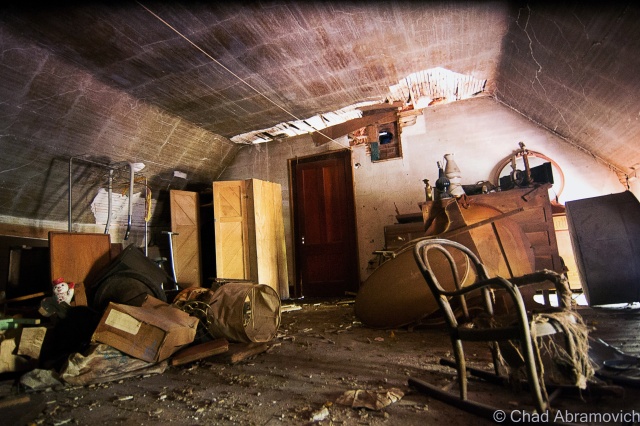
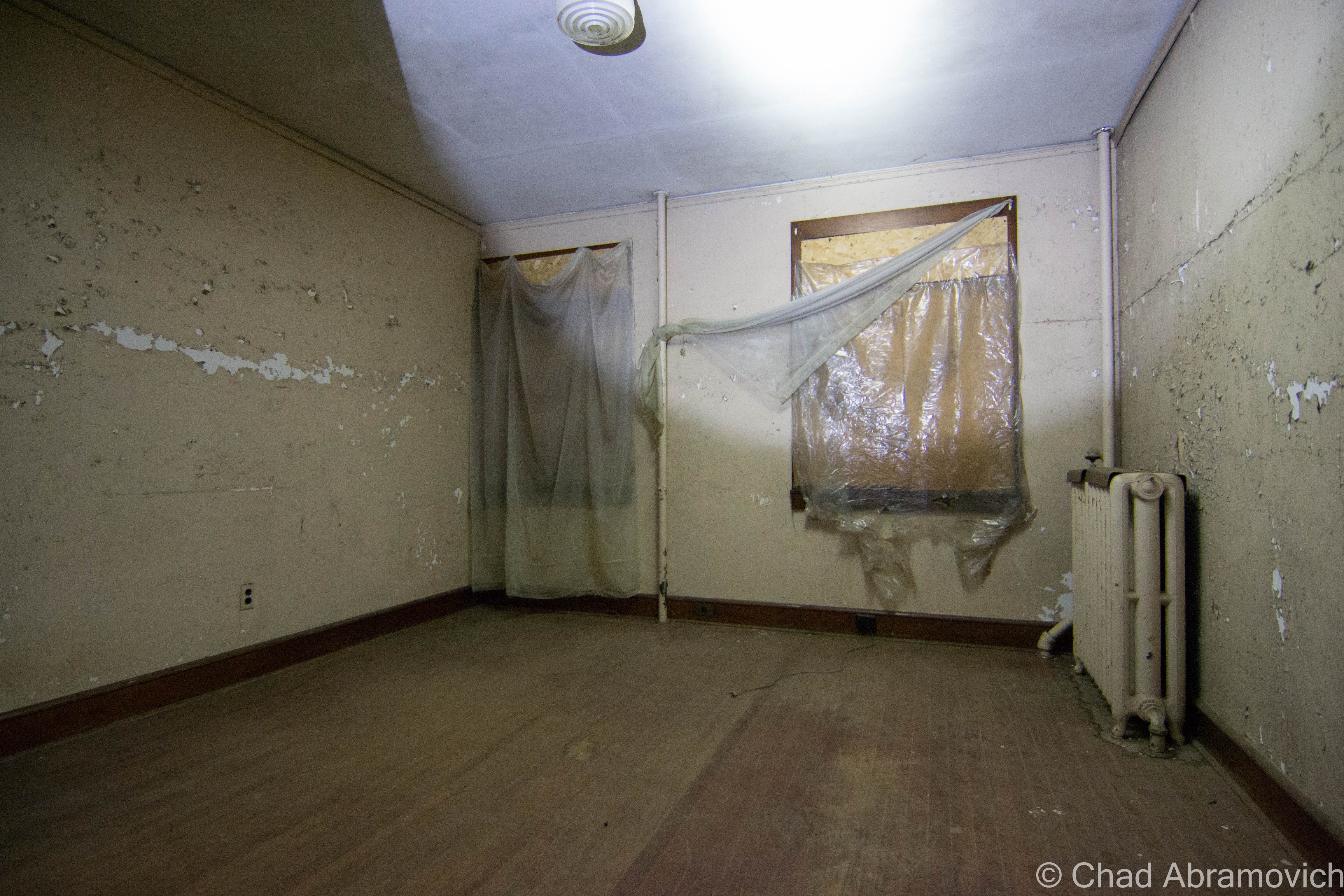
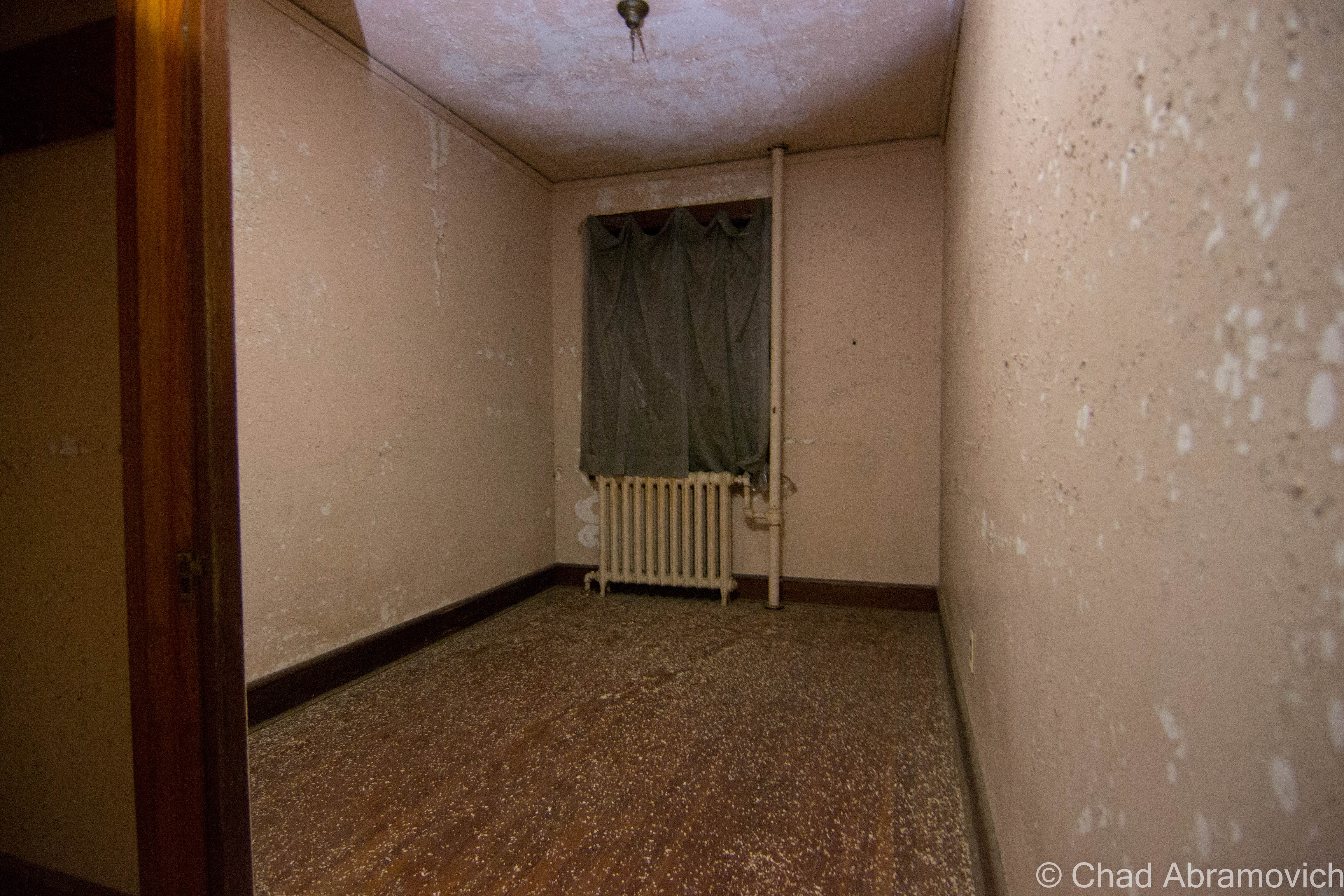
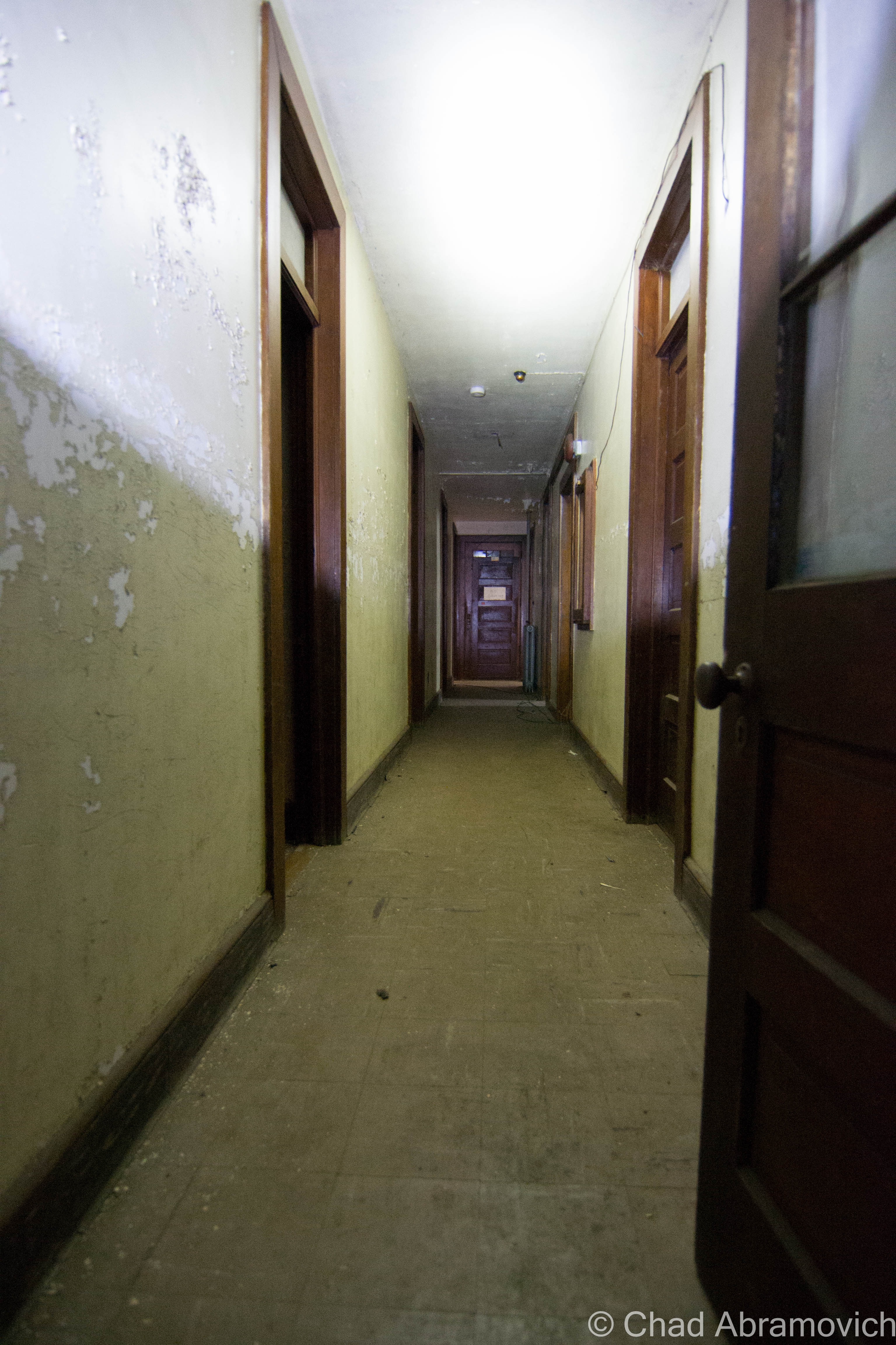
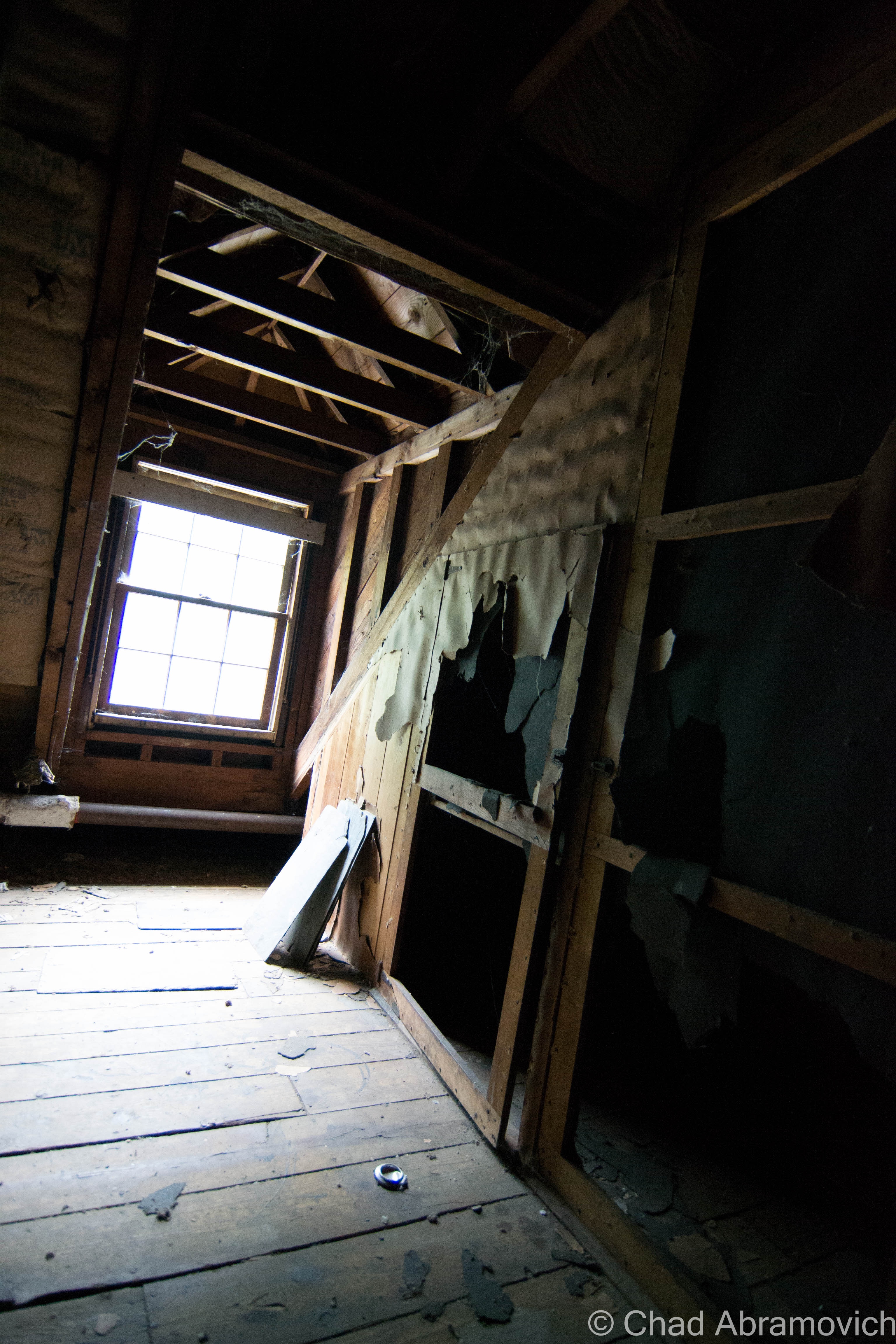
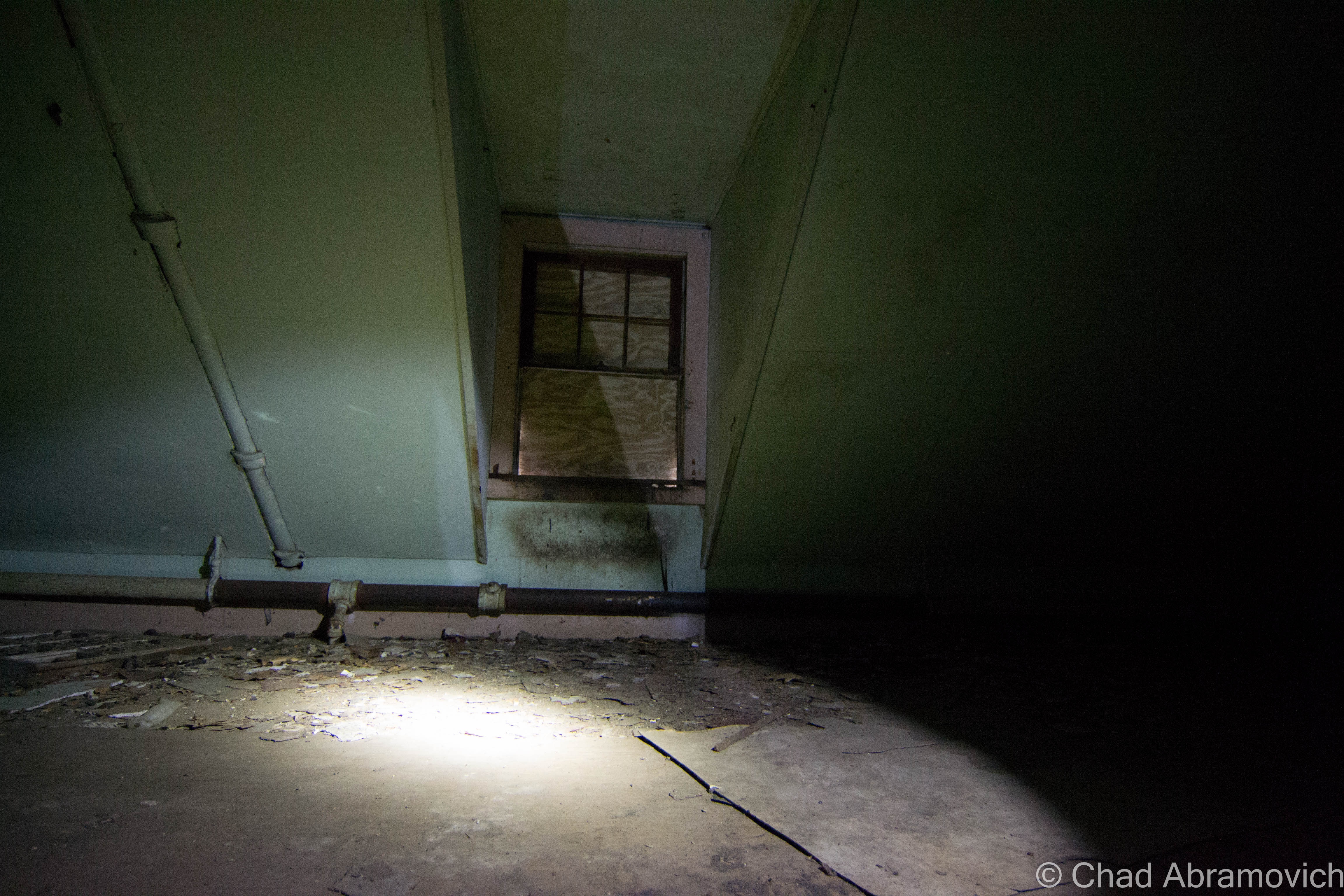
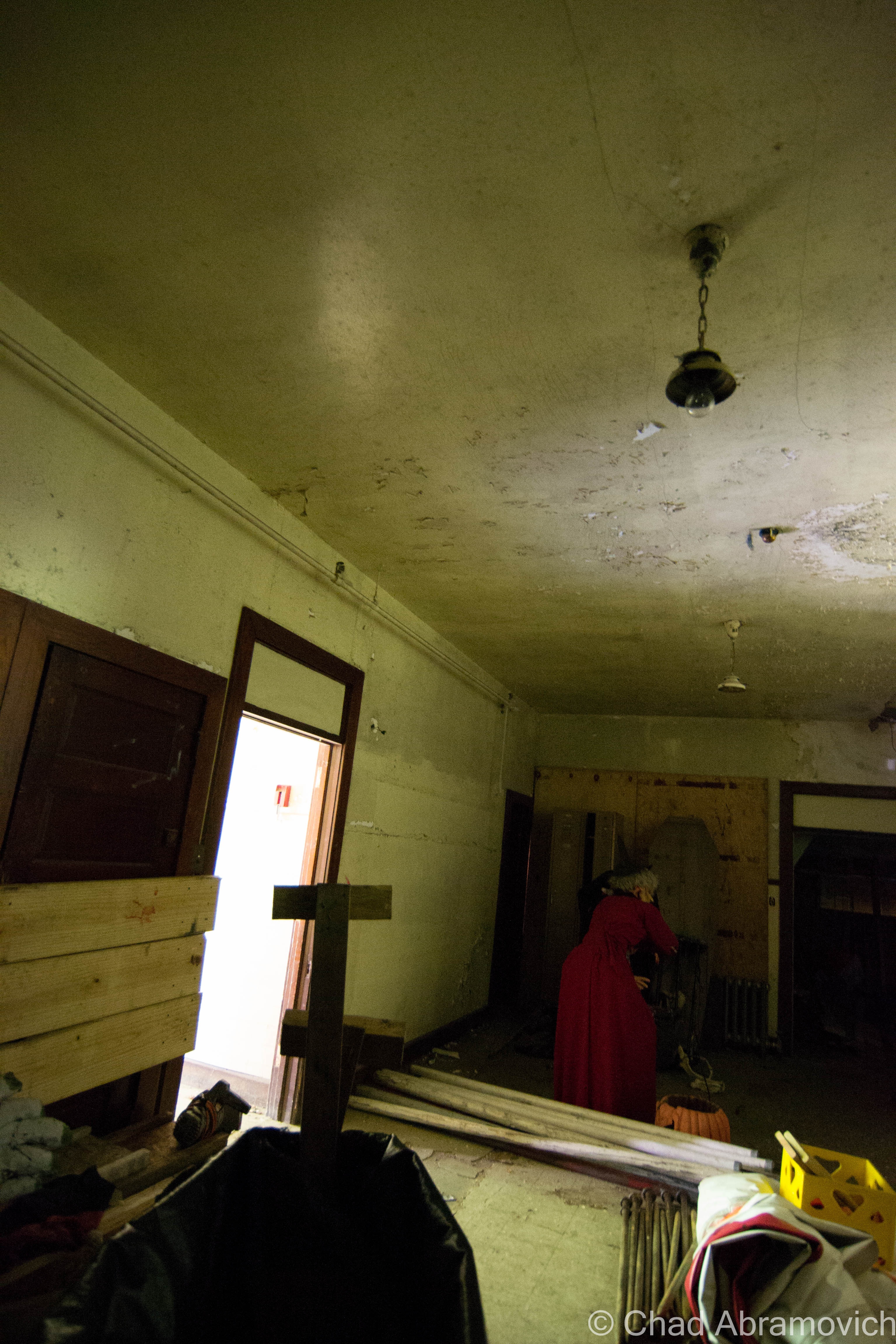
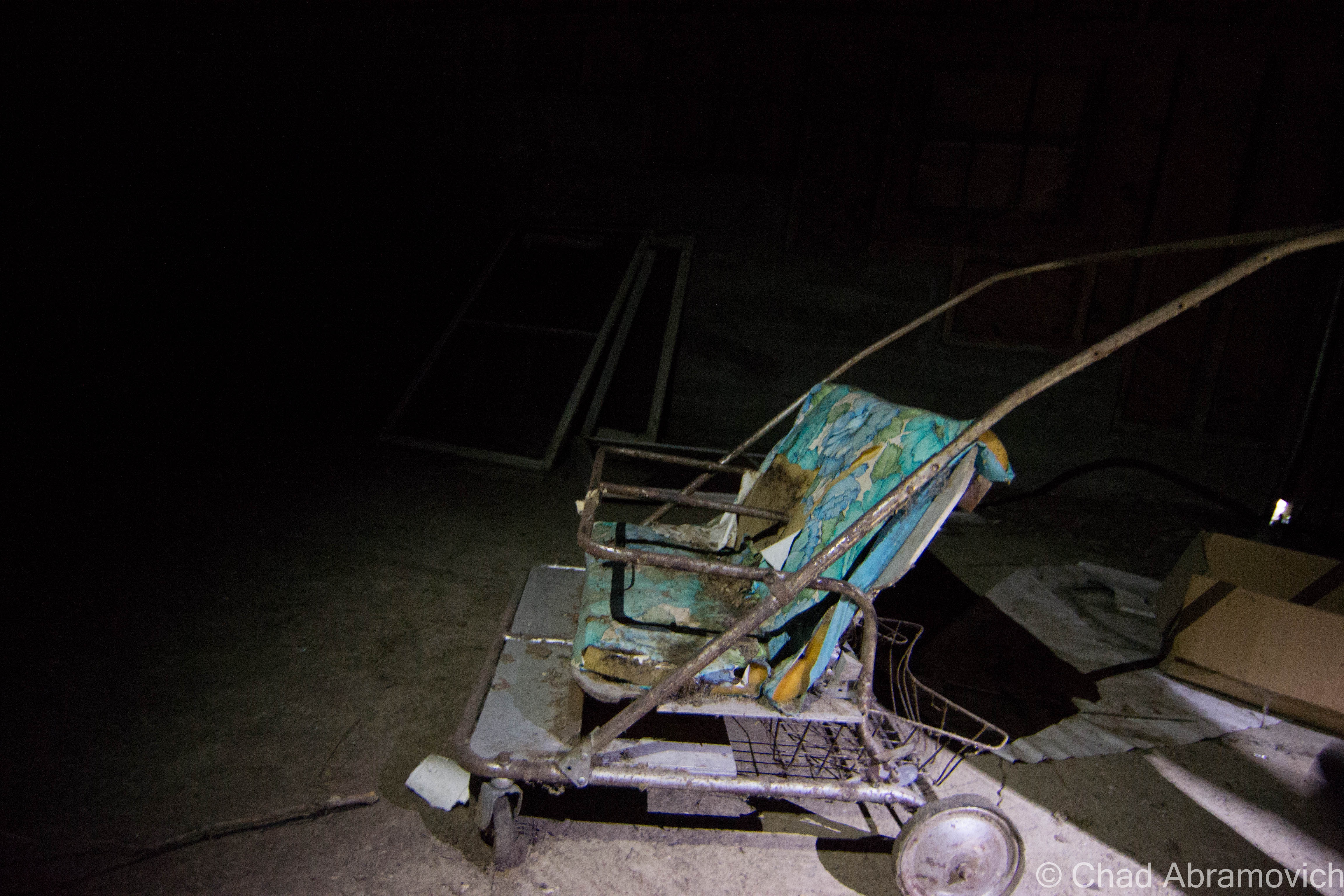
The complex appeared to be a utilitarian and symmetrical layout of two large spaces adjoined by a central row of offices, bathrooms, and mechanical areas. But upon closer and intimate inspection, I was actually more and more surprised at just how many rooms and levels there were, packed in by a labyrinth of confusing staircases and elevated runways. Some spaces were more or less original to their inaugural construction at the turn of the last century, and in the throes of the shifty ways of time, more were accommodated. There were quite a few dank 1970s office spaces put up hastily in areas that contained the infamous giveaway vinyl wall paneling and drop down ceilings, all which were accordion-ing now thanks to precipitous moisture. Some spaces were utterly unidentifiable under the entropy, with collapsing floors and sketchy staircases that lead into ambiguous soggy blackness above. But it was the two main rectangular chambers and their brawniness of broken glass and steel that I was interested in. These cavernous spaces had quite the compendium of artifacts left behind; from magnificent and remarkably intact machinery, actual steel rails still embedded in the floors, to just about anything you can fathom that had somehow found it’s way inside and subsequently left there to waste away. There’s a lot for a person to think about as they walk along the crumbling floors inside this illusion of another world. Just watch out for nails. There are plenty to step on.
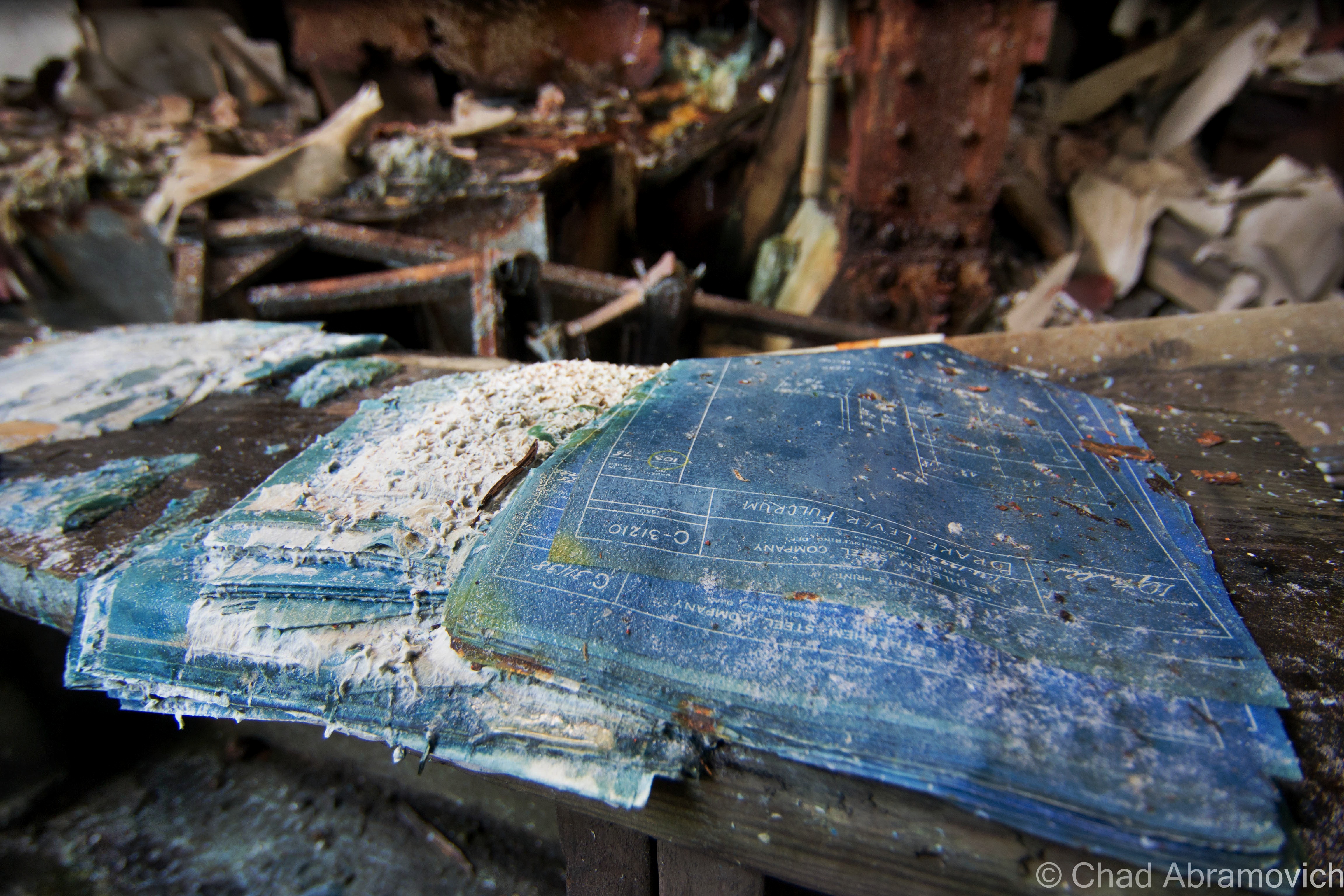
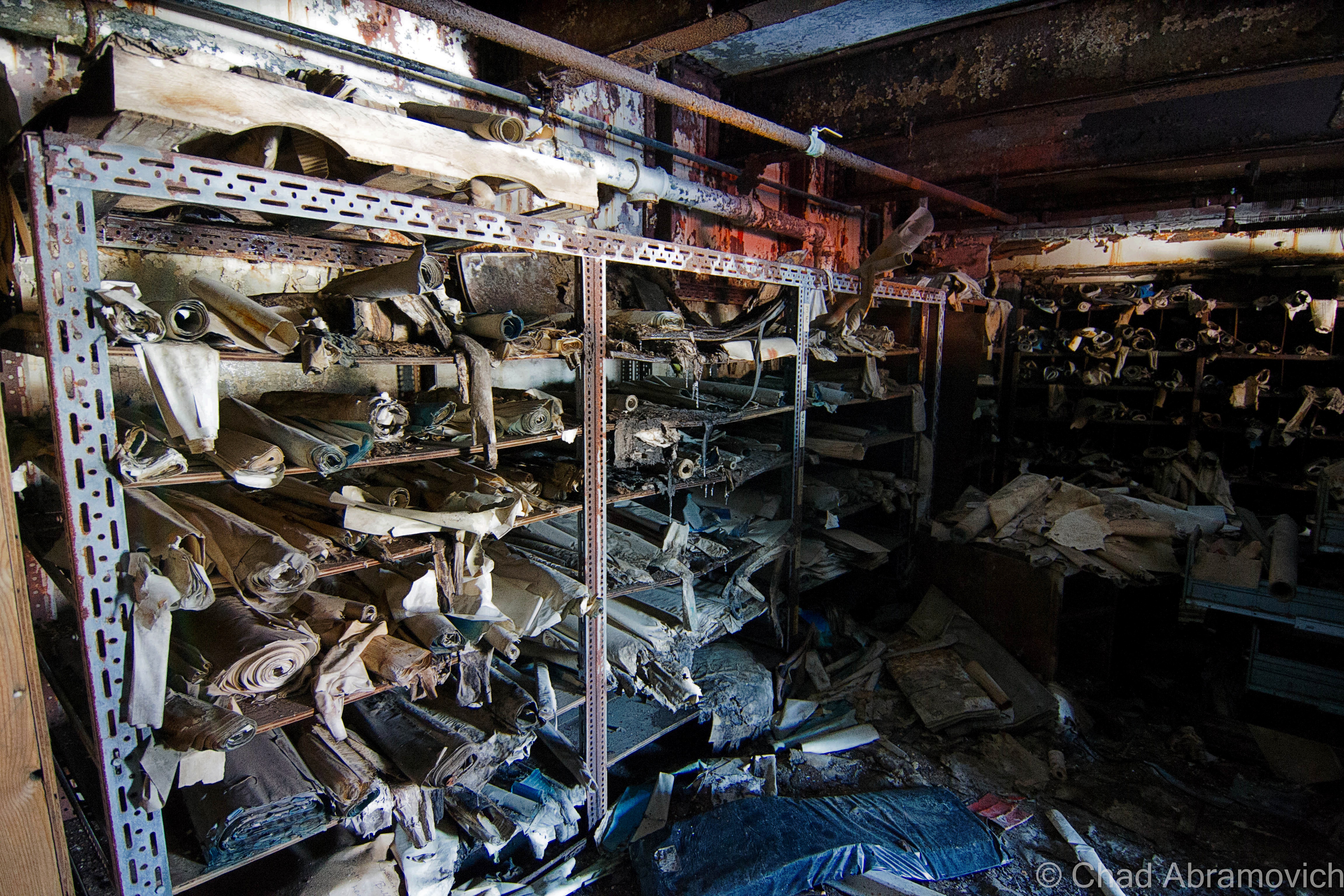
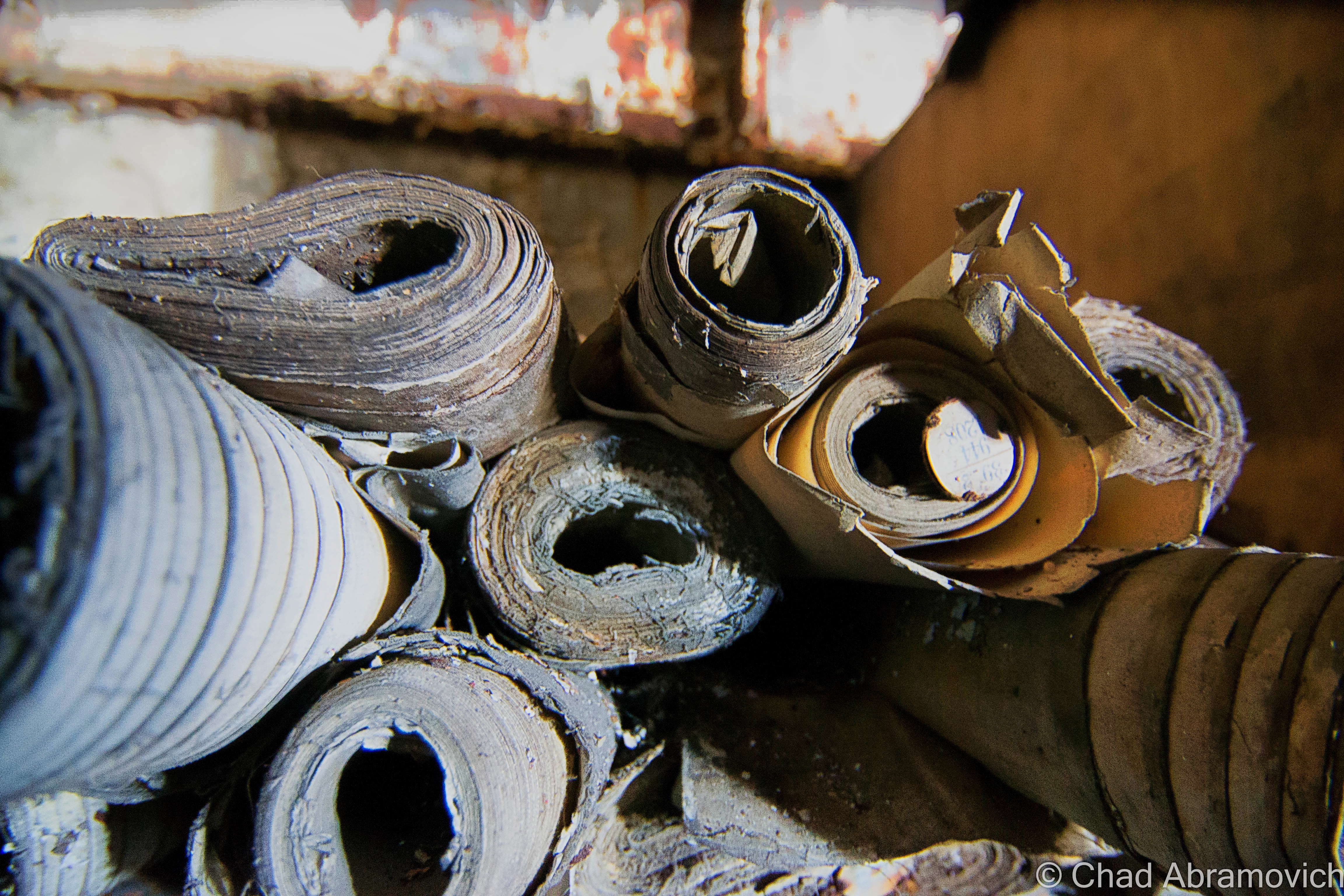
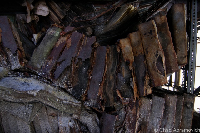
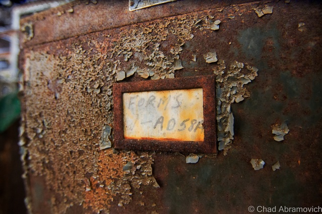
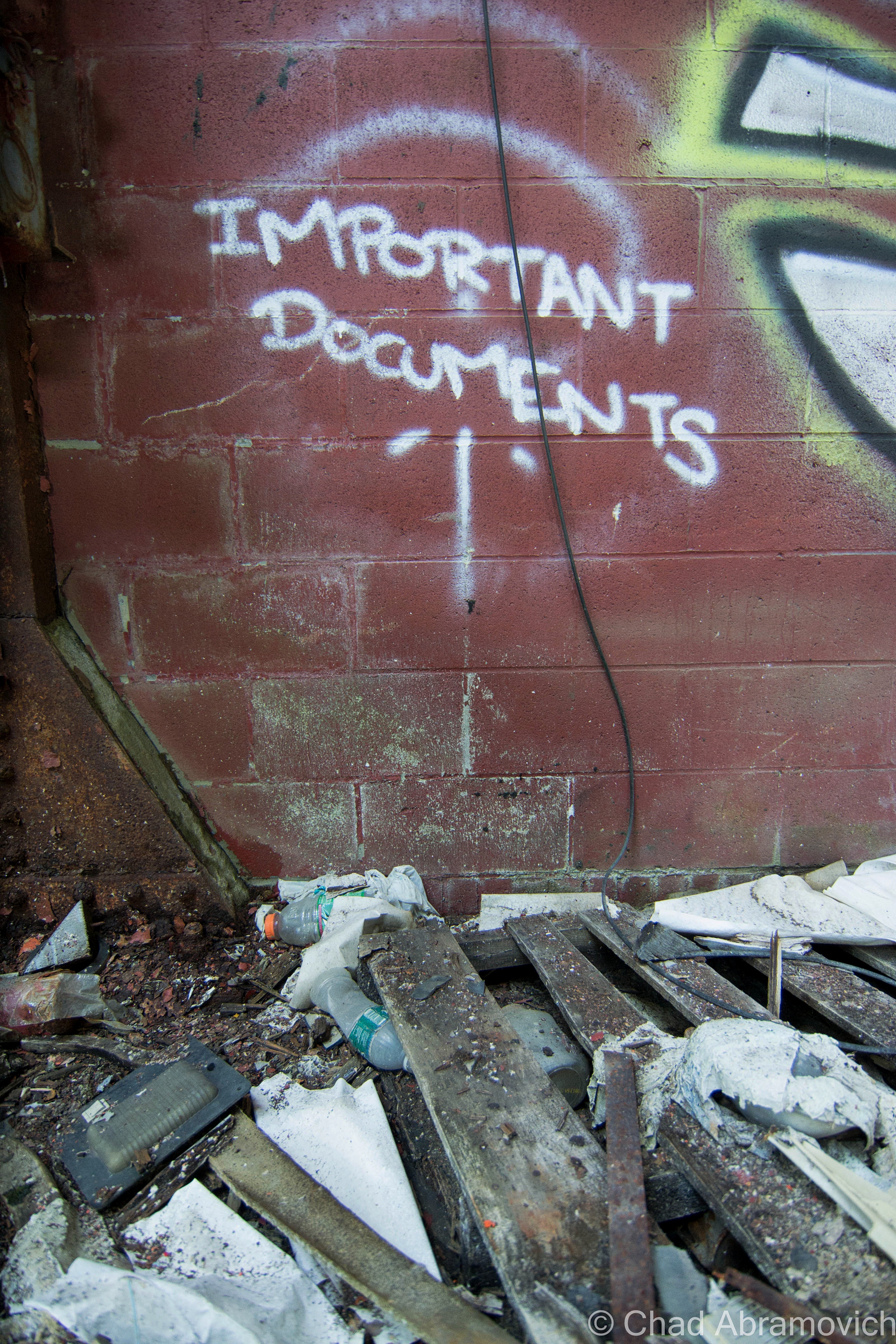
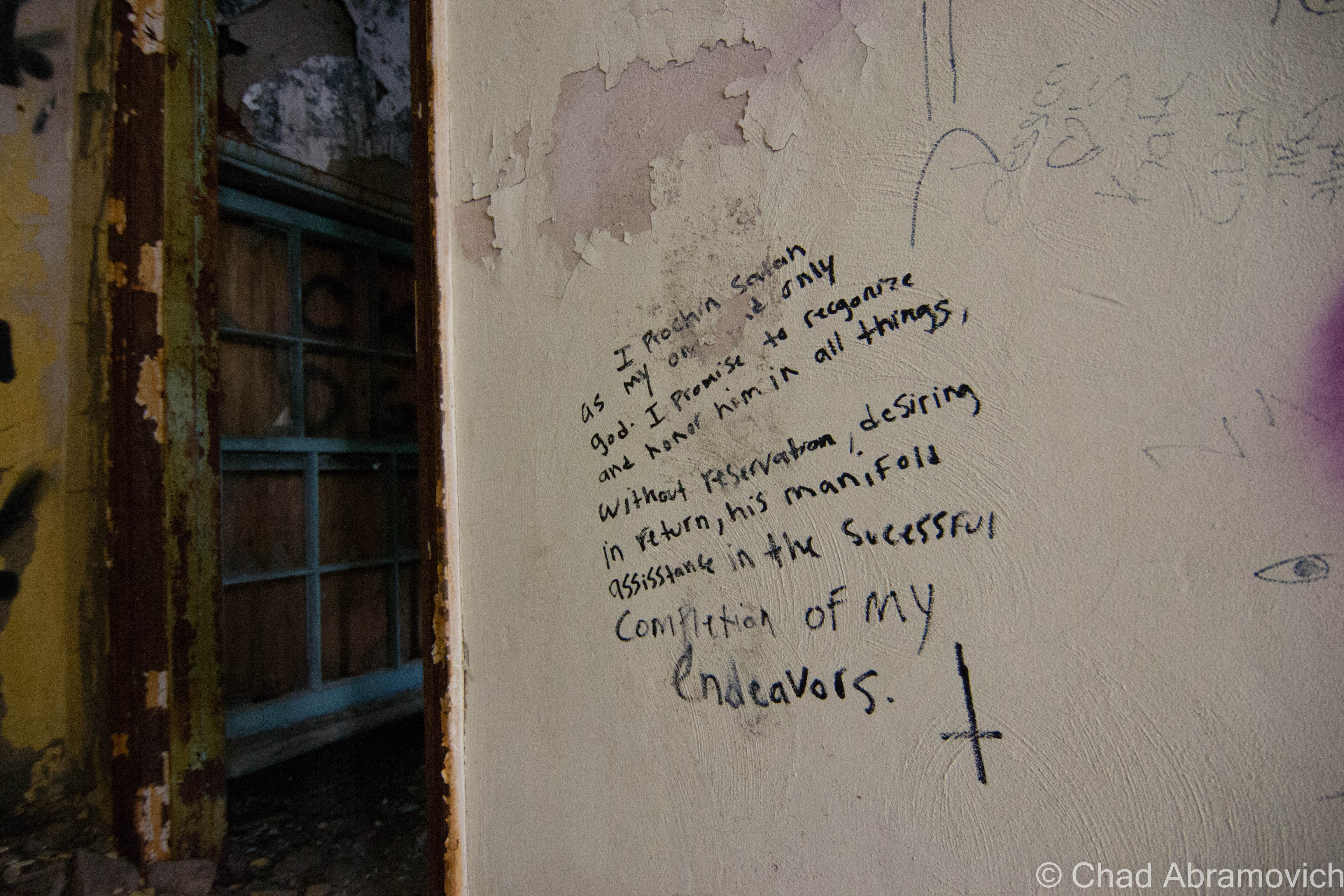
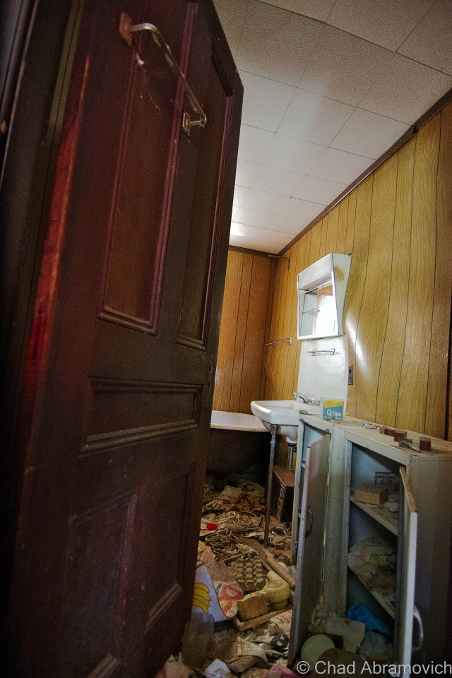
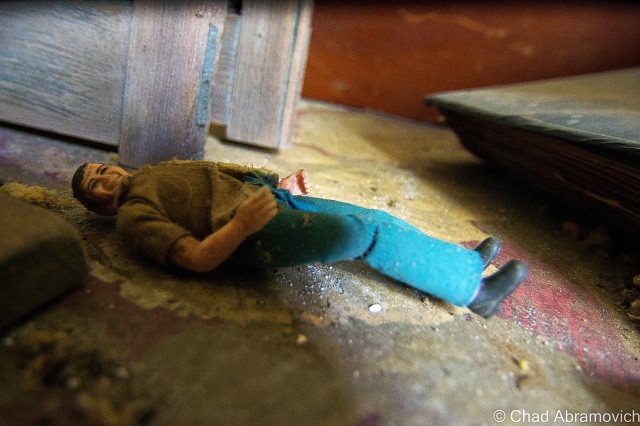
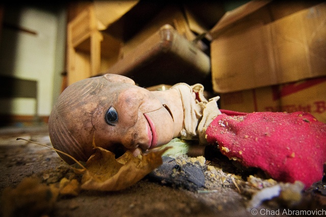
The most interesting of things left to rediscover was the extraordinary amounts of sordid books, paperwork and filing cabinet miscellany (and their accompanying filing cabinets) that had been left behind. I’m talking entire floors filled with wall to collapsing wall of old records mummified in decay. Most of the paperwork was illegible, but the oldest date I was able to find was 1931. Another friend and explorer had joked that a photo of mine was the literal embodiment of “squishy”, but as of now, no destination has been able to surpass The Pines Hotel as my “squishy-est” explore, though this place is definitely a contender.
Though we live in a world that has largely been explored, mapped and reclaimed, these human-made spaces become utterly fascinating after their functionality ceases to exist. The mystery continuum of their inner spaces become sort of last frontiers, as nature begins to reclaim everything that has been forsaken by us, transforming these spaces into something incredible. It’s on these explores that I like to attempt a little amateur forensic archaeology, and try to pick at the bones.
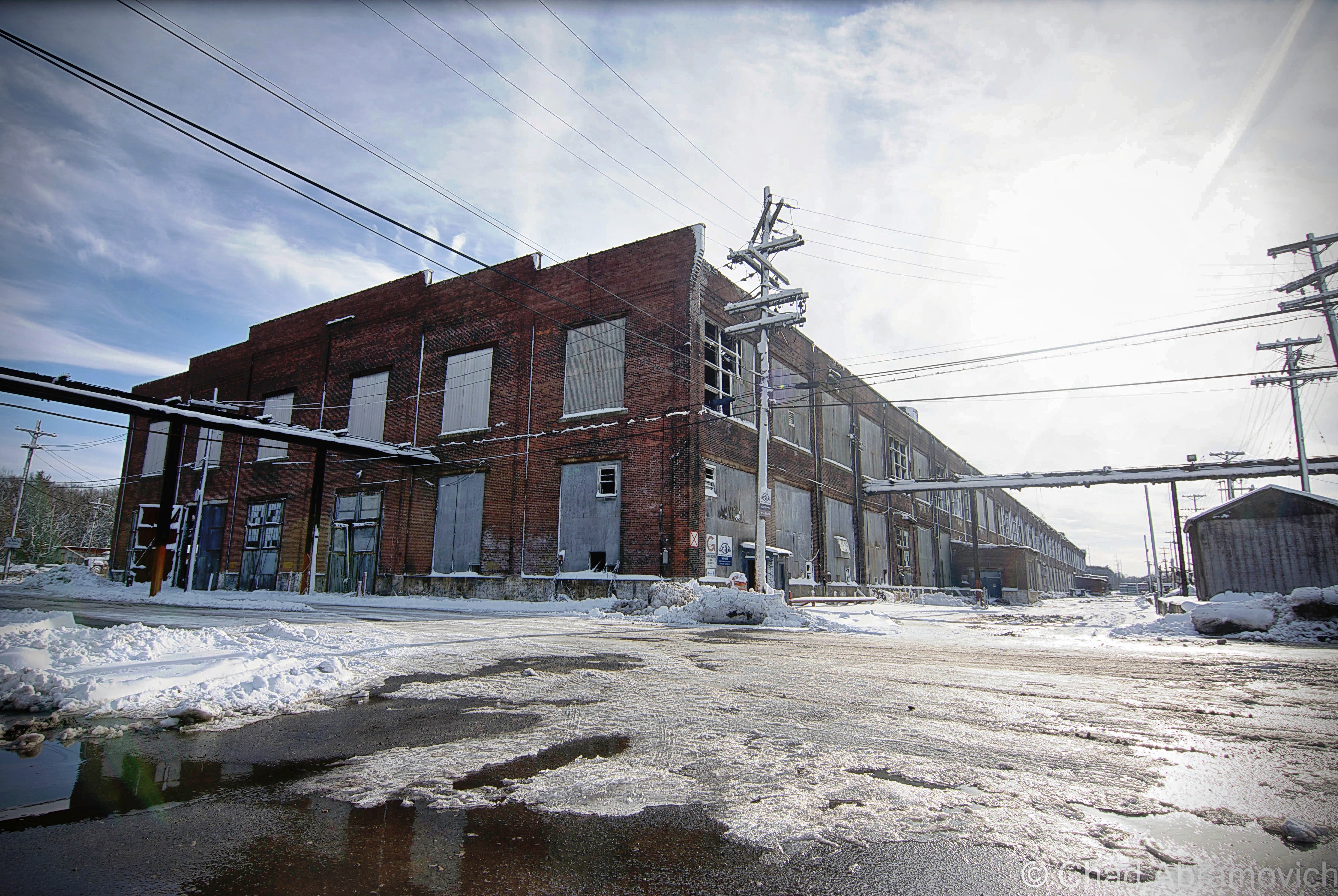
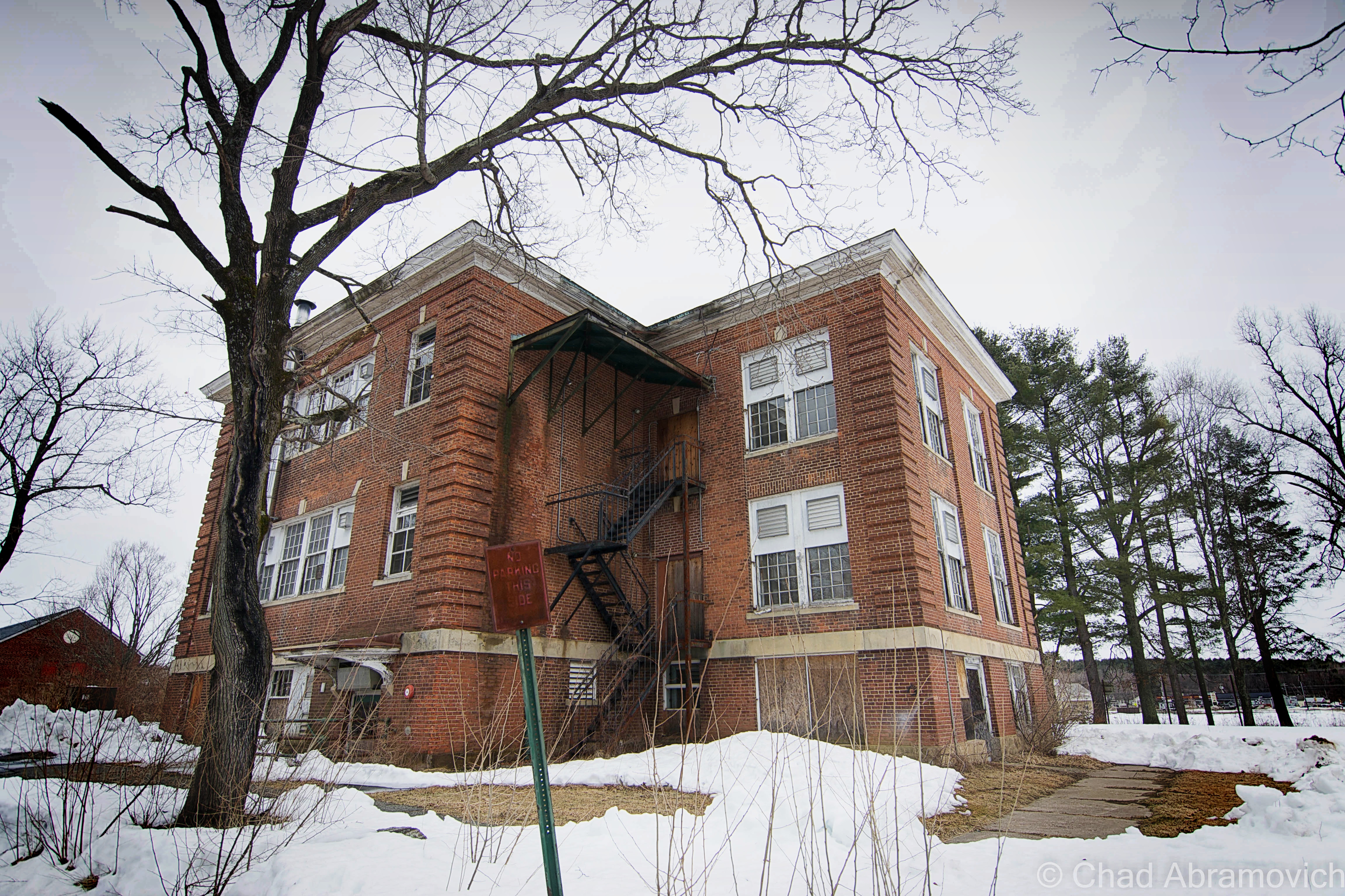
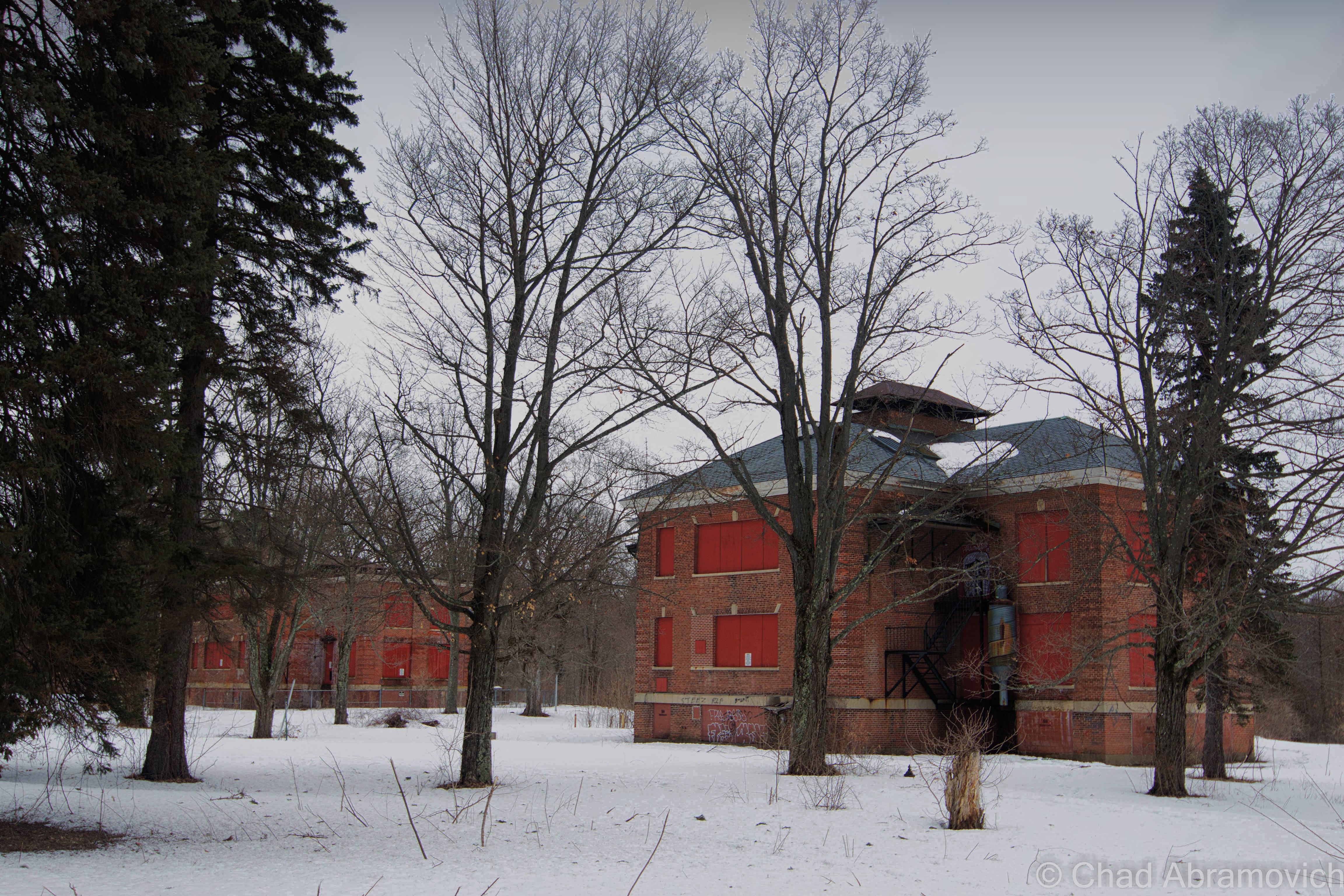
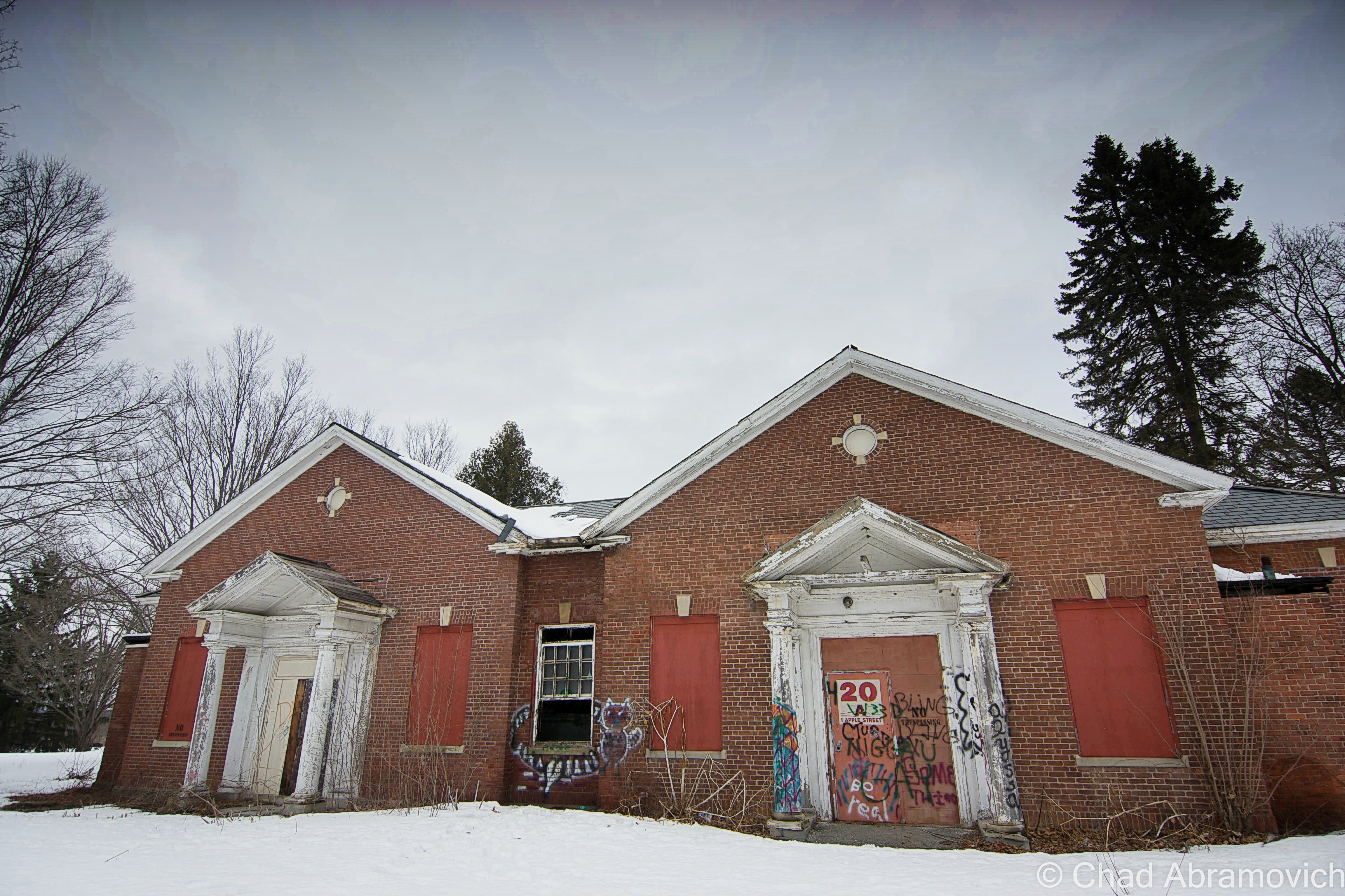
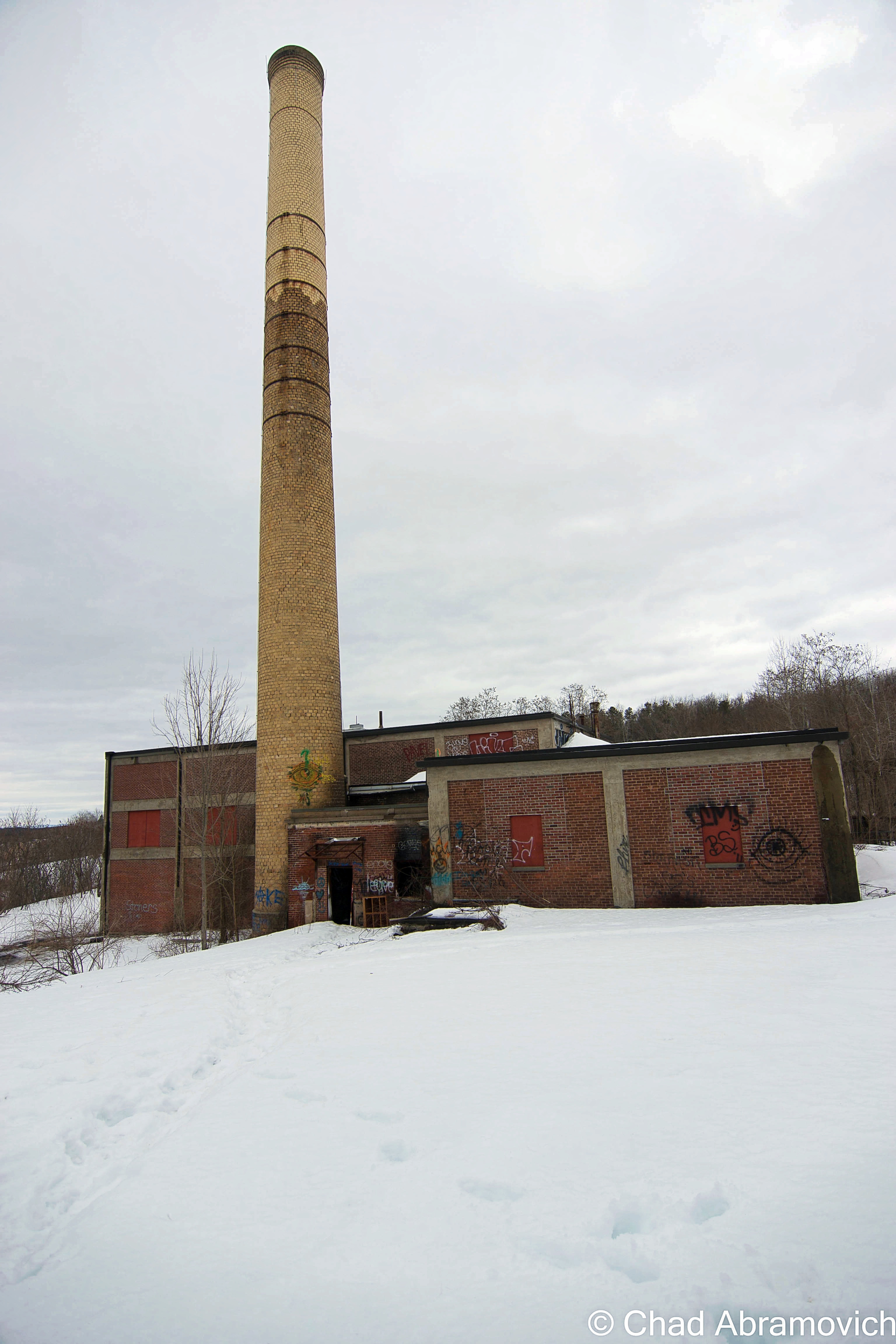
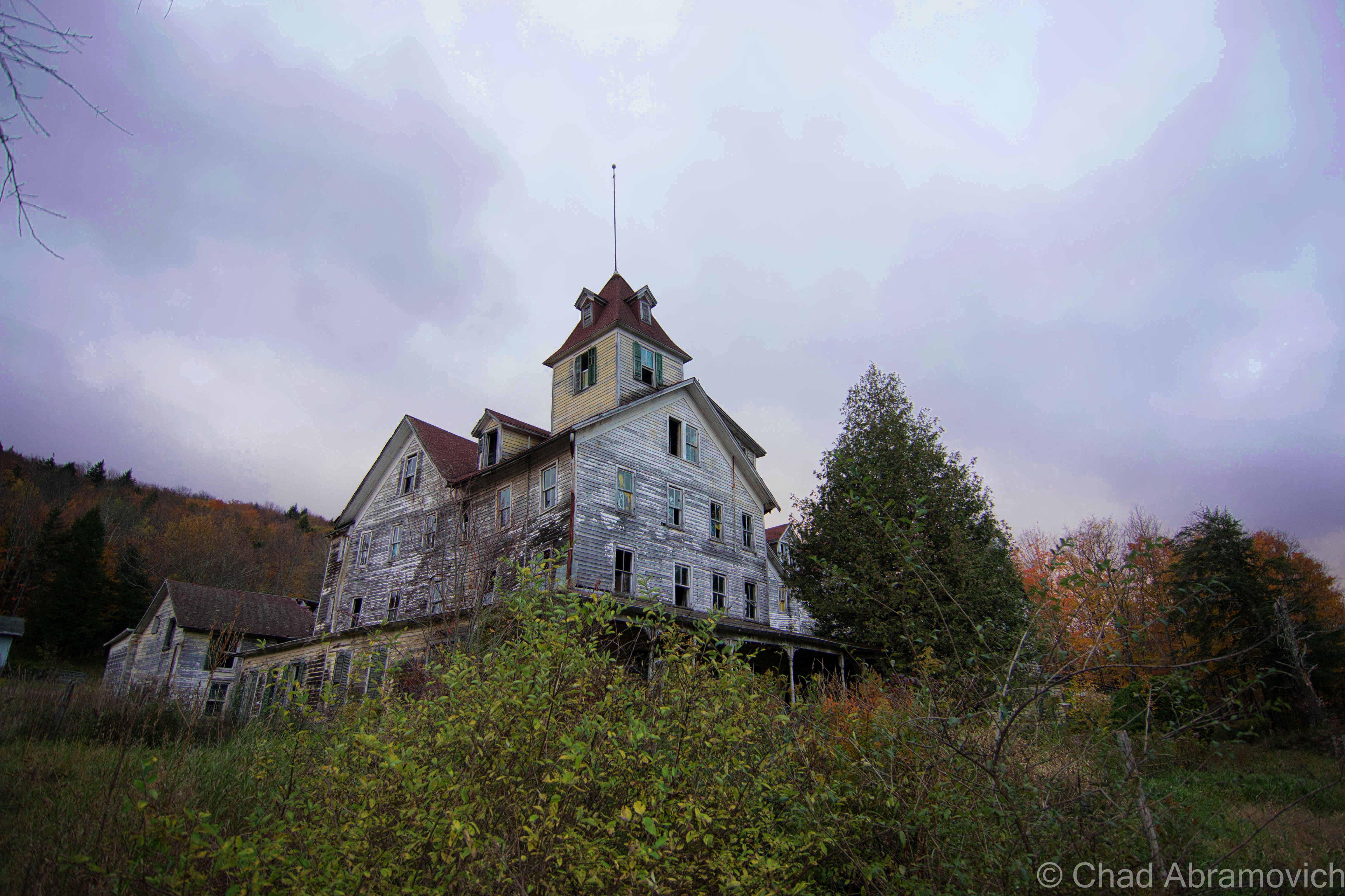
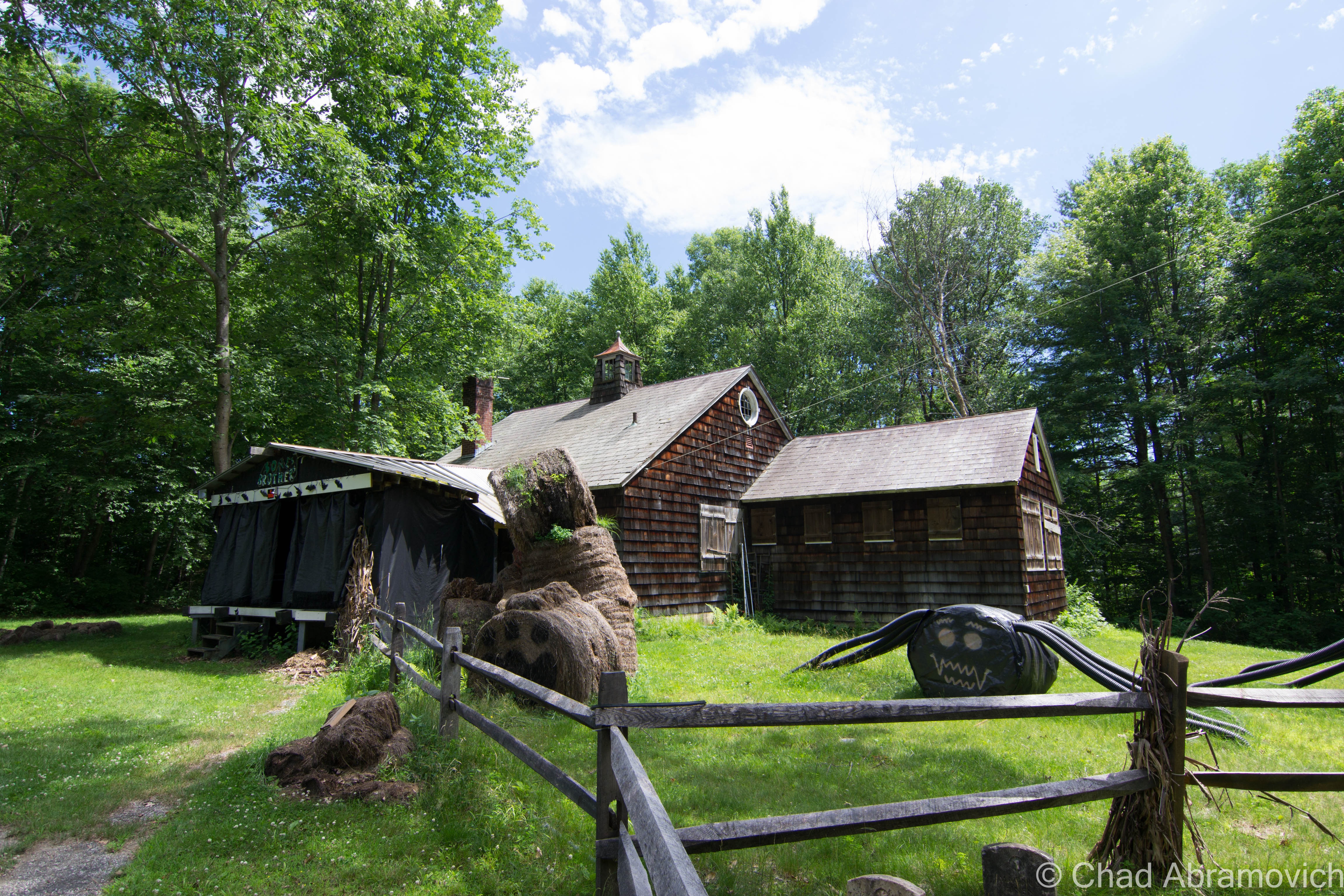
The suburban New England town I traveled too became the chosen plot of land for the formerly prestigious Boston & Maine Railroad to build their rail yards and repair/manufacture shops in 1913. What is considered to be one of American’s oldest suburbs was built up in the adjacent area to accommodate the growing need for laborers, many of the garden enhanced neighborhoods eventually were built up over old track beds that were once spur lines leading back towards the roundhouse, depot and loading docks. The continuously shape-shifting property grew to massive scales as the railroad industry became a future facing wonder, as growing mill towns and their populations created a ravenous market. That is, until the automobile became de rigueur.
The popularization of the automobile and the trucking industry seems to be the harbinger of death for a good amount of the ruins I visit, and this seemed to follow the same storyline, as both the automobile and leveling of the same manufacturing that created the demands for the railroad, murdered it. The railroad had grown so much during its boom years, that it went into unpayable debt for the miles of tracks they laid and smaller companies they acquired in the throes of good-natured greedy competition. Towards the latter half of the 20th century, the railroad industry indignantly stepped back into a darker corner of civic and popular culture, and the massive campus was now useless.
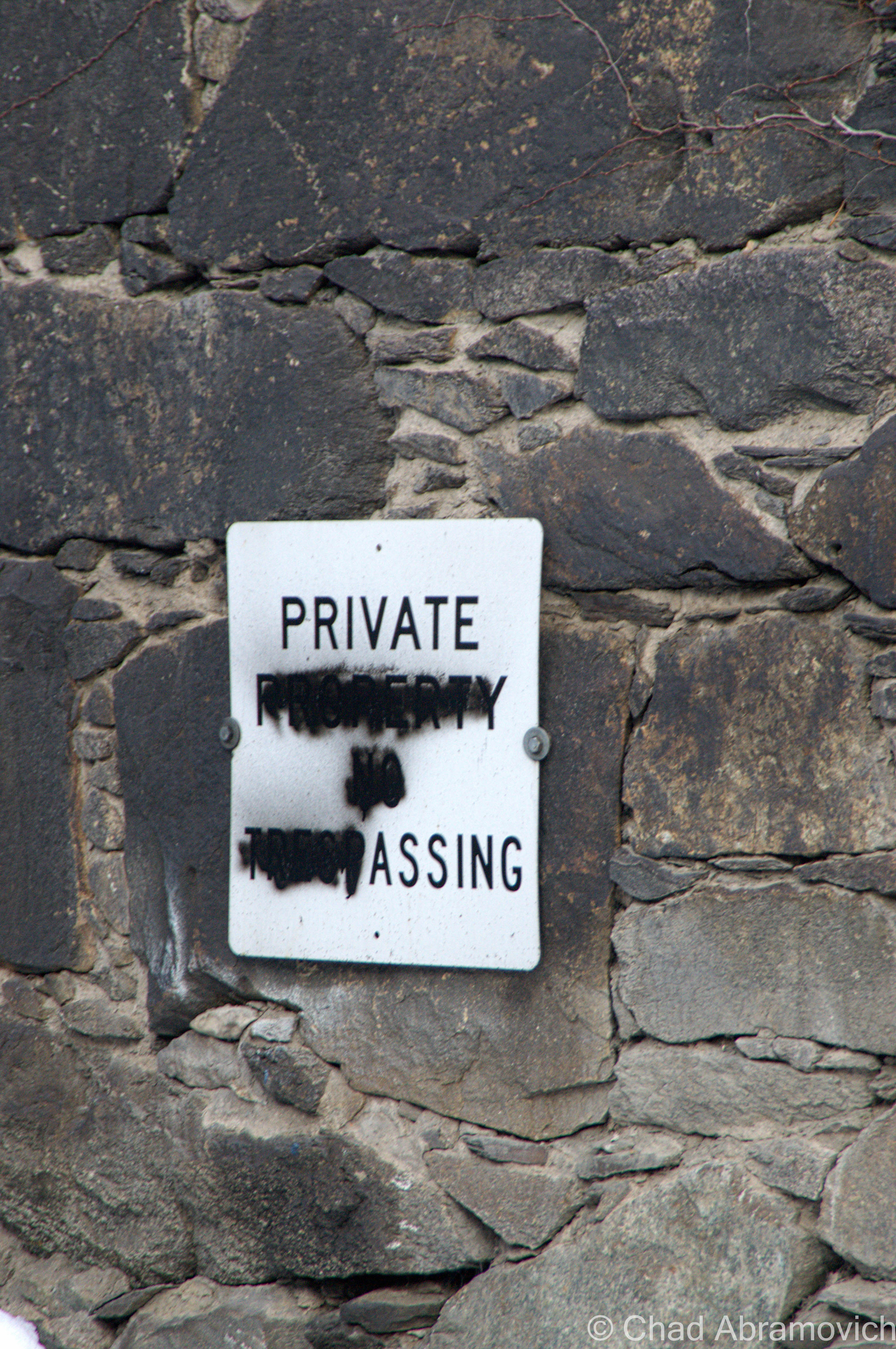
The B&M went bankrupt in 1970 and despite efforts to reorganize and restrategize, became a ghost by 1983, when it was bought by another regional rail company. By 1984, the complex was abandoned altogether because all that space simply wasn’t needed by the diminishing industry. But, not before they left a naively irresponsible legacy of destruction and negligence behind them, as the massive yards were also used for toxic waste dumps and a place to haul train wreck shrapnel over the years, which earned the place an official designation on the Superfund site list, a bone of contention that isn’t even expected to be taken seriously until 2031-ish because like everything else, the EPA doesn’t have the money. To the locals understandable displeasure, there was quite a bit of opacity about their houses abutting a literal toxic waste dump – information which wasn’t even made widely public until some neighbors did a little digging in the late 80s when a pervasive chemically smell began to waft through side streets near the industrial park, and became an uncelebrated normal.
I was able to find a few articles on the local public radio website that explained that the entire 553 acres are so swamped with pollution – ranging from asbestos, arsenic, cadmium, lead, selenium, petrochemicals and wastewater lagoons that it not only earned a spot on the national Superfund database list, but it’s one of the worst in America. “You couldn’t leave your house to go out and even have a nice barbecue because the odor was so bad”, said an interviewed resident recalling how bad it was a few decades ago. To makes things more apprehensive, The EPA says human exposure risk is still “not under control”, though it seems far more controlled today than when the report was written. I guess I can cross off walking around a toxic waste site off my bucket list, regardless of the fact it wasn’t on my list.
Today, most of the former property has been reincarnated as a shabby looking industrial park. The largest railway in New England has it’s main headquarters here still, that sits directly in the decrepit shadow of the abandoned shop buildings I was walking around, among a few other places with no-frills signage and creepy vacant looking front entrances. That being said, this is still an active industrial park, with employees, cops, and on my visit, guys who operate plows, that are present on a daily basis. Unlike me, who technically has no reason to be here other than curiosity. The rail lines that hem in the property are also still in use, and some of the industrial businesses in the park receive rail traffic.
There is always a certain reward to risk ratio that I use as the dichotomy or gauge of how I treat my explores. On this trip, my friend and I and my friend decided to simply walk towards the buildings with our cameras, as there was no way we could get inside without someone seeing us, and I didn’t drive through three states just to turn around. The man in the plow noticed us as he was relocating a snow drift. We all mutually nodded our heads in affirmation and confidentially walked inside. We were exploring for four hours or so, and the cops never came, which was great, because this fascinating locale has easily turned into one of my fondest explores. This is one of those places I could return to multiple times and have a different experience at.
But I wouldn’t take that one fortunate opportunity for granted. I know a few people who have been dragged out by the powers that be before, which is why brushing up on trespassing laws in other states isn’t necessarily a bad thing.
Until some serious clean up and the accompanying scrutiny happens, these hulking and fetid ruins and all their soggy decay are more or less, in limbo.
—————————————————————————————————————————————–
To all of my amazing fans and supporters, I am truly grateful and humbled by all of the support and donations through out the years that have kept Obscure Vermont up and running.
As you all know I spend countless hours researching, writing, and traveling to produce and sustain this blog. Obscure Vermont is funded entirely on generous donations that you the wonderful viewers and supporters have made. Expenses range from internet fees to host the blog, to investing in research materials, to traveling expenses. Also, donations help keep me current with my photography gear, computer, and computer software so that I can deliver the best quality possible. Seriously, even the small cost equivalent to a gas station cup of coffee would help greatly!
If you value, appreciate, and enjoy reading about my adventures please consider making a donation to my new Gofundme account or Paypal. Any donation would not only be greatly appreciated and help keep this blog going, it would also keep me doing what I love. Thank you!
Bellows Falls is a great village, and has a history that goes back to it’s Abenaki populace who were lured here by the great falls, extends past White settlement who built an industrial canal to bypass the affor-referenced falls and continues today through its resurrection as a tourist area and waypoint community for the Connecticut River Byway.
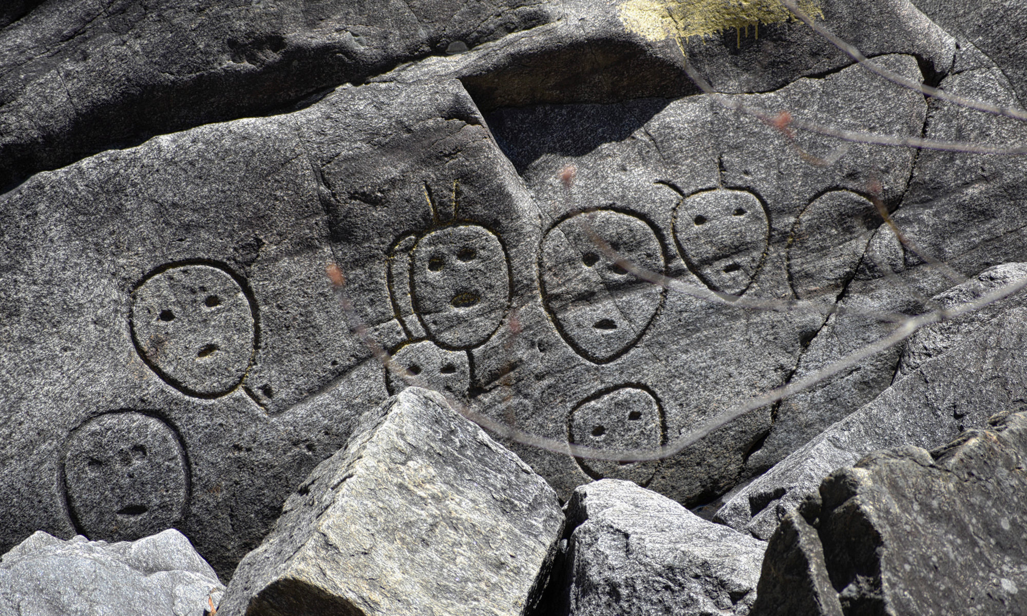
There is a cool mid-century mural painted on a wall downtown that nostalgically reads Bellows Falls is a good place to hang your hat. It’s also apparently a good place to chisel your petroglyphs.
They’re a Vermont curiosity that’s surprisingly unknown to many. In the olden days, quite a few folks flocked to these strange petroglyphs and tried to decrypt them, but to this day, they’re still managing to confound those that know about them.
Stirring the mystery even more, local native Americans aren’t fessing up to doodling them, and have no idea who did, or what they’re supposed to mean. So how did they get here, and why?
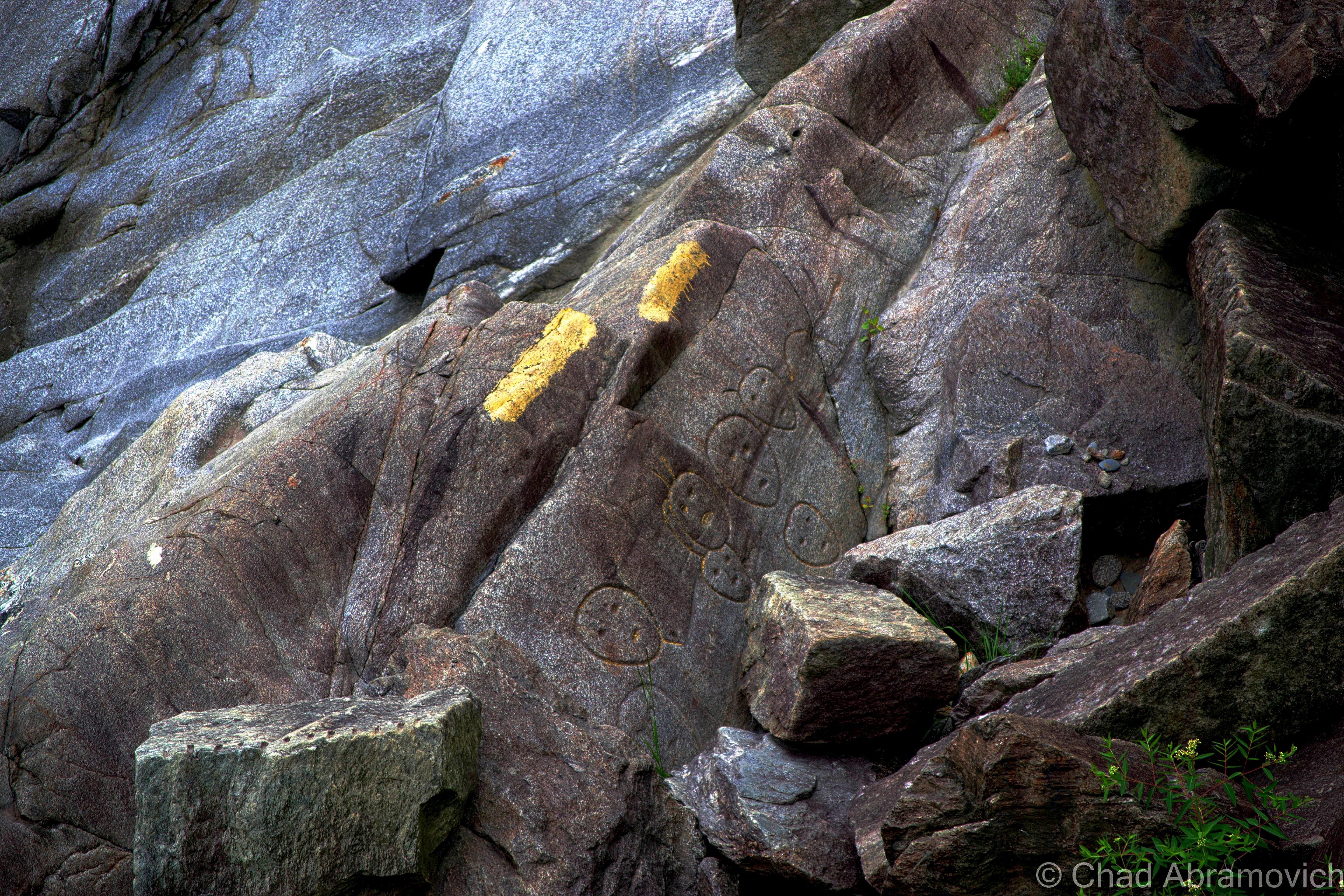
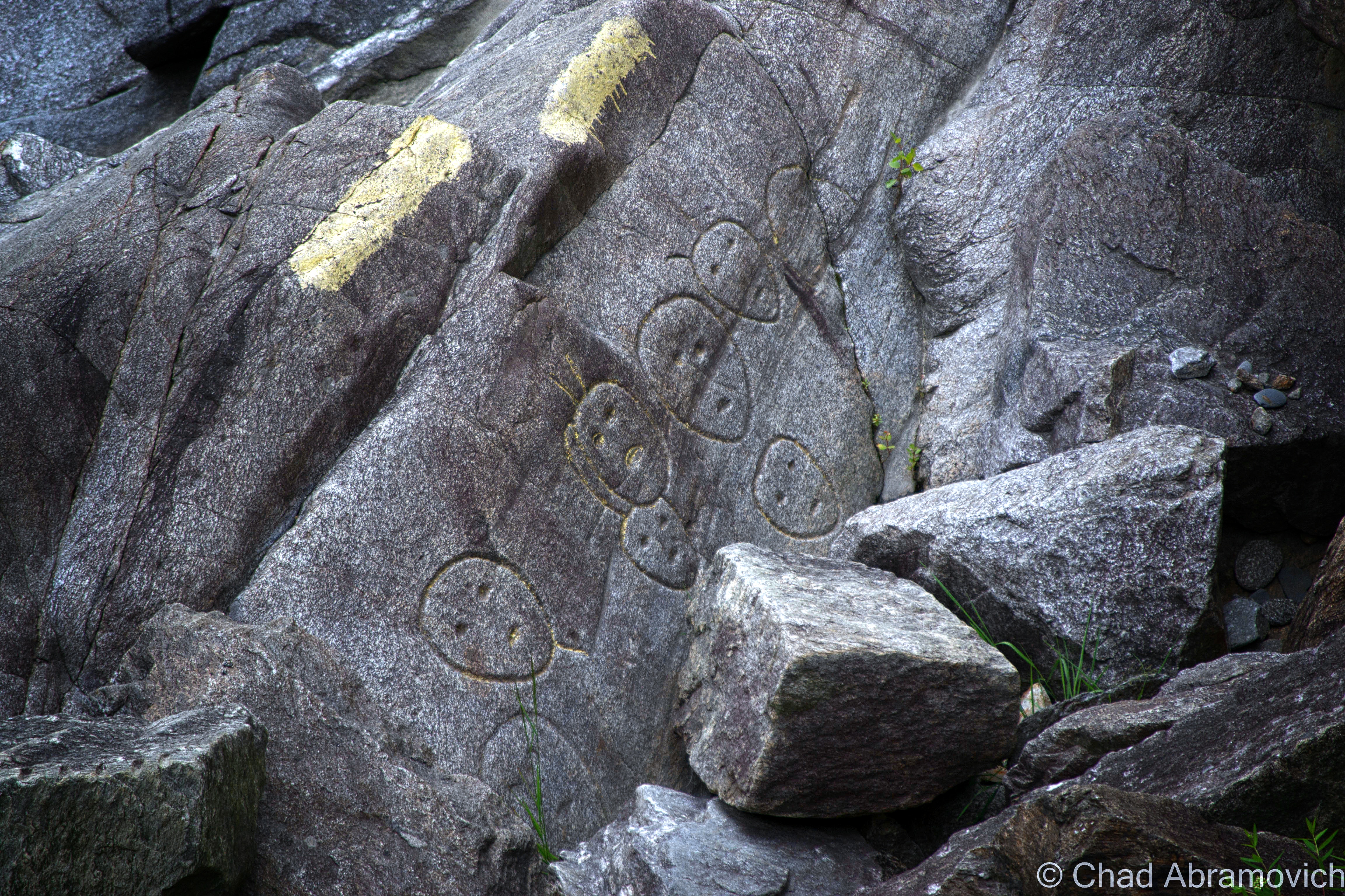
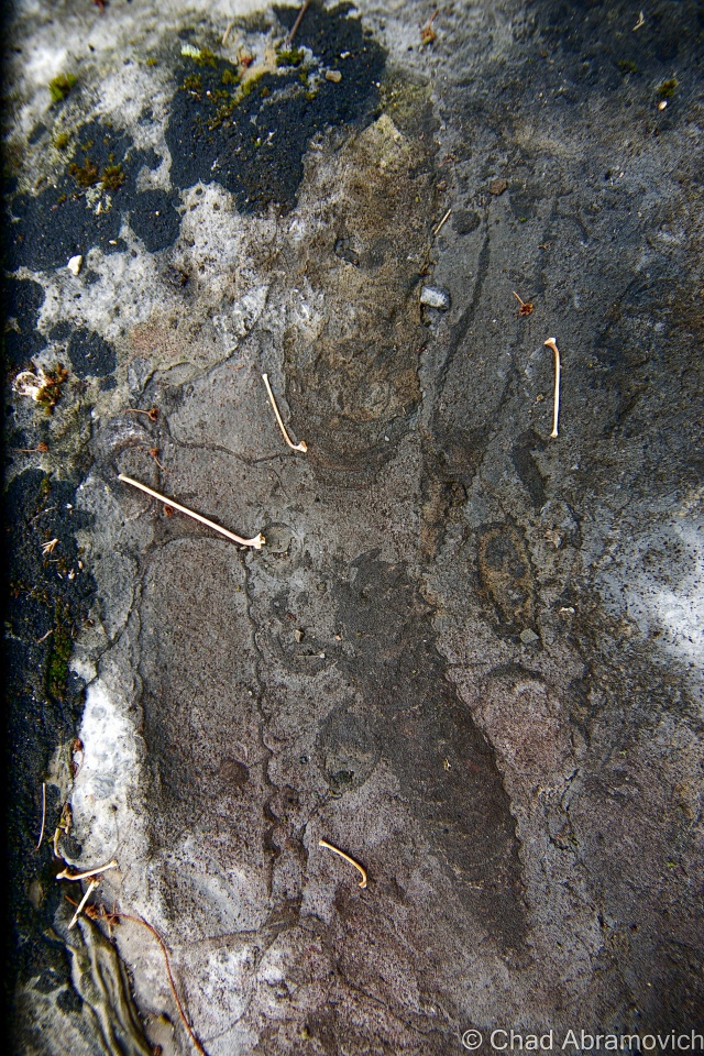
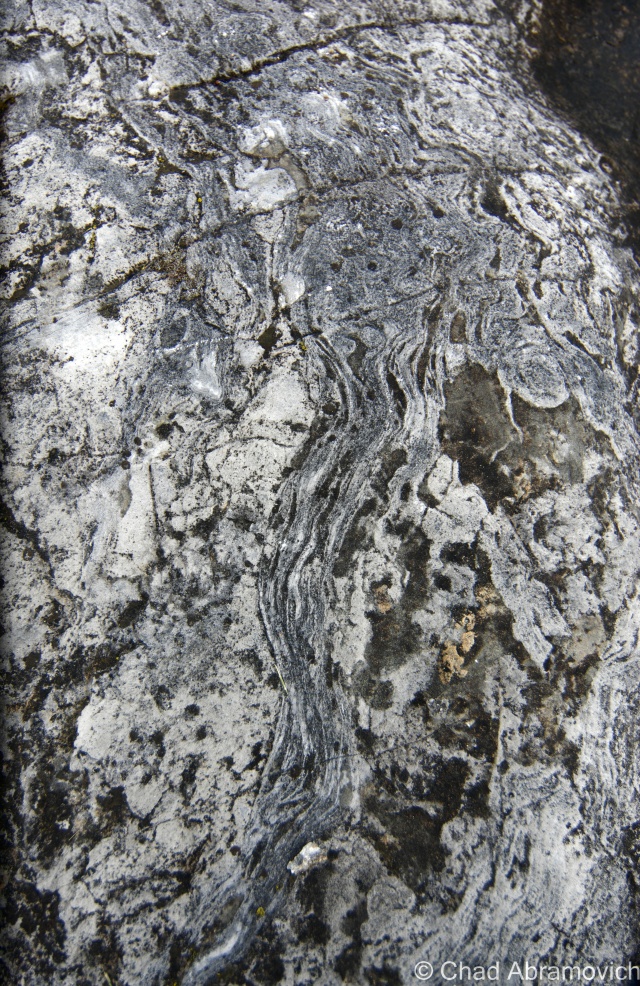
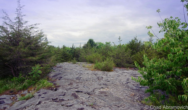
The Bellows Falls petroglyphs are located on a few large boulders found in the dramatic gorge below the defunct Vilas Bridge.
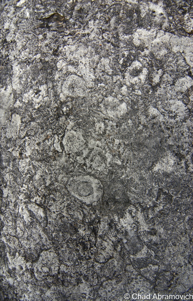
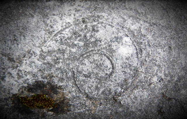
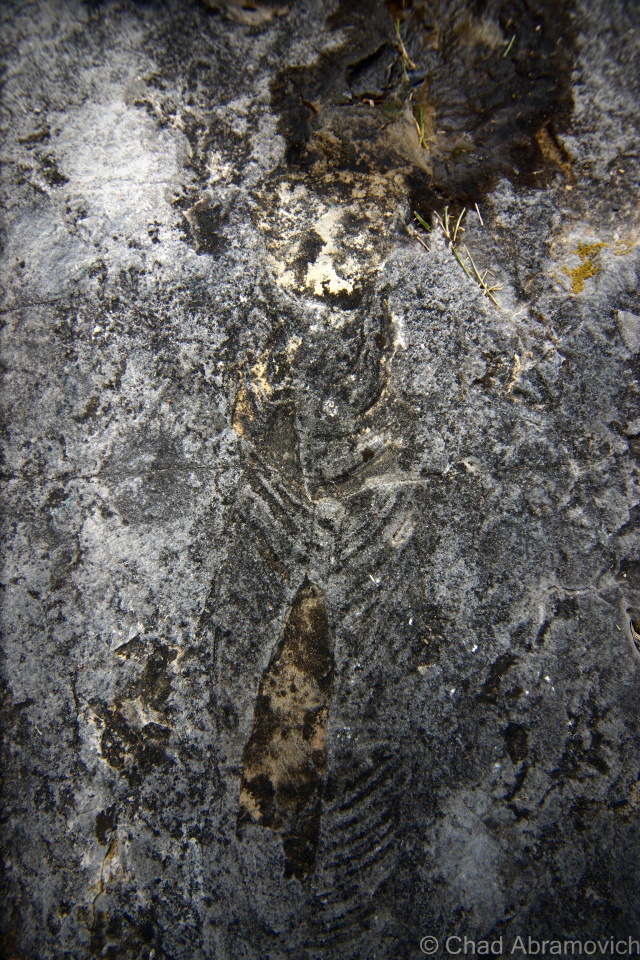
Basically, the carvings are an arrangement of rough circles with three dots inside, with some containing pairs of lines that radiate out from the top. It’s surmised that they depict a cluster of 24 odd sized faces, but there is some disagreement on exactly what they are, with arguments for human, animal, extraterrestrial, or other. The lines atop the circles prove to be just as interesting. It’s said that they could be anything from hair of that era, feathers from headdresses, deer antlers, sun rays, or alien antennas. But no one can say for sure.
We don’t even know how old they are, with estimates ranging from 300 to 3,000 years old – some considering them the oldest pieces of art existing in Vermont. What we do know, however, is that they were made known in 1789, when visiting reverend David McClure from Dartmouth College wrote about them in his notes, and suggested that they were made by the Abenaki, the native people of the area.
The explanations of these cryptic images are plentiful. McClure speculated that they could be translated as an Abenaki warning that the site marked the location of “evil spirits”, a shamanistic idea that came from associating places like river gorges and waterfalls as a place to communicate with the spirit world.
But that was contested by an Englishman named Edward Kendall, who while traveling through Bellows Falls in 1808, believed that they were nothing more than the banal doodles of a bored Abenaki fisherman on a slow day at the river.
Plenty of other theories have morphed since then and include everything in between, from grave markers, religious symbols, aliens, memento mori from an important battle, depictions of people who had drowned in the rapids, and the carvings from Abenaki shaman who recorded their visions while hallucinating on the river’s edge.
But it may be the orientation of the petroglyphs which may tell us something of their significance. They face west, towards the village. If this isn’t just a coincidence, Abenaki lore dictates that west is the direction where an Abenaki soul travels after death, meaning that they may be preternatural wayfinding signs for their departed.
Interestingly, the artificial industrial island made by the Bellows Falls Canal was at one point an important Abenaki burial ground. For decades afterward, development on the island and local road construction projects would continuously surprise the laborers who unearthed numerous skeletons and artifacts, and became sort of a local spectacle.
Here’s where things get interesting. McClure’s description only mentions three faces, which are greatly more detailed than what can be found on the bottom of the gorge today, leaving some to postulate that counterfeit ones have been added over the years.
In the 1930s, some misguided locals got together and had the carvings deepened to preserve them from the constant erosion of the river, damaging their value as historical artifacts and keeping their age and purpose still in the realm of the mysterious.
These were some of the carvings that didn’t make it into the 21st century. Image: History of the Town of Rockingham, Vermont including the villages of Bellows Falls, Saxtons River, Rockingham – Cambridgeport and Bartonsville.
It actually amazes me that these petroglyphs have survived at all. During the nineteenth century, the Bellows Falls river/canal area was a hive of rambunctious industrial activity. Much of the river gorge was permanently reconstructed by dynamite blasts that were used to clear away log jams, which is a real disappointment, because it seems that those cliffs held more than a few curiosities.
One sad account comes from sometime in the 1800s. A fascinating curiosity was found embedded in a rock near the Connecticut River; a baffling fossil of a five foot, clearly defined footprint that looked like it came from a bird, but the species was unknown. This caused quite a stir in both the scientific community and the local one. What could have possibly made a footprint that big? Unfortunately, we’ll never know. Word of this important discovery got out and a group of rowdy locals found it first and dynamited it out of existence. It’s very possible that there may have been more of these petroglyphs as well, that were destroyed to make a few bucks.
The petroglyphs are pretty easy to find. They’re located at the end of Bridge Street near the Vilas Bridge, which is the indefinitely crumbling bridge with grass growing through its deteriorating surface, and not the other better-kept bridge that crosses the canal onto the island.
Once you get to the “Bridge Closed” sign, they’re down in the gorge to the right of the bridge. The rocks have been marked with strips of yellow paint to guide you to their location, and if you have a camera with a good zoom lens, you should be able to see them. Or, you can do what I did, and take the “trail” to the left of the bridge, which I guess is a very debatable definition, and really was more of a distinguishable area of low brush that meandered between taller thick adjacent brush and trees, which eventually dropped you down a steep rocky embankment and into the gorge. From there, it’s all boulder clamber underneath the Vilas Bridge, but from this approach, you can get right next to them. My scratched and bleeding legs were worth it.
What I loved best about these petroglyphs, besides how they are still a lingering mystery, is the obscurity of them. There are no fences around them with colorful “keep out” signs, and no logos from local universities slapped down anywhere. They simply exist just outside town, quiet and more or less undisturbed.
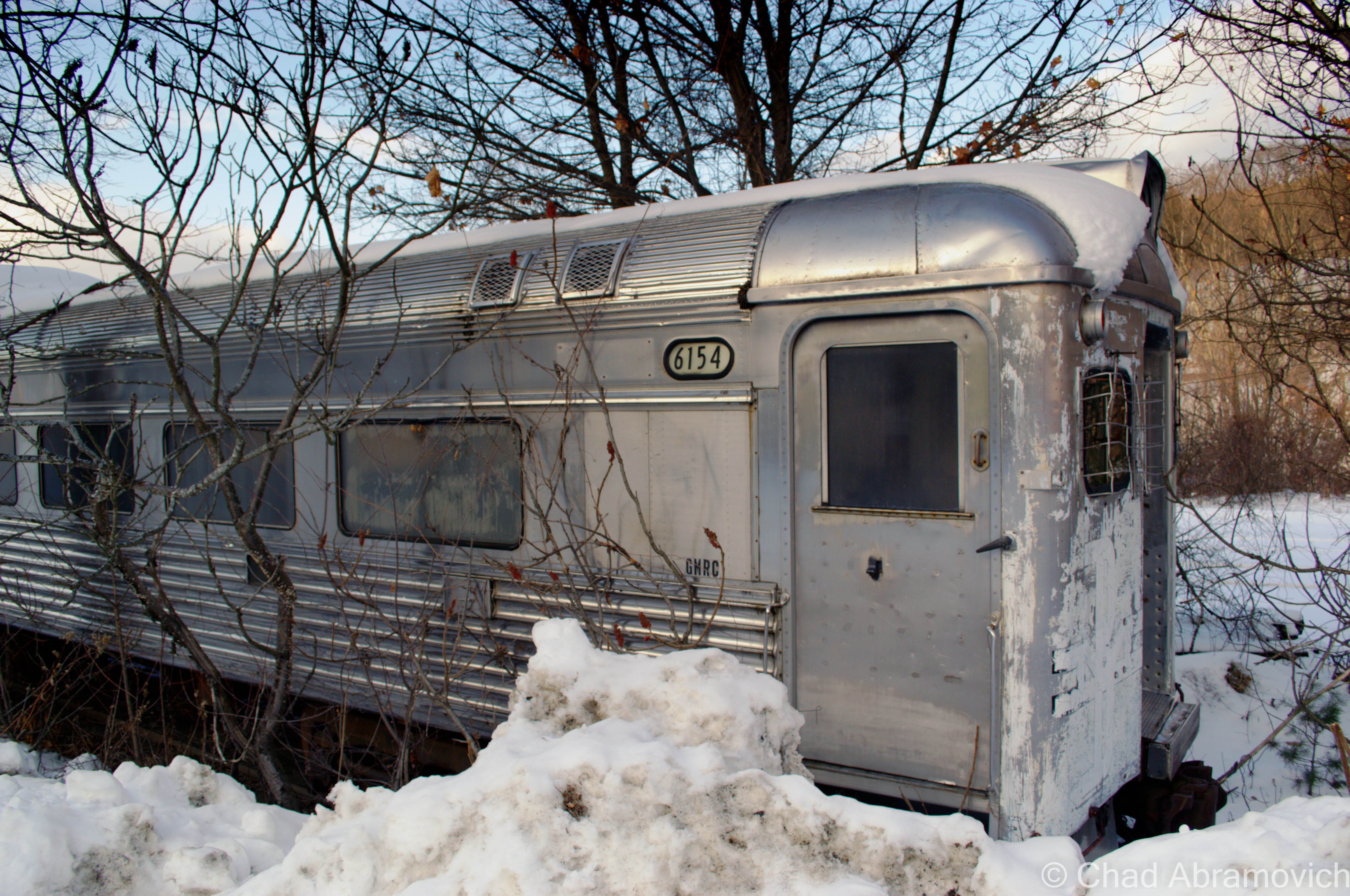
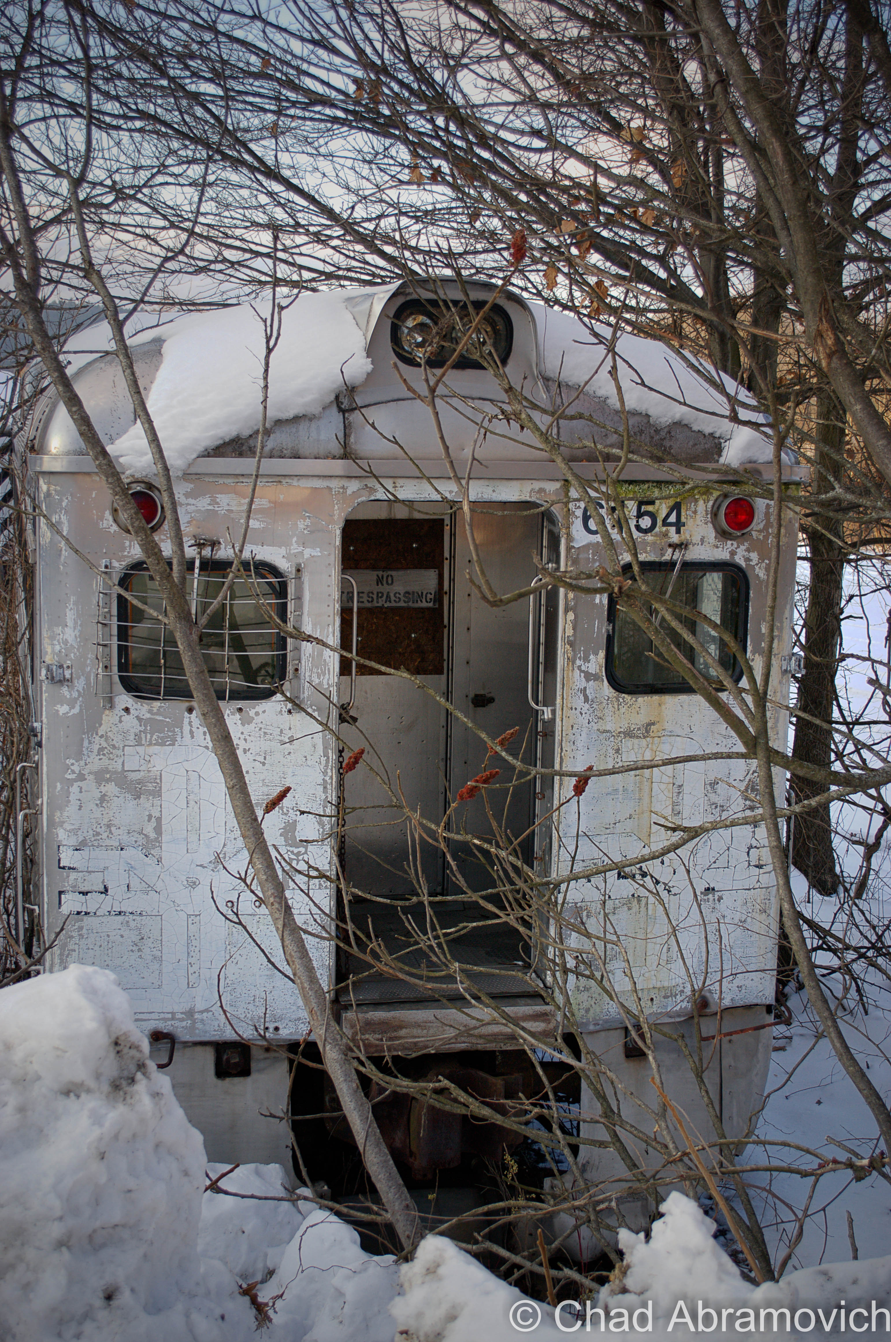
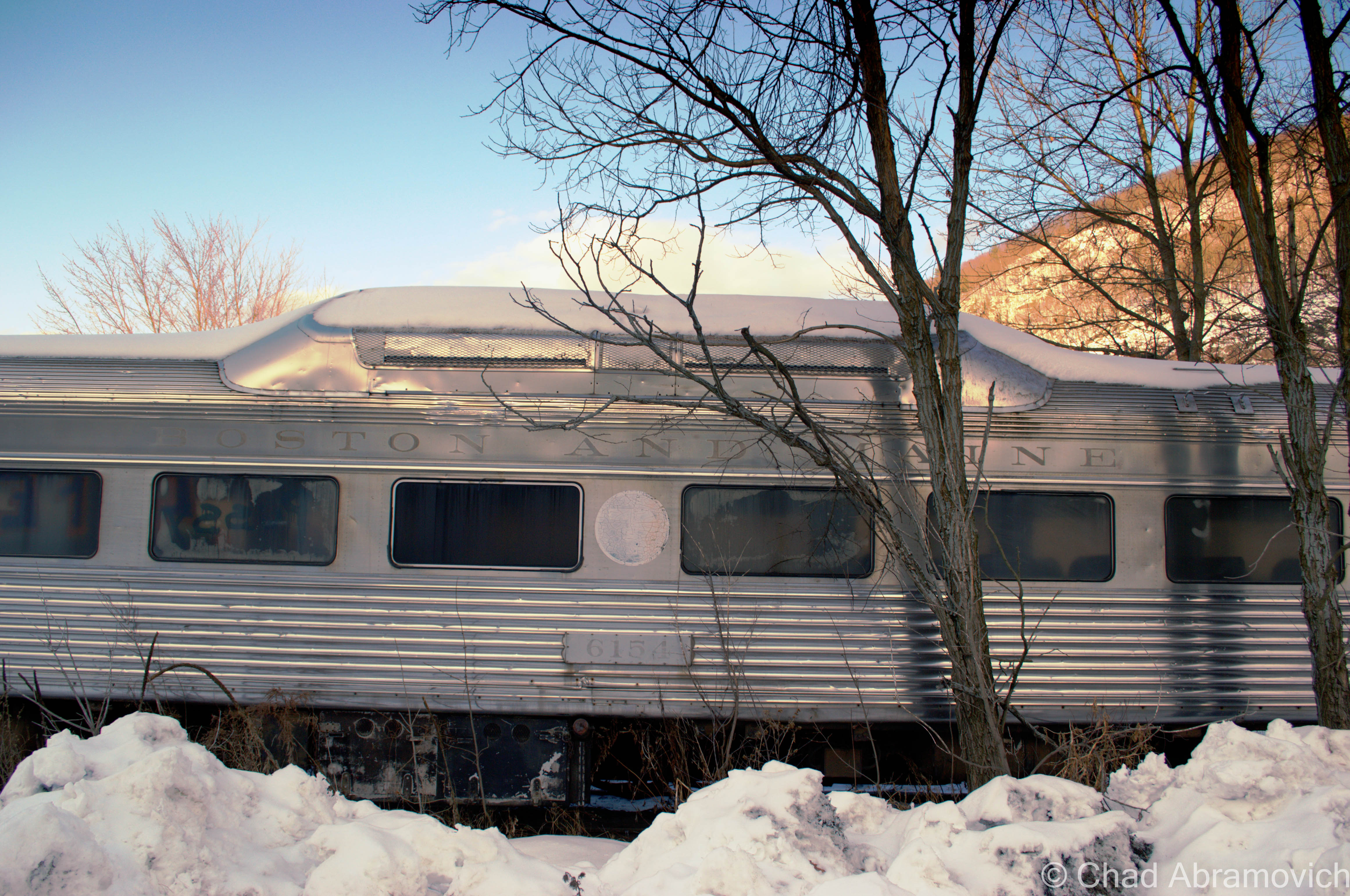
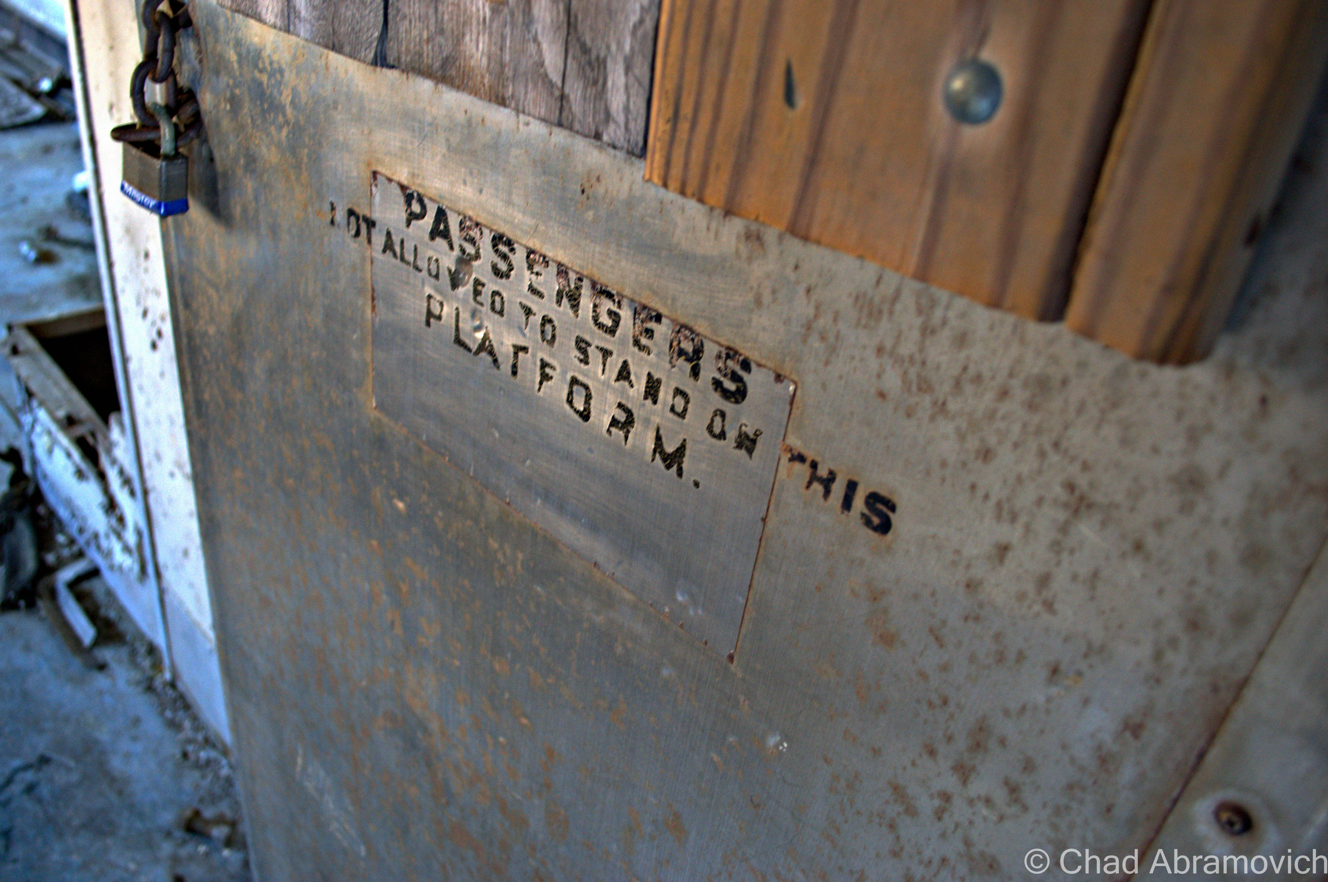
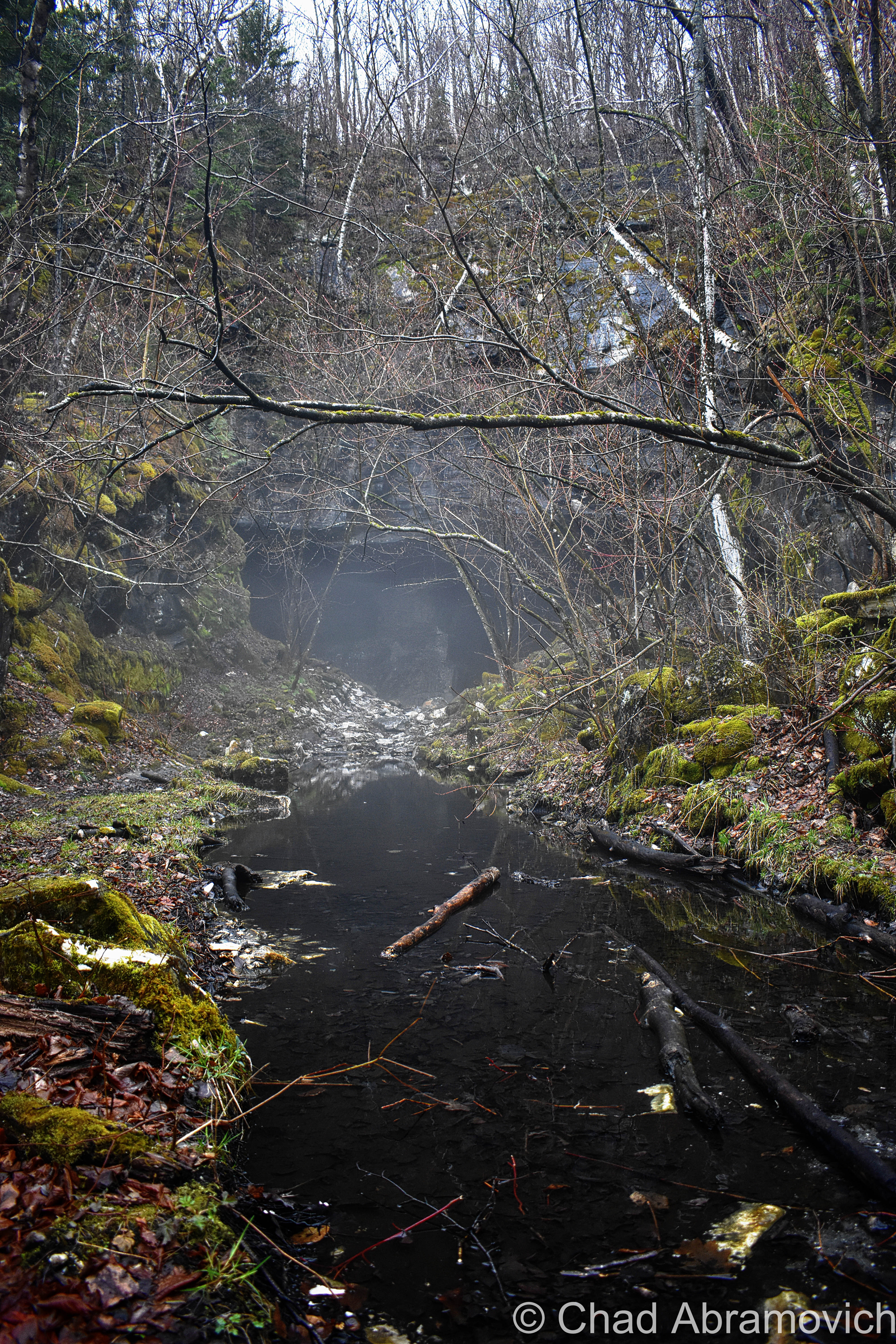
The Bellows Falls Train Graveyard
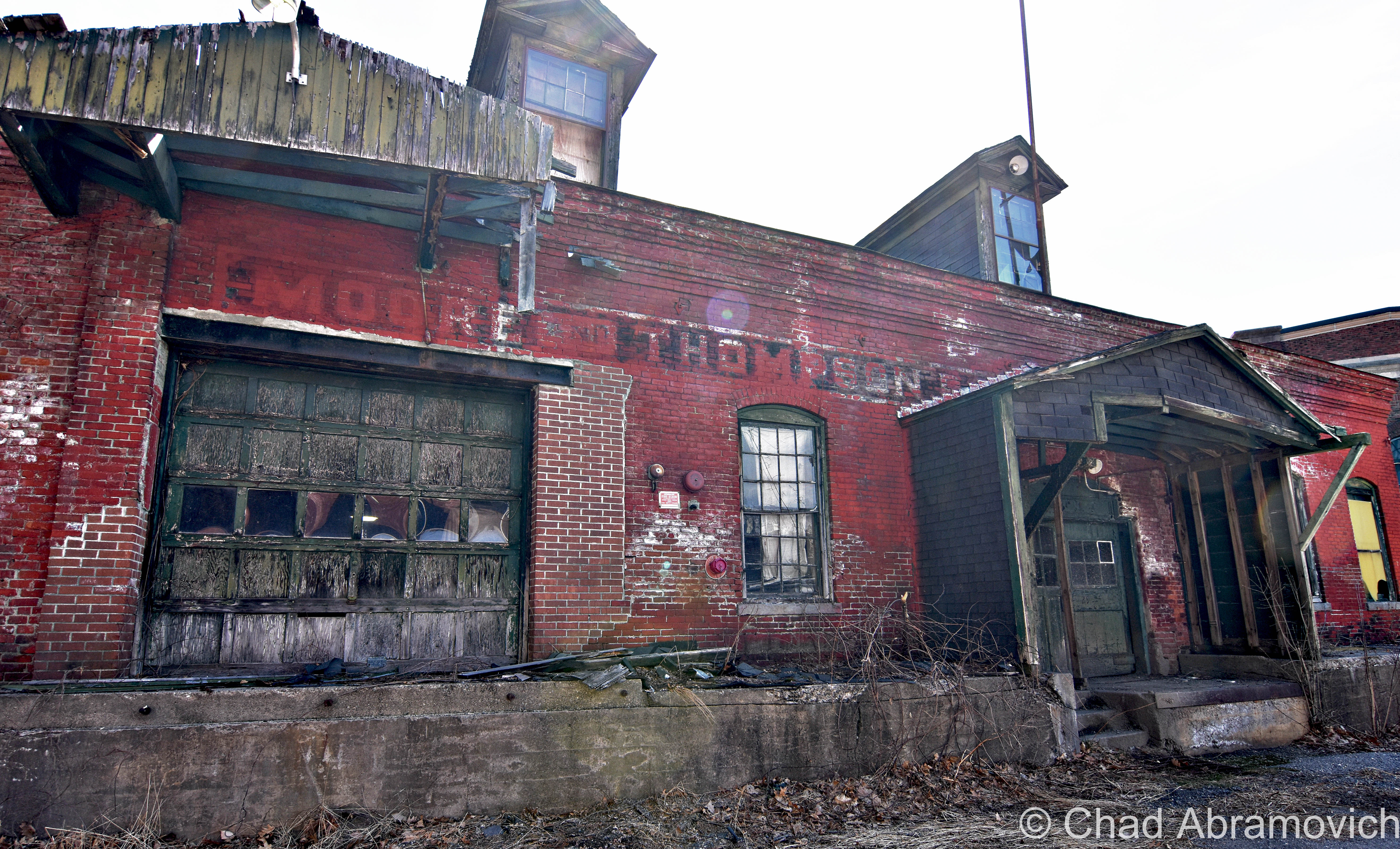
In the cold days of winter in 2013, I explored and photographed scores of abandoned train cars that lined both sides of the Connecticut River. The yards and the scrapped rail cars are owned by the Green Mountain Railroad, which has a long history of perpetuating industry and travel in the Bellows Falls area, and as rail travel became secondary to the automobile, it left quite a few old passenger cars from the 40s and 50s parked along the river banks, slowly eroding with idle time.
Driving Around Bellows Falls
One of my favorite adventures in Bellows Falls was just driving aimlessly around the narrow streets that climb it’s steep terraced hills above the river, checking out the different neighborhoods, which managed to be so enjoyable that it almost blocked out my friend Daniel blasting dubstep on his car stereo and serially asking me “Chad! Is this your jam man? I bet you know all of these lyrics!”
A Bellows Falls attraction or service?
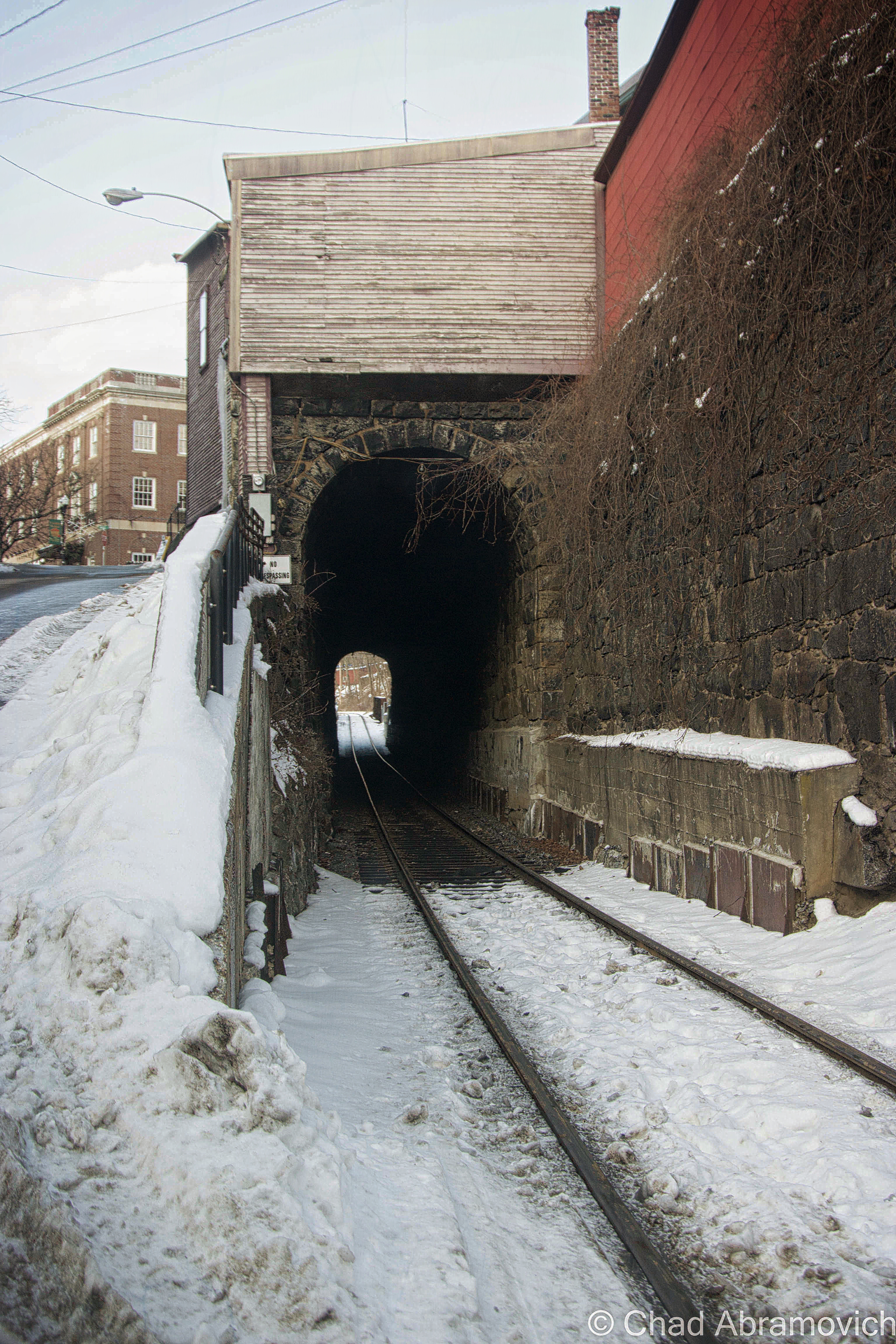
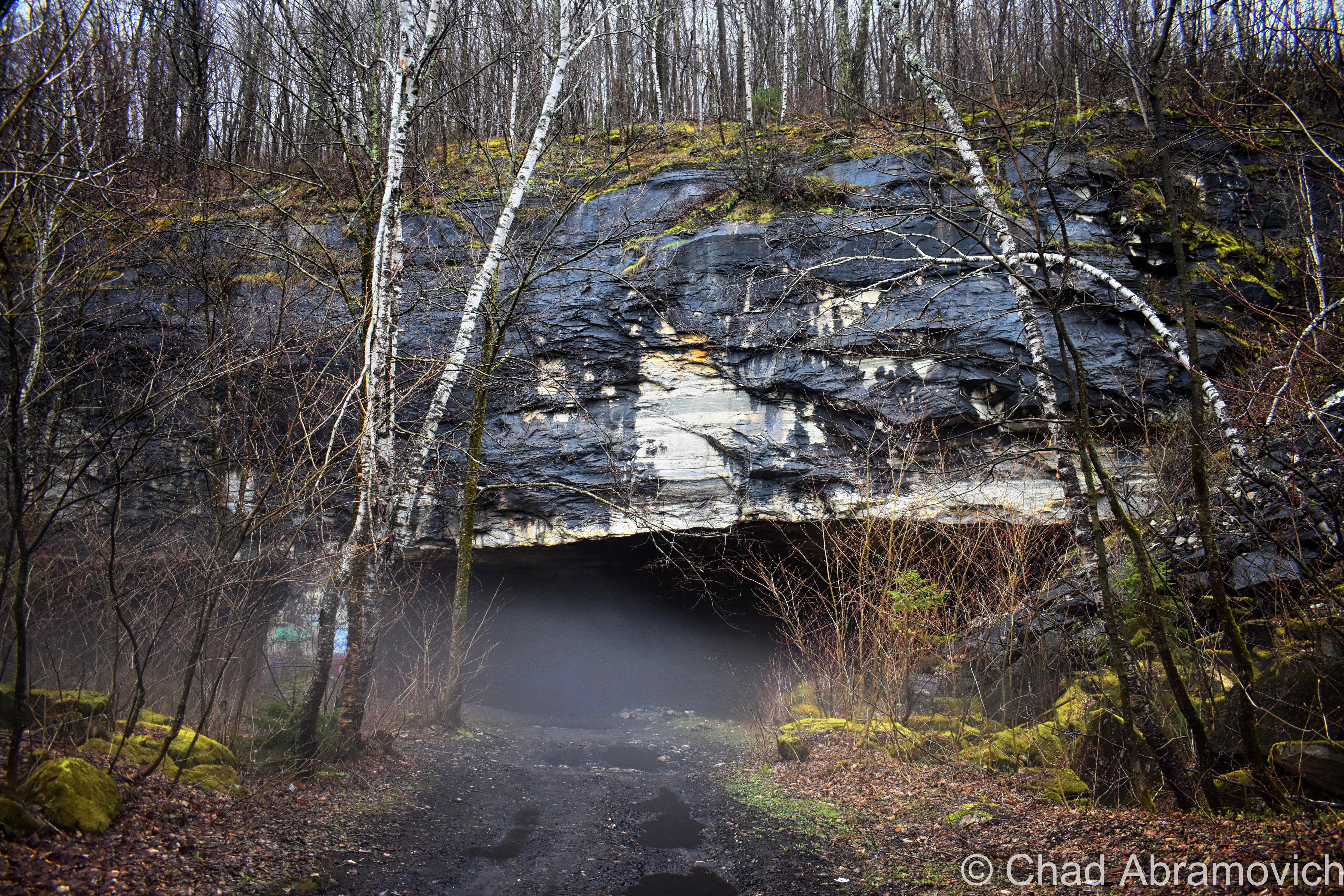
One of my favorite finds in Bellows Falls – A 275-foot railroad tunnel running underneath a section of the downtown district. Built in 1851, this tunnel is a rather impressive reminder of when three railroad lines were brought through Bellows Falls, helping industrial growth and creating one of the most important railroad junctions in New England. What’s striking about this tunnel is that its partially cut through solid rock and reinforced with massive stone blocks. Today, these tracks are more or less quiet, a reminder of how the automobile overtook rail travel.
The oldest canal in the United States is here, completed in 1802 to bypass the pesky great falls, which was a successful barrier to travel. The canal was a humongous boon and industrialized the village, creating a cool downtown district at the foot of a bluff (which legend holds is still honeycombed by Victorian tunnel systems) and a surprisingly stunning residential district up the hill.
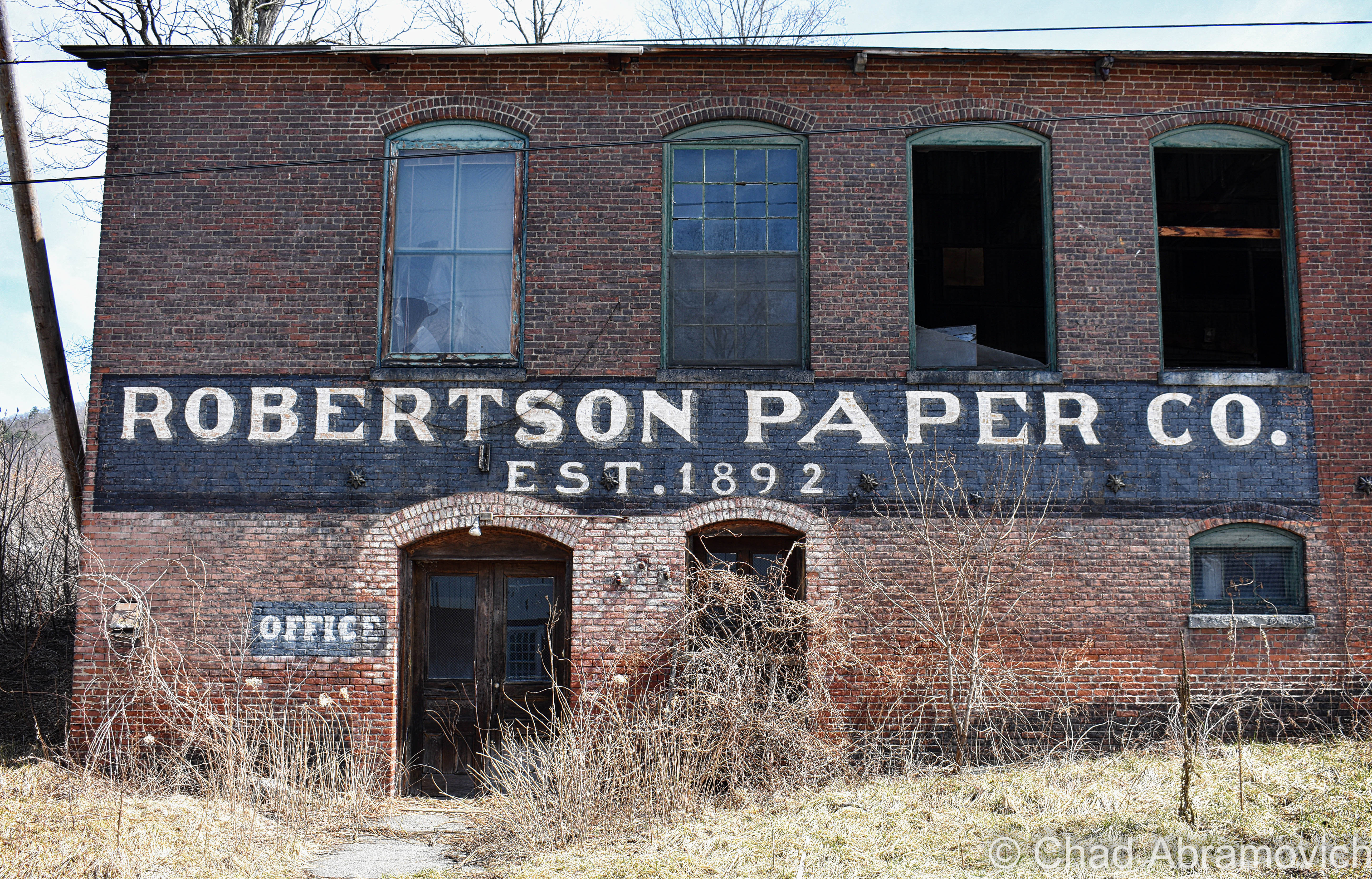
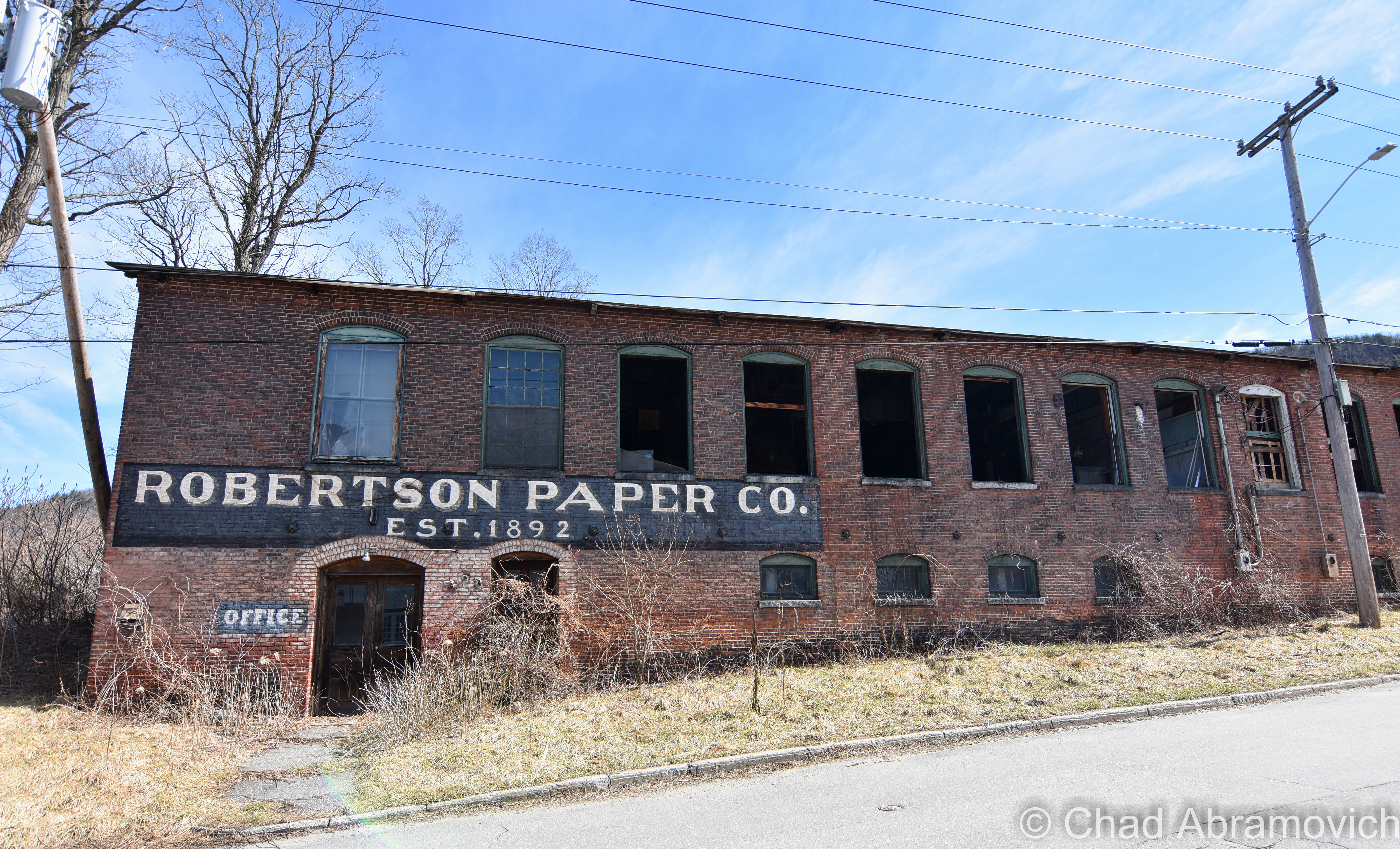
The canal created an artificial island called Factory Island. For years, out of place figures have been spotted within the buildings on the island, including this old paper company. They’re reported to be person sized gray shadows that appear to be the long-haired forms of American Indians. When seen inside the old factories, their legs are imbedded in the floorboards, as if walking on the ground beneath. Maybe theyre heading towards those mysterious petroglyphs near the Villas Bridge…
Hayes, Lyman Simpson, 1907 History of the Town of Rockingham, Vermont including the villages of Bellows Falls, Saxtons River, Rockingham – Cambridgeport and Bartonsville. 1753-1907 with family genealogies. There is a digital copy online you can view, if you’re so inclined.
—————————————————————————————————————————————–
To all of my amazing fans and supporters, I am truly grateful and humbled by all of the support and donations through out the years that have kept Obscure Vermont up and running.
As you all know I spend countless hours researching, writing, and traveling to produce and sustain this blog. Obscure Vermont is funded entirely on generous donations that you the wonderful viewers and supporters have made. Expenses range from internet fees to host the blog, to investing in research materials, to traveling expenses. Also, donations help keep me current with my photography gear, computer, and computer software so that I can deliver the best quality possible.
If you value, appreciate, and enjoy reading about my adventures please consider making a donation to my new Gofundme account or Paypal. Any donation would not only be greatly appreciated and help keep this blog going, it would also keep me doing what I love. Thank you!
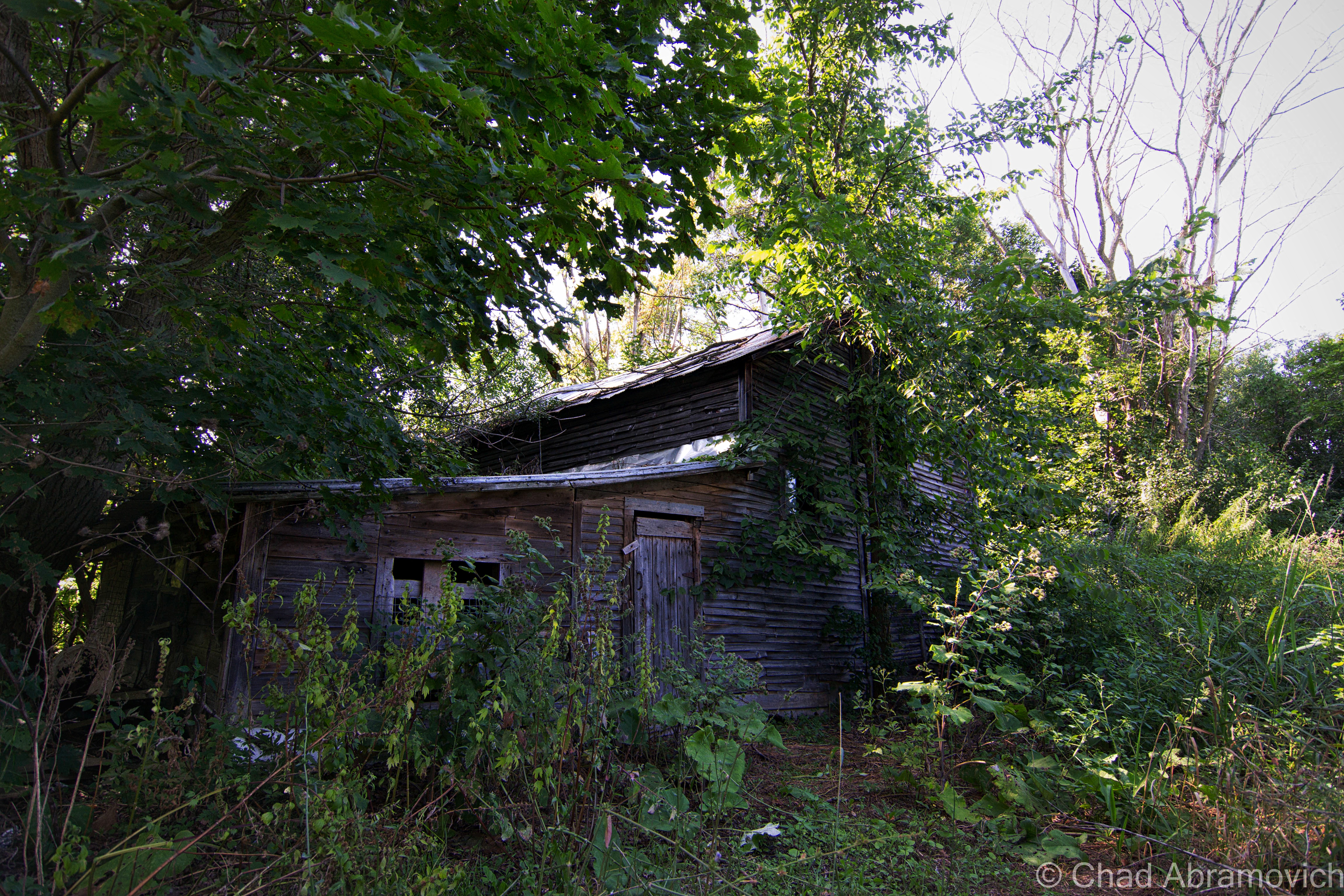
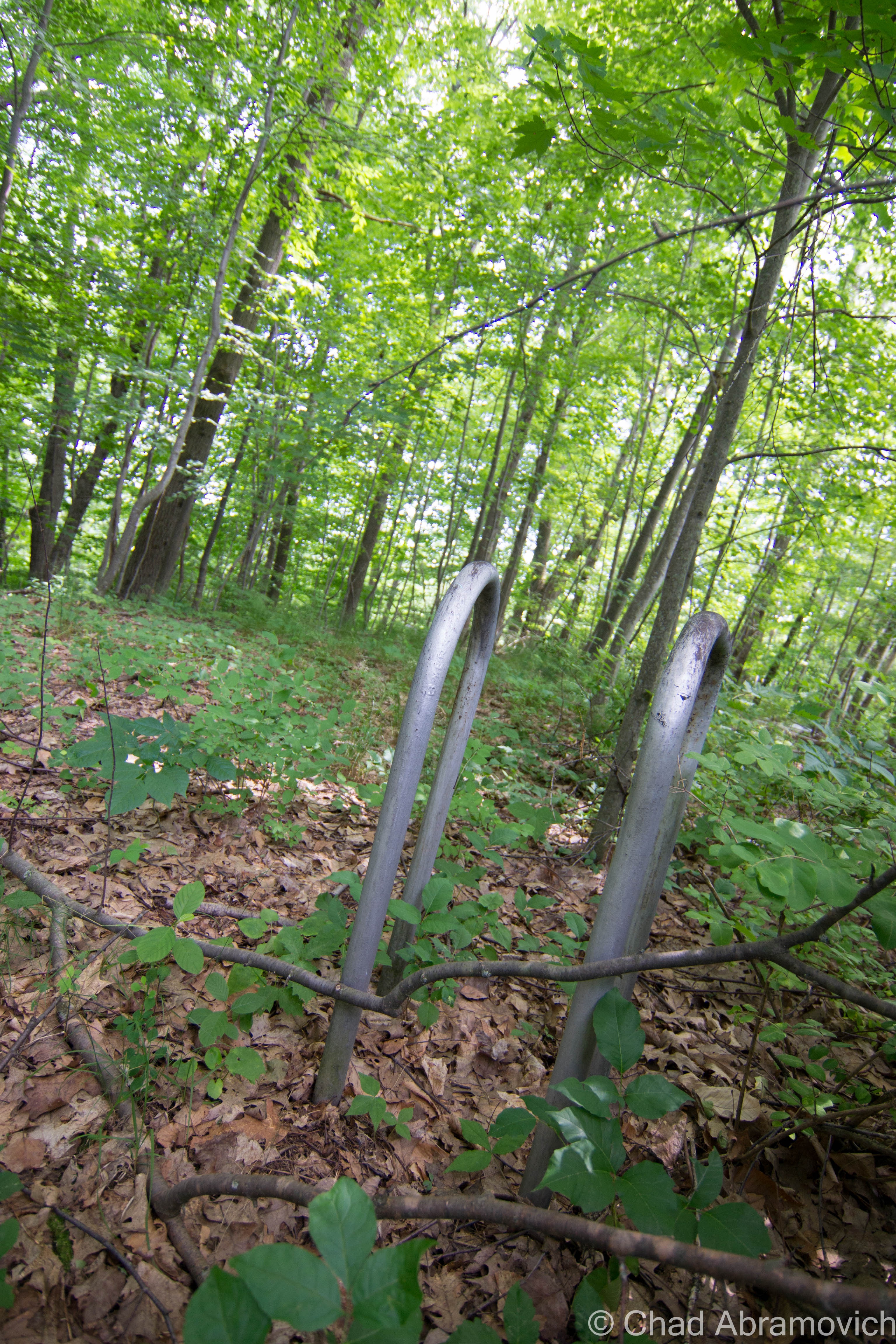
For years now, I’ve heard talk of adventures in the caves and abandoned quarries of Southern Vermont, which compelled me to research them. The town of Dorset, northwest-ish of Manchester, has a remarkable 31 abandoned quarries within the town limits, and a drive through town offers some perspective here.
Dorset is mostly mountainous because it’s where the Green Mountains and the Taconics collide – separated barely by a narrow valley called “The Valley of Vermont”, which the famous U.S. Route 7 passes through.
Mt. Aeolus, Owls Head, Netop, and Dorset Peak are a clump of Taconics that formidably fill up most of the western part of town. It’s here where the geography offered profitable geology; marble.
The oldest commercial marble quarry in the United States was carved into Dorset bedrock in 1785 in the village of South Dorset, along today’s Route 30. Over the next 130 years, about 30 more quarries would pit up the slopes of Mt. Aeolus and Dorset Peak. The marble expelled here was of such a fine quality, with attractive tints of greens and blues, that the demands multiplied and Dorset marble soon found notoriety in several significant buildings in major cities across the United States, such as New York and Washington DC.
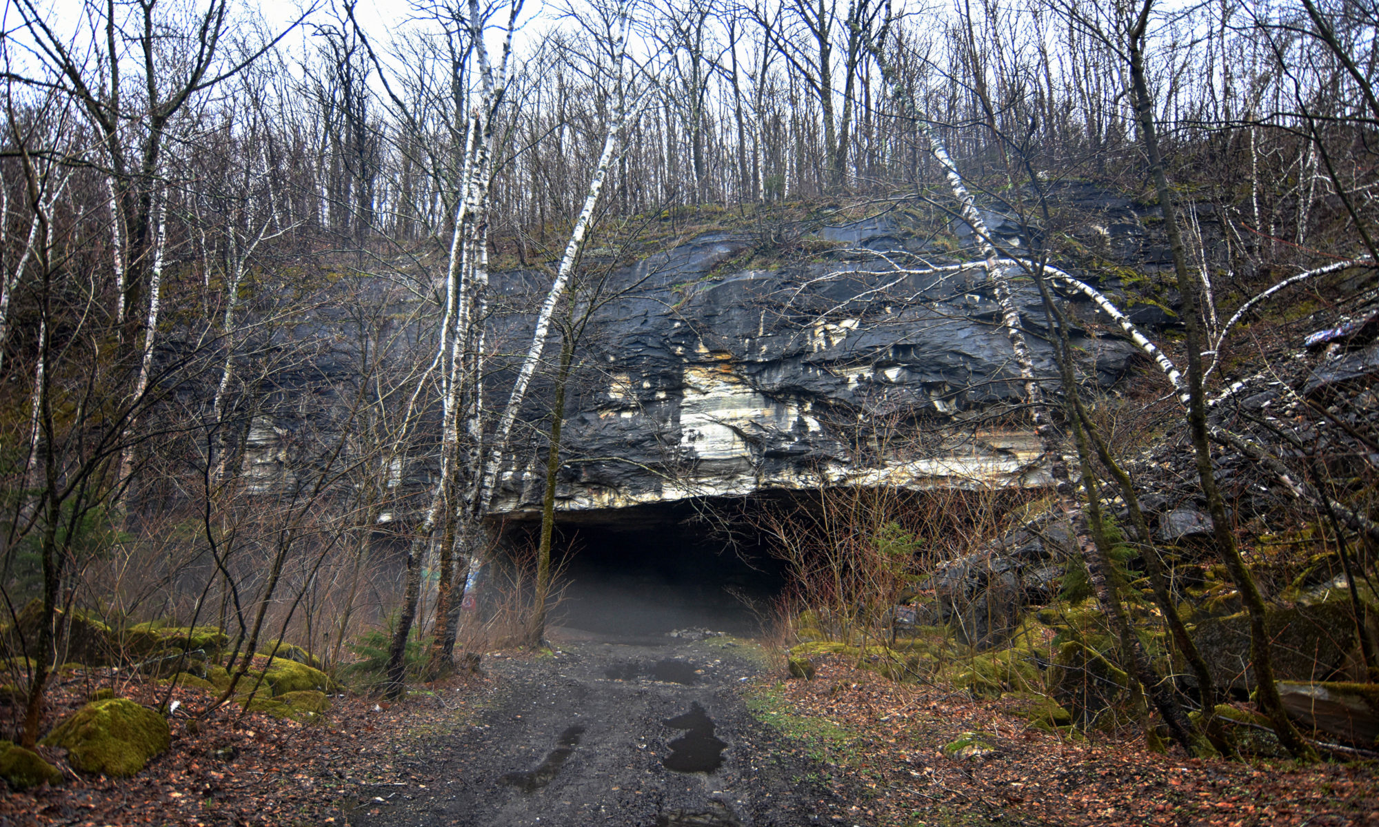
One of the quarrying operations accomplished here was the awesome Freedley Quarry, located 1,000 feet up on the eastern slopes of Mount Aeolus. The John K. and William G. Freedley Company of Philadelphia started quarrying on the slopes and would initiate other quarries from there.
Freedley got its start in 1875, and was unique, because it serpentined horizontally into the mountain, creating an unusual cave within the superstructure.
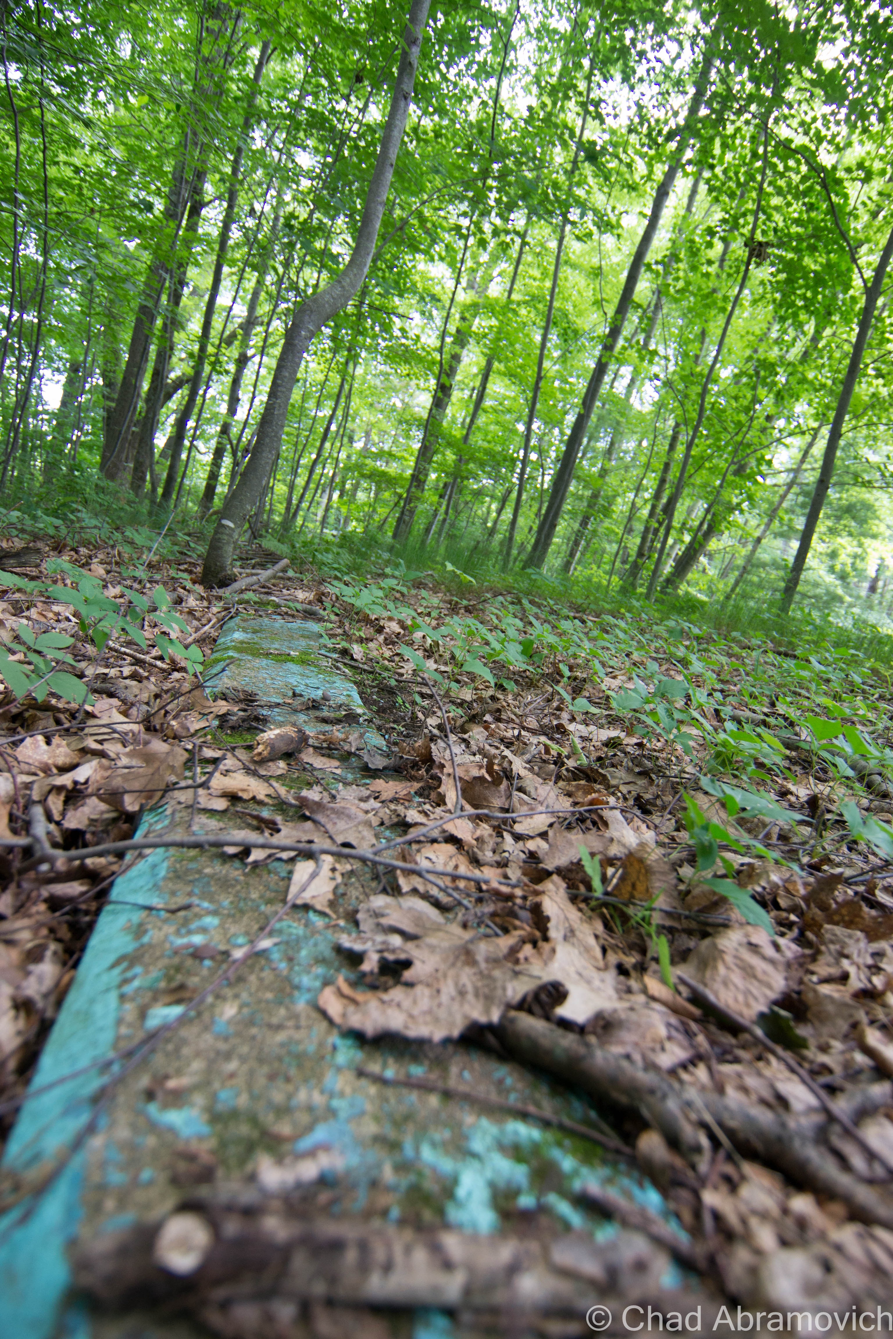
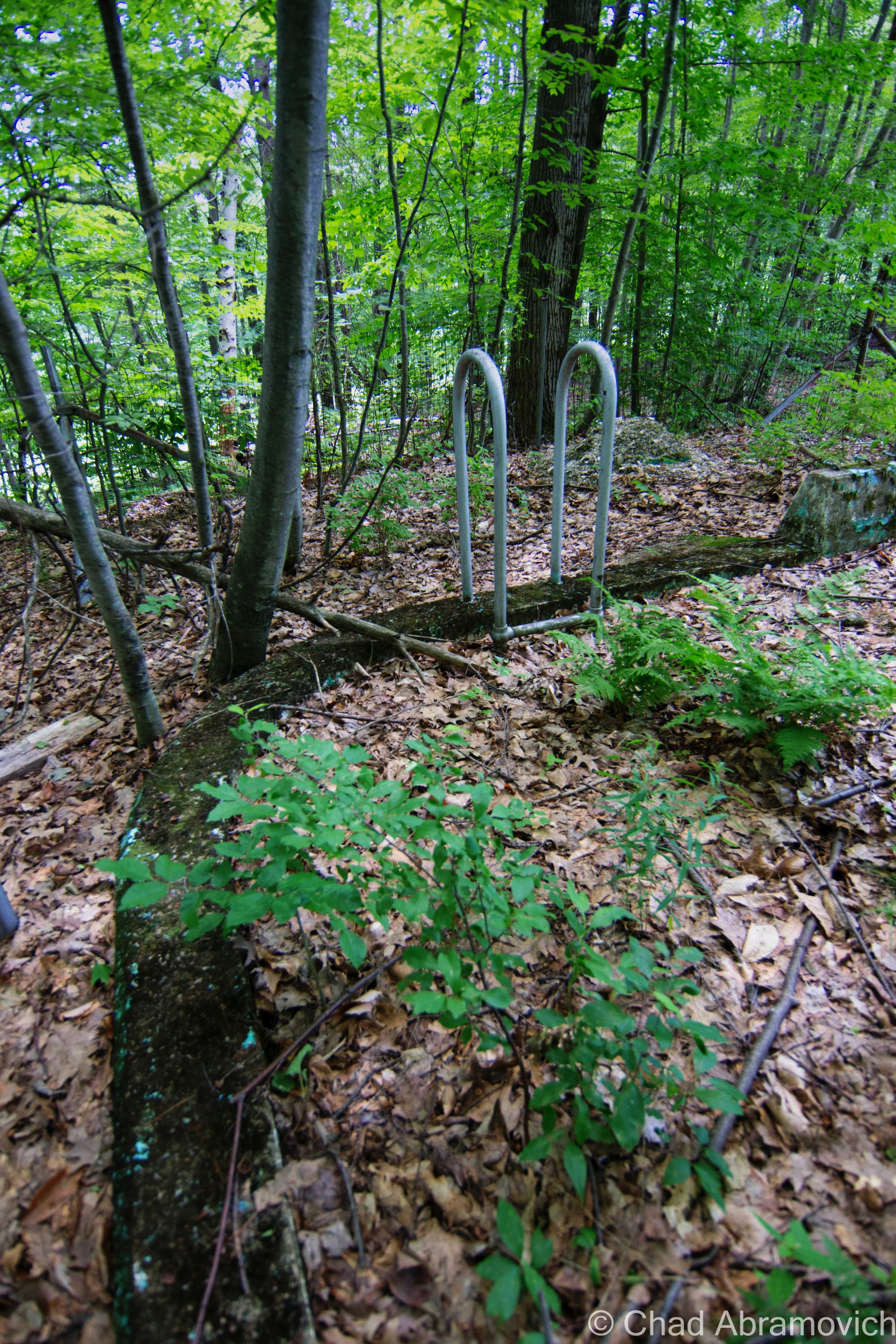
It was so high up that a unique gravity railroad was built, and ran down the side of Mount Aeolus, delivering marble to the cutting and finishing sheds in the valley below, next to the Bennington and Rutland railroad tracks. A little village of quarry workers was set up around the sheds called Freedleyville, and is now a ghost town. Like much of Vermont cartography of yore, the village is sometimes still labeled on maps, even though the only evidence of the place are skeletons of thick walls in the woods near Emerald Lake that are the ruins of the old marble sheds.
But by the 1920s, the marble business went bust, largely because of the introduction of Portland cement, which became a cheaper and more convenient replacement. Most of the quarries in Dorset would be bought up by The Vermont Marble Company in Proctor, who then shut them down to consolidate business as demands continued to drop.
In the 1930s the ski craze hit southern Vermont, which would coax the area’s shift into tourism. For a brief time, Fred Pabst of PBR fame developed a J-Bar served ski area on the slopes of Mt. Aeolus, but not long afterward, he decided to pull the lift and move it to Bromley. In the 60s, a larger proposed ski resort conceptualized as Dorset Hollow was proposed, but was killed shortly after it’s birth from tumultuous local opposition. If the resort had been built on Netop Mountain, it would have offered a 3,000-foot vertical drop which would have made it the largest of any ski resort in Eastern North America. The mountains were left to be reclaimed by nature, but the marble industry has left a lasting impression here in a tangible way. One of those being the distinctive marble sidewalks that still parallel along Route 30 in Dorset village and are slippery when rainy.
Today, the assortment of quarries are popular with the outdoor adventurous type. A few locales and their sharp vertical walls draw cliff jumpers, some who like making edits of their leaps. The Norcross Quarry on Route 30 is a popular place to taunt trauma.
The mountains around Dorset Peak are unassumingly steep backcountry, which is combed with an expansive network of celebrated 4 wheeler trails and logging roads that draw off-roaders in Jeeps, trucks, and ATVs for a radius so large that many of the battered vehicles have out of state plates. Somewhere in those woods is a set of trails which are apparently so gnarly that some locals have dubbed them “World War 3”.
But as I was finding out, people in the know about such places don’t like to give up their locations, for the same reason that I often don’t disclose the places I explore; protection. These personal sanctums are in constant danger of being ruined by disrespectful patrons or being closed down due to potential injuries making them a jeopardy to public safety or a liability to the property owner. It’s one of those double-edged swords which I can sympathize with and be bummed by at the same time. Any invitation I receive is always met with me profusely expressing my gratitude.
Taking to the resourceful world of the internet, I discovered The Vermont Cavers Association and got a background on another intrepid hobby in the Green Mountain State; caving. Even though Vermont isn’t all that known for its caves, there are plenty of people here who seek them out all the same. The state’s geology doesn’t allow for the water permeation and underground flows that form the massive caves found farther south in Appalachia.
Author and caving expert Peter Quick noted that Vermont may have around 60 caves that would stretch beyond 100 feet. But we still have a pretty impressive network here that is ardently admired (The quarries in Dorset are included on that list), with many new ones being discovered yearly. Some subterranean passages are described as squirming through twisting spaces the size of your body, which is a deal breaker for me. I’ll take my adventures free of claustrophobia, above ground.
On a humid early summer’s morning, I took the scenic drive down to mountainous Southern Vermont to see if I could find some of these well-esteemed quarries. After driving through Victorian Wallingford, Route 7 south became linear straight, running between the Green and Taconic Ranges which closed in the highway on both sides. Part of this expanse of wilderness is within the easily missed town of Mount Tabor, which Wikipedia condemningly says is “the sneakiest speed trap in the United States” and something about dead bodies occasionally being found along Route 7. That submission may or may not be the work of a disgruntled internet user. I can’t deny or confirm the corpse claim.
via the Mount Tabor Wikipedia page.
I stopped by the Dorset Historical Society to speak with museum curator Jon Mathewson, an amiable and interesting gentleman, who helped point me in the direction of achieving my goal of getting up to a quarry. Inside the museum is a rather cool 3D map of Dorset, with all of the defunct quarries marked on the raised surfaces and information corresponding to each, some having amusing connotations like “Deaf Joe Quarry”. He directed me to the aforementioned Freedley Quarry, and told me where to find the class D roadway that would take me there.
Freedley Quarry, First Attempt.
The Freedley Quarry is easy to get to, as long as you don’t make the same mistake I did and accidentally hike up the wrong mountain, turn around and descend back down the mountain while breathing heavily, soaked in sweat and suddenly no longer caring if you found it or not.
On my first attempt, I had brought my buddy John along for the adventure. Parking in front of the aforementioned road, which in reality was only a really muddy 4 wheeler trail, we entered the woods. Not remembering if I was supposed to take a left or a right at the first fork in the trail, we took a left. What I had assumed would have been a 20-minute walk in the woods turned into a laborious climb up Mt. Aeolus while making the futile effort of swatting at endless clouds of dive-bombing mosquitoes and wondering if I was going in the right direction. I now understood why a railroad was built up here over a century ago.
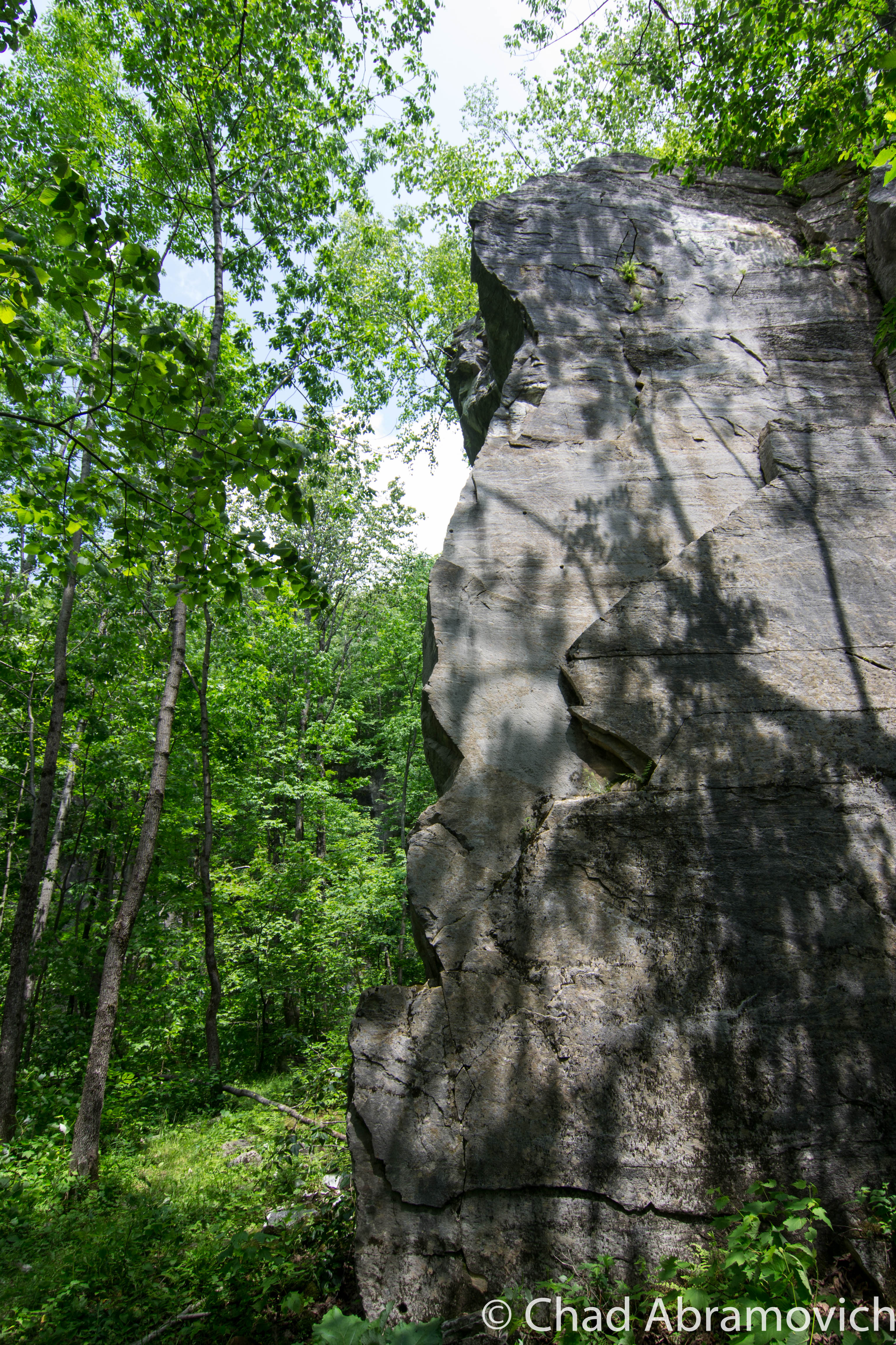
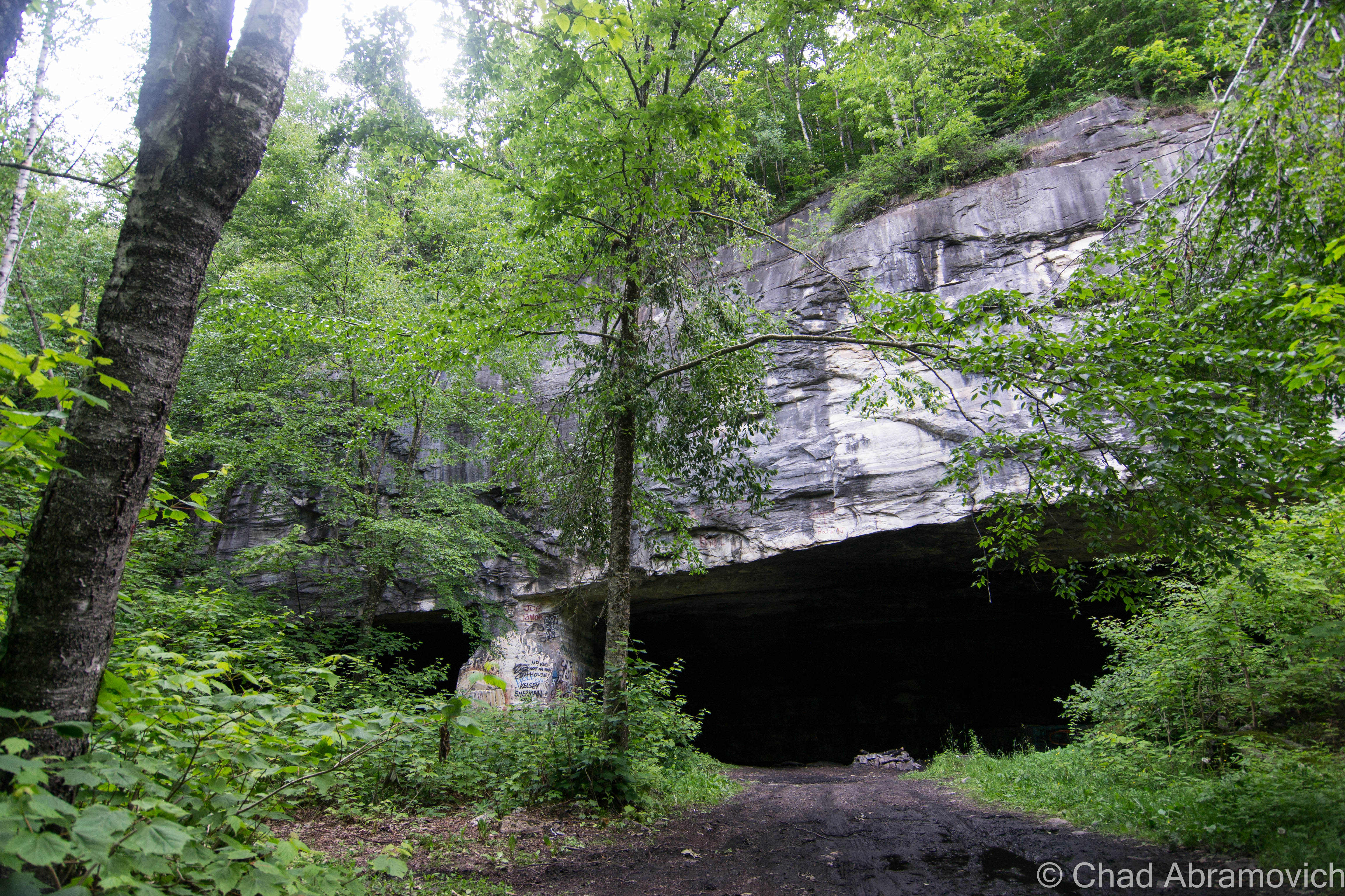
The forests suddenly opened up due to a massive rock slide created by quarrying efforts that vanquished a huge patch of the mountainside as they tumbled. The clearing offered impressive views of Emerald Lake gripped by the narrow valley of Vermont, and beyond, the Green Mountains. Directly adjacent to the clearing, I found the Folsom Quarry. Folsom was semi-interesting, really just a cavity in the upper slopes of Mt. Aeolus, it’s visage bearing the scars from years of cutting, now left to the caprices of nature. But, it had some amusing points of interest. One of them being that Folsom was so high up in elevation (over 1,000 feet), that it never floods. The second was that its tall vertical walls gave it the traits of a natural amphitheater. It was cool, both metaphorically, and literally, as it offered relief from late June humidity, but it wasn’t the impressive catacomb-like quarry I was so interested in seeing.
Onward we trudged, as the trail zig-zagged up the mountain in a series of deeply rutted switchbacks. Eventually, I came across a startling find. A surveillance camera far from anything, powered by a lone solar panel, both attached to a wooden post. Nearby were some yellow diamond Nature Conservatory signs, announcing that I was now near the Aeolus Cave, and asking us to please keep away as part of an effort to combat the mysterious illness, White Nose Syndrome.
I had remembered Jon telling me about the Aelous Cave and White Nose syndrome, which was first discovered in Upstate New York in 2007 and made it’s debut in Dorset around 2008, as hikers and cavers began noticing the grisly site of scores of dead bats carpeting the floors of the mountaintop cave. The pre-White Nose Syndrome Aelous Cave was the largest hibernaculum in the northeastern United States, but the fungus wiped out about 90 percent of its resident bat population. Today, the Nature Conservatory has designated the cave as a both a protected and research designated area.
Seeing this, I knew I had gone way too far. Descending back down the mountain, I decided that a few pizza slices accompanied by an IPA in Manchester was more appealing than trying the other fork in the trail. I was exhausted.
Freedley Quarry, Second Attempt
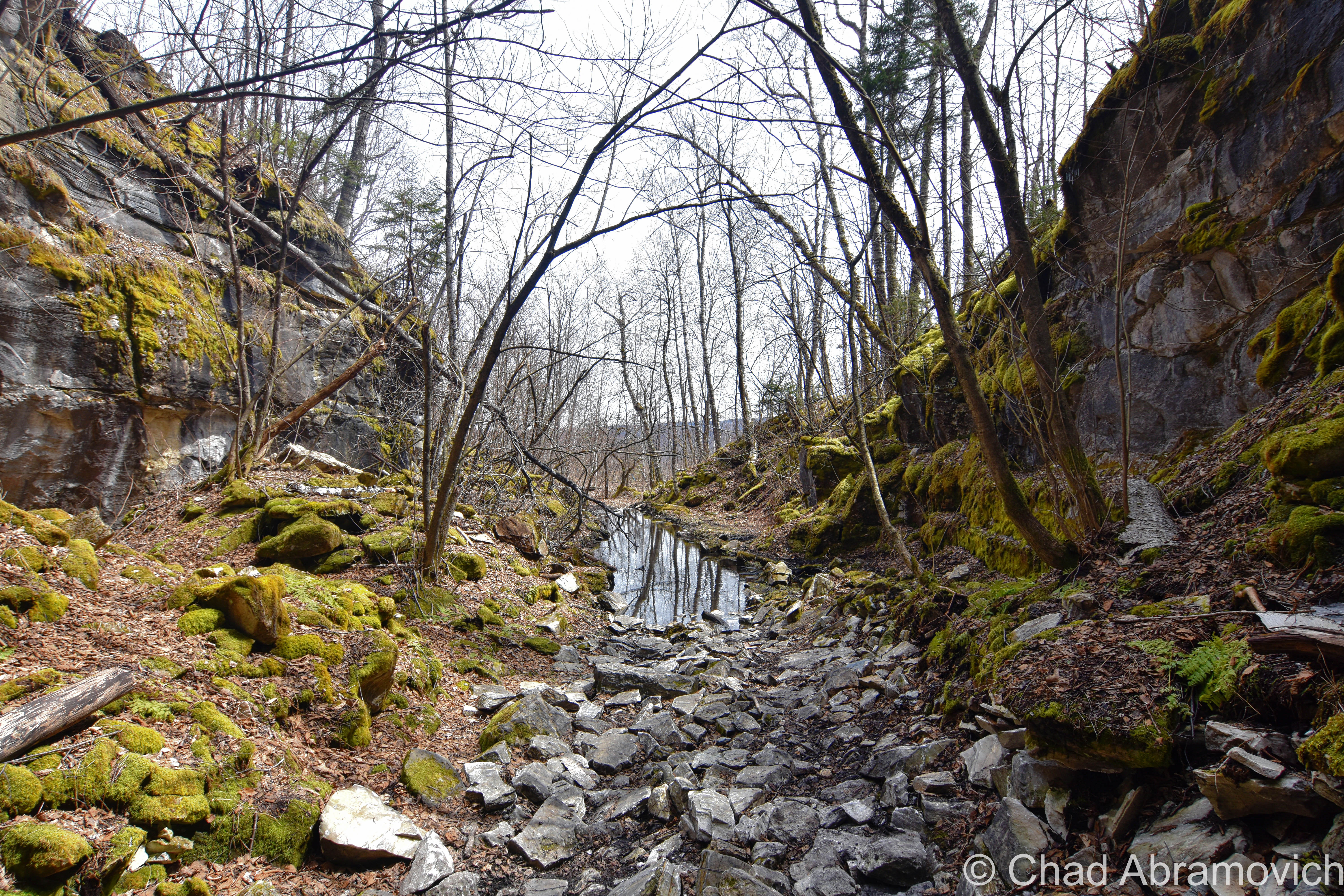
The rain had just come to a dull drizzle by the time we arrived back in Dorset. Somewhere under the fog was the mountain that we were going to hike, and carved into that mountain, the quarry. Parking at the now familiar trail head, me and my friend Eric embarked into the woods and damp mists. The trail split into a fork, and we took the right, hoping that this time, we were on the right path. But another ten minutes into our trek up the washed out trail, we came upon yet another fork. I mentally groaned. Then I audibly groaned. How many trails were there on this mountain? Once again, the directions I had been given weren’t directions, and I had no idea what to do or had any sense of bearings.
That old saying “you can’t see the forest (or in this case, quarry) through the trees” was a very relevant concept at this moment. Any of these paths could potentially have lead to there. The trail actually had at least three unaccounted forks, and we hesitantly detoured on all of them, each contributing unenjoyable climbs up steep inclines serviced by trails reincarnated as mudslides due to the relentless succession of rainstorms that had recently drenched Southern Vermont.
As we traveled deeper into the woods and past other defunct quarries that had long silted in with dirt and vegetation, I began to notice a viscous mist that was conspicuous from the rain and fog, accompanied by the wafting acrid stench of sulfur and gunpowder. That was a familiar smell. Someone was lighting off fireworks, and they were near enough where the expelled smolder could reach us. We both assumed that there were other people at the quarry engaging in some festive intimacy, and mentally prepared ourselves to deal with them as we would attempt to photograph the place. The supposition that we weren’t alone on the mountain was confirmed when a few people passed us on the trail riding in Jeeps, some exchanging greetings by waving, and others by flicking cigarette butts at us. I suddenly felt awkwardly out of place, being the only folks on foot up here.
Soon, we came across the creepy dampened ruins of what appeared to be some sort of old shack or hunting camp or meth lab, which looks like it was the victim of a homemade firework and exploded at some point, interspersing twisted and disintegrating artifacts throughout the overgrown brush along the trail. Among the debris were a scattering of beer cans and food wrappers, which told us that even way up here, people come and party/litter.
Ahead, we noticed a four-way in the trail and could feel the air become a bit cooler, which was a good indication. To our left, the black mouth of the quarry soon became discernible through a thick strand of White Birches. The smoke was incredibly thick now, and as I slowed down to survey the area, I saw what I had expected to see; there was a rather large bonfire crackling where the cave met the open air.
We also noticed the producers of the fire; three slovenly people who appeared to be in their late teens, two boys and a girl, and all of them were wearing hunter orange. For some reason beyond my rational, this seemed to make me a bit uneasy. The weather on the mountain was viciously sultry, far too hot to be clad in full-body hunter orange. And why would you wear it in the summer when hunting season isn’t for another few months? We observed as the two fellows headed into the complete blackness of the cave, and the girl sat on what appeared to be a rock and plopped herself startlingly close to the fire.
At a complete standstill, I was about to ask Eric how he felt about approaching the cave and trying to take some photographs despite their presence there, but then came the pivotal point of our encounter. A strange sound came from the dark crevices from within the cave, what sounded like the wail of a goat. We waited in confused and uneasy silence. As our eyes strained for answers, we heard that terrible noise again, only this time, the situation became clear. It wasn’t a goat. Those guys were the ones making the noises.
We took a few steps backward now, a bit alarmed, and suddenly not wanting to be detected. The two guys, completely unperturbed, continued their strange ritual of making those horrible goat noises inside the cave, loudly reverberating and making empty echoes off the walls that sounded like something from a hellish nightmare. Later, Eric and I would both agree that what we had heard was the weirdest noise both of us have ever encountered. It sounded inhuman, and yet, we both knew it came from the mouth of one.
It was now when a new detail that I had overlooked before, came to light. None of them were talking to one another. Other than their contrived lunacy, none of them were actually speaking to one another, and wouldn’t for the entire time that we had stuck around. Then, all went silent, apart from the crackling of their fire.
One of them started to maniacally whistle, followed by a few minutes of uncomfortable silence, and then the other guy whistled back in the same manner. This pattern repeated for a few more minutes, followed by the ominous goat noises once again resuming. We waited there, obscured by thick brush and birch trees, for twenty minutes, partially because that the bizarre show that had been developing before us was somehow too tantalizing to walk away from.
Then, the girl, who was still crouching by the fire, started making an awful wailing noise, that sounded much like a baby that was in great distress, and this went on for several minutes as we gazed at them from our hiding place with intermittent glances at one another, completely befuddled. The goat noises started back up, and still, none of them were talking to one another.
My disappointment couldn’t be contained. We were so frustratingly close to our destination, and yet, the ghastly activity coming from the quarry ensured I didn’t dare make a move to get any closer. I was far too nervous at this point. A large quarry this secluded was a perfect place for multifarious clandestine activity. Sometimes, the motives of sentient beings can be vexing. We spoke in quiet whispers and made the decision to get the hell out of there. Just as we began to walk backward, the mountainsides vibrated violently and gray sulfurous smoke spewed through the trees. They were now lighting off some heavy-duty fireworks inside the cave.
Walking back down the trail, I couldn’t help thinking that we had somehow avoided some great danger, and a feeling of sweet relief crept over me. Not long after hastily retreating, we ran into two middle-aged looking guys traveling up the trail in a Jeep. We stepped aside to let them pass, but they smiled at us and stopped, and both parties exchanged greetings.
“What are you guys up too?” the gentleman behind the wheel opened with, his eyes falling on our cameras. “We wanted to check out the Freedley Quarry” I answered. “Oh yeah? What’d you guys think?” asked the man in the passenger seat. “Don’t know, we never made it”. Both of them looked at us quizzically, probably because we were walking from the direction that the quarry was in, so we told them what we had just encountered, and why we turned around.
The guy behind the wheel just looked at us like he was in a condescending state of awe, then said as a matter-of-factly; “well, it’s a free country”, and drove off.
In all the excitement, I had forgotten it was the fourth of July.
Freedley Quarry, Third Attempt
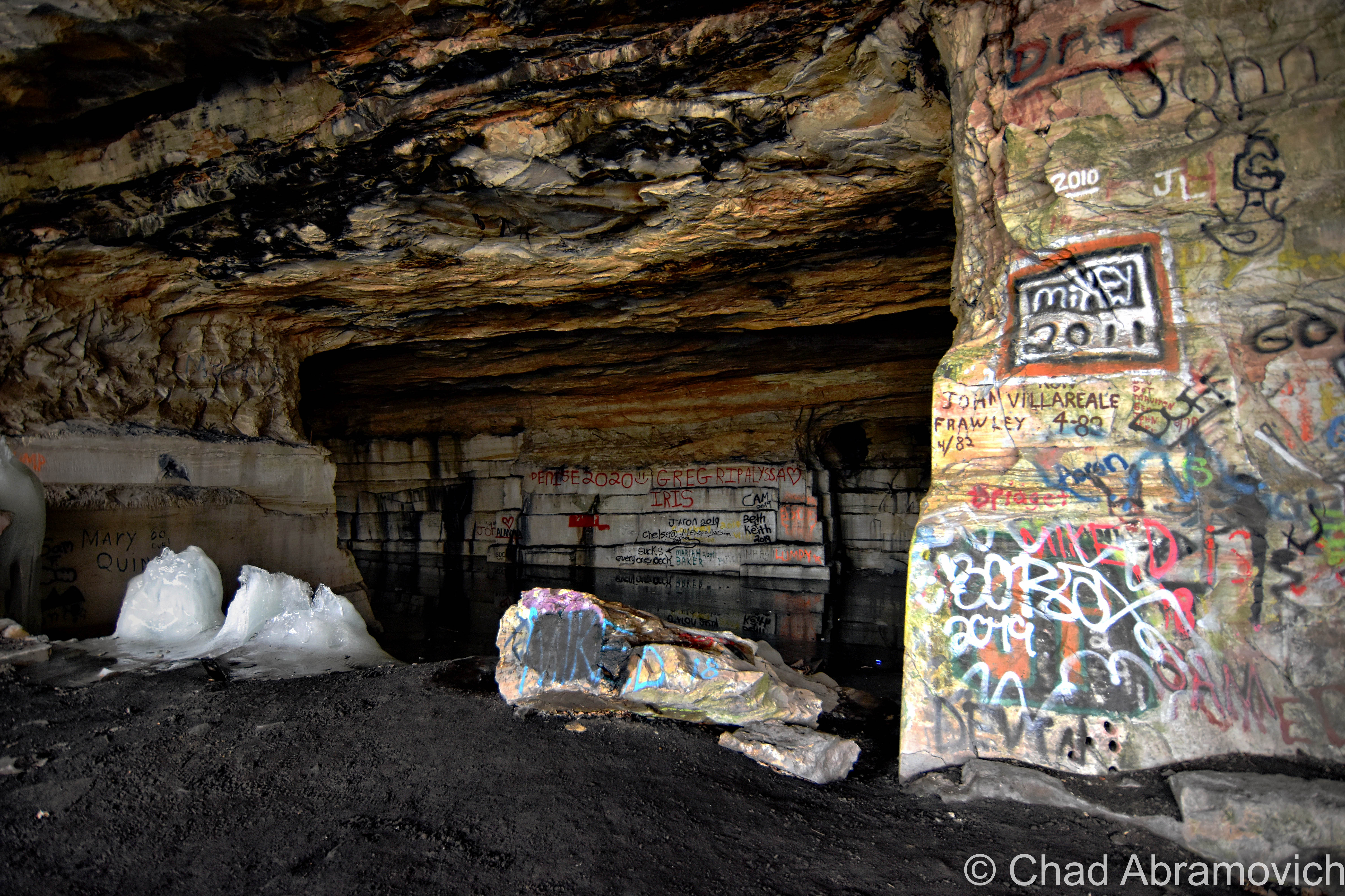
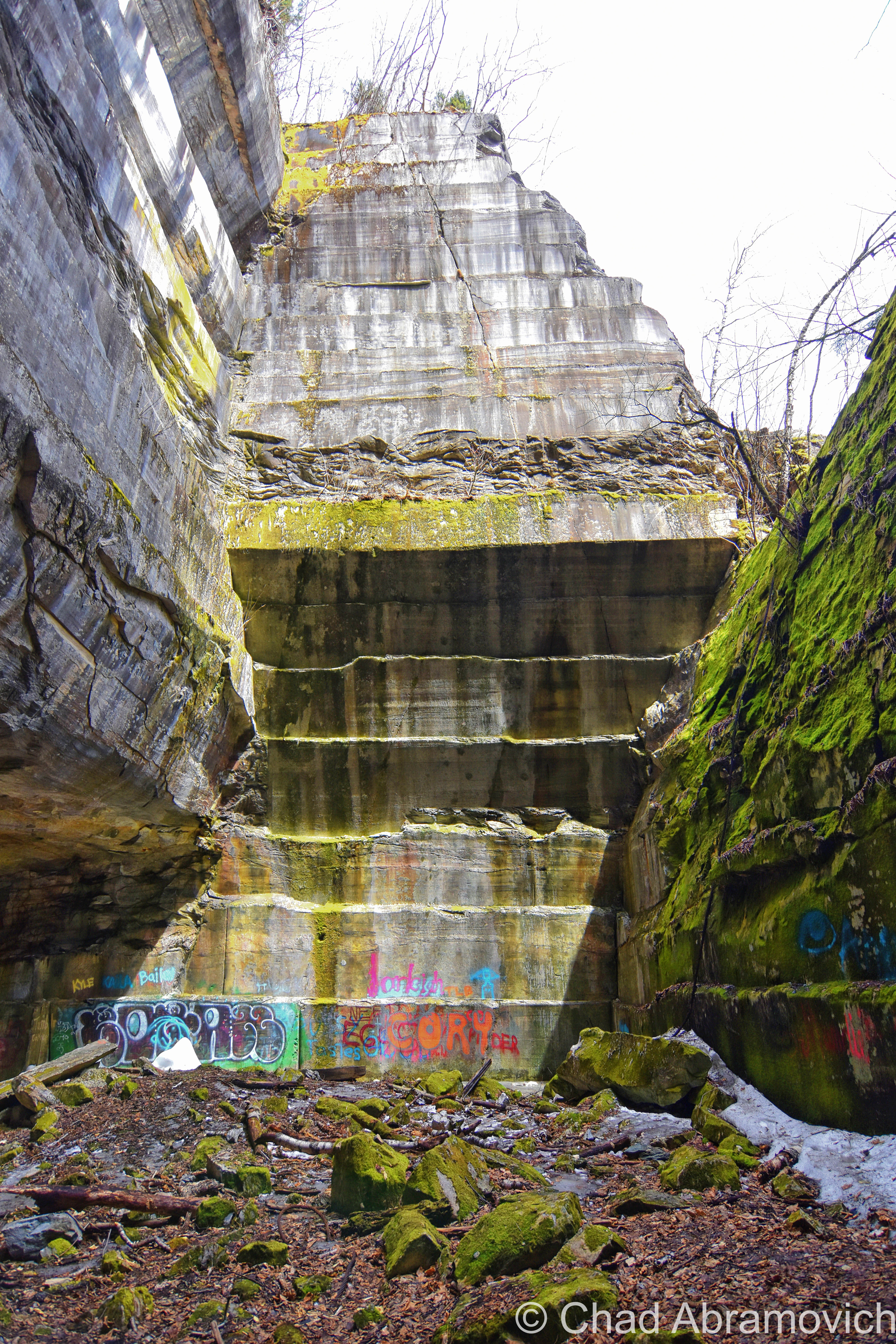
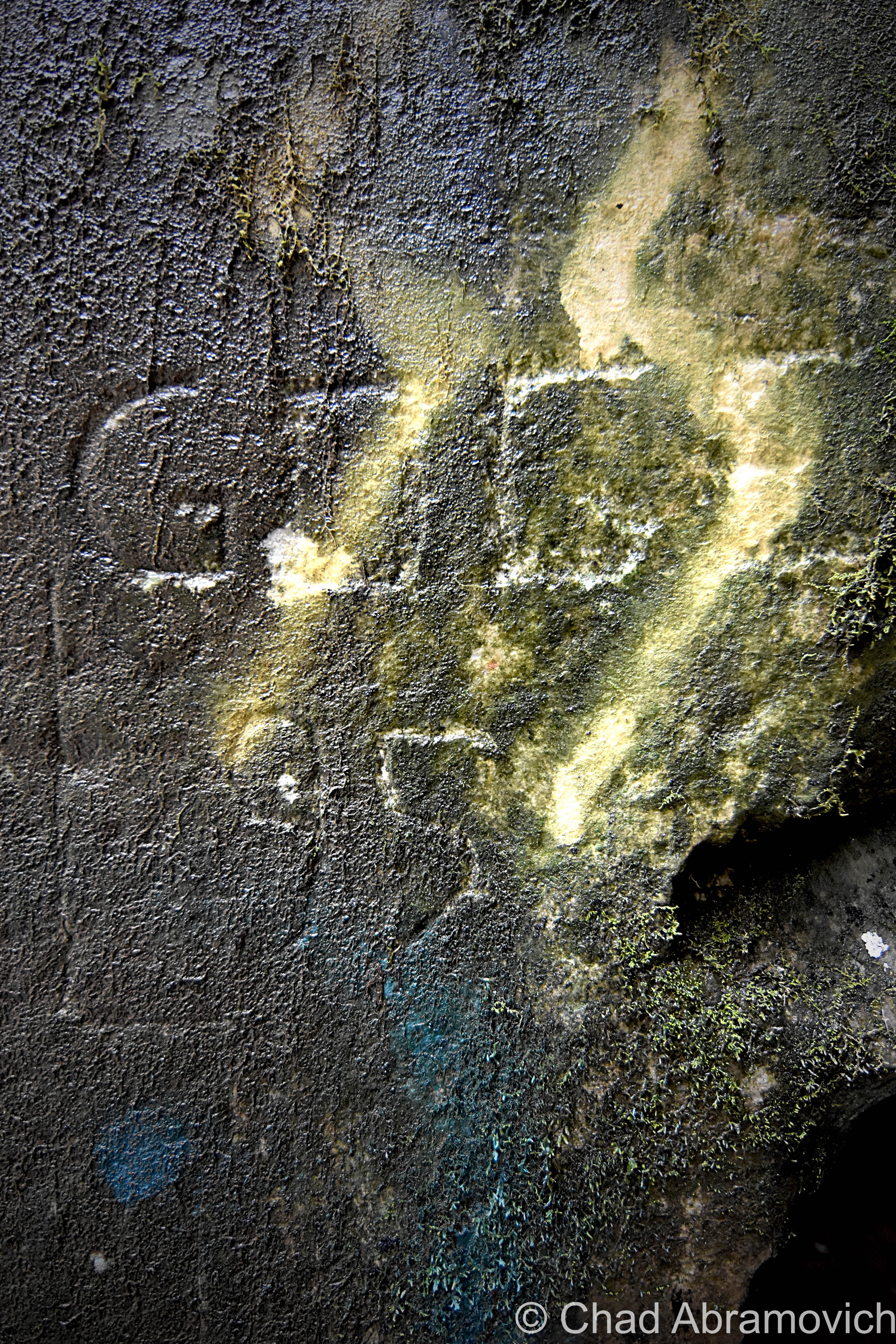
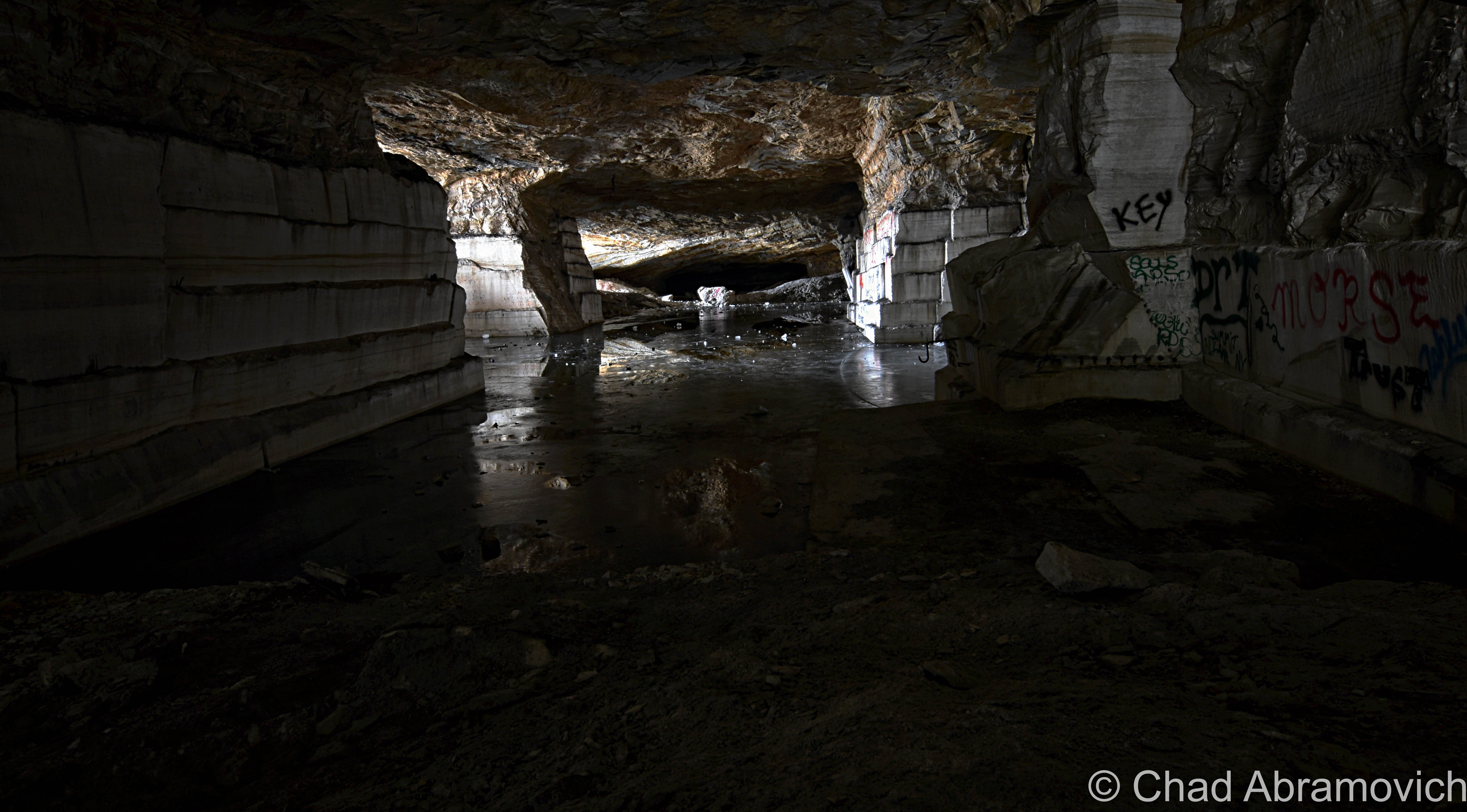
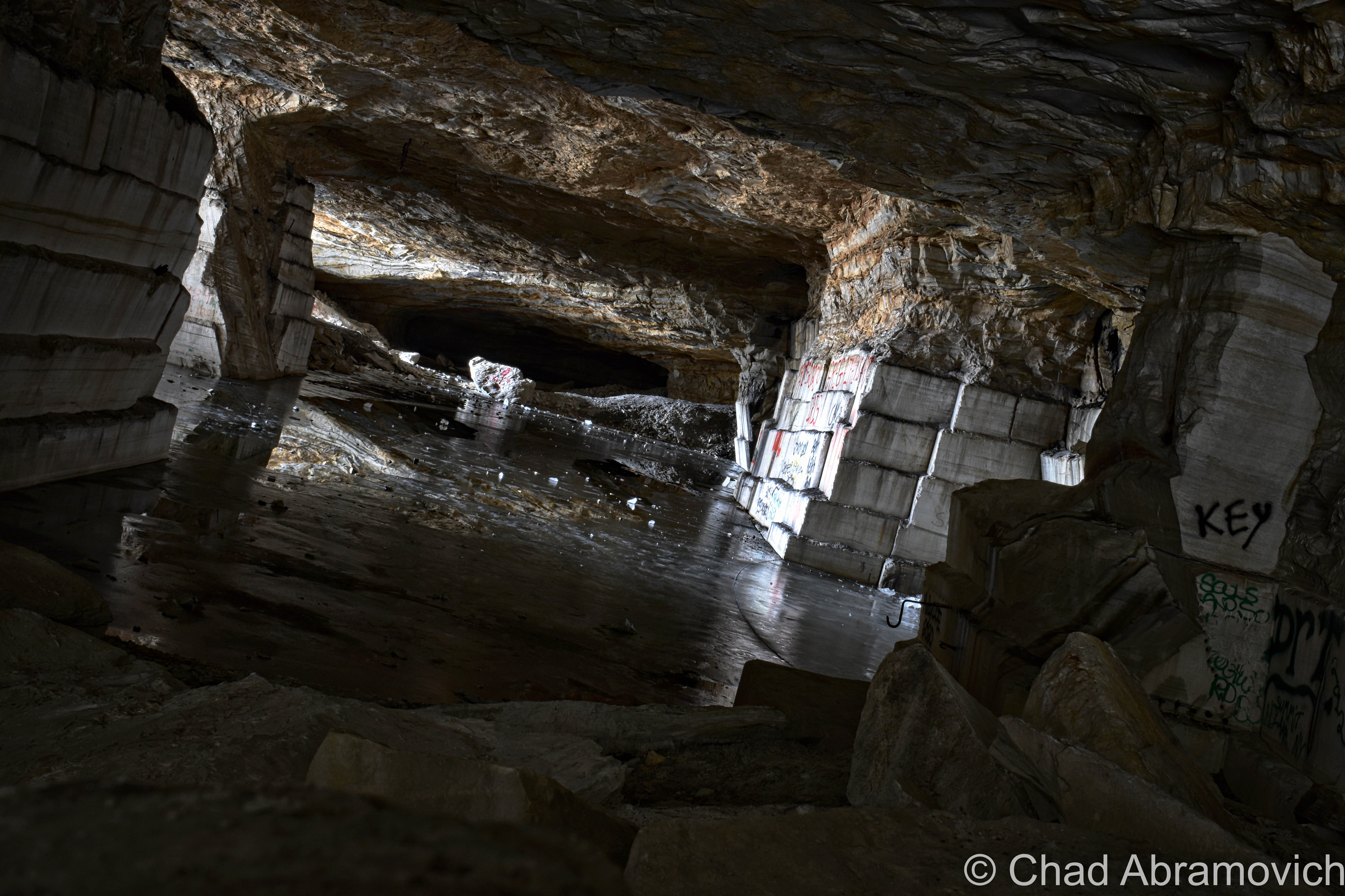
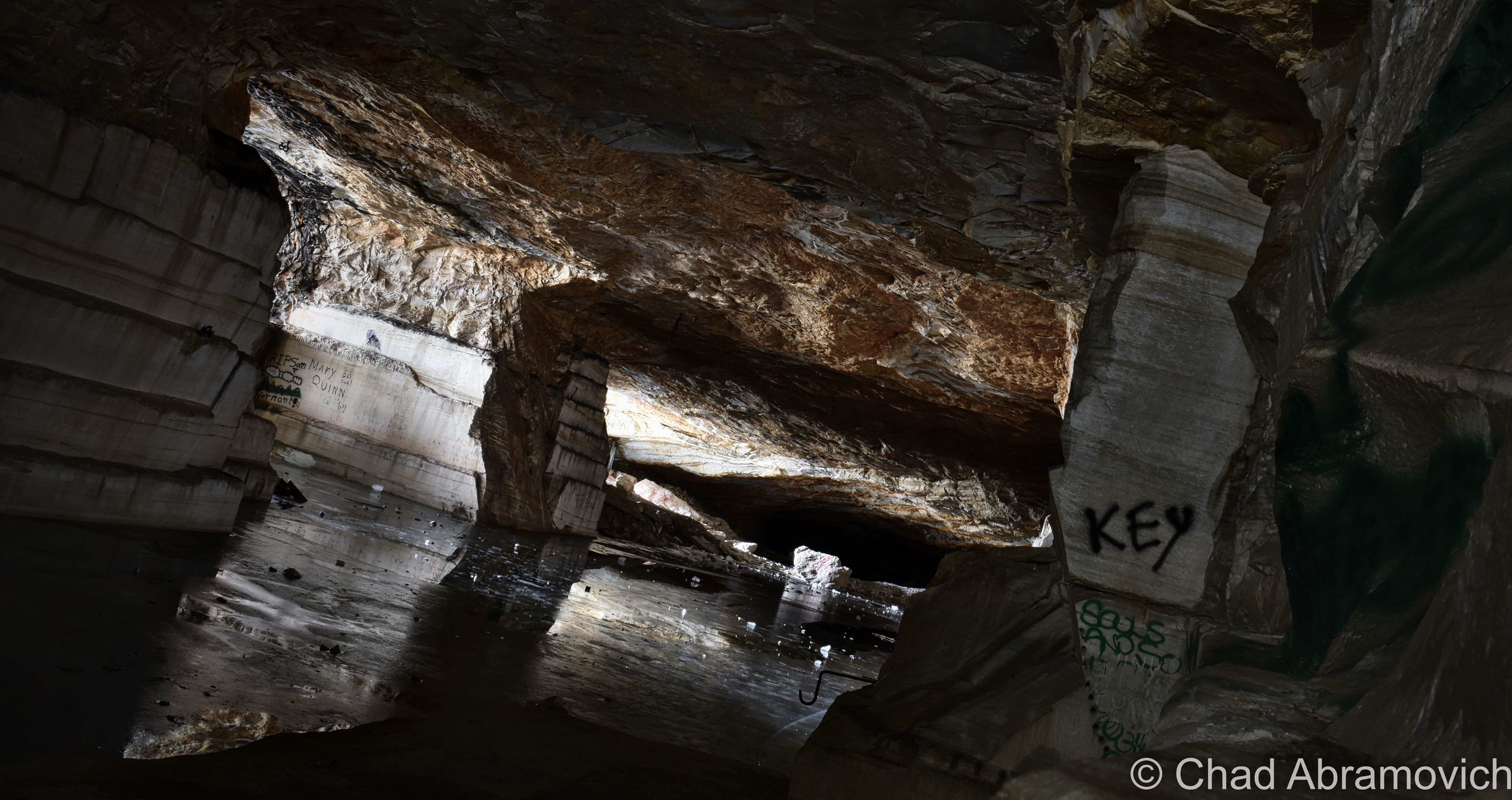
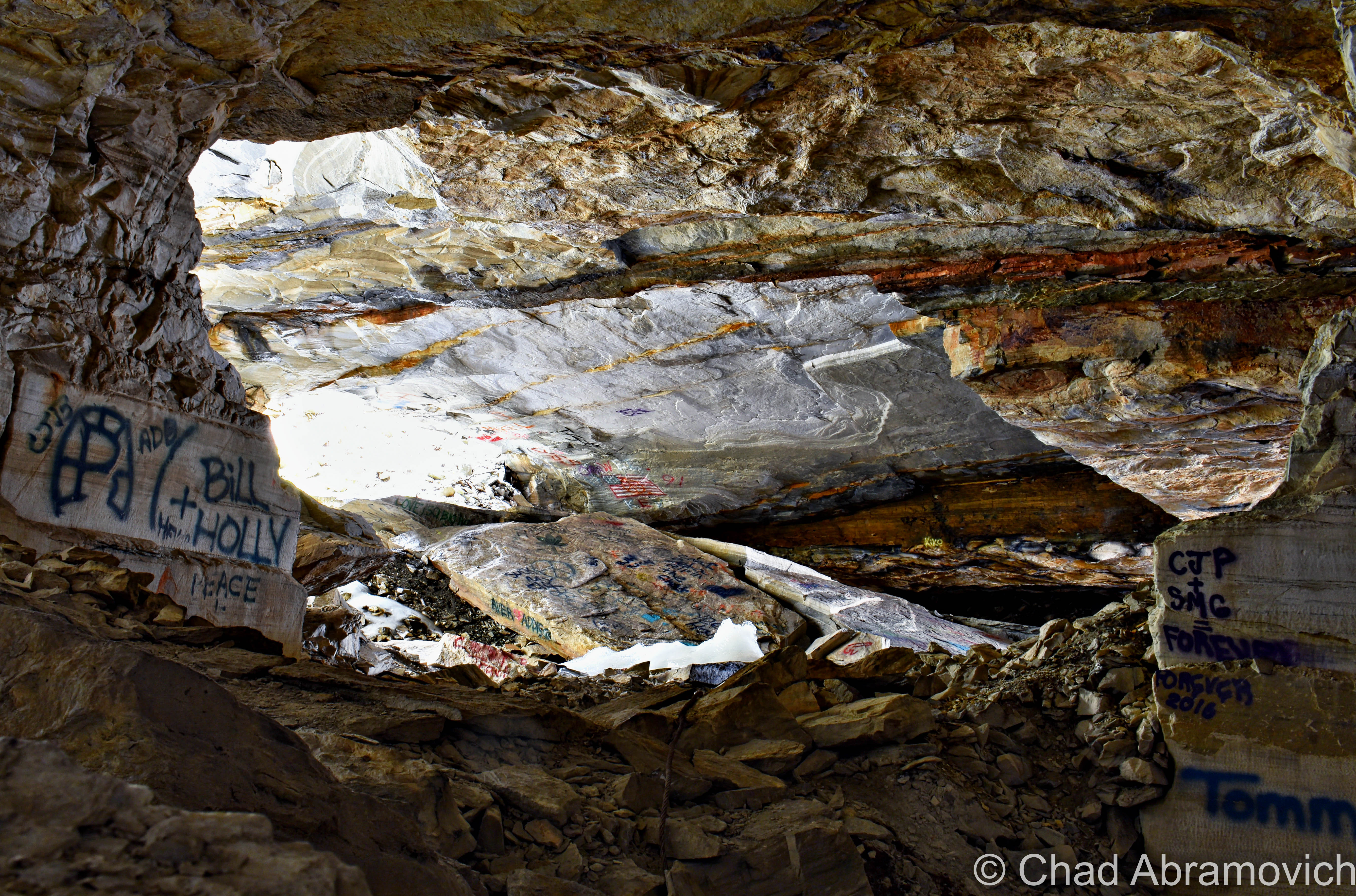
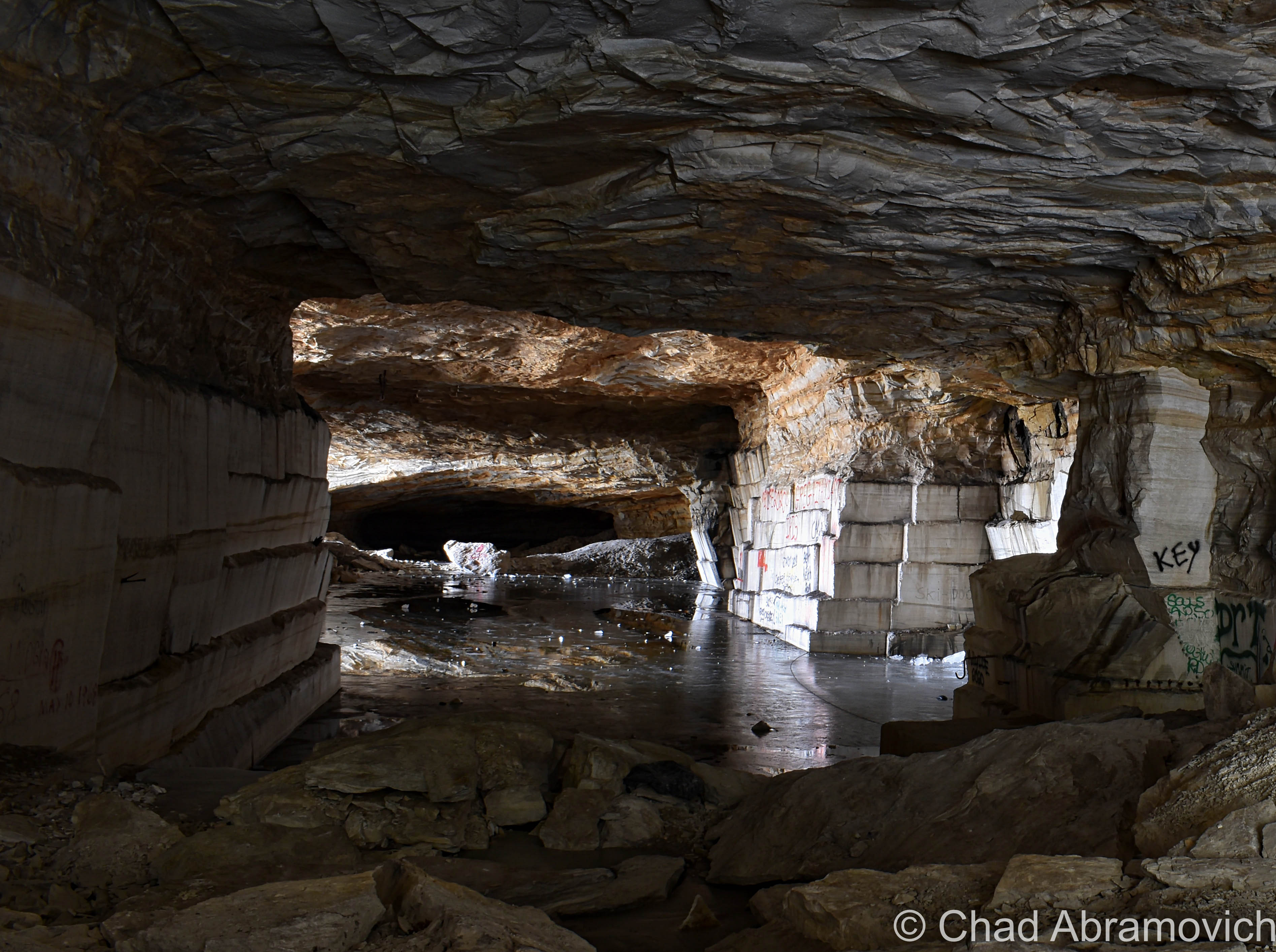
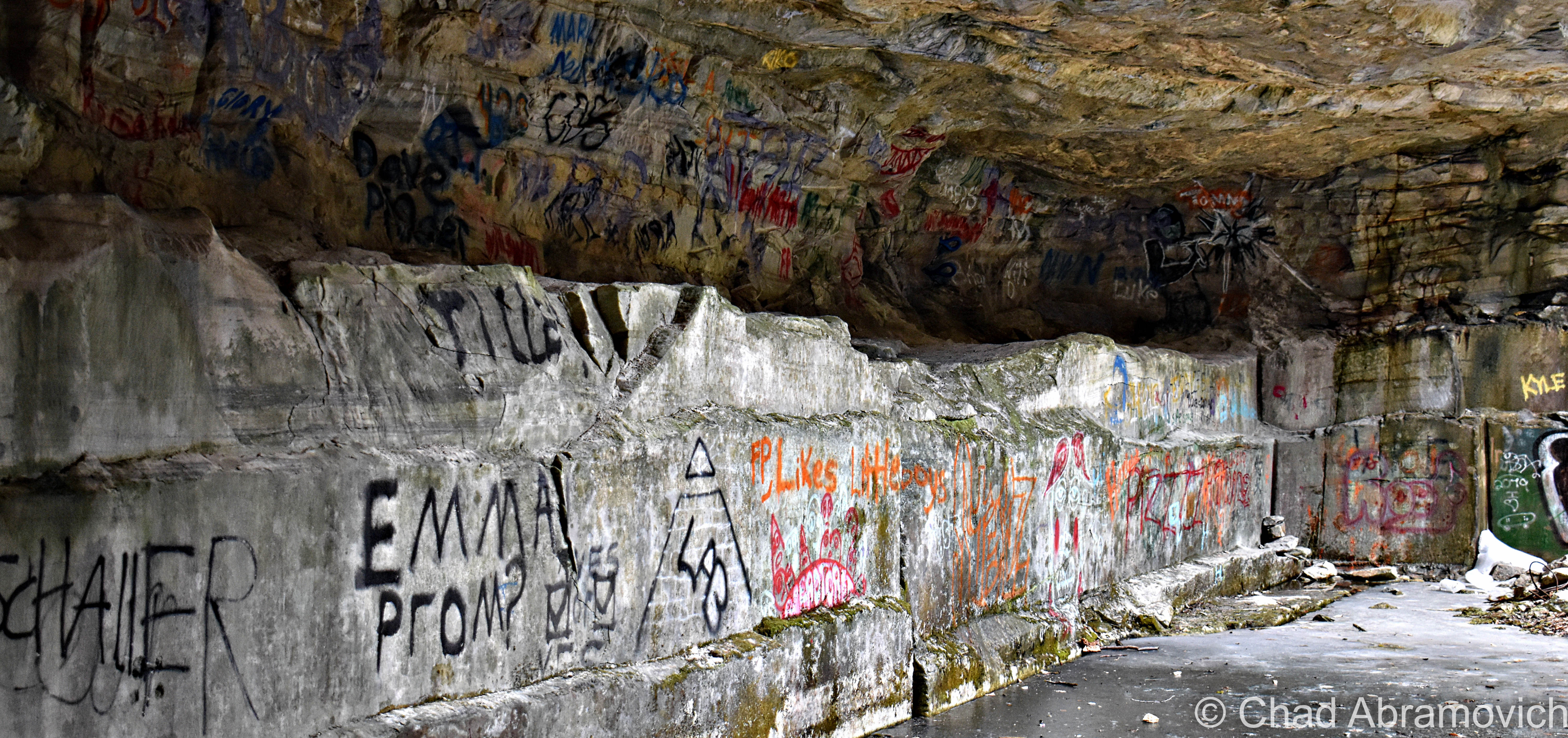
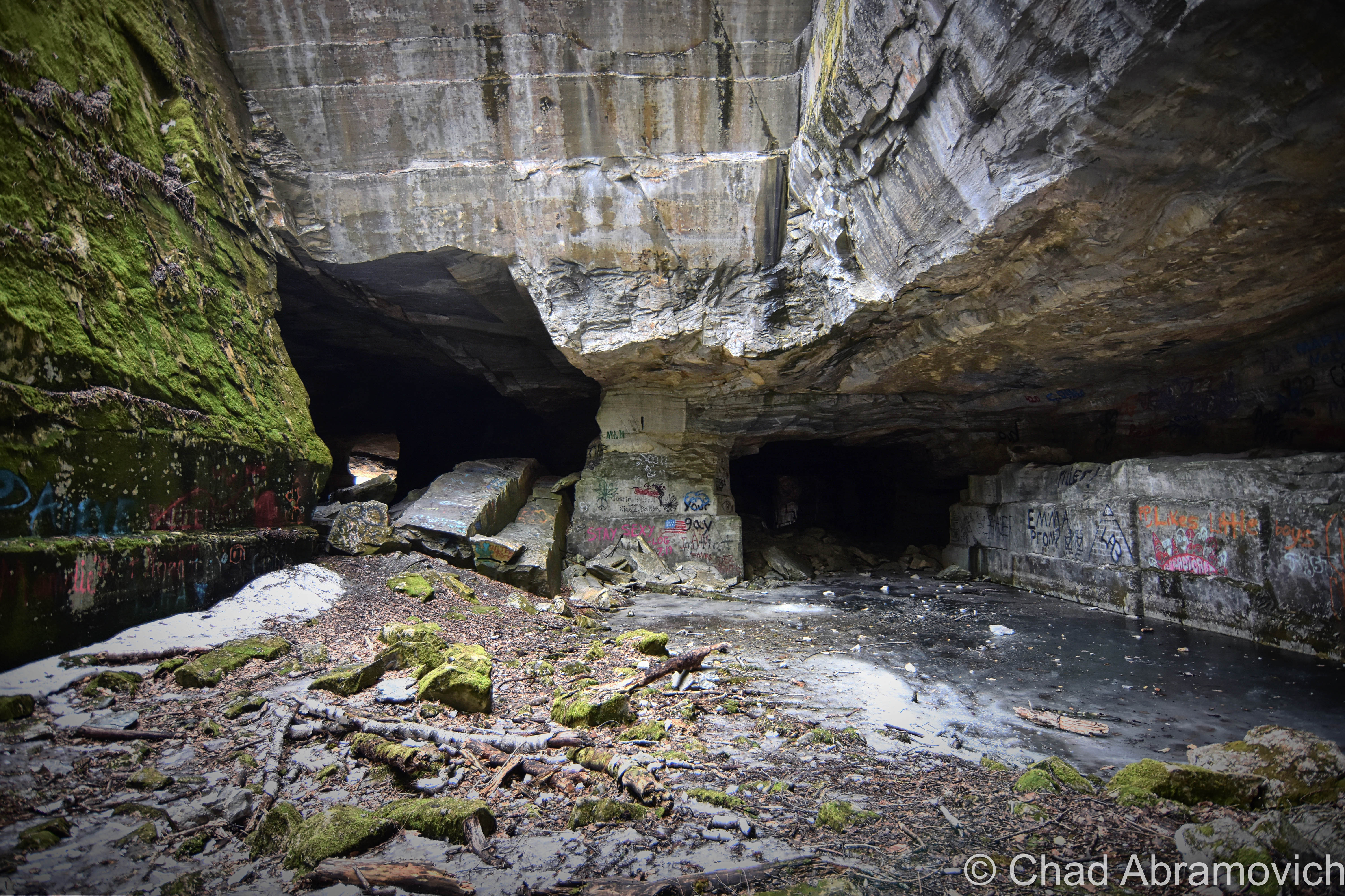
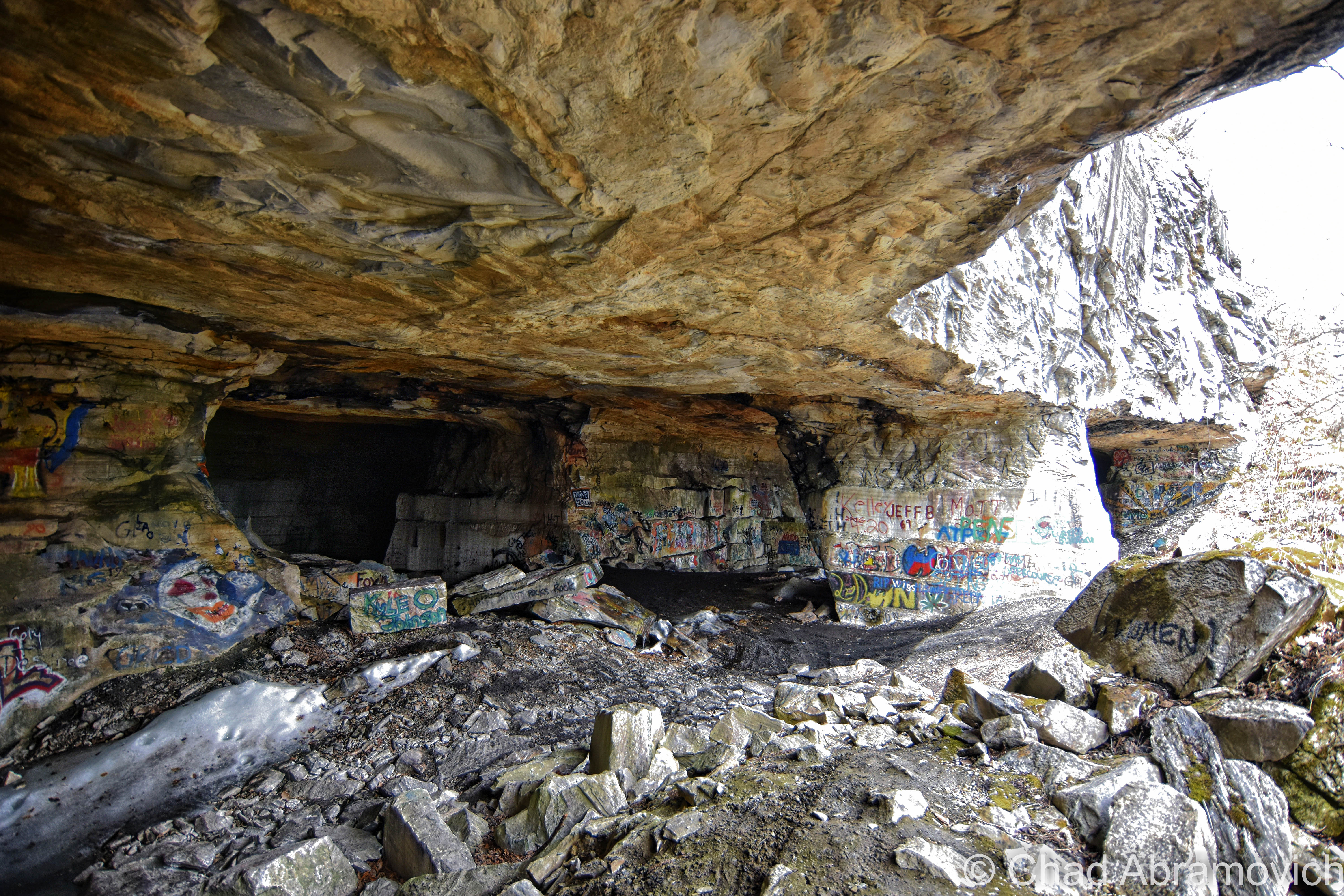
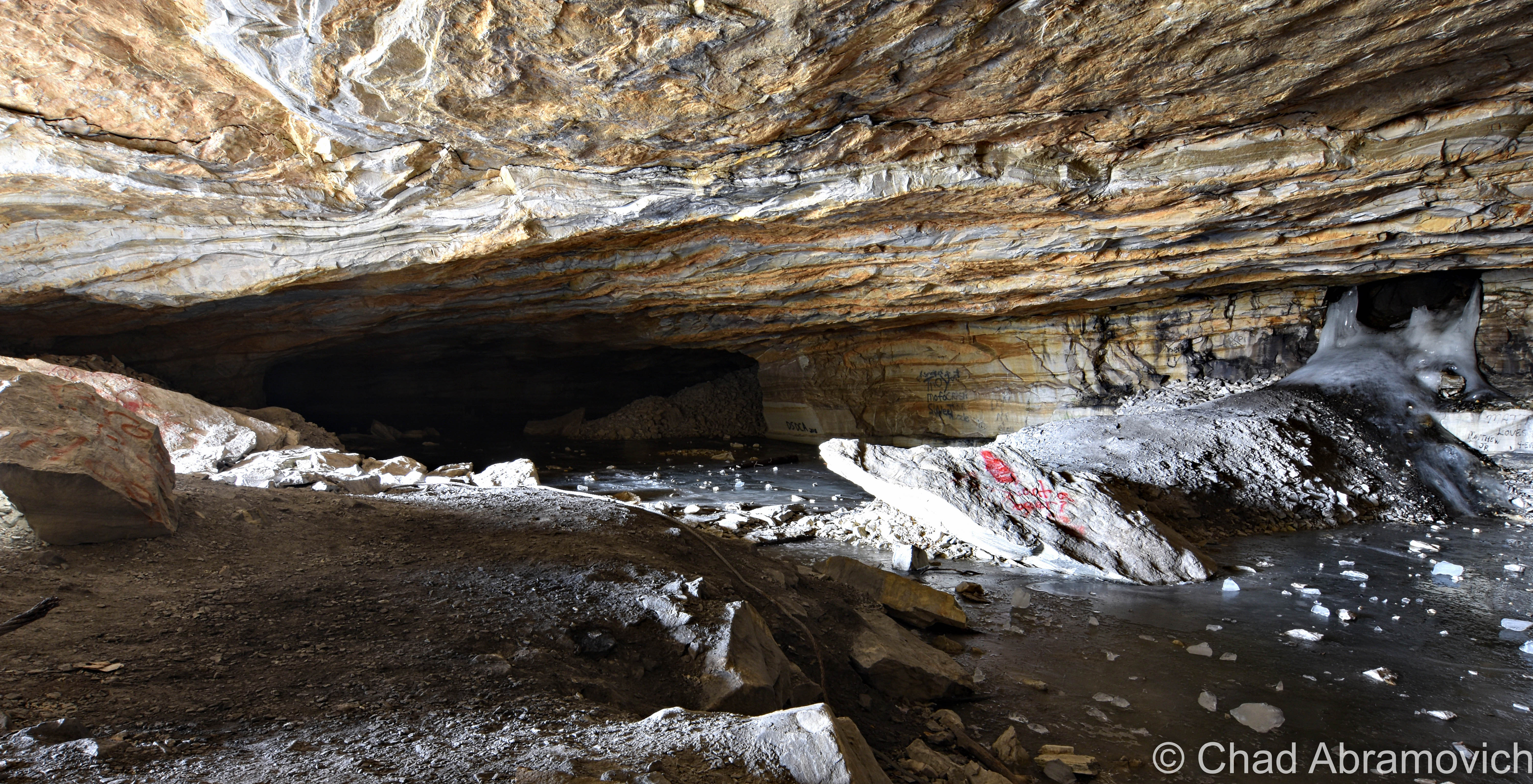
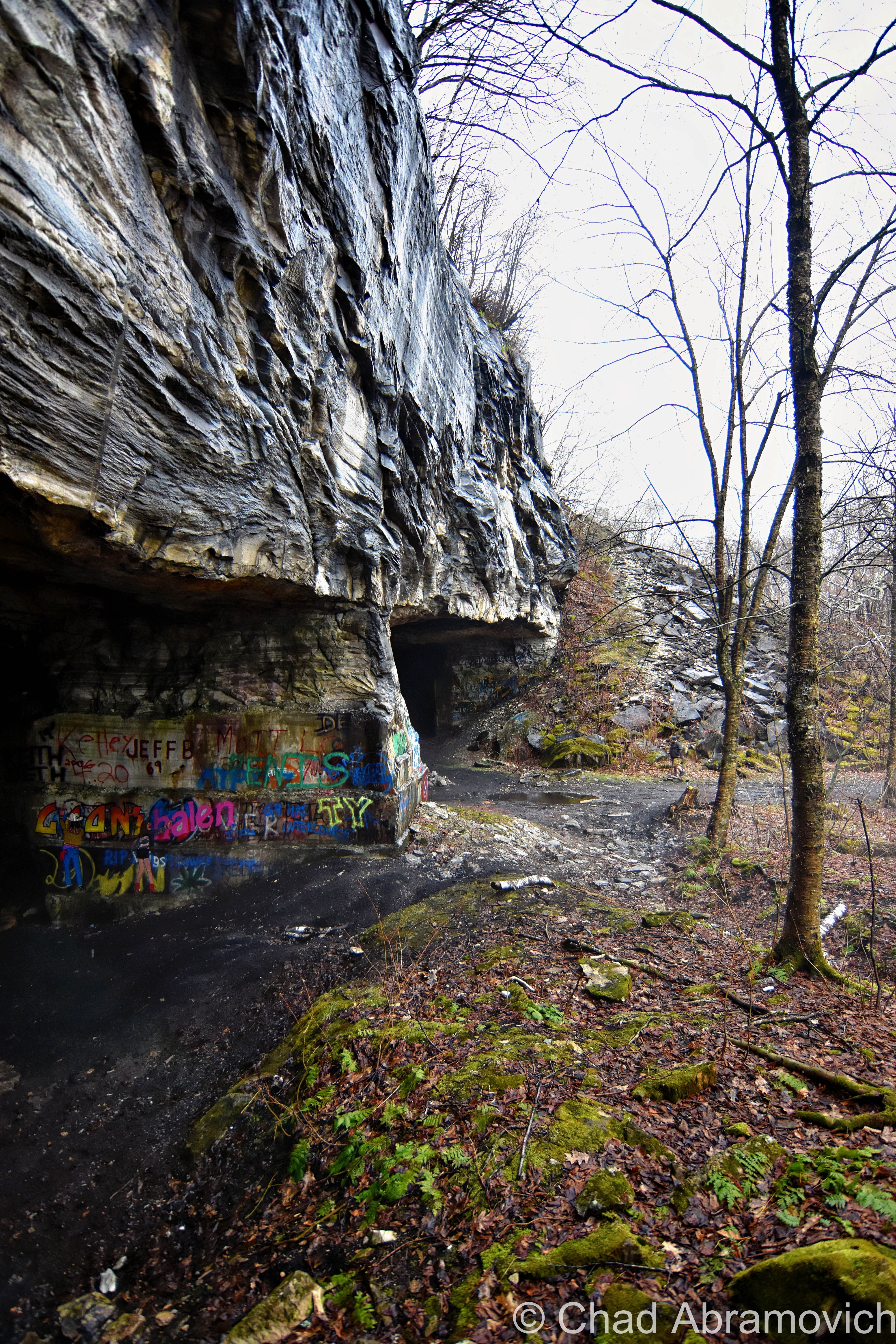
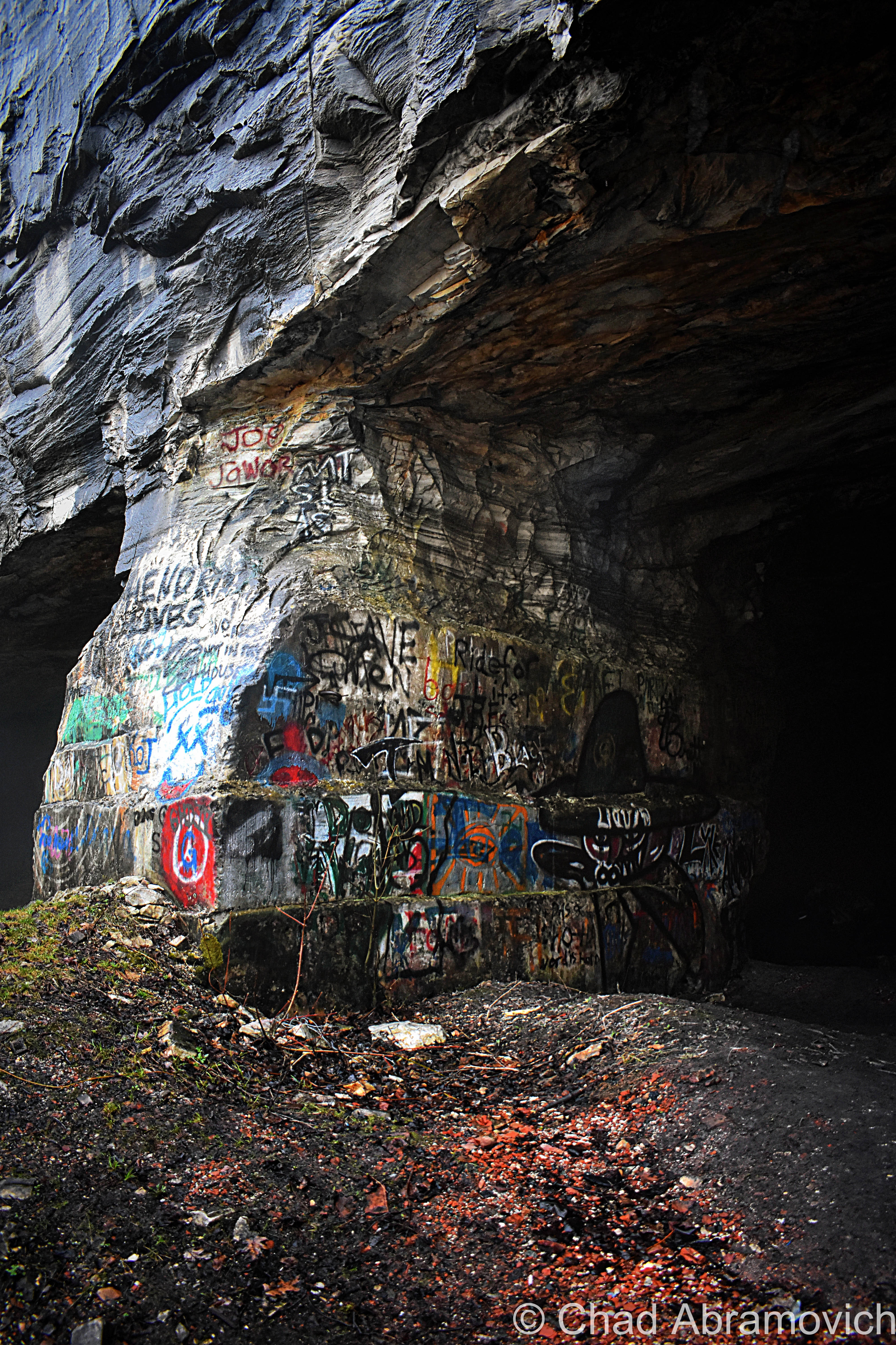
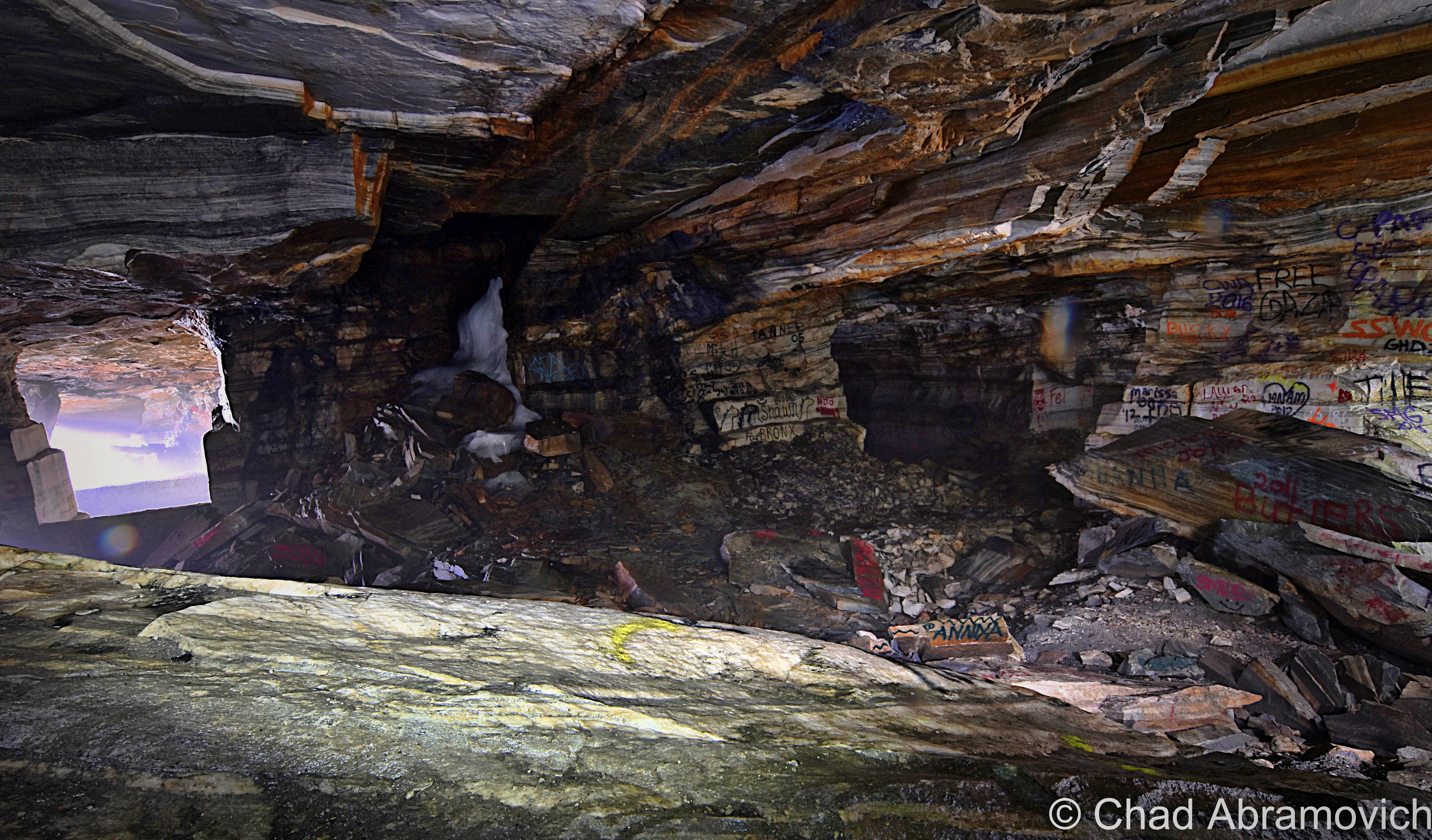
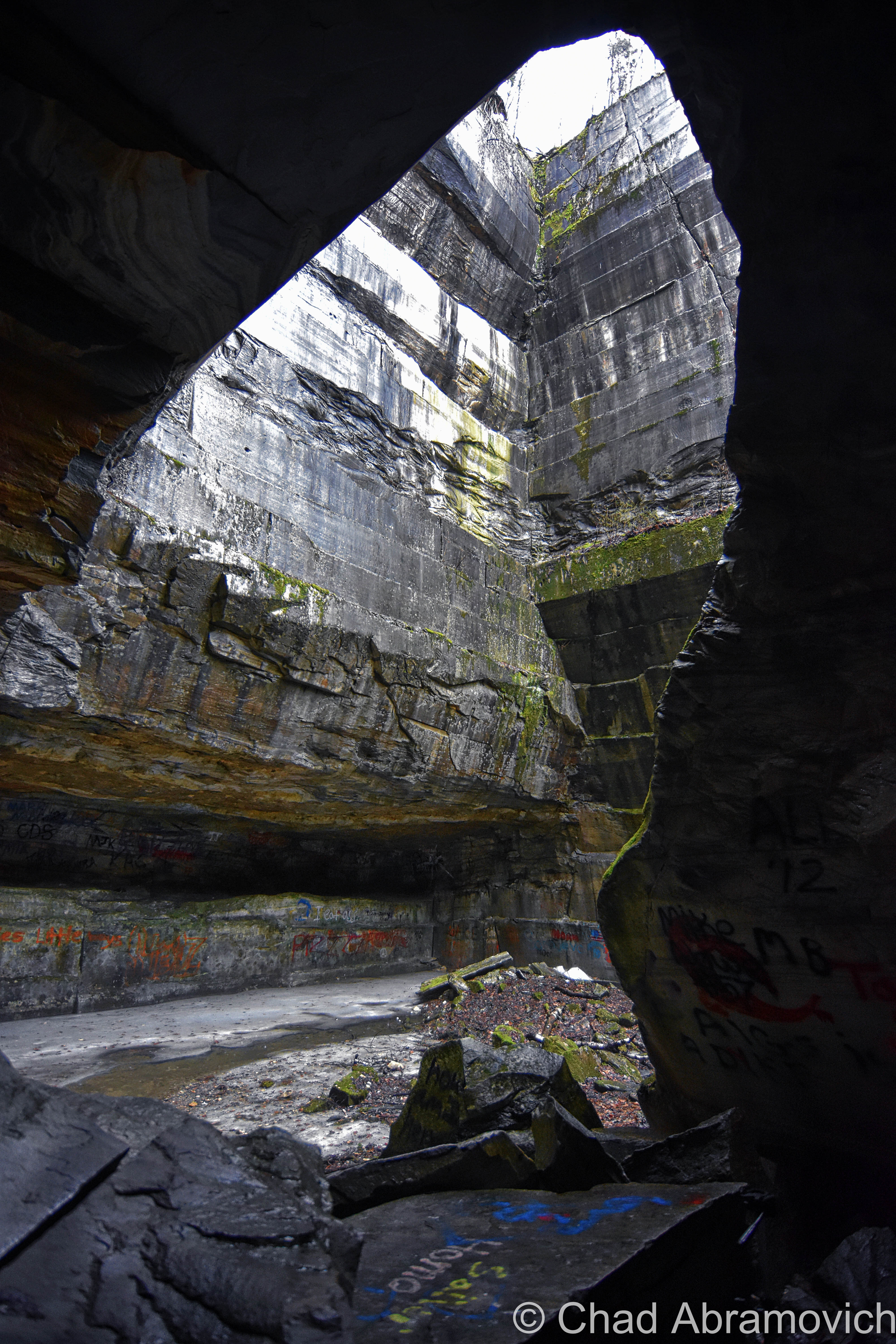
This time, it was my friend Jay that accompanied me, who found my previous failed attempts and strange encounter pretty amusing. Only this time, we made it to the quarry without any setbacks and spent three pleasant hours exploring its eye magnetic catacombs, flooded passages and exquisite shaft like opening that bore straight upwards through the roof of the mountainside we were underneath. Not surprisingly, the insides of the massive line diminishing space were colorfully graffitied on just about any available surface and were a mixture of the usual things you’d expect to see graffitied somewhere. Names and dates, slanderous accusations, original artwork and conjurings of the more vulgar variety. The quarry floors were littered with trash and strangely, nails, and rubbed black from numerous tire treads of all the vehicle activity inside the cave. In the winter, the flooded insides freeze over, and people snowmobile up the mountain and utilize the quarry as an awesome skating rink.
Eventually, we were losing daylight, and the quarry began to take on a more eerie pallor as the temperature dropped and the interior became a dark place haunted by the cacophony of dripping water. I’m glad I stayed persistent.
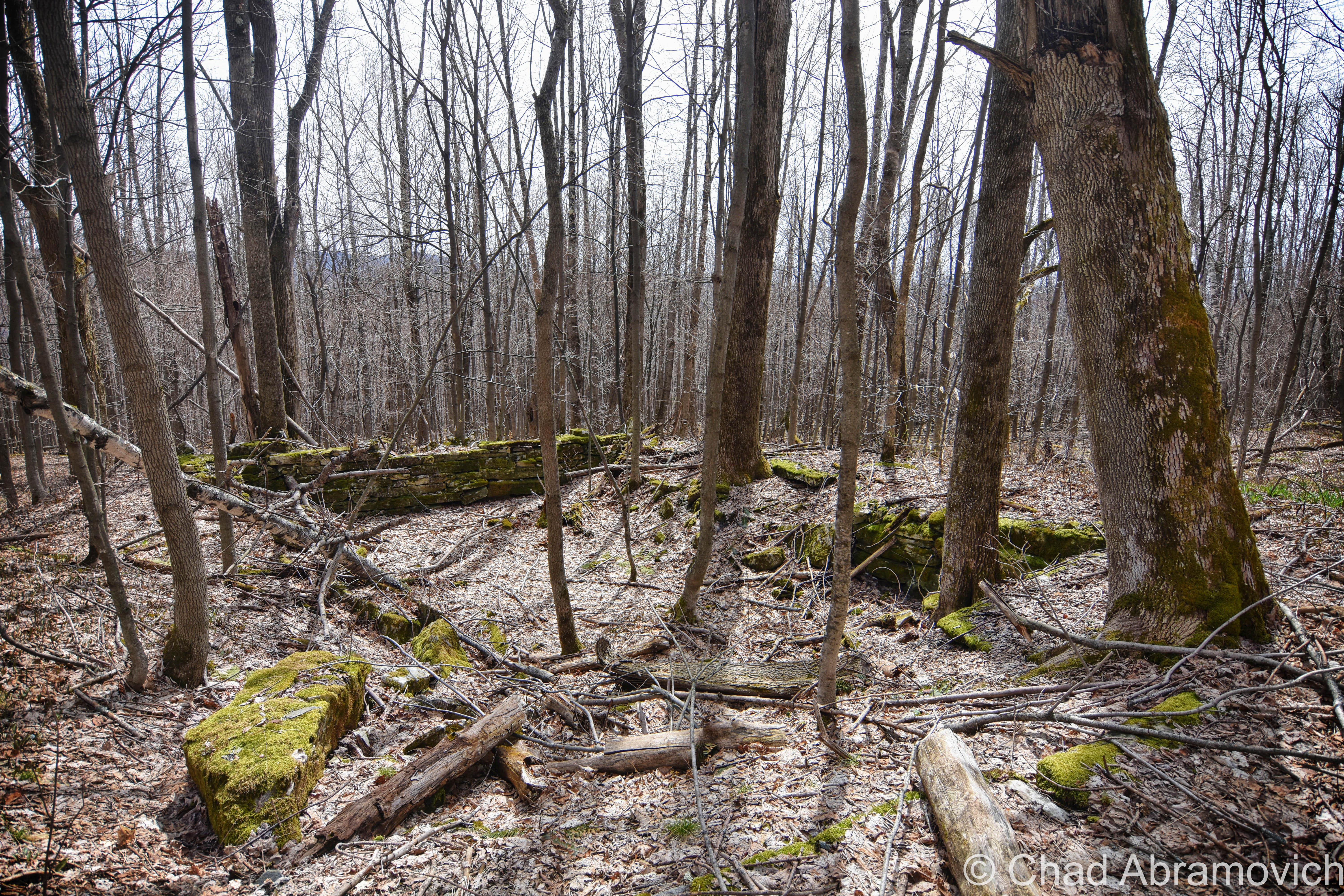
Old foundations of the former quarry operations can still be spotted on the mountain
Freedleyville re-visit, Spring 2019
I love re-visiting, re-shooting, and introducing friends to fun places. This time, it was my friend Connor along for the Vermont-venture to seek out this amazing human-made wonder.
We huffed and puffed up the old logging road for a good 40 minutes as a damp fog curled around Taconic rambles. Though springs greens were appearing down in the valley, the season hadn’t sent its pulse up in the mountains. Everything was still stark and damp.
All the marble waste that occupies the forest floor increased in deposits and foreshadowed us getting closer.
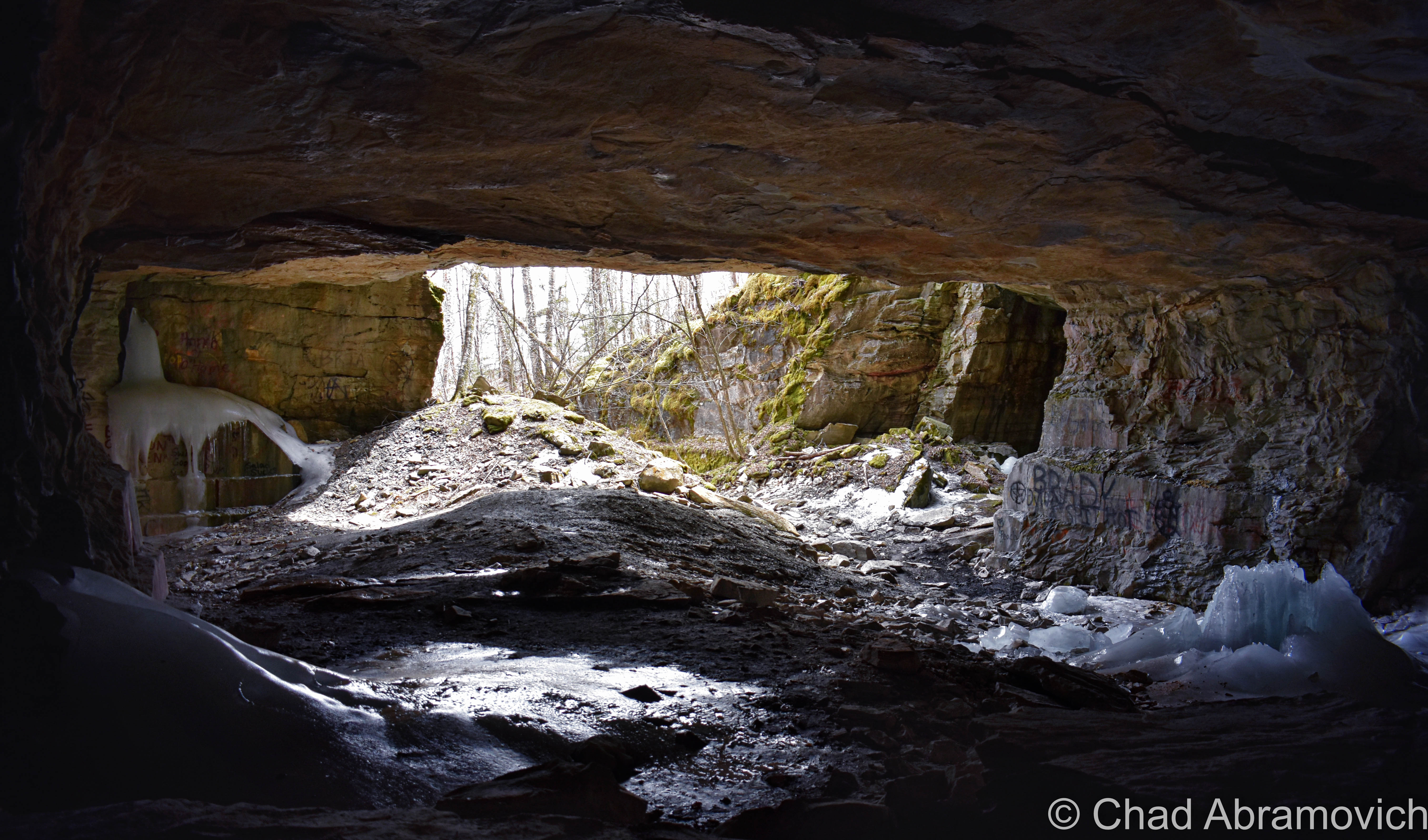
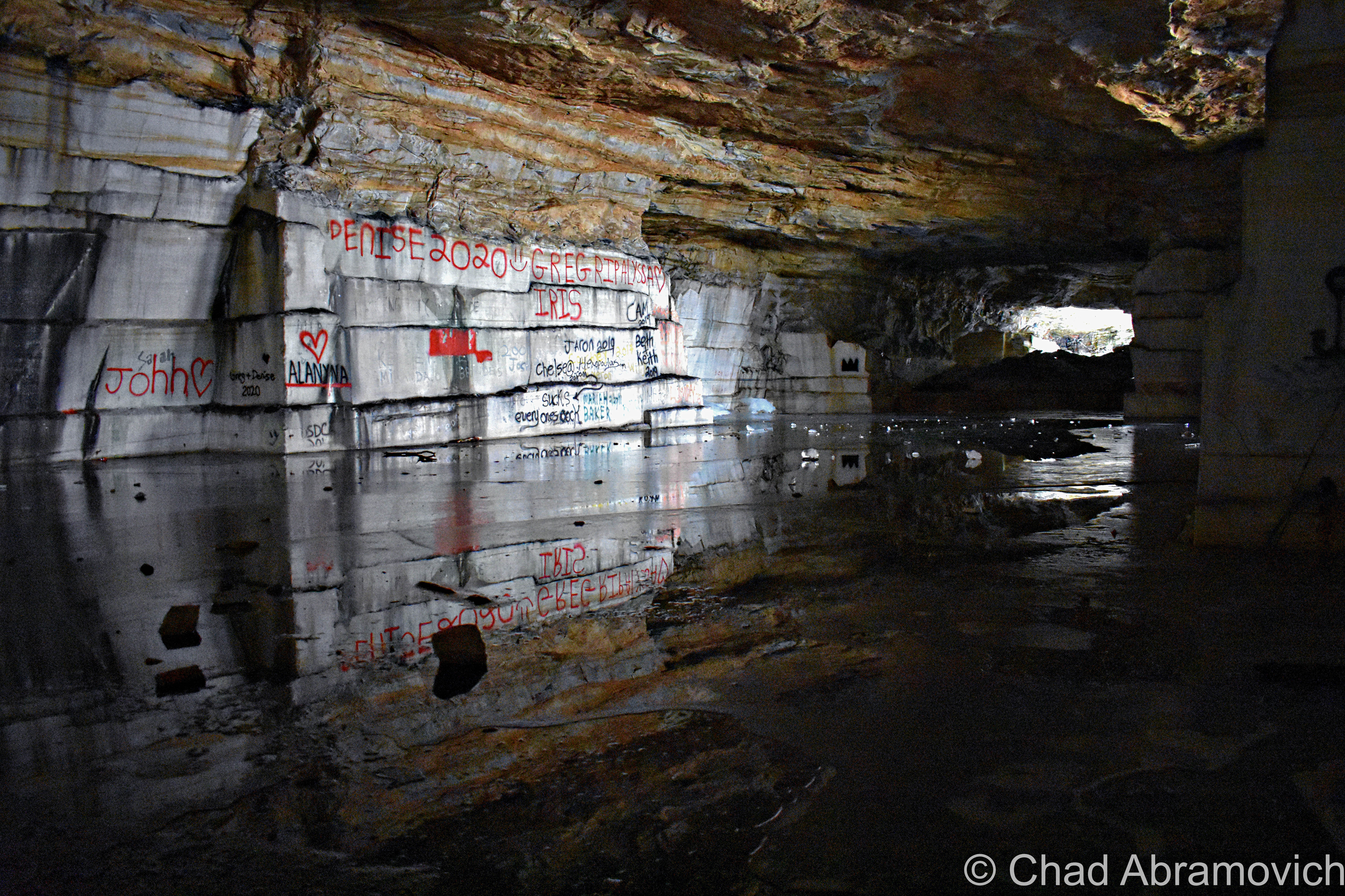
And then – there it was! A humongous gaping maw that went into the mountain that was shrouded in mists and a biting chill that belched from within, and the dark interior was suddenly ominous and a cacophony of strange noises. We had a blast walking around and observing the natural marble, the graffiti left from other wanderers, and seeing where the various icy passages went. In the winters, and interior lagoon in the back tendrils of the cave freezes over and you can ice skate it or get a game of quarry ice hockey in.
—————————————————————————————————————————————–
To all of my amazing fans and supporters, I am truly grateful and humbled by all of the support and donations throughout the years that have kept Obscure Vermont up and running.
As you all know I spend countless hours researching, writing, and traveling to produce and sustain this blog. Obscure Vermont is funded entirely on generous donations that you the wonderful viewers and supporters have made. Expenses range from internet fees to host the blog, to investing in research materials, to traveling expenses. Also, donations help keep me current with my photography gear, computer, and computer software so that I can deliver the best quality possible.
If you value, appreciate, and enjoy reading about my adventures please consider making a donation to my new Gofundme account or Paypal. Any donation would not only be greatly appreciated and help keep this blog going, it would also keep me doing what I love. Thank you!
Those who know me know that I’m a huge cartography buff. That love really perpetuated when I was 10, when my mother bought me a DeLorme atlas of Vermont, and I became enthralled with it, thoroughly memorizing every detail I could. But what is it about maps that are so irresistible to me?
Maybe because of their limitless potential, and their ability to unlock the mysteries of our world. Maps tell us how things in this world relate to one another, they take data and turn it into something tangible, something understandable, and maybe something that provokes thought or feelings. Several different types of information can be conveyed at the same time, melding several different ideas into a united idea. Lines to convey topography, more lines to convey boundaries between rock layers, towns, states and countries. More lines for faults, colors for bodies of water, forest land and types of climates. Maybe it’s because maps provide some sort of order, putting everything where it needs to be. Or just the opposite. They’ve always helped me make sense of my thoughts and ideas, and even draw ideas from things that haven’t been categorized or plotted yet.
I loved getting to know the great state I lived in. But one place really stood out to me.
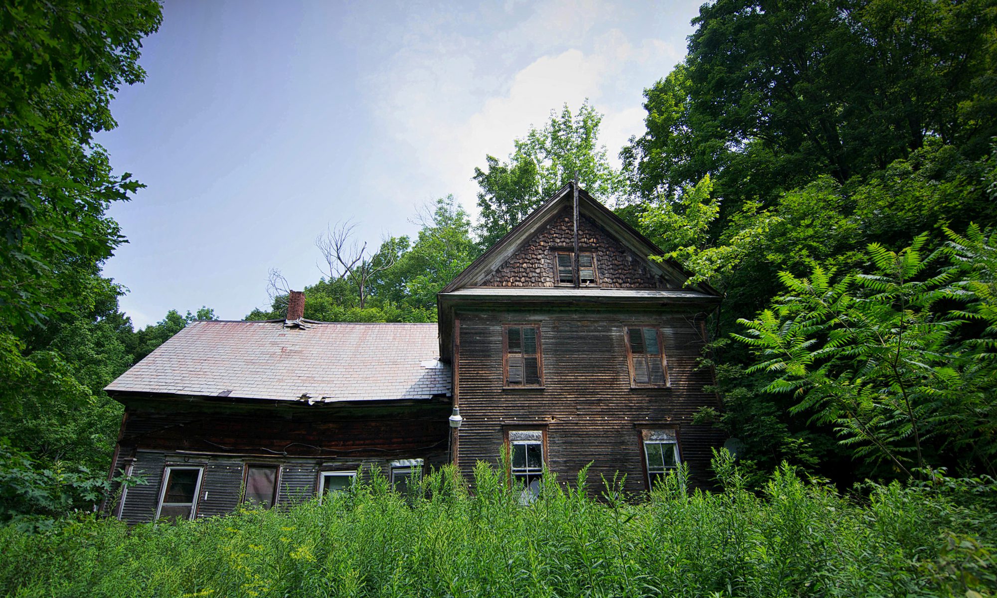
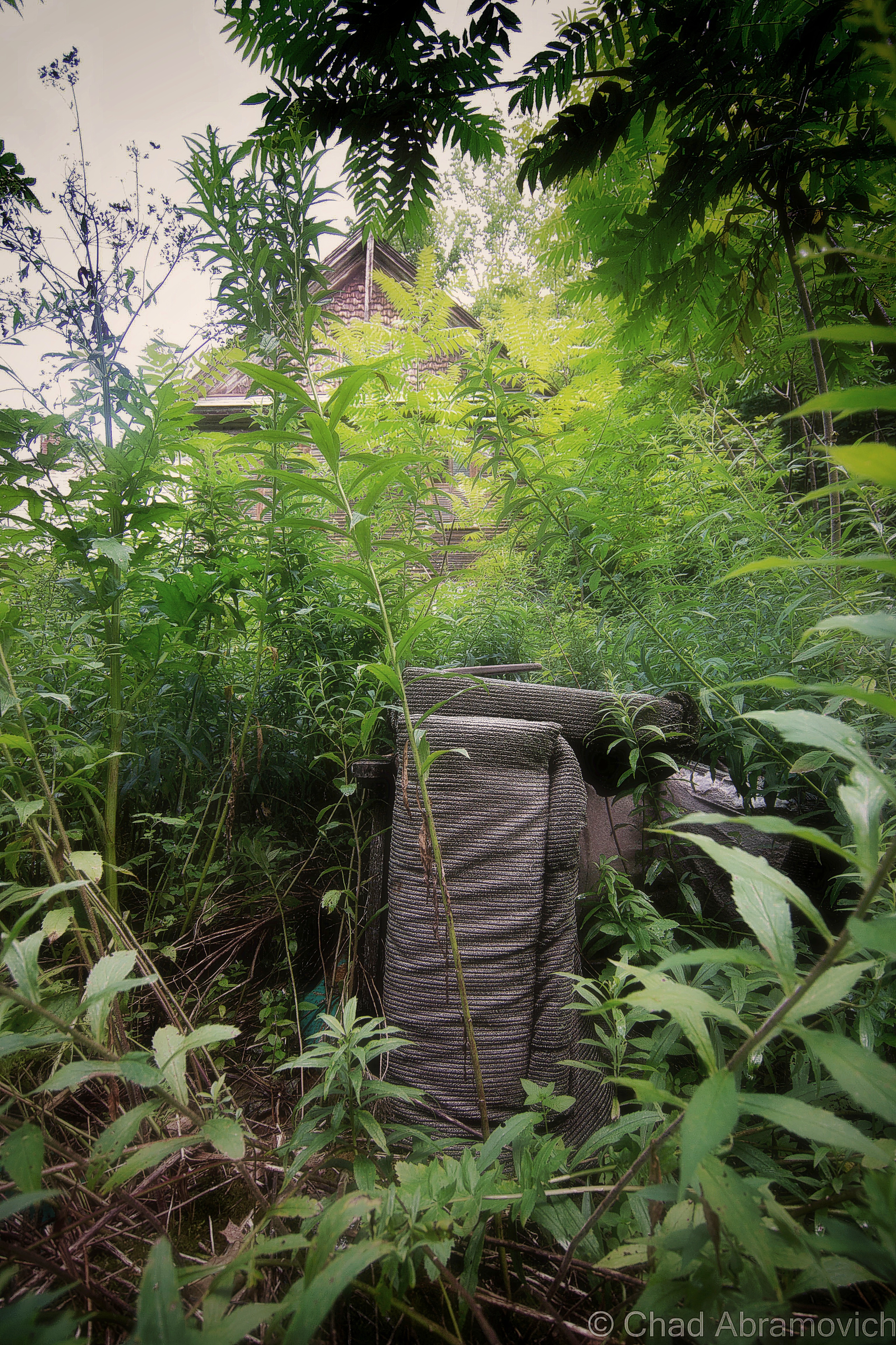
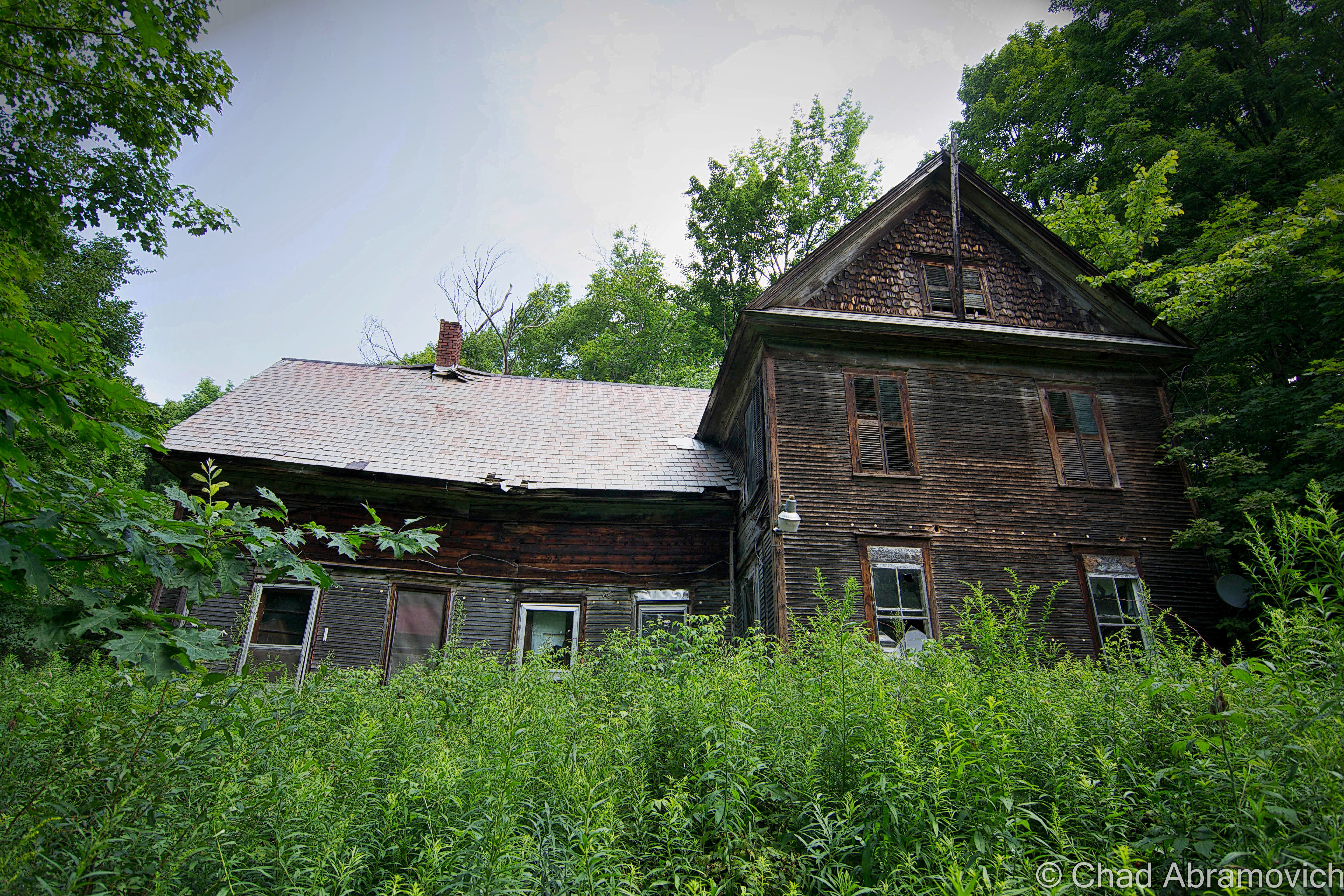
A perfect square, that yellow dotted line indicating it was the boundary of a town, with the word “Glastenbury” printed inside. But inside the square, there was nothing but contour lines, indicating several mountains and rugged wilderness. I was enthralled by the fact that this town apparently had nothing in it. In the very top left corner, in small print, was the word “Fayville”, plotted on a dotted line that seemed to be a secondary road, meandering its way from Shaftsbury deep into the hills, and ending in the middle of nowhere. Even for rural Vermont standards, this was pretty desolate. I knew there was something different about this place, it challenged my young and naive view of the world. Why wasn’t there anything in Glastenbury like other towns around it?
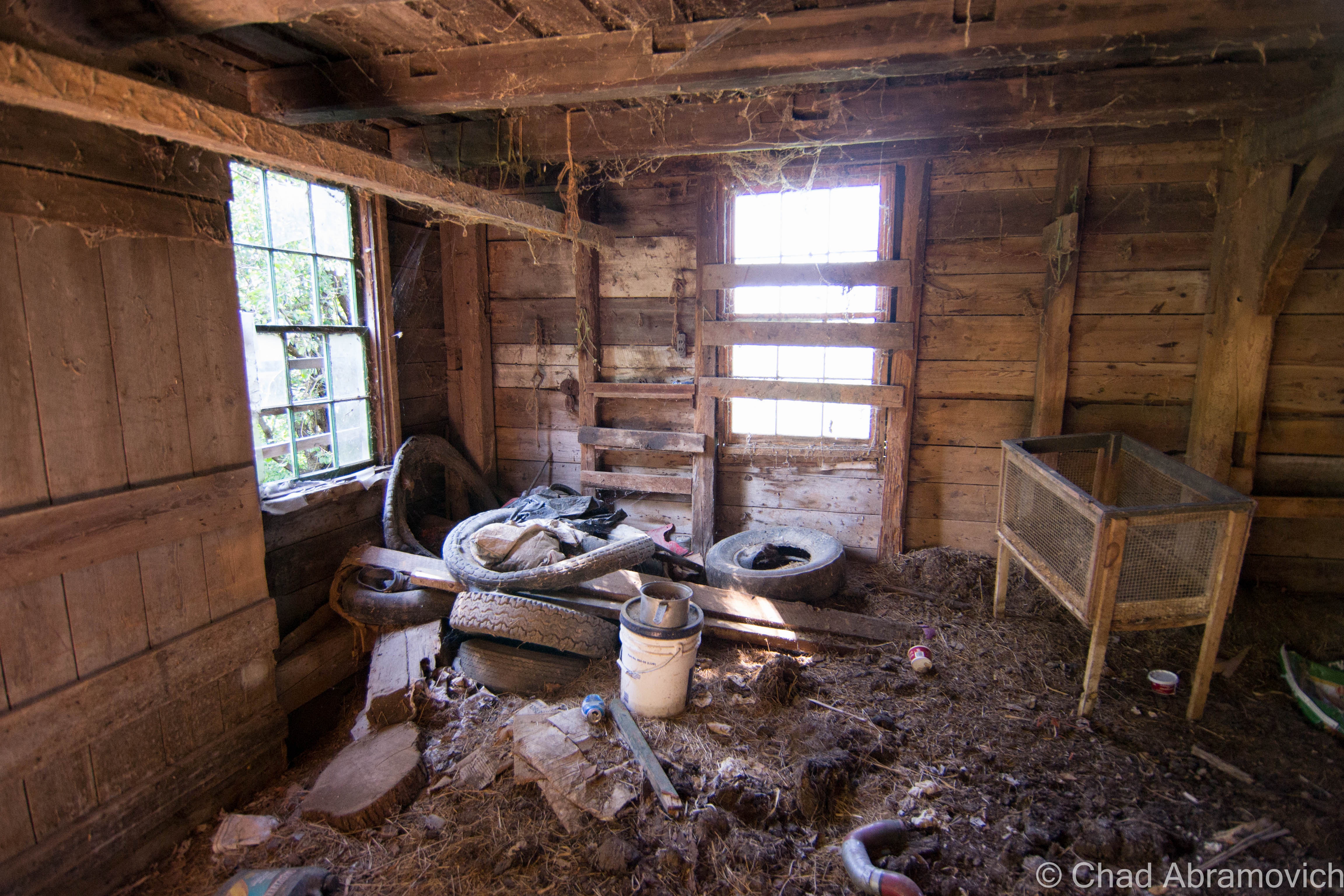
It had a mystery to it, and I wanted to know more. My first act of familiarizing myself with Glastenbury was to make the trip down to that curious place on the map called Fayville. Myself and a few friends departed in his pickup truck and drove up the bumpy forest road into a strange clearing in the middle of the hills. Here, underneath summer humidity, we found old cellar holes almost entirelly hidden by tall grasses, beneath the shade of gnarled apple trees. At the bottoms, under layers of decaying leaves and dirt were iron bands, old horseshoes, and other various relics that hinted at human habitation once being way up here. It now made sense, Fayville was a long abandoned village that still appeared on maps.
As we were wondering around, the once sunny July afternoon became dark and cloudy, as a gusty wind picked up and tangled the long grasses. And it came fast, so fast that none of us were aware of a change in weather until things got dangerous. We were suddenly at the mercy of a freak ferocious thunderstorm that seemed to emanate out of nowhere, and became so violent that we literally retreated down the mountainside, in fear of the dirt trail washing out, leaving us stranded in the middle of the national forest. But when we got back down to the flats in Shaftsbury, it was sunny and dry. To make things far stranger, gas station attendants in Arlington were baffled that a thunderstorm – especially one of that magnitude – had passed through the area without them noticing it. Freak storms are common in New England, it’s by no means a rare phenomena here, but the conditions were just right to make this a head scratcher. I still have no explanation to this day.
Over the years, I began to dive into research, and soon would discover that I had stumbled upon one of the most interesting stories I had ever heard, which remains as one of the earliest examples of what got me interested in Vermont curio. Eventually, I decided that I wanted to write about this place that has long held my attention, to pay it reverence for having an integral part of my life, and also, because I love a good story.
A modern day road map of Glastenbury – which is a little misleading. The black lined “roads” that are represented are actually forest service roads/snowmobile trails. US Route 7 and a small portion of Glastenbury Road in the left hand corner are the only real roads in town.
But Glastenbury is perplexing and complex, and something I found a little difficult to write about, mostly because there was so much information to take in. I wanted to be tactful with how I approached it, balancing the resilient history, excellent folklore, and my own thoughts. When I was finished, the only conclusion I could draw is that there is no conclusion. But I’m getting ahead of myself.
An Introduction
In southern Vermont, northeast of Bennington, lies an incredible area of backcountry. It’s a vast area, roughly 36 square miles of unbroken wilderness, with 12 peaks over 3,000 feet in elevation, the centerpiece being Glastenbury Mountain at 3,747 feet. Mostly occupied by the Green Mountain National Forest, this is a surprisingly large stretch of wilderness for Vermont. It’s name sake comes from it’s largest mountain, and the ghost town that used to be there which also bore the same name.
Glastenbury seems to yield a prolific Google search, but despite the hits, the information about the vanished community is vague at best, with much that seems to be copied and pasted from one website to the next. That’s where Tyler Resch’s invaluable book Glastenbury, History of a Vermont ghost town, emerged beaconlike in the darkness.
The town of Glastenbury was charted in 1761 by land grabbing Benning Wentworth, governor of New Hampshire. Wentworth was quite the character – granting as many towns in then unestablished Vermont as he could, with the intention to provocatively challenge New York, which also claimed the same land. Of course, Wentworth’s grants doubled as a lucrative endeavor, as he made sure to set aside some acreage for himself.
But Wentworth had no idea of the local geography, and simply drew lines on a map. Though Glastenbury tips it’s hat to a legendary place in England, Vermont’s titular community seemed to be ill fated from the very beginning. The rough and forbidding terrain and short growing season didn’t lure any settlement until the 1800s.
Because they had a mountain of wood to burn, the town embraced the lumber and charcoal industry, and began to slowly prosper as it lured settlement and business. Though Glastenbury town itself is a large area, it only contained 2 small settlements near the western border; the logging town of Fayville in the north, and later, the settlement of South Glastenbury. While Fayville is more known by people looking at a map, South Glastenbury is normally what is profiled in every article I’ve read. The two villages were never connected, the mountainous terrain was so steep that roads were never built.
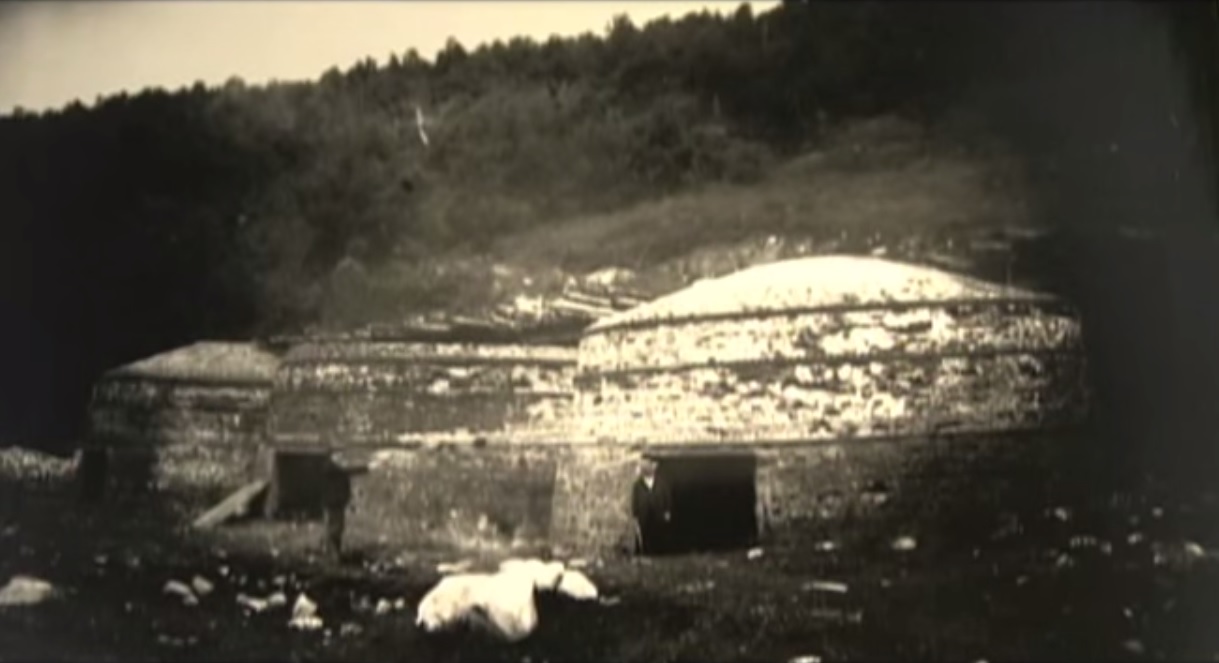
South Glastenbury became the heart of town, and the headquarters of the majority of the charcoal operations, with 12 brick kilns erected along the cleared hillsides. A massive loggers boardinghouse, and company store – the only store in town, were built to serve the village. A few homes, a meetinghouse and a crude one room schoolhouse were also built for the few kids who grew up there. Because South Glastenbury sat at the confluent of two different branches of Bolles Brook, where the headwaters met and began their descent down the mountains, the small village became known as “The Forks”.
Life here was tough. It was a wild town, sort of a last frontier in Vermont. It was the kind of place where men out numbered the women, and the law often didn’t exist.
An 1865 Rice and Harwood Map of Glastenbury and Woodford shows the village of Fayville in the top left corner of town. South Glastenbury hadn’t been settled yet | via: oldmaps.com
I’m not willing to pay the $20 image purchase fee – but the website historicmapworks.com has an 1869 Beer atlas map of Woodford that you can check out – and this is one of the few maps I’ve came across to feature South Glastenbury in it. The map is sideways, so look for “District 2”, beyond the Woodford town line, and the black dots that represent buildings plotted around Bolles Brook.
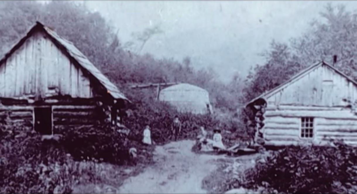
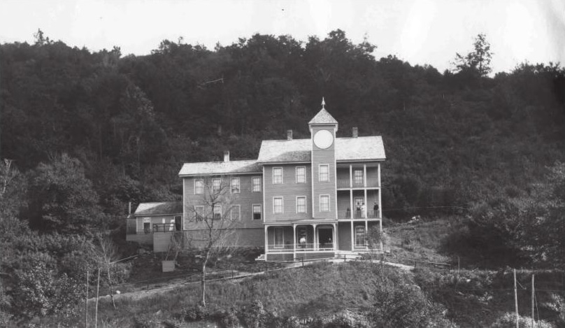
A girl, a man and a boy outside Glastenbury Camp, 1933. Photo: UVM archives – The Landscape Change ProgramThe Loggers Boarding House in South Glastenbury, with several of the woodsman posing for a photograph. Photo: courtesy of Images From The PastA few of the brick charcoal kilns in South Glastenbury.A strangely forlorn shot of South Glastenbury that really gives you an idea of what life was like for folks up there in the mountains. Primitive log homes and a charcoal kiln can be seen, with a few locals out front along the road. Photo: courtesy of Images From The Past
With a profitable timber industry came demands. People needed to get up into town, and lumber and charcoal needed to get down. The steepest railroad ever built in the United States was constructed as the solution, which started out as a sarcastic suggestion turned into a defiant reality. Starting in Bennington and ending at The Forks, The Bennington-Glastenbury Railroad was formed in 1872, the tracks climbing an astonishing 250 feet per mile at 9 miles long. But depending on a finite resource eventually created the end of the charcoal and logging industry and the mountains were logged until nothing larger than a sapling remained on the slopes.
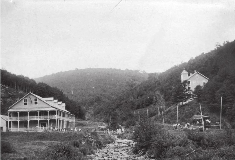
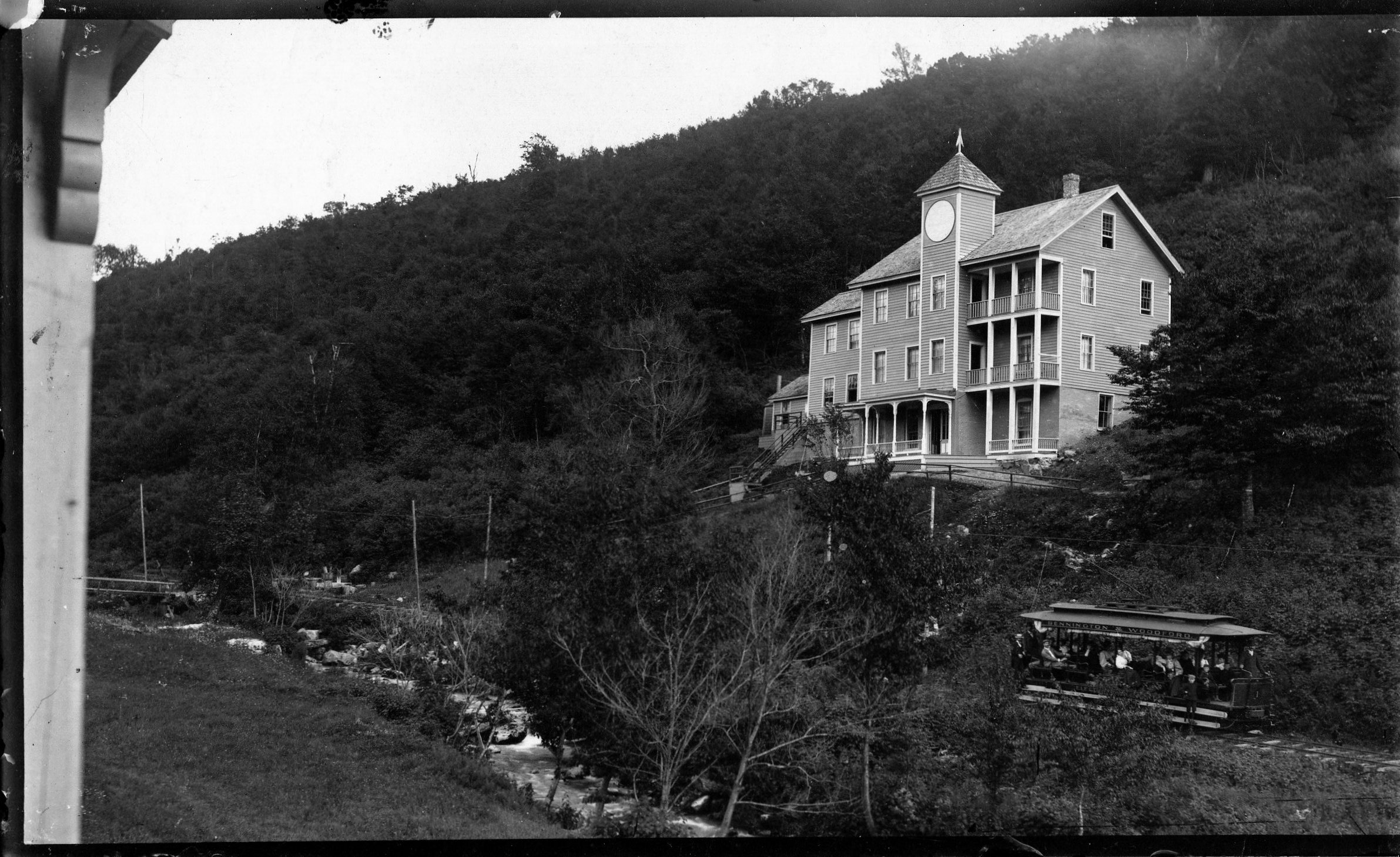
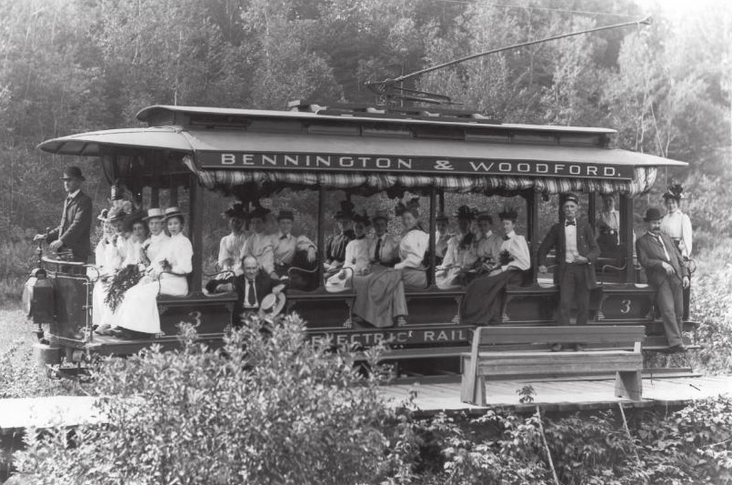
But the railroad was still around, and they wanted money. The question was, what to do with it? In 1894, the railroad re-billed itself as The Bennington-Woodford Electric Railroad and the town reinvented itself as a tourist destination, using the railroad as a way to bring tourists up into South Glastenbury. The railroad switched over to using more reliable trolley cars instead of traditional rail cars, because they were stronger and more reliable, especially given the elevation they would have to climb.
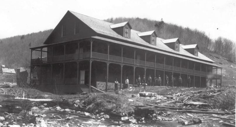
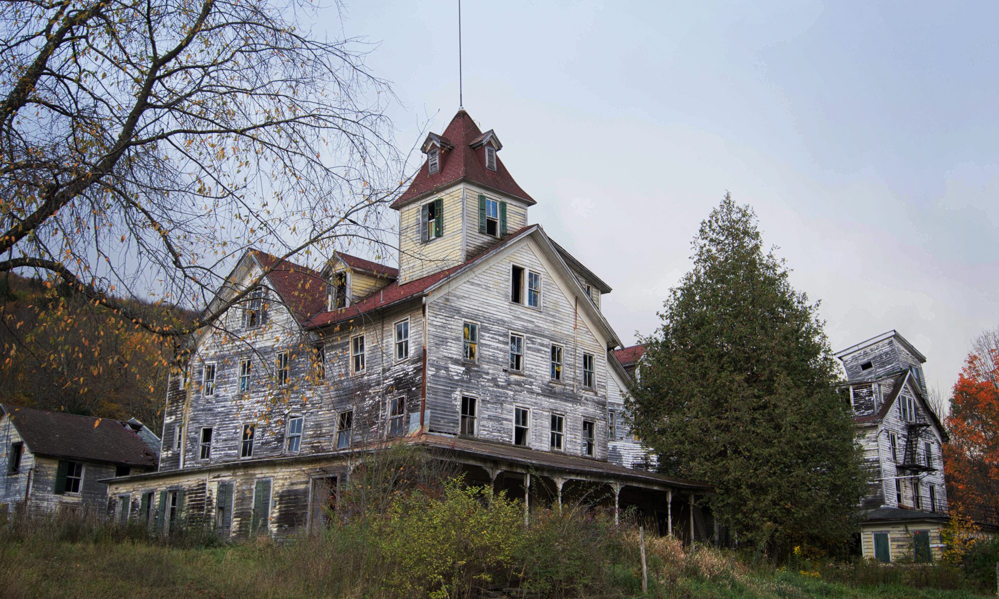
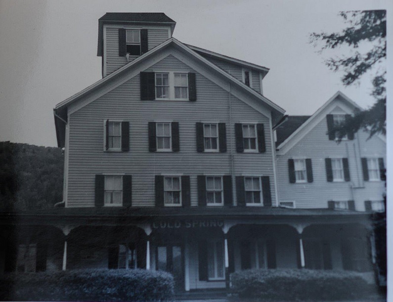
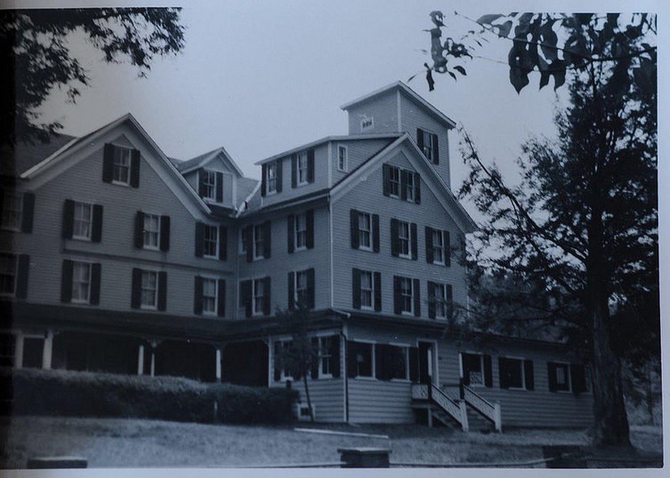
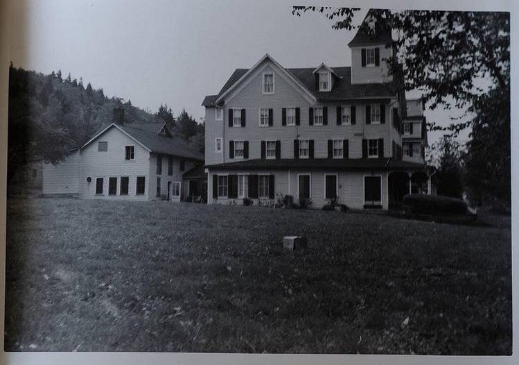
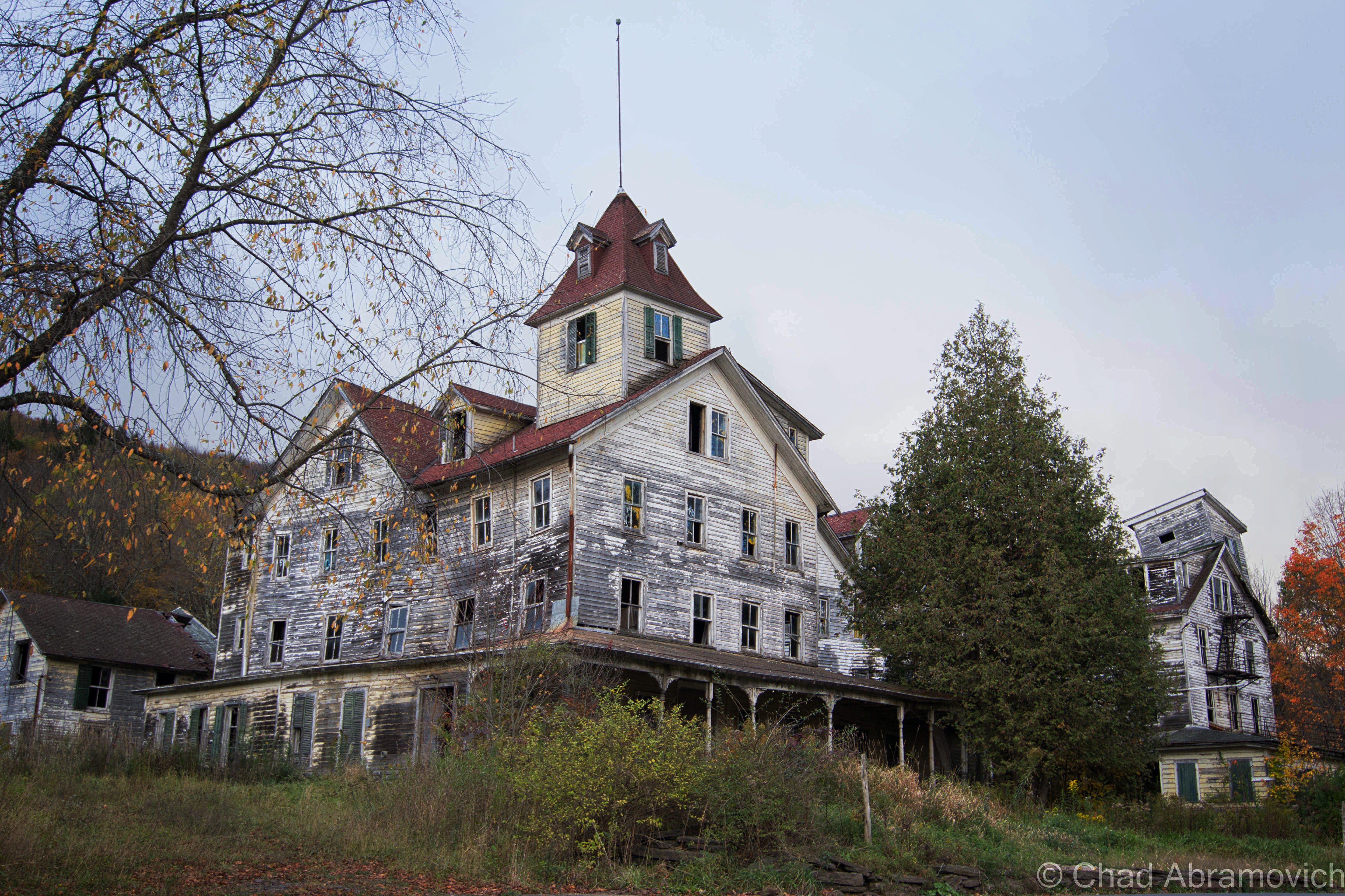
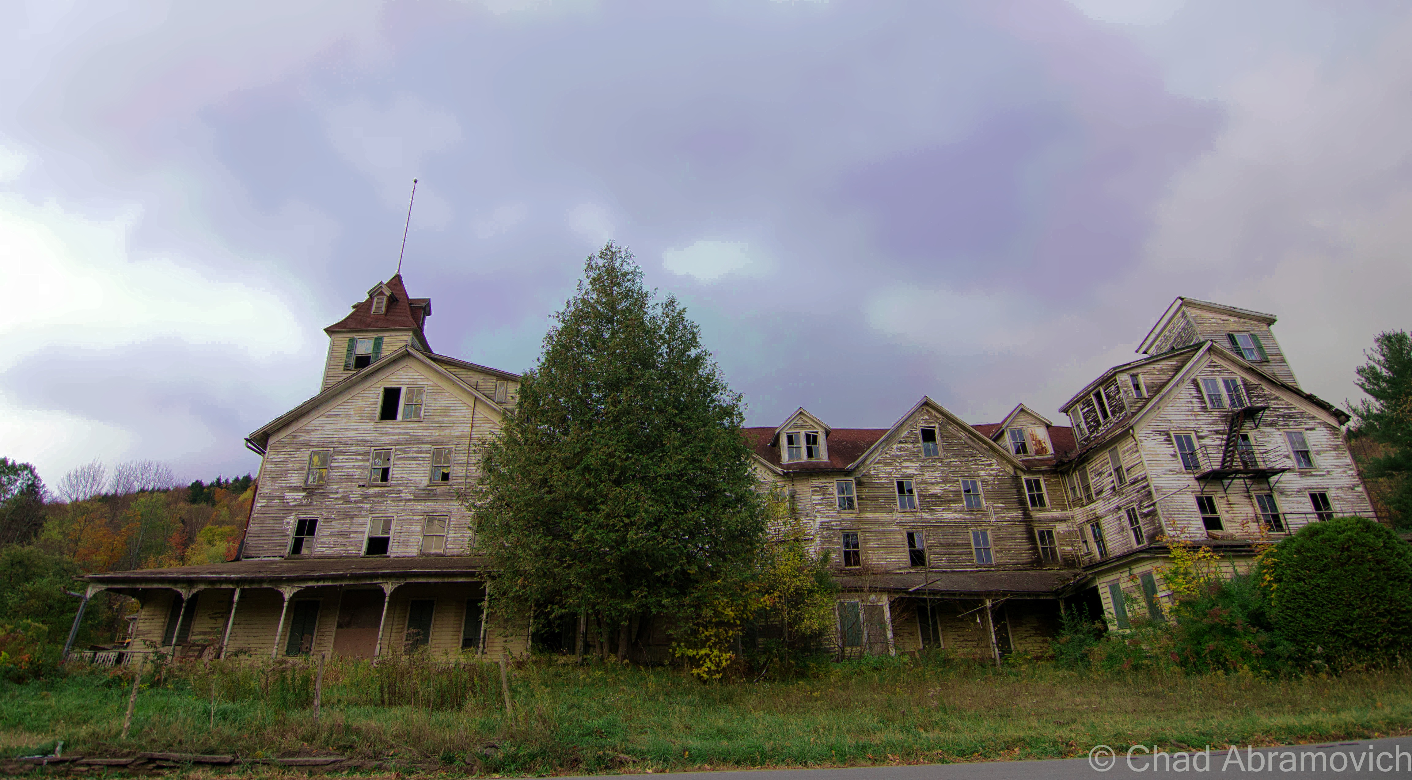
Much time and money were invested into retransforming the town – turning the brawny old loggers’ boarding house into a hotel and the former company store into a casino. No details were overlooked, and both buildings became showpieces. They wanted Glastenbury to stand out from other summer resorts. After painstaking labor and expenses, the town opened up as vacation destination in the summer of 1897, and had a successful first season.
However, the barren mountains stripped of all their trees, were very prone to flooding and soil erosion. A year later, a devastating flood washed out the tracks, putting an end to the town for good. It’s high elevation and isolation ensured that no one tried to rebuild it, and the buildings fell into ruin under the silence of the mountains.
A trolley full of tourists arrives in South Glastenbury. The casino can be seen in the background. Photo Source A newspaper flyer advertising the upcoming opening of Glastenbury as a tourist destinationA classic image of The Bennington and Woodford Trolley, carrying a load of women who are dressed to impress, up into Glastenbury. Photo: courtesy of Images From The PastThe tourist destination of South Glastenbury, with the hotel on the left (old loggers boarding house), and the casino (former company store) on the right. You can see Bolles Brook and the Trolley line to the right of the brook. A walk up here today has almost entire eroded that there was once human habitation here. Photo: courtesy of Images From The PastThe casino. Photo: courtesy of Images From The PastAnother hotel at Glastenbury. The identity of this one however remains a mystery. Vaguely dated between 1890 – 1930. Photo: UVM Archives and the Landscape Change ProgramA group of individuals hiking on Glastenbury Mountain. When the group came back in the morning, they came back to water that was three feet deep. August 16, 1918. Photo: UVM Archives and The Landscape Change ProgramThis one is a mystery to me. The image is captured “On The Trolley Line to Glastenbury”. The roof of the building reads “Loafmore” Dated 1910, a decade after South Glastenbury had been abandoned. Photo: UVM Archives and The Landscape Change Program.
The population of Glastenbury dwindled down to almost nothing, which later got the attention of Ripley’s Believe It Or Not in the 1930s when they learned that all 3 members of the Mattison Family were the entire town, and held every office. Because of this, the state of Vermont disorgonized the town in 1937, the first time the state ever did such an act, and the area was reclaimed by the wilderness.
It’s even more interesting to think about that a town with such a galvanizing and unique history was actually so tiny in stature. Though many people who write about ghost towns robotically love to use descriptive terms such as “hub” or “thriving”, Glastenbury was really neither – it’s peak population climbed to around 241.
Apart from the town’s fascinatingly unique story line, it may be the obscure and inexplicable events that allegedly happened on it’s slopes that has really given the town it’s considerable attention. The area has since given birth to terrifying legends, if not actual monsters.
The casino, just a few years after its abandonment. It had already fallen into ruin by then. Photo: courtesy of Images From The PastA cartoon published in 1936 by Ripley’s Believe It Or Not featured the Mattison’s of Glastenbury.
“The Bennington Triangle”
While my love of maps inadvertently lead me to my interest of Glastenbury, their ability to organize information and draw conclusions was useless here.
Glastenbury Mountain and the surrounding area has long been considered one of Vermont’s most haunted places. In 1992, local author and folklorist Joseph Citro coined the term “The Bennington Triangle” to describe the area, and the designation not only stuck, it grew immensely in popularity. Over the years, the phrase has been been featured in books, websites and television shows, to the point where the name has taken a life of it’s own.
The theories and enthusiasm have quickly escalated and have continued to morph and stoke the fire. Many are quick to glamorize the region without being objective, only further propelling it into the blurred haze of fact and embellishment.
To better understand the hysteria here, let me try to summarize the more colloquial regional portrait for you.
It started with the native Americans, who refused to venture onto Glastenbury mountain. Fearing the land was cursed, they only used the land to bury their dead. But maybe it was because of a cross wind that met on the summit of the mountain. Even today, hunters will tell you that because of the disorienting winds, it’s very easy to get lost in the woods.
There is also a baffling legend of some sort of enchanted stone somewhere in the mountains, which is said to open up and “swallow” a human being in seconds if it’s stepped on. Another reason they avoided the place.
The weirdness continued when colonial settlers came to the area, whose vague and un-researchable accounts tell of weird sounds, noises and odors that would come from the mountain. But there are human things at work here as well, and those have been documented.
In 1867, there was an alleged wild man sighting, where a mysterious misanthropic specter would venture down from the woods (some accounts say he lived in a cave in Somerset) pull back his coat, and expose himself to unsuspecting women in Glastenbury and nearby Bennington. He was also said to brandish a revolver for intimidation. Whoever he was, he was eventually ran out of town and faded into obscurity.
On April 4th, 1892, Fayville mill worker Henry McDowell went haywire and murdered John Crawley by bashing him in the head with either a piece of wood or a rock, depending on the story. He fled town, but was later apprehended in South Norwalk, Connecticut, where he made a full confession. However, he was babbling on about voices in his head that wouldn’t leave him alone, and as a result, was sentenced in the Vermont State Asylum in Waterbury. But he escaped by hiding in a railroad car carrying a load of coal, never to be seen again. Some say he returned to Glastenbury, and others claim that he still remains hiding on the slopes to this very day. But by now, he would be an impossibly old man, which takes on an eerie resemblance to the tale of Doctor Benton coming from the mountains of New Hampshire.
On the opening day of Vermont’s first hunting season in 1897, 40 year old John Harbour, a respected Woodford resident, was mysteriously murdered at his deer camp in Bickford Hollow, a remote area in the hills south of Glastenbury. While hunting with his brother and family friend, they heard the blast of a rifle, followed by him crying out “I’ve been shot!”. They immediately turned around and searched for him, but it wasn’t until 11 AM the next morning when they found him, his legs protruding out from underneath a Cedar tree. However, something wasn’t quite right. His loaded gun sat neatly beside him, as if it was purposely put there. But something was wrong. His body was a distance away from where he was shot. They now knew that John had to have been moved. But by what? Did he crawl there after being shot? Did he receive human help, possibly by the shooter? There were no signs of him having walked or crawled to his final resting place, no clues at all. The mystery remains unsolved to this day.
It was after these two murders that signaled both the beginning of Glastenbury’s slow decline, and the establishment of it’s reputation as a mysterious and haunted place. Sometime in the early 19th century, a stagecoach full of passengers were making their way over the mountains near Glastenbury, near present day Route 9 in Woodford. It was well past dark and a violent rain storm was washing out the road. The rain was coming down so hard, it soon forced the driver to slow down to a crawl as the thunder cracked the night sky. Things became so bad that the driver eventually came to a complete stop in the dark and wet mountain wilderness. As he hopped down from his perch with the lantern to get a good idea of the situation, he noticed something peculiar illuminated by lantern light. There were unfamiliar footprints in the mud just ahead of him.
The rain hadn’t washed them away yet, so they had to be fresh tracks the driver reckoned. His observations revealed that the tracks were widely spaced, suggesting that whatever had made them was tremendous in size. He noticed the horses were beginning to get spooked, but he just couldn’t stop thinking about those tracks. What made them? He soon hollered back to the passengers and asked for their opinions. At this point, the horses were going wild, which was spooking the driver. That meant that something was skulking nearby, and it might just be what made those tracks…
As the passengers began to step out, something dealt a savage blow to the side of the carriage. Now, all of the passengers scrambled out of the carriage, completely terrified. The blows kept coming, until the whole thing tumbled over on it’s side.
The quivering passengers and driver huddled together in the dark, the rain stinging their faces. Then the creature came into view. Though it was almost impossible to see, two large eyes could be made out staring at them. A vague detail described the brazen creature as roughly 8 feet tall and hairy, before it shambled back into the woods. Shortly after, whatever had attacked them had became dubbed as The Bennington Monster.
Another interesting theory suggests that the Bennington Monster is actually the horrifying transformation of the Glastenbury Wild Man. After he was chased out of the region, he took back to the woods and dwelled, becoming cannibalistic, deformed and insane, wearing animal firs and attacking lone stagecoaches coming over the mountains.
Strange Disappearances
Giant hairy monsters that topple stagecoaches are all good for earning a place an official spook status, but it was the disconcerting events that took place after the town became disorganized in 1937 that have really cemented the area into the public’s imagination and paranormal concrete.
Glastenbury is where one of Vermont’s most frightening mysteries took place, and what’s more captivating is that it really didn’t happen all that long ago. Beginning in the last cold months of 1945, people from the area began to vanish without a trace.
The first one to disappear was 74 year old Middie Rivers. He was a native to the area and worked as a hunting and fishing guide. Because of his job, he was completely familiar with the woods. One day, Rivers led four hunters up onto the mountain. Things were going fine, until their trek back to camp. Rivers got a bit ahead of the group, and vanished completely. Expecting to catch up with him at the camp, the hunters began to panic when they didn’t see him there upon their arrival. Police and a group of volunteers combed the area for hours. But Rivers was an experienced woodsman, so they were fairly confident they would find him in no time. But search attempts continued for over a month, and no trace was ever found. Local lore has it that Rivers disappeared near Bickford Hollow, the same place John Harbour was murdered.
The next person to vanish is the most infamous of all the Bennington Triangle disappearances, the case most talked about. on December 1, 1946, 18 year old Paula Welden decided to take a hike on the Long Trail. she left her dorm at Bennington College and walked into the woods. She was easy to spot, because of her bright red coat. Plenty of people saw her that day, including on the Long Trail itself. But Monday came, and Paula didn’t show up for her classes. The college called the sheriff’s department. 400 students and faculty members assembled to help look for their missing classmate. A massive search party of 1,000 people, bloodhounds, helicopters and even a clairvoyant, combed the area diligently for weeks. A $5,000 reward was even offered! But on December 22, all efforts came to an end. There was no body, no clothes, no evidence, nothing. The quality of Paula Weldon’s search party was met with scrutiny, and because of this, it lead to the formation of the Vermont State Police. Another interesting detail I uncovered was that to this day, there are people who think it’s bad luck to wear red while hiking Glastenbury Mountain.
The third person to disappear was on Columbus Day in 1950. 8 year old Paul Jepson was waiting for his mother in his family’s pickup at the dump they were caretakers for. But when she came back, he was gone. Like Paula Welden, Paul was wearing a red jacket, so he should have been easy to spot, but Mrs. Jepson couldn’t find him anywhere. Frantic, she called for help, and another search was launched.
Hundreds of townsfolk joined the search, scanning the dump and the surrounding roads, even the mountains. They implemented a double check system, where as soon as one group finished searching an area, another group would search the same area. Even coast guard planes were brought in. But all was useless. Bloodhounds borrowed from the New Hampshire State Police lost Paul’s scent at the intersection of East and Chapel Roads. Local lore says that Paul’s scent was actually lost at the same place Paula Welden was last seen. After the search had been called off, Paul’s father disclosed a peculiar piece of information. Paul had mentioned that he had an inexplicable “yen” to go into the mountains lately. Paul’s disappearance made him the third to go missing in roughly the same area. Was there a pattern here?
Maybe. Or maybe not. It was said that there were pigs at the dump his family were caretakers for. One popular theory at the time which the newspapers suggested, was that Paul wondered off and was eaten by the pigs, thus explaining his disappearance.
Others speculate that Paul was actually abducted near East and Chapel Roads, carried away in a car. That would explain why the bloodhounds lost his scent. But we’ll never know for sure. Either way, the newspapers did what they do best and ran wild, and soon, others started to wonder what was going on here?
Two weeks later, On October 28th, 53 year old Freida Langer had left her family’s camp east of Glastenbury Mountain near the Somerset Reservoir to go hiking with her cousin. She was an experienced woodsman and was completely familiar with the area. About a half mile from camp, she slipped and fell into a stream. She decided to hike the short half mile back to camp, change her clothes and catch back up. She never returned.
When her cousin got back to camp, he was startled to learn that not only had she never came back, but no one even saw her come out of the woods.
Local authorities were quick to launch another search, alarmed at another unfathomable disappearance in the area. Once again, all efforts proved to be hopeless. They found nothing. The Bennington Banner picked up on the story, and raised a disturbing question: How did Langer disappear completely in an area she was so familiar with?
More Disappearances
On December 1st, 1949, James E. Tetford had been visiting relatives in northern Vermont. He boarded a bus in St. Albans, en route to the Bennington Soldiers home, where he lived. But he never arrived. Somehow, he had vanished without a trace without ever getting off of the bus. Even the bus driver had no explanation!
This account seems to be continuously accepted as proof of paranormal happenings, without further questioning the events. It’s worth mentioning that by the time James was actually reported missing, it was at least a week after the fact, when the Bennington soldiers home finally decided to call his relatives to figure out if he was actually coming back or not. By the time the police were involved in the investigation and got around to interviewing the bus driver and other passengers, it had been two weeks, and no one really remembered anything. But some information did arise. James was last seen by a friend of his when his bus made a stop in Burlington, and guessed he might have gotten off there, offering another possible explanation to his whereabouts. But regardless, his disappearance still remains a mystery. I don’t really see a connection here to the other disappearances, but I guess because it happened around the same time frame and James did live in the area, it has just been lumped into the big picture.
And perhaps one of the most arcane disappearance took place on November 11, 1943. As Author David Paulides tells in his book Missing 411, 37 year old Carl Herrick went hunting in the woods of West Townshend, about 10 miles northeast of Glastenbury. At some point during the hunt, Herrick and his cousin, Henry, were separated. Henry eventually made it back to camp, but Carl didn’t show up. As dusk began to fall and Carl still hadn’t arrived, Henry immediately contacted law enforcement, just as the snow began to fall.
The search for Carl lasted three days without finding a trace. But towards dusk on the third day, Henry stumbled upon Carl’s body. He was laying on the ground in the woods, motionless, his loaded rifle found leaning against a tree seventy feet away. Henry reported finding “huge bear tracks” around Carl’s body, but the official postmortem was baffling. Carl was reportedly squeezed to death, his lung was found to be punctured by his own ribs. What sort of bear squeezes a human to death? It would be an impossible act.
In Joseph Citro’s Passing Strange, (which was another heavy source for this article) he further mentioned a Burlington Free Press article dated October 25, 1981 reported that a trio of hunters disappeared somewhere near Glastenbury, and not surprisingly, that too remains unsolved.
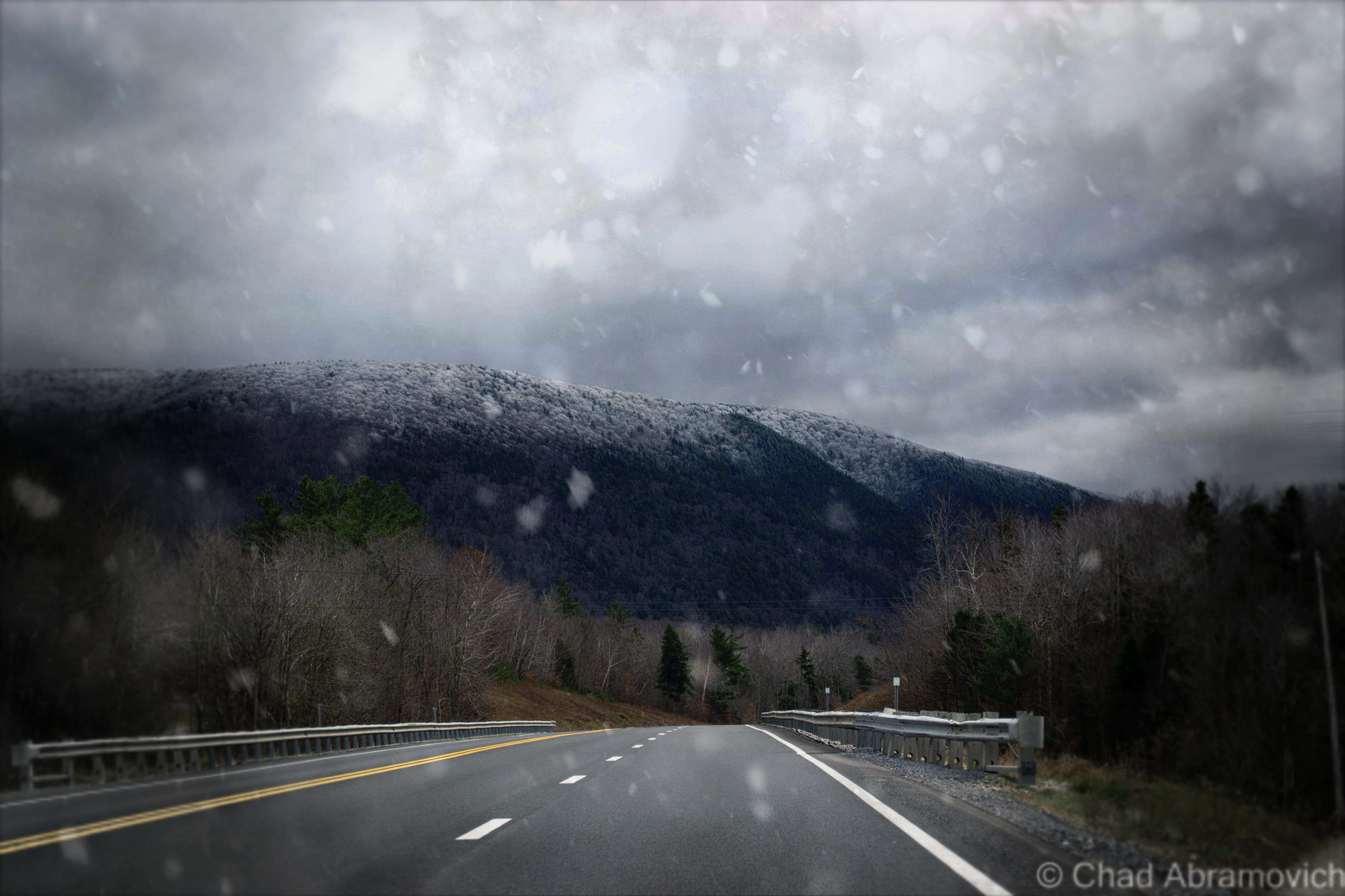
Snowfall over Glastenbury from Route 7
Additional Theories and Searching for Answers
If you take these other accounts into consideration, this raises the number of disappearances from four to nine, which begs the question, what happened here? Where could nine people vanish to without a trace?
This is what we do know. The victims ages ranged between 8 and 74 and were evenly divided between men and women. Time is also a pattern. The disappearances all happened during the same time of the year – the last 3 months – and many of them were last seen between 3 and 4 PM. The rest is up for debate.
Because of the vast scope of the wilderness area and it’s inaccessibility, the task of finding a body is difficult. The conditions could easily ensure that someone’s remains would never be found again, regardless of cause of death. Depending on who you ask, there is a pattern there.
Speculations abound, adding many more layers to this fabled region’s already weighted and transgressive reputation. Could the Bennington Monster still be stalking the slopes, carrying its victims to some cave on the mountain? Maybe. As recently as 2003, Winooski resident Ray Dufresne saw something peculiar on his drive down Route 7, near Glastenbury. What he first thought was a homeless man stumbling around in a snowsuit, turned into an alleged bigfoot sighting upon a closer look. That story immediately blew up and was even picked up by local news stations. While some skeptics dismiss it as a prankster in a Gorilla suit, others aren’t buying it, and plenty more sightings have been passed down by word of mouth from the Bennington area, all which remain unaccounted for.
Or maybe, could these unfortunate people have accidentally encountered that enchanted Indian stone, and were swallowed in seconds?
Alien abduction is another hypothesis. Many reports of UFO sightings and strange lights in the sky have been spotted over the Glastenbury wilderness over the last century. Most notably, a “flying silo” shaped anomaly was see over the skies of Bennington by Don Pratt in 1984, which seems to be the go-to example for extraterrestrial sightings in the area.
But my personal favorite was designated by John A. Keel, an American journalist and influential UFOlogist, who used the term “Window Areas” to describe these places, or, some sort of inter-dimensional doorway or vortex into another world. New England seems to have a fair share of them. The legendary Bridgewater Triangle in Massachusetts which has similar phenomena, and the summit of Mount Washington are two of the most notable.
Perhaps the most tangible answer could be something all too familiar, a serial killer. “The Bennington Ripper” and “The Mad Murderer of The Long Trail” were all monikers given to the possibility of a sinister suspect that lurked in the wilds, but no evidence was ever found to prove this. The police during that time were not familiar with serial killers or how they operated, so even if it was the work of such a killer, the facts would have gone undocumented.
Adding to the seemingly ever growing list of theories, this one might be the most plausible. Near the former village of South Glastenbury, there are a few old wells. Some speculate that Middie Rivers accidentally tumbled down a well while on his hunting trip. His party, being unfamiliar with the area, never thought to check. As for the others….
An odd footnote to all of this; the body of Freida Langer did eventually appear, seven months after she had vanished. But sadly, this wouldn’t be of any help. It was in an area that search parties knew they had combed thoroughly, near the flood gates of the Somerset Reservoir. It was a completely open area, and anything there would be impossible to miss. And yet, here she was. Or, what was left of her. Her remains were in such gruesome condition that no cause of death could ever be determined.
Even More Strangeness
Enigmatic situations aren’t contained to the past, things reportedly continue to happen here to this day. Countless internet searches have dug up numerous unusual tales posted on message boards and blogs from hikers, hunters and curiosity seekers.
In the book Haunted Hikes of Vermont, Author Tim Simard mentions a one time incident of hearing a ghostly train whistle while hiking along the West Ridge Trail, miles away from both any functional railroad track, and the old rail bed that runs up into South Glastenbury.
One harrowing account I was able to dig up took take place on Columbus Day in 2008. This time, 2 Long Trail hikers were making their way through the Glastenbury wilderness. While hiking, they ran into a young man named Dave, who helped rebuild fire towers along the trail. They started talking about the mountain’s reputation, which at this point seems almost impossible not to do if you’re visiting. They had heard about the disappearances and shrugged it off as out of control tall tales. But Dave had a weird story to tell of his own. Dave spent some time on Glastenbury mountain restoring the fire tower on the summit, and would work up there for extended periods of time.
While camping in Goddard Shelter, his friends reported that there were nights that he would sit up in his sleep and laugh uncontrollably, and other nights when he would wake up screaming. Dave was considered a down to earth and smart guy, so this behavior had his friends extremely concerned, and disturbed. He had never acted in such a way before. I’ll never know if Dave had any follow up episodes, or an explanation behind these bizarre actions, the thread ended there.
Another story I was able to dig up only adds to the unscrupulousness of the region. In the book Ghost towns of New England, Author Fessenden S. Blanchard spoke with Arlie Greene – the oldest surviving member of the Mattison family. Greene recalled the old days in Glastenbury, and one particularly enigmatic, and possibly nefarious, incident. Two local men went fishing on the Peters Branch – one went upstream and the other went downstream. One of them was never seen again. A short time after the disappearance of the fisherman, someone found a human skull sitting on a tree stump near the brook. Some speculated Panthers got to him, but others weren’t so sure…
Arcane Stone Cairns
Yet another mystery, dressed in the forest light and acting as silent witnesses to times gone by. This enigma is far more benign than the previous ones I’ve covered, but is still just as vexing. There are a series of inexplicable cairns scattered around the mountain, and no one is quite sure why they exist. There are theories to why they are there. Farmers built them long ago while clearing their pastures, or several passing hikers on the Long Trail built them, to act as beacons in bad weather. But nothing adds up. The cairns were built in high elevations where farming never took place, and most of them are located miles away from the long trail in heavily forested areas. So what are they? The work of the Bennington Monster? Perhaps playful hikers built them wanting to add another Glastenbury mystery? For now, these giant piles of stones offer no explanations.
One of the stone cairns on Glastenbury Mountain. Via rock-piles.com/Norman E. Muller. Photo: David Lacy
What About Today?
Though Glastenbury is a ghost town and designated wilderness area, it’s anything but deserted. A myriad of outdoor enthusiasts, hikers, snowmobiliers, college students, history buffs, paranormal investigators and hunters all flock here to the undisturbed wilderness – trekking up the expansive network of forest roads, hiking trails or silent waterways, all realizing just how special it is here.
Today, there are about 8 residents that chose to live in this strange paradise. They love it’s obscurity, and I can see why. There are no other towns quite like Glastenbury in the northeast – and with only one road in town, a winding dirt road that snakes its way in no less than 2 miles, privacy is in abundance. And if you know about Glastenbury, there seems to be a sense of pride that comes with your knowledge of this obscure area, if not something that conjures a romantic notion of fantasy. As a matter of fact,”Chateau Fayville”, the last original house in Glastenbury and the former Mattison homestead, was put on the real estate market – and it looks like a nice place.
But there are several people who aren’t all that enthusiastic about its menacing repute and “Bennington Triangle” folklore – mostly because they’re not a fan of ghosts, curses and the bad, inflated outlook it brings to the area. Skeptical people will be quick to assure you that everything has a perfectly logical explanation. As for me, I’m one of the skeptics.
So, is there truly something phenomenal about Glastenbury that has yet to be comprehensively explained? Do curses and monsters really claim their victims? Well….this seems to be a controversial subject of much enthusiastic debate. I’ve heard it all. At the end of the day, some people surmise firmly to their untenable thoughts. I suppose it’s all subjective.
During the height of the disappearances, the local media ran wild with the stories and theories, which not surprisingly, got out of hand, creating vicious accusations and conspiracy theories. If you’re a fact checker, it’s worth noting that Middie Rivers was the only actual person to vanish within the town of Glastenbury itself. All the others were in neighboring communities, many on the Long Trail in Woodford.
To add to this, Author Tyler Reschis one of those who thinks the area is widely exaggerated, and has created preposterous theories carried by inertia. He once noted that he was surprised that more people actually hadn’t vanished, because the wilderness is in fact so large, and it’s very easy to become hopelessly lost if you stray from the trails.
Others argue that numerous things could have happened to the missing hikers. They could have fallen down an old well, or gotten lost and frozen to death, perhaps taking shelter in one of the numerous caves on the mountain which few people ever venture near. Another theory is that they were the unfortunate meals of a Catamount or giant cat, which would surely dispose of any evidence of a body.
If you put all of these pieces that I’ve covered together and add the intrigue of a town attempting to survive against all odds but still vanishing into the wilderness, you can easily draw a conclusion about something creepy and supernatural existing here. After all, the region does have great triggers for spook stories. I’m personally awe struck that such a plethora of incidents are all linked to a single area.
But at the end of the day, everything is relative. 4 hikers did disappear, and people have claimed to see weird things in the woods. The only absolute truth about all of this is that people swear these things happened. Whether the culprit was something awesome and sinister or innate, is the quandary here. Who knows for sure.
In finality, the Bennington Triangle certainly isn’t in danger of being forgotten anytime soon.
Additional Stuff! (Because this entry wasn’t nearly long enough)
Youtuber Matt Garland made this awesome documentary on the Bennington Triangle, which is in my opinion, a great watch.
—————————————————————————————————————————————–
To all of my amazing fans and supporters, I am truly grateful and humbled by all of the support and donations through out the years that have kept Obscure Vermont up and running.
As you all know I spend countless hours researching, writing, and traveling to produce and sustain this blog. Obscure Vermont is funded entirely on generous donations that you the wonderful viewers and supporters have made. Expenses range from internet fees to host the blog, to investing in research materials, to traveling expenses. Also, donations help keep me current with my photography gear, computer, and computer software so that I can deliver the best quality possible.
If you value, appreciate, and enjoy reading about my adventures please consider making a donation to my new Gofundme account or Paypal. Any donation would not only be greatly appreciated and help keep this blog going, it would also keep me doing what I love. Thank you!
Around the turn of the 20th century, there was a changing attitude on mental illness, and that created state schools. Though it’s considered a school by name, that’s a misnomer. No forms of education were carried out here, this was a warehousing facility. It was built to house around 700 residents, but shortly after it opened, it far exceeded it’s capacity, topping out at around 1,500 between the ages of 1 and 18, all housed in 13 dorms.
State schools were essentially warehouses for “feeble minded children”, or children who were infirm or autistic that parents just didn’t know how to deal with. So, federal and state governments allocated tons of money for these facilities to be built, in the name of “progress” of how societies invalids were treated and supported.
Though these places were supposed to help these children grow to their potential in a safe and educated environment, the unfortunate charges who were sent to these places were most likely abused by overworked and untrained staff, lived in squalid, over crowded conditions and received no developmental services.
While many of these institutions were brought forward with virtuous intentions, social philosophies would soon change towards World War 2, when the American Eugenics Movement and Darwin’s theory of natural selection would become popularized and propelled by misguided politicians, scientists and physicians. These “schools” became laboratories, and the unfortunate inmates would become test subjects, because once you were locked away in these sort of places, it was easy to carry out these sort of ghastly things that says a lot more about the human race than I’m comfortable with, without the general public getting word of it.
This undisclosed 876 acre state school was constructed in 1922 to serve these troubled youth, and would expand to 50 buildings. While many institutions before this one were centered around magnificent Kirkbrides, times had changed, and this facility was streamlined, focusing more on functionality in the form of duplicate buildings in a colonial brick style with white trim, which were pretty admittedly pretty drab.
The usual suspects – overcrowding and understaffing, lead to the campus to sink into deplorable conditions. Because employee responsibilities were stretched so far, treatment of the those in their care became atrocious. Many of the children were left unattended, and would wonder the halls, moaning, and covered in their own excrement. Others who were physically handicapped would be simply left restrained to their beds and forgotten, often for weeks. Sometimes, if a stubborn inmate was really unlucky, all their teeth would be removed to make feeding them easier, especially force feeding. If they weren’t neglected, many staff members would physically beat them to keep them under control, or worse, because they felt like it. If this wasn’t bad enough, the buildings were deteriorating because of neglect and no funding to maintain them, and eventually, that lead to a vermin infestation.
Though this article wasn’t written about this particular psychiatric facility, it miserably details a personal experience living in one of these state institutions by a former patient.
Conditions and life here were unknown to the outside world, until 1971, when the father of a patient filed a class-action lawsuit against the school, claiming that its young residents were not only the victims of sexual abuse, but were also living in horrific conditions. He wrote of abhorrent things like; “maggots wriggling inside or crawling out of the infected ears of several helpless, profoundly retarded persons while they lay in their crib-beds.” Investigations began making their way in, as public outrage exploded.
Rampart lawsuits and scandals in the later half of the 20th century began the slow process of these snake pits shutting down, and becoming abandoned, as people began to get an idea of what life was really like in these campuses. The fate of this hospital sadly followed many in the United States, and the stuff that was brought to the surface is horrible.
But despite these disturbing discoveries, this school awkwardly hobbled along, sinking further into a spiral of decline until all operations officially ceased in 1992 – almost 2 decades later, leaving a maze of rotting wards and tunnels behind.
A Winter Visit
I heard the end was coming. Asbestos abatement had began in a few buildings, and plans had been announced to slowly begin demolition on the school. I didn’t have to sneak around much. Though the entire property was covered in snow drifts that often came up to knee deep levels and filled my boots, the attitude here was relaxed. Other photographers meandered their way around various buildings, and a few people were walking their dogs.
A majority of the buildings were sealed up, but a good amount had their doors torn open, and security was nowhere to be seen. Many of the buildings were boarded up and were pitch black. If it wasn’t for the wintery cold, the mold and asbestos inside would have probably been insufferable. Others had entire sections which had completely collapsed.
Though there was much to see, most of the buildings were void of anything of interest. The auditorium was by far the most splendid place to explore, and also the most dangerous. The overcast and bleak landscape made the cavernous interior more sad and dreary that day. The entire building was coated in a dangerous layer of ice, so moving around the collapsing structure had to be done carefully and methodically. Some of the wooden floors were more soggy than I felt comfortable with trusting, and every staircase was coated so thickly with ice that I had almost debated not taking the risk climbing them. I was already exploring an abandoned hospital, I didn’t need to visit a real one! But I took the risk, and I’m glad I did. The floor plan kept continuing, and became a bit of a maze as more hallways and staircases kept revealing themselves.
Below the rotting auditorium was one of the better finds, the old gymnasium, a spacious area outfitted in grungy yellow hospital tile that was coated with mold and rot. The basement area consisted of two levels, and it was inky black. The lowest level was filled with knee deep water, with a layer of ice underneath, making passage treacherous. With the aid of our maglites, we made it into the gym. All I could hear was a roaring cacophony of dripping water raining down from the decaying abyss above our heads which ran down the back of our necks. It was so cold downstairs that I could see my breath in the beam of my flashlight. A friend of mine later told me that it wasn’t much different during the warmest months of the summer.
Another find worth photographing was the large cafeteria building far back, and the old power plant complete with dysfunctional and rusting machines sitting in dark spaces. The wooden floors in there were suspicious so I didn’t spend a great deal of time inside. Though I had arrived relatively early, I was surprised at how much time I spent shooting here, and now I was loosing daylight. Between that, and the effort it took to trudge through the snow, I was exhausted.
But I’m glad I got to see such a place, an epoch of human history and how far we’ve came, or maybe how far we still have yet to go. If the powers that be stick to their schedules, it should be luxury condos and mixed use space come next summer.
I was pretty much depending on my flashlight to get me through the basement levels, which were black and icy.
—————————————————————————————————————————————–
To all of my amazing fans and supporters, I am truly grateful and humbled by all of the support and donations through out the years that have kept Obscure Vermont up and running.
As you all know I spend countless hours researching, writing, and traveling to produce and sustain this blog. Obscure Vermont is funded entirely on generous donations that you the wonderful viewers and supporters have made. Expenses range from internet fees to host the blog, to investing in research materials, to traveling expenses. Also, donations help keep me current with my photography gear, computer, and computer software so that I can deliver the best quality possible.
If you value, appreciate, and enjoy reading about my adventures please consider making a donation to my new Gofundme account or Paypal. Any donation would not only be greatly appreciated and help keep this blog going, it would also keep me doing what I love. Thank you!
It’s hard to describe a place like the deteriorating ruins of The Cold Spring House, especially if you’ve never had the experience of visiting it yourself.
The remaining residue of The Catskill Mountains and their heyday as a resort destination – hotels such as this one once catered to primarily Jewish clientele during the 20th century, looking for a little relaxation from the turbulence of New York City in the scenic Catskills.
Driving through the gripping, winding road through the Kaaterskill Forest, with wild rivers cutting through steep hardwood shrouded peaks that resembled worn saw teeth, it wasn’t hard to see the allure.
This is the first time I had ever been to the Catskills region before, and my target village of Tannersville made an attractive first impression, which I was incredibly relieved with after the problematic start to my day. It almost seemed like I would never make it to the Catskills, as numerous setbacks, construction projects, and traffic jams kept delaying travel time, each hour of precious daylight being swallowed by the oncoming October evening. Because we were making a 5-hour drive down from Vermont, I was determined to make this count.
Navigating the highways of New York, we passed by many derelict structures and sordid towns that were more depressing than anything, reminders of the decreasing amount of tourists in the region. It’s one thing to figure a portrait of a place from conversations with friends who grew up around there, and a few things I’ve read, but it was another type of cool entirely to gaze at what was coming through the view of the windshield.
As we approached Tannersville, the comedown daylight was filtered through a black sky foreshadowing fury that never seemed to come. The air was crisp, carrying the smell of dead leaves, as chilly mists began to settle on our faces. It felt like it was going to rain, but it never came, and the mists continued to be misleading.
There we were, staring up at the imposing ruins of the Cold Spring House, and it’s various stages of decay.
The slumping roofs and bending wooden frame ripped open several holes in the building, giving off dead weight that popped out windows and pushed various items through the glass. It was well into the evening now, but we had made it, with just enough light to photograph and do a little exploring. But the question was, where do I even start?
From what I know about the place, it was one of the earlier Catskills hotels, on the outskirts of the Borscht Belt, an area once a dazzling vacation-land now reincarnated as a collection of behemoth and storied abandonments. The Cold Spring House was a grand showpiece, which was very different from the closet cottages and revelrous resorts the area was known for at that time.
Built on what is now Spruce Street in the 1890s, it was the second largest hotel in Tannersville, as well as the first Jewish hotel in town – able to accommodate 200 guests at the base of mountains rising to around 2,200 feet. It started as a hotel called Bieber’s Cold Spring House but was sold in 1922 to Saber Khouri, and re-branded simply as The Cold Spring House.
According to a 1904 advertisement I was able to find online, the property featured expansive lawns, offering tennis and croquet grounds, surrounded by old trees offering comfortable shade on summer days. There were farms on the property that supplied the hotel with fresh milk and vegetables everyday, which were paired with what the ad boasted as excellent table service in the form of German and Hungarian cuisine. And of course, fresh spring water was offered – from the springs which the hotel derived its name from.
The hotel was also widely regarded for its popular classical concerts on the lawn. Two signature towers at opposite ends of the building, now slumping dangerously, were once observatories, giving guests extensive views of the mountains. Today, that view would be worth the price of your life.
What I found interesting about the advertisement was that it boasted such amenities as “sanitary plumbing and fire extinguishers on every floor” – items that we take for granted today, but around that time period, were new features and were only beginning to be enforced by laws. I’m sure that was a selling point – definitely a plus when I choose a hotel. But it makes sense. The time period was a time of transition. There was a nationwide push that required to implement such systems, but it was a costly expense to outfit these old buildings, and many old hotels couldn’t afford keeping up with the competition.
The advertisement also stated that the hotel was continuously expanding as it’s increasing popularity was luring more and more people to stay there each season. Older photos showed a much different building, with only one tower, and most of the western wing not yet added. The final product was a much larger and grander property – the brooding structure you see today.
But times certainly have changed. During the late 20th century, much of the region fell out of favor as a vacation destination. With an increase of automobile travel and an ever-burgeoning highway system, more Americans were driving, and could travel farther distances and see more places. Now, they no longer had to settle for the closest area available – a trend that I’ve seen so many times in humbled abandonments I’ve visited. Tannersville was no exception. Many vacation homes eventually were abandoned and hotels were shuttered. The Cold Spring House fell into the trend and was abandoned in the 60s, leaving quite the compelling ruin in its wake.
It literally hunches over Spruce Street in its old age, leaning in all directions. A symbol of human progress and the change of the times, something inevitable that tends to leave growing pains on the often bumpy road of advancement and the fodder of bandwagon fads. In an ironic sense, this more offbeat form of tourism can also serve as a poignant melding of public awareness, a chance to learn from our past.
Today, Tannersville is more known for it’s proximity to Hunter Mountain Ski Area than a summer destination, but while many Borscht Belt towns are still struggling, Tannersville seems to be in the middle of some sort of revival. As it was explained to me, people started to rediscover the town and were taken by its natural beauty. Old vacation homes began to be fixed up at expensive costs because of the bad shape they had deteriorated to, and more businesses have opened up on Route 23A.
As for the Cold Spring House though, I had the pleasant chance to speak with photographer Linda O’Donnell, who has been researching and documenting the building’s deterioration for the past several years. She informed me that the place has been scheduled for demolition since 2012, but demolition by neglect may happen before any actual bulldozers arrive on the property. It makes you wonder, when will the familiar become just history?
Dying Light
This was truly one of the most spectacular places I’ve had the chance to photograph (and a great change of scenery from Vermont!), but with its awe-inspiring profile came very tangible dangers. As I walked around and got to know the place better, I was able to recognize something very quickly. The building was far too dangerous to venture inside, and because of our late start, there was little daylight left. Peeking in through an opened window, I was met with an interior of collapsing floors, wooden walls intended to support the structure were crushed into an accordion-like resemblance, and various artifacts collected in indistinguishable piles of fragments covered in dust and lead paint speckles. The weight was so great in some places that many things had actually been pushed through the floor, which was already cracking on the added weight of my body. That musty old building smell wafted out from the opening, mixed with a heavy damp musk. To my far left, a staircase, illuminated by the dull light of broken windows, climbed above the wreckage and into the mysterious upper floors. Or what was left of them. Though I ached to go inside, that would have been an idea that probably would have been counterproductive to my travel plans, which were to leave intact and alive.
For a relatively rural back street, the traffic was thunderous, a constant roar of pick up trucks going by, and slowing down when they noticed me with my camera. Because New York State has very unforgiving rules against trespassing, and with me being in such a surprisingly public area where I would no doubt be trapped should I be caught, the odds were stacked against me.
I had no choice but to keep a safe distance. But the exterior alone was worth the drive. The tops of the building still wore it’s yellow paint job, the original color of the hotel, while the lower levels were weather worn into a dull grey and showed signs of various stages of rotten cavities that completely ate through the walls. Older photos showed a sign that read “Cold Spring” that hung over the porch near the front entrance, but when I visited, that was also long gone, the last clue to its identity.
Signs of human presence were everywhere. Graffiti was found on many of the upper windows, but not the good kind of graffiti. That also meant that some adventurous intruders made the trip to the upper floors…
I often find strange items left behind when I explore – and this was no exception. There was an interestingly large collection of abandoned records found all around the hotel, most on the front lawn, tangled in tall grass and cedar trees. Some of them were arranged specifically, with various items such as kitchen utensils and bottles filled with suspicious colored liquids in them, propped purposely around the sides. I didn’t recognize any of the artists – but some looked like they would have been right at home in some embarrassing 70s porno.
Just gazing up at the place and looking in the numerous windows offered many things to see. Radiators that had fallen out broken windows. A glimpse of a bedpost. Dark rooms with holes in the ceiling letting in the dying daylight. Old glass bottles left on windowsills. Then the wind blows, and the eerie creeks of a shutter can be heard, before it bangs loudly against a wall several stories above, you see the movement, and your pulse quickens as you jump to conclusions. Despite the reliable hum of noise outside, closer to the hotel, things faded into an uncomfortable silence that was almost loud in itself. It was quite startling considering it was just a short walk down the lawn that offered such a fast transition.
Not wanting to draw attention by staying too long, we left and began the journey back to Vermont, the Cold Spring House leaving a lasting impression.
These are some great historical photos of the Cold Spring House in its heyday, which I found online accidentally and was kindly given permission to re-link by Flickr user Linda O’Donnell. Not sure of the dates, but it really gives you a sense of what this place used to be like.Used with permission from Flickr user Linda O’DonnellUsed with permission from Flickr user Linda O’DonnellUsed with permission from Flickr user Linda O’Donnell
The Cold Spring House Today
Information:
There doesn’t seem to be a lot of information on this place. Most of what I was able to compile in this post came from speaking with various people, and a good article I found online from the Register-Star
There is also a group on Flickr I found, dedicated to sharing memories and photos of it.
To all of my amazing fans and supporters, I am truly grateful and humbled by all of the support and donations through out the years that have kept Obscure Vermont up and running.
As you all know I spend countless hours researching, writing, and traveling to produce and sustain this blog. Obscure Vermont is funded entirely on generous donations that you the wonderful viewers and supporters have made. Expenses range from internet fees to host the blog, to investing in research materials, to traveling expenses. Also, donations help keep me current with my photography gear, computer, and computer software so that I can deliver the best quality possible.
If you value, appreciate, and enjoy reading about my adventures please consider making a donation to my new Gofundme account or Paypal. Any donation would not only be greatly appreciated and help keep this blog going, it would also keep me doing what I love. Thank you!
A favorite activity of mine is to go shunpiking – cruising around Vermont’s back roads and letting my eyes and mind soak up whats out there. A few nights ago while traveling down a straight-of-way in Addison County, a pancake flat paved rural roadway surrounded on both sides by expansive hay fields, I came across a forested island in the middle of a vast expanse of nothing – a small patch of surprisingly dense hardwood trees, tall grasses, and the Vermont state flower, the Clover.
Behind the growth, I noticed there was something man made here that was coexisting with the small jungle – the second story of a sordid farmhouse could be seen above a fortress of clinging vines that were almost consuming the structure. Slowing down to take a better look, I realized there was yet another abandoned house across the street that was nearly invisible, and behind it, I could make out the shapes of a scattering of barns and sheds, all falling and fading. I had stumbled on an abandoned farm.
Pulling off into what was once probably a driveway, I basked for a moment in the silence that hung around the farm. The sounds of crickets and the smell of clover came through the open windows, and the breeze gently rustled the trees. As I was sitting in my late summer reverie, movement caught my eye. From behind the abandoned farmhouse I was near, a solitary figure rode into the opening on a bike, through thick grass and tanglewoods that I assumed were probably very difficult to bike through. Manning the bike was a haggard looking fella, who appeared to be in his 40s, outfitted in moth-eaten clothing and a rather new looking bike helmet. He approached the car, and I braced for his encounter the best I could, giving him a small smile, waiting to see what was about to unfold.
“What are you doing here?” was his first question, which I predicted as much. “I’m just turning around, took the wrong road” I said calmly and cautiously. “Do you own this land? I’m sorry, I didn’t mean to bother you”. “Oh, I worked here for over 30 years, so I pretty much do own the land” he began. “The farm is abandoned now, the family is pretty much all dead. I still come by almost every week and check up on things though” “Oh wow, that’s pretty incredible. This place looks like it has a lot of history” I observed. And that seemed to light an internal fire – a simple initiation of conversation, and suddenly, his reserves were taken down, and he opened up to me. “Oh man, the stories I could tell you”. I smiled at him and explained my passion for stories and history. His eyes lit up like flashbulbs. “Actually – do you have some time, I can show you around?”
Next thing I knew, I had my camera in hand, and was ignoring my better senses as I followed a total stranger through thick tall grasses, well out of sight from the relative safety of the road out front. He introduced himself as Ivan as we went to shake hands. Putting blind faith in this gentleman, I allowed him to lead me around the property and we began to talk about the shifty ways of time, his stories cutting deep into history.
“I started working here when I was 10, back in the 60s”, Ivan began. “I used to carry hay bails from the fields to the barn all day long. That’s how I got these” he snickered, as he flexed his muscles. “I used to work all day long, never took a water break. People always used to warn me I’d get dehydrated, but I never did” he said proudly.
We found ourselves standing in front of a barn. “These barns are over 150 years old, built from Oak, Cherry and Ash, all cut right here on this property. There used to be a mill over there” he gestured to now open pastureland. He walked over and wedged a sliding door open, it made a loud groaning noise as the door grinded against the building. The entire facade seemed to tremble at this disturbance.
Inside was a forgotten world. Incredibly thick quilts of spiderwebs clung to brawny timber beams and fell from the ceilings like snow, getting tangled in my hair. Hay scattered on the dirt floors 30 years ago was still there, matted and molding. Certain rooms were packed wall to wall with various artifacts. wooden apple crates, tires with wooden rims, old bikes, desks and shelves filled with various artifacts and paraphernalia, accounts of over 150 years of farming now sitting forsaken underneath swirling dust and sunlight coming in through dirt streaked windows. On our way out, he noted me looking at the apple crates. “I love these things. I have a few of them in my apartment, holding books and stuff” I commented. “Oh yeah, I love those old crates too. There used to be an apple orchard right behind this barn. Over 100 trees! I remember, we all used to eat so many apples – they were great on a hot summer day. They tore them all out a few years ago, the entire orchard”
Making our way through the tall grasses, we made our way across the property. In a neighboring barn almost completely concealed by tree growth, he pointed out that that particular barn was used exclusively for trapping. The farmers used to trap unlimited beavers, otters and raccoons on their property and the nearby creek, and used to bring all the pelts to hang and dry in that barn – where a long narrow hallway ran between two sets of walls where the hooks still were hanging. “This barn used to be full of hides – all the walls would be covered” he reminisced. “We used to either eat them or sell them. Any bit of money helped” It was a strange image, staring at those filthy and barren walls that afternoon underneath filtered light streaming through broken boards. I noticed a dated industrial grain sorting machine at the very end of the narrow hall. He told me that the farm used to also produce its very own grain. The floor was still coated in ankle high piles of the stuff and it had gotten in my shoes. Standing inside, there was a moment of silence as we took in our surroundings, and weird sounds seeped throughout, the soft summer breeze clearing my mind.
Wondering back around one of the abandoned houses, he told me that after the farm started to go out, the house was rented out to people outside the family. The last occupiers apparently stole a great deal from the farm. Valuable antiques such as firearms, milk jugs and other artifacts they had been taken. Most of the original family had died off, all but one member, who is now well into her senior years, and still lives nearby. She’s tired and doesn’t have the want to upkeep the farm anymore, and is almost completely unaware of it’s slow collapse. “It’s a real shame” he said. “Once she dies, a guy wants to buy the place, come in and bulldoze all the barns, the houses, everything. They want to expand the fields and farm this area. Everything here will be lost”.
Walking across the road, he brought me over to another abandoned farmhouse. “Back in the 60s – this used to be filled with people from California. Used to come up here by the bus loads – there must have been at least 20 or so people living in this house. They were the ones who were in charge of keeping this farm running ship shape”
The door to the house opened effortlessly, swung inwards and banged against the neighboring wall – the sound was like a shotgun blast in the somber interior. Inside, the life was gone, but something kept on creeping on, the floors creaked as the past walked by. The interior was what I expected to find in an old Vermont farmhouse. Faded linoleum floors, porcelain sinks, peeling wallpaper and rooms filled with garbage. There were holes where stove pipes used to run and heat the house, and an the exposed skeletons of an electrical system that looked like it was done haphazardly years ago. “There used to be rows of bunk beds in these rooms – they all used to sleep in here” he pointed out as he swung open a door of an upstairs room.
As we walked back down the stairs, he paused at one door we hadn’t opened yet – the basement door. The entire farmhouse had shifted and slumped over the years, almost trapping the door in its frame, but after a few hard tugs, it wrenched free, sending splintered fragments of crown molding in the air. The basement was pitch black, and the old wooden stairs were no longer standing. “You know, I’ve always wondered if there was like a chest full of gold or something down there” Ivan said as he scanned the darkness with his eyes. I was now curious. Was he making a joke? But he was quick to explain. “Back when I was growing up – I heard stories that the older members of the family had hidden gold coins around the farm. There was some sort of currency scare in the 1800s where people assumed paper money was going to loose its value, so they all started to switch to gold coins. I guess I heard they had a few stashes hid around the houses” Hidden treasure was certainly intriguing to me, so I asked him if he had ever found any of these alleged gold coins perhaps hidden under a floorboard or in the pipe of a woodstove. “Nope, never. I think it’s just a story” he said. With a little research later, I discovered that there was in fact a large scale panic in the mid 1800s, The Panic of 1837, where wages, prices and profits went down, and unemployment and a general distrust of banks went up. As a result, I’ve heard other stories of old Vermonters investing in gold currency, something they were confident was dependable and safe, and kept it around the house as opposed to opening an account at a bank. Even if his intriguing story was a rumor, or if he was simply trying to spin a yarn, it did have its roots in historical accuracy.
Now outside the house, he brought me over to another barn and stared up at a rusted basketball hoop rim that was hung above one of the entrances. “Used to play here a lot as a kid to pass the time” he recalled nostalgically. “We used to have games, me and the Californians. Was thinking about going out for the basketball team in high school, but I never did”
“How often do you come by?” I asked Ivan, now curious by our chance meeting. “About every week” he replied. “I like to check up on the place, to make sure things are alright, to make sure it’s all as it should be”. It seemed Ivan was waiting in vain for something to happen – throbbing, and wincing, not knowing who to love or who to blame.
Getting ready to leave, I reached out to shake his hand, and sincerely thank him for his grand tour. It always means a lot when people open up to me – those experiences suddenly become shared experiences, and effect both parties involved. “It’ll sure be sad when this place goes, that’s for sure. Just down the road, the neighboring farm already sold parts of their land to other people, and they built houses on them” I knew too well what he was talking about. “Yeah, that’s pretty common. A lot of the farms I remember growing up around have succumbed to development now” My comment seemed to strike him off his feet. “What? Oh no…I’ve never really left town, haven’t really been anywhere I guess. So I wouldn’t really know” he said wistfully, he almost seemed to grieve from the disease of change and urbanism. I felt badly for him, it seemed all he wanted was a sense of place, but there was only silence and heavy humidity.
It’s always interesting to think about how many great stories are still existing in Vermont that have gone untold, and are in danger of completely disappearing. Images of proud men slick with sweat sticking to tractor seats and labor that would break the summer’s back. Farm life isn’t a romanticized escape from the bustle of modern life, it’s sadly an often thankless, lynchian job of back breaking work with little to show for it. But it also is a labor of love and devotion matched by earnest gazes and blue skies that have seen the same troubles as us. Exploring abandoned places like this sometimes compels you to look for answers to your own questions, but all I seemed to find is everything seems to change. As the world progresses into a future that seems like a dream now, countless more farms may find themselves like this one. It’s an experience like this in a haze of turbulent innocence, where you get a hard reminder that nothing stays the same.
Update, August 2015
A month of so after I had posted this blog post, I received a Facebook inbox message from the owner of this property. I opened it hesitantly, thinking that it’s contents would be angry and accusative, but to my very pleasant surprise, he was actually telling me he digged my blog, and loved this particular entry. But one thing was bothering him. He asked me about my tour guide, Ivan, and said that the family never employed anyone under that name on the farm before. A bit befuddled, I gave him a detailed profile of the guy. “I knew it!” He started. “His name isn’t Ivan, he lied to you. That was Tom, the town drunk. He’s the guy who set the meetinghouse on fire a few years ago, then tried to come here and light up one of our barns”. I certainly didn’t expect that.
—————————————————————————————————————————————–
To all of my amazing fans and supporters, I am truly grateful and humbled by all of the support and donations through out the years that have kept Obscure Vermont up and running.
As you all know I spend countless hours researching, writing, and traveling to produce and sustain this blog. Obscure Vermont is funded entirely on generous donations that you the wonderful viewers and supporters have made. Expenses range from internet fees to host the blog, to investing in research materials, to traveling expenses. Also, donations help keep me current with my photography gear, computer, and computer software so that I can deliver the best quality possible.
If you value, appreciate, and enjoy reading about my adventures please consider making a donation to my new Gofundme account or Paypal. Any donation would not only be greatly appreciated and help keep this blog going, it would also keep me doing what I love. Thank you!
There is always that one place that stands out from the rest – and on a breezy August morning, I stood in front of what has to be the most unnerving house I have ever explored, and it was the question of why that really bothered me the most…
Skulking off a quiet backroad underneath the canopy of dense forests, on a slope with at least a 9 percent grade – this fading weathered house sits in the forest like an infected sore – a strange world where nature slowly undoes the deeds of man, with skin so thick, it’s empty eyes were like knives, not worried about who was receiving them.
The awkwardness started from the moment I got out of the car, and got a good look at the place over a forest of thorns and vines that had been tangled in the wind – a solitary trail sleuthed its way through the growth towards the house. Something had been through here recently. Staring up at it’s faded and splintery facade that almost matched the wilderness around it, there was something unsettling about the place. You could actually feel it’s age, and you could smell the smells – that typical old house perfume and rot that hung around the property like musk. Through the broken windows, the interior was pitch black, with secrets smothered in dirt. Though my fears weren’t routed in anything empirical, my skin was trembling.
Deciding to get a better look at the place, I proceeded to stumble through the grass. I was already regretting it. The thorns immediately sliced my arms and legs to ribbons, and I began to stumble over things that were previously hidden. Rusted trailers, oil barrels, broken glass and a knotted web of disused sap lines lay along the weedy floor, all covered in condensation which coated my boots, and made me slip more than once. Just getting over towards the place was turning into an adventure. Bees swarmed from flower to flower, and unseen creatures slithered in the grass, making the stalks snap and rustle.
Standing at the foot of it’s darkness, I noticed some things that immediately made me stop my pursuit. There was a new looking satellite dish on the side of the building, and an even newer looking utility box. But, there was no electrical hookup to the house. Some of the wires sat exposed, pulled out of the walls, and chewed on. Could someone actually live here? There were giant holes in the wall, and half the windows had long been shattered, but from my experience, that isn’t always evidence…
Upon closer investigation, I noticed an odd sight. Someone had actually taken the time to pick up the large fragments of broken window glass, and set them back into the wooden window frames. Other windows were barricaded from the inside, with chairs pushed up against them holding curtains in place. Someone made vague attempts to keep people out it seemed, but just around the corner, there was a door that was wide open, and a broken window would easily allow access. What was going on here? Peering inside a window, the interior of the house was cast in shadow, further and further, until there was nothing but strange land. A cold dampness settled on my face, and I could taste the musk as it settled in the air on my tongue.
I couldn’t explain it, I was incredibly uncomfortable at this point. I felt like something was watching me, like something was lurking just beyond the lens of my camera, offering no explanation. Though the inside of the house was smoldering in an entombed silence, there were strange noises coming from the places out of reach, like something was moving, something unknown saying, if I stay here, trouble will find me. To add to my unnerved state, tree branches around the house started to snap, but no one was around.
Eventually, I trekked back towards the road and rejoined my friend, who had opted not to go any closer to the place. I guess I couldn’t really blame him at this point. “I heard weird noises coming inside – I decided to leave” I said when I saw his questionable face. “Oh, I thought I heard something as well” he said. “I thought it was the syrup folk or something coming by” I stopped. “syrup folk?” He then pointed to the labyrinth of active sky blue sap lines that criss-crossed around the property. Though I now understood what he meant, there was something cryptic, almost ominous (and probably uniquely Vermont) about the term “syrup folk” that really stuck with me, hence the name for this blog post.
Though my trip here was discomforting, it’s these sort of experiences that often can be regarded as some of our finest ones – allowing you to discover what’s deep between your own skin and bones. And at the very least, they make for the best stories.
As we were about to leave, just to confirm my suspicions that something was inside, a raccoon popped it’s head out of the third story window, through a broken section of shutter, stared at us for a few seconds, than dipped back in to the deep cold darkness inside.
This conjured up a few “Breaking Bad” jokes.
—————————————————————————————————————————————–
To all of my amazing fans and supporters, I am truly grateful and humbled by all of the support and donations through out the years that have kept Obscure Vermont up and running.
As you all know I spend countless hours researching, writing, and traveling to produce and sustain this blog. Obscure Vermont is funded entirely on generous donations that you the wonderful viewers and supporters have made. Expenses range from internet fees to host the blog, to investing in research materials, to traveling expenses. Also, donations help keep me current with my photography gear, computer, and computer software so that I can deliver the best quality possible.
If you value, appreciate, and enjoy reading about my adventures please consider making a donation to my new Gofundme account or Paypal. Any donation would not only be greatly appreciated and help keep this blog going, it would also keep me doing what I love. Thank you!
Though Vermont is the only New England state without a seacoast, we have our fair share of vast waters and attractive islands here. The Champlain Islands – an archipelago stretching from the Canadian Border, encompassing roughly 200 miles of shoreline around a trio of islands and a peninsula, is practically a different world. Accessible only by 3 bridges or a ferry from Cumberland Head, New York, the islands are isolated from the rest of the state, and as a result, are relaxed (though, 21st century stress doesn’t entirely escape) and carry a different attitude.
With the Adirondacks rising dramatically to the west across the lake, and the Green Mountains to the east and the south, the islands are a beautiful place. There’s not much to do, and that’s exactly what I love about this region. Route 2, the main artery, passes through 4 out of 5 towns that make up Grand Isle County, with the only stoplight being on the drawbridge that separates North Hero from Grand Isle. The economy is largely dependent on agriculture and tourism, most often combining the two in agritourism pursuits of farm stands, restaurants, and a few vineyards now days.
Things can coexist up here in the world around it peacefully, and sometimes, even manage to go largely undetected. And those sort of conditions are just ripe for mysteries. The numerous smaller and inaccessible islands that dot the lake are mysteries unto themselves – which are also most commonly private property. It’s easy and fun to speculate what sort of things happen on those remote chunks of rock, and what can be found there.
Carleton’s Prize
One of the most interesting stories I heard comes from off the south west coast of South Hero – a small chunk of rock rising 30 feet from the choppy waters of Lake Champlain, in a large passage between Providence and Stave Islands. One day, I was searching on Google maps, and noticed that this almost insignificantly tiny scrap of land had a rather peculiar name; Carleton’s Prize. Why would a small rock have such a strange name? What exactly is the prize here?
As it turns out, the name can be dated back to the Revolutionary War. Local lore has it that Benedict Arnold escaped around Valcour Island with what remained of his fleet during the battle of Valcour Island– and a dense fog had draped over the lake. The trailing British fleet, lead by Sir Guy Carleton, were searching for escaping American fleets, but unknown to them, the Americans had slipped by them in the cover of night.
But up ahead, through the fog, they spotted something. A silhouette of what appeared to be a ship. This was their chance. The British bombarded it with cannon fire. However, the smoke from all the black powder obscured their vision even more, and eventually, they couldn’t see a thing. But determined to take down those no good Americans, they kept on firing. An hour later, the cannon fire finally stopped, and they realized that they had wasted several rounds of ammunition on a small rocky outcropping in the lake they had mistaken as a ship.
Since then, somehow and somewhere down the line, the small landmass has been referred to as Carleton’s Prize. Some say that you can still see the scars from cannon fire, and maybe even a cannonball or two on the island’s rocky shore to this day.
This is where the story gets a bit hard to trace. This story apparently isn’t well documented, and not much information exists to actually back this up – apart from a Wikipedia article and a blog entry – but even the blogger was questioning the truth of this interesting legend. So, did this blunder actually happen? I suppose we can only speculate. As far as I know, no one has came back with a cannonball yet.
Though the story of Carleton’s Prize is intriguing, the island’s original name is far more mystical. In the book, In Search of New England’s Native Past, author Gordon Day tells us the Abenaki knew this small rock as odzihózoiskwá, or “Odzihozo’s wife”. But who or what is Odzihozo?
Odzihozo, “the transformer”, was the supernatural being who created Lake Champlain, the mountains and all the lands that made up their homeland.
According to the legend, Odzihozo was an impatient deity, and before he was even completely formed with a head, legs and arms, he set out to change the earth. His last creation was Lake Champlain, which he considered his masterpiece – and he was incredibly happy with it. So happy in fact, that he climbed onto a rock in Burlington Bay and turned himself to stone so he could watch and be near the lake for the rest of eternity. The rock still resides in Burlington Bay, and is known to boaters as Rock Dunder – several miles away from his wife. It was said that the local Abenaki would bring offerings of tobacco to the rock as late as the 1940s.
travel tip: near White’s Beach, make sure to check out the alluring bird house forest and keep an eye out for the miniature Barber castles scattered around the island.
Carleton’s Prize – the small bump in between Stave Island (home to one of the few fire towers on Lake Champlain) and larger Providence Island (where one of Vermont’s only malevolent ghosts is said to haunt the bedroom of a lake house – the very room he strangled his wife to death in decades ago…)Carleton’s Prize from White’s Beach in South Hero
Isle La Motte’s Prehistoric Treasure
Isle La Motte has such a different vibe from its other island neighbors, or from the rest of Vermont for that matter. It’s the smallest, most rural, and the most mysterious (in my humble opinion) of Vermont’s Champlain Islands.
It’s the first spot in Vermont that Europeans set actual foot on, when French explorer Samuel De Champlain docked and camped here in 1609. The island is also home to Saint Anne’s Shrine, built atop the original and short lived French settlement. A friend of mine said that a relative of his was allegedly a renown miracle worker at the shrine back in the early 1900s, but to my disappointment, the miracles he might have performed were never penned down in the family history.
Isle La Motte is also the only Grand Isle County town to not be accessible via Route 2, which imparts the island a noticeably quieter, downlevel atmosphere that makes this remarkable oddity find pretty compatible.
The entire southern third of the tiny island is made up of what experts consider the oldest fossilized coral reef in the world – at some 480 million years old!
This spectacular natural resource pokes through cedar woods and fields thick with wildflowers in contoured rocky outcroppings. It’s both baffling and awe-inspiring – you’d never think you’d find something like this up in the far, occasionally frozen northwestern corner of the state.
But why would a fossil reef be up in Isle La Motte?
This is a state mystery that is actually easy to solve. In the farther reaches of Vermont’s past, some 480 million years ago, the land that is now the green mountain state was under the waters of a tropical sea near where Zimbabwe is. Officially dubbed the Chazy Reef, it once stretched from an area covering Quebec to Tennessee.
But over the millennia, volcanoes, earthquakes, the pull of the tides and other natural phenomena did some terraforming and shifted the earth’s crust. Limestone eventually began to form and preserved a petrified snapshot of pre-Paleozoic life.
With this incredible natural wonder being in my home state, I figured I couldn’t say I was a bonafide Vermont enthusiast unless I drove up to see it for myself, and on a soft summer day, I found myself tracking down the Goodsell Ridge Preserve, where the best-preserved chunk of the reef is.
I was immediately taken by the tranquility of the place. It was a timeless vantage point, which can be said about the entire town of Isle La Motte. And yet, if there weren’t signs to hint at what you were looking at – you might not even know you were walking around such a magnificent treasure.
Scientists from all over venture to Vermont to study its coral reef – trying to connect the dots of this primitive instruction manual left by mother nature.
It’s even more intriguing to think about how many sites in the region possibly contain some of these fragile fossils in their stonework. It’s said that their organic shapes can be spotted in the ruins of Fort Blunder, and someone else wrote to me declaring they think they spotted some in a railroad stone block retaining wall on the Burlington waterfront.
Perhaps the real mystery is why the best-preserved piece of the reef is in Isle La Motte. That still remains to be explained.
A Pink Lighthouse
To some, the idea of a traditional lighthouse seems out of place in tiny landlocked Vermont. But Lake Champlain’s 587 miles of shoreline is home to 12 lighthouses, 6 of them belonging to The Green Mountain State.
At a total of 120 miles long and 12 miles across at its widest point, Lake Champlain is the 6th largest freshwater lake in the United States – and even had a short distinction as being the 6th great lake, before complaints from the other 5 revoked the title, but we think it’s still pretty great.
Often dubbed as “New England’s West Coast”, the lake was a vital part of the settlement of the region and has been inseparable from local history. In 1819, the Champlain Canal was completed, connecting the lake to the Hudson River and eventually New York City. This would change the culture of the lake as it was propelled into a transportation route for trade and tourism. Burlington became the largest port on Lake Champlain, and the third largest lumber port in North America. With this much travel on the lake, lighthouses were needed to make sure travel could be made safely from one end to the other. And with a series of dangerous reefs and no less than 70 islands scattered throughout the lake, these lighthouses played important parts to keeping the lake running efficiently.
In 1819, the Champlain Canal was completed, connecting the lake to the Hudson River and eventually New York City. This would change the culture of the lake as it was propelled into a transportation route for trade and tourism. Burlington became the largest port on Lake Champlain, and the third largest lumber port in North America. The waterfront was transformed into a bustling and chaotic shoreline of mills, factories and no shortage of cargo ships and passenger steam liners. With this much travel on the lake, lighthouses were needed to make sure travel could be made safely from one end to the other. And with a series of dangerous reefs and no less than 70 islands scattered throughout the lake, these lighthouses played important parts to keeping the lake running efficiently.
Today, the lake is a different place then it was 200 years ago. Heavy ship travel have been replaced by personal recreation boats and a few ferries carrying people across the lake. Interstates 87 and 89 run along both sides of the lake, and have became the main routes of travel between Canada and the United States, leaving the lighthouses unnecessary. Now, these vestiges of the past have slowly been forgotten as the lake tides carry their memories into the mists. However, they are still surviving, finding new lives as private estates or cultural showpieces. Some are landmarks, and others have made large efforts to camouflage them from public knowledge, an irony to their original purpose.
The lighthouses of the lake have always been a curious subject for me. I’ve spent summers traveling around the shorelines and seeing countless summer camps, McMansions and beaches, but a lighthouse is a rare, almost unseemly. But as it just so happens, one of the 6 lights in Vermont rests on Isle La Motte, and unlike most, you can sort of catch a glimpse of it.
The realization of the need for a light on Isle La Motte started humbly in 1829 with some good old-fashioned Yankee ingenuity; by hanging a lantern light on a tree branch on the Northwestern tip of the island, to help mariners navigate their way around the island and through the channel.
In 1856, the U.S. government purchased the land around the point for $50. The first attempt at a real structure was made in the form of a pyramid-shaped limestone tower that would hold the lantern. However, the lantern would always blow out on stormy nights, and eventually, the need of an actual lighthouse became evident, and in 1881, the first permanent lighthouse was finally constructed on Isle La Motte.
A twenty-five-foot tower made of curved cast-iron plates was constructed. Originally painted bright red, the tower features many attentions to detail, such as an Italianate cast railing, arched windows, and molded cornices. Over time, it has faded to a light pink.
During the 1930s, in a cost-saving measure, lighthouses began to be replaced with automated steel skeletal towers. The Isle La Motte light was replaced in 1933. But in 2001, the Coast Guard determined it would be cheaper to bring back the original lighthouse rather than replace the deteriorating steel tower and on October 5, 2002, the lighthouse was once again functional.
A reminder from the locals that they would prefer you not drive down aptly named Light House Point Road – it’s a private road, and the lighthouse is private property.Isle La Motte’s Lighthouse, as seen from North Point Road – the best place to get a good view of it, unless you have a boat or a kayak.
Cloak Island
Off of Isle La Motte’s south-east coast is a small island with a weird name; Cloak Island. Why would you name an island, Cloak Island? In Tara Liloia’s book Champlain Islands, the name behind the interesting moniker is revealed.
According to a re-printed 1857 era map of Lake Champlain and the islands, the tiny island was originally known as Hill’s Island, or Hill Island, most likely named after the owners, as most Lake Champlain islands are. So what’s with the name change?
As the story goes, a domestic quarrel in the 1770s boiled over, when Eleanor Fisk got sick of her husband’s angry tempers. She hitched up her team of horses and set out across the frozen lake towards Alburgh, but never made it. Later, her red cloak was found along the bushes and rocks of the island, which would forever be known as Cloak.
But there is another variation of the story. After Eleanor Fisk went missing, concerned townsfolk suspected she had drowned but needed proof. So, they gathered down near the lake and dropped her red cloak into the water. An old Yankee superstition dictated that to find the body of a drowned victim, all you had to do was drop a cloak belonging to the missing woman in the water and it will come to rest above the body. The cloak eventually found its way over to the island and got tangled on the beach, thus giving Isle La Motte’s tiny neighbor its name.
Noisy Beach
But perhaps my favorite abnormality is a tale of a beach, ‘somewhere’ on Lake Champlain, that is said to be made of sand with a remarkable idiosyncrasy. It’s said that if you fill up 2 bags with sand and clap them together, it makes ‘dog noises’. Not surprisingly, I haven’t been able to track down this marvelous beach or find anything further about this strange anecdote.
Cloak Island
—————————————————————————————————————————————–
To all of my fans and supporters, I am truly grateful and humbled by all of the support and donations through out the years that have kept Obscure Vermont up and running.
As you all know I spend countless hours researching, writing, and traveling to produce and sustain this blog. Obscure Vermont is funded entirely on generous donations that you the wonderful viewers and supporters have made. Expenses range from internet fees to host the blog, to investing in research materials, to traveling expenses. Also, donations help keep me current with my photography gear, computer, and computer software so that I can deliver the best quality possible.
If you value, appreciate, and enjoy reading about my adventures please consider making a donation to my new Gofundme account or Paypal. Any donation would not only be greatly appreciated and help keep this blog going, it would also keep me doing what I love. Thank you!
Though I’ve written about The Caverly Preventorium previously for The Rutland Reader, it wasn’t until a few days ago when I would actually get to set foot inside for myself. Meeting up with Paul Dulski from Haunted Vermont, we set out for the Rutland County town of Pittsford.
As tuberculosis gripped the United States of the early 1900s, there was a growing need for hospitals and places to treat the ever growing number of people falling ill to the terrible disease, as what was once thought to be the work of vampirism in 18th and 19th century New England was finally becoming understood more. Sanatoriums were soon constructed across the country to not only house and attempt to cure all those who were grieving from the disease, but to remove them from the rest of society.
Researching the storied and often troubling history about the hospital, as well as listening to numerous people telling me of uncomfortable and most often unaccountable events that they experienced inside the building, this abandoned tuberculosis hospital in the woods has long held my interest. It certainly is a unique place in the Green Mountain State. Even DeadFi productions offered strange accounts they remembered while filming there one night last fall. But it wasn’t until visiting the place that I truly had a better understanding on just how compelling it really was.
Pittsford Volunteer Fire Department members Cody Hesse and Ethan Nordmeyer, who also help run the Pittsford Haunted House, a Halloween attraction ran on the first floor of the abandoned hospital every October, were kind enough to agree to unlock the building and give me a first hand tour. Sitting outside, swatting away swarms of mosquitoes under summer humidity, I got my first look at the hospital. Already, it was firing my imagination, and I underestimated it. The building looked smaller than I had thought – and with the tacky Halloween props decorating the facade, I admittedly wasn’t taking my first impressions all that seriously.
However, I had subconsciously broken my first rule of adventuring, to come in with an open mind. And as I was soon to find out, that would end almost immediately as they unlocked the basement door, and beckoned for me to step inside. I knew things were going to be interesting when I saw the amount of effort the fire department took to keep people out. Each entrance was outfitted with deadbolts and padlocks. Ethan explained that several people had attempted to break in recently. Some of the doors were damaged from where a forced entry via crowbar was unsuccessfully attempted.
Apart from renovations to create the different areas of the haunted house, the bones were still authentic. The basement was musty and dark, a labyrinth of side rooms and doors. A massive old boiler adorned with ornate decor on its cast iron door was illuminated by the beam of a flashlight, standing out from swirling dust. Old industrial porcelain sinks, and relics from the old hospital lay stacked up in piles, leaning against the old walls in silence.
Almost immediately, my camera began to act up, which was a rare occurrence for me. It refused to focus when I attempted to take a photo and my battery kept loosing energy. To the group’s amusement, they all laughed at my misfortunes, and nodded their heads in mutual affirmation. They had all seen this happen before.
Cody fiddled with another padlock and swung open a camouflaged side door, revealing the staircase leading up towards the second floor, an area that visitors aren’t allowed to see. Almost instantly, the atmosphere changed, and we went from black painted walls and hanging demon clowns set to spring at you, to a funereal atmosphere of peeling lead paint, pensive silence and dull light coming through dirty windows. This was what I wanted to see, this was the bona fide experience.
Almost immediately, I felt different, it was something tangible, something I noticed crawl underneath my skin. Our feet clomped up the wooden stairs, the aging planks groaning and cracking beneath our feet that seemed to crack the heavy silence. Gazing downwards through the beam of our reliable mag lights, the original hospital floor, which had long faded, could still be seen, covered in lead paint speckles, dust, and raccoon feces. Cody explained that they always found evidence of raccoon and other critters on the upper floors.
We were met with a long and narrow hallway, with lines of wooden doors leading in either direction. Most of the rooms were almost identical, and empty, with robust radiators sitting underneath windows, showered with more flaking lead paint. It was strange to think about how these decrepit spaces were once occupied by suffering children who knew all about agony, now vacant, lifeless, and miserable in a completely difference sense, haunted by silhouettes. Things that were once in order, now seemed so strange.
Through the stale air, we pressed on, flashlight beams momentarily brightening dark rooms. Walking around up there wasn’t for the faint of heart. With lead paint, animal feces and asbestos, it wasn’t a sanitary place to be, but there was another quality that smoldered within the empty halls, we all felt uncomfortable being there.
Parts of the building had been taken down or have collapsed over the years. Former porch areas had been razed, leaving doors on the second floor opening into nothing but a straight drop down to the lawn below. Other sun porches – which was once thought to be a tuberculosis treatment, were now rotted beyond repair and unsafe to tread on, barricaded by doors that had been screwed shut.
The main house was surrounded by three smaller cottages, which offered a similar landscape of grungy hospital tiles, awkward spaces and stale air, all sealed up like a tomb. It would honestly be quite easy to loose your mind inside one of these buildings. The entire time I was inside, I felt like I had been spending my time in dislocation.
After the grand tour, we all gathered again on the front lawn, and as Cody and Ethan swapped their own stories of strangeness, I had a better idea of why The Caverly Preventorium had such a dark reputation. It was one of the few places I’ve gotten involved with where most people openly and insistently admitted to experiencing something inside. Though I didn’t see any ghosts or witness anything baffling, I can honestly say that this was one of the most unsettling places I’ve ever explored, and it certainly left an impression on me.
This is Amy’s Room, the hospital’s most famous haunt. While people speculate that several children who died here still wonder the halls and empty rooms upstairs, Amy is the only one who really has an identity. She was formerly a nurse here, who died tragically by either falling down the very staircase we walked up, breaking her neck, or contracted tuberculosis while caring for the sick children and died in her room. Many people have allegedly reported run ins with Amy, including seeing her staring down at visitors from her window. The fire department reported that light bulbs would mysteriously burst inside this room as well, with no accountable explanation.
Behind the cottages, another vestige of the former hospital remain, a former swimming pool, now almost entirely filled in by mother nature.
Years ago, when the haunted house was being created and the fire department was touring the buildings, this room was filled with piles of old post cards and paperwork from the hospital’s functioning days, a scenario which was very typical of any abandoned hospital of asylum.
Much of the hospital is used for storage, making you feel claustrophobic as you wonder around the halls and rooms inside. Underneath mounds of various items, original features can still be seen.
—————————————————————————————————————————————–
To all of my amazing fans and supporters, I am truly grateful and humbled by all of the support and donations through out the years that have kept Obscure Vermont up and running.
As you all know I spend countless hours researching, writing, and traveling to produce and sustain this blog. Obscure Vermont is funded entirely on generous donations that you the wonderful viewers and supporters have made. Expenses range from internet fees to host the blog, to investing in research materials, to traveling expenses. Also, donations help keep me current with my photography gear, computer, and computer software so that I can deliver the best quality possible.
If you value, appreciate, and enjoy reading about my adventures please consider making a donation to my new Gofundme account or Paypal. Any donation would not only be greatly appreciated and help keep this blog going, it would also keep me doing what I love. Thank you!