“Wow, how does a place like this even exist?” mulled my friend aloud, lost in her own luminous reverie. I had seen photos of this beautiful dereliction online, but I was just as awed, as the stagnant cold inside stung my hands.
The early morning wintry cold was still hanging over the misty hills of Bolton flats in a hundred shades of blue as we departed for southern New England. While we drove we sat in silence, with heated seats, coffee and the wonderful sounds of Caspian coming through my iPod. After a few hours, Vermont’s brown frozen hills gave way to eight lanes of interstate traffic and lots of Dunkin Donuts signs.
Thirty-two years of fluctuating New England weather and zero upkeep had rotted out the drafty interior. The metal stairwells became stretches of rusty spiderwebs, some were completely untrustworthy. The snow that fell through between broken roof was so loud that you would have thought it was thundering outside. The thick brick walls oozing with slime and glazed by ice blocked cell phone reception pretty well. I received a few texts sent by my friend asking me where I was, hours after she had sent them and on the road back to Vermont, which I guess meant that contact in case of emergencies would have been pretty unaccommodating.
The complex appeared to be a utilitarian and symmetrical layout of two large spaces adjoined by a central row of offices, bathrooms, and mechanical areas. But upon closer and intimate inspection, I was actually more and more surprised at just how many rooms and levels there were, packed in by a labyrinth of confusing staircases and elevated runways. Some spaces were more or less original to their inaugural construction at the turn of the last century, and in the throes of the shifty ways of time, more were accommodated. There were quite a few dank 1970s office spaces put up hastily in areas that contained the infamous giveaway vinyl wall paneling and drop down ceilings, all which were accordion-ing now thanks to precipitous moisture. Some spaces were utterly unidentifiable under the entropy, with collapsing floors and sketchy staircases that lead into ambiguous soggy blackness above. But it was the two main rectangular chambers and their brawniness of broken glass and steel that I was interested in. These cavernous spaces had quite the compendium of artifacts left behind; from magnificent and remarkably intact machinery, actual steel rails still embedded in the floors, to just about anything you can fathom that had somehow found it’s way inside and subsequently left there to waste away. There’s a lot for a person to think about as they walk along the crumbling floors inside this illusion of another world. Just watch out for nails. There are plenty to step on.
The most interesting of things left to rediscover was the extraordinary amounts of sordid books, paperwork and filing cabinet miscellany (and their accompanying filing cabinets) that had been left behind. I’m talking entire floors filled with wall to collapsing wall of old records mummified in decay. Most of the paperwork was illegible, but the oldest date I was able to find was 1931. Another friend and explorer had joked that a photo of mine was the literal embodiment of “squishy”, but as of now, no destination has been able to surpass The Pines Hotel as my “squishy-est” explore, though this place is definitely a contender.
Though we live in a world that has largely been explored, mapped and reclaimed, these human-made spaces become utterly fascinating after their functionality ceases to exist. The mystery continuum of their inner spaces become sort of last frontiers, as nature begins to reclaim everything that has been forsaken by us, transforming these spaces into something incredible. It’s on these explores that I like to attempt a little amateur forensic archaeology, and try to pick at the bones.
The suburban New England town I traveled too became the chosen plot of land for the formerly prestigious Boston & Maine Railroad to build their rail yards and repair/manufacture shops in 1913. What is considered to be one of American’s oldest suburbs was built up in the adjacent area to accommodate the growing need for laborers, many of the garden enhanced neighborhoods eventually were built up over old track beds that were once spur lines leading back towards the roundhouse, depot and loading docks. The continuously shape-shifting property grew to massive scales as the railroad industry became a future facing wonder, as growing mill towns and their populations created a ravenous market. That is, until the automobile became de rigueur.
The popularization of the automobile and the trucking industry seems to be the harbinger of death for a good amount of the ruins I visit, and this seemed to follow the same storyline, as both the automobile and leveling of the same manufacturing that created the demands for the railroad, murdered it. The railroad had grown so much during its boom years, that it went into unpayable debt for the miles of tracks they laid and smaller companies they acquired in the throes of good-natured greedy competition. Towards the latter half of the 20th century, the railroad industry indignantly stepped back into a darker corner of civic and popular culture, and the massive campus was now useless.
The B&M went bankrupt in 1970 and despite efforts to reorganize and restrategize, became a ghost by 1983, when it was bought by another regional rail company. By 1984, the complex was abandoned altogether because all that space simply wasn’t needed by the diminishing industry. But, not before they left a naively irresponsible legacy of destruction and negligence behind them, as the massive yards were also used for toxic waste dumps and a place to haul train wreck shrapnel over the years, which earned the place an official designation on the Superfund site list, a bone of contention that isn’t even expected to be taken seriously until 2031-ish because like everything else, the EPA doesn’t have the money. To the locals understandable displeasure, there was quite a bit of opacity about their houses abutting a literal toxic waste dump – information which wasn’t even made widely public until some neighbors did a little digging in the late 80s when a pervasive chemically smell began to waft through side streets near the industrial park, and became an uncelebrated normal.
I was able to find a few articles on the local public radio website that explained that the entire 553 acres are so swamped with pollution – ranging from asbestos, arsenic, cadmium, lead, selenium, petrochemicals and wastewater lagoons that it not only earned a spot on the national Superfund database list, but it’s one of the worst in America. “You couldn’t leave your house to go out and even have a nice barbecue because the odor was so bad”, said an interviewed resident recalling how bad it was a few decades ago. To makes things more apprehensive, The EPA says human exposure risk is still “not under control”, though it seems far more controlled today than when the report was written. I guess I can cross off walking around a toxic waste site off my bucket list, regardless of the fact it wasn’t on my list.
Today, most of the former property has been reincarnated as a shabby looking industrial park. The largest railway in New England has it’s main headquarters here still, that sits directly in the decrepit shadow of the abandoned shop buildings I was walking around, among a few other places with no-frills signage and creepy vacant looking front entrances. That being said, this is still an active industrial park, with employees, cops, and on my visit, guys who operate plows, that are present on a daily basis. Unlike me, who technically has no reason to be here other than curiosity. The rail lines that hem in the property are also still in use, and some of the industrial businesses in the park receive rail traffic.
There is always a certain reward to risk ratio that I use as the dichotomy or gauge of how I treat my explores. On this trip, my friend and I and my friend decided to simply walk towards the buildings with our cameras, as there was no way we could get inside without someone seeing us, and I didn’t drive through three states just to turn around. The man in the plow noticed us as he was relocating a snow drift. We all mutually nodded our heads in affirmation and confidentially walked inside. We were exploring for four hours or so, and the cops never came, which was great, because this fascinating locale has easily turned into one of my fondest explores. This is one of those places I could return to multiple times and have a different experience at.
But I wouldn’t take that one fortunate opportunity for granted. I know a few people who have been dragged out by the powers that be before, which is why brushing up on trespassing laws in other states isn’t necessarily a bad thing.
Until some serious clean up and the accompanying scrutiny happens, these hulking and fetid ruins and all their soggy decay are more or less, in limbo.
—————————————————————————————————————————————–
To all of my amazing fans and supporters, I am truly grateful and humbled by all of the support and donations through out the years that have kept Obscure Vermont up and running.
As you all know I spend countless hours researching, writing, and traveling to produce and sustain this blog. Obscure Vermont is funded entirely on generous donations that you the wonderful viewers and supporters have made. Expenses range from internet fees to host the blog, to investing in research materials, to traveling expenses. Also, donations help keep me current with my photography gear, computer, and computer software so that I can deliver the best quality possible. Seriously, even the small cost equivalent to a gas station cup of coffee would help greatly!
If you value, appreciate, and enjoy reading about my adventures please consider making a donation to my new Gofundme account or Paypal. Any donation would not only be greatly appreciated and help keep this blog going, it would also keep me doing what I love. Thank you!
Last weekend, I took a road trip with a friend to The Borscht Belt, a tongue-in-cheek colloquial moniker given to an area of New York’s Catskills Mountains interspersed with decaying hotels from a bygone era.
In the 20th century, New York’s Jewish community were being battered with a growing antisemitism inclination which shunned them from many mainstream hotels and vacation destinations.
That well-realized awareness encouraged them to cultivate their canny, and build a destination of their own. The Catskill Mountains a few hours north of New York City became their prospective topography that would be superimposed with lots and lots of blueprints.
Many establishments started out as simple farmhouses that offered kosher meals and a place to sleep, attracting mainly urbanites who wanted to part from the din of a city crawling with bodies. Other early attempts at tourism capitalized on the mineral springs fashion of the Victorian age.
It seemed like these investments were working, because around the 1930s, the area began to turn celebrity.
A sundry of small hardscrabble Catskill towns began to slip into destination communities as those boarding houses and cabins began to transition into increasingly lavish, all-inclusive resort hotels that sprang up on former farms and woodlots.
The emerging realm took on a few epithets, most popularly known as “The Borscht Belt”, after the traditional sour soup brought over by scores of eastern European immigrants who settled in New York City. The area was also slanged as “The Jewish Alps” and in Sullivan County’s case, “Solomon County”.
As time progressed, some places became so popular that private airstrips were being envisioned so they could accommodate a predicted increase in air travel from the city. The most revered appeal of the Catskills was that many of these resorts offered upper-class amenities and made them accessible to folks that normally couldn’t afford those luxuries, and as a result, other non-Jewish proletariat started becoming hip to the region.
The Pines was one of those hotels, once beloved, now moldering in the presently tiny and depressed little village of South Fallsburg.
Existing since 1933, The Pines wasn’t one of the largest Borscht Belt resorts, but it was arguably one of it’s grandest. It grew to offer 400 rooms, a golf course, tennis courts, indoor and outdoor pools, a ski chalet and trails, an indoor skating rink, conference rooms, a nightclub and theater that hosted notable Jewish Alps entertainers of the day like Buddy Hackett and Robert Goulet, and a restaurant and bar.
The Catskills popularity found its pivot point during the 1970s, when social changes stepped out of the throes of the fight that many younger members of the Jewish culture no longer had to face as their parents did.
That, and cheap air travel could take people to other places for around the same price as a trip upstate. Now, people could go to Florida or Europe and didn’t need to settle for the Catskills. Ironically, even the Adirondacks, the loftier and bumpier part of upstate New York, was still increasing in popularity, leaving the Catskills to corrode in rust and sorrow.
The Pines’ story seems to end like most of these stories do. The sprawling hotel was sold in 1998 and bought by The Fallsburg Estates LLC, who wished to revitalize the 96-acre property, and, in addition to revamping the ski hill and golf course, build shiny new condos over the ramshackle hotel. But by 2002, they filed for bankruptcy, which is consequently why the hotel is in the deplorable and vulnerable state it’s in today.
The remnants of the Catskill craze are still around, even if the craze isn’t. Today, the region is littered with abandoned properties – fantasies of blight whose visages bear slovenly expressions that welcome vandals, explorers, arsonists, scrappers and teenagers who are excited by the prospect of a paintball game or a place to drink cheap beer.
Arriving in South Fallsburg, I felt awkward driving around it’s deserted residential streets. Much of the area looks strangely incongruous, like a mockup community built by the government during the cold war that was awaiting the detonation of a nuclear bomb. The weird inner city like apartment blocks sitting in the woods were oddly desolate and forlorn looking, and the increasing amount of signs in Yiddish further sent me a feeling of dislocation.
Hiking up through the woods on a great 63 degree October afternoon, myself and my friend soon found ourselves staring at the brooding and ugly ruins of what was left of The Pines, and there wasn’t all that much. I had came a bit late, after it’s exploration heyday it seems, leaving me with what remained of it’s rotting bones.
The old hotel was absolutely trashed, being inside was like stepping into a rotting cave. The perpetually soggy carpets and dripping water immediately soaked my boots and the air was absolutely foul without a respirator mask.
Some levels had entirely collapsed, while other wings were more hole than floor. Moss, mold and plant life grew wild on the carpets and walls. Some rooms were completely destroyed, while others were strange enclaves of preservation, the difference at times depended on which side of the hallway you were on.
Mimicking the residual motions of the long gone guests, I spent several hours walking around its dark passages, feeling disparate nostalgia for a time I never even lived through.
Scrappers had ransacked the surviving sordid buildings for any valuable materials they could rip out of the walls or ceilings. Evidence of squatters camps could be found in a few rooms, which was a real poignant and sobering sentiment that there are some who do spend the night in this grim place, leprous with mold, rot and water damage that was beginning to make entire buildings buckle and bend as sections begin to lose their ability to do what they were designed to do.
A few different arson attempts were successful around 2003 and 2007 and consumed a few smaller outbuildings. Later, the indoor pool, theater, and indoor skating rink were razed, with an implied intent that the rest of the property was soon to follow. But demolition was halted, and the property sits in perishing limbo, somewhere between what it once was, and whatever it’s turning into.
Vintage Postcard of The Pines, circa 1960s. via cardcow.comThe Persian Room, the nightclub and theater at The Pines, now demolished. via cardcow.comThe Pines’ kidney shaped outdoor pool with concrete arch bridge. via cardcow.comIndoor Pool, now demolished. via cardcow.comIndoor/outdoor skating rink. The Pines was one of the early resorts to use artificial snow making in the area. Now demolished. via cardcow.comOof. A Very dated guest room at The Pines, circa 1960. Those sheets look pretty interesting, how they are designed to fold snugly around the shape of the bed and over the pillows, like housekeeping wanted to make sure you had the most sanitized night sleep of any hotel you’ve stayed at. via http://uglymotelrooms.blogspot.com/
Here is a promo made around the 1980s I found on Youtube, to give you an idea of what this place used to be like.
My talented friends at Antiquity Echoes made this great edit of their exploration to The Pines a few years ago, and their thoughtful camerawork shows much of the hotel that has long vanished.
The first building we came upon was the former clubhouse on the golf course, a cool mid-century building with an angled roof line. The building was two stories, and housed locker rooms and a pro shop. The interior was strewn with soggy insulation and broken glass, skis and ski boots, golf bags and pairs of cleats, and a weird pile of plastic ‘Hawaiin’ leis in the basement.
Next up, the two story Regency wing.The dark interiors were a ruined and spongy creation of hip 1970s avocado pallets.
All that remains of the Persian Room is the signature concrete terraced levels.
In the 1990s, convention centers were becoming Catskills de rigueur, so many hotels, including The Pines, built them up on their properties.
One of the catwalks that connected the many buildings of the hotel together, so guests could get from place to place in convenient comfort.
The soggy remains of the lobby. The entire carpet had grown a lawn of moss and plant life, and the eerie sound of dripping water through rotten ceiling tile was the only sound that could be heard in the otherwise silent building.One of the former bars of the spacious two-story lobby. This reminds me of a story I read somewhere on the internet a while back (whose source I’ve forgotten). Years ago, an explorer who was visiting The Pines found some Zima’s in a refrigerator that had clearly not been refrigerated for years. For some reason, they drank all 6 of them. About a year later, they were at a party, and a girl opened a fresh Zima. In horror, they discovered that Zima were supposed to be clear in color. Though not drinking suspicious beverages left at an abandoned location is exploring 101 for me, I strangely know a few people who have done this and were absolutely okay with it. I love adventures, but that’s a bit more adventurous than I want.
What remained of the restaurant. There was quite a bit of leftover evidence of a paintball game that had happened here. But that got me questioning. The floors here were more hole than not, with us stumbling into several occasions when we discovered that the carpet was the only thing preventing us from falling down into the basement. How the hell did they play paintball here??
The massive kitchen was lit up generously by lots of skylights.
Straight ahead is the Essex building. The dark space underneath is where guests would have driven under upon arrival.
The Savoy Wing was a kitschy experience of psychedelia, with shag carpeting, red and pink walls, and guestrooms outfitted with mirrored walls and faux window treatments. Excessive water damage and clogged gutters allowed years of water to pour down through the ceilings and eventually lead to a large collapse in the center of the building.
Autumn just makes road trips better. Driving north towards Middleburgh, we were immersed deep within the surprisingly vast destitution of the Catskill Park Wilderness, which meant driving on curvy paved back roads around beaver meadows and rolling hills all dying in a brilliant uniform yellow for several hours, occasionally passing through a small town that was a collection of unmaintained old houses and maybe a church. There are no gas stations in the Catskills, which always makes my anxiety glance at the gas gauge needle and sucks if you need a bathroom.
Another noticeable difference between the Catskills and Vermont, besides the singular foliage color of yellow, was that while I may encounter 3 deer wandering out into the middle of the road in 3 years in Vermont, in the Catskills, we had to slam on our breaks for 8 deer in a single drive.
Eventually, we happened upon a state park and camped out for the night on the last available night of the state park season. The temperature dropped into the teens and I was kept awake all night by wailing coyotes and things that scampered through the dead leaves around my tent. But with a cozy campfire and some microbrews bought at nearby Middleburgh; a startling and mood improving oasis of blue-collar businesses and a Christmas light covered main street, it was a great night. The next morning, I was as rested as sleeping on a tent pitched on a gravel bed in 18-degree weather would get me, and we were off.
Gross at Grossingers
About a half hour from The Pines sat another enormous abandonment where I briefly stopped to photograph. This hotel was legendary and was arguably the hotel that became the representation of the region, growing to a size of 35 buildings on 1,200 acres. In 1952, it would enter its place in worldly accolades as the first place that used artificial snowmaking on its ski slopes.
So large in dimension and repute was this hotel that a private airstrip was once constructed to handle predicted private aircraft traffic that never came.
Grossingers’ rise and fall echoes The Pines’ own tragedy and became a ghost just as fast as it triumphed.
The prodigious property is a victim to one of the grimmest truths of reality. It’s so deplorable after two decades of raving and destruction that its disgusting ruins were sadly a disappointment to walk through – a sad fall and postmortem.
The first thing I saw as I bushwhacked my way onto the property was the area below the former landmark outdoor pool, which is a ruined storage area of poolside lawn chairs and boilers completely ruined by corrosion.
The Olympic sized outdoor pool. This hotel was famous for it back in the day, and it’s remote positioning at a far flung and overgrown corner of the grounds make it a mostly missed site for visitors.Historic postcard of Grossinger’s Olympic sized outdoor pool, circa 1960s.
The eeriness of the property was unshakable as I walked around. The ugly and dated buildings were reduced to indignant and unsettling totems that reckless destruction wrote. All the windows were broken, the doors and walls kicked in. A fetid stench was the first thing I noticed long before I tromped under the coolness of the building shadows, a stagnant foul entity that permeated around the entire place.I actually had reservations going inside, which was a startling sentiment than my eager mood I was conduiting a few minutes ago. It felt like I was being watched the entire time I was there.Creeping down the dark hallway with my mag-light in front of my like a weapon, my feet sinking into some unknown mush, my friend suddenly stiffed up, motioned for me to push up against what was left of a hole filled wall, and pointed at this guest room as my hand went for my knife. “See that stuff? I think someone was here, very very recently. He may still be around…” Thankfully, we didn’t run into anyone who left behind a new looking sleeping bag and a pack of cigarettes. But I didn’t stick around.Rumor has it that somewhere on the grounds, there is a single, bizarrely intact/preserved hotel room, which is sort of an amusing urban legend of this hotel. I’ve seen a few photos, but many have failed to find it, or at least include it in their blog entries. (This isn’t the room). We had to be back in Vermont by nightfall, so on this trip, I didn’t get to find it.What would have been a foyer off the grand ballroom, now a mess of a structure with collapsing floors that fall into the blackness of whatever is below.
What might just be the most recognized building of the Catskills is an abandoned 1960s wing of the hotel, which also happens to be the tallest on the property.In the 80s, the hotel was losing money, so the idea was to build a new resort – a bigger, better showpiece! But the gaudy, shopping mall-esque editions that were going up around the more traditional buildings only differentiated from the place. But their ambitious new image wouldn’t save them, and the whole resort closed in 1986 when it, and the Catskills fell out of style. This would have been the new lobby, halted and abandoned in mid construction.
These 5 rotting bar stools are a photographic icon of this property. At one point, there were more of them, and they were all standing on supporting vertical poles in a row lining the bar that they once accompanied. Today, only these 5 remain, barely.
An old beauty salon chair, located down in dank and dark levels below, seemed to have been dragged outside and left out near the bar.
Another wing of the property, which looked almost identical to all the other buildings now in their incarnation of wasteland and mystery.
The mid-century marvel was under the weight of its silence, not even the birds were chirping as I walked around the massive space. Though the electricity was shut off decades ago, the atrium’s great design ensured the place was nicely lit up by plenty of skylights in-between some striking starburst chandelier style light fixtures from the 1950s that were still shockingly preserved . Walking around coats your boots in slick sludge and stubble white mold that has been reclaiming the buckling pool tiles. The pool itself is a chaise lounge graveyard, tossed into some murky filth and curating rot that has collected in the Olympic-sized pool’s deep end.
This place has achieved legendary status for explorers, photographers and curious visitors all around the east coast. A visit here jestingly pushes your explorer legitimacy card. Just before I walked in with my camera, a bunch of teenagers were just finishing shooting a music video here.
Historic postcard of Grossinger’s beautiful natatorium
The most troublesome part of my visit here was actually trying to leave. When we were walking back to the car, my friend and I were inducted into a circumstantial game of face off with a vicious dog, who was creating a raucous of barking and snarling at our presence walking down a quiet back road with our cameras.
After about 20 minutes or so of keeping our tentative distance and wondering if he was going to dash off the front lawn in our direction if we got any closer, it walked around the back of the house and oddly, disappeared. No one came outside, and we heard no doors opening (we were that close). We waited another five minutes or so, and finally decided we were going to chance moving forward. Luckily, we made it safely back to our car with our internal organs in their places.
—————————————————————————————————————————————–
To all of my amazing fans and supporters, I am truly grateful and humbled by all of the support and donations throughout the years that have kept Obscure Vermont up and running.
As you all know I spend countless hours researching, writing, and traveling to produce and sustain this blog. Obscure Vermont is funded entirely on generous donations that you the wonderful viewers and supporters have made. Expenses range from internet fees to host the blog, to investing in research materials, to traveling expenses. Also, donations help keep me current with my photography gear, computer, and computer software so that I can deliver the best quality possible.
If you value, appreciate, and enjoy reading about my adventures please consider making a donation to my Paypal. Any donation would not only be greatly appreciated and help keep this blog going, it would also keep me doing what I love. Thank you!
Most people my age aren’t likely to recall Frontier Town, a once-prominent destination turned ghost town in the woods of tiny North Hudson, New York, but there are plenty of people who will tell you that it used to be great, and integral to the once-thriving Adirondack tourism heyday of the mid 20th century.
The Adirondacks are the rugged mountain range that makes up a the eastern half of upstate New York, and most of those mountains are within the 6 million-acre vast and often desolate Adirondack Park, an area about the size of my home state of Vermont and is the largest park within the lower 48.
I’ve mentioned Frontier Town before in an earlier blog entry, but never truly got around to exploring it until recently.
Frontier Town is a massive place, it’s kitschy-cool ruins stretch unassumingly from the roadsides of Routes 9 and 84, and far back out of sight on the sprawling property at the bottom of shady hollows and a myriad of cold swamps that pulse with mosquitoes in the summers. Even in its decay, it still had a wondrous vibe to it that really stuck with me as I wandered around.
Because the property is so large, it’s very difficult to get a good idea of just how much there is to see, until you start exploring for yourself. It’s taken me 3 trips to see a good deal of it, and I still feel like I’ve been unprepared with every visit.
My trips started back in 2012, which were focused on the assortment of abandoned motels and cabins lining Route 9 that once served the motel, and slowly, I would explore my way inwards.
The story of these curious ruins are actually pretty extraordinary. It’s one of those anecdotes that stumbles its way onto the altar of the American Dream and became a venerable benchmark – something that I could file away in the “anything’s possible” camp of things that makes my cynicism do a double-take in a contemporary culture that’s been questioning the truth and the achievability of the American Dream.
In 1951, Arthur Bensen, a Staten Island entrepreneur who installed telephones for a living, was becoming bored with his job, so he started to tour the northeast with $40,000 to find a location suitable for building his dream project; an amusement park.
267 wooded acres in North Hudson would eventually seal the deal, and despite having no construction skills, no idea how to run an amusement park, and no real income after purchasing the property, he went to work!
He was known and admired for his amiable personality, someone who was convincing and charismatic, so much so that he sold North Hudson-ites and locals from neighboring Adirondack towns to help him build the park and eventually be employed there, despite some thinking he was out of his mind.
But impressively, his tenaciousness and optimism paid off, and his fantasy began to take shape. Using his 1951 Chevy, he would drag timber behind his car to build many of the log cabins around the site that still stand today.
Bensen was known for his ingenuity; he was thrifty, a quick thinker and good at improvisation – and it was these skills that ultimately would shape the park so many would come to love. Maybe the greatest example of that previous sentence is how Frontier Town became Frontier Town. His original vision was to build a Pioneer Village, but when opening day was looming, the thematic costumes for his employees/LARPers never arrived.
Bensen made a trip down to New York City to purchase some, but returned with Cowboy and Indian costumes instead, because according to the story, those were the only costumes he could buy in such short notice. But luckily, that just happened to be all the rage in the America of that time.
So, he made some alterations to his blueprints, and Frontier Town was born, officially opening on July 4, 1952 and would continue to expand in the intervening years.
He soon constructed Prairie Junction to keep with his new theme, which was modeled after your trope-y Main Street of a dusty wild west town, and is one of the more interesting areas of the park ruins to photograph today. The low rise wooden buildings were all connected by a broad wooden porch, consisting of a saloon, music hall and a shop selling Western-themed souvenirs and clothing.
A rodeo area was built nearby, which held two of them a day would and even had shows that allowed children to participate. Stagecoaches, replica era steam trains, and covered wagons would all transport visitors around the park, and outlaws on horseback would “rob” the trains and engage in “shoot-outs”. And it was a huge success.
Frontier Town wasn’t just loved by the tourists and generations of wide-eyed kids who made memories there, it was also loved by the locals.
The park employed many Adirondack area teens, who spent their paychecks on college tuition. Many friendships and romances were also forged here, some which would last lifelong, and would later be recalled wistfully on Frontier Town message boards and fansites that pop up on Google searches about the place.
Employees wore period garb and would teach bemused sightseers how to do thematic daily tasks that our frontier predecessors did back in the day to survive. Stuff like churning butter, demonstrating how yarn was spun, or cook pea soup in an iron kettle over a fireplace, which was said to be a favorite of loggers in the Adirondacks.
Unfortunately, like real western frontier towns, New York’s Frontier Town would also go bust after it came to its peak popularity in the 1960s and 70s. The times were changing. The construction of the Adirondack Northway would lure traffic to bypass North Hudson and would make a large reduction in travel time. Now, sojourners no longer needed to depend on Route 9 to get to the Adirondacks from New York City and any point in-between.
Some speculate that the park really declined when a new transgressive era ushered in parents becoming uneasy with their kids playing with guns, which was more acceptable when Westerns were all the craze on TV and the silver screen.
As one Frontier Town enthusiast wrote on a comment thread; “Cowboys and Indians were big time. Every kid had a gun and a cowboy hat”. Others blame broader travel opportunities that came with the construction of interstate highways and air travel, making places like Frontier Town obsolete.
In 1983, a tired Art Benson sold Frontier Town to another development firm, and would pass away 5 years later. The park was closed until 1989, re-opening with additions, such as a miniature golf course. But it was a short rejuvenation, and in 1998, Frontier Town closed for good due to failing finances and weak attendance.
The property was seized in August 2004 by the county for past-due property taxes. The stagecoaches, trains, buggies and the tracks were all scrapped and sold, as well as other paraphernalia. Collectors can still find mementos at Gokey’s Trading Post just down the road, which is where a lot of Frontier Town relics ended up during the massive auction after the park’s closing and appears to be one of the few remaining businesses in town.
Today, awkward and fantastical ruins falling apart in silence underneath the Pines are all that remains of Frontier Town. A walk around the property reveals the tragic process of disintegration and entropy which is both sad and breathtaking to behold and makes me reflect on society’s impermanence.
I visited during the dark wintery cold of January, and returned during a far more pleasant 50 degree April Sunday, so my photos are a mixture of winter and early spring shots.
When I took my research to the internet, I found a cool Facebook page, Frontier Town Abandoned Theme Park Now And Then, with tons of great old photos to gaze at. It’s incredible what the transformative power of nature can do to a place in a short time.
I was really charmed by this place and its story. Researching it had a certain inspiring magic. I love how one guy who was a layman just decided to go for it, and managed to create something that’s had a humongous impact and subsequent ripple effects on the Adirondacks, and a generation of people who were coaxed by its remarkably creative atmosphere. It’s a genuine example of the American dream. Who knows, maybe Arthur’s story can help inspire future dreamers (or amusement park builders).
Since I’ve posted this – the New York Department of Environmental Conservation and the Adirondack Park Preserve have rehabbed Frontier Town into a really cool looking campground and equestrian center – and named it in the park’s honor. I’m a bit sad to see it go but was excited to hear that the property is now fun and beneficial to town of North Hudson.
Frontier Town in its Postcard Prime
via cardcow.comvia cardcow.comvia cardcow.comvia cardcow.comvia cardcow.com
Frontier Town, 2015
Joining me for my adventure was my friend Bill Alexander, creator of Vermonter.com, who filmed our walk around the grounds. Check out his write up and video below!
Return, Summer 2015
As much as I openly complain about Facebook, and how I find social media more unnourishing and exhausting for me, I have to admit that it’s also been a huge boon in terms of networking and keeping this blog’s momentum in a direction that’s not backwards. Making friends when your an adult is a hard gig. Thankfully, I was able to network with and befriend other explorers over Facebook who dwell all over the east coast. Eventually, we started to organize meet ups with willing participants. In June, 2015, I would meet two cars worth of previously virtual photographer and explorer friends, and Frontier Town was one of our stops on a full day excursion. But, a day of exploring before we arrived in North Hudson had drained my camera batteries, so I only was able to get a few pictures under the coolness of a soft summer evening.
—————————————————————————————————————————————–
To all of my amazing fans and supporters, I am truly grateful and humbled by all of the support and donations through out the years that have kept Obscure Vermont up and running.
As you all know I spend countless hours researching, writing, and traveling to produce and sustain this blog. Obscure Vermont is funded entirely on generous donations that you the wonderful viewers and supporters have made. Expenses range from internet fees to host the blog, to investing in research materials, to traveling expenses. Also, donations help keep me current with my photography gear, computer, and computer software so that I can deliver the best quality possible.
If you value, appreciate, and enjoy reading about my adventures please consider making a donation to my new Gofundme account or Paypal. Any donation would not only be greatly appreciated and help keep this blog going, it would also keep me doing what I love. Thank you!
“NEW ENGLANDERS They buried their emotions deep, Long years ago, with care; And if a stranger dares to dig He finds but granite there. — Catherine Cate Coblentz — Driftwind, May 1925”
A few days ago, I was traveling through New Hampshire’s White Mountains, a compelling region that I wish I had taken the time to explore more of when I was a college student in the Northeast Kingdom, far before the ugly reality of adulthood trimmed the fat off things. While Vermont tends to have a more gentle feel at times, New Hampshire is crucially different, it’s north country is essentially one giant patch of wilderness, which some say is roughly the size of Wales.
Part of the great Appalachian chain, it’s difficult not to be in awe of the rugged magistery of the White Mountains, whose hulking mountaintops rise out of view above the clouds, or the deep V-shaped natural excavation of Franconia Notch, it’s walls carved from the oldest rocks around.
The small town of Bethlehem, New Hampshire, has been around since 1774, and in the last days of 1799, it would adapt it’s current moniker, shared with the city of the same name on the other side of the world, though the origins behind the naming of New Hampshire’s settlement are a bit of a mystery. A drive down Route 302, the main drag in town, reveals one of the most architecturally impressive Main Street’s I’ve visited. A great collection of showy Victorians with some of the most ornate and complex woodwork that I imagine a human mind could ever devise. Busy roof lines punctured by wandering tactile patterns that sat next to humble Bungalows that have been very well preserved. Bethlehem’s exceeding aesthetics can be owed to the town’s heyday as an early tourist destination.
In 1805, the Old Man Of The Mountain was discovered, and by 1819, a path was created that carved its way up to the summit of Mount Washington. The White Mountains, their fresh air, craggy and almost daunting landscape and the mystique of their geographic curiosities were beginning the shift into a tourist area, and Bethlehem found itself conveniently in the middle of it’s many prominent attractions, which proved to be good for business.
In 1867, the railroad came to town, bringing tourists from the urban hubs of Boston and New York City. By 1870, a building boom period began, which would eventually create 30 grand hotels that lined Bethlehem’s streets which were all fiercely competitive against another. Each establishment tried to out-do each other in garish grandness and opulence, and they had to, because with a lodging bubble, standing out from everyone else was paramount.
Seven trains a day roared into the village, dropping of scores of passengers at five depots. Bethlehem must have been doing something right, because eventually, well-heeled east coasters took notice of the mountain town and decided to build their “summer cottages” here, which were blown up to colossal sizes and scaled up the hillsides that rose out of town. This included the likes of the famous Woolworth family and the enterprising swindler P.T. Barnum, the fellow who allegedly popularized the phrase “there’s a sucker born every minute”.
So many affluents would build here that an event called “the Coaching Parade” was conceived, which was pretty much those aforementioned rich folk flaunting their wealth and by ornamenting their carriages as ostentatiously as possible, and then literally parading them around town, which drew larger spectator crowds by the year, and led Barnum to call “the second greatest show on earth”.
But the decline of the White Mountains would have the same story that parallels other American vacation destinations of the same era and caliber; the rise of the automobile in the early 20th century would be the beginning of the end, as tourists were now no longer limited to only seeing places the railroads could bring you. When the automobile and their infrastructure worked its way up into the formidable highlands, the grand hotels eventually became ghosts, and the tourism culture changed to what pretty much is today.
One of these hotels was The Maplewood.
The Maplewood Hotel, circa 1905. Via Wikipedia.
Opening in 1876, this hotel would soon become a showpiece, your textbook example of an incredibly lavish 19th-century resort which unabashedly marketed itself as “The Social and Scenic Center of The White Mountains”. It would eventually grow to ginormous proportions, encompassing its own 18 hole country club, casino, cottages, and was served by its own train station, Maplewood Depot. I guess I can see how their claim could hold it’s own. As a friendly New Hampshirite pointed out to me; in the glory days of rail travel in the White Mountains, the small Victorian station rivaled the most revered and fabled of north country stations, such as Crawford and Fabyan.
A historical postcard of Maplewood Station for comparison
Maplewood Depot was abandoned in the early 20s in the wake of the automobile, and the hotel it served would function for a few more decades, before burning to the ground in January 1963. Today, the grounds have been revitalized as the Maplewood Country Club, with striking views of the Presidential Range. But sitting in the woods behind the links, the old train station can still be found, now leaning at a dramatic angle in its slow decay, wasting away in silence as the town thrives around it.
Most of the details depicted in the postcard, such as the expansive porches and apex tower have long faded into postcard memory. The former railroad line had it’s tracks pulled shortly after the station went defunct, but the right of way can still be detected, a ruler-straight path that is slightly less overgrown than the woods around it.
The station truly appears ghostly, skulking in the middle of the woods. Minus a few new-ish looking armchairs that have been toppled over, and most likely an addition to the building after it’s abandonment, it’s completely hollowed out, with empty doorways and tall, narrow windows. Inside, time has not been kind to the wooden structure. Much of it had long succumbed to weather damage and vandals, and portions of the original wooden floors had been ripped upwards as the building slowly sagged over the years, forming a jagged rip that ran the partial length of the room. I was a bit surprised at how clean this place was still, completely void of the graffiti and beer can piles which are found in many abandonments. I was still able to climb the narrow wooden stairs that curved around a brick chimney, revealing three rooms that were more or less intact, apart from some holes in the floor.
It’s a spooky place, especially as the winter winds hit the building, creating strange noises. I’m sure it takes on a far different atmosphere once the leaves fill out on the trees, blocking out even more light from reaching it. It’s almost startling to think about the fact that this place used to be a train station, and today it’s nothing but a trembling corpse that gives almost no clues to it’s former life. And at the rate that the place is leaning, I’m rather amazed that it’s still standing.
Maplewood was also apparently featured in the short concept film American Ruins, and after glimpsing the short trailer, it’s completely sold me. The effects and videography are mind blowing, which no doubt took hours and hours and hours of patience, producing and editing. Maybe someday I’ll aspire to creating something great like this.
[vimeo 25832079 w=500 h=281]
Over The Notch
Route 3 used to be the main route to get from the top to the bottom of New Hampshire, and still pretty much is, though it’s a bit quieter today in light of the construction of Interstate 93 which practically parallels the road. Both routes are pushed together when they run through mountainous Franconia Notch, joining to form the Franconia Notch Parkway, the main access road to all of the scenic points in Franconia Notch State Park, and the tourist attractions and motels farther south in the town of Lincoln.
Passing through the notch, I couldn’t help but gaze at the jagged stump where the Old Man of The Mountain used to be, now being battered by fierce mountain winds and the puffs of snow spray they send. The famous rock profile crumbled in 2004, and after much controversy, the state decided not to synthetically re-create it. Despite the formation’s disappearance, the Old Man is still used as a state marketing icon, and can still be found awkwardly on a variety of things from license plates to state route shields. It will be weird to think about there being a day where no one remembers seeing him in person.
In Lincoln, I stopped at an Irving Station to get gas and a coffee, and got an unexpected surprise in the form of a rather large mural of what looked like a seemingly friendly alien who was hitchhiking, which took up a rather large chunk of wall near the entrance of the store. Not exactly what I’ve came to expect from a stop at a gas station. On the top of the painting were the words; “First Close Encounter of the Third Kind, Betty and Barney Hill, Sept. 19th, 1961.” I recognized the names. The Barney and Betty Hill abduction case is the most infamous in all of UFOlogy.
My amusement was carried from the wintery cold to inside the store, where I noticed the extraterrestrial theme continued in the form of wall to wall paraphernalia, photocopies of newspaper articles and other copied information related to both the Betty and Barney Hill case, other alleged incidents, and an assortment of fan images from science fiction TV shows and movies.
The shop owner who was behind the cash register at the time, caught me staring, and enthusiastically explained to me that right across the road from that exact store, was the actual site of the abduction. However, a friend of mine, as well as some commenters over Facebook, argued this fact, and said that it actually happened a further down the road, where Millbrook Road meets State Route 175 in Thornton.
Though I can really take or leave UFOlogy (more so on the leave side) I found this offbeat memorial and it’s fanaticism interesting enough to write about.
As the story goes, on the night of September 19, 1961, husband and wife Barney and Betty Hill were traveling South on Route 3 to their home in Portsmouth, NH, when, according to their claim, were followed by a spaceship near the present day Indian Head Resort, and eventually accosted by some sort of extraterrestrial crew, taken aboard their craft, examined, and then released on the side of Route 3 in the early morning hours of September 20 as the sun’s first rays would begin to grey the New Hampshire skies.
The collection I saw above me mounted on black poster board was originally smaller in size, and more of a quirky secret, formerly located on a wall inside their unisex bathroom. The current owner of the gas station has only owned the store for a few years now, and told me how disrespectful visitors kept stealing memorabilia and eventually, he grew sick of it and moved all of it around the store, so everyone could still enjoy it, but couldn’t grab a keepsake. As an extra precaution, they also outfitted the store with lots and lots of security cameras. They apparently get a lot of interested people who stop by, so they also sell alien key chains, bumper stickers, shirts and books about the Hills near the door. I neglected to buy a souvenir, but did get my coffee.
Have a weird encounter of your own? There is also a blackboard outside to the left of the mural, where you can share your own stories. I noticed that stuff had been written there, but nothing UFO related, which I suppose didn’t surprise me.
I didn’t think of this until after I had gotten back home and was writing up this post, but I have sort of a strange tie-in to all this. A location I explored last year reported seeing unidentified flying objects hovering above the skies shortly before Hill incident happened, but as for an actual connection between the two events, that remains subjective.
If you’re interested, just take Route 3 through Lincoln, New Hampshire, and look for the Irving Station near the Indian Head Resort.
—————————————————————————————————————————————–
To all of my amazing fans and supporters, I am truly grateful and humbled by all of the support and donations throughout the years that have kept Obscure Vermont up and running.
As you all know I spend countless hours researching, writing, and traveling to produce and sustain this blog. Obscure Vermont is funded entirely on generous donations that you the wonderful viewers and supporters have made. Expenses range from internet fees to host the blog, to investing in research materials, to traveling expenses. Also, donations help keep me current with my photography gear, computer, and computer software so that I can deliver the best quality possible.
If you value, appreciate, and enjoy reading about my adventures please consider making a donation to my new Gofundme account or Paypal. Any donation would not only be greatly appreciated and help keep this blog going, it would also keep me doing what I love. Thank you!
Around the turn of the 20th century, there was a changing attitude on mental illness, and that created state schools. Though it’s considered a school by name, that’s a misnomer. No forms of education were carried out here, this was a warehousing facility. It was built to house around 700 residents, but shortly after it opened, it far exceeded it’s capacity, topping out at around 1,500 between the ages of 1 and 18, all housed in 13 dorms.
State schools were essentially warehouses for “feeble minded children”, or children who were infirm or autistic that parents just didn’t know how to deal with. So, federal and state governments allocated tons of money for these facilities to be built, in the name of “progress” of how societies invalids were treated and supported.
Though these places were supposed to help these children grow to their potential in a safe and educated environment, the unfortunate charges who were sent to these places were most likely abused by overworked and untrained staff, lived in squalid, over crowded conditions and received no developmental services.
While many of these institutions were brought forward with virtuous intentions, social philosophies would soon change towards World War 2, when the American Eugenics Movement and Darwin’s theory of natural selection would become popularized and propelled by misguided politicians, scientists and physicians. These “schools” became laboratories, and the unfortunate inmates would become test subjects, because once you were locked away in these sort of places, it was easy to carry out these sort of ghastly things that says a lot more about the human race than I’m comfortable with, without the general public getting word of it.
This undisclosed 876 acre state school was constructed in 1922 to serve these troubled youth, and would expand to 50 buildings. While many institutions before this one were centered around magnificent Kirkbrides, times had changed, and this facility was streamlined, focusing more on functionality in the form of duplicate buildings in a colonial brick style with white trim, which were pretty admittedly pretty drab.
The usual suspects – overcrowding and understaffing, lead to the campus to sink into deplorable conditions. Because employee responsibilities were stretched so far, treatment of the those in their care became atrocious. Many of the children were left unattended, and would wonder the halls, moaning, and covered in their own excrement. Others who were physically handicapped would be simply left restrained to their beds and forgotten, often for weeks. Sometimes, if a stubborn inmate was really unlucky, all their teeth would be removed to make feeding them easier, especially force feeding. If they weren’t neglected, many staff members would physically beat them to keep them under control, or worse, because they felt like it. If this wasn’t bad enough, the buildings were deteriorating because of neglect and no funding to maintain them, and eventually, that lead to a vermin infestation.
Though this article wasn’t written about this particular psychiatric facility, it miserably details a personal experience living in one of these state institutions by a former patient.
Conditions and life here were unknown to the outside world, until 1971, when the father of a patient filed a class-action lawsuit against the school, claiming that its young residents were not only the victims of sexual abuse, but were also living in horrific conditions. He wrote of abhorrent things like; “maggots wriggling inside or crawling out of the infected ears of several helpless, profoundly retarded persons while they lay in their crib-beds.” Investigations began making their way in, as public outrage exploded.
Rampart lawsuits and scandals in the later half of the 20th century began the slow process of these snake pits shutting down, and becoming abandoned, as people began to get an idea of what life was really like in these campuses. The fate of this hospital sadly followed many in the United States, and the stuff that was brought to the surface is horrible.
But despite these disturbing discoveries, this school awkwardly hobbled along, sinking further into a spiral of decline until all operations officially ceased in 1992 – almost 2 decades later, leaving a maze of rotting wards and tunnels behind.
A Winter Visit
I heard the end was coming. Asbestos abatement had began in a few buildings, and plans had been announced to slowly begin demolition on the school. I didn’t have to sneak around much. Though the entire property was covered in snow drifts that often came up to knee deep levels and filled my boots, the attitude here was relaxed. Other photographers meandered their way around various buildings, and a few people were walking their dogs.
A majority of the buildings were sealed up, but a good amount had their doors torn open, and security was nowhere to be seen. Many of the buildings were boarded up and were pitch black. If it wasn’t for the wintery cold, the mold and asbestos inside would have probably been insufferable. Others had entire sections which had completely collapsed.
Though there was much to see, most of the buildings were void of anything of interest. The auditorium was by far the most splendid place to explore, and also the most dangerous. The overcast and bleak landscape made the cavernous interior more sad and dreary that day. The entire building was coated in a dangerous layer of ice, so moving around the collapsing structure had to be done carefully and methodically. Some of the wooden floors were more soggy than I felt comfortable with trusting, and every staircase was coated so thickly with ice that I had almost debated not taking the risk climbing them. I was already exploring an abandoned hospital, I didn’t need to visit a real one! But I took the risk, and I’m glad I did. The floor plan kept continuing, and became a bit of a maze as more hallways and staircases kept revealing themselves.
Below the rotting auditorium was one of the better finds, the old gymnasium, a spacious area outfitted in grungy yellow hospital tile that was coated with mold and rot. The basement area consisted of two levels, and it was inky black. The lowest level was filled with knee deep water, with a layer of ice underneath, making passage treacherous. With the aid of our maglites, we made it into the gym. All I could hear was a roaring cacophony of dripping water raining down from the decaying abyss above our heads which ran down the back of our necks. It was so cold downstairs that I could see my breath in the beam of my flashlight. A friend of mine later told me that it wasn’t much different during the warmest months of the summer.
Another find worth photographing was the large cafeteria building far back, and the old power plant complete with dysfunctional and rusting machines sitting in dark spaces. The wooden floors in there were suspicious so I didn’t spend a great deal of time inside. Though I had arrived relatively early, I was surprised at how much time I spent shooting here, and now I was loosing daylight. Between that, and the effort it took to trudge through the snow, I was exhausted.
But I’m glad I got to see such a place, an epoch of human history and how far we’ve came, or maybe how far we still have yet to go. If the powers that be stick to their schedules, it should be luxury condos and mixed use space come next summer.
I was pretty much depending on my flashlight to get me through the basement levels, which were black and icy.
—————————————————————————————————————————————–
To all of my amazing fans and supporters, I am truly grateful and humbled by all of the support and donations through out the years that have kept Obscure Vermont up and running.
As you all know I spend countless hours researching, writing, and traveling to produce and sustain this blog. Obscure Vermont is funded entirely on generous donations that you the wonderful viewers and supporters have made. Expenses range from internet fees to host the blog, to investing in research materials, to traveling expenses. Also, donations help keep me current with my photography gear, computer, and computer software so that I can deliver the best quality possible.
If you value, appreciate, and enjoy reading about my adventures please consider making a donation to my new Gofundme account or Paypal. Any donation would not only be greatly appreciated and help keep this blog going, it would also keep me doing what I love. Thank you!
My travels to New York state often start with the same question; Who is John Galt? Usually, I cross into New York via the Crown Point Bridge over Lake Champlain, and I always find myself observing this busted sign on dysfunctional wheels with two cryptic messages arranged on both sides. I’ve found plenty of questions, but no answers.
Good friend, mentor and fellow explorer Dan Koopman of Environmental Imagery tells me that the sign used to have a smorgasbord of anti Obama hate messages on it’s dented sides, which I assume was the work of the mysterious and aforementioned John Galt, ruler of the titular Galt’s Gultch, which seems to be a collection of ramshackle campers alongside the railroad tracks. I recall him showing me the sign years ago, but it seems the sign has gotten a bit more enigmatic and stagnant since then. I always make a point to look whenever I pass, to see if there is a new message. So far, nothing.
After a little internet research, the search term John Galt introduced me not to a New Yorker, but to a character created by author Ayn Rand from her novel Atlas Shrugged, which I’ve never read. The gist is; Galt is a philosopher and inventor who believes in the power and glory of the human mind. Galt stood for the ideals of free thinking, individualism and Egalitarianism rather than a society embracing conformity oppressed underneath the government. That’s something to think about on your commute.
Though Dan was the one who introduced me to his stomping grounds of New York state years ago, on this trip, I would venture to the exotic world upstate with another friend and adventurer Eric Hodet of Cabbages and Kings. We made a quick pit stop for gas in Port Henry, a jaded village that climbs up some steep ledges above Bulwagga Bay.
Port Henry, Home of Champ
Though we once had a very short lived christening as the 6th great lake, Lake Champlain is still pretty great, being shared by 2 states and Quebec. It is also large enough to completely conceal an elusive unidentified swimming object of monstrous proportions. “Champ”, which I suppose isn’t the most creative name for a lake monster, is said to take on a Plesiosauric resemblance, and is most often depicted as your typical water dinosaur, with it’s defining humped back, small head, long neck and ending with a long tail.
Of all places that border Lake Champlain, Port Henry proudly claims itself to be the home of Champ, the lake’s renown lake monster, and they take that distinction pretty seriously. So much so in fact that the first Saturday of August is designated as Champ Day, which brings a street fair and entertainers, with the centerpiece being, a Champ float.
What’s made the legend of Champ so important, apart from the various marketing campaigns, bumper stickers and business names, is the numerous eyewitness sightings, consisting of a rather long tradition of reports. French explorer Samuel De Champlain’s journals told of a sighting of some strange beast near Isle La Motte when he first traveled down the Richelieu River into the lake. But his records were lost to knowledge until the 1800s, when the first verifiable report of a Champ sighting came into public consciousness. It captivated the public so much that P.T. Barnum once offered a reward for its capture, dead or alive. More interestingly, in the 1970s, Champlain’s records were once again studied, and it was discovered that the intrepid explorer’s account may have been mistranslated, making his sighting officially unofficial. Instead, it was most likely that Champlain saw a Garfish, which still live in the lake today.
But what really propelled allegations into fixation was in 1977, when Sandra Mansi captured a photograph of what she claims is Champ. The photograph in question shows something that vaguely takes on Champ’s described appearance rising out of the waters of the lake – but a sense of scale is hard to determine here. Was it actually Champ? A giant Sturgeon? Or maybe, just a piece of driftwood?
Regardless of Champ’s existence, countless sightings have been reported over the years, and people hold firm to their stories. My grandfather even claims that he saw it – as well as quite a few other people, whose names have been memorialized on a wooden memorial south of the Port Henry on Route 22. The sightings unsurprisingly start with Samuel De Champlain in 1609, and escalate into the 21st century. Even local celebrities like WCAX’s Gary Sadowsky made it on the list. The dates stop at 1989, which raises a few questions. Have there been any reported sightings in Bulgwagga Bay since then? Are any plans to extend the list?
I’ve sort of made it a point not to write about Champ in this blog, because admittedly, I’m just not all that interested in the Champ hype. But it’s almost impossible to not pick up some information about it along the line, and I found myself slowly giving in, because some of it is actually pretty interesting. This is probably my favorite; Documented sightings of Champ actually predate those of the Loch Ness Monster by fifty years! I find this amusing because most cryptozoology enthusiasts consider Champ to be “America’s Loch Ness Monster”, but maybe it should be the other way around?
To be fair, Lake Champlain is a large lake, with depths said to be beyond 400 feet in some places near the Charlotte-Essex ferry crossing. With many areas uncharted, I suppose it’s possible that something could live harmoniously in the lake undetected. That, and scientists did discover a sonar sound emanating from the depths of the lake that was so unique, they named it after the lake monster (they did, however, claim that the odd sound did not belong to Champ)
So, why did Port Henry land the distinction of being the home of Champ? The first modern day sighting of Champ was reported here in 1819, by a “Captain Crum” in Bulwagga Bay. His eyewitness report illustrated a rather graphic spectacle of a black monster resembling a seahorse with three teeth, large eyes, a white star on its forehead and a red band around its neck. So I guess that’s as good of a reason as any.
Ironville, Birthplace of the Electric Age!
When traveling to unfamiliar territory, one of the first impressions of a community you take in is their welcome sign. The small town of Ironville’s sign stood out from the others I’ve noticed (apart from Port Henry’s, of course). The sign had a pretty groundbreaking claim written along the bottom in capital letters; “Birthplace of the Electric Age”. That left me and my friend scratching our heads a little. But a little après-adventure research was able to put the pieces together for me.
The hills around Ironville were known for their rich iron ore deposits, and mining activities brought great prosperity to the rural region. Curious about the natural magnetic rocks in the area, Joseph Henry, an early pioneer in electricity and professor of mathematics and natural philosophy in Albany, was interested in the phenomenon of magnets and how they worked. He traveled to the Penfield Iron Works in town where he obtained some high quality Iron to study. His goal was to attempt to create magnets of his own. At the time, magnets worked by wrapping bare wire around an Iron core, creating magnetic fields. But they were short lived, as the fields always rapidly collapsed into the iron core. Henry then got an idea; why not insulate the wires?
He attached his new prototype to a battery, the only known producer of electricity at the time, and created the world’s first electromagnet – and the key component to making all-electric power possible today. Eventually, Ironville became the first town to use electricity for commercial use. It was this breakthrough that would inspire Vermonter Thomas Davenport to invent the electric motor, and eventually, a world ran by electricity would become the norm.
Aiden Lair
The real reason for visiting upstate New York was to visit Aiden Lair, a sizely rotting wooden building, deep within the forests of the Adirondacks.
The history of Aiden Lair begins around 1850, with the construction of a crude log cabin to house travelers and hunters going into the interior of the Adirondacks, at a time where the rugged region was only beginning to be more accessible. The cabin eventually burned down, and in 1893, the first Aiden Lair lodge was built, a grand Adirondack hunting lodge ran by an Irishman named Michael Cronin.
The original Aiden Lair Lodge, early 1900s. (via town of Minerva website)
But the lodge truly gained notoriety for being a vital part of the so called Midnight Ride of Theodore Roosevelt in 1901, which would be the first stop of a remarkable presidency.
Being president of the United States can have contingent natures with the responsibility, and I don’t think there are many American presidents that have been more fit for the role than Theodore Roosevelt.
On Sept. 6, 1901, President William McKinley was in Buffalo attending the Pan American Exposition when he was shot by Leon Czolgosz, a hot tempered anarchist. At the time, vice president Theodore Roosevelt was a guest of the Vermont Fish and Game Club in Isle La Motte. When word reached Roosevelt on the attempt on the president’s life, he immediately left and traveled to Buffalo.
But McKinley’s surgeon insisted he was fine, and that he would surely recover. Roosevelt, no longer feeling needed, decided to travel to join his family who were vacationing at the Tahawus Hunting Club. He had campaigned laboriously during the election of 1900 – an effort which involved much traveling and speech giving. Some rest and relaxation in the Adirondacks sounded damn good.
In Tahawus, Roosevelt decided that a great way to kick off his vacation would be to have an afternoon hike up Mount Marcy, the tallest elevation in the state. He sought out some guides and set out up the slopes. While relaxing near Lake Tear-of-the-Clouds, the source of the Hudson River, a foot messenger named Harrison Hall found him and gave him word that McKinley’s condition had worsened, and it didn’t look good.
According to local lore, Roosevelt’s reaction after reading the message was to say “Gentlemen, I must return to the clubhouse at once,” before calmly finishing his lunch, and then making the 12 mile hike back to Tahawus in 3 hours.
Roosevelt was reluctant to go back to Buffalo unless he was truly needed. He was just there, and that would be a long trip to make for a false alarm. But soon, another telegram came with news came that president McKinley was dying. Roosevelt set out for Buffalo immediately, but first, he had to get to the nearest train station which was 35 miles away at North Creek. That would be an arduous journey on muddy rut choked roads in the middle of the night, through vast mountainous wilds, a journey that would take at least 7 hours to complete today. The 35 mile stretch would have to be completed on horseback, with a stop somewhere in between to switch the exhausted horse for a fresh one. He departed Tahawus and made the grueling journey to Aiden Lair Lodge in Minerva, where he would switch horses.
A team of wagon drivers were organized, and would switch off driving Roosevelt at different legs of the trip, until they made it to the train station. David Hunter, the superintendent of the Tahawus Club, drove the first leg, a 10-mile stretch from the Tahawus Club to the Tahawus post office. The first stretch took two hours to complete because the road was practically washed out due to rainy conditions. From there, he would swap drivers again until he would get to Aiden Lair Lodge in Minerva.
By the time he got to Aiden Lair around 3:30 AM, he was already president. McKinley had died at 2:15 AM, while Roosevelt was still rushing through dark wilderness and rough roads. Though word had reached Aiden Lair, Michael Cronin decided not to tell Roosevelt. The staff knew he was dealing with great stress, and tried to urge him to rest there for the remainder of the night, and leave a day break. But Roosevelt was having none of it, and hitched up his team. Cronin drove him the remaining 16 miles, partially in an altruistic gesture, but mostly because if anything were to happen to Roosevelt en route, he was threatened that he would be held accountable. The wagon barreled and slid down slippery and sinuous mountain roads, with Roosevelt himself holding the lantern in front of the wagon so they could see where there were going. They made the journey in an hour and 41 minutes.
By the time they arrived, the news had been broken. A telegram awaited him with the news of McKinley’s death at the train station. Roosevelt boarded the train en route to Buffalo and his oath of office. Apparently, Roosevelt’s final leg of his ride achieved so much fame that other drivers had attempted to make the same route and beat the time, but no one has been able to succeed. As far as I know.
But, there is a little deception here. Though it makes a good story, the ramshackle building that skulks behind the the state historical marker on the side of the road is actually not the Aiden Lair that Roosevelt stopped at. The first hotel burned down in 1914, and a new 20 bedroom hotel was built shortly after, the 16,000 square foot decaying wooden structure you see today.
Though Mr. Cronin seemed to play an important part in the earliest hours of Roosevelt’s new found presidency, cosmic relief would pay a visit to the Irishman. Not long after the midnight ride, A New York Tribune article from April 1914 ran a headline that announced: “Roosevelt Guide Crazy.” Michael Cronin was hospitalized for mental health reasons. The lodge burned a month later, and was rebuilt by his family without his help. He died shortly after.
The hotel continued to serve travelers to the Adirondacks from hunters, outdoor enthusiasts and as the times changed, skiers and snowboarders heading to Gore Mountain, until the 1960s, when Adirondack hunting lodges began to go out of style and Aiden Lair closed for good. According to a segment of Adirondack Attic on North Country Public Radio – a gentleman from Albany bought the property a few years ago, with the intentions of restoring and reopening it, to continue it’s storied legacy. But the hurtles of renovations and reaching out to historic preservation proved to be too much, and it has since faced demolition by neglect – rotting in a state of limbo.
The current Aiden Lair LodgeTopographical map of Minerva, NY circa 1901. Aiden Lair was prominent enough to be plotted as a standout place on the map (upper right hand corner)
I drank copious amounts of Stewart’s Shop coffee before the long drive up to Aiden Lair, fighting the urge to pass out in the car. Long drives with the heat on and a prior week of insomnia tend to do that to me. It was much colder in Minerva. The temperature had plummeted to 11 degrees somewhere along the ride from Schroon Lake, and there was at least a foot of snow in the high peaks. Immediately after exiting the truck, my hands and face stung painfully, and I found myself not being able to control my shivering. But we didn’t travel 2 hours just to turn around, so onward we trudged.
I hadn’t had any expectations to get inside Aiden Lair, as I heard it was sealed up very well, but we found a door around back, near an old dam that created a small pond. The bottom had been kicked out, leaving a human sized hole to crawl through onto a rotting sun porch – the afternoon sun was pleasantly warming the peeling yellow lead paint that speckled the weather beaten floors.
I gazed into the interior dubiously. Because the floor had already begun to sag underneath the weight of my hands as I pulled myself up, I wasn’t sure if this was going to be worth the risk or not. The lack of maintenance has caused serious damage to parts of the buildings – especially the roof. The damage has festered its way down to the stone cellar, causing the entire structure to rapidly fall apart from the mercurial freezing and thawing of the seasons.
Aiden Lair was a now formidable and sizable husk of a building, devoid of most of its original details that have been effaced with time. Being on the upper floors in cramped rooms flourishing with mold that discolored disintegrating walls and suspicious water dripping down my neck, I found it almost difficult to believe that this was once a respected and comfortable place to want to be. But some beautiful details remained. Two massive and classic Adirondack stone fireplaces could be found illuminated by my flashlight, and a balcony overlooking Stony Pond Brook had that identifying mountain woodwork on the railings that many Adirondack lodges have synonymously featured in their architecture.
The vastness of the floor plan took me by surprise as well. Though it looks relatively tiny from the outside, once inside, it becomes apparent at just how much there is to see. I was quite surprised with how many hallways and rooms there were. We were humbled at least once when we found ourselves loosing our bearings.
The cold was having deleterious affects on my nervous system. At this point, I was already trembling in my coat, and I was beginning to get hasty. The floors throughout the entire building were so perilous, that we were exploring at a very slow crawl of a pace. This is definitely one of the most dangerous places I’ve ever been in to date.
The place was incredibly silent, void of life, so sound carried through remarkably well, not being obstructed by competition. The cold rushing waters of Stony Brook could be heard inside, and provided some white noise behind the clomping of our boots and steady breathing. The movement of a door banging against a wall from a gust of wind flickered in our peripheral vision – making us someone else was inside with us. Another urban explorer perhaps, or a cop…
I’ve always thought that the term “lair” in the name was a little ominous sounding, but after seeing it’s state of slow collapse and dark places within, that part of the name now seems very fitting.
When writing these blog posts, and comparing my photographs to historical ones when these places were in their prime, it’s almost surreal. A place that was once frequented and celebrated in many ways, now is forsaken and seemingly unwanted; a burden. We human beings are sentimental creatures, and those sentiments can transcend far beyond other humans. Man made things, constructed from wood, stone, mortar and slate also have powerful emotional bonds to otherwise utilitarian objects, and as they were once so easily loved, they can also be so easily lost.
Admittedly, the cacophony of all that we were taking in here can make you want to stay for quite some time to enjoy it all, finding a different world that doesn’t exist in the superfluous found outside. But, there was much wanted heat back in the truck…
The Glebus Count
I’m a bit of a weirdo, so it’s great that I’m also friends with weird people, with plenty of inside jokes between us. This one is definitely a time honored one, now being practiced for a few years running. Whenever we travel to the northern reaches of the empire state, we found ourselves engaging in something that I call “The Glebus Count”. What is this strange ritual?
While Vermont seems to have it’s fair share of real estate agencies represented, across the lake in the high peaks region, one name reigns supreme on red and white signs emblazoned with a bold, down to business, san serif font; Glebus. They’re everywhere. I’m not kidding. Almost every piece of property that listed as for sale has a Glebus sign in front of it, with the occasional other Realtor found in between. But who are they kidding, they’re not Glebus! Over time, we began to start pointing out when we’d come across one of their signs, and soon, that turned into trying to count as many as we pass during our trip. You’d be surprised at just how easily you’re drawn into it.
“Who do you think this guy Glebus is? He’s pretty much selling everything in upstate New York” The best satire we came up with thus far, was that the mysterious man had to have an old timey name evocative of infamous business moguls from the golden age of unprecedented capitalism- something like, say, Cornelius Glebus, (according to their website, his actual name is Gary) and he could be found in his real estate lair sitting in a gilded throne drinking wine from a chalice. Sometimes it’s those long drives that inspire the best conversations that you probably wouldn’t have elsewhere. You know what I’m talking about. It’s unintentionally became such a integral part of my treks here that I feel it’s that if I’m writing about upstate New York, it wouldn’t be fitting unless I included it.
Next time your in the high peaks, see how many Glebus signs you can count. And if you were curious, we counted 21 on this trip.
—————————————————————————————————————————————–
To all of my amazing fans and supporters, I am truly grateful and humbled by all of the support and donations through out the years that have kept Obscure Vermont up and running.
As you all know I spend countless hours researching, writing, and traveling to produce and sustain this blog. Obscure Vermont is funded entirely on generous donations that you the wonderful viewers and supporters have made. Expenses range from internet fees to host the blog, to investing in research materials, to traveling expenses. Also, donations help keep me current with my photography gear, computer, and computer software so that I can deliver the best quality possible.
If you value, appreciate, and enjoy reading about my adventures please consider making a donation to my new Gofundme account or Paypal. Any donation would not only be greatly appreciated and help keep this blog going, it would also keep me doing what I love. Thank you!
Stumbling my way around the impressively dangerous ruins of Fort Montgomery, as my presence disturbed hundreds of Pigeons that are now the fort’s permanent residents, I was nothing short of awe inspired. Though only 1/3rd (give or take) of the fort actually remains, it was immense in anyway you can measure it up. Stone and brick walls several feet thick, uniform archways framing collapsing brick ceilings and leafy hardwood trees lead into cavernous casemates that entombed a dank chilliness that left residue on the aging stones, regardless of the out of seasonal 80 degree fall day that we chose to explore.
For being an abandoned relic relatively hidden in plain sight and yet, out of the way, it’s evident it receives a lot of foot traffic. Its arched hallways have almost no wall space left intact, covered by layers of graffiti, going back to as early as 1971. Or – the earliest we were able to find at least. Countless names, cultural expressions, slanderous accusations of obvious enemies and the occasional term of endearment could be read as you wondered around the property, which was pretty stimulating and could easily stand out alone as part of the experience.
Fort Montgomery was quite the fascinating place – something that I could explore, but in a sense, never be able to relate too. It was built during a time of when America had real fears of being invaded by the British via Canada, and our independence was actually in jeopardy.
But despite the resilient bones gently losing their will to fight mother nature, the fort has a rather underwhelming and ironic history, which would explain it’s rather unintimidating nickname, as far as forts go.
Its location was strategic, where Lake Champlain empties into Quebec’s Richelieu River, right on the Canadian Border between New York and Vermont. Construction on the unnamed fort began in 1816 and called for an octagonal structure with 30-foot walls. However, when President James Monroe visited the location in 1814 to see how the progress was going, he discovered they had made a huge mistake. Because of survey errors, the fort was inadvertently built in Canada. Oops. The resulting mistake lead to the fort’s nickname, Fort Blunder, which carried on into the 21st century. Construction was immediately halted and the fort was abandoned.
After much dispute between Canada and the United States over the sloppy boundary agreements and who owned what, the Webster-Ashburton Treaty of 1842 finally would resolve the problem for good, annexing Island Point – the location of Fort Montgomery, as part of the United States.
It was decided again that a fort should be constructed there, and in 1844, laborers broke ground on what would be known as Fort Montgomery. Fort Montgomery was a “third system” fort, or, one of the forts that were being built along the Northern frontier. Work on the fort was continuous through 1870, as the civil war raged on and another fear of a possible British invasion (the bad type) had everyone panicking. And when the Saint Albans Raid happened in 1864, that fear seemed very reasonable now.
During the 30 year construction period, the attention to detail was immaculate – nothing was left unplanned, and with cutting edge military tactics and a round-the-clock labor crew of 400 of the best stone cutters and masons working at the site, it was intended to be a showpiece, a symbol of brazen resilience.
The fort also had a rare feature that only 9 forts in the United States possessed at the time; a moat. With the moat dug around the fort, it was situated on it’s on private island, with a drawbridge and a stone causeway it’s only land entrance. The moat can still be seen today, though, now filled in with layers of mud and runoff, with the creeping forest getting ever closer to ramble down it’s dirty stone retaining walls. The drawbridge also had a very unique feature – it acted essentially like a seesaw, being able to teeter on both sides with a central balance point.
Though it was intended to house 800 men, the fort never actually saw battle, and was really only used as a form of visual intimidation at the border – allowing your mind to really do the rest. One man manned the fort, and lived in a caretaker’s house nearby. Because the fort never saw battle, some surmise that this was also the reason why it was bestowed the notoriety of the nickname “Fort Blunder”. However you look at it, both of these huge mistakes are fitting reasons.
The fort officially went defunct in 1926 when it became obsolete, and the government sold it. Residents of Rouses Point took it upon themselves to salvage material from the fort, considering it was great material, and most importantly, free. Stone, brick and wood were used for construction projects all around town. Houses, sidewalks and retaining walls can still be seen today that incorporate a little Fort Montgomery in them. My friend, who is also an adventurer and who was playing the role of tour guide that day, said that he remembers someone in Alburgh he knew with original wood from the fort inside their farmhouse.
The fort was added to the National Register of Historic Places in 1977, and today, the property is actually for sale, and as far as I know, it hasn’t received any offers. Admittedly, the remains of a 19th-century fort in your backyard would be a far cooler feature than lawn gnomes or pink flamingos. While tromping around the overgrown grounds, we were discussing other great uses for the property, like a great outdoor music venue location.
My friend was the perfect tour guide. He used to come here back in high school, along with many of his friends, back when the fort was really forgotten. They had paintball matches here, which seems like an ideal location for such activities, and just generally hung out underneath the brawny yet ethereal stone archways. Countless area kids (and adults like myself) would also hangout there, as evident by the plethora of graffiti and Natural Ice cans left behind. Modern day relics. Walking around, he knew many of the names spray painted on the walls. One person in particular he recalled getting hit by a train when she was walking her dog years ago. Less poignantly, he also pointed out where his high school band rebelliously self-promoted themselves on a wall inside.
The ruins of the fort were disorienting, something else I didn’t expect. The place was so overgrown, that there were times while exploring the upper levels, that you actually perceived as just a walk in the woods, until you looked over and noticed you were actually 30 feet in the air, above a row of arches vanishing into thick vines and forests shedding their Autumn jackets. At times, literally climbing up earth banks to get to the second floor, you notice a black hole beneath your feet, with crumbling bricks falling into the dark and the deep below, reminding you that you are on a man-made structure.
And of course, walking through the airy hallways as the fragrant breezes blasted through the windows, countless Pigeons would swiftly bolt down the hallways, coming very close to smacking me in the face. Sort of an Alfred Hitchock type of situation, except, this was real.
Walking back across the moat and down the access road – which was no more than a 4 wheeler trail at this point, we noticed the old trees that lined the path had white chalky residue over their aged bark, evidence of the water levels of the lake. The lake was incredibly low this Fall, some of the lowest we’ve seen it we both agreed. It was sort of strange to see those marks well at waist level as we walked by.
“Fort Blunder” certainly added another layer to my prowess, an intimidating ruin that was both venerable and deceitful. But honestly, I enjoyed hearing the stories from my friend and his personal accounts there far more than it’s faded history – it somehow adds an entire new layer of mystery and character to it – something that is a little more tangible to me as I trudged through piles of dead leaves on the way back to the car.
I can’t help but think. What will archaeologists be able to uncover about our time in the distant future, and what will those things say about us?
Through-out the fort, there was this sort of undulating stone used, with ambiguous patterns found in their surface. Me and my friend speculated they might be fossils from the Champlain Sea, which once covered the area we walked on 480 million years ago. If these fossils can be found in Isle La Motte, which is nearby, it may be possible that the same rock was quarried and used in the fort walls. Or, so we assume…
A feature of the fort I liked. It once had duel stone spiral staircases linking top to bottom. Today, both have collapsed, but the remnants of some steps still remain, retaining their circular motion down curved stone walls. One of them (not this one) was filled with so much earth and compost that it was still usable for a trip up and down.
—————————————————————————————————————————————–
To all of my amazing fans and supporters, I am truly grateful and humbled by all of the support and donations through out the years that have kept Obscure Vermont up and running.
As you all know I spend countless hours researching, writing, and traveling to produce and sustain this blog. Obscure Vermont is funded entirely on generous donations that you the wonderful viewers and supporters have made. Expenses range from internet fees to host the blog, to investing in research materials, to traveling expenses. Also, donations help keep me current with my photography gear, computer, and computer software so that I can deliver the best quality possible.
If you value, appreciate, and enjoy reading about my adventures please consider making a donation to my new Gofundme account or Paypal. Any donation would not only be greatly appreciated and help keep this blog going, it would also keep me doing what I love. Thank you!
It’s hard to describe a place like the deteriorating ruins of The Cold Spring House, especially if you’ve never had the experience of visiting it yourself.
The remaining residue of The Catskill Mountains and their heyday as a resort destination – hotels such as this one once catered to primarily Jewish clientele during the 20th century, looking for a little relaxation from the turbulence of New York City in the scenic Catskills.
Driving through the gripping, winding road through the Kaaterskill Forest, with wild rivers cutting through steep hardwood shrouded peaks that resembled worn saw teeth, it wasn’t hard to see the allure.
This is the first time I had ever been to the Catskills region before, and my target village of Tannersville made an attractive first impression, which I was incredibly relieved with after the problematic start to my day. It almost seemed like I would never make it to the Catskills, as numerous setbacks, construction projects, and traffic jams kept delaying travel time, each hour of precious daylight being swallowed by the oncoming October evening. Because we were making a 5-hour drive down from Vermont, I was determined to make this count.
Navigating the highways of New York, we passed by many derelict structures and sordid towns that were more depressing than anything, reminders of the decreasing amount of tourists in the region. It’s one thing to figure a portrait of a place from conversations with friends who grew up around there, and a few things I’ve read, but it was another type of cool entirely to gaze at what was coming through the view of the windshield.
As we approached Tannersville, the comedown daylight was filtered through a black sky foreshadowing fury that never seemed to come. The air was crisp, carrying the smell of dead leaves, as chilly mists began to settle on our faces. It felt like it was going to rain, but it never came, and the mists continued to be misleading.
There we were, staring up at the imposing ruins of the Cold Spring House, and it’s various stages of decay.
The slumping roofs and bending wooden frame ripped open several holes in the building, giving off dead weight that popped out windows and pushed various items through the glass. It was well into the evening now, but we had made it, with just enough light to photograph and do a little exploring. But the question was, where do I even start?
From what I know about the place, it was one of the earlier Catskills hotels, on the outskirts of the Borscht Belt, an area once a dazzling vacation-land now reincarnated as a collection of behemoth and storied abandonments. The Cold Spring House was a grand showpiece, which was very different from the closet cottages and revelrous resorts the area was known for at that time.
Built on what is now Spruce Street in the 1890s, it was the second largest hotel in Tannersville, as well as the first Jewish hotel in town – able to accommodate 200 guests at the base of mountains rising to around 2,200 feet. It started as a hotel called Bieber’s Cold Spring House but was sold in 1922 to Saber Khouri, and re-branded simply as The Cold Spring House.
According to a 1904 advertisement I was able to find online, the property featured expansive lawns, offering tennis and croquet grounds, surrounded by old trees offering comfortable shade on summer days. There were farms on the property that supplied the hotel with fresh milk and vegetables everyday, which were paired with what the ad boasted as excellent table service in the form of German and Hungarian cuisine. And of course, fresh spring water was offered – from the springs which the hotel derived its name from.
The hotel was also widely regarded for its popular classical concerts on the lawn. Two signature towers at opposite ends of the building, now slumping dangerously, were once observatories, giving guests extensive views of the mountains. Today, that view would be worth the price of your life.
What I found interesting about the advertisement was that it boasted such amenities as “sanitary plumbing and fire extinguishers on every floor” – items that we take for granted today, but around that time period, were new features and were only beginning to be enforced by laws. I’m sure that was a selling point – definitely a plus when I choose a hotel. But it makes sense. The time period was a time of transition. There was a nationwide push that required to implement such systems, but it was a costly expense to outfit these old buildings, and many old hotels couldn’t afford keeping up with the competition.
The advertisement also stated that the hotel was continuously expanding as it’s increasing popularity was luring more and more people to stay there each season. Older photos showed a much different building, with only one tower, and most of the western wing not yet added. The final product was a much larger and grander property – the brooding structure you see today.
But times certainly have changed. During the late 20th century, much of the region fell out of favor as a vacation destination. With an increase of automobile travel and an ever-burgeoning highway system, more Americans were driving, and could travel farther distances and see more places. Now, they no longer had to settle for the closest area available – a trend that I’ve seen so many times in humbled abandonments I’ve visited. Tannersville was no exception. Many vacation homes eventually were abandoned and hotels were shuttered. The Cold Spring House fell into the trend and was abandoned in the 60s, leaving quite the compelling ruin in its wake.
It literally hunches over Spruce Street in its old age, leaning in all directions. A symbol of human progress and the change of the times, something inevitable that tends to leave growing pains on the often bumpy road of advancement and the fodder of bandwagon fads. In an ironic sense, this more offbeat form of tourism can also serve as a poignant melding of public awareness, a chance to learn from our past.
Today, Tannersville is more known for it’s proximity to Hunter Mountain Ski Area than a summer destination, but while many Borscht Belt towns are still struggling, Tannersville seems to be in the middle of some sort of revival. As it was explained to me, people started to rediscover the town and were taken by its natural beauty. Old vacation homes began to be fixed up at expensive costs because of the bad shape they had deteriorated to, and more businesses have opened up on Route 23A.
As for the Cold Spring House though, I had the pleasant chance to speak with photographer Linda O’Donnell, who has been researching and documenting the building’s deterioration for the past several years. She informed me that the place has been scheduled for demolition since 2012, but demolition by neglect may happen before any actual bulldozers arrive on the property. It makes you wonder, when will the familiar become just history?
Dying Light
This was truly one of the most spectacular places I’ve had the chance to photograph (and a great change of scenery from Vermont!), but with its awe-inspiring profile came very tangible dangers. As I walked around and got to know the place better, I was able to recognize something very quickly. The building was far too dangerous to venture inside, and because of our late start, there was little daylight left. Peeking in through an opened window, I was met with an interior of collapsing floors, wooden walls intended to support the structure were crushed into an accordion-like resemblance, and various artifacts collected in indistinguishable piles of fragments covered in dust and lead paint speckles. The weight was so great in some places that many things had actually been pushed through the floor, which was already cracking on the added weight of my body. That musty old building smell wafted out from the opening, mixed with a heavy damp musk. To my far left, a staircase, illuminated by the dull light of broken windows, climbed above the wreckage and into the mysterious upper floors. Or what was left of them. Though I ached to go inside, that would have been an idea that probably would have been counterproductive to my travel plans, which were to leave intact and alive.
For a relatively rural back street, the traffic was thunderous, a constant roar of pick up trucks going by, and slowing down when they noticed me with my camera. Because New York State has very unforgiving rules against trespassing, and with me being in such a surprisingly public area where I would no doubt be trapped should I be caught, the odds were stacked against me.
I had no choice but to keep a safe distance. But the exterior alone was worth the drive. The tops of the building still wore it’s yellow paint job, the original color of the hotel, while the lower levels were weather worn into a dull grey and showed signs of various stages of rotten cavities that completely ate through the walls. Older photos showed a sign that read “Cold Spring” that hung over the porch near the front entrance, but when I visited, that was also long gone, the last clue to its identity.
Signs of human presence were everywhere. Graffiti was found on many of the upper windows, but not the good kind of graffiti. That also meant that some adventurous intruders made the trip to the upper floors…
I often find strange items left behind when I explore – and this was no exception. There was an interestingly large collection of abandoned records found all around the hotel, most on the front lawn, tangled in tall grass and cedar trees. Some of them were arranged specifically, with various items such as kitchen utensils and bottles filled with suspicious colored liquids in them, propped purposely around the sides. I didn’t recognize any of the artists – but some looked like they would have been right at home in some embarrassing 70s porno.
Just gazing up at the place and looking in the numerous windows offered many things to see. Radiators that had fallen out broken windows. A glimpse of a bedpost. Dark rooms with holes in the ceiling letting in the dying daylight. Old glass bottles left on windowsills. Then the wind blows, and the eerie creeks of a shutter can be heard, before it bangs loudly against a wall several stories above, you see the movement, and your pulse quickens as you jump to conclusions. Despite the reliable hum of noise outside, closer to the hotel, things faded into an uncomfortable silence that was almost loud in itself. It was quite startling considering it was just a short walk down the lawn that offered such a fast transition.
Not wanting to draw attention by staying too long, we left and began the journey back to Vermont, the Cold Spring House leaving a lasting impression.
These are some great historical photos of the Cold Spring House in its heyday, which I found online accidentally and was kindly given permission to re-link by Flickr user Linda O’Donnell. Not sure of the dates, but it really gives you a sense of what this place used to be like.Used with permission from Flickr user Linda O’DonnellUsed with permission from Flickr user Linda O’DonnellUsed with permission from Flickr user Linda O’Donnell
The Cold Spring House Today
Information:
There doesn’t seem to be a lot of information on this place. Most of what I was able to compile in this post came from speaking with various people, and a good article I found online from the Register-Star
There is also a group on Flickr I found, dedicated to sharing memories and photos of it.
To all of my amazing fans and supporters, I am truly grateful and humbled by all of the support and donations through out the years that have kept Obscure Vermont up and running.
As you all know I spend countless hours researching, writing, and traveling to produce and sustain this blog. Obscure Vermont is funded entirely on generous donations that you the wonderful viewers and supporters have made. Expenses range from internet fees to host the blog, to investing in research materials, to traveling expenses. Also, donations help keep me current with my photography gear, computer, and computer software so that I can deliver the best quality possible.
If you value, appreciate, and enjoy reading about my adventures please consider making a donation to my new Gofundme account or Paypal. Any donation would not only be greatly appreciated and help keep this blog going, it would also keep me doing what I love. Thank you!
It was the mid 1950s, and the United States and The Soviet Union were in the middle of the Cold War. The race was on, both nations stockpiling enough firepower to wipe out most major cities, vaporized in a discharge of enormous mushroom clouds. The ensuing radiation would take care of the rest. According to those in the know, if a nuclear bomb was dropped, the result would be an obliterating flash of light, brighter than a thousand suns.
Paranoia gripped the nation, and preventative measures were taken by the government. Vermont’s desolate Northeast Kingdom became one chosen location to detect and be an early warning against the end of the world.
The United States Air Force chose East Mountain, a 3,438 foot sprawling ridgeline surrounded by some of the most remote wilderness in all of Vermont, to be the site of a radar base. Construction started in 1954, and by 1956 and 21 million dollars later, the North Concord Air Force Station was functional. The base was designed to provide early warning signs and protection from nuclear fallout, as well as sending information to Strategic Air Command Bases.
About 174 men lived in the base in a village of tin and steel Quonset Huts known as the administration section, situated on a mid-mountain plateau surrounded by almost impenetrable bogs. Their job was to guard the radar ears, which resided in massive steel and tin towers on the summit of East Mountain – constantly straining to hear the first whines from Soviet bombers coming from the skies above. The giant buildings were topped with large inflatable white domes that protected the radars. The government spared no expense protecting the United States from a possible Soviet attack. People were urged to build bomb shelters in their basements, “duck and cover” drills were actually implemented in school kids’ curriculum, and almost every town had a fallout shelter (which everyone was encouraged to memorize the location of).
The Quonset village offered amenities such as a store, bowling alley and theater, barber shop and mess hall. But the wilds of Vermont were a tough place to live, especially in the winters, when snow drifts could often reach the edge of the roofs. Sometimes, the air boys would be stuck on the mountaintop when the mountain road became impassible, and would have to wait out the storm up there. Some enlisted men dreaded serving their time in Vermont because of this, but it was the city boys who hated it especially – many who served from the Chicago area. A mural of Chicago’s Lake Shore Drive once covered an entire wall of the mess hall in an effort to make the men feel more at home (but that mural can’t be anywhere near detected today). The base also provided a bus that drove to Saint Johnsbury every night, for a little stress relief and therapeutic contact with civilization, so the men could see a movie and hit the bars.
At first, there was only one way to access the base, a dirt road that traveled through tough mountain valleys and up steep slopes to the base, a 9.3 mile drive. In the winters when the snow drifts gained mass, army personnel would have to phone the base from the bottom of the mountain to let them know they were on their way up, because the road was so narrow it only offered room for one vehicle traveling one way at a time, and if you ran into someone else, well, good luck.
Later, a paved road was constructed from East Haven on the mountain’s western slope, offering another approach. Though the base was a cold functioning monument to man’s urge to destroy itself and the trembling hands of fear, it also offered a boost to the area’s economy as well as social impacts to area towns. In 1962, the base’s name was changed to the Lyndonville Air Force Base.
But the functional life of the East Mountain Radar Base was brief, as expensive costs to keep it running were adding up, and advancing technology made it obsolete before construction was even completely finished. It officially closed in 1963. Since then, its became the idol of local legends. Strange stories of death, UFOs and unknown characters skulking behind rusting ruins and evergreen forests slowly began to haunt the place.
The weirdness started before the base even closed. In 1961, a strange object – which many speculate was a UFO – was identified in the skies above East Mountain, which the military reported as lasting for around 18 minutes. A few hours later, Barney and Betty Hill were allegedly abducted by a UFO near Franconia Notch, New Hampshire, which lead some to believe there is a connection between the two coincidental events.
In 1965, Ed Sawyer of East Burke bought the property from the government for $41, 500, and what a purchase it was. The base was in pristine and authentic condition at the time, and he loved it. Sawyer made money by selling surplus equipment and scrap metal. He moved into one of the Quonset Huts and also ran a woodworking shop there. In 1969, a group of snowmobilers rode onto the property without permission. As they were traversing the lengthy access road, one of them hit a chain slung across the road as a makeshift gate, and was decapitated.
Not long after, trespassers and vandals discovered the base, and started making trips up into the vast wilds of the mountains hoping for an adventure. Sawyer installed several gates going up the roads to deter people from coming up, but he would numerously find several padlocks had been pried off and ruined. Sawyer had to replace about 35 padlocks a year. He would eventually result in shooting at trespassers to protect himself when menacing visitors became destructive and violent. He had even been threatened before.
Not only would they loot and steal everything from wiring and original furniture, but they destroyed the buildings. There was even an account where he woke up one night to a bunch of snowmobilers who were able to ride over the roof of his building because the snow drifts were so high!
The constant influx of vandalism and weather took its toll on the radar base, which has since further deteriorated and taking on a forlorn, haunting appearance underneath bounding hills and silent forests.
The property was put on the market, and remained unsold for many years, until recently when Matthew Rubin purchased it, who envisioned building a wind farm on the site, and anyone who has been on East Mountain would understand why. But after years of attempting to get permits from the state, he postponed the project indefinitely. The property has since been added to Vermont’s list of hazardous places, for massive soil contamination from oil and other motor fluids.
Around 1990, another person met their own mortality on East Mountain, when they fell from one of the radar towers and was killed. To add to the radar base’s already mysterious reputation, it’s been said that the rotting ruins have also been home to hobo camps and a hideout for the Hells’ Angels at one point.
Today, the radar base, known variously as East Haven, East Mountain, Lyndonville, and Concord, sits abandoned in a nebulous haze that hangs over the kingdom forests, the incongruous ruins littering the mountain top – the eerie silence is occasionally broken by the winds and the scraping sounds of rusted metal. A disconcerting and questionably regressive riddle to the end of one apocalyptic dream, and the uncertainty of what the future will bring.
The Quonset Village, Circa 1961-62The radar towers on the summit
The East Mountain Radar Base – satellite view. The Quonset living area is in the lower left corner, and the radar towers are in the upper right, to give you a sense of scale.
The East Mountain Radar Base was one of the most unique places I have ever gotten the chance to explore, and that adventure started even before we arrived there.
We approached our destination from the small town of Victory underneath the bravado of September skies and rambling mountains. Victory has one of my favorite names for a town in Vermont – it’s one of the few place names in the state that derives from an idea rather than a person or place. A suggestion for the cool name may date back to 1780, when settlers across New England were caught up in a general sentiment of Victory after the tides were beginning to turn against the British, especially after the French had decided to join the American cause.
It’s stand out name is kind of ironically fitting for it’s it’s admittedly stand out culture as a place of uninviting destitution, the power of it’s isolation is irrefutable. There are no state routes or paved roads – only unkempt dirt roads that are rutted into a landscape of hills with mangy looking forests partially scarred by ugly logging activity and expansive bogs with heavy moose traffic. The town is remote, even for Vermont’s idea of the term. It has none of the things that many towns have to formulate an identity; it has no post office, general store, gas station, school, police station, fire department or churches. Instead, a cluster of trailers in various states of upkeep huddled together at the bottom of a steep hill is the closest thing the community has to a village center, an area called “Gallup Mills”, which are what VTran’s green reflective way finding signs direct you to as opposed to Victory.
It does have a town hall though – in a restored one-room schoolhouse, which apparently sees far more feuding amongst the 62 people that live in Victory than actual productive town business affairs. I’ll take a quote from Victory resident Donna Bacchiochi in a Seven Days article that I think sums up the town; “You see how lonely it is, how out of the way it is? The reason we moved here is we aren’t social. People in Victory are like that. They don’t visit each other, they don’t kibitz, they don’t do anything like that. It’s vicious.”
In 1963, Victory made local and national news by becoming the last town in the state to get electricity, and that was pretty much owed to the by then defunct radar base being nearby. With millions spent running power up the mountains to the base, Victory took advantage of a fortuitous situation and made connections down to the valley from the existing grid.
Traveling off into the hills of Victory, we made our way up Radar Road which was built parallel to the bouldery banks of The Moose River and underneath fallen trees that hung over the road, as our tires jarred into pothole washouts. As I’m writing this, I can’t think of accurate words to describe the sense of isolation we felt up in the mountains of East Haven. Miles away from anywhere, no cell phone service, no sounds of the familiar world to ground you and give you a sense of place.
Eventually, we came across a weedy clearing in a sea of Green forest, the formidable forms of the Quonset Huts with their rusted steel facades and broken glass skulking behind the fading colors of early autumn. We had reached the former living area of the base – the sentinel forms of the radar towers high above us could be seen on a steep ridge where congested softwood forests climbed out of the swamps. Many of the huts had been razed already, leaving cement slab foundations choked with weeds. One of them was dismantled and given to the Caledonia County Snowmobile Club, where it was re-assembled. The remaining buildings were low profile, almost completely obscured by the forest that was slowly reclaiming what it once had.
A walk through the buildings was a sentient experience over broken glass, soggy and exposed insulation, a storied compendium of generations of graffiti, and evidence of human habitation, arson and partying.
Administration Section – Fall, 2014
The Motor Pool.Every building on the base was fueled and heated by it’s own enormous oil tank, which also result in the heavy soil pollution there today. The tank pictured here was probably more towards the mess hall – but the new property owners have since moved it to block the road just beyond the administration section, to prevent people from driving up to the towers on the summit now. The only way up is via a 2 hour hike, or if you have 2 wheels.
We didn’t know this at the time, but the cumbersome Formica board leaning inside one of those busted bathroom stalls is the former control board interface for the radar computers up on the top of the mountain. The unexposed side still had it’s typography, button slots and sconces where light bulbs were. It has since been removed.
Return to Radar Mountain – Mothers Day Weekend 2016
On mothers day weekend, I met up with a few friends and we ventured up to radar mountain. It was 72 degrees – perfect for a road trip – and I really needed to get out of the house.
Although, a late start ensured that we got up on the mountain just an hour or so before sunset, but that didn’t stop us from having a little fun. We got a campfire going and my friend hooked up his record player to some period-accurate loud speakers, and played era-appropriate music from the 50s, when the base would have been in operation. “I only have eyes for you” was playing as I shot this, making eerie tin can sounds and tossing them across silent swamps and the silhouettes of nearby mountains – which we joked was the radar base theme song. It was an extraordinarily cool night.
Among the stranger things that we have found inside an abandoned location, my friend said that one of his more uncomfortable finds happened here in the asbestos dusted mess hall – when he found a pair of contact lenses on the gritty floor tiles a few years back.
“Horse Man”
Furnace. When the building caught fire, the asbestos did what asbestos does, and prevented the hazard from spreading, but in the process, it was also left horribly exposed, making the building a hazard of different proportions.What I found really interesting about the construction of the administration area, was that because it was literally built over a mountain swamp, some of the terrain had to be leveled to accommodate the foundations, but that terra-forming was only done around the sites that they were working on, leaving the rest of the area more or less as they found it, as evidenced here by the swampy stand of birches (there are a lot of birches up there) next to a more leveled cinder block construction. I speculate that if this base were to be constructed today, the entire property would just be flattened.We know that all sorts of people come up here for various reasons that one would want to come up to a defunct radar base far from the concept of society and law. Plenty of them have firearms. But in this case, these strangers were inside of the building as they were shooting up the walls. My camera lens was staring at bullet exit holes.The former gymnasium and theater building. I had never seen it before without all the leaves on the trees. This structure arguably had the largest of all the fuel needs for the administration area, and probably the most asbestos contamination. So big that the gym had it’s own furnace and power plant wing build behind it. Today, the swamp behind the gym is an impenetrable, scrubby and foul area that is burdened by plenty of oil contamination after the base closed.Behind the gymnasium, you can still trace the tennis courts. Remarkably well. Though the base has been defunct for 53 years now, it’s paved extremities like the road itself, and this tennis court, have held up very well over the intervening years all things considered. Though, the paved surface is breaking out in isolated subterranean build ups that make rounded protrusions and bumps through the tarmac. Parts of surviving property delineating chain link fence were even still standing.
The old guard shack, which is slumping a bit more as the years go by. Radar Road’s 1960’s pave job still holds up better than many of Vermont’s roads that VTrans dubs as “usable”.
The radar base was already proving to be a creepy area to explore. The compelling silence up there was occasionally met with auditory hallucinations – we would jump at the sound of what we thought were other people lurking somewhere nearby, or the oncoming roar of a motor of a passing vehicle, only to be greeted by nothing but our own fears and the self imposed things that crawled into our heads.
From the administration section, we climbed back in the car and drove up the remaining stretch of Radar Road, and were immediatly met with the most imposing road I’ve ever traveled on. The forest literally was swallowing the road – the cracked paved surface immediately pitched upwards on a grueling steep grade that kept on climbing – the growth was so thick that tree branches came in through our open windows and began to smack us in our faces, until we were forced to roll up the windows. The road was only wide “enough” for one car, and that was even far fetched. There was no place to pull over, no place to turn around. If another car was coming in the opposite direction, especially around one of the many blind hairpin turns that also happen to travel uphill, you would be screwed. One of you would have to give. At this point, the orange glow of my friend’s low fuel light illuminated on the dashboard, giving us another reminder of just how far away we were. If we ran out of gas up here, it would be a very long walk back to civilization.
But the drive to the top was exhilarating – the intoxicating scent of Spruce and Balsam trees blew in the winds and filled the car. Soon, the trees became stunted and the horizon began to open up from the dark forests, and the shapes of hazy blue mountains with their knife sharp ridge lines began to undulate in the horizon. All of the sudden, we were underneath the imposing steel skeletons of the radar towers. We had made it.
Summit Radar Towers – Fall 2014
Radar Road as it flattens out on the summit. From up there, you can see New Hampshire’s Presidential Range.
Almost immediately, we were greeted with a good reminder at just how dangerous this place was. Several of the floors in the steel towers were rusted through, some with holes, and others with entire sections that actually swayed and bended with each passing step. Mysterious liquids of various colors rested in odorless pools on the floors and dark spaces, as the wind howled outside and rattled the walls. Rust was everywhere, and the possibility of Tetanus discomforting.
It wouldn’t be an adventure if we didn’t find a Bud Light can along the way, which seems to be the drink of choice for people who frequent these types of locations.
This 5 story tower is the tallest structure on the base, and was never actually completed. It was halted before radar equipment was ever installed because the base was decommissioned.
The best part about the visit here was no doubt the magnificent 360 panorama of the Northeast Kingdom and New Hampshire from the top of the tallest radar tower, but getting there was a game of nerves. Climbing up the already questionable structures reverberating with the groans of rusting tin moving in the wind, and up a rusted ladder coated in a layer of mysterious slime that gave you no traction. If you slipped, you plummeted several feet down towards a hard concrete floor into pools of fluids obscuring soggy insulation and rusted objects. But once on top of the tower, as you gaze into unbroken wilderness as far as you can see, and you bask in the profound silence, it’s completely worth it.
At the summit, there were visible campsites made on the slopes beneath the towers. I couldn’t help but think about how amazing it would be to camp up here in the deep, underneath the constellation light. I’m sure it would be a spectacular experience, perhaps even unsettling. As we were leaving, another car came up the road and parked, before a group of teenagers climbed out holding quite a few packs of Twisted Tea. I guess other people are taken by the strange allure of this place as well – and it draws characters of all kinds.
Proving this point, on the way back down the road, we met up with another vehicle, its roof and grill lights flashing, and it was barreling up the road. Thinking it was the police, we found a place to pull over. As the car passed us, we clearly read the words” Zombie Apocalypse Survival Vehicle” written on the sides in police-esque decals, the car soon sped out of sight as it headed towards the mountaintop.
Sometimes, the pursuit of life can bring you to some incredible places.
Update as of August 2015
A while after I had published this post, I was amused when I saw an inbox message on the blog’s Facebook page from the owner of the “Zombie Apocalypse Survival Vehicle”, which pretty much started out with the line “Hey! I’m the guy with the car!” As it turns out, he’s also one of the members of the East Mountain Preservation Group and might just be the person who is most intimate with the place. He practically lives up there, spending his free time examining it’s ruins and doing some urban archaeology to figure out how the base functioned, and the stories behind the things I saw on my trek up the mountain. So, we struck up a casual social media friendship, which transitioned into a real time friendship, which lead to us planning a radar trip together.
He picked me up in the affor-referenced Zombie Apocalypse Survival Vehicle, and we made a special trek up to the kingdom, to explore the base on the 52nd anniversary of it becoming defunct. He gave me a much more detailed tour of the place, showing me things that I had walked right by or took no notice too. One of my favorites was the collection of old cars that had been junked in a swamp that ringed the administration section. When the base was abandoned, the army trashed the place, heaping their junk and cars into the woods, and dumping lots of excess waste, such as oil and fuel tanks, into the soil. The faint acrid stench of contamination still permeates in the swamps today. Following well packed super highways made by what seem to be countless passing Moose, we were able to find the rusting remains of the vehicles. We also found an old switchboard that once controlled radar and ventilation equipment, switchboards that once served the telephones and their lead cased wires, and several old wells now contaminated with iron that stained the water a stagnant red.
But the most surprising find was what we refer to as “The Boulders”; a very literal moniker we bestowed on a man made road block just beyond the Quonset Huts. Logging equipment was used to dig a trench through the road, and then to drop four gigantic boulders into it, to prevent anyone with a vehicle from driving up the remaining two miles to the radar towers on the summit.
By far the coolest part of the trip was when we were able to get the power running in some of the buildings, after a great deal of rigging and assistance, I heard the eerie yet rewarding sound of a light that hasn’t flickered or hummed in 52 years, come to life. Not a bad way to spend an anniversary.
As it stands as I write this in 2016, the radar base and all visible surrounding property was purchased by a logging company out of Washington State. From what I was told – the company doesn’t plan on being as friendly to recreational land use as the prior landowners were. To get some tax breaks on all those acres of forest, they have to allow some, so they’re focusing on moose hunting permits. But from what I heard, all 4 gates up Radar Road will most likely be closed more than they’re open from now on, so logging and quarrying crews can do their thing without the constant interruptions of over sized trucks with out of state plates coming up the road, which surprisingly carries the traffic volume of a suburban neighborhood than a logging road in the middle of the kingdom. But, only time will tell.
—————————————————————————————————————————————–
To all of my amazing fans and supporters, I am truly grateful and humbled by all of the support and donations through out the years that have kept Obscure Vermont up and running.
As you all know I spend countless hours researching, writing, and traveling to produce and sustain this blog. Obscure Vermont is funded entirely on generous donations that you the wonderful viewers and supporters have made. Expenses range from internet fees to host the blog, to investing in research materials, to traveling expenses. Also, donations help keep me current with my photography gear, computer, and computer software so that I can deliver the best quality possible.
If you value, appreciate, and enjoy reading about my adventures please consider making a donation to my new Gofundme account or Paypal. Any donation would not only be greatly appreciated and help keep this blog going, it would also keep me doing what I love. Thank you!
A favorite activity of mine is to go shunpiking – cruising around Vermont’s back roads and letting my eyes and mind soak up whats out there. A few nights ago while traveling down a straight-of-way in Addison County, a pancake flat paved rural roadway surrounded on both sides by expansive hay fields, I came across a forested island in the middle of a vast expanse of nothing – a small patch of surprisingly dense hardwood trees, tall grasses, and the Vermont state flower, the Clover.
Behind the growth, I noticed there was something man made here that was coexisting with the small jungle – the second story of a sordid farmhouse could be seen above a fortress of clinging vines that were almost consuming the structure. Slowing down to take a better look, I realized there was yet another abandoned house across the street that was nearly invisible, and behind it, I could make out the shapes of a scattering of barns and sheds, all falling and fading. I had stumbled on an abandoned farm.
Pulling off into what was once probably a driveway, I basked for a moment in the silence that hung around the farm. The sounds of crickets and the smell of clover came through the open windows, and the breeze gently rustled the trees. As I was sitting in my late summer reverie, movement caught my eye. From behind the abandoned farmhouse I was near, a solitary figure rode into the opening on a bike, through thick grass and tanglewoods that I assumed were probably very difficult to bike through. Manning the bike was a haggard looking fella, who appeared to be in his 40s, outfitted in moth-eaten clothing and a rather new looking bike helmet. He approached the car, and I braced for his encounter the best I could, giving him a small smile, waiting to see what was about to unfold.
“What are you doing here?” was his first question, which I predicted as much. “I’m just turning around, took the wrong road” I said calmly and cautiously. “Do you own this land? I’m sorry, I didn’t mean to bother you”. “Oh, I worked here for over 30 years, so I pretty much do own the land” he began. “The farm is abandoned now, the family is pretty much all dead. I still come by almost every week and check up on things though” “Oh wow, that’s pretty incredible. This place looks like it has a lot of history” I observed. And that seemed to light an internal fire – a simple initiation of conversation, and suddenly, his reserves were taken down, and he opened up to me. “Oh man, the stories I could tell you”. I smiled at him and explained my passion for stories and history. His eyes lit up like flashbulbs. “Actually – do you have some time, I can show you around?”
Next thing I knew, I had my camera in hand, and was ignoring my better senses as I followed a total stranger through thick tall grasses, well out of sight from the relative safety of the road out front. He introduced himself as Ivan as we went to shake hands. Putting blind faith in this gentleman, I allowed him to lead me around the property and we began to talk about the shifty ways of time, his stories cutting deep into history.
“I started working here when I was 10, back in the 60s”, Ivan began. “I used to carry hay bails from the fields to the barn all day long. That’s how I got these” he snickered, as he flexed his muscles. “I used to work all day long, never took a water break. People always used to warn me I’d get dehydrated, but I never did” he said proudly.
We found ourselves standing in front of a barn. “These barns are over 150 years old, built from Oak, Cherry and Ash, all cut right here on this property. There used to be a mill over there” he gestured to now open pastureland. He walked over and wedged a sliding door open, it made a loud groaning noise as the door grinded against the building. The entire facade seemed to tremble at this disturbance.
Inside was a forgotten world. Incredibly thick quilts of spiderwebs clung to brawny timber beams and fell from the ceilings like snow, getting tangled in my hair. Hay scattered on the dirt floors 30 years ago was still there, matted and molding. Certain rooms were packed wall to wall with various artifacts. wooden apple crates, tires with wooden rims, old bikes, desks and shelves filled with various artifacts and paraphernalia, accounts of over 150 years of farming now sitting forsaken underneath swirling dust and sunlight coming in through dirt streaked windows. On our way out, he noted me looking at the apple crates. “I love these things. I have a few of them in my apartment, holding books and stuff” I commented. “Oh yeah, I love those old crates too. There used to be an apple orchard right behind this barn. Over 100 trees! I remember, we all used to eat so many apples – they were great on a hot summer day. They tore them all out a few years ago, the entire orchard”
Making our way through the tall grasses, we made our way across the property. In a neighboring barn almost completely concealed by tree growth, he pointed out that that particular barn was used exclusively for trapping. The farmers used to trap unlimited beavers, otters and raccoons on their property and the nearby creek, and used to bring all the pelts to hang and dry in that barn – where a long narrow hallway ran between two sets of walls where the hooks still were hanging. “This barn used to be full of hides – all the walls would be covered” he reminisced. “We used to either eat them or sell them. Any bit of money helped” It was a strange image, staring at those filthy and barren walls that afternoon underneath filtered light streaming through broken boards. I noticed a dated industrial grain sorting machine at the very end of the narrow hall. He told me that the farm used to also produce its very own grain. The floor was still coated in ankle high piles of the stuff and it had gotten in my shoes. Standing inside, there was a moment of silence as we took in our surroundings, and weird sounds seeped throughout, the soft summer breeze clearing my mind.
Wondering back around one of the abandoned houses, he told me that after the farm started to go out, the house was rented out to people outside the family. The last occupiers apparently stole a great deal from the farm. Valuable antiques such as firearms, milk jugs and other artifacts they had been taken. Most of the original family had died off, all but one member, who is now well into her senior years, and still lives nearby. She’s tired and doesn’t have the want to upkeep the farm anymore, and is almost completely unaware of it’s slow collapse. “It’s a real shame” he said. “Once she dies, a guy wants to buy the place, come in and bulldoze all the barns, the houses, everything. They want to expand the fields and farm this area. Everything here will be lost”.
Walking across the road, he brought me over to another abandoned farmhouse. “Back in the 60s – this used to be filled with people from California. Used to come up here by the bus loads – there must have been at least 20 or so people living in this house. They were the ones who were in charge of keeping this farm running ship shape”
The door to the house opened effortlessly, swung inwards and banged against the neighboring wall – the sound was like a shotgun blast in the somber interior. Inside, the life was gone, but something kept on creeping on, the floors creaked as the past walked by. The interior was what I expected to find in an old Vermont farmhouse. Faded linoleum floors, porcelain sinks, peeling wallpaper and rooms filled with garbage. There were holes where stove pipes used to run and heat the house, and an the exposed skeletons of an electrical system that looked like it was done haphazardly years ago. “There used to be rows of bunk beds in these rooms – they all used to sleep in here” he pointed out as he swung open a door of an upstairs room.
As we walked back down the stairs, he paused at one door we hadn’t opened yet – the basement door. The entire farmhouse had shifted and slumped over the years, almost trapping the door in its frame, but after a few hard tugs, it wrenched free, sending splintered fragments of crown molding in the air. The basement was pitch black, and the old wooden stairs were no longer standing. “You know, I’ve always wondered if there was like a chest full of gold or something down there” Ivan said as he scanned the darkness with his eyes. I was now curious. Was he making a joke? But he was quick to explain. “Back when I was growing up – I heard stories that the older members of the family had hidden gold coins around the farm. There was some sort of currency scare in the 1800s where people assumed paper money was going to loose its value, so they all started to switch to gold coins. I guess I heard they had a few stashes hid around the houses” Hidden treasure was certainly intriguing to me, so I asked him if he had ever found any of these alleged gold coins perhaps hidden under a floorboard or in the pipe of a woodstove. “Nope, never. I think it’s just a story” he said. With a little research later, I discovered that there was in fact a large scale panic in the mid 1800s, The Panic of 1837, where wages, prices and profits went down, and unemployment and a general distrust of banks went up. As a result, I’ve heard other stories of old Vermonters investing in gold currency, something they were confident was dependable and safe, and kept it around the house as opposed to opening an account at a bank. Even if his intriguing story was a rumor, or if he was simply trying to spin a yarn, it did have its roots in historical accuracy.
Now outside the house, he brought me over to another barn and stared up at a rusted basketball hoop rim that was hung above one of the entrances. “Used to play here a lot as a kid to pass the time” he recalled nostalgically. “We used to have games, me and the Californians. Was thinking about going out for the basketball team in high school, but I never did”
“How often do you come by?” I asked Ivan, now curious by our chance meeting. “About every week” he replied. “I like to check up on the place, to make sure things are alright, to make sure it’s all as it should be”. It seemed Ivan was waiting in vain for something to happen – throbbing, and wincing, not knowing who to love or who to blame.
Getting ready to leave, I reached out to shake his hand, and sincerely thank him for his grand tour. It always means a lot when people open up to me – those experiences suddenly become shared experiences, and effect both parties involved. “It’ll sure be sad when this place goes, that’s for sure. Just down the road, the neighboring farm already sold parts of their land to other people, and they built houses on them” I knew too well what he was talking about. “Yeah, that’s pretty common. A lot of the farms I remember growing up around have succumbed to development now” My comment seemed to strike him off his feet. “What? Oh no…I’ve never really left town, haven’t really been anywhere I guess. So I wouldn’t really know” he said wistfully, he almost seemed to grieve from the disease of change and urbanism. I felt badly for him, it seemed all he wanted was a sense of place, but there was only silence and heavy humidity.
It’s always interesting to think about how many great stories are still existing in Vermont that have gone untold, and are in danger of completely disappearing. Images of proud men slick with sweat sticking to tractor seats and labor that would break the summer’s back. Farm life isn’t a romanticized escape from the bustle of modern life, it’s sadly an often thankless, lynchian job of back breaking work with little to show for it. But it also is a labor of love and devotion matched by earnest gazes and blue skies that have seen the same troubles as us. Exploring abandoned places like this sometimes compels you to look for answers to your own questions, but all I seemed to find is everything seems to change. As the world progresses into a future that seems like a dream now, countless more farms may find themselves like this one. It’s an experience like this in a haze of turbulent innocence, where you get a hard reminder that nothing stays the same.
Update, August 2015
A month of so after I had posted this blog post, I received a Facebook inbox message from the owner of this property. I opened it hesitantly, thinking that it’s contents would be angry and accusative, but to my very pleasant surprise, he was actually telling me he digged my blog, and loved this particular entry. But one thing was bothering him. He asked me about my tour guide, Ivan, and said that the family never employed anyone under that name on the farm before. A bit befuddled, I gave him a detailed profile of the guy. “I knew it!” He started. “His name isn’t Ivan, he lied to you. That was Tom, the town drunk. He’s the guy who set the meetinghouse on fire a few years ago, then tried to come here and light up one of our barns”. I certainly didn’t expect that.
—————————————————————————————————————————————–
To all of my amazing fans and supporters, I am truly grateful and humbled by all of the support and donations through out the years that have kept Obscure Vermont up and running.
As you all know I spend countless hours researching, writing, and traveling to produce and sustain this blog. Obscure Vermont is funded entirely on generous donations that you the wonderful viewers and supporters have made. Expenses range from internet fees to host the blog, to investing in research materials, to traveling expenses. Also, donations help keep me current with my photography gear, computer, and computer software so that I can deliver the best quality possible.
If you value, appreciate, and enjoy reading about my adventures please consider making a donation to my new Gofundme account or Paypal. Any donation would not only be greatly appreciated and help keep this blog going, it would also keep me doing what I love. Thank you!


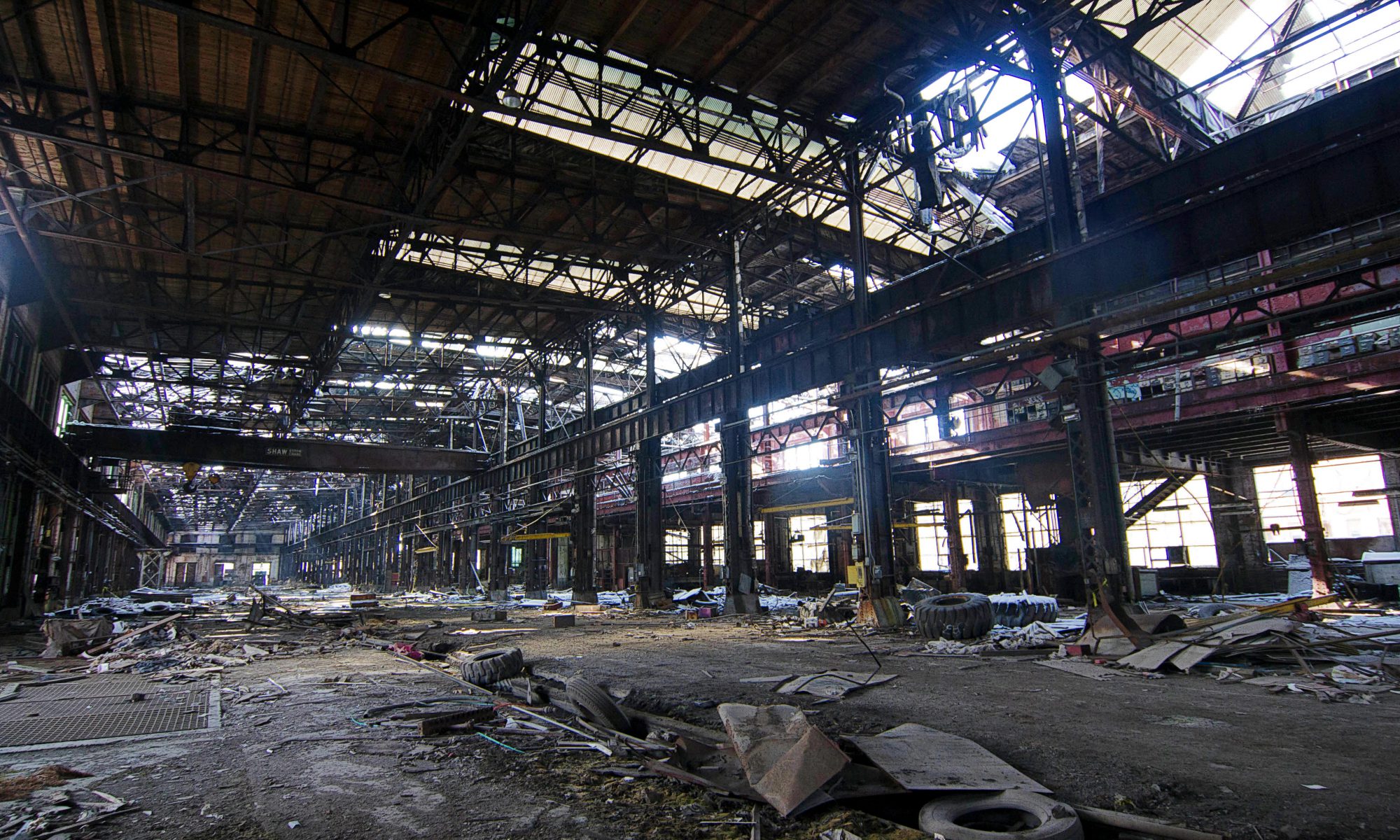
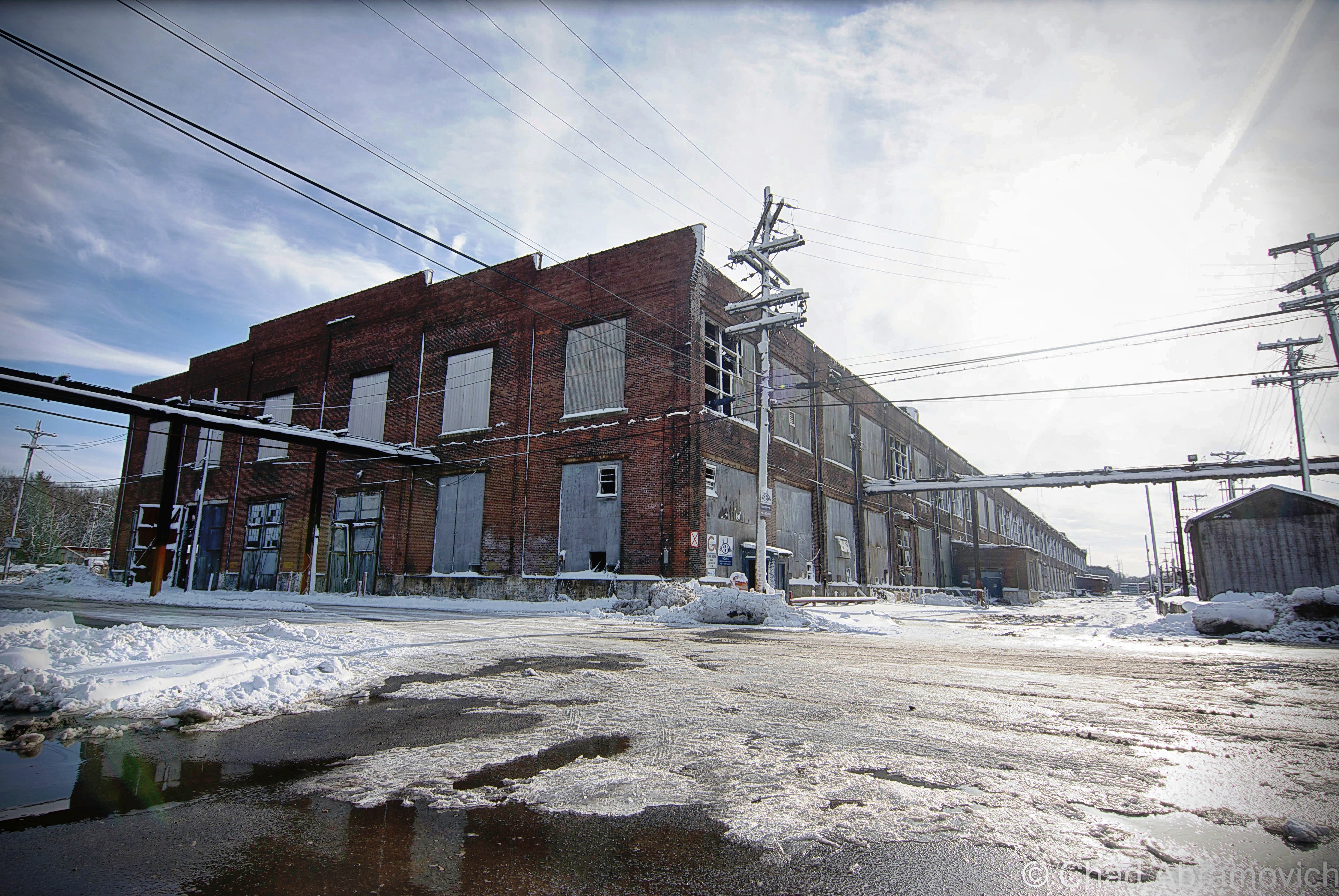
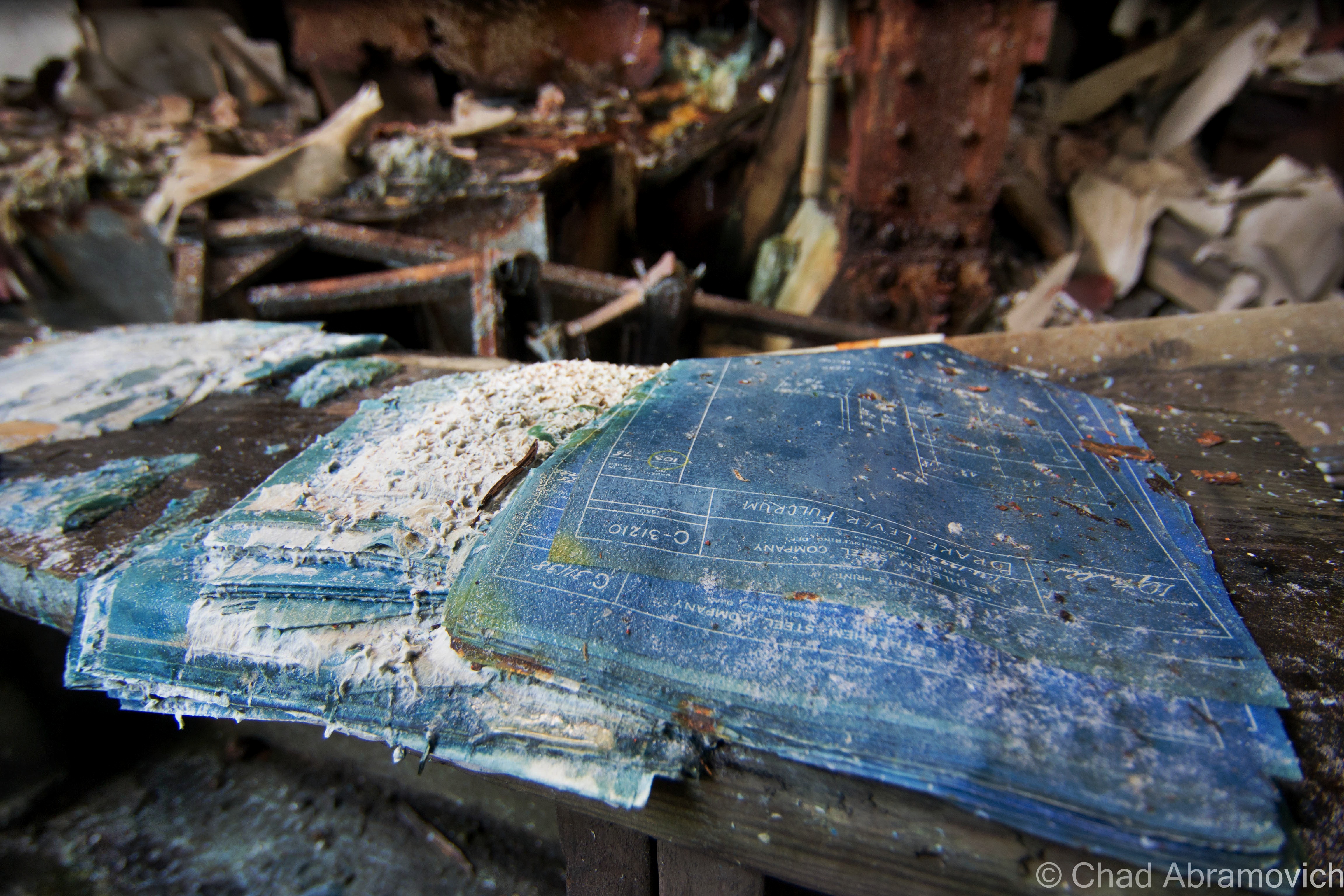
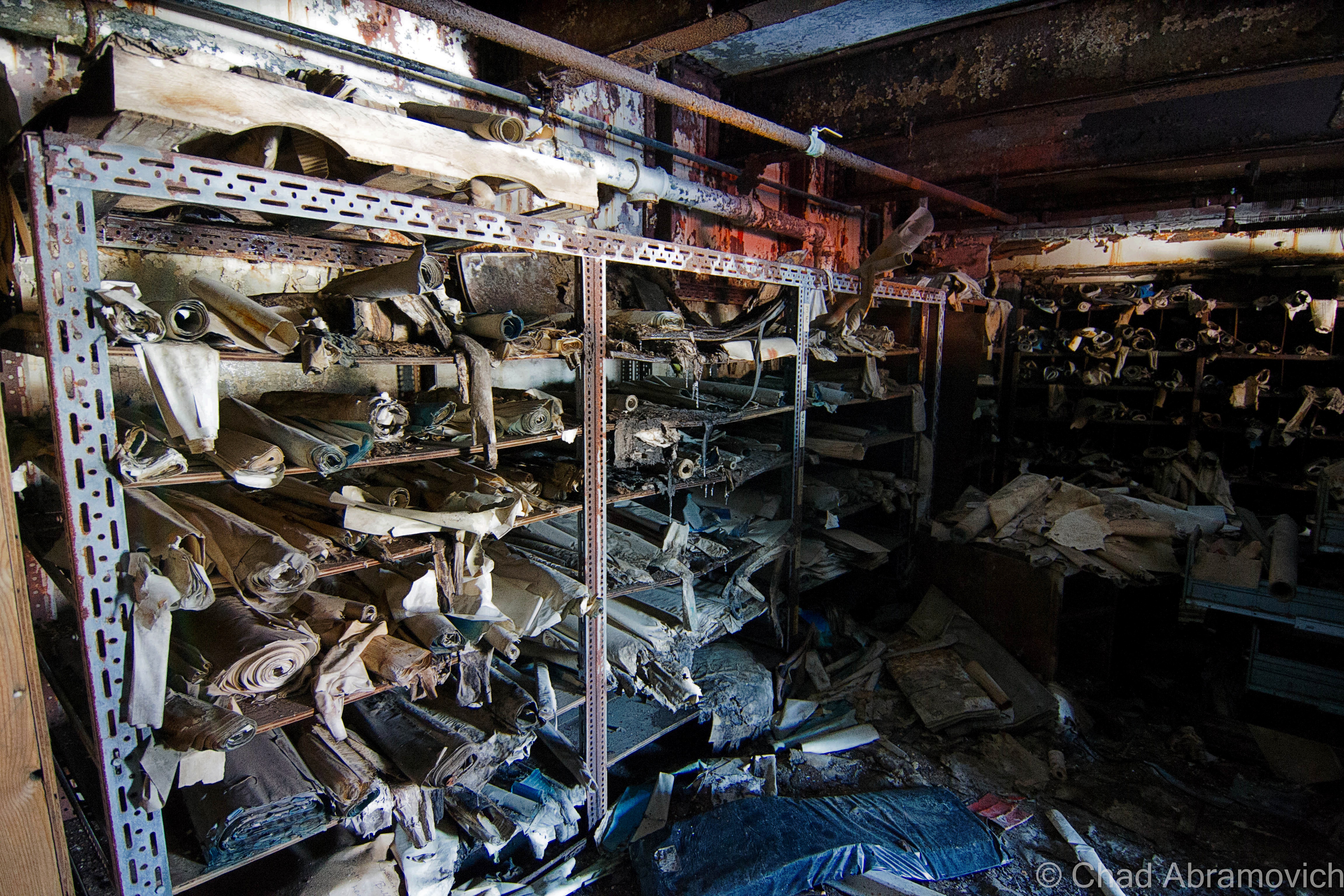
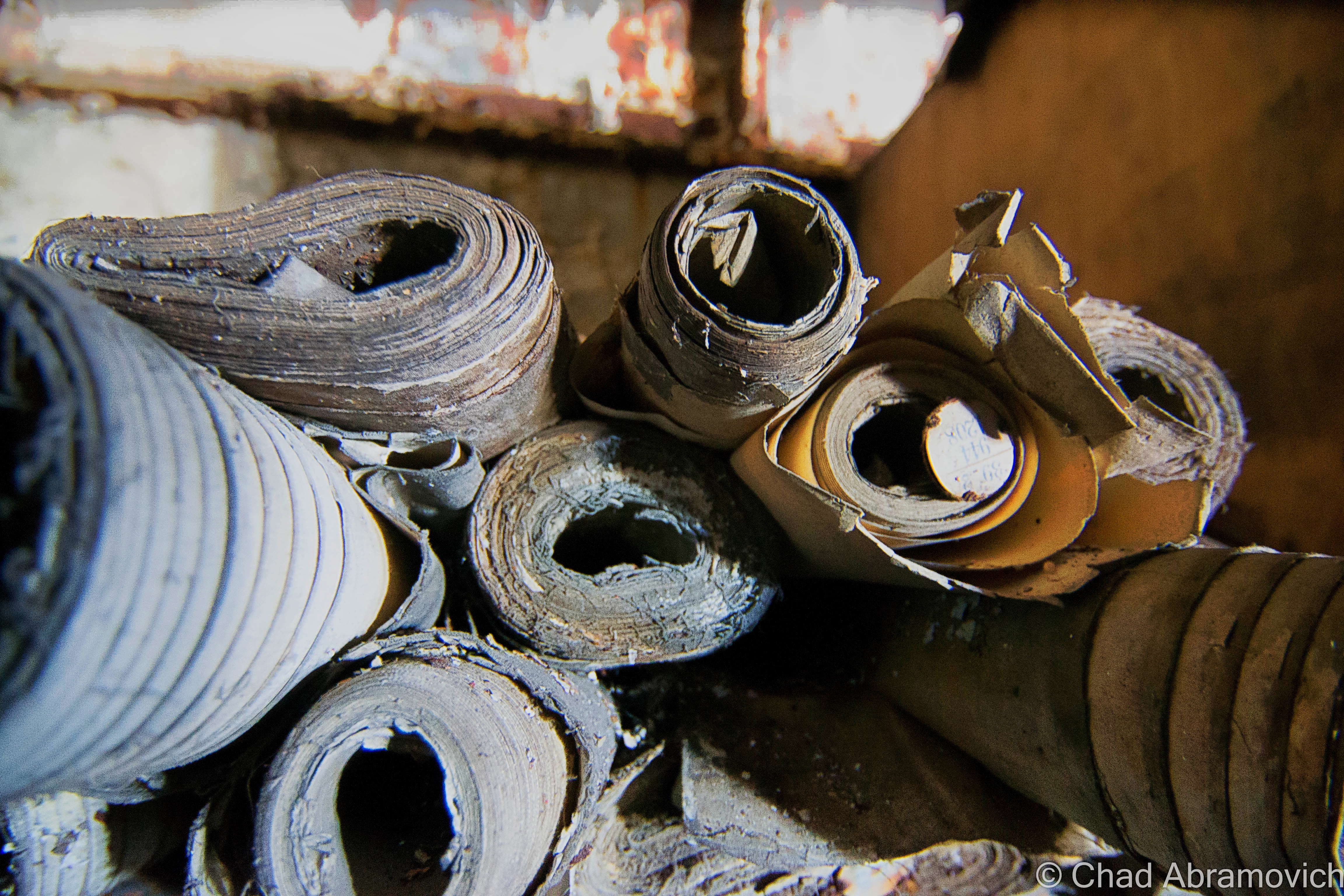
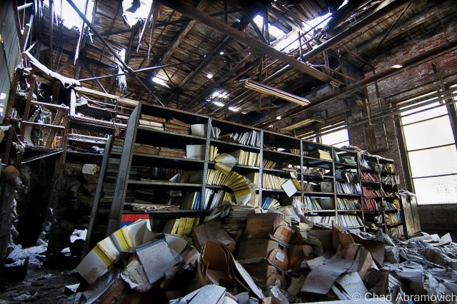
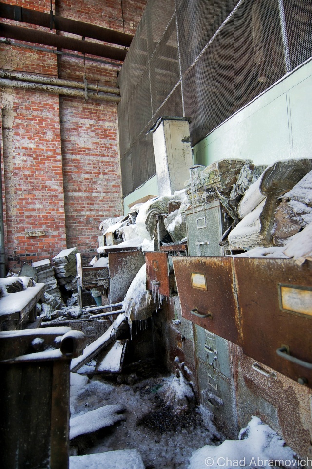
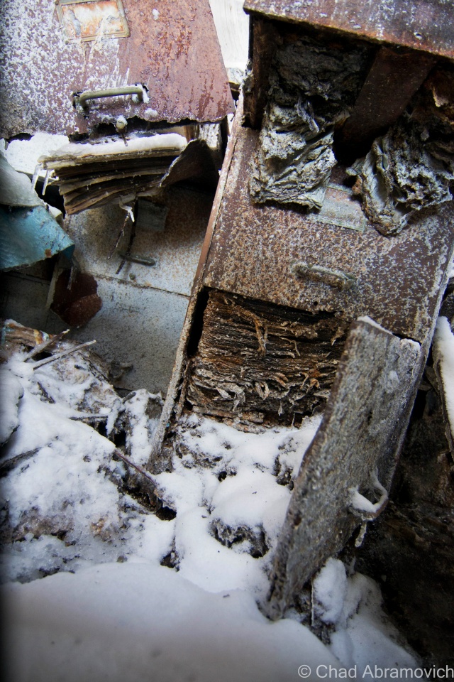
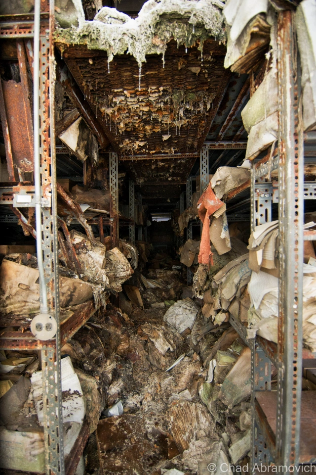
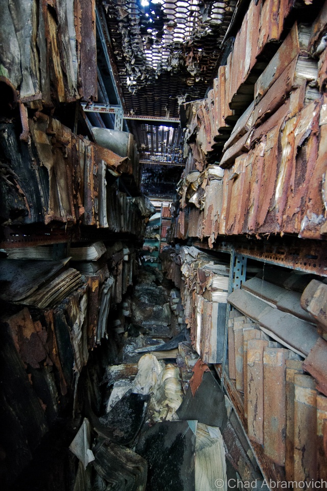
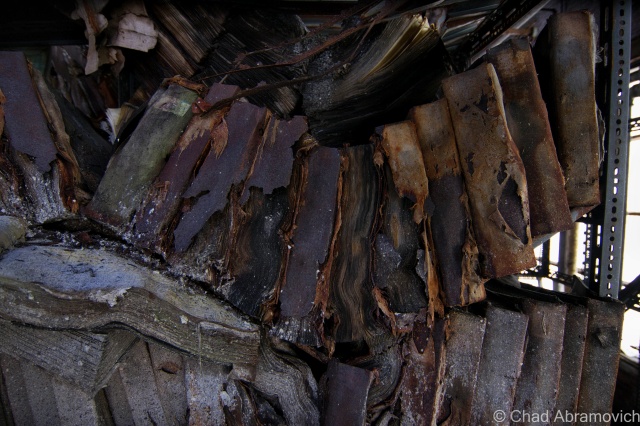
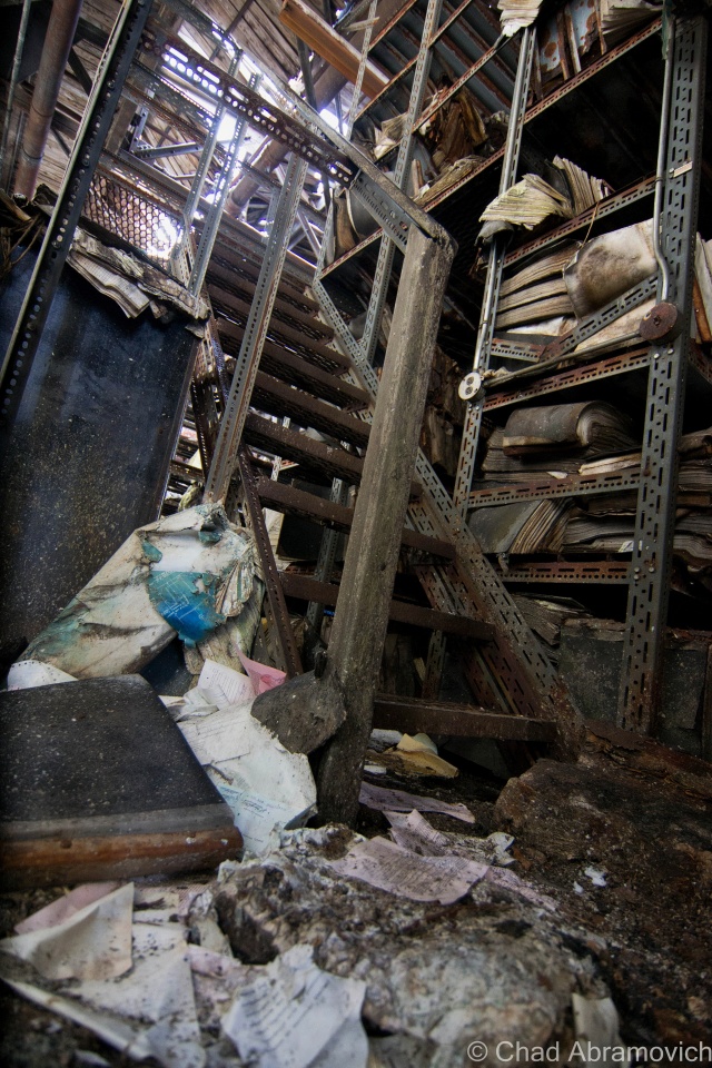
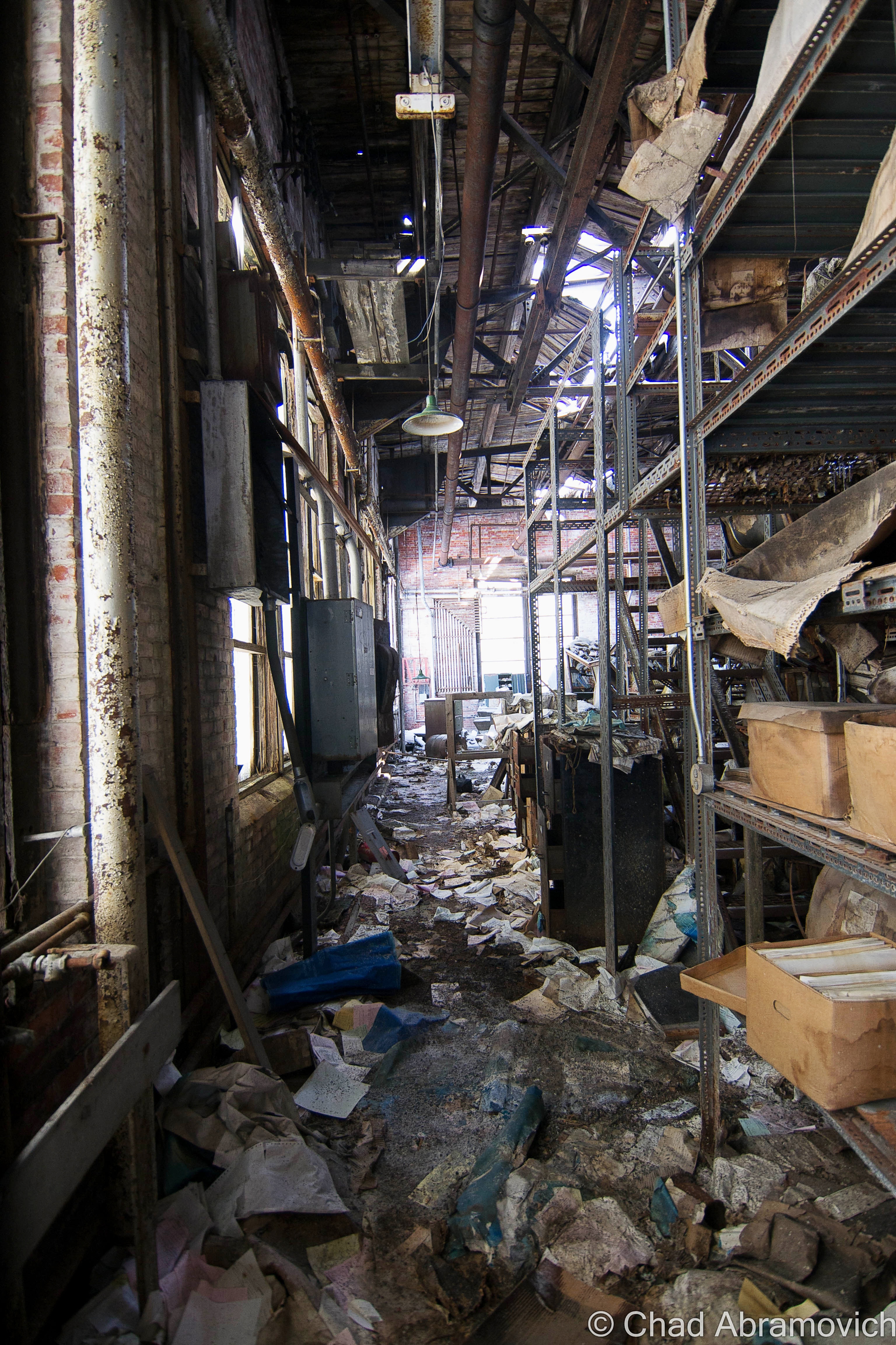
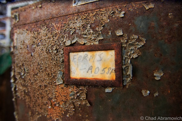
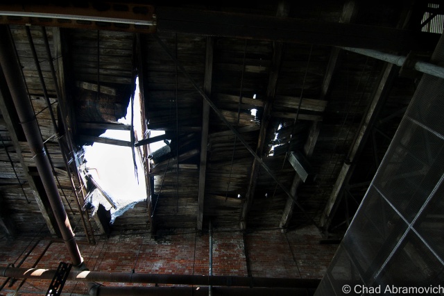
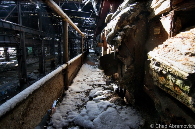
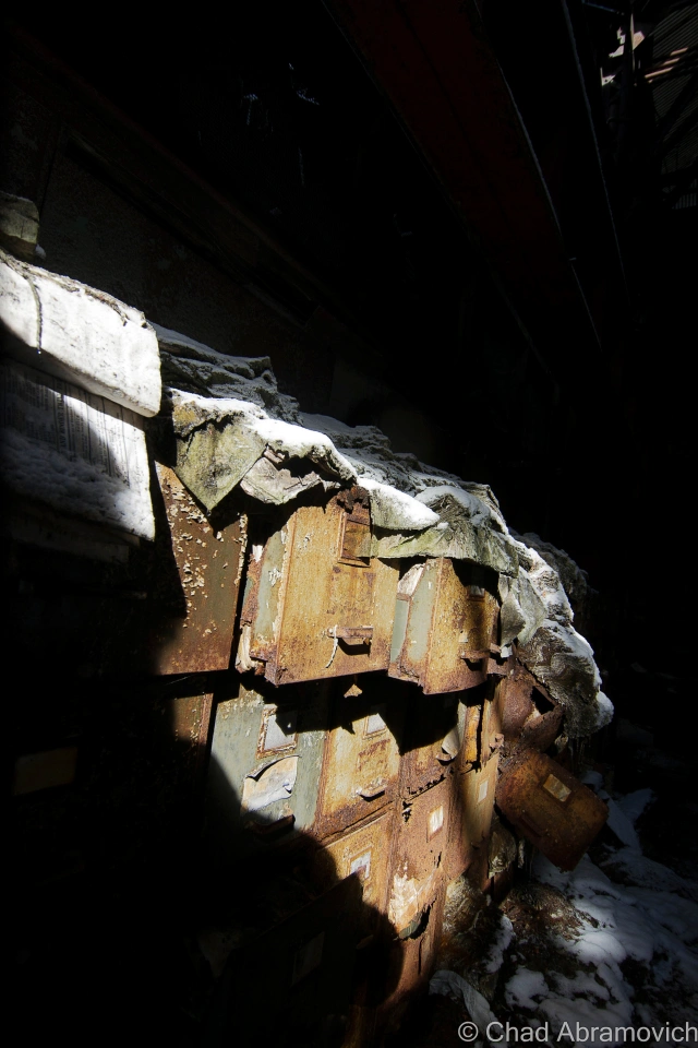
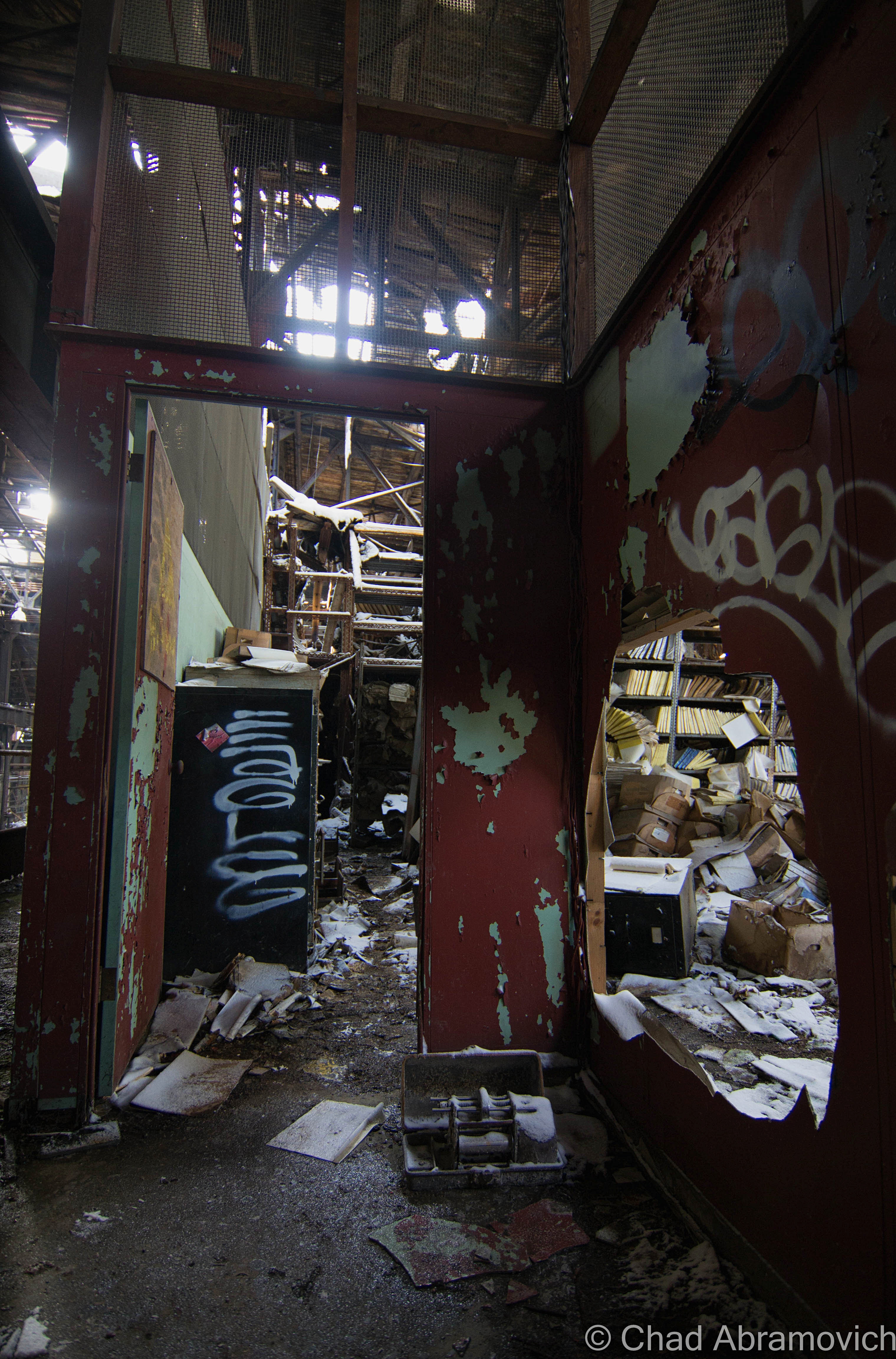
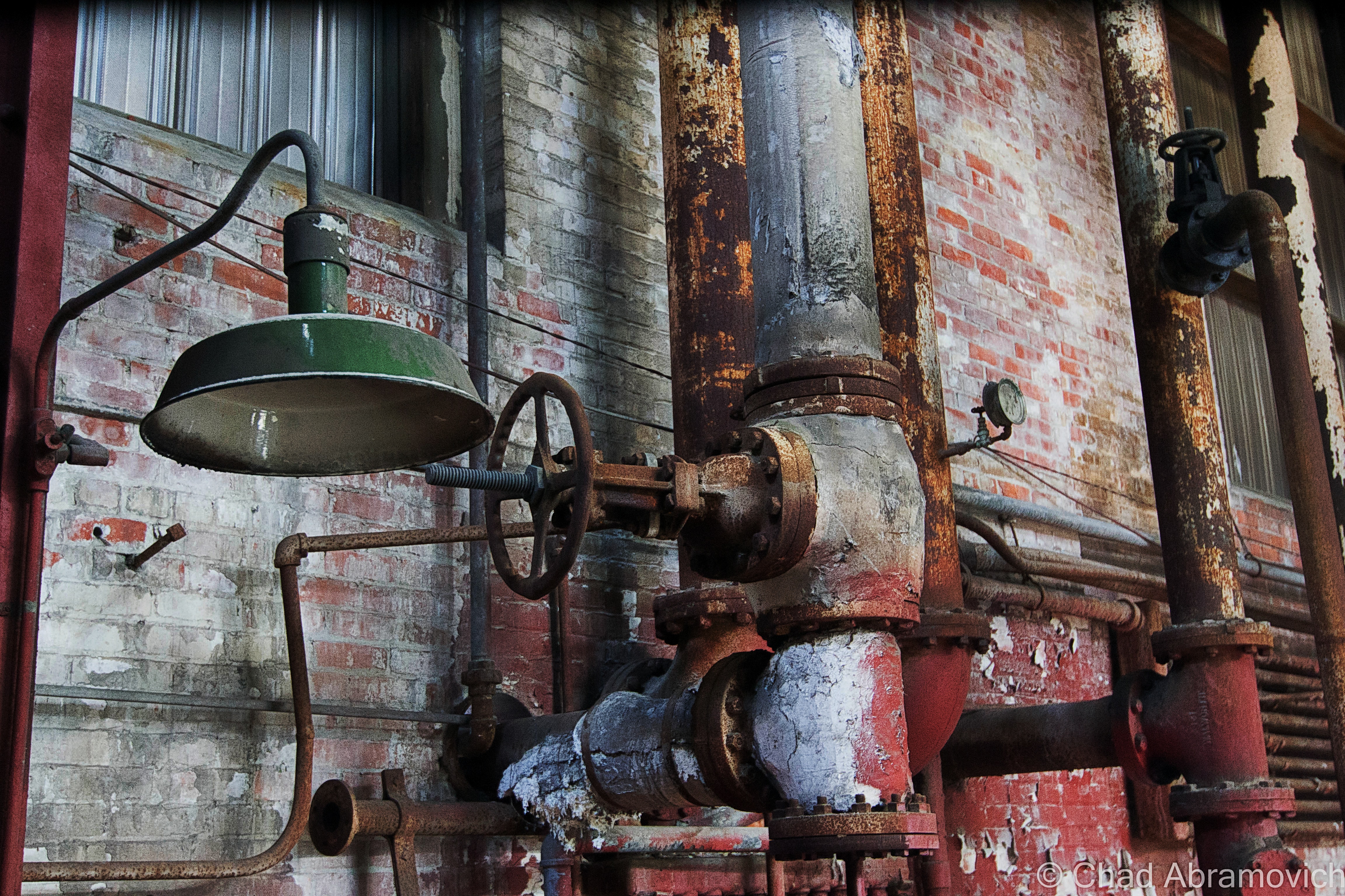
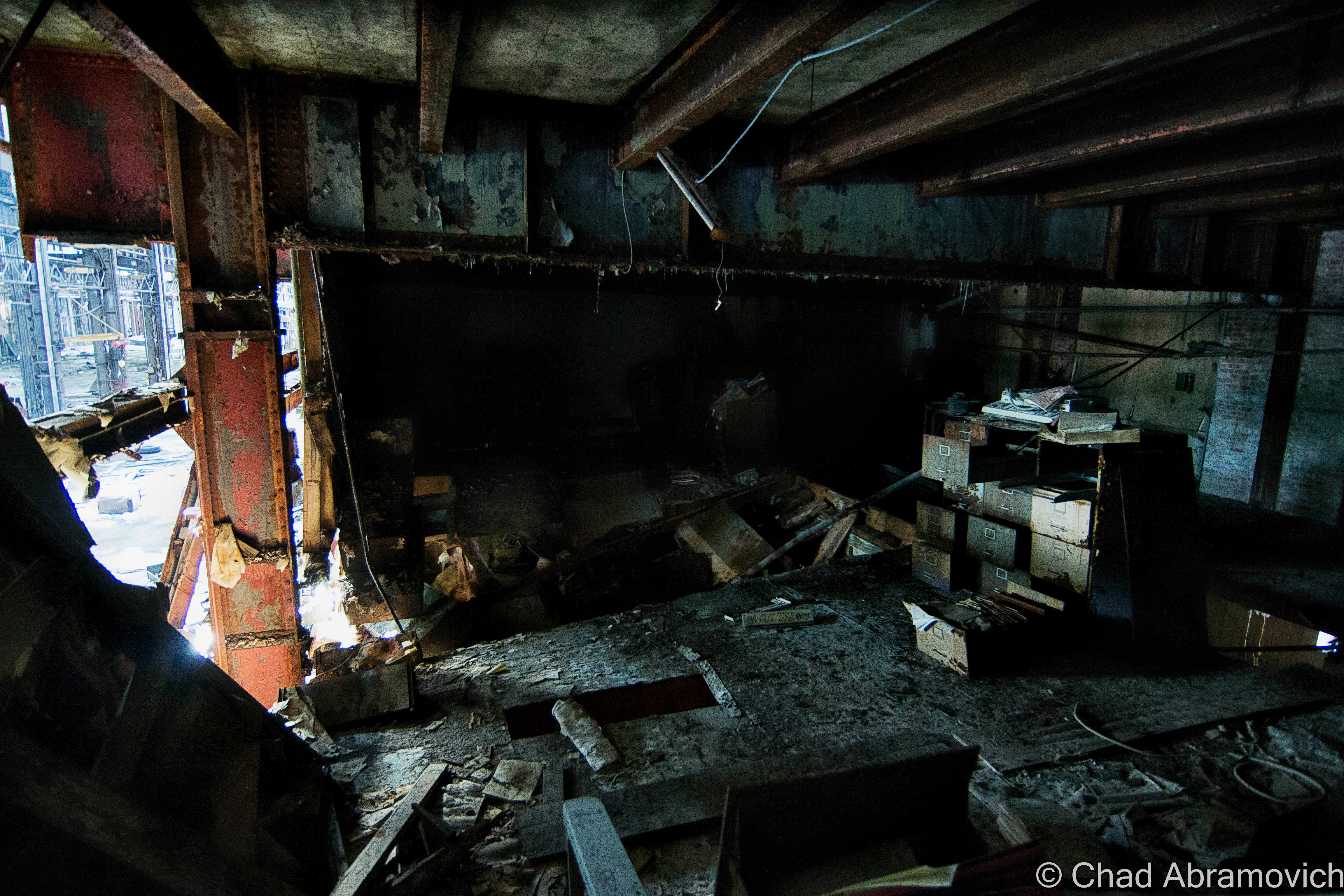
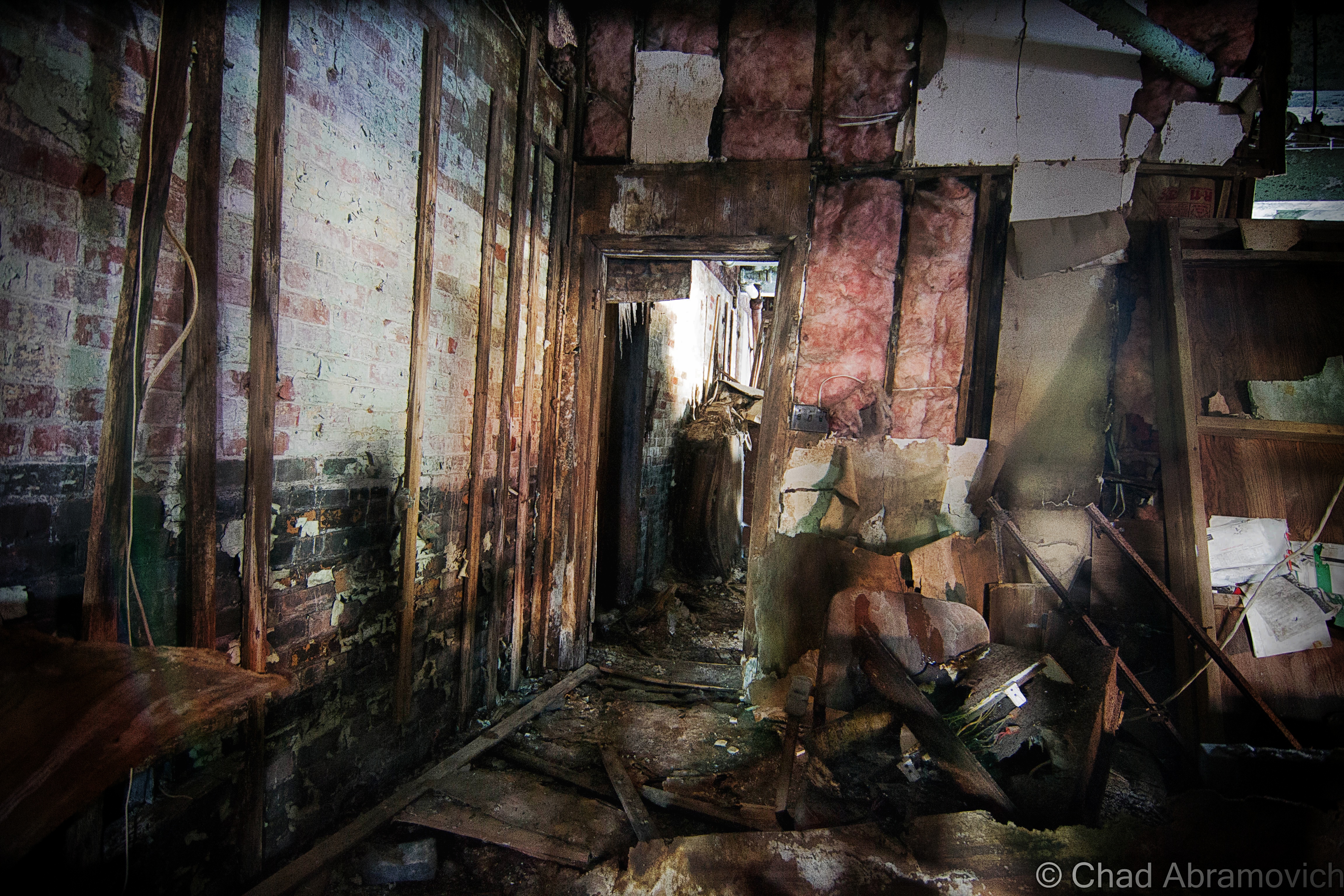
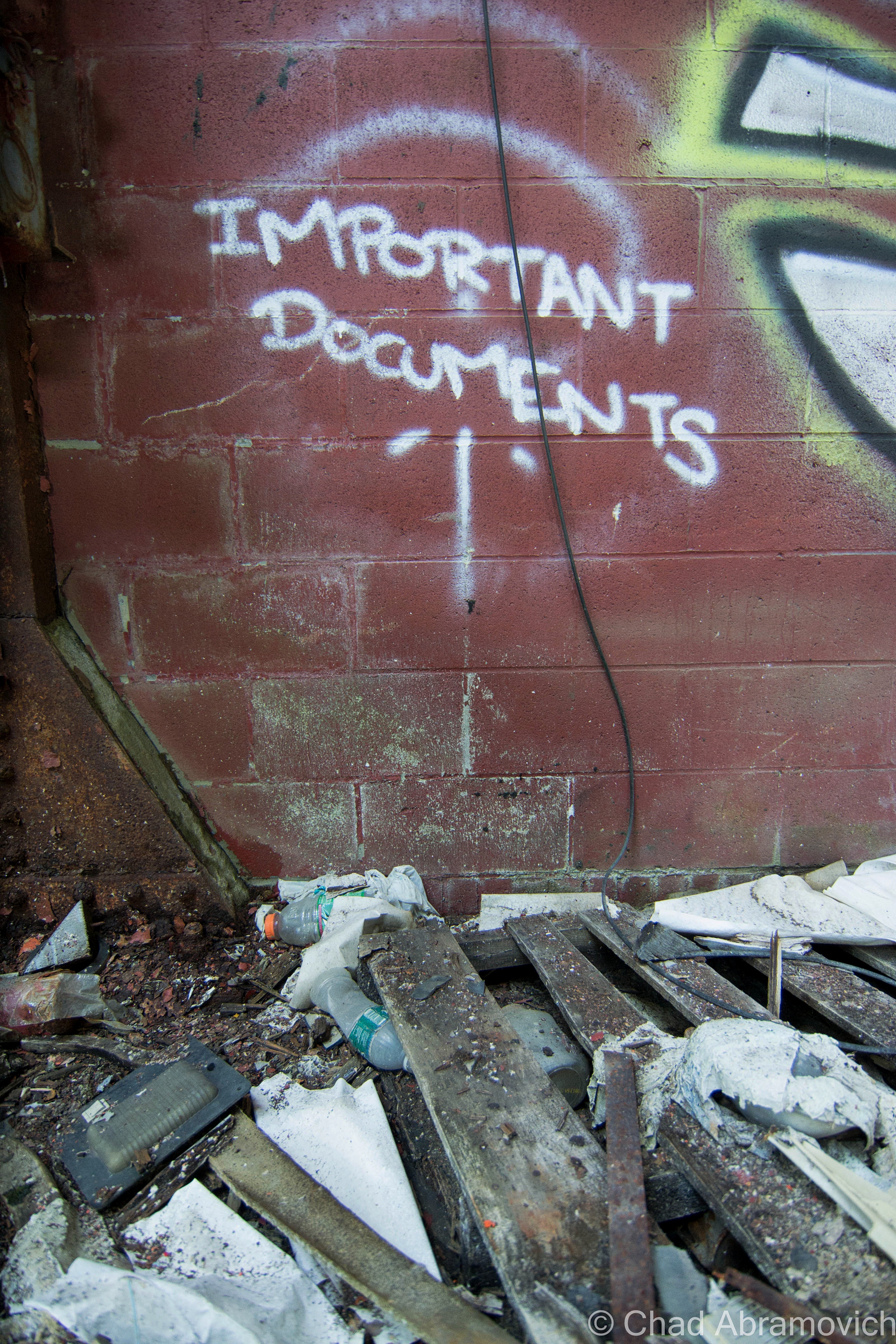
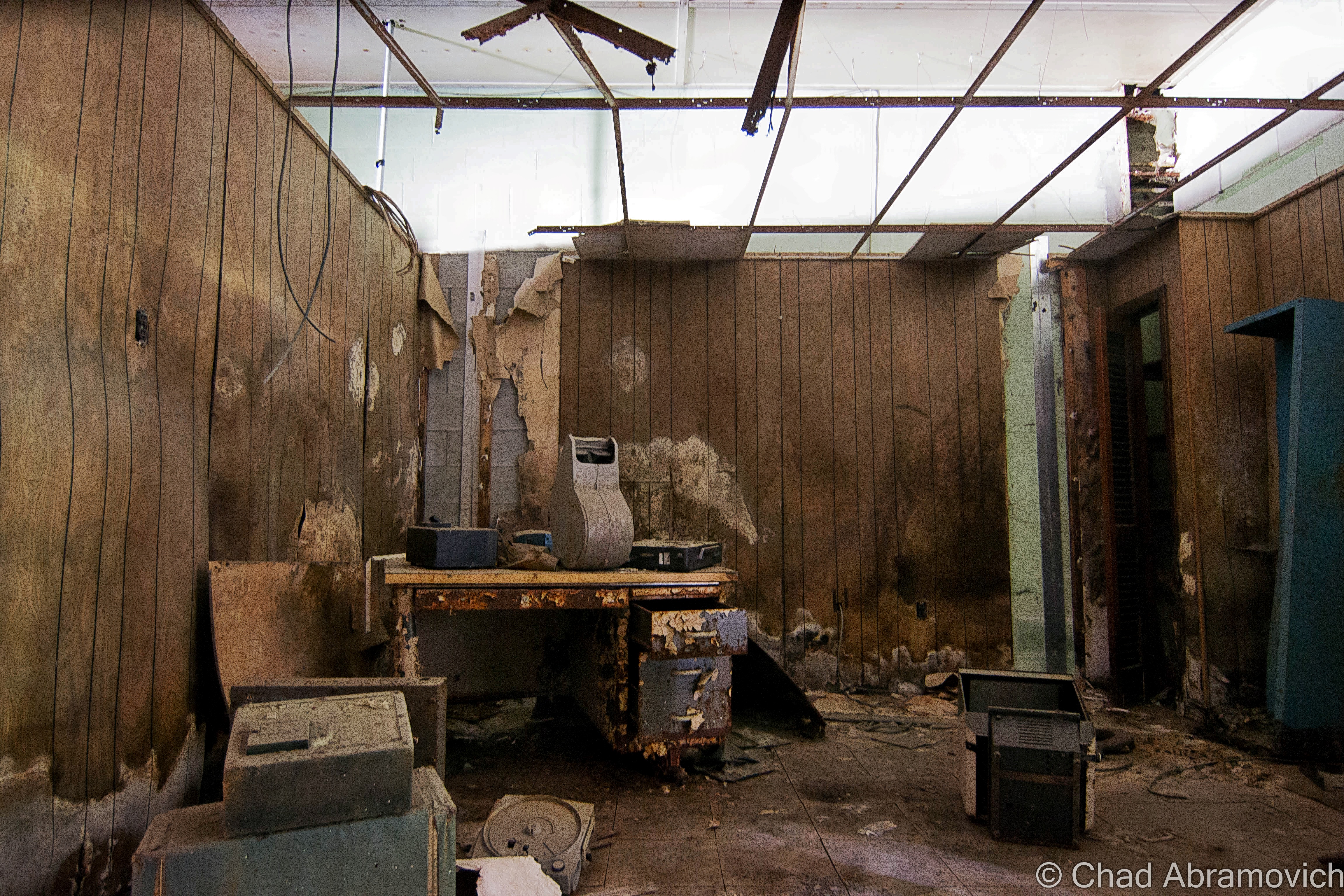
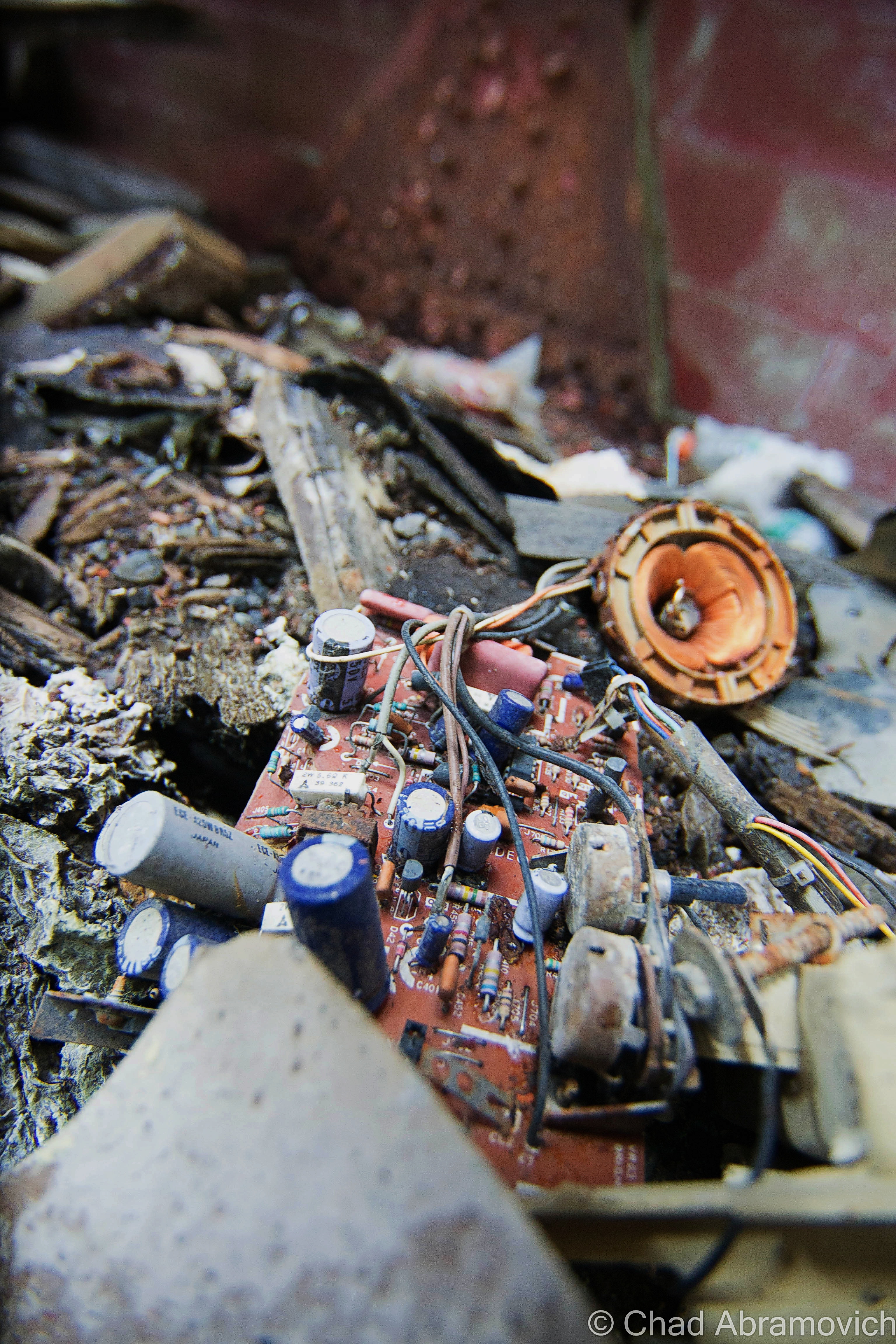
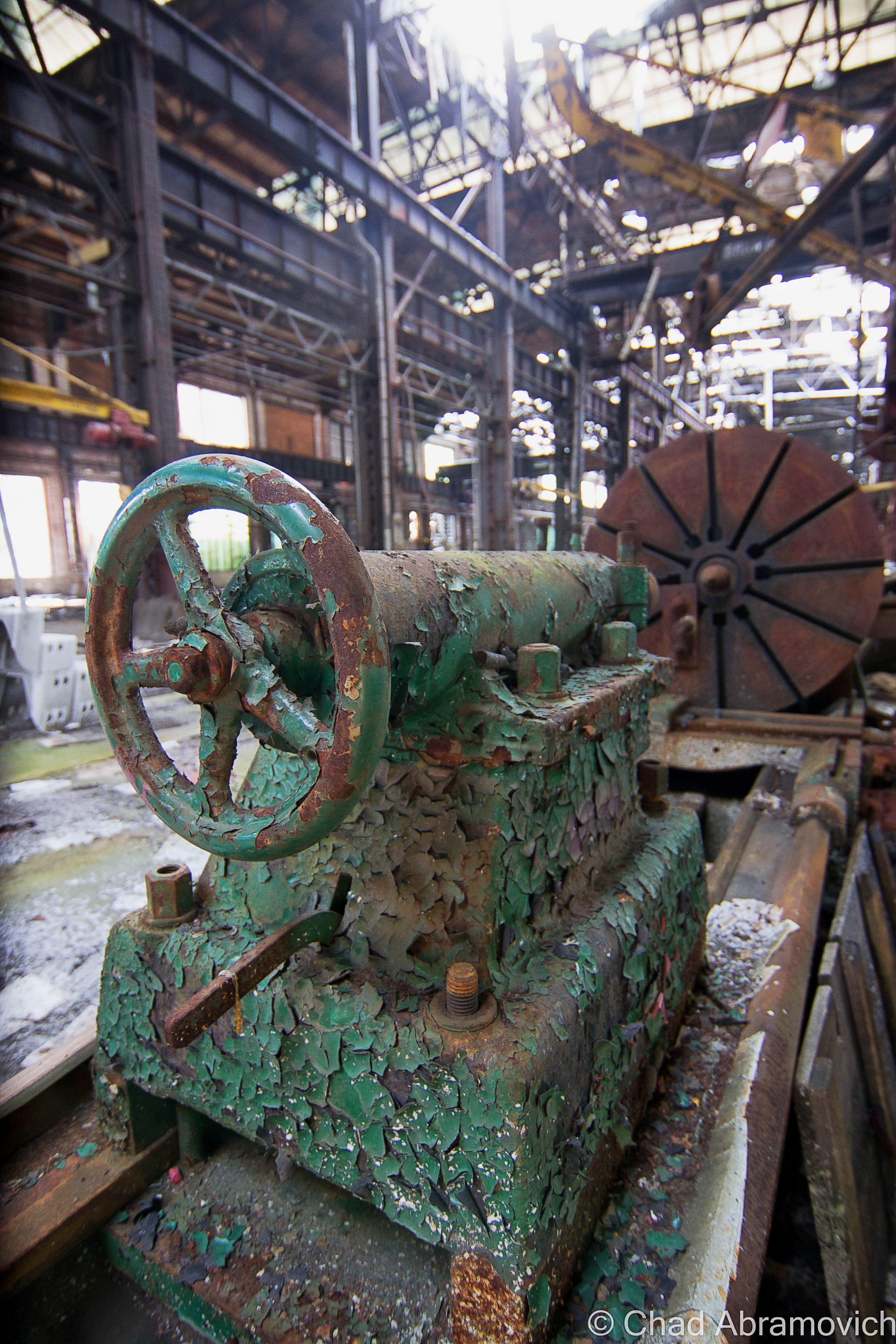
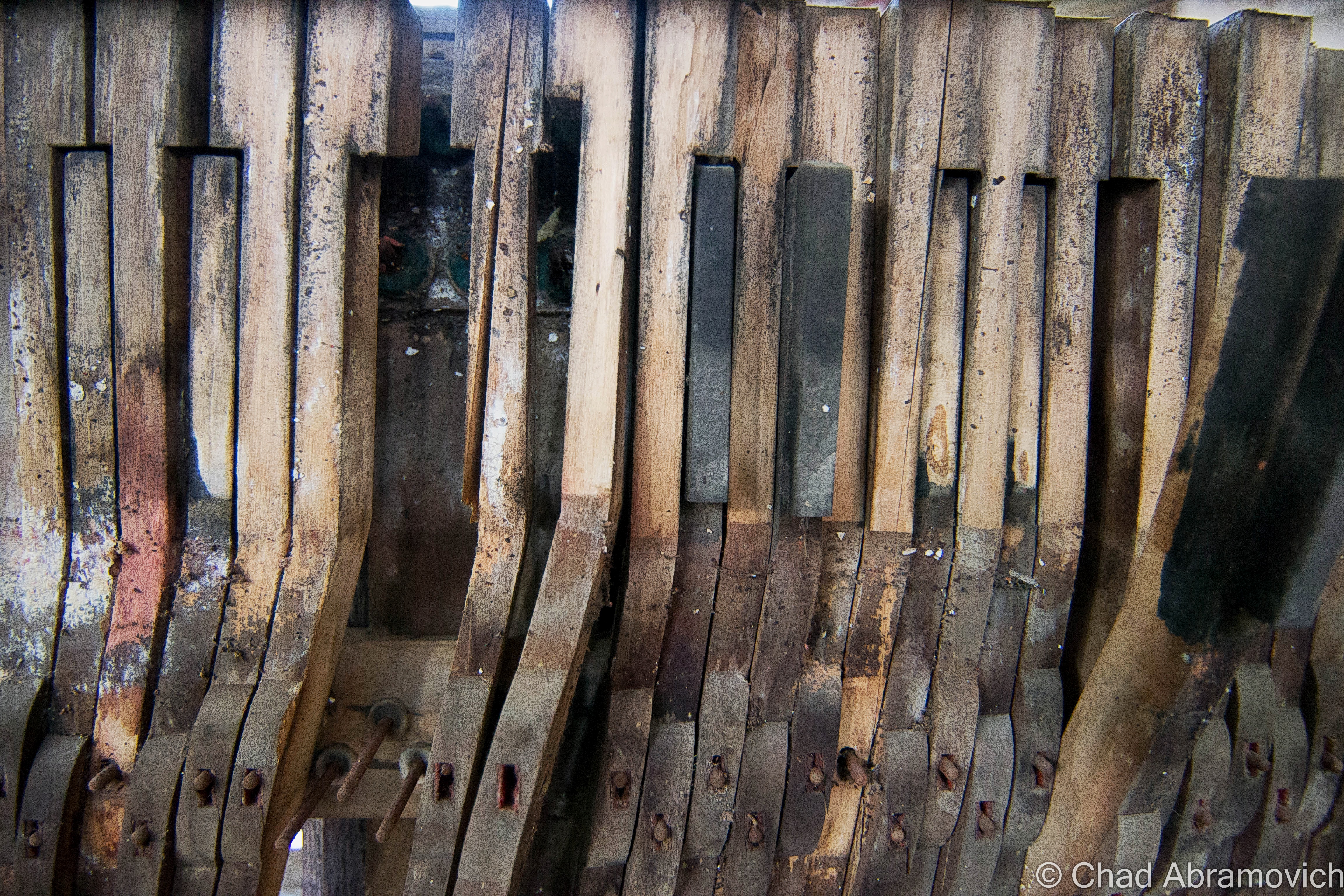
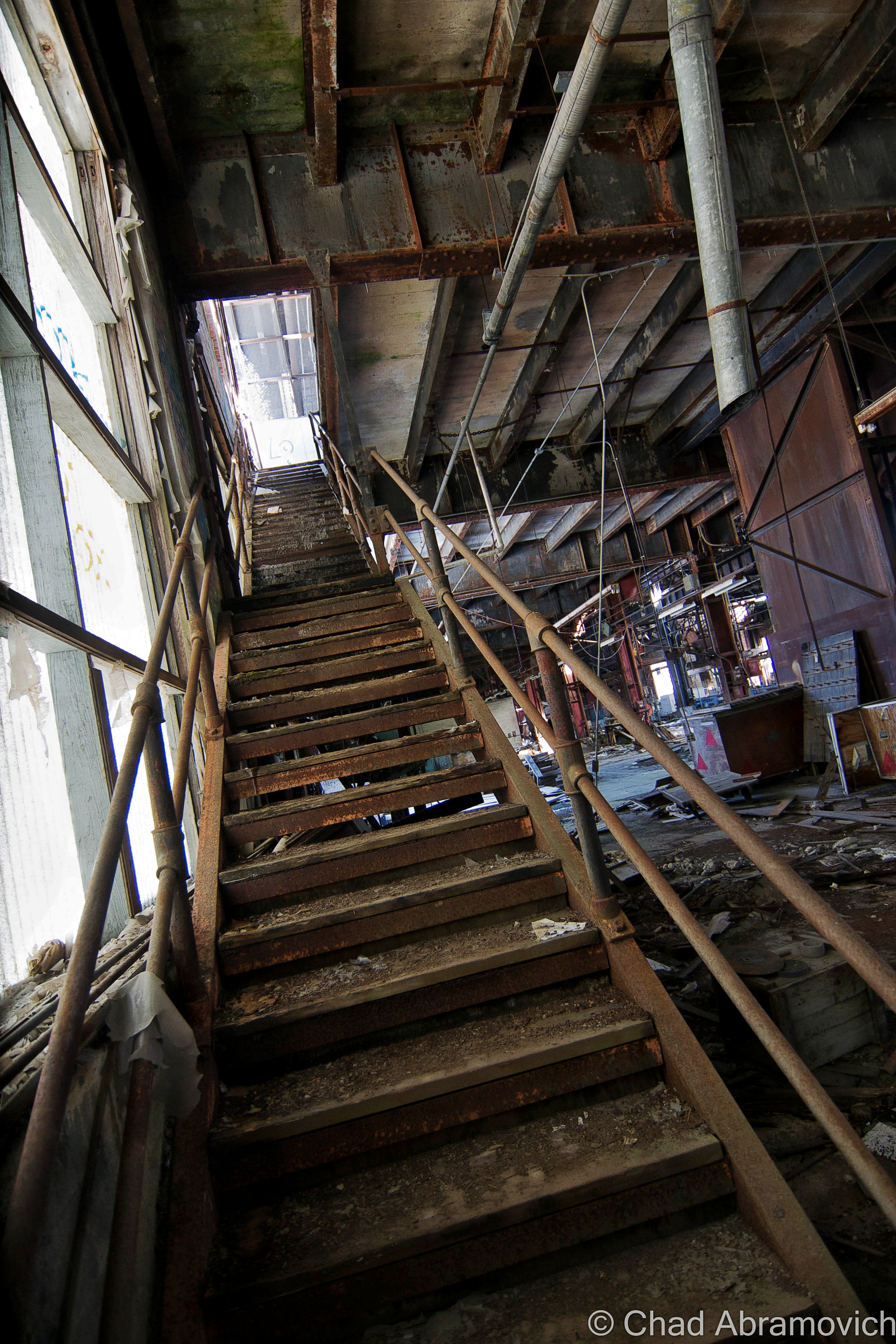
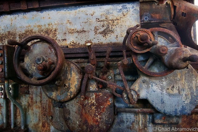
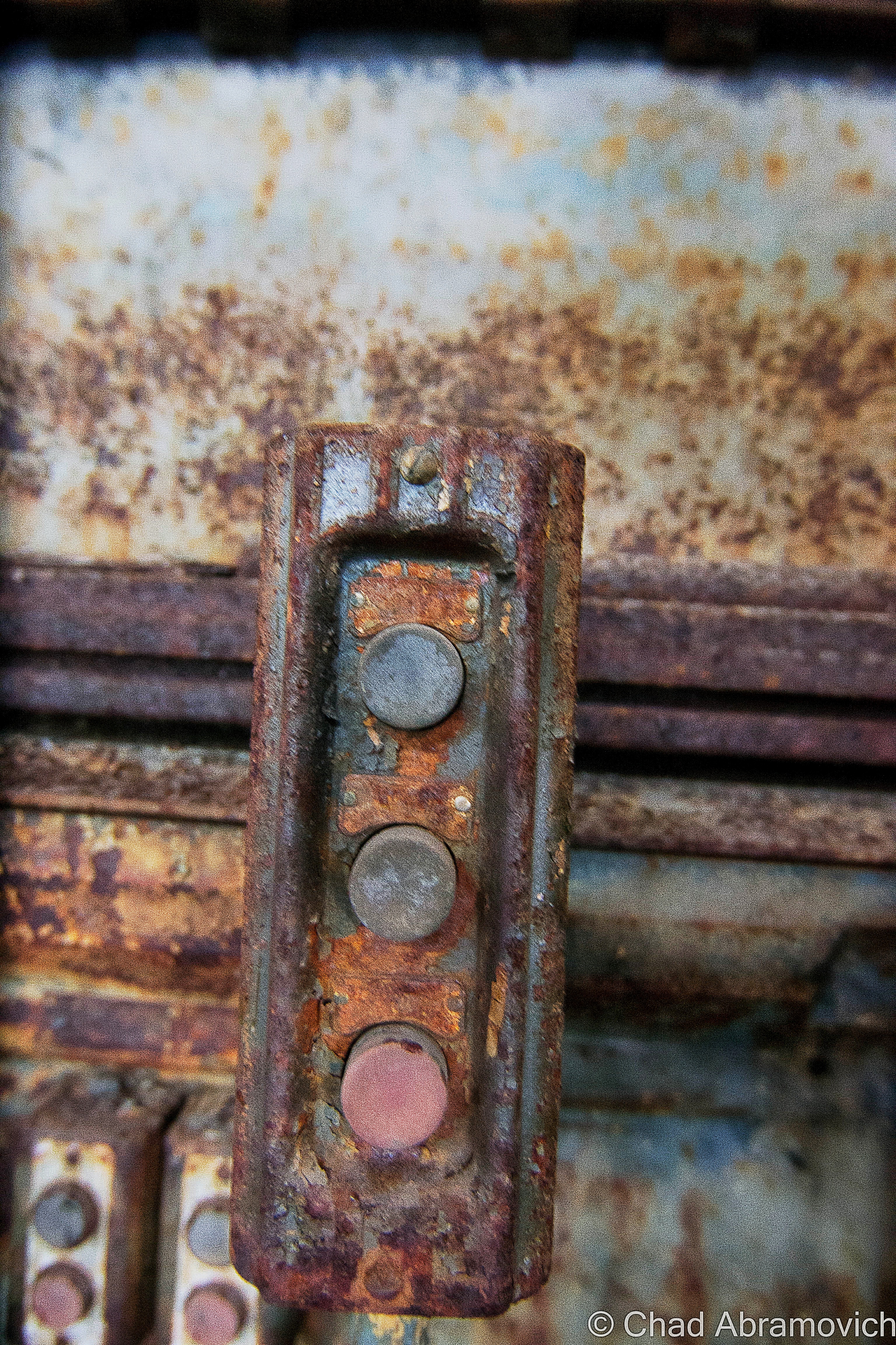
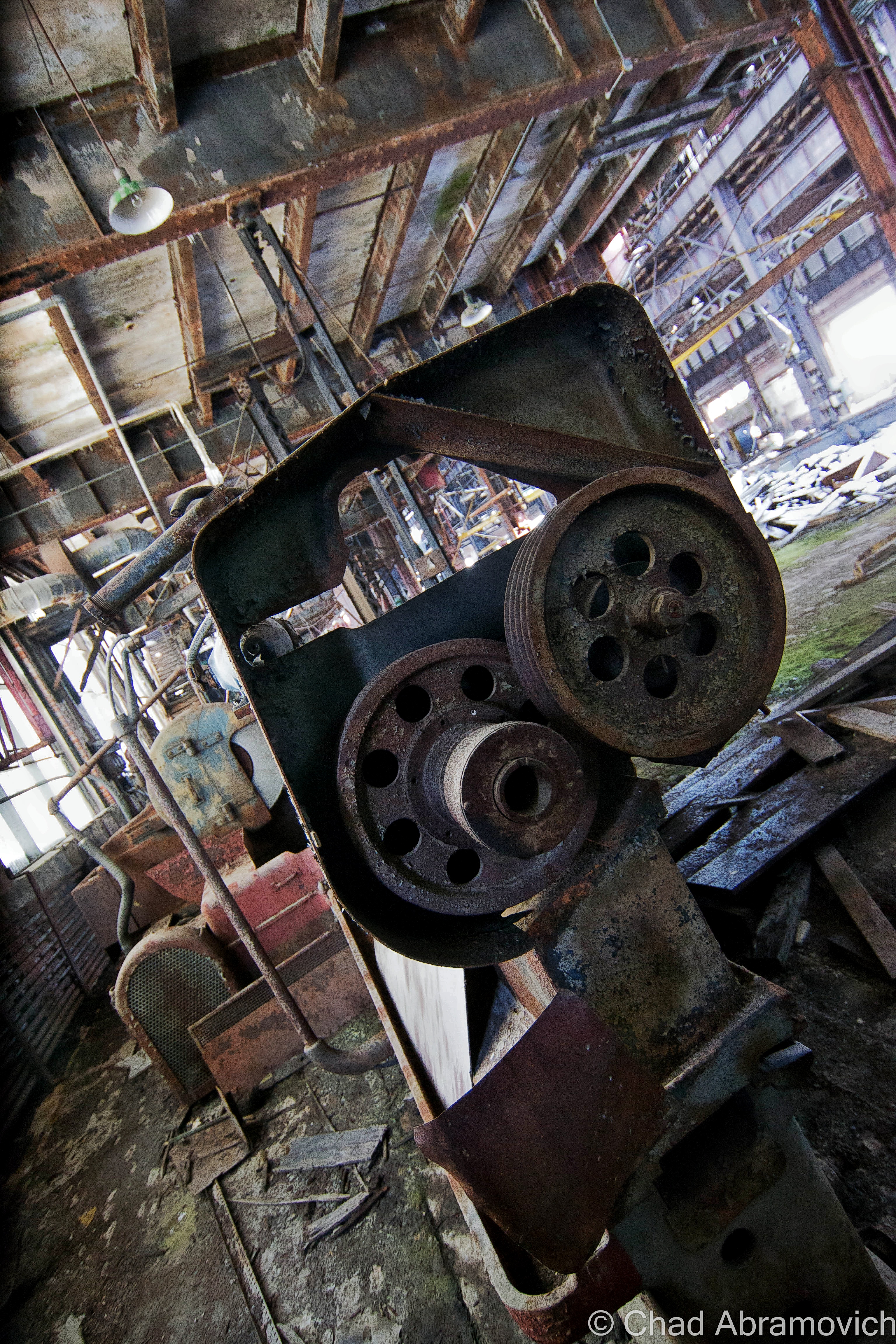
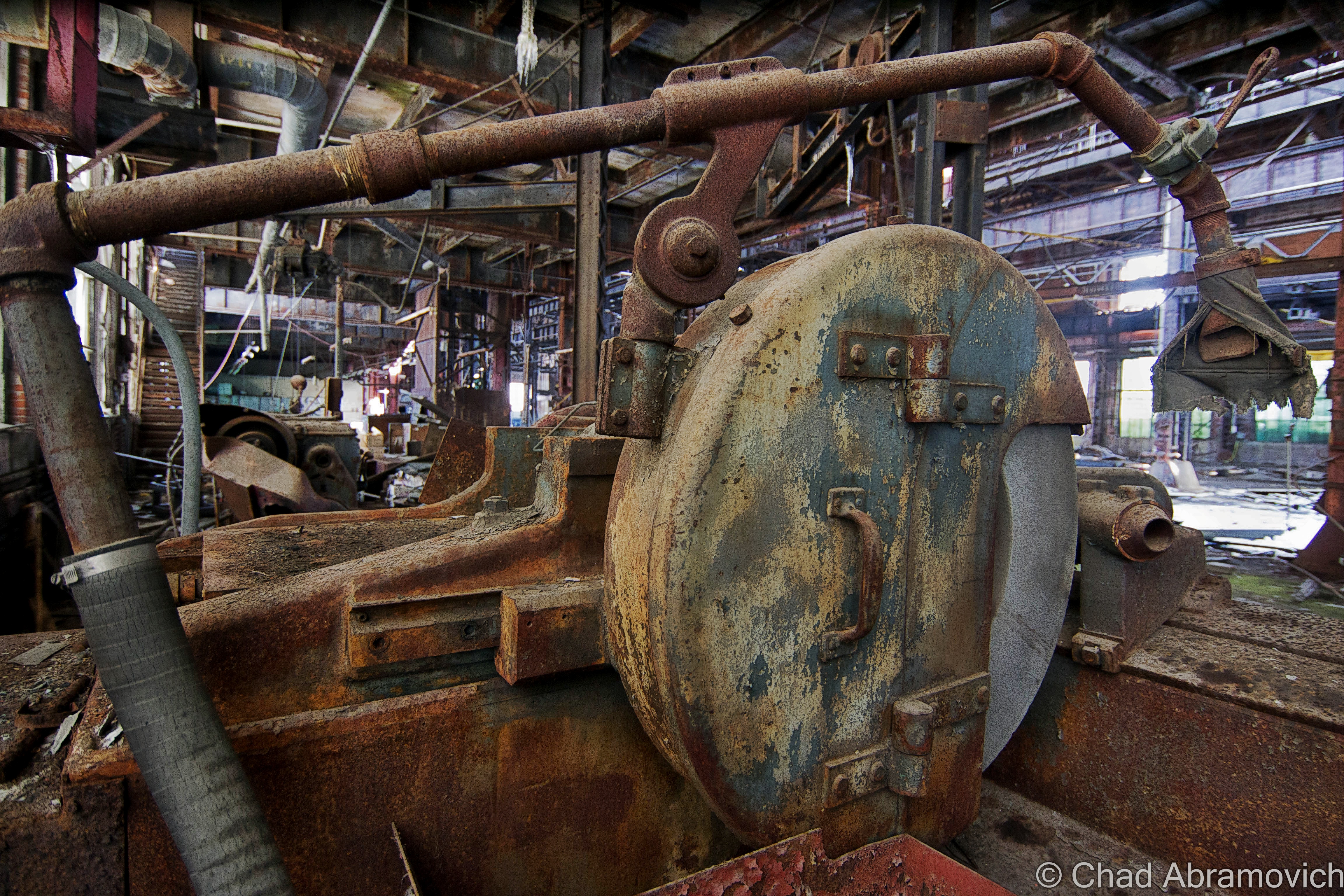
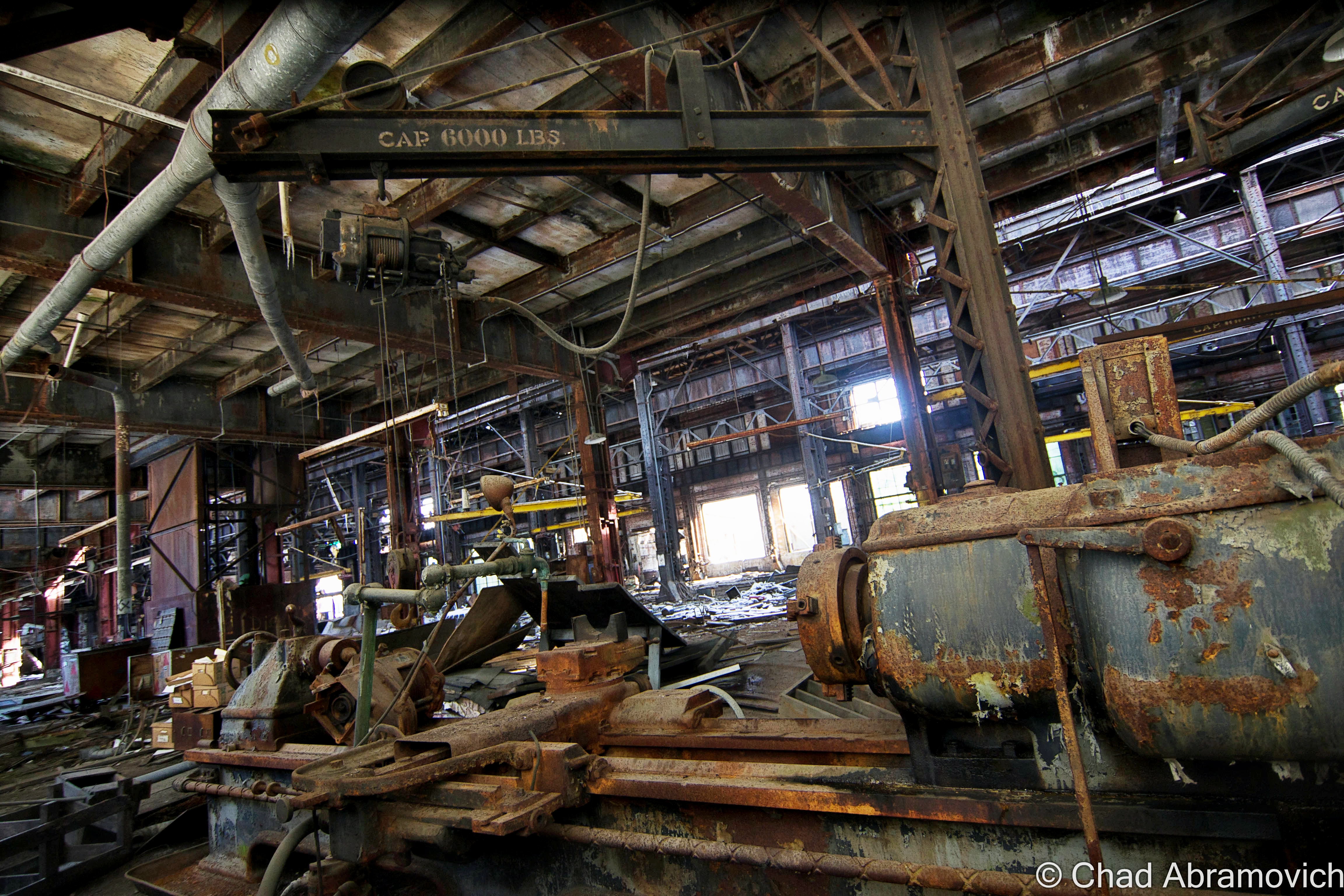
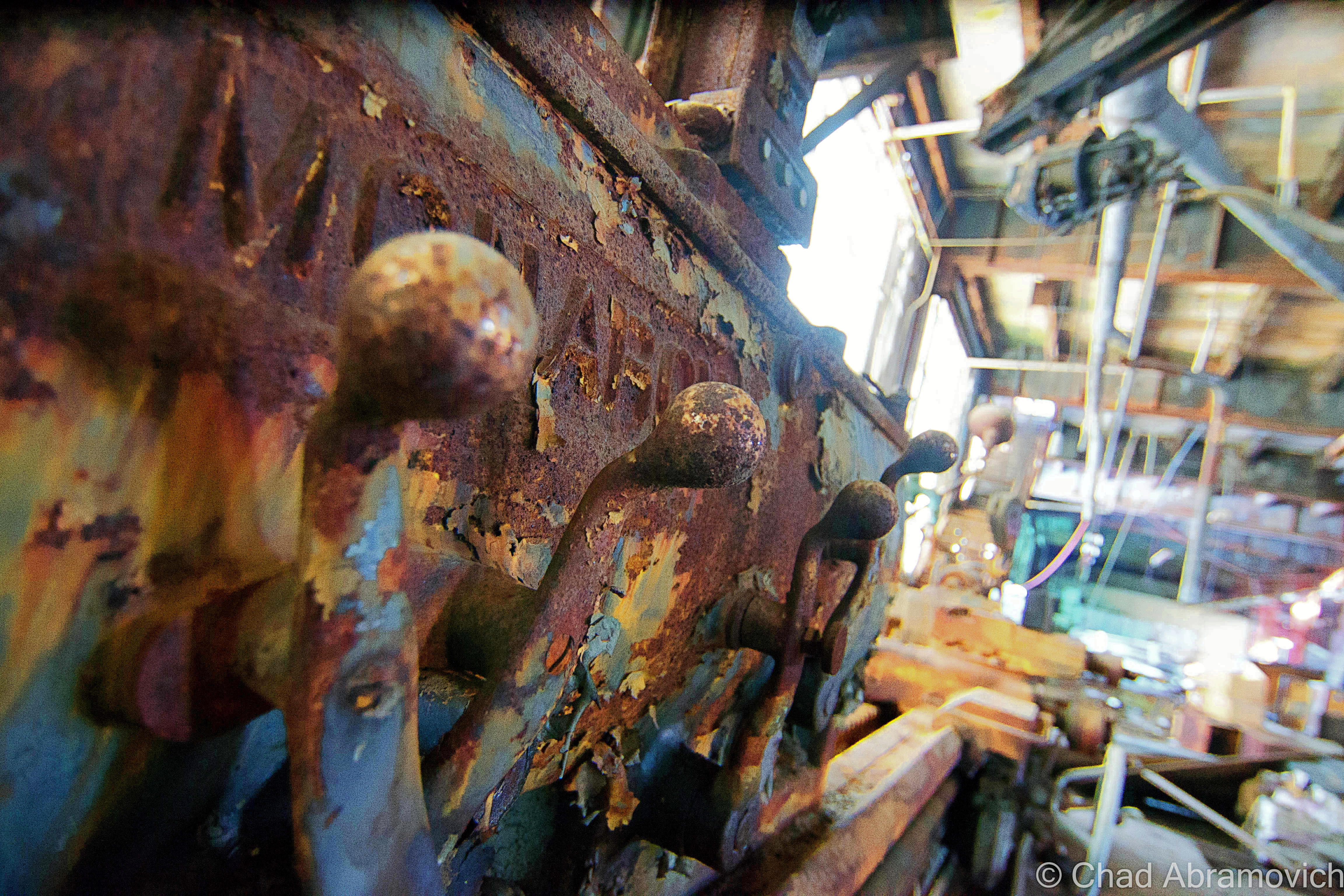
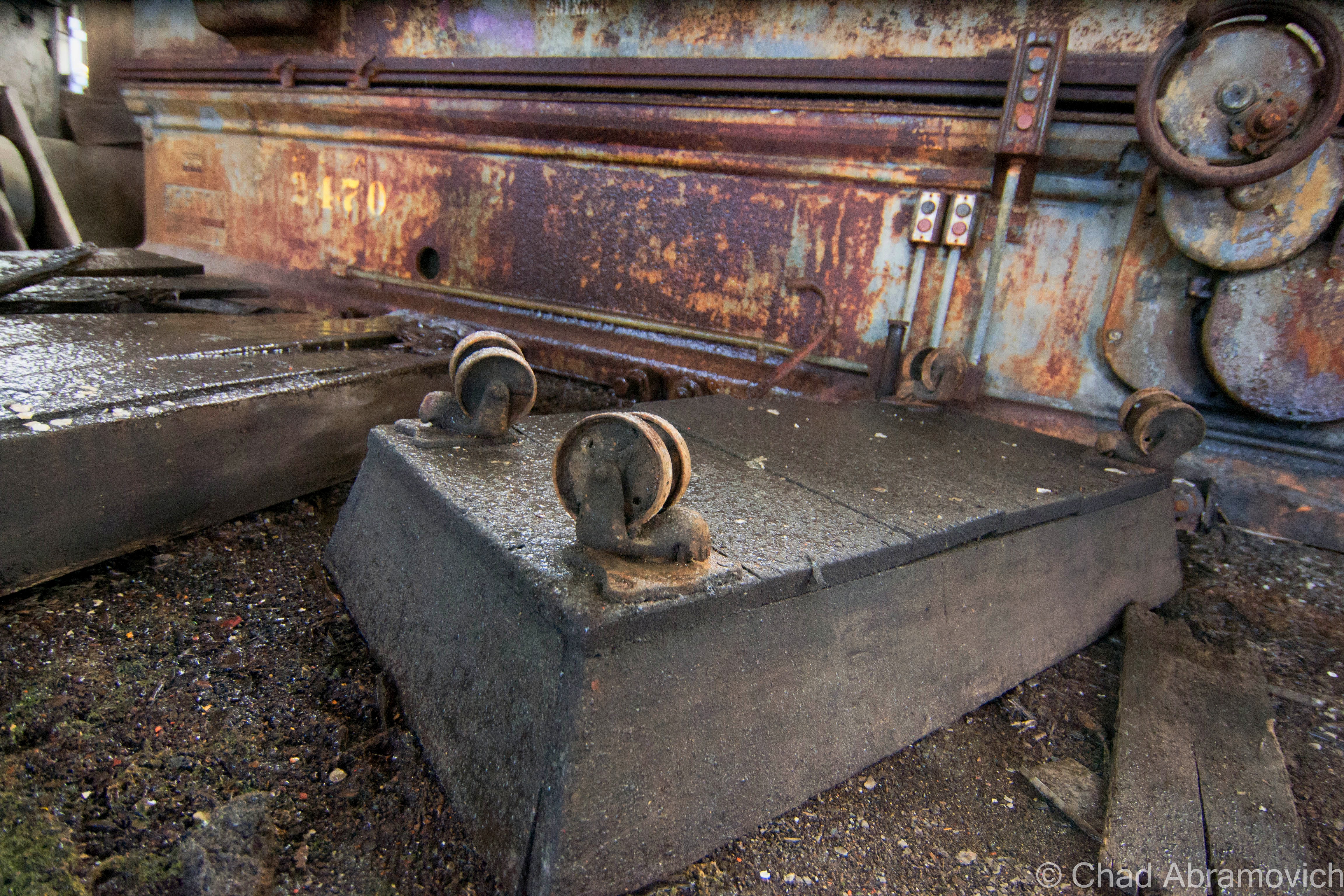
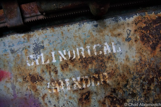
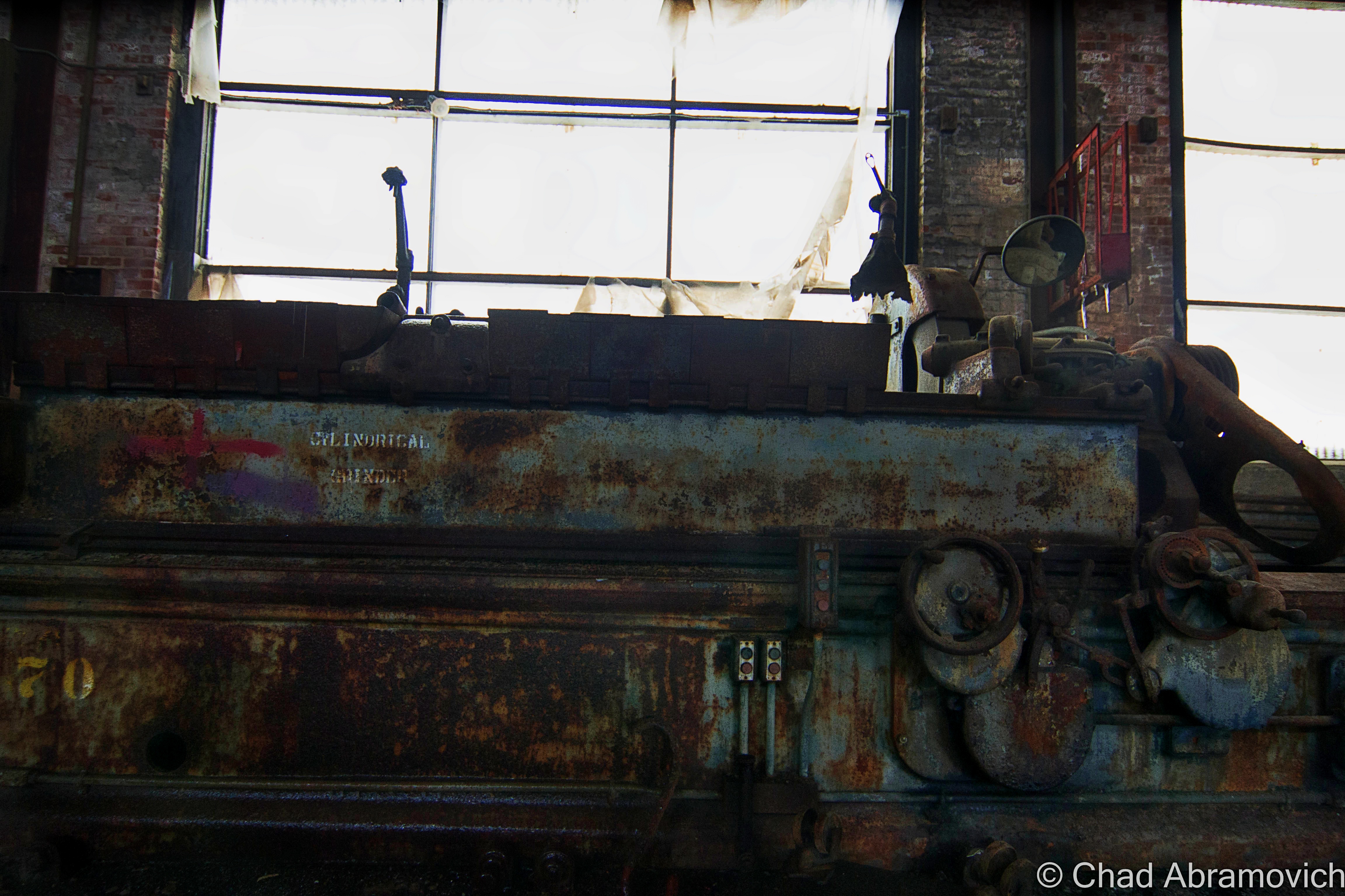
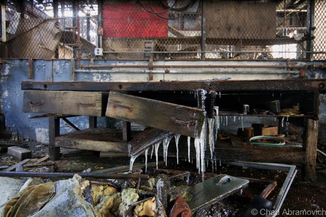
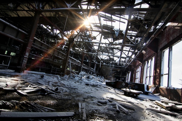
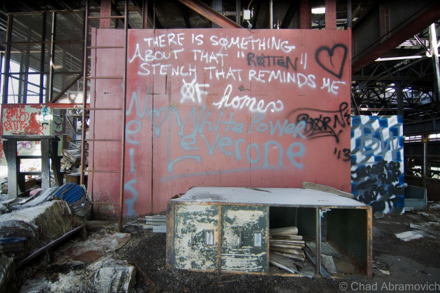
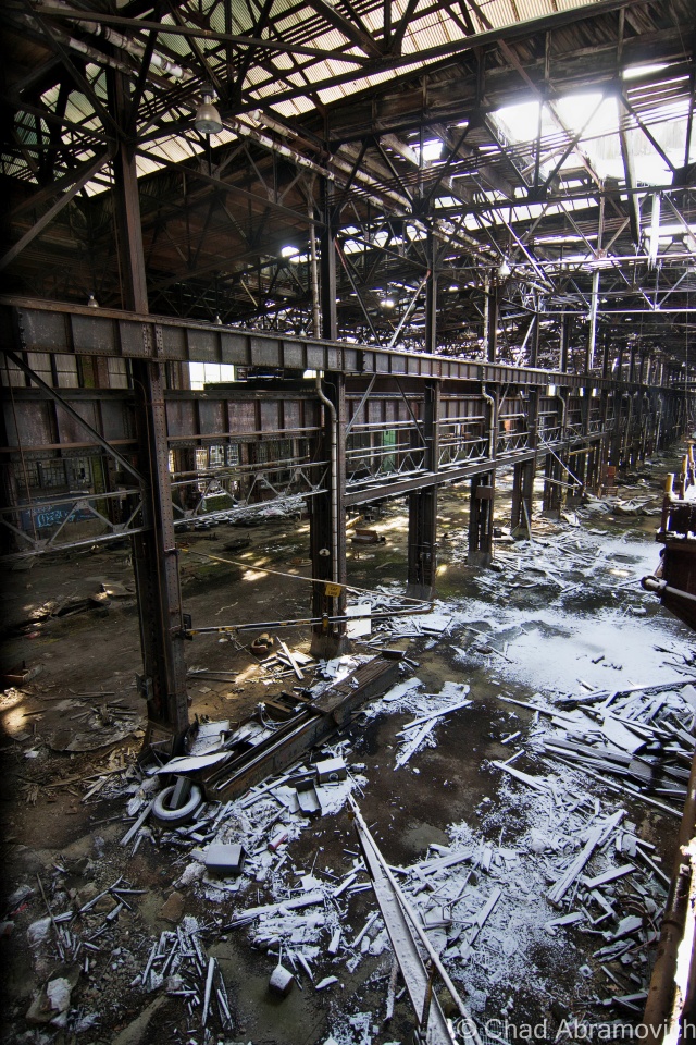
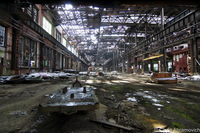
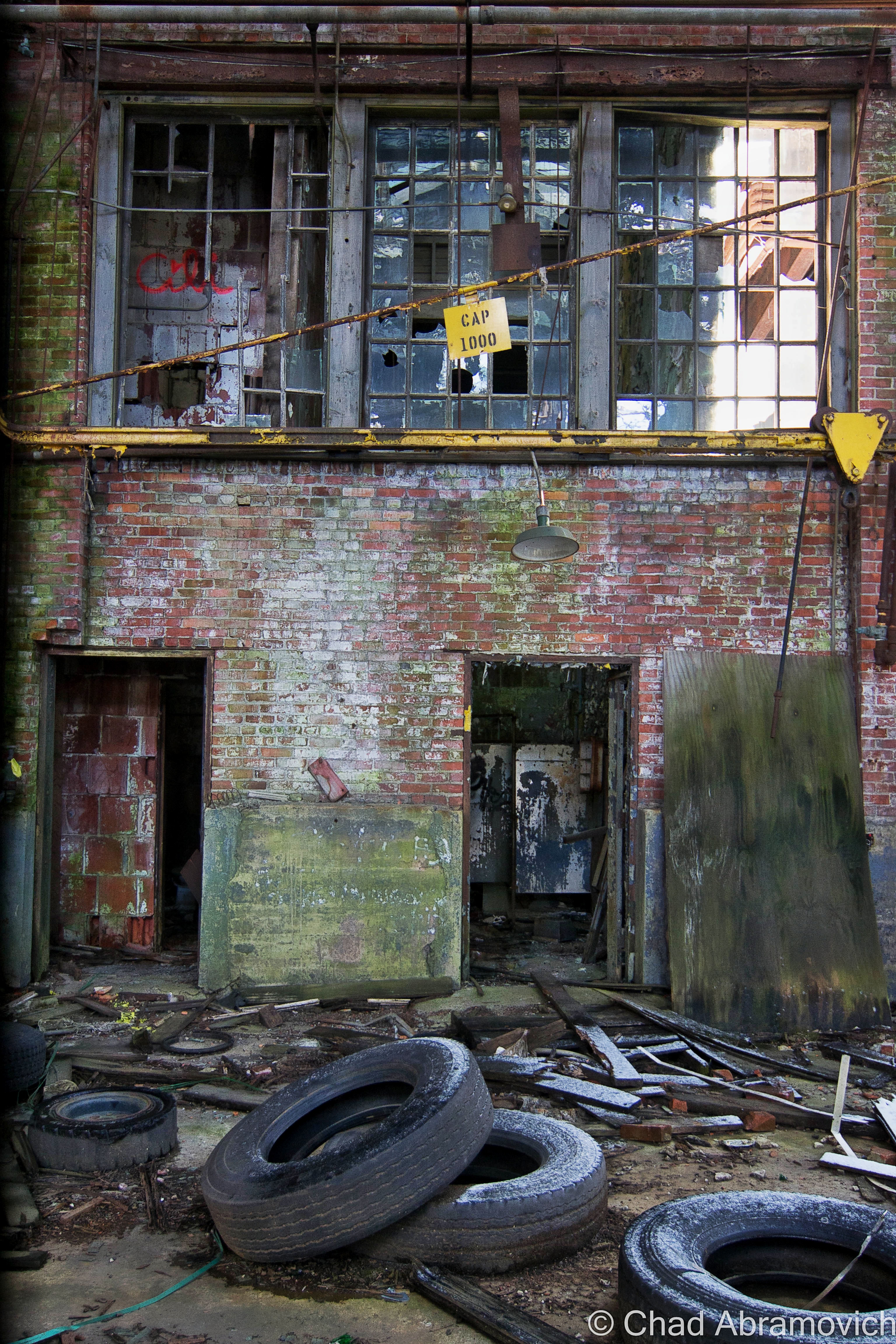
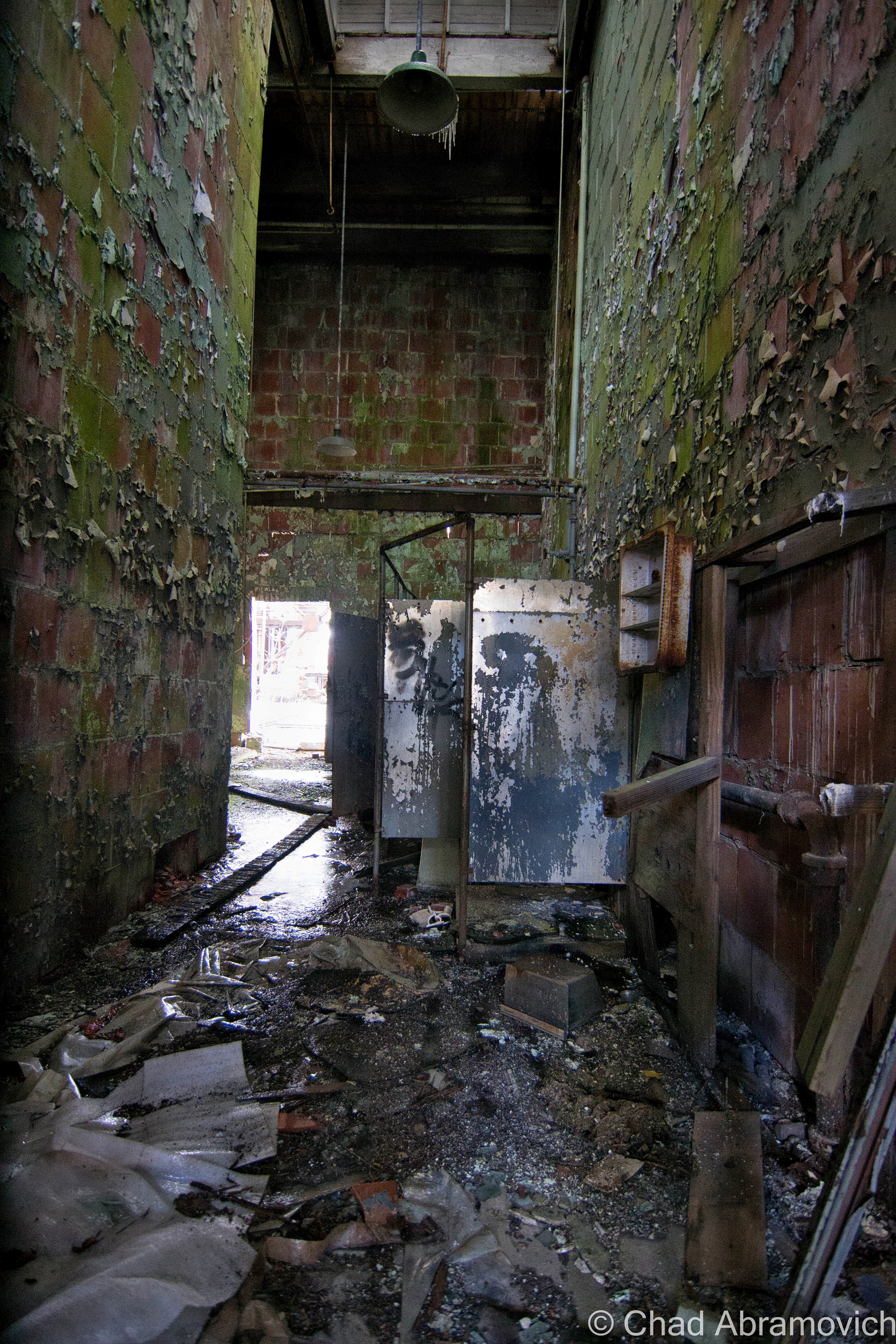
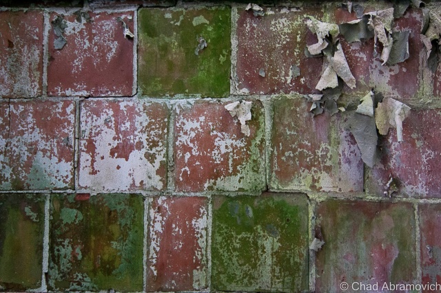
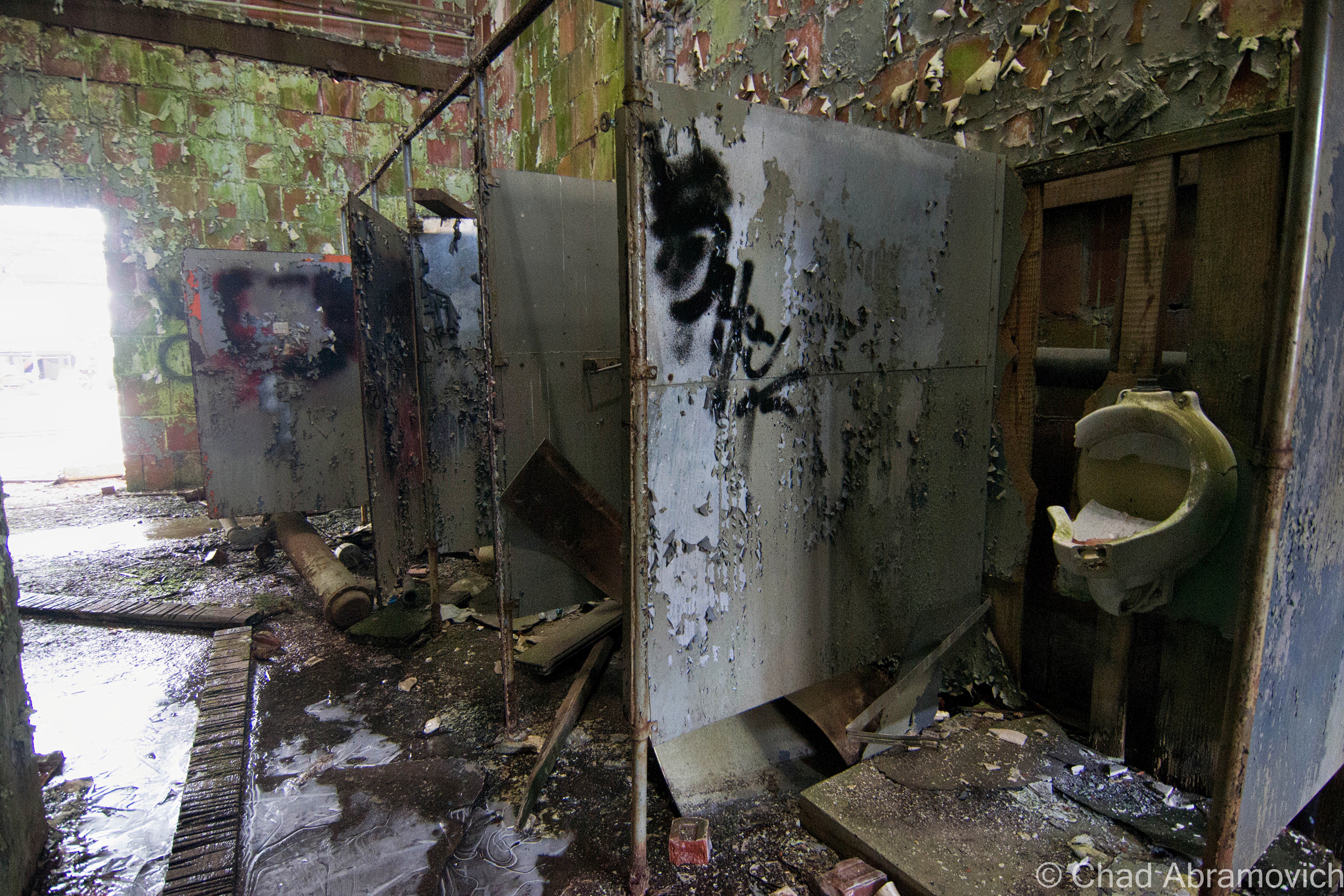
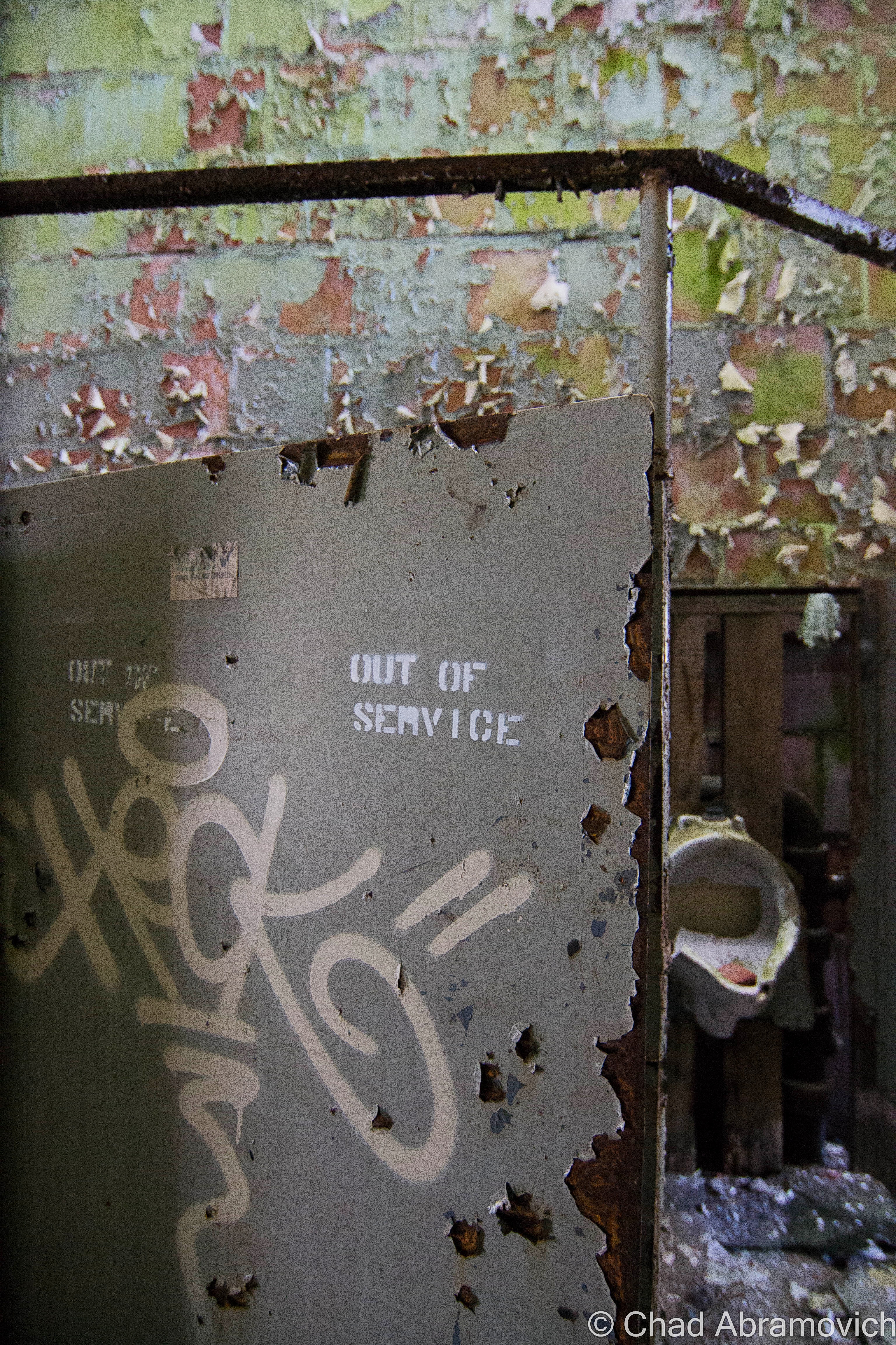
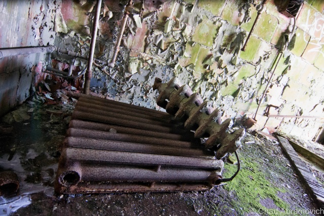
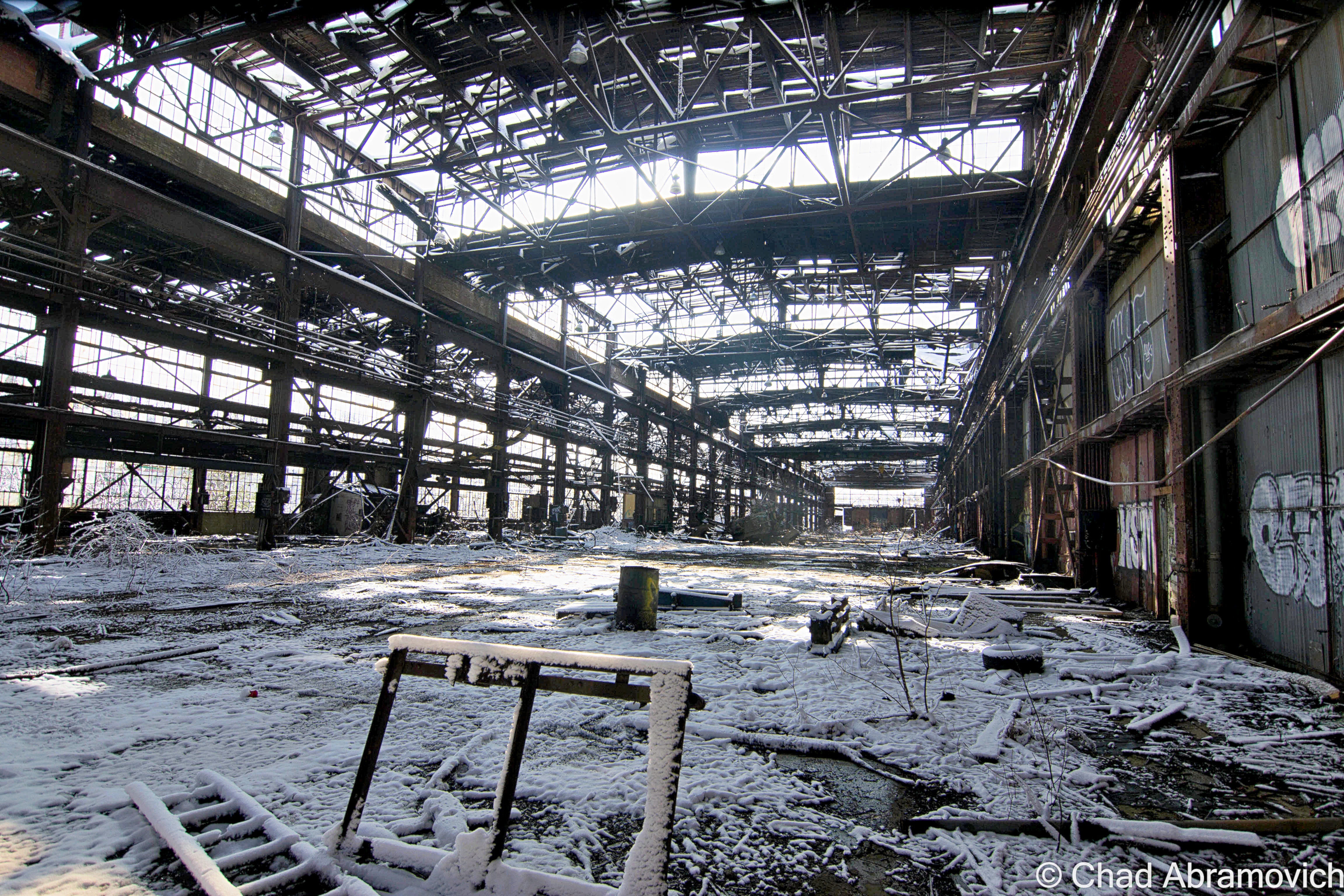
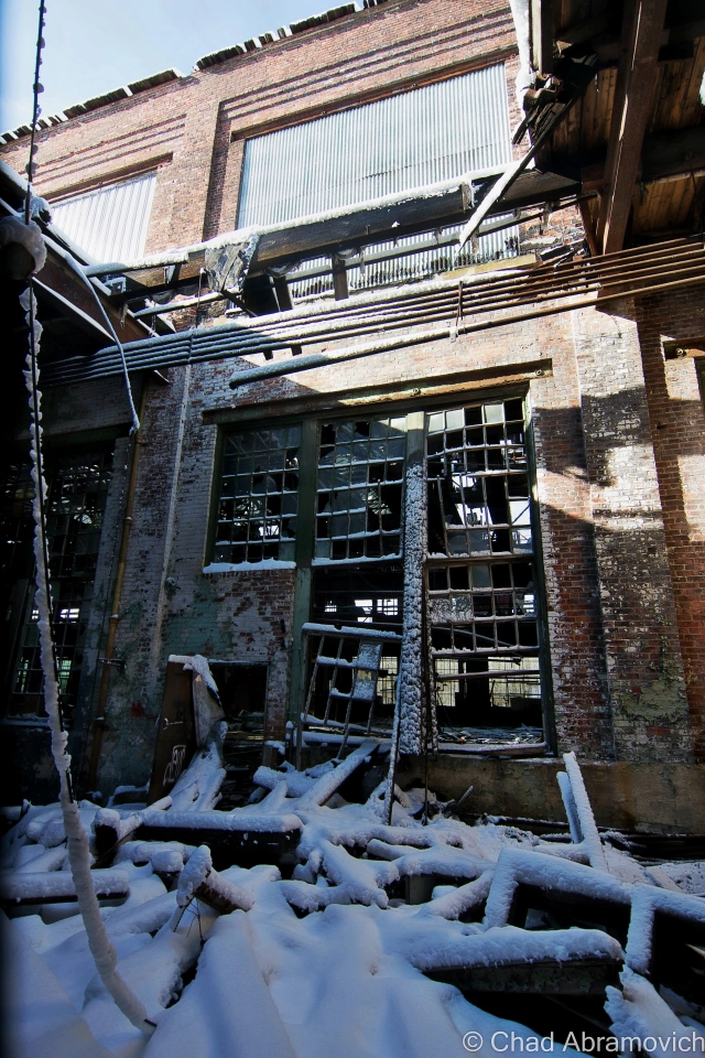
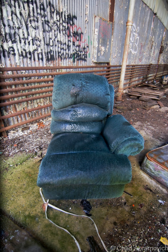
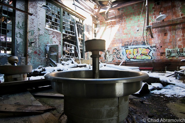
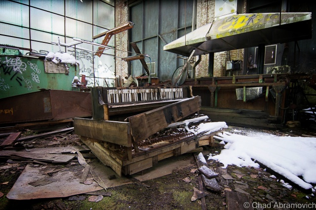
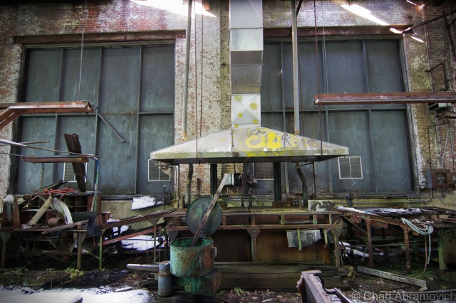

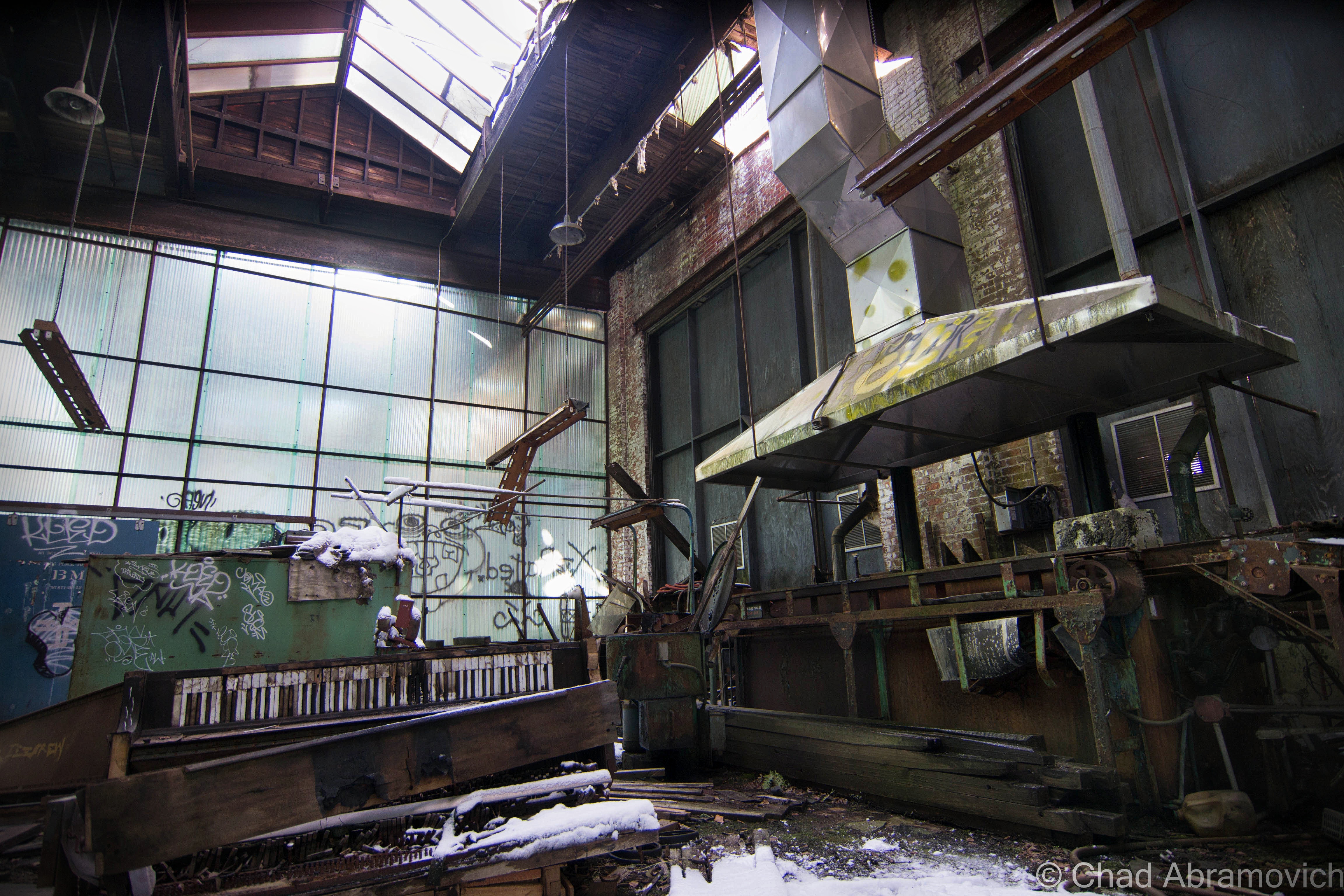
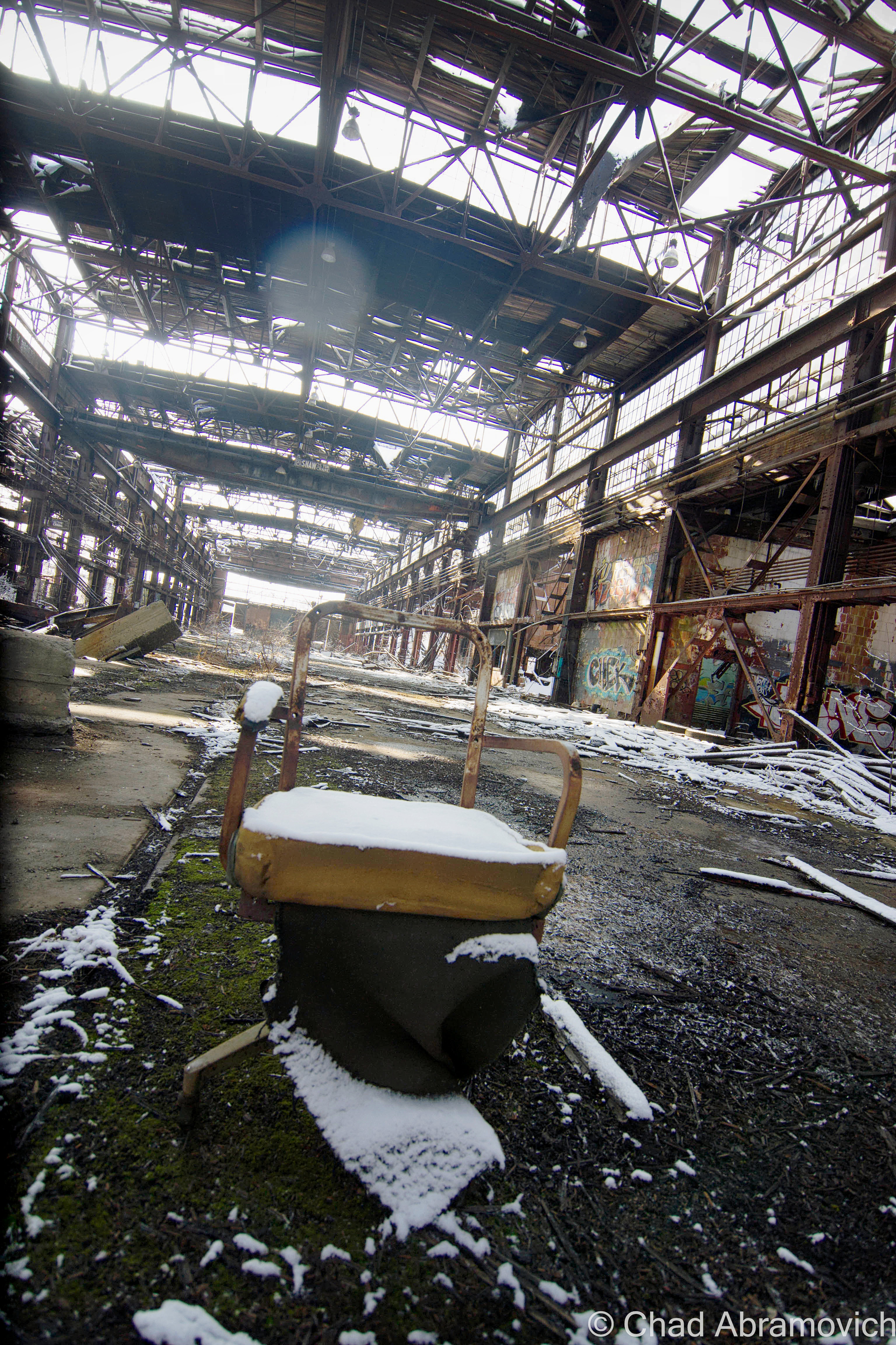
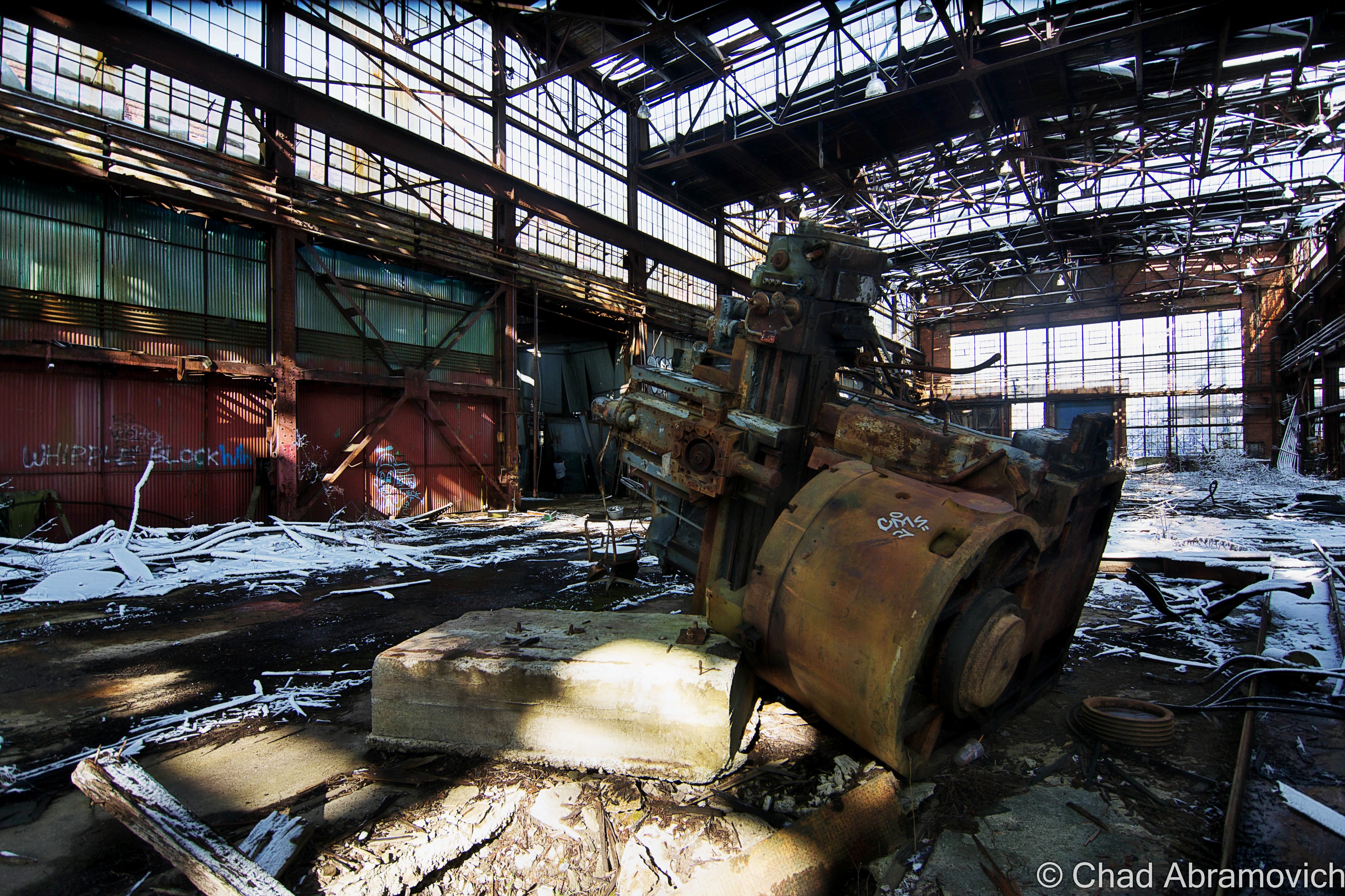
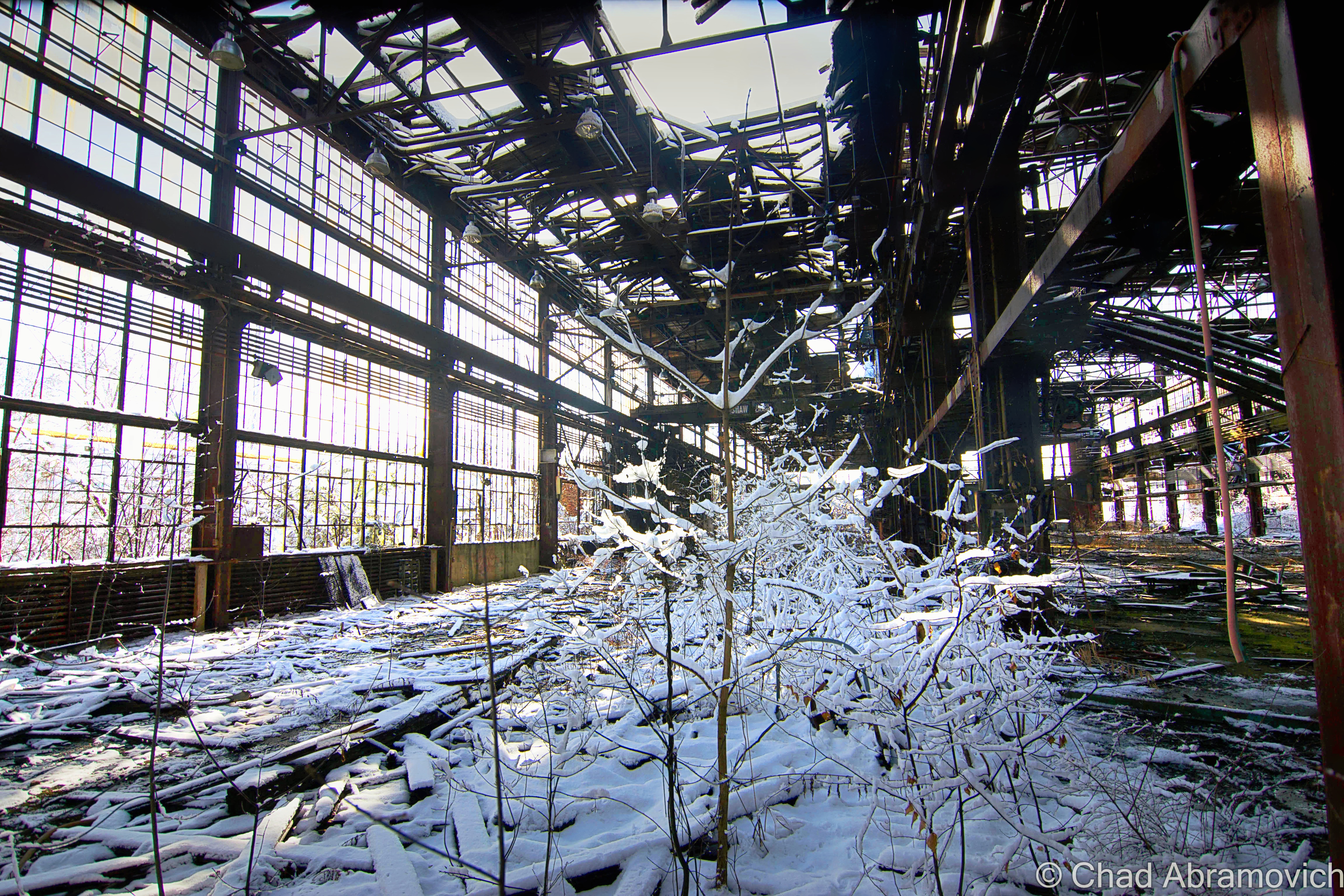
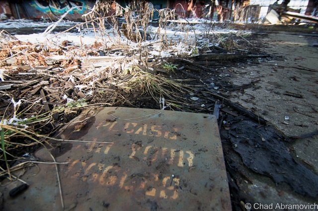
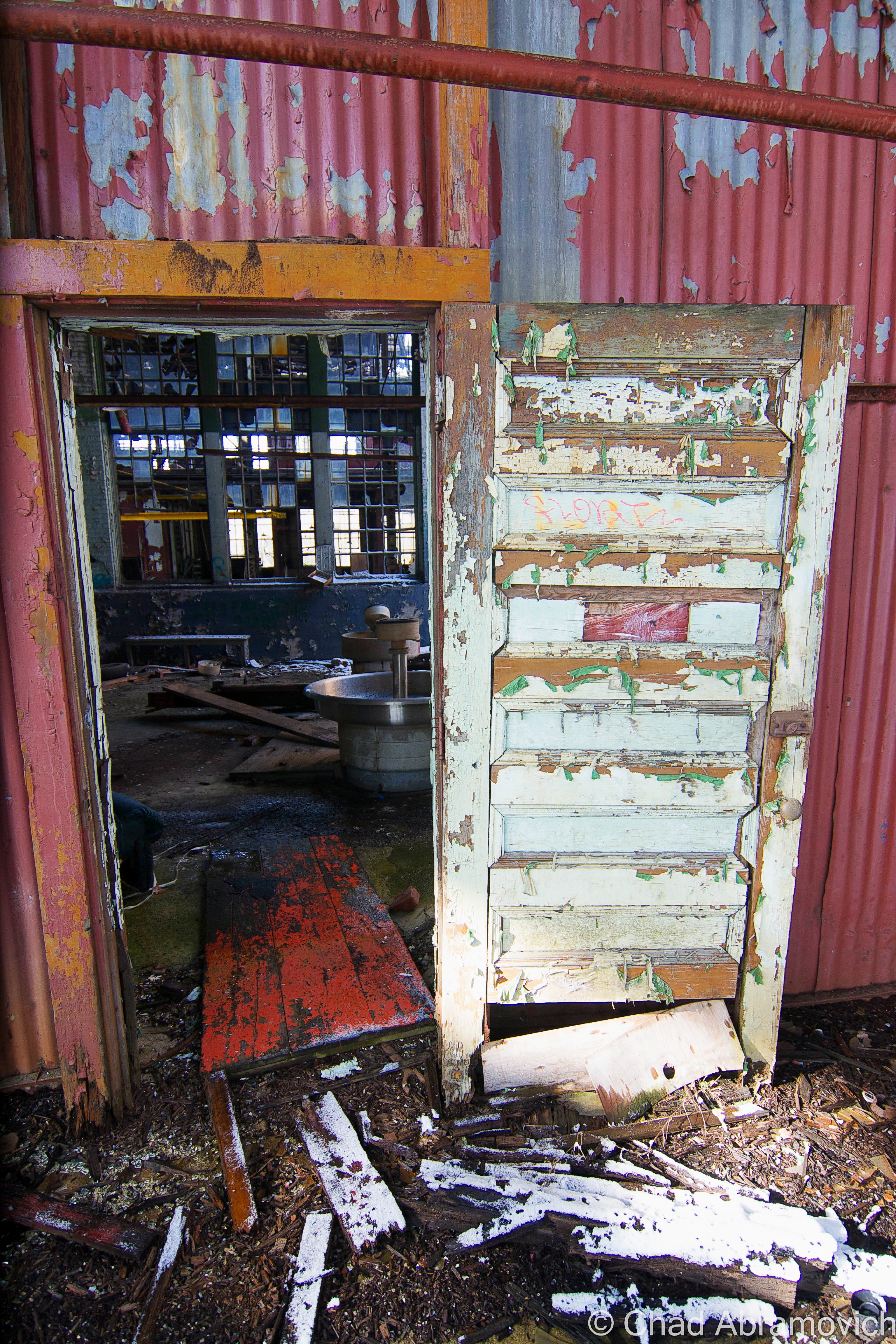
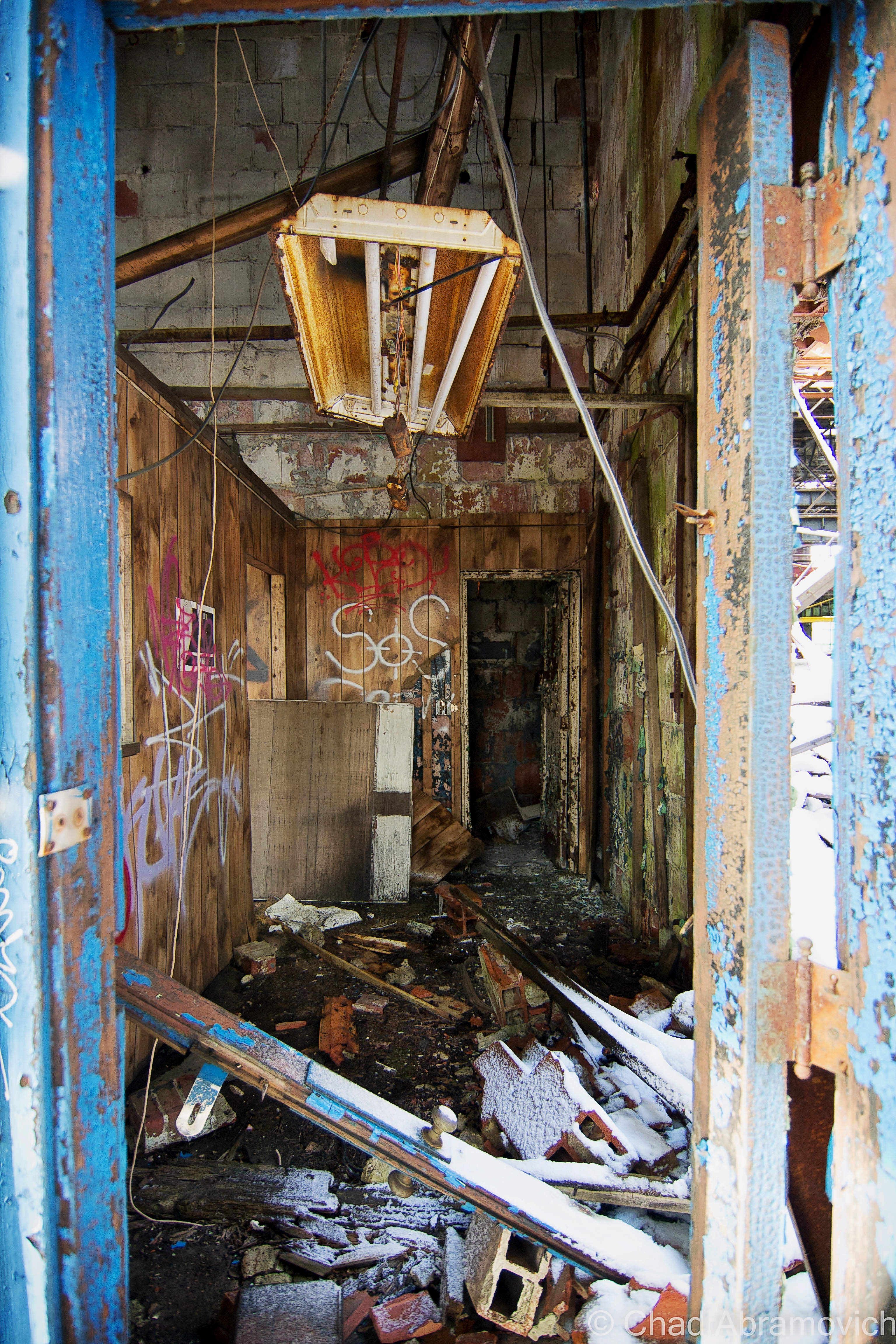
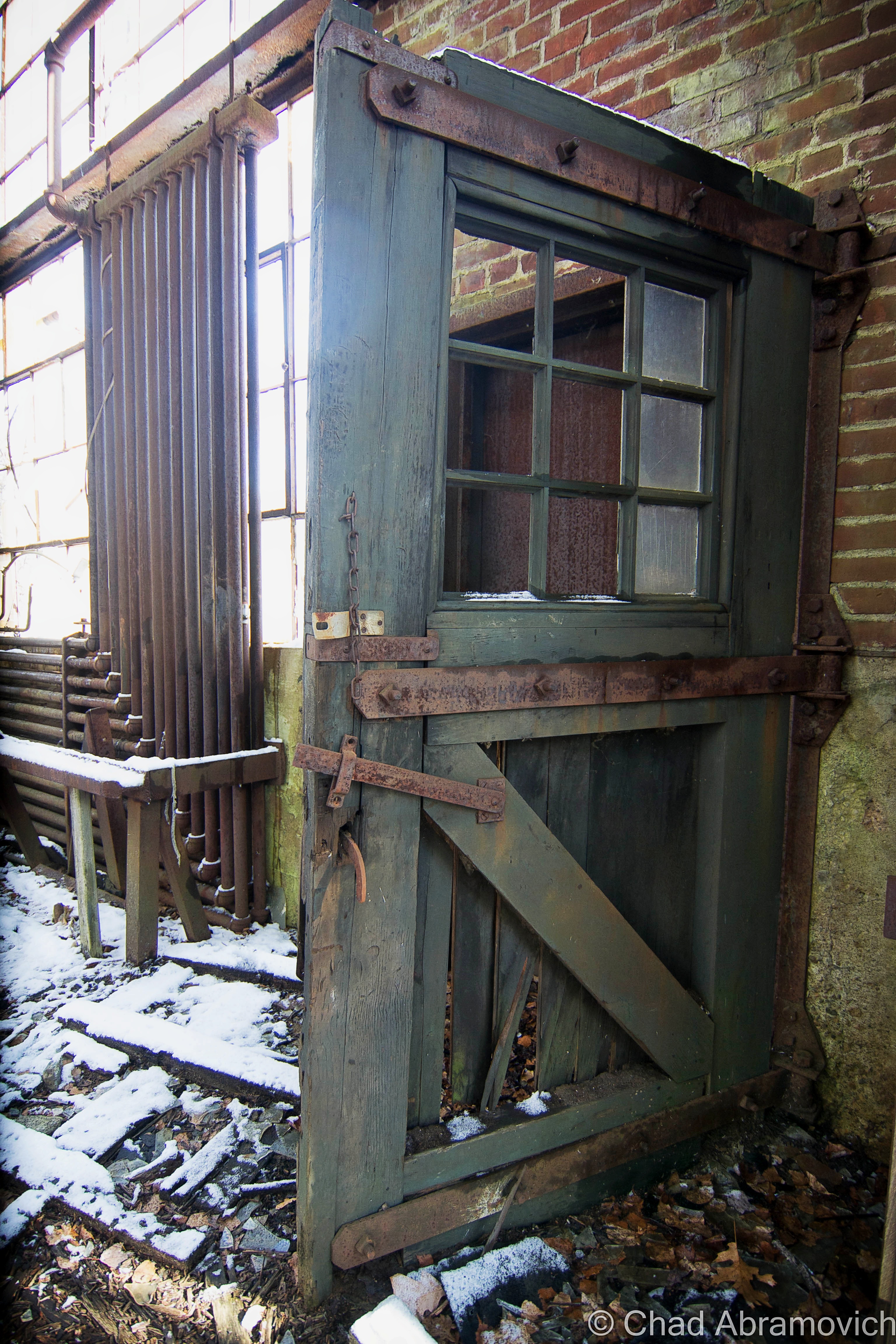
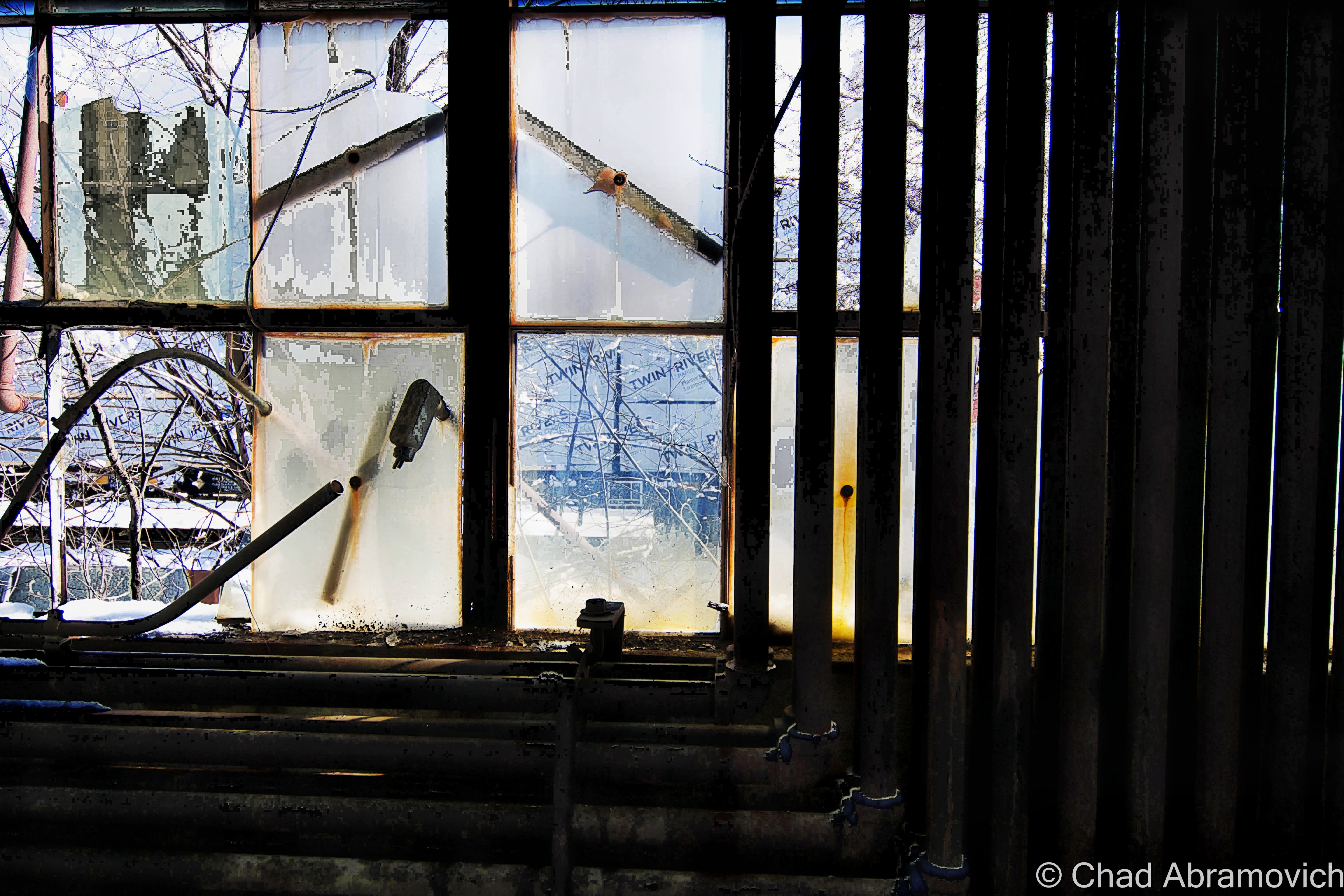
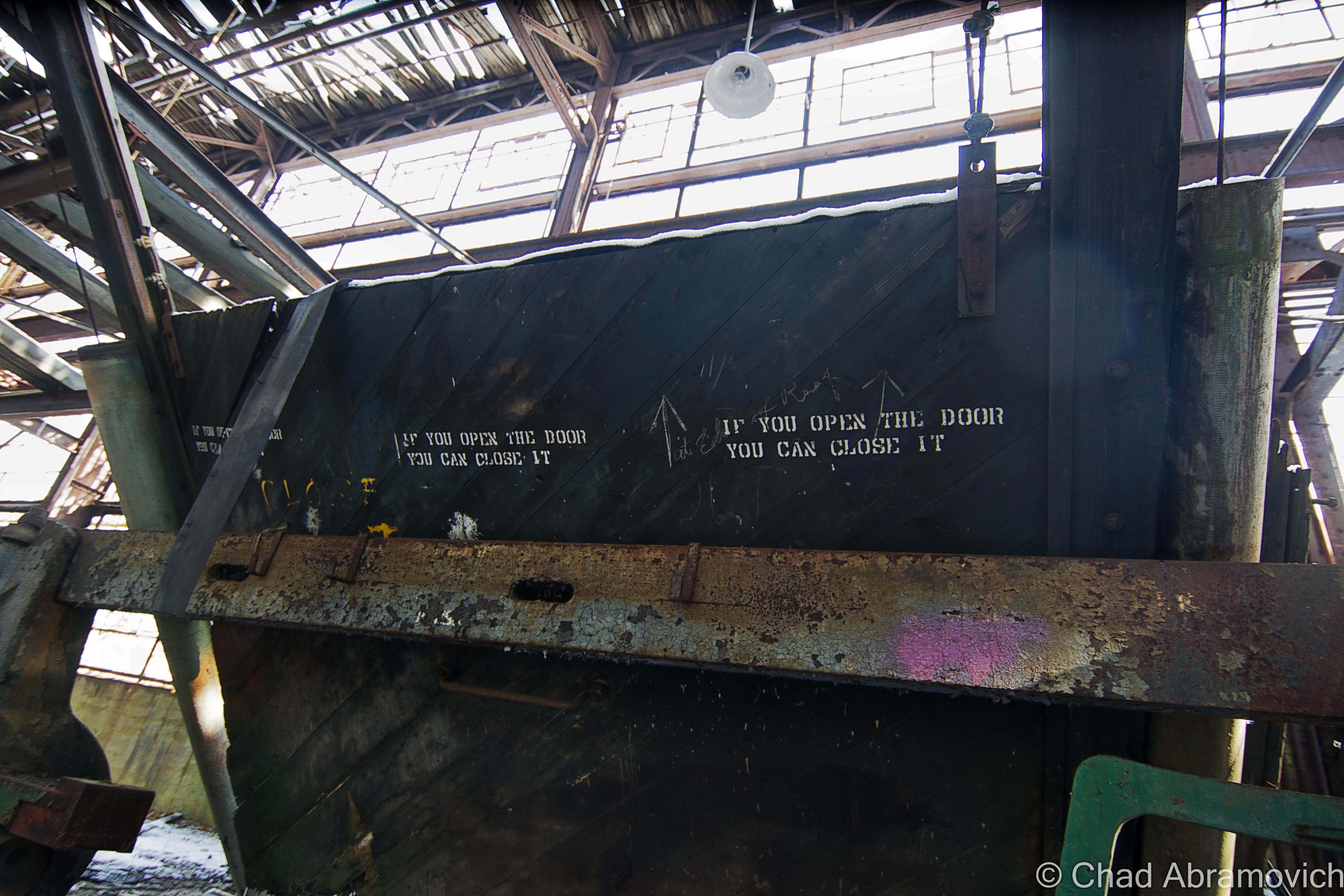
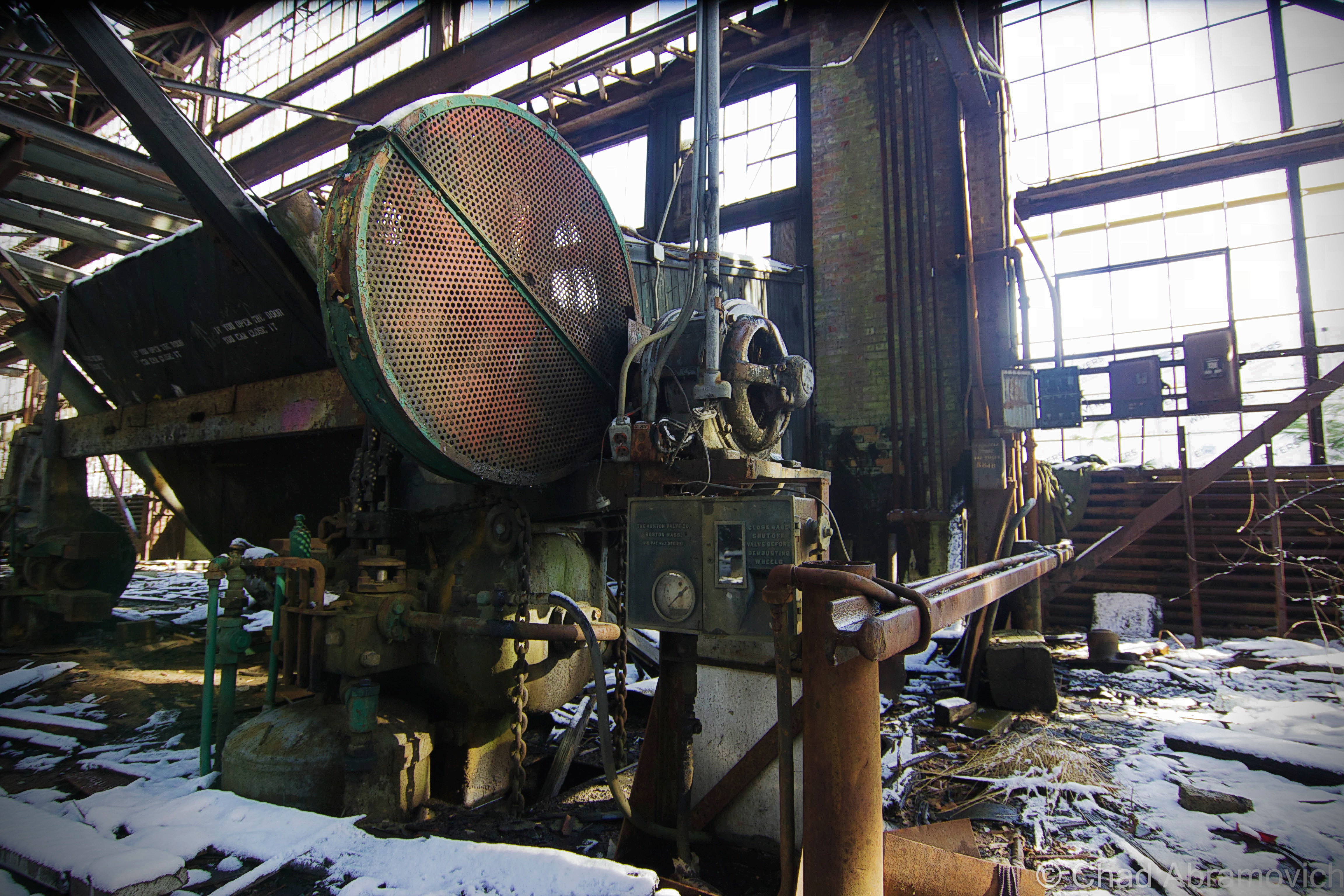
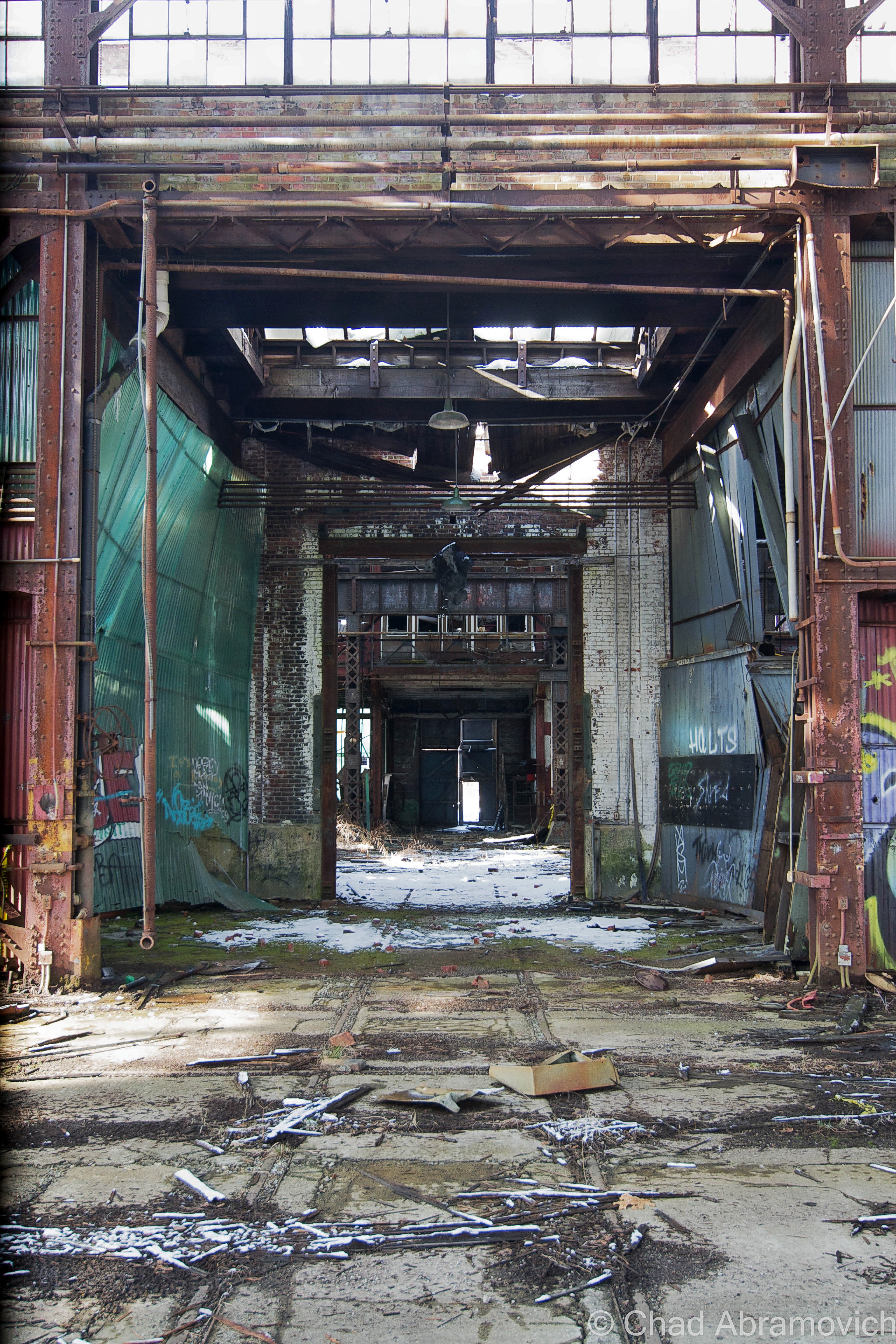
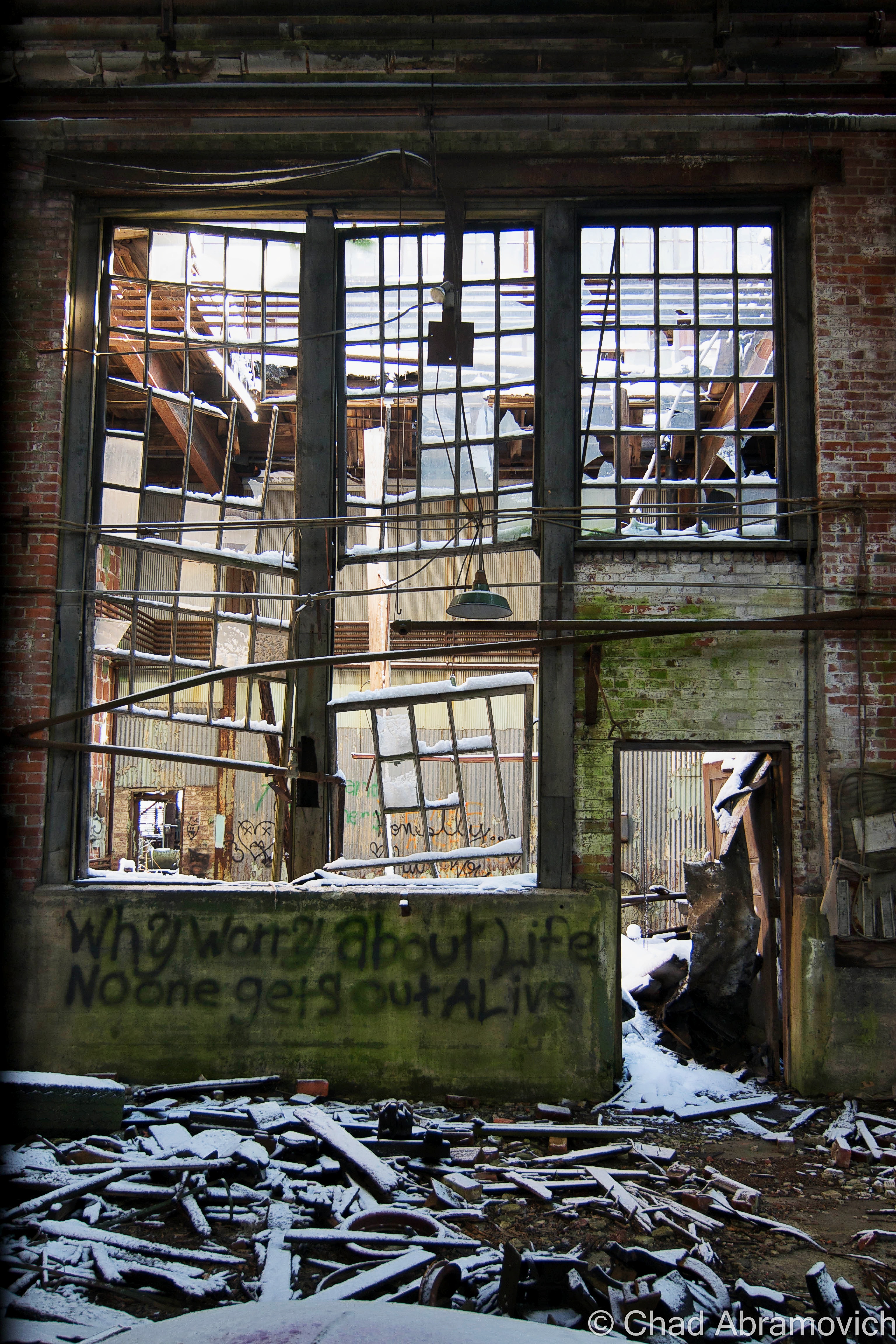
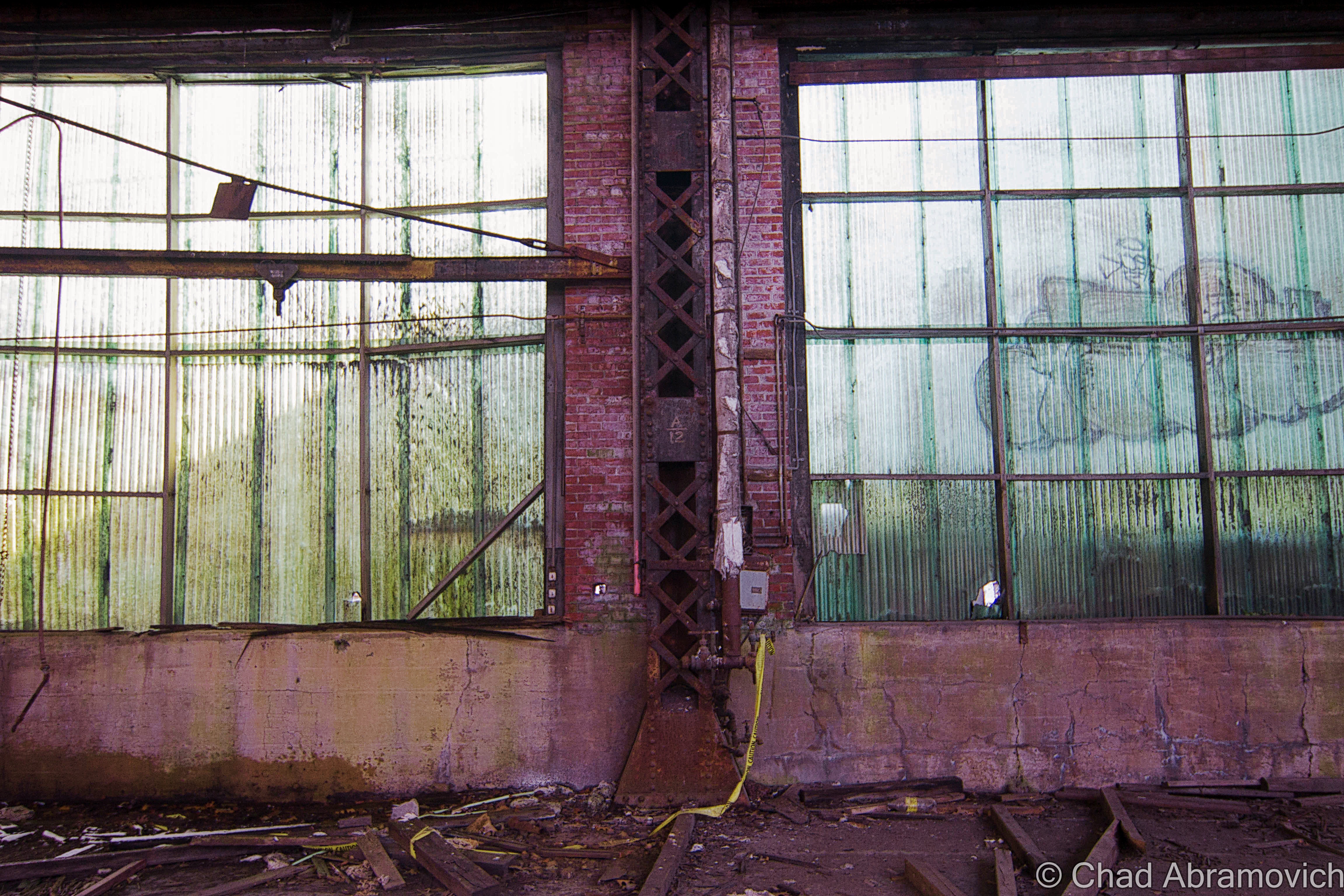
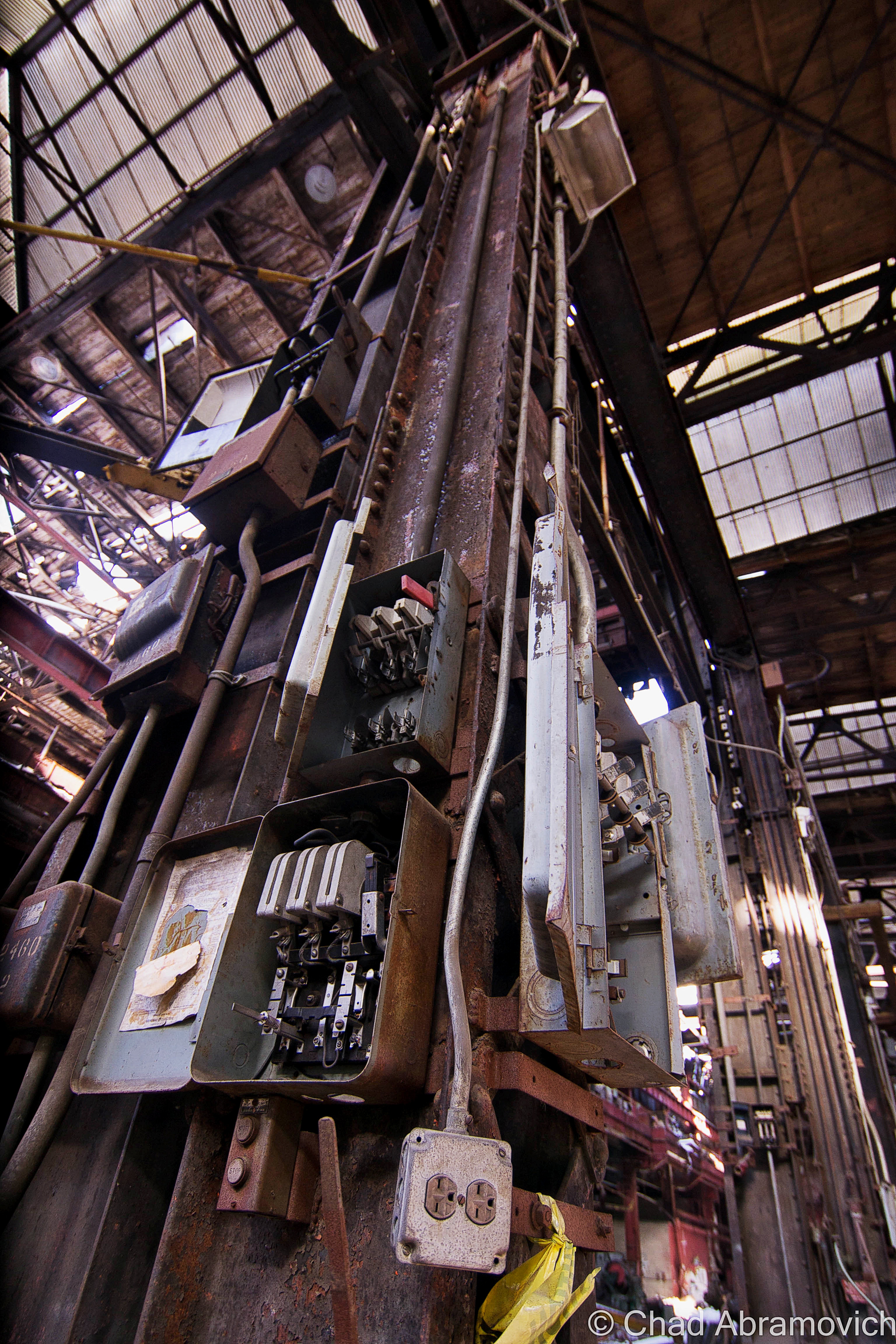
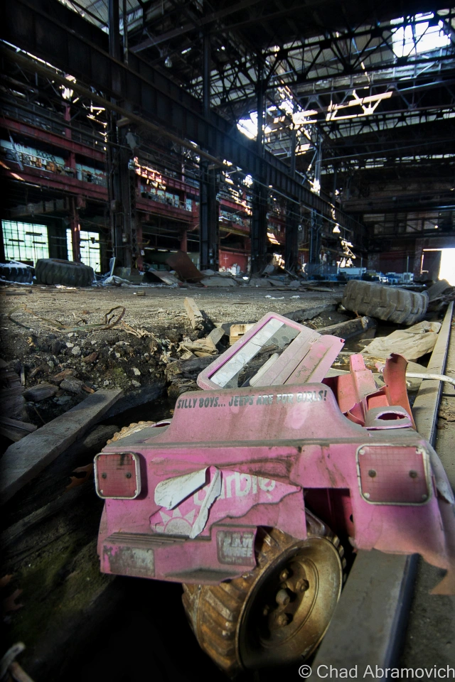
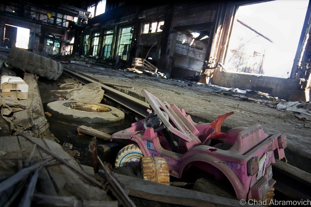
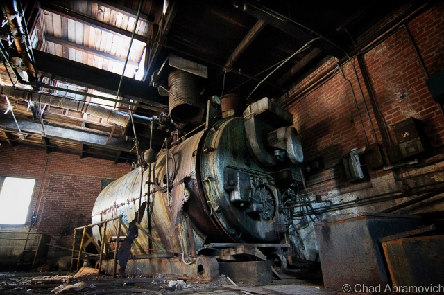
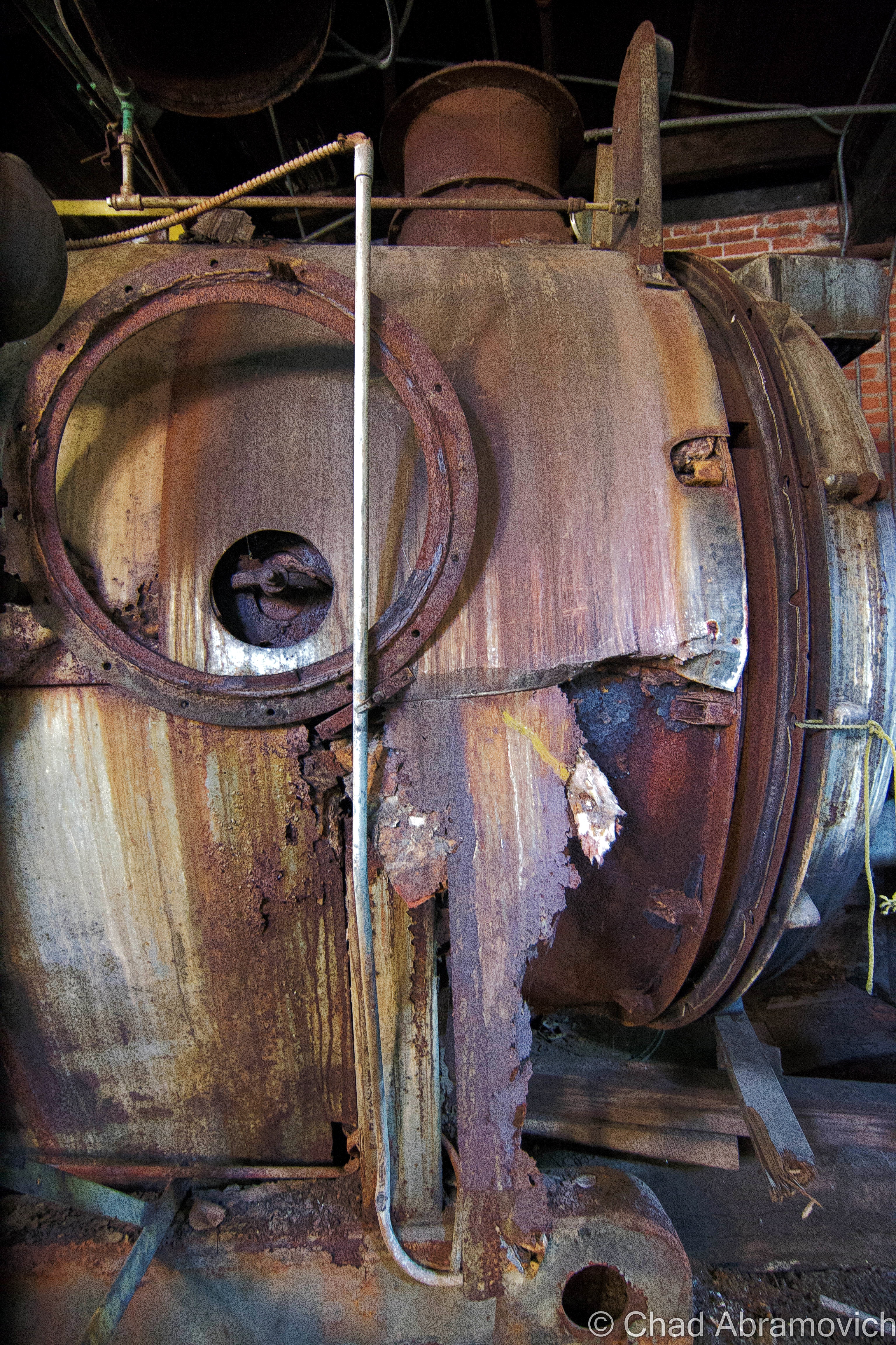
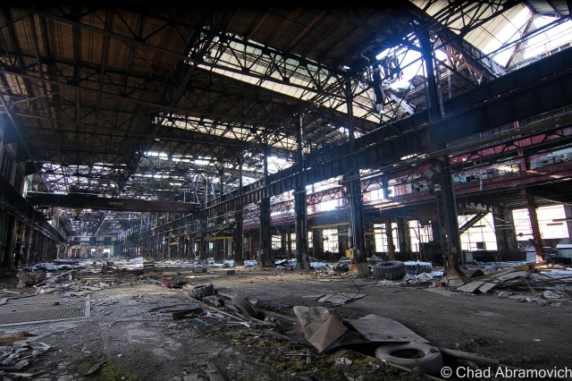
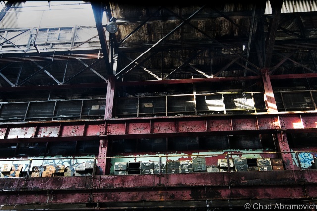
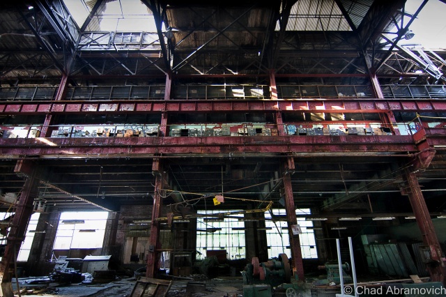
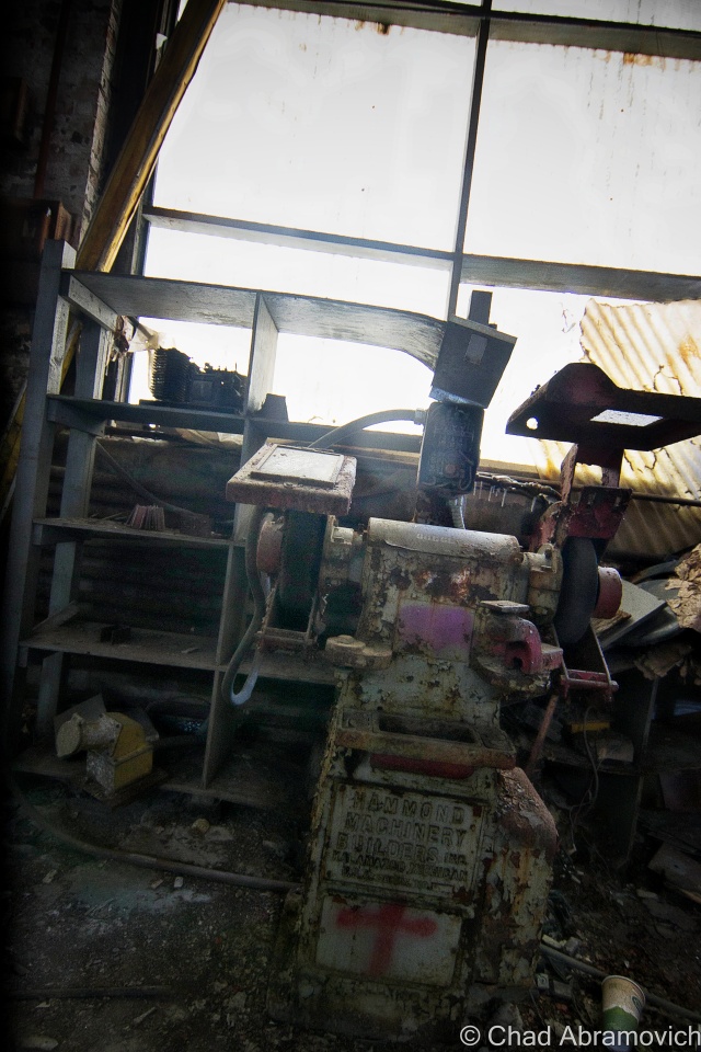
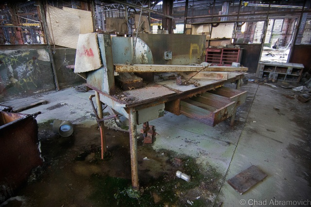
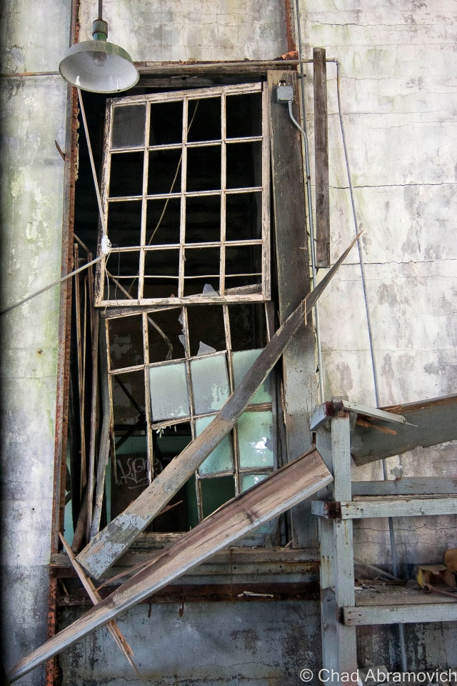
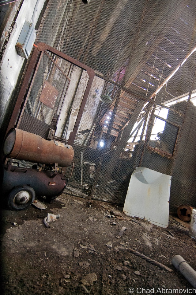
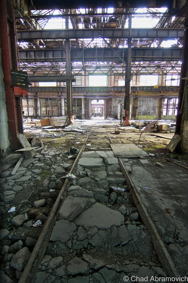
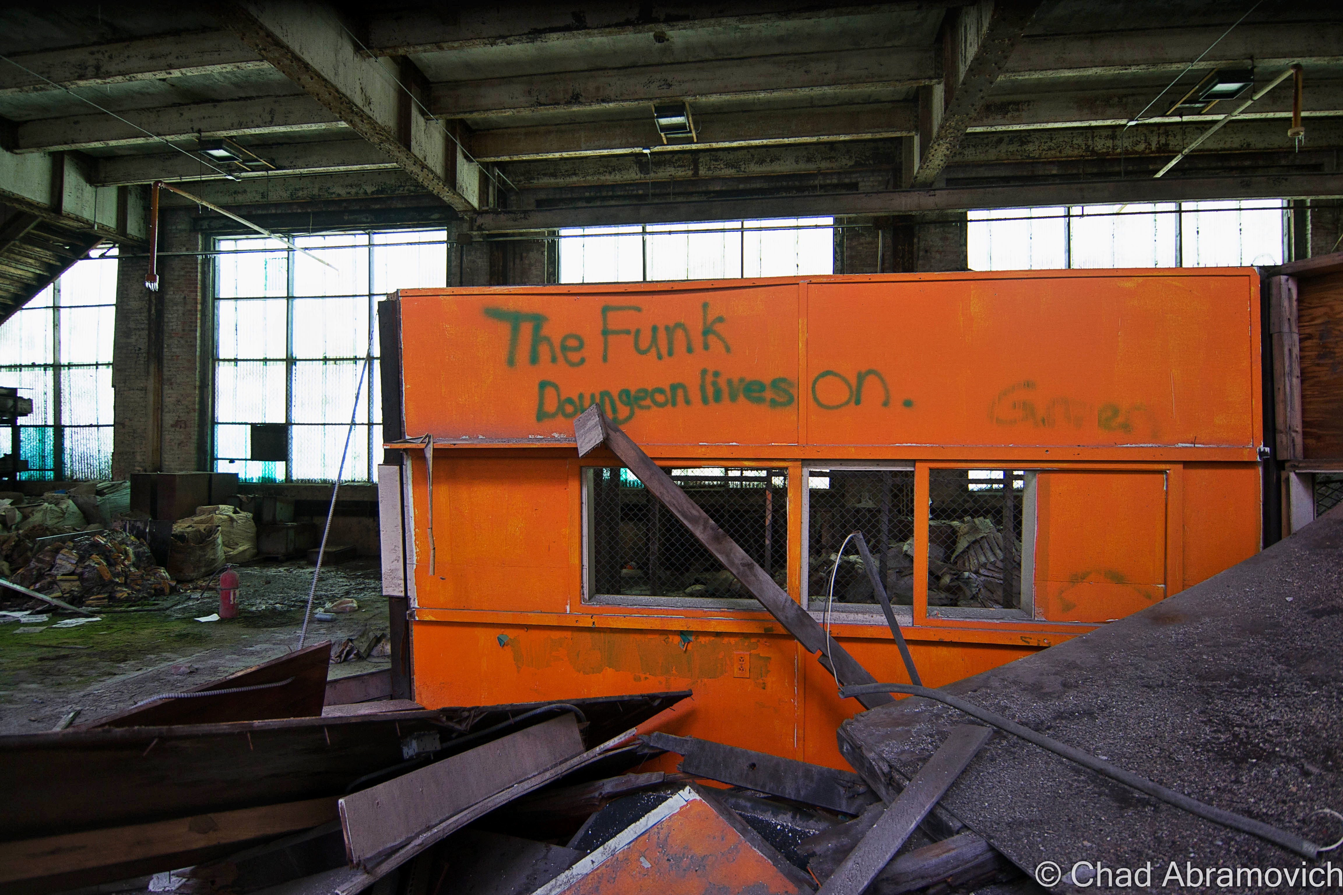
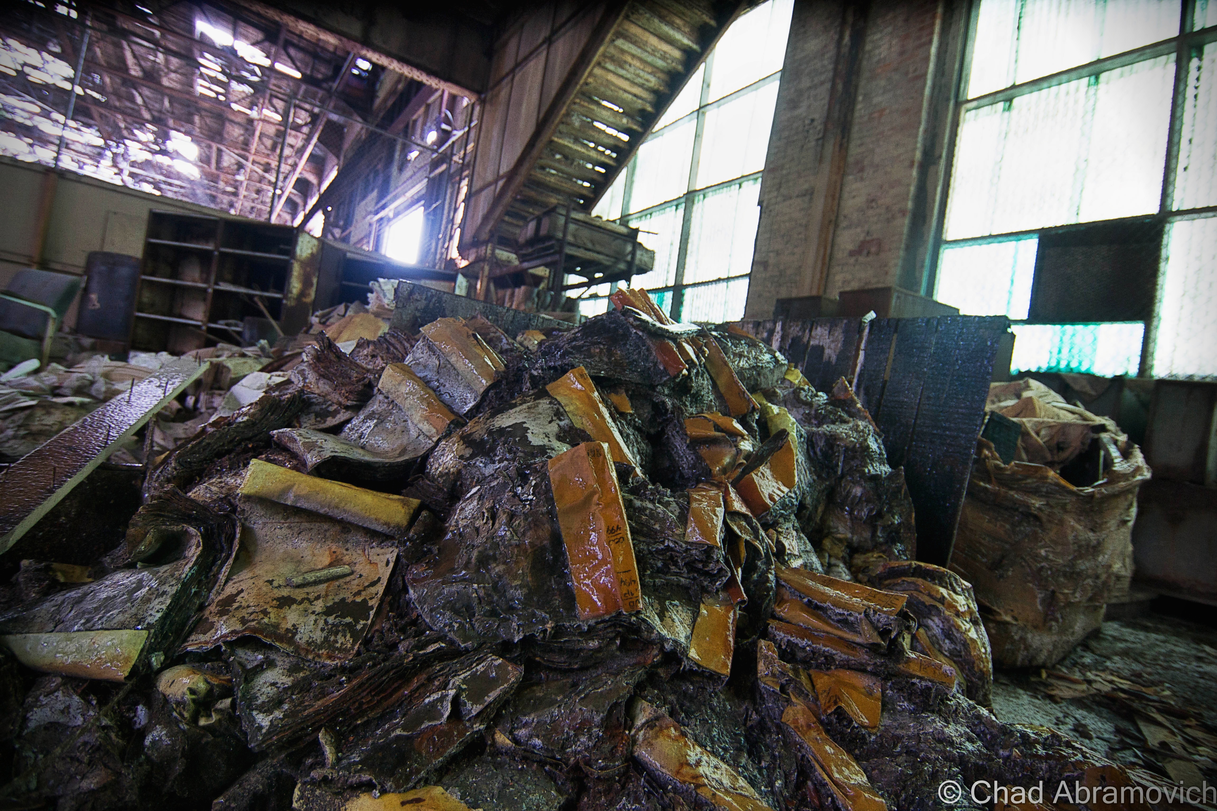
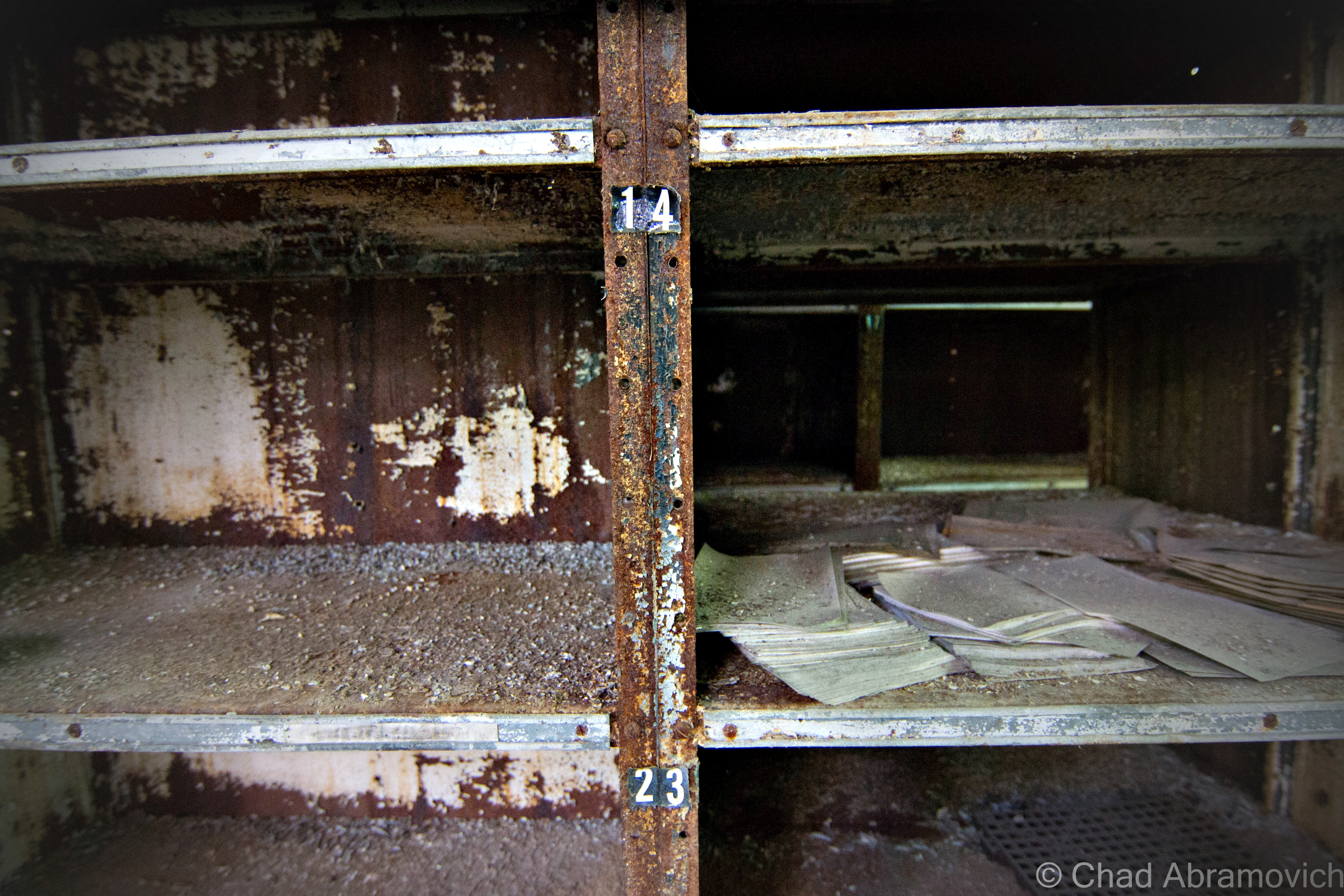
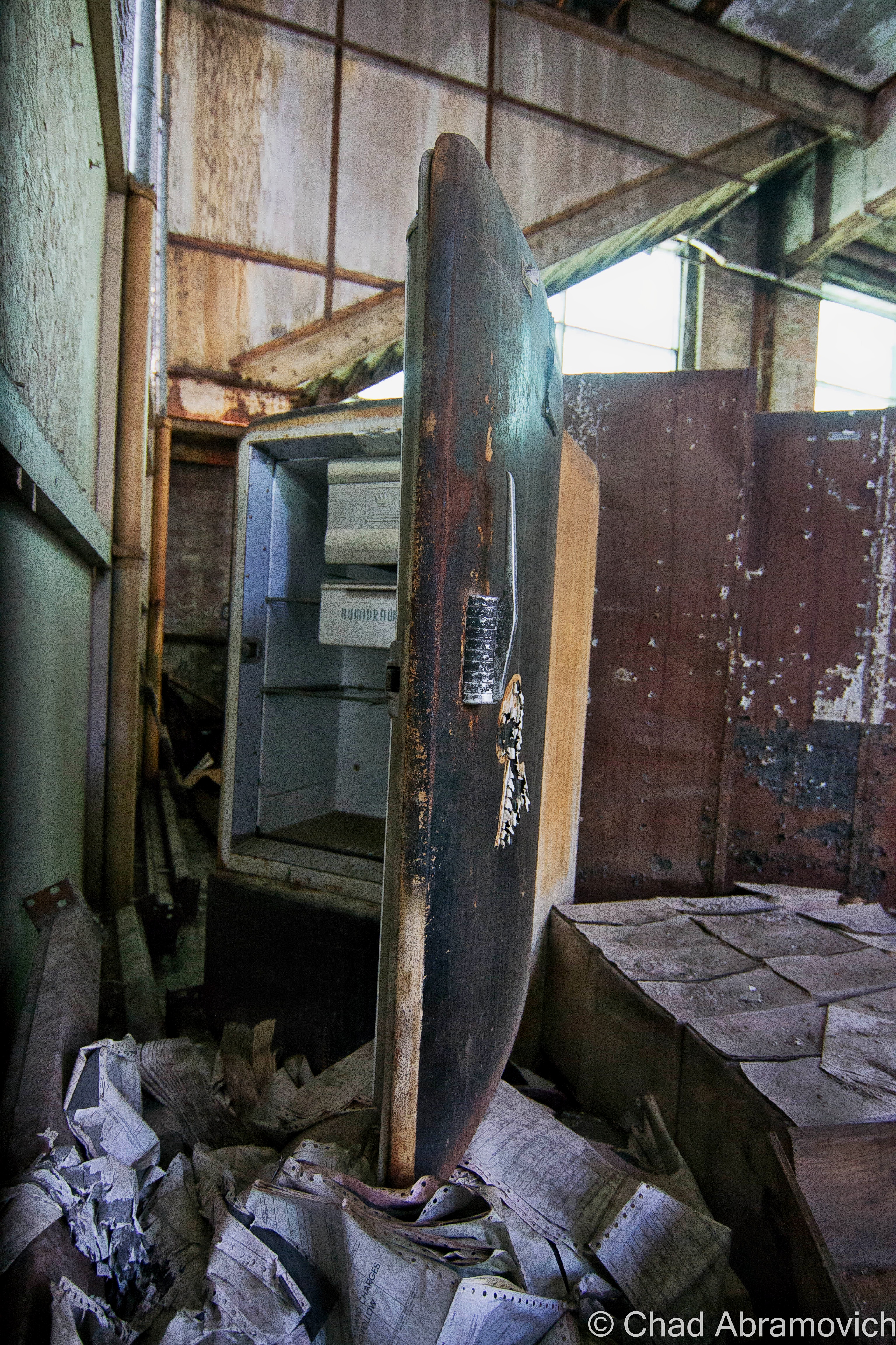
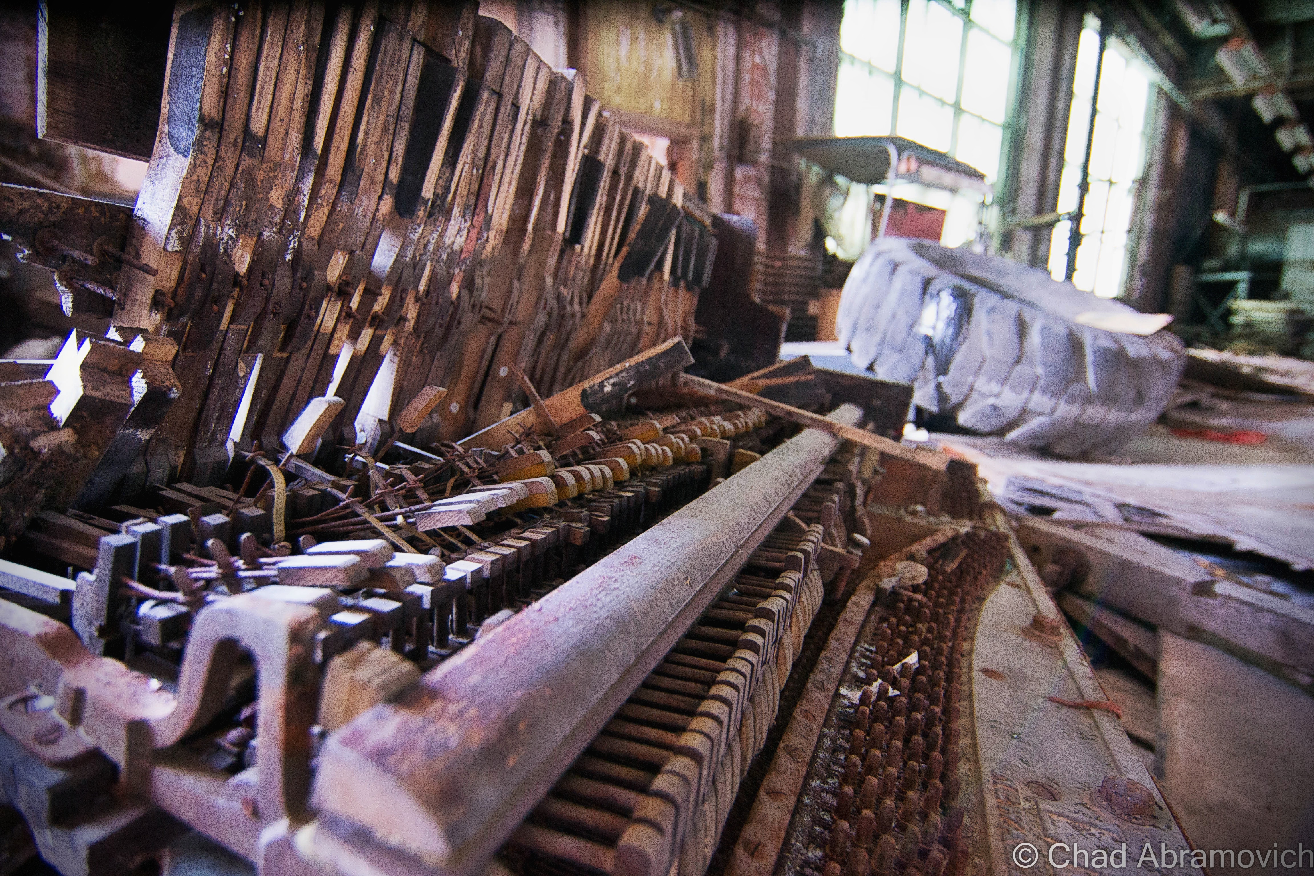
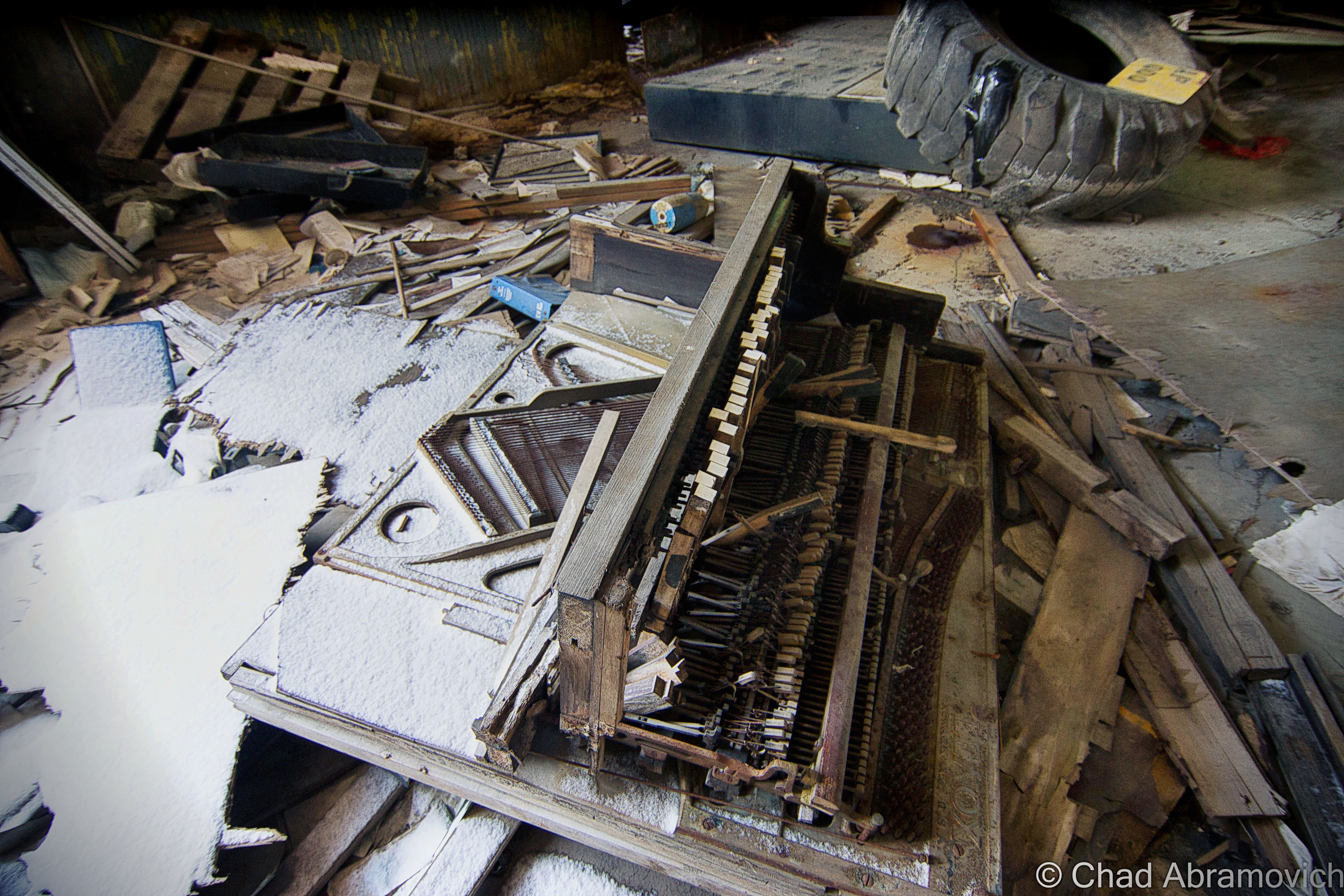
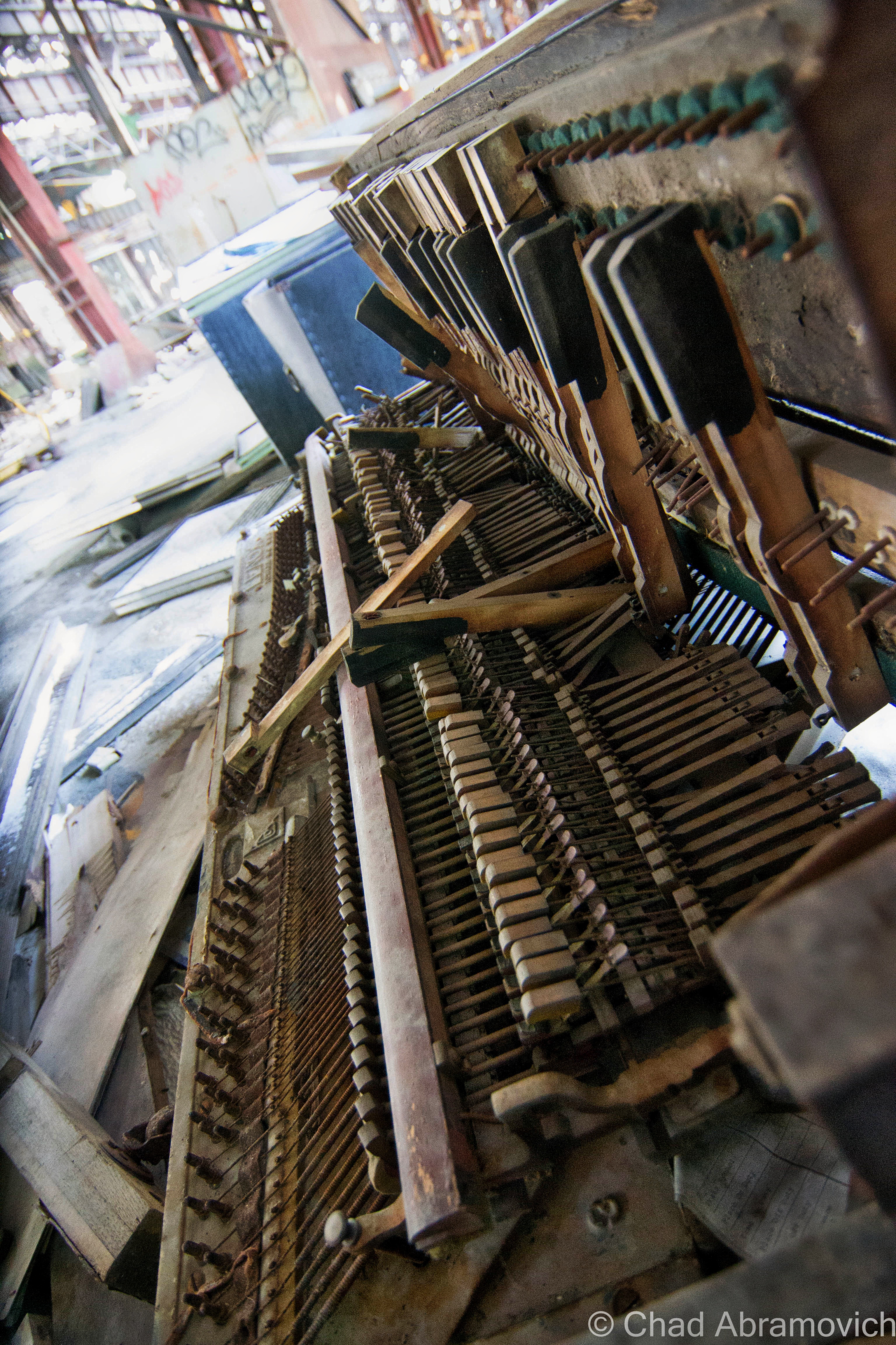
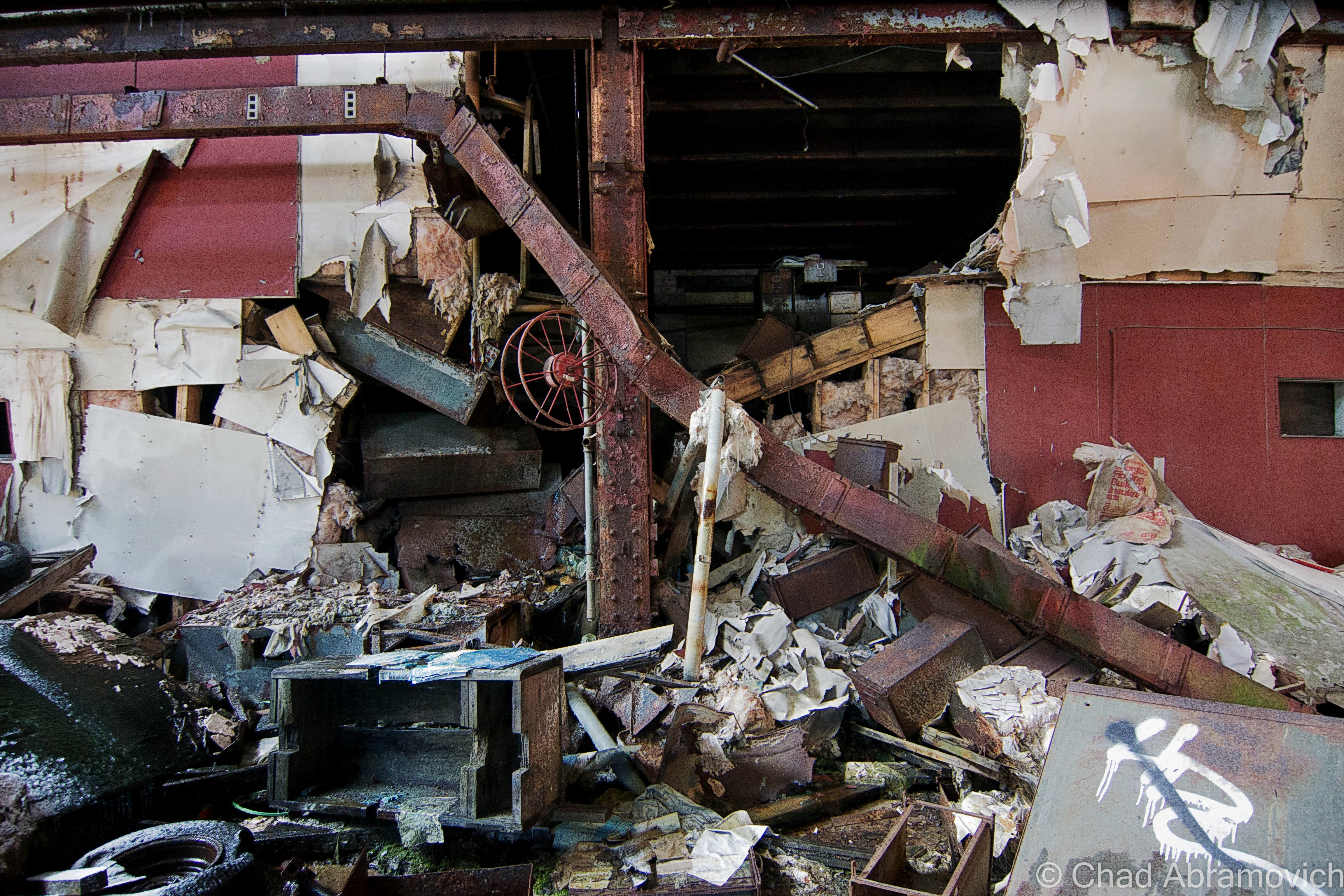
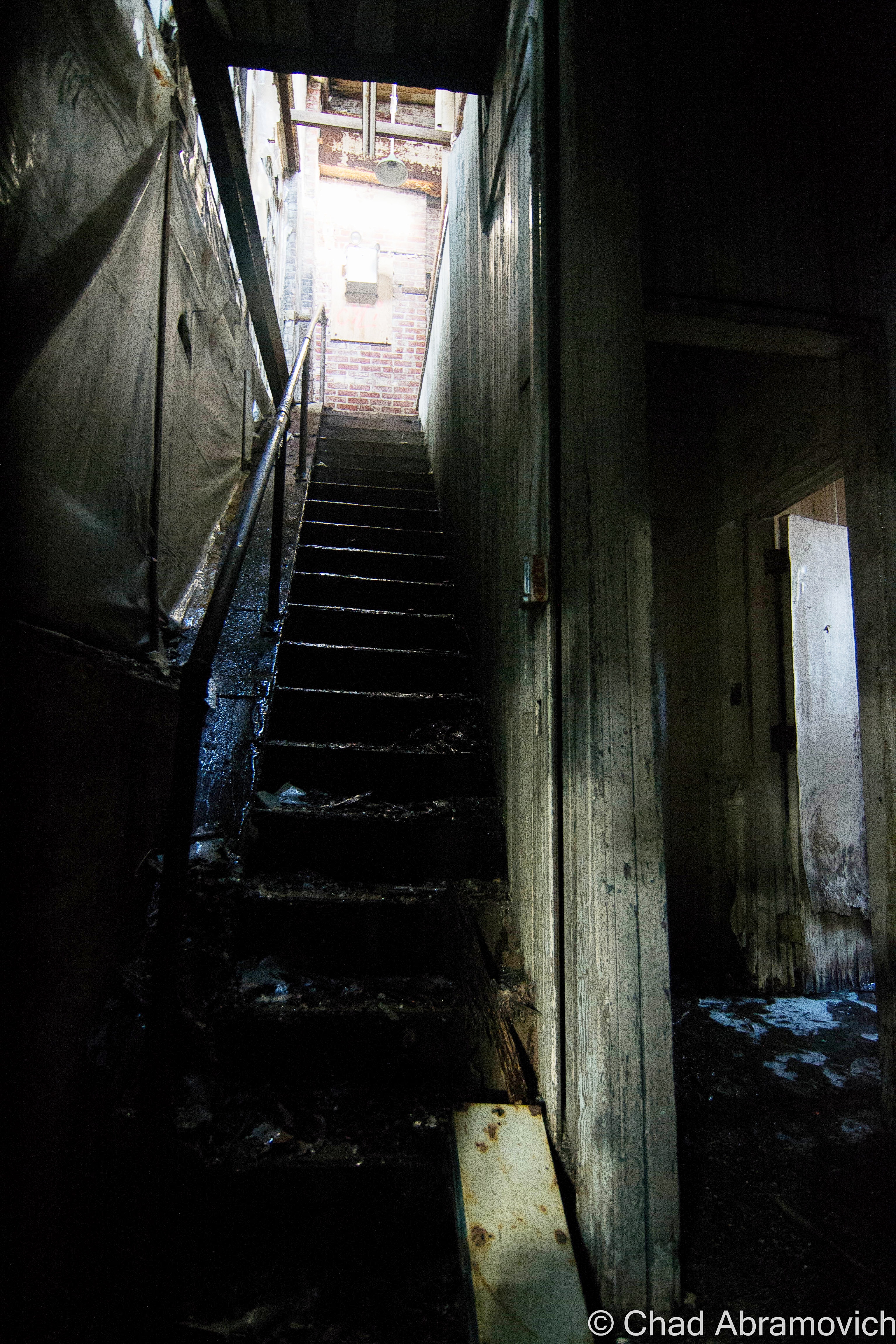
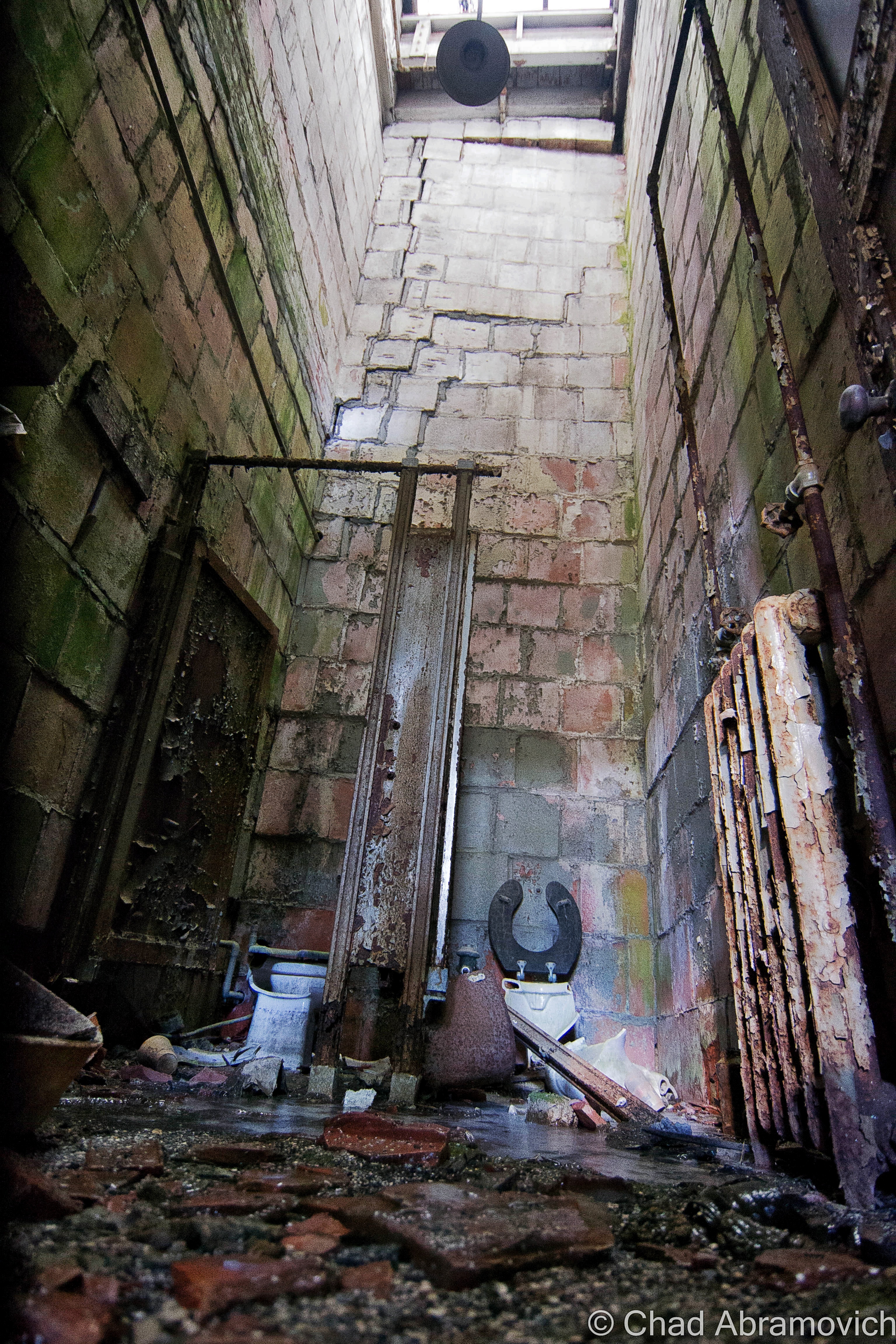
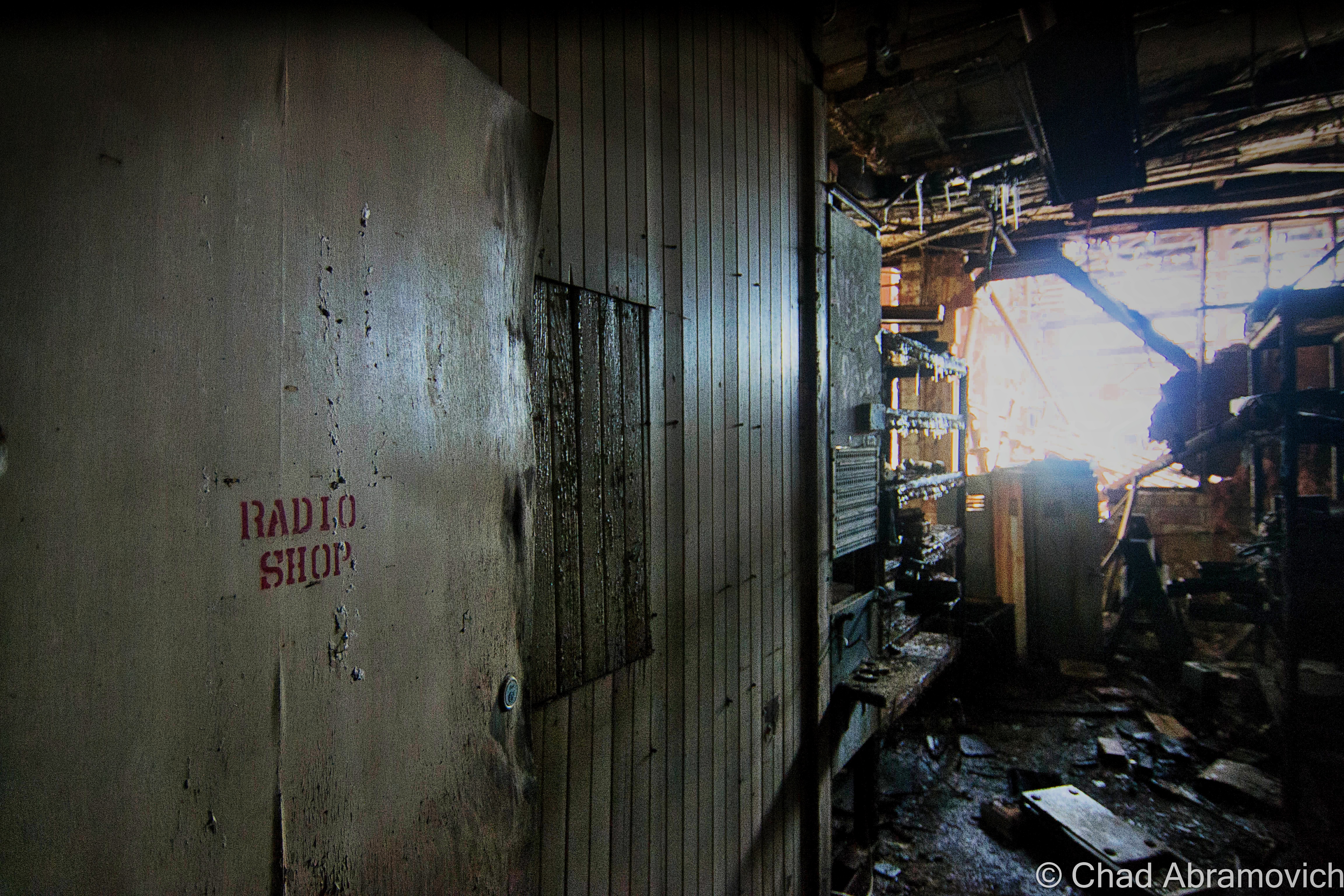
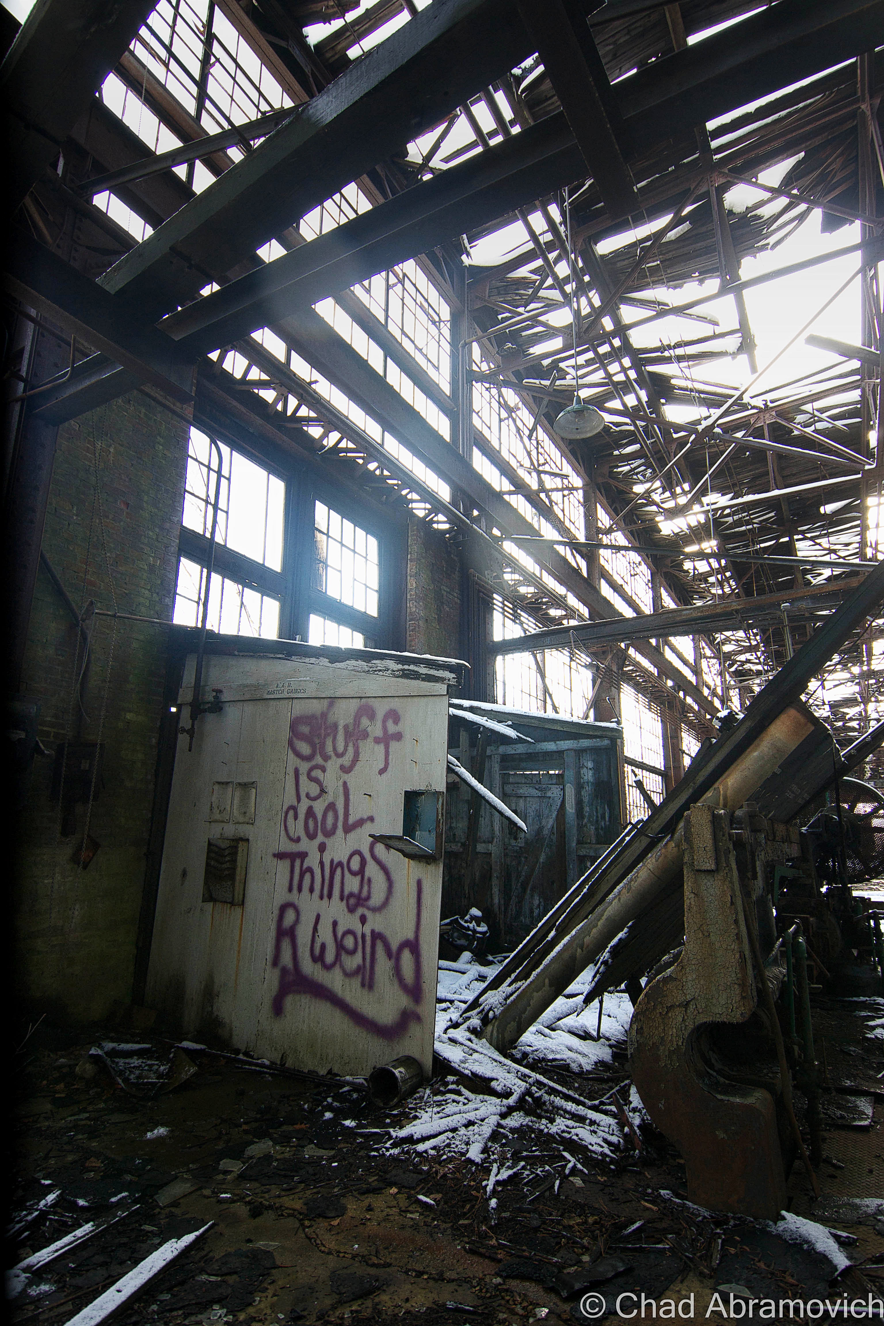
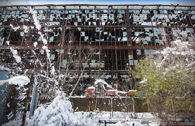
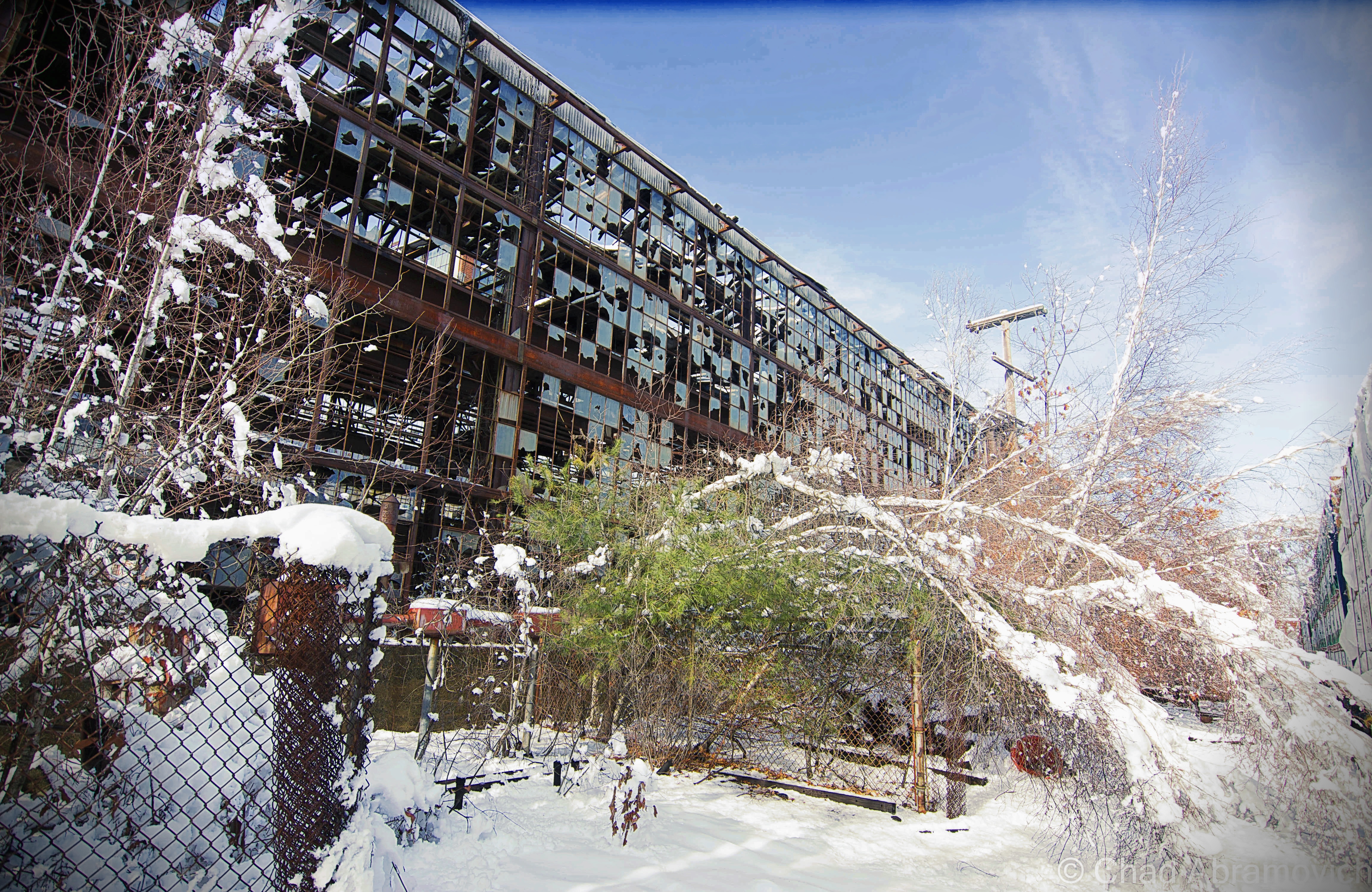
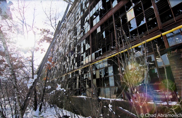
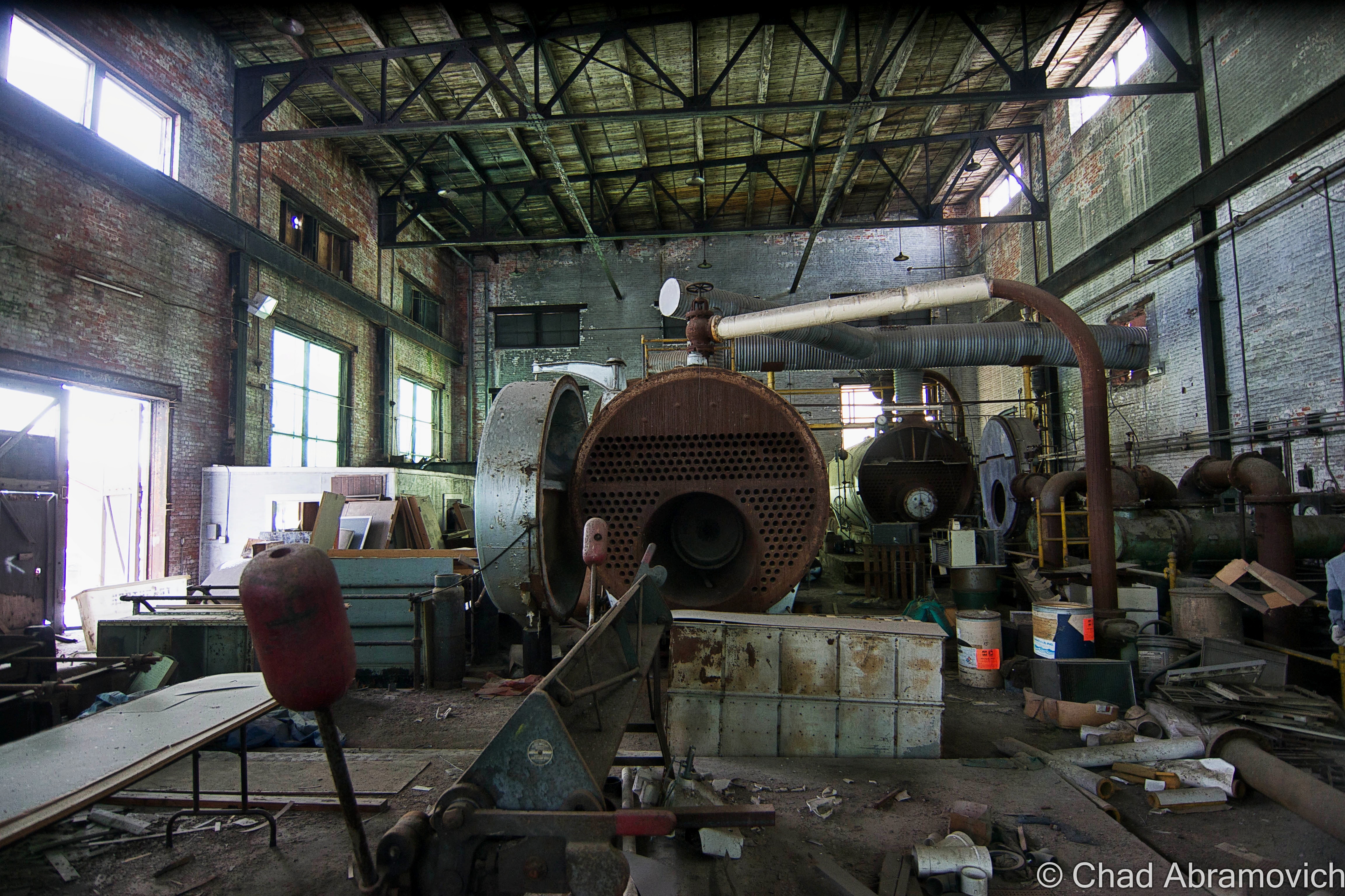
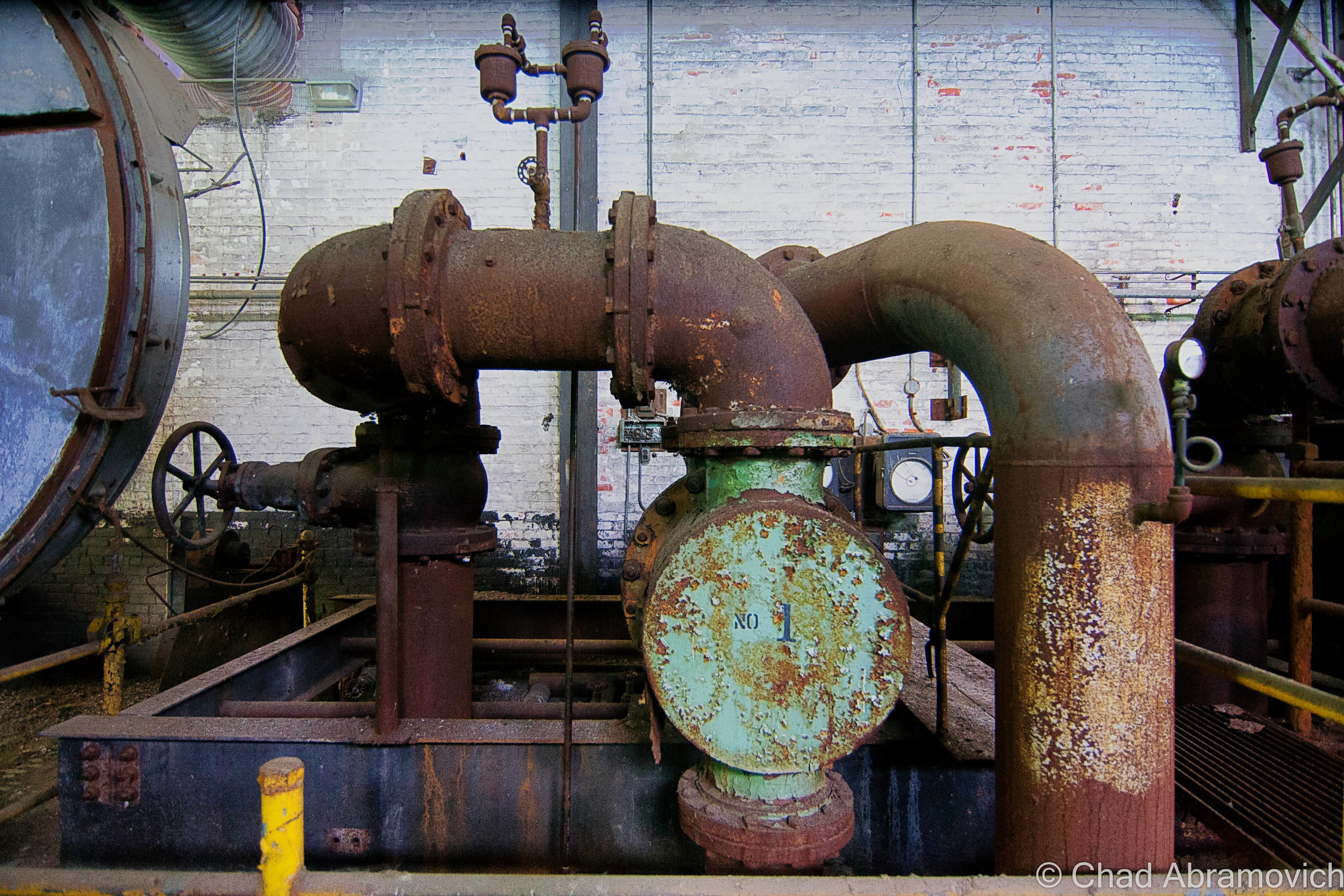
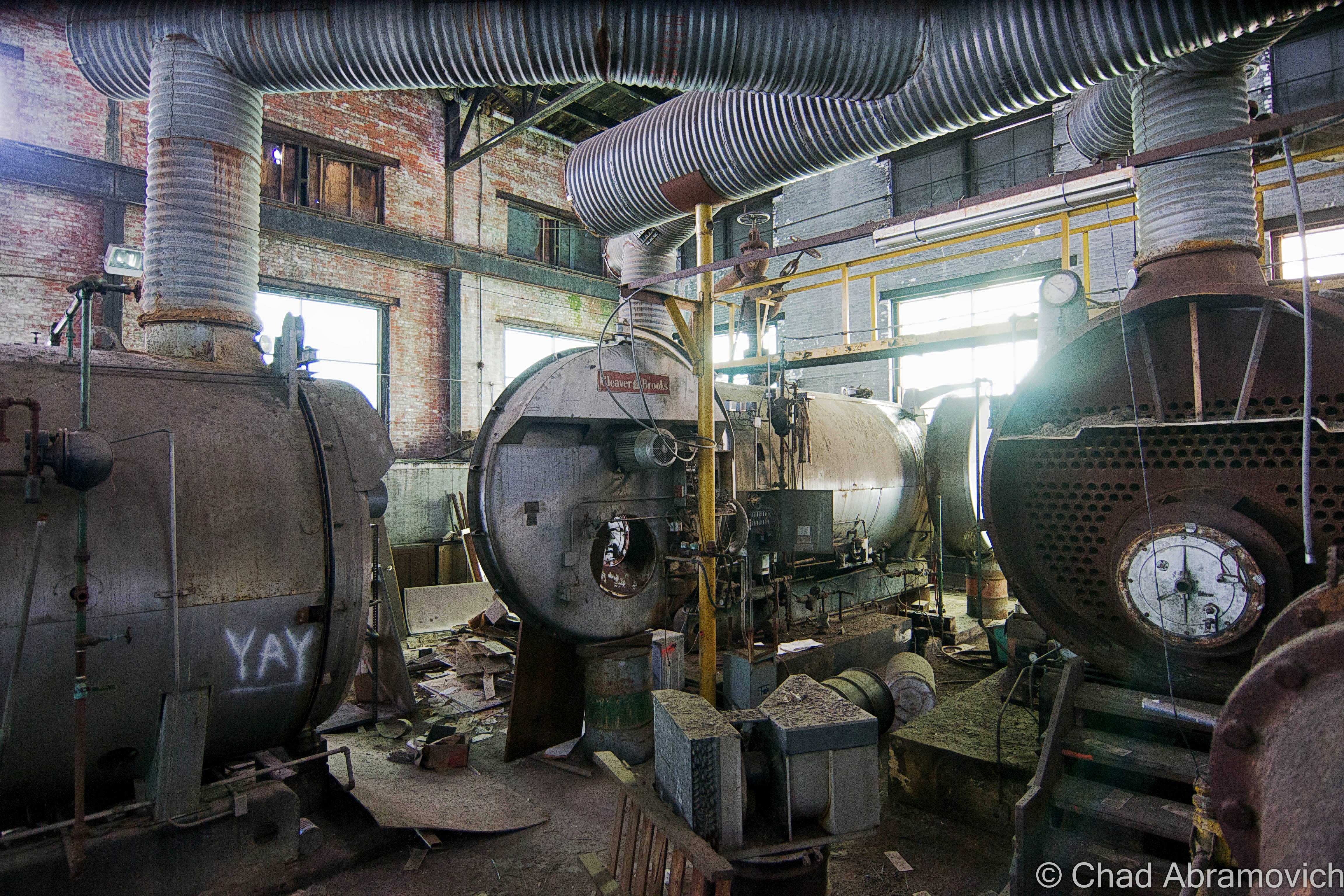
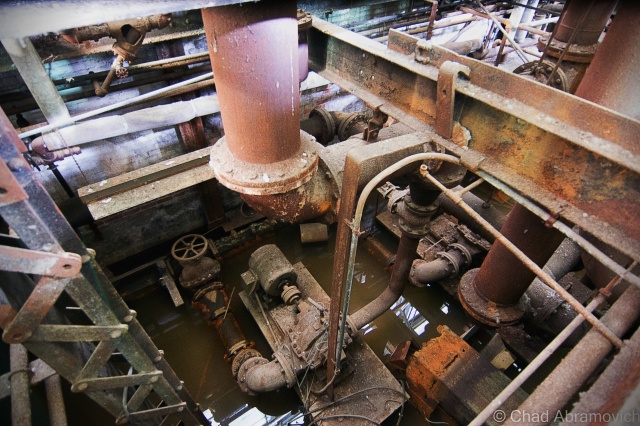
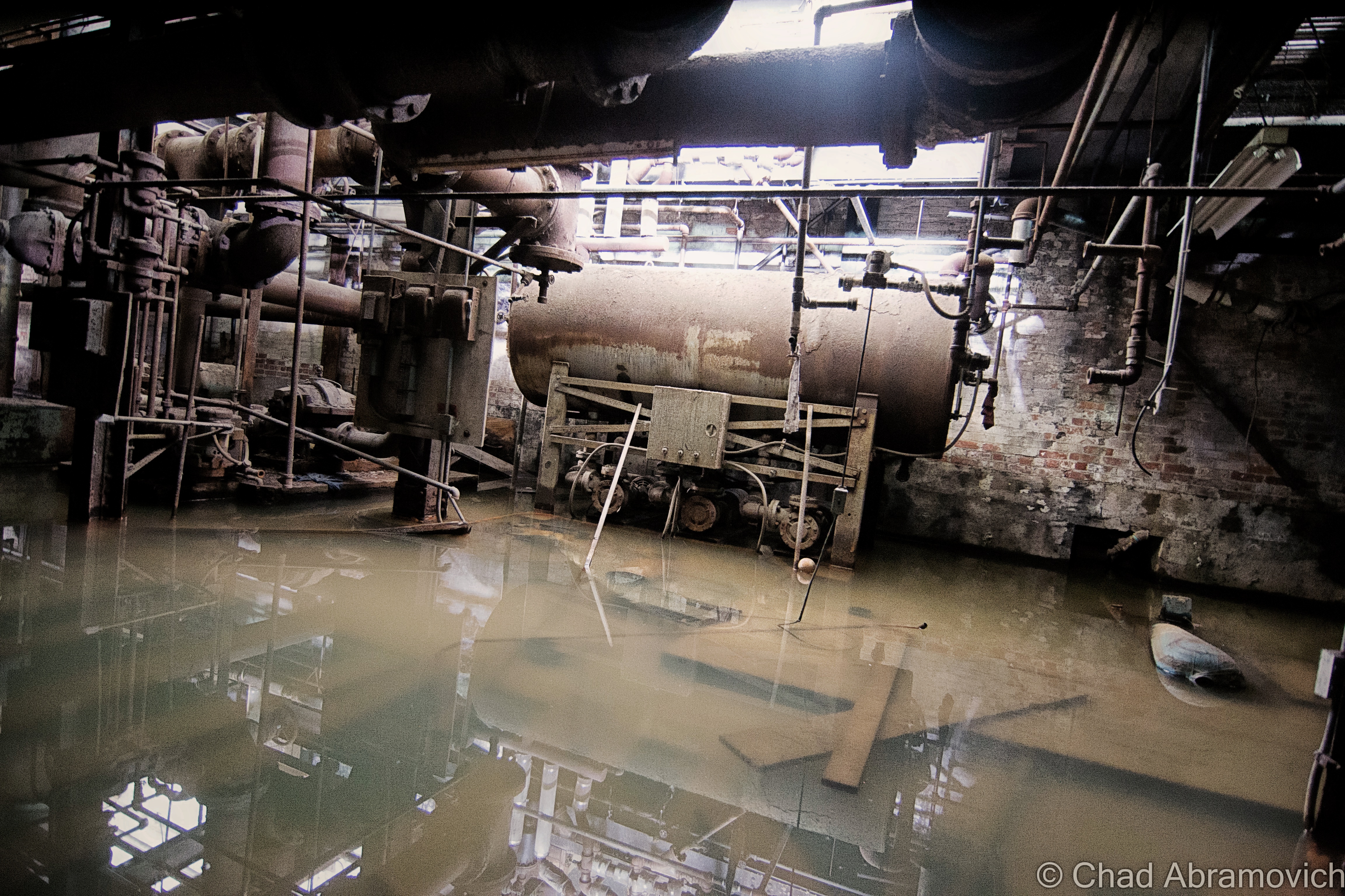
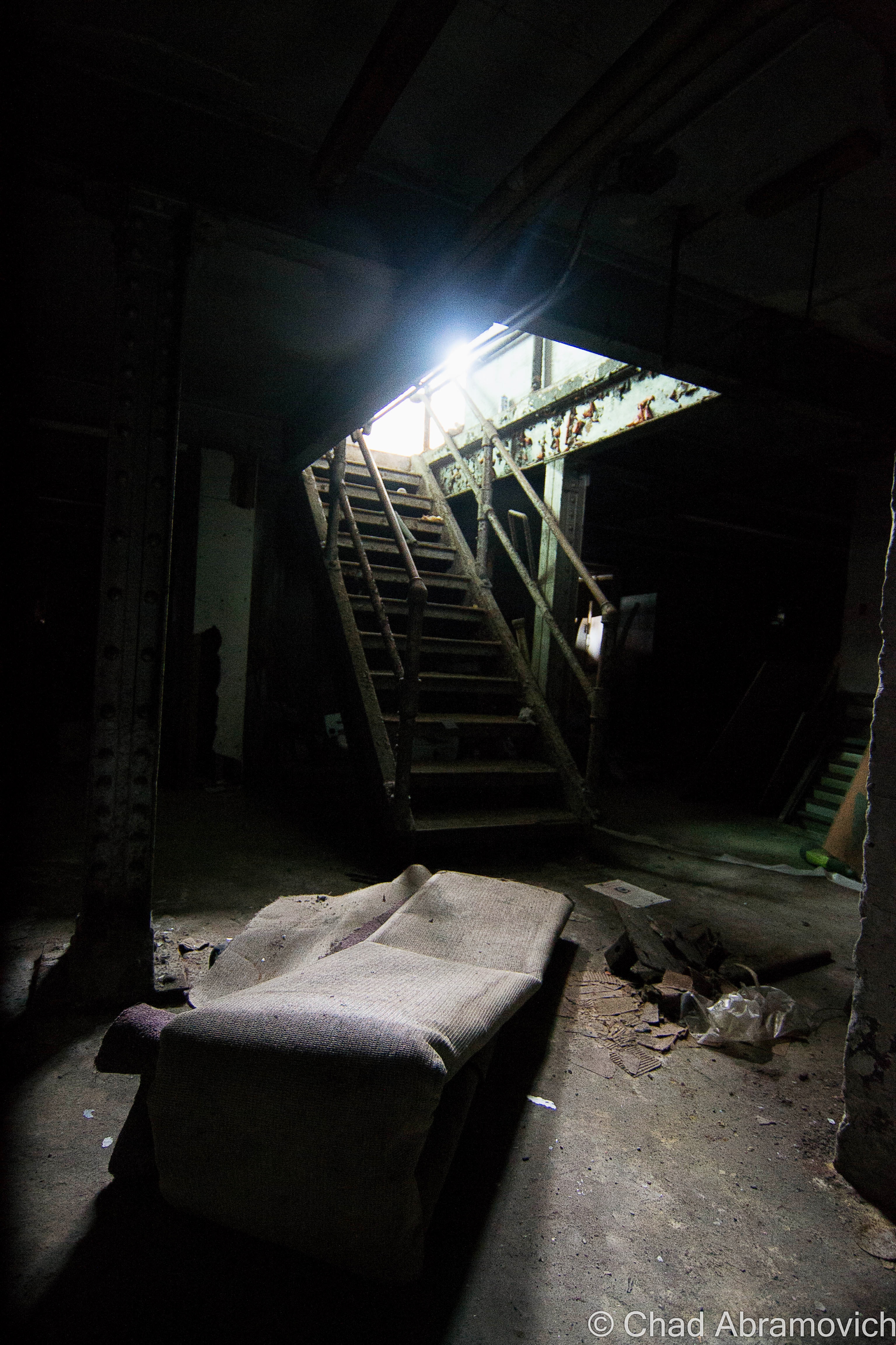

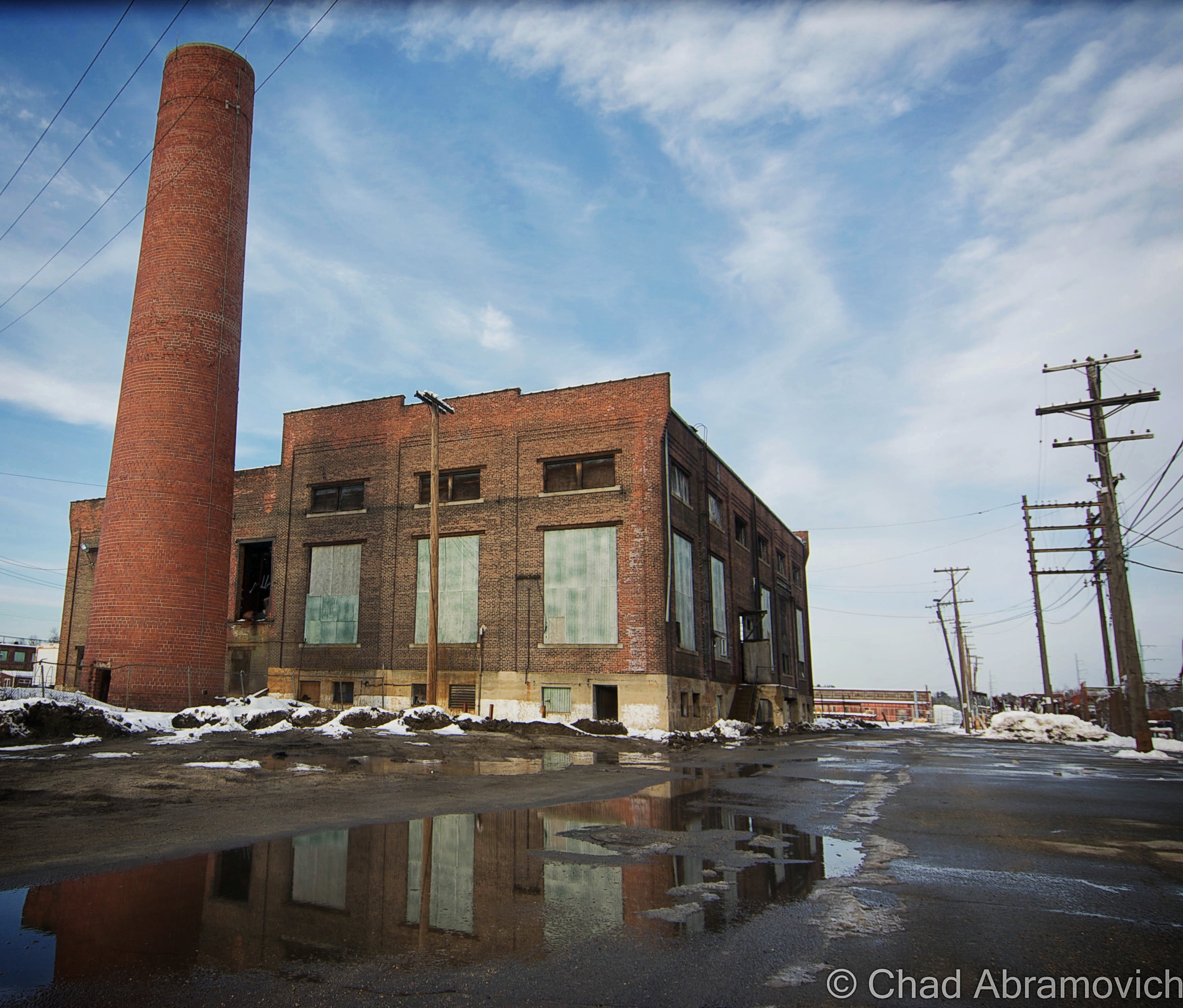
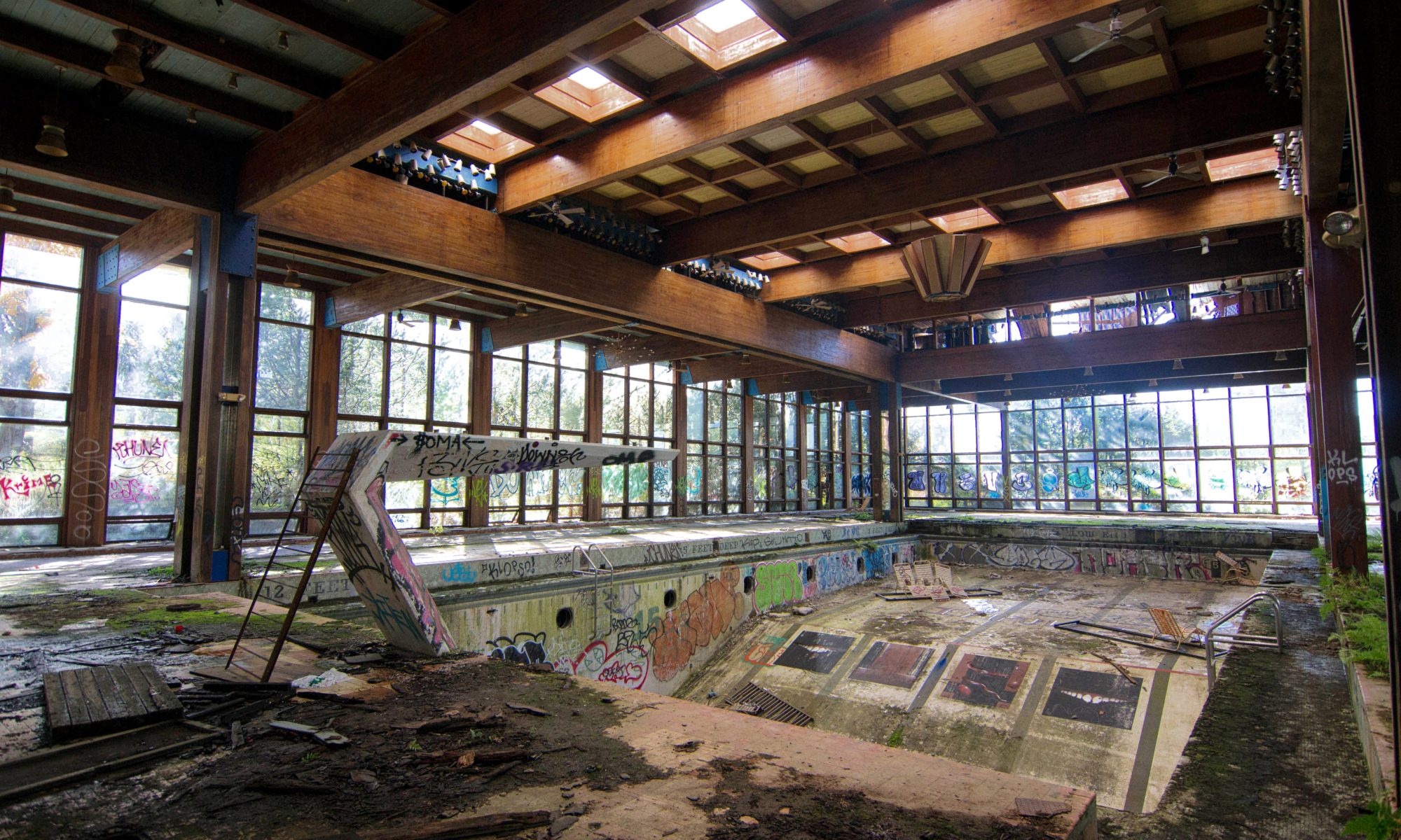
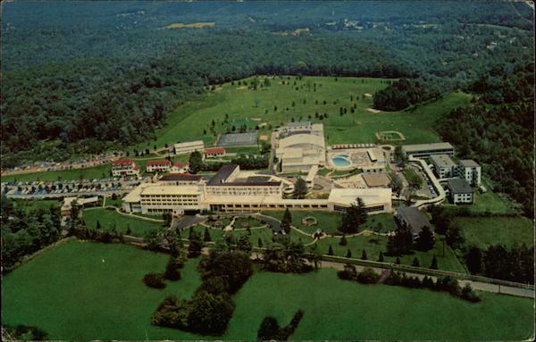
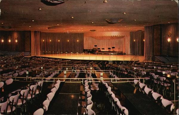
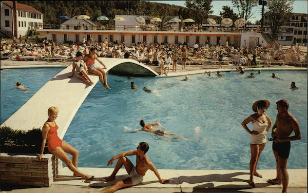
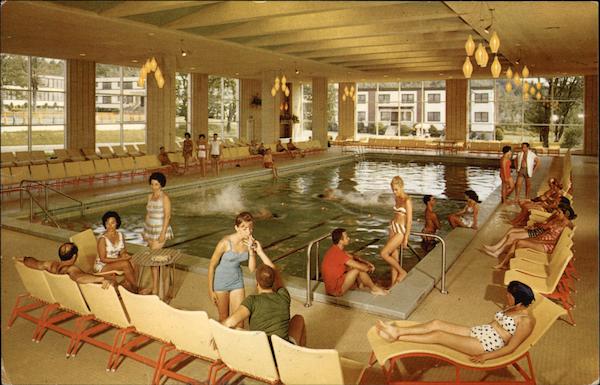
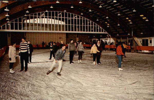
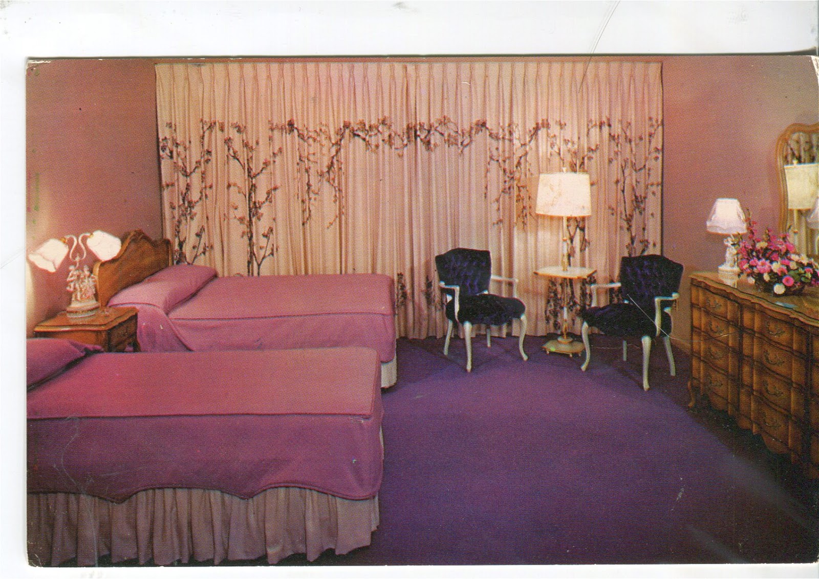


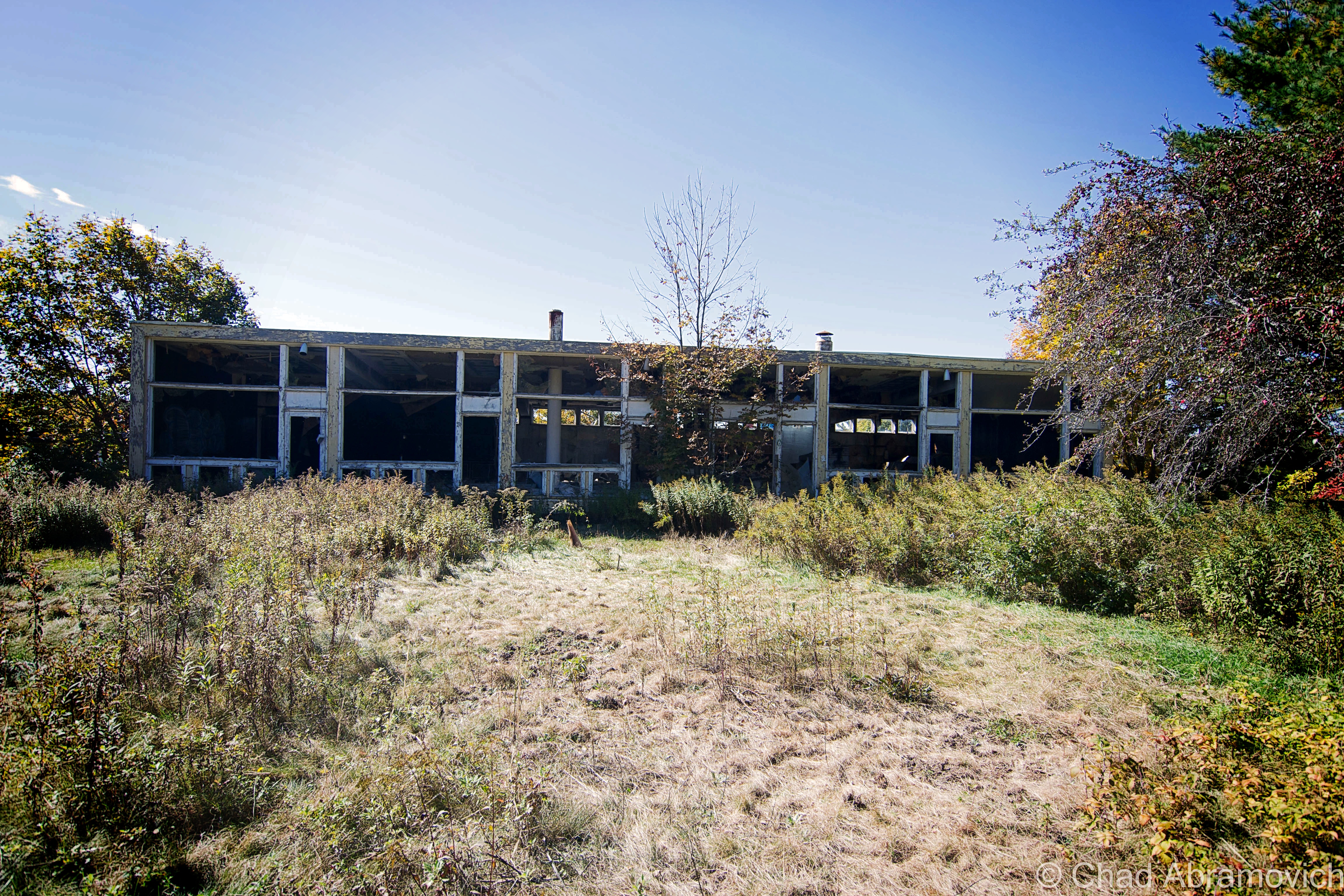


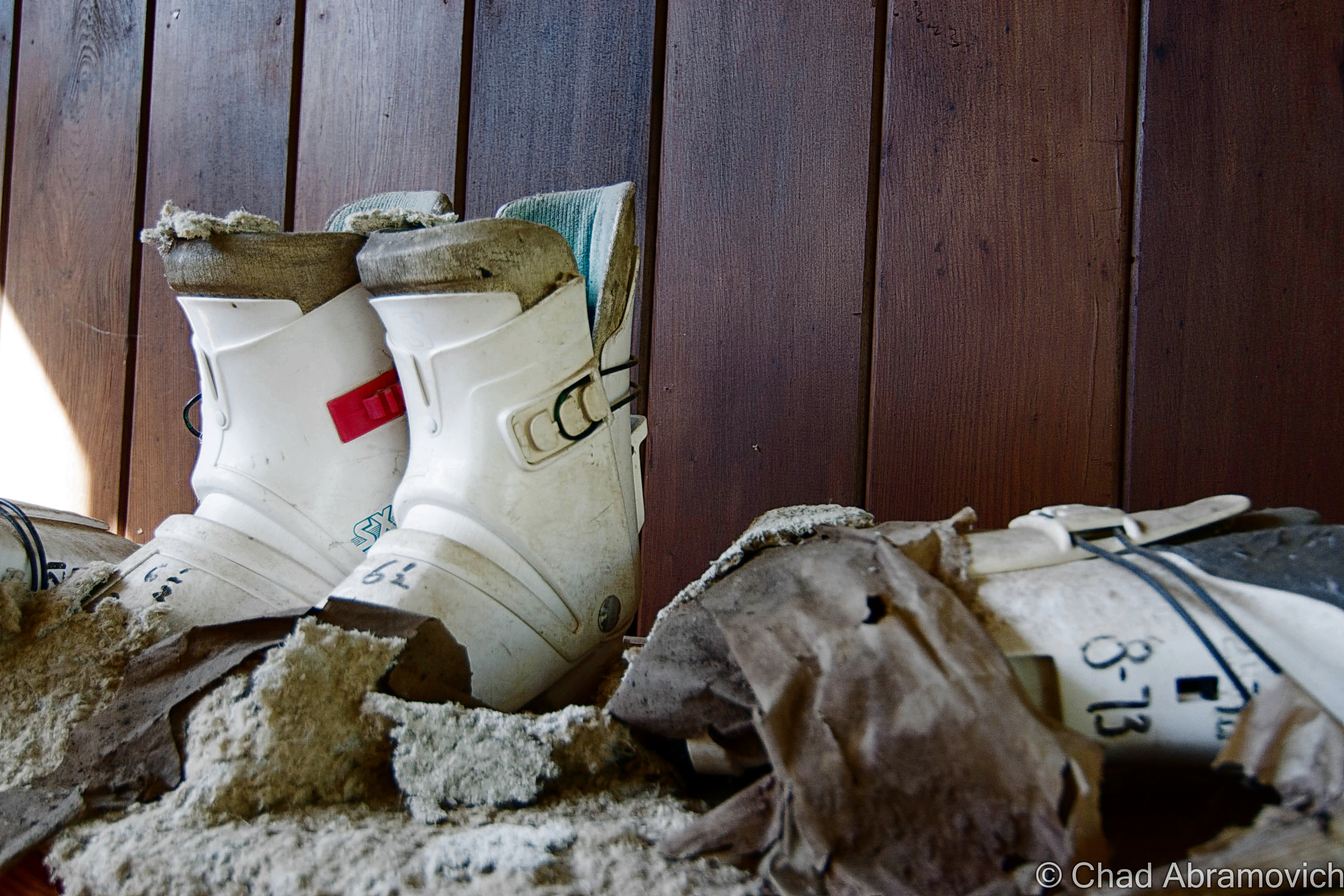


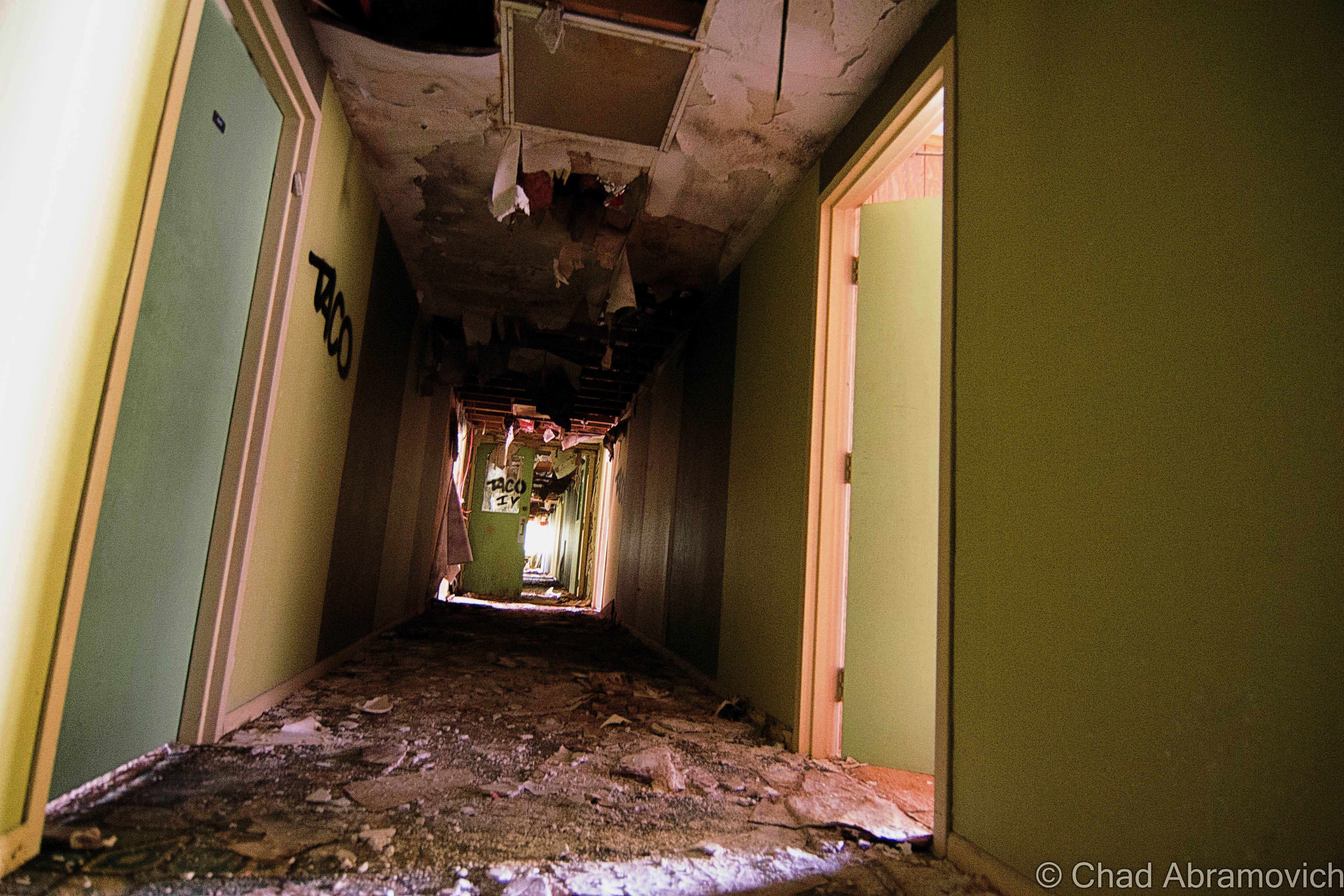


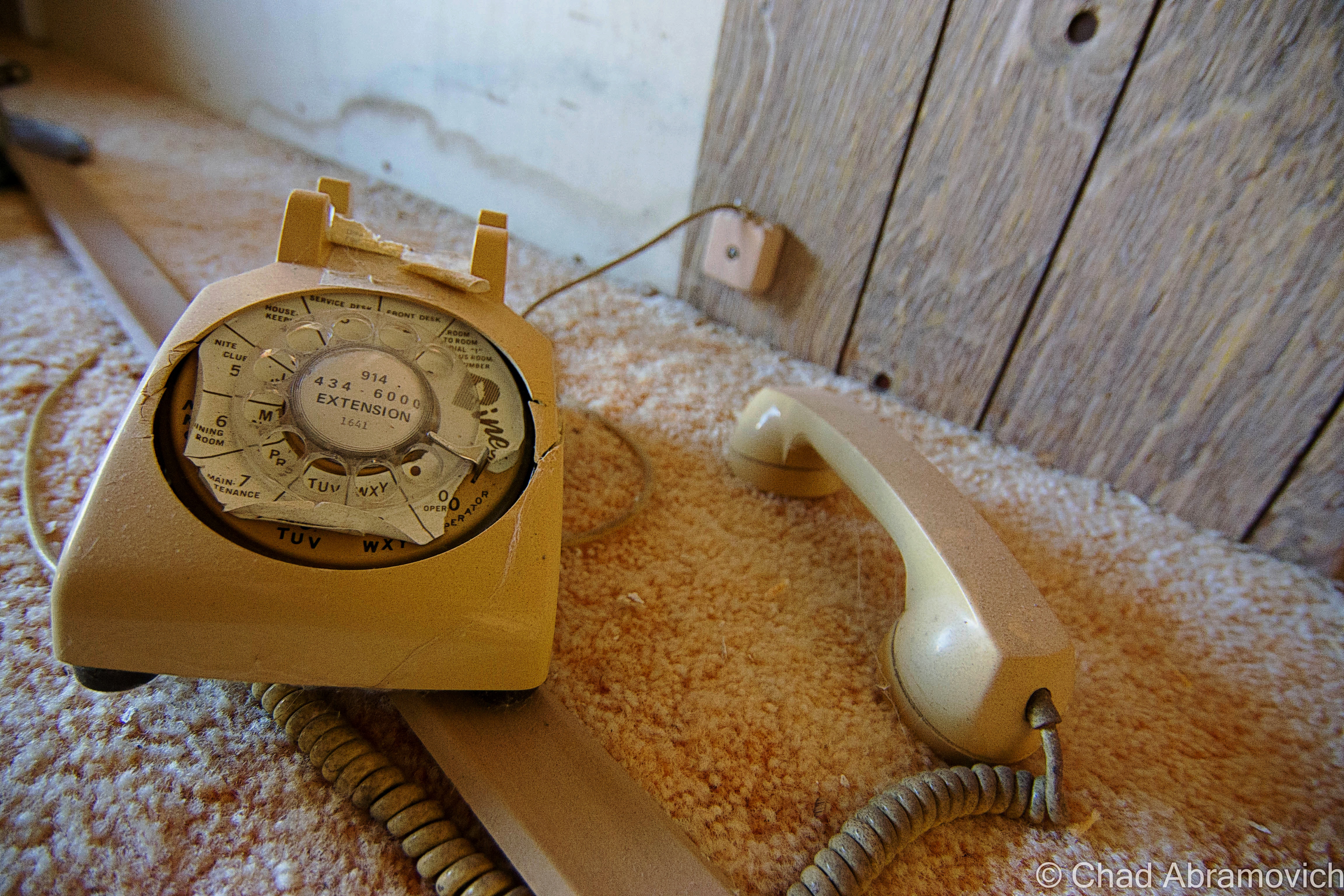

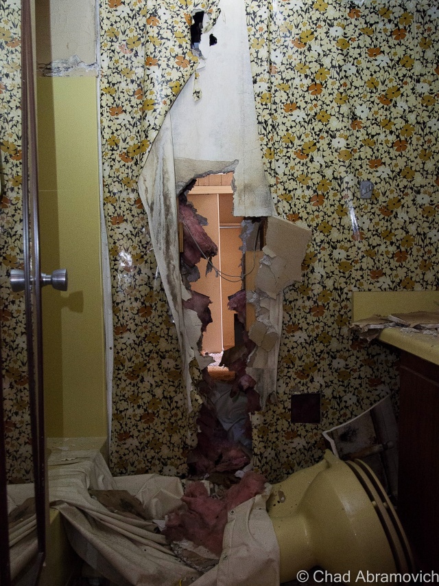
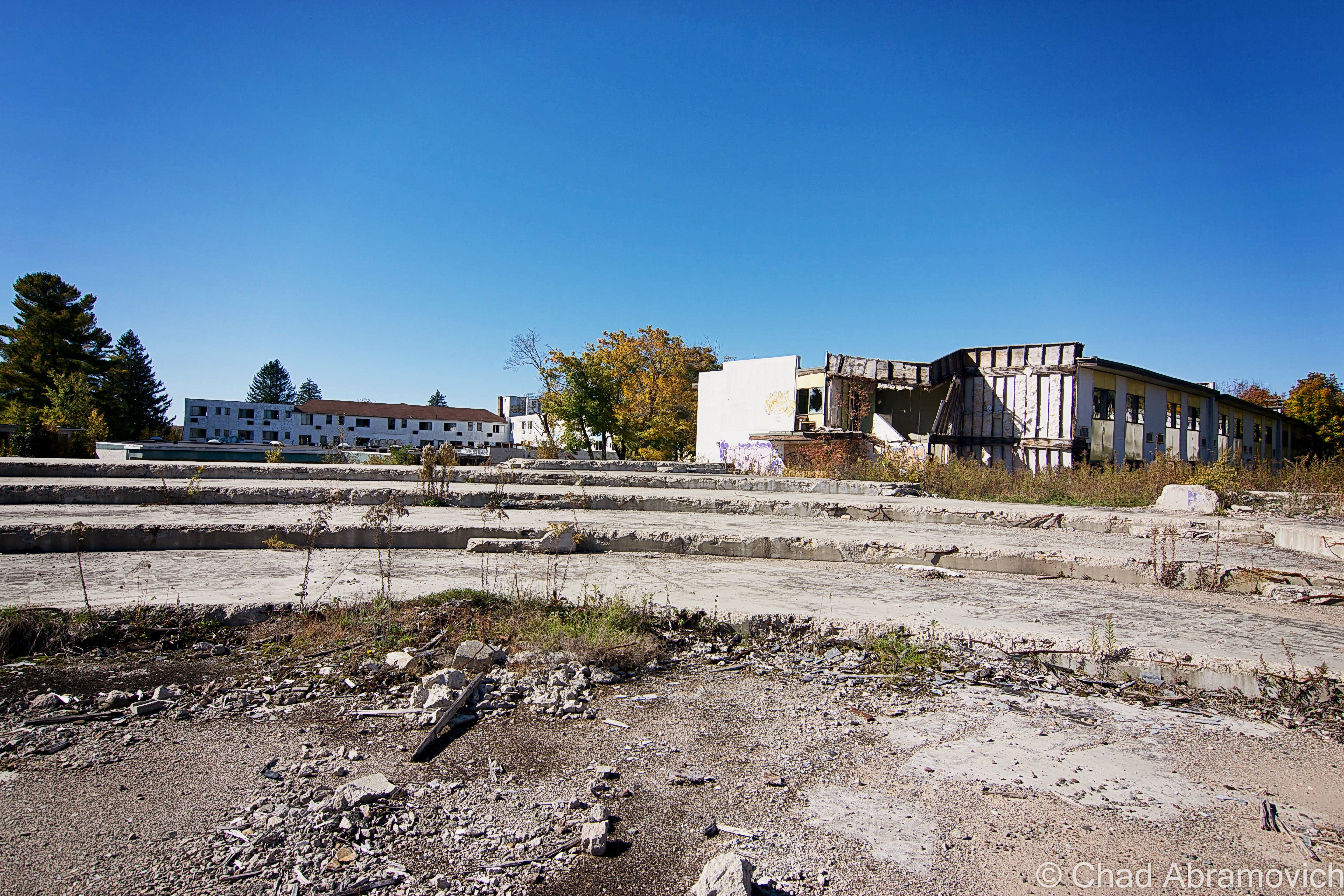
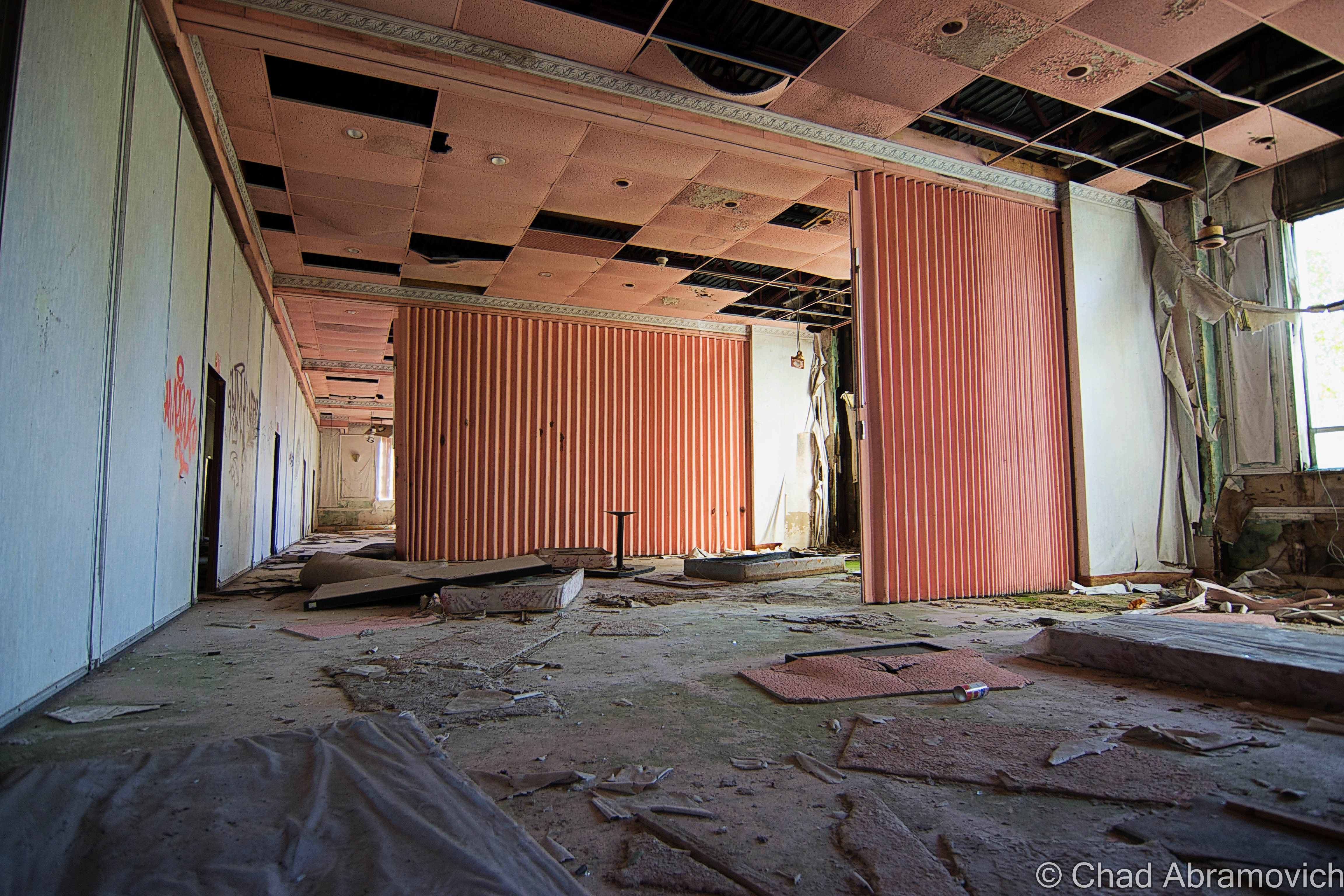 In the 1990s, convention centers were becoming Catskills de rigueur, so many hotels, including The Pines, built them up on their properties.

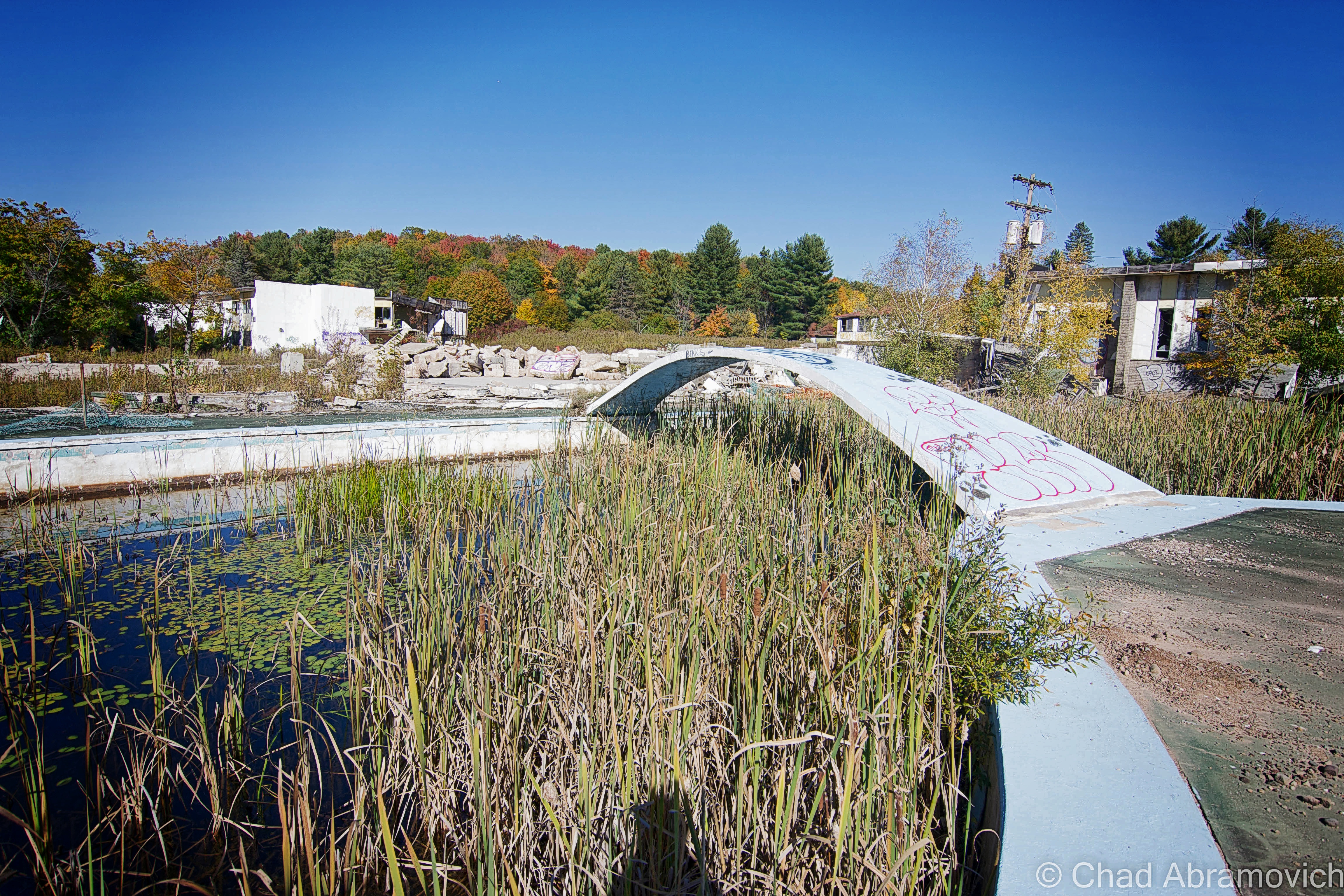

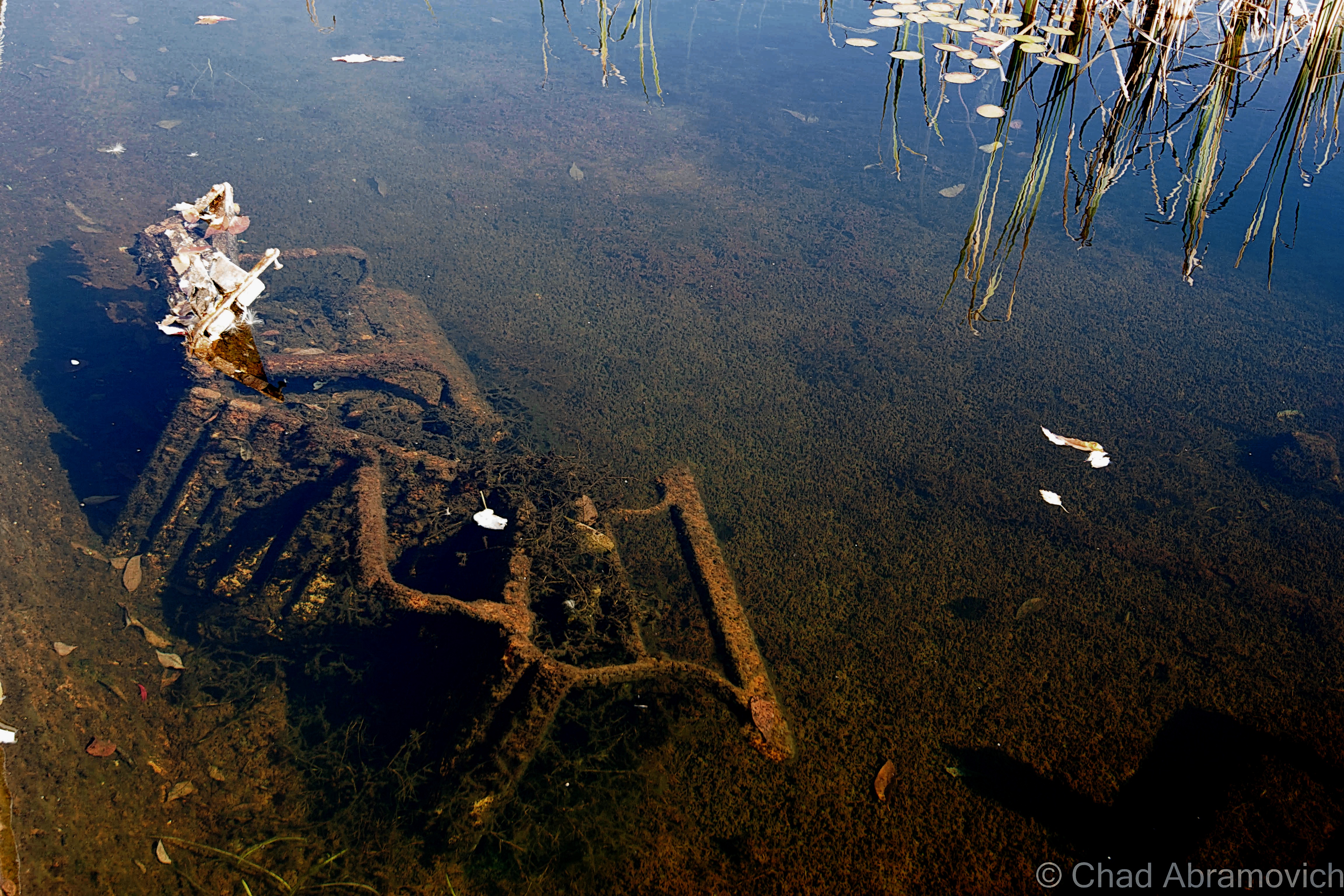

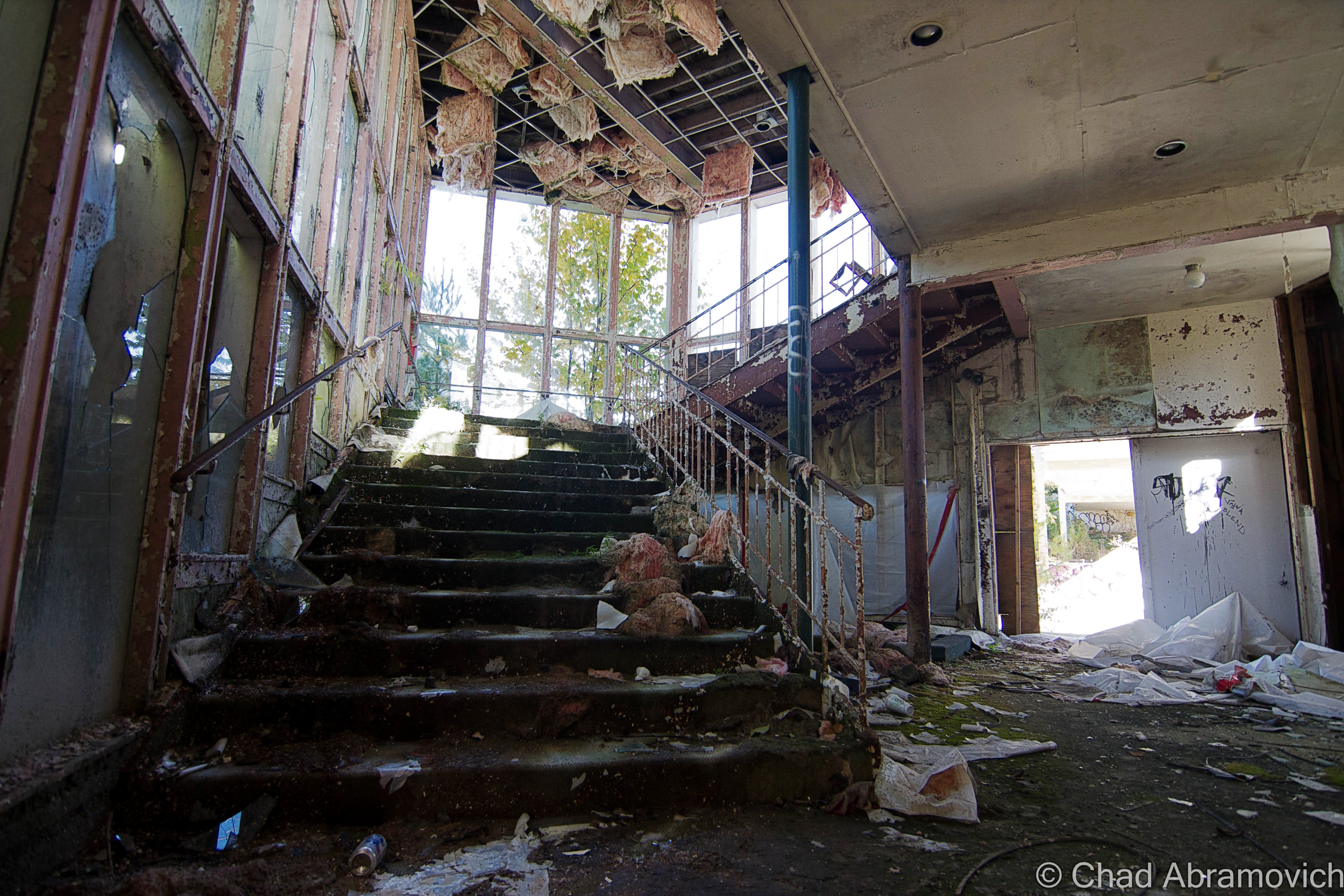
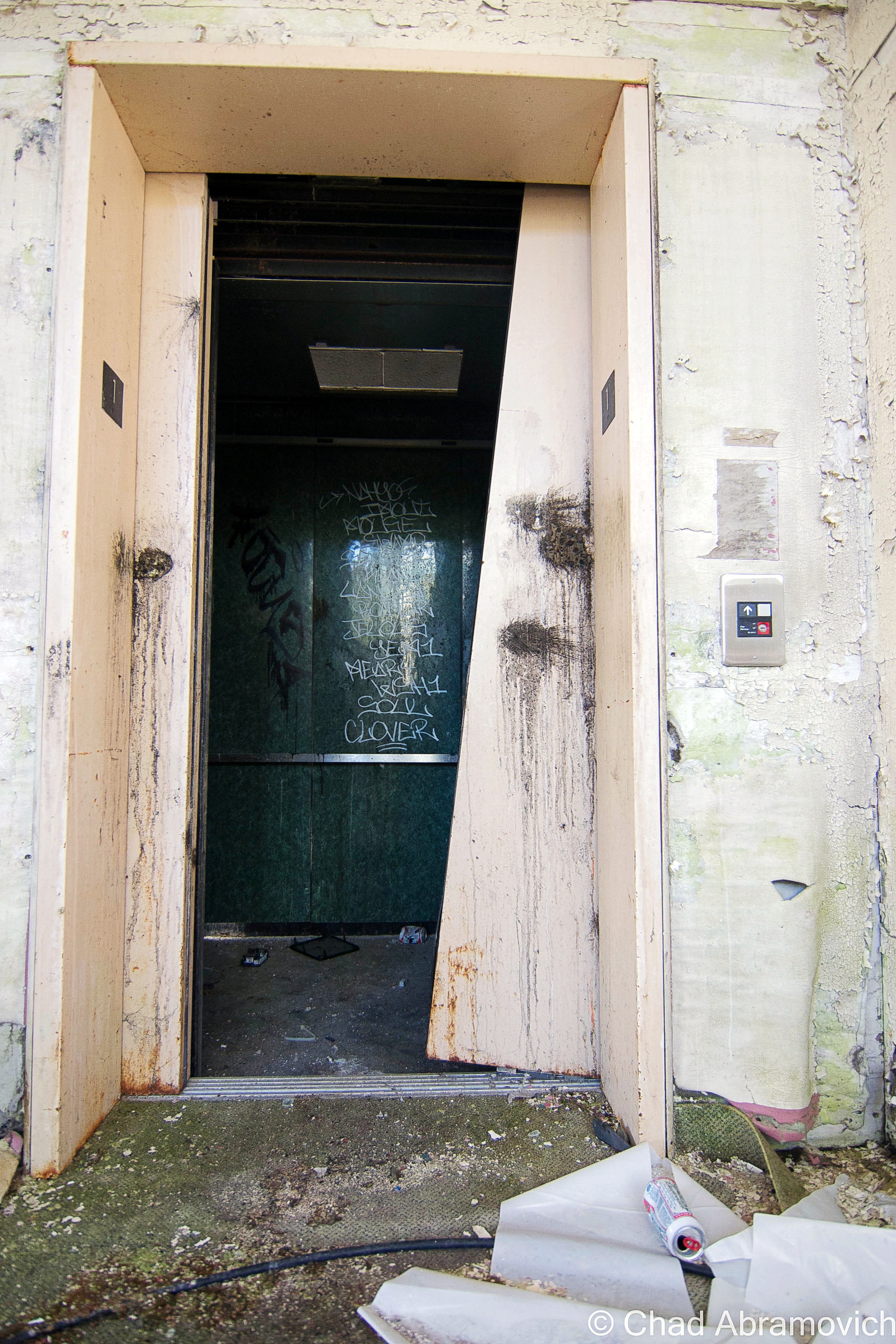


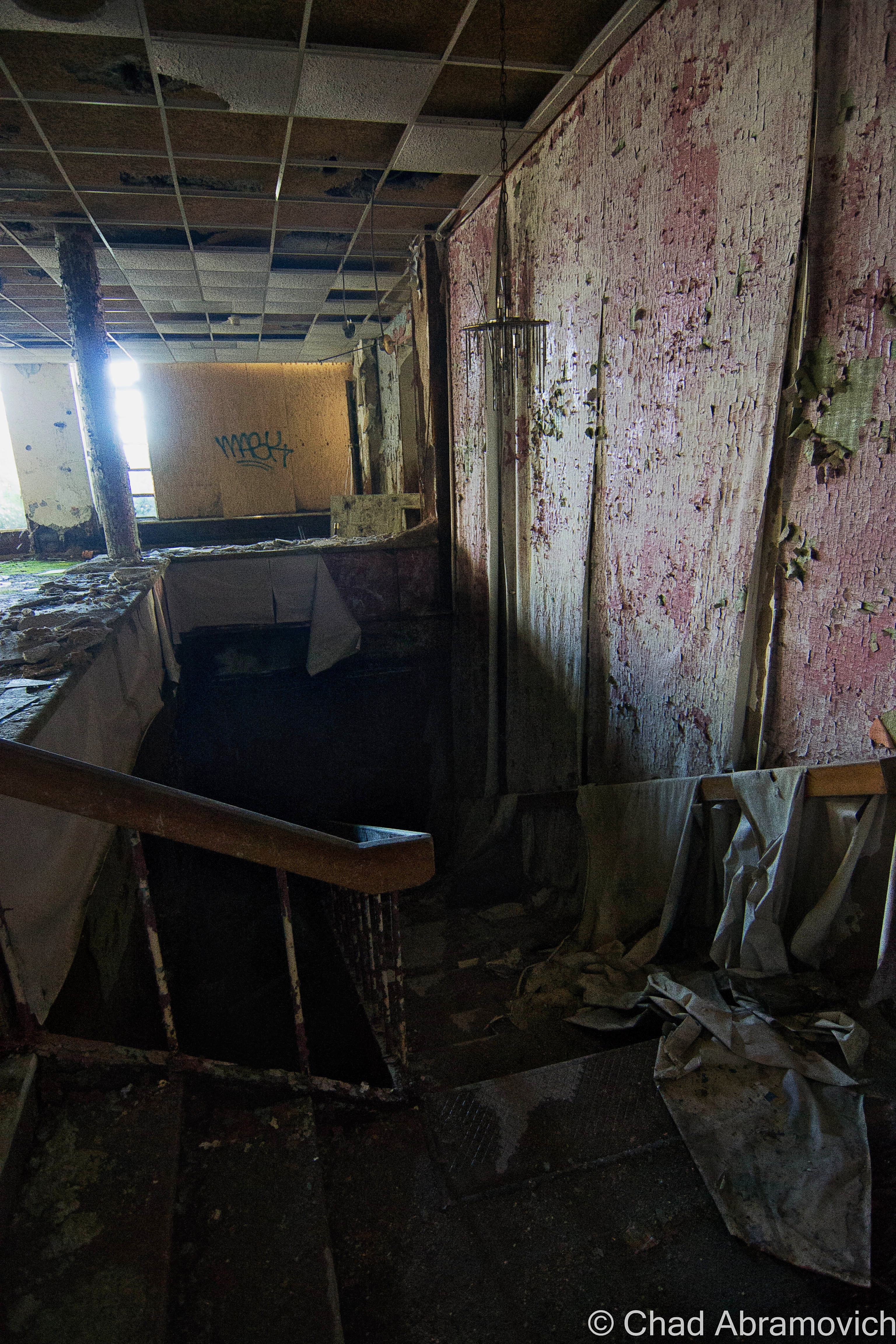
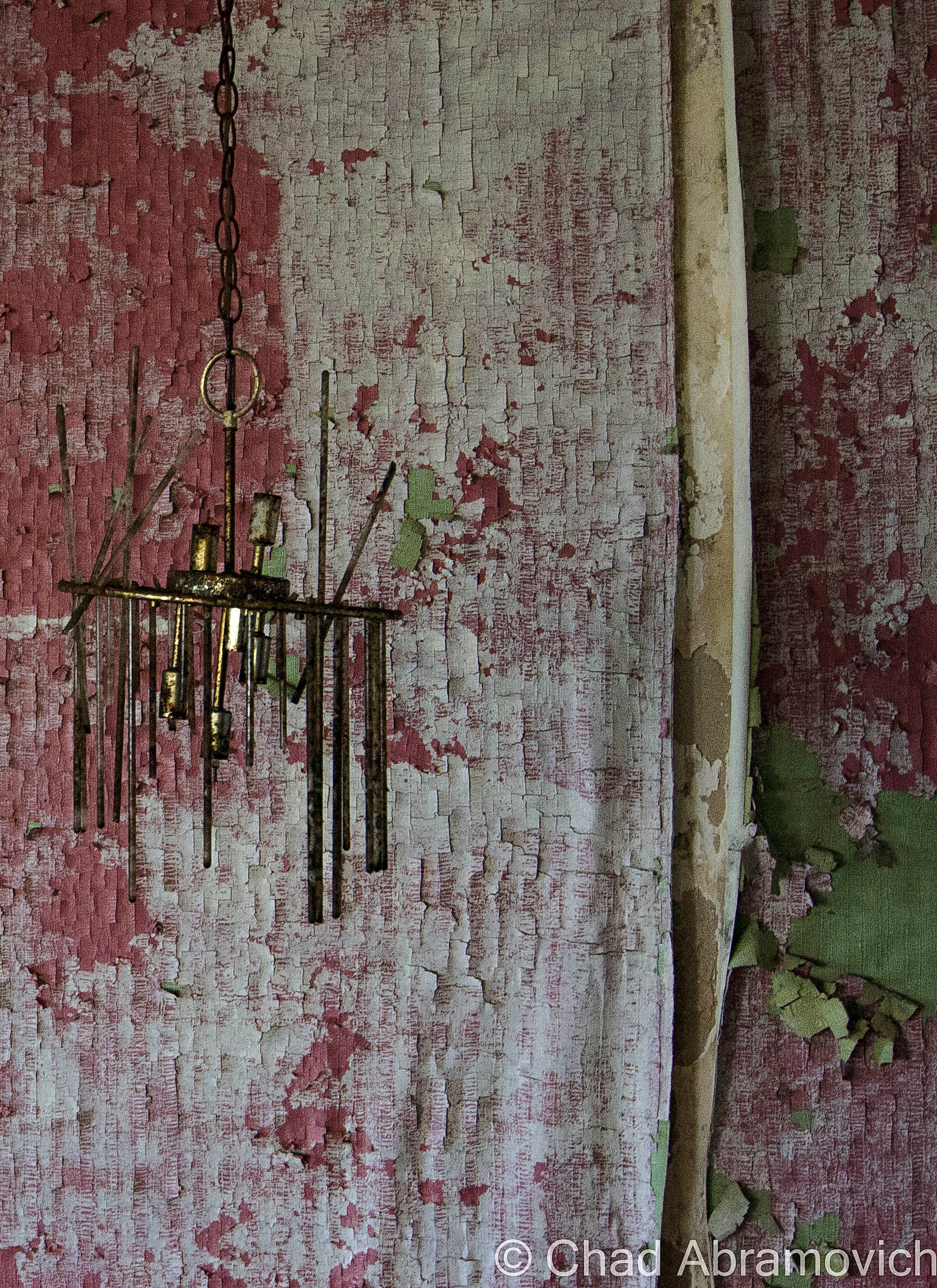


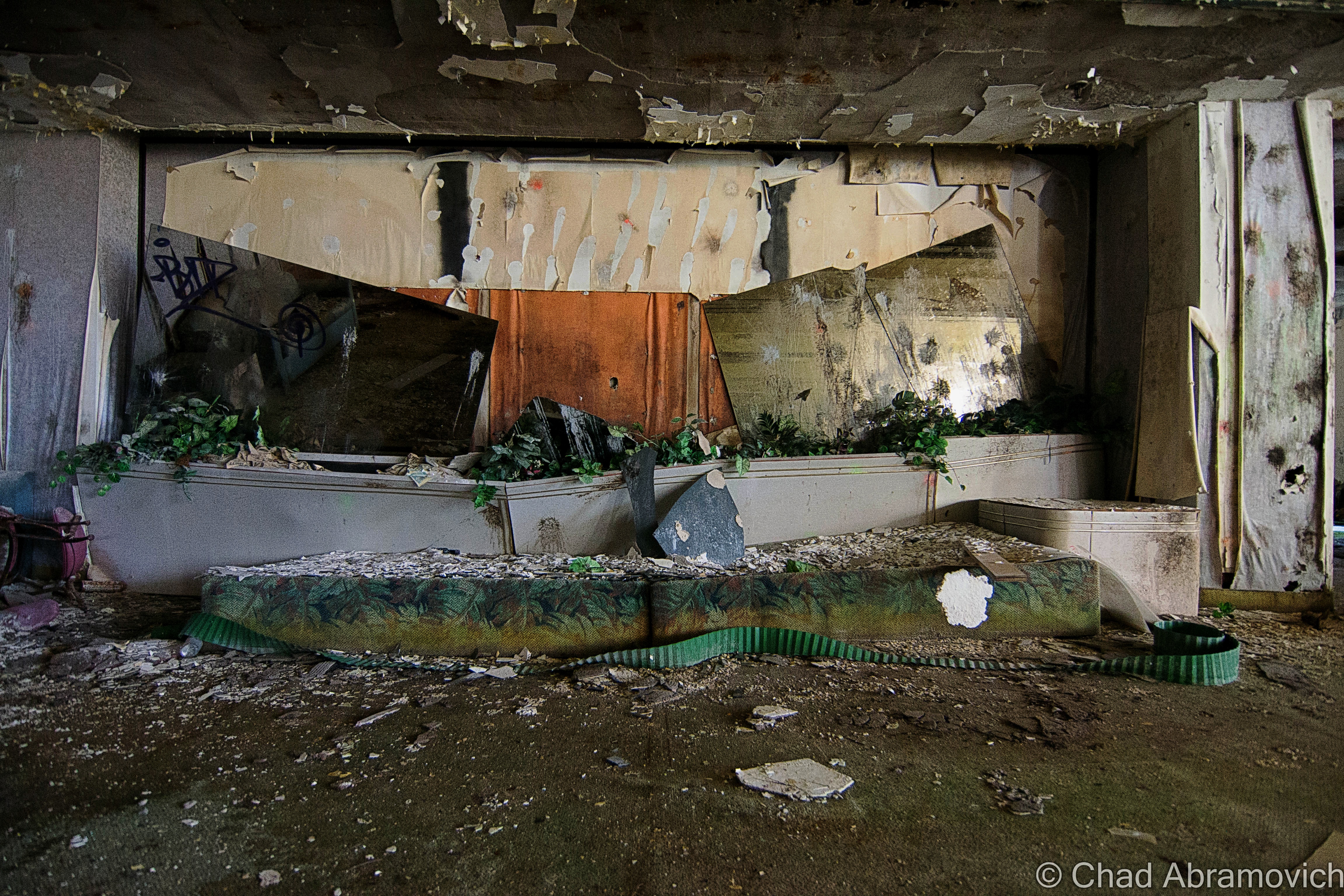
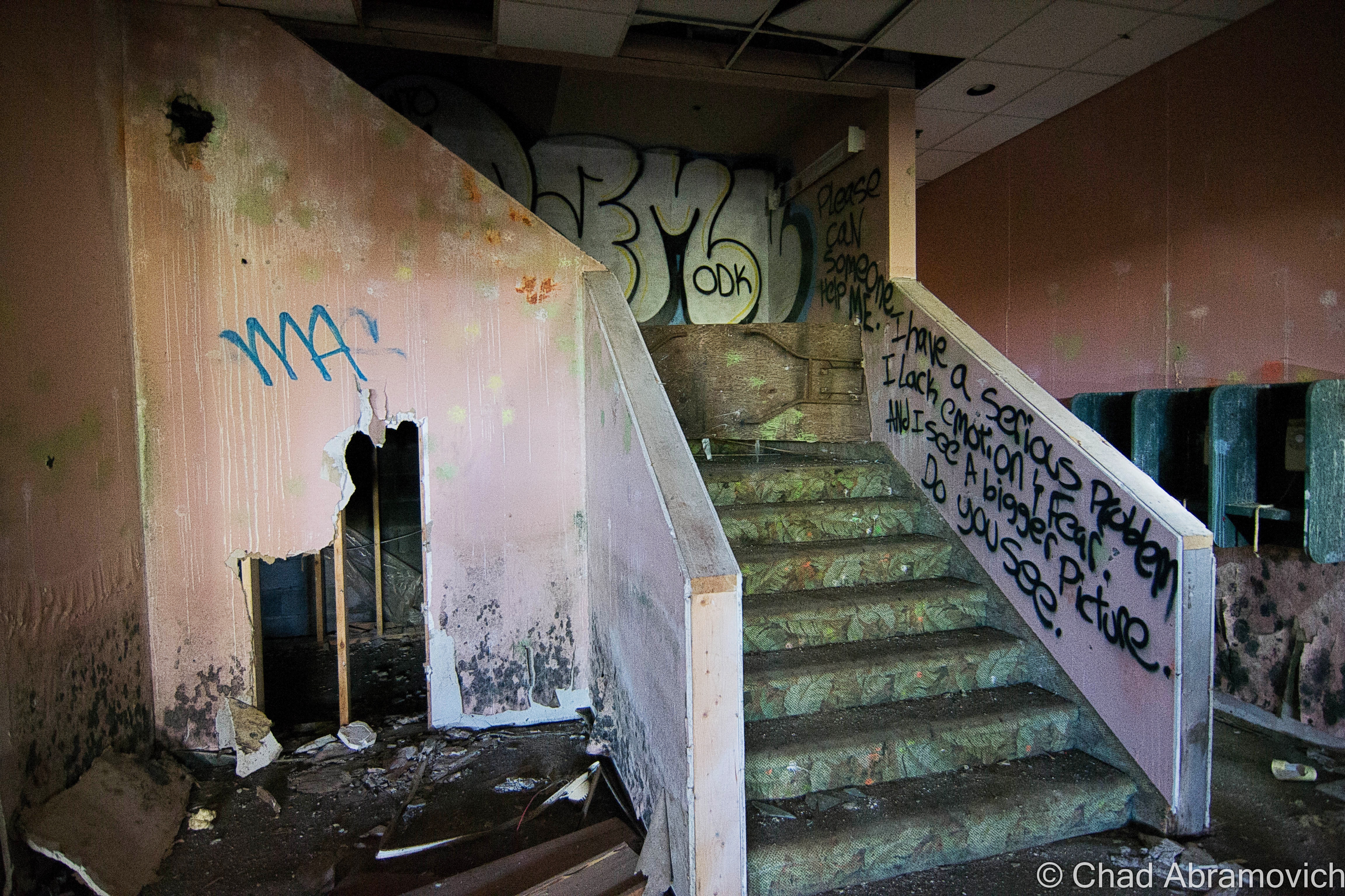
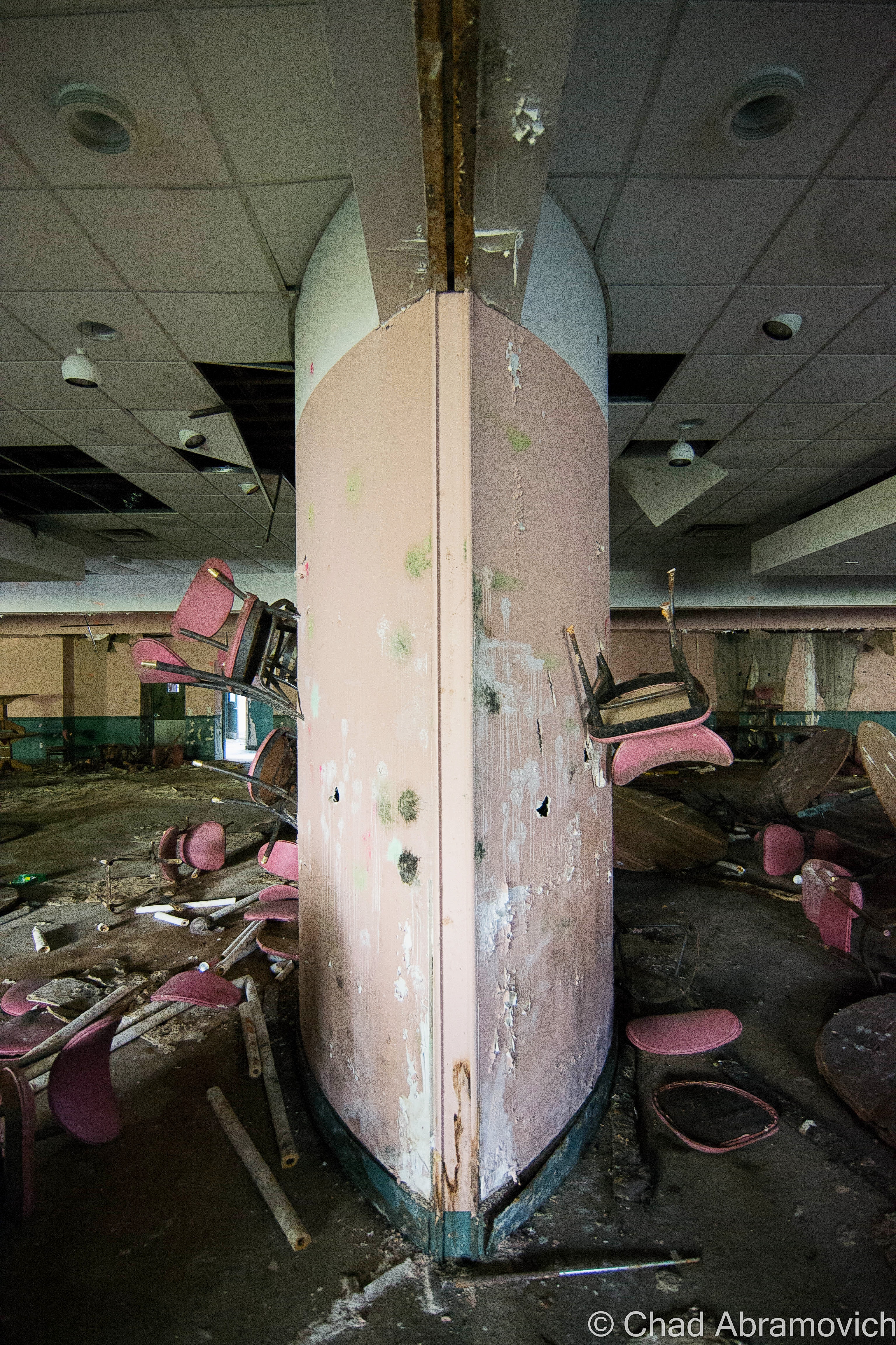
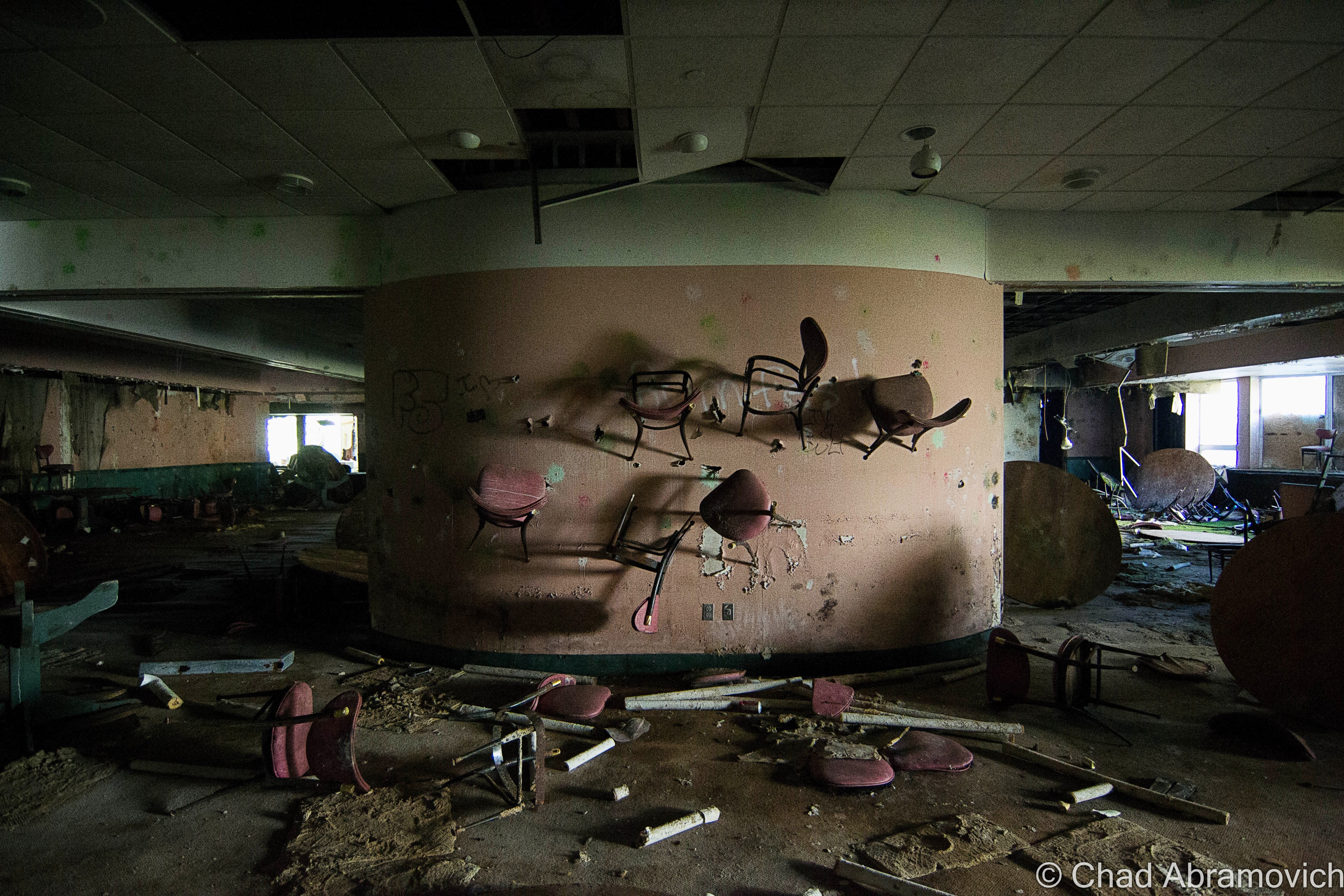
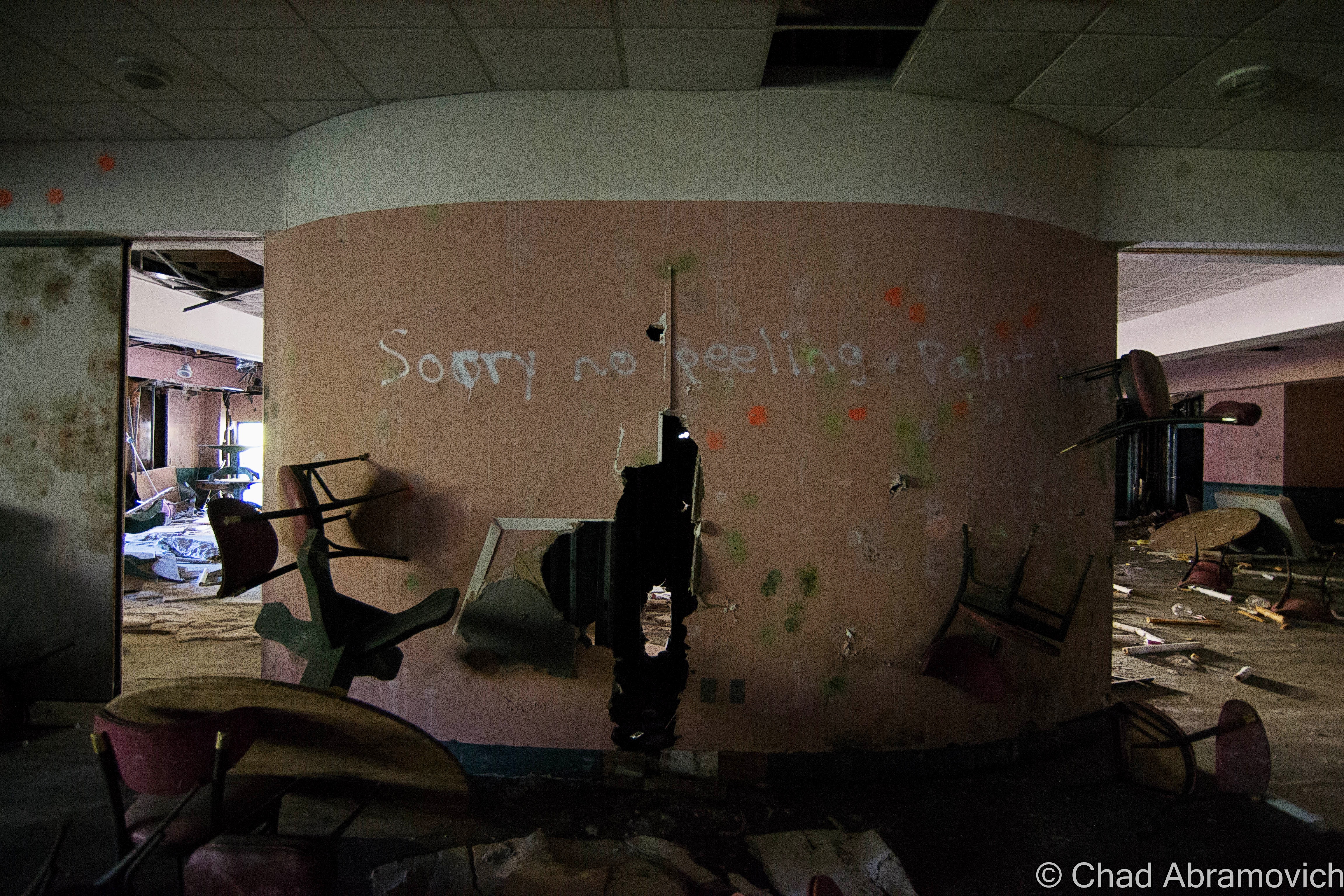
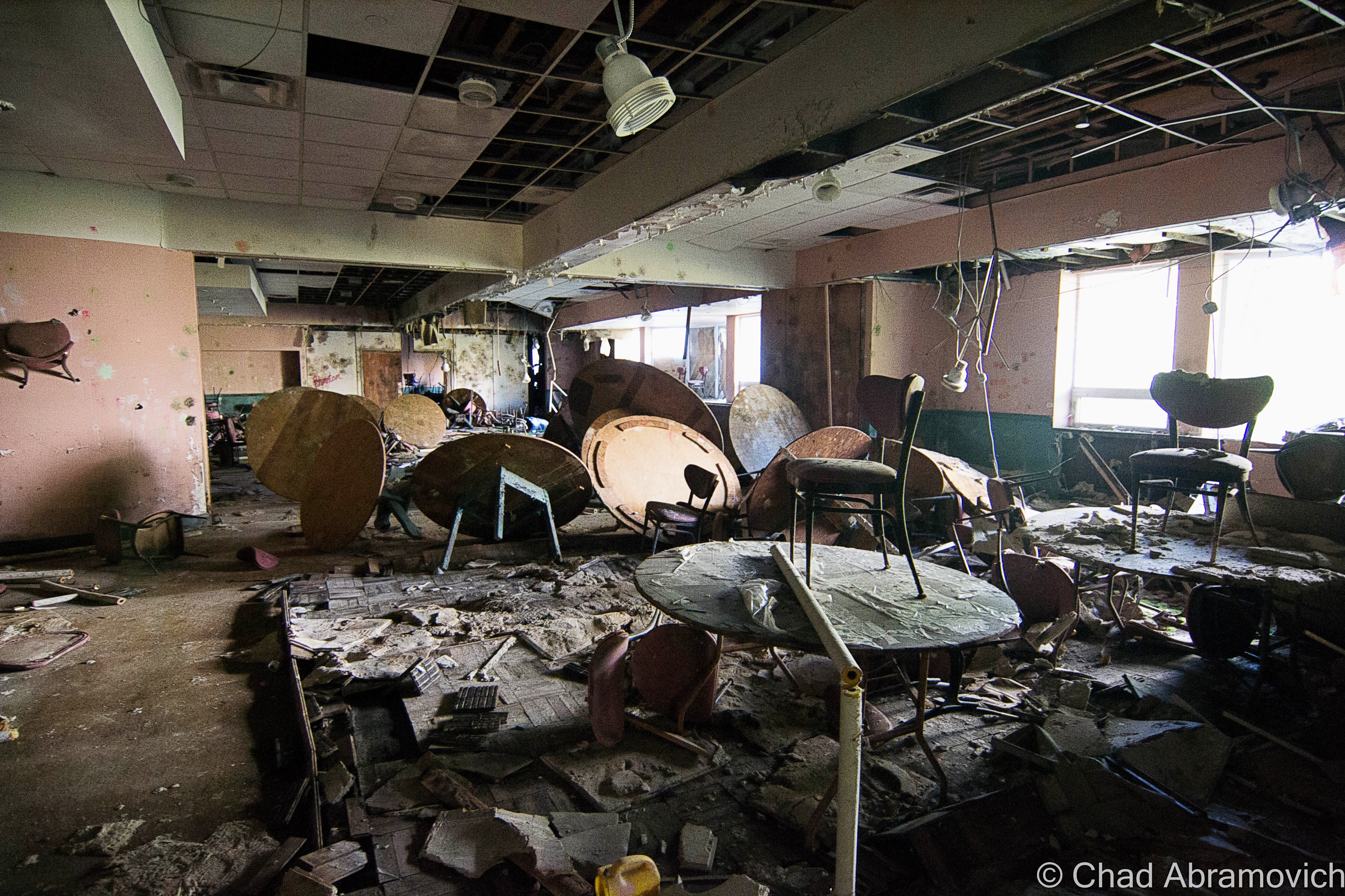
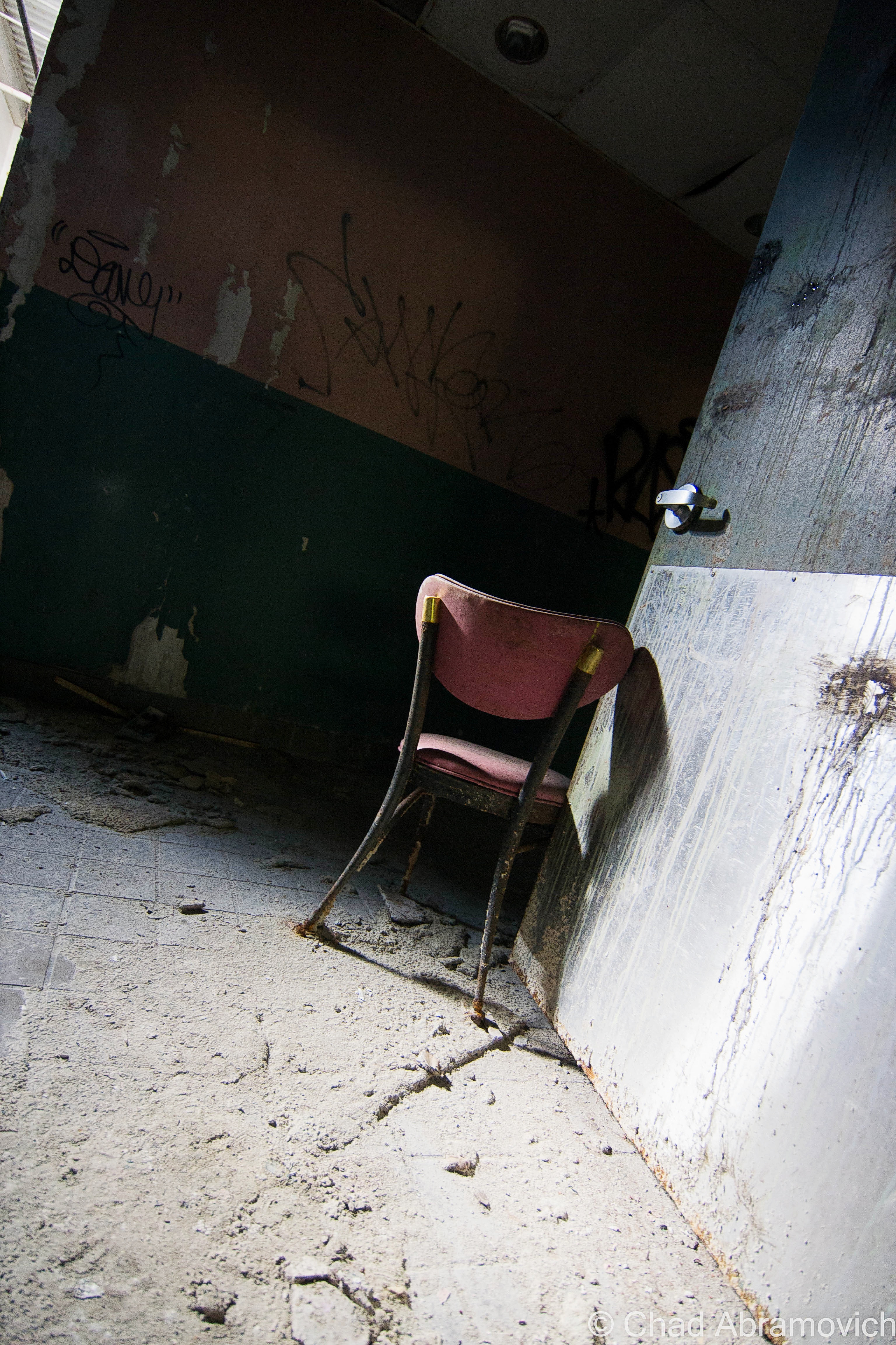


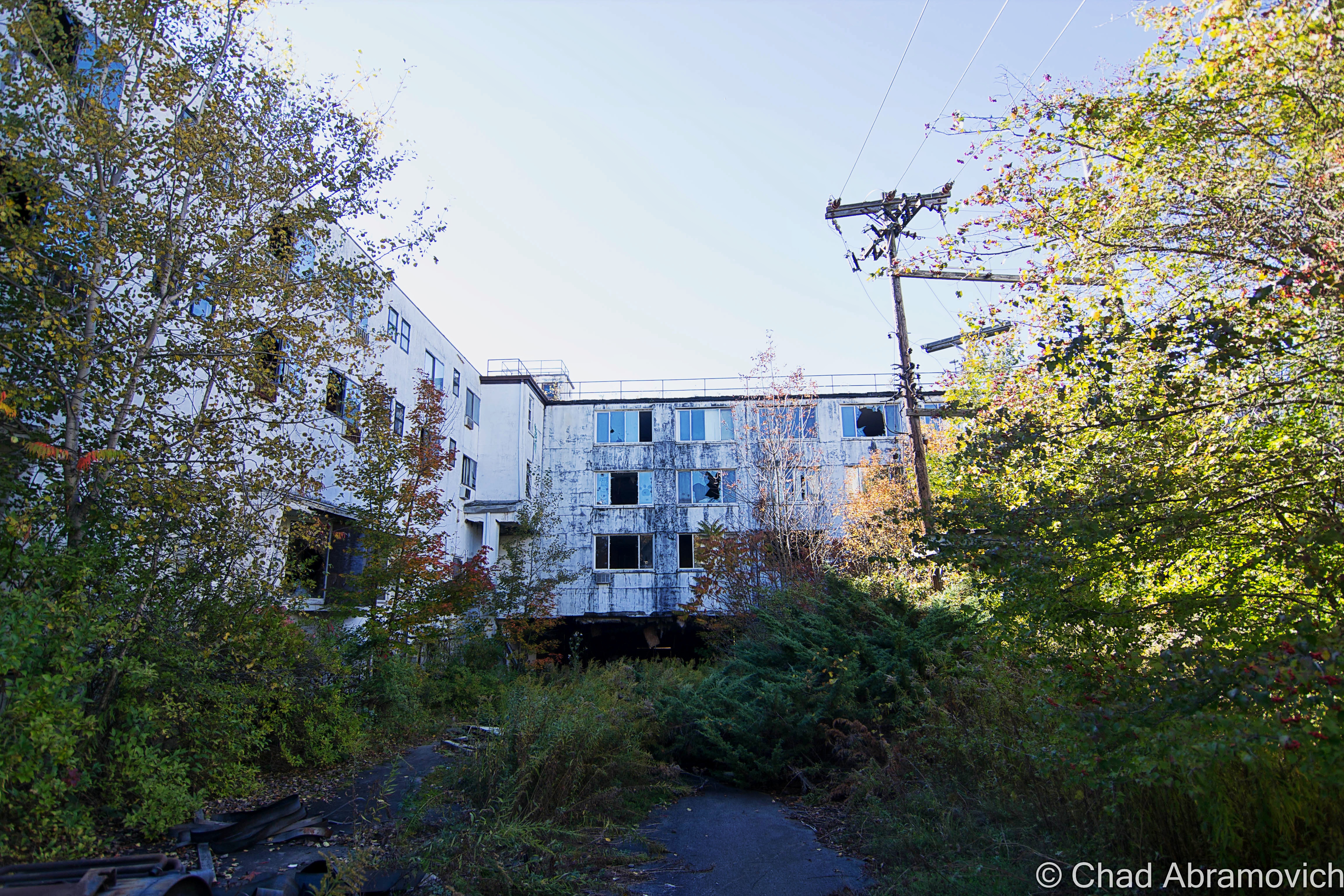


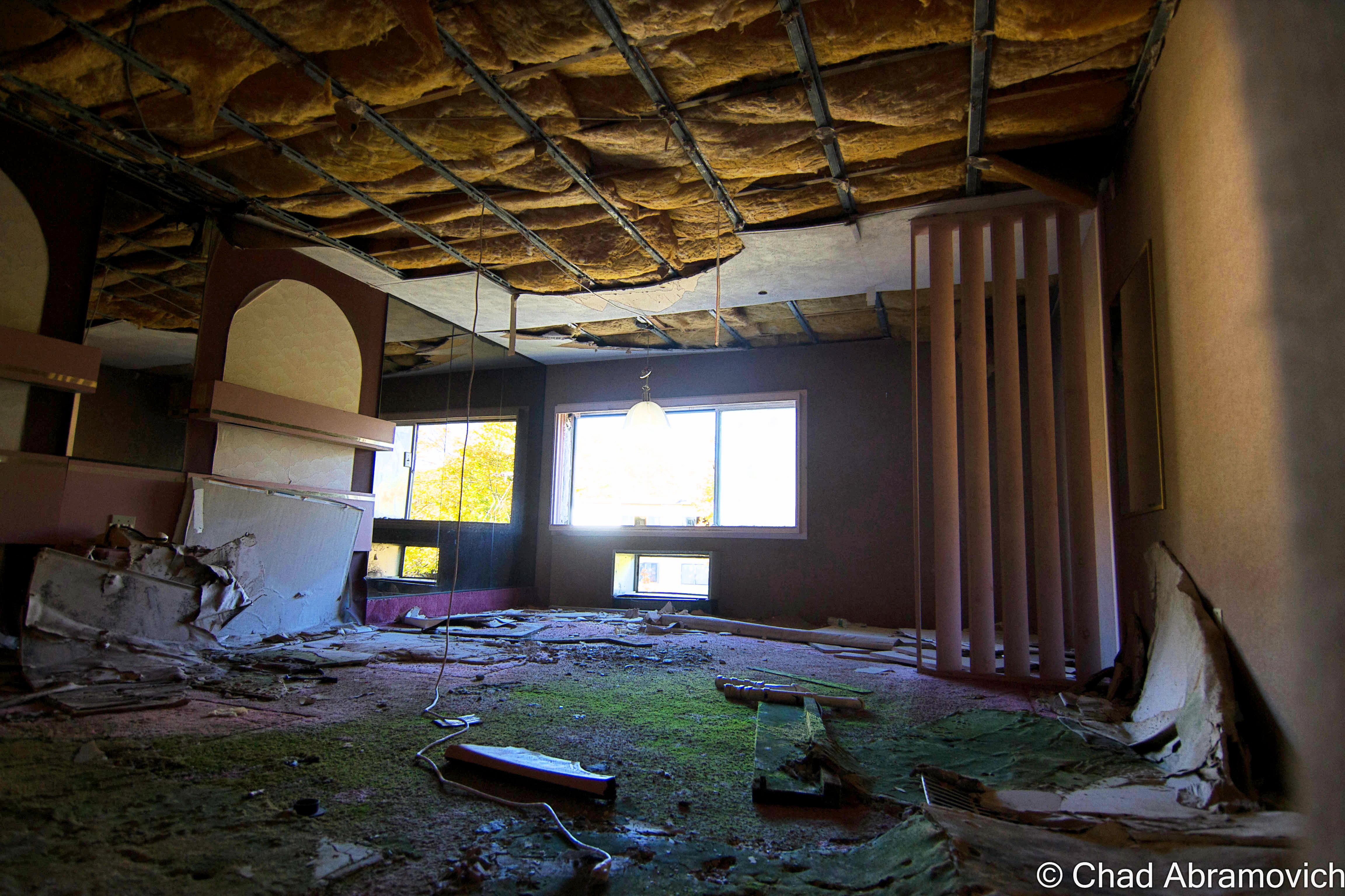
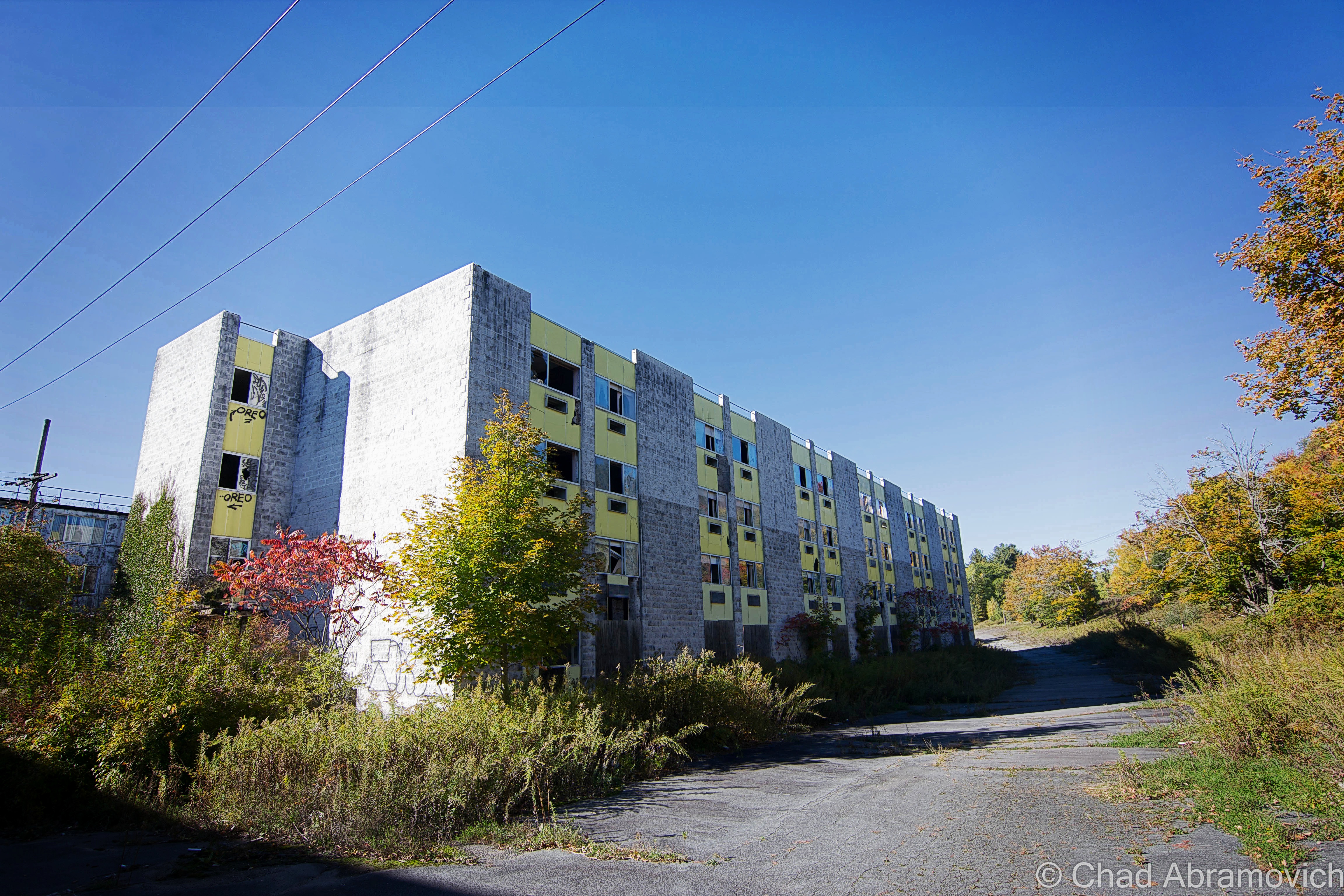
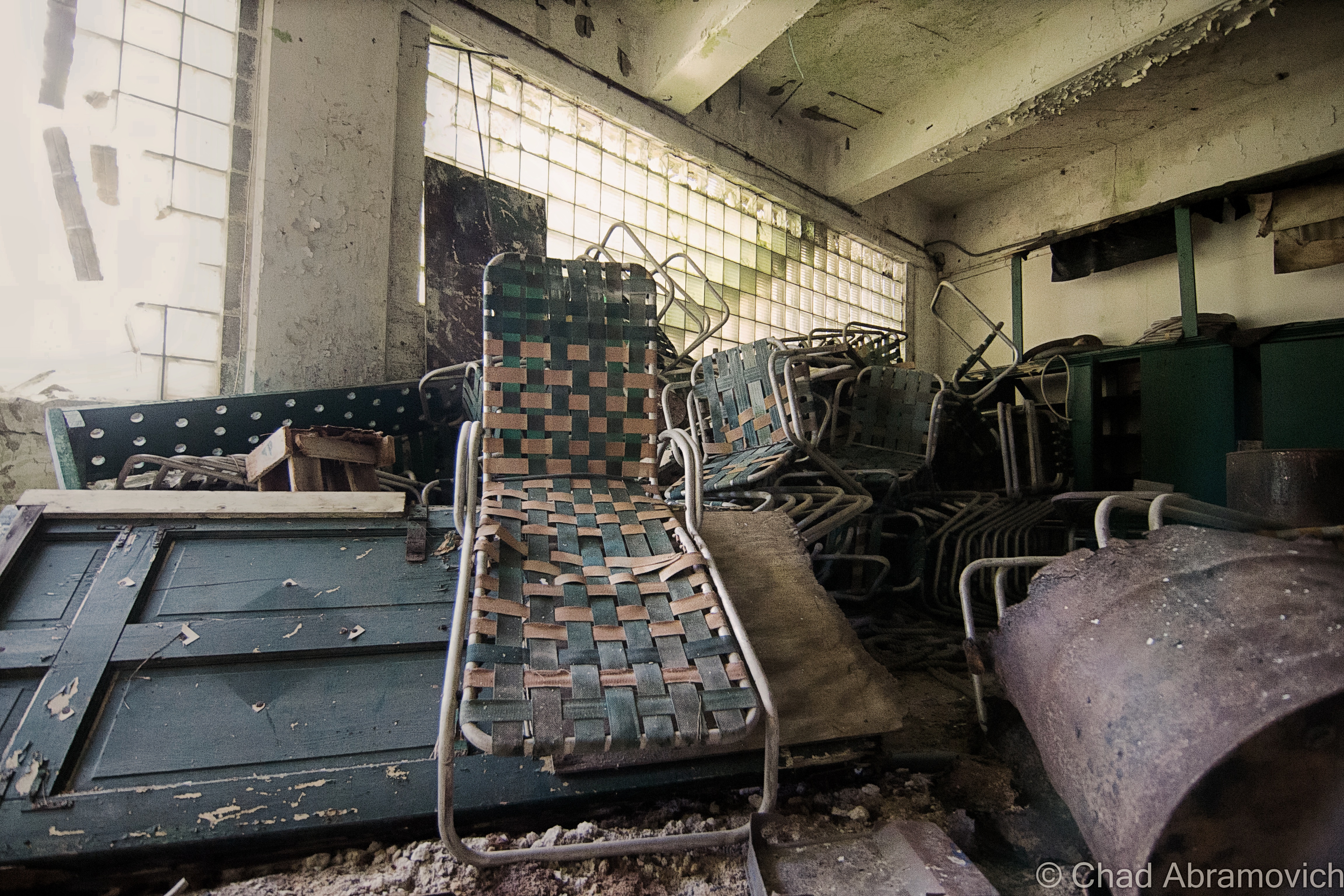
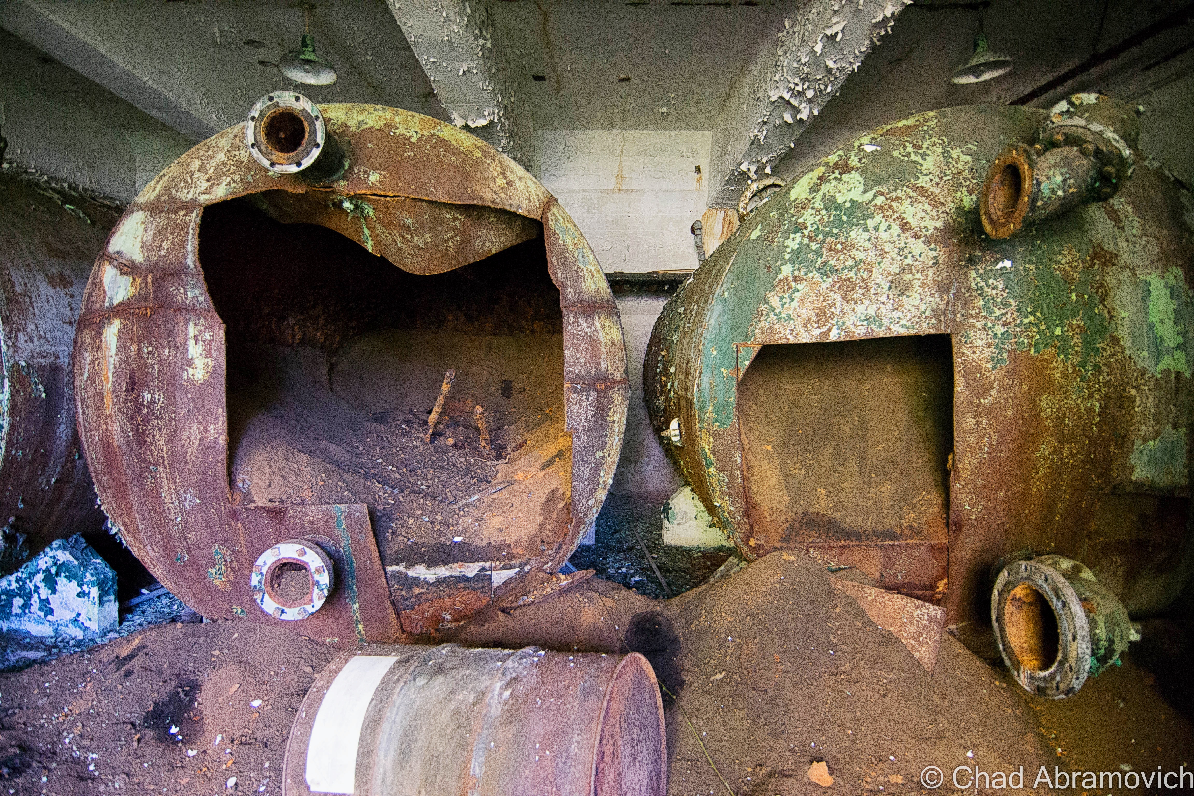
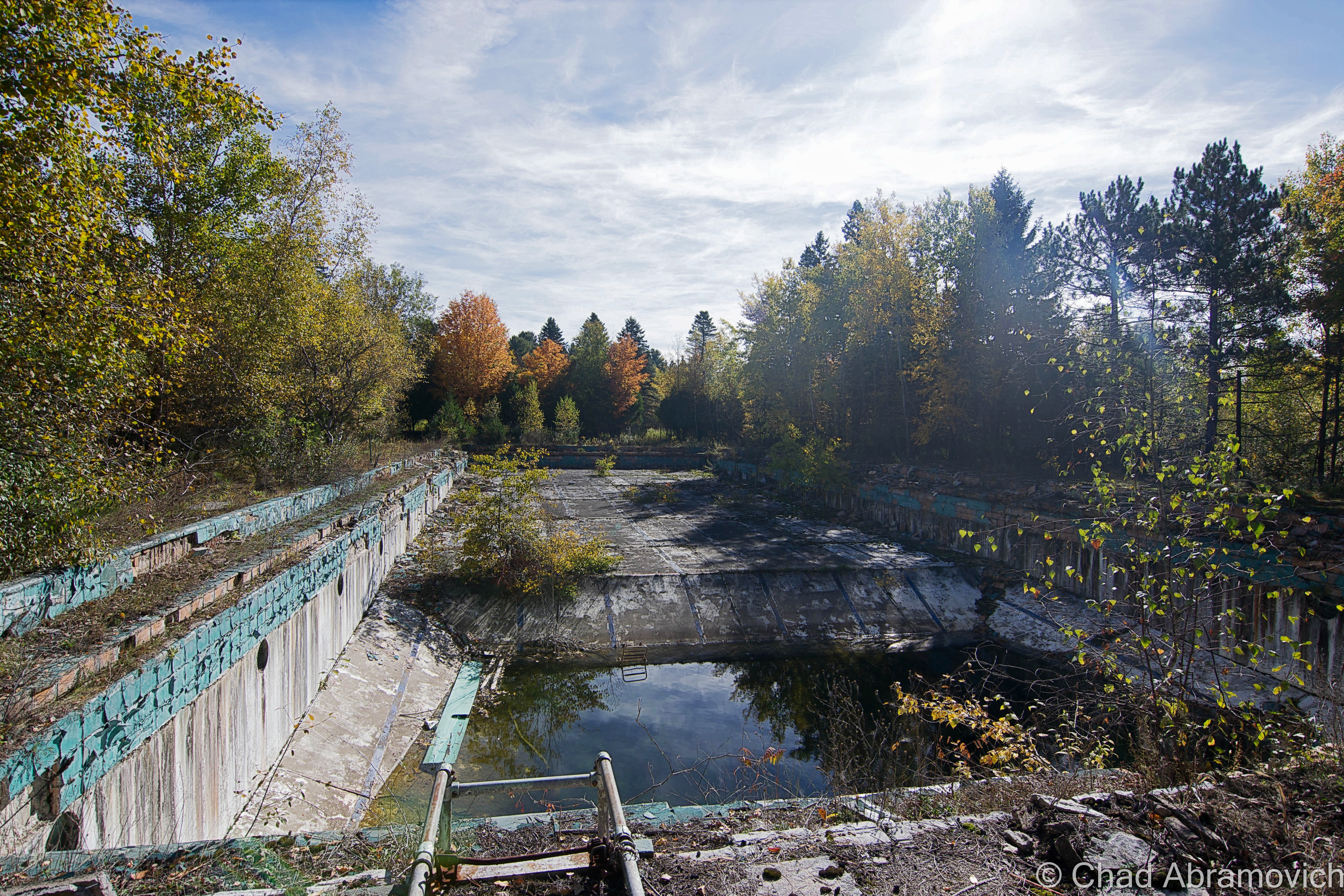

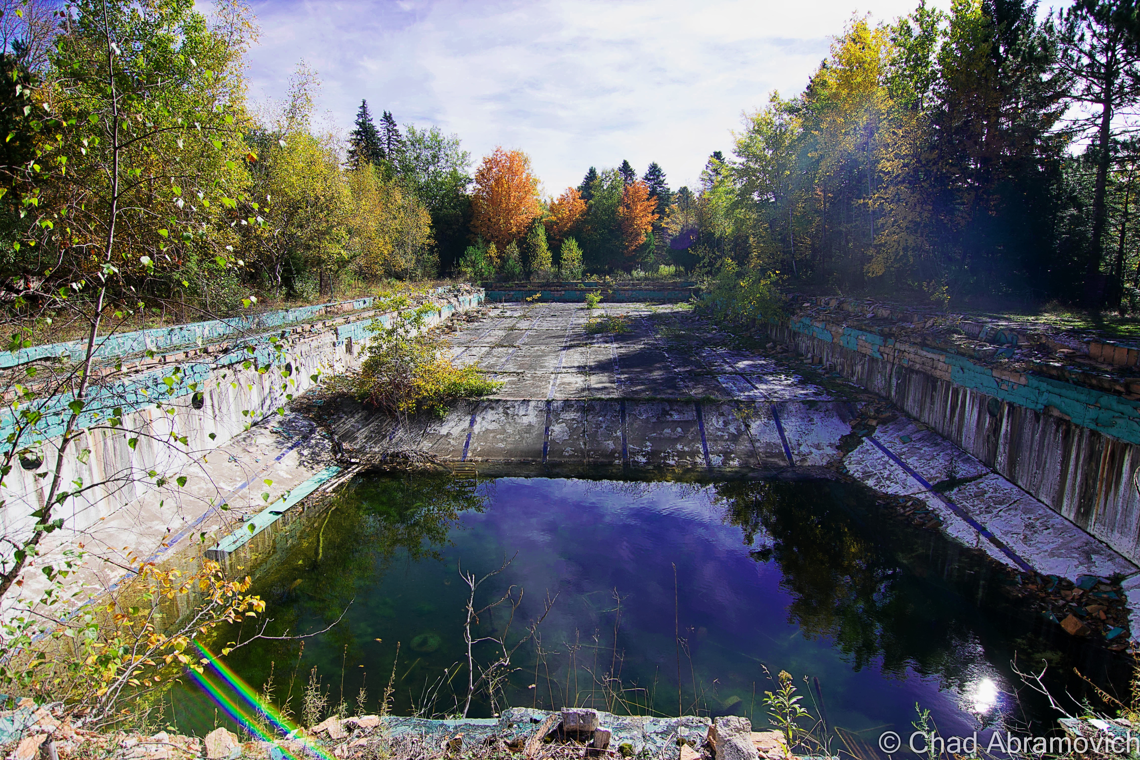
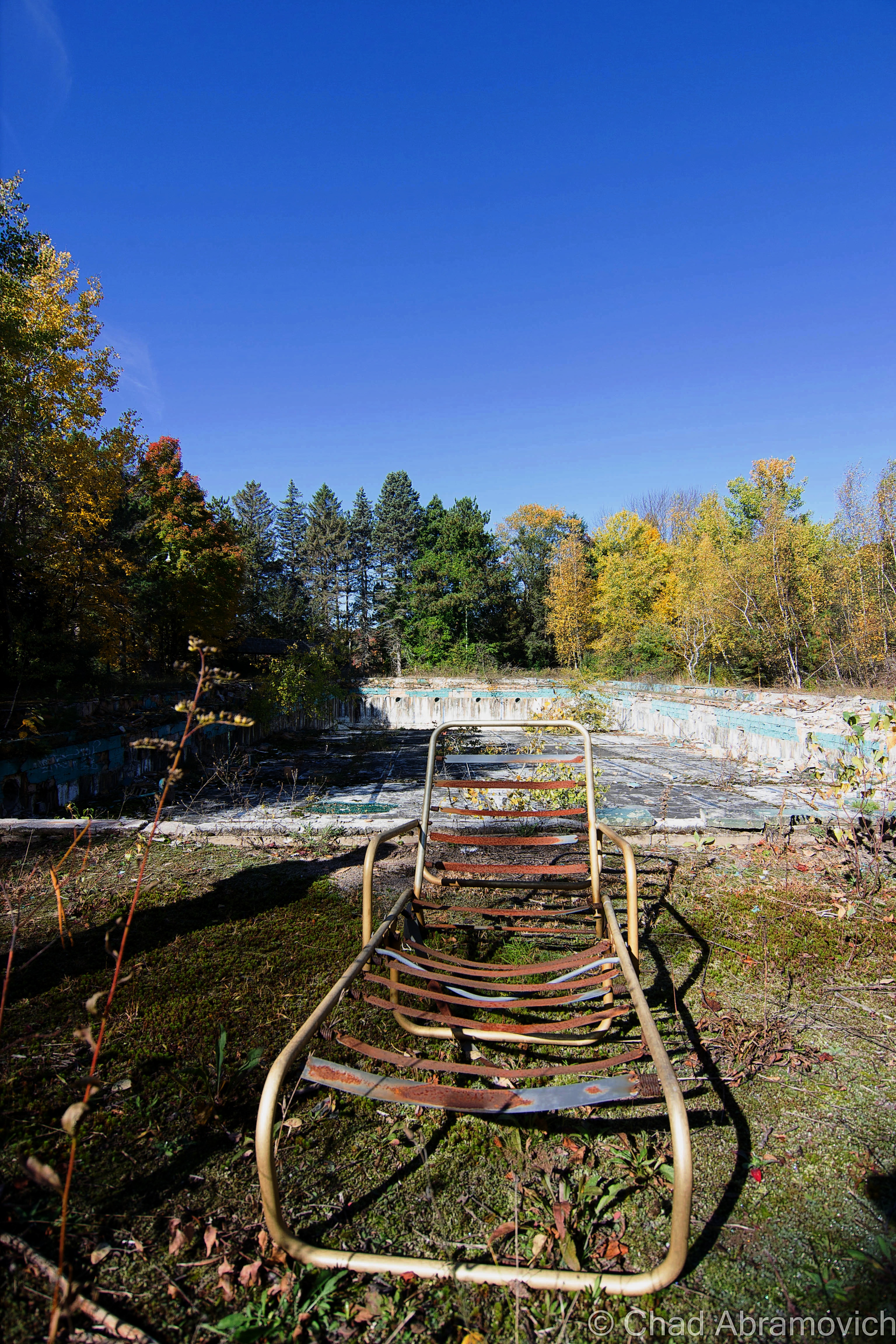
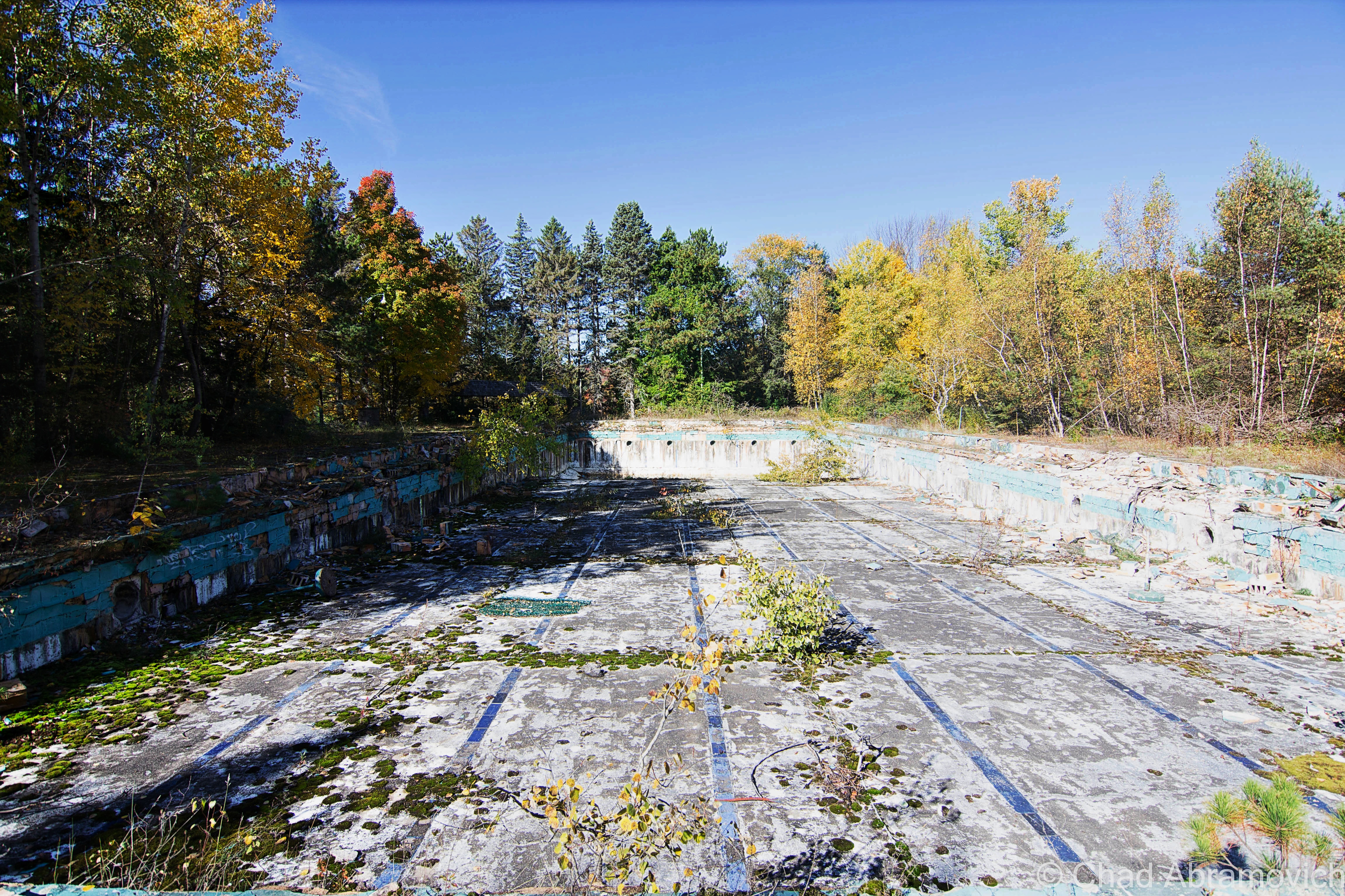
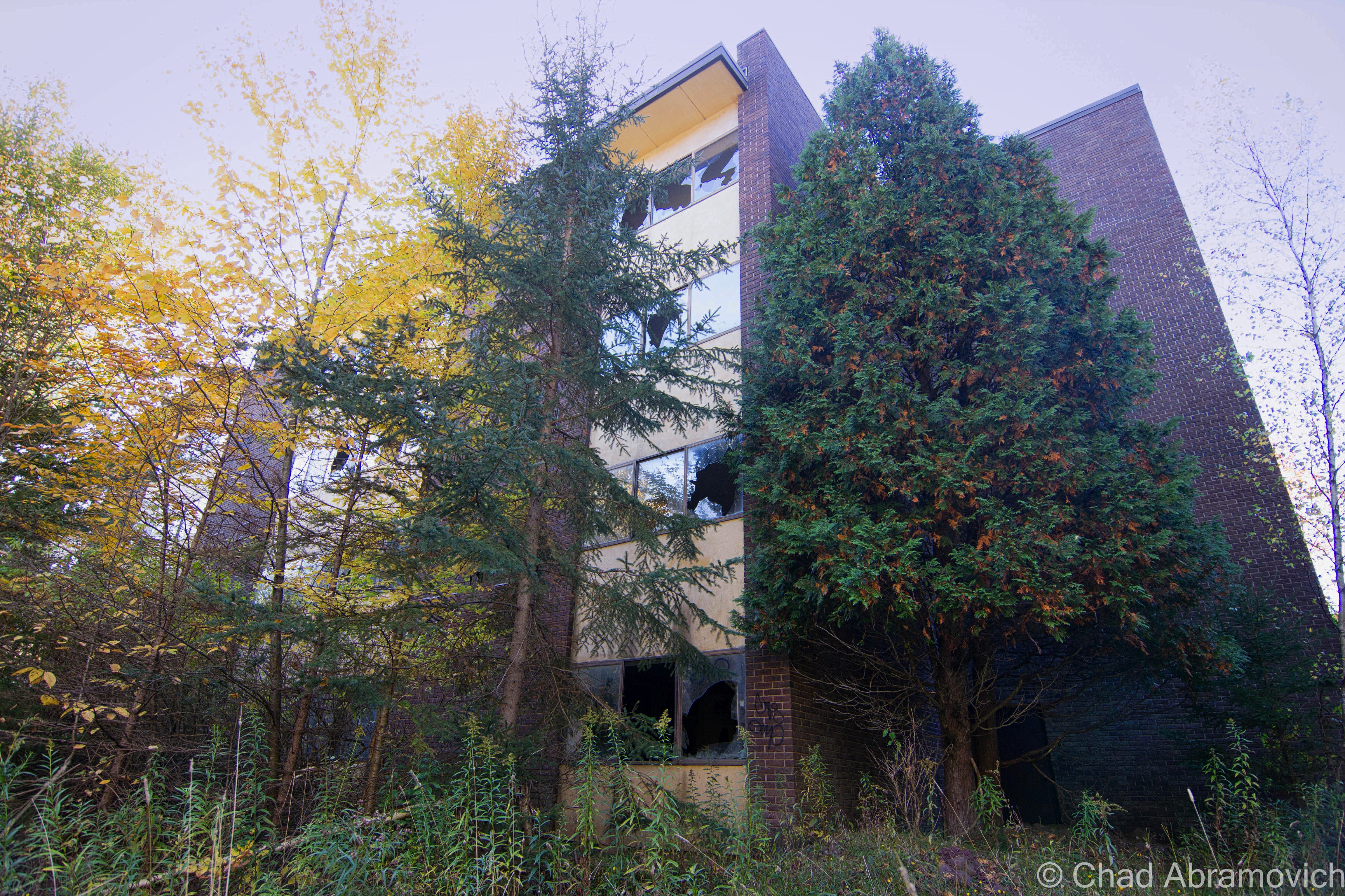
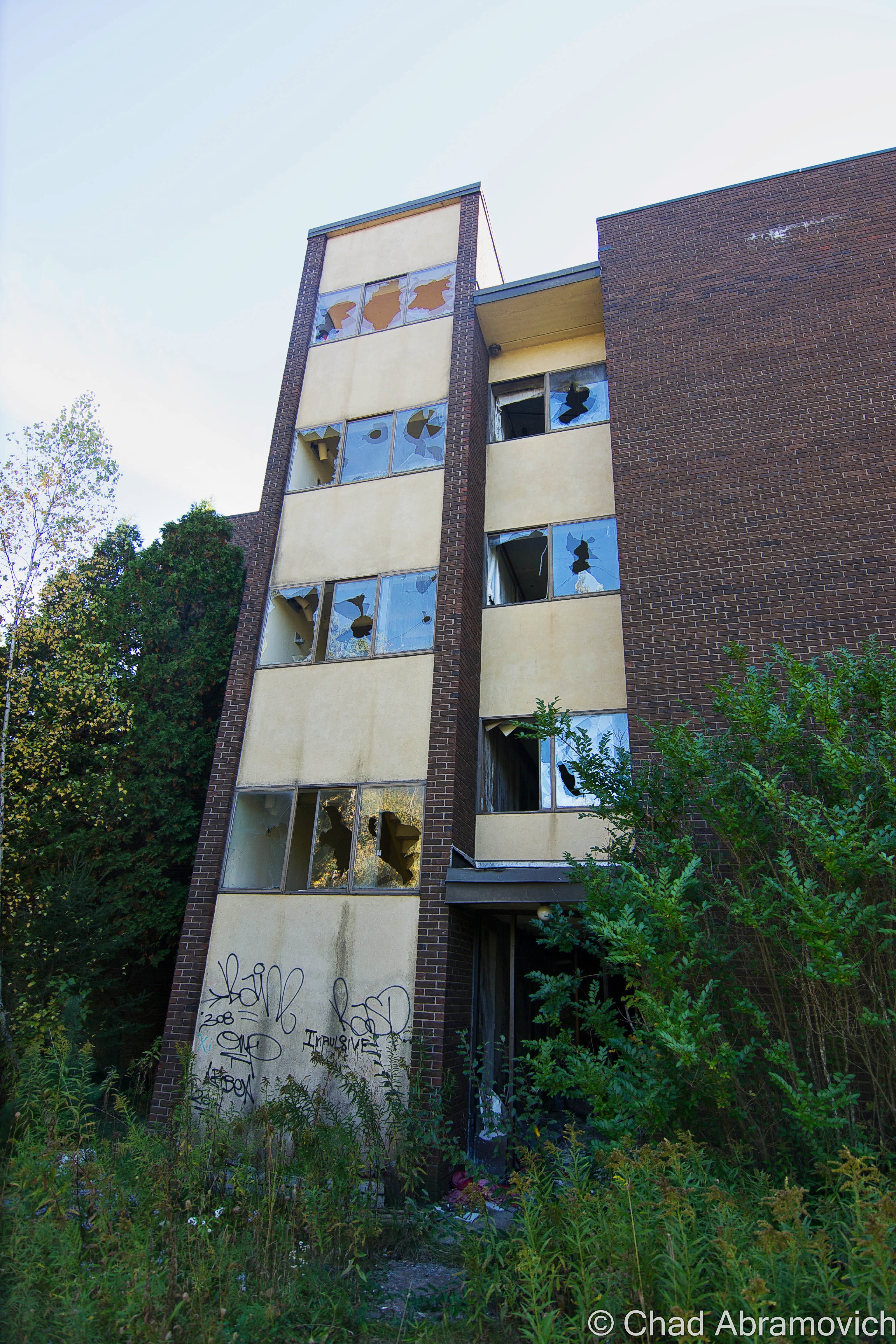
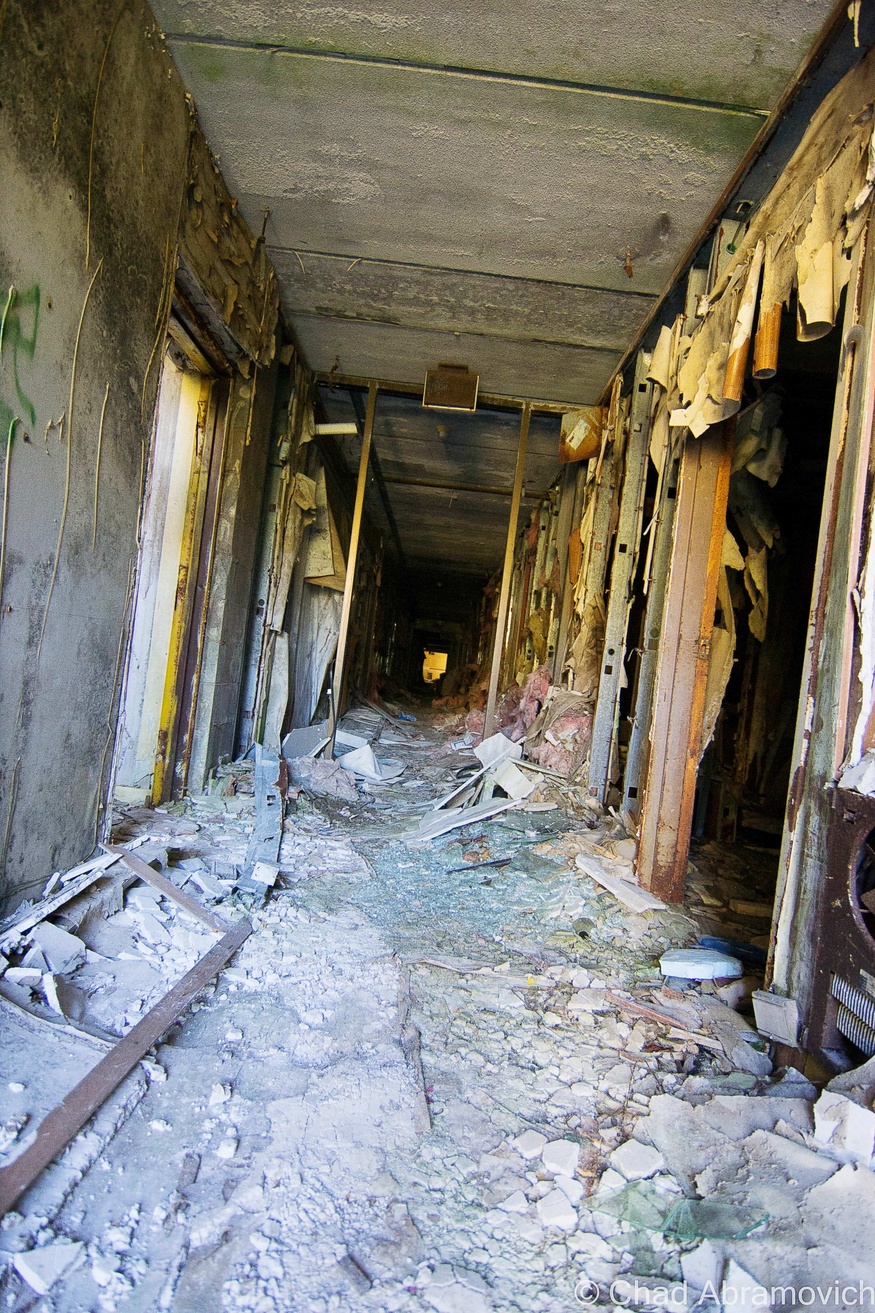
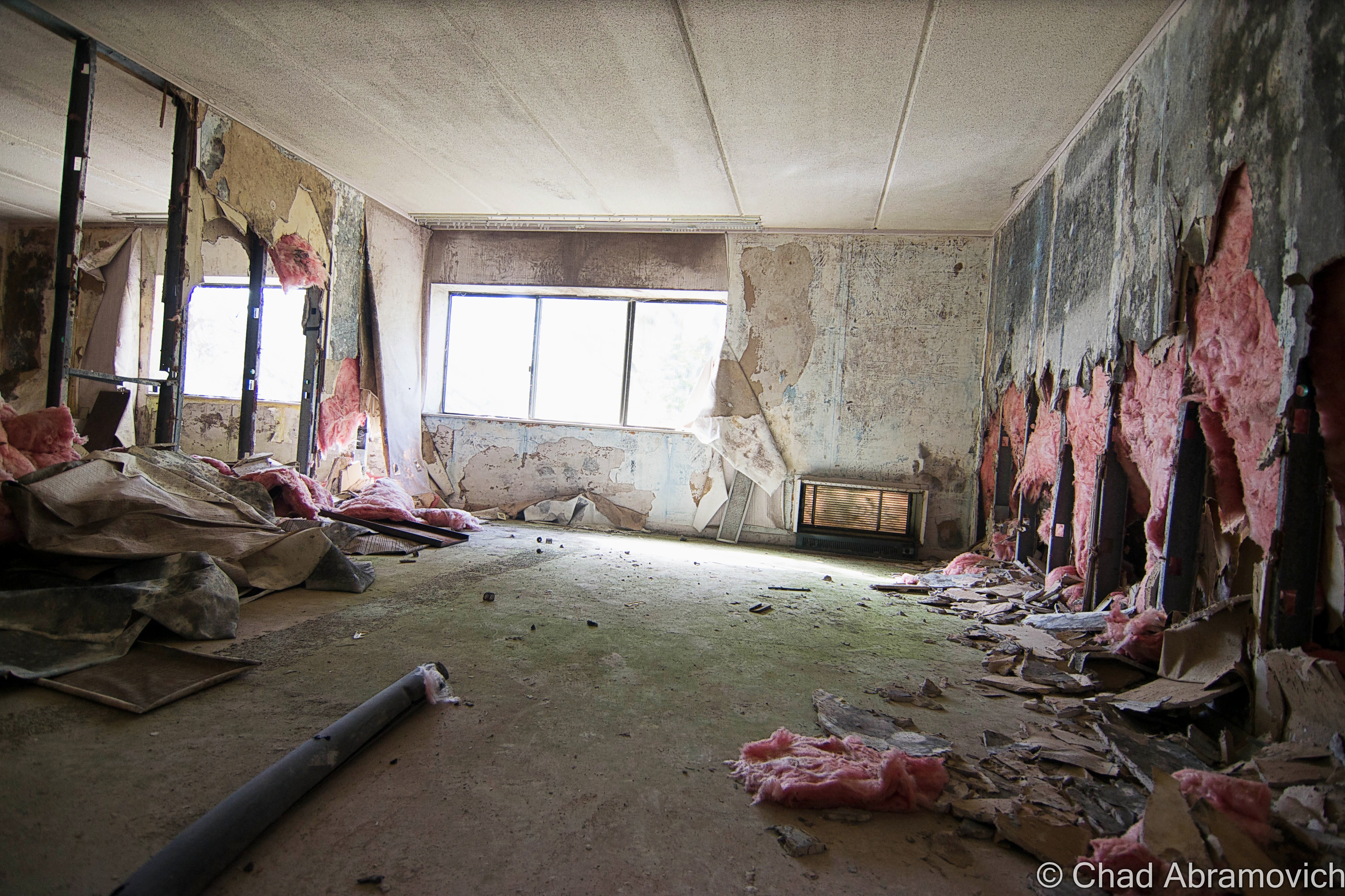
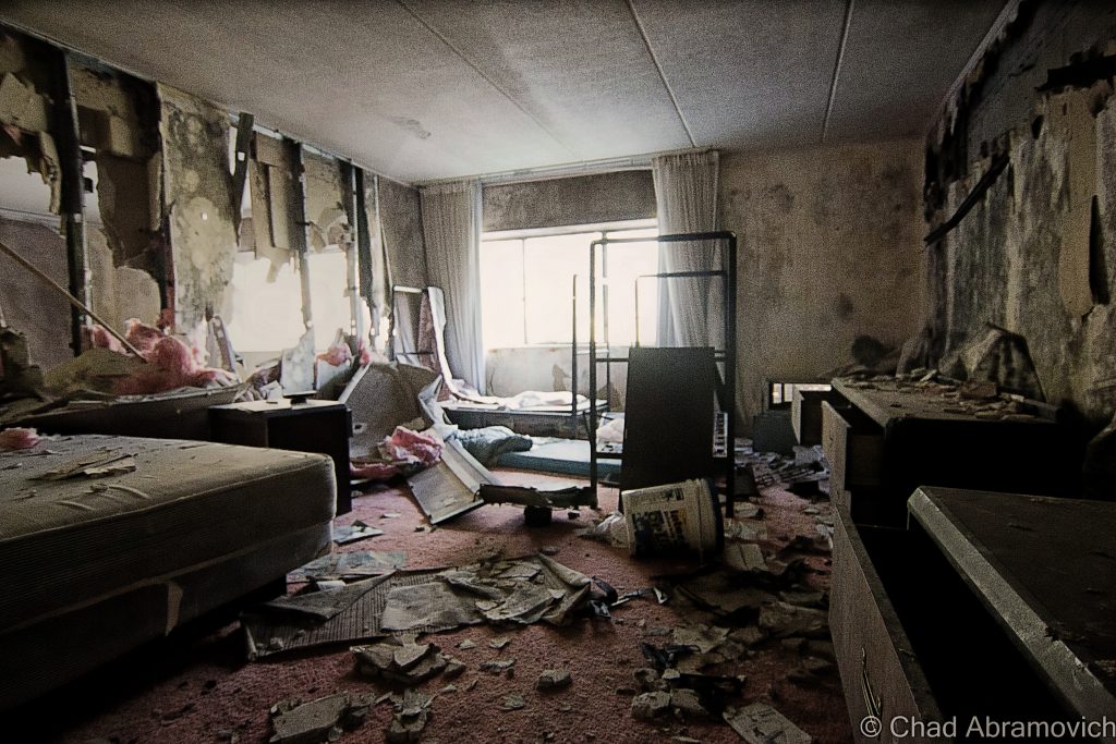
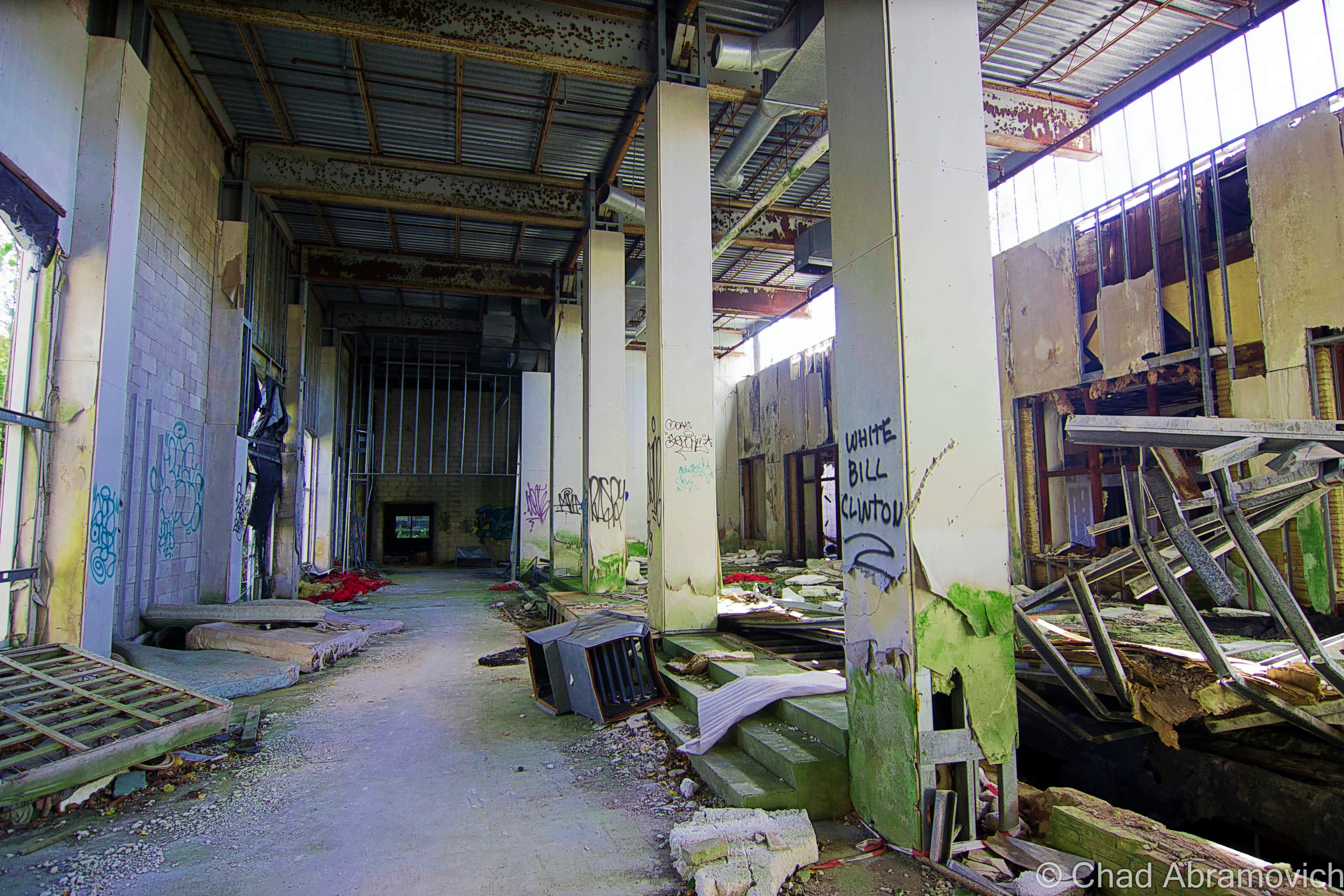
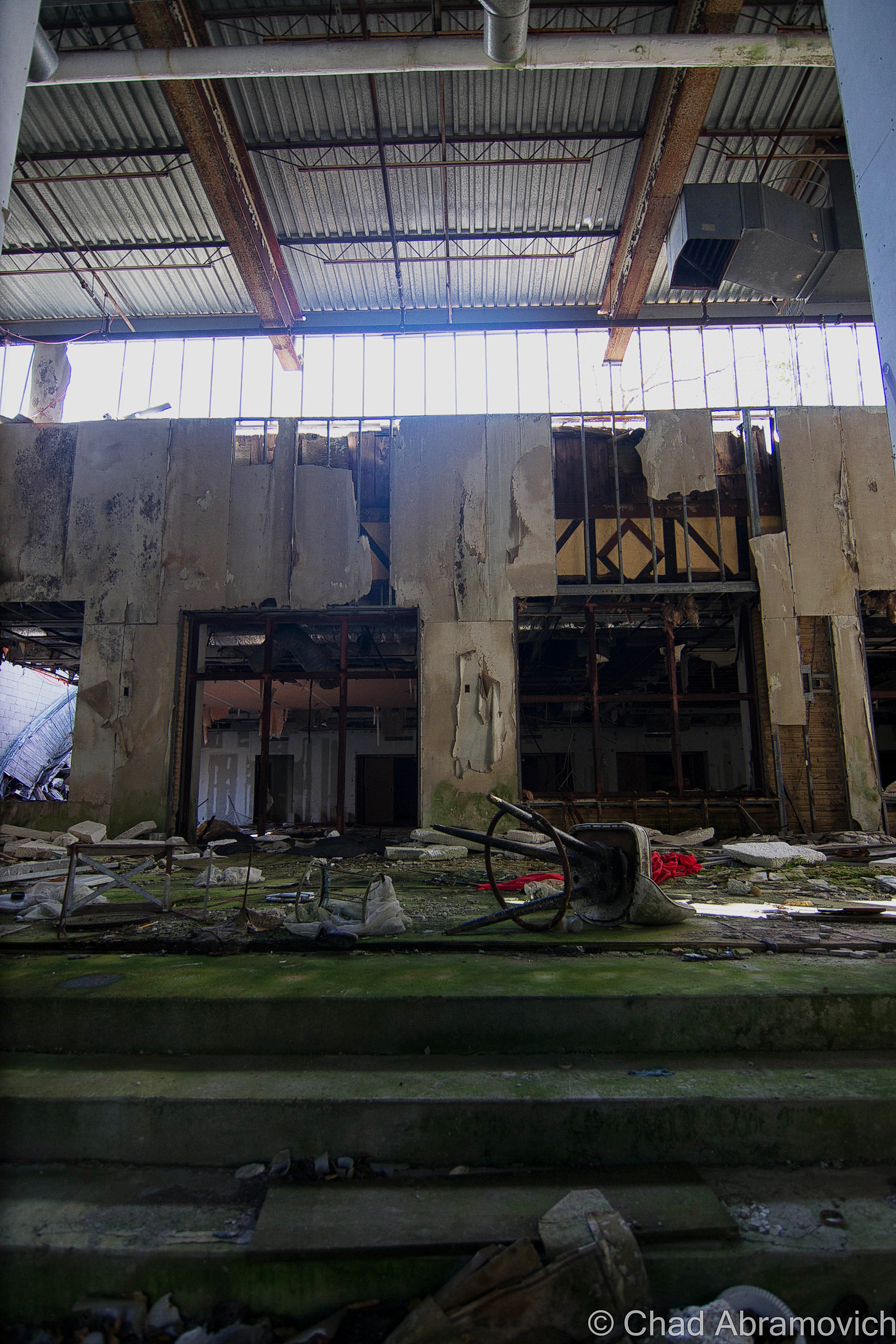
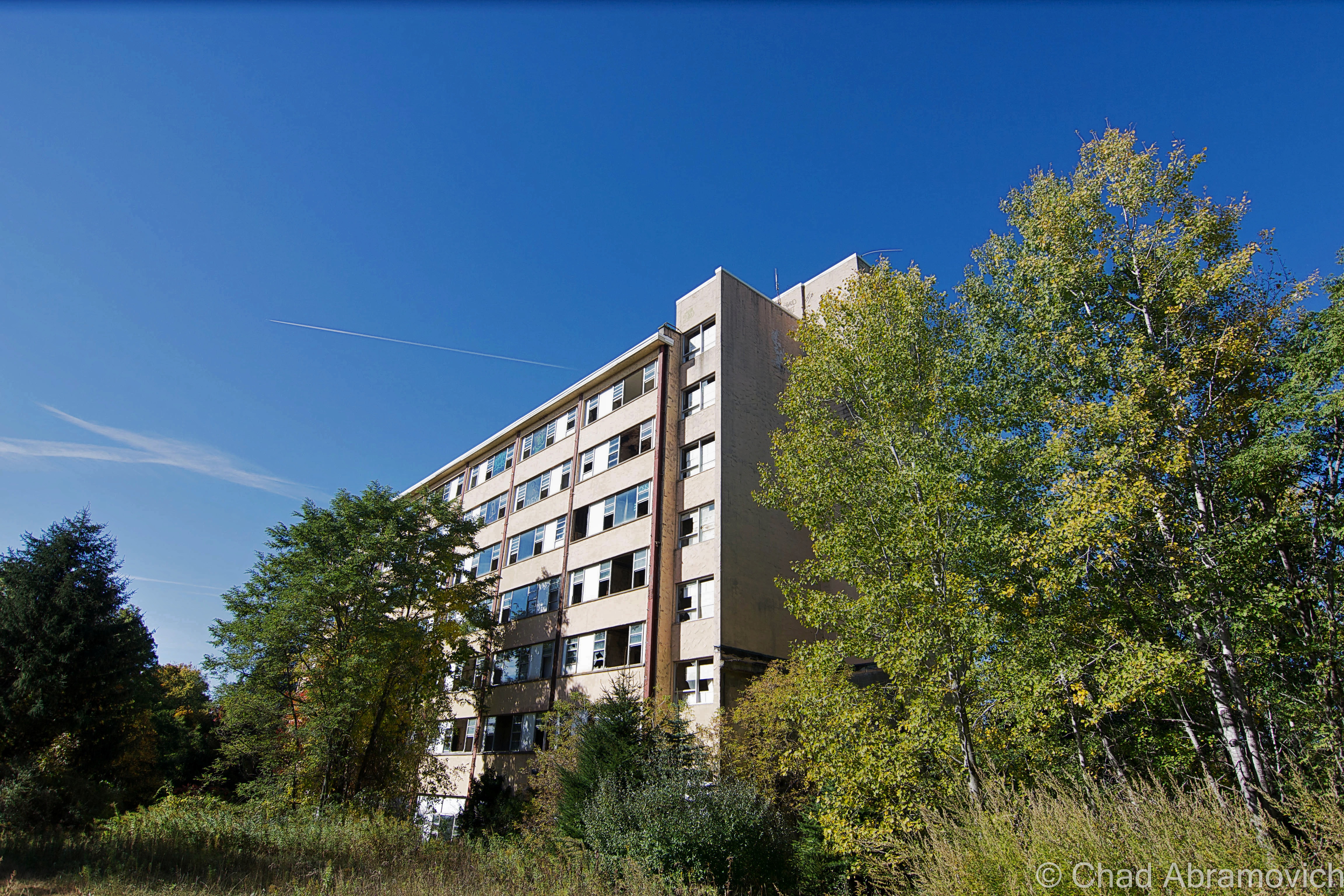
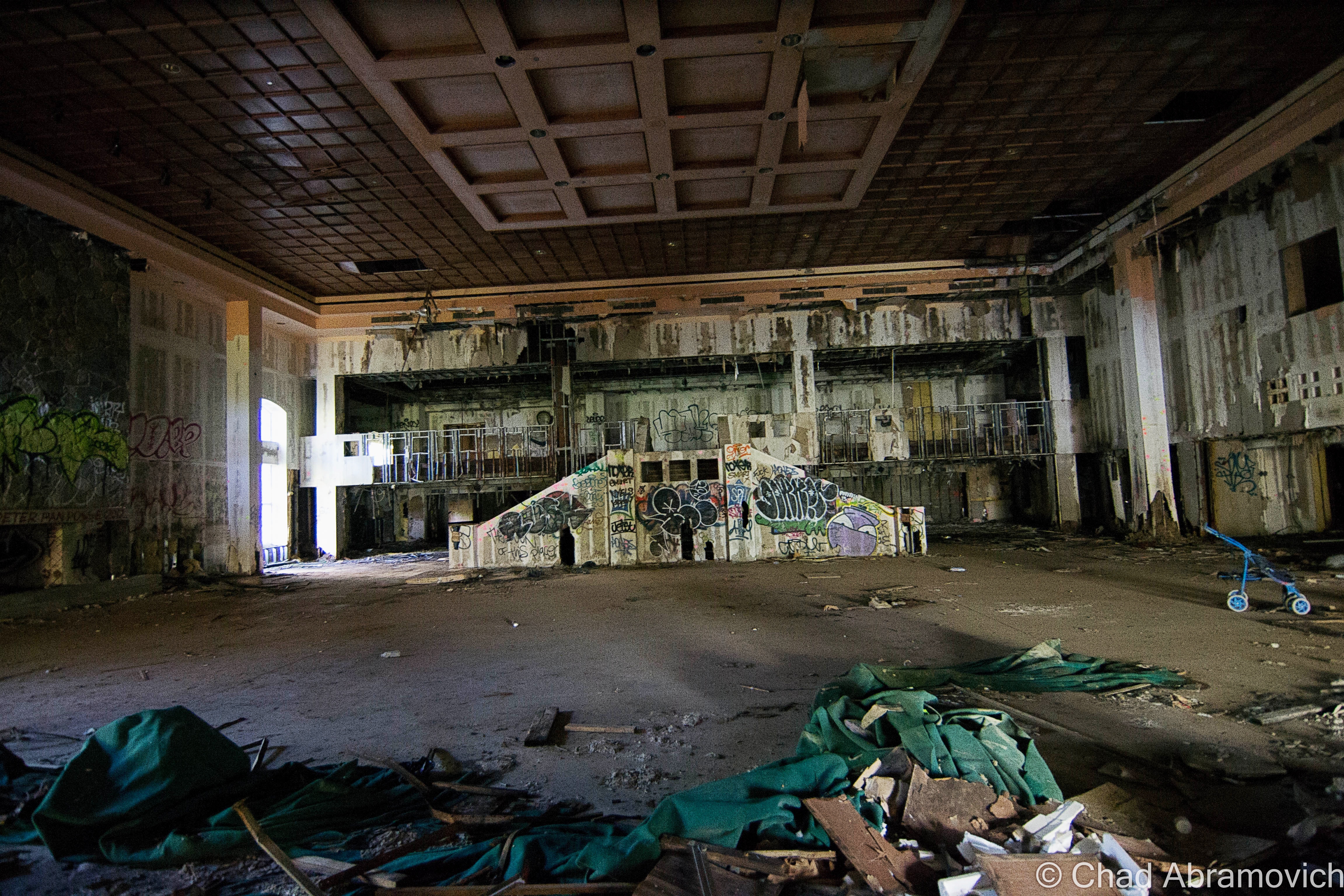
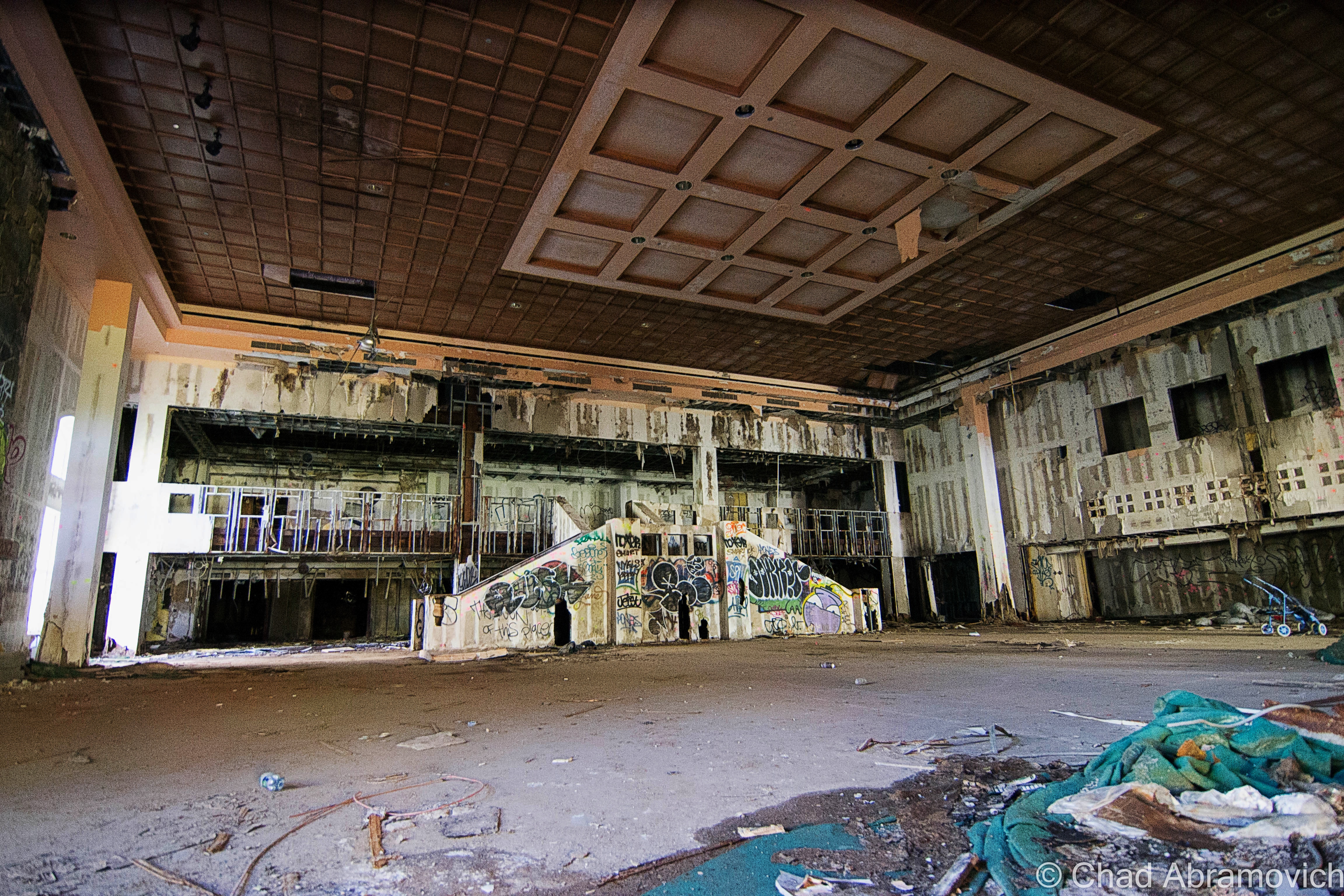
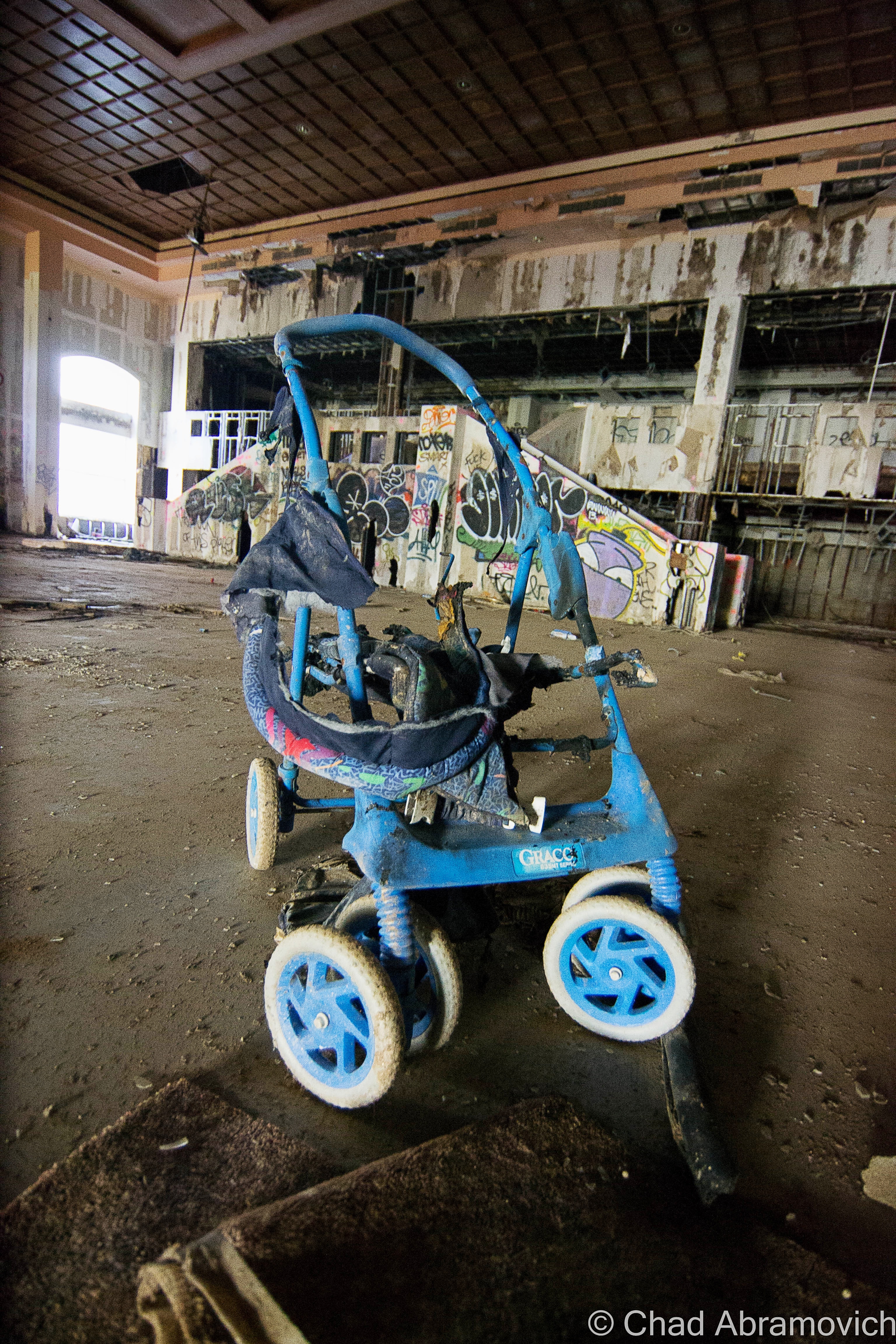
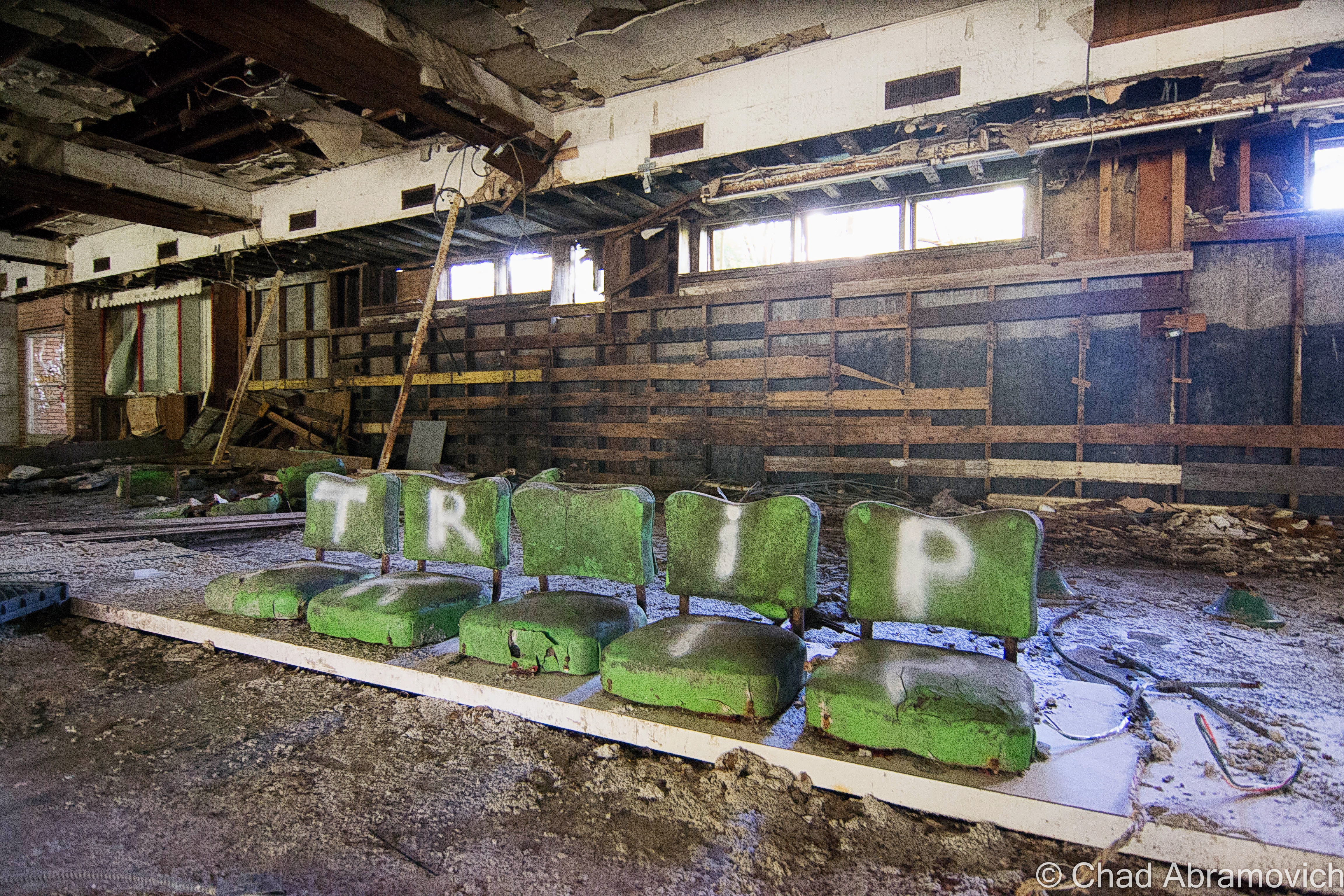
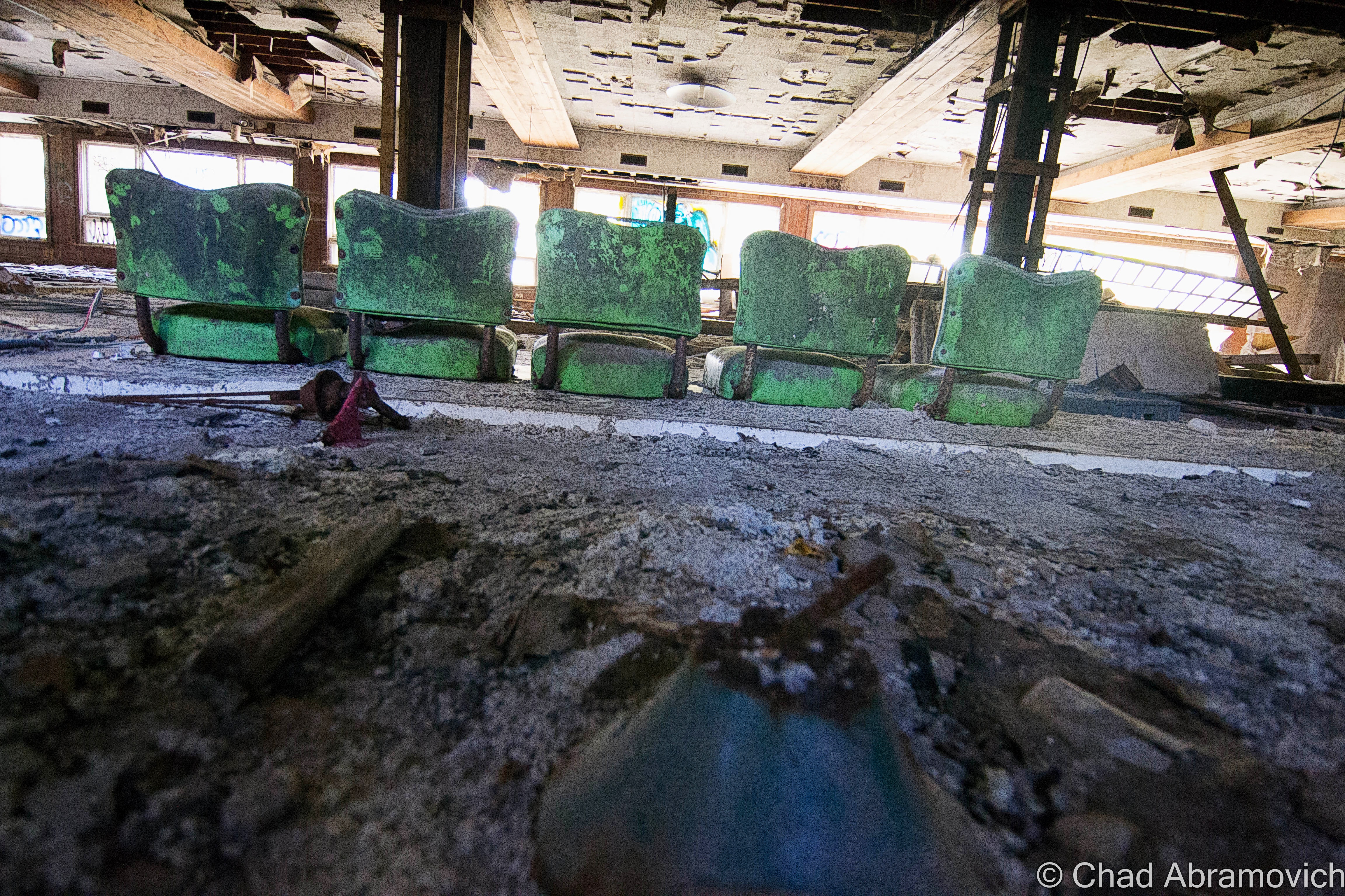
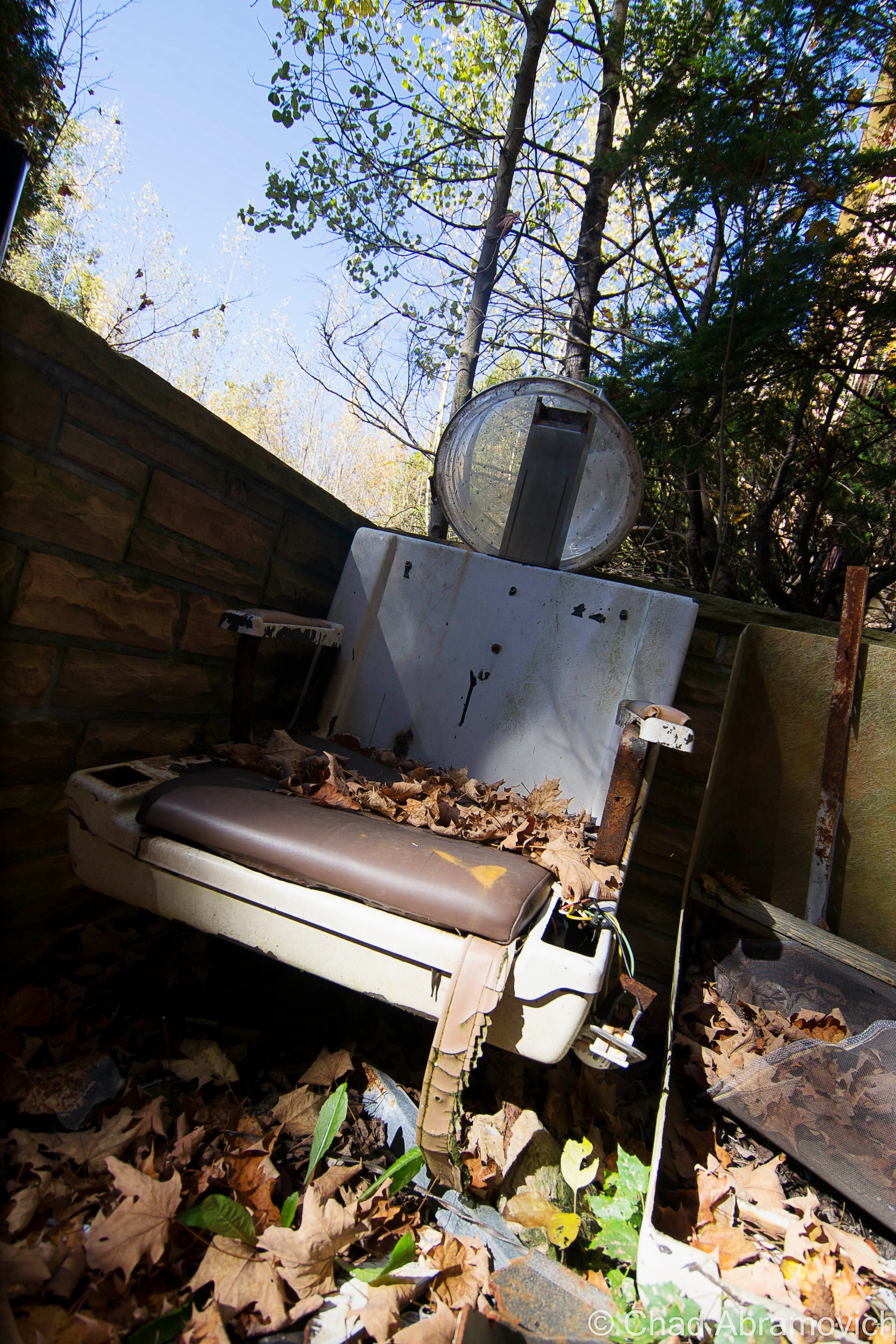
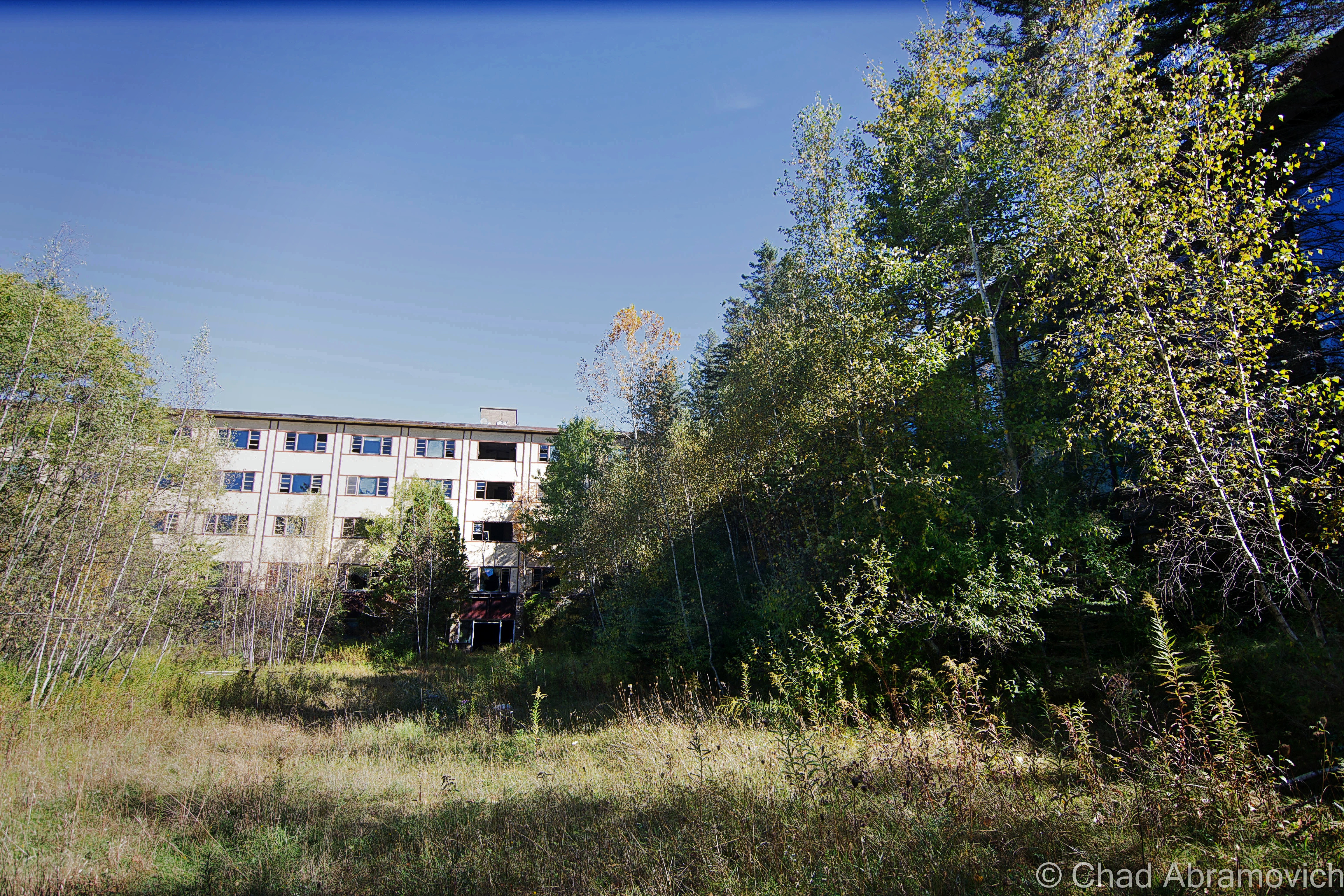
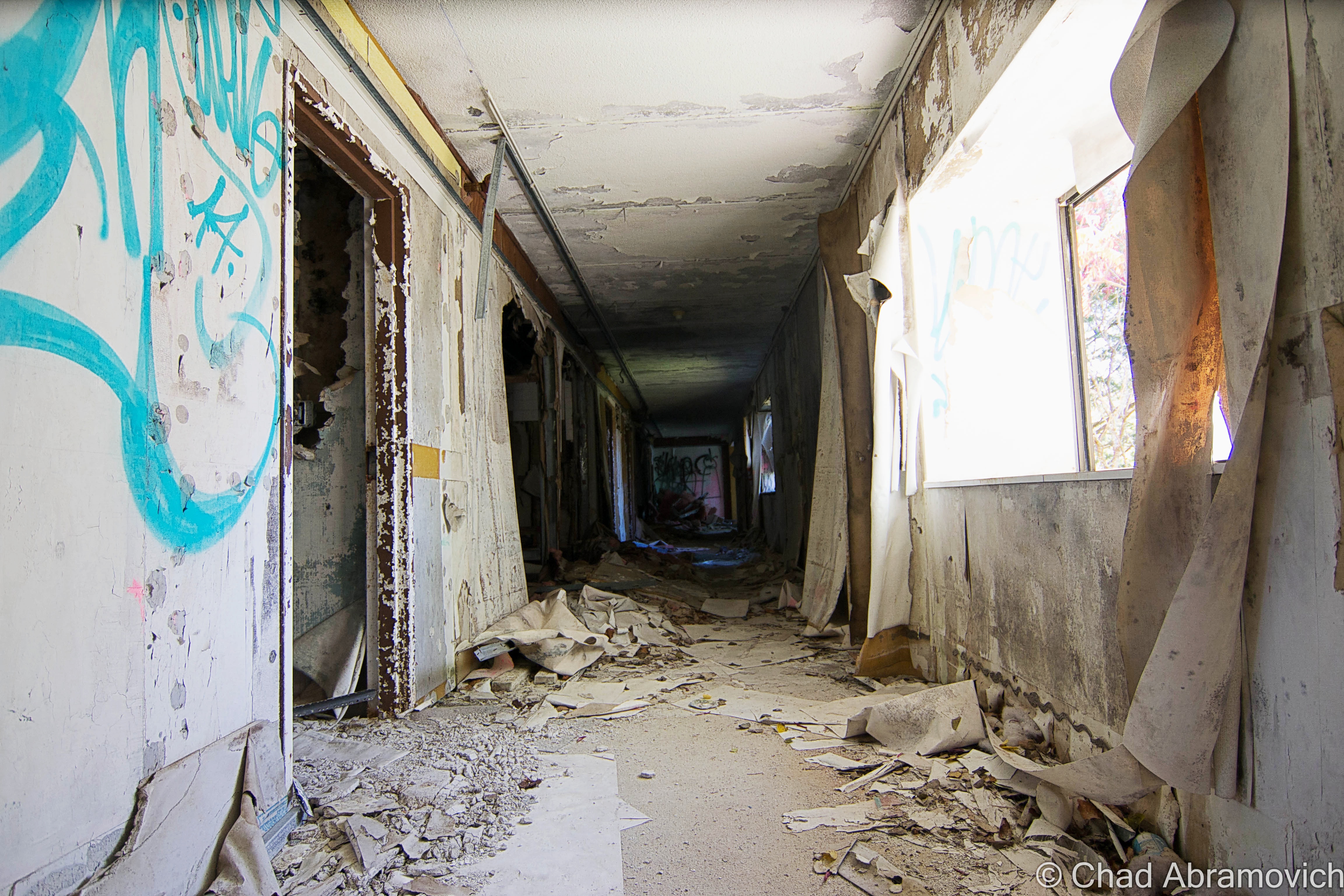

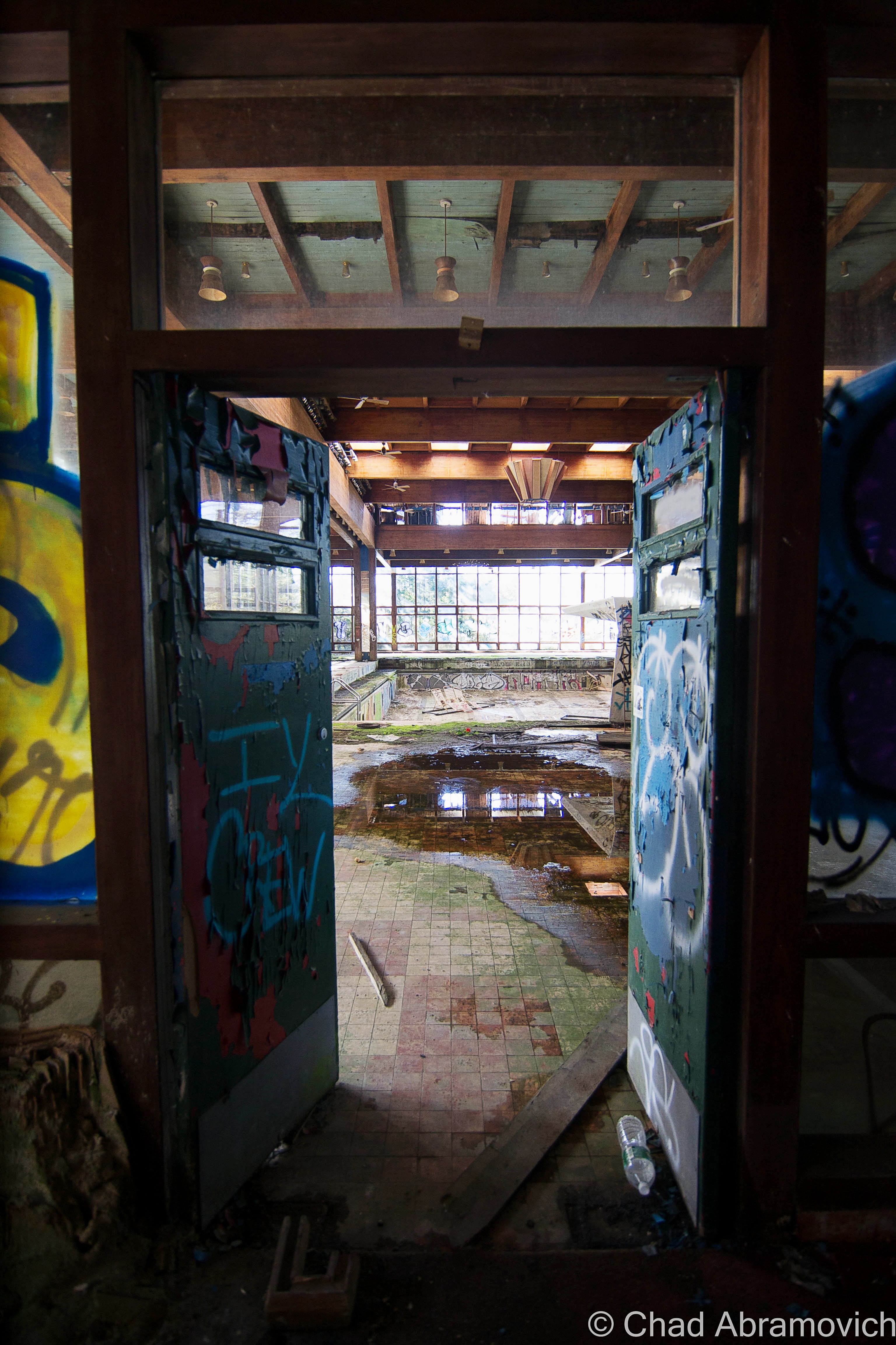
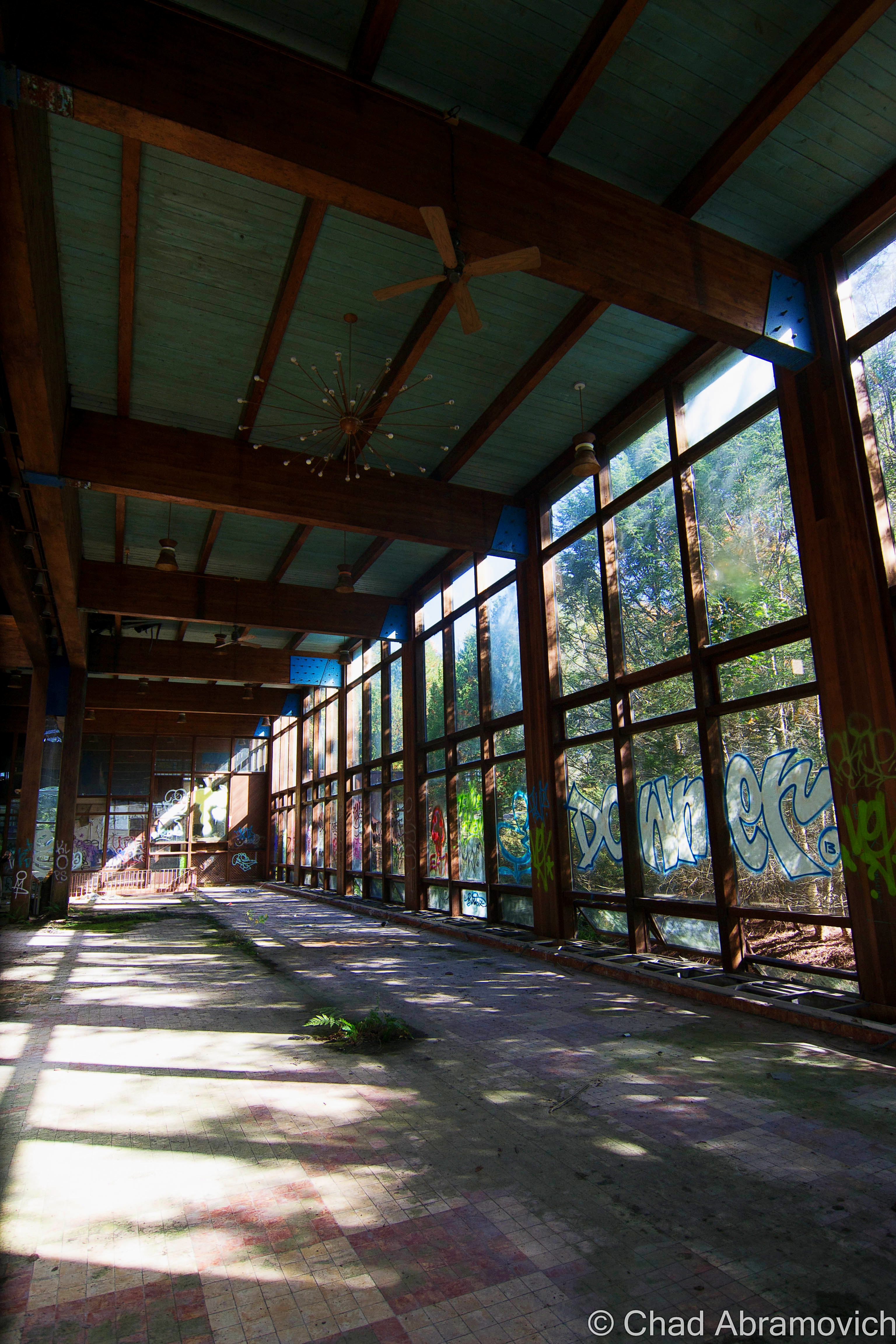

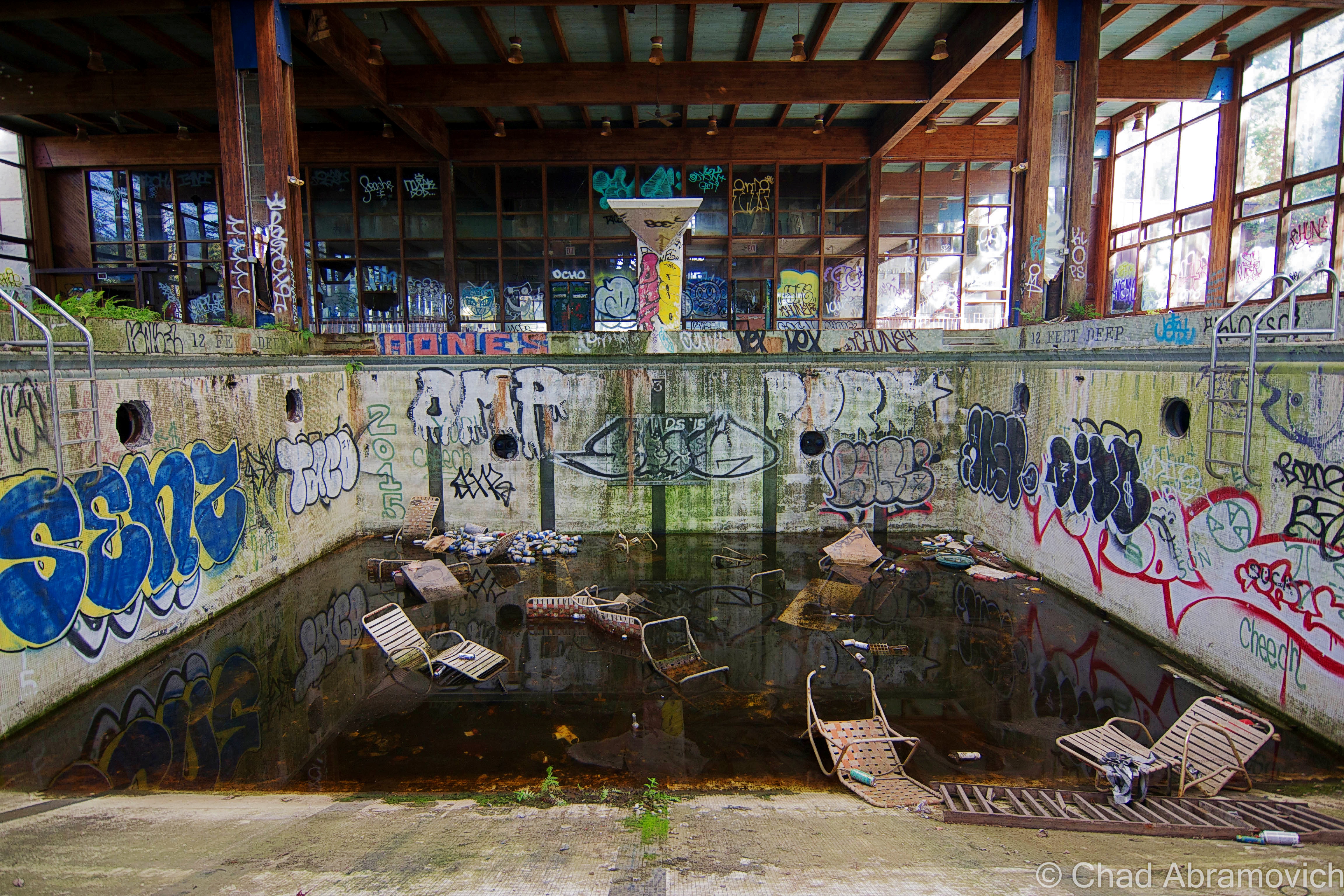
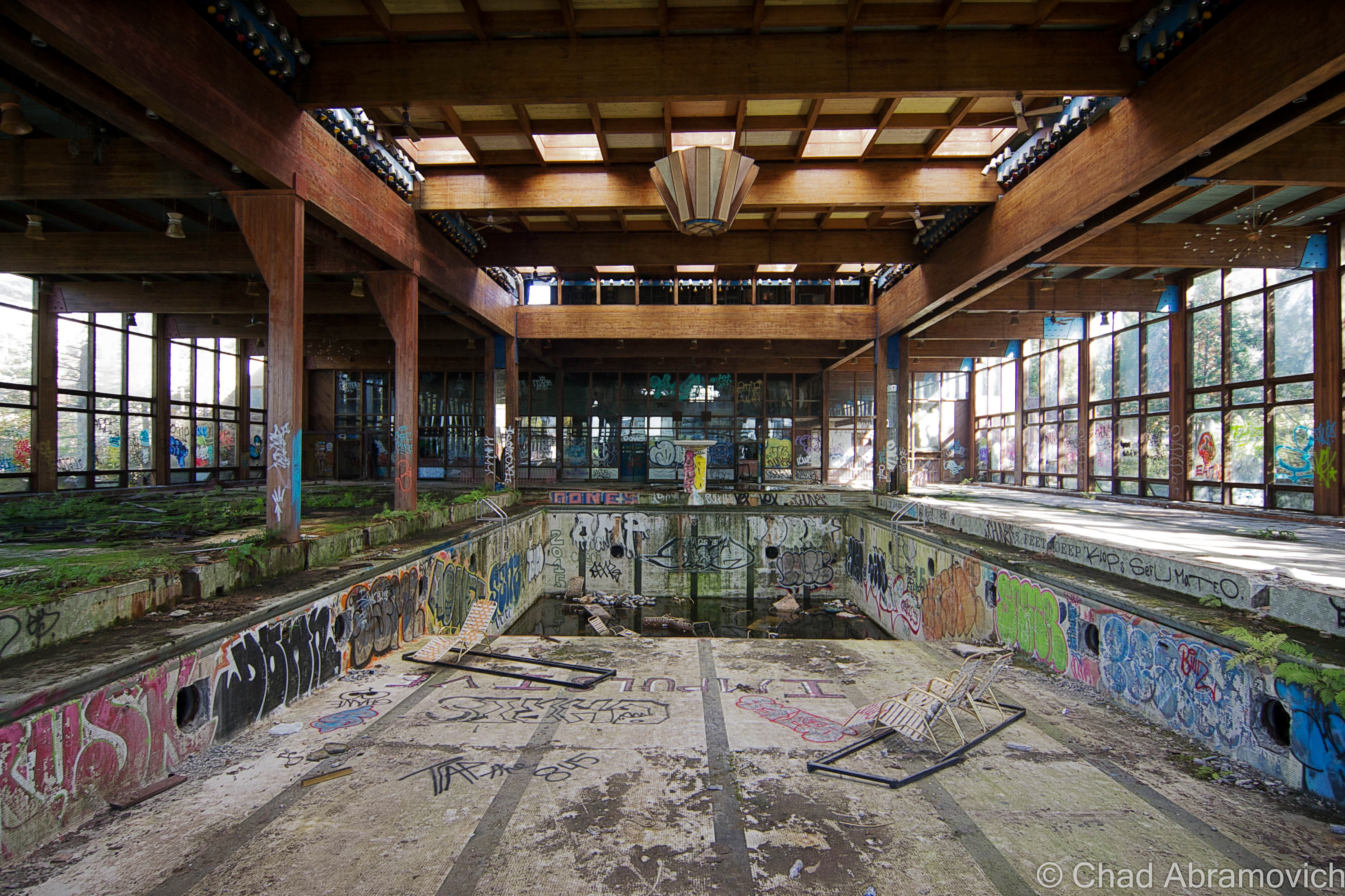
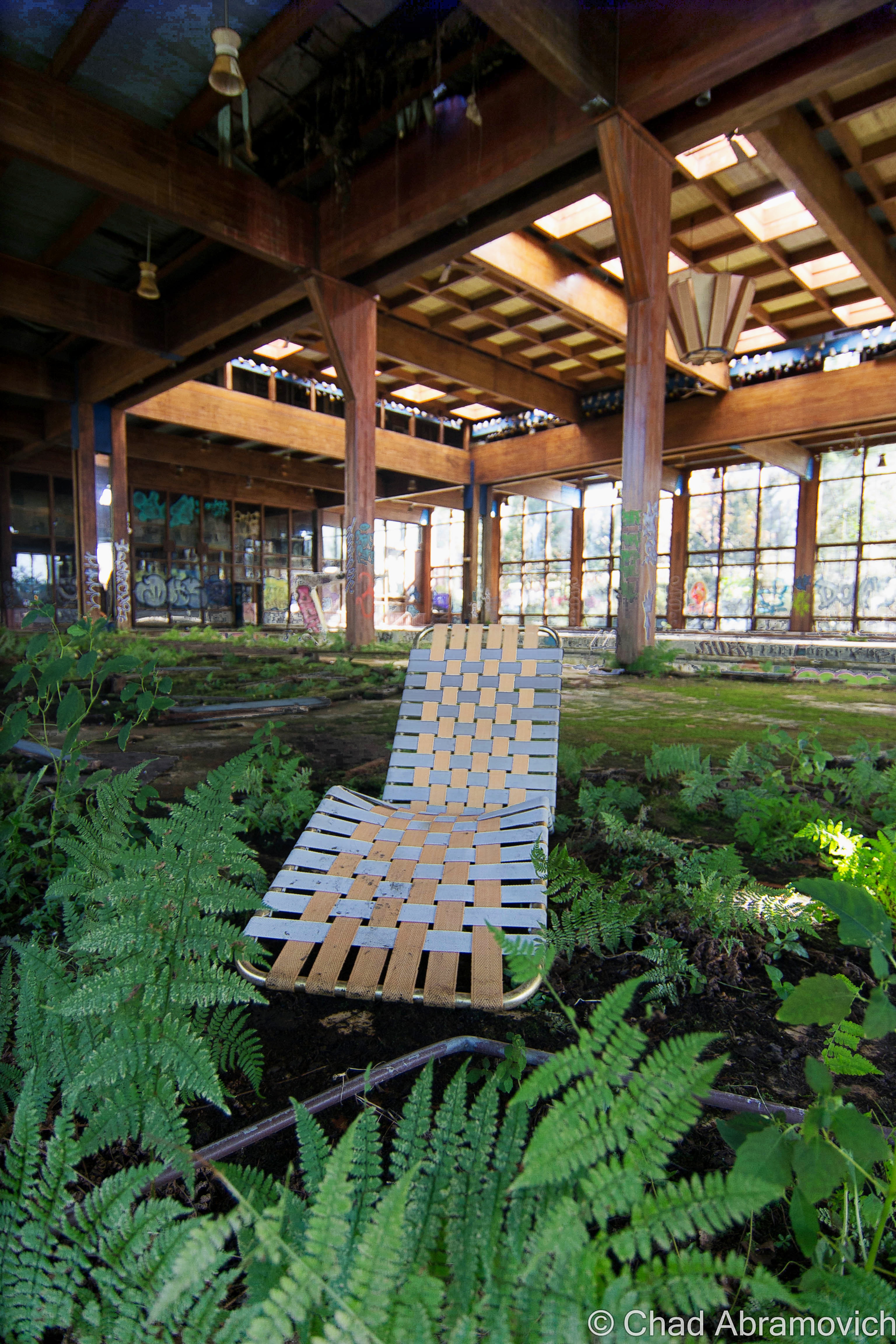


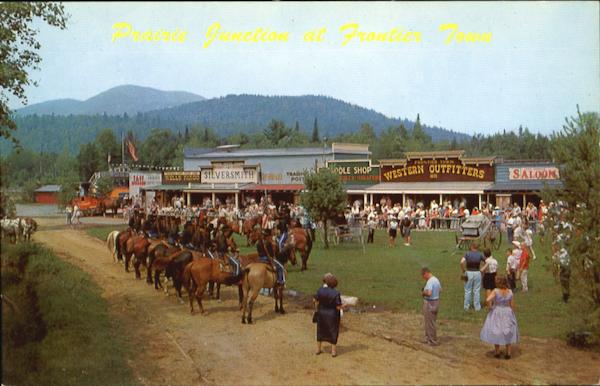
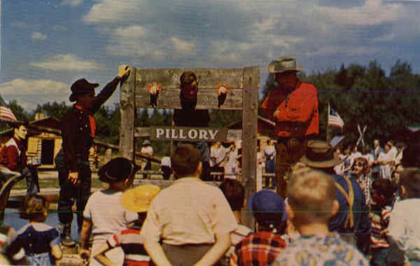
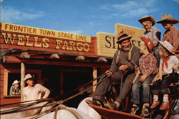
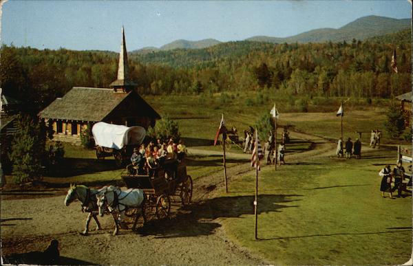
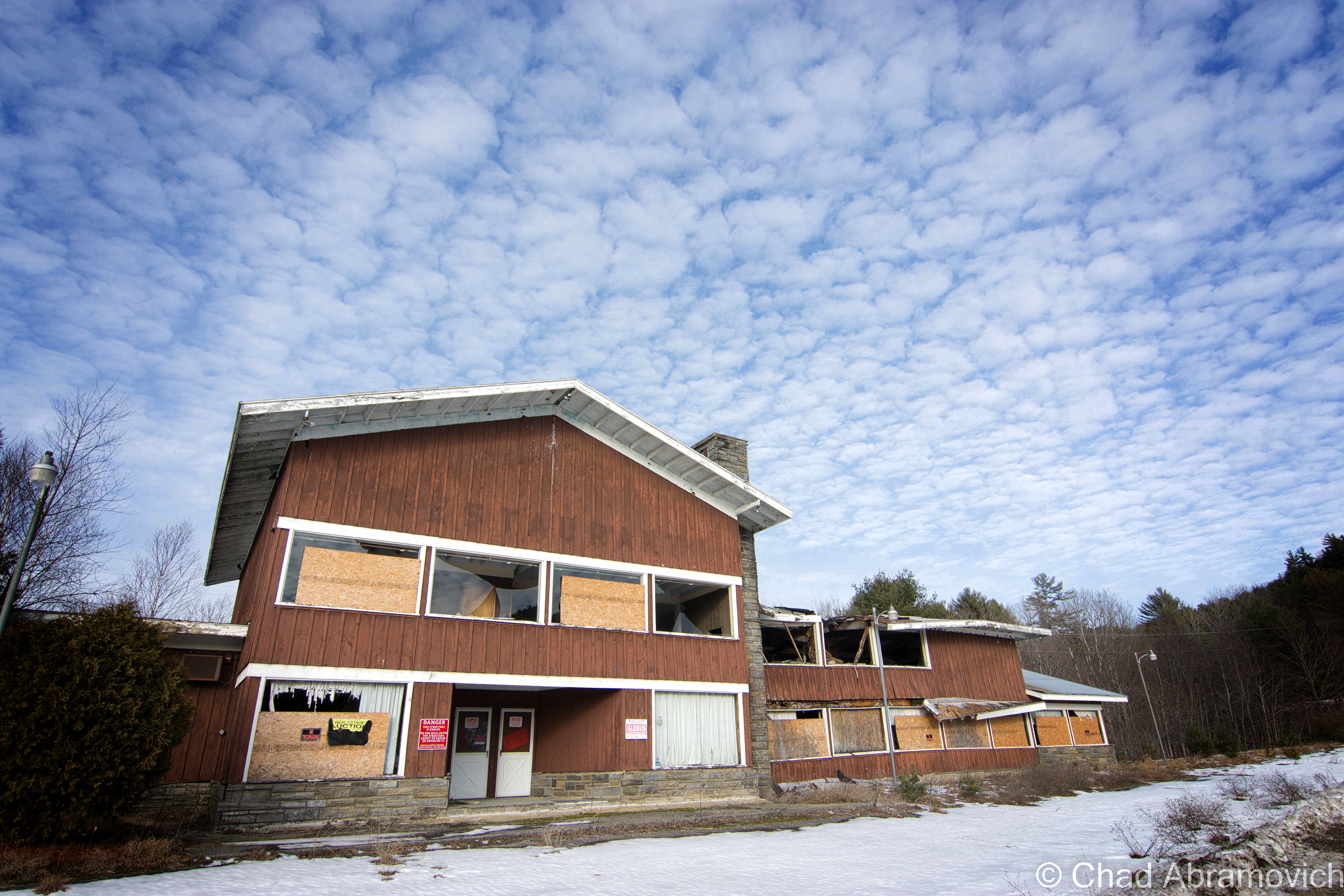
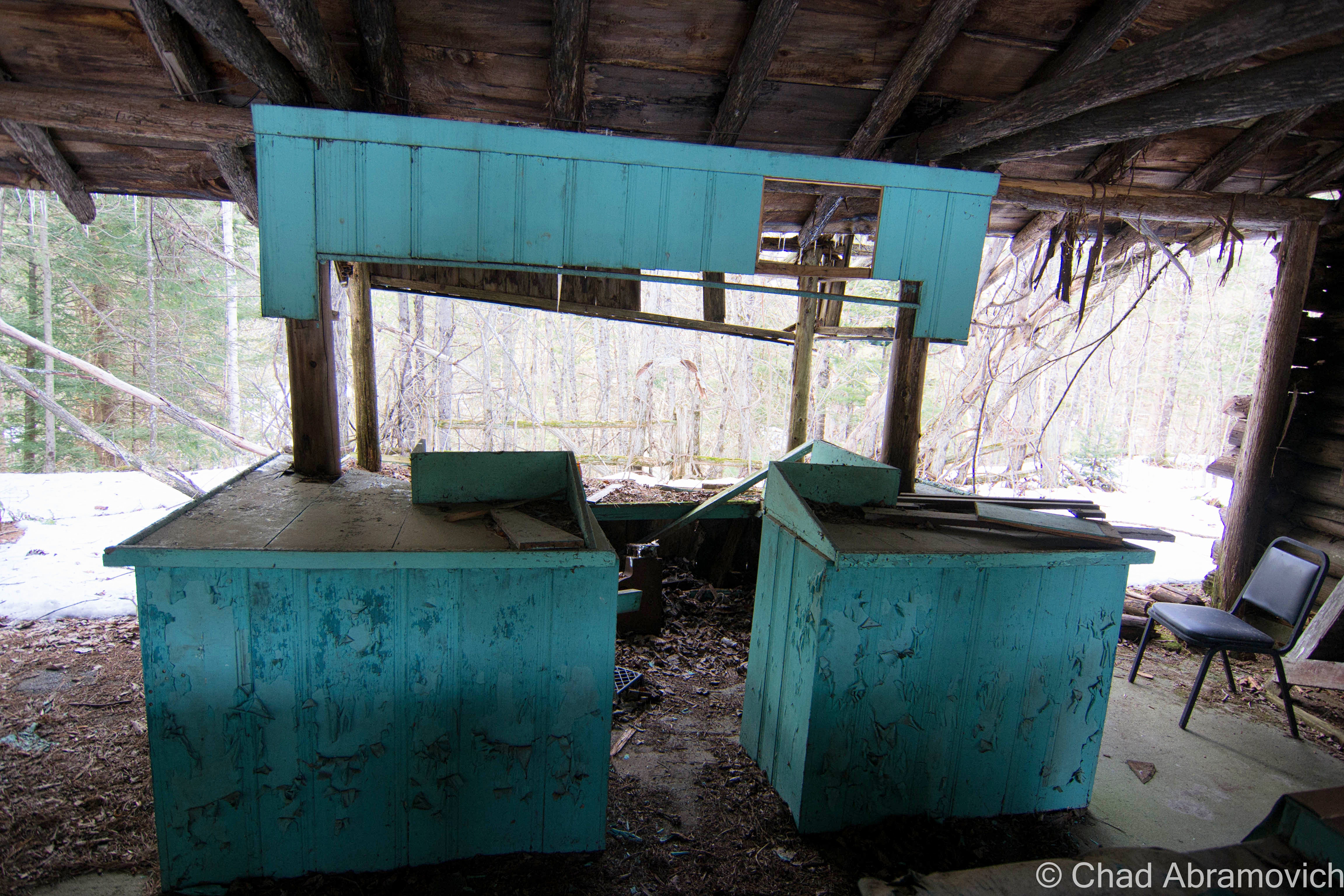
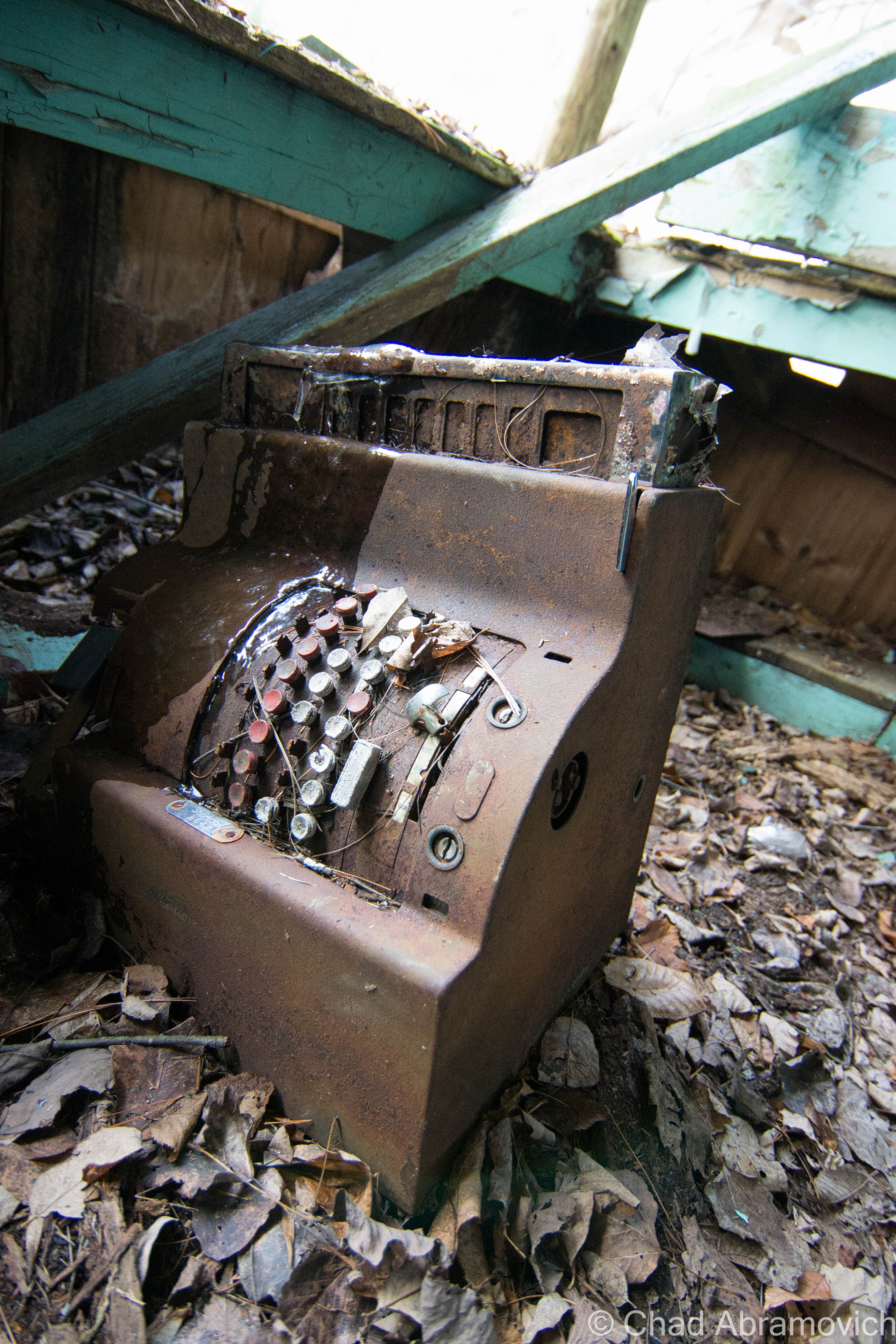
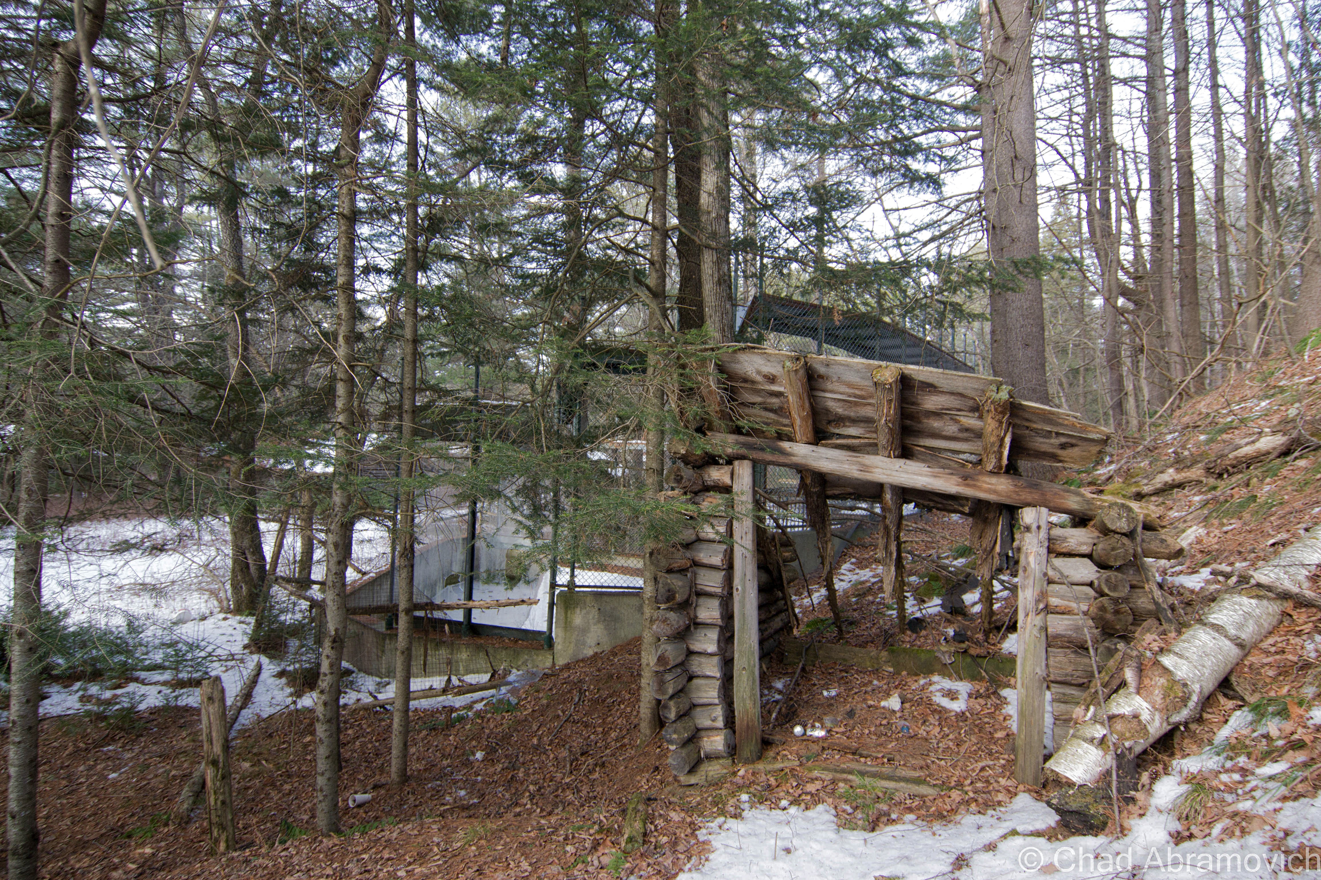

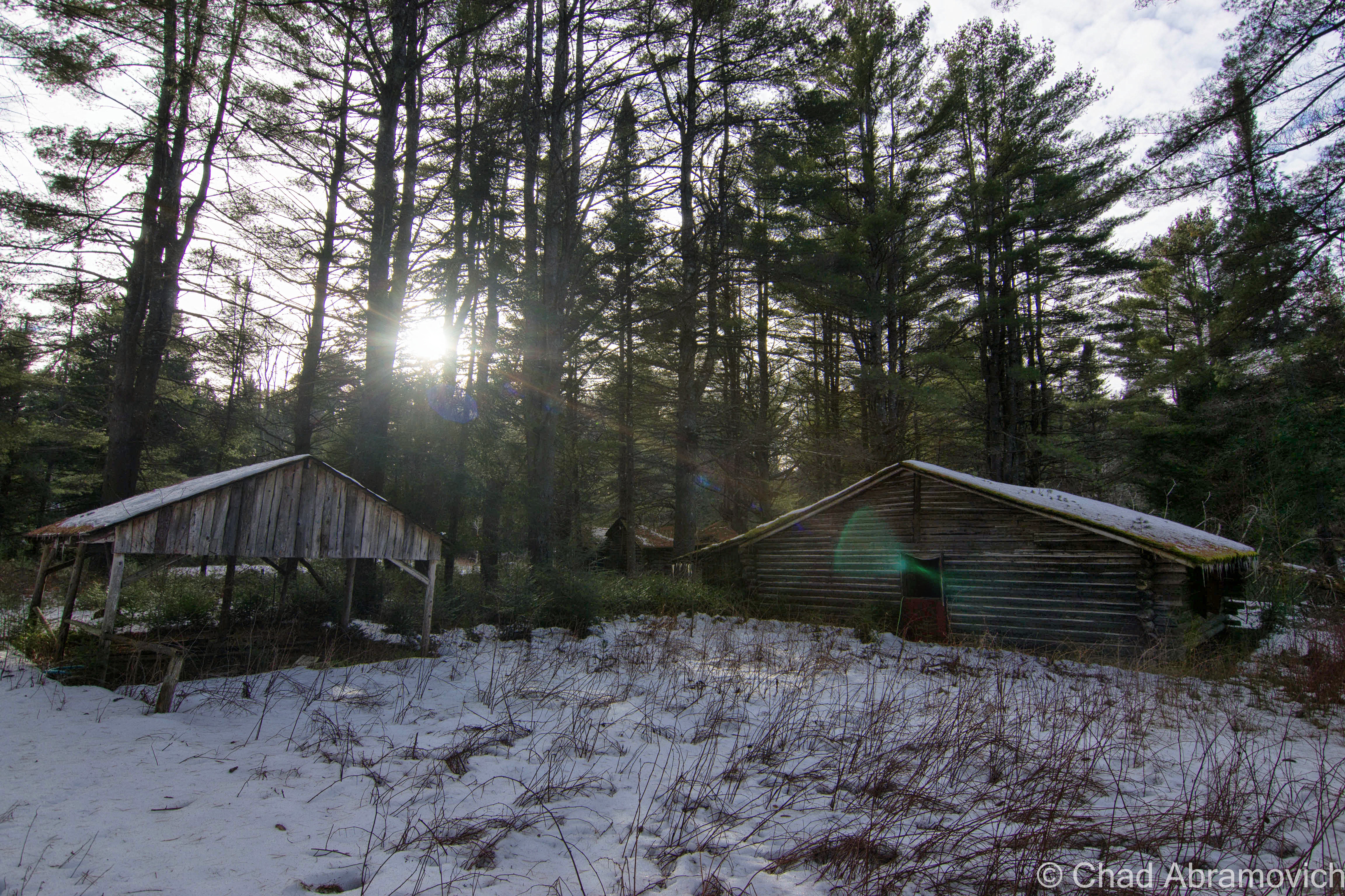
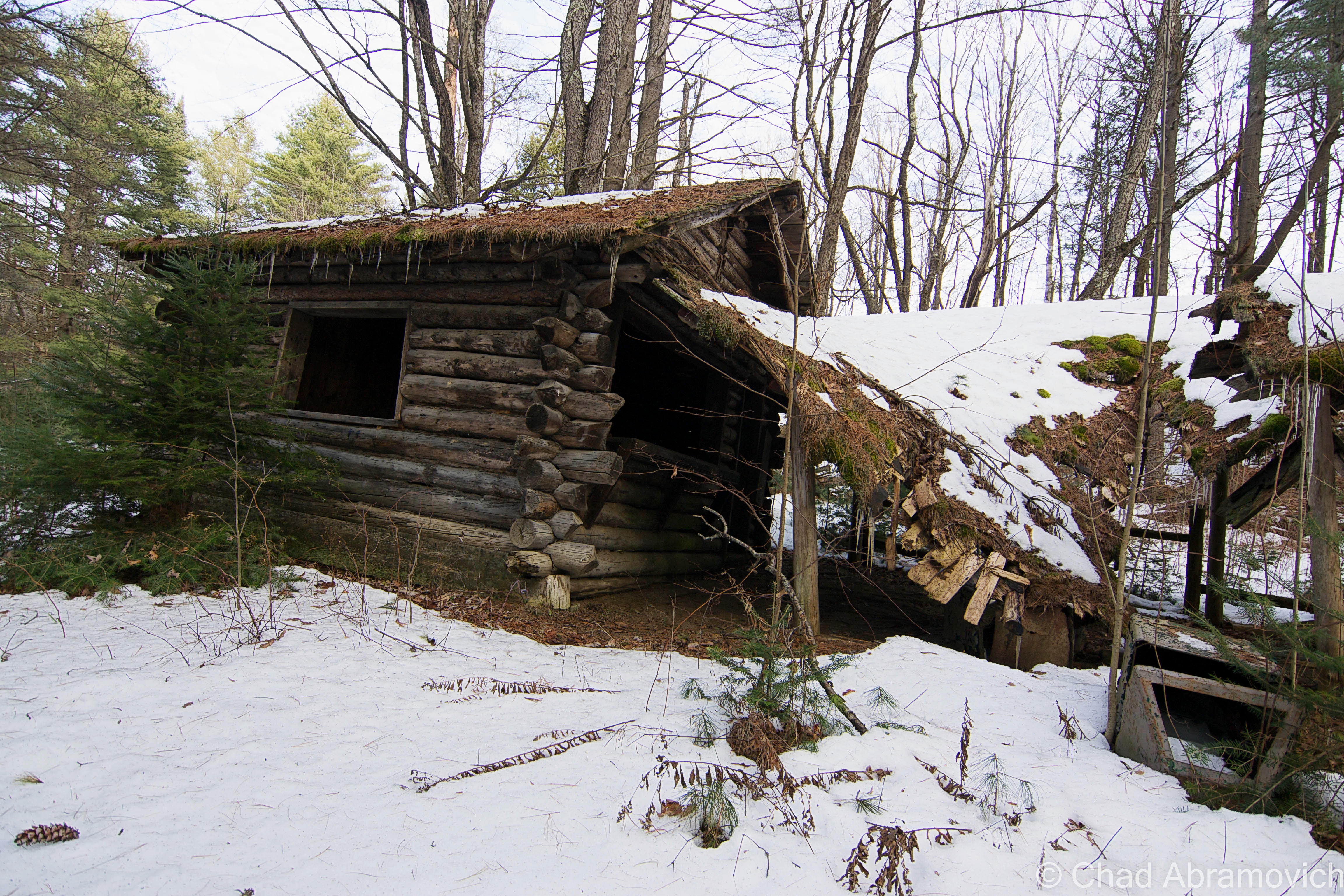

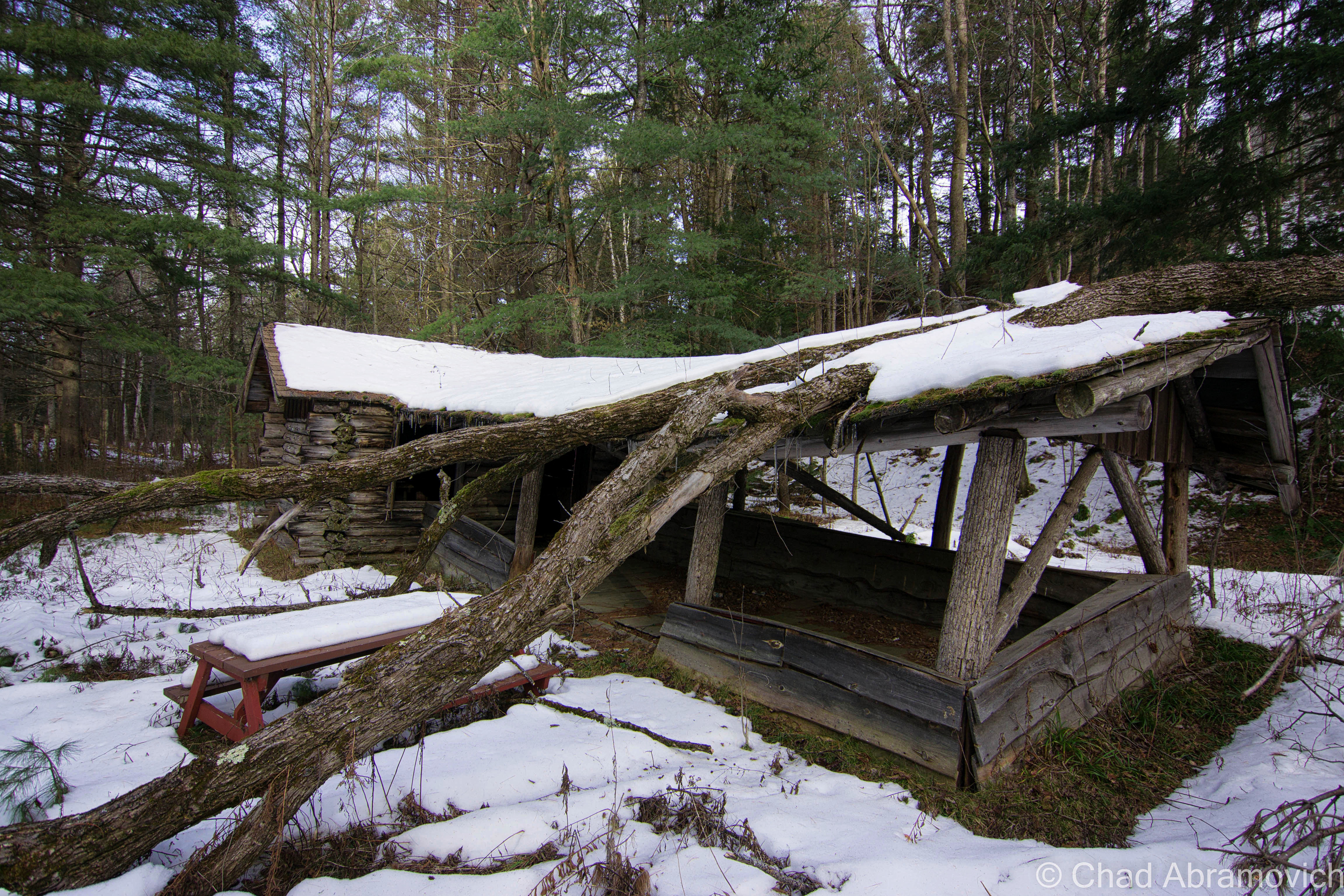
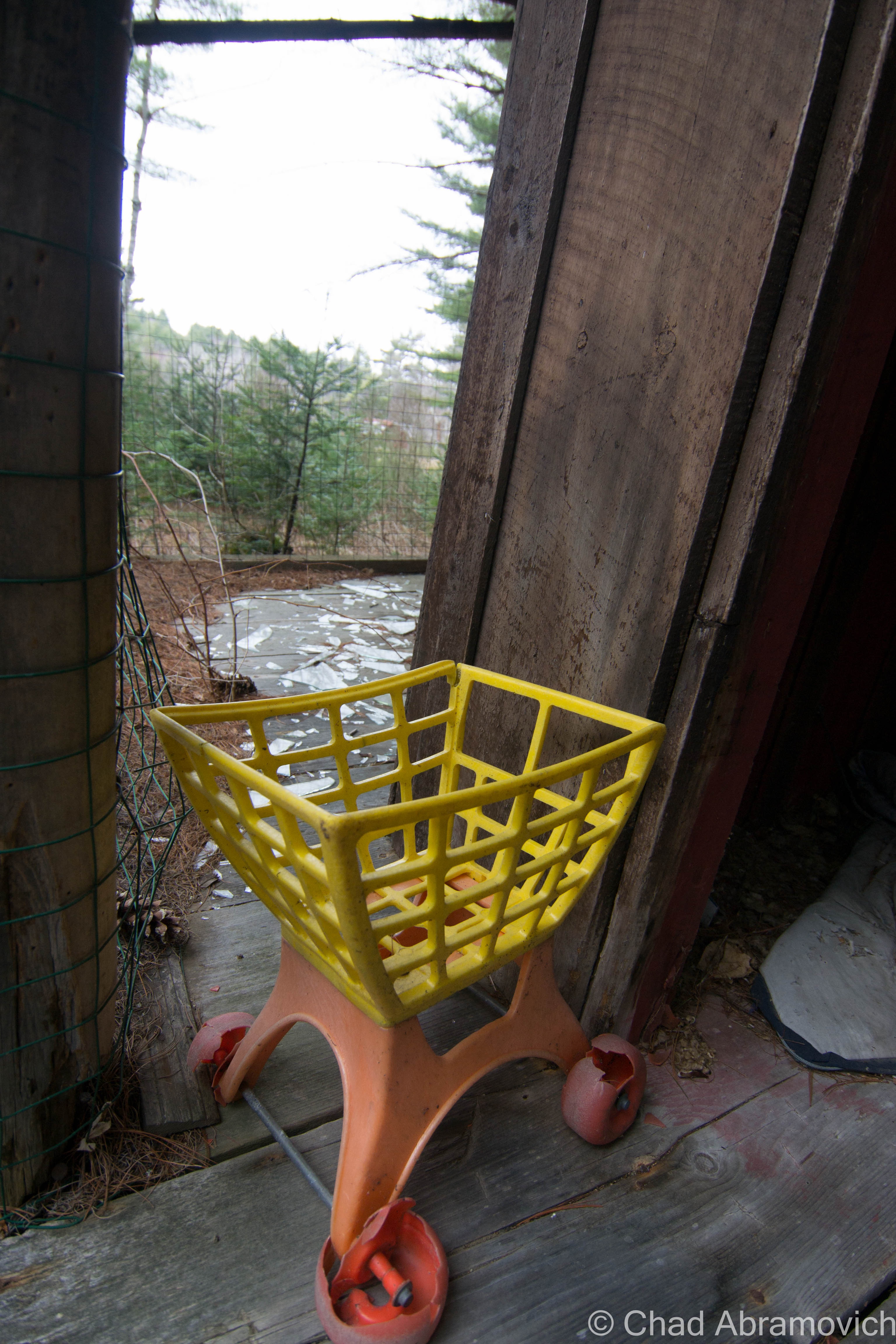
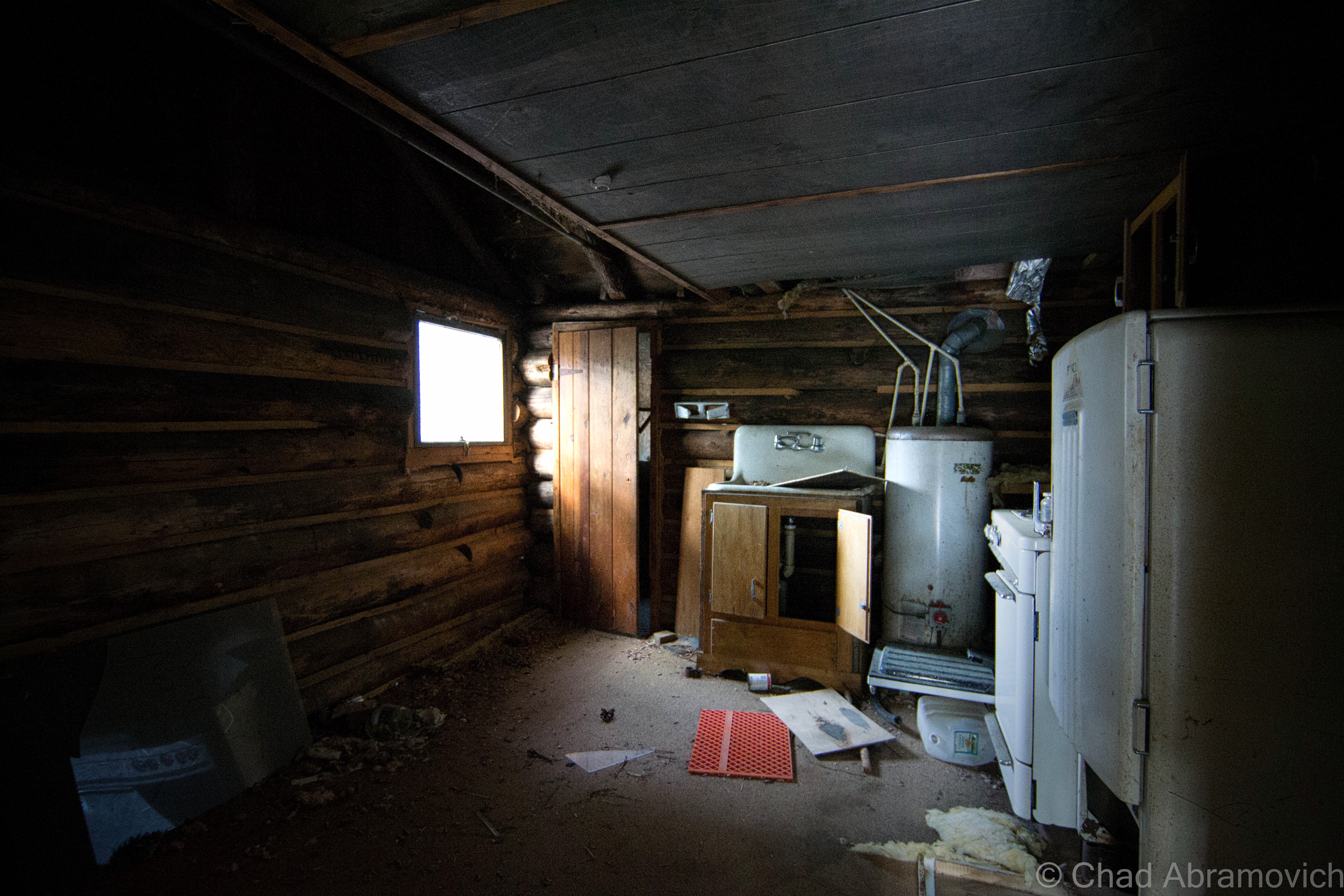
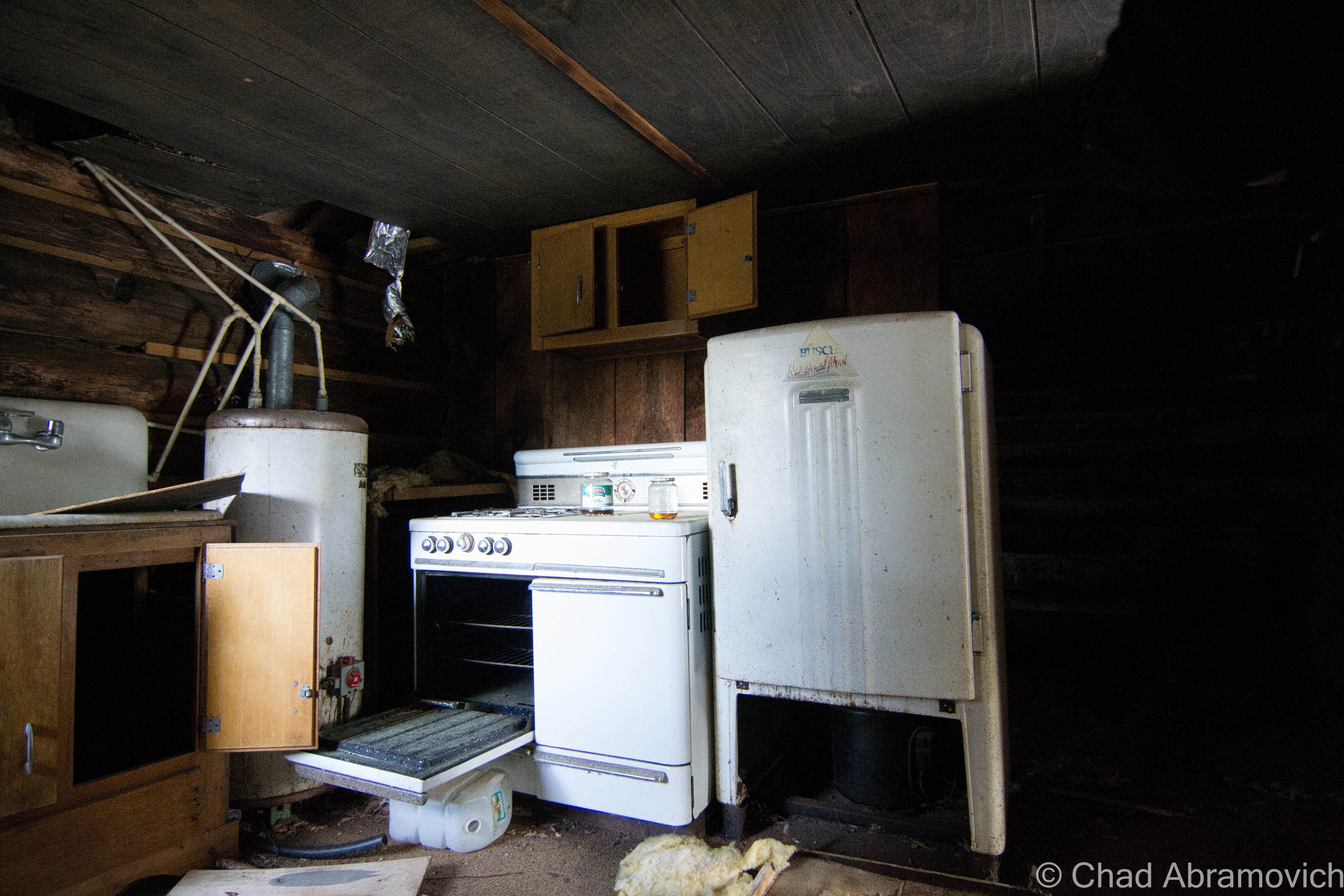
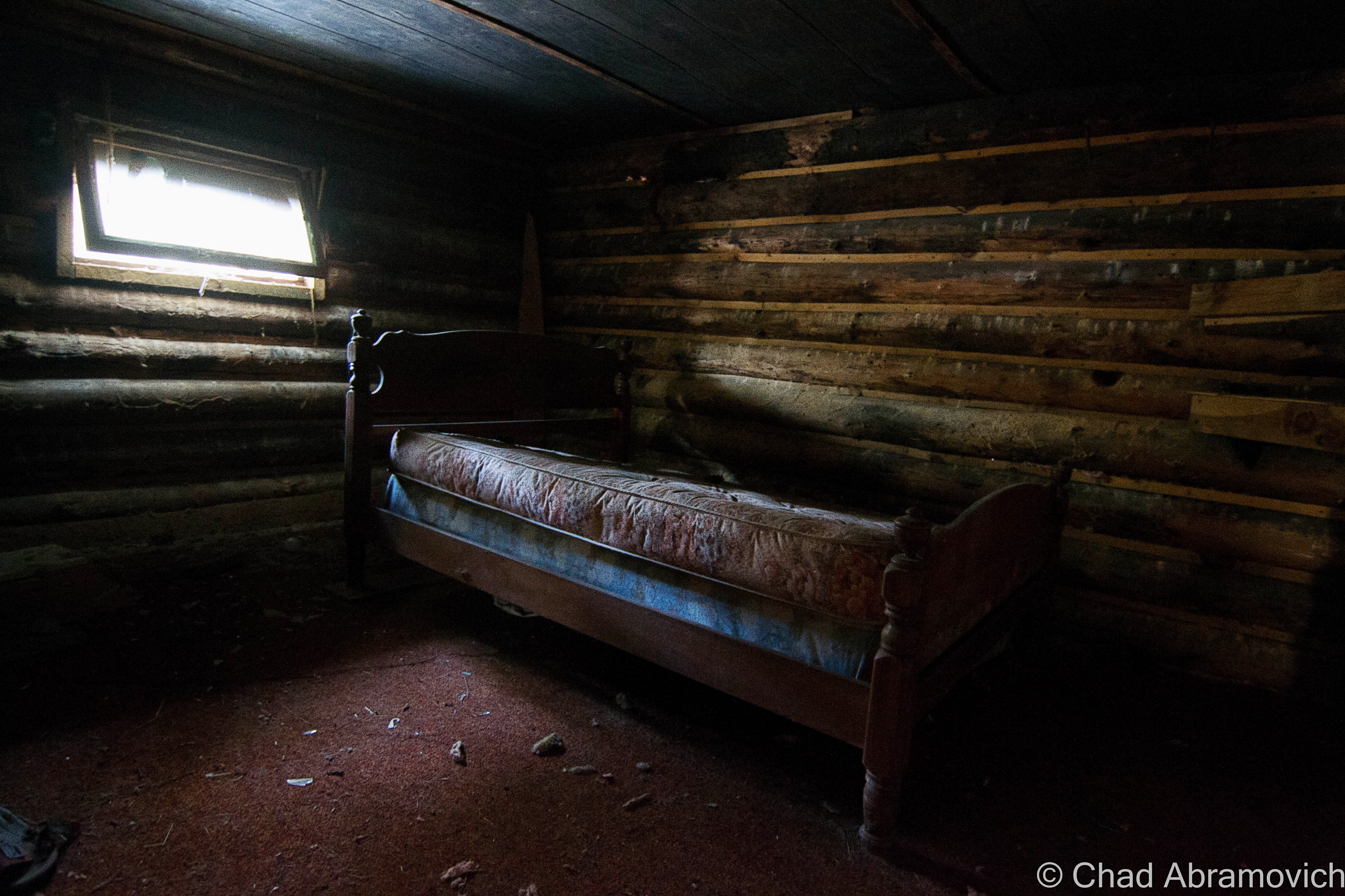
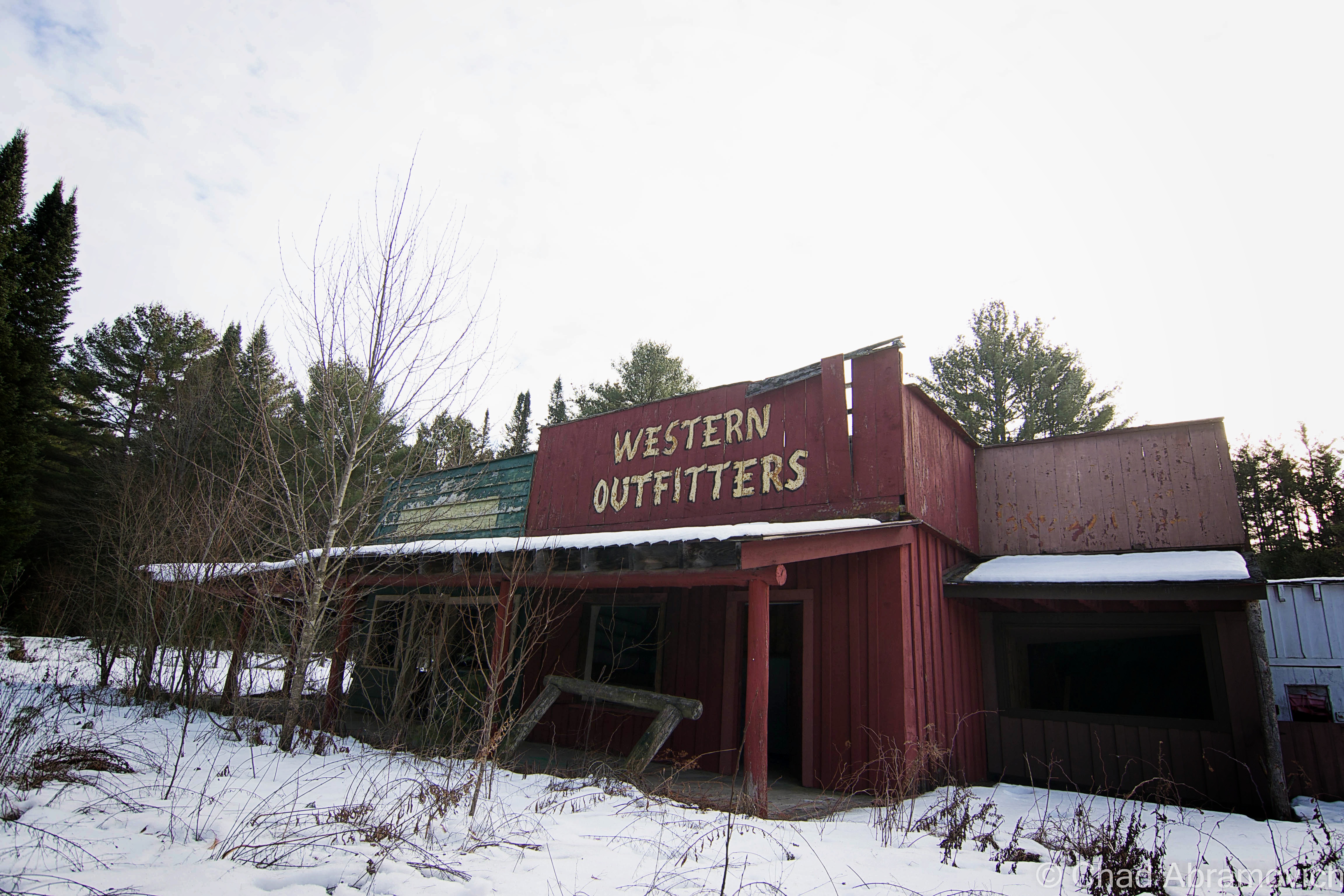


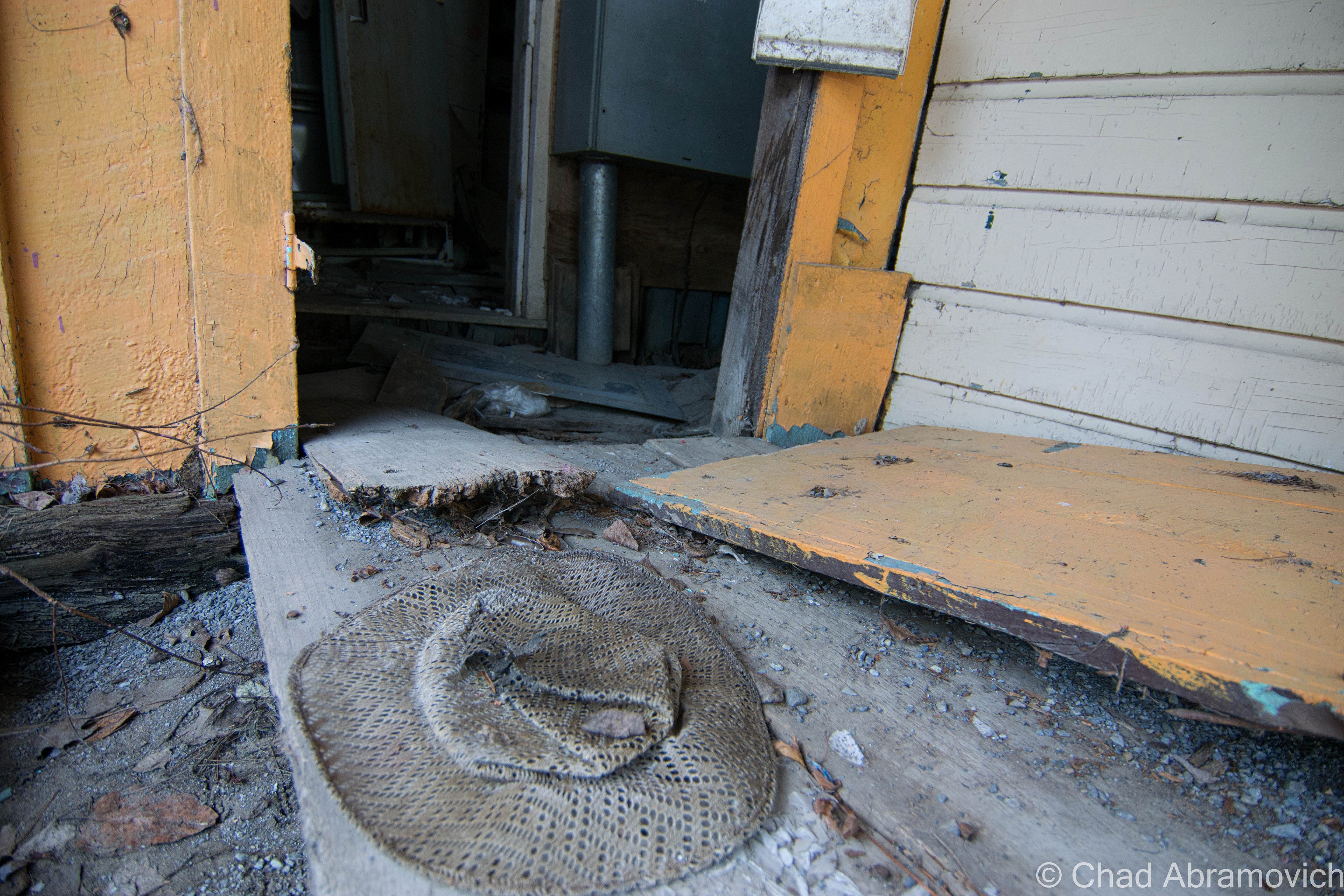

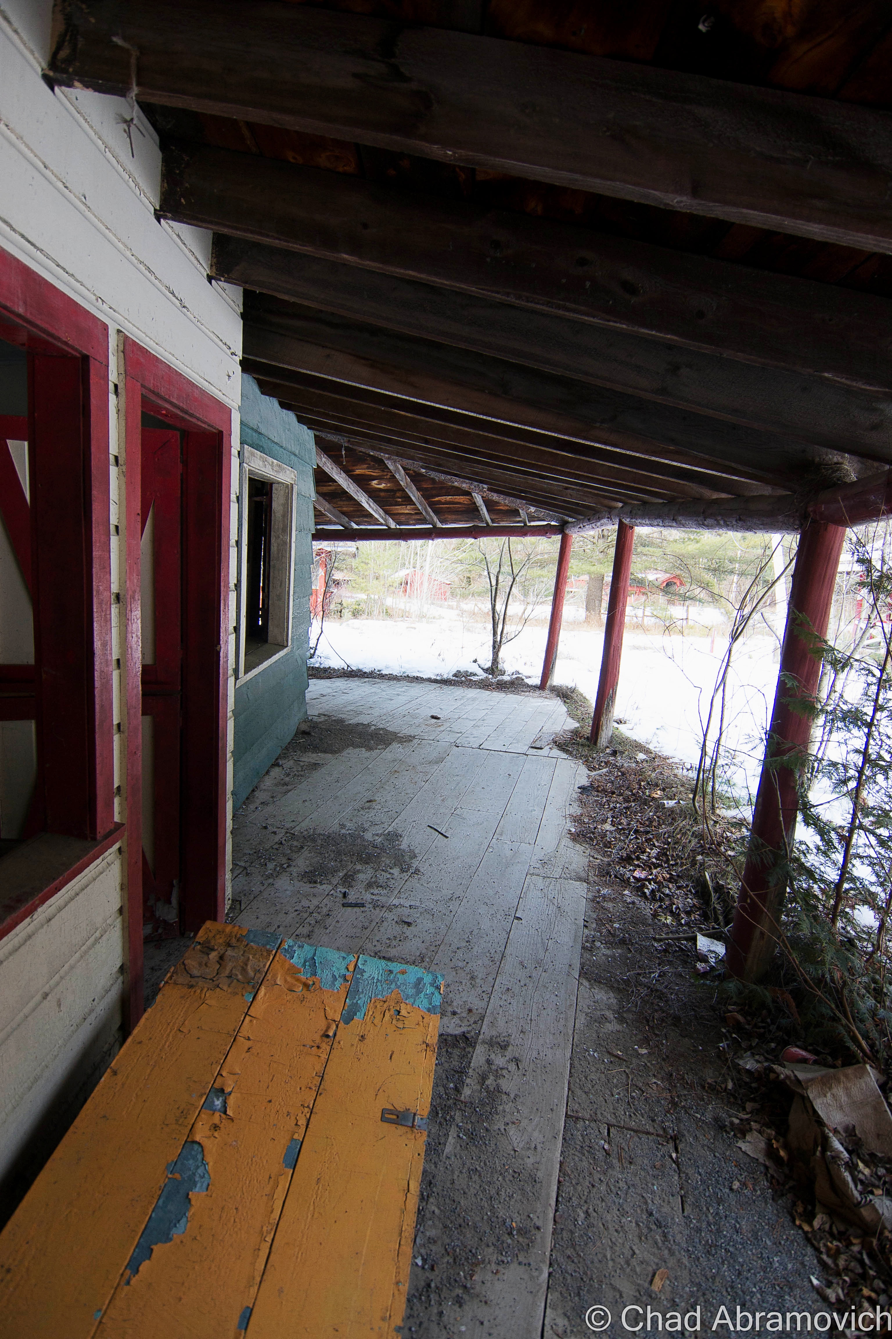
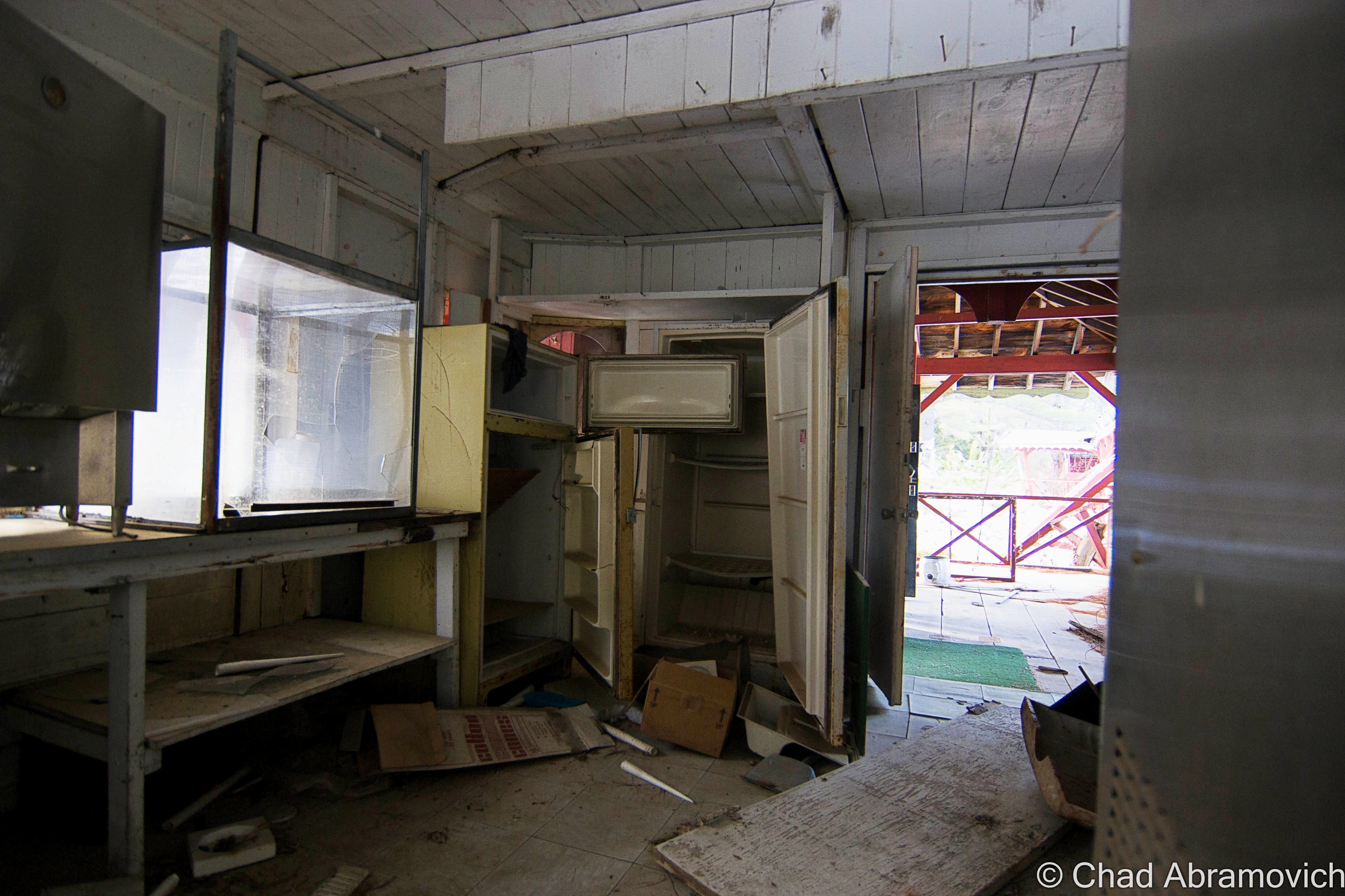
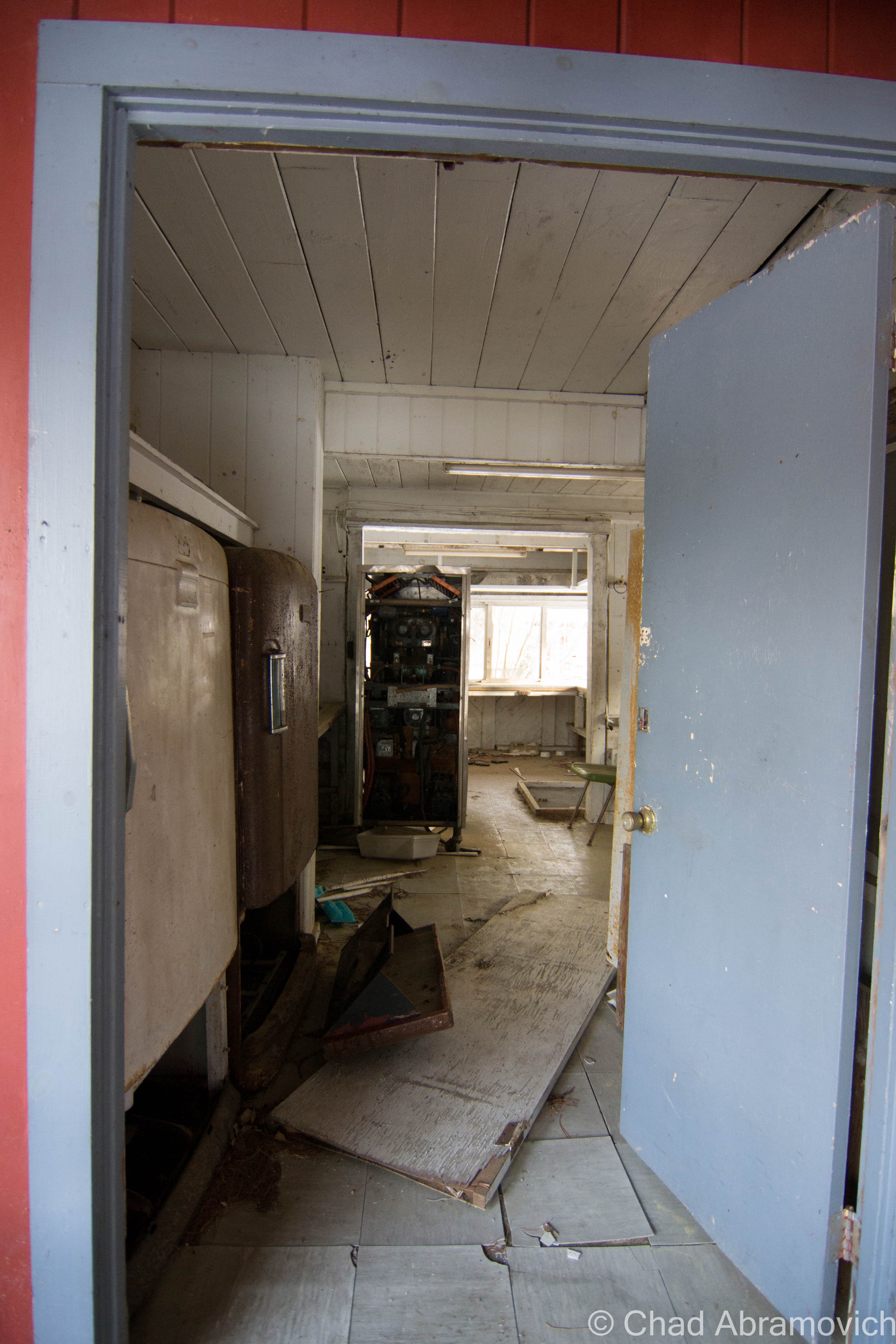
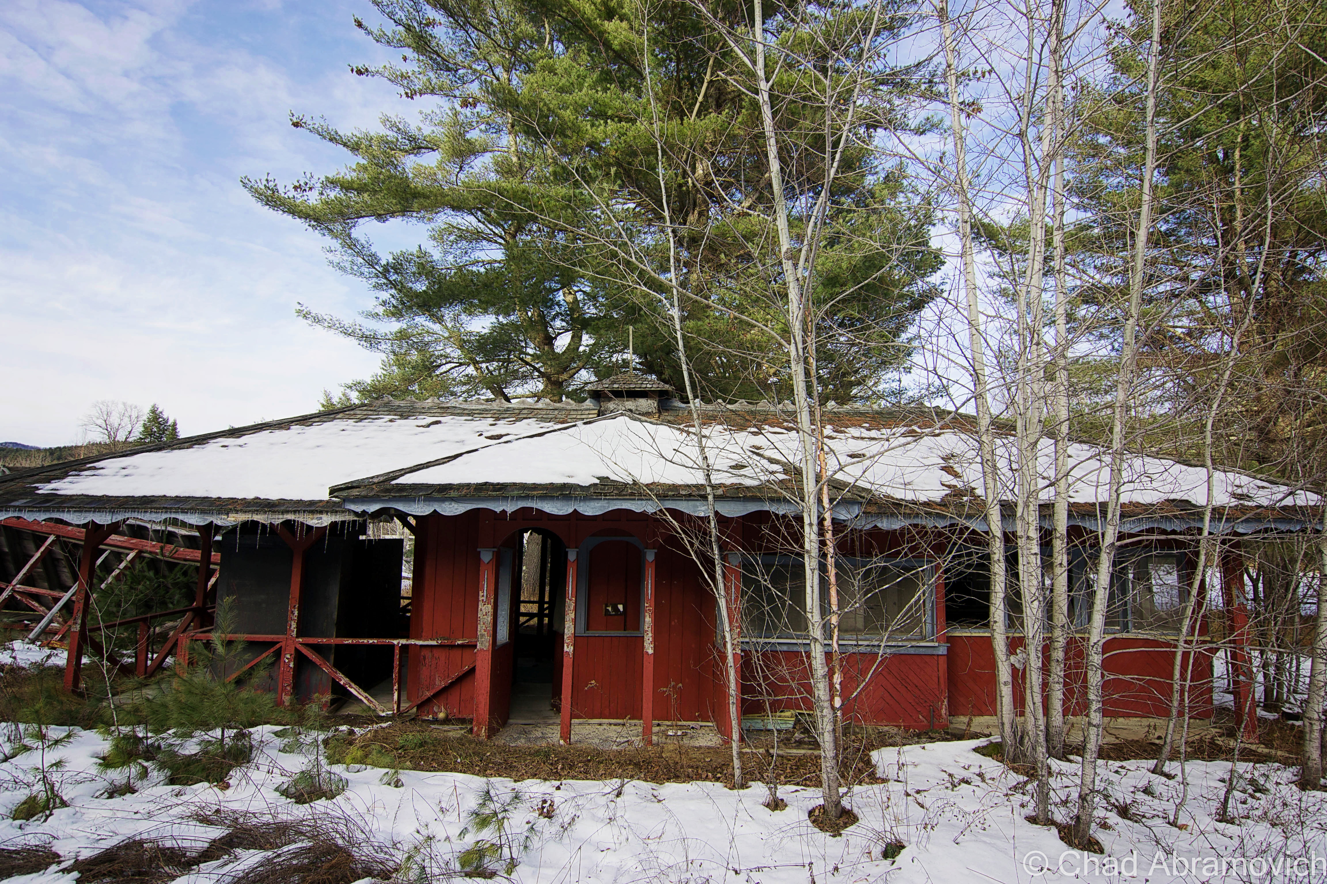


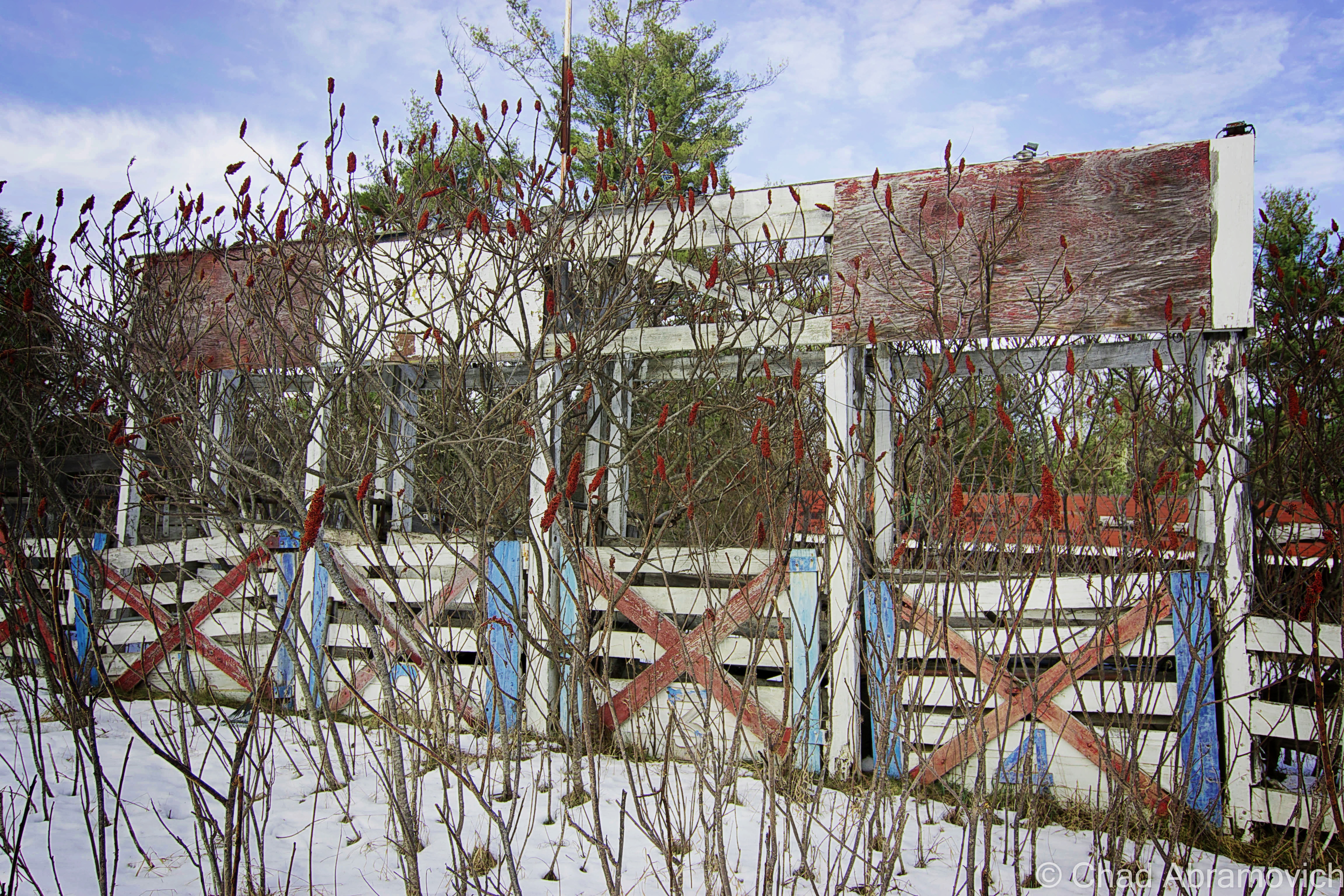
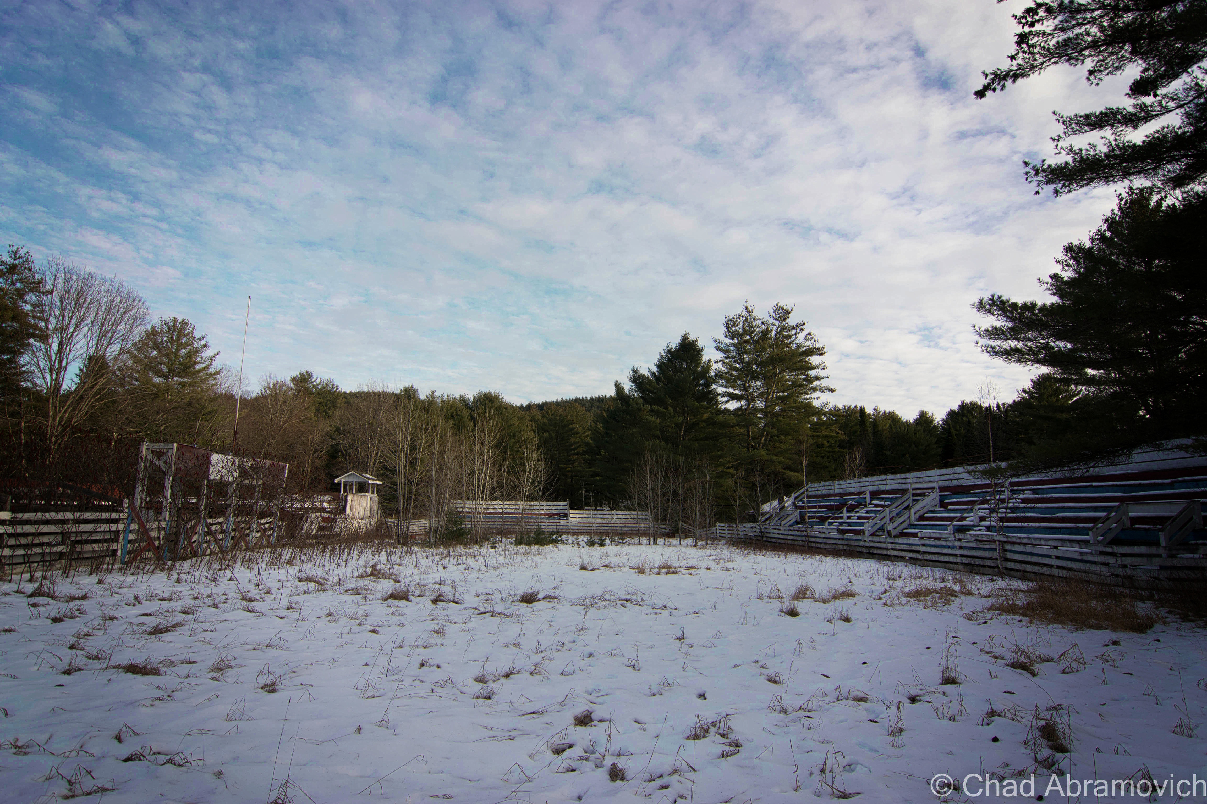

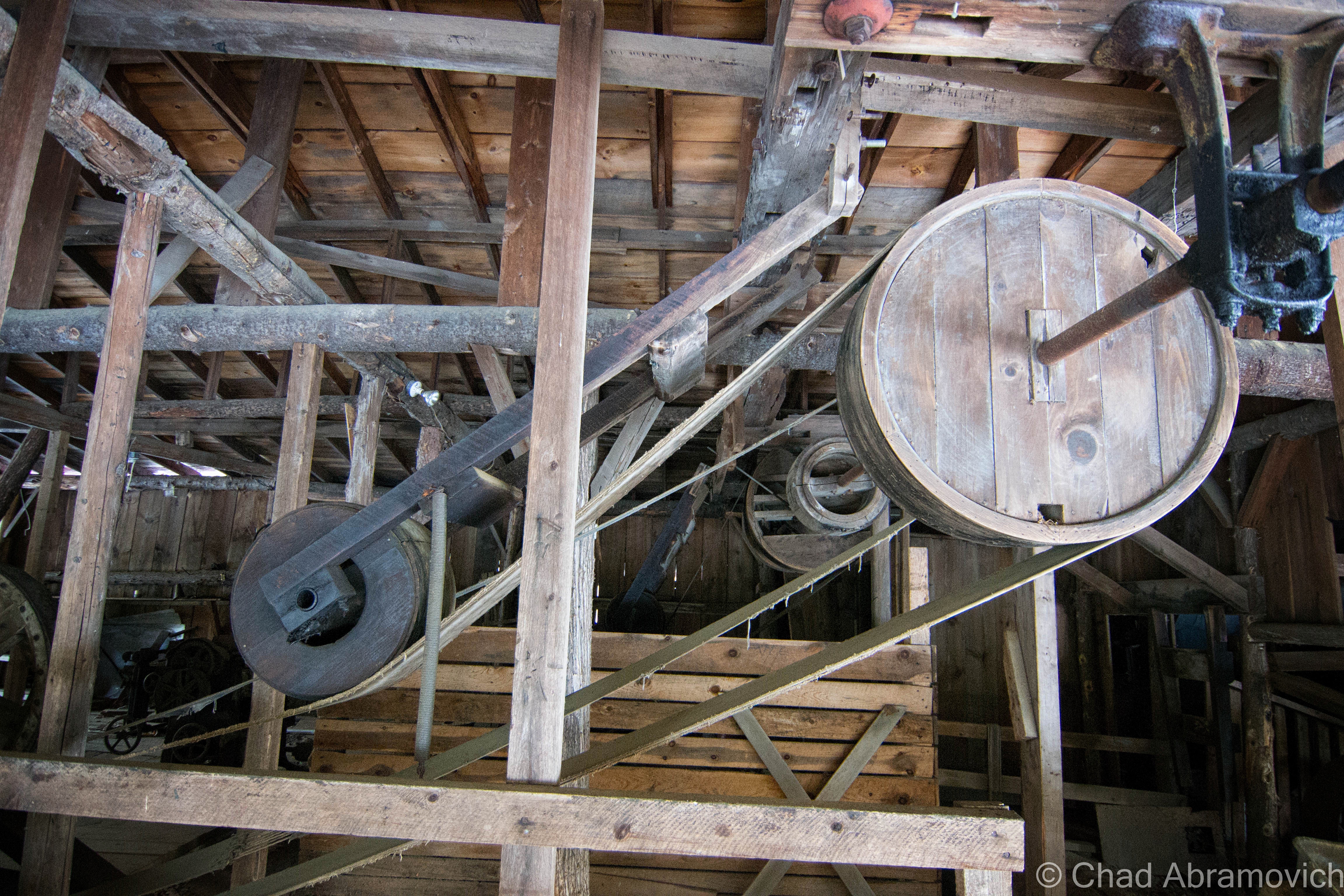
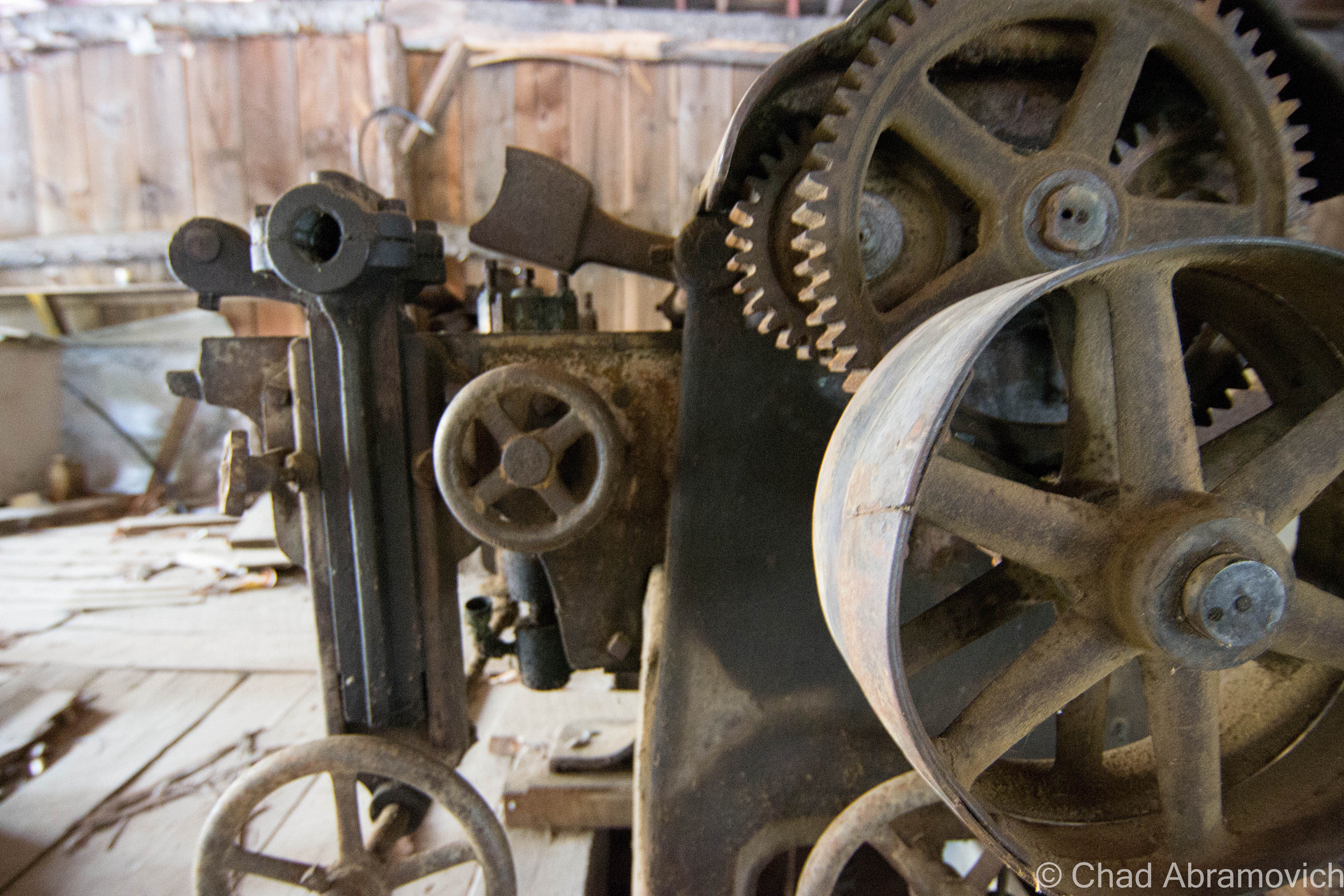
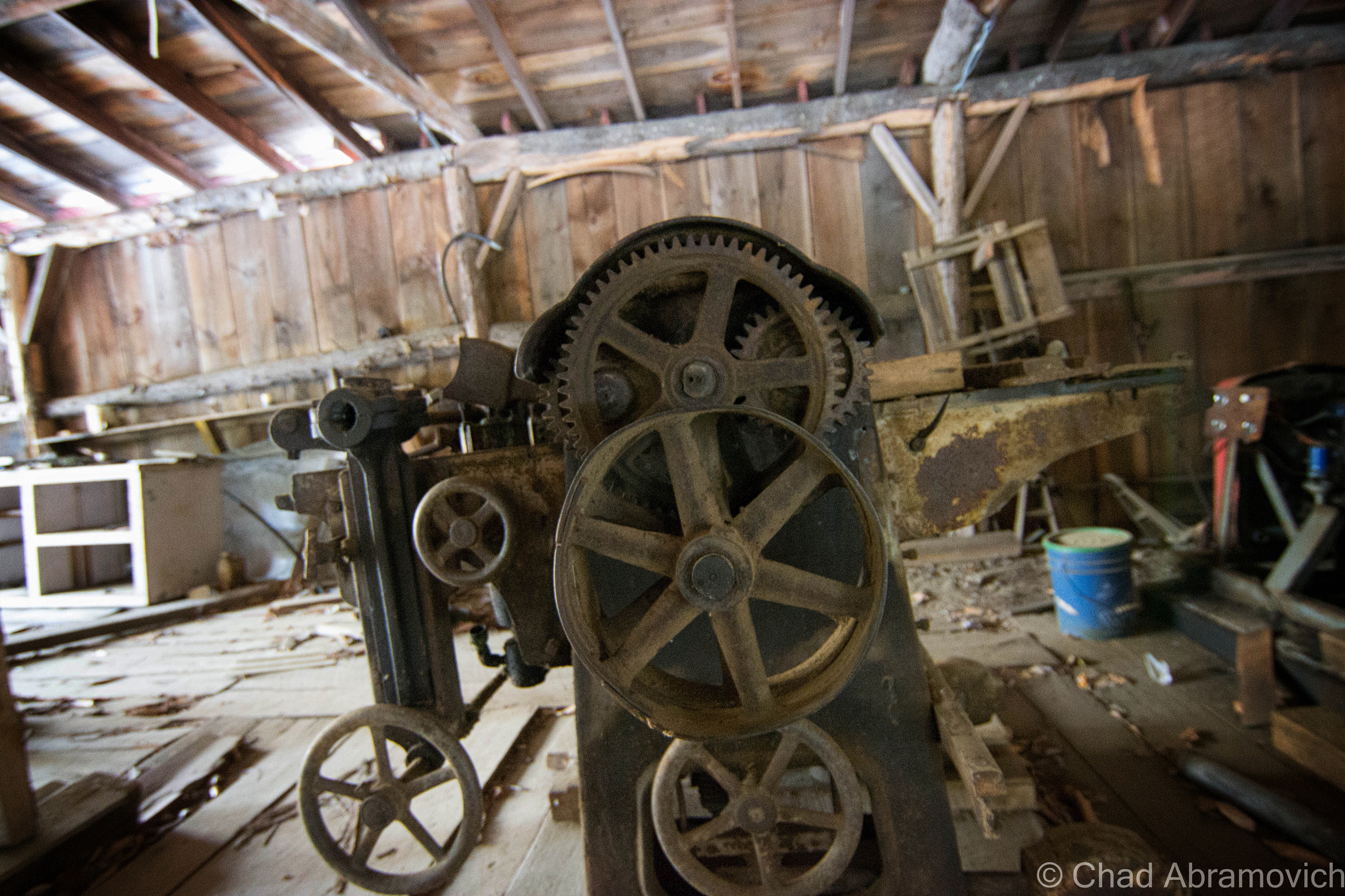
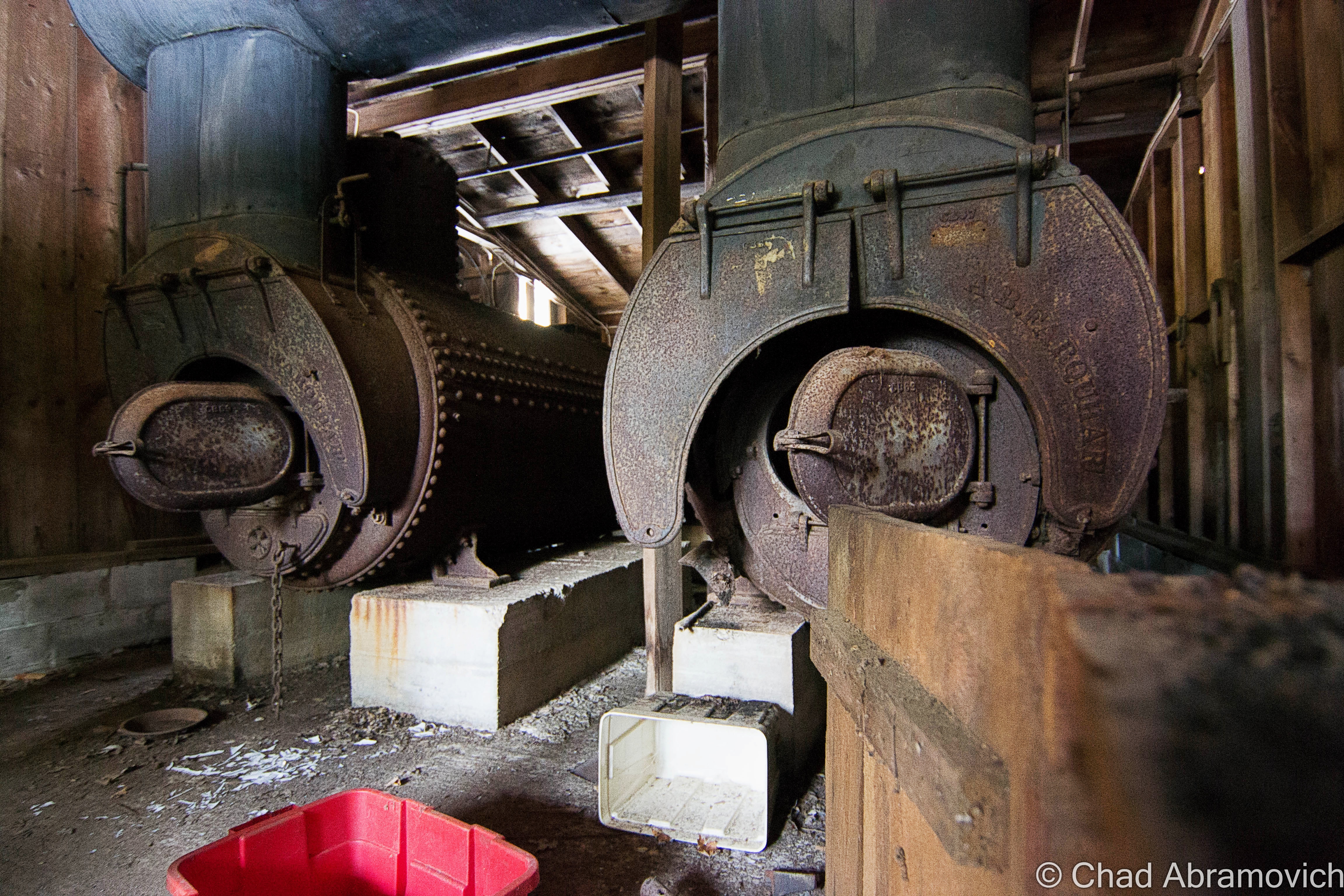
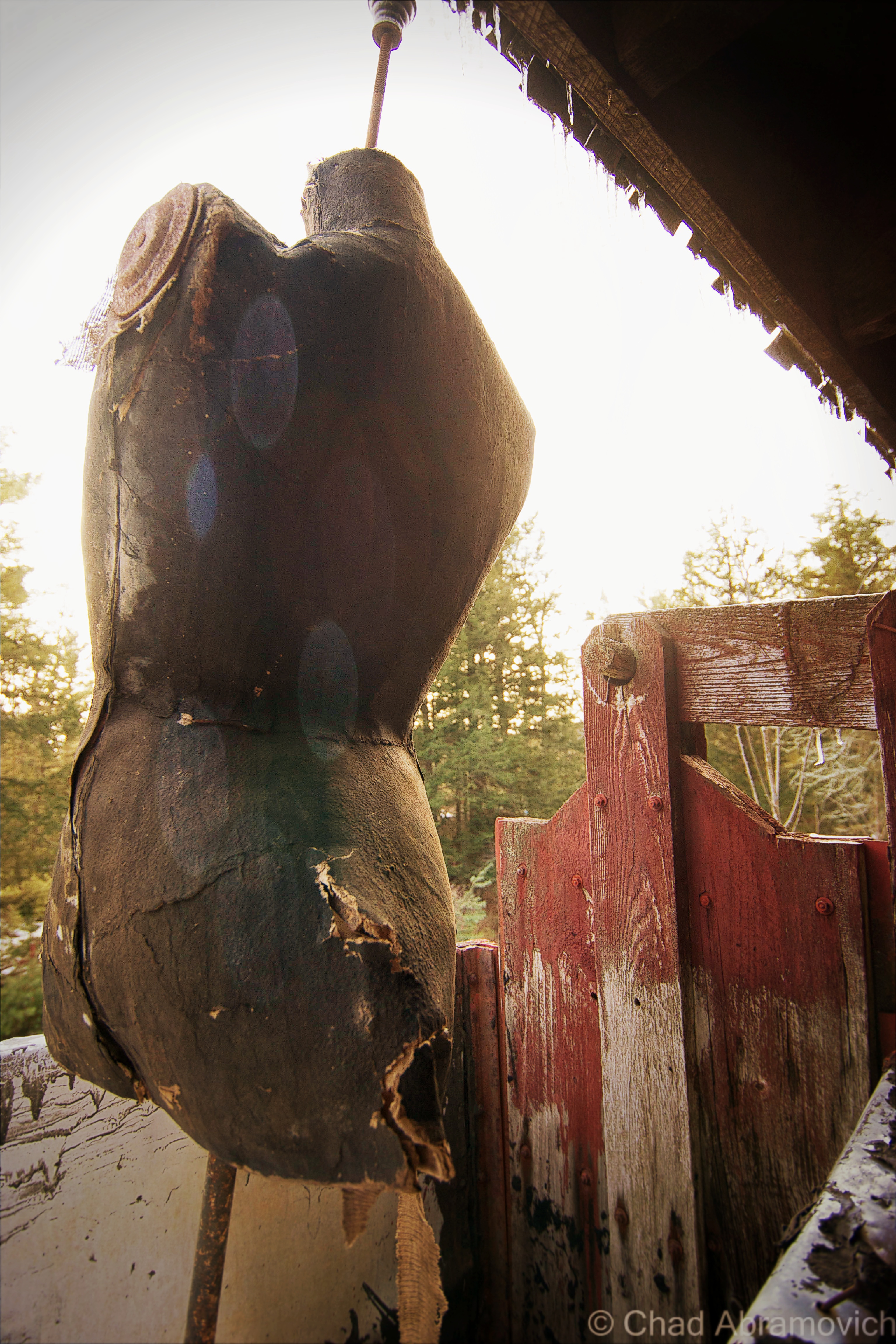
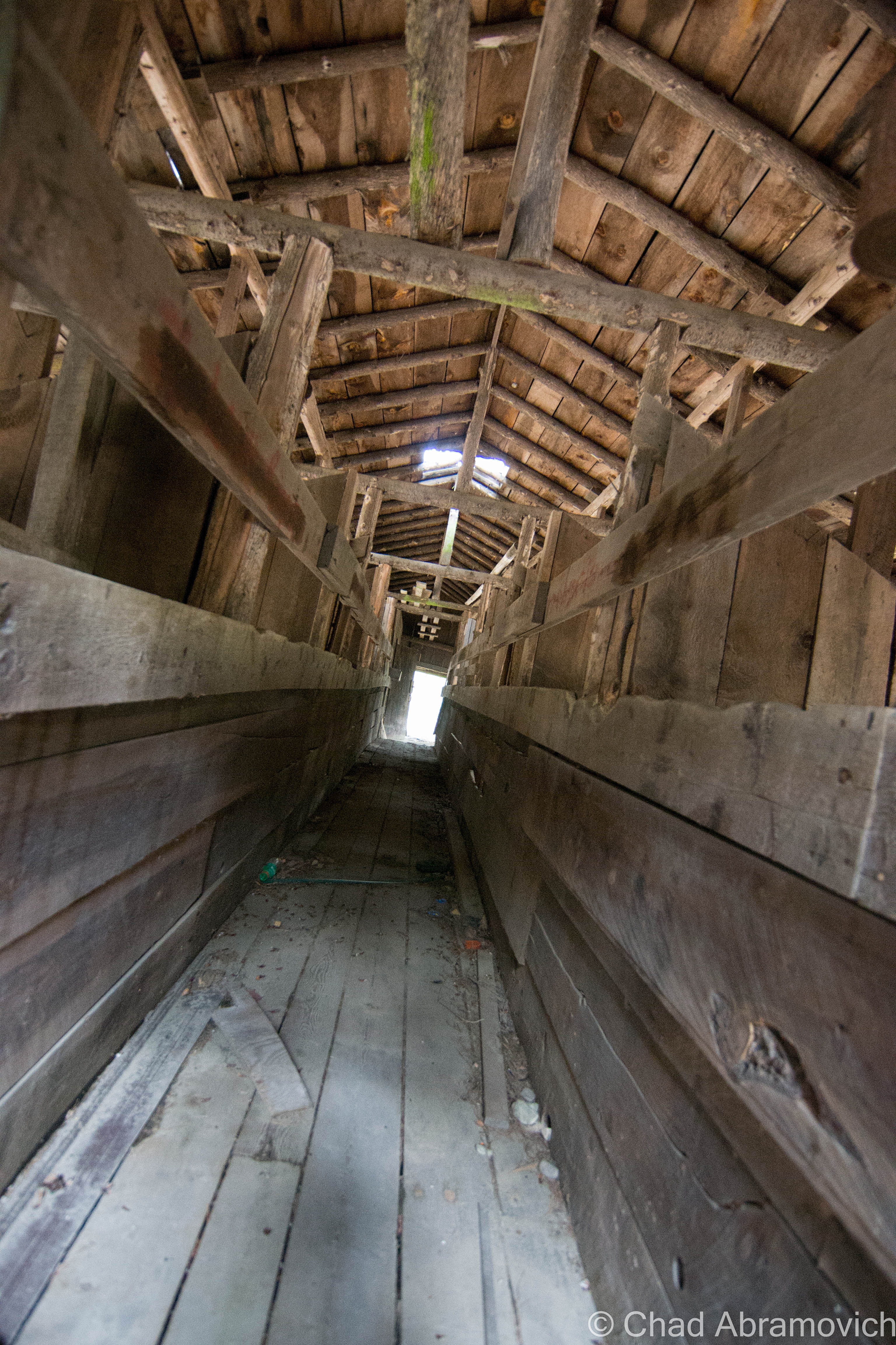
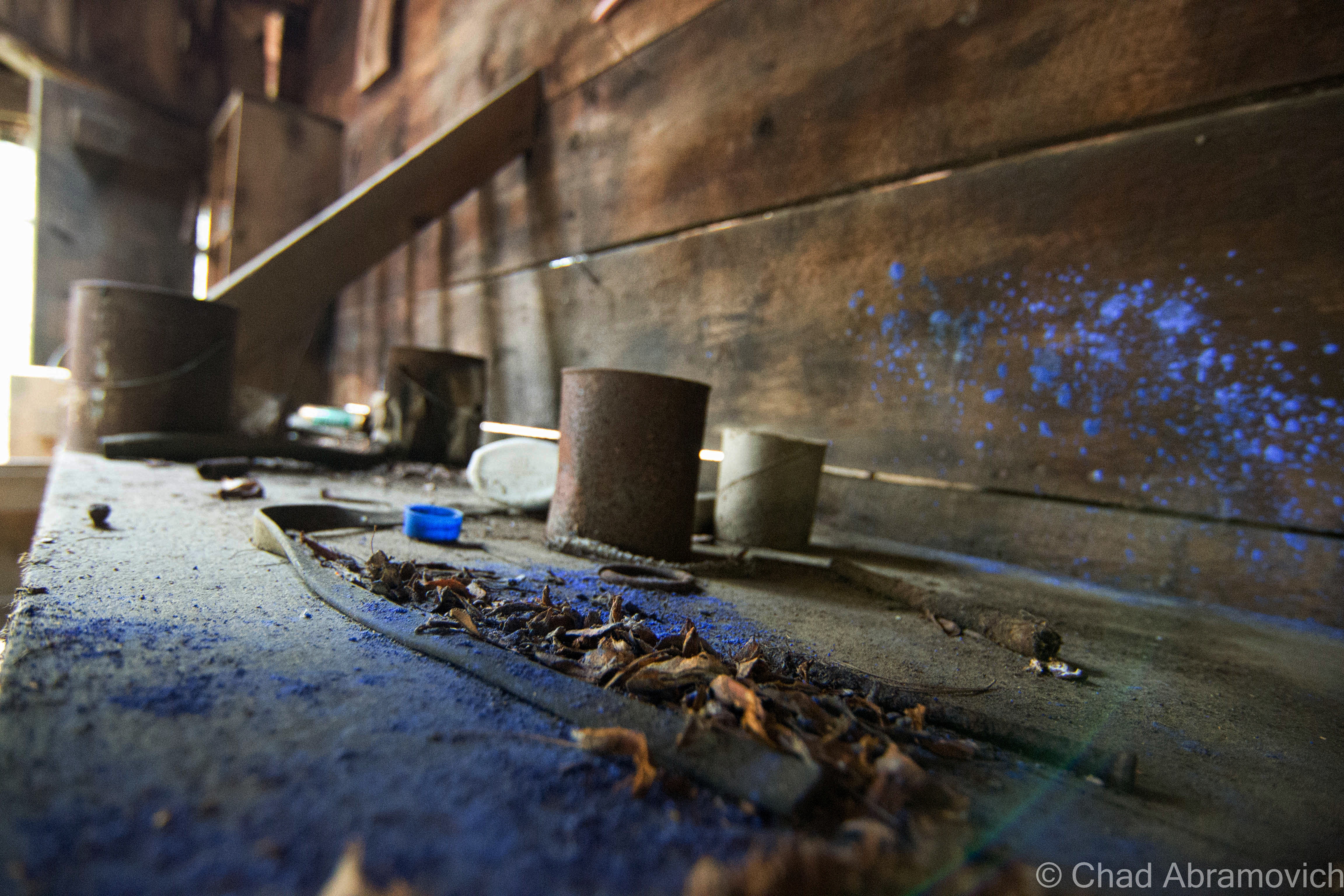
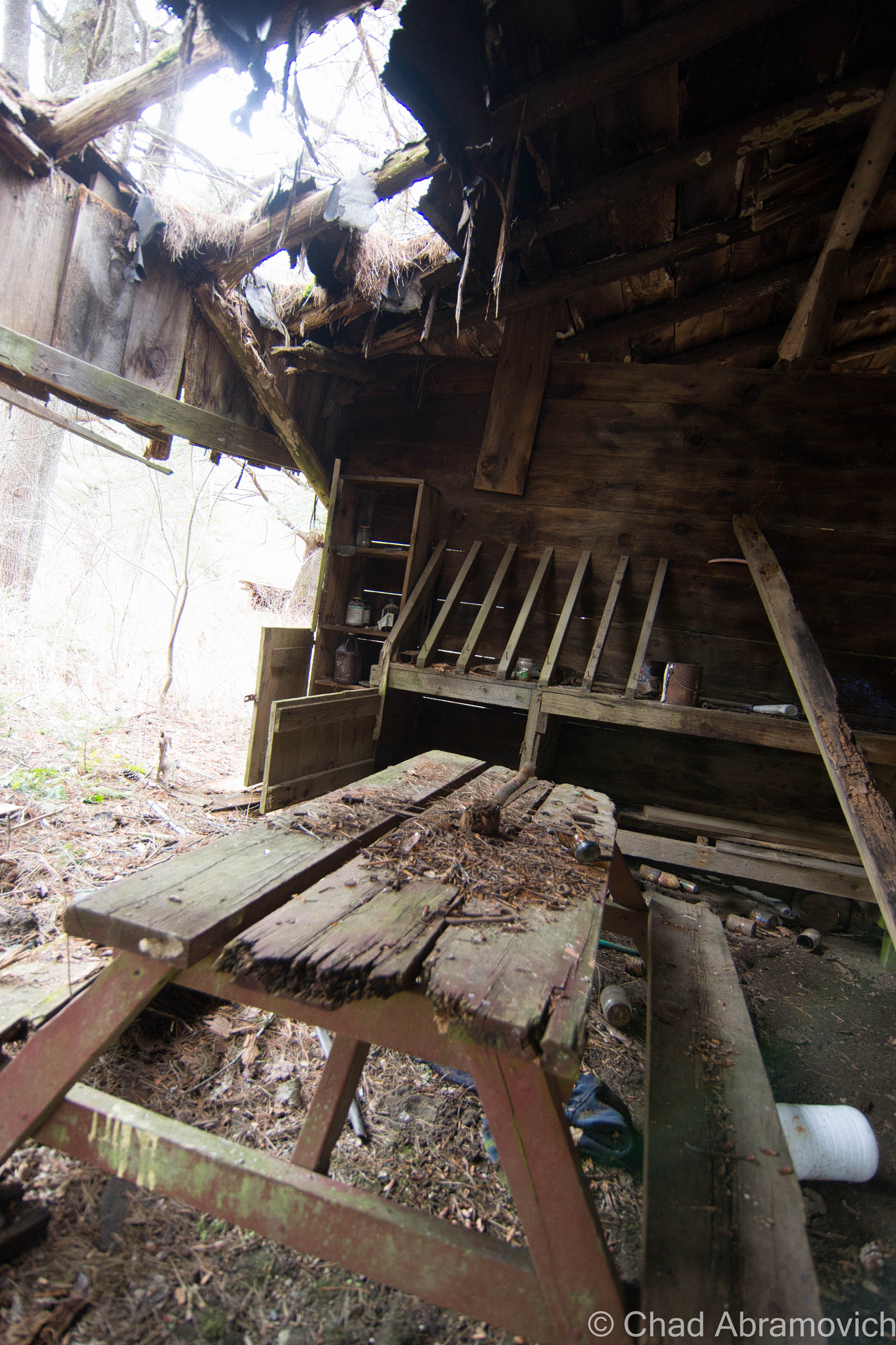
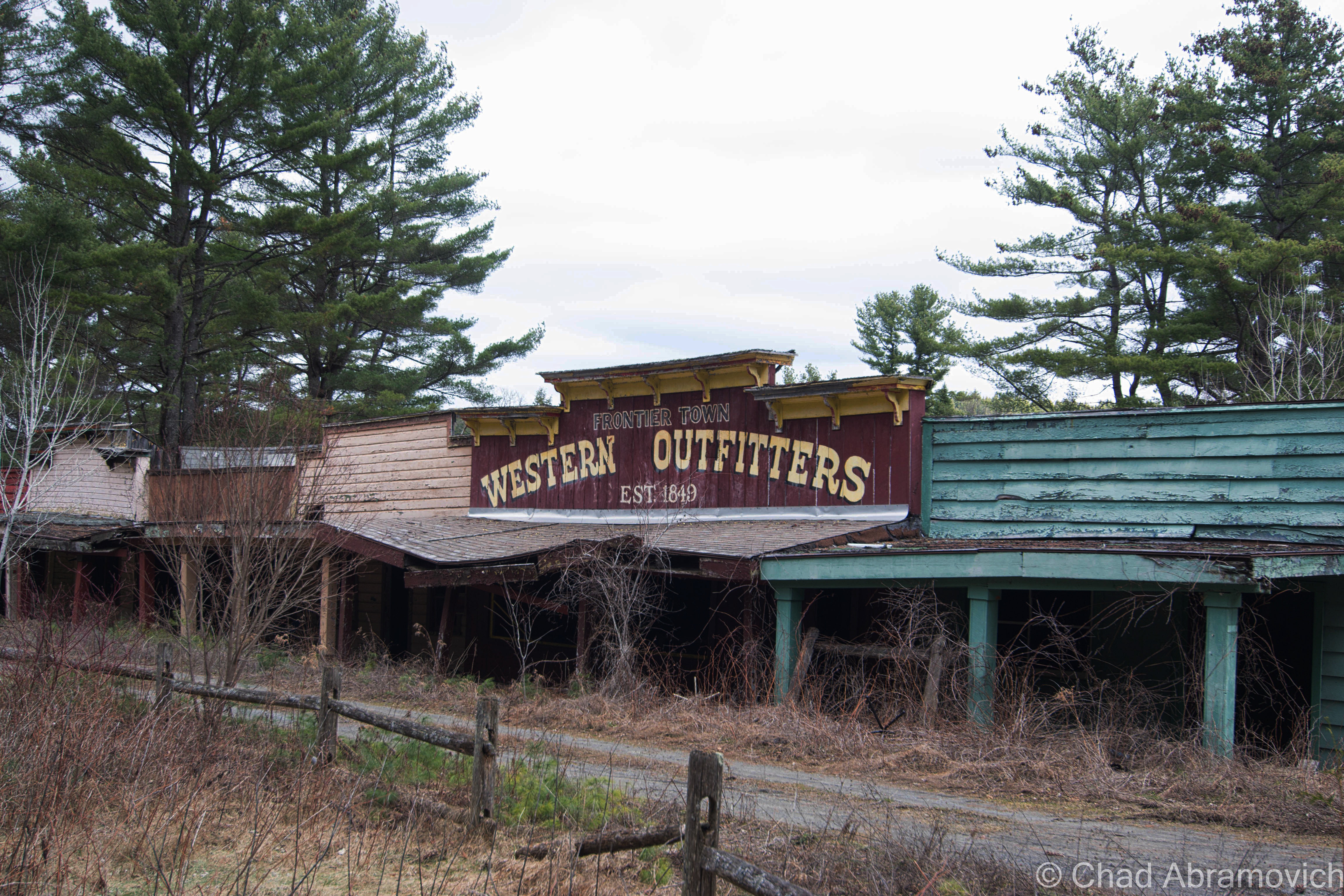


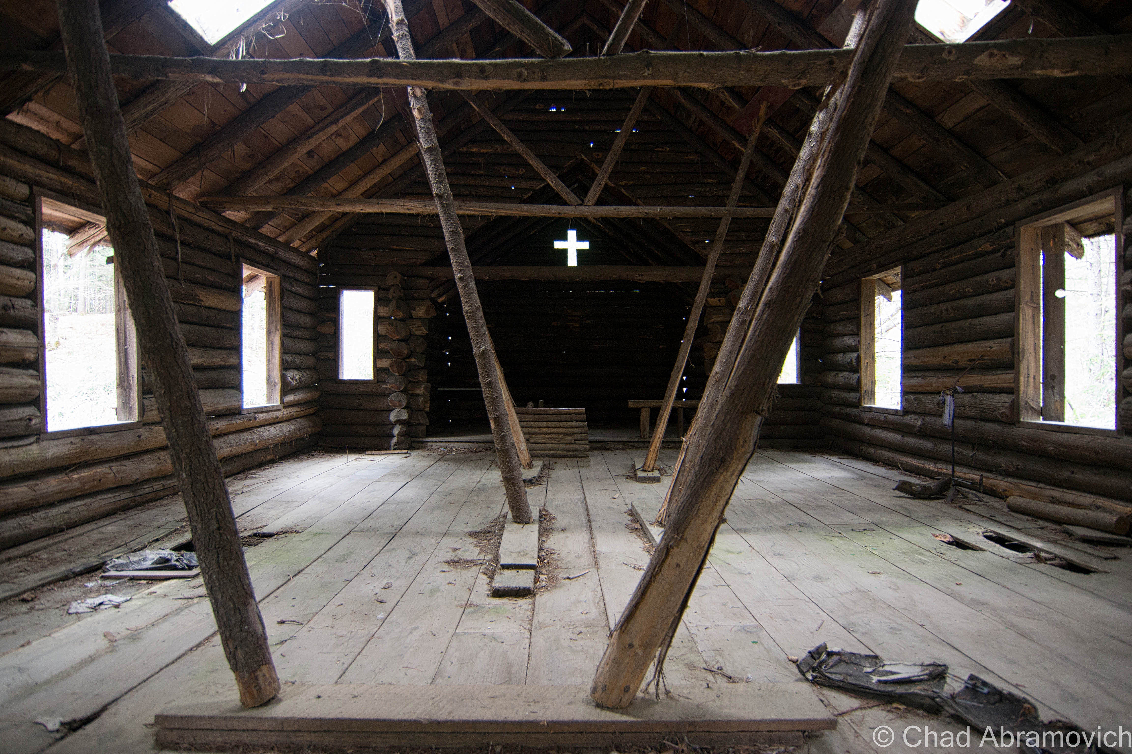
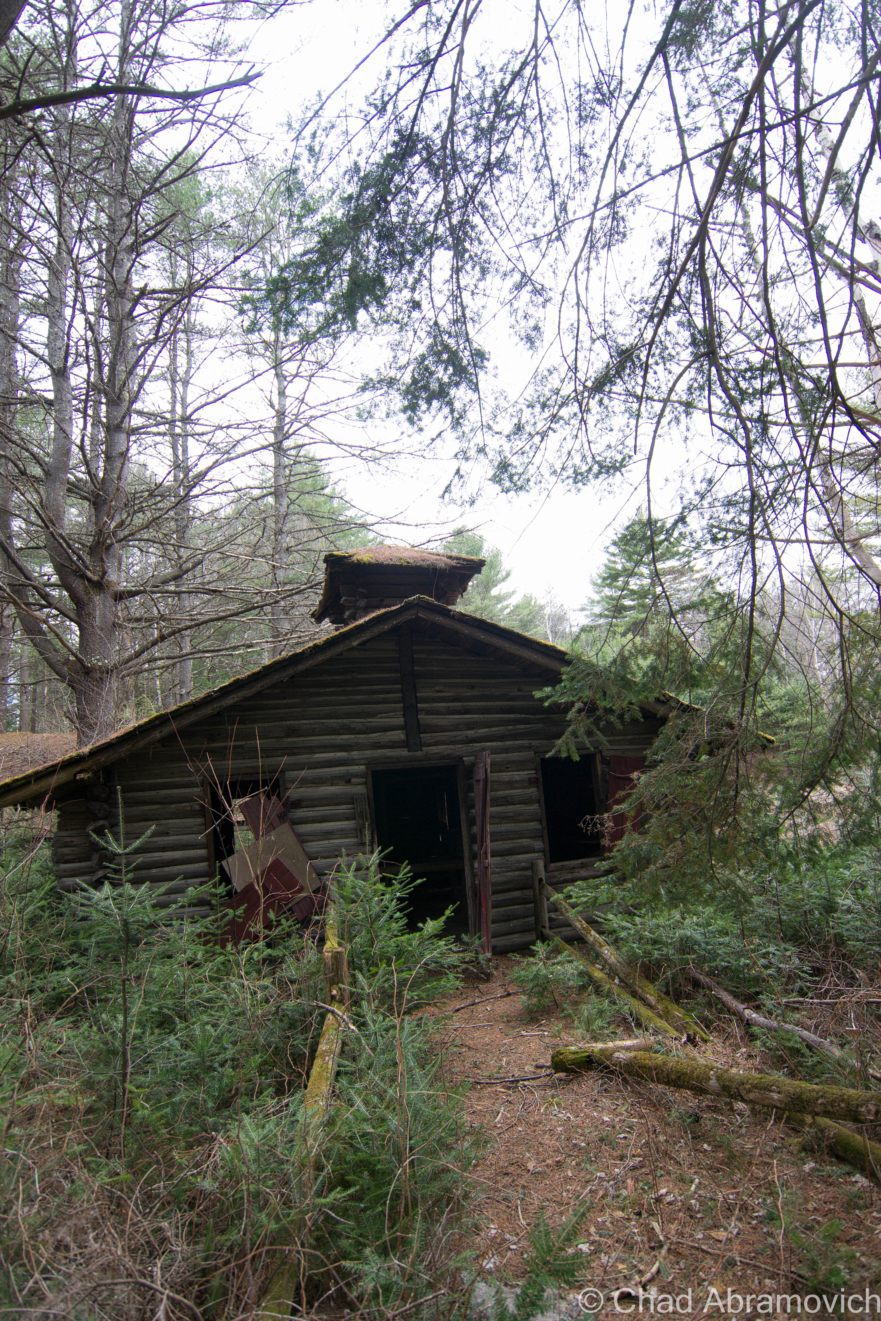


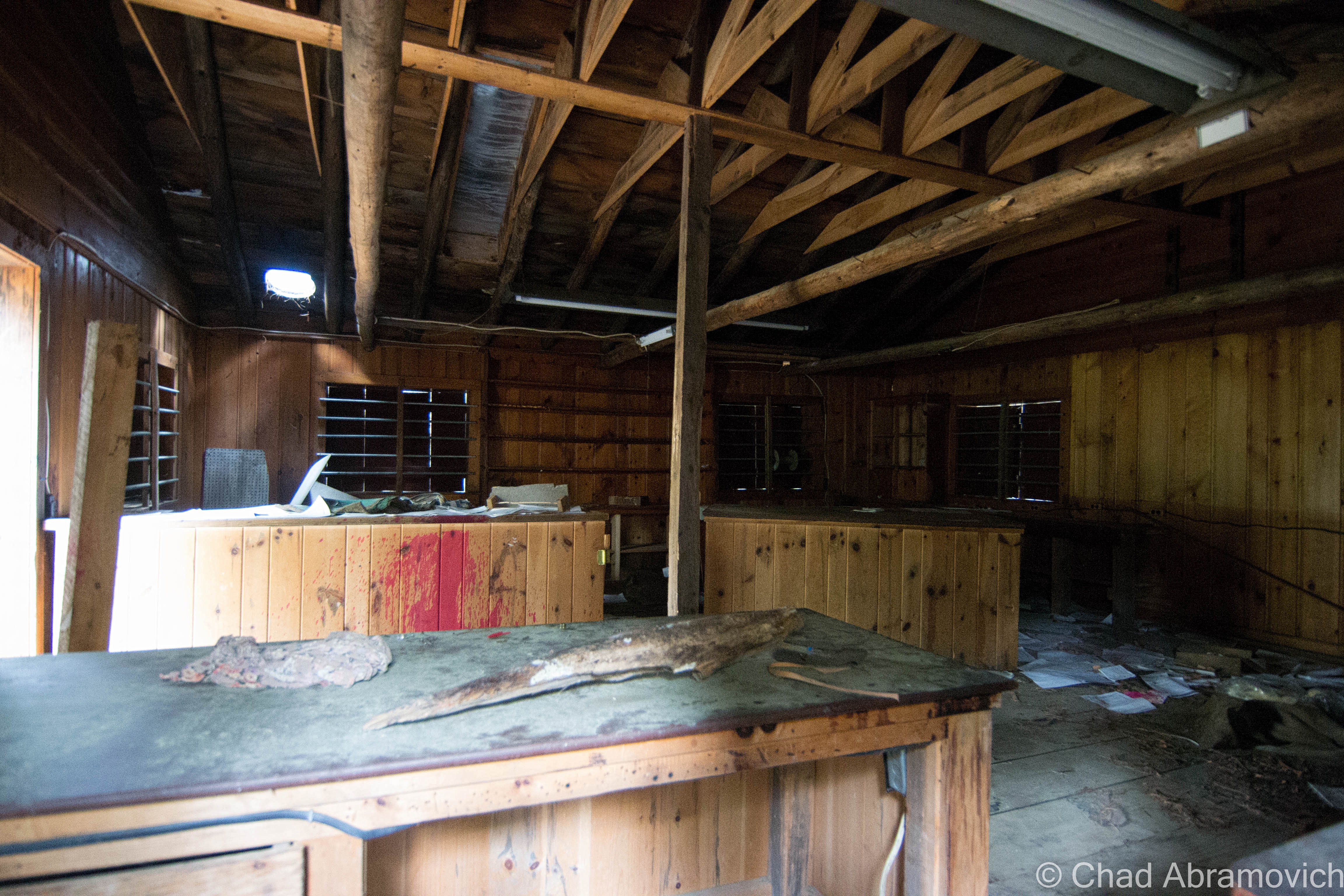
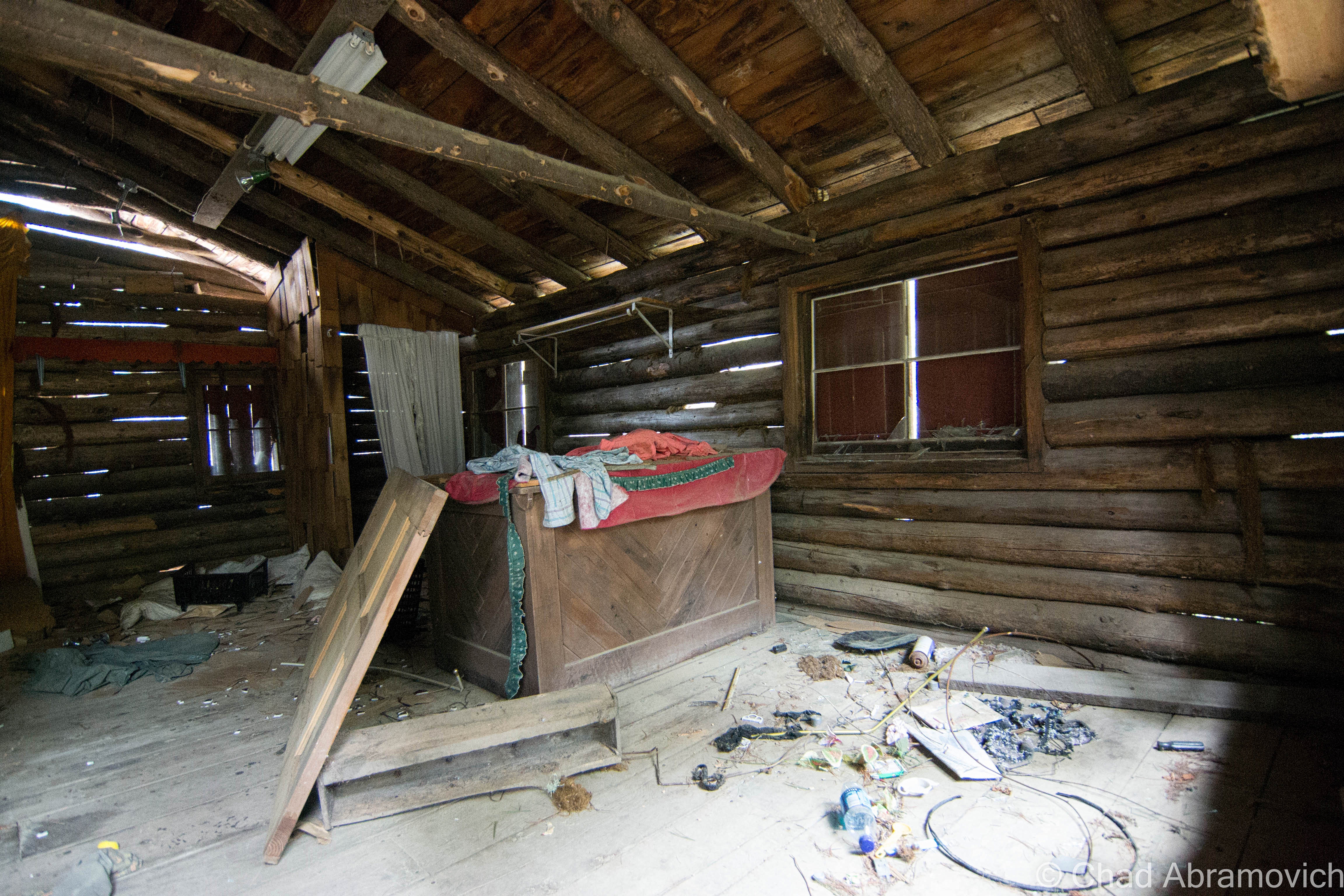

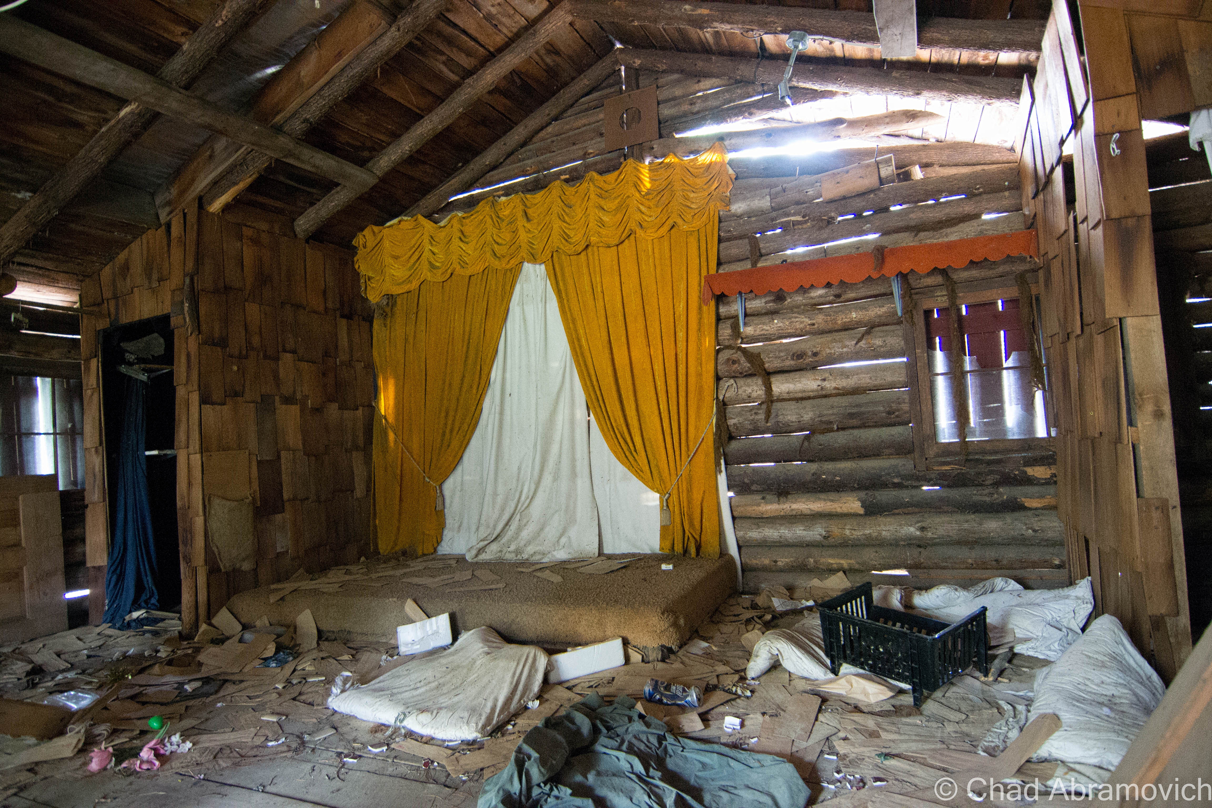
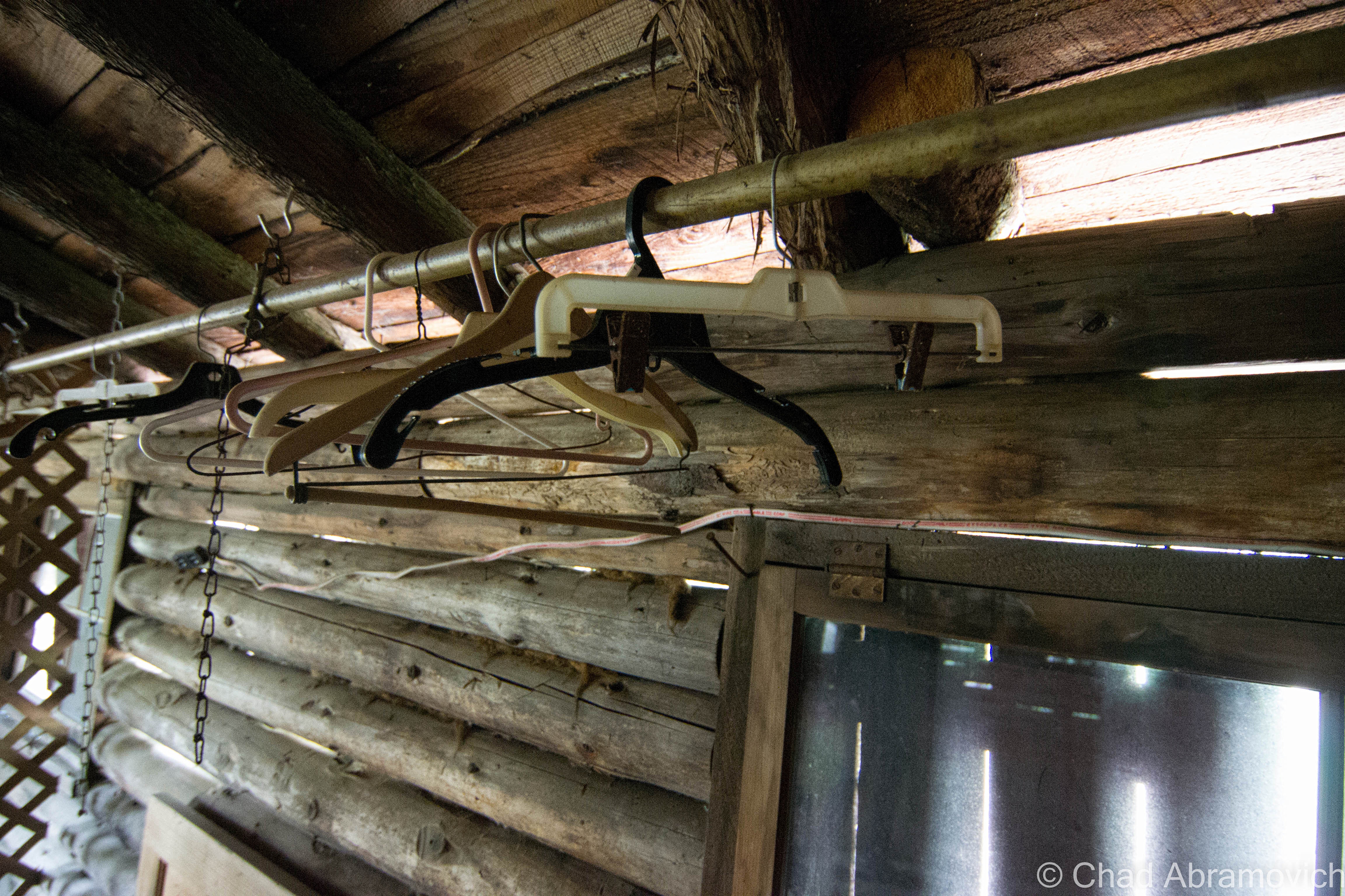
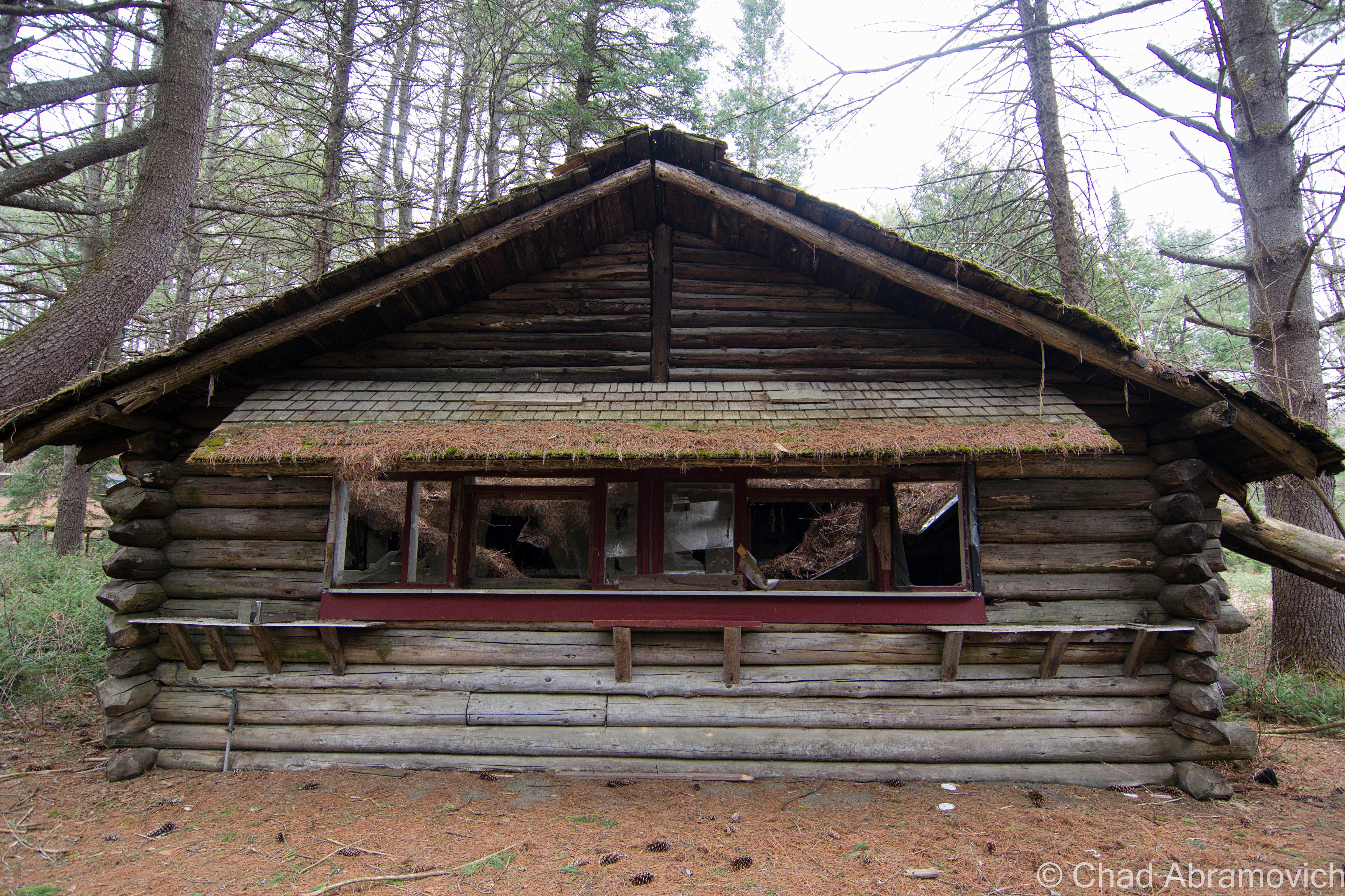
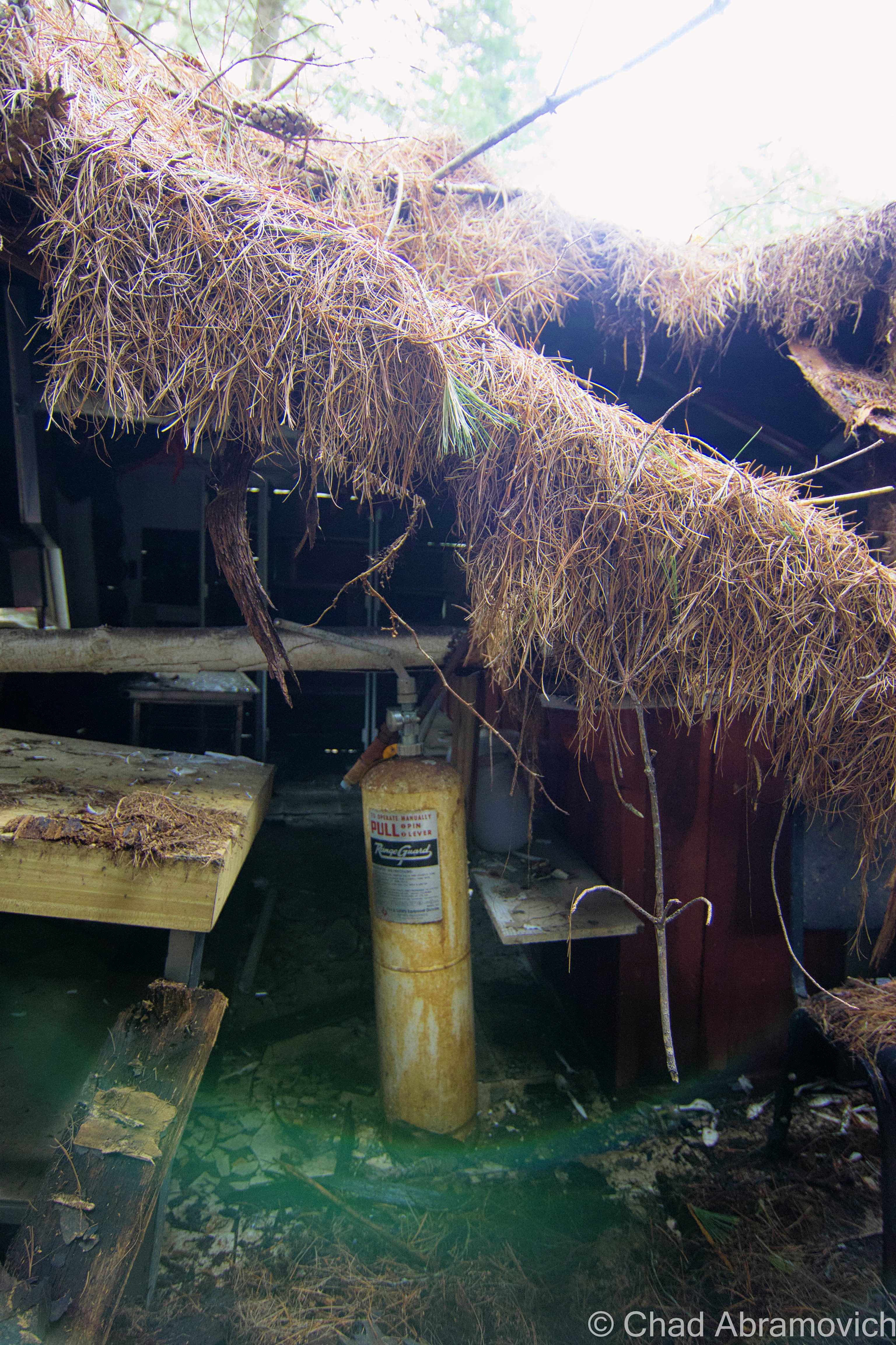
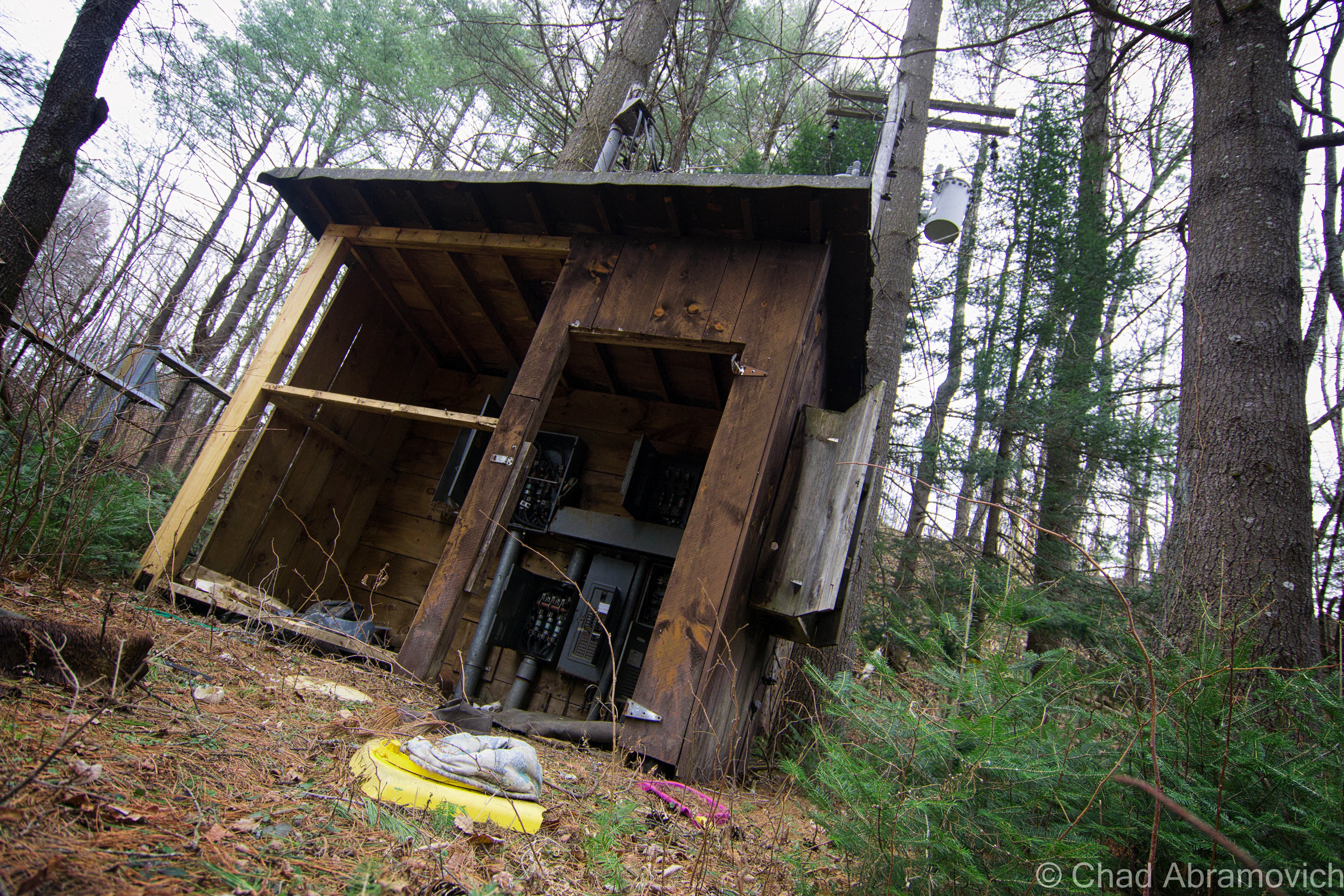
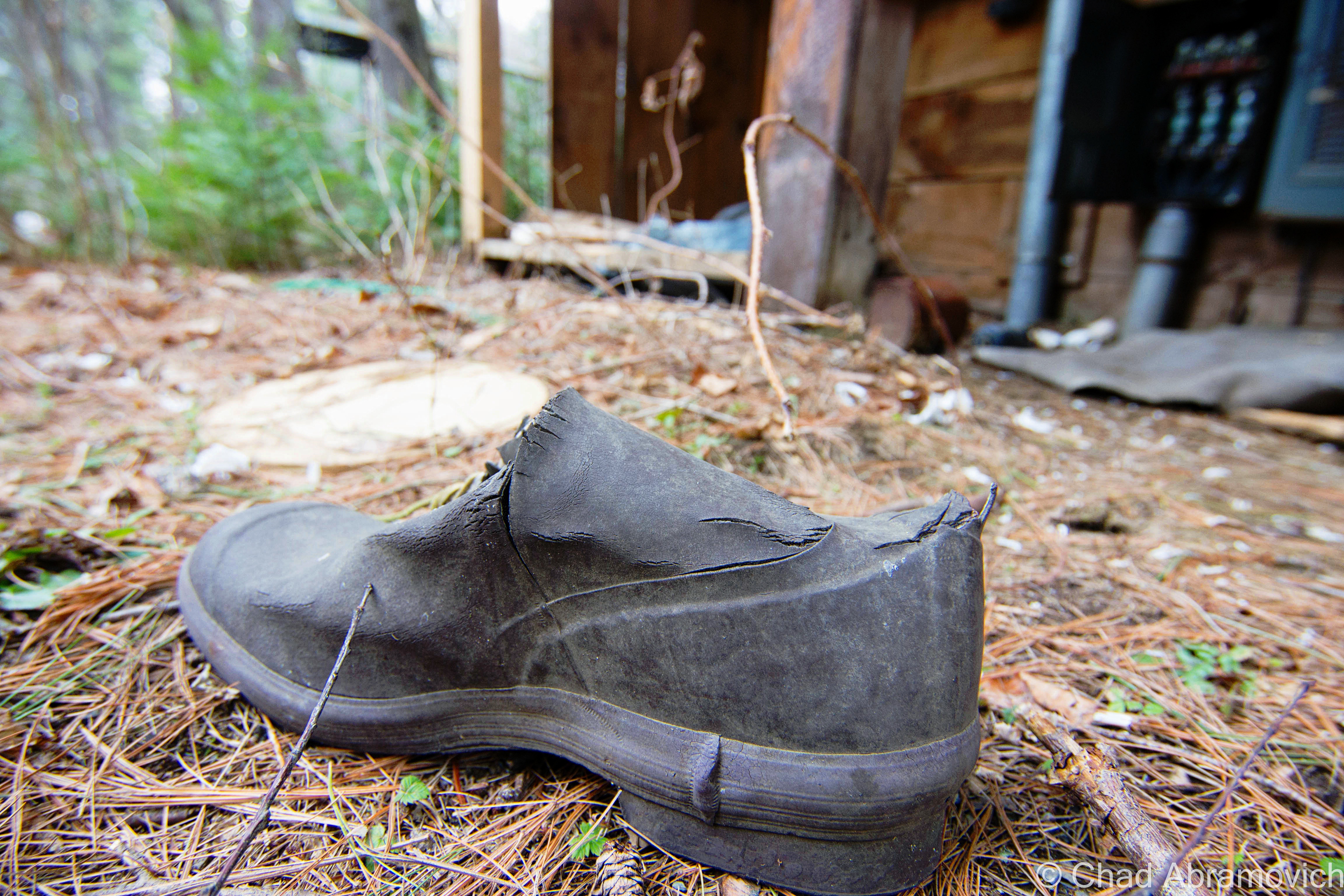
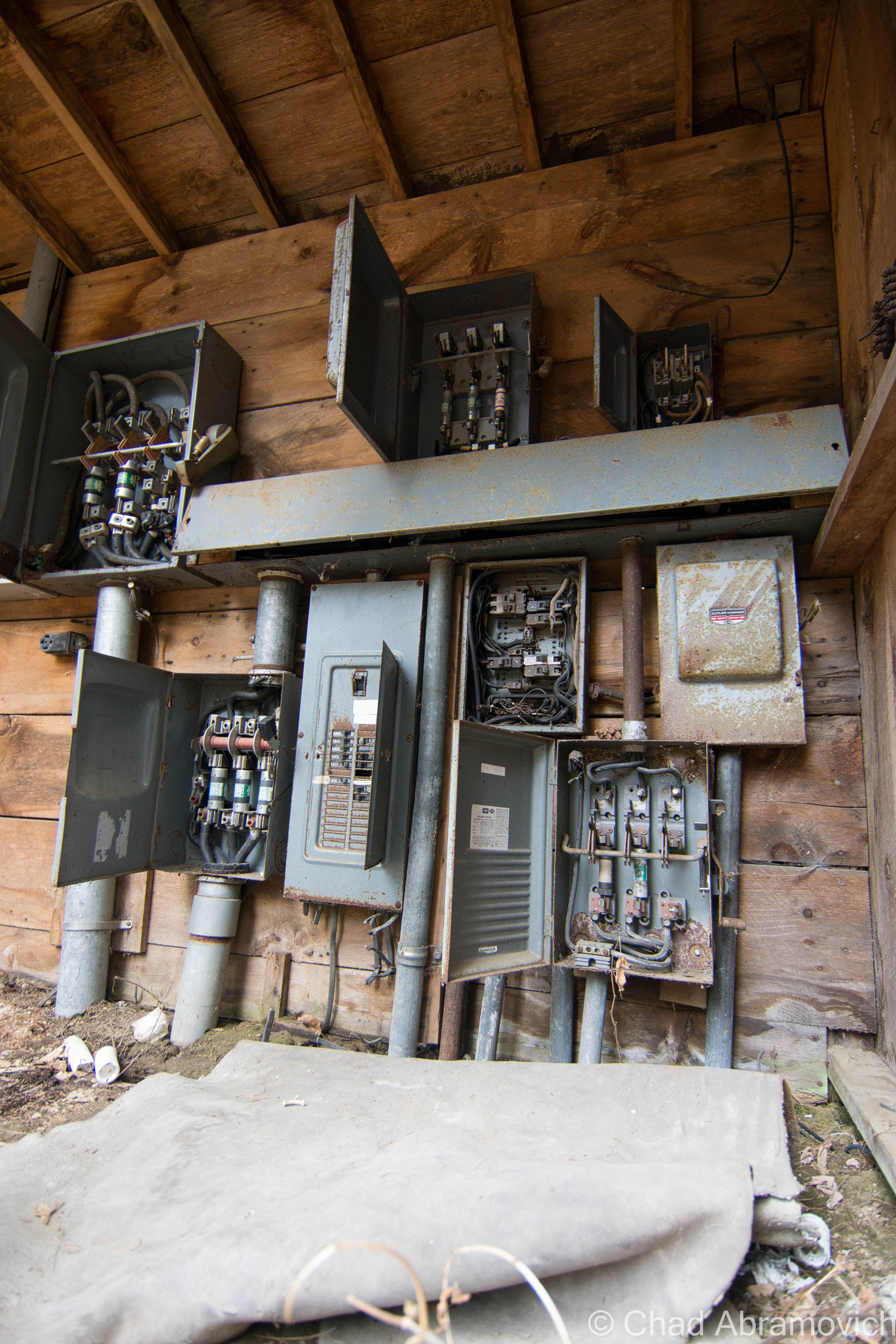
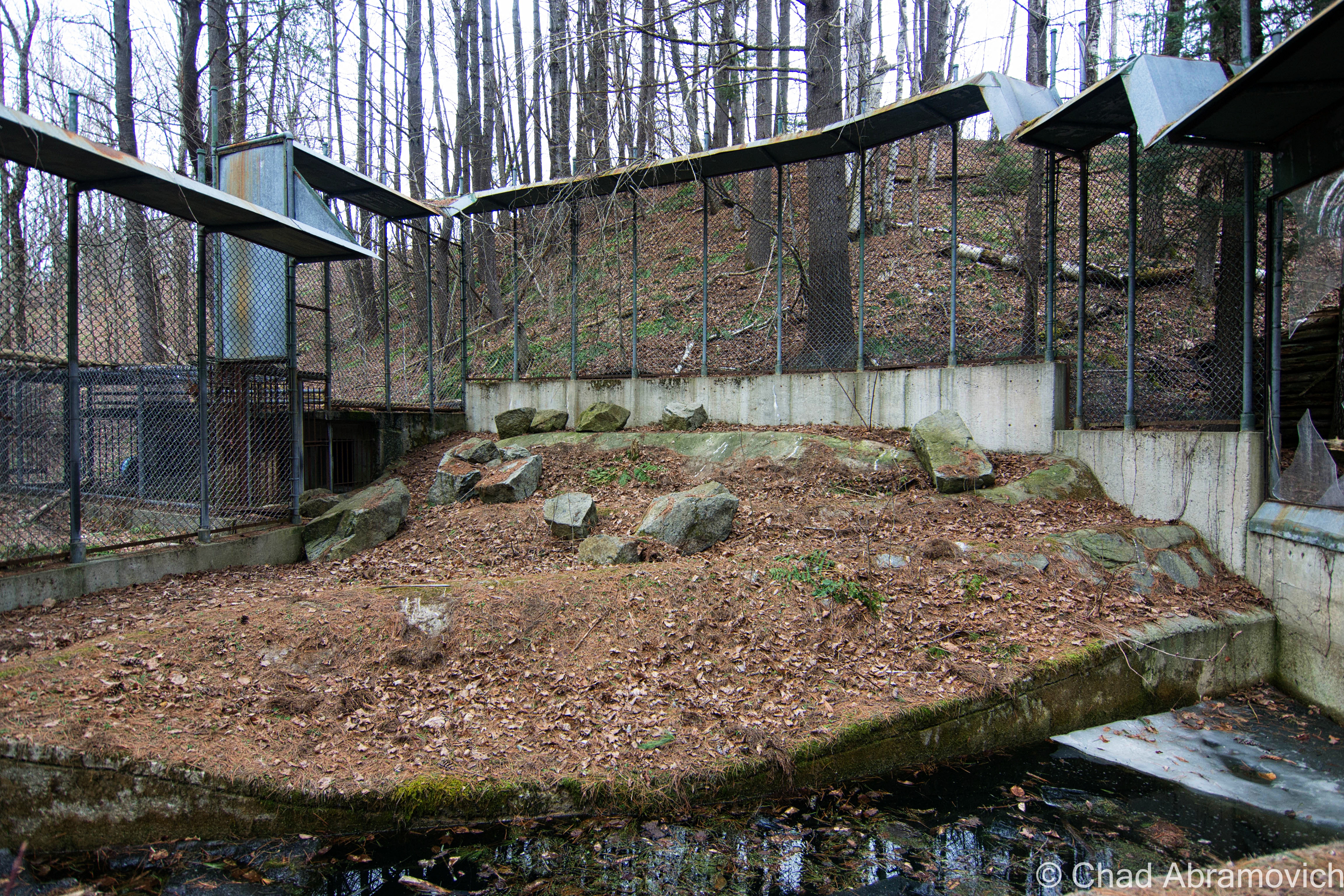

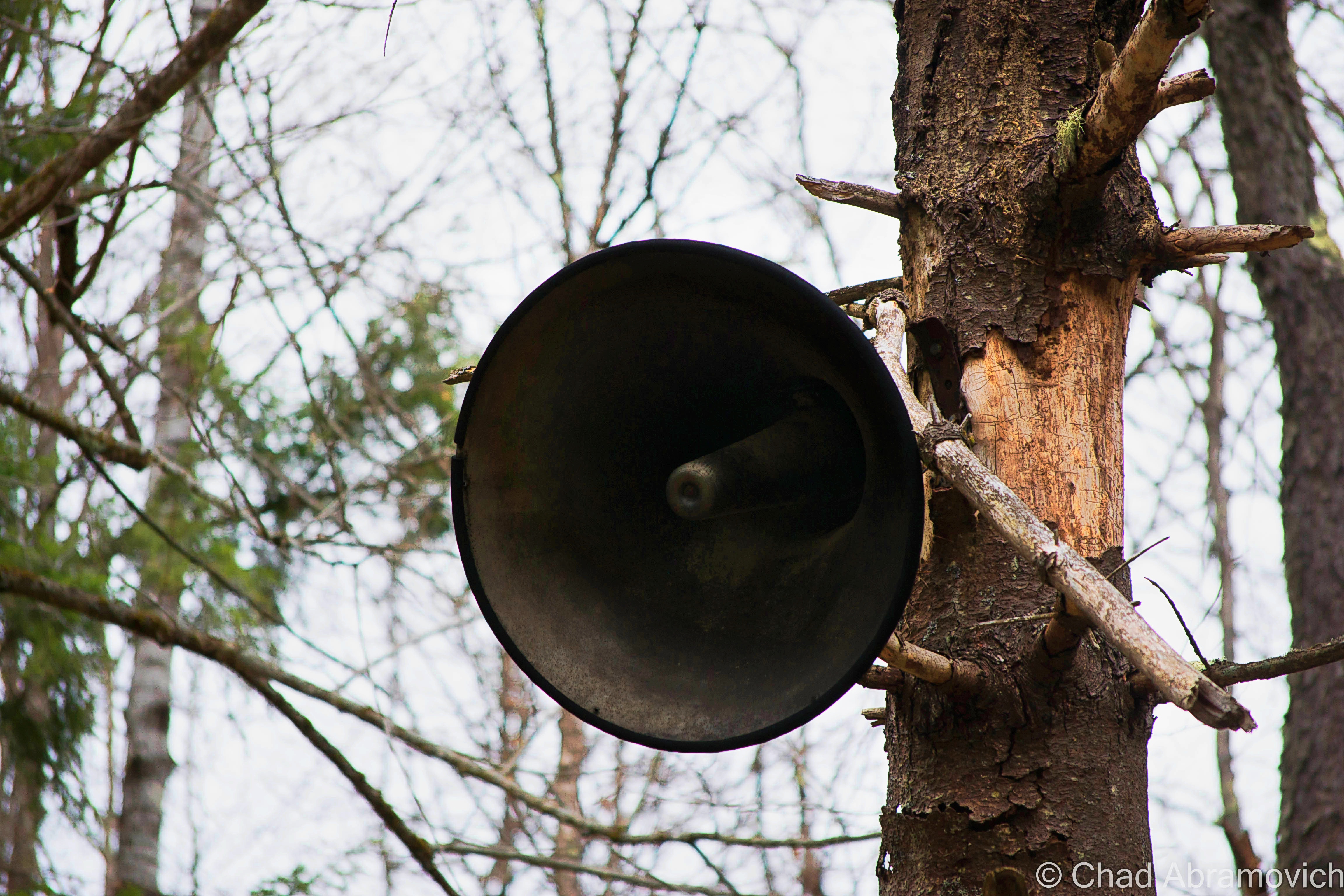
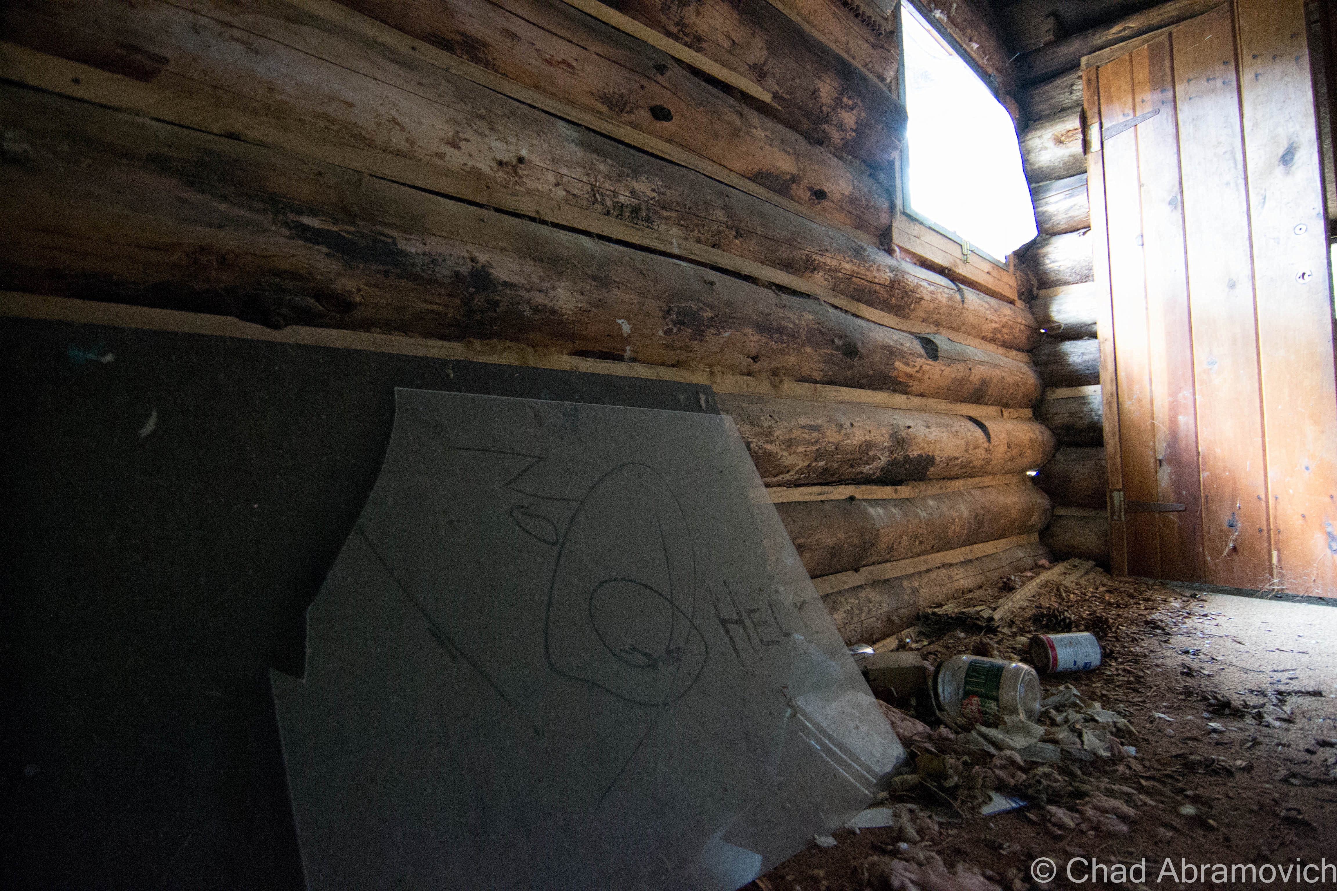

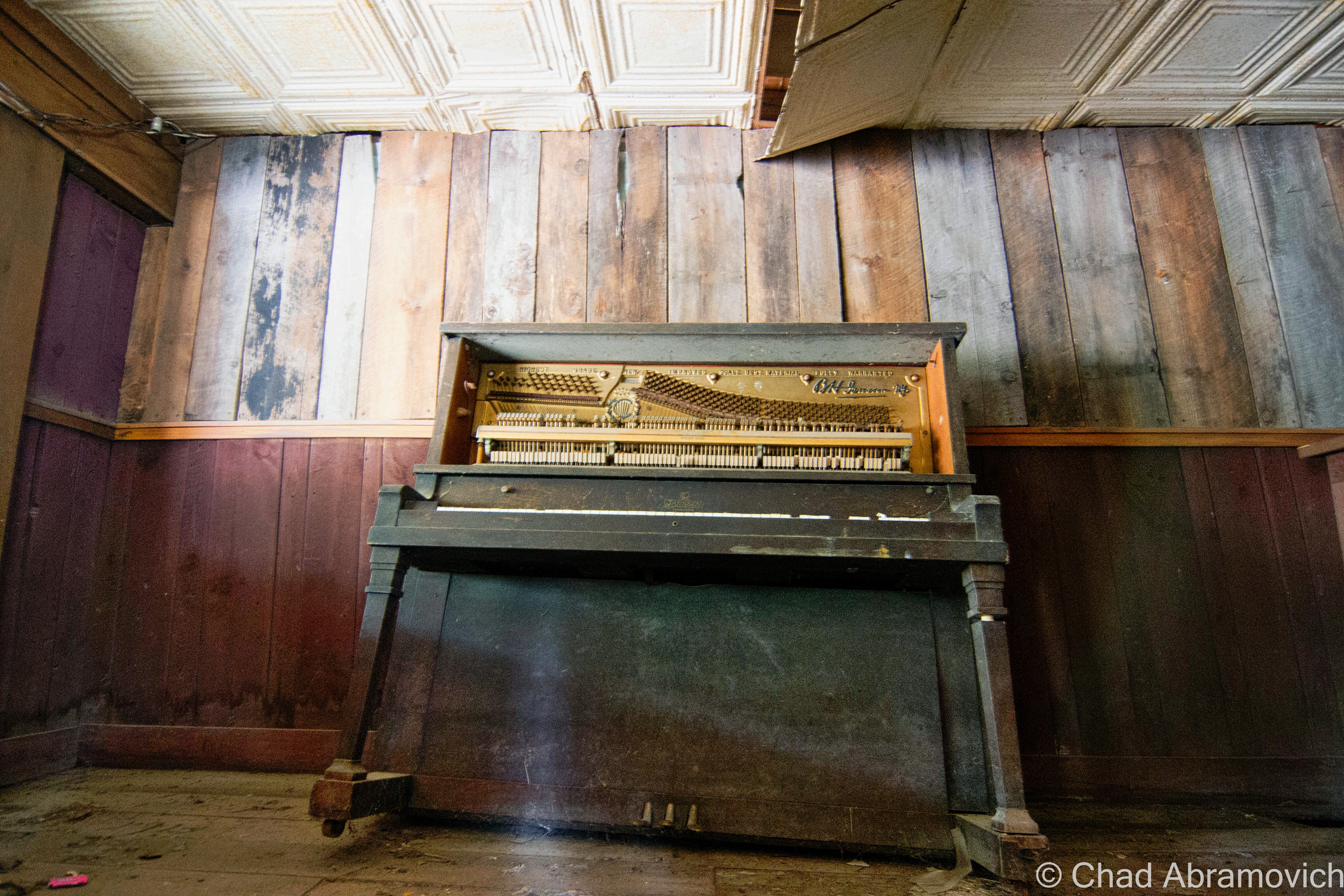
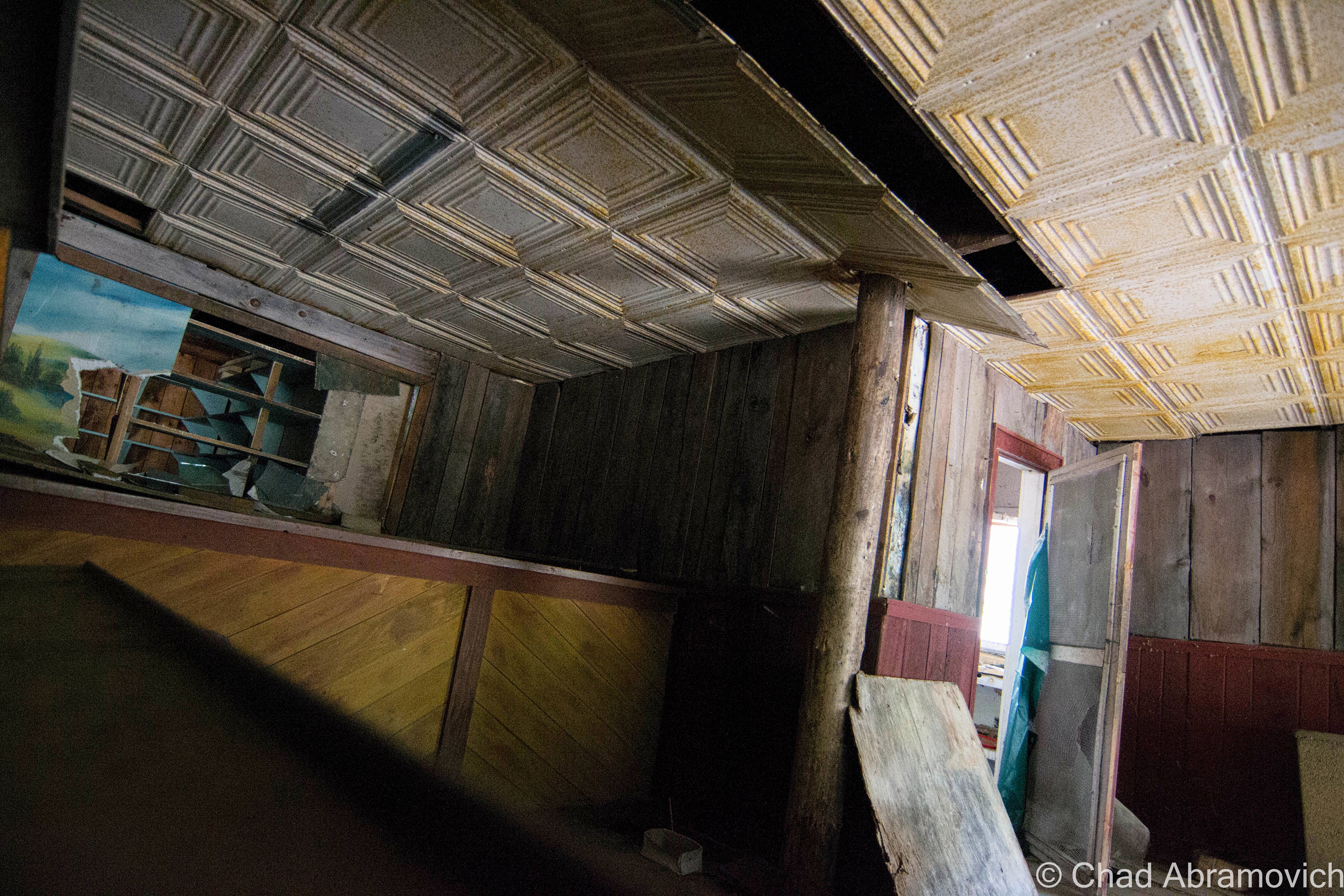
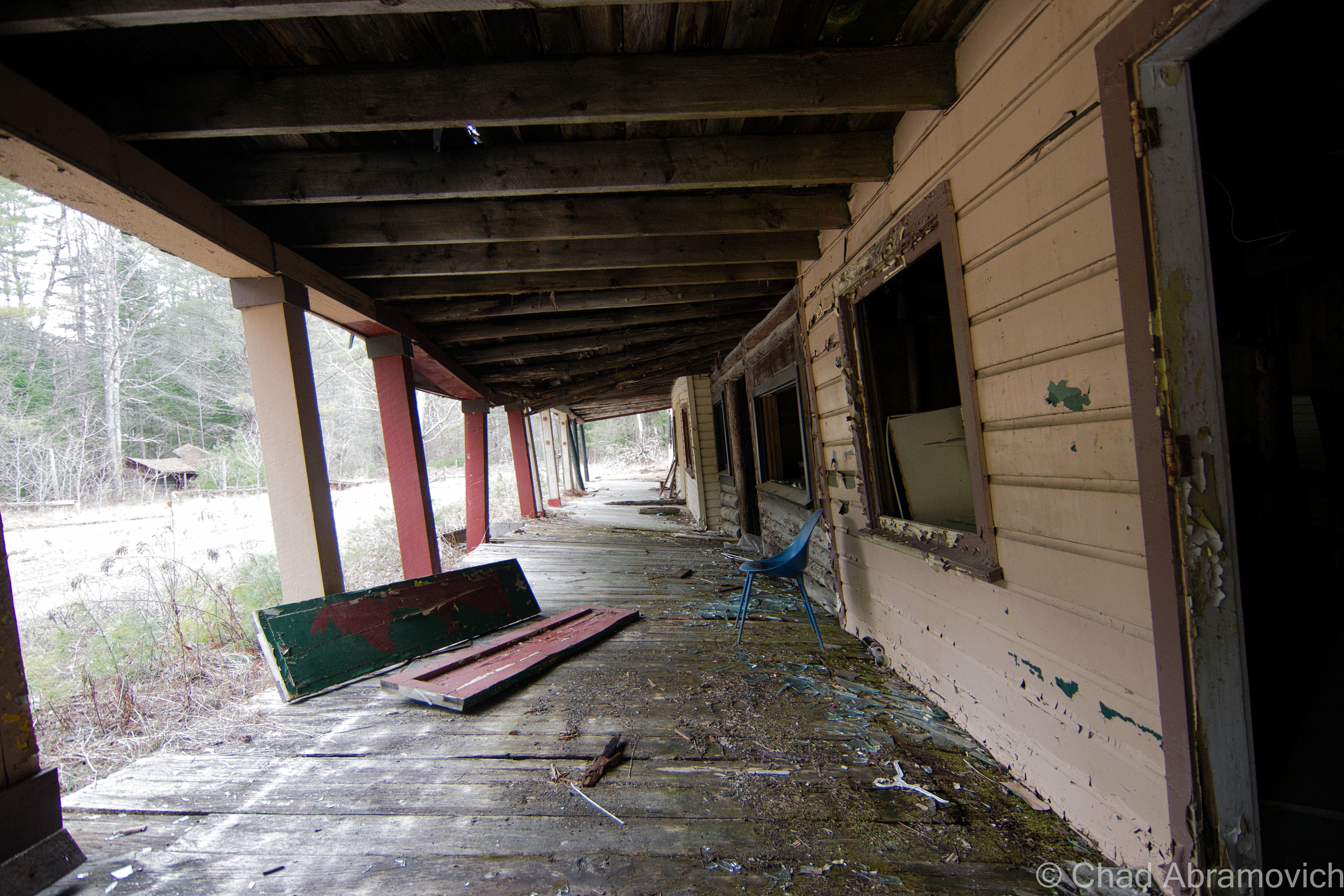
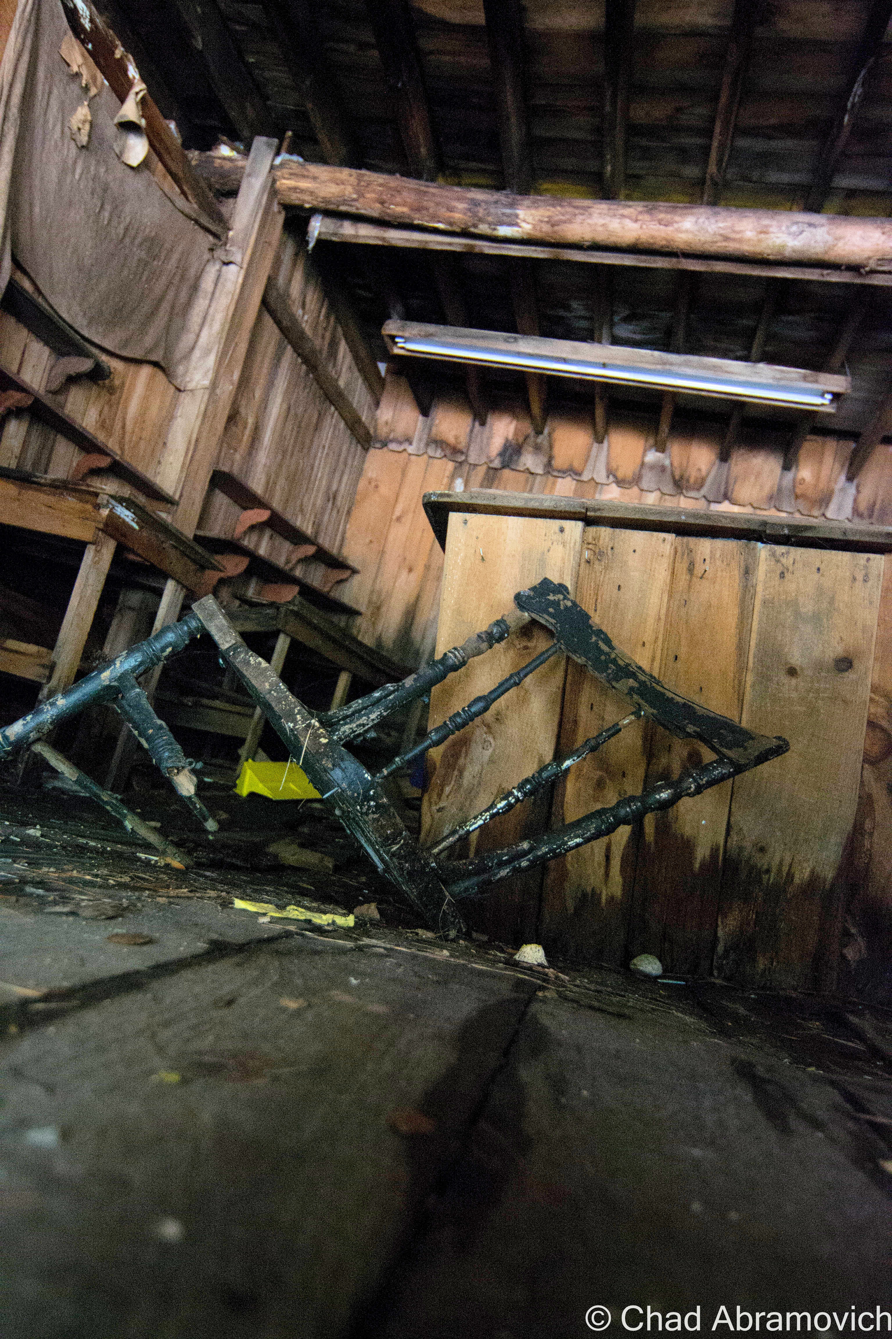
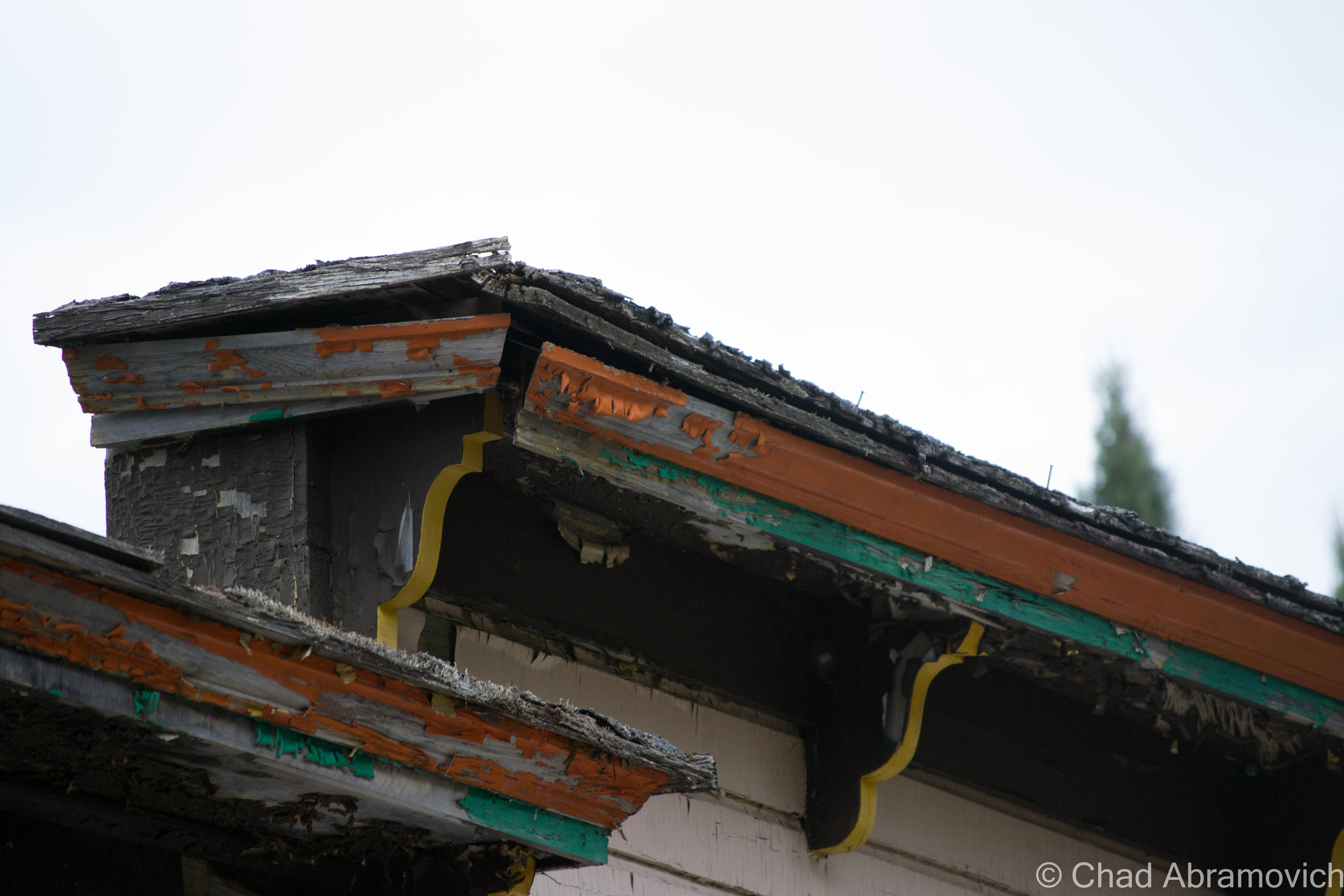
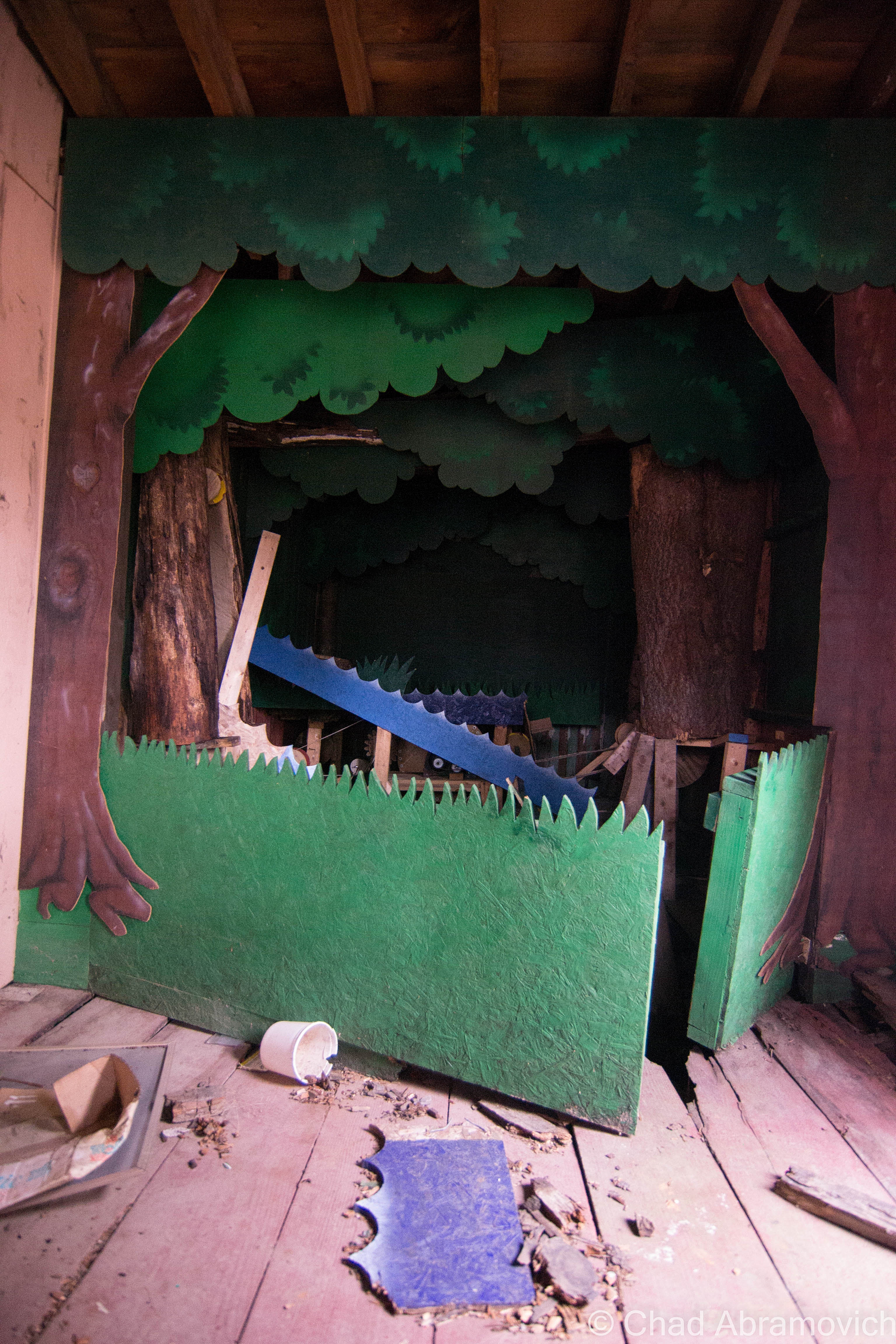
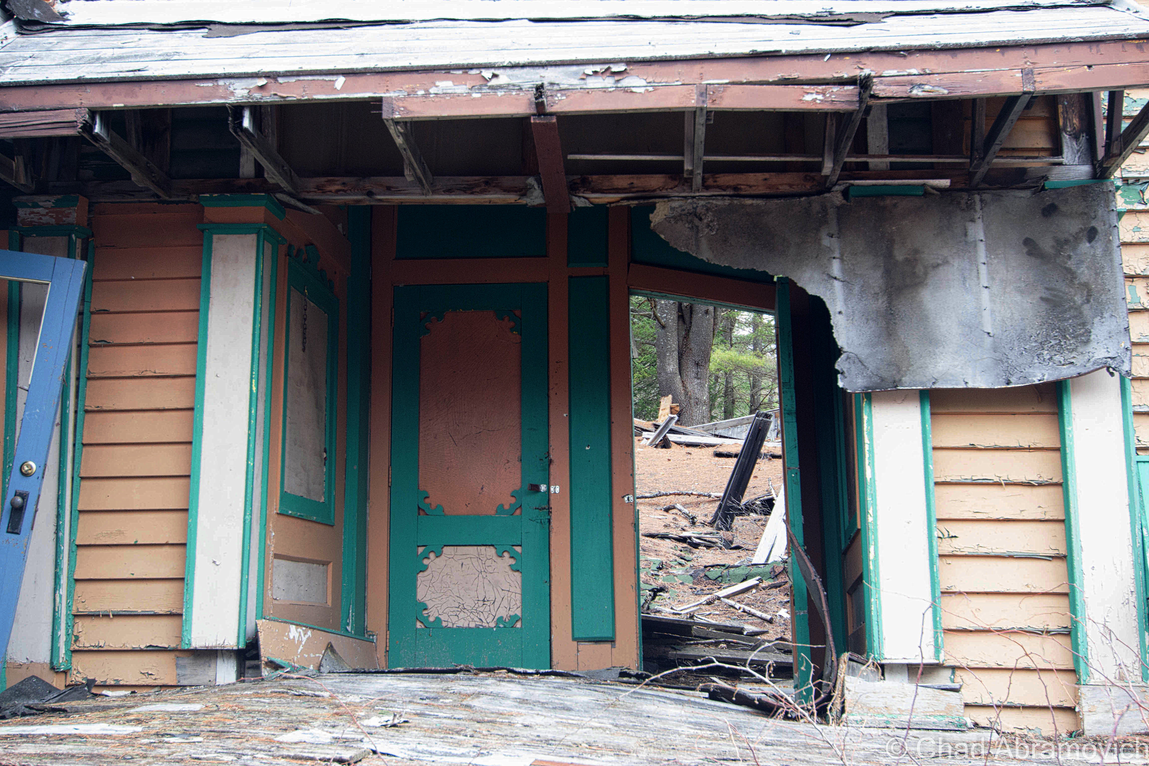
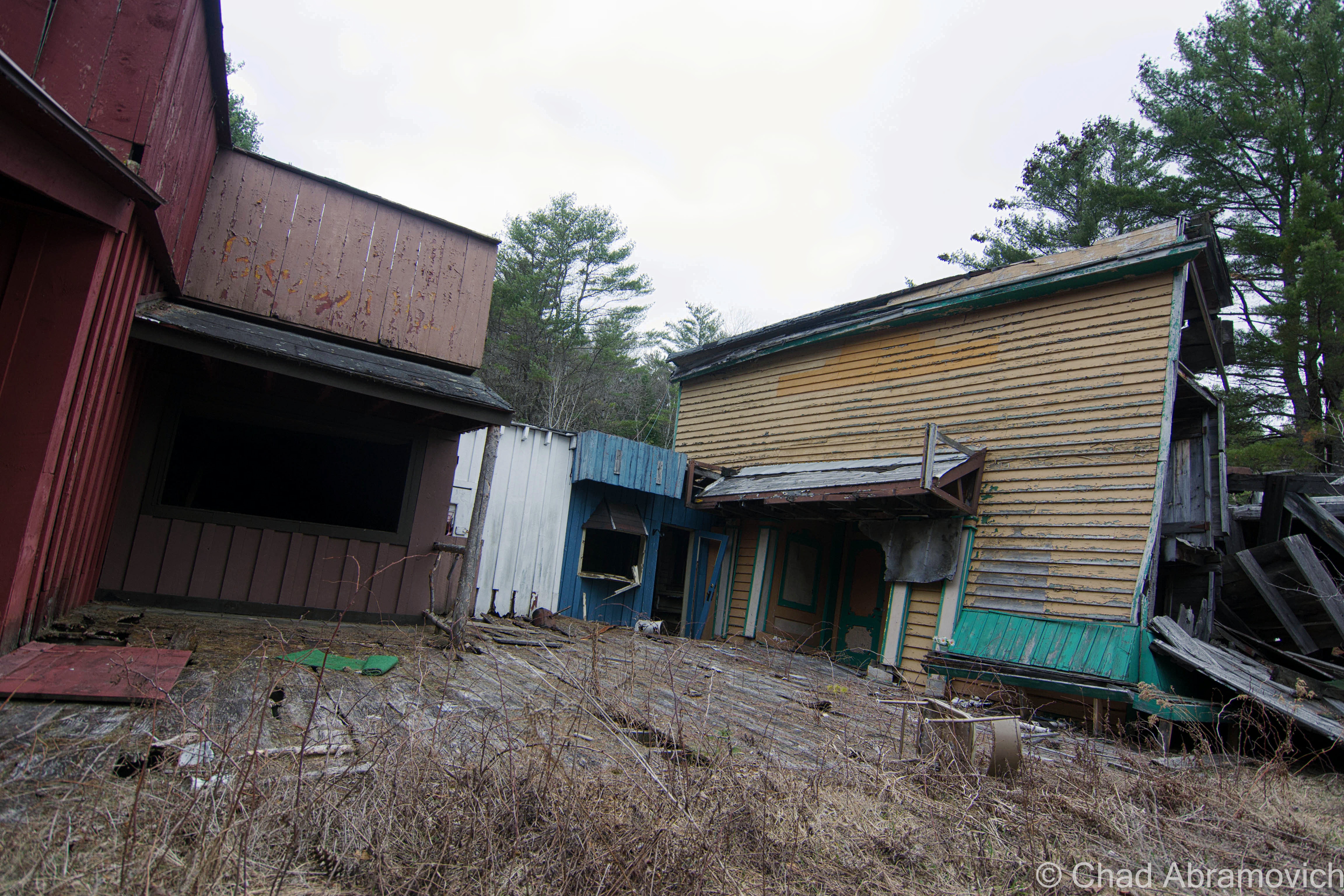
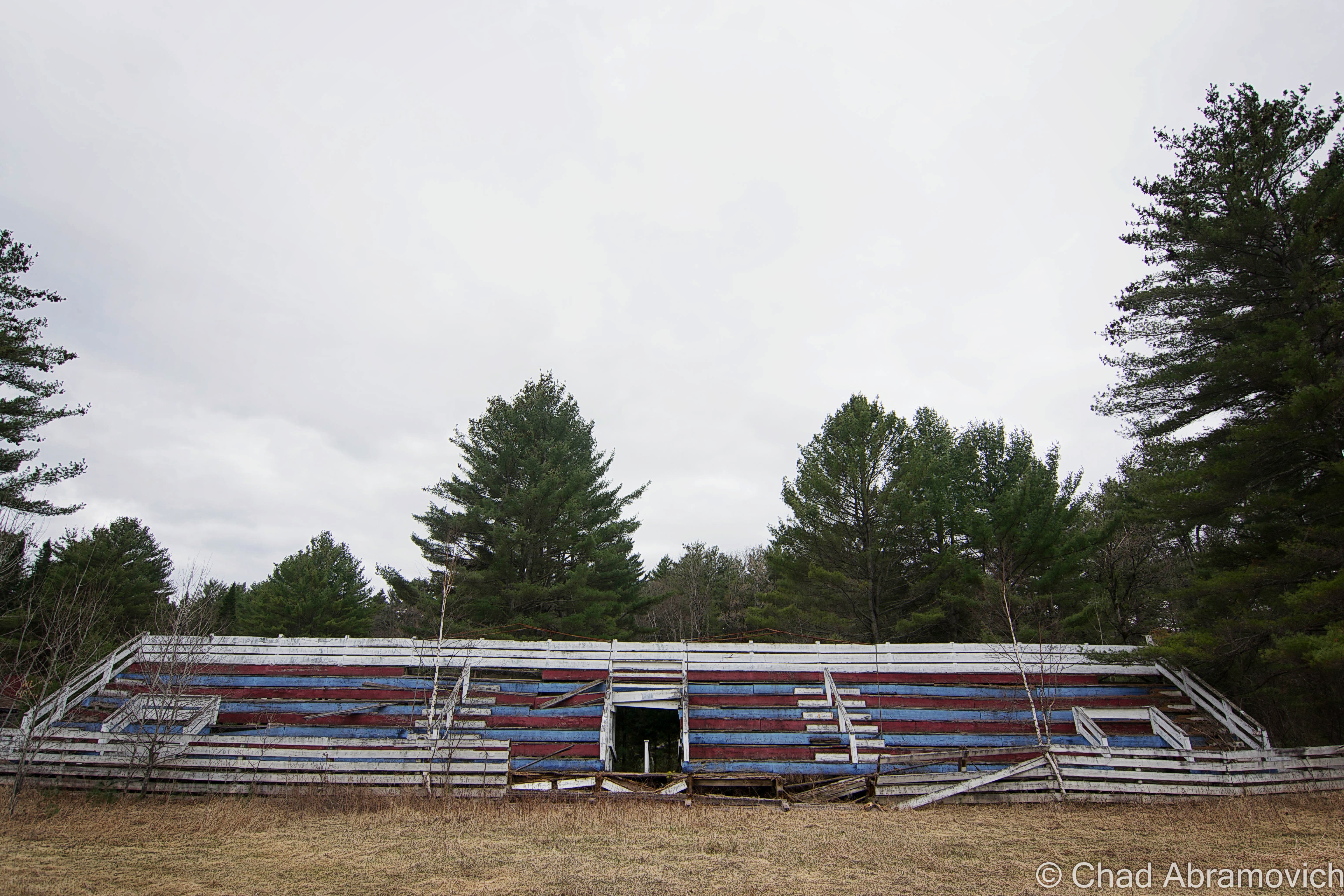

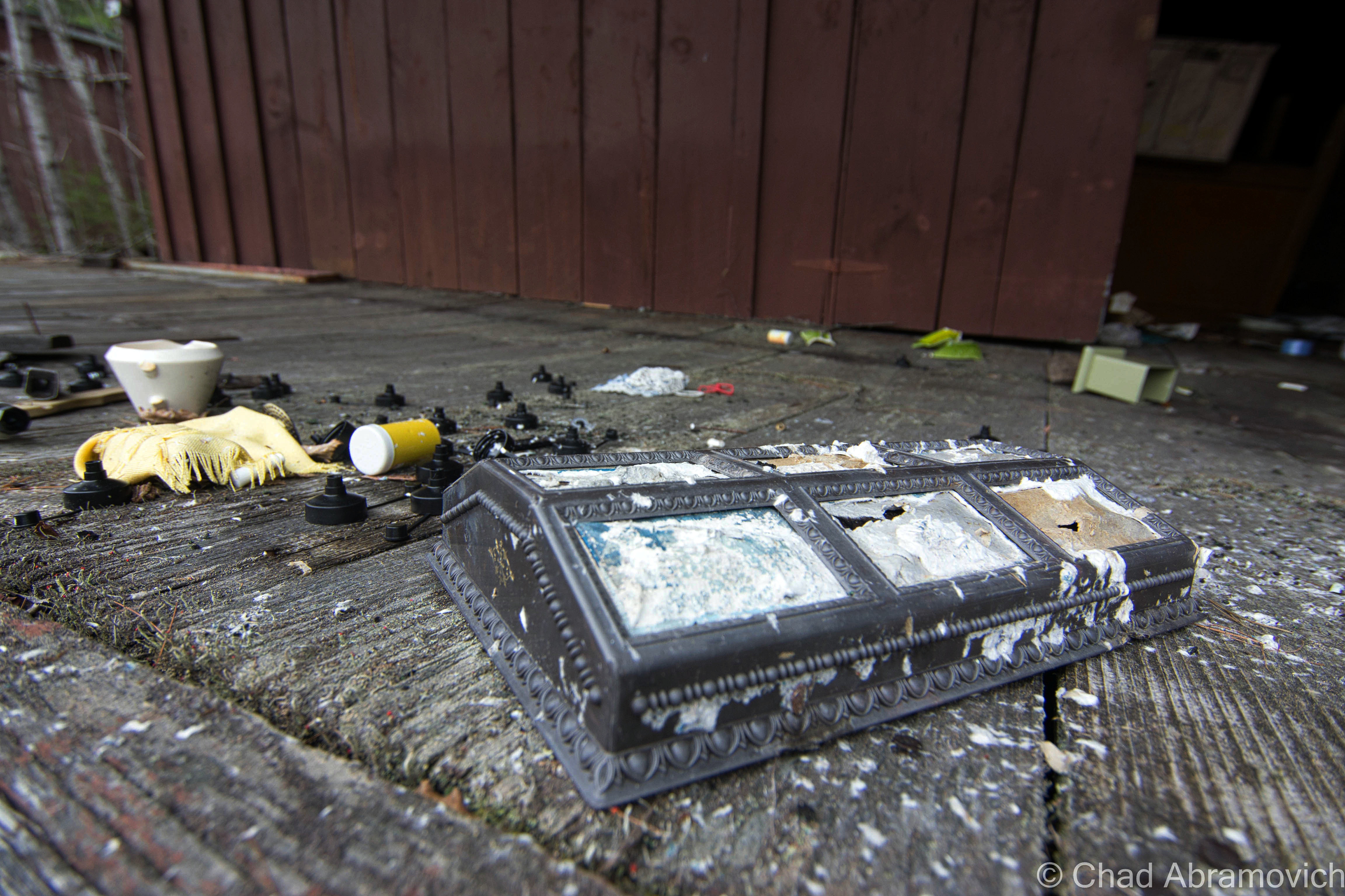
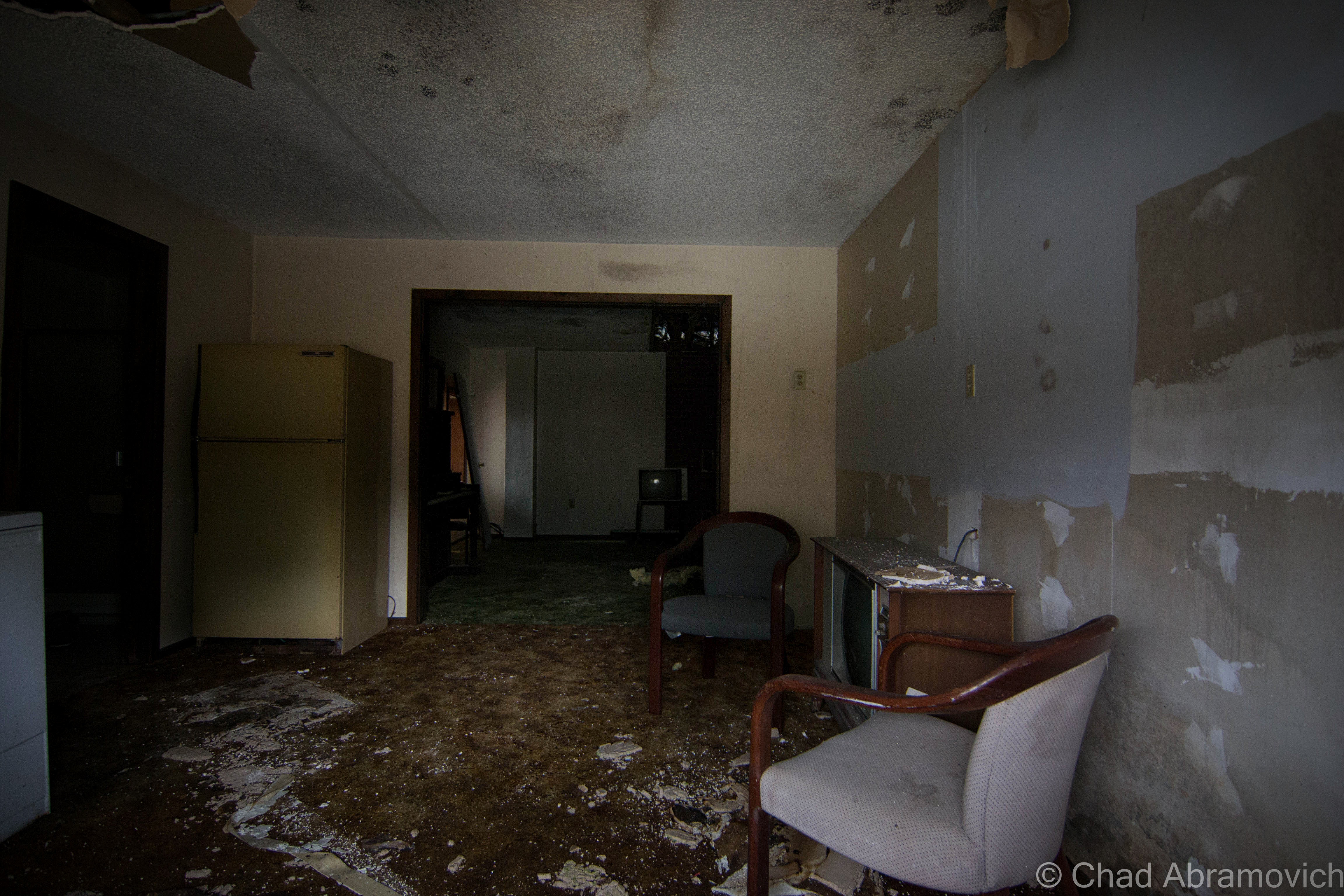

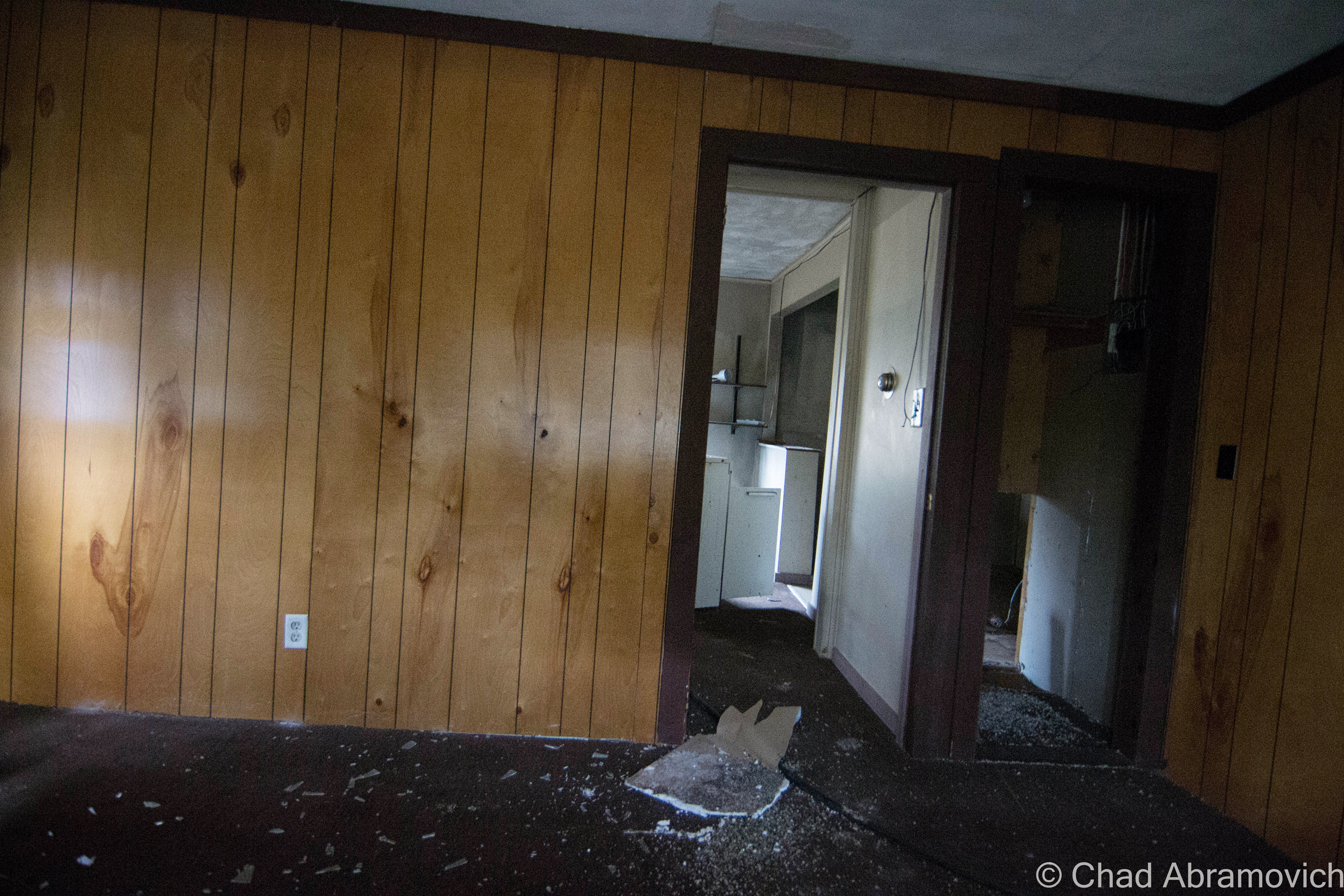
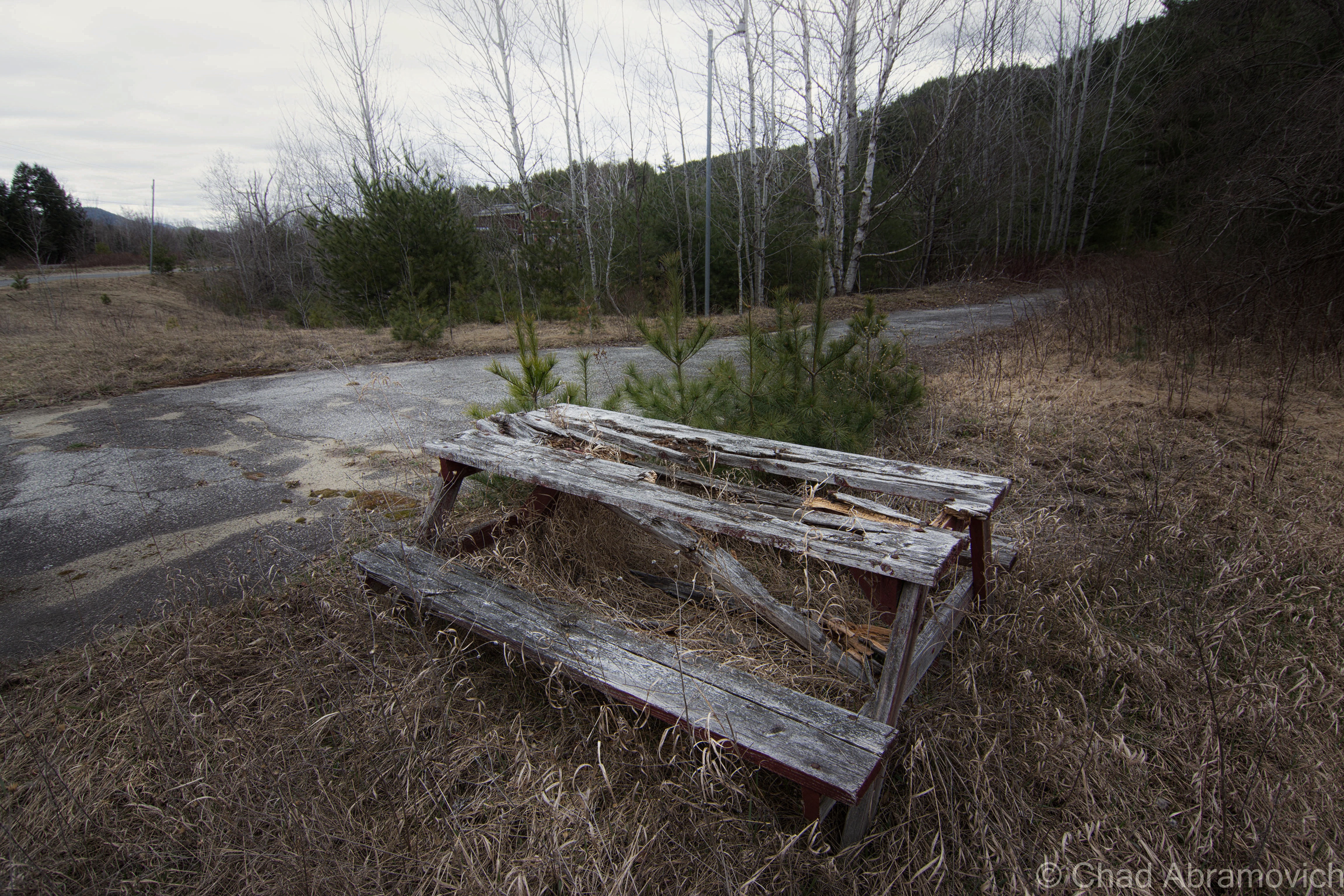
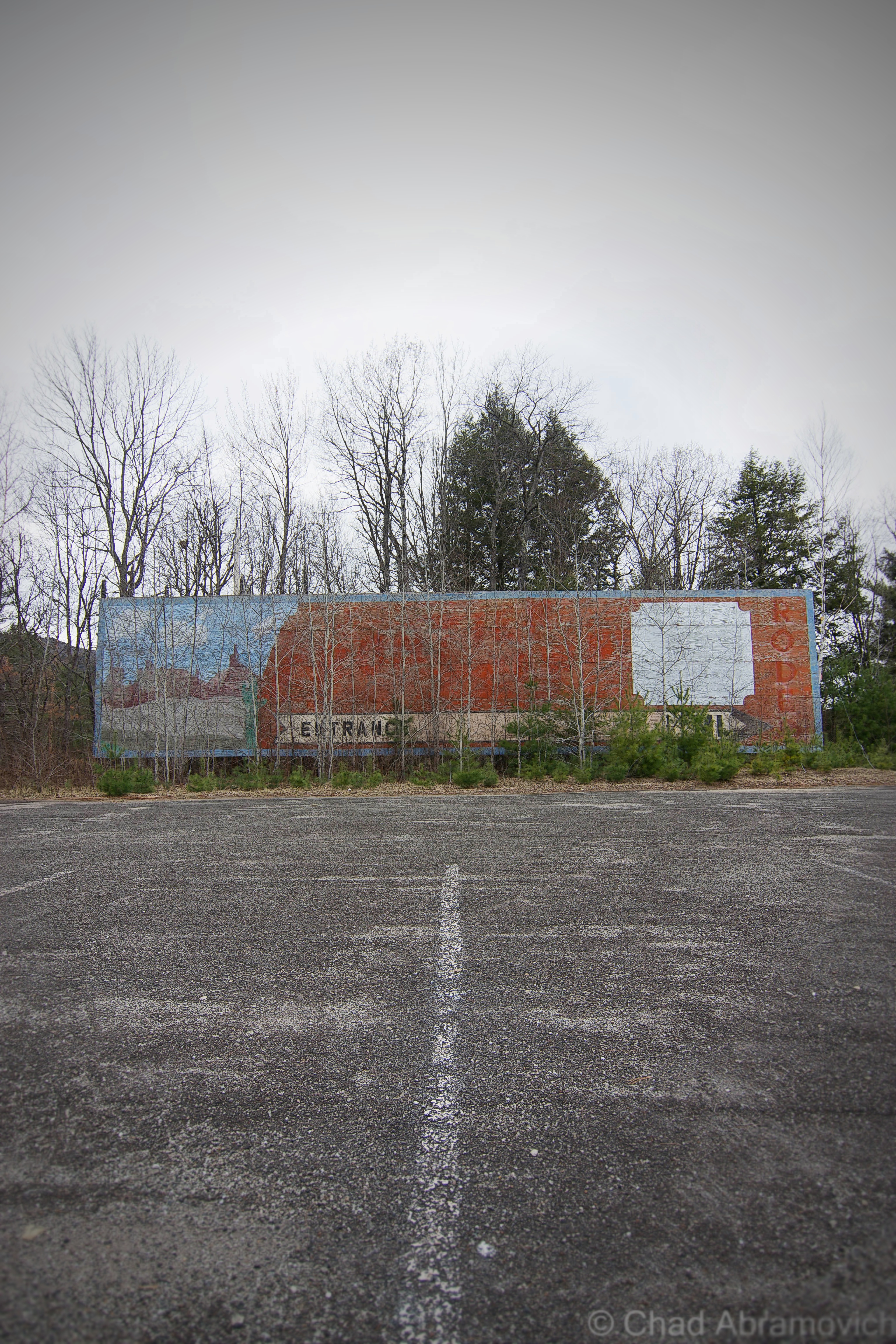

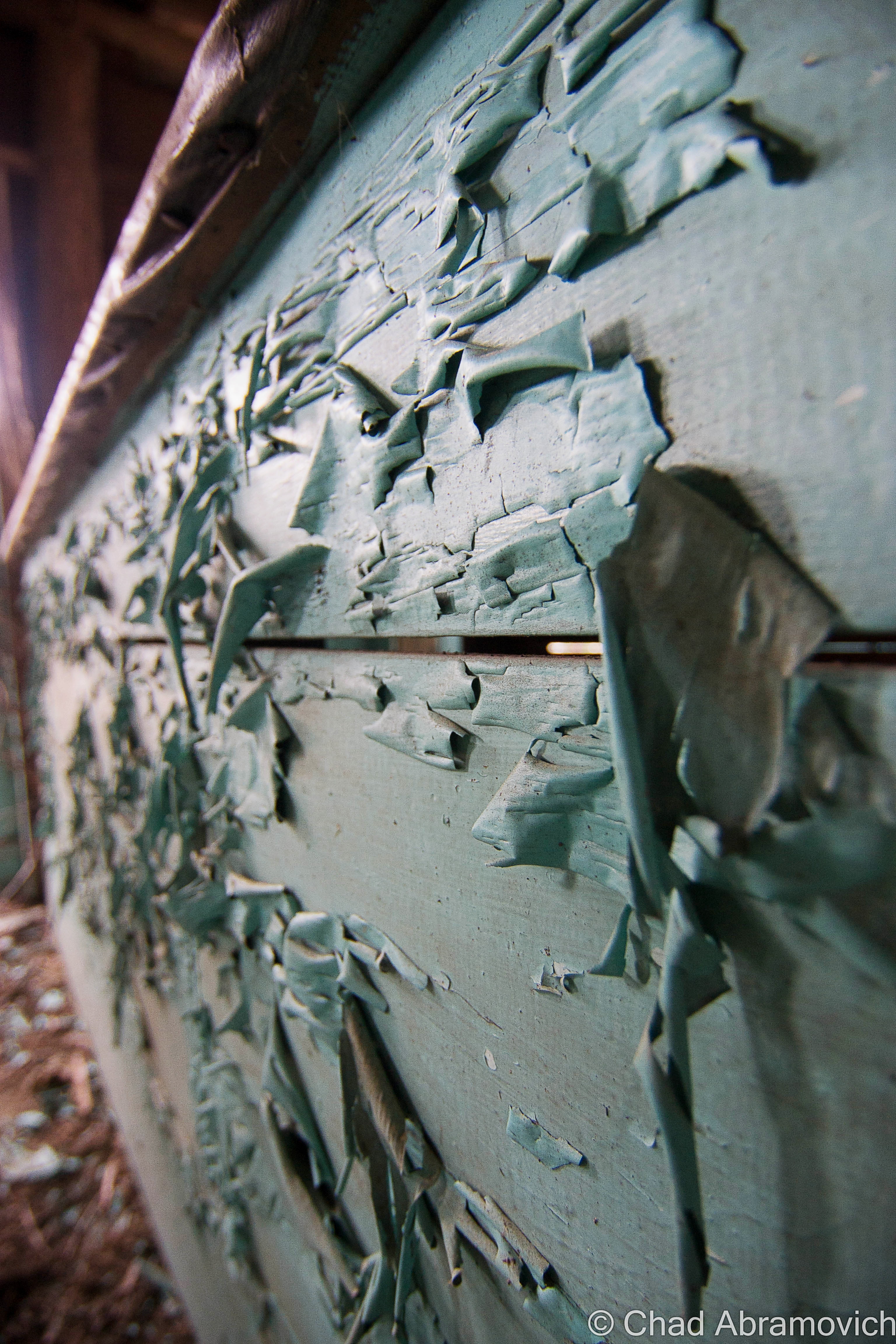
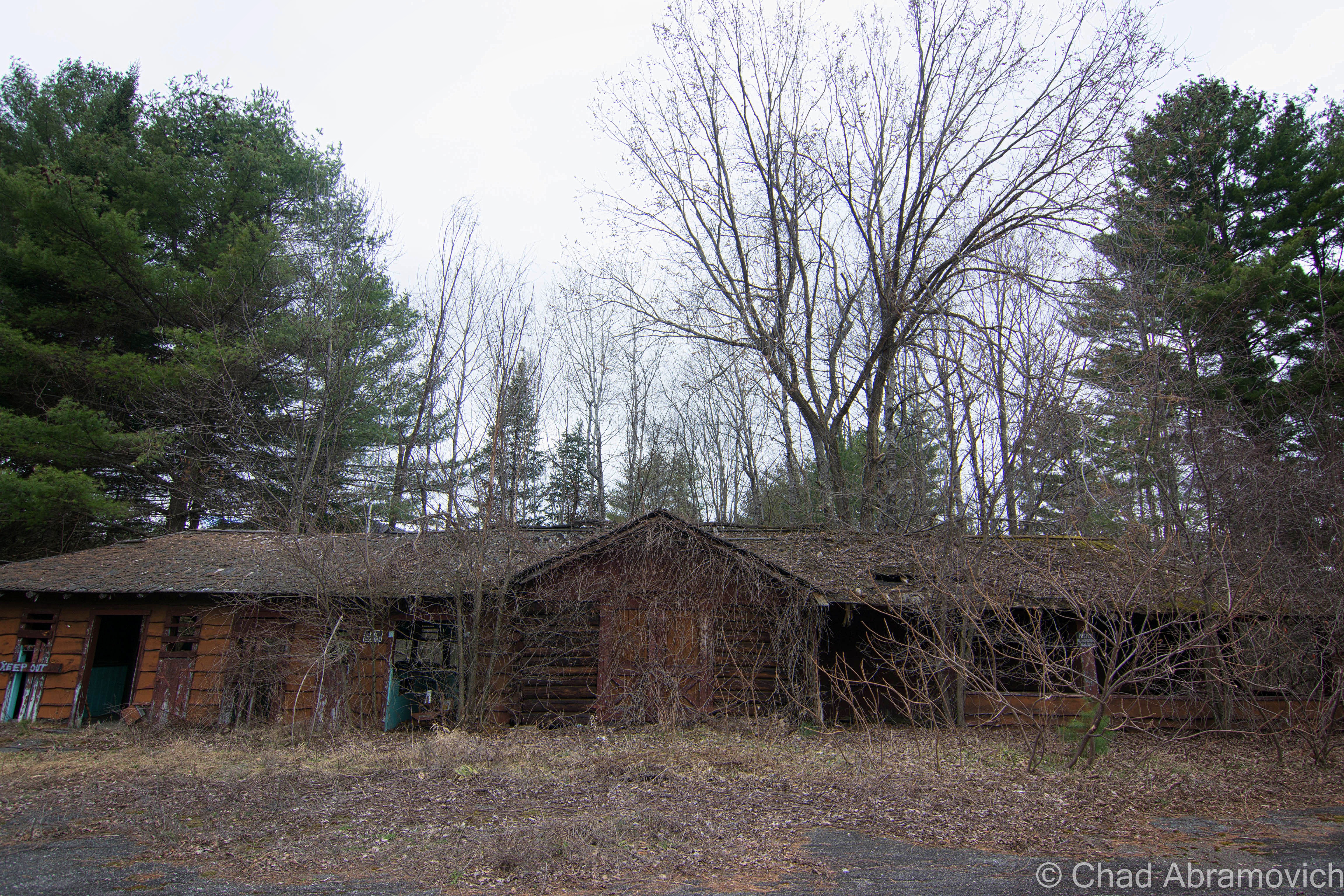
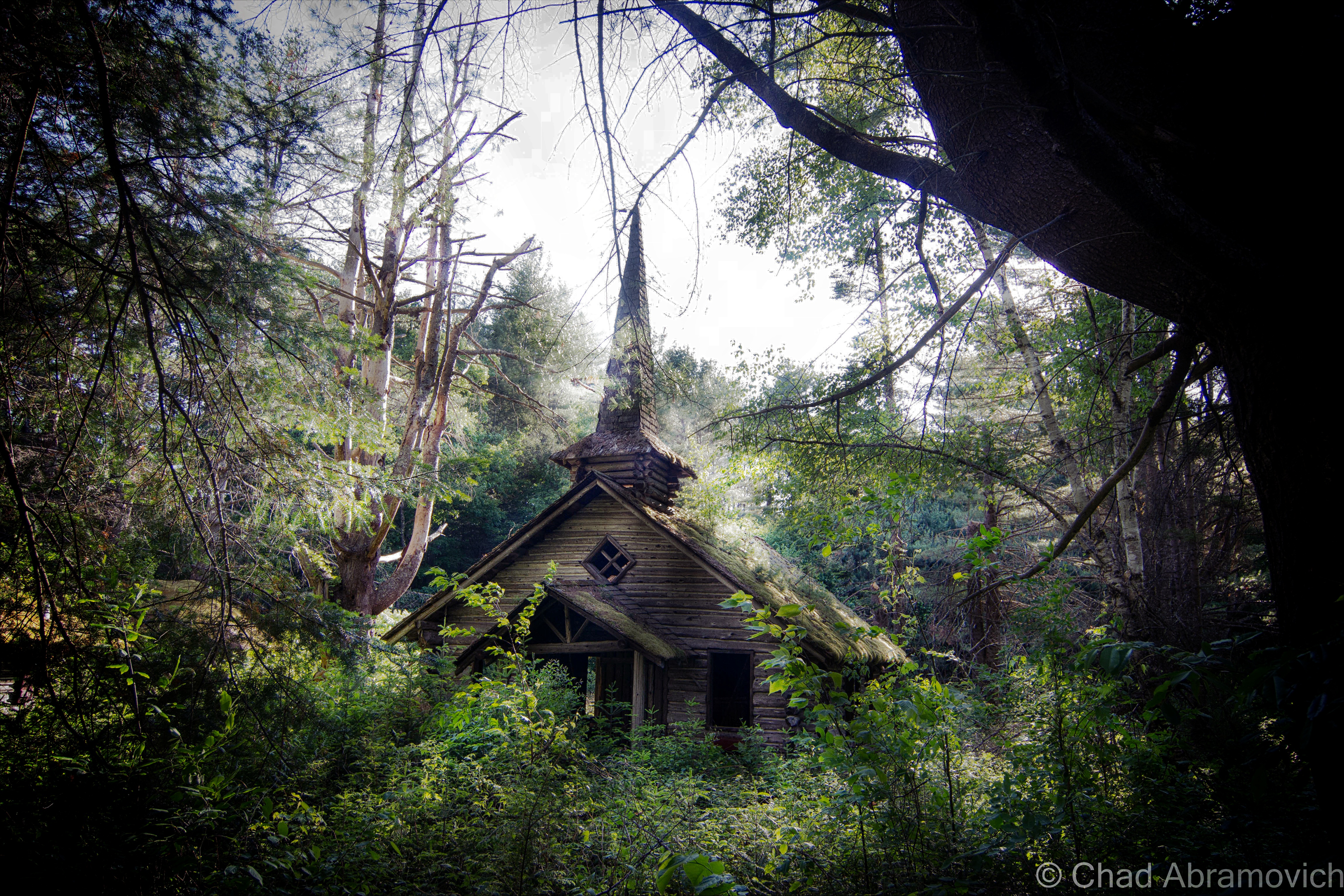
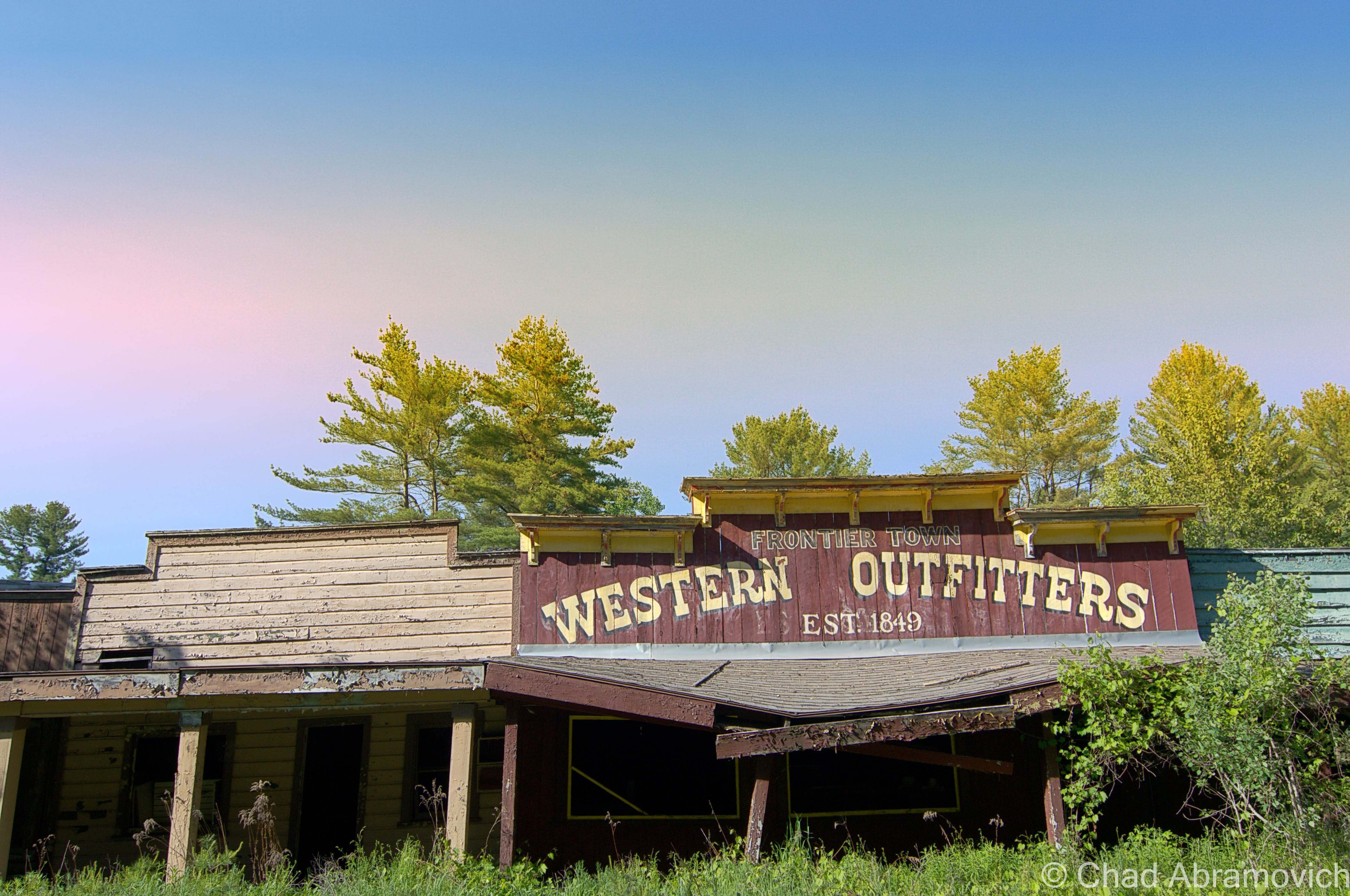
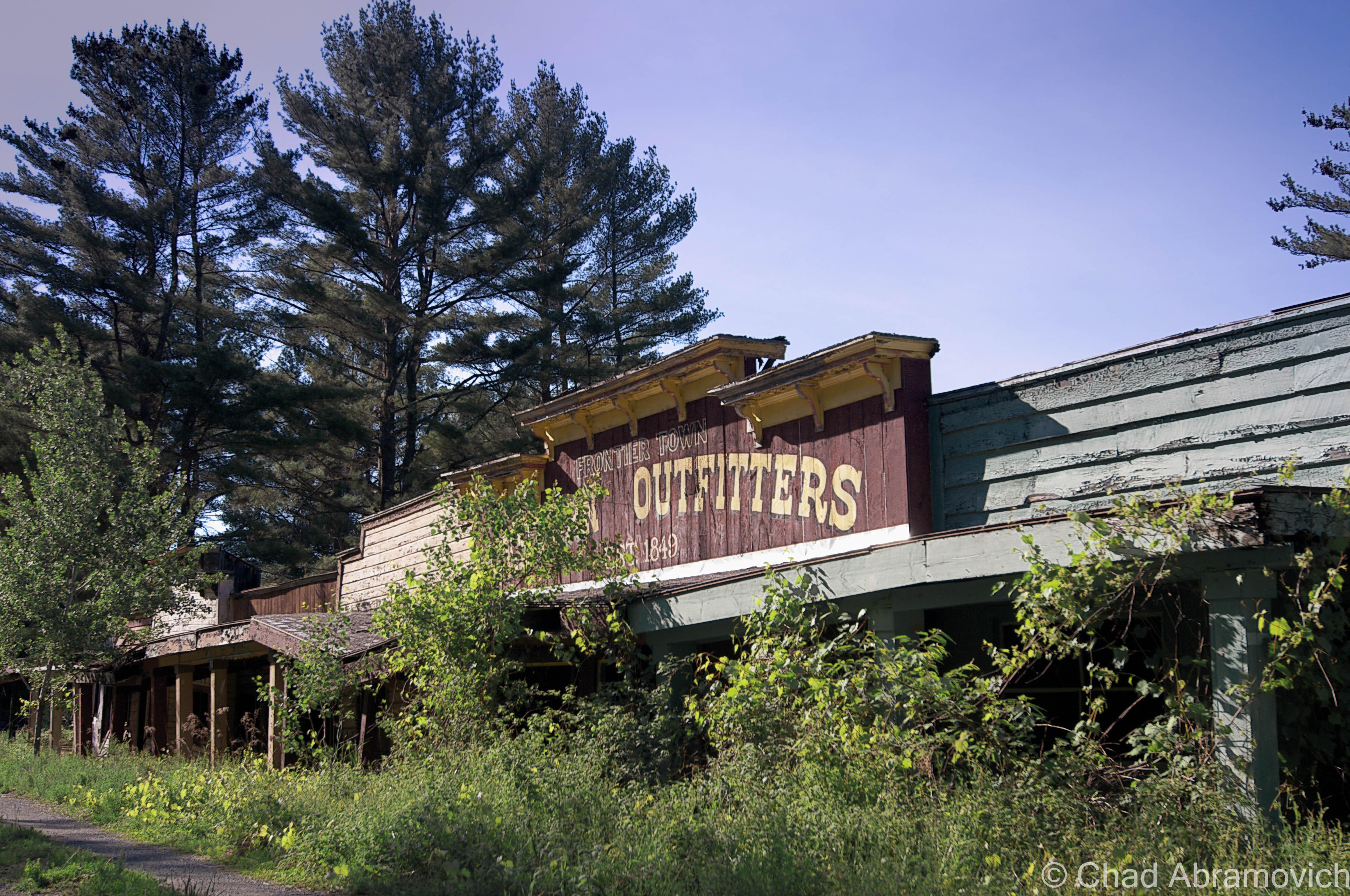
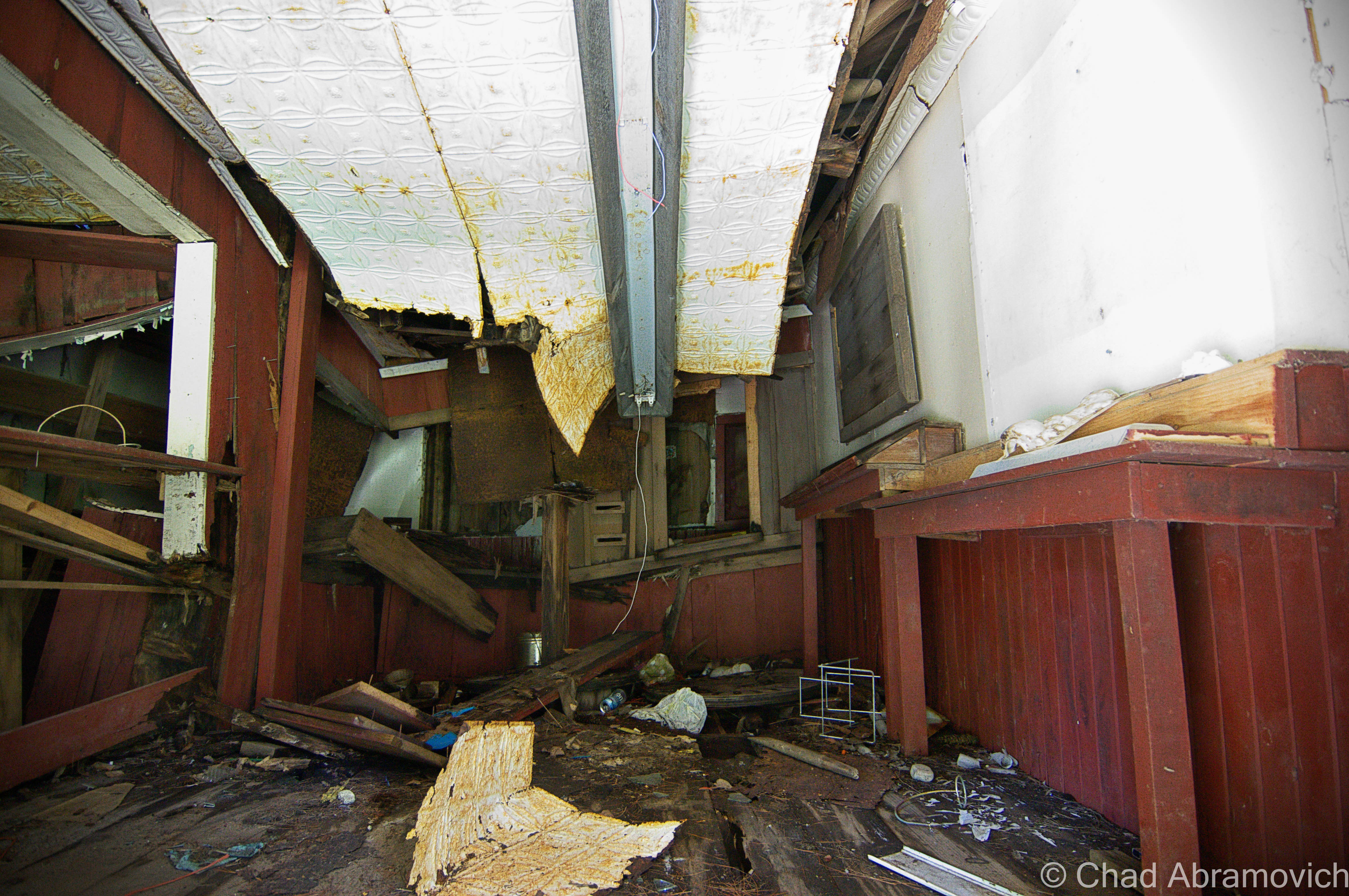
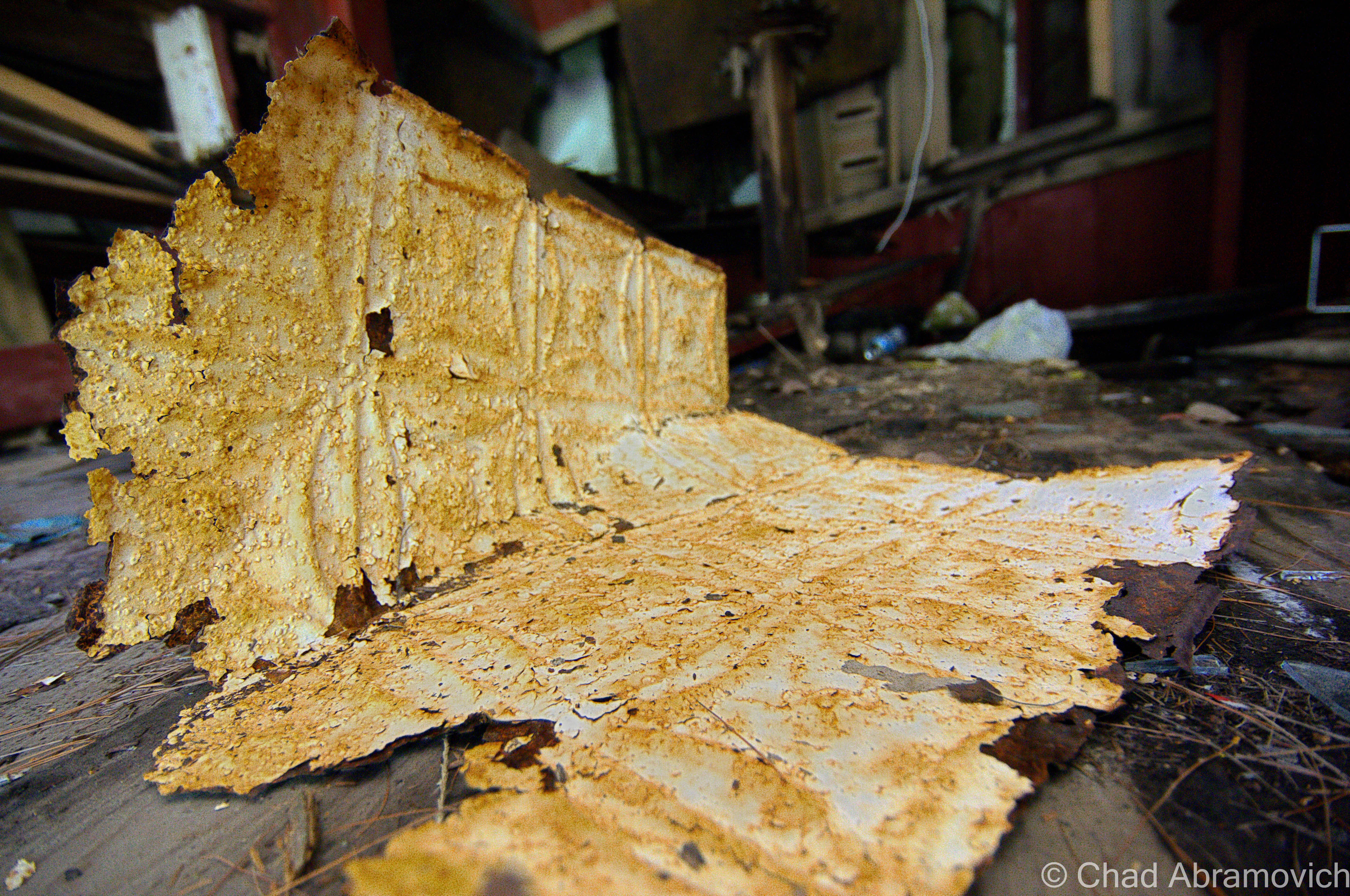
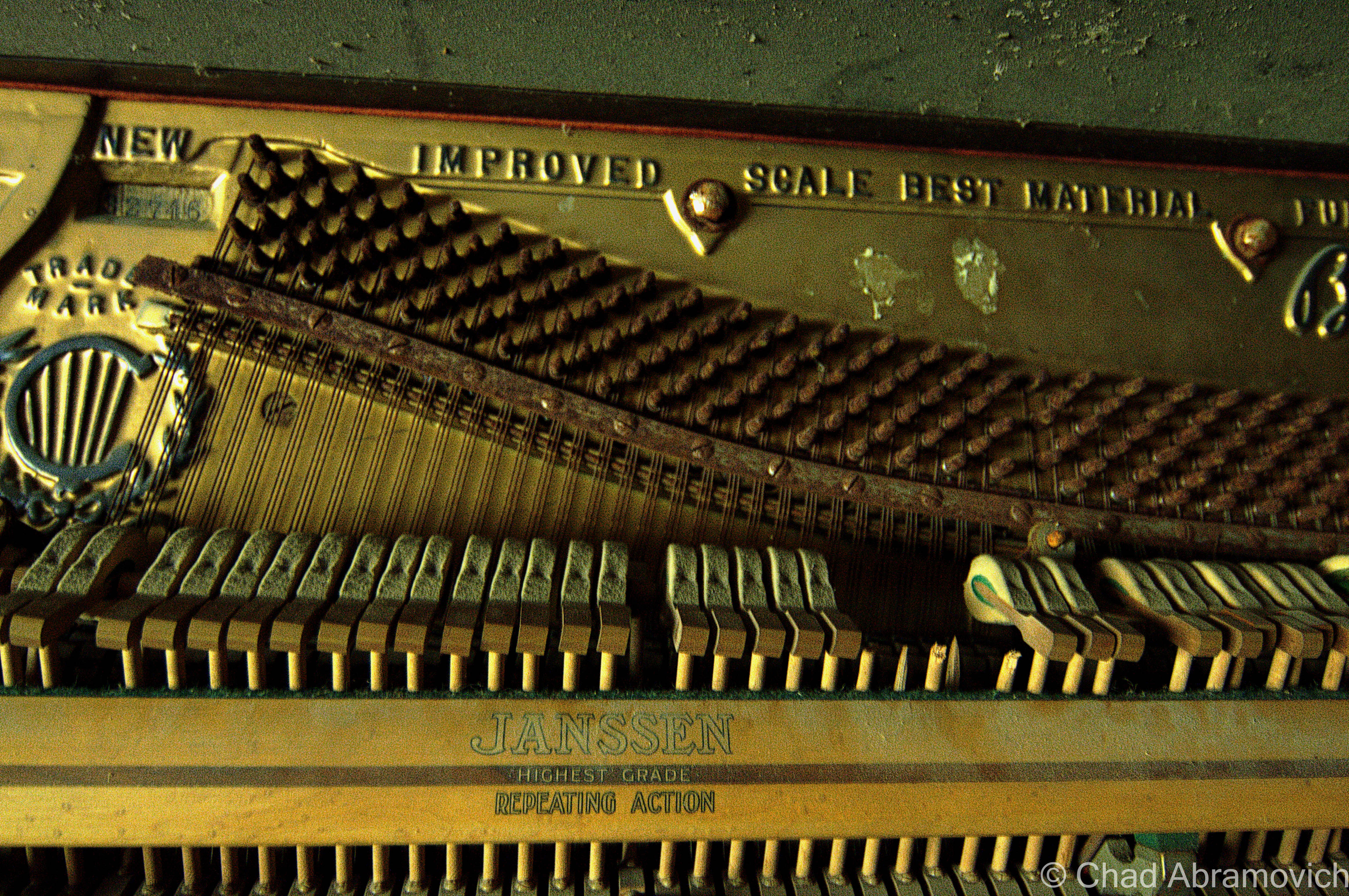
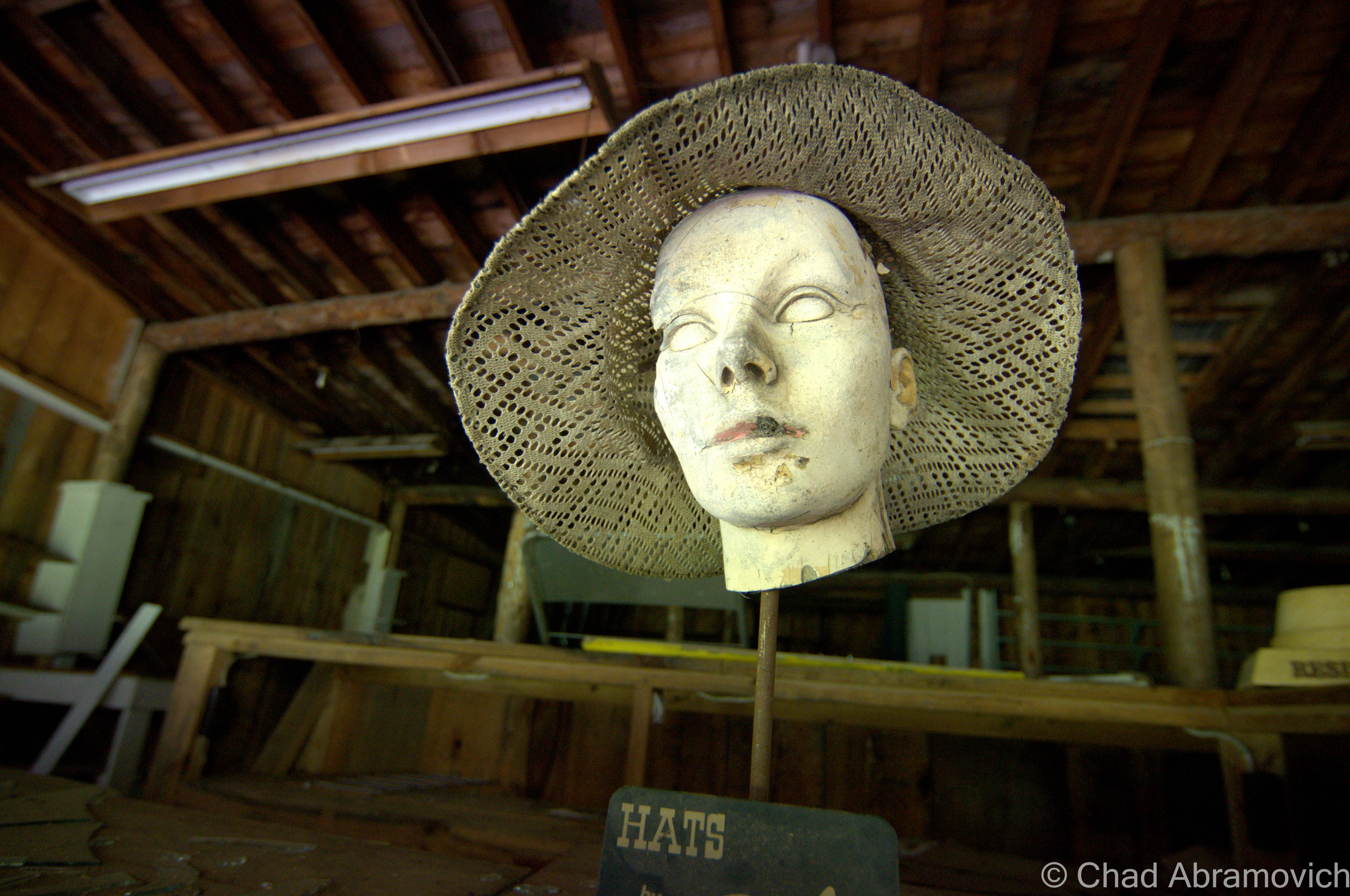

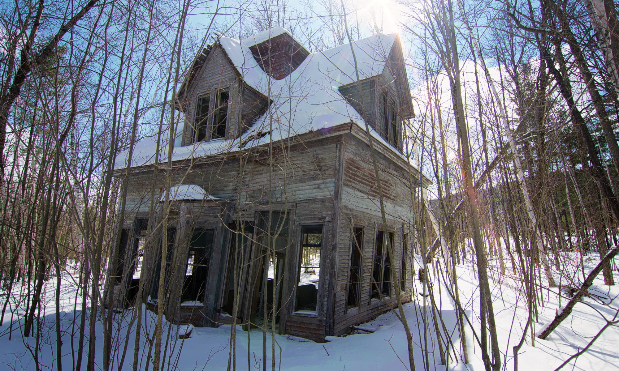


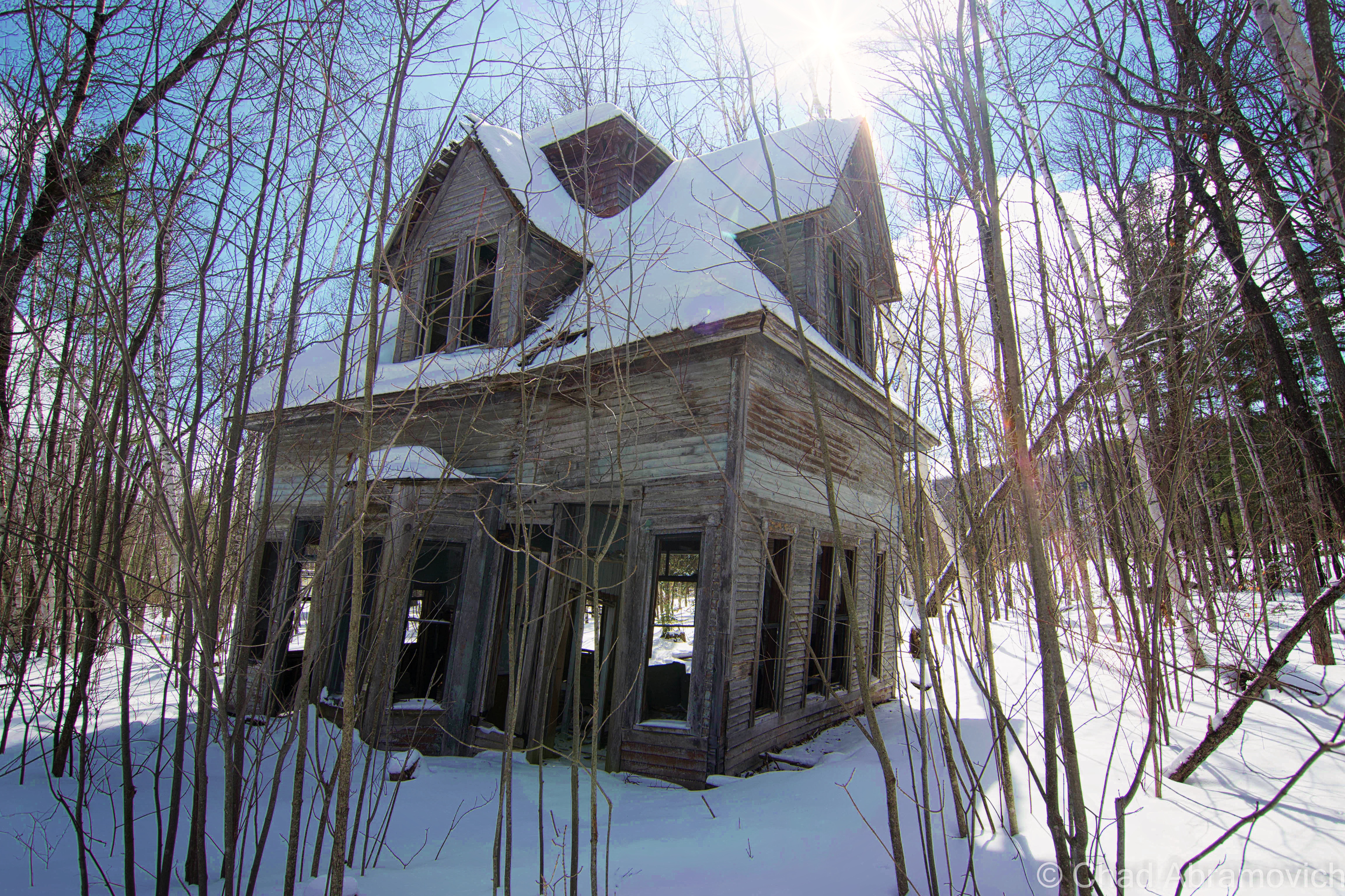
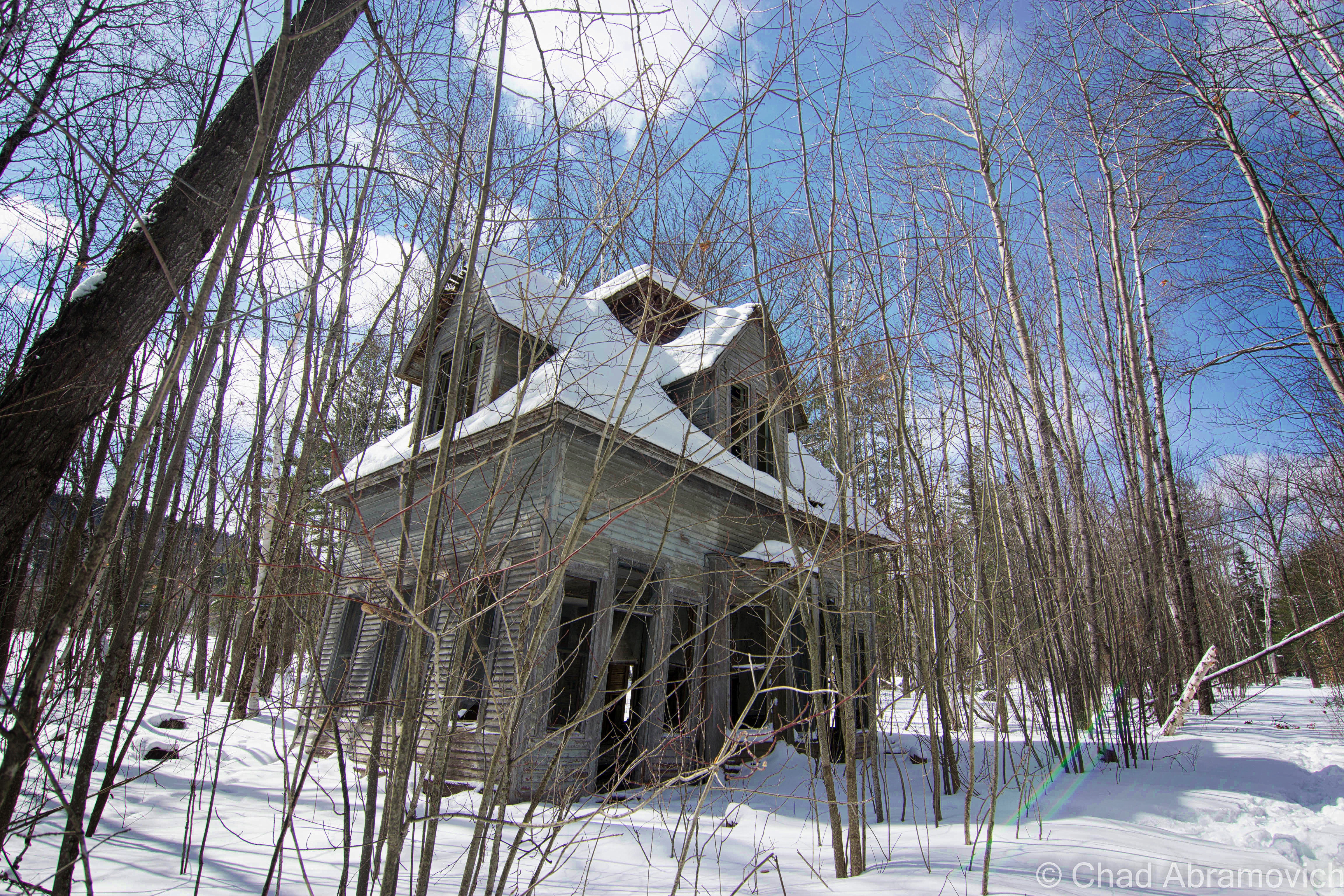


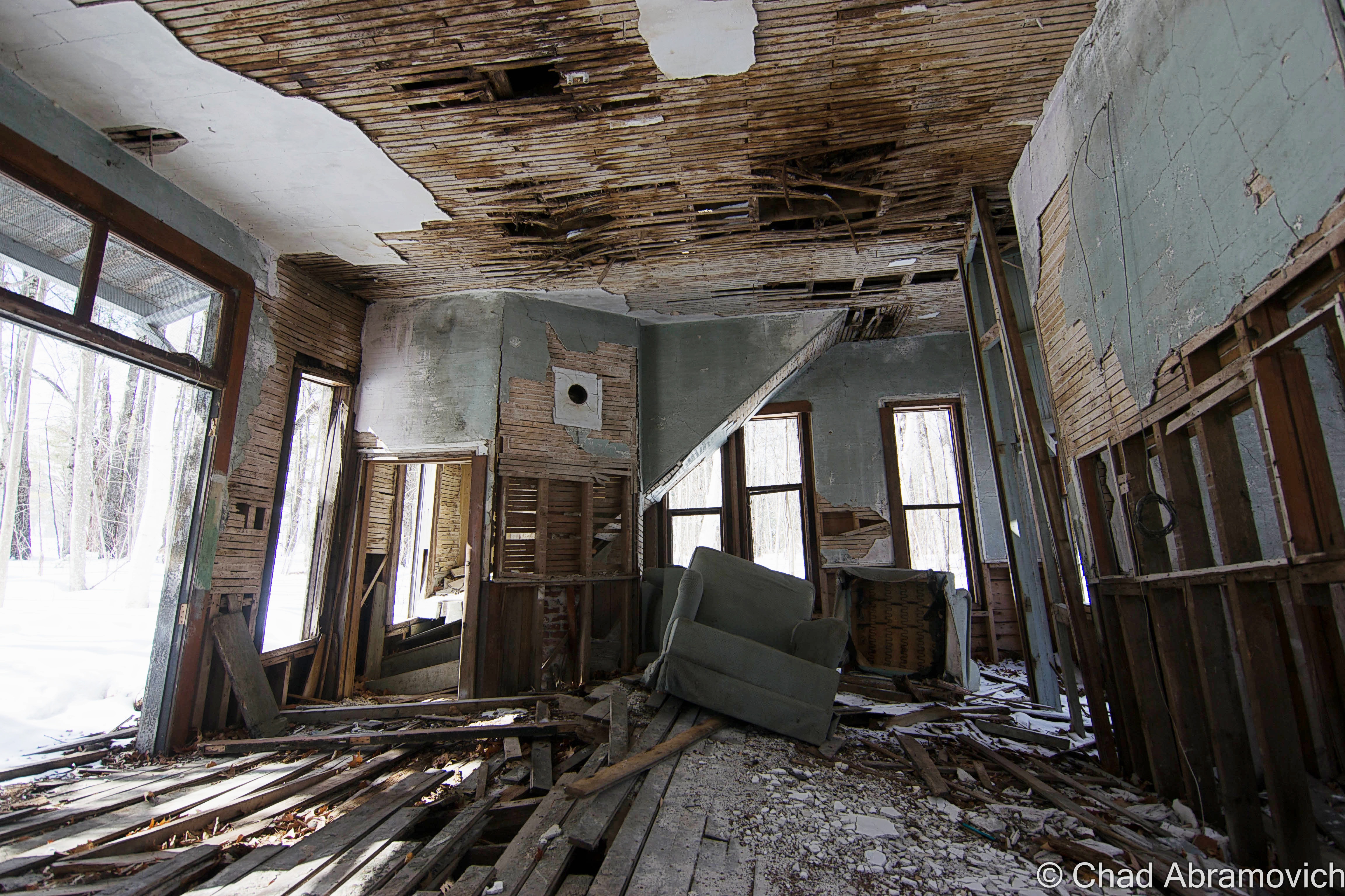
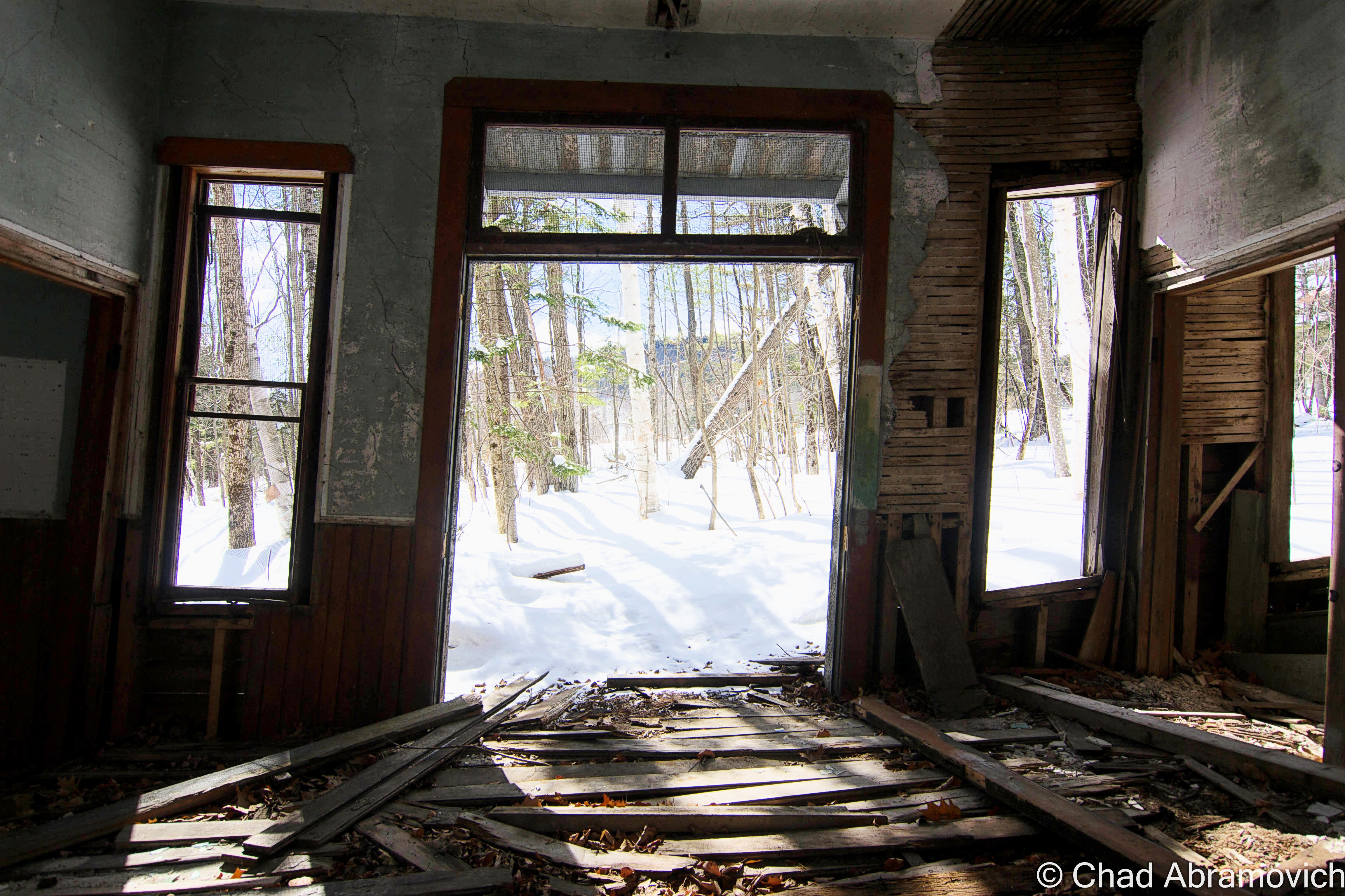

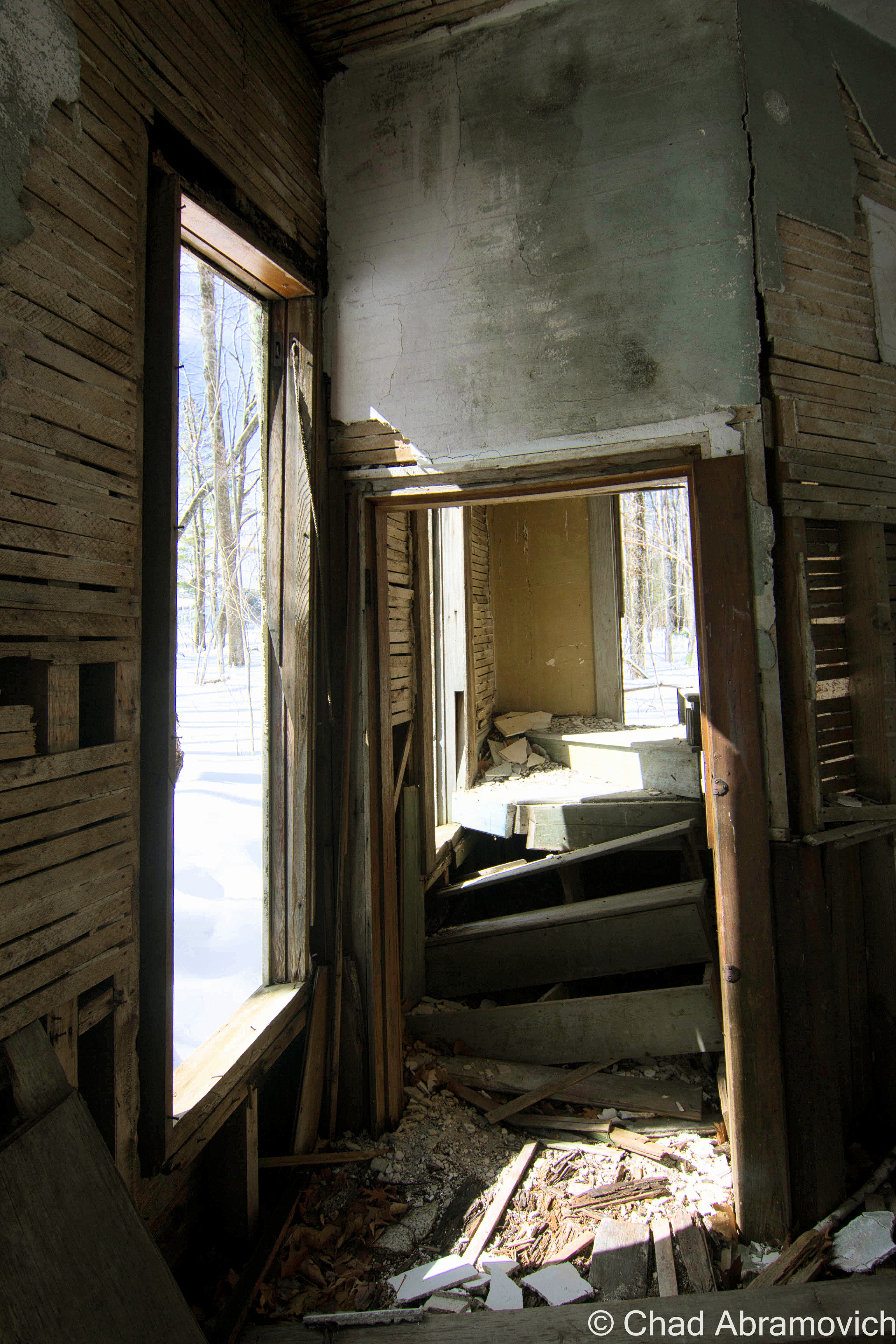
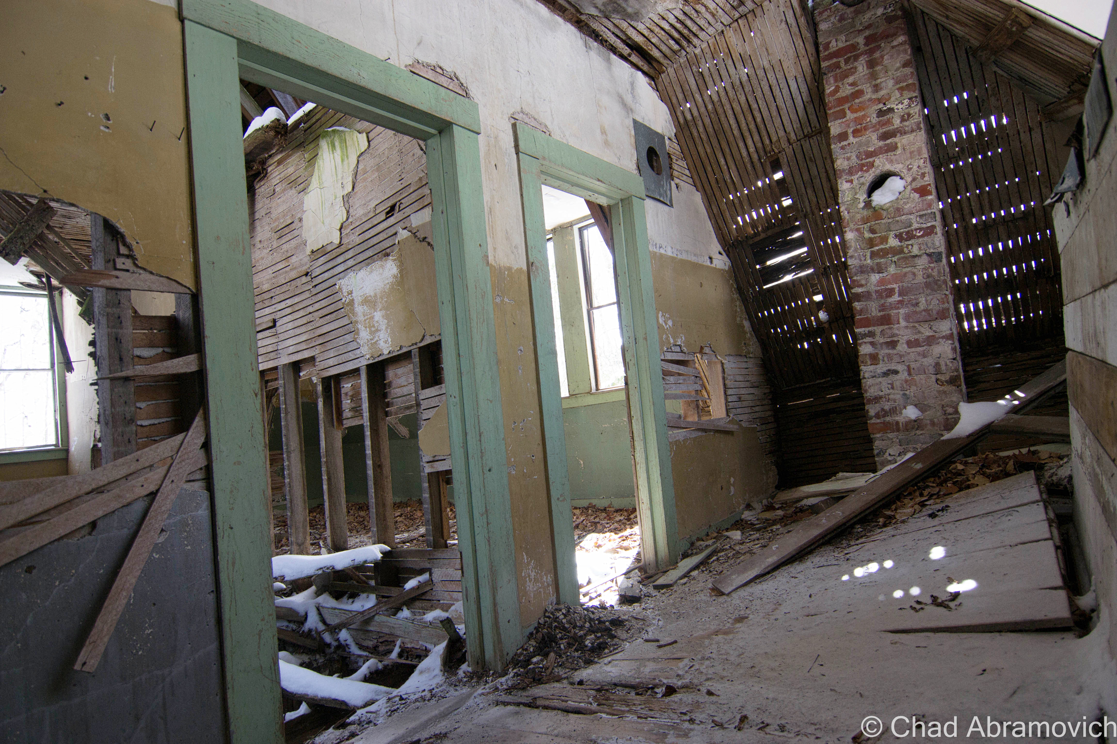
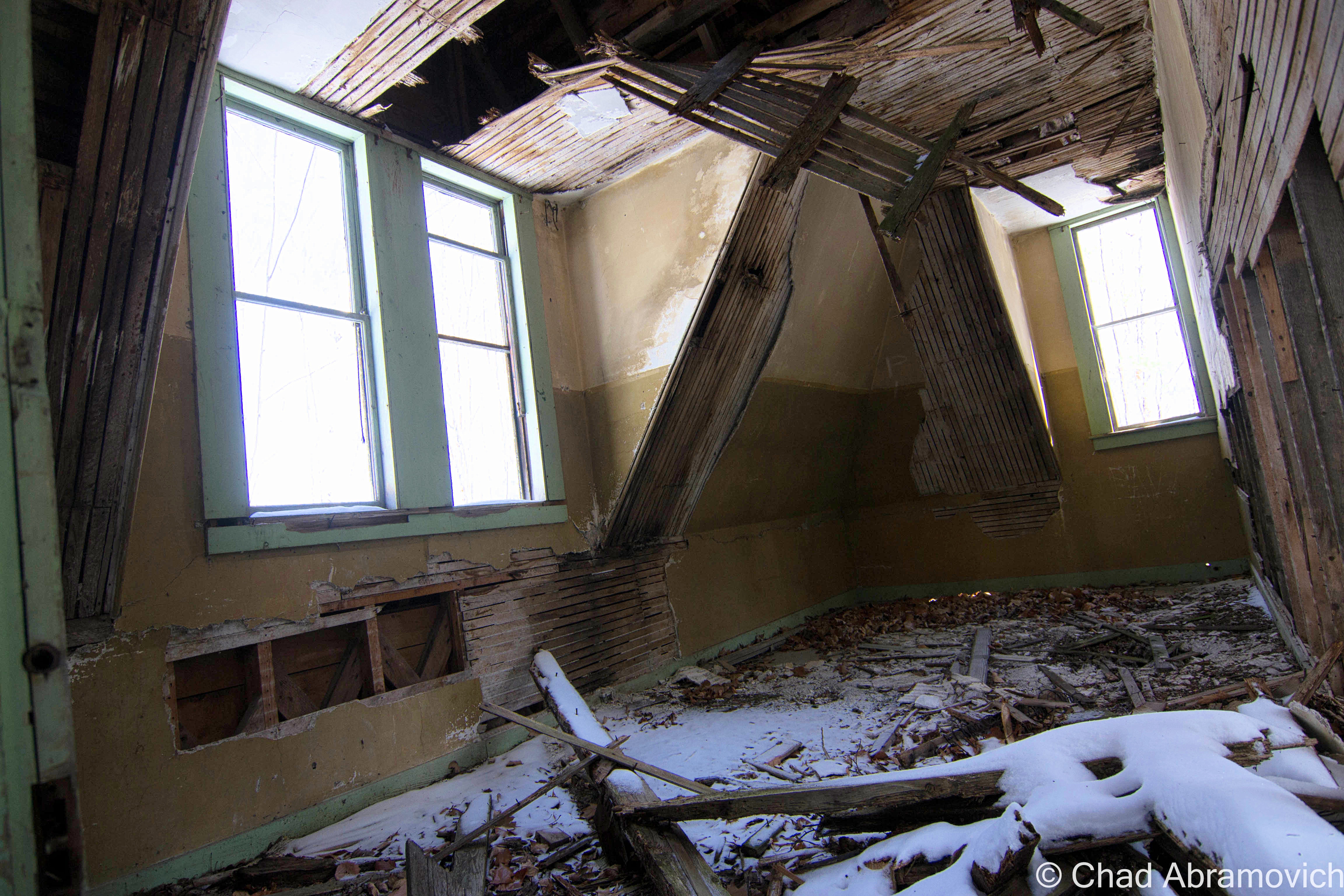
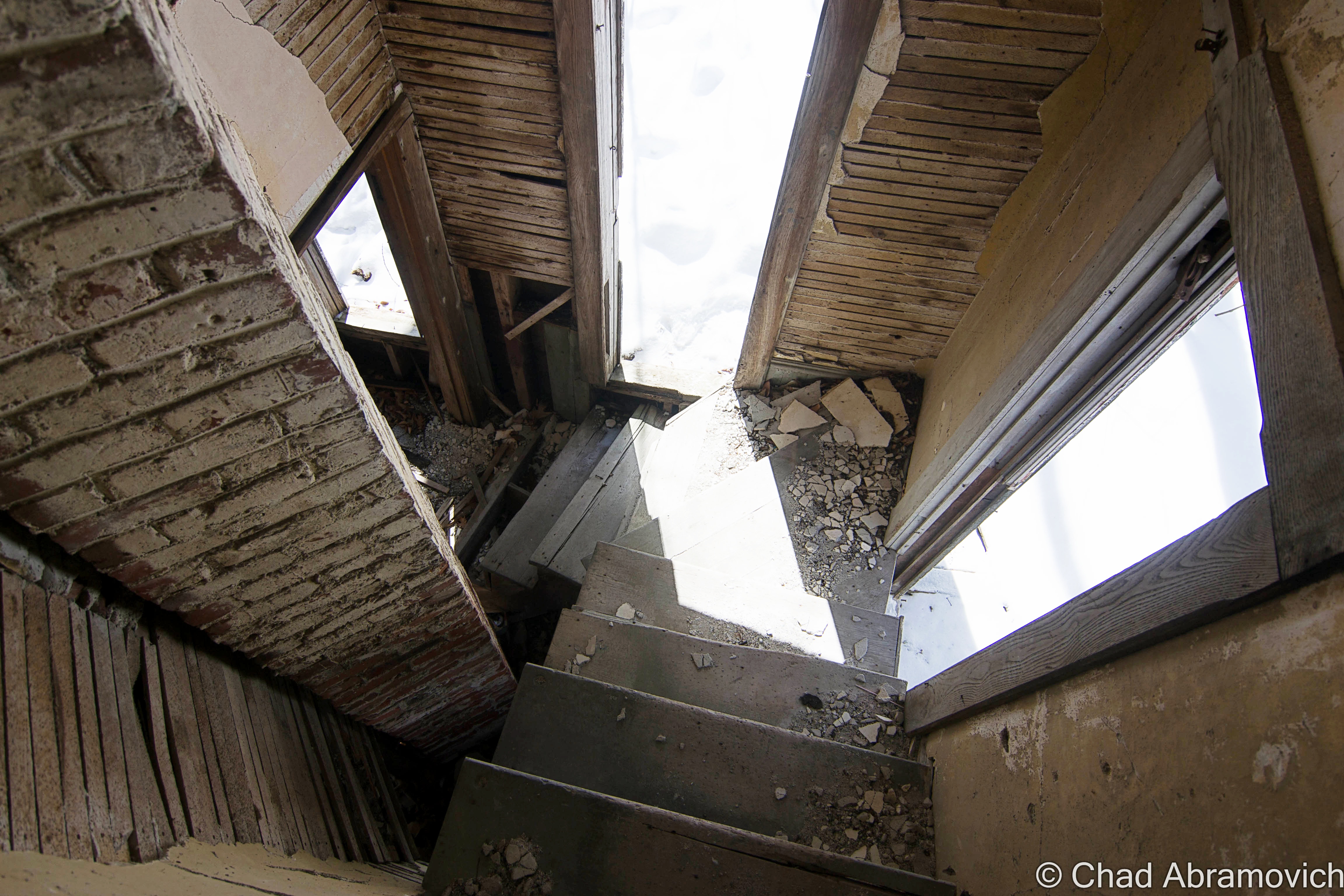
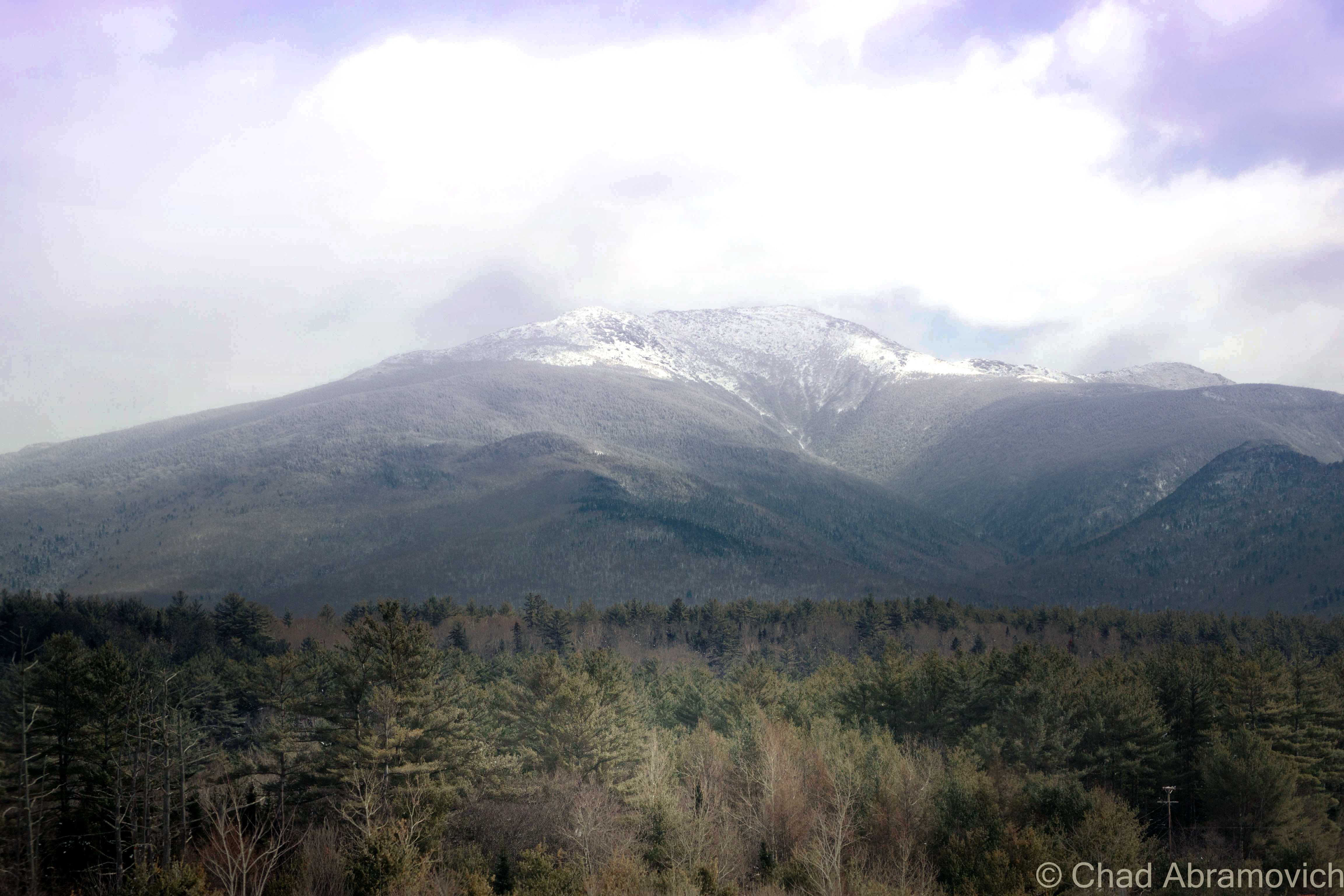

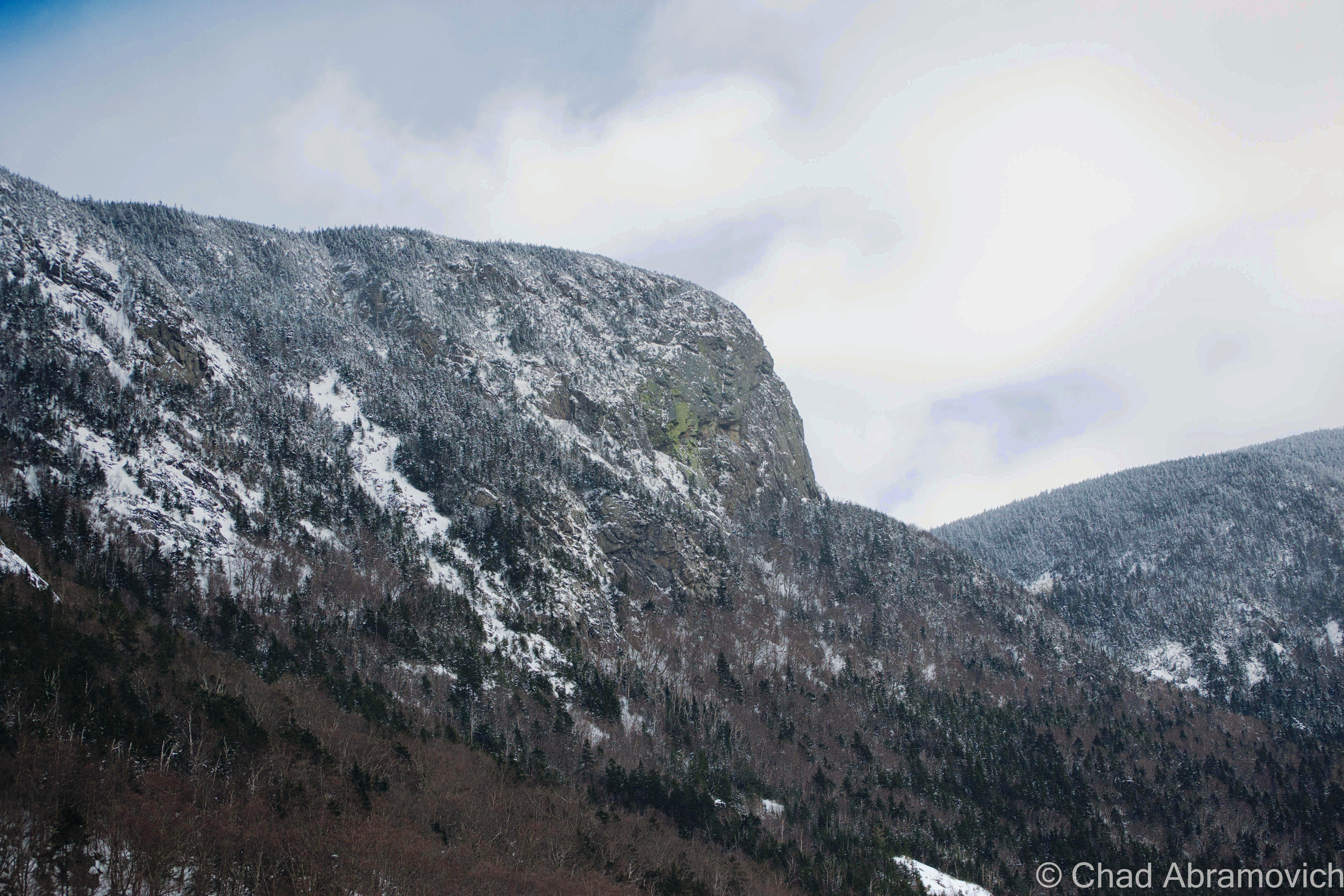
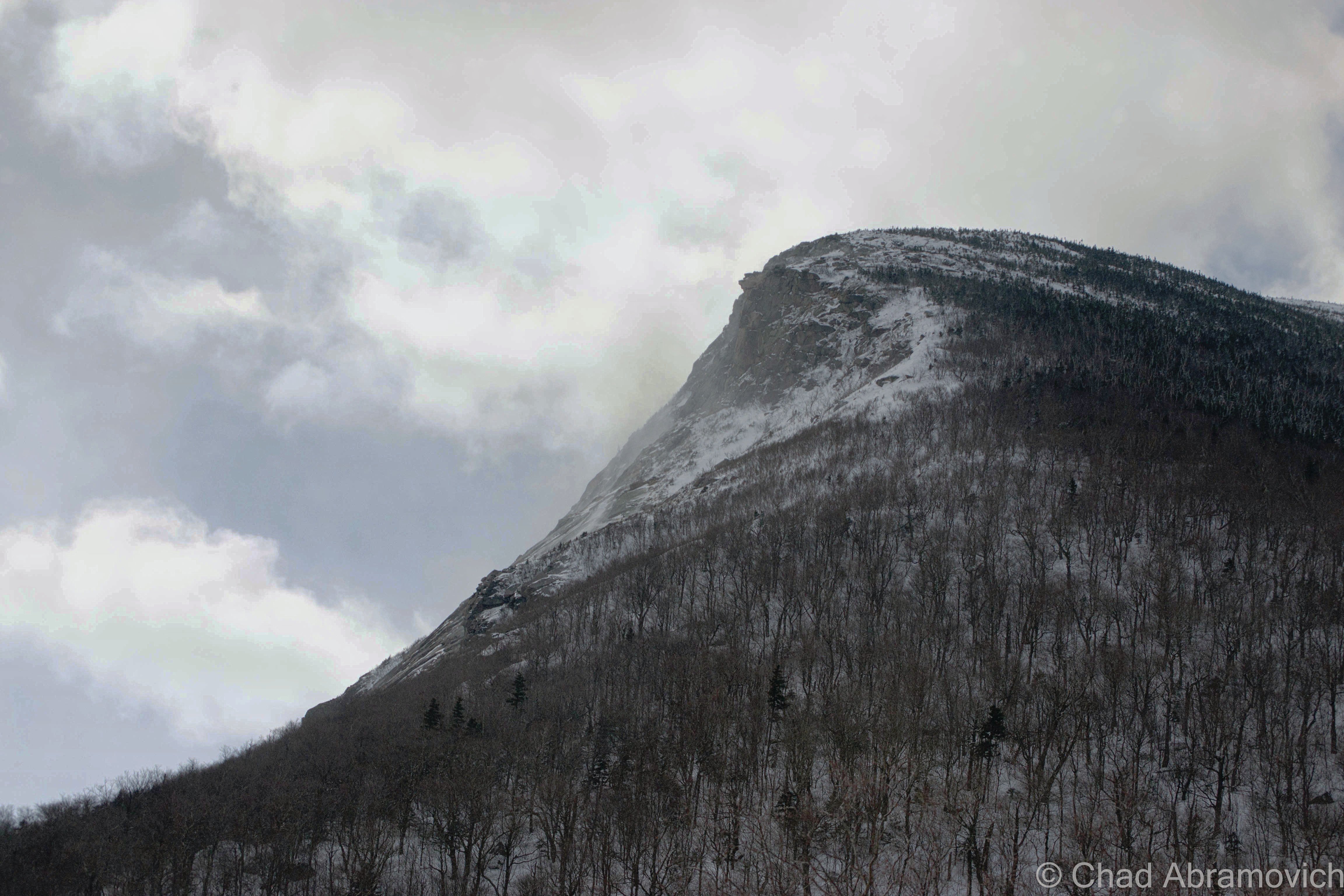
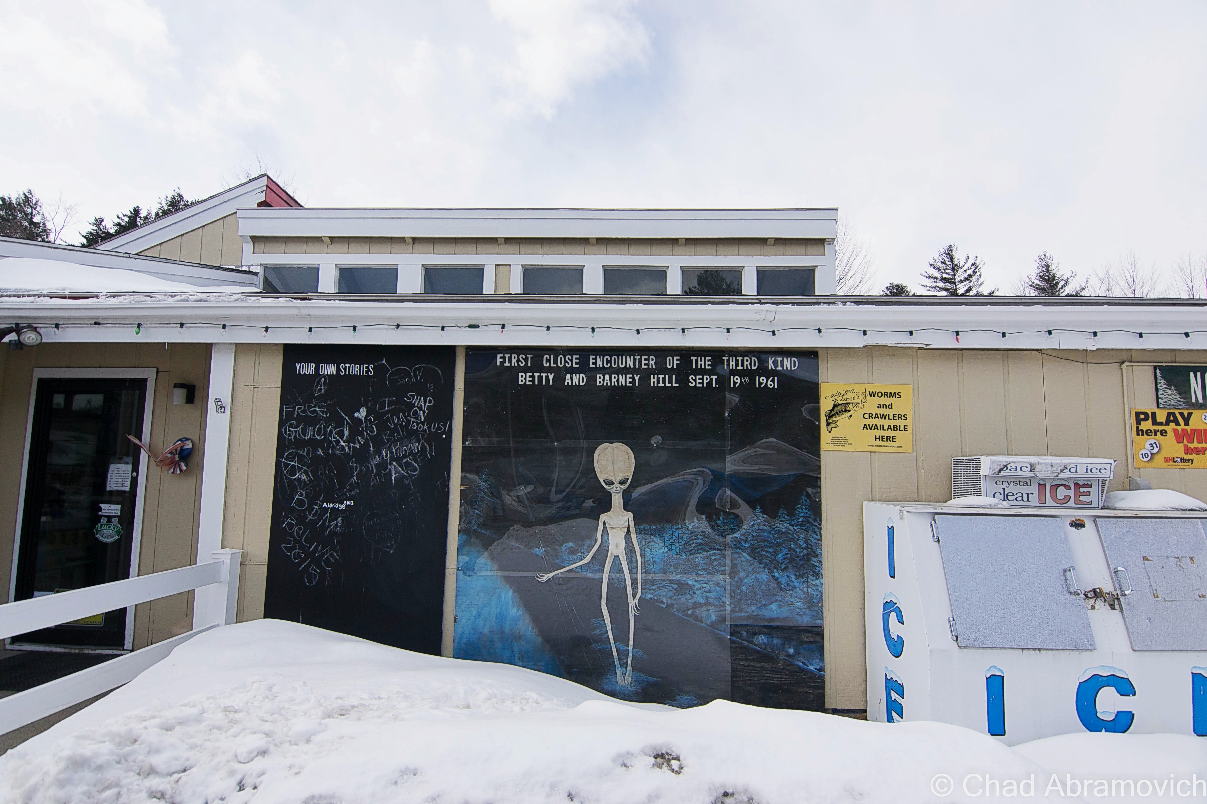
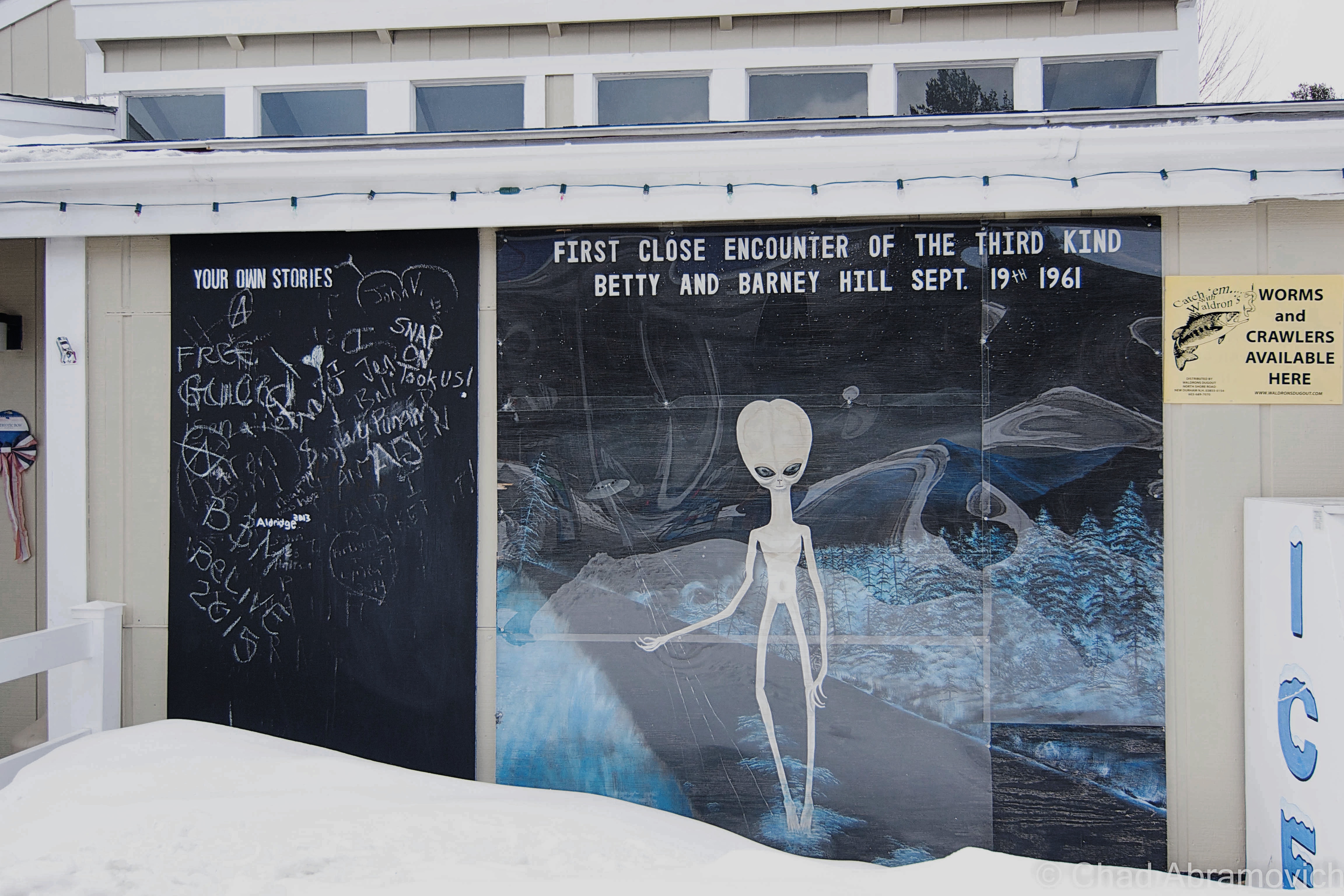
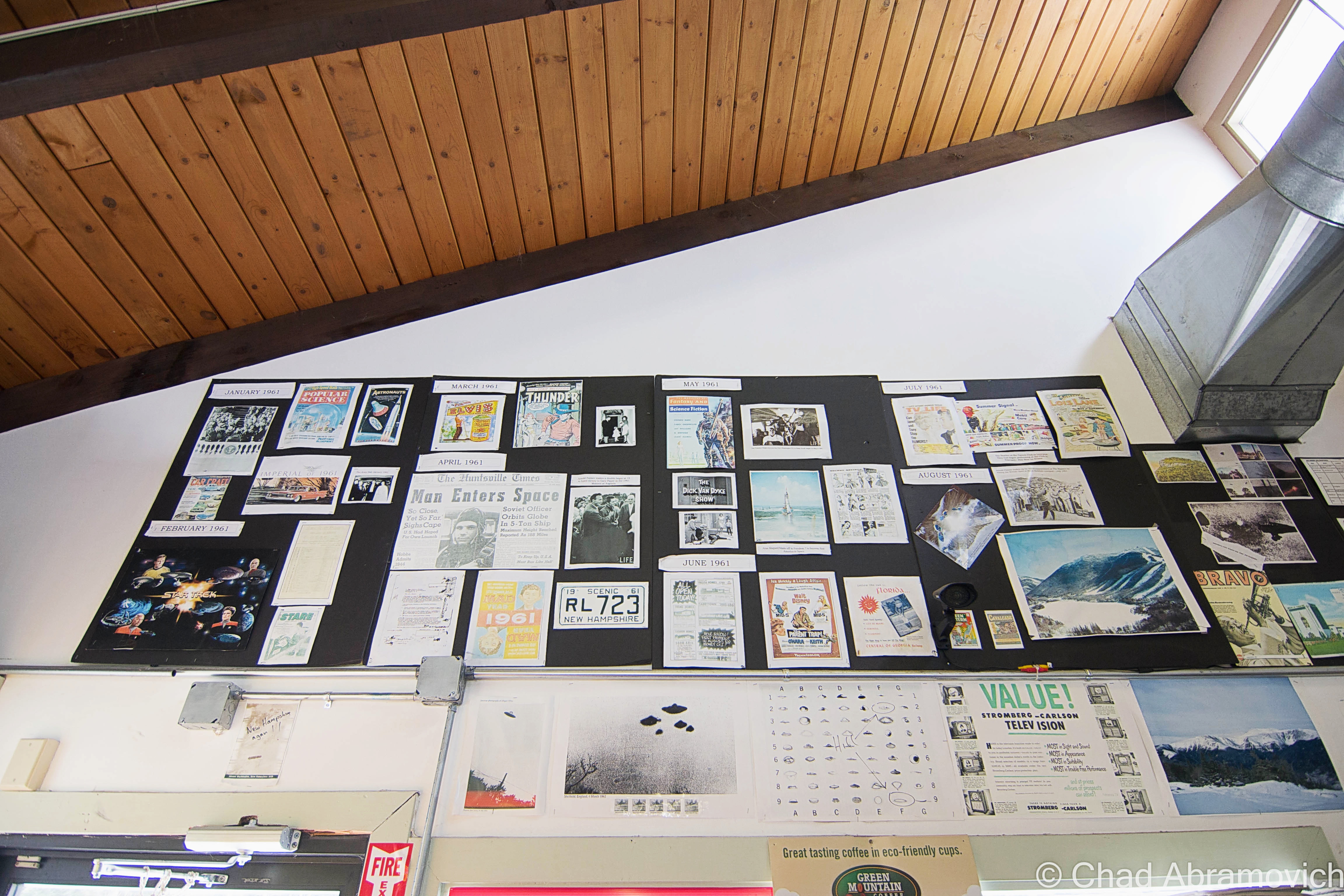
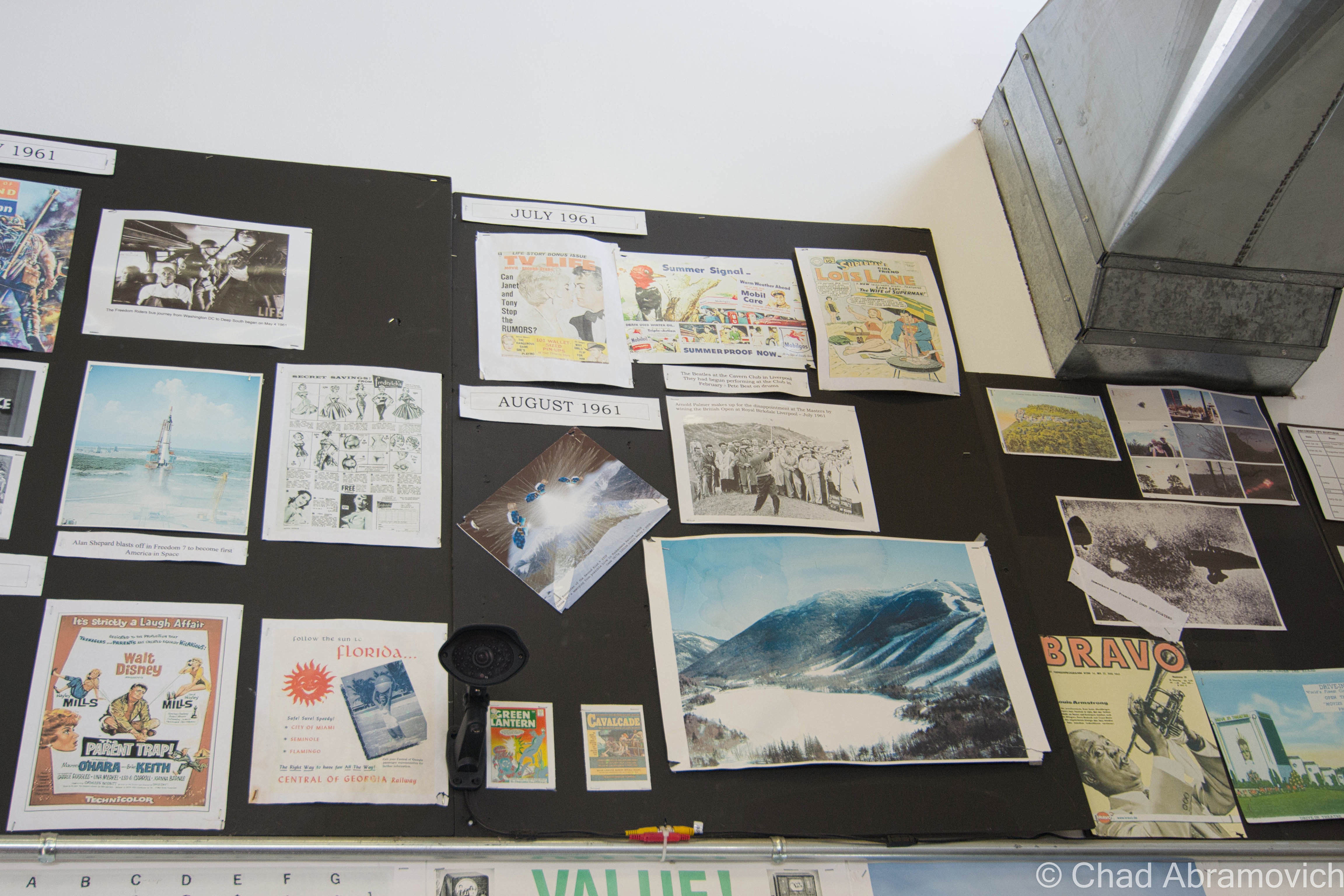
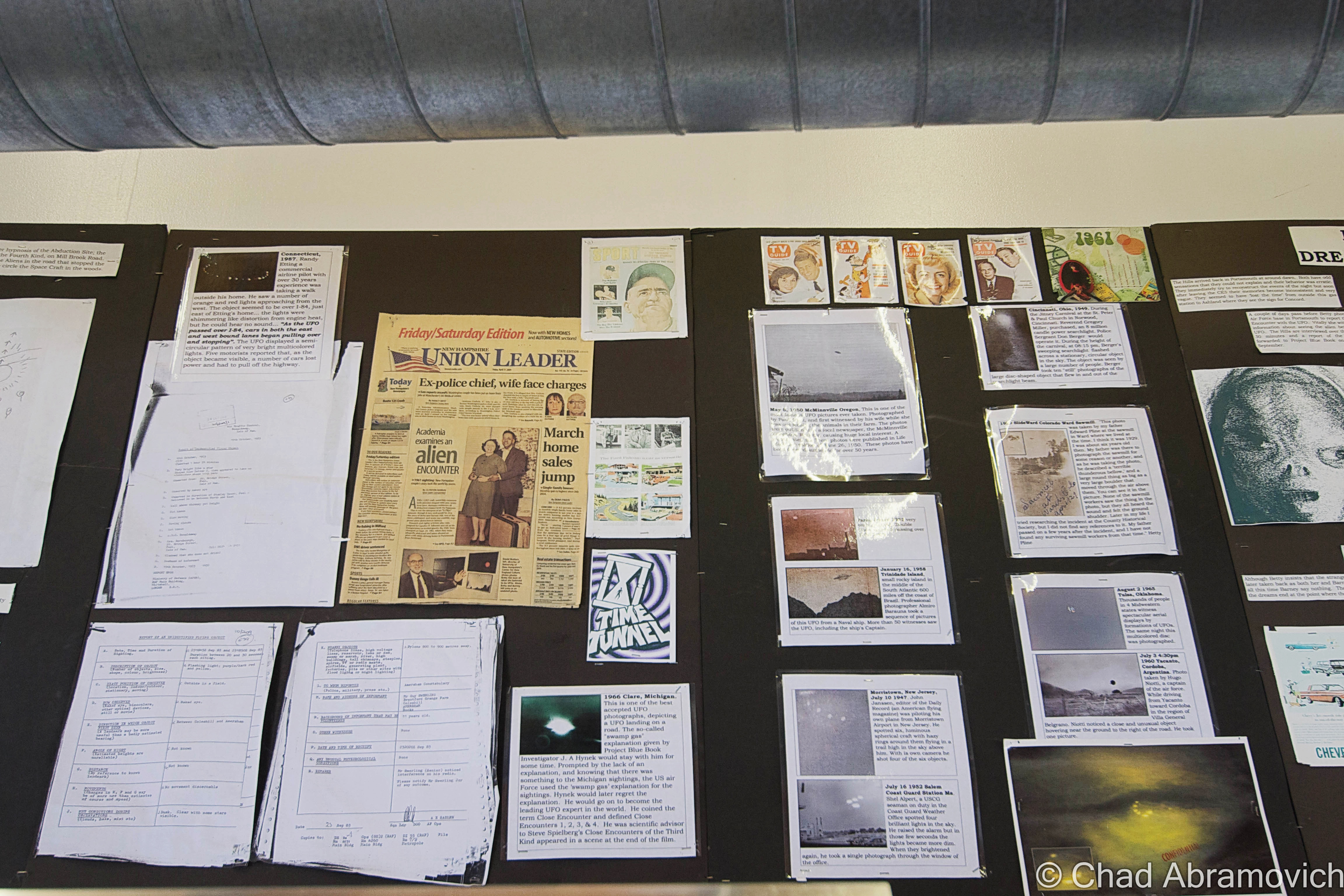
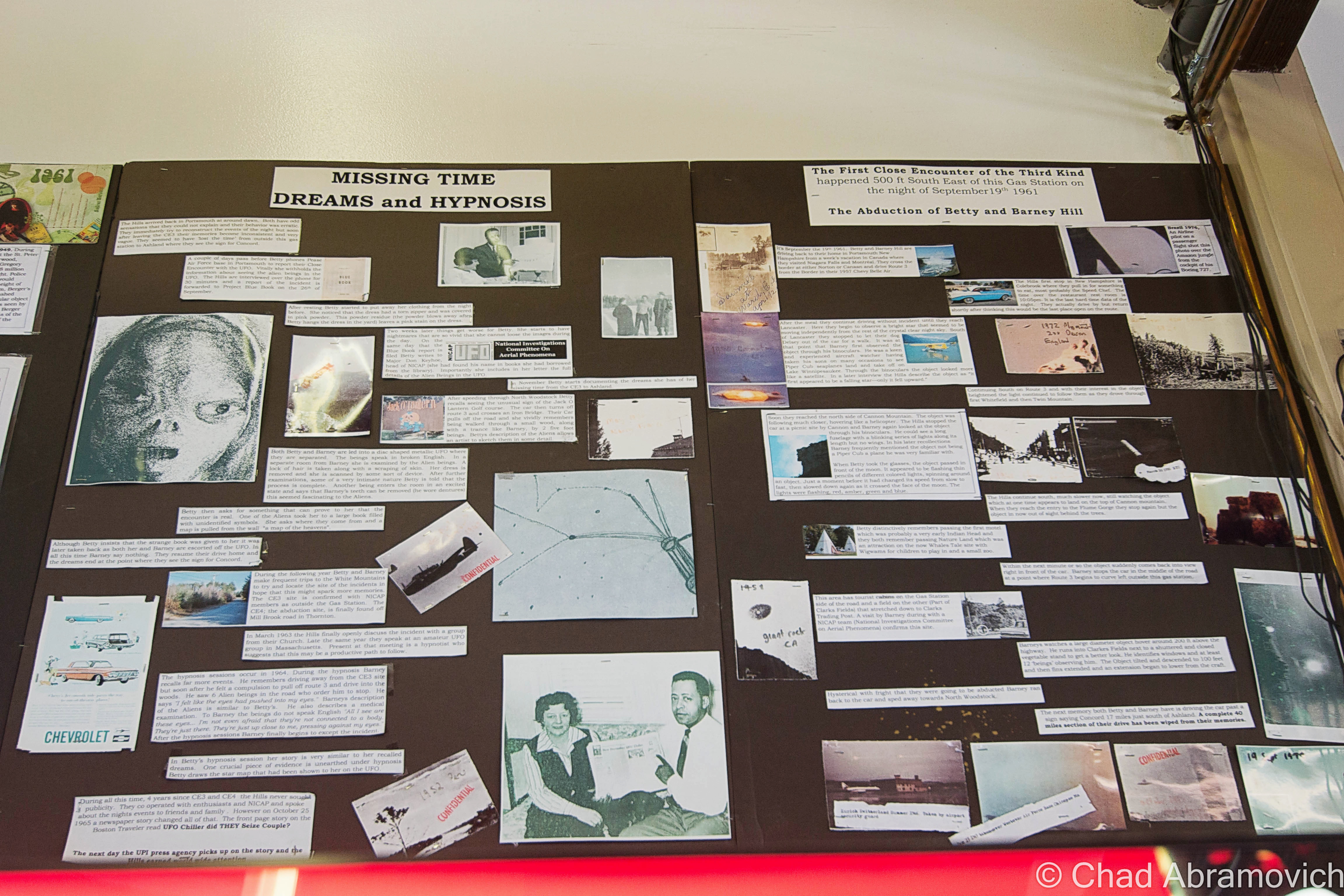
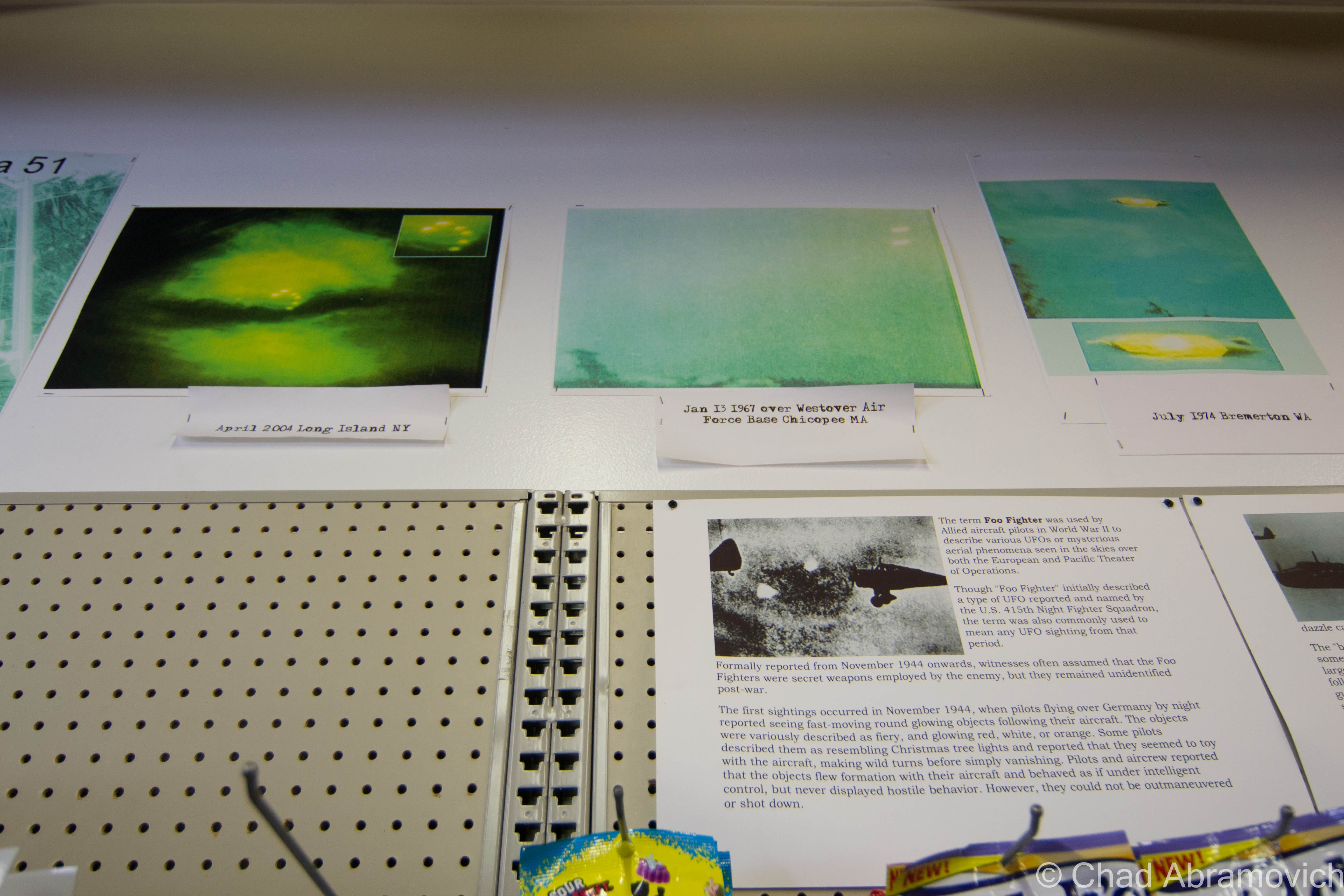
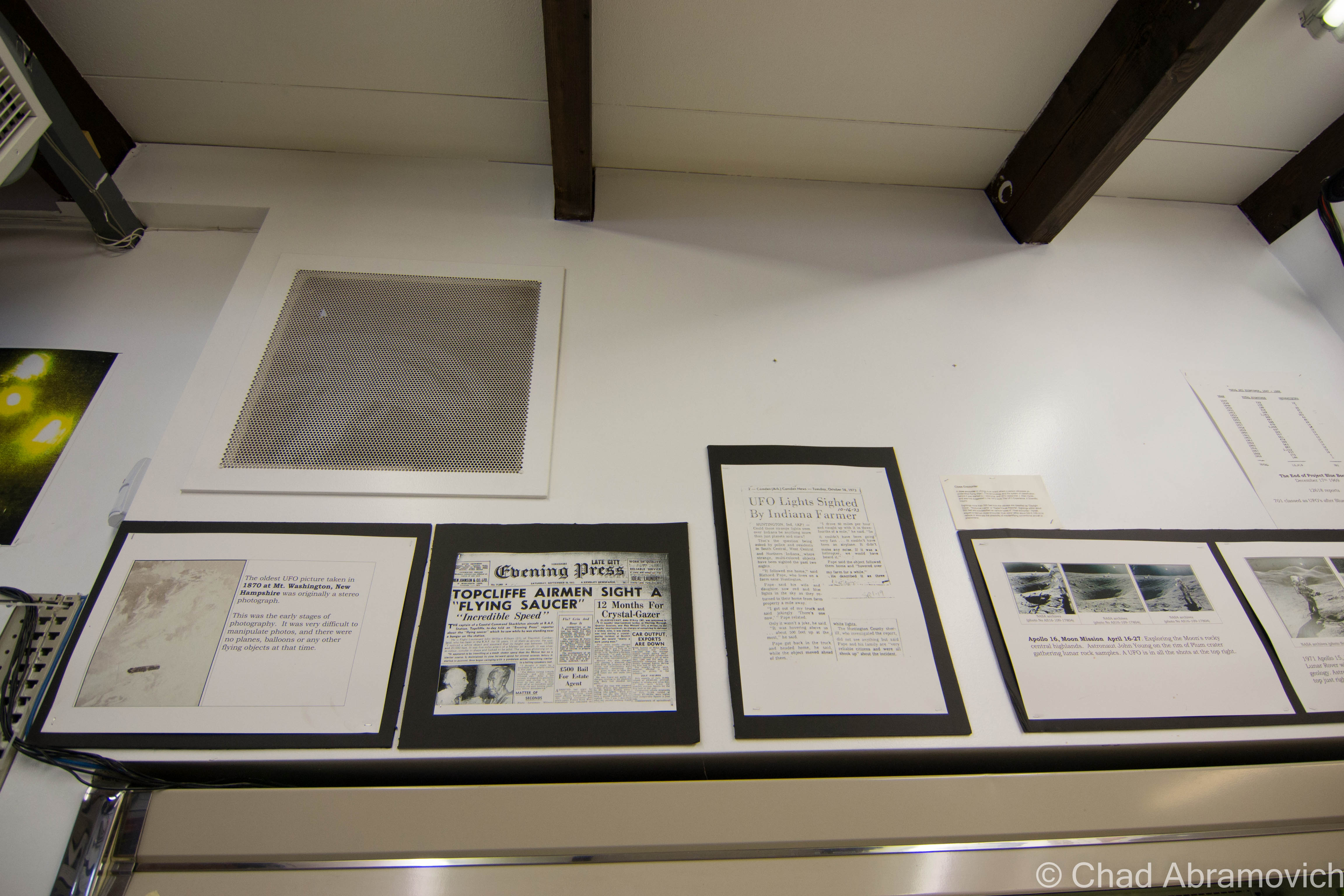

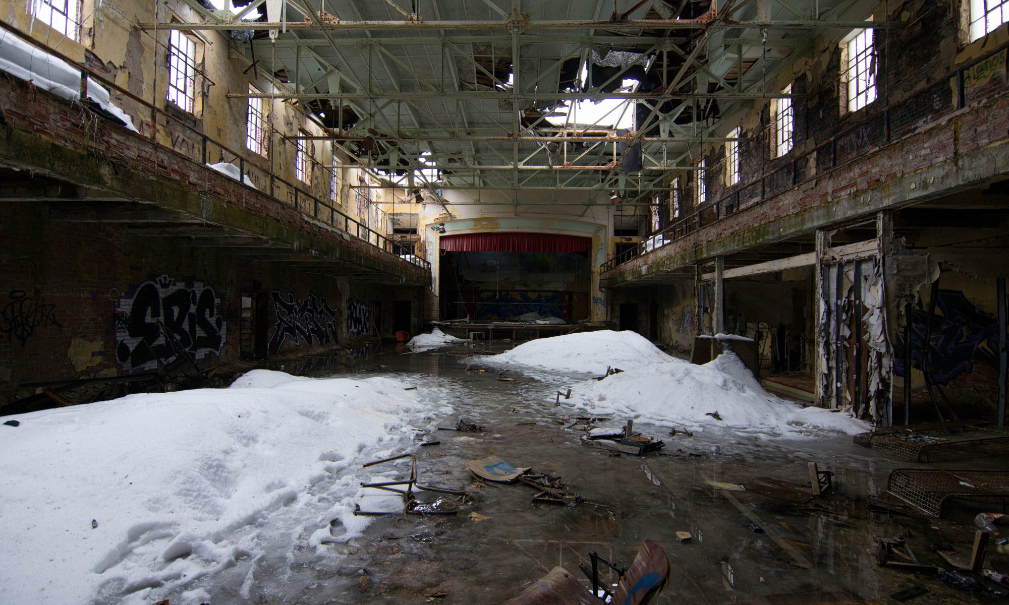
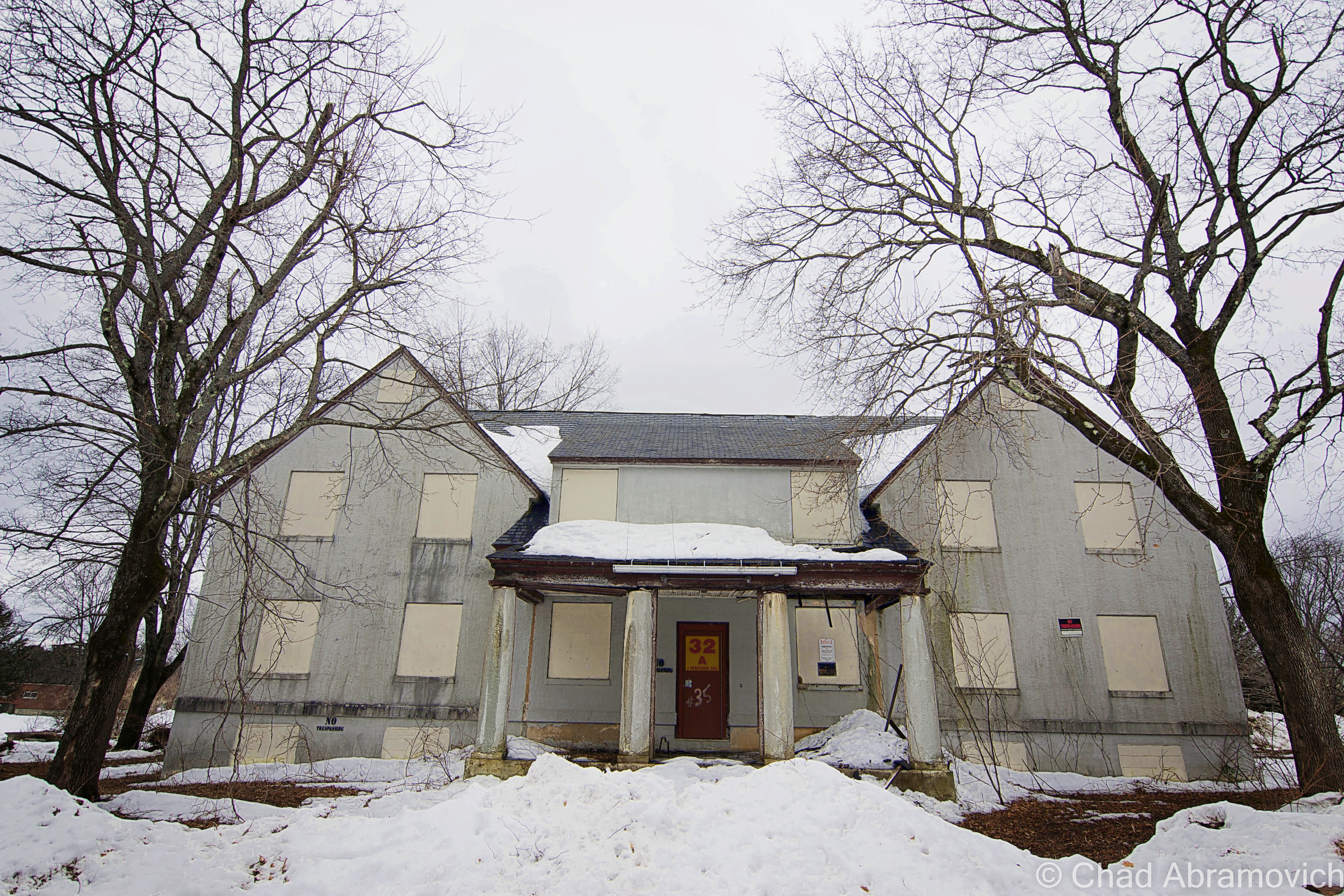
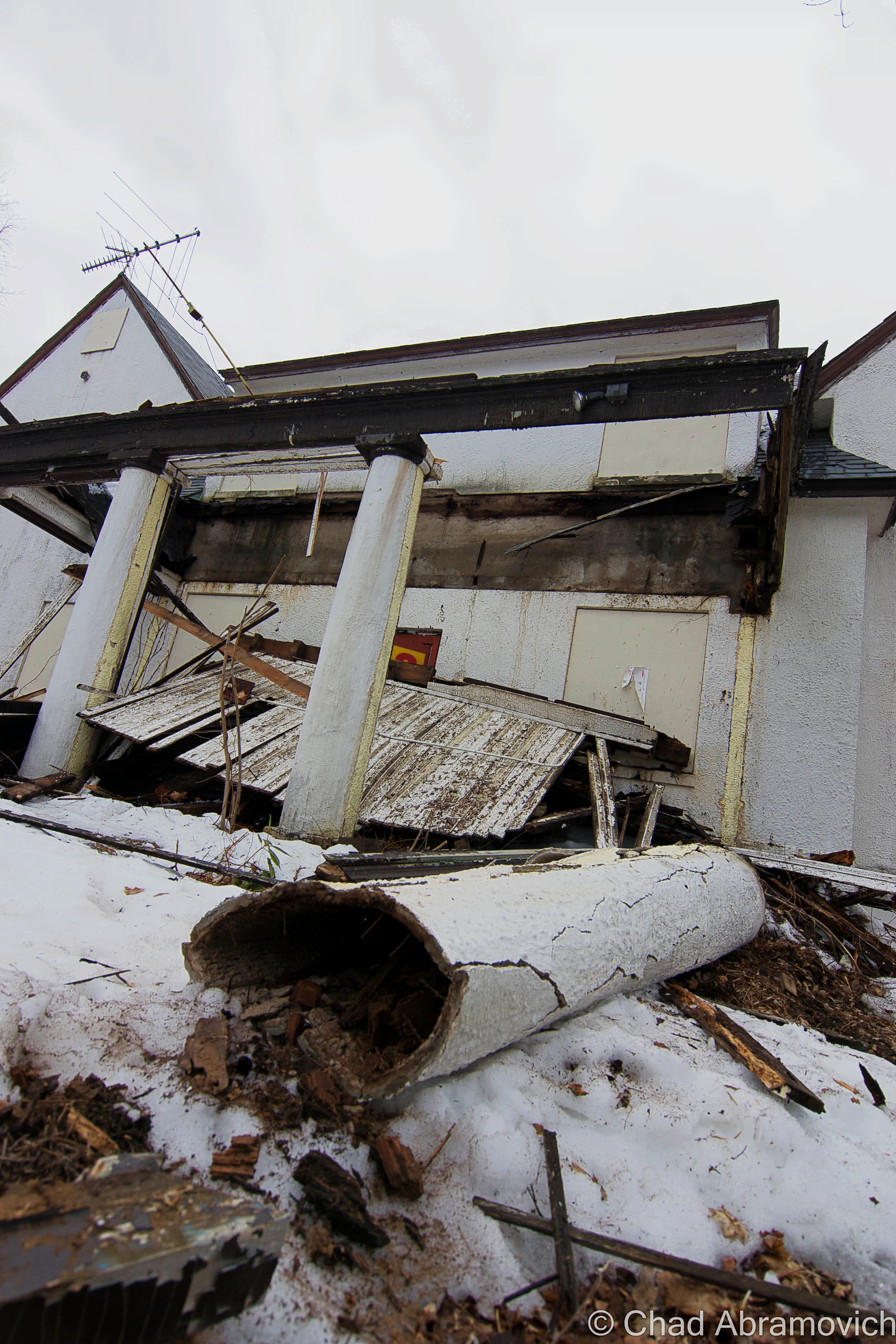
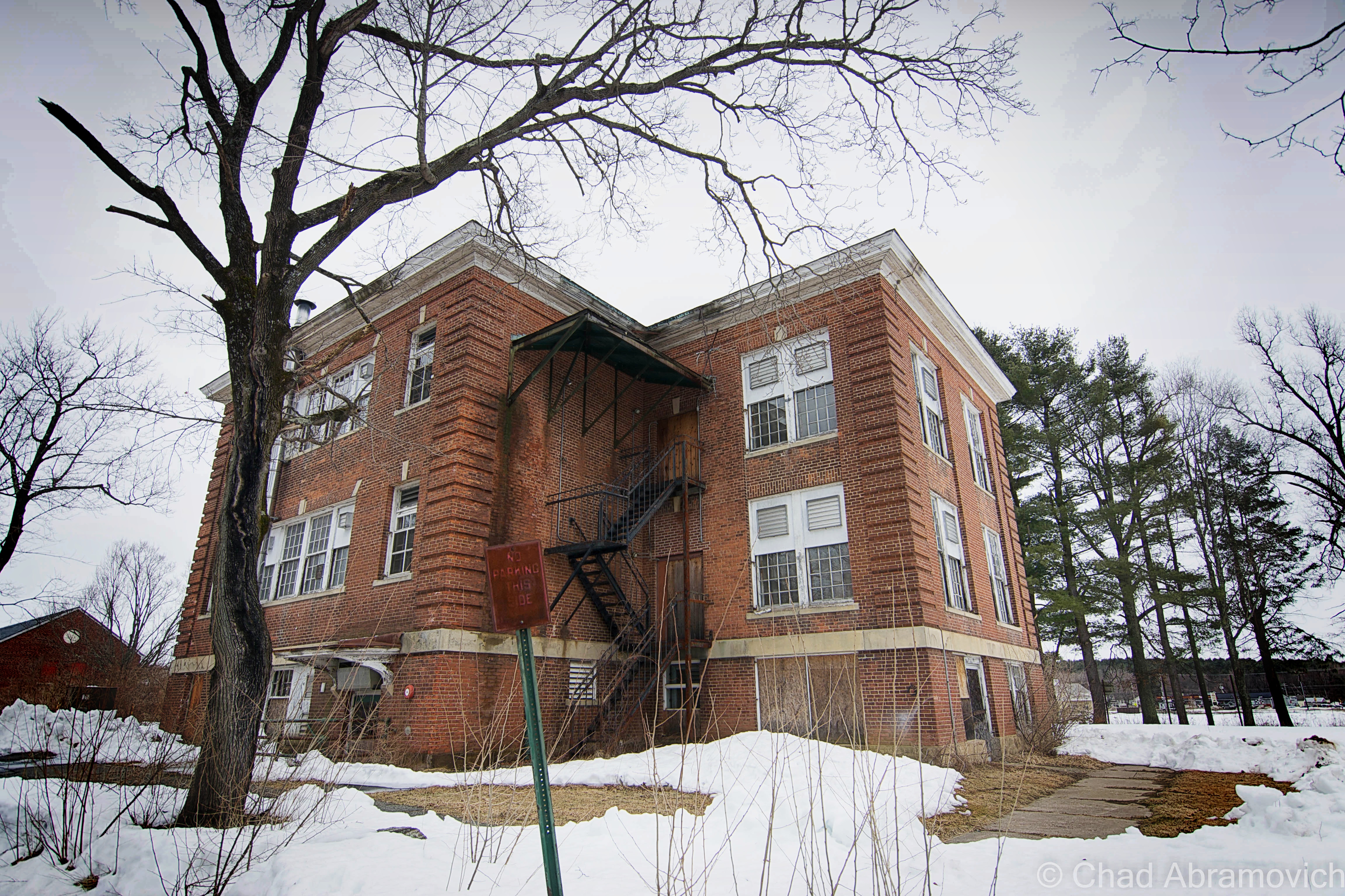
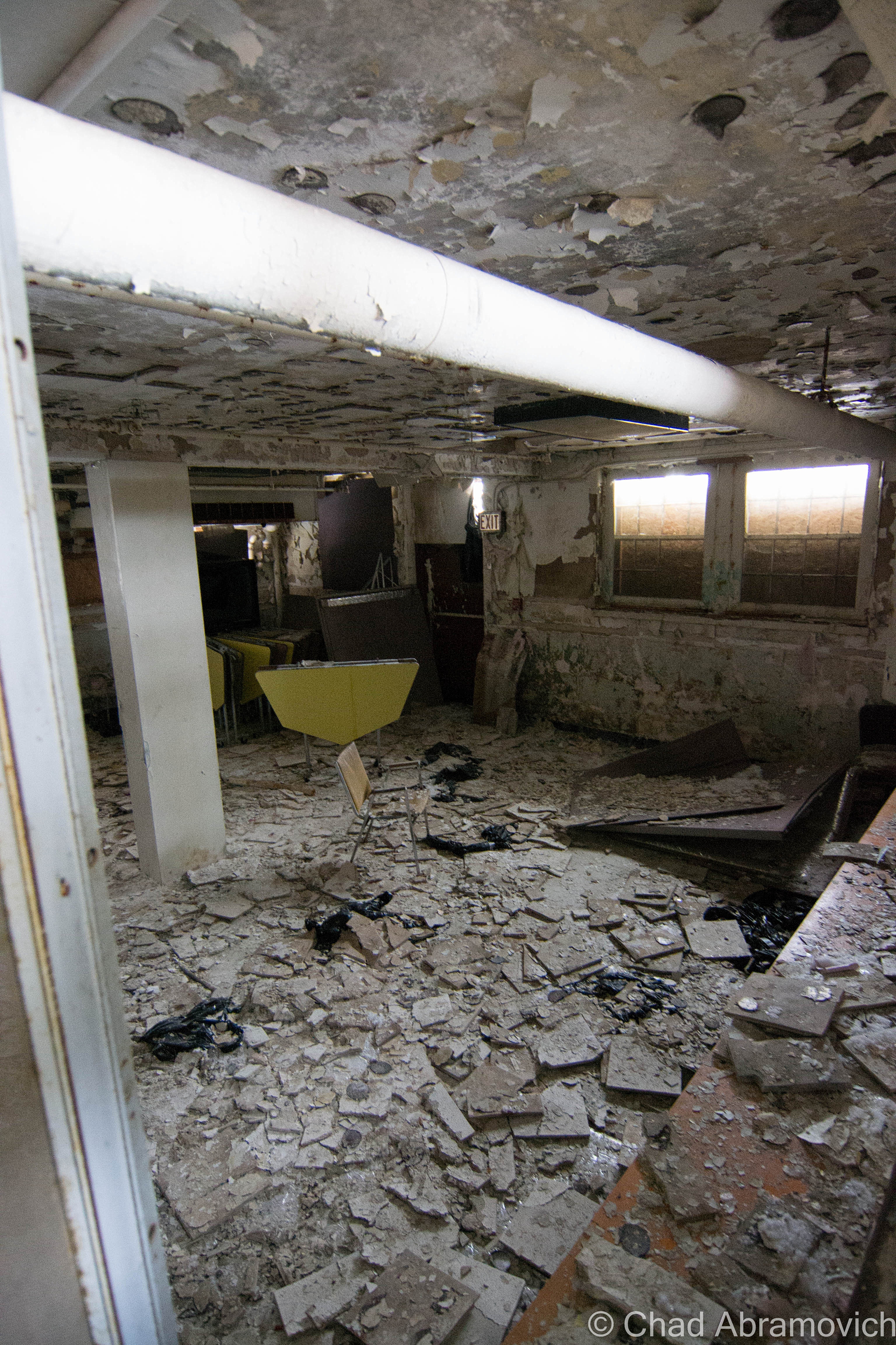

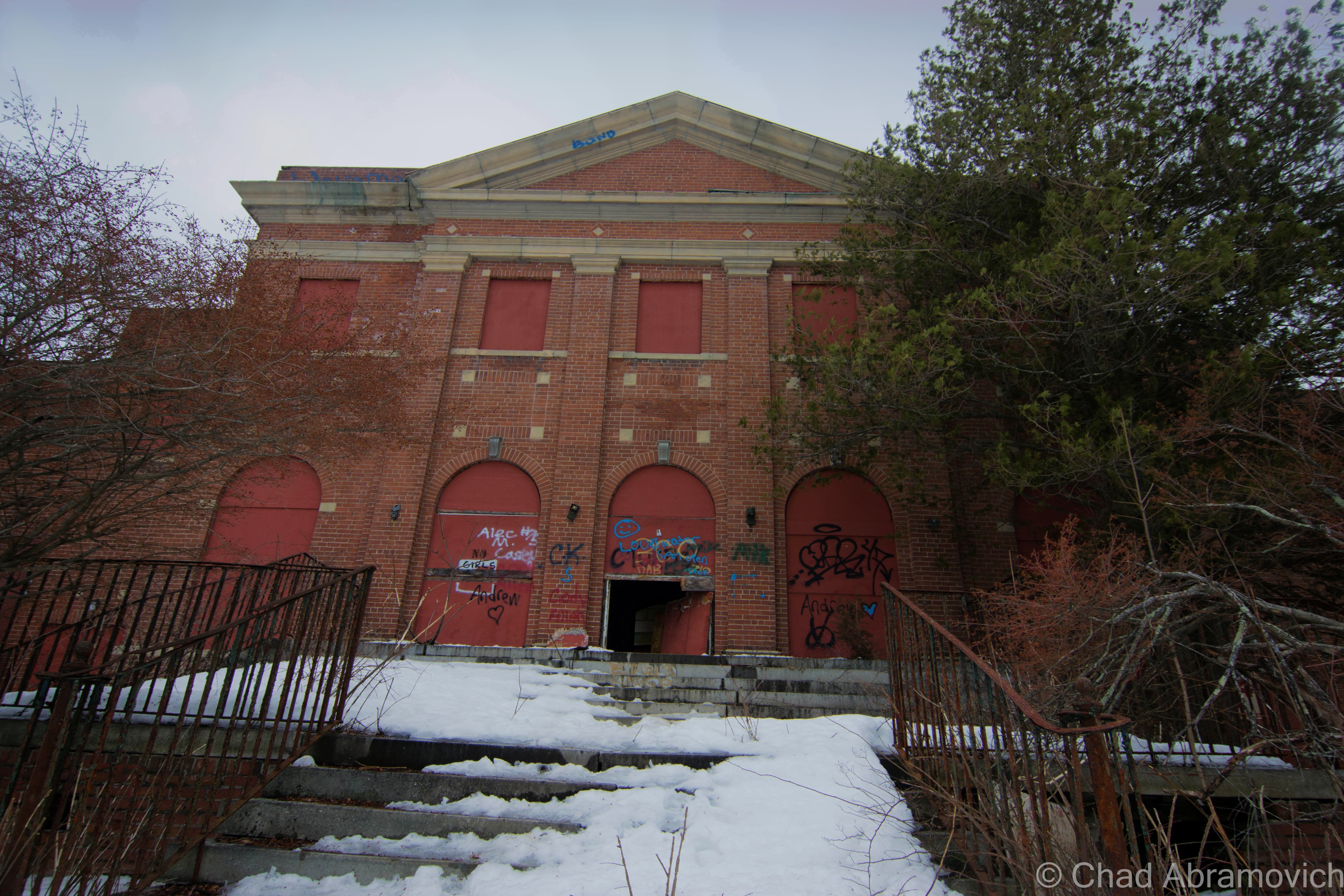

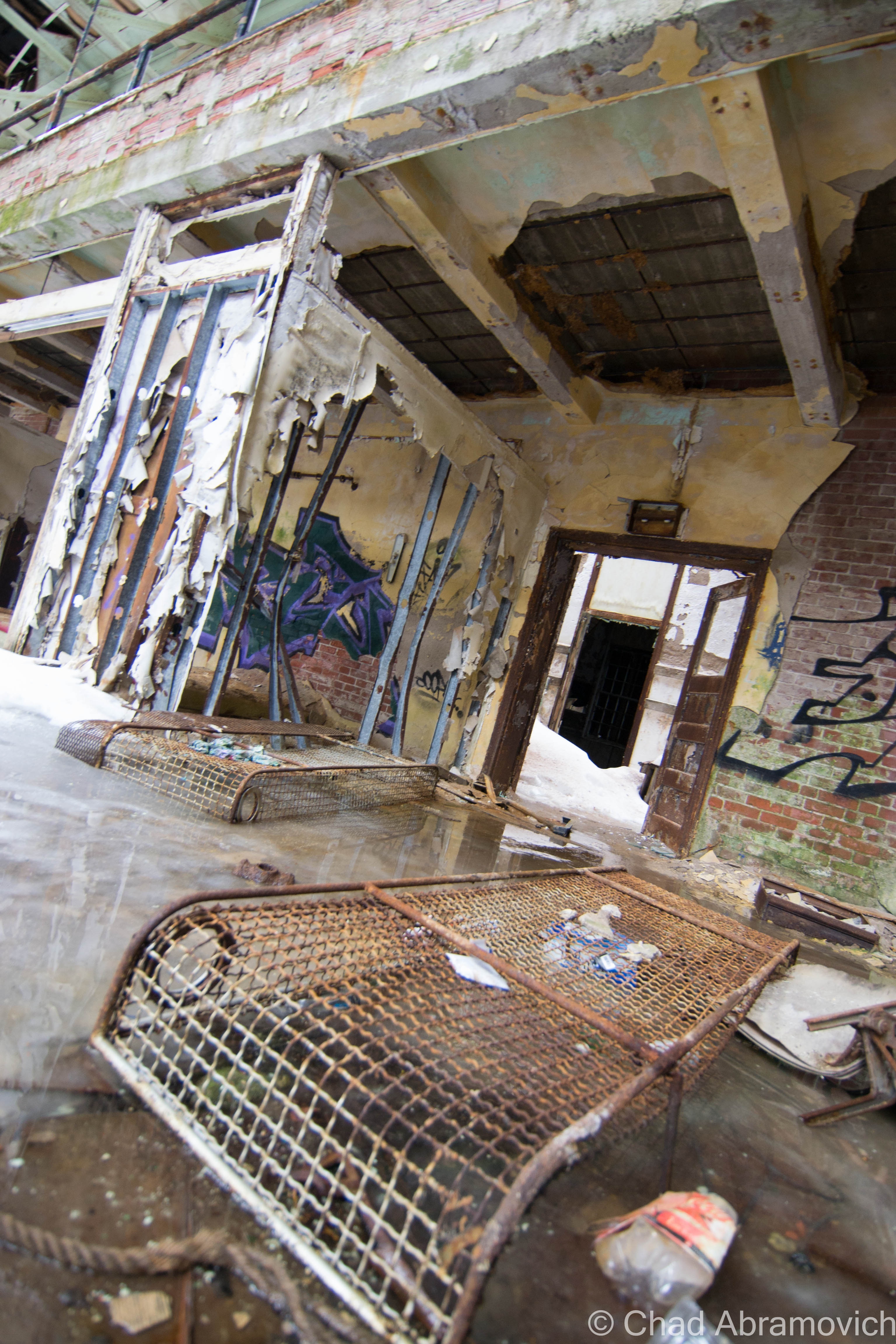
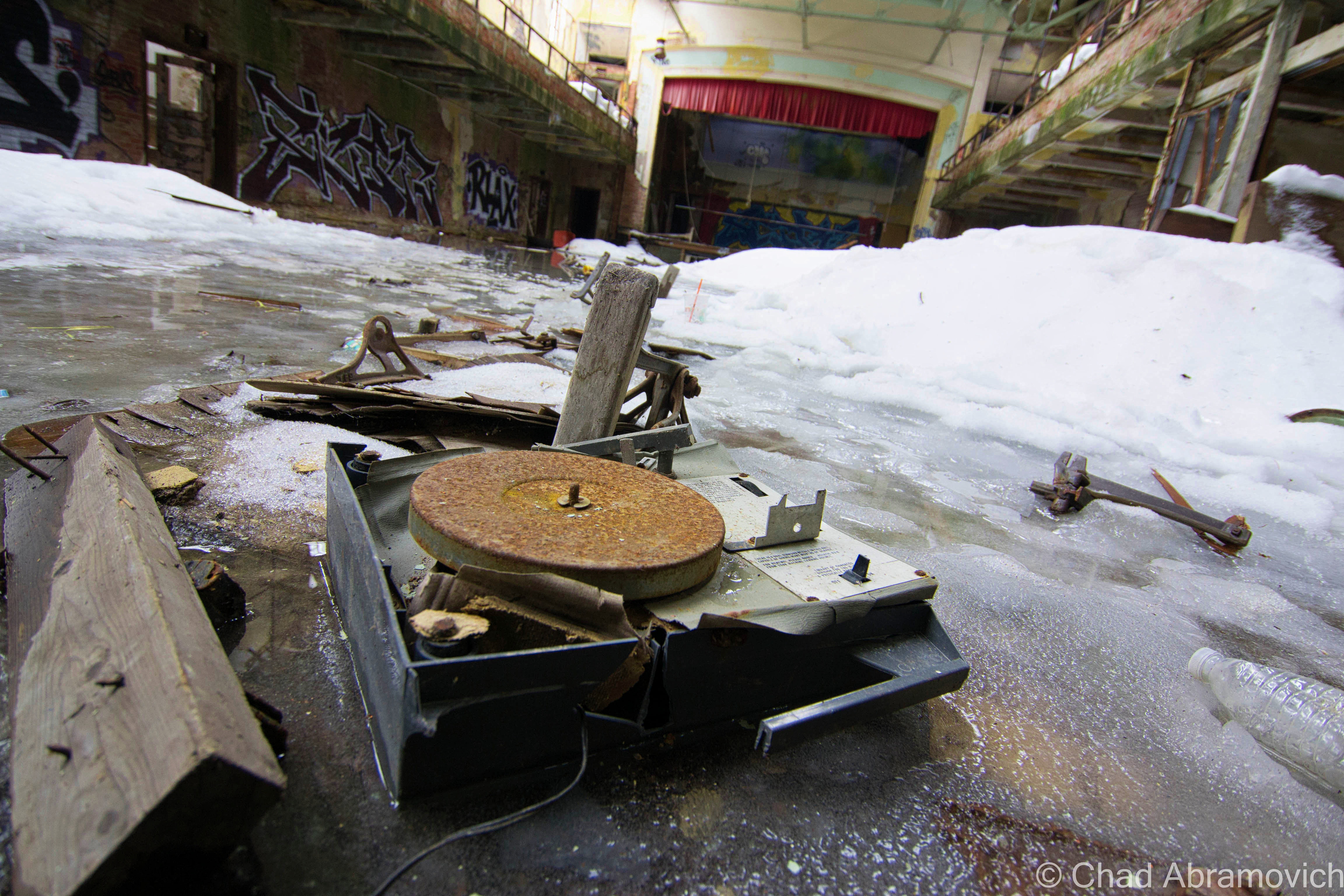

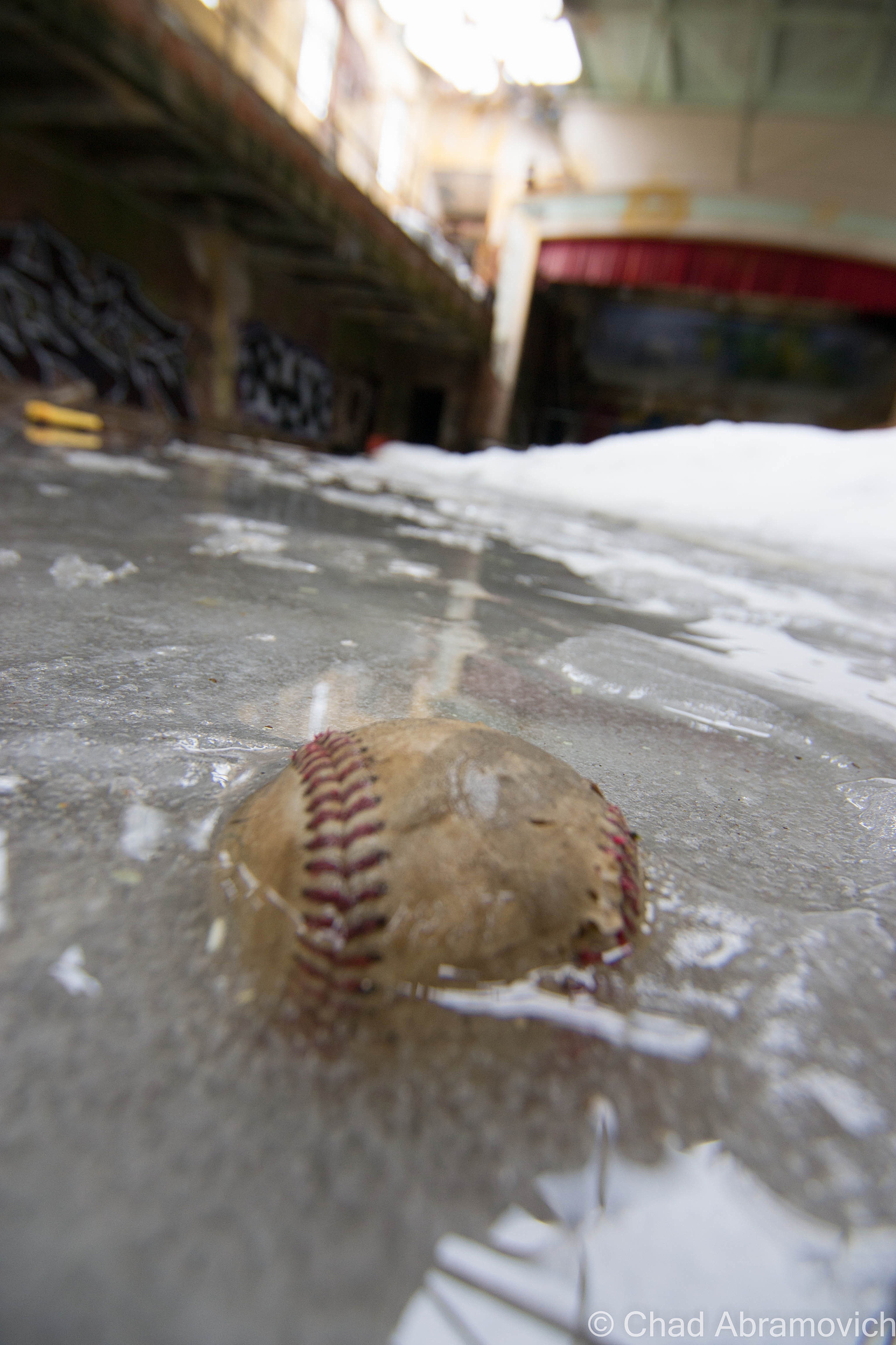

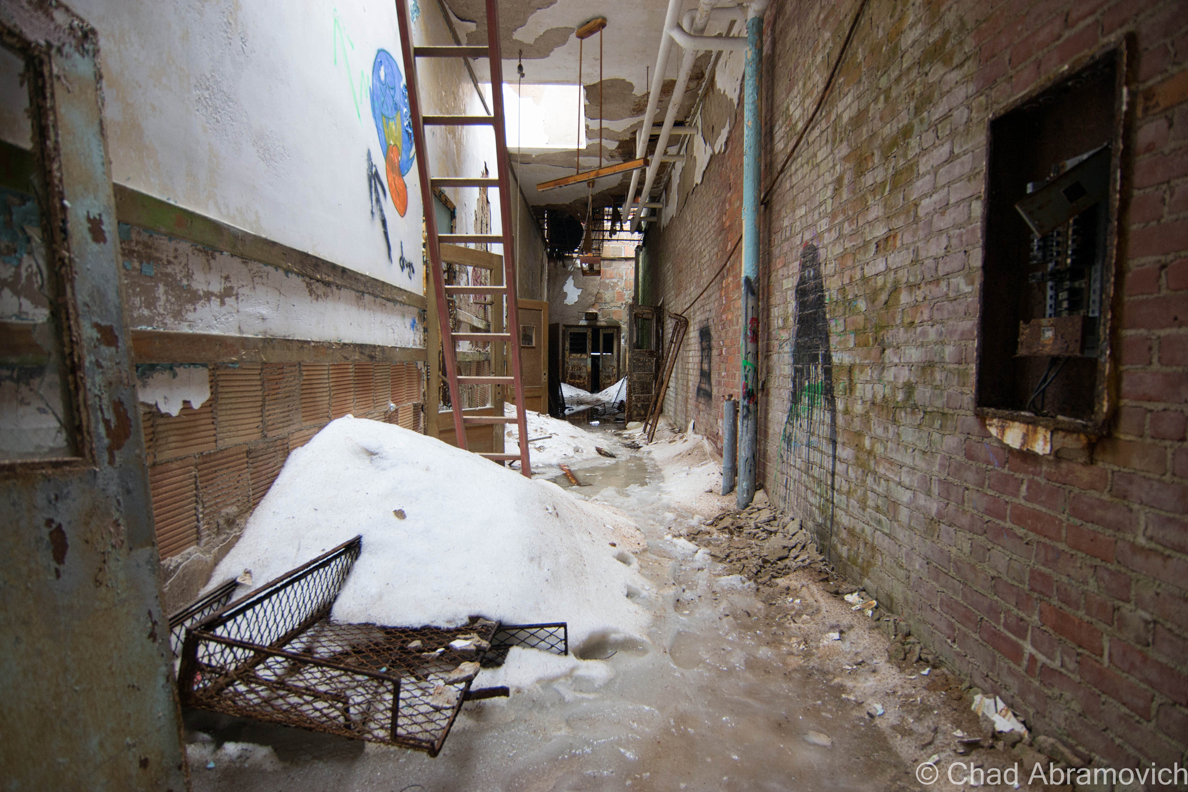
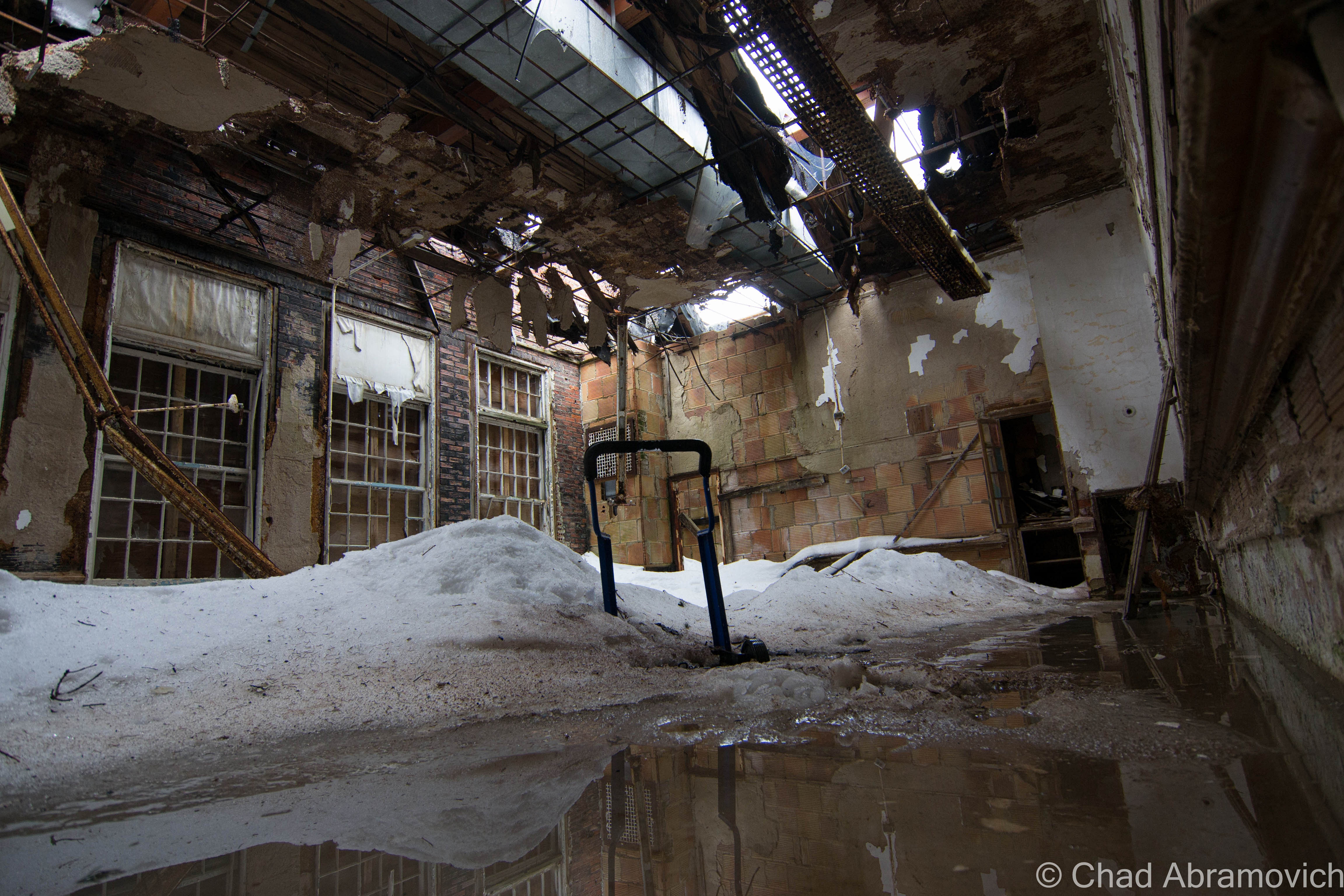
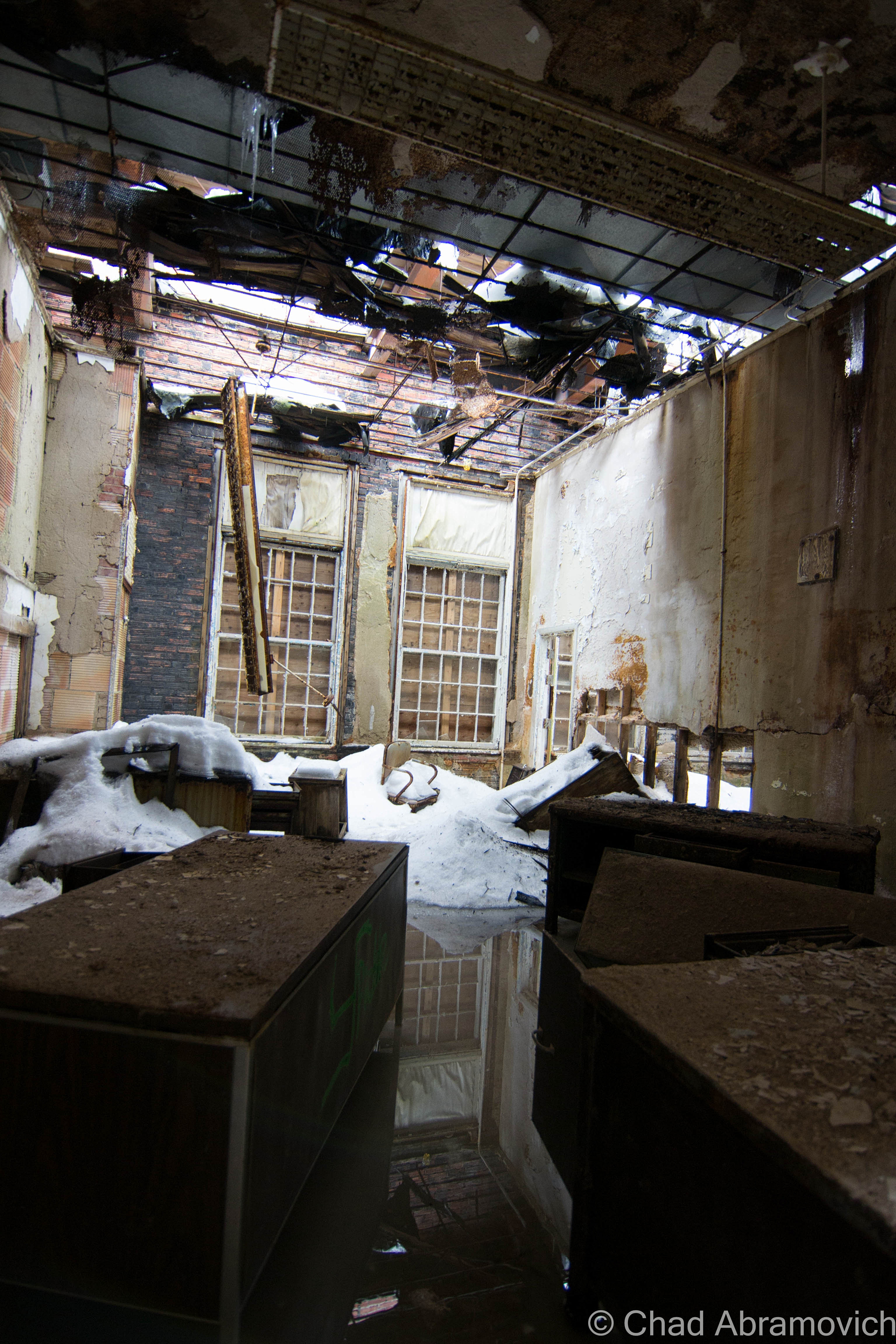
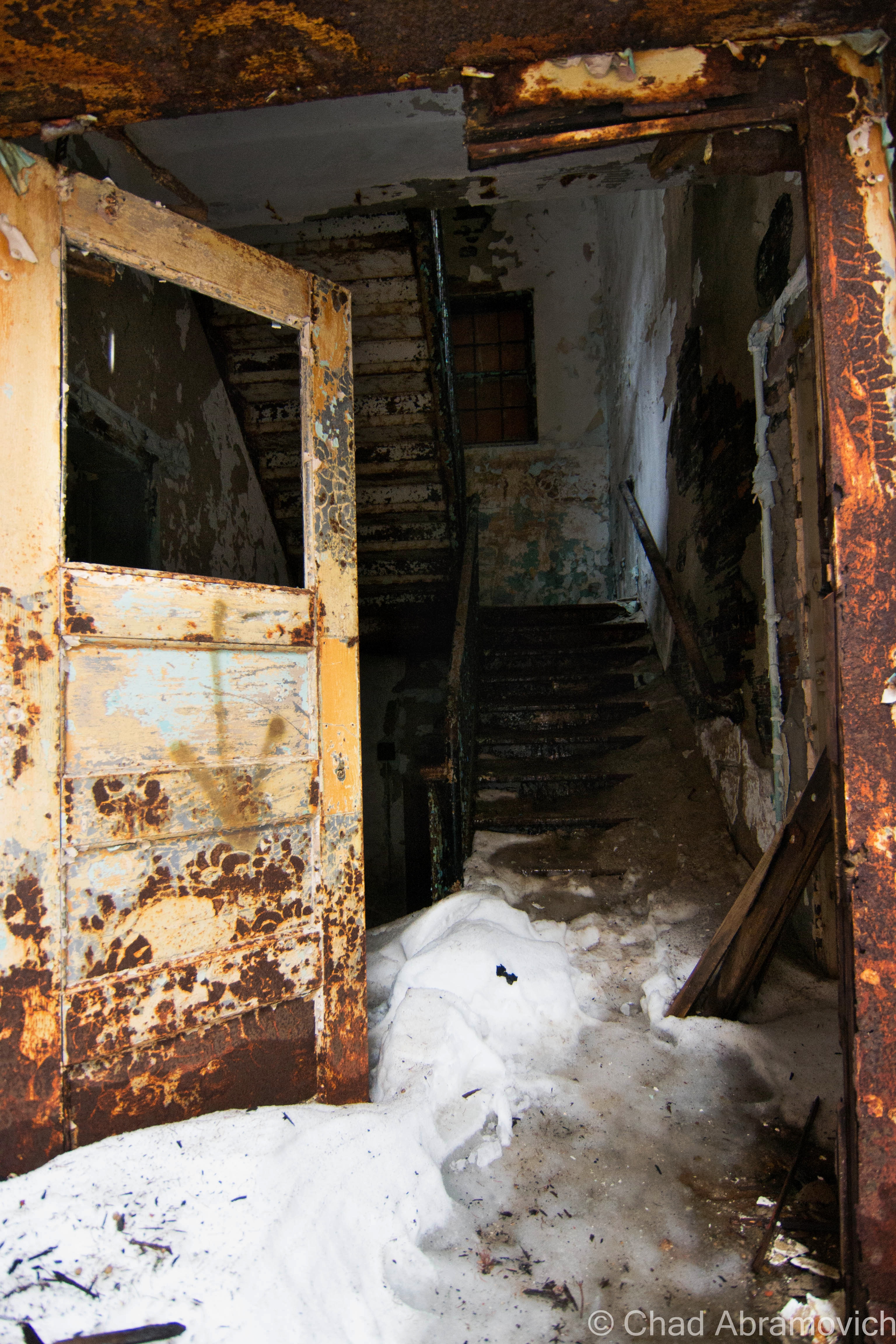
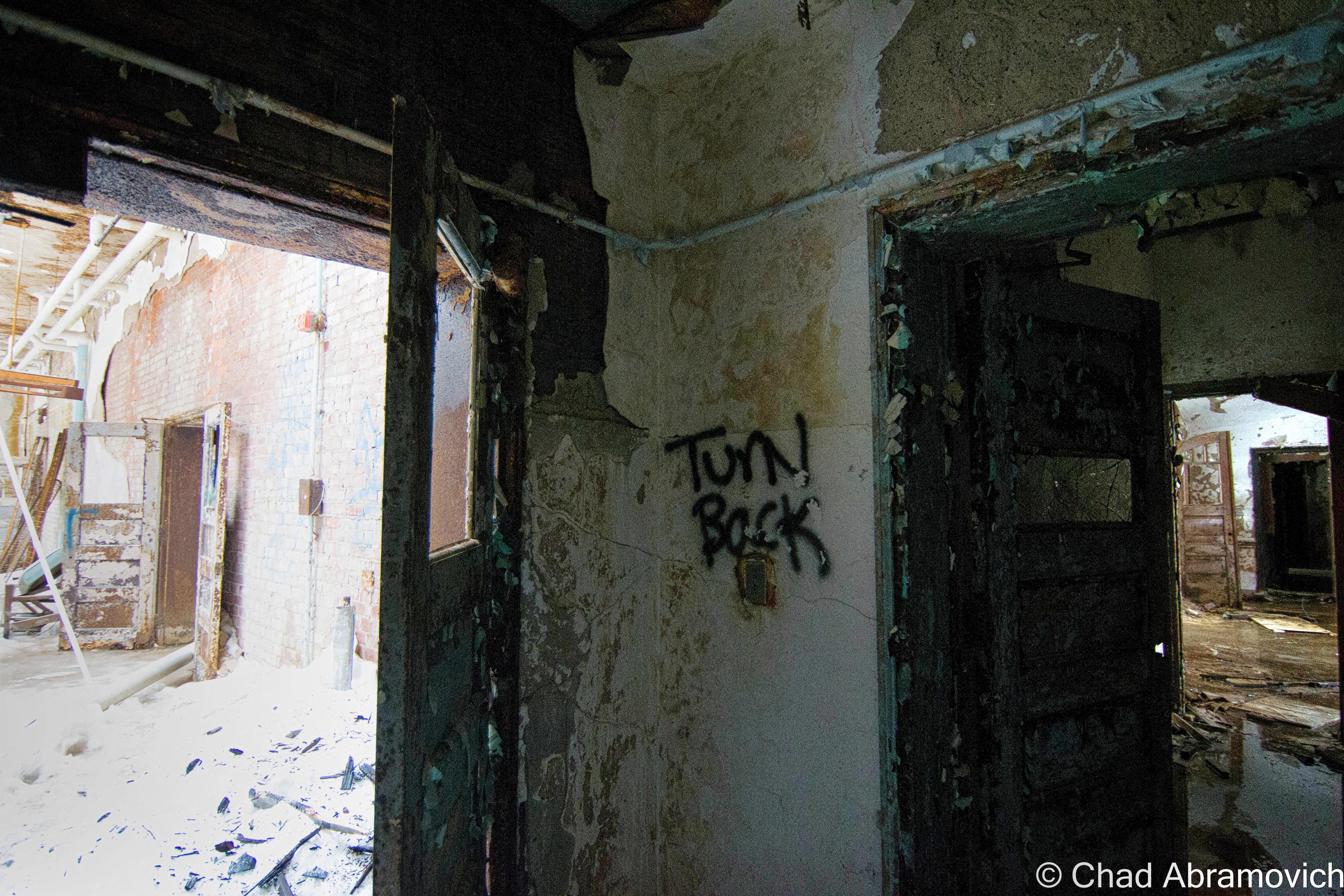
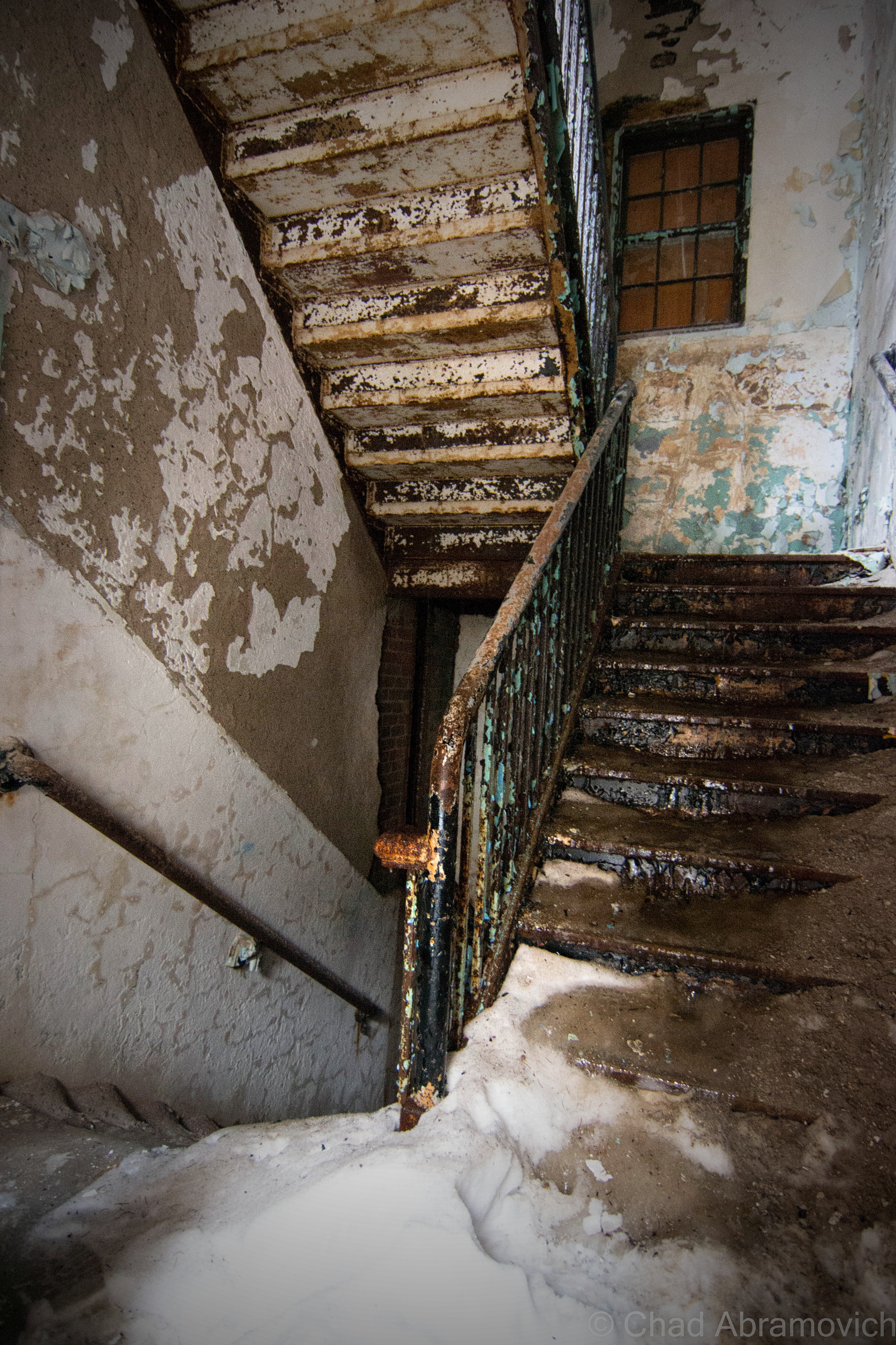
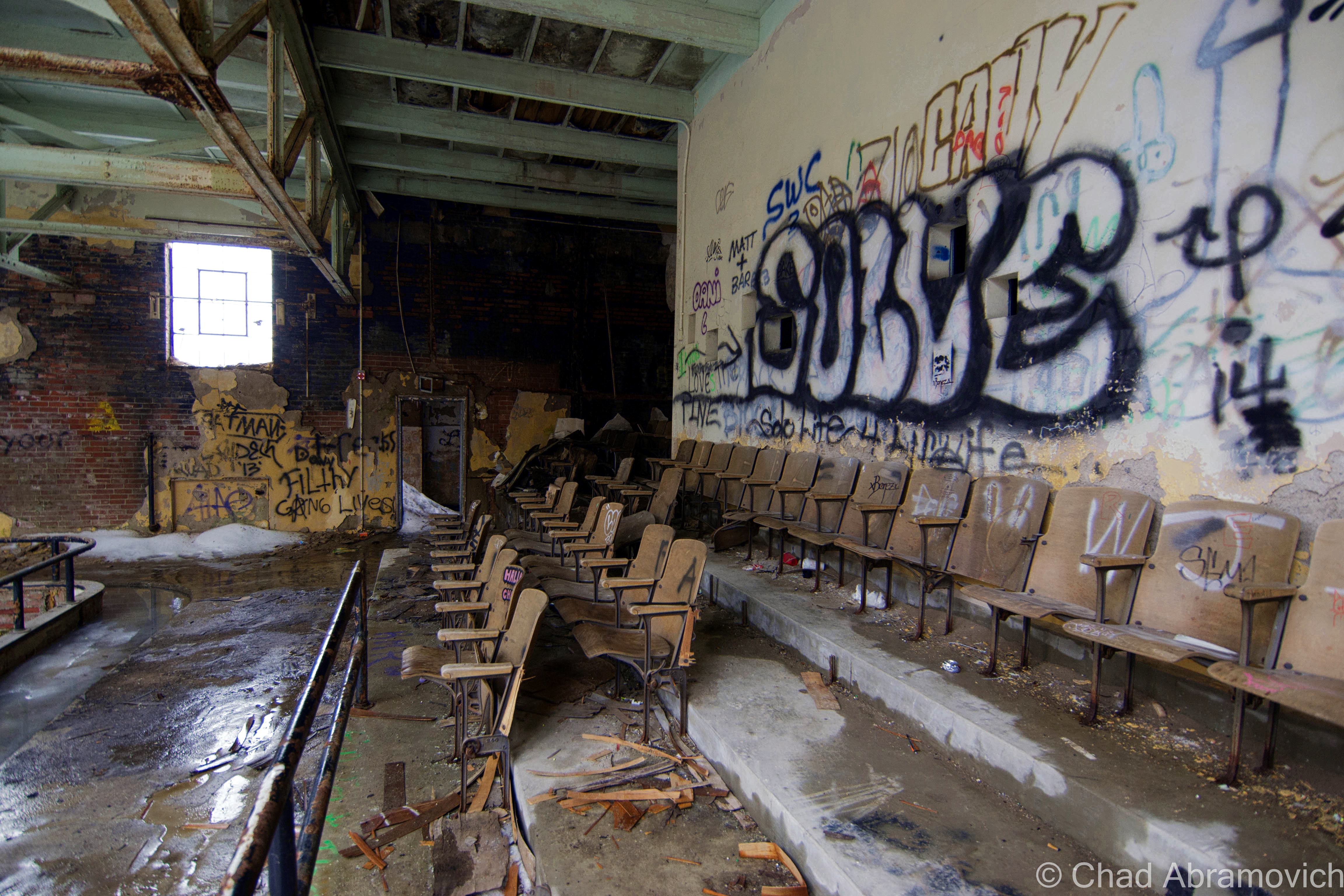
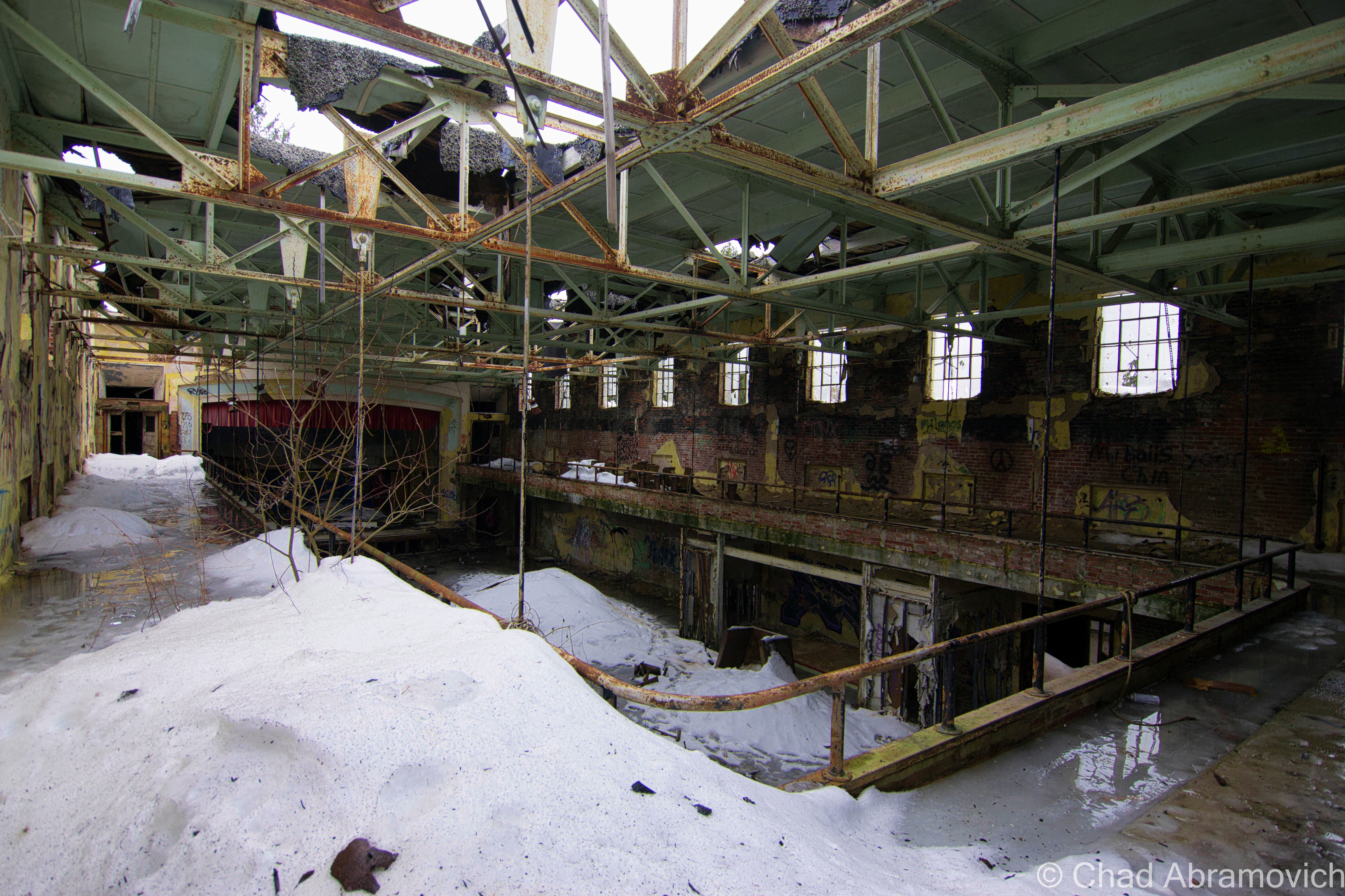
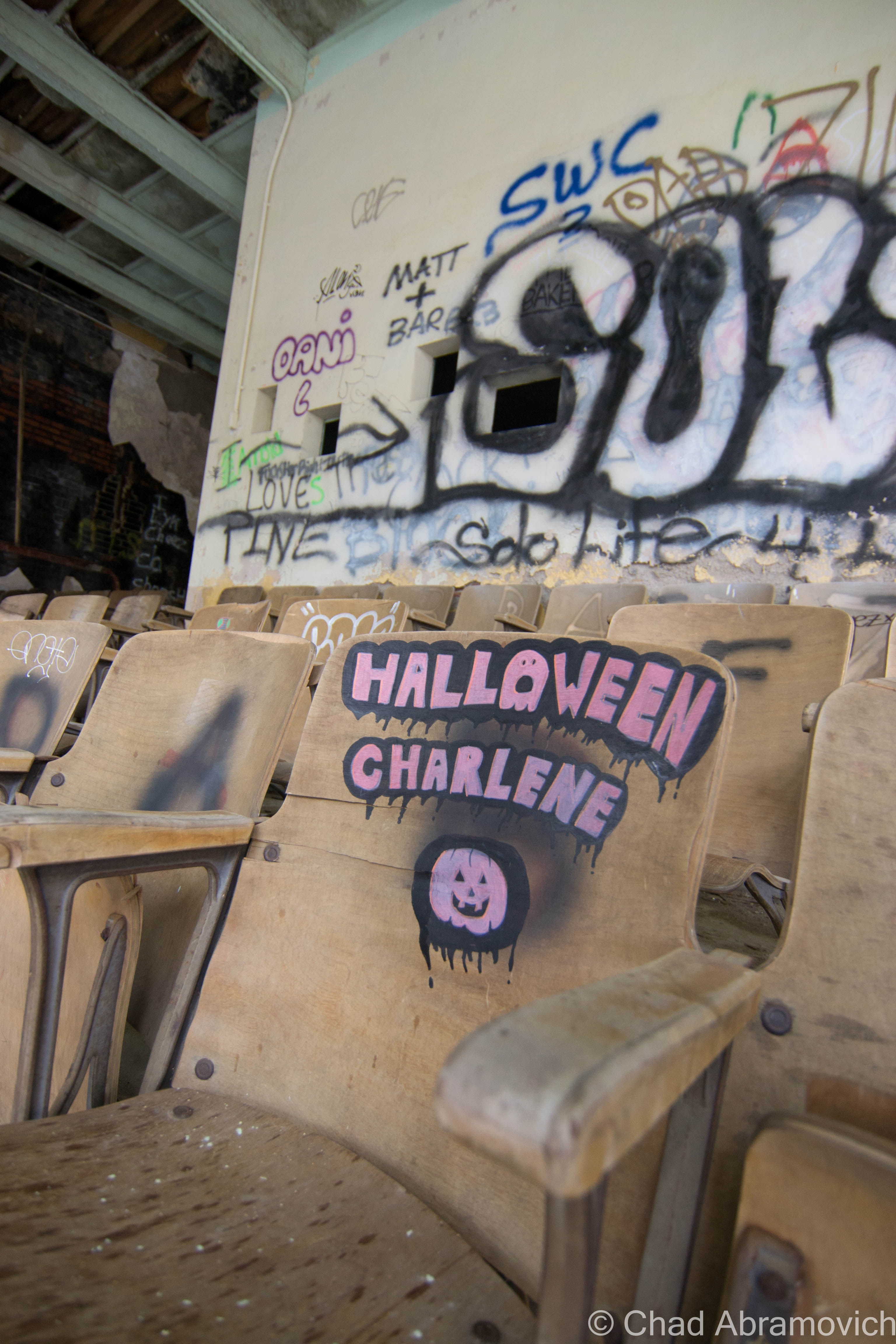
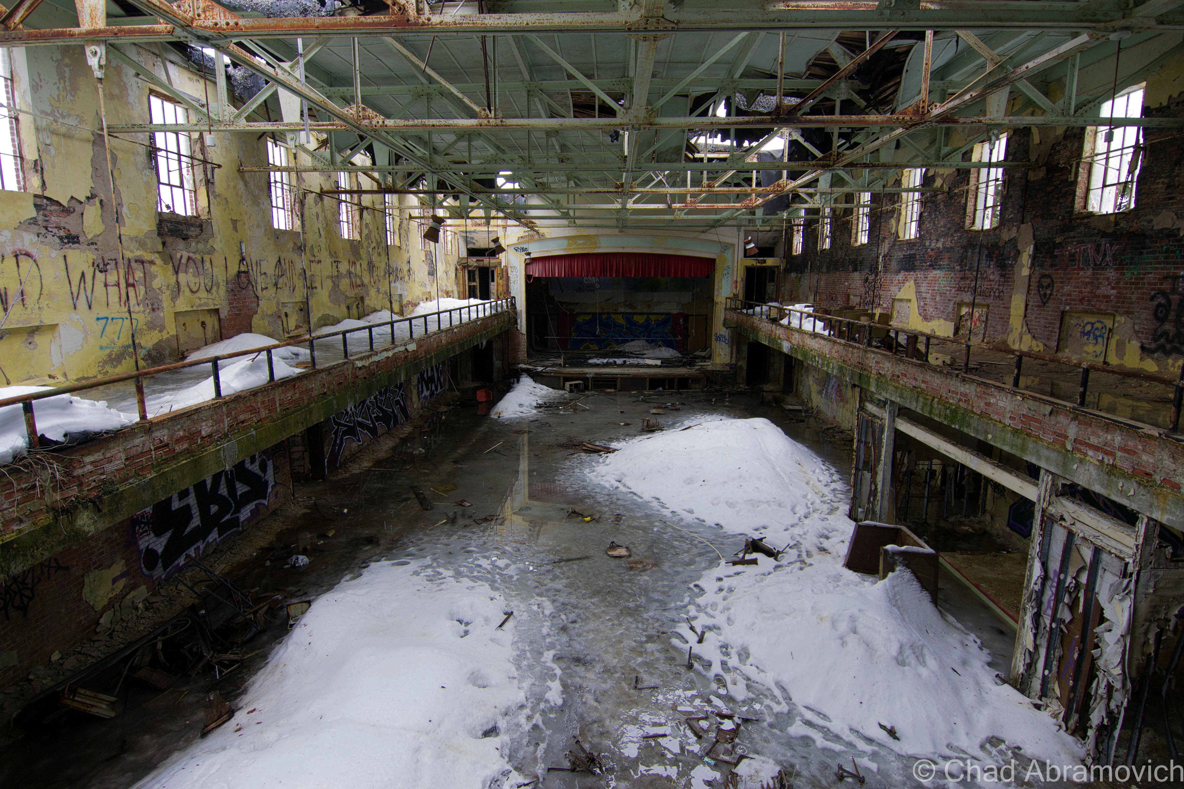
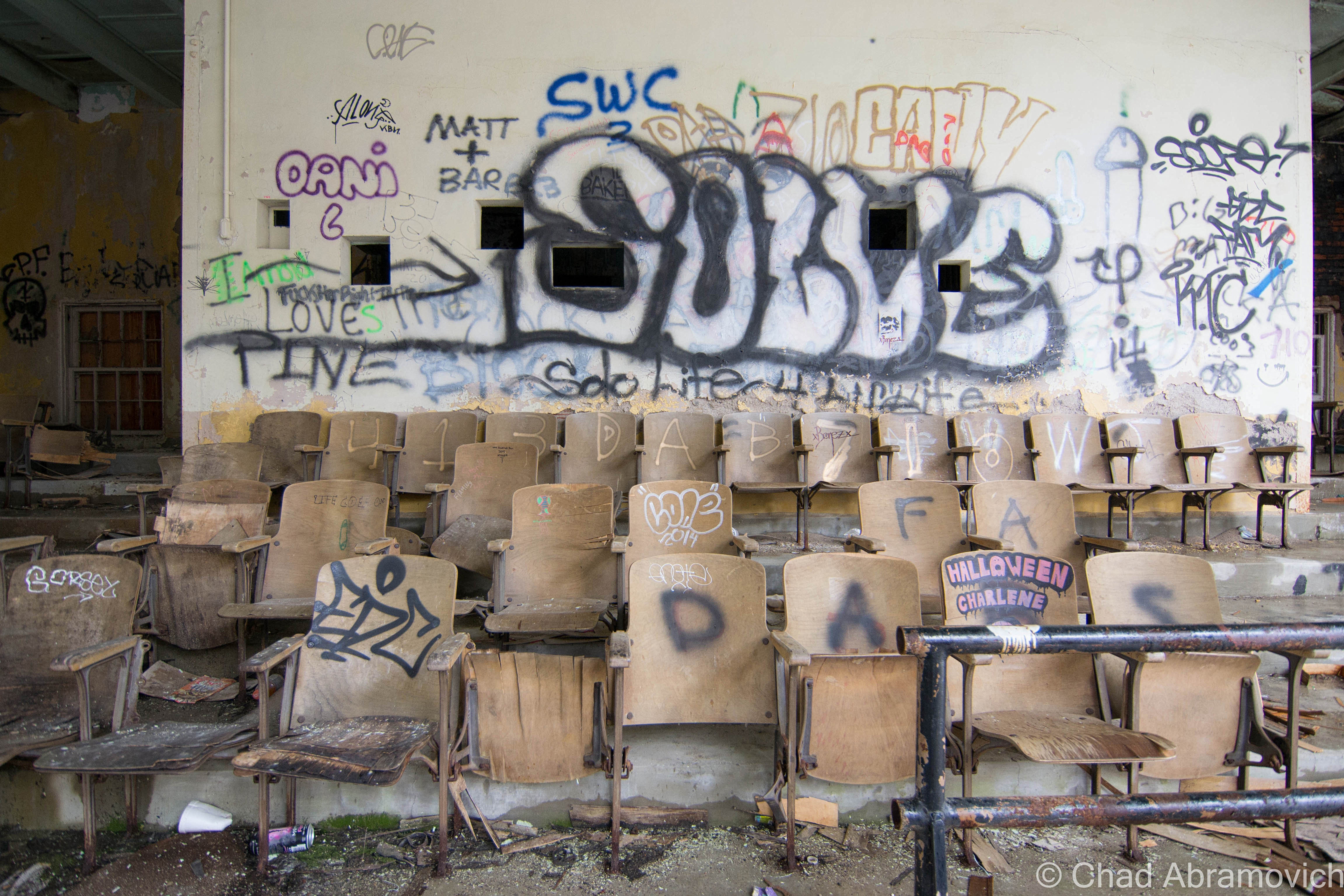
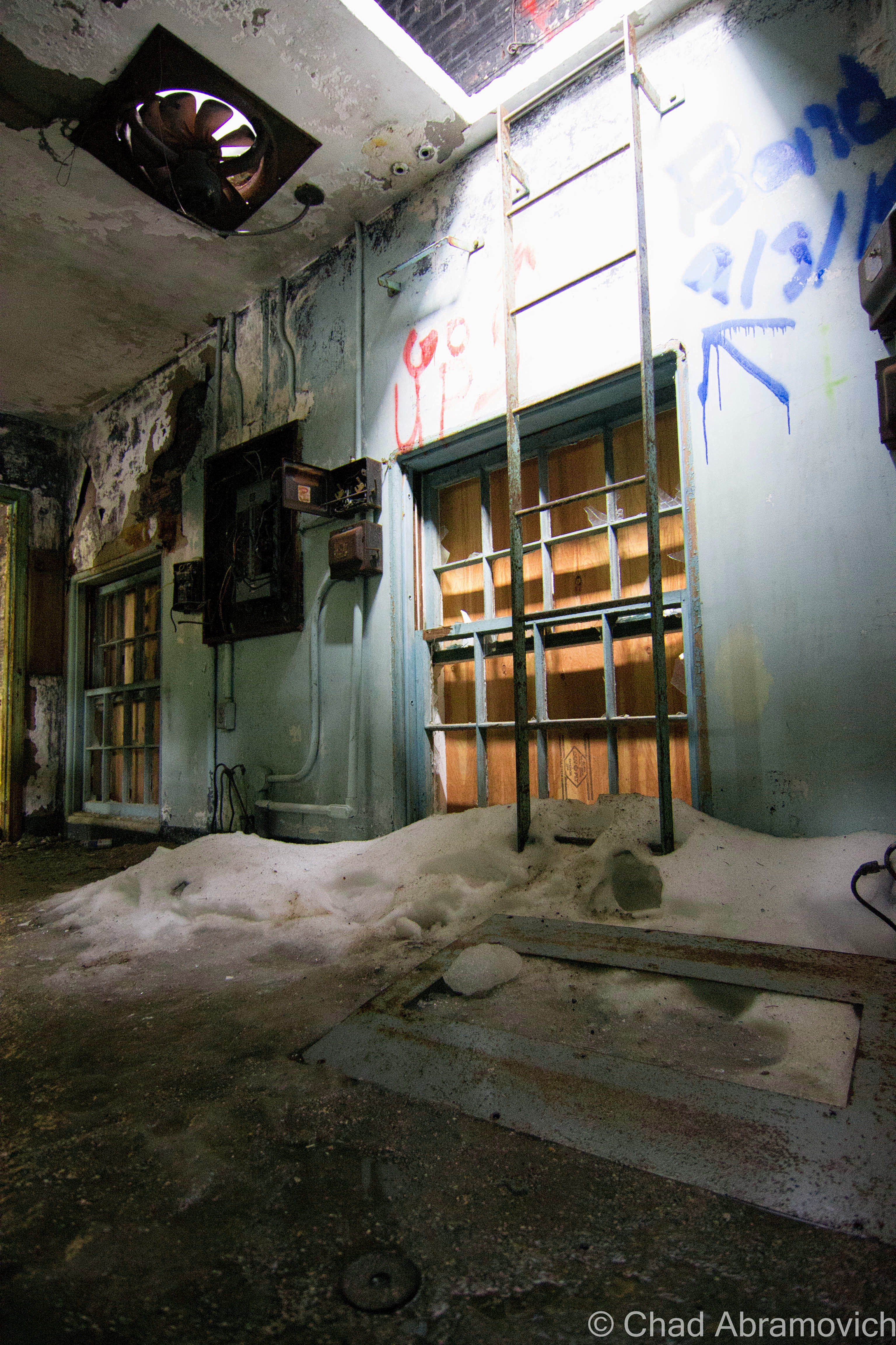

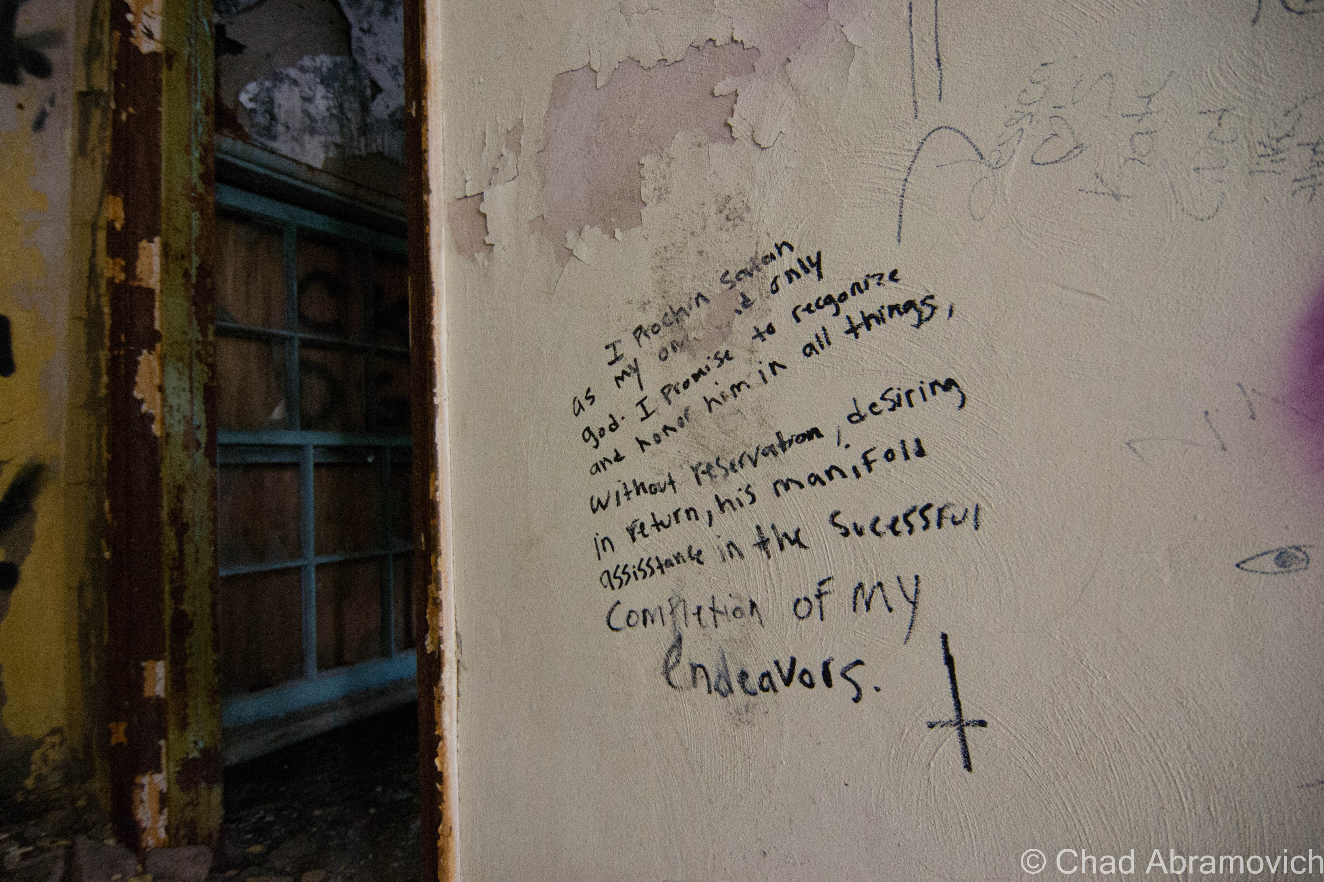
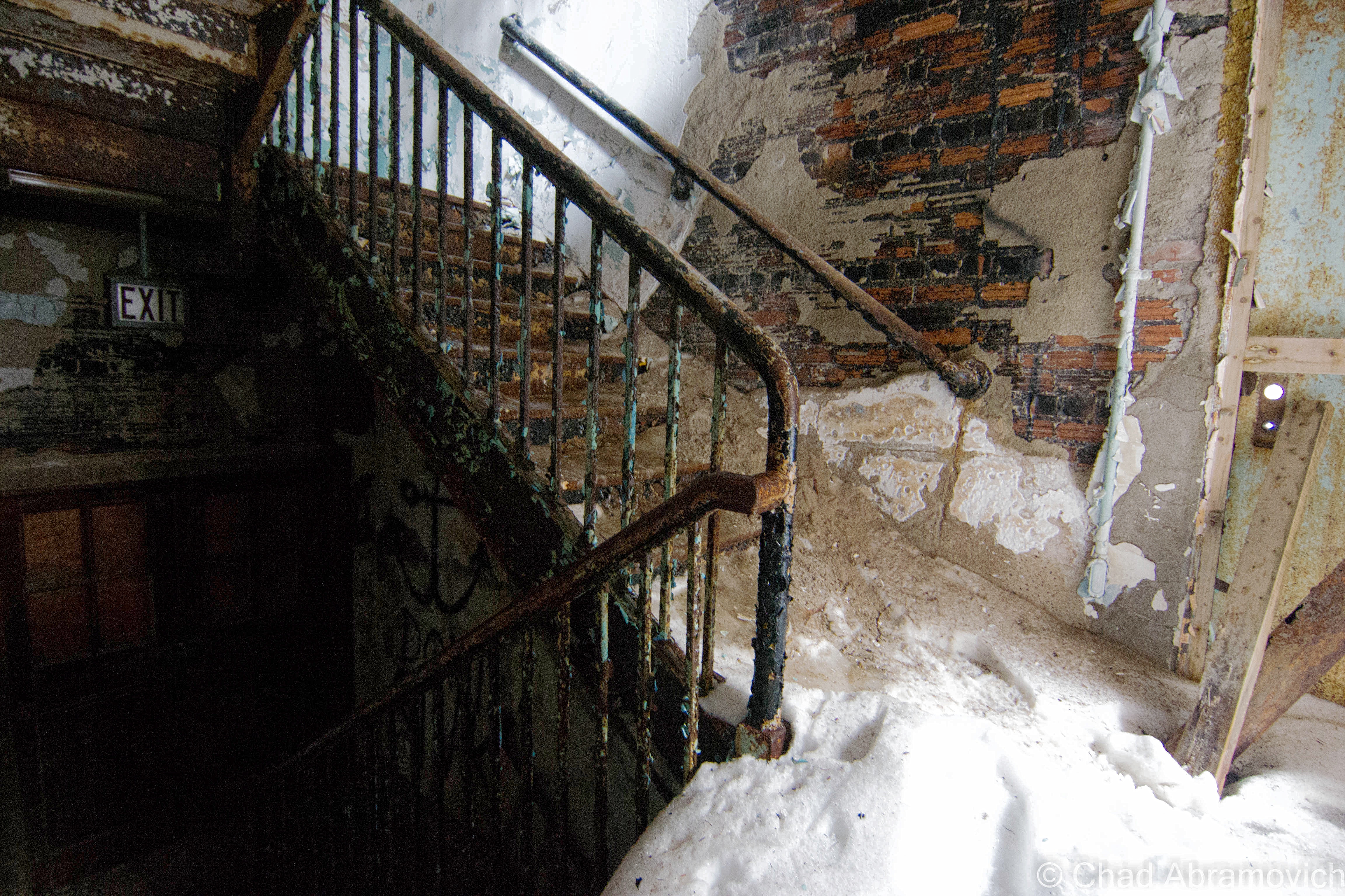
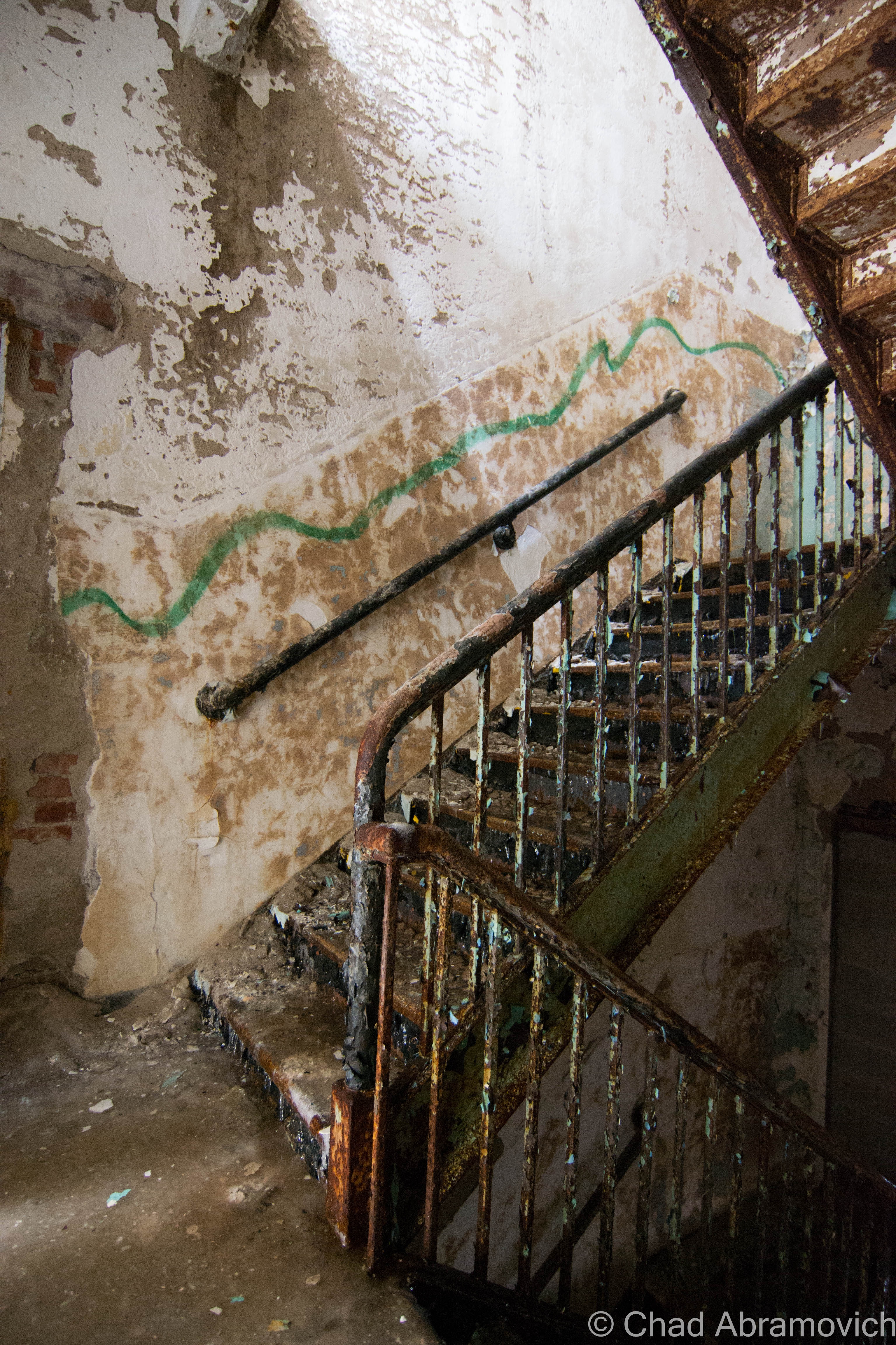
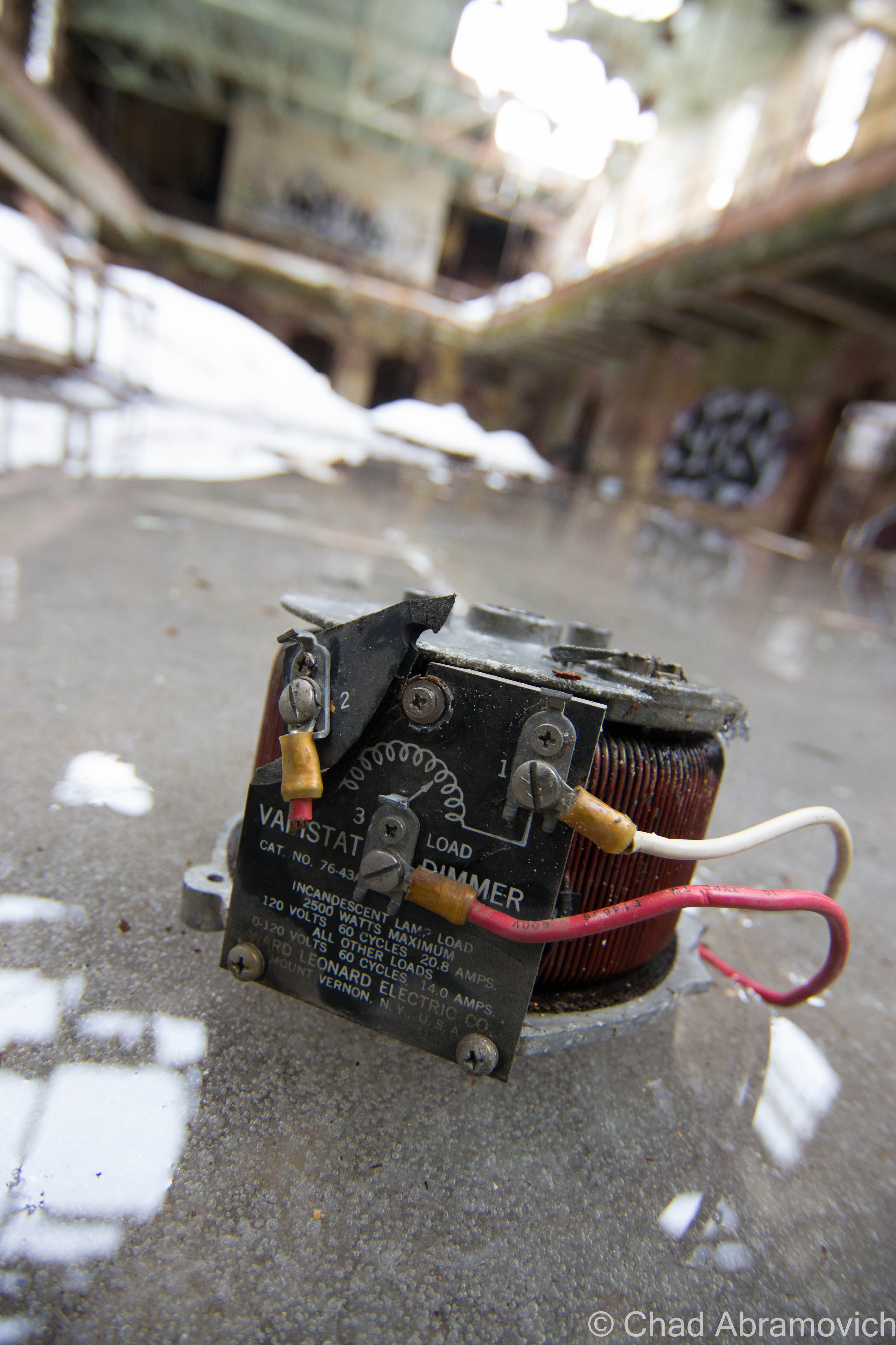

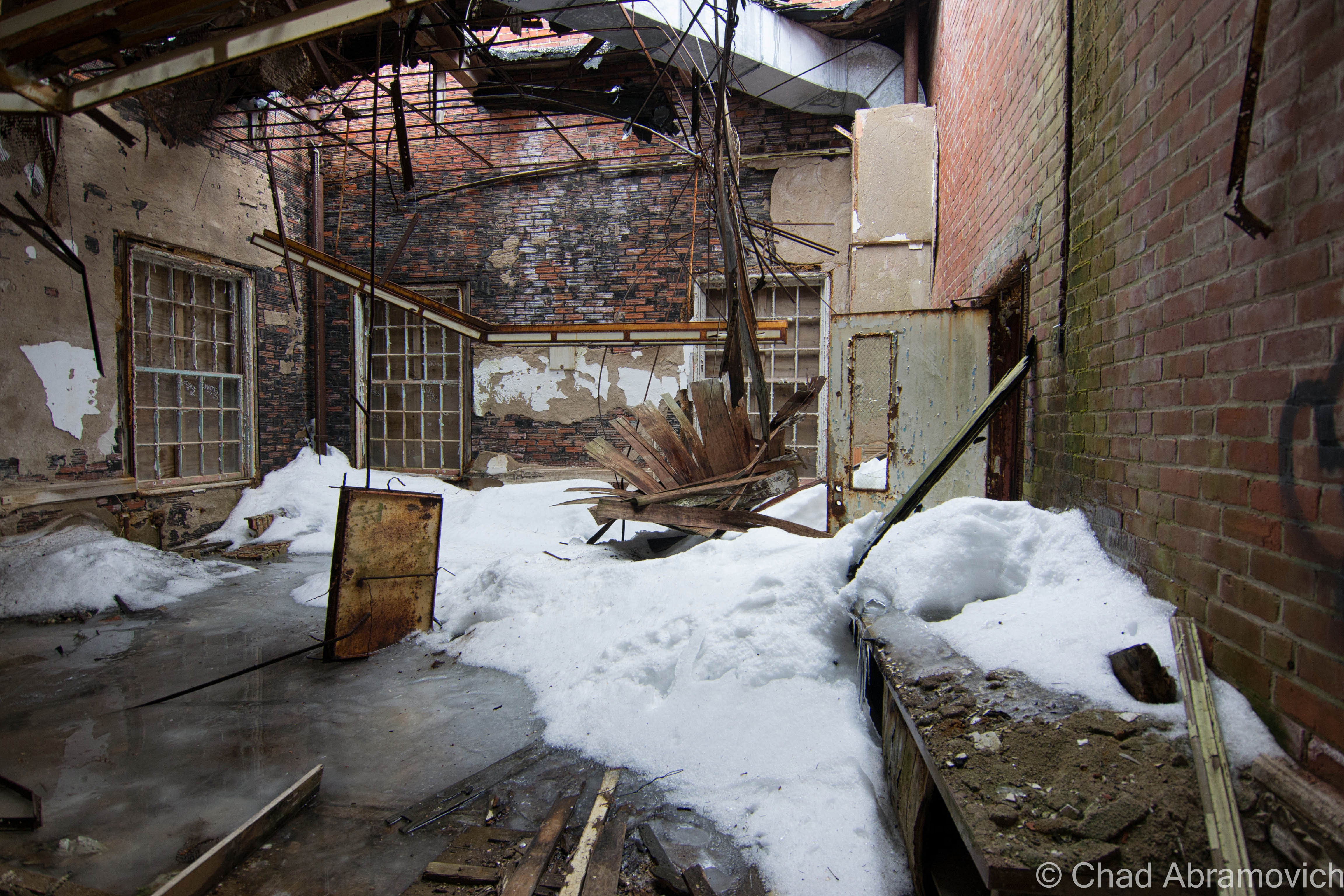
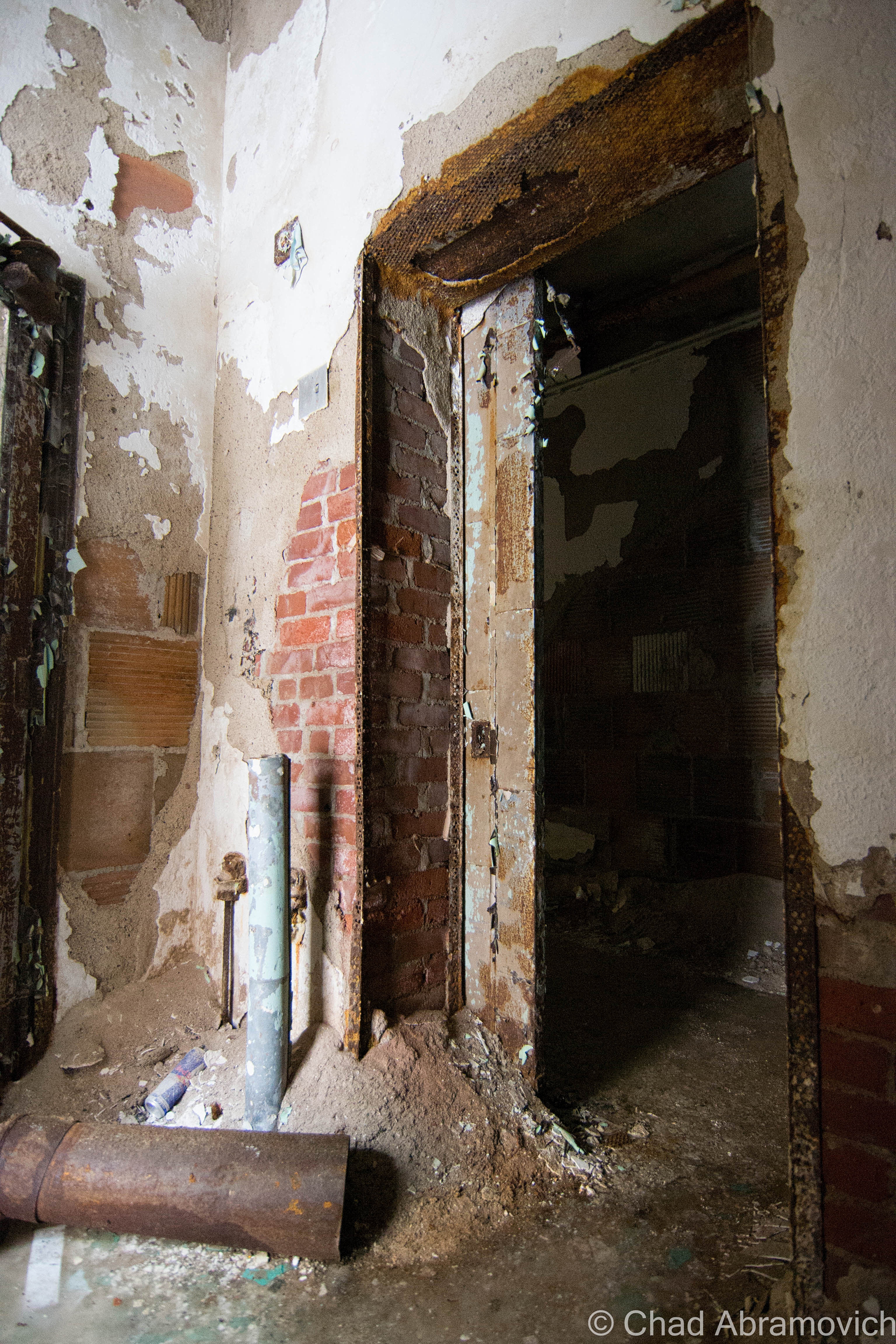

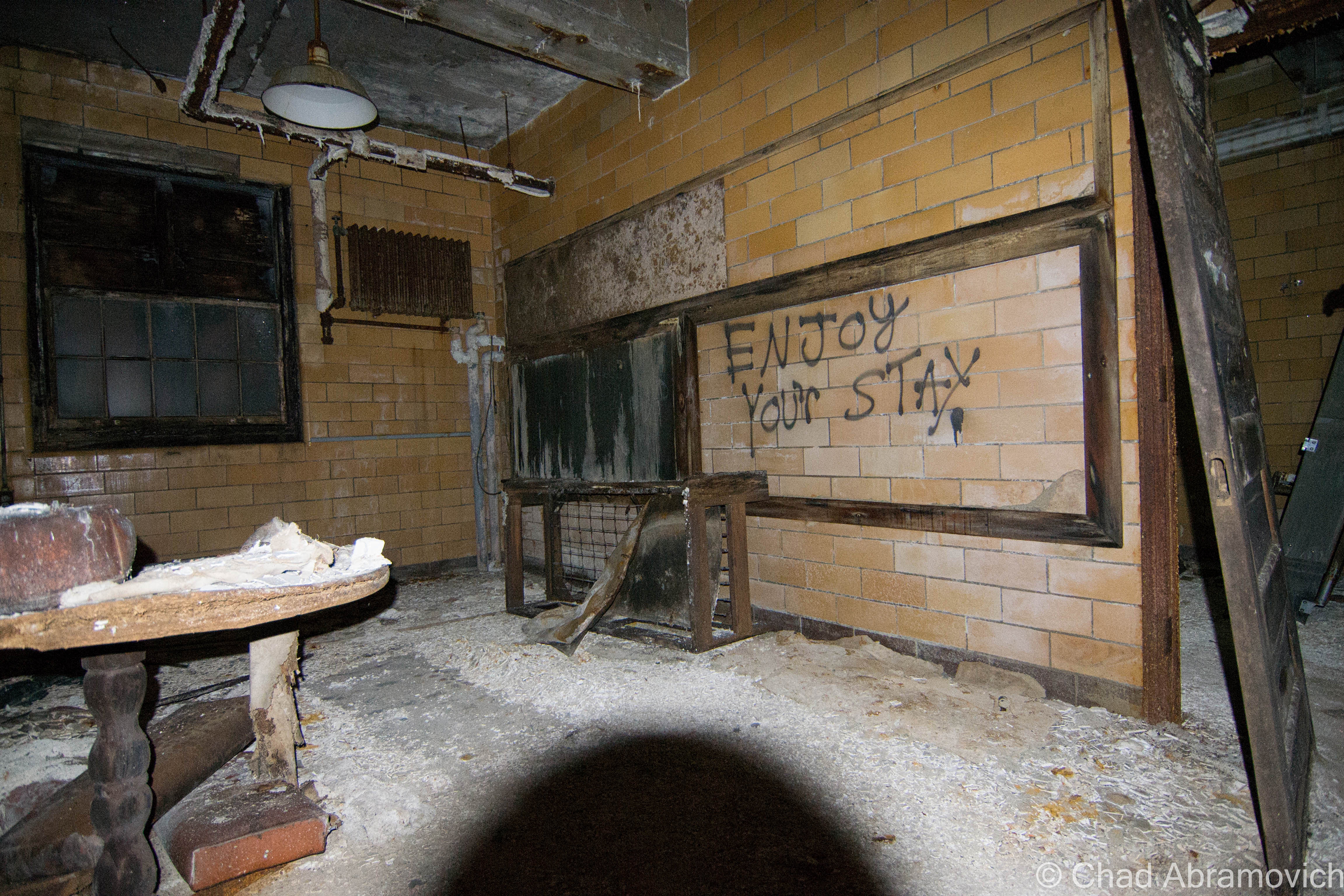
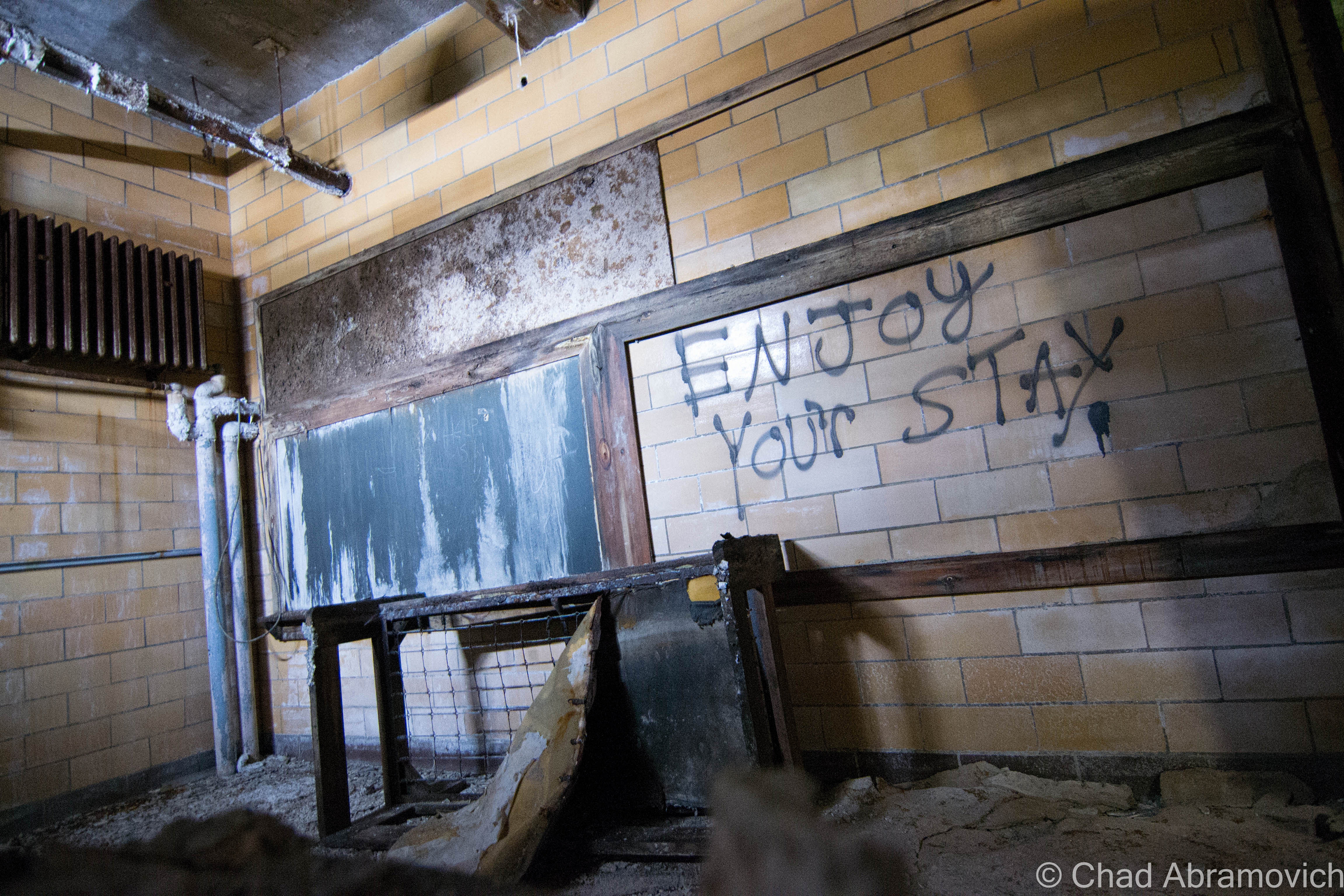
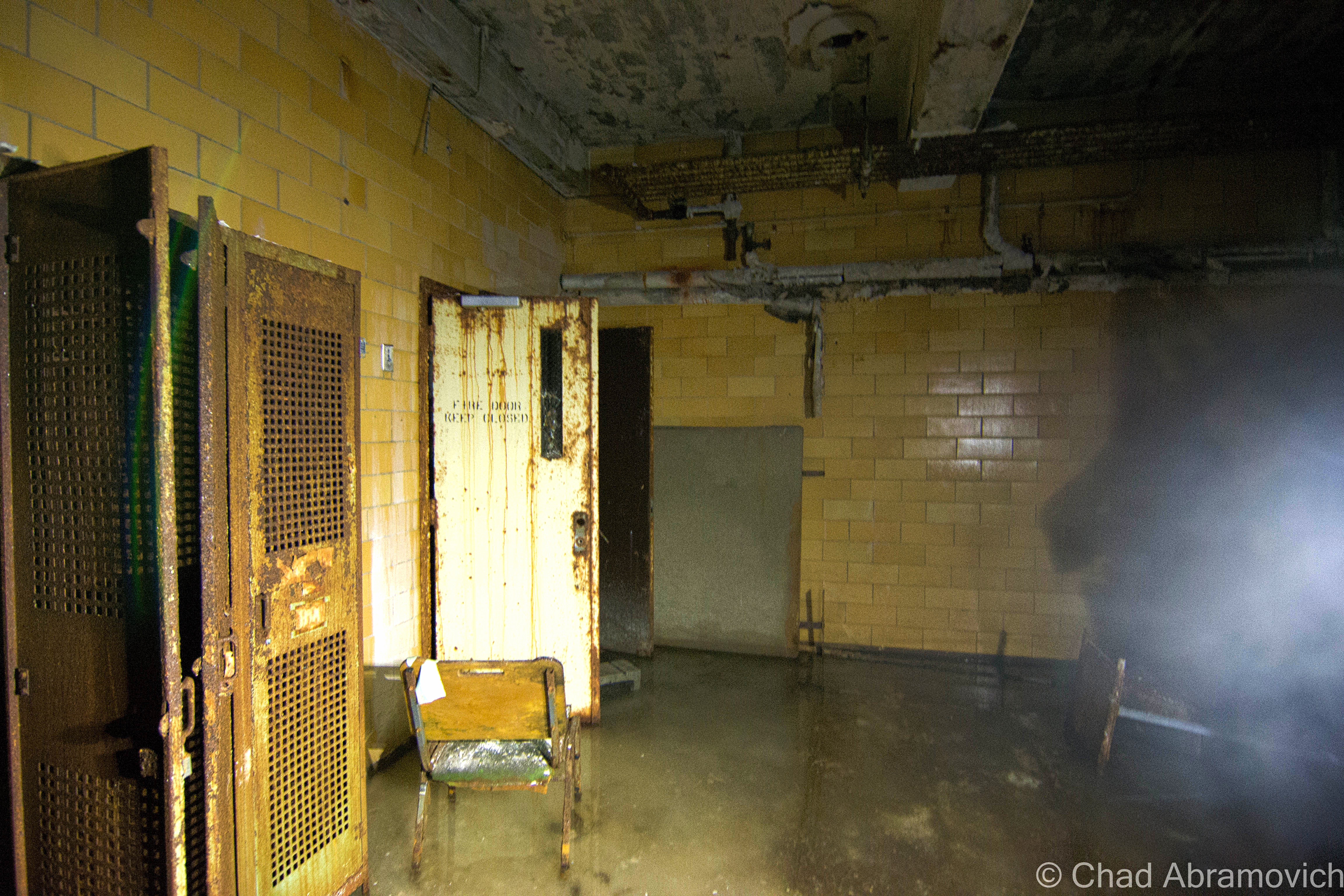
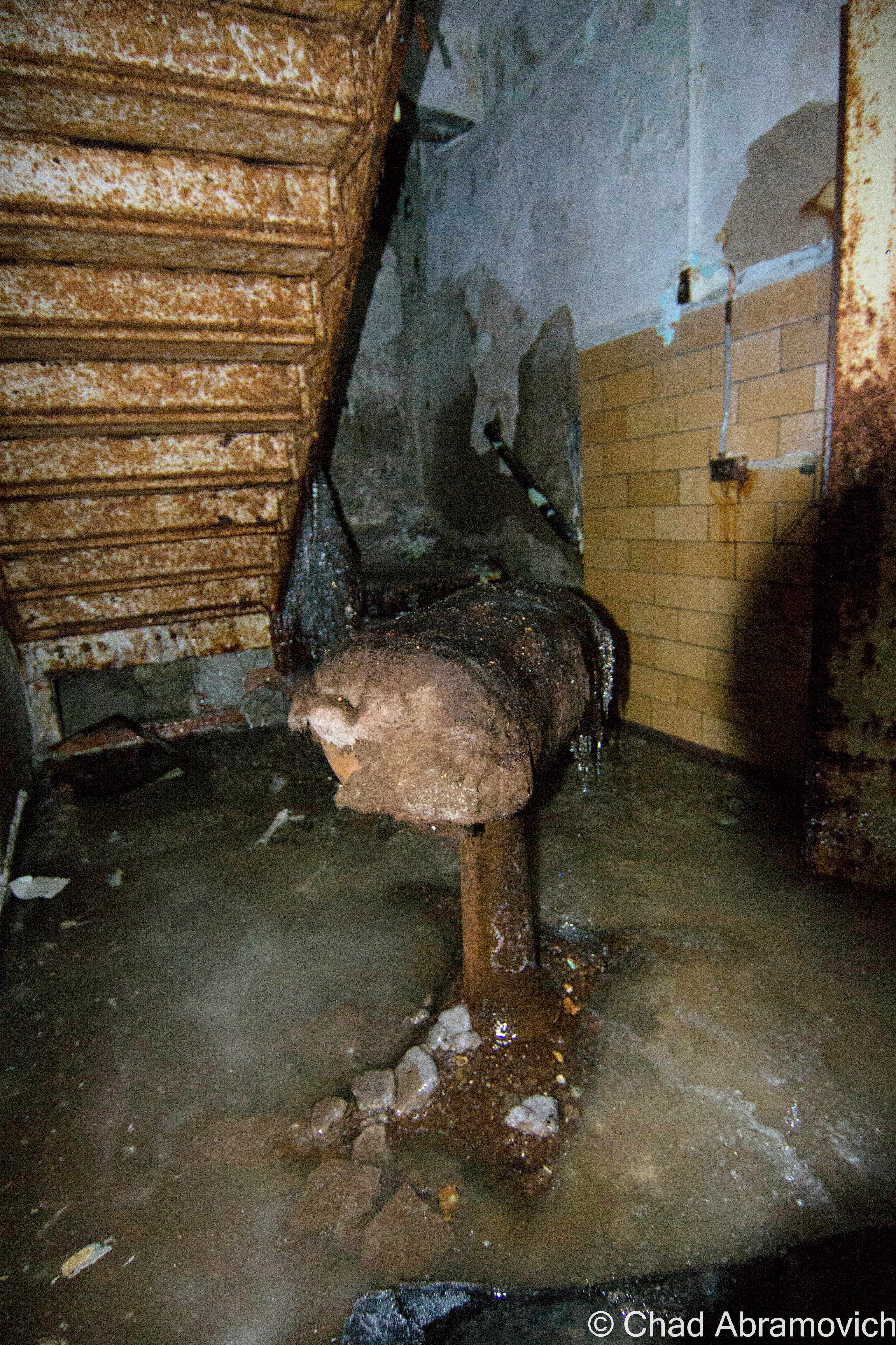
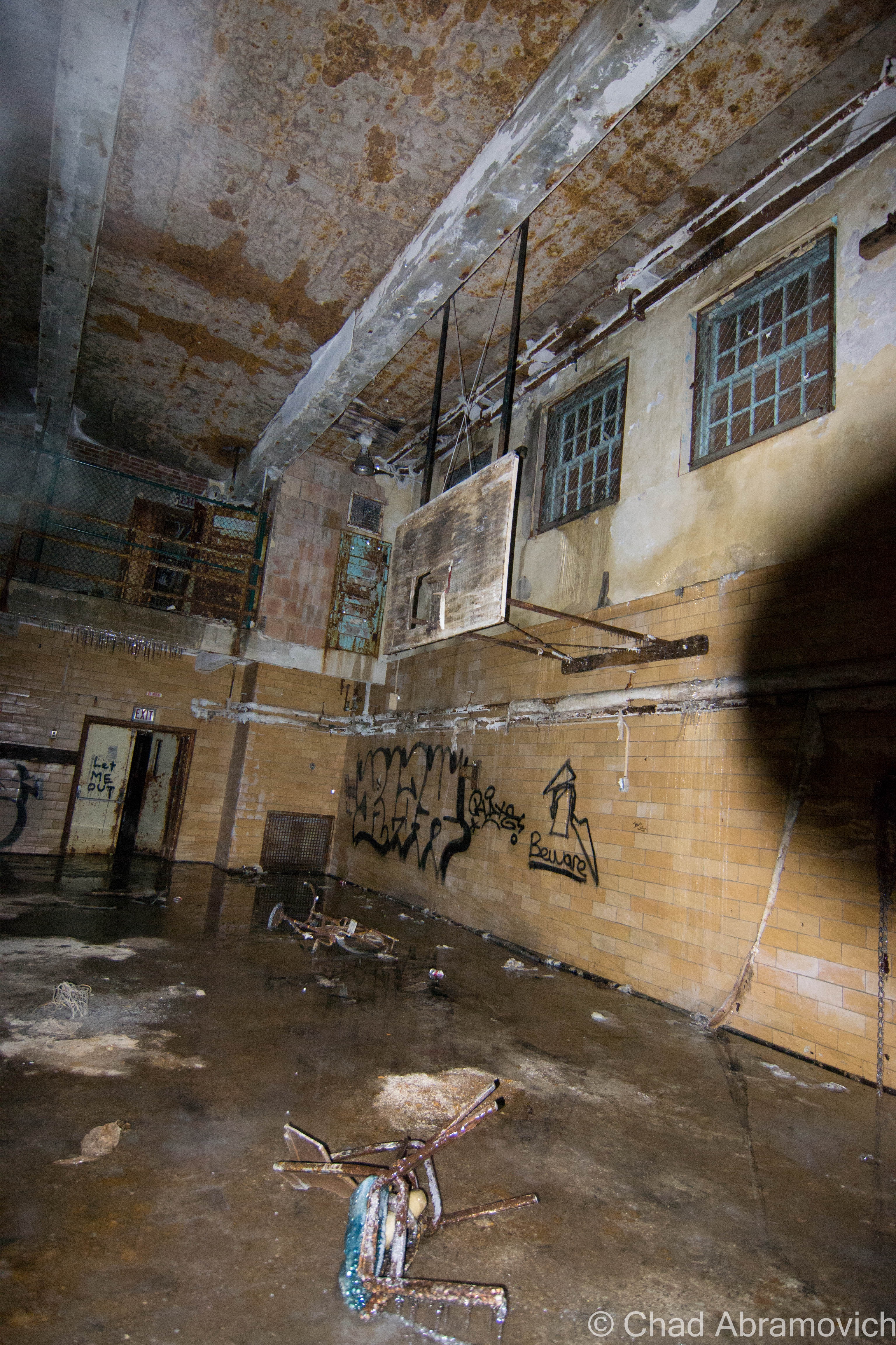
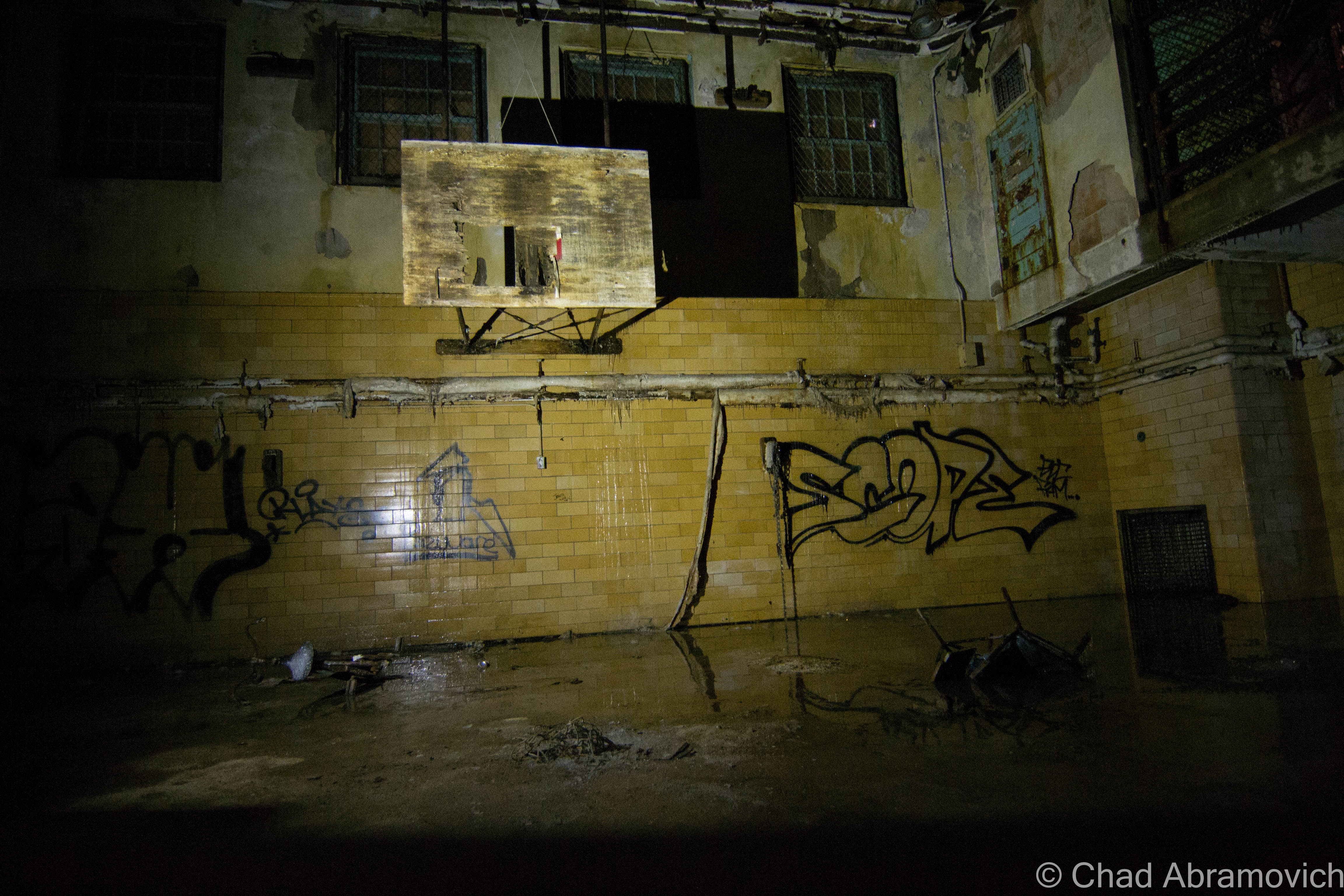
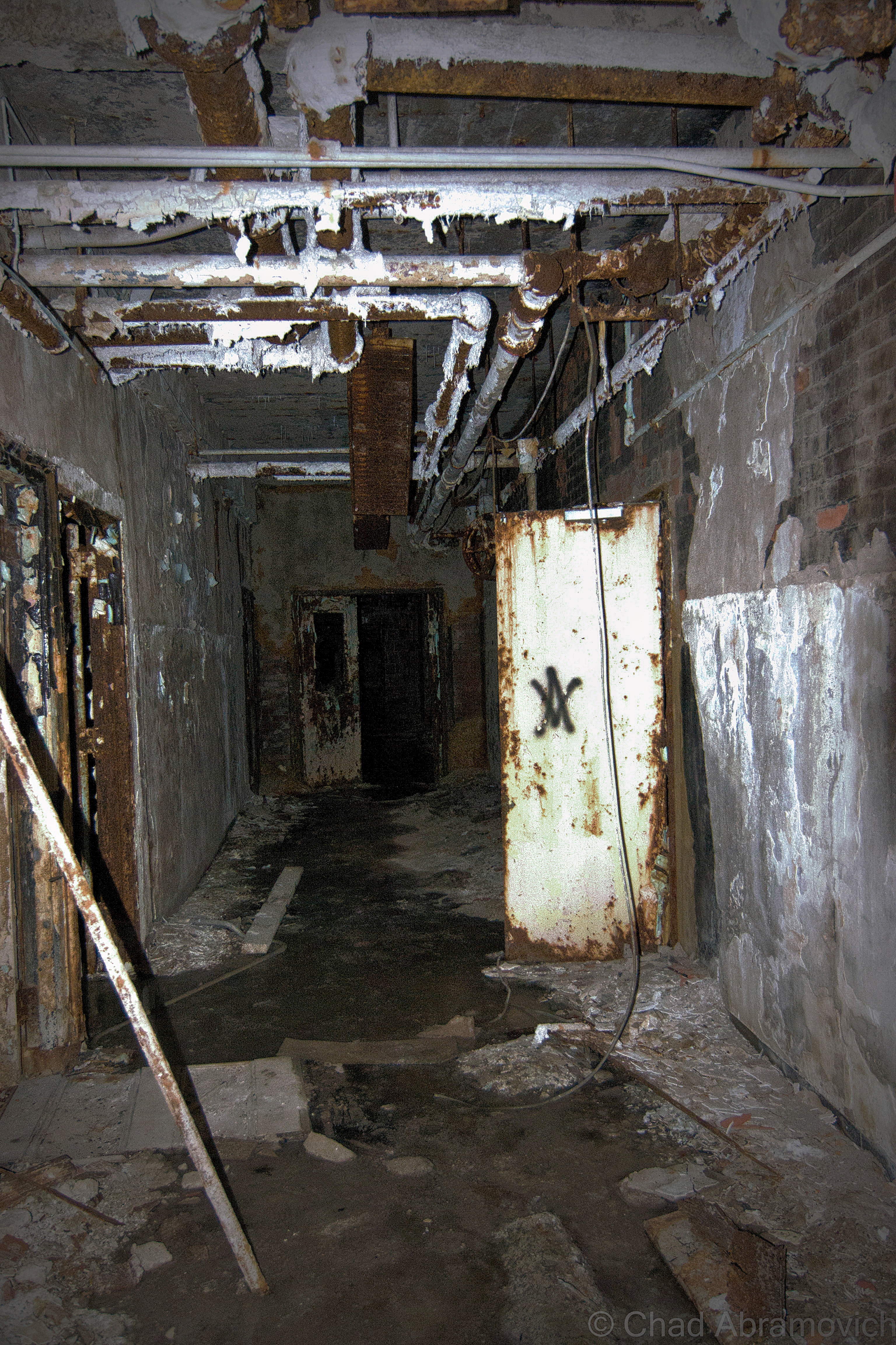
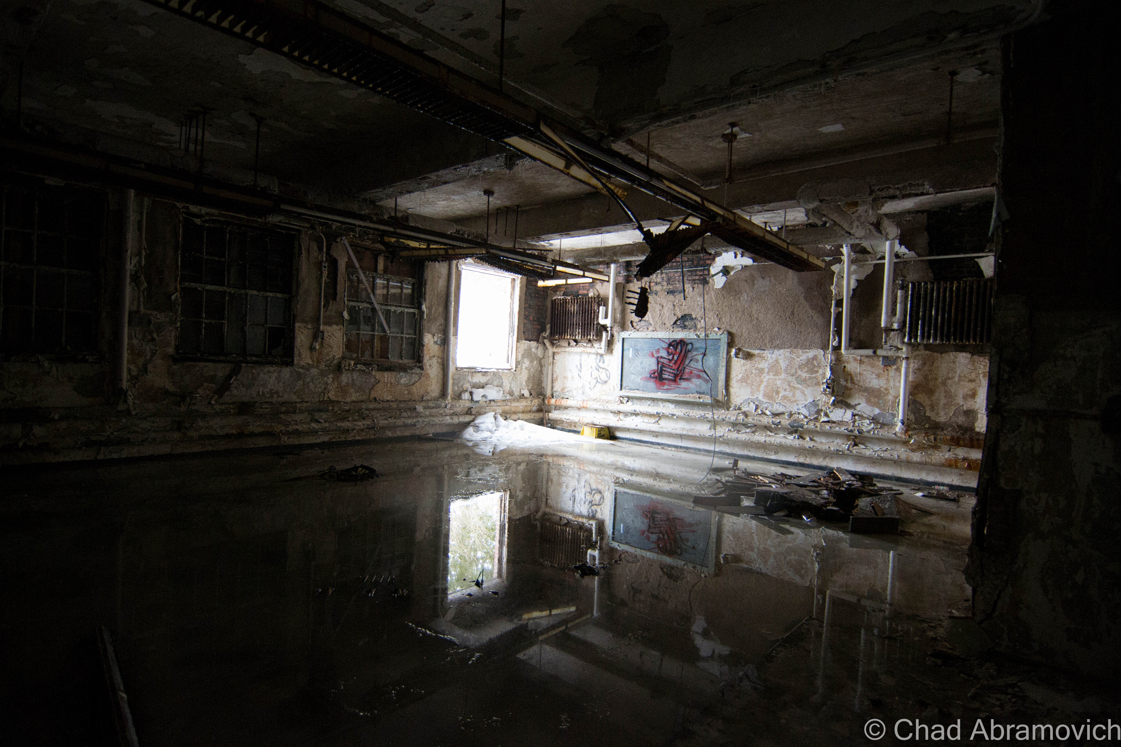

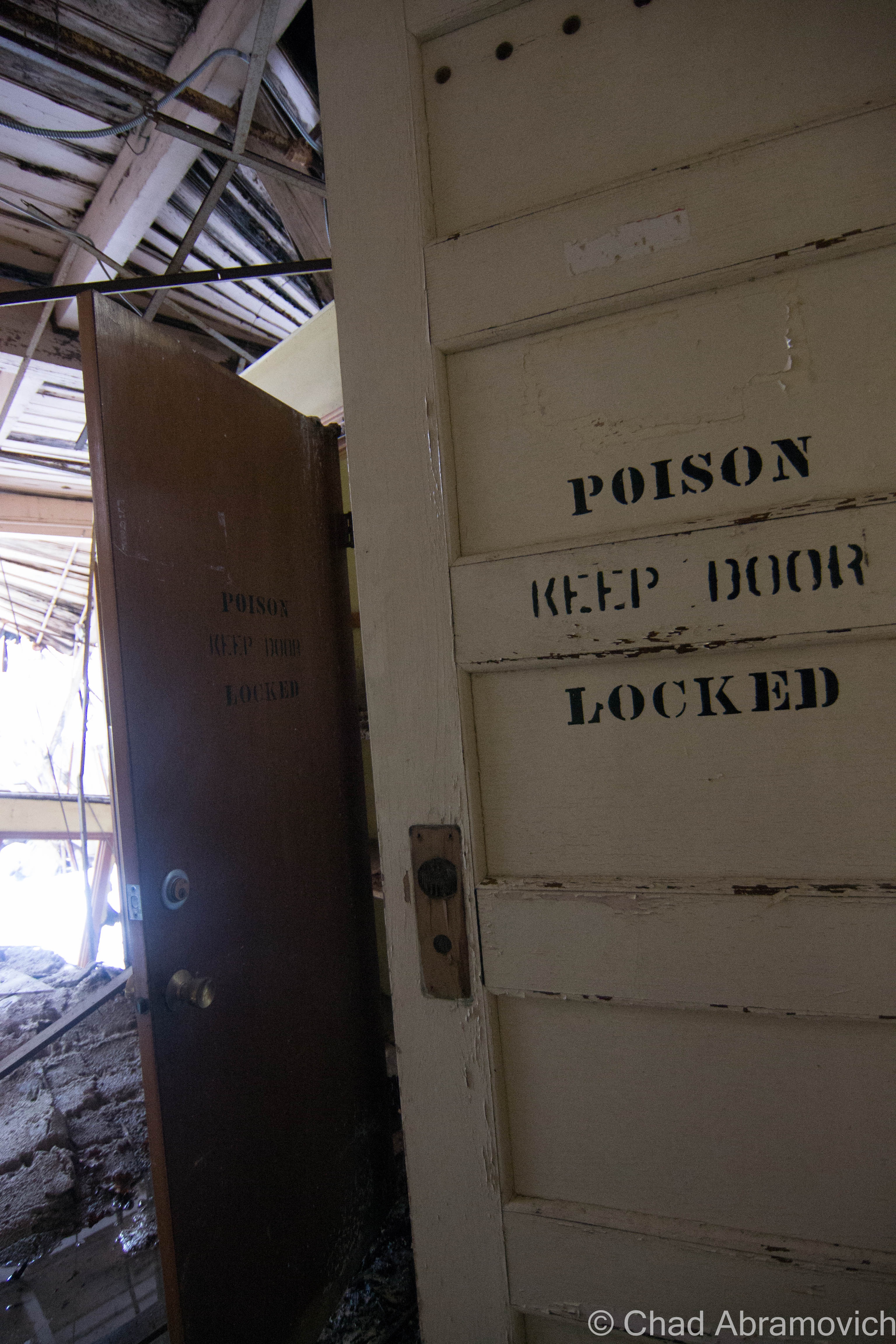
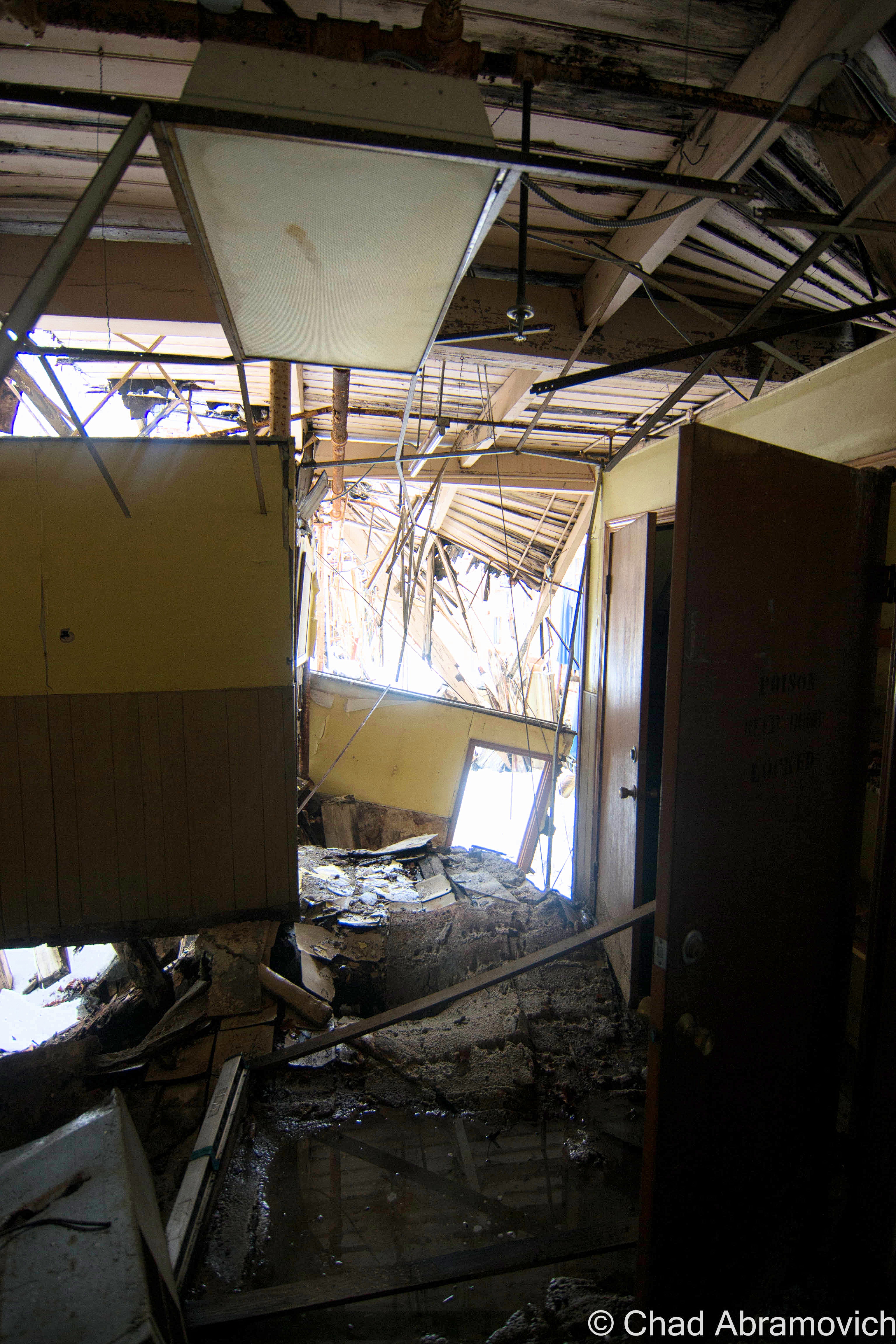
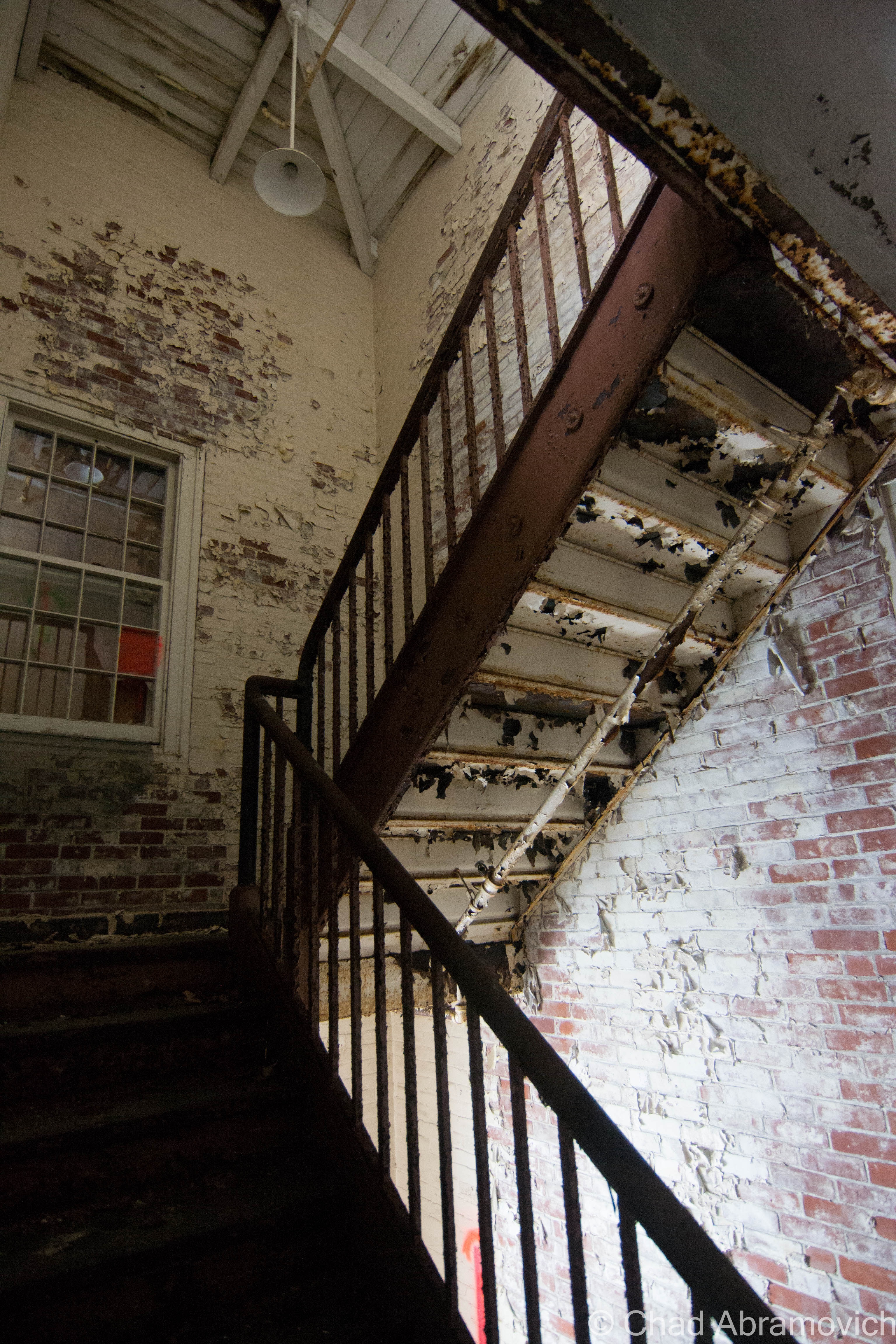
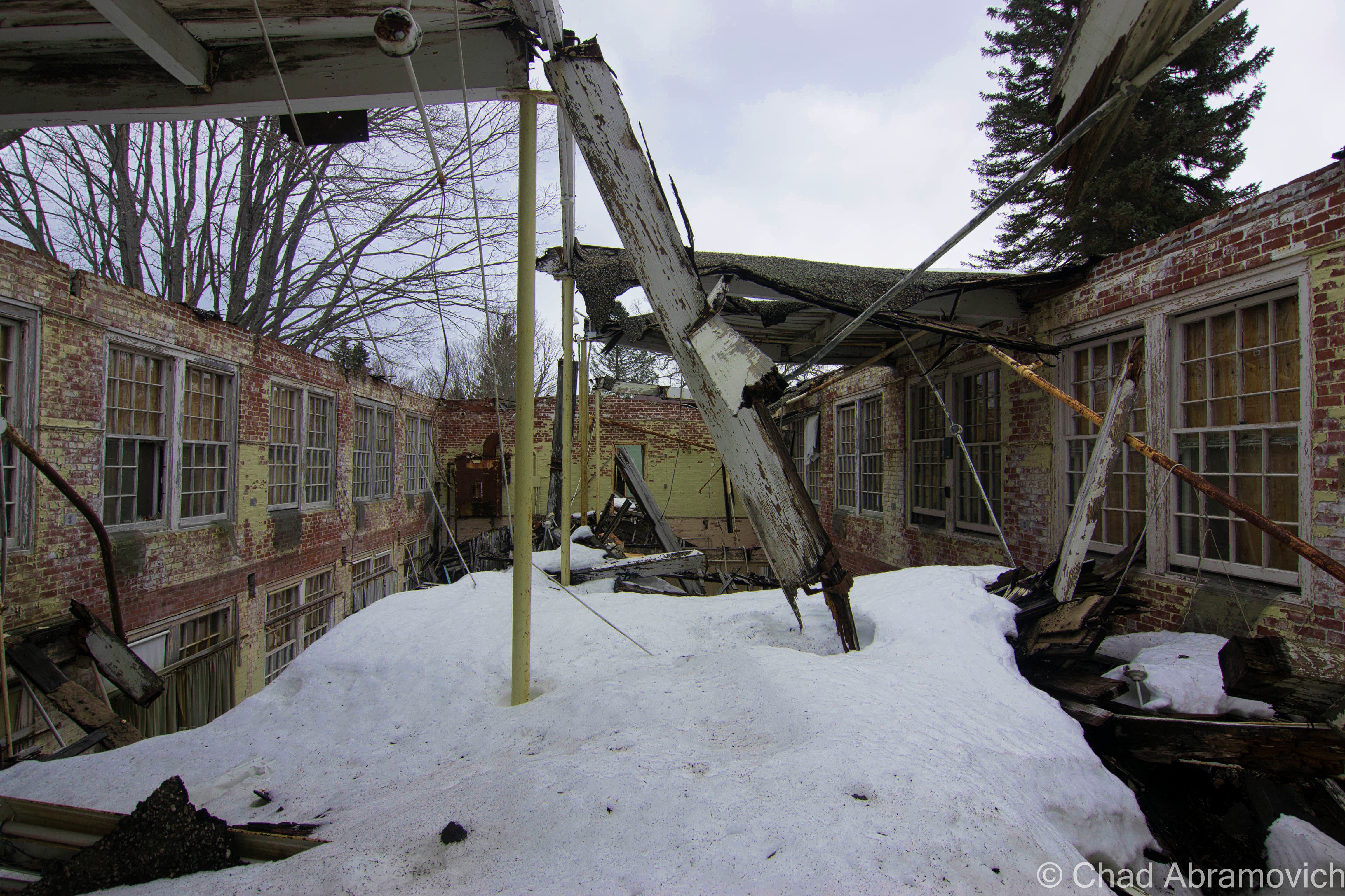

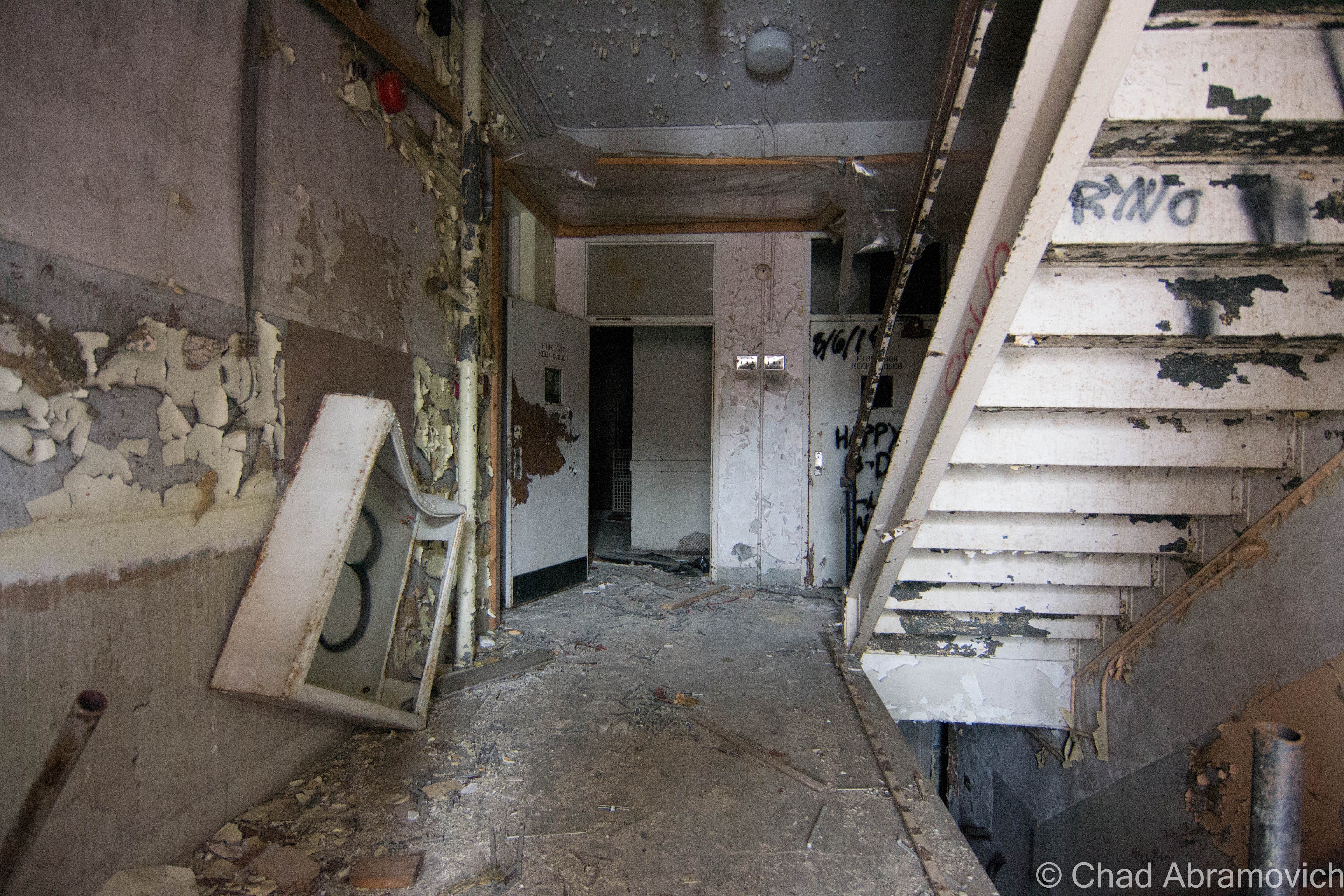
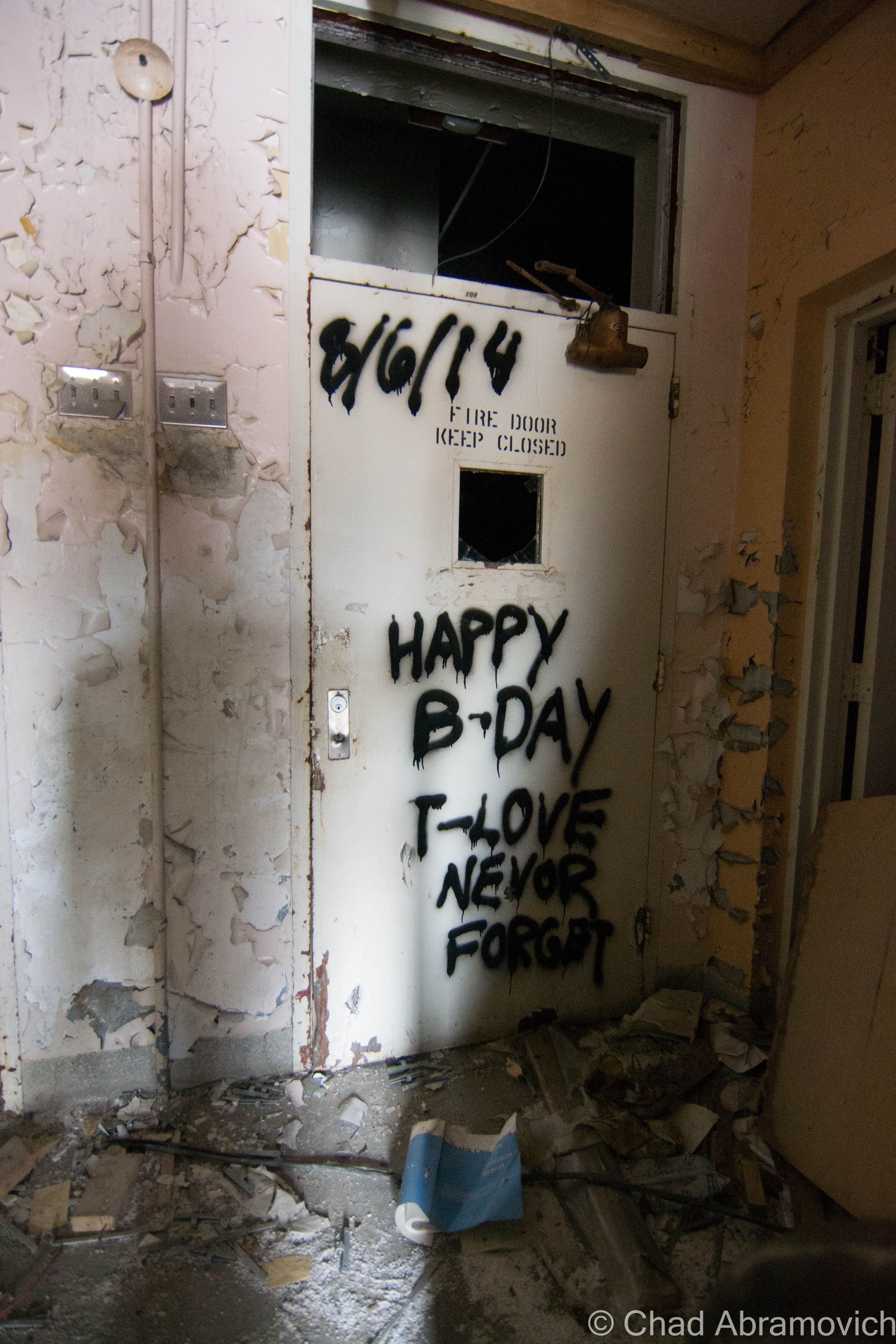
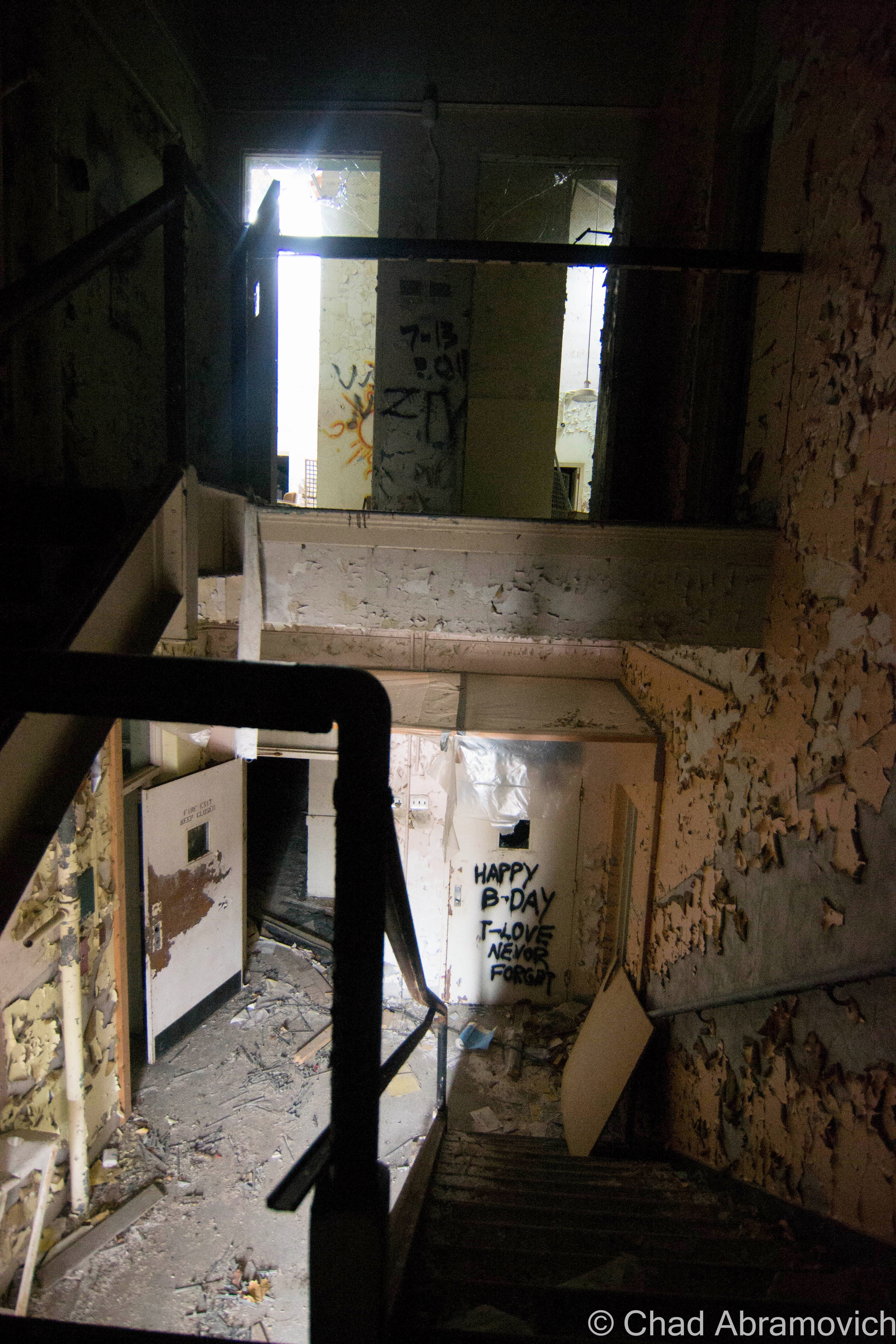
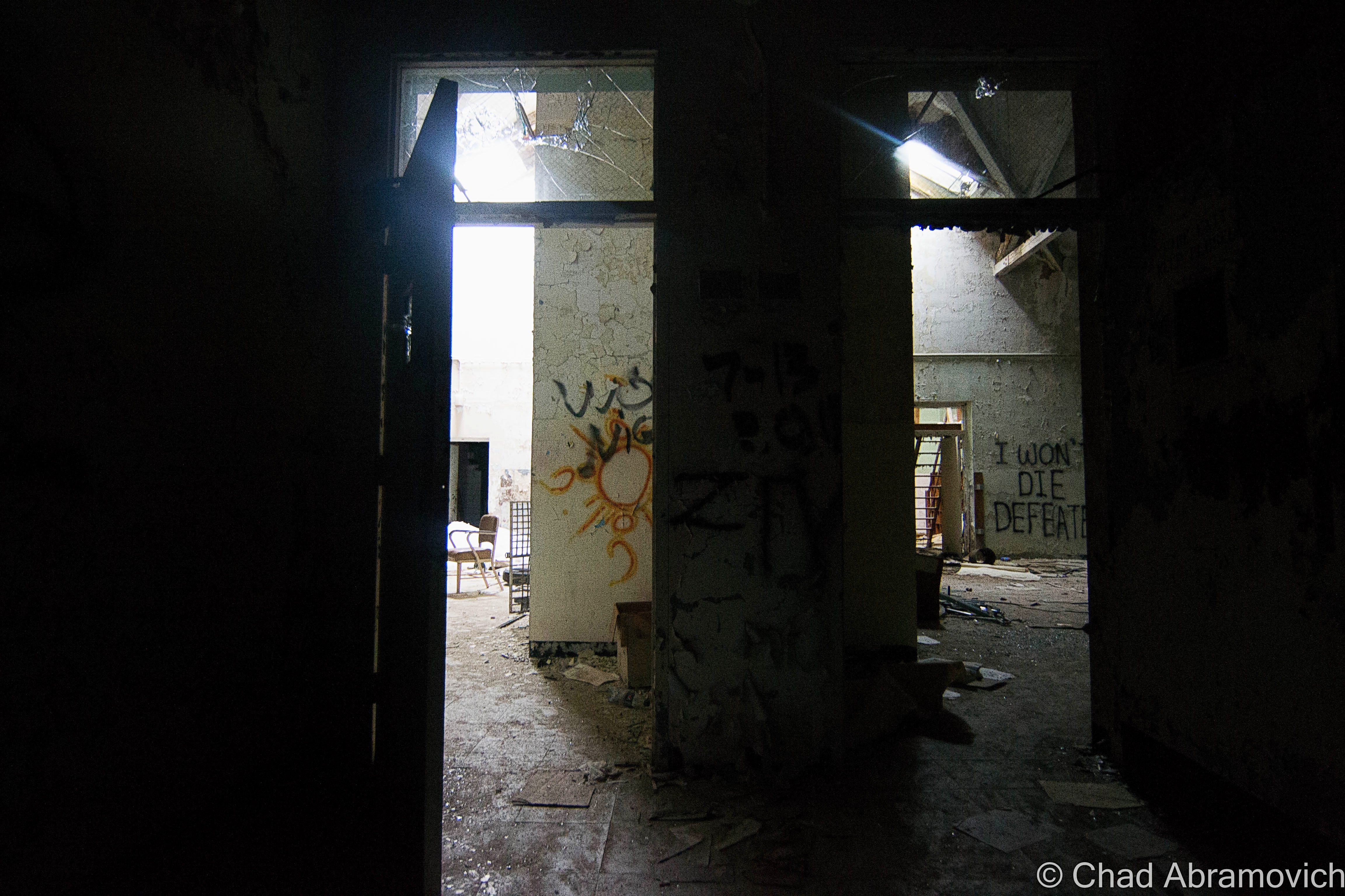
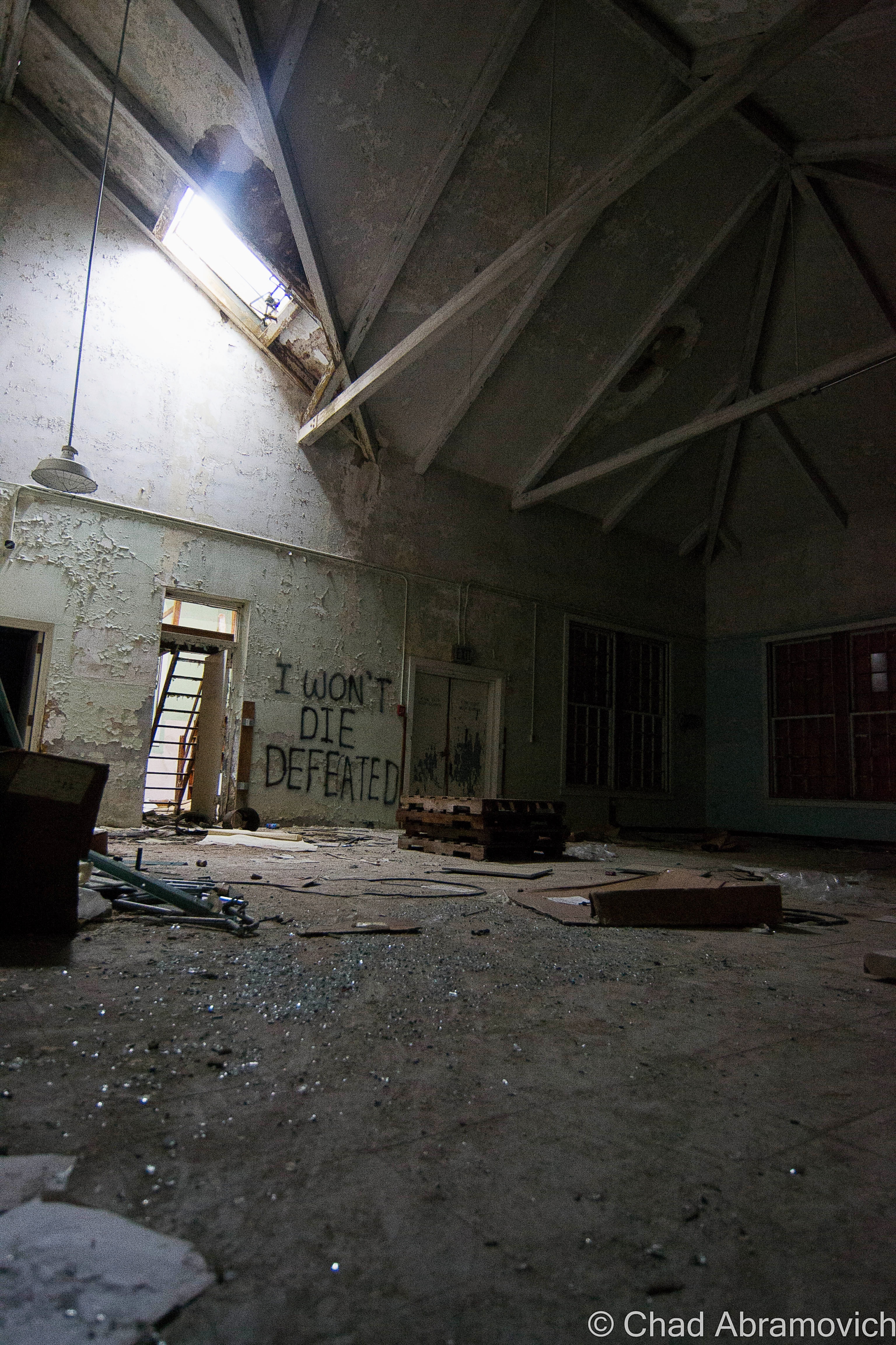
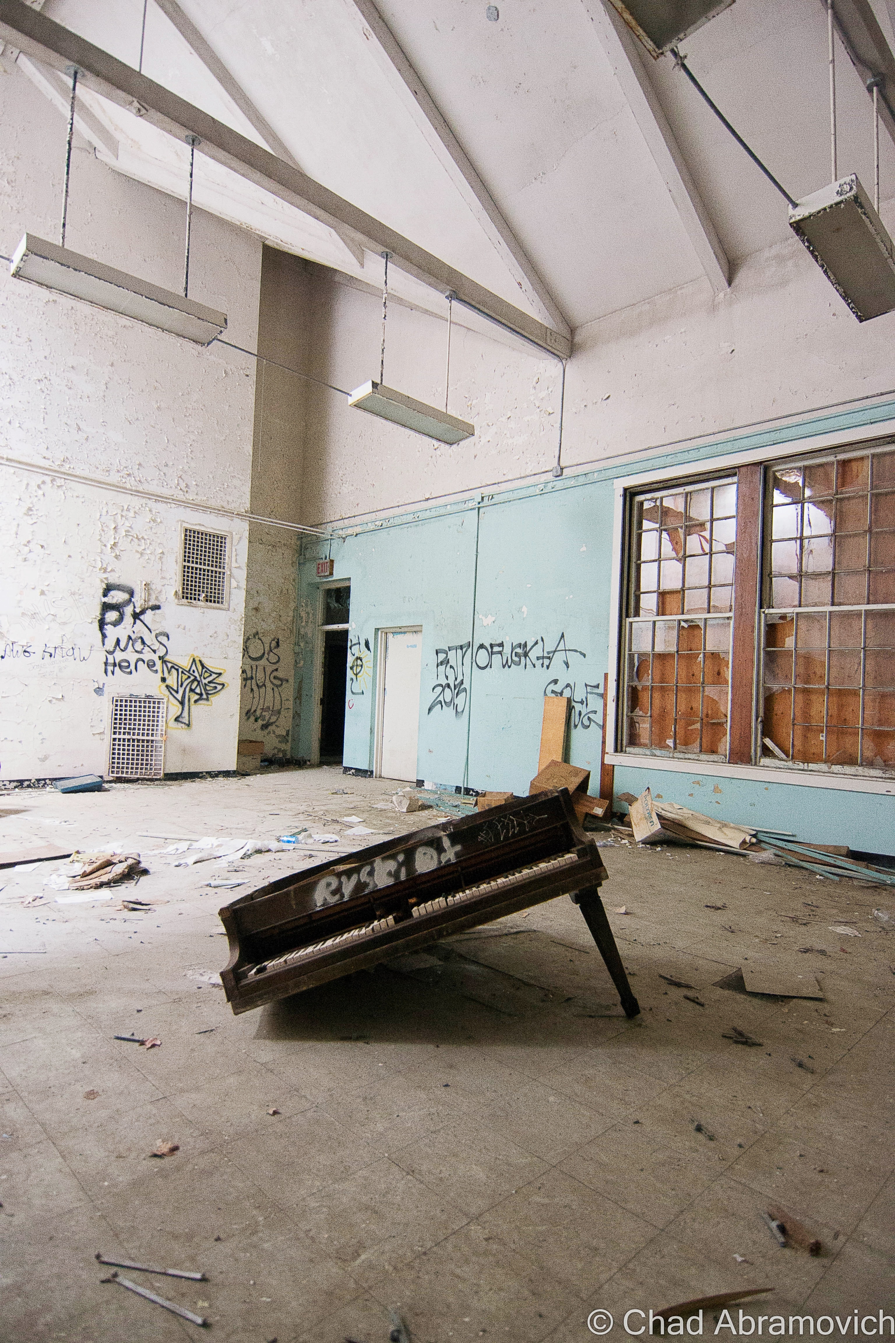
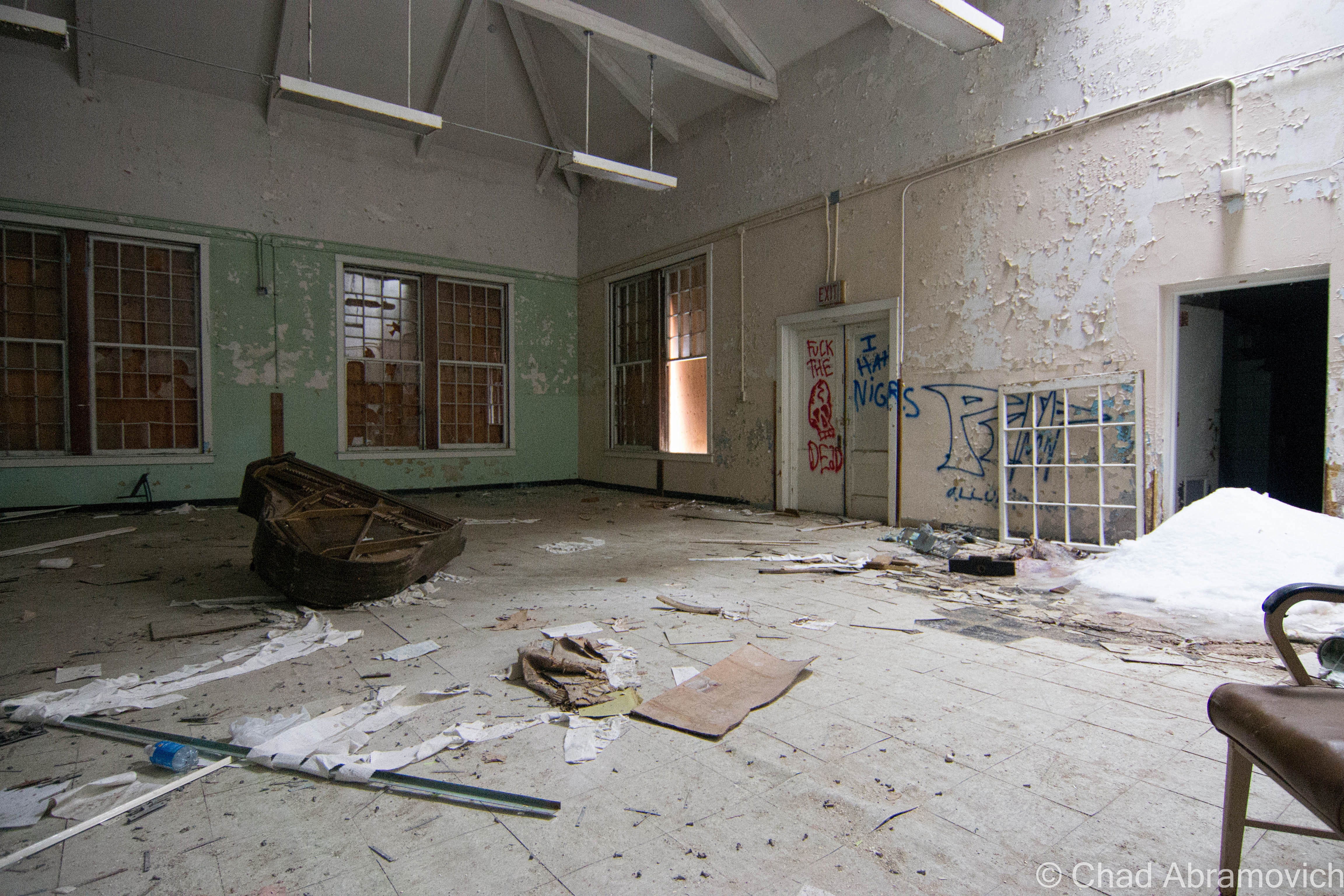
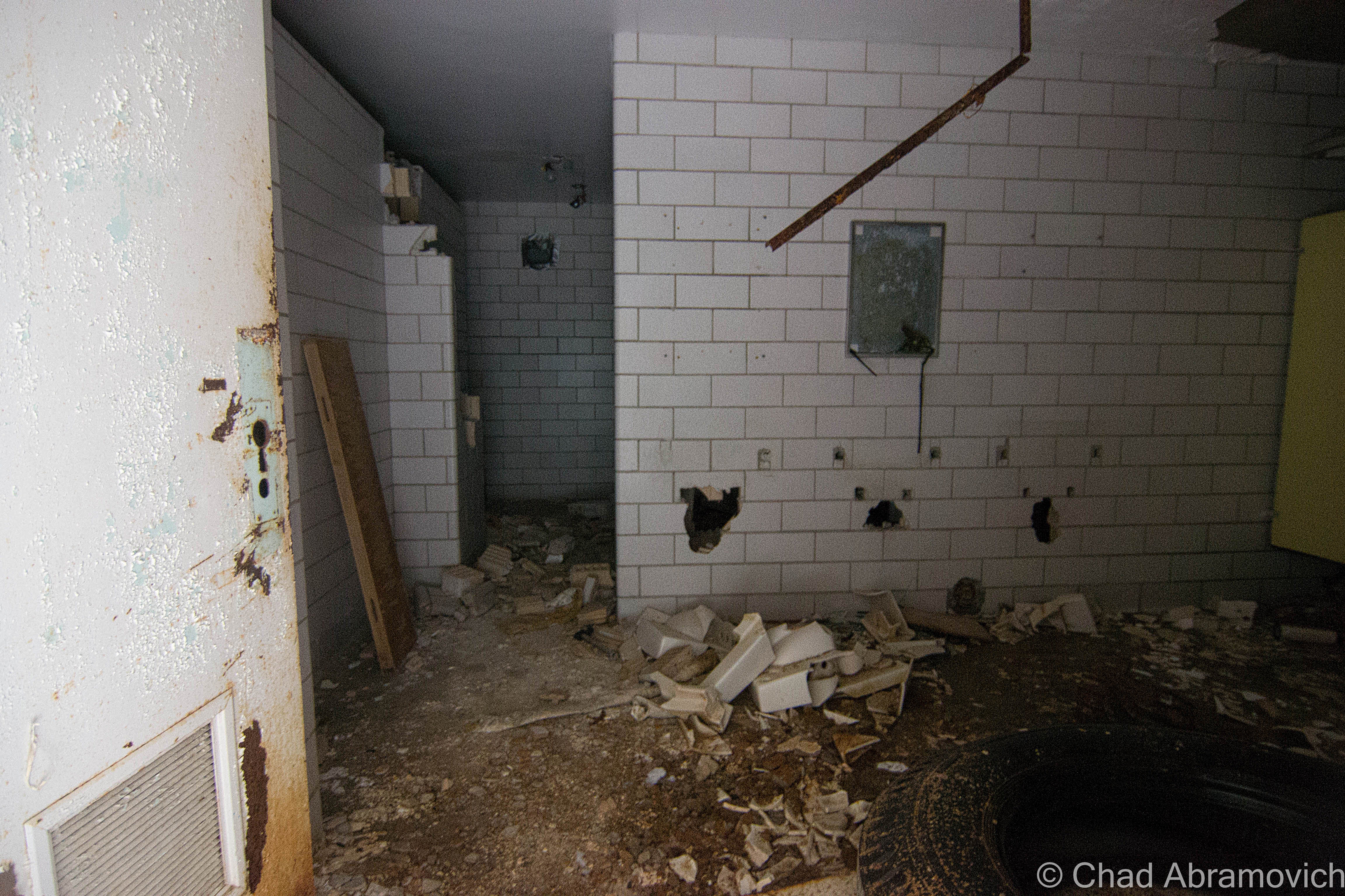
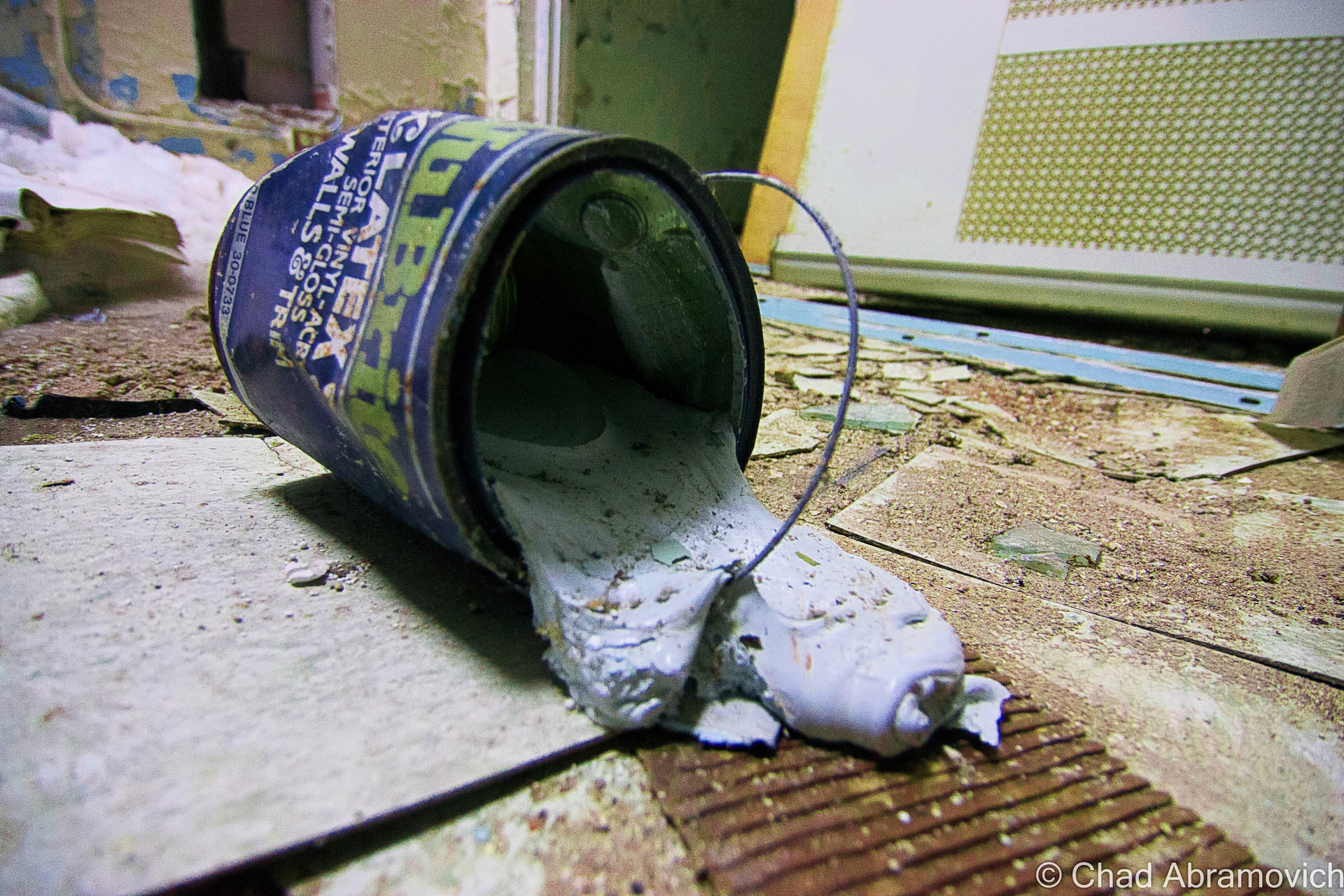
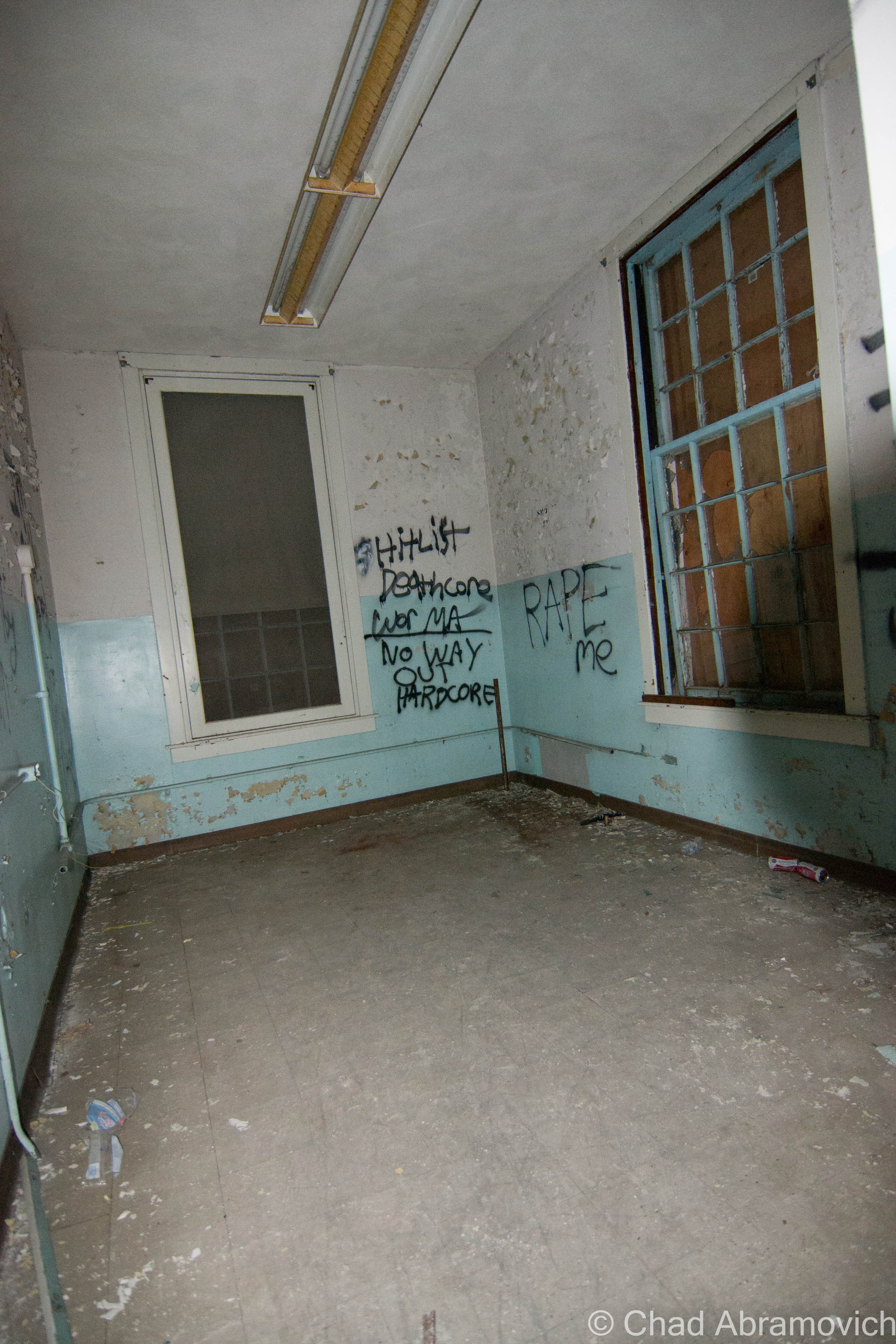
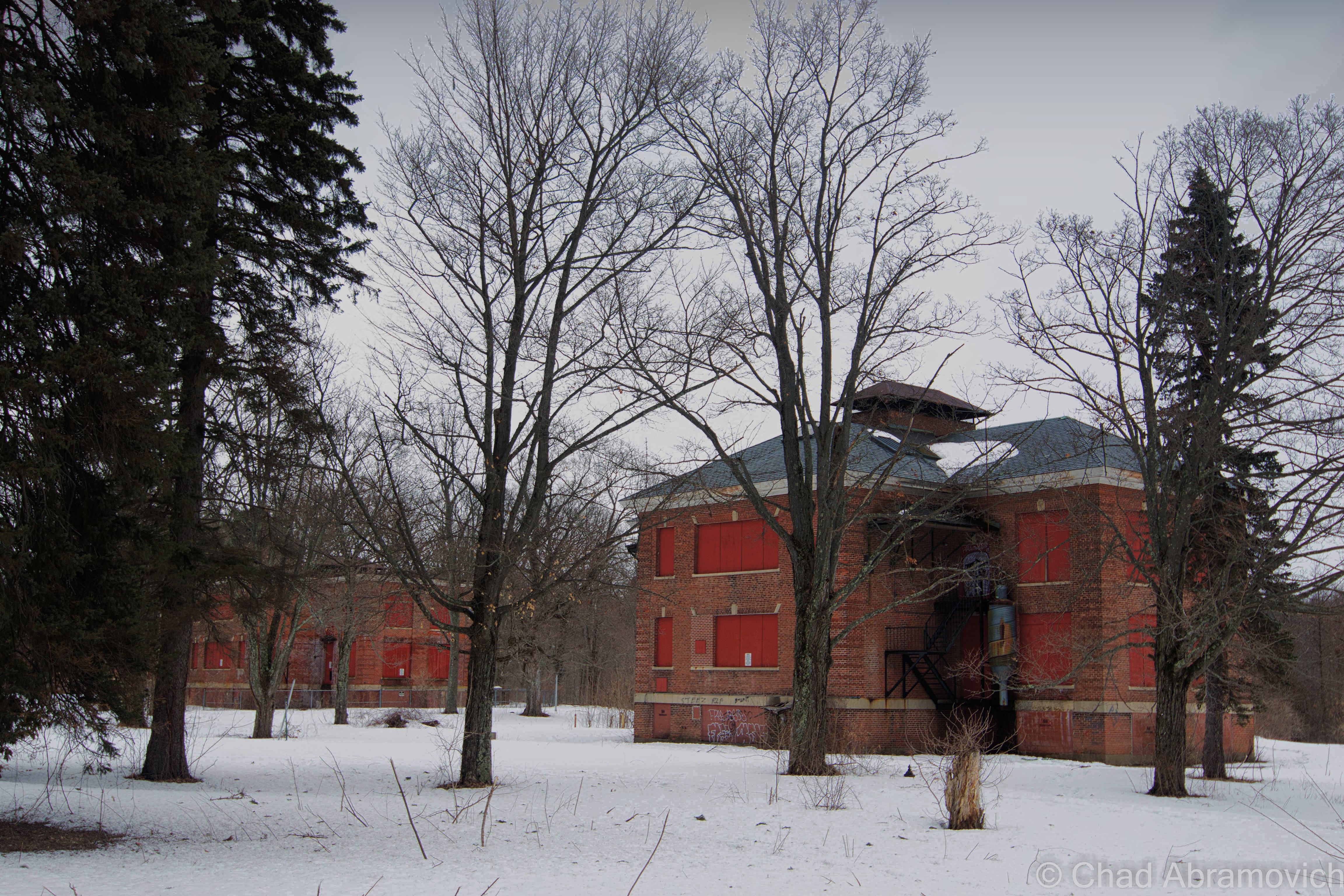

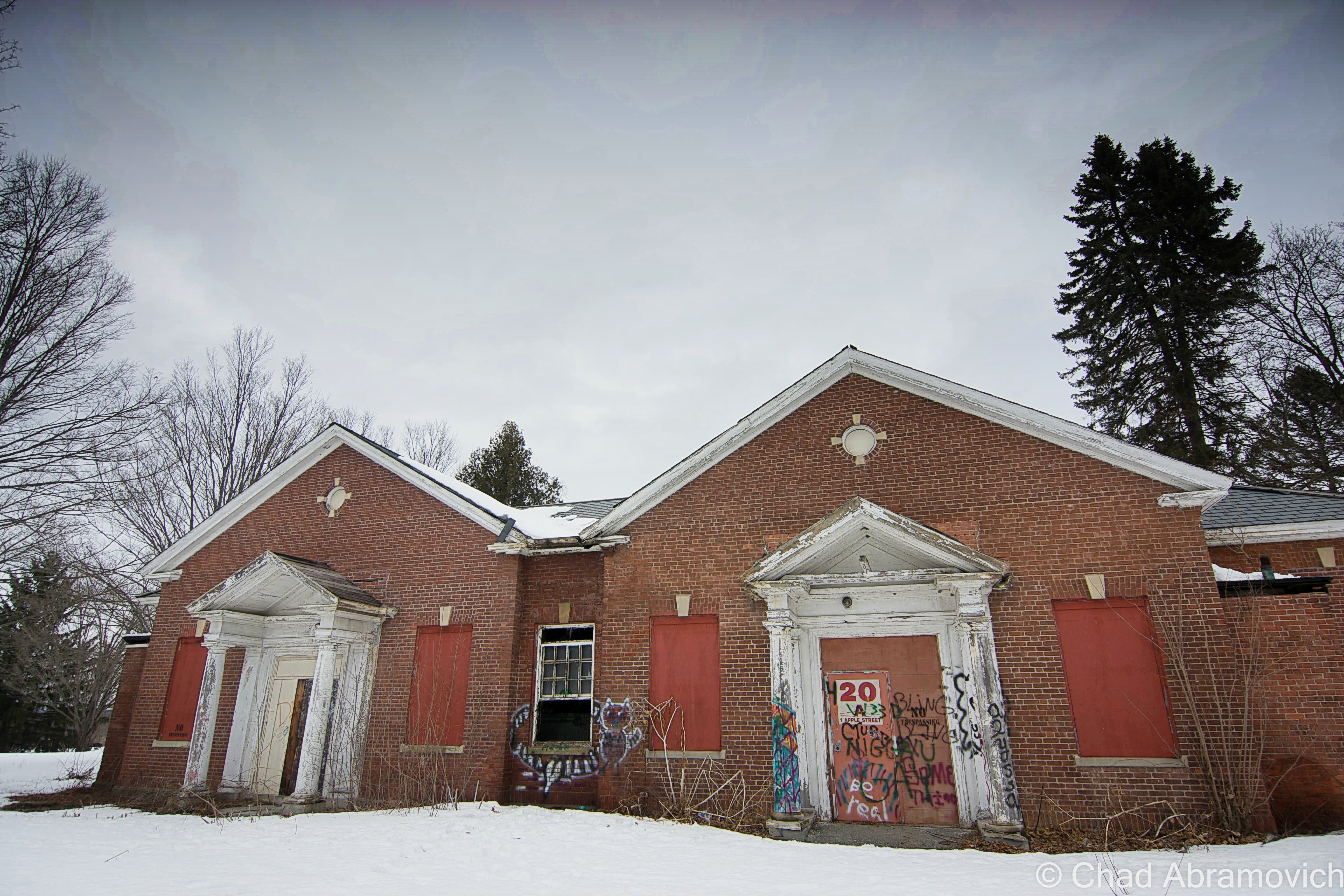

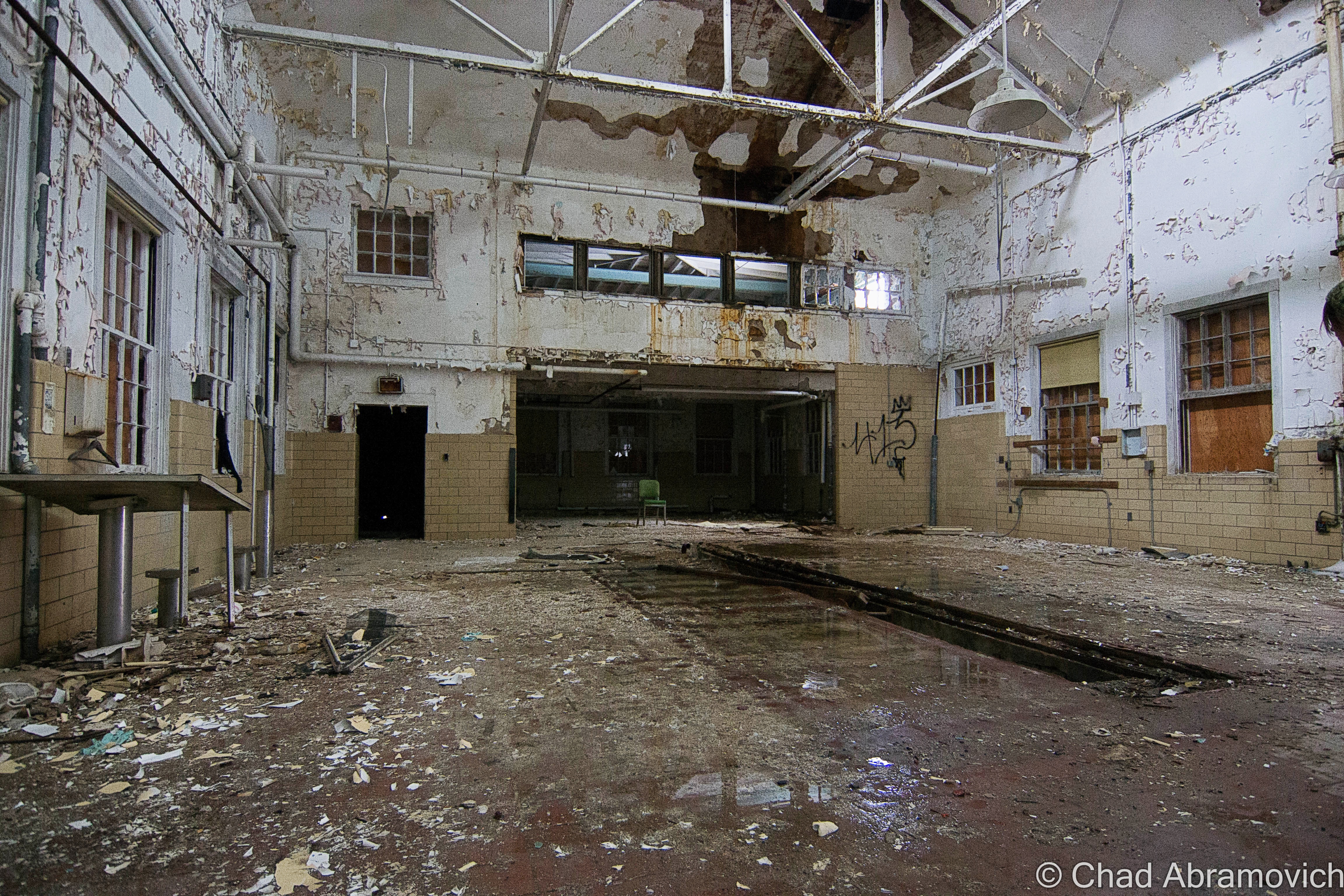
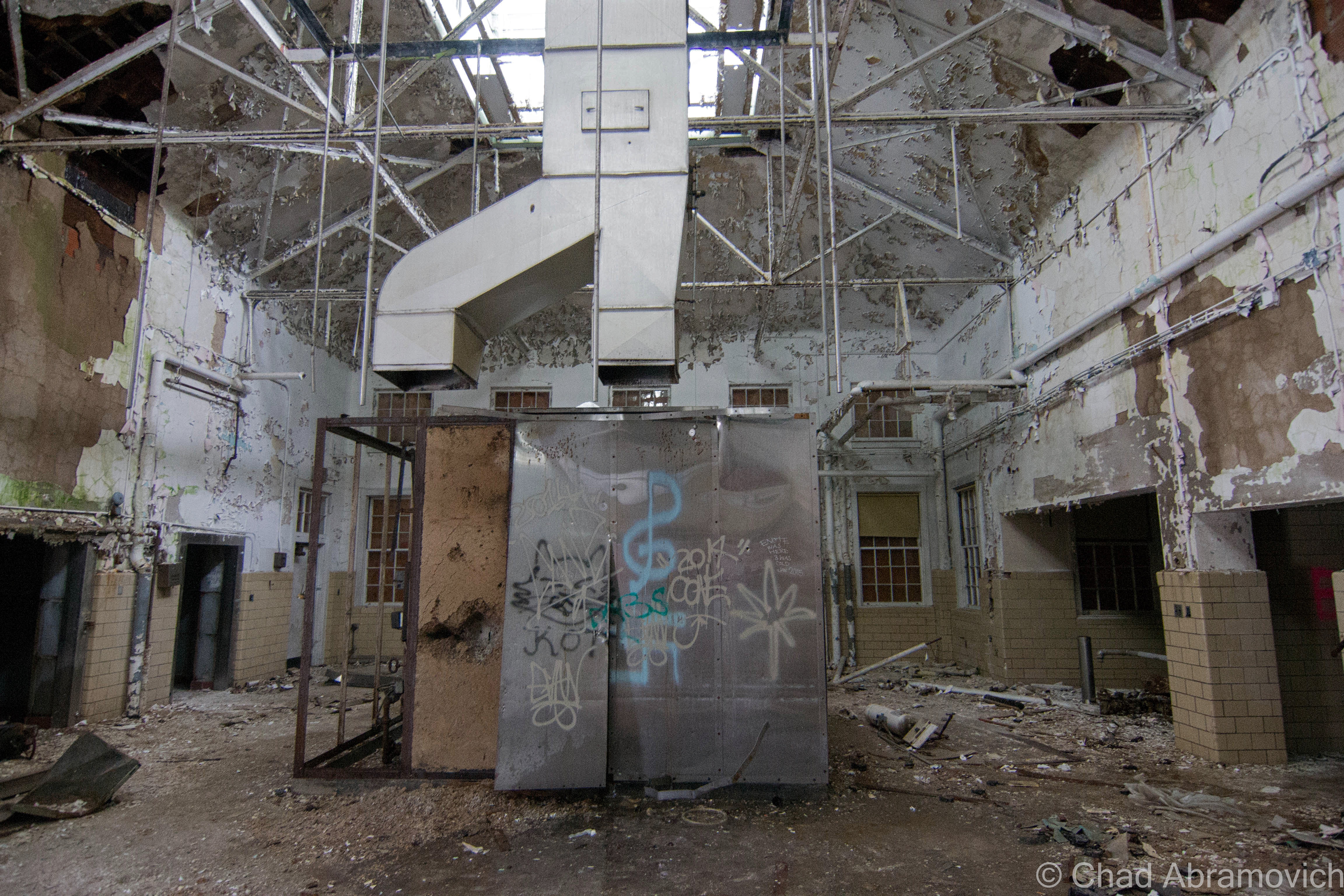

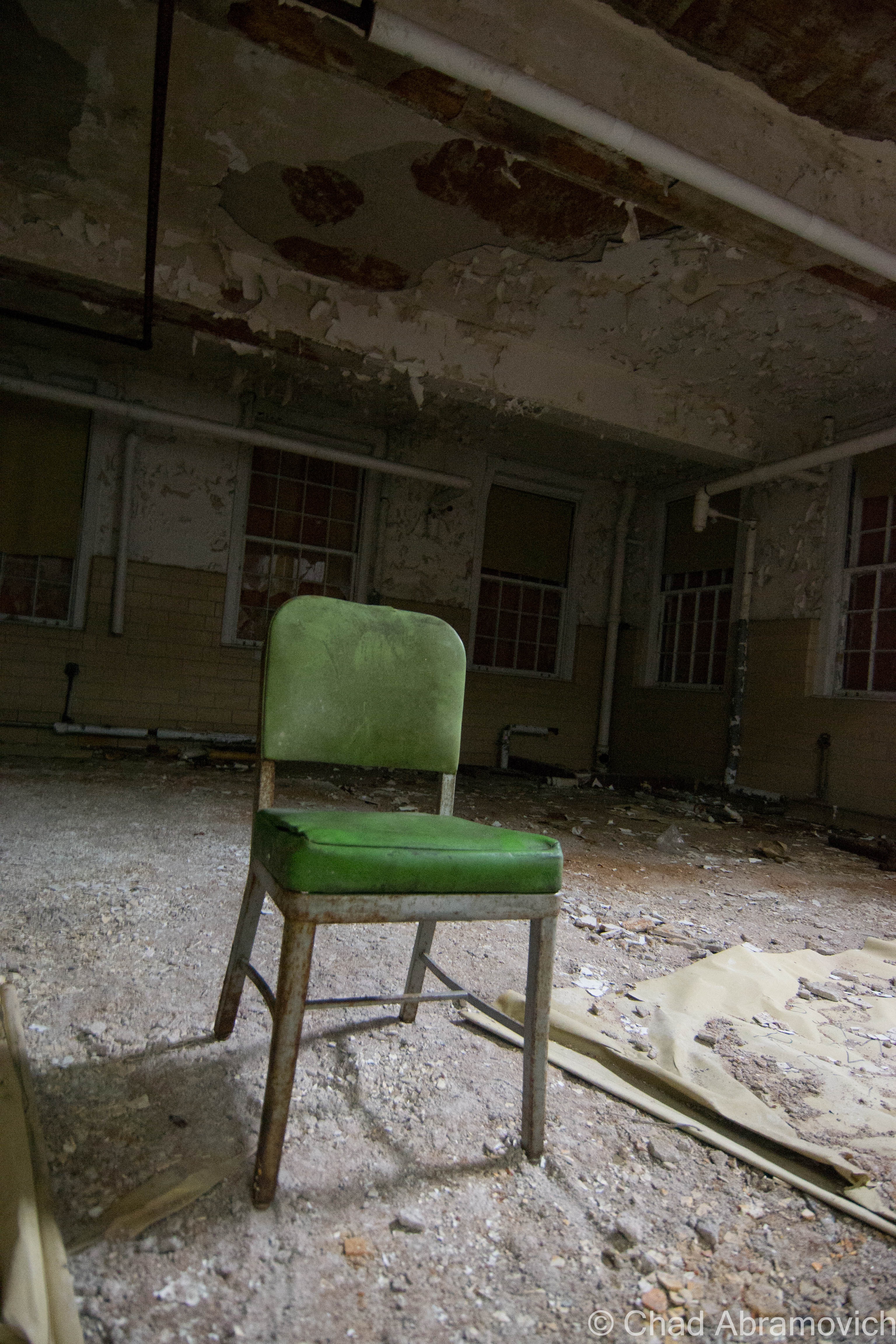
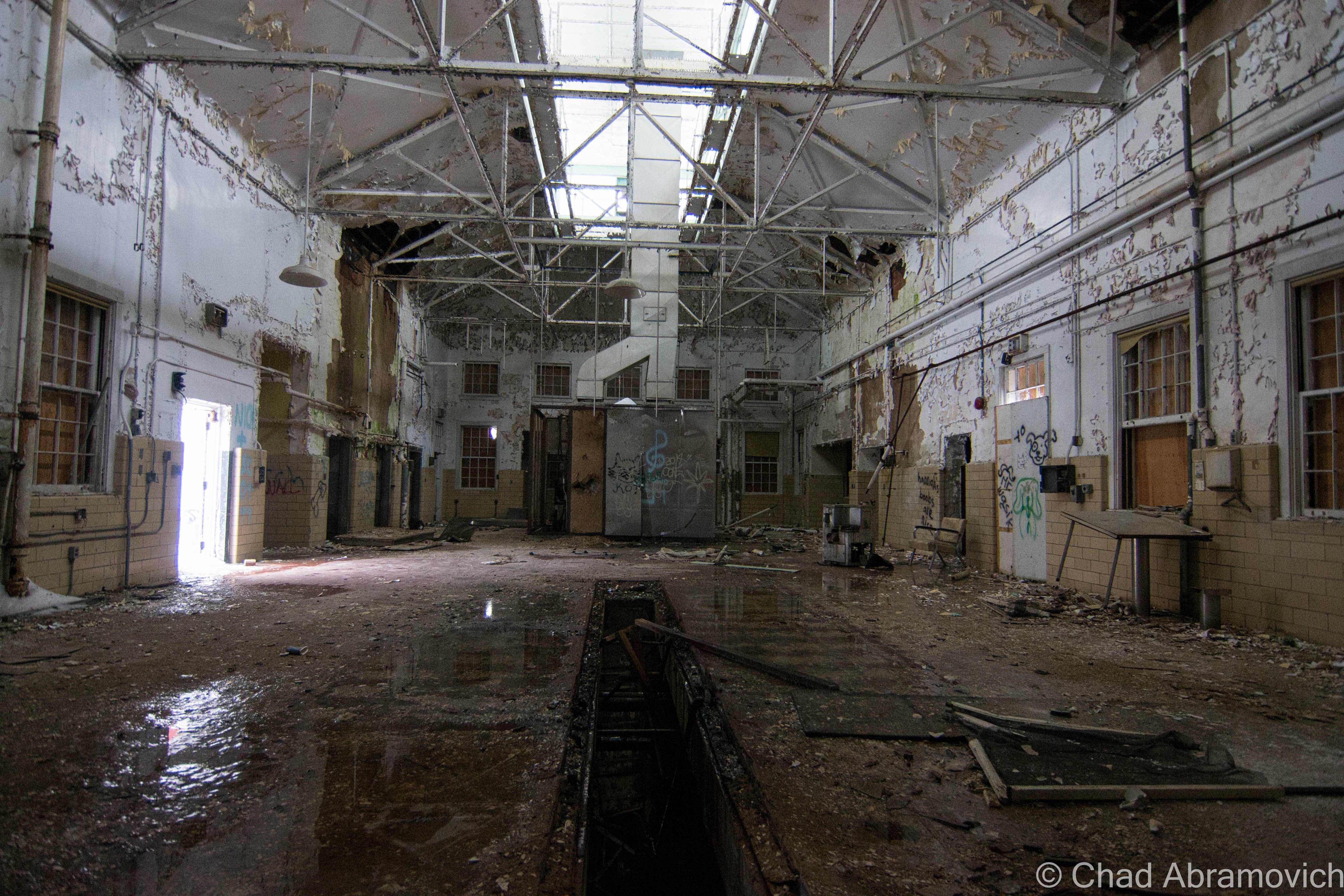
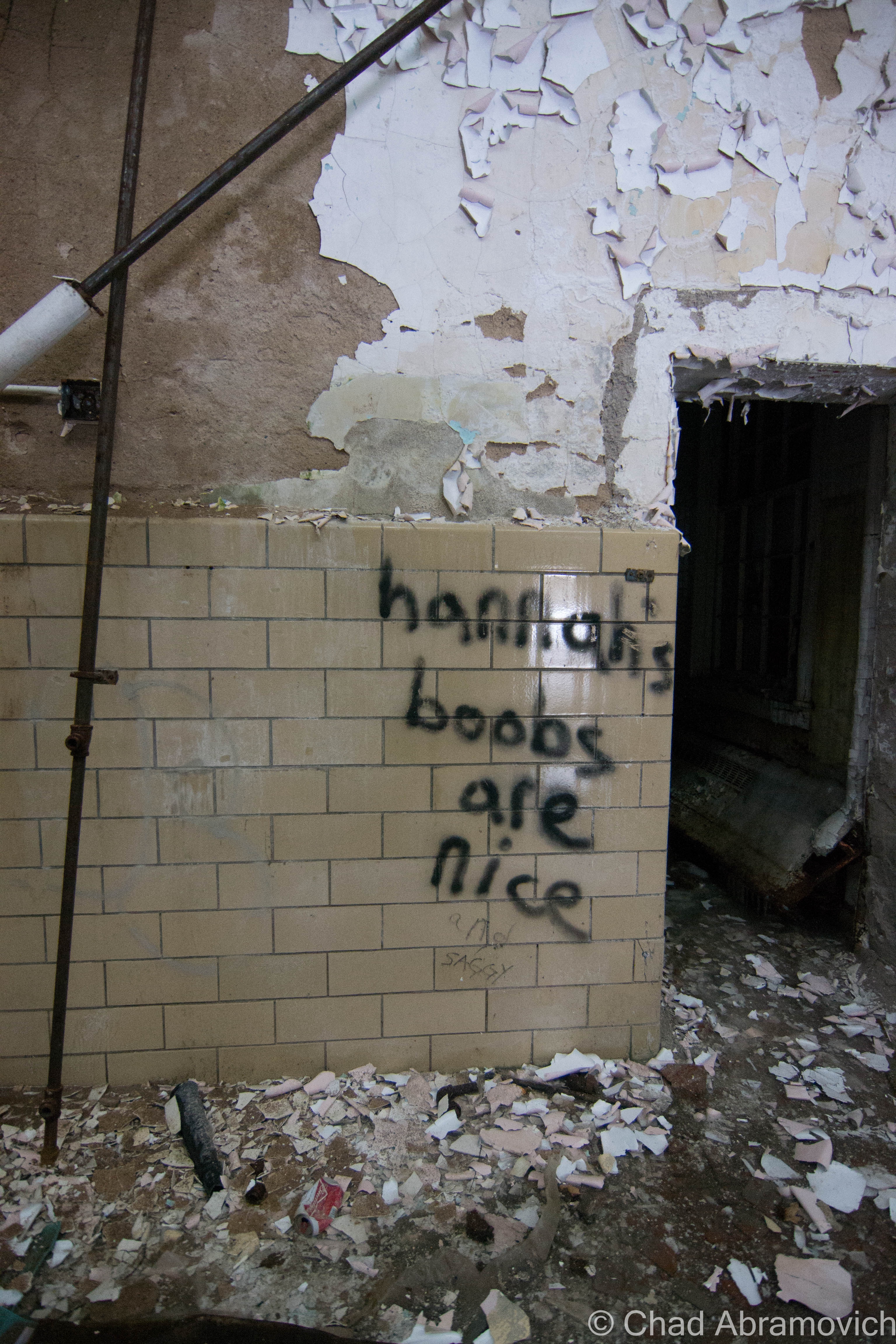
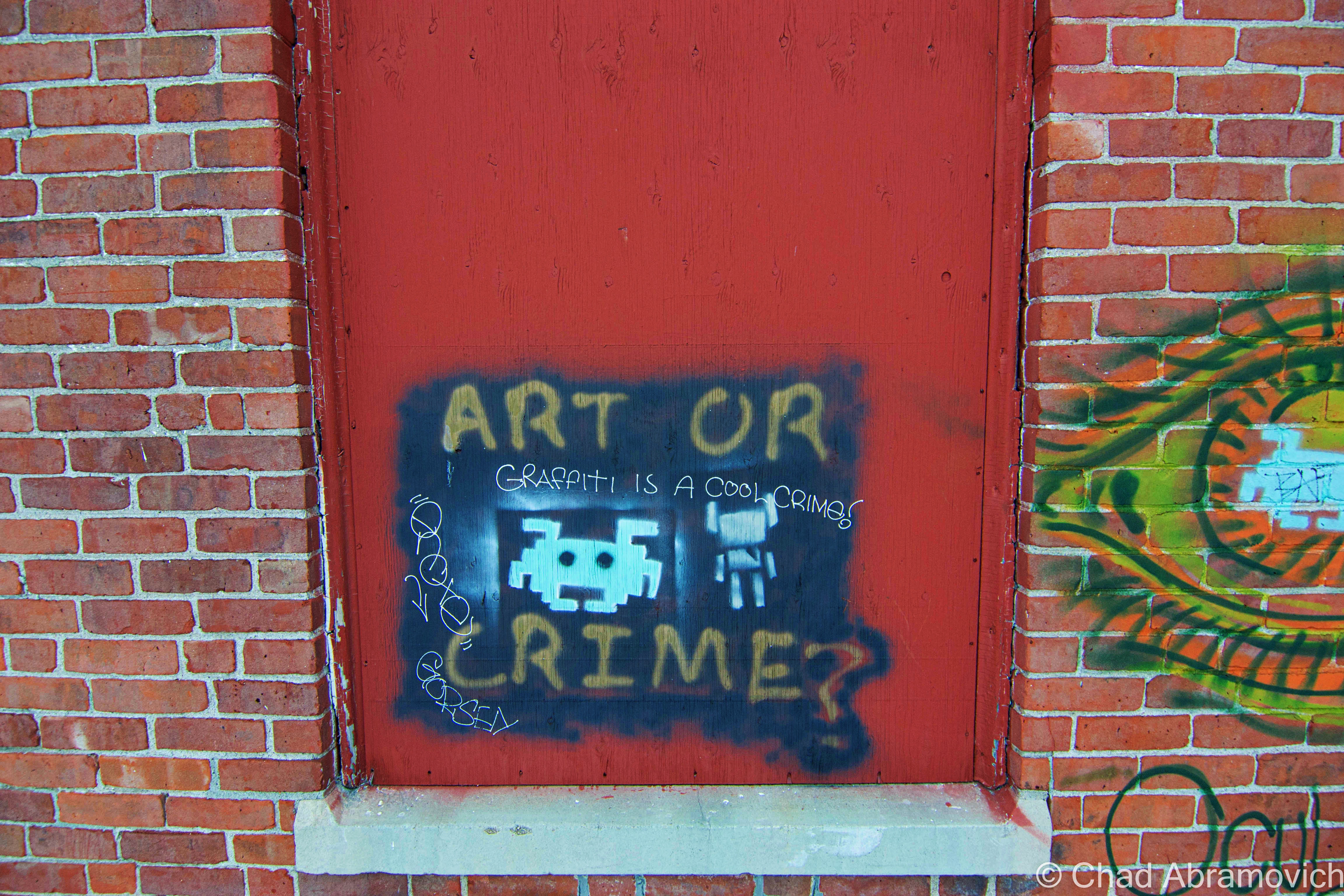
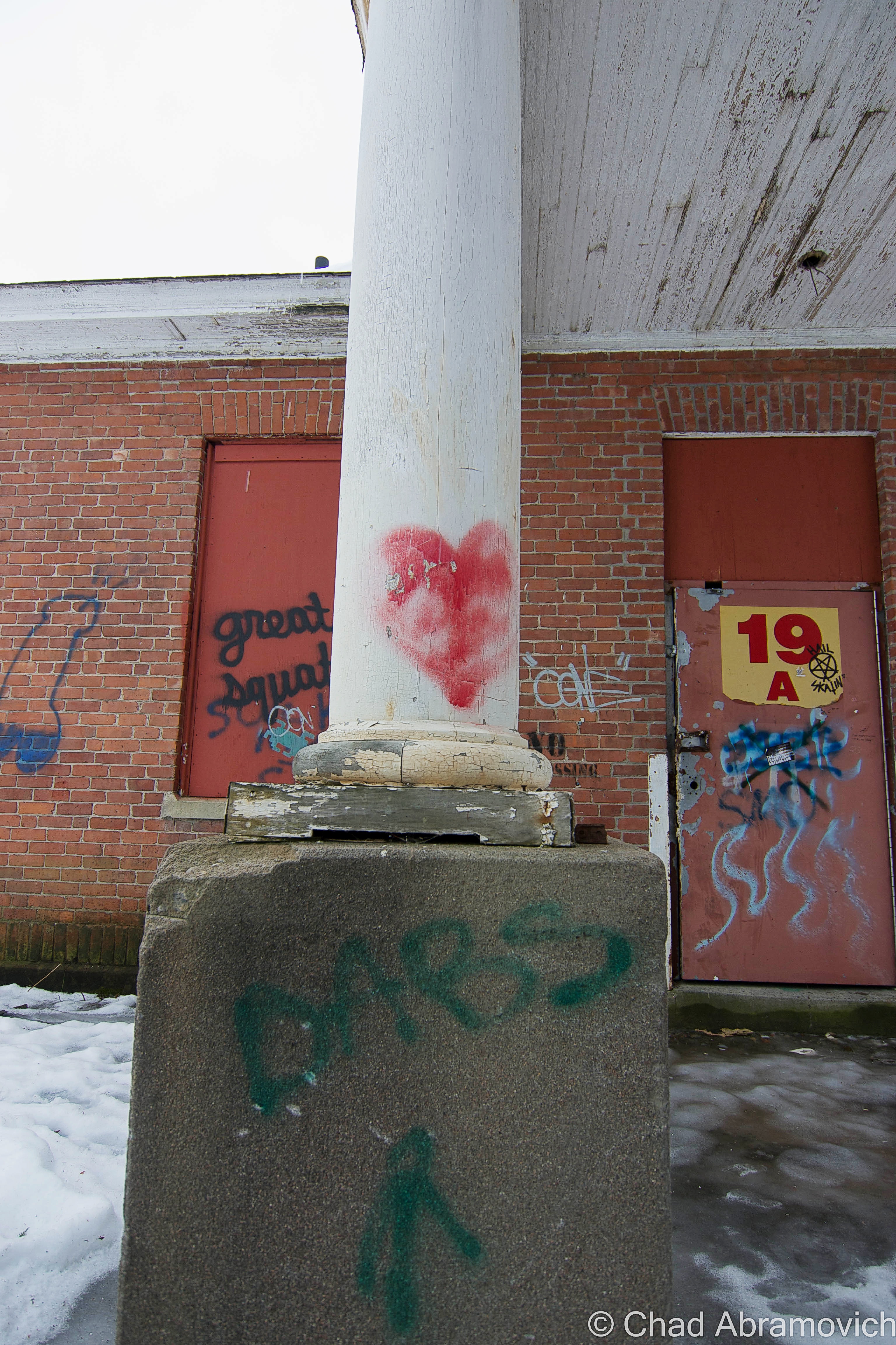
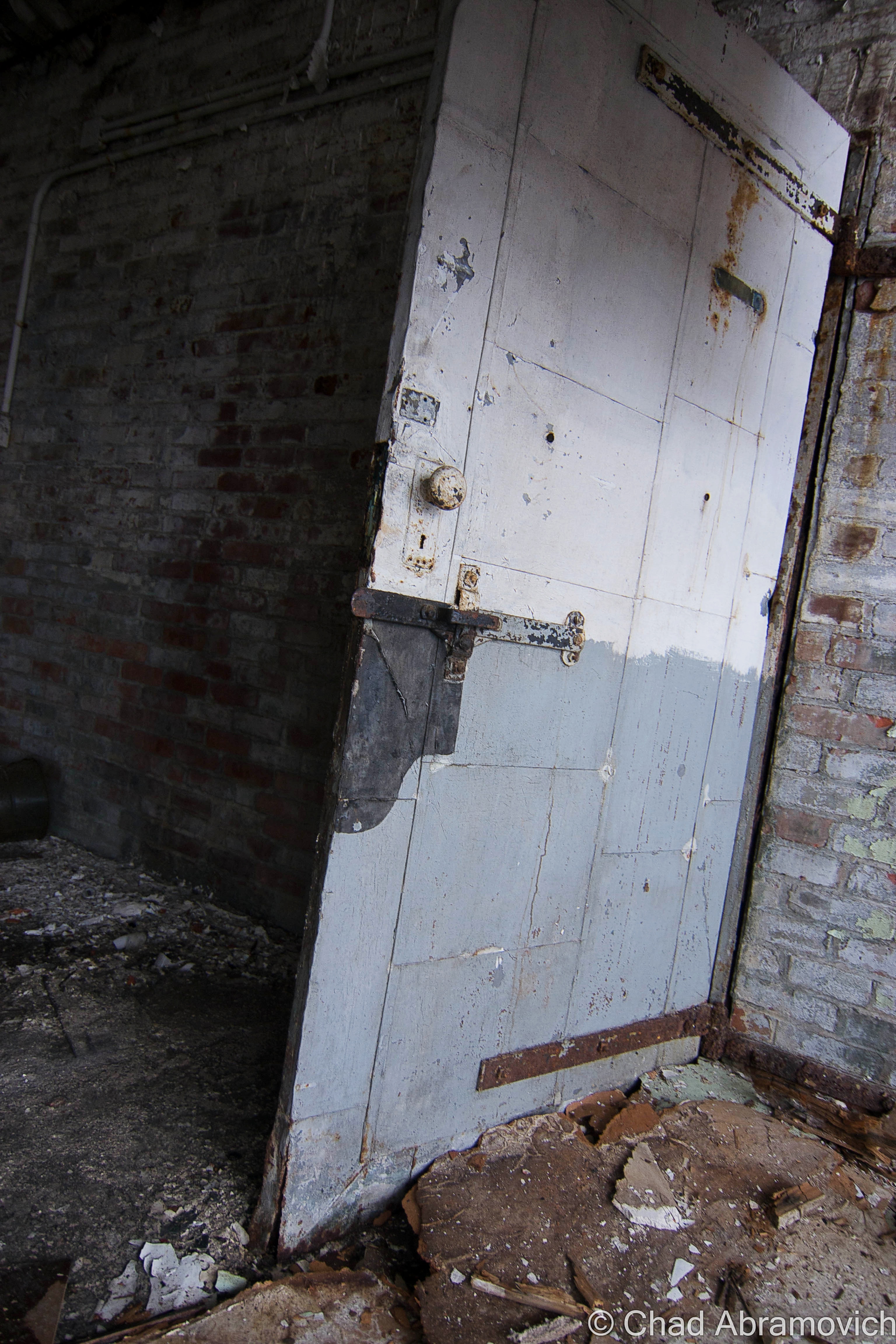

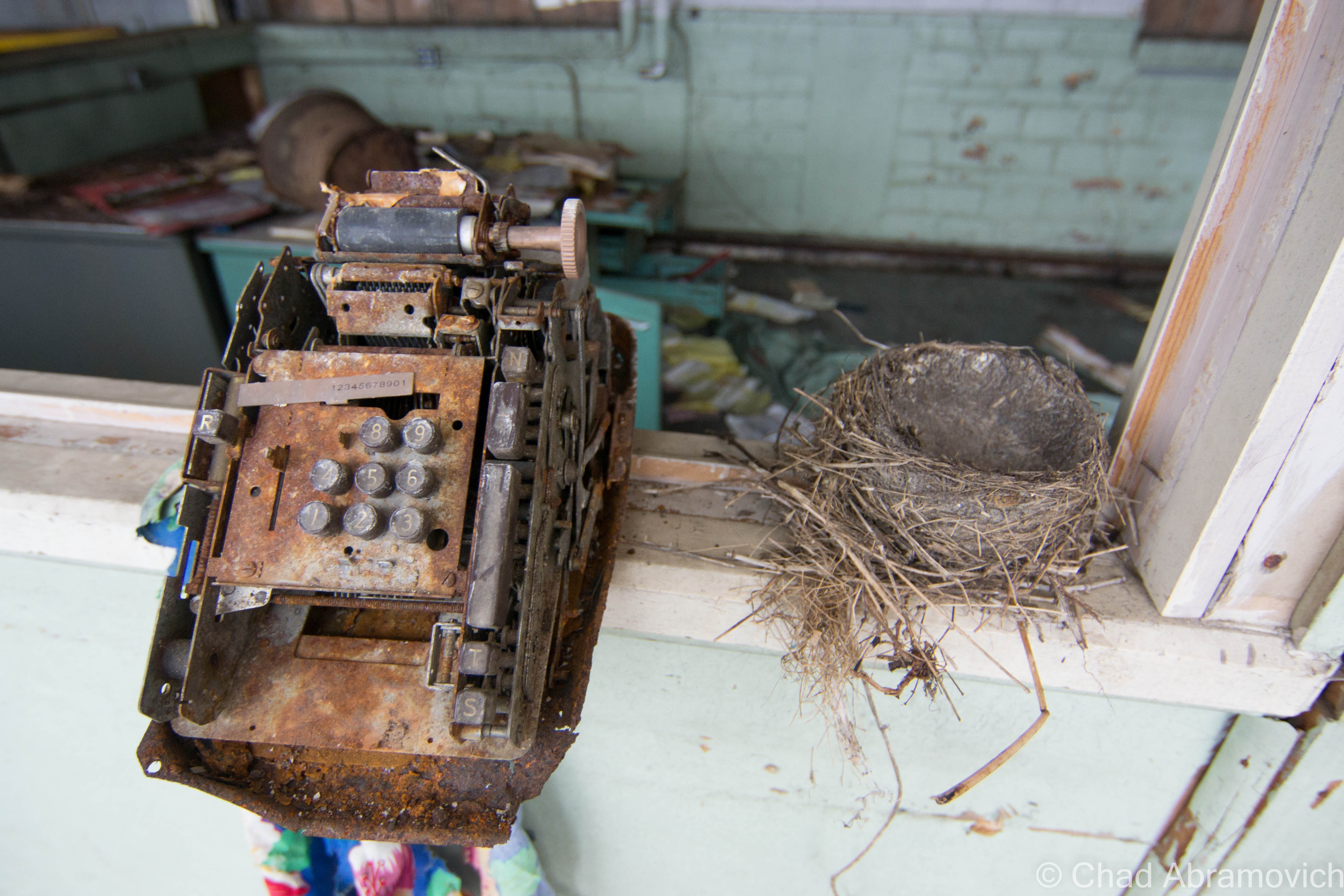
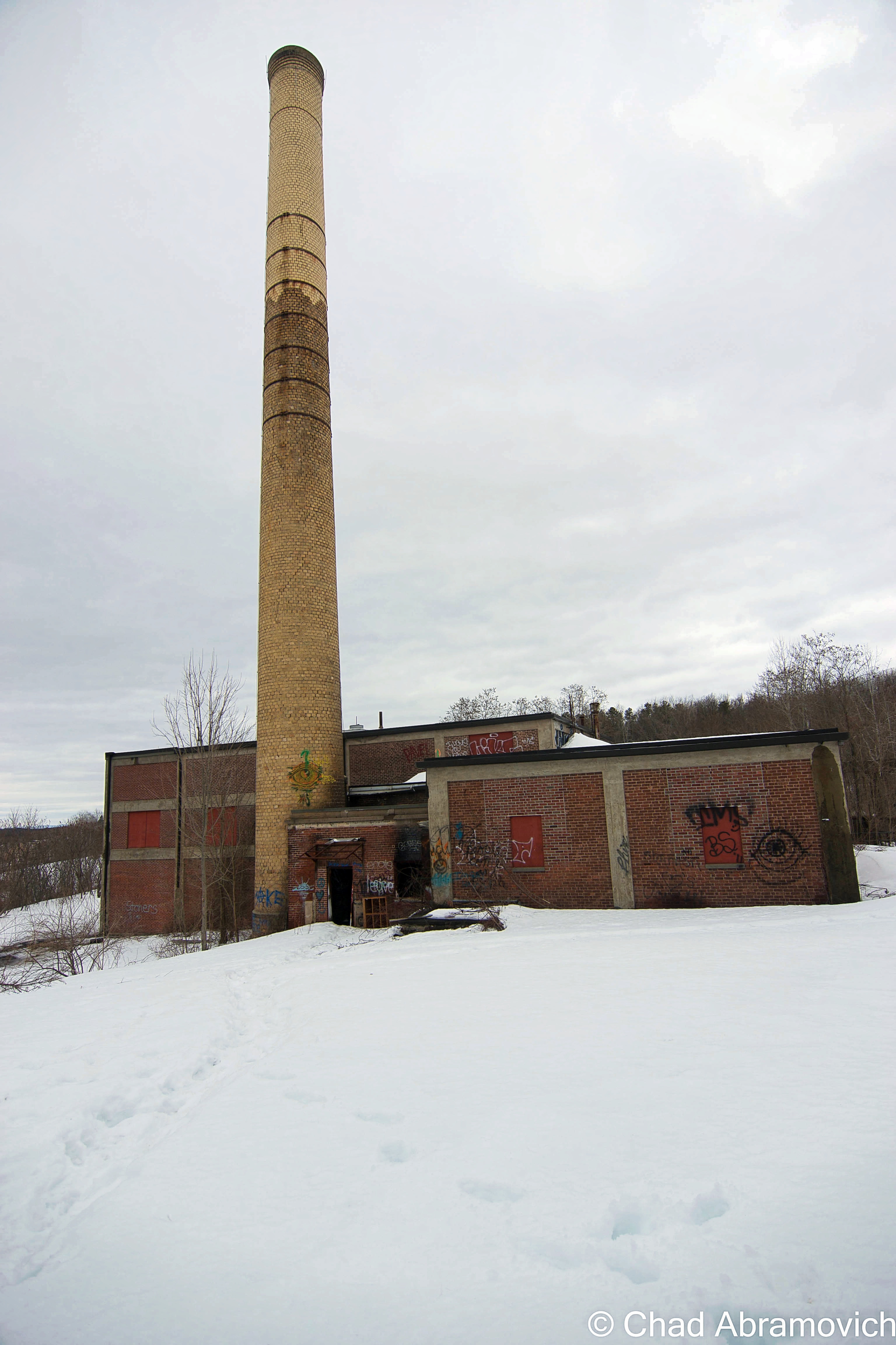
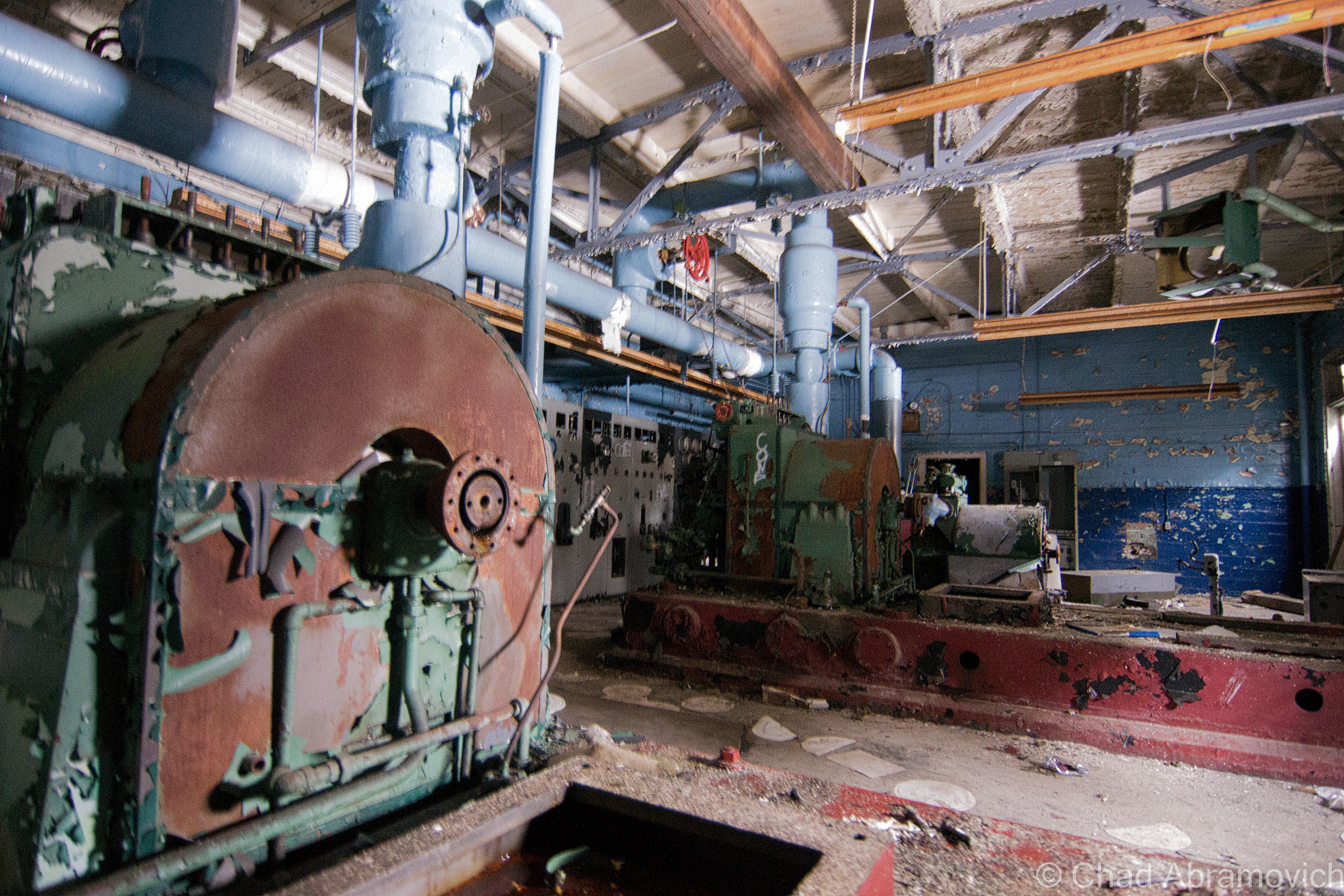
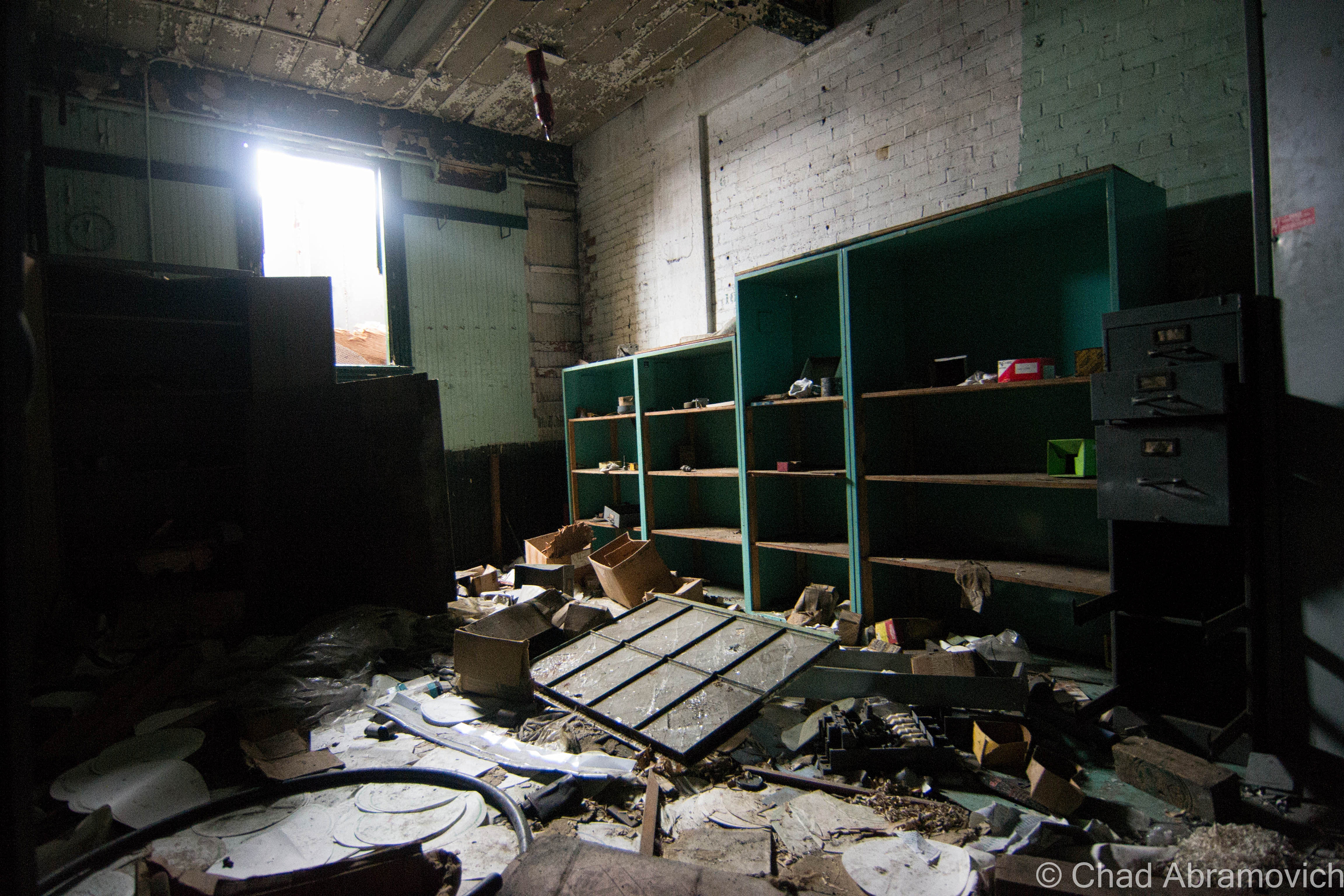

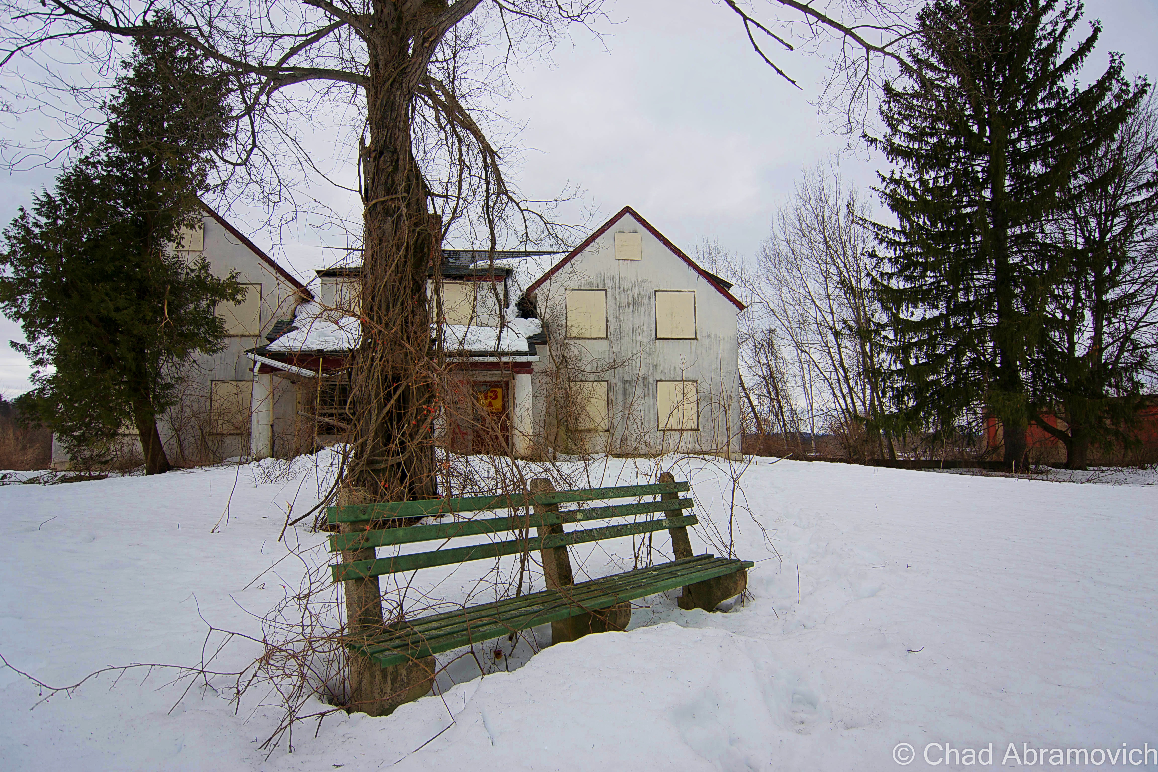


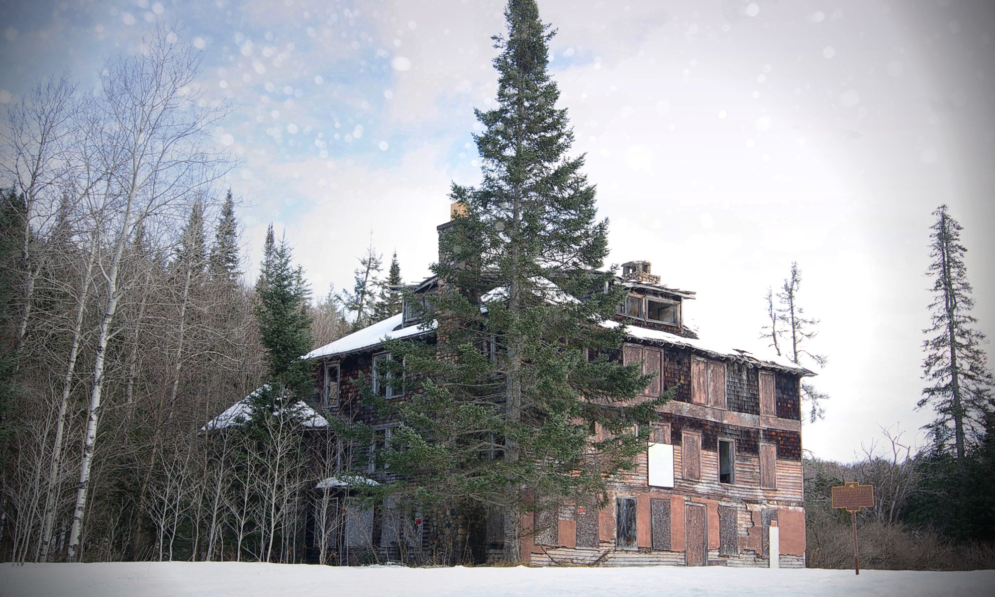
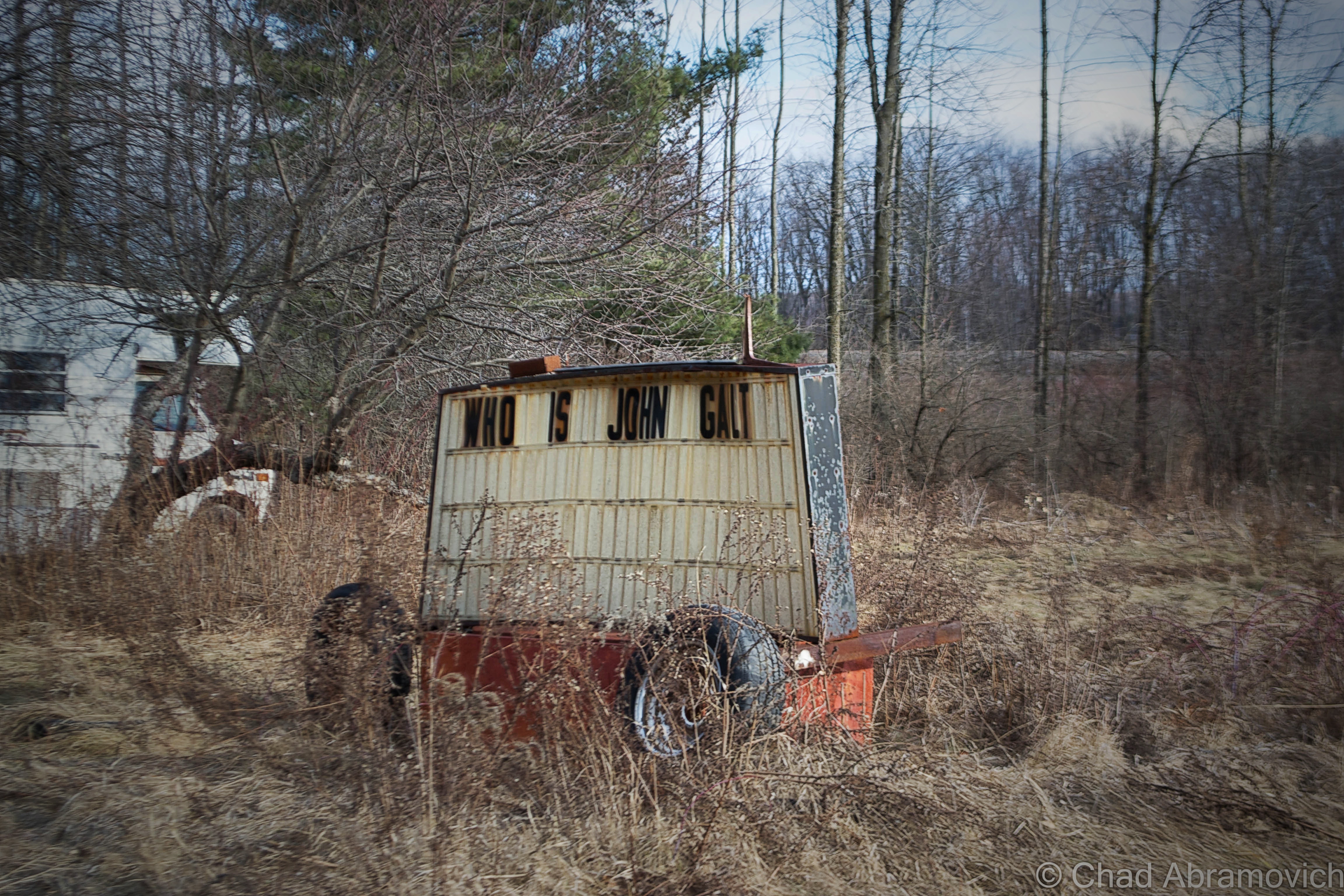

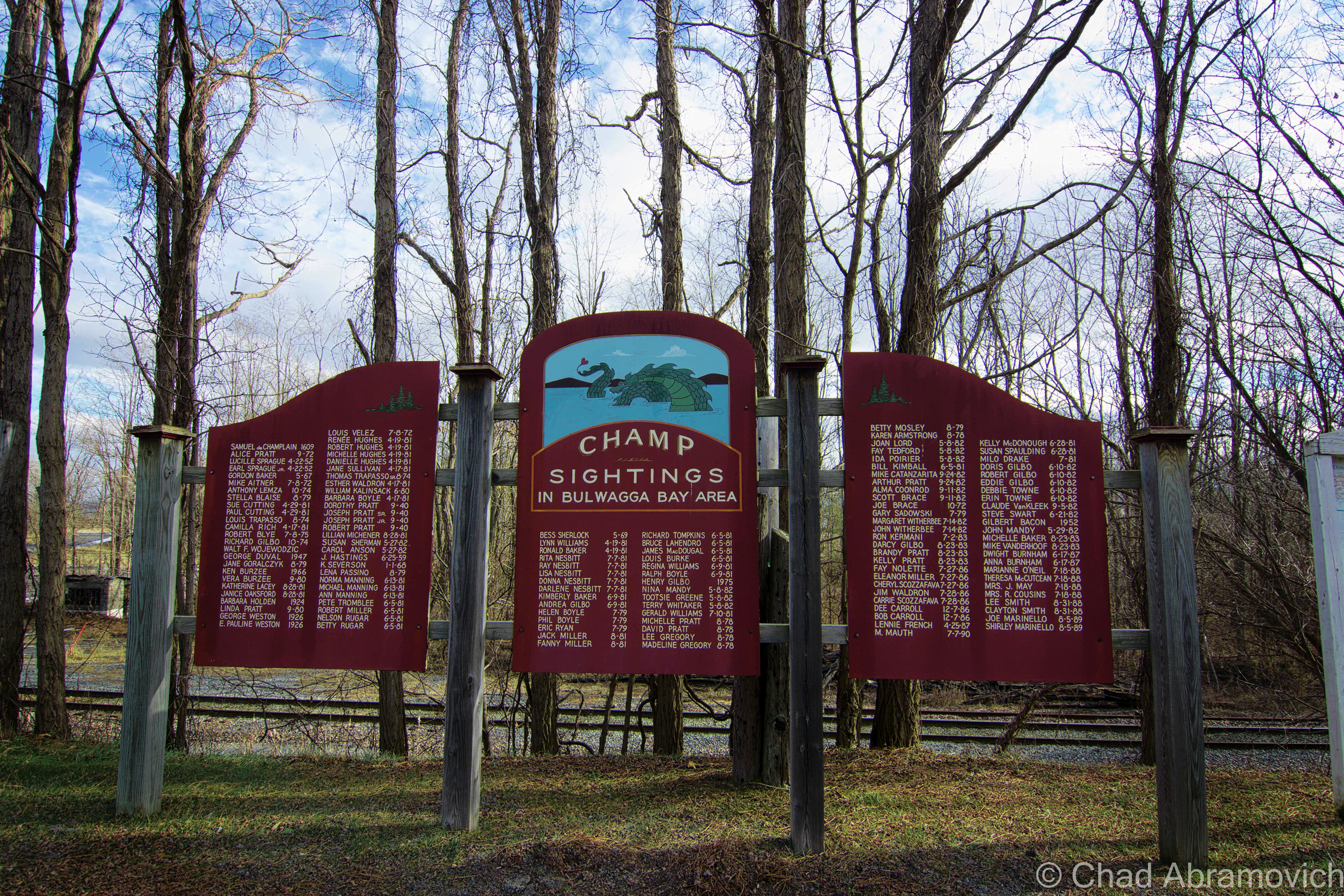


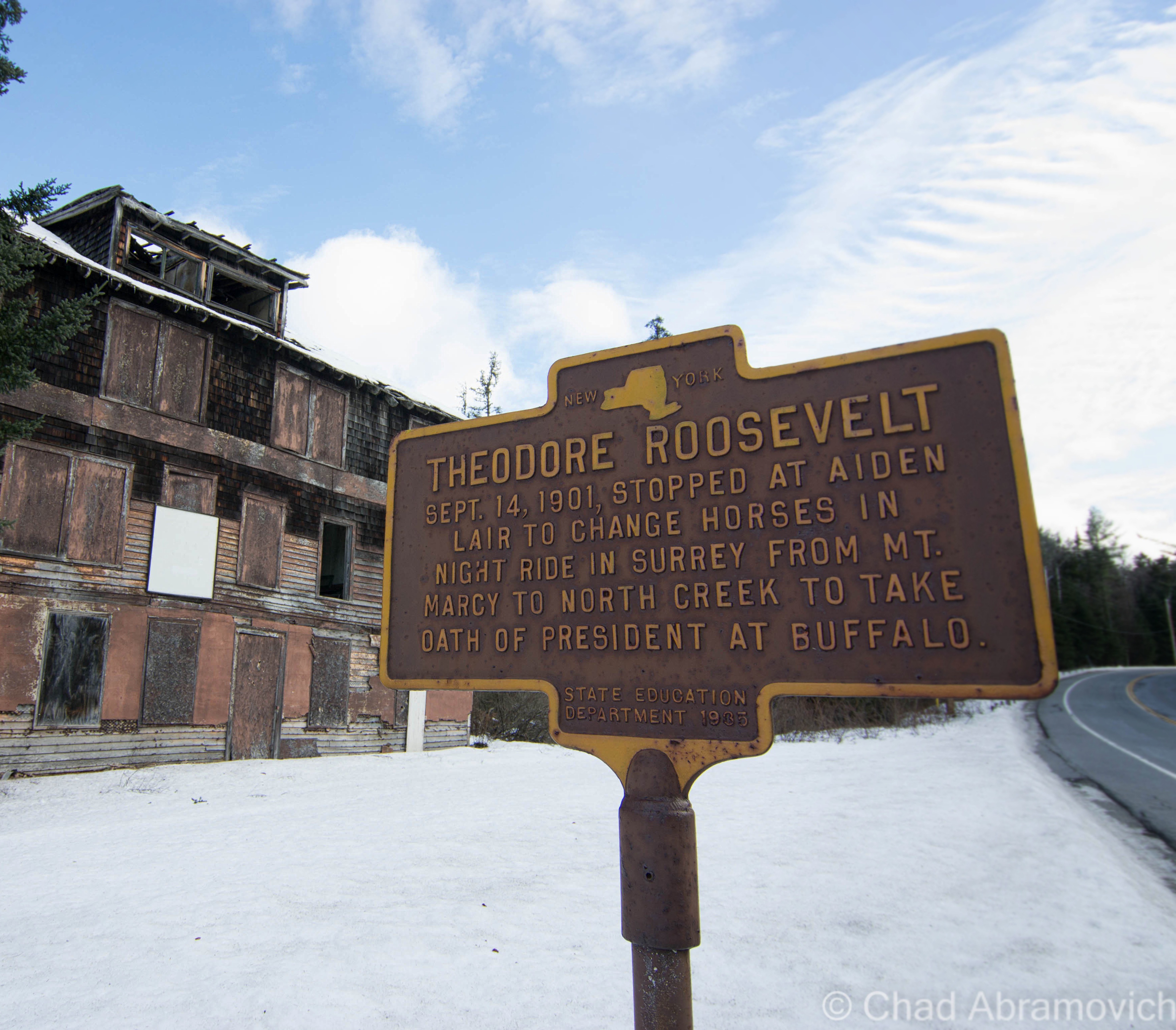
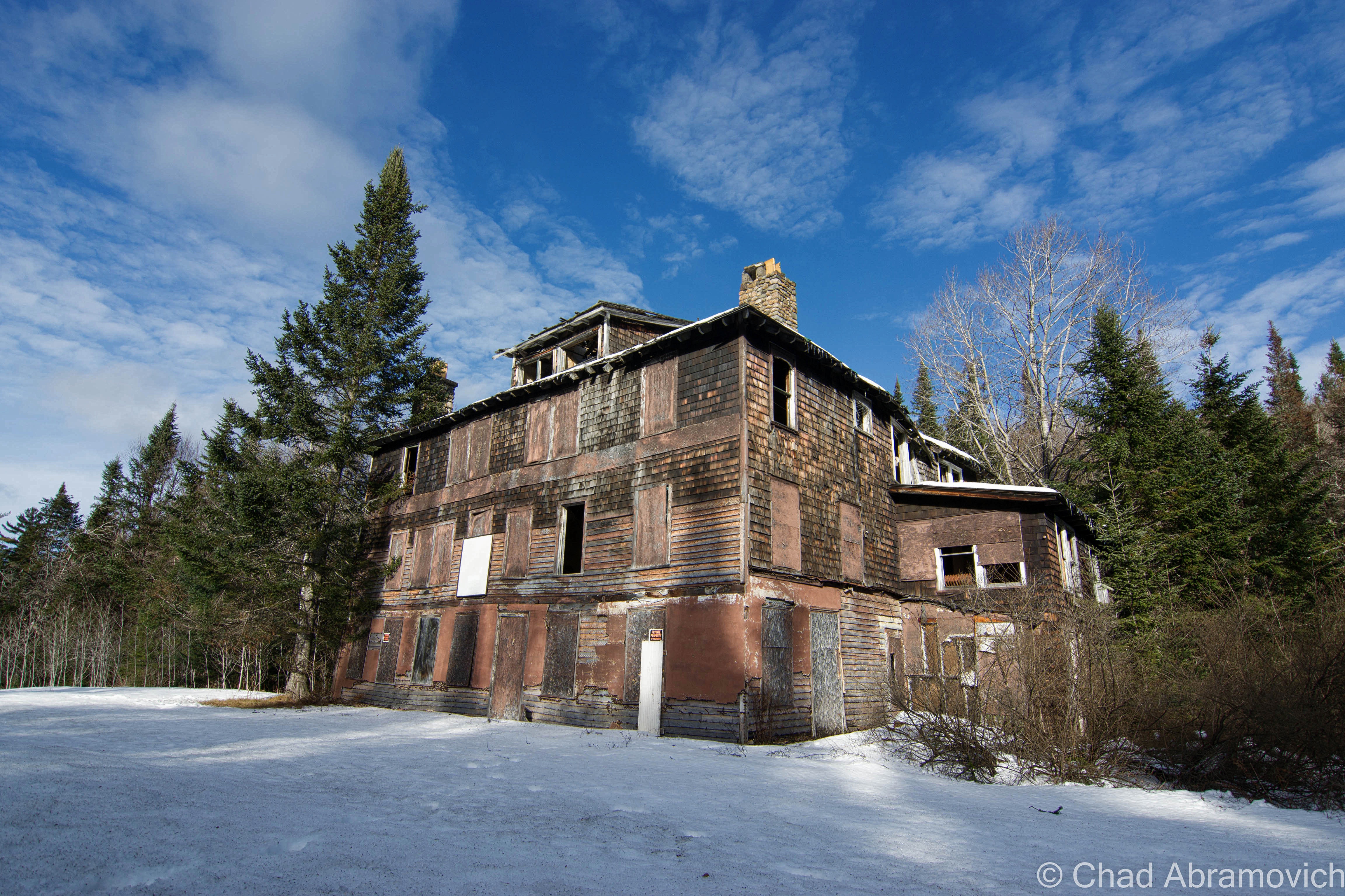

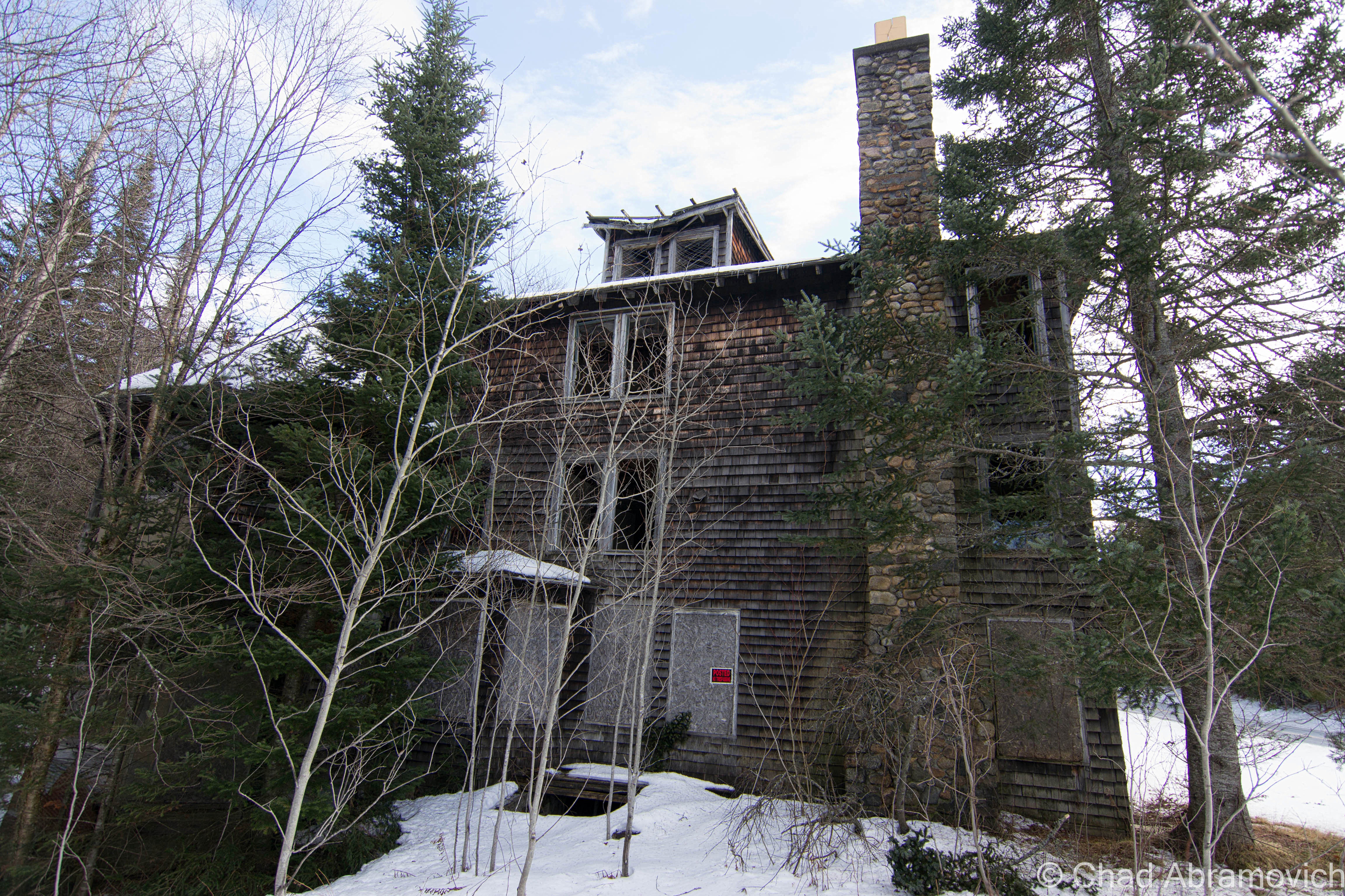

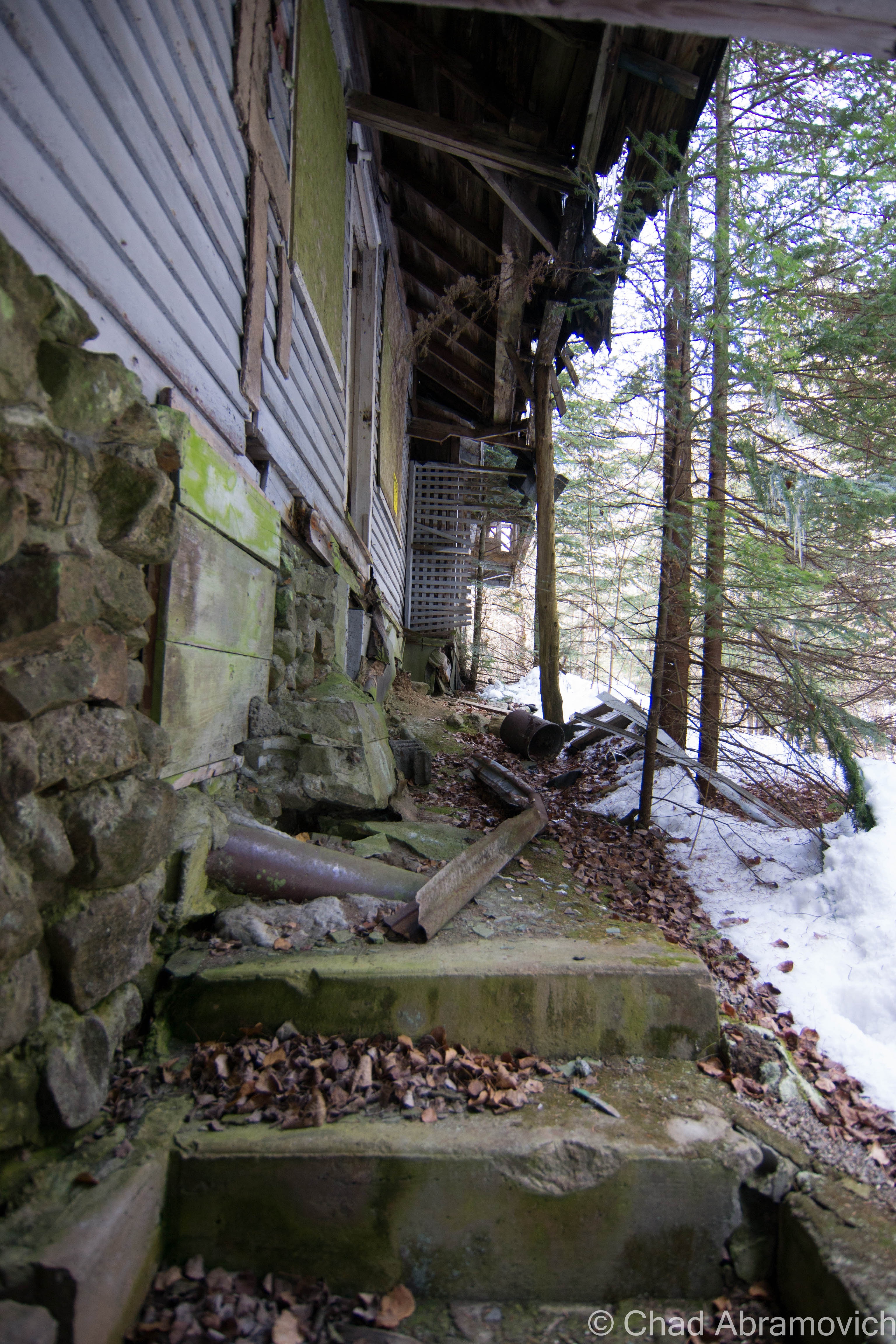
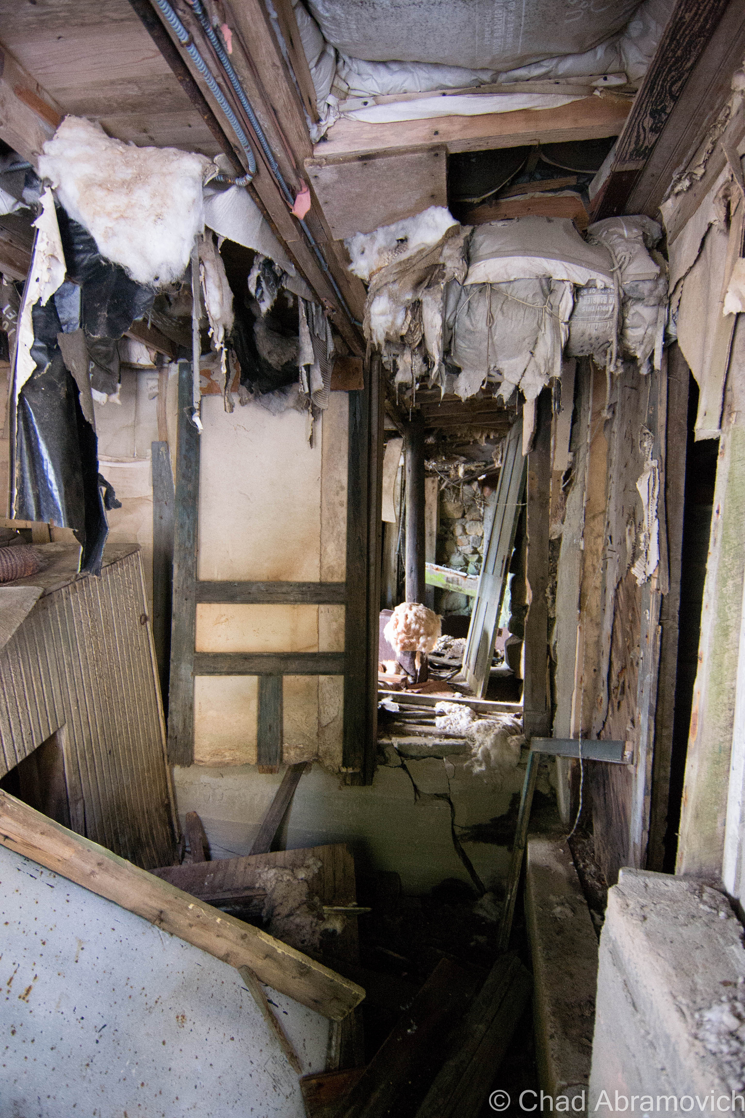

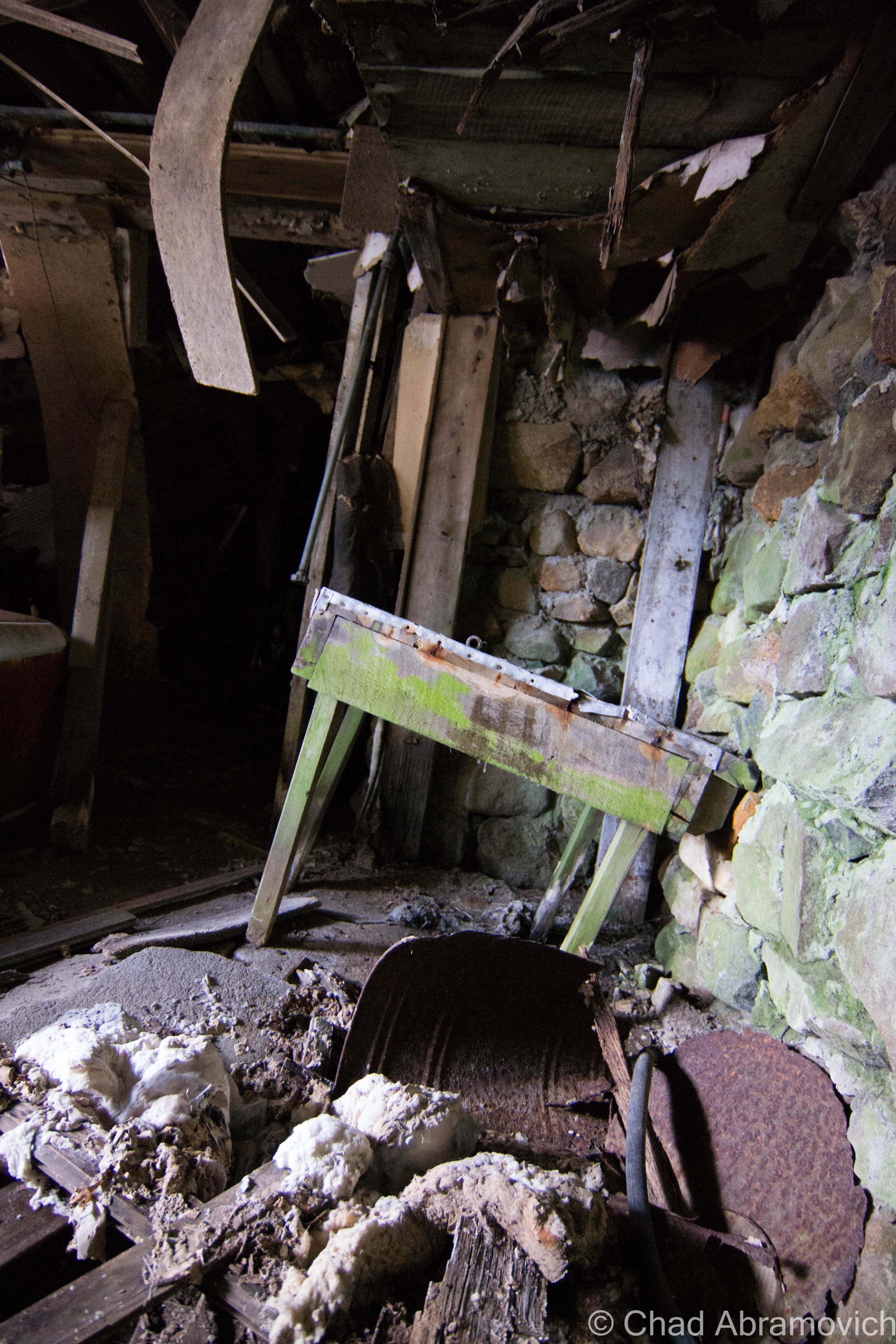
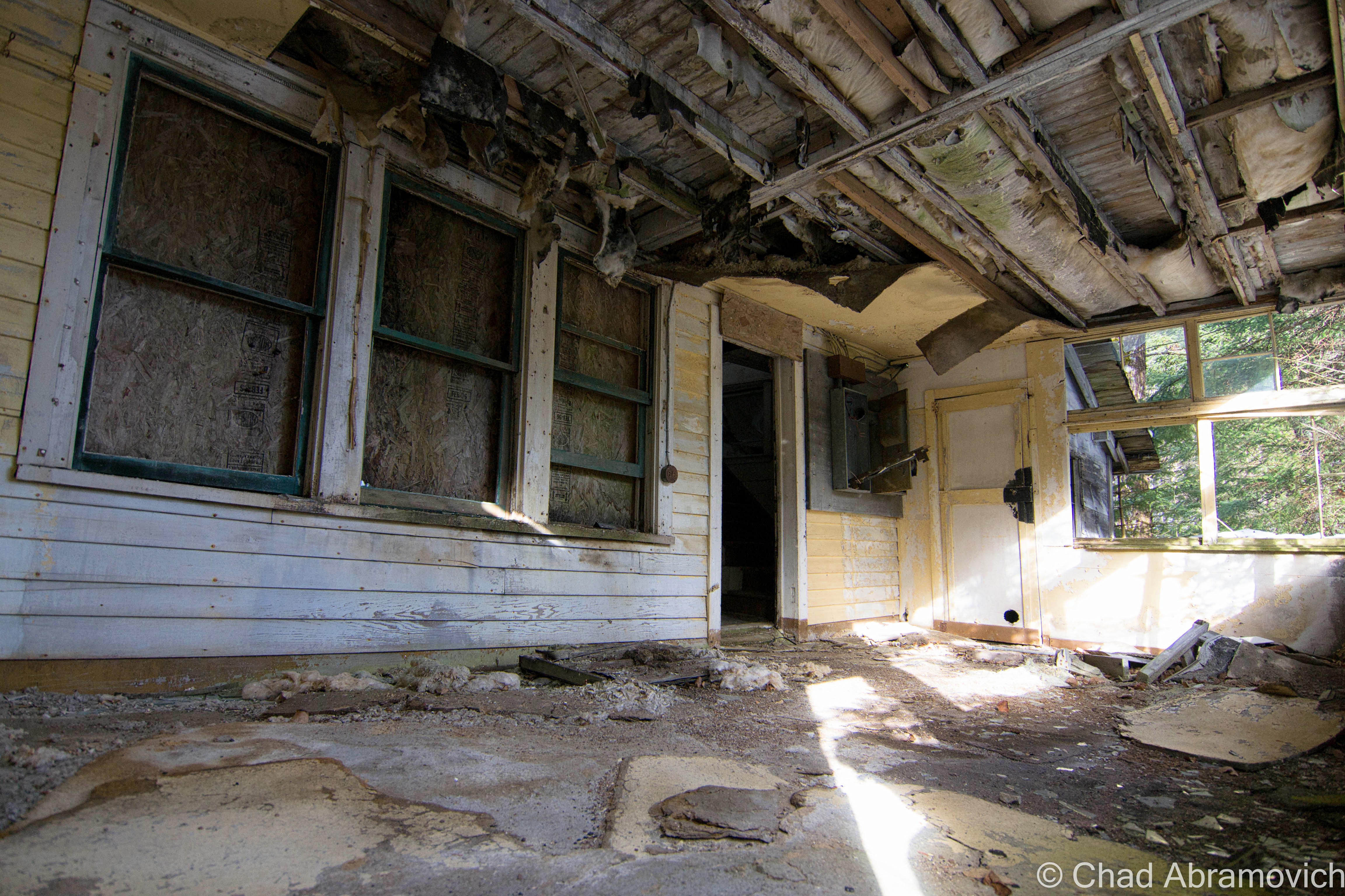
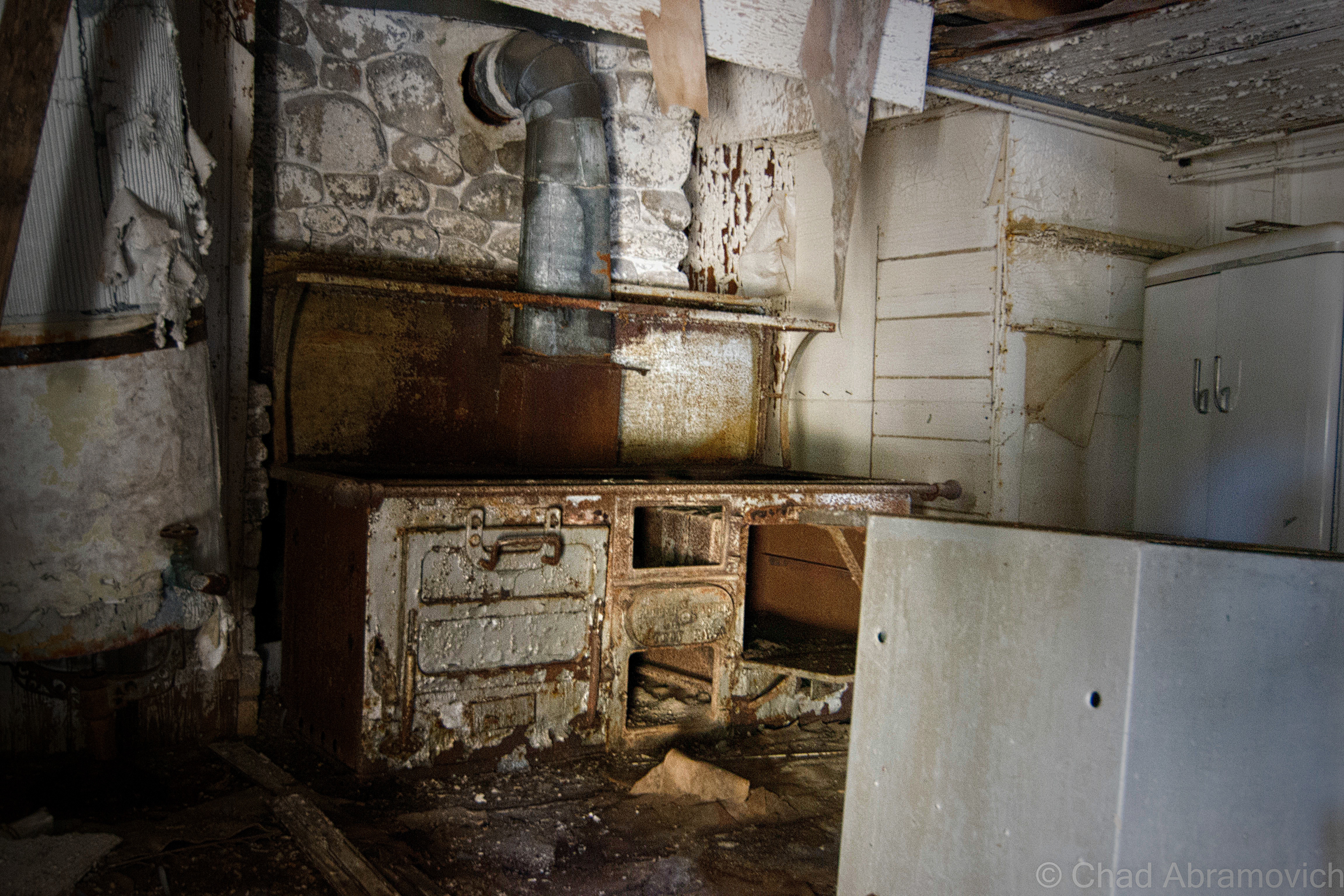
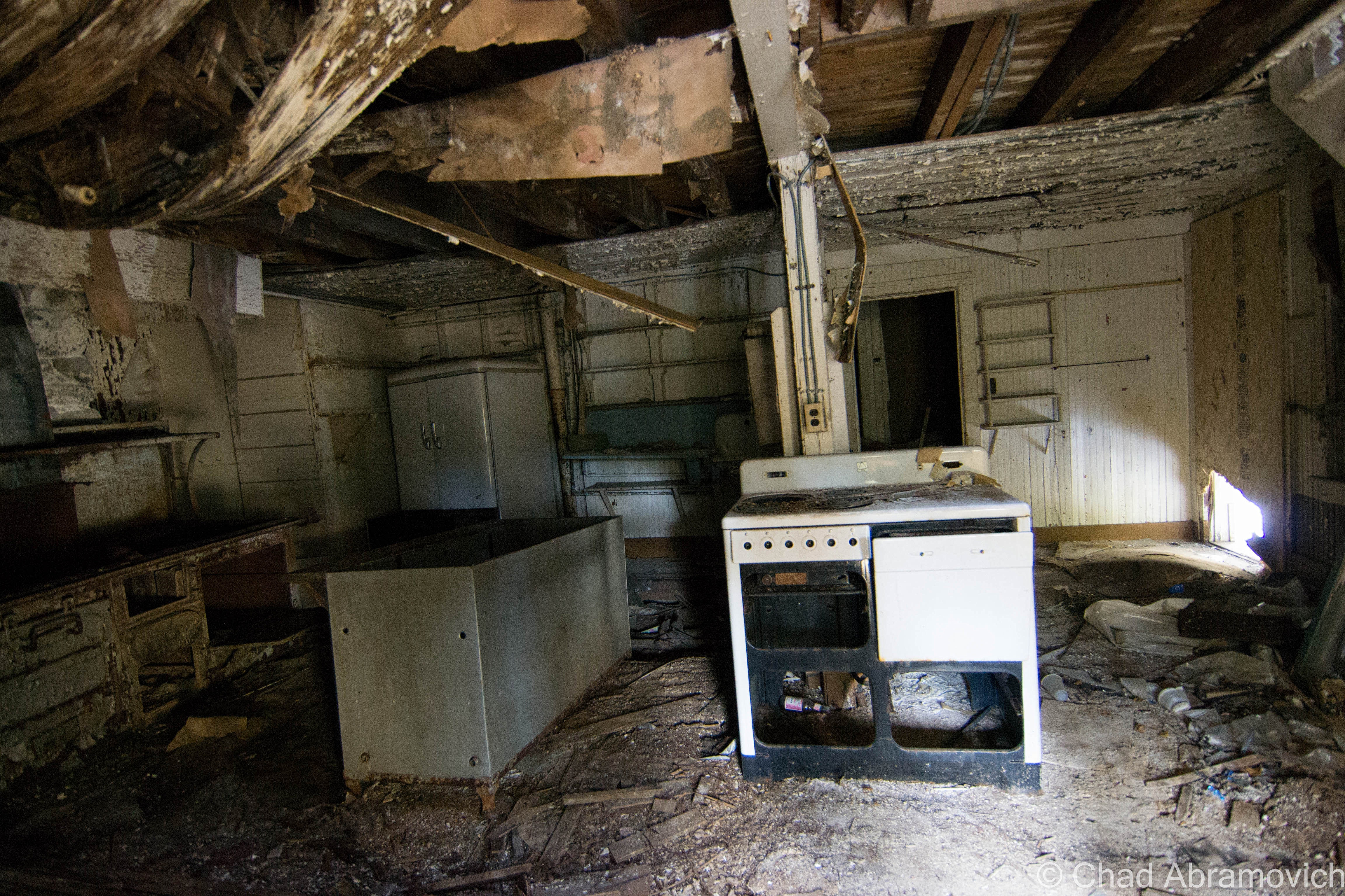
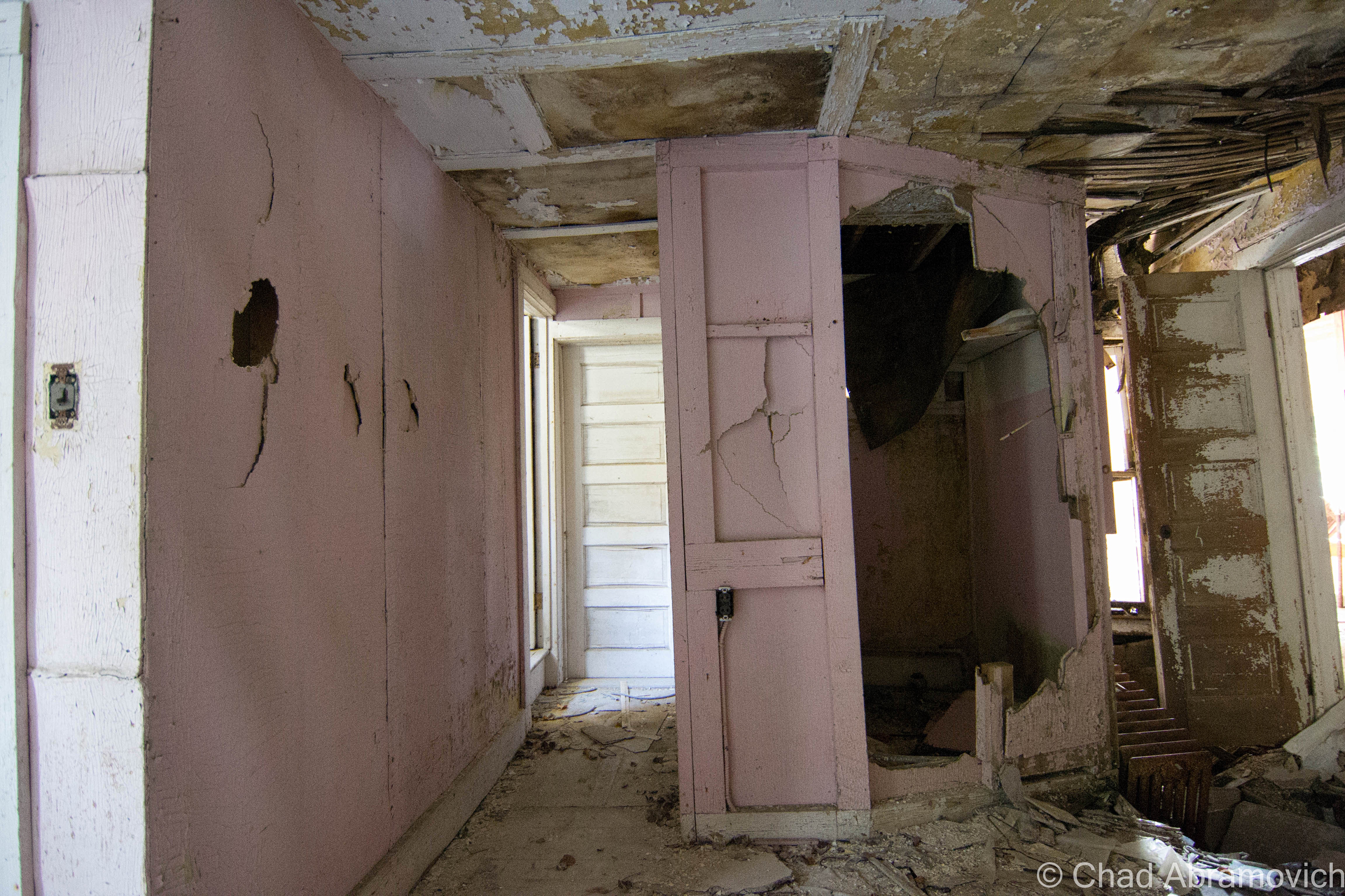
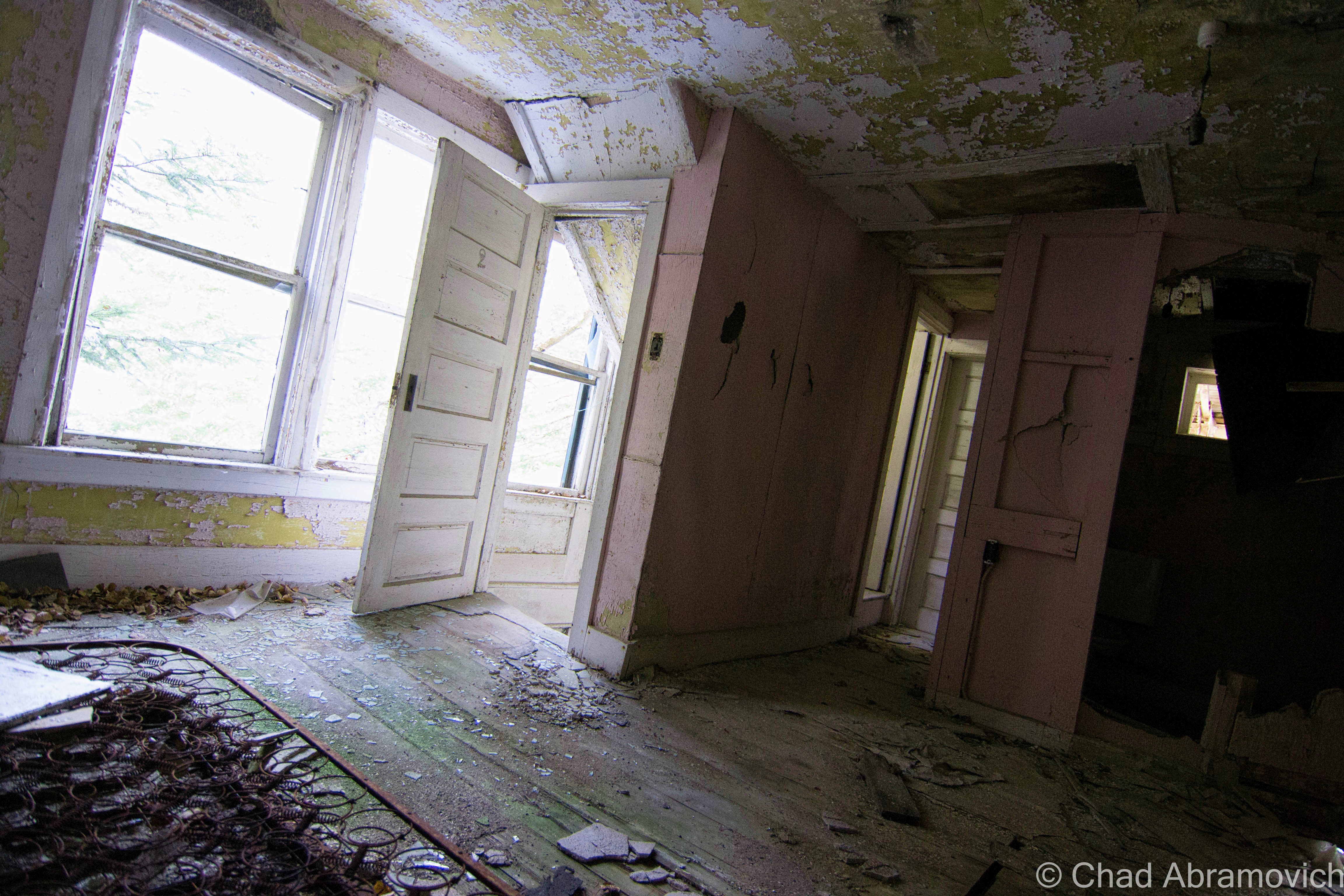
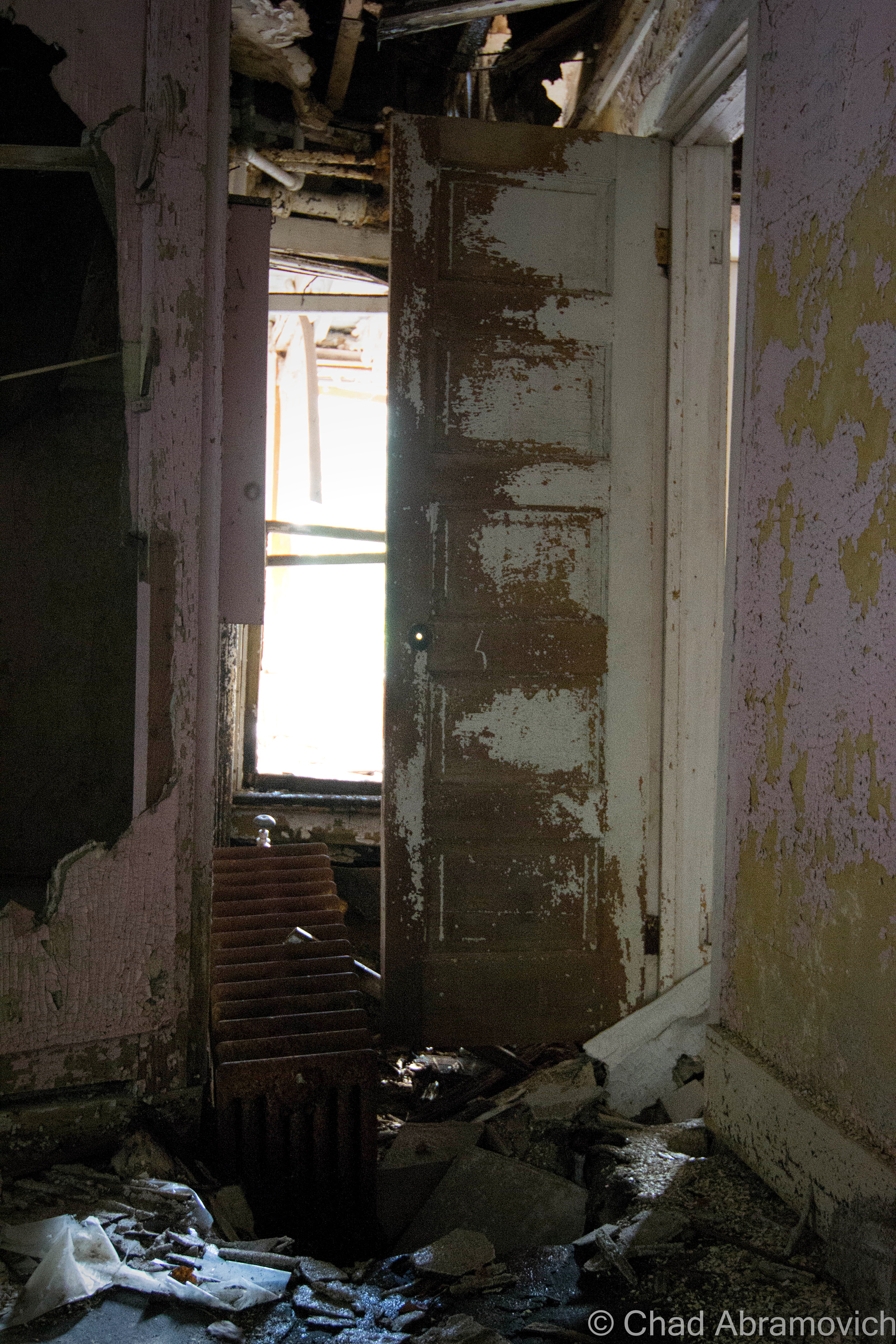
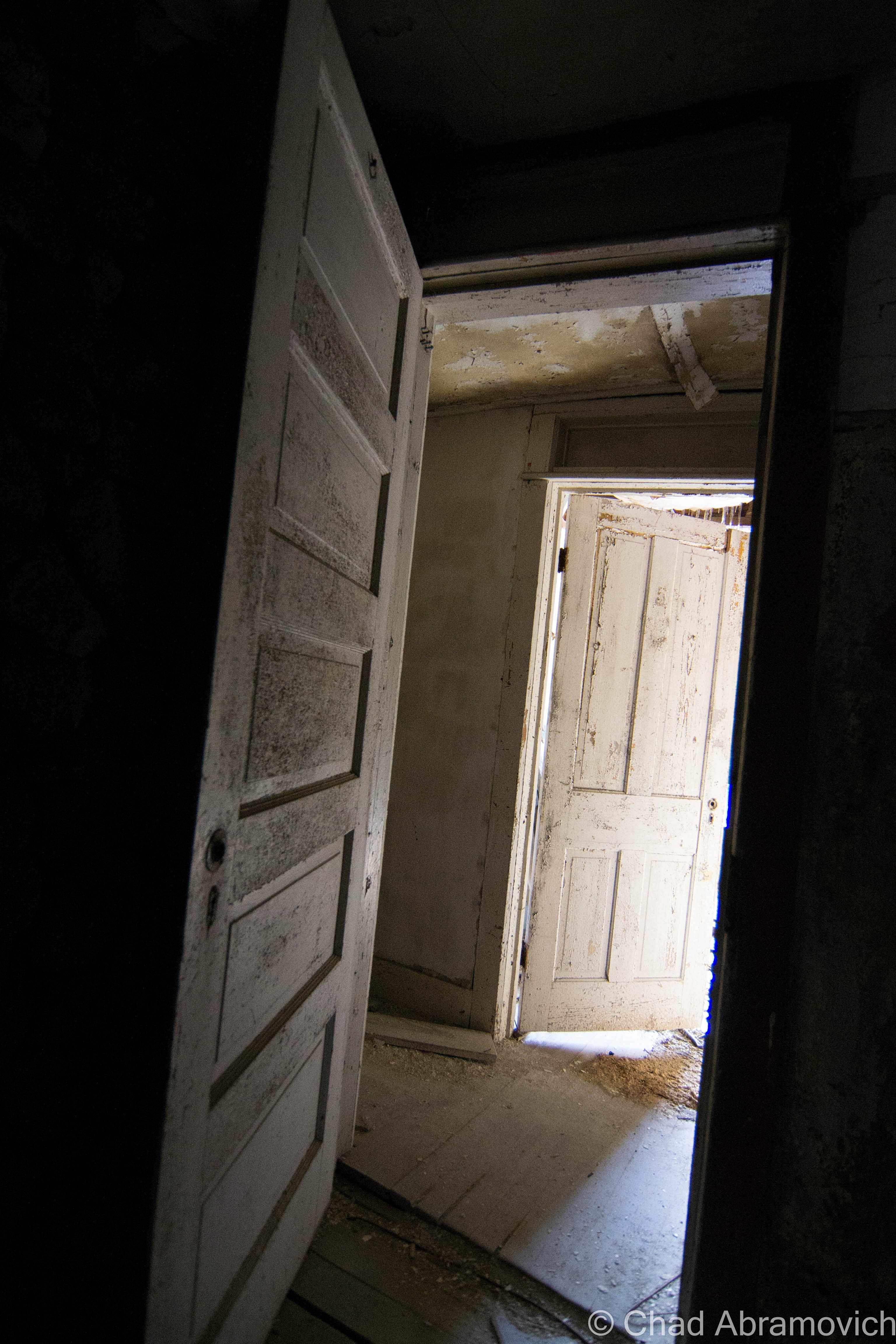
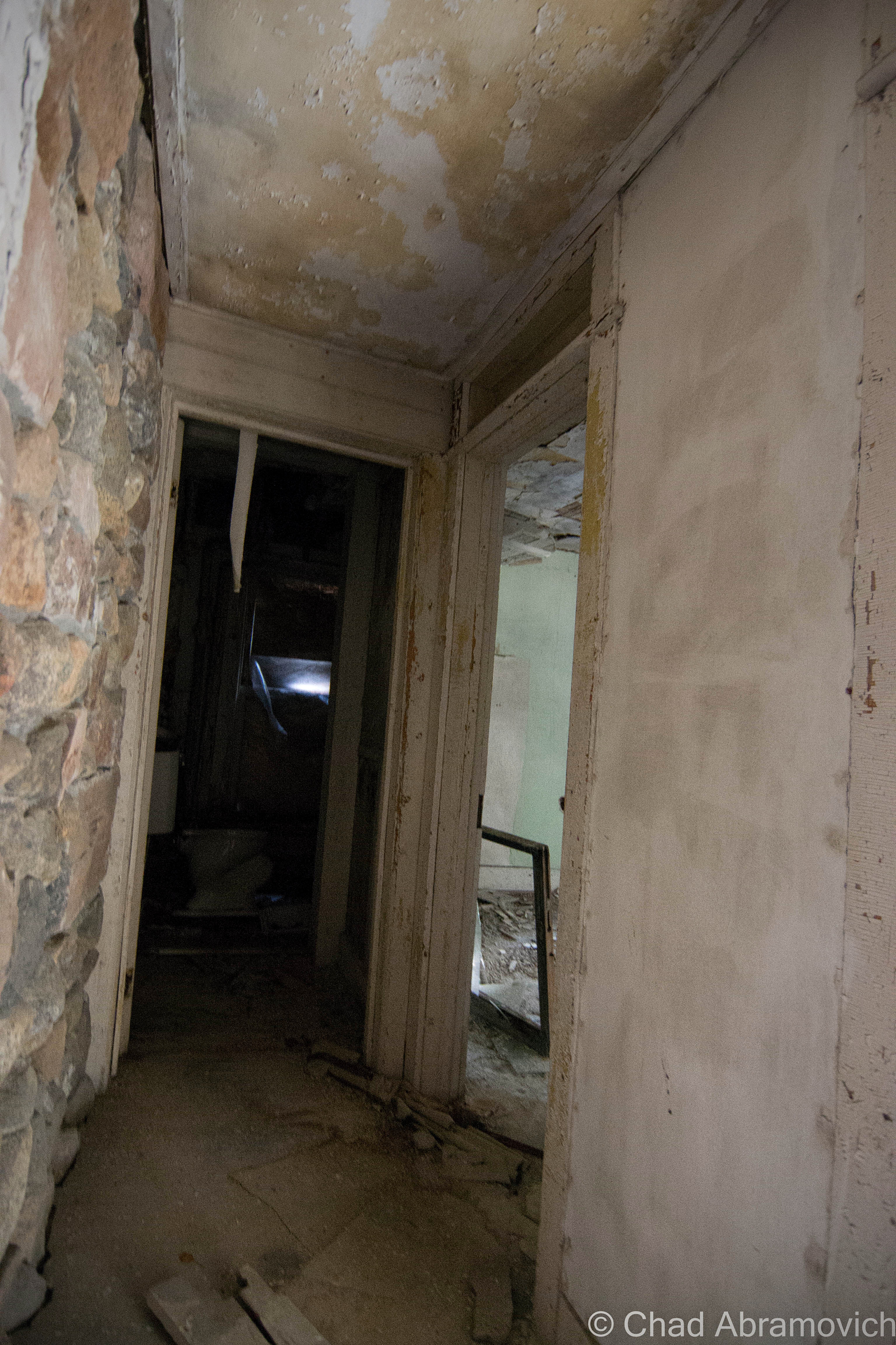
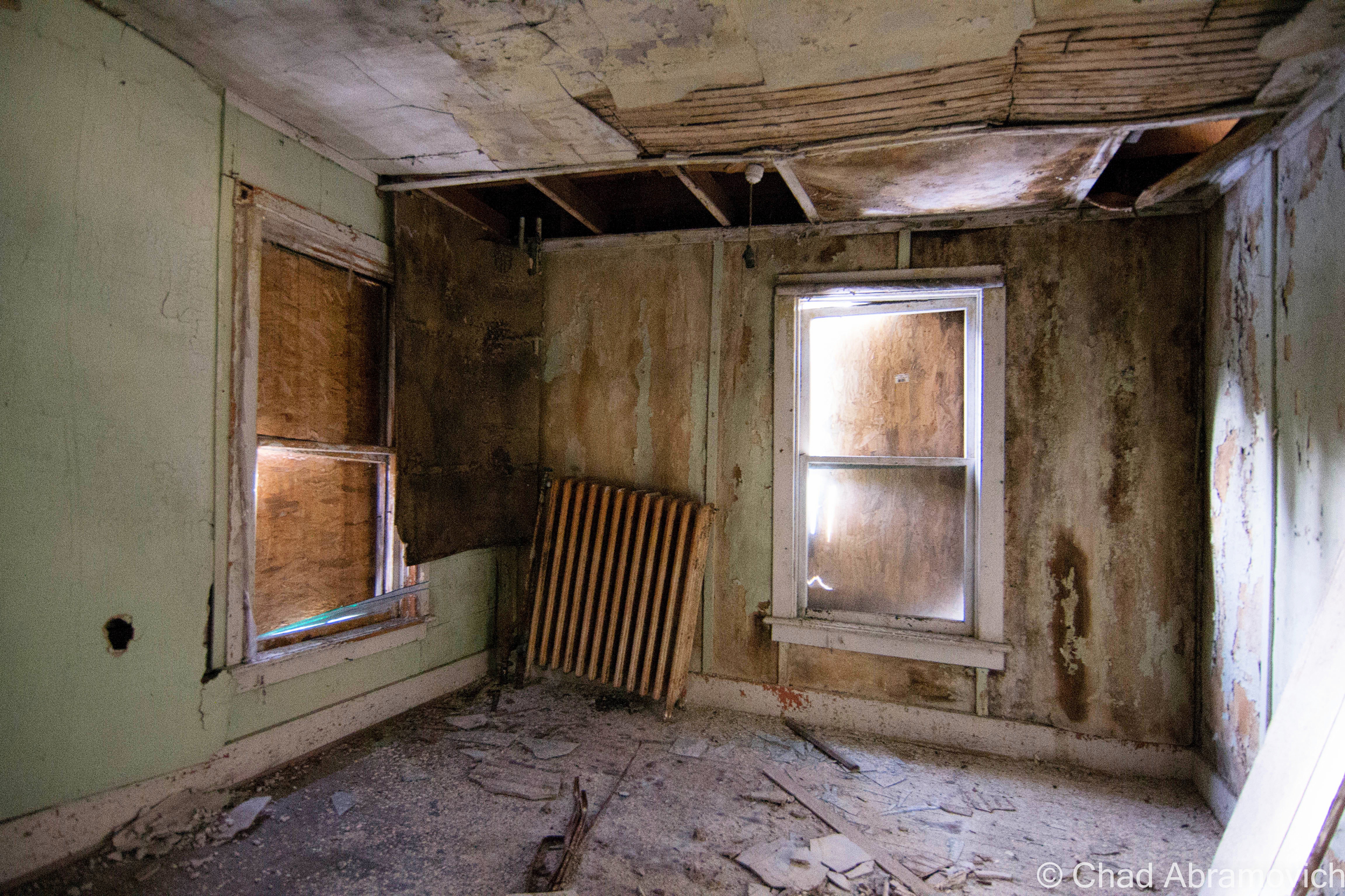
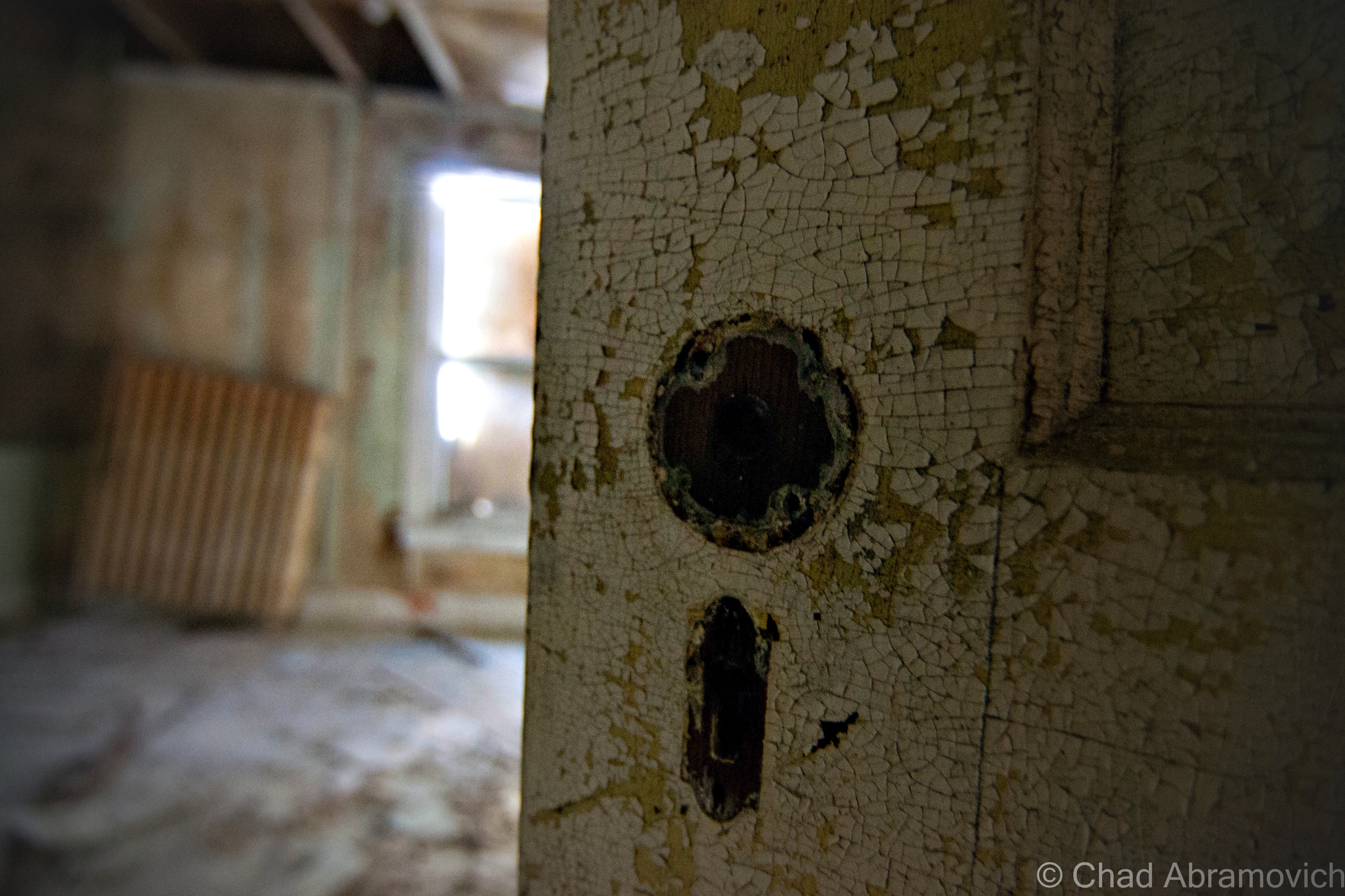
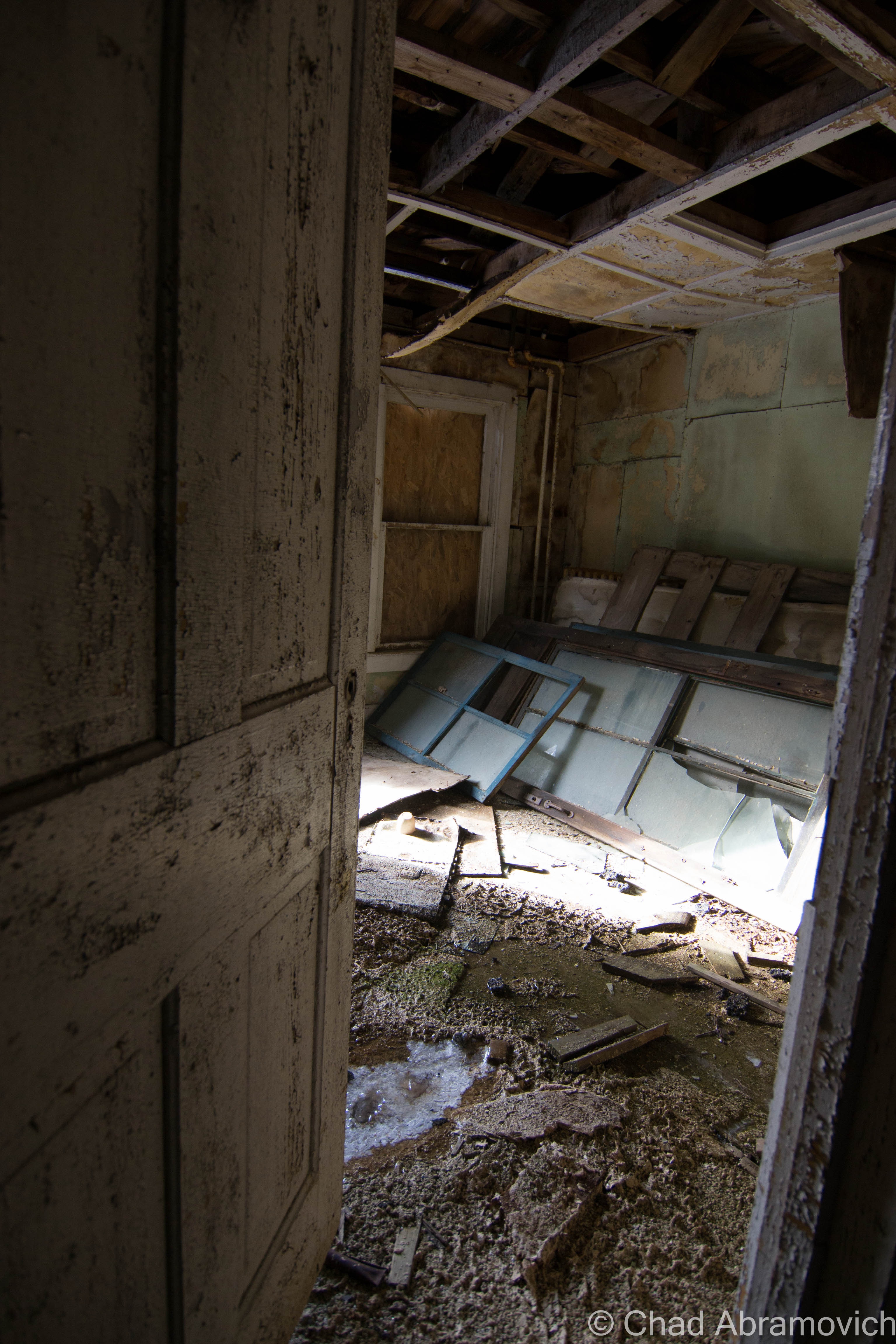

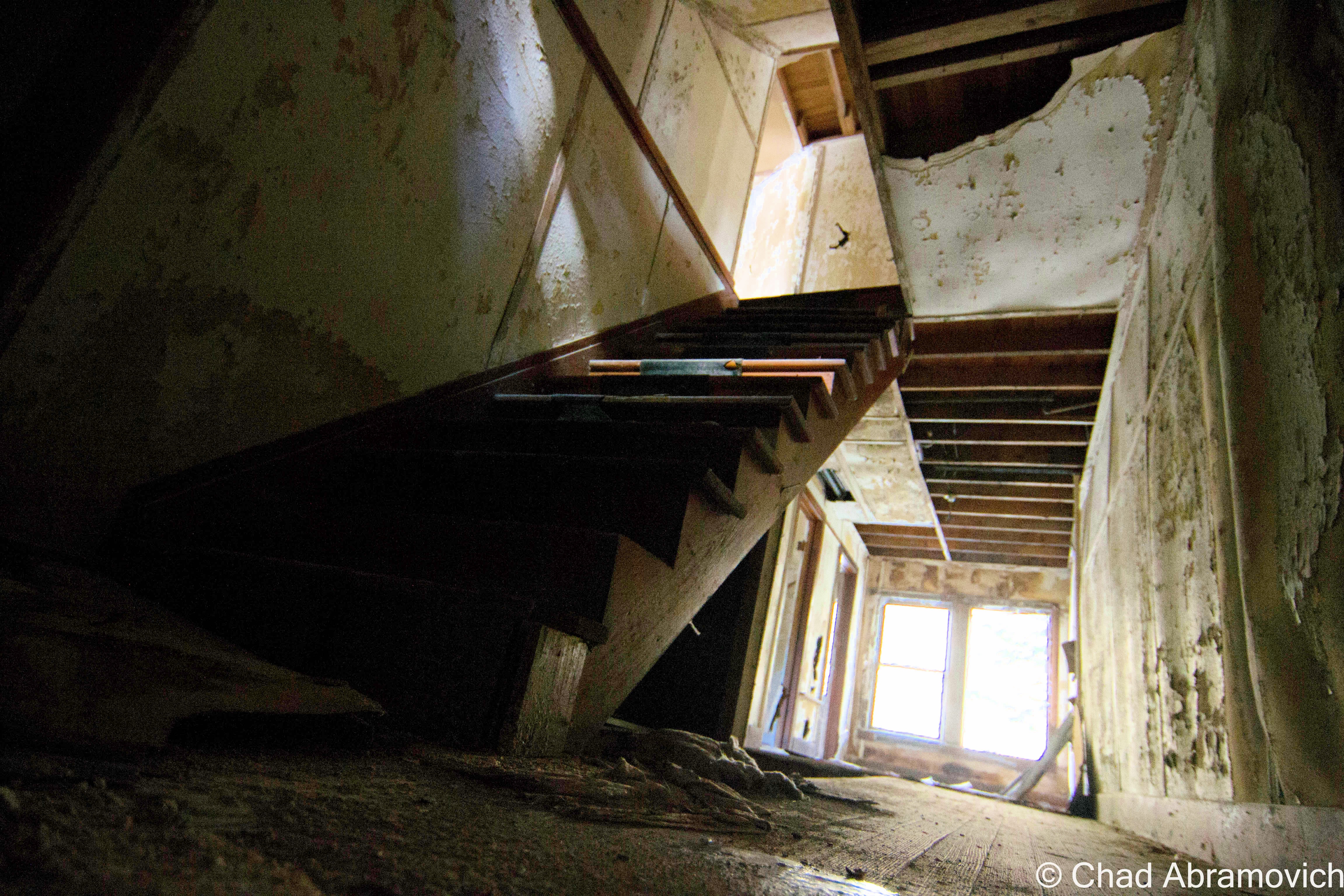
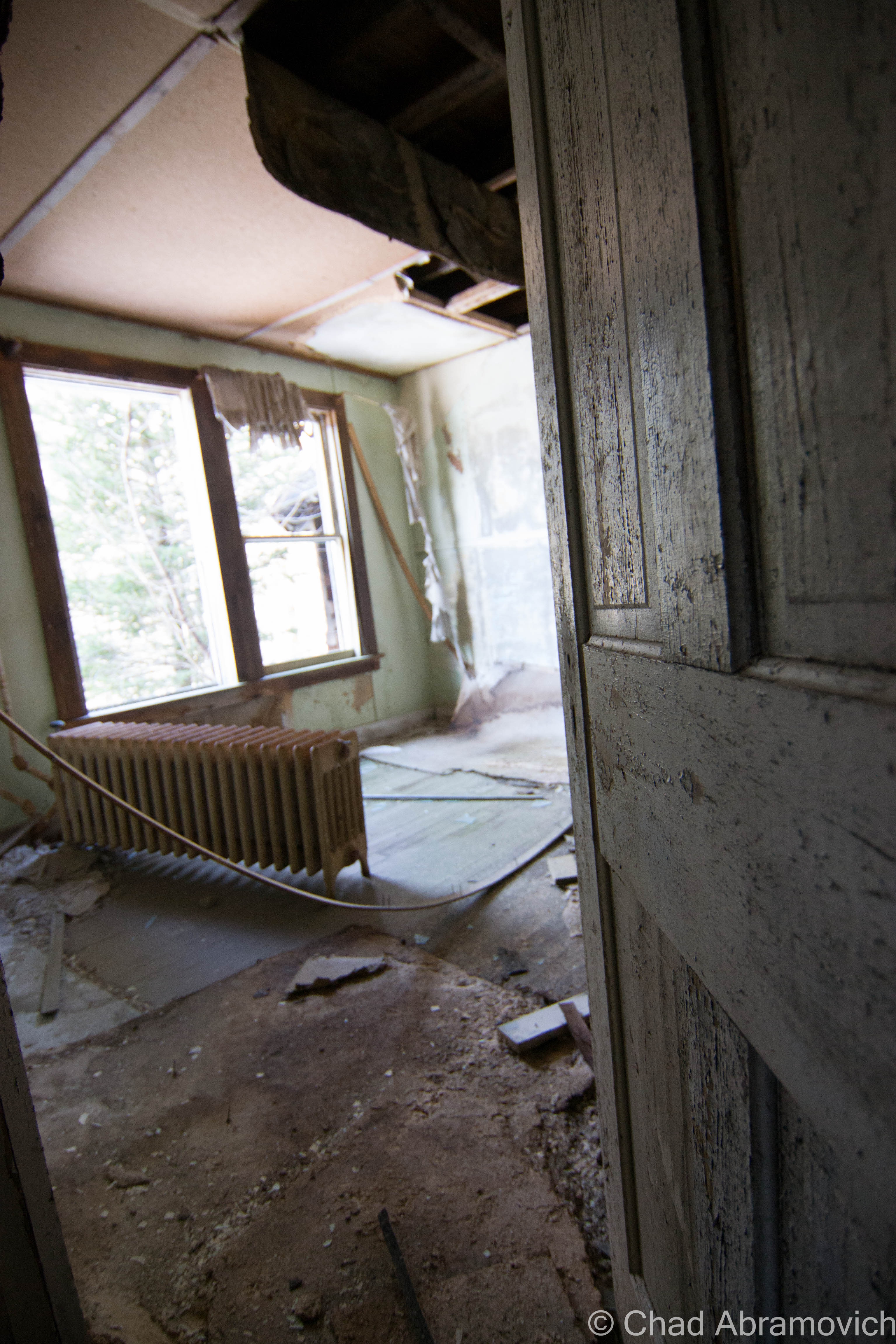
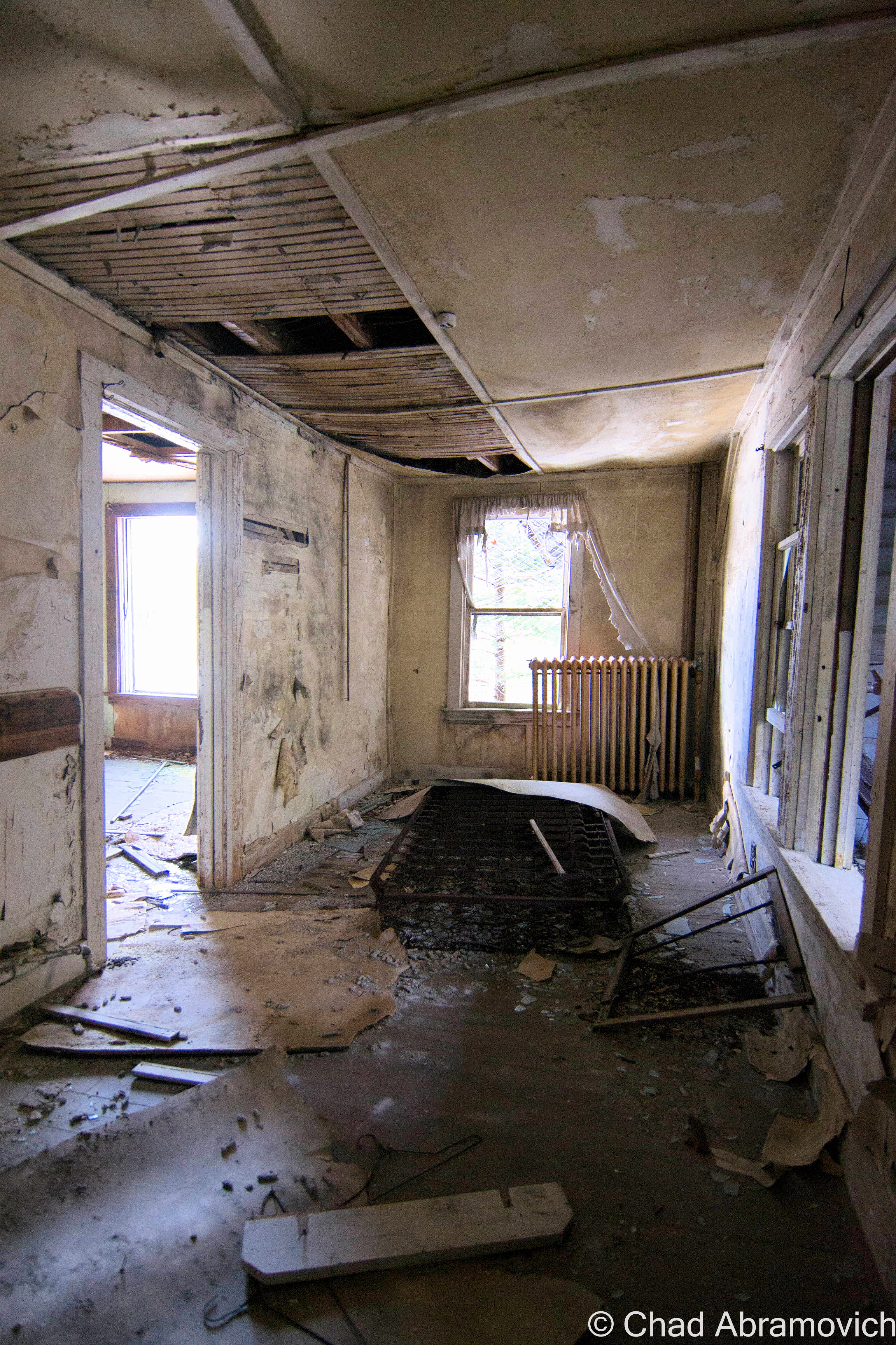
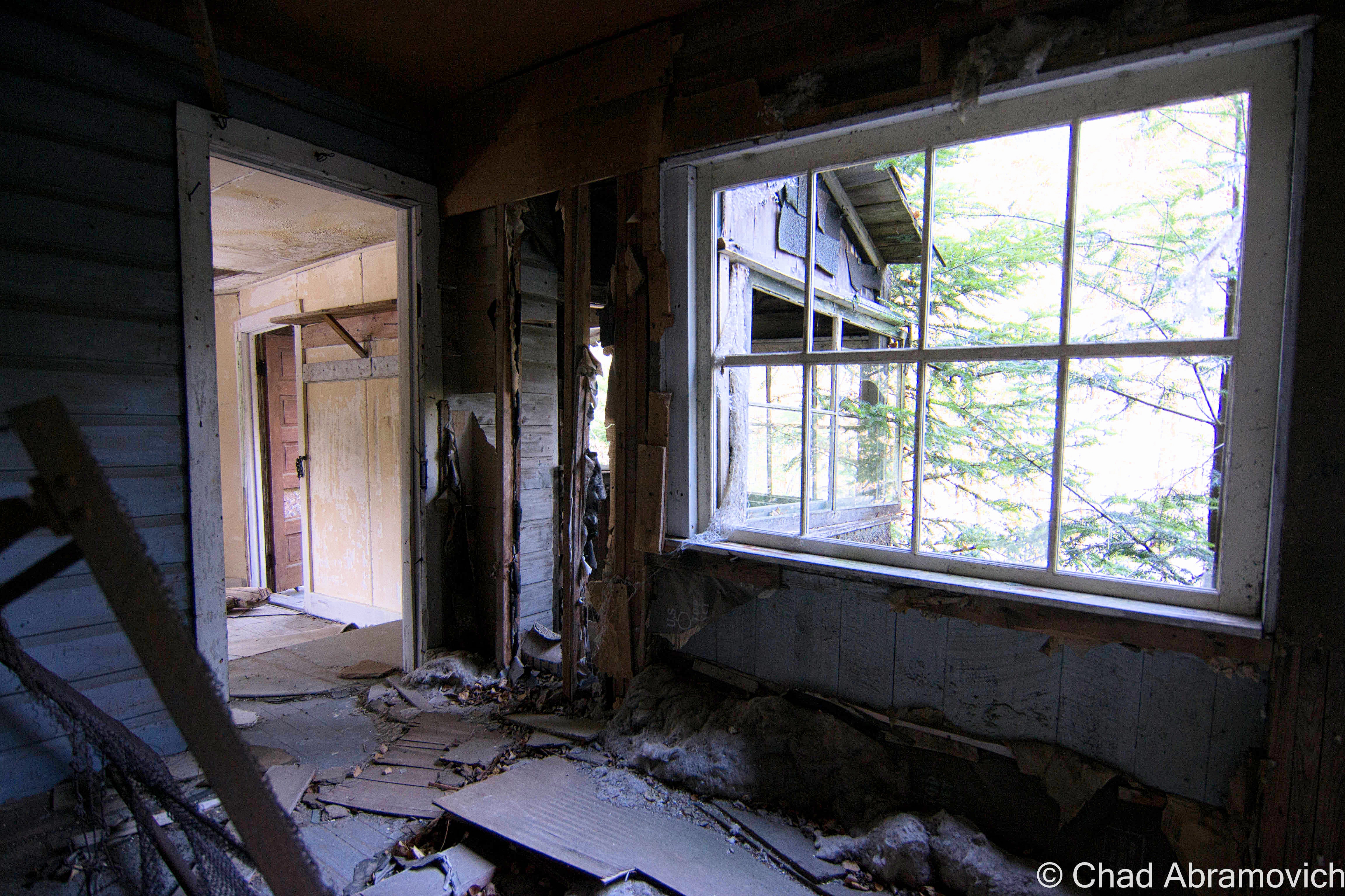
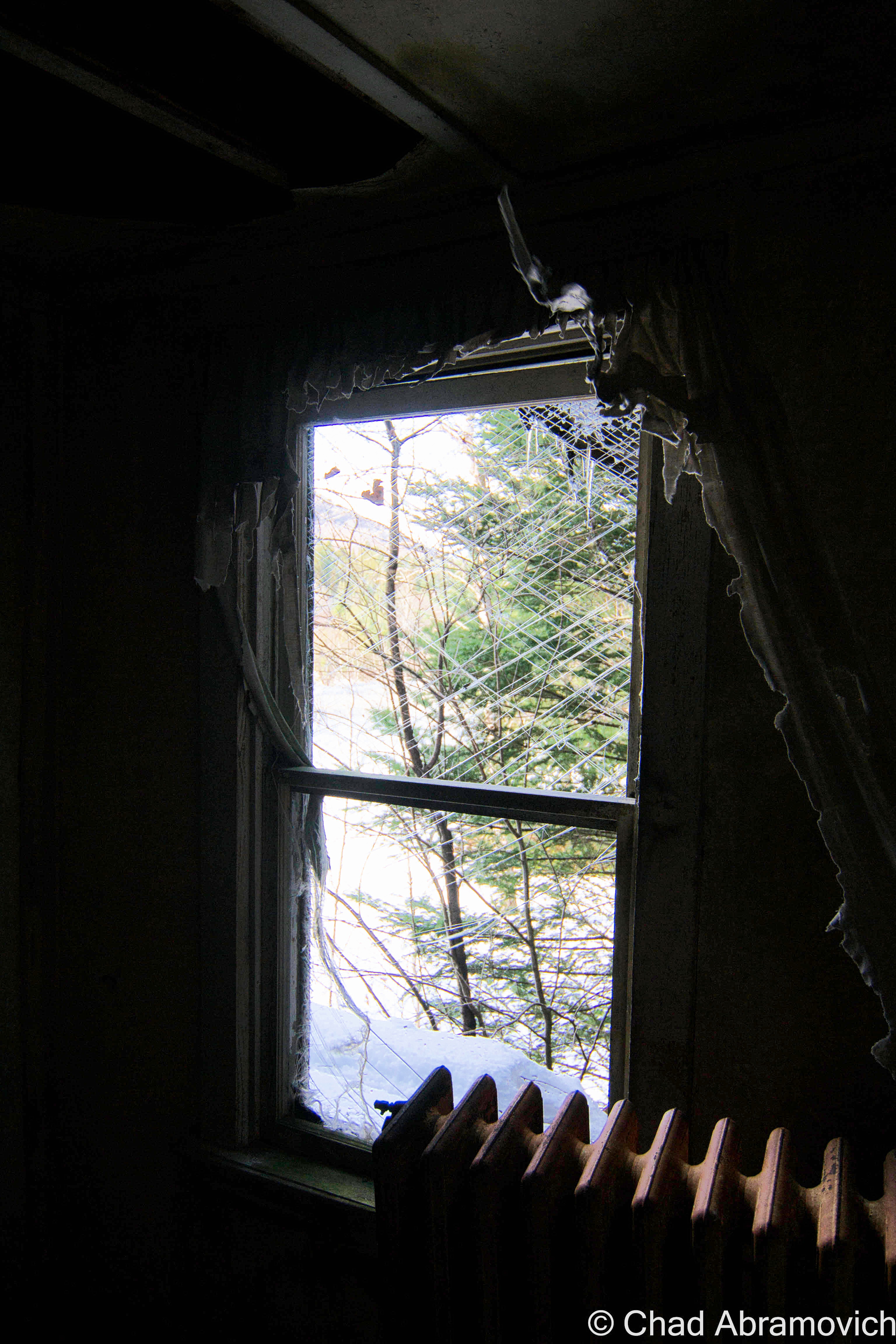


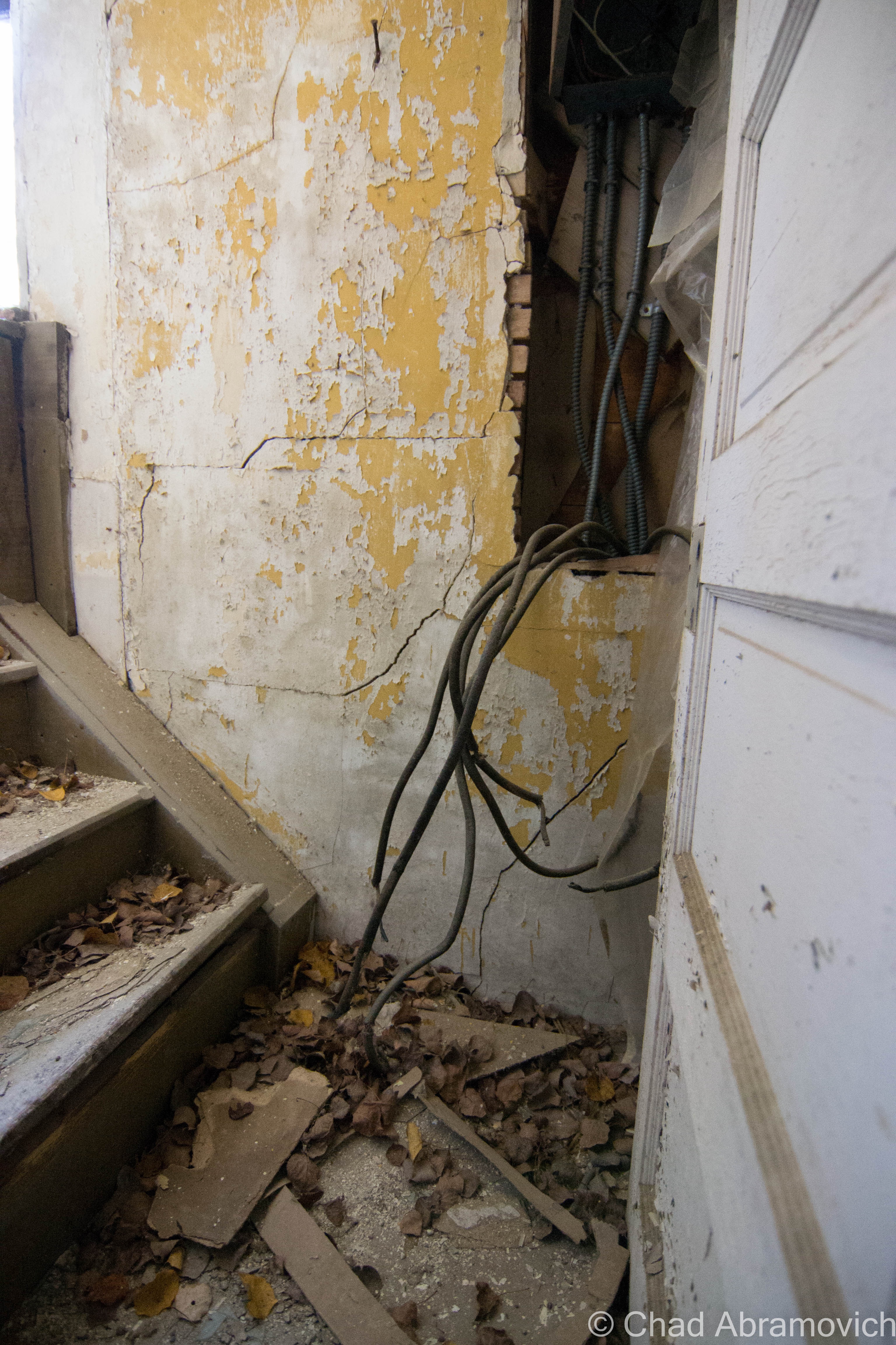

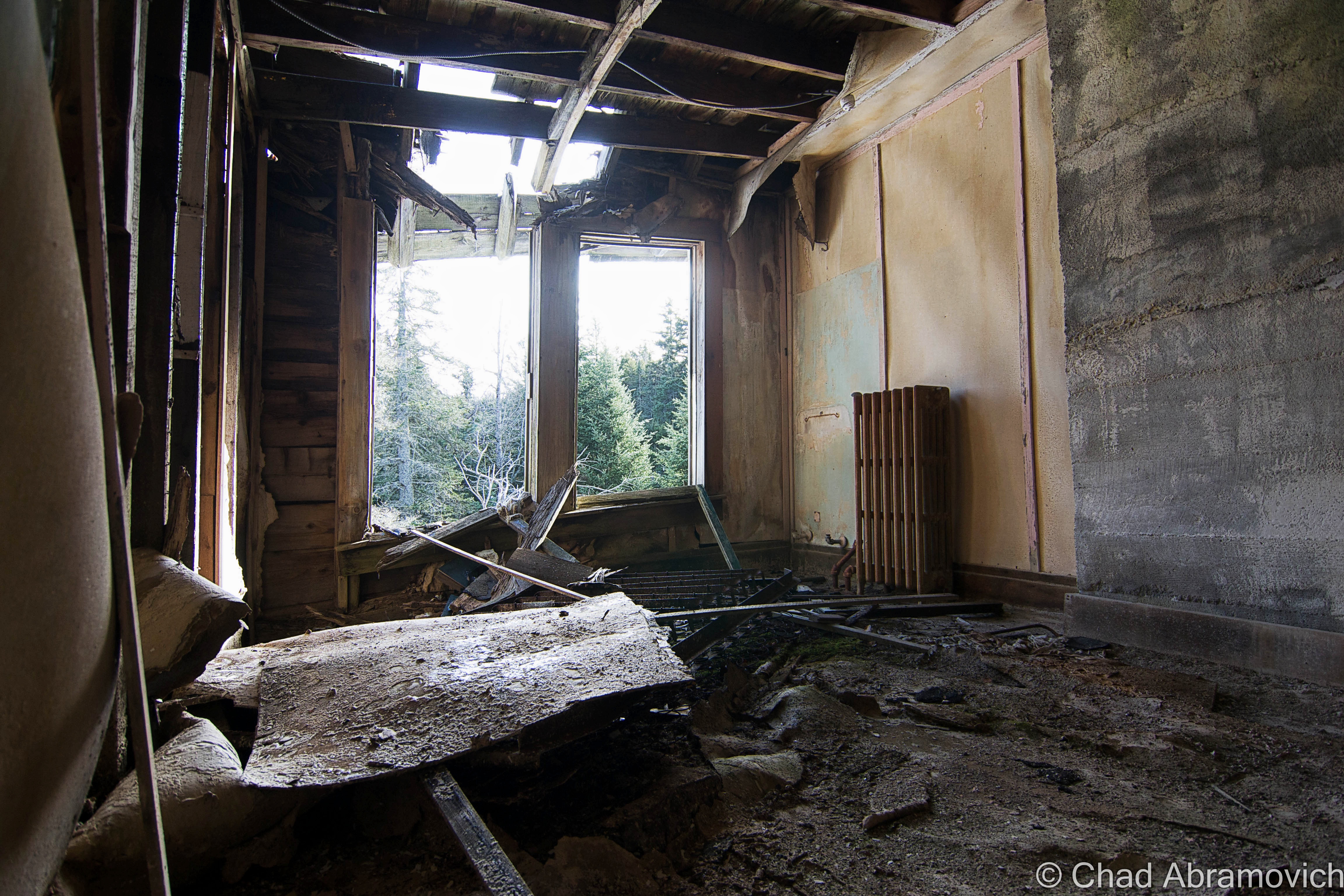

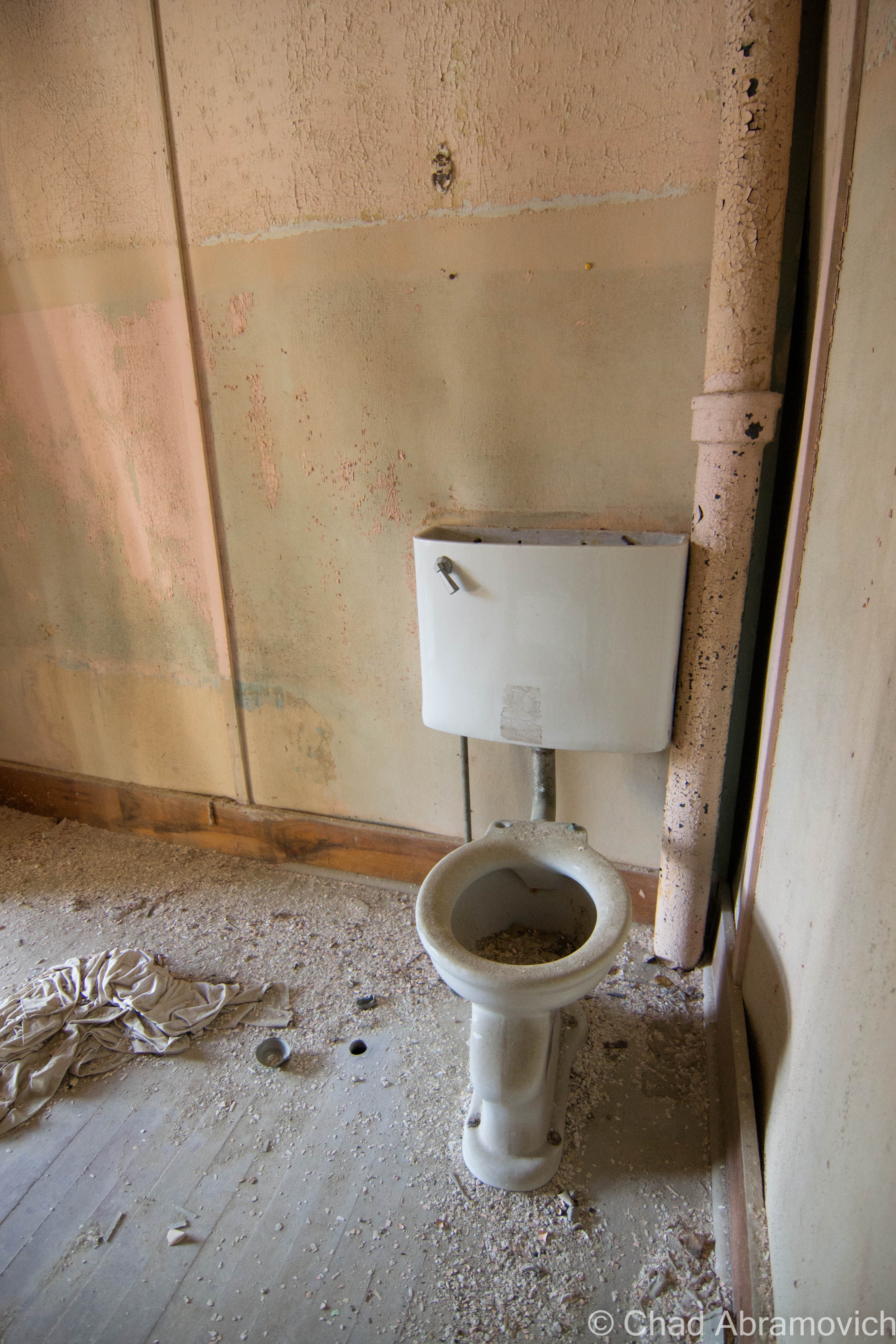

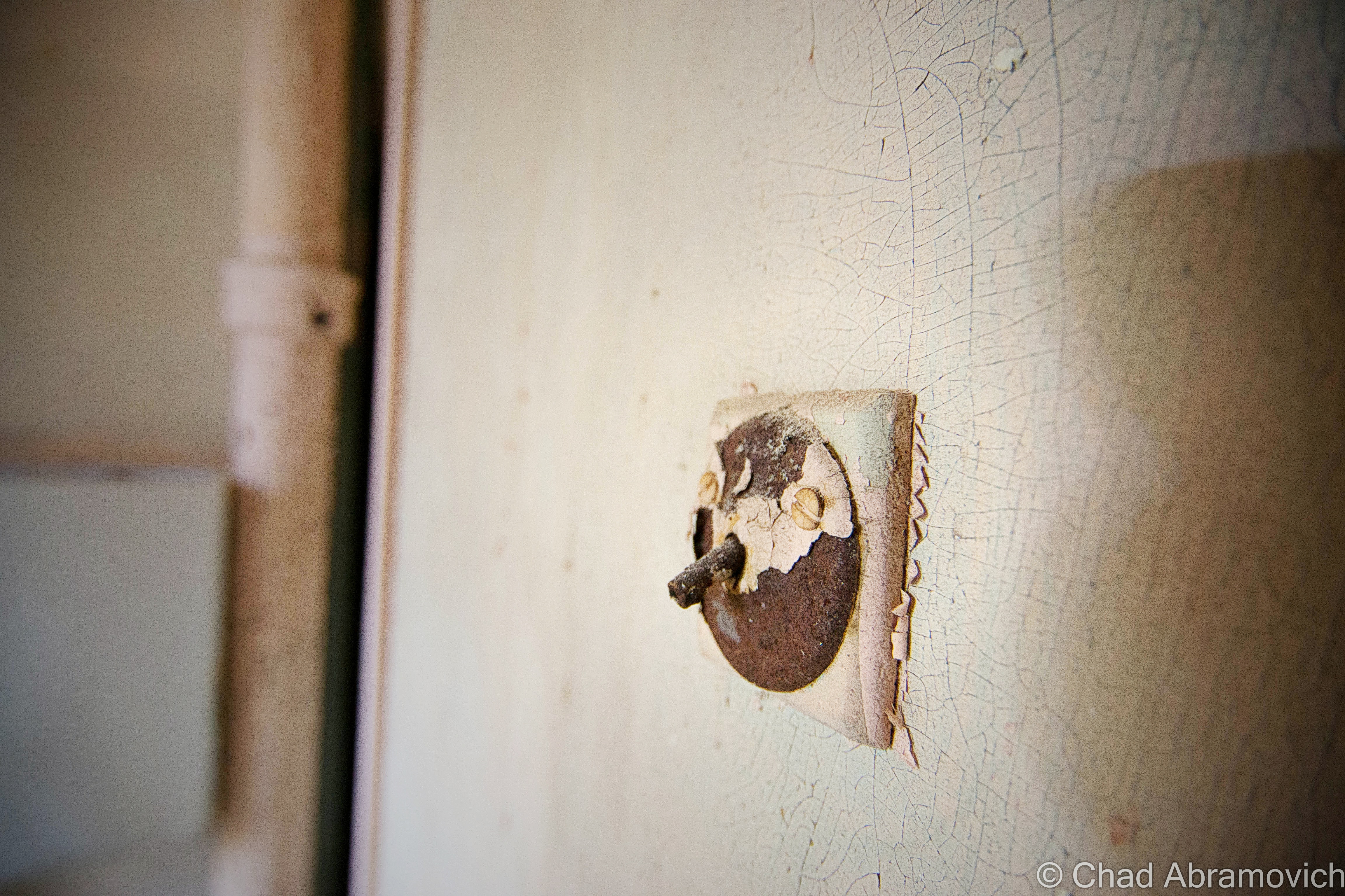

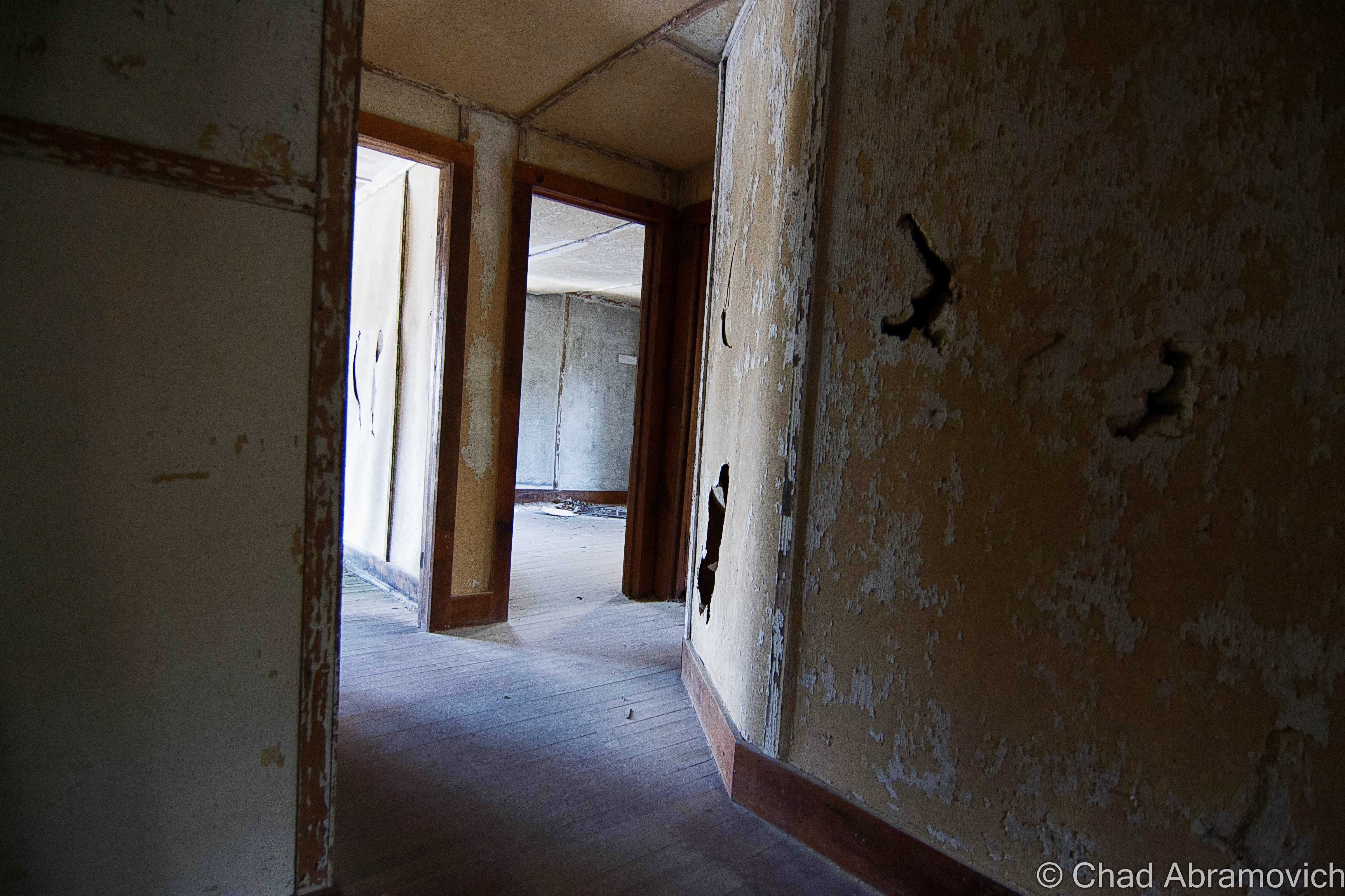
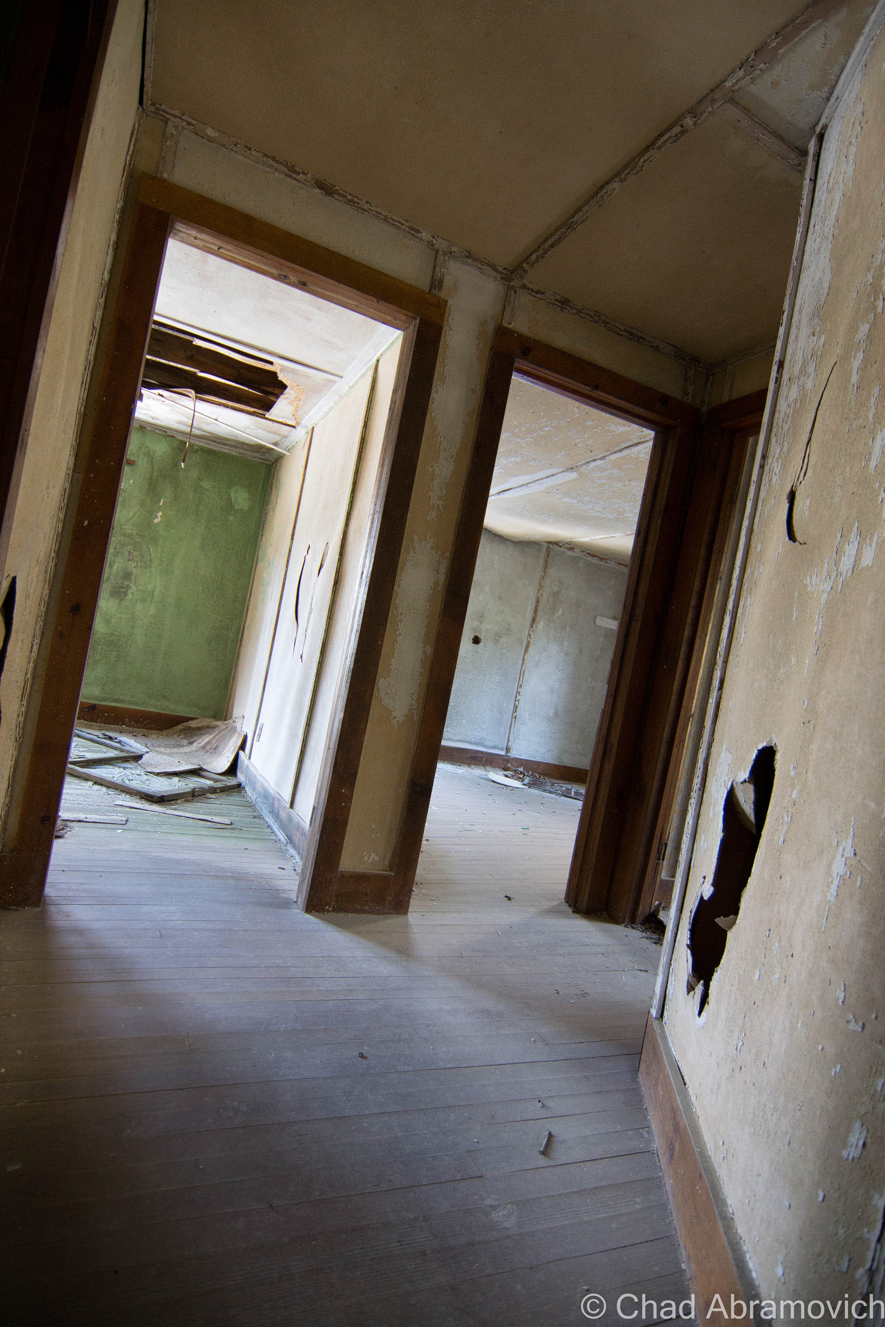
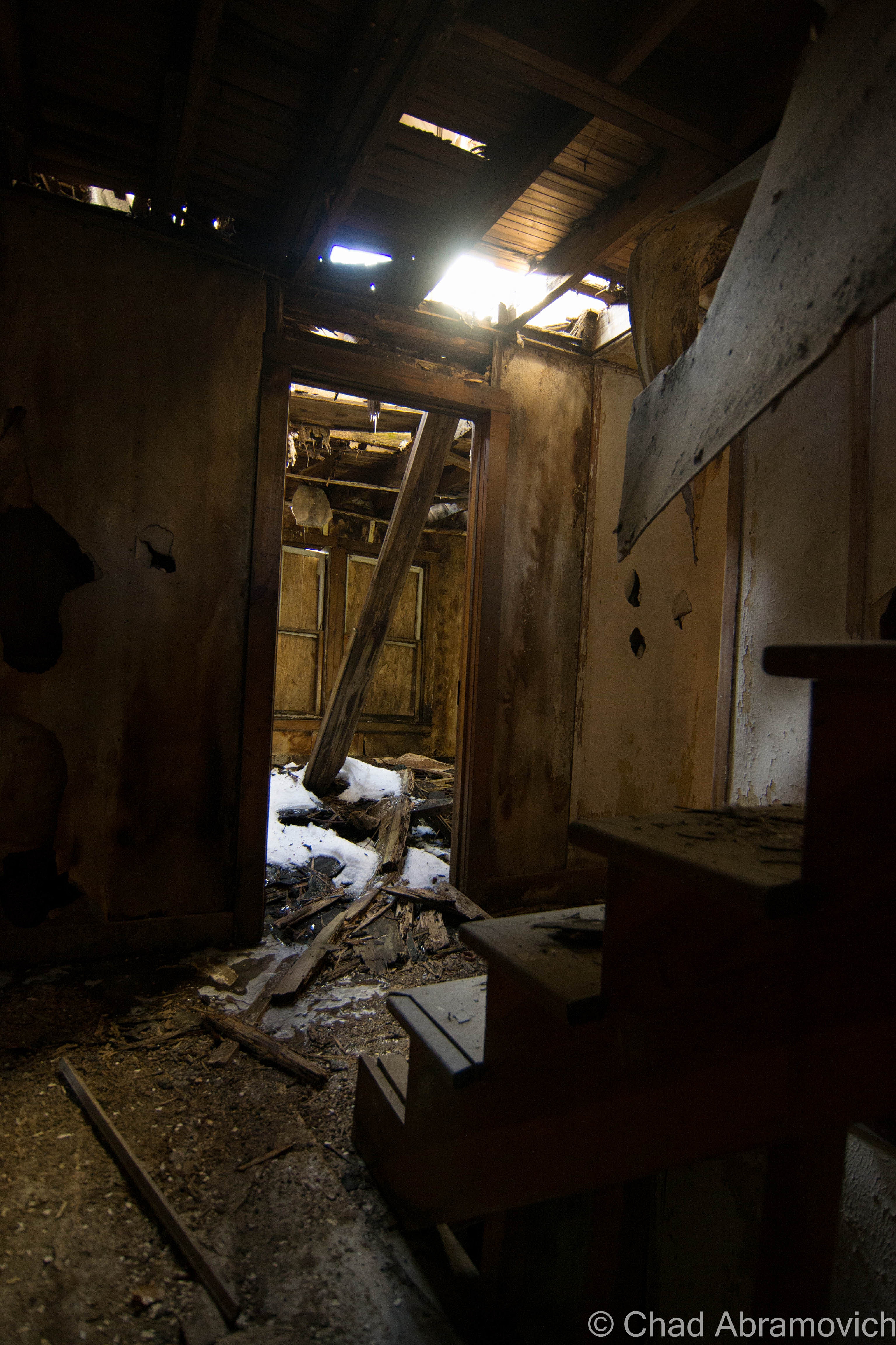
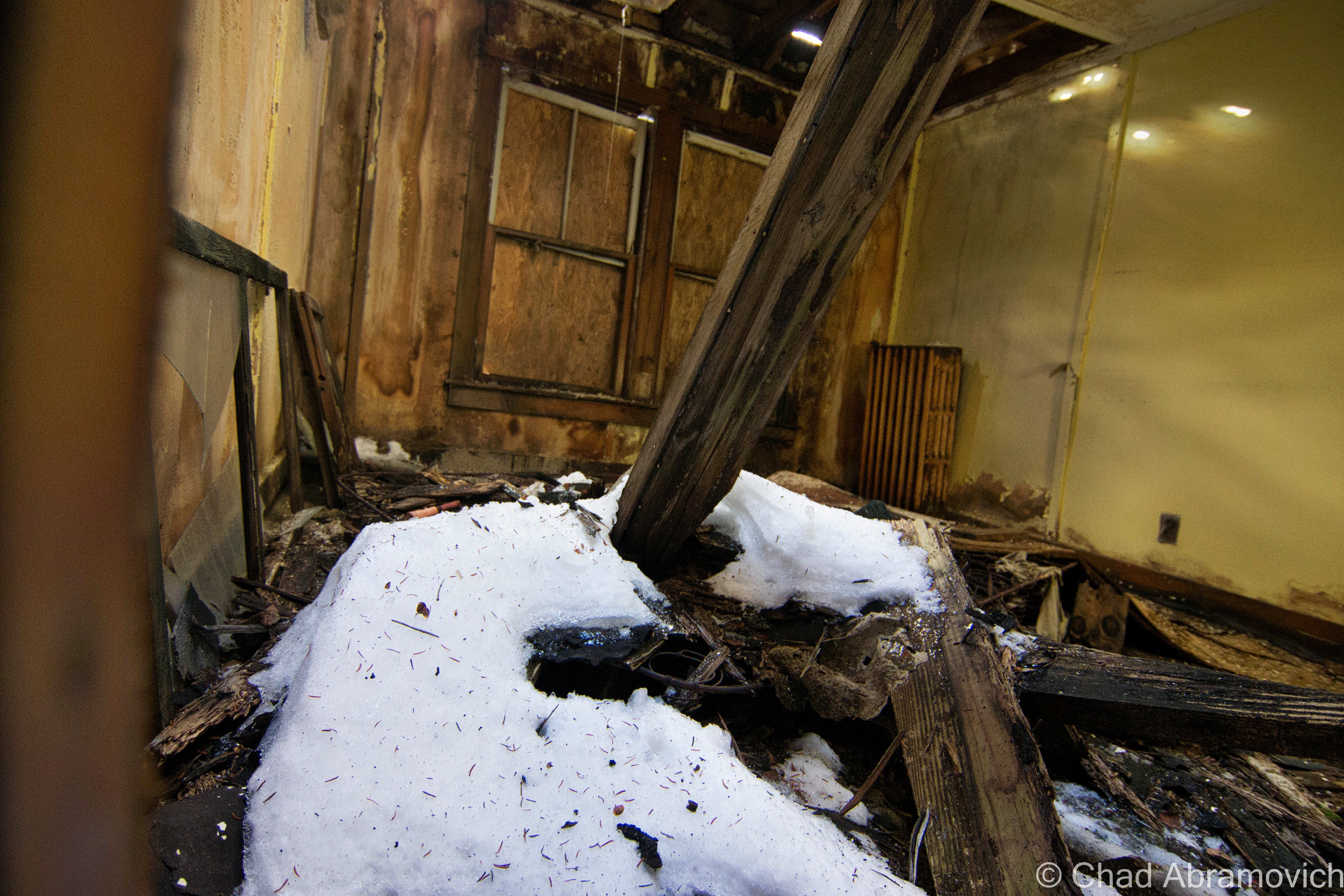
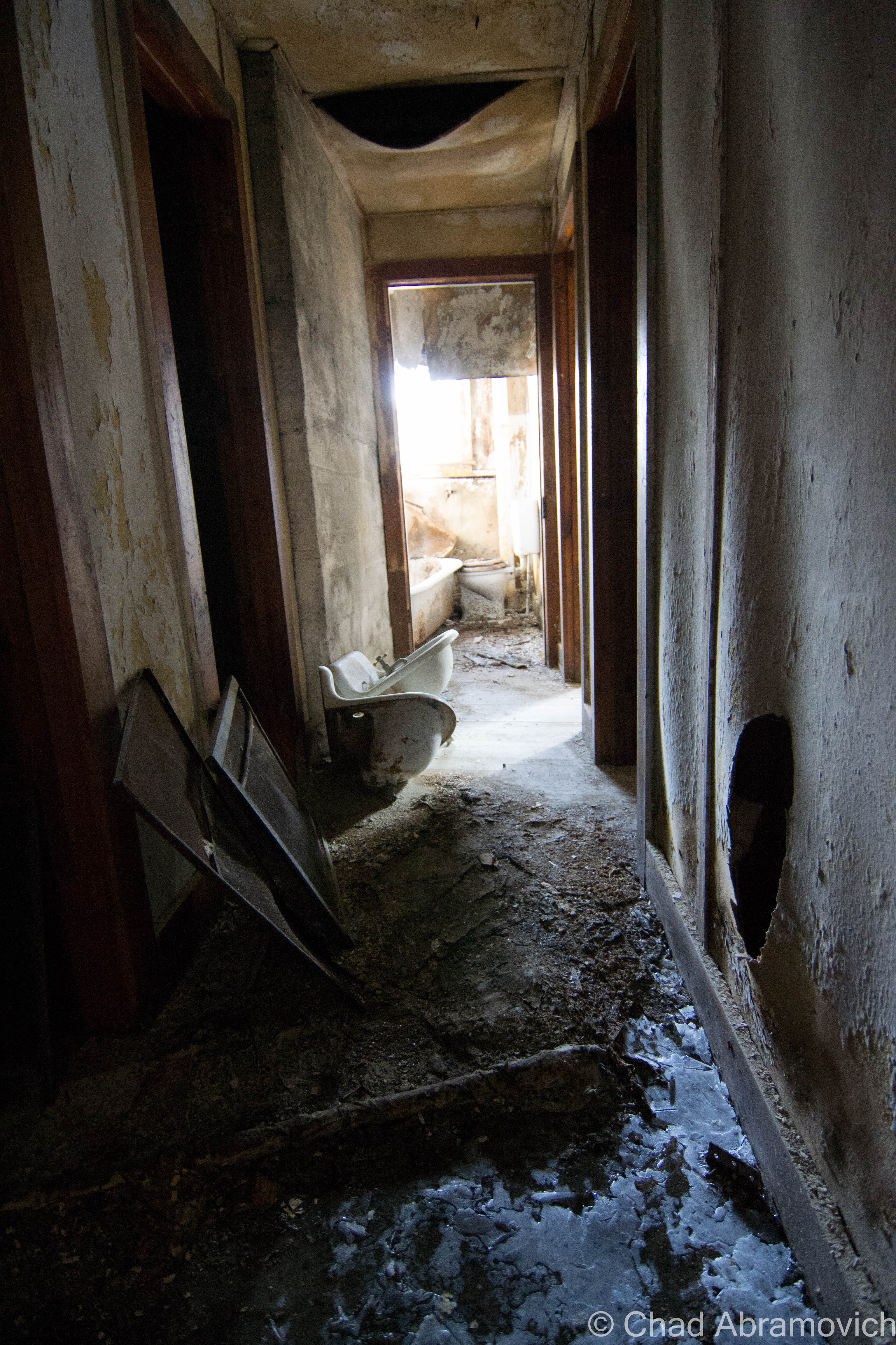
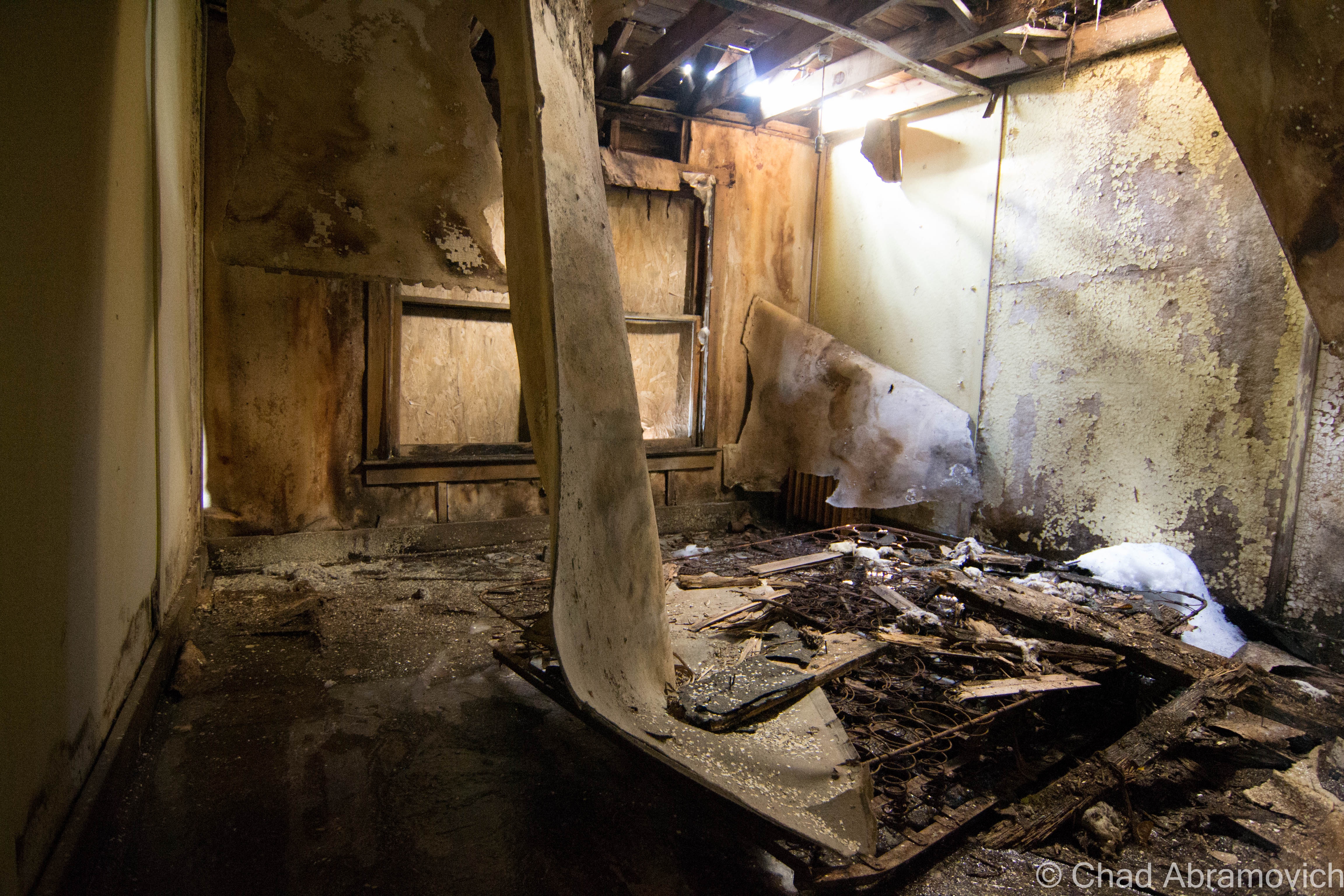

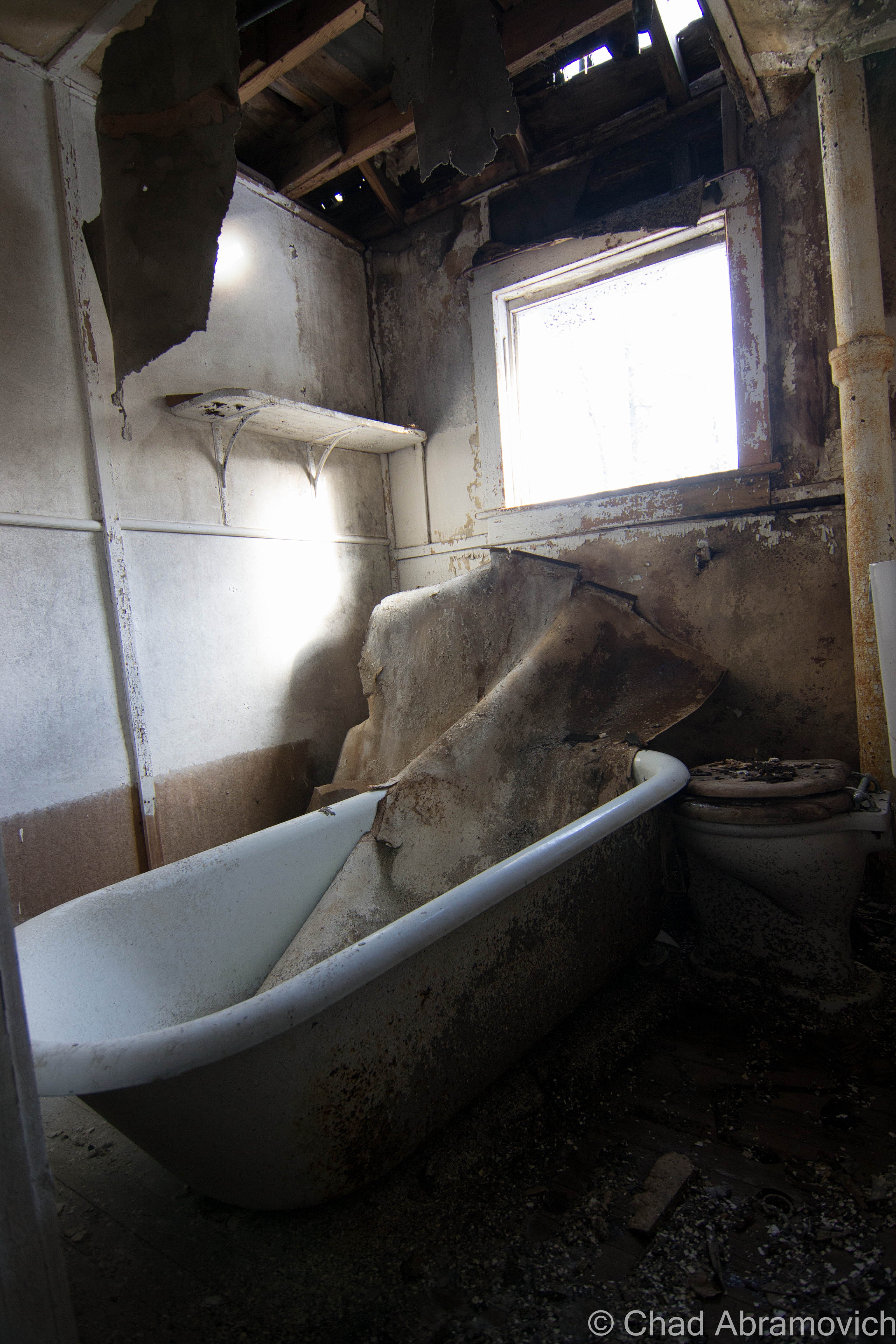
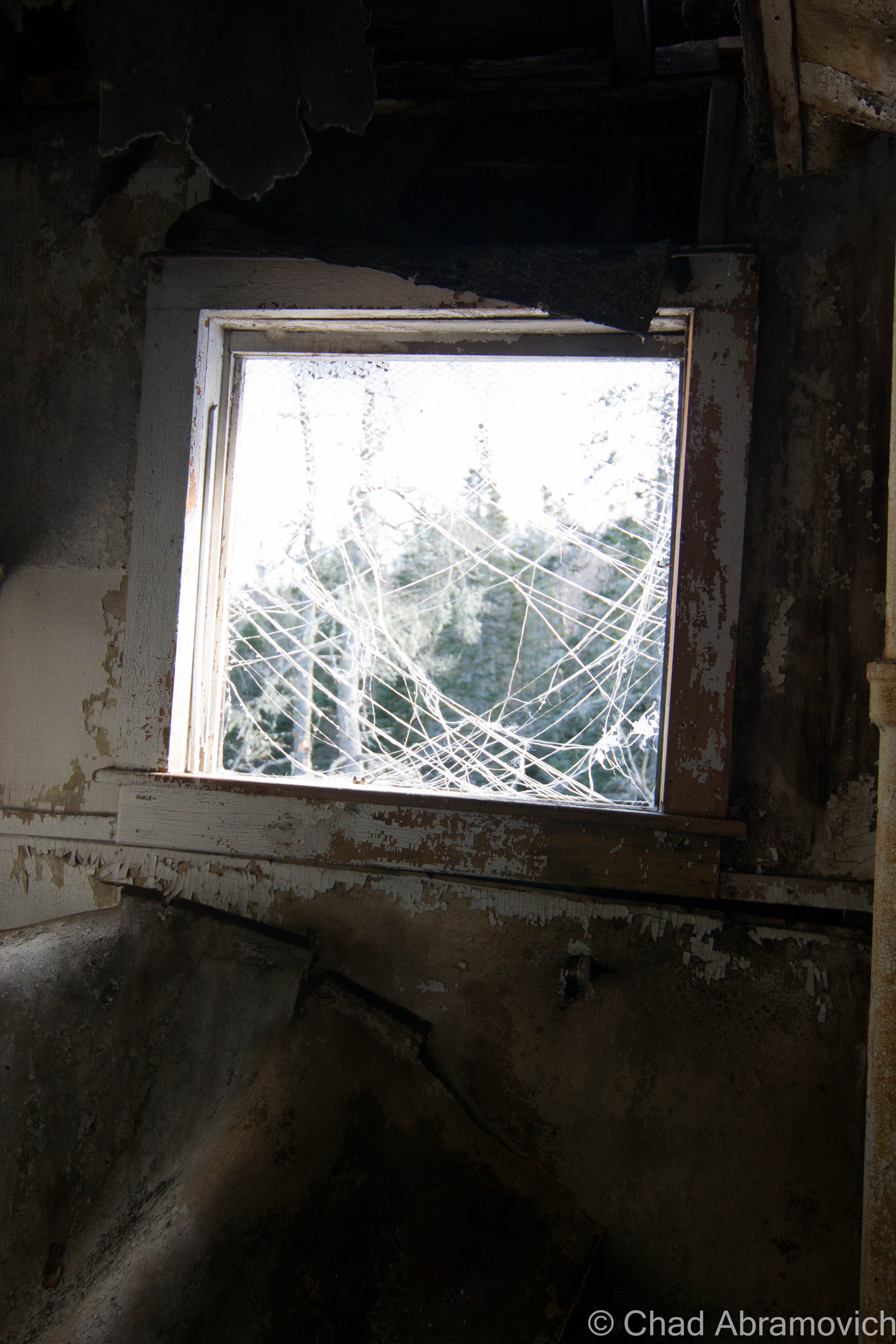
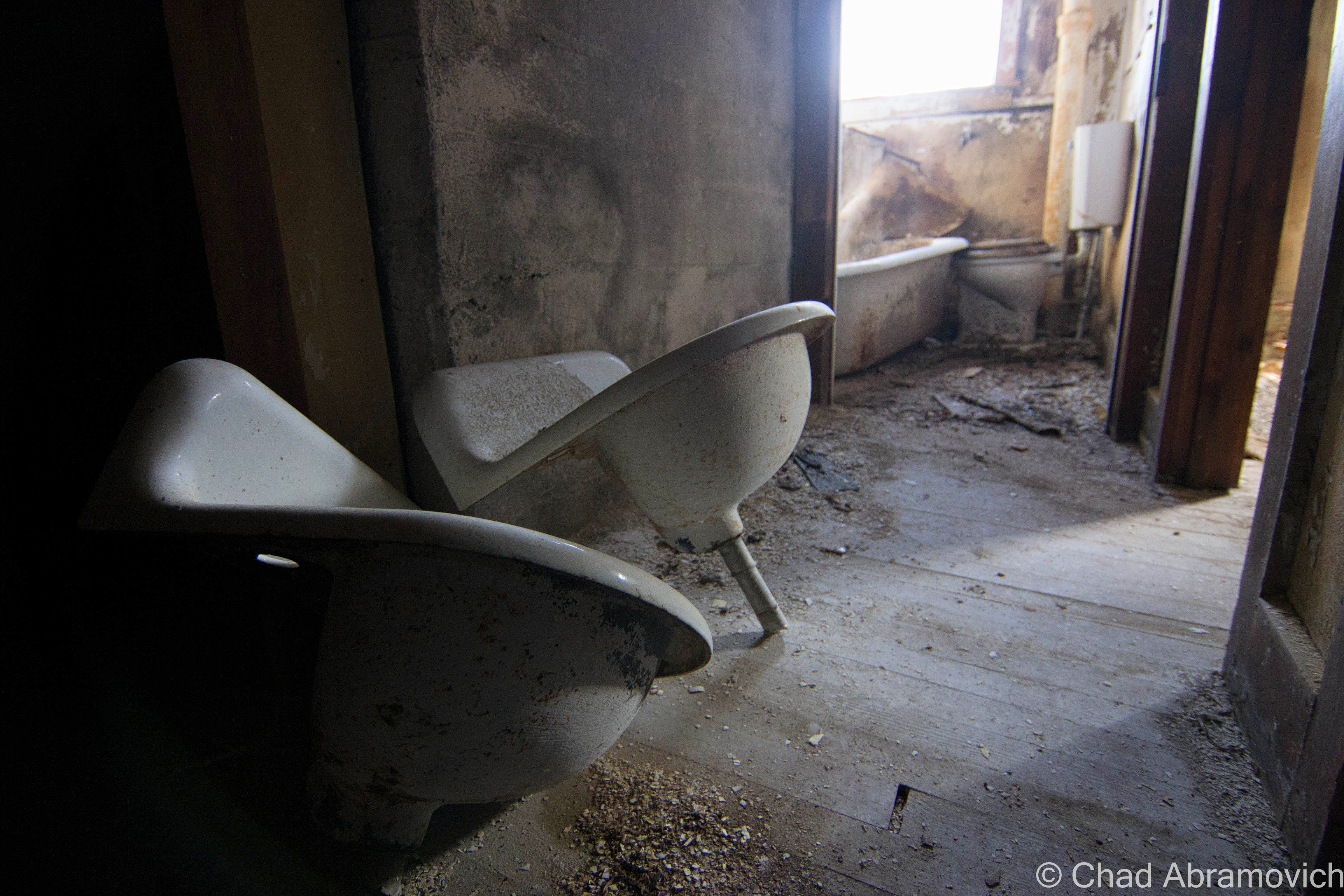
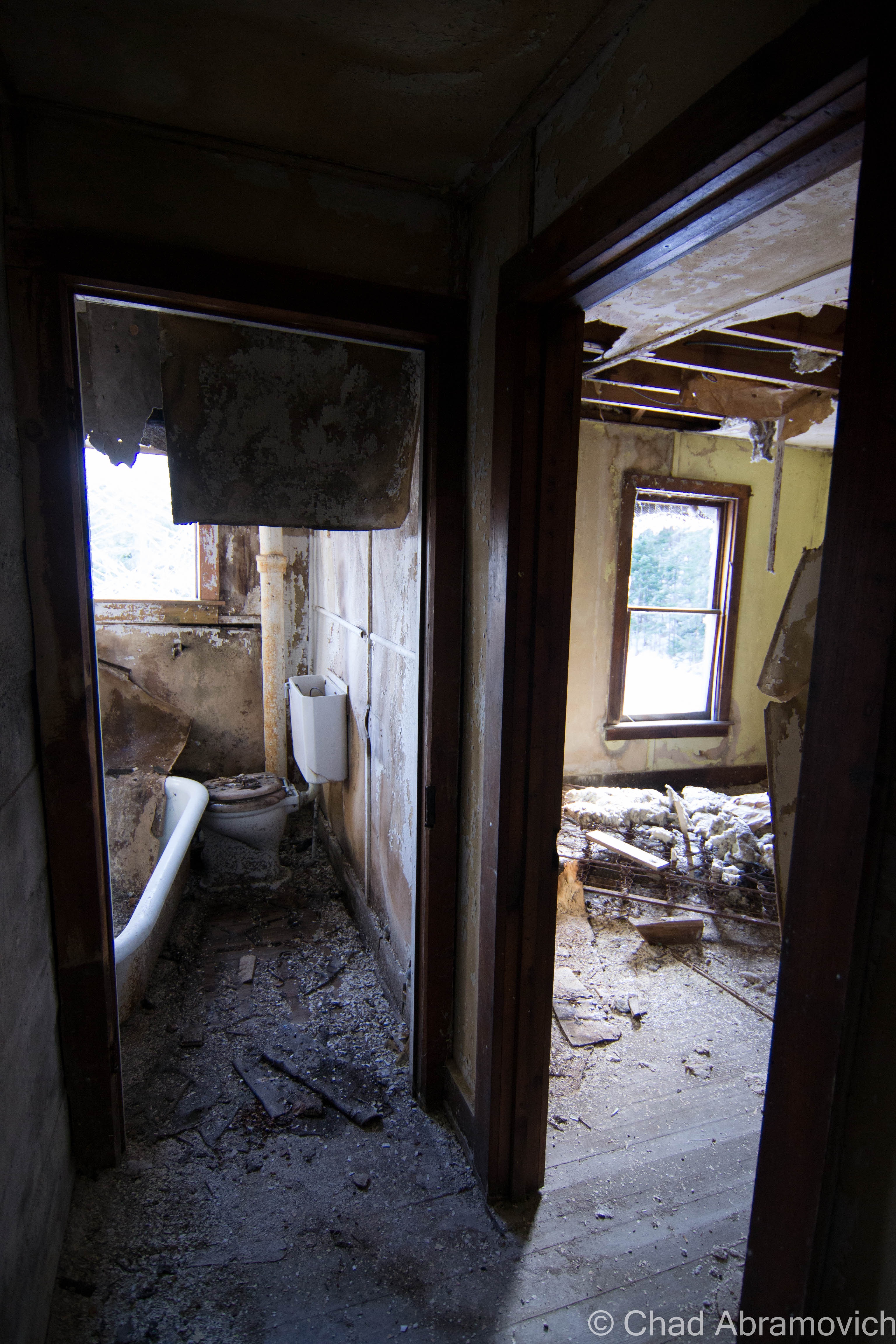
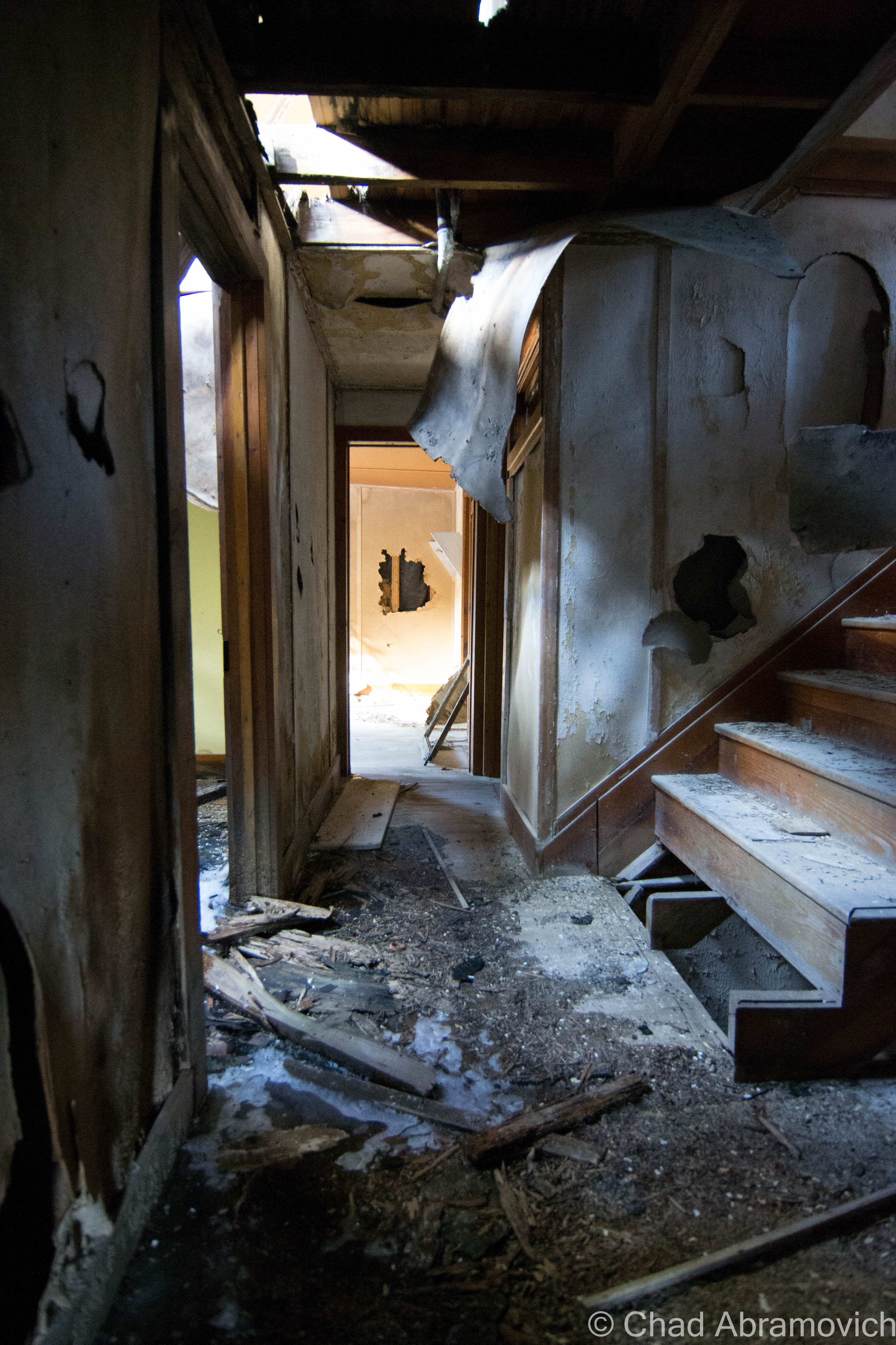
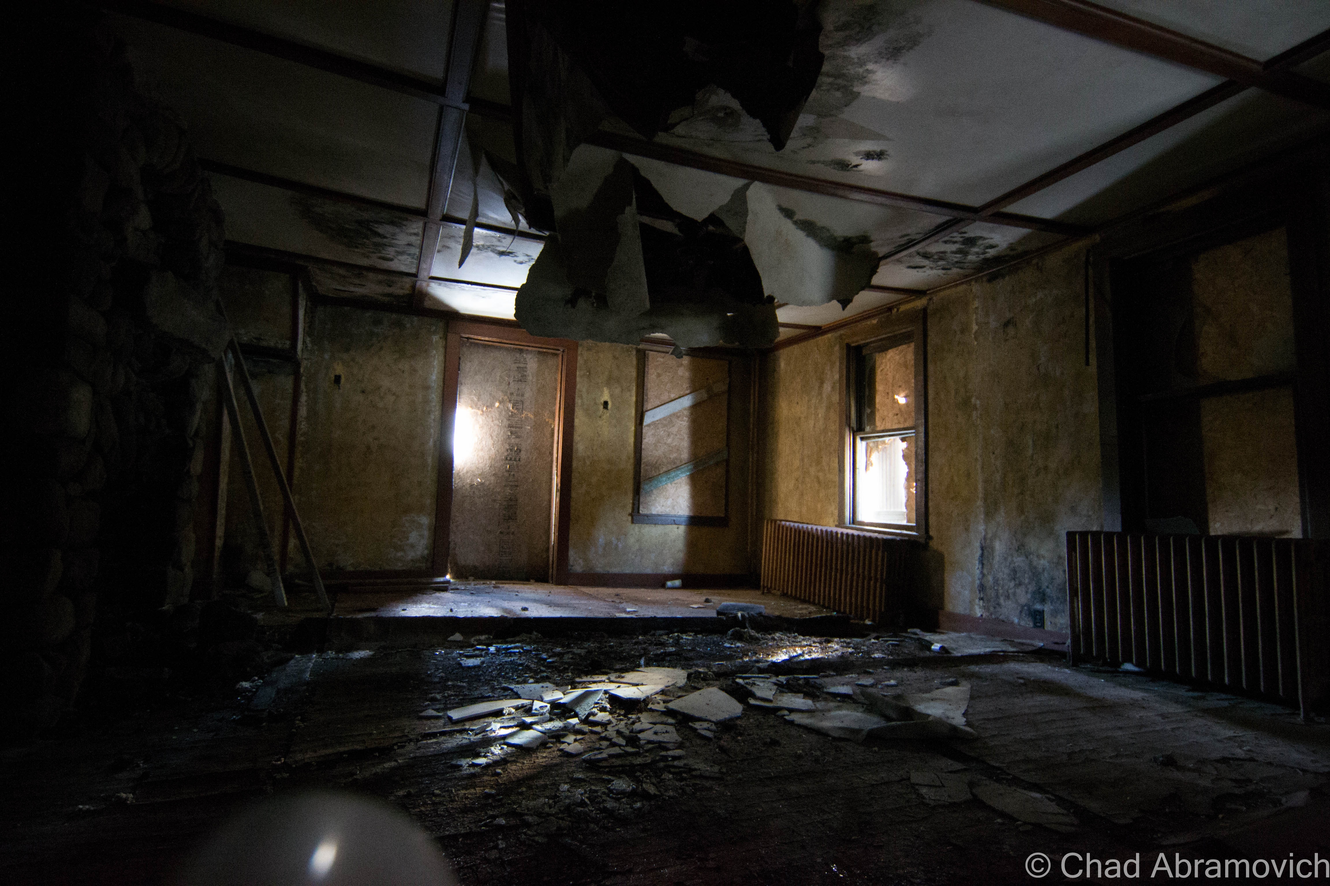
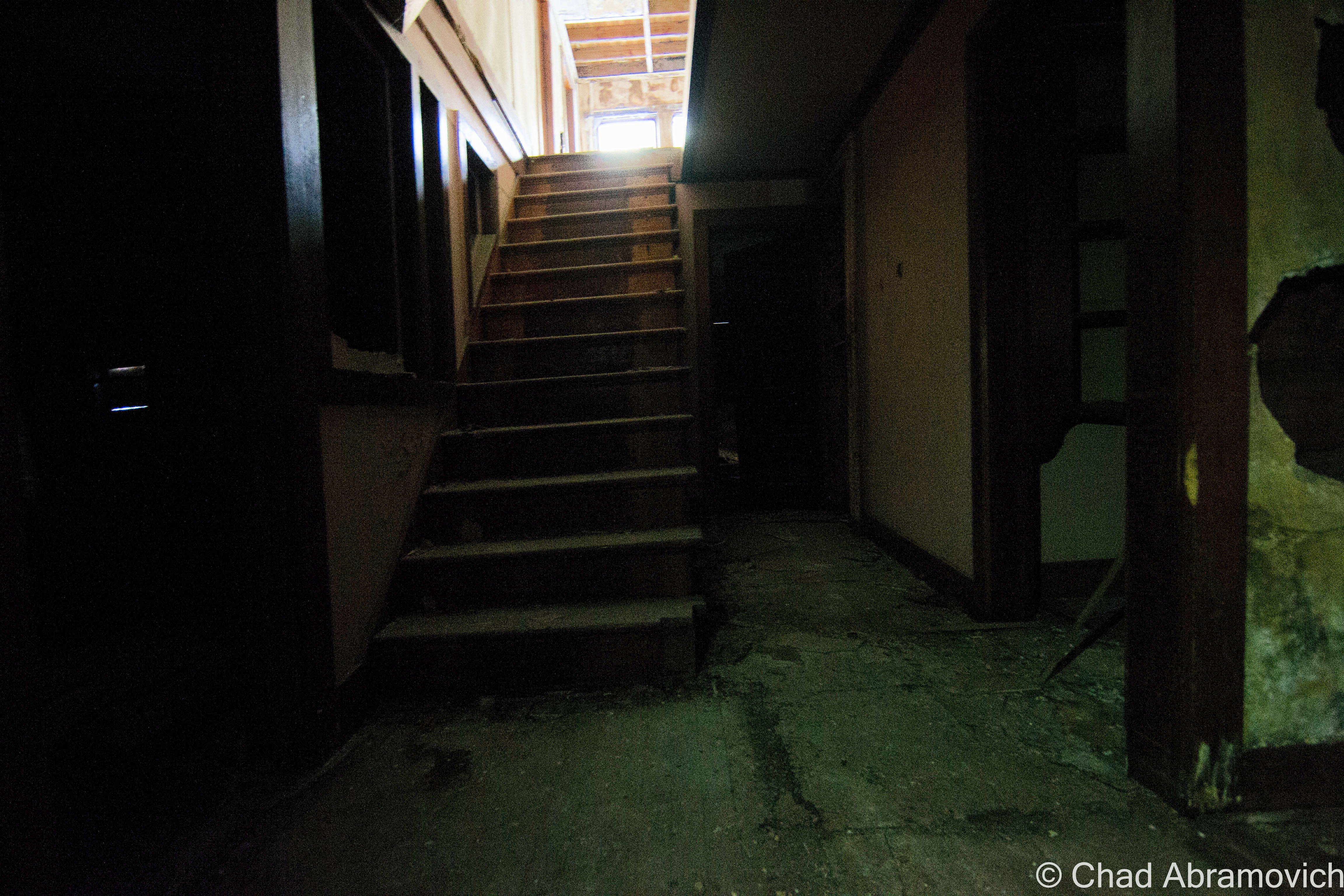
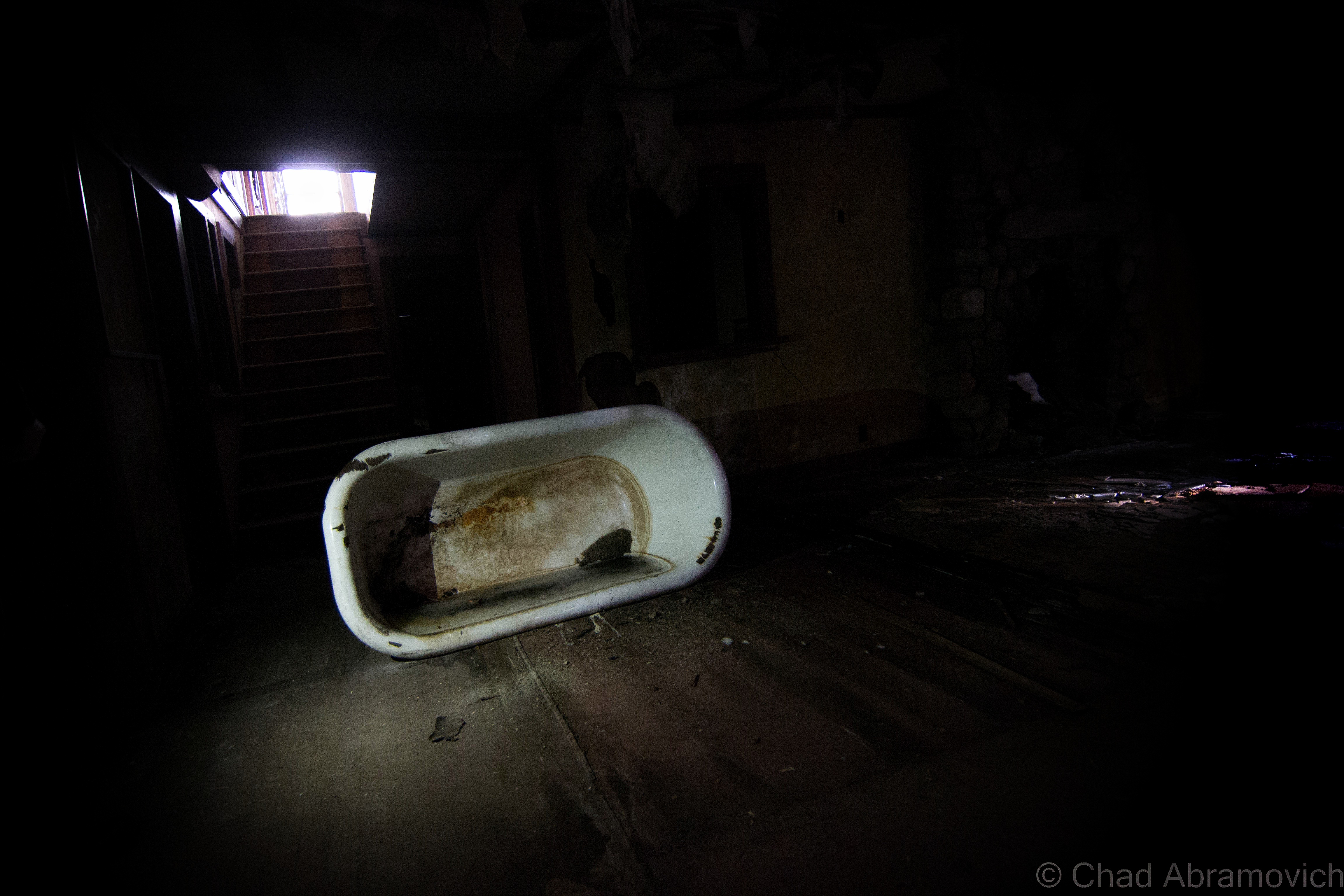
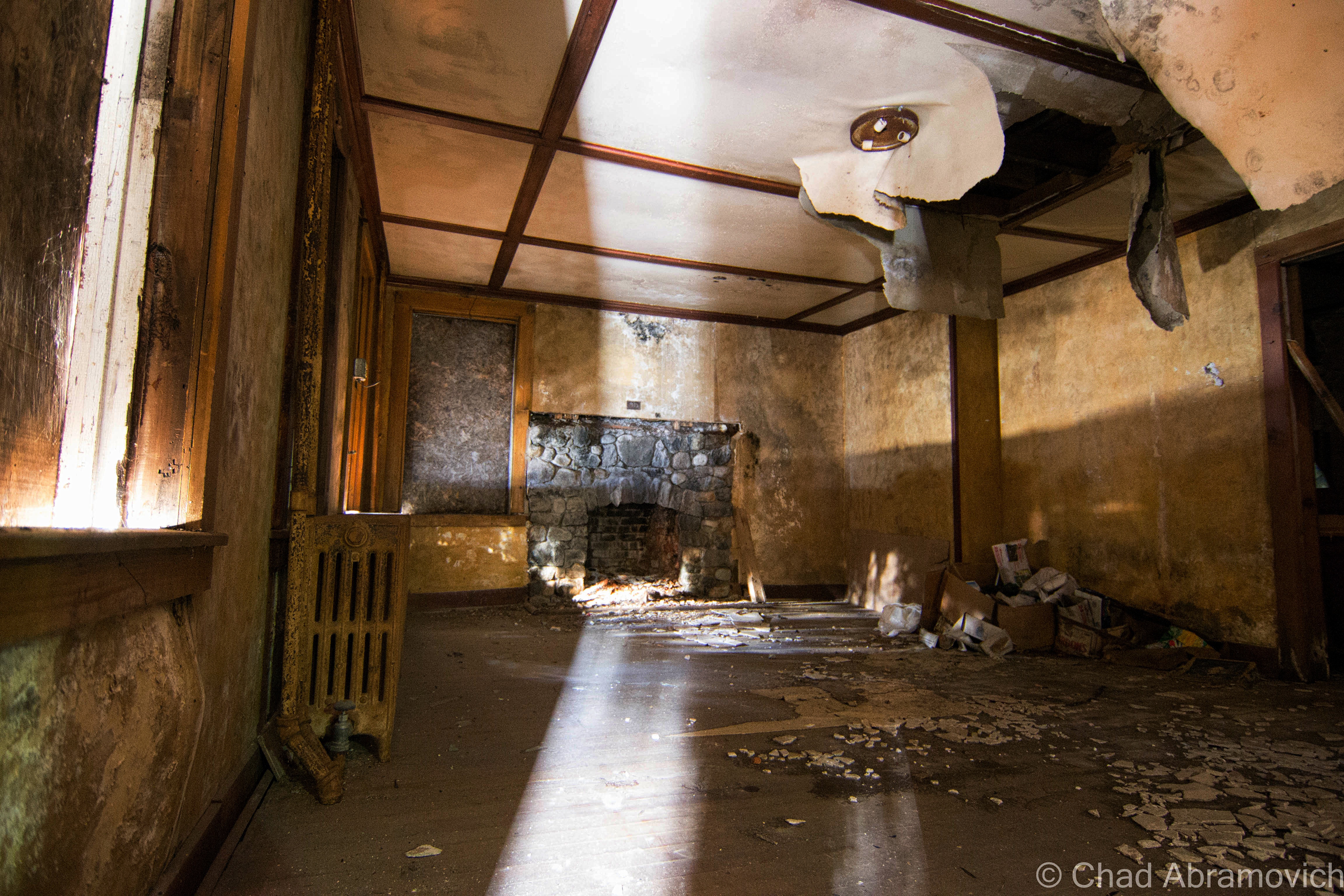
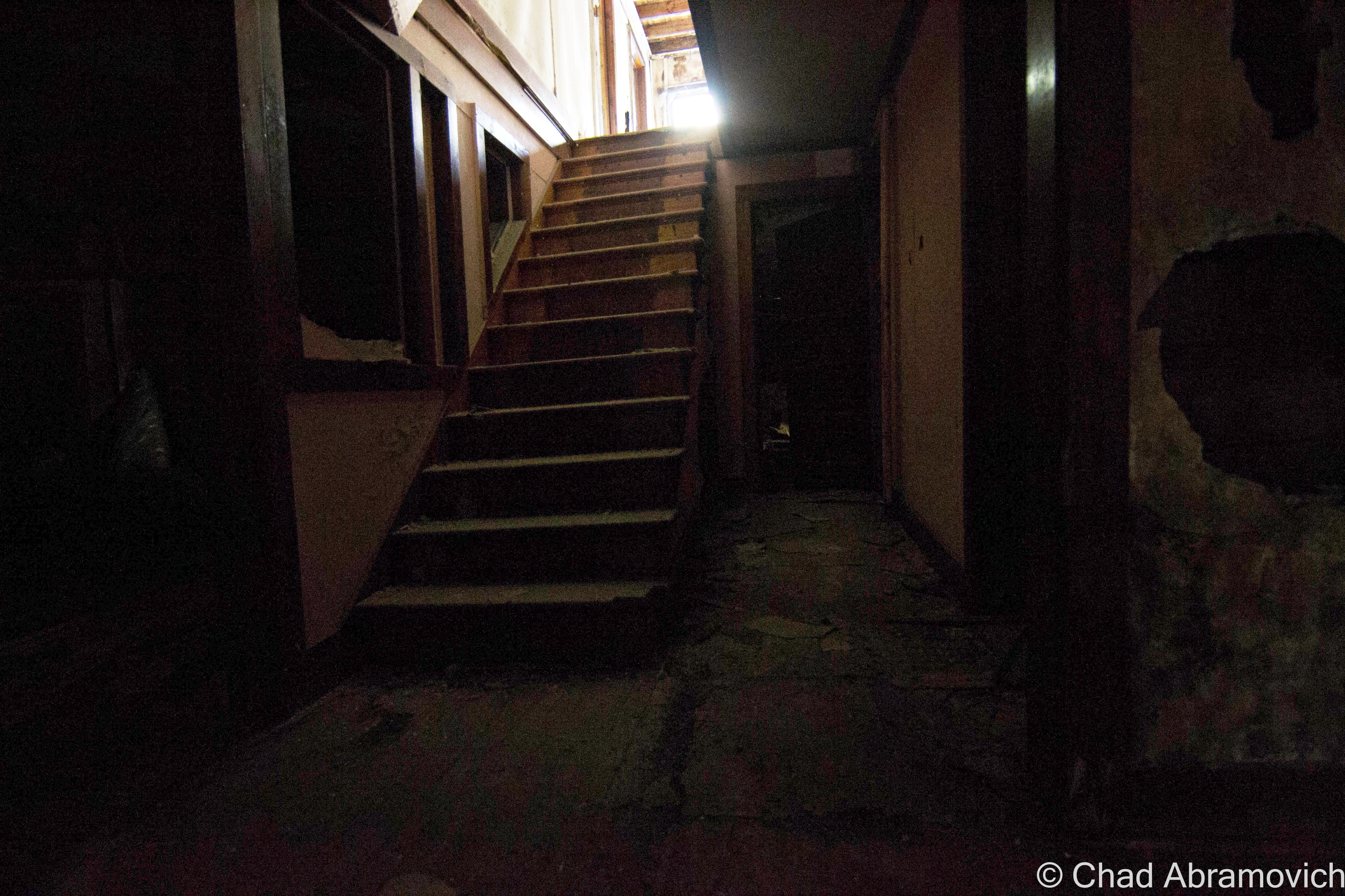


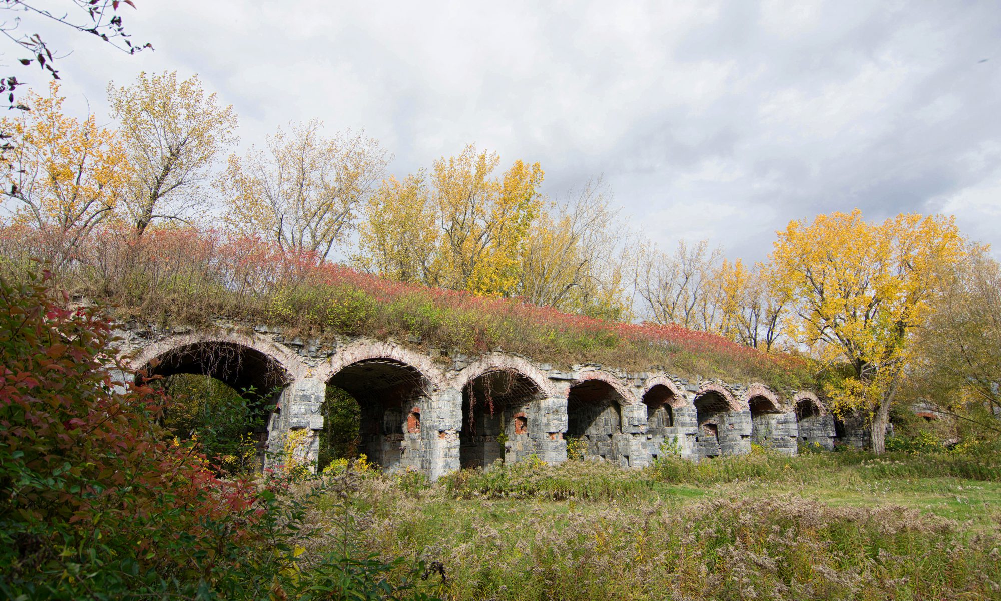
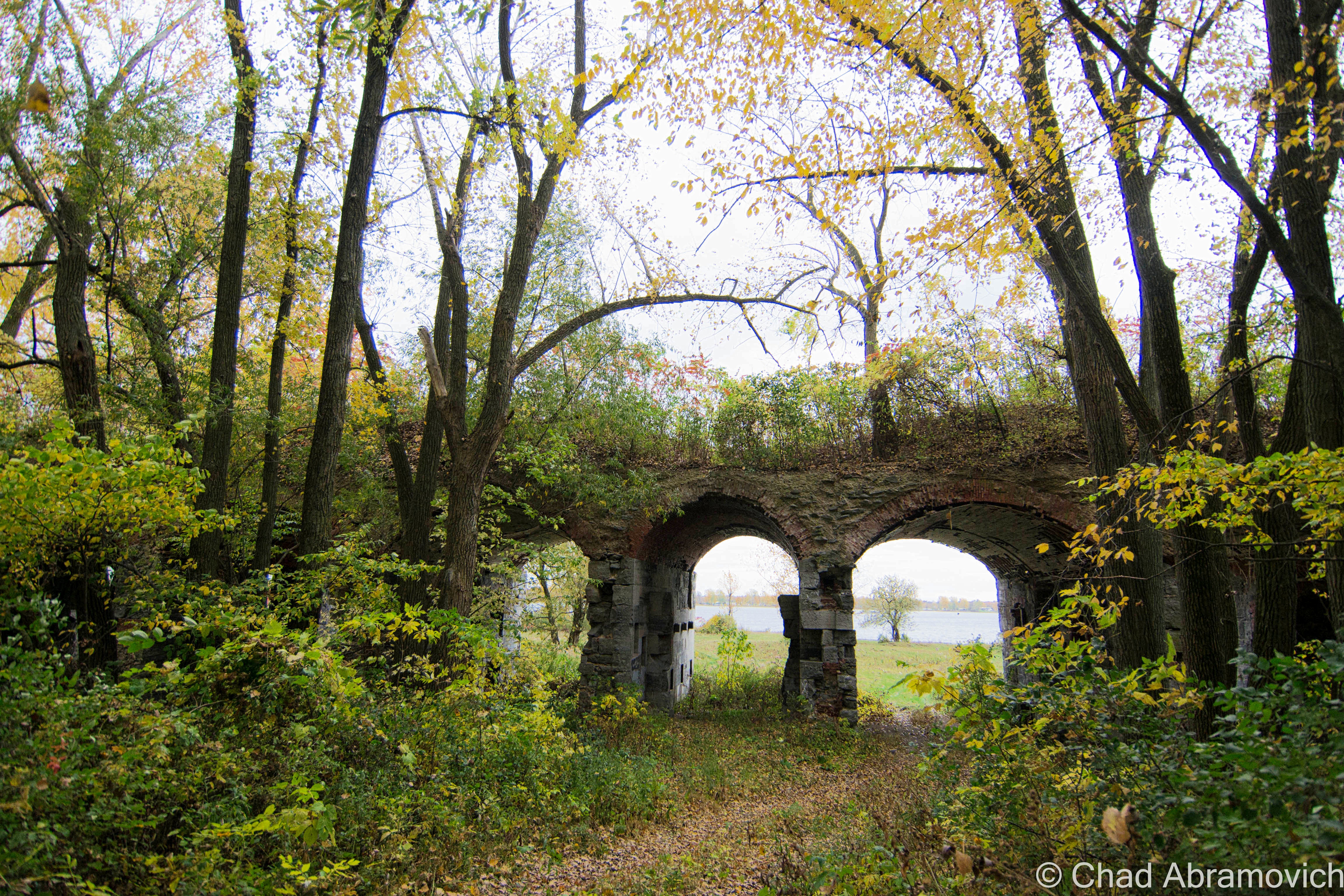

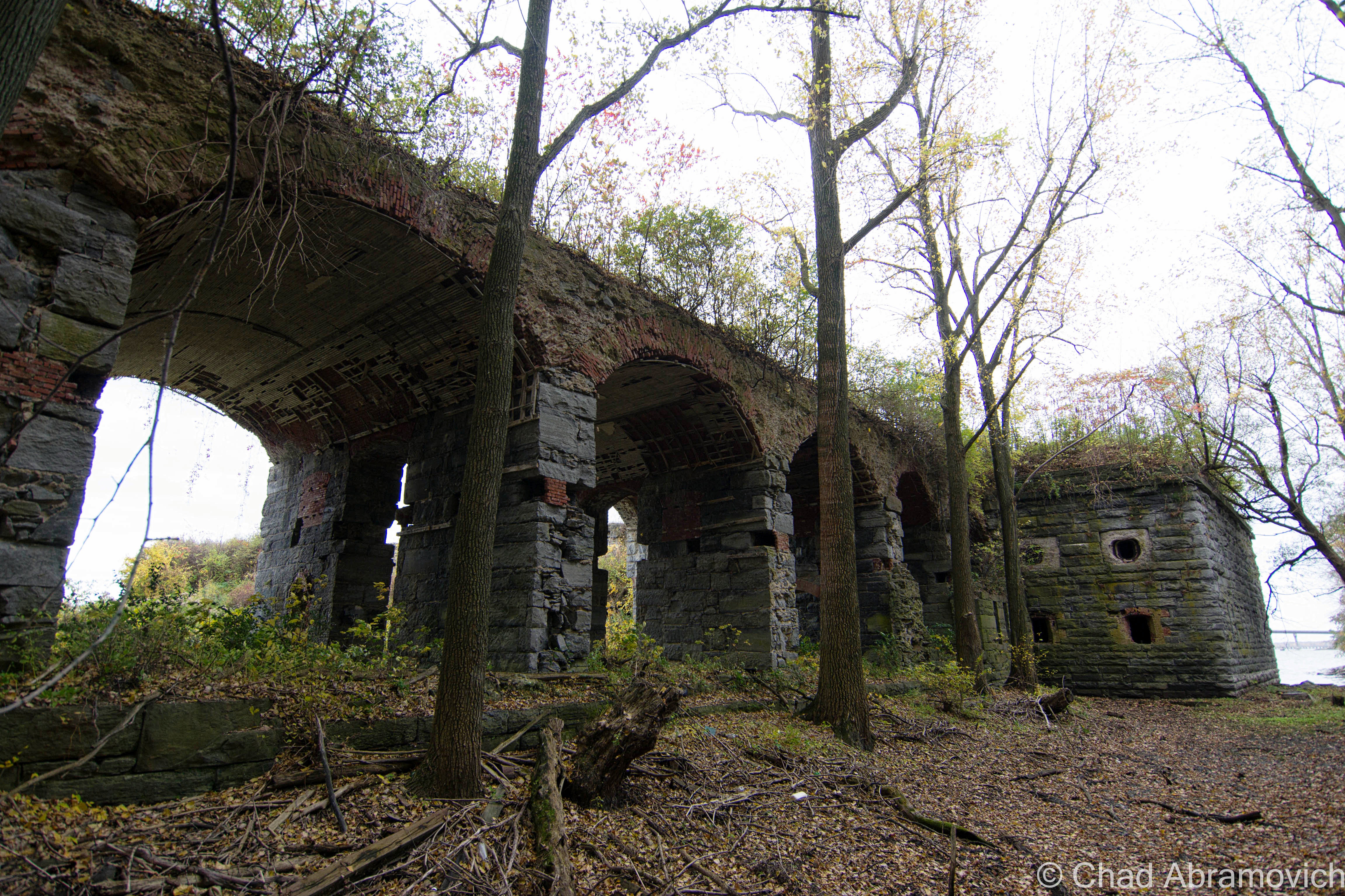
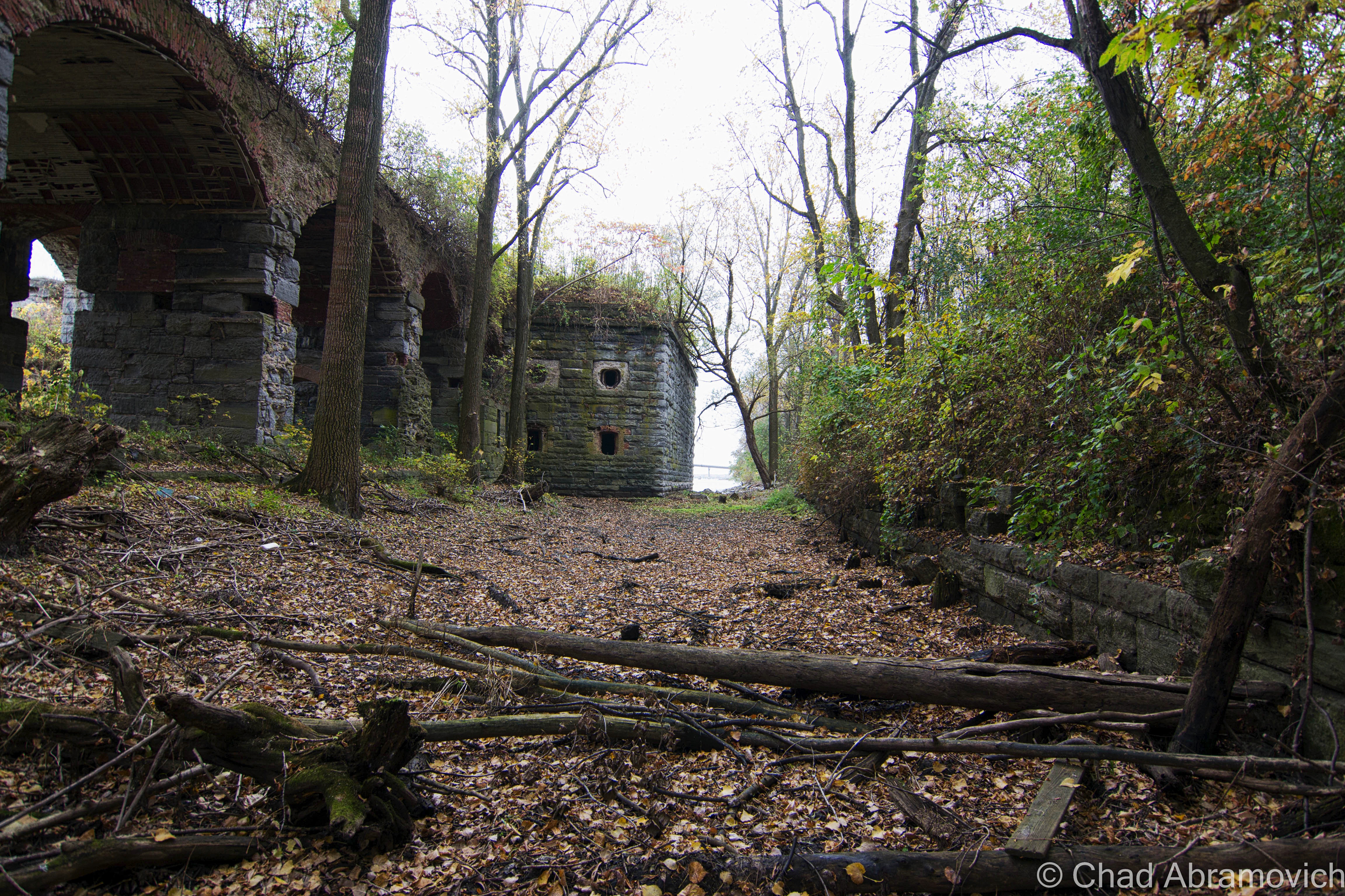
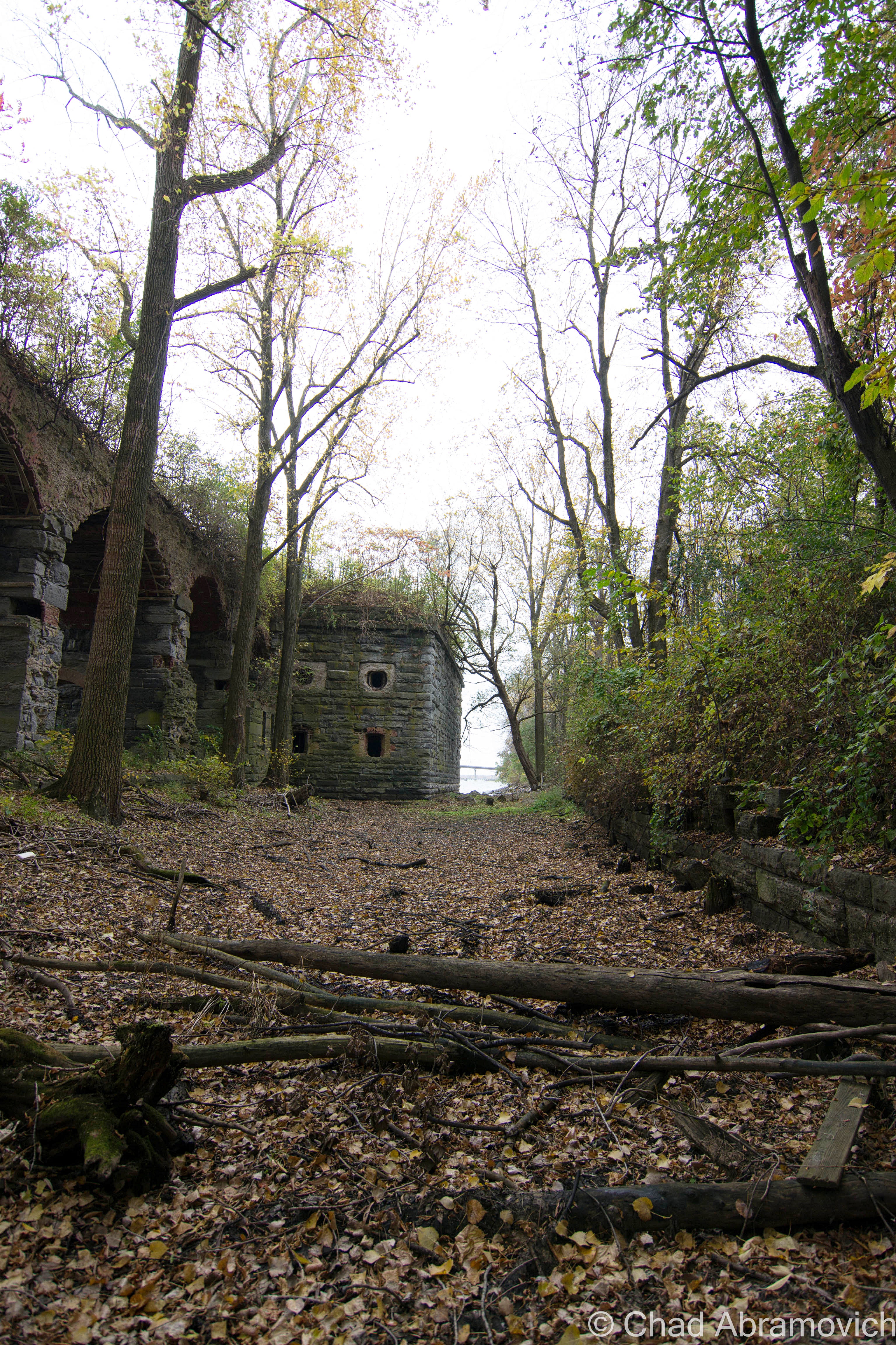
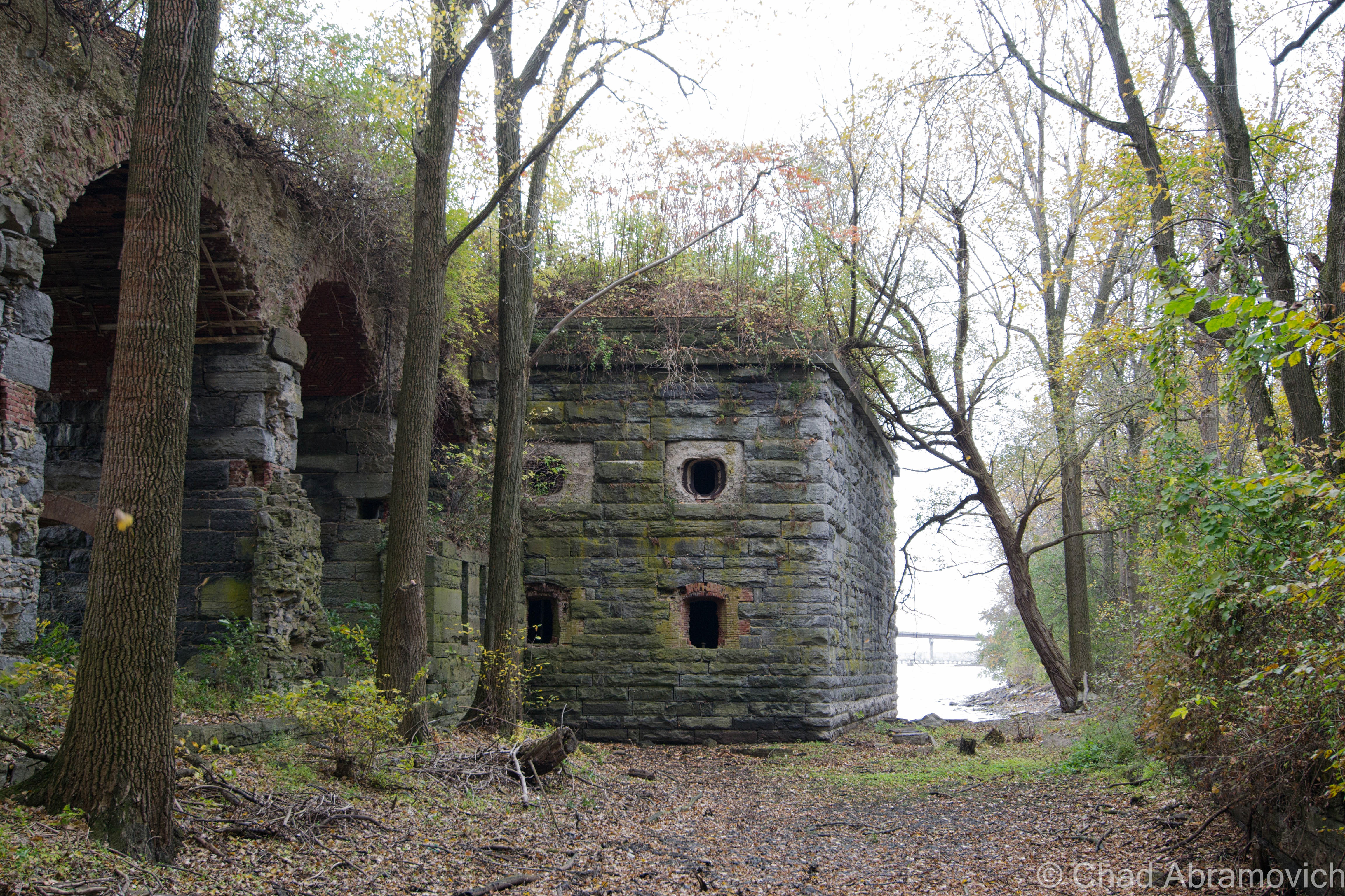
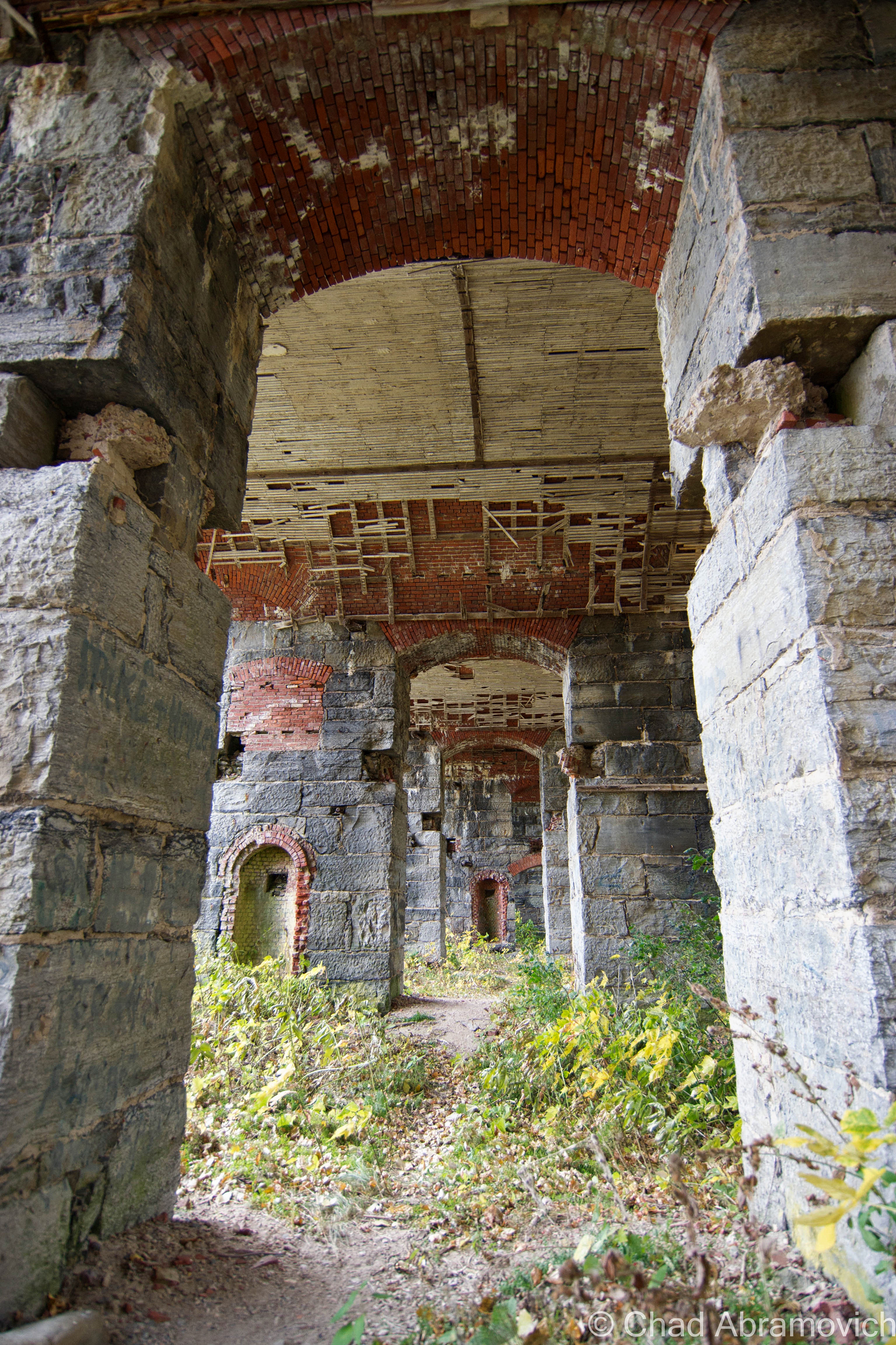

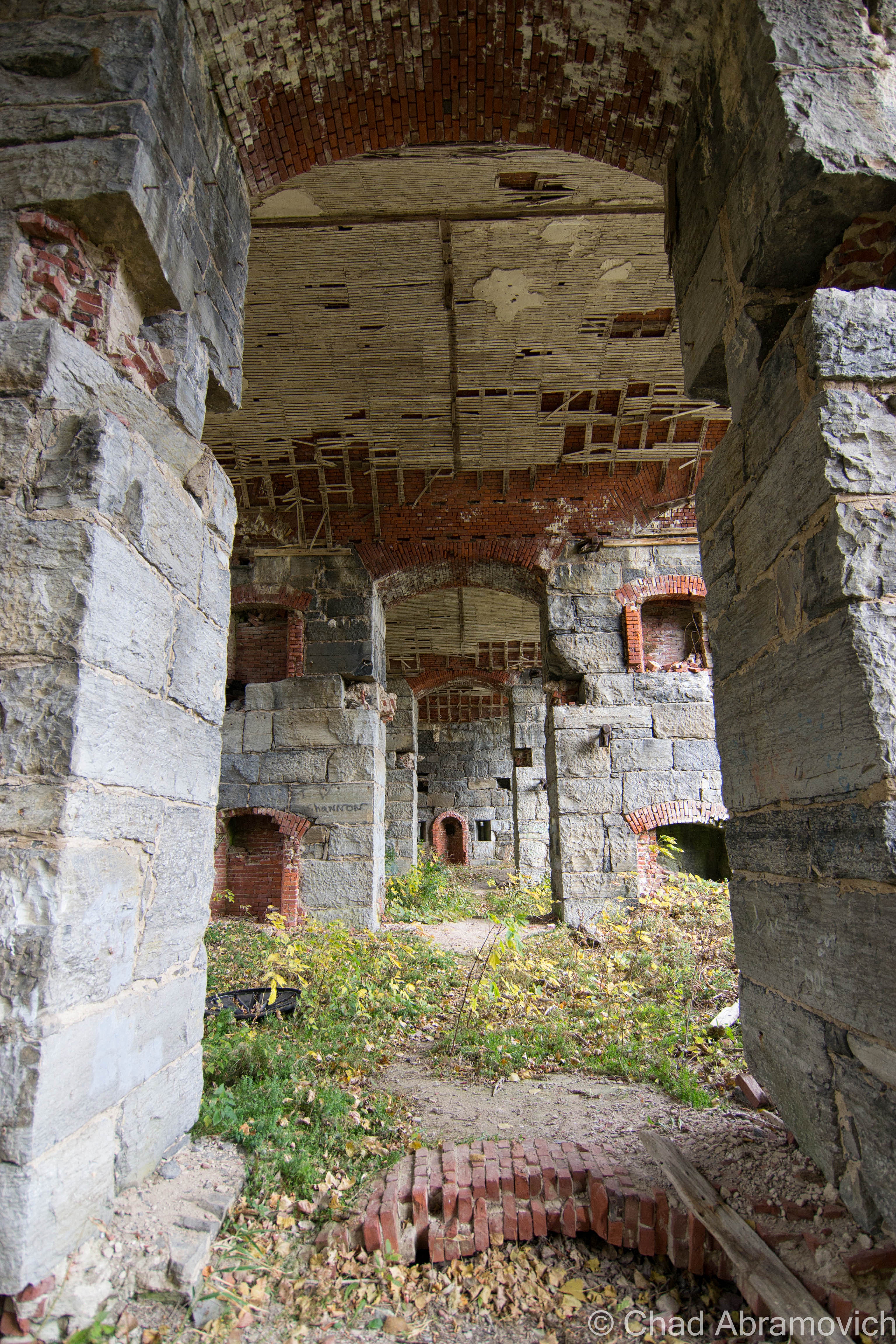

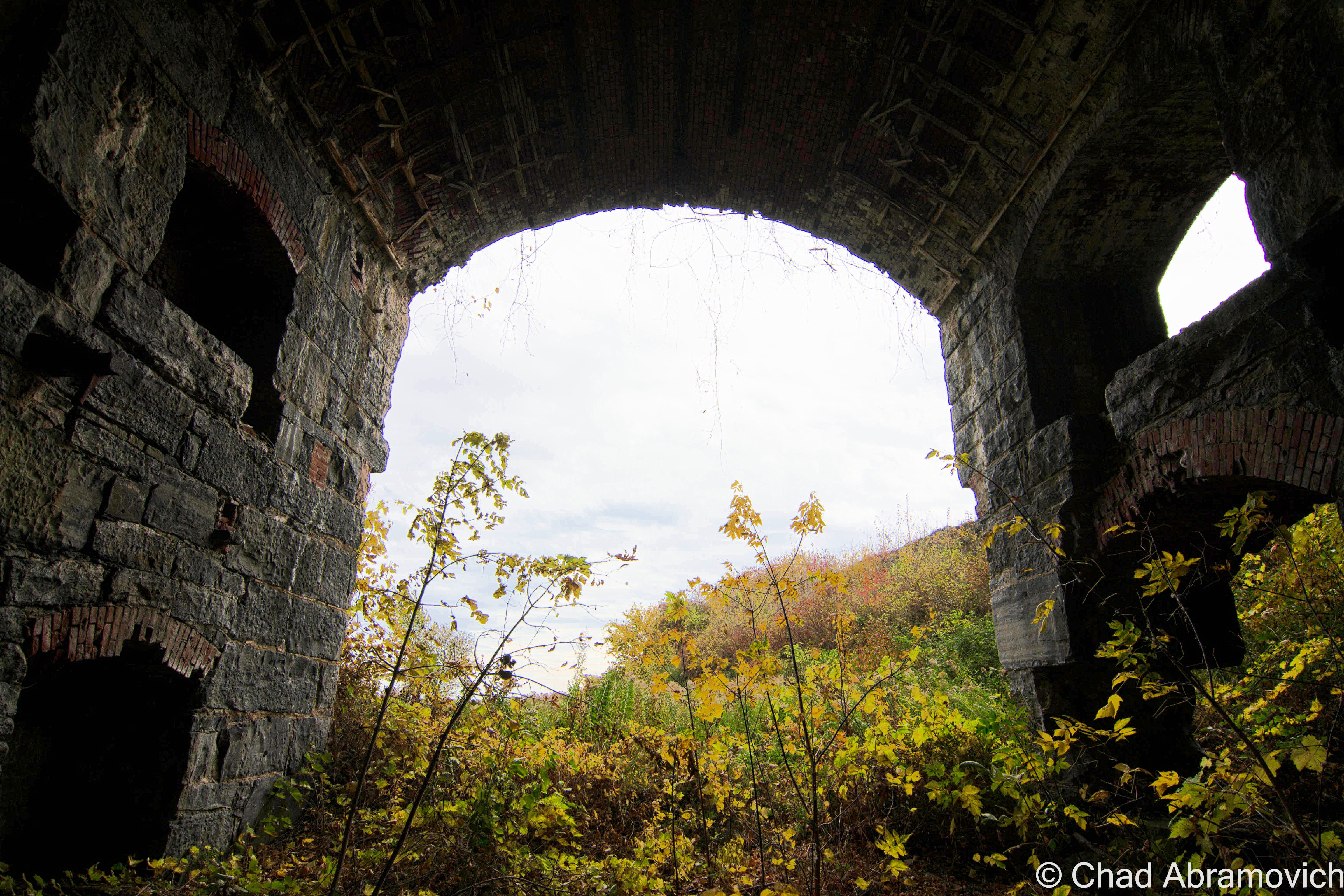
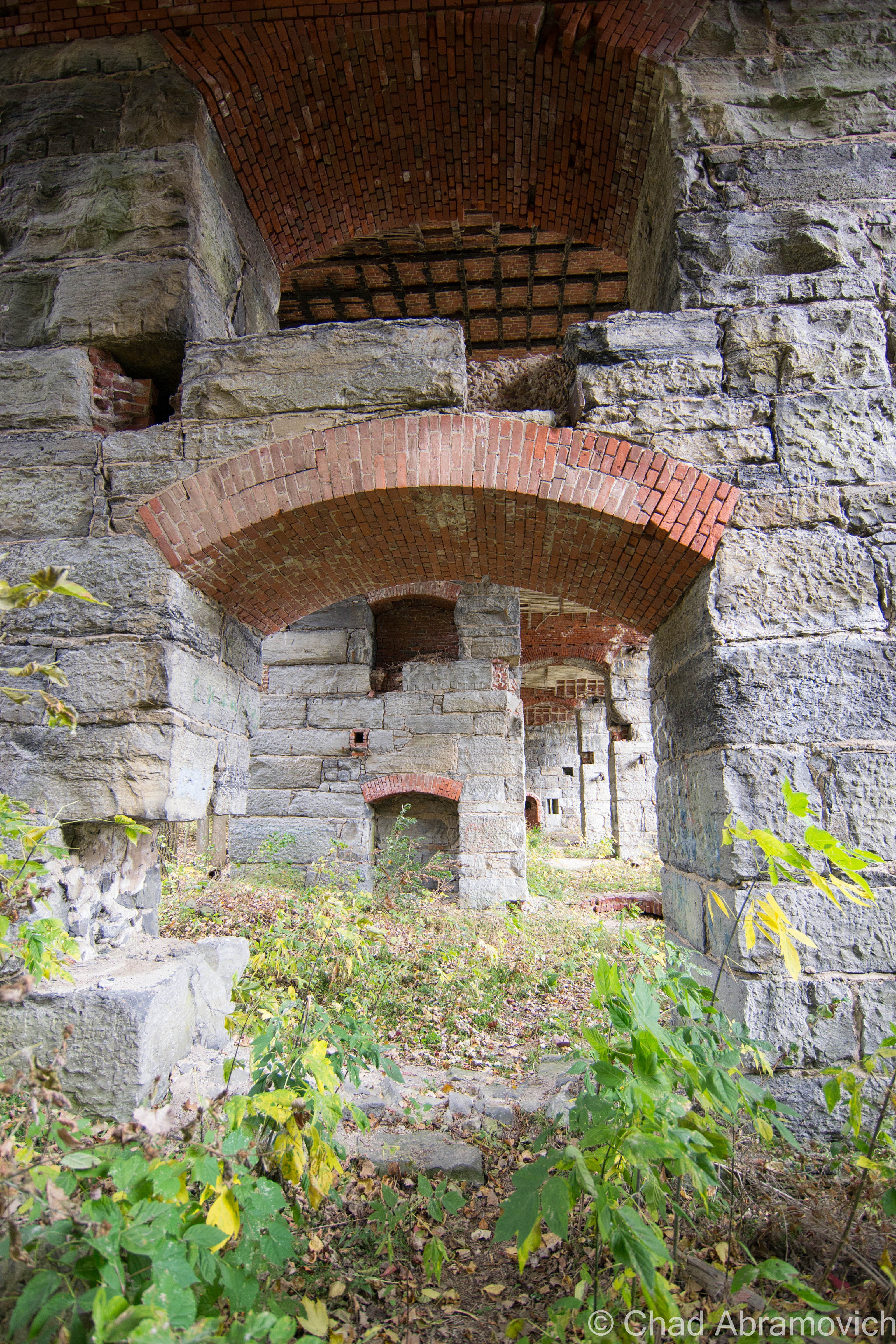
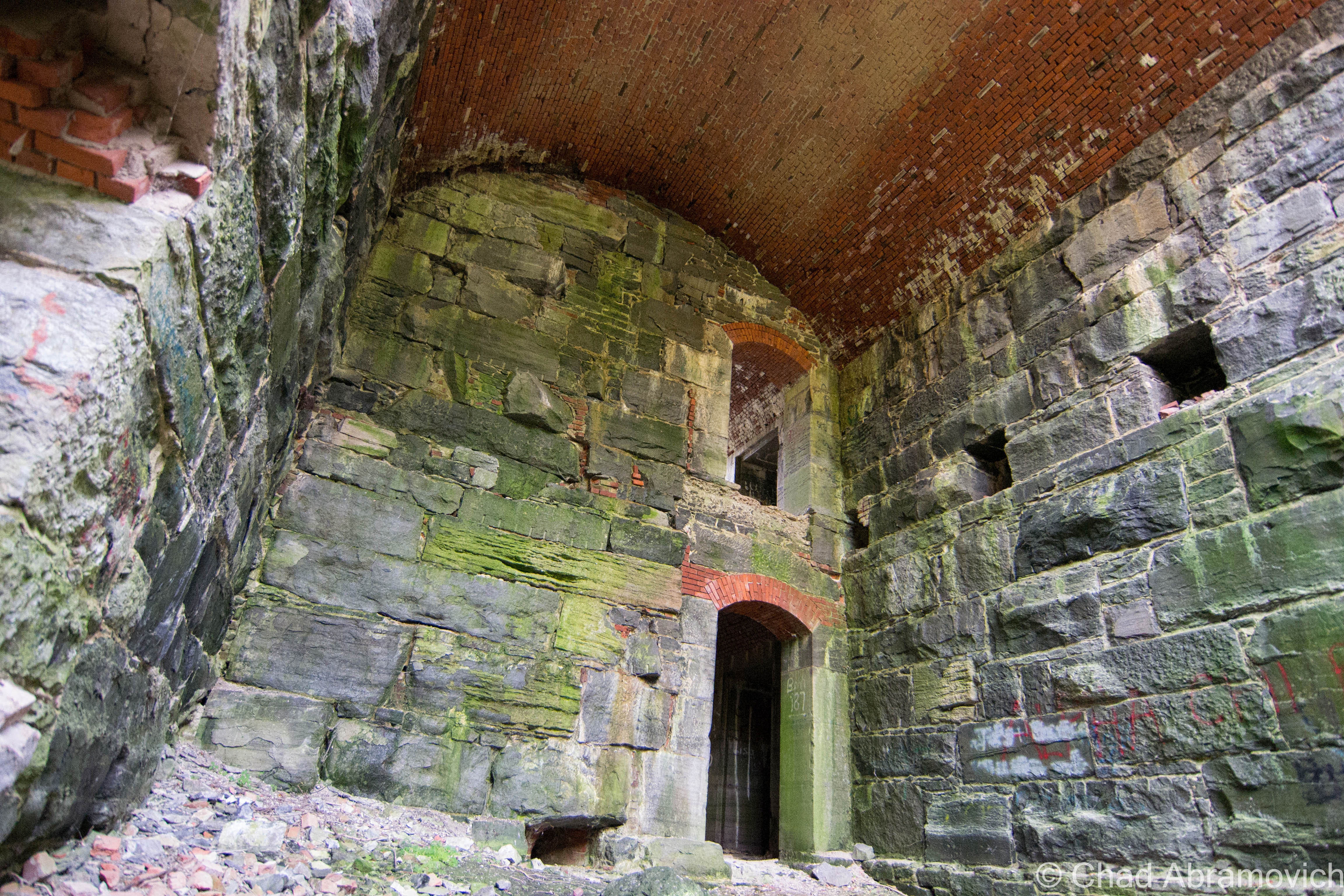

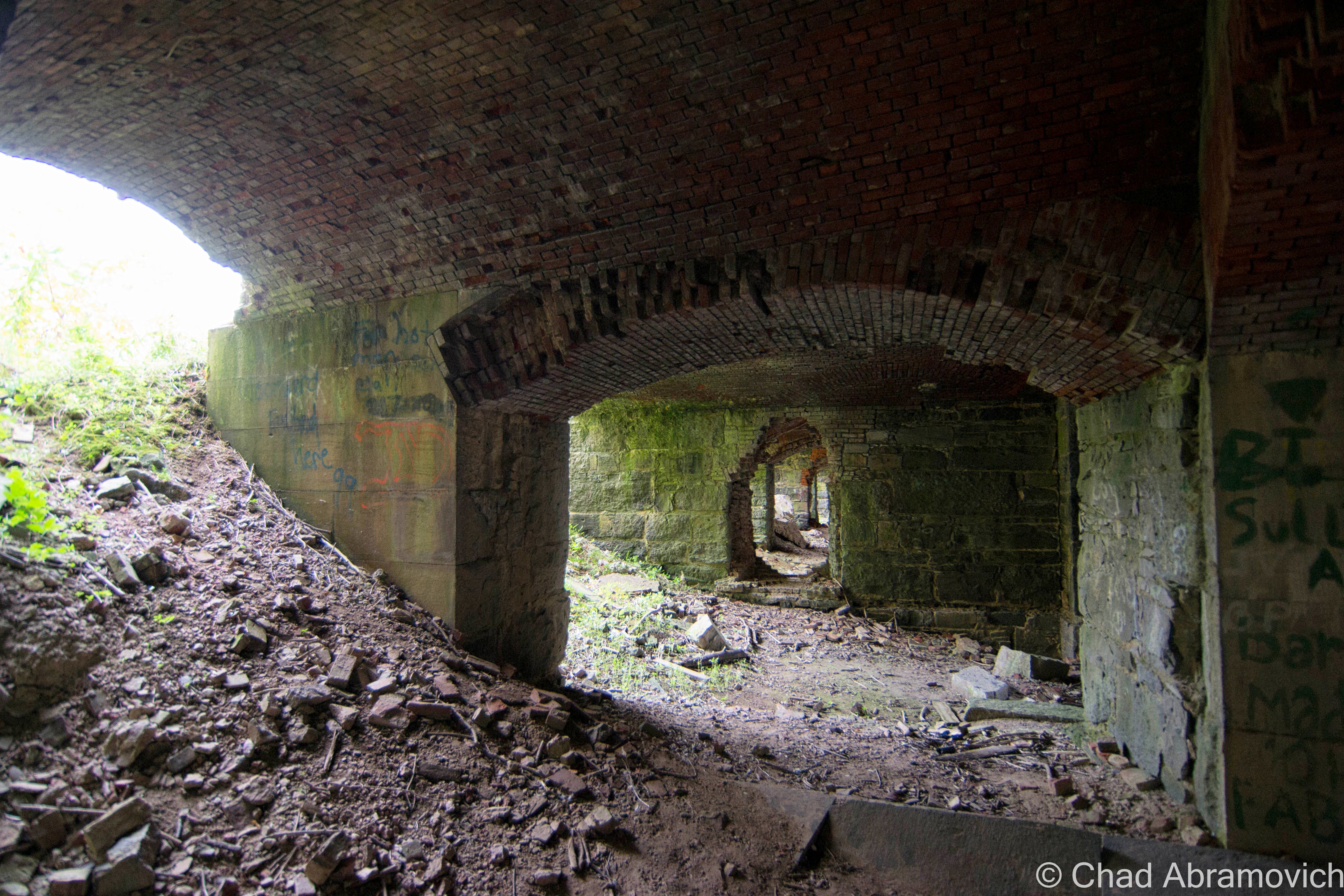
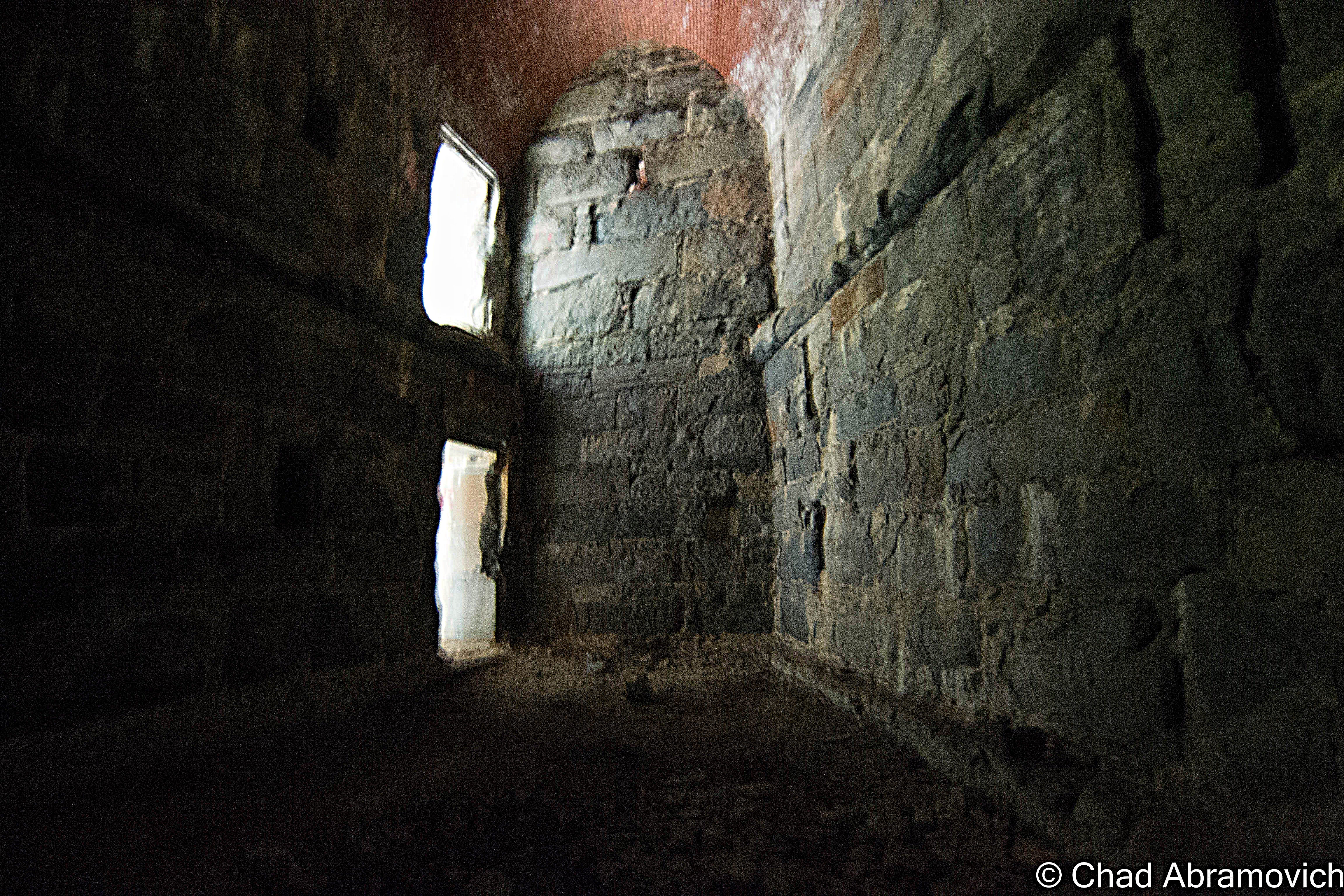
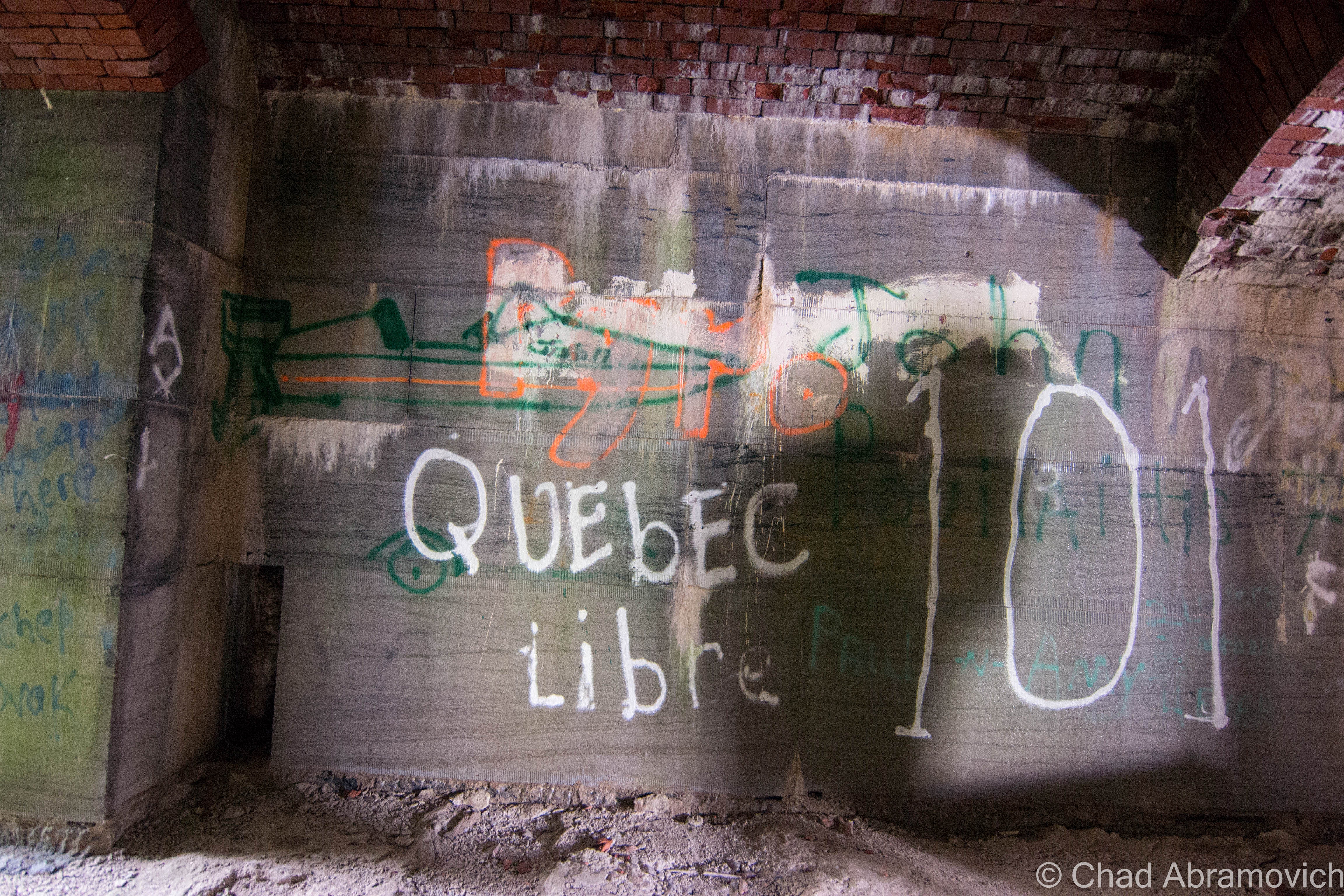
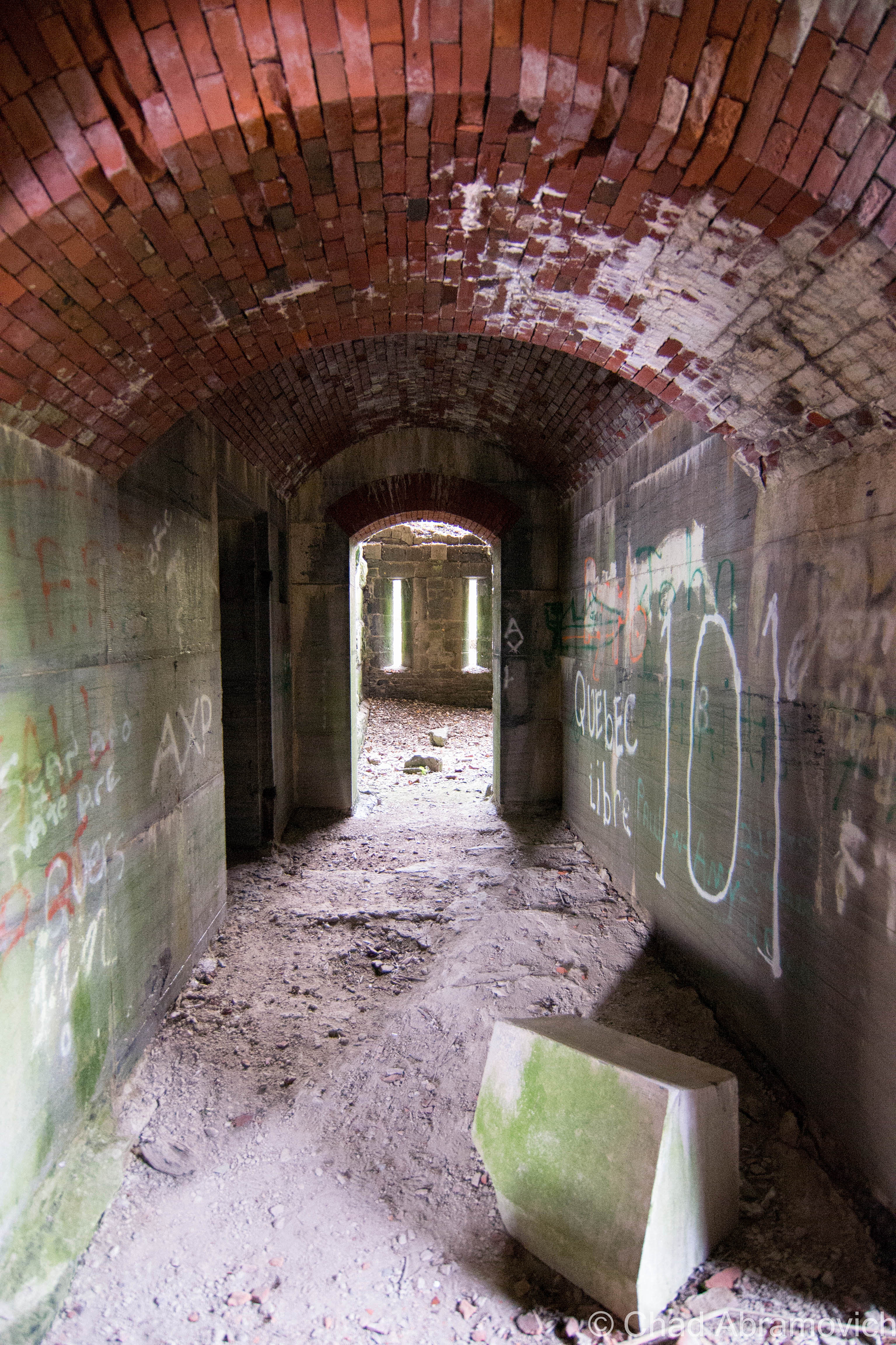


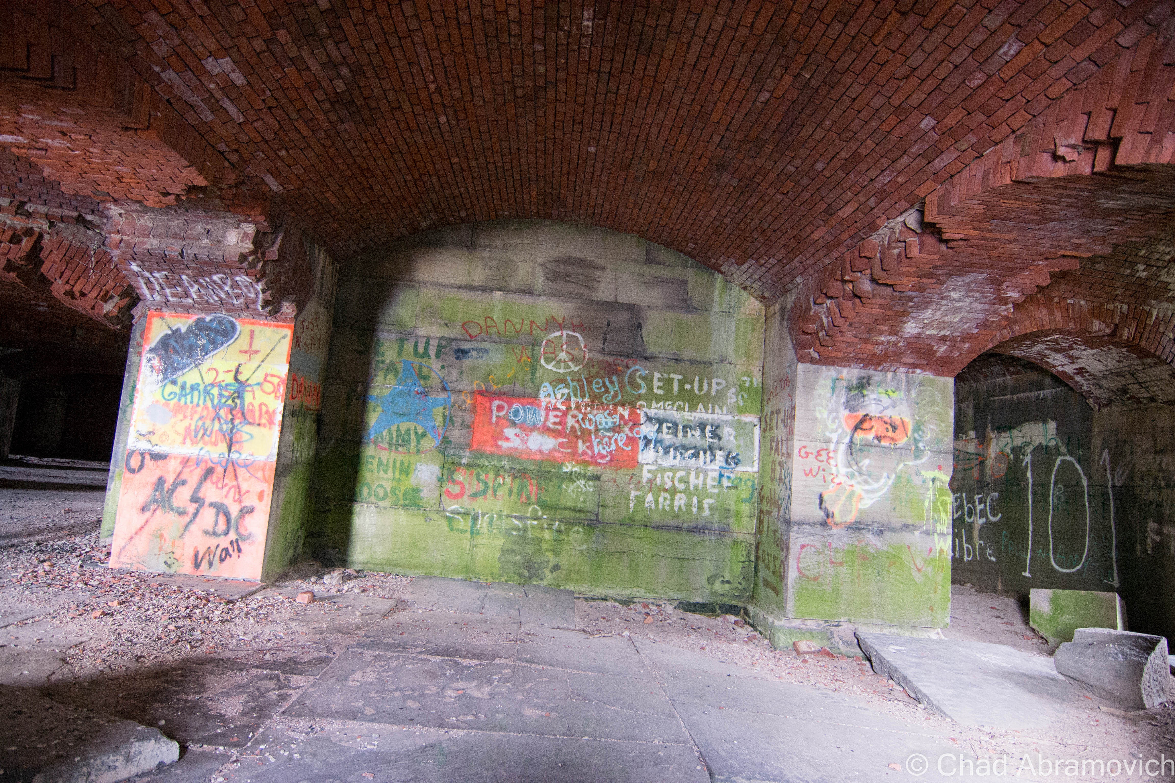
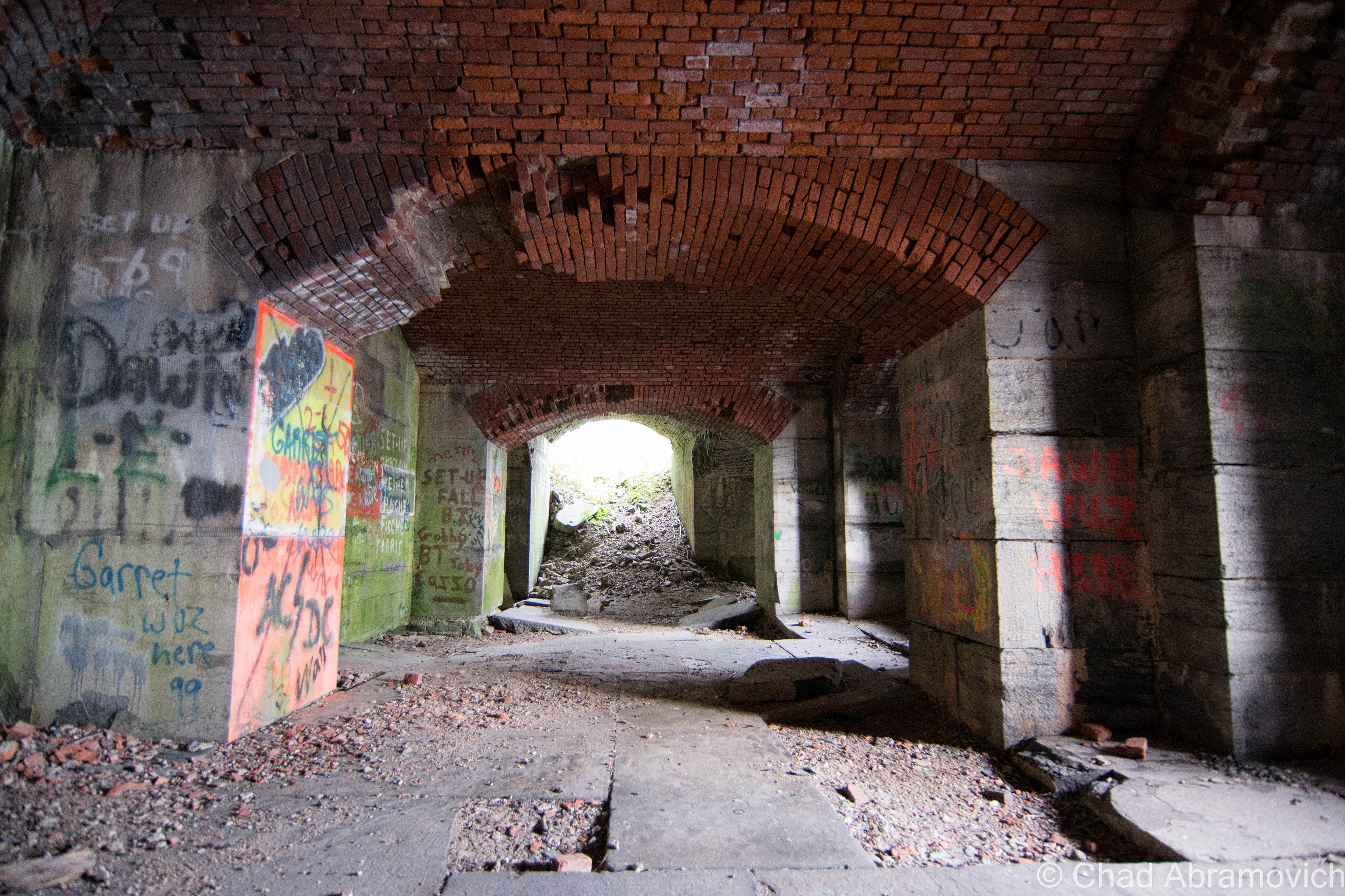
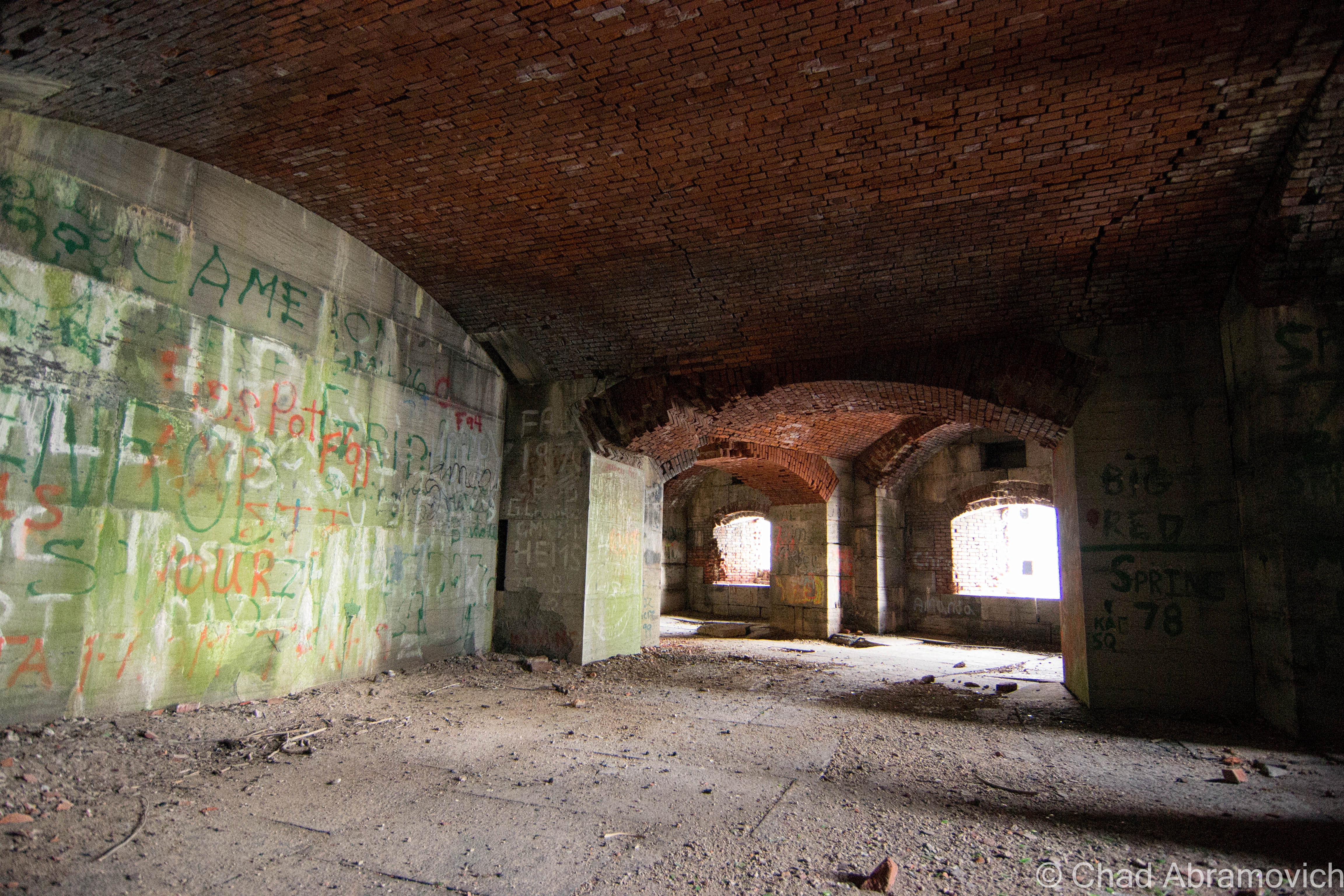
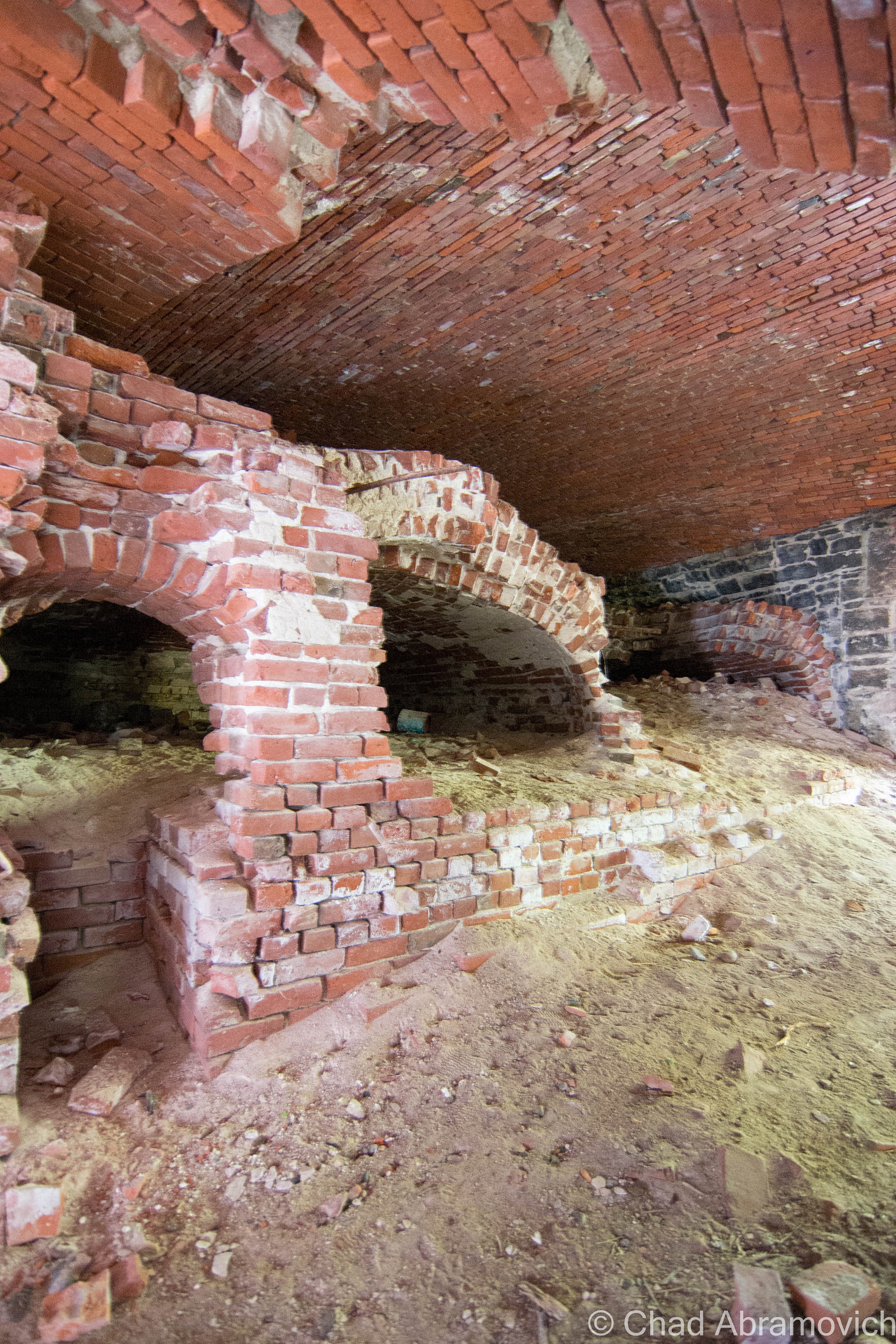
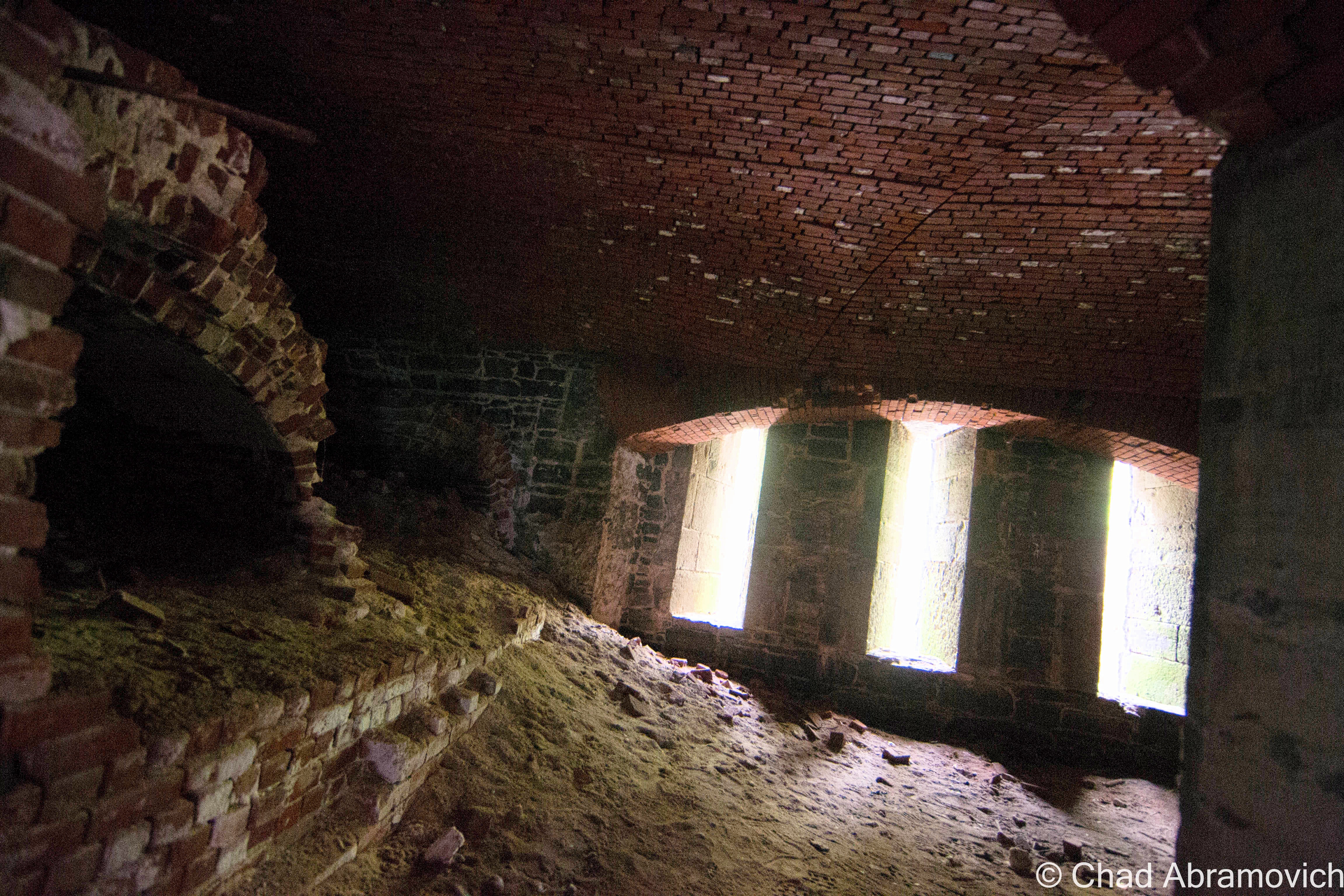


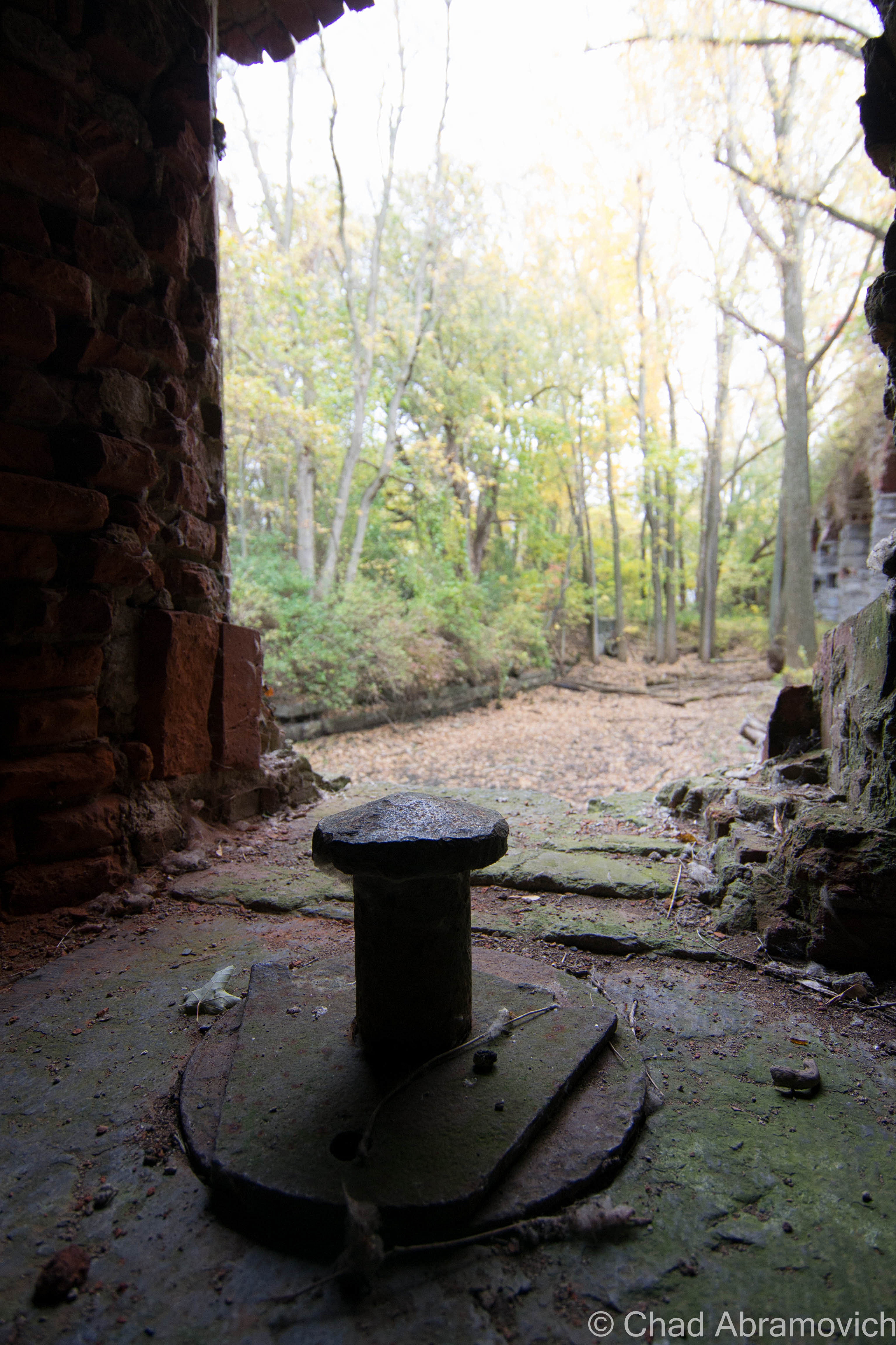
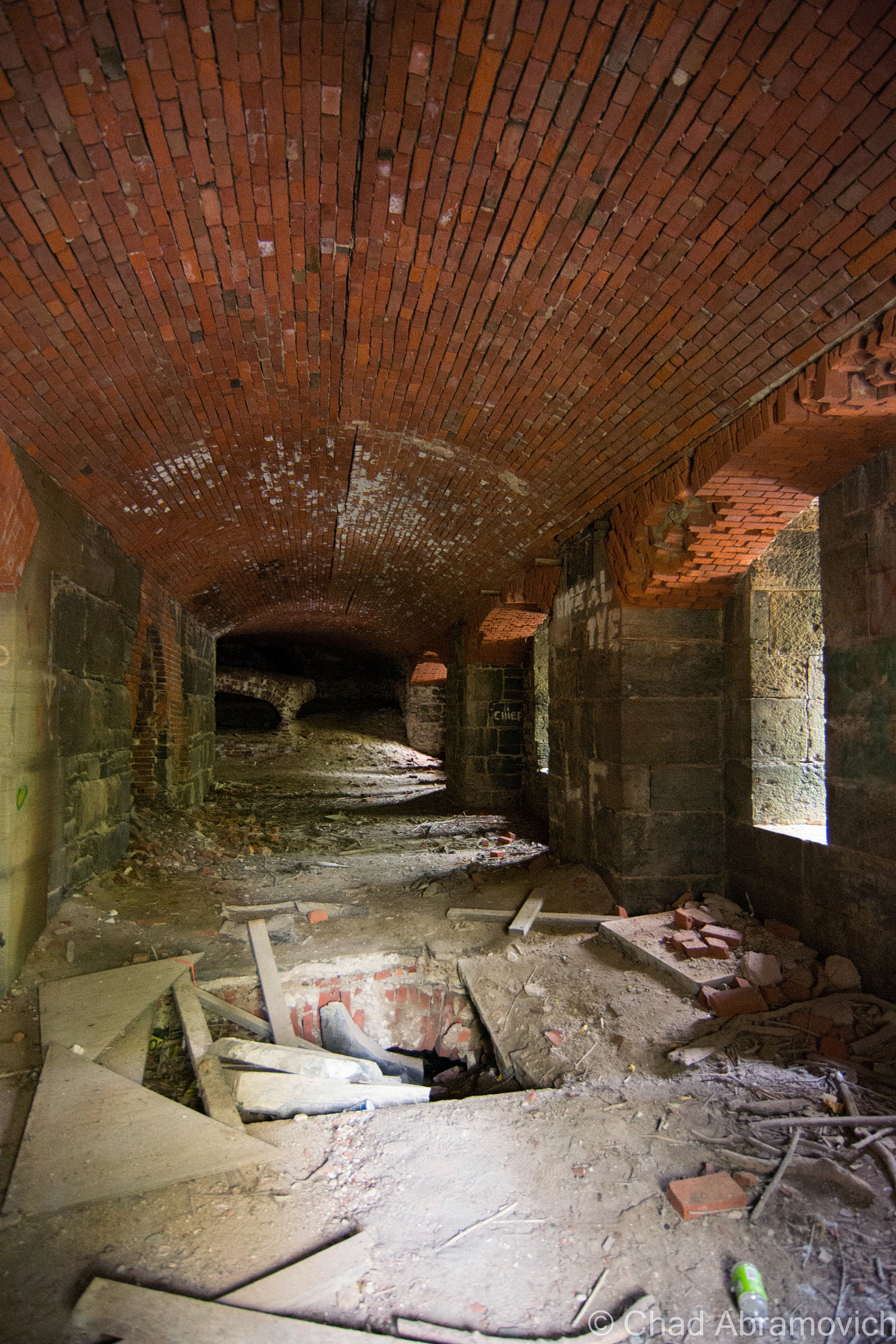
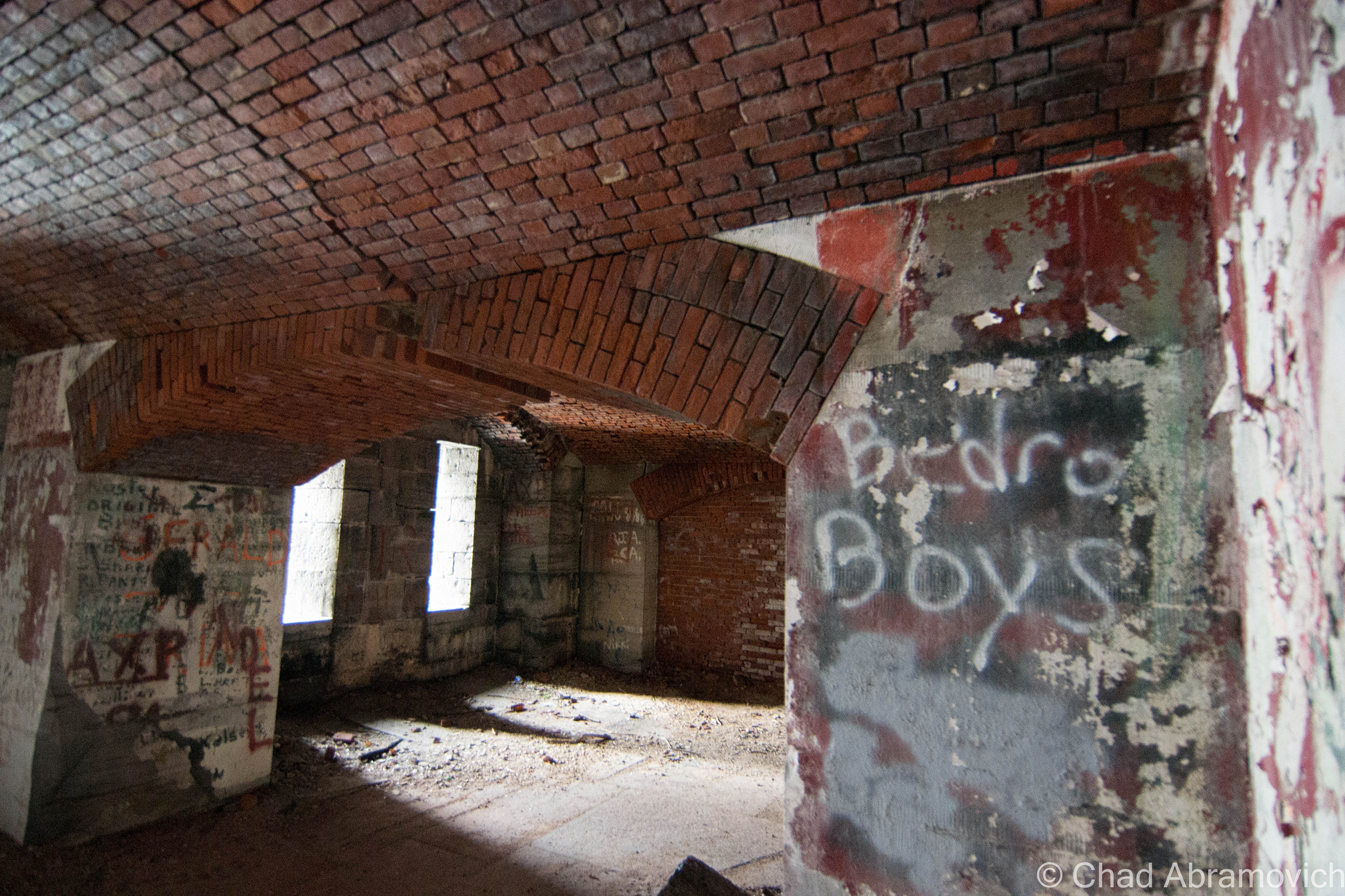
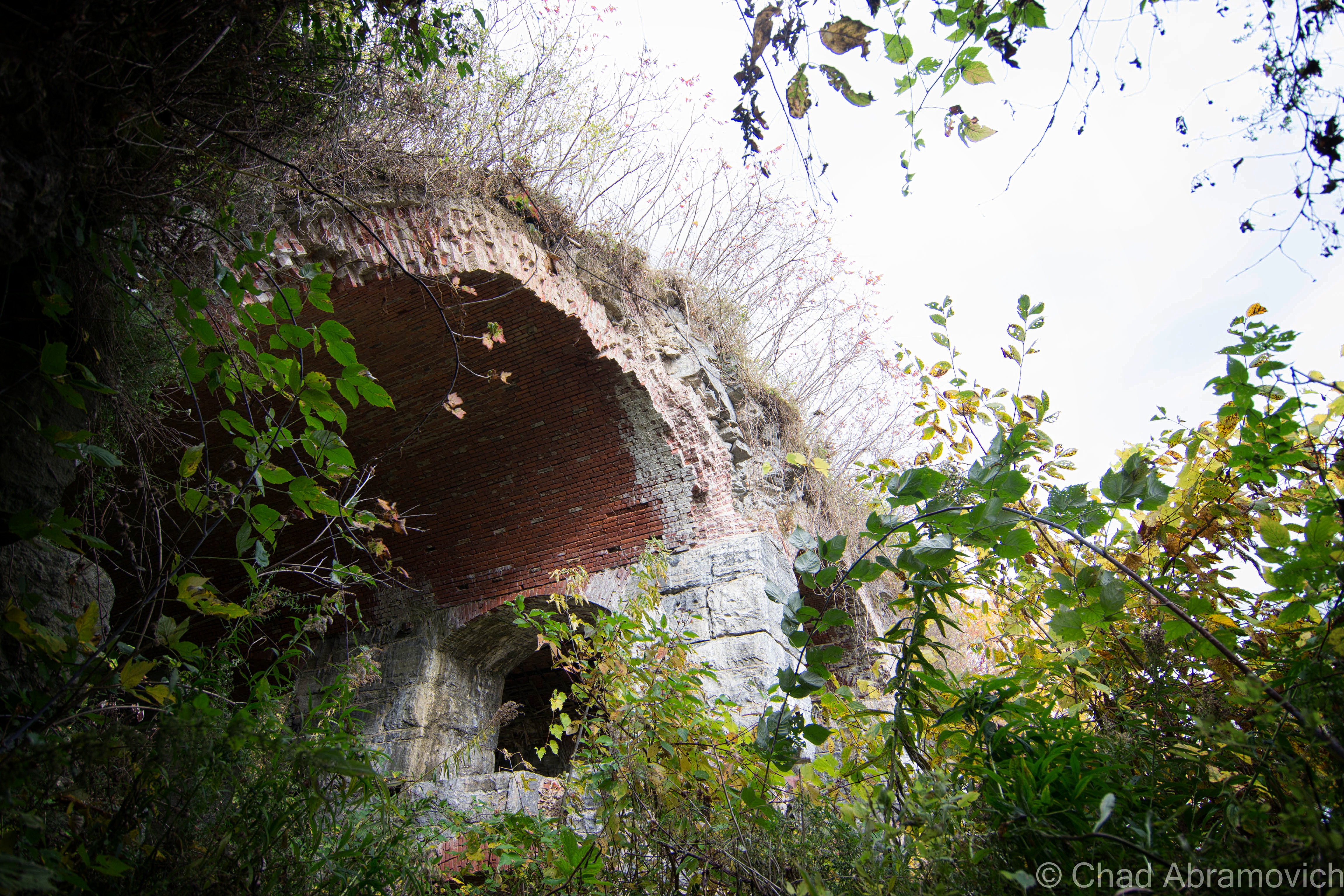

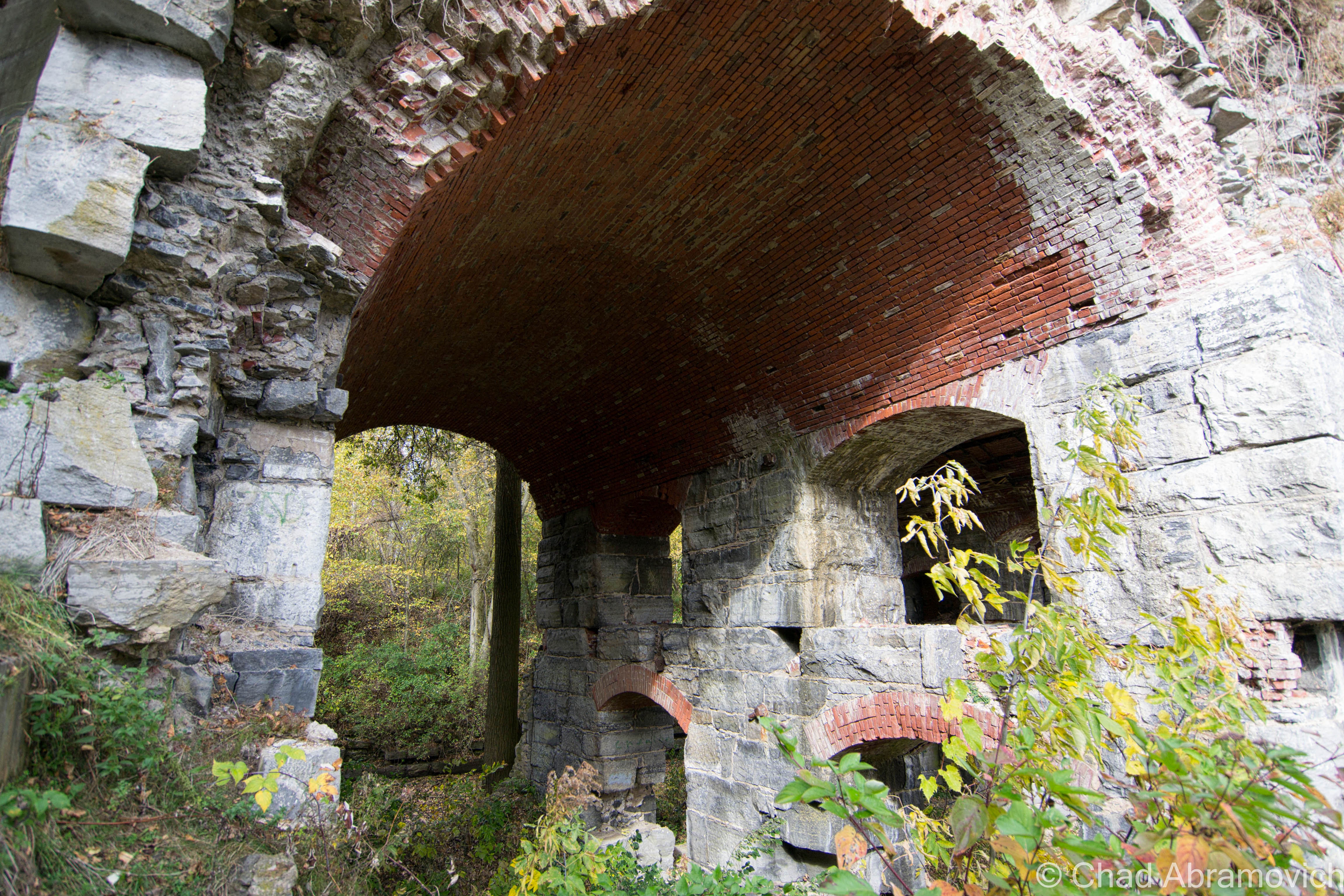
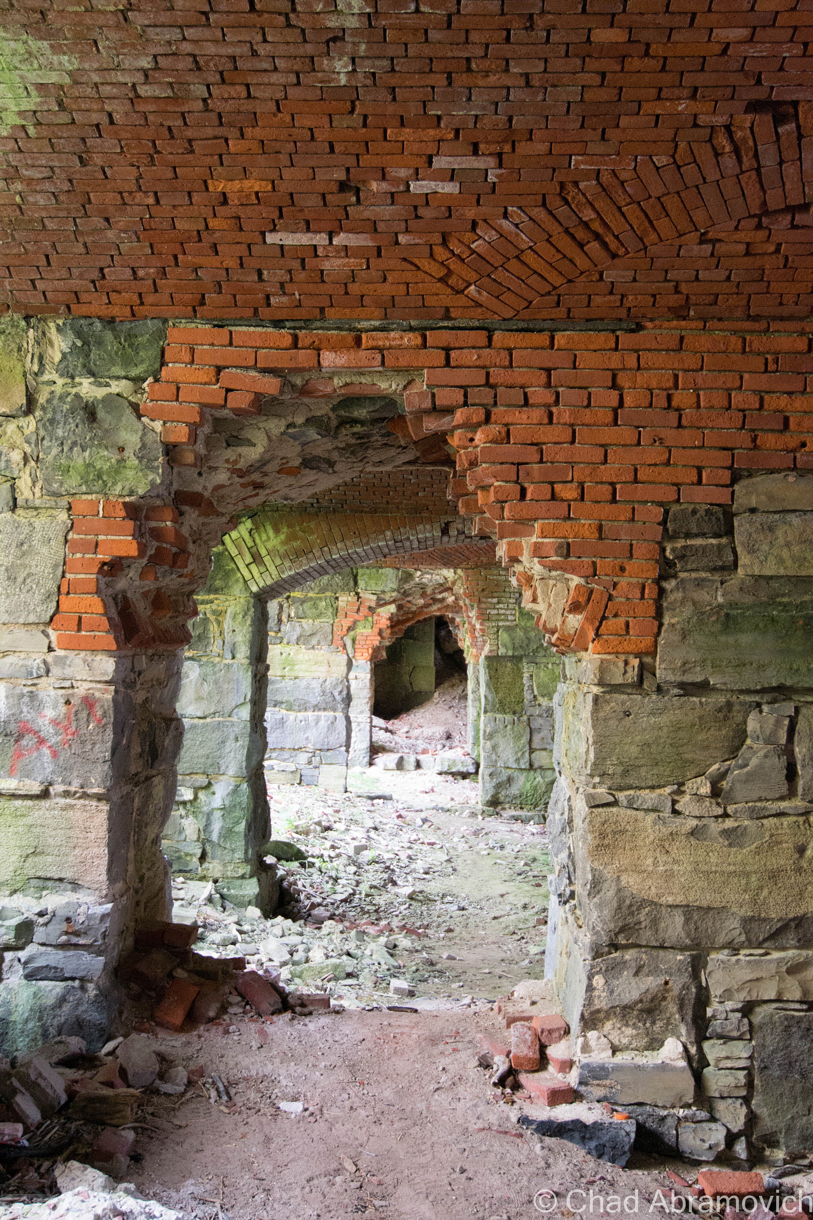

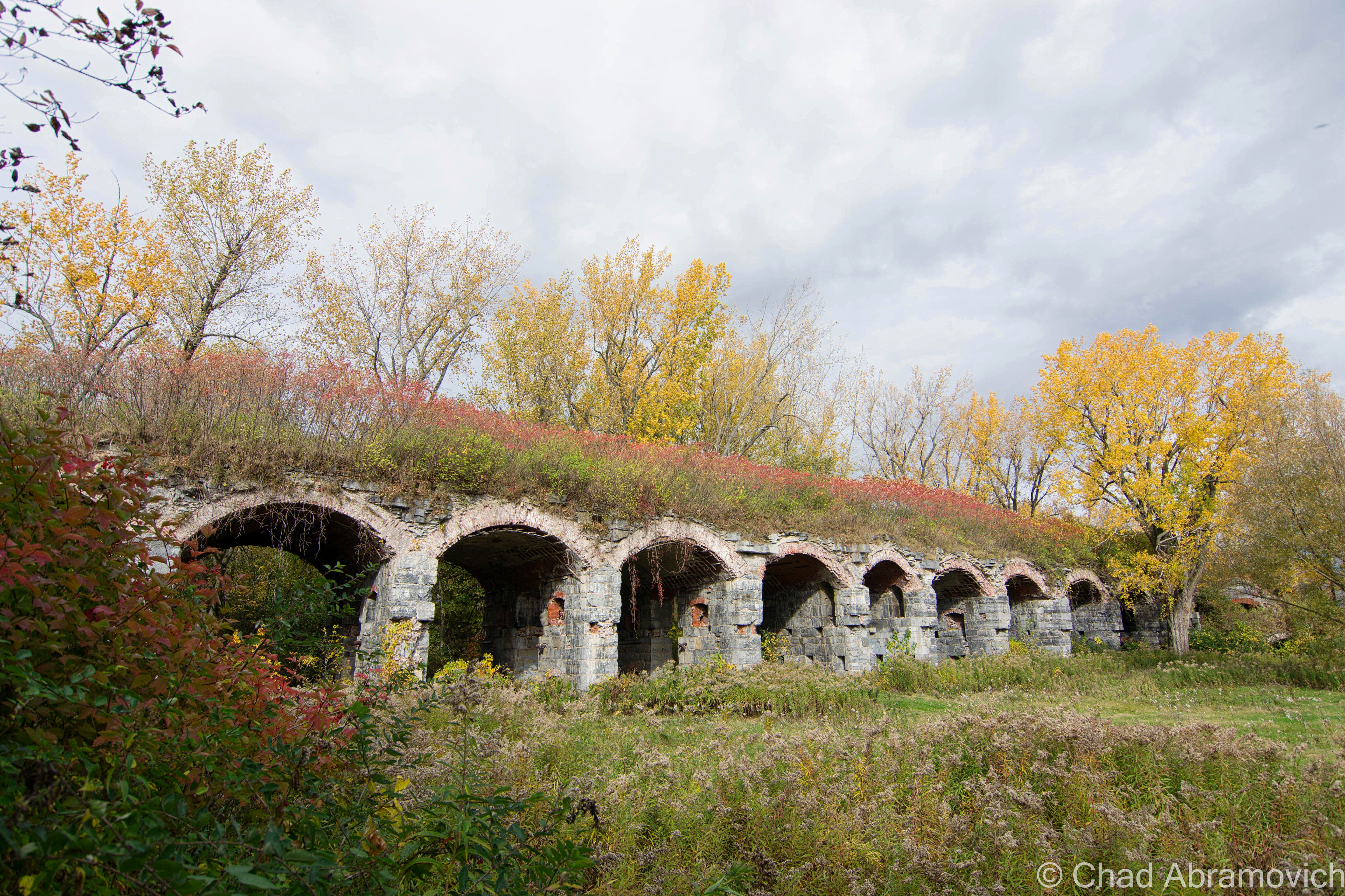
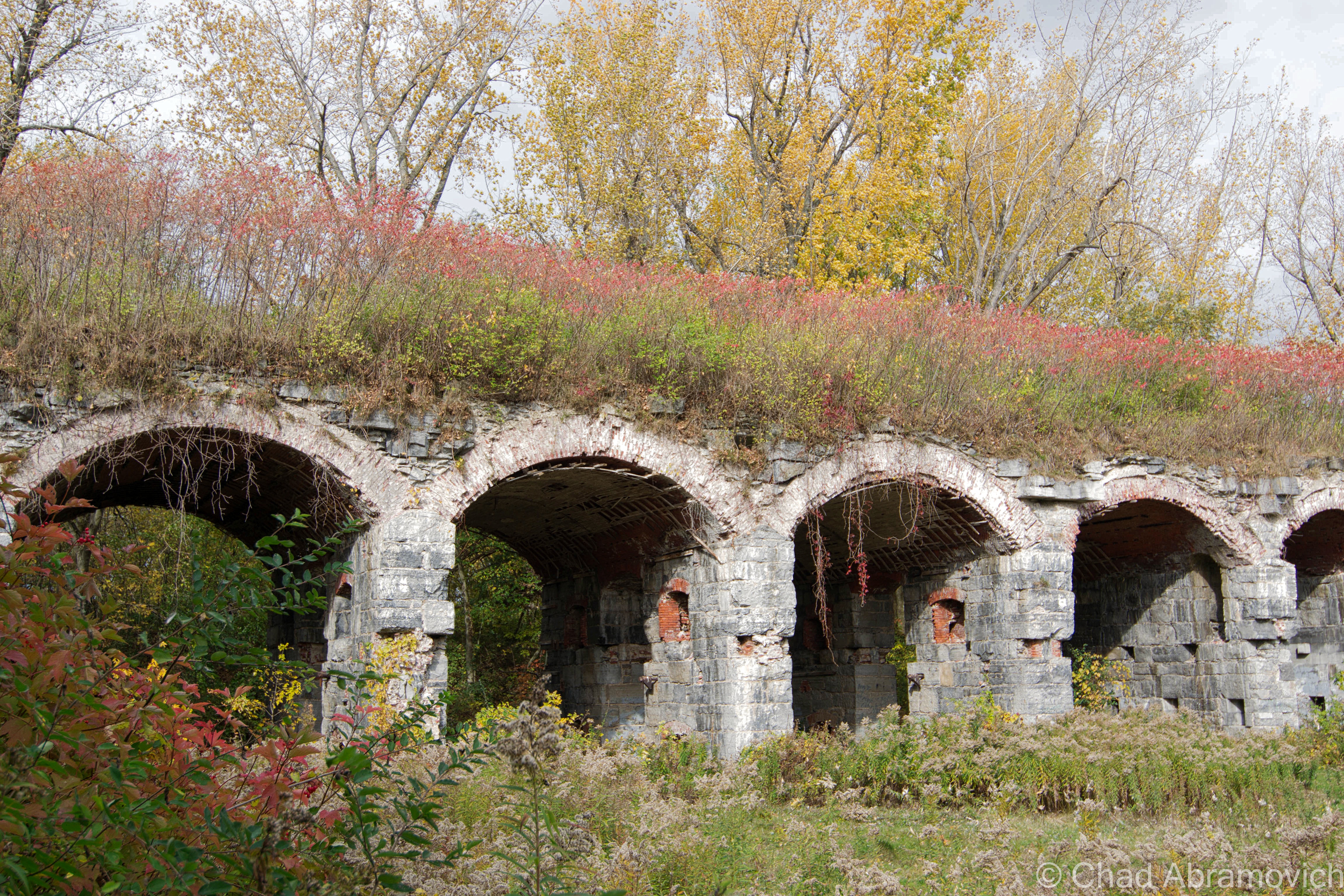
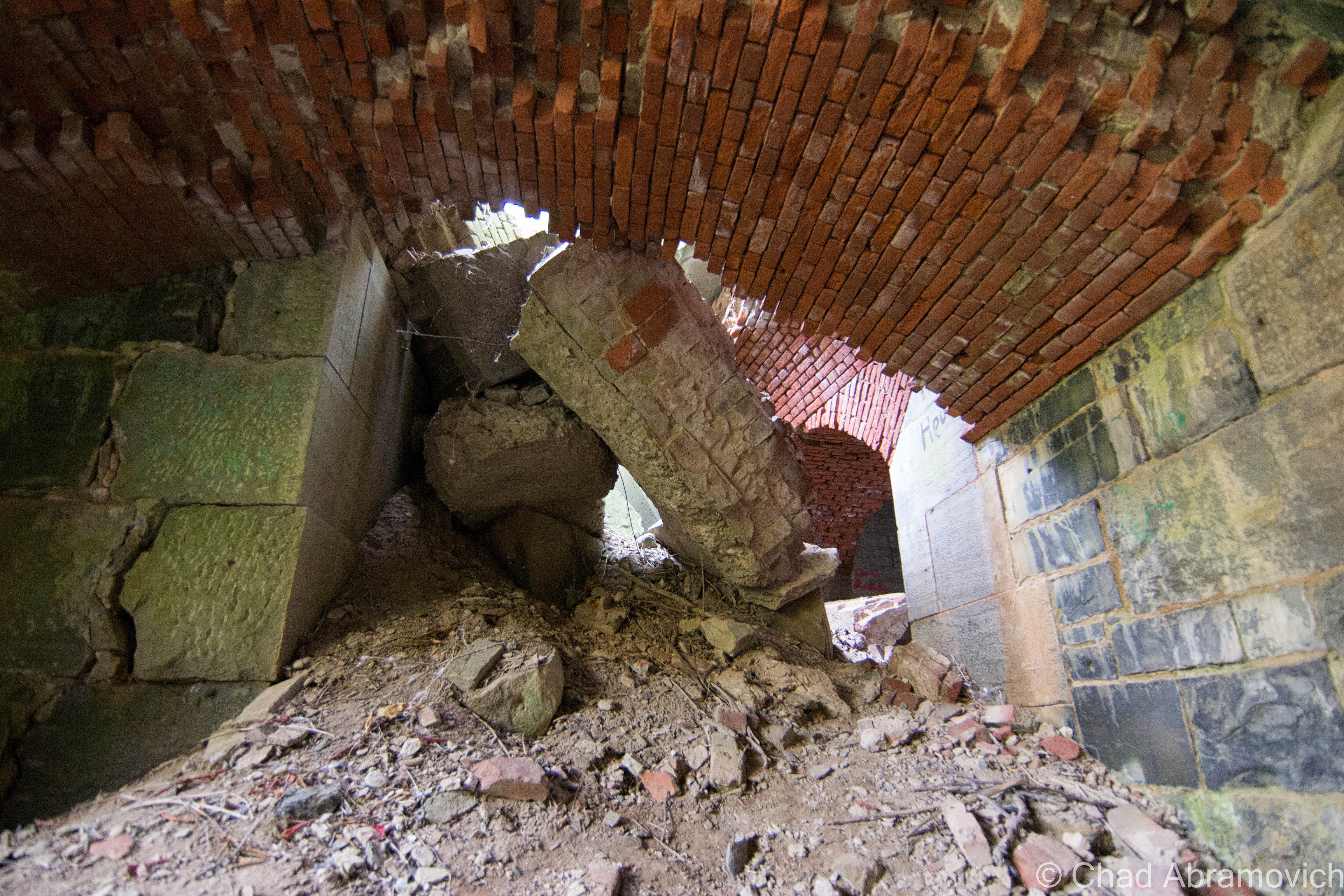
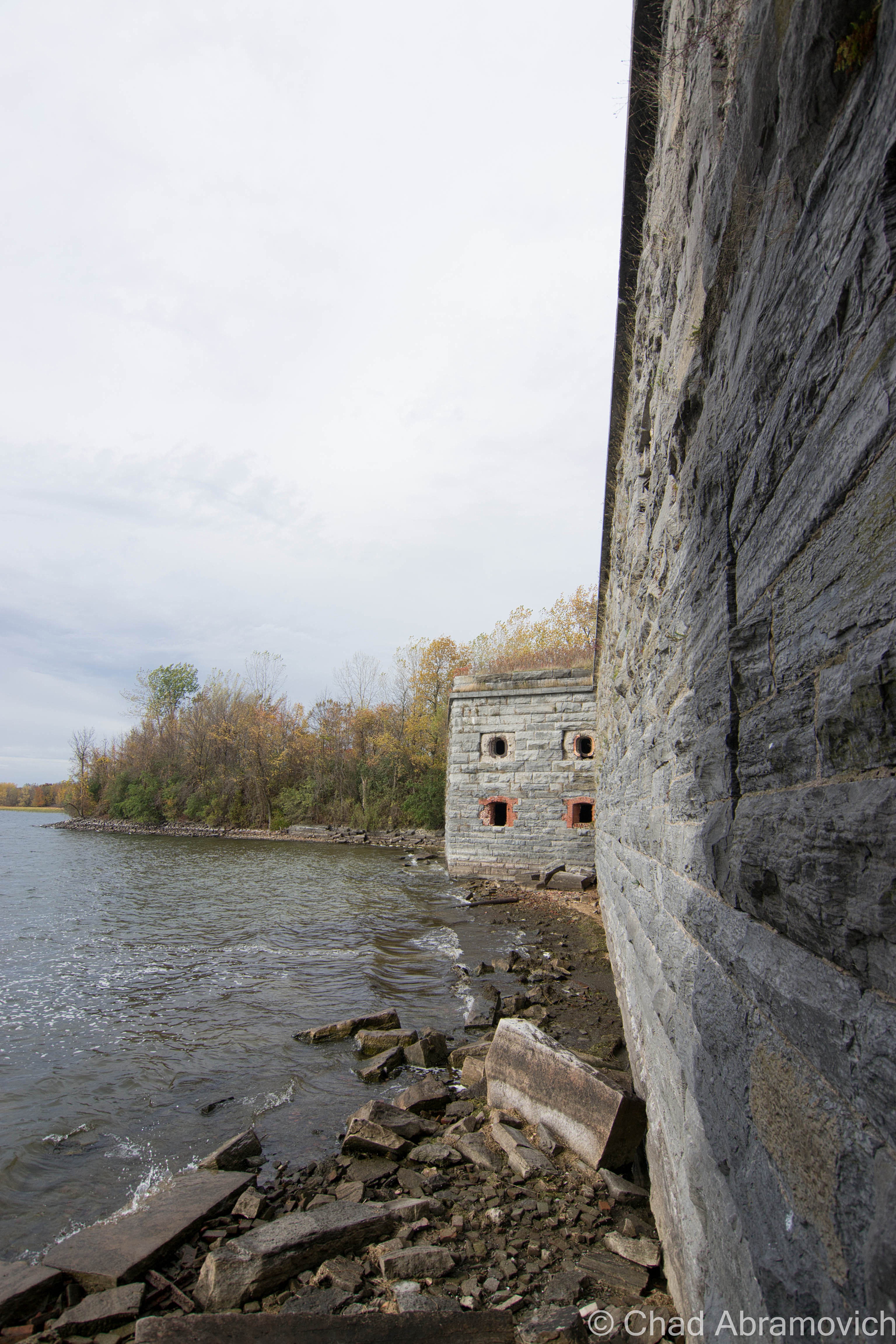
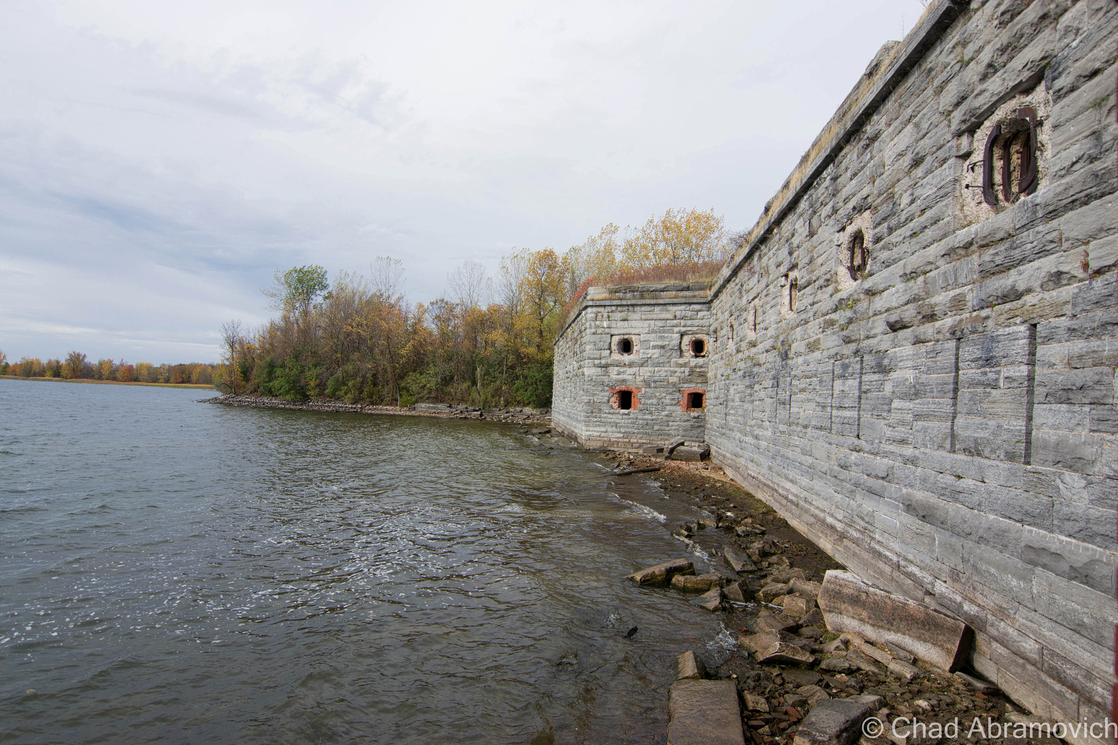
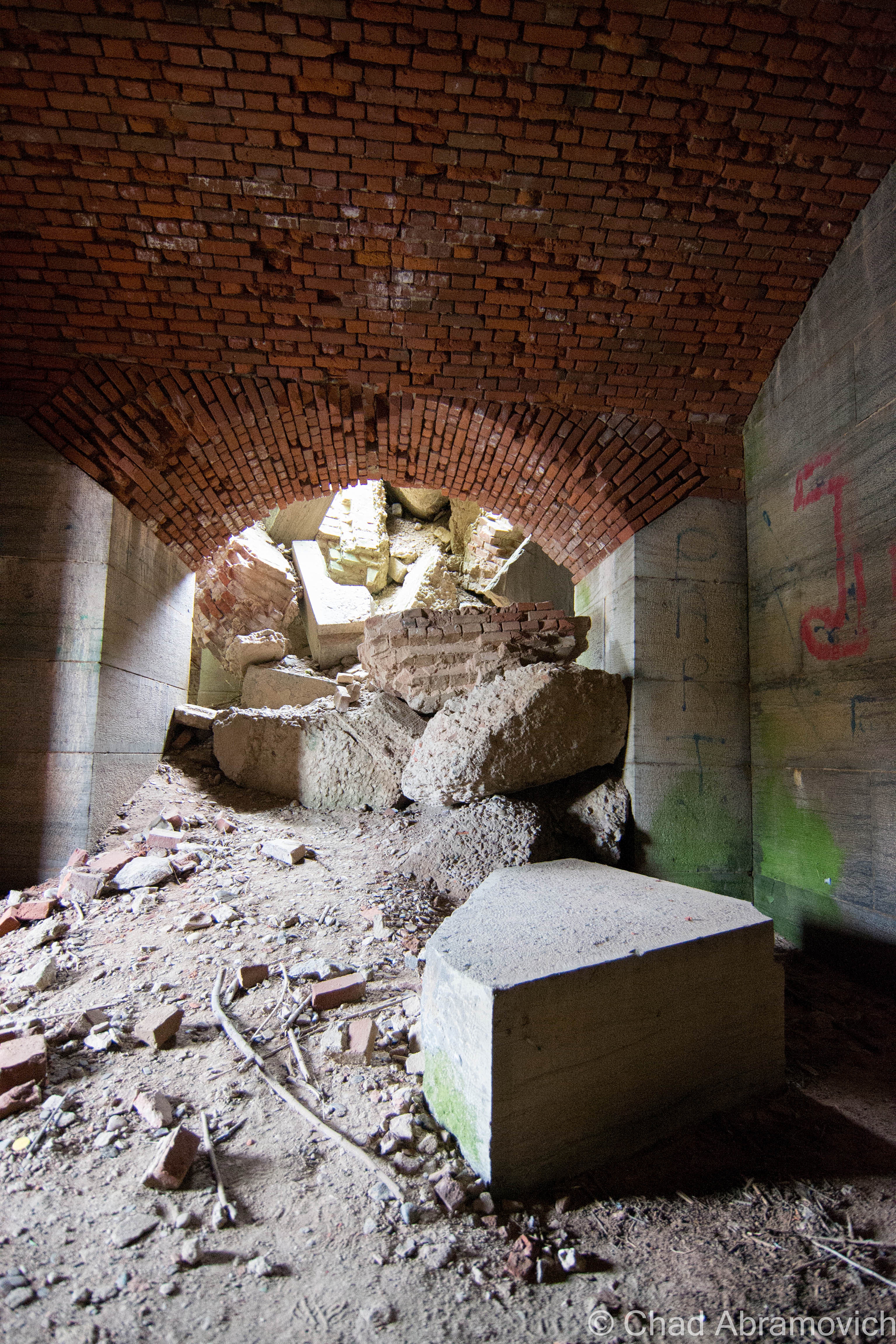
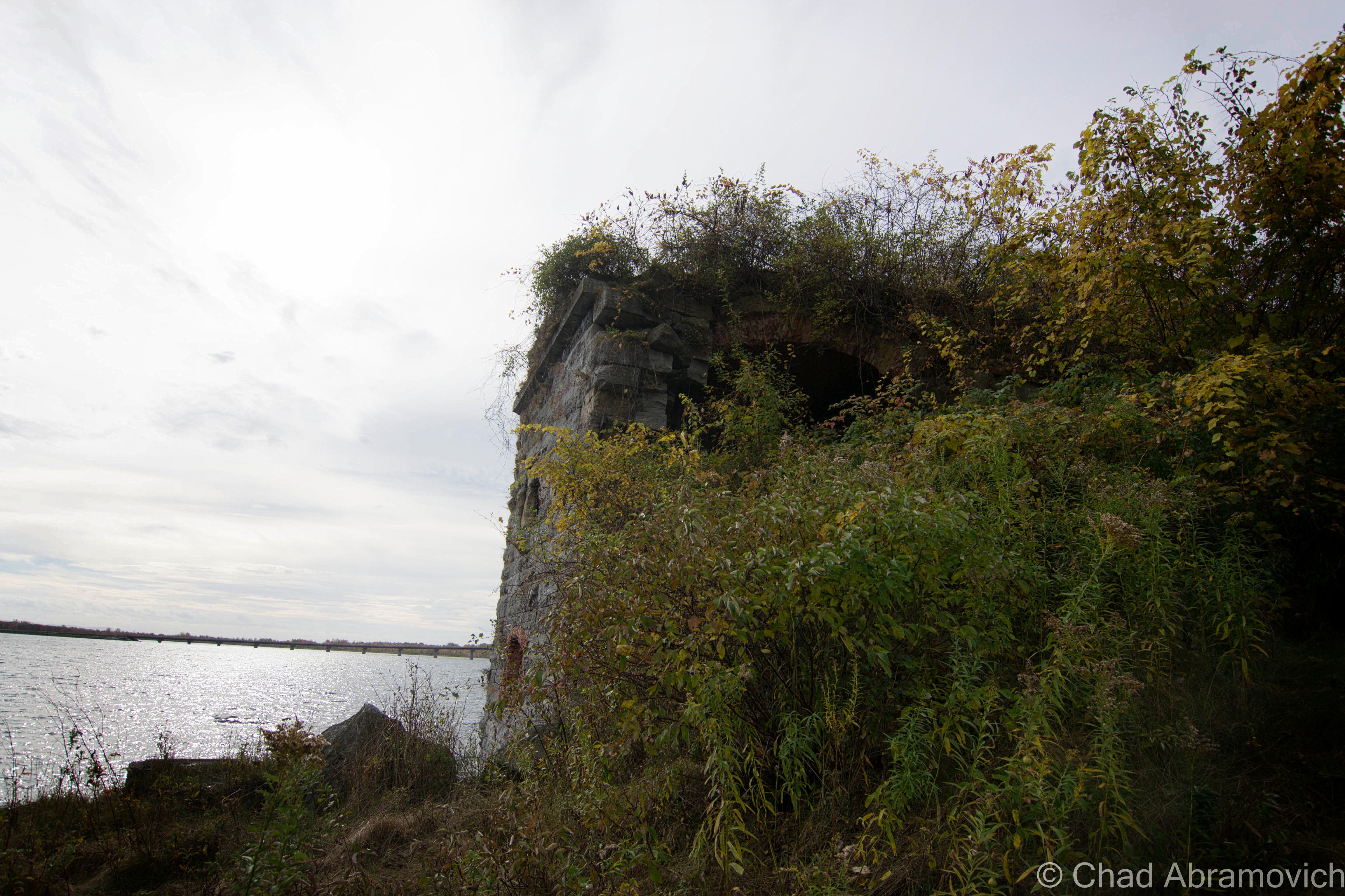

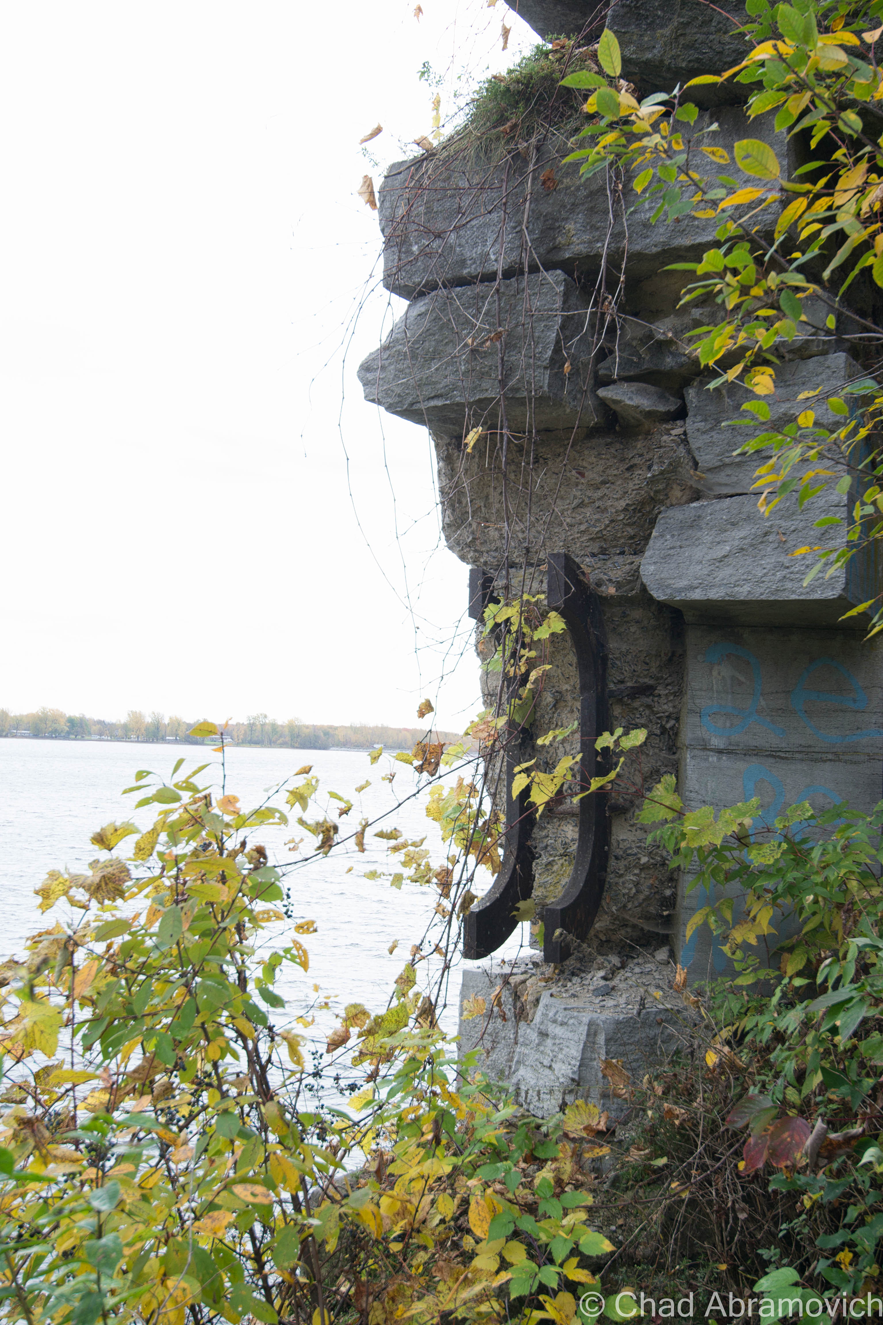

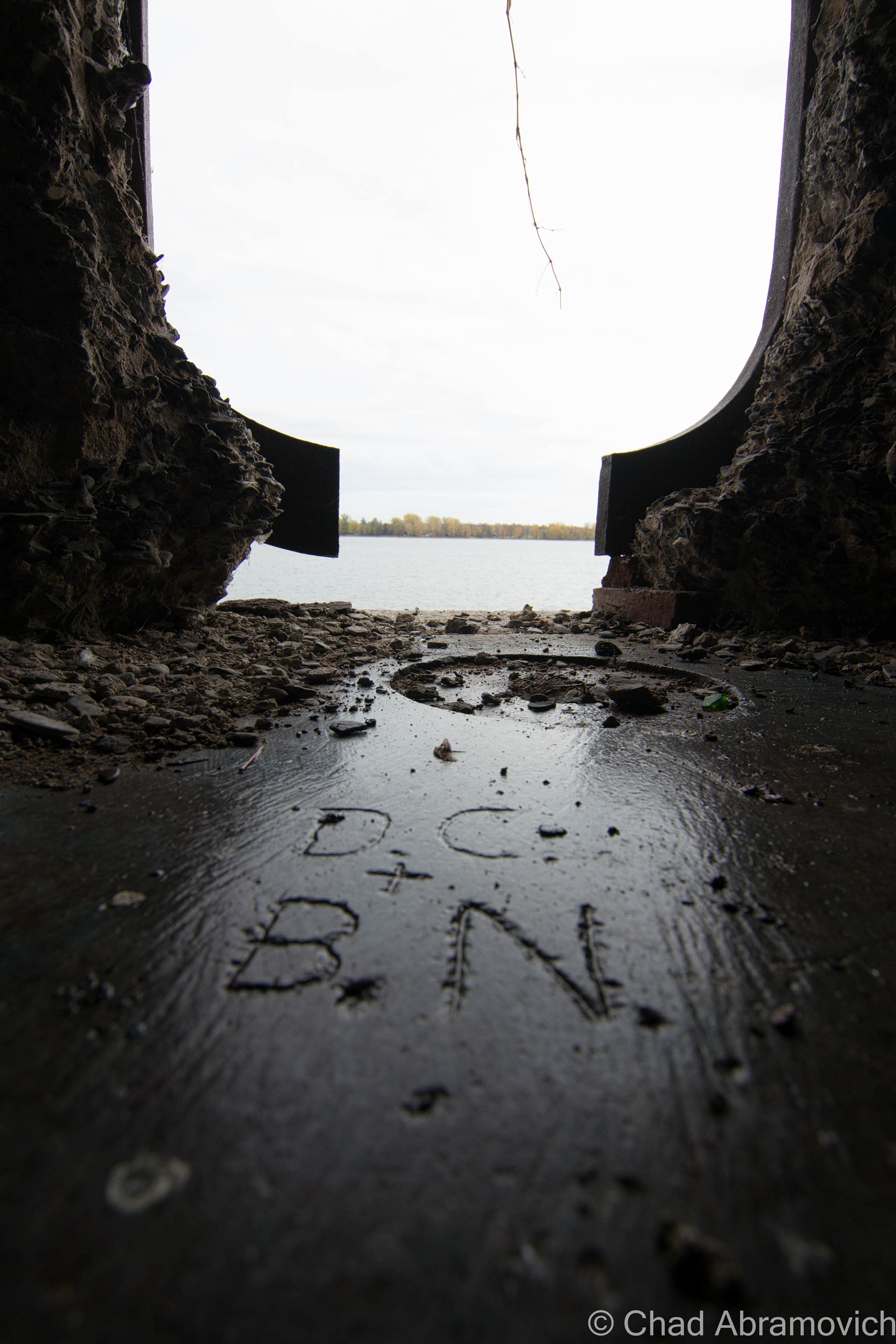
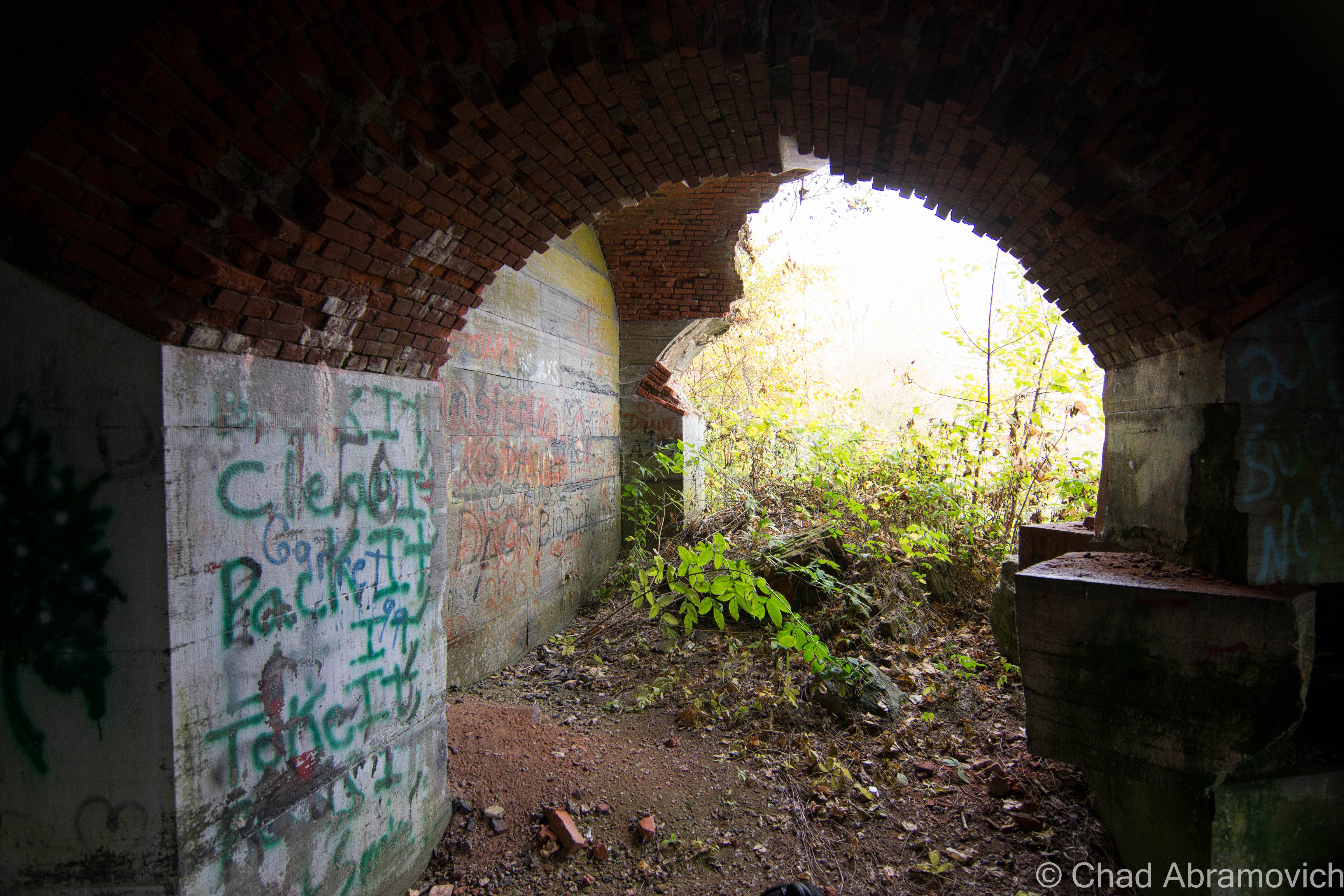
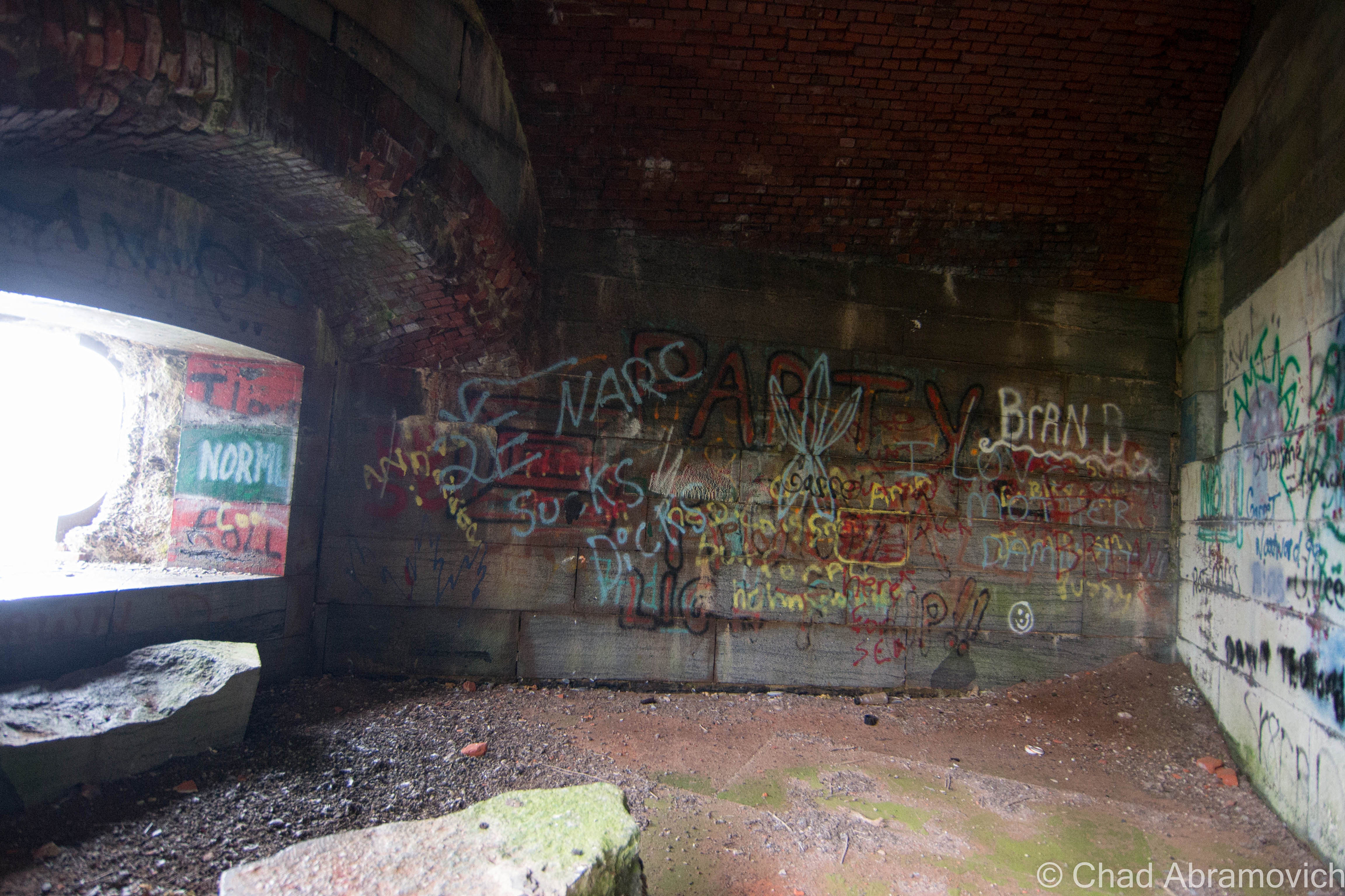
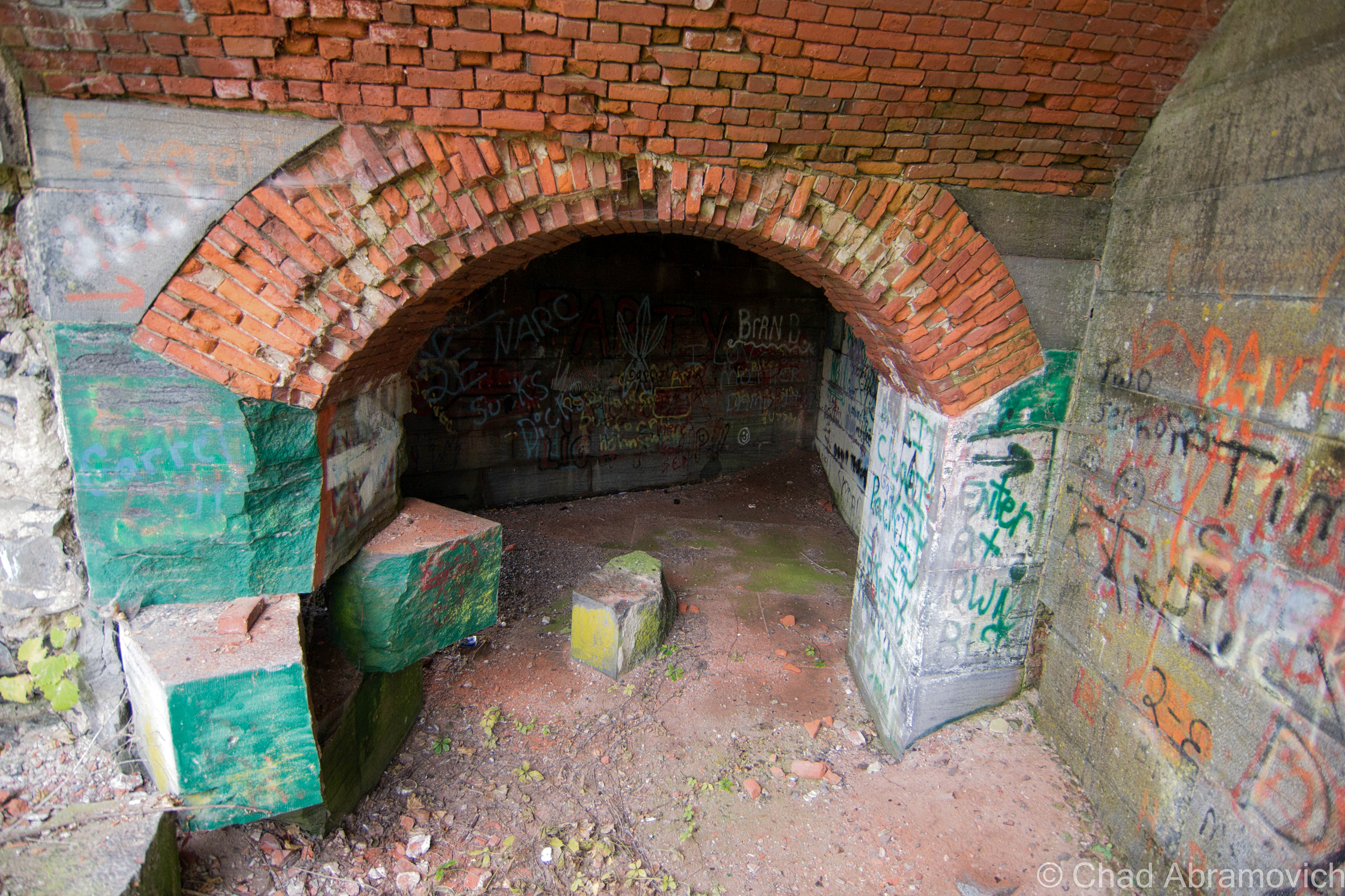
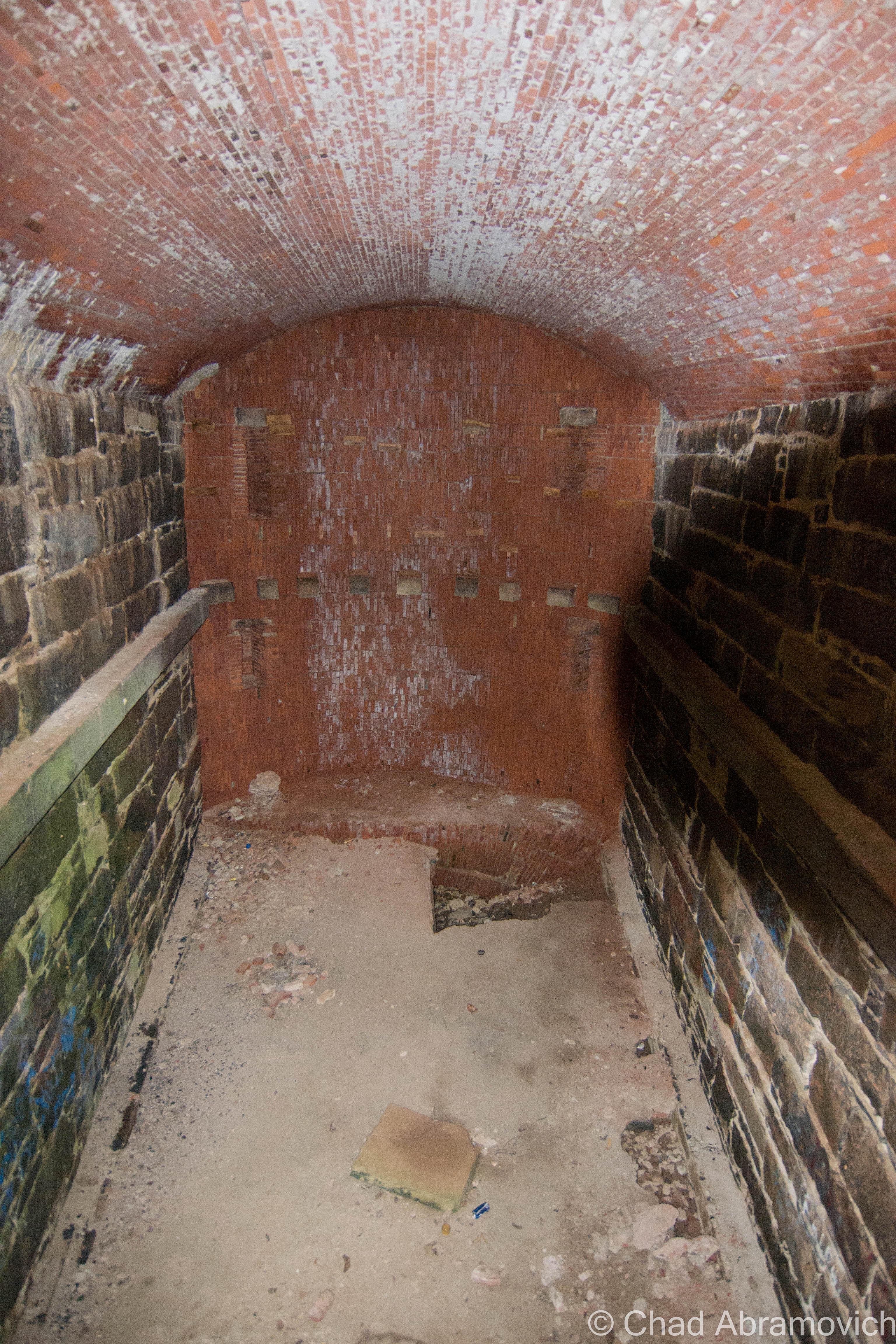
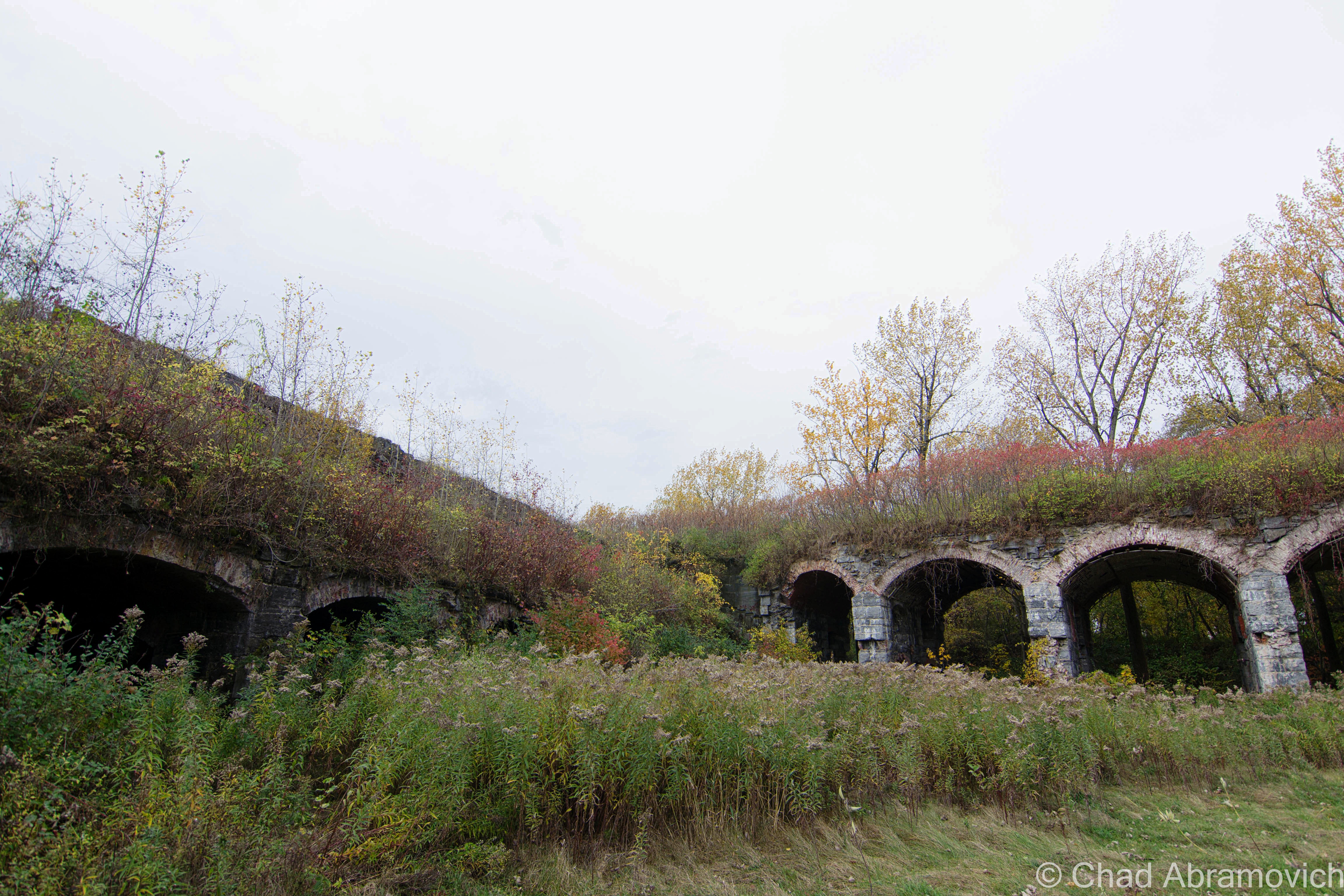
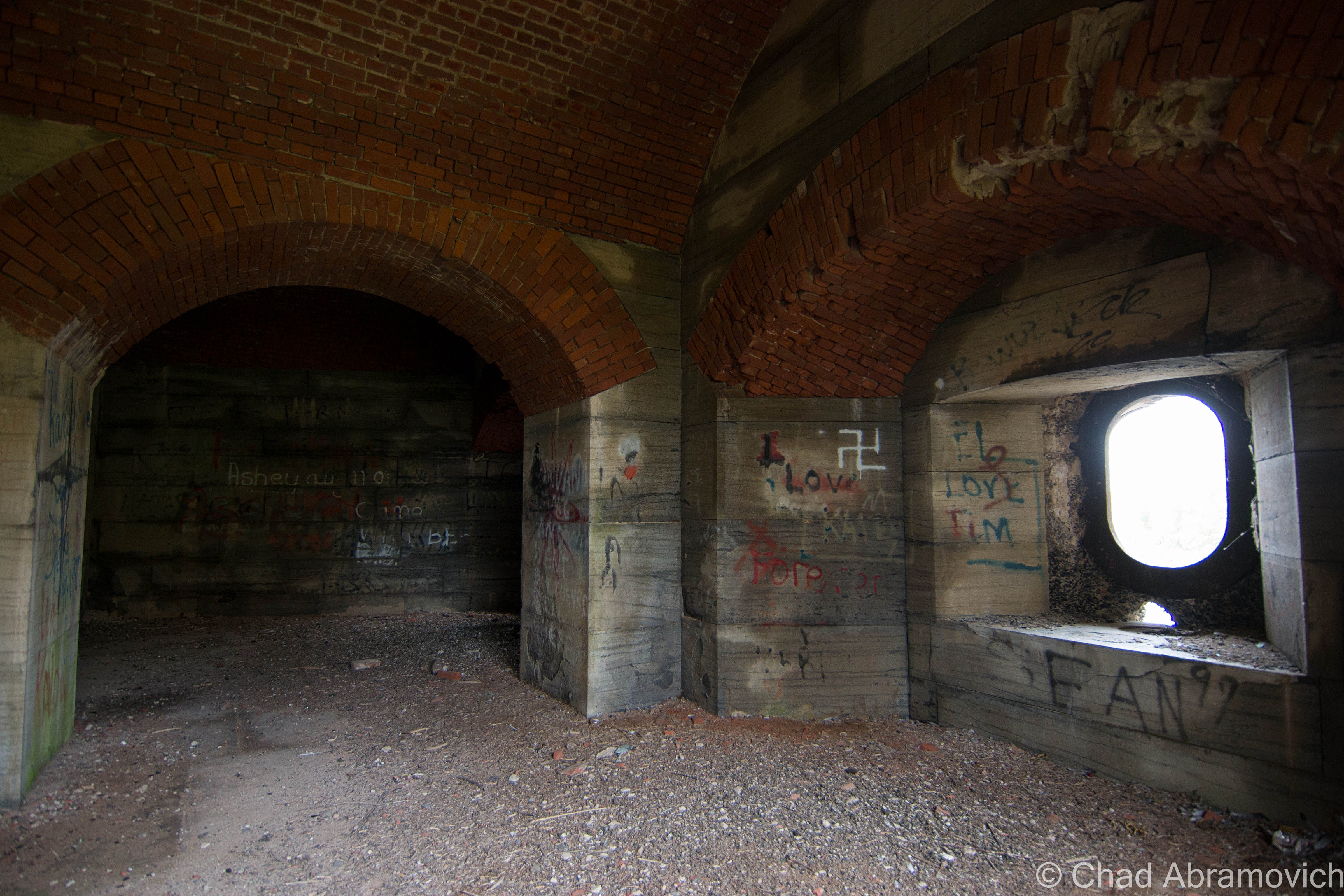
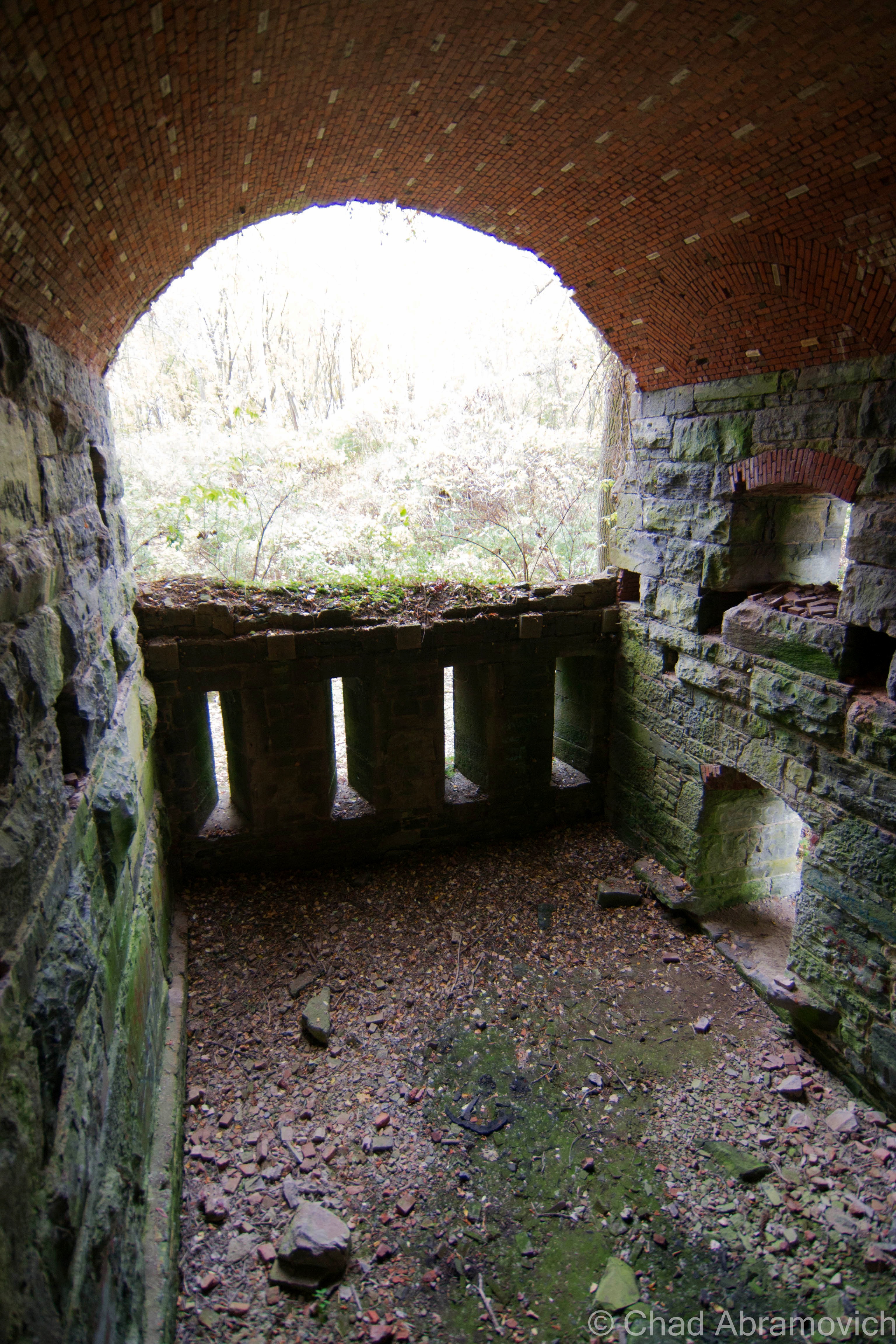
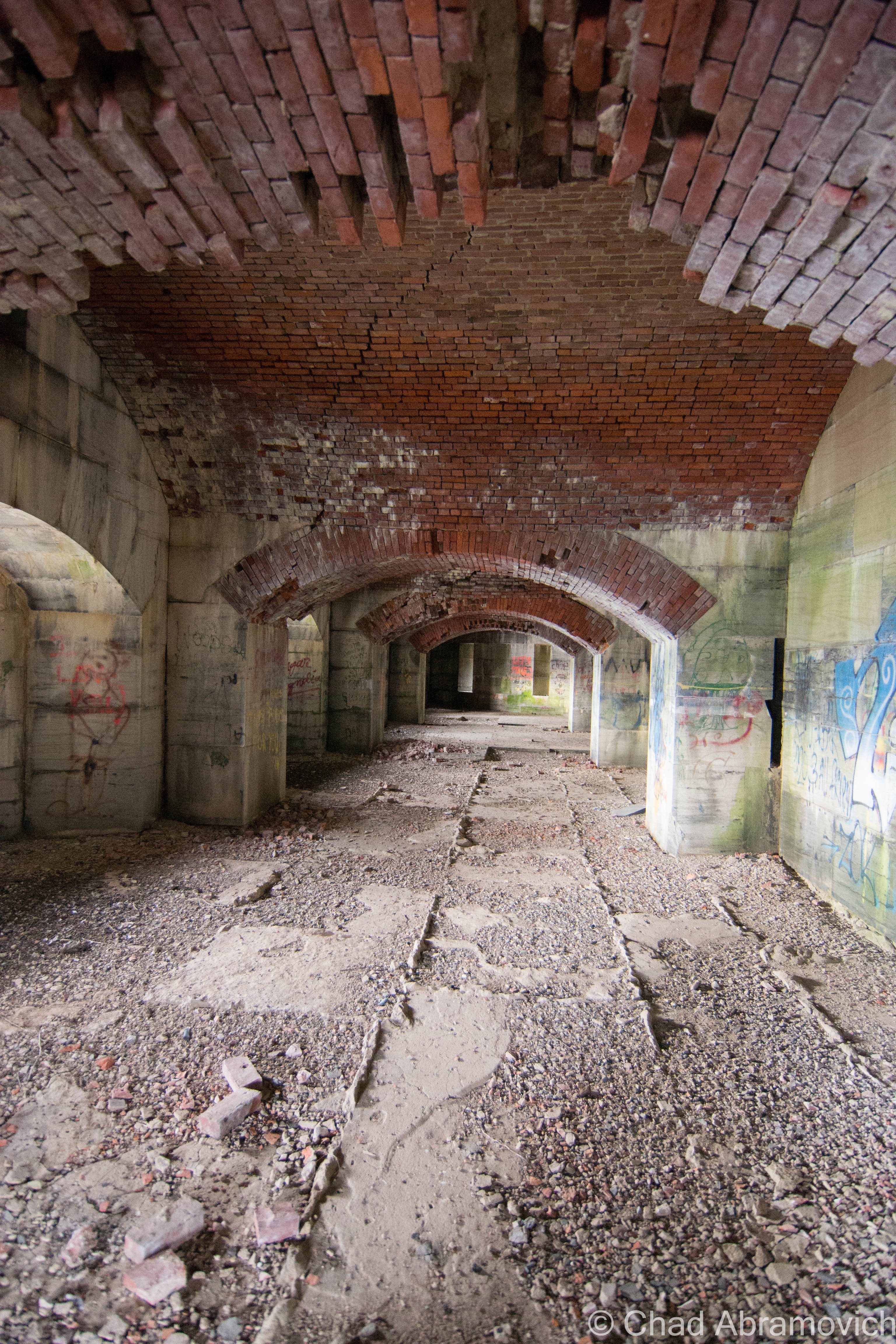
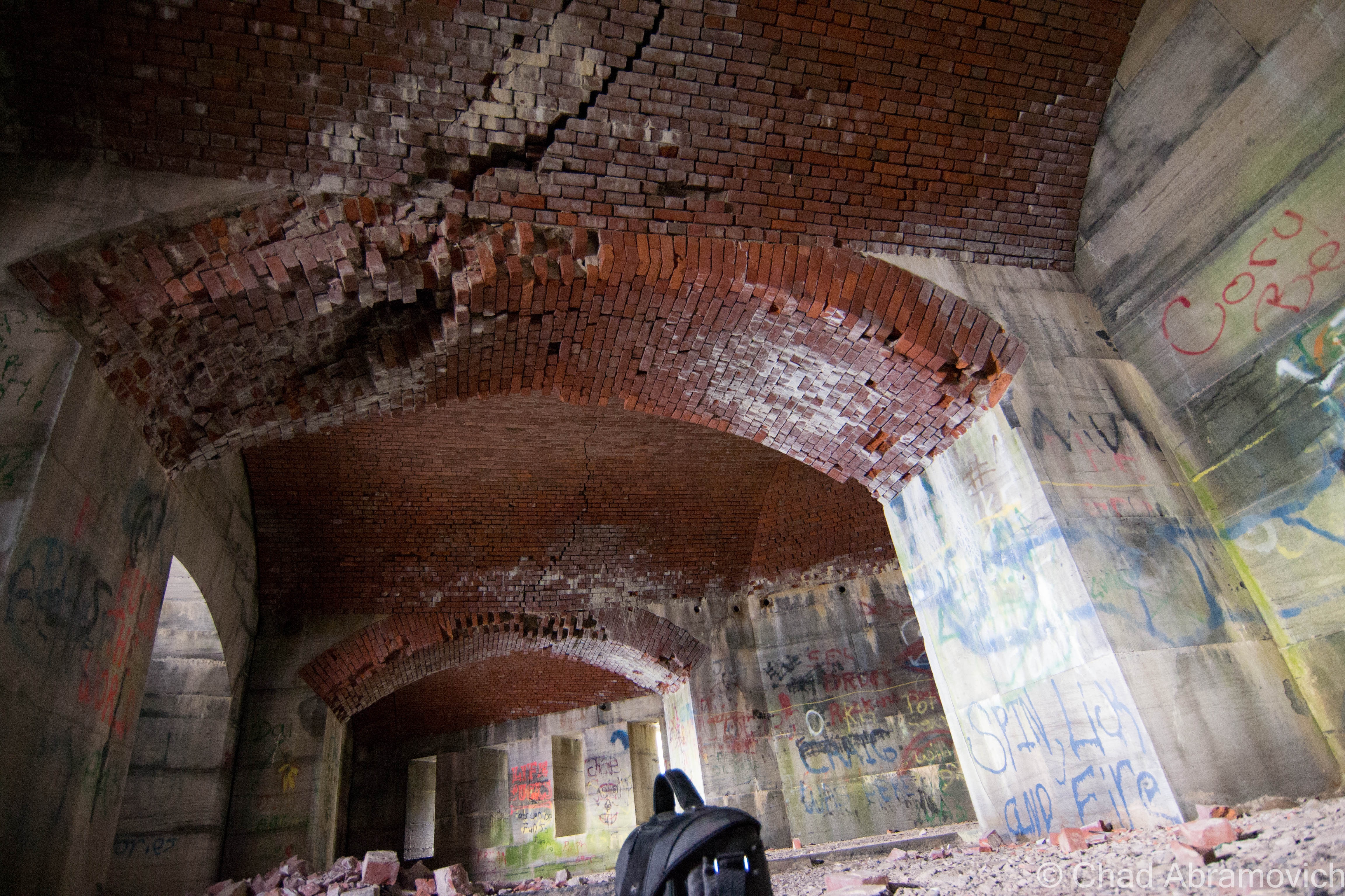

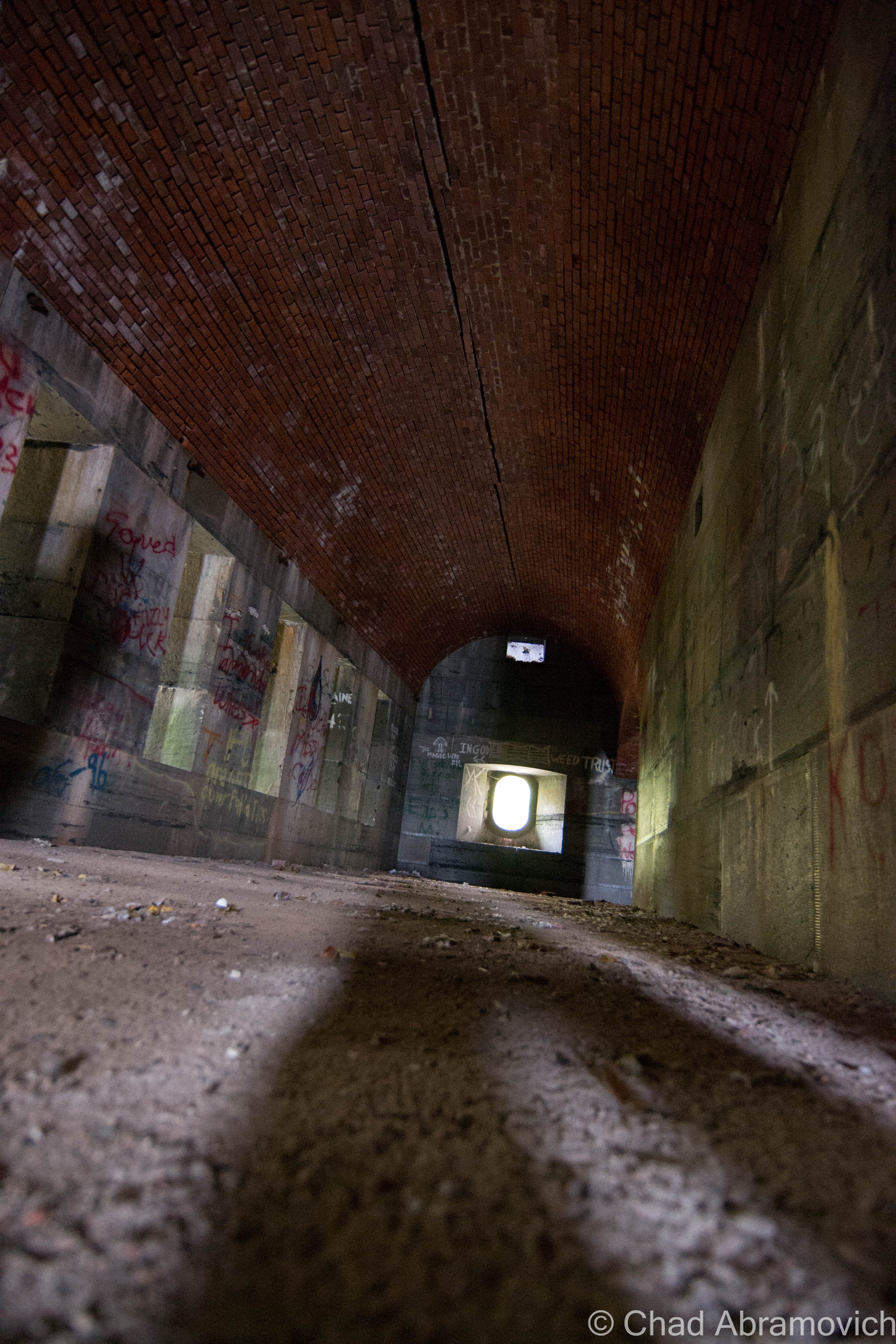
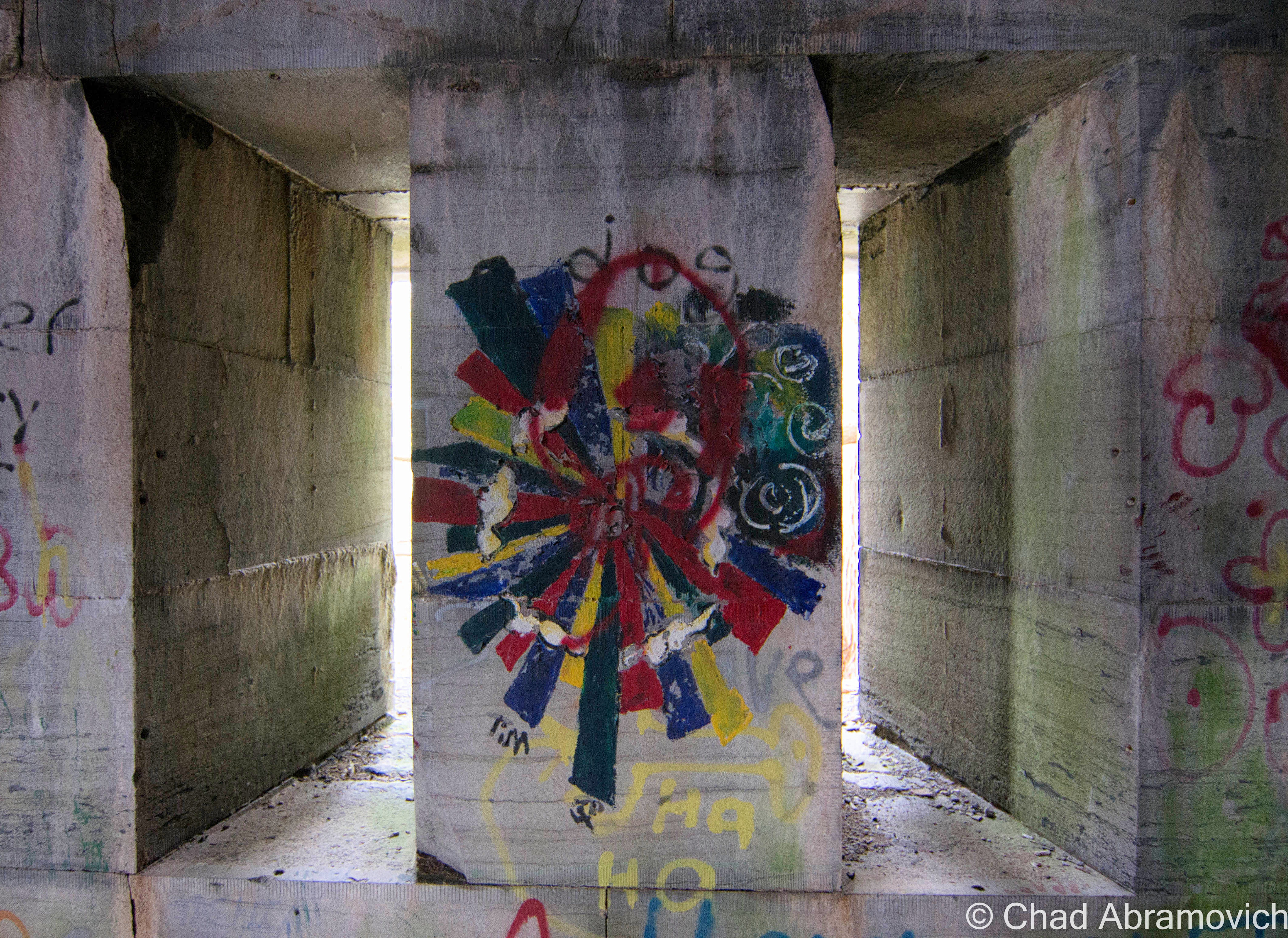
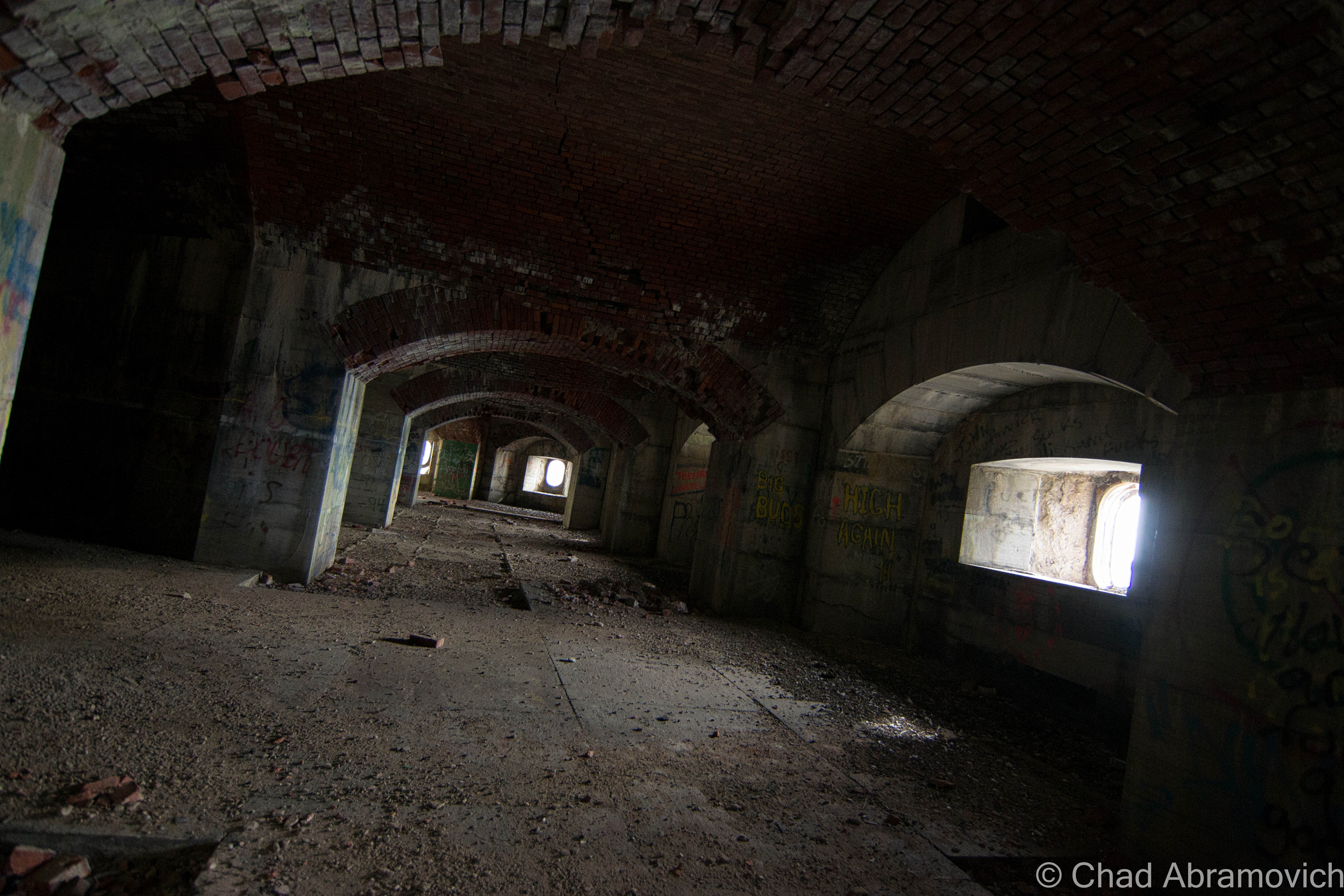
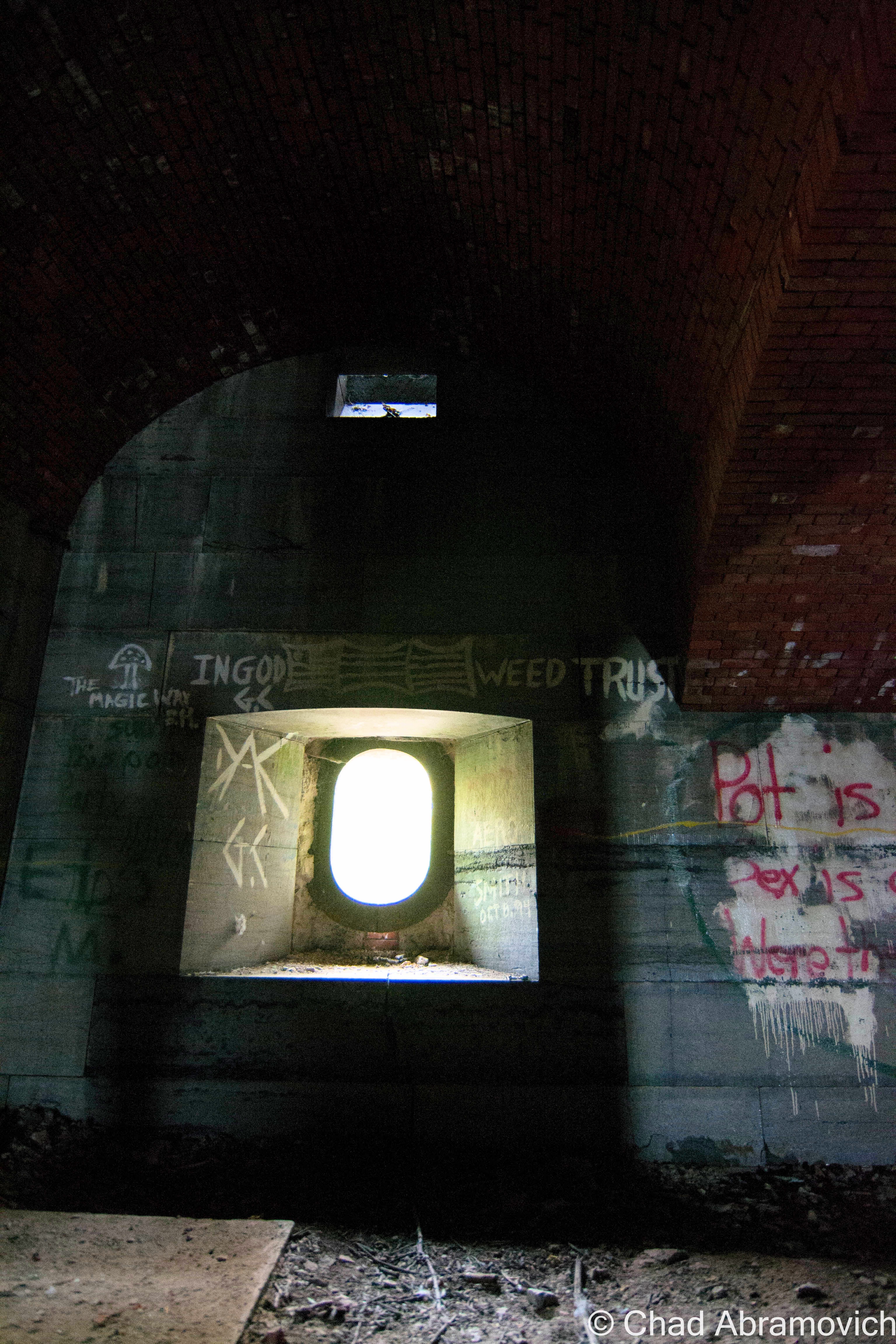
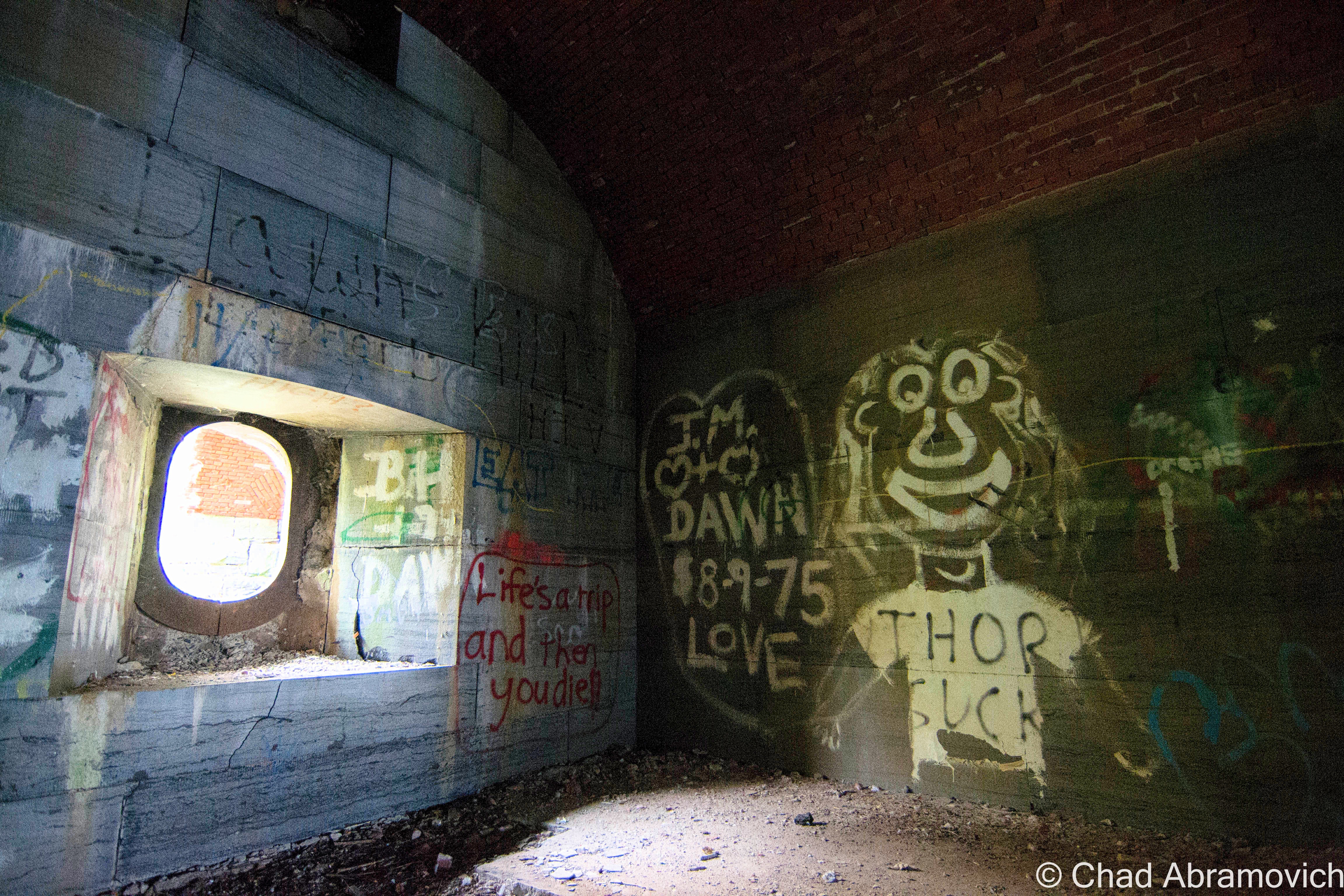
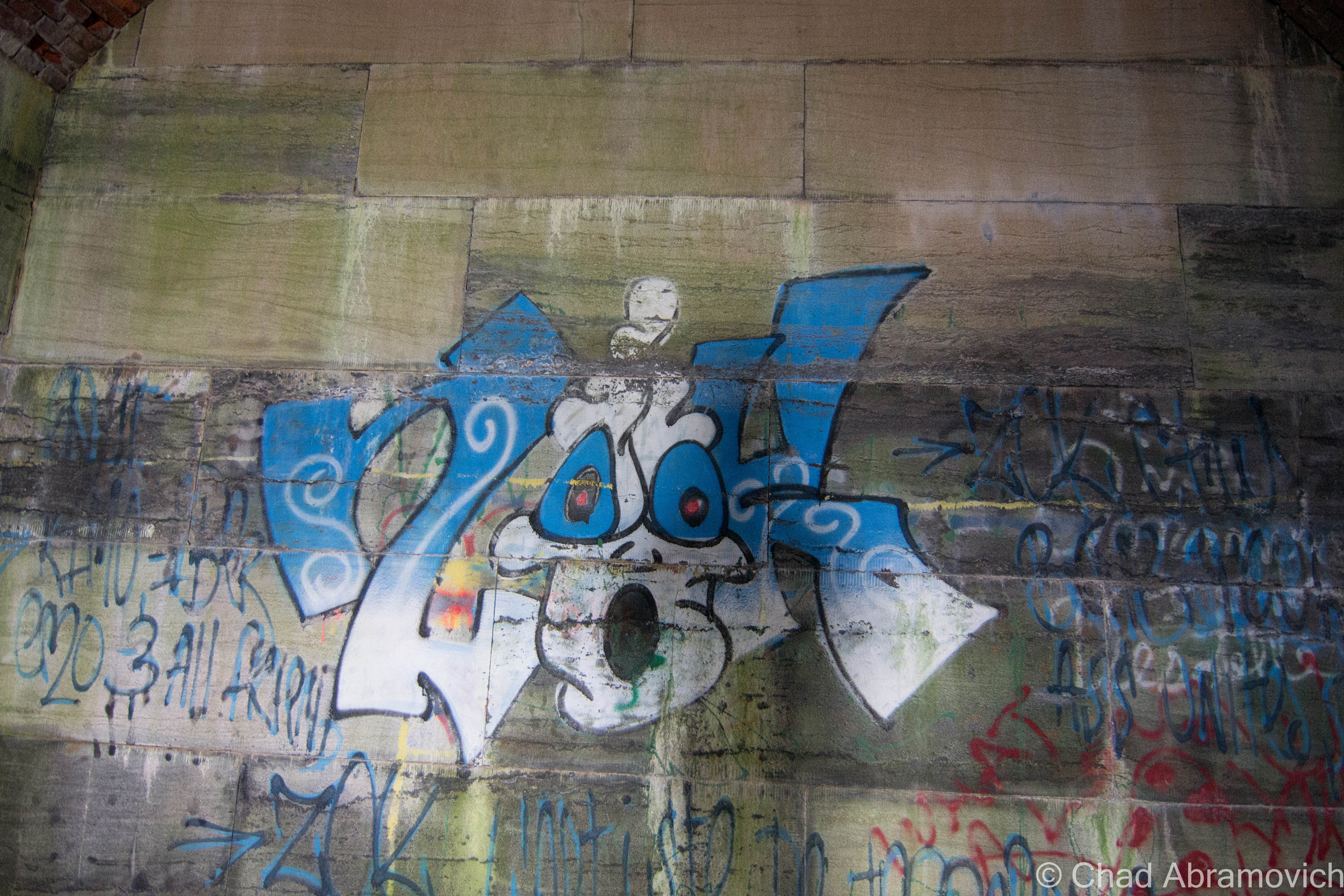
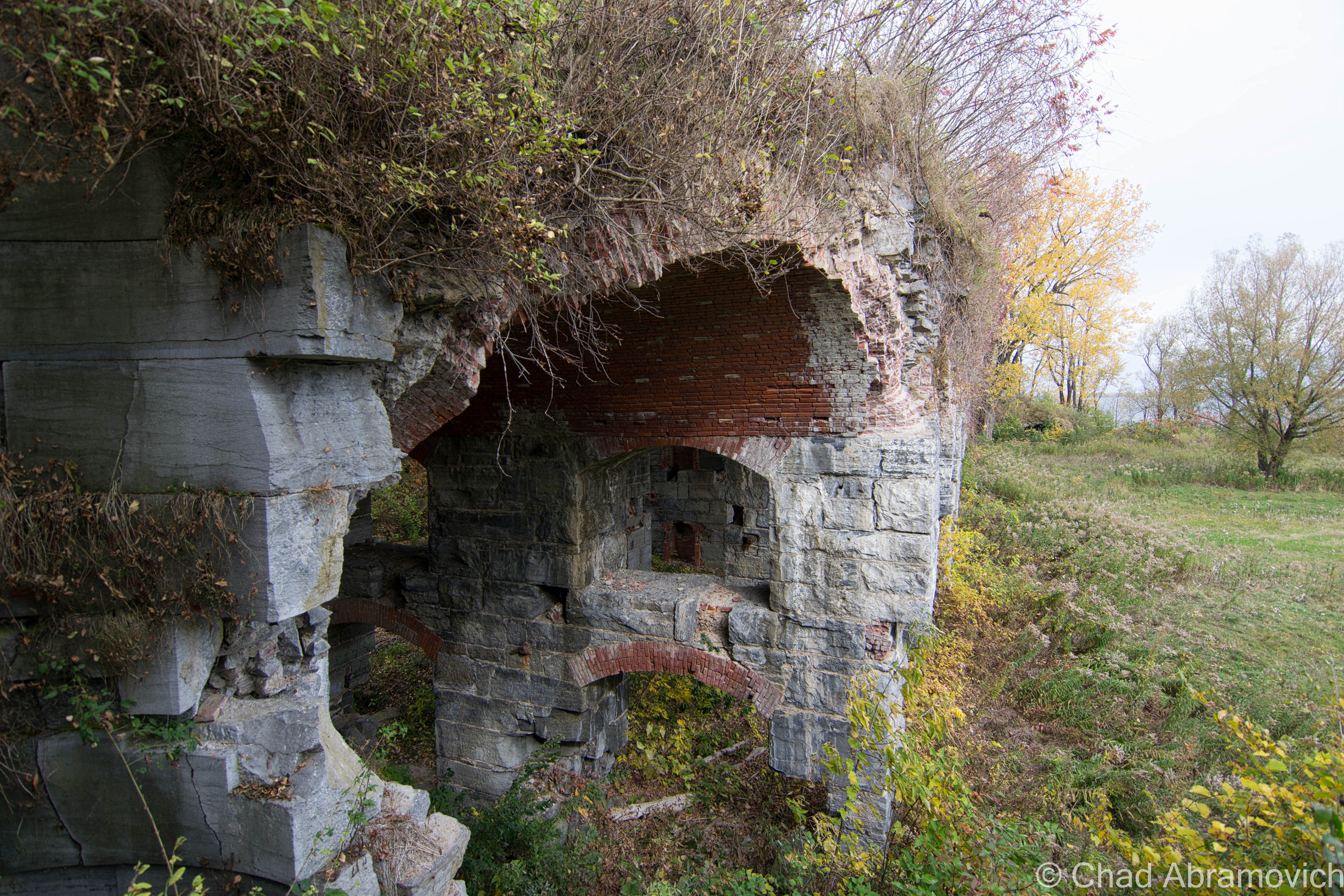
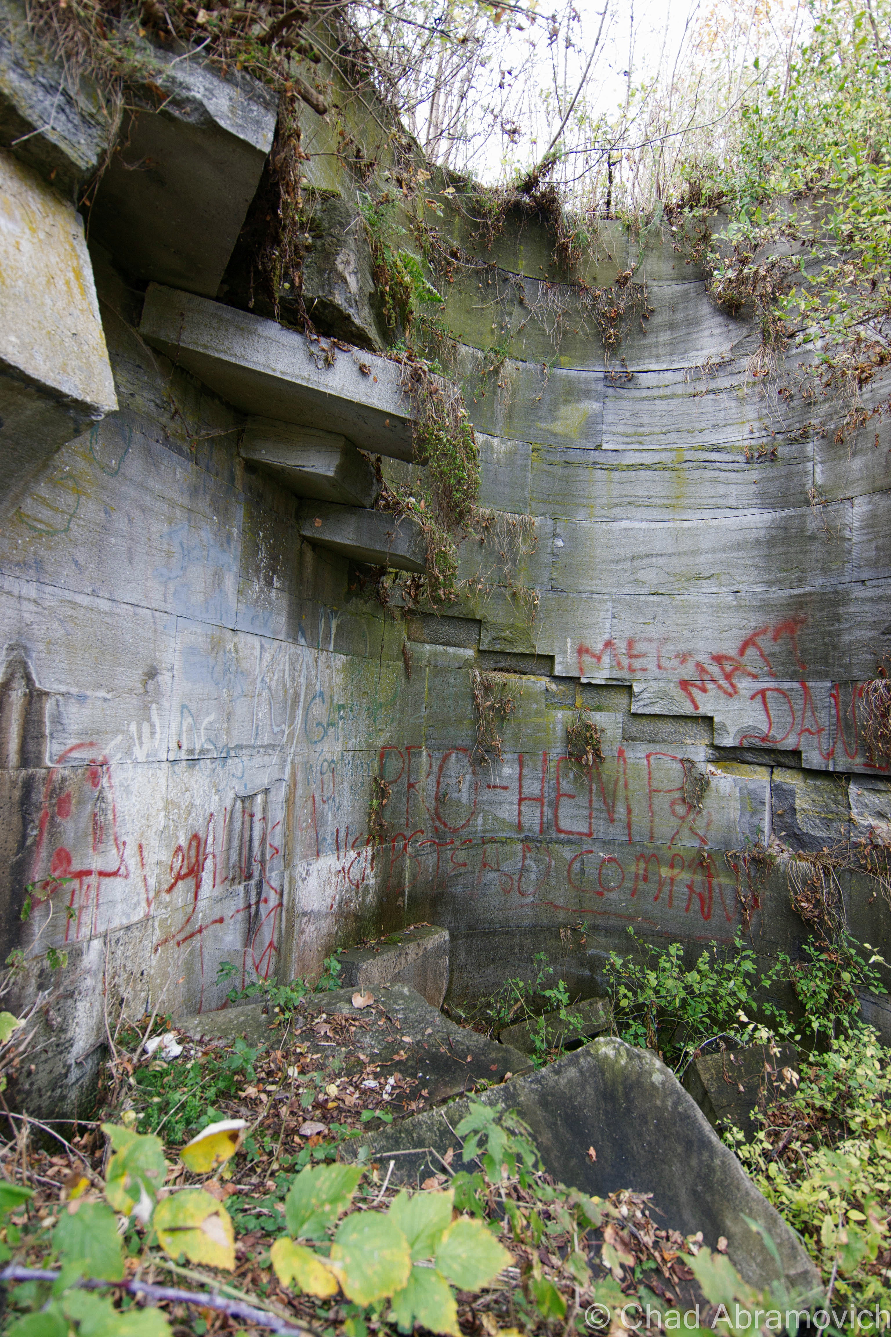
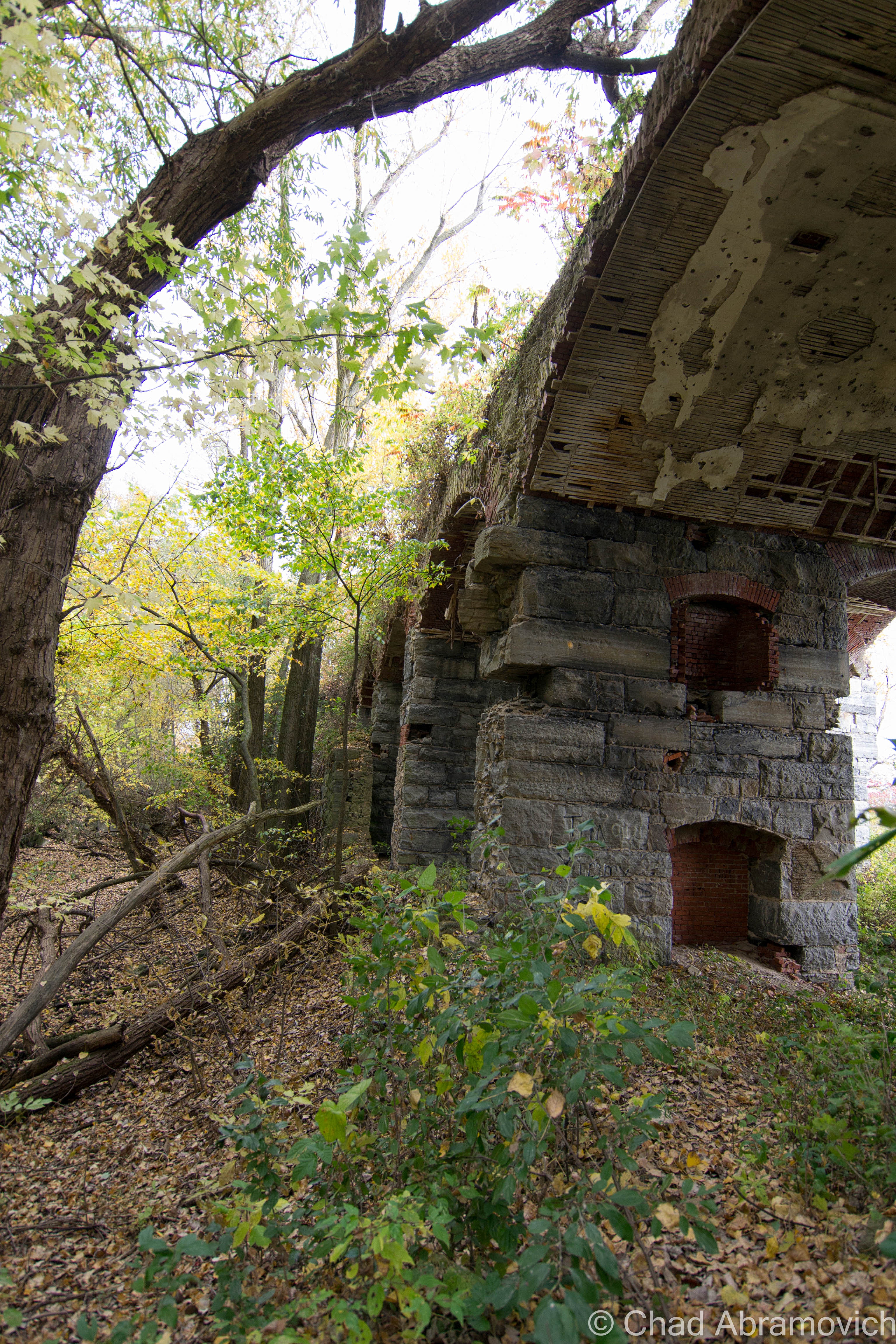

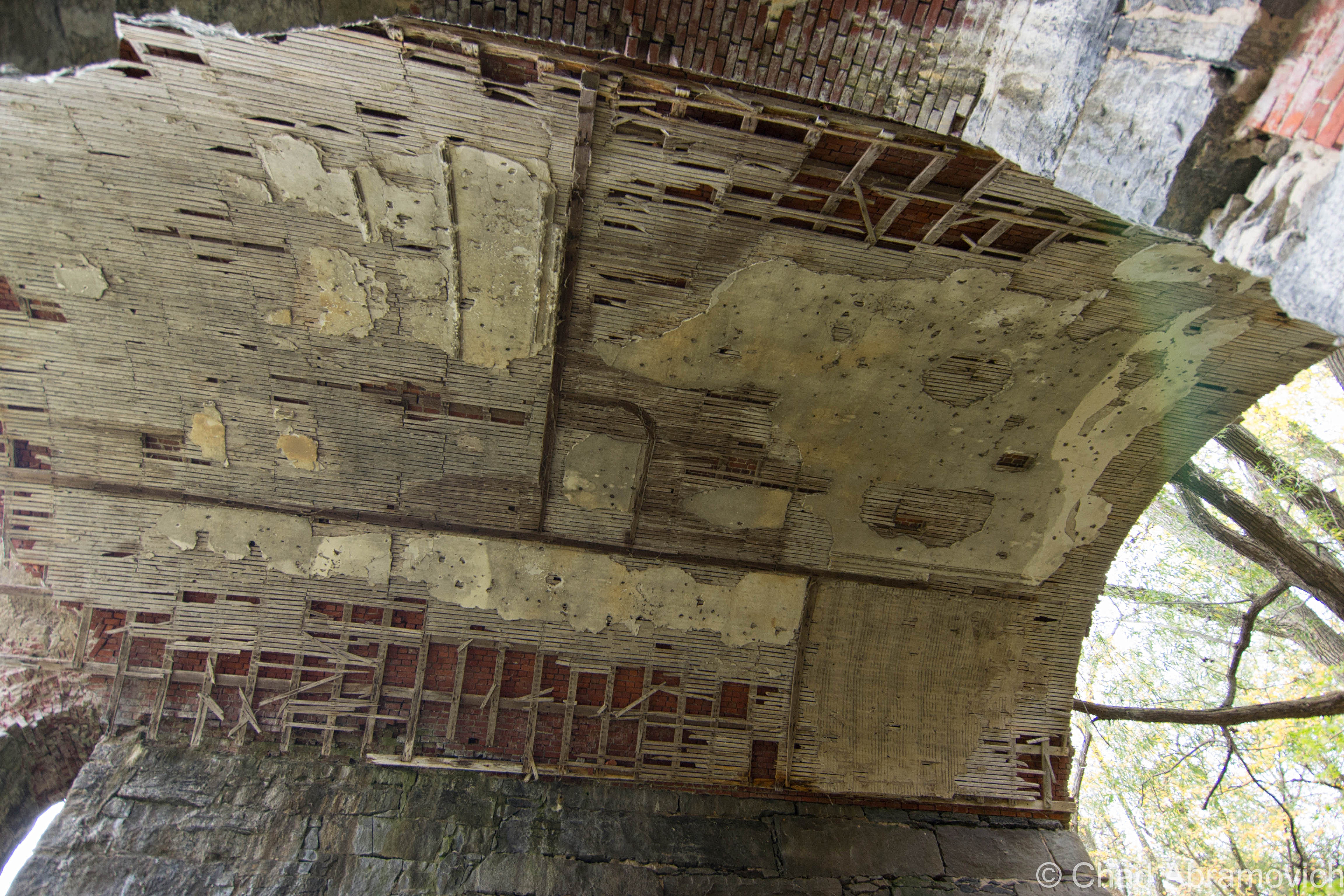
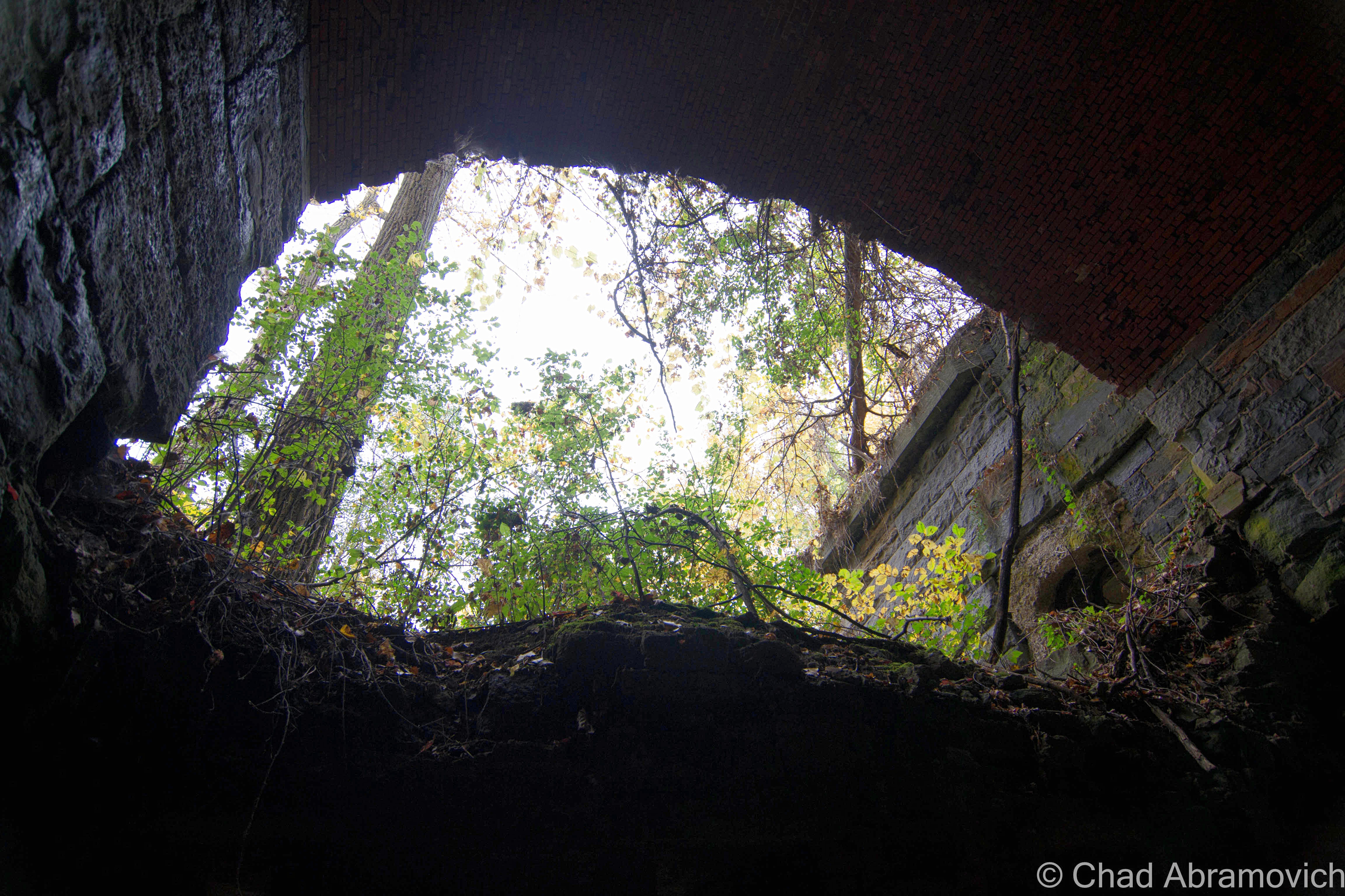
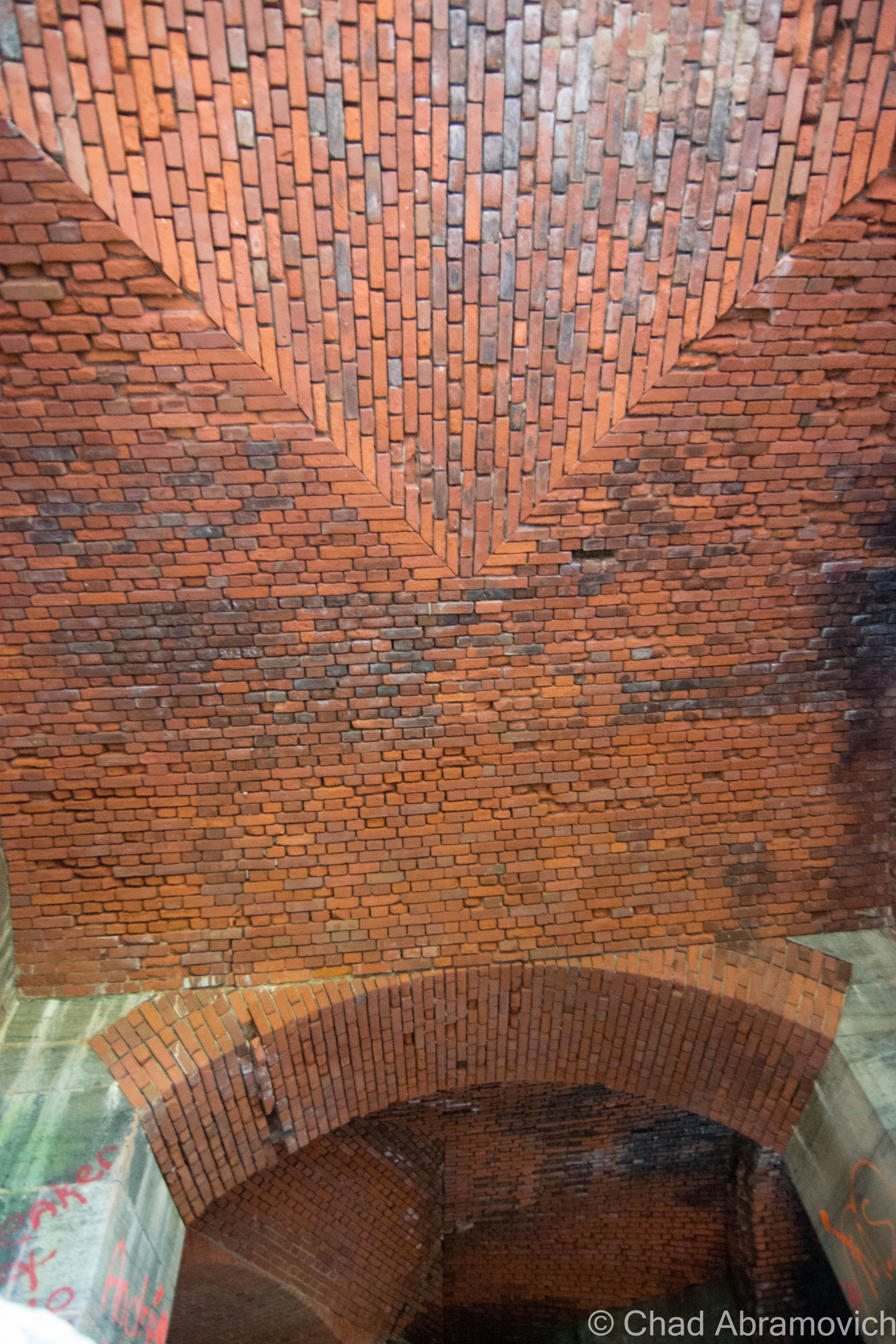
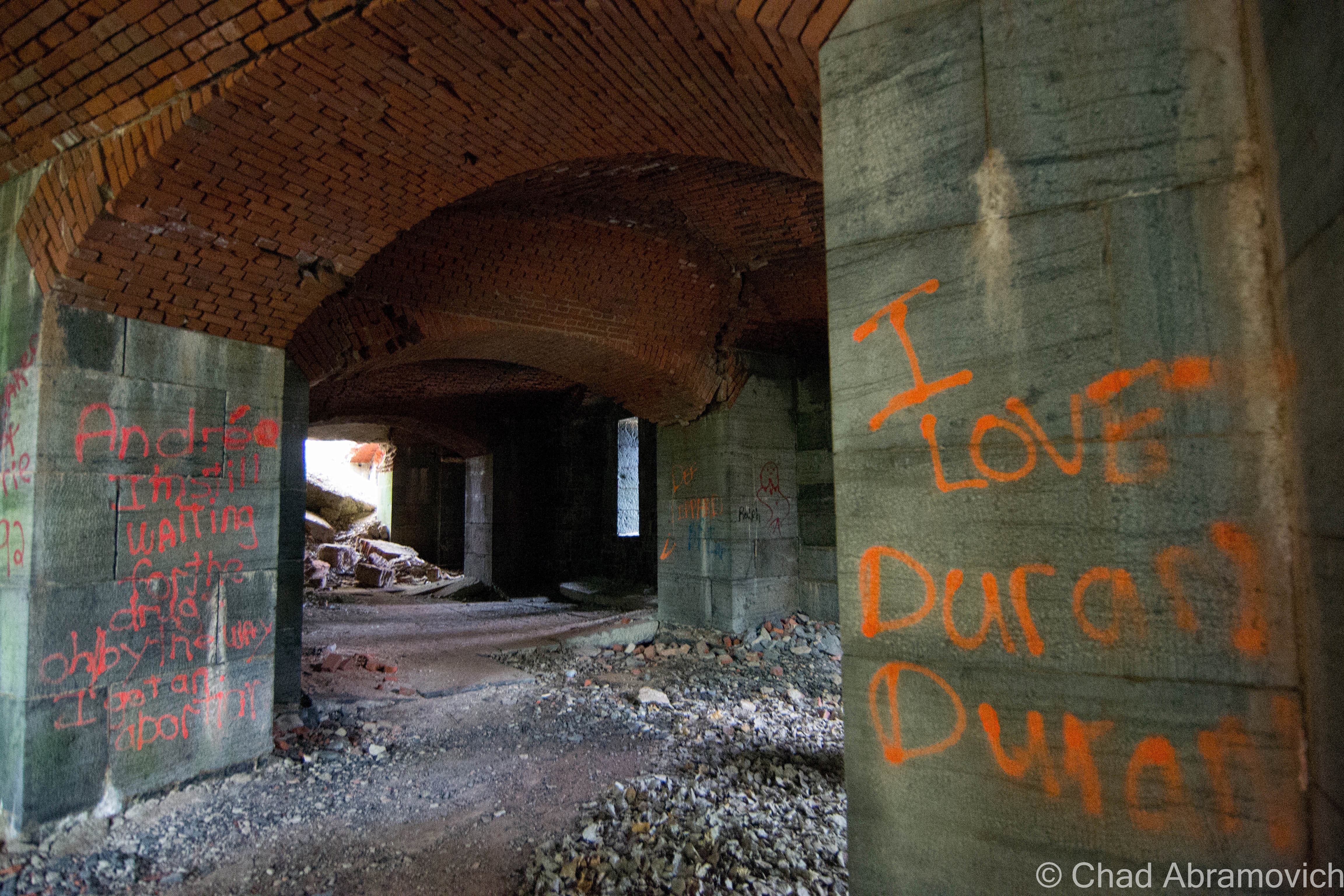
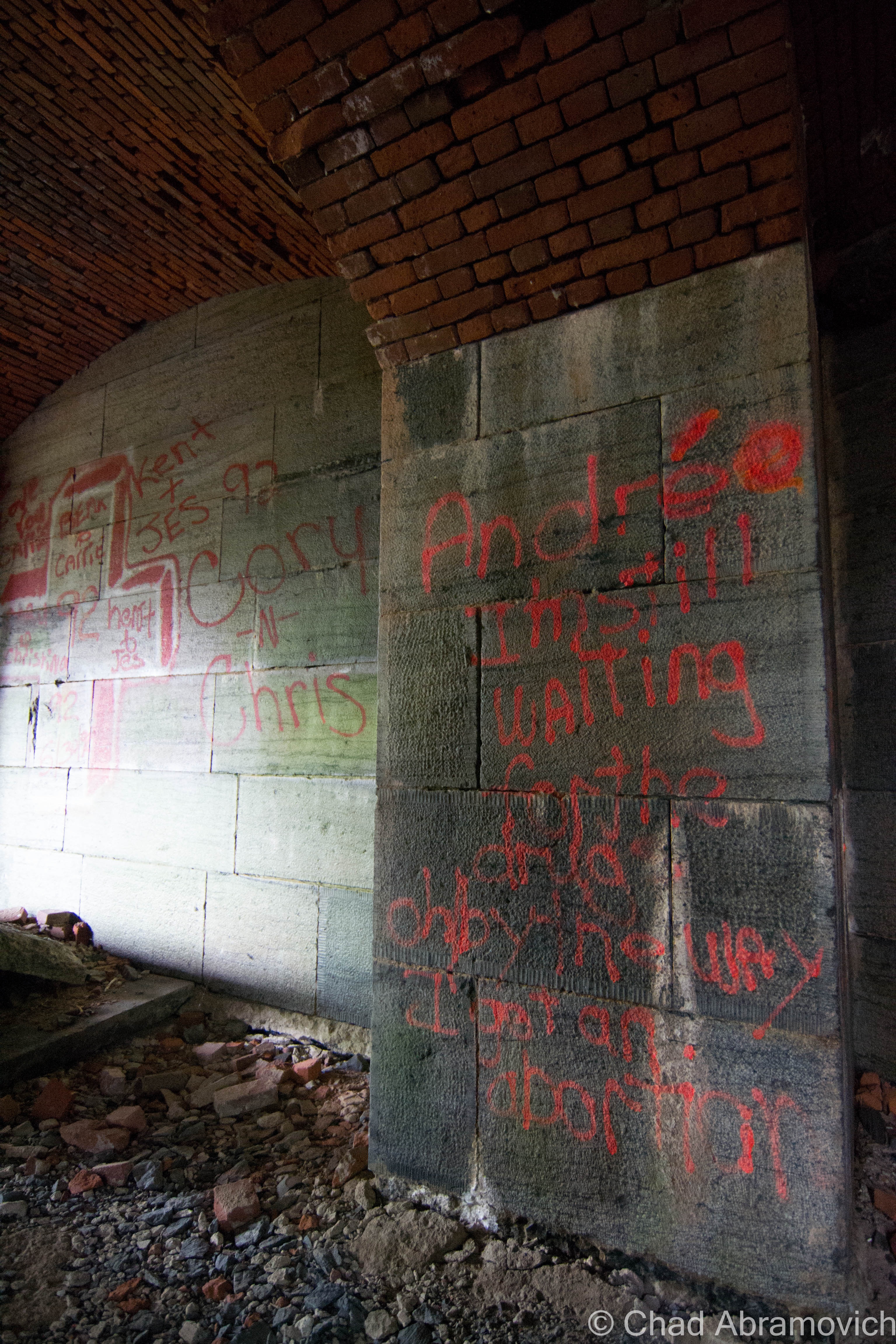
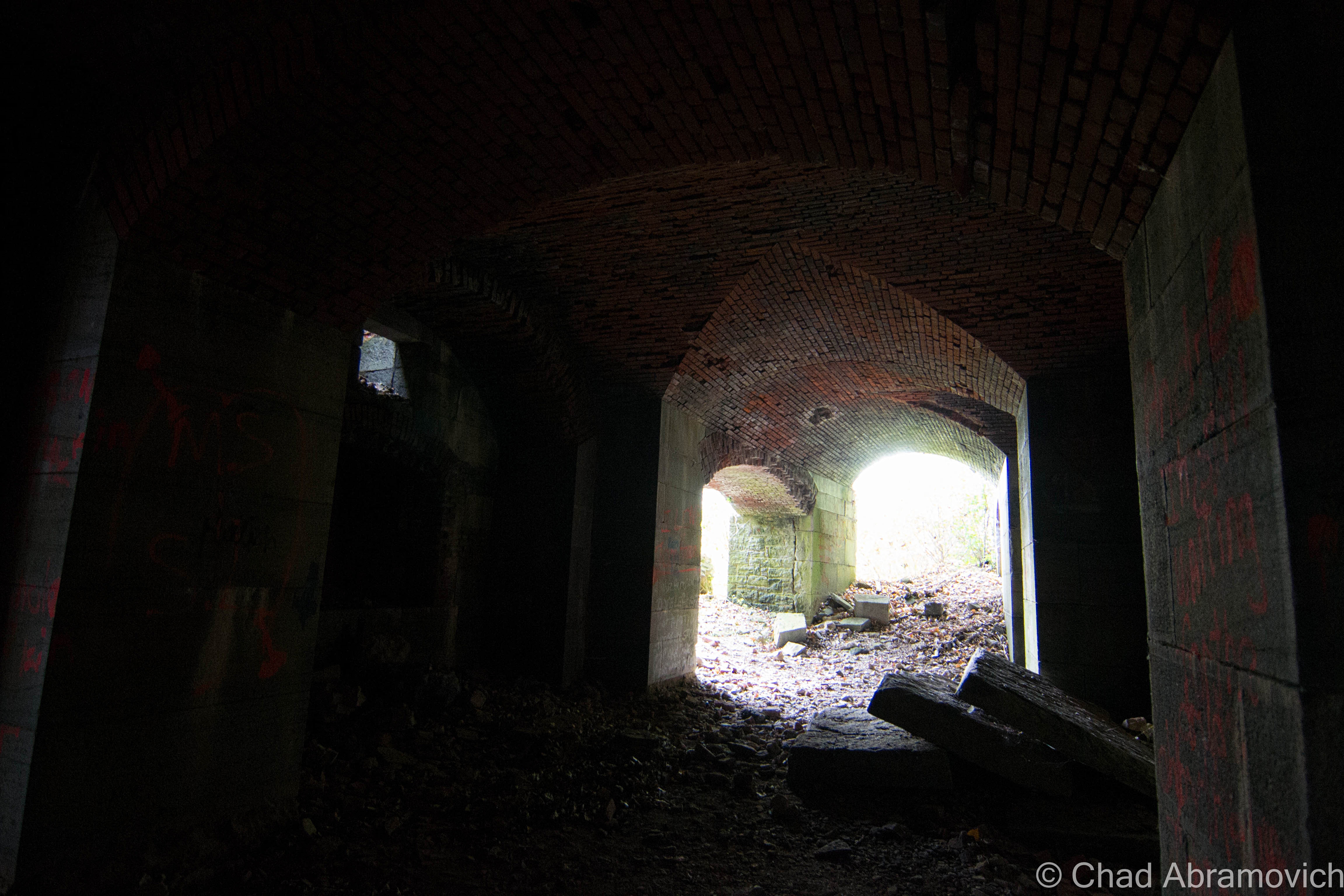
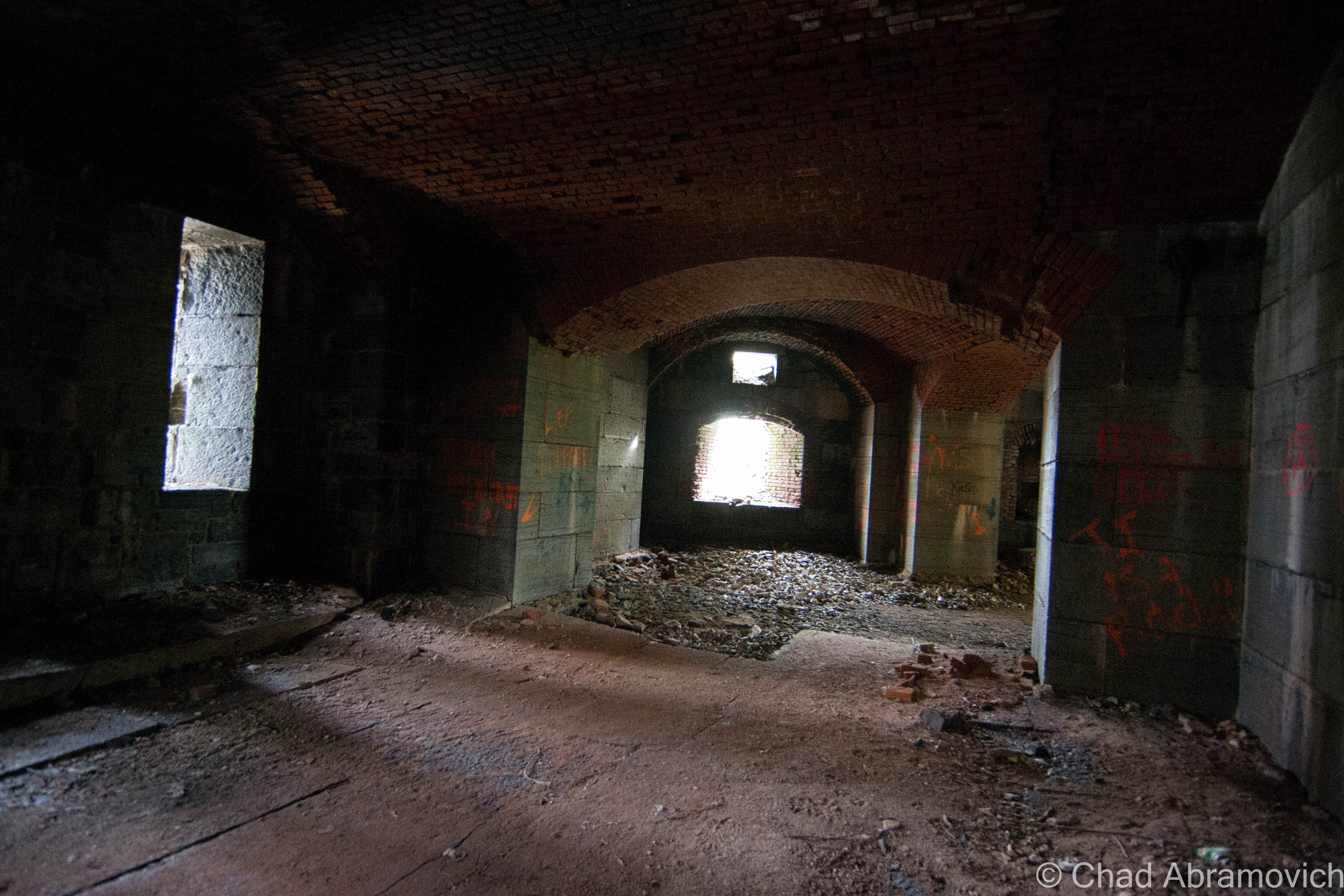

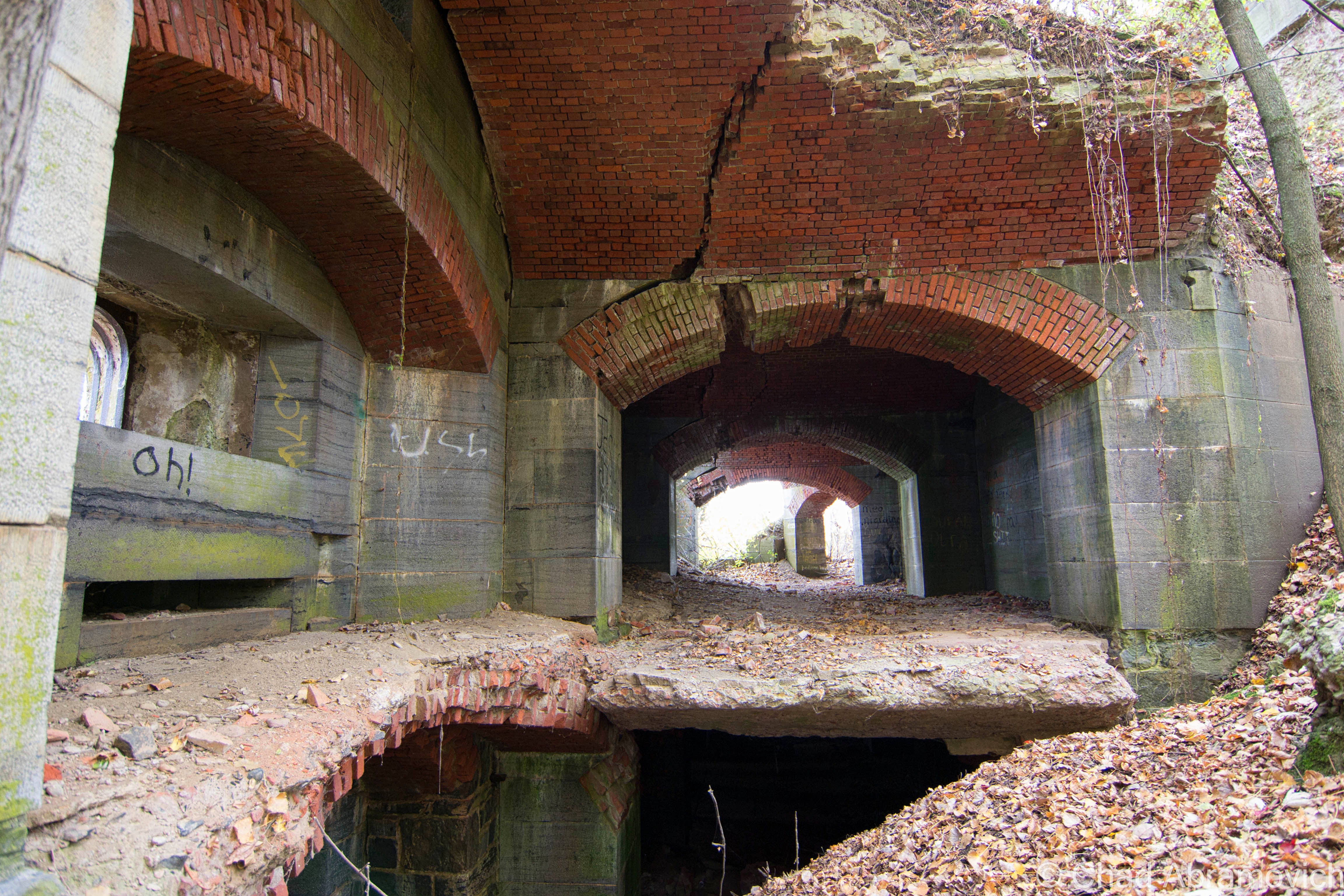
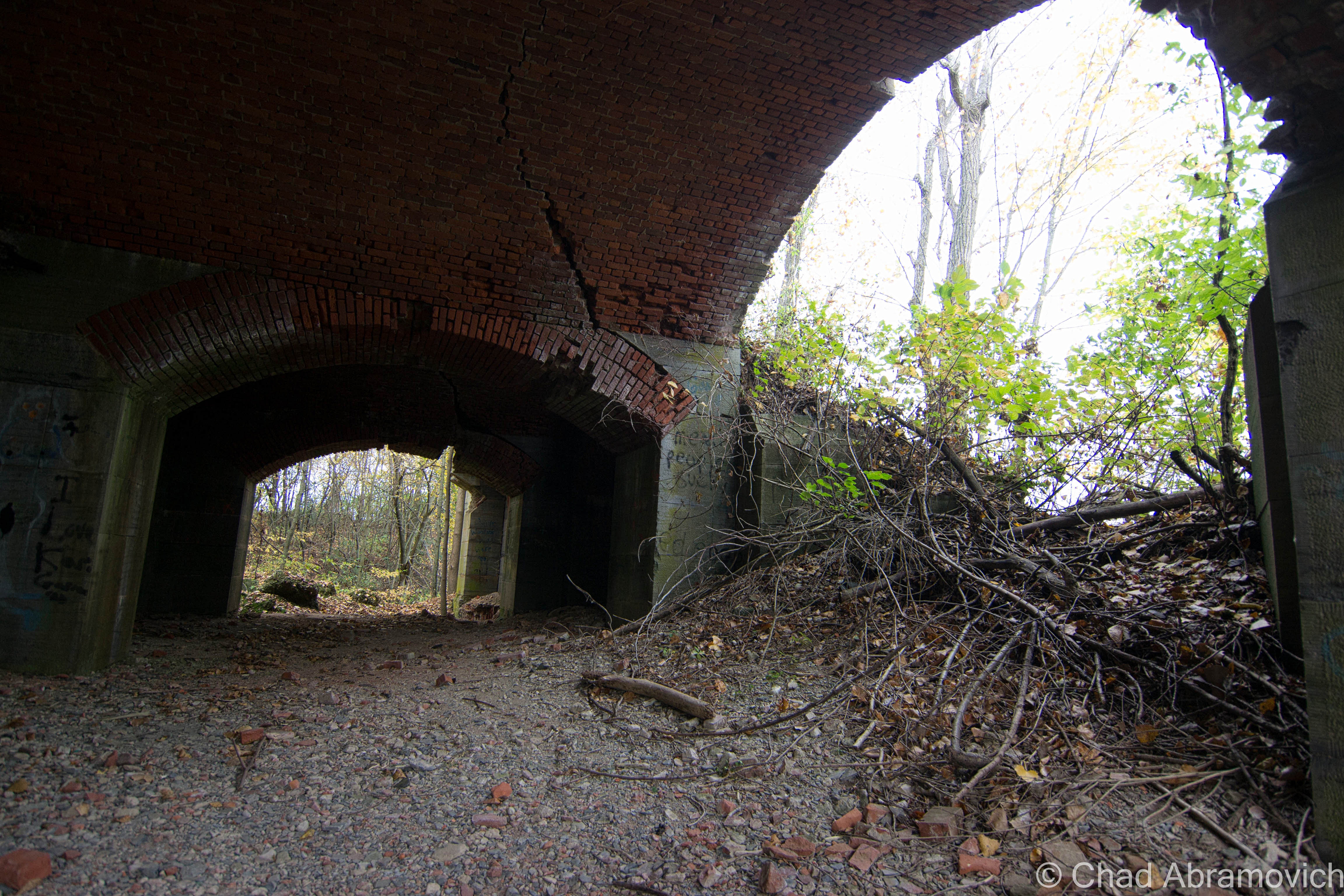
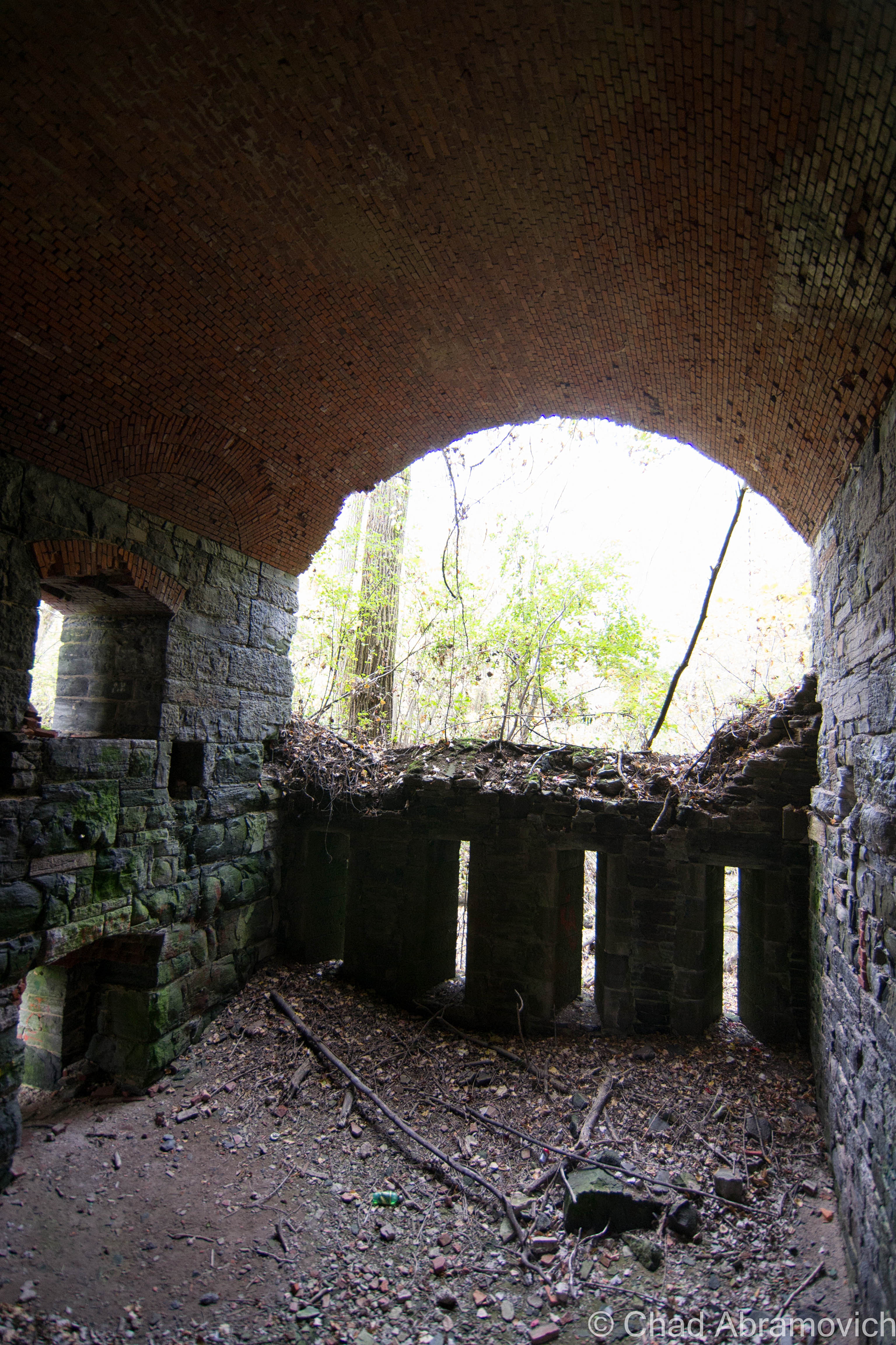
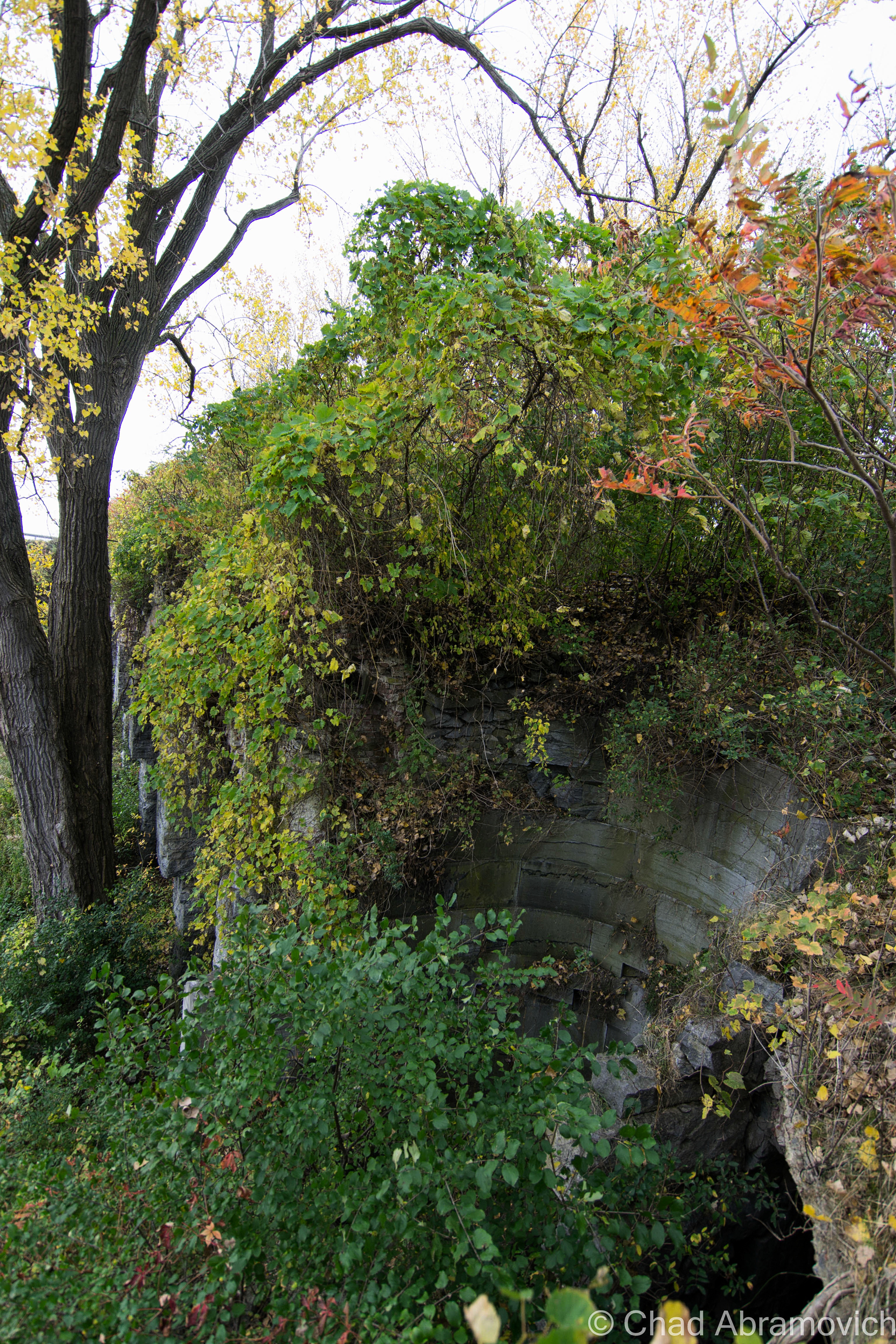
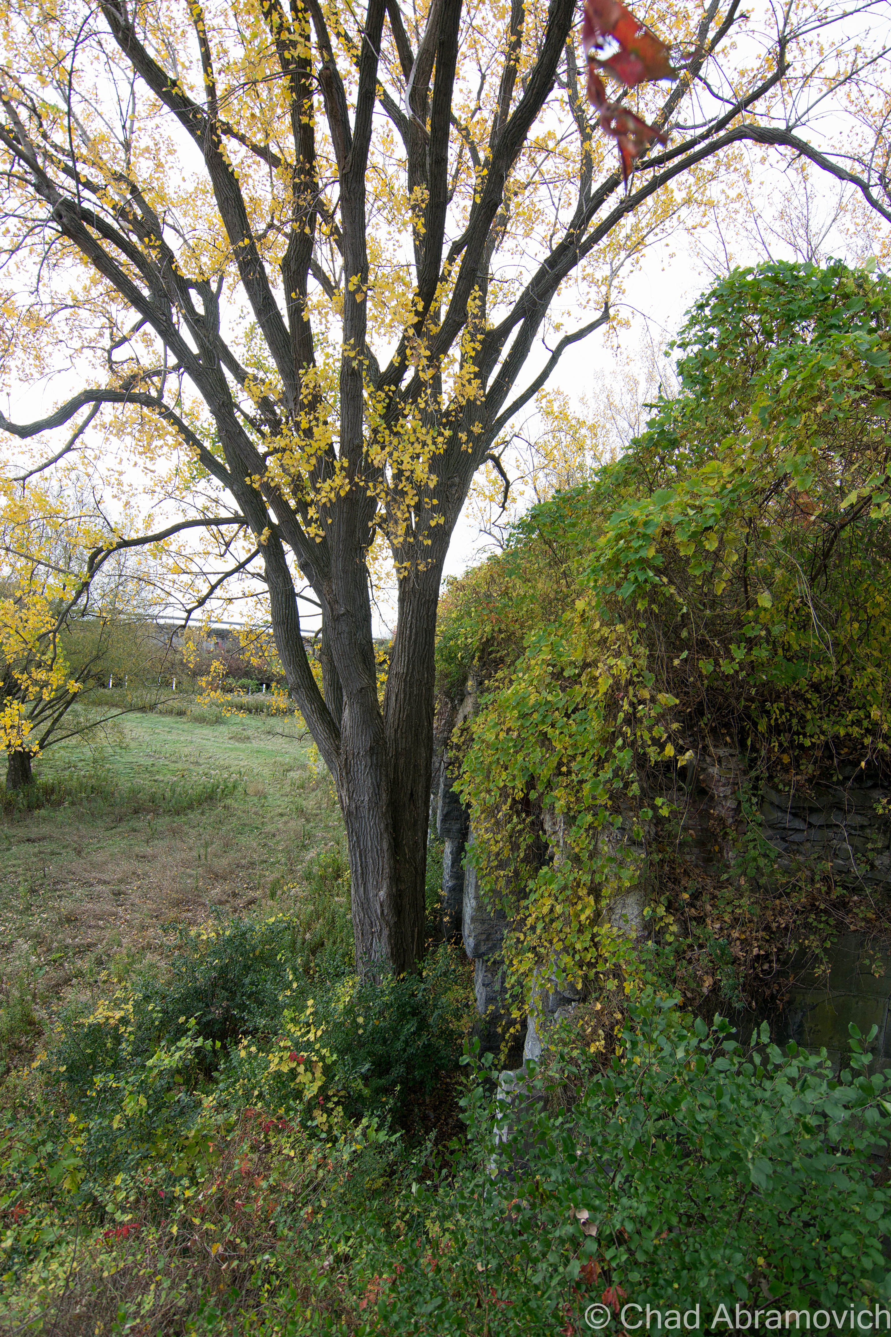
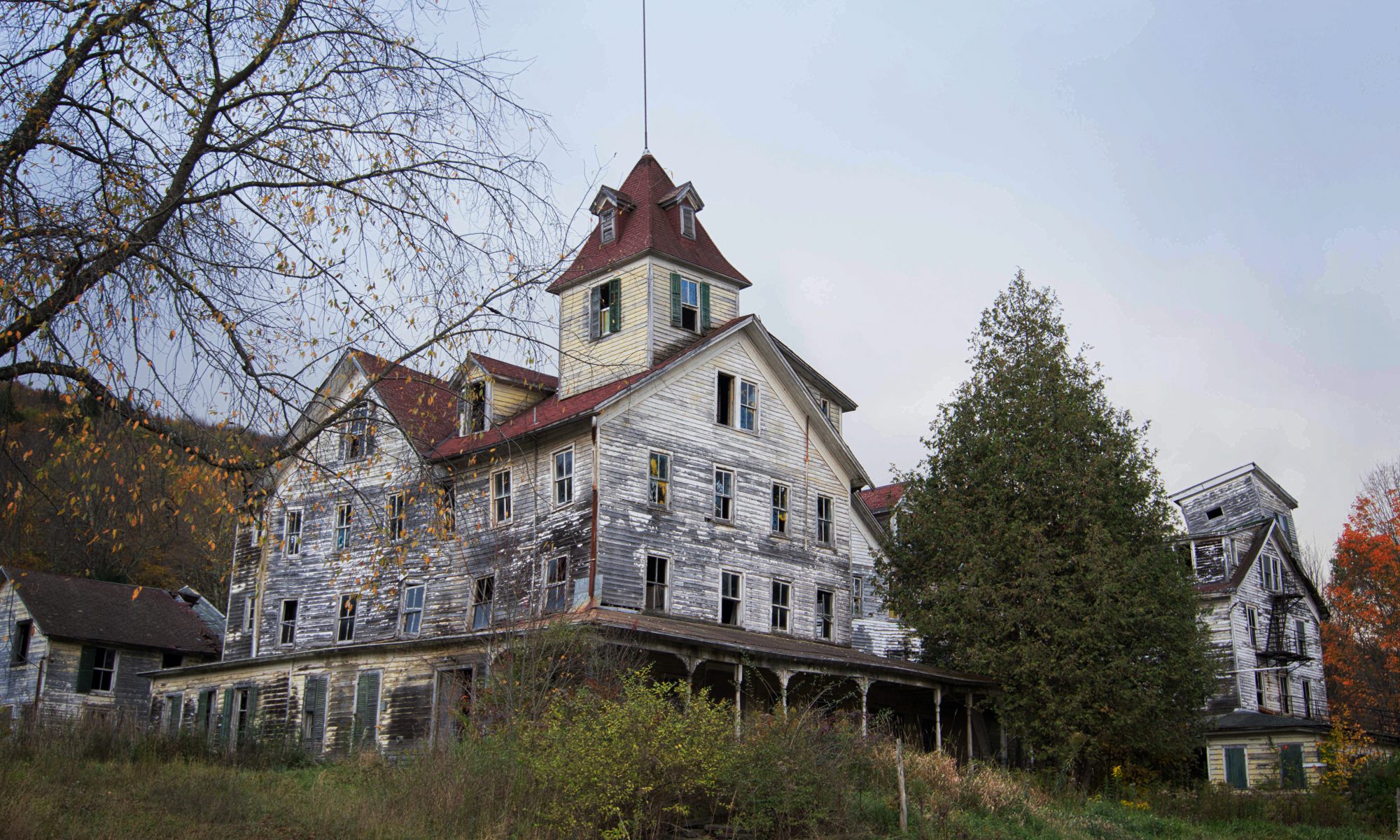
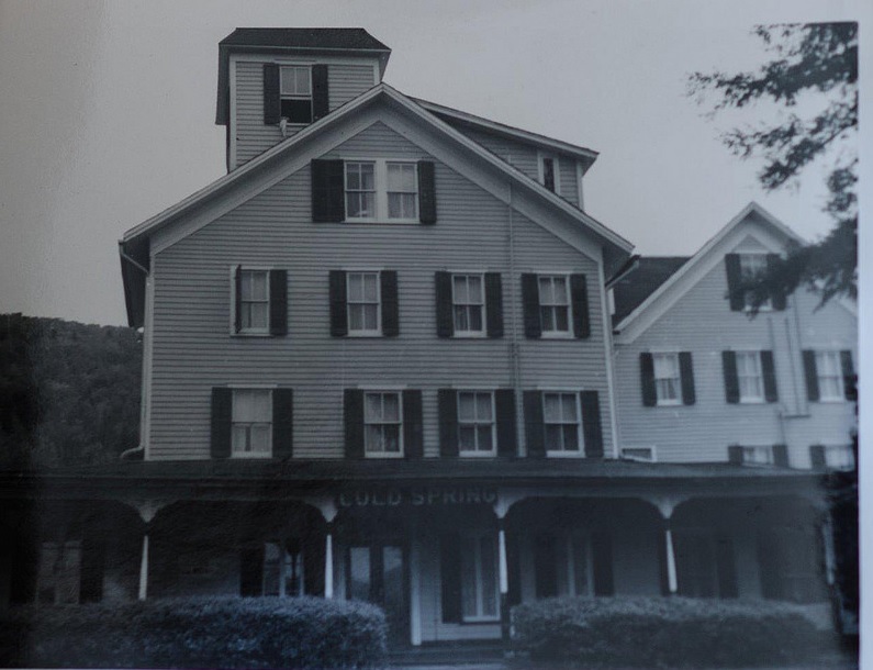
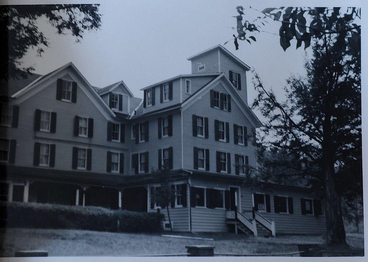

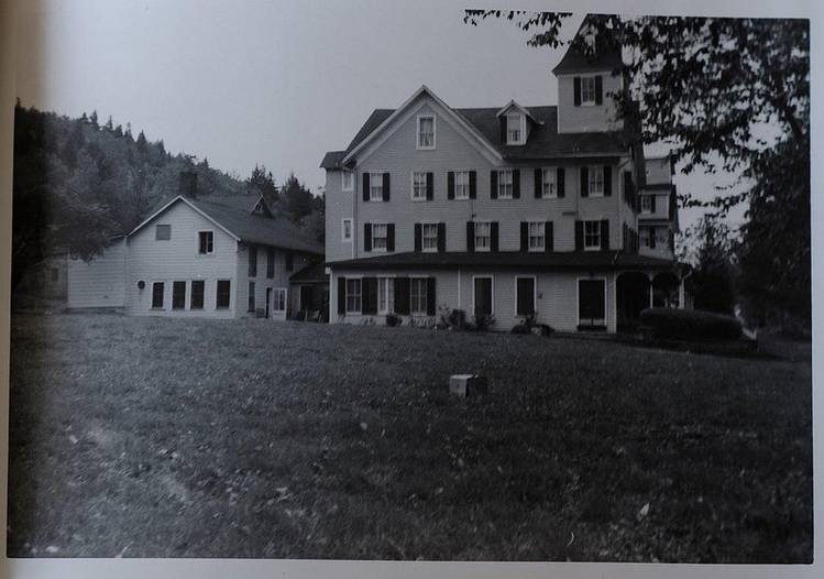
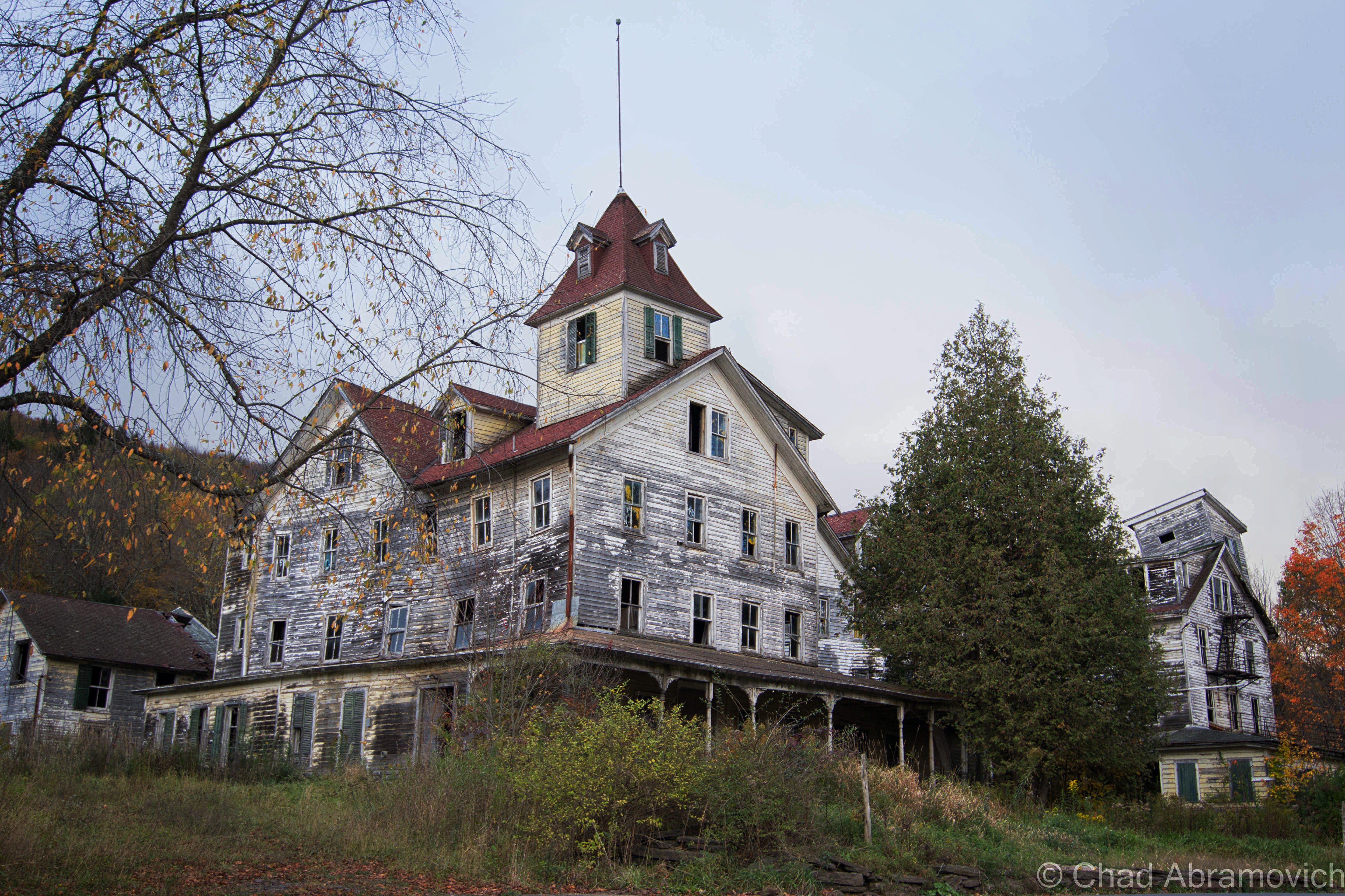
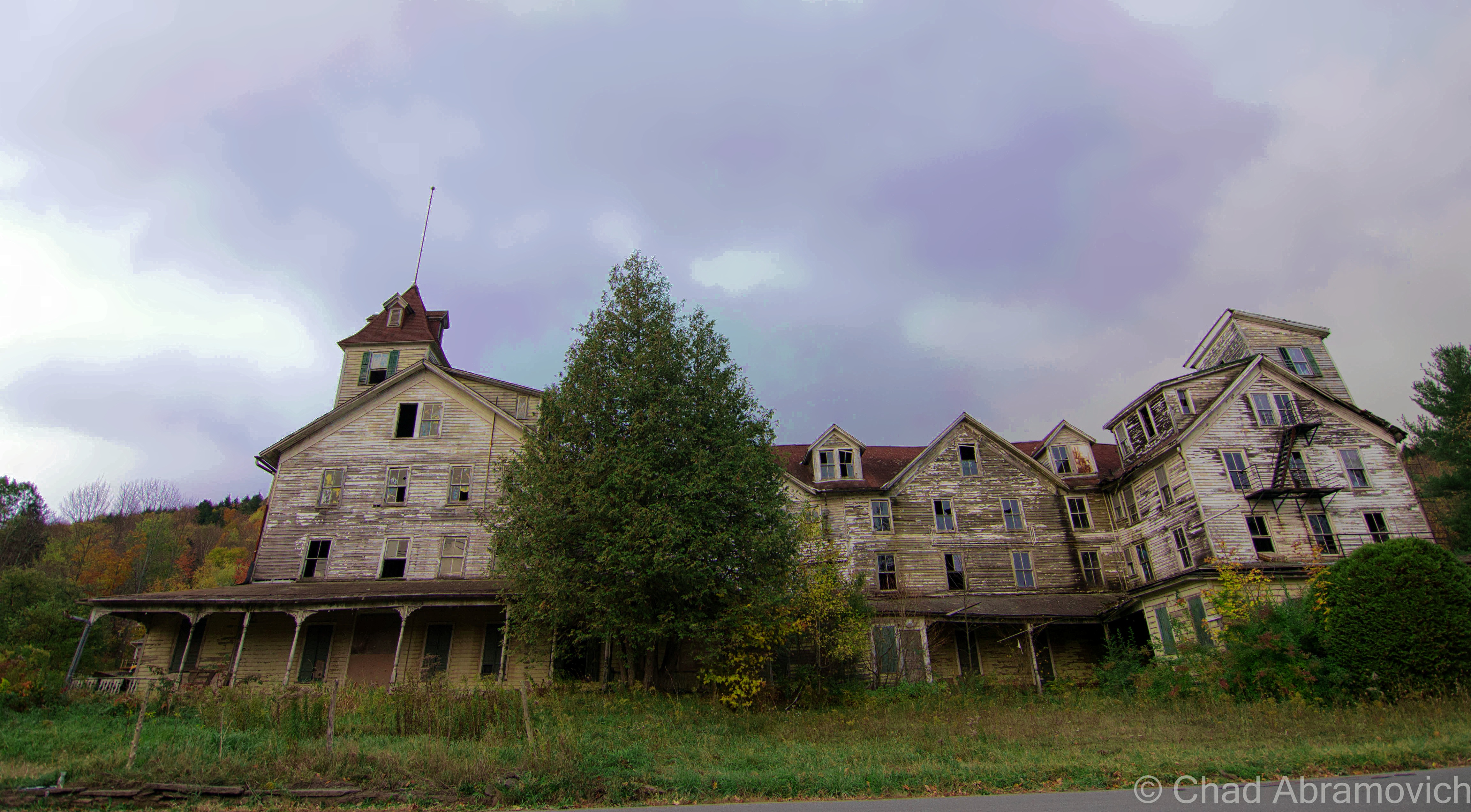

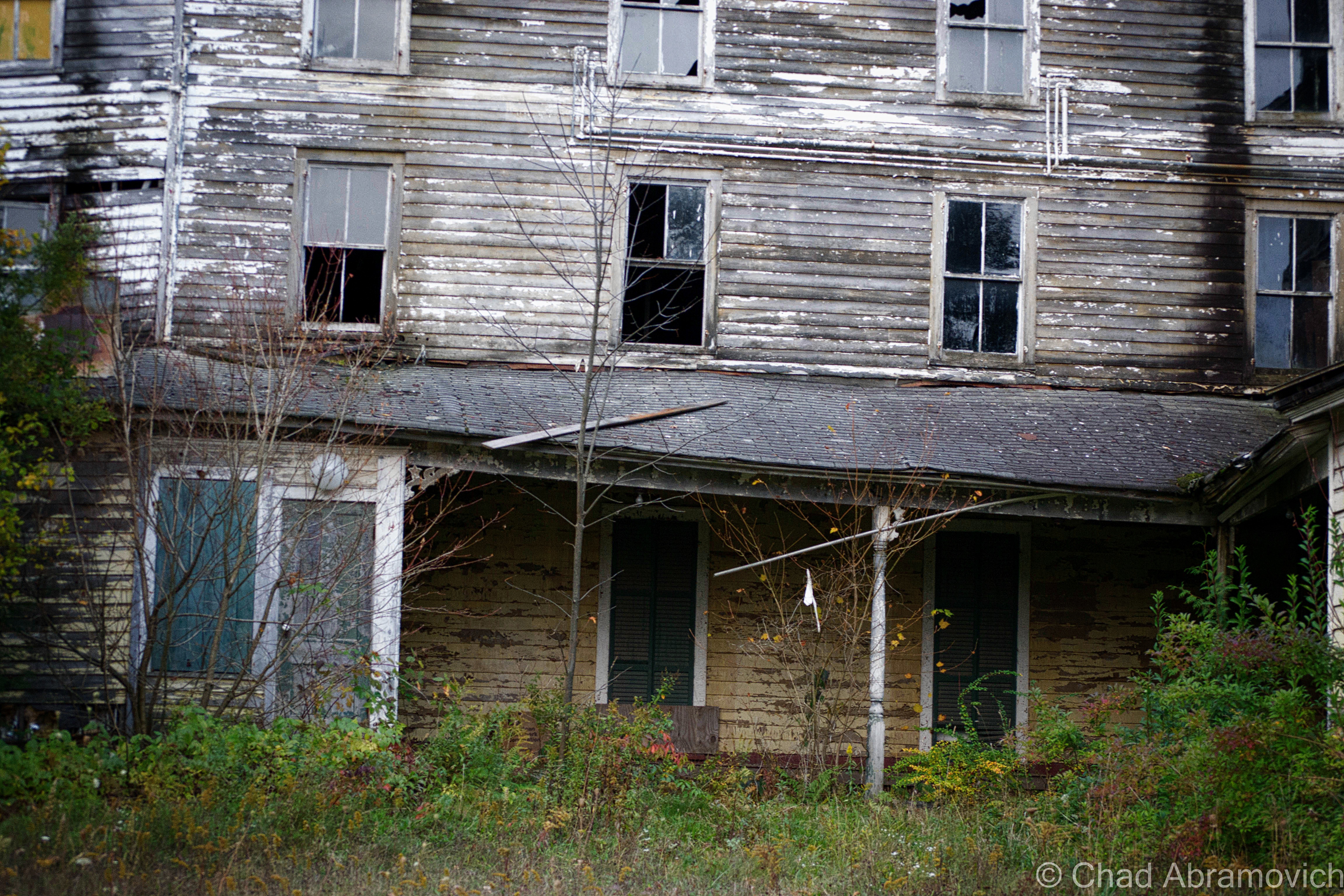
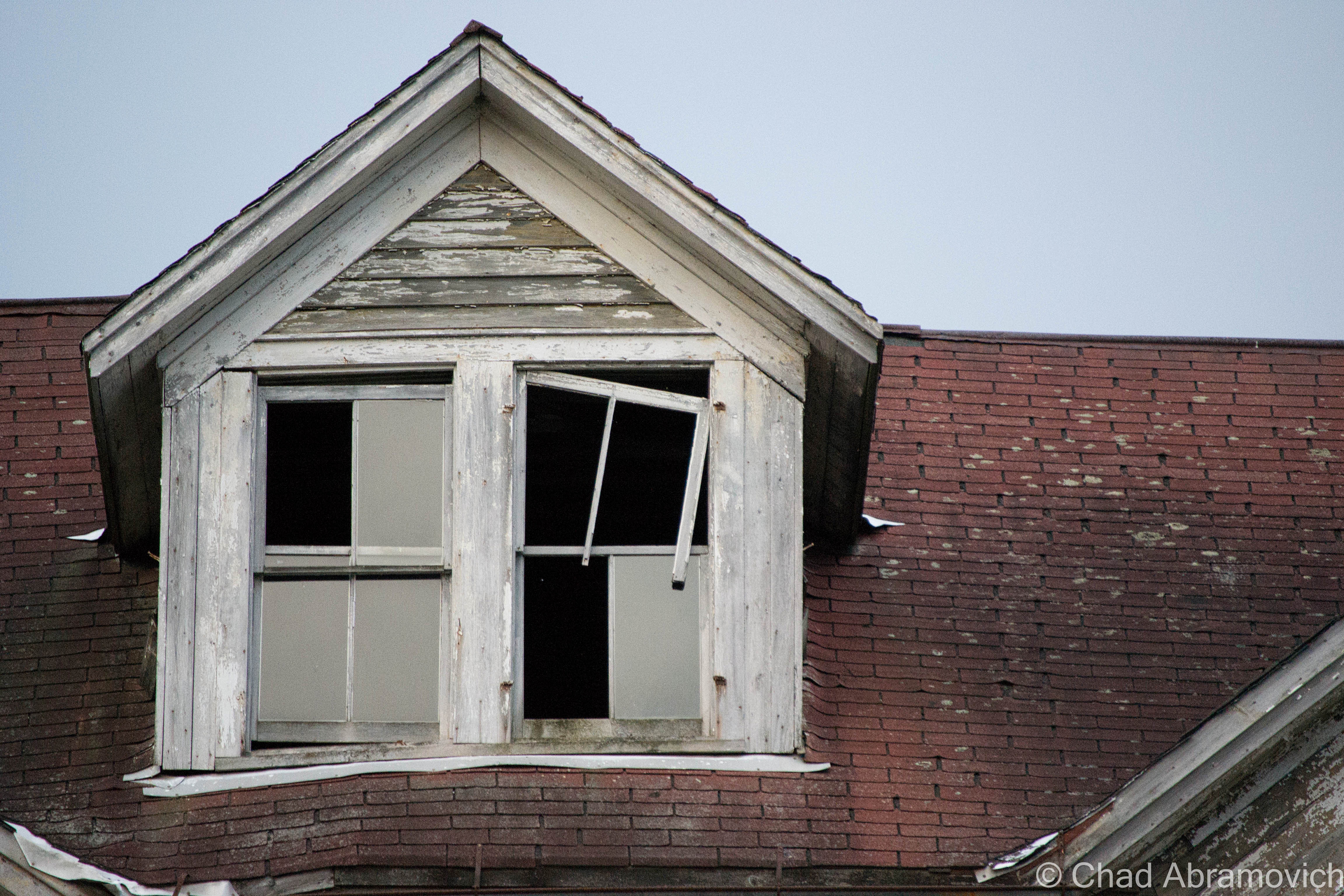
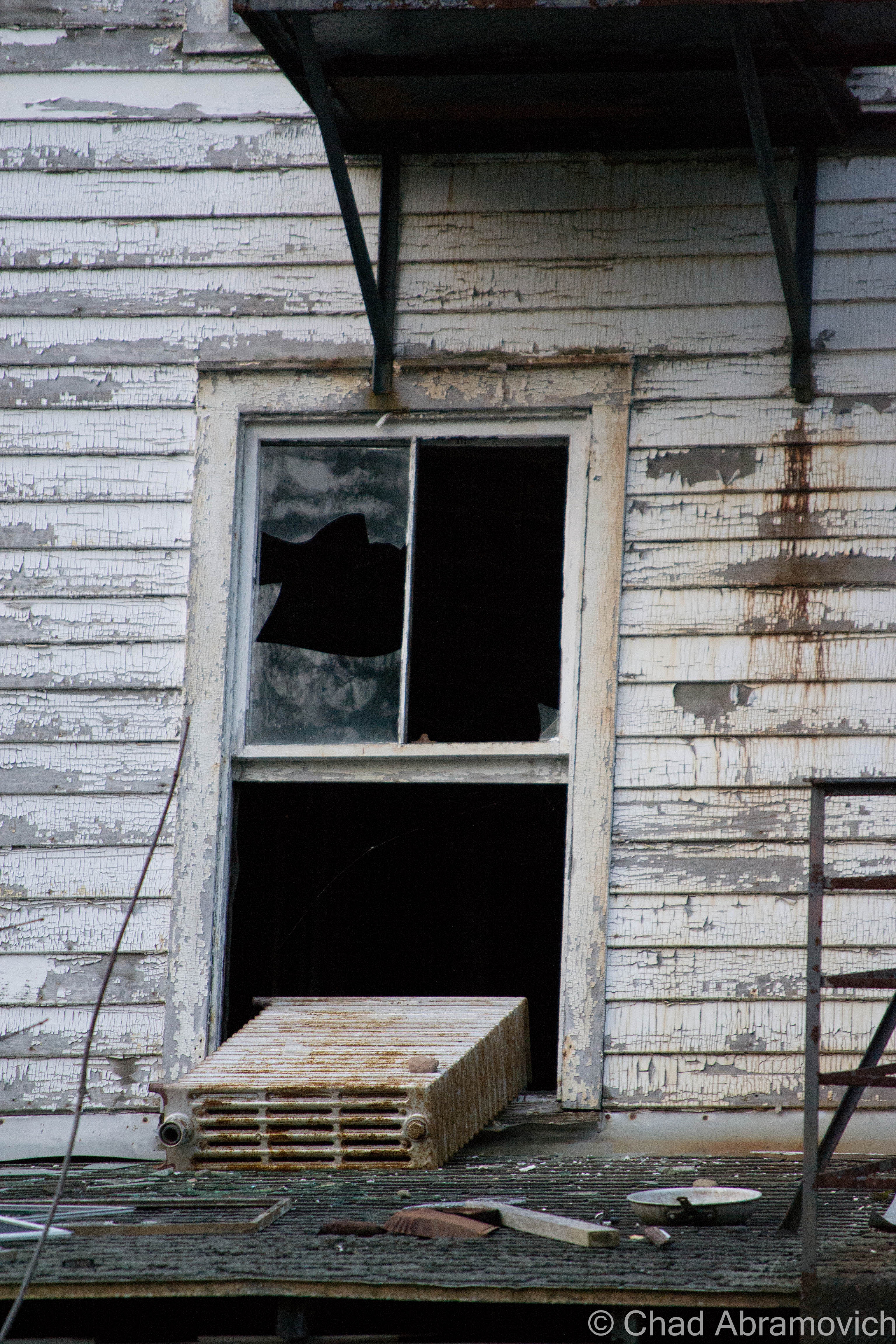

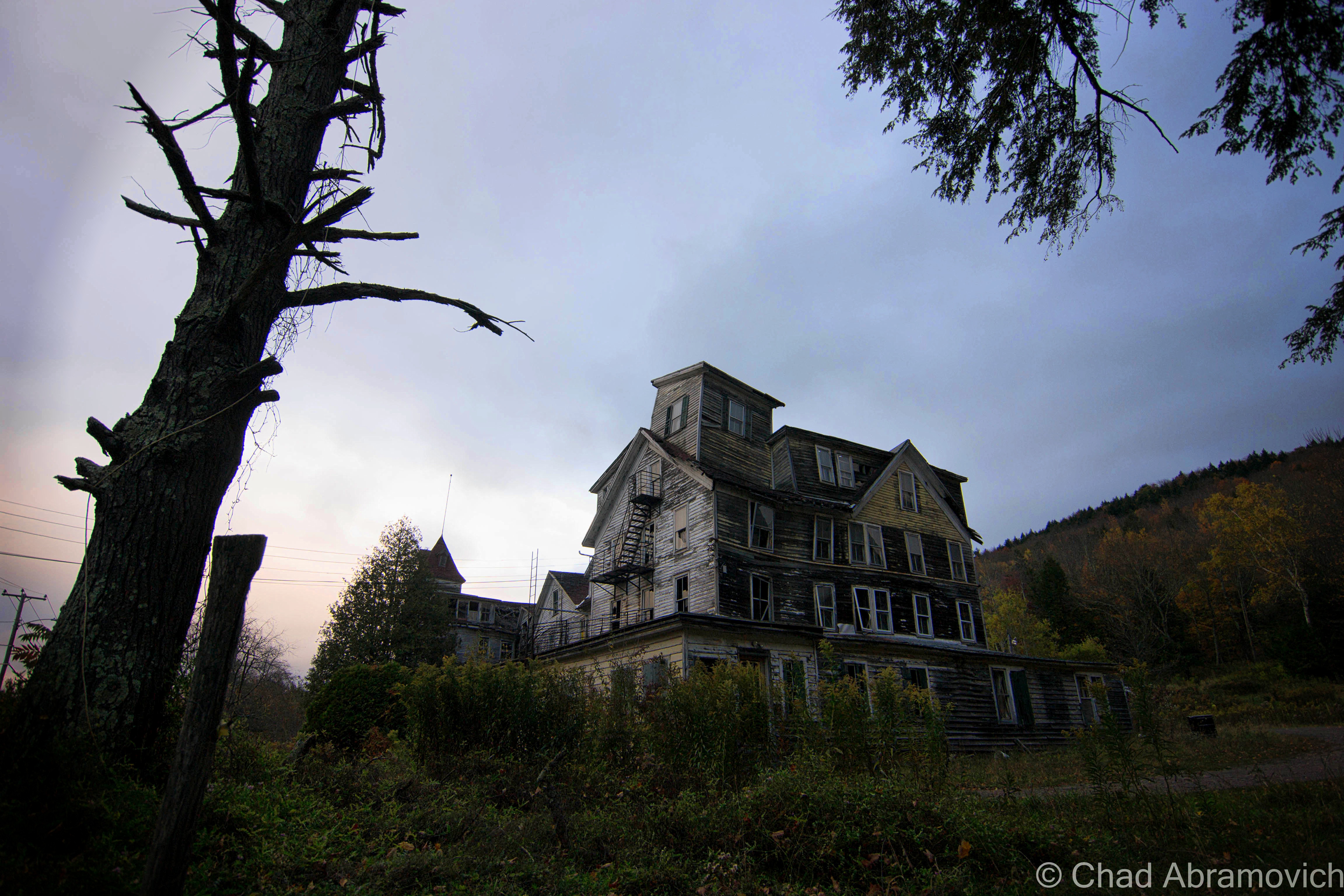
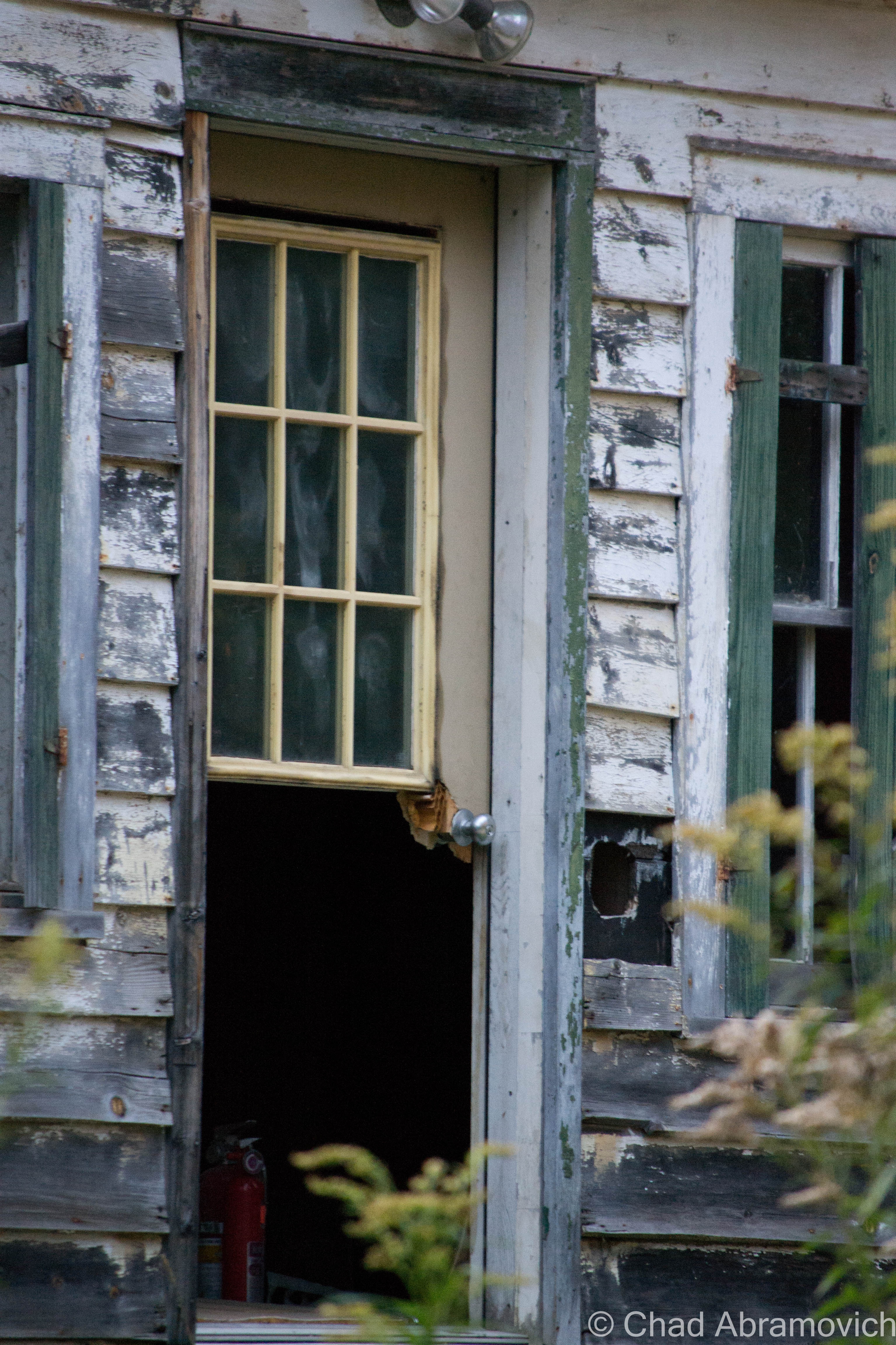
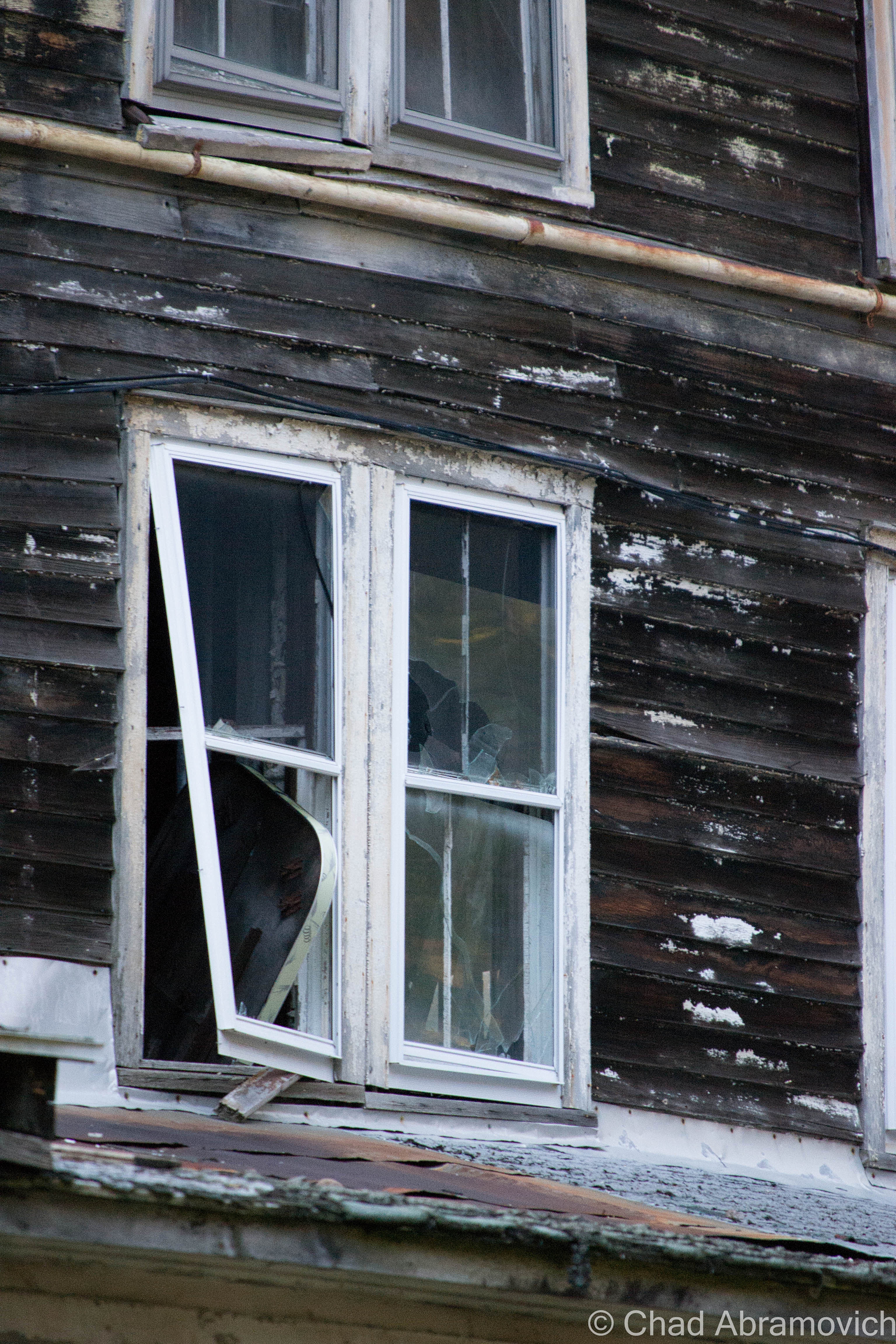

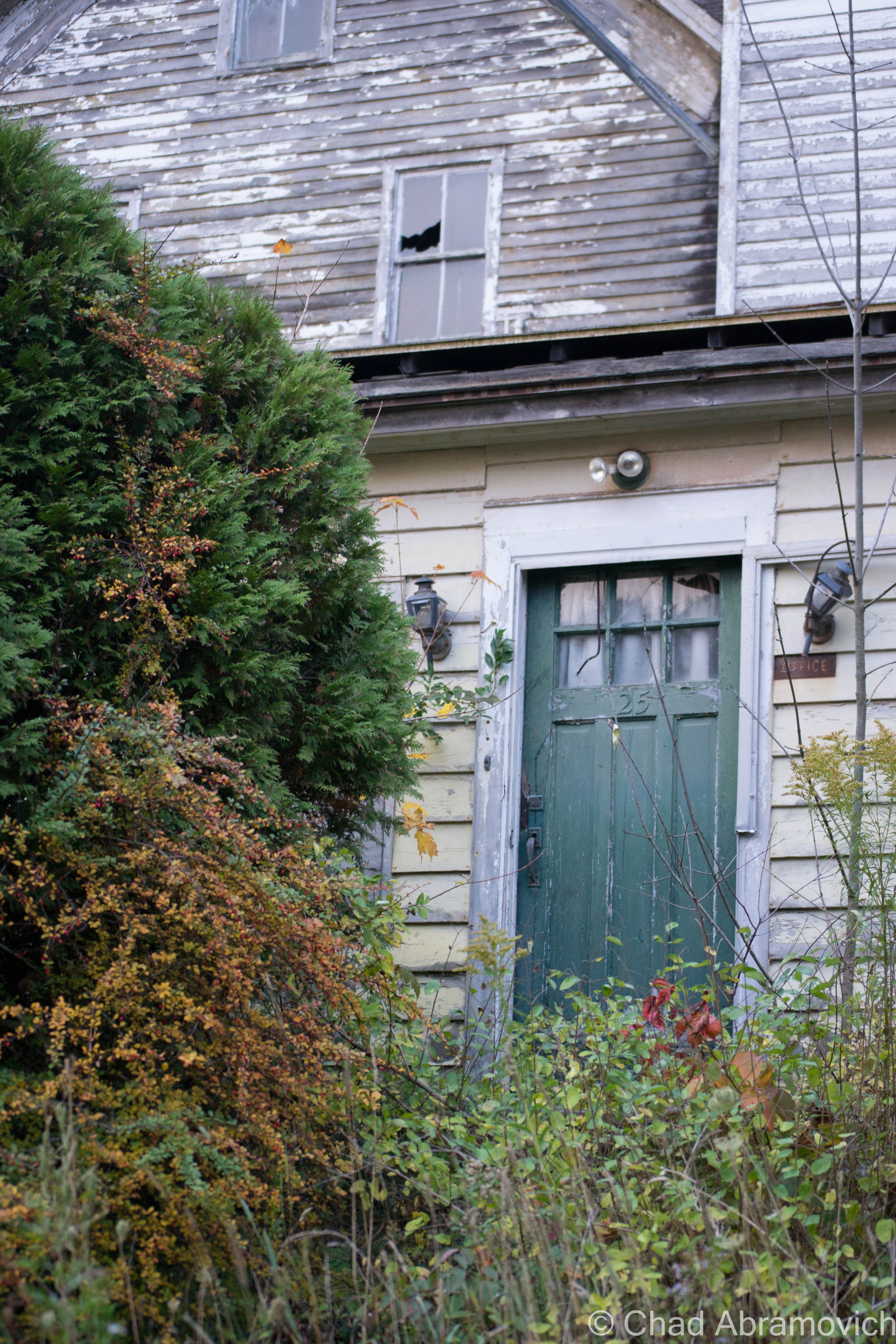
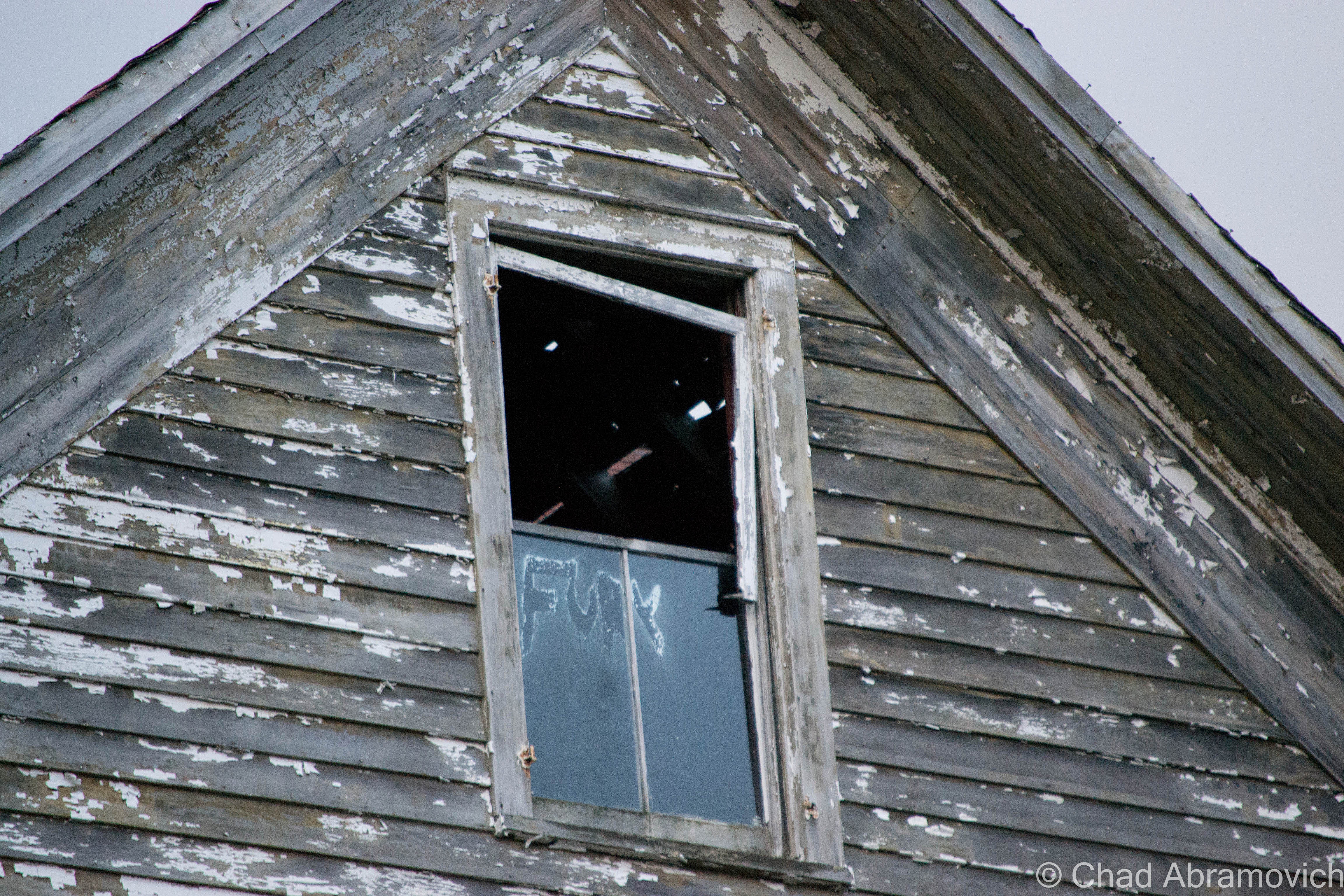
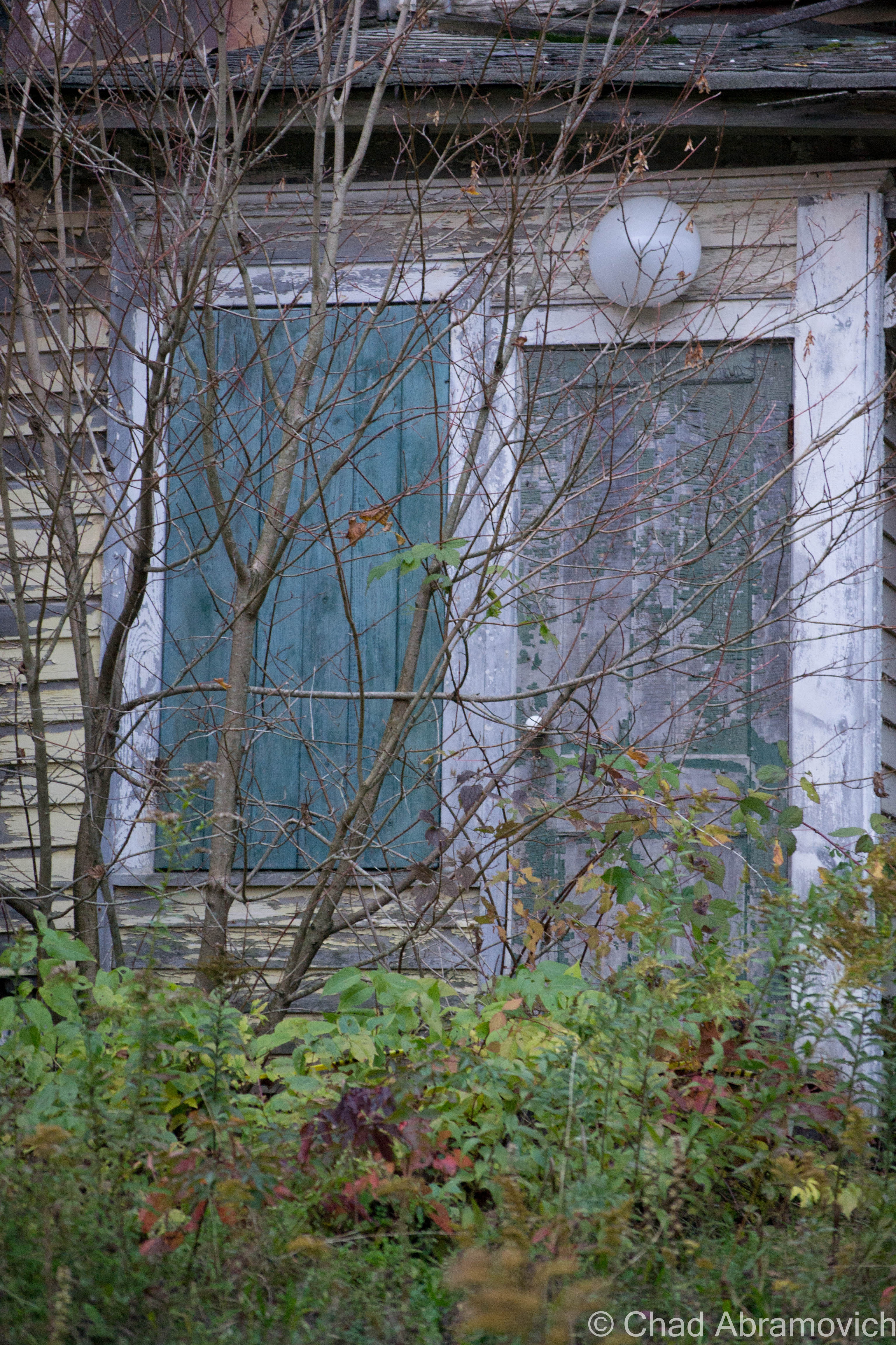
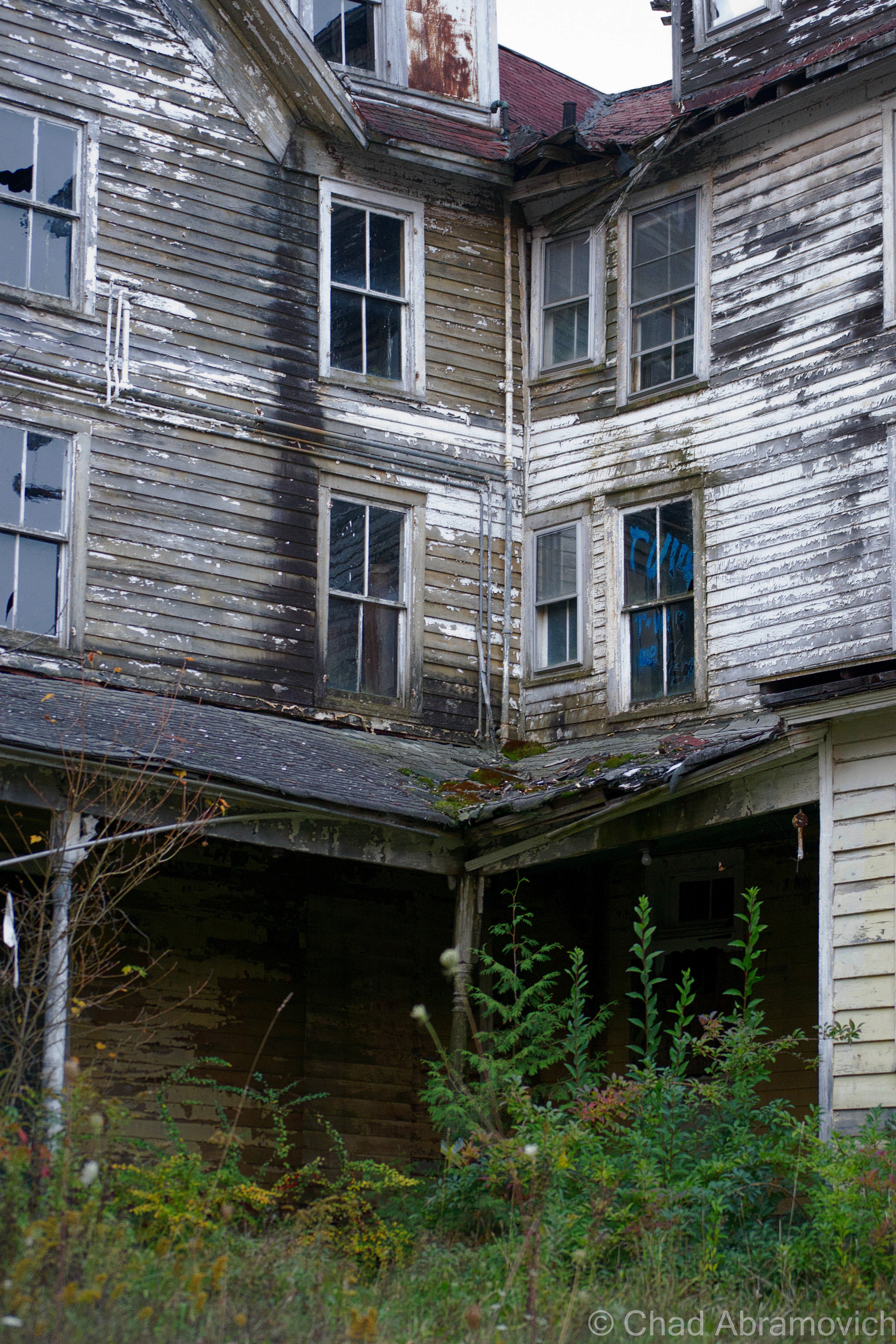
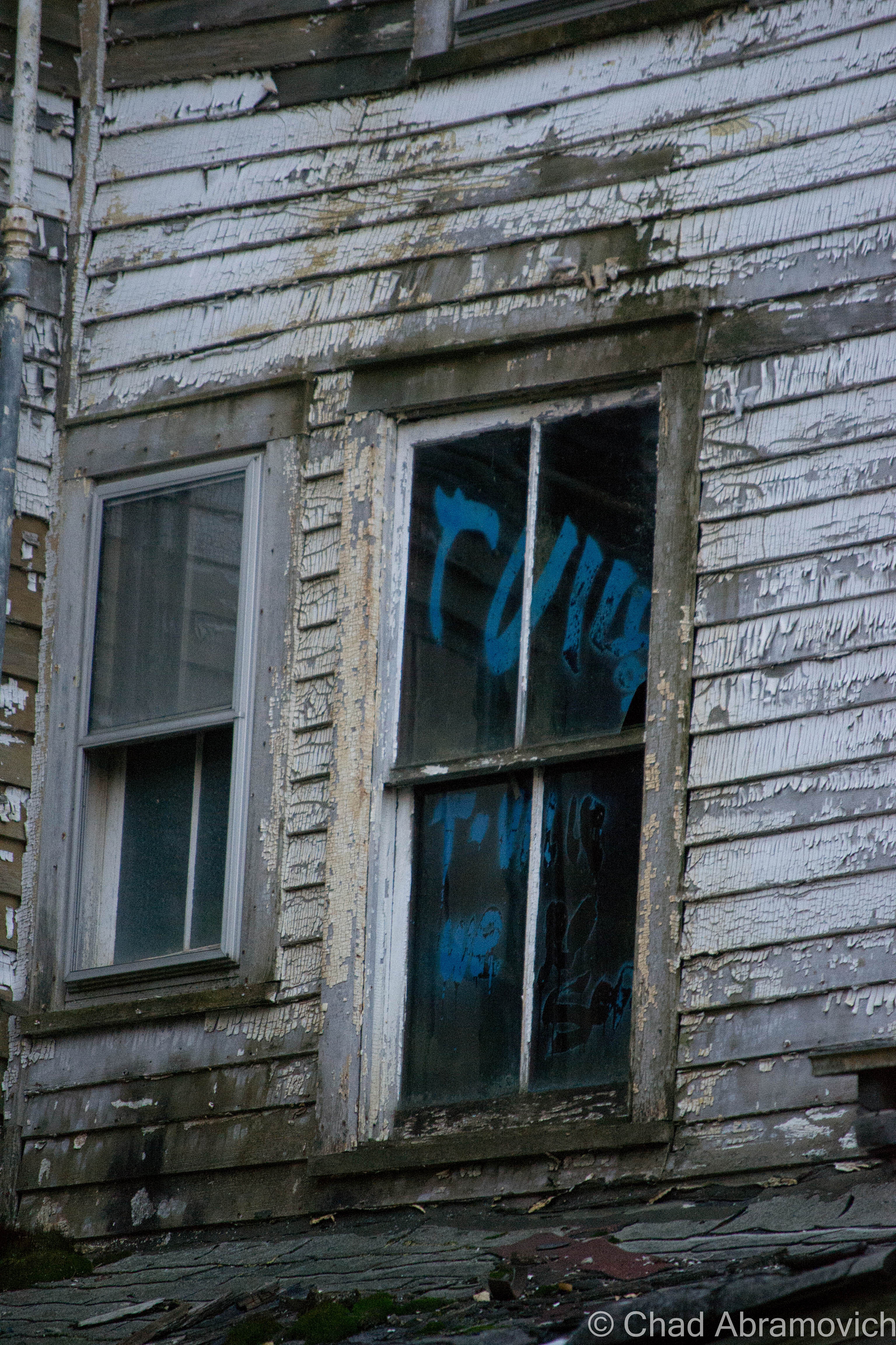
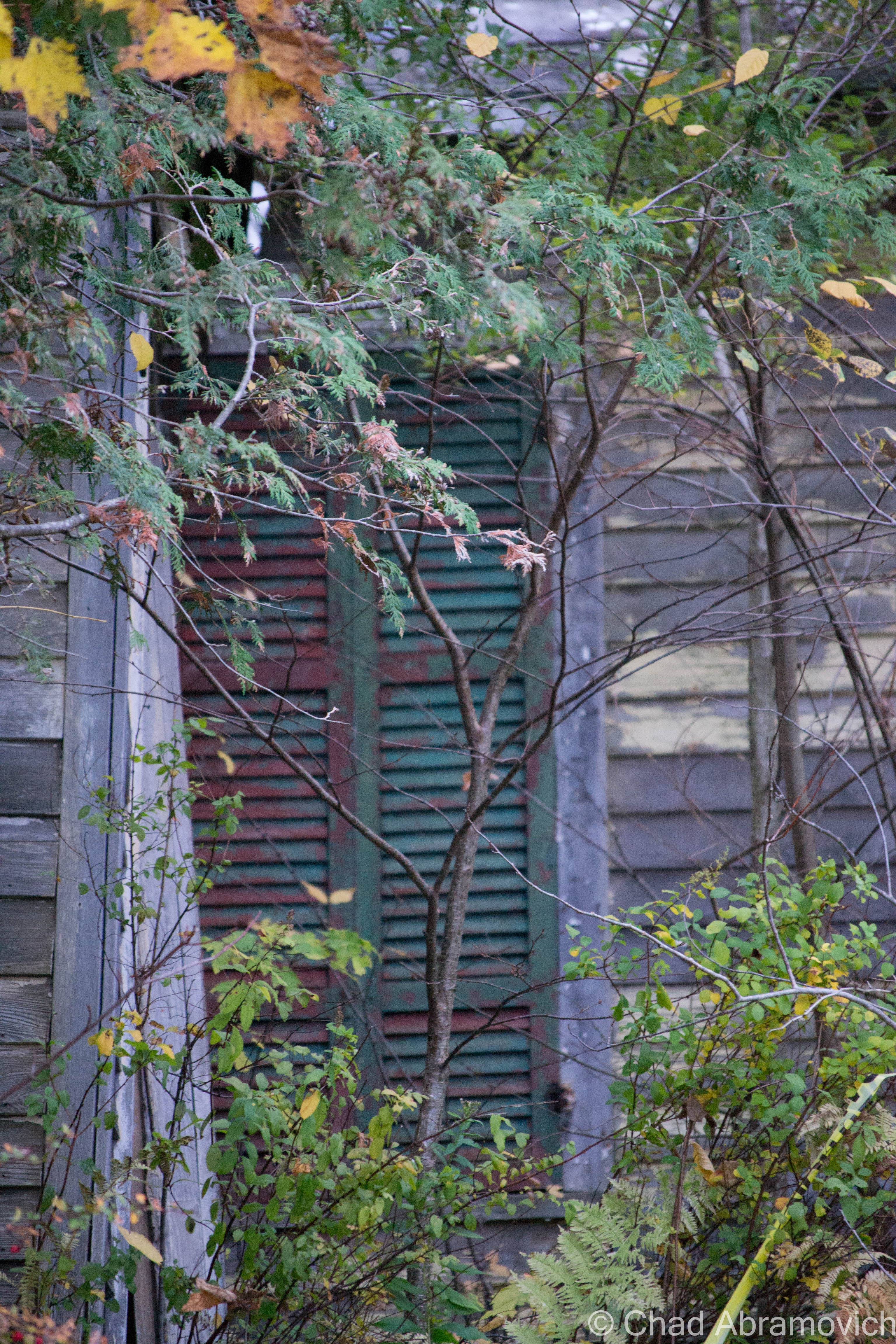
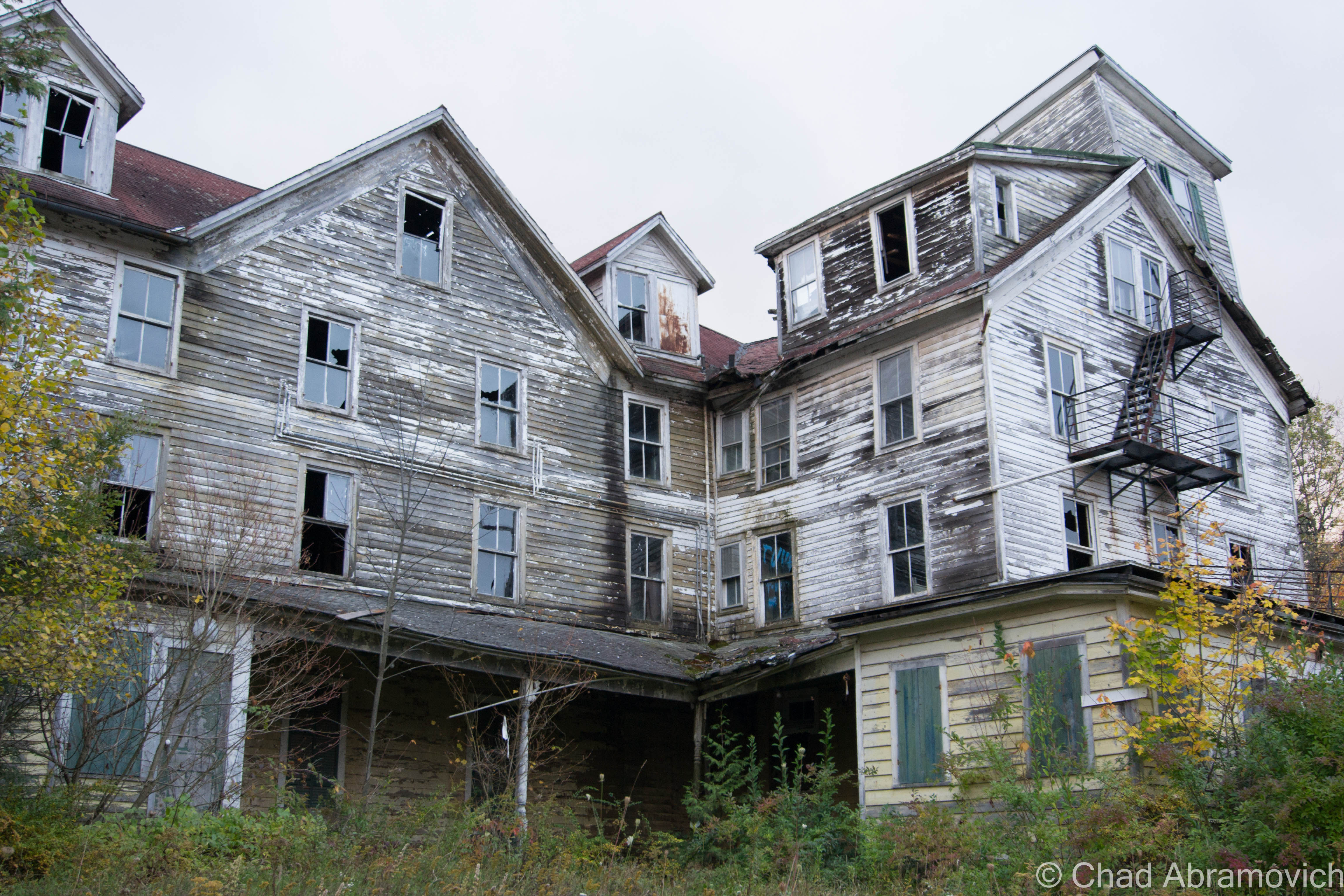
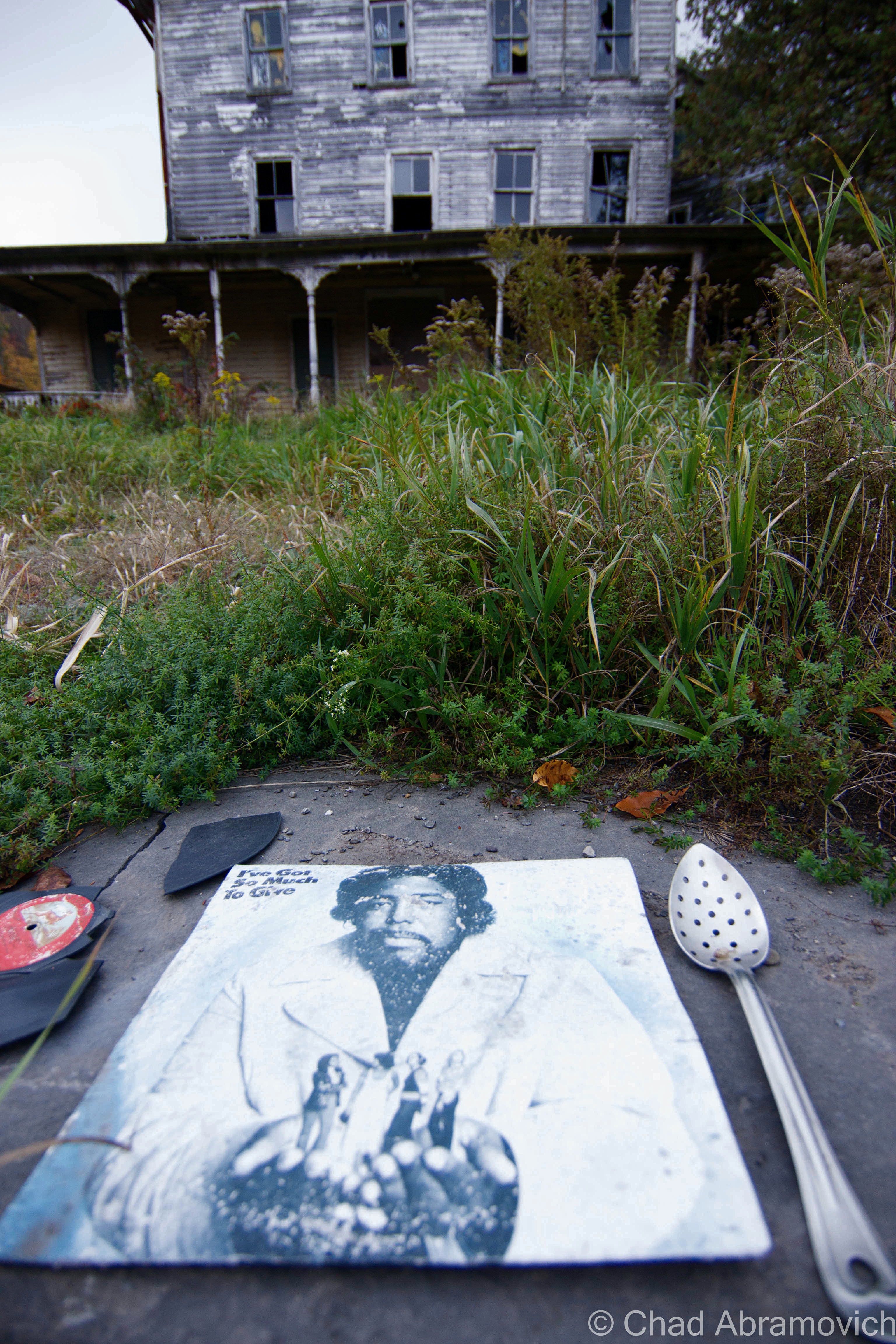
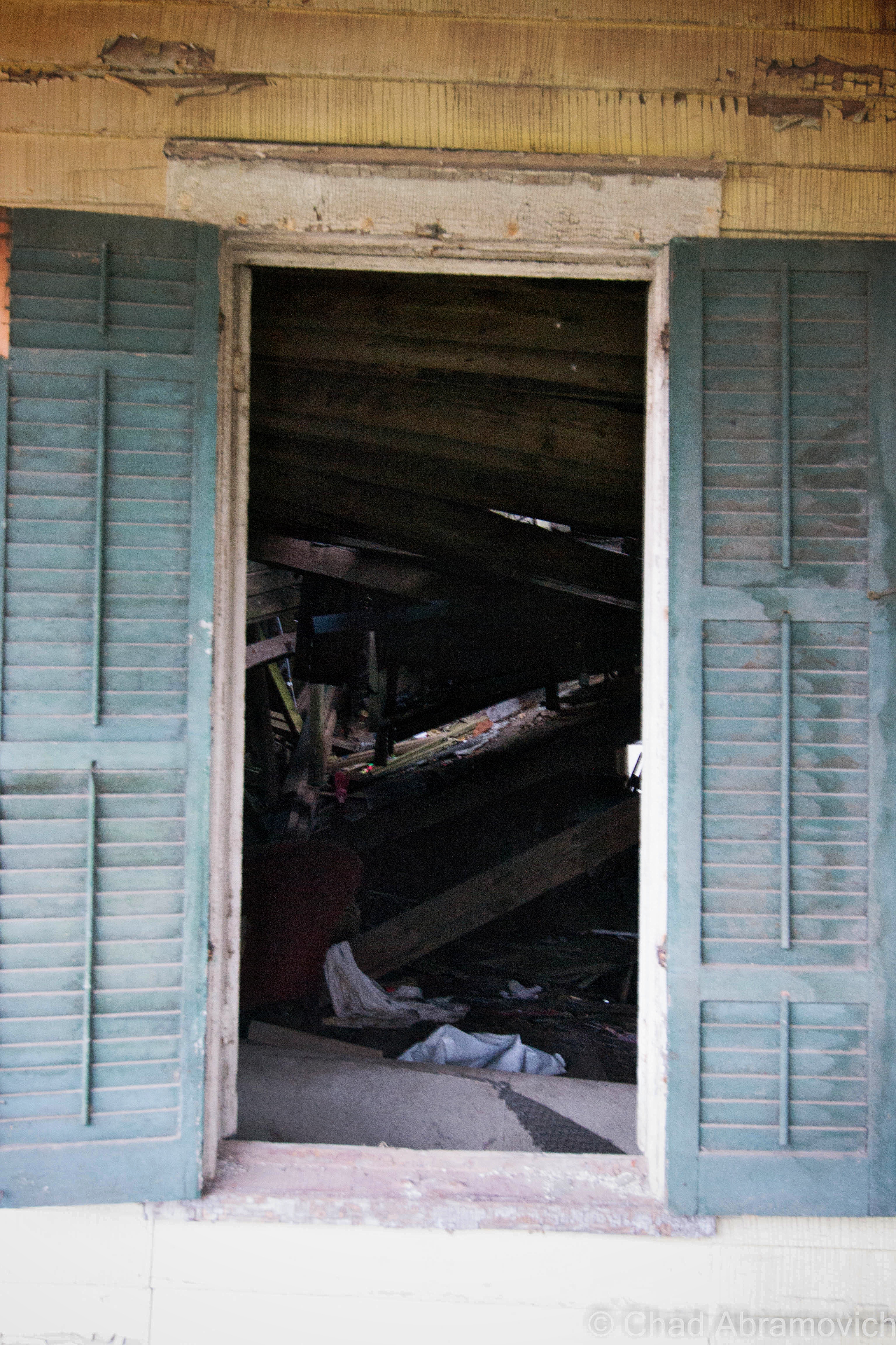
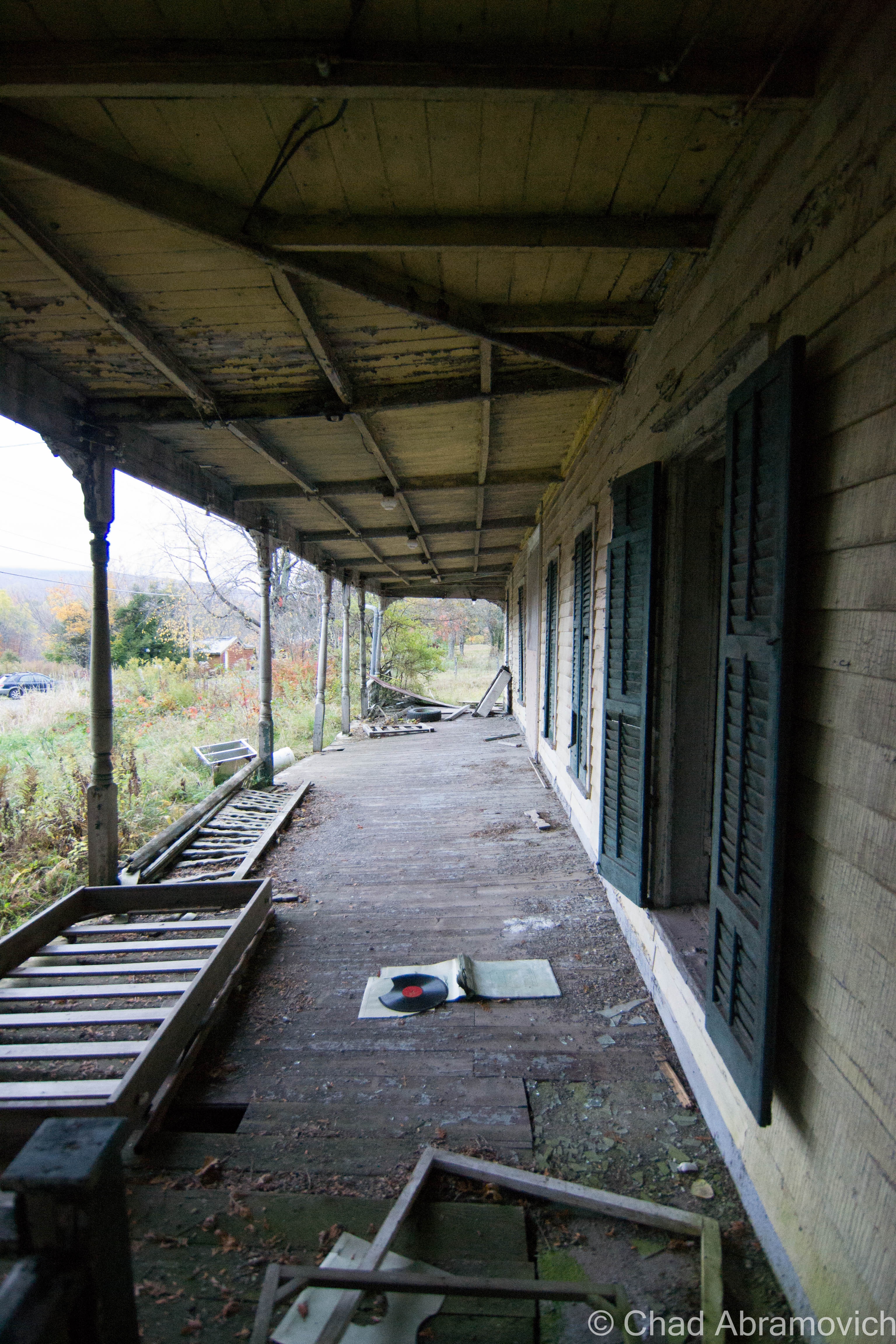
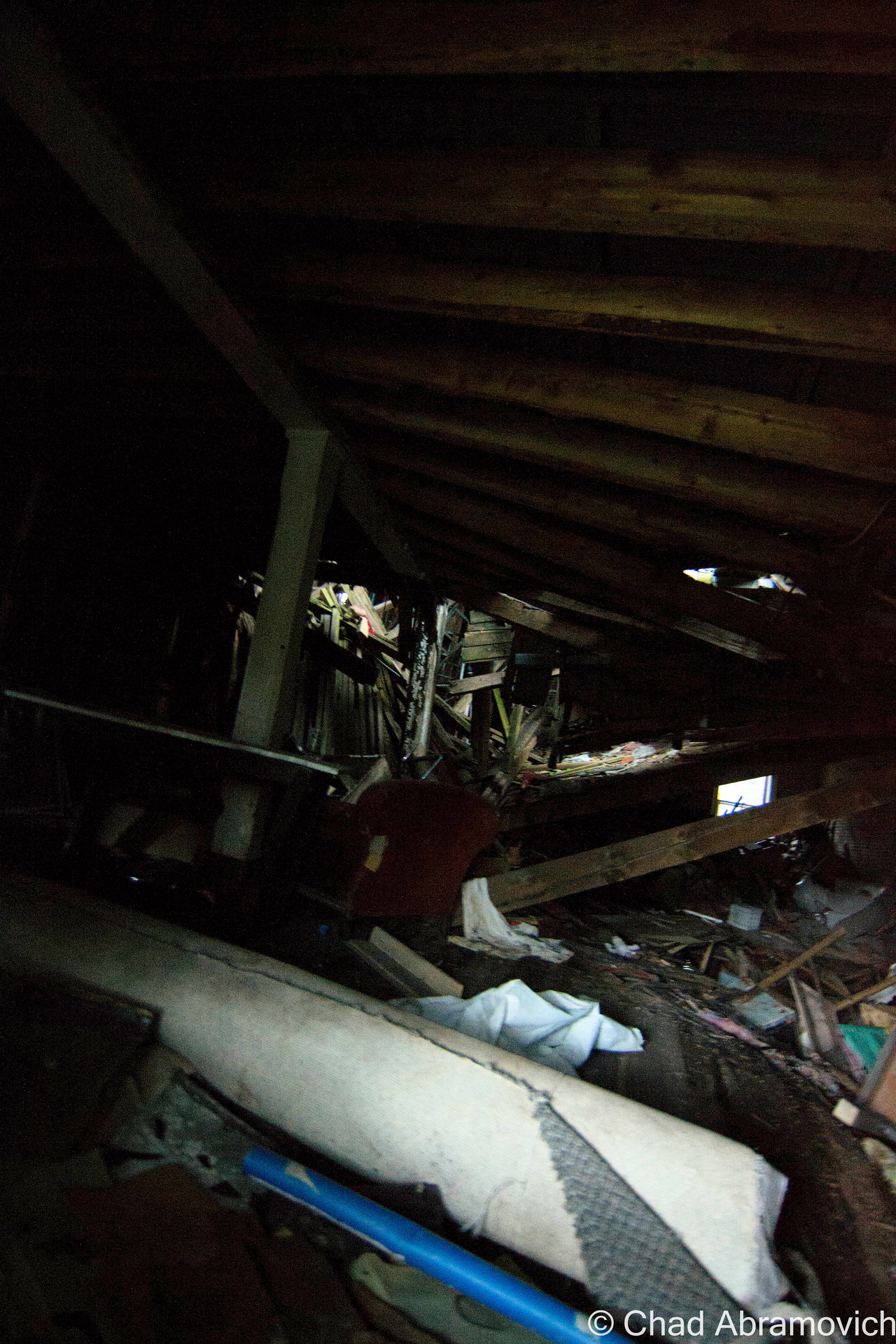
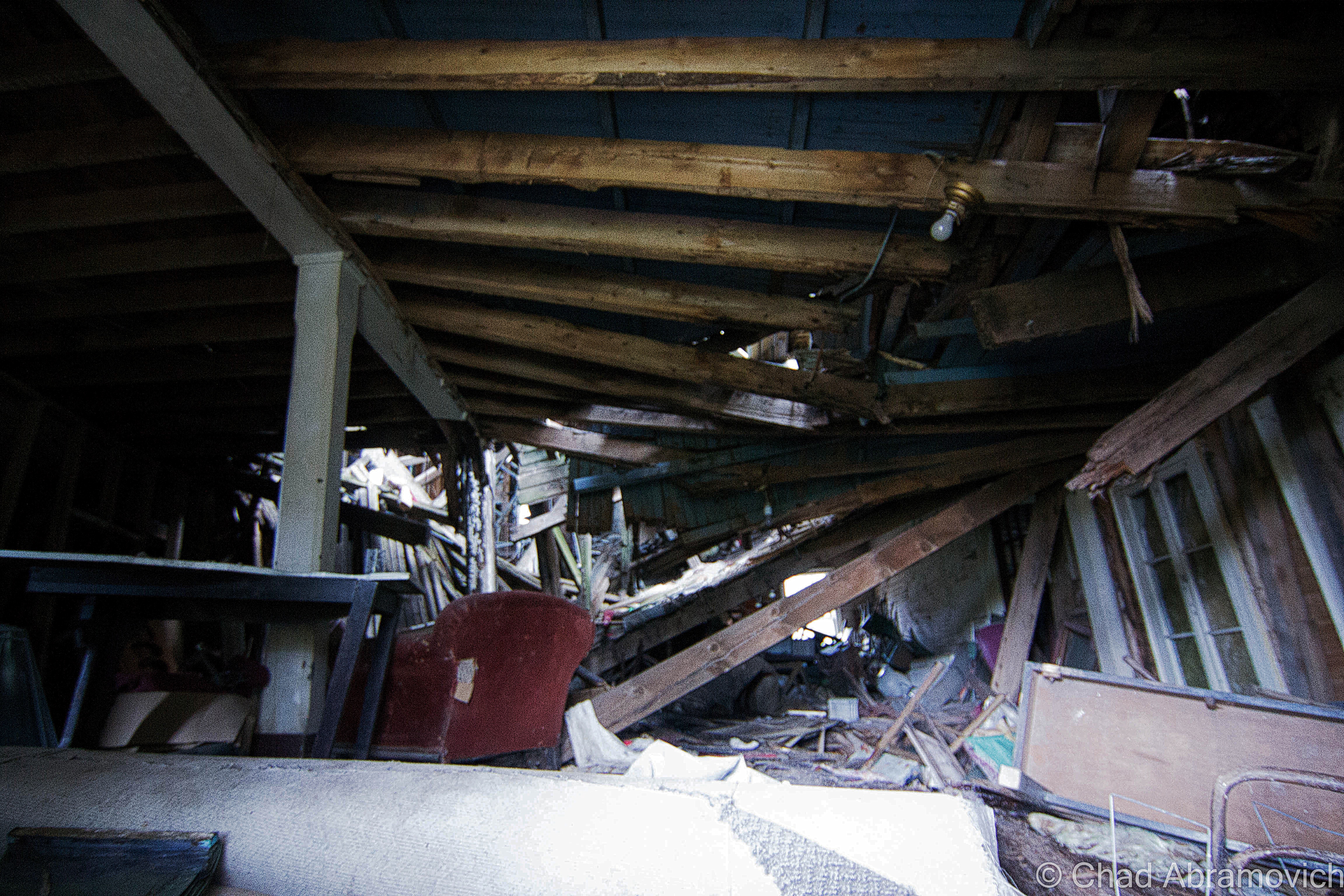
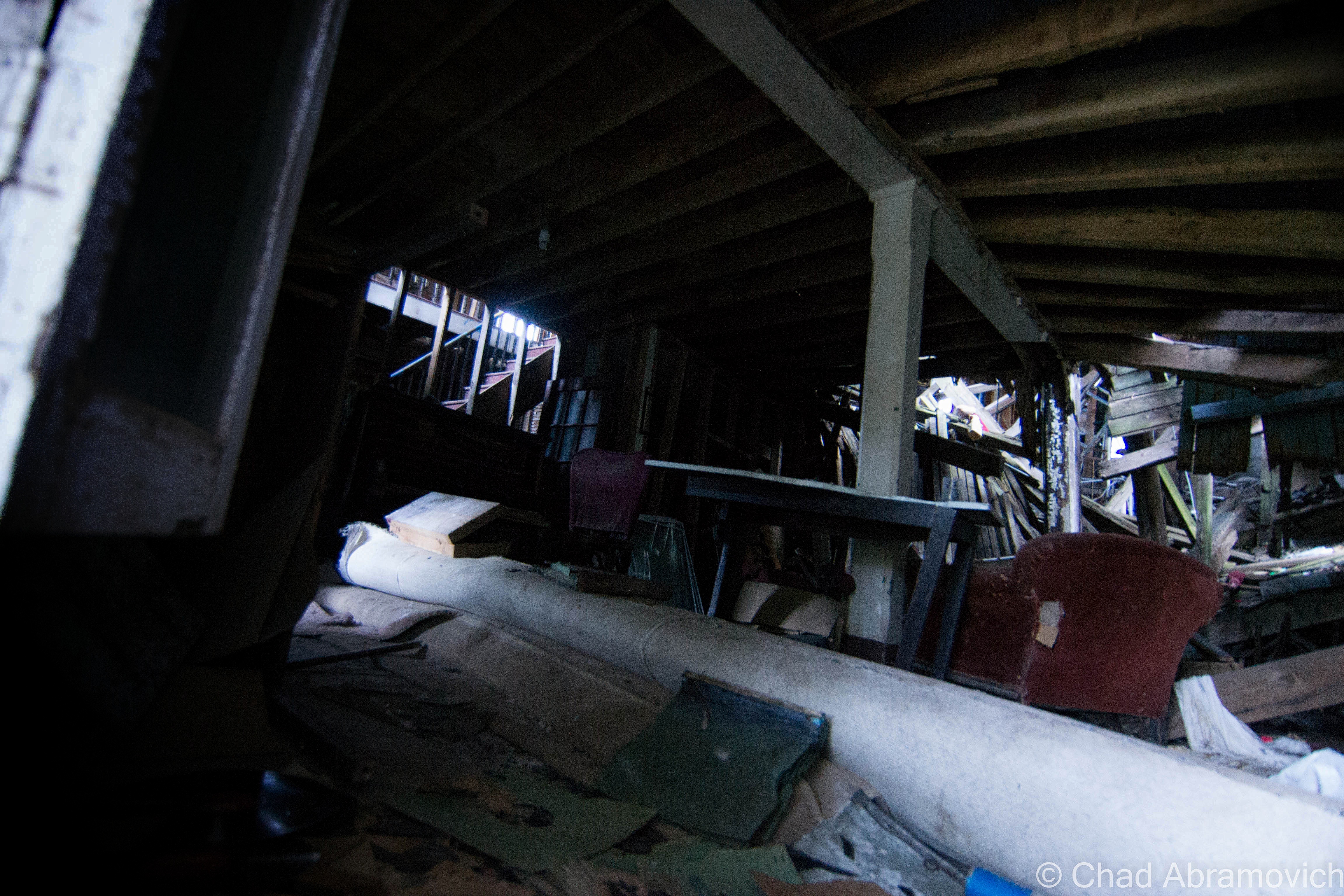
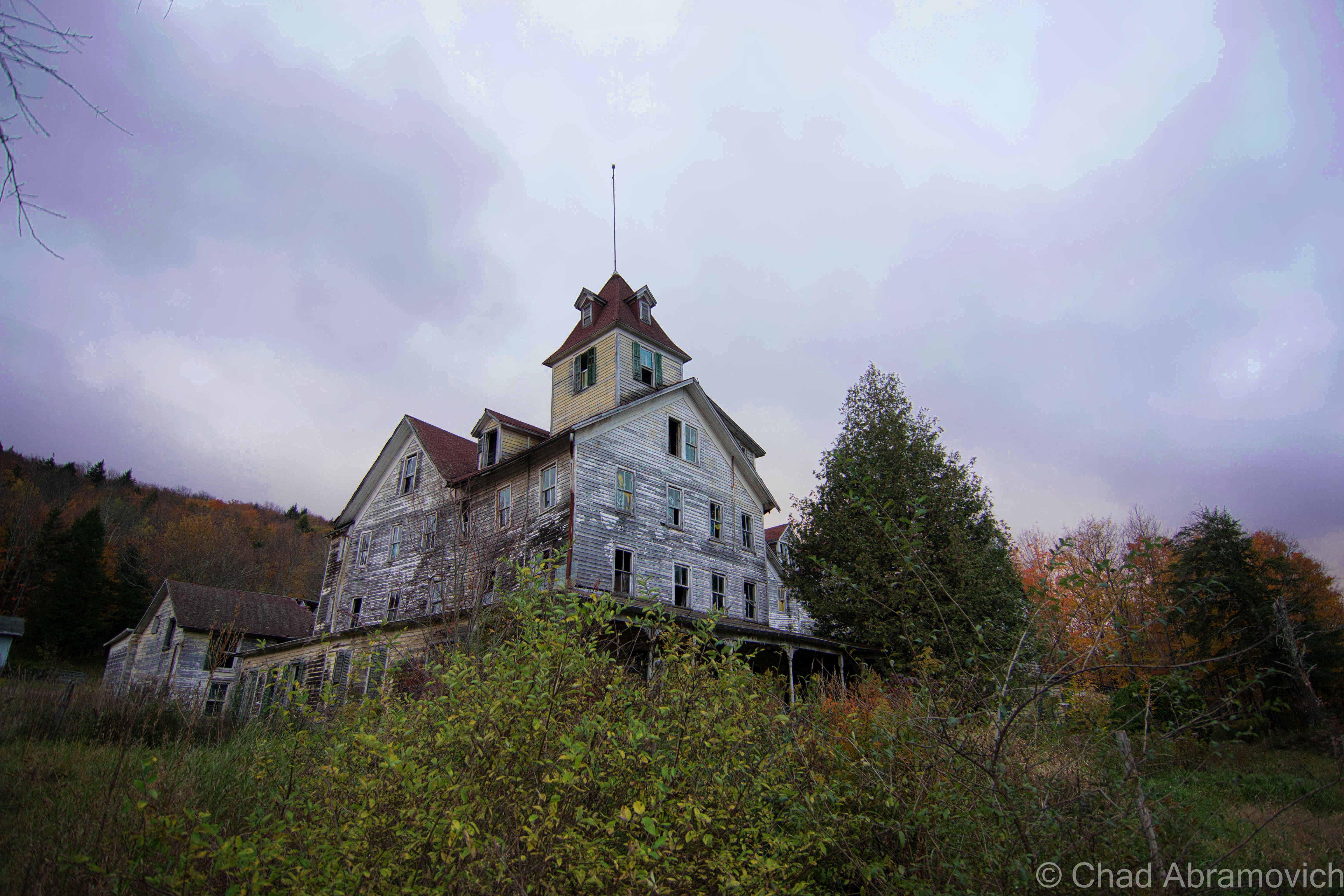

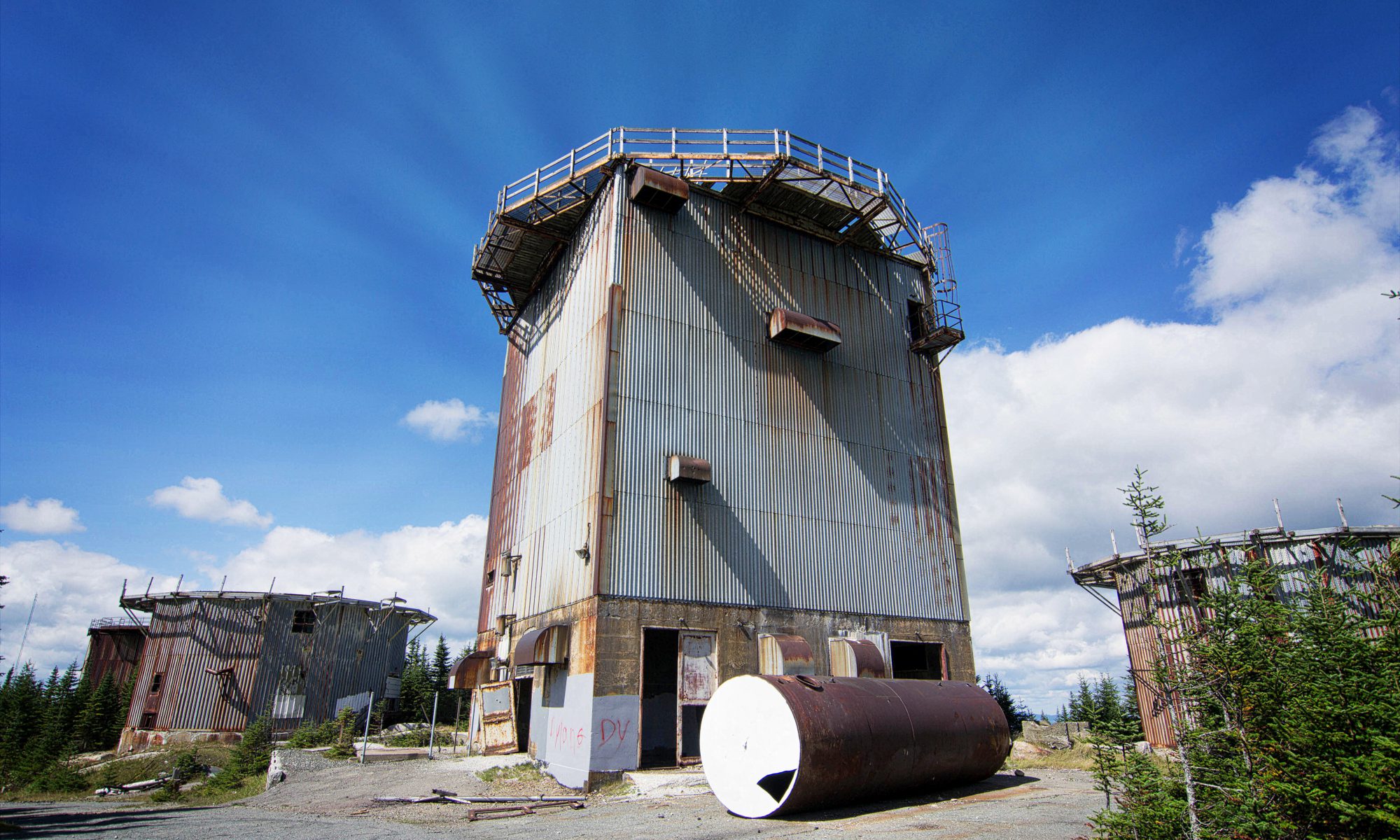
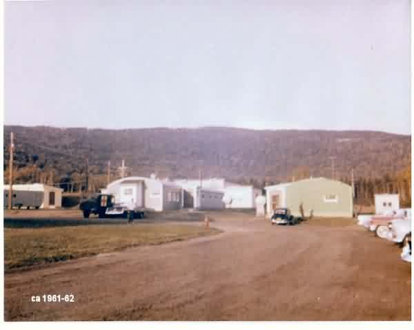

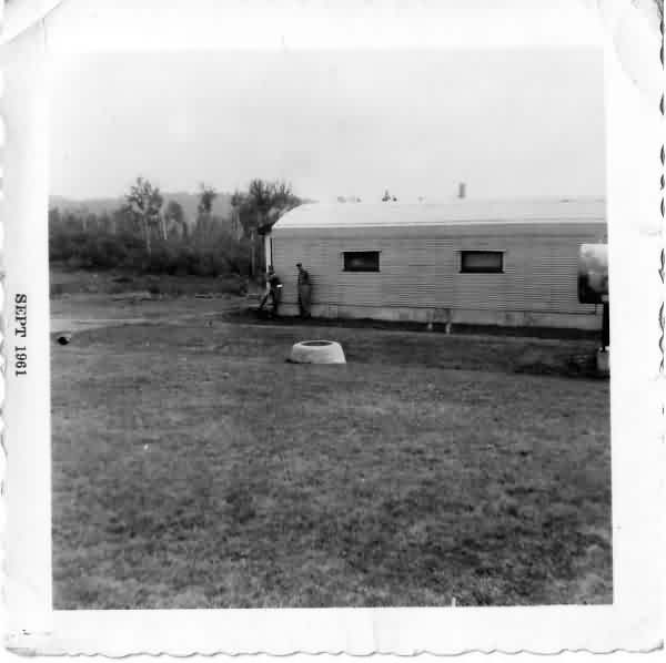

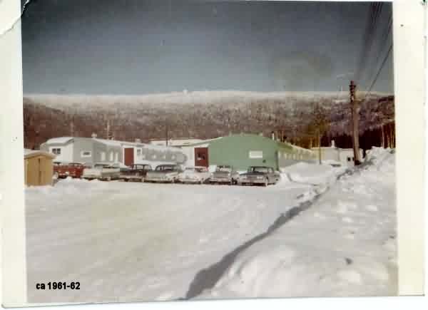
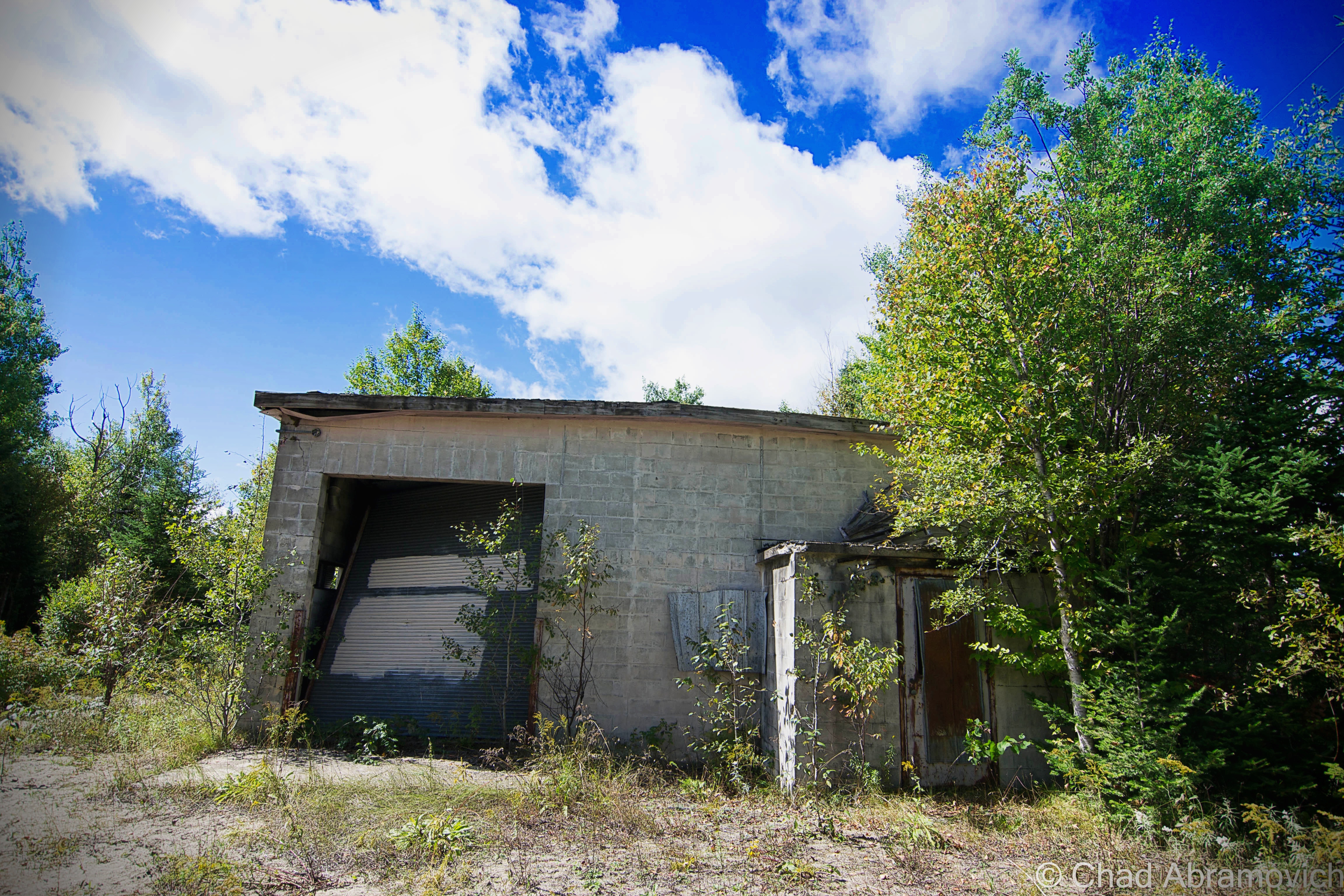
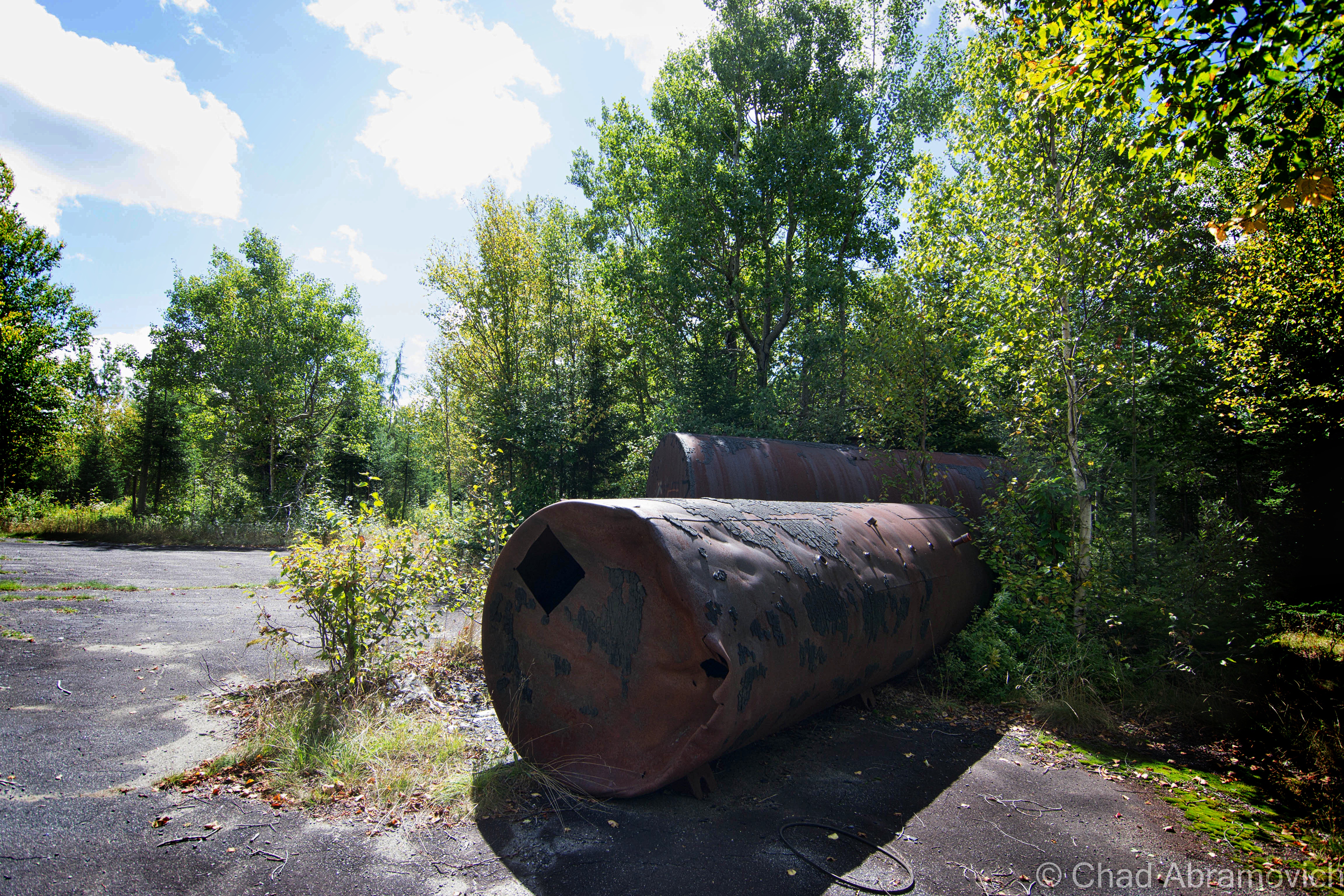
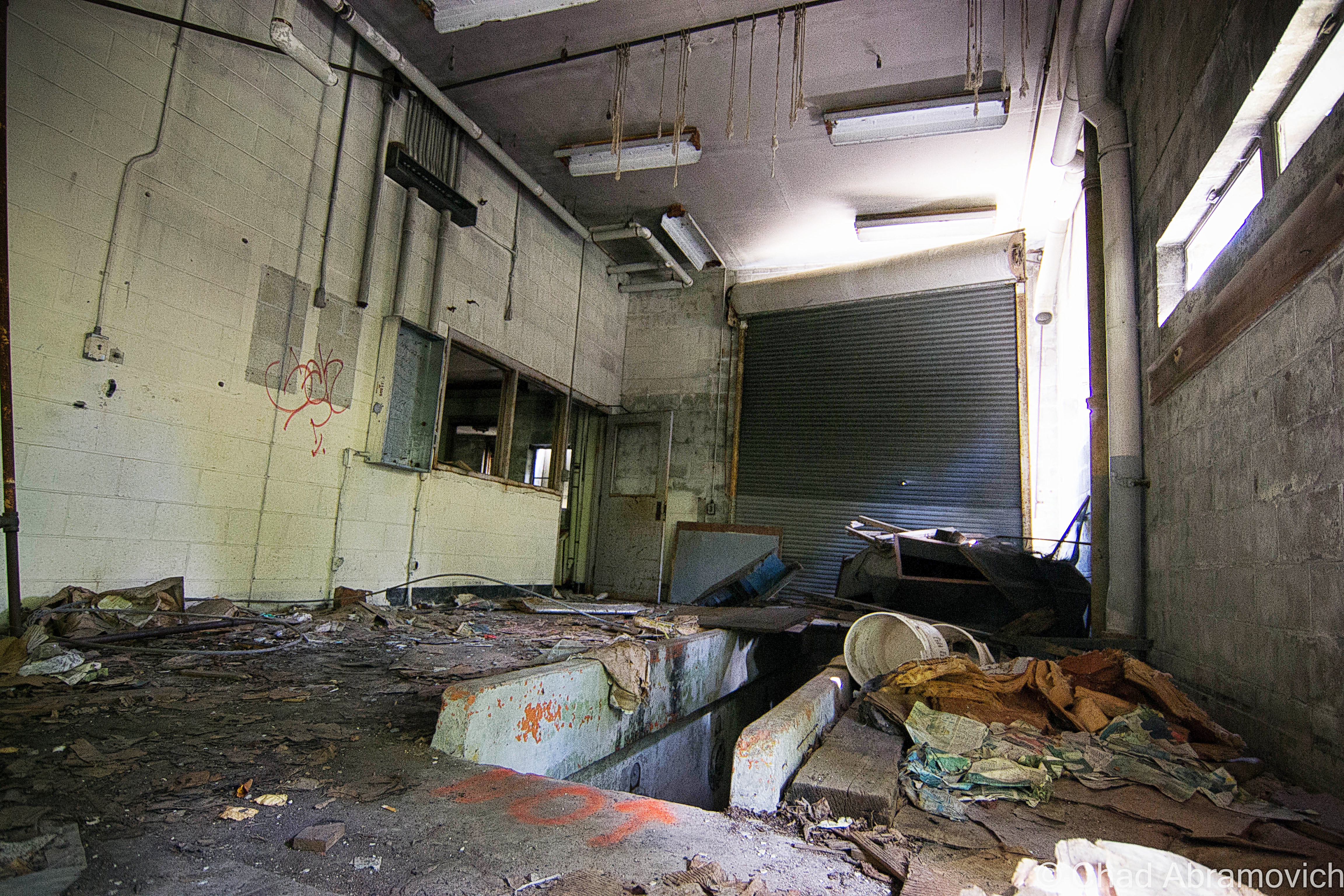
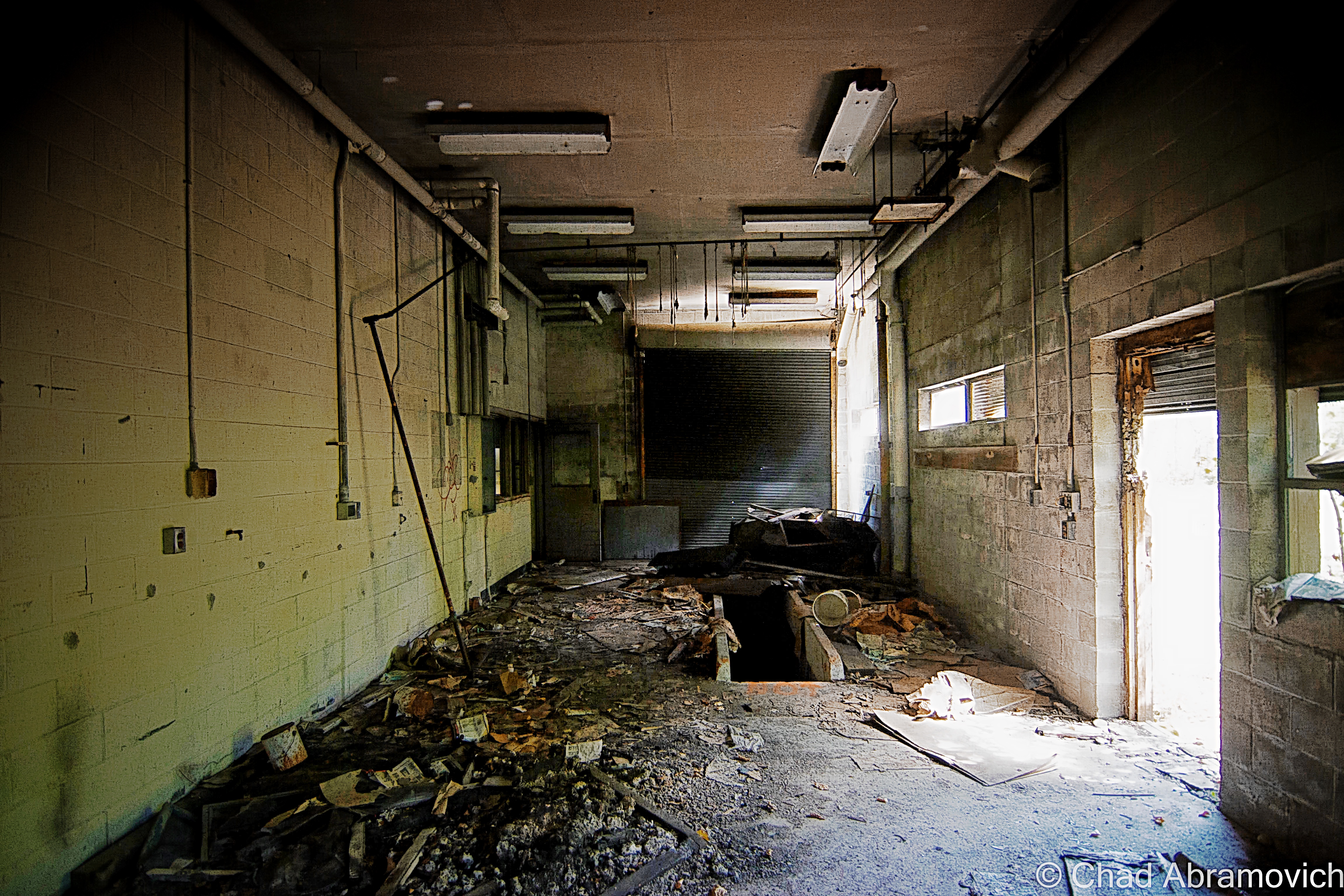
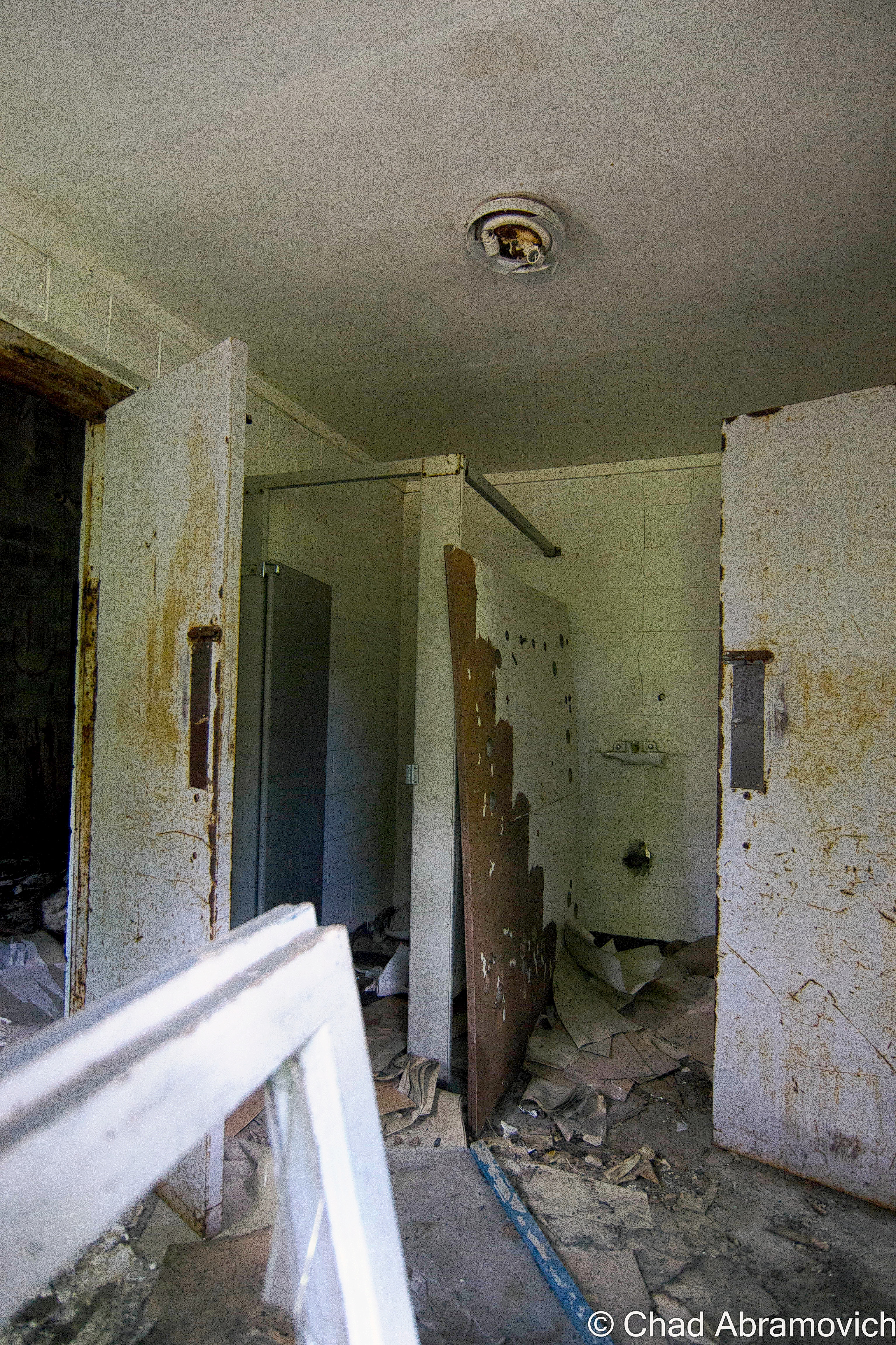
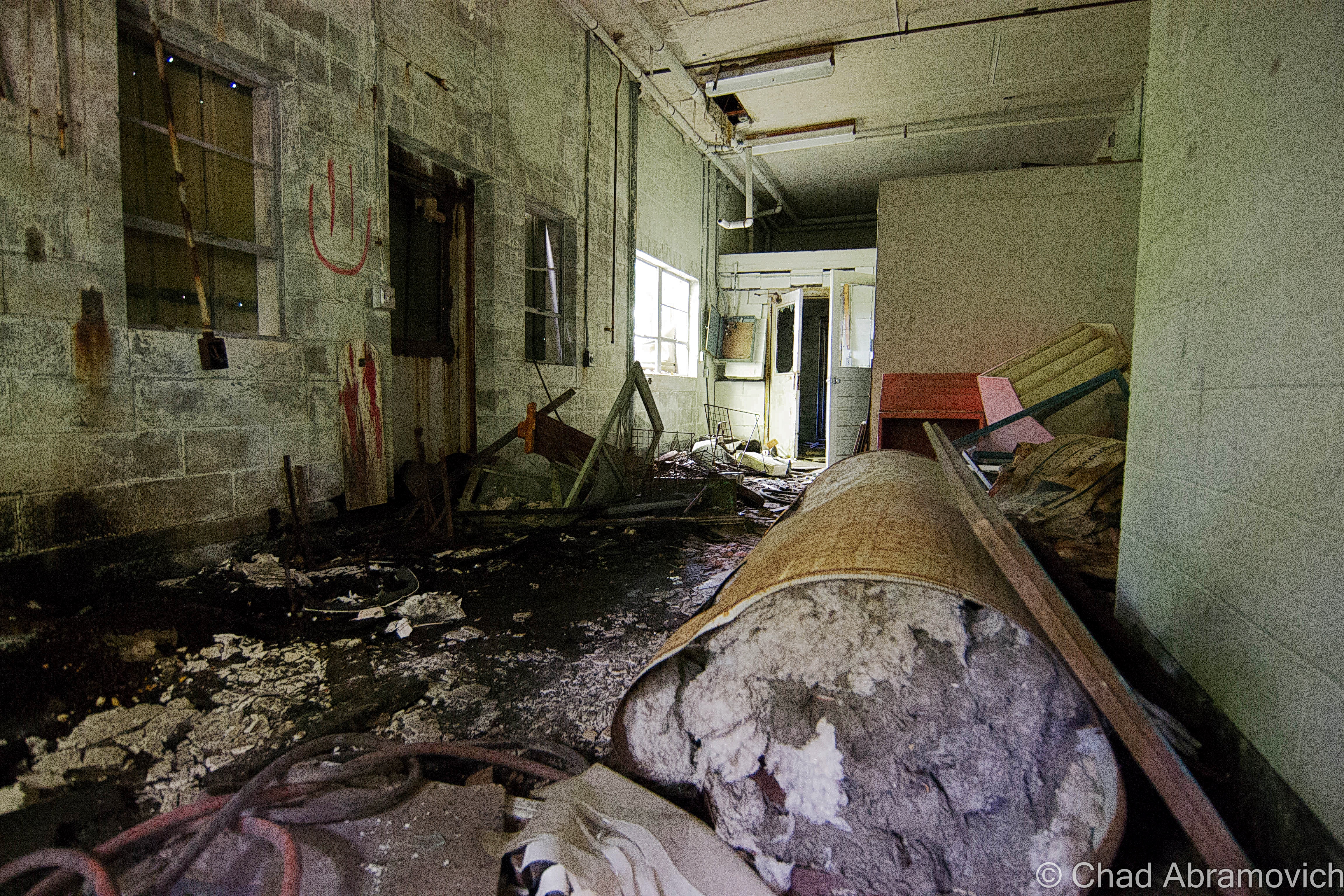
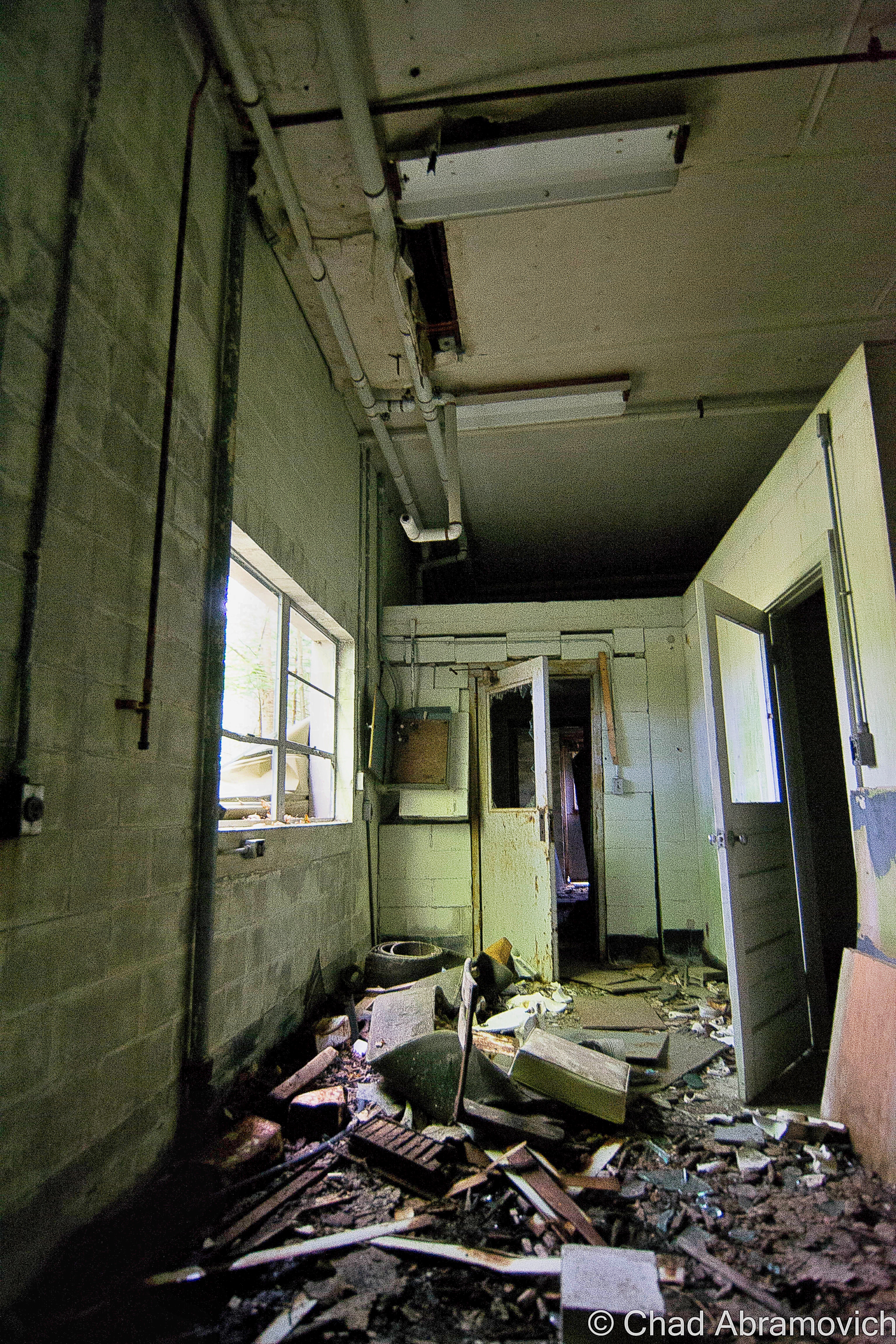
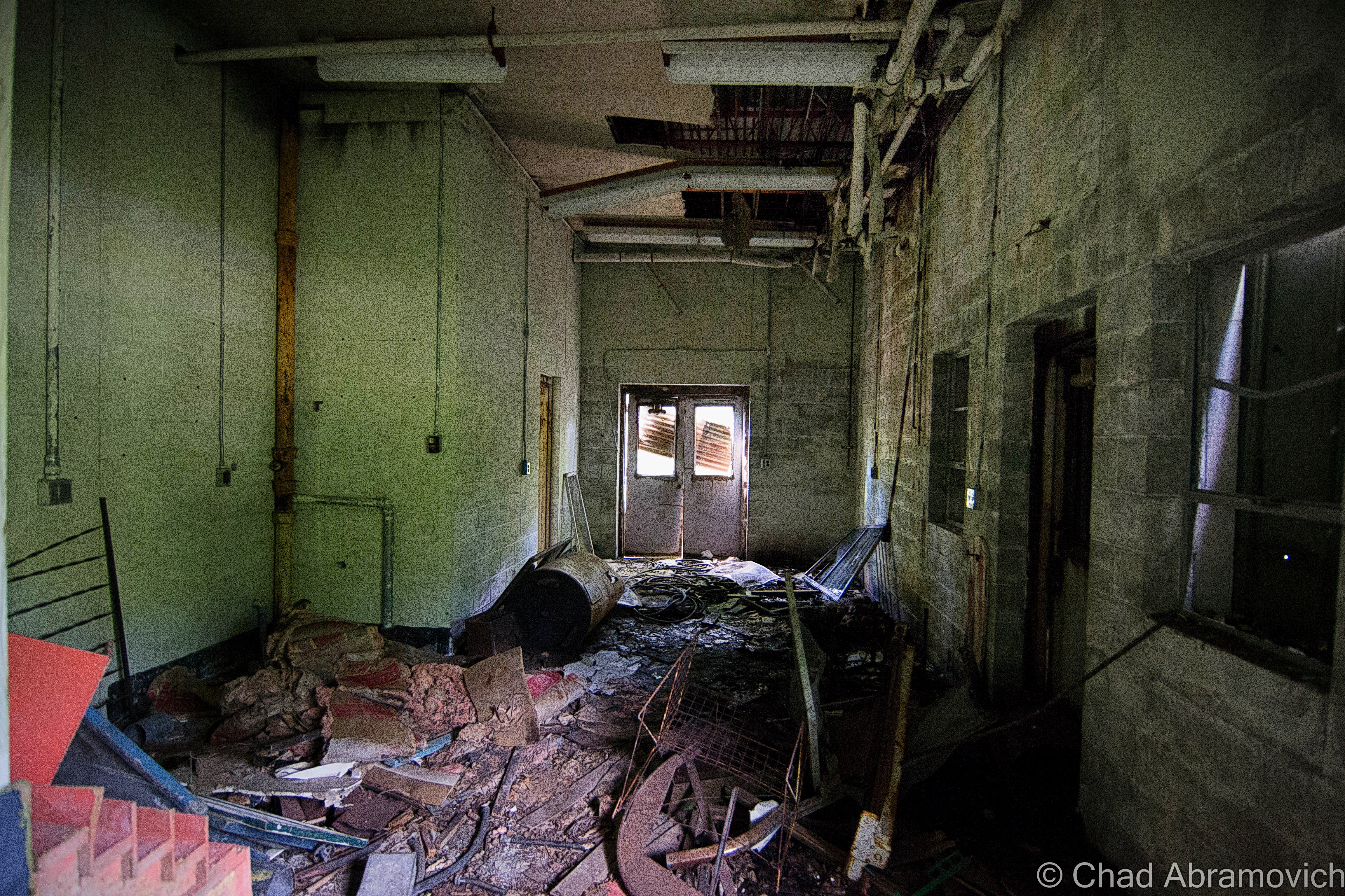
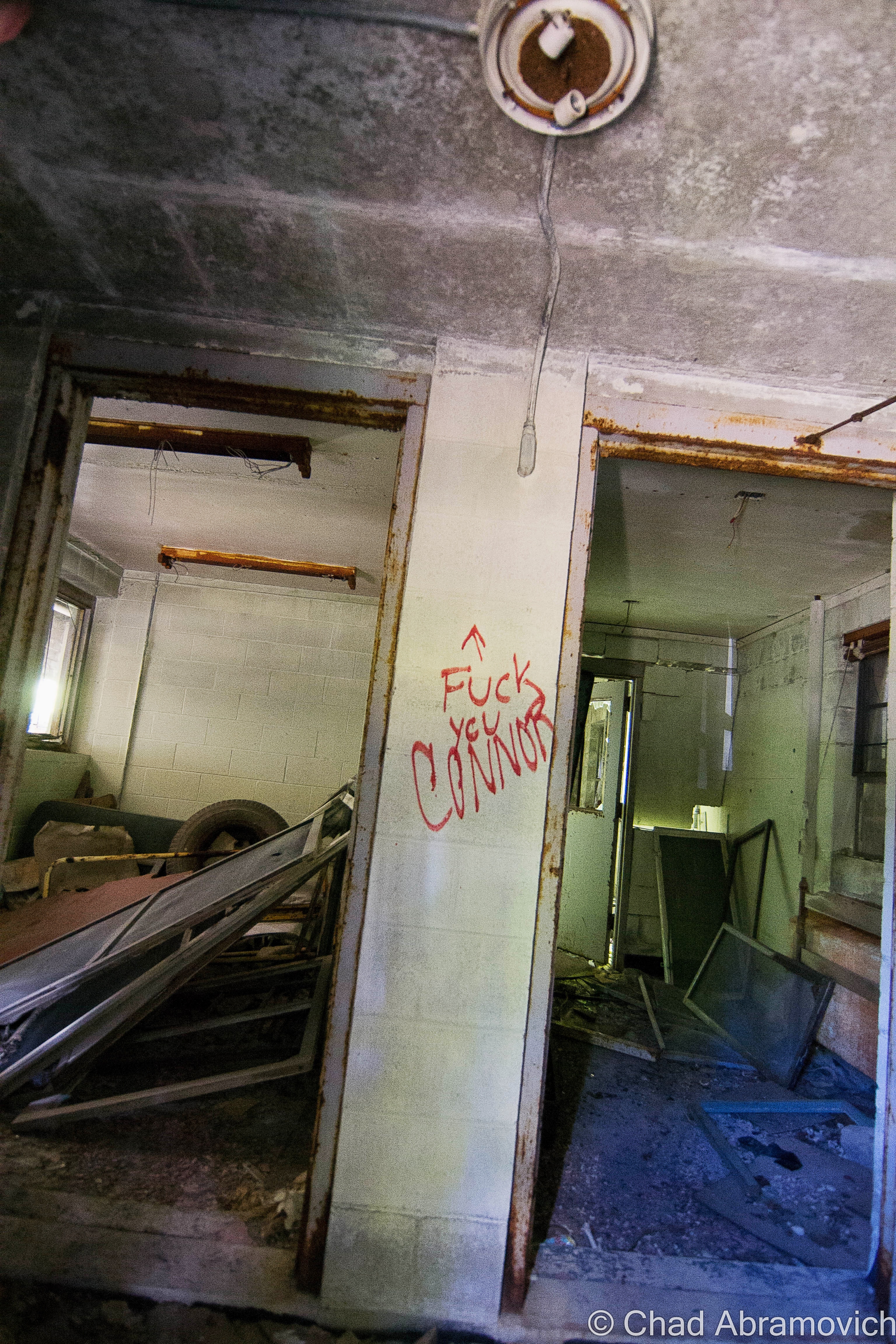
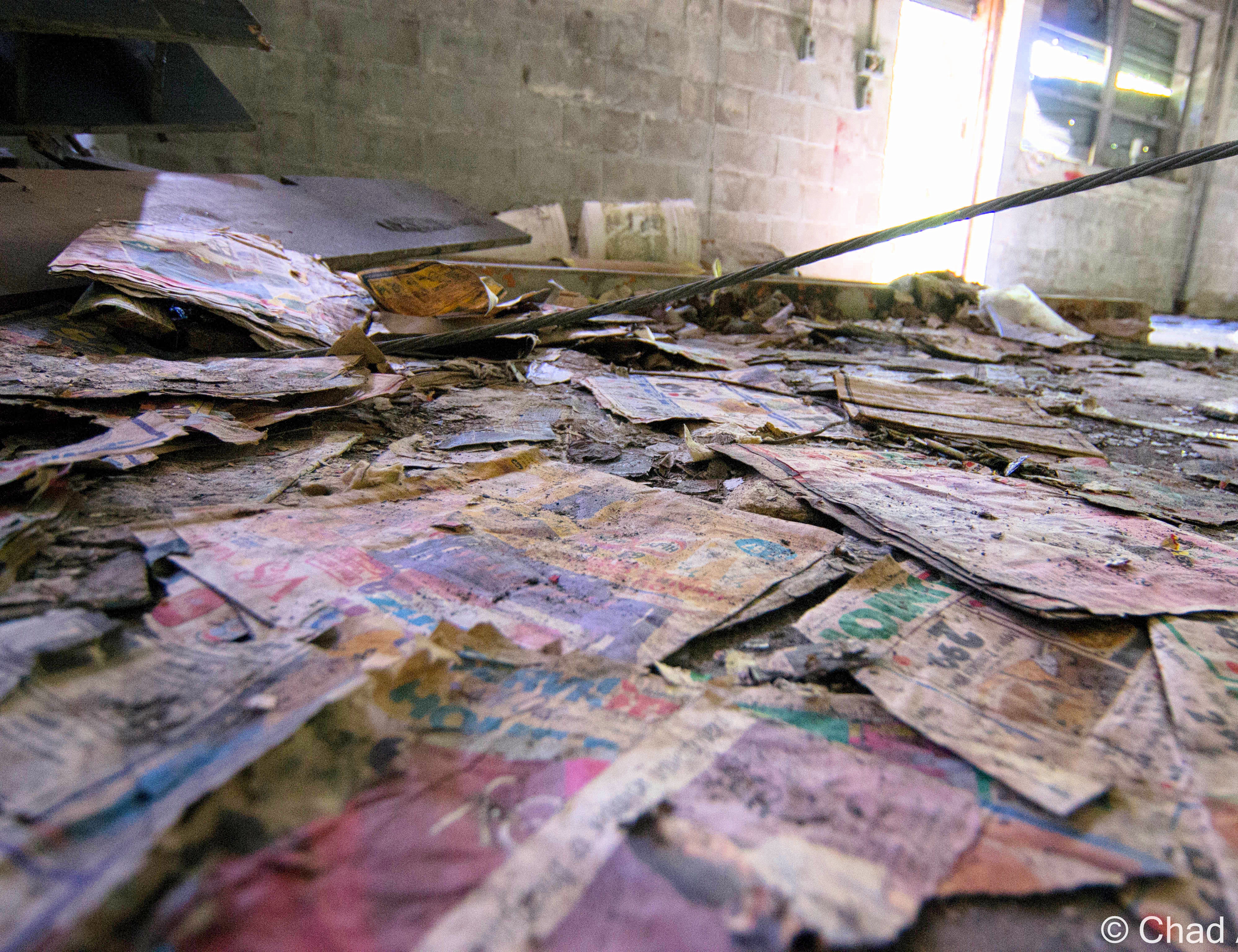
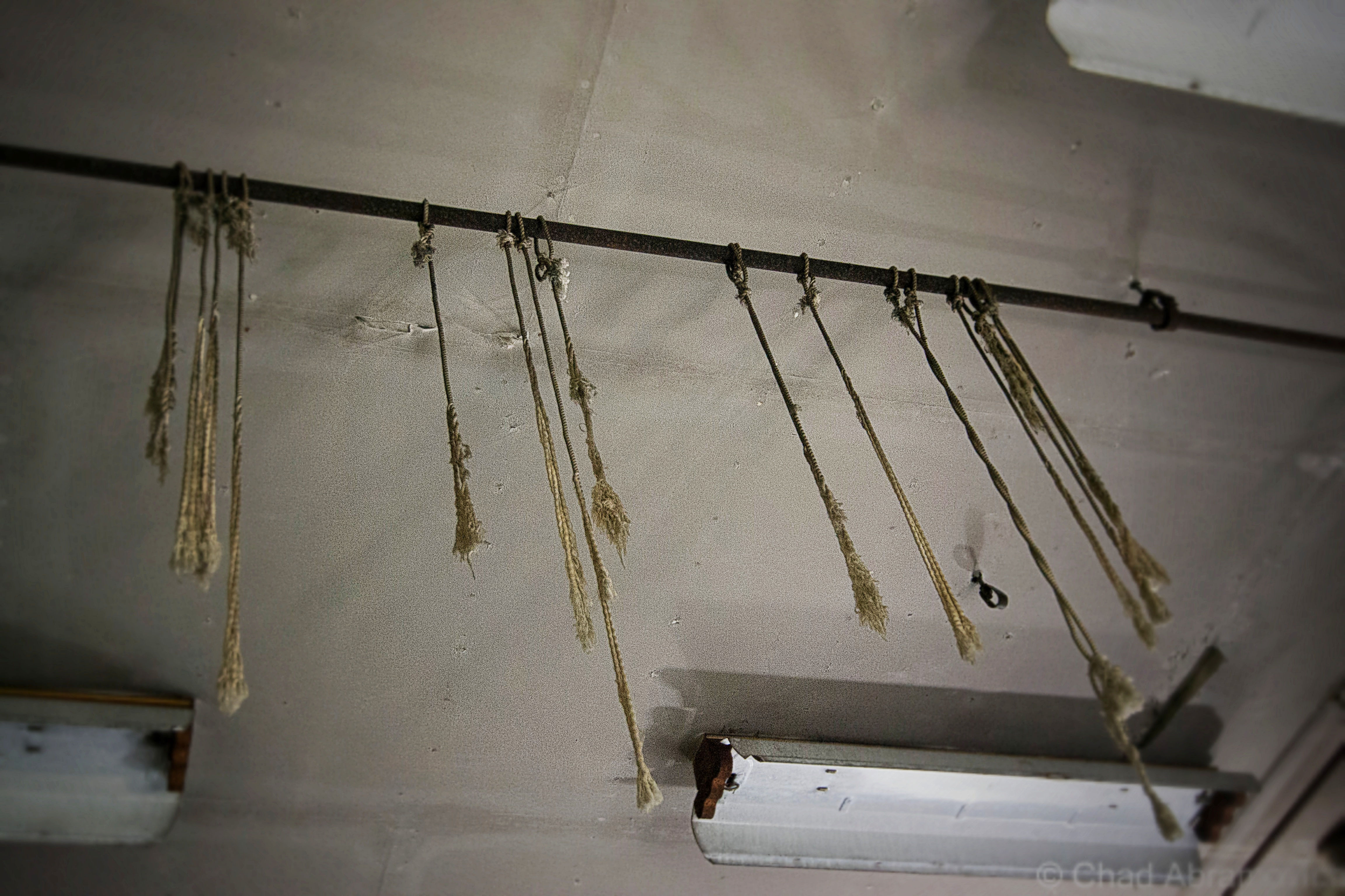
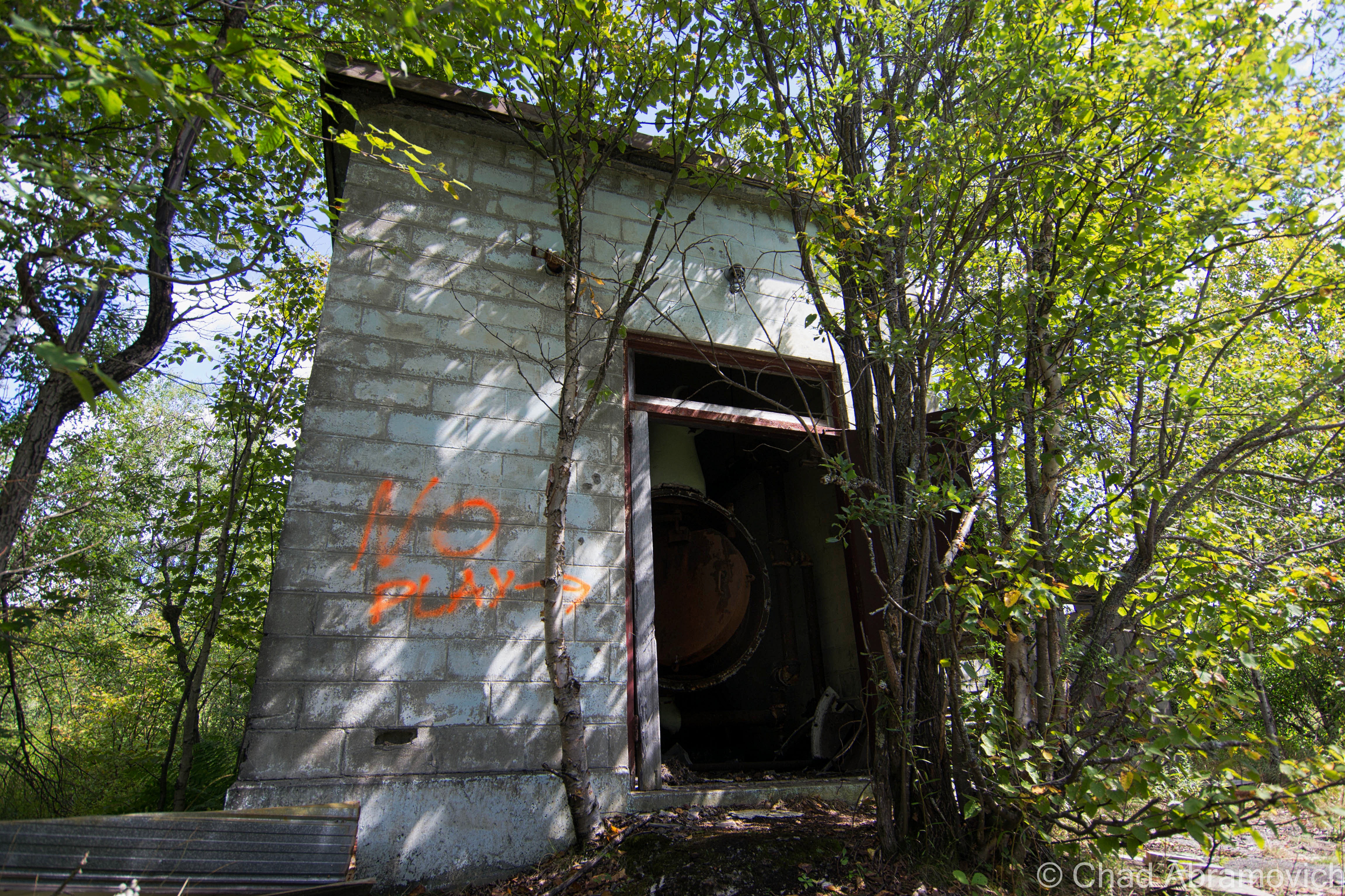
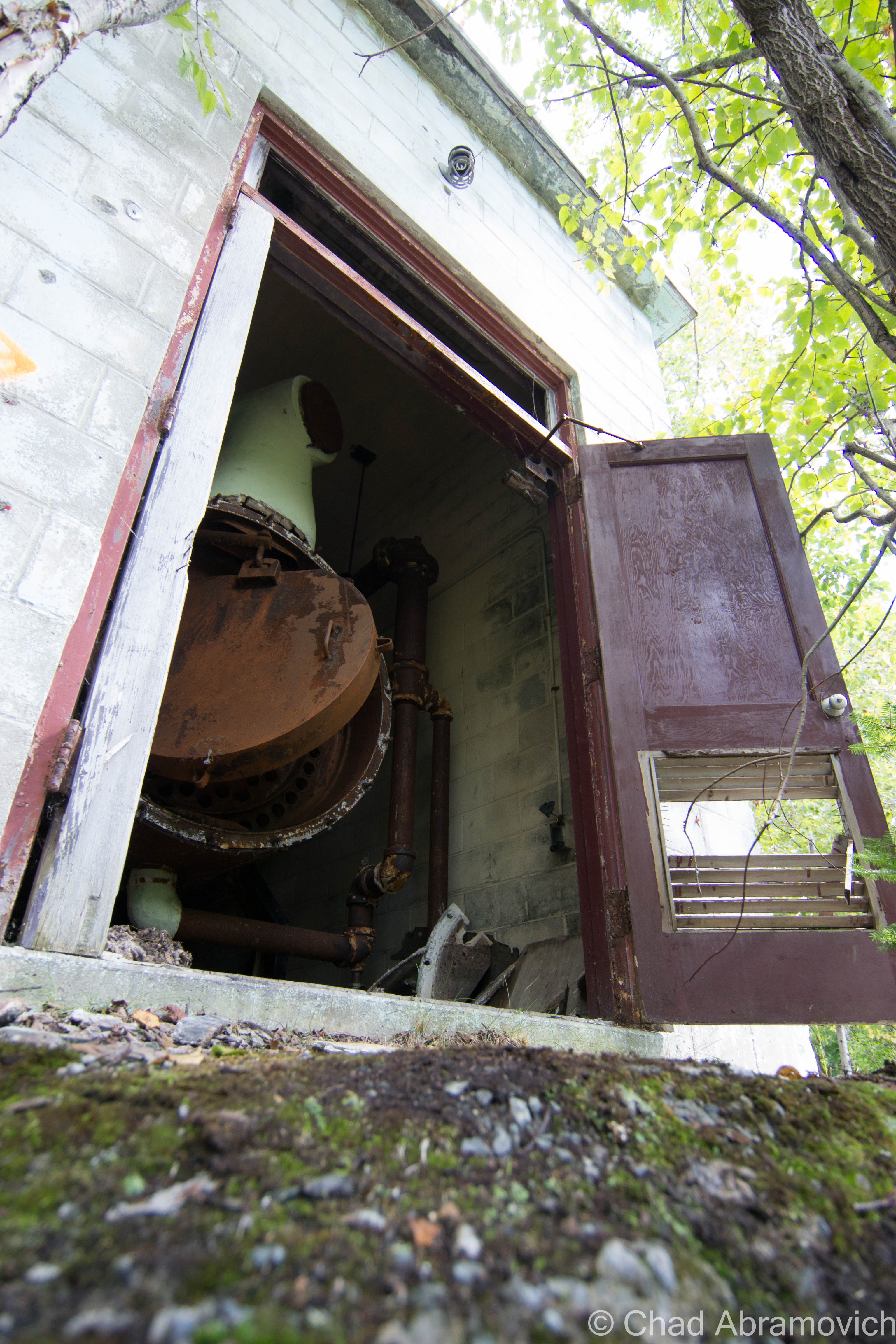
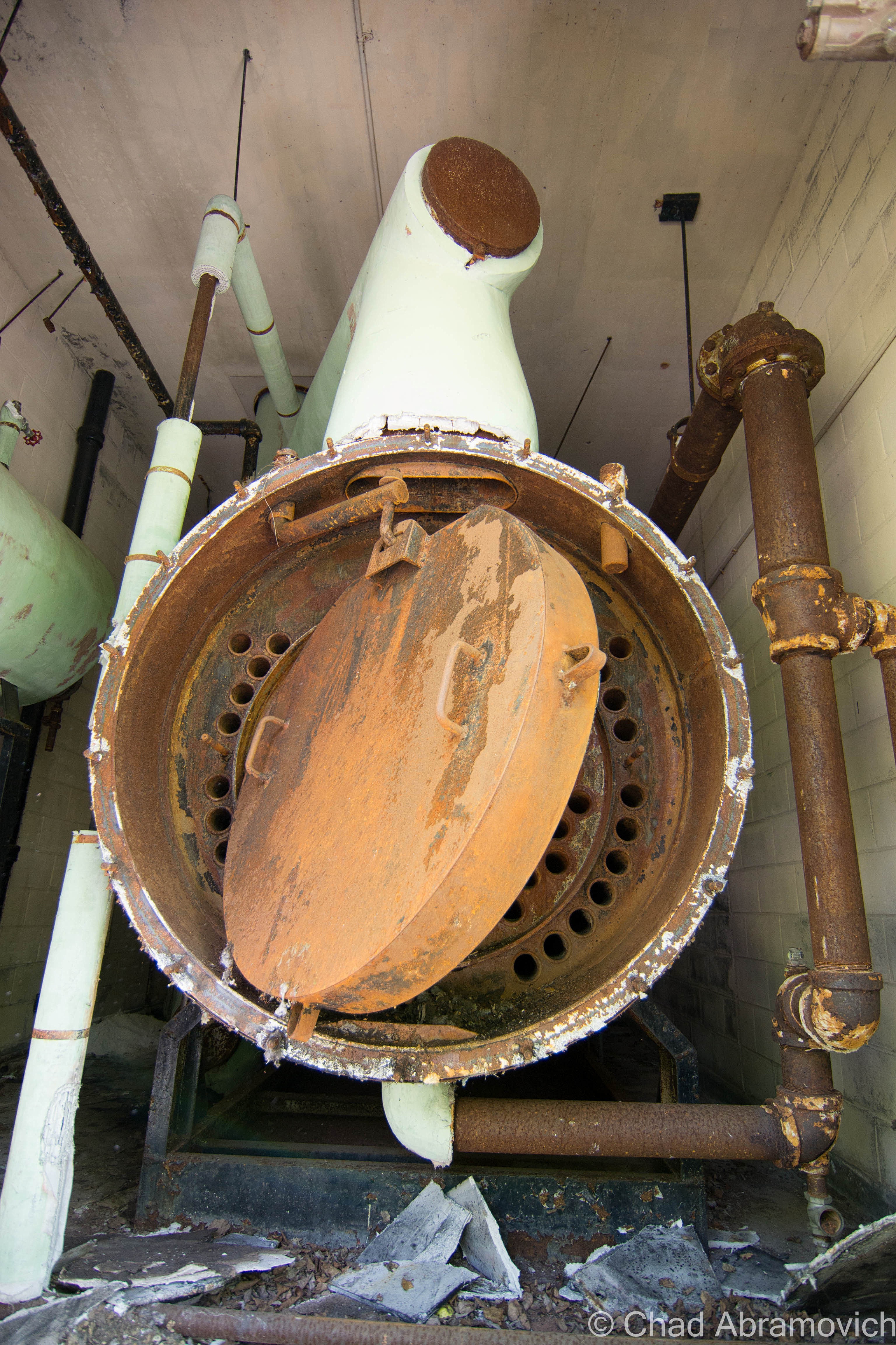
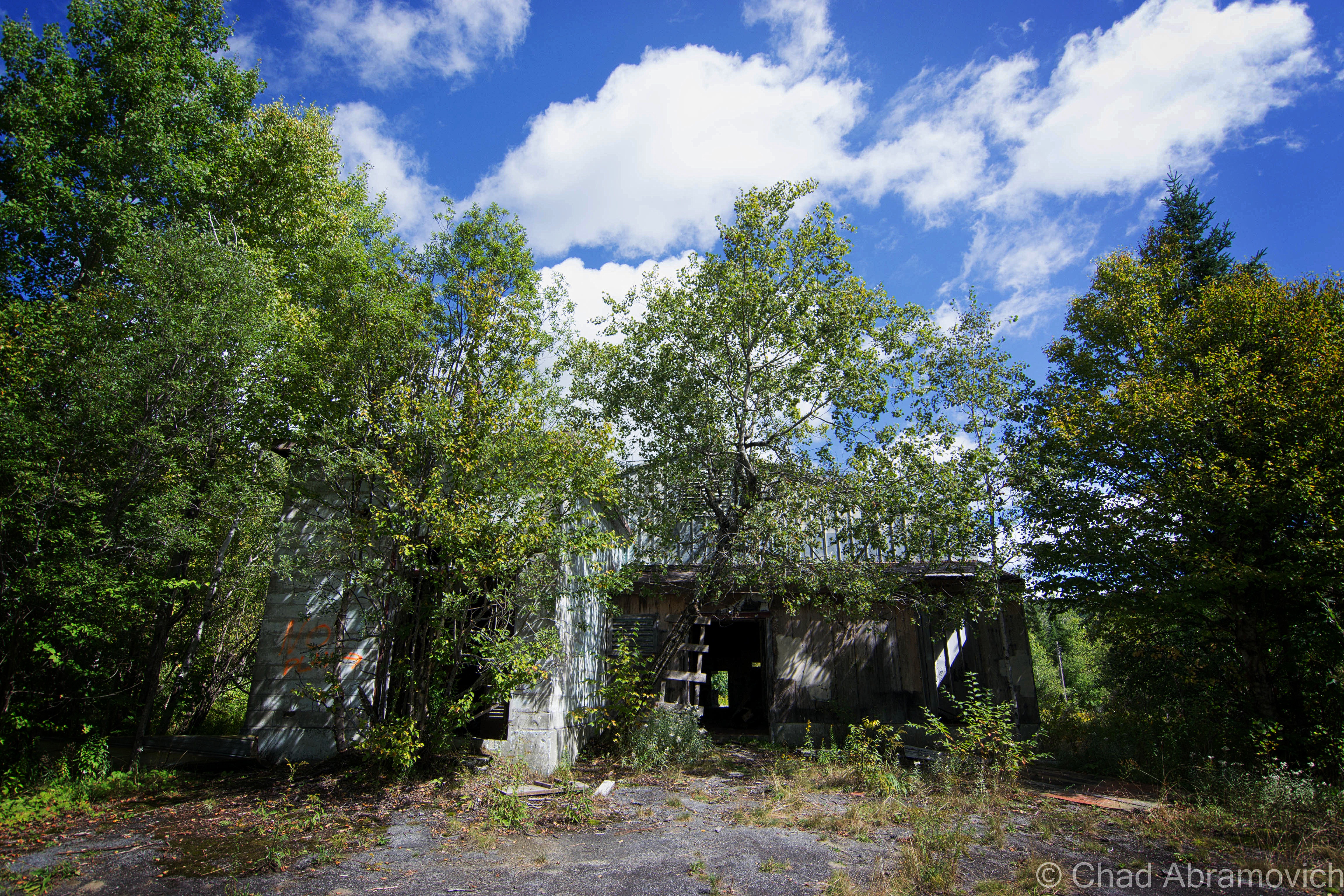
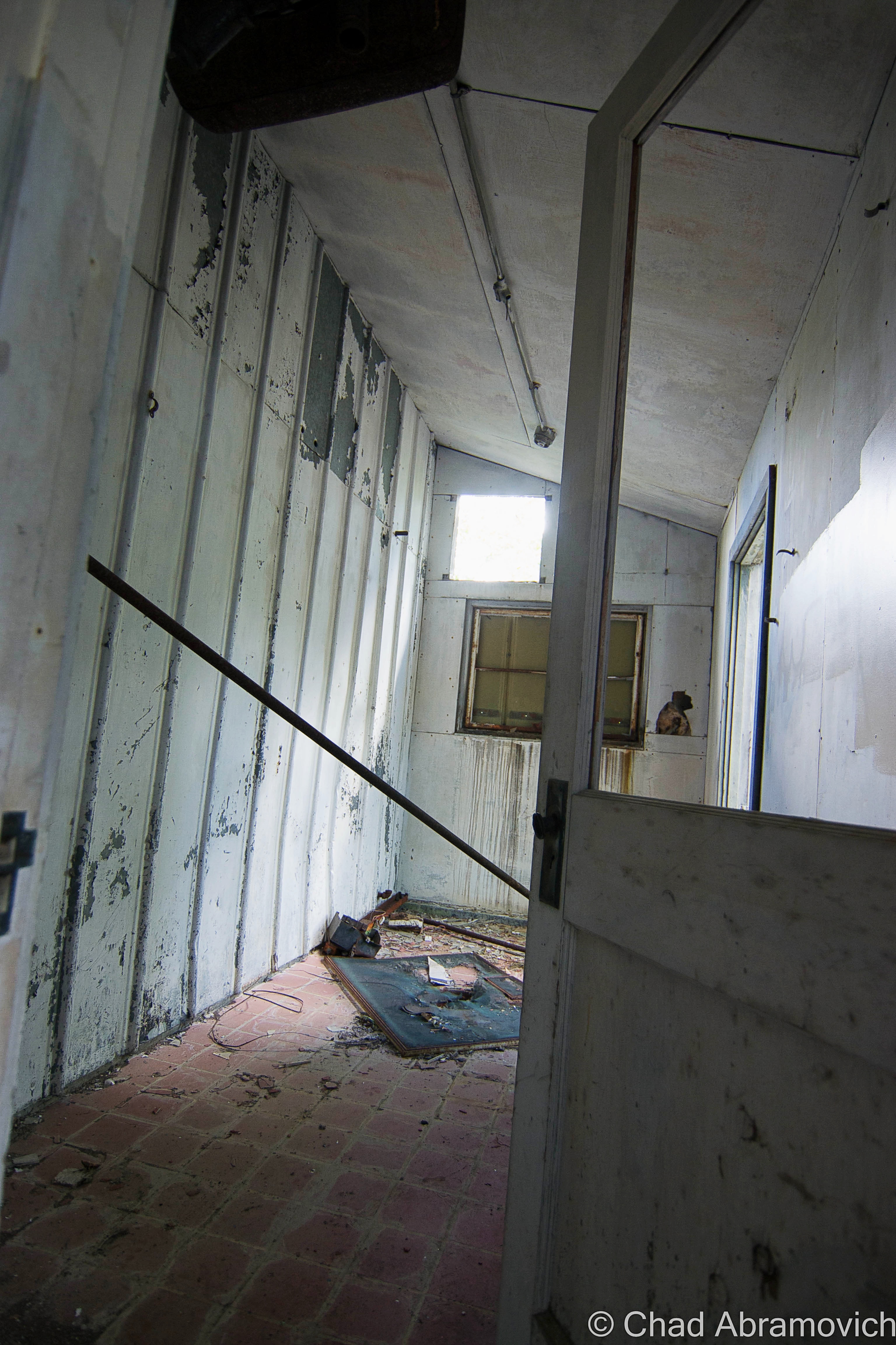
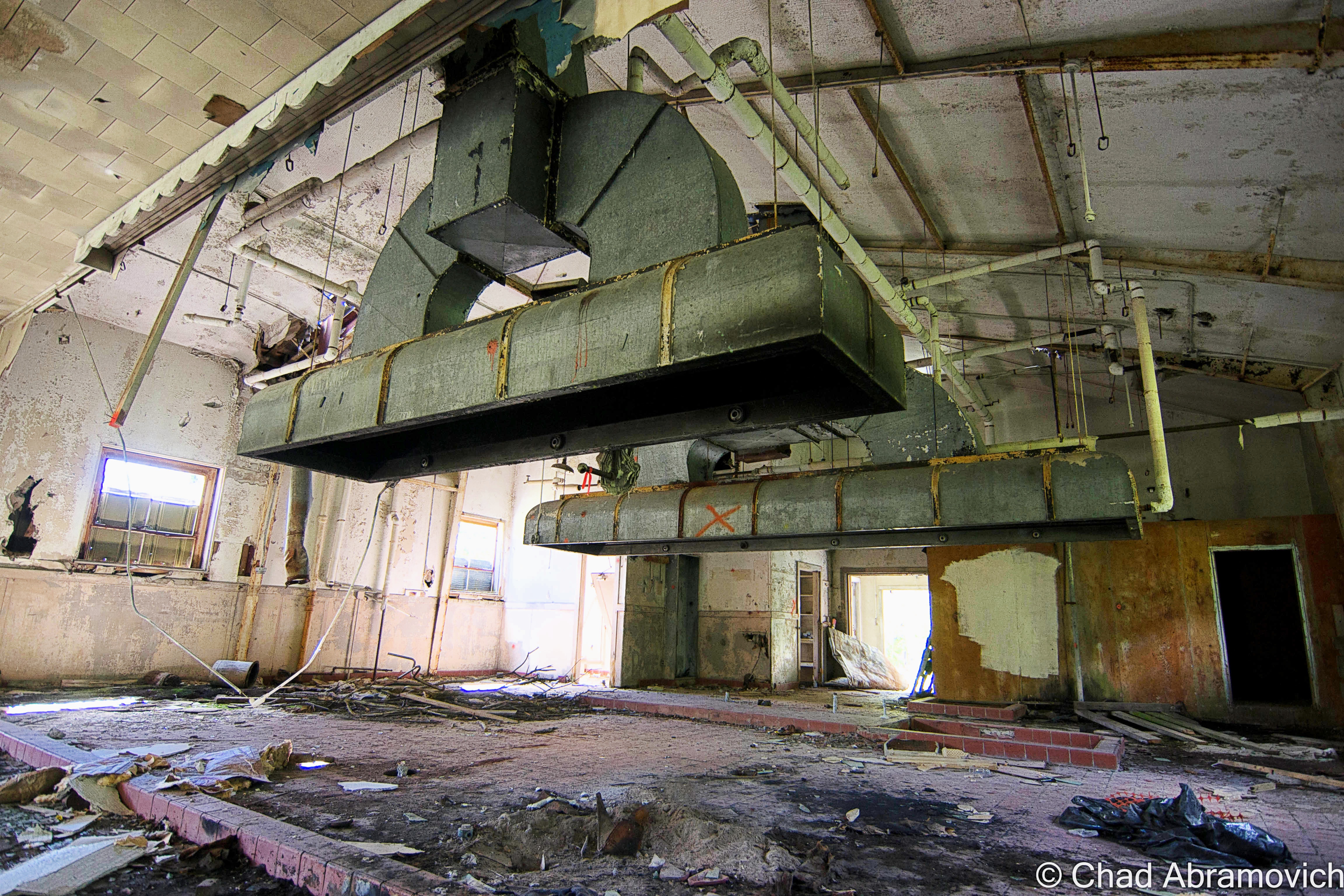
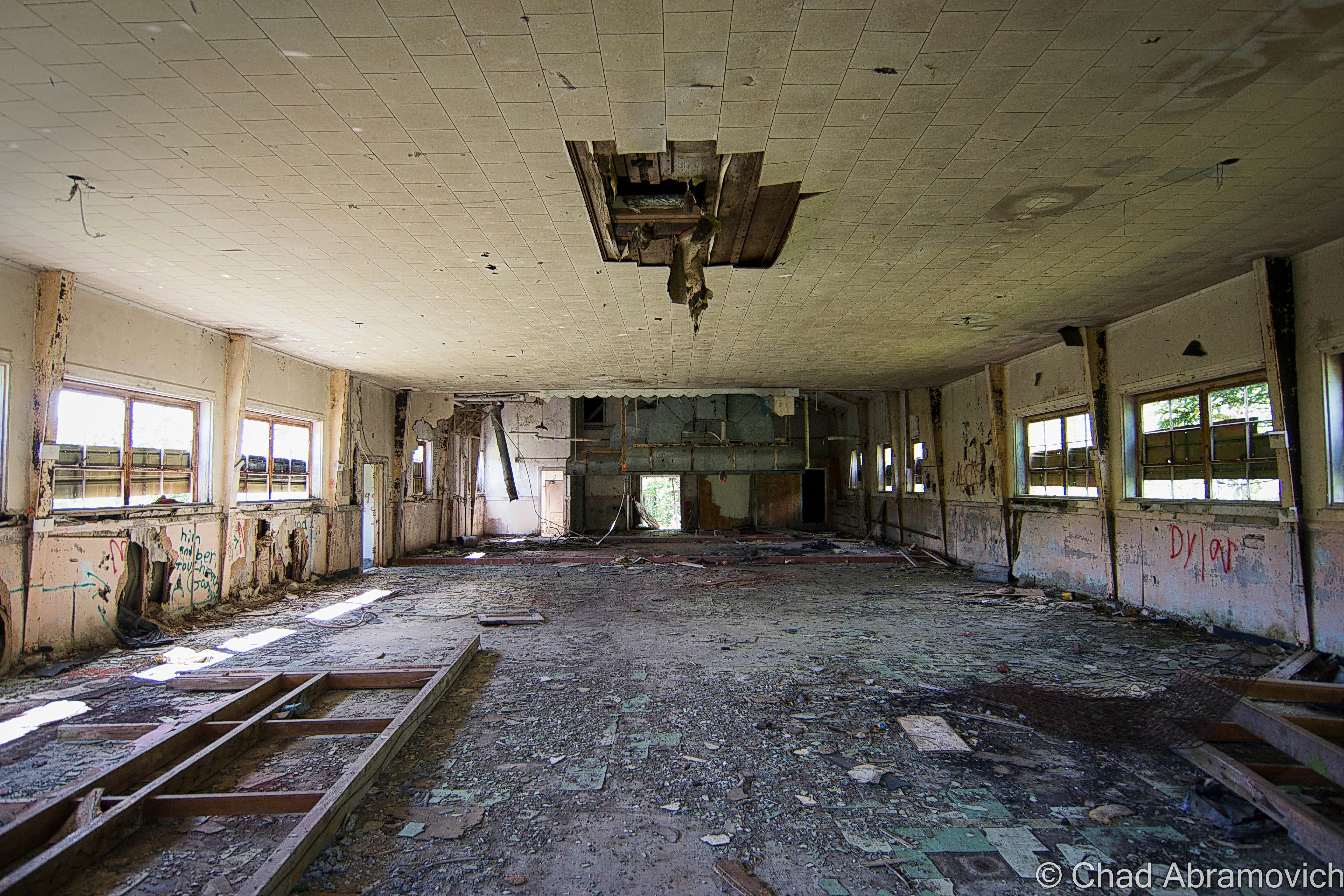
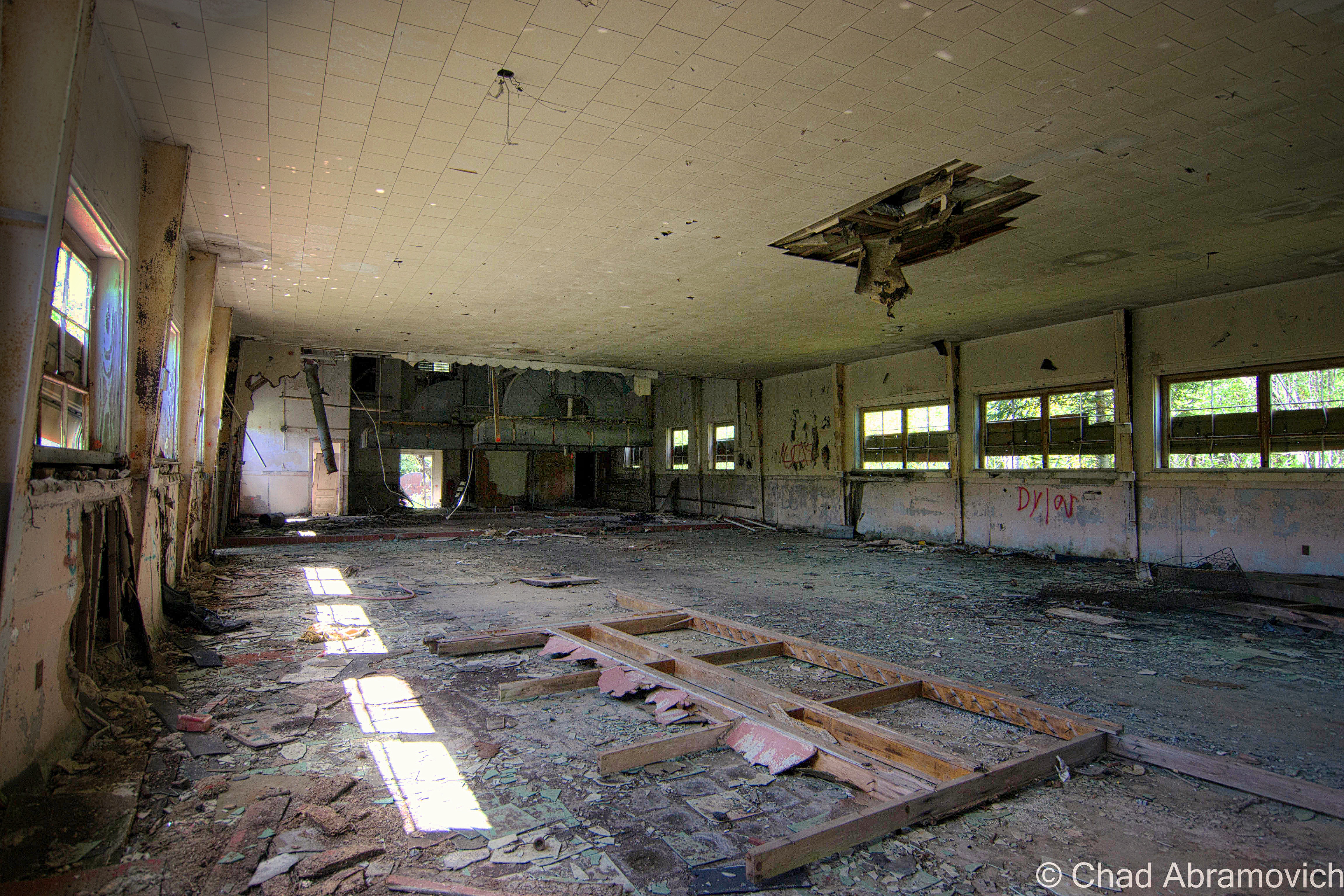
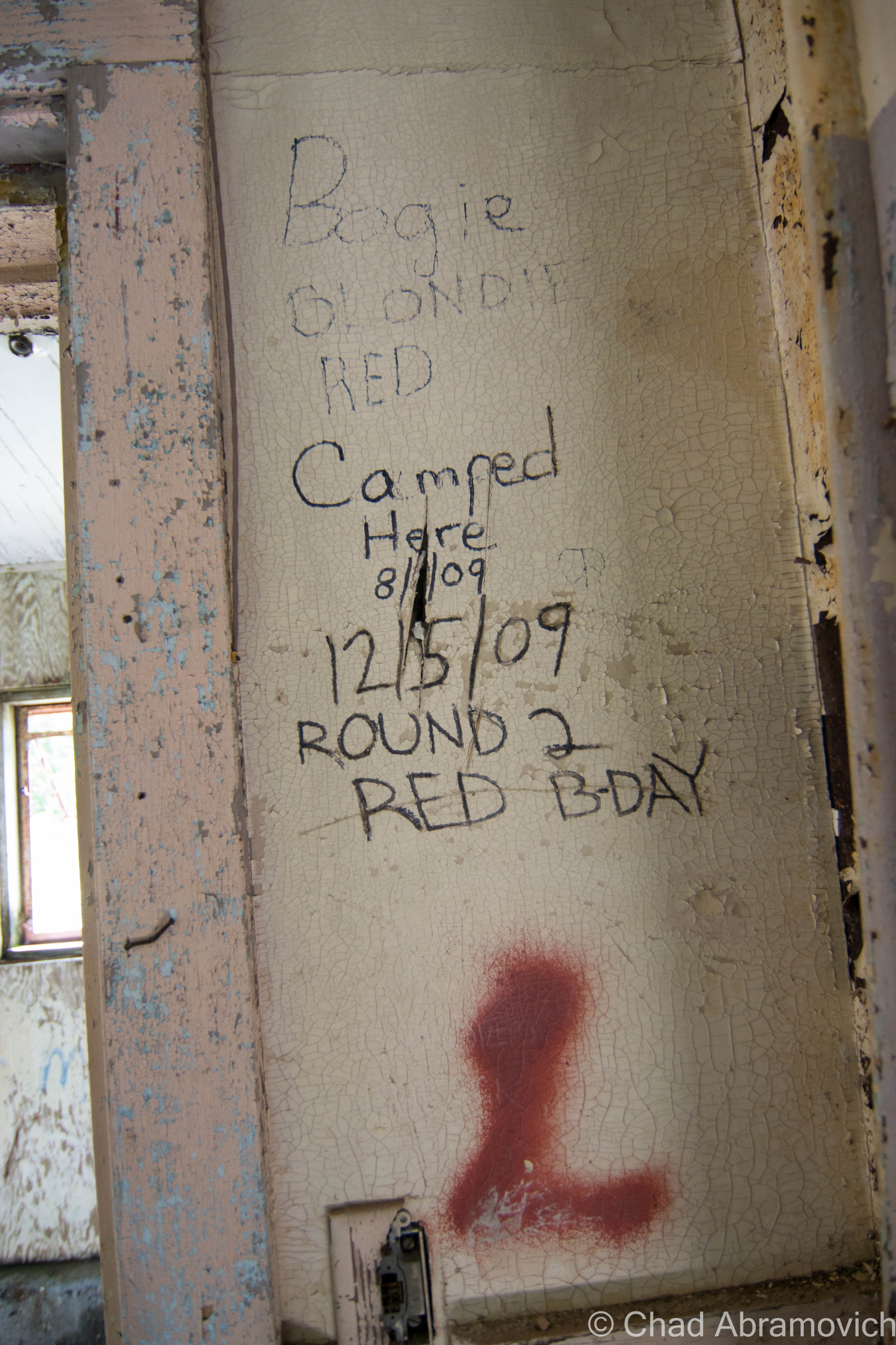
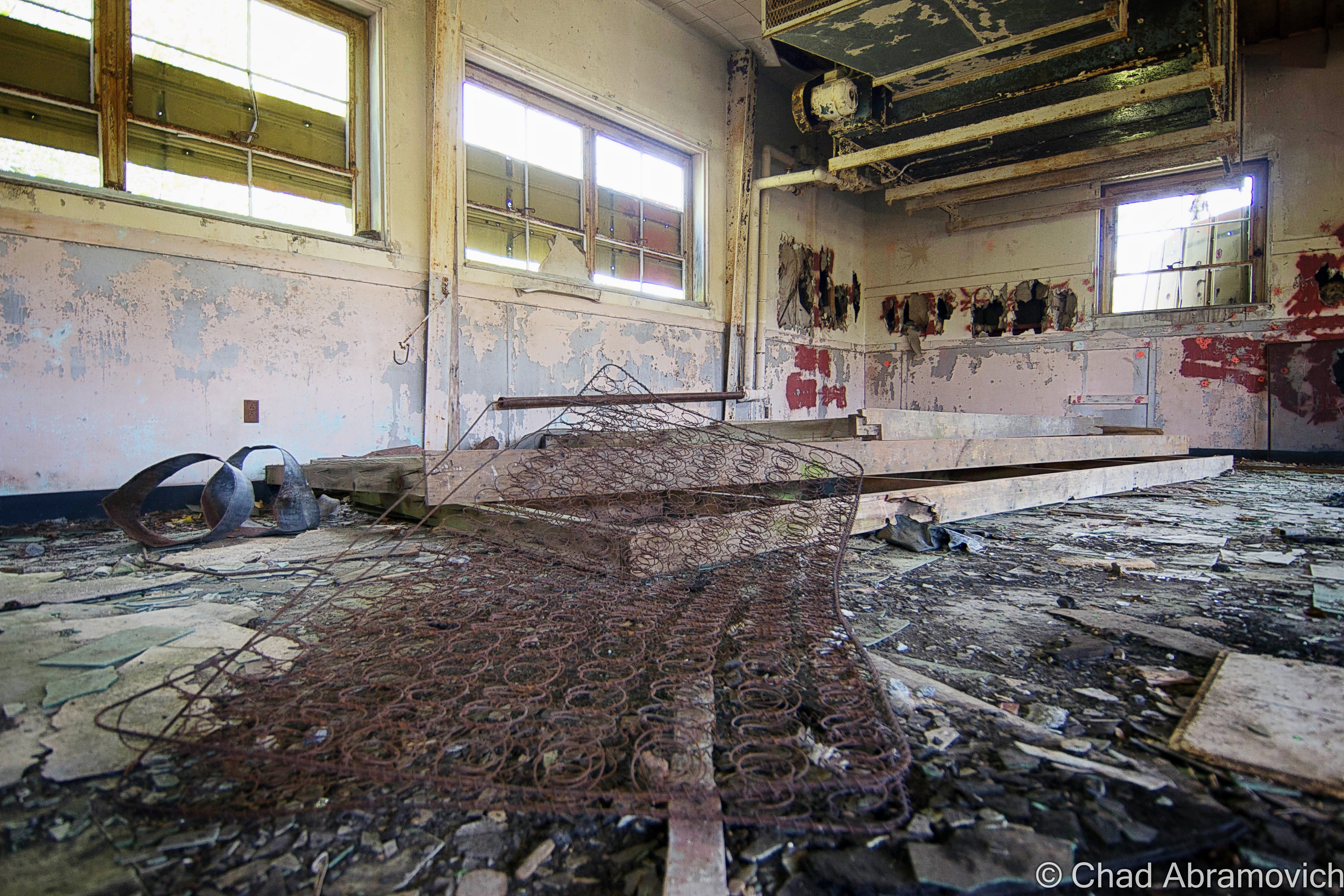
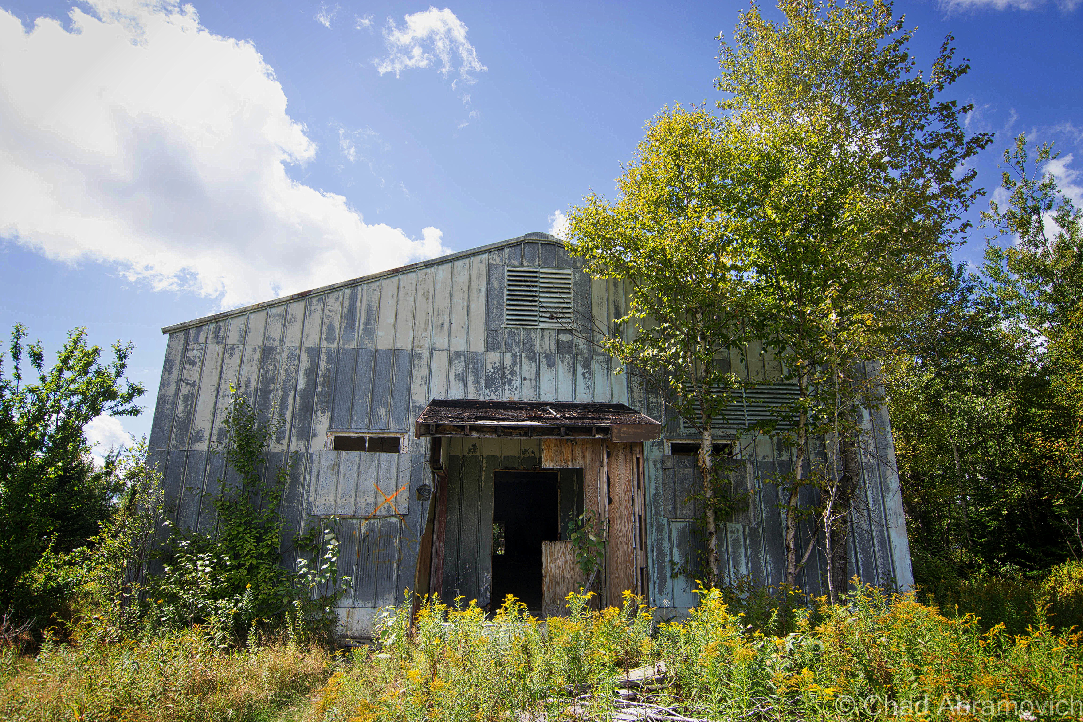
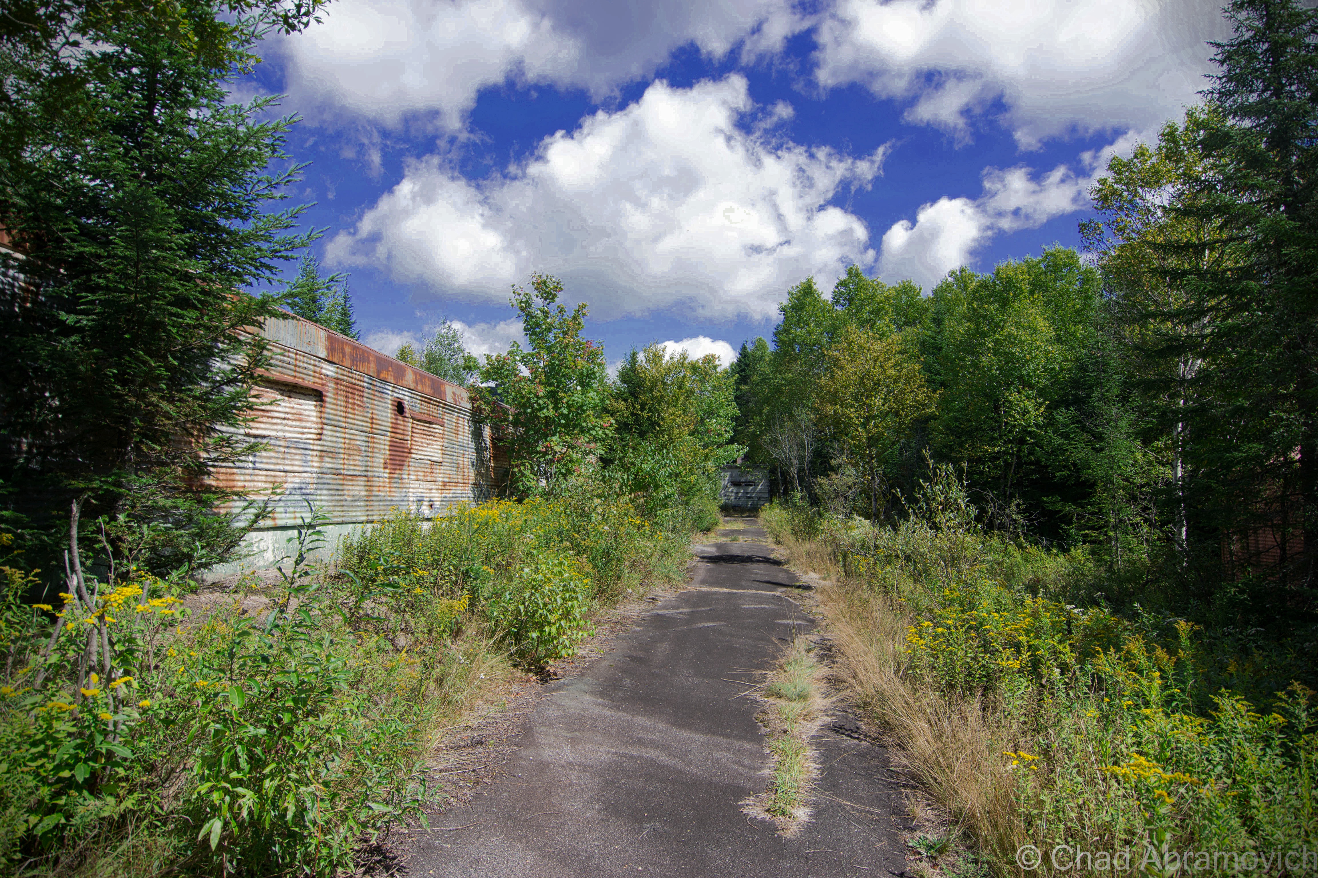
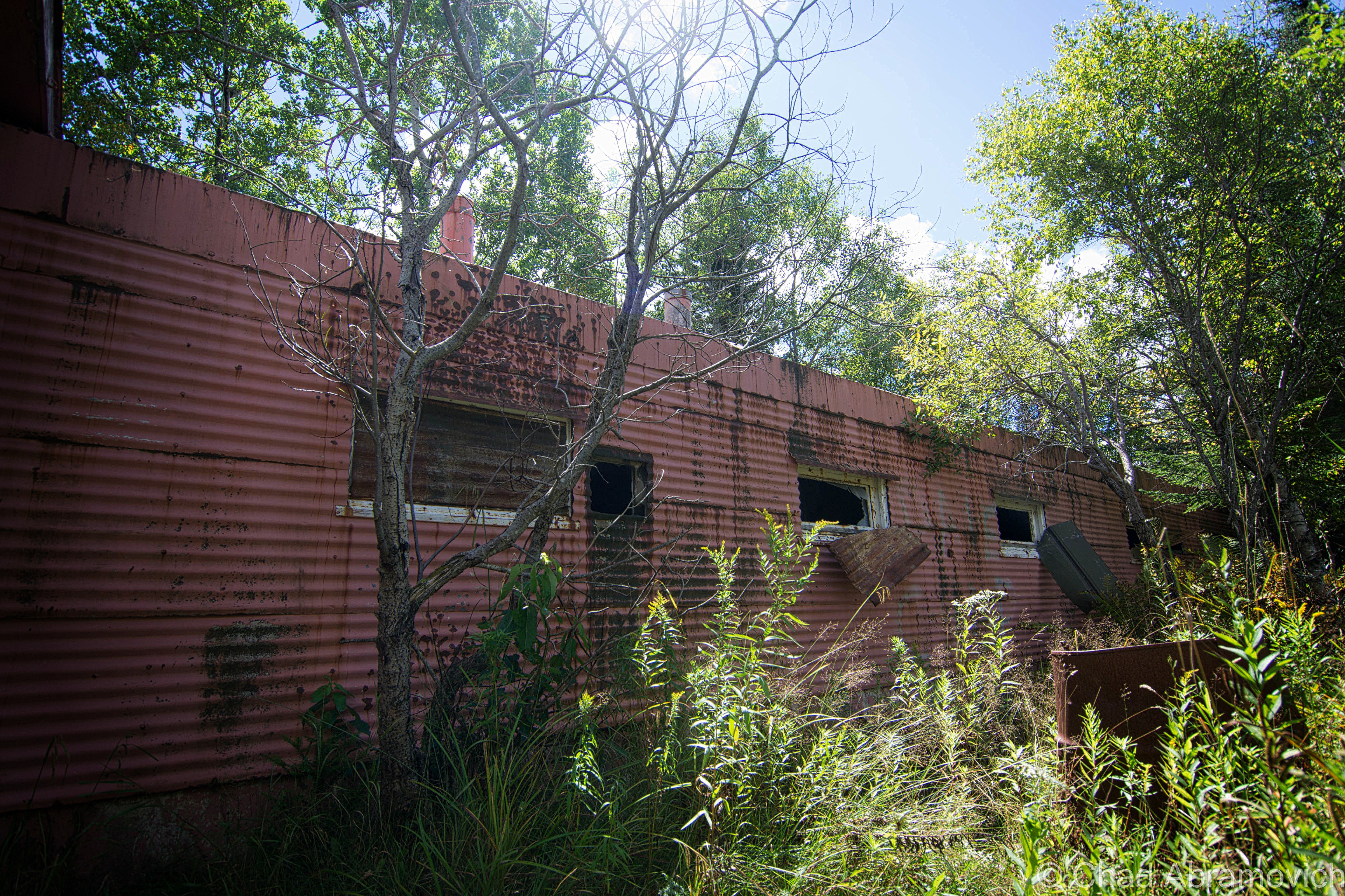
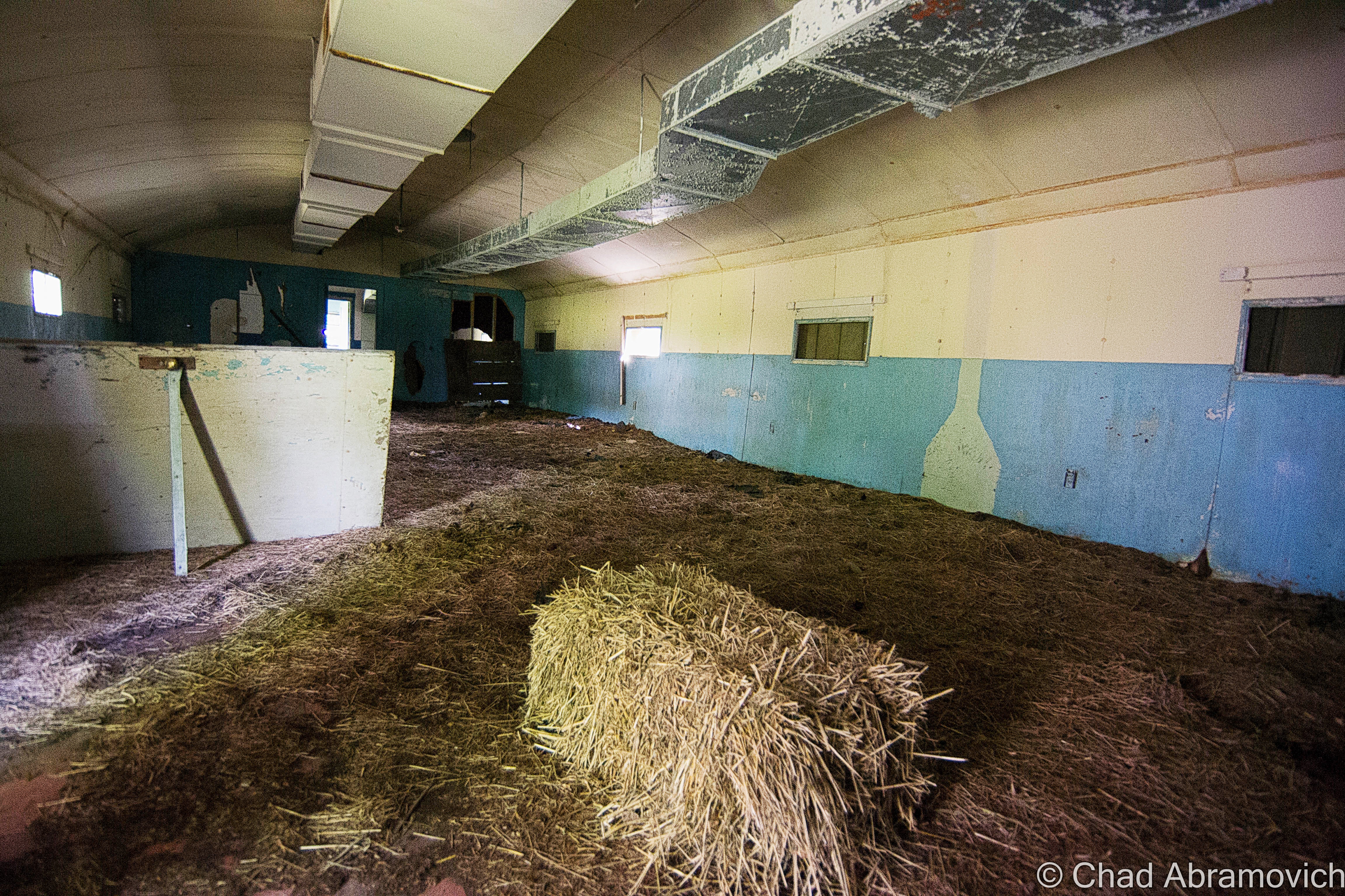
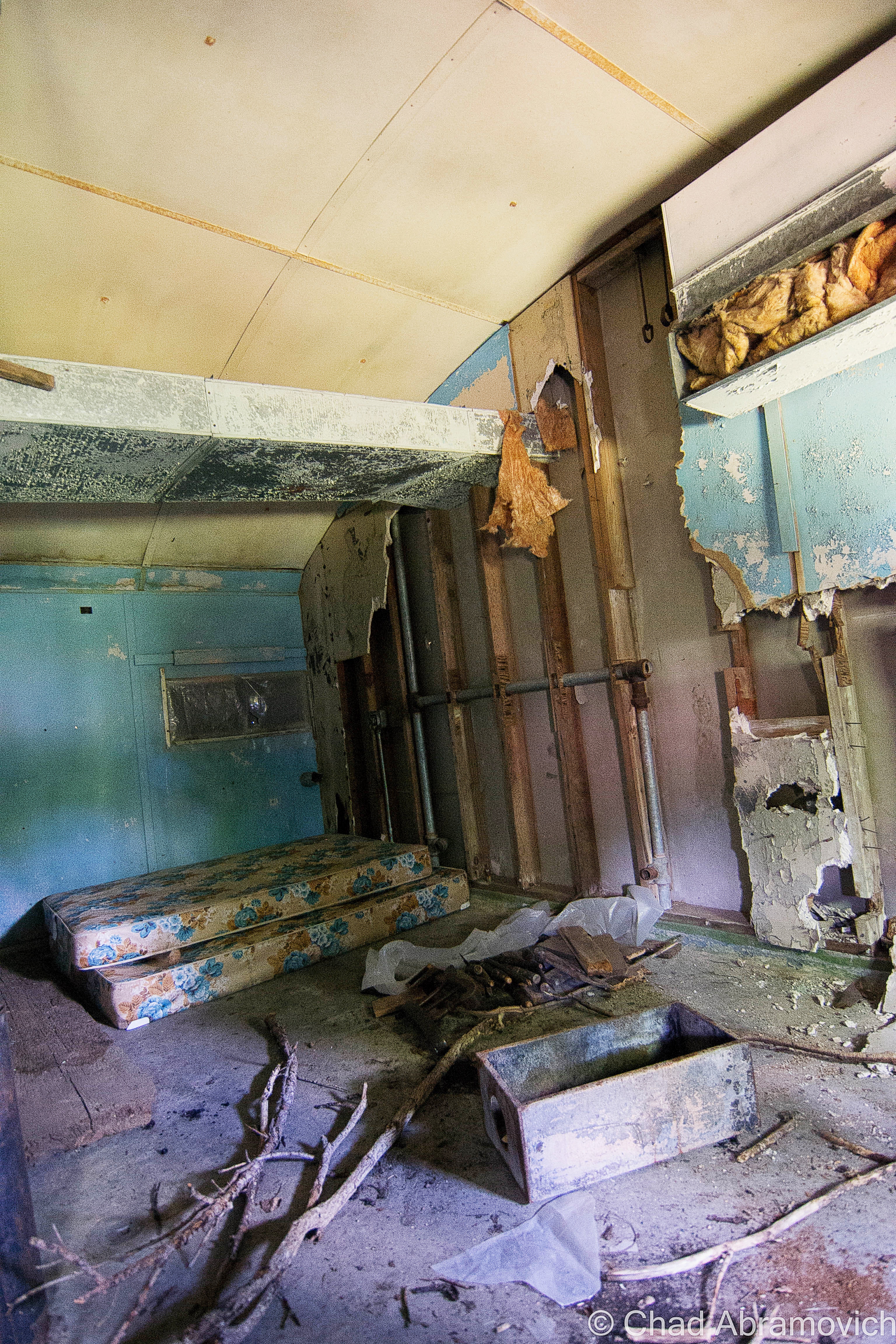
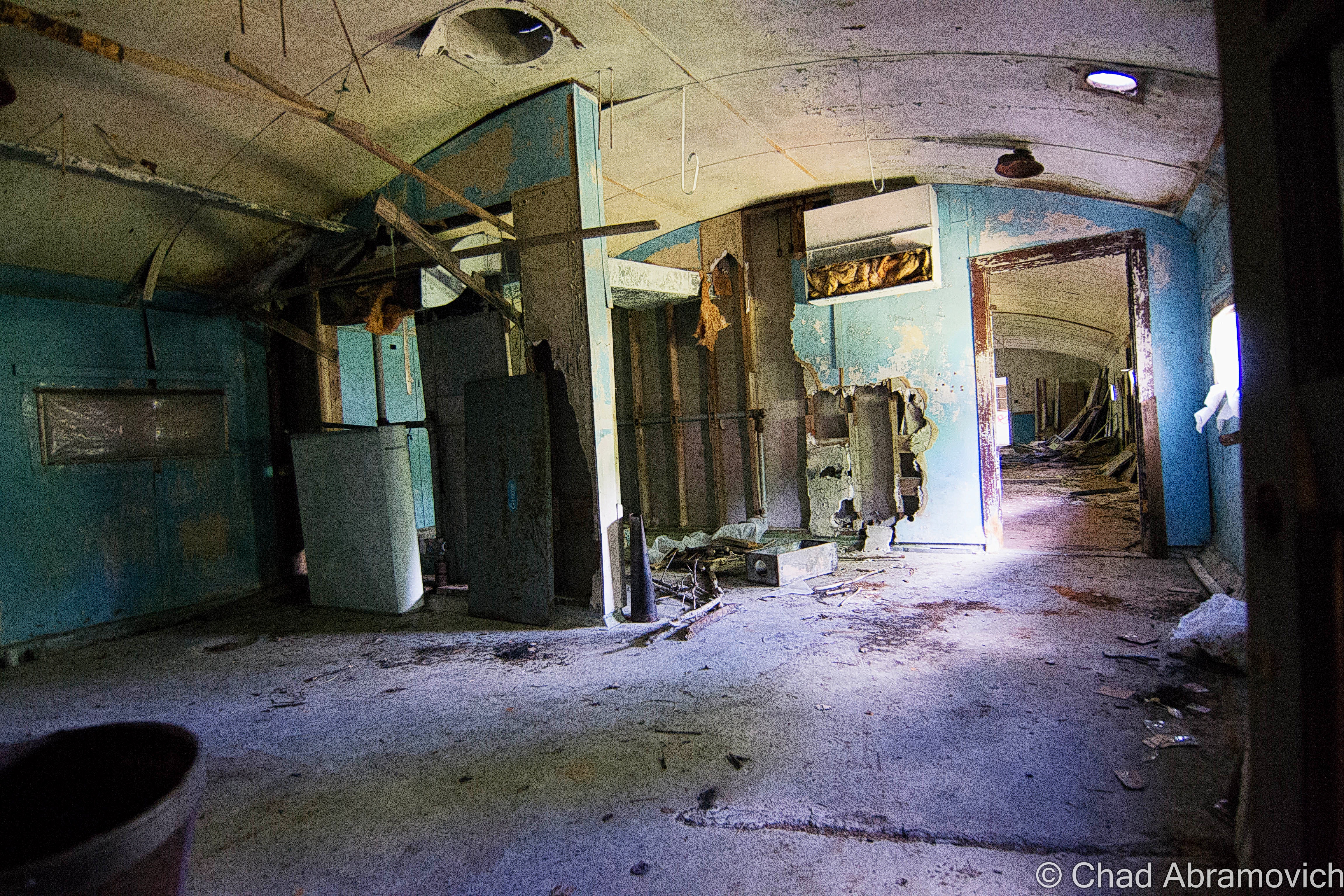
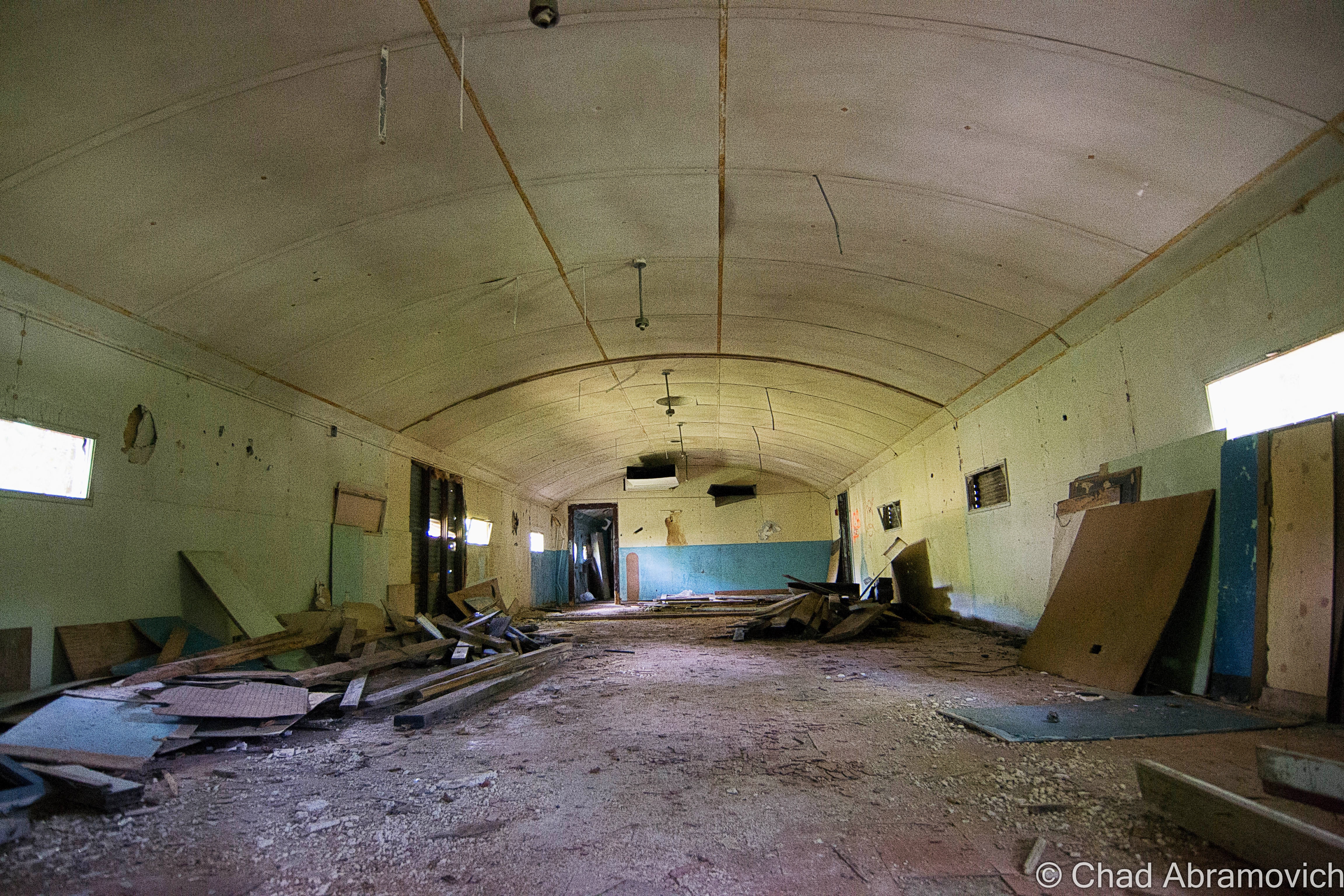
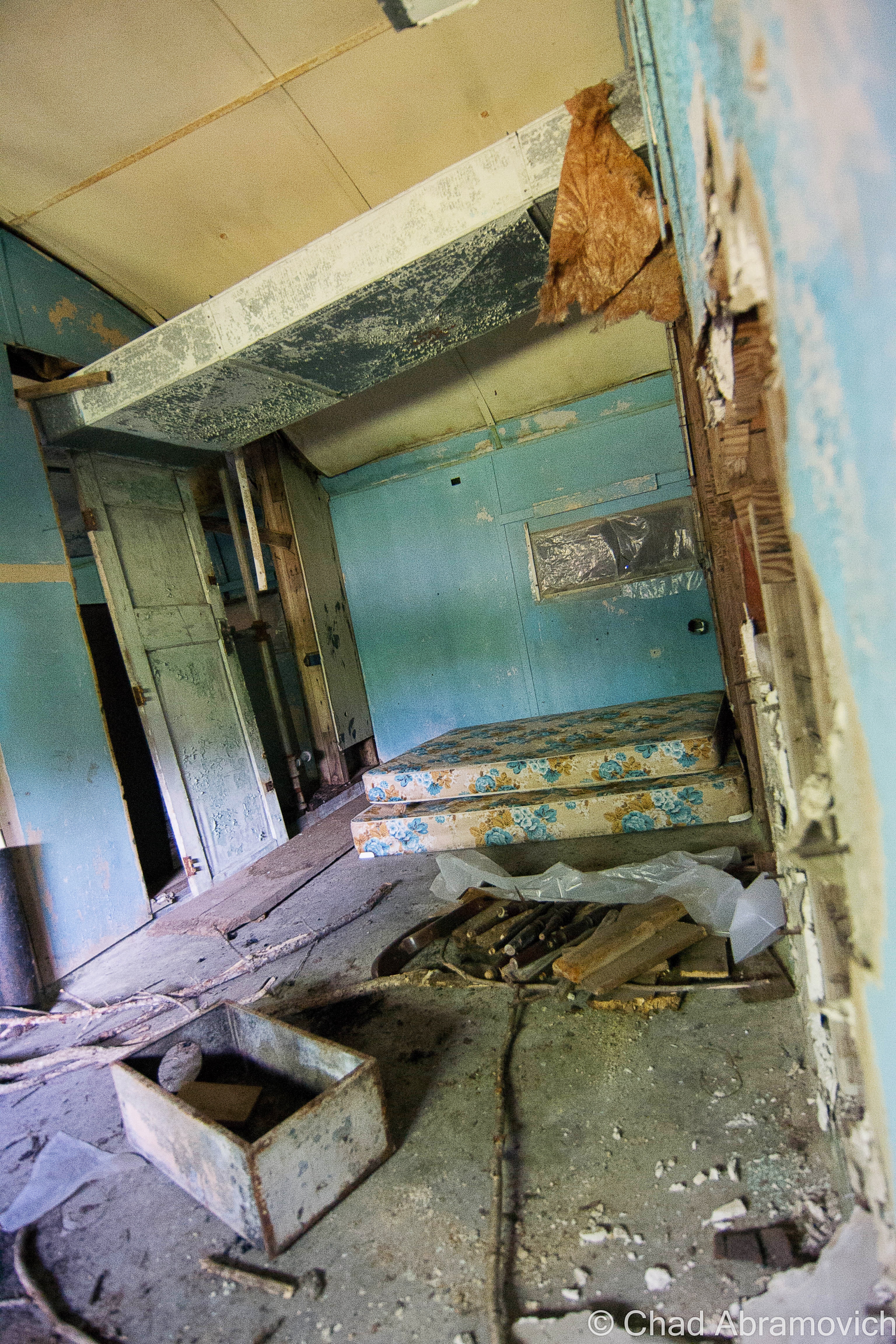
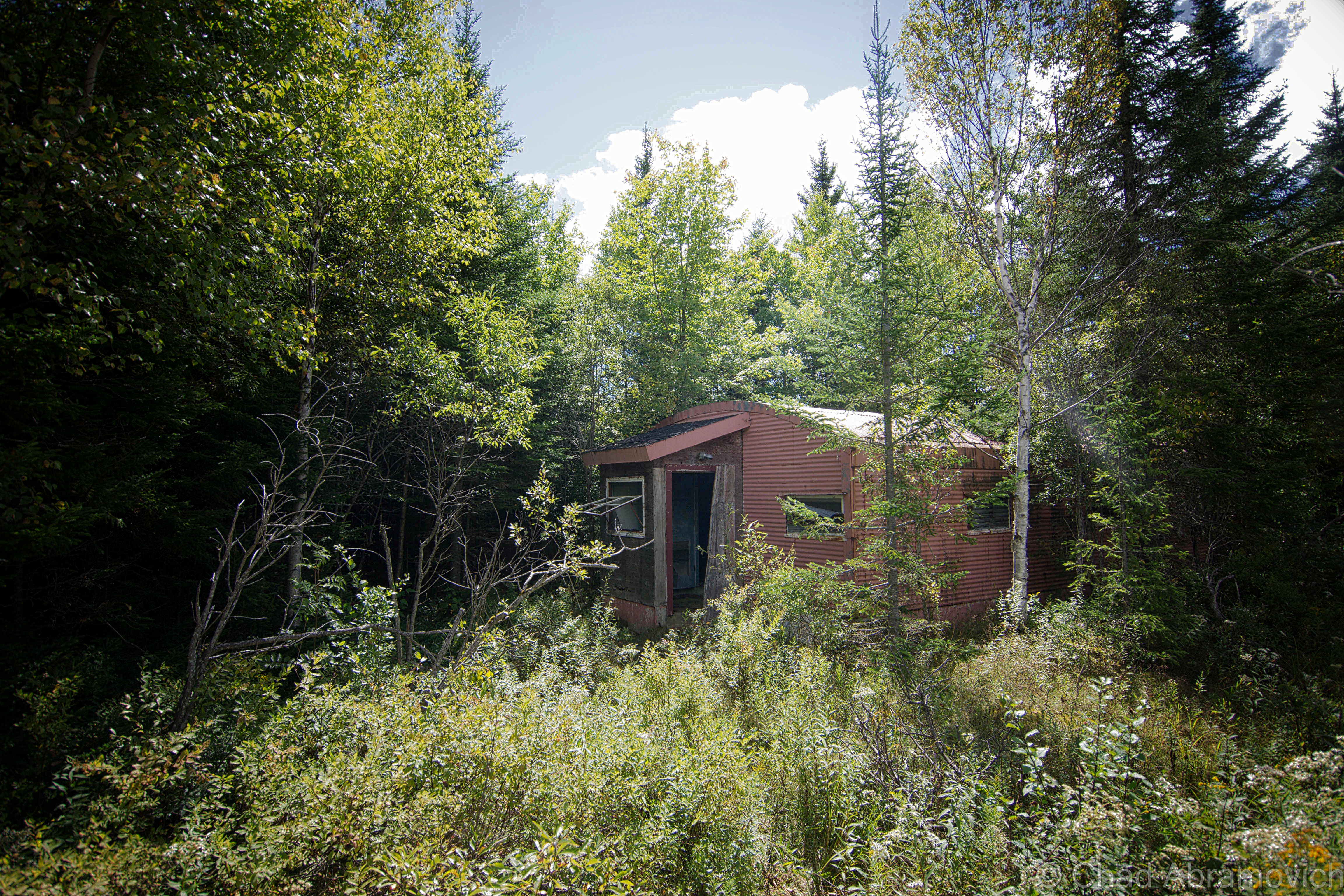
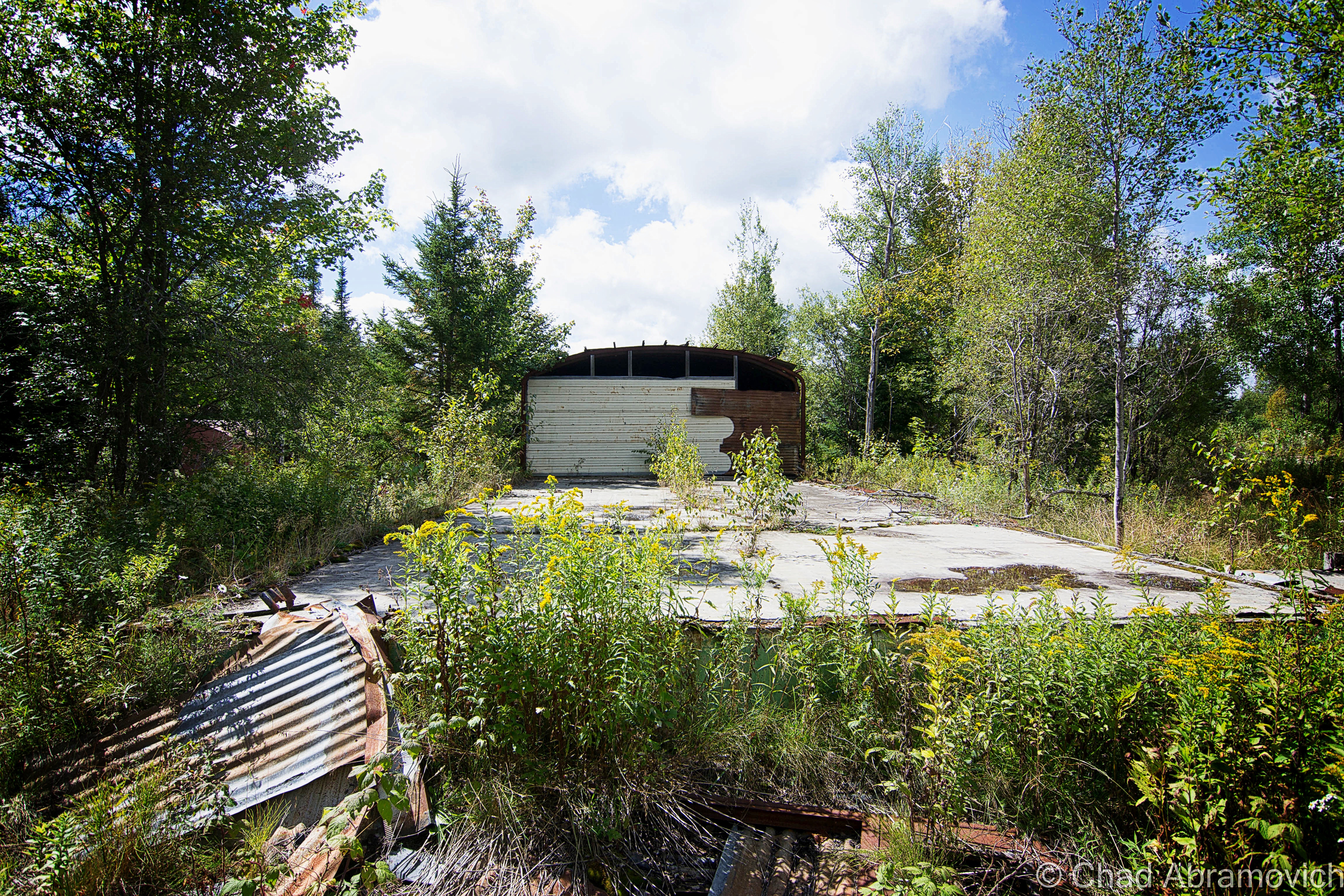
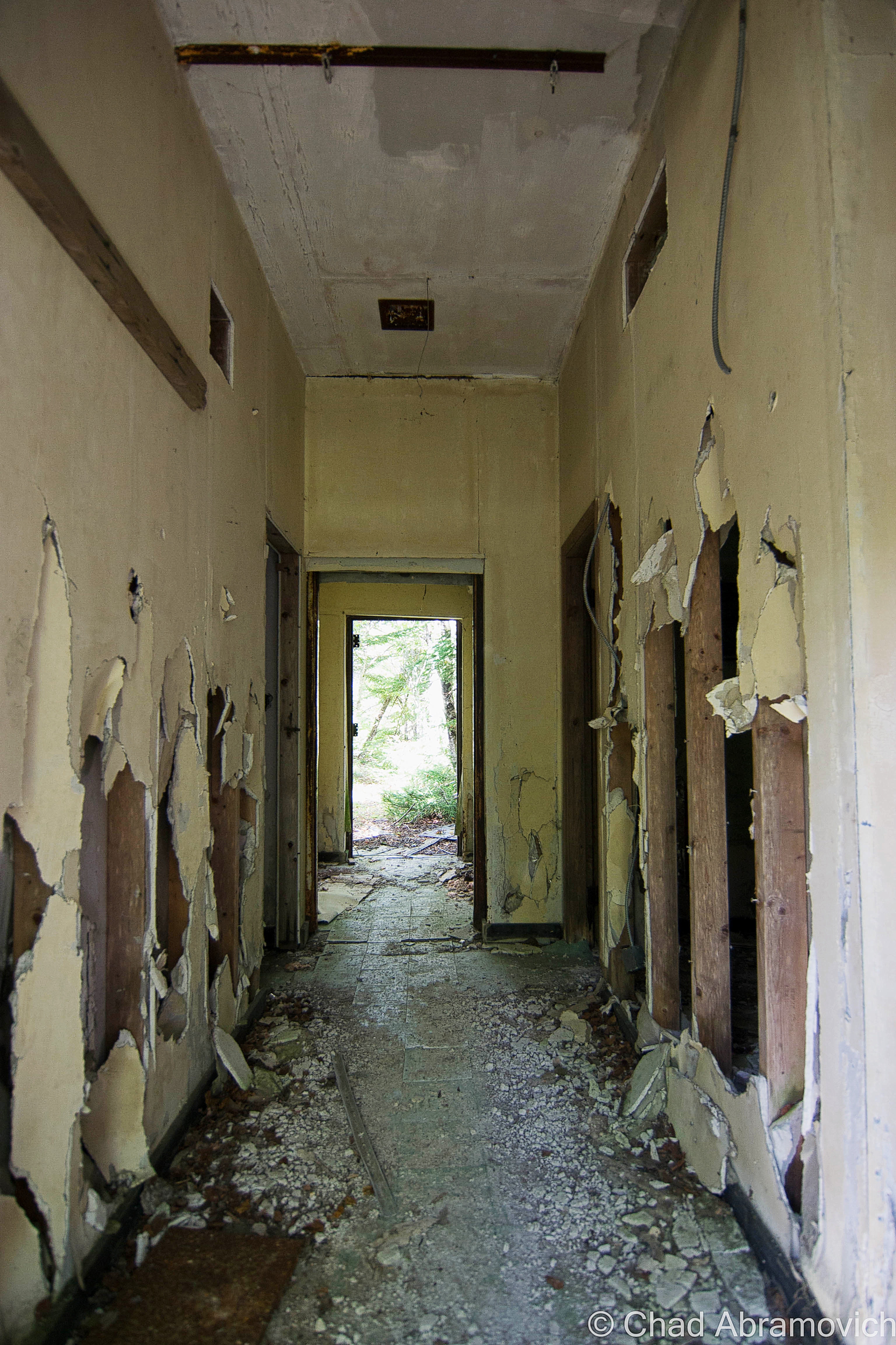
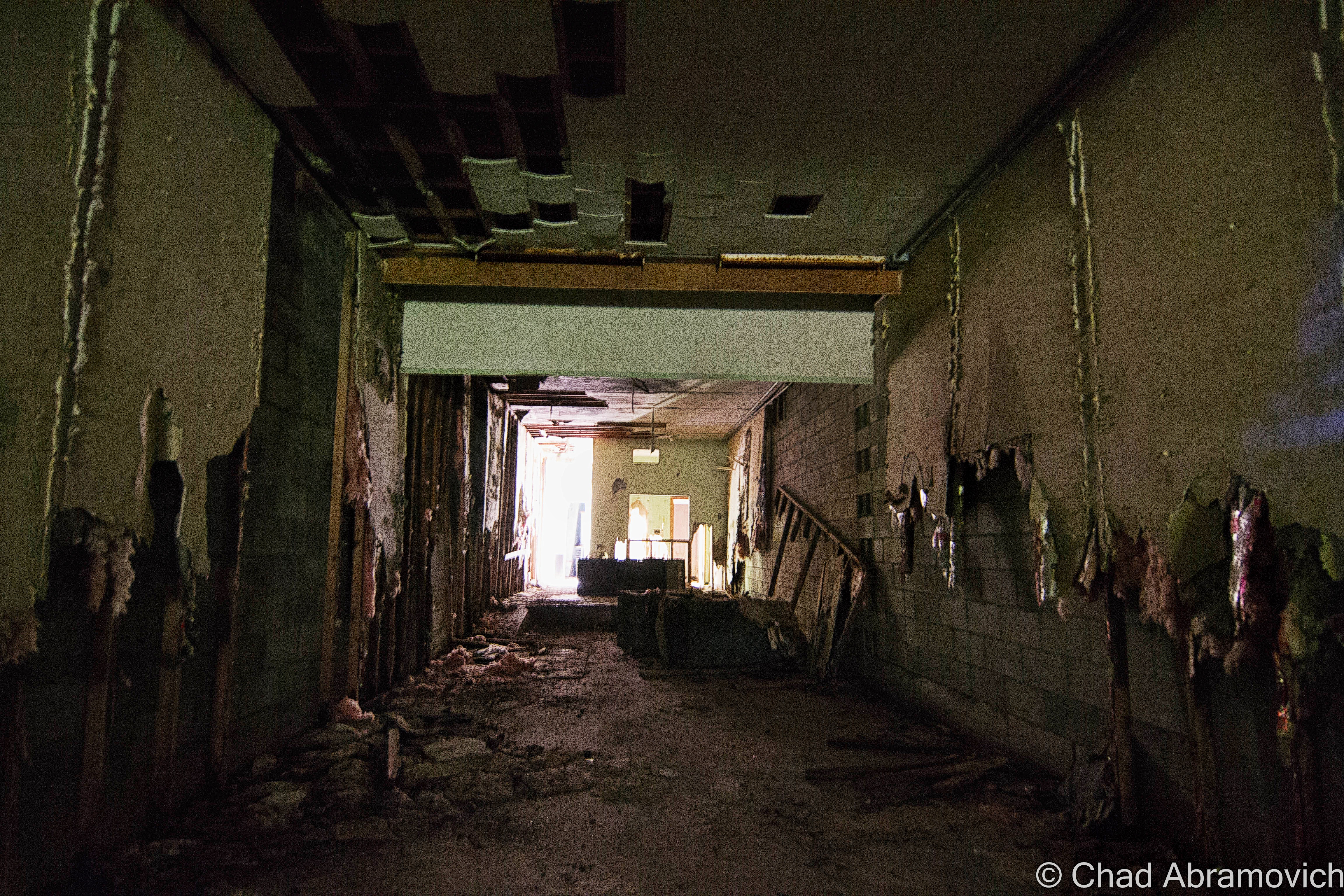
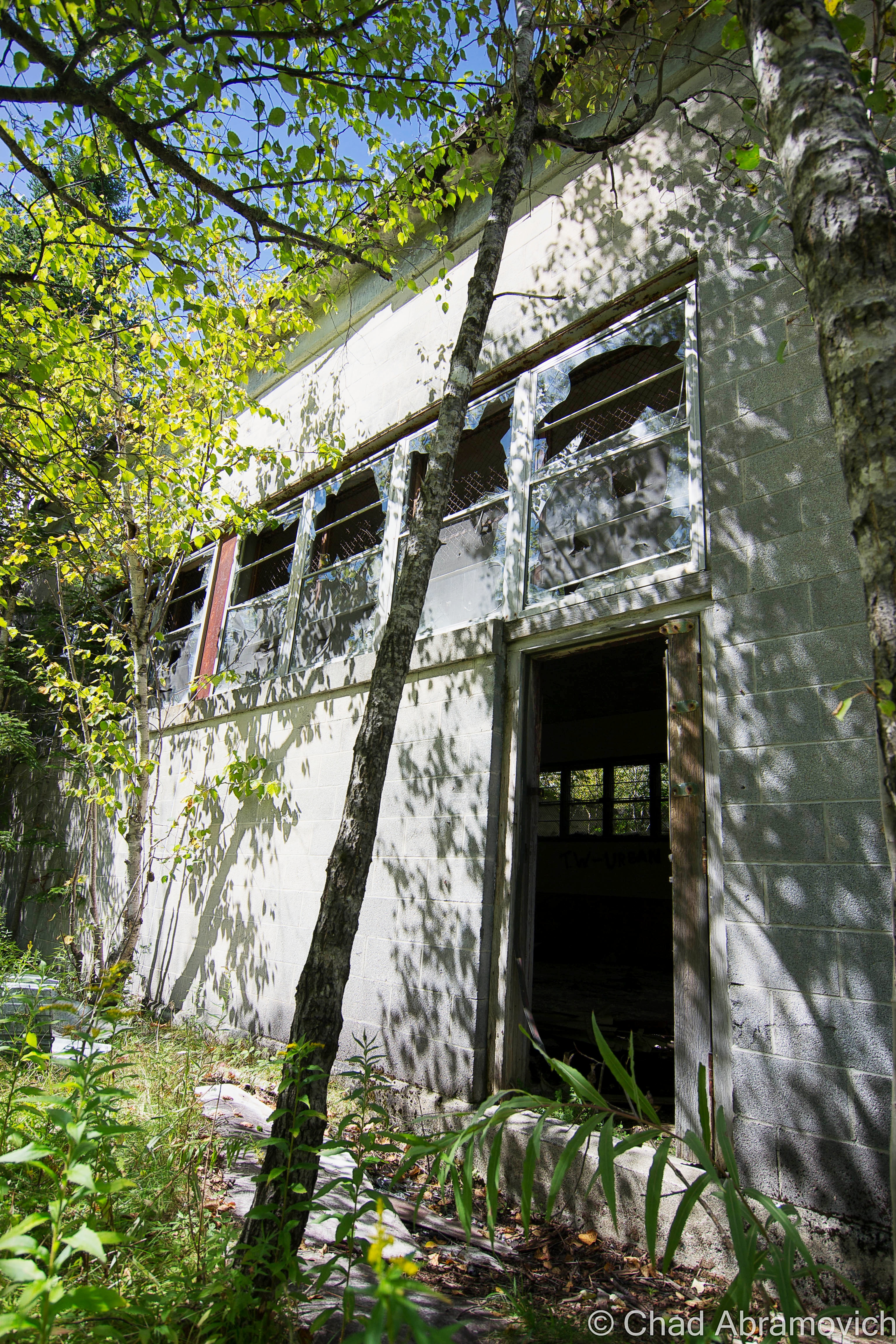
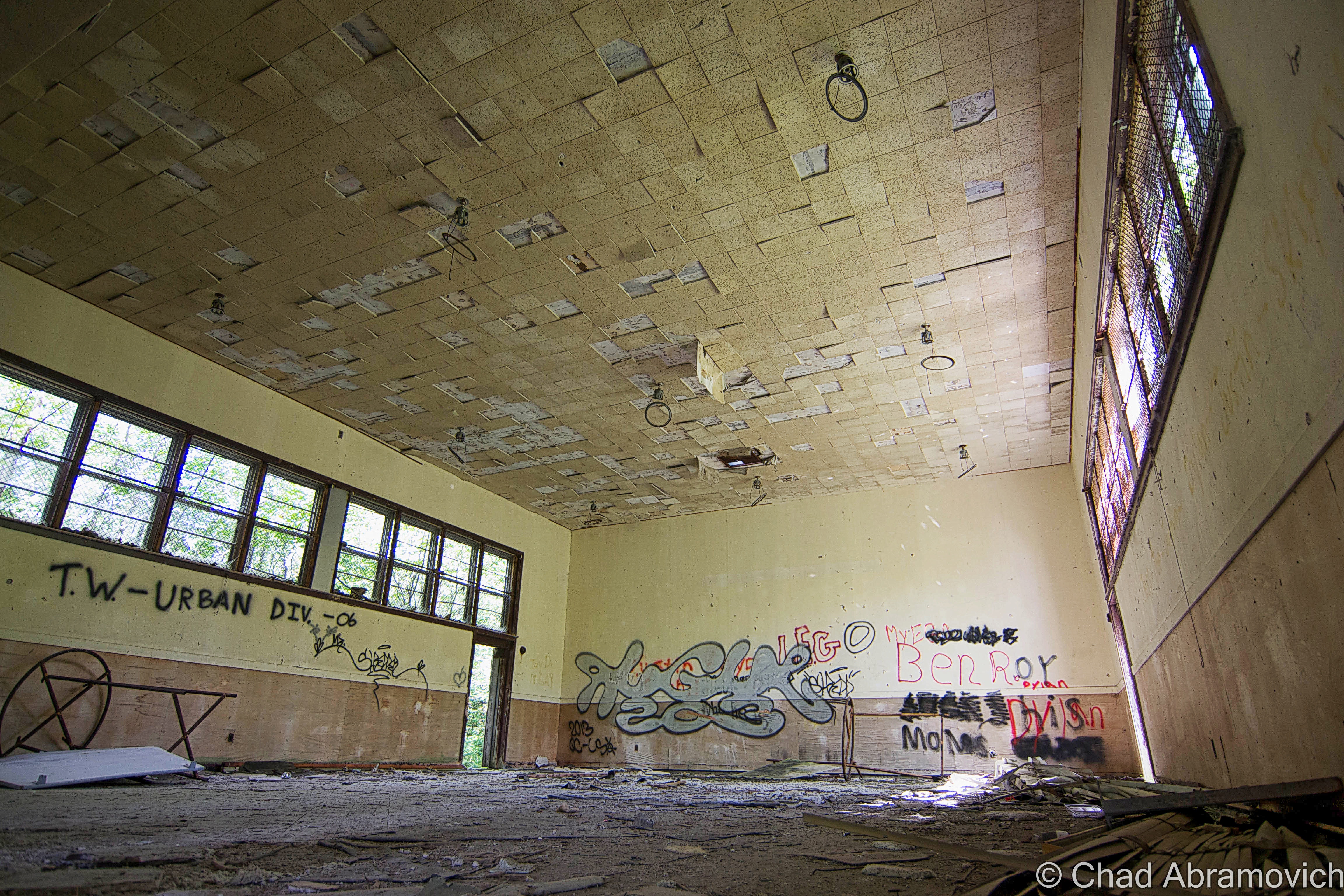
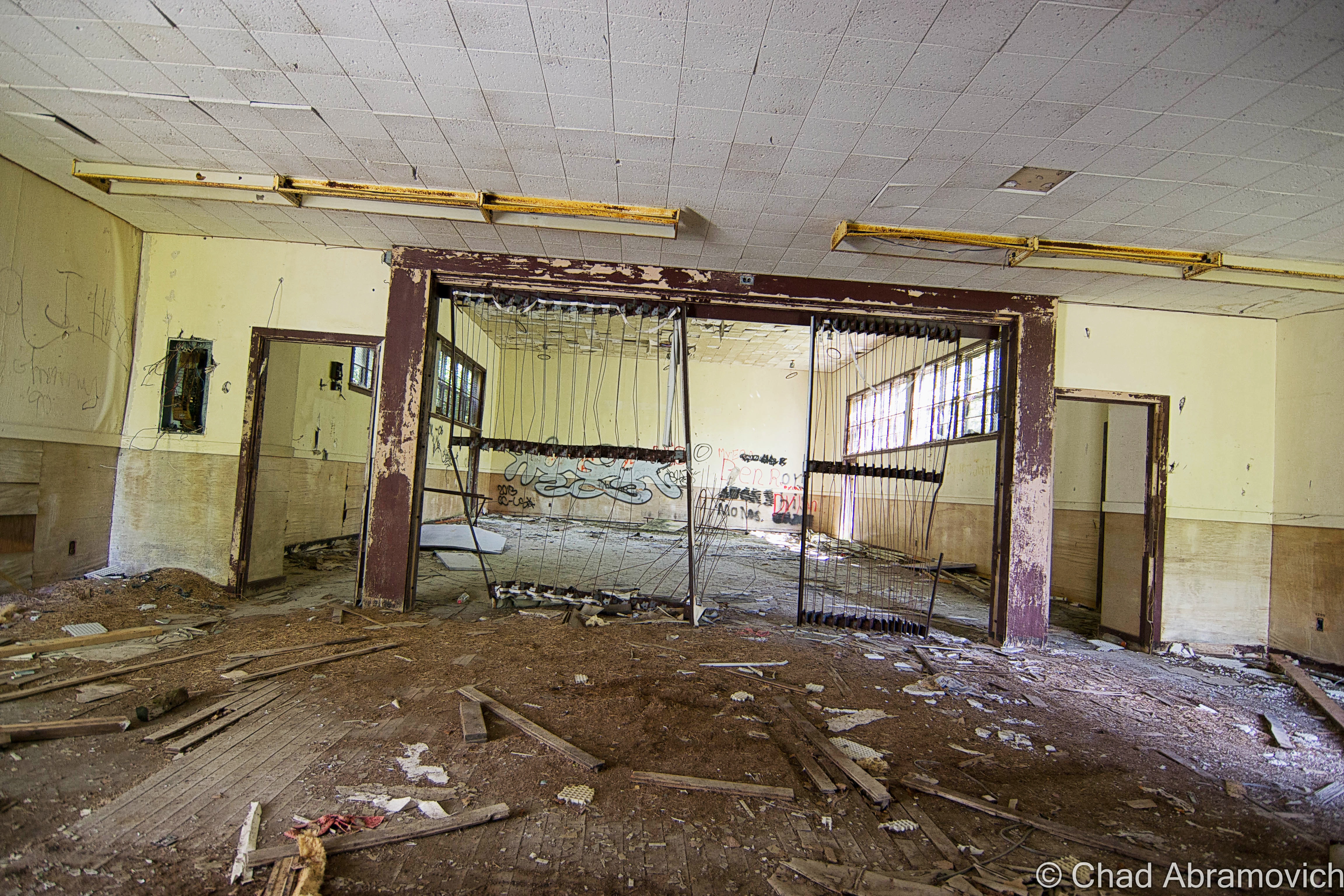
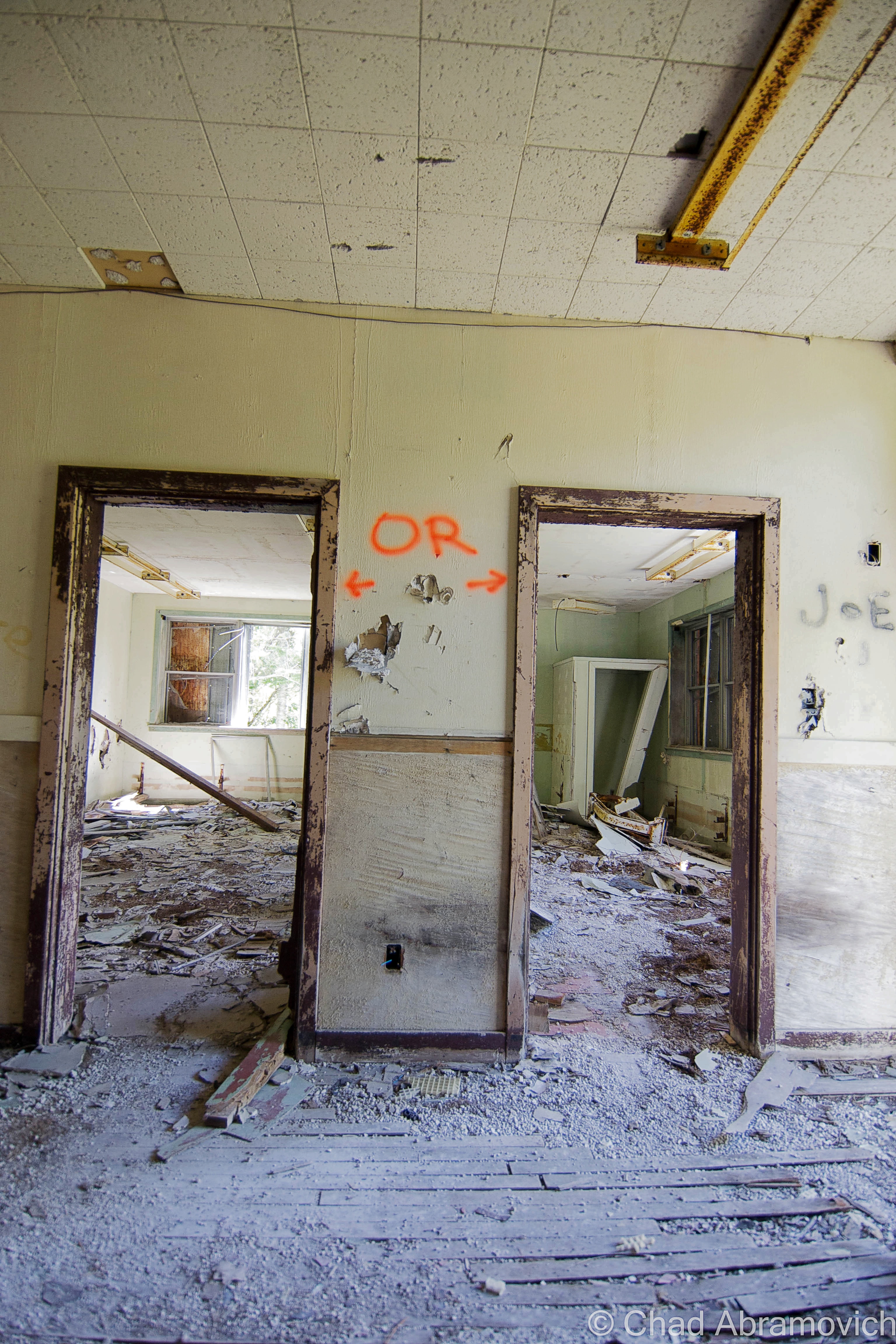
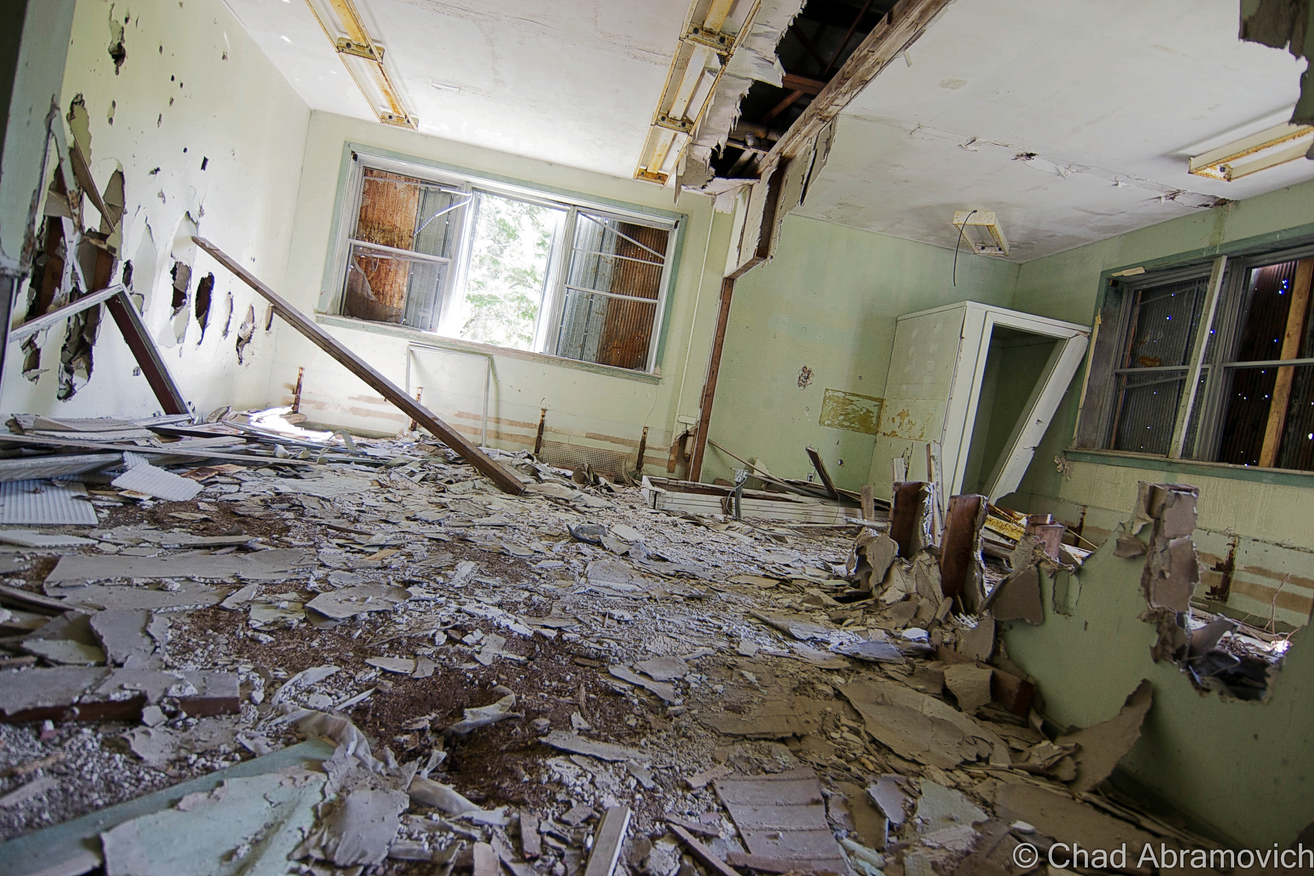
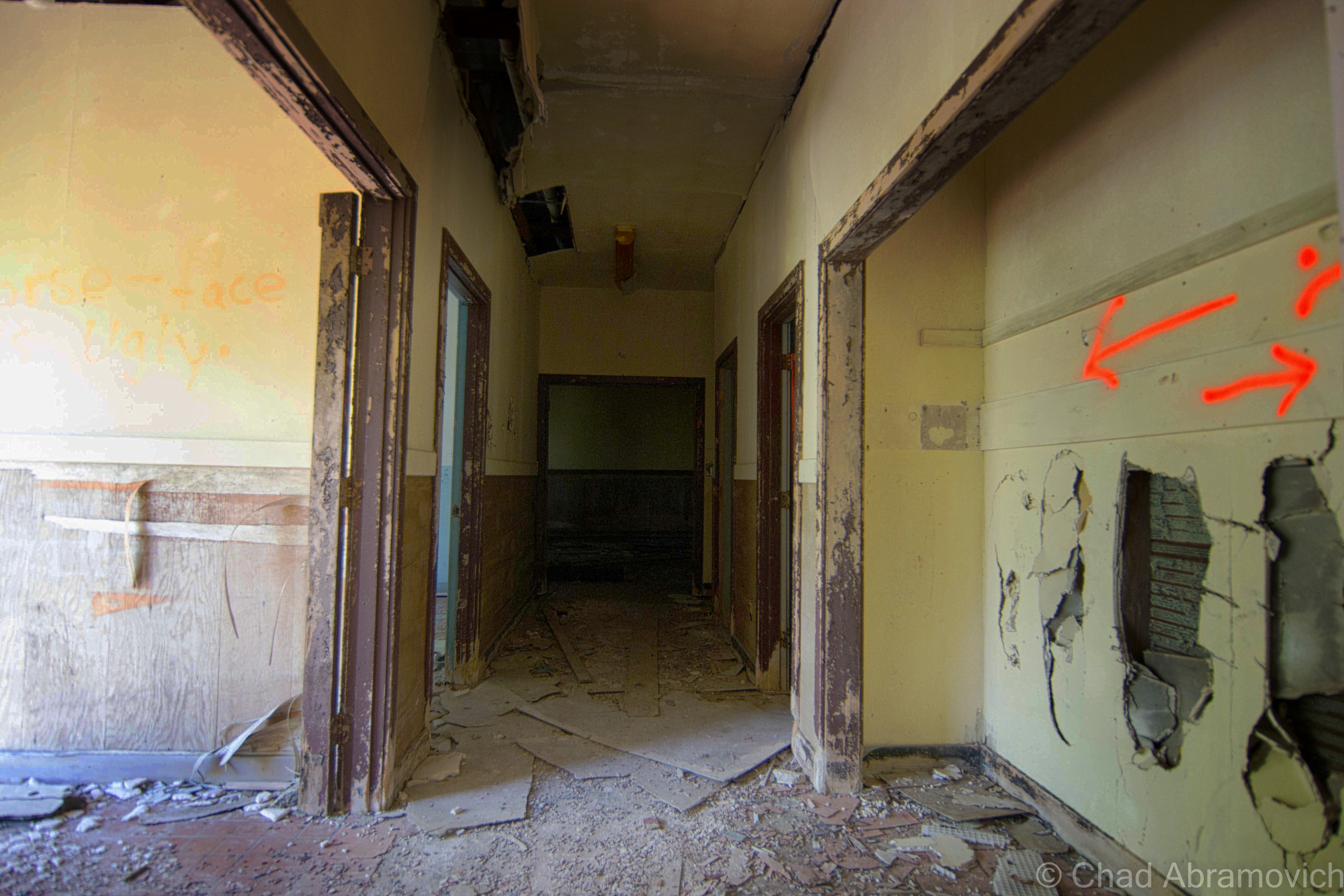
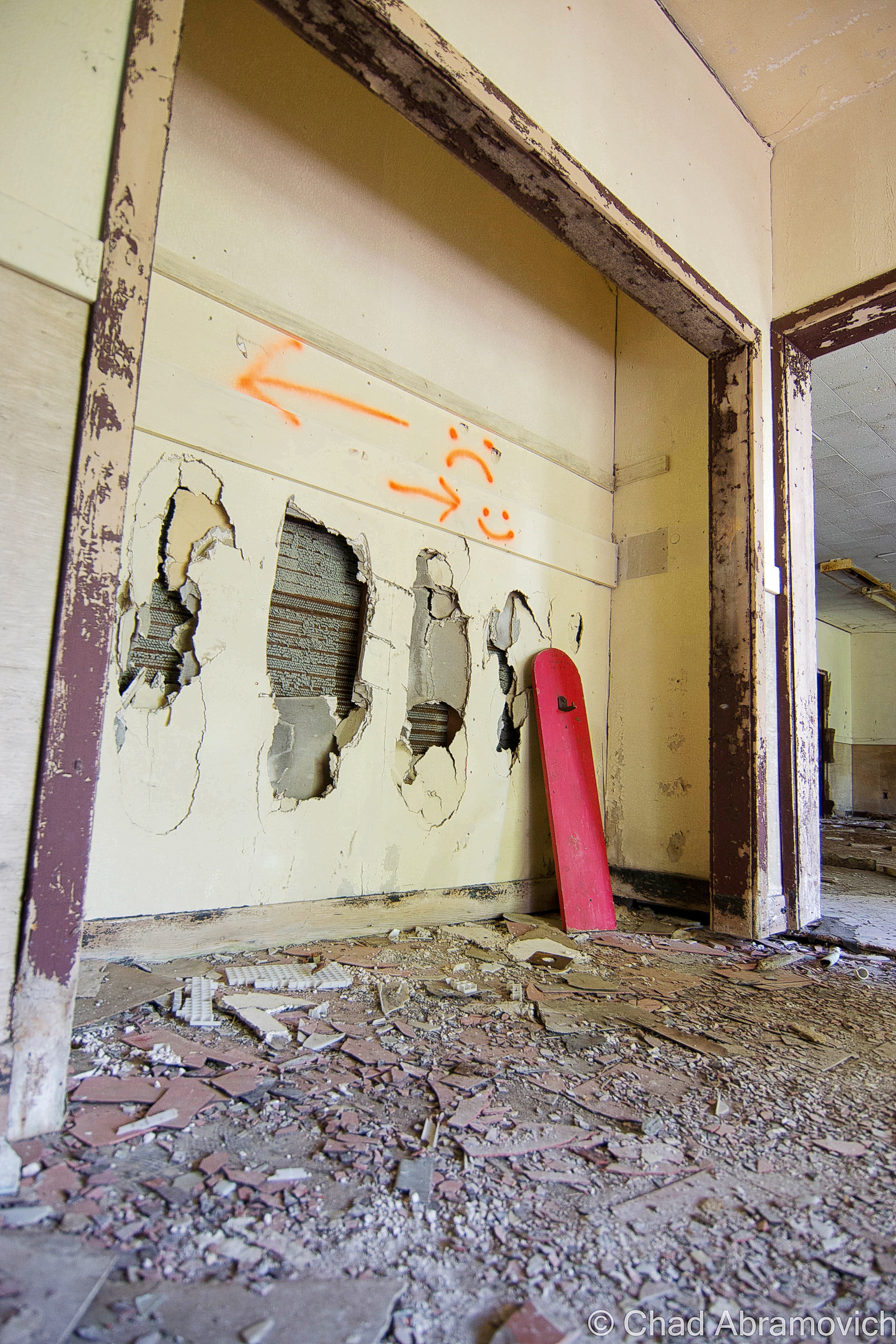
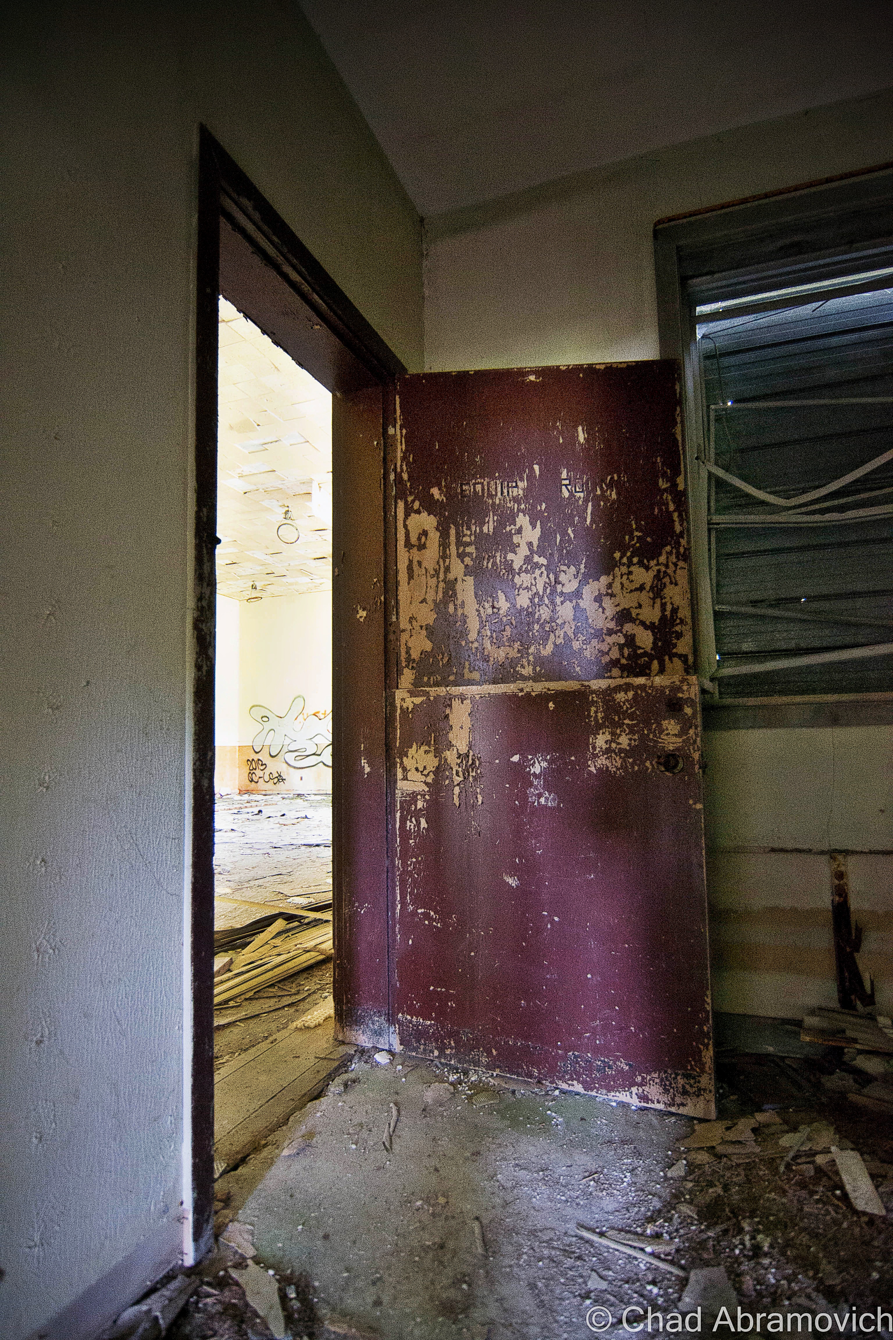
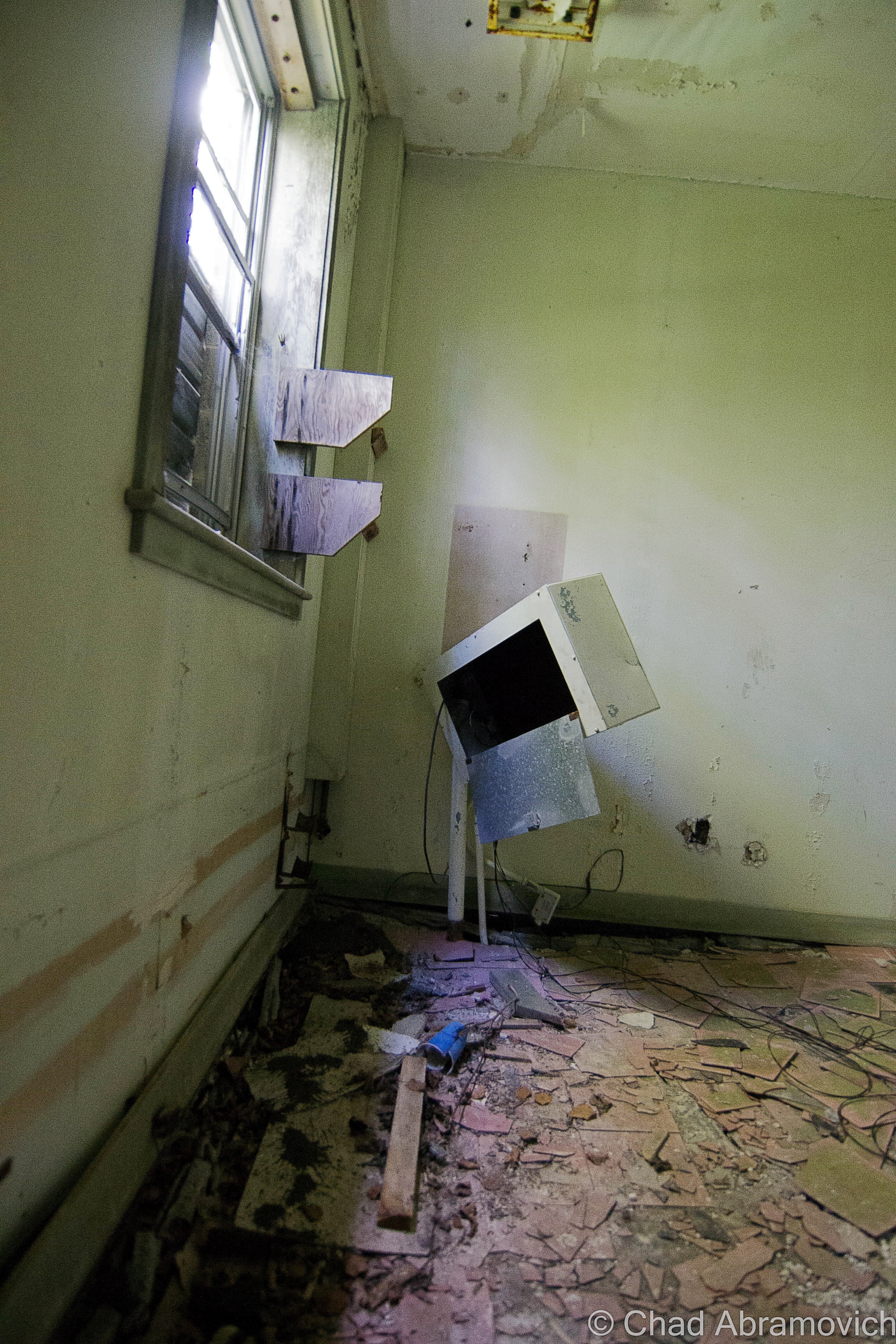

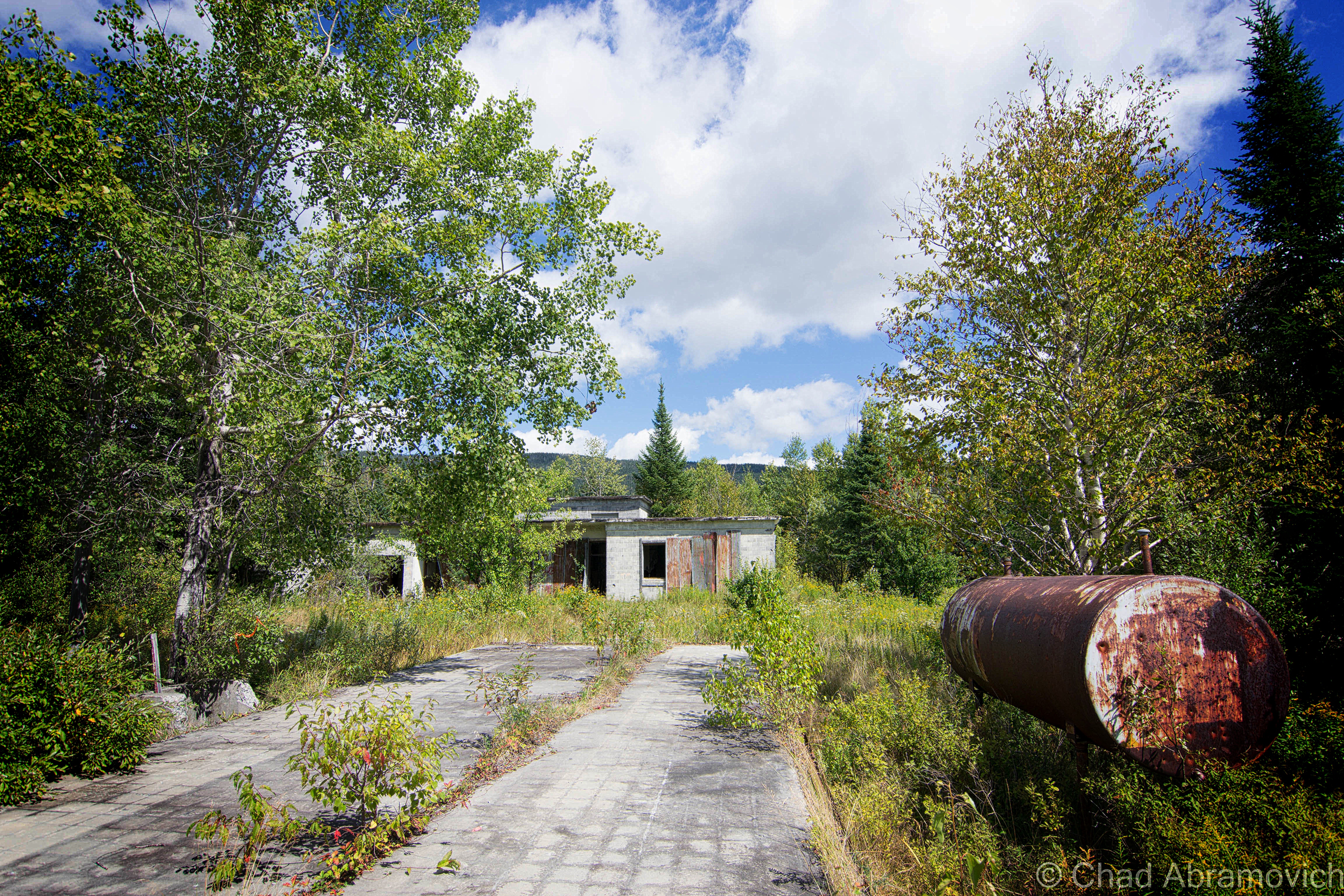
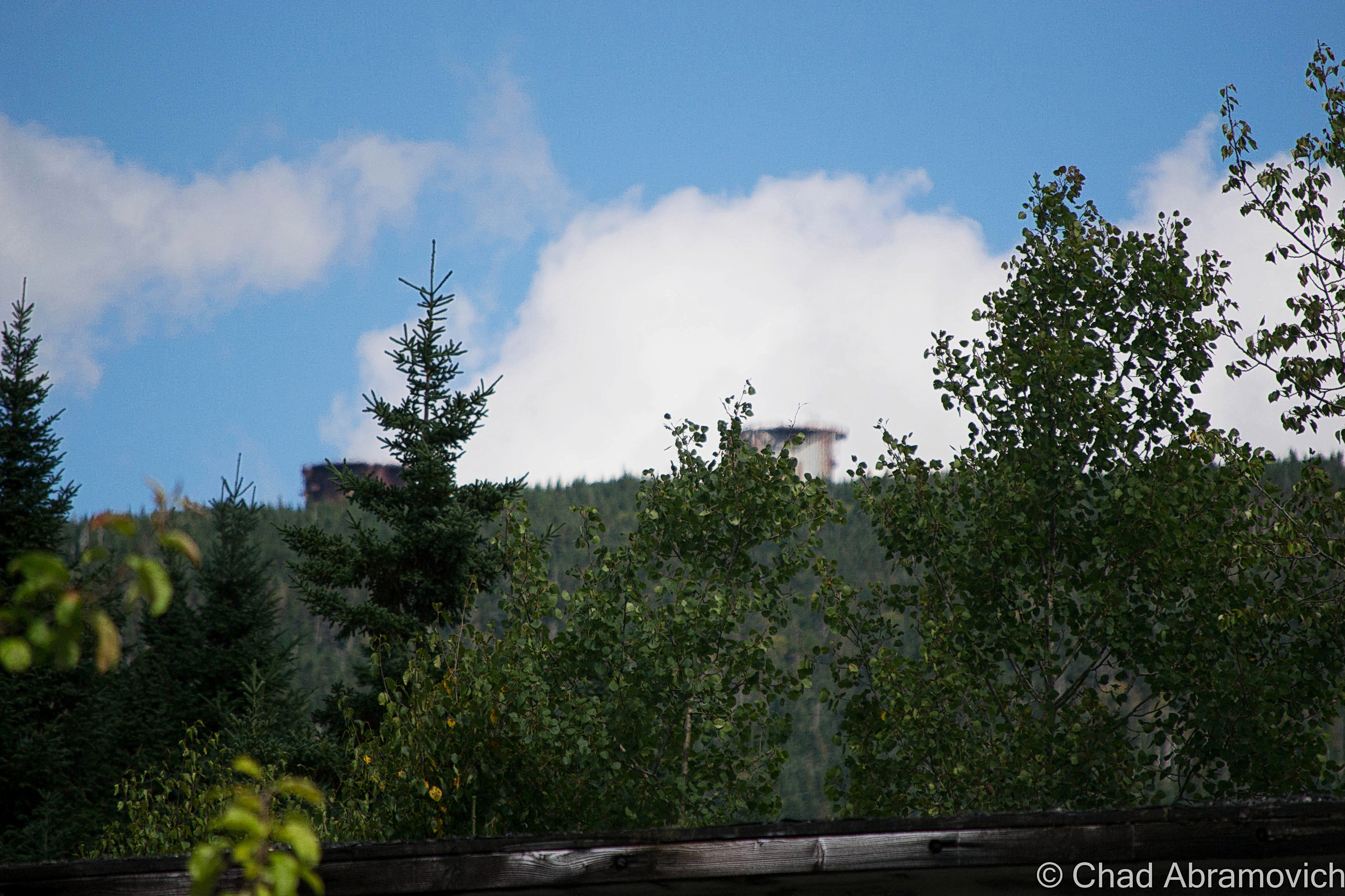
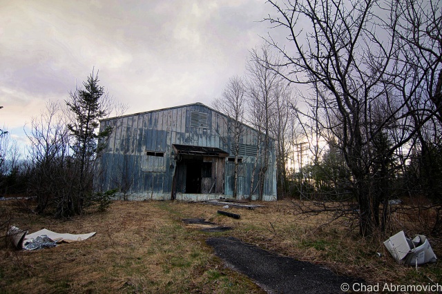
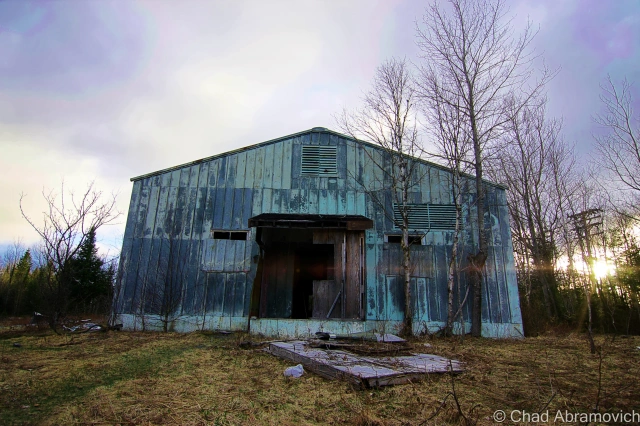
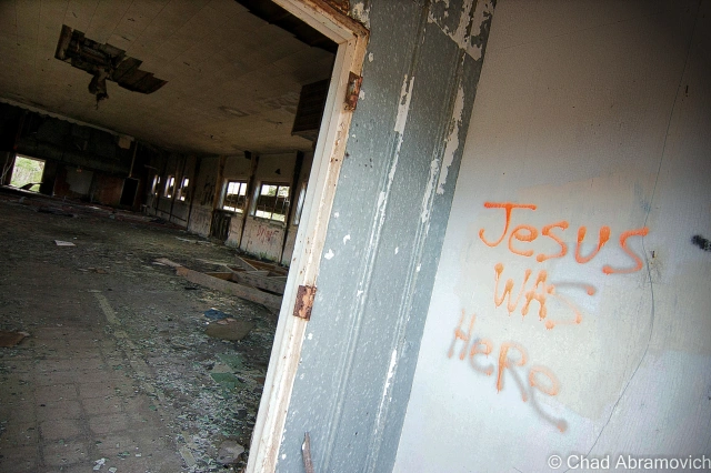
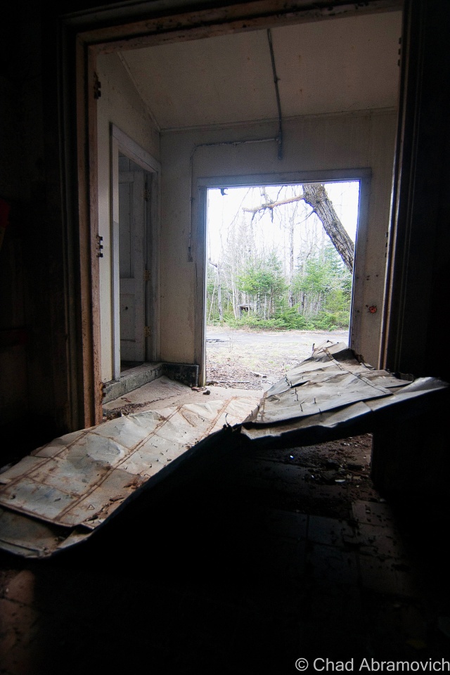
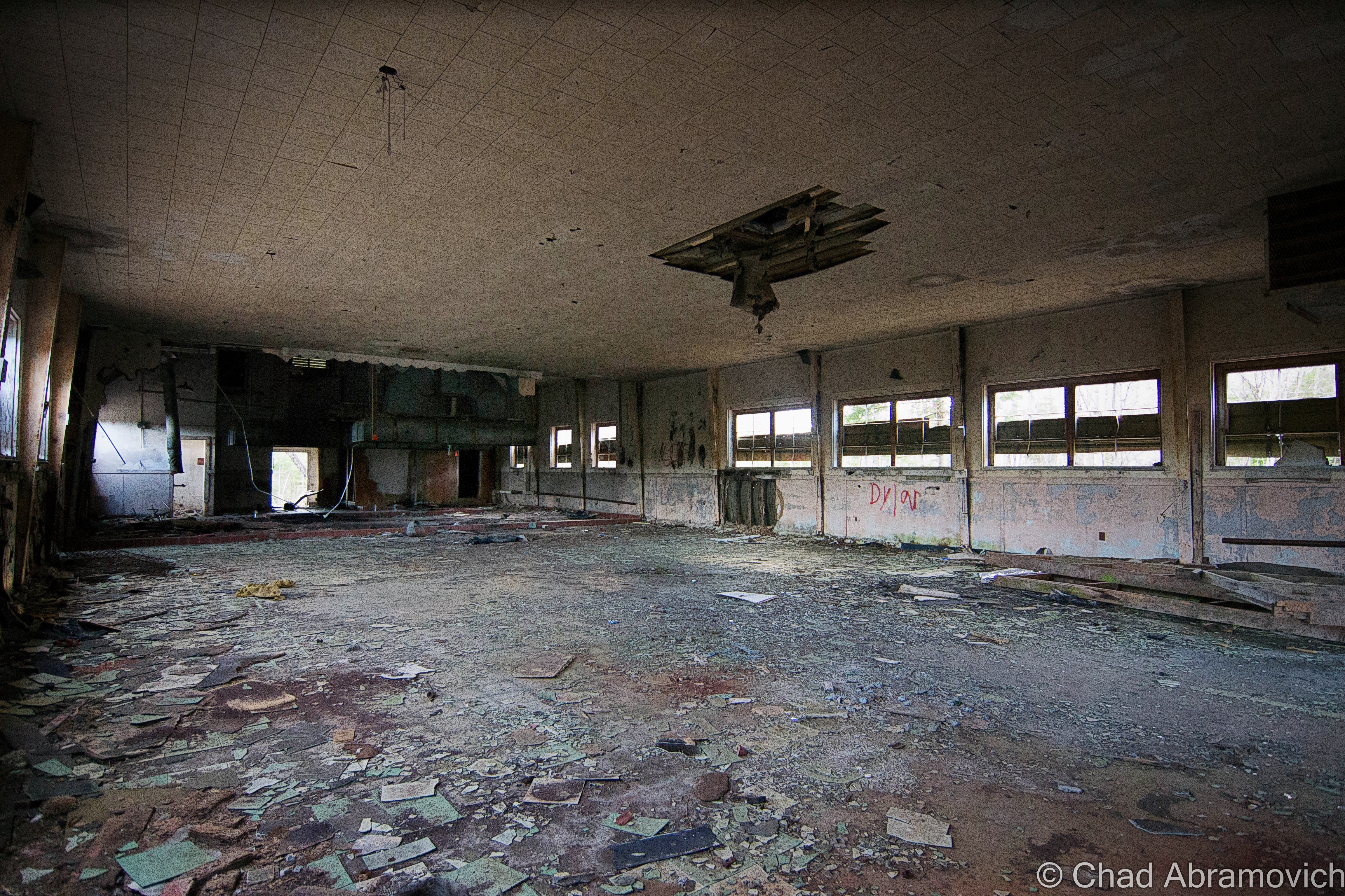
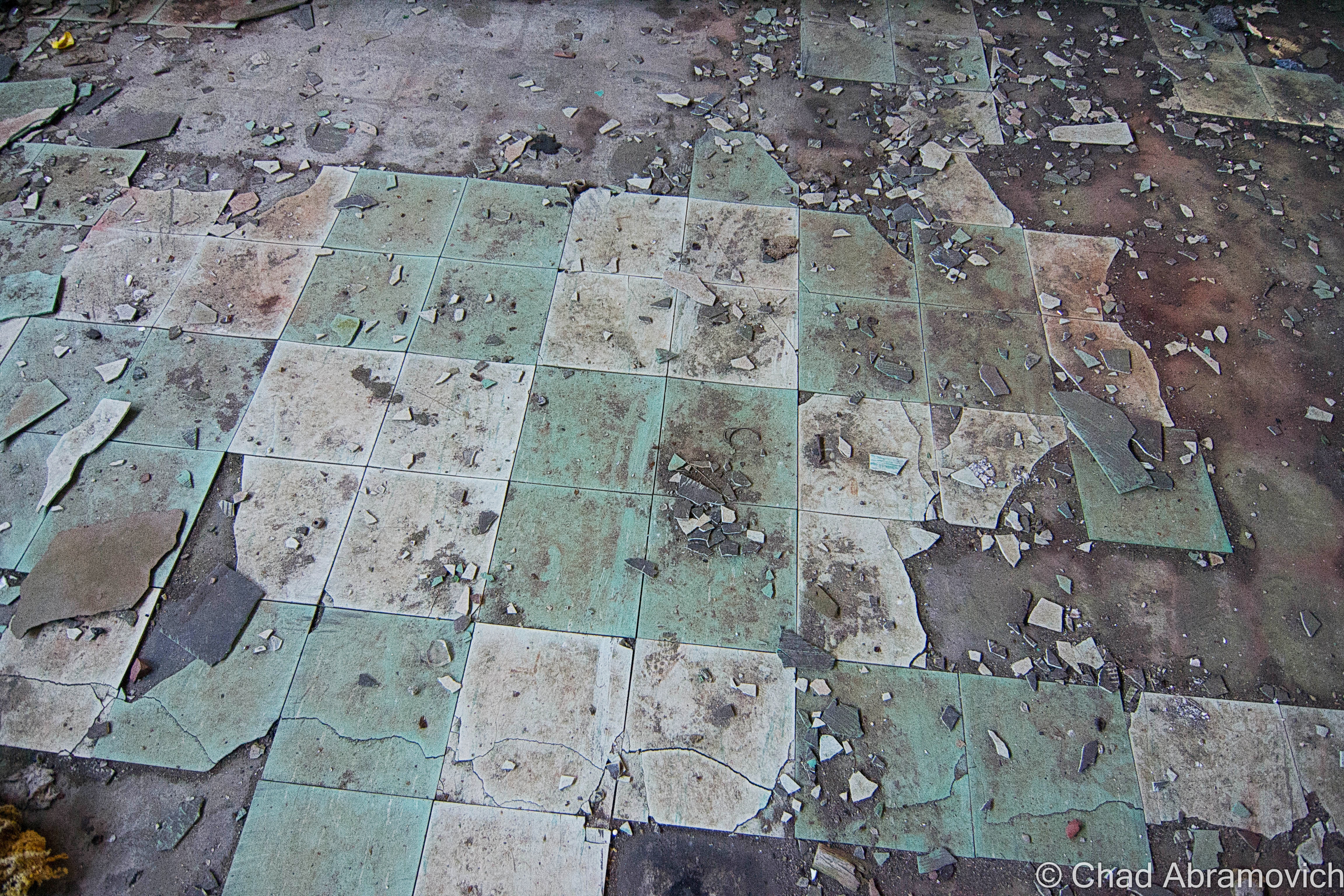
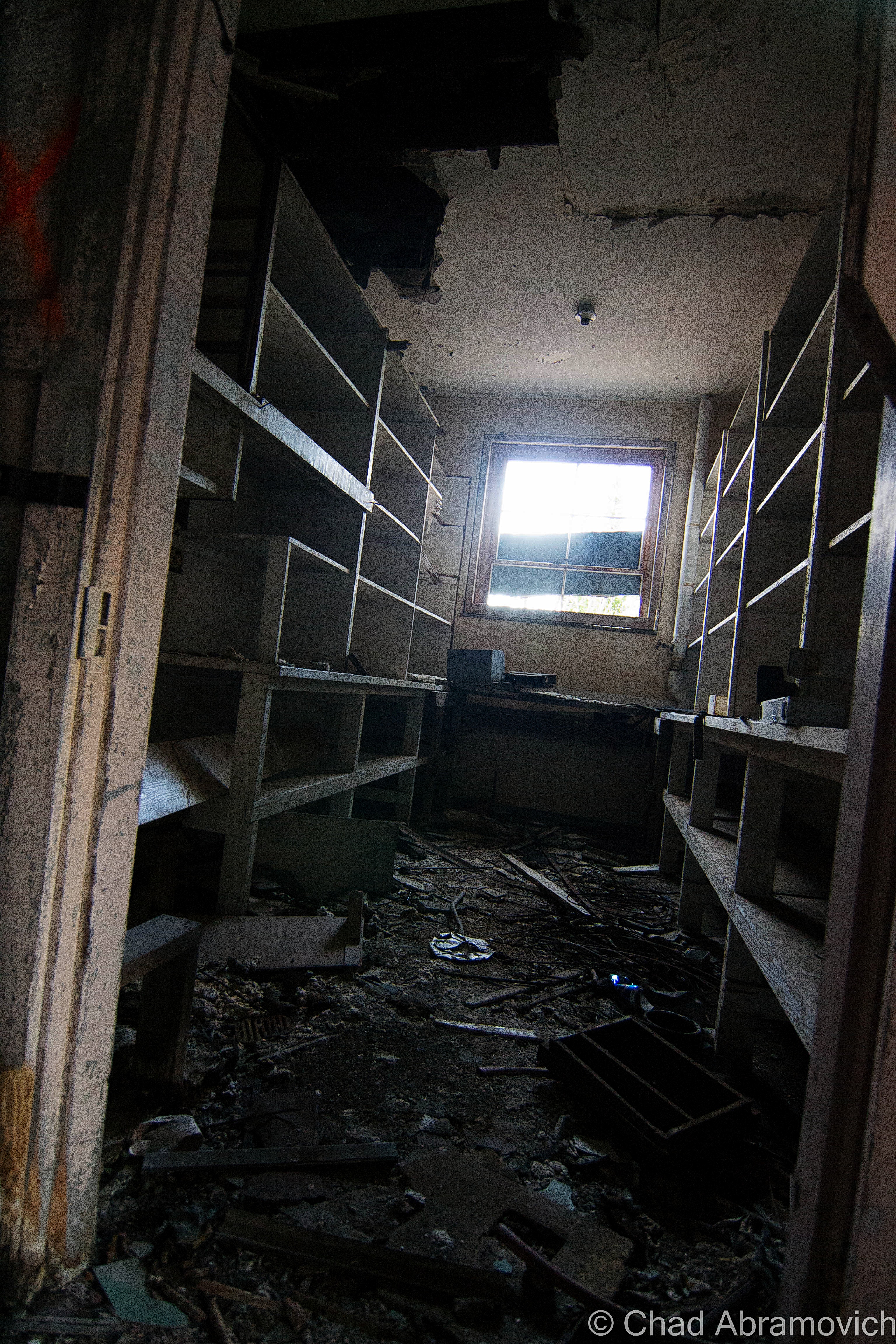
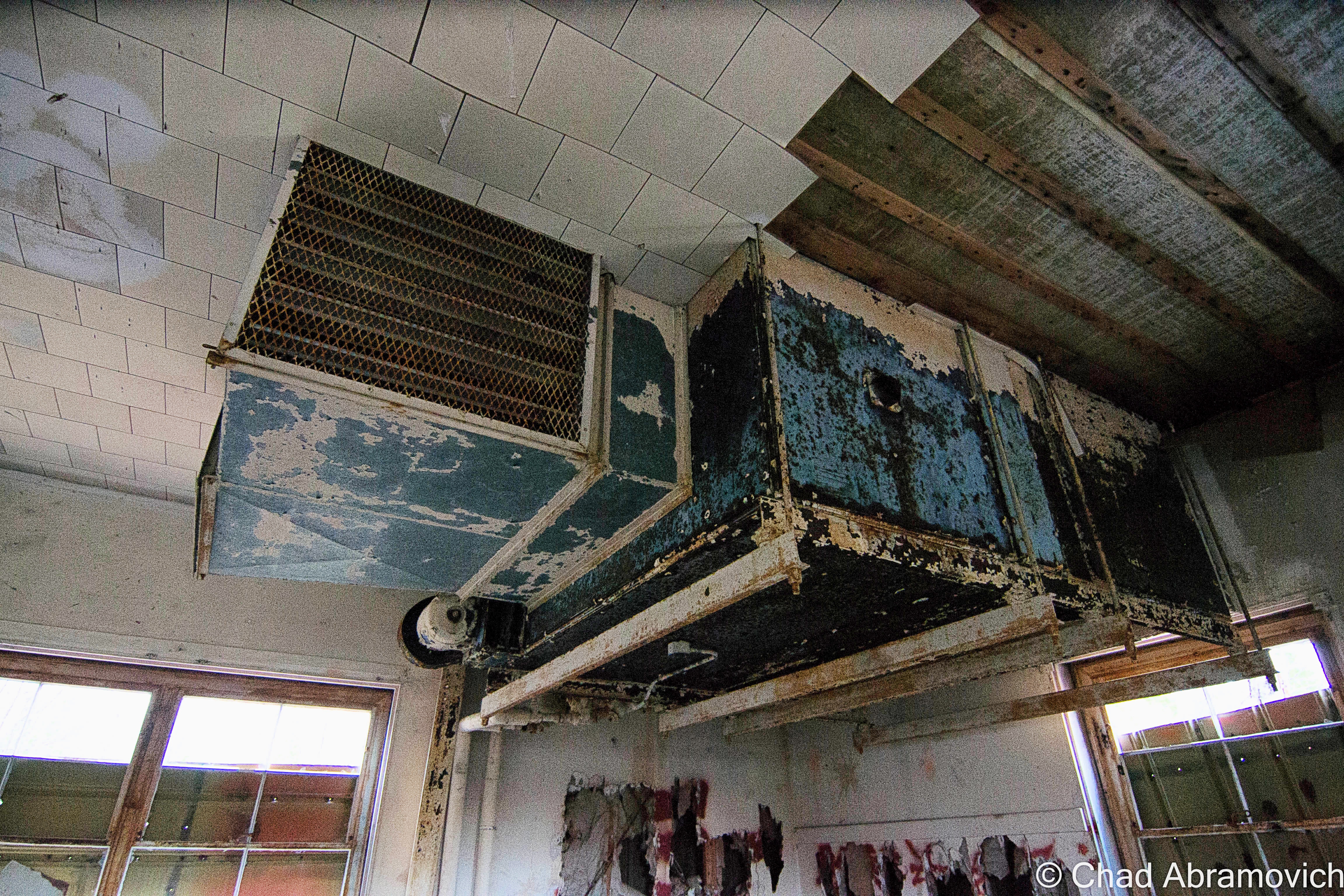
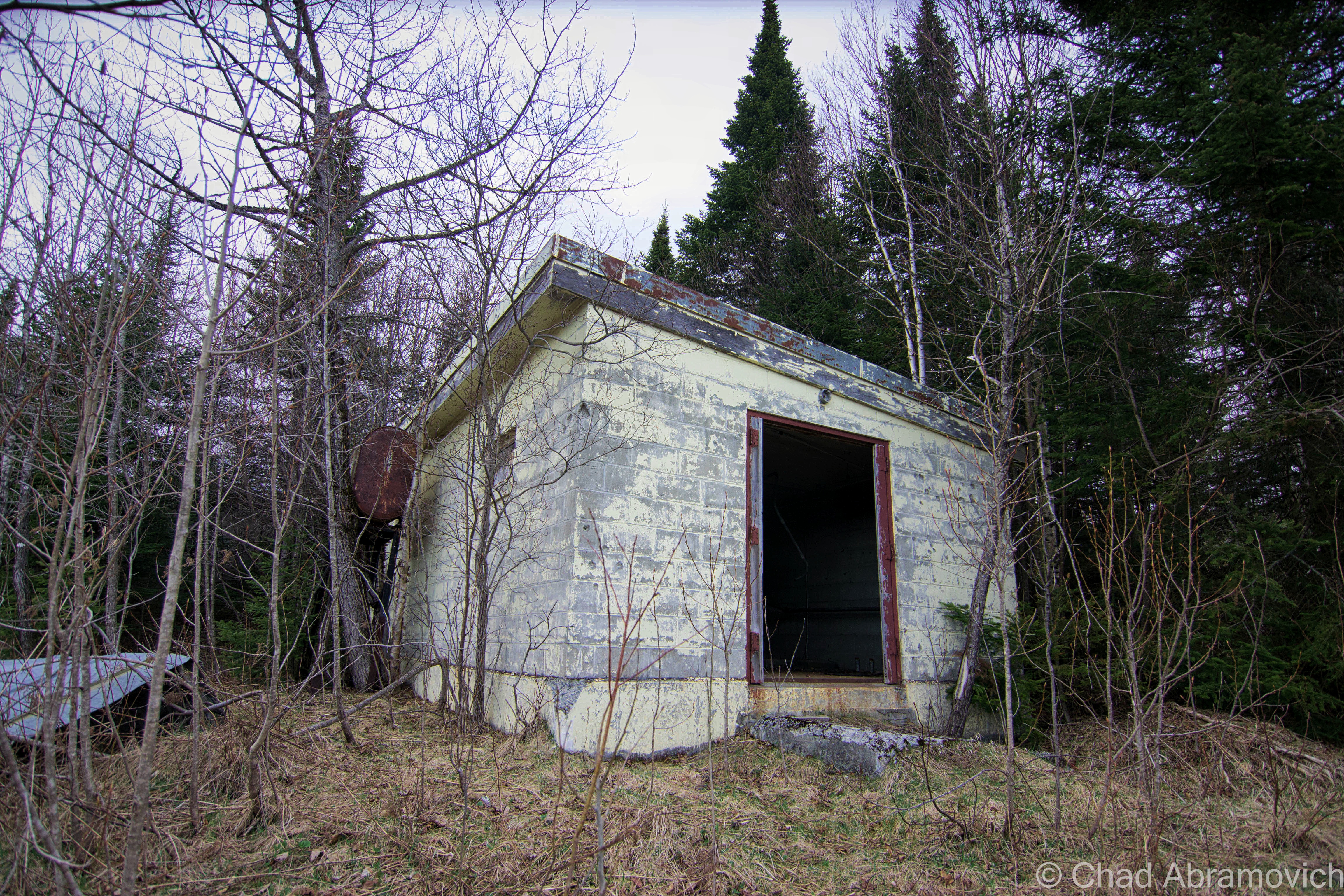
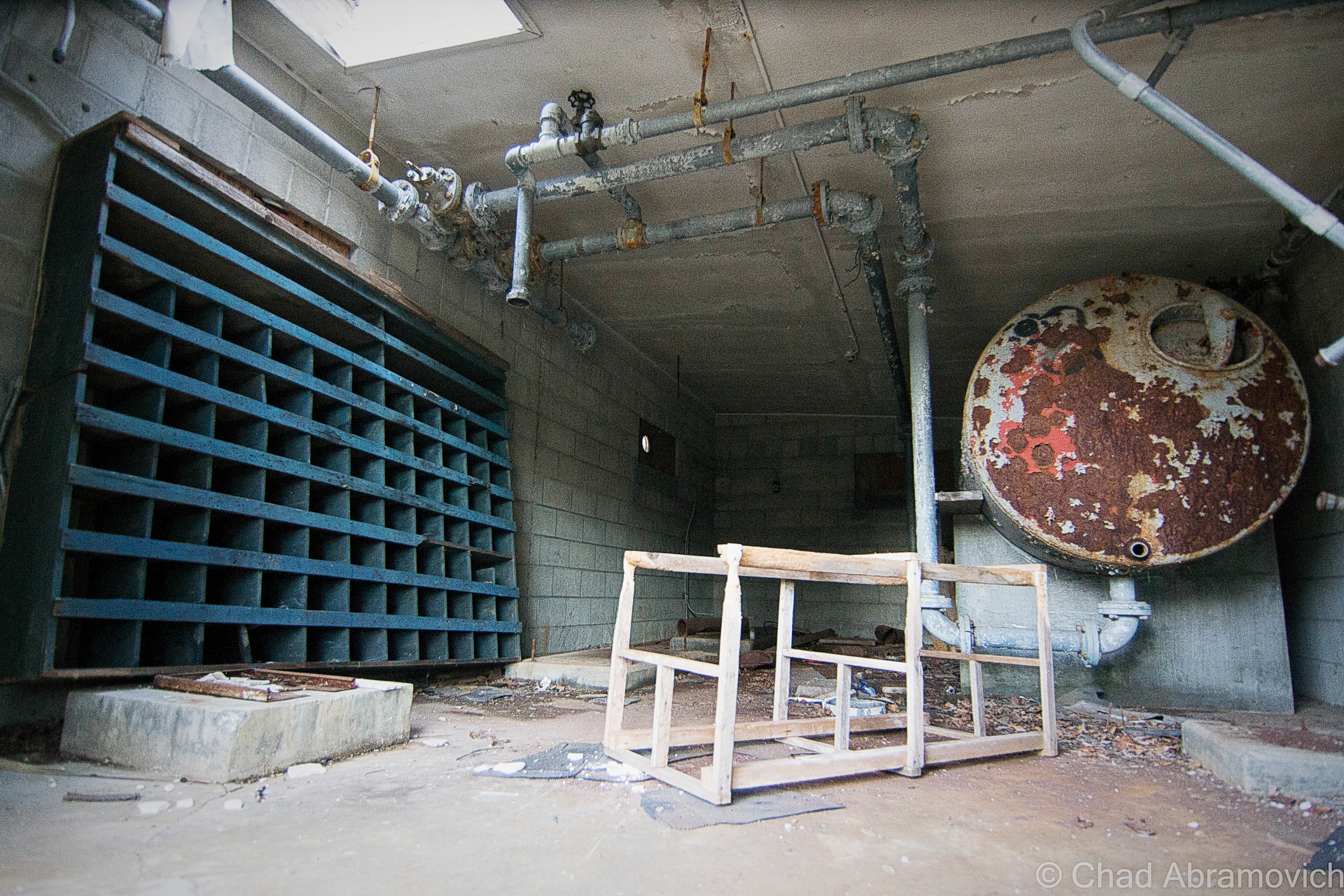
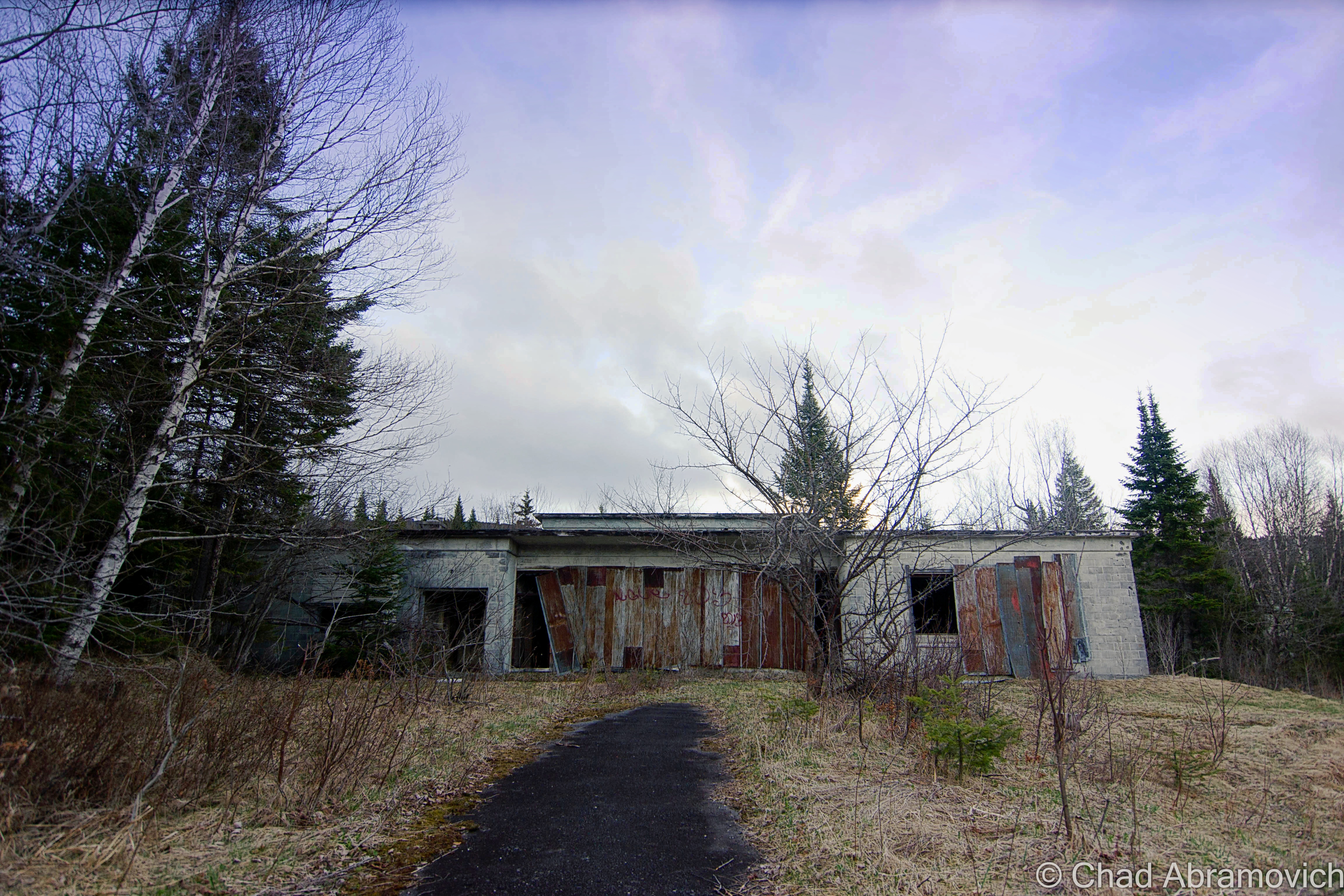
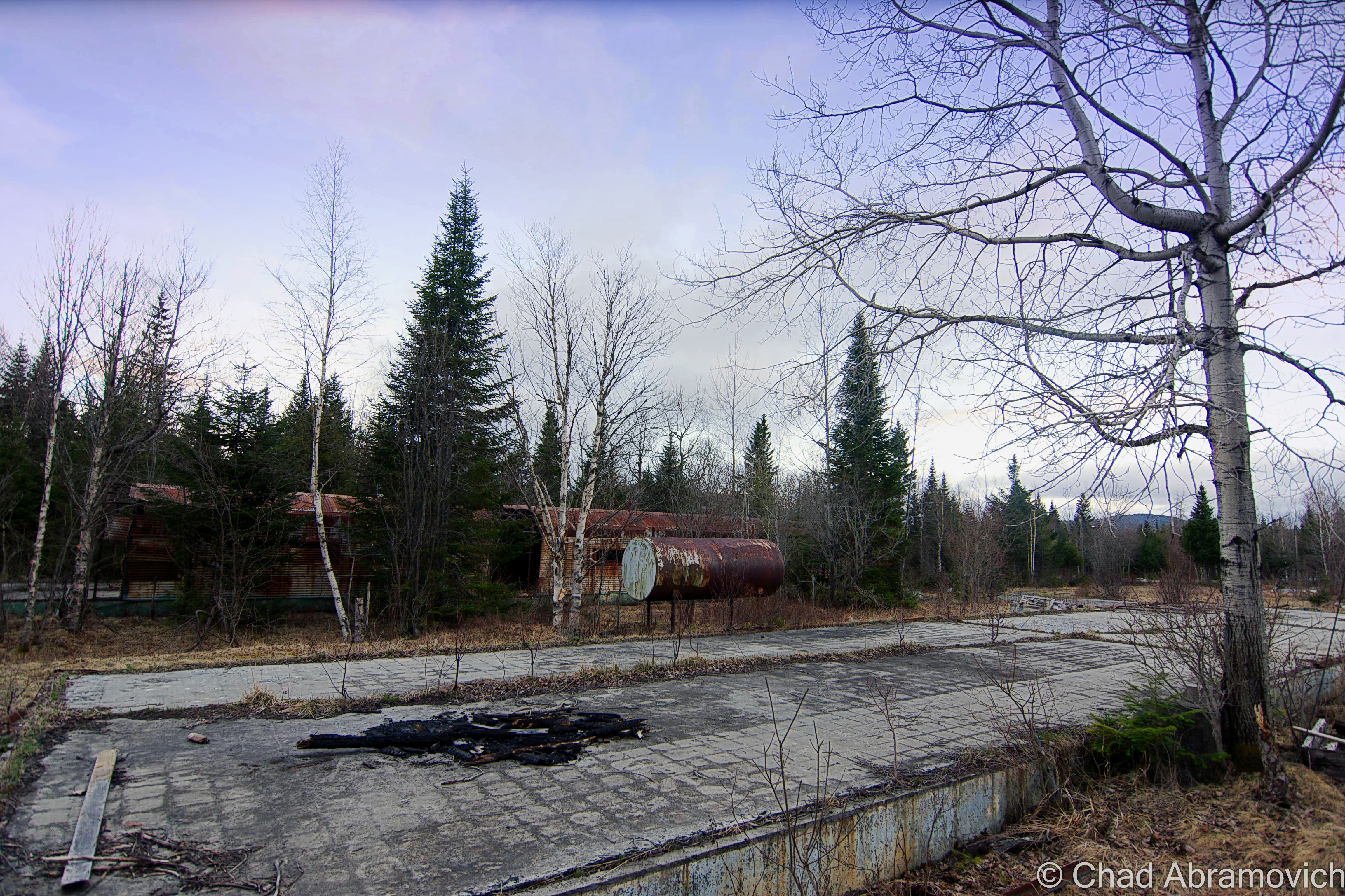
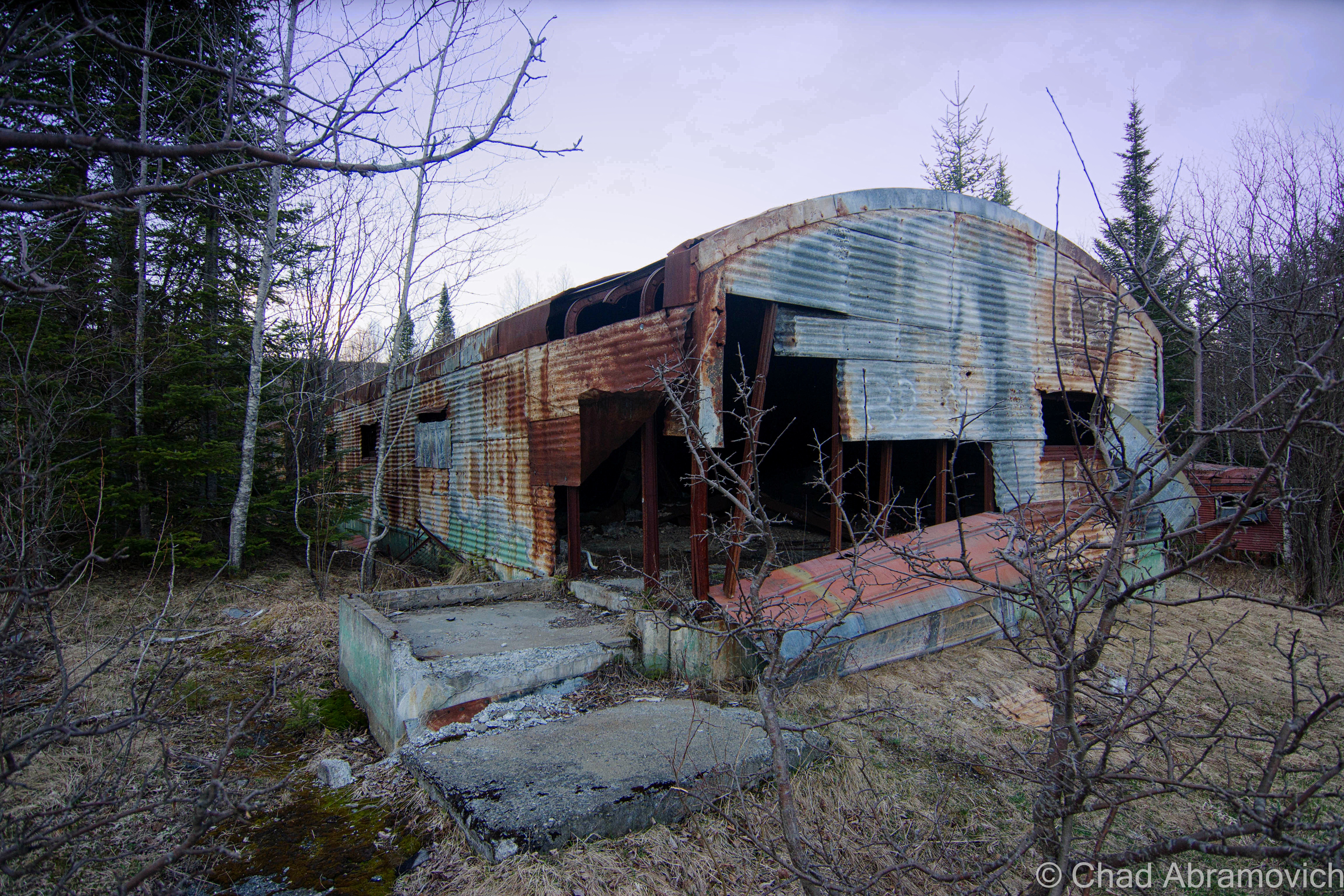
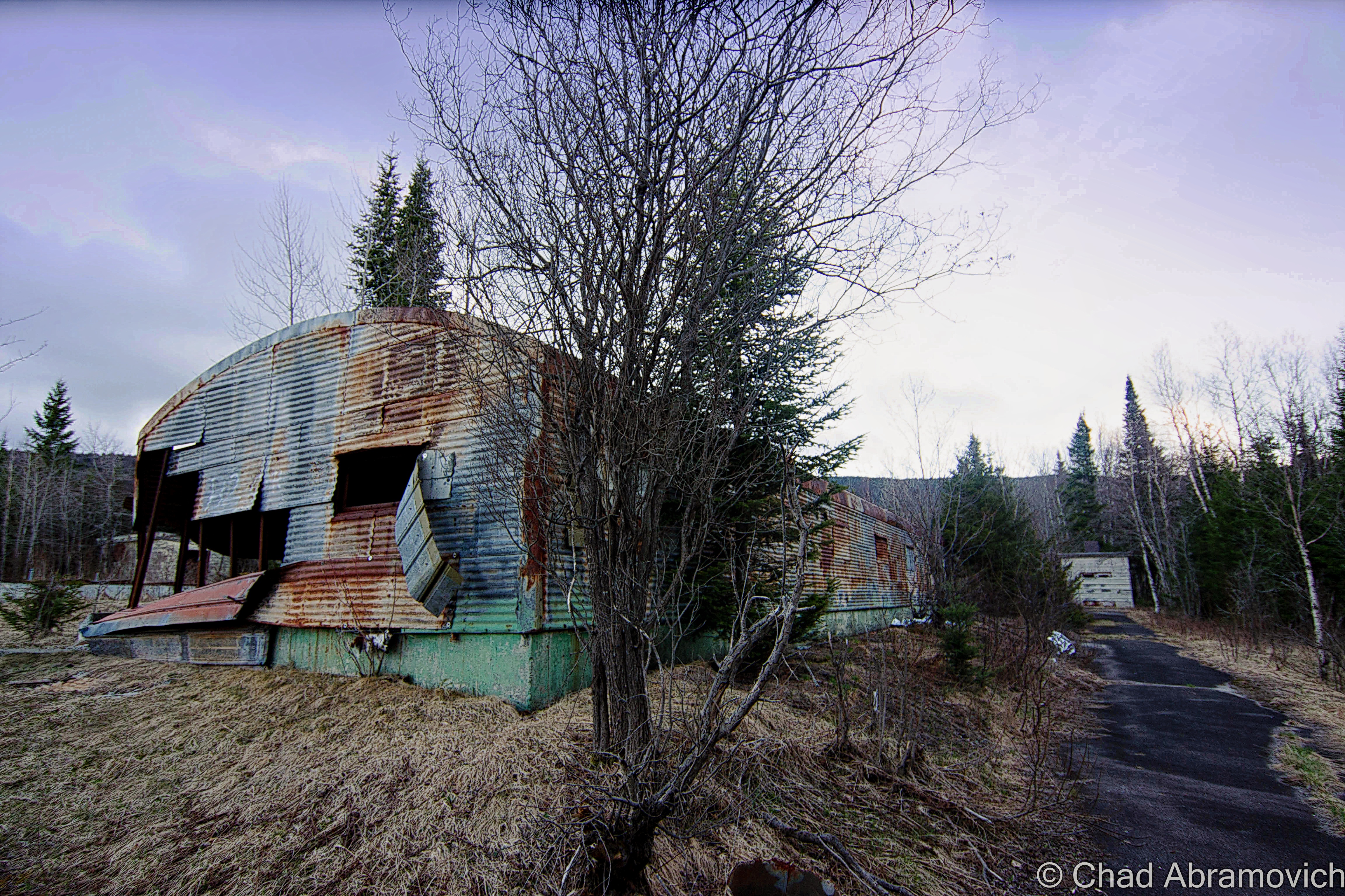
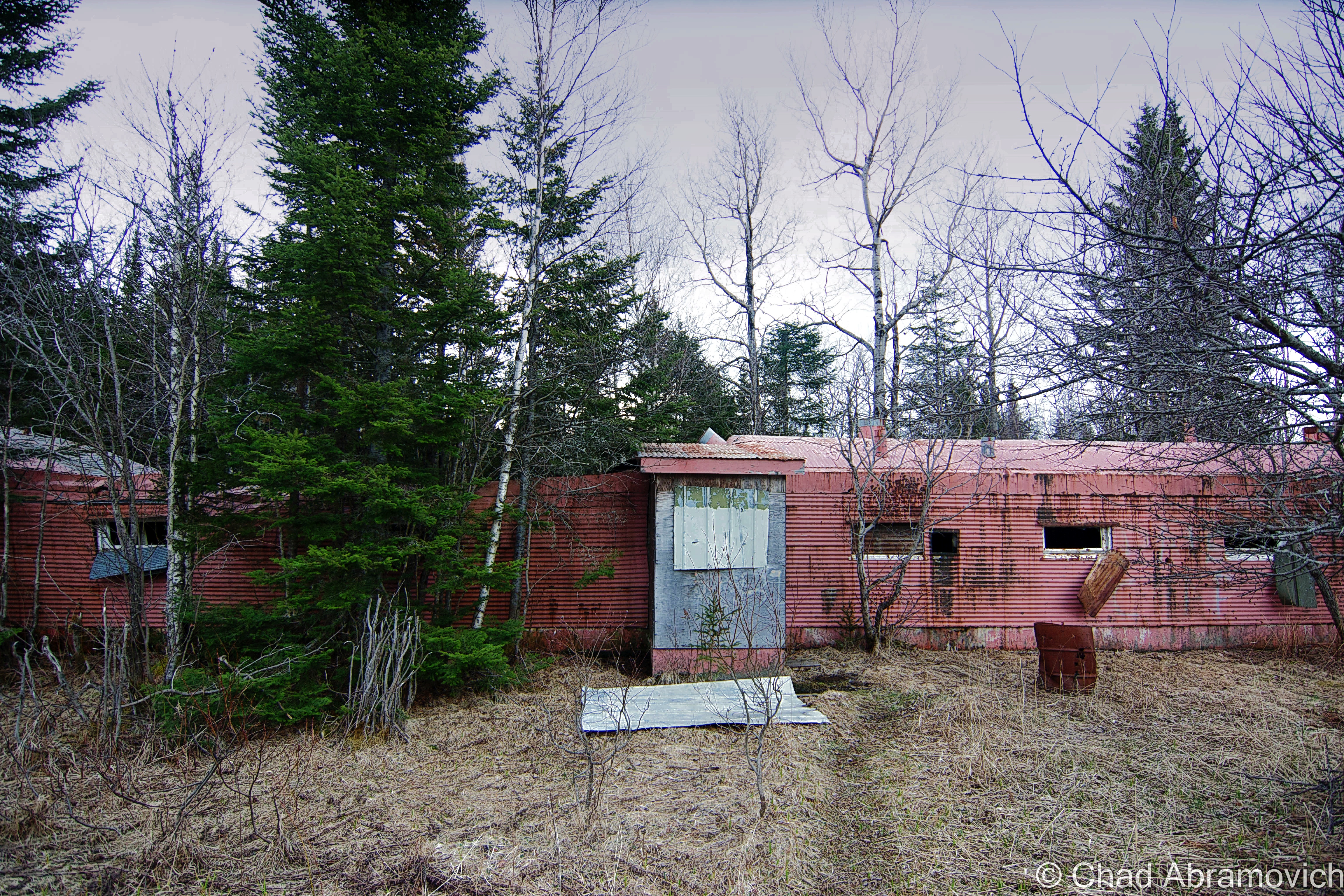
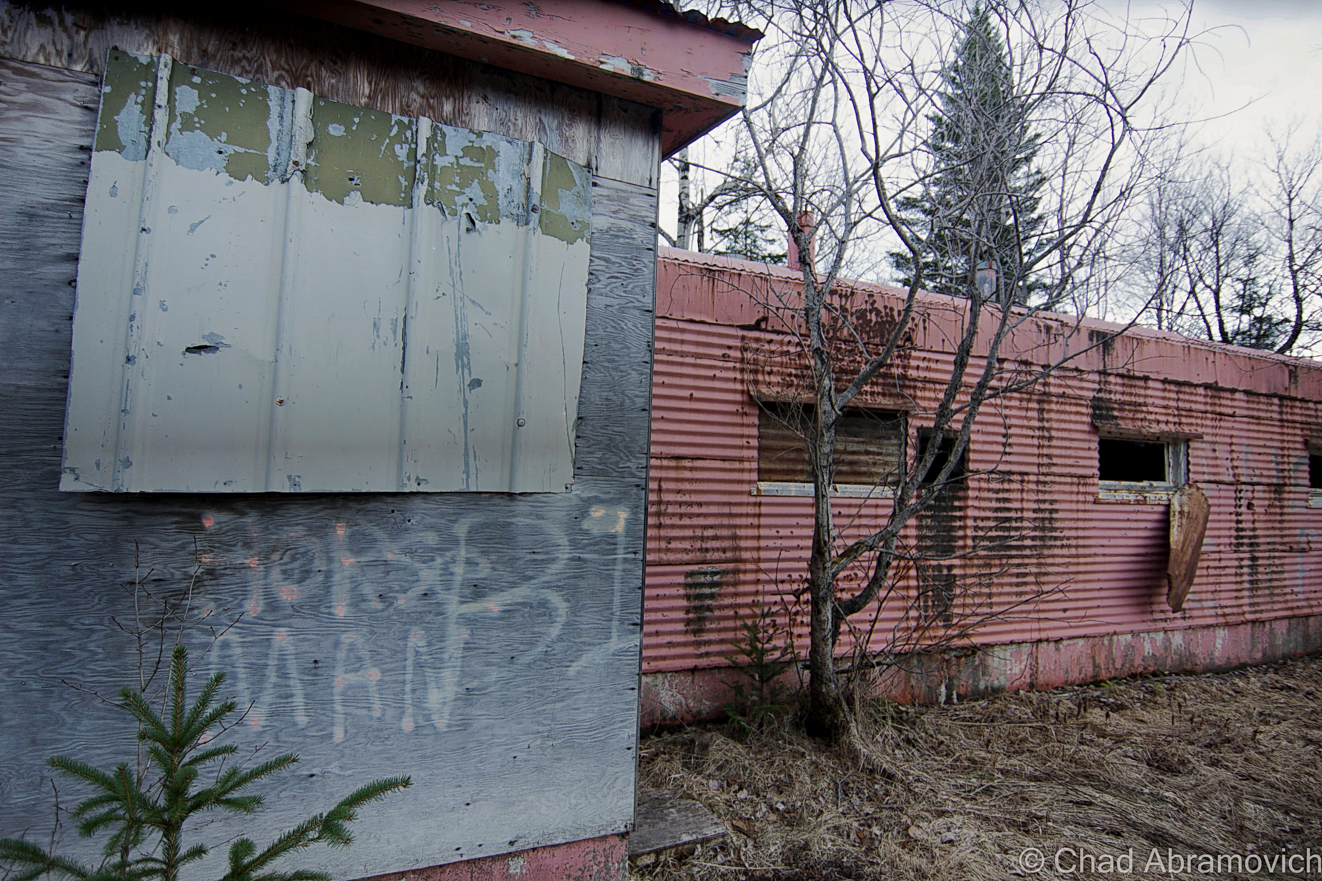
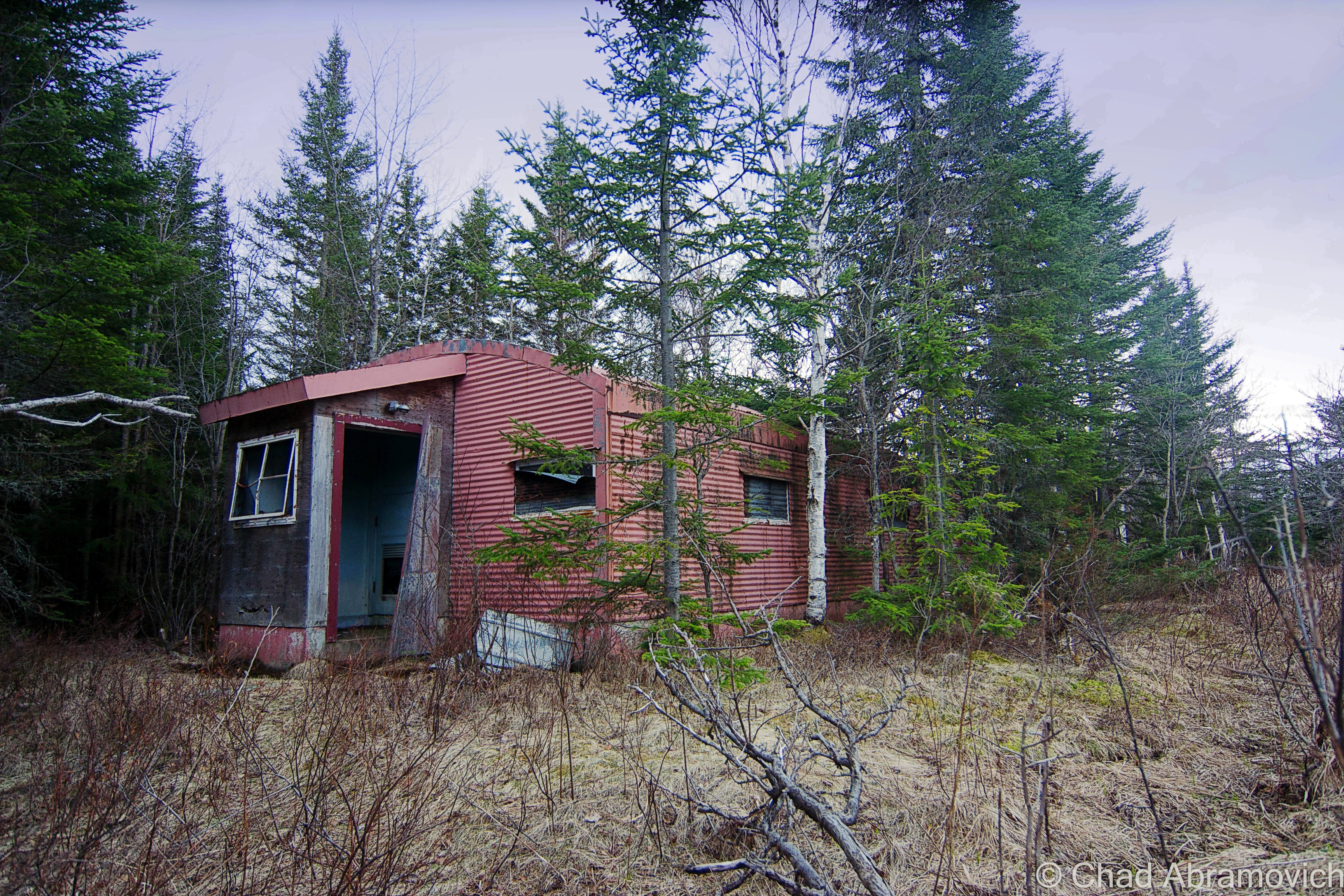
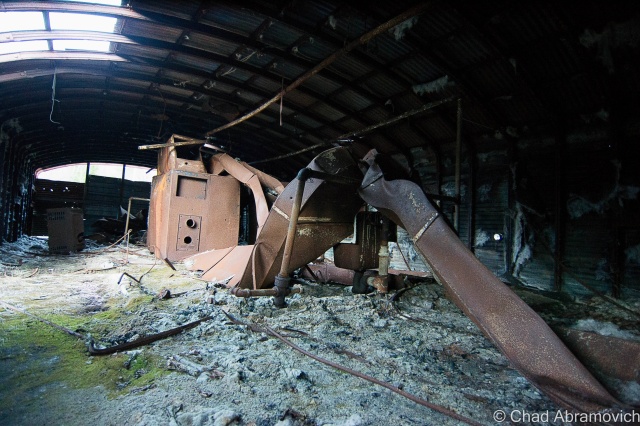
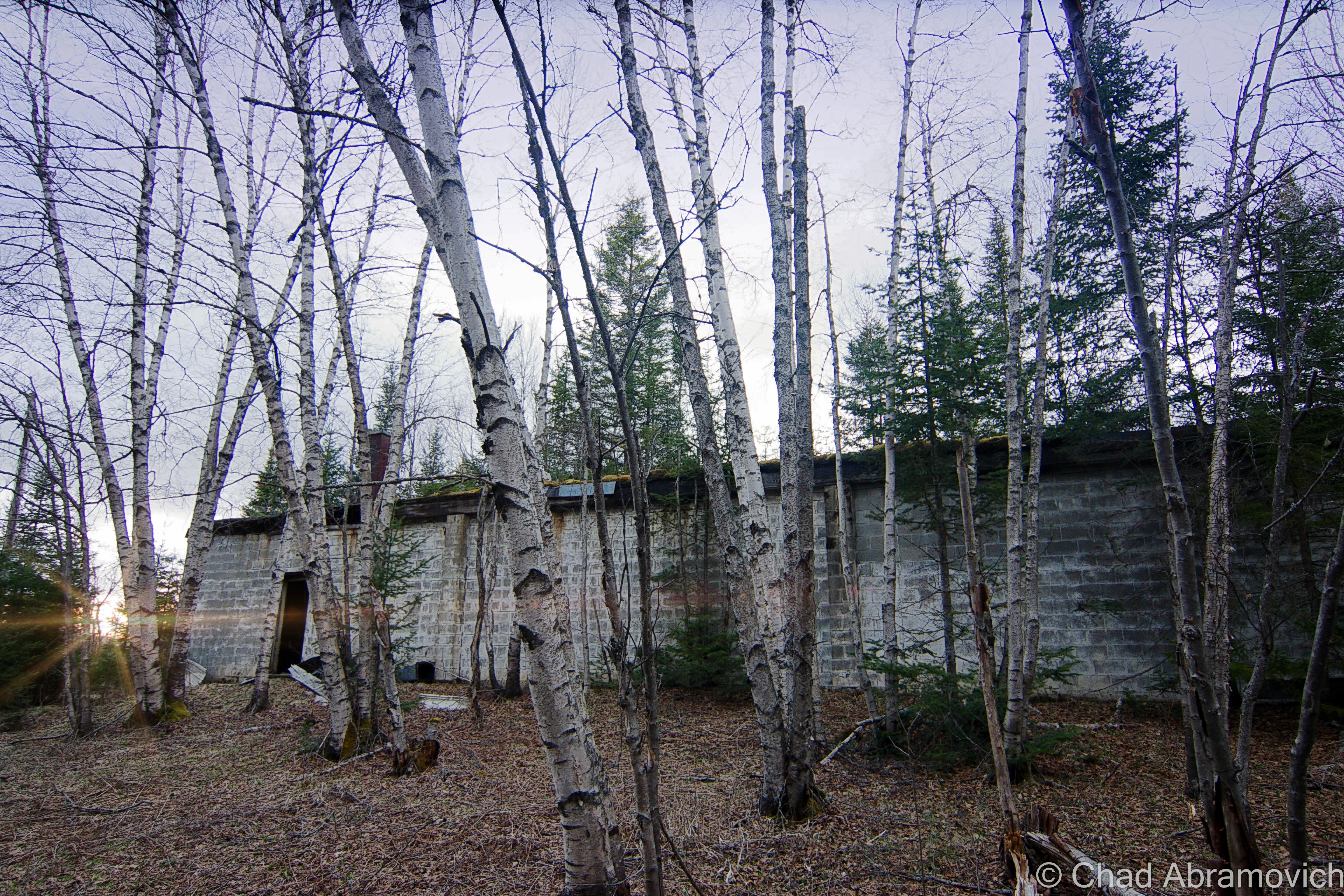
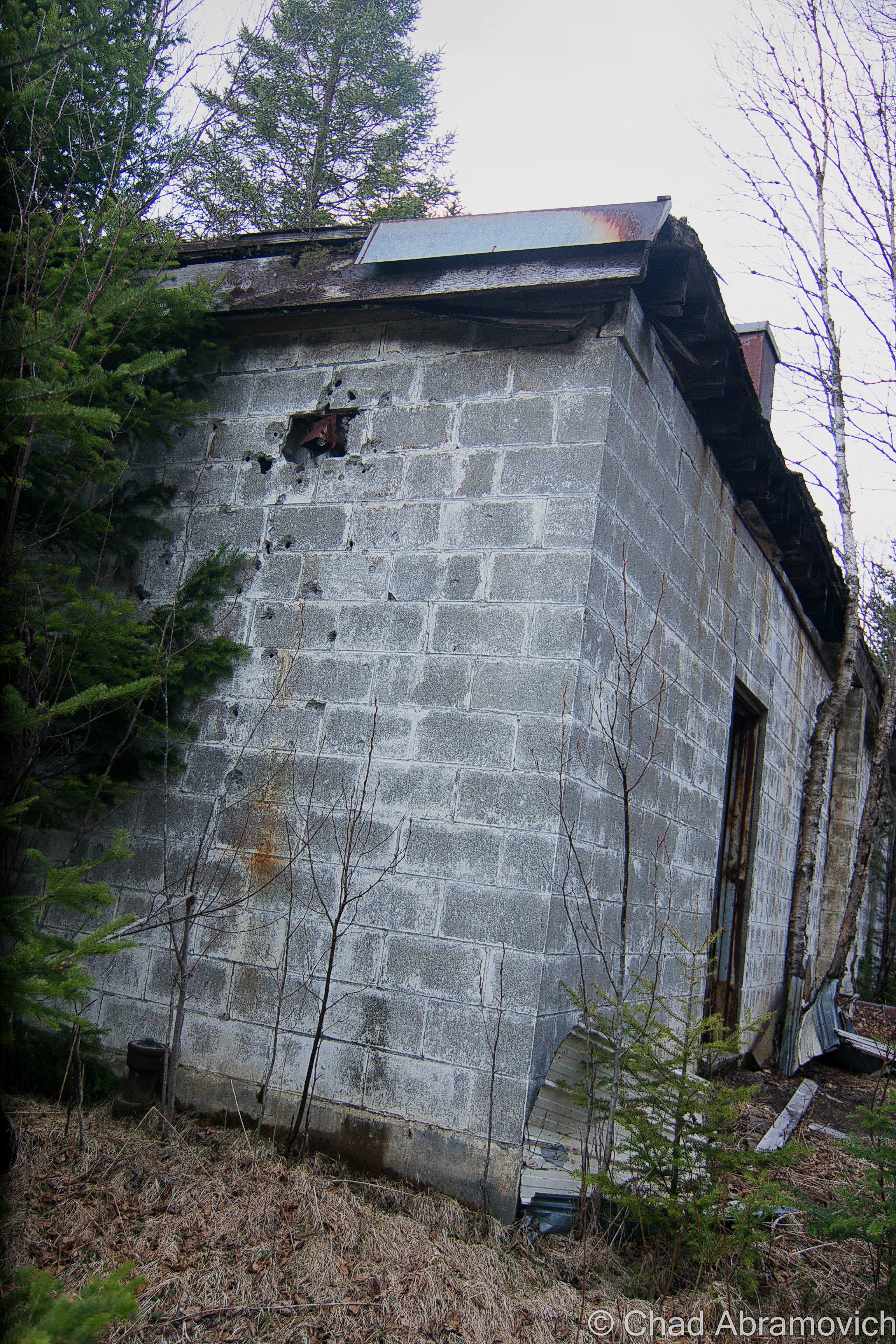
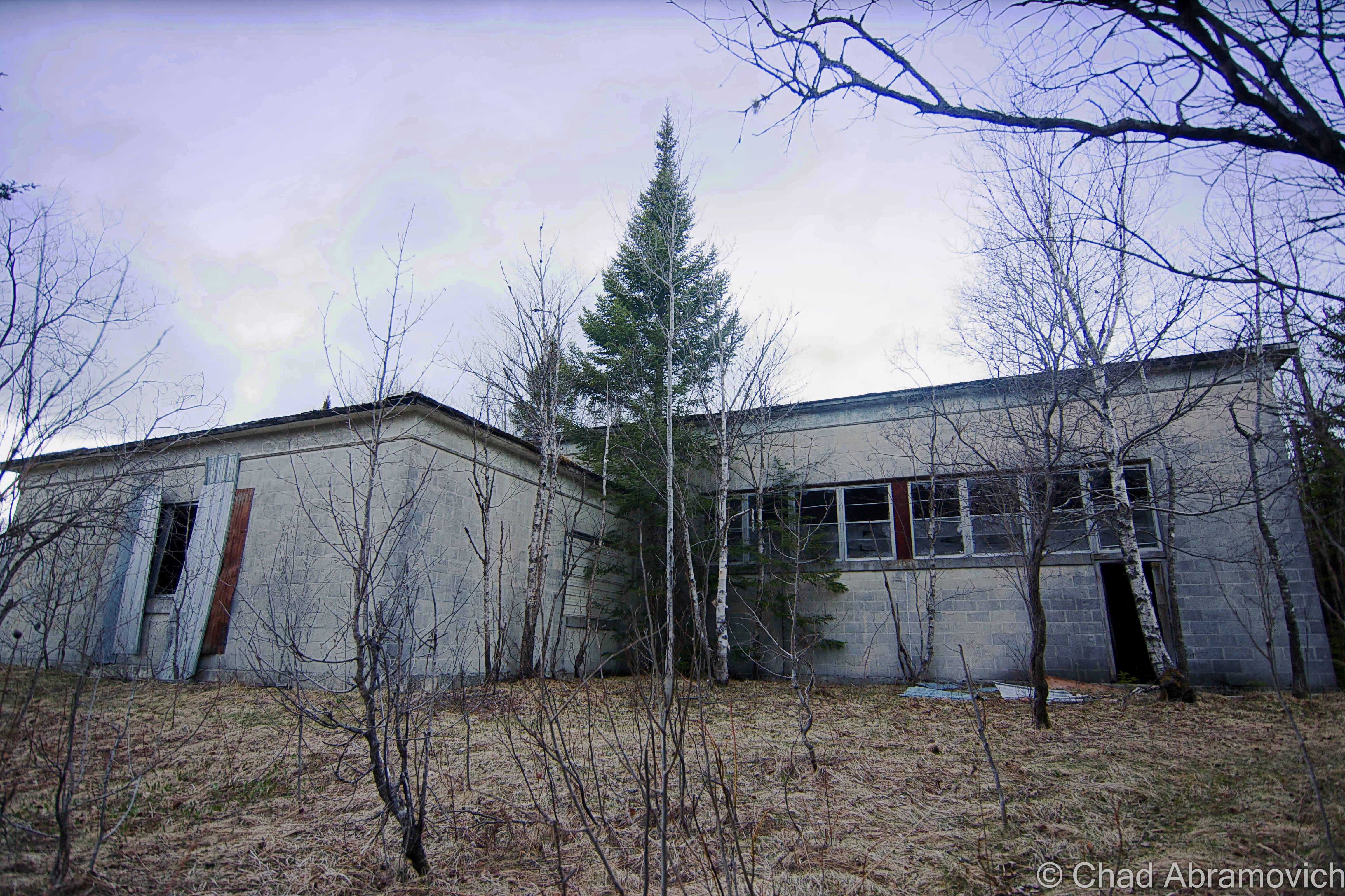
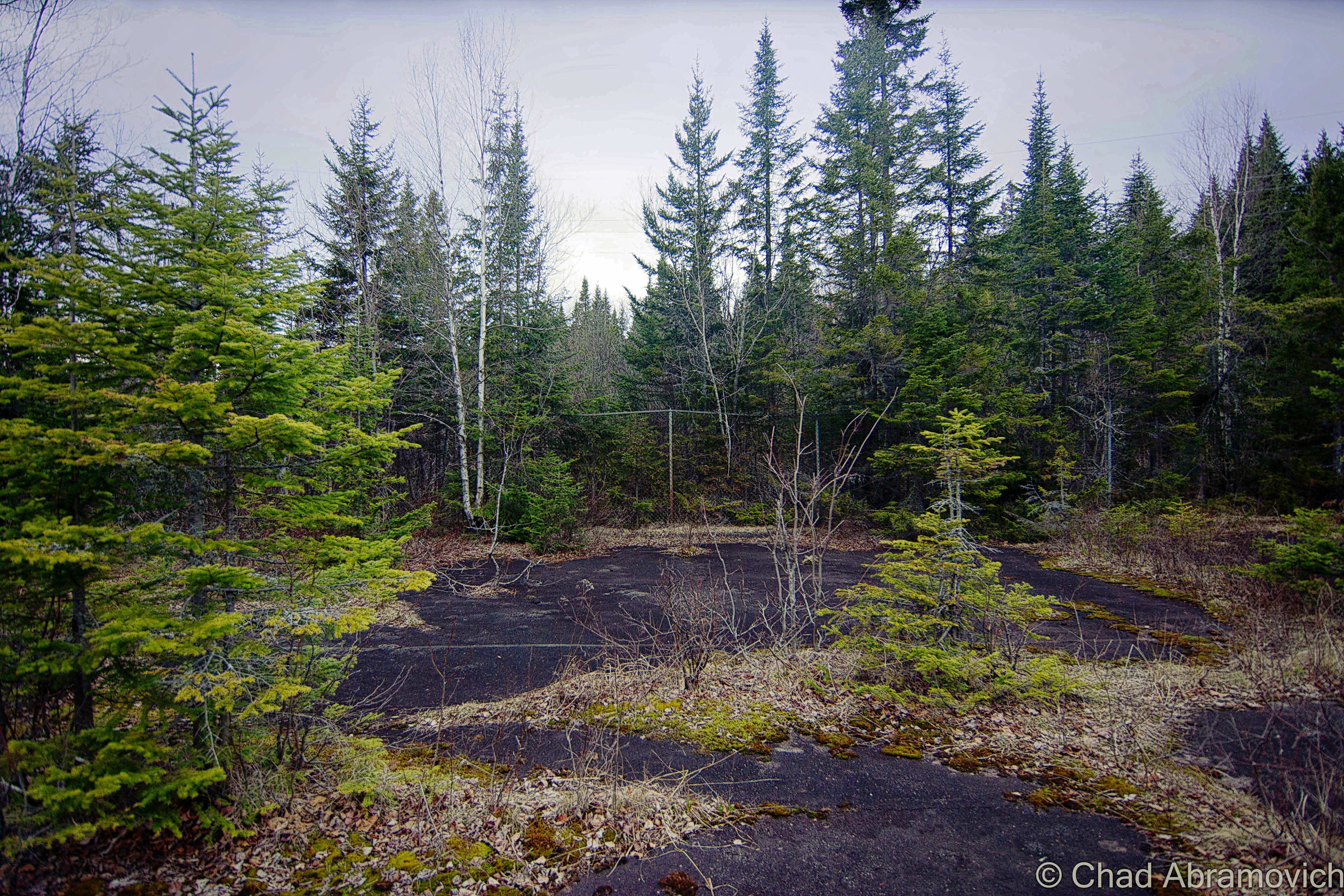
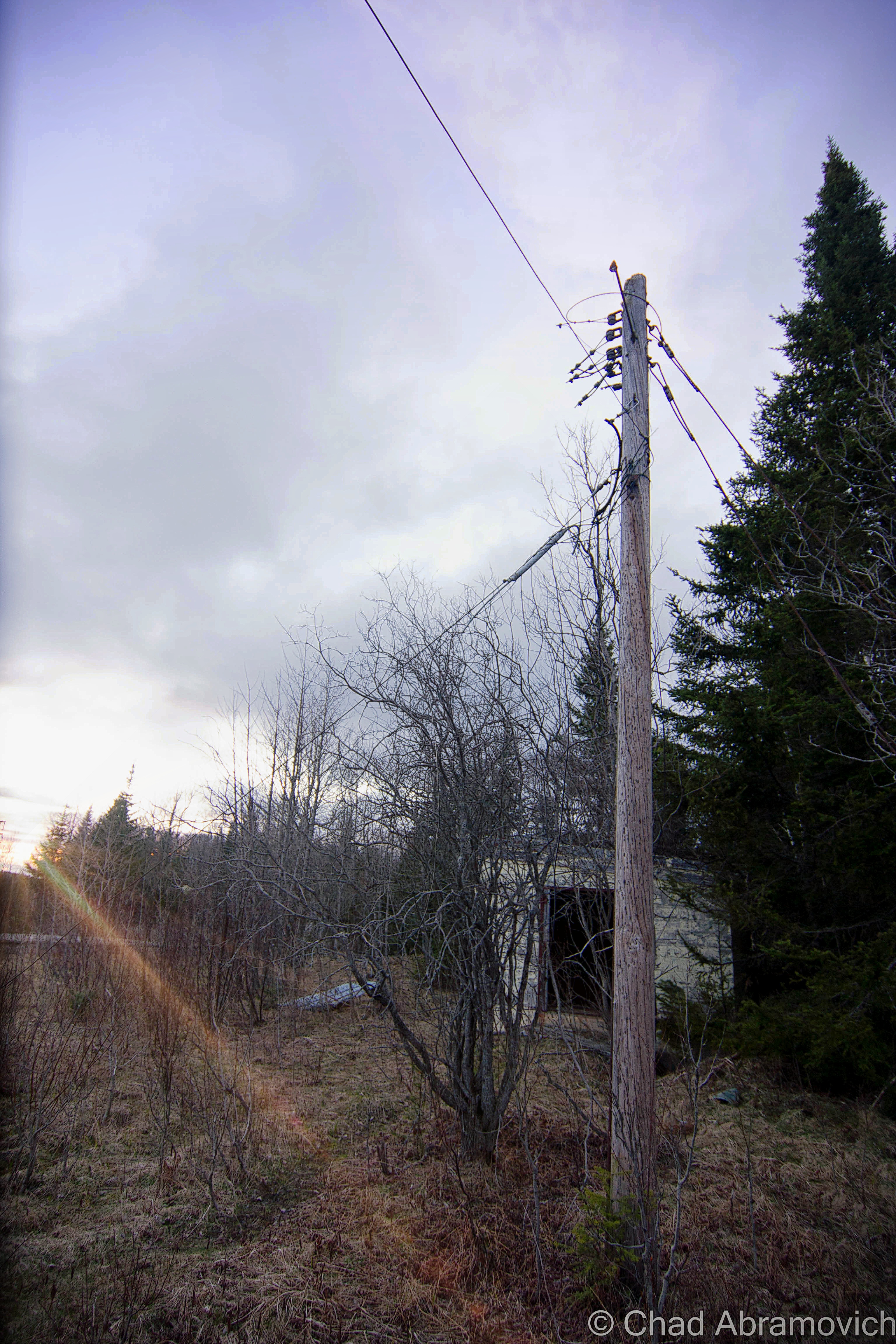
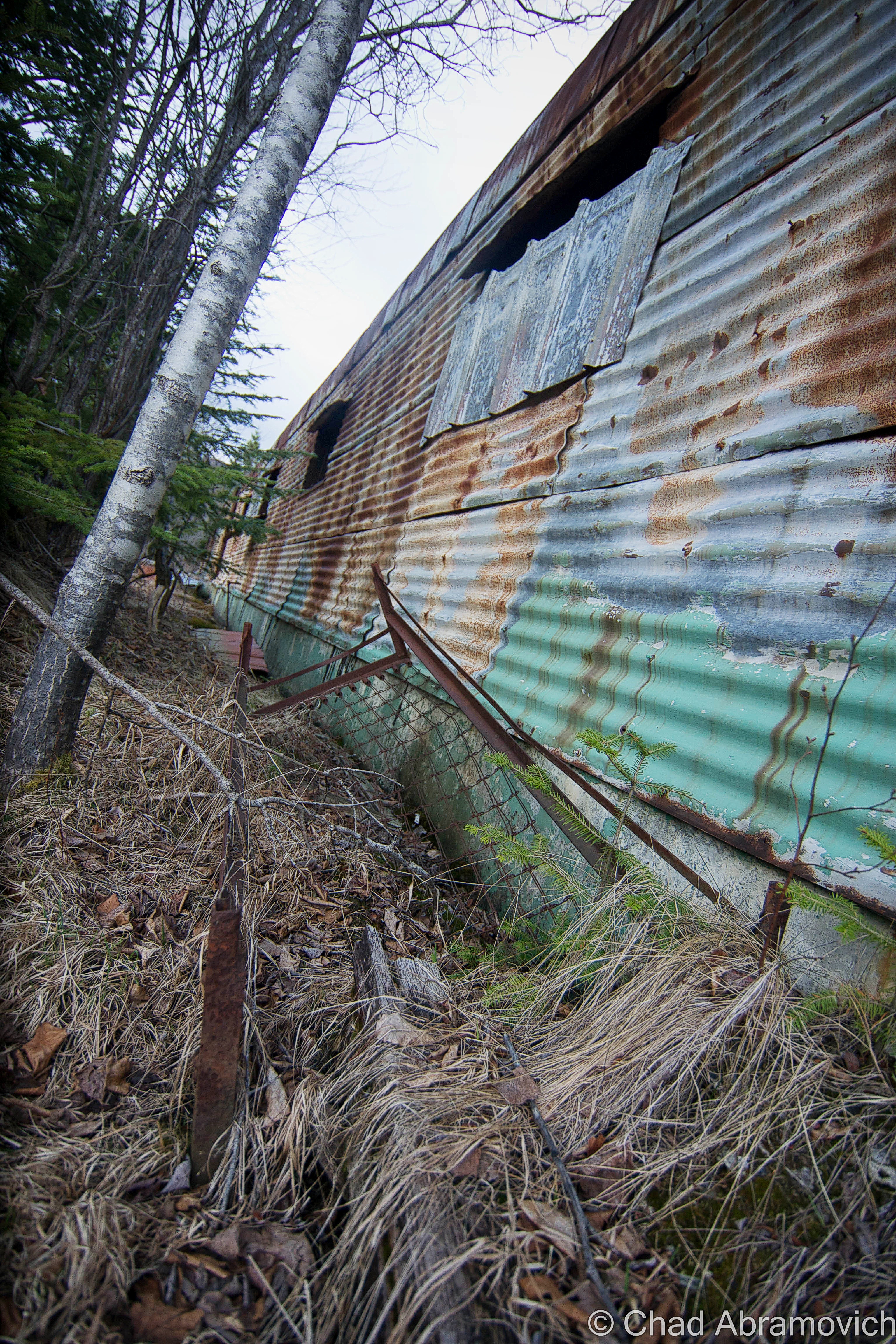
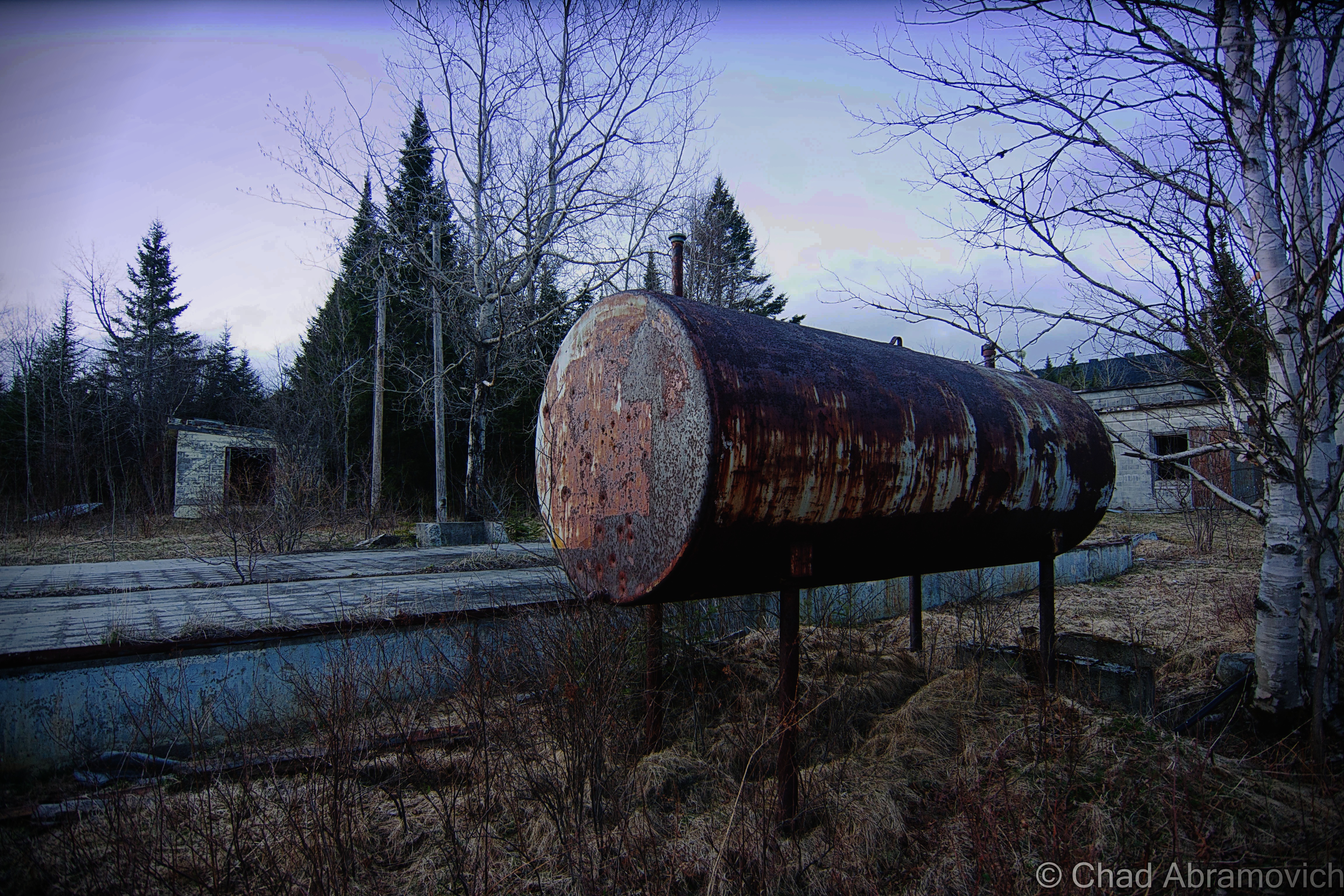
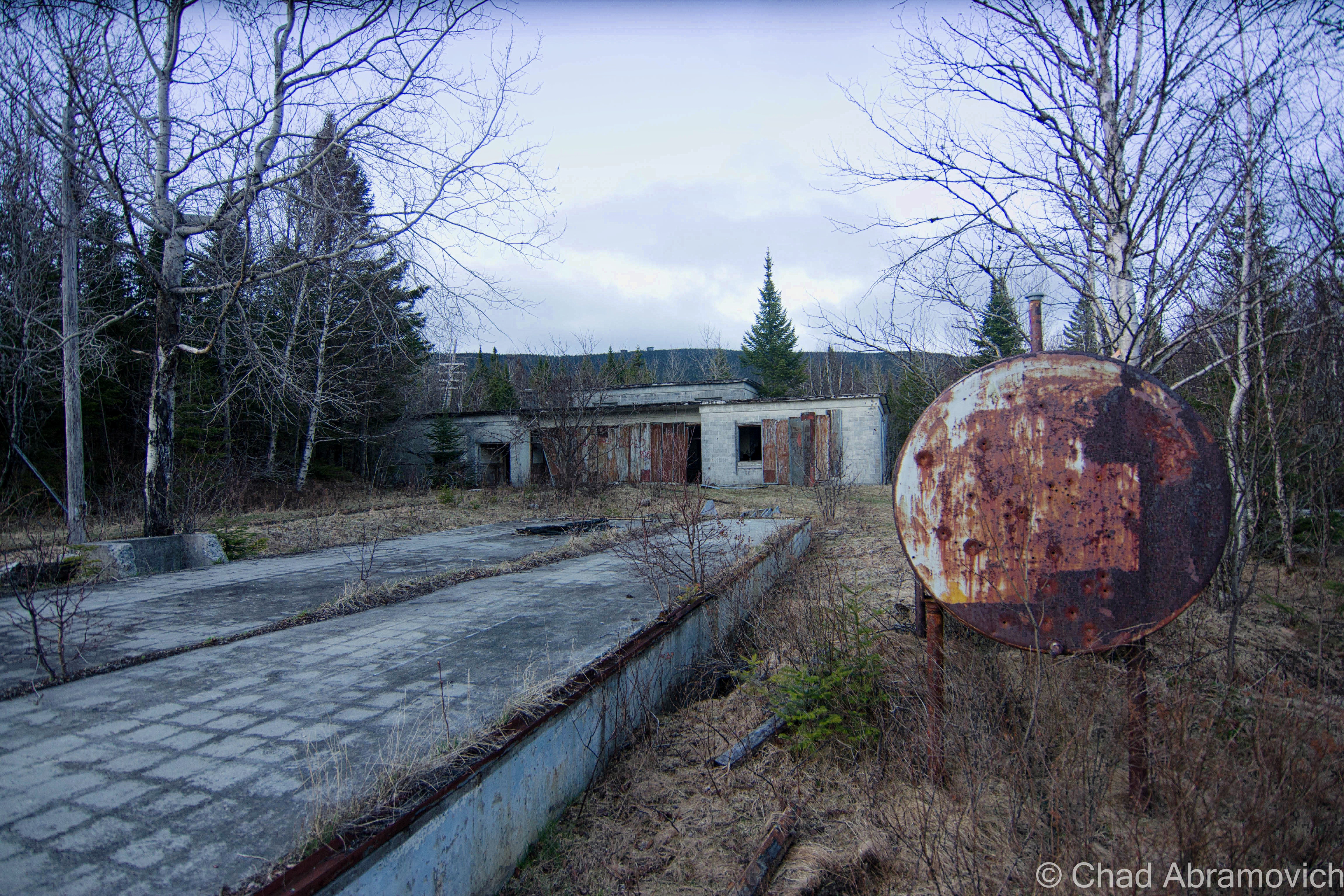
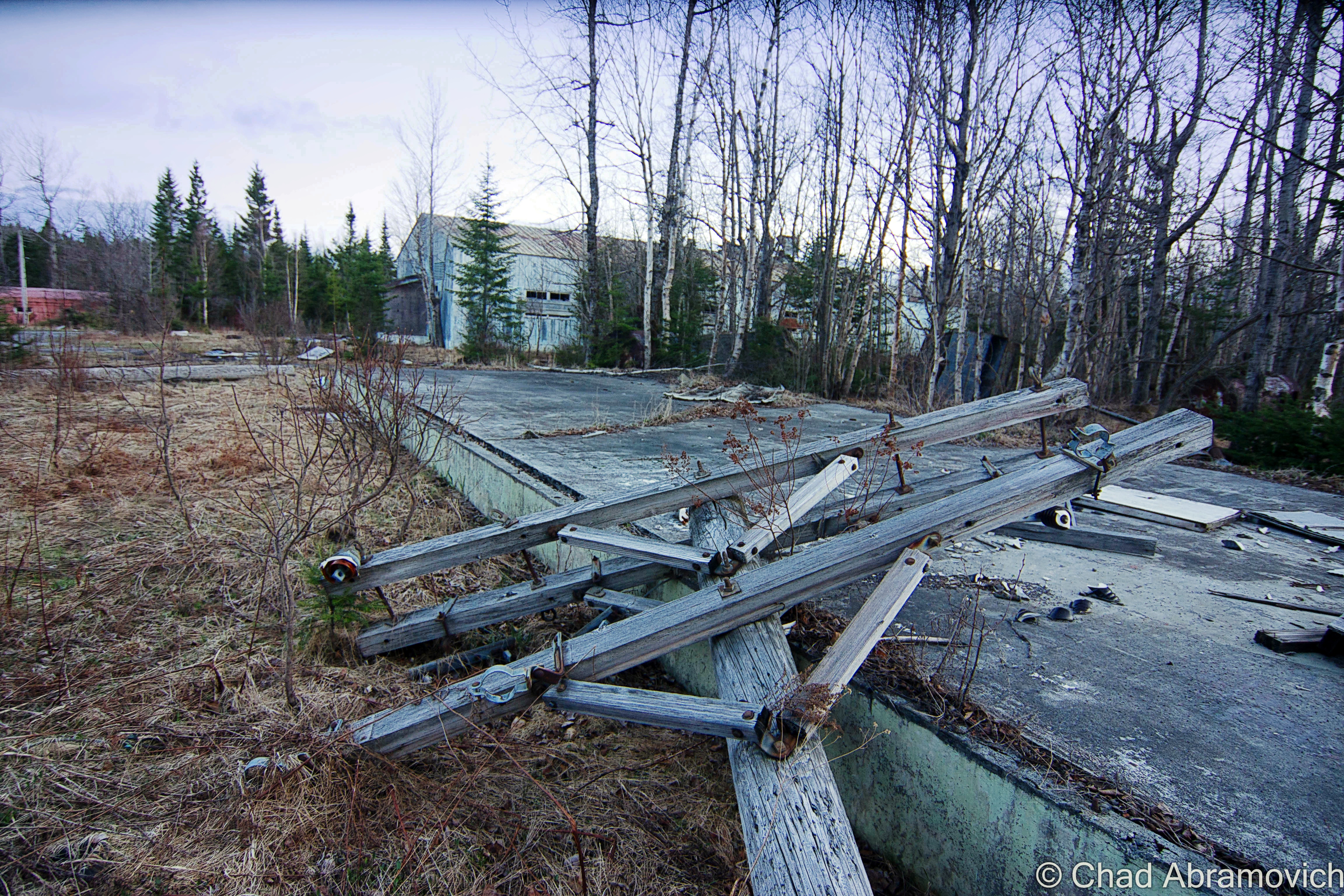
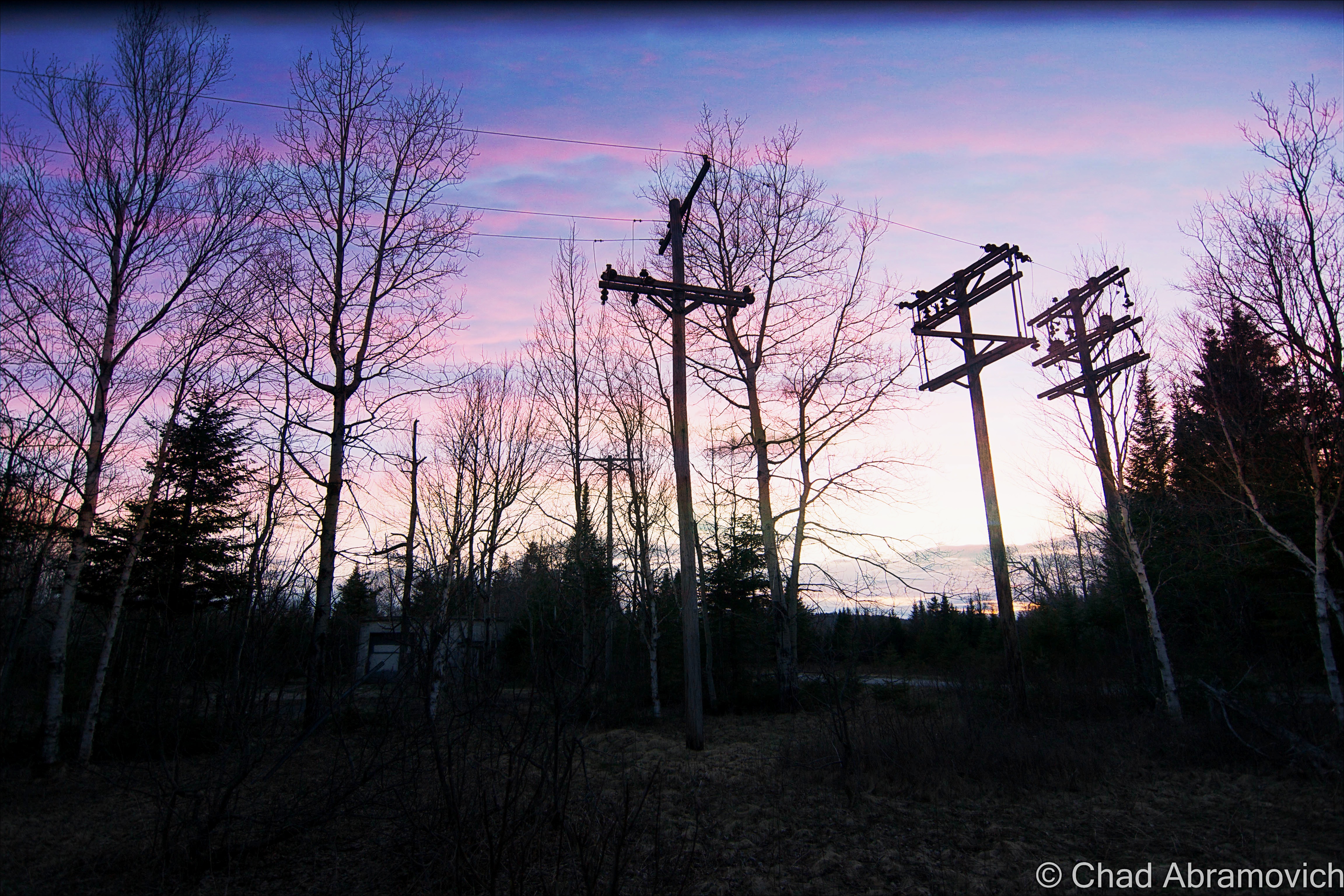
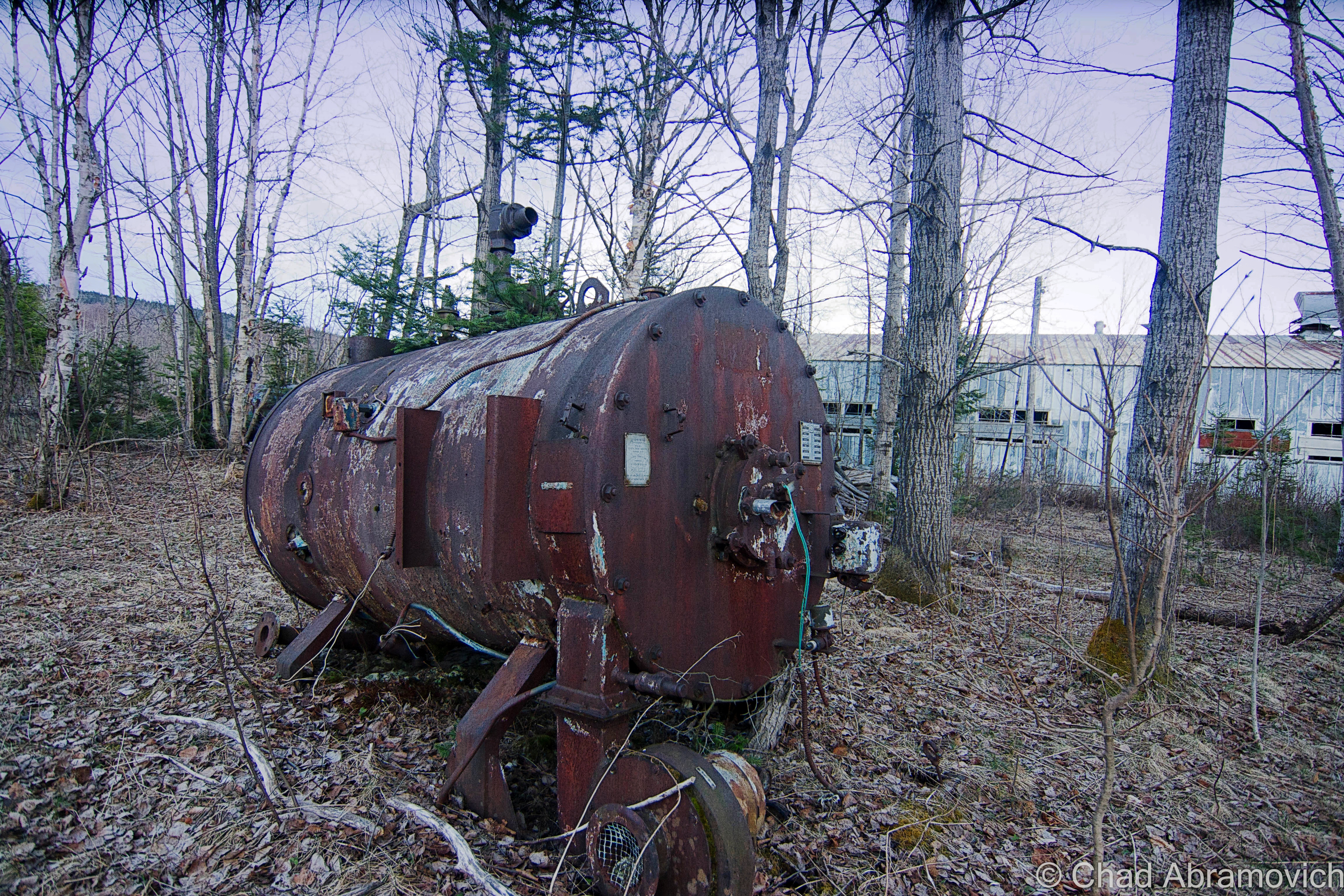
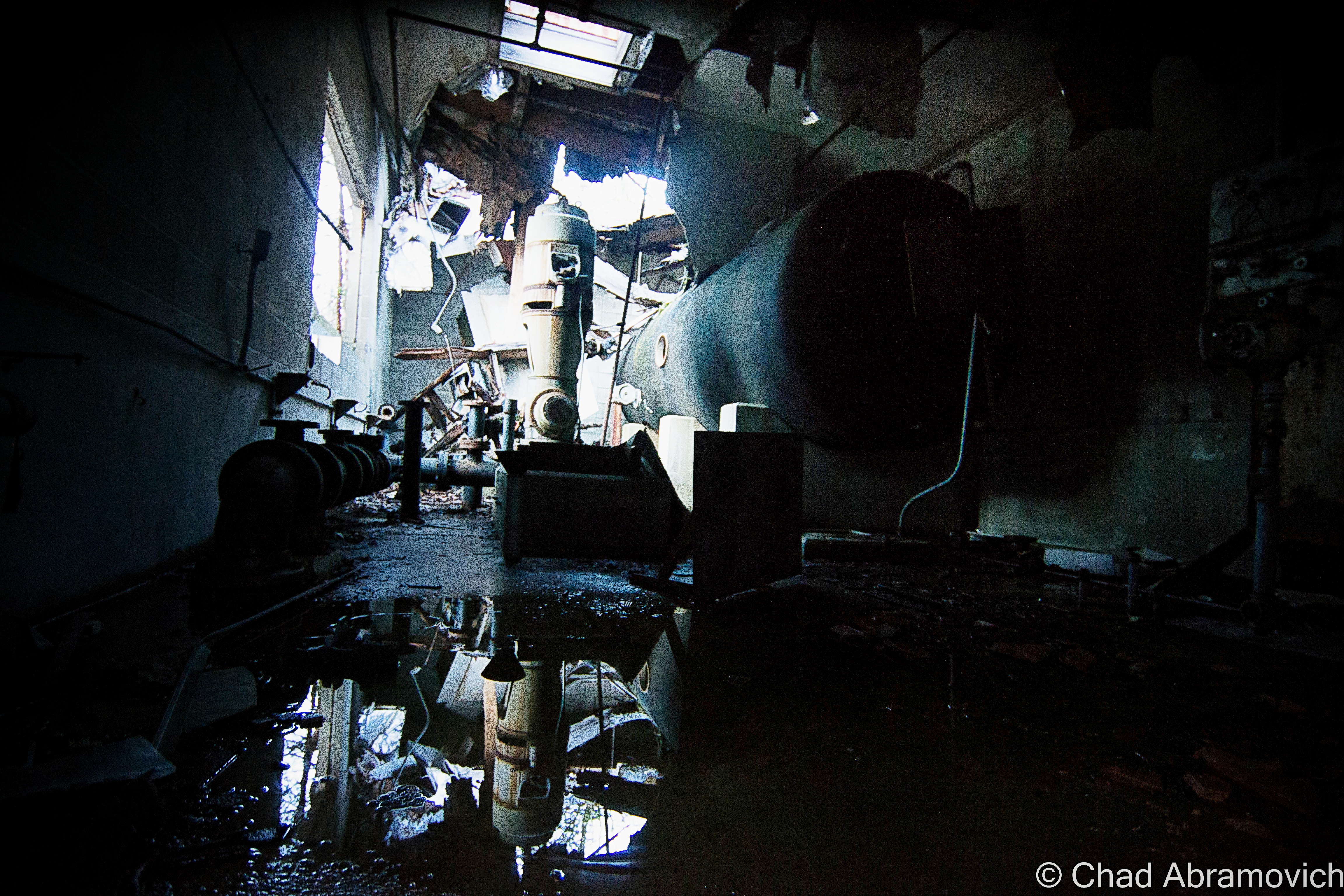
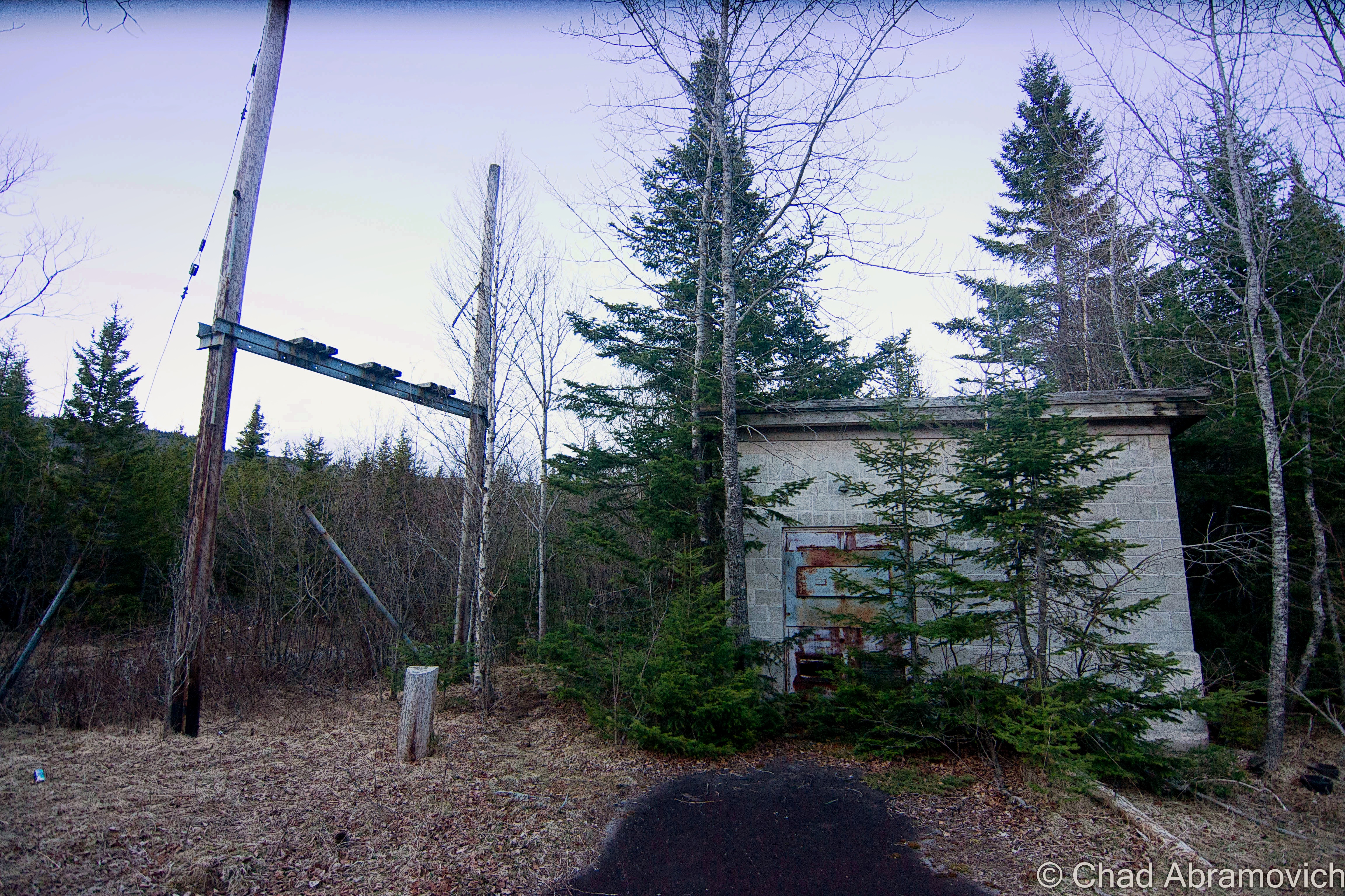
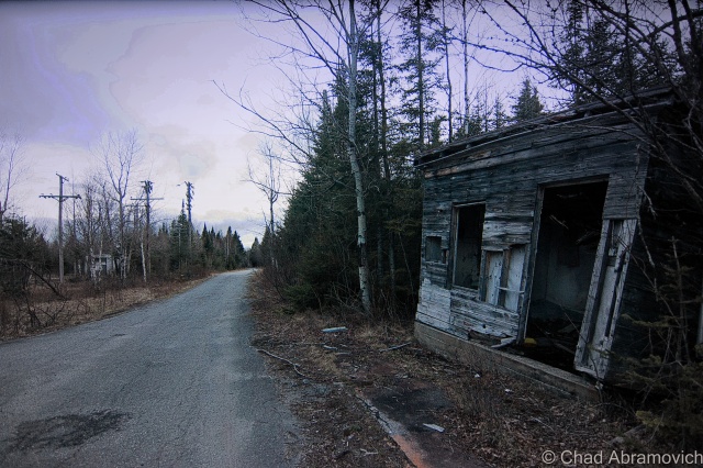
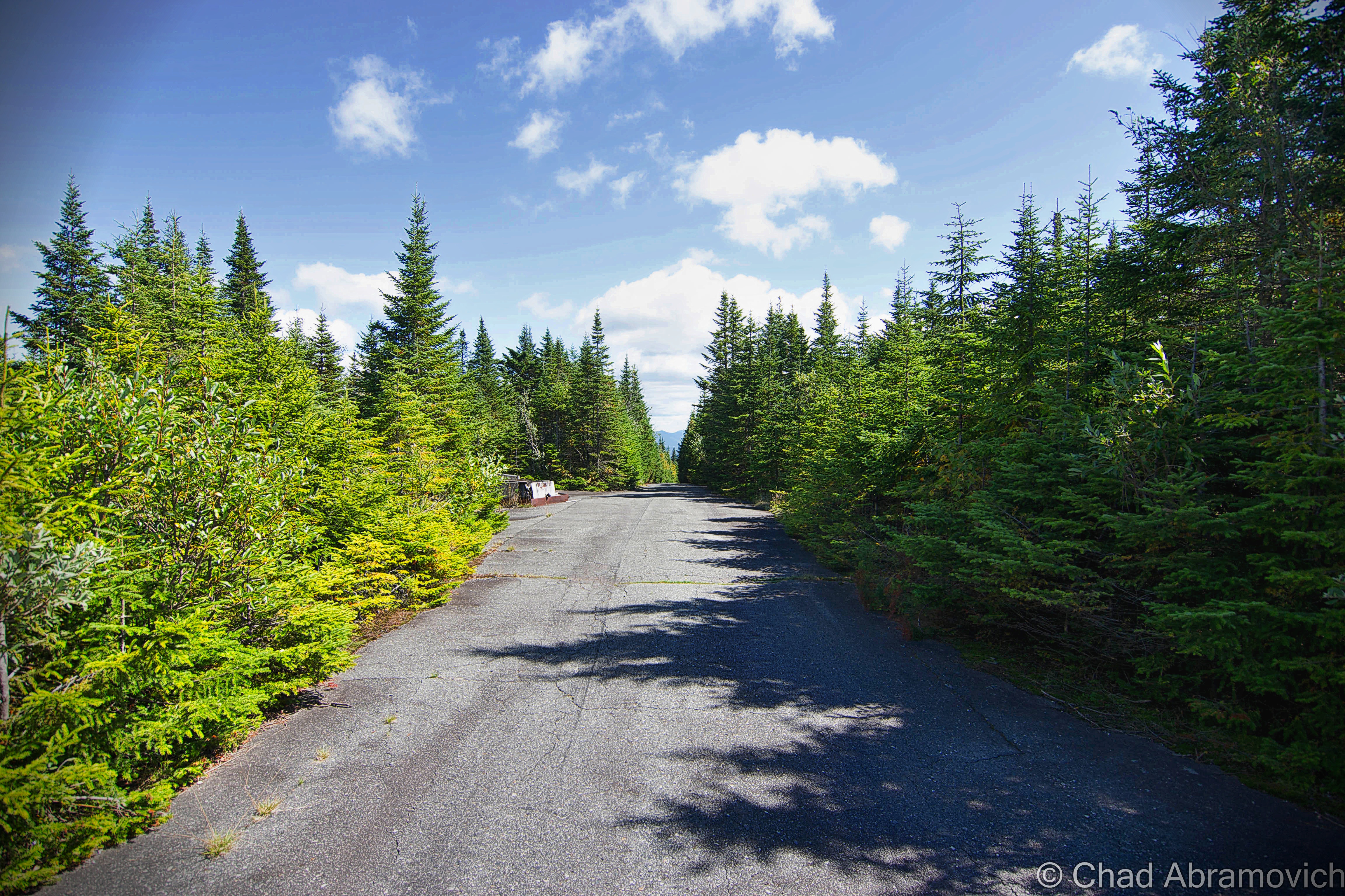
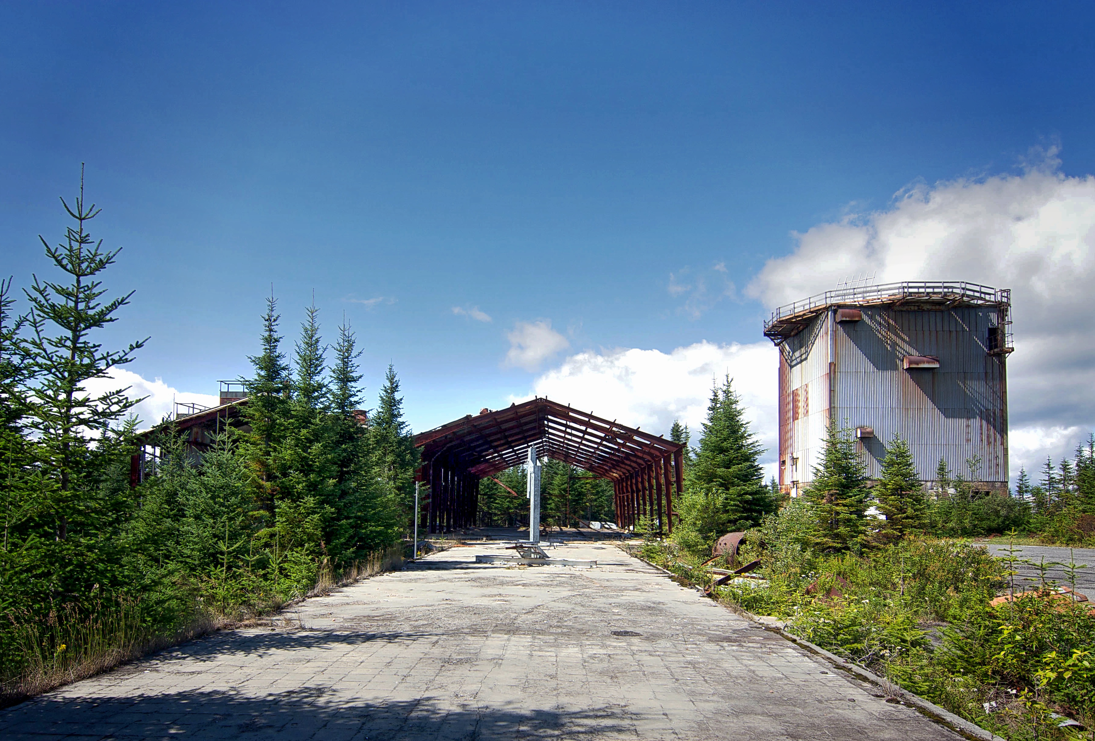
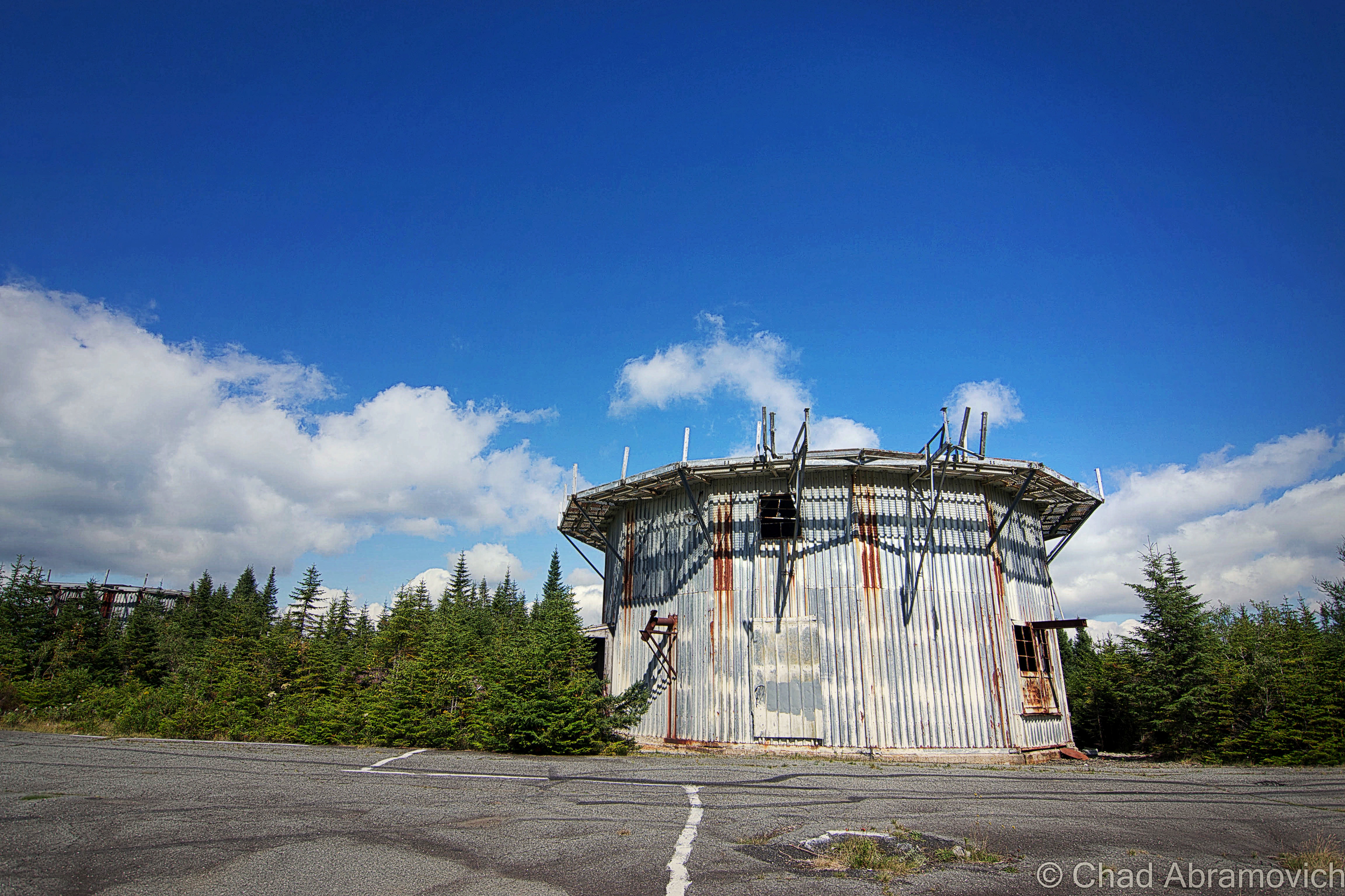
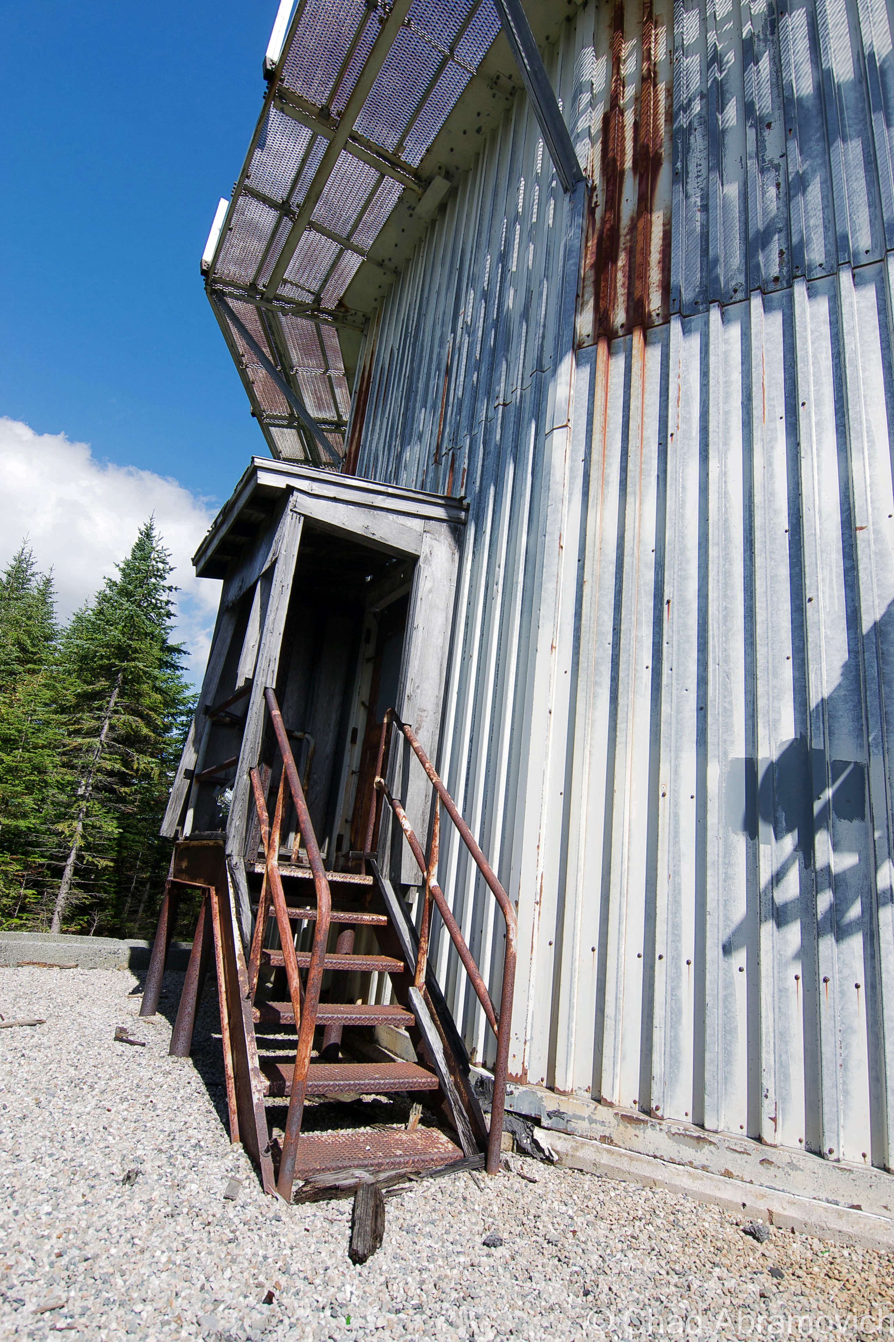
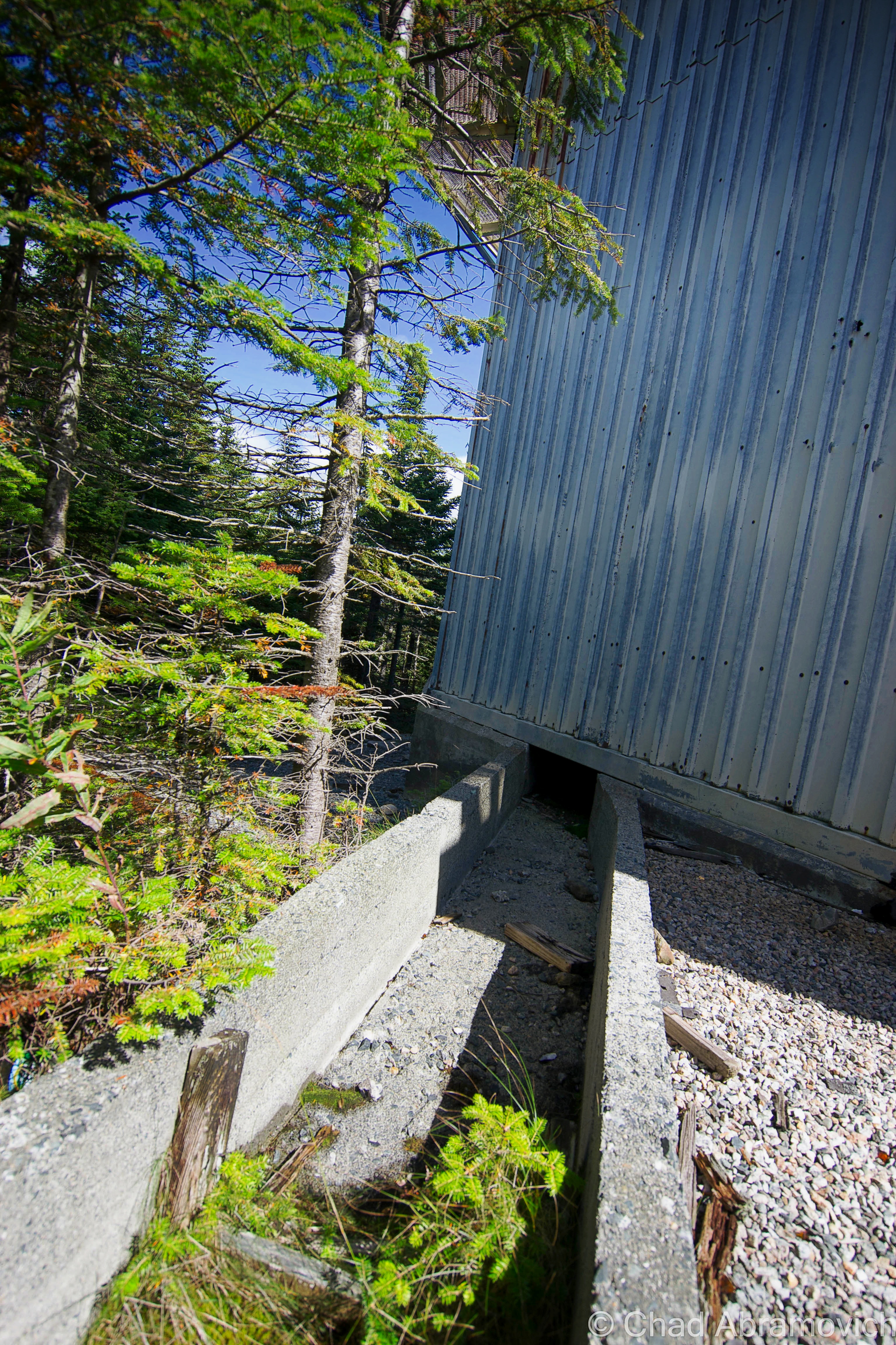
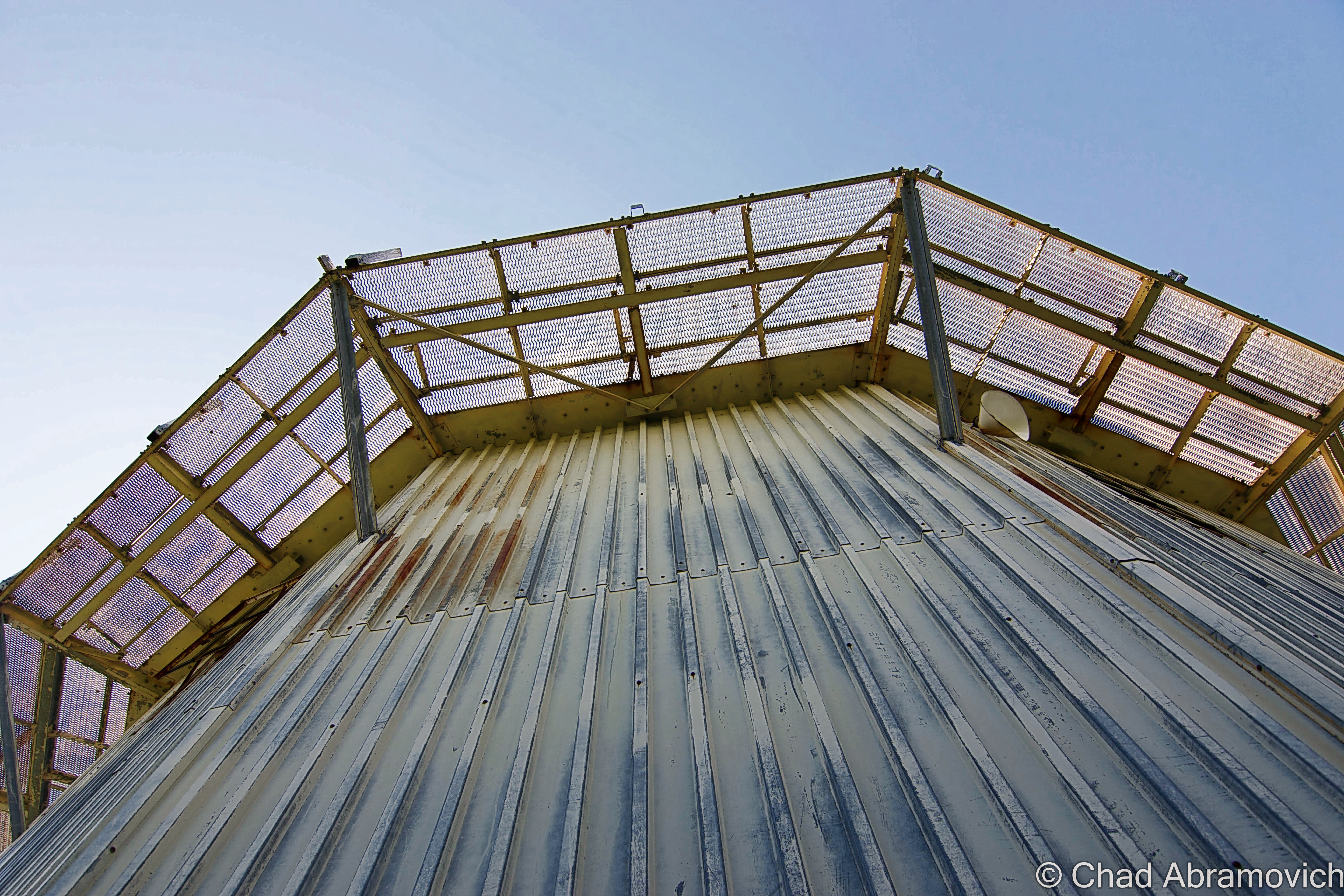
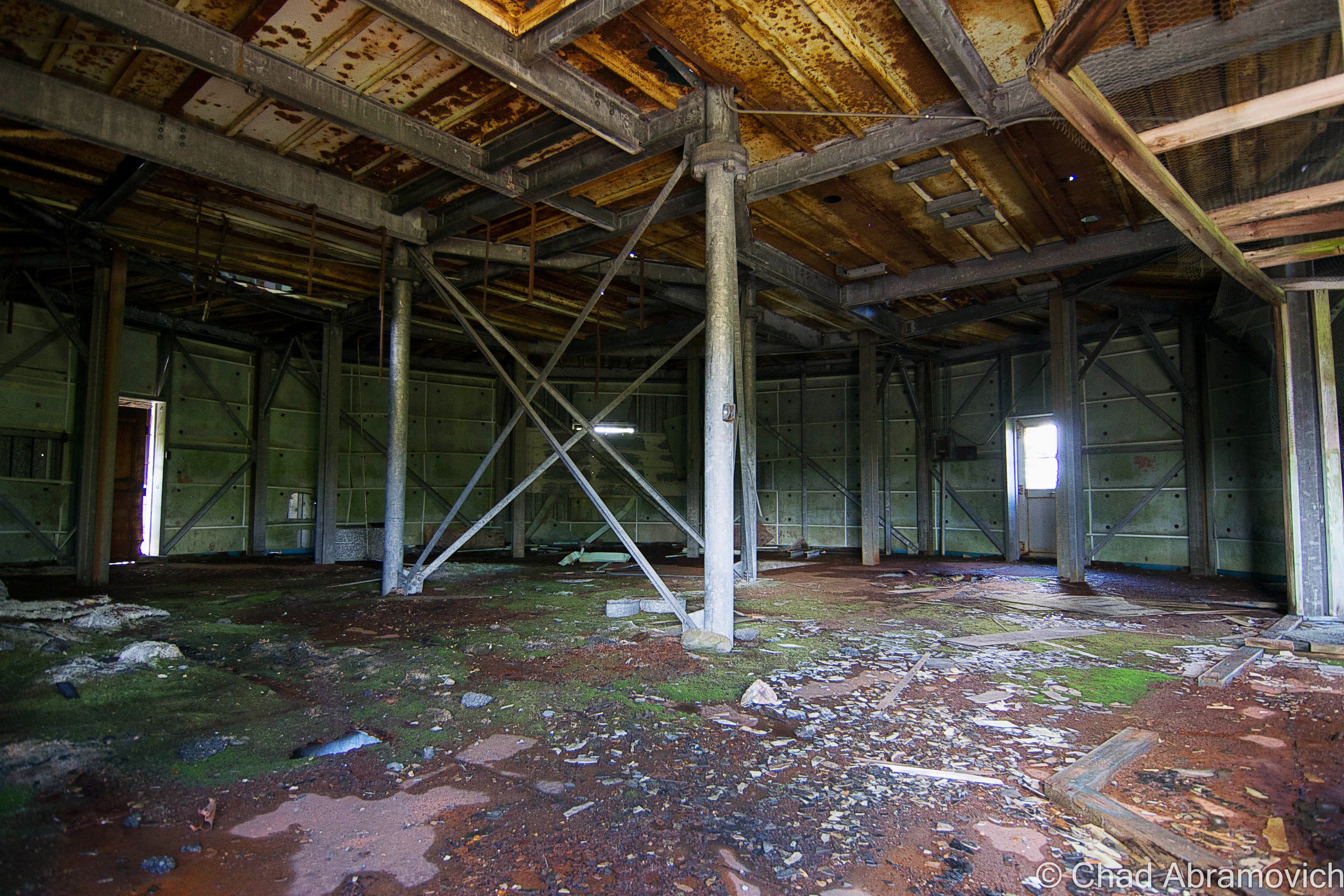
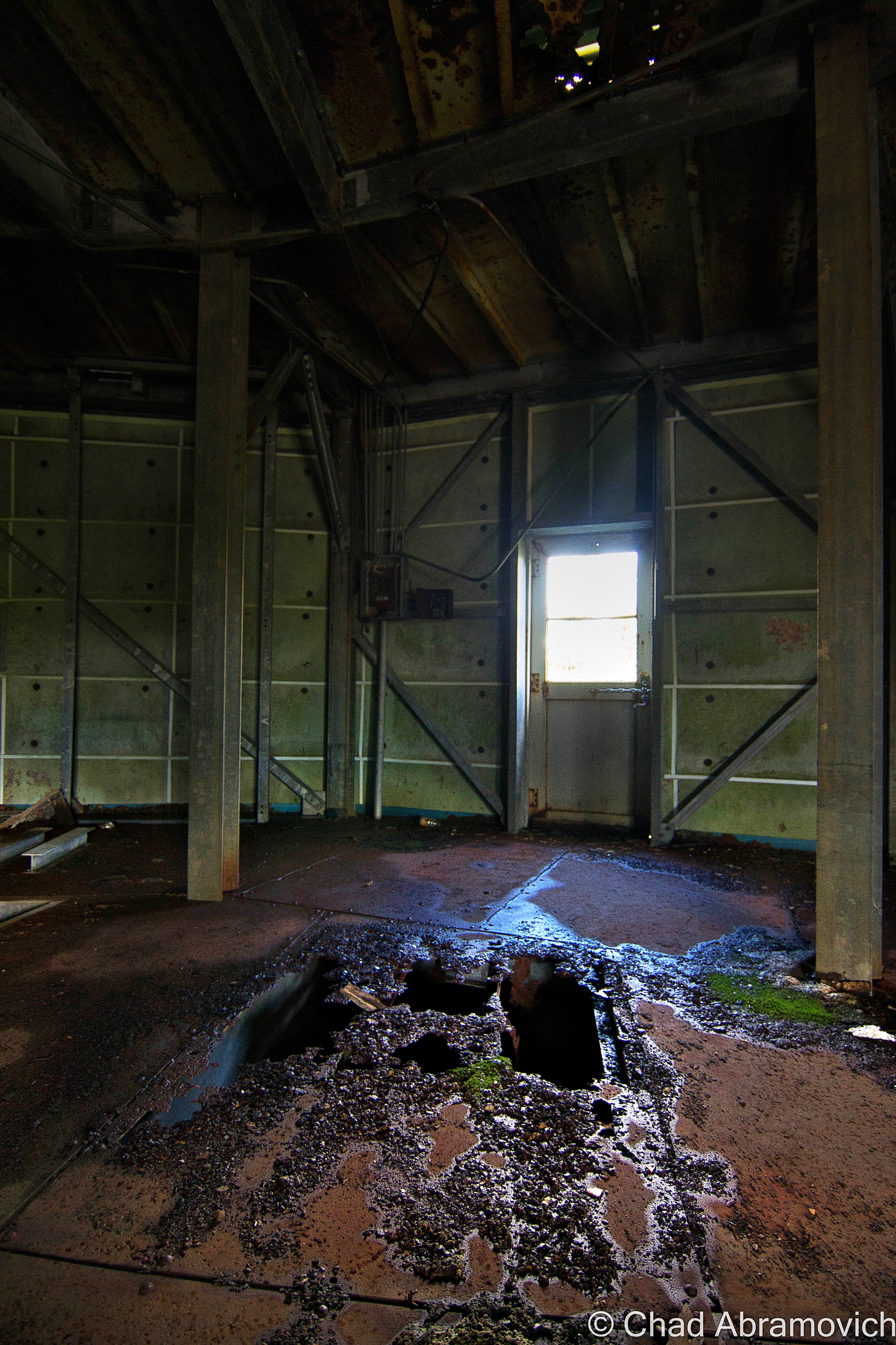
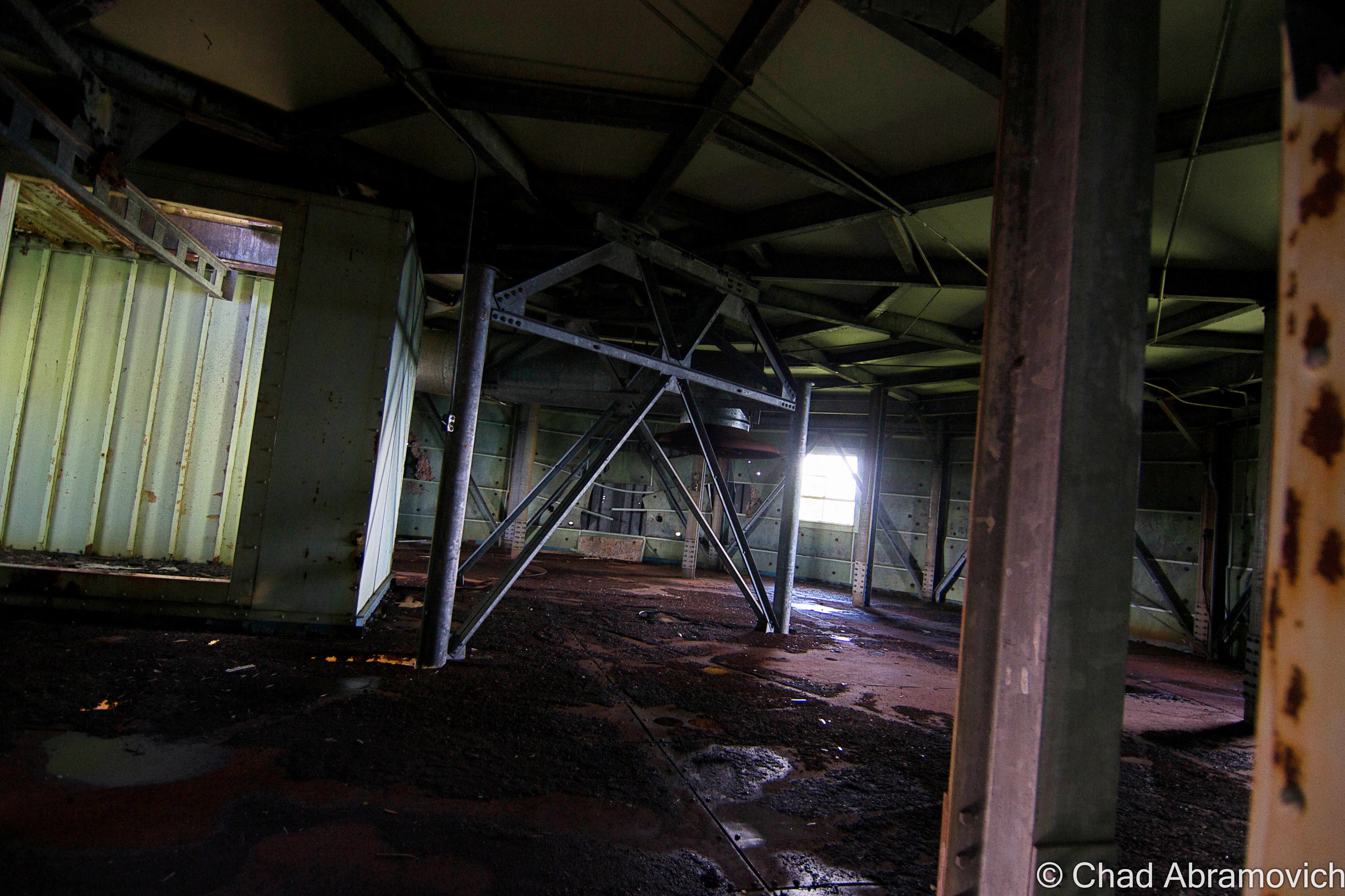
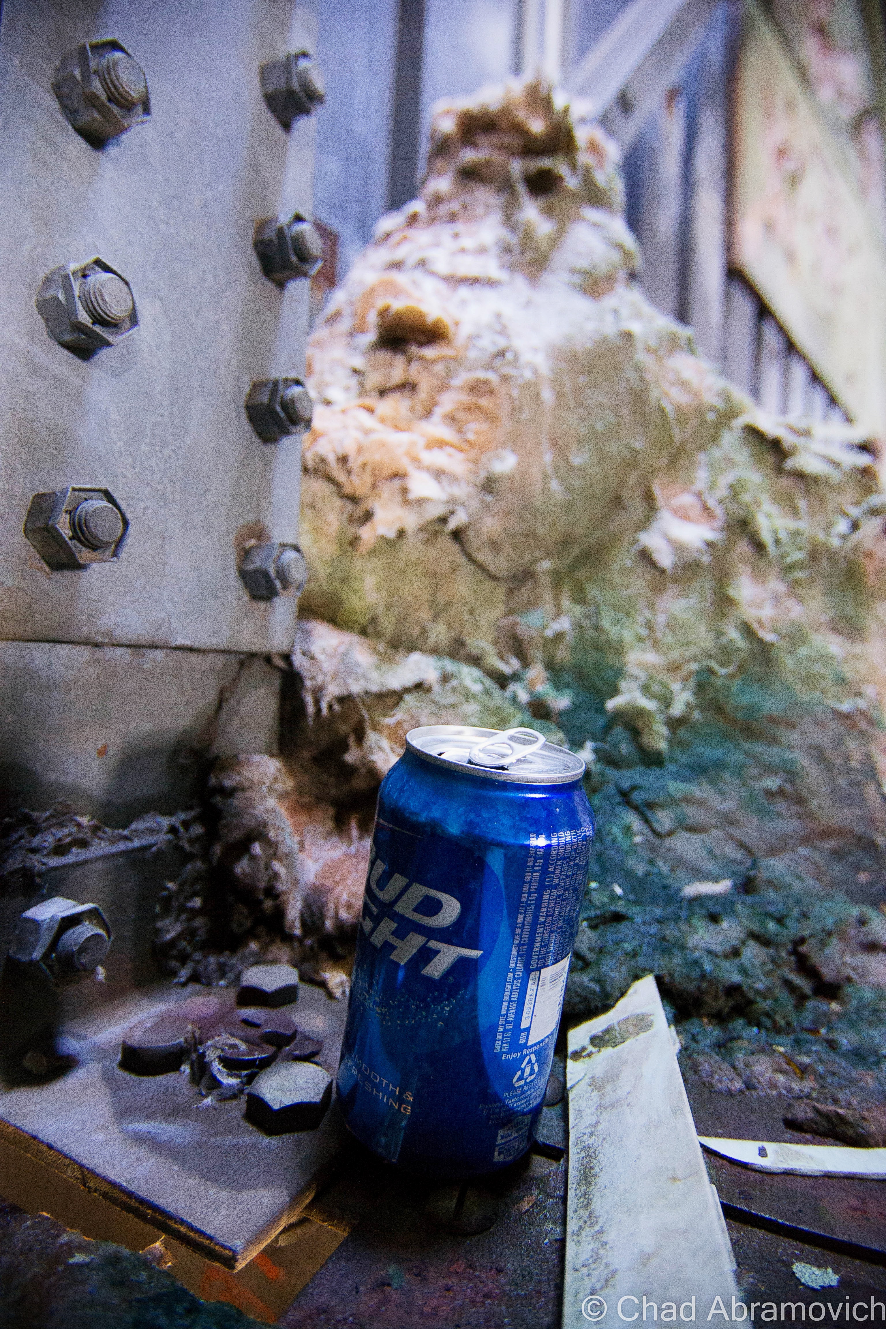
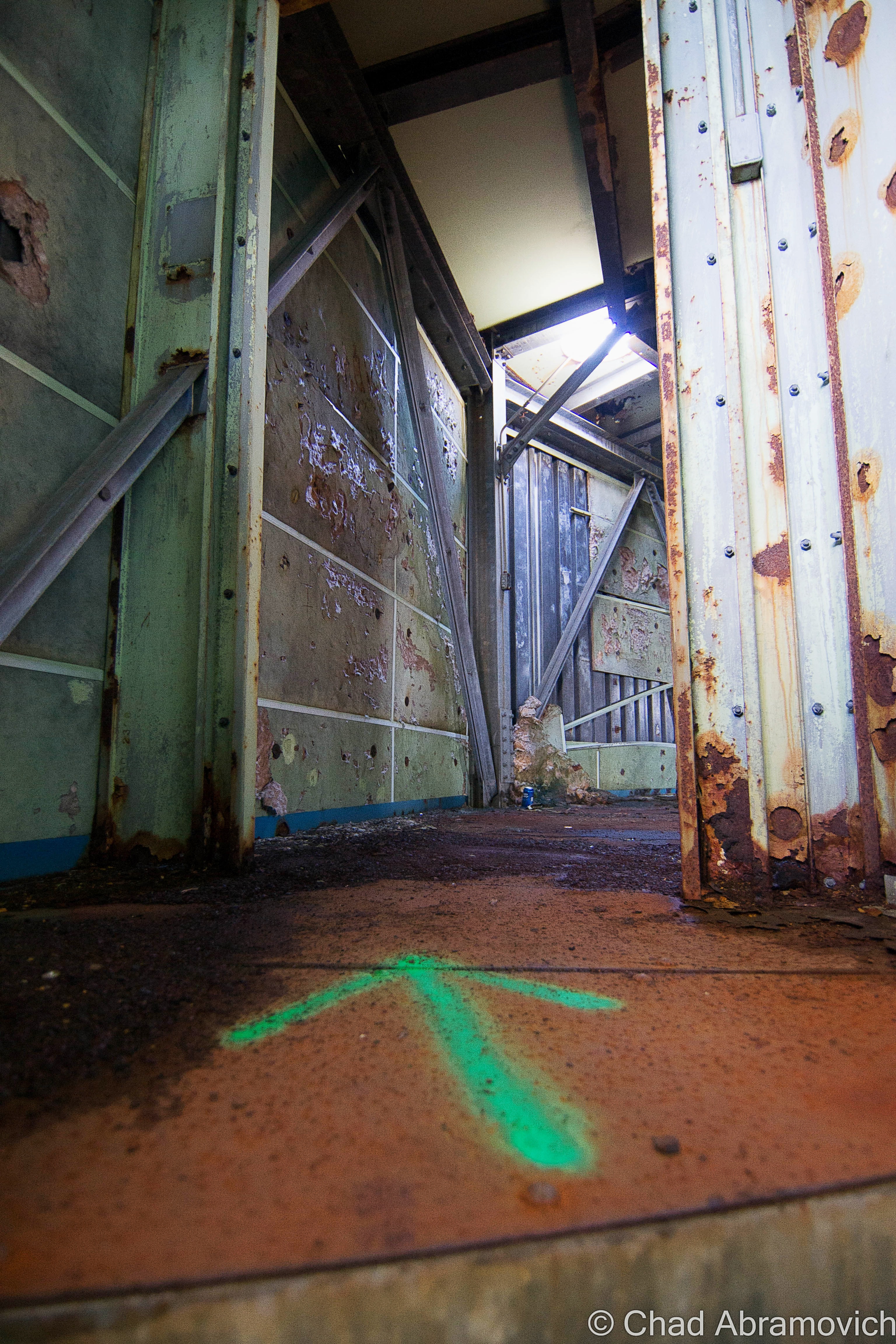
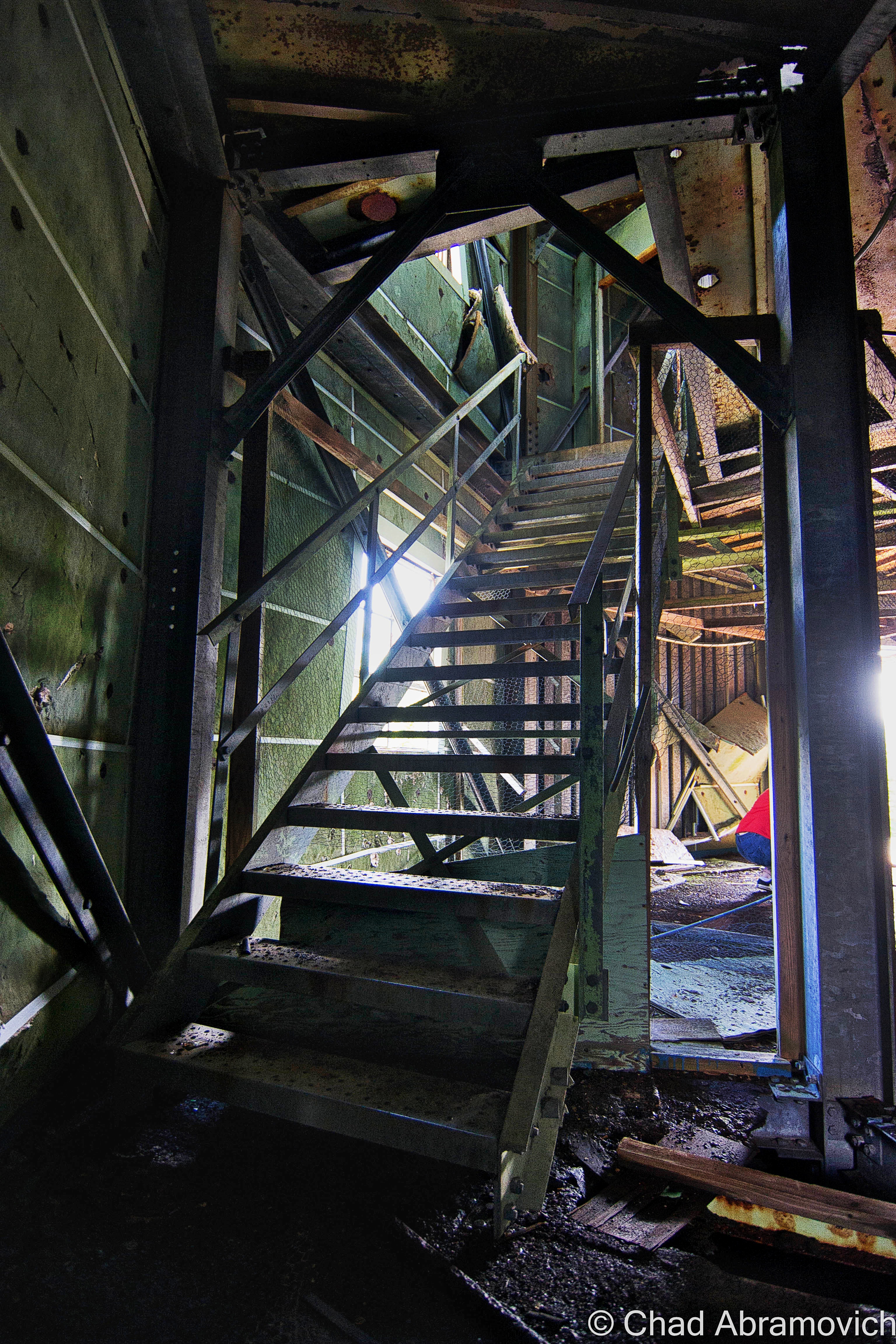
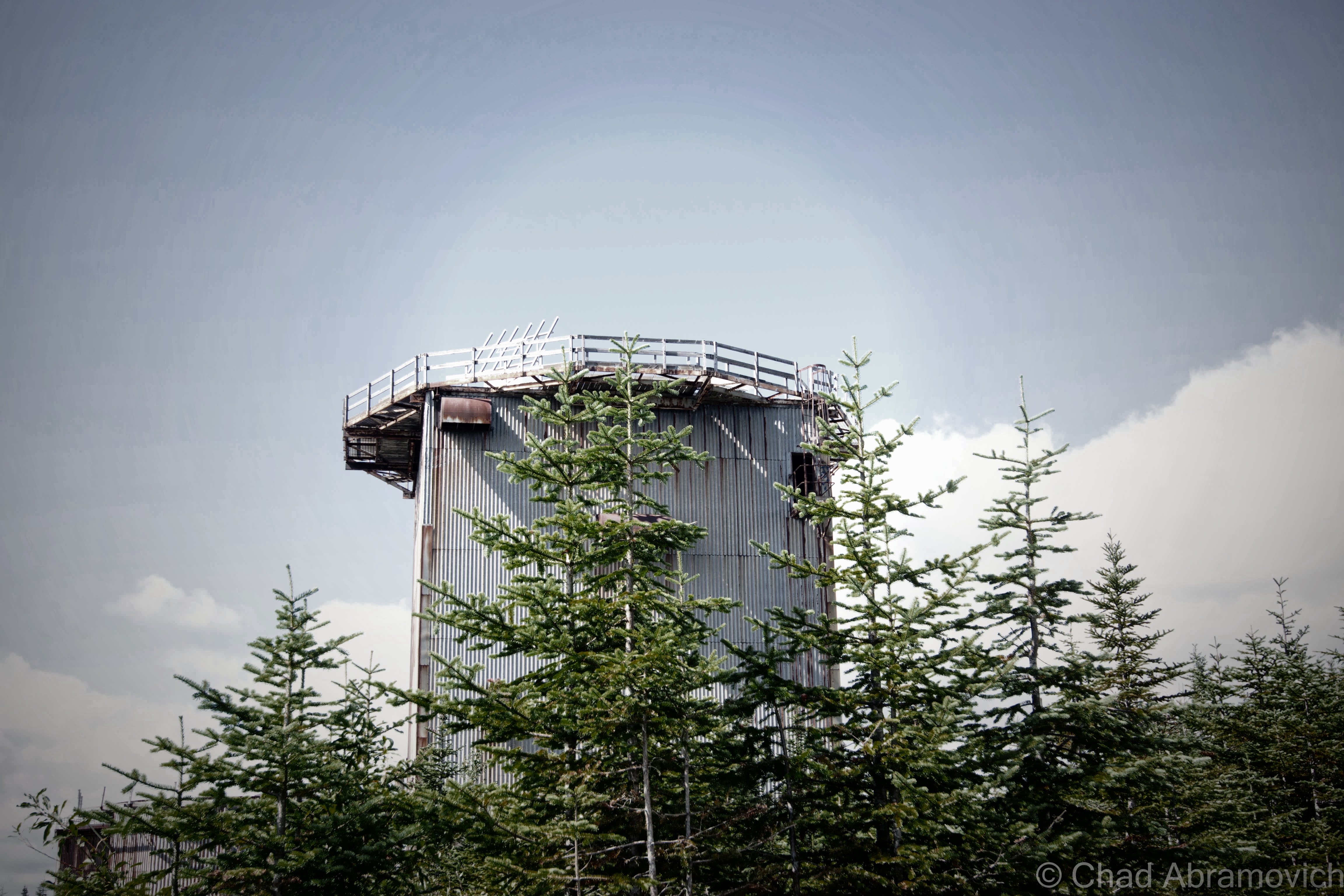
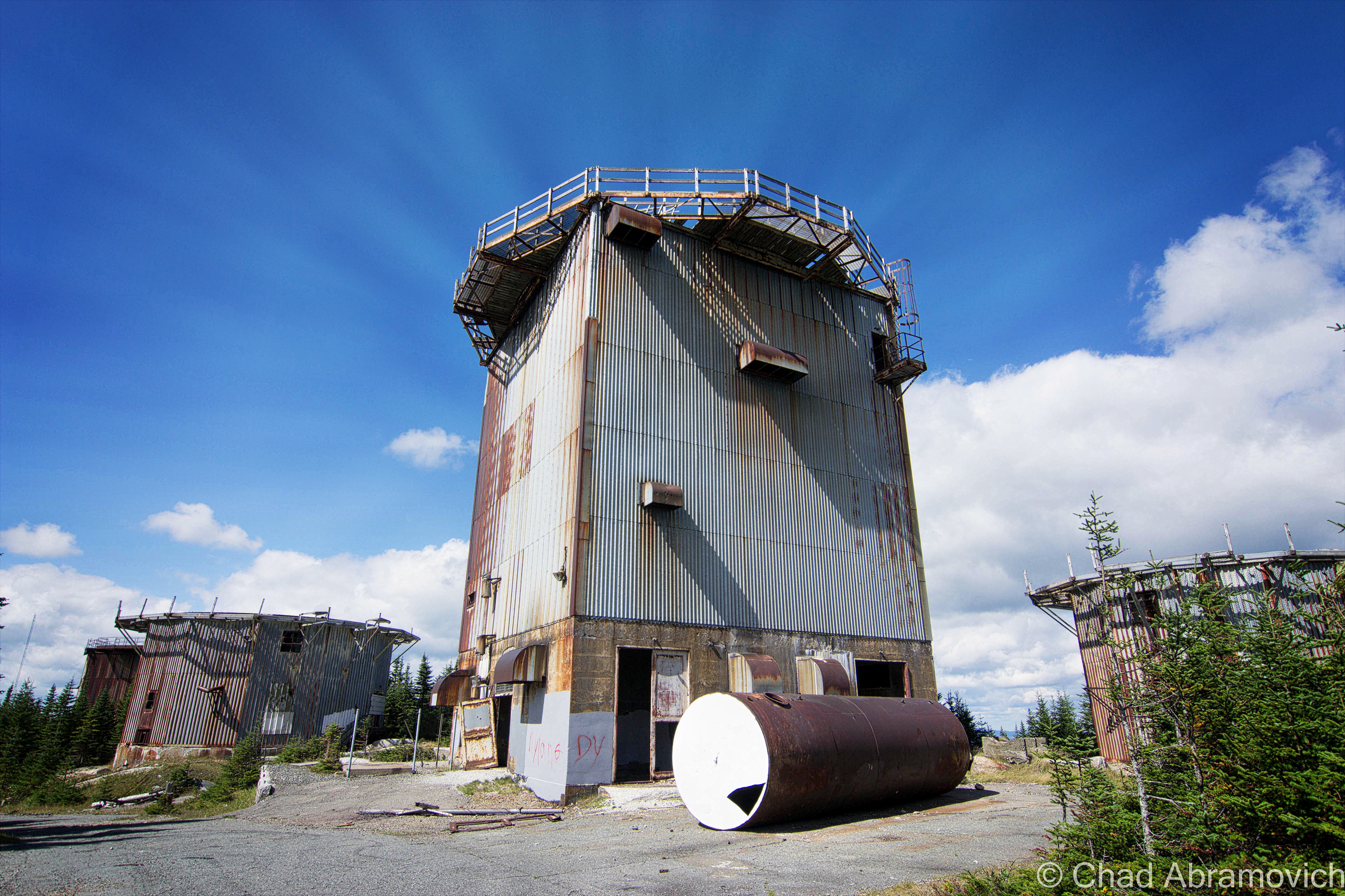
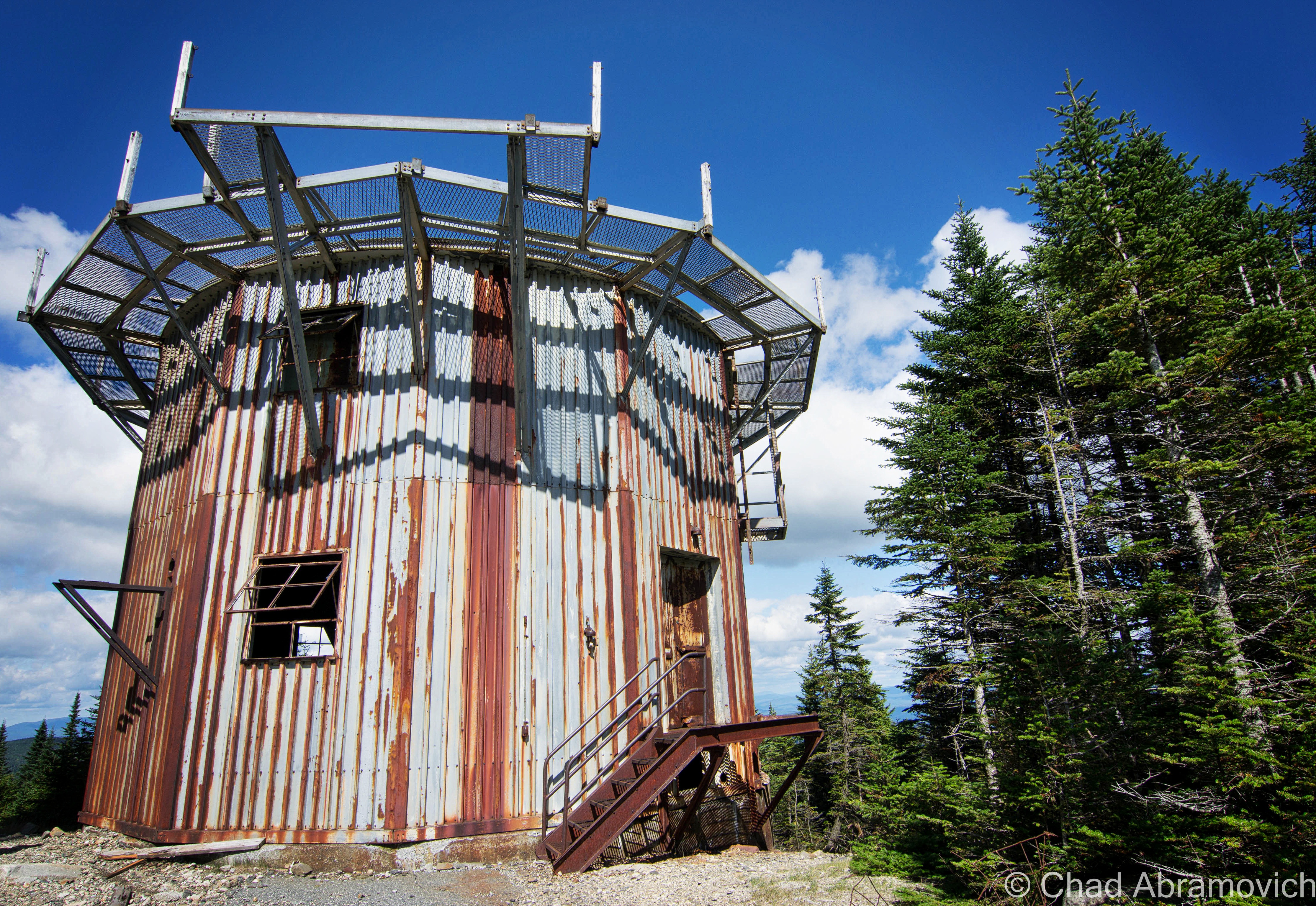
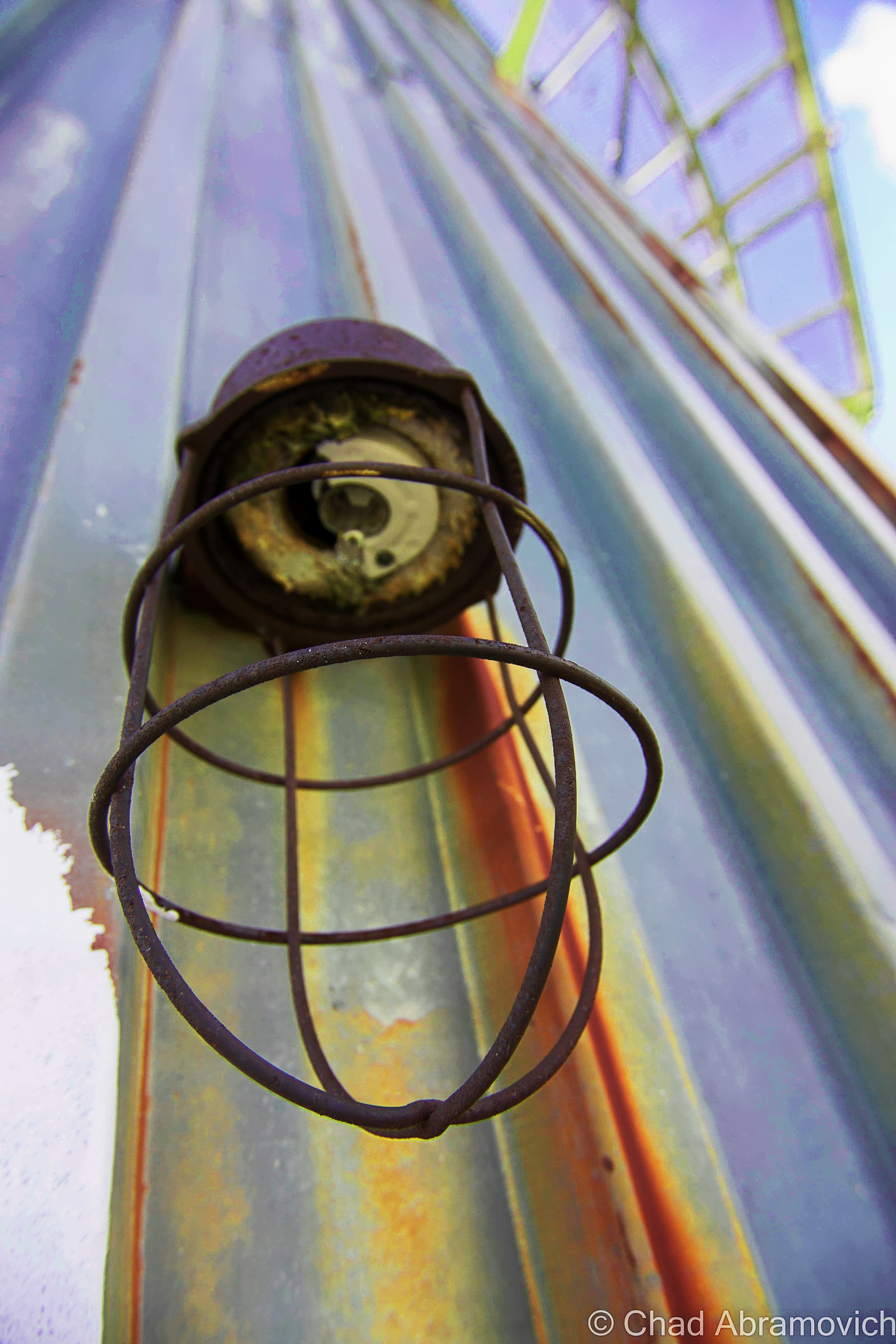
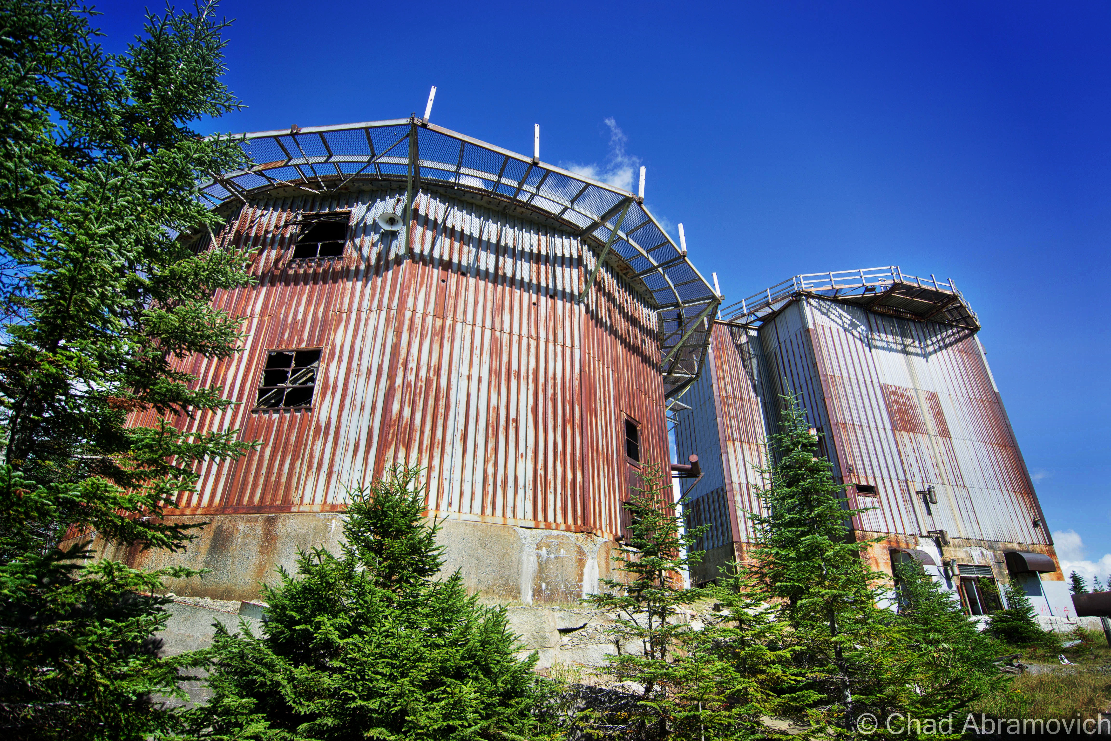
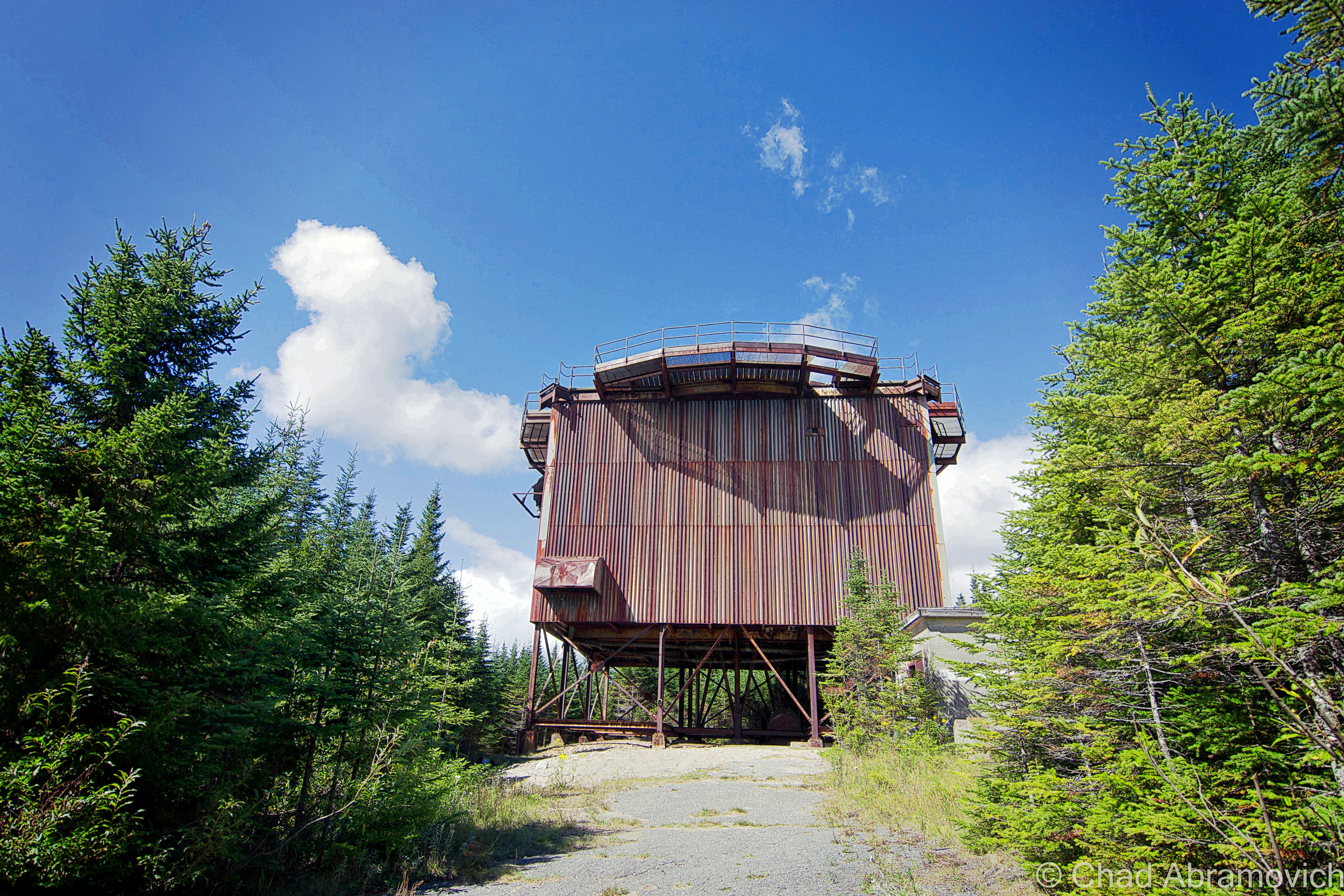
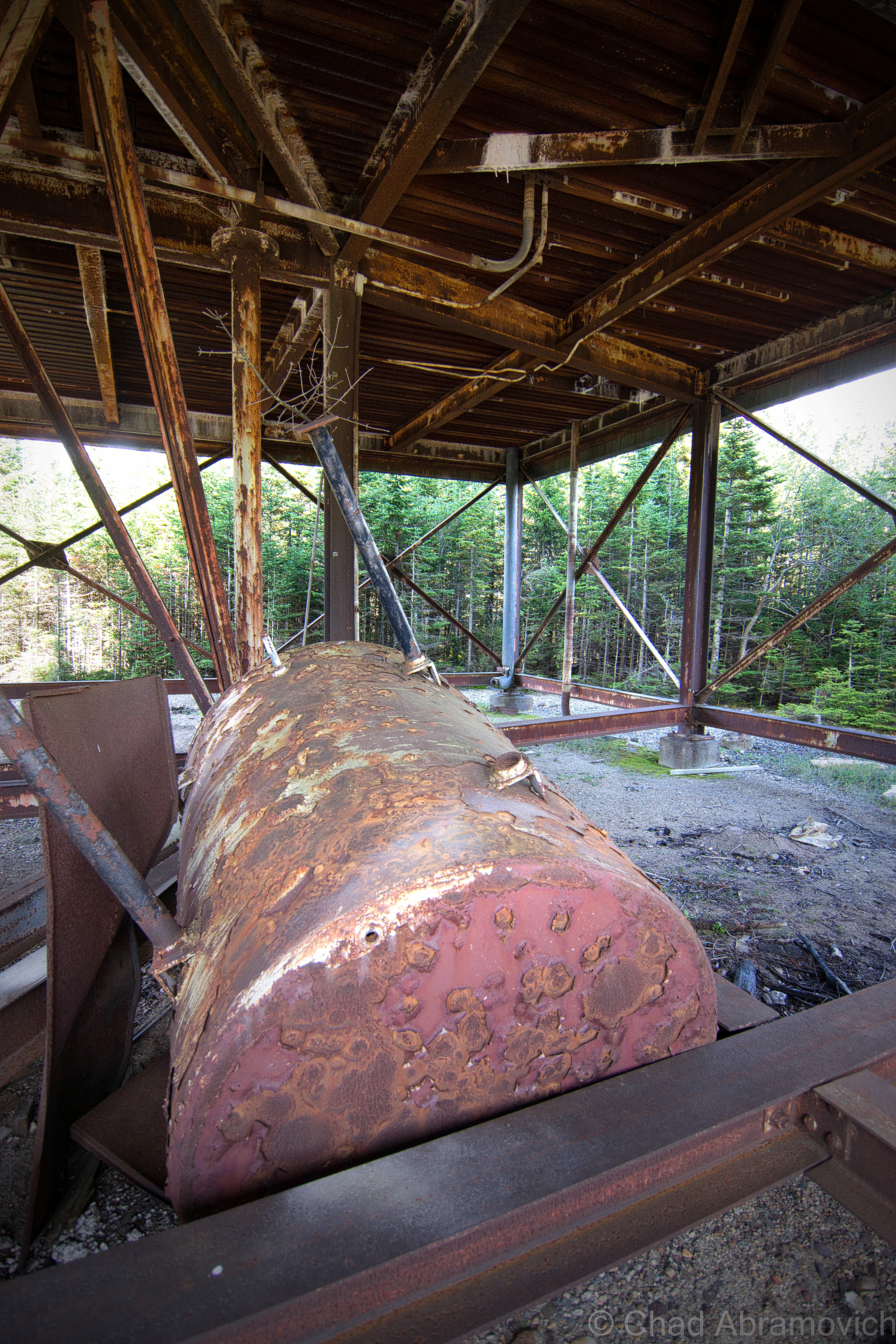
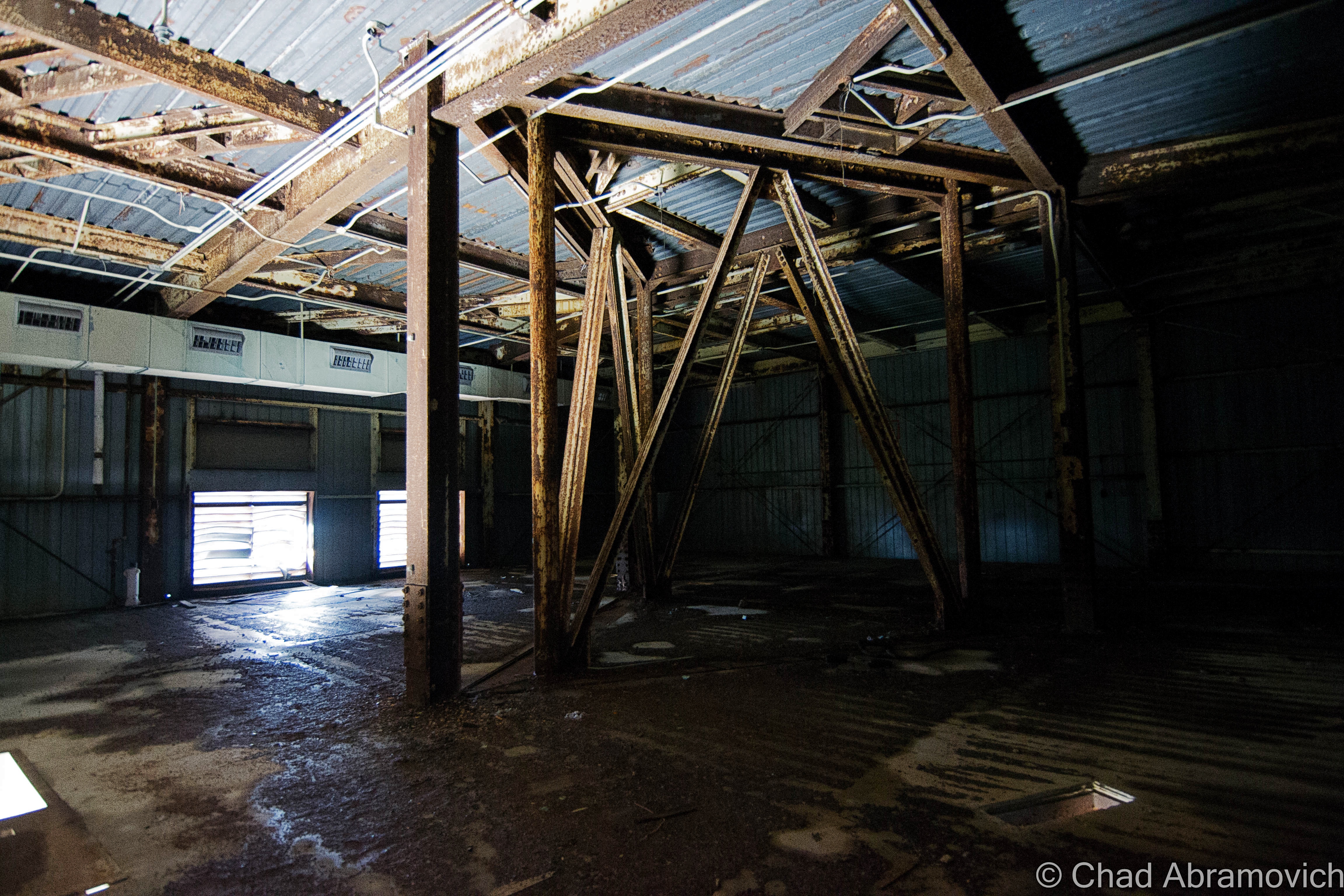
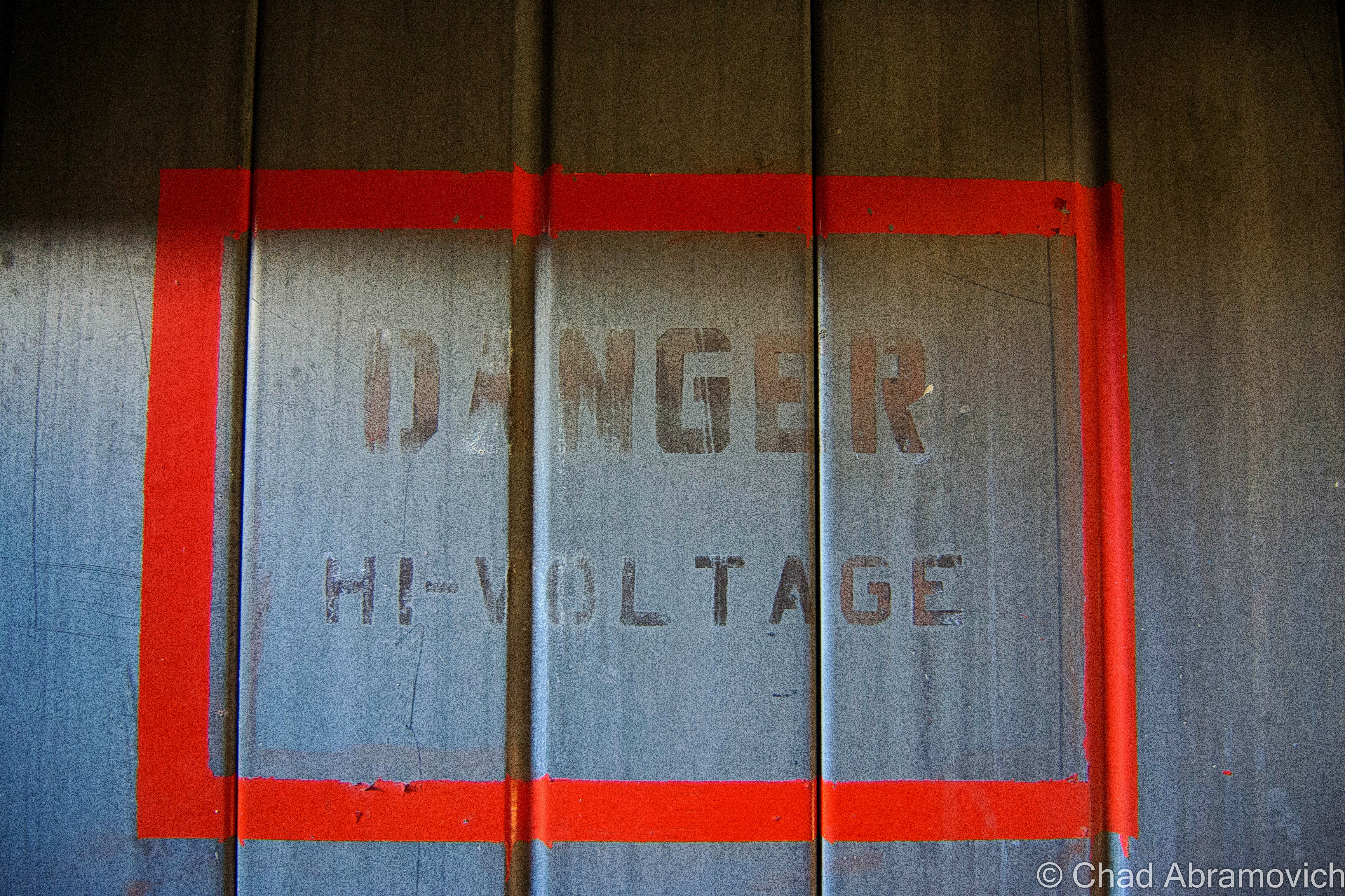
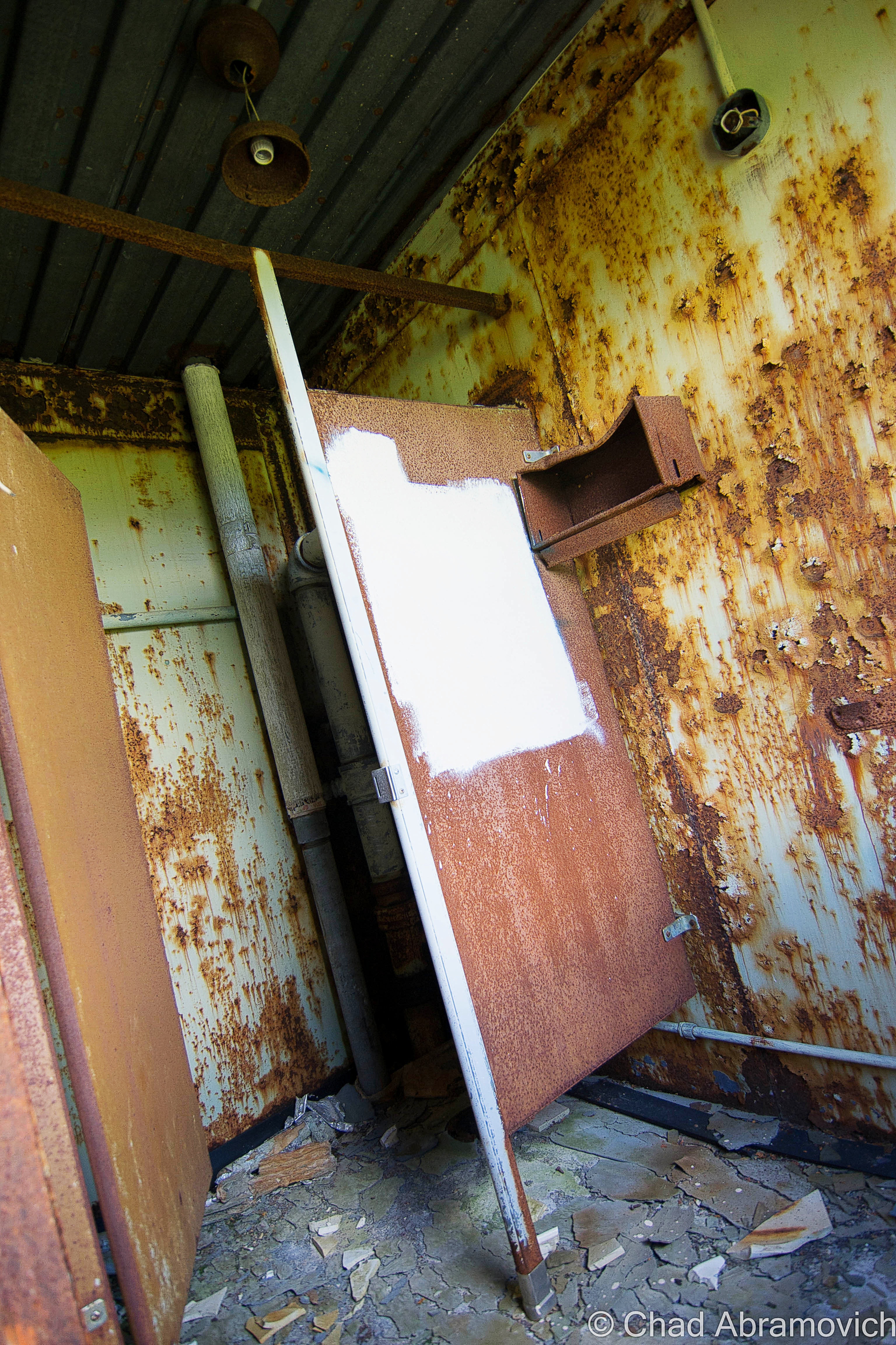
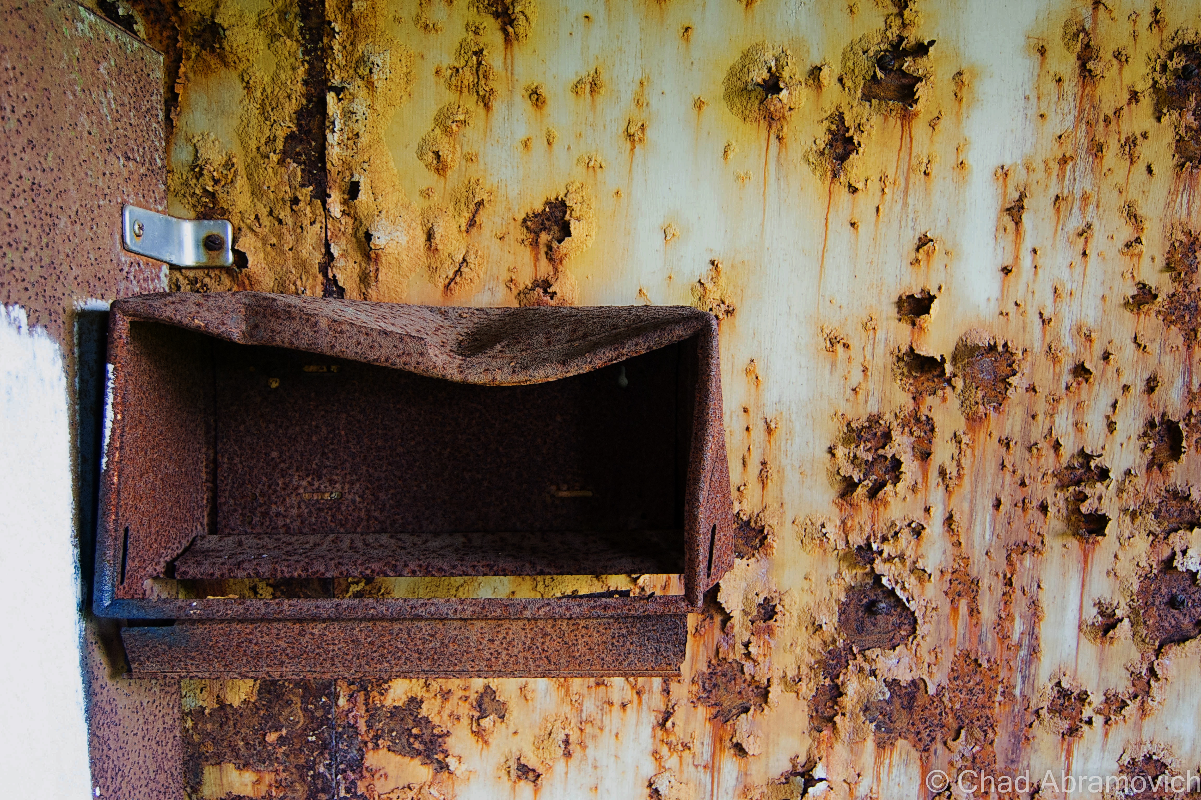
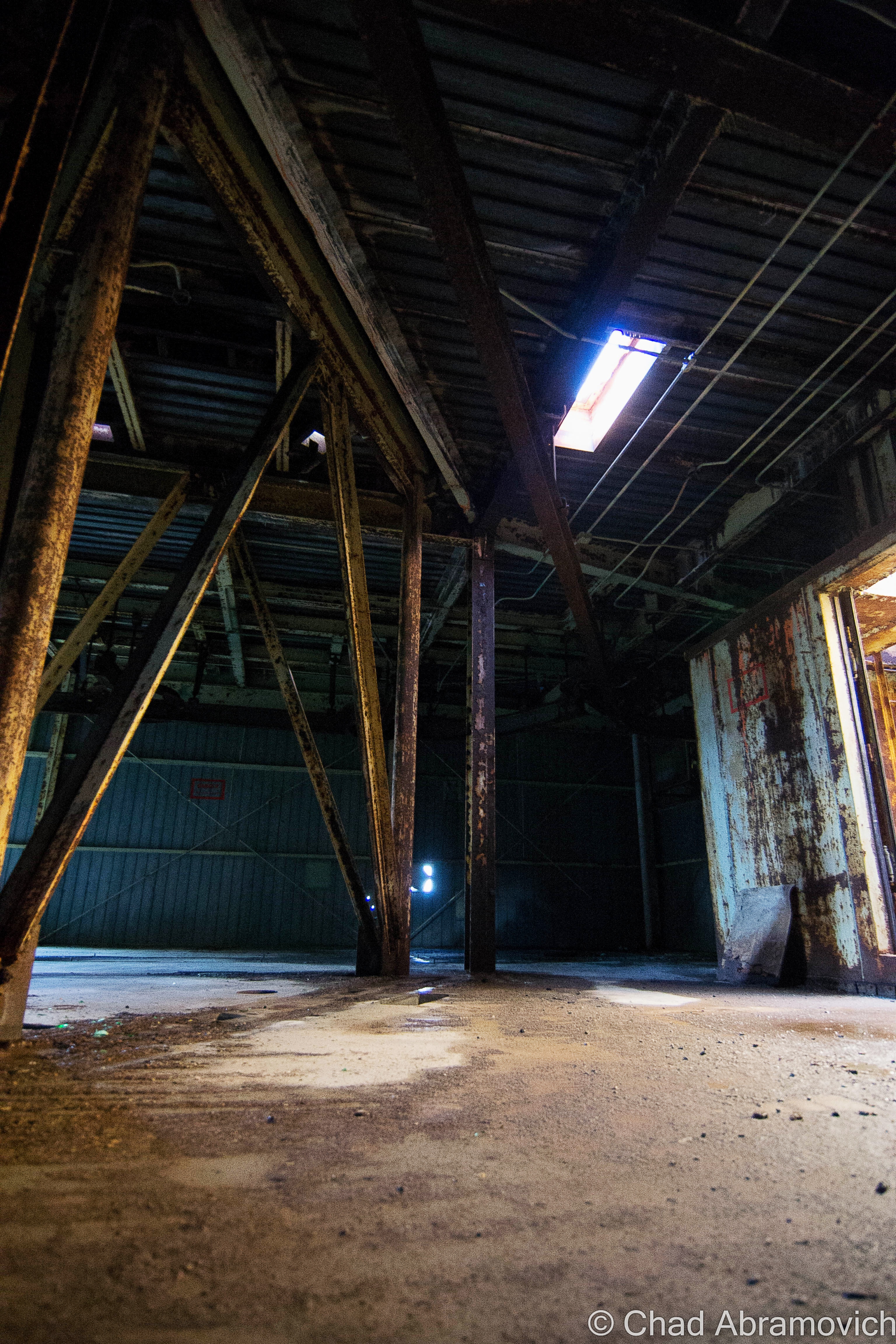
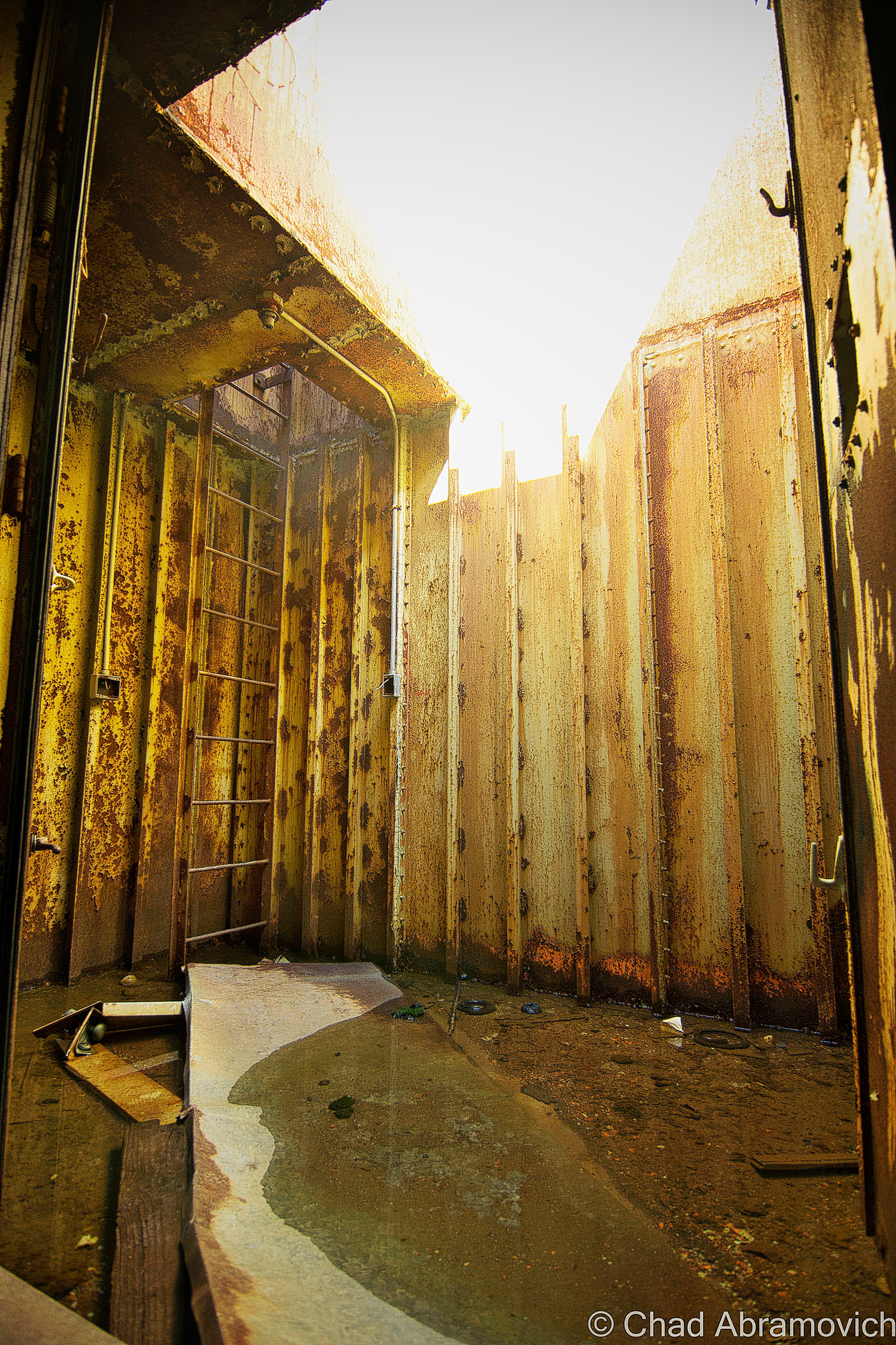
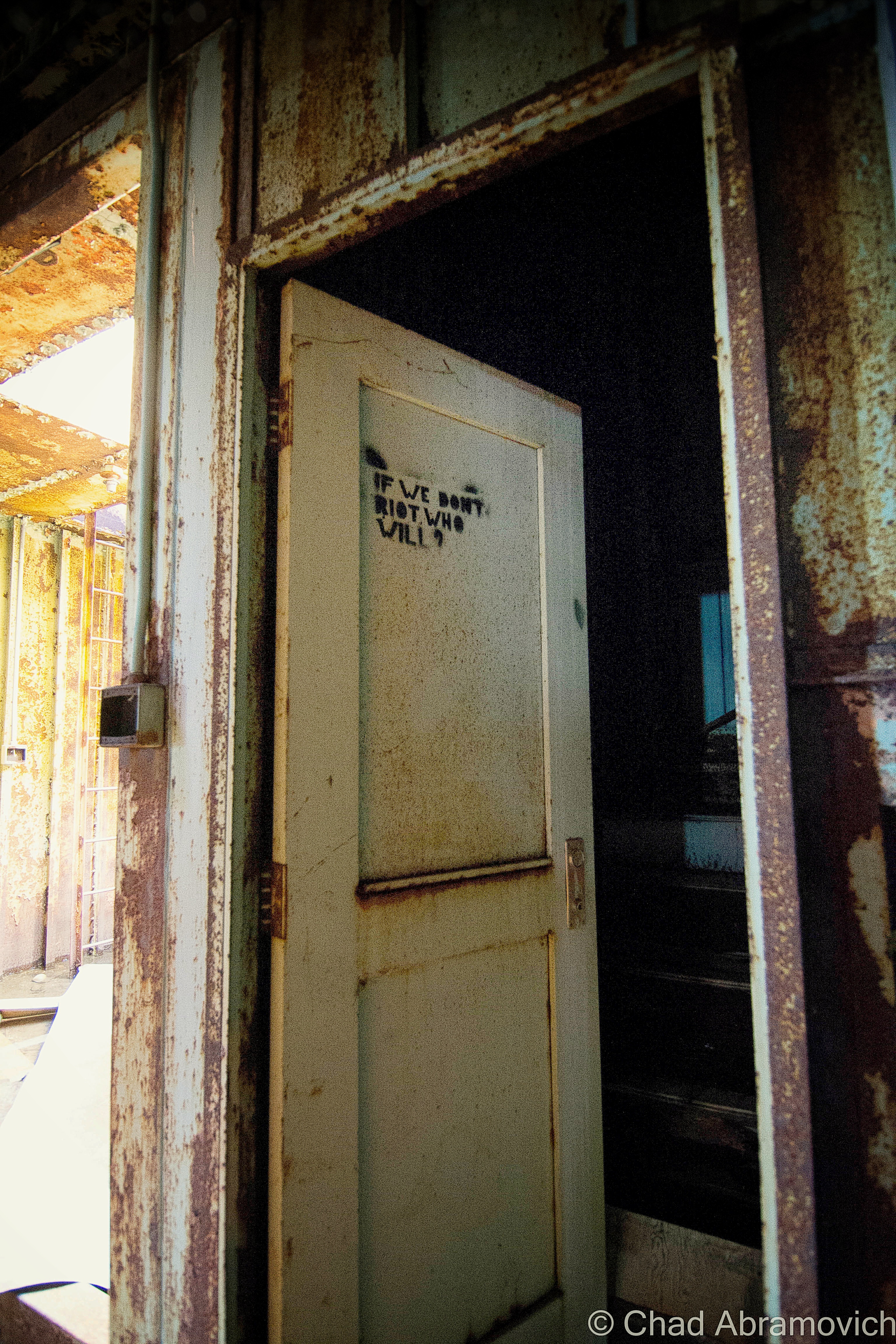
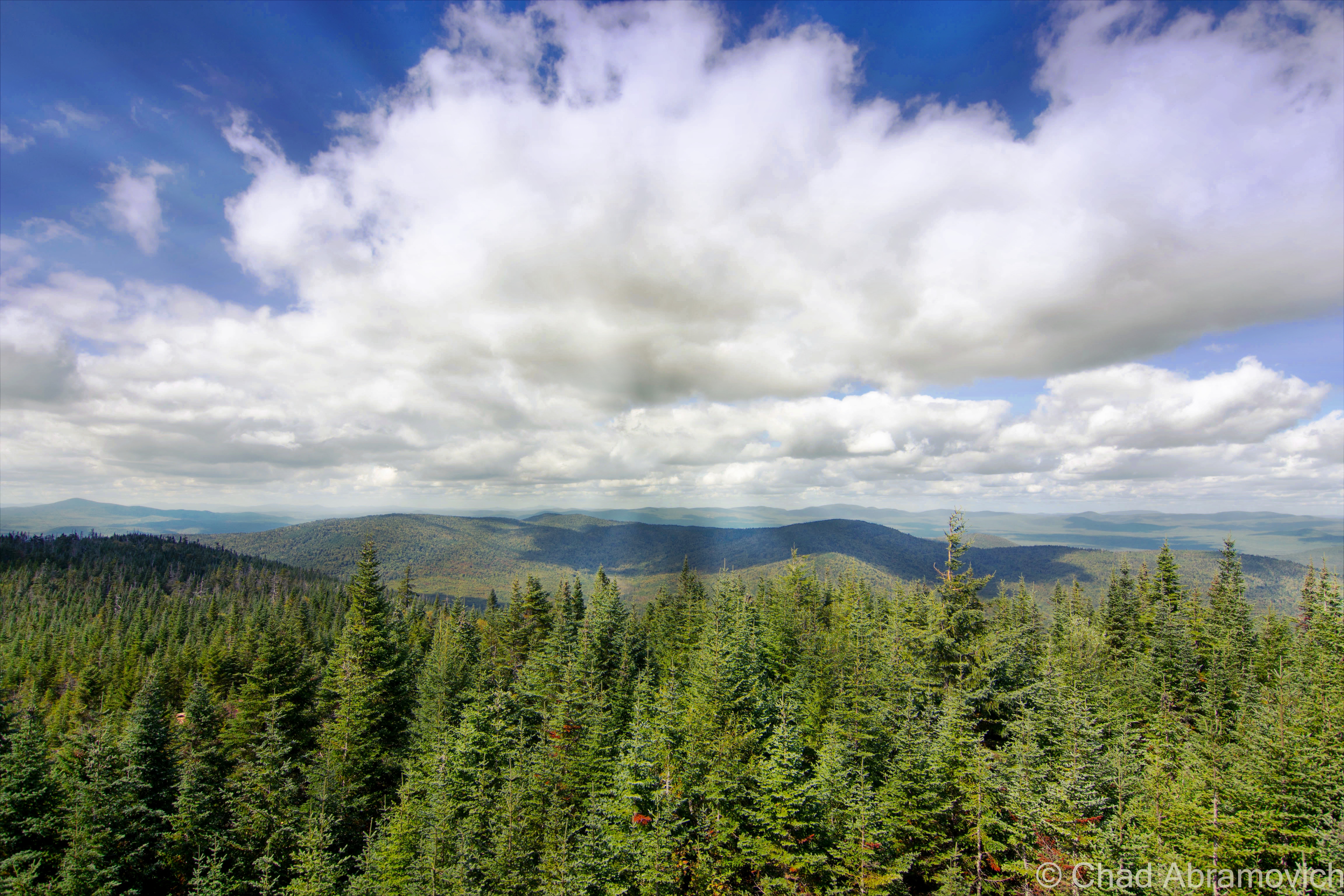
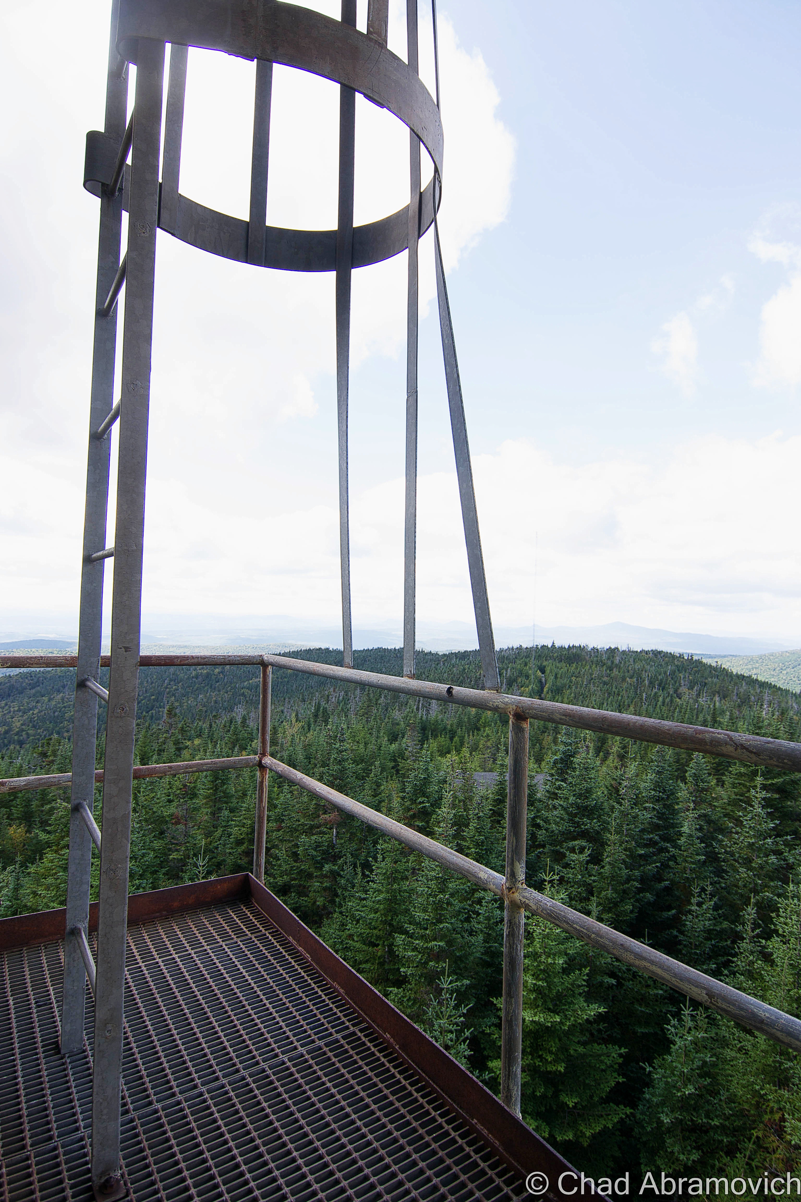
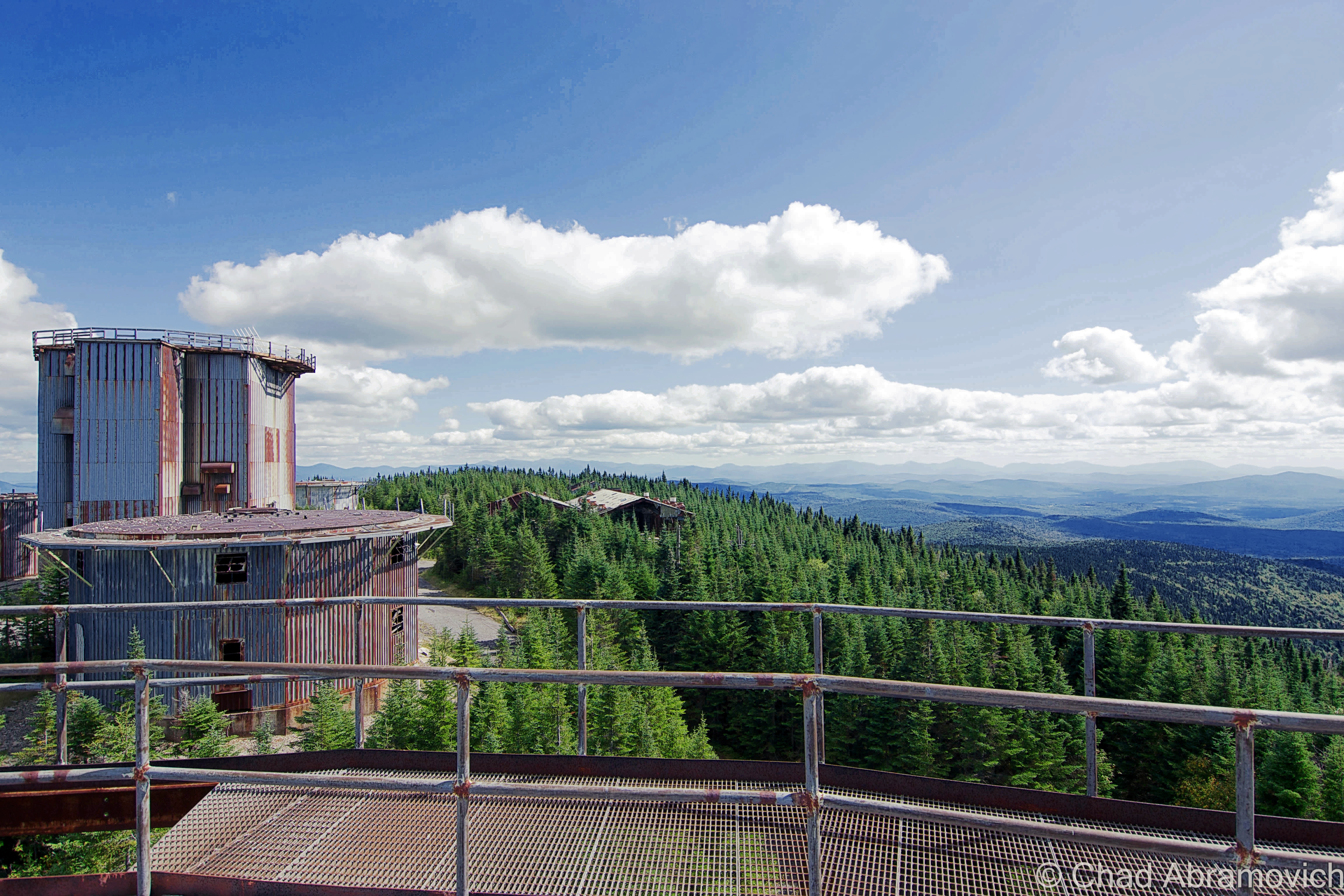

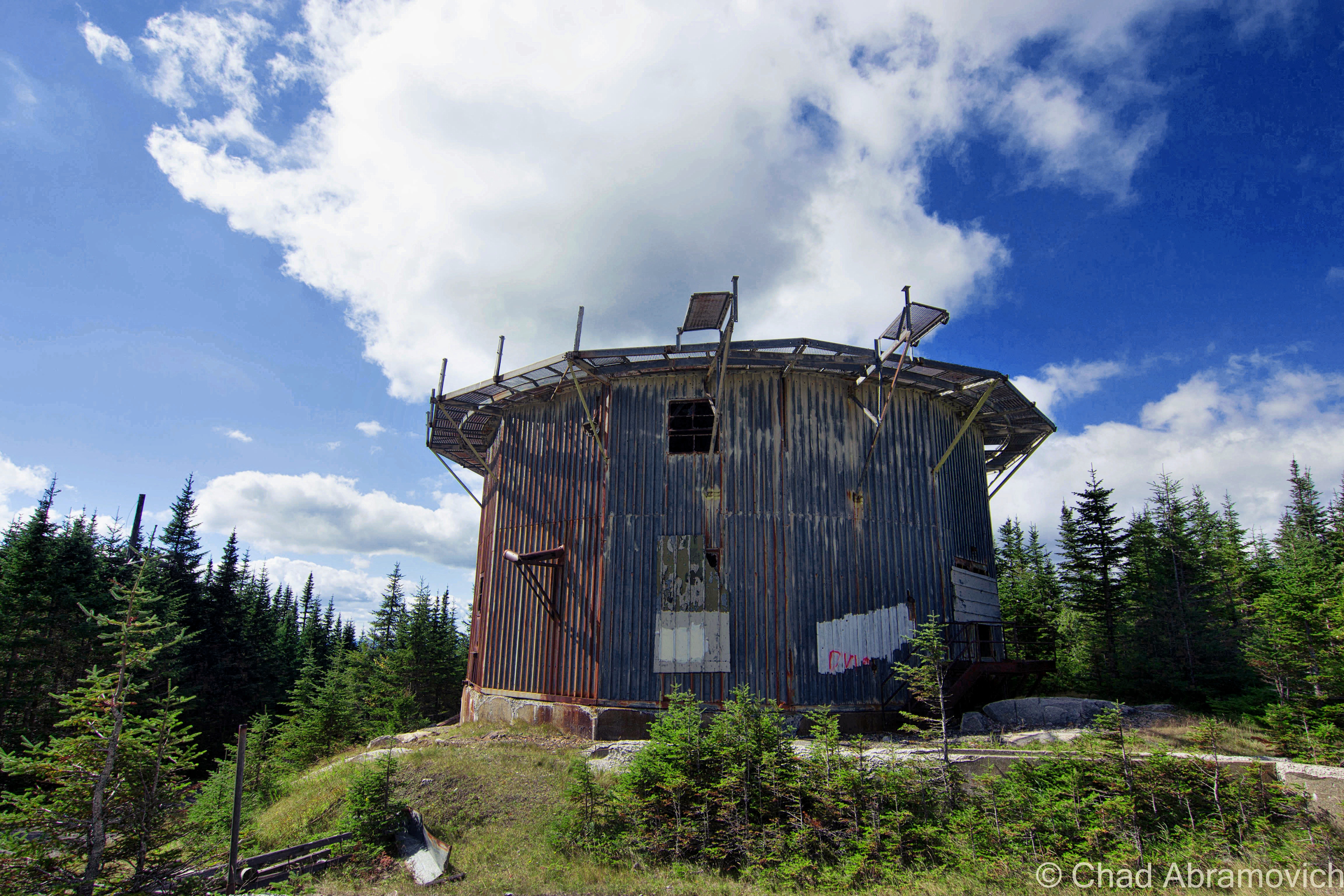
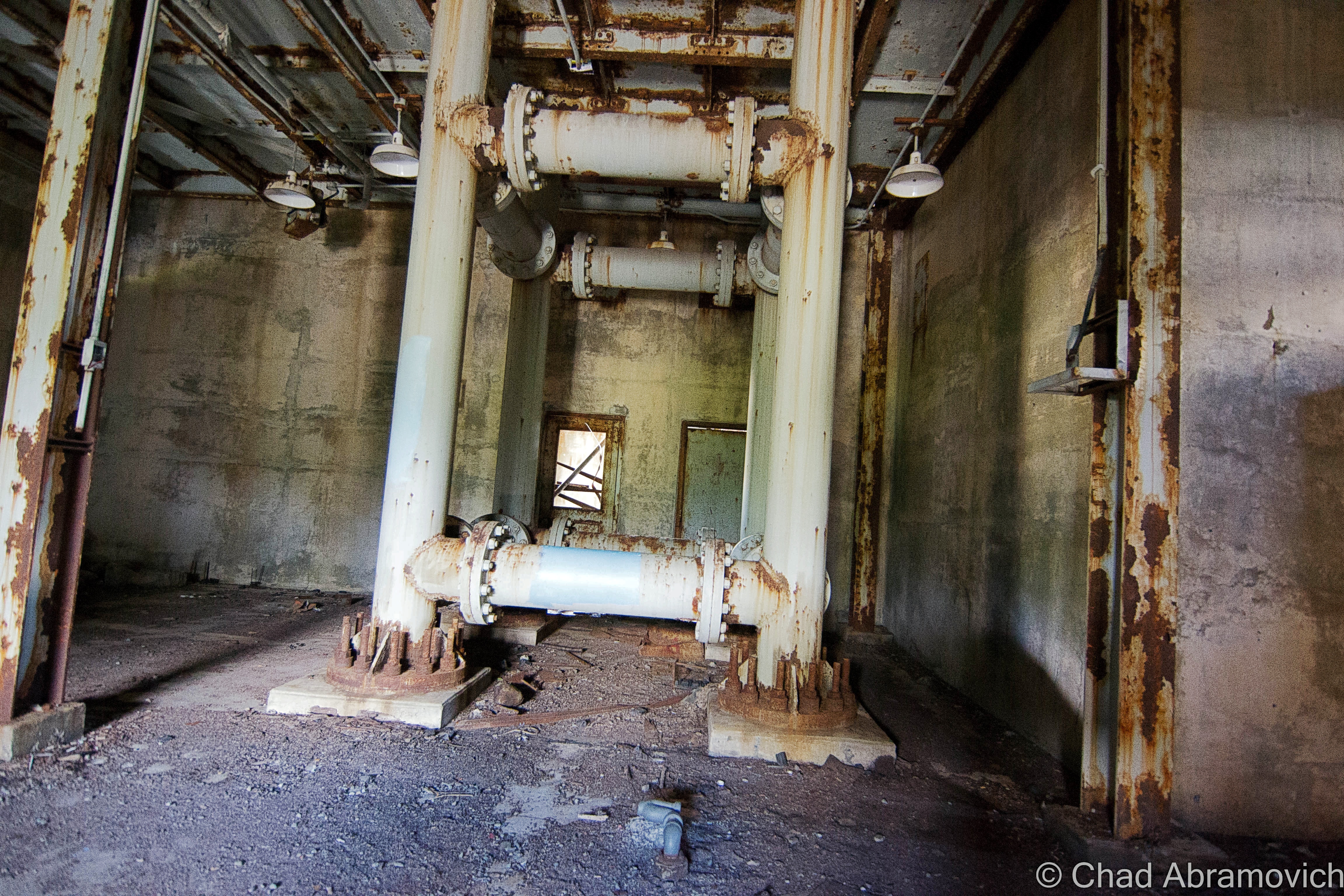
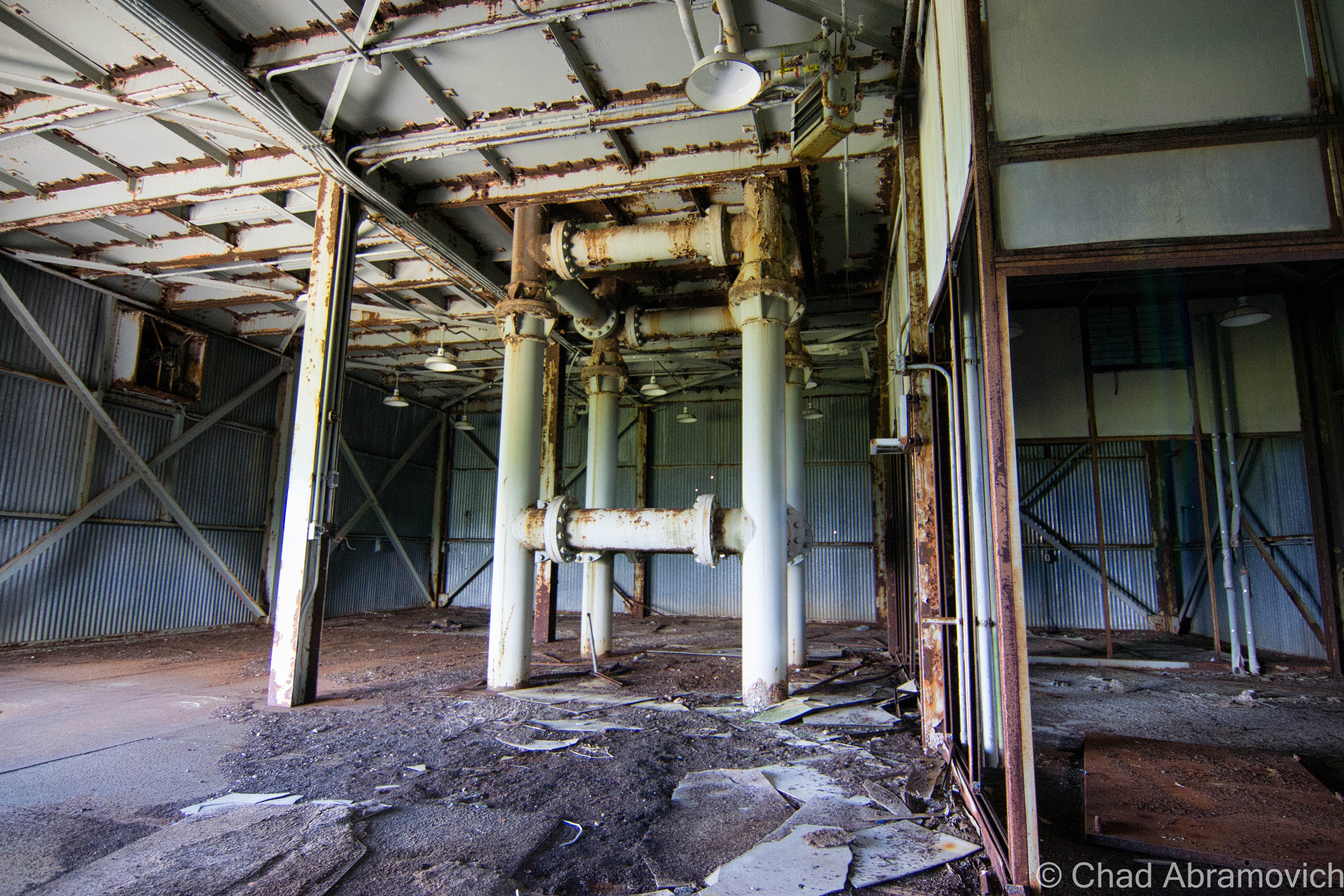
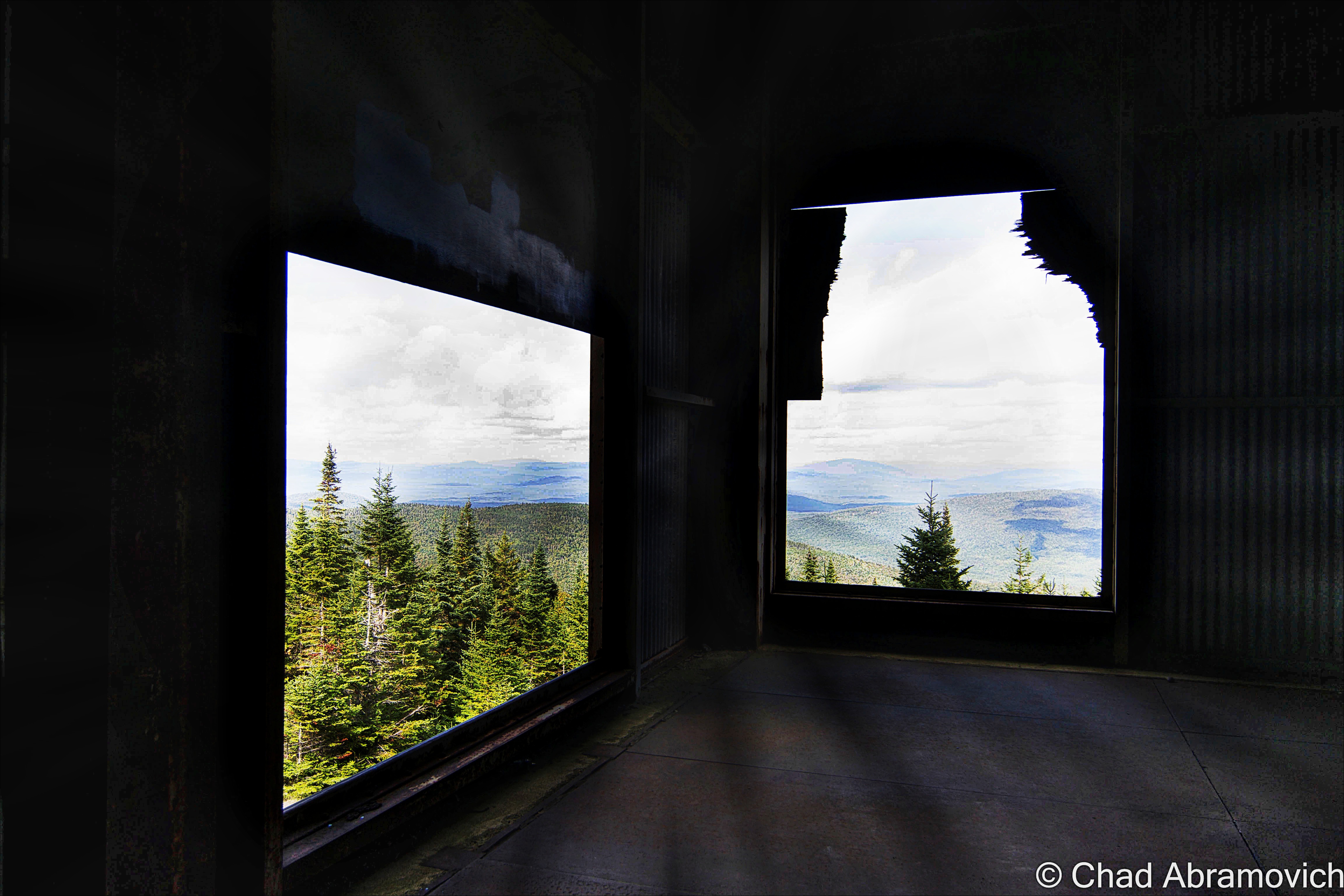
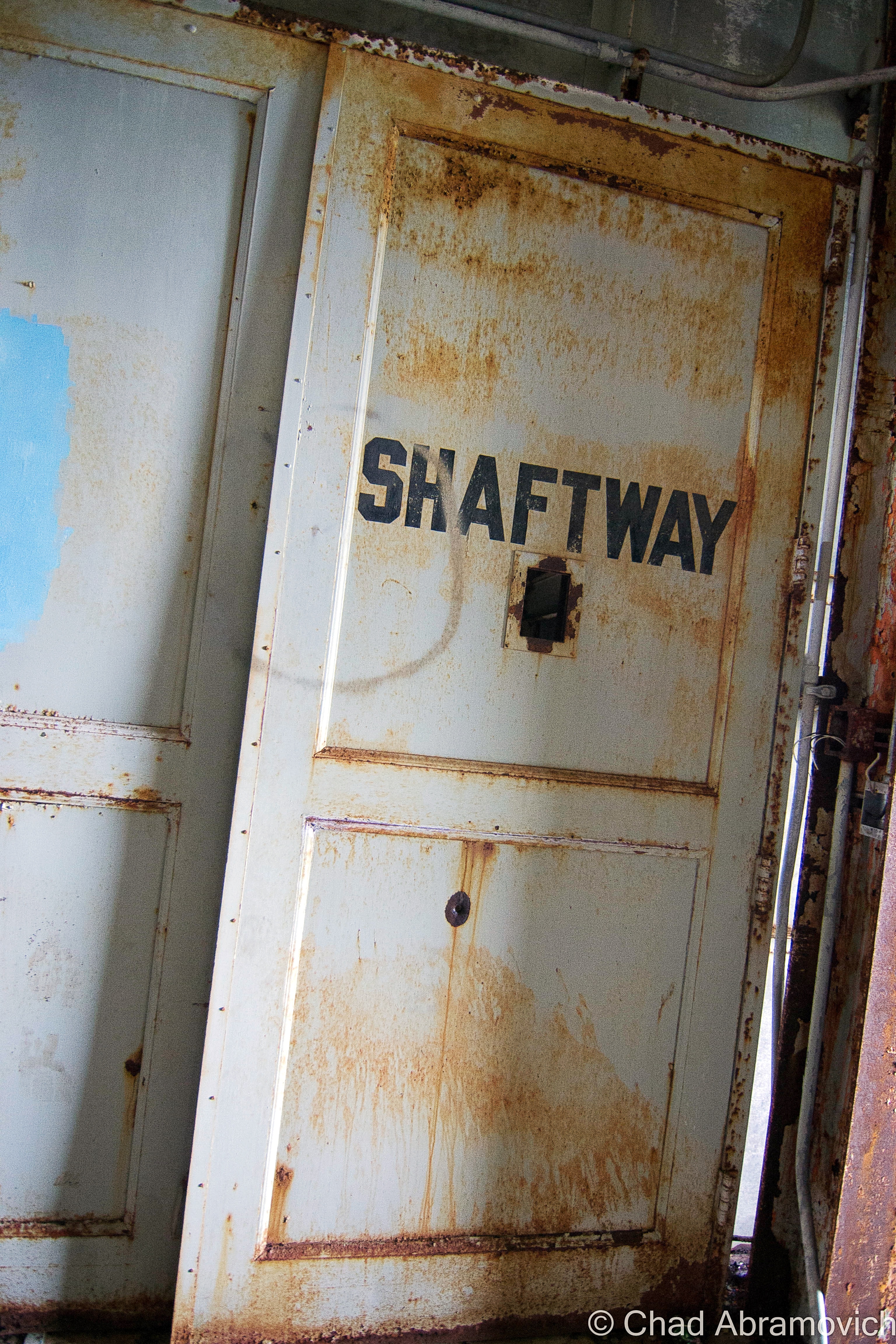
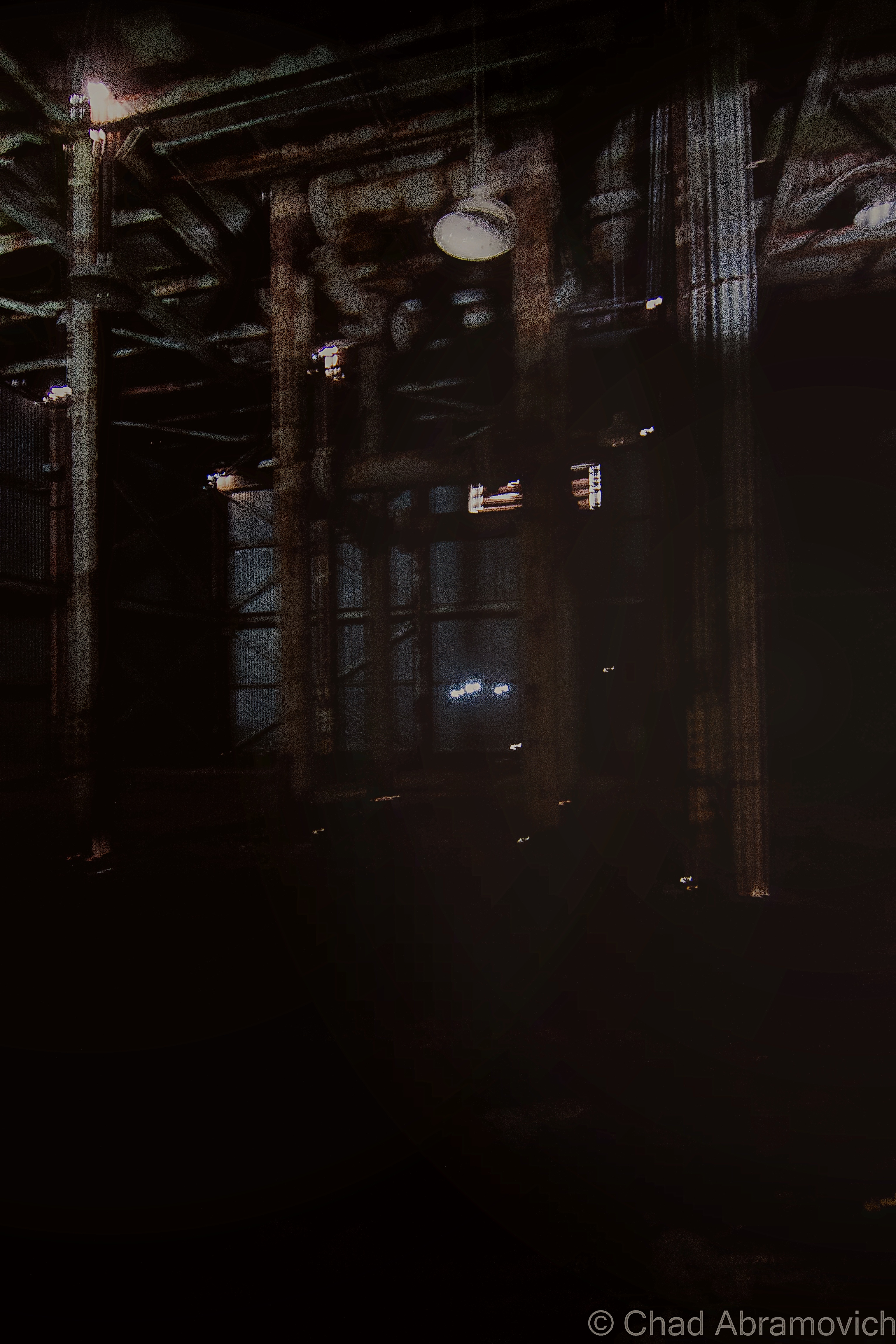
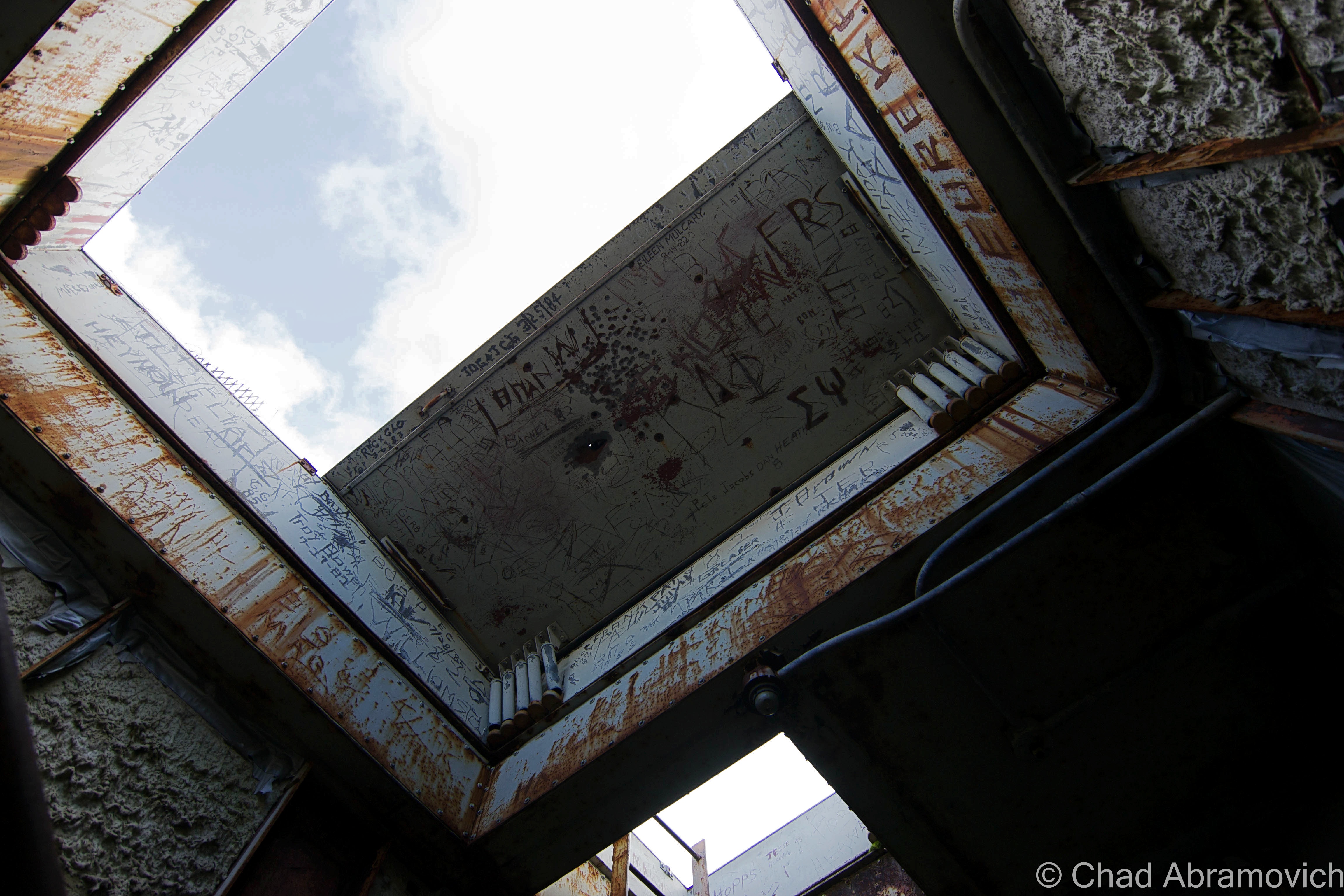
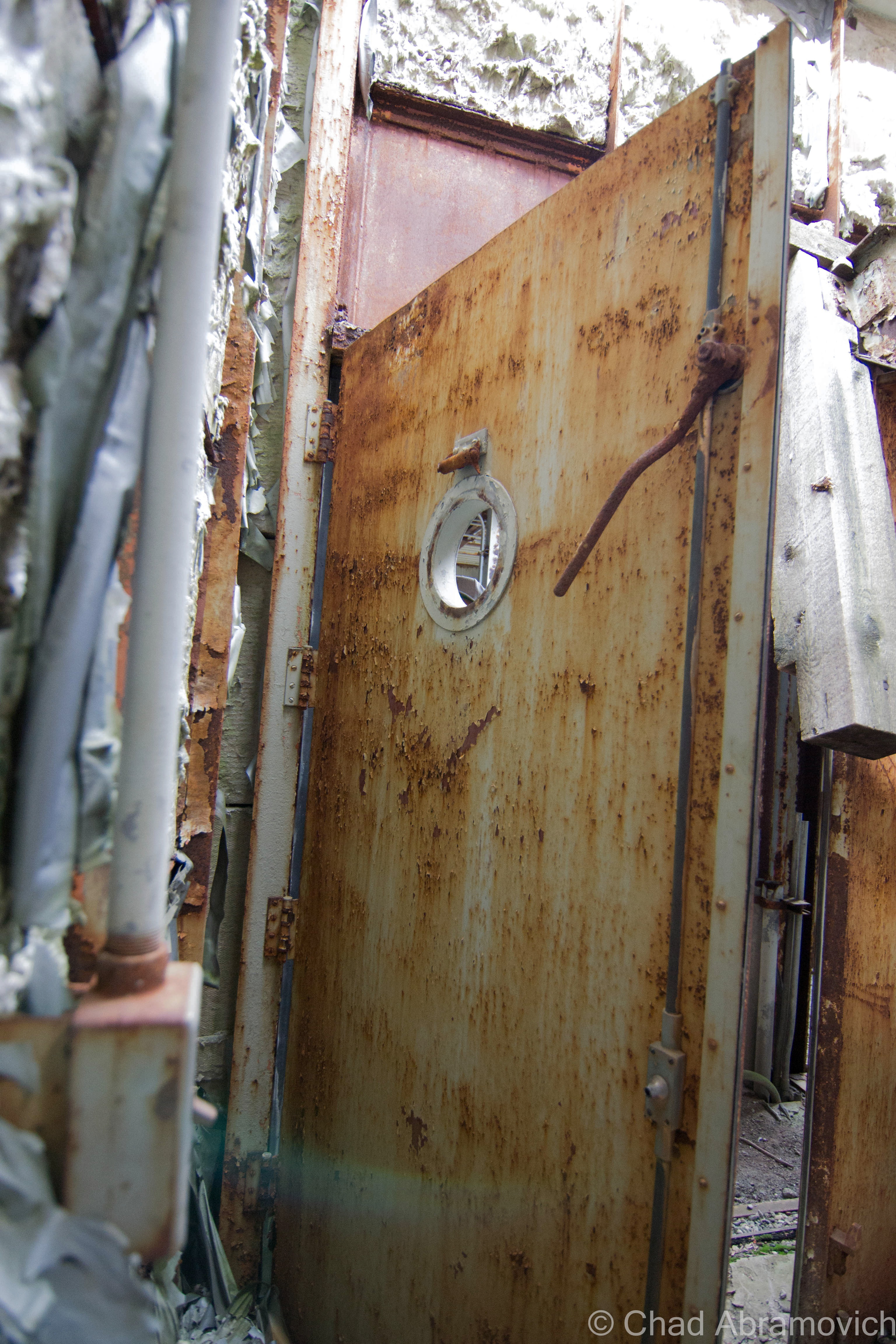
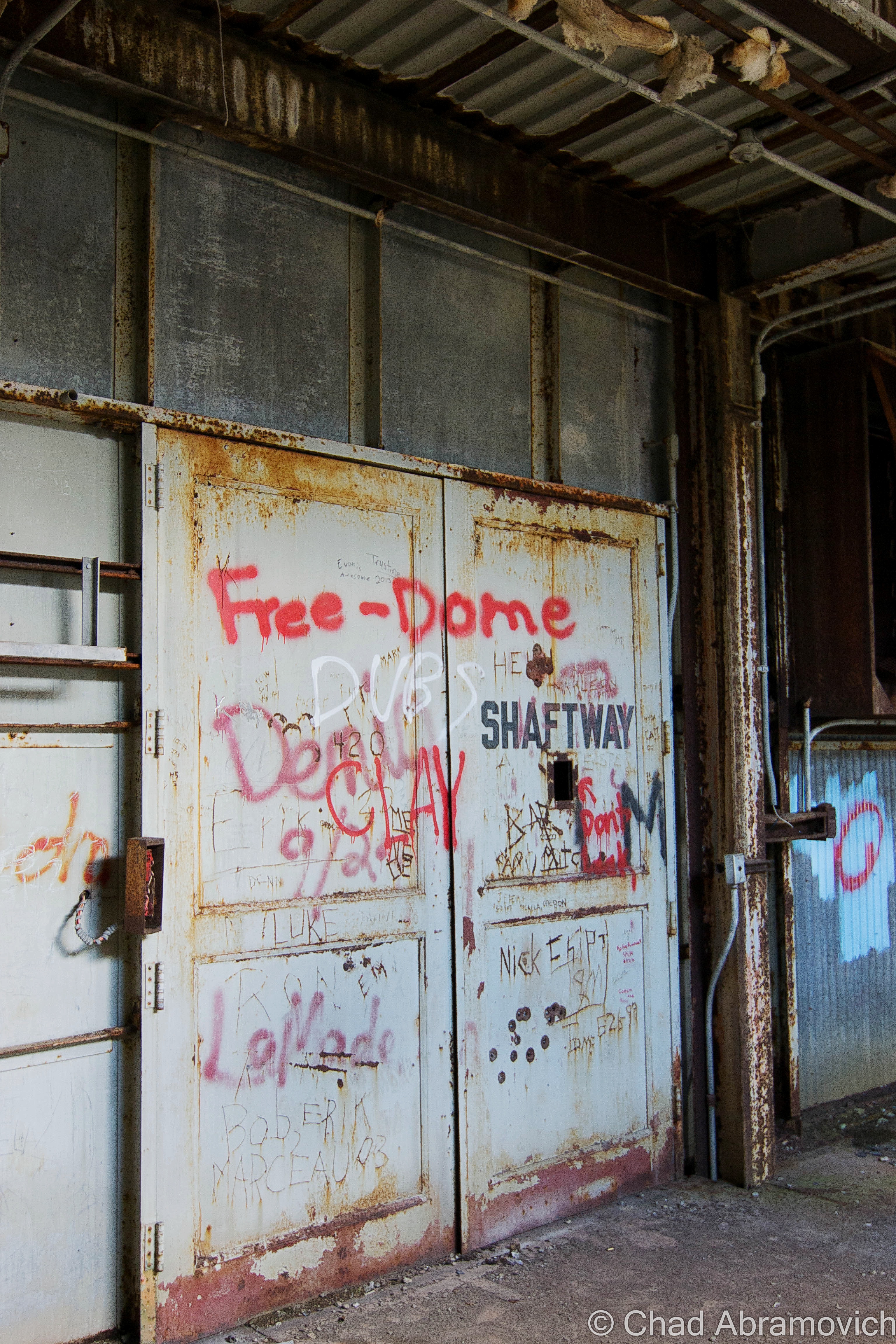
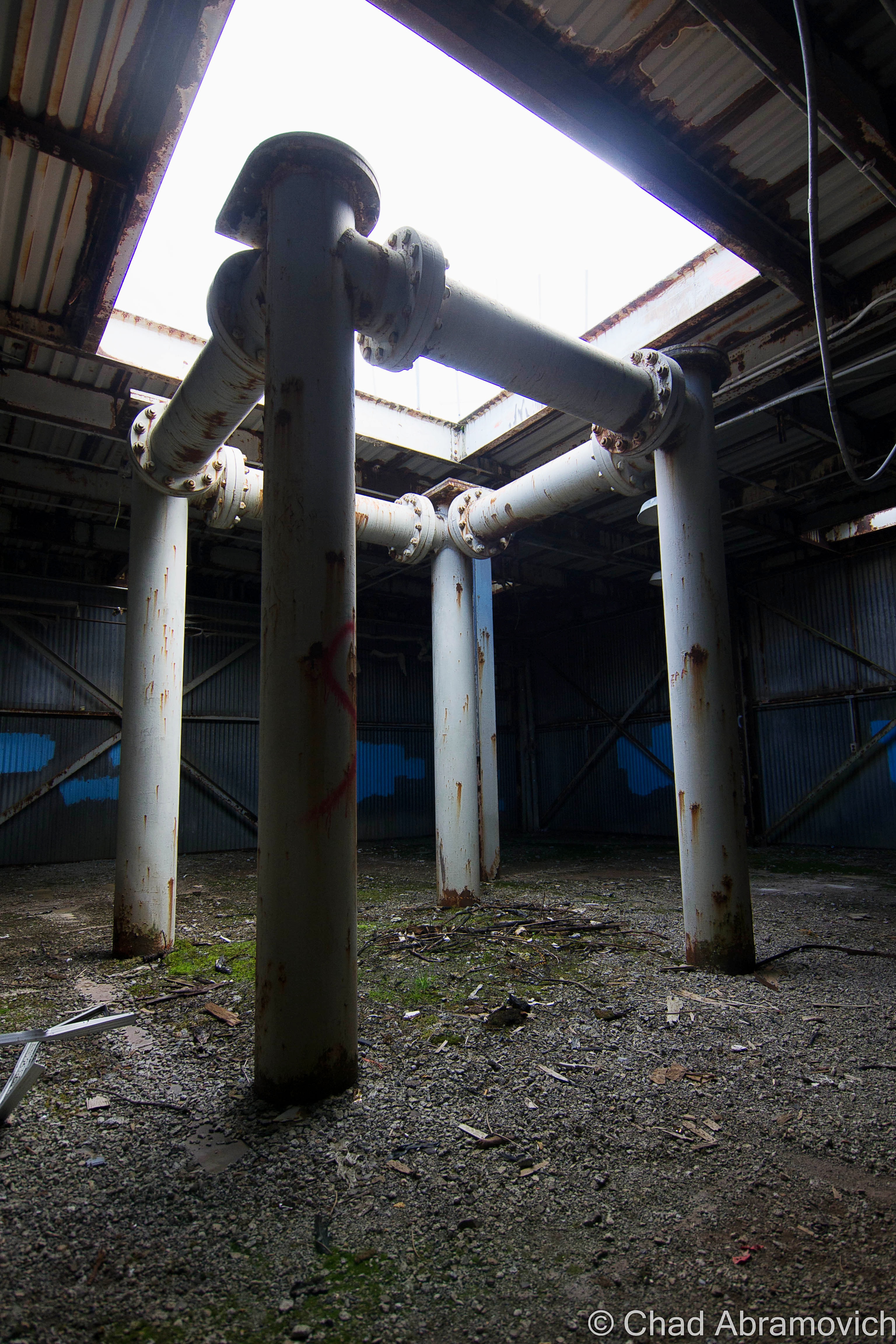
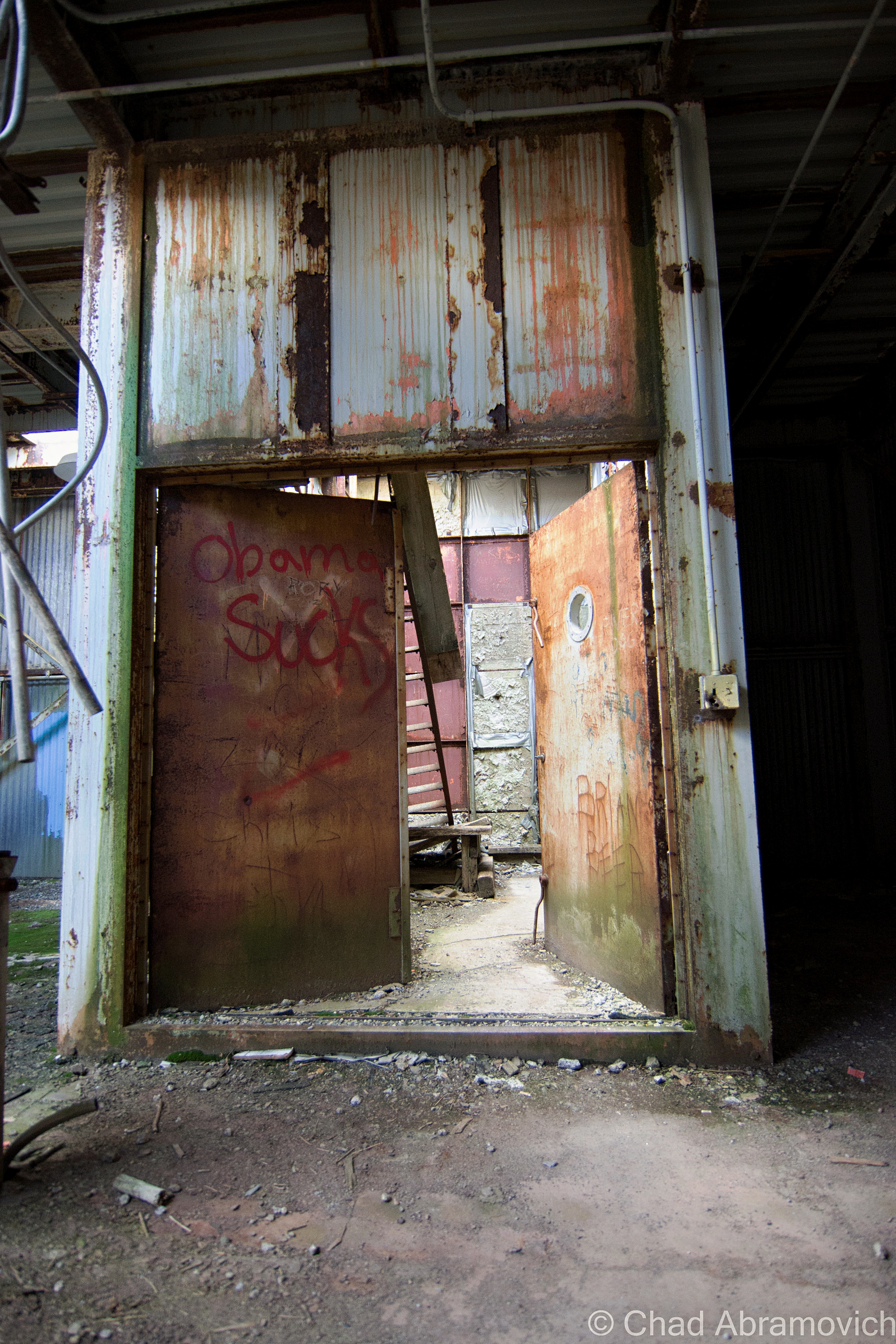
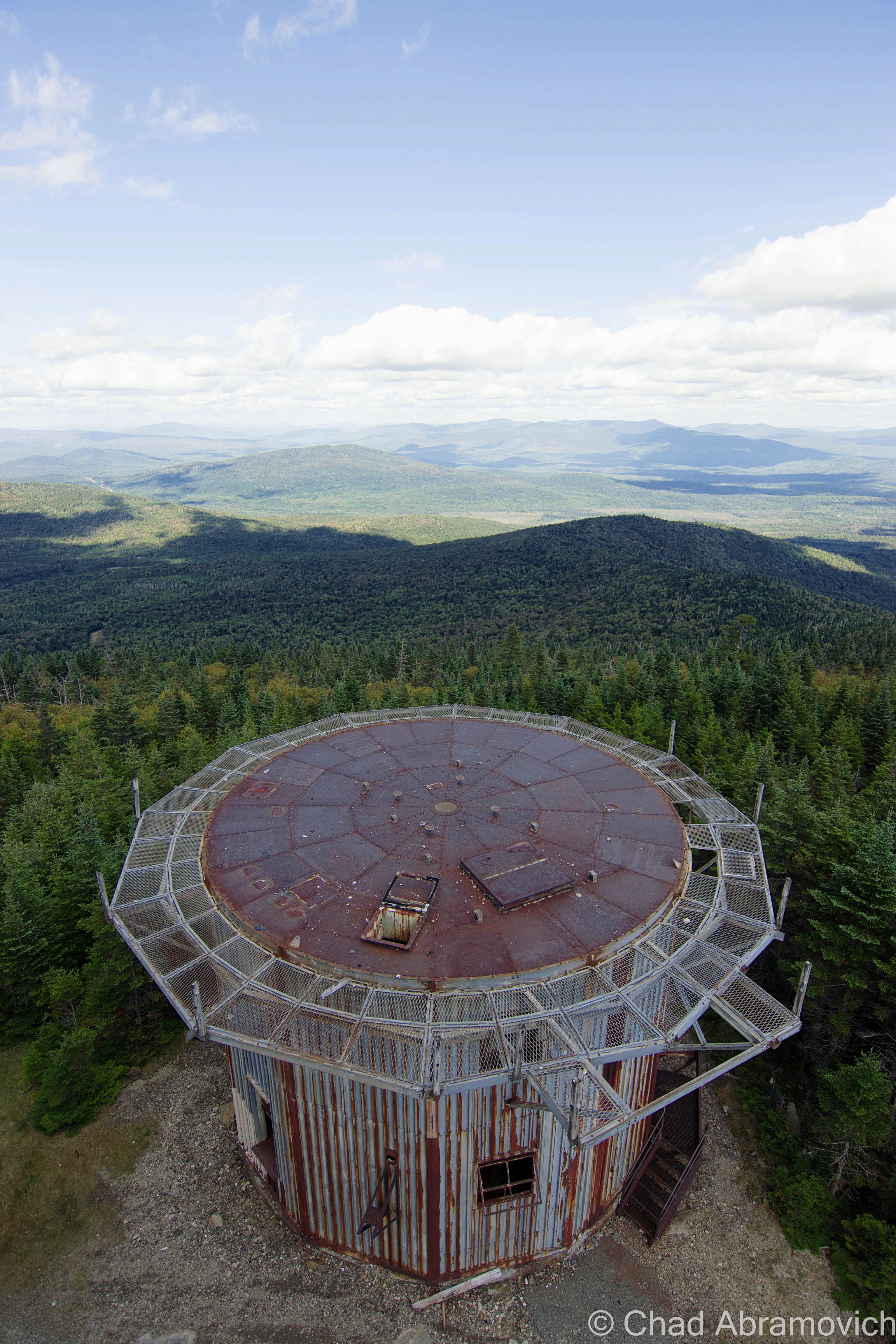
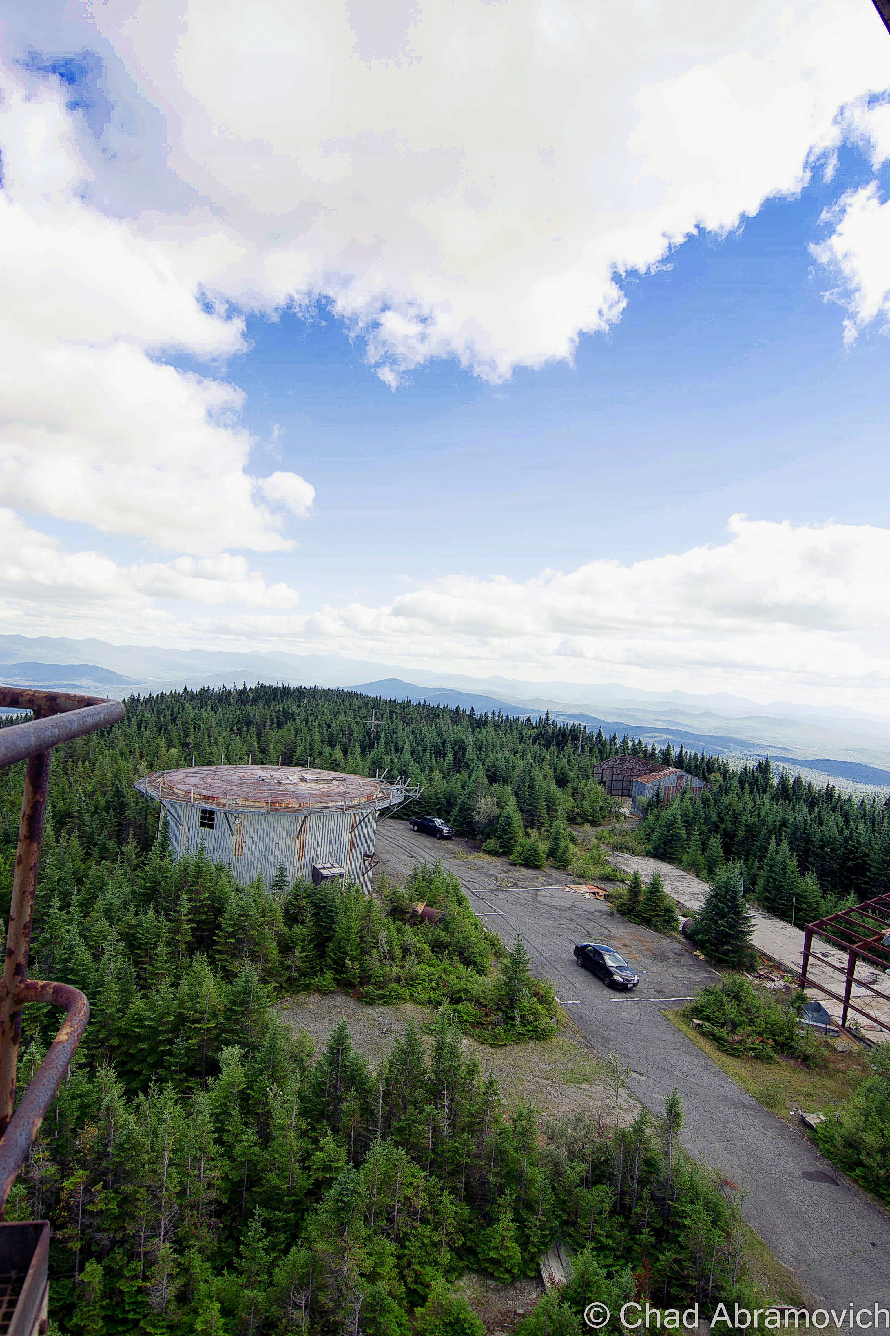
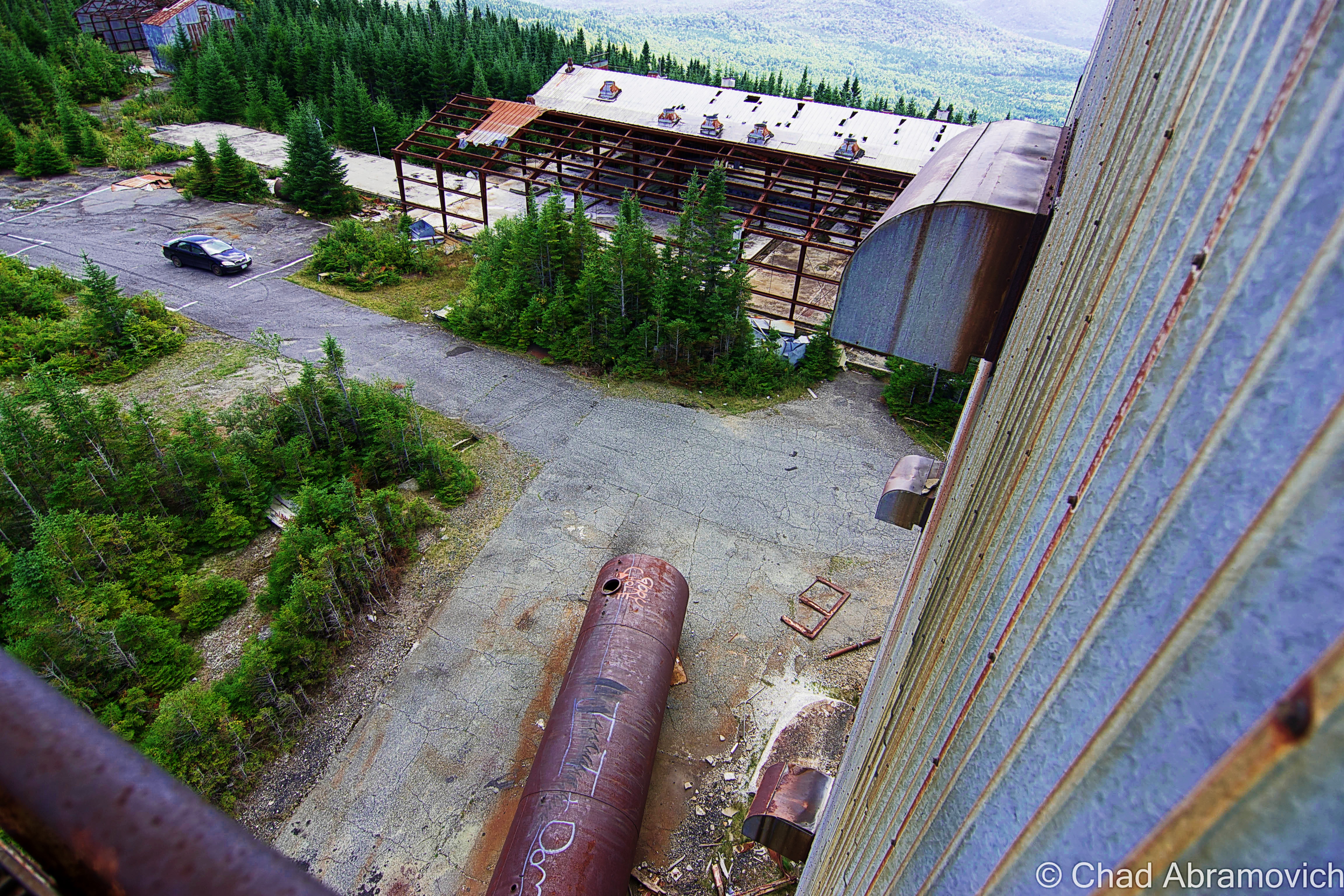
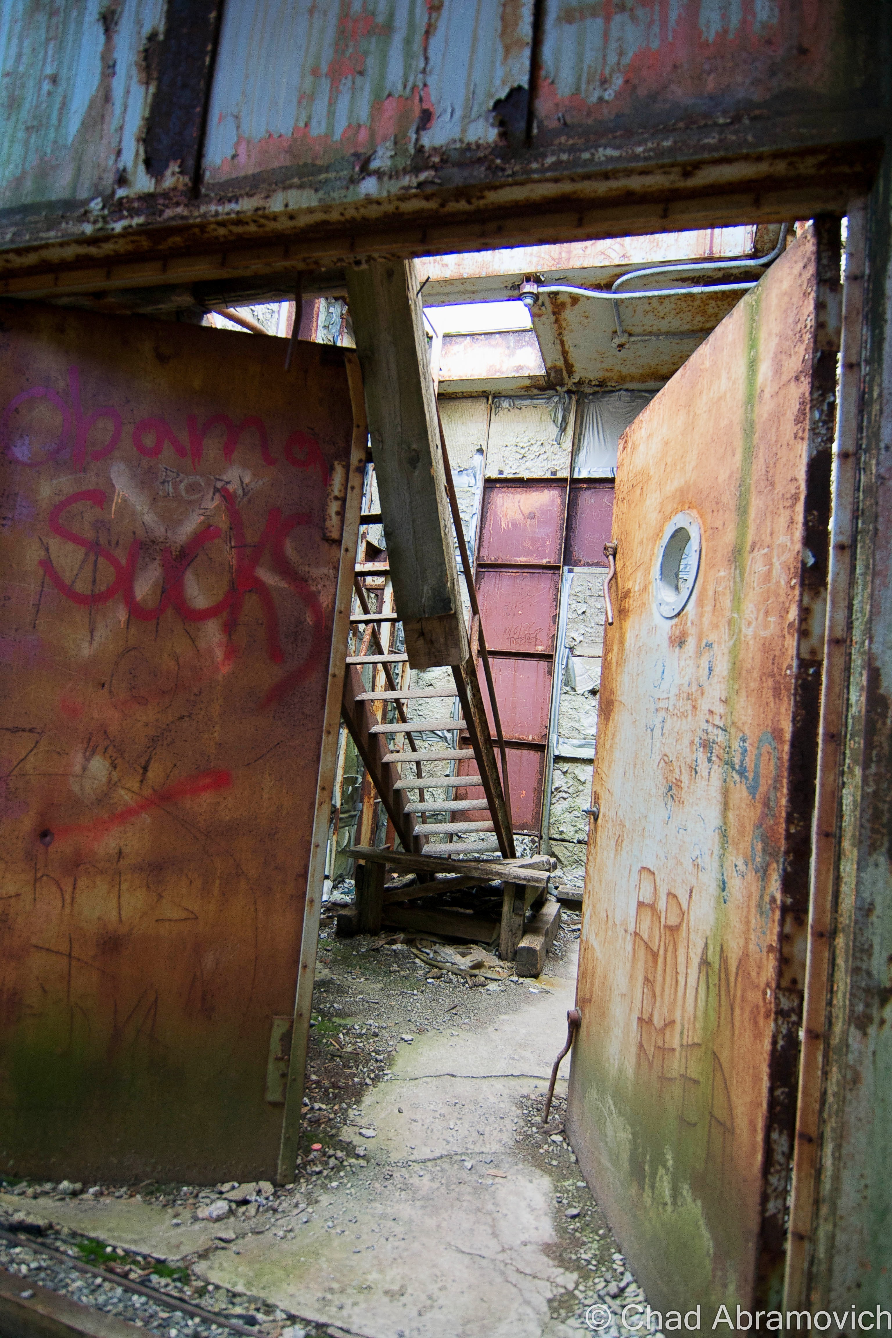
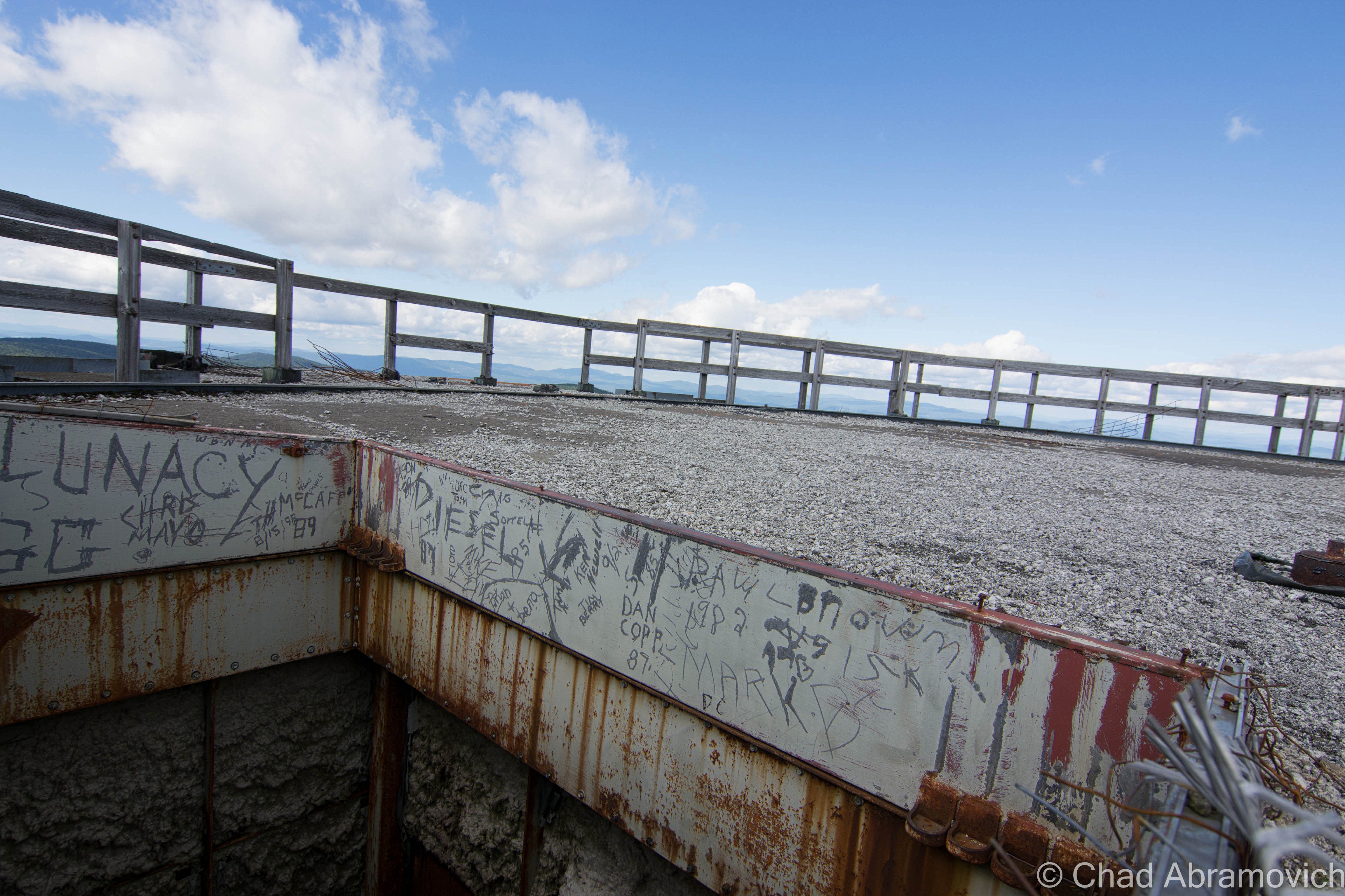


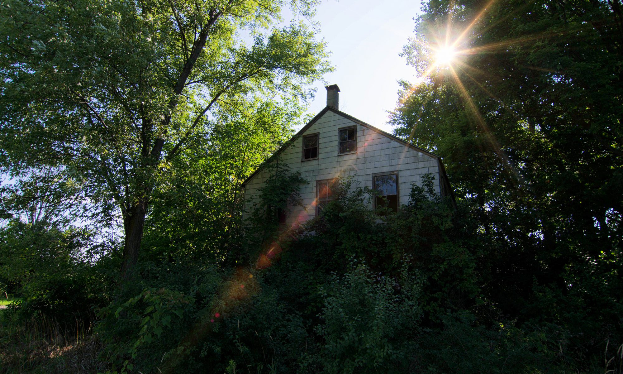

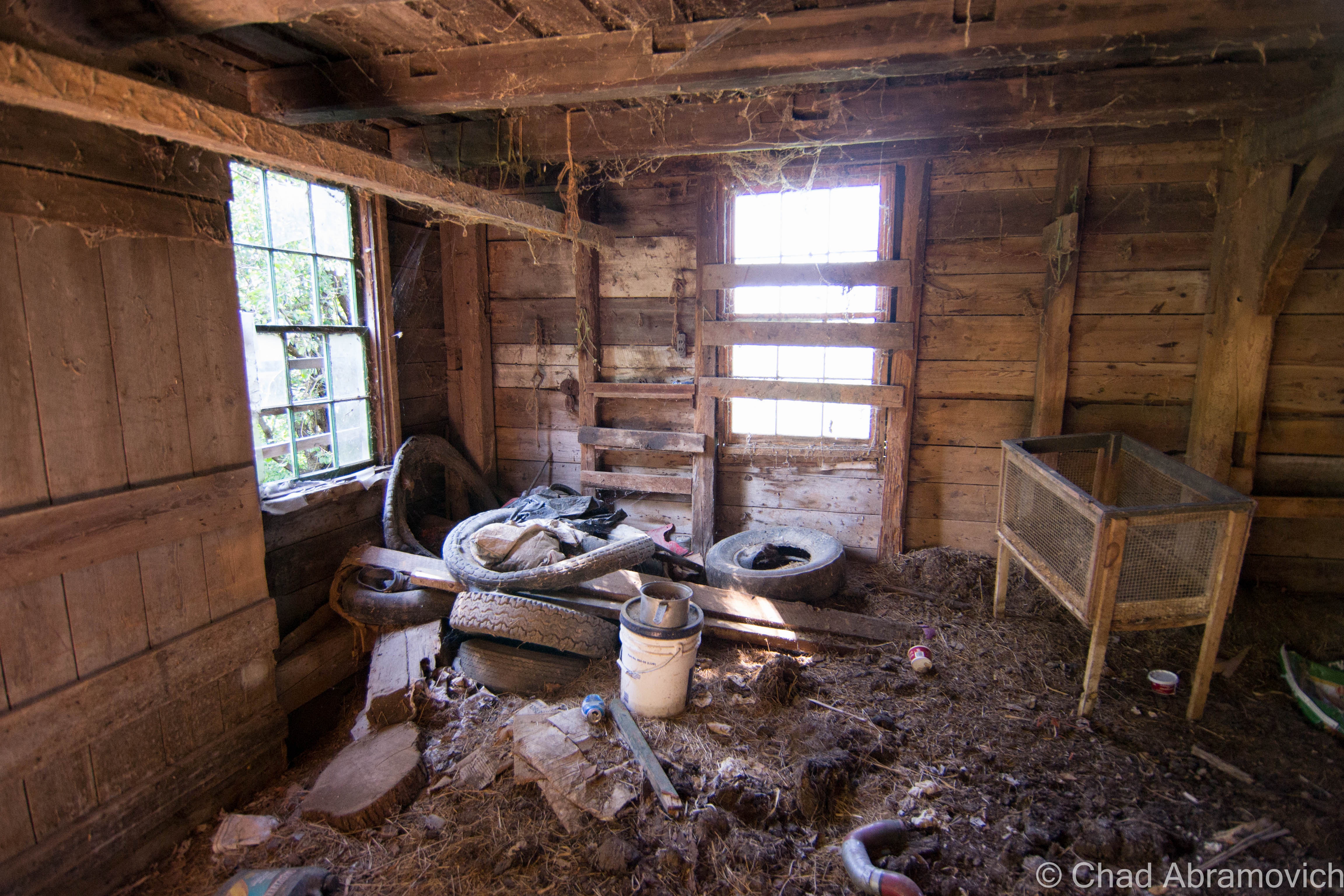
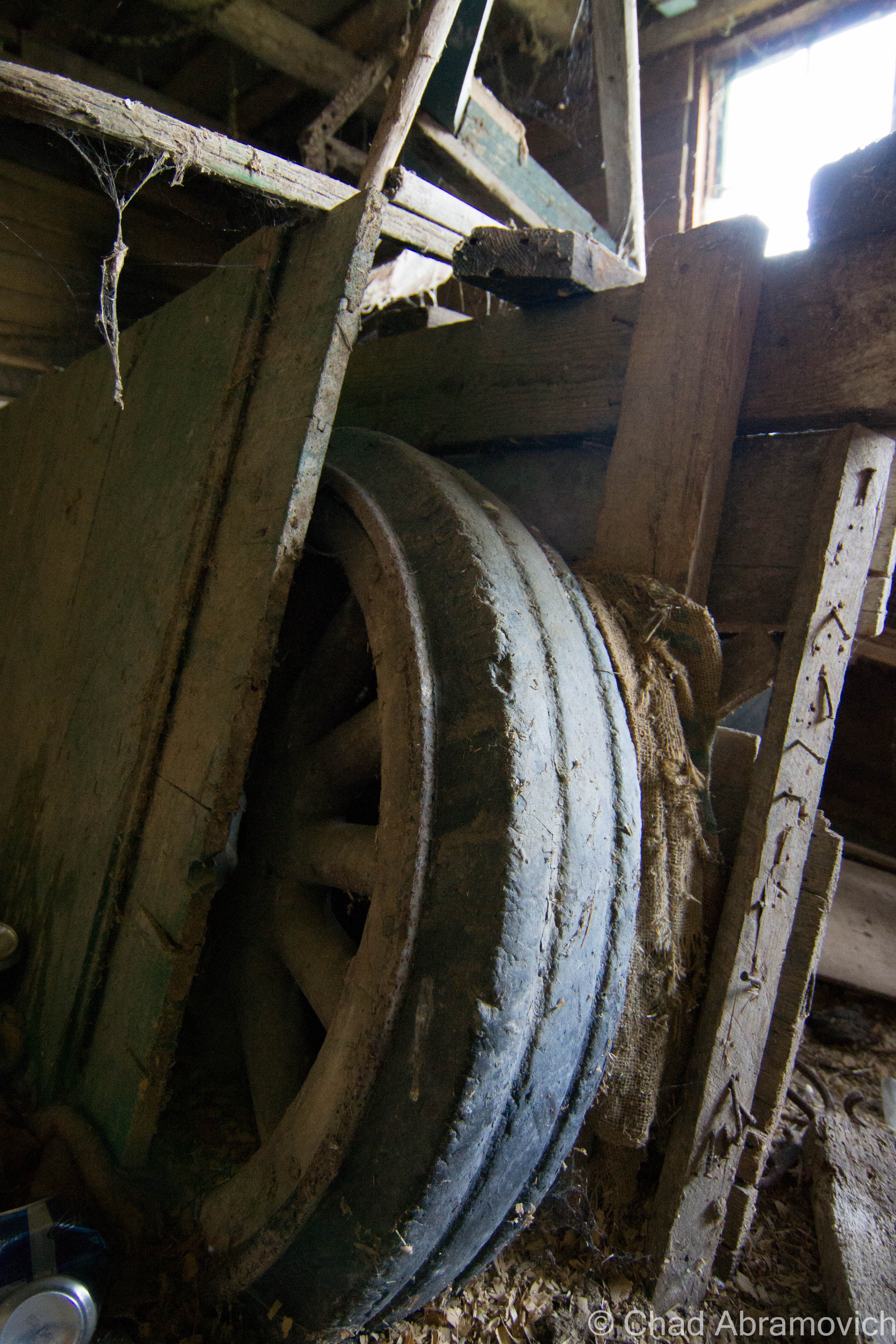
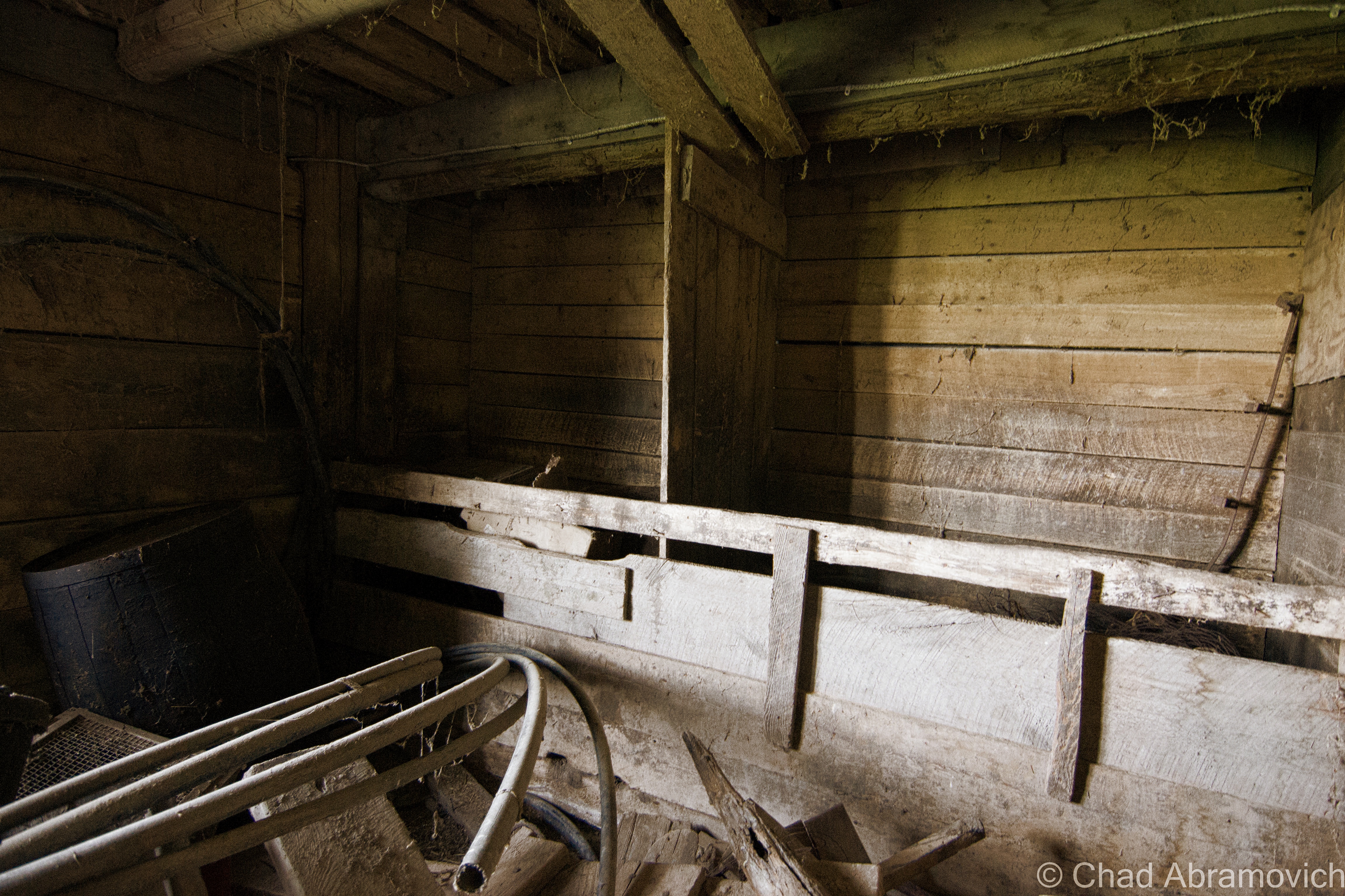
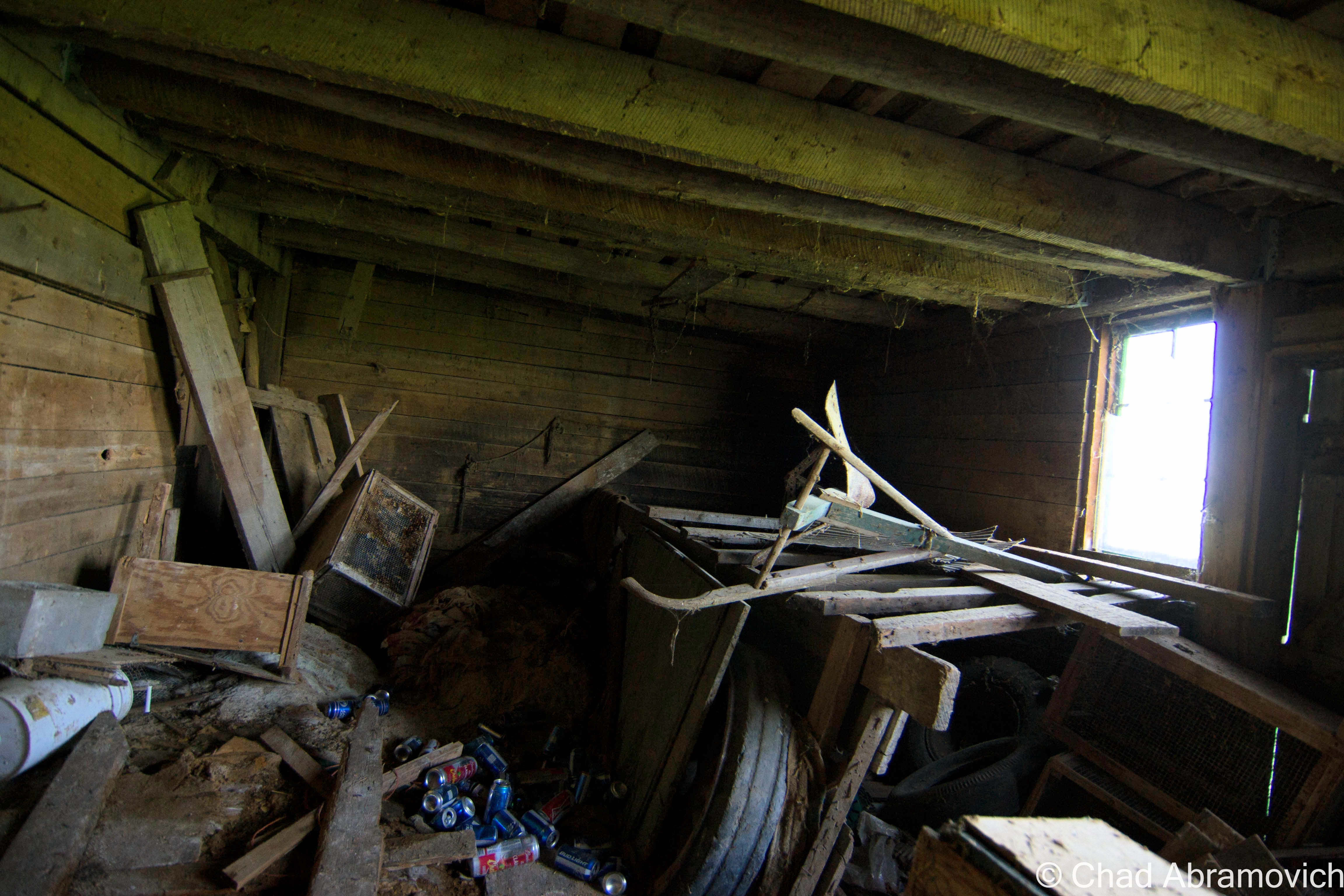
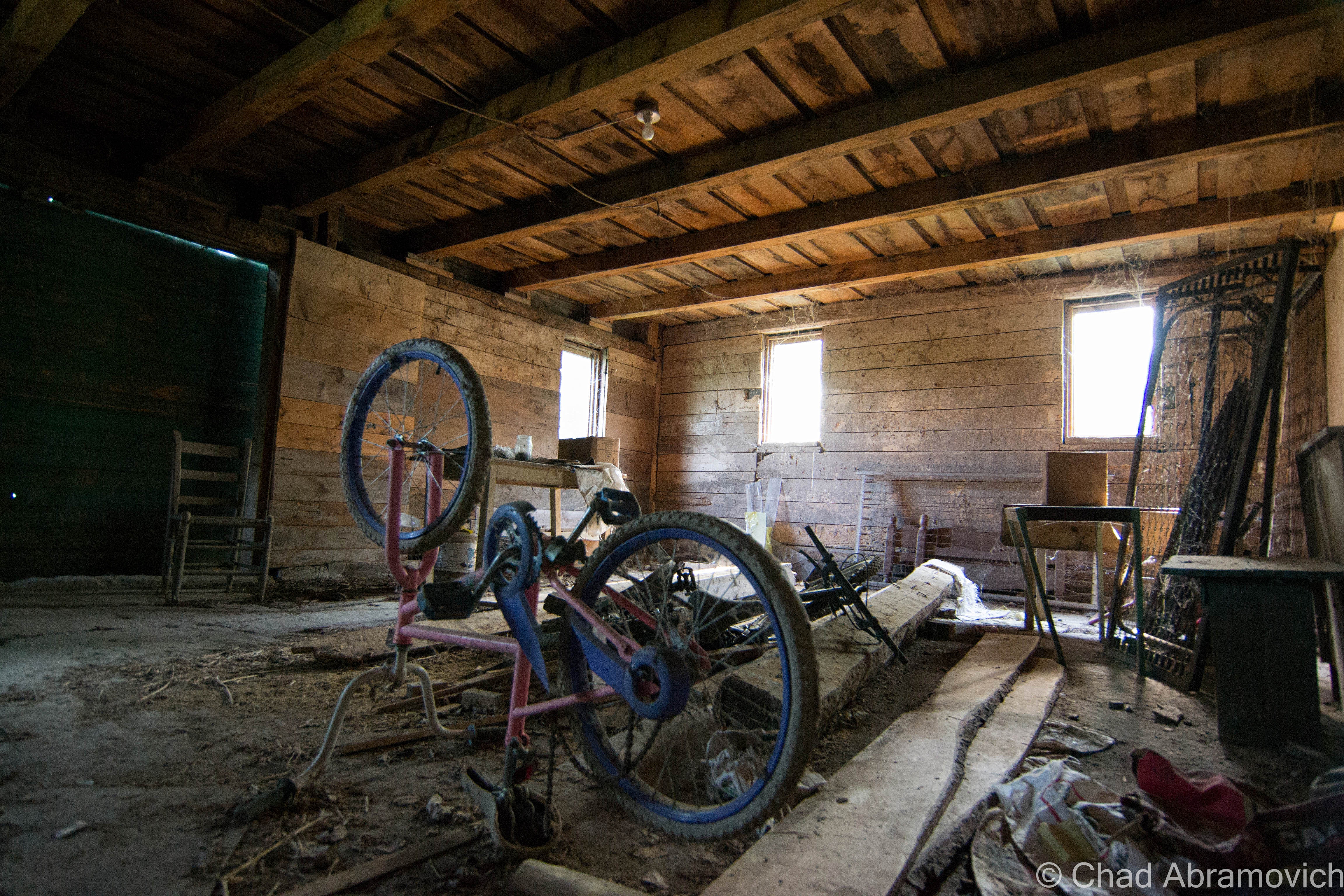

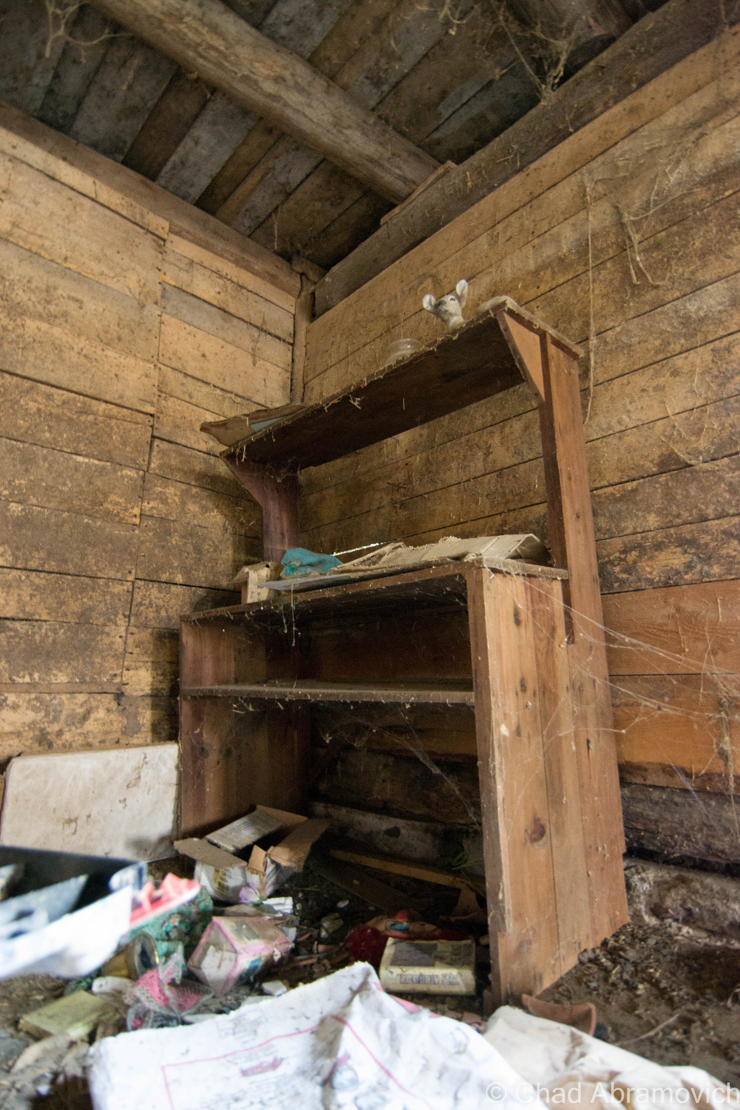
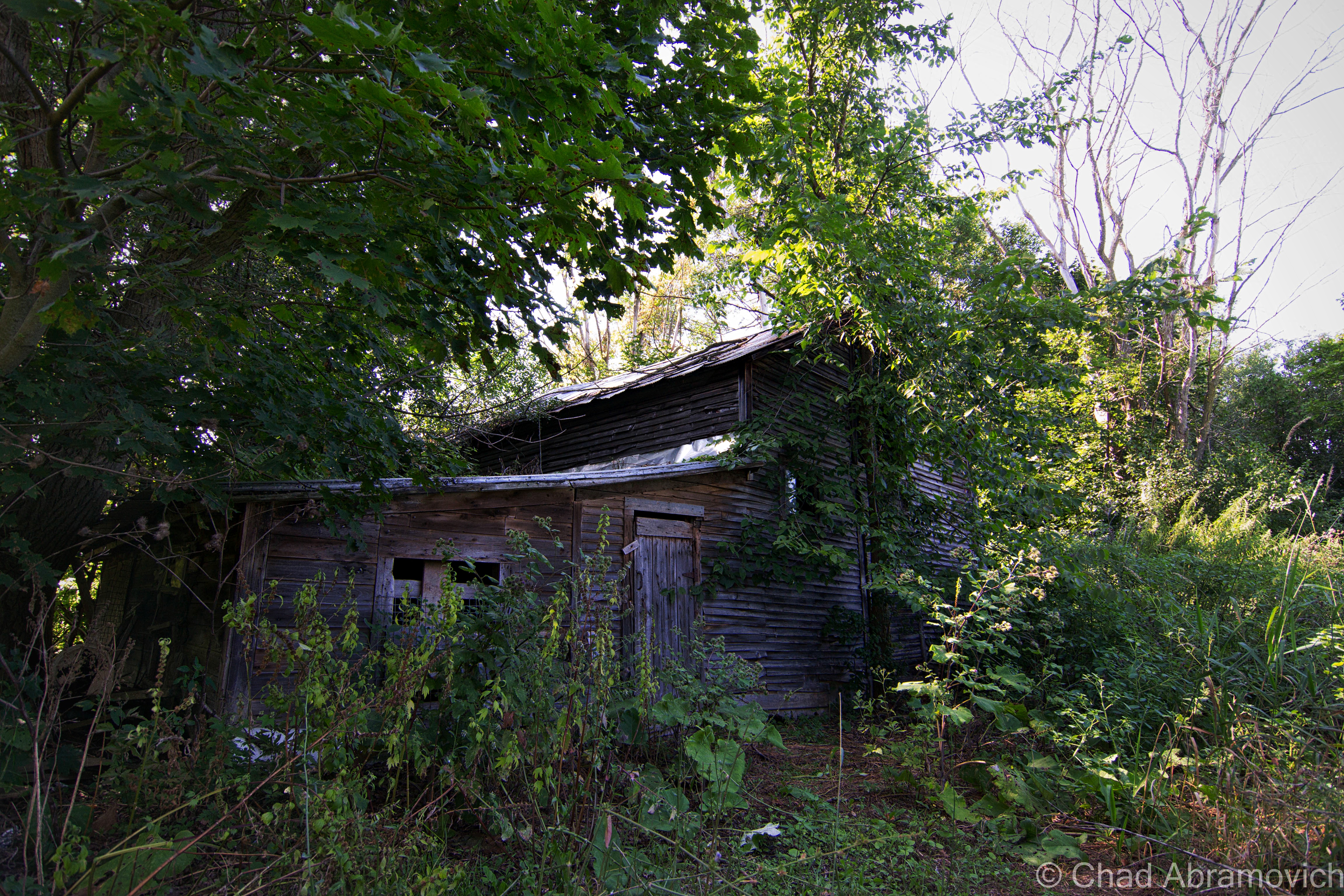
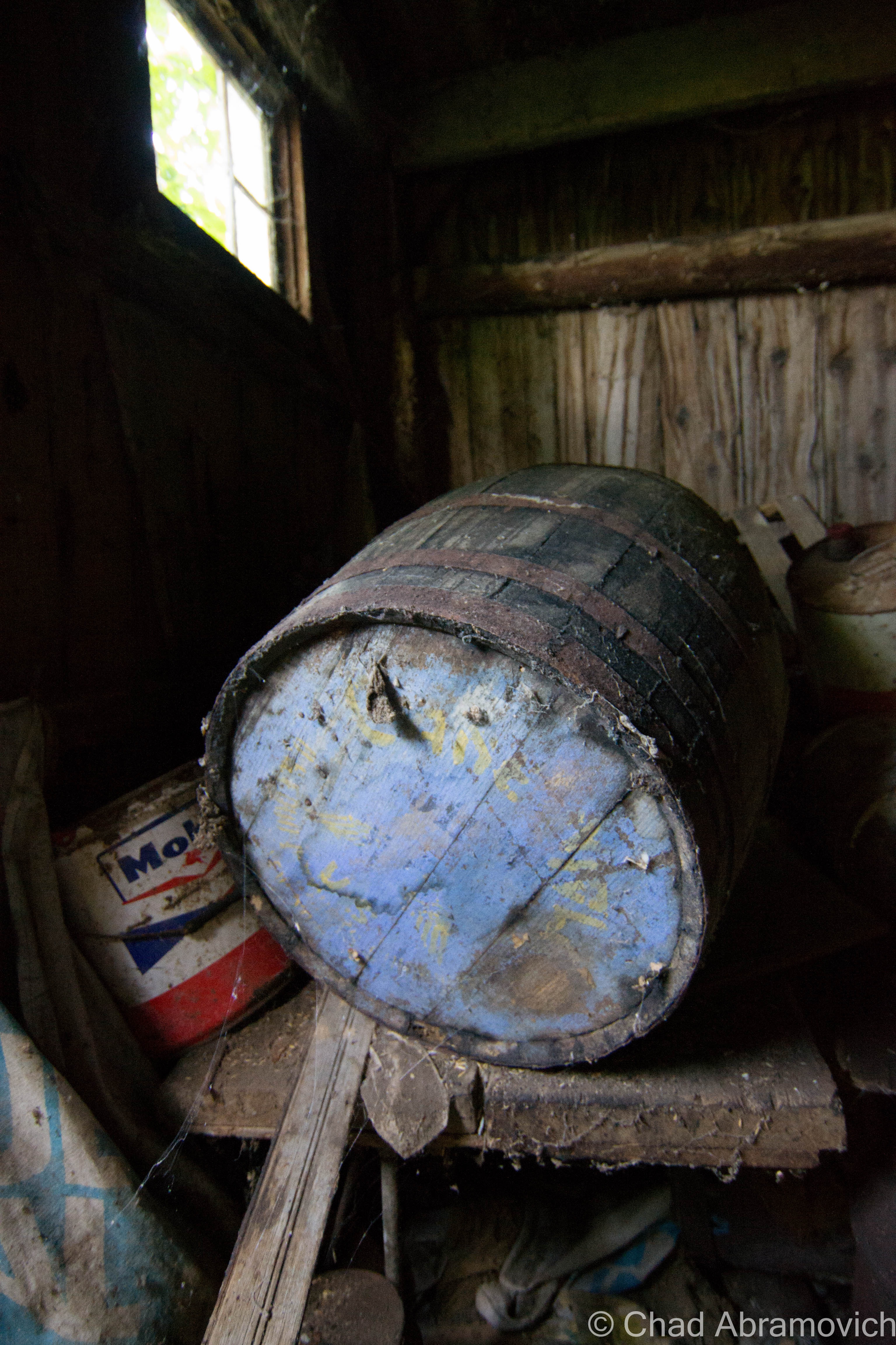
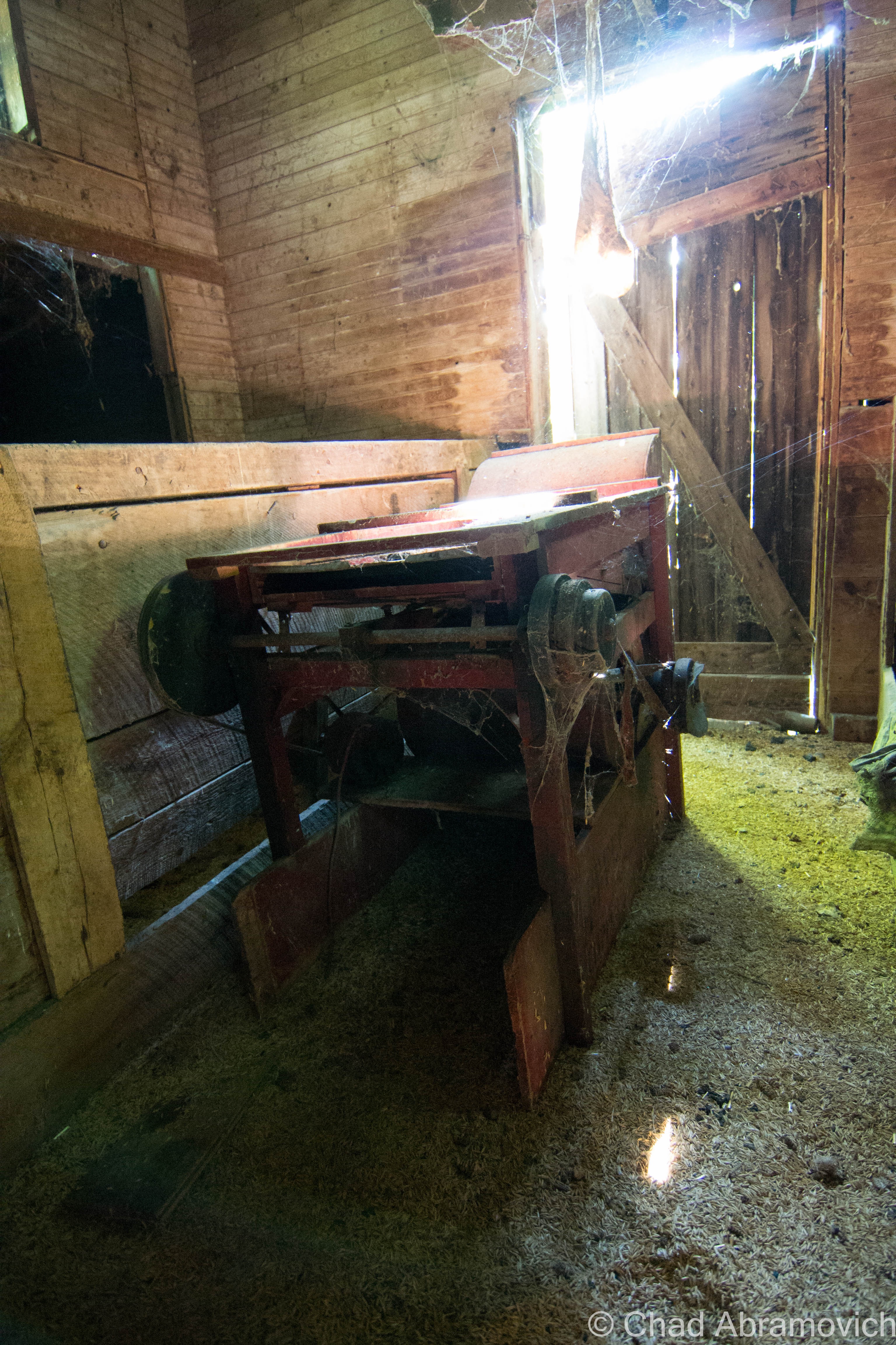
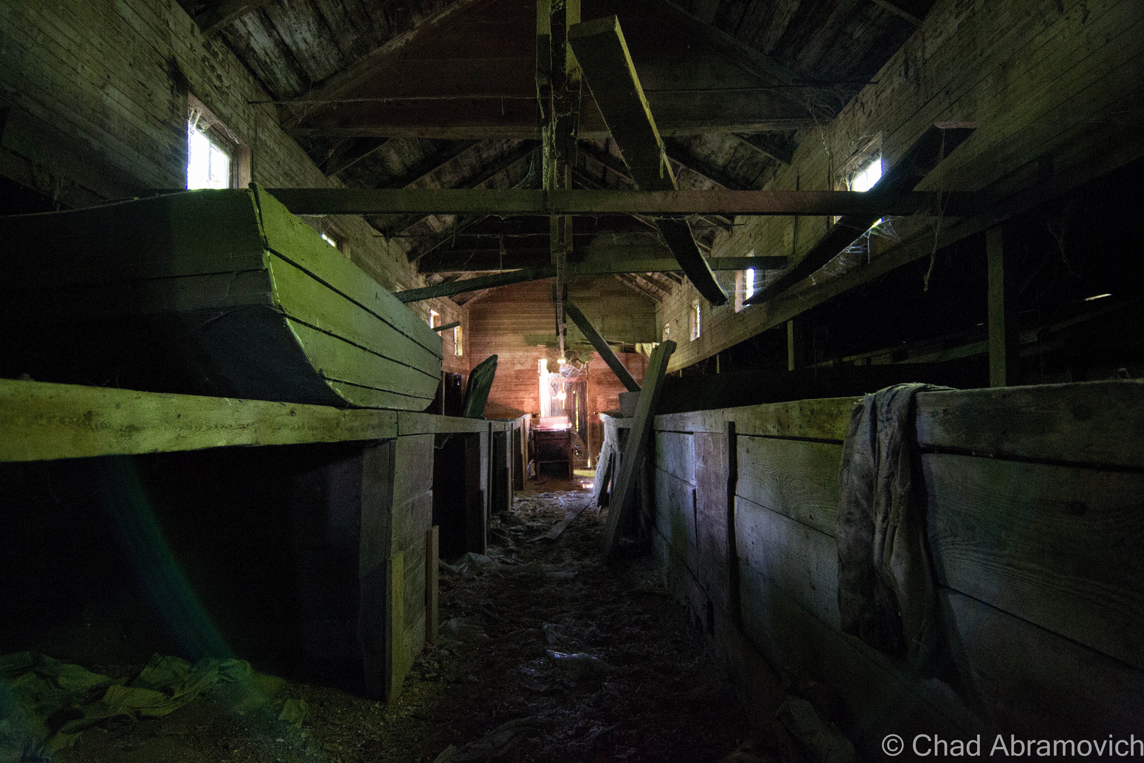

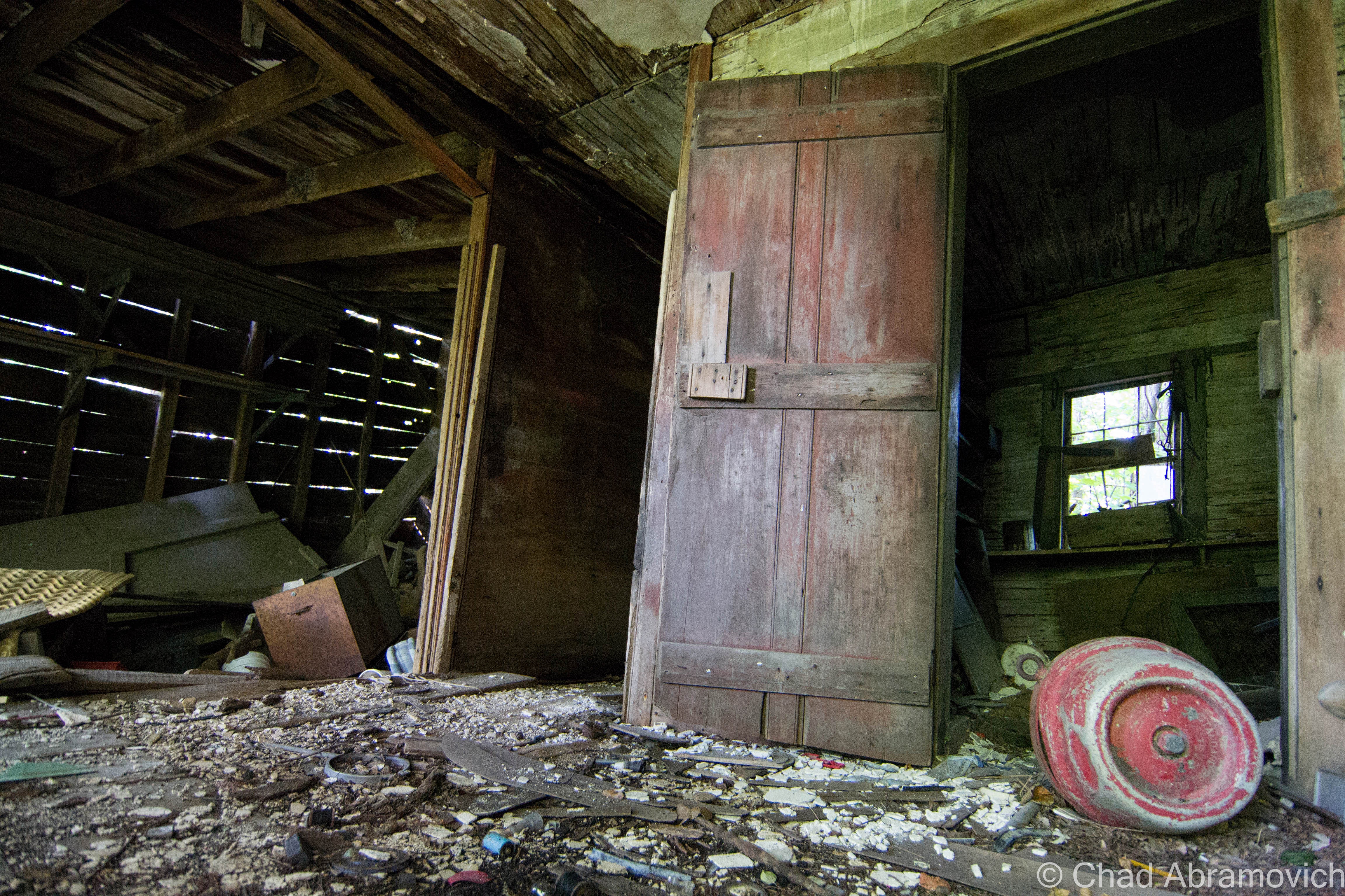

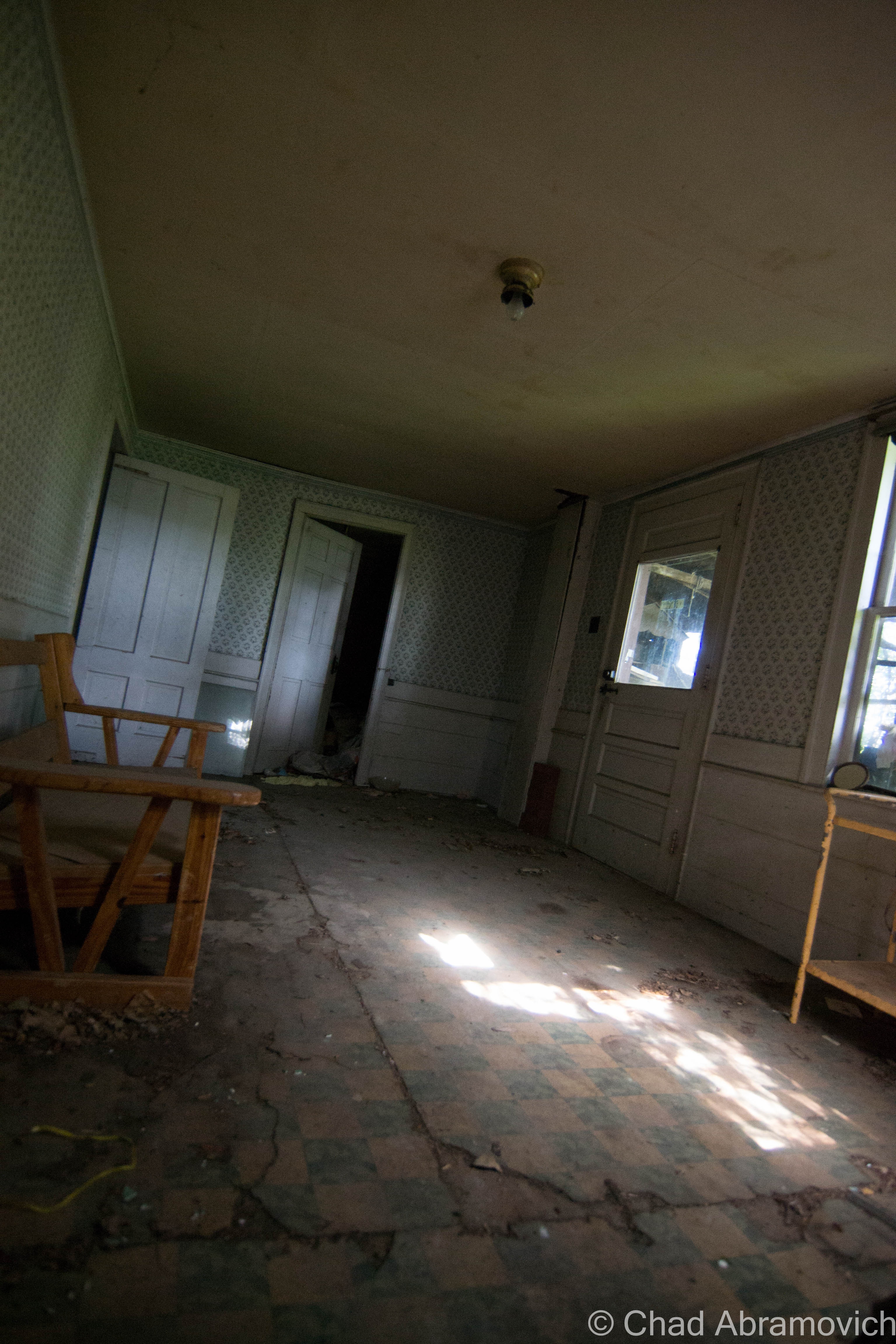
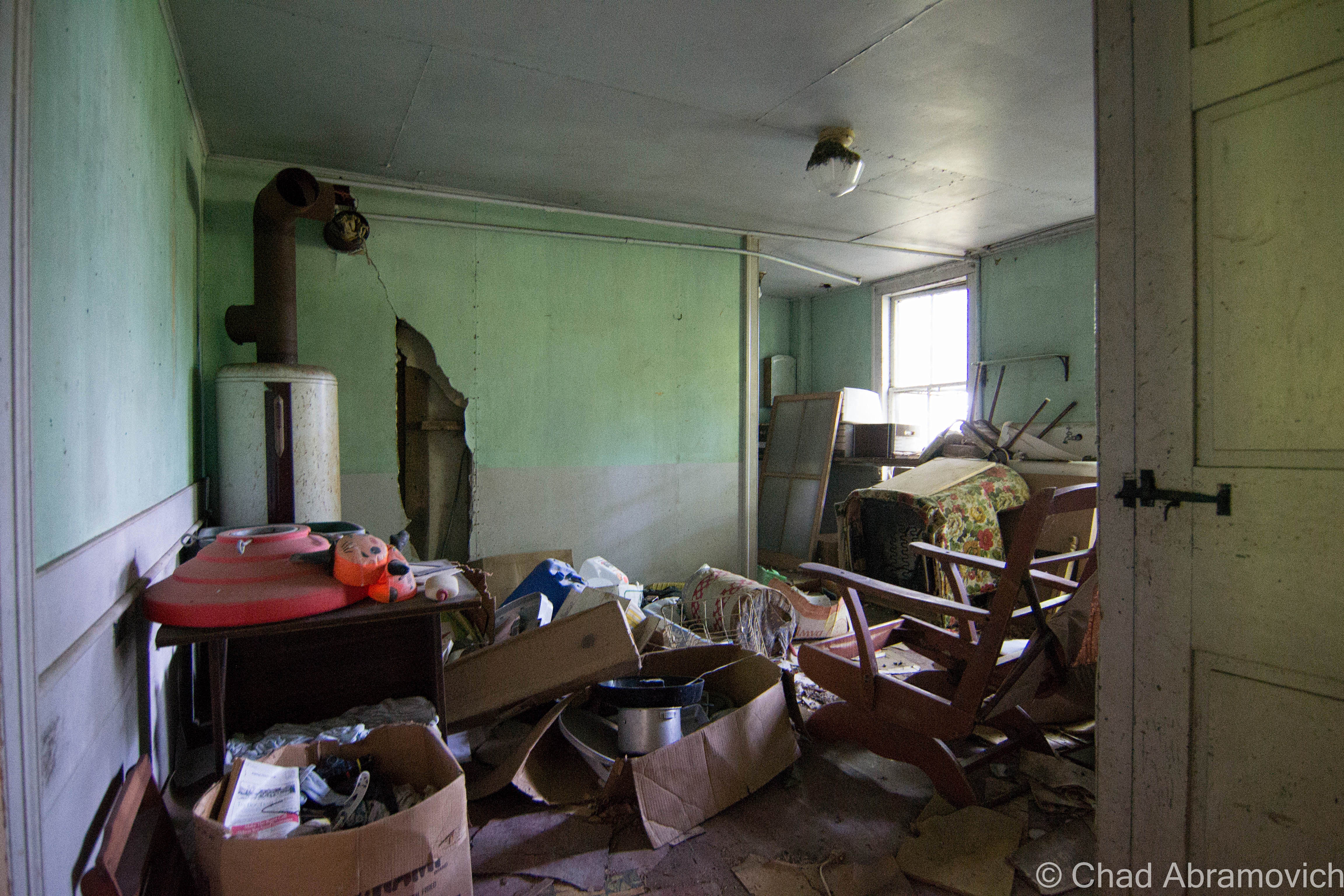
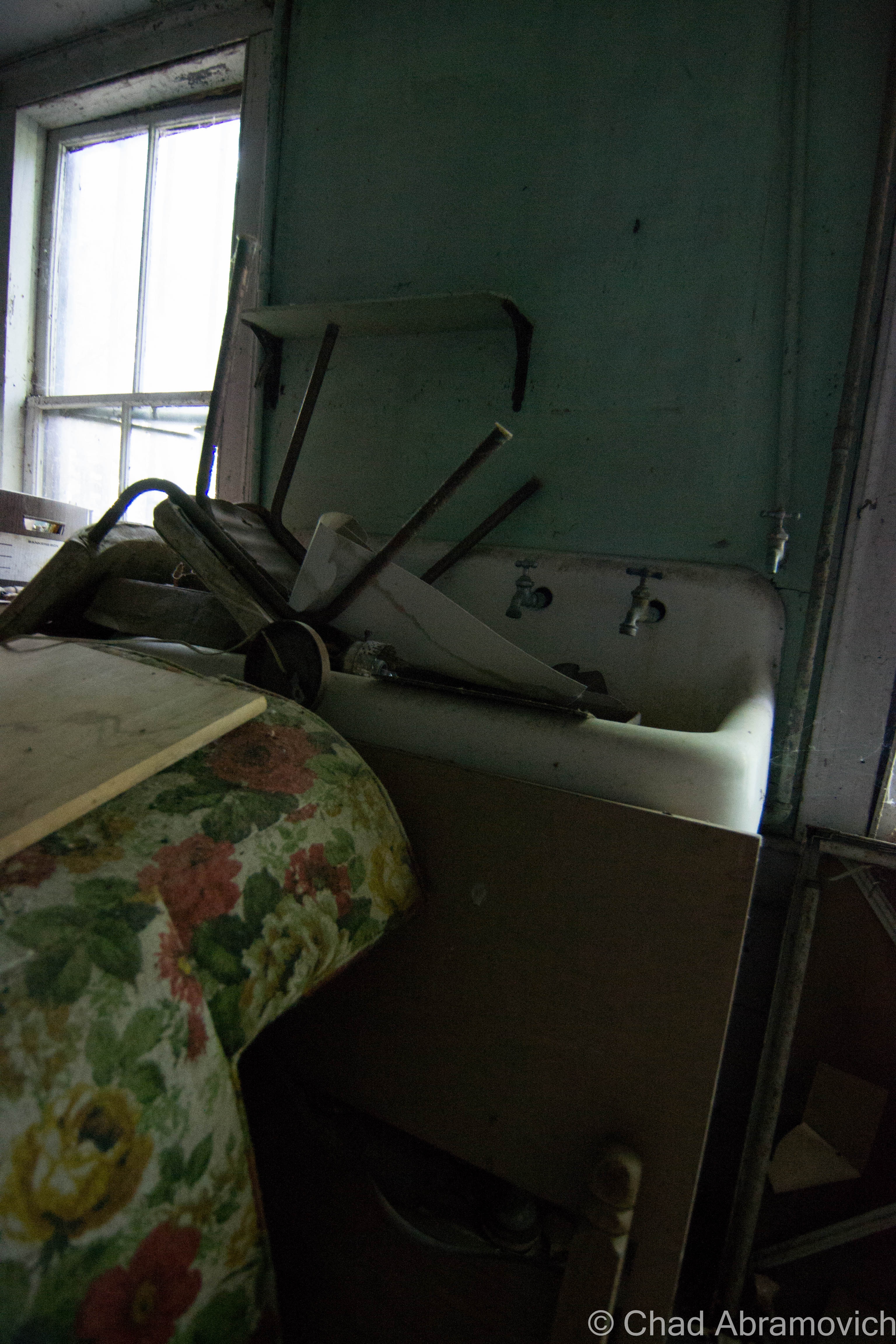
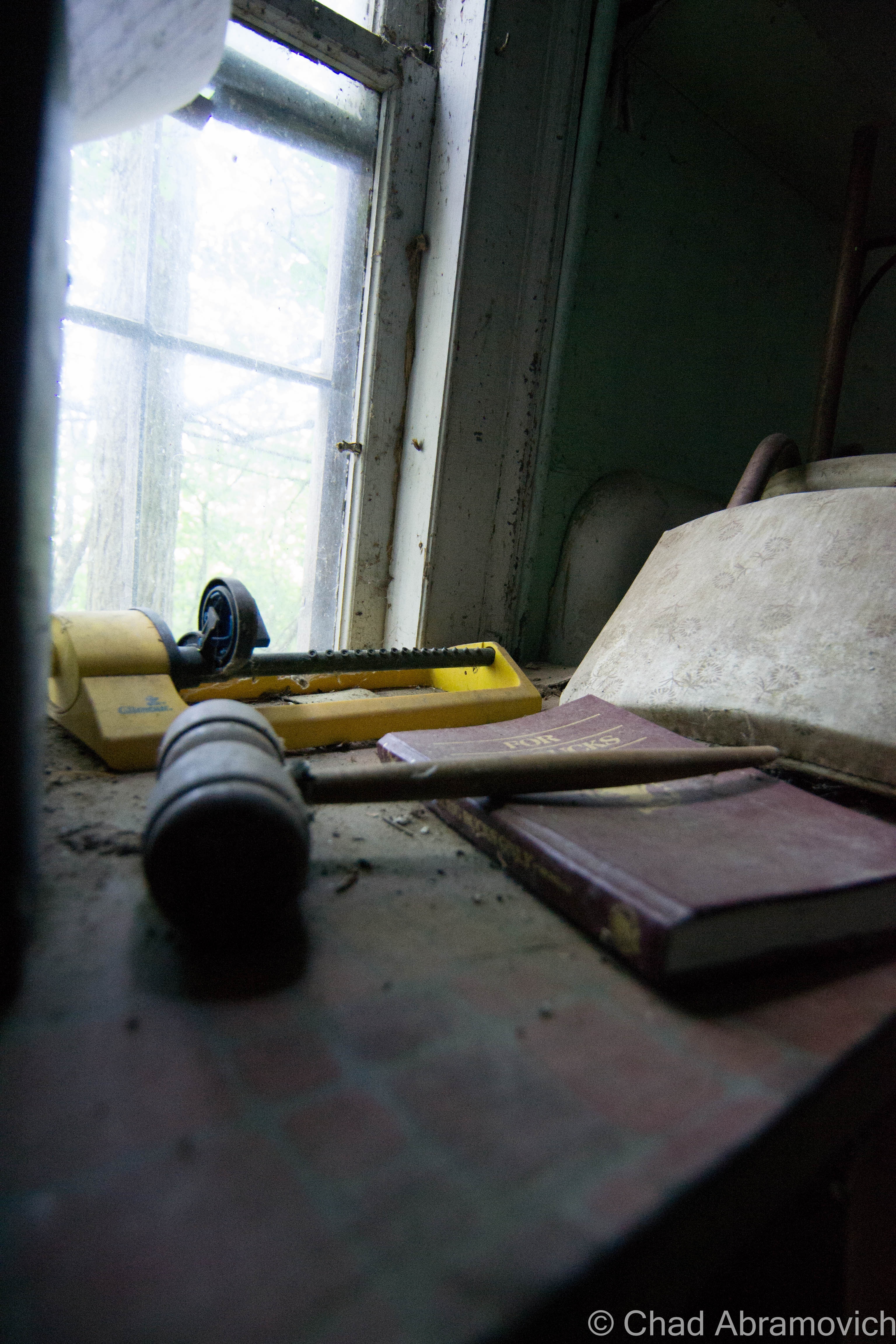
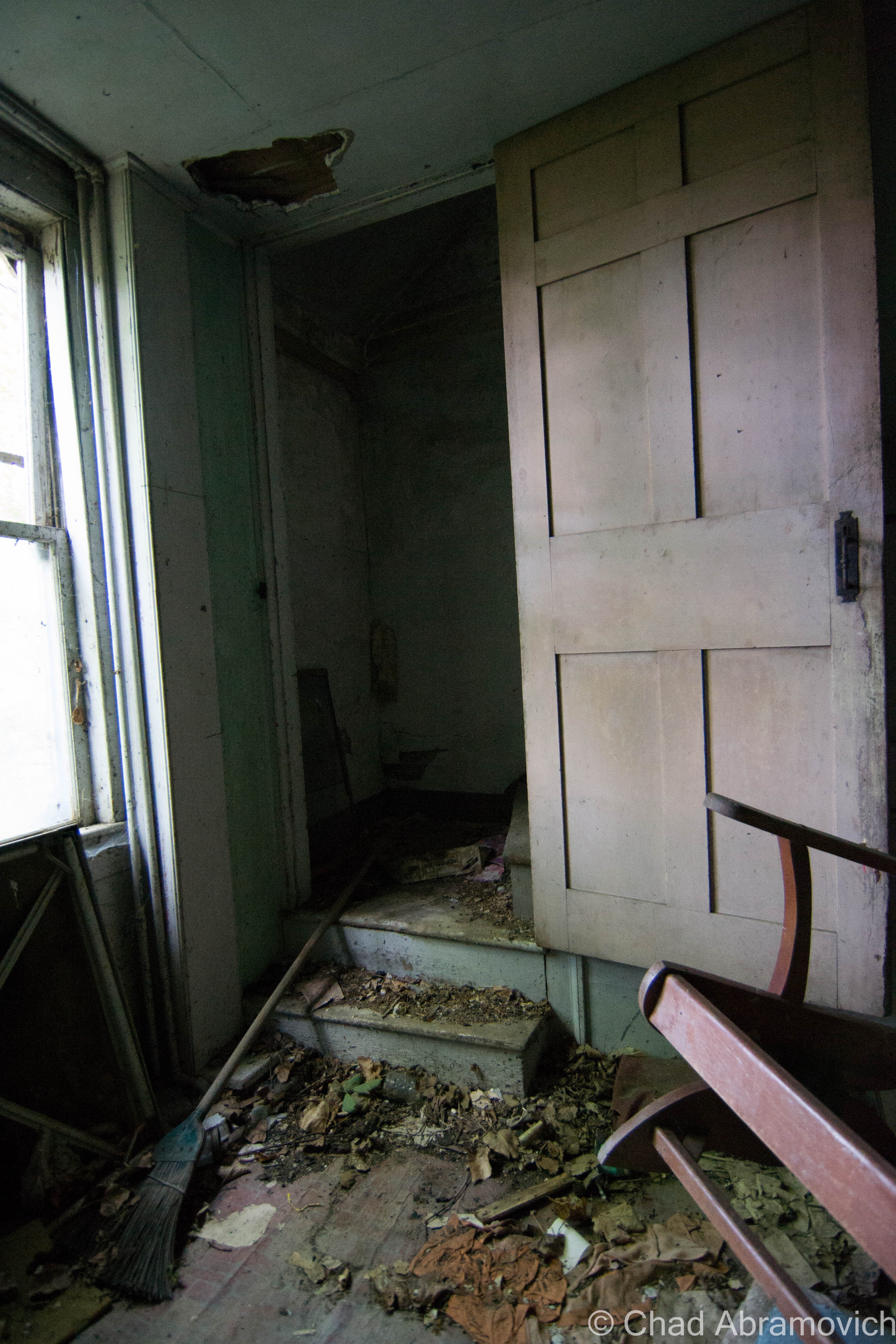

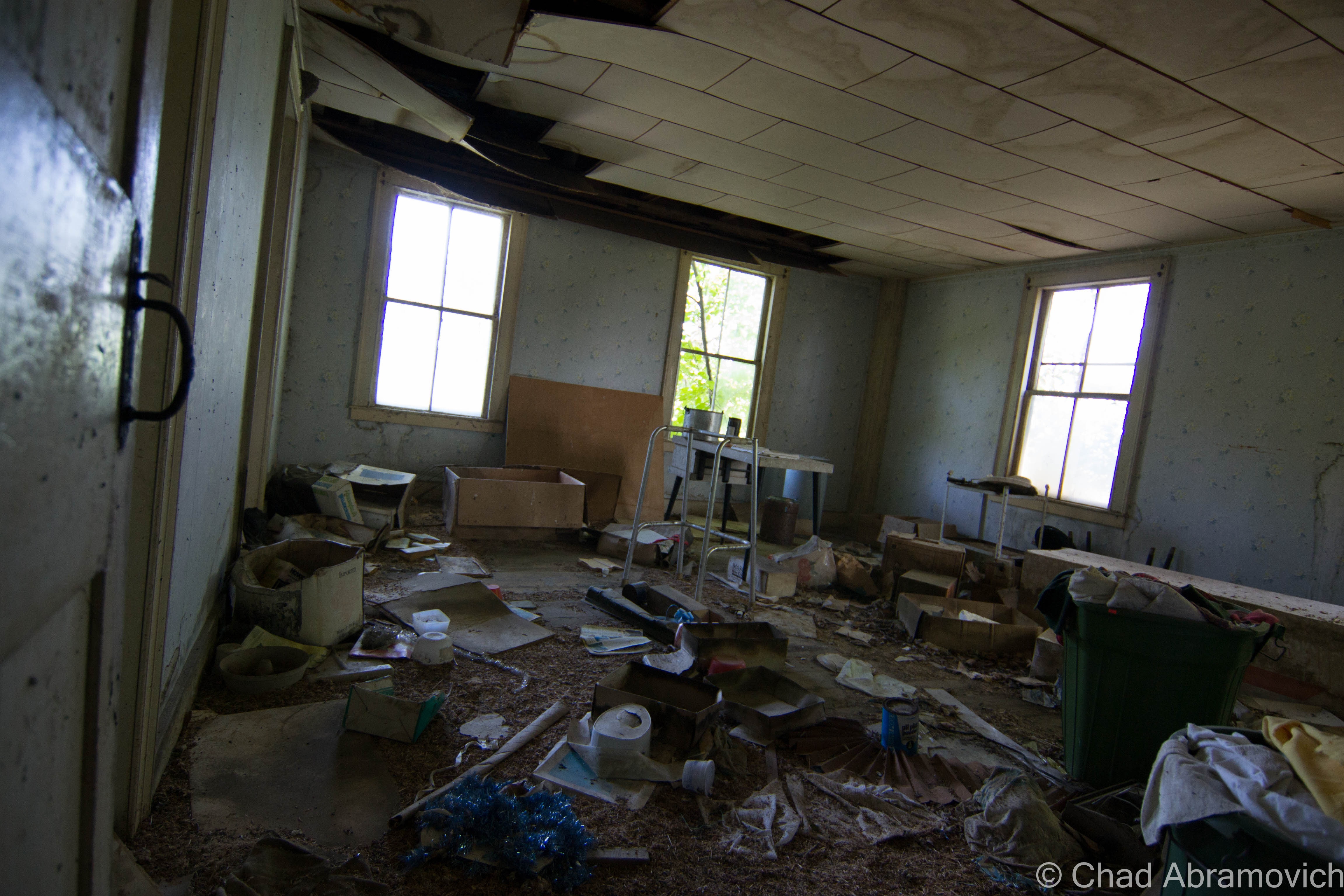
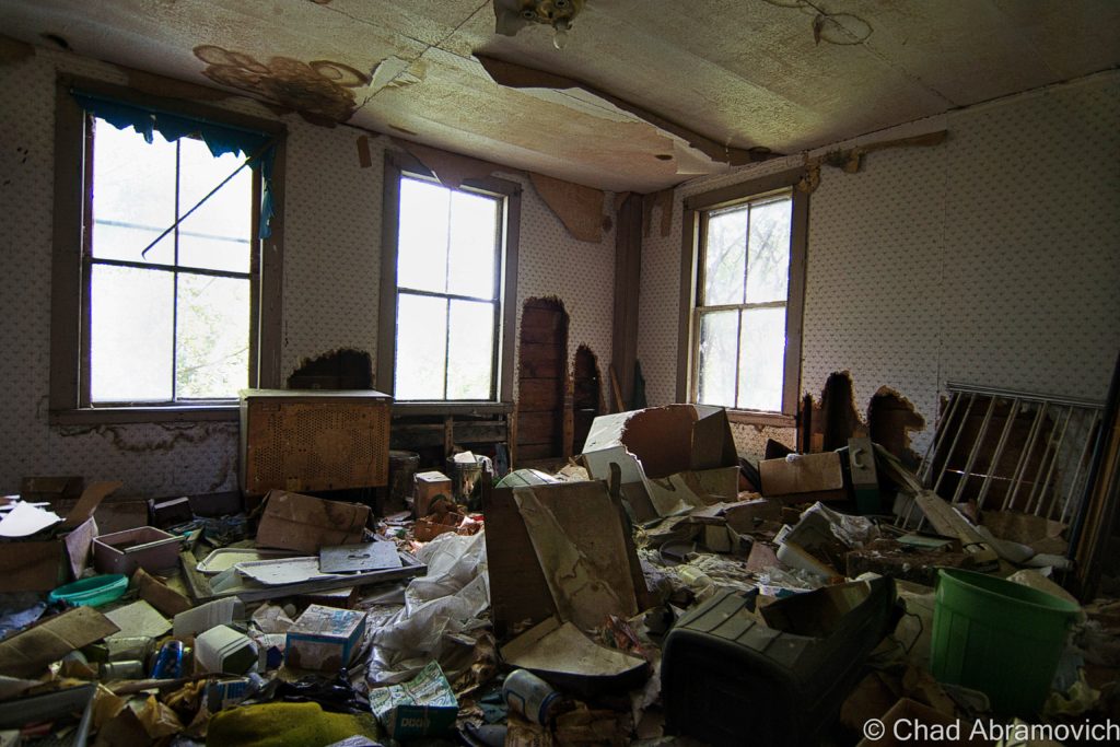
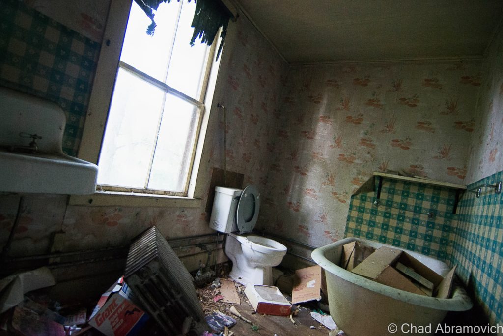
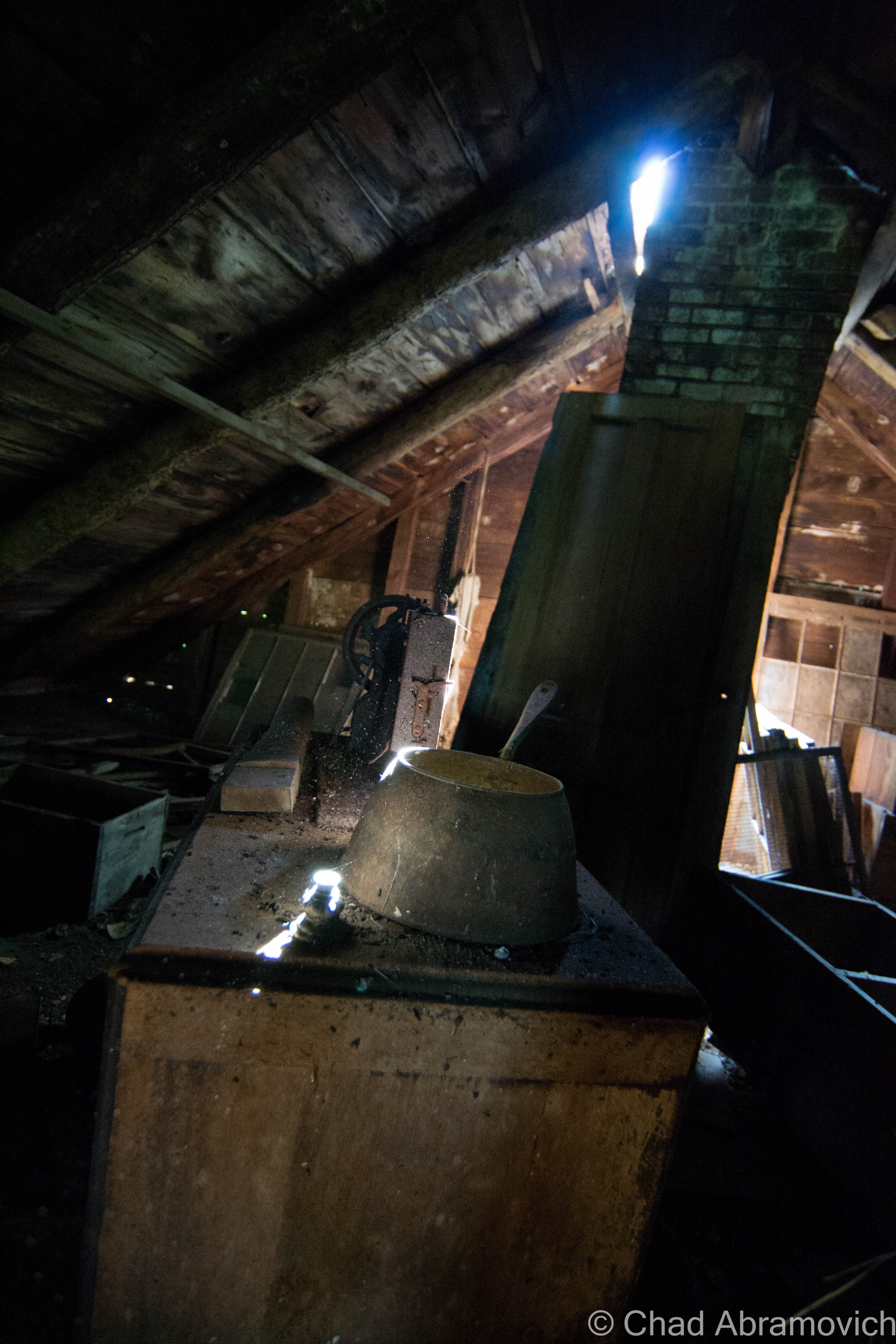
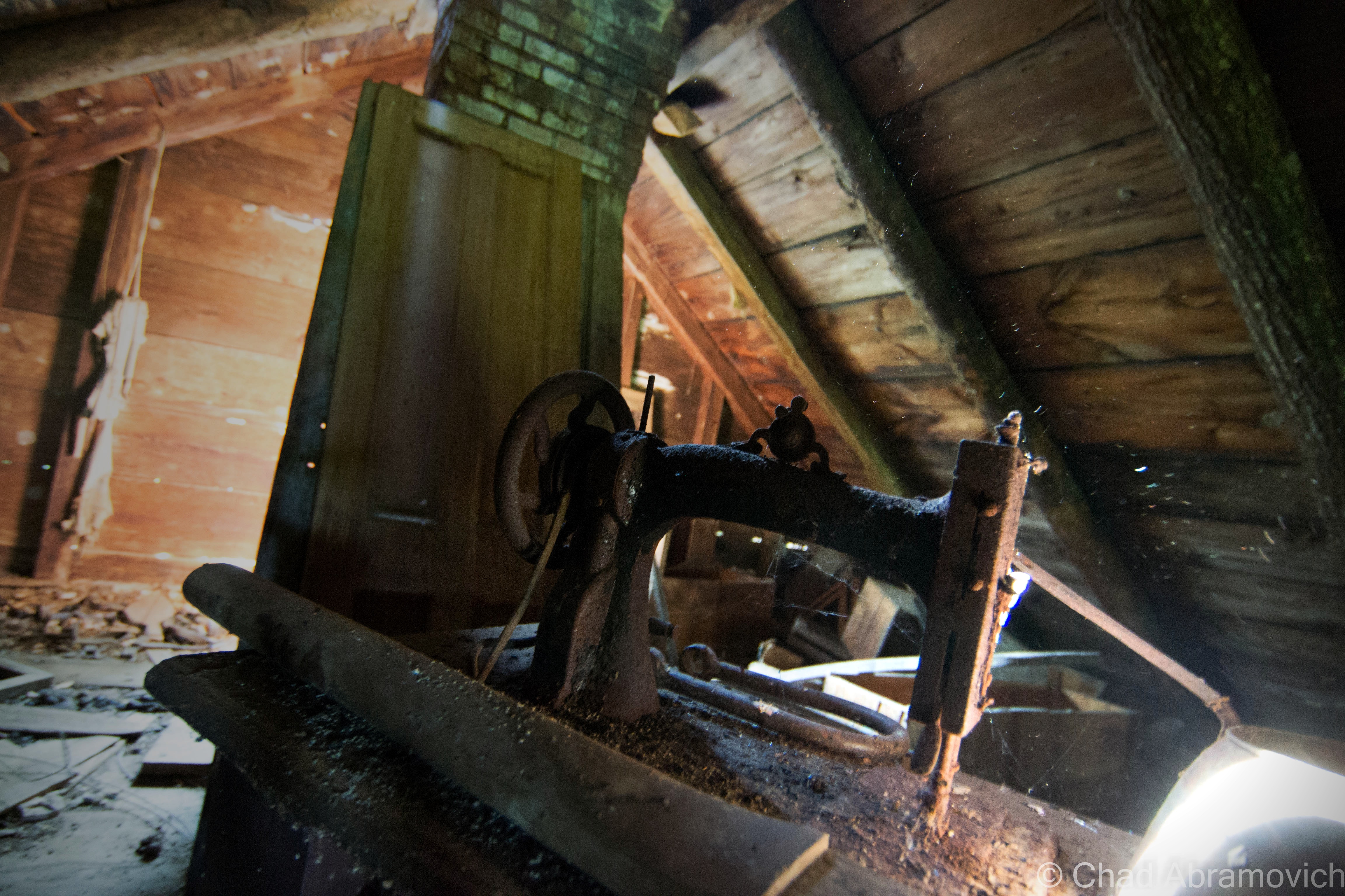
