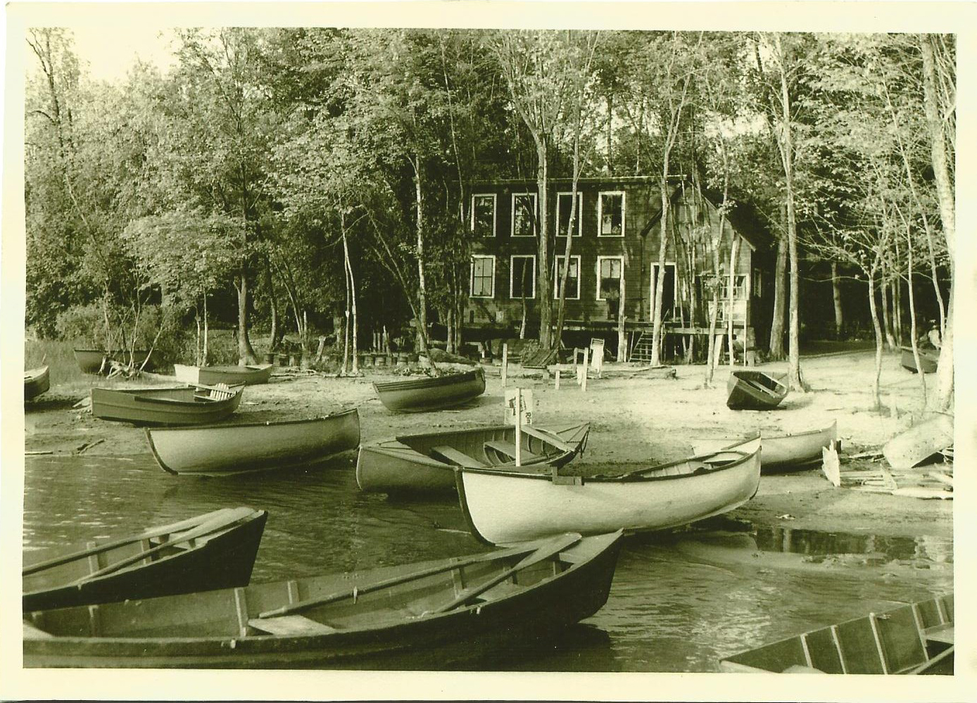
Auer Family Boathouse | Circa 1950. Photo from my family archives.
This is a peculiar tale I recall from my childhood. It was a cool summers night – late July, 1998. I was 10 years old and was spending the night at my Grandfather’s boathouse, situated on one of the most splendid locations in all of the state. Located where the Winooski River meets Lake Champlain in a sandy delta of twisted Cottonwood Trees and fragile swampland in the eye of Burlington’s aching heart, The Auer Family Boathouse is a historic relic, built during simpler times and witnessed Burlington and Colchester change around it. It played an unassuming role in notable events such as prohibition (my great grandfather made bootleg whiskey in a still there) and witnessed the transformation of the Island Line Railroad into the now landmark bike path – as bicyclists and tourists soon replaced the traditional fishermen as customers and visitors as the years and its youth passed on.
It was past 10 PM and a surreal oily blackness slipped over Lake Champlain, the waters and the night sky were indistinguishable from one another. But every now and then, the creaks and groans from the wooden docks rocking gently in the water assured any living soul that the lake was still there.
On the front lawn, my Grandfather had 2 large wooden swings which over looked the lake, and were a very pleasant place to sit and relax, swinging gently in the shadows of the night’s song. It was on one of these swings where my 10 year old self was that very night, my Grandfather sitting next to me enjoying random conversation while a gentle breeze blew through the Willows above our heads.
But our reverie was interrupted when our gaze was drawn across the lake. On the distant shores somewhere near Port Kent, the silhouettes fell apart as a giant ball of fire was suddenly propelled from the terra firma rapidly into the New York skies above. It’s light was brilliantly bright as it soured into the lonely night, now far above the ground below. We both watched and held our breath. Then, it simply disappeared. No explosion, no firework finale, nothing. It’s journey was short, it lasted less then 5 seconds at the most. I knew enough to know that it certainly wasn’t a firework. So what was it?
“Did you see that?” my Grandfather asked me, confusion in his voice. I told him I did, but had no answers. And to our surprise, it happened again! Another ball of fire shot straight up from the ground and into the atmosphere above, where it simply fizzed out. This time, I was able to get a better look at it. From where we were standing, on the Vermont side of the lake, the mysterious flying object seemed to be as big as a basketball, and was launched at incredible speeds. It’s bold brightness illuminated the shadows around it, it’s flames being shaped by the winds its fast velocity created, and then simply vanished effortlessly as if it never existed.
“Have you ever seen this before?” I asked my Grandfather. Surely someone who had spent his entire life living near the lake would have some answers, but he had never seen it before and had no idea what to say. Once again, the familiar ball of light shot up again for a third time and followed the same routine. After 7 times, the phenomena stopped entirely, disappearing into memory.
So what did we see on that cool summers night? Some sort of failed fireworks attempt? An arcane home experiment? Or maybe it was something more secretive – perhaps carried out under the orders of Plattsburgh’s military personal? But the base in Plattsburgh had been decommissioned for years by then.
To this day, neither of us have any answers. We asked some of my Grandfather’s neighbors, as well as some friends of mine who live near the lake, and some friends who lived on the New York side of the lake, and not only did they not have any answers, but no one else reported seeing it. The American Meteor Society had no reports or mentions either. It was like that mysterious ball of fire never even existed – and I have never seen it since.
—————————————————————————————————————————————–
To all of my amazing fans and supporters, I am truly grateful and humbled by all of the support and donations through out the years that have kept Obscure Vermont up and running.
As you all know I spend countless hours researching, writing, and traveling to produce and sustain this blog. Obscure Vermont is funded entirely on generous donations that you the wonderful viewers and supporters have made. Expenses range from internet fees to host the blog, to investing in research materials, to traveling expenses. Also, donations help keep me current with my photography gear, computer, and computer software so that I can deliver the best quality possible.
If you value, appreciate, and enjoy reading about my adventures please consider making a donation to my new Gofundme account or Paypal. Any donation would not only be greatly appreciated and help keep this blog going, it would also keep me doing what I love. Thank you!
It was an icy Winters day as me and some friends drove through the Champlain Islands; destination unknown. It was one of those situations where we were seeking a place to explore, hoping to find some inspiration and intrigue in the brown fields burned by the harsh blue skies. In the Winter, the Champlain Islands loose the comfort and allure brought with the Summer months, vanishing with the shivers and darkness of the later half of the year as if it were a completely different place.
Not having any real luck in the islands, we crossed the Alburgh bridge into New York, the sturdy ruins of Fort Montgomery were not being pitied by the season as they were battered by the choppy and relentless waters of Lake Champlain.
For a region with such an extraordinary history and important connection to the rest of the country, a surprisingly large amount of it has been buried (metaphorically and literally), the occasional historical marker is scattered across the geography, hinting at what once was.
Rouses Point, New York has always been a heavily trafficked locality thanks to it being a portal into Quebec. It’s where the dotted border lines of New York, Vermont and Canada all meetup, as well as Lake Champlain and Quebec’s Richelieu River, which were the area’s original super highways before the interstate systems were built.
Automobile, rail and boat traffic is all siphoned through the gateway community, and because there are always nuances, that also includes the more illicit of things, like rum runners, smugglers, the underground railroad, and a few wars fought by the British and the Americans skirmishing on Lake Champlain over the past hundred years. Seriously, Rouses Point was such a noteworthy place that the feds financed a fort to be built at the mouth of the Richelieu just in case British troops wanted to invade us through Canada. Only, the United States was a much younger nation then, which meant that no one knew exactly where the border was, and the fort was accidentally built in Canada, later returned to the U.S, and never actually used. It was eventually partially salvaged for parts, and a lot of the small village was built up with the bricks, stone and wood salvaged from the brawny structure. From what I was told, the present day village offices were built on top of a former prohibition era dumping site of all the paraphernalia that was confiscated. Today, a drive through Rouses Point is mostly simple wood frame houses, moored sailboats and a Dollar General, a ubiquitous find in Upstate New York.
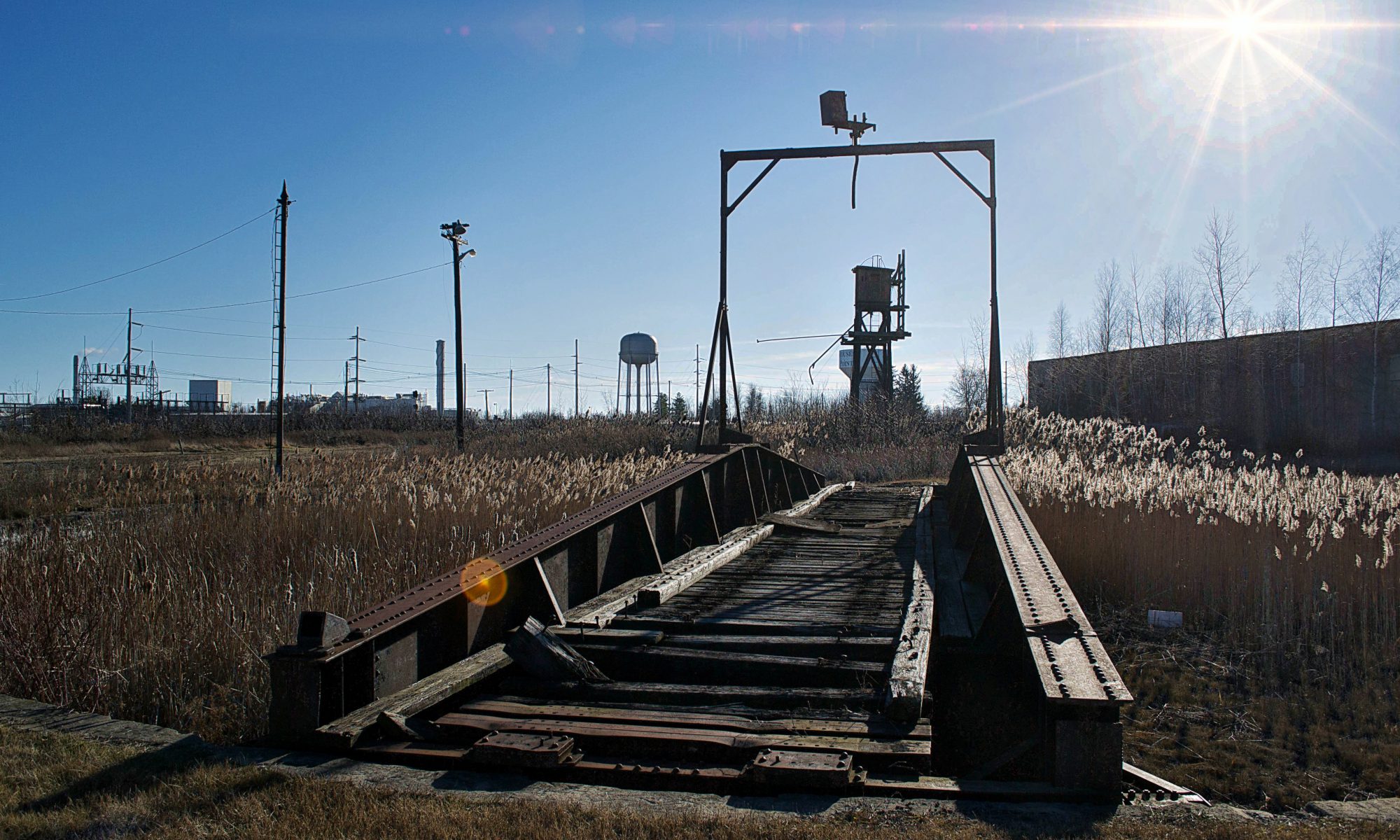
The village really did well for itself when the Delaware and Hudson Railroad decided to build passenger and freight facilities here and a rail yard to accommodate. Though Rouses Point is a pretty obscure community overall today, just outside the village limits are the remains of the oldest and last remaining Delaware and Hudson roundhouse turntables. Being battered by fierce winds, our trip here was short as the numbness in my hands began to outweigh my increasingly diluted curiosity. What can I say, I hate the cold.
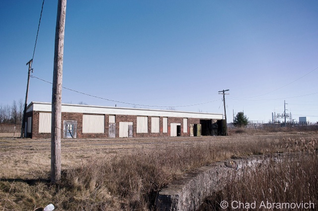
This building was formerly used for washing down the rail cars
Interestingly enough, most railroads, the D&H included, didn’t bother to wash their steam locomotives. Every so often, they would go over them with a mop soaked in kerosene to make them shine, but that’s about it. Roundhouses were built in the steam era as a way to store and maintain the locomotives, as well as repair and prepare them for their next trips. Other buildings on the site would be a coach shop, which was used to repair passenger stock, a cooling tower which was used for fuel, water tower for water, and in some cases a freight house where less than carload items were sorted and shipped out.
So, what is the reason that so many roundhouses are now abandoned? In short, diesel engines need much much less repair than steam engines. When the steam engines faded away, so did the roundhouses.
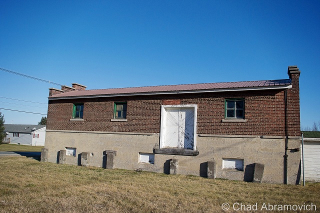
This building was used for holding freight.The original roundhouse
Alburg is a 45th parallel town, and one of a handful of Vermont communities that have found themselves in a weird moniker contention, where the United States Board on Geographic Names decided that they needed to standardize place names around the country in 1891. Every city or town ending in ‘burgh’ had their H dropped, pretty much so the mail would go to the right places and to make them easier to write on federal documents.
Well, over a hundred years later, a few Vermont towns decided that the dropped consonant was something to get up in arms about, with a few bringing it back, and the other few not caring that much.
Back across the bridge, in the pancake flat farmlands of the Champlain Island archipelago, the landscape is dotted with trailers, sagging farmhouses done in vinyl siding, and silver silos that reflect the coarse December sunlight from their gleaming surfaces.
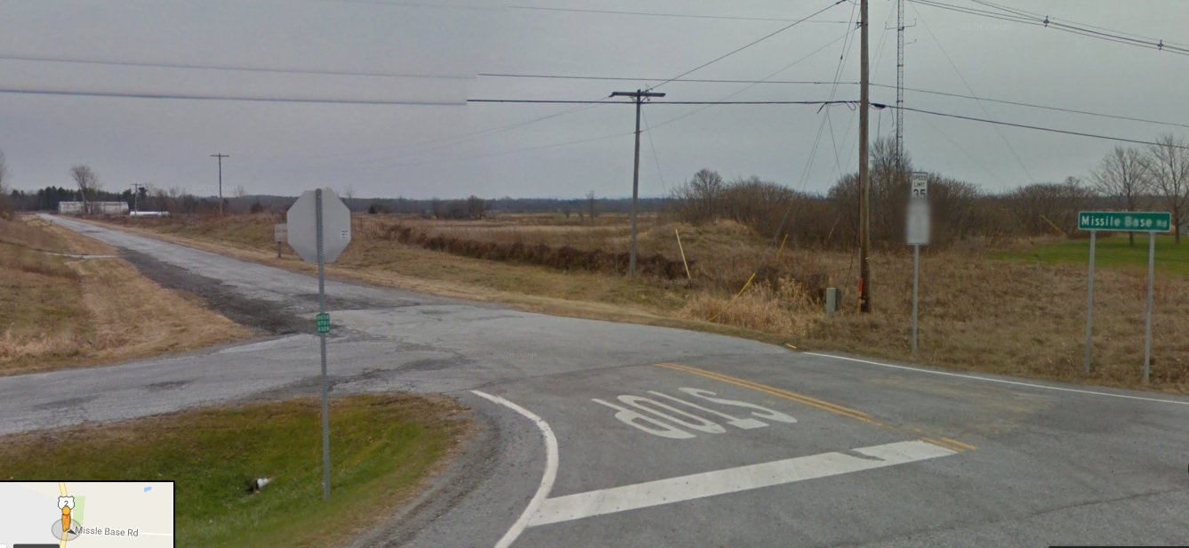
There is a rural road off of Route 2 called Missle Base Road, a moniker that supports the notion that this cul-de-sac is different from other Alburg byways . Whether or not it’s misspelling is a VTrans blunder or intentional, it’s sort of a weird road name in a region that only has a sheriff to bring down the law. That street sign is overshadowed by a much larger and more intimidating sign. In fading lettering, it sort of reads “Stop! Authorized Personnel Only Beyond This Point” in attention grabbing orange, while even more faded text behind it once read “Town of Alburg” (spelled without its H)
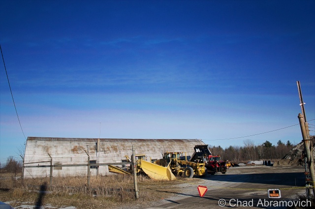
A drive down bad tarmac puts you dead ending in front of 2 rusted Quonset Huts, a chain gate, construction equipment that has seen better days and a dune of road salt. You’re looking at the Alburgh town garage!
But the Quonset Huts give its past away. Underneath the salt pile is the reason for the huts construction; an atlas missile silo.
This is the site of one of Vermont’s 2 nuclear missile silos. But you’d never know it. Towards the back of the property, a rusting pile of junk and a dune of road salt sits on top of the closed silo bay doors, each concrete door weighing 45 tons, enclosing the dark dripping confines of the flooded silo below.
Peering down the silo today would be a wondrous gaze into man’s eternal battle with evil and glorious ruin, but if you had peered down this shaft in the early 1960s, you would have been gazing at the tip of a nuclear missile.
In the 1960s, the military was scrambling to build defenses against the potential of a nuclear apocalypse that the Soviet Union was scheming, with the Soviets doing the same thing with the role of the villain reversed. The Army Corps of Engineers constructed 12 sites in a ring around the Air Force base in Plattsburgh — 2 in Vermont, 10 in New York, and absolutely no expenses were spared, with each site costing between $14 and $18 million to build, each one coming with a brazen claim that each could withstand a direct nuclear attack.
But these mysterious and aggressive projects were quite a feat to build. Many workers died during their constructions, with urban legends reciting that some unfortunate souls became entombed in the concrete silo walls they were hired to produce. The thought of the cold walls and dark depths of the missile silo as someone’s last vision is an image is a poignant one.
Ironically, despite the large expenses invested in these agents of destruction, the pulses of these missile silos were short lived, only active from 1962 until 1965, thanks to leaps in progressive apocalyptic technology. To add to the uncertainty, many were disputing afterward whether the missiles would have been able to hit their targets, and even be able to lift off the ground.
But they left a lasting impression on the landscape. However today, they hold contaminated waste and shadows smothered with valiant ghosts.
Each launch site constructed included two Quonset huts, a utility shed and an antenna that could detect a nuclear attack up to 30 miles away. The silo itself was 52 feet wide and 174 feet deep, encased in a shell of incredibly thick and durable concrete.
After their demise, the sites were abandoned. Ownership was now the burden of their communities, including this one, which was, uh, gifted to Alburgh, who turned it into their down highway department headquarters and dumped road salt over the perforation. Others were looted, some were sold to private investors and military enthusiasts. According to lots of testimonies over the intervening decades, most of them flooded to some degree.
Because everything has a market, interest in these intriguing properties has picked up in recent years, thanks to curious buyers who see the old silos as great “fixer-upper” projects, especially for private homes. But due to their deteriorating conditions, these sites require a buyer with a lot of money, patience and time. One of the former sites, in Champlain, New York was found and purchased on eBay. The new owner plans to clean it up and live in the remaining Quonset hut, and possibly in the launch control center. Taking his project a bit further, he has created an intriguing website which tracks his progress cleaning up the site, and gives everyone else a cool and rare look into these fabled locations.
Alburgh’s site wasn’t phenomenally interesting, but I still thought it was cool. I snapped a few photos of the Quonset Huts, because that’s more interesting than a photo of a pile of salt. I’m pretty confident in my assumption that the town won’t be opening up those blast doors anytime soon, so it’ll have to do. A town garage that doubles as a weird monument to humankind’s strange tendency to destroy itself.
As of 2015, it looks like the street sign was spell checked, but Google maps still uses the misspelled moniker for the road.
—————————————————————————————————————————————–
To all of my amazing fans and supporters, I am truly grateful and humbled by all of the support and donations through out the years that have kept Obscure Vermont up and running.
As you all know I spend countless hours researching, writing, and traveling to produce and sustain this blog. Obscure Vermont is funded entirely on generous donations that you the wonderful viewers and supporters have made. Expenses range from internet fees to host the blog, to investing in research materials, to traveling expenses. Also, donations help keep me current with my photography gear, computer, and computer software so that I can deliver the best quality possible.
If you value, appreciate, and enjoy reading about my adventures please consider making a donation to my new Gofundme account or Paypal. Any donation would not only be greatly appreciated and help keep this blog going, it would also keep me doing what I love. Thank you!
Why do remote and wild places captivate us so much? Maybe it’s because these inaccessible places don’t easily give their secrets or their history – forcing the curious adventurer to truly dig for answers (sometimes literally). Or maybe it’s because here, our imaginations run wild as we find ourselves detached from the modern comforts and the familiarization of our backyards. We seek these places for their inspiring beauty, and ask for the answers to our questions which burn in our veins of desire. Anything can happen out there.
Vermont’s mountains hold quite a few ghastly secrets. Perhaps the most well known story to come out of the Green Mountains is the legend of The Bennington Triangle and the now vanished town of Glastenbury. It was here on the wild slopes of Glastenbury Mountain where 5 innocent people dissapeared without a trace between 1945 and 1950 – no clues or remains were ever found, but the theories were more than plentiful.
I’d like to tell a story just as sinister and lesser known, in a place just as remote and wild. But this story is more gruesome because it can be proved, and its catalysts are human rather then paranormal – hinting that sometimes the most dangerous things on Earth can be ourselves. I’m especially fond of this story for it’s obscurity, and that it’s darkness happened near one of my favorite places.
Patch Hollow
The Long Trail travels north from Glastenbury, over the peaks of Southern Vermont’s Green Mountains, dips down and back up the steep gulf around Route 140, and descends upon a wild and desolate area above Wallingford called “Patch Hollow”.
Running in a north-south direction, Patch Hollow is a deep trench of land high in the Green Mountains, formed by the steep slope of Bear Mountain to the west, and the more gentle Button Hill to the east. In the center of this densely wooded bowl is a large swamp, its green waters occasionally protruded by the skeletons of dead trees that twist towards the Wallingford skies above. In 2008, the beaver dam broke with such a force that it sent a large wall of water plowing down the steep hillsides, carving a jagged gorge into the land and completely taking out a chunk of Route 140, the bafflingly large boulders that were transported down the hill still rest along the roadside today.
The power of Mother Nature is both awesome and awe inspiring, and Patch Hollow is indeed a wild place. I know this hollow personally, as I grew up hiking here and riding my 4 wheeler through the few trails that traversed the rough terrain (and are not for the inexperienced rider). But what I didn’t know at the time, was that there used to be a settlement here – one with a gruesome tale attached.
My first thoughts of any sort of community way up in Patch Hollow, far above the valleys amused me. Looking at the stark wilderness today, it seems almost unrealistic. This is where a lesson in Vermont history comes in handy. When towns were being settled, and the first roads were being cleared, often they were built through the highlands and the mountains because the valleys were prone to flooding and washouts. This means that at one time, Patch Hollow was on the main road through town. In the book “History of Wallingford, Vermont” by By Walter Thorpe, he writes that a settlement of at least 5 families once made their home here. But there are no clues that are left that would point to the bloody struggle that took place at here, not even a hint that civilization was once rooted in this sunny dale.
So what happened here? The story goes back to May 11, 1831. One of the settlements in the hollow was owned by Rolon Wheeler, a “man of violent passions and jealous disposition,” according to an account written in 1911. Wheeler was reportedly guilty of sexual acts with his wife’s sister — a situation that when was leaked, created a great deal of resentment from the community.
Some community members from Wallingford and nearby Shrewsbury were so resentful that they decided to go as far as form a mob – with the intent of tar and feathering him. The threats were made so publicly that Wheeler was forewarned and took measures to defend himself. He fashioned a knife from a large file and barred his door.
On the night of May 11, your classic angry mom scenario formed two parties from Shrewsbury and Wallingford, and set out for Patch Hollow for some justice. Equipped with jugs of rum, a bucket of tar and a sack of feathers, both parties made their way into the mountains. The party from Shrewsbury never made it – getting lost in the woods instead. Their pride damaged – the reality of getting lost over powered the want for vigilante justice, and the group returned home.
The Wallingford group didn’t share the same fate, and did arrive at Wheeler’s house. They eventually forced their way in by prying a hole in the gable end of the roof. Three men leaped into the house and struggled with Wheeler in the dark. Wheeler stabbed one man in the side and another was slashed an excessive amount of 14 times. The door to the cabin was unbarred and more people poured into the cabin. In the scuffle, someone was killed. The angry mob stopped being belligerent and went to get a better look at their prize.
But, in all the haste, they made a fatal, and rather embarrassing mistake. They killed group member and friend, Issac Osborne by mistake…Wheeler was nowhere to be found. After a few minutes of trying to comprehend the situation, the group noticed that a set of clothes had been strewn across the cabin floor. The picture was clearer now. Wheeler had escaped the hands of one of his attackers by wrestling out of his clothes, crawling under his bed, and prying up some floorboards before escaping beneath the house.
A moment of realization was then sparked under the watchful eye of the Patch Hollow shadows. The mob panicked, most likely all scared because they committed murder that night, and hastily fled the house. Later, Dr. John Fox of Wallingford would visit the scene, which he recounted as “the most terrible sight he could recall.”
By the light of a candle, Fox saw “the livid body of Osborne on the bed and cabin literally soaked in blood.”
After escaping his blood stained house, Wheeler decided that spending the night naked in the woods was a safer decision than venturing back into town. Before dawn he stole a shirt from a clothesline, walked to the Hartsboro section of town (now a ghost town and a road of the same name) and hid in a barn. Needing clothes, he spent part of the day crudely weaving a dress from rye straw he found in the barn, and then retreating to his sister’s home in Pawlet. But after all that, Wheeler was finally caught.
He was arrested and put on trial in a makeshift court held at the Baptist Church in Wallingford — the only building in town that could hold the crowds eager to watch the proceedings. In the end, he was found innocent under terms of self defense.
The mob who assaulted him didn’t get off so easily. Two of his attackers were fined $60 each,while three others were fined $40. Justice was served, just not in the way the angry mob had expected.
After the court hearing, something strange happened to Patch Hollow. Perhaps the tragic events of that chaotic night left its scar in the minds of everyone who partook, forever troubling the land. Or maybe it was just “bad for business”. After that bloody incident, Patch Hollow became abandoned shortly afterwards and to this day, no one has tried to rebuild it.
Today’s Patch Hollow is quieter, as the mountain forests reclaimed the land, the only visitors now are the countless hikers that loyally hike the Long Trail to get lost in the Vermont woods for little while, letting the wilderness and the solitude quell their thoughts.
How To Get Here:
Take the Long Trail North from the Route 140 trail head in Wallingford, or South from The Clarendon Gorge just off Route 103 in Shrewsbury.
Links:
For those who are further interested in The Bennington Triangle, there is a great documentary on the area’s history on Youtube
The largest lake entirely within Vermont’s borders, Lake Bomoseen in western Rutland County measures 9-14 miles long (depending on who you ask). It extends from Lily pad choked swamp lands in the small town of Hubbardton to the north, expanding into a broad center complete with an island, before narrowing into a slim passage way running just slightly below the interstate type highway of U.S. Route 4 to the south in Castleton.
And there is something compelling about this lake. Speaking to a few people about it along its shores, they all somewhat described they felt a strong pull to the lake – some sort of inexpiable connection of fondness towards it. And with the lake’s storied history with layers that are piled on more compactly than the slate piles crumbling into the lake on the west shore, it isn’t that difficult to understand.
(via CardCown.com)
The name Bomoseen is an Abenaki word which translates to “keeper of ceremonial fire”. The Taconic Mountains, which make up the rolling hills that run along both sides of the lake, are the slate-producing region of Vermont, and the area’s history parallels the rise and fall of Vermont’s slate industry. The area surrounding the lake contains several quarry holes and their adjacent colorful slate rubble piles as reminders of this period, many you can see tumbling down the western shores of the lake – a bizarre and stark contrast to the otherwise gentle landscape around it. Across the lake, you can still witness the overgrown cellar holes of the ghost town of West Castleton, a product of once prosperous times, now a landmark to what once was.
Weird Waters
If your into ghost stories, Lake Bomoseen have an interesting one. The story goes that one night in the 1800s, 3 Irish slate workers from West Castleton obtained a rowboat and decided to row to a tavern on the east shore to entertain themselves. But they never showed up. The next morning, their rowboat was found floating empty on the open waters of West Castleton bay, but no trace of their bodies were ever found. Locals say that on certain moonlit nights, the phantom rowboat can be seen moving effortlessly across the waters of Lake Bomoseen, making no disturbances in the water.
But if phantom rowboats don’t grab your attention, this mysterious body of water has a far stranger tale woven into its web of folklore. Towards the north end of the lake is a surprisingly undeveloped island (apart from an estate on the very southern tip). The island is long, densely wooded and rests a mere 30 feet away from the lake’s North West shore. But this island is known for something far more mysterious than its idealized lakeside real estate. It is here where Vermont’s entire population of giant rabbits are said to reside. As the name implies, they are distinctive because of their size, and more noticeable, their glowing red eyes. But how did the entire population of this elusive sub culture become to be contained on such a small island in Lake Bomoseen, and why?
I turned to Joseph Citro’s The Vermont Monster Guide for an explanation. In a pure Darwinian principle, they somehow hopped the 30 foot jump from island to mainland, and couldn’t get back. The bigger rabbits were the only ones who could make the jump, leaving the biggest of the big trapped on the isolated chunk of land in Bomoseen’s murky waters. What happened next however wasn’t so bizarre; they did what rabbits did best, and multiplied. As the years progressed, they became bigger and stronger. Legend has it that some have seen rabbits as large as Volkswagons and Saint Bernards somewhere amidst the dense evergreen foliage that climb the shores. But these rabbits are by no means new phenomenon. As a matter of fact, the Abenaki may have in fact told tales of these oversized rabbits on the island. And today, it is not uncommon to see curious campers and adventurers boating and kayaking around the island trying to catch a glimpse of these unique cryptids – and as far as we know, they are harmless. Perhaps it comes as no surprise that residents began calling the narrow landmass Rabbit Island.
If giant rabbits and rowboats piloted by unseen forces aren’t good enough for you, Lake Bomoseen has another surprise, one that is concealed by the largest existing entity on the lake – it’s waters. And if the legends are true, this will definitely bring you a dose of rigor…
Around 1986, a man and his wife were fishing on the lake in their seventeen foot boat, when they saw an extraordinary creature moving beneath the water’s surface. It looked like a giant eel. The description created a picture of something eight to nine inches in diameter, and an astonishing twenty feet long! Well – they said it was longer than their boat anyways. Not wanting to attract the USO with their fishing bait, they reeled in and headed quickly back to shore.
So, is there really a giant eel lurking beneath the waters of Lake Bomoseen? Surely something so massive and so distinctively intimidating would have been seen by others? Not so much. As a matter of fact, this was the only sighting I was able to dig up, meaning either it was a one time phenomena, something far more innocuous, or maybe, people are just keeping quiet about it. After all, Vermonters are pretty good about keeping secrets…
State wildlife biologists weighed in on this, and said that generally, the size of eels can vary greatly, but it’s entirely possible that they can reach up to around five to six feet in diameter and weigh around fifteen pounds, and, they speculated that it was entirely possible that larger ones could exist in larger landlocked bodies of water. But Bomoseen, the lake in question, well, they sort of left that answer somewhere in the smoke.
(via CardCow.com)
A Famous History
Lake Bomoseen has been drawing tourists to its shores long before the year round camps and state routes began to ring its shores. As early as 1870, Lake Bomoseen began to establish itself as a tourism getaway. The Johnson farm, on the north end of the lake was said to be the first location around the lake to began hosting summer guests around this time. To reach the Johnson farm, guests crossed a float bridge, which actually did float on the surface of the lake. Still referred to as the Float Bridge, it now does just the opposite of float, as it’s fixed sturdily to land with granite, concrete and steel. Just take Float Bridge Road, still in existence at the north end of the lake.
Over the next couple of decades, more hotels sprang up around the lake. Even the ruins of nearby Hyde Manor brought guests to the lake by stagecoach.
Over time, something else began to make their appearance along the lakeshore as well; summer camps. One of the most famous was on Lake Bomoseen’s largest island – the secretive and elite Neshobe Island, which had a reputation that helped establish the aura of mystery for exclusive clubs and societies.
Purchased in the 1920s by Alexander Woollcott, author, actor and New York Times drama critic, the cottage and island became a retreat for the Algonquin Round Table, a group of journalists, editors, actors and press agents who met regularly at New York’s Algonquin Hotel starting in June 1919. Summer weekends were said to consist of cocktails and croquet on the island with Woollcott as host, and catered to notable guests such as President Theodore Roosevelt – who could be seen landing his seaplane on the lake during his arrivals.
The island was said to be beautiful, with rolling topography, mixed woodlands and miniature meadows filled with wild flowers. While local Vermonters left the islanders to their own business, it was the tourists who tried to invade their privacy (or so the accounts claimed). That was, until comedian, film star, and visiting guest Harpo Marx put a stop to it. One day, as a boat full of rowdy tourists invaded the island’s private beach for a picnic, Marx stripped naked, smeared himself with mud, grabbed an axe and ran down towards the startled tourists hollering and making animal noises. They never came back.
Today, the grand resorts and private clubs are gone, succumbing to disastrous fires and the changing times, and the lake has given way to a more dominating landscape of summer camps and private homes. But the lake is still quite active, and is just as beloved as it was a century ago. An official stop on Vermont’s Stone Valley Byway, and lined by several beaches, a state park, a popular golf club and lakeside restaurant that offers dock side conveniences (after all, Bomoseen is a boating lake), Lake Bomoseen still draws several crowds that all share a mutual love of the lake, but undeniably, a lot has indeed changed.
Below is an interesting video of Lake Bomoseen’s history, if you are so inclined.
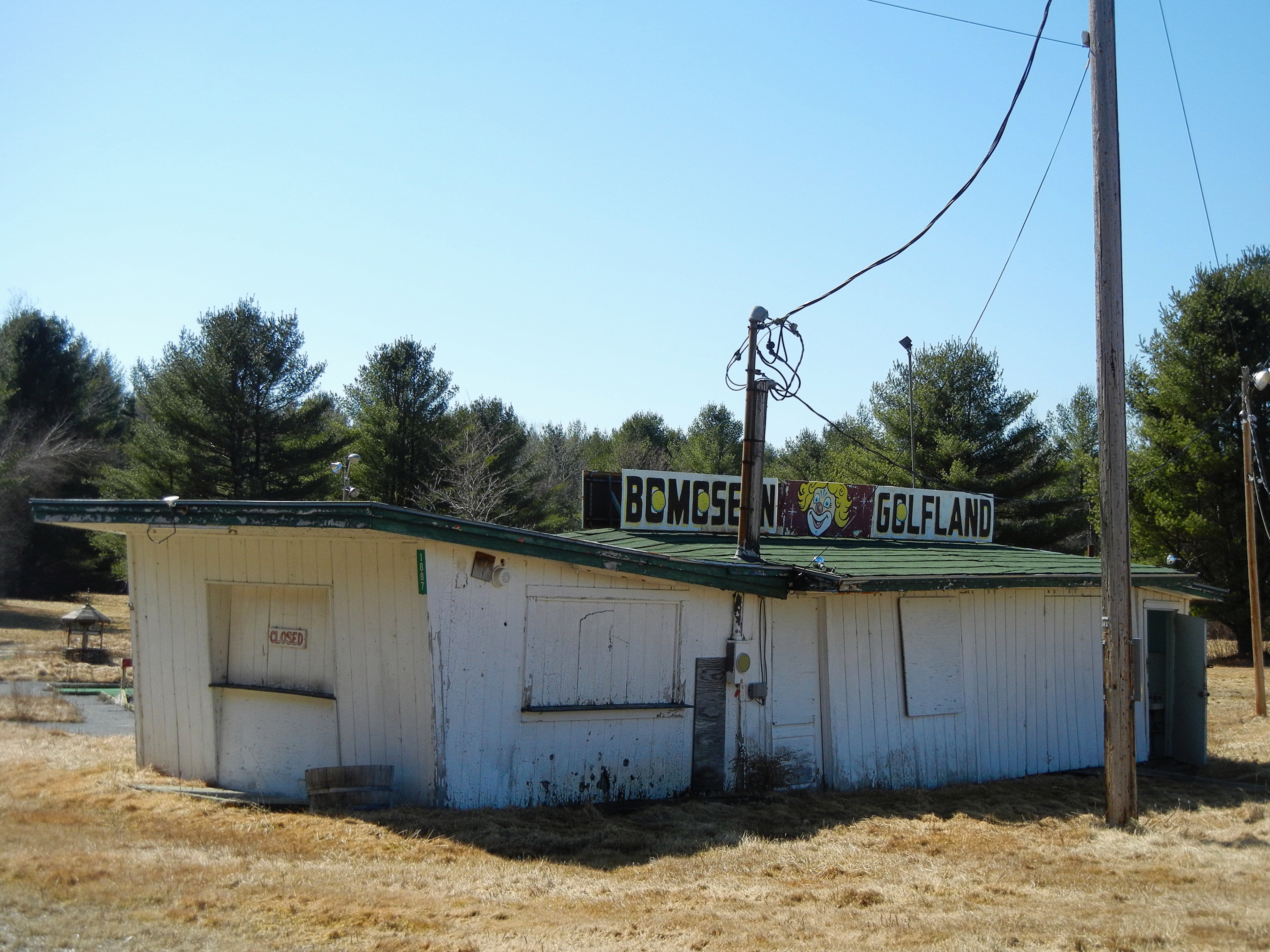
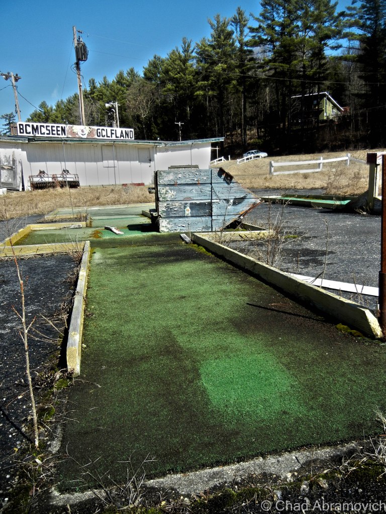
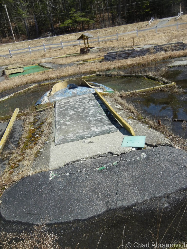
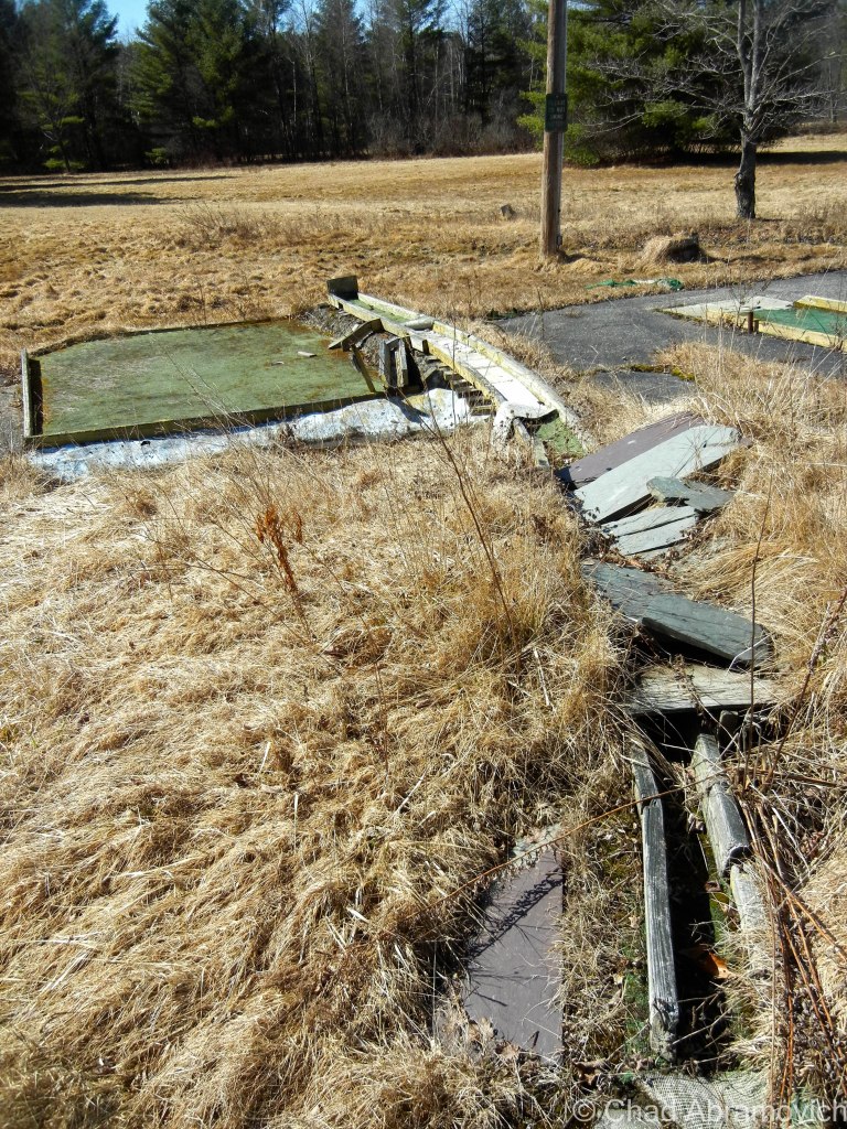
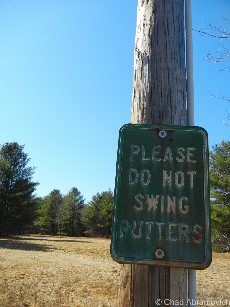
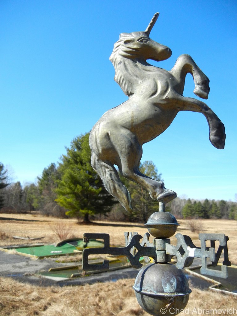
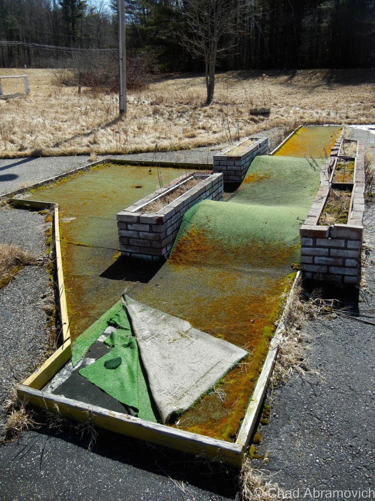
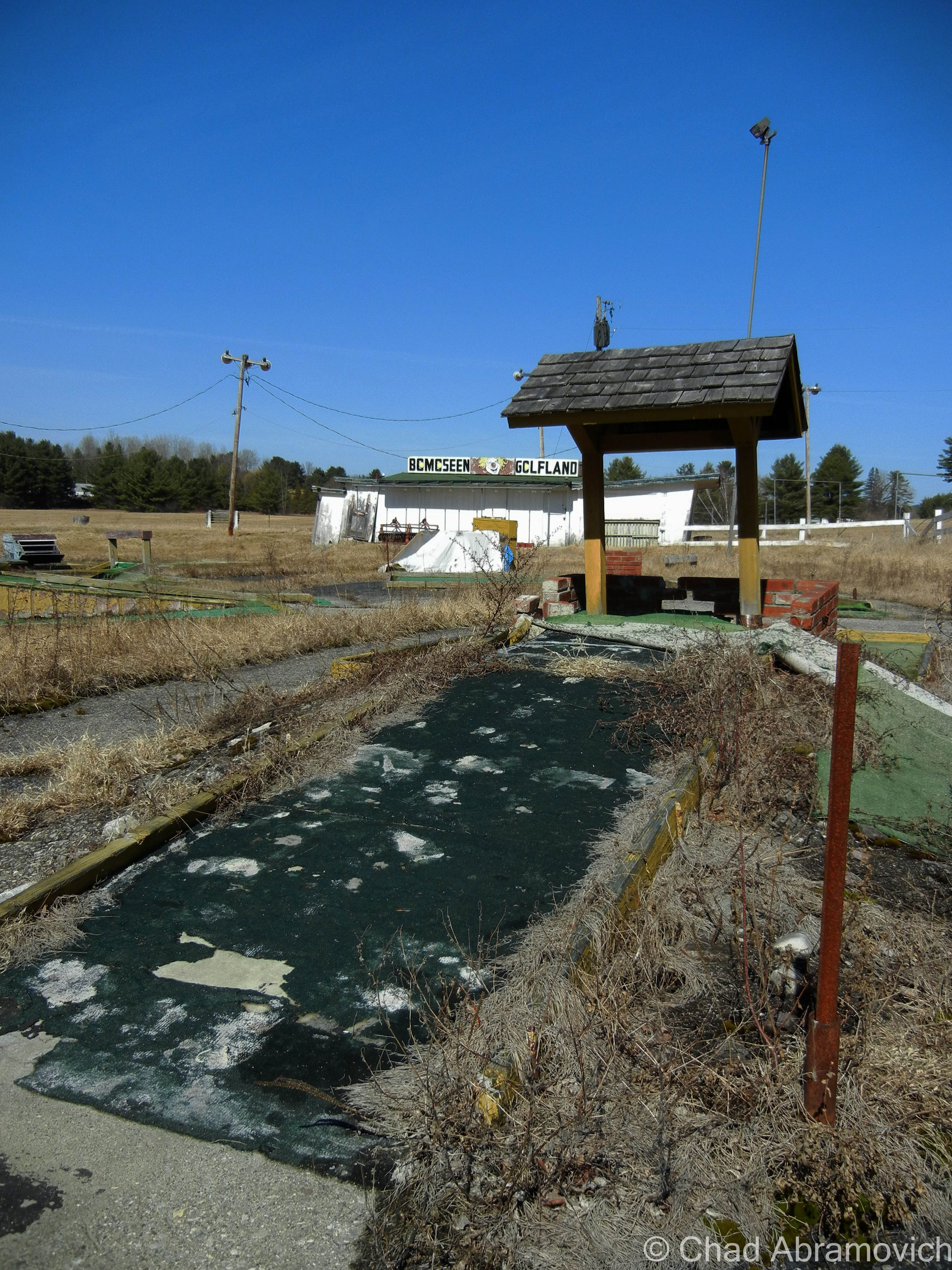
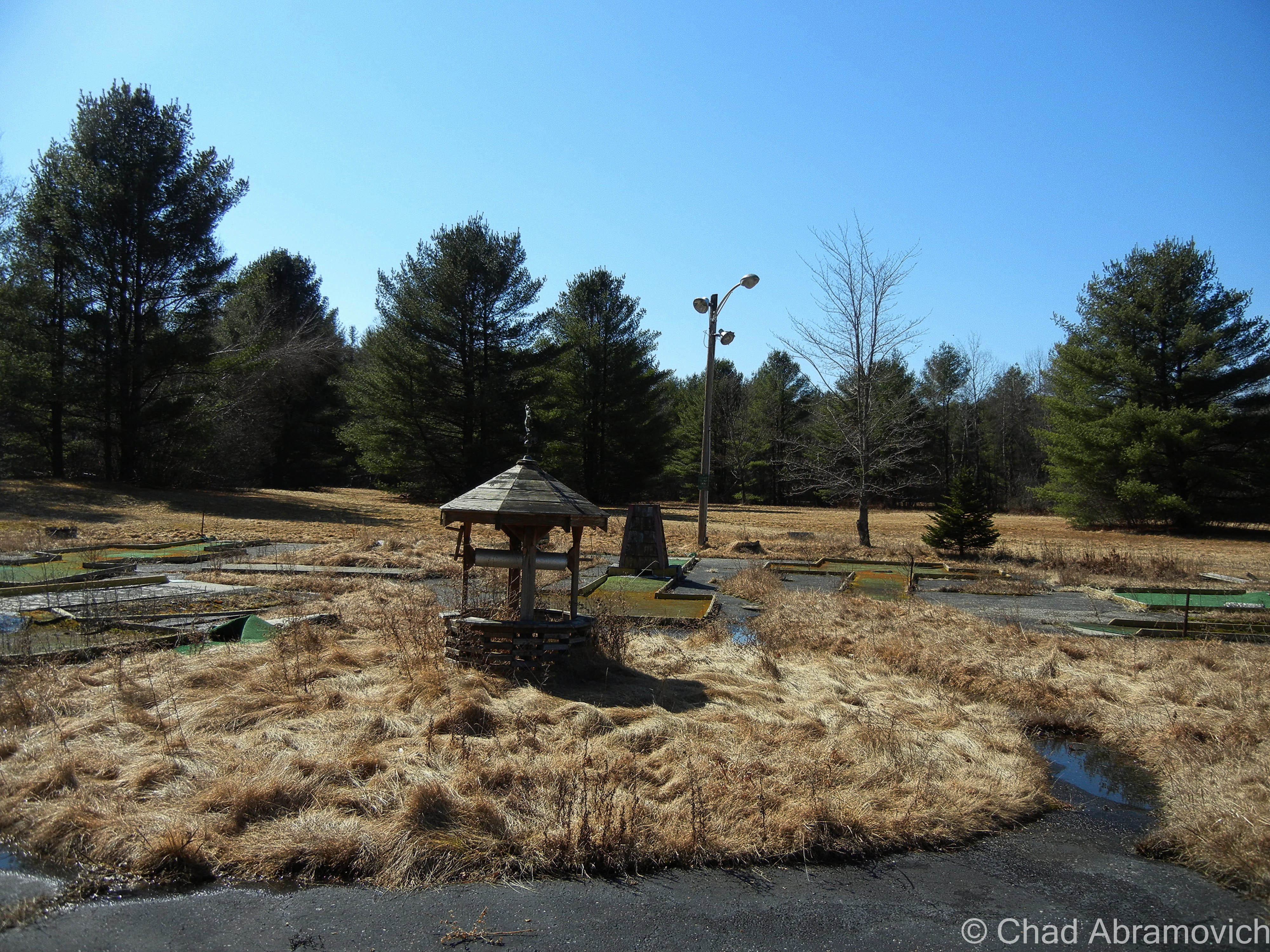
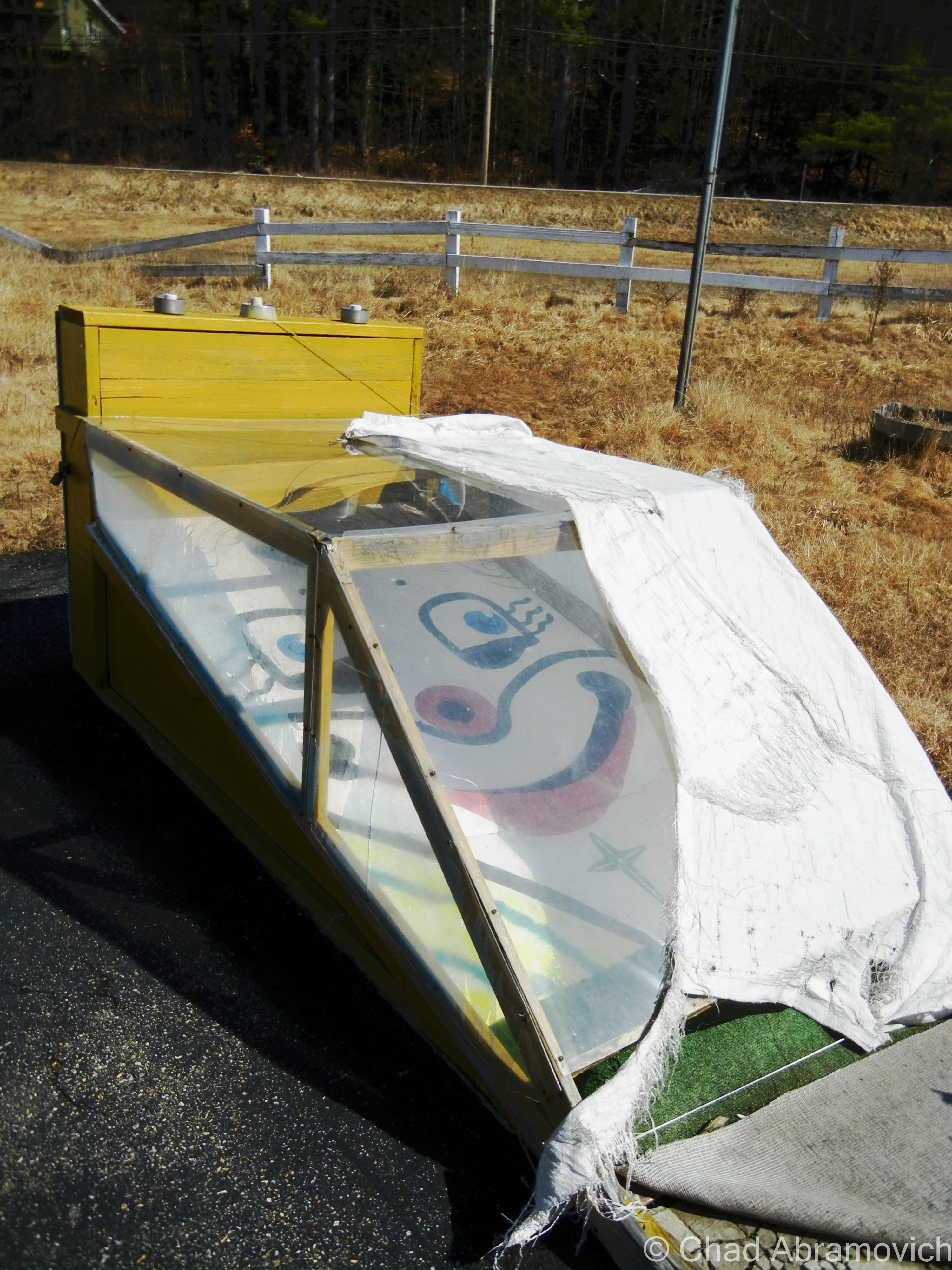
Just south of Lake Bomoseen, where the road breaks from the shoreline for the first time, and the landscape returns back to woods, is a small and rotting remnant of Lake Bomoseen’s tourism heyday of yesteryear – an abandoned mini golf place. The faded and weathered sign over it’s sloping rental building reads “Bomoseen Golfland” with a rather creepy looking clown as its official mascot, something that conjures more of an image of sinister intentions than a round of mini golf.
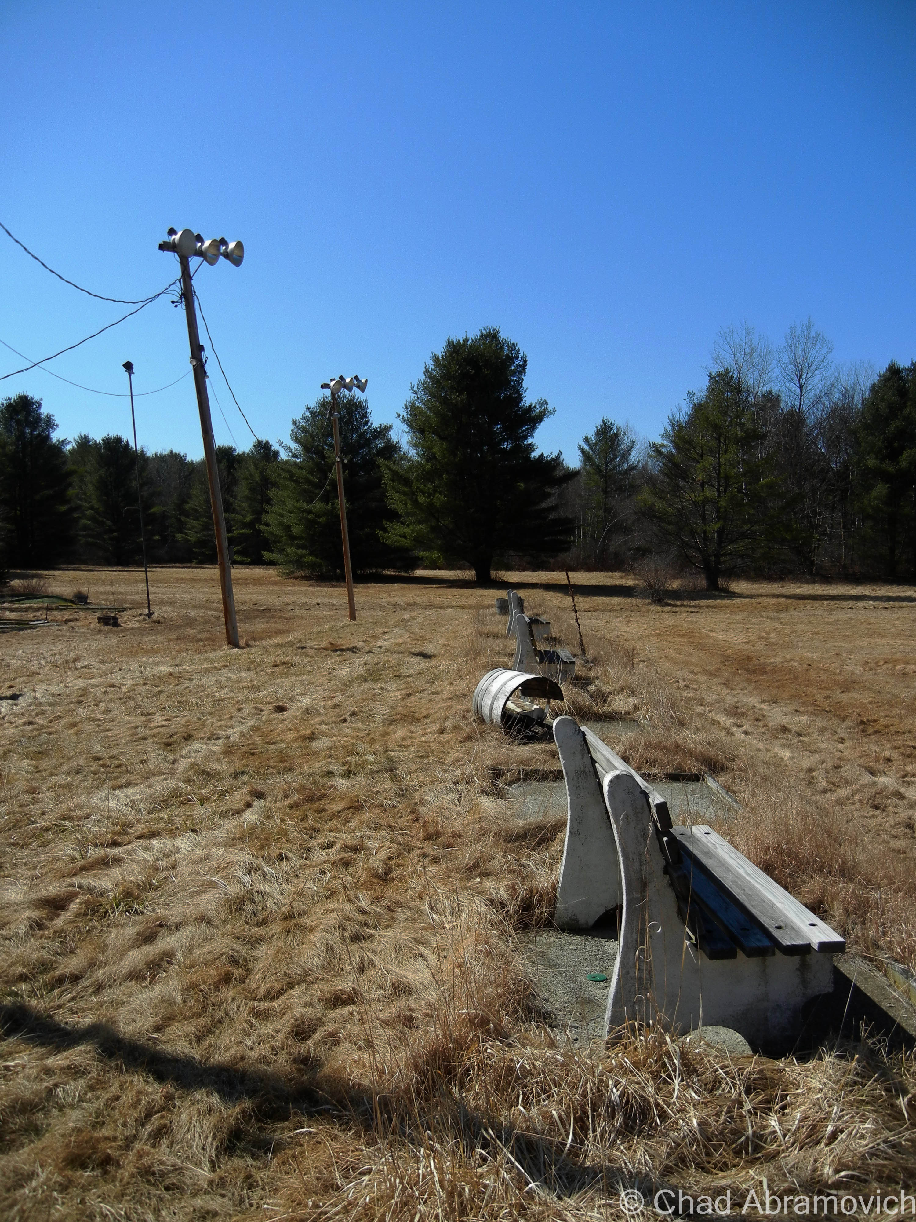
Though I don’t know any of the history behind this small mom and pop operation, it most likely functioned during the mid 20th century and provided passing tourists and summer campers with some cheap fun for a few hours, and closed when the region’s tourism trends changed. Today, the ruins can still be seen from the side of Route 30, now desolate, weed ridden and forgotten, the water logged AstroTurf’s awkward green color a sort of gross presence to the otherwise natural landscape around it.
Overall, I spent a total of 10 minutes wondering the moldy grounds of Bomoseen Golfland. It wasn’t the most interesting place I have ever visited but it was creepy enough. The dilapidated wooden building with its peeling paint sat underneath a sky of broken lights, smashed over the sad remnants of each mini golf obstacle. But it certainly is a monument to classic roadside Americana and a simpler time. And for that, I’m thankful I had the chance to visit.
—————————————————————————————————————————————–
To all of my amazing fans and supporters, I am truly grateful and humbled by all of the support and donations through out the years that have kept Obscure Vermont up and running.
As you all know I spend countless hours researching, writing, and traveling to produce and sustain this blog. Obscure Vermont is funded entirely on generous donations that you the wonderful viewers and supporters have made. Expenses range from internet fees to host the blog, to investing in research materials, to traveling expenses. Also, donations help keep me current with my photography gear, computer, and computer software so that I can deliver the best quality possible.
If you value, appreciate, and enjoy reading about my adventures please consider making a donation to my new Gofundme account or Paypal. Any donation would not only be greatly appreciated and help keep this blog going, it would also keep me doing what I love. Thank you!
Winooski is a brawny old mill town built intentionally on a series of cascades on it’s namesake river that would power the woolen mills that built the city, and a prevalent French Canadian populace that affixed their surnames to street signs and brought down francophone media from Quebec. The textile mills both lifted the city up, and then let it fall when the industry went bust. The flood of 1927 was particularly harsh to business, when swells of rapid brownish watery destruction decimated most of the buildings along the riverfront. The mills never recovered fully, and went from the state’s largest employer, to limping along rather awkwardly until 1954 when they shuttered for good after they no longer landed government contracts when new synthetic fibers became the future.
The town was bruised for decades afterwards underneath economic blight, higher rates of poverty, and a humbling lack of identity. In the late 1970s, the one square mile burb made news when it ambitiously decided it was going to build a glass dome over the city to keep down the costs of heating prices in the winter, and partially for a publicity stunt inspired by a town meeting with lots of wine. That idea surprisingly almost happened, but was coffined in the 80s, when the Reagan administration came into power and decided that there were better things to spend money on.
A few more decades later, Winooski once again made headlines for another construction project; brazenly undertaking the largest downtown redevelopment project in state history, which simultaneously included the construction of a controversial rotary that was oddly blueprinted on a hill. It was intended to lessen traffic congestion where routes 2,7 and 15 met downtown, but instead confused and upset certain commuters and Winooski-ites, earning it the bad for business nickname “the circle of peril”. But their massive scale improvement project seemed to work, and years later, downtown Winooski has filled in with some of the best eateries in the Burlington area, a pretty enjoyable microbrewery and an awesome indie music festival which brings all sorts of converging artists into town.
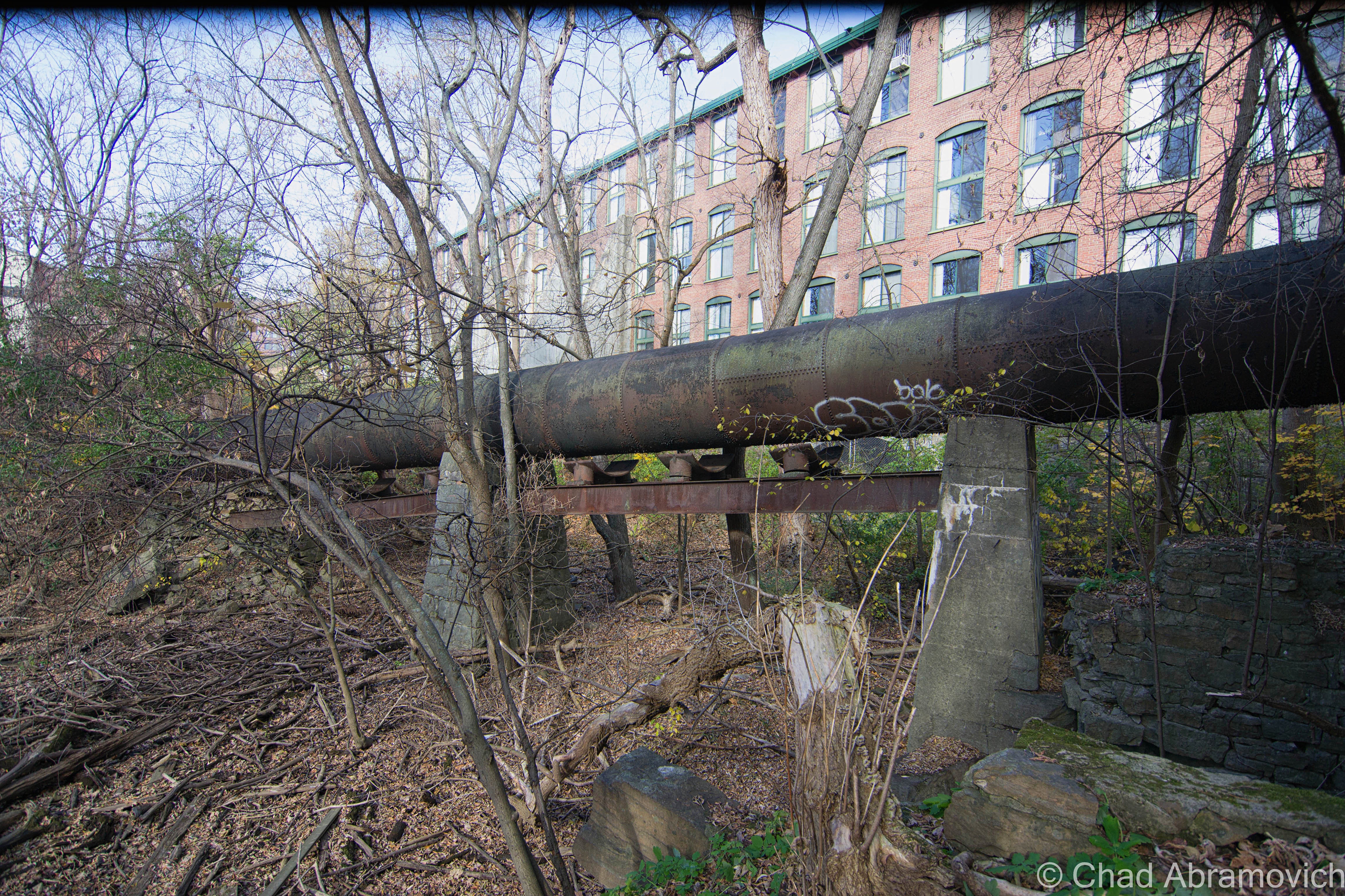
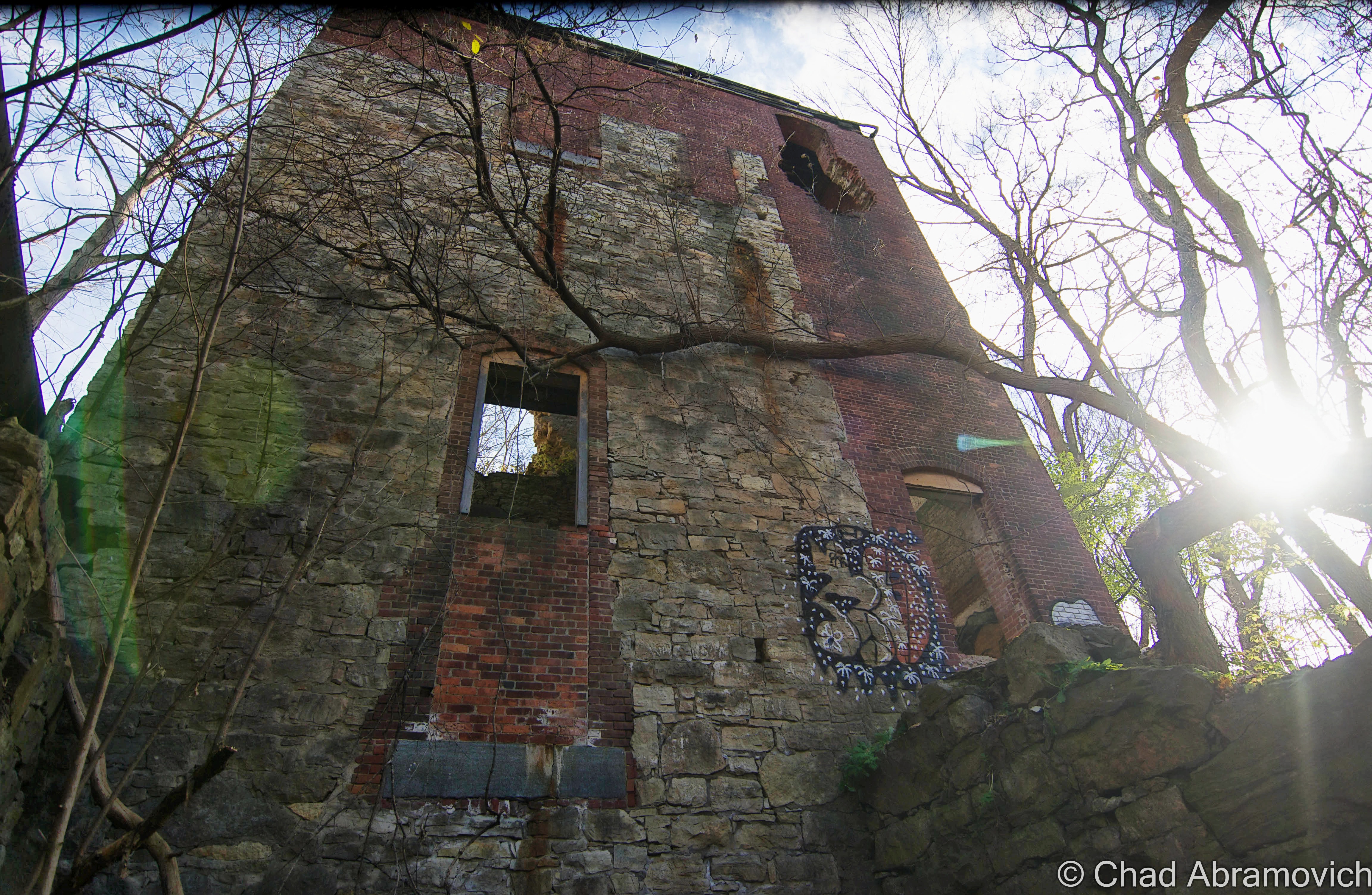
Brawny industrial towns like Winooski have had their rises and falls, but if there is one good thing about old mill towns, is that their lasting impression comes in the form of admirable architecture. More precisely here, it’s spacious and handsome brick mills. Most of the old mill buildings have taken on new lives as very nice mixed office and apartment space, but a small vestige of Winooski’s raw and unrenovated industrial past can still be seen, if you know where to look.
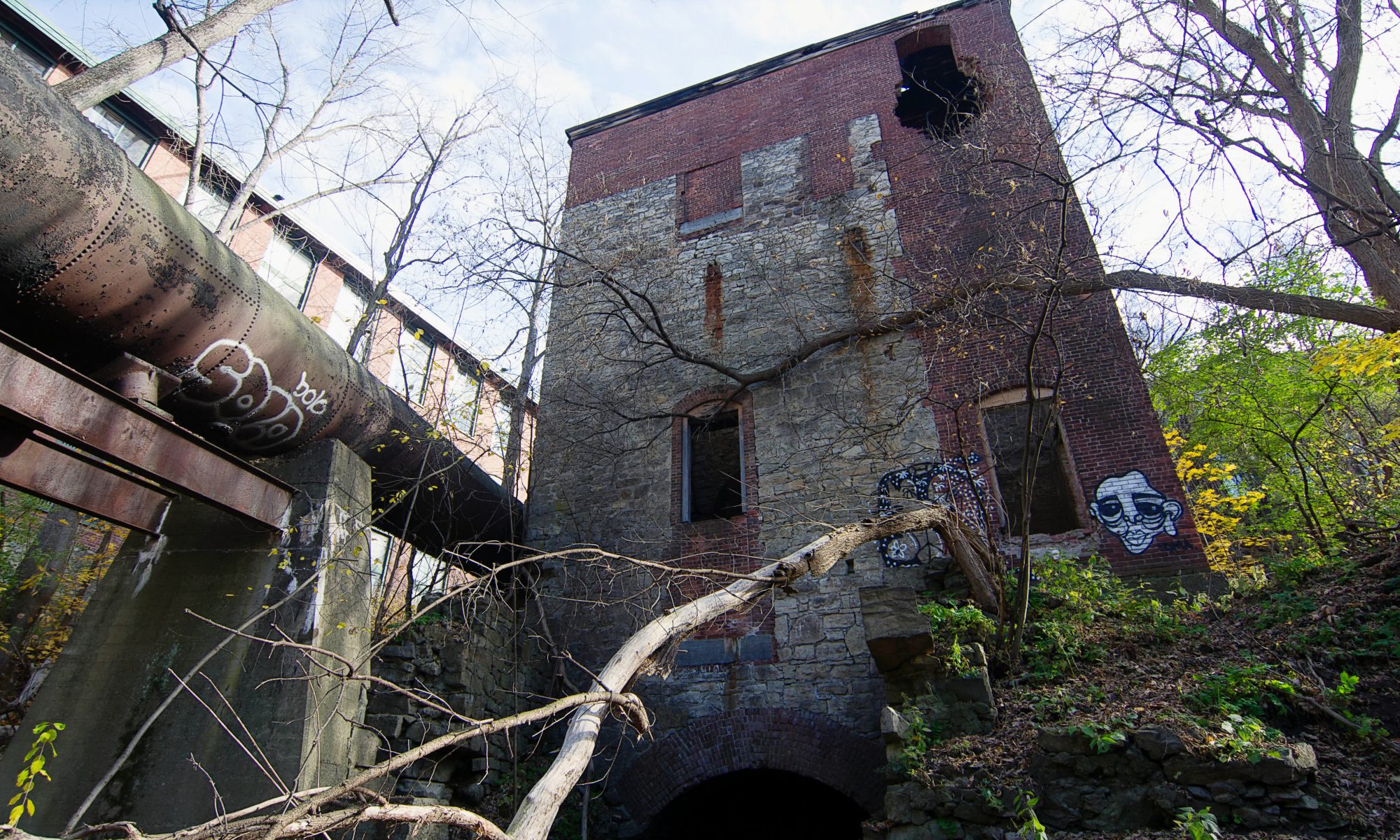
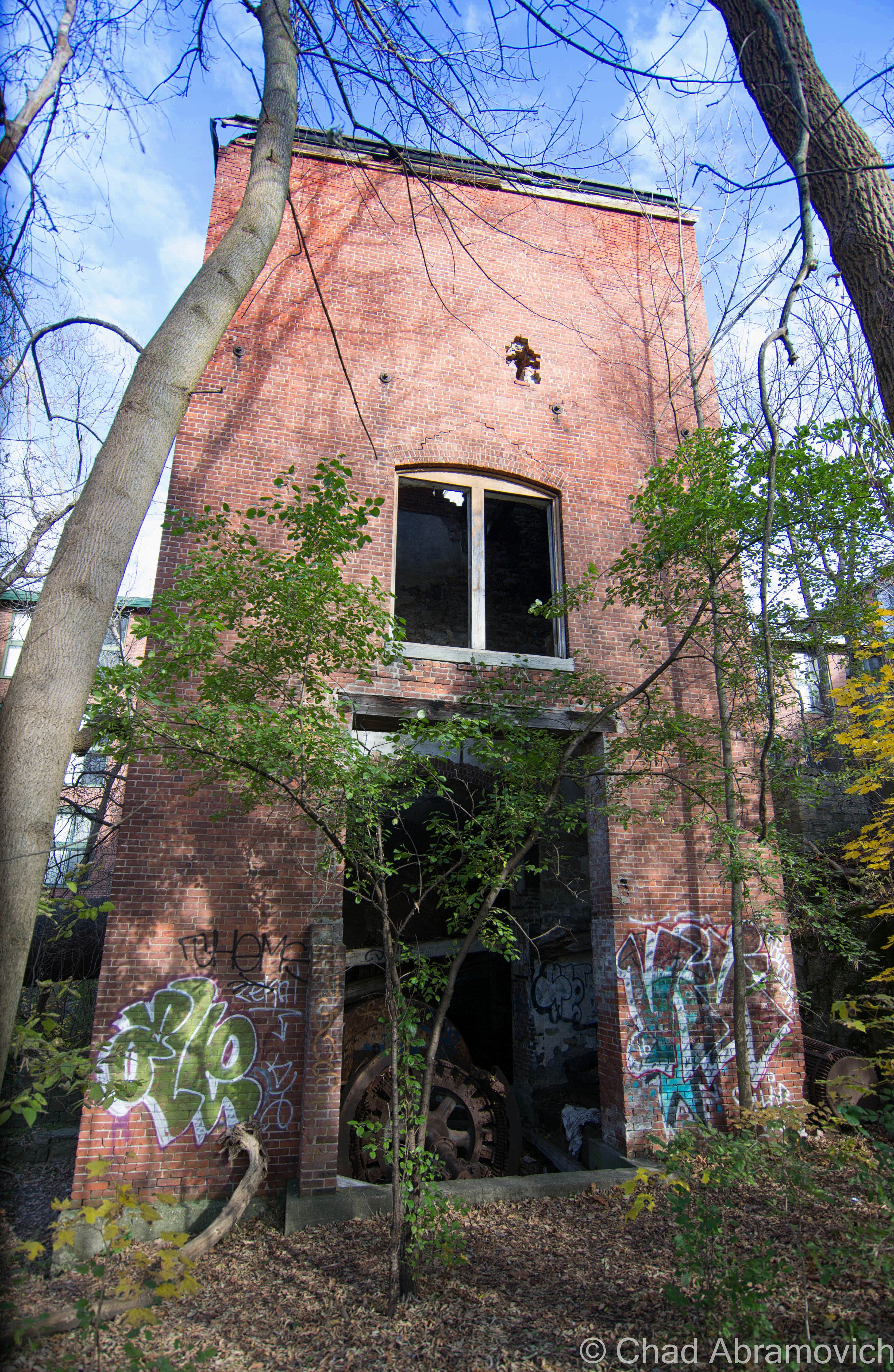
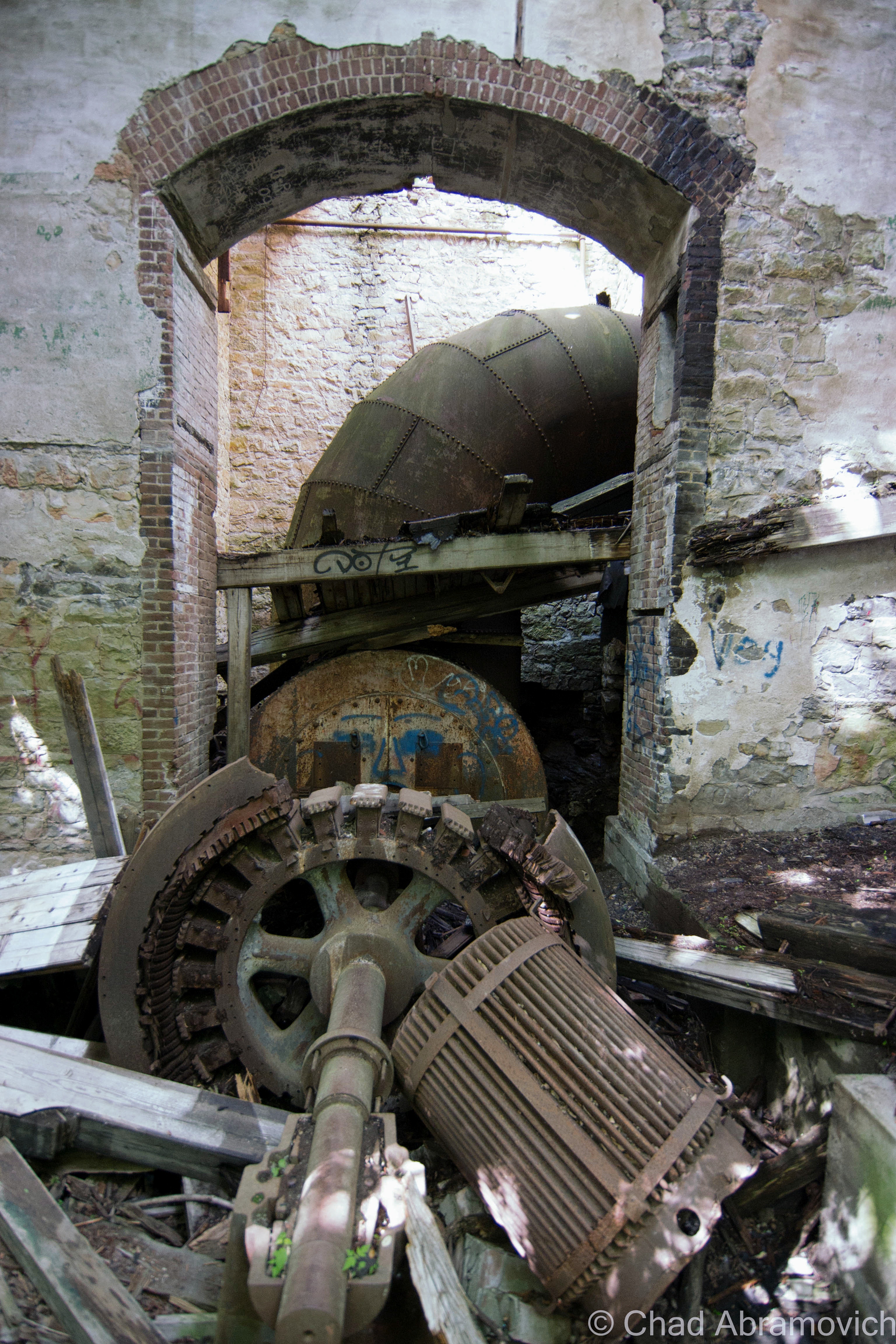
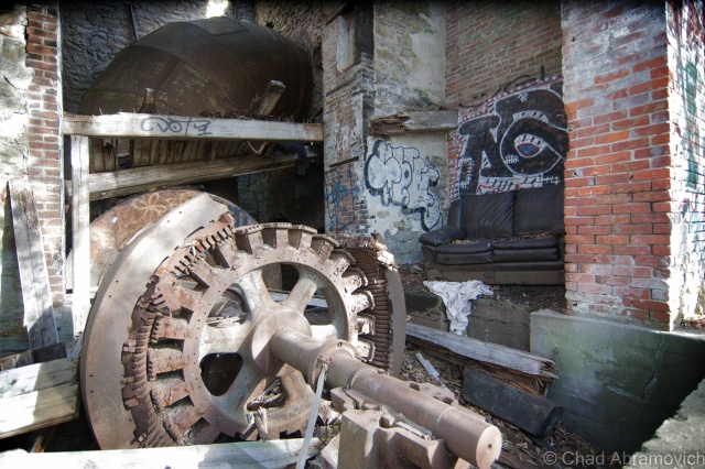
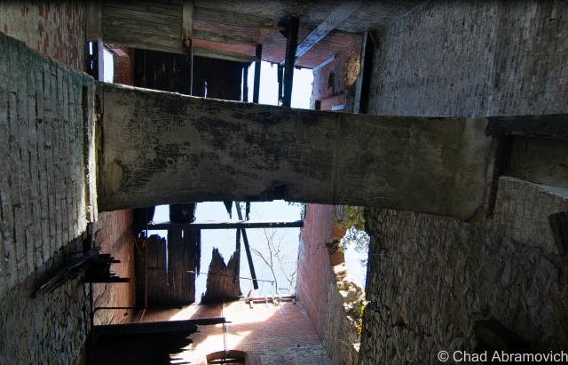
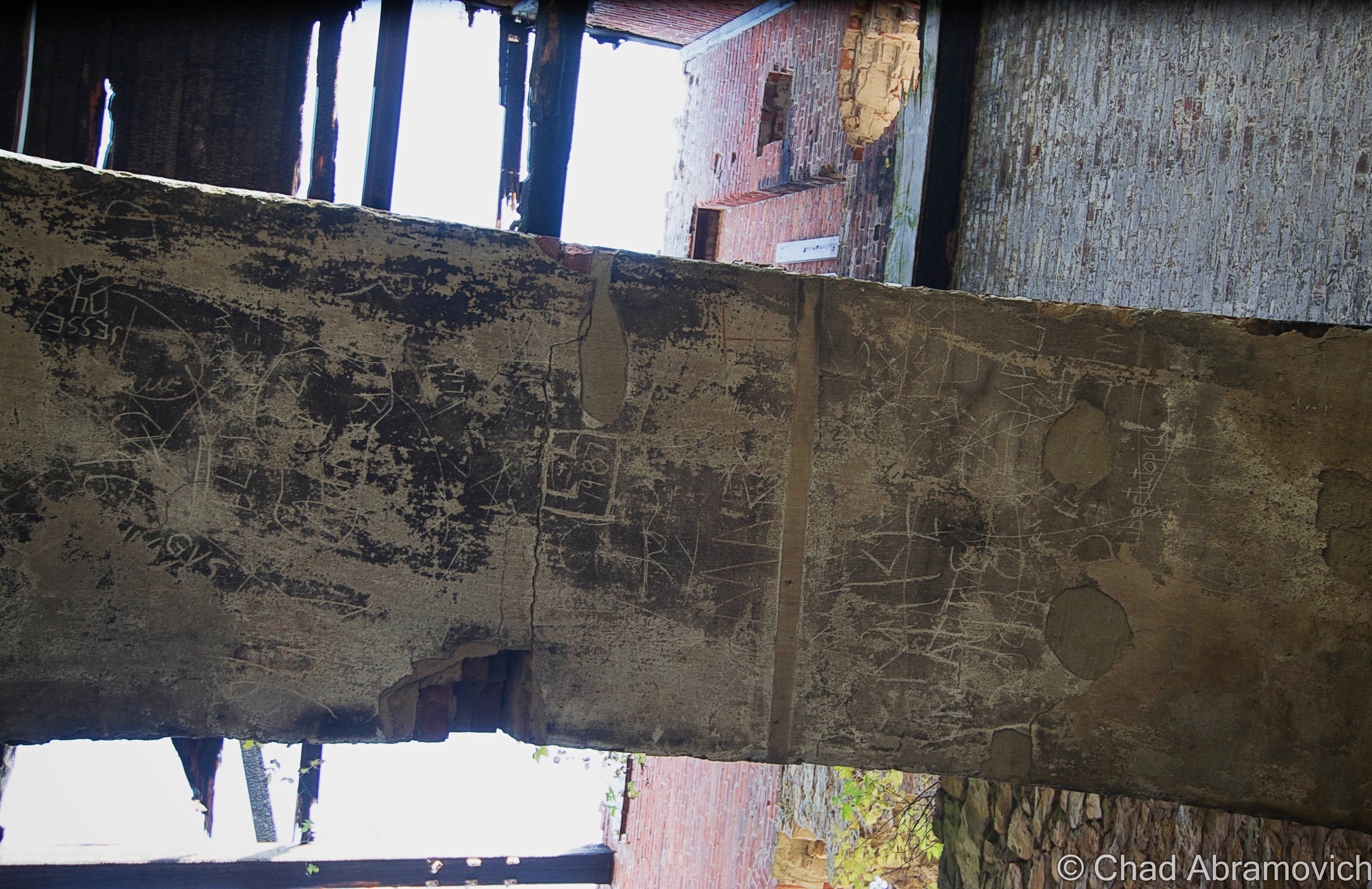
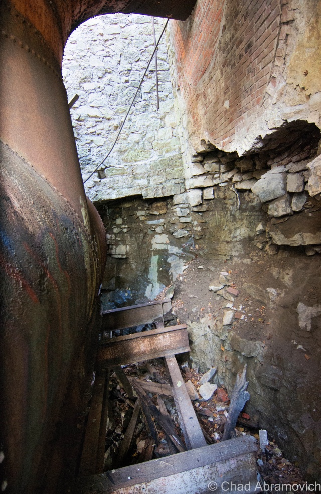
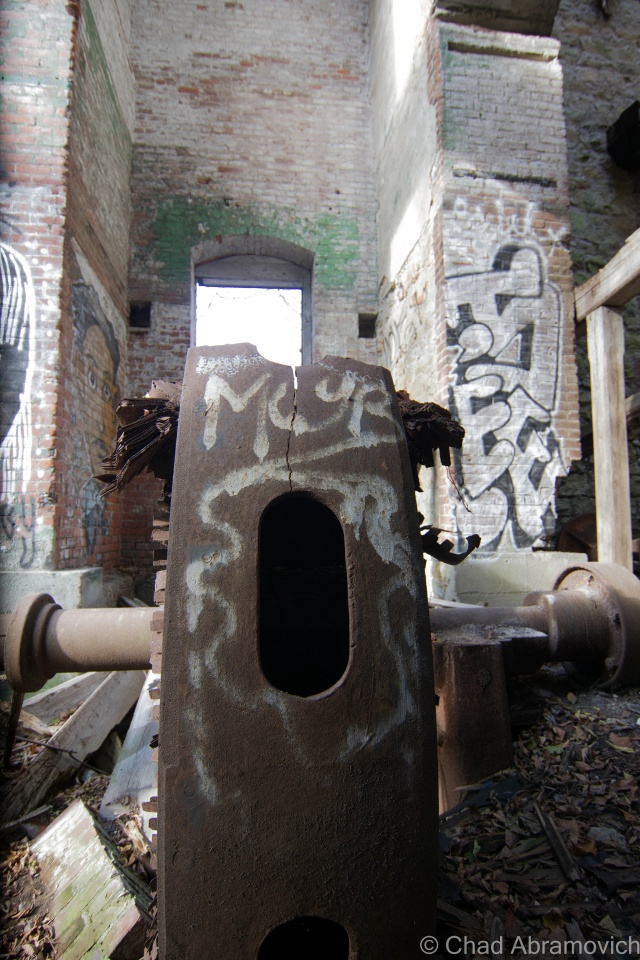
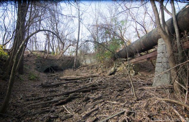
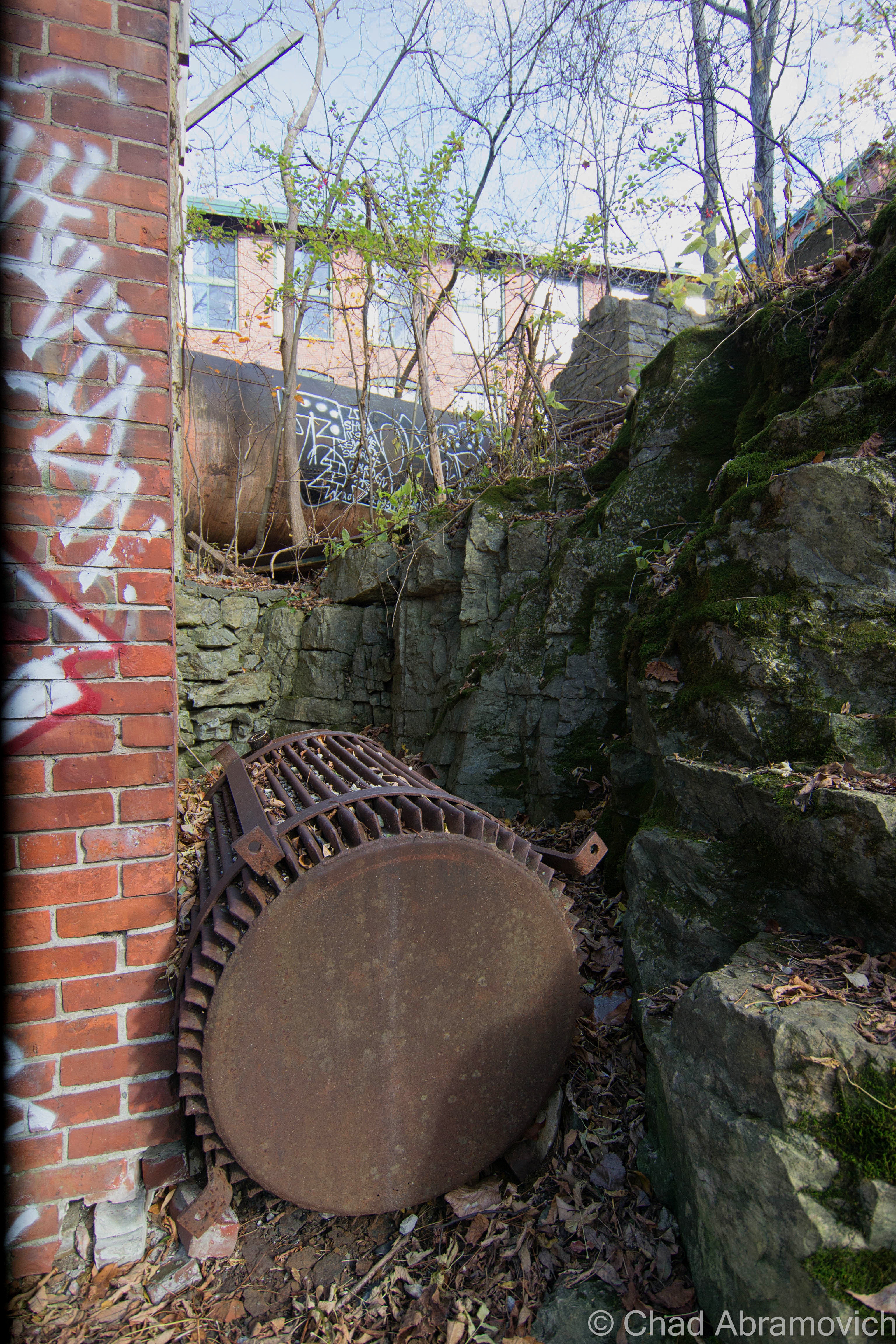
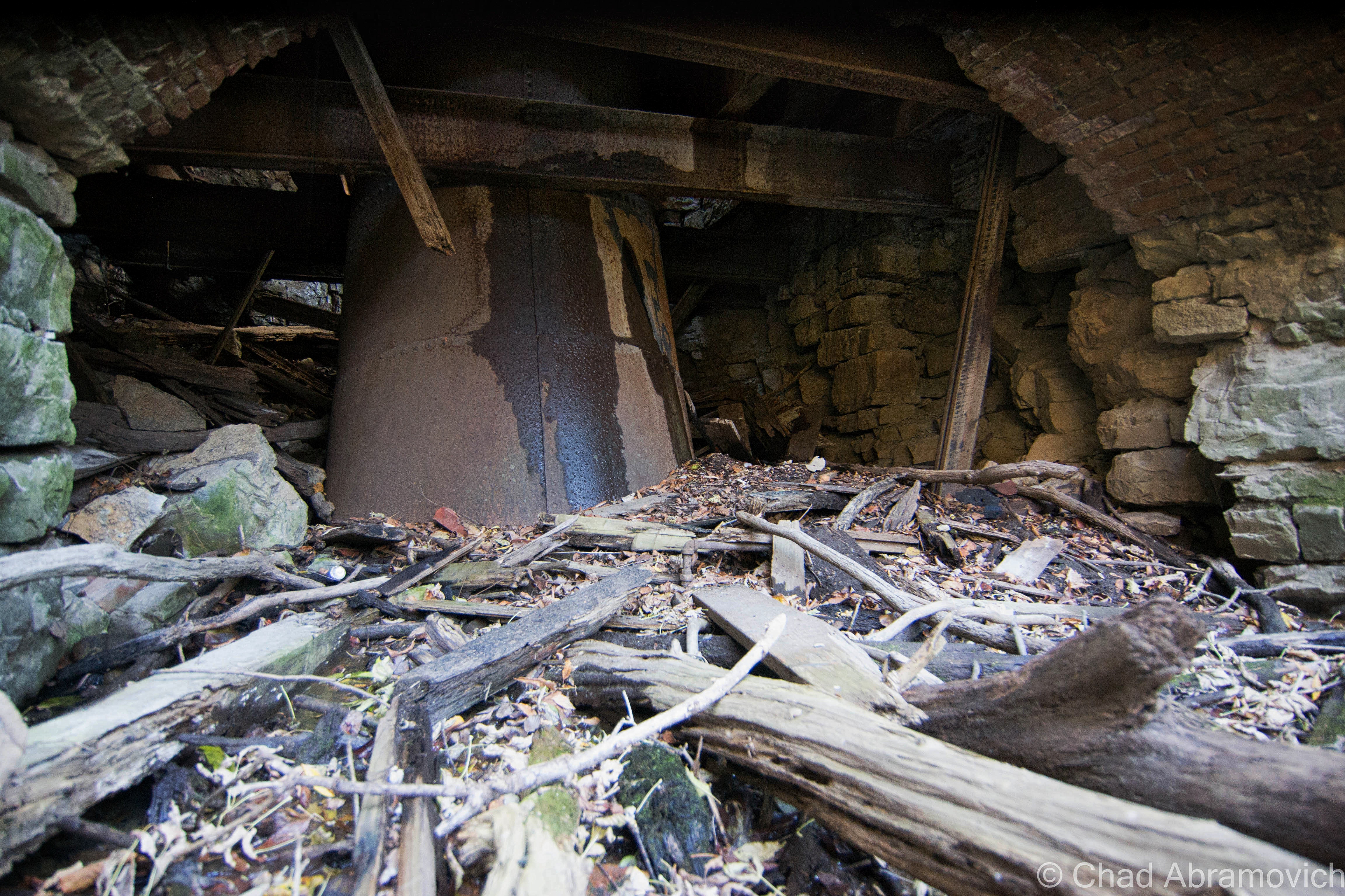
Sulking behind the expansive brick edifice of the Woolen Mill, down in a recessed area of scraggly trees and the graveyards of stagnant mill ponds once formed by water entering through the low stone tunnels now being filled in by erosion, sits the crumbling remains of a brick tower.
These dangerous ruins were enigmatic to me, as I know practically nothing about early twentieth century mill operations, so with the help from my friend who was also the one who took me here, a little research was done and was able to shed some light on what this tower once was.
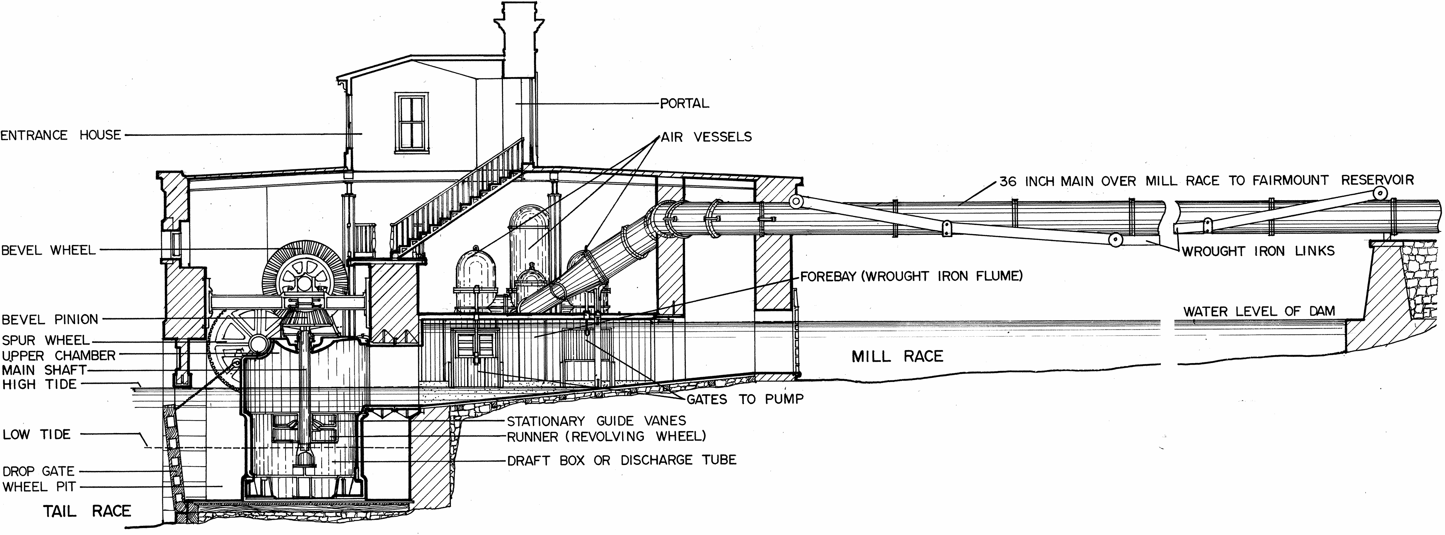
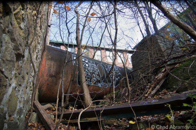
Basically, there is a large intake pipe at the top of the tower. Using gravity, the water flows from the river to the top of the tower.It then is diverted downwards into a turbine where the rushing water turns a wheel before being used for power generation. This turning wheel would have been connected to a shaft that ran into the mill to turn and power the equipment. After 1930 however, the turbine would likely have been repurposed, so instead of using water to create mechanical energy to turn the actual machines, the machines began to use electricity So the turbine would have been repurposed. Instead of turning a shaft and going into the mill, it turned a shaft that turned an electric generator and this power would have supplied the mill. Or, something perhaps very similar to the diagram below. (If you are using this blog for any sort of essay information, I encourage you to find a more reputable source)
Sure enough, there were the remnants of additional pipes and tunnels that formed a broken trail from this spot over to the bridge where the water levels were higher, making this a very plausible description of how this tower might have functioned.
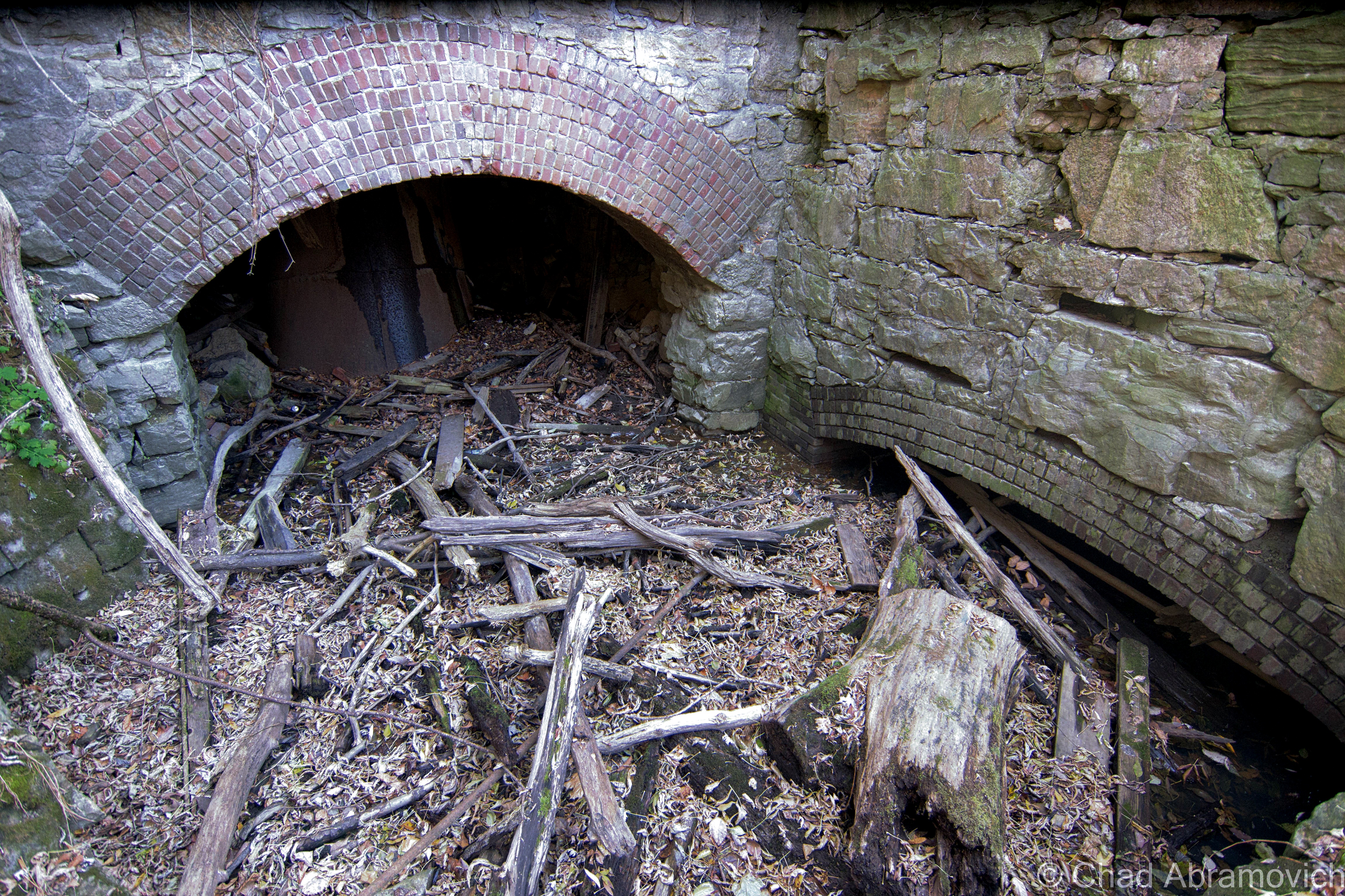
But by looking at the crumbling, and rusted ruins today, they keep their secrets far from your presence, besides the strikingly obvious – this place is dangerous. The tower had made its mark on this part of the property since it’s construction, its shadow forever burning its impression into the wet ground around it, but a few more winters may finally bring this decrepit place down into the muddy recesses of the foul mill wastelands below it.
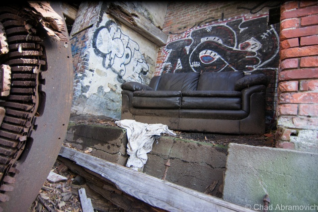
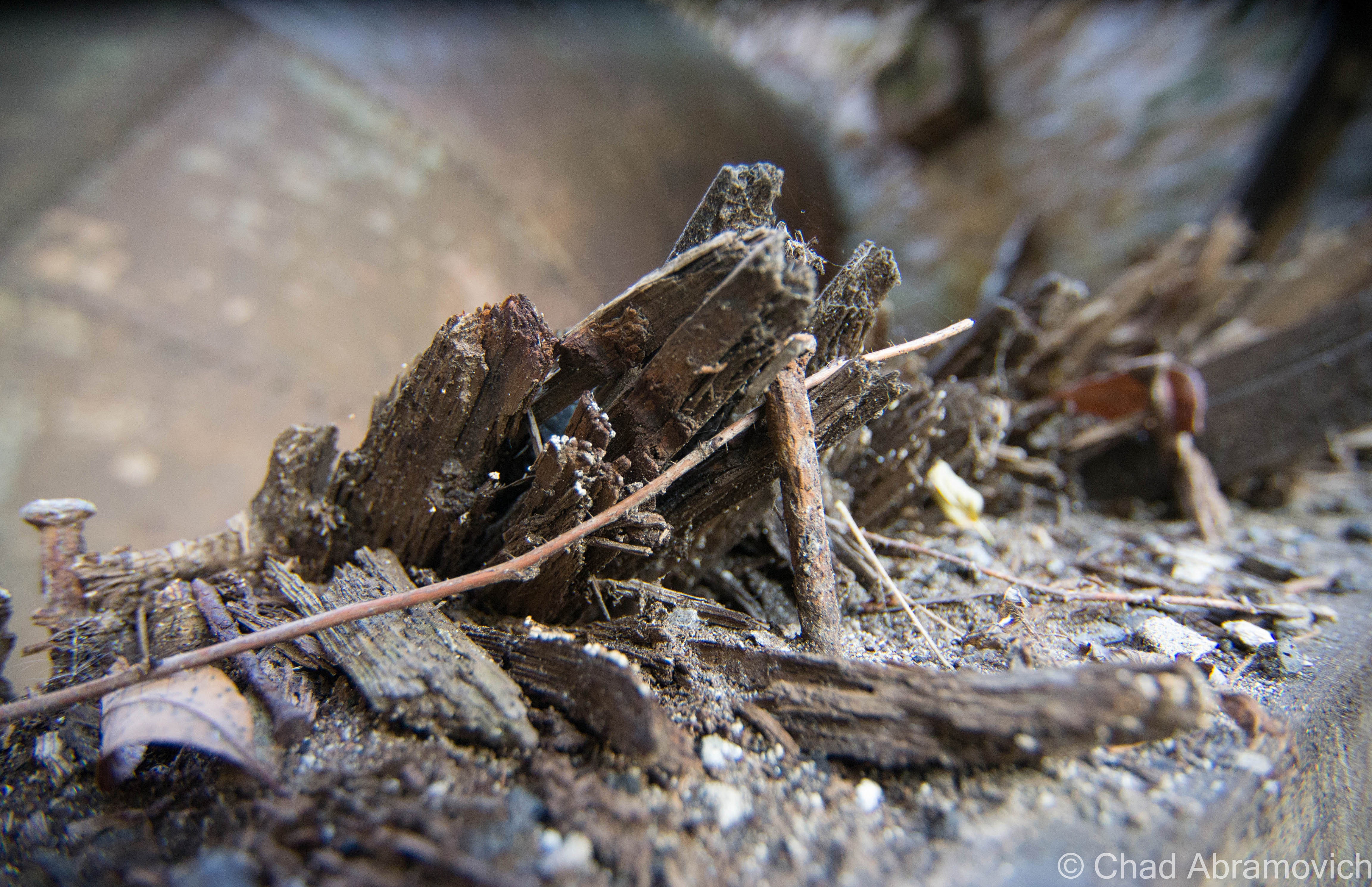
A surprisingly warm day for December 2nd in Vermont, I probably could have gotten away with just a flannel or a hoodie, but chose to bring a more protective layer just in case. And I’m glad I did. As we shambled over piles of soggy ground and driftwood to the arched entrance, the inside of the tower was noticeably colder – the air was dead inside. There would be no “safe” traveling, so much had fallen that we were constantly crawling over untold amounts of dirty bricks covered in slime and rust, underneath piles of the rotting wooden floors above that had long collapsed below.
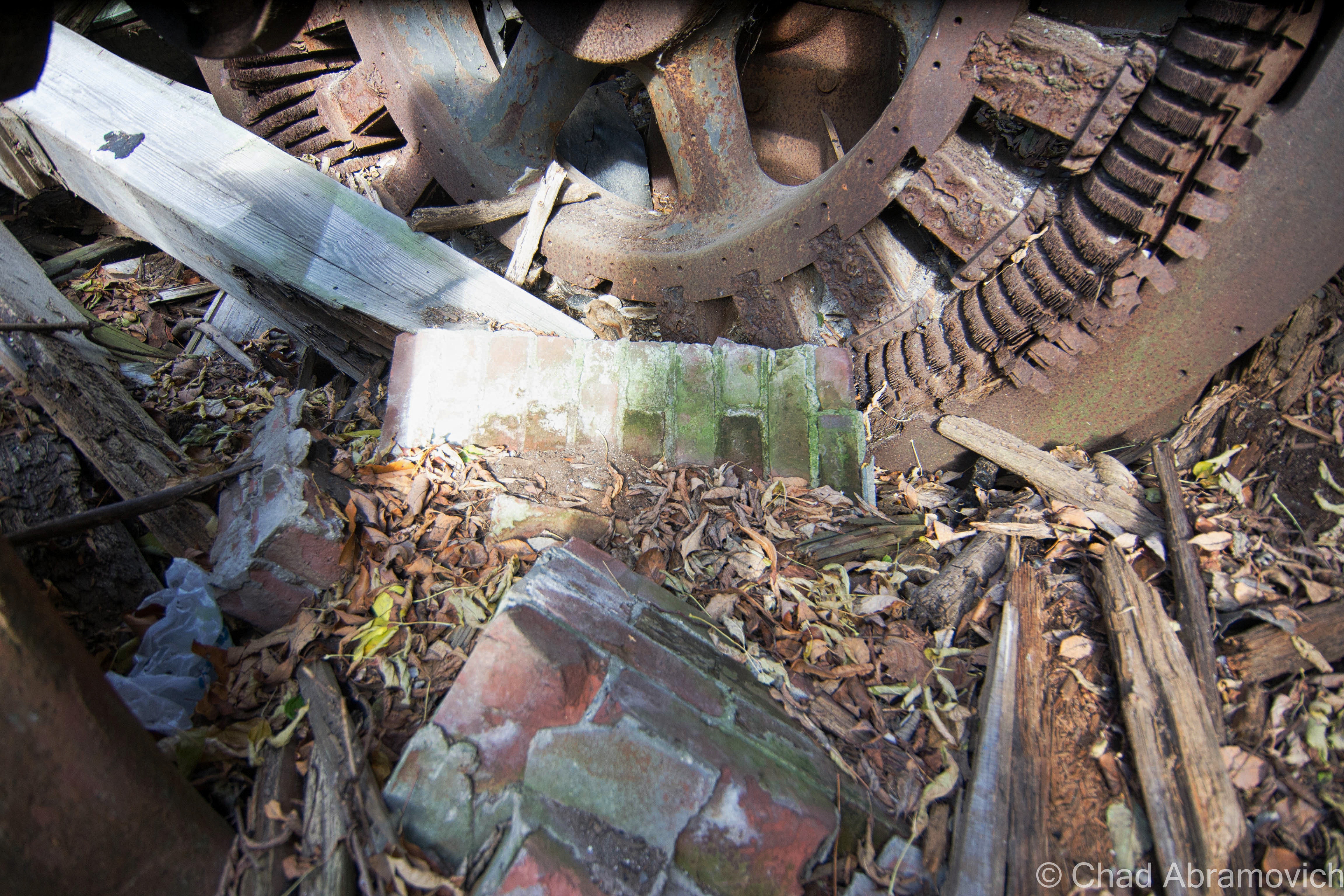
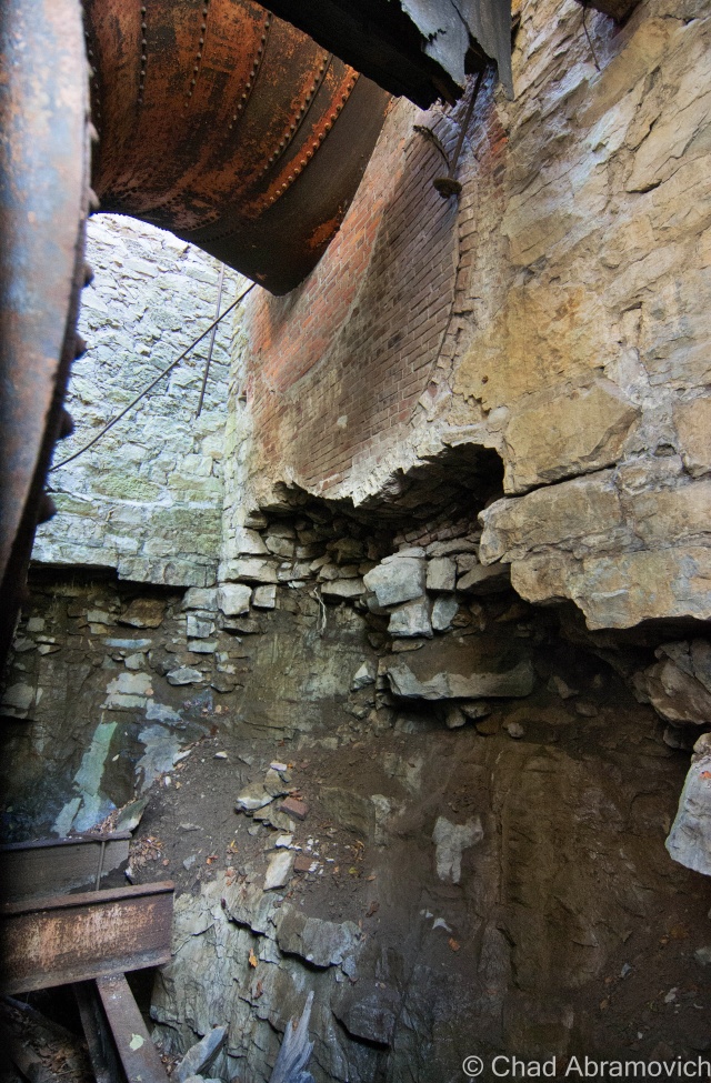
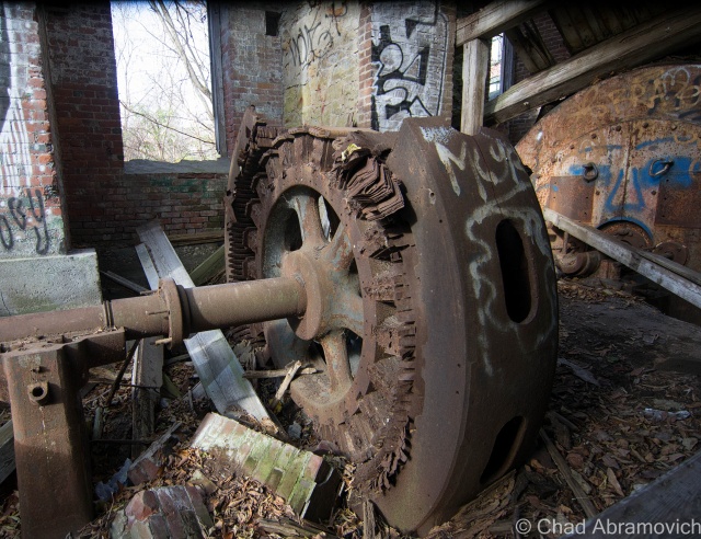
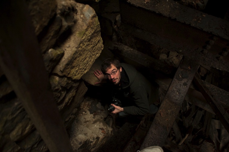
Now this is where things became interesting. We climbed further inside the tower, and saw just what we were up against. Behind the massive bulk of debris in front of us, were very narrow crawl passages that hugged the dripping and filthy walls around the tower. To get inside any further, it would require us to squeeze through them. But to get there, we’d have to scale a 6 foot drop to a level below us, onto a series of rusted steel beams that were glistening with ice, rust and slime. One wrong move, and a sprained ankle would be the least of your problems, as your body would tumble down into a dark rocky cavern beneath in a world where no one would hear your cries for help. Did we want to take this risk? Yes. So one by one, the both of us hoisted ourselves down the 6-foot drop, using the cold and dirty brick foundations as support, the bricks crumbling to dust in our hands.
At this point, our excitement had gotten the better of us, gawking at the incredible textures to photograph, the industrial gears frozen in rust and time as the shadows became wild. The inevitable and comic question of what the cold slimy substance our hands were touching was mentioned a few times, as well as how surprised we were that we hadn’t ran into any animals yet – these dark and cavernous ruins would make the perfect home for a mischievous creature.
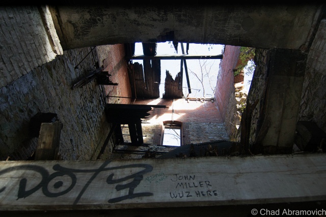
Turning to the realization that we had spent an hour or longer (most definitely longer) inside a dank crumbling tower, and we were beginning to feel the effects. My hands were numb, and we were more than filthy. “I think it’s time we head out” I said. But it was then I realized exactly how much work we went through to get to our current position, and all that clambering and wedging through those tight damp spaces back to the entrance just didn’t excite me. “Think we can fit down there, and climb out that way?” I asked, pointing to the dark area below the steel beams that suspended us above the pit. Below us, was a crumbling shadowy world of filth and fallen bricks, with a tunnel type entrance out to the former mill pond. Going out that way would save us a lot of time, if we could make it. “We’re not 16 anymore” I jokingly called up to my friend – I am not nearly as limber as I was. Down there, it was so cold, icicles were forming on the pipes. “I’ll give you $5 if you eat one of those” my friend called above me. I declined the offer to fatten my wallet and made my way out. He soon followed.
Self Portrait. Here, you can get a good idea of perspective, from where I climbed down and where my friend was standing.
It’s incredible to think about the ingenuity and complex systems behind how these mills harnessed the natural water power of the falls. Today all that remains of Winooski’s industrial legacy are the buildings, a few relics in a museum, and little else. The Winooski skyline as viewed from Burlington is a great picture and one of contrasts, the Champlain Mill and the new downtown symbolically rising next to it.
Nearby, on the rocky ledges of the Winooski River Gorge, there were a few more sites of interest, so before we wrapped up our adventure, we took a short ride from Downtown Winooski to Colchester.
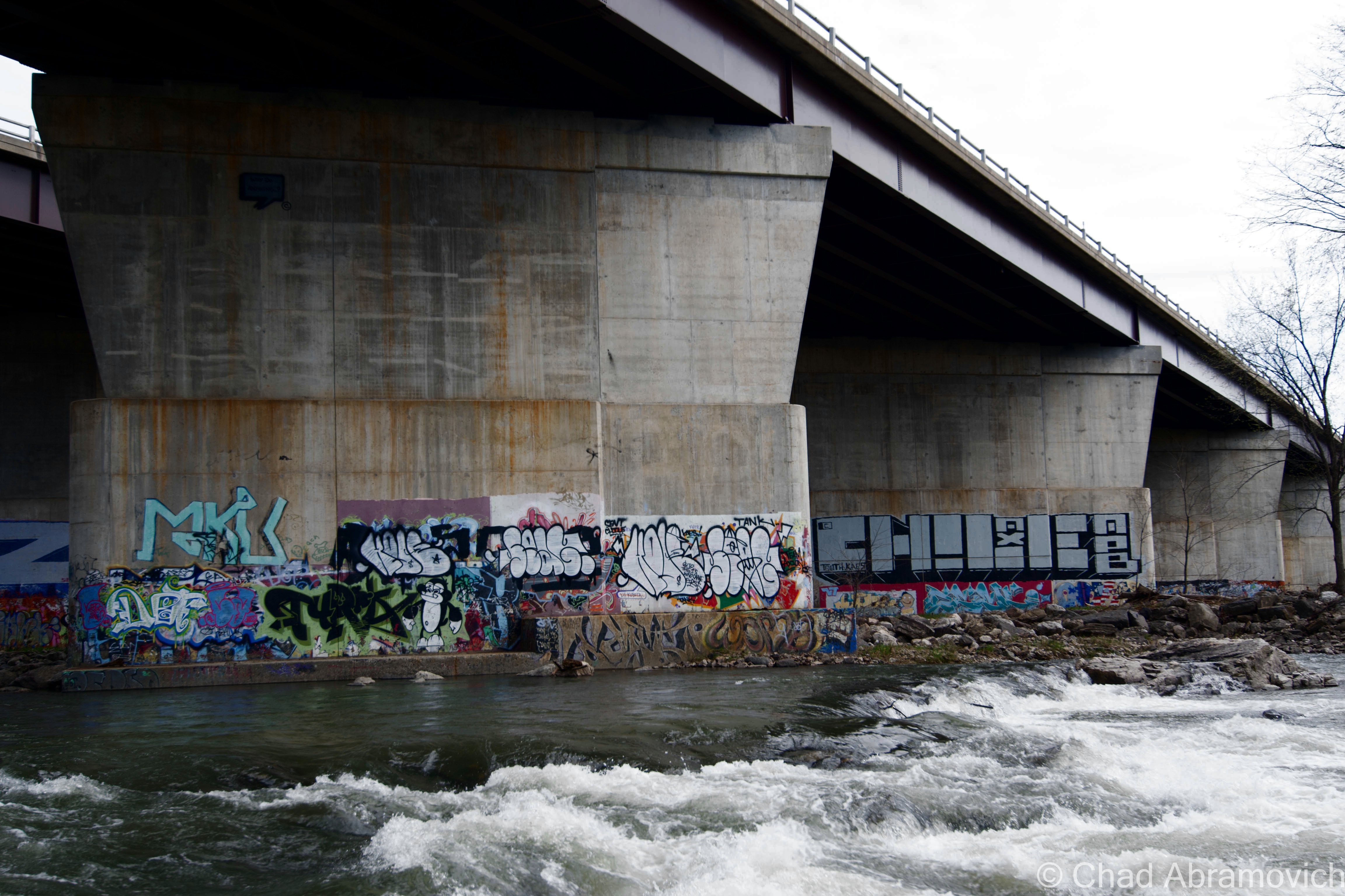
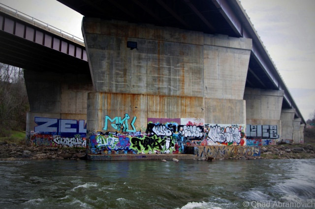
The Walls
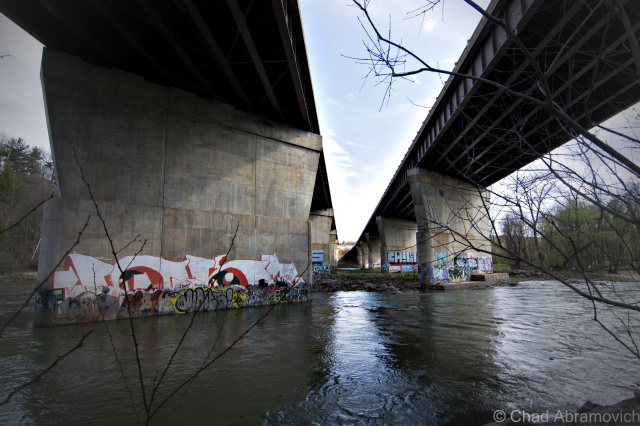
Years ago, you had to stumble your way along a riverbank of roots, swamps and thick northern jungle to reach this cool urban locality. Nowadays, there’s a path and a designated natural area that brings you here, which in a way is sort of a bummer.
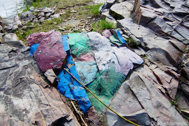
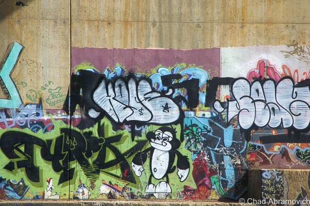
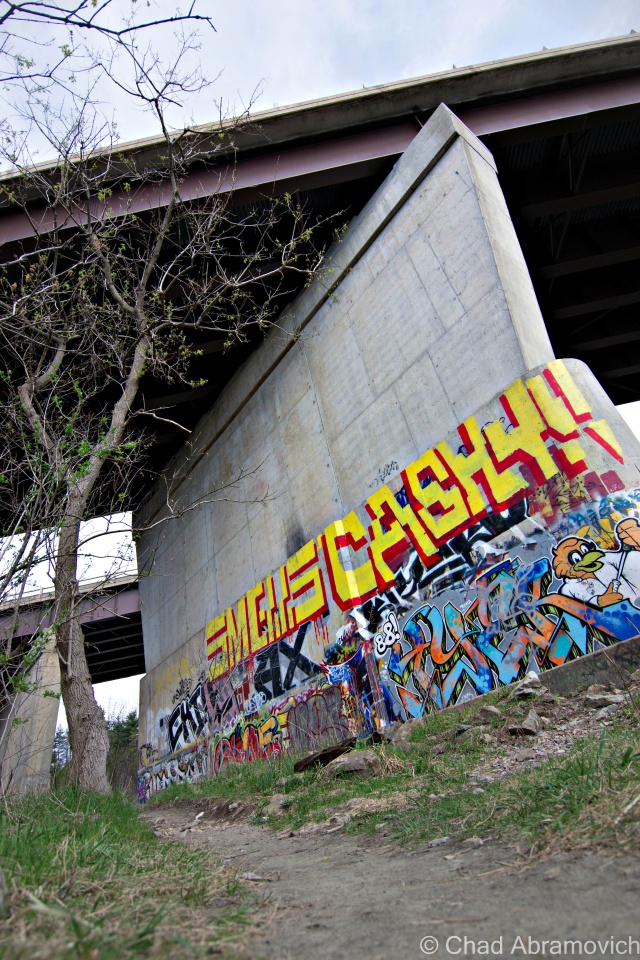
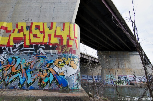
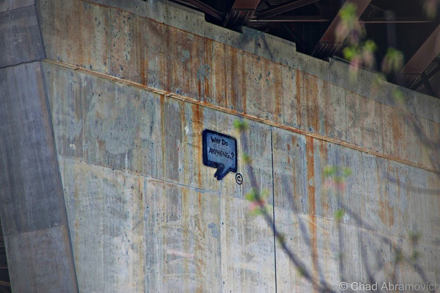
The area underneath the interstate bridge that spans the Winooski River in Winooski city is colloquially called “the walls”, a youth minted term which is most likely a reference to the humongous concrete pylons supporting one of the busiest bridges in the state overhead. Those pillars are sprayed with some of the best graffiti and spray paint art in the state. In my humble opinion anyways. The robust and colorful artwork is always evolving, with some tags in seemingly difficult to reach places that conjure more questions and hint at the engines and the love of those who do their thing here.
I’ve met some local taggers down there before on a summers afternoon years ago. Most people you run into are friendly folk who will strike up a conversation with you. The other half are either people like me, or teenagers who are smoking swisher sweet cigars they got from the local Maplefields convenience store having fires along the beach areas. The area is a neat one, which is undoubtedly why it draws so many eclectic folks. It’s isolated and a bit of an inconvenience to get to, with thick vegetation, sandy river bottom beaches and the gradual limestone rises of the Winooski gorge giving it a dislocated feel from the pulse of Burlington, but never too far from the hum of the highway.
There is an abandoned hydroelectric station amongst the ledges and evergreen forests of the gorge walls, but as we found out, access is almost impossible, and unless you want to risk a security encounter and some torn clothes as a result of climbing a very sturdy fortified fence. As I later found out from someone, if we had dared to climb down into there ruins, we would have been met with several feet of rapid flowing river water and foul mud that now flows freely through the complex. In this case, it was best just to admire it from a distance.
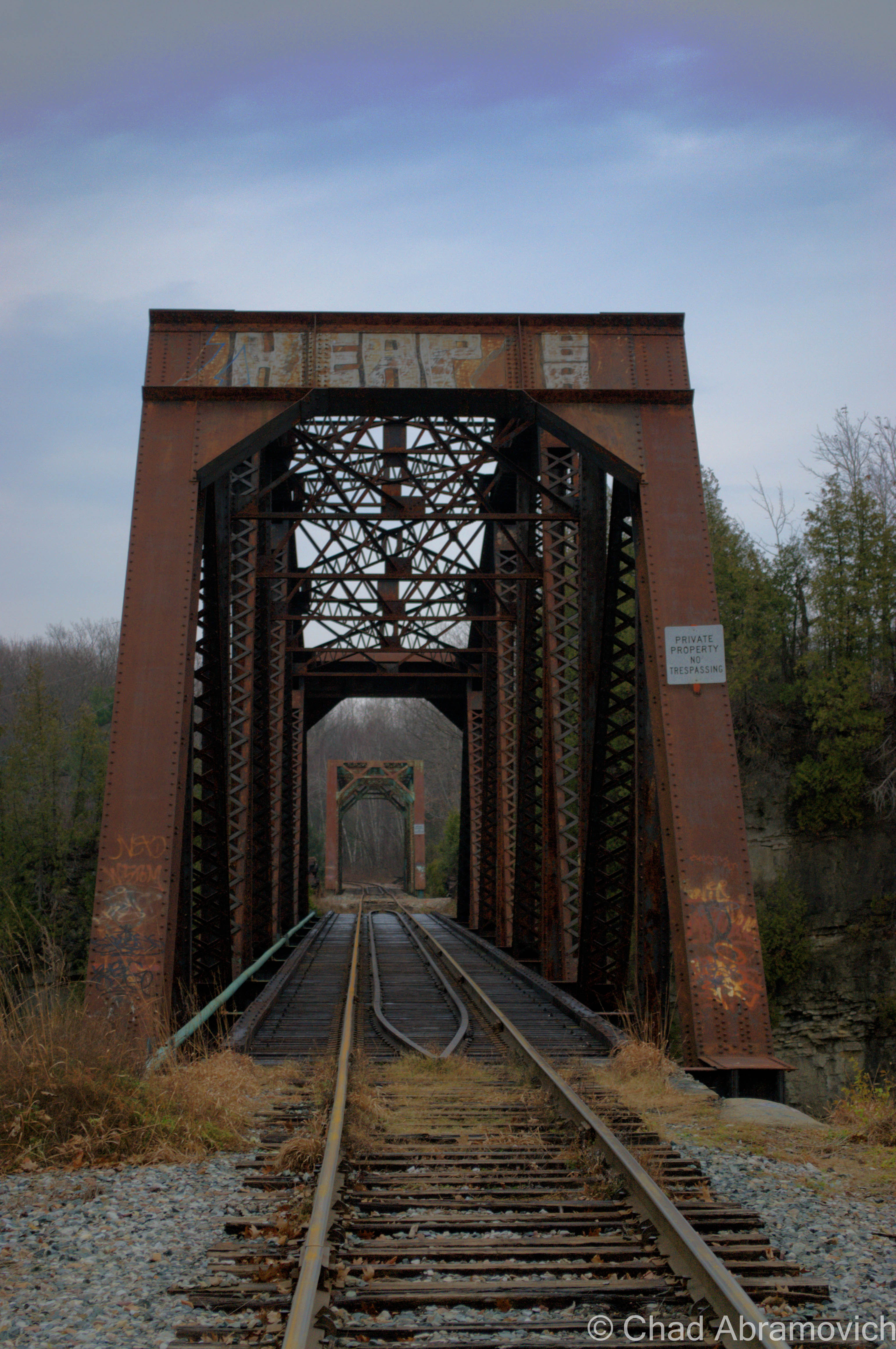
An area landmark, the double truss railroad bridge spanning over a ledgy oxbow river bend in the Winooski Gorge. Locals mistake this impressive feat of engineering as a haunted trestle, where a little girl was struck and killed by a train in the 60s. But that’s actually another truss bridge down the river a ways, crossing into Burlington’s intervale. It’s called “the blue bridge” because according to legend, the girl’s ghost hangs around the bridge and is a pale blue, like an oxygen deprived corpse. If the real blue bridge wasn’t weird enough, I’ve heard tons of stories of sketchy characters who hang out on the bridge. I once ran into a young couple (I assume) dressed in dollar store magician and assistant costume, with top hat and plastic wand, sitting in the middle of the train bridge and quarreling. I’ve seen them 2 additional times afterward. That’s an old ghost story though, not one I think many younger Winooskians are aware of nowadays. It’s easy to see why the double truss bridge would be the assumed monument to tragedy, given its striking location and unique construction. Just make sure you’re not eligible for a statistic if you decide to walk the tracks.
—————————————————————————————————————————————–
To all of my amazing fans and supporters, I am truly grateful and humbled by all of the support and donations through out the years that have kept Obscure Vermont up and running.
As you all know I spend countless hours researching, writing, and traveling to produce and sustain this blog. Obscure Vermont is funded entirely on generous donations that you the wonderful viewers and supporters have made. Expenses range from internet fees to host the blog, to investing in research materials, to traveling expenses. Also, donations help keep me current with my photography gear, computer, and computer software so that I can deliver the best quality possible.
If you value, appreciate, and enjoy reading about my adventures please consider making a donation to my new Gofundme account or Paypal. Any donation would not only be greatly appreciated and help keep this blog going, it would also keep me doing what I love. Thank you!