The Bloody Pit

There’s a gaping maw in the Berkshire Hills of Western Massachusetts that’s achieved a legendary degree for well over a century now due to its preternatural tales, mysteries, and tandem extraordinary and sinister creation that earned it the nickname “The Bloody Pit” (even though it’s a horizontal shaft) for killing hundreds of people who built it.

Its real name is The Hoosac Tunnel – an almost 5-mile long railroad tube that cuts underneath the Hoosac Range – a mountain chain that makes up the eastern rim of the jointed hill chains that make up the Berkshires region.

Skewed folklore tells that the name “Hoosac” roughly translates to “forbidden” in the language of the area’s first inhabitants – the Mohawks. But the actual meaning is akin to “stony place”, which is a pretty accurate description of the region. It’s also one of the many phonetic spellings of the word, which explains why New York, Vermont, and Massachusetts have the Hoosic River, the state of New York has the town of Hoosick Falls, and Vermont and Massachusetts share the Hoosac Mountain Range.

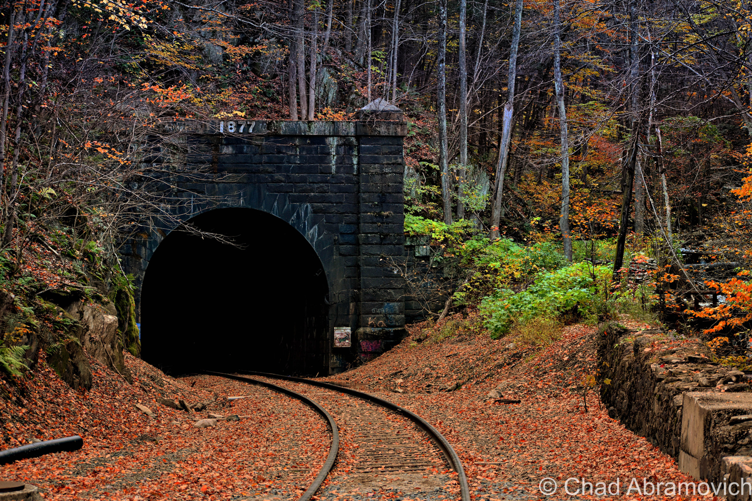
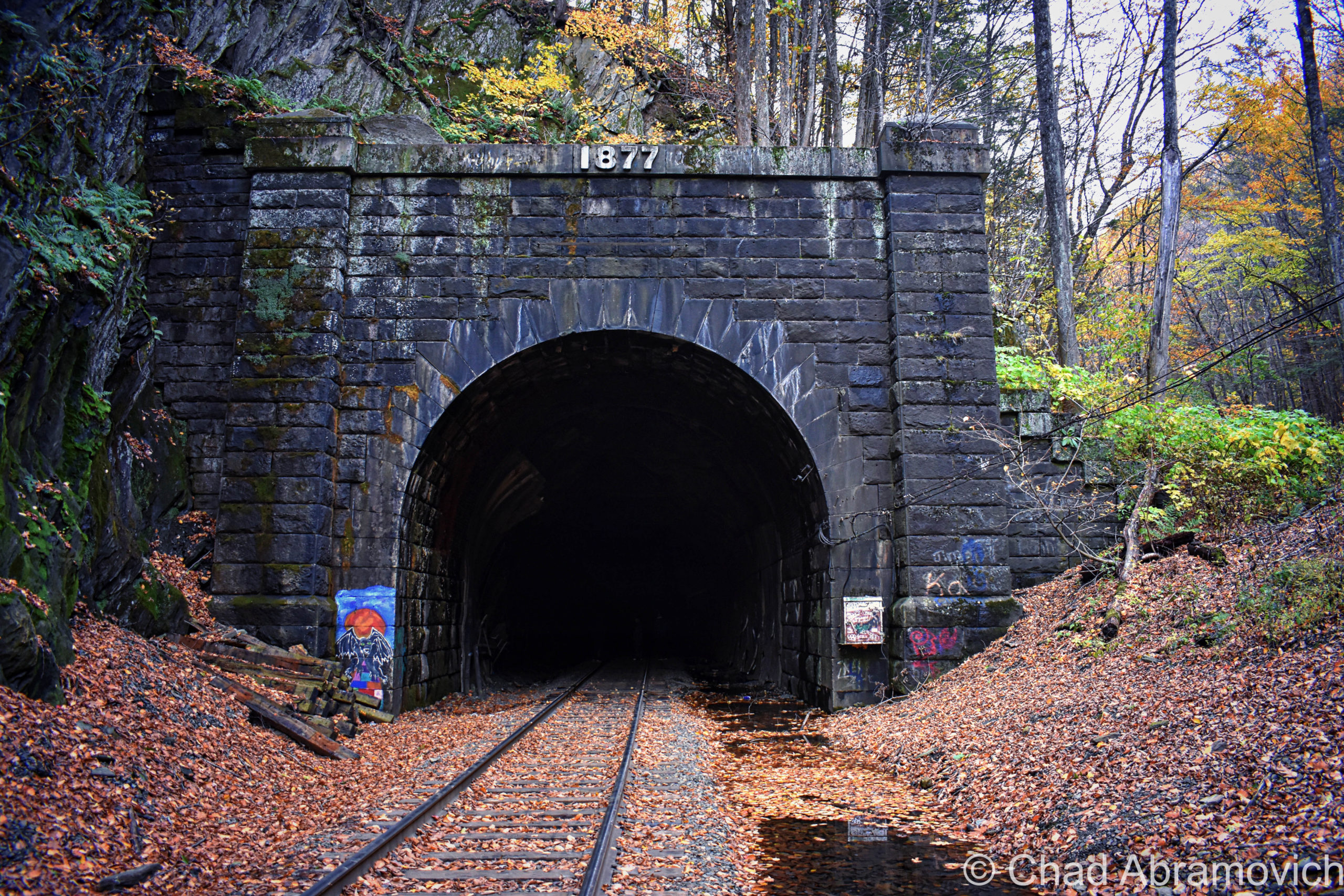
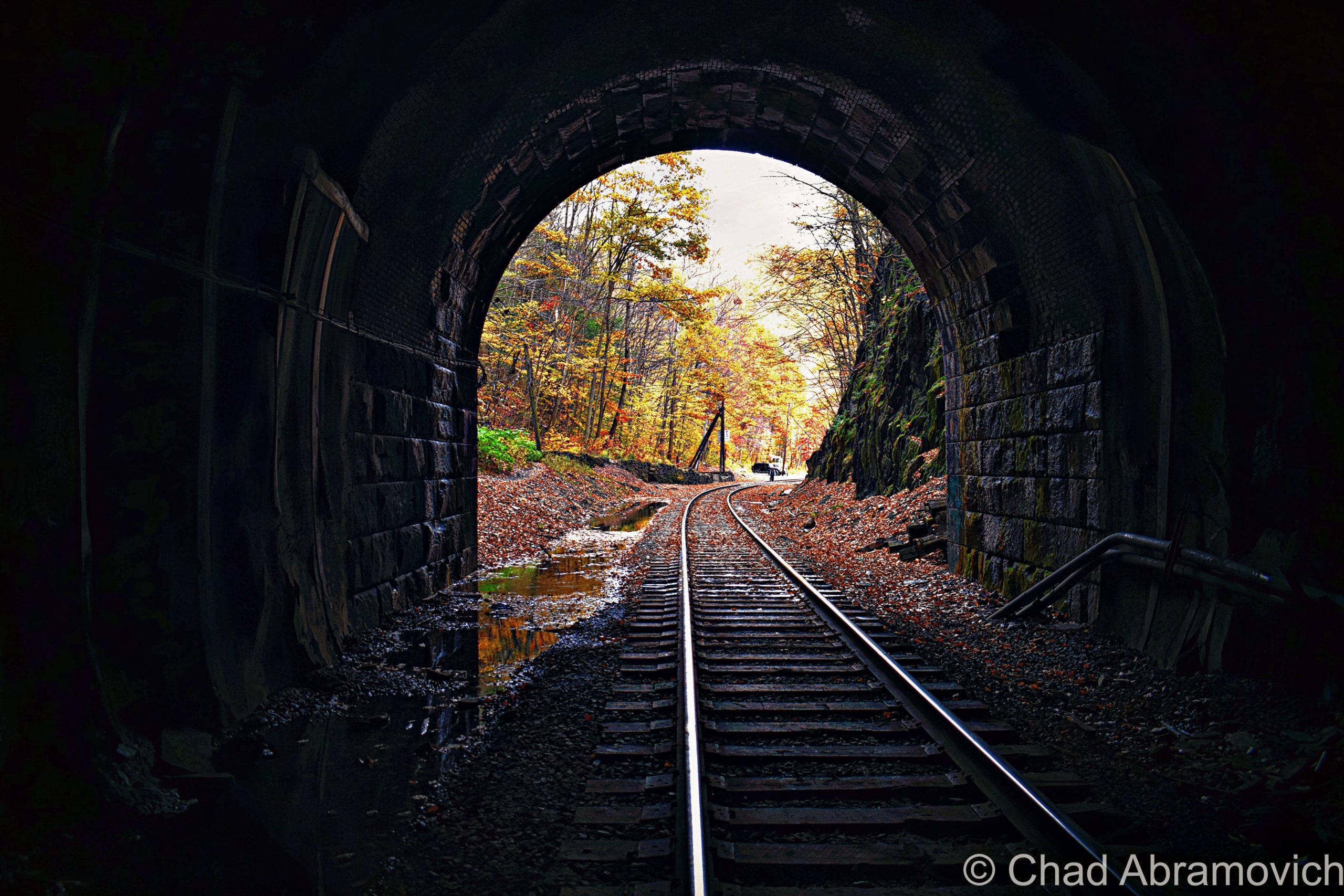
Every time I’ve stood in front of this imposing orifice that descends deep into the dark inscrutable heart of these hills, though, kinda brings the more ominous definition of its name right on home, and the vibes back up its designation as a damned place. It feels like you’re staring into an endless, ambiguous, and intimidating abyss that occasionally gurgles lonesome sounds and belches blasts of cold, acrid air in your face.

When this passageway was completed in 1873, it became a man-made leviathan turned celebrity – the longest tunnel of its kind in the world, a tangible example of an idea that had previously been thought to be impossible and foolhardy, and future-facing inspiration for other designs of engineering.

But it took lavish amounts of blood, tragedy, and time to make it happen. In its birth throes, the tunnel would devour an estimated 200 people, and for that reason, it became considered one of the most haunted places in all of New England, and that accolade is still very much stuck in the adhesive of the contemporaneous.

Why does something of this magnitude exist? Besides the fact that there’s something naturally settled within the psychological framework of humankind that makes us want to push anything that we consider a “boundary”, those pesky Berkshire Hills simply happened to be in the way.

Before the tunnel was built, you couldn’t really “get there from here” as us Vermonters like to say. Not at least without some substantial inconvenience.

As New England and New York’s Hudson Valley were beginning to enter the throes of the escalating industrialization in the mid-1800s – this huge disconnection was beginning to be felt.

A new railroad seemed like just the solution to intrepid self-made paper mill owner Alvah Crocker of Fitchburg, to extend the not completely altruistic gesture of financing the construction of a new railroad (not coincidentally, the railroad would also benefit his mills) – then cajoled groups of investors, engineers, and design firms to make it happen.

At the time, Massachusetts only had one railroad that accessed the western part of the state, and that ran through the southern part of the state, which left the north kinda isolated – both by the mountains and the fact that the railroad was cumbersome to access, and spur lines were billed exorbitant prices if they wanted to build a connection. Mr. Crocker wisely knew that a new, northern railroad would be incredibly serendipitous for him, and the rest of upper Massachusetts and Southern Vermont.

After survey work, the legend-crowded Deerfield River valley was chosen as the most practical route to veer westward on, until eventually having to puncture through what surveyors dubbed as the “thinnest” part of the unyielding slopes of the Hoosac Range – a chain of hills in the 2,000-foot elevations – to continue pursuing the trajectory all the way to Troy, New York – officially linking New York’s capital region and all their connections with Boston and inner New England.

To do that, they just needed to create a direct route through terra firma.

In 1842, Crocker and his cronies charted the Fitchburg Railroad that ran from Boston to Fitchburg, and then began to expand by acquiring smaller railroads and building new tracks to form a continuous link westward bound, the gestalt of which formed the Troy and Greenfield Railroad in 1848 as a connection – with the idea of the conceptualized Hoosac Tunnel being the cynosure of the project that would officially open up “the west” (or, anything west of the Berkshires).

The scheme was to have 2 crews of laborers start digging at different ends of the mountains between North Adams in the west, and (the town of) Florida in the east, and eventually meet up in the middle.

In January of 1851, ground was broken for the tunnel’s west portal on the mill town of North Adams’ side of the mountains, thus inaugurating Massachusetts’s original “big dig”.

But, such a colossal project couldn’t avoid being clingy to the sinister and was disturbed by bad luck from the very start.

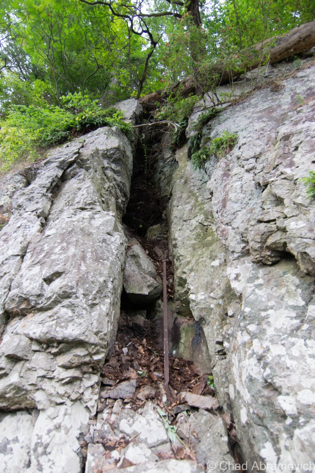
In the summer of 1852, an innovative boring machine that was supposed to begin gouging out the tunnel’s eastern portal in Florida, got stuck in the Berkshire bedrock and nobody could extract it – so the crew had to start over in a new spot, with a new drill. If you know where to look, the original borehole that’s sometimes called “the false start” can still be detected in the woods today.

The tunnel’s clumsy start and continual ensuing setbacks ultimately became too expensive for Mr. Crocker, who eventually, begrudgingly had to declare bankruptcy. Other investors and engineers attempted to pick it up, but all would ultimately fail, and the project would stammer until the state of Massachusetts – who saw its prosperous potential – took it over in August of 1862.

In addition to the state declaring that most of the botched work done by private investors would ultimately have to be redone, including widening the tunnel and reinforcing it with bricks, some practicalities also had to be employed, or there was a sure chance that both burrowing crews wouldn’t link up!

To make sure the tunnel-in-progress would turn into a tunnel-that-functions, 6 alignment towers were built over the planned path of the tunnel – 4 of them on the summits between the 2 digs and 2 at the entrances themselves.

The survey towers were simple constructions with stone foundations and a single-slant wooden roof. Each one was equipped with a transit scope (a device like a telescope) to make sure each tower aligned properly, and each had a red and white pole that protruded 25 feet up. Back then, the mountains had been cleared for farmland, so you would have been able to see one tower from another very clearly. Of the six that were built, the ruins of four can still be cooly detected in the mountains today!

Inside the tunnel, plumb bobs were driven into wooden plugs on the roof and hung from piano wire at intervals along the line that was sighted from the towers, and surveyors told the blasting crews which way to proceed.

And speaking of blasting crews, the Hoosac Tunnel was the first construction project to use nitroglycerin, but nobody was having a blast, because it directly accounted for a lot of the lives the tunnel would eat.

The endeavor would need so much nitroglycerin that a factory was built near the west portal to produce it. Over the years, I’ve heard intriguing but uncorroborated local hearsay that, though the factory is long gone, there are still several barrels of nitro that are lost somewhere in the Berkshire woods – and though I’m dubious, that delights me that the Berkshires still have wilds that things can still be hopelessly lost in, waiting to be found.

Because nitroglycerin was so new, most of the miners didn’t really know the dos and don’ts of working with the stuff, so a lot of accidental premature explosions happened, which either blew apart anyone in the vicinity, or pulverized them underneath mountain debris. Ironically, John Velsor, the new foreman at the nitroglycerin factory, was “blown to atoms”, as newspapers at the time put it – when around 800 pounds of the killer soup erupted in December of 1870. Not a single trace of the man’s body was ever found.

That certainly didn’t help anyone’s spirit, as the work had already been grueling from the very start. Crews were basically progressing a mere 2 feet a day. In the beginning, especially for the west portal activity, preliminary geological “surveys” saying that the rock was solid and sturdy were quickly proven wrong. What they were actually dealing with was what was called “porridge stone,” rock layers buckled into each other for thousands of years that were so saturated with water that they crumbled into something resembling quicksand. Miners complained that carving out the tunnel (especially the western portal) was like “building a sandcastle in the mud”. The highly unstable porous stone forced the builders to line a lengthy distance inwards from both portals with brick walls so that it wouldn’t collapse.   

The west portal was so wet and unstable that a 264-foot tunnel had to be built around the portion of the western tunnel that had been completed to drain all the water that was flooding the worksite. Now known as The Haupt Tunnel, after the project’s first engineer – it still exists for those intrepid enough to search for it, and is pretty sketchy – with a few spelunkers running into spiders and narrowly avoiding a few collapses over the years.

Brinkman, Nash, and Kelley

On March 20th, 1865, explosives authority Ringo Kelley prematurely set off a blast that crushed his two companions, Ned Brinkman and Billy Nash, under untold tons of rock. Oddly, Mr. Kelley disappeared not long afterward without a trace. Did he run away? Had the guilt of killing two men become too much to bear? Or maybe it was because other workers started to report that they saw the angry ghosts of Misters Brinkman and Nash walking around within the pit? All anybody knew for sure, was that Mr. Kelley was gone.

Exactly one year later to the day, Ringo Kelley reappeared. Well, his corpse did. His body curiously turned up within the tunnel, precisely at the spot where Brinkman and Nash died, and he’d been strangled. Deputy Sheriff Charles E. Gibson investigated and determined that Kelley’s death had occurred between midnight and 3 a.m. of the day that he was discovered. But no clues were ever found, and no suspect was ever identified.

I can’t even imagine the vigor that those guys must have had to muster and keep stoked just to face a day at work. Most of them needed the work too badly to quit, but, some of them couldn’t take it and walked off the job – either because of the dreadful conditions, or now, because there were whispers of the tunnel being haunted and people seeing strange specters within the dark passage that they thought to be the shades of their fellow deceased miners.

Soon, the Hoosac Tunnel project was being christened as “The Bloody Pit”, a nickname that the tunnel has never been able to get rid of. And its nickname-legitimacy-card would be pushed when the project’s worst calamity took place while digging its central shaft.

The Central Shaft

With a tunnel almost 5 miles long, ventilation was needed, or there’d be plenty of unfavorable predicaments, and the resolution was as astonishing as the tunnel itself.

The Central Shaft is a 1,028-foot vertical conduit through Hoosac Mountain – essentially a giant hole that would be dug from the top of the mountain all the way to the tunnel below. The shaft would mark the tunnel’s close-enough halfway point (the actual mid-point was too close to the Cold River for a safe dig), and once it was completed, provide it with ventilation. The opening would also become the fastest way to introduce laborers into the tunnel – by dropping them down in a giant bucket instead of them having to walk about two and a half miles.

On October 17th, 1867, crews had completed boring about half of the central shaft.

Thirteen men had been dropped in the pit and working away, when sneaky escaping fumes from a naphtha fueled lamp in the hoist house above, somehow ignited, obliterating the structure. A deadly rain of freshly sharpened drill bits and tools fell down upon the trapped men, followed by the winching machinery, and finally, the flaming debris of the hoist house itself. If that wasn’t bad enough for the hapless crew, the air and water pumps stopped working almost immediately, leaving them stranded without oxygen as the shaft started to fill with water.

Helpless onlookers realized that nothing could be done, except for speculating whether the men who survived the falling debris would either die of suffocation or drowning.

When the smoke had finally cleared a little after 3 A.M., a miner by the name of Mallory volunteered to be lowered down on a rope to investigate and was given 3 oil lanterns for perceptibility. He was eventually pulled back up when 2 out of the 3 lanterns were snuffed out by lingering noxious gasses. Once above, he barely gasped out the words “no hope”, and then fell unconscious.

The flooded shaft was covered up and left untouched for about a year. Maybe it was partially because people in the vicinity claimed that they started seeing indistinct, fleeting shapes that’d be lurking one moment, and fading into the Berkshire inclines the next. Muffled disembodied groans and cries could also disturbingly be heard, almost like they were spooling out from within the earth itself.

But, the central shaft needed to be completed, so a year later, it was finally drained of water, and the bodies of those that perished down there were finally exhumed. That was when a chilling discovery was made; a raft was found.

Those that survived the initial ordeal had crudely taken a futile stab at survival – eventually dying of asphyxiation or starvation as the world above deemed them as already dead. Interestingly enough, those strange visitations and visions that haunted the domain prior, seemed to vanish afterward.

On August, 13th, 1870, the Central Shaft was ready to start central shafting, when it finally broke through the mountain and connected with the tunnel below.

Hoosac’s Horrors

But by now, the Hoosac Tunnel project morphed into the well-tread beat of other arcane phantoms that seemed to treat the tunnel as a manifesting mecca, and the formula seemed to be when one group of shades decides to split, others get ready to turn up the tomfoolery.  And as early as the 1870s, the gristly phenomena was starting to attract early ghostbusters – an allure that has never faded.

One of the first was a Dr. Clifford J. Owens, who on the night of June 25, 1872, took an expedition into the tunnel accompanied by drilling superintendent James McKinstrey. What the two men witnessed was reported in detail in Carl R. Bryon’s book A Pinprick of Light: 

“We had traveled about two miles into the shaft when we halted to rest. Except for the dim, smoky light cast by our lamps, the place was as cold and dark as a tomb… Suddenly I heard a strange mournful sound. The next thing I saw was a dim light coming from… a westerly direction. At first, I believed it was a workman with a lantern. Yet, as the light drew closer, it took on a strange blue color and… the form of a human being without a head. The light seemed to be floating along about a foot or two above the tunnel floor… The headless form came so close that I could have reached out and touched it, but I was too terrified to move.”

The apparition remained motionless in front of them as if it was looking at them just as they were of it, before floating toward the west end of the tunnel and vanished.

In October 1874, Frank Webster went missing when hunting near the tunnel. When searchers found him in the woods days later, he was in shock. He confessed that he had heard weird voices – their macabre siren song had coaxed him to enter the tunnel. He went in, and saw ghostly figures milling about that took his hunting rifle and beat him with it! He had the scars to prove it, but no rifle.

The next year, Harlan Mulvaney, an employee of the Boston & Maine Railroad, was supposed to deliver a cartload of wood nearby, but instead, fled in an unexplained panic and was never heard from again.

Despite all of these sinister happenings, eventually, both digging crews eventually met up in the middle of the mountain, and were less than an inch off! The plan had worked!

A New Marvel

It’s hard to imagine that simultaneously digging at both ends of a mountain over two thousand feet in elevation for twenty-two years and meeting in the middle using only plumb bobs and piano wire as a compass, would create what became America’s longest tunnel, a landmark in hard rock tunneling, and a new world wonder. The Hoosac Tunnel also laid down the rules of construction for practically all subsequent tunnels, and that’s still true today. I wonder if Mr. Crocker ever imagined that his hubris and attempted resolve would wind up being that impactful?

At almost five miles long, twenty-four feet wide, and twenty feet tall, using twenty million bricks to keep it together, it cost over $21 million, which was about ten times the initial price estimate. It would also cost an estimated 200 lives, with some saying that number is as high as 300.

The tunnel’s headings (both respective routes from each side) were purposely inclined by 26 feet per mile – with both slopes meeting up at an elevated mid-point so all the water that puddles inside (there’s a lot) is drained out through both portals, but it also prevents you from seeing one end from the other end, making the passage seem endless – peering in, you only see blackness.

On February 9th, 1875, the remarkable Hoosac Tunnel was ready for its first train, and it became a big deal basically from the get-go, becoming both a cog in the regional economic engine, a tourist attraction, and a memento for some patriotic flexing.
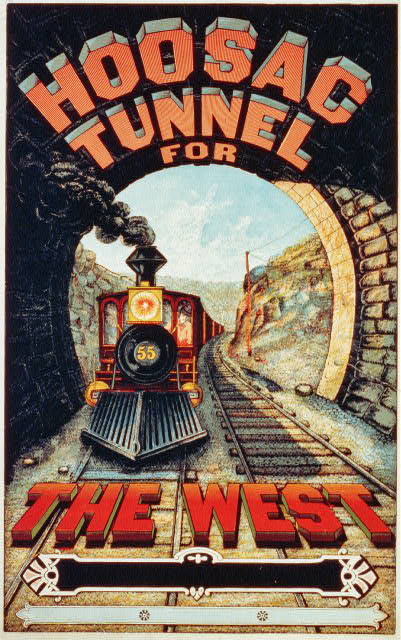
Original Hoosac Tunnel promotional advertisement, circa 1888/1889 – via The Library of Congress
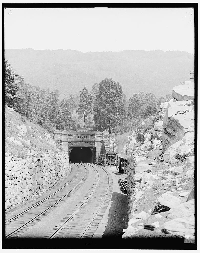
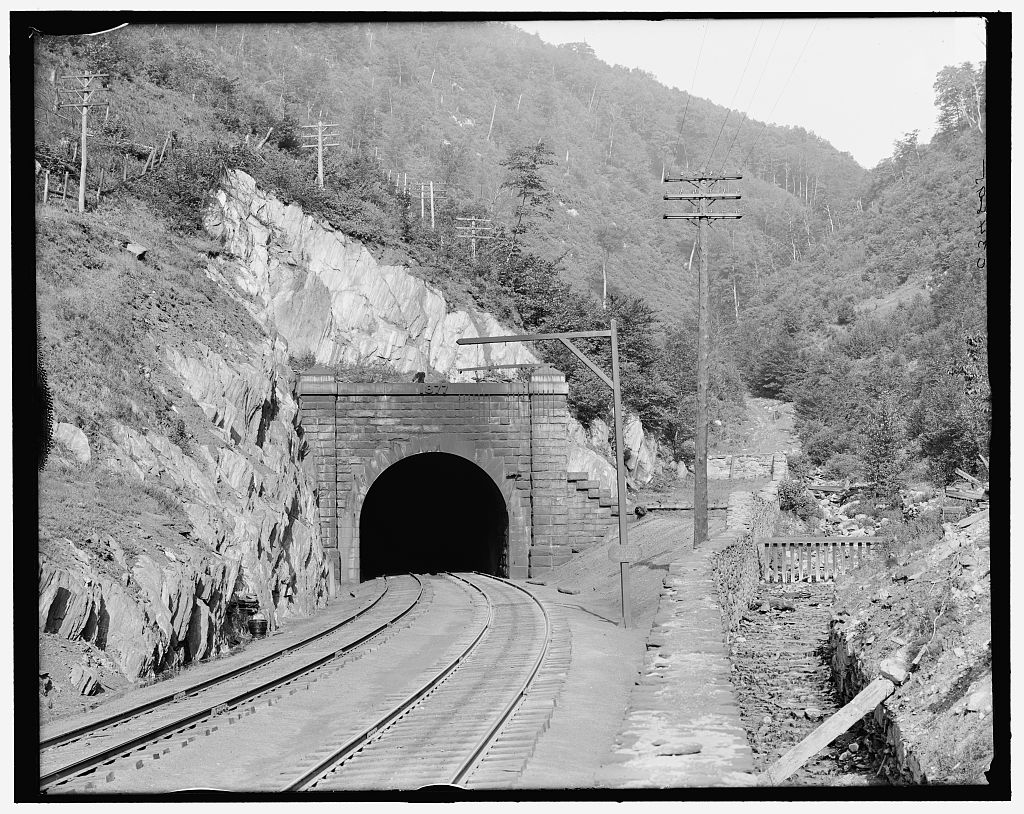
Historic photo of the Hoosac Tunnel’s East Portal, Florida, Massachusetts. Circa 1900-1910. Via The Library of Congress
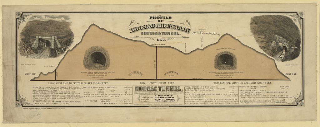
Neat vintage Infographic: Profile of the Hoosac Range showing the tunnel underneath – 1877. It’s really interesting to see exactly how it’s laid out! Via The Library of Congress
Historic photo of the Hoosac Tunnel’s West Portal, North Adams, Massachusetts. This view has changed quite a bit nowadays! Most notably, the introduction of the “Snow Door” in the 1950s. Photo taken circa 1900-1910. Via The Library of Congress

The Tunnel Today

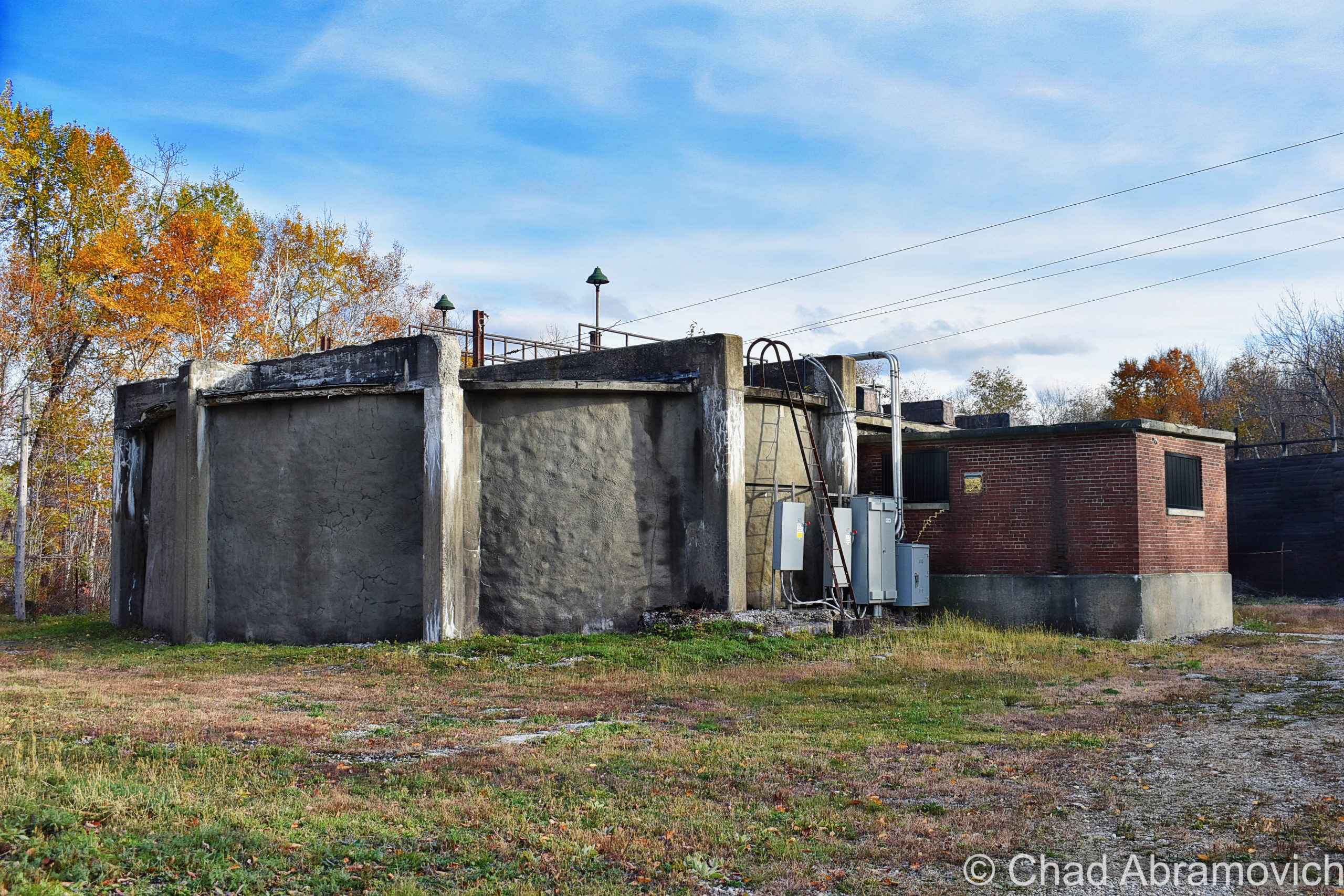
In the coming years, more improvements and features would be added. The tunnel originally had a double set of tracks running through it, because of the enormous amount of trains that were utilizing the American rail network in its prime. And all of those locomotives were powered by coal – which belched an awful lot of noxious smog as a tradeoff, which was making the tunnel a pretty hazardous environment, regardless of the central shaft’s existence. Seriously. Some people were actually succumbing to asphyxiation on trips through the tunnel. So in 1911, electricity was brought in to power a fan atop the central shaft to help pull the fumes out. But even that wasn’t completely eliminating the problem, so briefly, the tunnel went electric, and trains had to stop before entering and then be pulled through via electric cables. In 1946, a double fan system was installed at the top of the central shaft, which are the same ones in use today.

Directly below the central shaft, a room was blasted out of the mountain rock and became a shanty for trackwalkers and work crews, and inadvertently, it also became a frequent haunt for hobos – which earned the chamber the affectionate nickname “The Hoosac Hotel”, or sometimes “The Hoosac Hilton” – both of them still enthusiastically used in tunnel-talk today. I’ve also heard the possibility of there being some of the now-iconic “hobo graffiti” – a pictorial-based clandestine communication system invented by savvy recalcitrant turn of the last century train hoppers and vagabonds, scrawled somewhere within the room, but so far I haven’t seen the evidence.

The Hoosac Hotel has a real creepy vibe to it, and that might be influenced by the fact it’s in the same spot that a large section of tunnel collapsed and killed a bunch of workers, and some say it’s also where misters Brinkman and Nash were discombobulated by an explosion. Nearby is said to be the legendary secret room(s), walled up to contain some awesome horrors.

It’s also the physical characteristics that alter the mood. The room is separated by the tracks with a wall of sordid century-old bricks that have a dark patina with age and all the pollutants that used to hang around within the tunnel – the ceilings are the natural mountain rock that constantly dribbles with water. Even with flashlights, the darkness practically ruins the light, but you can still make out the forsaken relics within; an old wooden desk, chair, and dented archaic communication and control equipment – all slimy and glistening because of the dampness. Modern relics like Twisted Tea cans and Slim Jim wrappers strewn on the ground alert you that you’re not the first one to venture this far into the tunnel, even though you really start to inwardly feel that you’re a whole world away once you’re that far in. I’m sad to say that my photos of this room that I took back in 2012 have been lost since then, so I’m gonna have to make another trip in to get some more photos up on this blog.

More sinister urban legends told of bodies wrapped in black trash bags found in the creepy room. Other yarns tell of other secret rooms built both somewhere in the tunnel and up in the central shaft that had been curiously bricked up. Some people say these spaces contain some unspeakable horrors that are best left undisturbed… (Check out this cool video below. These badasses not only explore the Hoosac Hotel, but they actually repel up the central shaft from inside the tunnel!)

The incredible Moffat Tunnel in Colorado took the accolade of the longest manmade tunnel in the western hemisphere in 1916 – at 6.2 miles underneath the Rockies! Then Washington’s 7.8 mile Cascade Tunnel became the longest in 1929, and currently, the Rogers Pass tunnel in British Columbia at 9.1 miles holds the record. But the Hoosac Tunnel basically wrote the manual on modern-day tunnel building, and all of these latter construction projects were successful because of what was learned while building it.

The American Society of Civil Engineers made the tunnel a Historic Civil Engineering Landmark in 1975, and it remains the longest in-use railroad tunnel east of the Rocky Mountains, and though it’s basically more of a curiosity nowadays, us New Englanders still love/fear the Hoosac pretty affectionately, and dark tales are still told…

In 1973, Bernard Hastaba was in the mood for an adventure and decided to walk the entire tunnel. He entered via the North Adams side, and never re-emerged. He wasn’t found inside, he wasn’t found at all. He had, apparently, vanished entirely.

In 1984, a professor and hobbyist ghost hunter named Ali Allmaker was gripped with the uncomfortable sensation of someone, or something, standing next to her. She described whatever it was as walking right behind her, and feared that it would try to grab her and pull her into some unknown, awful horror. Maybe Mr. Hastaba encountered the same situation on his walk through the tunnel, but wasn’t as fortunate…

There are still modern-day accounts of weirdness, mayhem, and paranormal pandemonium in and around the tunnel today, and that’ll probably continue to be the trend.

Strange winds, wily apparitions, disembodied voices both caught on tape recorders and heard in real-time, and odd illuminations like balls of blue-ish lights, and a more railroad-centric phenomenon that’s also spotted around the country; spook lights. Given the Hoosac’s pedigree, I’d honestly be pretty disappointed if spook lights didn’t give an appearance here. “Ghost hands” have also been known to both push people in front of moving trains and pull them back out of harm’s way. It just depends on the day I guess?

As for its mortal caretakers, Pan Am Railways owns the passageway now, and it looks like they do a kinda lousy job at maintaining it, which is tragic. The West Portal’s snow door was added in 1954 – which is basically a big steel garage door installed after a locomotive derailed due to ice on the rails inside, that help keep snow and other nasty weather out of the structure and has become a defining feature of the west portal.

Originally 2 sets of tracks ran through the tunnel, but it’s been down to a single track since 1957 when tractor-trailers and the interstates became the leading mode to move. The last passenger train went through in 1958.

Around 8 freight trains a day are now all that run through its lonely void – and some of them are called “truck trains”, which can be as up to three miles in length and help reduce some of the traffic on the bay state’s byways. Structural engineers have been analyzing the tunnel since the end of the 20th century to see about renovating it so double-stacked container freight trains could pass through it – the track grade elevations were even dropped in 1997 to allow more clearance and taller railcars, but ultimately, the cost was deemed too high, and not imperative enough because there’s already a suitable route through southern Massachusetts, which I suppose is a bit ironic.

It’s kinda sad that it isn’t used more, given just how much effort went into creating it, and realizing that there was a time when a few National Guard soldiers would actually be stationed at both entrances during times of war to prevent potential terrorist attacks on it.

In early 2020, there was a substantial collapse about 300 feet into the more vulnerable western heading that shut the tunnel down for a few months, caused by both general wear and tear, and water flowing in from above the tunnel that was being trapped in blocked drainage tunnels that were supposed to be being maintained, which created a sinkhole that dropped about a 150 feet of mountain onto the tracks and opened up a cavity in the slope above. A structure this old, and this “constantly getting fisticuffs from the environment” is practically guaranteed to need some fixin’ up as the years pass by, but I really hope the Hoosac Tunnel doesn’t become the Hoosuck Tunnel. I really outdid myself with that last sentence.

But seriously, though, it’s such a special and uniquely New England landmark that’s left an epic indelible impression on our rhapsodized region. It would be a huge shame for it to diminish. Oh, and a literal topographical catastrophe.

Berkshire ODDysey 

It was the week of Halloween, and I and a few friends took a jaunt down to the Berkshires to see some oddity and see some foliage, and were listening to the podcast Lore to rev up the creepy vibe. It was also one of the loveliest fall days I’ve ever encountered!

The Berkshires are actually an extension of Vermont’s Green Mountains that have a reputation of their own, so I figured I oughta do more exploring around their nooks and crannies seeing how I live so close. Usually, we’d hit up the old racetrack in Pownal if we were heading down that way.

It’s pretty amazing how much the landscape changes once you cross the Massachusetts state line – It basically immediately gets kinda suburban-y and billboard-y, and this is supposed to be one of Massachusett’s most “rural” areas. Even a good chunk of Berkshire backroads are paved and feel like you’re really in a suburban fringe community than actually in the mountains. But then again, Vermont is a bizarre bubble, and it’s only until Vermonters begin to venture outside our state lines that we recognize this.

We drove through the neat historic mill turned liberal arts burb of North Adams, a town that the Hoosac Tunnel fundamentally ensured would thrive. The tunnel is even on their town seal that declaratorily exclaims “we hold the great western gateway”, which as far as civic iconography goes, is pretty rad.

3,489 foot Mount Greylock – the tallest height in Massachusetts and named after a legendary Abenaki chief – loomed over the wobbly rows of old mill tenement houses that bracketed the main drag. Greylock is a mountain with some cool footnotes hidden up its non-existent sleeve. The only taiga-boreal forest in the state survives upon its slopes, and a unique natural feature called “The Hopper”, a glacial cirque (a natural amphitheater-shaped valley) has been declared a National Natural Landmark. An asphalted scenic seasonal road curves its way up to the summit, and it always reminds me of an inactive blog post I read years ago about some young guys who decided to literally race the sun. They embarked in the dark at the top of Mount Greylock and tried to see if they could hightail it to Cadillac Mountain in Maine’s Acadia National Park – the first place the sun rises in the United States – to catch it happen. Sounds fun to me!

We linked onto the famous Mohawk Trail in North Adams, which in itself was an adventure! The Mohawk Trail is the affectionate and designated byway name for MA State Route 2. The name came from the fact that the road tar you’re driving on top of was put over what used to be a literal Mohawk Trail – a vital path that connected The Hudson River to the Connecticut River via going up and down the Berkshire Hills that was originally used by the local Mohawks and other area First Nation clans like the Mahicans, for trade, hunting, travel, and warring their enemies.

The Mohawk Trail basically invented and then literally paved the way for the idea of the American road trip, long before iconoclasts like Route 66. It got its start in 1914 when the state dished out money to improve the road around the dawn of the automobile craze. Early strategizing automobile clubs started to peddle the road as a tourist attraction to bring some cash into western Massachusetts, and it worked so well that it planted the seeds for Americans seeking out particular roads to drive for pleasure.  It’s still on my bucket list to drive the whole thing!

But, this scenic route wouldn’t be very scenic anymore with over-development, so foresighted conservationists before there were really conservationists started zoning and limiting development along the roadside, to keep one of the wildest parts of Massachusetts wild. The commonwealth acquired 5,000 acres of mountain slopes and created the Mohawk Trail State Forest in the 1920s, and during the Great Depression, the CCC came to the area and spruced it up by building roads, primitive campgrounds, and cabins up along miles of serpentine hill climbs. The tallest tree in all of New England – a 168-foot white pine named Jake Swamp – as well as about 700 acres of extremely rare old-growth forest with some trees over 400 years old – are somewhere within the state forest.
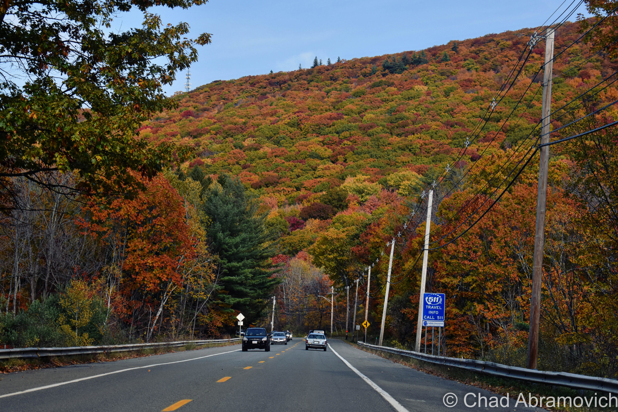
The Hoosac Range rises above the Mohawk Trail just east of North Adams. This is part of the mountain that the Hoosac Tunnel runs under!
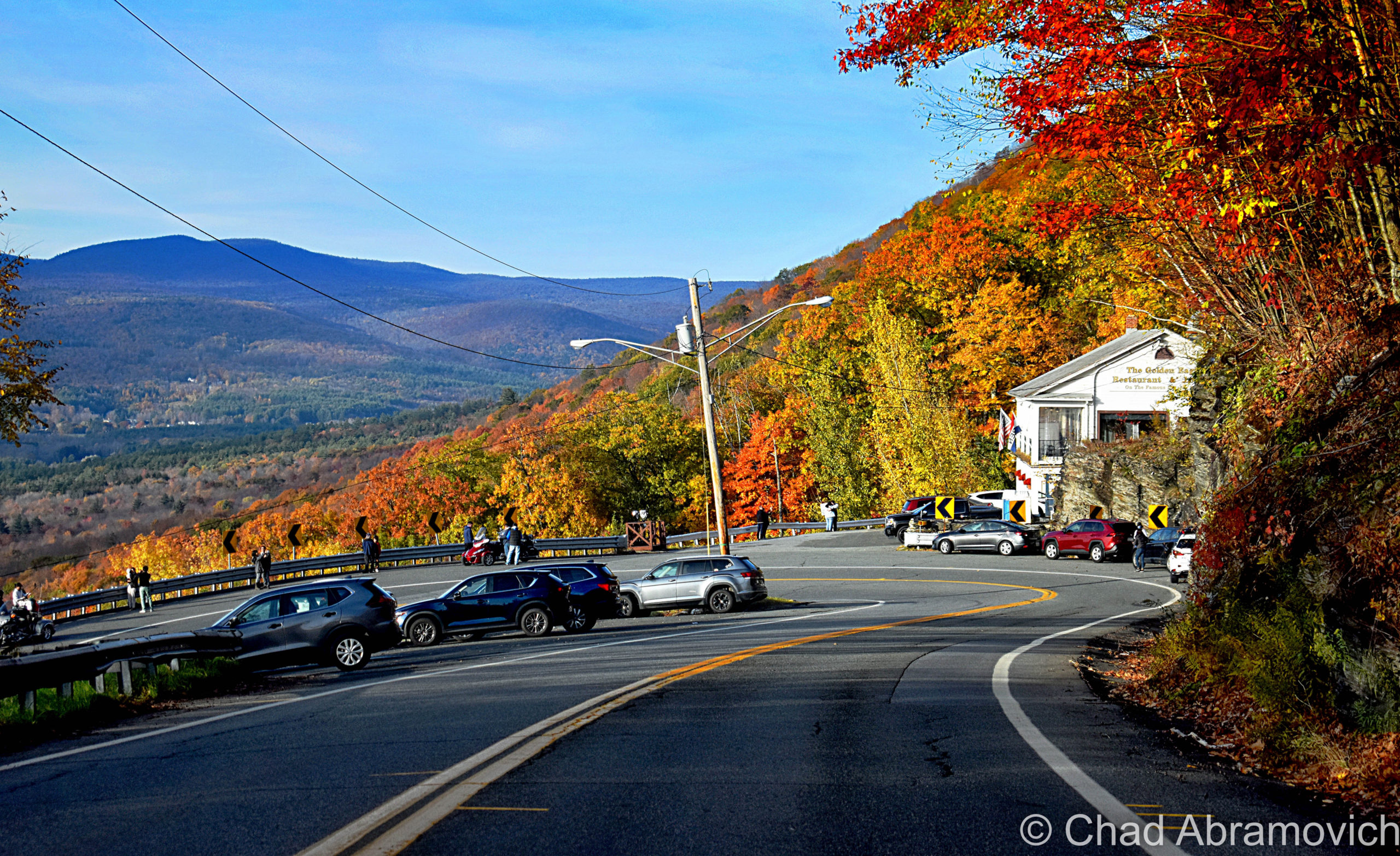
The iconic hairpin turn on the Mohawk Trail – the hills of southern Vermont can be seen in the distance

And then there’s the wicked hairy hairpin turn on the side of a mountain on the Clarksburg/North Adams town line, one of the more distinguished and (in)famous sections of the trail.

At the top of the Hoosac Range, you’ll enter the town of Florida, marked by one of Massachusetts’s iconic book-shaped town line signs, and is the total opposite of what we think of when we hear the word Florida. It’s the highest town in elevation in the commonwealth, and allegedly gets more snowfall and colder temperatures than any other town in Massachusetts. The name, too, is kind of a mystery. Even the town’s website gets shoulder shruggy at how the name was chosen. It is possible that the name was an invented one, bandwagoning on a trend in New England around the 1800s where remote, mountainous towns with poor farmland were given ‘exotic’ or pleasant names to lure settlers there.
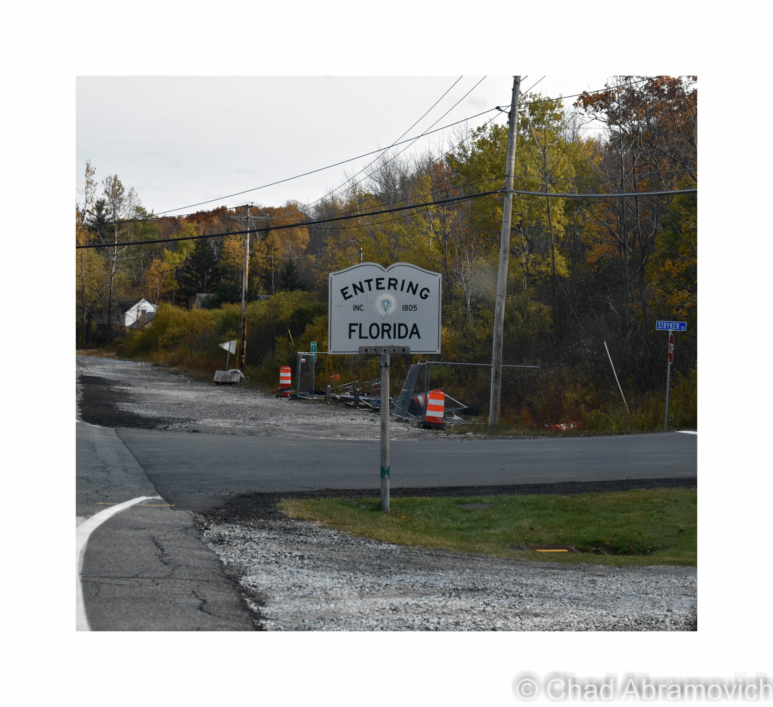
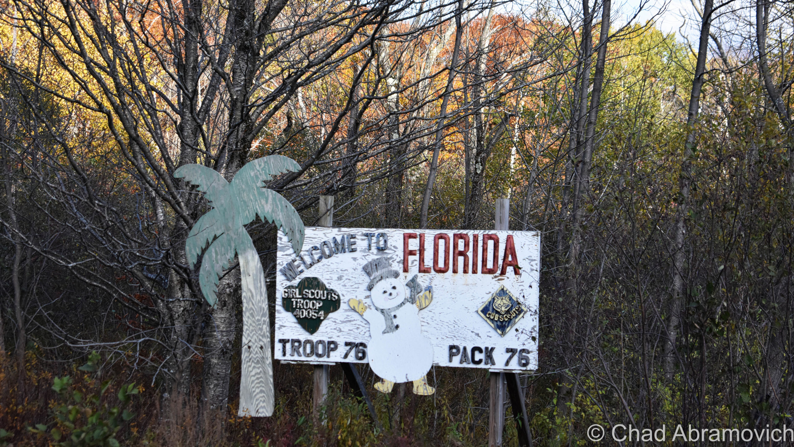
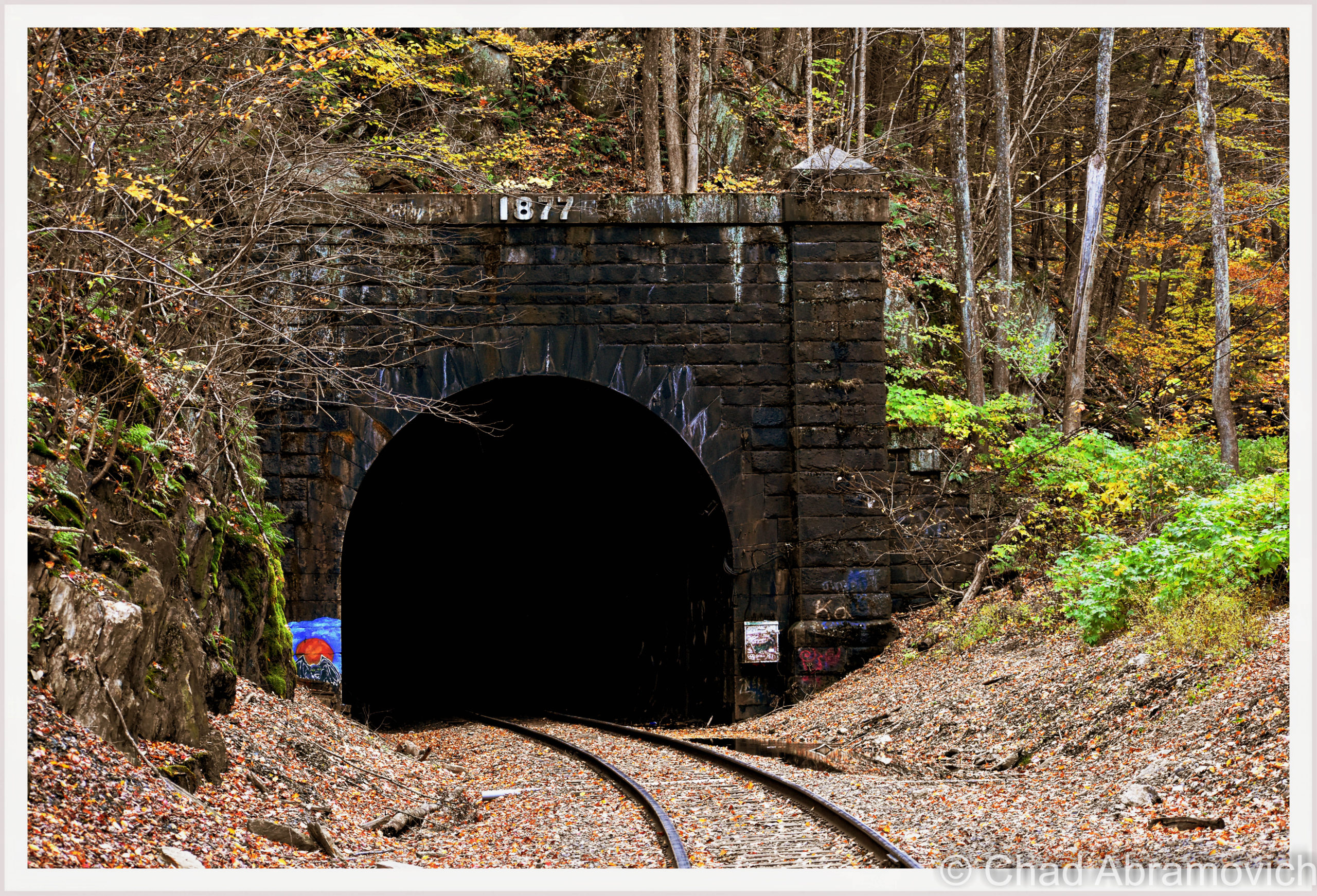
Florida is also the gateway to the Hoosac Tunnel’s eastern portal, which is the easiest of the two to see. From the Mohawk Trail, we went from the top of the Hoosac Range to the bottom and drove through an uncanny valley where New England’s perennial death was some of the most glorious I’ve ever seen – before we saw the giant hole in the mountain that told us we were there.

“The great bore” was everything but a bore! Standing at the foot of its wickedness was awe-inspiring and intimidating.

Cold, sour air belched from the murk and cryptic sounds echoed and cursed from within. Icy groundwater salivated from the ceiling and pooled along the tracks. Pieces of century-and-a-half-year-old brickwork occasionally crashed down with lethal strikes.

On a white-hot summer day back in 2012, I explored about half the length of the tunnel with a good college buddy of mine. I remember measuring that trip as such a big deal for me, because it was my first oddity expedition outside of Vermont, around the time when I was really struggling to find my identity and my beat out in the universe, and just beginning to try my prowess at blogging.

The tunnel was a tourist attraction even then, which was evident when an assembly of Hell’s Angels rumbled up next to us and decided to join us on our foray into the transport tube’s east portal. Well, at least that’s who they proclaimed to be. Some of those guys looked like they could do some casual origami with a parking meter, so I didn’t feel up for fact-checking them.

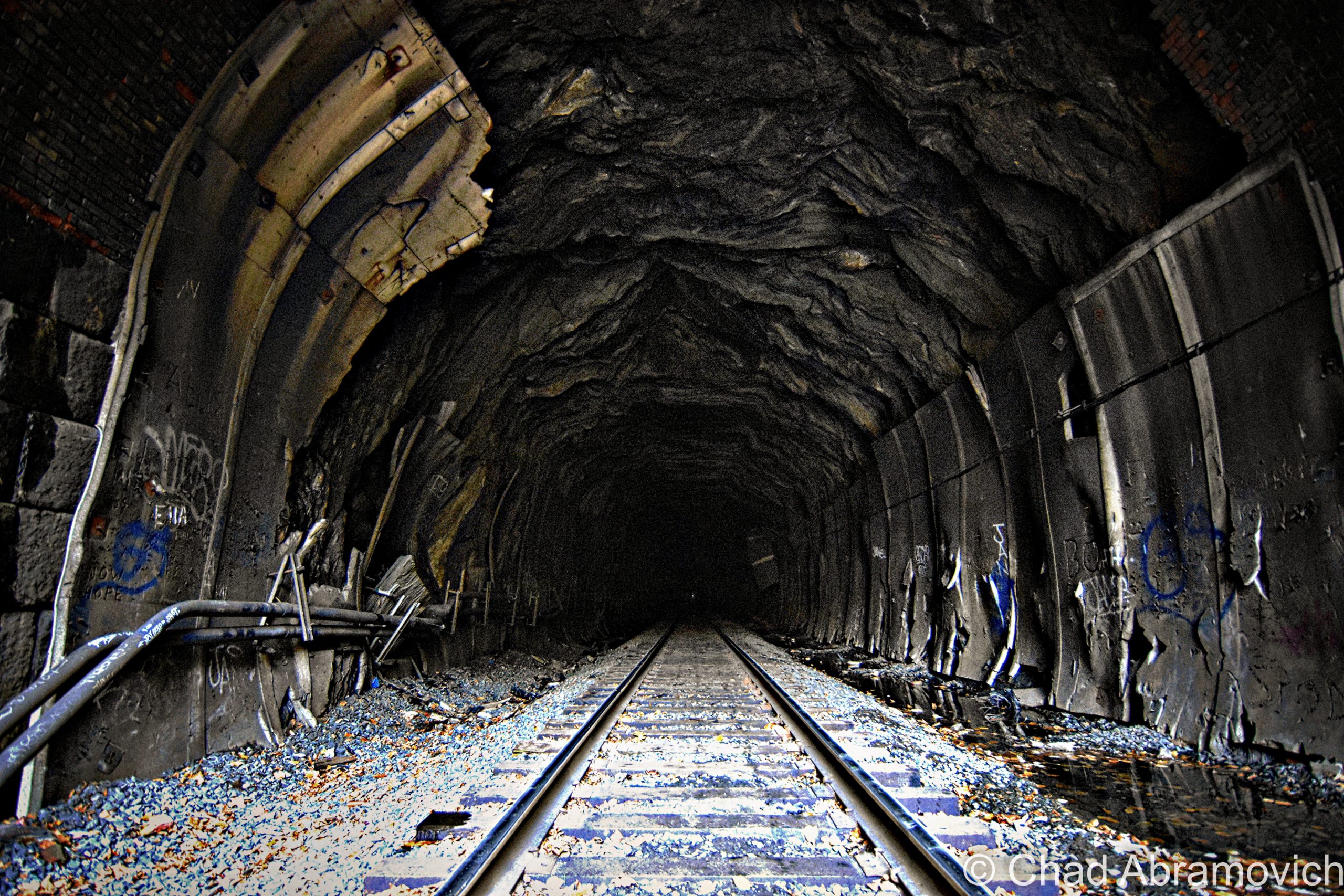
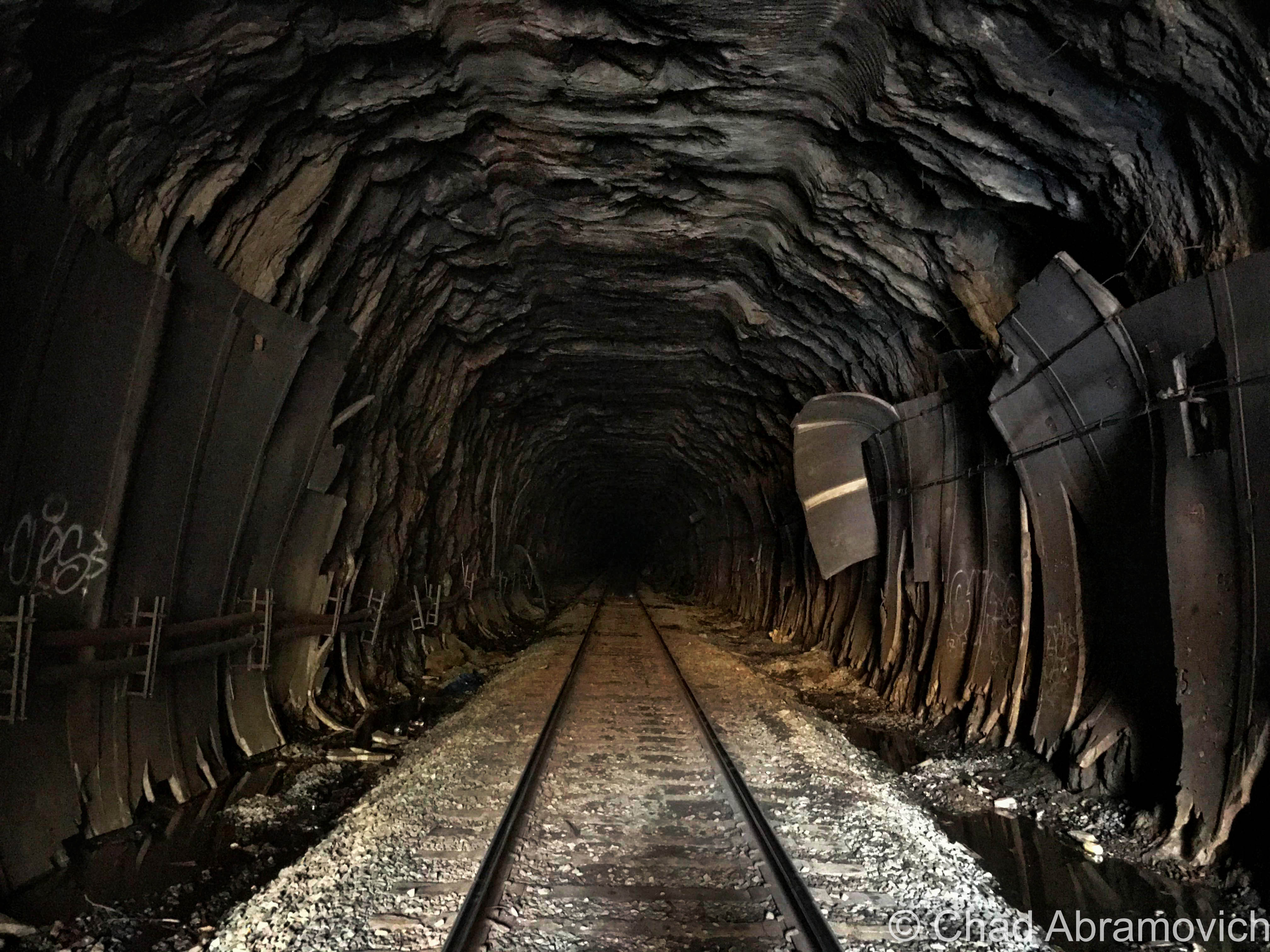
Leaving the Berkshire heat, the clammy darkness swallowed us and gave us a lot to stumble on. Endlessly falling water formed rivulets along both sides of the tracks, clogged with silt, gravel, brick shards, and sporadic live electrical cables. The tracks faired no better for a less accident-prone passage – the wooden railroad ties were warped, in various stages of deterioration and glistened with wetness, and made anything that wasn’t a slow and steady walk not such a great idea, unless a rolled ankle won’t throw off your mojo. I’m not in that camp of people.

We were about five minutes into the tunnel and the wife of one of the bikers had some kind of a happening. She immediately stopped in her tracks on the tracks, and explained she had the ability to detect when ‘spirits’ were in proximity. Not only were there apparently hoards of them in the tunnel, but according to her, they wanted us out. So she and the rest of the Hells’ Angels vamoosed, and me and my friend decided to continue onwards to the Hoosac Hotel.

I was far more concerned about running into a freight train than a ghost, and the fact that, even if I press myself up against the grimy tunnel walls, I barely have a few inches of space between me and the whizzing side of the locomotive to prevent me from being smashed. They pass through at random hours, spew potentially lethal amounts of diesel fuel, and the racket is enough to potentially cause some hearing damage, if not complete deafness.

Water was everywhere, seeping out of the ceiling and raining down our necks and soaking our boots. Bricks crashed down to the earth erratically. We were far enough in the tunnel where the daylight coming in from the east portal could no longer be seen – it was just a sullen lacuna, and the silence was so intense, my tinnitus buzzed through the strange isolation like crazy. It was gritty, dirty, and cold.

Then, I saw something far ahead in the distance, that today I’m still uncertain was paranormal or not. Within the ghastly illumination of a lone crimson tunnel light affixed to the natural rock wall, I saw a startling silhouette of what appeared to be a man. I abruptly stopped my progress forward, motioned to my friend, and uttered something along the lines of “Fuck, we’re busted”.

I wasn’t thinking it was one of the tunnel’s many shades, I thought it was an actual railroad employee that was gonna bring the law down on our trespassing butts. Motionless, we stood in place, and I stared at this figure, trying to understand what I was seeing. Its outline appeared to be dressed up in clothes that I regarded as “official-looking”, like an old-fashioned uniform, which further backed up my fear that it was some kind of authority figure that was making haste towards us. But that was when I noticed, that no matter how long we were watching it, and despite the fact that the strange man looked like it was practically power walking in our direction with determination, it strangely never seemed to gain any ground – it just kept on walking but never making any progress.

Then, we saw another light and another figure. This new sight, however, was definitely making progress in coming our way. It was a train. My friend and I booked it and clumsily sprinted back towards the safety of the east portal as fast as we could, as we stumbled and slipped over slippery tracks and adjacent inundated burms. We made it out just in time as a lengthy locomotive came barreling out behind us – grimmy, wet, and desperately trying to chase a little breath. To this day, I’m not sure exactly what was hustling towards us in that tunnel. Maybe we should have listened to biker wife lady?

In the fall of 2020, me and some other friends decided to take a jaunt down to the Berkshires to revisit the tunnel, and to get a little relief from the stresses of the pandemic, and we had a lot of fun. It was around the close of the evening by the time we had arrived, and the tunnel was crowded with obnoxious social media influencers and TikTokers, but it was engaging to see it again – you never really tire with a site like this one.

Next time I head back, I’d like to finally make it to the Hoosac Hotel and get some pictures to share with y’all on this blog post!
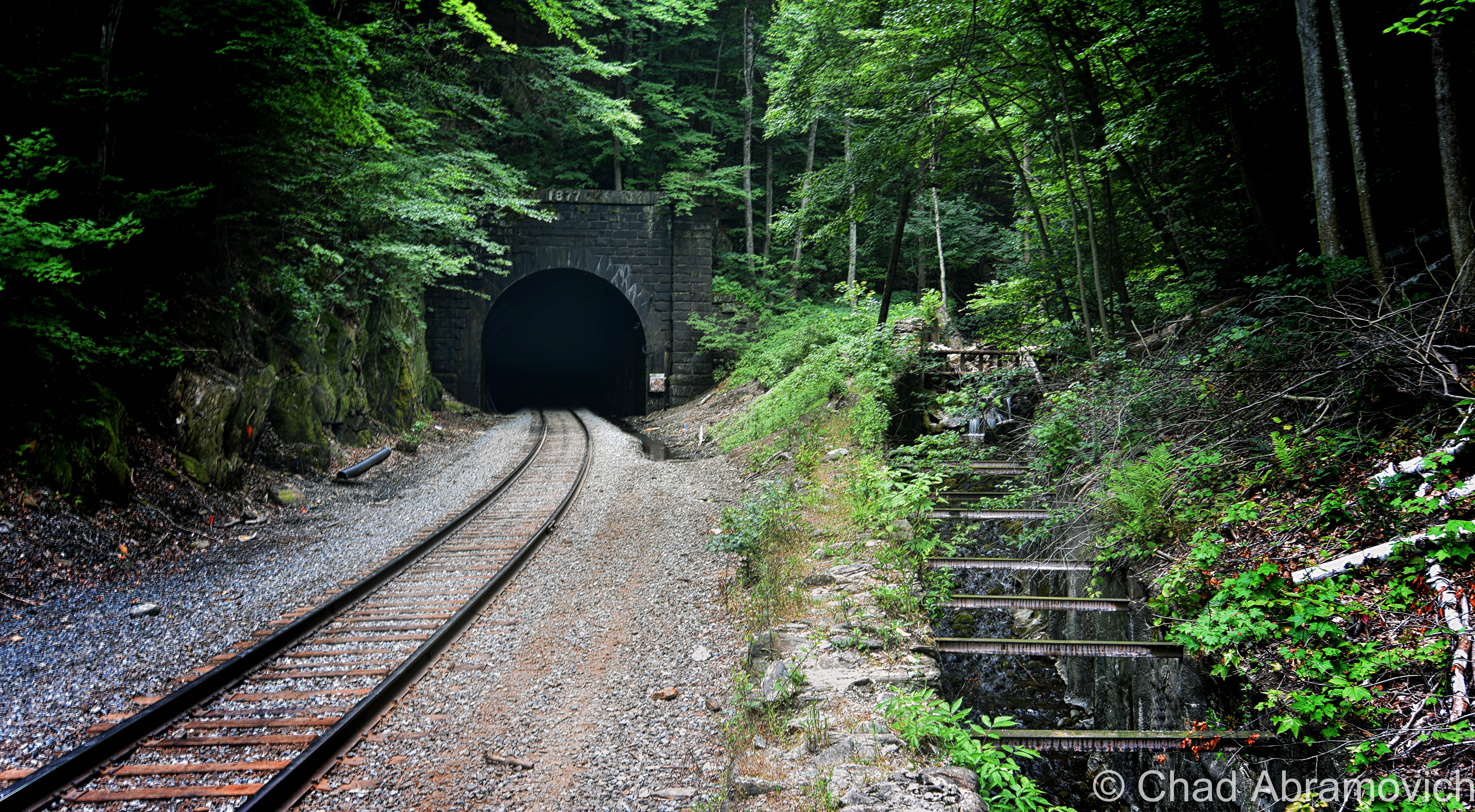
Taken on a humid mid-summer evening in 2018. Cascade Brook runs to the right of the tracks and was contained within a stone sluiceway – most likely to prevent the tracks from potentially washing out when the brook decides to get floody. Railroad ties were installed and spaced along the top of the structure, which I thought was kinda neat. If you bushwhack along Cascade Brook up into the mountains, you’ll be rewarded with the sight of the Twin Cascades – two waterfalls plunging as high as 80 feet that most visitors to the Hoosac miss out on!
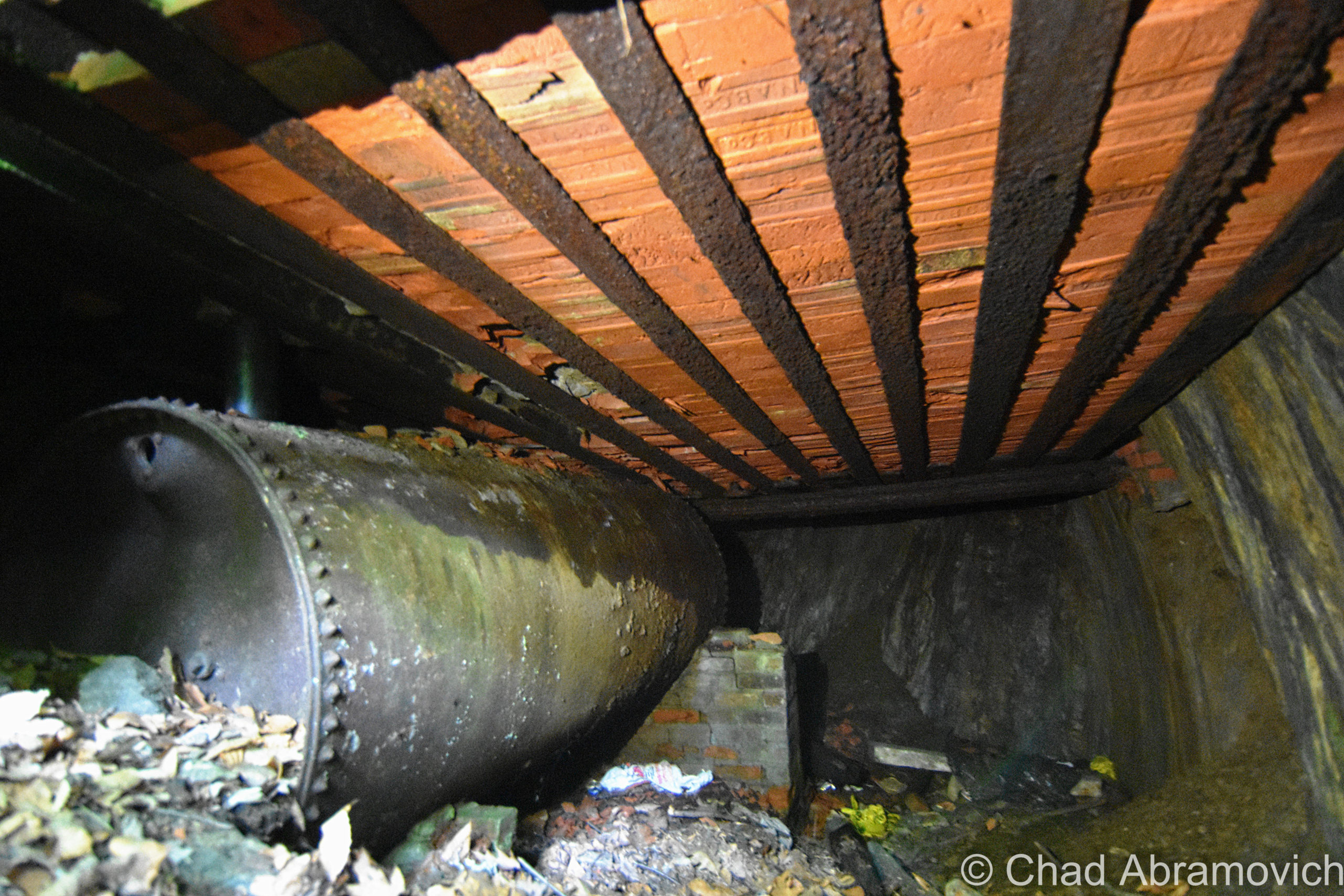
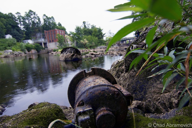
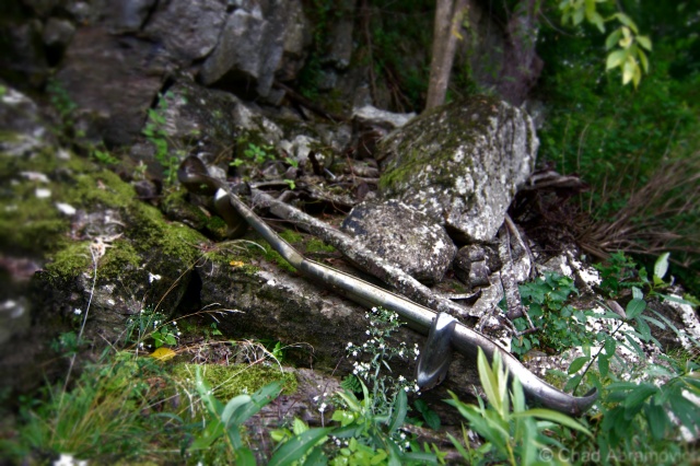
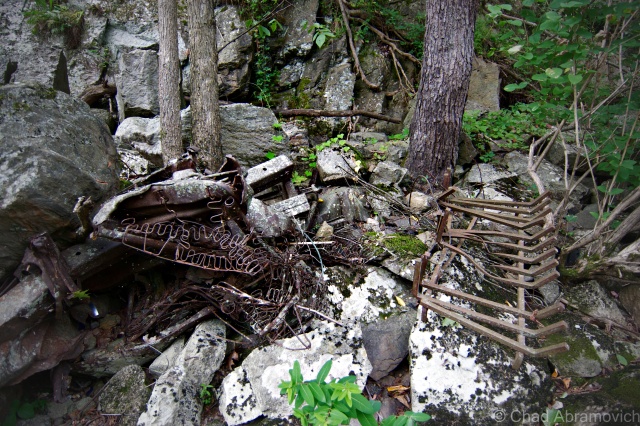
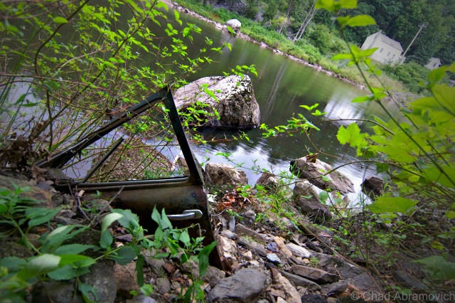
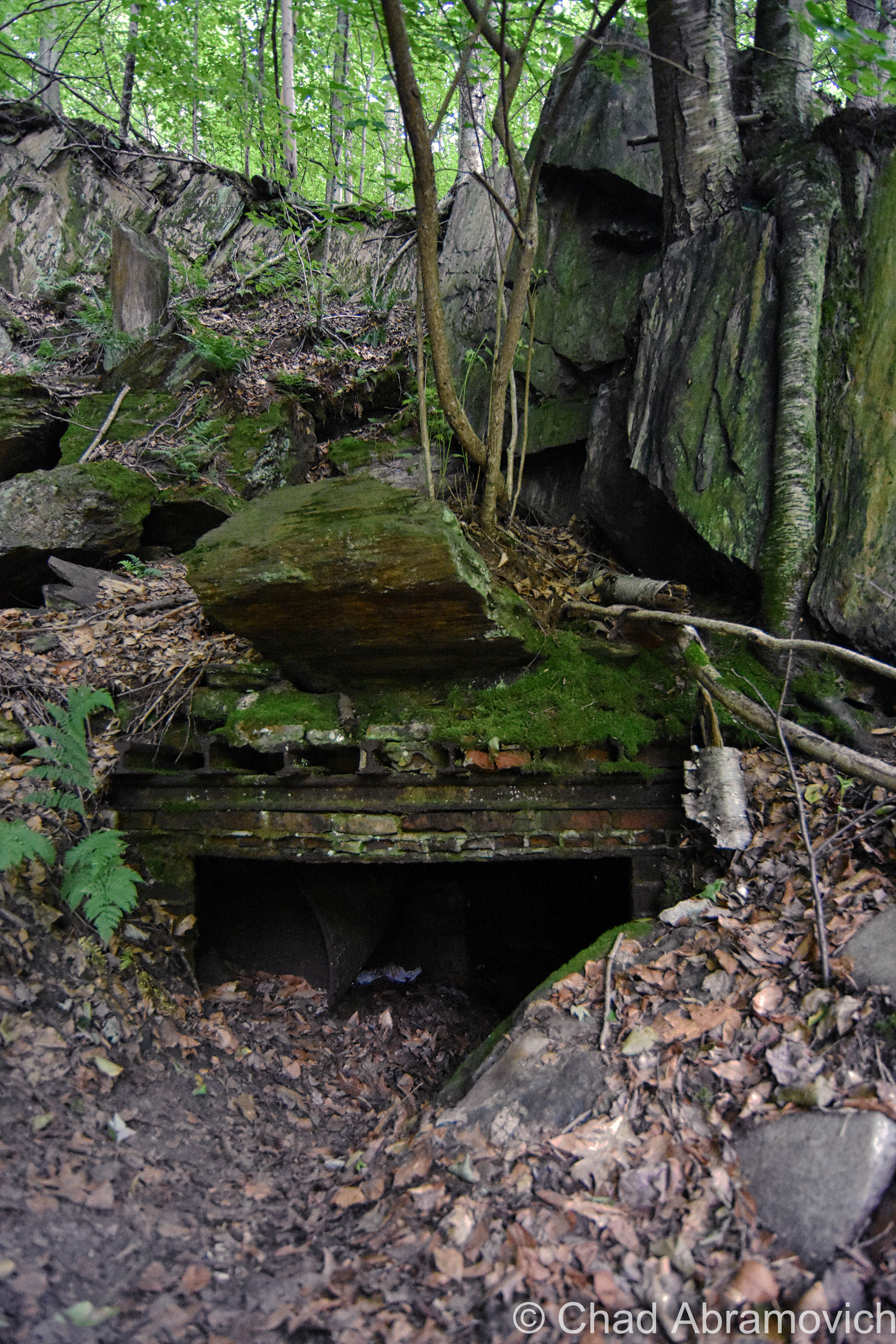
While I was lazily trying to see if I could find the cavity from the “false start”, I instead found this curious little storage pocket – a tiny brick space built into the cliffside that’s long been filling in with earth and dead leaves.
Took a quick peek inside and found some old machinery bits!
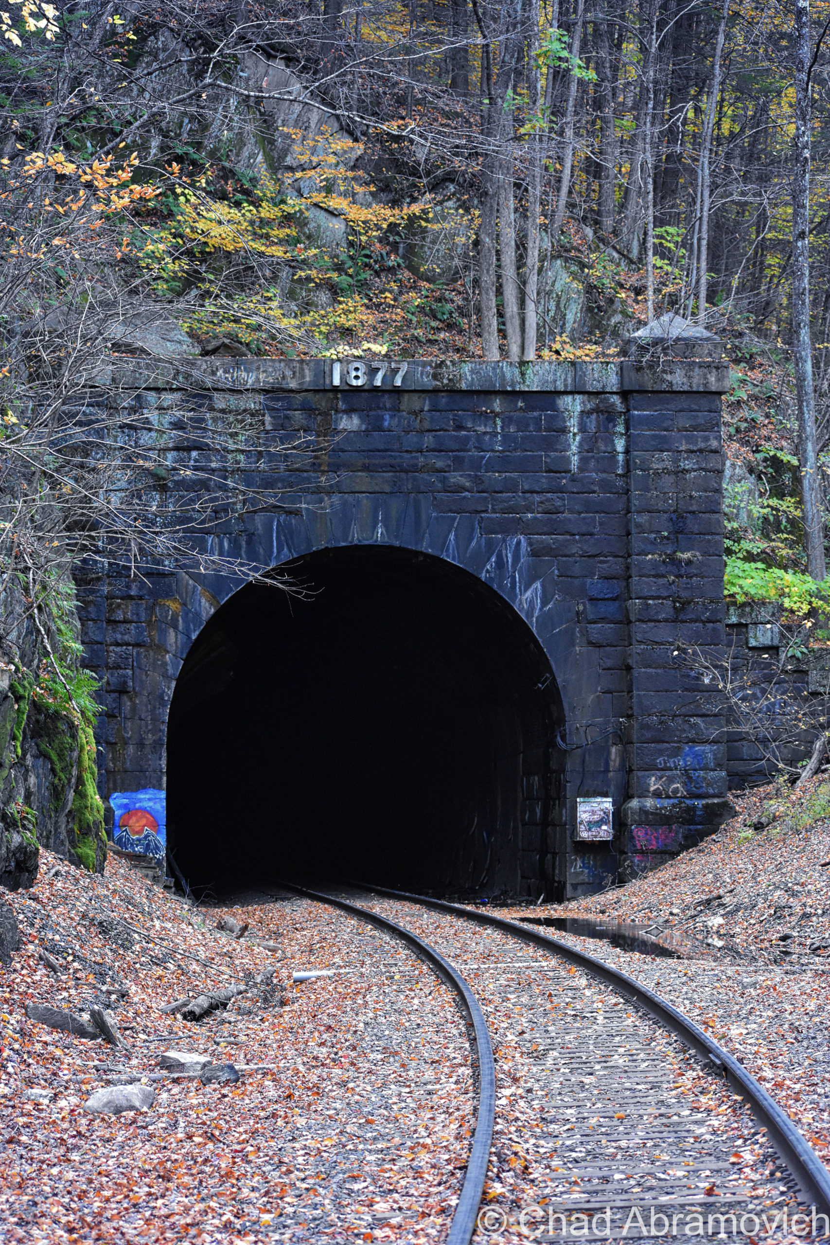
The east portal of the mighty Hoosac Tunnel, October 2020

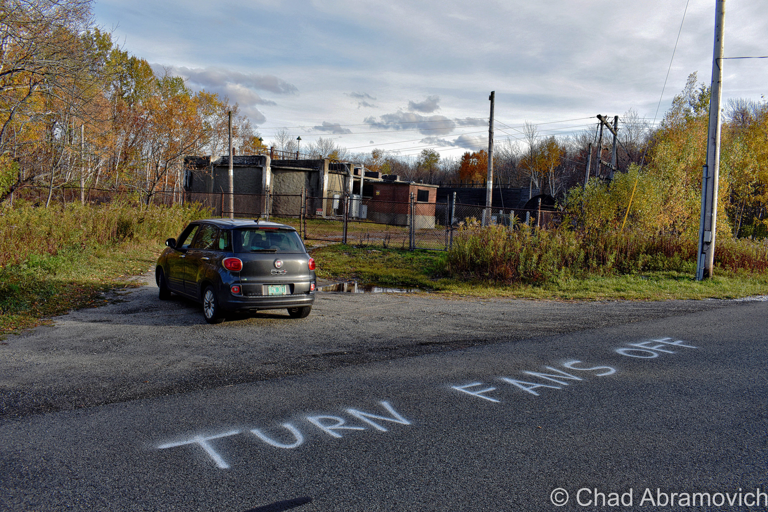
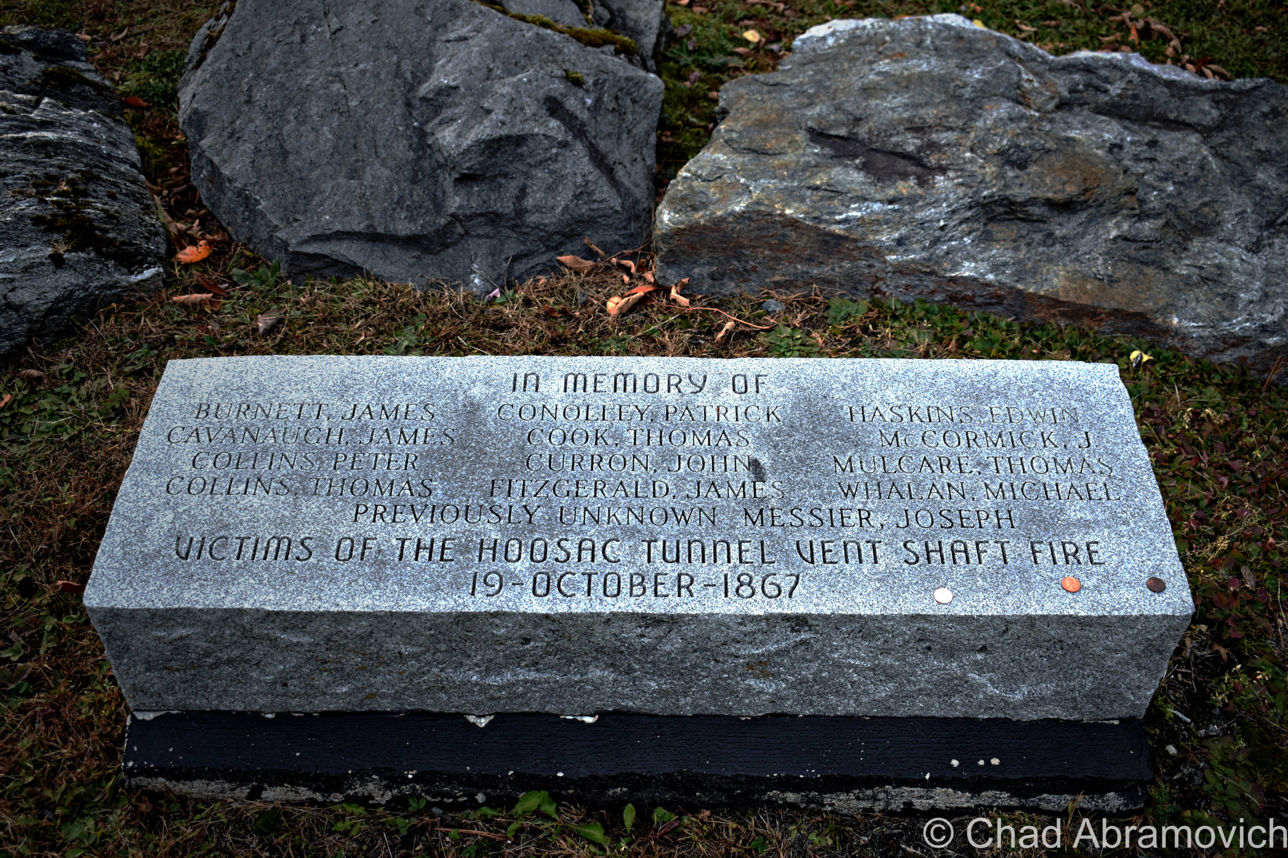
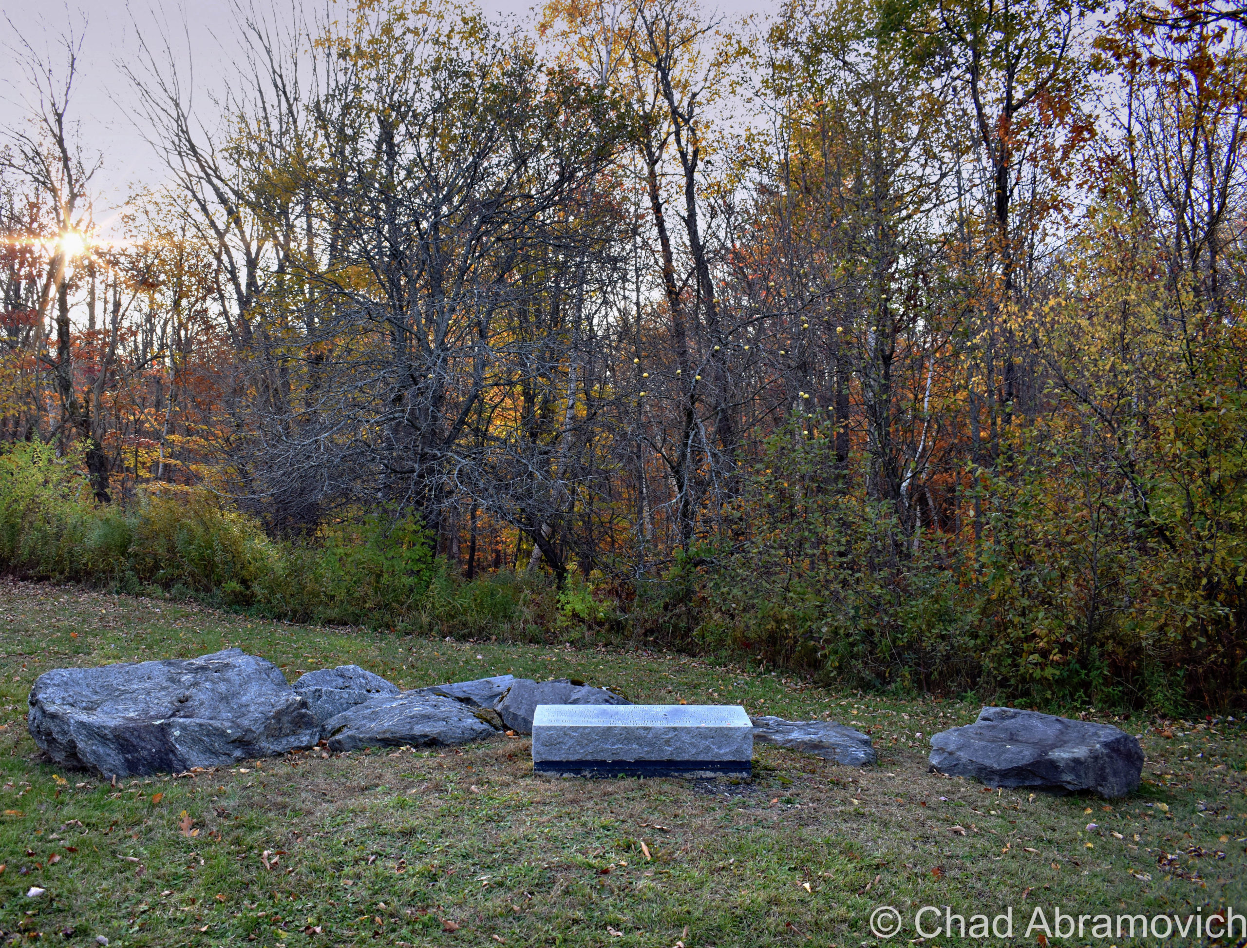
Before we headed back to Vermont, we took a quick drive down aptly named Central Shaft Road, to the top of the central shaft to check out the fan units, and to see a relatively new memorial that’s been dedicated to all the lives that the tunnel has reaped – a squat and prostrate rectangular block of granite laid down near some old apple trees across from the fan. Unbeknownst to us, we actually wound up visiting on the same day of the central shaft catastrophe.
Here’s an older video of the fans in action – to get an idea of just how noisy they are!

I also haven’t had an opportunity to visit the west portal yet, so that’s still on my Hoosac-centric agenda. The last time I was down that way, it was a bit after the collapse. While the east portal is easy to access off a paved road, the west portal is obscured from a relatively well-traveled throughway – at the end of a dirt access road, which was gated and decked out with a few new looking “no trespassing” signs, and I totally I didn’t want to run into disgruntled railroad employees who were doing some collapse-cleanup.

This was a real fun explore, and even more fun to research and unpack everything I was gleaning about this place. The most fascinating thing about a place like the Hoosac Tunnel, is that it dutifully keeps spawning new tales, tall or true, and most likely will for posterity.

———————————————————————————————–

Do you have a spooky story from your trip to the tunnel that you’d like to share, or maybe have appear on this blog entry? Or perhaps you wanna make me hip to another Berkshire oddity or abandonment? Email me please!

Links

The closest thing the tunnel has to an ‘official’ website, which goes into amazing detail on all portions of the tunnel: HoosacTunnel.net

http://paulwmarino.org/hoosac-tunnel.html – a fantastically researched resource, with tons of historical imagery!

https://mysterious-hills.blogspot.com/ – my favorite Berkshires blog! Joe puts a lot of thought into his entries and is a great storyteller!

Here’s a video that actually films a modern-day train ride through the entire tunnel – it’s a neat watch and a good dose of perspective!


Since 2012, I’ve been seeking out venerable examples of Vermont weirdness, whether that be traveling around the state or taking to my internet connection and digging up forsaken places, oddities, esoterica, and unique natural features. And along the way, I’ve been sharing it with you on my website, Obscure Vermont. This is what keeps my spirit inspired.

I never expected Obscure Vermont to get as much appreciation and fanfare as it’s getting, and I’m truly grateful and humbled. Especially in recent years, where I’ve gained the opportunity to interact with and befriend more oddity lovers and outside the box thinkers around Vermont and New England. As Obscure Vermont has grown, I’ve been growing with it, and the developing attention is keeping me earnest and pushing me harder to be more introspective and going further into seeking out the strange.

I spend countless hours researching, writing, and traveling to keep this blog going. Obscure Vermont is funded almost entirely by generous donations. Expenses range from hosting fees to keep the blog live, investing in research materials, travel expenses and the required planning, and updating/maintaining vital tools such as my camera and my computer. I really pride and push myself to try to put out the best of what I’m able to create, and I gauge it by only posting stuff that I personally would want to see on the glow of my computer screen.

I want to continuously diversify how I write and the odd things I write about. Your patronage would greatly help me continue bringing you cool and unusual content and keep me doing what I love!

Donate Button with Credit Cards


The Coldest Heart In Peacham

Sometimes it’s fun to wander around an old New England boneyard, which occasionally contains products that chronical captivating calamities, violence, and curiosities that have long been running deep in New England’s granite hills and character.

There is actually an entire coterie of tombstone tourists who dig hanging out in cemeteries and marveling at what the dead went into creating. If you’ve been following my blog for a while, you know I’ve sojourned to a few cemeteries before, where I’ve tracked down everything from a grave with a curse, to a grave with a window.

In the postcard lauded NEK village of Peacham is a graveyard on a hill crest with a view, and inside is a quiet monument erected by guilt-burdened townsfolk over a century ago.

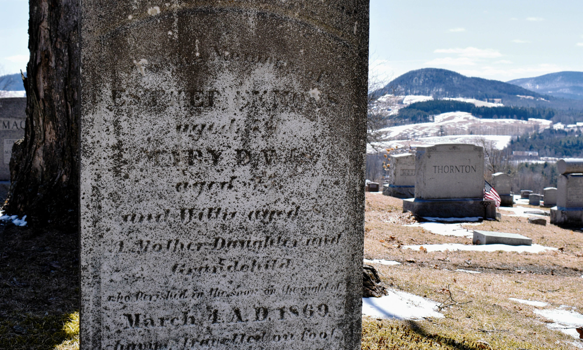
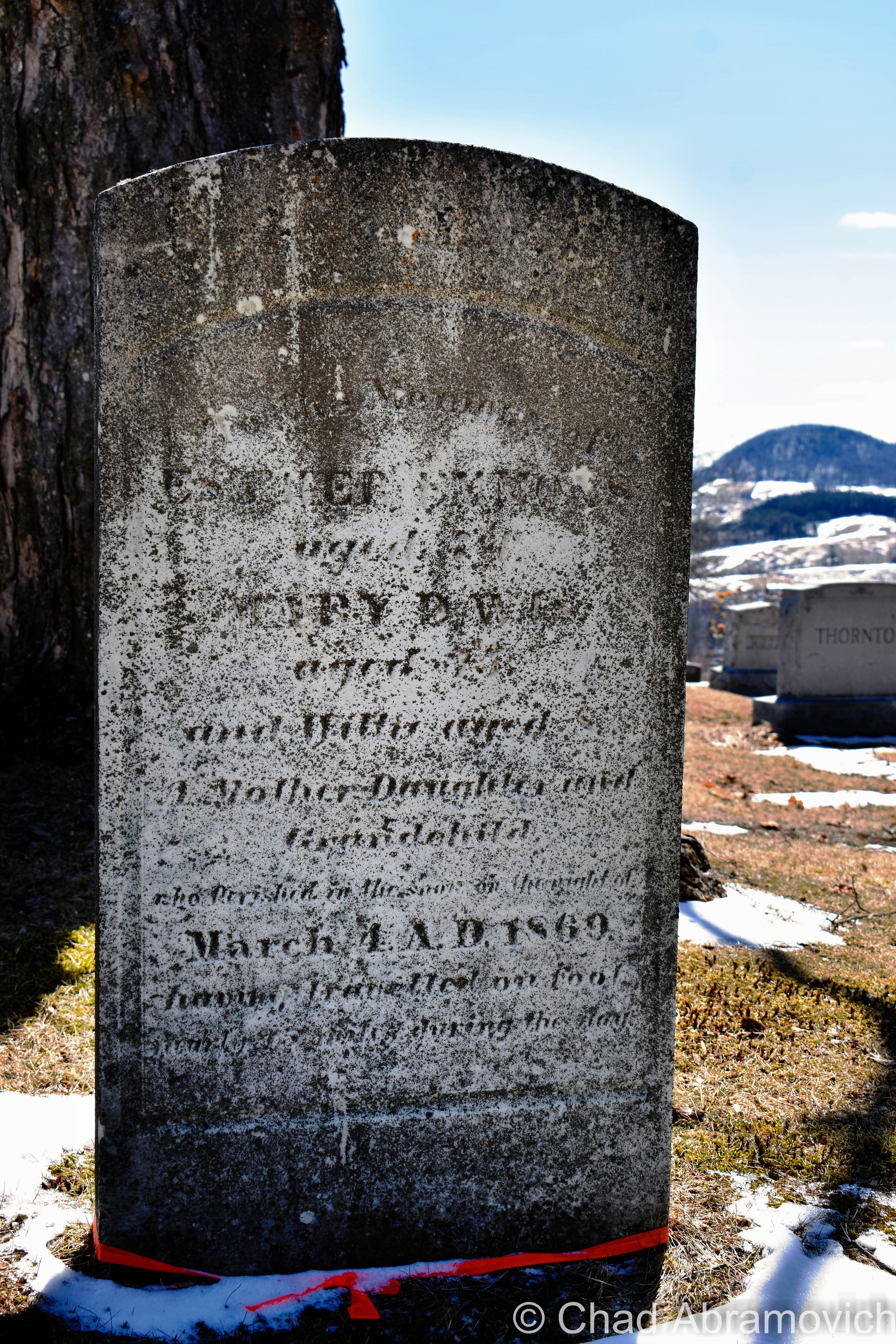
The increasingly hard to decipher text reads; Erected by the citizens of Peacham to the memory of Esther Emmons, aged 74,  Mary Davis, aged 35, and Willie, aged 8 – a mother, daughter, and grandchild who perished in the snow on the night of March 5th AD, 1869, after traveling on foot nearly 15 miles during the day.  

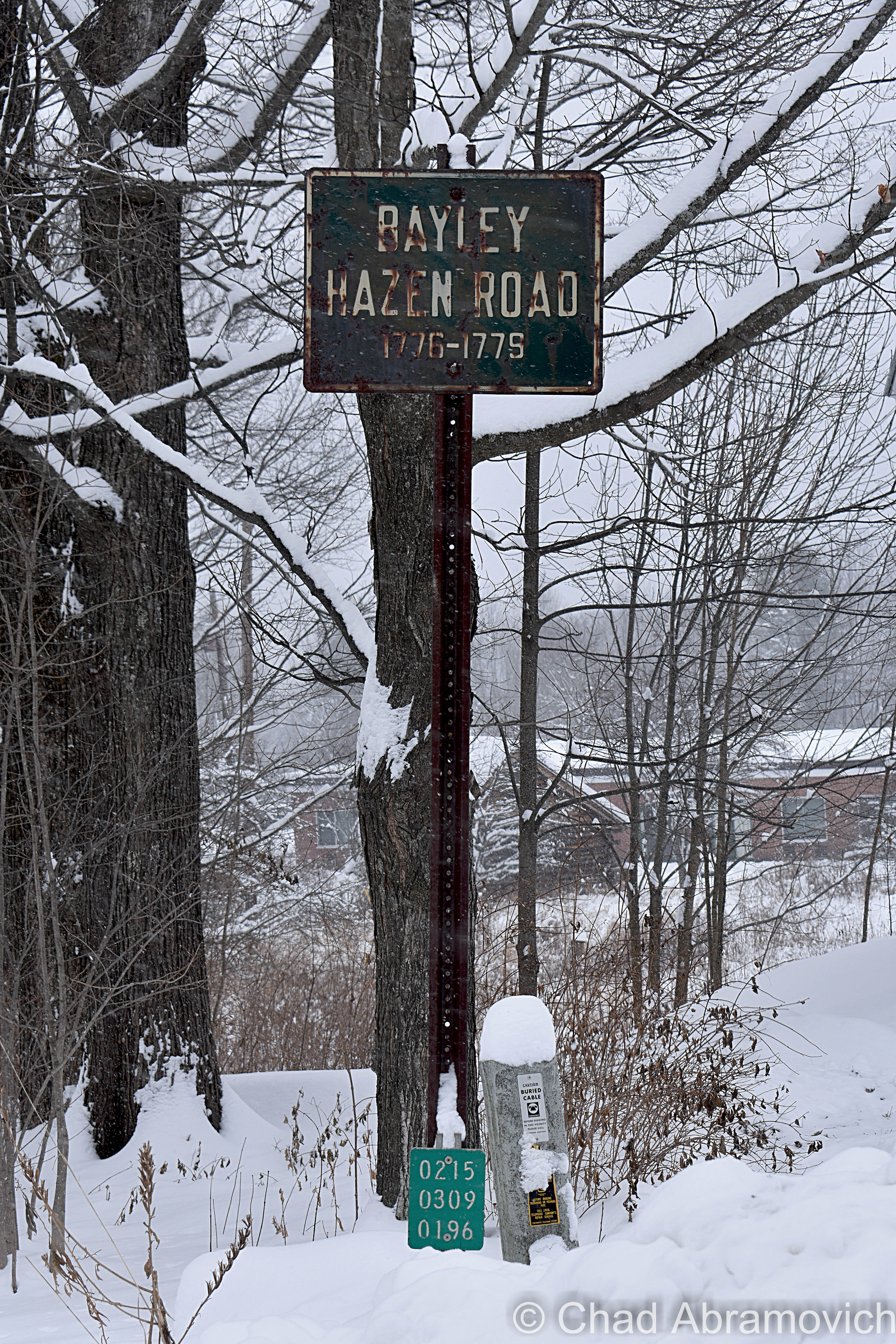
It was an appropriately miserable 7 degrees that day with a brutal wind as I drove into town on the cratered tarmac of the Bayley Hazen Road – one of Vermont’s most historic thoroughfares.

Commissioned by Colonel Jacob Bayley and General Moses Hazen in 1776, the idea was to slash a road from Wells River and head northwest through the frontier lands of northern Vermont up to the border, so the continental army would have a convenient route to invade Canada if they decided to put that on their to-do list.

But roads work in two directions. By 1779 they got as far as a gap in the Green Mountains now known as Hazen’s Notch (which is a great drive!) before they realized that the British army could also easily use the road to raid Vermont. Oops. Construction ceased, but what had already been laid down inadvertently opened up access to a corner of Vermont now known as the Northeast Kingdom that was previously incredibly hard to get to – places like what became known as Peacham.

Today, tons of kingdom towns have Bayley Hazen Roads – and you can still drive a huge chunk of the original military route as plotted in this cool pdf that would make a fun summer or autumn road trip for those of you who dig backroad expeditions like me.

Spotted in Peacham village – a coffin/witch/Vermont window!
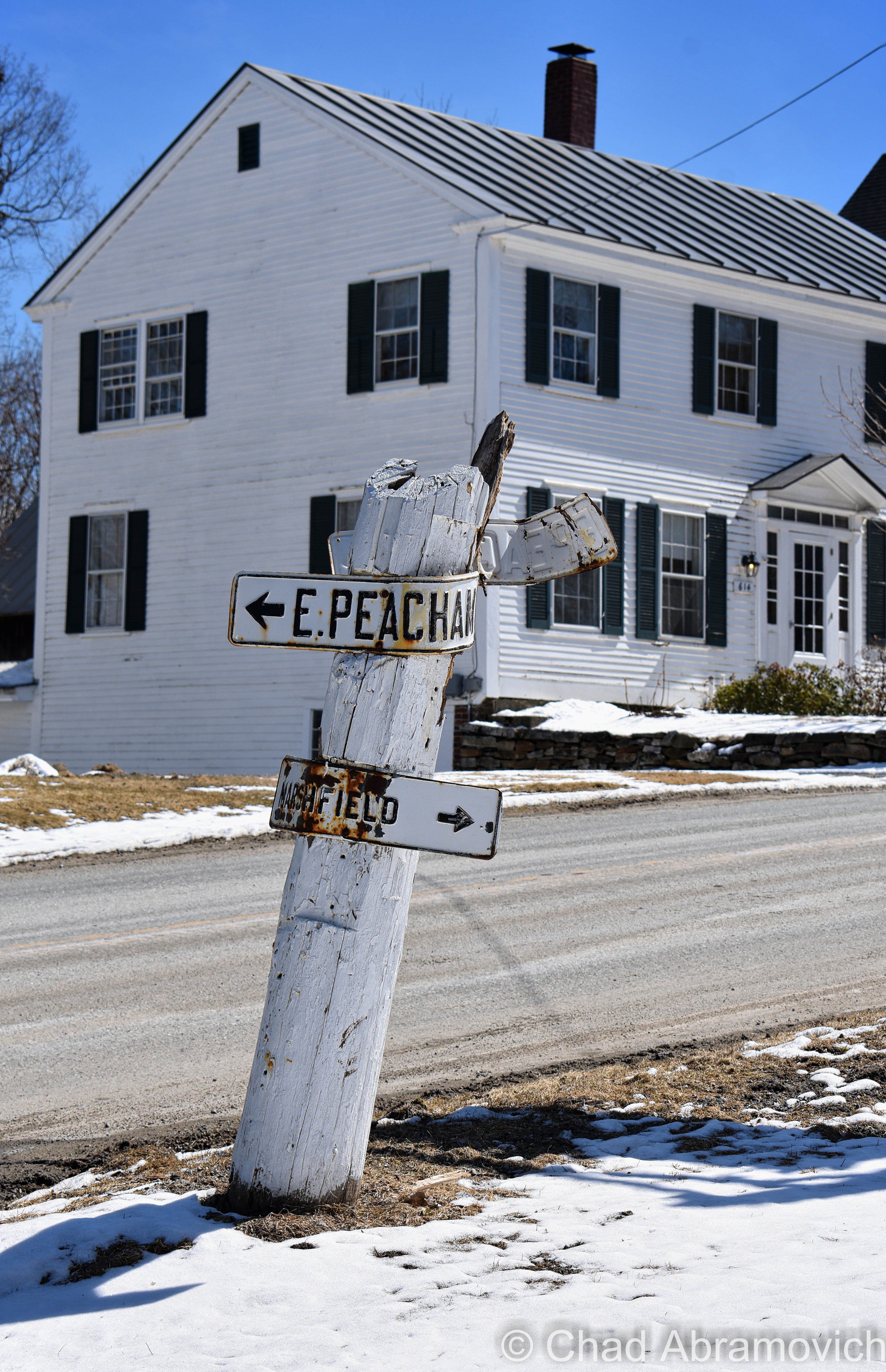
Also spotted in downtown Peacham – some great old school pressed tin wayfinding signs with vintage raised typography! It also looks like a few cars have hit them over the years. Or maybe locals are exercising that old Vermont mentality of “it’ll fall over when it’s ready”, or whatever the equivalent here would be.

This wasn’t the easiest marker to find. With some emailed guidance by the enthusiastic Stan Fickes of the Peacham Historical Society,  I spotted my sought-after piece of memento-mori as the chill crept down my spine; an innocuous granite rectangle with subtly rounded top gouged with a weather-beaten eulogy that looked much like half the other graves here, and probably wouldn’t have grabbed my attention if I didn’t have an idea of what to detect.

This also might be one of the few instances where a re-cataloging of a cemetery came about due to a ghost story.

Mr. Fickes recalled an interesting personal story to me. Several years ago, he worked as the assistant town clerk. A local woman had stopped by one day and sheepishly came forward with a problem that isn’t complained about on the regular. She explained that they had bought an old house in town and had been living there for a few months now, but something was a bit… amiss.

She and her husband both admitted to feeling something in the house, something they described as “a presence”. This notion was solidified when they actually saw a woman inside their house, a woman in ‘Victorian’ garb that was trespassing in a corporal sense.

They started to ask around about the house’s history and discovered that a girl had drowned in their water supply cistern decades ago. They wanted to know more about the drowned girl and tracked down her name – which lead them to find her grave in the town cemetery. It dismally appeared that the girl had been buried by herself, with nothing that could be traced as her family anywhere near her plot. The story affected them on such a personal level that they would make several visits to her resting place over the years.

By chance, a cousin of the girl heard about their interest and stopped by the town clerk’s to convey more of the story. It turns out, her parents weren’t far away at all! They were actually buried right beside her, but they couldn’t afford to have their names added to the headstone.

However, none of this supposedly stopped any odd happenings at that house, even with a change of ownership over the years. But the search for the little girl’s grave and the noting of its additional occupants did inspire a revision of the cemetery index – which helped me find what I was looking for.

As I knelt down on the frozen grass and pulled my camera out of my bag, I couldn’t help thinking that I hope this will be a tale that hopefully inspires generosity in present-day Vermonters.

————————————————

Mrs. Esther Emmons was an impoverished widow and an employed servant on a well-to-do farm near Peacham. Her son had recently become disabled after an accident in the Vermont woods (sources vary; either he was a woodsman or a farm hand) left him crippled.

Having no way to bring in any income, he was indignantly left with no other choice but to apply to the town of Hardwick for assistance.

Mrs. Emmons walked the 20 miles from Peacham to Hardwick to see to her son. Her daughter, 35-year-old Mary Davis, and her grandson, 8-year-old Willie, agreed to fetch her later that day and make the walk back together.

But the appointed overseer of the poor, who was ironically lacking in sympathy, curtly told Mrs. Emmons that her son was her responsibility. There being nothing else she could do, she glumly rendezvoused with her daughter and grandson and embarked on the long walk back to Peacham.

It was calm when they set out – the cold coming at them like knives. By the time they reached north of Peacham, thick storm clouds drifted in and light flakes began to drop around them.

Arriving at the junction of Peacham woods, Mrs. Emmons was beginning to show signs of exhaustion, and the skies began to get ominous.

Assessing the situation, they decided to take the long way around – with the intent of seeking shelter at one of the farms they’d have to pass. That would surely be a safer bet than taking the little-traveled and undeveloped uphill road through the forest, which might be a fatal place to get stuck in such a big blizzard that was approaching.

The Bean farm came up first, but Mr. Bean, who apparently had a deficiency in social niceties, flat out turned them away.

Their hopes were picked up when they heard the clank of approaching sleighbells. A man in a one-horse sleigh was passing by and slowed down when he recognized Mrs. Emmons. He offered her a ride, but the sled couldn’t hold the weight of all 3 of them. Mrs. Emmons declined, saying that she was going to stay with her family. Surely the next house would take them in she reasoned.

The trio trudged onward. The storm’s fury was swelling into something that would make misery proud, and the night was finally tuning up, sending wet clumps of snow that clung to their bodies and a stinging wind that flung icy crystals into their faces.

They began to stop and embrace each other for warmth, and then keep moving forward a few more sluggish yards in the dark and sleet before repeating the process, until the form of the Stewart farmhouse came into their blurry sight.

Hope for a night’s lodging gave way to a dreadful surprise when Mr. Stewart brusquely and without an explanation, grunted “I’m taking no one in”, and slammed the door in their faces.

The incredulous family turned away and desperately attempted to reach the Farrow Farm down the road – who were known by many to be kindly folks.

But Mrs. Emmons’ strength had almost diminished, and now the stalwart matriarch, who had been their leader and navigator, was stumbling into rapidly gathering snowdrifts and greatly struggling to continue onwards. Mary and Willie desperately attempted to help her and drag her along, but hunger, fatigue, and the strangling cold was taking their toll on all of them.

Could they make it?

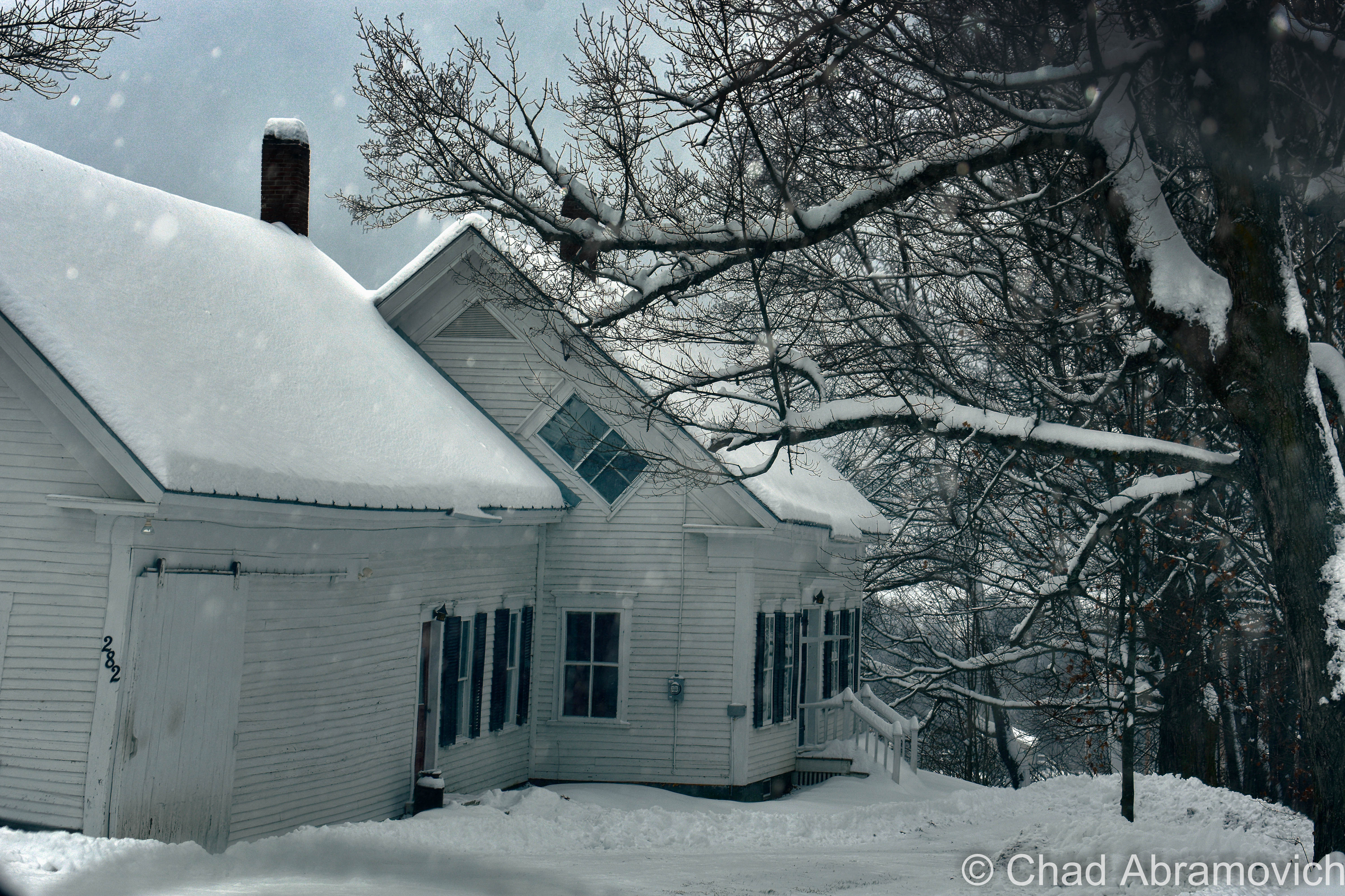
As you’ve already seen in my photograph, they sadly became confused, disoriented, worn down, and froze to death within 30 feet of safety.

The next morning, Peacham residents awoke to the mercury sinking to 24 below zero at the end of one of the worst snow storms in Vermont history and began the arduous process of digging themselves out from shoulder high drifts.

Townsfolk hitched up their oxen and sleds, formed teams, and set out to the seemingly impossible task of breaking through snow covered roads.

Then, Ben Kimball spotted something from his sled. Brightly covered cloth against the stark white of fresh powder. He slowed down to investigate and grimly discovered that the garment was attached to the corpse of an old woman. It was the widow Esther Emmons.

He called out for assistance, and soon, the crew made even more gruesome discoveries.

Another body, a younger woman who they recognized as Mary Davis, was found sitting against a stone wall where she’d frozen to death. Then they found eight-year-old Willie Davis nearby, who was poised upright as if he’d been fighting his way from the Farrow farmhouse through the storm back to his mother’s side. Judging by his tracks that were still visible in the snow, it looked like he had become disoriented, and for some reason had turned around. In some instances, he’d been crawling on his hands and knees.

Distressed spectators were able to put together the missing pieces. When Mrs. Emmons was no longer able to stand, Willie attempted to go for help. He was undoubtedly guided by a lighted window at the Farrow’s. But the boy had become confused and turned around just a few feet from shelter.

Later during questioning, Mr. Farrow admitted to turning out his light and going to bed around the same time he heard some sort of faint calls amid the howling storm. But then he disclosed a pretty gothic detail; he attributed the cries to his demented daughter who was locked away in a room upstairs and didn’t think much else of it.

Peachamites, caught in the gravity of failing to help their own, attempted to atone for their collective sins and decided to erect a modest monument out of humiliation.

Though it was ruled that no one was officially at fault, in the minds of most, it was cold-hearted Mr. Stewart who was to blame. Reportedly, he agreed with that sentiment and suffered horrendous guilt for the rest of his days.

Even on his deathbed, he still felt haunted by his callous actions on that dark event from 1869. As the tale goes, his body shivered violently as if from a terrible cold. He cried out that he was freezing, whether from delusion or perhaps, something more preternatural…

And though it was mid-July when he died, Mr. Stewart’s corpse was as cold as ice.


** Thank you to Stan Fickes of the Peacham Historical Society, who provided background information on this tragic tale and aided me in my cemetery safari. 


Since 2012, I’ve been seeking out venerable examples of Vermont weirdness, whether that be traveling around the state or taking to my internet connection and digging up forsaken places, oddities, esoterica, and unique natural features. And along the way, I’ve been sharing it with you on my website, Obscure Vermont. This is what keeps my spirit inspired.

I never expected Obscure Vermont to get as much appreciation and fanfare as it’s getting, and I’m truly grateful and humbled. Especially in recent years, where I’ve gained the opportunity to interact with and befriend more oddity lovers and outside the box thinkers around Vermont and New England. As Obscure Vermont has grown, I’ve been growing with it, and the developing attention is keeping me earnest and pushing me harder to be more introspective and going further into seeking out the strange.

I spend countless hours researching, writing, and traveling to keep this blog going. Obscure Vermont is funded almost entirely by generous donations. Expenses range from hosting fees to keep the blog live, investing in research materials, travel expenses and the required planning, and updating/maintaining vital tools such as my camera and my computer. I really pride and push myself to try to put out the best of what I’m able to create, and I gauge it by only posting stuff that I personally would want to see on the glow of my computer screen.

I want to continuously diversify how I write and the odd things I write about. Your patronage would greatly help me continue bringing you cool and unusual content and keep me doing what I love!

Donate Button with Credit Cards


The Franklin County Wolf Monument

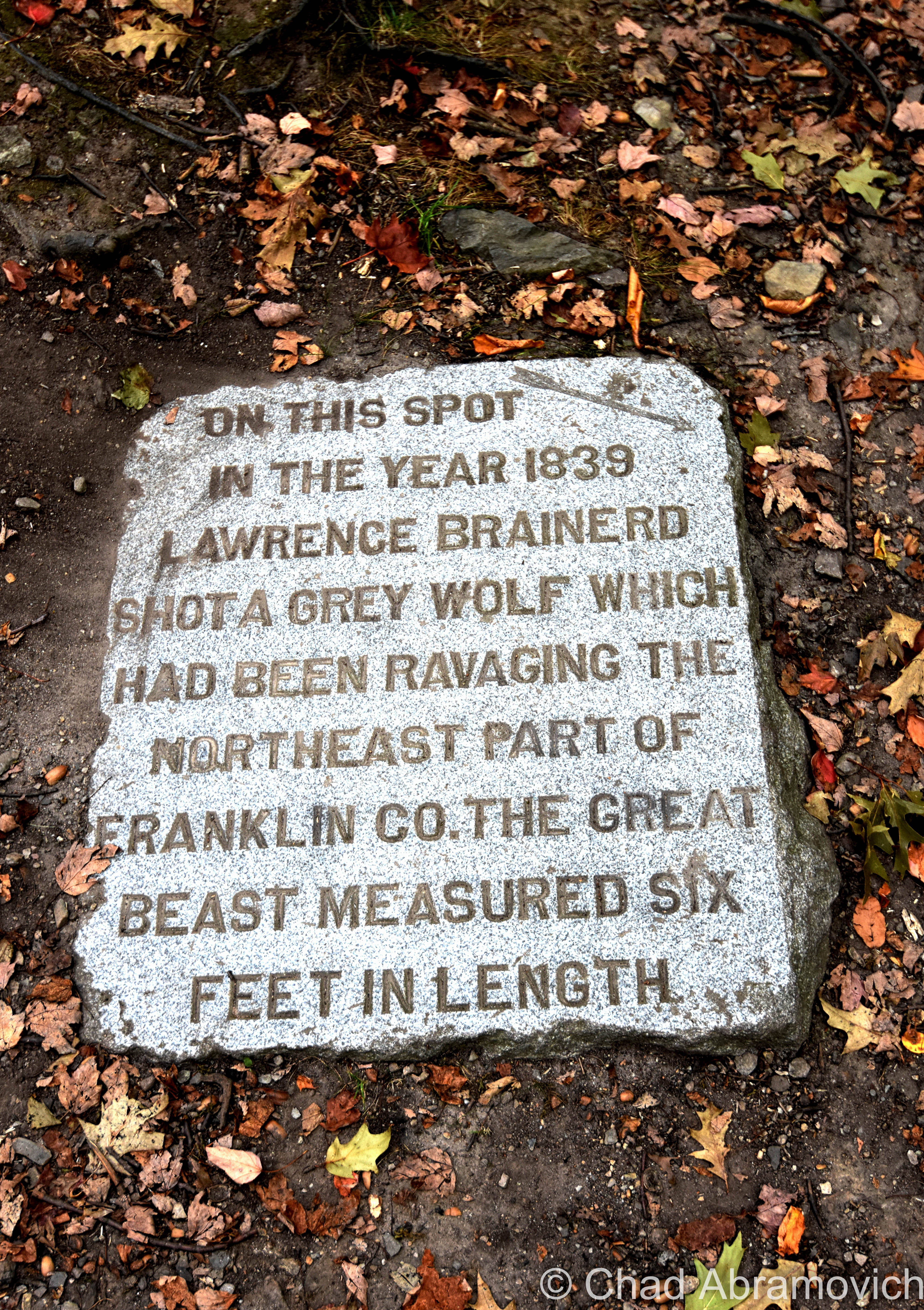
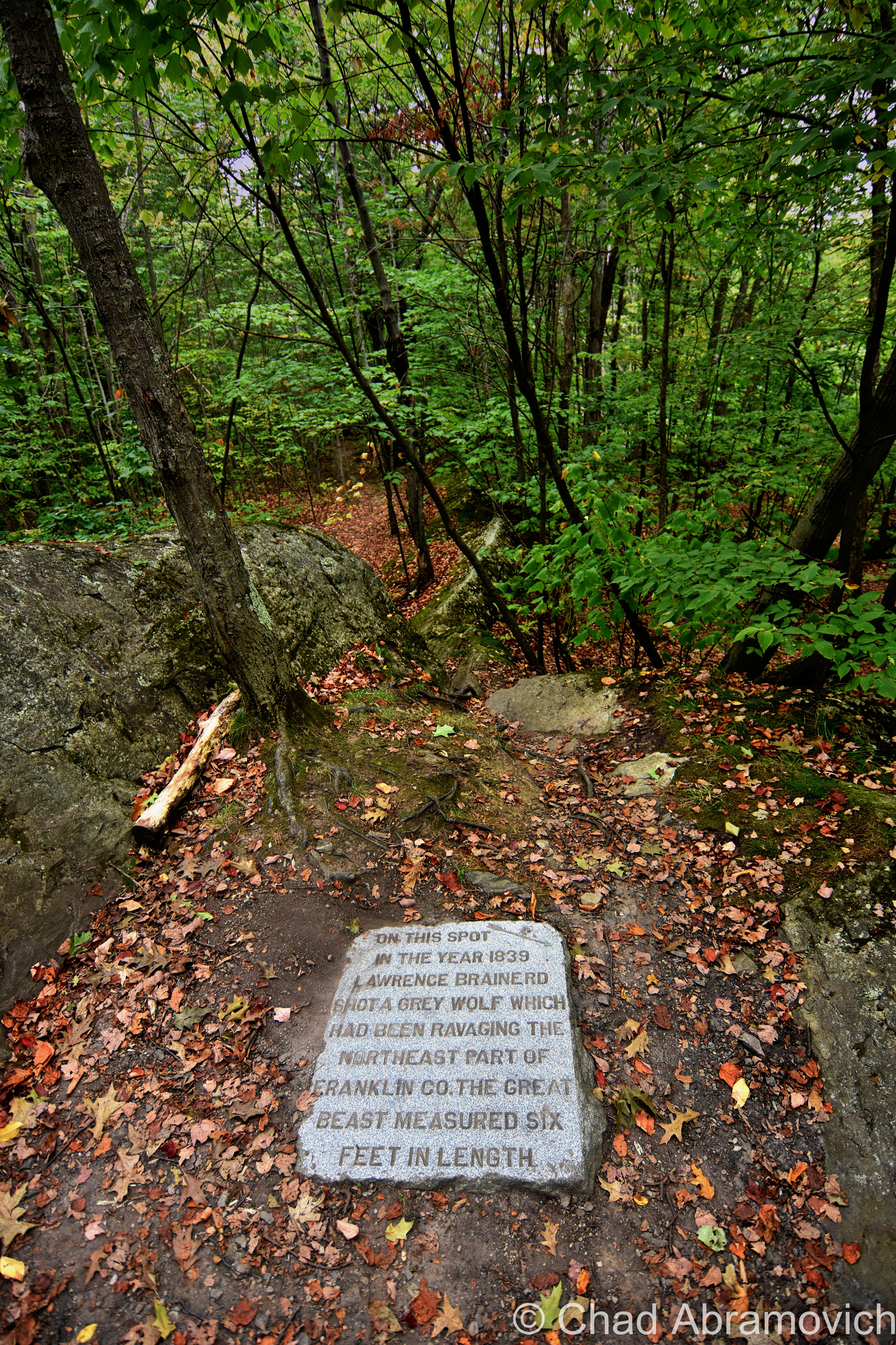
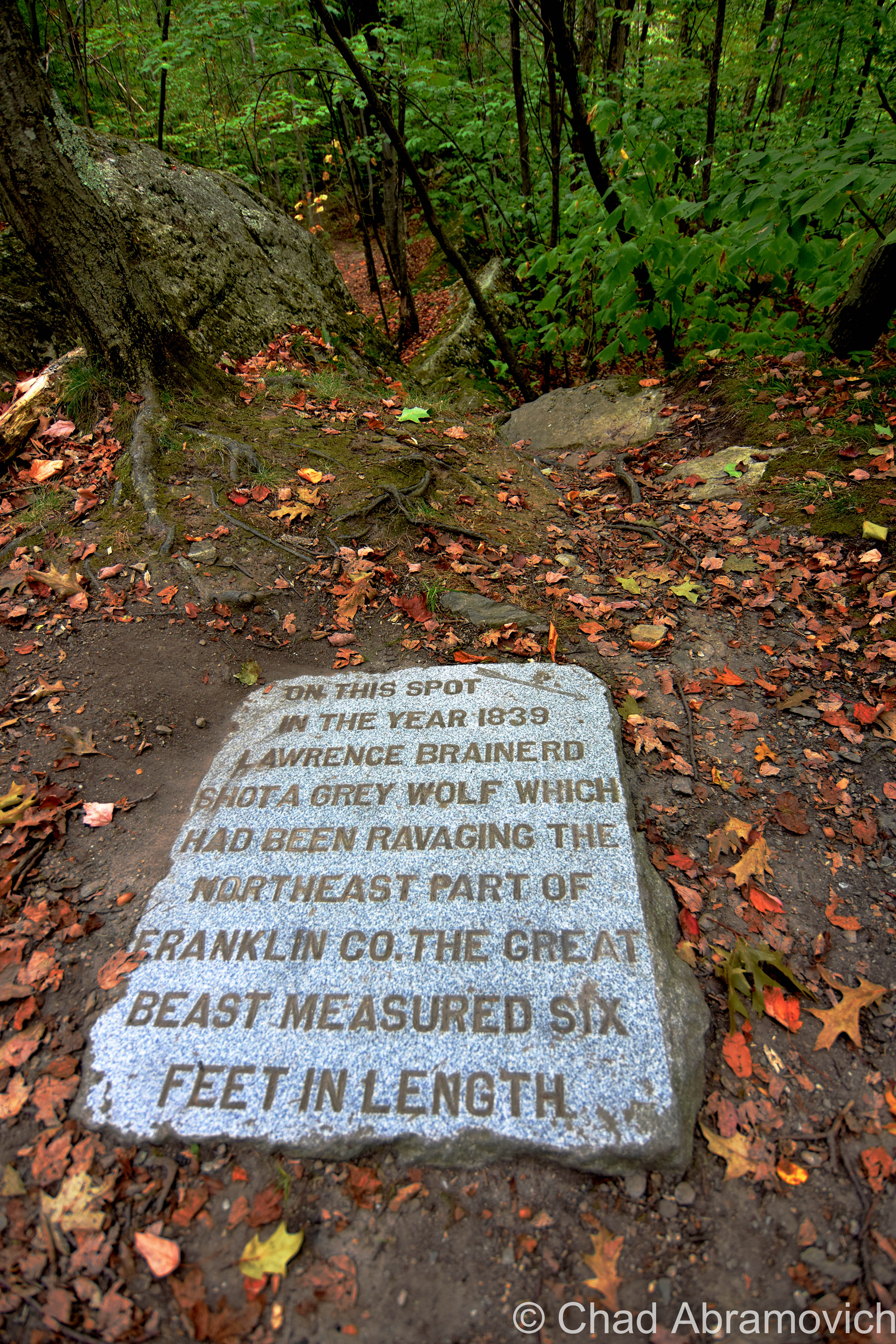
“Wait – there it is!” I shouted, pointing to the top of a long rock emergence that confined a rootsy trail between a steep descent down to more rocks and dead leaves. I hastily bushwacked off from the path, clambered up the small incline thick with lots of scratchy underbrush and got to a plateaued area at the top, and found what I had been searching for – the very camouflaged Franklin County wolf monument.

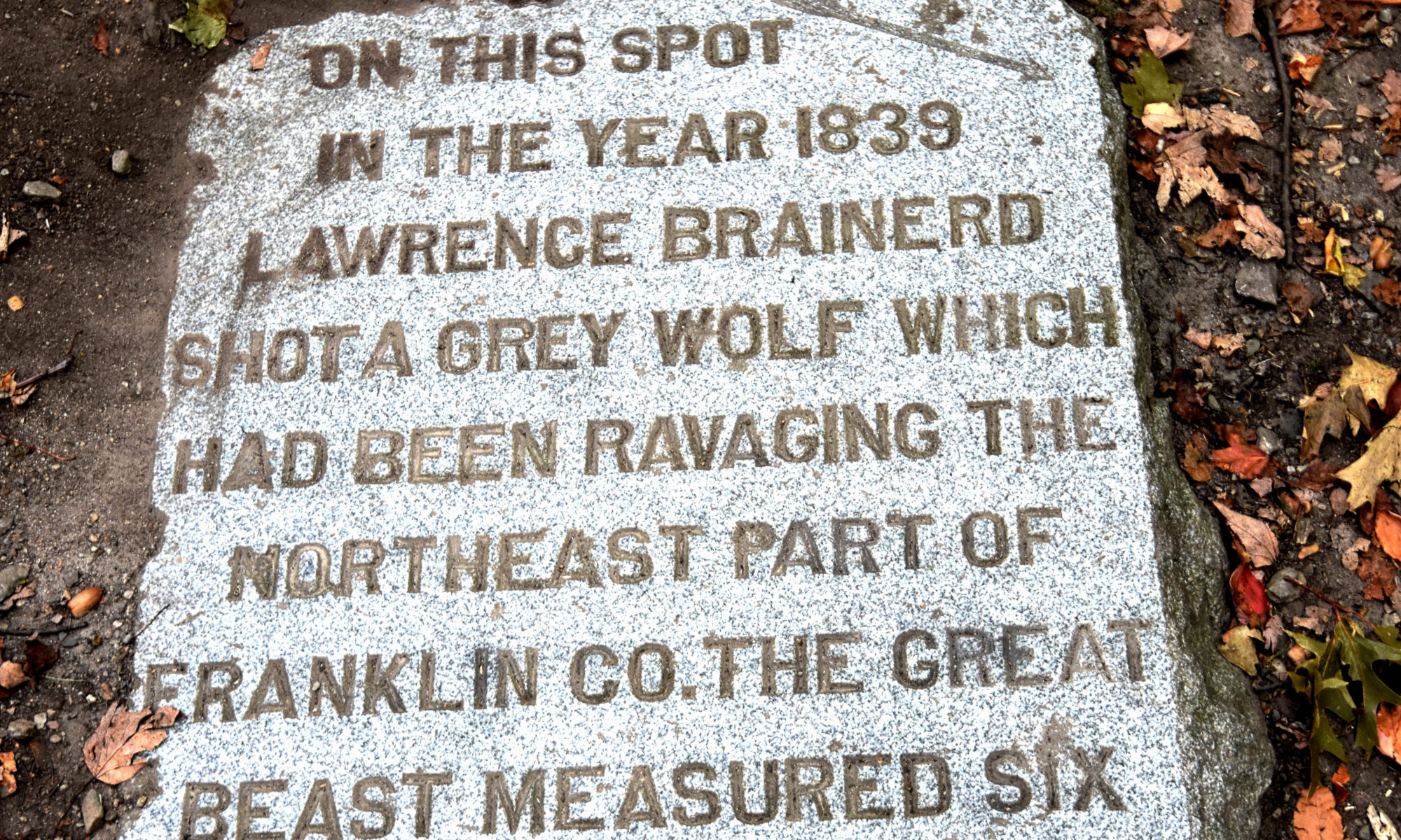
This boulder clumped pitch on Saint Albans’ Aldis Hill was apparently where the last gray wolf in Franklin County was seen in 1839. But instead of memorializing the wolf, it memorialized how it ended up. Dead.

As my confused friend shuffled up after me, I let out a fulfilling “yes!” like I wasn’t still in ear shot of residential neighborhoods.

According to the inscribed story on the supine slab; the beast, 6 feet in length, had been “ravaging” in unidentified ways around northeastern Franklin County until local businessman and politician Lawrence Brainerd had some sort of run-in with it, pursued it up the hill, and shot it, which inspired someone to then erect a pretty modest, somewhat macabre commemoration of the event. That person remains a mystery. People react to these sort of situations in different ways.

Then, shooting a wolf, which was seen as a predator to sheep farmers, was probably seen as a good riddance worthy of recognition. In current times, I’m sure the reactions would be social media spitfire. Wolves, like Vermont’s mythical Catamount (which is still committedly debated still exist here despite the ‘last one’ being shot near Barnard in 1881), probably roamed our forests until the late 1800s according to wildlife biologists.

The monument serves as a mark of distinction of the area, and makes me wonder what other secrets or conditions have long been buried?

The area around the monument is some of the hill’s wildest topography. It would be easy to envision having a run-in with a wolf up there, or maybe some other wild beast. Though I’m not sure how many Brainerd’s are left in the maple city, there is still a Brainerd Street today that runs upwards from North Main Street in the direction of the hill, commemorating the obviously influential family. Although, it’s disappointingly not marked with the city’s signature white street signs emblazoned with green maple leaf silhouettes.

The monument is a local legend and cool piece of Franklin County obscura. It’s a totem that I kind of found strange, too. I guess it’s because the idea of wolves in Vermont is so out there nowadays.

Many don’t know about it – which doesn’t surprise me. And if you do, you fall into two camps; you know where it is, or don’t. And if you do, it’s a pretty hard thing to give directions to. On my second time hiking up the hill, it was July and come down humidity, I was trampling through the heat and trying to discern my friend’s text message directions, only to walk back down the hill no longer caring if I found it or not and just wanting to sit in some air conditioning for a while.

Plenty of others have tried to find it – but it’s a challenge. Trust me, this was my third time on the hill, which is surprisingly steep and tredded with a network of overlapping trails that can screw up a mental compass. Generally, if you use the hum of the interstate nearby, you can get a good orientation of where you are. But the monument is small, doesn’t distinguish itself from the woods, and isn’t really on the trailside.

I knew the Hard’ack ski area existed, a local rope tow operation on the east slope of the hill. But I wasn’t aware that there were trails beyond Hard’ack, that lead up and all over Aldis Hill. And that’s a shame, because once I found out just how to get up to the un-signed recreation area, I really liked it. Its terrain was rugged and wild, not what I was expecting for a little green rise that separates Saint Albans city from interstate 89.

Aldis Hill, or, the area that’s not Hard’ack, was gifted to the city of Saint Albans in 1892 by the family that owned it, the Aldis’s. The idea was to turn the rocky eminent into a recreation area for Saint Albans-ites. Somewhere on the 849-foot hill is a lookout, framed by old-growth trees that rewards the finder a pretty awesome view of the architecture of the city, and beyond looking out towards Saint Albans Bay. However, this was one of those Aldis Hill points of interest that I haven’t been able to find yet. Seriously, there are a lot of trails here, and none of them are marked. But the very noticeable lack of signage is, in my opinion, another thing that makes this woodsy area so satisfying.

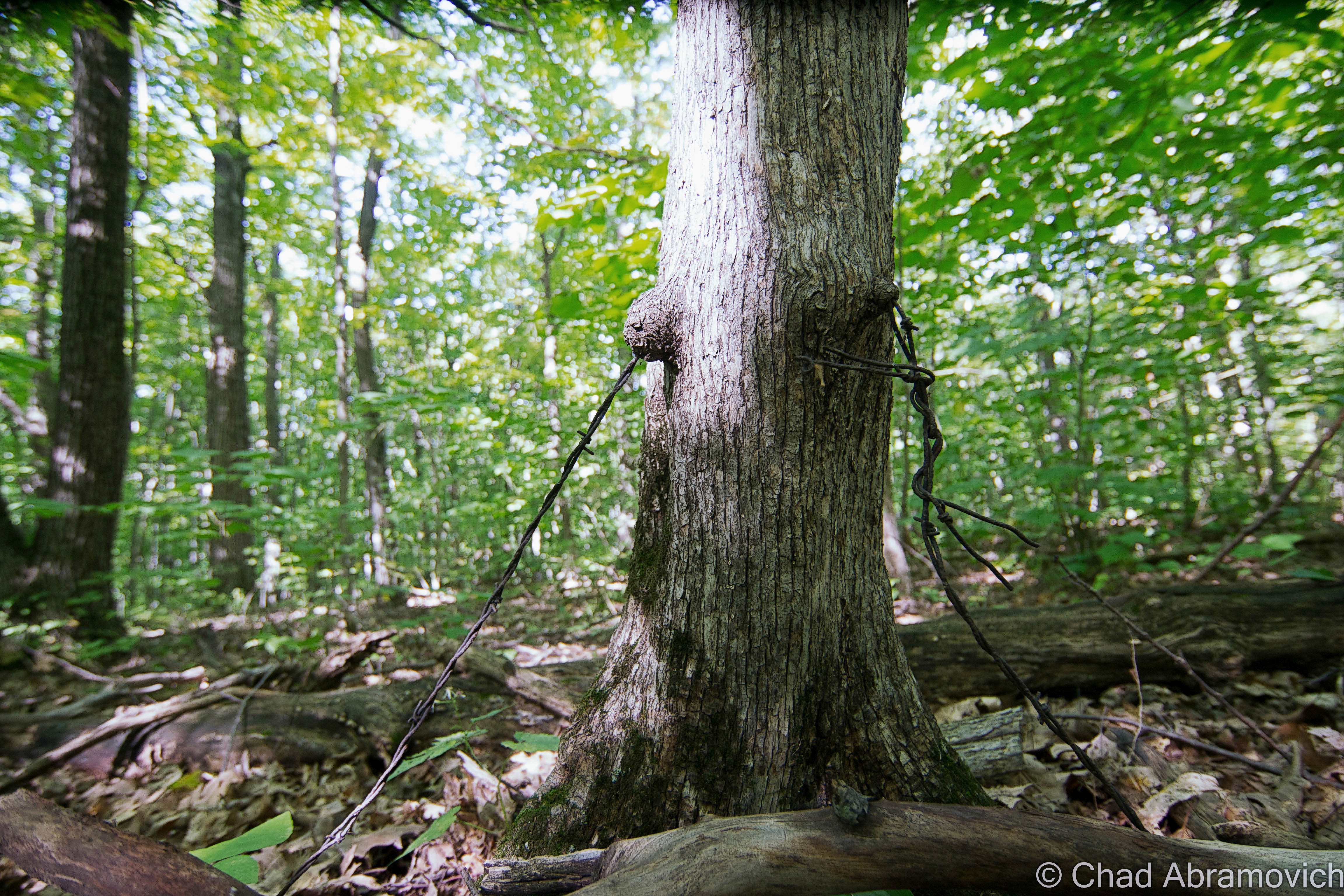
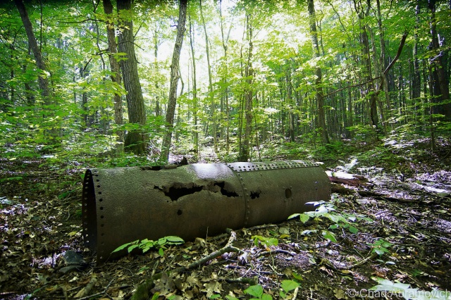
I won’t give out the location of the monument, because honestly, 3/4th of the fun was actually trying to find the damn thing myself. The wanting brought me exploring all over Aldis Hill, which in my opinion, is worth it. Who knows, you might find the cool stone cut staircase, the lookout, the monument, remnants of barbed wire fencing being consumed by trees, and rusting artifacts that somehow ended up in the woods on the hill.

dsc_0695_pe dsc_0698_pe

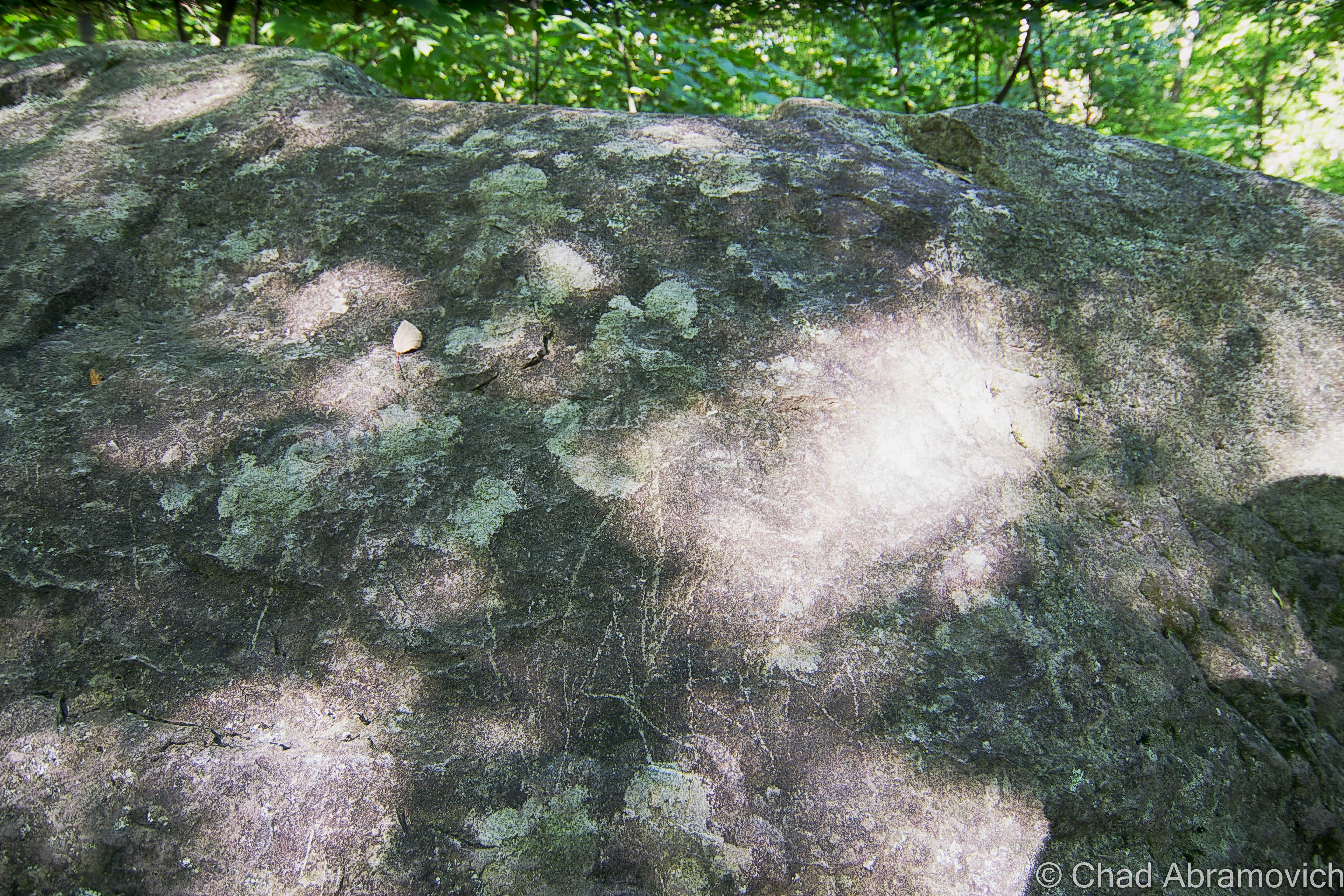
If you have found it - you might have scratched your name into the large boulder nearby with smaller rocks.
If you have found it – you might have scratched your name into the large boulder nearby with smaller rocks.
dsc_0690_pe
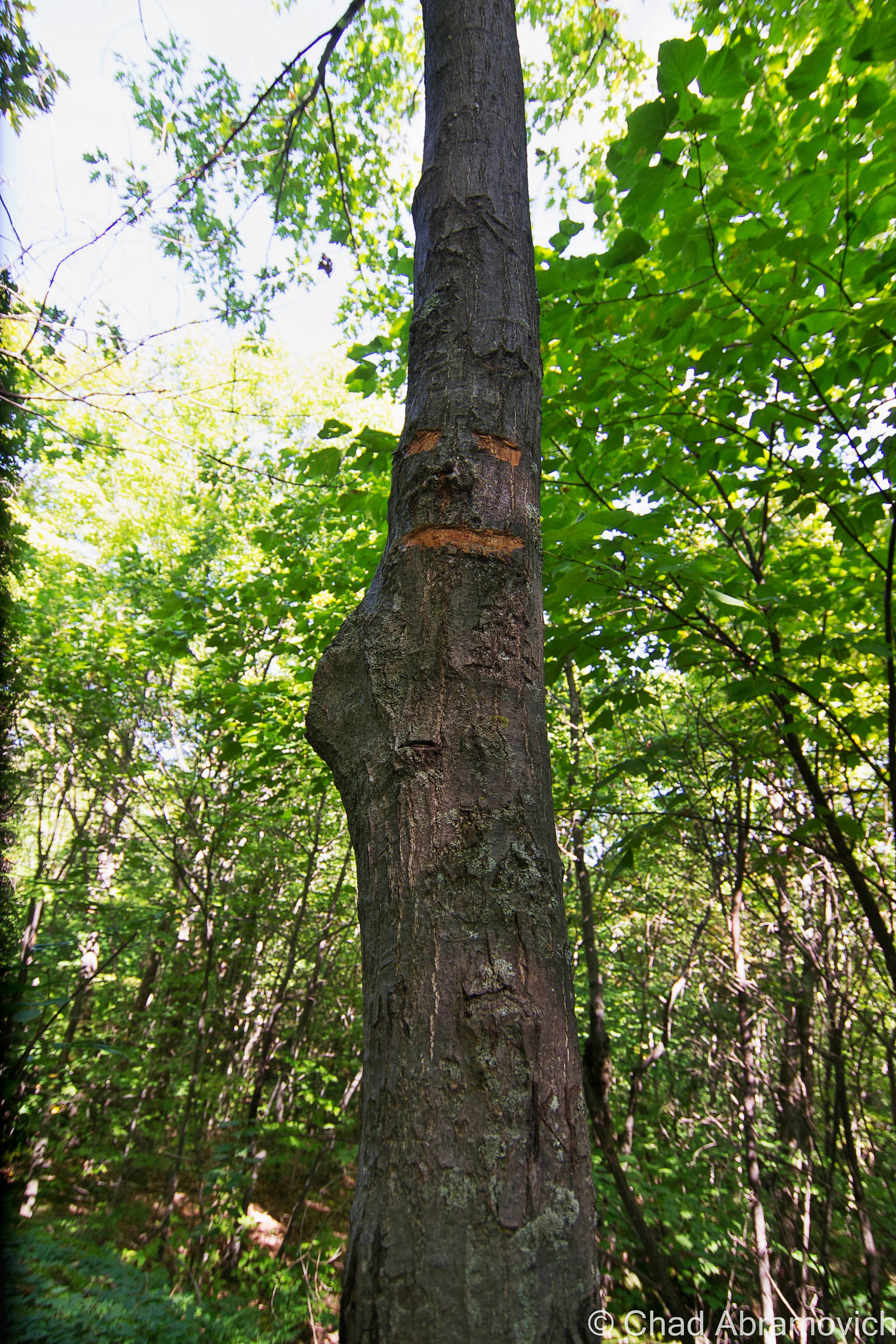
Or on this tree, which someone decided should have a content face.

—————————————————————————————————————————————–

To all of my fans and supporters, I am truly grateful and humbled by all of the support and donations throughout the years that have kept Obscure Vermont up and running.

As you all know I spend countless hours researching, writing, and traveling to produce and sustain this blog. Obscure Vermont is funded entirely on generous donations that you the wonderful viewers and supporters have made. Expenses range from internet fees to host the blog, to investing in research materials, to traveling expenses. Also, donations help keep me current with my photography gear, computer, and computer software so that I can deliver the best quality possible. Seriously, even the small cost equivalent to a gas station cup of coffee would help greatly! Especially now, as my camera is in need of repairs and I can’t afford the bill, which is distressing me greatly.

If you value, appreciate, and enjoy reading about my adventures please consider making a donation to my new Gofundme account or Paypal. Any donation would not only be greatly appreciated and help keep this blog going, it would also keep me doing what I love. Thank you!

Donate Button with Credit Cards

Gofundme: https://www.gofundme.com/b5jp97d4

The Vermont Character: Coffin Windows

One of my favorite pieces of Obscure Vermont is a mixture of architectural vernacular, and good old fashioned Yankee Ingenuity.

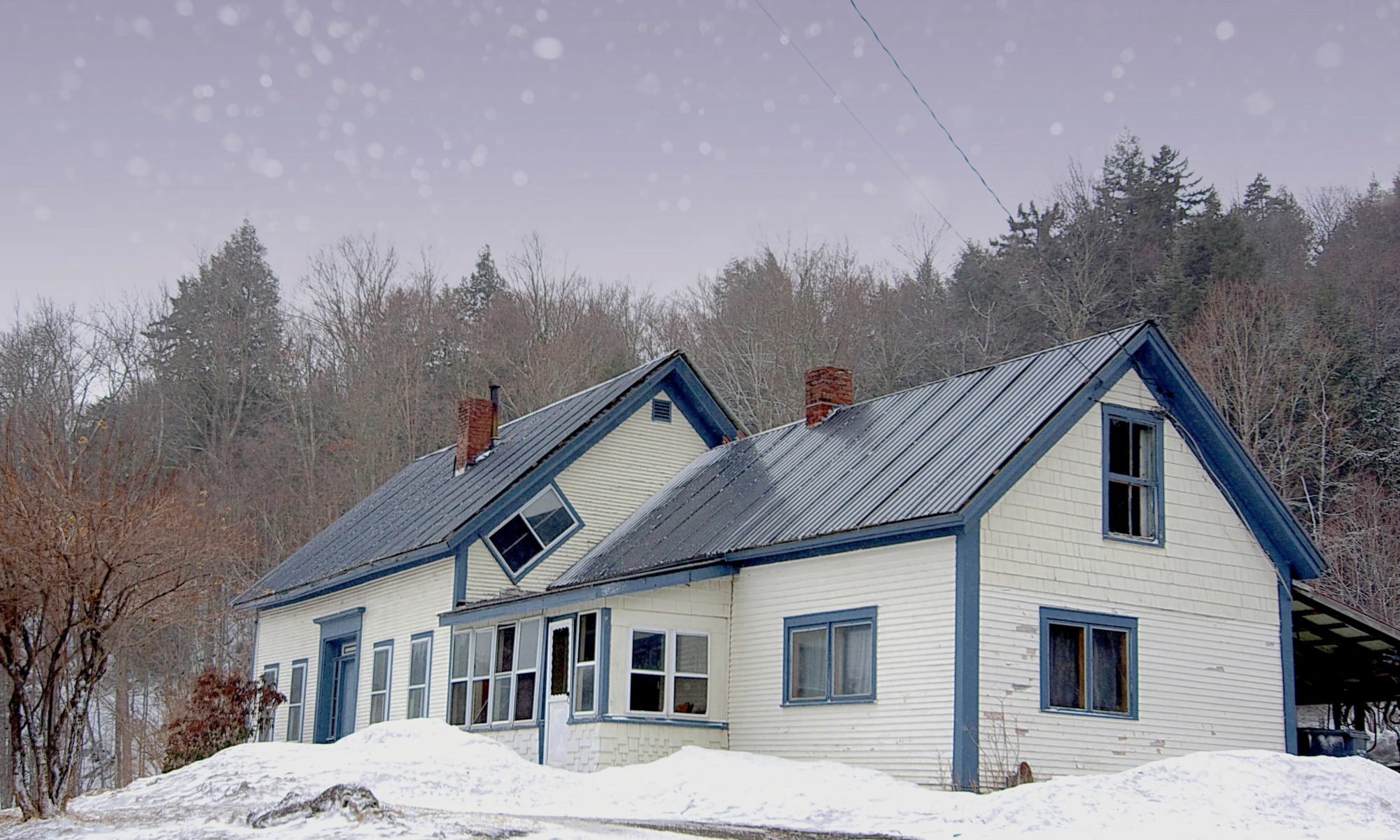
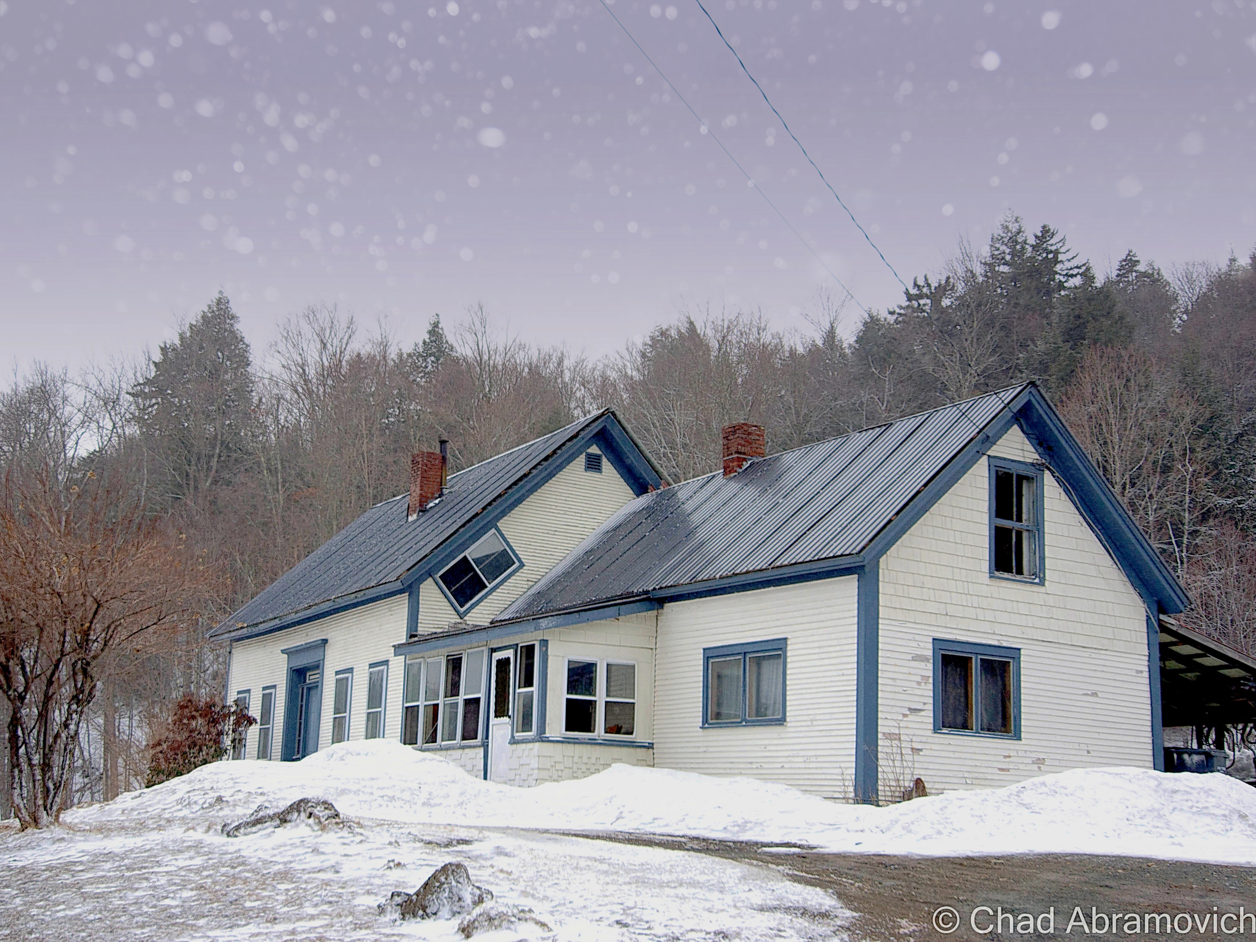
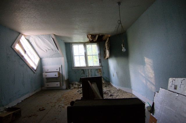
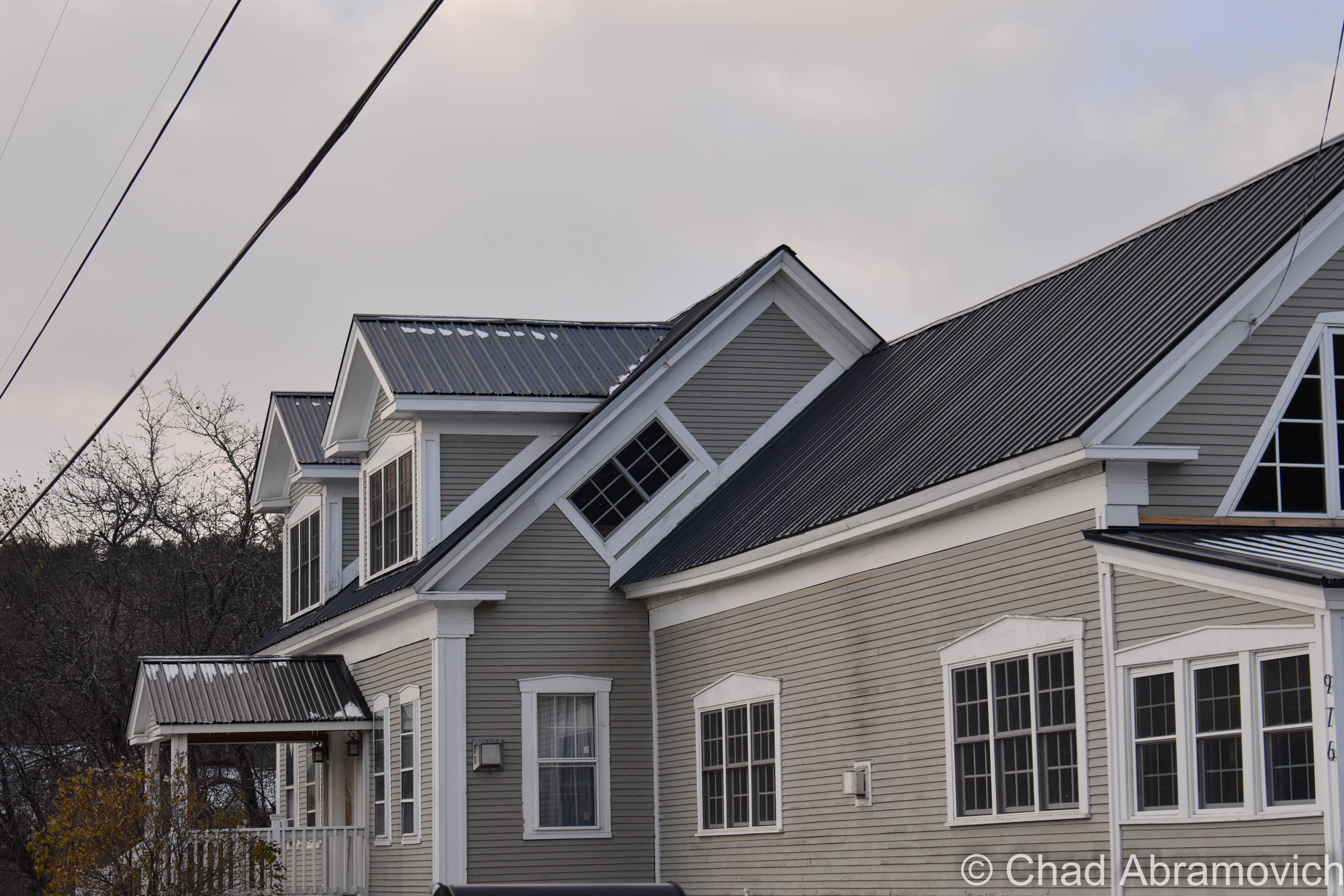
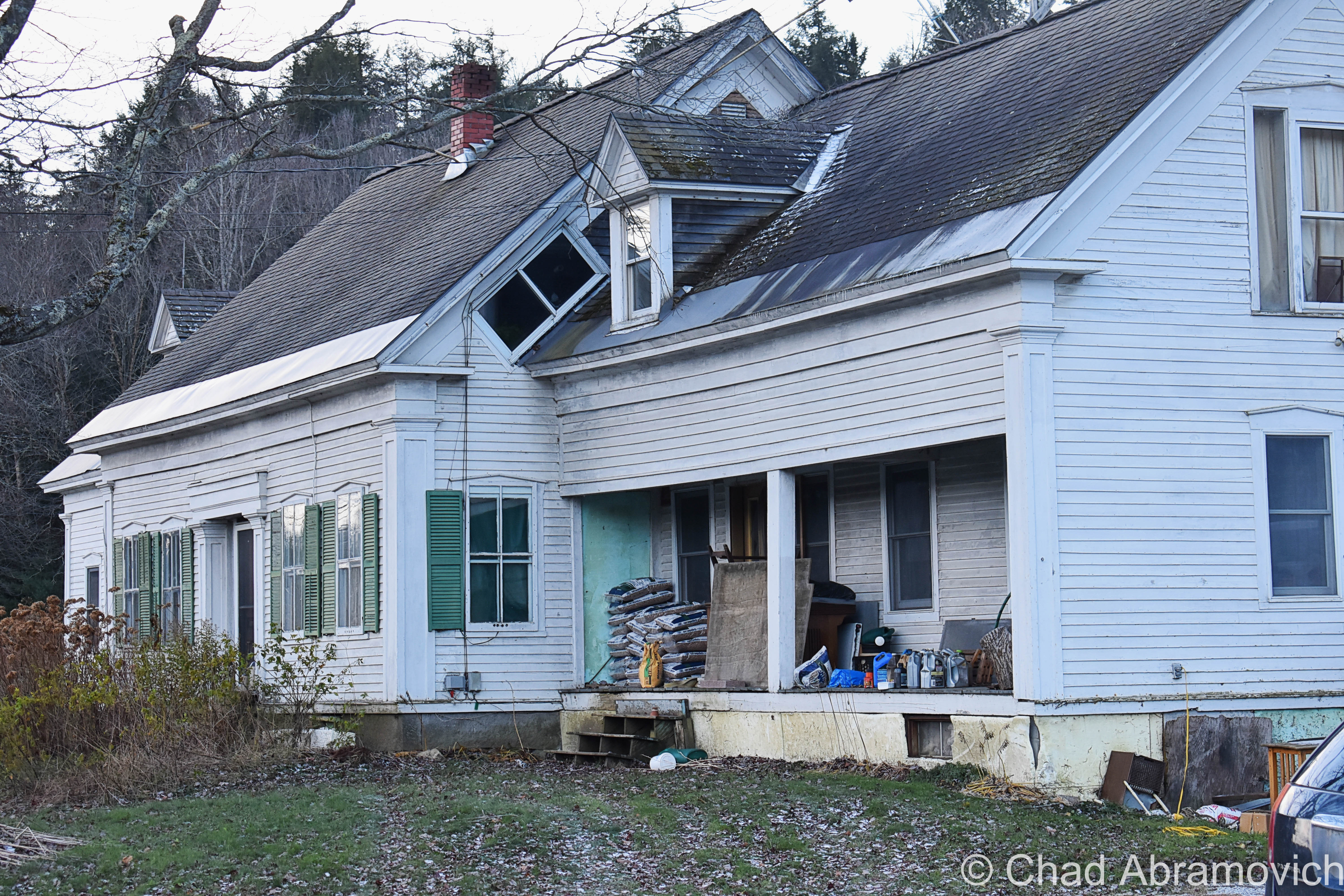
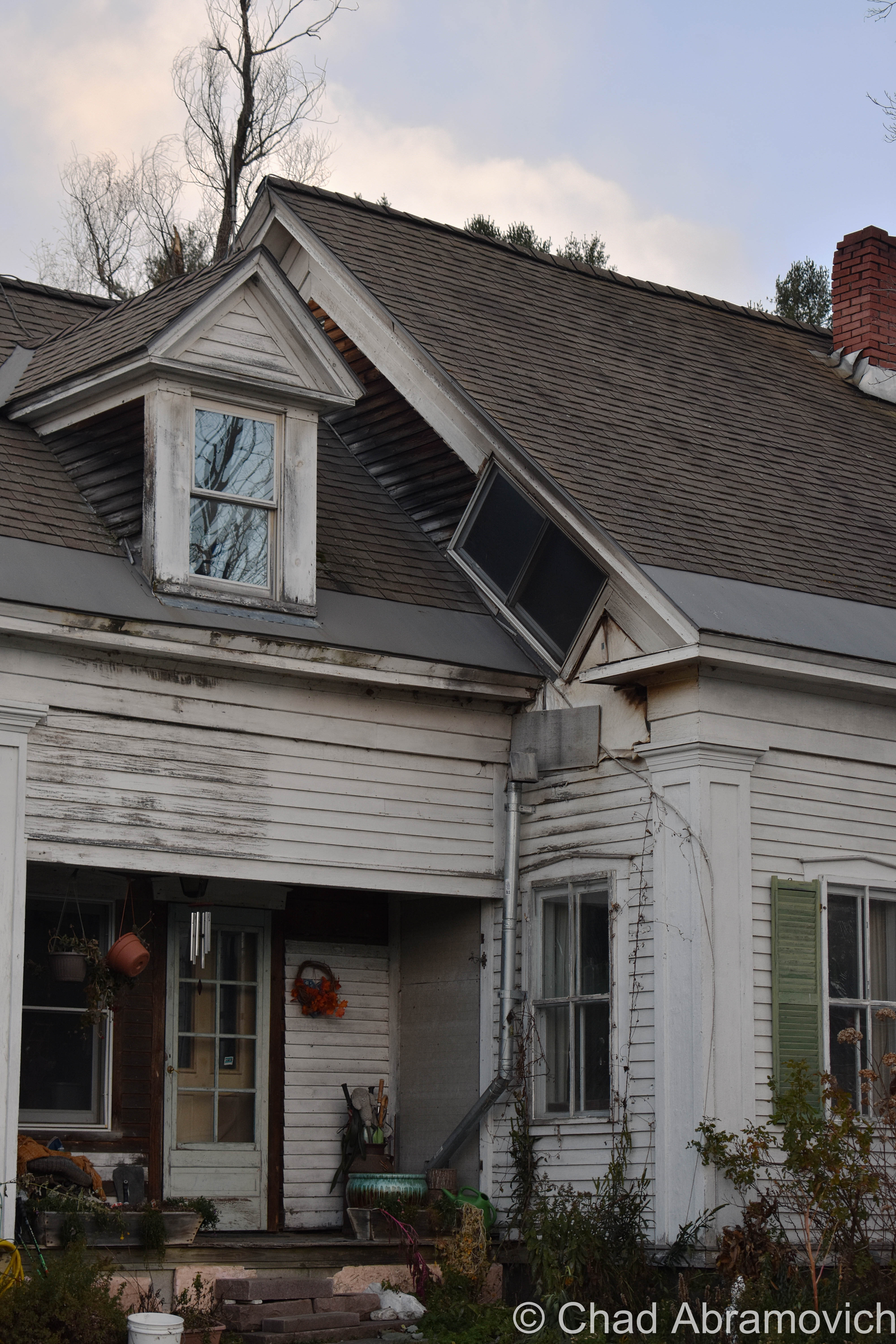
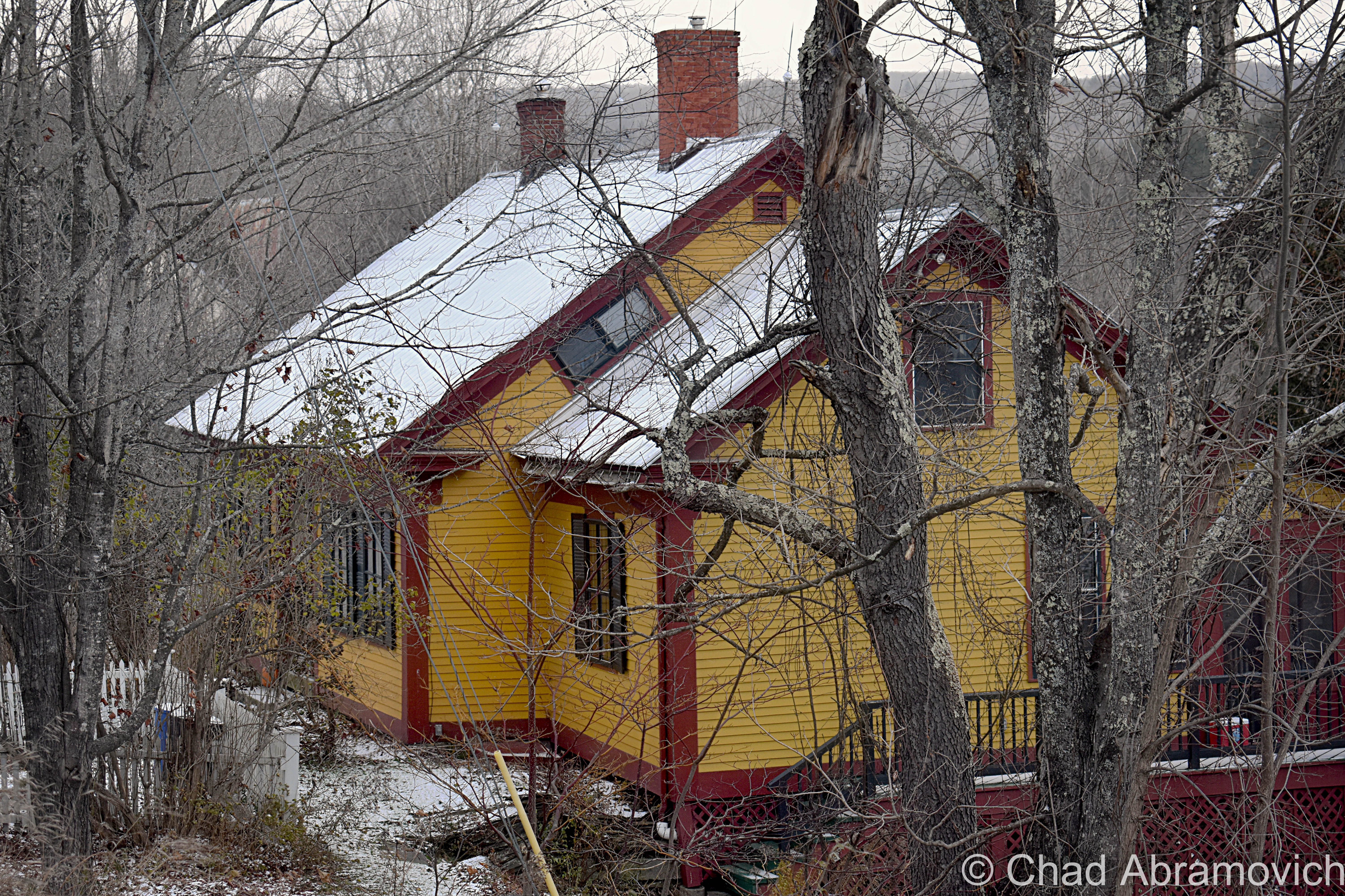
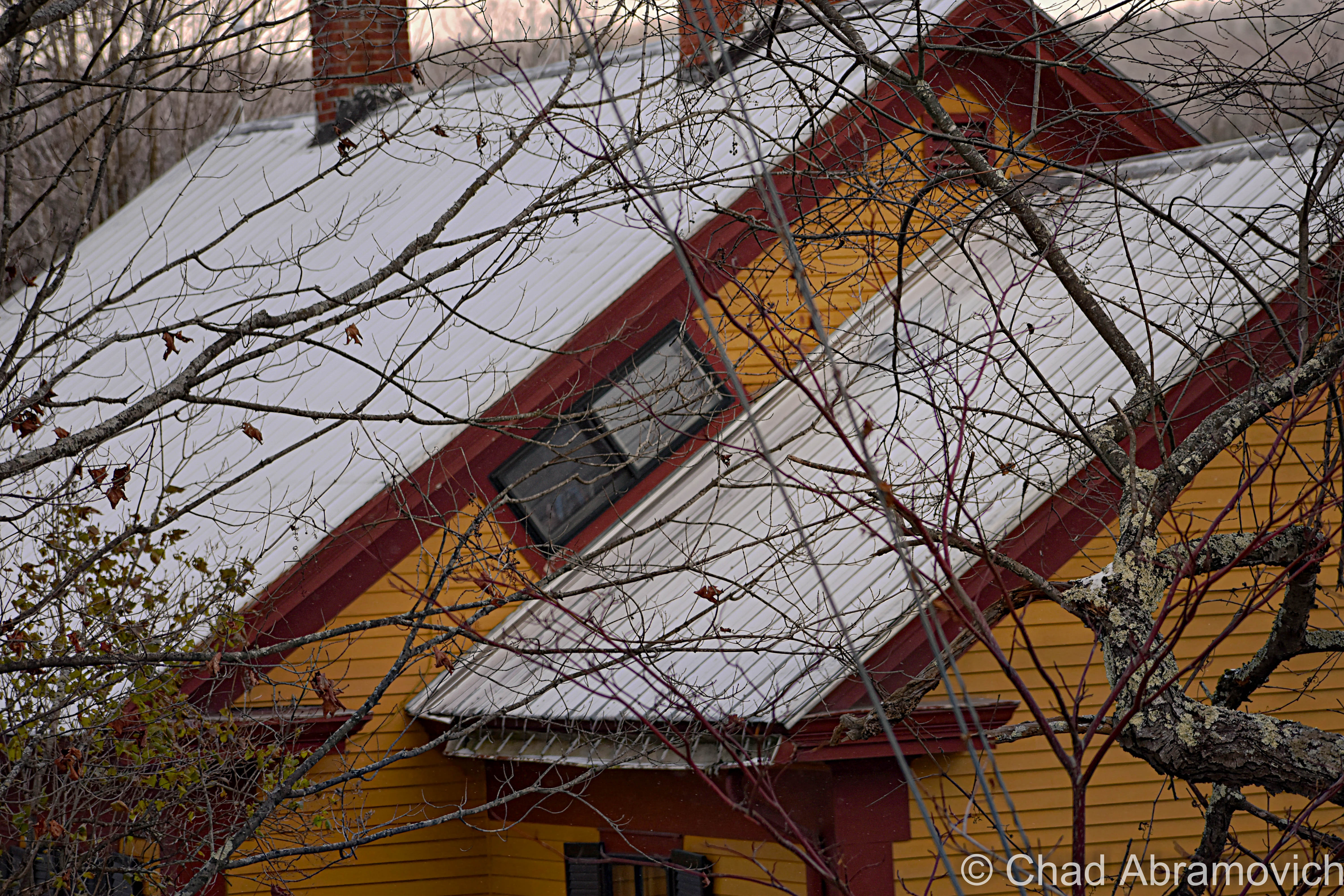
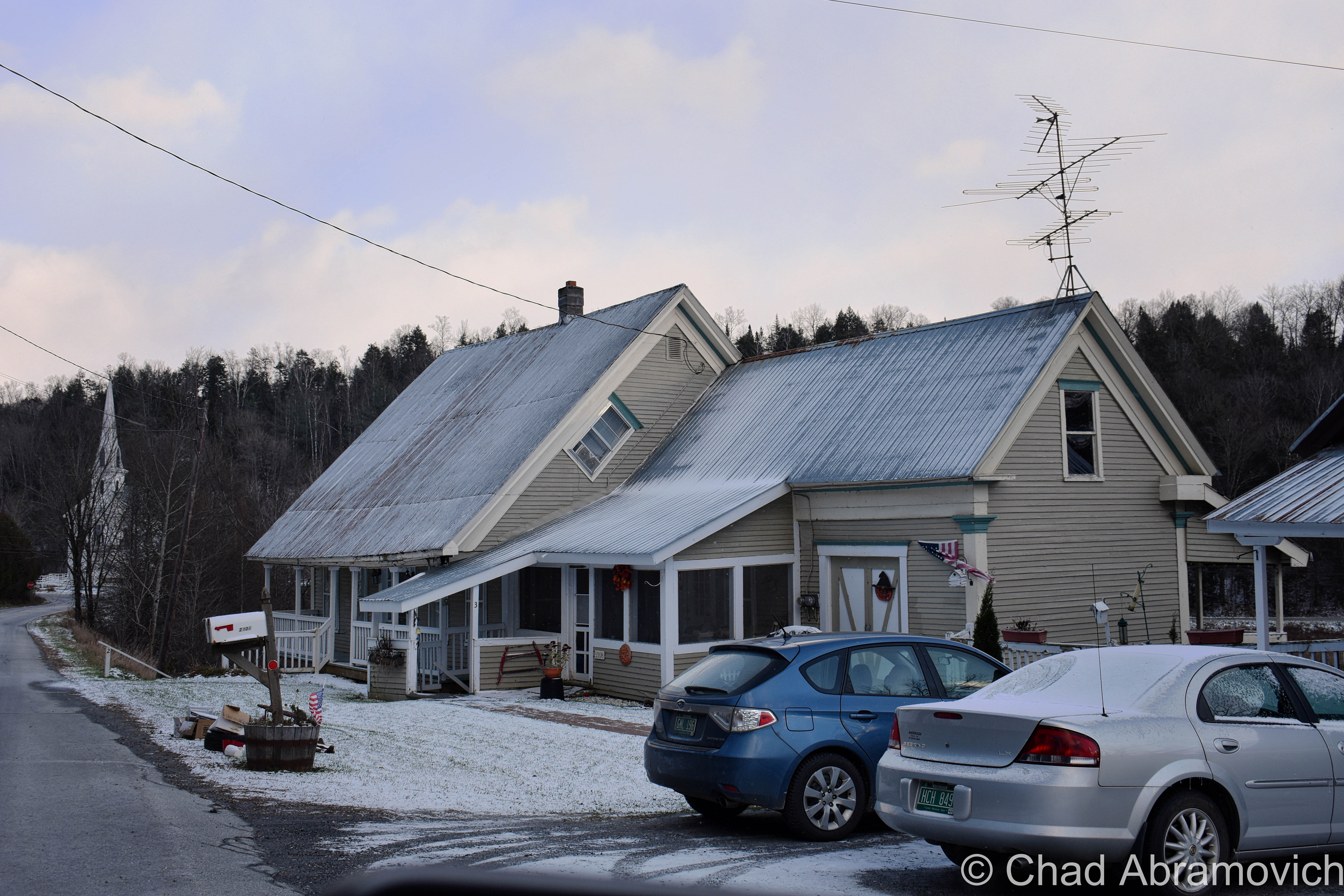
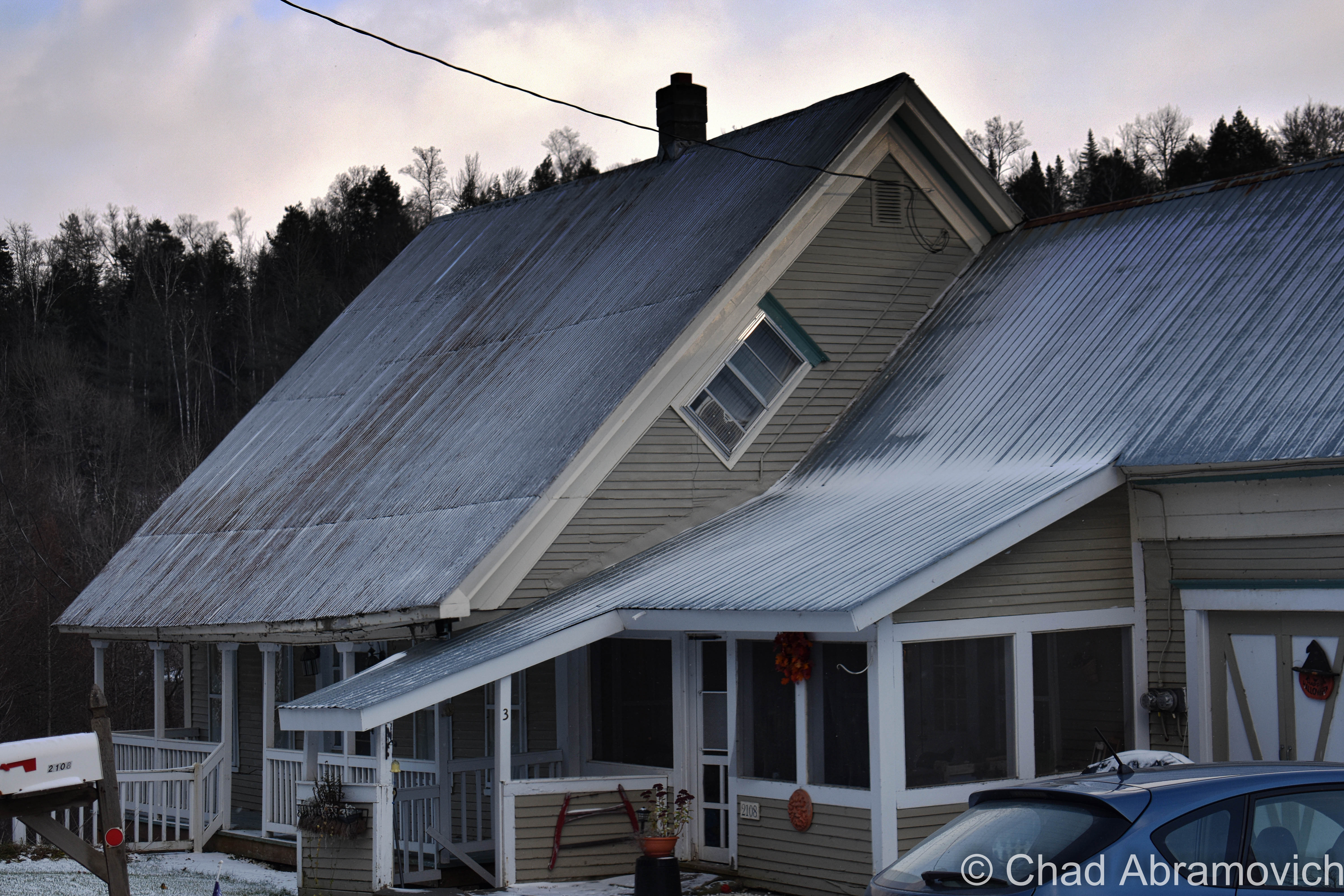
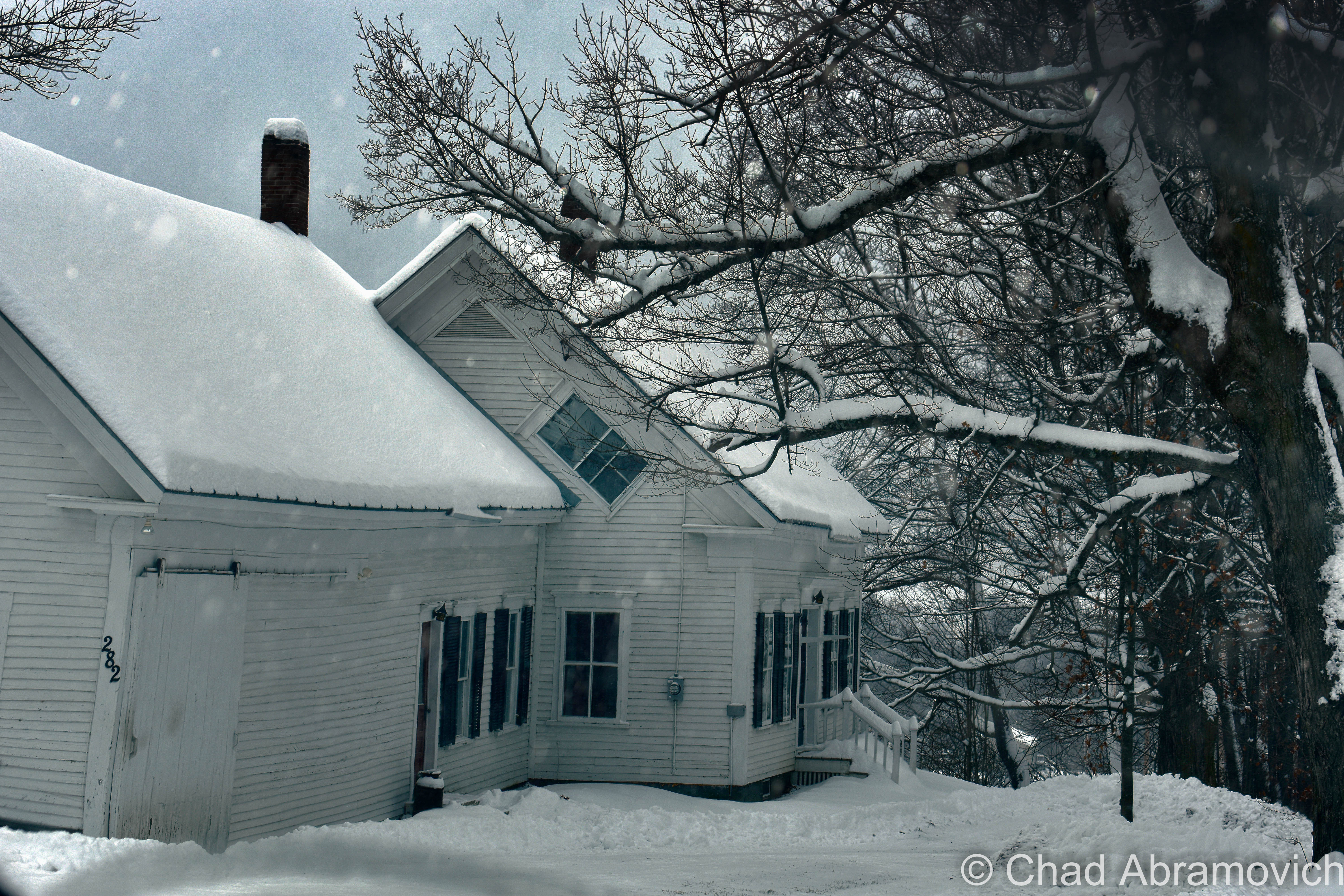
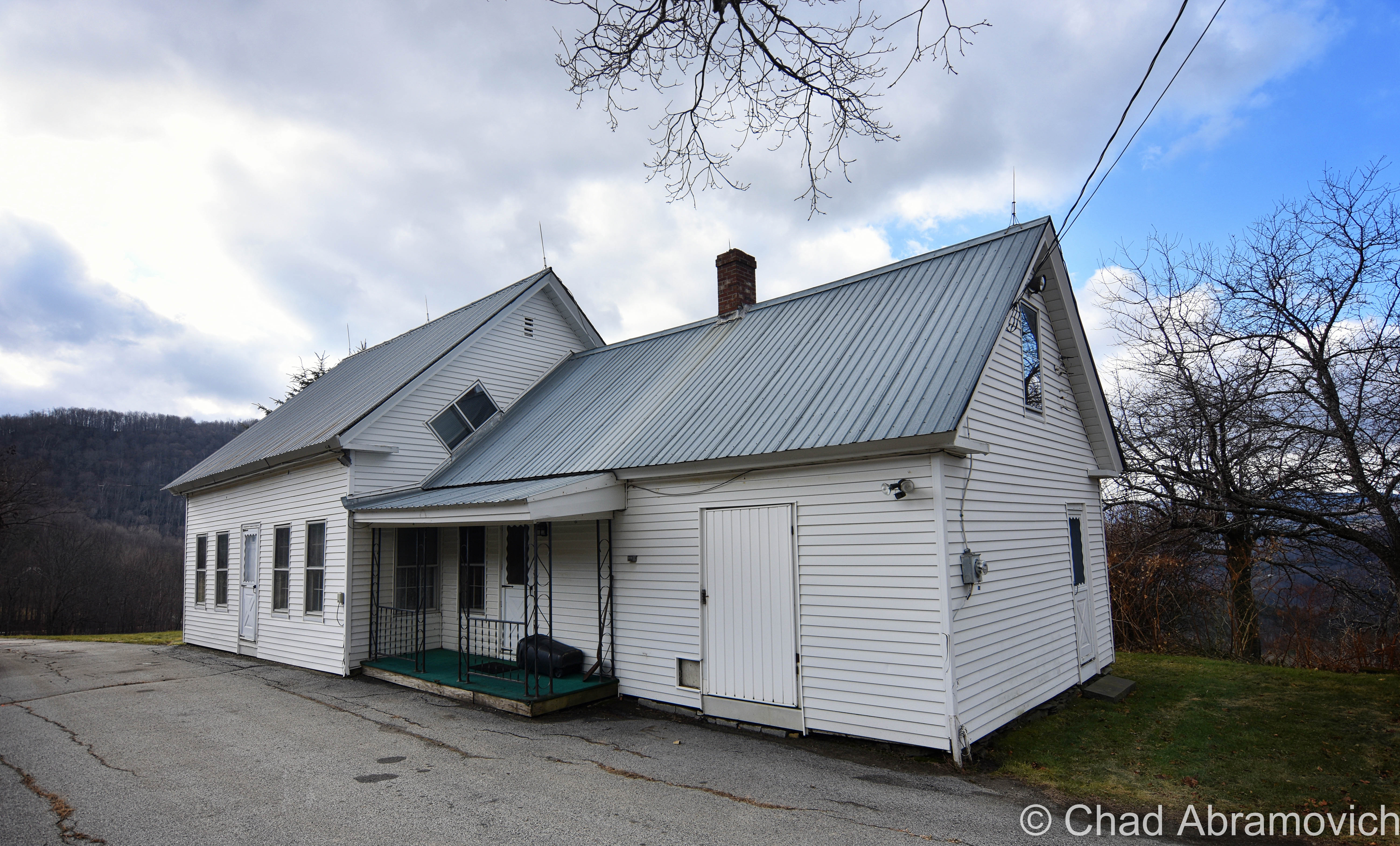
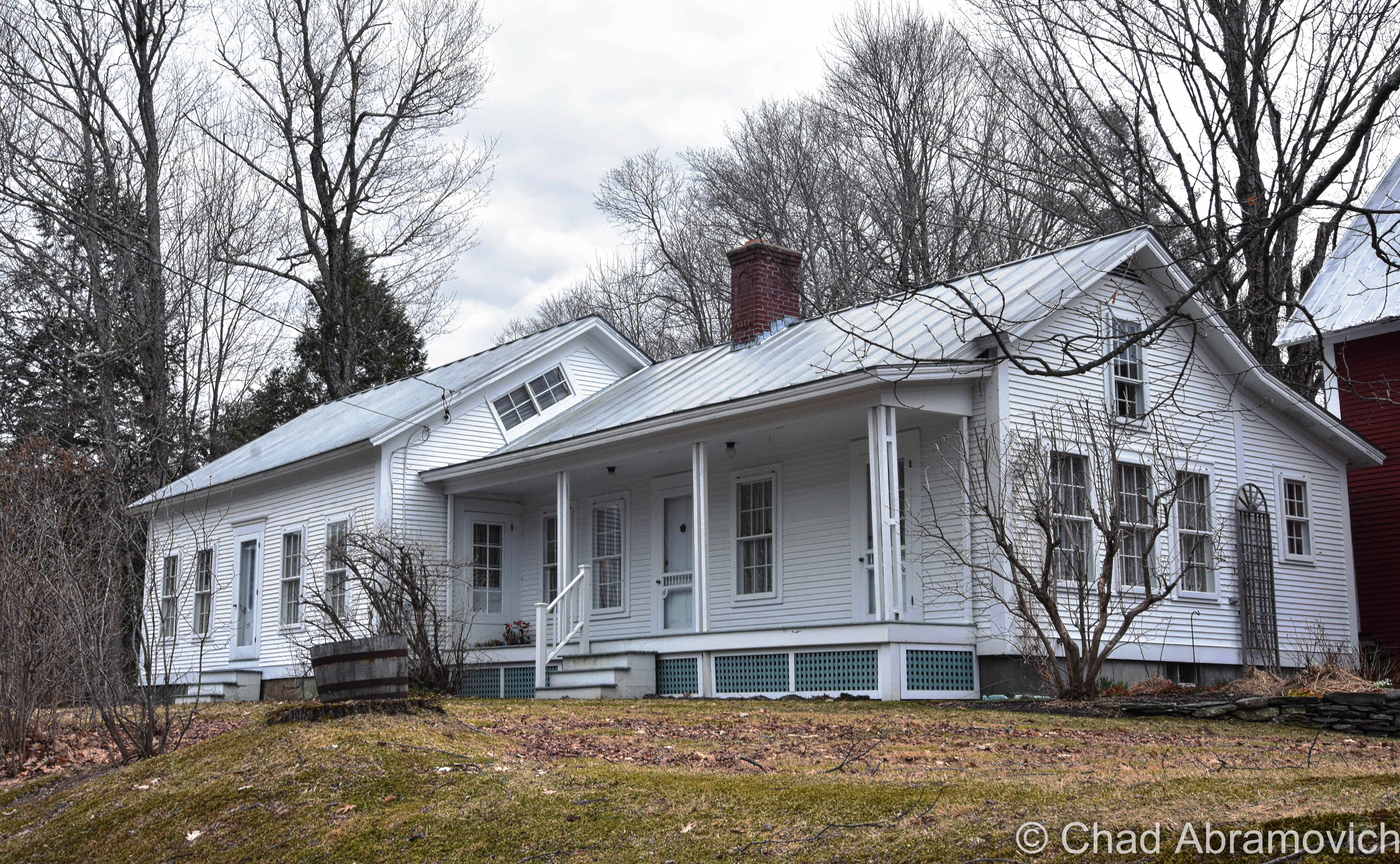
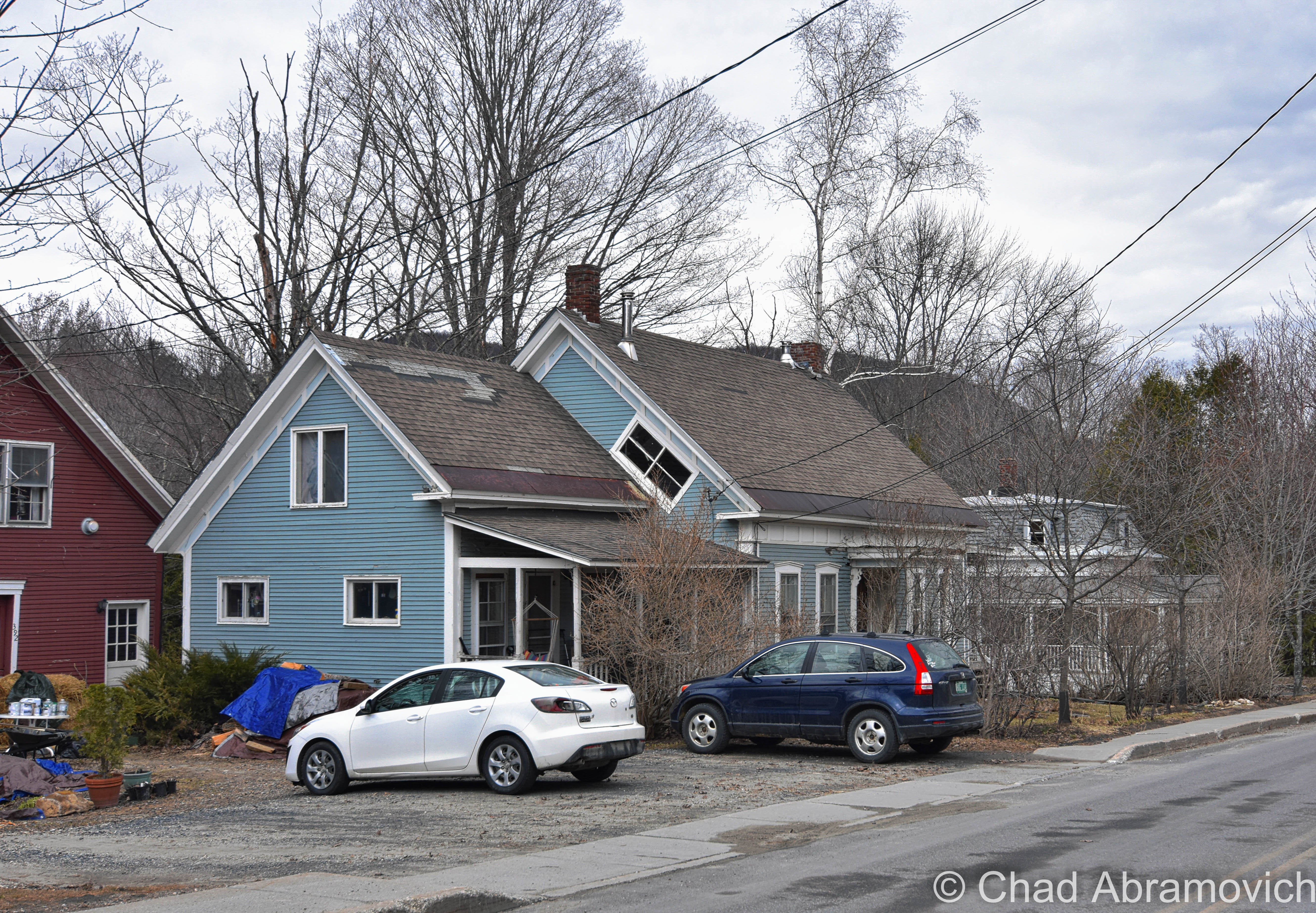
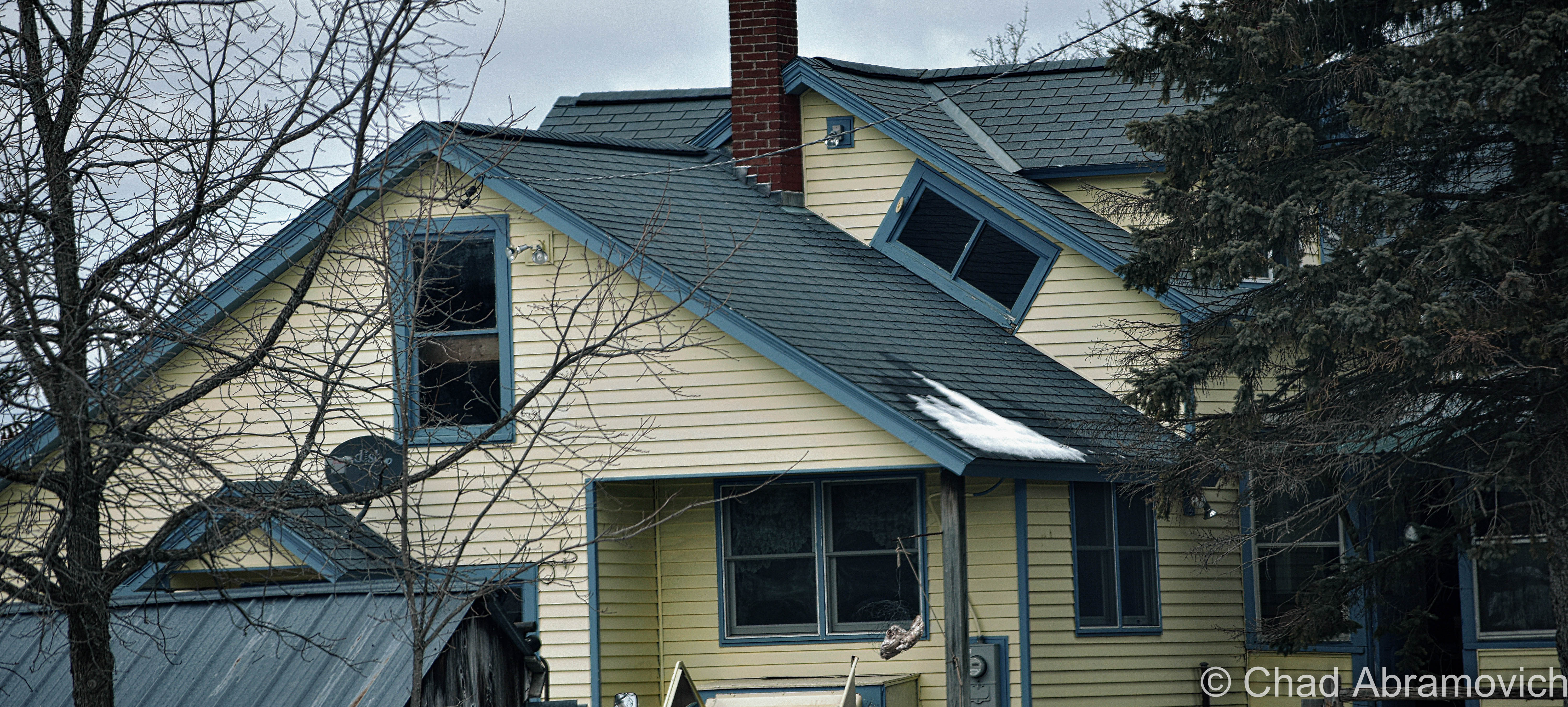
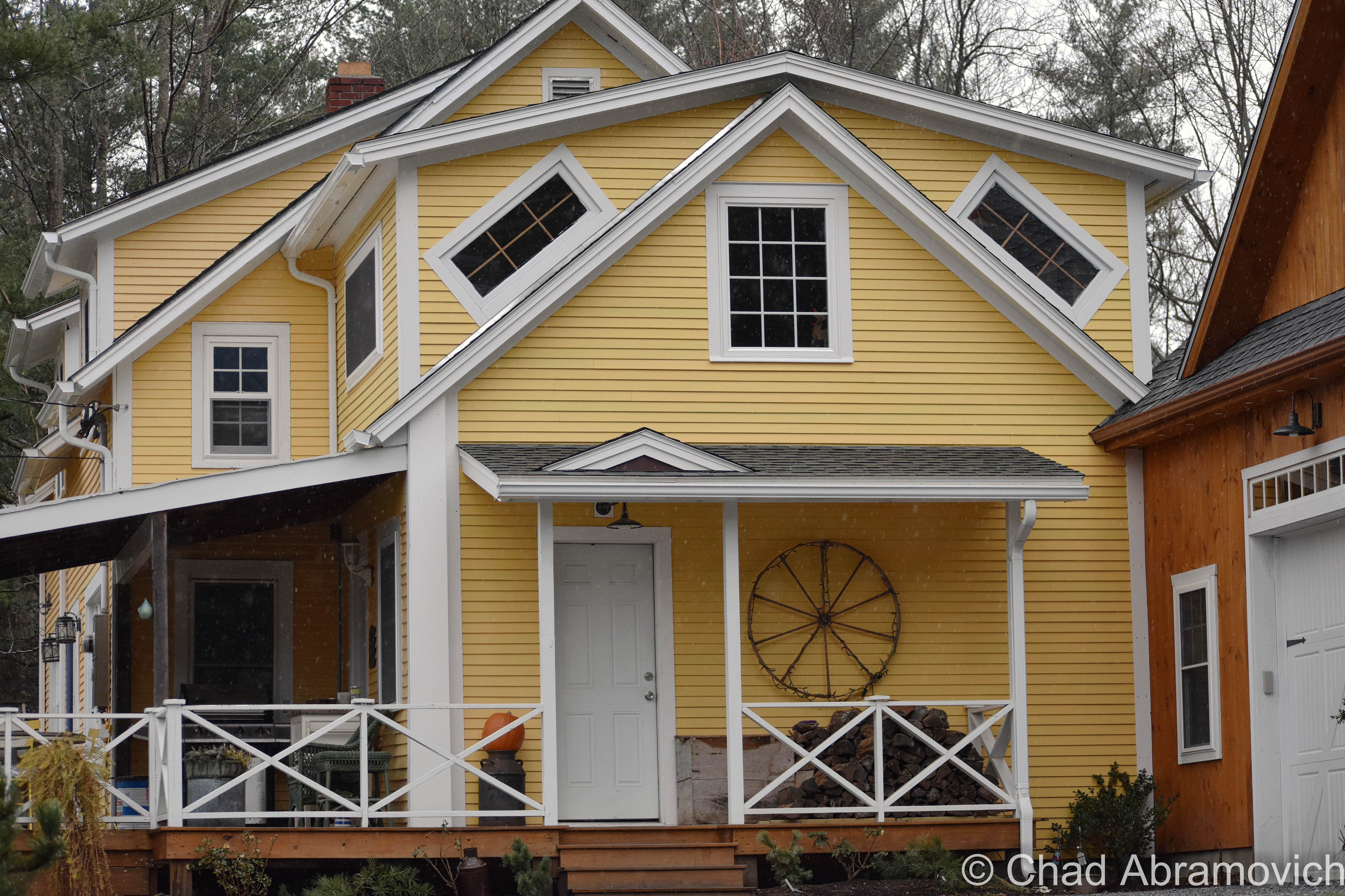
Do you see the diagonally tilted window placed in the gable end of this old farmhouse with its long edge parallel to the roof? A lot of people, Vermonters or flatlanders, seem to be flummoxed about these peculiarly slanted windows. That’s because their orientational existence isn’t found in any other states (though someone did tell me that they think they saw one somewhere in New Hampshire not too long ago.) To add a bit more rapturous froth to the isolated mystery, our Vermont parlance labels them “coffin windows”, or sometimes “witch windows”, depending on who you are I guess. Growing up, my mother would always point them out as “coffin windows” whenever we would take a trip out of suburban Chittenden County to more rural parts of the state, where older structures far outnumbered the new. I wasn’t introduced to “witch windows” until much later.

The etymology behind the monikers vary, and can’t really be traced back to a materialized point of origin.

Going alphabetically – it’s said these are called coffin windows because if a family member died upstairs, it was far easier to maneuver the needed coffin out the window and slide it down the roof as opposed to figuring out just how to haul it down a steep and narrow Vermont farmhouse staircase. And trust me, some of them are very steep and narrow to a point of over-cautiousness when walking up or down one – enough for me to sympathize with anyone who would groan at the prospect of dragging anything up or down them.

The name witch window gets a bit more on the superstitious side. It’s said that an old belief was that a witch couldn’t enter your dwelling through a crooked window or opening. A similar superstition that comes to mind is how the ancient Chinese thought bad spirits traveled in straight lines, so their architecture took on steeply peaked rooflines.

I know old Vermonters were a superstitious bunch. Our collective state history and folklore include such grim things as incriminating real people accused of Vampirism, or desecrating the graves of dead people accused of postmortem vampirism (our most famous Vampire execution was a man named Corwin, whose remains still loam underneath Woodstock’s boat shaped town green).

But witches? There isn’t much known on how scared Vermonters were of witches, leaving this as intriguing speculation. However, I was able to dig up a small number of succinct accounts in old state newspapers around the late 1700s and early 1800s of various Vermonters who locals suspected were witches, but in reality were probably nothing more than eccentrics living in a more narrow-minded time. One article amusingly reported that a Stowe woman was blamed for making several farmers’ milk cows run dry.

A more practical theory and probably the most likely of the three, was that these windows were a creative solution to let light into the cramped spaces upstairs. Gables didn’t often leave rooms for traditional sized windows and poor farmers didn’t want to spend the money on drafty dormers or getting a custom window made – which was a costly purchase many families couldn’t afford. They also enabled fresh air and ventilation to keep the house inhabitable. Though there are far more scolding environments than Vermont, our summers do get pretty humid, and the upper floors of an old house easily turn into ovens. 

Further down the line, these windows adopted yet another sobriquet with less dour and more civic pride; Vermont Windows. Though I haven’t heard that term nearly as much as the afore-referenced other two. 

In a world that loves things to fall into human-made symmetry, who knew that a window installed at a tilt could conjure up so many declaratory ideologies.

It seems that these windows have a bit of cool fanfare behind them, apart from your blogger. Some cool individual even made an Instagram account dedicated to them!

Route 100 in South Duxbury
Found one in this abandoned farmhouse I was exploring.
East Calais
Calais
Calais
South Woodbury village
Peacham
Turkey Hill in Northfield.
Warren village
Warren Village
Cornwall
DOUBLE coffin/witch windows in Stowe! I guess these folks didn’t want to take any chances just in case a pesky witch decided to curse them.
Any of you folks know of a coffin window near you? Let me know! I love road tripping around Vermont, and I always make excuses to shunpike somewhere!
—————————————————————————————————————————————–

To all of my fans and supporters, I am truly grateful and humbled by all of the support and donations throughout the years that have kept Obscure Vermont up and running.

As you all know I spend countless hours researching, writing, and traveling to produce and sustain this blog. Obscure Vermont is funded entirely on generous donations that you the wonderful viewers and supporters have made. Expenses range from internet fees to host the blog, to investing in research materials, to traveling expenses. Also, donations help keep me current with my photography gear, computer, and computer software so that I can deliver the best quality possible. Seriously, even the small cost equivalent to a gas station cup of coffee would help greatly!
If you value, appreciate, and enjoy reading about my adventures please consider making a donation to my Paypal. Any donation would not only be greatly appreciated and help keep this blog going, it would also keep me doing what I love. Thank you!

Donate Button with Credit Cards

Gofundme: https://www.gofundme.com/b5jp97d4


Milton Mysteries: The Tunnel Underneath Main Street

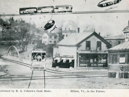
This old postcard may be one of my favorite finds from the Milton archives. Published by Raymond A. Coburn, who owned the pictured general store in Milton from 1908 until the flood of 1927. This image of “downtown Milton” depicted a cartoonish almost satirical image of what town had the possibility to be like in the future. That vision included blimp taxi service to South Hero, which I still think would be sort of cool. Today’s Milton of the future has a CCTA bus line. | photo: Milton Historical Society.  

My thoughts on Vermont weirdness often drift back to Milton, my former hometown. I suppose this is where I would further enhance that sentence with an explanation, but to be honest, I’m having trouble coming up with an angle on this. It’s where I grew up, and something about spending a third of my life there has just tattooed it into my framework. It’s where my love of the weird and the offbeat began from inside a quiet suburban bedroom, and began to proliferate outwards – which would become one of my most distinguished aspects of my personality, and why this blog now exists.

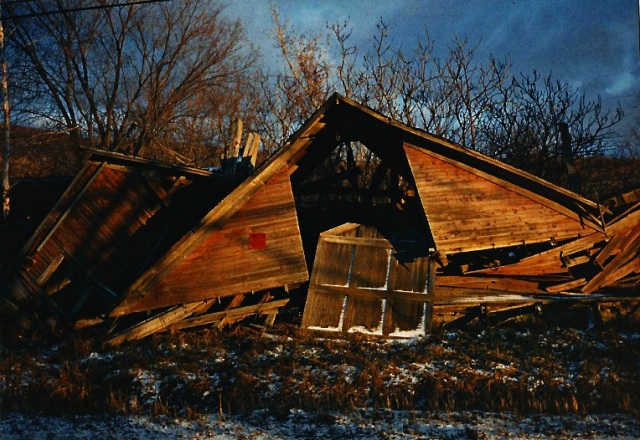
I often tote the Milton Creamery as the first abandoned building I've ever explored and became fond of, but more accurately, it was this ramshackle barn on the North Road I used to pass when I'd ride the school bus home. As a kid, I awarded it the moniker;
I often tout the Milton Creamery as the first abandoned building I’ve ever explored and became fond of, but more accurately, the first forsaken place I would ever lay eyes on was this ramshackle barn on the North Road I used to pass when I’d ride the school bus home. As a kid, I awarded it the moniker; “the broken barn”, which wasn’t all that creative but oh well, at least it was memorable. My mom was even cool enough to drive a little 6 year old me there a few times so I could explore it. Today, the faded relic is barely recognizable as the forest has almost consumed it. This was taken circa 1994, and is a scanned photograph.

As I grew older, I let my burning curiosity get the best of me, and began writing down all the urban legends and stories from my childhood, and all the accounts told to me over the years. This was a ritual I began to love, because I was quickly finding out that Milton was a fascinatingly storied town!

Its geographical area is unassumingly large, ranking 10th largest in land area and 8th in population (10,352 bodies at the 2010 census). All of that space is a perfect for hemming in obscure things and historical oddities. In the 1920s, aviation enthusiast and innovative inventor Paul Schill built an airport in town, where Sears and Ace Hardware are today (which accounts for the pancake flat plot of land along Route 7). But his goal of putting Milton on the map as an aviation manufacturer hot spot died in the beginnings of the great depression after he declared bankruptcy. In the later half of the 20th century, we were one of the premier racing towns in the northeast, with the Catamount Stadium (something I’d love to write about in great detail) and a drag strip drawing enthusiasts from around the region. These things have also became faded ghosts with the changing of the times.

Over the years, Milton would be a place where I would begin to shake hands with a lot of ghosts. Some were metaphorical; conjured from inflicting wounds laid upon to me. I began learning a lot about my Aspergers diagnosis in this town and still remember my lonesome youth rolling and stumbling, figuring out how I processed information in different ways from the rest, and how I often felt powerless because I didn’t feel like I understood the world around me, learning the rules out with the wolves.

But some of these ghosts were real. A former friend once told me about how their Bert’s Mobile Home trailer was haunted by the ghost of a little girl, who particularly liked a long narrow hallway connecting the bedrooms behind the living room. Though I’ve spent quite a bit of time there in my past life, I never had a run in with her. But I do recall the hallway always being dark and creepy, even during the day, which is a good breading ground for spook stories. When I asked the family about the girl, it became more complex and amorphous like these stories always tend to do; there were no records of any young girls growing up or dying there, making this story a weird mystery. But, they somehow knew she was there.

There is said to be a house on Main Street where things literally go bump in the night, perhaps because it used to be a funeral parlor in the last century. Weird lights and objects in the sky have been reported around 900 foot Cobble Hill for a few decades, and local lore tells of a haunted island in man-made Lake Arrowhead where a young woman was murdered by her jealous stricken husband in the late 30s, when he became enraged after the men of town kept admiring her. And, I’ll always remember this arbitrary point of non-trivia about Hobbs Road. Though the paved thoroughfare was named after a farming family, my friend once joked to me as he was reading the directions I wrote down so he could find my house; “I noticed that your neighborhood was off Hobbs Road…did you know that Hobbs is an old name for the devil?”

The more curious I became, the more I began to take comfort in the quiet company of weirdness and lore. Some mysteries I would have the pleasure of investigating, others still remain lost somewhere in the haze. Either way, both sets of ghosts would successfully haunt me for years to come.

Underneath The Ground

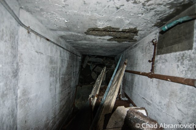
One of the most impressionable stories from my childhood told of a clandestine tunnel that started in the basement of the Joseph Clark mansion and ran underneath several old homes on Milton’s Main Street.

The stately Joseph Clark mansion, perched on a slight rise above Route 7, used to be the town offices and library back in the 1990s, which was the time when I picked up on the story. According to some, one of the house’s long dead builders is still there, and may be responsible for the next part of the story.

Kids in the library used to do what kids do best, and venture into places they weren’t supposed to. One of those places was the tunnel. But some would come running back up the stairs, visibly shaken, and tell the librarian that they were chased away by a man in the tunnel they thought was a security guard, whose presence was announced by the sound of heavy footsteps approaching them and then a glimpse of his tall dark form. But, the librarians would be confused and explain that the library had no security guard.

Unfortunately, that was where the story went cold. Was there really a tunnel underneath Main Street, connecting many of the town’s oldest homes together? If so, what was it used for? Popular theories guesstimate that it was constructed for use in the underground railroad.

Lorinda Henry of the Milton Historical Society was kind enough to sit down with me and help me in my search for answers. Meeting in the Milton Museum, which is pretty much the town attic that sits in an old church, we dug through countless unlabeled binders and boxes, but sadly, any information containing the tunnel wasn’t in their archives, or had long been lost. But the builder of the Clark mansion, however, was well documented.

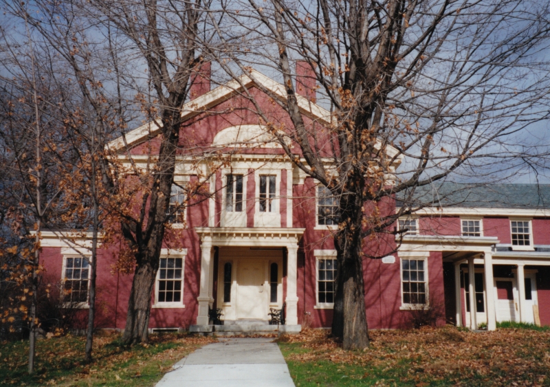
The Joseph Clark Mansion
The Joseph Clark Mansion | Photo: UVM Landscape Change Program

After Milton’s official chartering in 1763, settlement was lackluster for the next 30 years. West Milton on the lower Lamoille banks, became the first part of town to be developed. A few miles up the river was a part of town that was known as Milton Falls, which would be the area around present day Main Street. In 1789, Elisha Ashley would survey the first east-west road in the Milton Falls section of town, by running a straight line from the Westford/East Road intersection, to a stump on the Lamoille River. Noah Smith, one of Vermont’s first lawyers, owned most of the land around what would become Main Street and Milton Village.

Joseph Clark was one of the earliest settlers in town, and his business endeavors made him both one of the wealthiest and most influential residents in Milton. He came to Milton in 1816, a year known by Vermonters as eighteen hundred and froze to death, because of the unseasonably frequent snow and frosts that caused widespread crop failure across the northeast. It’s no surprise that some superstitious Vermonters saw this as the coming of the end of the world.

But while the crops were failing, Clark and his partner Joseph Boardman saw opportunity in the rich pine forests that covered most of Milton, and hired crews to harvest the fine timber. The logs were floated up Lake Champlain to Montreal, before they were shipped to England, many to become used by the Royal navy. By 1823, he would purchase a sawmill in West Milton to process the raw timber. But by 1830, woodlands were replaced by agricultural land, and Clark decided to invest in other opportunities. He would build a gristmill in Milton Falls, then move into the brick mansion on Main Street that now bears his name. Later, he would build himself a two story brick office building where Main Street meets River Street, today’s Route 7. Clark’s move and investment in Milton Falls would lure more people and business endeavors there, and make that the new hub of town.

Joseph Clark's Gristmill, where present day Ice House Road runs over.
Joseph Clark’s Gristmill, where present day Ice House Road runs over. | Photo: UVM Landscape Change Program

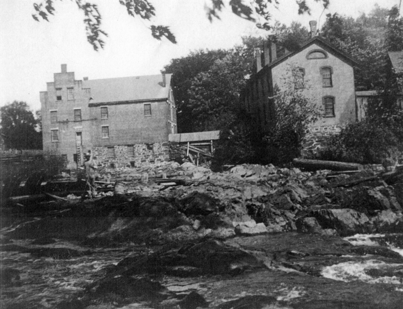
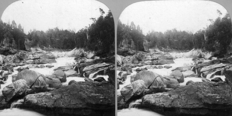
Here, the Lamoille River and gravity worked together to form about 5 waterfalls in a few miles of one another constricted in a rocky gorge, before relaxing at West Milton. These falls were ogled and soon sought after for industry. Some however also envisioned bravado and a way to kill boredom. In the 1800s, a growing number of young people in the northeast were jumping in barrels and going over any waterfalls they could find, which would achieve both getting mentioned in the newspaper and sometimes death. I once heard many years ago that around that time, a local boy and self-described dare-devil went over Clark’s Falls in a barrel. But to my huge disappointment, I couldn’t find any verification or information on this man or his leap over the falls. I liked that anecdote enough to include it in this entry though.

Railroads were rapidly spreading their steel arteries across the United States, bringing people, opportunity and growth with them, and because these things were vital for business exploits, this caught Clark’s attention. Partnering with John Smith of the Central Vermont Railroad, they worked to get some tracks built through Milton. In 1845, Milton had a rail line and accompanying train station, and that benefited the town greatly. After the civil war, the railroad brought vitality to the town’s burgeoning summer tourism industry and industrial mainstays like the former Creamery, a building which has shaped my love of exploring and photography.

Clark would continue to remain active in town affairs until his death in 1879. The house was passed down to family members until 1916, when Joseph’s granddaughter, Kate, deeded the house to the town of Milton to use as the town offices, and remained so until 1994 when it was reverted back to a private residence.

Lorinda speculated that the former gristmill behind his mansion could have warranted the construction of a tunnel, which would have sat where present day Ice House Road is. The house was built on a slight ledge, which would have made the tunnel a more convenient way to travel from one place to another, especially in the grueling Vermont winters. But there was no way to know for sure.

The mill and most of the development near the river were washed away during the flood of 1927, making investigations almost impossible.

It was later told to me that someone knew of a “thick iron door” found in the basement of Joseph Clark’s former office building on the corner of Route 7 and Main. This was one of the few buildings on River Street to survive the flood of 1927, so that claim seemed pretty credible to me. (But if it were built at a later date, I would be really curious about that mystery as well)

Joseph Clark's Office Building on the corner of RIver St (Route 7) and Main. Milton denizens today may recall it by it's former reincarnation, as Irish Annie's Pub.
Joseph Clark’s Office Building on the corner of River St (Route 7) and Main. Milton denizens today may recall it by its former reincarnation, as Irish Annie’s Pub, which was sort of a hole in the wall affair where the brick facade almost fell into the road a few years ago. | Photo: UVM Landscape Change Program

Geography would aid me here. The building was built into a ledge that forms the beginning of Main Street hill. Right above sits the Clark mansion. This means that a door in the basement wall would have lead to some sort of subterranean chamber, which may have been a tunnel.

The historical society told me of a former resident and her mother who once lived there, and claimed to have seen the iron door themselves. The facts seemed to be finally adding up here, but it seems my request for information was a few years too late. The building has since been sold, and it’s current owner denies the existence of a door firmly and doesn’t want to talk about such things. I attempted to reach out to the previous owners who brought forth the iron door sighting, but they had told the historical society so long ago, that their contact information had since vanished.

The Irish Annie's building (now vacant) - where the supposed iron door is said to be. Main Street is to the right, which runs up the hill. The Clark Mansion sits behind it.
The Irish Annie’s building (now vacant) – where the supposed iron door is said to be. Main Street is to the right, which runs up the hill. The Clark Mansion sits behind it. Photo: Google.

Another suggestion illustrated that the tunnel once ran all the way up the hill to the abandoned creamery on Railroad Street. And sure enough, there is a walled up door in the basement that once did lead to a tunnel. Could this be the proof I was looking for? I did a little digging around (literally), and talked to a former employee. As it turns out, the door did lead to a tunnel, but it wasn’t the tunnel. It ran significantly shorter, just over to the brick building next door which was also owned by the creamery at the time (now converted to a private residence). But that tunnel also had its notoriety. Former creamery employees and older Miltonians wistfully admitted that they used to sneak down and party in that tunnel, those shindigs usually included spirits and cigarettes, while the creamery was in operation and even in the years after it’s closing.

The Creamery Tunnel, sealed off at it's other end.
The creamery tunnel, sealed off at its other end.

The tunnel story seemed to be disappointingly falling apart. Though it was cool to think about – practically, it didn’t make sense. If we stick to the theory of a tunnel running all the way underneath Main Street, why would such a long tunnel need to be constructed? What was it’s purpose? To further deteriorate the story, the stately homes on Main Street were all built around different times, meaning their construction most likely didn’t accommodate the existence of a tunnel. And to prove this, I had spoken with a few Main Street residents who had never even heard the story of the tunnel, but all assured me the only way into their homes were through the front or back doors.

Vicious Waters and Dislocation

It wasn’t until some time later, after this project had been pushed to the back of my to-do list that something came up which immediately pulled it from memory. A Facebook commenter who knew that I was attempting to get to the bottom of this sent me a message and shared a personal account with me. As a kid in 1960s Milton, he used to play with his buddies down near the river, and he recalled seeing a cave like opening set back in the cliffs near the dam. Popular labeling at the time dubbed it as a tunnel. He even remembers his parents admonishing him and telling him not to go near it because it was likely to be dangerous. He never did, but speculated that it may be what I’m looking for. He also said that some of his friends claimed to get inside, but couldn’t recall any more than that. For all we knew, they may have been embellishing the truth.

One gloomy summer afternoon in August, I set out with a few friends to dig around the Lamoille banks, trying to find the telltale opening. That part of town has long been awarded an odd moniker by local youth who call it The Vector, which is a robust sounding name, but I can’t seem to relate it’s actual definition to the rocky gorge spanning from the Route 7 bridge to the bottom of twisting Ritchie Avenue. But the name has proven very successful at sticking into the flypaper of local culture. I grew up knowing that area as The Vector, and still do.

An early stereoscope view of the area known as The Vector, early 1800s, before the dams and industry. The Lamoille River gorge was a wild place. Photo: UVM Landscape Change Program
An early stereoscope view of the area known as The Vector, early 1800s, before the dams and industry. The Lamoille River gorge was a beautiful wild place. Photo: UVM Landscape Change Program
Early explorers on the Lamoille River near Milton Falls, early 1800s. Photo: UVM Landscape Change Program
Early explorers on the Lamoille River near Milton Falls, date unknown. Explorer Samuel De Champlain called the river la Mouette, from all the gulls he saw when he navigated it, but it’s solidified name came from an error years later when an early map maker forgot to cross his t’s. The waterway is the only Lamoille River in the world. Photo: UVM Landscape Change Program
Ritchie Avenue is one of Milton's more impressive thoroughfares. The quiet road follows the pools of the Lamoille River before dropping down a series of ledges offering great views of the Lamoille and the towns rolling hills that stretch out to Lake Champlain. The distracting road was built to accommodate the construction of a pulp mill down in the vector, which once employed over 100 people. A strike in 1925 closed it, and the flood of 1927 destroyed it.
Ritchie Avenue is one of Milton’s more impressive thoroughfares. The quiet road follows the pools of the Lamoille River before switchbacking down a series of ledges yielding great views of the Lamoille and the low profile hills that undulate to the shores of Lake Champlain. The distracting road was built to accommodate the construction of a pulp mill down in the vector in the early 1900s, which once employed over 100 people who all built homes in town, which accounts for why so many houses on upper Cherry Street look similar. A strike in 1925 closed it, and the flood of 1927 destroyed it. Most of the area has been transformed into a kayak launch area and substation for Green Mountain Power, but some of the twisted remains and chunks of brick walls from the old place can still be seen at the bottom of the hill. I used to hang there as a teenager and explore the river’s islands, caves and rapids. | Photo: UVM Landscape Change Program
The incline railroad that carted lumber at the pulp mill, ran up the steep banks and towards where present day Mackey Street is. Years and years ago, someone told me that one of the rods or bolts from the supports could still be seen in those woods today, if you know where to look. But I can't verify this, as I haven't been able to find it.
The incline railroad that carted lumber at the pulp mill, ran up the steep banks and towards where present day Mackey Street is. Years and years ago, someone told me that one of the rods or bolts from the supports could still be seen in those woods today, if you know where to look. But I can’t verify this, as I haven’t been able to find it, which sort of makes this a similar tantalizing mystery like NYC’s Central Park and the famous lost survey bolt from it’s creation. | Photo: UVM Landscape Change Program

While doing our amateur urban archaeology, we found a surprising amount of items along the river banks, in the waters and even stashed in crevices that ran like veins through the crumbling rock ledges. Broken pieces of China plates, old glass bottles, rusted tools and even the remnants of an old truck lay trashed down in the rocky gorge, things that blurred the lines of being considered an artifact or garbage.

I knew this area was hit hard during the flood of 1927 and artifacts, cars and even entire homes were swept up in swollen brown tides down this part of the river, depositing much that still rests below wet rocks and Hemlock trees today. I even was able to dig up old newspaper accounts that were printed when the disaster was happening. One vivid memory was reported by a woman, who watched an entire house be swept down the river, almost entirely intact. She said she was able to look inside a broken window and see someone’s bed that had been turned down, as if the person was just about to turn in for the night.

The flood of 1927 is mentioned frequently in conversation of Vermont history, as the flood completely rearranged Vermont culture and infrastructure, and the after-efforts built much of the state we know today. The UVM Landscape Change Program archives had lots of photos of Milton pre and post flood, which gave me a startling impression of what was lost. This is the former town square, Milton's
The flood of 1927 is mentioned frequently in conversation of Vermont history, as the flood completely rearranged Vermont culture and infrastructure, and the after-efforts built much of the state we know today. The UVM Landscape Change Program archives has lots of photos of Milton pre and post flood, which gave me a startling impression of what was lost. This is the former town square, or “Downtown Milton” (1890). Joseph Clark’s office building can be seen on the immediate right, and was the only building in this photograph to survive the flood and exist into present day Milton. Phelp’s Store, which wasn’t photographed, also still stands underneath modern day red vinyl siding. Today, Route 7 is more or less, built right over this area.
Starting on November 2nd, an estimated four to nine inches of rain drenched Vermont and turned rivers into raging destructive torrents. Because it was late Autumn, the dry ground was unable to absorb the water. Soon, Milton residents watched as the Lamoille River turned River Street into an accurate description of it's name. Photo: UVM Landscape Change Program
Starting on November 2nd, an estimated four to nine inches of rain drenched Vermont and turned rivers into raging destructive torrents. Because it was late Autumn, the dry ground was unable to absorb the water. Soon, Milton residents watched as the Lamoille River turned River Street into an accurate description of it’s name. Photo: UVM Landscape Change Program
Flood waters on River Street in Milton, 1927. Photo: UVM Landscape Change Program
This is one of my favorite photos I was able to dig up, because it awesomely depicts the destructive powers of nature. In this blurry shot, it shows the Star Theater sink and wash away before a crowd of onlookers. Photo: UVM Landscape Change Program
Post flood damage. Photo: UVM Landscape Change Program
By November 5th, it was over, and the post flood damage was phenomenal. Photo: UVM Landscape Change Program
The remodeled town square after the flood, with Joseph Clark's office building and Phelp's store the only surviving buildings. Photo: UVM Landscape Change Program
The remodeled town square after the flood, with Joseph Clark’s office building and Phelp’s store the only surviving buildings. The Gold Medal Flour advertisement on the back of Phelp’s Store survived until the building was renovated years ago, and sadly sided over. Photo: UVM Landscape Change Program
One of more popular tales of Milton lore is of the village underneath Lake Arrowhead. Basically, people claimed that downtown Milton was flooded underneath the lake when it was built, meaning there are a collection of soggy farmhouses at the bottom of the lake. As a kid, I even heard stories of scuba divers diving into the lake and setting foot on the roof of a house. After extensive digging, I was able to find this picture. This shows River Street, or Route 7 north of the bridge, which is now the Lake Arrowhead Causeway. These houses all sat where Route 7 is now.
One of the more popular tales of Milton lore is of the village underneath Lake Arrowhead.Basically, part of old Milton still remains below the lake after the area was submerged. As a kid, a friend’s mom told me that she knew someone who scuba dived down to the bottom and set foot on the roof of one of the old houses, which I thought was incredible. Then I would find this picture, which would offer some clarity to my fascination. This shows River Street north of the falls. The buildings pictured would be all underwater today, near where Route 7 runs along the lake. When plans to flood the area were made known, homes and businesses were moved and the new road would be built atop a raised dirt bed 90 feet high, still refered by old timers as “the fill”. But local lore maintains that some properties that were too damaged by the flood, somehow weren’t hauled off, and remain at the dark soggy bottom today. If there is in fact stuff down at the lake bottom today, I’m sure it would be in pretty rough shape, but with other stories around Vermont of sunken villages, would also be believable.| Photo: UVM Landscape Change Program.
In 1936, The Public Electric Light Company began constructing a dam above Clark's Falls, which would create the 750 acre Lake Arrowhead and provide a source of hydroelectricity. At the time, the Burlington Free Press lauded it as a technological marvel.
In 1936, The Public Electric Light Company began constructing a dam above Clark’s Falls, which would create the 750 acre Lake Arrowhead and provide a source of hydroelectricity. At the time, the Burlington Free Press lauded it as a technological marvel.| Photo: UVM Landscape Change Program
Luman Holcombe, a longtime Milton resident and respected community physician, was the one who suggested the name
Luman Holcombe, a longtime Milton resident and respected community physician, was the one who suggested the name “Arrowhead Mountain Lake” in 1937, because on still days, the reflection of nearby Arrowhead Mountain in the water forms to make an arrowhead. The cluster of trees in the middle of the lake are growing from the allegedly aforementioned haunted island. I also like the boats in the picture. The lake is a relatively dead place now days.| Photo: UVM Landscape Change Program

A better understanding of the flood also gave me a better understanding of the area I was going to explore. Not surprisingly, its popular with people who like to metal detect who are still finding things transplanted from the flood and years onwards, so seeing all of this rubbish down there wasn’t a shocker. But something didn’t quite fit. One odd find was that a certain crevice seemed to be filled with trash – but it was put there by someone. This wasn’t naturally occurring. Someone had been down there at one point, trying to fill it up…

After a while of picking at the pieces and dislocating rocks, we were able to catch a peek deeper into the crevice, which expanded far back into a dark rocky chasm. It was evident that there was, in fact, more to see, and it did extend backwards, but I knew it wasn’t what I was looking for. Granted, the space had long been filled in by dead leaves and garbage, but it seems too narrow for what could be considered a tunnel. No man could seemingly fit back there, without the aid of tools and a great deal of ensuing noise. Either way, I stopped my efforts.

DSC_0878_pe
The collection of items we were able to dig out of the crevice in the cliffs. All of the following photos were taken in the dying days of summer, 2014.

DSC_0874_pe DSC_0884_pe DSC_0886_pe DSC_0887_pe DSC_0891_peDSC_0873I came up empty on August’s exploration, but in October, another lead would unexpectedly manifest itself, and it was promising. Meeting up with childhood friend Zach, I found myself in a location I normally avoid, a hole in the wall bar and pool joint in Essex Junction.

I was there to speak with a friend of Zach’s, someone who grew up in the Clark mansion and knew the building well. The house still belongs to her family today. When Zach had mentioned I was interested in the Clark tunnel, she said she needed to meet me in person.

And, she happened to be the bar tender who served us our drinks. Those who know me well are aware of the great cosmic relief that I often feel far more in my element in a location that is “off limits” to society, as opposed to legally being inside a dimly lit bar  underneath a perfume of cigarettes and sweat. But she was all smiles, and her enthusiasm put me in a good mood. “Oh man, that house is definitely haunted!” she exclaimed. Though that wasn’t exactly my crux, I had to chuckle. “As the story goes, the house might be haunted by Joseph Clark?” I questioned, now amused.

“Nope” she replied. “We actually think it’s a woman”. Old records state that Clark was once married to a Colchester woman; Lois Lyon, which possibly could explain this. Over the years, she and her family have heard the sounds of high heals clacking on hardwood floorboards upstairs, and of course, whenever one would go and investigate, the second floor would be empty. She also recalled the upstairs being creepy as a kid, a place she wasn’t all that fond of hanging around in. Other accounts like phantom cold chills and the unmistakable feeling of being watched upstairs she also said were pretty common. But damn it, was there a tunnel? 

Much to my pleasure, the mystery was finally confirmed. There was a tunnel, and she has seen it! Now to get to the bottom of things.

Opacity 

In the cellar walls of the Clark mansion is the clear outline of a door that sits well below the grassy lawn, now sealed up. But the distinctive outline of a door cleared up all skepticism. Also in the basement was another relic I found to be very cool – a massive cast iron safe that once belonged to Joseph Clark still sat in the wall. Though much of the mansion had been renovated over the centuries due to its many reincarnations, a few authentic pieces of the place still remained. She explained to me that the tunnel had to be sealed up, because local kids kept getting into the tunnel and using that as passage inside the building, where they would steal and break things. This happened even after the building reverted back to a private residence in 1994, so actions finally had to be taken. What a shame. By now, the tunnel is more or less unsafe to enter as well, due to neglect over the years.

However, I don’t want to deceive you folks. This information was directly given to me from the niece of the current building owner, that owner also declined my phone calls to seek a tour of the place, which disappointed me a bit.

So the fabled tunnel is now proven to exist. But where does it go? It runs down to the basement of the defunct Irish Annie’s Pub at the bottom of the hill. Its original purpose was so that Joseph could travel from his office to his house conveniently, but over the years, it’s very nature of being direct and discrete inspired a few other uses. During prohibition, it was reinvented as a smugglers’ tunnel, which allowed rum runners to transport goods into a speak easy that once operated out of the basement of Irish Annie’s. Astonishingly, the remnants of the actual speak easy can still be seen today below the building, which really hasn’t changed all that much. The basement is a traditional old Vermont cellar, low ceilings, stone walls, and filled with things that crawl. The old iron door into the tunnel is still there too, the very door I was told about so long ago.

Were there other tunnels? Maybe. But the affor-mentioned flood of 1927 and post-reconstruction completely wiped any other leads I could possibly have. And as for that tunnel or cave near the Vector, I wasn’t successfully able to find that either. Perhaps something is still there, just filled in with erosion or a rock slide over the years. Though my lead at The Vector was a bit of a disappointment, I soon found out about other caves in the gorge with their own lore. Some rumored to be the hideouts of smugglers in the embargo act days of the 1800s and dry 1920s, and transitioned as hangouts by local youth and now, cavers looking for a thrill. Some are only accessible by kayak, weather permitting, and offer creepy claustrophobic excursions into dark spaces.

This blog entry has been one of my favorite pieces to write so far. By trying to do research on what I assumed would be a straightforward topic, I kept stumbling on more information and stories that continued to morph and blurred whatever side of the line between reality and fantasy you wanted to be on, far too many for your blogger to fit in this already lengthy article.

One night while sitting in the living room of a former friend’s house, his dad told me their old farmhouse was built in the early 1900s, out of an old barn built in the 1800s, and was dragged to Milton by oxen from its former position where the airport in South Burlington is now. I guess the house contained many other cool details, but sadly we’ve since lost touch.

Another favorite find of mine was a few years back, when a WW2 medal belonging to a Nebraska man was found stuffed in a VCR cassette and stashed inside a tree. No one knew exactly how the medals ended up in Vermont, or why.

Milton is a cool town, and the people who live their have their share of extraordinary stories. I have quite a few other Milton points of interest and esoterica that I plan on writing about in the future. Until then, thanks for the inspiration Milton.

————————————————————————————————————————————————————

If you missed it, I was recently interviewed by Stuck In Vermont and Seven Days. If you’d like to learn a little bit more about your blogger, feel free to check out my interview.

—————————————————————————————————————————————–

To all of my amazing fans and supporters, I am truly grateful and humbled by all of the support and donations through out the years that have kept Obscure Vermont up and running.

As you all know I spend countless hours researching, writing, and traveling to produce and sustain this blog. Obscure Vermont is funded entirely on generous donations that you the wonderful viewers and supporters have made. Expenses range from internet fees to host the blog, to investing in research materials, to traveling expenses. Also, donations help keep me current with my photography gear, computer, and computer software so that I can deliver the best quality possible.

If you value, appreciate, and enjoy reading about my adventures please consider making a donation to my new Gofundme account or Paypal. Any donation would not only be greatly appreciated and help keep this blog going, it would also keep me doing what I love. Thank you!

Gofundme: https://www.gofundme.com/b5jp97d4

Donate Button with Credit Cards

Railroads and Silos

It was an icy Winters day as me and some friends drove through the Champlain Islands; destination unknown. It was one of those situations where we were seeking a place to explore, hoping to find some inspiration and intrigue in the brown fields burned by the harsh blue skies. In the Winter, the Champlain Islands loose the comfort and allure brought with the Summer months, vanishing with the shivers and darkness of the later half of the year as if it were a completely different place.

Not having any real luck in the islands, we crossed the Alburgh bridge into New York, the sturdy ruins of Fort Montgomery were not being pitied by the season as they were battered by the choppy and relentless waters of Lake Champlain.

For a region with such an extraordinary history and important connection to the rest of the country, a surprisingly large amount of it has been buried (metaphorically and literally), the occasional historical marker is scattered across the geography, hinting at what once was.

Rouses Point, New York has always been a heavily trafficked locality thanks to it being a portal into Quebec. It’s where the dotted border lines of New York, Vermont and Canada all meetup, as well as Lake Champlain and Quebec’s Richelieu River, which were the area’s original super highways before the interstate systems were built.

Automobile, rail and boat traffic is all siphoned through the gateway community, and because there are always nuances, that also includes the more illicit of things, like rum runners, smugglers, the underground railroad, and a few wars fought by the British and the Americans skirmishing on Lake Champlain over the past hundred years. Seriously, Rouses Point was such a noteworthy place that the feds financed a fort to be built at the mouth of the Richelieu just in case British troops wanted to invade us through Canada. Only, the United States was a much younger nation then, which meant that no one knew exactly where the border was, and the fort was accidentally built in Canada, later returned to the U.S, and never actually used. It was eventually partially salvaged for parts, and a lot of the small village was built up with the bricks, stone and wood salvaged from the brawny structure. From what I was told, the present day village offices were built on top of a former prohibition era dumping site of all the paraphernalia that was confiscated. Today, a drive through Rouses Point is mostly simple wood frame houses, moored sailboats and a Dollar General, a ubiquitous find in Upstate New York.

The village really did well for itself when the Delaware and Hudson Railroad decided to build passenger and freight facilities here and a rail yard to accommodate. Though Rouses Point is a pretty obscure community overall today, just outside the village limits are the remains of the oldest and last remaining Delaware and Hudson roundhouse turntables. Being battered by fierce winds, our trip here was short as the numbness in my hands began to outweigh my increasingly diluted curiosity. What can I say, I hate the cold.

This building was formerly used for washing down the rail cars

dsc_0448_pe

Interestingly enough, most railroads, the D&H included, didn’t bother to wash their steam locomotives. Every so often, they would go over them with a mop soaked in kerosene to make them shine, but that’s about it. Roundhouses were built in the steam era as a way to store and maintain the locomotives, as well as repair and prepare them for their next trips. Other buildings on the site would be a coach shop, which was used to repair passenger stock, a cooling tower which was used for fuel, water tower for water, and in some cases a freight house where less than carload items were sorted and shipped out.

So, what is the reason that so many roundhouses are now abandoned?  In short, diesel engines need much much less repair than steam engines. When the steam engines faded away, so did the roundhouses.

This building was used for holding freight.
The original roundhouse

Alburg is a 45th parallel town, and one of a handful of Vermont communities that have found themselves in a weird moniker contention, where the United States Board on Geographic Names decided that they needed to standardize place names around the country in 1891. Every city or town ending in ‘burgh’ had their H dropped, pretty much so the mail would go to the right places and to make them easier to write on federal documents.

Well, over a hundred years later, a few Vermont towns decided that the dropped consonant was something to get up in arms about, with a few bringing it back, and the other few not caring that much.

Back across the bridge, in the pancake flat farmlands of the Champlain Island archipelago, the landscape is dotted with trailers, sagging farmhouses done in vinyl siding, and silver silos that reflect the coarse December sunlight from their gleaming surfaces.

There is a rural road off of Route 2 called Missle Base Road, a moniker that supports the notion that this cul-de-sac is different from other Alburg byways . Whether or not it’s misspelling is a VTrans blunder or intentional, it’s sort of a weird road name in a region that only has a sheriff to bring down the law. That street sign is overshadowed by a much larger and more intimidating sign. In fading lettering, it sort of reads “Stop! Authorized Personnel Only Beyond This Point” in attention grabbing orange, while even more faded text behind it once read “Town of Alburg” (spelled without its H)

A drive down bad tarmac puts you dead ending in front of 2 rusted Quonset Huts, a chain gate, construction equipment that has seen better days and a dune of road salt. You’re looking at the Alburgh town garage!
But the Quonset Huts give its past away. Underneath the salt pile is the reason for the huts construction; an atlas missile silo.

This is the site of one of Vermont’s 2 nuclear missile silos. But you’d never know it. Towards the back of the property, a rusting pile of junk and a dune of road salt sits on top of the closed silo bay doors, each concrete door weighing 45 tons, enclosing the dark dripping confines of the flooded silo below.

Peering down the silo today would be a wondrous gaze into man’s eternal battle with evil and glorious ruin, but if you had peered down this shaft in the early 1960s, you would have been gazing at the tip of a nuclear missile.

In the 1960s, the military was scrambling to build defenses against the potential of a nuclear apocalypse that the Soviet Union was scheming, with the Soviets doing the same thing with the role of the villain reversed. The Army Corps of Engineers constructed 12 sites in a ring around the Air Force base in Plattsburgh — 2 in Vermont, 10 in New York, and absolutely no expenses were spared, with each site costing between $14 and $18 million to build, each one coming with a brazen claim that each could withstand a direct nuclear attack.

But these mysterious and aggressive projects were quite a feat to build. Many workers died during their constructions, with urban legends reciting that some unfortunate souls became entombed in the concrete silo walls they were hired to produce. The thought of the cold walls and dark depths of the missile silo as someone’s last vision is an image is a poignant one.

Ironically, despite the large expenses invested in these agents of destruction, the pulses of these missile silos were short lived, only active from 1962 until 1965, thanks to leaps in progressive apocalyptic technology. To add to the uncertainty, many were disputing afterward whether the missiles would have been able to hit their targets, and even be able to lift off the ground.

But they left a lasting impression on the landscape. However today, they hold contaminated waste and shadows smothered with valiant ghosts.

Each launch site constructed included two Quonset huts, a utility shed and an antenna that could detect a nuclear attack up to 30 miles away. The silo itself was 52 feet wide and 174 feet deep, encased in a shell of incredibly thick and durable concrete.

After their demise, the sites were abandoned. Ownership was now the burden of their communities, including this one, which was, uh, gifted to Alburgh, who turned it into their down highway department headquarters and dumped road salt over the perforation. Others were looted, some were sold to private investors and military enthusiasts. According to lots of testimonies over the intervening decades, most of them flooded to some degree.

Because everything has a market, interest in these intriguing properties has picked up in recent years, thanks to curious buyers who see the old silos as great “fixer-upper” projects, especially for private homes. But due to their deteriorating conditions, these sites require a buyer with a lot of money, patience and time. One of the former sites, in Champlain, New York was found and purchased on eBay. The new owner plans to clean it up and live in the remaining Quonset hut, and possibly in the launch control center. Taking his project a bit further, he has created an intriguing website which tracks his progress cleaning up the site, and gives everyone else a cool and rare look into these fabled locations.

Alburgh’s site wasn’t phenomenally interesting, but I still thought it was cool. I snapped a few photos of the Quonset Huts, because that’s more interesting than a photo of a pile of salt. I’m pretty confident in my assumption that the town won’t be opening up those blast doors anytime soon, so it’ll have to do. A town garage that doubles as a weird monument to humankind’s strange tendency to destroy itself. 

dsc_0480_pe dsc_0481_pe dsc_0483_pe dsc_0484_pe dsc_0485_pe

As of 2015, it looks like the street sign was spell checked, but Google maps still uses the misspelled moniker for the road.

—————————————————————————————————————————————–

To all of my amazing fans and supporters, I am truly grateful and humbled by all of the support and donations through out the years that have kept Obscure Vermont up and running.

As you all know I spend countless hours researching, writing, and traveling to produce and sustain this blog. Obscure Vermont is funded entirely on generous donations that you the wonderful viewers and supporters have made. Expenses range from internet fees to host the blog, to investing in research materials, to traveling expenses. Also, donations help keep me current with my photography gear, computer, and computer software so that I can deliver the best quality possible.

If you value, appreciate, and enjoy reading about my adventures please consider making a donation to my new Gofundme account or Paypal. Any donation would not only be greatly appreciated and help keep this blog going, it would also keep me doing what I love. Thank you!

Gofundme: https://www.gofundme.com/b5jp97d4

Donate Button with Credit Cards

Nostalgic Route 9: Abandoned Motels, Vintage Signs

Recently, I had my inaugural voyage to the Adirondacks of Upstate New York, an area I’ve became quite interested in. Lake Champlain, the massive body of freshwater roughly 500 square miles in size, forms the boundary between Vermont and New York, and with a limited amount of crossings to the next state, as well as a lack of reasons for your blogger to go visit, the state of New York was practically an unfamiliar exotic world to me, an undisputed disparity from the weird bubble that is Vermont. One of the most common things I hear flatlanders say about Vermont, is something like; “man, do you have any idea how weird Vermont is? Seriously, you guys are like a cult up here. It’s almost like you don’t belong in the rest of the United States”, and sometimes they eye me with momentary awe. And I’m immensely proud of that.

The Vermont side of the lake is gentler and up kept, while the New York side is wild and grungy, wallowing in its nostalgia. Boulders and forests slide into the lake, bordered by rural stretches of crumbling highways and tumbledown homes. The Adirondack experience is a multi-faceted one – a region that doesn’t give up all its secrets, but doesn’t hide its scars. A place that’s vast, desolate and intriguing.

Meeting up with a good friend who is familiar with the region, he agreed to show me around some of his favorite haunts on a rather pleasant November day. Crisscrossing the region’s roads in the most inefficient manor possible, we decided to dedicate our escapade to a particular hue; the scores of old motels, vacation cabins and awesomely unkempt vintage signage and their visage of deterioration.

Everything related to this goal can be found along U.S. Route 9, where much of the area’s notoriety once came from. The route cuts through this huge region in a north south direction between the Adirondack Mountains and Lake Champlain. At one point, Route 9 was the original superhighway to the North Country before the Adirondack Northway, also known as Interstate 87, was built. In Route 9’s well traveled heyday, it was crawling with people tromping through its roadside attractions, curio, and motels which made lasting impressions in some tangible way. Today, a journey down Route 9 is more of a reflection of one of the more grimy truths of reality; impermanence. It’s now a desolate and forlorn drive through almost uninterrupted miles of forest, which is often sick and scraggily looking, as the Adirondack Northway carries most traffic now. But it’s a fascinating drive to me.

The landscape changes dramatically from the unanimated city of Plattsburgh and neighboring town of Keeseville as Route 9 heads south towards the tiny town of North Hudson and the ruins of Frontier Town, a frontier themed amusement park that was once the blood and pride of an otherwise easily missed town. The areas around Plattsburgh and Keeseville are lined by mid century motel establishments and their gimmicky retro signs complete with wondering arrows, neon lights and sharp angles; all designed to capture the travelers’ attention. Further south, unvarying one room wooden cabins are scattered in the midst of otherwise scraggly fir forests and increasingly long distances of highway with no signs of life for miles. Depressed hamlets like Lewis and New Russia spring out of the untamed forest like some sort of northern mirage, but are easily forgotten within minutes.

We decided the best route to New York would be The Grand Isle Ferry. From there, it would be a short drive down Route 314 to the destination Route 9 in Plattsburgh. The winds were incredibly fierce, the lake was choppy and full of whitecaps. Because of this, the ferry ride over was twice as long, as the captain attempted to navigate the rough waters safely, the boat viciously rocking back and forth and the waves spraying over onto the deck. For the fun of it, we got out of the car and attempted to get a few pictures of the rough conditions, but my, uh, sea legs had 25 years of inexperience working against me. The boat was rocking so badly that it was almost impossible to gain my balance. Admitting defeat, it was back in the car for me.

The choppy waters of Lake Champlain from the Grand Isle ferry.

DSC_0857_pe

While taking pictures of this sign, the owner of the motel happened to be walking by, giving us a strange look. To relieve some of the tension, we told her we liked her sign, and asked how old it was. She scratched her head in thought, and said it's been here since the mid 50s.
While taking pictures of this sign, the owner of the motel happened to be walking by, giving us a strange look. To relieve some of the tension, we told her we liked her sign, and asked how old it was. She scratched her head in thought, and said it’s been here since the mid 50s. “I can’t believe you guys want to take a picture of it” she said laughing.

DSC_0889_pe DSC_0894_pe DSC_0906_pe DSC_0910_pe DSC_0918_pe

Out of the city limits now, Route 9 returns to stark wilderness. With the motels of Keeseville now gone, the desolation is now occasionally broken by crumbling roadside cabins shrouded in growth, with a decaying sign out front, their paint long faded and neon tubes hanging loosely around the sides.

Cabin Set #1

DSC_0948_pe DSC_0950_pe DSC_0952_pe DSC_0955_pe DSC_0960_pe DSC_0974_pe

Cabin Set #2

DSC_0982_pe

These cabins were practically in someone's front yard.
These cabins were practically in someone’s front yard.

Cabin Set #3

I found these to be interesting because of their unique hillside perch – and their remote location – there was nothing else around for several miles, making me think that these were sort of a “last chance” affair.

DSC_0989_pe DSC_0996_pe DSC_0999_pe

Now the landscape changed again from the cramped rustic abandoned cabins to abandoned motels.

Abandoned Motel #1

This abandoned motel seemed to be relativity up kept, its dated architecture looking almost as crisp as its heyday. The lawn was kept mowed, and the owners lived across the street in another former motel, which I suppose wasn’t very surprising.

DSC_0001_pe DSC_1006 DSC_1013_pe

Abandoned Motel #2

This motel was more desolate then the first one, done in a kitschy in a rustic log theme, which was inspired by the defunct amusement park, Frontier Town, which was just down the road. The crumbling parking lot had almost returned to a wild state overran with weeds, and the long front porch was becoming encroached with fir trees growing slowly inside it. This was the first place we noticed that hosted transient people. Some of the rooms had been broken into, and the obvious signs of human presence were everywhere, but thankfully none were around when we arrived.

An abandoned playground weighed down by the desolation of the forest.

DSC_0010_pe DSC_0021_pe DSC_0024_pe

Frontier Town

Down the road is the uninteresting town of North Hudson, nothing more then a collection of ramshackle homes and trailers amidst the scraggly woods. But years ago, North Hudson was home to one of the most beloved tourist destinations in the Adirondacks; Frontier Town.

In 1951, an enterprising man named Art Benson chose the woods of North Hudson to be the home for his new vision; a theme park that would bring the wild west to upstate New York. He had no income, no background in construction or anything related to running a theme park, and yet, with ambition and bearing his charismatic personality, he managed to pull off one of the most beloved tourist traps in the Adirondacks. Decorated like a primitive frontier town of the 19th century and amusing it’s guests with interactive dioramas from folklore, popular culture and history, the park continued it’s role as a compelling spectacle until 1983, when Benson sold the park to another development firm, who closed the park in 1989, and reopened it shortly after with new attractions to try and lure more people to make up for the park’s dwindling audience. By 1998, Frontier Town closed for good, after being discombobulated by dropping finances and the latest victim of changing trends; the new notion that it was now dated and politically incorrect.

The vast property was seized in August 2004 by Essex County for past-due property taxes. Today, the park is a humble collection of ruins rotting in the woods, or along Route 9, which is where the main entrance was. The property is skirted by a collection of abandoned motels and restaurants that now look rather out of place in town.

There have been a few special interest groups organized with the goal to restore Frontier Town, and have it labeled as a historic landmark. But so far, none have been successful. Nearby the property is the seedy Gokey’s Trading Post, which has a few pieces of Frontier Town memorabilia for those looking for some nostalgia.

To read more about Frontier Town, you can click this link to be taken to my blog entry on that.

Abandoned Motel at the entrance to Frontier Town

DSC_0027_pe

Those swanky chairs.
this motel also came with a simple playground for the kids, which admittedly looked more disappointing than fun
From the motel parking lot, one of the remaining buildings of Frontier Town could be seen - a former restaurant and gift shop against the late Adirondack sun.
From the motel parking lot, one of the remaining buildings of Frontier Town could be seen – a former restaurant and gift shop against the late Adirondack sun.
DSC_0046_pe
Driving through abandoned roads still adorned with battered street lamps and the ruins of the remaining buildings is an eerie experience. Years ago, this area used to be packed with tourists, noises and life – today the only sounds are the mountain winds and the hum of traffic from Route 9.

DSC_0048_peSide Note: There is a ghost town in the mountains behind Frontier Town. If you’re curious, click on here to read about it.
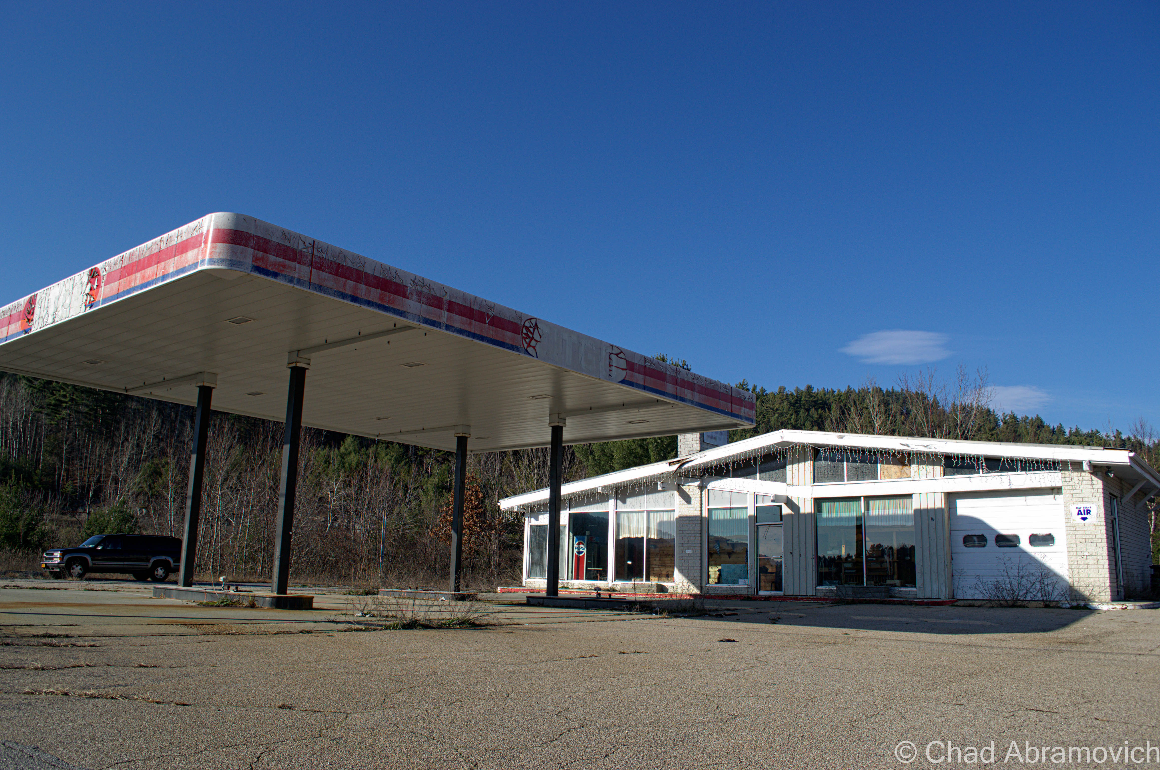
DSC_0052_pe
In addition to the numerous motels, cabins and restaurants that are abandoned here – we found out that the interstate exit that once served Frontier Town was also abandoned as well. This abandoned Citgo station sat a few yards away from the exit ramps. Here, a poor traveler pulled into the parking lot and was panicking. “Hey guys, do you know where a gas station is?” We told him there was on in Schroon Lake, 10 miles down the road. His face dropped. “shit. I don’t think I can make it” he sighed. We watched him pull out and turn onto Route 9. I hope he made it before it was too late.
Abandoned at Frontier Town

Frontier Town is such a large property that I would need to devote an entire day to see it, which I hope to plan.

“Dysfunction Junction”

Heading back up Route 9, we drove through a unique, bizarre intersection at Routes 9 and 73 in New Russia, a hamlet of Elizabethtown. When Route 73 hits Route 9, the lanes split off in separate directions, crossing each other in a crazed and seemingly random pattern before coming together again. Everytime I’ve driven through it, I’ve wondered: why does this intersection exist? And the first few times – Where do I go?

A chance find on a Google search provided me with some answers. The locals call this “Dysfunction Junction”. The intersection was built in 1958, using a design that has been instituted (with slightly variations) in other areas of the state. The design is a “bulb type-T intersection” that “favors the heavier right-turn movement from the upper to the lower left leg of the intersection. Sight distances are excellent and approach speeds are approximately 40 miles per hour.”

So why was this design chosen for this spot? We have to go back to Route 9’s heyday as the main artery from Plattsburgh and points South. Before the Northway was built, Route 9 suffered far worse traffic congestion as it does now. Before the construction, a simple stop sign was in place, which overtime was unable to handle the flow of moving traffic. The design allows Route 9 traffic to flow through without stopping, while anyone continuing on 73 would have to wait. Today, they’d probably build a roundabout instead. While this design may have made sense in the 1950s, today’s traffic patterns have changed. But not everything thinks it’s a bad design. “If you just follow the signs, you’ll be alright” says one indifferent local.

Photo: Adirondack Almanac

—————————————————————————————————————————————–

To all of my amazing fans and supporters, I am truly grateful and humbled by all of the support and donations through out the years that have kept Obscure Vermont up and running.

As you all know I spend countless hours researching, writing, and traveling to produce and sustain this blog. Obscure Vermont is funded entirely on generous donations that you the wonderful viewers and supporters have made. Expenses range from internet fees to host the blog, to investing in research materials, to traveling expenses. Also, donations help keep me current with my photography gear, computer, and computer software so that I can deliver the best quality possible.

If you value, appreciate, and enjoy reading about my adventures please consider making a donation to my new Gofundme account or Paypal. Any donation would not only be greatly appreciated and help keep this blog going, it would also keep me doing what I love. Thank you!

Gofundme: https://www.gofundme.com/b5jp97d4

Donate Button with Credit Cards