Shunpiking to Lewis, Vermont. Population: 0

For years, I’ve been interested in Vermont’s unique political divisions; gores, grants, and ‘disorganized’ towns – just some of the things I’ve discovered thanks to being a map nerd! I found it fascinating that there were delineated areas on the map that had little, to nothing in them.

On a firey September day that felt more like July, me and my friend set out on an ODDysey towards Vermont’s Northeast Kingdom, the state’s wildest and poorest corner where some of these enigmatic areas are clustered. I’ve always loved the kingdom. From my dad pulling me out of school as a kid to go fly fishing on the legendary Willoughby River in Orleans, to hustling up at Northern Vermont University in Lyndonville when I was older, I have fond memories of the NEK, and always kinda associate it with The Monkees – because whenever I used to head up that way with my mom, we’d always listen to them on CD in her car, so I totally had them in my head on the ride up.

I wanted to see one place in particular; Lewis, one of Vermont’s five “disorganized towns” (a phrase that has always amused me) – which refers to towns with populations so low, or sometimes never luring any people at all, that their charters were revoked.

It felt fitting that we were heading up to the deserted realm north of Island Pond, a rough and tumble railroad village in the town of Brighton that’s the hub of that piece of the NEK, so much so that most wayfinding signs point you to Island Pond instead of Brighton.

Island Pond has always had a sort of an eccentric reputation, and I think a lot of that has to do with the temperament of how isolated the place is. Seclusion can be a lightning rod for weirdos, outlaws, religious cults, and the preternatural.

One of my favorite Island Pond tales of intrigue involves a carpenter renovating an old farmhouse outside the village in the 1980s. Across the road was an old farmer’s pasture that had long been overgrown and disused, so imagine how startled the carpenter was when he happened to glance out the window and see a young girl herding a flock of sheep in a field that was formerly empty seconds ago. When he confusingly went to investigate, the sheep and the girl had vanished. So he got back to work, until a few minutes later when he looked out the window and saw the girl and the sheep again, only this time, the girl was waving at him. He apparently quit the job on the spot!

UFO sightings nearby at an amazing abandoned radar base, and quite a few “Bigfoot” (or some variation of a wild and wily creature) sightings have also been handed down and proclaimed through all the big woods that edge town. Who knows what other morbid or macabre things that are still skeletons in Island Ponders’ closets… (and you’re a local, feel free to send me an email and tell me!)

Island Pond got its name from the 600-acre pond with a 22-acre island in the middle of it, which lead the Abenaki to name the area Menanbawk, which literally means Island Pond. Whites decided to keep the name but use the English translation.

The pond of Island Pond has probably existed since the last glaciers grinded on through the area, but the village of Island Pond got its start in the 1850s, when the Grand Trunk Railway, the first international railway that linked Montreal to the port of Portland, Maine, laid their tracks through the kingdom, which was very much a sort of last frontier in Vermont at that time. What would become Island Pond village just happened to be the halfway point, which made it a big deal – a total of 13 tracks once merged downtown. The railroad turned into memory by the 1950s, and the town depends on outdoor tourism nowadays – it’s pretty much the snowmobile capital of Vermont – but architectural elements of its former rowdy railroad days are everywhere. Island Pond is a strangely beautiful and unique part of the state that’s very much worth a trek up towards.

Stopping at a gas station at the water’s edge to grab some suspicious sandwiches, we were on our way!

You Can’t Get There From Here
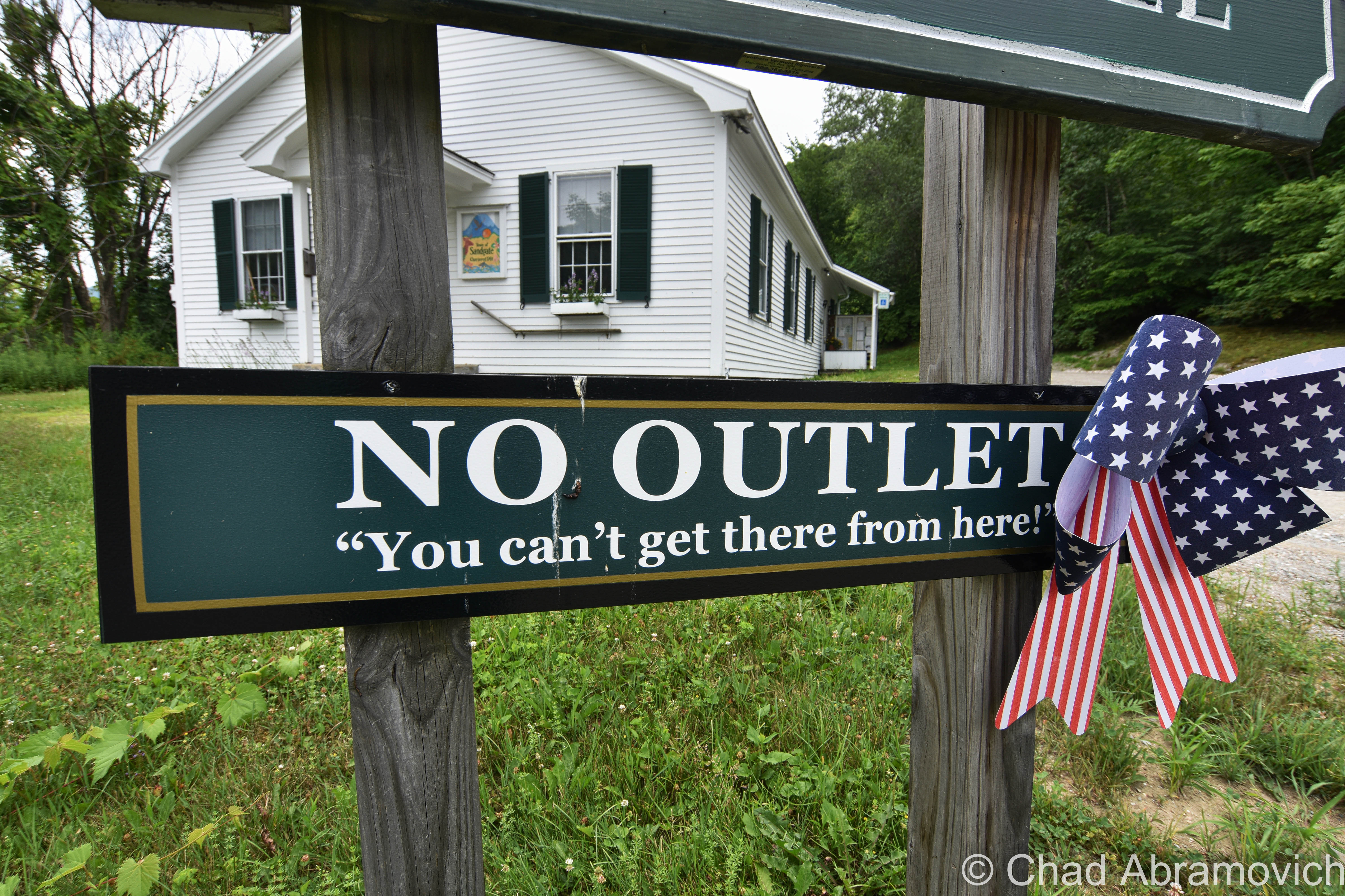
The hard-to-reach and very pretty southern Vermont town of Sandgate might have the ‘Vermontiest’ town hall sign yet and I dig it.

As that vintage Vermont vernacular goes, you can’t get there from here – and because of Vermont’s rural and inconvenient geography, that’s often somewhat the case, so we’re not really pulling your leg or anything.

Usually, it’s a now stereotypical expression of Vermont identity that means you actually can get there from here, but the “there” is usually remote, and it requires a very long-winded, confusing route, no doubt complicated because of the very mountains that give our state its name, and whether the road is plowed or not in the winter.  And that’s further complicated by mountainous parts of the state that are dead zones for GPSs and cellular service.
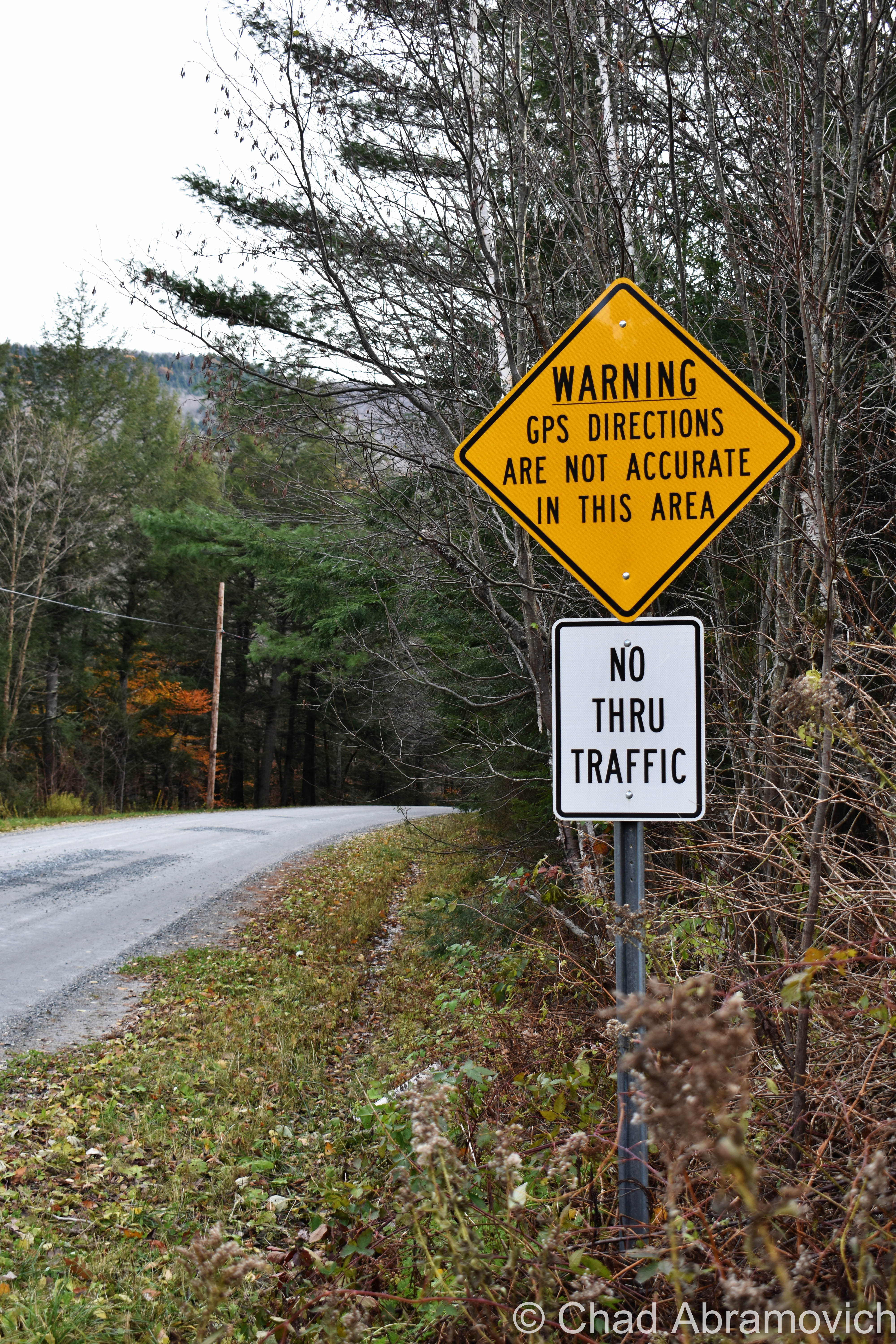
Taken in Stockbridge, VT, near a mountainous and mysterious area called “Notown”.

Lewis, Vermont

Lewis, Vermont has a population of zero. Charted early in 1762, it was heavily timbered, rough, and mountainous. It never attracted a single settler, so no roads, villages, or post office was ever established. The northern half of town is made up of mountains all in the 2,000-foot range, and all but one are unnamed. The southern half of town levels out into mostly semi-swamp known as Yellow Bogs, and they’re filled with mangy-looking forests that stretch out as far as you can see, which kinda backs up the ugly name.

Though Lewis is void of permanently inhabiting humans – loggers, hunters, and sugaring operations have all taken advantage of its space. At one point, most of the land within Lewis was owned by the Champion International paper company, until they sold off their 132,000 acres – most of which the state of Vermont eagerly acquired with the intention of preserving. As a result, most of the flora and fauna in Lewis is pretty young. But! Lewis – and the Northeast Kingdom – is at the southern edge of the largest biome on earth: the boreal forest! Named for Boreas, the Greek god of the Northwind, the boreal forest encircles the entire northern hemisphere in a band that stretches across Alaska, Canada, Scandinavia, and Russia – the boreal forest accounts for nearly one-third of all earth’s forests! Pretty cool, right?

Lewis is also considered one of the “holy grails” of the 251 club, a cool local social club that challenges interested participants to visit all 251 of Vermont’s towns, cities, unincorporated areas, and gores. Some folks make it more fun by customizing their adventure – like making points to visit every library, post office, state park, or another Vermont icon – the general store. There’s even a film dedicated to it! It’s one of my Vermonty ‘bucket list’ items, along with eventually being able to make my own maple syrup. I even became introduced to this great Instagram account recently, where the Instagrammer plans on taking a photo in all 251 burgs. It’s also inspiring me to stop being such a procrastinator.

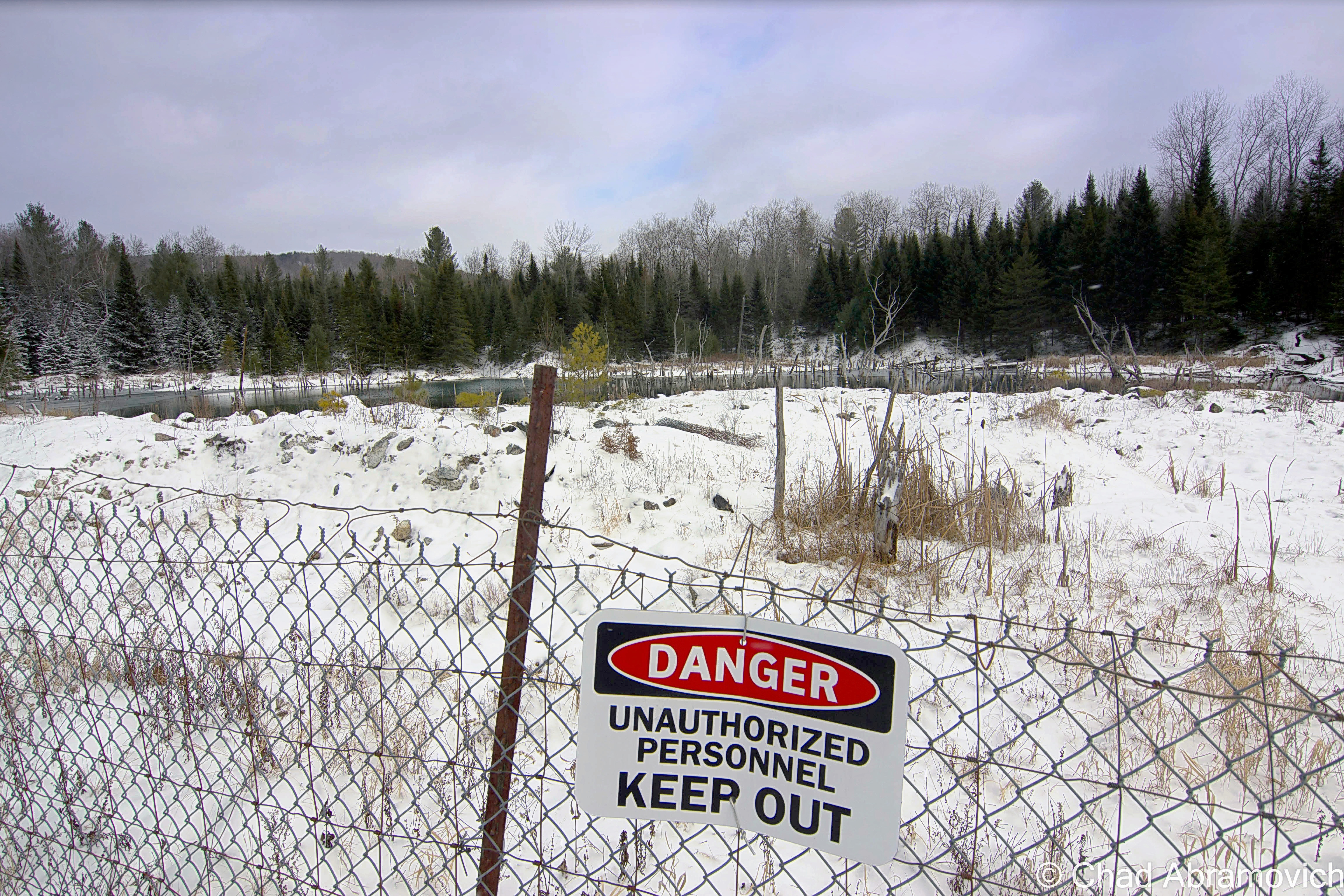
Lewis is hard to find. There are no state routes, ‘welcome to’ signs, green VTrans wayfinding signs, or any indications that the place actually exists. Using an atlas as a guide, we headed northeast of Island Pond and took a few class D logging roads, which are the only roads in Lewis, up into the area marked by that indicating yellow dotted line that showed we were, in fact, in a town.

According to the map, we should have been able to get there via Lewis Pond Road, but when we turned off where the unsigned road should have been, we were met with what was just a 4 wheeler trail, and a gate, and a gravel dune that would have wrecked my friend’s car. I guess you really can’t get there from here.  So we had to do a little scouting for another access point, which we found further east down Route 105 and was little more than a passable but thin forest service road.

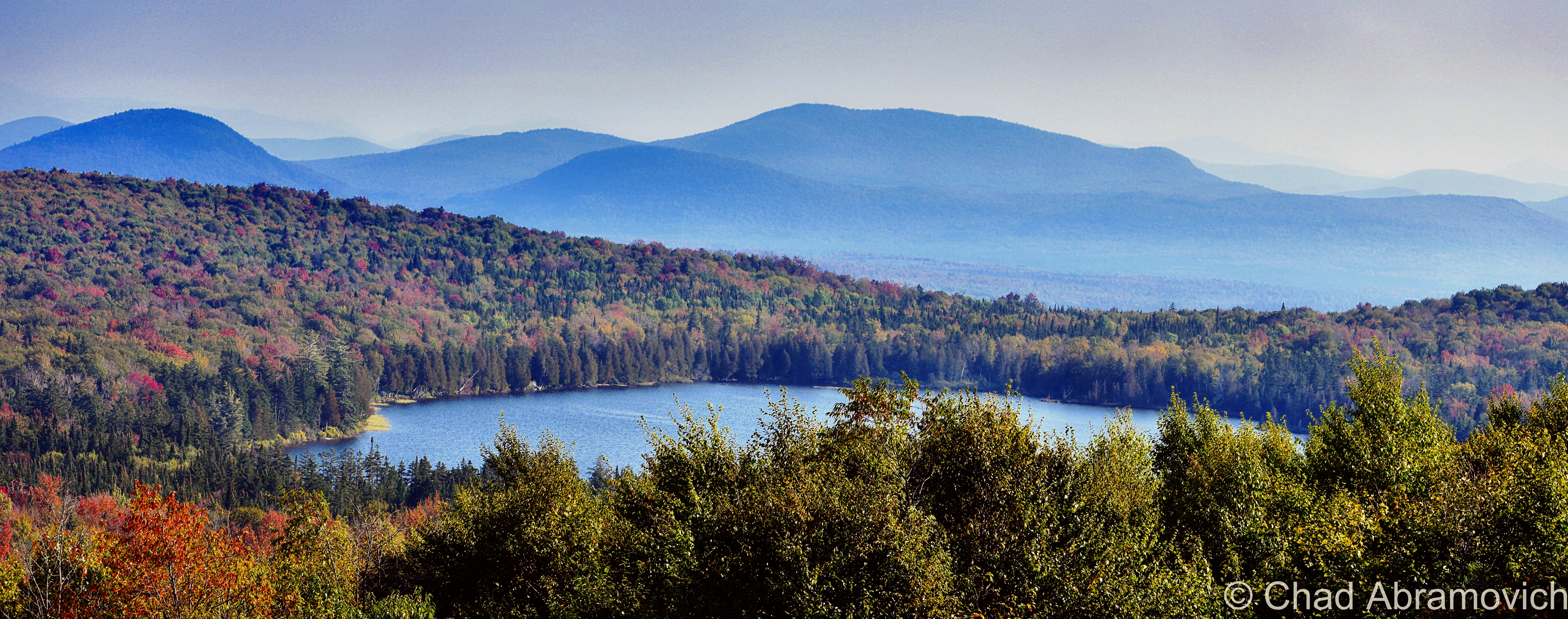
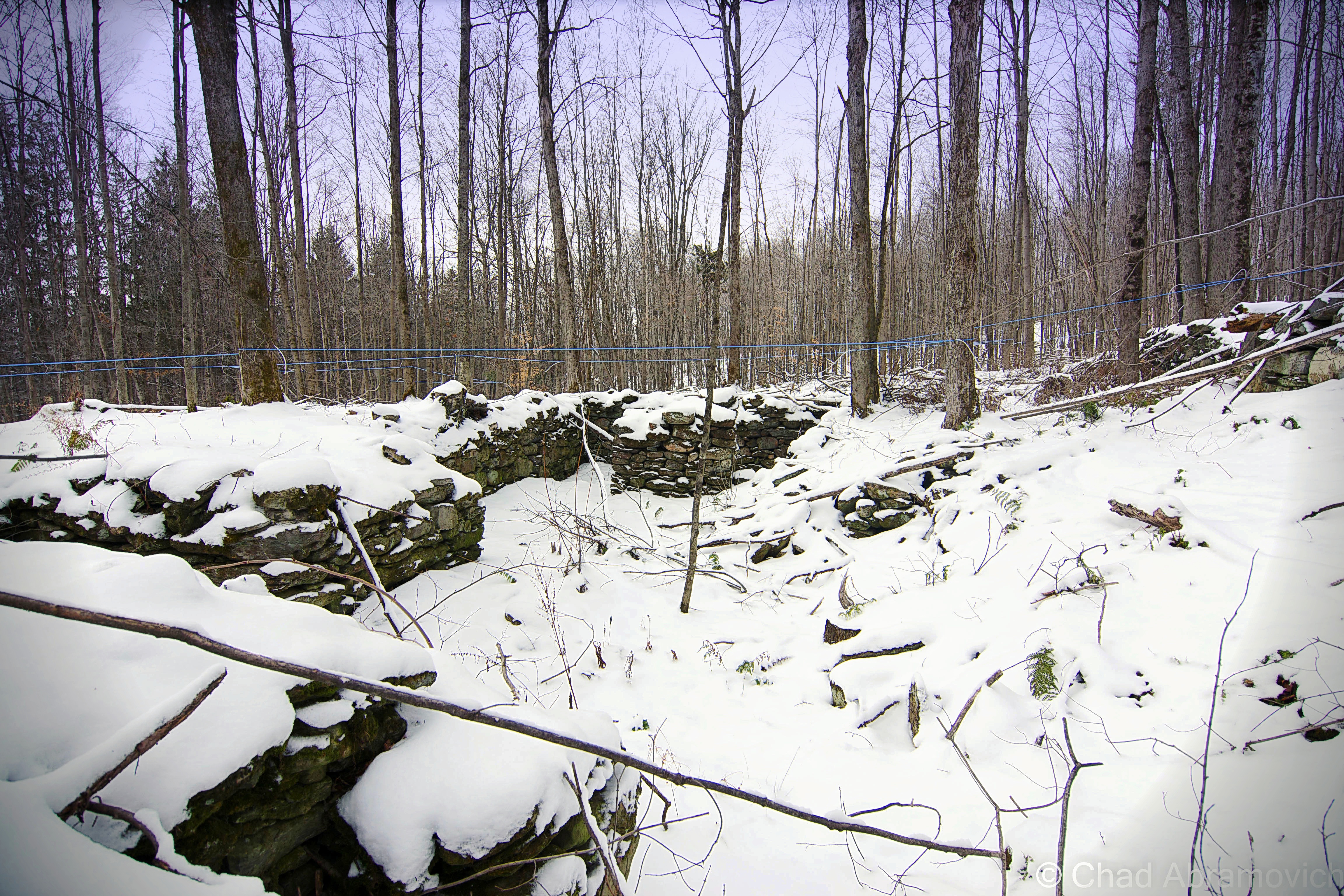
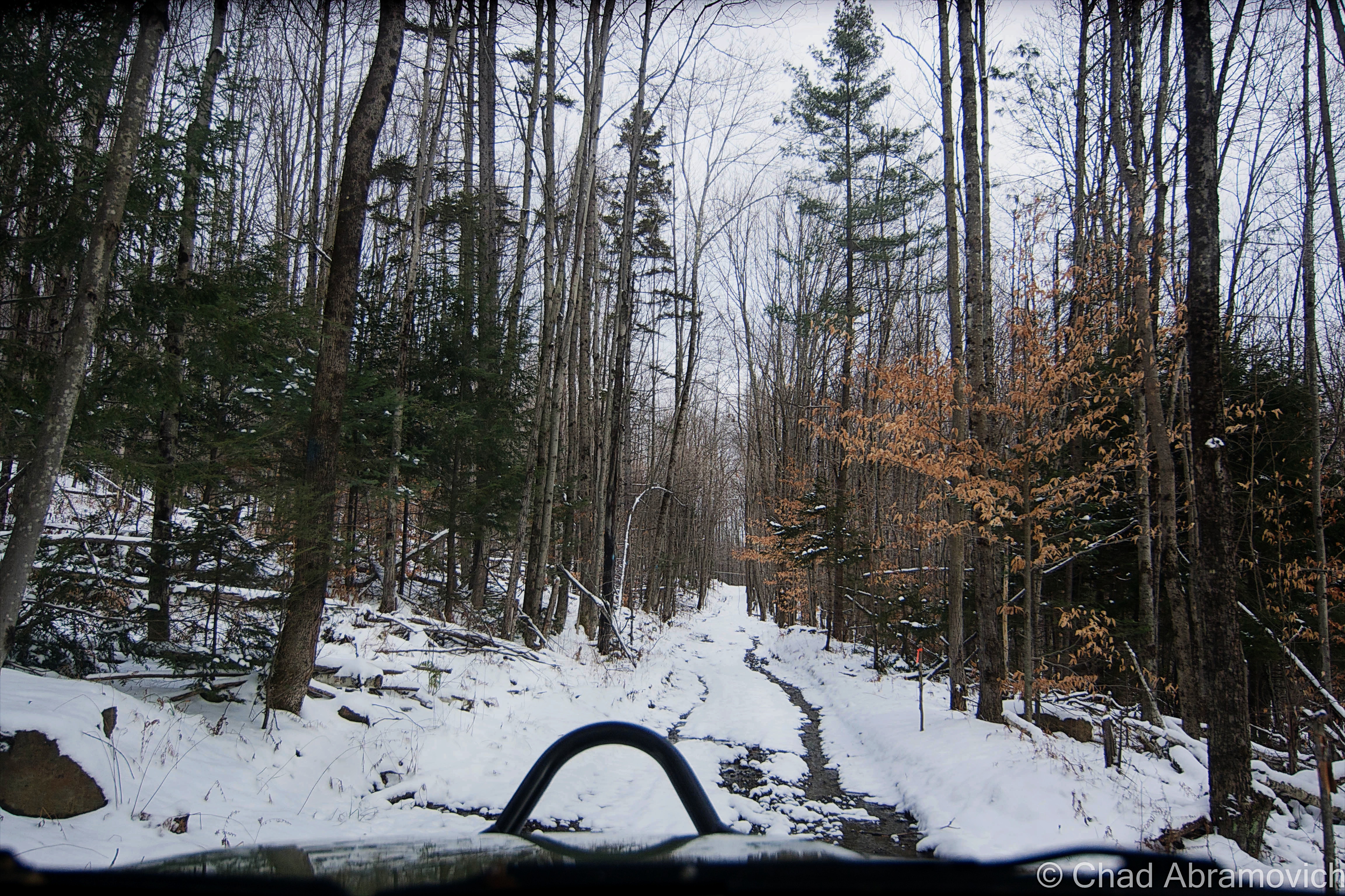
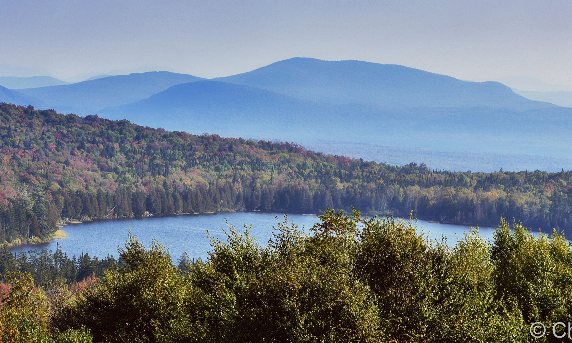
The rough road marred with gravel banks took us deep into thick wilderness occasionally punctured by a few awesome ramshackle hunting camps that had been standing for multiple generations (which I regret not taking some photos of!) – skirted around Lewis Pond, and eventually brought us up the slopes of Gore Mountain – one of the few topographical place names in Lewis – to a cleared section of mountainside where we enjoyed a terrific view of the NEK and out towards the hazy blue bumps of New Hampshire’s White Mountains, and we had the area all to ourselves.

We found an accommodating boulder to sit on, enjoyed some gas station sandwiches, and just enjoyed the silence and the view and a world that was big and full of autumn. I remember the foliage that day being just ridiculous. I had no idea the views up in Lewis were gonna be so fantastic! It was definitely an evening I’ll remember.
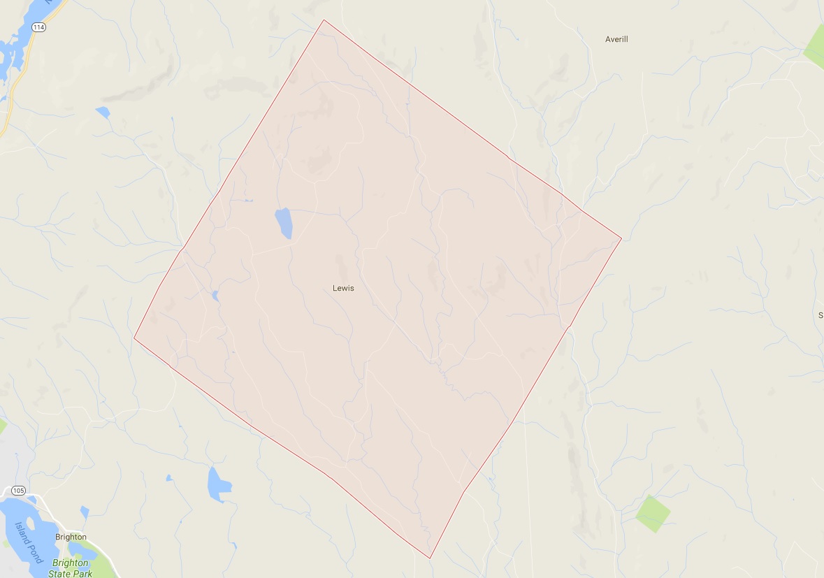
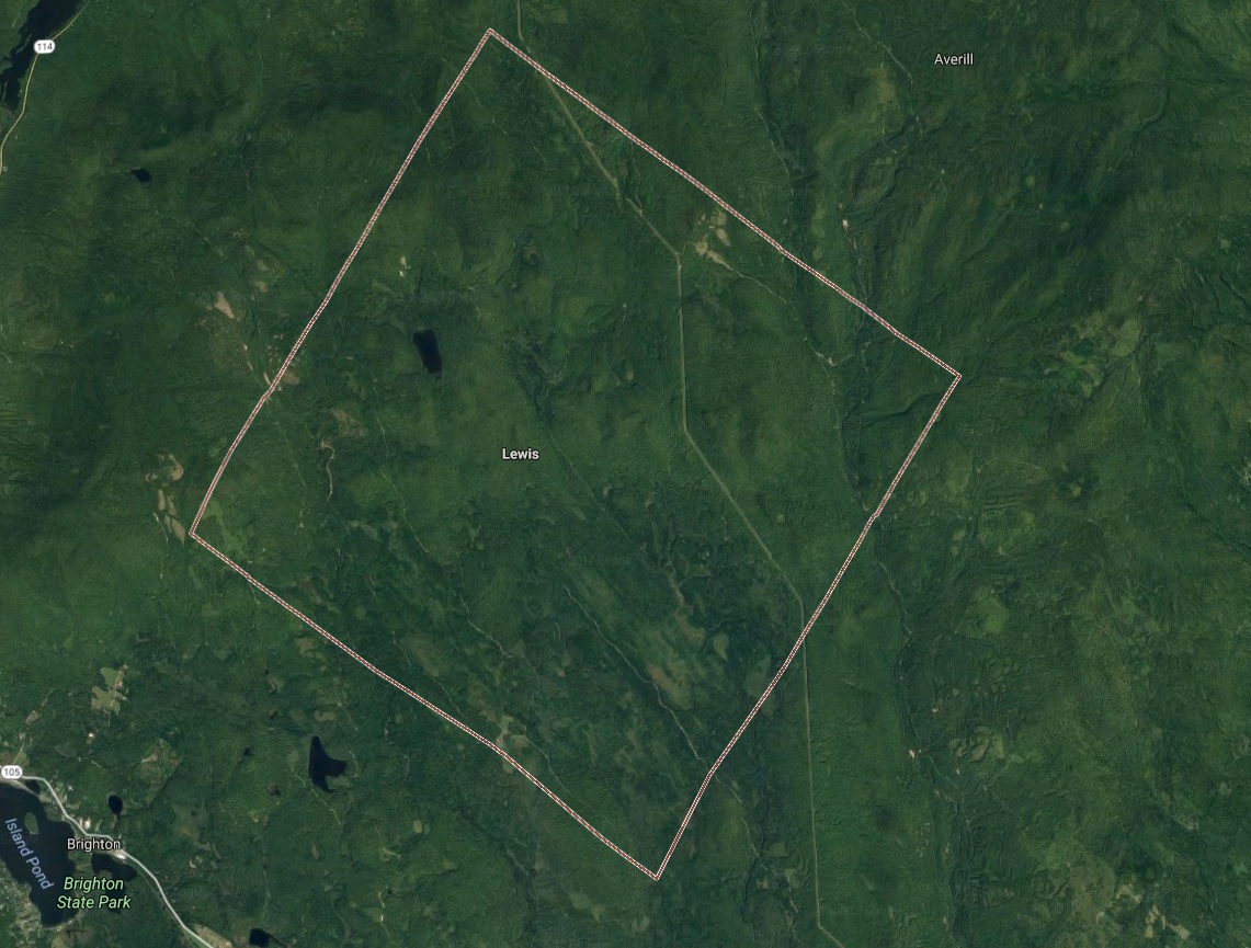
Lewis, Vermont. Via Google Maps

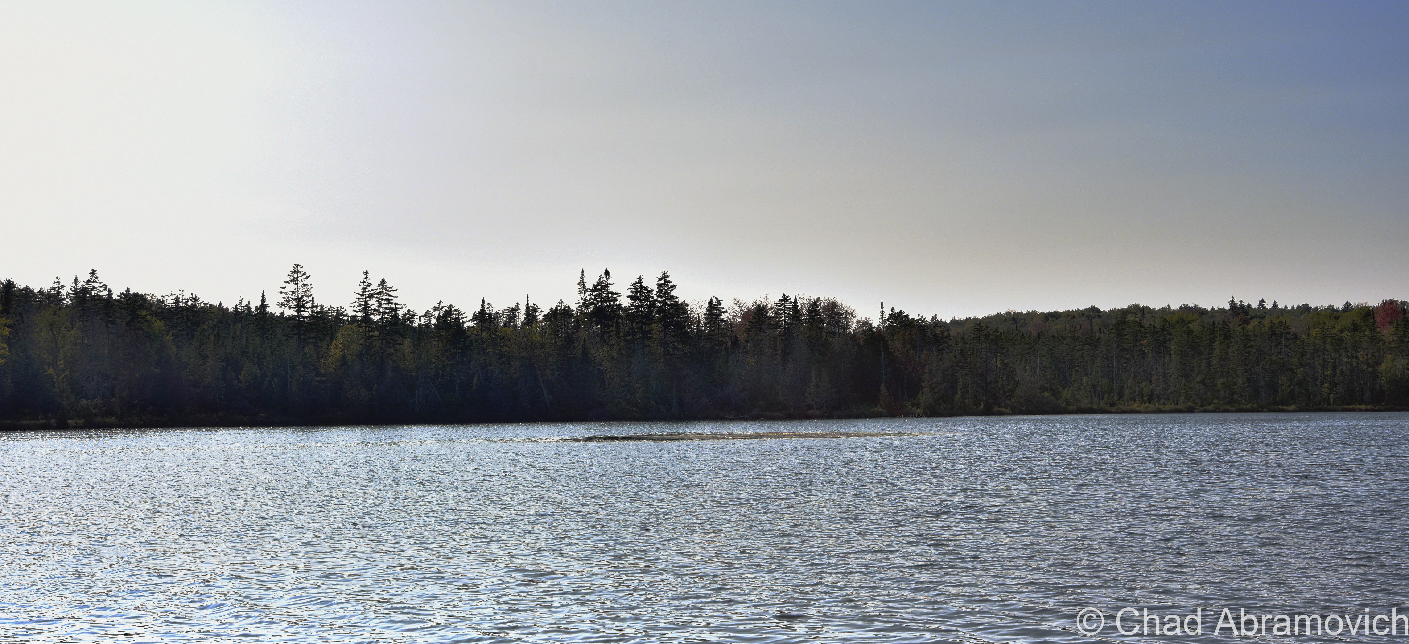
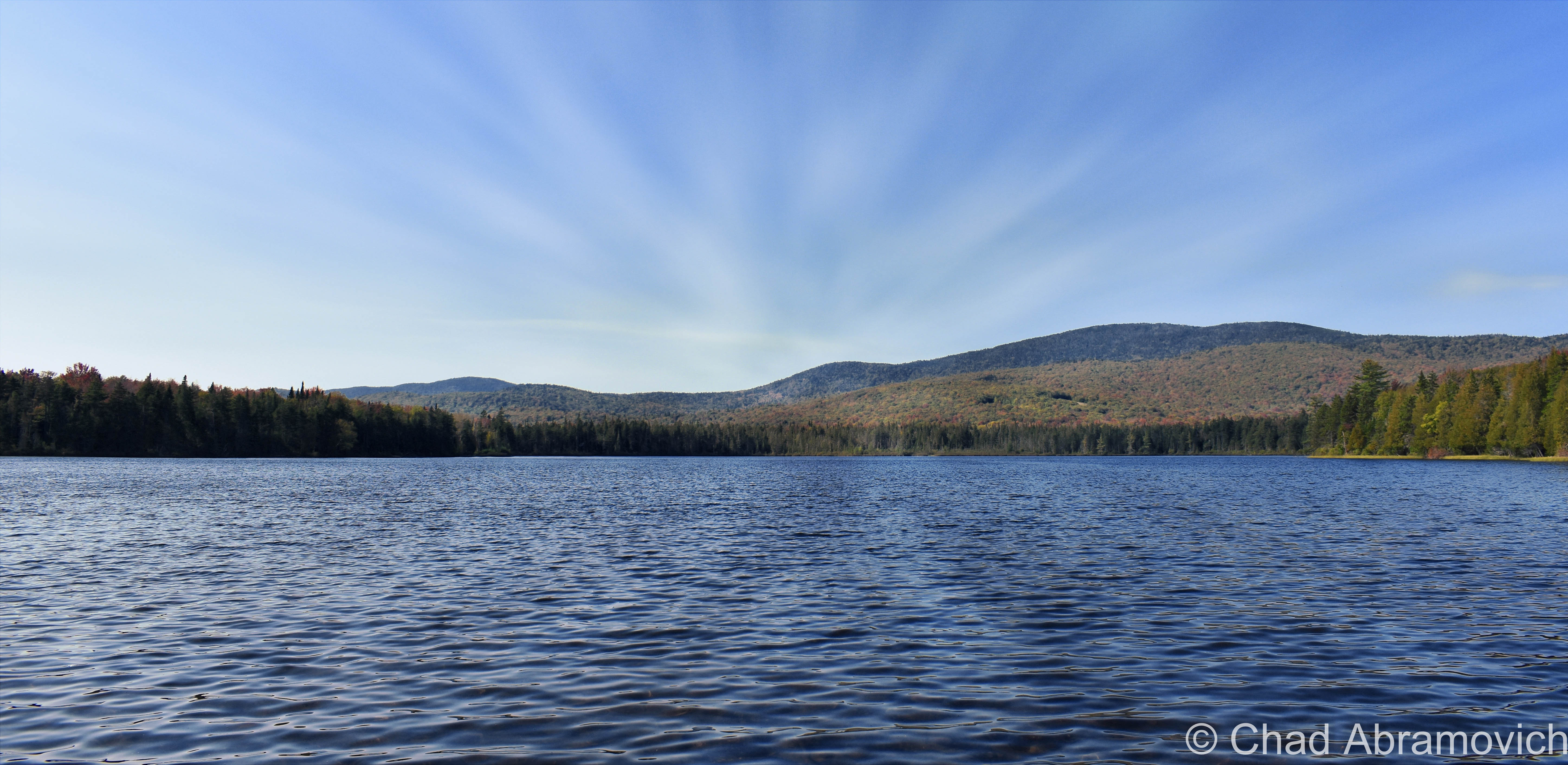
The other named feature in Lewis is to-the-point named Lewis Pond, which is only 7 feet deep, undeveloped, apparently has some good fishing, and as beautiful as it is silent. We spent a while just lounging around the shoreline as the water lapped calmly at the cedars.

I’m not sure why the fact that the wobbly diamond-shaped town only has two toponyms is a bit surreal, but psychologically, it is. It feels like everything else within the 39 square miles that’s considered Lewis is a sort of an uncanny terra nullius, and speaks to our control freak side of human nature to label and categorize things, to prove that something exists, to achieve just a bit more of a grip on this world.

I’m fascinated with human psychology, and how a lot of the time (but not every time), things we consider as ‘odd’ are because we make them odd, because they don’t jive with our architected ideals and social rules. The only thing truly odd to me is the fact that we blindly subscribe to so many of these rigidly particular doctrines without questioning them.

But, I’m wicked into this stuff, and I guess I’d be both out of a blog and identity if I go too deep down that rabbit hole.
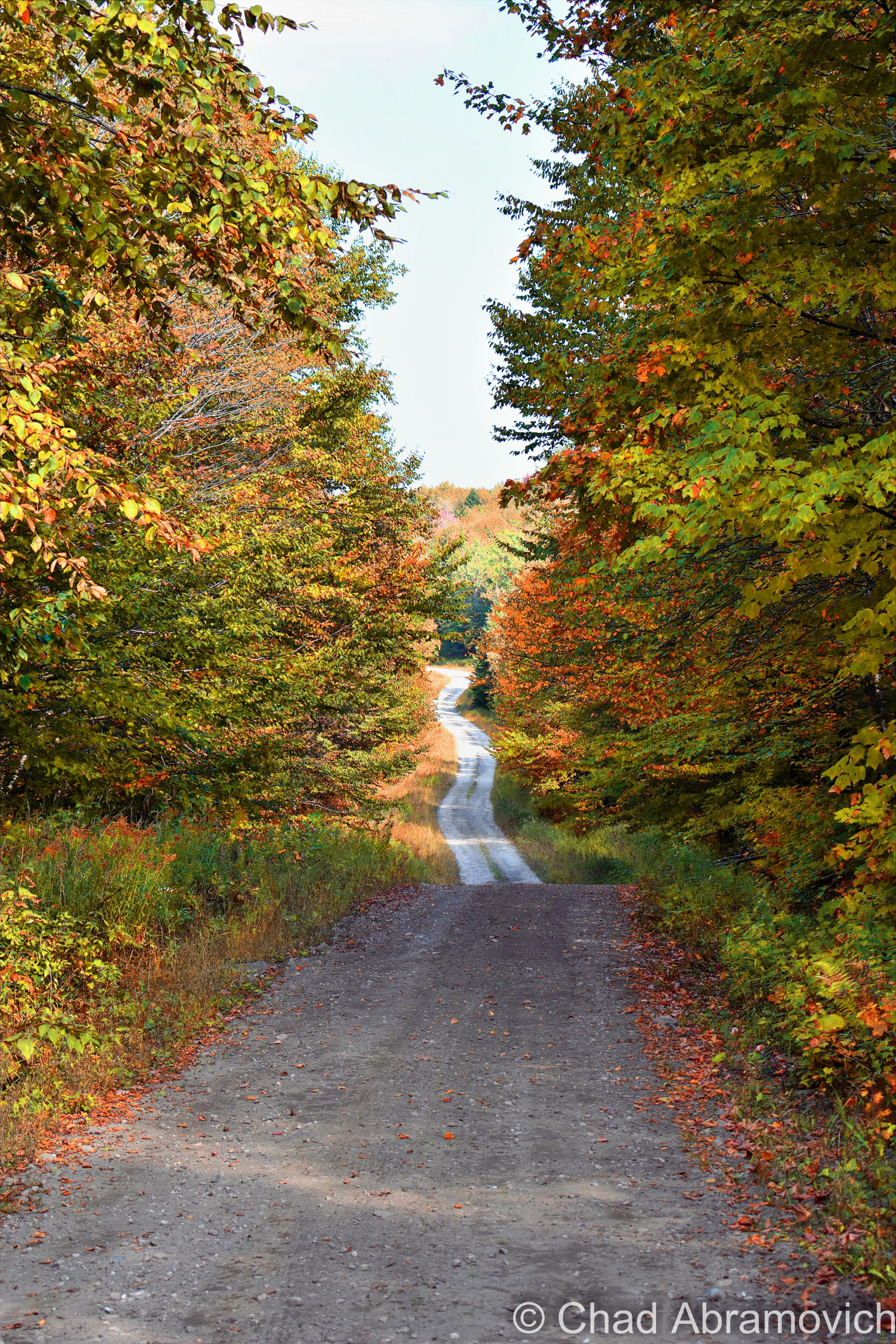
Lewis Pond Road, a bit north of Lewis Pond. At one point, all of Lewis was logged, so the forests are pretty young.
Lewis Pond
A sunken island in the middle of Lewis Pond
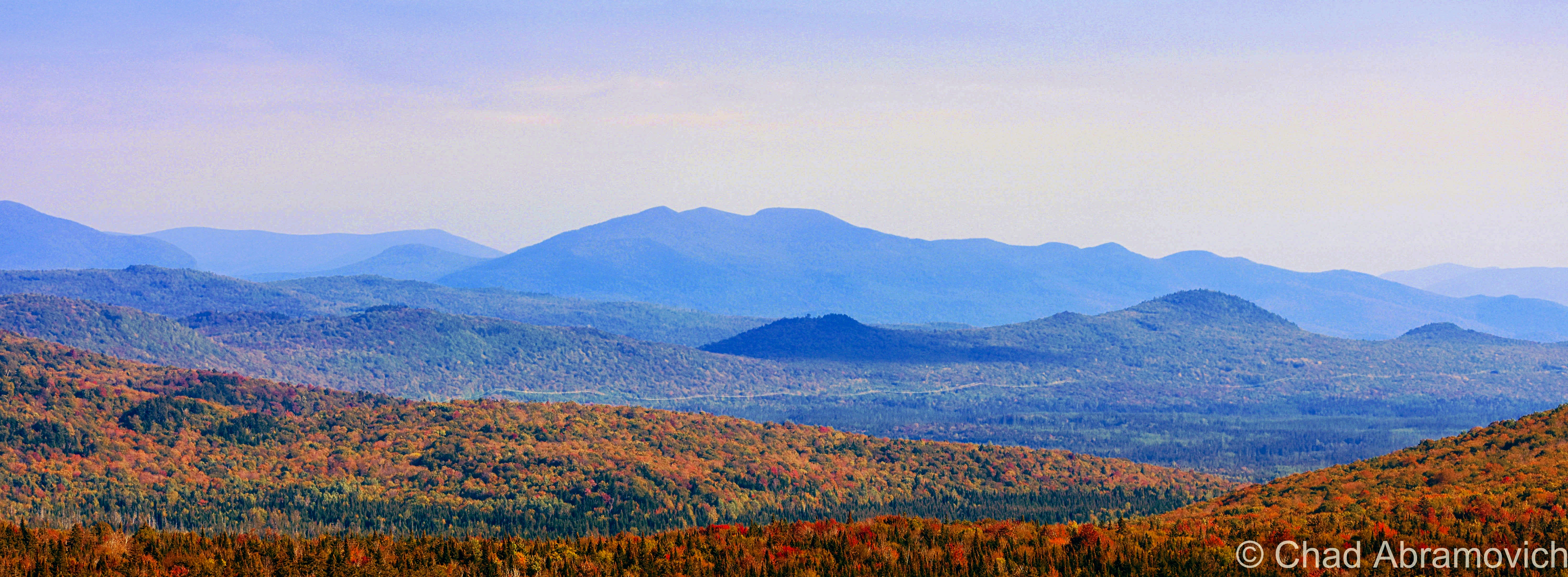
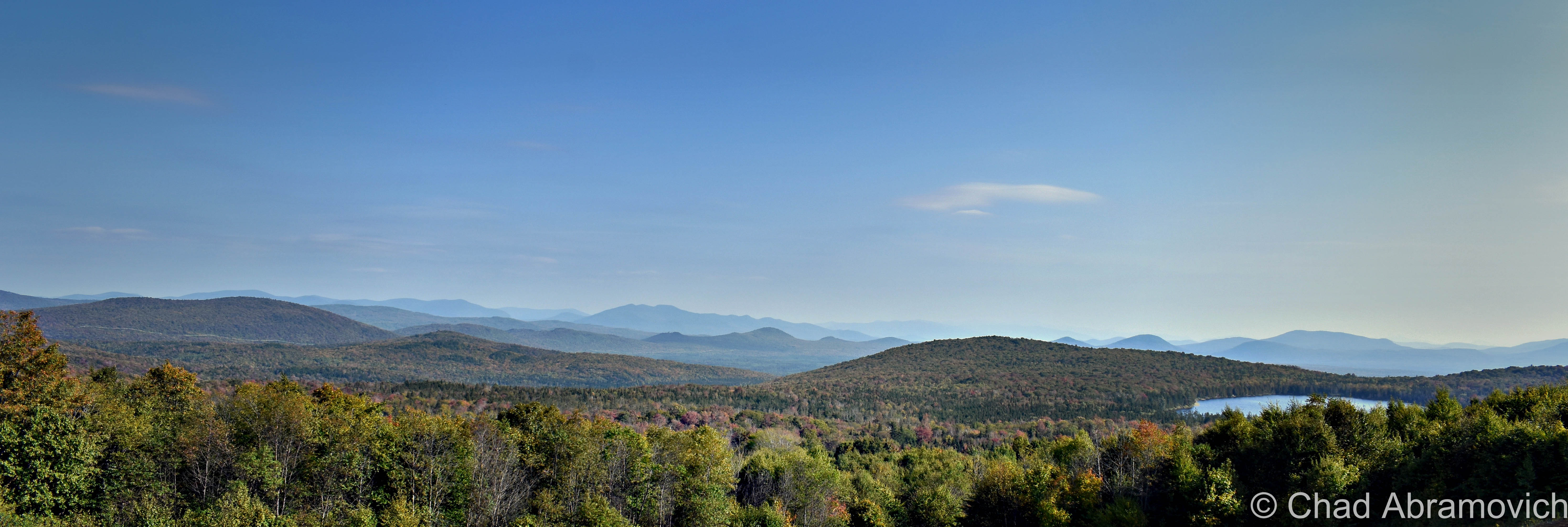
The huge landscape of the Northeast Kingdom and New Hampshire’s White Mountains as seen from Gore Mountain.
Panorama of Lewis/Lewis Pond, the NEK, and New Hampshire’s White Mountains from Gore Mountain
Lewis Pond from Gore Mountain

Today, the Nulhegan Basin Division of the Silvio O Conte Wildlife Refuge – whose goal is to try and protect the waterways that feed the Connecticut River – occupies a huge chunk of Lewis, and is named after the Nulhegan River, which basically translates to “deadfall trap” – a savvy snare that’s usually a log that’s used to capture small game by falling on it – and is a connecting title to the Nulhegan Abenaki People who were the first inhabitants of this domain.

Though the Nulhegan Basin was formed by a pool of magma solidifying here 300 million years ago and subsequently eroding away – which developed the current scenery, it’s apparently one of the coldest places in all of the northeast, with an average of 100 inches of snowfall a year and around 100 frost-free days.

There are other ‘disorganized’ towns in Vermont, but Lewis is one the most exotic to check out because of its rawness. Because people like speaking in superlatives – my personal pick for ‘most’ captivating of them would be the next-door-neighbor ghost towns of Glastenbury and Somerset down in Bennington County if anyone was wondering.

The other three out of five disorganized Vermont towns (Averill: pop. 24, and Ferdinand: pop. 32, and of course, Lewis) are all up in remote Essex County and all border with Lewis, basically making a huge chunk of the northeastern corner of the state pretty capacious, and making them eligible for a mention in this blog post. And standing shoulder to shoulder with those three towns are three of Vermont’s other geographical curiosities, two out of our three gores (the third being Buel’s Gore which forms Chittenden County’s dagger-like southern tip and consists of the dramatic Appalachian Gap), and the state’s only grant! All this chaos by simply drawing lines on a map.

And speaking off – just “down the road” from Lewis exists another state geopolitical oddity that I just had to quickly jaunt towards before heading back home; Warren Gore.

Gores and Grants

What’s a gore? It sounds gruesome, but it’s not, even though my spellcheck is really fighting me on my use of the word.

Scottish immigrant James Whitelaw would become Vermont’s official surveyor in 1787, replacing the often error-proned Ira Allen and becoming considered as one of the best map makers and surveyors in New England. But in Ira’s defense – inaugural survey work is hard.

Survey Crews would embark into unmapped wilderness to do just that. Using a 66-foot chain and wooden posts, they’d attempt to delineate new town boundaries, and then camp out for the night.

But there were still pieces left over; awkwardly sized areas never charted to any town, or given to early land grantees as disappointing compensation for basically getting screwed out of land they were promised.

In a land where possession is about 3/4th of the law; the end result became known as gores, and Vermont once had 60 of them! Currently, we’re down to just three – the rest were eventually absorbed into their neighboring towns to make the map a little less confusing, which makes gores some of the rarest creatures in the green mountain state, and pretty much non-existent elsewhere in the country apart from northern New England, which I think sorta lends them their air of charm.

Gores are often triangular, but sometimes not, as in the case of Averys Gore, which is more trapezoidal, and Warren Gore, which is rectangular. It’s their triangular shape, though, that gave these parcels their curious name. Gore is an old English term that referred to the shape of a spearhead, which is what early cartographers thought they resembled.

Warren Gore is tandem with the Mad River Valley town of Warren. Warren was trying to get a charter in 1780, but couldn’t because it lacked the total amount of decided acreage needed to create a town – which the Vermont legislature said had to be 23,000 acres. So the grantees scrambled to find the remaining 6,595 acres of land, which they did, just completely disconnected, all the way up in the Northeast Kingdom. Technically, they had what they needed, and in 1789, Warren was charted in two pieces (also known as a “flying grant”) – the smaller part becoming Warren Gore. But the two places never had anything to do with each other.

While Warren lured settlement and skiing, Warren Gore, sometimes called “Warren’s Gore”, went the static route of most gores, and attracted only 10 people by 2000, and lost 6 of them by 2010.

The desolate State Route 114 runs pretty much through the center of the gore, and is mostly bookended by deep woods and the pretty shoreline of Norton Pond. Apparently, old guidebooks used to call it “the roller-coaster road” due to miles of continuous sharp rises and dips that made you sorta feel like you were riding a roller coaster. Well, I was absolutely down with that experience, but I guess I didn’t notice anything that was too different from a bunch of other roads in Vermont, so maybe the road had been leveled down over the decades.

I took a tour through the gore and turned around in tiny Norton, an old lumber town of around 169 people that has reverted back to forests and small hill farms. Norton is a 45th parallel town ( the latitudinal line that’s half the distance between the equator and the north pole), and until pretty recently, had one of the last remaining “line houses” in Vermont – or a building built right on the American/Canadian border which is now absolutely illegal to do, in part of northern Vermont being uncooperative during prohibition.  The most famous one is undoubtedly The Haskell Library and Opera House in the unusual village of Derby Line, where the stage is in Quebec and the seats are in Vermont. In Norton’s case, it was a general store that was split in two by the border, until it was demolished in 2021 and is now a grassy lot.
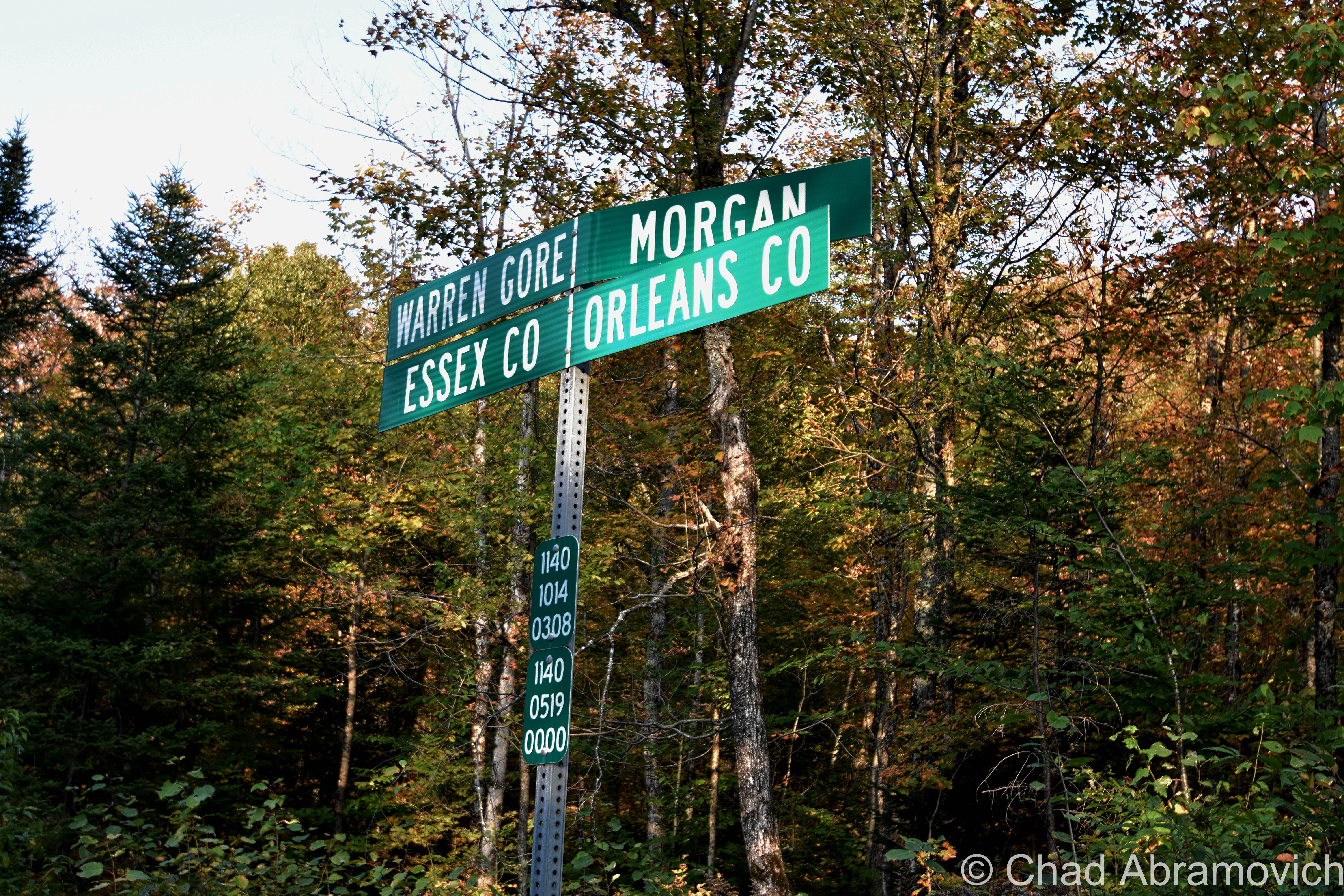
Pretty sure Vermont is the only state that does these brilliant sideways town line signs.

Inbetween Warren Gore and Lewis is Avery’s Gore – Vermont’s largest gore – a large trapezoidal wedge of land void of people or infrastructure. The only way in is on aptly named Gore Road, which is just a really nice logging road that dead-ends in the middle of the gore, near one of the only points of interest, an undeveloped pond a bit ironically named Unknown Pond.

West of Warren Gore is tiny Warner’s Grant, Vermont’s only grant, which is exotically considered to be the most inaccessible land tract in Vermont, and its existence is because of the sad plea of a troubled post-revolutionary war widow.

Hester Warner was the widow of revolutionary war hero Seth Warner (who Vermont state route 30 is named for). Warner was cousins with Vermont’s patron saint; Ethan Allen. With The Green Mountain Boys, Warner would lead the capture of the British fort at New York’s Crown Point while Allen was commandeering Fort Ticonderoga in May of 1775.

The Continental Congress was pretty impressed with that scheming lot and declared them an official militia. Warner was so well venerated that he was voted captain over Ethan Allen! But the war would eventually wreck him, and he’d retire and retreat to Connecticut in 1780, dying there a few years later at 41. His poor widow, Hester, literally and in idiom, was now burdened with the problem of having 3 children to raise but barely having the means to do so. So she despairingly reached out to the legislature. Her husband did so much for the revolution, surely they would give her some assistance.

They did wind up coming through for her, just slowly, and ironically, not in a way that would actually help the widow Warner.

Their compensation came in the form of 2,000 acres in the Northeast Kingdom of practically inaccessible highlands that was coarsely timbered, which they named Warner’s Grant.

Beyond that, history seems to have lost track of Hester Warner. Records do show that she never lived on the land. It seems that like the widow Warner, nobody else wanted to give living there a shot either. Warner’s Grant remains today as it was then, empty – apart from some logging activity.

I’d like to someday get up into Avery’s Gore and Warner’s Grant, but last time I was up that way, it was getting late. Too late to drive into the deep woods on logging traces – so those two are still on my list.

All of the places I’ve mentioned in this post are managed by a special state department – The Unified Towns & Gores of Essex County, Vermont, headquartered in the town of Brighton somewhere down a gated dirt driveway that leads off into some pines that looks more like the nondescript entrance to a sandpit than a government office.
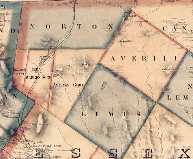
Beers Atlas of Caledonia and Essex Counties – 1859. Shown here is Warner’s Grant, Warren Gore, Avery’s Gore, and Lewis.

Overlanding

There’s a fun hobby that’s abundant here in Vermont that always gets you near enough to some of the state’s best off-the-beaten-path places that most aren’t hip to. It’s called Overlanding, or, off-roading, and it can bring you to cool places like Lewis.

It’s something that I’ve dabbled with a few times with my brother over the years, starting out when we were late teens/early 20-year-olds when we started taking the family’s ’78 Toyota Landcruiser along gnarly mountain trails in the hills between Milton and Westford. For some reason, I couldn’t think about my trip to Lewis without thinking about this, so I decided to shoehorn it in this blog post.
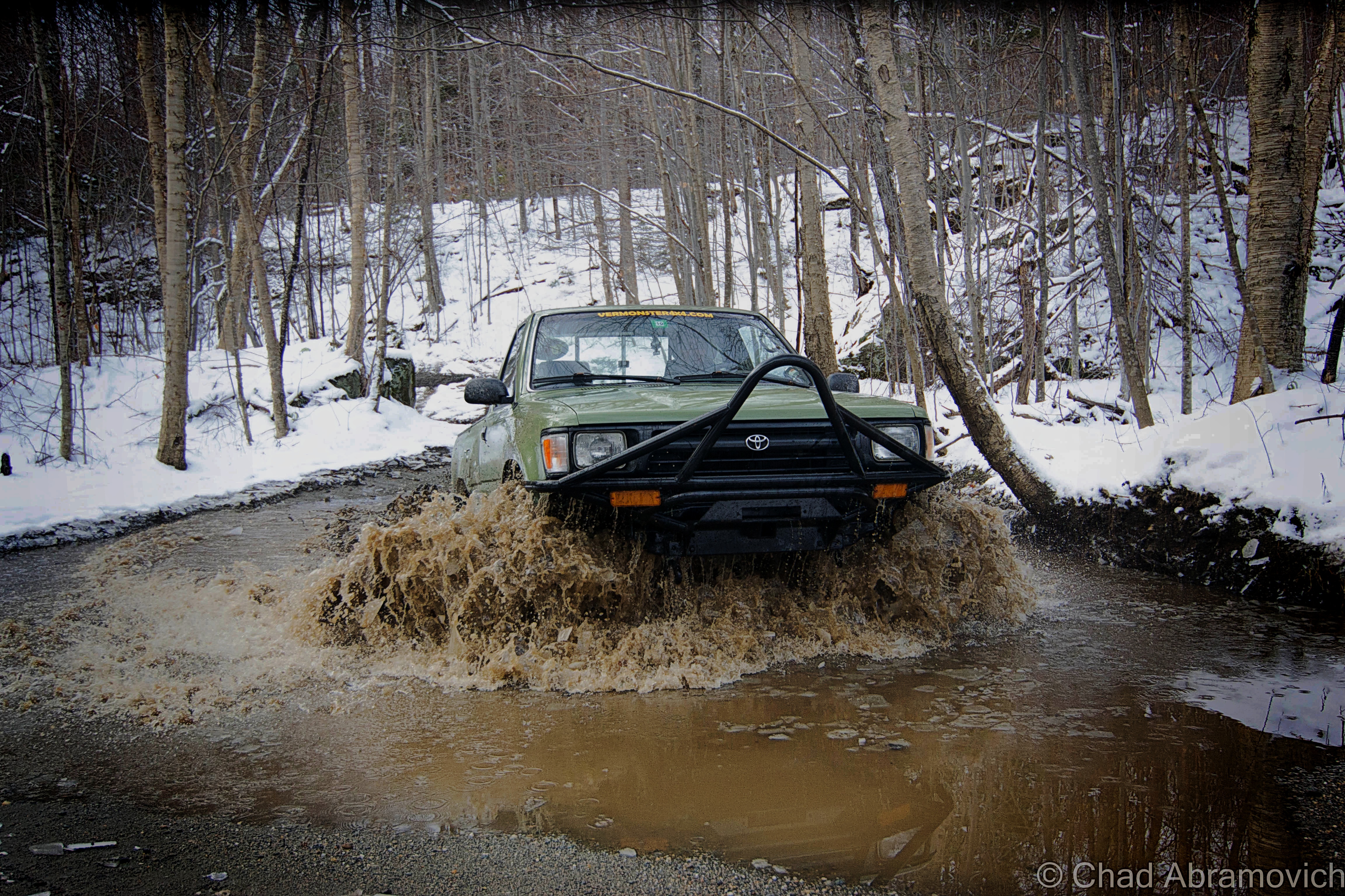
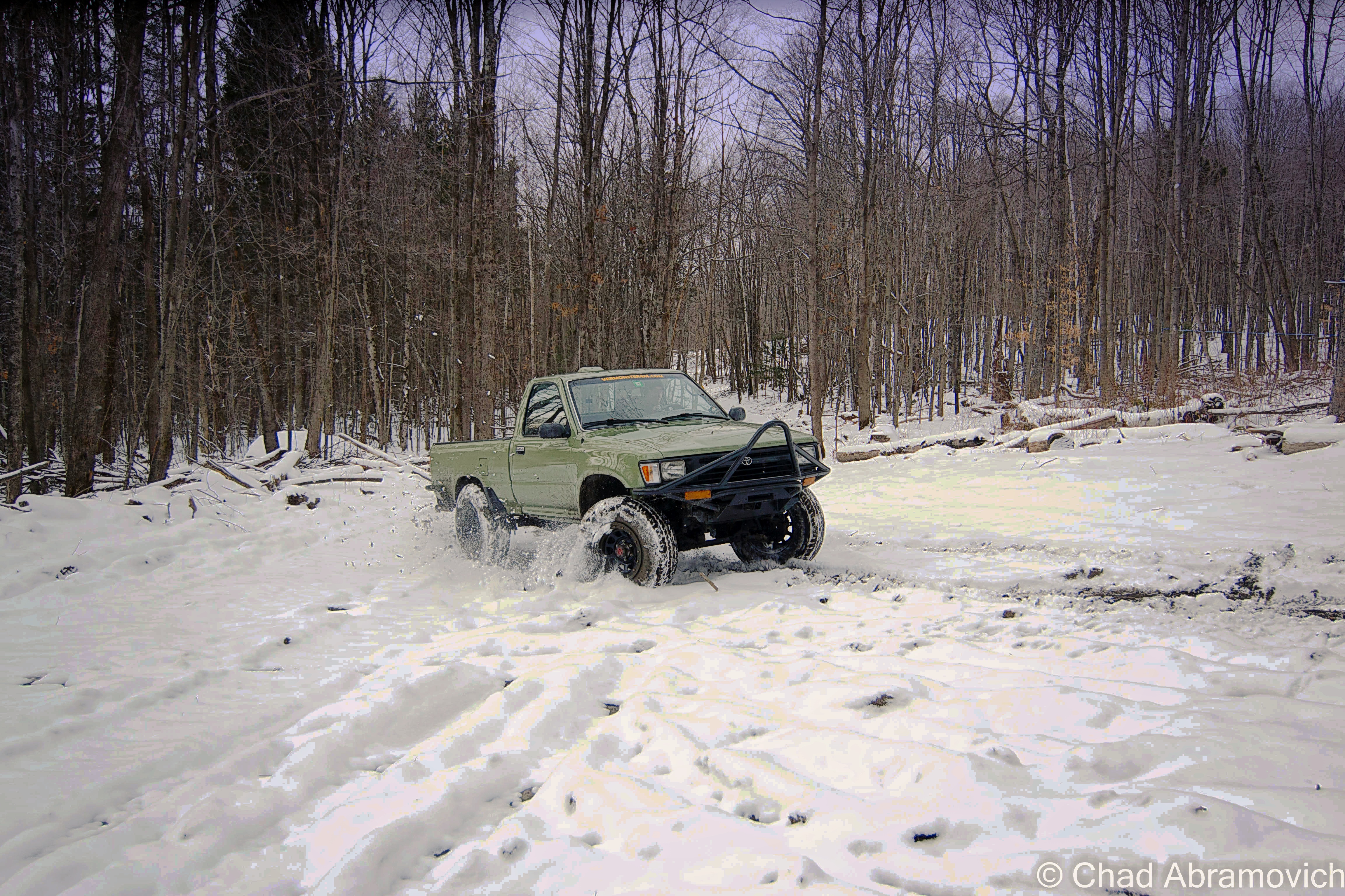
The truck taking a muddy thrashing in the above photo was a more recent project of my brother’s – a 2 door, early ’95 project Toyota that was probably more work than it was worth. It was completely cut in half and welded back together, and all the parts came from Craigslist. It amounted to about a year of road trips, work, and headaches. But it paid off!

We rumbled in the cold and took it up bumpy logging roads and 4 wheeler trails in Vermont’s rugged north country; towns like gritty Johnson and the unassumingly vast spaces of mountainous Waterville and Belvidere – both far-flung villages that look like they’re still in the 1800s and are probably a picker’s jackpot. I still have flashes of us stopping at Tallman’s Store and rumbling down potholed route 109 and seeing the formidable wind molested haunch of Belvidere Mountain thick with snow and ridgeline alpenglow that blazed luminously.

Up in the mountains, we bumped and jarred around defunct mines, active sugarbushes, past 200-year-old cellar holes and slipped and slided up steep slopes, through stream beds, and passed cool hidden waterfalls and dead quarries – many of these areas used to be gores! It was a real thrill (and in the winter, was an activity specifically called ‘snow bashing’). If I had a metal detector, I’d probably bring that along too!

Sometimes you’d meet other off-roaders, pull over and chat about trail conditions, or get the details on the other’s ride. Other times you saw scuffed rocks or trees and knew some poor fella had to of done a real number on their vehicle. If you can make it happen, it’s a fun time, taking you places most folks don’t get to see.

It’s also a continuous mental and problem-solving situation, with the journey itself infused with self-reliance being the primary goal – so using your wits is recommend. Some of these trails aren’t easy to navigate. Another fun activity I used to do is to find some “dead roads”, a Vermont phenomenon where roads that were built in the 1700s and the 1800s have long been abandoned, but are still legal right-of-ways. Using old maps and tracking some of them down was pretty neat!

But honestly, the best part of it all? Overlanding and oddity hunting means spending time outside.

My brother Drew doing his thing!

Here’s a Youtube video of some guys having some fun! I know this made me wanna get out for an adventure!


Since 2012, I’ve been seeking out venerable examples of Vermont weirdness, whether that be traveling around the state or taking to my internet connection and digging up forsaken places, oddities, esoterica, and unique natural features. And along the way, I’ve been sharing it with you on my website, Obscure Vermont. This is what keeps my spirit inspired.

I never expected Obscure Vermont to get as much appreciation and fanfare as it’s getting, and I’m truly grateful and humbled. Especially in recent years, where I’ve gained the opportunity to interact with and befriend more oddity lovers and outside the box thinkers around Vermont and New England. As Obscure Vermont has grown, I’ve been growing with it, and the developing attention is keeping me earnest and pushing me harder to be more introspective and going further into seeking out the strange.

I spend countless hours researching, writing, and traveling to keep this blog going. Obscure Vermont is funded almost entirely by generous donations. Expenses range from hosting fees to keep the blog live, investing in research materials, travel expenses and the required planning, and updating/maintaining vital tools such as my camera and my computer. I really pride and push myself to try to put out the best of what I’m able to create, and I gauge it by only posting stuff that I personally would want to see on the glow of my computer screen.

I want to continuously diversify how I write and the odd things I write about. Your patronage would greatly help me continue bringing you cool and unusual content and keep me doing what I love!

Donate Button with Credit Cards


The Drowned Forest

I recently had a lot of fun voyaging around the tiny angle that is New Hampshire’s 18 miles of seacoast! I haven’t been down towards the Granite State’s coast since I was 10 years old, so the nostalgia was stimulating and the sunburn was painful!

A few friends were tandem on this seacoast excursion, and one of the few goals I had for this trip was doing a bit of oddity hunting – and I was pleased with the few curios that I had eagerly put on my list. Beyond that, we just had a blast shunpiking around random coastal towns in both New Hampshire and Maine.

The environment is a bit exotic to me, in a sense that serpentine salt marshes and beaches on a waterbody you can’t see the other side of aren’t found up in Vermont (but we do have lighthouses!). This part of New England also has redolent history and mystery that have been fermenting far longer than Vermont has existed! I was definitely imbued with some unabashed excitement the whole time.

After all these years I’d never forgotten just how great of a drive New Hampshire State Route 1A was.

Before we checked into our hotel in Portsmouth, I suggested we took the requisite tour up Route 1A (known as Ocean Boulevard for most of New Hampshire’s seaboard) and the shore with the windows down and the breezy salt air coming in (and our music blasting out).

Starting in the brashy and tawdry beach burb of Hampton Beach and its famed 3-mile titular stretch of sand that are both long-established New England summer destinations, we then ventured northwards around a few rocky points with squinty views of the faraway rocks that are the Isle of Shoals – a group of forlornly not-quite-barren islands split between Maine and New Hampshire that are famed for their isolation, and grim and mysterious folklore – the spectrums of which include murder, shipwreck, ghosts, and a treasure – all suitable footnotes of any northern New England ocean island. I’d like to take a ferry ride out there next time I’m in the area.

We then passed through scenic Rye, with numerous state beaches, tidal wetlands, and ostentatious money enclaves that line Ocean Boulevard, and then ended up in Portsmouth.

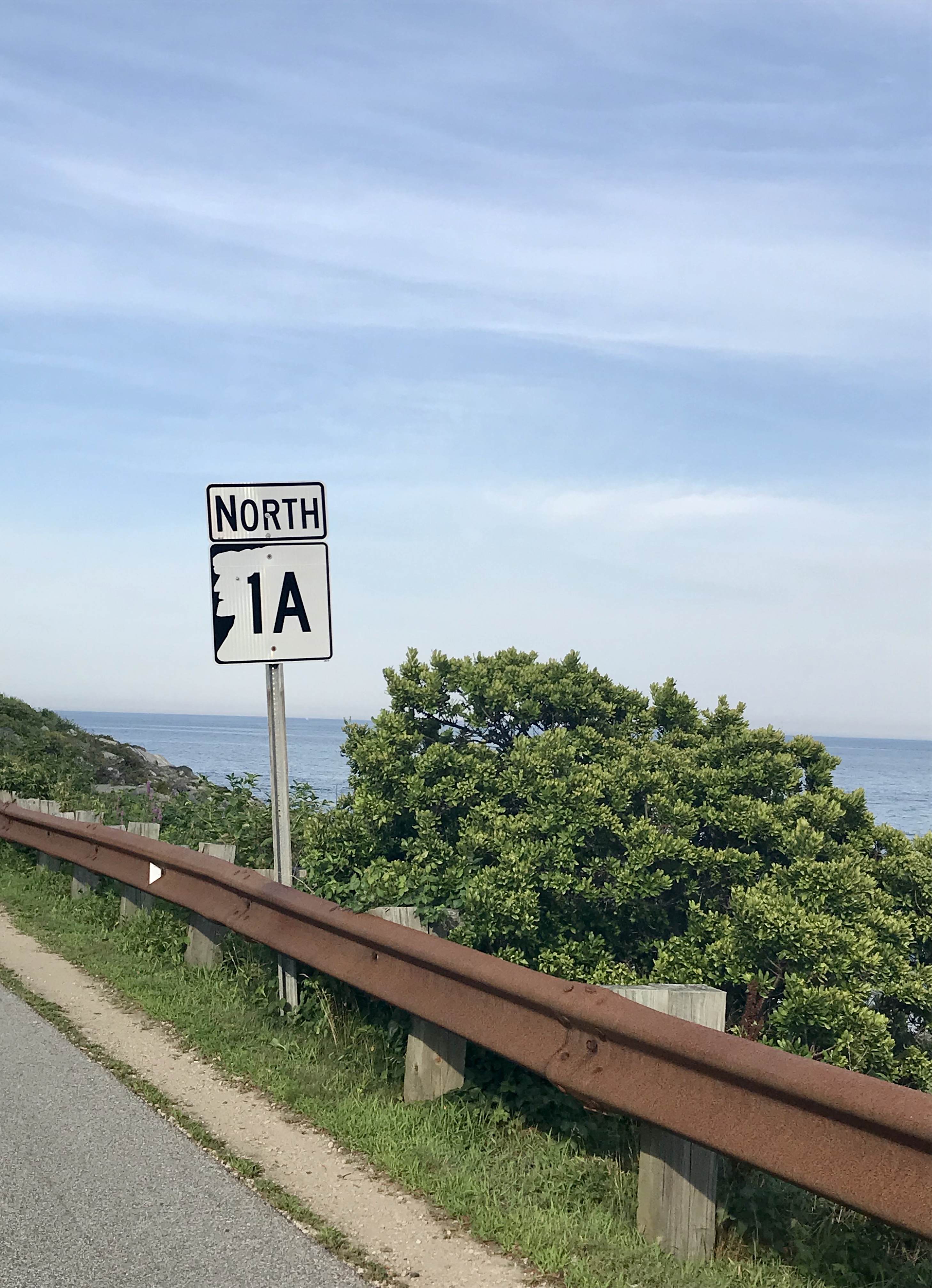
*iPhone photo. The rad shield for New Hampshire State Route 1A – the numbers represented within the silhouette of the “Old Man of The Mountain” – which was formerly a naturally anthropomorphic rock outcropping above Franconia Notch said to look like its name implies, which has since crumbled ironically due to its old age, and is now kind of an awkward state marketing icon. I had fun explaining this to one of my friends who is from the Midwest.

Portsmouth, New Hampshire is a rad little city. As its name implies, it started out as a colonial shipbuilding hub and morphed into a rowdy naval port town where the Piscataqua River junctions with the Atlantic around the island town of New Castle.

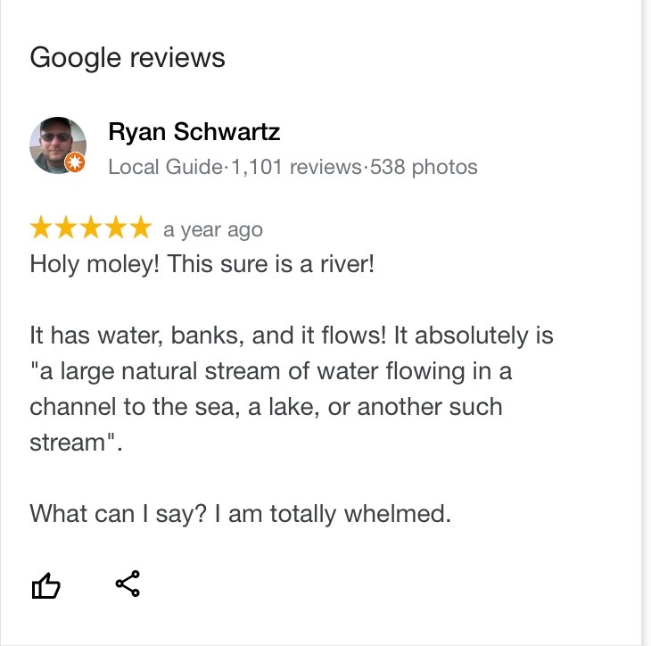
The Pisaquata River also has a pretty great Google review!

The name was minted by the local Abenaki people and might mean something close to; “a river with a strong current”, which I’d say is pretty dead-on, but the details are a bit hard to parse, and because of that, there is a lot of speculative lore behind its name! It’s also the third fastest-flowing navigable river in the world. Though the city has long declined from being an employed port, the oldest naval shipyard in the new world is still active here on an island in the Piscataqua – which once launched some of the most important American warships and the first nuclear submarines. Now the shipyard is kinda moribund, but still functioning.

And speaking of submarines – there’s one in a hole right off the Route 1 Bypass! It had me and my friend exclaim: “Hold up… that’s a motherfuckin’ submarine!” when we passed it.

It’s the new home of the USS Albacore! Lauded as “the forerunner of the future” in its heyday, this vessel was built by the skillful laborers at the Portsmouth Naval Shipyard in 1953 and was intended to essentially be a paramount experiment of both its physical design and technological wizardry – one that the Navy was really depending on. Its teardrop-shaped body became the standard design for all subsequent submarines – and proved that submarines could actually sustain themselves and function while being submerged!

It became the world’s fastest submarine in 1966 when it set an underwater speed record of 40 miles per hour, and, it was used to innovate sonar equipment!

Now, it’s a neat roadside oddity and museum that we didn’t expect to see. Though it was closed when we pulled up as dusk hummed in, it was worth getting a few mediocre iPhone shots of!

One of the most memorable features of the navy’s island lair – and the region itself – is a notorious abandoned naval prison designed as a dismal gothic nightmare – intentionally, I’m sure.

I guess it’s an unwritten cultural rule that if a prison is built on an island, it’s gonna eventually be known as “the rock”.

Like Alcatraz, the intimidating Portsmouth Naval dungeon also shares the same tag, even though it’s technically across the state line in Kittery, Maine – and when in operation, was one of the nation’s most feared military lockups that could hold a surprising 86,000 inmates. The guards, too, had something to fear, because according to folklore, if they let a prisoner escape, they would be finishing out the rest of the escapee’s sentence. And you’ll have something to fear if you decide to try and explore it, because you’ll most likely wind up being locked up (though probably at another facility). I have no doubt that there are other gristly tales of this “the rock” – and most likely, those are forever classified.

I’m a bit bummed that I didn’t get a shot of it while in Portsmouth, but it wasn’t until afterward that I discovered that there was actually a pretty good vantage point from a bridge that leads into New Castle. Oh well, I’ll have to get my shot next time I’m in town!

Via Wikimedia Commons

Nowadays, Portsmouth is a hip tourist town with loads of charm that front squiggly roads and brick sidewalks – part of that charm comes in the form of loads of colonial architecture that was the result of the burb being one of the most successful port cities in early America. It also comes from the fact that after the city was being gradually consumed by a multi-decade period of decline, a whole bunch of Portsmouthians found their civic pride in the 1950s, when the “urban renewal” contagion was spreading around America – which meant a proposal to bulldoze half of the city’s historic neighborhoods so they could put modern stuff in its place. Thanks to locals loathing that idea – the city has a fantastic array of impressively preserved old buildings from the city’s various stages of life that couldn’t be more archetypal New England, and lacks the antiseptic, banal, and cheap architecture that plague so many other American city centers today.

It also gives Portsmouth a wicked creepy vibe after dark when things get shadowy behind old houses, arboreal-tunneled streets, and replica historic gaslights. You definitely start to wonder what sort of fiendish monstrosities lurk in the black voids and eerie stillness that slides over the city from ocean mists.

And speaking of creepy things at night – this is a good time to transition into my first oddity excursion…

Grave With A Glow?

Back at the hotel room, I was doing some research a few hundred years deep into local cemetery records, trying to track down a particular corpse. Well – actually – her gravestone. You see, Portsmouthians have a mystery among them – an inexplicable phenomenon that might be solely unique to their city. As far as I know, anyways.

According to the vague legend – there’s a light coming from within Portsmouth’s sprawling south street cemetery at night – the result of 5 old rotyards eventually colliding into one over the centuries that Portsmouth has existed.

This is a radiance that might be preternatural, for it’s said to come from a tombstone.

Yup, I was trying to find a grave that glows, which was a bit of a task. There wasn’t a lot of chitter-chatter about this curious claim. I first discovered a brief snippet of it within Curious New England: The Unconventional Traveler’s Guide to Eccentric Destinations by Joseph A. Citro and Diane E. Foulds and was finally able to dig up a bit more sustenance on a blog entry I found, that now seems to have vanished.

What I found so intriguing about the claim is that the reason for the luminosity seems to be a mystery. There are no specter stories and it can’t be blamed on floating orbs or a reflective surface that mirrors nearby shine. I guess it’s an intrinsic feature.

The grave’s occupant, too, seems to be a rather unremarkable person, in a sense that she doesn’t seem to have any disquieting history to support her grave’s peculiar behavior. The usual plot twists to New England cemetery supernatural shenanigans don’t apply here. She wasn’t accused of being a witch, and she wasn’t done some sort of great injustice that made her utter a posthumous curse (though making her headstone glow for eternity seems like a pretty silly way to achieve retribution if you had that sort of power).

Though some morphed local lore takes a stab at answers and proposes that the stone glows because; it’s the grave of a murderer, a murder victim, or even that the gravestone itself has uranium (!) or a luminescent particle in its mix. Uranium in a gravestone is still amusingly easier to believe than this story is.

It just does its thing, apparently, and it has been for some time.

That’s another interesting detail – I haven’t been able to find any information on exactly when this marvel started to happen, or how long it’s been doing its thing for, or even any accounts of people who’ve seen it. Even a few locals I mustered up the courage to ask about it had no idea what I was talking about. It’s just been acting in that fashion for a while it would seem…

The naysayers who are aware of this tale scapegoat sources like the light of the moon, streetlights along Sagamore Avenue and South Street, the traffic light at the intersection of Miller, Sagamore, and South, or reflections from the sizable pond within the cemetery grounds, that for some reason, leap a considerable distance and hit just the one headstone. But if this is all to be believed, then even skeptics have to concede that it can’t be the moon, for the stone is said to glow perpetually, even on moonless nights.

With such a mysterious sensation allegedly happening within a few minutes of our hotel, how could I miss out on witnessing it for myself?!

One of my friends decided to humor me and come along, while the other one raised an unimpressed eyebrow at me and opted to stay at the hotel.

My skepticism was as thick as the summer humidity outside that night and I felt a little guilty, so to appease my friend for joining me on my midnight legend-chase that would most likely have no payoff, I told him we could get some night shots of the city afterward, which he was pleased to agree to.

Navigating Portsmouth’s gridless grid, the old-fashioned wood frame houses ominously glowing with jaundiced light from the streetlamps soon ended and the vast graveyard thick with indifferent shadows extended beside us behind its low delineating stone wall. It was really dark in there.

Despite how nearsighted I know I am, a greenish/white glow within an otherwise dark cemetery should have been easy to spot – but as far as first impressions went, we didn’t see anything except for the waning rectangular shapes of rows of headstones coupling with panoramic umbrae that seemed to be extra nebulous for some reason. It was actually pretty creepy.

From within the cemetery, we could discern the distance-weakened streetlights and an occasional flash of passing headlights, but there was nothing I could see that I’d mistake for an unceasingly glowing gravestone. It was a good thing that I did the research beforehand, too, because finding a grave in that cemetery at night would have been an unlikely task. Unless it glowed.

“What’s the name on the grave?” my friend asked as we walked around in the dark.

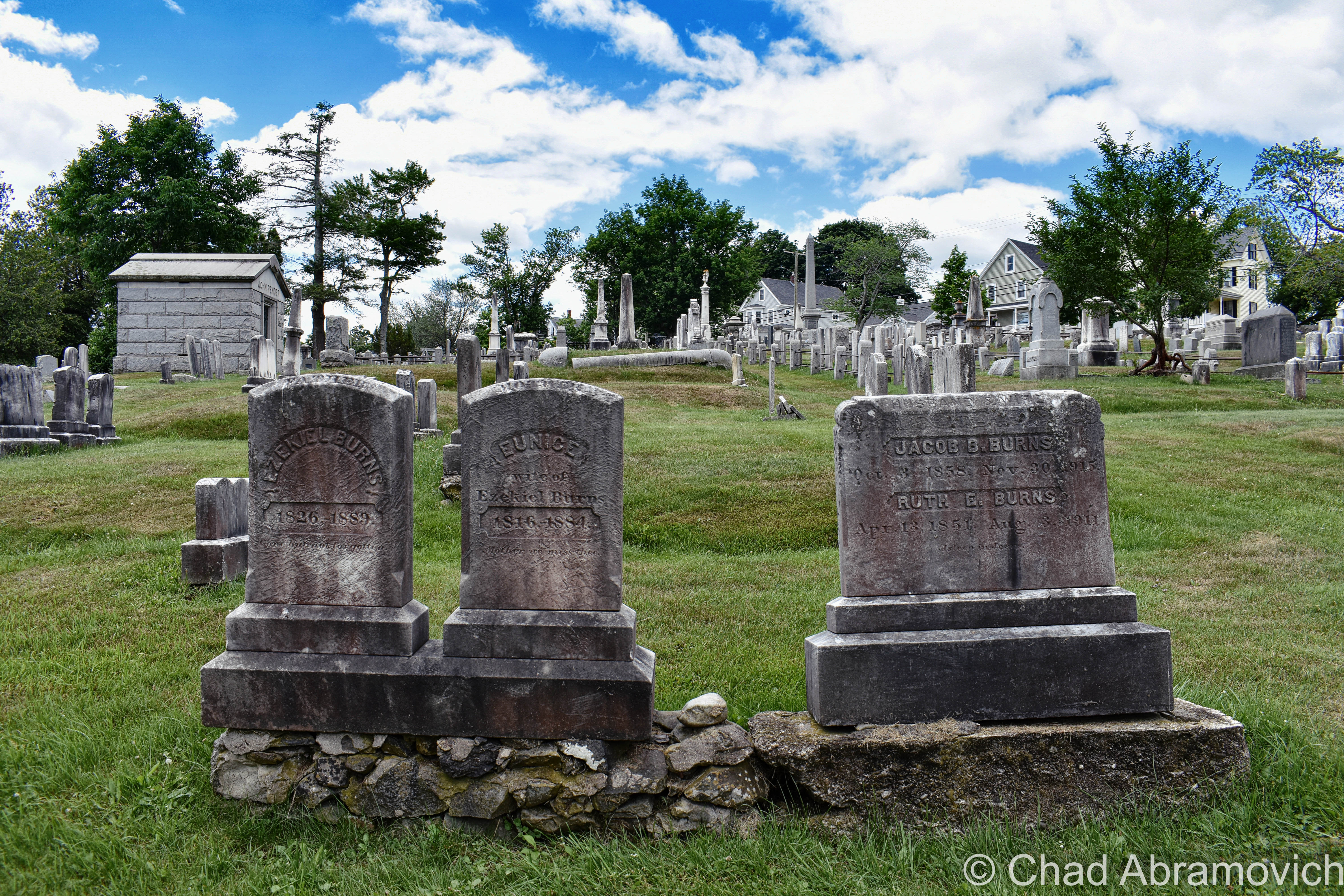
“Burns”

“Wait… seriously?”

“Yup, we’re gonna see if Mrs. Burns, burns”.

“Oh god, Chad…”

Our experience in the cemetery can be summarized succinctly; there were no glowing tombstones. Or tombstones doing anything that could be considered eccentric. We then drifted over to the Portsmouth waterfront, reveled in glorious summer weather as the water bells tolled distantly, and called it a night.

We did return the next day en route to another oddity I’m going to get into below, so I could get some documentation shots of the headstones for this blog post.

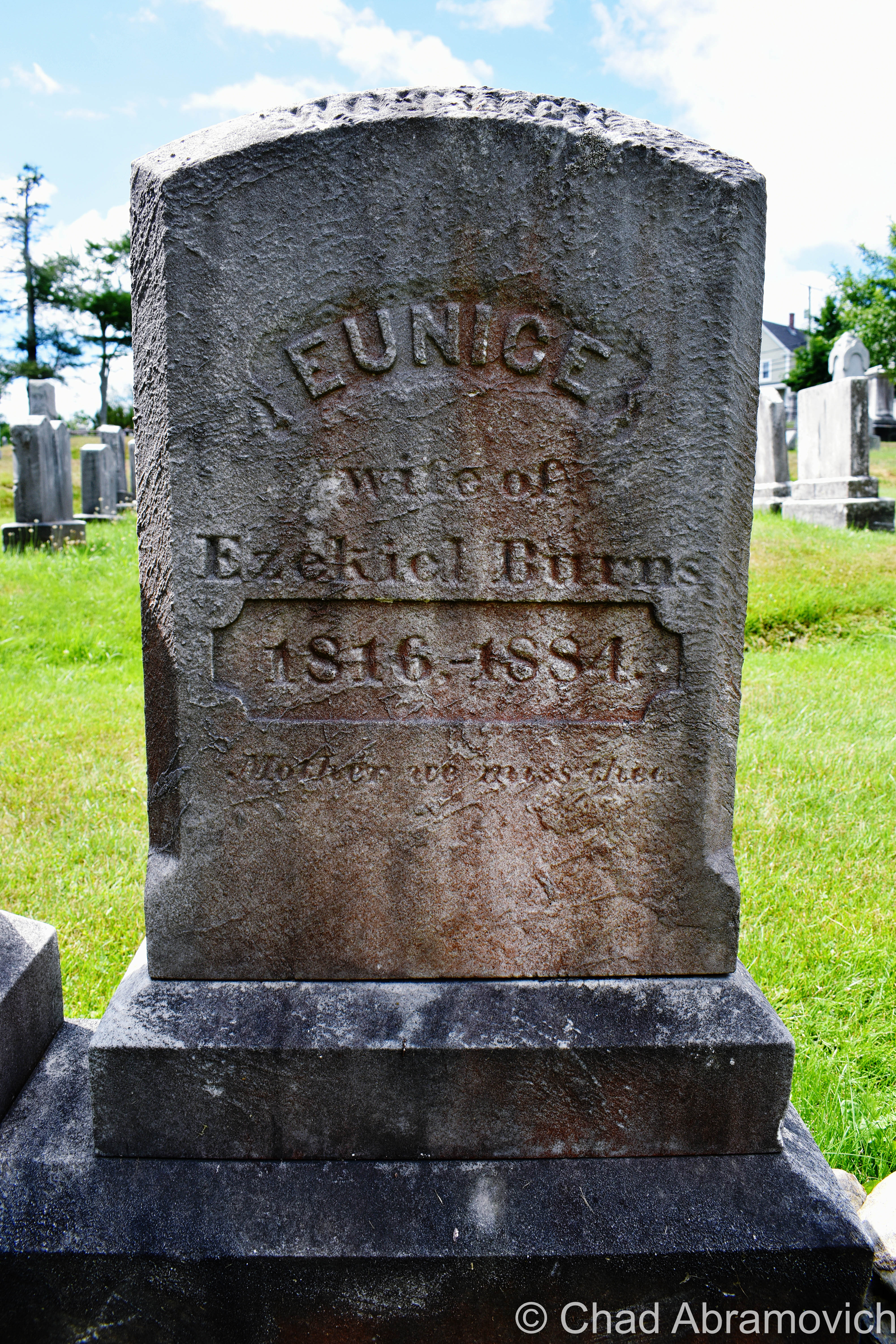
There, in broad daylight, were a set of 3 tombstones with the surname Burns on them joined at their base – 2 of them bonded by older looking stones and a third and unevenly distanced one on a newer concrete foundation. They were more or less unremarkable and dimmed by age and weather. In the middle was the anomaly – the grave of Eunice Burns, who died in 1884. The epitaph “mother we miss thee” engraved below her lifespan was actually kind of sad and made me wonder how she turned into a local folkloric figure.

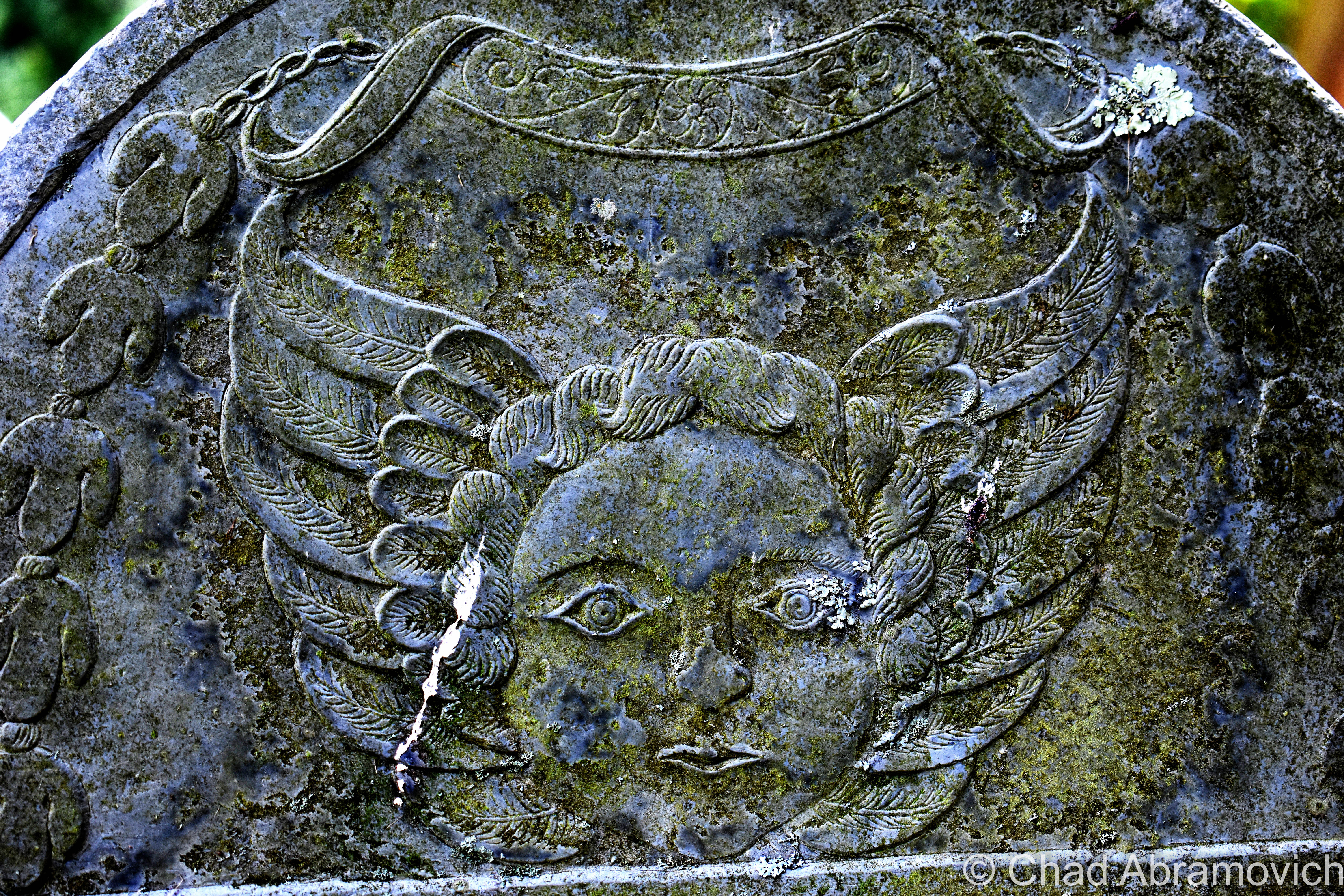
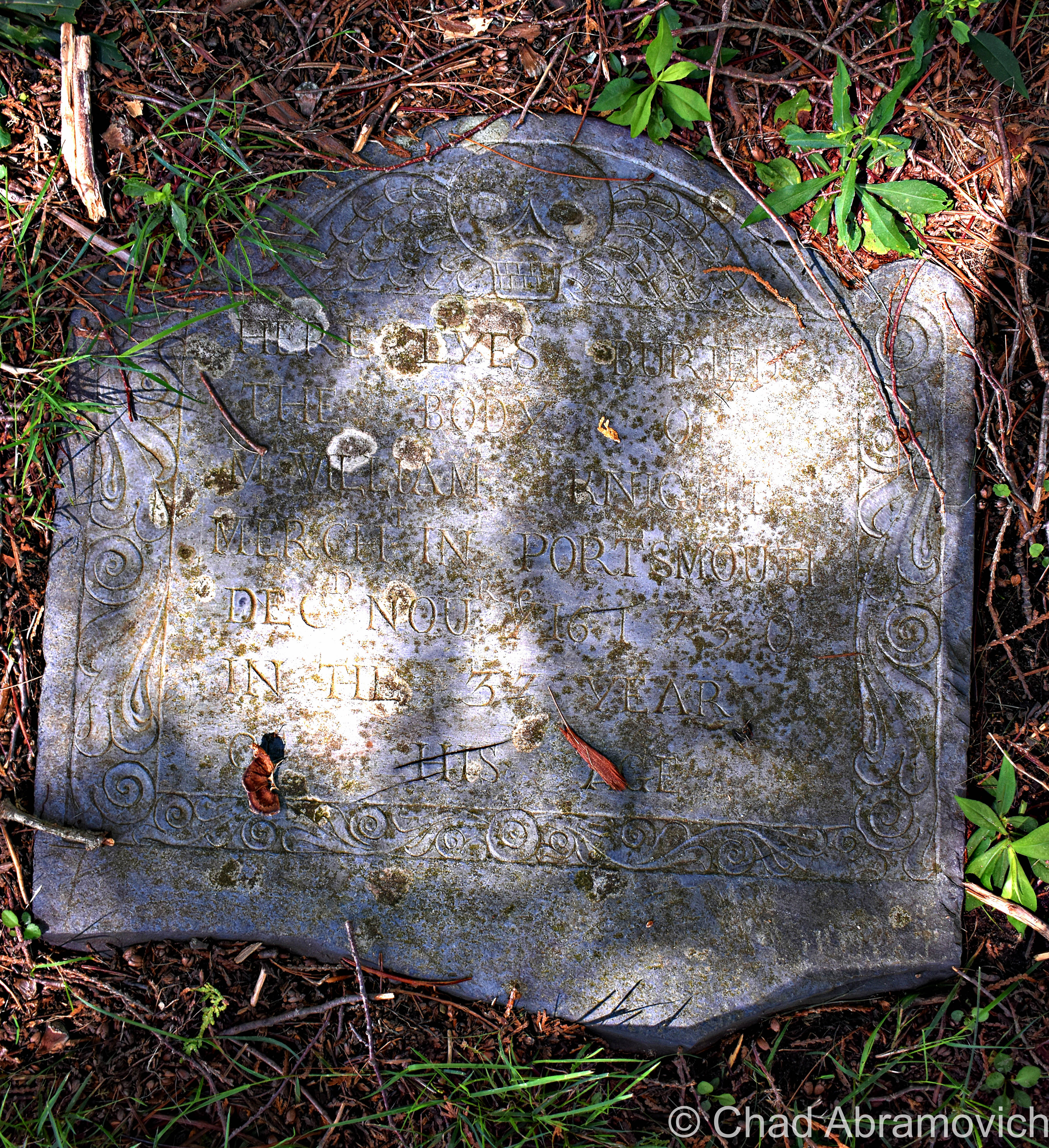
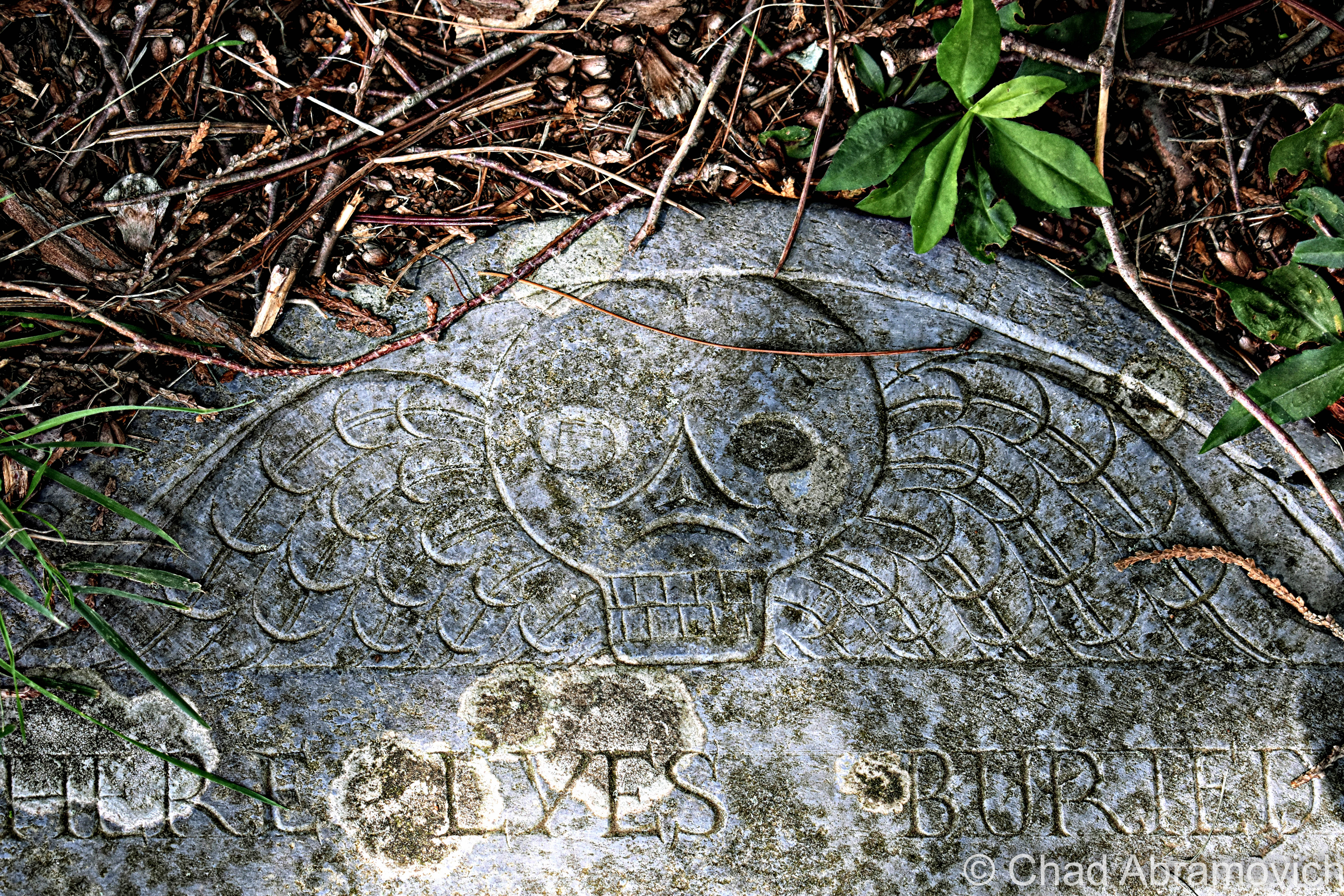
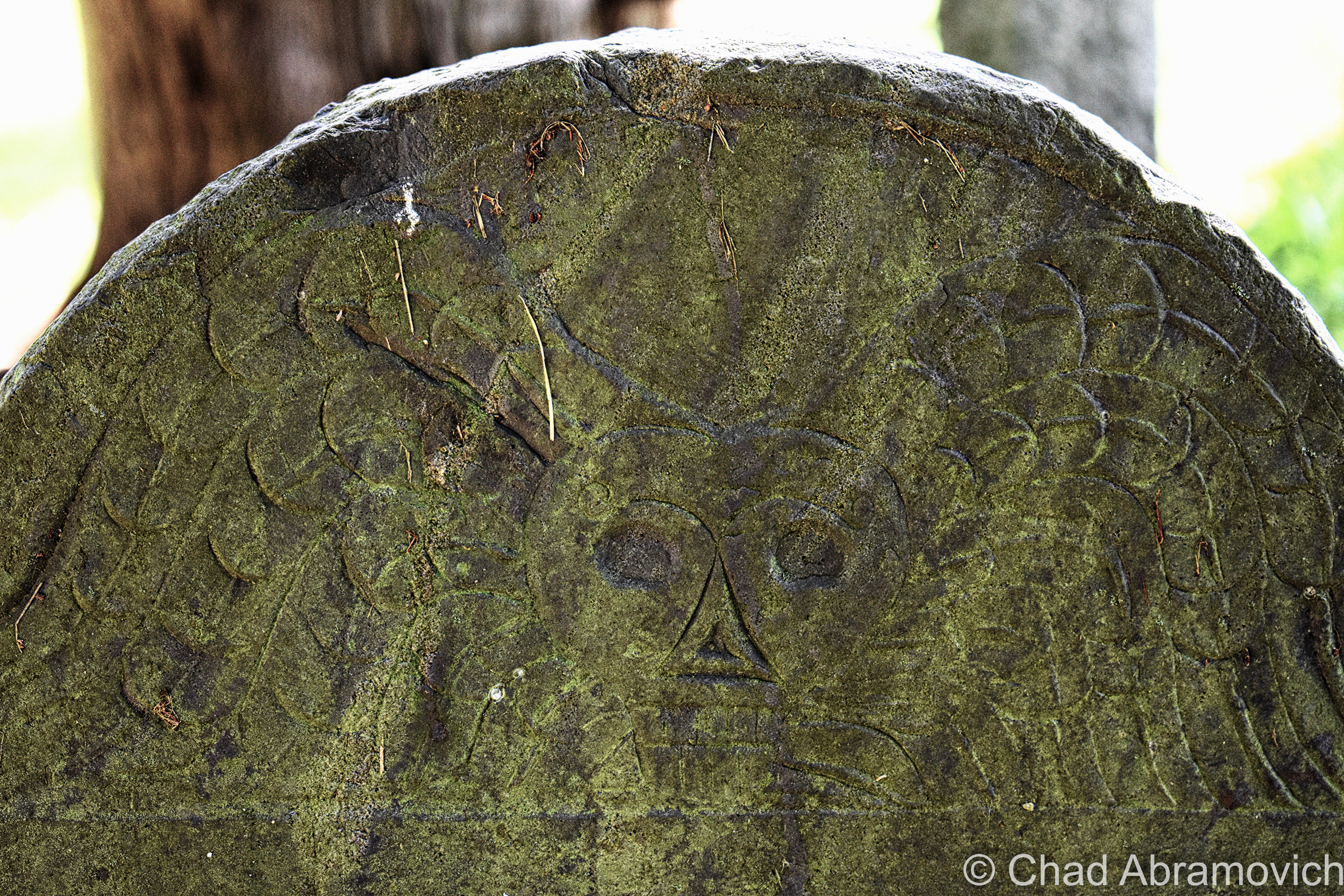
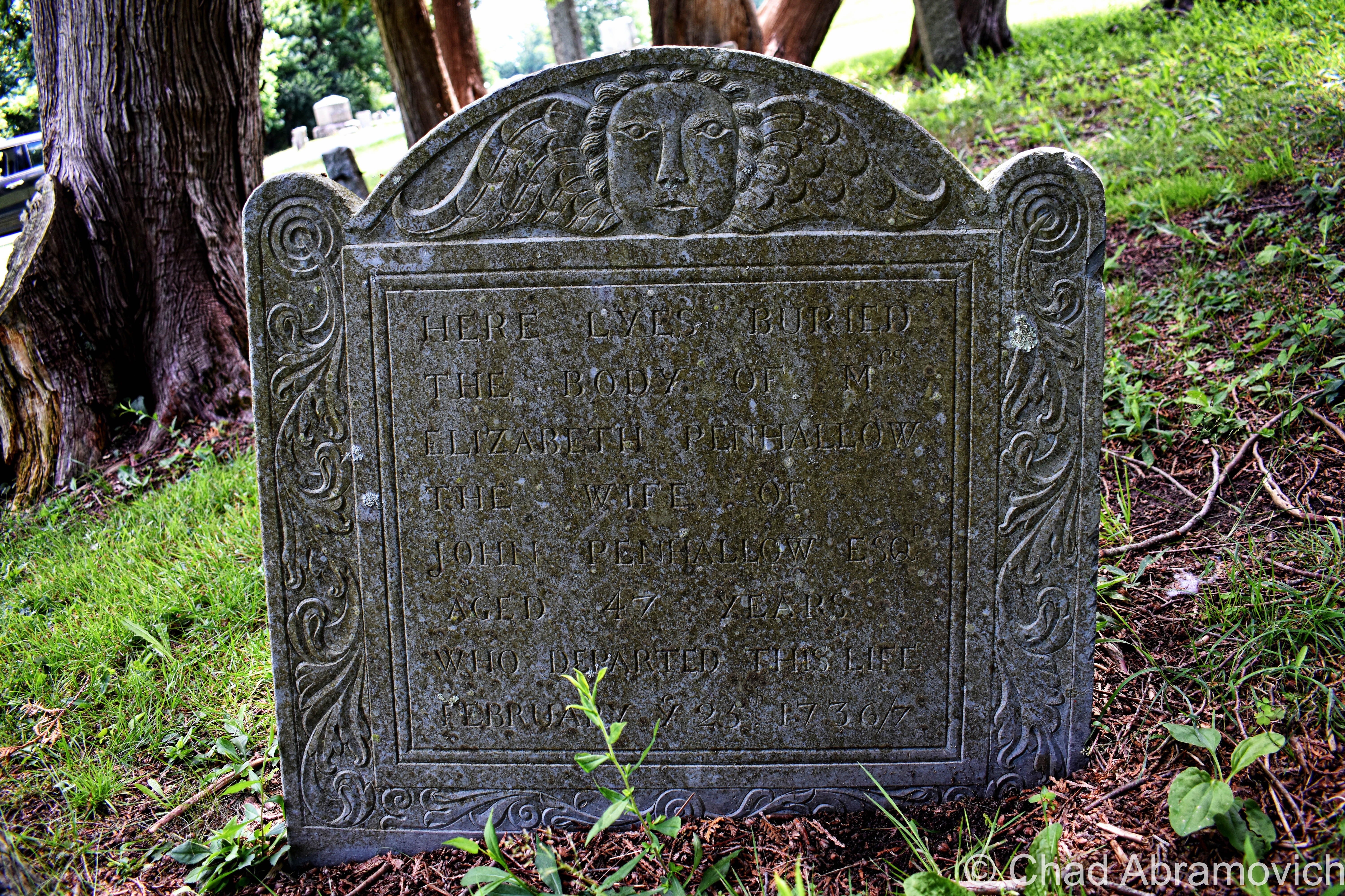
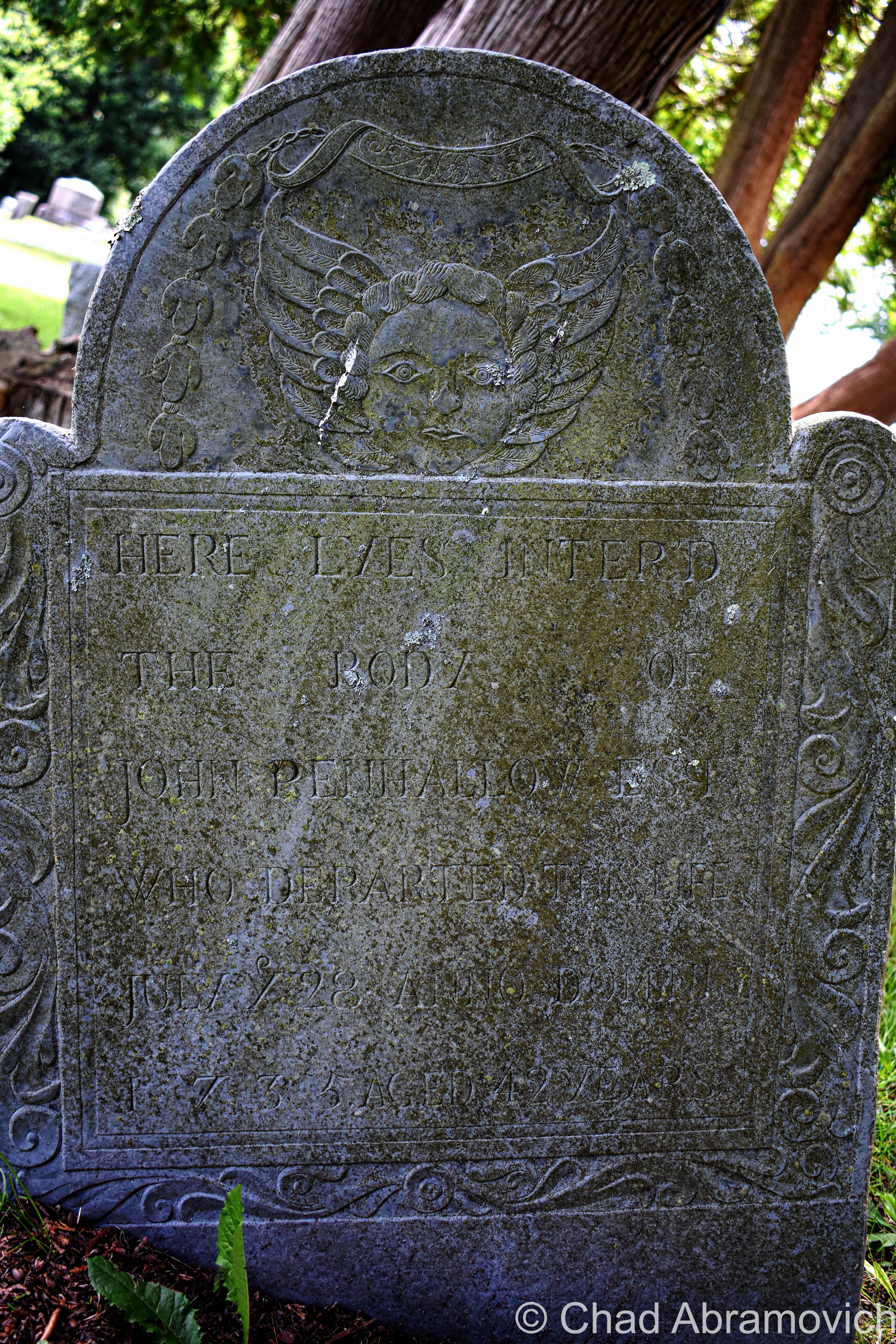
We also had a brief wander around the cemetery – a sprawling yard of little grave capped hills and a long pond, and observed a fantastic array of weathered old headstones and their memento mori and stories – dating all the way back to the 1600s, when Portsmouth was spelled as “Portsmuth”.

“So, it didn’t glow last night?” asked my other friend facetiously as I was putting my camera gear back in my bag.

“Nope. But who knows, it might be glowing right now and we just can’t tell because it’s sunny out”.

These are just a few shots of some headstones that I found to be interesting as I was leaving!

The Drowned Forest & The Transatlantic Telegraph Cable

More often than not, some of the most interesting things come to me completely by accident.

This is one such case, while traveling the fantastic New Hampshire State Route 1A through the town of Rye years ago.

My obsessive observational habits mean that I try to take in everything around me at once when I travel. Studying the landscape and reading every sign I see.

As we came across a small marshy area along Route 1A, I noticed a standard New Hampshire state historical marker standing a ways back from the road in the yellowed tall grasses. I’m a huge fan of those state historic/points of interest markers installed on roadsides and usually try to glance at them if I see them.

But this wasn’t the typical sign denoting a battle or historical event. Instead, it had two words that seemed to jump out at me; “Sunken Forest“.

I wasn’t expecting that, and almost immediately, my mind began to percolate.

After all, the term “sunken forest” does provide a lot for the imagination – conjuring up eerie images of giant pines and cedars submerged in a viscous, murky world of diffused light, their branches sullenly and slowly swaying with the mercy of the tides, fish encircling places where only birds could once perch and ship keels making their way over their crowns. 

Did something like that exist in New Hampshire?!  

Well, sort of.

After doing some internet research,  I soon discovered that the reality was a little less phantasmagoric, but still pretty awe-inspiring!

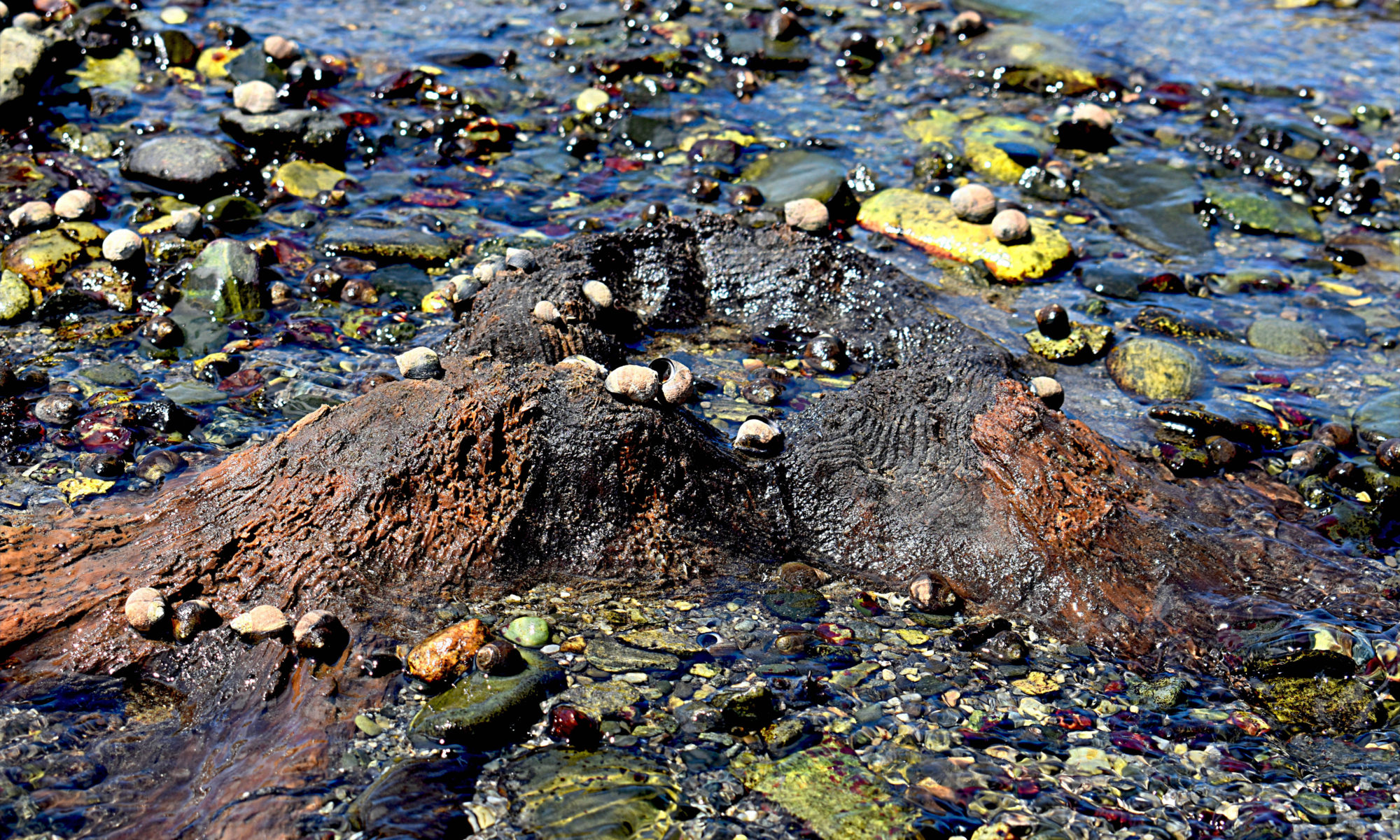
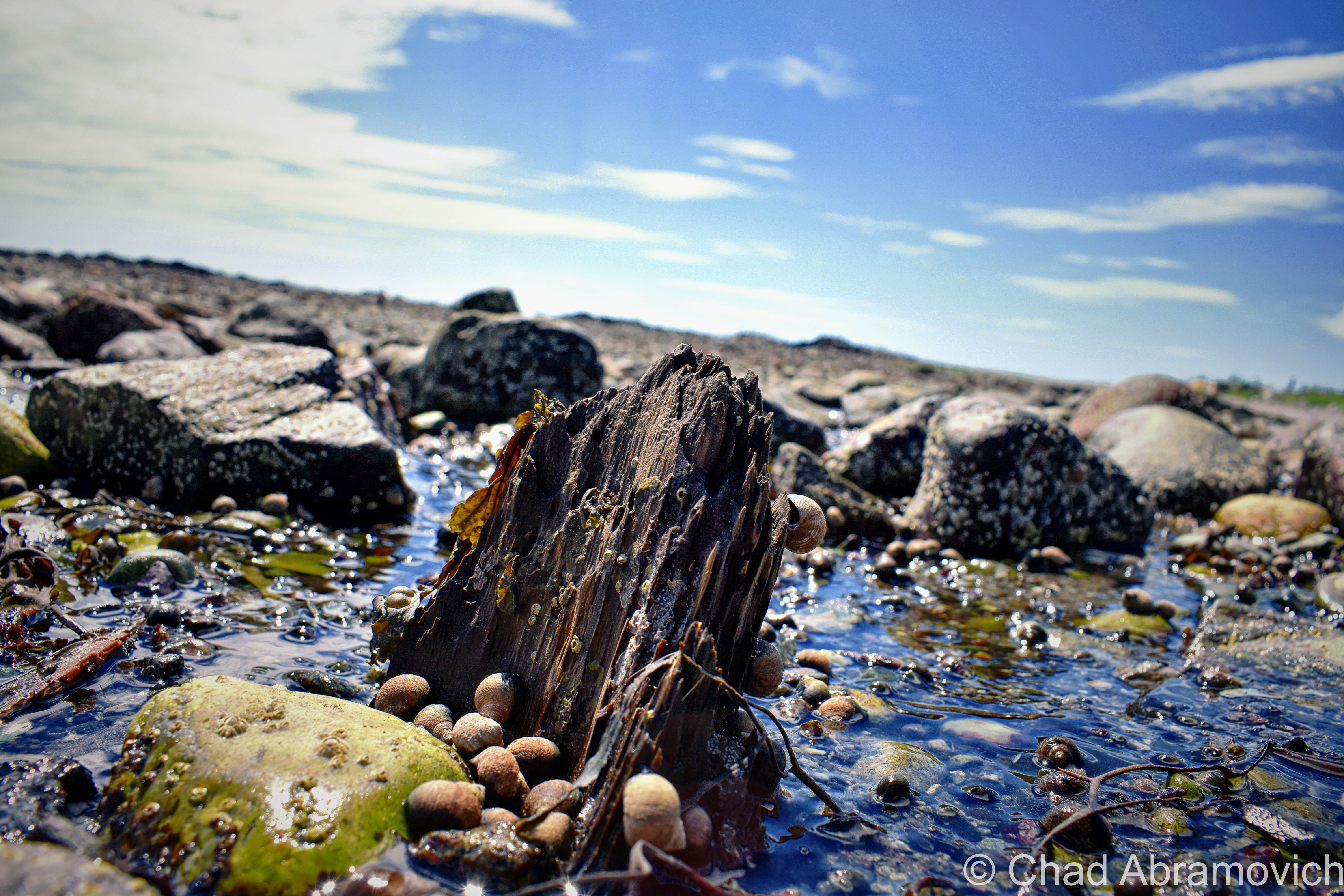
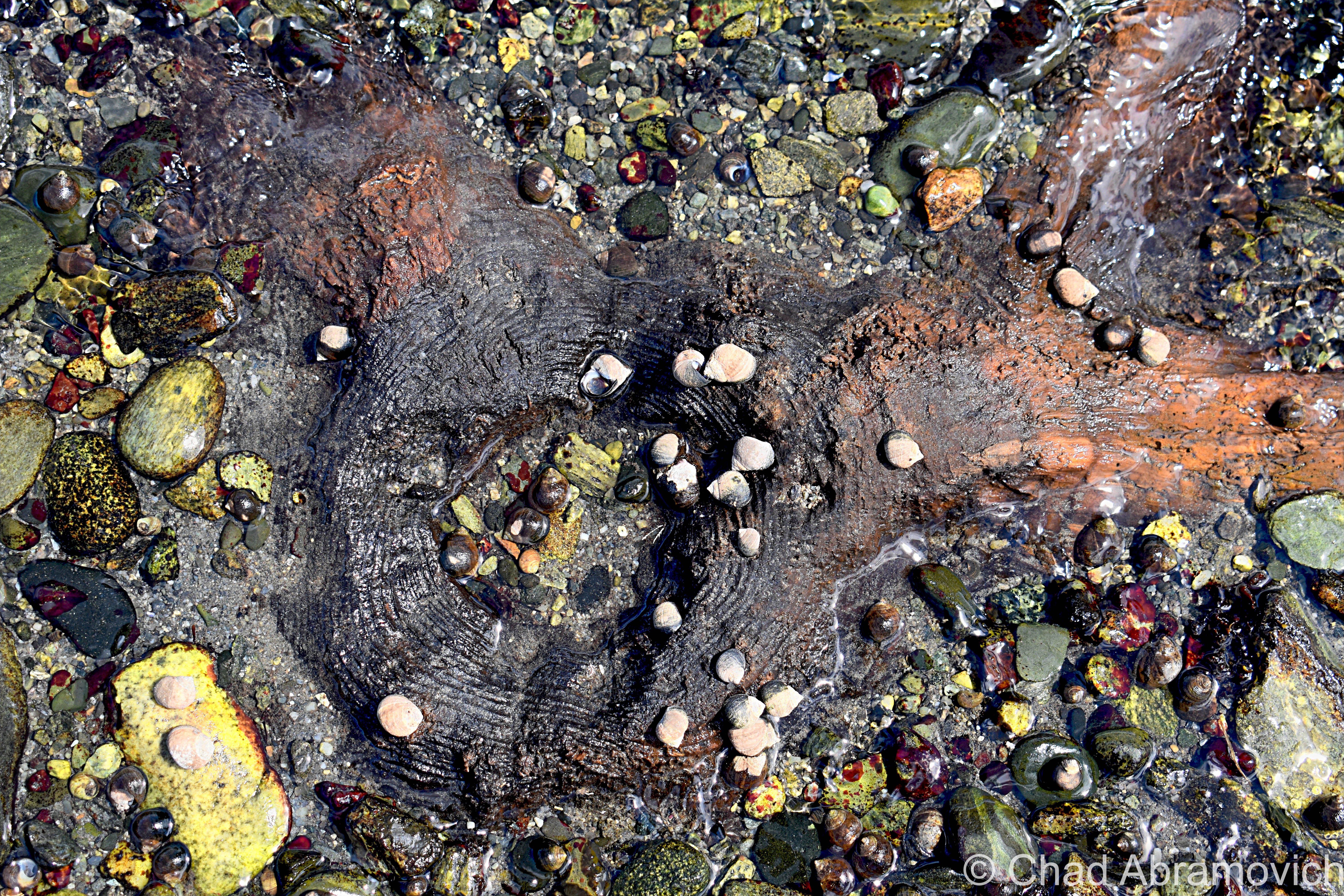
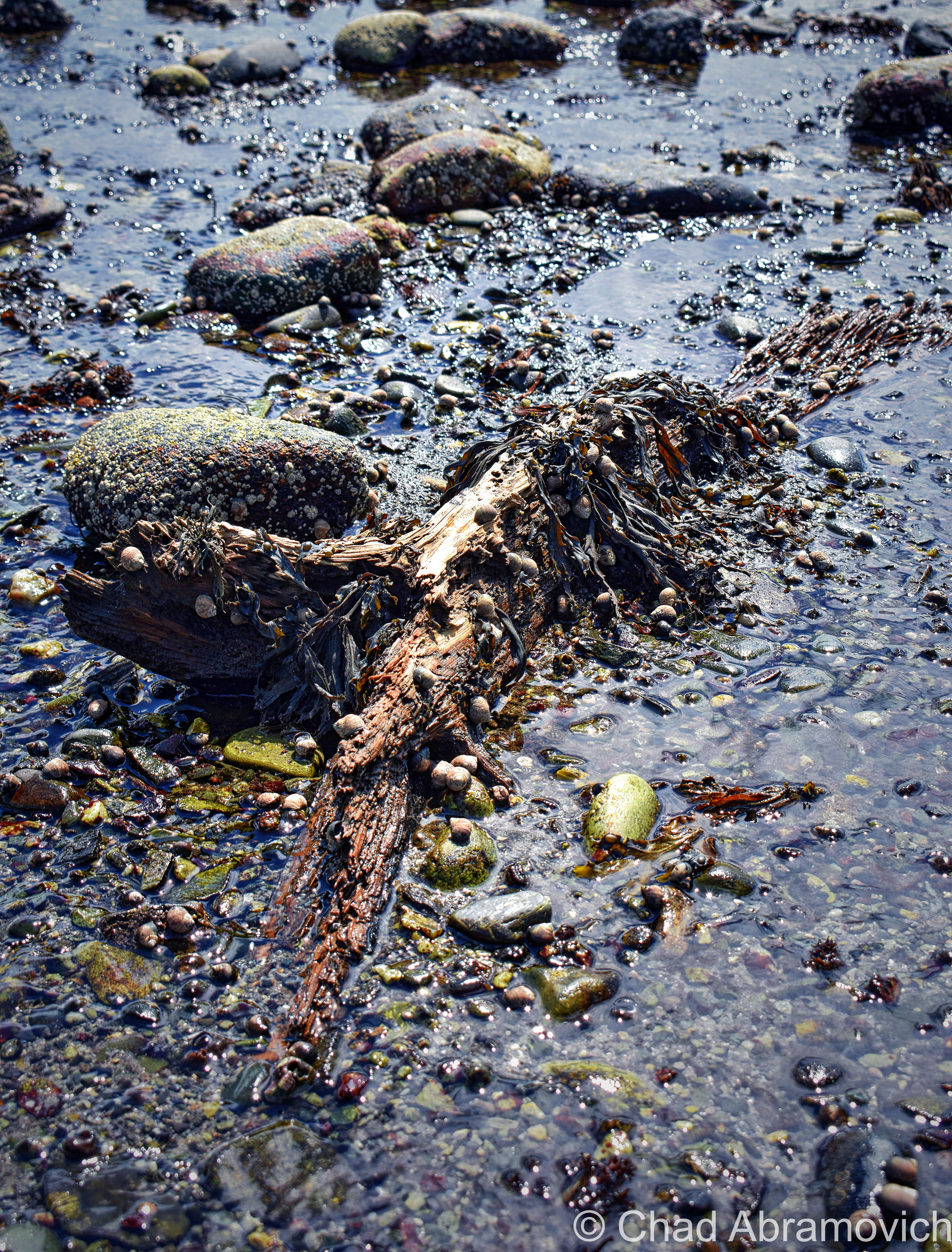
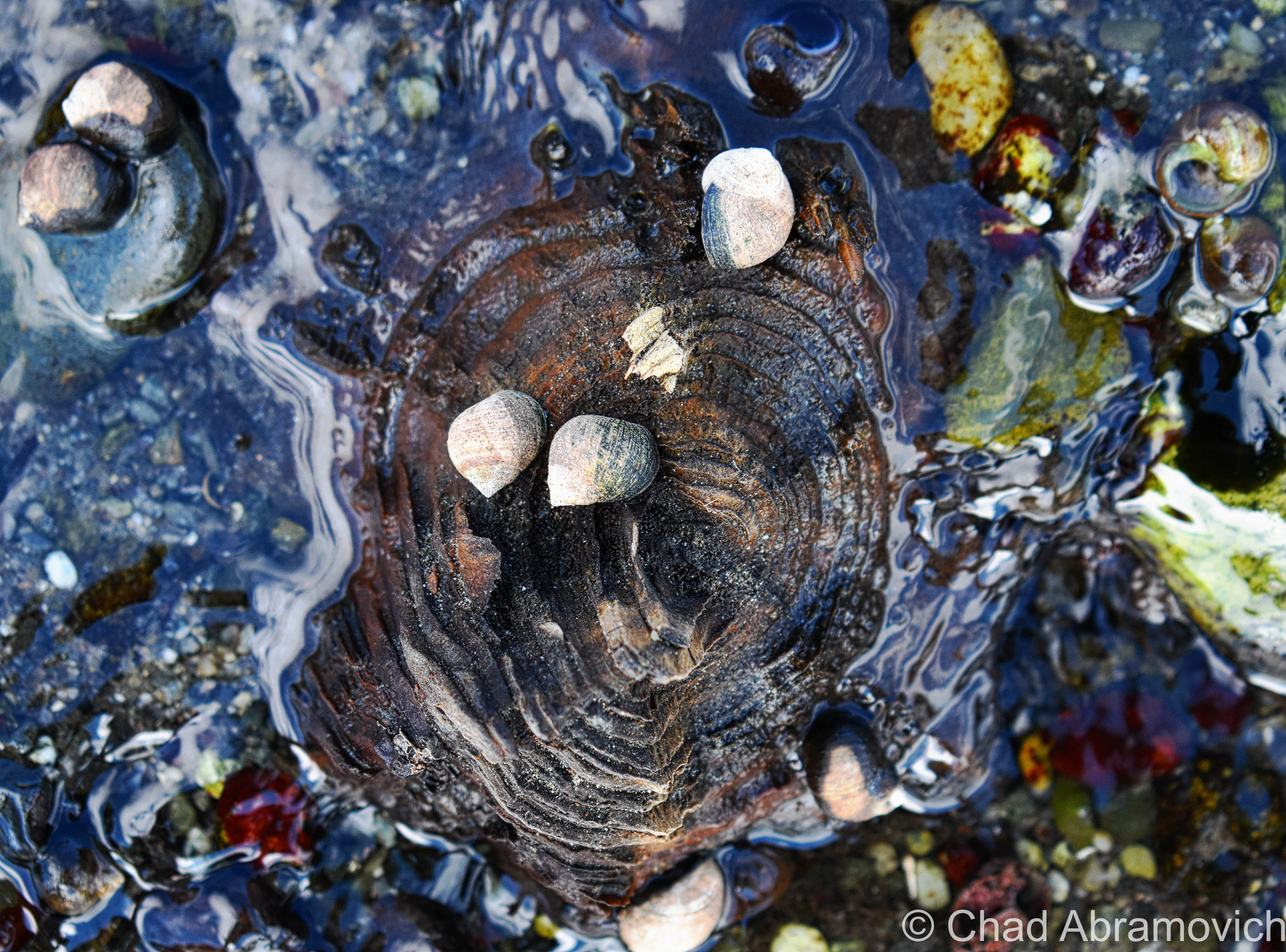
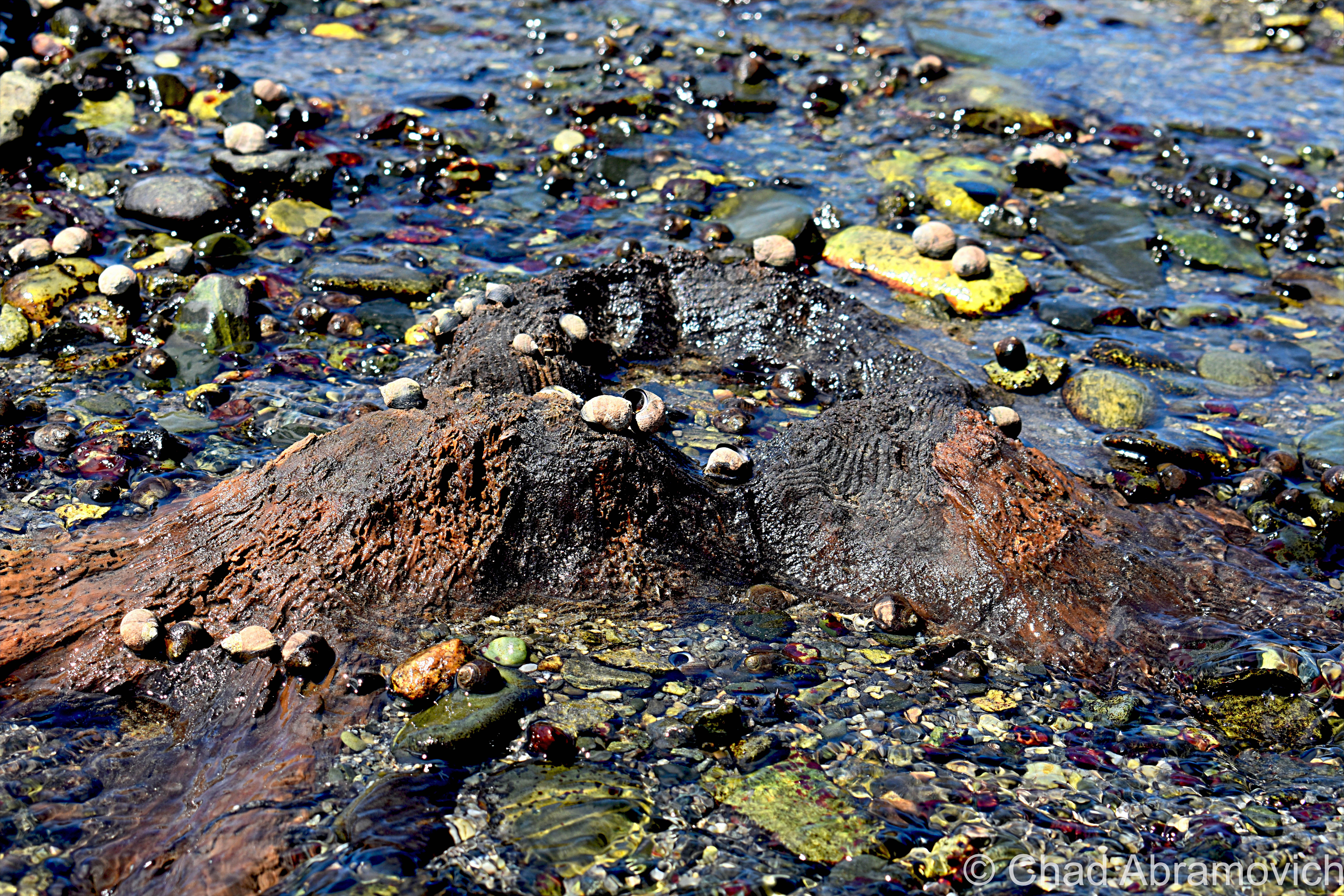
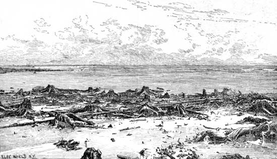
Rye’s sunken forest is the extant remains of a living forest of Hemlocks, Cedars, and Pines – reduced to a range of slimy tree stumps and contorted roots in thick peat mud, many of them barely noticeable and almost always obscured by high tides most of the year.

The traces of former forests and other things that the oceans have adopted into their secretive world can be found along the northeastern coast from Massachusetts as far up as Nova Scotia – and sometimes, a particularly low low tide can reveal these things, or give them back.

This fossilized forest is from a time when the New England coastline extended approximately 75 miles outward, thousands of years ago! When the giant ice sheets that covered North America began to melt, sea levels increased and changed the coastal signature of the area, and eventually, the once-great softwood forest found itself unable to adapt to its new environment; underneath the ocean.

New Hampshire’s inundated forest is one of the easiest to view of all the still-surviving ones, which makes it all the more unique and tantalizing to track down.

But, “easiest” still means little here. The visibility entirely depends on the tides, which means actually seeing them is a rarity. And if the conditions are more ideal, the arrangement of nudged sediments, stones, and mud might also work for or against your efforts.

This oddity is bisected into 2 parts, which are either collectively known as “The Sunken Forest”, or isn’t. The one I tracked down, is the more frequently surfaced depending on the season and the tides, and is known to some as “The Drowned Forest” – which is mostly submerged in a rocky cove near the storied Odiorne Point. I like how graphic and violent sounding that name is, so I usually just go with that one. It also makes more sense logically to me, because the whole reason this oddity exists was because it was literally drowned.

Spring and summer are the best times to detect it, because in the latter part of the year, the low tides are only at night. Also, luck and persistence will help a lot too. Seriously. This was my third attempt at trying to see this – and not being from an area that has ocean frontage, this was also a required opportunity to teach myself about the tides.

The more of a chore-to-view is called “The Sunken Forest”, and is southwards down at the northern end of broad Jenness Beach – which mostly Houdinis itself except for once every few decades if conditions are just right. But, the Jenness Beach portion is also the best-preserved – with the stumps actually looking more like stumps, as opposed to up at Odiorne where centuries of ocean movement have grounded down the stumps almost level with the earth.

But when they are exposed, they have been carbon-dated to around 3,600-4,000 years old – and using dendrochronology, some of the tree stumps were shown to reach around 100 years old before they met their fate!

Finding this patch of remarkable flora was the main persuasion for me going to the New Hampshire shore – and it also was the thing that managed to twist my arm towards a beach. Not that I don’t like pretty places, but I’ve never been much of a beach person, mostly because I don’t really dig crowds or heatstroke.

By the time we arrived at Odiorne Point to meet low tide, though, it was already on the cusp of 100 degrees, and that heat just sucked the life outta me.

But I couldn’t contain my excitement as I made my way out into a rocky cove that wreaked of the fragrances that come with low tide. This was a special kind of ocean controlled oddity, sort of like when old shipwrecks will surface every now and then off, or on, New England beaches, so being able to actually behold it for myself was pretty rewarding – even more so knowing that within an hour or so, it would all be submerged again.

Scores of parents and even more kids were roving around the stony banks bracketed by seagrass stands and splashing around in the tide pools – most of them having no idea that they were in proximity to 2 very cool curiosities. But me – I was roaming around with my camera and prattling about seaweed-covered mounds that I was trying to differentiate from either being the oddity I was looking for, or just a regular sodden lump.

Some of the stumps and exposed contorted roots were almost inconspicuous in muddy sediments and other remains were found but sort of veiled below ankle-deep water with surface sun glimmer in the shifting tide pools.

Odiorne Point unassumingly has quite the history – many of the ruins that mark the point’s fluctuating timeline can still be detected – scattered through the state park that now occupies the land around the point.

The Abenaki and the Penacook gathered here for the copious resources like muscles and clams found in the tide pools, and It became the first spot in New Hampshire that seafaring Anglos set foot on a few centuries ago.

While century-old gravel pitting operations obliterated any traces of those original settlements (besides the oldest known cemetery in the state!), the brawny vestiges of a vital World War 2 coastal defense fort still exist within the park’s woods, as well as a conspicuously curious watchtower that can be seen 83 feet above the shingled homes of a small neighborhood off Route 1A that once was a satellite of the fort and was used for intelligence.

It’s the lone extant survivor of New Hampshire’s original 14 coastal World War 2 watchtowers, and is, for the most part, closed to the public. The tower is named after a neighboring natural landmark – Pulpit Rock – a jutting flat-ish topped rock formation that thrusts into a bouldery range of shoreline.

We had originally wanted to go check out the old gun mounts and batteries (and investigate rumors of secret tunnels), but by the time we were done with the Drowned Forest, I guess the heat had gotten to us and our enthusiasm, and we opted for the air conditioner in the car instead. I’ll be sure to put them on my itinerary the next time I’m in the area. Just look at these photos!

This turned out to be a conjoined oddity – the second item on my agenda happened to have been coincidentally laid down right through the Drowned Forest, and was much more obvious to detect!

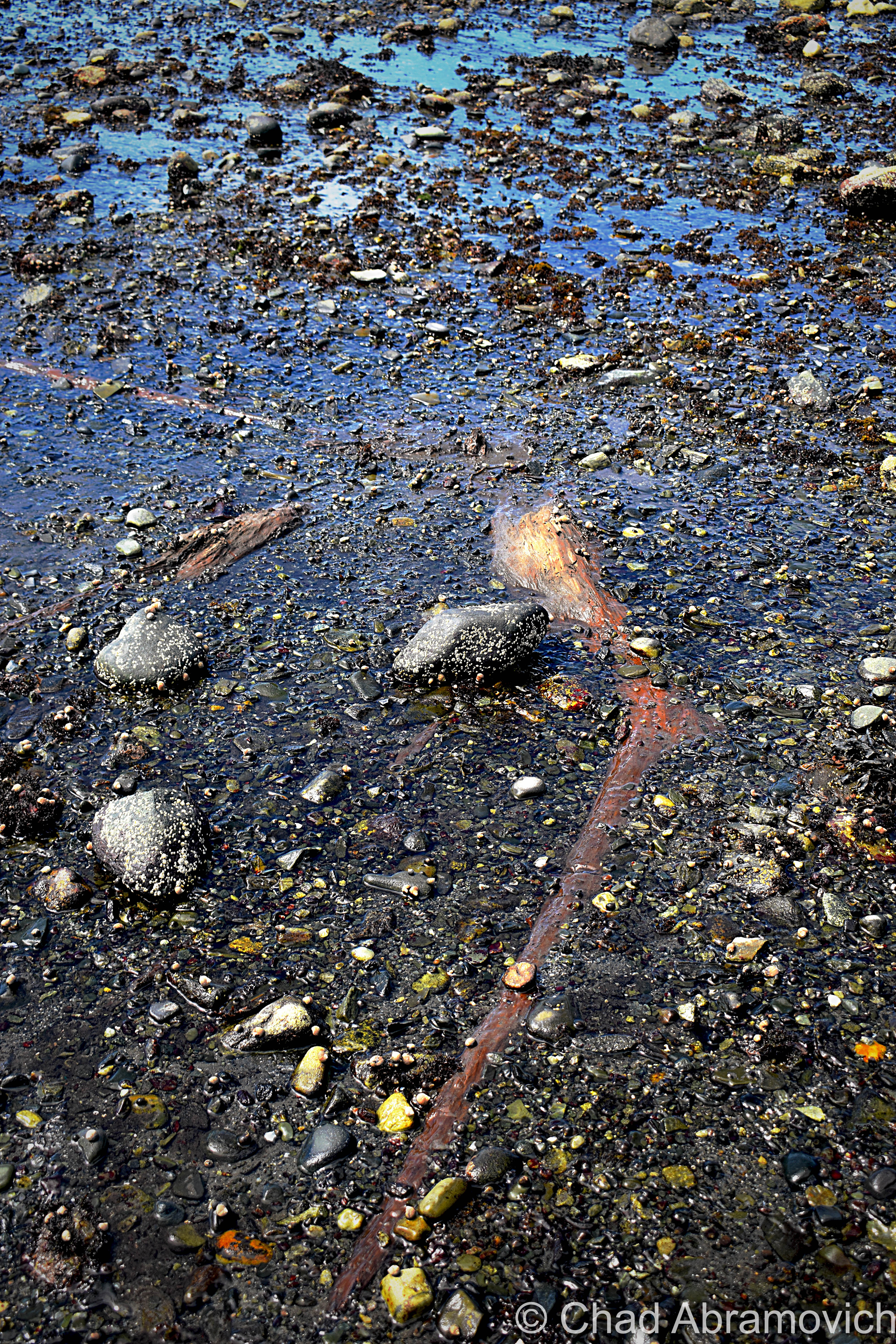
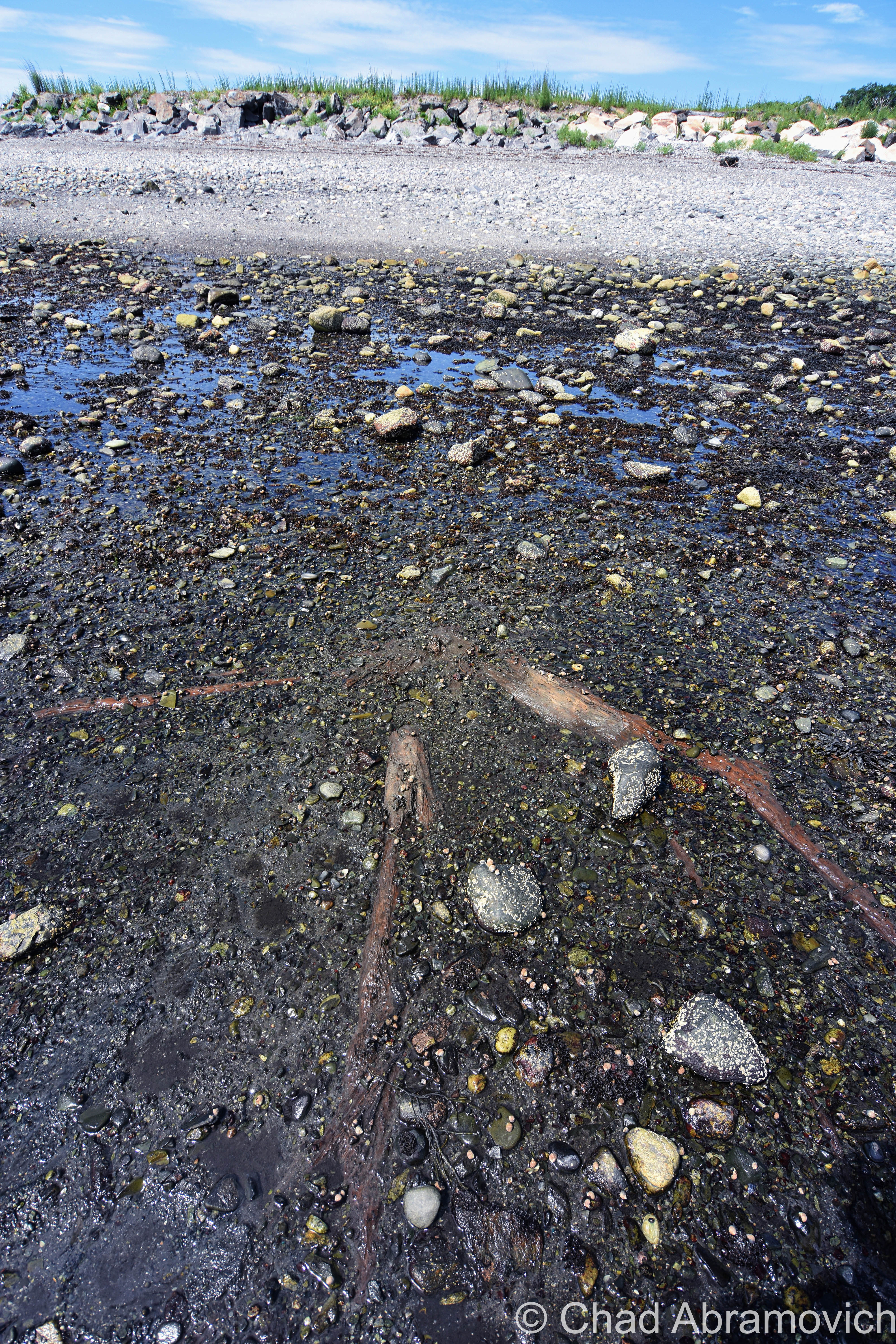
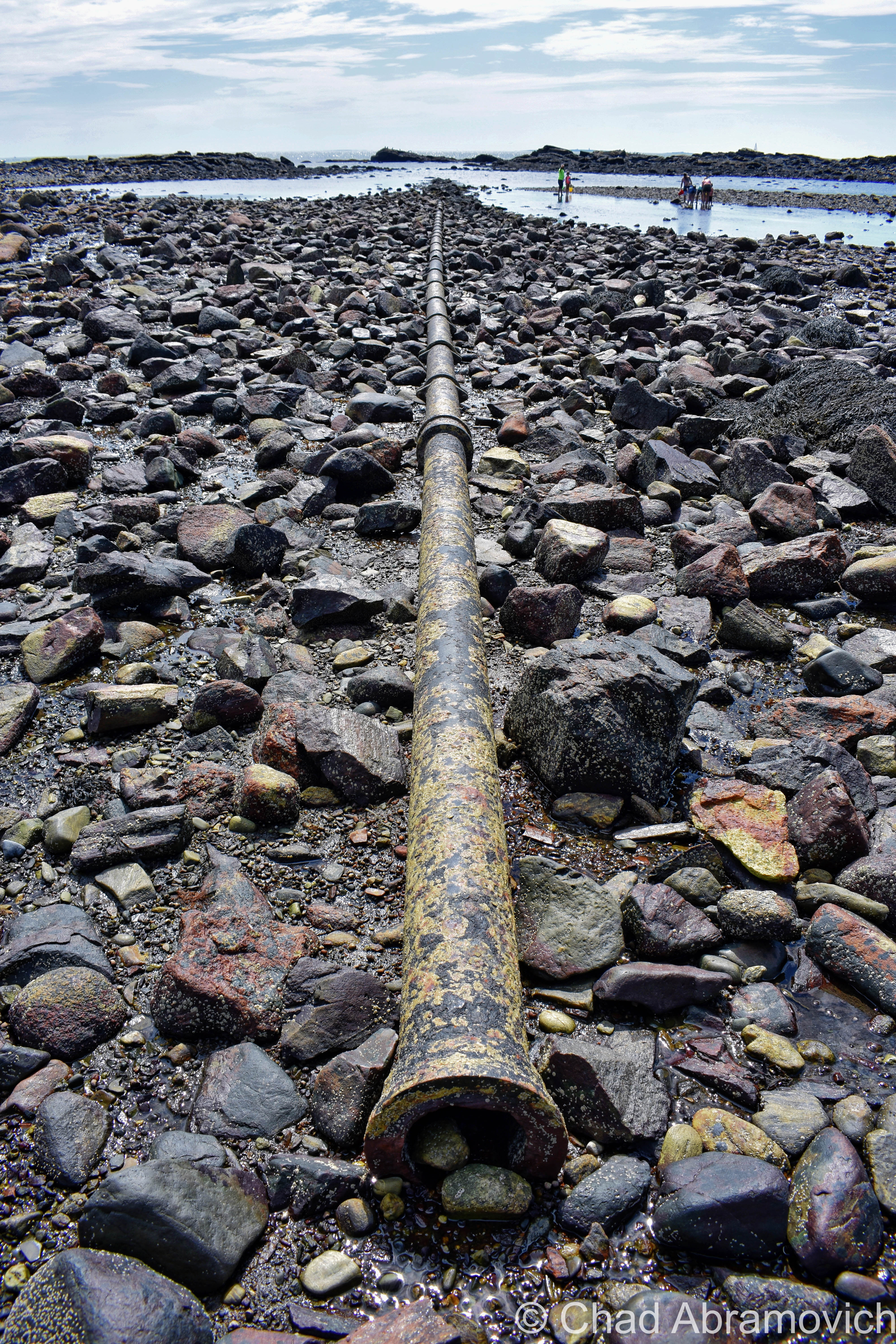
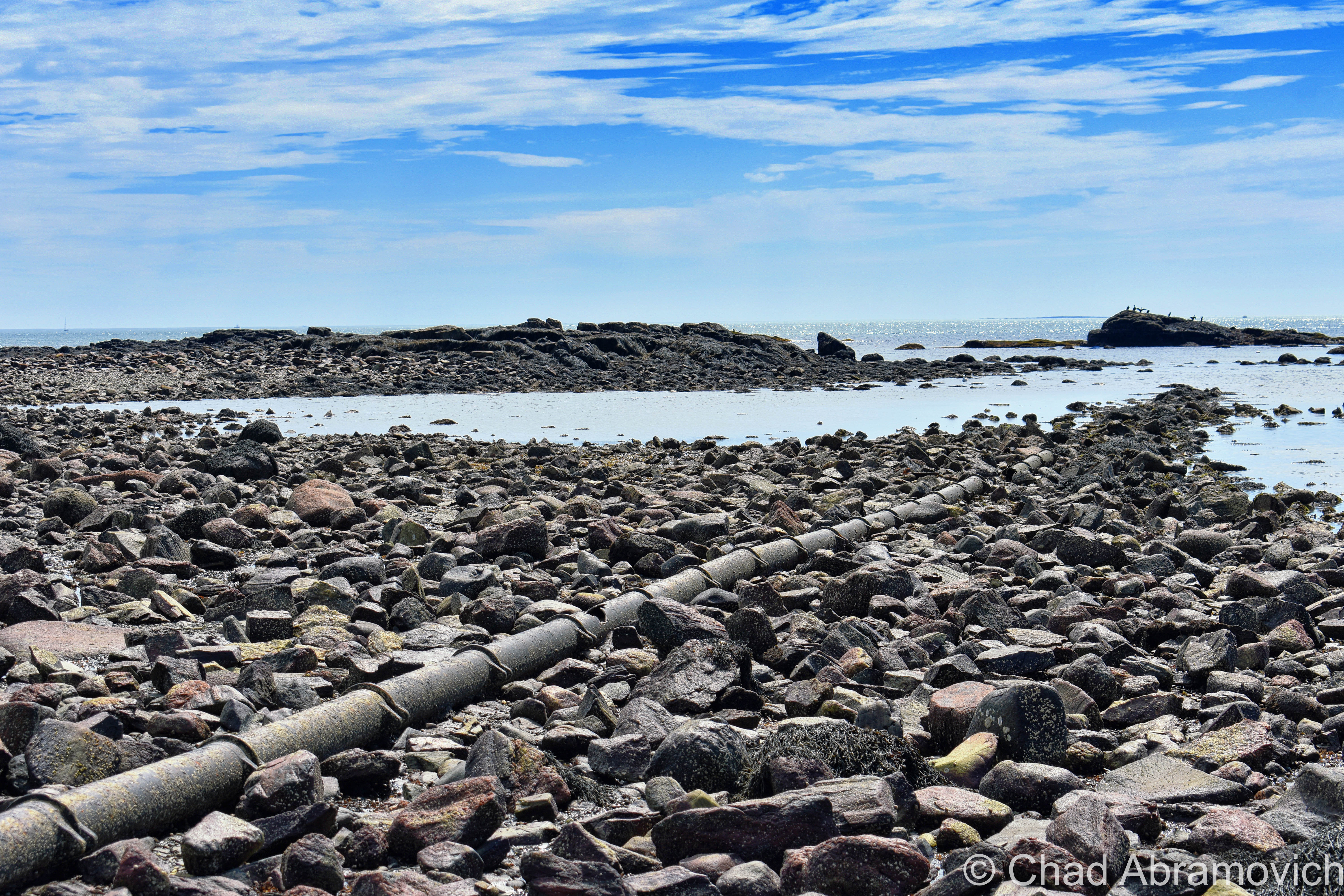
You’re looking at the rusted umbilical of one of the first transatlantic telegraph cables – the first one to be installed on United States soil!

Landing of the Direct United States Cable at Rye Beach, right through The Drowned Forest – circa 1889. Notice how much more girth those stumps had then! | Via Atlantic-Cable.com

The 19th century was the sparking point for a wondrous period of advancement and invention for America. Communication – being one of the seminals of the human existence – was naturally pulled into the gravity of the changing methodology.

The telegraph could cut delivery of information from weeks to a matter of hours, or even minutes, by transferring a pattern of electrical signals called Morse Code between 2 receiving stations via a special wire, which would then have to be deciphered.

American businessman Cyrus West Field knew absolutely nothing about telegraph cables, but he had a lot of faith in their prospect, bellwethered that the telegraph was going to grow in importance, and wanted to capitalize on it in a way that nobody else was doing.

By the 1850s, underwater telegraph cables were beginning to run in small dimensions, like from Newfoundland to Nova Scotia, and across the English Channel.

Field utilized this information and thought bigger, literally. He wanted to establish a telegraph cable across the Atlantic – linking North America and Europe.

The idea also became a good way of international flexing, and the governments of America and The United Kingdom jumped on the bandwagon and helped fund the endeavor.

Because the cable was too large/heavy to load on a single ship, 2 appointed ships would sail from opposite ends of the ocean; Southern Ireland and Newfoundland, Canada, and meet in the middle to splice the cables together.

But, so many calamities bedeviled the journey that both governments and investors began to feel like fools after 3 failed attempts in 8 years.

Eventually, though, the first transatlantic cable finally happened in 1866, and it was a moving affair – with both governments lauding it as a paramount shift in human accomplishment. But, it took upwards of 2 minutes to send a single character because of the length, and then the cable was debased early on because of the voltage sent down it was too high. But, eventually, they got the kinks worked out, which pushed the project’s legitimacy card.

But – any messages destined for America still had to be sent down from the boonies of Newfoundland, which was often a slow or clumsy process. So, the Direct United States Cable Company was formed in 1873 by the Siemens Brothers, which routed another underwater telegraph cable down from Nova Scotia to Rye Beach, New Hampshire on July 15, 1874.

Because this was the first such cable to terminate on American soil – it was a big deal, and a huge crowd gathered at the beach the day of its installation – and garnished up some pretty dramatic Victorian newspaper illustrations in Harper’s Weekly with symbolistic ethereal light beams parting dark clouds onto the spot where the cable met the beach.

An official cable house was built that winter, which closed in 1921 when the cable’s usage significantly slowed down after its zenith during WW1 when it was kept busy practically 24 hours a day.

The cable house still cooly exists and is nowadays a nicely preserved private residence. It’s also why “Cable Road” has its curious name – something I wondered about when I read its name on Rye’s signature white and black street signs when I was a kid.

I tell everyone who feels like lending their ears that New England really is a special and strange place, maybe a few shades more so than the rest of this country’s iconic regions because of the comprehensive spectrum of spectacles that make themselves at home here, and these treasures are just a small representation of this. I was talking to a friend that lives in New Hampshire about The Drowned forest in particular, and he was delighted that something like that existed in his own backyard, and for years, wasn’t aware of it.

As I grow older, those are the types of discoveries that really fire me up more and more. Adventuring can really open up your mind. You don’t always need to go poke around a behemoth of an over-Instagrammed ruin to have a “real adventure”. The magic is kinda what you make of it.

The rusted remains of Rye’s transatlantic telegraph cable can still be spotted at low tide!

Here are a few links:

There’s a pretty fascinating documentary on the design and installation of the first transatlantic telegraph cable that I’ll link you below for your pleasure!

ALSO – if this kind of thing strikes your fancy – then definitely make sure to check out the website atlantic-cable.com – which was an integral part in my research on this curiosity!

The blog “Cow Hampshire” also has a good and more succinct blog post on it.

And – there’s another neat article on Hackaday

The Rye, New Hampshire Historical Society has some neat photos of the Drowned Forest from the 1800s.


Are you from New Hampshire or a fellow Vermonter? I’m looking for weird, wild, or hilarious stories, wonderous and odd places, incredible people, and especially abandoned locales! So if there’s something you’d like to share with me, I’d love to hear from you!

I’d also really love to grow this blog and present unique, meaningful, and extraordinary content that’s a departure from the same regurgitated stuff you find everywhere else online, and your help would be hugely appreciated!

Feel free to drop me a line at chad.abramovich@gmail.com

Also – if you appreciate me and this blog, perhaps consider making a donation at my PayPal below? The pandemic has hit my finances and my mental health pretty hard, so any amount is humbly appreciated. I’m also on Venmo if that works better.


Since 2012, I’ve been seeking out venerable examples of Vermont weirdness, whether that be traveling around the state or taking to my internet connection and digging up forsaken places, oddities, esoterica, and unique natural features. And along the way, I’ve been sharing it with you on my website, Obscure Vermont. This is what keeps my spirit inspired.

I never expected Obscure Vermont to get as much appreciation and fanfare as it’s getting, and I’m truly grateful and humbled. Especially in recent years, where I’ve gained the opportunity to interact with and befriend more oddity lovers and outside the box thinkers around Vermont and New England. As Obscure Vermont has grown, I’ve been growing with it, and the developing attention is keeping me earnest and pushing me harder to be more introspective and going further into seeking out the strange.

I spend countless hours researching, writing, and traveling to keep this blog going. Obscure Vermont is funded almost entirely by generous donations. Expenses range from hosting fees to keep the blog live, investing in research materials, travel expenses and the required planning, and updating/maintaining vital tools such as my camera and my computer. I really pride and push myself to try to put out the best of what I’m able to create, and I gauge it by only posting stuff that I personally would want to see on the glow of my computer screen.

I want to continuously diversify how I write and the odd things I write about. Your patronage would greatly help me continue bringing you cool and unusual content and keep me doing what I love!


Donate Button with Credit Cards

Wizard’s Glen

Ever since we started narrating our folklore collectively as a species, we’ve always marked the wildest places of our topography as incubators of contagion shotgun blasts for the darkest, grimmest things our human minds can create, existing in a variety of forms. These tales often like to hang around well into the intervening years where they should become obsolete, and yet, they don’t. We all deal with the dangers of the world in different ways. Sometimes, carrying on the traditions of talking about these kind of fabled places is a way of dealing with these dangers. And sometimes, these monsters reveal the most about humanity.

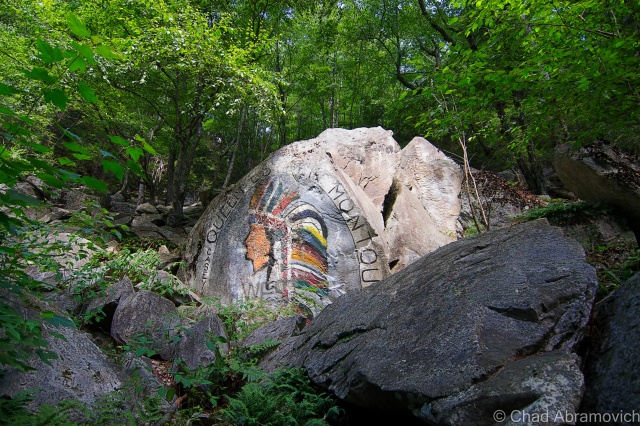
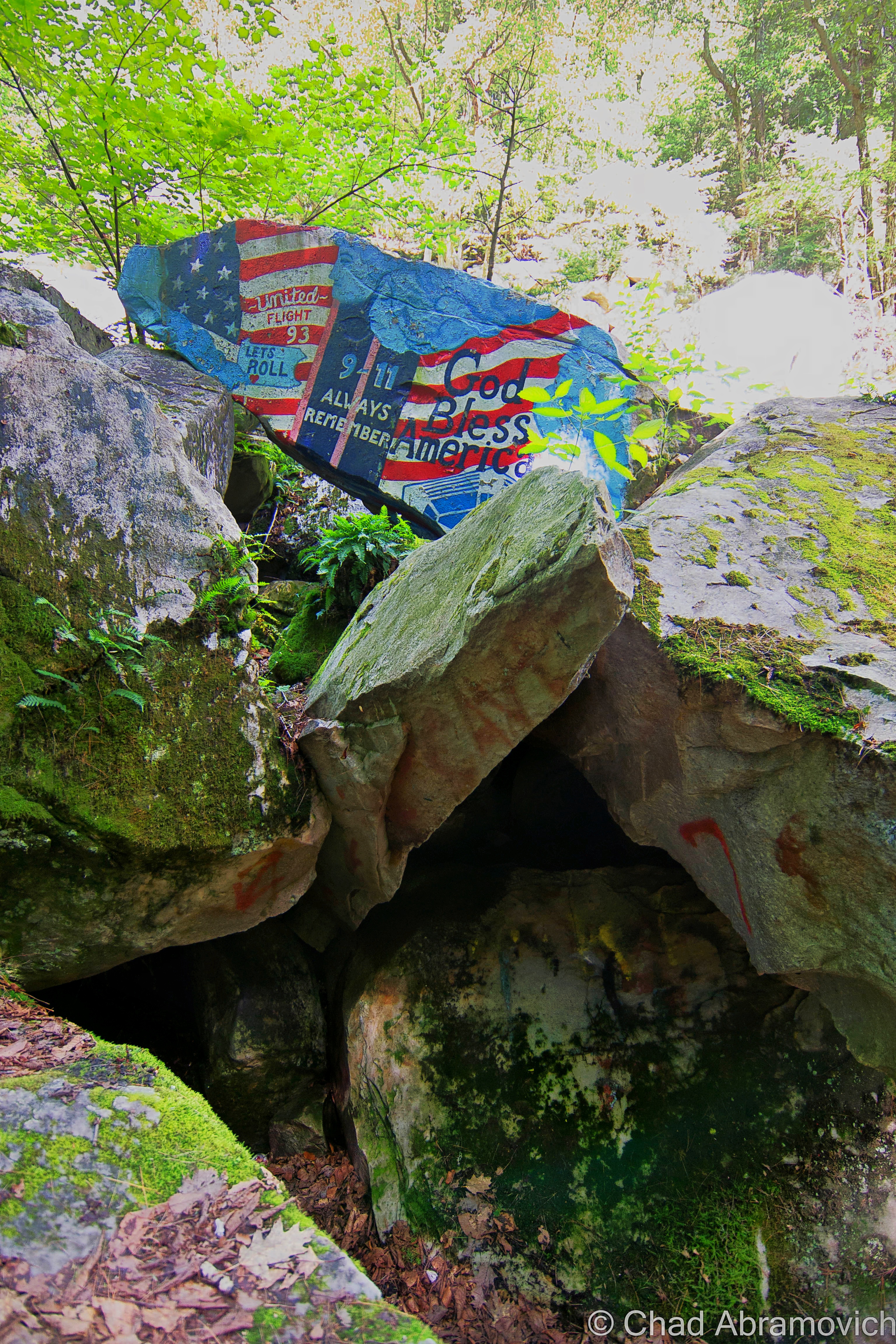
Wizard’s Glen in the Berkshires is a wild, picturesque depression between two steep-sided hills. Intersected by a lone, narrow and often washed out dirt road with it’s to-the-point name of Gulf Road, you are welcomed into this attention-grabbing area by tons of boulders that are stacked up the hillsides, some covered with some impressive and patriotic graffitic murals instead of the flippant teenage rabble I expected to find in such an area.

The name “Gulf” interested me before I even began to think about Wizard’s Glen.  The noun is a distinctive part of the obscure Vermont vernacular. Gulfs are known to the rest of the world as a large area of the sea or ocean that’s almost entirely surrounded by land, expect for its mouth. A Vermont gulf is a landlocked one – found in our mountains. We know them as deep ravines (or more dramatically, an “abyss”) that run between two parallel mountains or rises. To my knowledge, us Vermonters were/are the only ones to use the word in that sense. Vermont actually goes as far as to erect road signs to let travelers know that you’re passing through one. Granville, Proctorsville and Williamstown Gulfs come to mind, all of which are great drives. But finding a gulf outside of Vermont, even only in the form of a street name, was sort of cool to me. There is also a Gulf Road in New Hampshire near Brattleboro.

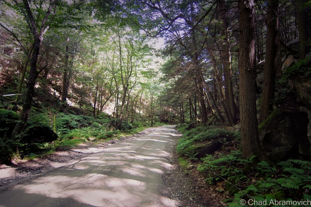
This particular Gulf Road runs east to west over the bumps that are the Berkshires. Both entry points are unobtrusive and start out as an unremarkable suburban street with storm drains, crumbling curbs and cobra head street light fixtures that run to the very point when suddenly, the pavement ends, and the obsessively trimmed lawns cease to exist, and you’re in a surprisingly sizable wilderness area that runs for about 1.8 miles between Lanesborough and Dalton. But at the slow speeds you are forced to crawl on this winding roadway, it feels much longer.

Wizard’s Glen

The area known as Wizard’s Glen, vs. the rest of the area that’s not known as Wizard’s Glen, co-exist very inconspicuously with each other. If it wasn’t for the wayfinding graffiti marked boulders, I would have driven right by it.

I got out of the car and noticed the temperature was a pleasant few degrees cooler, and the forest was soluble underneath a still silence. I immediately began to get interactive with my environment and started clambering on top of the boulders and under Hemlock boughs and inside the caves and crevices of undetermined pasts.

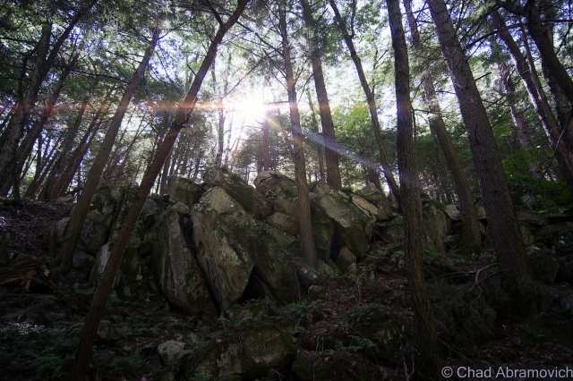
Godfrey Greylock described the diminutive gorge in 1879 as being “as though and angry Jove had here thrown down some impious wall of Heaven-defying Titans. Block lies heaped upon block; squared and bedeviled, as if by more than mortal art…”

I have to say, the stories about this place were far more waggish than it’s real life locality would suggest, which only intrigued me more. This place has spawned plenty of strange tales of the supernatural and the dreadful, and many of them are almost as old as New England is.

Someone had told me that the hollow is known for its strange sounds and echo-related properties, and claimed that if you banged on one of the rocks with a hammer, it would make a noise sounding like you were smashing the keys of a xylophone, while inexplicably, the surrounding boulders wouldn’t. However, that enticing theory was disappointingly proven false. Well, at least it didn’t work for me.

It was here that Indian priests and shaman centuries ago performed rituals, ceremonies and incantations amongst the rocks in the ravine known for its echoes. Because they revered this area to have special properties, it was said they even offered human sacrifices here to Hobomocko, the spirit of evil. There is a flat, broad square-ish rock known as “Devils’ Alter” where these cryptic sacrifices were said to be imposed. The rock today has faint traces of red stains on it, which some say is the remaining blood from the aforementioned occurrences – but the reality is the stains just come from iron in the rocks.  The unique name Wizard’s Glen was actually derived from these legends. And it makes sense – it’s aesthetically the type of place where strange happenings can’t be easily dismissed.

The best known story of the glen is of John Chamberlain, a hunter from Dalton about two hundred years ago whose whopper of a story was passed on in Godfrey Greylock’s book Taghconic: The Romance and Beauty of The Hills in 1852, when he interviewed Joseph Edward Adams, a ninety-year-old man who had heard it from the hunter eyewitness himself.

Chamberlain had killed a deer and was carrying it home on his shoulders, when he was overtaken in the hills by a storm. The tired man decided to take shelter in a cavernous recess in Wizard’s Glen. But despite his fatigue, he was unable to sleep and wound up laying awake, lying on the earth with his wide open in the dark. He was suddenly amazed when, according to him, he saw the woods bend apart, disclosing a long aisle that was mysteriously lighted and contained “hundreds of capering forms”. As his eyes grew accustomed to the new faint light, he made out tails and cloven feet on the dancing figures. One very tall form had wings, who the hunter thought to be the devil himself.

As Chamberlain lay watching the through the spiteful deluge from his cave shelter, a tall and painted Indian leaped on Devil’s Alter, fresh scalps dangling around his body and his eyes blazing with fierce require. He muttered a brief incantation and summoned the shadows around him. They came with torches that burned blue, and began to move around the rock singing some sort of harsh chant, until a sign was given, and a nude Indian girl, shrieking, and fighting, was dragged and flung viciously onto the rock.

The figures now rushed towards her brandishing sharpened weapons in their outstretched arms, and the terrified girl let out a shrill cry that the hunter said haunted him for the rest of his life. The “wizard”, (who I’m assuming is the prominent figure with the wings), raised an ax, as the rest of the group waited apprehensively for the oncoming carnalish blood bath. Lightning flashed and quickly illuminated the dark pocket of woods, and Chamberlain noticed the the girl’s face quickly fell on his. The look she gave him tore at his heartstrings. He gathered as much courage as he could, and decided to act. Grabbing his bible he traveled with, he ran towards the debauchery in self-righteous fashion, clutching it in front of him and hollering the name of his god. There was a crash of thunder. The light faded, the demons vanished and the hunter was left sopping wet in the middle of the woods in silence. When morning came, he had almost convinced himself that it was all a dream, until he realized his deer had vanished.

Though not much is really known about Chamberlain, it was apparently well documented at the time that he was “no lover of the Indian race,” which may explain more about the content or the intent of this fanciful legend than anything. In my humble opinion, this eyebrow furrowing story probably shouldn’t be taken as verbatim of a real event. Even as mythology or folklore, it lacks essentially what most of these tales are built on; meaning.

There is no good evidence that any Native American group up in our part of the country even conducted human sacrifices, but I do believe that Wizard’s Glen held some sort of ritualistic importance to the area’s original natives.

Hobbomocco is a real Algonquin deity, though, and was more so associated with darkness and the night. His name is related to all Algonquin words for death and the dead, and has no relation to the Christian idea of Satan, unless misinterpreted by, well, a Christian. In the Algonquin viewpoint, Hobbomocco is actually a side or nuance of the natural world, a potential source of dangerous visions and power, which can be obtained through communication, sort of similar to Voodoo deities, and how it’s said that with enough persuasion, you can persuade them to either carry out good or evil intentions.  I think the rather dramatic story of Wizard’s Glen may be more of a manifestation of the friction between two clashing cultures and their ideas, where everything else is sort of devalued, open for interpretation, or simply cast away.

There is also said to be a talus “cave” known cryptically as Lucky Seven Cave somewhere in the glen. However, after some time clambering around and almost rolling my ankle, I couldn’t find any opening that could shelter a human who wasn’t a small child, so either it’s long toppled, or I just didn’t have good directions. Some speak of covens, convergences and rituals still being practiced in the cave and around the site, given the various paraphernalia and shitty beer cans that you can find there. I find it interesting that this site may still be attracting modern day wizards, witches or spiritualists, or people that think they are these things, but when I visited, I had the beautiful place all to myself under the heat of the day, despite the fact that it’s a geocache location and the famous Appalachian Scenic Trail crosses Gulf Road near the glen, just east of there.

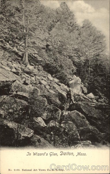
Historic post card image of Wizards Glen, via cardcow.com. Date unknown.

DSC_0862_peDSC_0877_pe DSC_0880_pe DSC_0858_pe

More Wild Places

While I’m on the topic of gulfs, I’d highly recommend checking out what may be Vermont’s most beautiful; Granville Gulf, a rugged and impressive wilderness area of moss laden cliffs, ferns and waterfalls.

If you’re curious about more of our regional wild places with extraordinary folklore attached to them, my blog entry on Glastenbury and the popularly dubbed “Bennington Triangle” may be worth a read. It’s certainly one of my favorite Vermont tales to tell.

—————————————————————————————————————————————–

To all of my fans and supporters, I am truly grateful and humbled by all of the support and donations throughout the years that have kept Obscure Vermont up and running.

As you all know I spend countless hours researching, writing, and traveling to produce and sustain this blog. Obscure Vermont is funded entirely on generous donations that you the wonderful viewers and supporters have made. Expenses range from internet fees to host the blog, to investing in research materials, to traveling expenses. Also, donations help keep me current with my photography gear, computer, and computer software so that I can deliver the best quality possible. Seriously, even the small cost equivalent to a gas station cup of coffee would help greatly!
If you value, appreciate, and enjoy reading about my adventures please consider making a donation to my new Gofundme account or Paypal. Any donation would not only be greatly appreciated and help keep this blog going, it would also keep me doing what I love. Thank you!
Donate Button with Credit Cards

Gofundme: https://www.gofundme.com/b5jp97d4

The Cold Spring House

It’s hard to describe a place like the deteriorating ruins of The Cold Spring House, especially if you’ve never had the experience of visiting it yourself.

The remaining residue of The Catskill Mountains and their heyday as a resort destination – hotels such as this one once catered to primarily Jewish clientele during the 20th century, looking for a little relaxation from the turbulence of New York City in the scenic Catskills.

Driving through the gripping, winding road through the Kaaterskill Forest, with wild rivers cutting through steep hardwood shrouded peaks that resembled worn saw teeth, it wasn’t hard to see the allure.

This is the first time I had ever been to the Catskills region before, and my target village of Tannersville made an attractive first impression, which I was incredibly relieved with after the problematic start to my day. It almost seemed like I would never make it to the Catskills, as numerous setbacks, construction projects, and traffic jams kept delaying travel time, each hour of precious daylight being swallowed by the oncoming October evening. Because we were making a 5-hour drive down from Vermont, I was determined to make this count.

Navigating the highways of New York, we passed by many derelict structures and sordid towns that were more depressing than anything, reminders of the decreasing amount of tourists in the region. It’s one thing to figure a portrait of a place from conversations with friends who grew up around there, and a few things I’ve read, but it was another type of cool entirely to gaze at what was coming through the view of the windshield.

As we approached Tannersville, the comedown daylight was filtered through a black sky foreshadowing fury that never seemed to come. The air was crisp, carrying the smell of dead leaves, as chilly mists began to settle on our faces. It felt like it was going to rain, but it never came, and the mists continued to be misleading.

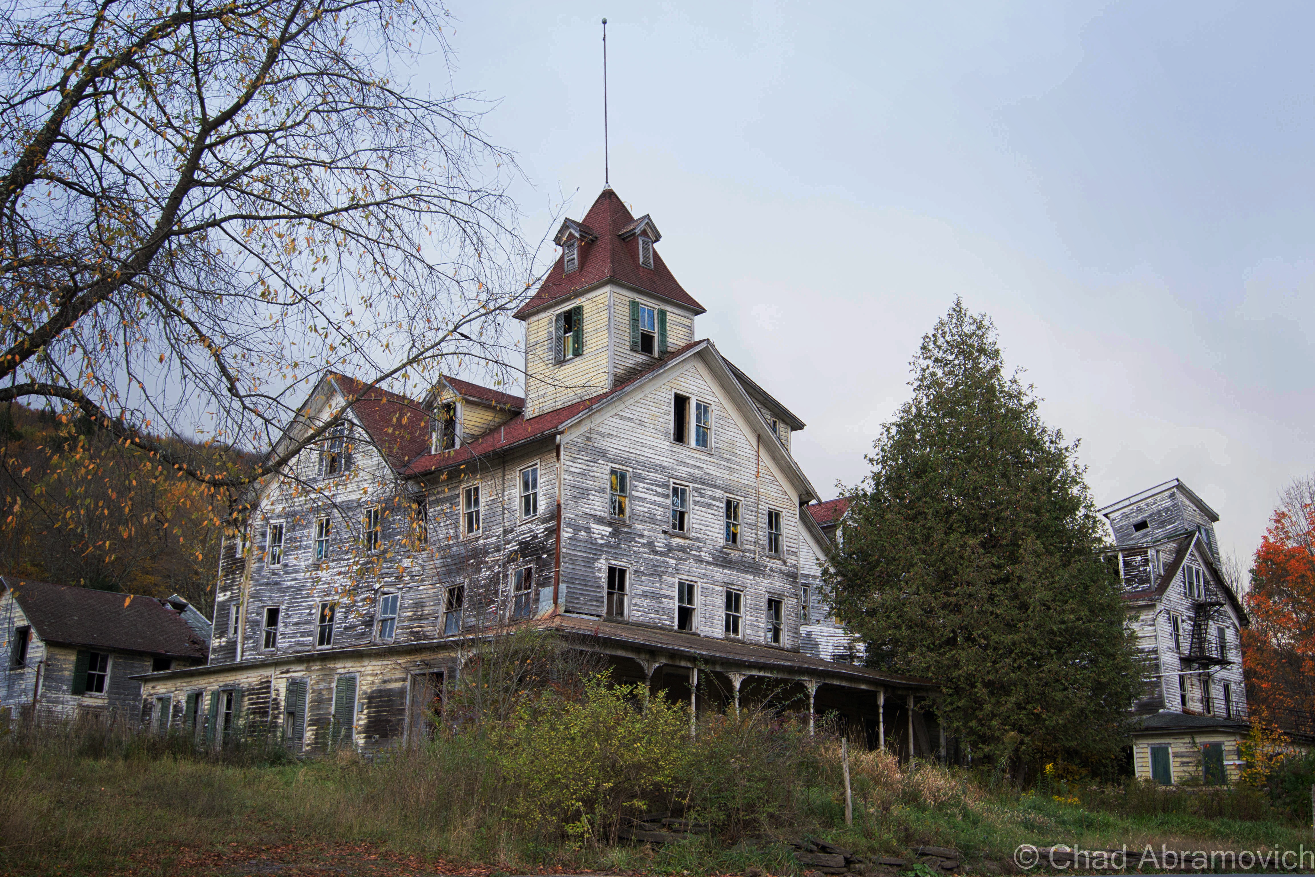
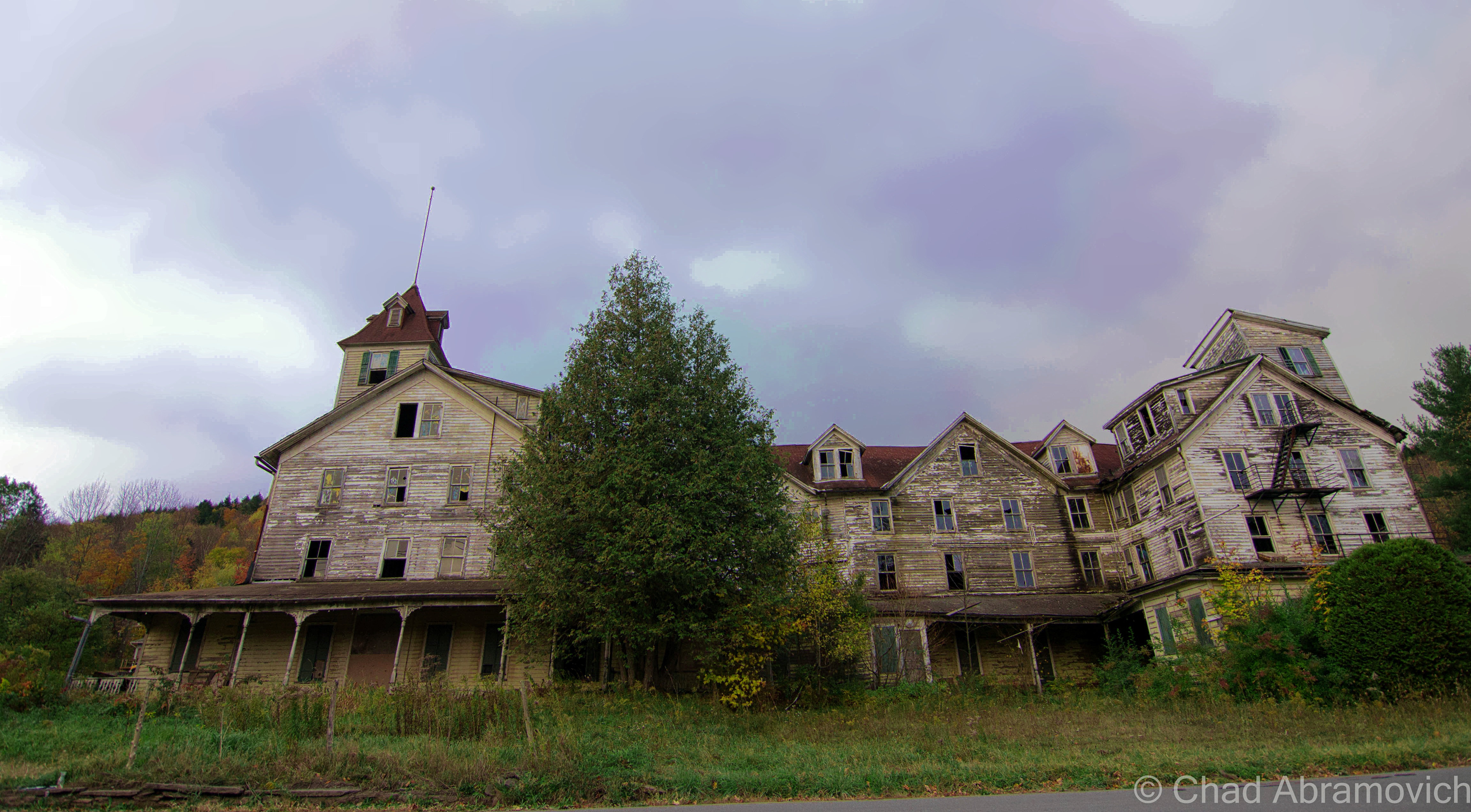
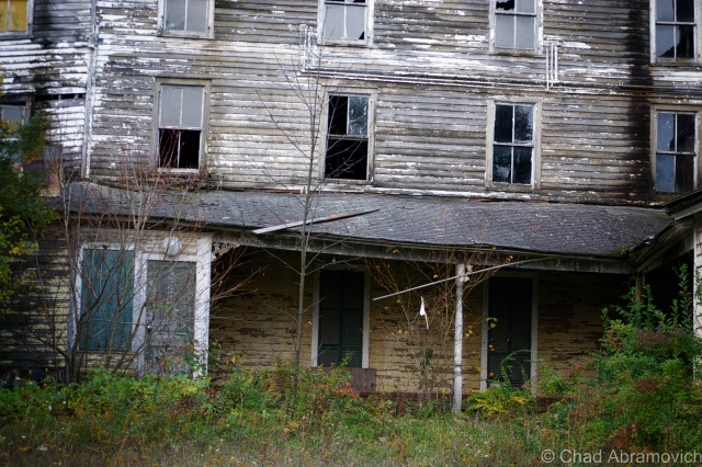
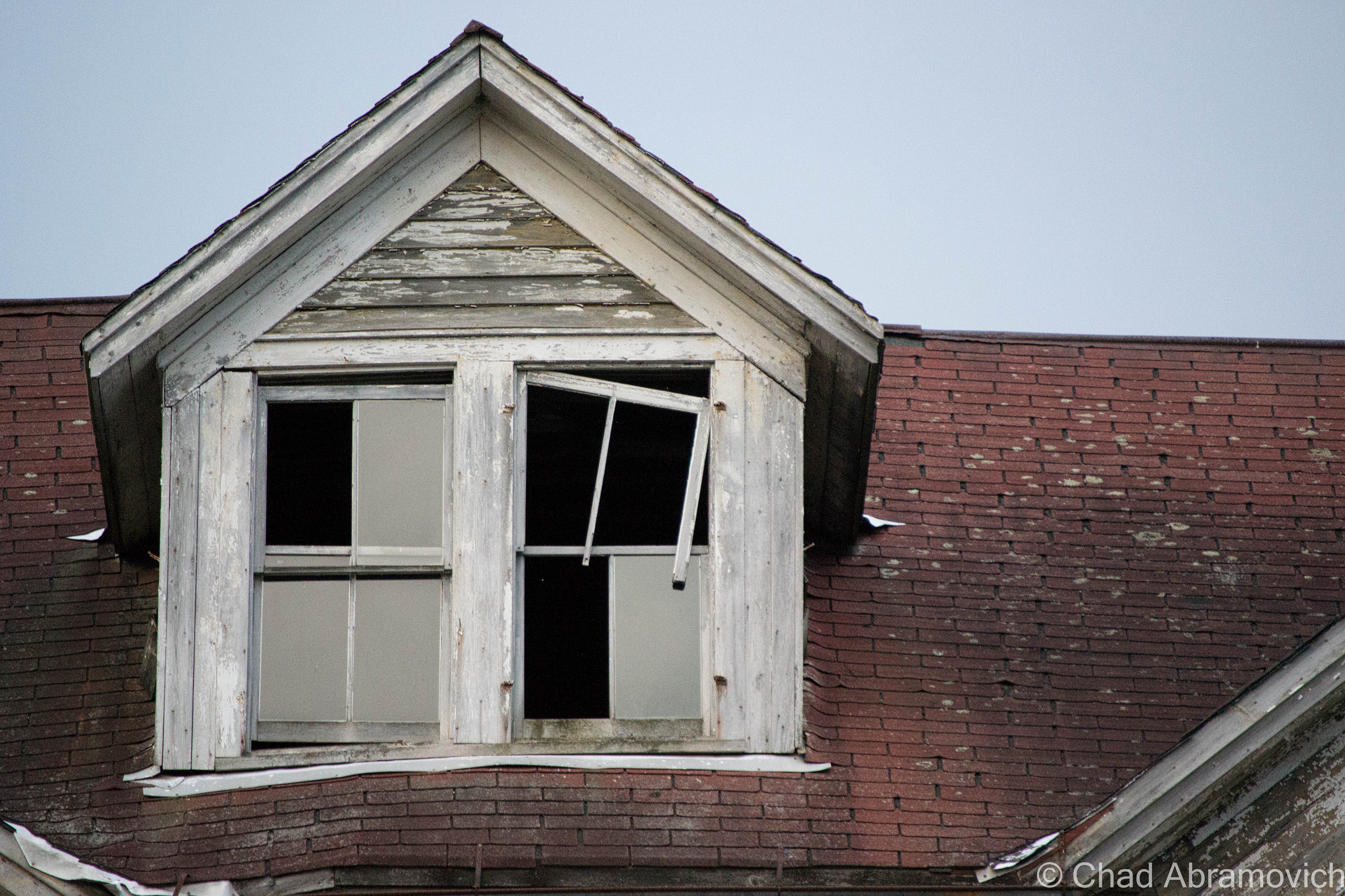
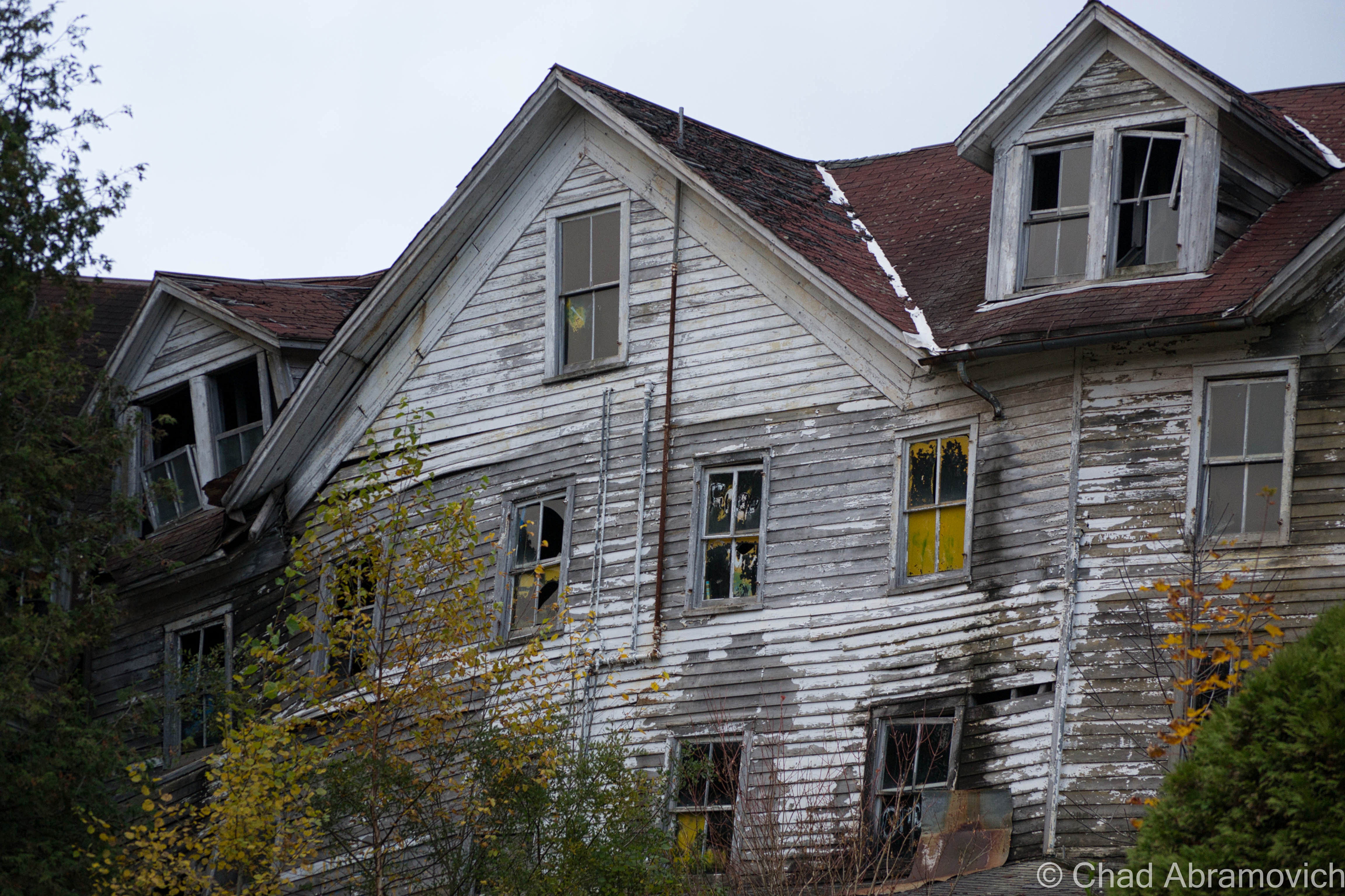
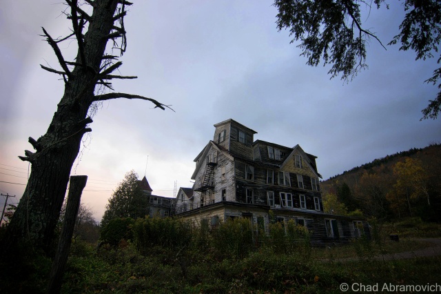
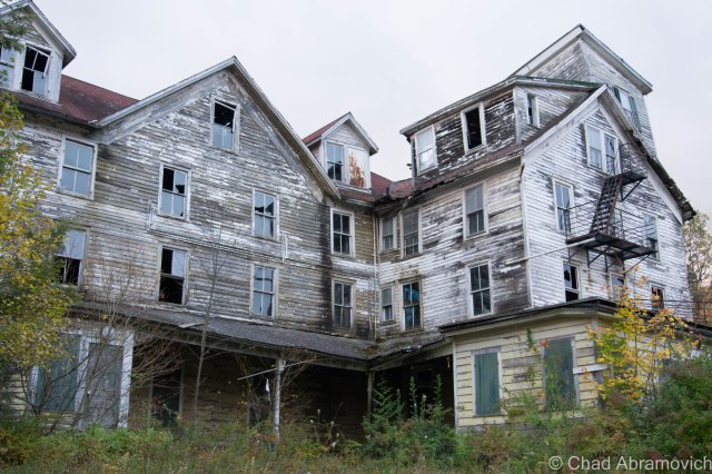
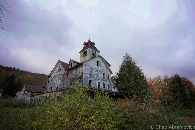
There we were, staring up at the imposing ruins of the Cold Spring House, and it’s various stages of decay.

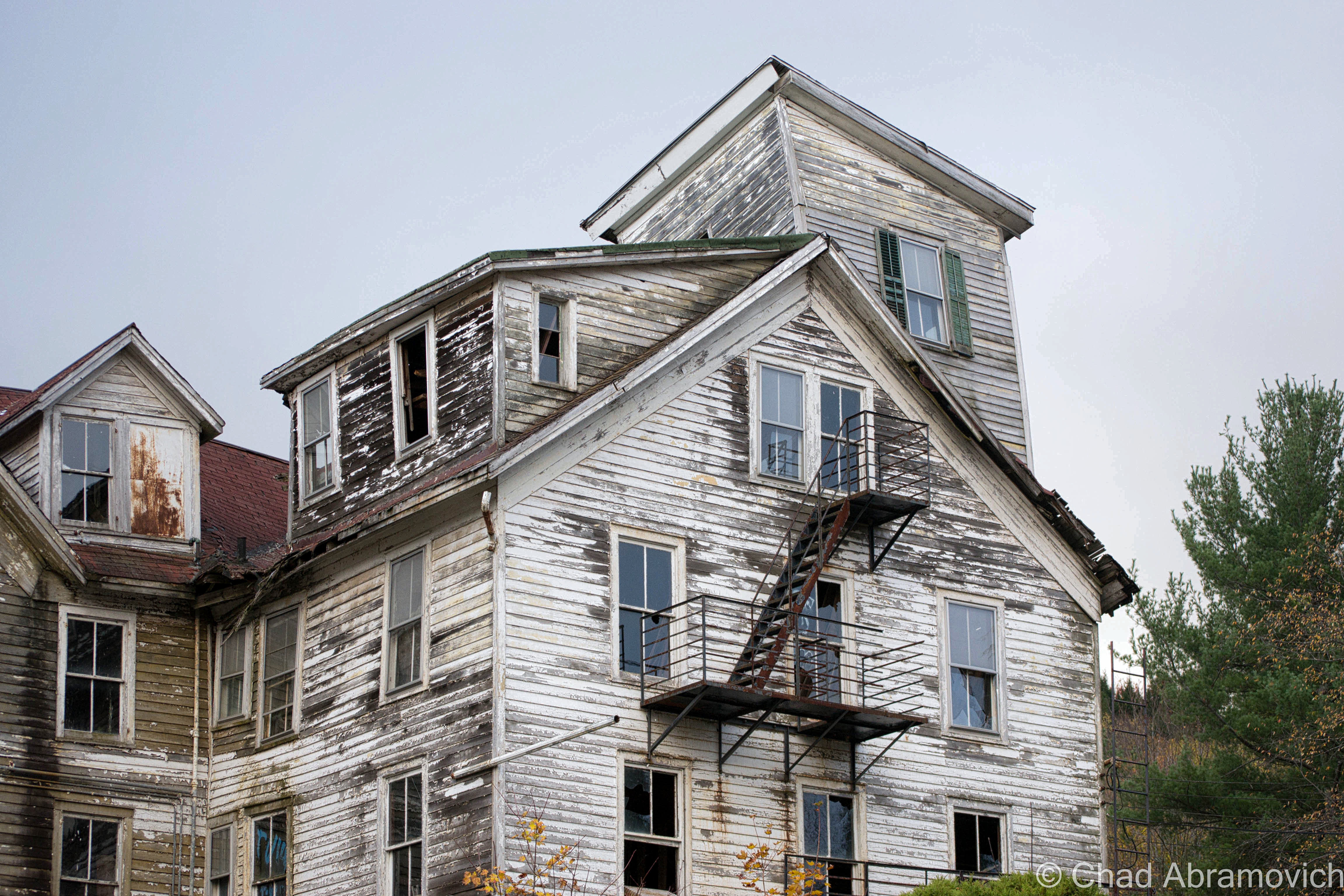
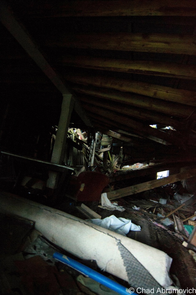
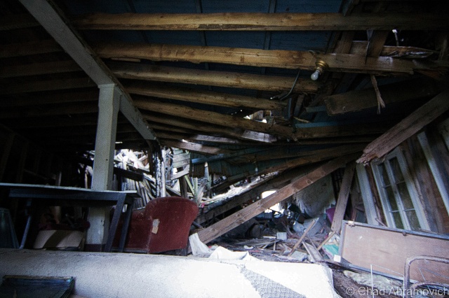
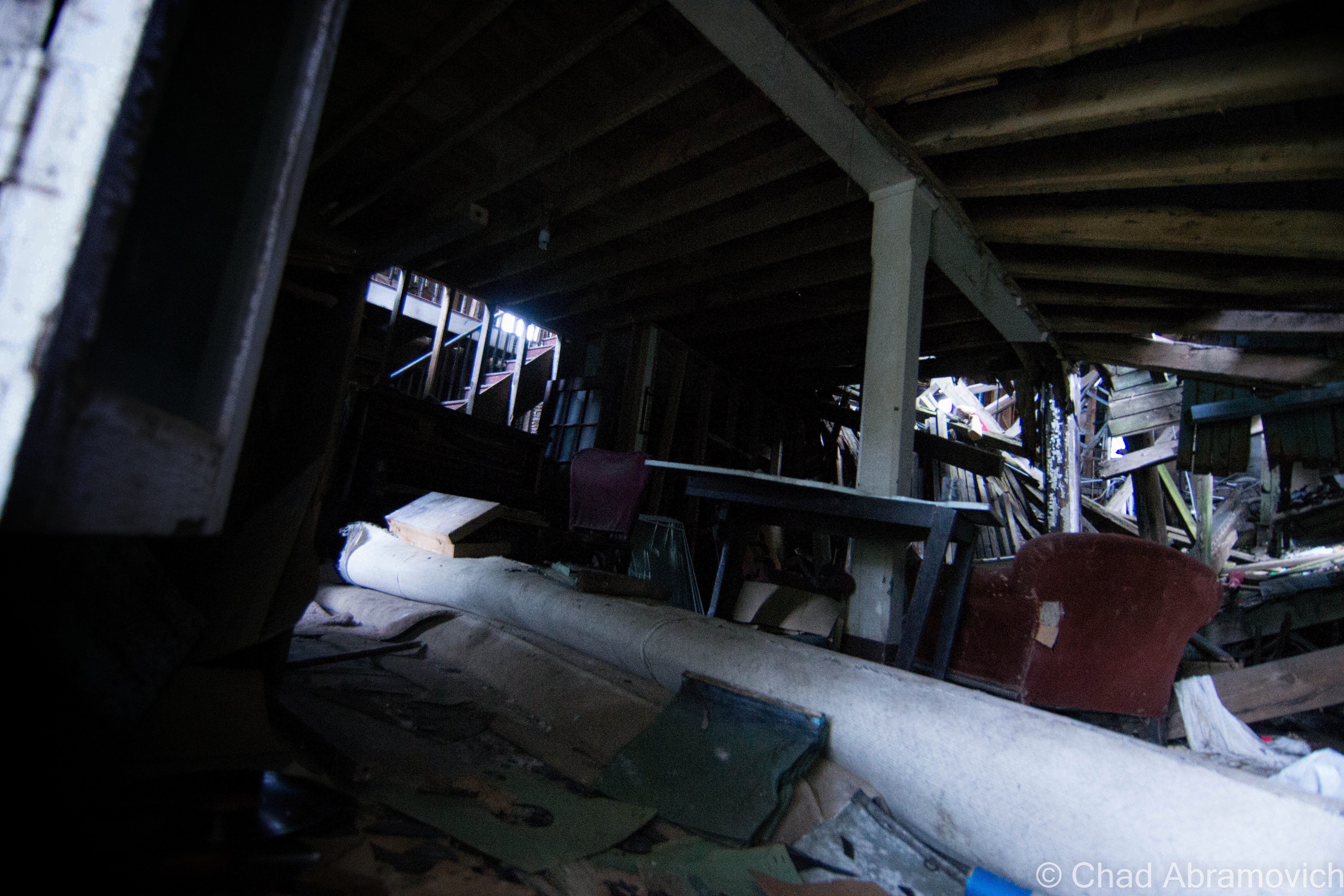
The slumping roofs and bending wooden frame ripped open several holes in the building, giving off dead weight that popped out windows and pushed various items through the glass. It was well into the evening now, but we had made it, with just enough light to photograph and do a little exploring. But the question was, where do I even start?

From what I know about the place, it was one of the earlier Catskills hotels, on the outskirts of the Borscht Belt, an area once a dazzling vacation-land now reincarnated as a collection of behemoth and storied abandonments. The Cold Spring House was a grand showpiece, which was very different from the closet cottages and revelrous resorts the area was known for at that time.

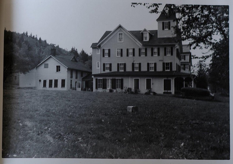
Built on what is now Spruce Street in the 1890s, it was the second largest hotel in Tannersville, as well as the first Jewish hotel in town – able to accommodate 200 guests at the base of mountains rising to around 2,200 feet. It started as a hotel called Bieber’s Cold Spring House but was sold in 1922 to Saber Khouri, and re-branded simply as The Cold Spring House.

According to a 1904 advertisement I was able to find online, the property featured expansive lawns, offering tennis and croquet grounds, surrounded by old trees offering comfortable shade on summer days. There were farms on the property that supplied the hotel with fresh milk and vegetables everyday, which were paired with what the ad boasted as excellent table service in the form of German and Hungarian cuisine. And of course, fresh spring water was offered – from the springs which the hotel derived its name from.

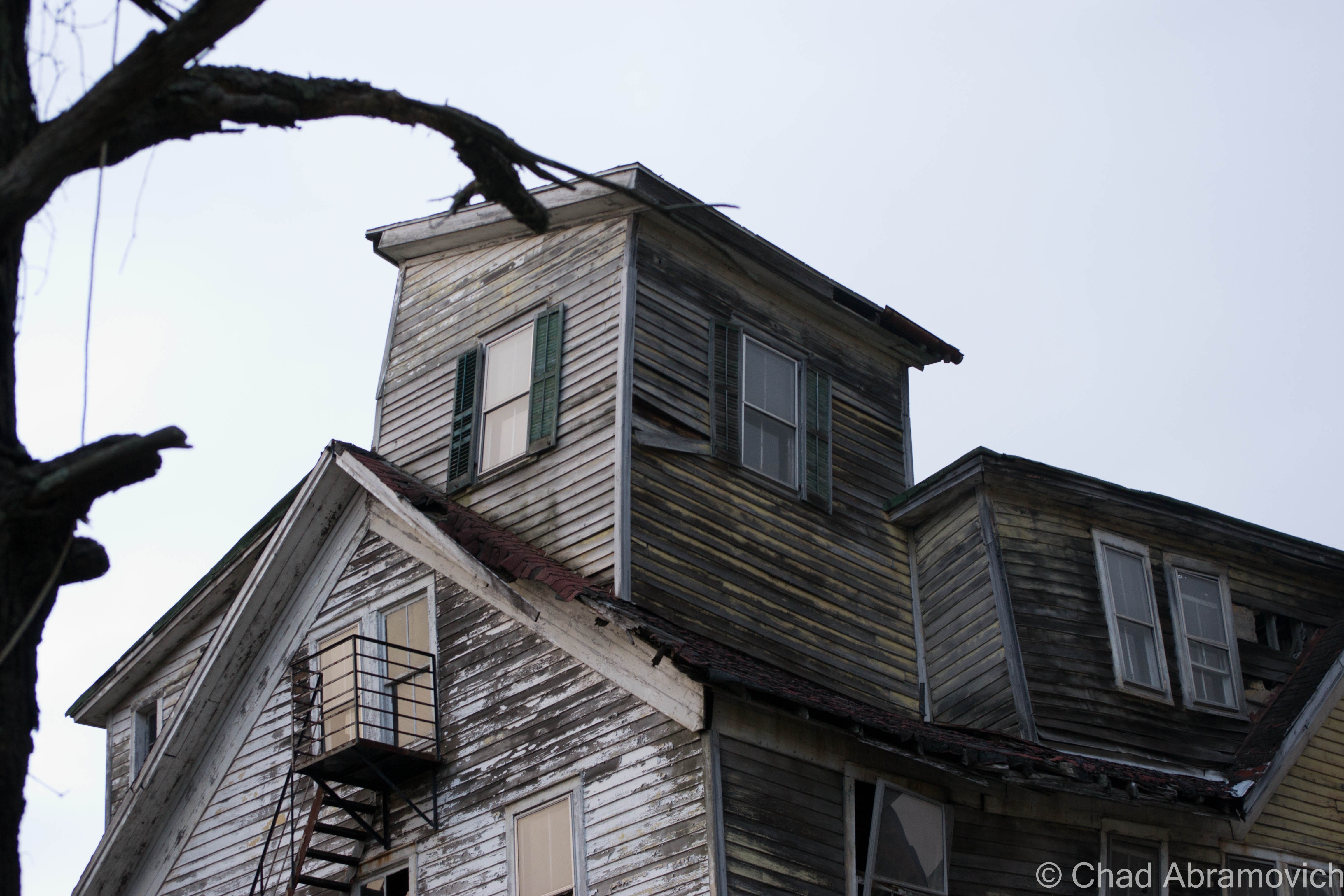
The hotel was also widely regarded for its popular classical concerts on the lawn. Two signature towers at opposite ends of the building, now slumping dangerously, were once observatories, giving guests extensive views of the mountains. Today, that view would be worth the price of your life.

What I found interesting about the advertisement was that it boasted such amenities as “sanitary plumbing and fire extinguishers on every floor” – items that we take for granted today, but around that time period, were new features and were only beginning to be enforced by laws. I’m sure that was a selling point – definitely a plus when I choose a hotel. But it makes sense. The time period was a time of transition. There was a nationwide push that required to implement such systems, but it was a costly expense to outfit these old buildings, and many old hotels couldn’t afford keeping up with the competition.

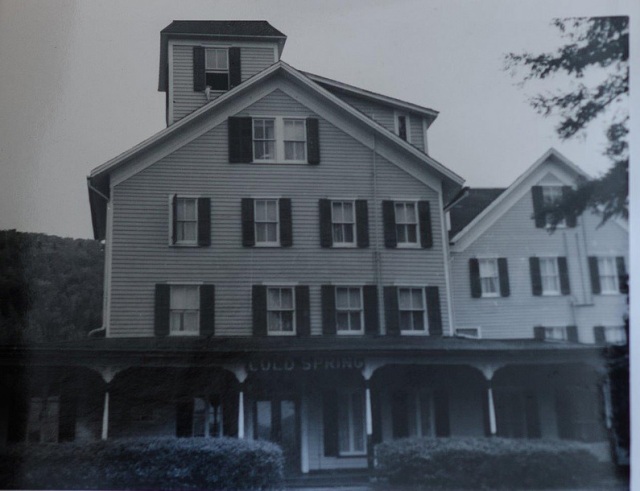
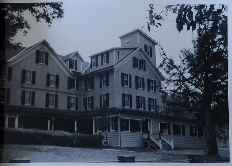
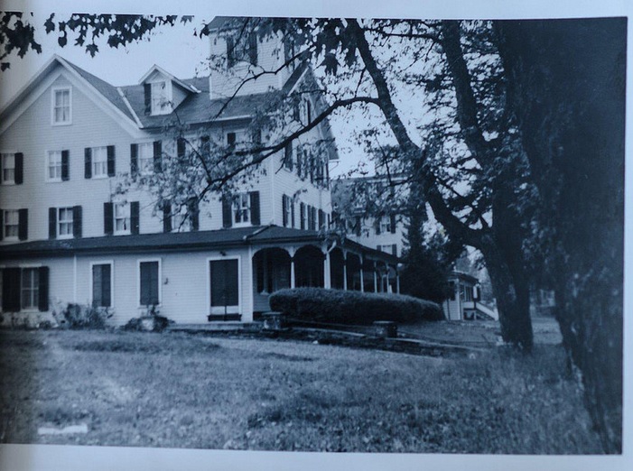
The advertisement also stated that the hotel was continuously expanding as it’s increasing popularity was luring more and more people to stay there each season. Older photos showed a much different building, with only one tower, and most of the western wing not yet added. The final product was a much larger and grander property – the brooding structure you see today.

But times certainly have changed. During the late 20th century, much of the region fell out of favor as a vacation destination. With an increase of automobile travel and an ever-burgeoning highway system, more Americans were driving, and could travel farther distances and see more places. Now, they no longer had to settle for the closest area available – a trend that I’ve seen so many times in humbled abandonments I’ve visited. Tannersville was no exception. Many vacation homes eventually were abandoned and hotels were shuttered. The Cold Spring House fell into the trend and was abandoned in the 60s, leaving quite the compelling ruin in its wake.

It literally hunches over Spruce Street in its old age, leaning in all directions. A symbol of human progress and the change of the times, something inevitable that tends to leave growing pains on the often bumpy road of advancement and the fodder of bandwagon fads. In an ironic sense, this more offbeat form of tourism can also serve as a poignant melding of public awareness, a chance to learn from our past.

Today, Tannersville is more known for it’s proximity to Hunter Mountain Ski Area than a summer destination, but while many Borscht Belt towns are still struggling, Tannersville seems to be in the middle of some sort of revival. As it was explained to me, people started to rediscover the town and were taken by its natural beauty. Old vacation homes began to be fixed up at expensive costs because of the bad shape they had deteriorated to, and more businesses have opened up on Route 23A.

As for the Cold Spring House though, I had the pleasant chance to speak with photographer Linda O’Donnell, who has been researching and documenting the building’s deterioration for the past several years. She informed me that the place has been scheduled for demolition since 2012, but demolition by neglect may happen before any actual bulldozers arrive on the property. It makes you wonder, when will the familiar become just history?

Dying Light

This was truly one of the most spectacular places I’ve had the chance to photograph (and a great change of scenery from Vermont!), but with its awe-inspiring profile came very tangible dangers. As I walked around and got to know the place better, I was able to recognize something very quickly. The building was far too dangerous to venture inside, and because of our late start, there was little daylight left. Peeking in through an opened window, I was met with an interior of collapsing floors, wooden walls intended to support the structure were crushed into an accordion-like resemblance, and various artifacts collected in indistinguishable piles of fragments covered in dust and lead paint speckles. The weight was so great in some places that many things had actually been pushed through the floor, which was already cracking on the added weight of my body. That musty old building smell wafted out from the opening, mixed with a heavy damp musk. To my far left, a staircase, illuminated by the dull light of broken windows, climbed above the wreckage and into the mysterious upper floors. Or what was left of them. Though I ached to go inside, that would have been an idea that probably would have been counterproductive to my travel plans, which were to leave intact and alive.

For a relatively rural back street, the traffic was thunderous, a constant roar of pick up trucks going by, and slowing down when they noticed me with my camera. Because New York State has very unforgiving rules against trespassing, and with me being in such a surprisingly public area where I would no doubt be trapped should I be caught, the odds were stacked against me.

I had no choice but to keep a safe distance. But the exterior alone was worth the drive. The tops of the building still wore it’s yellow paint job, the original color of the hotel, while the lower levels were weather worn into a dull grey and showed signs of various stages of rotten cavities that completely ate through the walls. Older photos showed a sign that read “Cold Spring” that hung over the porch near the front entrance, but when I visited, that was also long gone, the last clue to its identity.

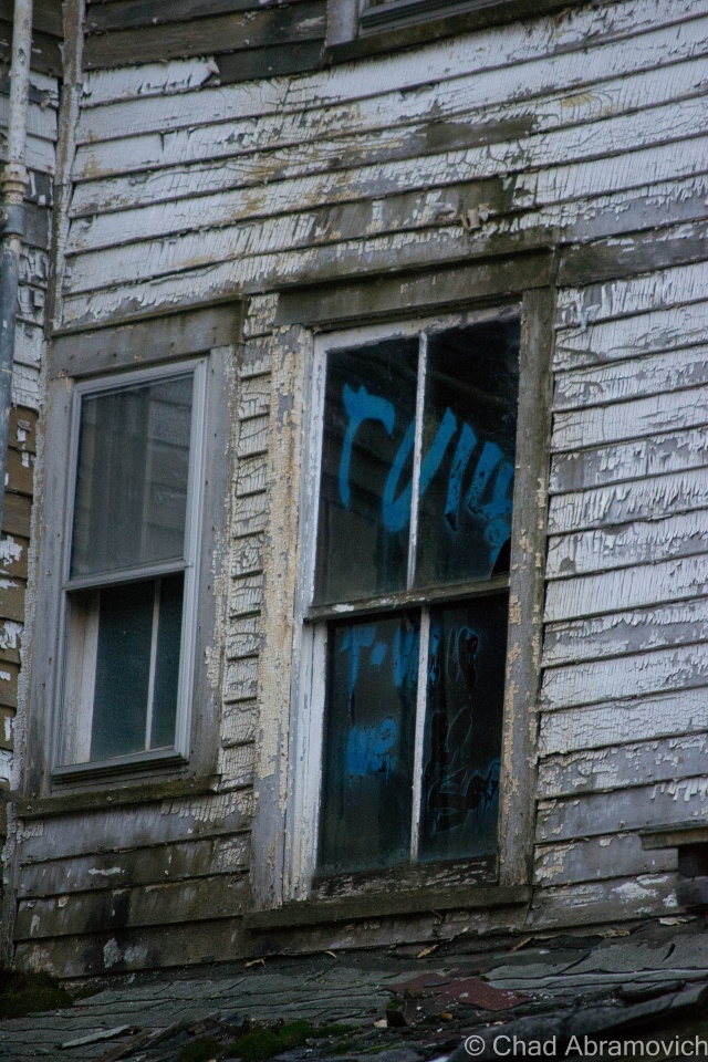
Signs of human presence were everywhere. Graffiti was found on many of the upper windows, but not the good kind of graffiti. That also meant that some adventurous intruders made the trip to the upper floors…

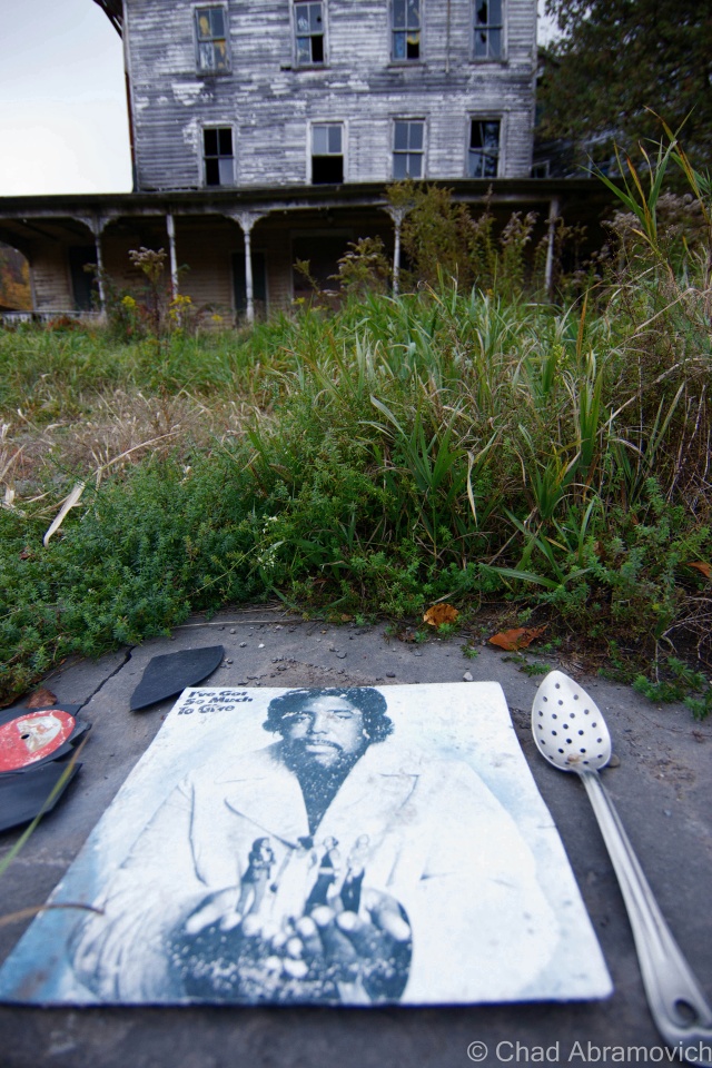
I often find strange items left behind when I explore – and this was no exception. There was an interestingly large collection of abandoned records found all around the hotel, most on the front lawn, tangled in tall grass and cedar trees. Some of them were arranged specifically, with various items such as kitchen utensils and bottles filled with suspicious colored liquids in them, propped purposely around the sides. I didn’t recognize any of the artists – but some looked like they would have been right at home in some embarrassing 70s porno.

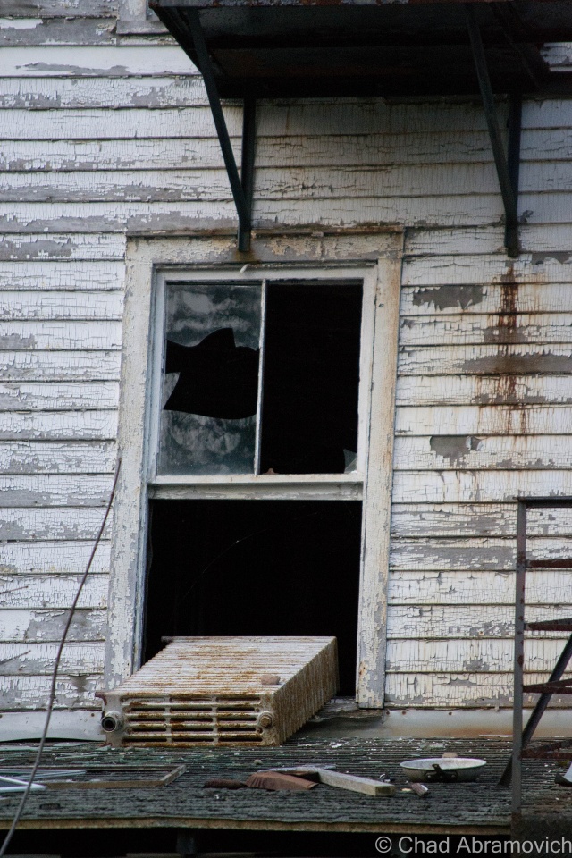
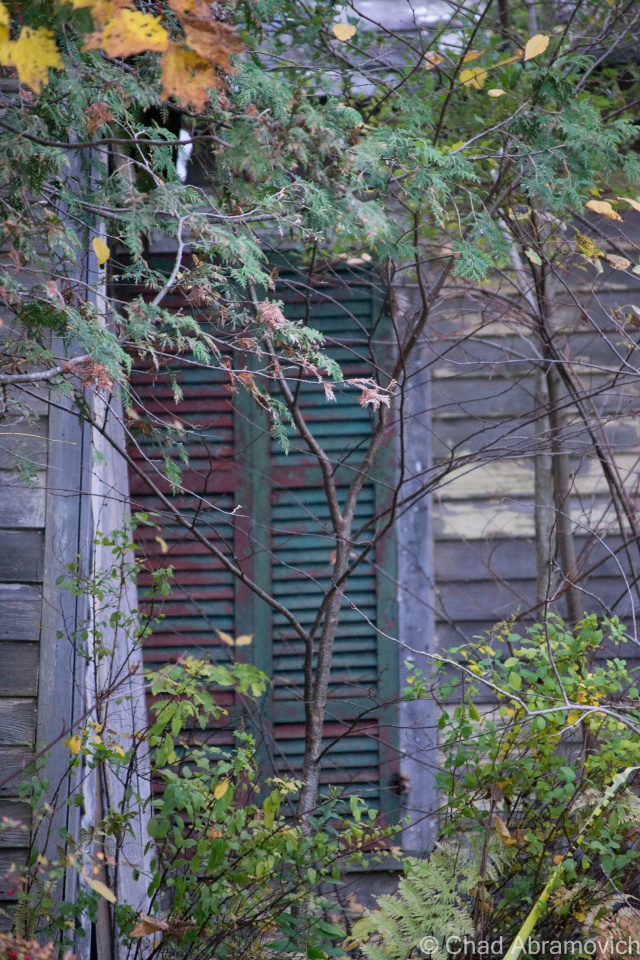
Just gazing up at the place and looking in the numerous windows offered many things to see. Radiators that had fallen out broken windows. A glimpse of a bedpost. Dark rooms with holes in the ceiling letting in the dying daylight. Old glass bottles left on windowsills. Then the wind blows, and the eerie creeks of a shutter can be heard, before it bangs loudly against a wall several stories above, you see the movement, and your pulse quickens as you jump to conclusions. Despite the reliable hum of noise outside, closer to the hotel, things faded into an uncomfortable silence that was almost loud in itself. It was quite startling considering it was just a short walk down the lawn that offered such a fast transition.

Not wanting to draw attention by staying too long, we left and began the journey back to Vermont, the Cold Spring House leaving a lasting impression.

ColdSpring
These are some great historical photos of the Cold Spring House in its heyday, which I found online accidentally and was kindly given permission to re-link by Flickr user Linda O’Donnell. Not sure of the dates, but it really gives you a sense of what this place used to be like.
ColdSpring2
Used with permission from Flickr user Linda O’Donnell
ColdSpring3
Used with permission from Flickr user Linda O’Donnell
ColdSpring4
Used with permission from Flickr user Linda O’Donnell

  The Cold Spring House Today

DSC_0861_pe DSC_0881_pe DSC_0888_pe DSC_0890_pe DSC_0893_pe DSC_0899_pe DSC_0916_pe DSC_0922_pe DSC_0924_pe DSC_0925_pe DSC_0929_pe DSC_0933_pe DSC_0935_pe DSC_0941_pe DSC_0942_pe DSC_0945_pe DSC_0946 DSC_0955_pe DSC_0961_pe DSC_0999_pe DSC_1000_pe DSC_1001_pe DSC_1002_pe DSC_1003_pe DSC_1004_peDSC_0981_pe DSC_0993_pe

Information:

There doesn’t seem to be a lot of information on this place. Most of what I was able to compile in this post came from speaking with various people, and a good article I found online from the Register-Star 

There is also a group on Flickr I found, dedicated to sharing memories and photos of it.

This is one of my favorite things I came across while researching. Here is a fascinating article and photographic journalism piece about the Borscht Belt

—————————————————————————————————————————————–

To all of my amazing fans and supporters, I am truly grateful and humbled by all of the support and donations through out the years that have kept Obscure Vermont up and running.

As you all know I spend countless hours researching, writing, and traveling to produce and sustain this blog. Obscure Vermont is funded entirely on generous donations that you the wonderful viewers and supporters have made. Expenses range from internet fees to host the blog, to investing in research materials, to traveling expenses. Also, donations help keep me current with my photography gear, computer, and computer software so that I can deliver the best quality possible.

If you value, appreciate, and enjoy reading about my adventures please consider making a donation to my new Gofundme account or Paypal. Any donation would not only be greatly appreciated and help keep this blog going, it would also keep me doing what I love. Thank you!

Gofundme: https://www.gofundme.com/b5jp97d4

Donate Button with Credit Cards

Of Mountains and Men; Legends of Bristol’s Cliffs and Hills

I gotta hand it to teenagers, they always seem to find the coolest places to hang out. The Bristol Cliffs will verify that.

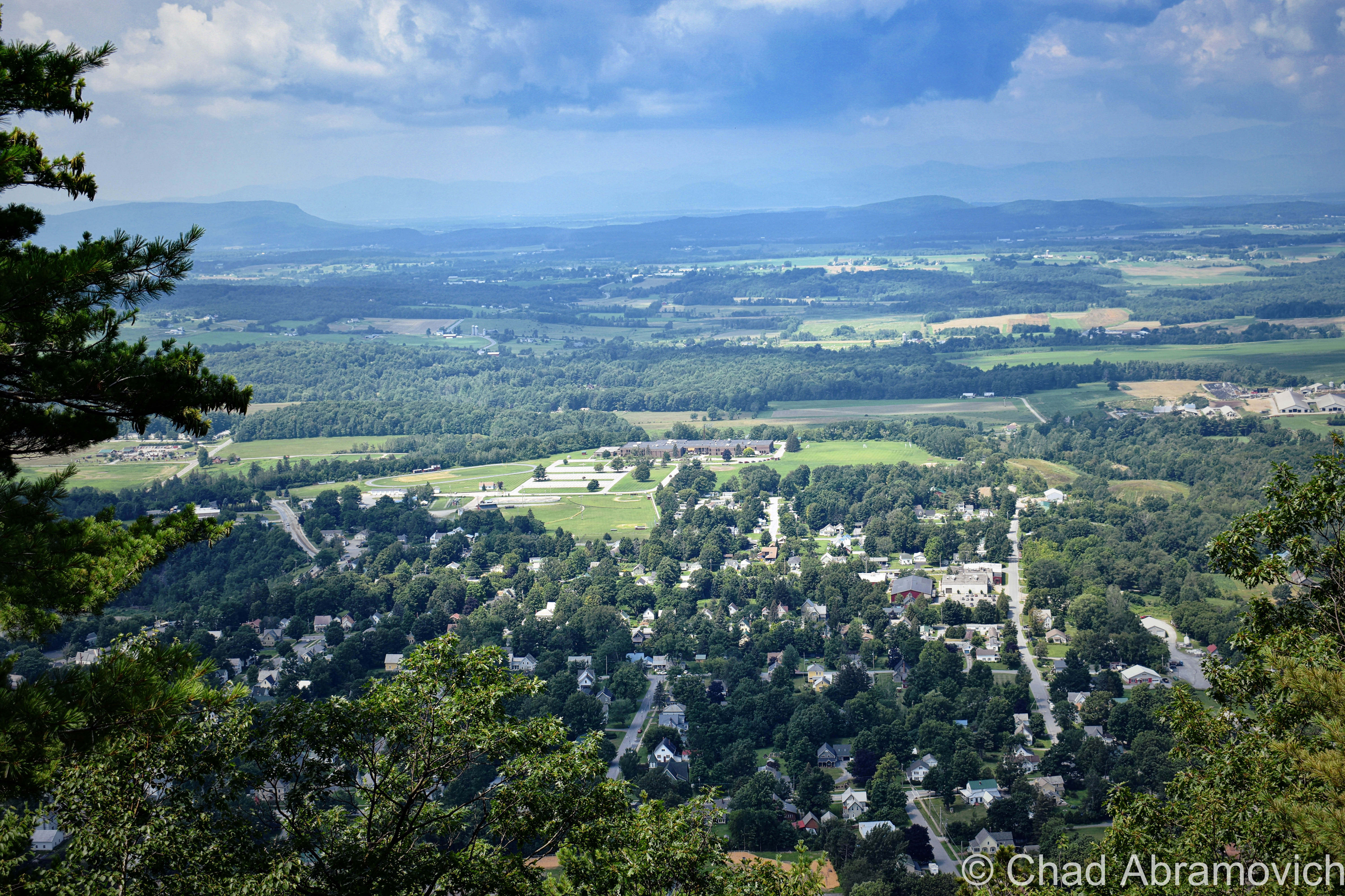
I was heading to my old roommate’s parents’ place near Lincoln to help him do a little farm work, and he was pointing out cool terrestrial hangouts he used to haunt when he was a kid. If you’re a Vermonter, chances are, you spent a lot of your youth outside, and Bristol denizens might just have one of the best towns in the state for inspiring geography. That’s also because the entire eastern charted part of the township is cliffs and mountains that are gruelingly steep, which annoyed early settlers quite a bit. Today trends have changed and now it makes for desirable real estate because people want views.

We turned up near Bristol Falls, a hugely popular swimming hole with crowds so thick in the summer that it makes a trip there not worth it at all, at least to me. But the draw is completely understandable, especially viewing the place on an off season day when you’re the only one there.

Hemming in the falls are a set of craggy cliffs that are the side of a 1,825-foot rise known by the Vermont geographical place names board as Deer Leap. Locals just call it Bristol Cliffs, because they’re cliffs, in Bristol.

It’s a win-win for Bristol-ites, because you can admire the eye magnetic precipice from almost any point in town, and also get extraordinarily cool views of Addison County from the top of the to-the-point named ledges if you know which unmarked trail will get you up there.  It seems like most area teens do.

Local lore spins a yarn about Abenaki hunting parties chasing deer to the cliff sides and running them off the edges, where more hunters waited at the bottom to collect the carcasses.

But there is another tale that may offer an explanation, and it seems like sort of an archetypal tale that many small towns across America have in their own particular cast.

In the vague timeline of the 1800s or early 1900s, 2 love struck teens decided to commit suicide here by jumping because their families forbade them from being together, for reasons that never made it into the story. The guy held the girl’s hand, and allegedly said “Ok, dear. Leap!”. But that much of a precise detail would have had to involve a witness, and to my knowledge, none have ever came forward. I think that would make it into conversation at some point.

Today, the almost grueling hike gives you terrific views of Bristol village and Addison County and a sweat soaked shirt. It’s also a Peregrine Falcon nesting area, which can dive bomb at speeds of 200 mph.

The Ledges of Deer Leap in Bristol
The trail up Bristol Cliffs. I love finding tree carved screed.
Hiked above the haze today up to Bristol Cliffs, not to be confused with the other Bristol Cliffs one mountain over. Made it up just in time to feel a change coming up and a storm rumbling in.


“The Money Diggers”

It was one of those first great spring days of the year where having fun sounded better than my adult responsibilities, and I set out towards Bristol with an adventure in mind. My only obstacle was how to get there, which was at least 80% of that aforementioned adventure.

My plan was to bushwhack up towards a remote and grueling area of the Bristol mountainscape spitefully called “Hell’s Half Acre” by silver miners over a century ago. An area with an incredibly gothic ledger of tales affixed to it.

There are no trails here. No signage or public access. Just a giant mountain as a general compass point, which was a huge part of this wild area’s appeal to me. With a photocopied town tax map in hand, I studied the property boundaries and saw my portal; a narrow sliver of land between two lots that was owned by the national forest. That would be my way up to a miserable elevation called South Mountain.

Parking the car off a no trafficked gravel backroad, I simply entered the woods and walked in the direction of the mountain. I knew as long as I was going up, I was technically going in the direction I wanted.

My feet began finding numerous pine needle covered holes in the ground that are easy to slip into while walking, and roll an ankle if you’re lucky. Others are more unfortunate I suppose, and leave with broken limbs.

Eventually, the topical Quartzite rock slide loomed before me as I trekked through the budding woods in bloom, as the sun was already baking their chalky white surfaces. Undoubtedly, this is some of the most inhospitable land in Vermont.

The rocks were still retaining some of their winter moisture and snow runoff and were surprisingly damp and cool underneath where the sun couldn’t reach. It was a surreal world up there on those slopes. I could only imagine what the miners of yesteryear had to endure here. Some of the old shafts were still visible underneath toppled boulders and through drifts of decomposing leaves and pine needles, but were far too dangerous to venture down into without more planning on my part. And alas, no silver to be found.

What’s this about silver? This formidable landscape of boulders is where Vermont’s most well-known treasure tale once conspired a few centuries ago, and is practically a ghost of an occurrence nowadays that can barely be traced with a bit of optimistic scrutiny.

DSC_0400_pe
Trekking through the woods, the land soon became strewn with boulders and loose rocks that tumbled underneath your feet as you climbed higher up the slopes.
DSC_0394_pe
Closer to the rock slides, trees have long adapted to the rough area and have grown up, around and even on top of large boulders.
DSC_0385_pe
The sun baked Quartzite surfaces of Hells’ Half Acre

DSC_0395_pe DSC_0396_pe DSC_0388_pe DSC_0390_pe

For a landlocked state, I was surprised and pleased to hear that Vermont had quite a few buried treasure stories through years of folklore research. And a rough area south of Bristol village seemed to be Vermont’s most notorious and alluring. Mostly because this one enticingly remains unclaimed under inexplicable circumstances- if it ever existed to begin with.

Could there still be a huge load of unclaimed silver up there waiting to be uncovered by a passing woods person?  Clambering my way around the dark holes entering into the bowels of Hells’ Half Acre that validated these claims, I wanted to know more about what happened here.  So I took to researching it, and it’s a terrific story, even if some of it may be nothing but fabrication. I’ll try to condense everything as best I can.

We can begin with this whole treasure hunting business with an outsider appearing in Bristol in 1800, a Spaniard named DeGrau. Because Bristol, Vermont was a small, insular town at the time, the locals took notice to a nonnative wandering into the general store to purchase mining supplies, of all things. He kept to himself, never asked for any favors, and didn’t hang around long enough to socialize.

But it wasn’t until bewildered and frightened kids began telling their parents that a strange gentleman had been threatening them in some unfamiliar tongue when they were playing up South Mountain. They had heard some strange clout and other noises and when they went to investigate, they ran into him and he chased them off. The description matched the fellow folks saw in the general store.

His violent attitude and secretive demeanor was all the reason fathers and older brothers needed to form an angry mob. They armed themselves and marched up onto the mountain with two clear choices for the man; explain his business here, or get driven out of town. Or, maybe both if he was really unlucky.

There, they heard the collision of metal against rock – the same noises that attracted their kids before –  and creating the noise was the oddly dressed Spaniard who was already out of place in the hardscrabble Bristol of the 19th century.  The mob surrounded him and gave him their ultimatum.

Seeing no other way out, he dropped his ax and exhaustively told his accusers that his name was DeGrau, and proceeded to enlighten the curious group with quite the tale.

Many years ago, his father, who was a miner, traveled the area with a group of Spanish explorers in search of precious metals and they found a rich vein of silver near the area he was digging, when Bristol was nothing more than a crude collection of cabins called Pocock.

They procured the mining equipment and a larger crew and began operations. Almost immediately, they found great success – the ore was rich and easily smelted into silver bars. They mined throughout the summer and into the fall and when they were ready to leave, they found that they couldn’t carry everything back with them – they had too much! So, they hid the remaining silver in a cave and hid the entrance. They all agreed they would come back for the rest of the silver, on the condition that they would have to be together. But, complications prevented them from coming back, until years later when DeGrau, who was now a very old man, was the only survivor of the original group.

The residents of Bristol not only believed his tale – they were fascinated by it! But there was a problem. DeGrau couldn’t find the treasure, the mountain looked different now, he didn’t remember where the cave was. It was probably covered by some rock slide that is the trademark feature of this unforgiving landmass. But, the locals who were now doing some scouting of their own,  were able to find evidence of old mining operations around the area, which validated his claim to them. Soon, he faded out of the picture, and eager Bristol residents took his place, digging around the base of the mountain, hoping to strike it rich.

Soon, he faded out of the picture, perhaps more grumpy and disheartened than he was before his last arrival in town,  and eager Bristol residents took his place, digging around the base of the mountain, hoping to strike it rich.

The rock slides and cliffs of Hells' Half Acre and South Mountain, as seen from Route 116. via Google street view.
The rock slides and cliffs of Hells’ Half Acre and South Mountain, as seen from Route 116. via Google street view.

Over time, people from beyond Bristol’s borders made their way to the mountain slopes to seek their fortunes.

Small-time operations existed in the area until around 1840, when a group of Canadians lead by a mysterious “Uncle Sim” trekked down to Bristol and began more intense mining operations. Uncle Sim was said to do no work himself, but instead, would direct and control the operations in idiosyncratic ways. He was said to be very charismatic, and incredibly persuasive, which I guess most hucksters are. He raised all his investments by promising $100 returns for every dollar raised.

Instead of doing the traditional scouting and digging, which relied on methodology and wisdom, Uncle Sim had a better idea, and hired a fortune teller, a clairvoyant Calais woman named “Sleeping Lucy” Ainsworth, Vermont’s most infamous spiritualist, to guide them and tell them where to dig mine shafts.

Stories of miners hiding behind rocks and in caves and making bear noises to scare local kids were also told. When that didn’t work, the diggers also made up terrifying folk tales about ghosts and vicious dogs that haunted the mine.

In just a half acre,  they dug numerous shafts into the rocky mountain soil, some that were said to reach 50 feet down, and then travel hundreds of feet directly under the mountain. The area was honeycombed with so many shafts that were said to be miserable, dark and cold that the area was given the nickname, Hell’s Half Acre. And the name couldn’t have been more fitting.

With months of back breaking labor yielding no results, tragedy and bad luck seemed to be the only thing the ambitious crews were discovering. Mine shafts had to be abandoned due to “foul air”, flooding issues and snow drifts. More work went into reclaiming the shafts than digging them. If that wasn’t bad enough, it was hard to haul food and supplies up into the mountains, so a lot of men were close to starving after a while.

By 1852, Uncle Sim begrudgingly gave up, packed up his crew and headed back to Canada. But he was apparently a determined or foolish man, and a decade later, he returned to the site. With the aid of a new conjurer, he was assured that all he had to do was move a few rocks, and he would discover the elusive passage which contained the treasure. But his effort was shorter lived than his first one. An old man by now, he eventually swallowed the taste of defeat and left Bristol, vanishing into obscurity.

A few other attempts at mining were made throughout the years, but no success ever came out of it, and as far as we know, there is a large treasure of silver still waiting somewhere within the foul depths of Hells’ Half Acre.

Is There Truth Here?

I’m not sure now, after researching this intriguing series of events more closely.

The problem here is that silver isn’t native to Vermont, according to the state geologist- and the idea of Spanish parties trekking down through the out of the way wilds of Vermont’s green mountains and finding veins of silver here is a little, well, unbelievable, considering they really had no reason to be here during that time frame. Unless of course, that silver was brought here and stashed for safe keeping that was all too successful? More interestingly, a few other Vermont towns have their own treasure tales, which are pretty similar to this one. But they all happen to be inspired by Silver, as opposed to Gold, which can be found in Vermont.

About the one thing I can confirm without a doubt is that the mining attempts did happen, and we have the old mine shafts and odds and ends still found underneath loads of pine needles on the forest floor to prove it.

Even the ubiquitously used term “Money Diggers” is a misnomer. They weren’t digging for money, but rather, a precious metal. At least they thought they were.

And “Uncle Sim” was real too. In a few additions of the defunct Bristol Herald, printed circa 1888-89,  newspaper writer Franklin S. Harvey recalled personal accounts of a run in with him in 1860, when Uncle Sim was at that point, a feeble old man. The sight of him digging around the rocks and cliffs looking for that silver was apparently so pitiful, that Harvey forgave him for jumping out behind rocks and making bear noises that scared him so badly when he was a kid investigating the diggings for himself. Harvey even claimed to speak with reliable Bristol old-timers who still remembered DeGrau, so we know he was real too. But the fact DeGrau dug and labored and found nothing also brings a little flimsiness to the story. Later on, Harvey’s accounts were collected into a now out of print book called The Money Diggers

The venerable Joseph Citro thinks that the story may be bunk, and brought forth some great validating research on this story.  Through Citro’s research, he uncovered an interesting thought by New England folklorist and historian Edward Rowe Snow, who speculated that the silver may have found its way into Vermont because of the plundering of a distressed ship off the coast of New London, Connecticut.

In November of 1752, the Spanish ship Spanish ship Santa Elena y Senor San Joseph was on it’s way from Hondorous to Spain. Its hold was loaded with at least 40 chests filled with silver. But on November 24th, the vessel ran into some trouble at sea and was forced to dip in towards New London where it anchored. It should have been a straightforward repair if the requests for aid weren’t met by thievery instead.  Most of that silver somehow vanished while in port, and the whereabouts are a mystery that probably will never be solved. Maybe the stolen loot somehow found its way up into the far-flung wilds of Vermont to be stashed, or maybe the party was on their way to Canada. Maybe. If that’s the case, what about the other Vermont towns and their similar treasure tales?

Another theory is that the local Indians may have put it there, but that also lacks validation.

Ghastly Tales

I guess the laws of buried treasure state that when you have one, you also have the supernatural. In Bristol’s instance, a ghost or two.

The original and more morbid of the tales is that when the mysterious Spanish prospectors were mining the base of South Mountain, they sacrificed a local boy and his dog under the moon, its light burning their blood on the stark white boulders. I guess it’s no secret that avarice brings out the worst in people and our monsters often say the most about humanity.

Anyways, this grim act was supposed to supernaturally bound the boy to protect the mine for all eternity, shambling through the shadowy woodlands around tree stumps and near caves, with a smoldering hot branding iron and a frightful gash across his throat, chasing away anyone who gets too close to the fabled mine. His dog turned hell hound is said to join him, growling and threatening to tear the throats out of anyone who ventures too close. Strangely enough, Harvey once wrote that some of those miners, who were gray-haired, aged men, actually admitted to hearing weird howls and groans at dusk.

The more modern version turns the boy and his dog into sympathetic figures. One fall afternoon, a boy and his dog went hiking in the woods around Hell’s Half Acre, exploring the abandoned mines and cavities and rotting wooden platforms. And perhaps maybe, something flickered in the back of the boy’s mind as he continued with his dog, something about a lost fortune of silver that was never found…

But as night fell, they never came home. His worried parents soon launched a search party, and plenty of neighbors and volunteers combed the woods and found nothing. After weeks of searching, they reluctantly gave up, and the cold Vermont winter rolled in. The next spring, a passing woodsman was walking through the woods, when he noticed something peculiar at the edge of a mine shaft. As he got closer, he recognized it as the skeleton of a dog. Then it clicked. If he was looking at the remains of a dog, sure enough, that vanished boy had to be nearby.

At the bottom of the 50-foot shaft, the skeleton of a little boy was found. The boy had fallen into the mine shaft and broken both his legs, unable to get out, he starved to death. His faithful dog refused to leave his side, and died at the edge of the hole. And then, supernature happened.

For years after, and maybe even today, folks up around Bristol Notch would say that when the weather was just right on certain nights, they could hear something coming through the woods. Something that may have sounded somewhat like a lonely cry for help.

Regardless if any of this is true or not, it was a great area to bushwhack up to none the less, and the landscape, which is strangely alien and dangerous, makes for a great elixir for your imagination.

Sources:

There was some great material to aid my research here; including:

The Money Diggers by Stephen Greene ( in the compilation book; Mischief in the Mountains)

Green Mountains, Dark Tales by Joseph Citro

The Money Diggers, by Franklin Harvey

—————————————————————————————————————————————–

To all of my amazing fans and supporters, I am truly grateful and humbled by all of the support and donations through out the years that have kept Obscure Vermont up and running.

As you all know I spend countless hours researching, writing, and traveling to produce and sustain this blog. Obscure Vermont is funded entirely on generous donations that you the wonderful viewers and supporters have made. Expenses range from internet fees to host the blog, to investing in research materials, to traveling expenses. Also, donations help keep me current with my photography gear, computer, and computer software so that I can deliver the best quality possible.

If you value, appreciate, and enjoy reading about my adventures please consider making a donation to my new Gofundme account or Paypal. Any donation would not only be greatly appreciated and help keep this blog going, it would also keep me doing what I love. Thank you!

Gofundme: https://www.gofundme.com/b5jp97d4

Donate Button with Credit Cards

The Hidden Cave

The awkward transitional period between the death of winter and the explosion of spring is a rough one. Looking at the cracked surface of a grey Lake Champlain, the landscape seemed warn down and tired. But there was something different. A warbling, trembling uncertainty rumbled below the atmosphere as the lake surface cracked and groaned, and the distant sounds of water tumbling down dirty cliffs meant snow melt. It meant Spring, and everything was fragile.

Walking along a cold cobblestone beach underneath sentinel cliffs, amazed at how all the trees above me were growing and surviving from their strange perches amidst crumbling stone, I let my cabin fever get the best of me, and started climbing up ledges and over trees, enjoying the “warm” afternoon.

My hands and feet slipped constantly in the muddy banks, a sure sign that mud season is right around the corner. Gripping onto the skeletons of exposed tree routes and getting filth all over my jacket, I found myself staring up at a frozen waterfall of snow runoff, and behind it, the telltale blackness of a crevice in the cliff face. I decided to get closer.

DSC_0835_pe

As I got closer, and decided it was safe enough to approach without falling down what I had just climbed up, I realized it was more than just an indent in the rocks, I was starting at the mouth of a cave.

DSC_0850_pe

Of course, when you stumble upon a cave, natural instinct is to go inside and check it out, and that’s what I did. This cave was a constant surprise. What I had assumed to be small was actually a very decent sized chamber that went far back underneath the ledges. Greeting me almost right away was a very cool site, a makeshift bench made from driftwood hauled up from the nearby beach, and a DIY fire pit, with the scatterings of ash still inside.

DSC_0843_pe

Further behind the sitting area, some artifacts had been left behind. A wicker basket was placed on a rock table, with a pair of Zebra striped glasses left inside.

DSC_0837_pe

Now the cave was getting narrow and the ceiling was getting lower, ice water was dripping down the back of my neck. For an awkward section, I had to crouch down on my knees to get back further, and just when I thought I had reached the end, the cave suddenly opened back up again and created a sort of second chamber, with a rock seating area along the back wall, and some cool stand alone ice formations on the frozen cave floor.

DSC_0841_pe

DSC_0838_pe

It was definitely a cool place, something I’d most likely build myself if I had more ready access to a cave. I wondered, who put the effort into making this cool cliff side hangout, when and why? And maybe the best question, how many people know about it? But all was a mystery. Even the few marks of cave graffiti very neatly painted on the walls offered no incite.

DSC_0847_pe

At the top of the waterfall
Looking up the ledges

The cave was an awesome discovery, and I can imagine it being the perfect place to hang out on cool summer nights. I know when I left for a walk today, I never expected to find a hidden hangout spot underneath a cliff. You never know what you’ll find if you don’t venture off the beaten path.

—————————————————————————————————————————————–

To all of my amazing fans and supporters, I am truly grateful and humbled by all of the support and donations through out the years that have kept Obscure Vermont up and running.

As you all know I spend countless hours researching, writing, and traveling to produce and sustain this blog. Obscure Vermont is funded entirely on generous donations that you the wonderful viewers and supporters have made. Expenses range from internet fees to host the blog, to investing in research materials, to traveling expenses. Also, donations help keep me current with my photography gear, computer, and computer software so that I can deliver the best quality possible.

If you value, appreciate, and enjoy reading about my adventures please consider making a donation to my new Gofundme account or Paypal. Any donation would not only be greatly appreciated and help keep this blog going, it would also keep me doing what I love. Thank you!

Gofundme: https://www.gofundme.com/b5jp97d4

Donate Button with Credit Cards

Roadhouse Blues

This abandoned house is lost in between the lines of the blur of traffic and the pensive solitude of the woods it sits in. Only a stones throw away from the nightmare that is 5 corners, this house sits alone on the threshold of suburbia, licking its wounds in dense woods that serves as its sanctuary. Time seems to have been forgotten by the modern world here, whose motorists pass it frequently 10 feet beyond its rotting doorstep.

The modest 6 room wooden structure has succumbed to its slow death, refusing to make a sound, allowing mother nature to reclaim it at her own rate.

This house tells an ambiguous story. Its age is evident, most likely preceding most of the development around it, and now a symbol of how good times come and go, and how anything can be broken. Inside are various keepsakes littering the dirty floors in knee-high mounds, most indistinguishable as the years and the weather mold everything together in soiled masses of soggy decay. Vines and trees snake their way into the kitchen and furniture sinks its way into the rotting wooden floors.

Local lore tells that a local boy made good, who today owns an area sports team and a huge local transportation company, grew up here, and the reason of the house’s disintegration is because he couldn’t bear the thought of his childhood home being torn down, and would rather have it in a state of decay than the alternative of it not standing on the increasingly busy route it’s fading on.

To some, a small farmhouse might be a boring place to explore, opting for the dreamier abandoned asylums or hotels of neighboring states. But it seems every town has a forsaken property of some caliber. And it’s here in these forgotten and neglected spaces that incubate some of life’s most poignant stories, falling on those with open ears and minds.

Only time will tell what will become of this place, as years go by and the woods grow thicker.

—————————————————————————————————————————————–

To all of my amazing fans and supporters, I am truly grateful and humbled by all of the support and donations through out the years that have kept Obscure Vermont up and running.

As you all know I spend countless hours researching, writing, and traveling to produce and sustain this blog. Obscure Vermont is funded entirely on generous donations that you the wonderful viewers and supporters have made. Expenses range from internet fees to host the blog, to investing in research materials, to traveling expenses. Also, donations help keep me current with my photography gear, computer, and computer software so that I can deliver the best quality possible.

If you value, appreciate, and enjoy reading about my adventures please consider making a donation to my new Gofundme account or Paypal. Any donation would not only be greatly appreciated and help keep this blog going, it would also keep me doing what I love. Thank you!

Gofundme: https://www.gofundme.com/b5jp97d4

Donate Button with Credit Cards

The Reading Abduction Stones

Propped inconspicuously off a no-frills stretch of state route 106 in Reading, south of the attractive little village of Felchville are a curious set of stones that are too easy to miss. If you were to take a look, you might be perplexed at the strange, enigmatic hieroglyphs found on them, with pictures of a bow an arrow, people, trees and what appear to be pick axes, what do these curious images mean? Underneath is faded scrawl, scribed in eighteenth-century English. These stones are certainly vexing. So what are they?

These are actually a monument, chiseled and erected in 1799 that mark an older occurrence, an Indian abduction.

Susanna Johnson and her family were abducted by a party of Abenaki in 1754 from Charlestown, NH, and were marched by their captors across Vermont towards Canada. But when they reached the banks of Knapp Brook, Mrs. Johnson went into labor and unceremoniously gave birth to a daughter, before being forced to continue the trek shortly after.

During their years in captivity, her son assimilated into the Abnaki culture, while her daughter was sold to a French Canadian family from Montreal. The details are vague here, but Mrs. Johnson would eventually return home.

But years later, through a series of contacts, the three family members were briefly united. However, they were unable to communicate with each other linguistically or culturally.

Mrs. Johnson had the abduction stones monument made and put in their current spot, both where she gave birth and where they still sit today, and are the oldest such monument in the country. But while the 18th century English is translatable, the weird assortment of carved pictures are pretty peculiar. Perhaps we’ll never know.

In 1918, someone encased the stones in a larger stone monument, to preserve them forever, and today they rest on the side of Route 106, barely noticed by passersby.

If you wish to find them, look for the dirt pull off on Route 106, near the junction of Knapp Brook Road in Reading. 

DSC_0376_pe DSC_0380_pe

As seen driving down Route 106. What’s in a name anyway?

—————————————————————————————————————————————–

To all of my amazing fans and supporters, I am truly grateful and humbled by all of the support and donations through out the years that have kept Obscure Vermont up and running.

As you all know I spend countless hours researching, writing, and traveling to produce and sustain this blog. Obscure Vermont is funded entirely on generous donations that you the wonderful viewers and supporters have made. Expenses range from internet fees to host the blog, to investing in research materials, to traveling expenses. Also, donations help keep me current with my photography gear, computer, and computer software so that I can deliver the best quality possible.

If you value, appreciate, and enjoy reading about my adventures please consider making a donation to my new Gofundme account or Paypal. Any donation would not only be greatly appreciated and help keep this blog going, it would also keep me doing what I love. Thank you!

Gofundme: https://www.gofundme.com/b5jp97d4

Donate Button with Credit Cards

The Indian Footprints; Woodbury Oddities In Stone

Within the deep bogs and silent forests of Woodbury, along nearly impassible back roads when the weather is just right, is another world entirely. People live up here in palpable solitude. Marshes gently bleed into immortal evergreen forests that are bounded by jagged slate cliffs. The Green Mountains are the oldest mountains in the world, and Woodbury is a good look into the haunting archaic beauty and amiable stillness of the region.

It is here off one of these jarring back roads that winds around bogs and through cliff lined gulfs that two footprints stare at you on a crumbling ledge that seems to vanish into a dark forest above you. That is, if you happen to notice them. And if you do notice the fading, waist high footprints, you might become puzzled over their seemingly random existence in the middle of nowhere.

Why are they here? Who’s footprints are they? From what I know, no one really has any definite answers, but there is a local legend that works to uncover the mystery.

As what was told to me, most people who grew up in town called them The Indian Footprints, and have been there as long as anyone can remember. On both sides of the road are tall slate cliffs, and thousands of years ago, the road used to be a riverbed, and the cliffs the walls of a hungry gorge. When the water was low, you could easily cross the river, but when it was high, it rose to the top of the cliffs.

The river acted as a boundary between two rival tribes, thousands of years ago. As the story goes, in a classic Romeo and Juliet scenario, a young man and woman from the opposing clans fell in love, but their different circles forbid them to see each other.  So they planned to elope secretly at the gorge. But when the woman jumped in the river to swim over and meet her lover, the water was higher and rougher than she could put up with, and the rushing currents swept her away. The man jumped in to save her, but upon doing so, broke his legs on the rock ledge and drowned in the process. Their bodies would later turn up in present day Nelson Pond, just down the road.

The tragedy brought the two fighting tribes together at the river’s edge. The two grieving chiefs decided to commemorate the tragic event, and carve the footprints of the brave man on the ledge where he suffered his fatal fall. This act symbolized the ending of a long running feud, in hopes that no one else would ever die again because of it.

The footprints have been there ever since, or as the story goes. Over the years though, weather and water have long worked on eroding the footprints, and in 1958, a local resident took it upon himself to hand chisel the footprints back into the rocks in fear of them getting lost forever.

But perhaps a greater mystery than the origin of these stone carvings is just how to find them. Making our way through the worn village of South Woodbury amidst ponds with ink black surfaces that reflected snow dusted forests – my friend’s car slid and spun its way up and down hill top dirt roads far from the safety of cell phone reception. Miraculously, with only the aid of 2 wheel drive, we made it to the right area, and with a lot of searching amongst indistinguishable evergreens and cliffs covered with moss and snow, somehow, their outlines stood out of the rock surface.

Regardless of the authenticity, standing on that back road in Woodbury with snow tumbling down on the ground was simply beautiful, and could easily inspire a love story such as this.

The placid waters of Nelson Pond today, where their bodies were discovered by their grieving tribes-mates.
The placid waters of Nelson Pond or Forest Lake today, where their bodies were eventually located.

Not related to the Indian Footprints, but related to the area; I really dig this aesthetically prime rural town in Central Vermont. Woodbury has more lakes than any other Vermont township, and around those waterbodies are tons of rocky glacier gouged hills etched with scenic gravel back roads.

Like Chartier Hill Road, which has a barn that was built in 1903, that was also built over the road.

Woodbury’s Medevil Tower 

What to do with a defunct quarry and lots of rocks? You could build something like this medieval looking cylindrical watchtower tower on the shores of Sabin Pond, located off a thin back road in a quarried depression. It even has gargoyles perched sentinel around the top rim with faces rictus with gloom.

Property owner Scott McCullough, who also fittingly owns a rock crushing business, decided to begin building the inconspicuous 24-foot cylindrical quasi-mythical structure in 2009, partially in an effort to clean up the eyesore patch of land which locals began to use as a garbage dump, and partially for something to do on weekends. But be warned – trespassers aren’t welcome. And there are several signs to make the point. But I’m told he’s a friendly fellow who is pretty enthusiastic about striking up a conversation about it. Just as long as he’s around and you have permission to be there.

—————————————————————————————————————————————–

To all of my amazing fans and supporters, I am truly grateful and humbled by all of the support and donations through out the years that have kept Obscure Vermont up and running.

As you all know I spend countless hours researching, writing, and traveling to produce and sustain this blog. Obscure Vermont is funded entirely on generous donations that you the wonderful viewers and supporters have made. Expenses range from internet fees to host the blog, to investing in research materials, to traveling expenses. Also, donations help keep me current with my photography gear, computer, and computer software so that I can deliver the best quality possible.

If you value, appreciate, and enjoy reading about my adventures please consider making a donation to my new Gofundme account or Paypal. Any donation would not only be greatly appreciated and help keep this blog going, it would also keep me doing what I love. Thank you!

Gofundme: https://www.gofundme.com/b5jp97d4

Donate Button with Credit Cards

Vermont’s Mysterious Stone Chambers

New England is an old region. But we keep finding unexplainable oddities in our woods that make us wonder just how old. (As a matter of fact, New England just might be a misnomer…) The great north woods that stretch across the northeast successfully hold many unsolved mysteries and intriguing curios. Seriously. Though parts of New England have become characteristically developed over the last century, the varying topography here and it’s fluctuating inaccessibility makes it hard to have a complete idea of exactly what is out there still. For example, a plane that slammed into Jay Peak in 1943 was just found in September of 2016.

Many of our curiosities have been made possible thanks to something ubiquitous to the northeast; rocks. There is “America’s Stonehenge” in Salem, New Hampshire, a strange site featuring exoticisms of stone construction whose builders and purposes are pretty obscure. There is the mysterious Gungywamp in Connecticut that has rock placements that may date back to 2000 BC, the vulnerable Upton Chamber in Massachusetts, and tons of stone tunnels, chambers and monoliths found all over this weird part of America. Many have yet to be discovered, and some are vanishing into the past tense.

Vermont adds to that list of eccentric finds with mysterious stone chambers scattered in the deep forests and rocky highlands around the state.

These strange beehive structures have incredible craftsmanship, using several ton stones put together with dexterity and without the use of machinery or mortar. The question is, wtf are they? Who built them, and why?

Most of these structures are igloo-shaped, burrowing into a hillside with a door like opening. Inside, the walls are made from perfectly placed stones and the ceilings encompass giant stone slabs weighing several tons. Some have enigmatic inscriptions etched into the stones that have baffled people since they have been discovered. Any information seems to have long ago vanished in some sort of cultural hiccup, ensuring the answers were never handed down, leaving this as one of Vermont’s greatest lingering mysteries.

But there are theories, and depending on who you ask, are the subject of much debate. An accepted theory by the powers that be of state historical research is that these stone igloos are nothing more than colonial root cellars, as old as 200 years. A Google search on them showed me several similar structures all tagged under the same label. But from what I was seeing, these constructions involved more modern planning or construction, often with brick or mortar and more defined delineation. Many of the alleged ancient chambers, weren’t, and were more naturally but impressively put together. Some of these stones weigh several tons, and would have most likely had to be dug up and transported to the building sites. Why all that labor for a root cellar?

More mystique has affixed itself to the masonry of these chambers, sort of debunking the root cellar notion the historical society stubbornly upholds. The Native Americans knew of these chambers as well, denied building them, and seemed to be just as puzzled. So it could be possible that these stone chambers were here long before the first land grabbing Europeans set foot in the hills of Vermont. And apparently, one of them has been carbon dated before, and the results concluded that these may have existed more than 2,000 years ago.  So what are they, and who built them?

Another explanation that is gaining popularity is that these mounds are a product right out of Atlantic coast area Europe, and were built by ancient Celts or Vikings, who during seafaring explorations, landed over here in northeastern North America.

While here, they discovered copper deposits, which Vermont is loaded with. Could these mounds be the product of ancient copper miners? And if so, that would further support that Celts or Vikings were here far before Columbus set foot in the western hemisphere. But that still leaves out a revealing detail; what were these stone chambers used for? Some speculate they were tombs, a place to leave the dead to be returned to Mother Earth.

Many of these constructions have some sort of astronomical significance and have been savvily placed to align almost precisely with the vernal equinox or winter solstice.

They’re also pretty similar to traditional Celtic dwellings in Ireland or the British Isles, minus the thatched roof and instead, New England-ized. Some were found to even have chimneys, or, openings in the stone roofs. Could they have been Celtic explorers attempts at homesteading here?

Other chambers offer ways that the past can speak to us in the modern world, but their messages are often hard to decipher, raising more unanswerable questions and scrutiny than not. Ogham/Ogam, a dead ancient Irish language, has been found etched in the very stones that these chambers were constructed from. One inscription was translated as; “Precincts of the gods of the land beyond the sunset”. Could this be Vermont’s original name?

We’ve already debunked the conventional unwisdom of Columbus and later the Pilgrims being the first to set foot around these parts, and are continuously finding evidence of Viking settlements, so why not add the Celts to our visitor roster?

In Vermont alone, there are a reported 200 of these stone structures scattered around the state, with possibly more that have yet to be discovered, and others which have already shook hands with their mortality.

I was on some message boards doing some research on ancient Vermont stuff, and one commenter from Windsor County had written that there was a stone chamber on his property, but some rowdy kids trespassed and pulled a stone out of the wall that they thought had Ogham on it, and later, the whole structure collapsed. I can see why some people aren’t into the idea of these oddities being ancient, because of the disrespectful visitors they can draw. As an oddity-hunter and explorer myself, this is why I almost never give out the locations I visit, because sadly, you can’t trust people not to ruin things. But the biggest cause of death for these sites is actually by construction projects. Often, they have been purposely razed to make way for cheap cookie-cutter housing developments or a farmer wanting to expand their hayfield.

But despite all this, their existence remains largely unknown to most Vermonters, and more shockingly, it seems not many are interested in studying them, creating roadblocks to discovering exactly what they are. And any assumptions a curious adventurer may come up within the throes of wanderlust are meant with the silence of the forests, and the chilly winters coming down your neck. But despite the chills, the fires of my imagination were inspiring me that day when I headed down towards Southern Vermont to see if I could find some answers for myself.

It was those winter chills and the harsh glow of the dying November sun that slipped under my skin as I stepped out of the car. My feet crunched across field grasses and around muddy stream beds as I made my way up the hill. I knew the location of one of these mysterious stone chambers, and I was on a mission to find it. But it seems while I was seeking one mystery, I stumbled into another one. Just where the heck was it? I had vague directions, but underneath the brown leaves that coated the forest floor, everything was indistinguishable. There was no large mound and no doorway. The sun was beginning to sink behind the looming shadow of Killington Peak, and it was getting colder. After awkwardly combing the woods for 20 minutes, I decided to head back to the car, feeling my stomach sink a little.

Not wanting to admit defeat, I decided to utilize a great Vermont resource; the town clerk’s office. And I seemed to be in luck, as my question raised enthusiastic responses from the people inside, as they crowded around the front desk. As one person created a hand-drawn map for me, another was passionately giving me directions in a fashion that can only be described as Vermonty.  “Head up the road a ways until you get to the old McIntosh Farm, not sure who owns it now…anyways, you’ll notice a field is on your right-hand side after you pass where the schoolhouse used to be, but if you hit the old snowmobile trail, you’ve gone too far and have to turn around…”

Heading back up into the hills with my new directions, I was going to give it another shot. And as it turns out, I was almost right on top of it to begin with. This time, I noticed it, barely. A small hole in a rolling mound of earth just at the edge of a field. As I walked over, it became clear what had happened. The “hole” was actually the entryway I was looking for, filled in with years of erosion and leaves that had fallen in front of it. A few kicks with my foot widened the claustrophobic entrance, but not by much. It was just enough for me to crawl into. But I was hesitant. Were there animals inside? And just how stable was this place? But perhaps what was unnerving me the most, was the weird feeling it was giving me.

As I watched the clouds overwhelm the evening sun, It was strangely bittersweet. I was happy I had managed to find it. It seems like in a few years, this dome is in danger of becoming buried by mother nature, another thing long lost. It seemed so simplistic, a simple stone igloo structure, and yet, the work that went into making it was incredibly labor-intensive. I felt like I had a brief connection with something that was much bigger than me, and yet, it seemed vacant, like a tomb – nothing breathed there in the cold.

DSC_0176_pe DSC_0178_pe DSC_0180_pe

You can see just how small the opening was next to my cold and intrigued self.

In 2016, I tracked down another chamber with a good compadre, and made a 2-hour drive to do a little investigating. Ancient Vermont enthusiasts know this particular chamber pretty well, and as we found out, so do other people. The earth floor was uncommonly flat with a chimney-like opening towards the back surrounded by notable stone slabs that made up the ceiling with hefty masses, that were aligned together and supported almost precisely. I read that some explorers and archeologists had found subterranean chambers, or spaces underneath some of these chambers, their entrances hidden by stone slabs on the floor. There was a debris pile in the back below the chimney that I started to pluck a few stones from, just to see if this was one of those chambers. It wasn’t.

Many of the stones were carved up with prior visitors in modern-day English, but we did find a few obscure linear patterns and scribings that, may have been done by a previous tourist, but seems a little weird in terms of what is normally graffitied in these sort of locations. We were able to pull up Wikipedia on my friend’s phone and tried to dabble in cryptography for a bit, seeing if any of these hieroglyphs were anything close to Ogam, but there were no confident matches I could make.

dsc_0441_pedsc_0434_pe dsc_0414_pe dsc_0416_pe dsc_0417_pe dsc_0421_pe dsc_0432_pedsc_0424_pedsc_0426_pedsc_0430_pe

The same chamber, but on a soft July evening.

Here’s another chamber down on Putney Mountain, which is crossed by some rough dirt roads that ramble along more stone walls per capita than anywhere else I’ve ever seen. It was pretty remarkable.

The chamber was hard to spot. It looked more like a primitive drainage culvert, but my intel said it was on a certain road, and after that road turned into a 4-wheeler trail and I saw nothing else that resembled what I was looking for, I figured I’d make my way up into the woods and peer inside the small opening.

I’m glad I did, though deceiving, it really opened up inside. It was what I was looking for!

My guest on it being a culvert was a bit well founded, though. It seemed the entrance had a scanty drainage channel that flowed down towards the road, which made sense because the inside of the chamber sure was swampy. This stone room was also facing east, like so many other ones in New England.

There’s another one somewhere nearby called “The Pig Pen”, because farmers were just as vexed by its presence back in the day, and used it as a place to corral their pigs and cattle. That one would require GPS coordinates and a good bushwhack, though, so I’ll have to attempt that adventure on a warmer, more prepared day.


There are plenty of different theories and research compilations done about these stone chambers. Here are a few good ones if you’re interested in further research:

Vermont’s Stone Chambers: An inquiry into their past 

Vermont History: Stone Chambers

Lost History: The story of New England’s Stone Chambers

—————————————————————————————————————————————–

To all of my amazing fans and supporters, I am truly grateful and humbled by all of the support and donations through out the years that have kept Obscure Vermont up and running.

As you all know I spend countless hours researching, writing, and traveling to produce and sustain this blog. Obscure Vermont is funded entirely on generous donations that you the wonderful viewers and supporters have made. Expenses range from internet fees to host the blog, to investing in research materials, to traveling expenses. Also, donations help keep me current with my photography gear, computer, and computer software so that I can deliver the best quality possible.

If you value, appreciate, and enjoy reading about my adventures please consider making a donation to my new Gofundme account or Paypal. Any donation would not only be greatly appreciated and help keep this blog going, it would also keep me doing what I love. Thank you!

Gofundme: https://www.gofundme.com/b5jp97d4

Donate Button with Credit Cards