Fort Blunder

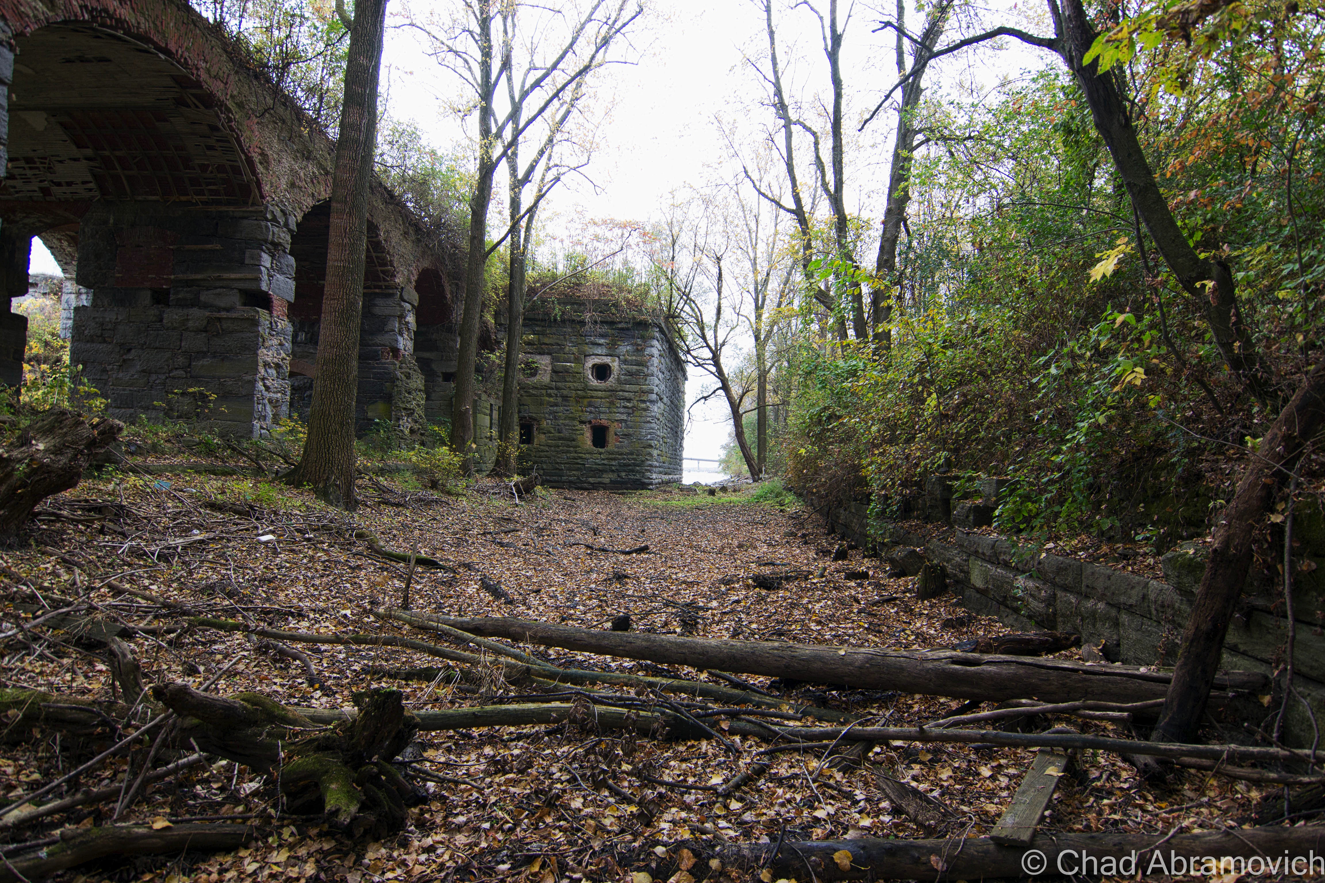
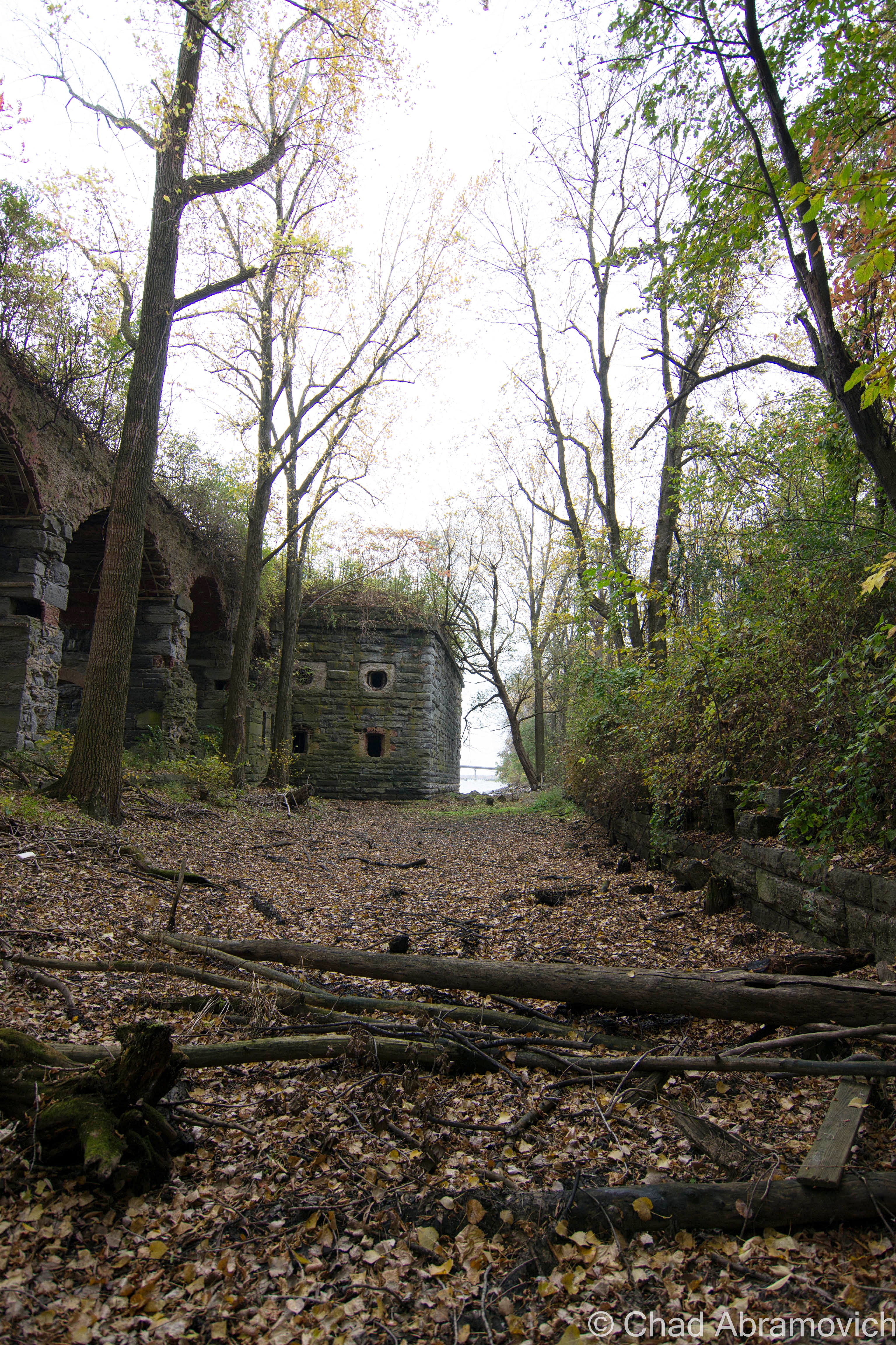
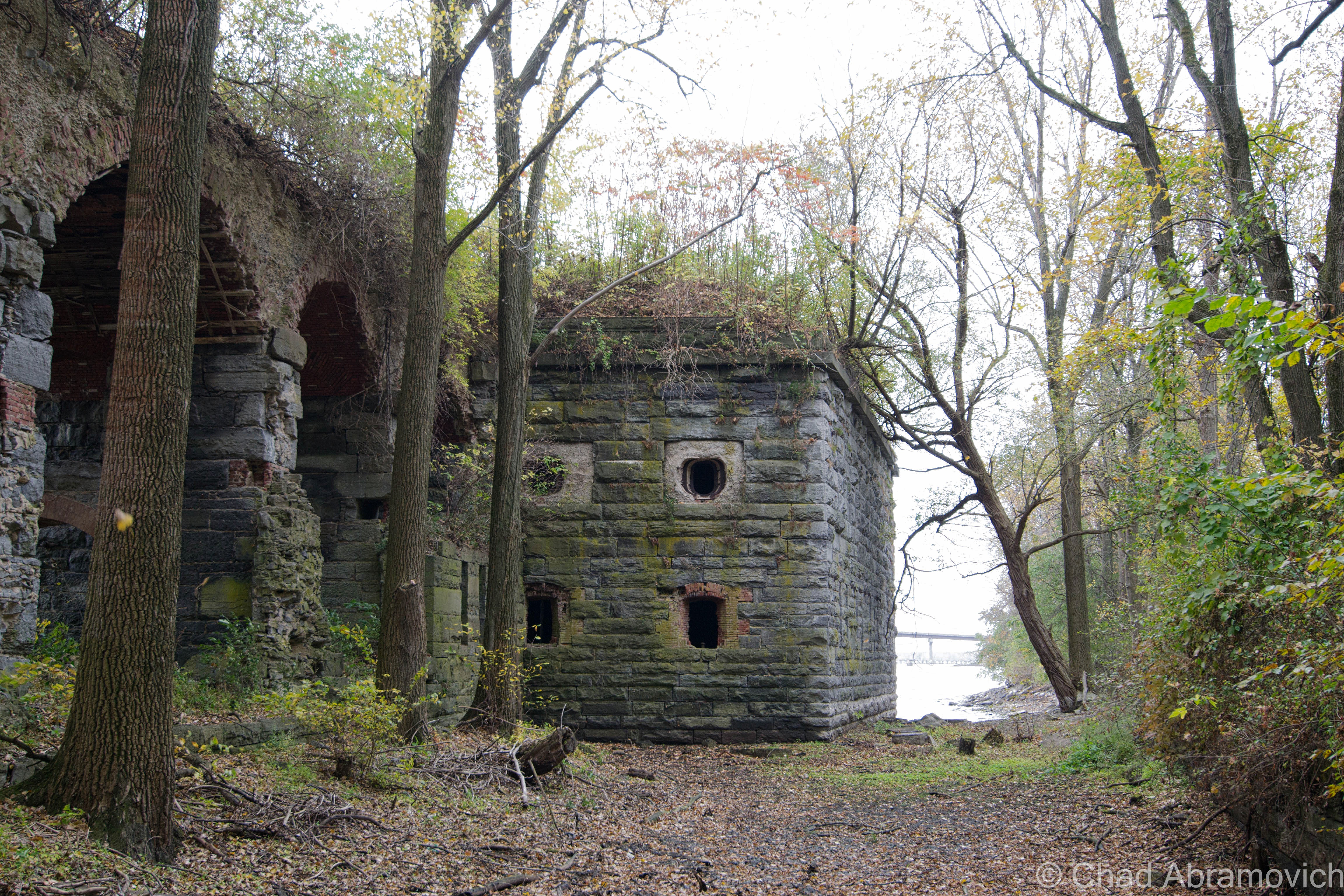
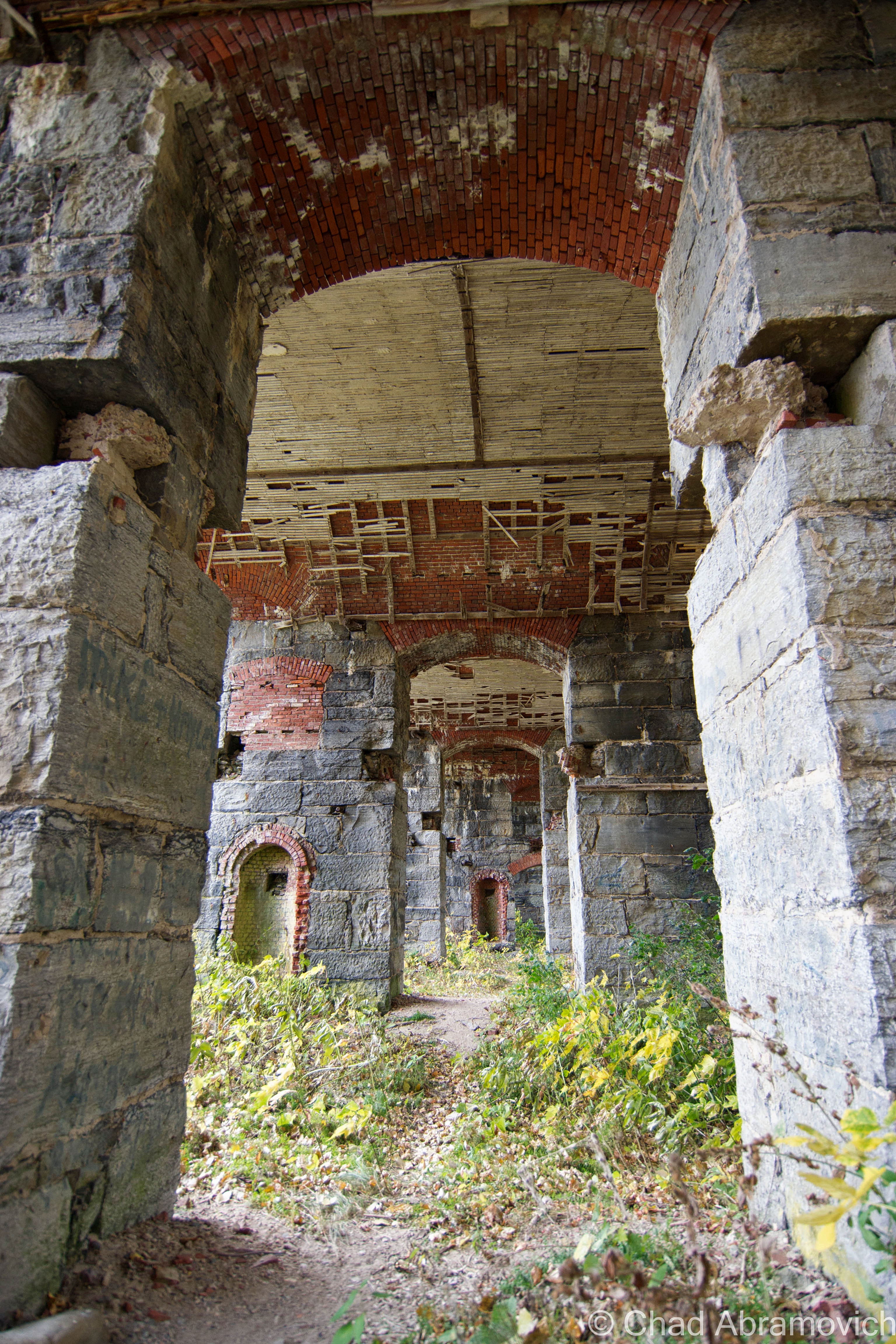
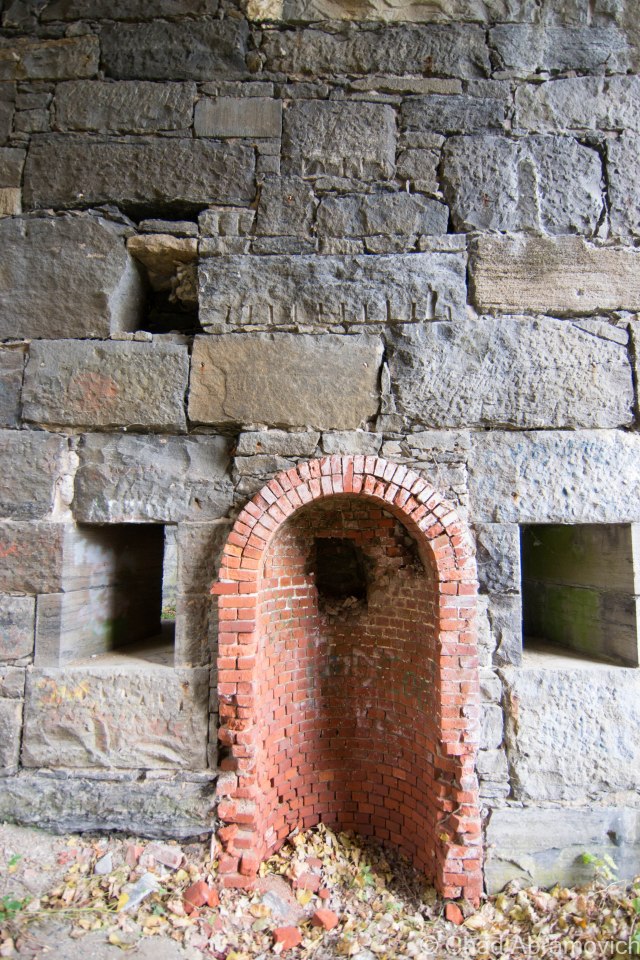
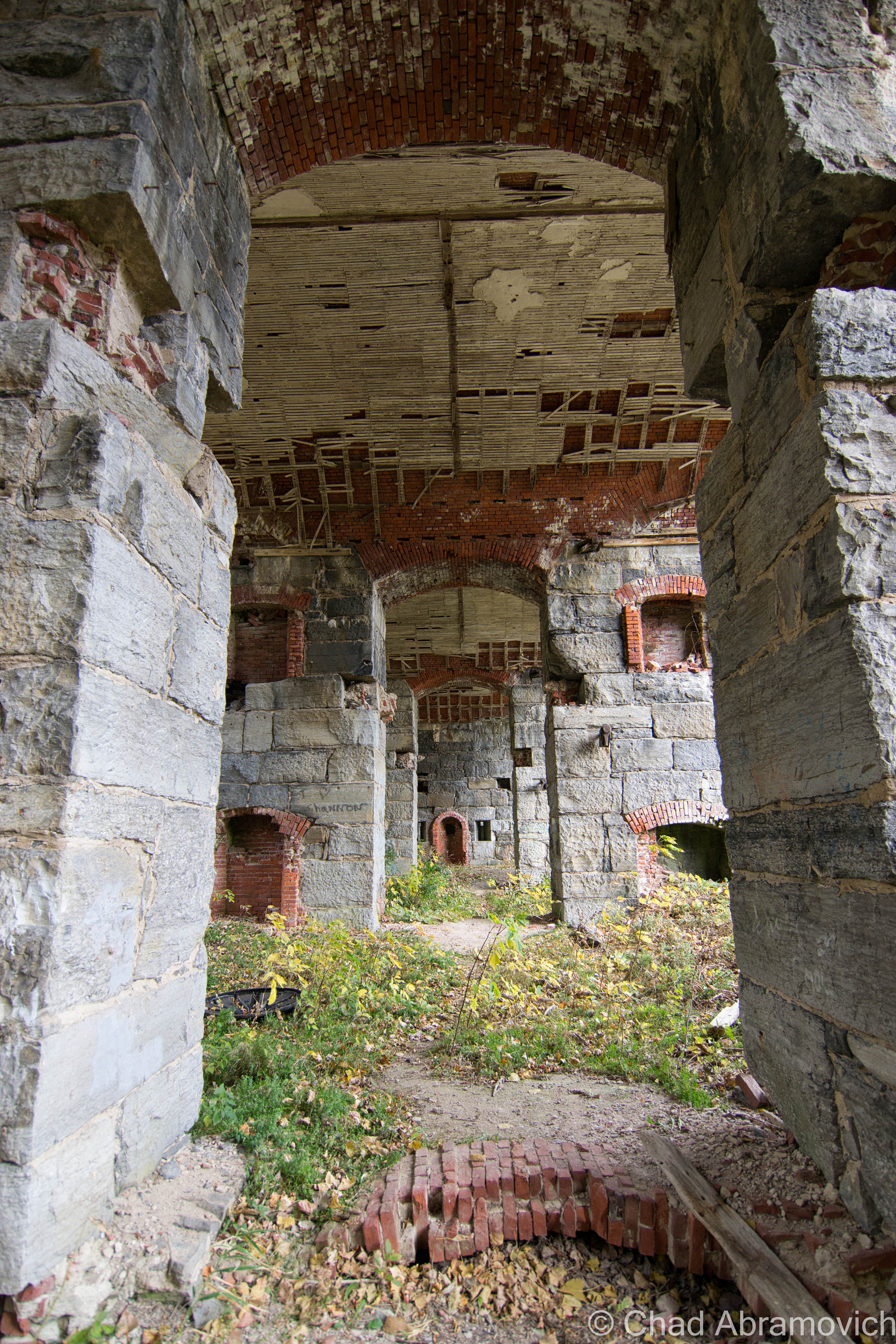
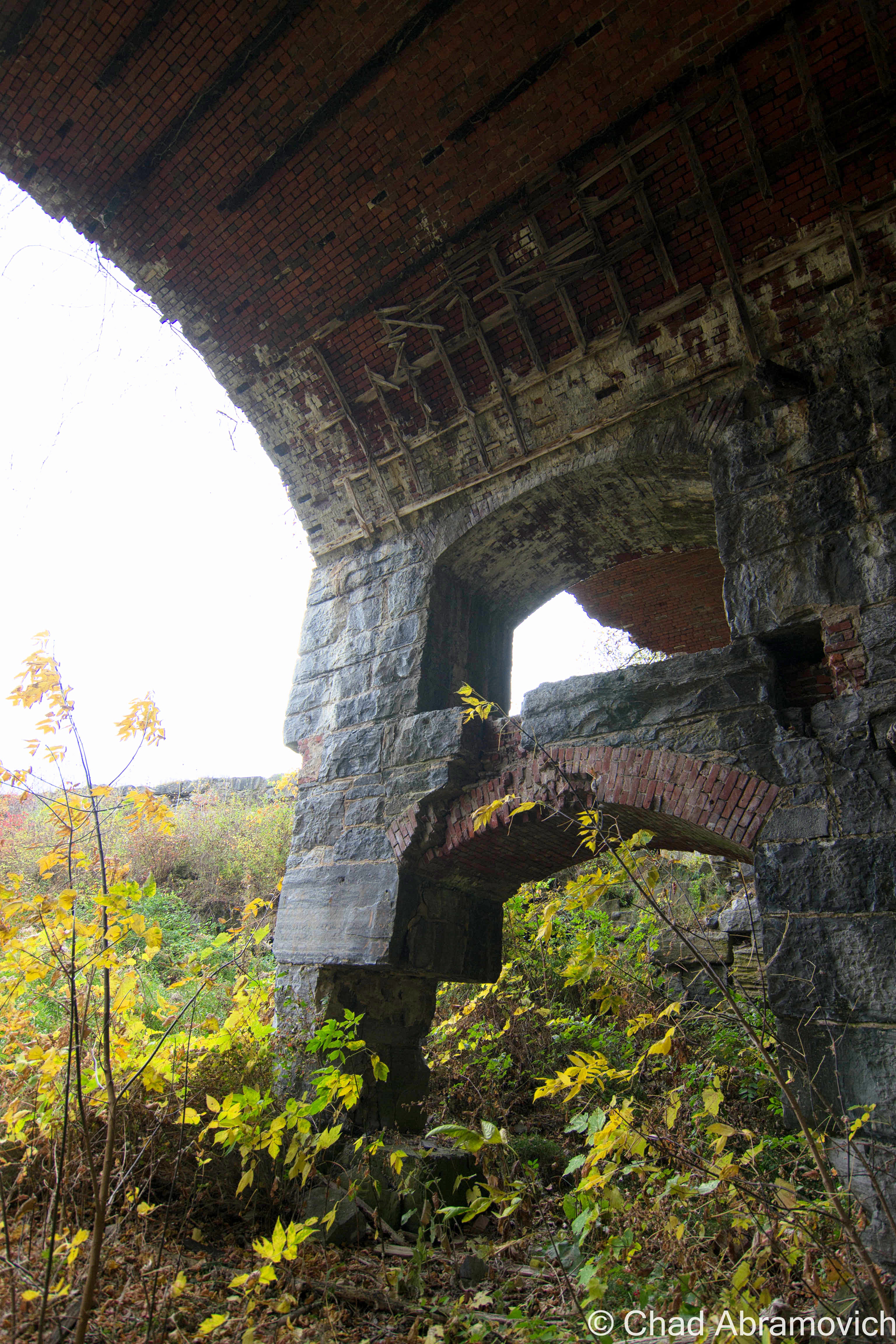
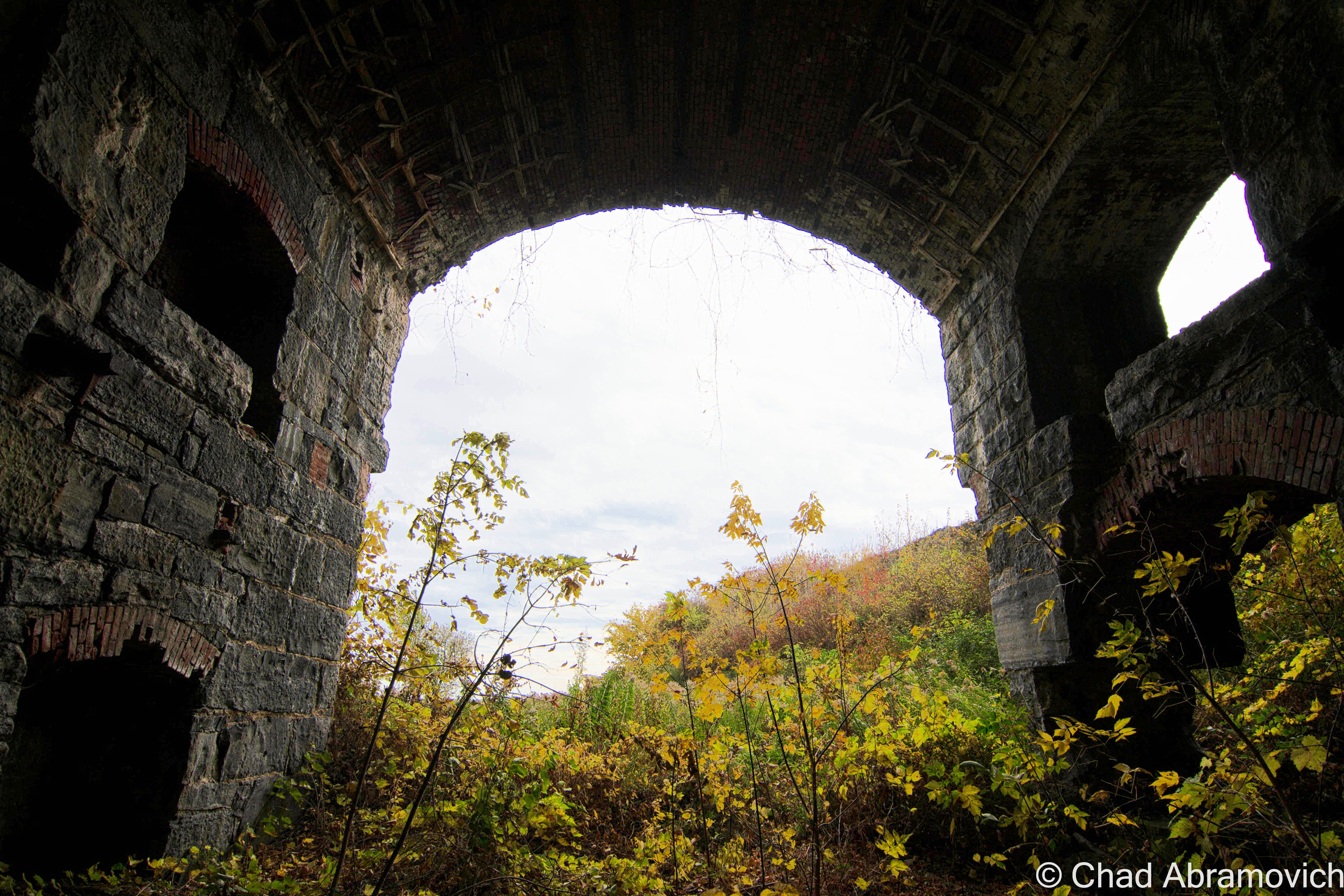
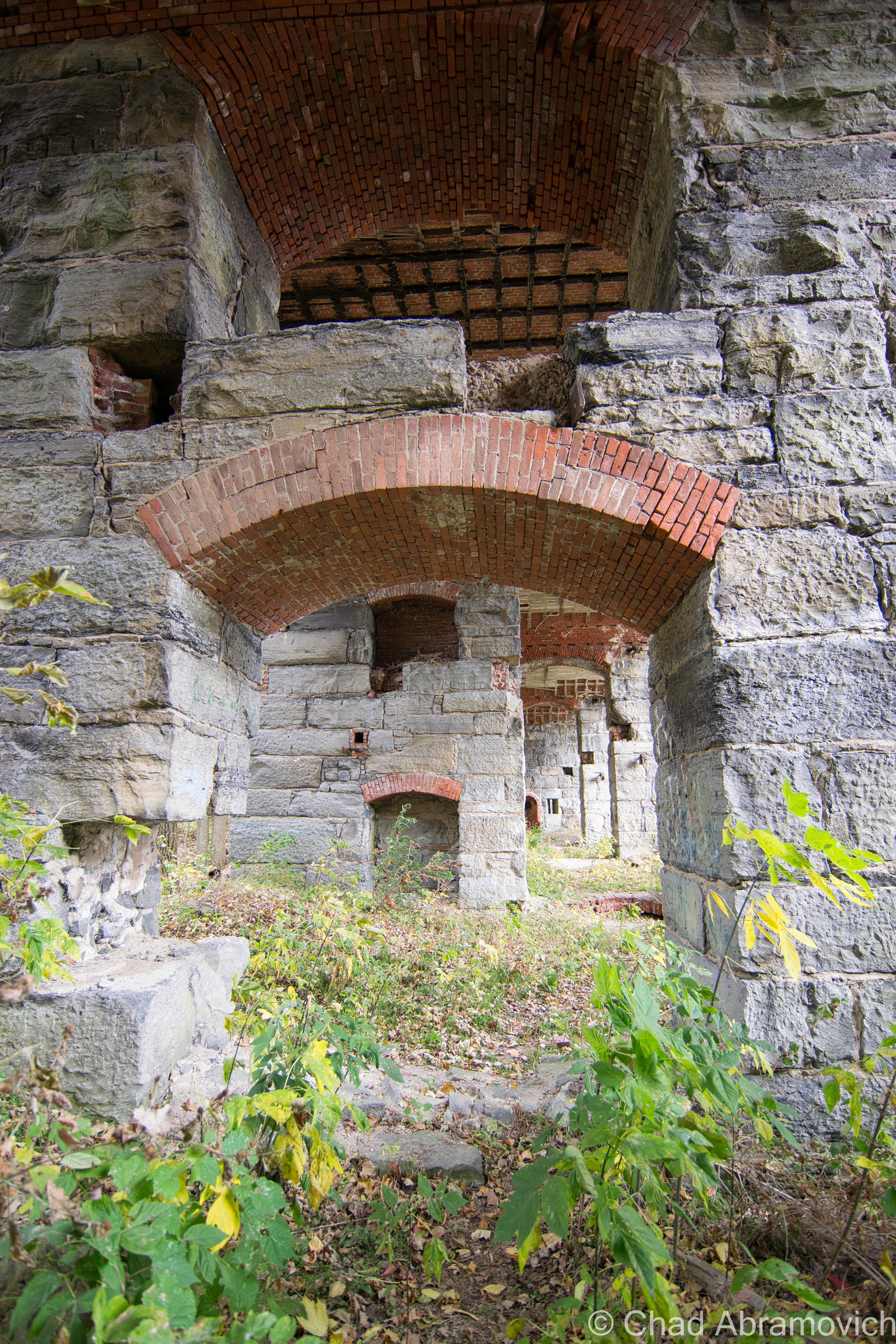
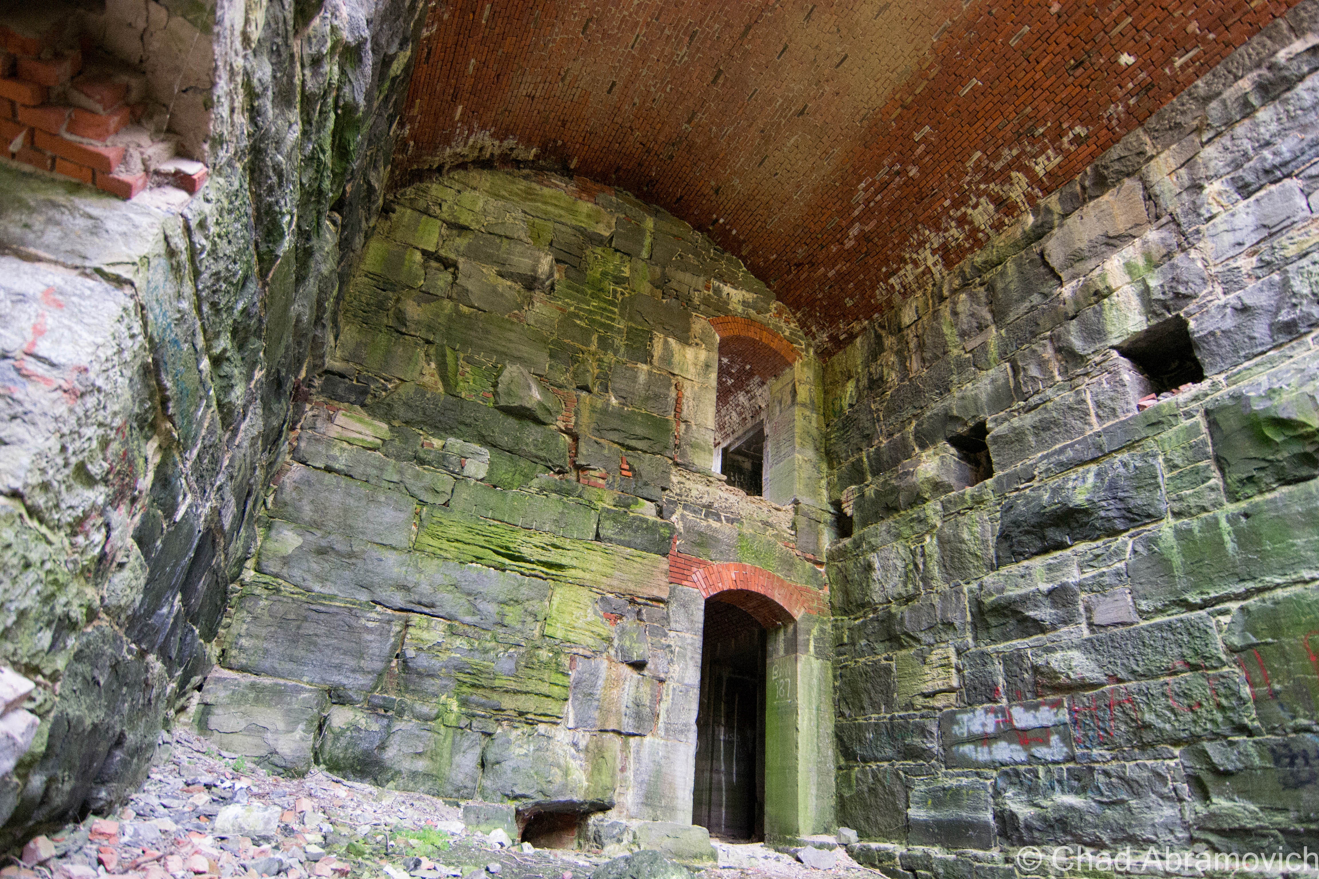
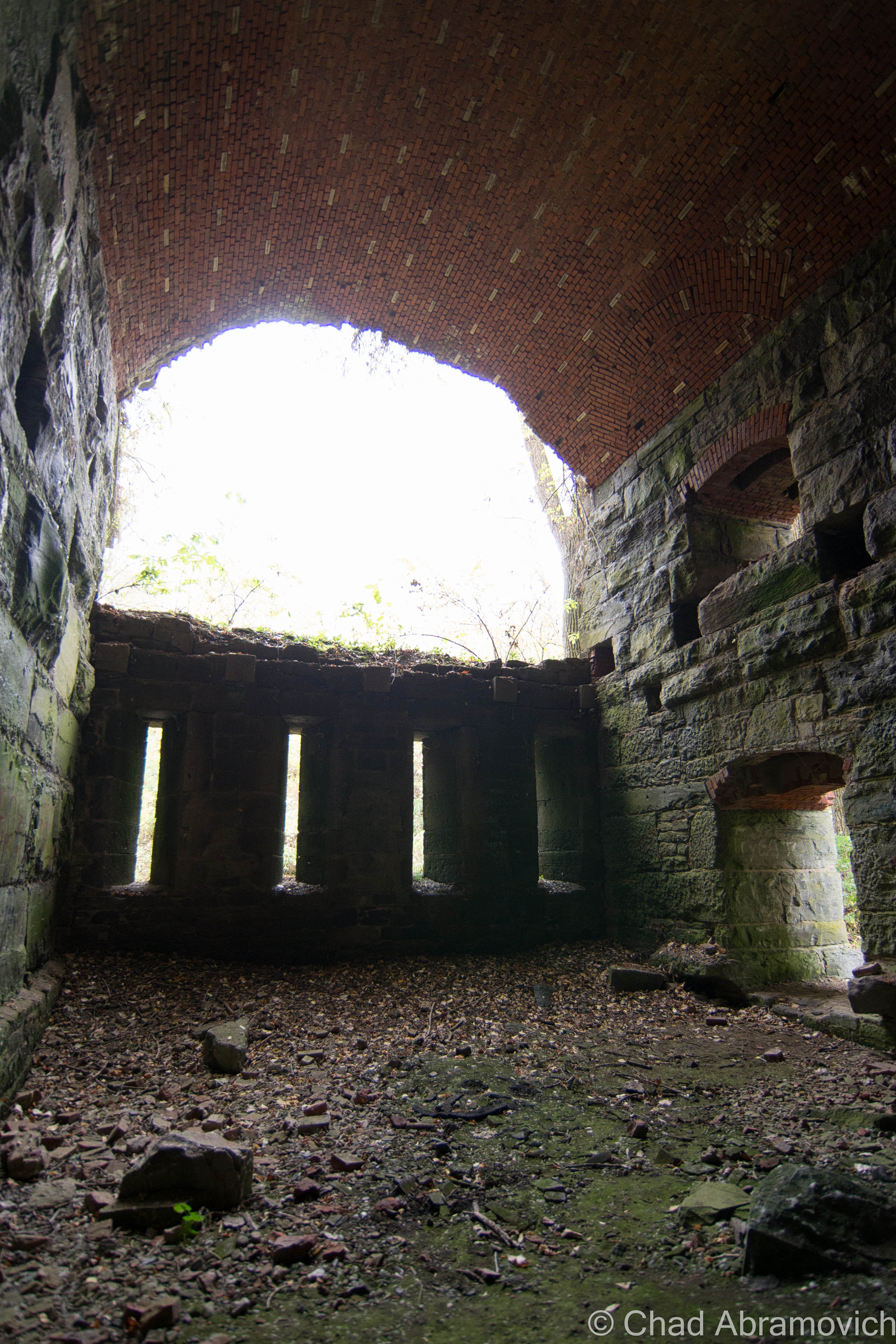
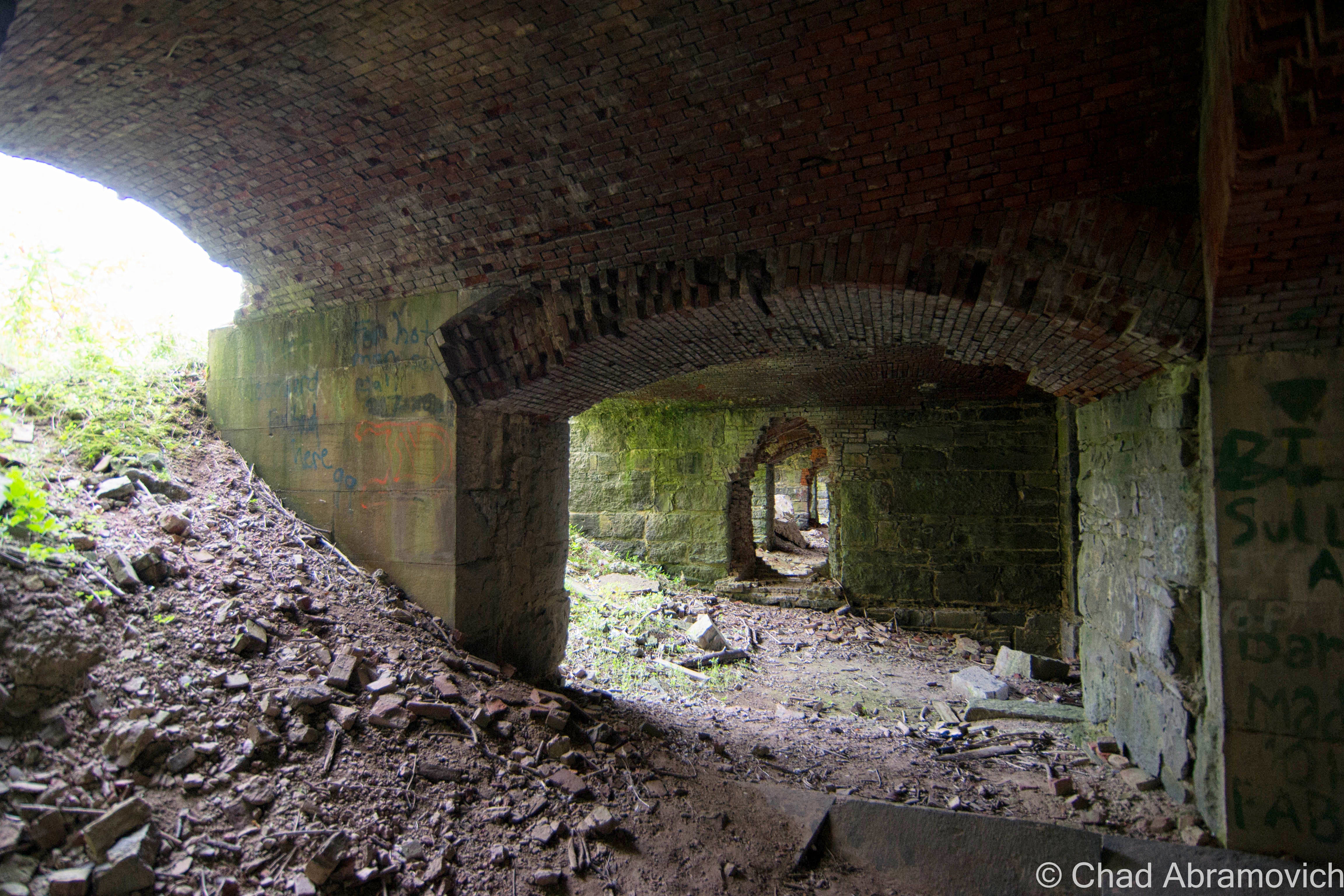
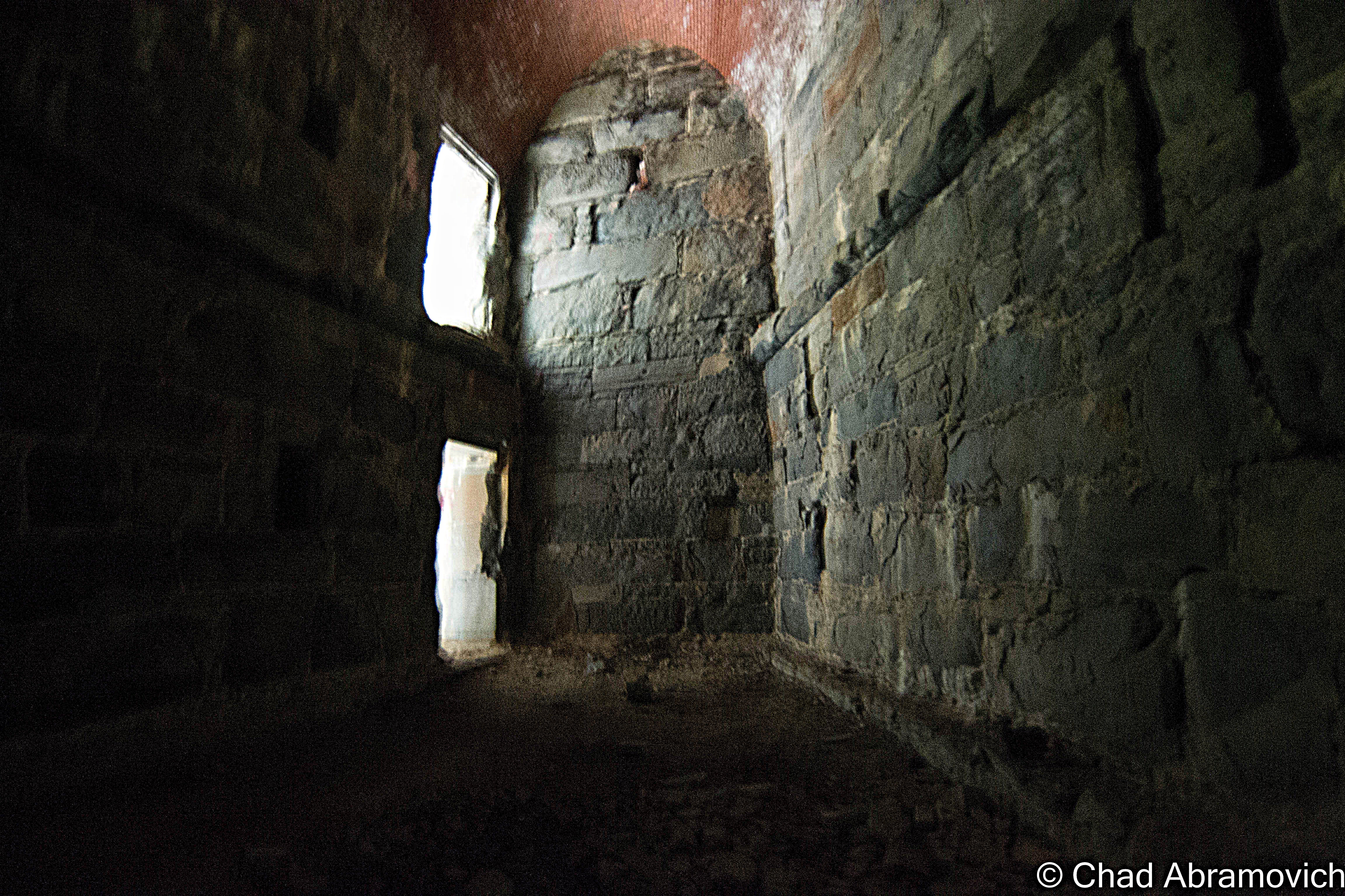
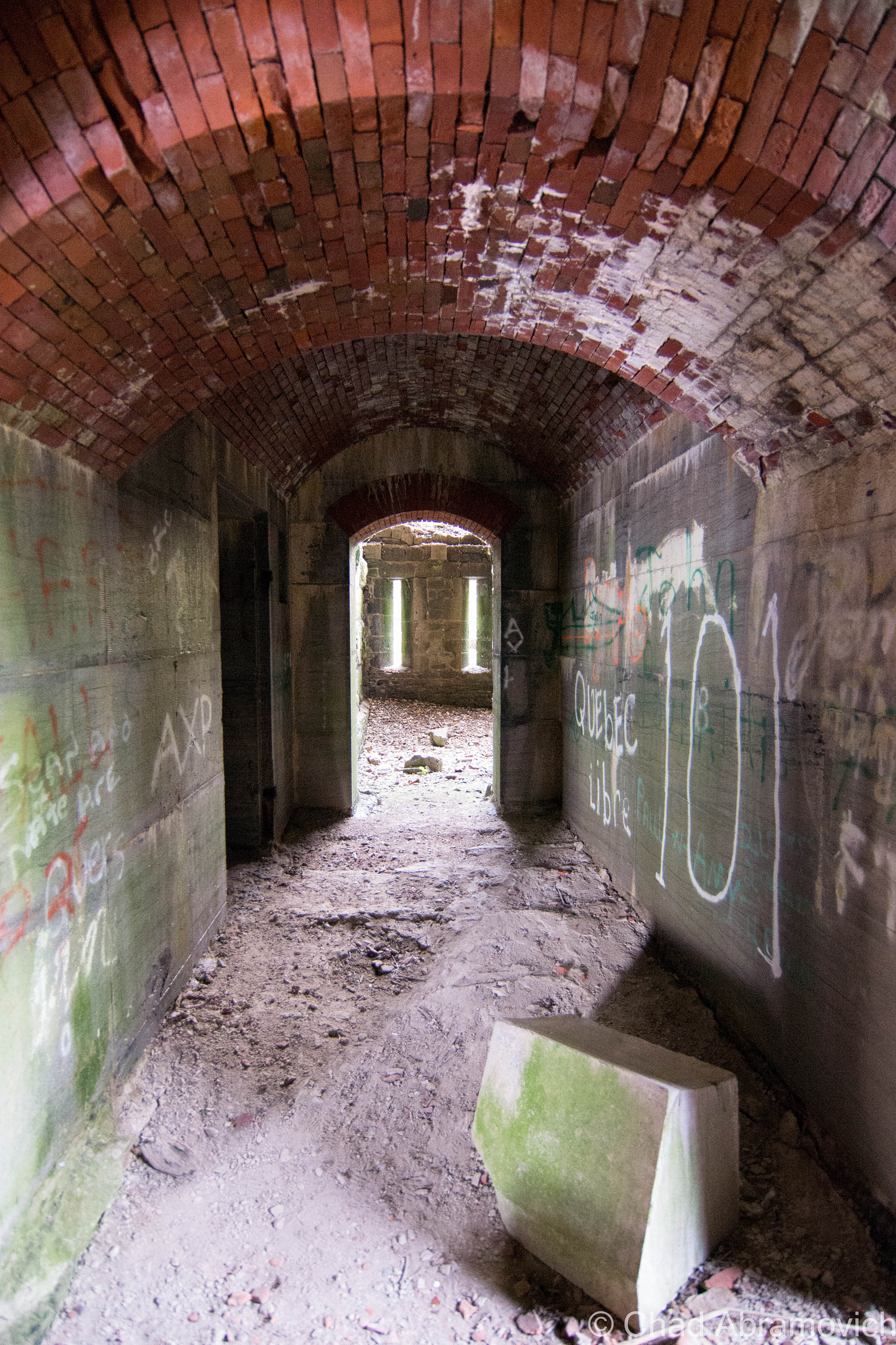
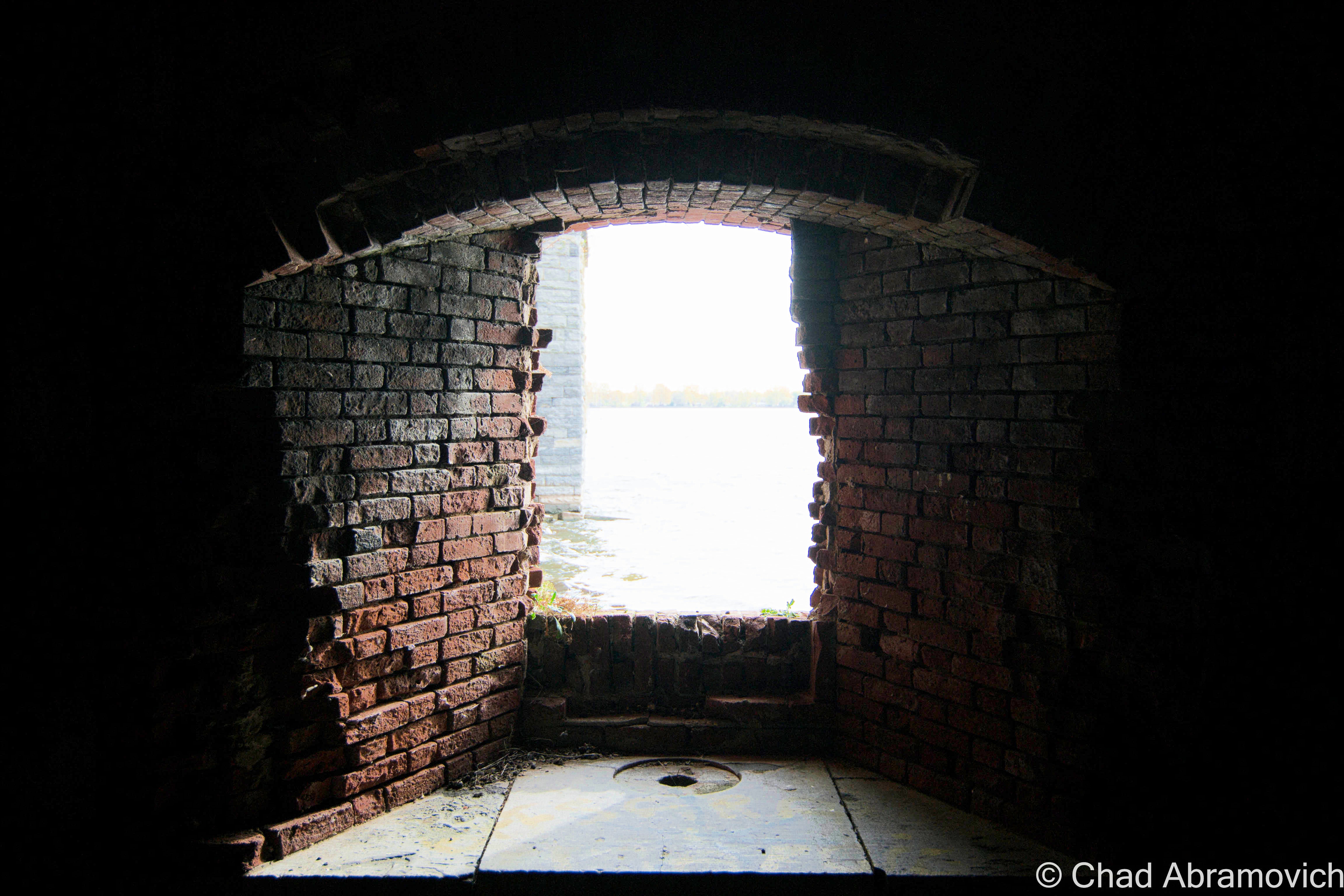
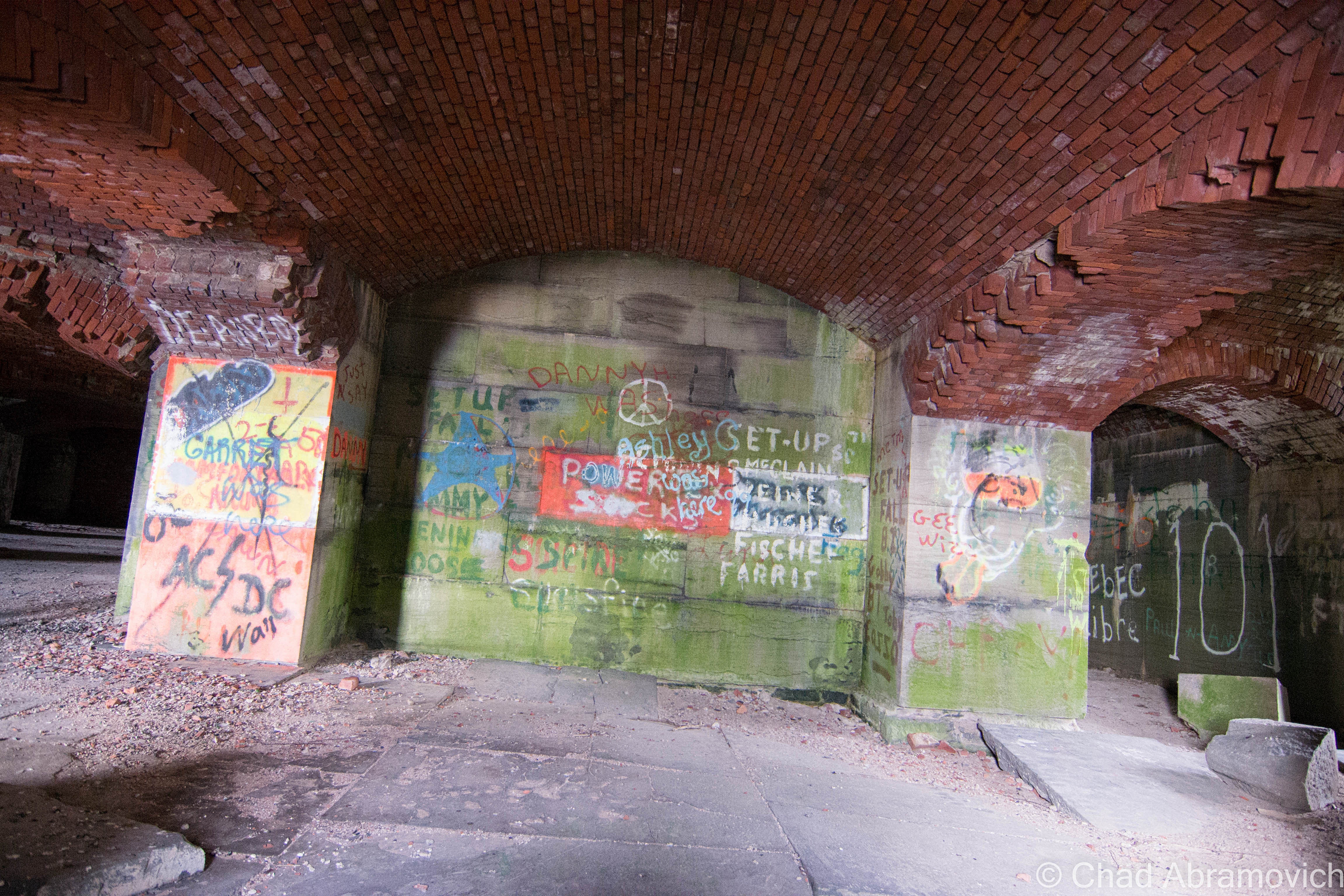
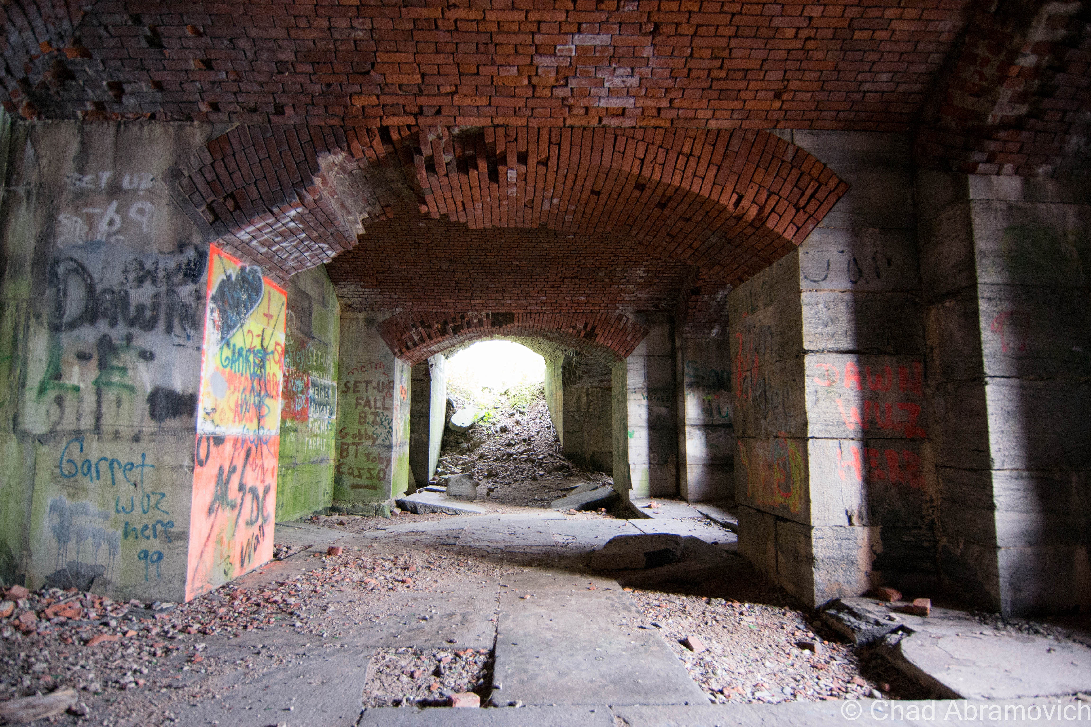
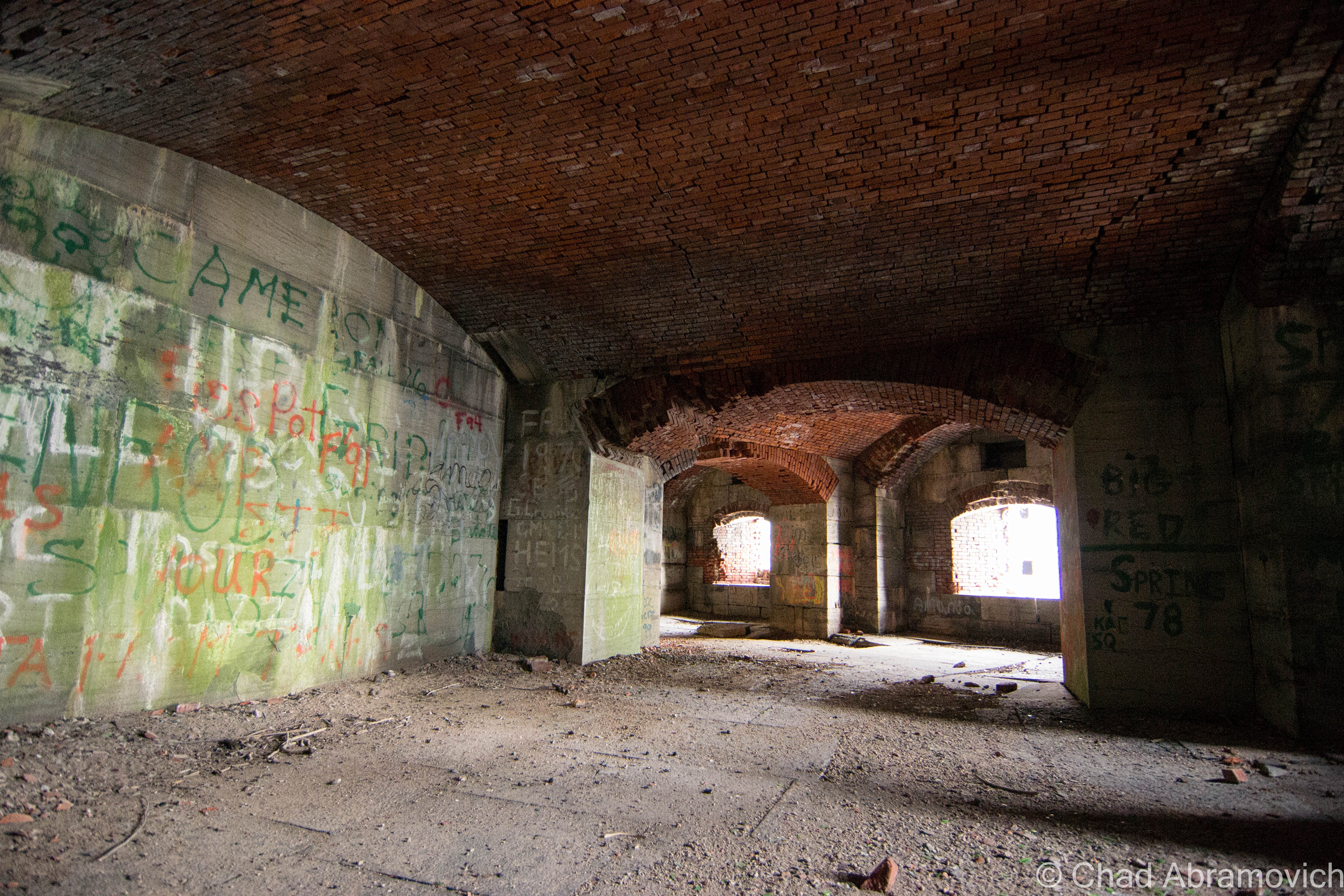
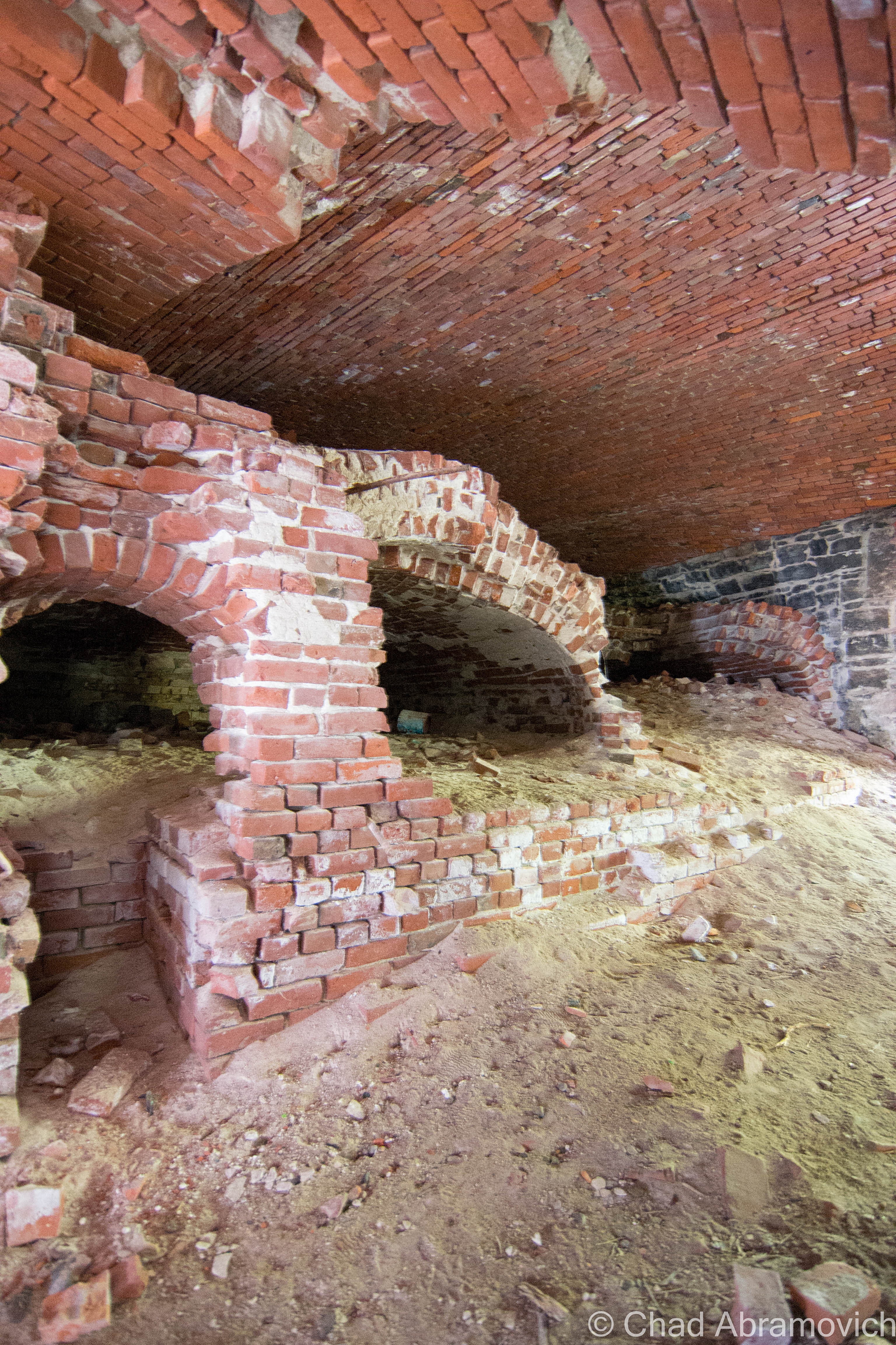
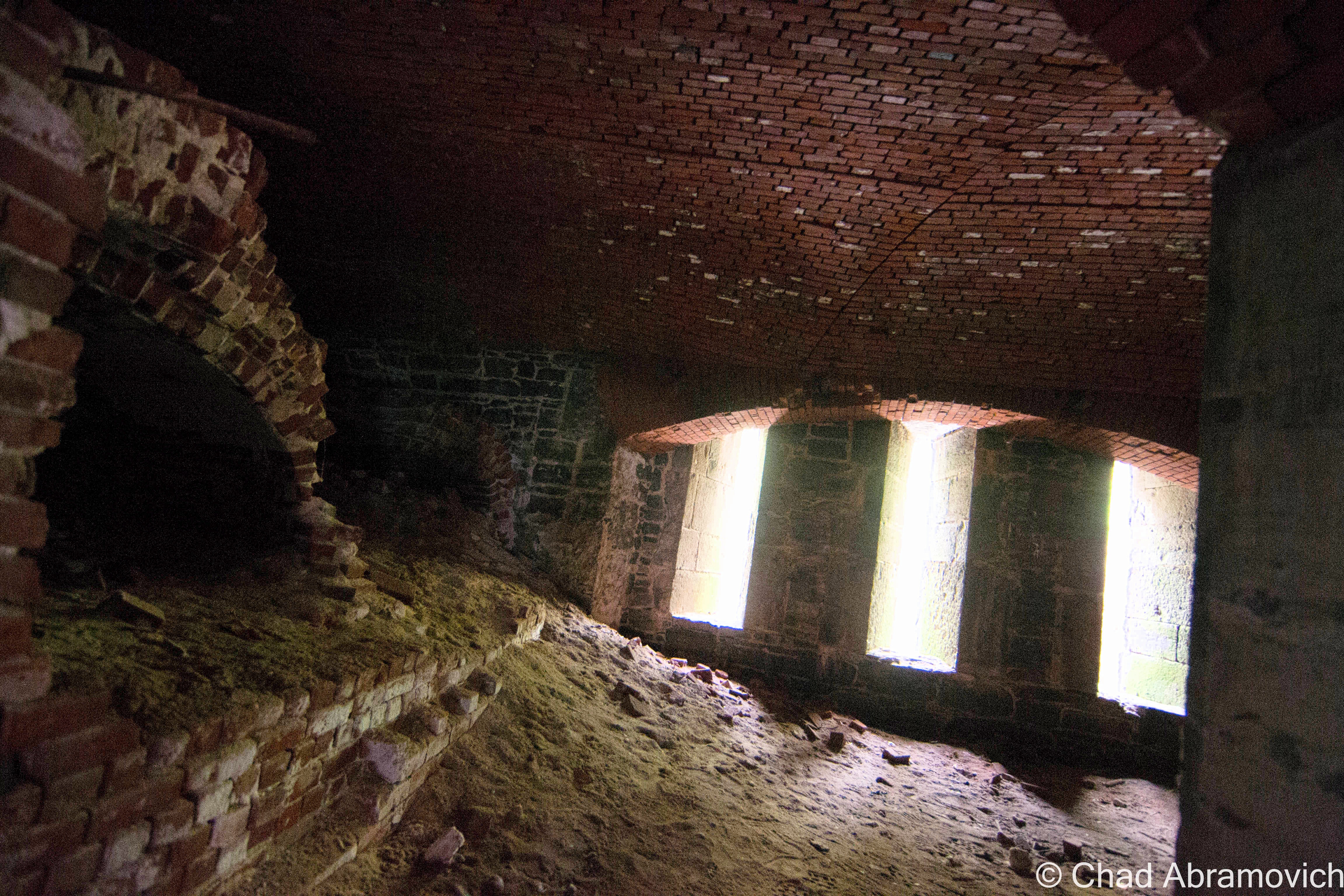
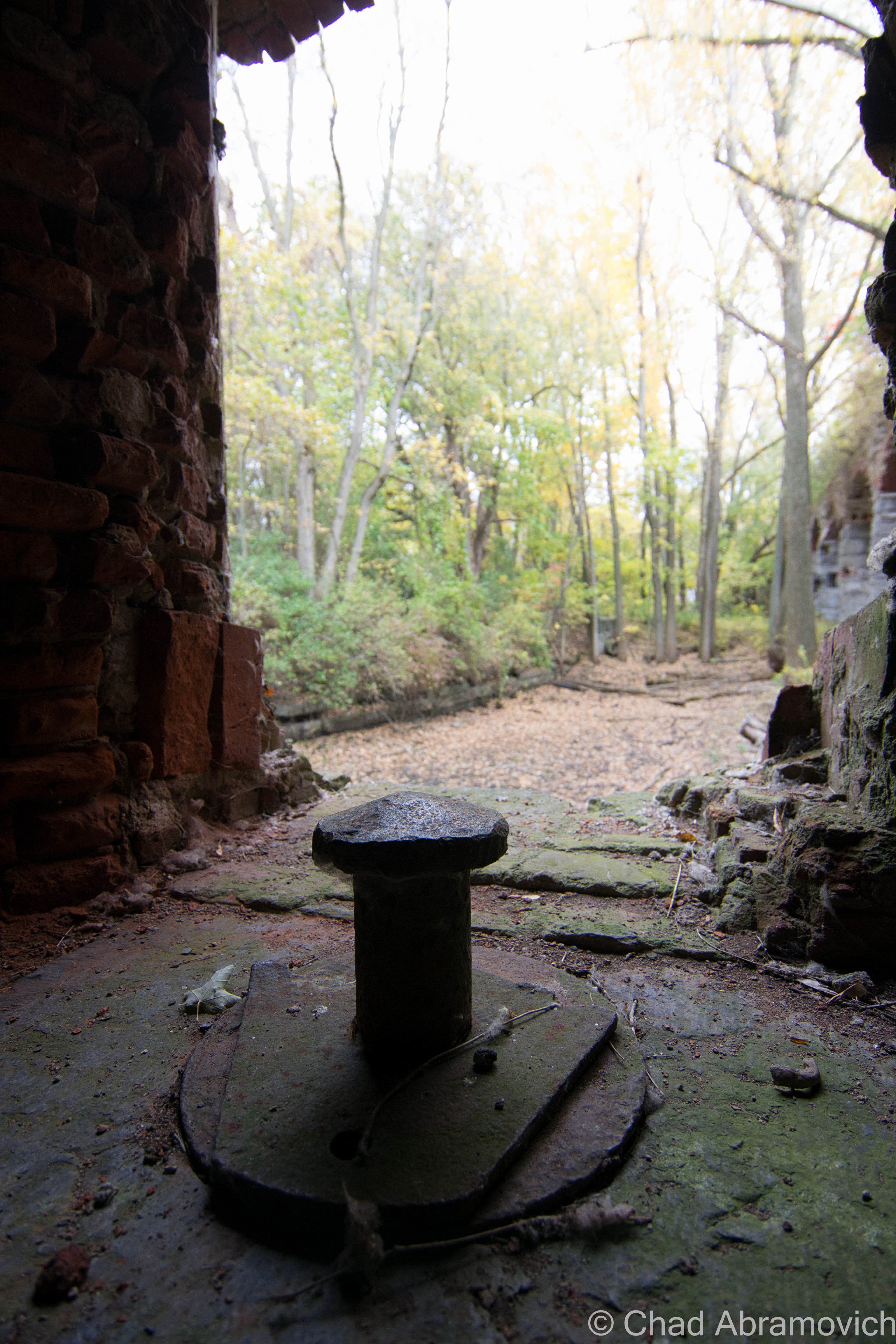
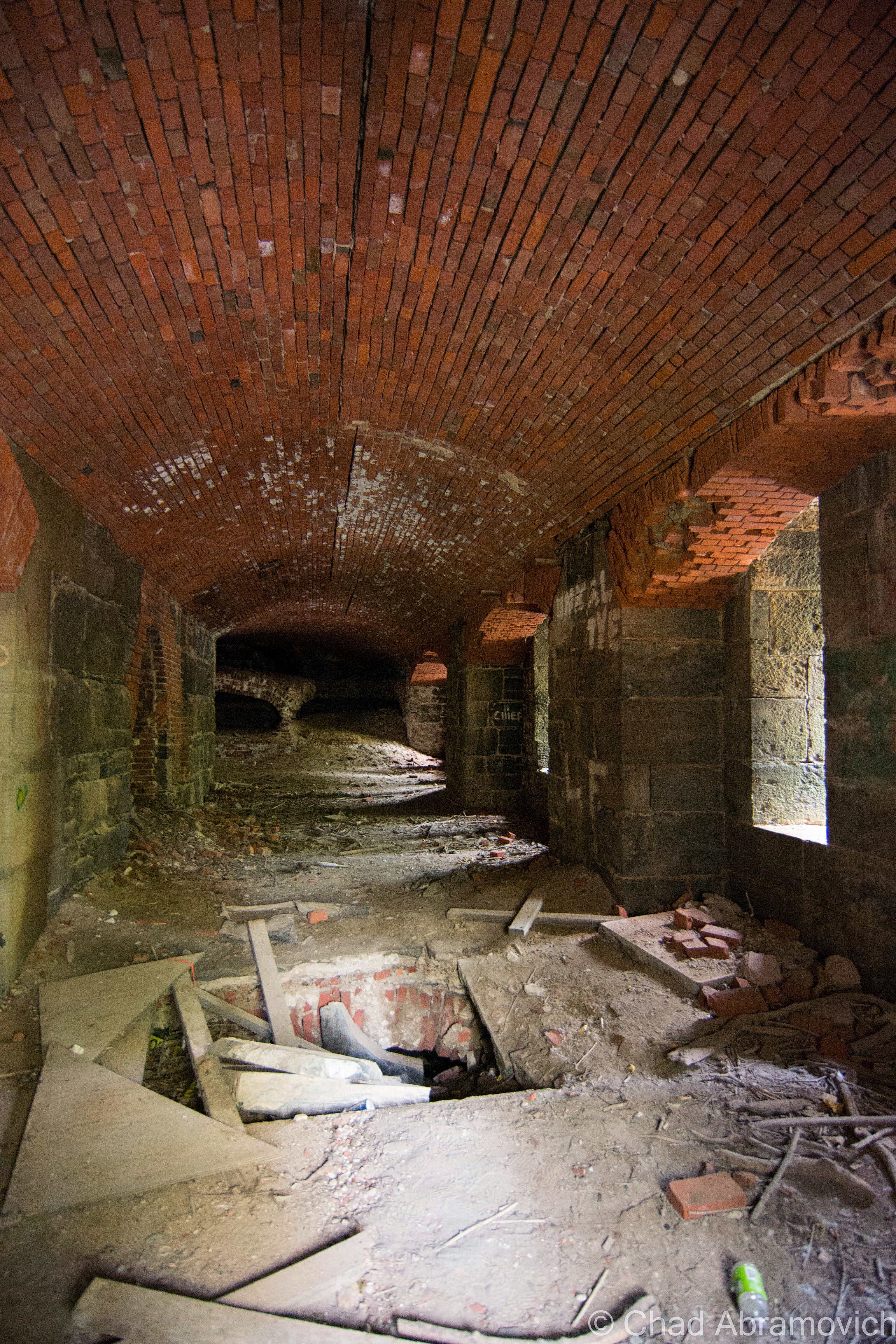
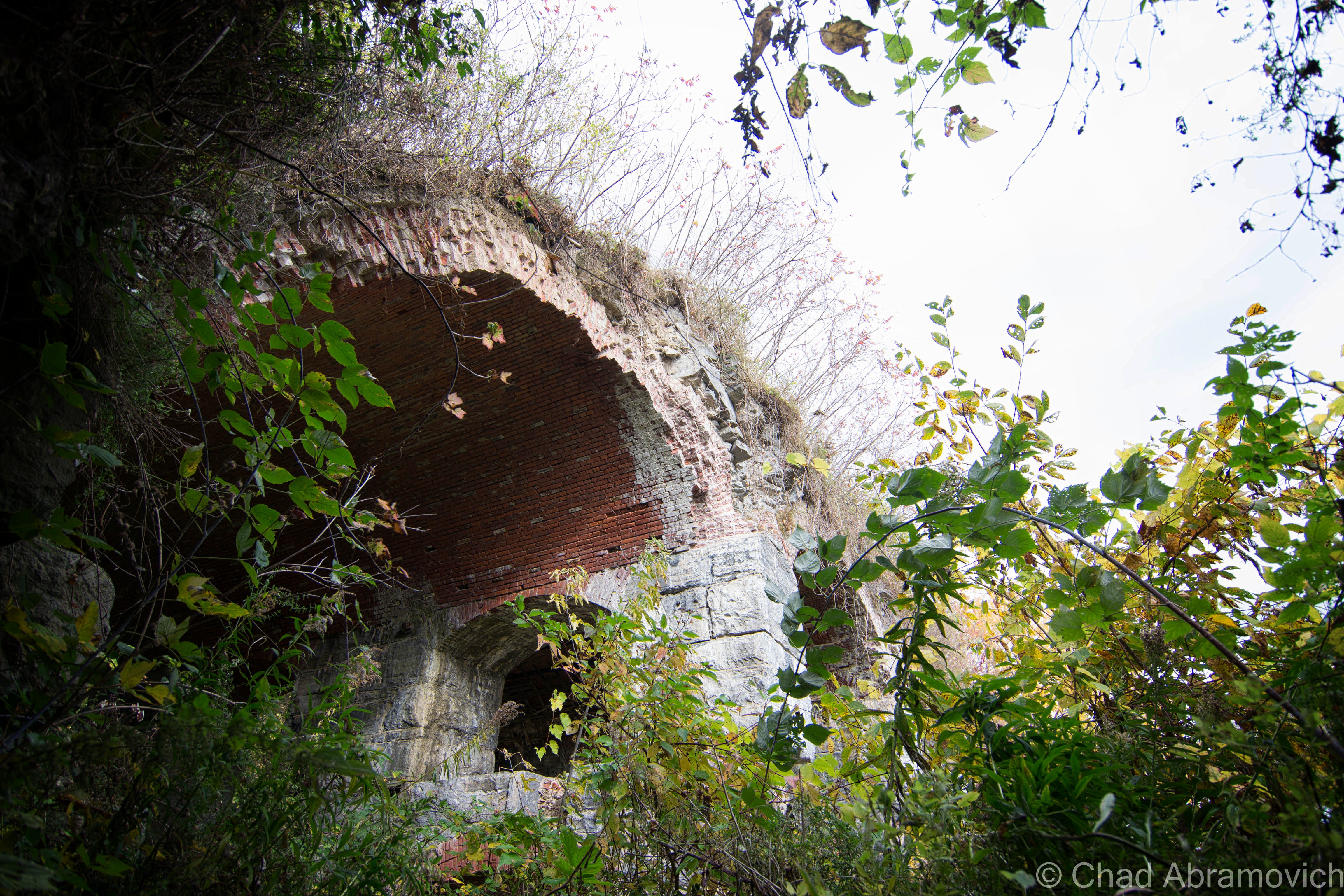
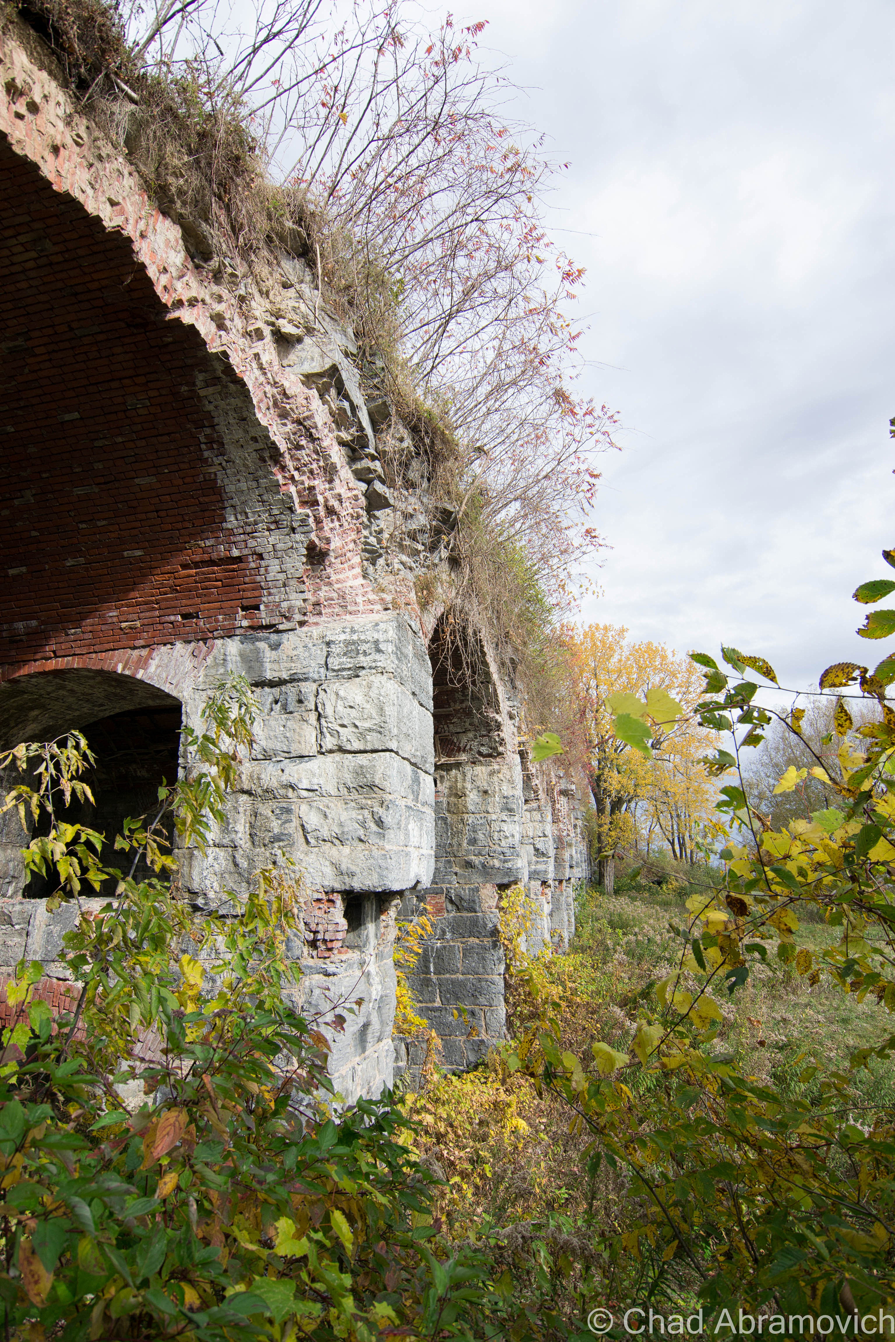
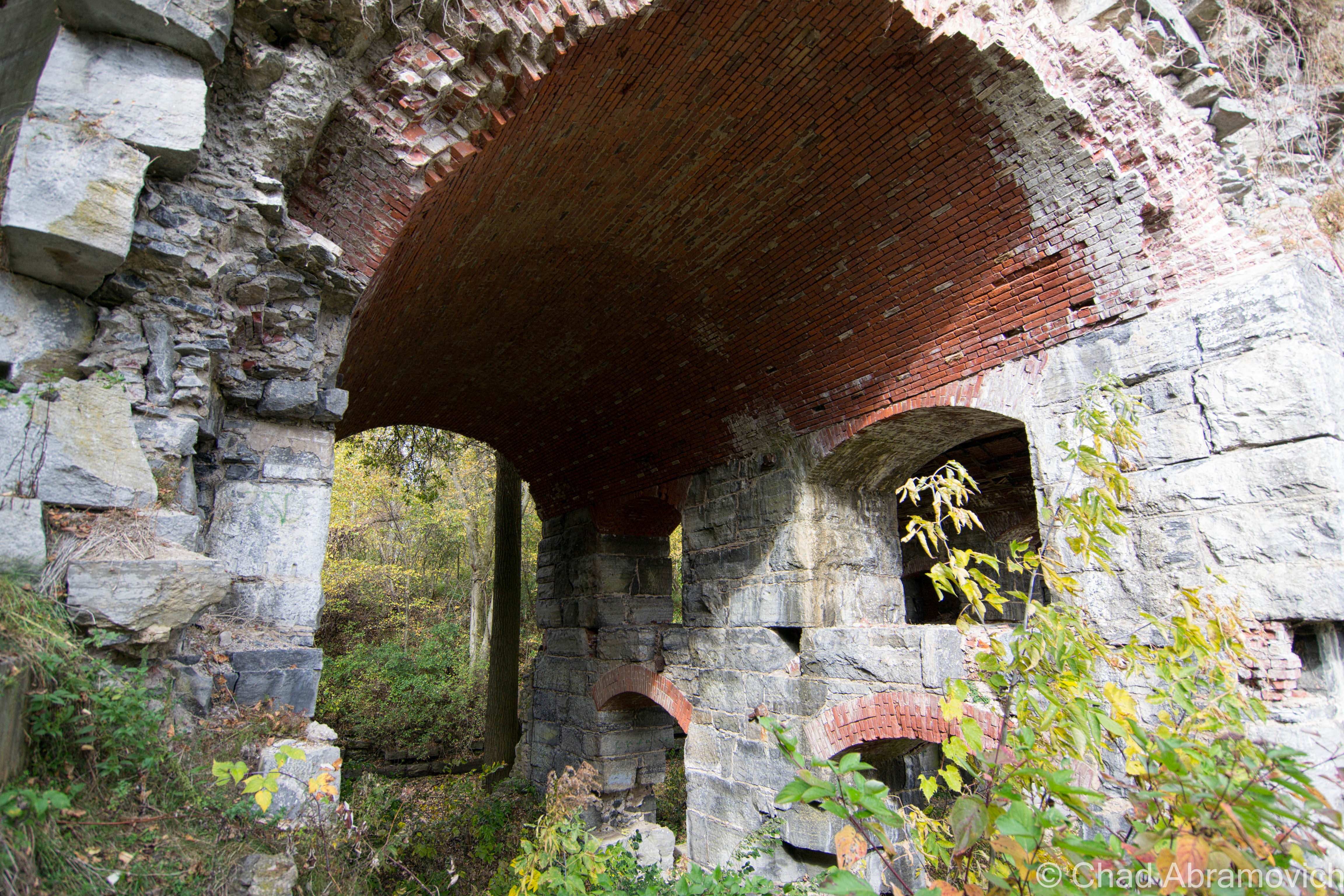
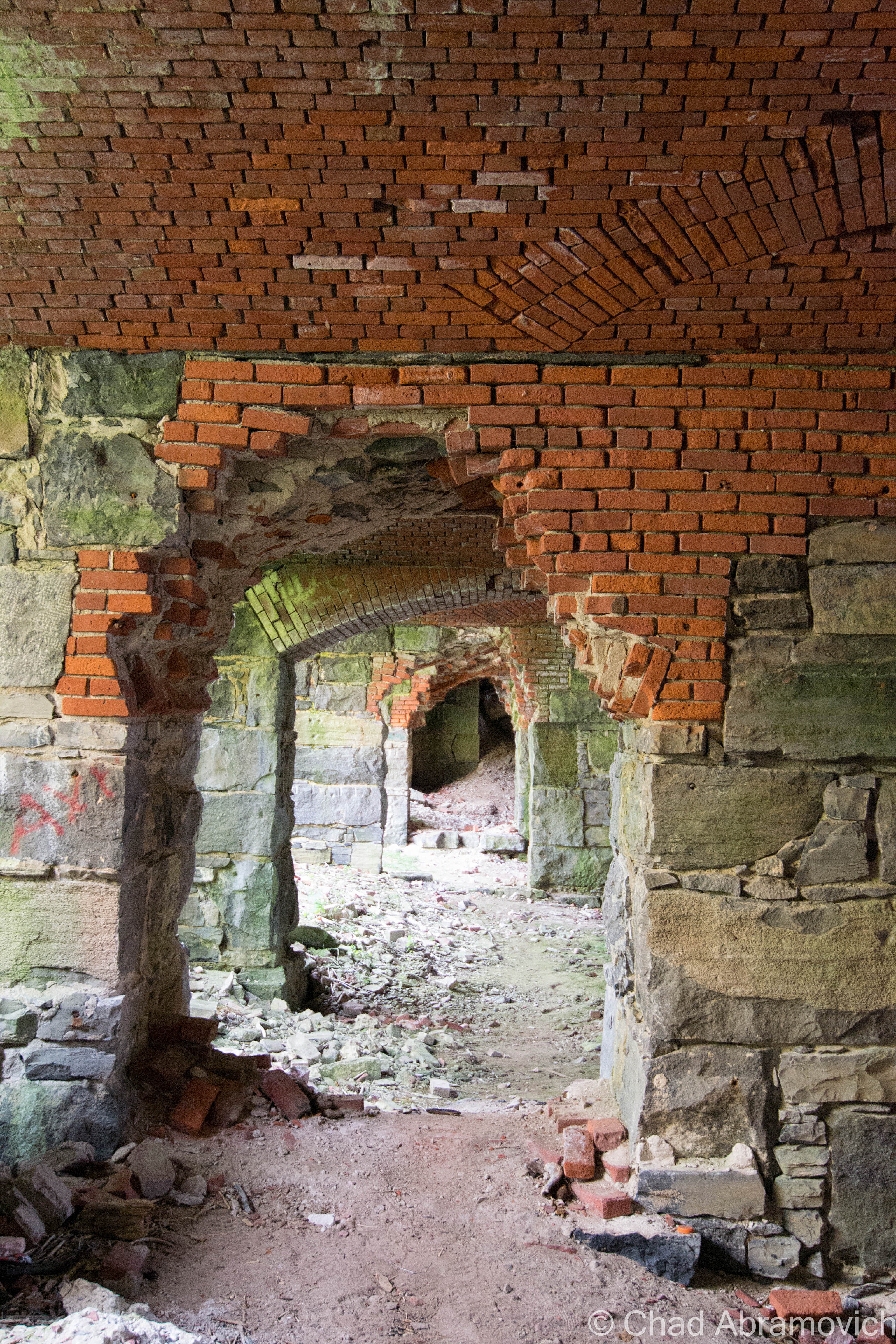
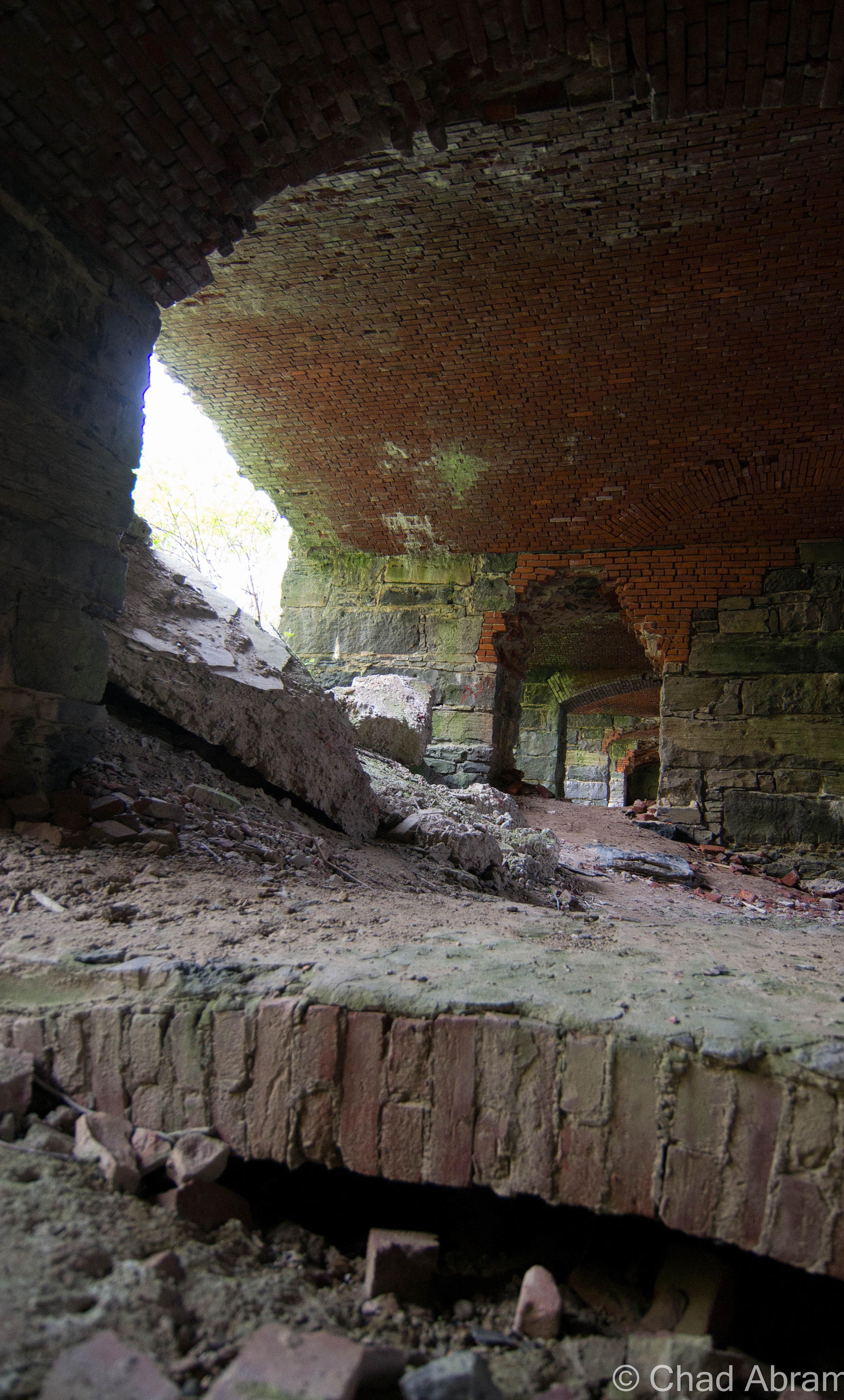
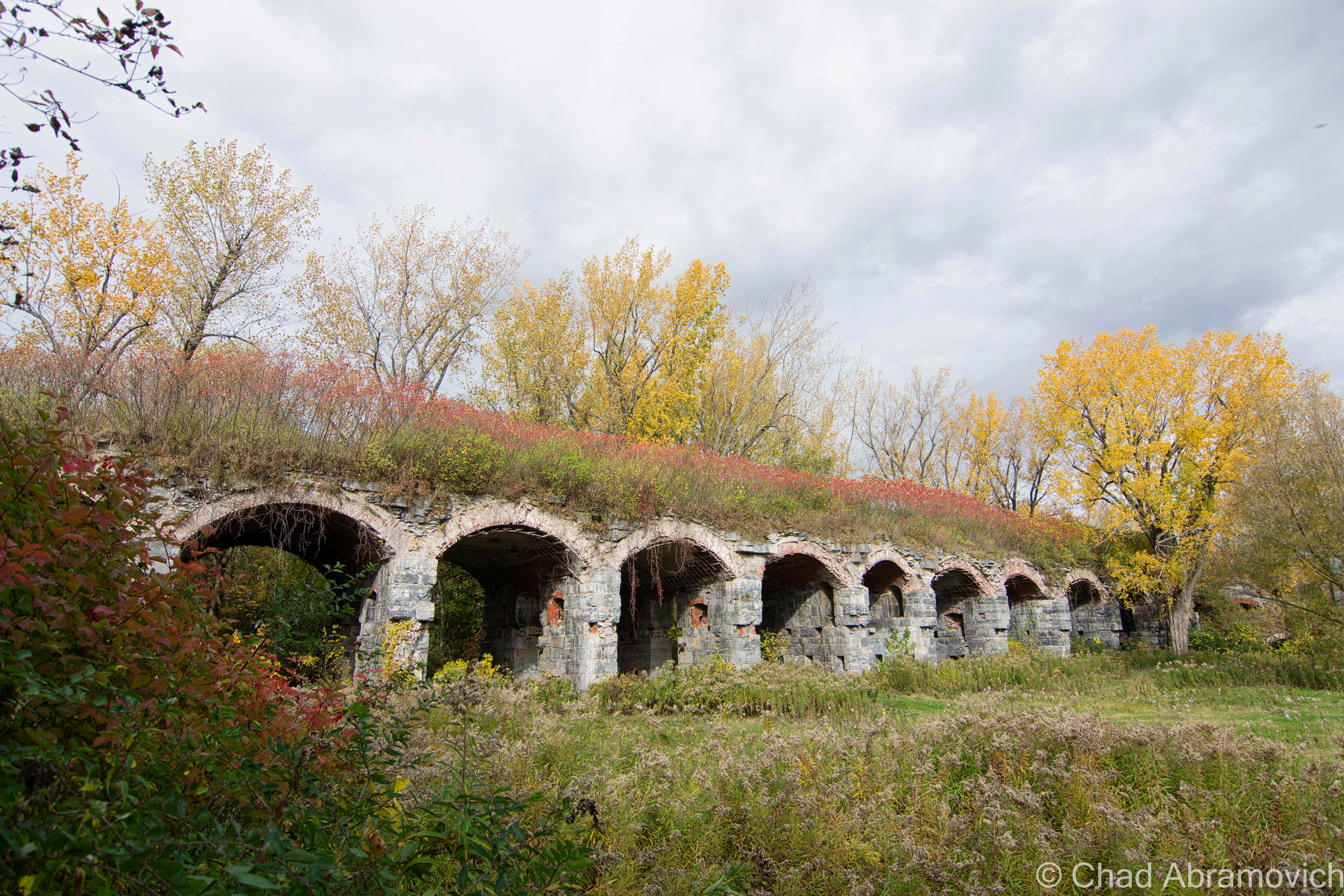
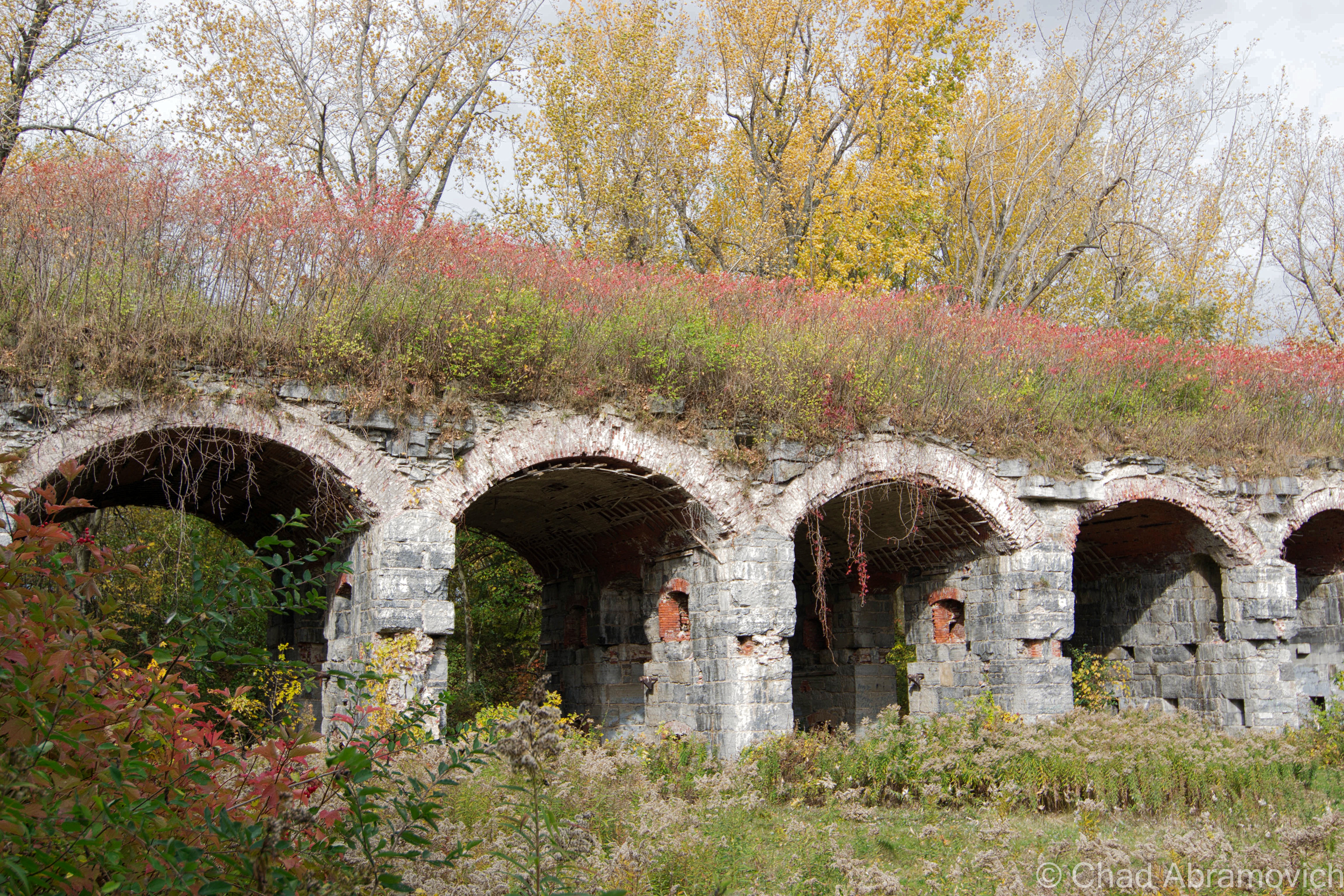
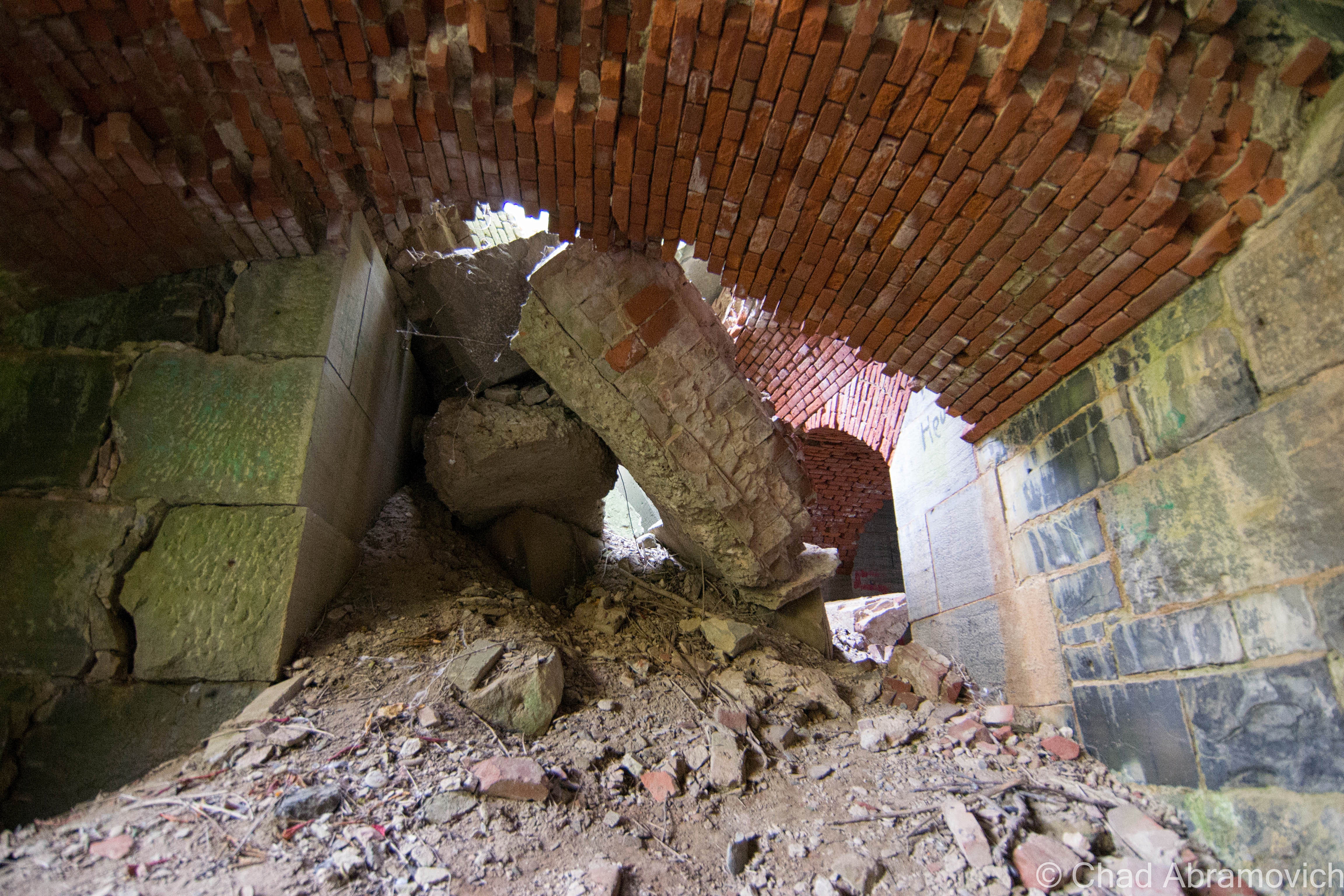
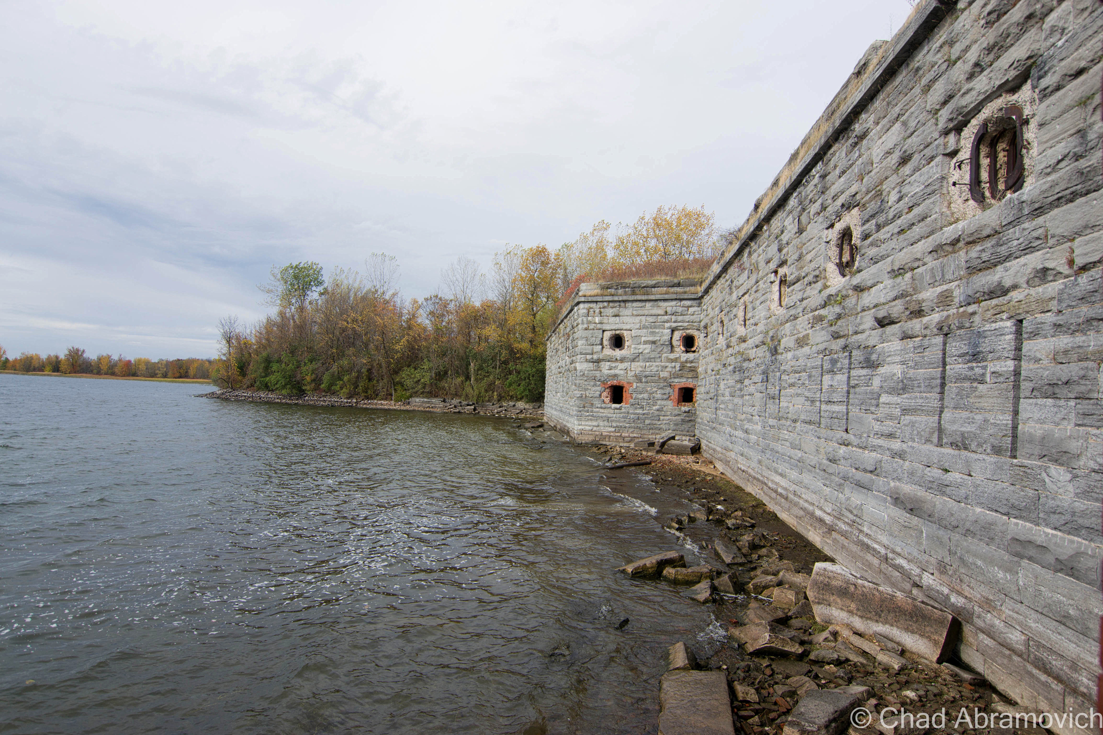
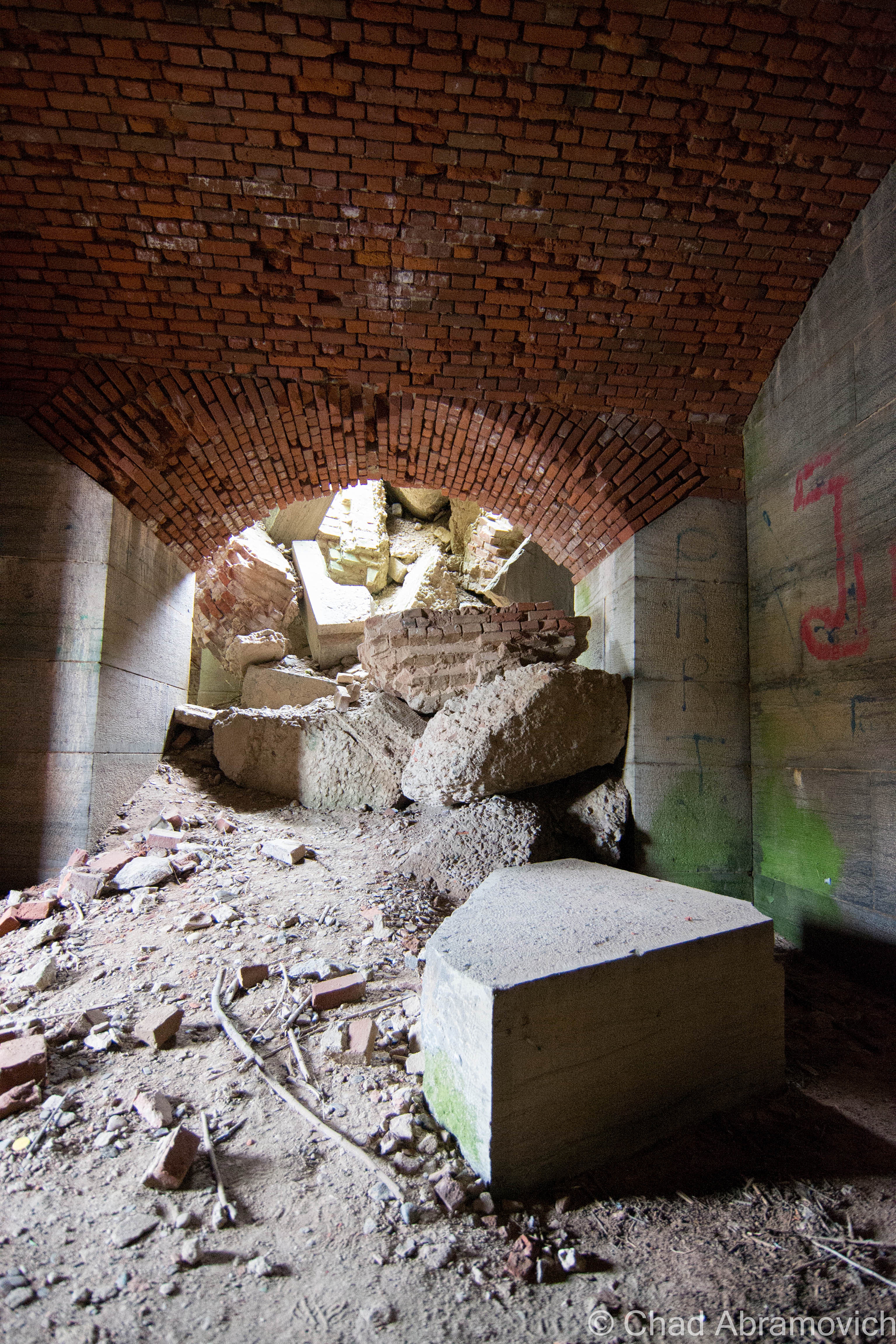
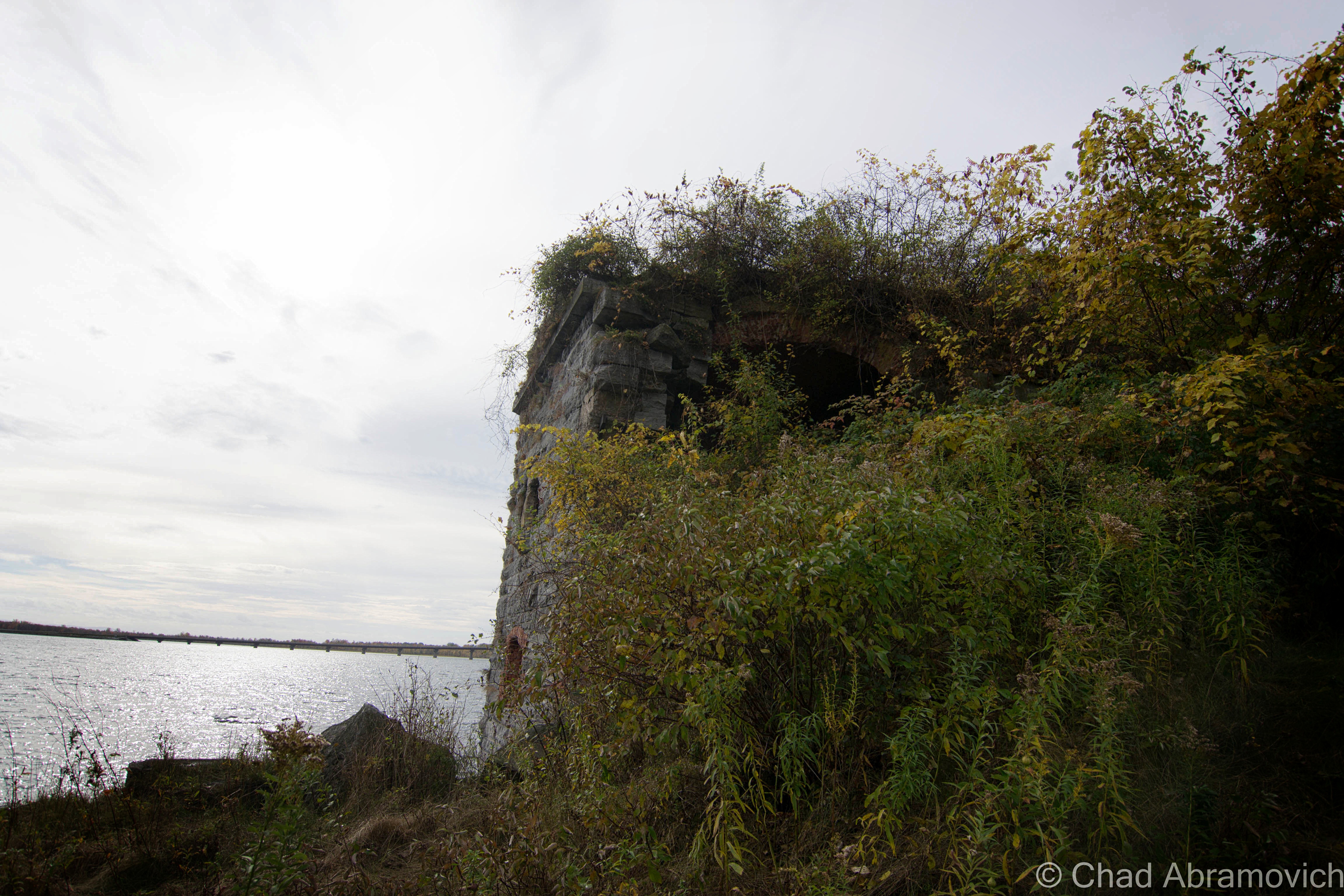
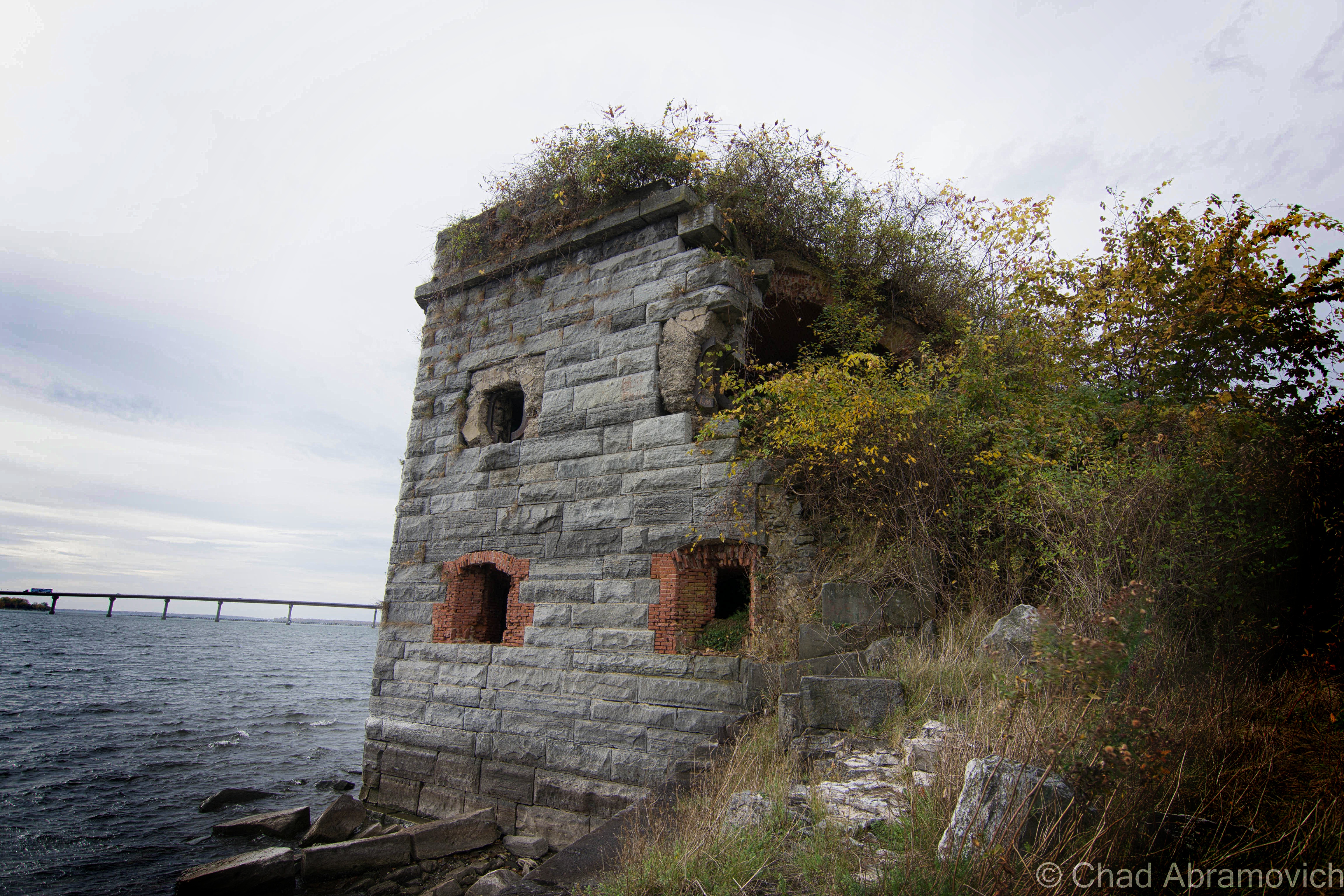
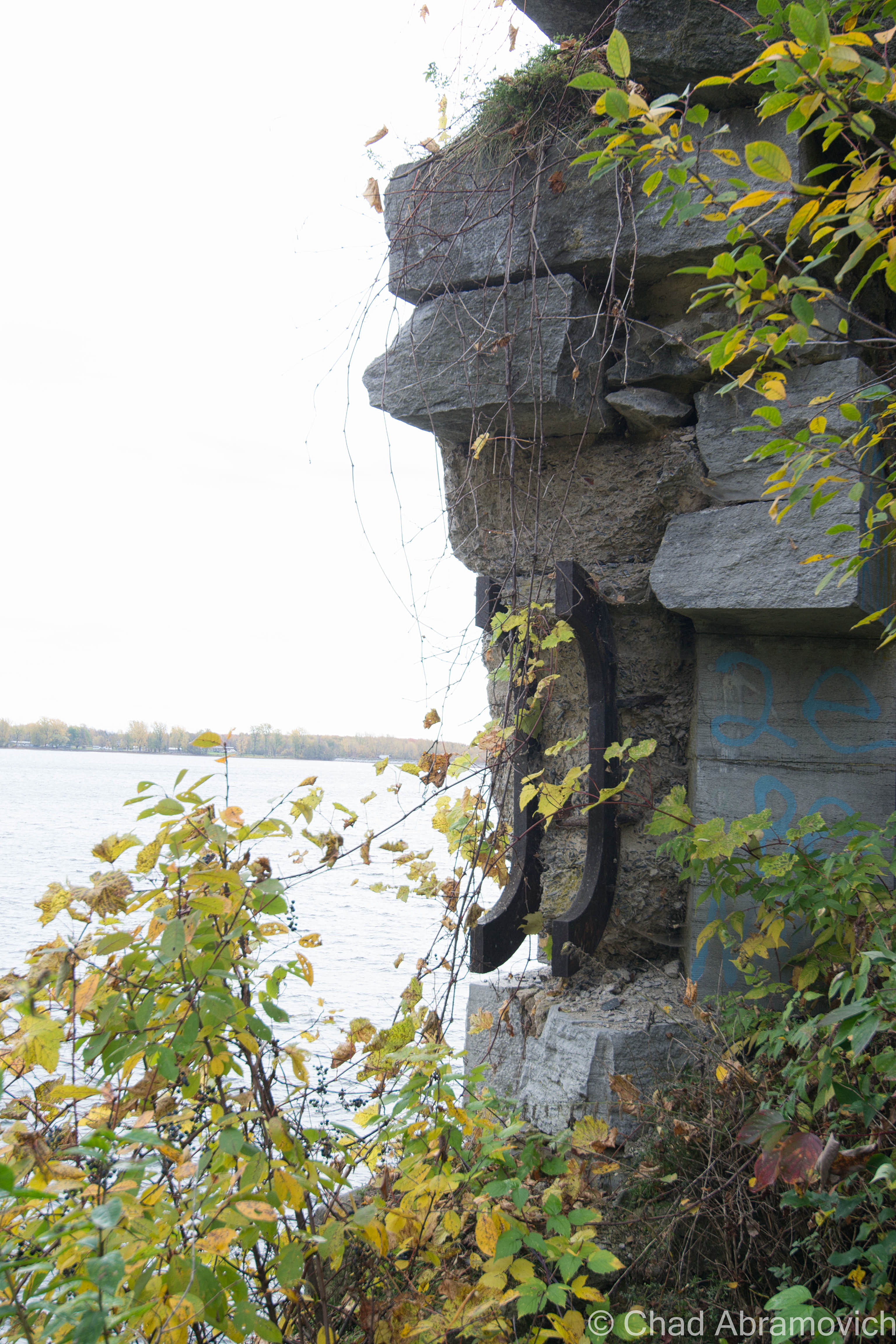
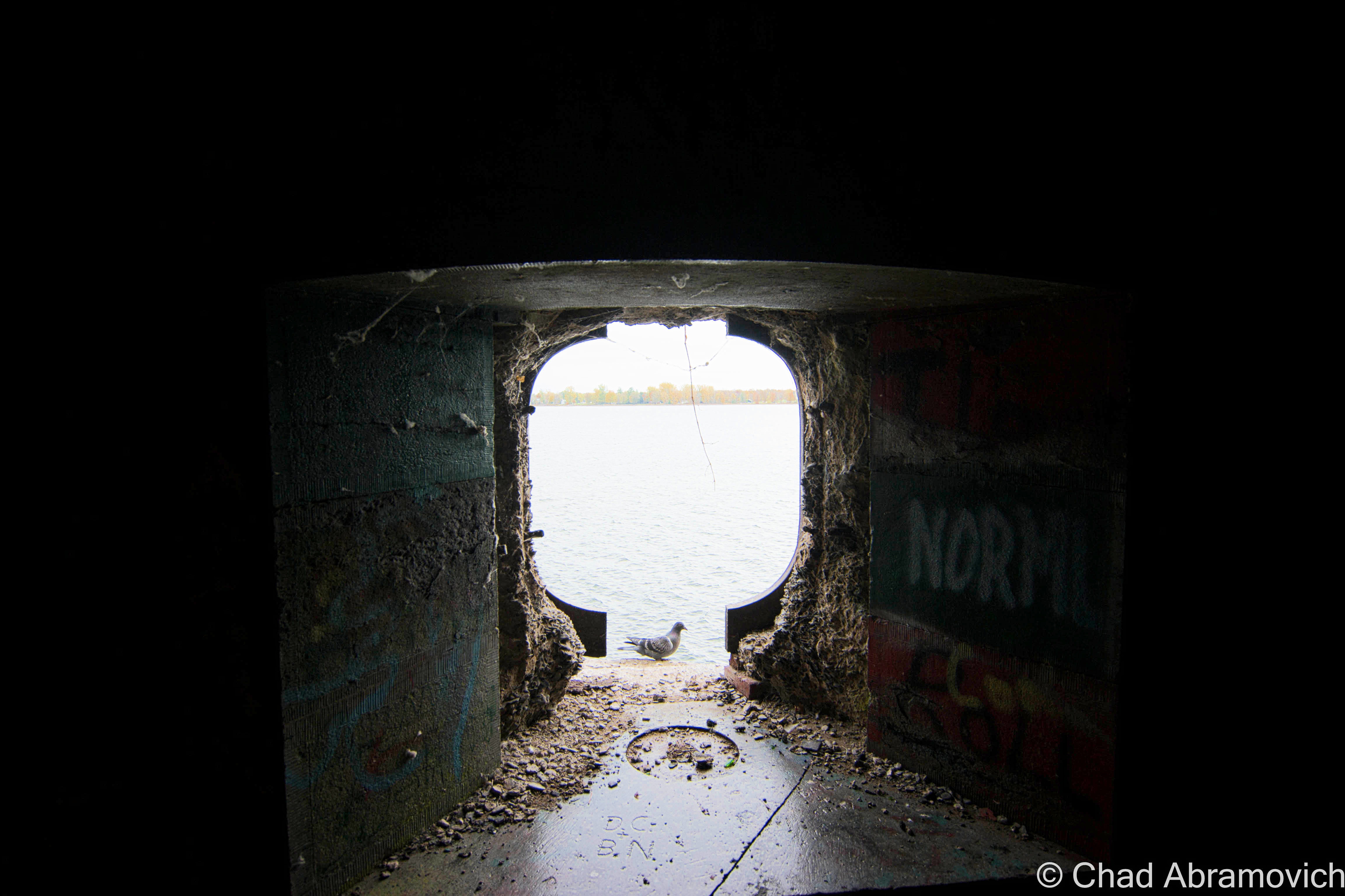
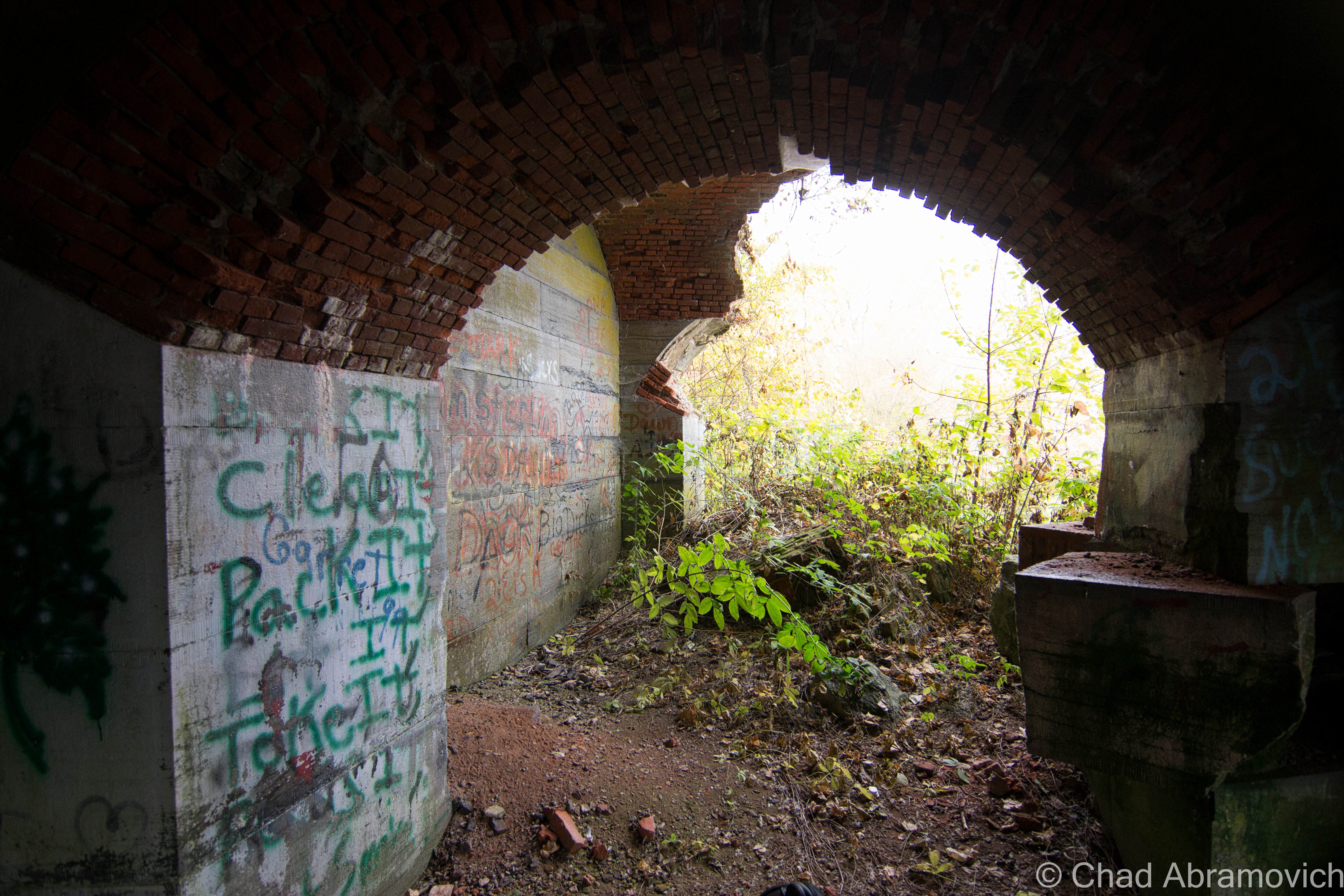
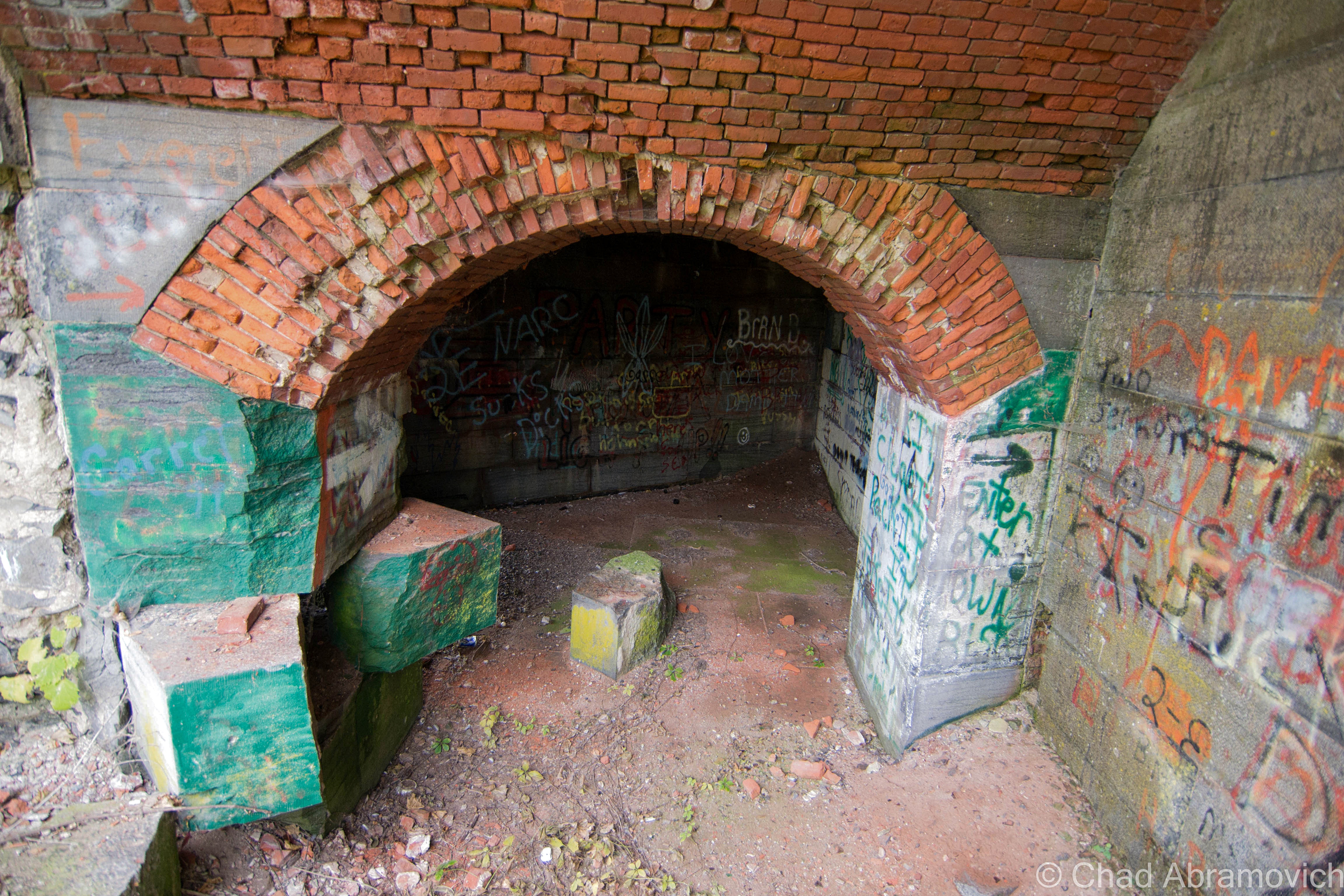
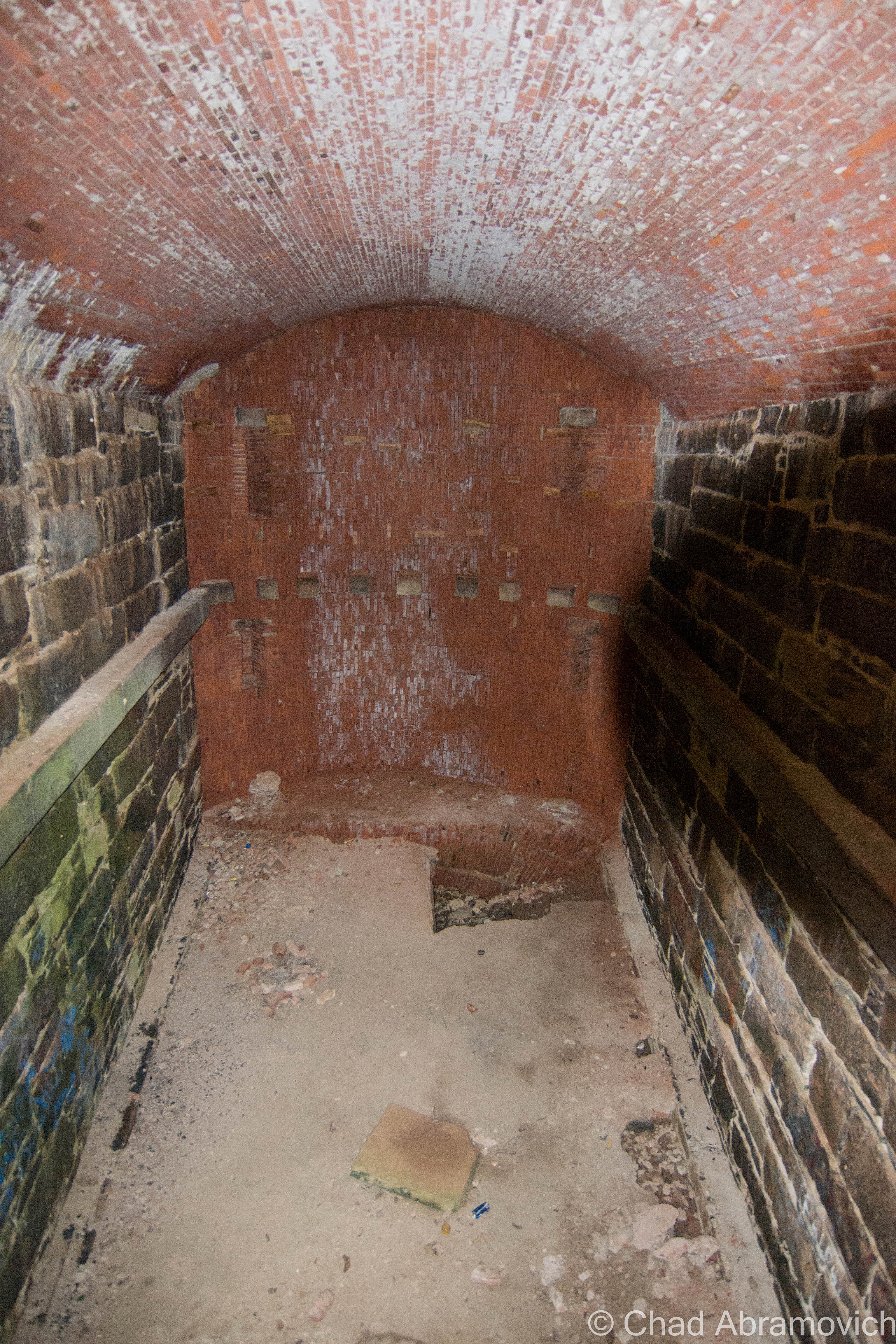
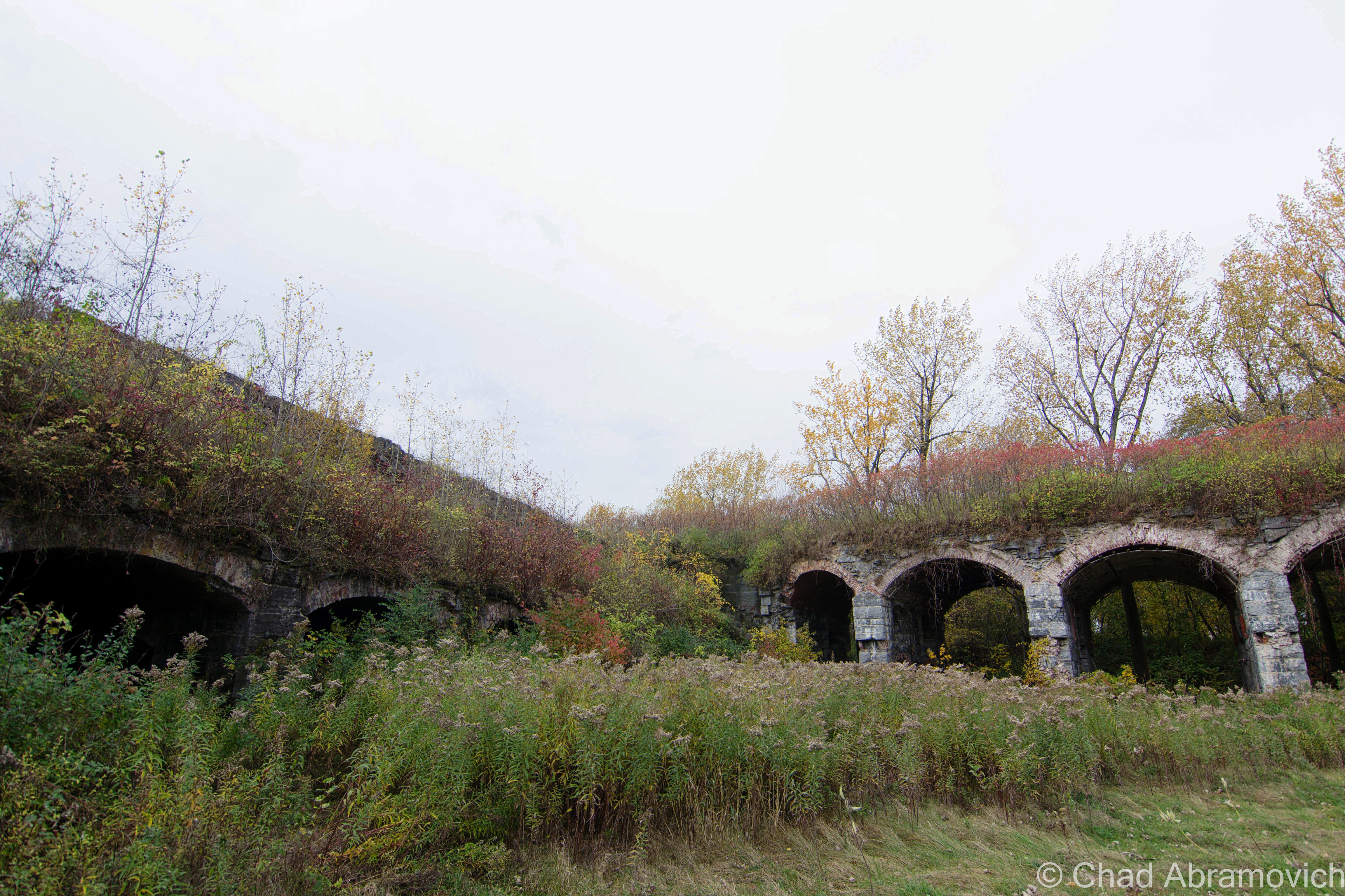
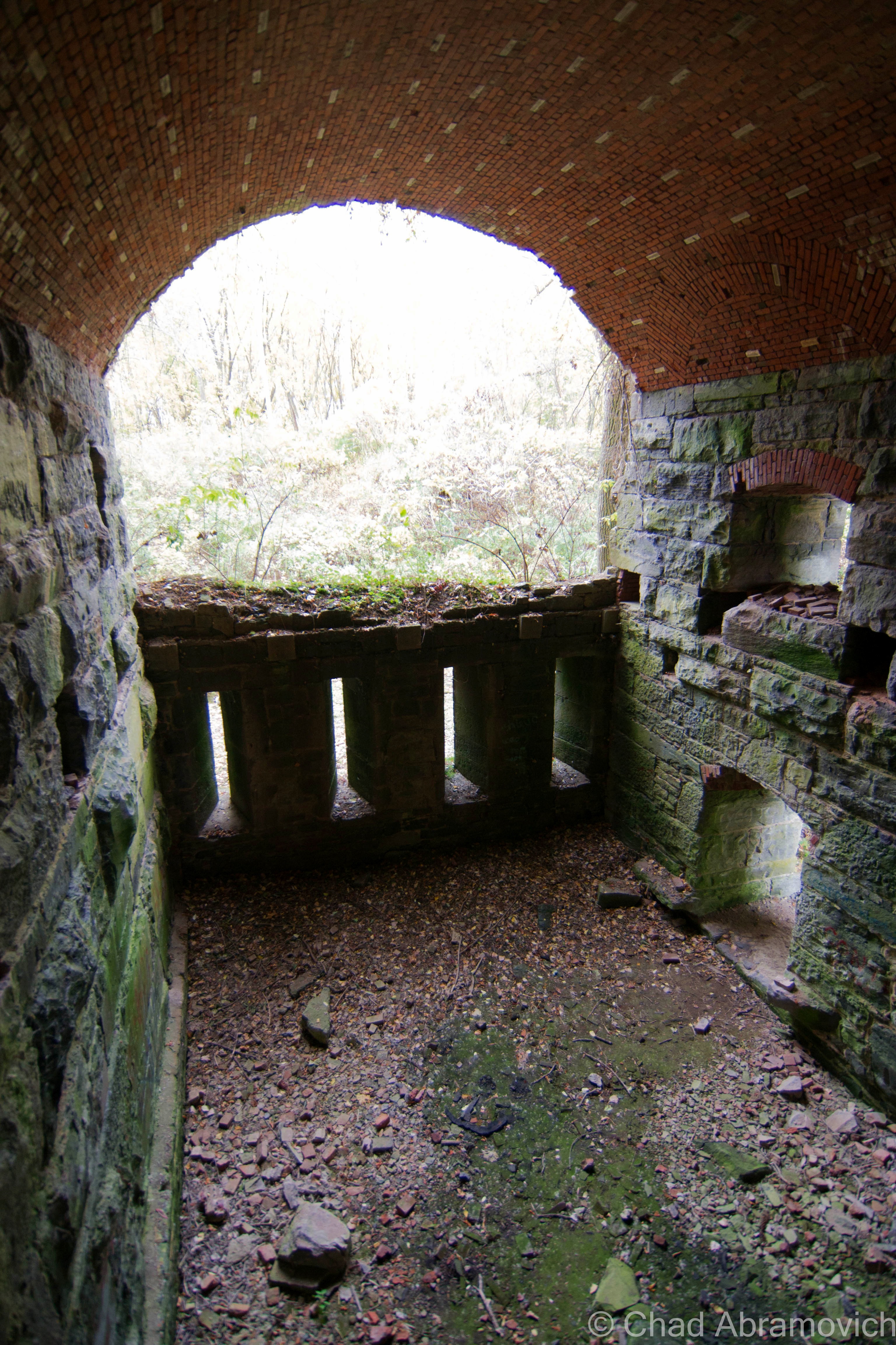
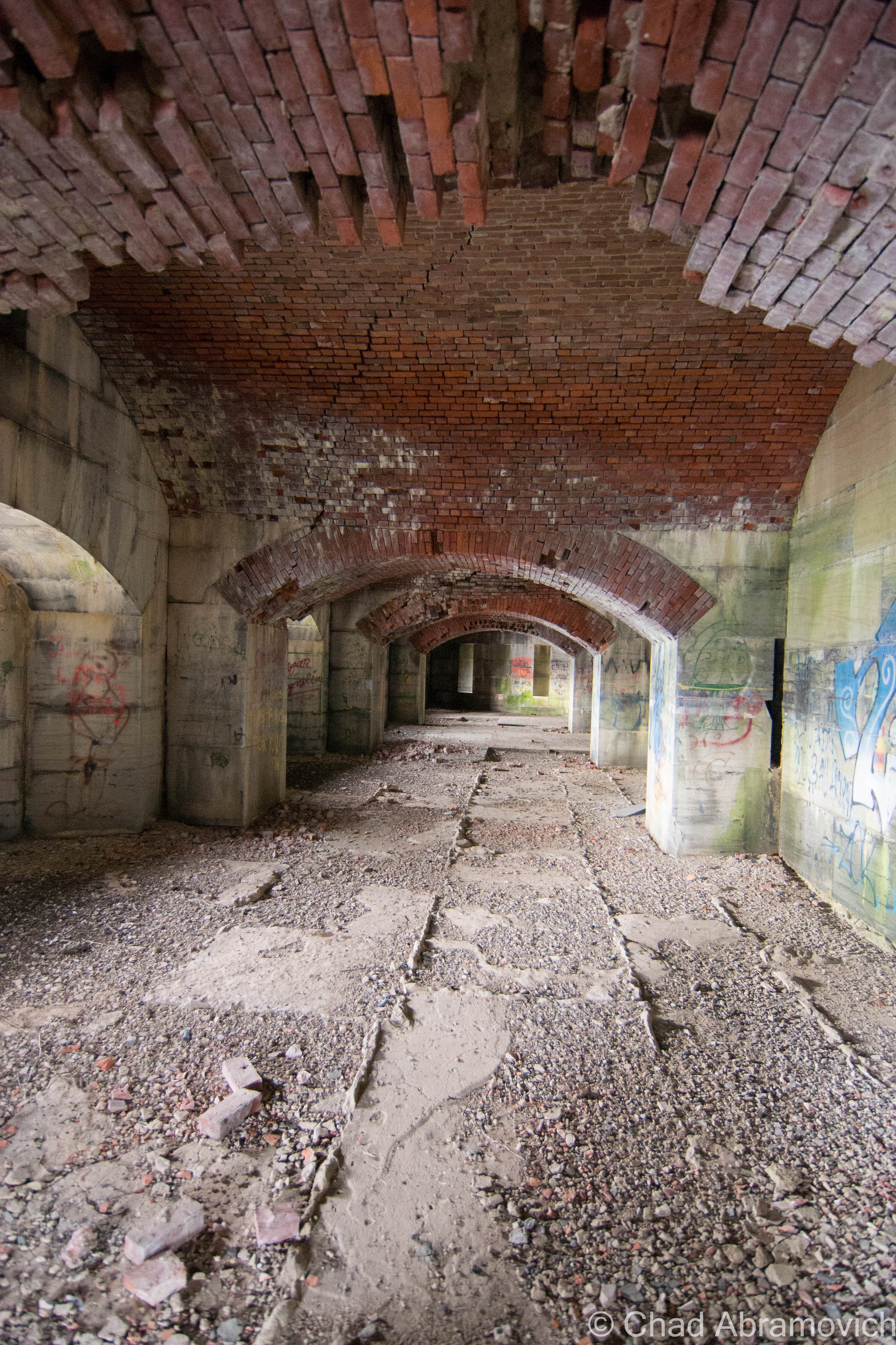
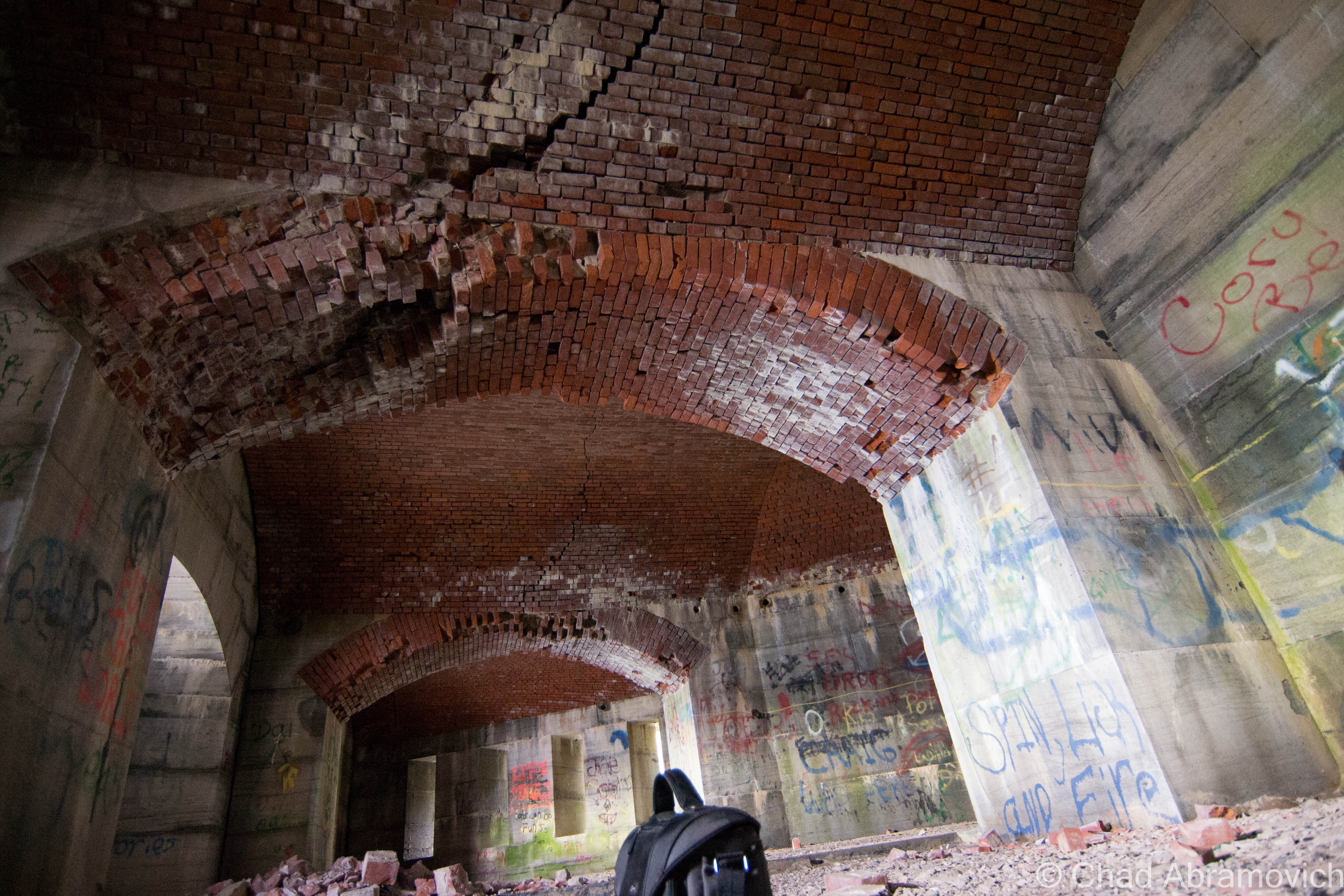
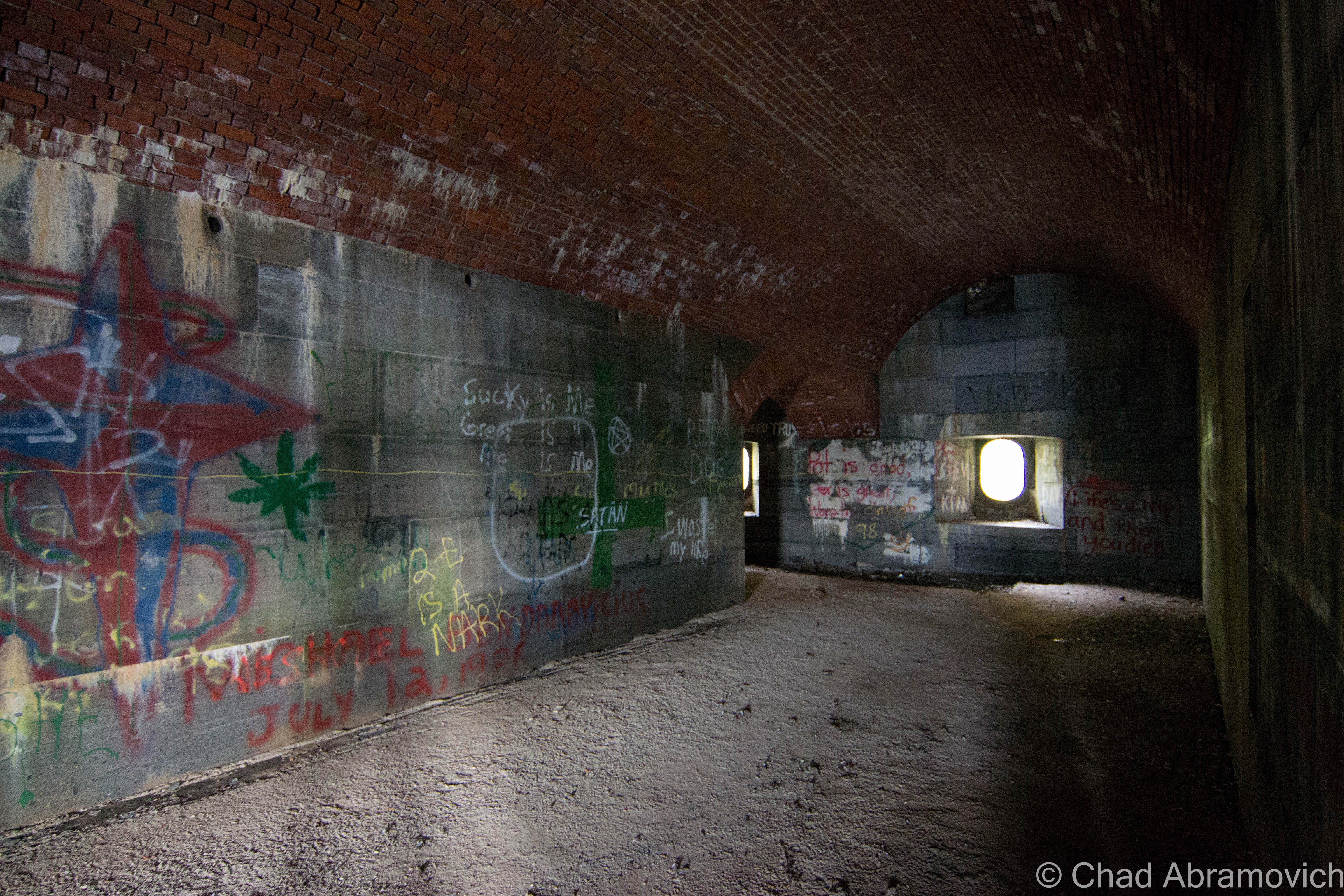
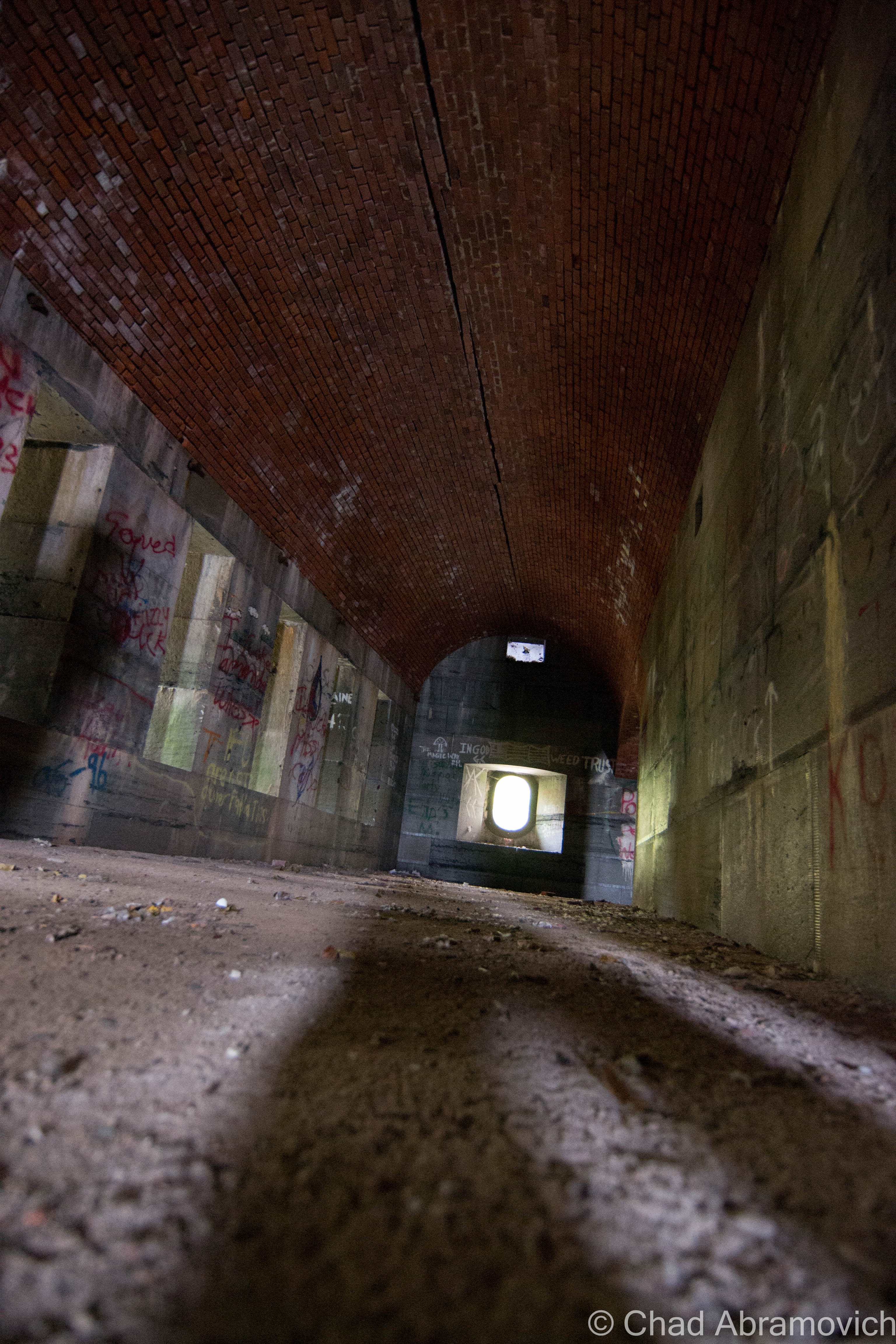
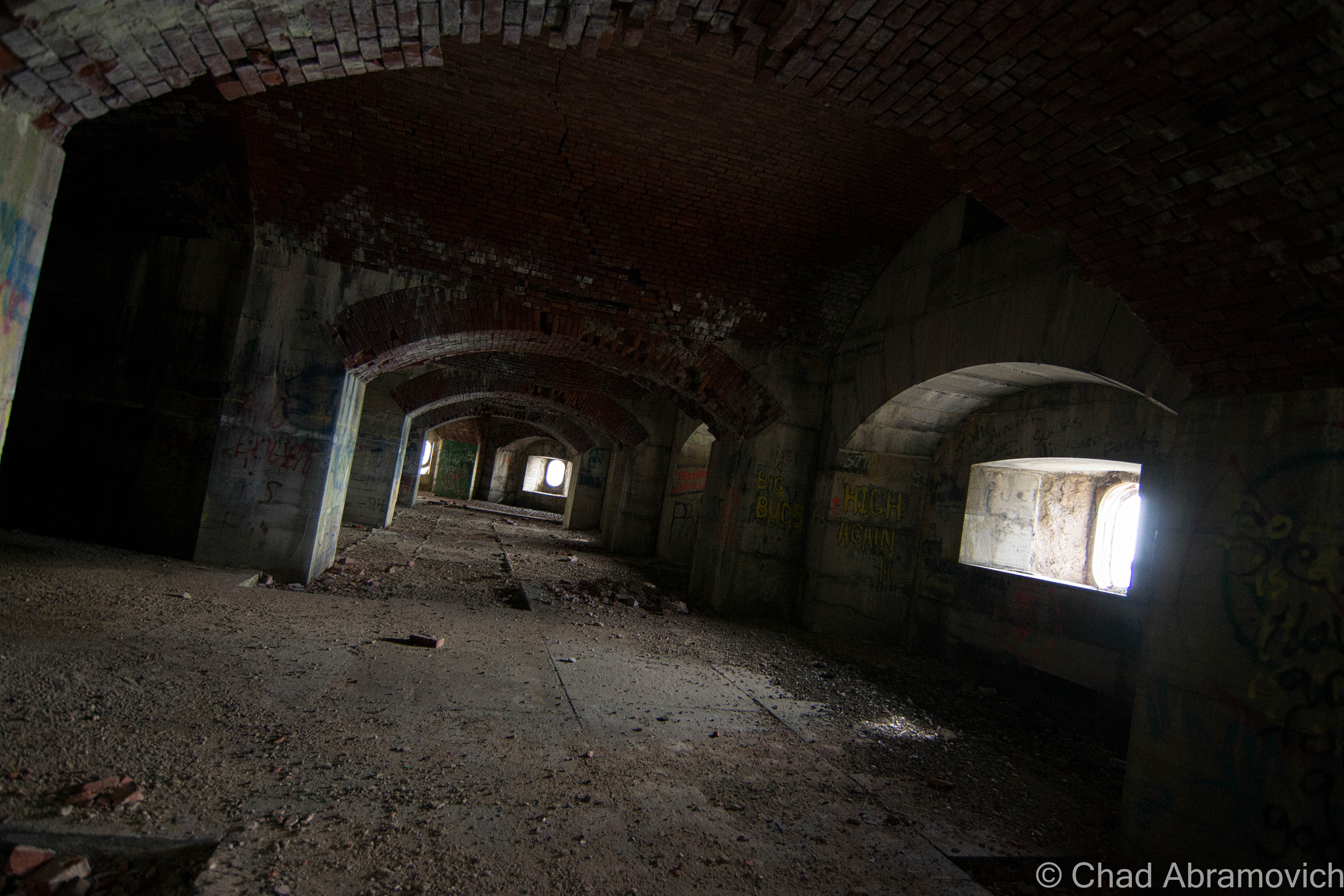
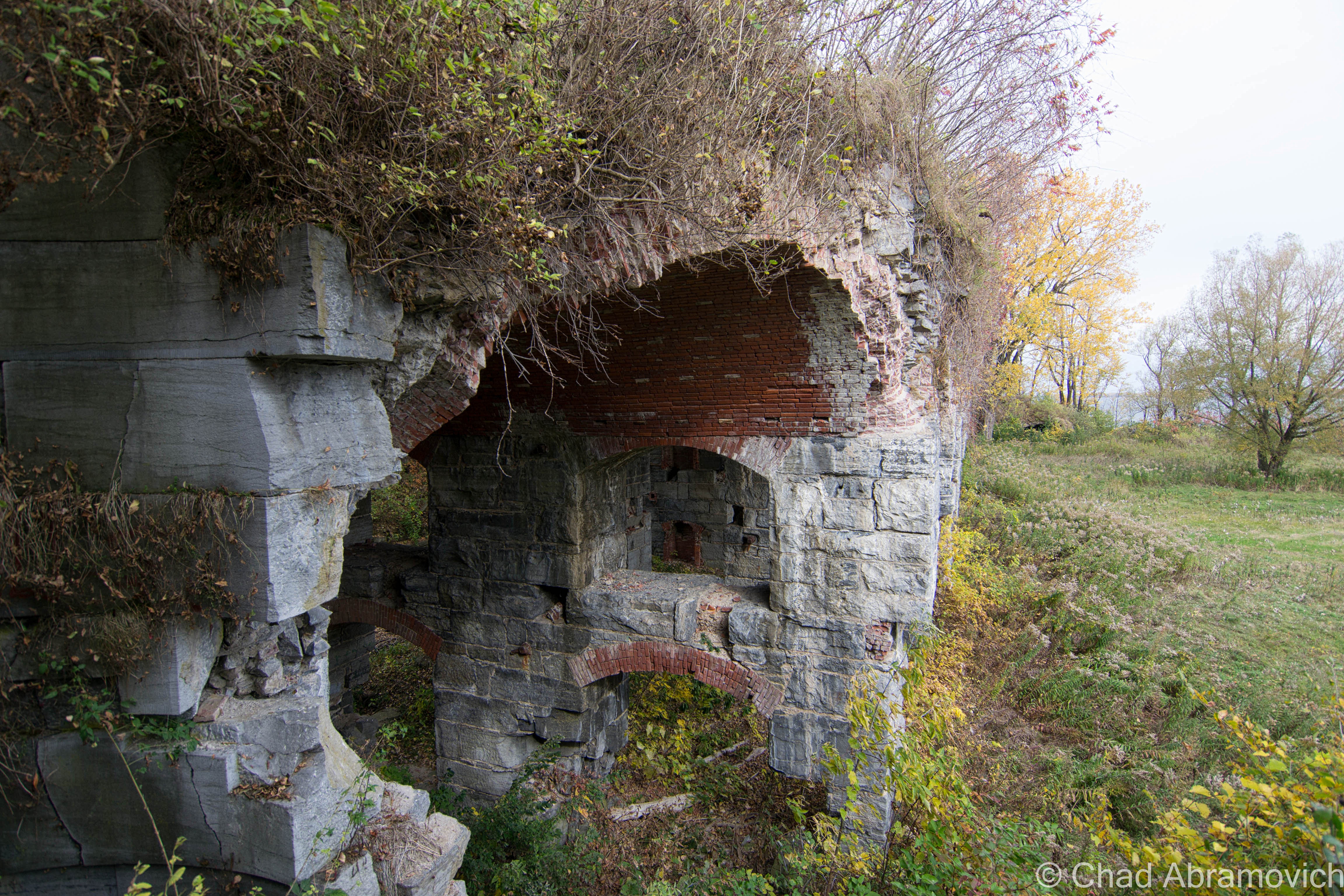
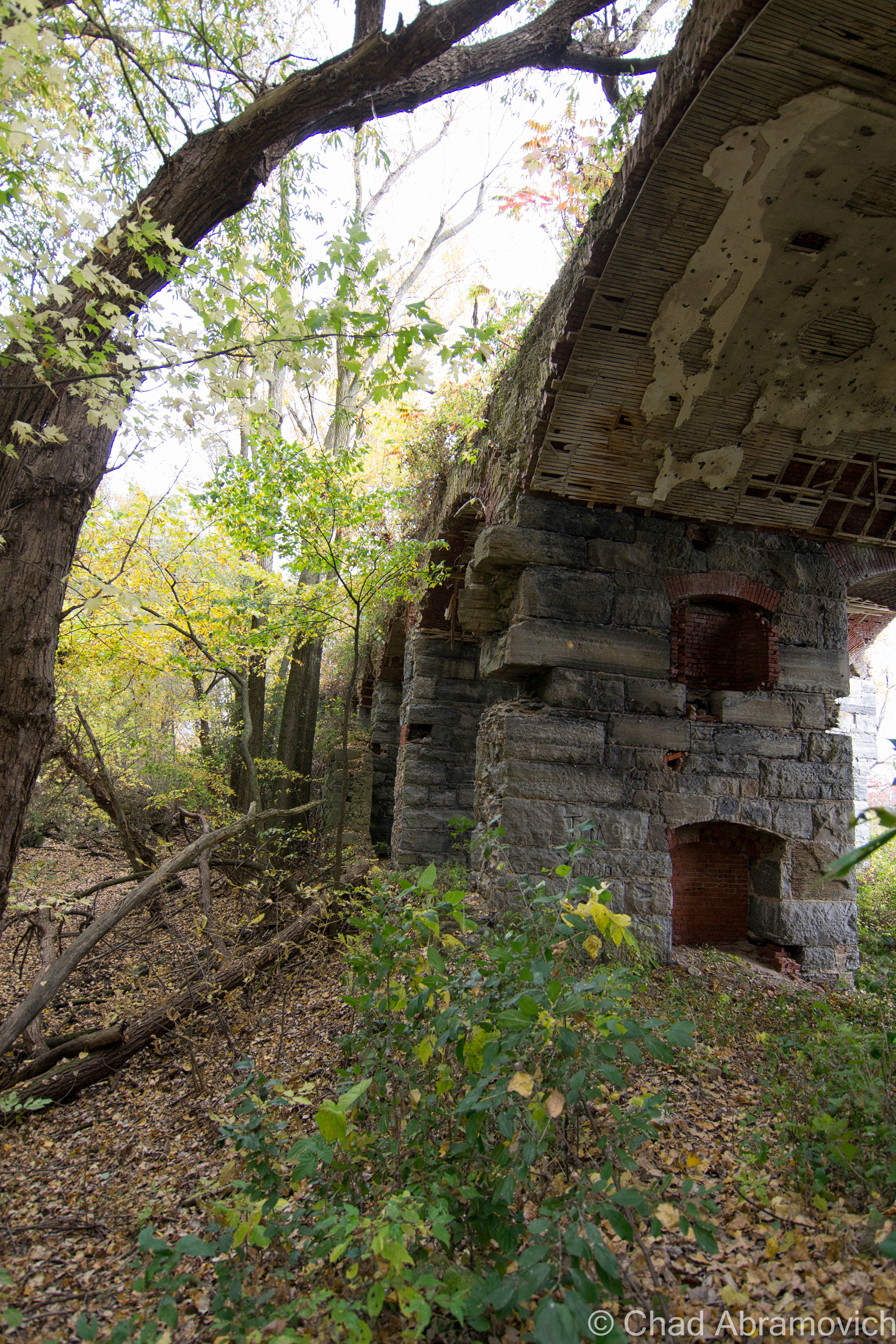
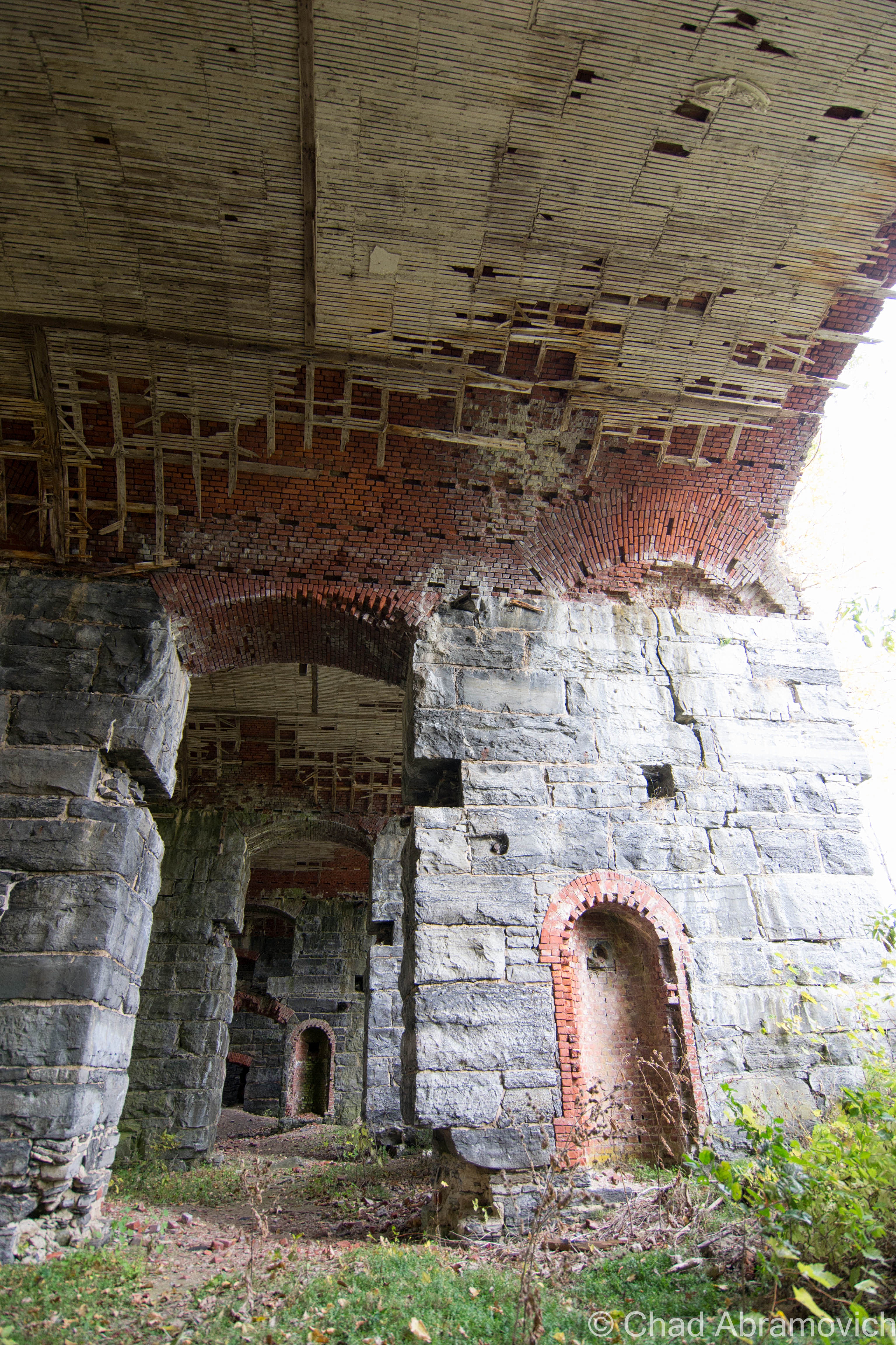
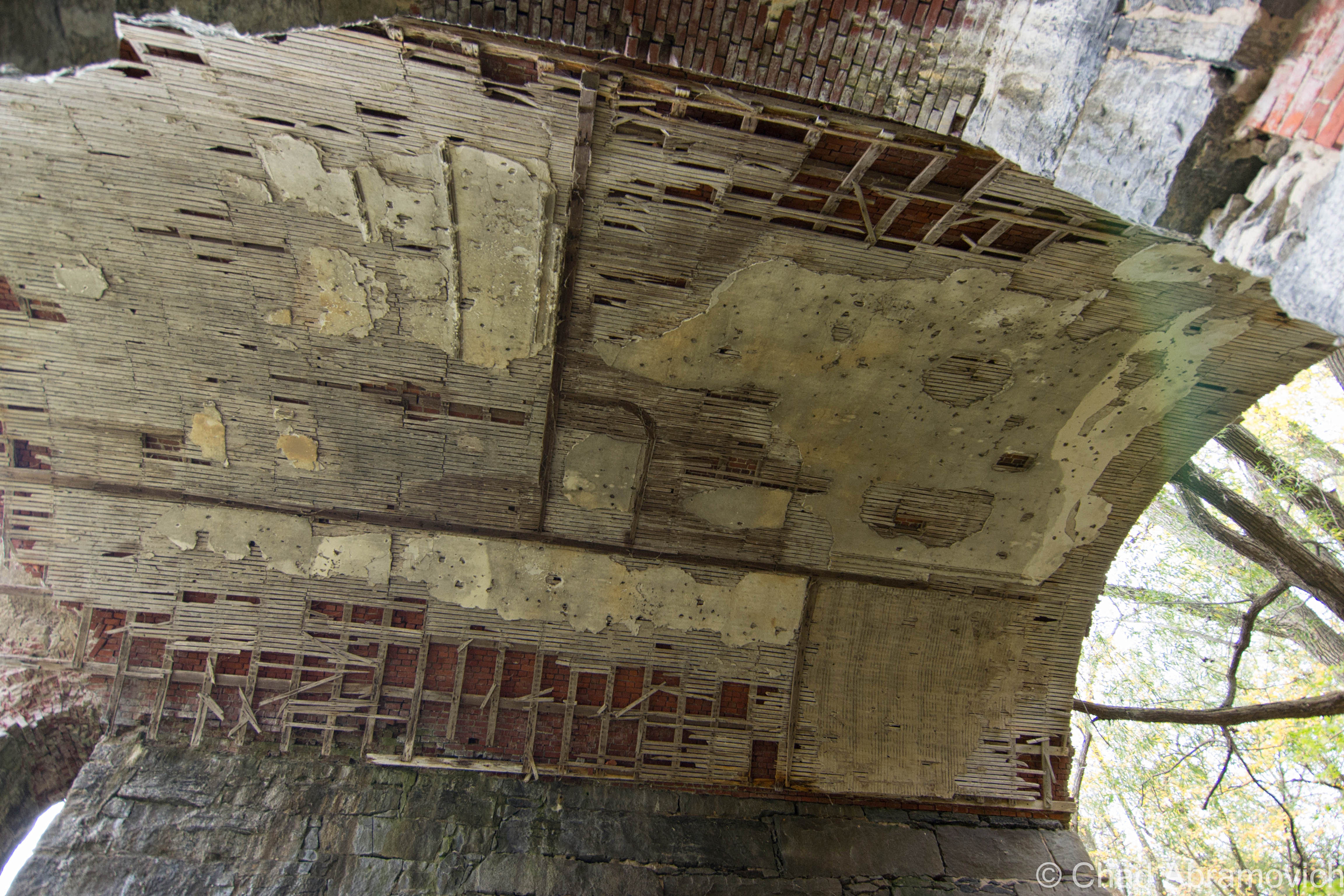
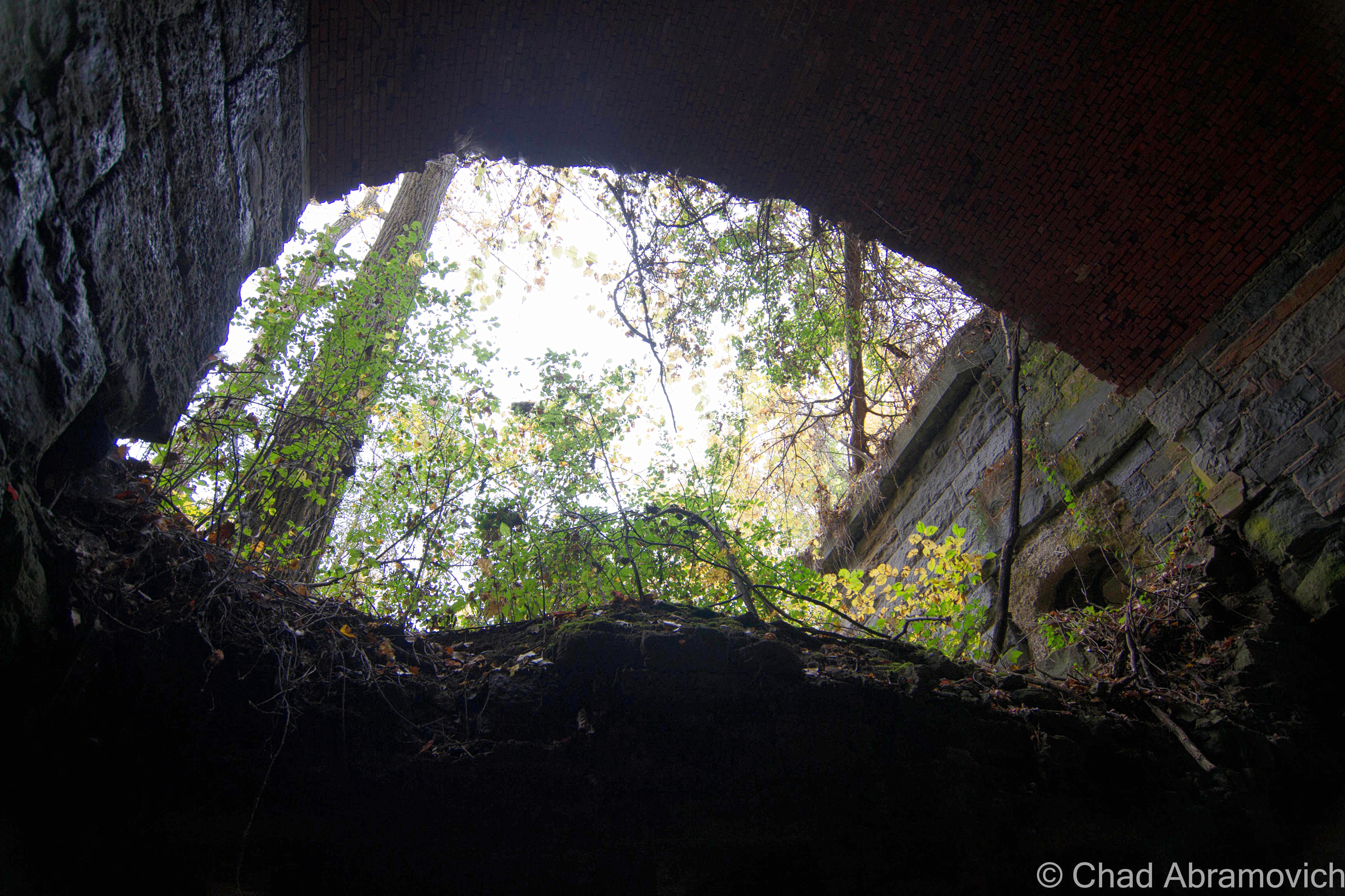
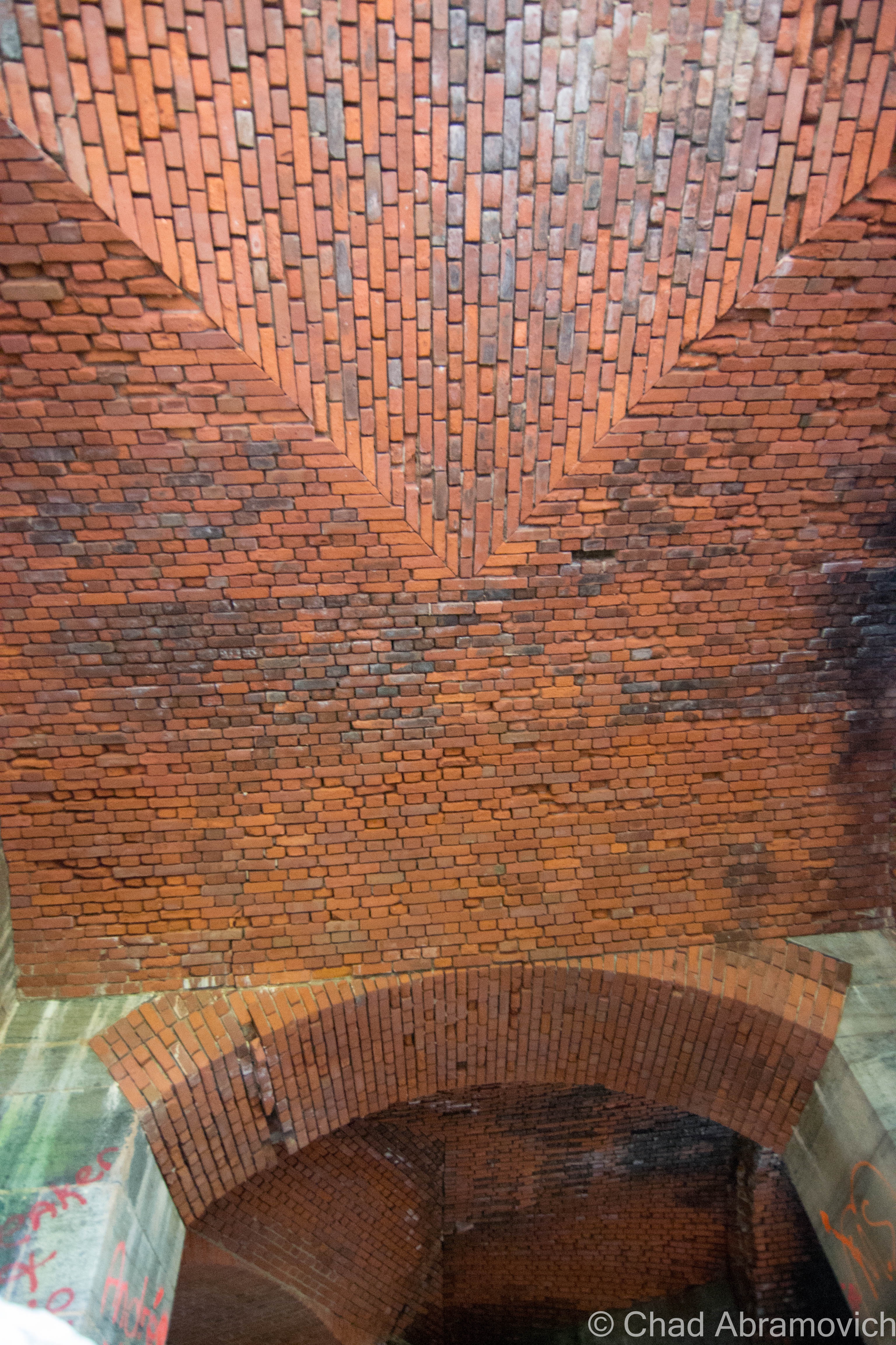
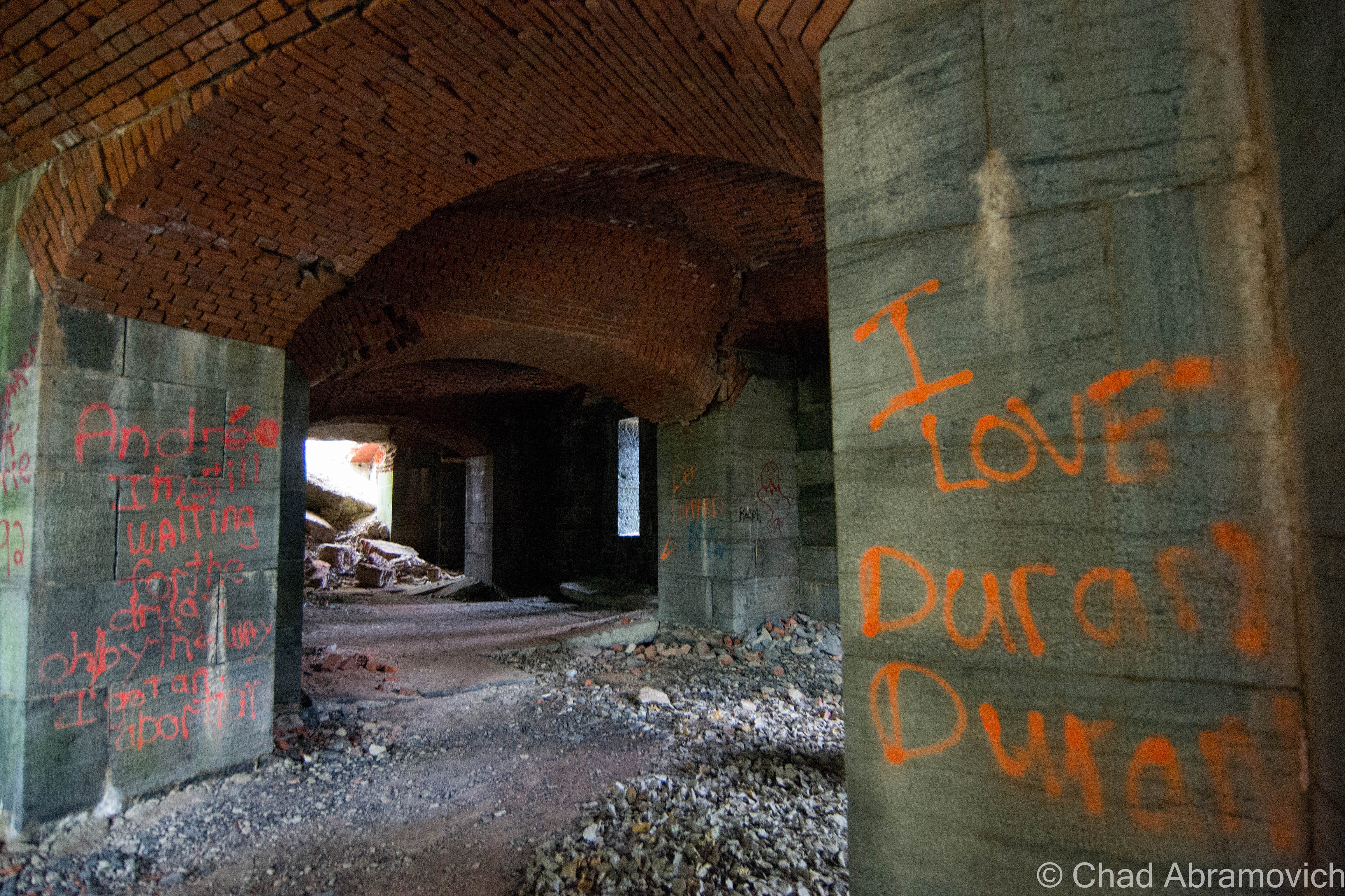
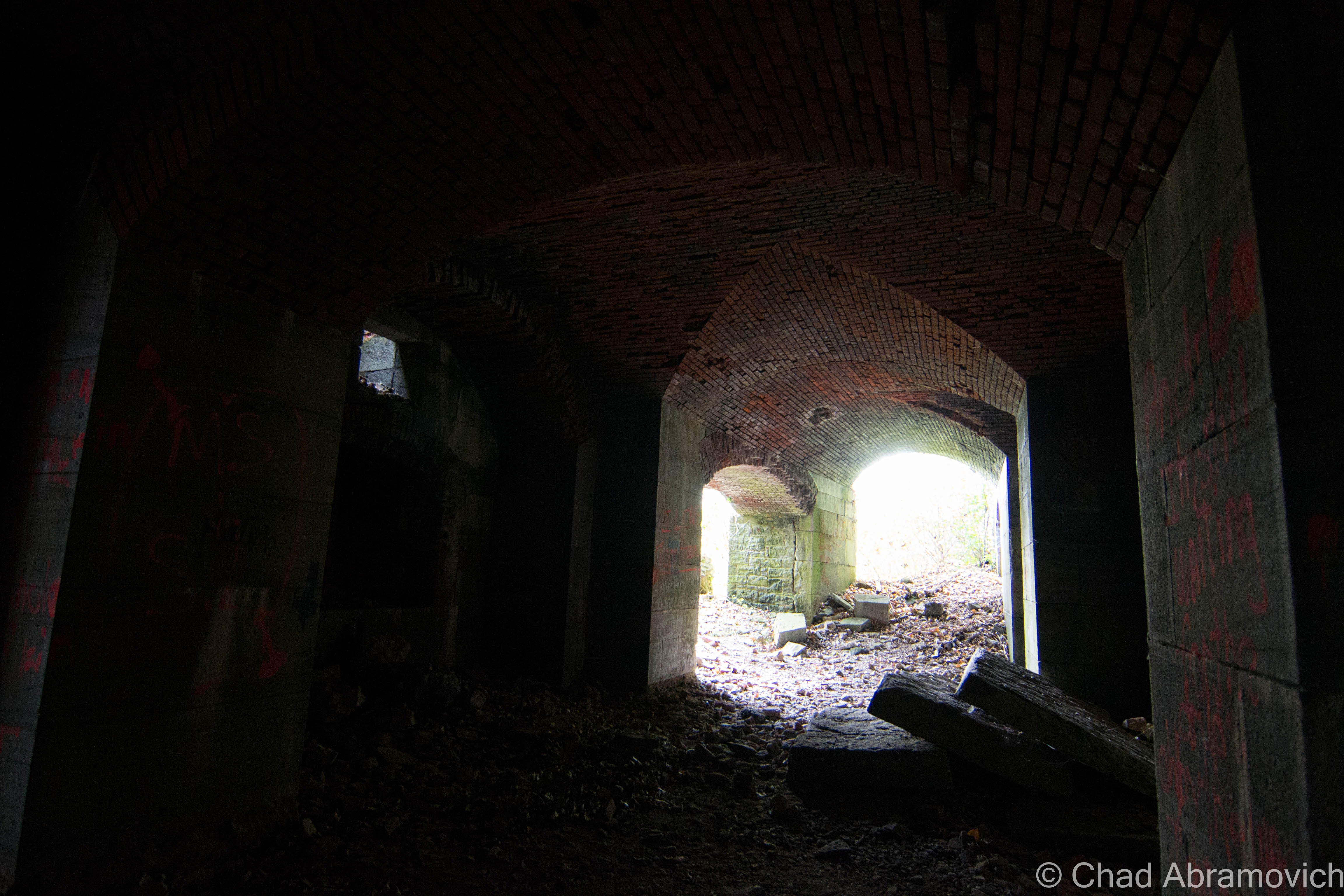
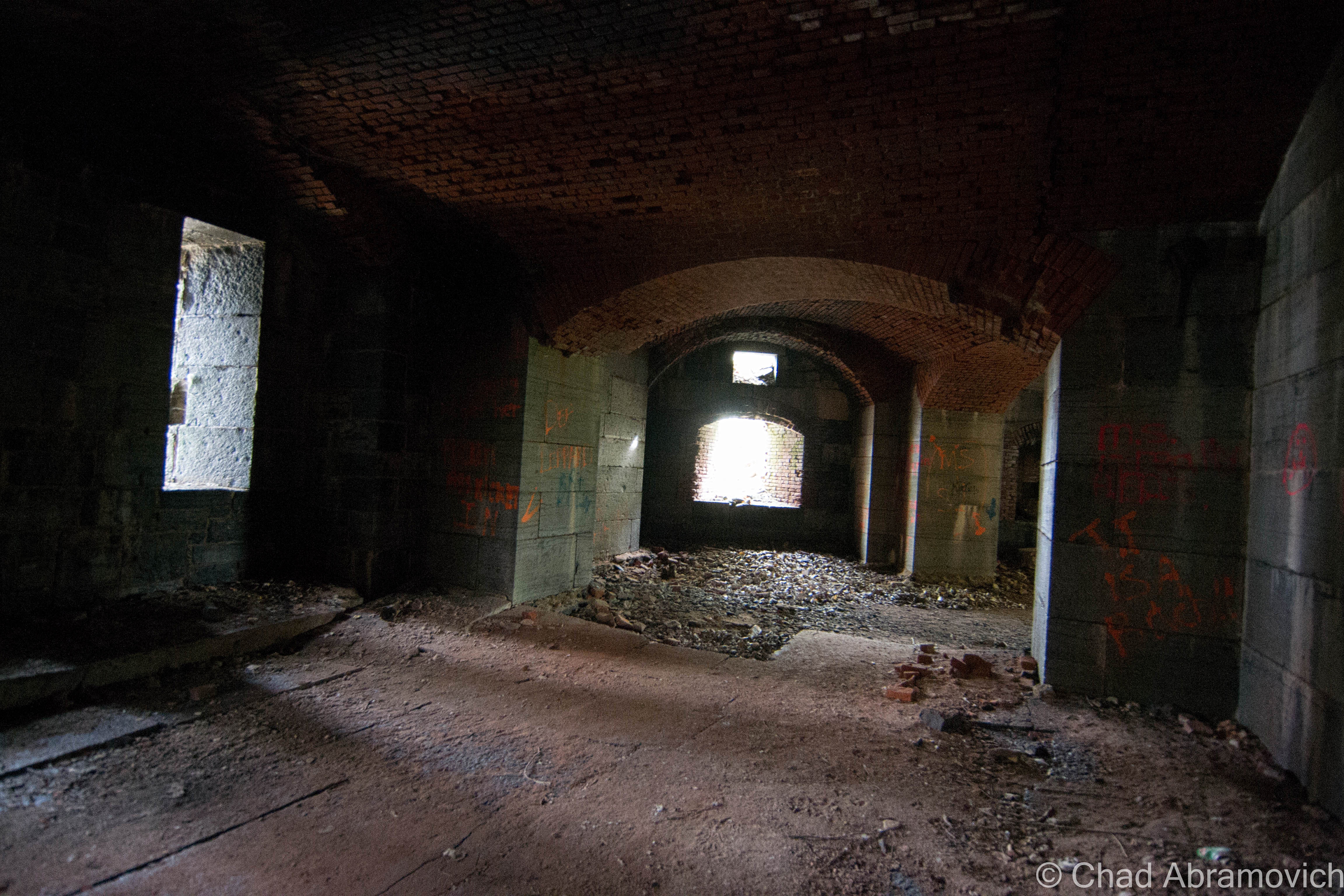
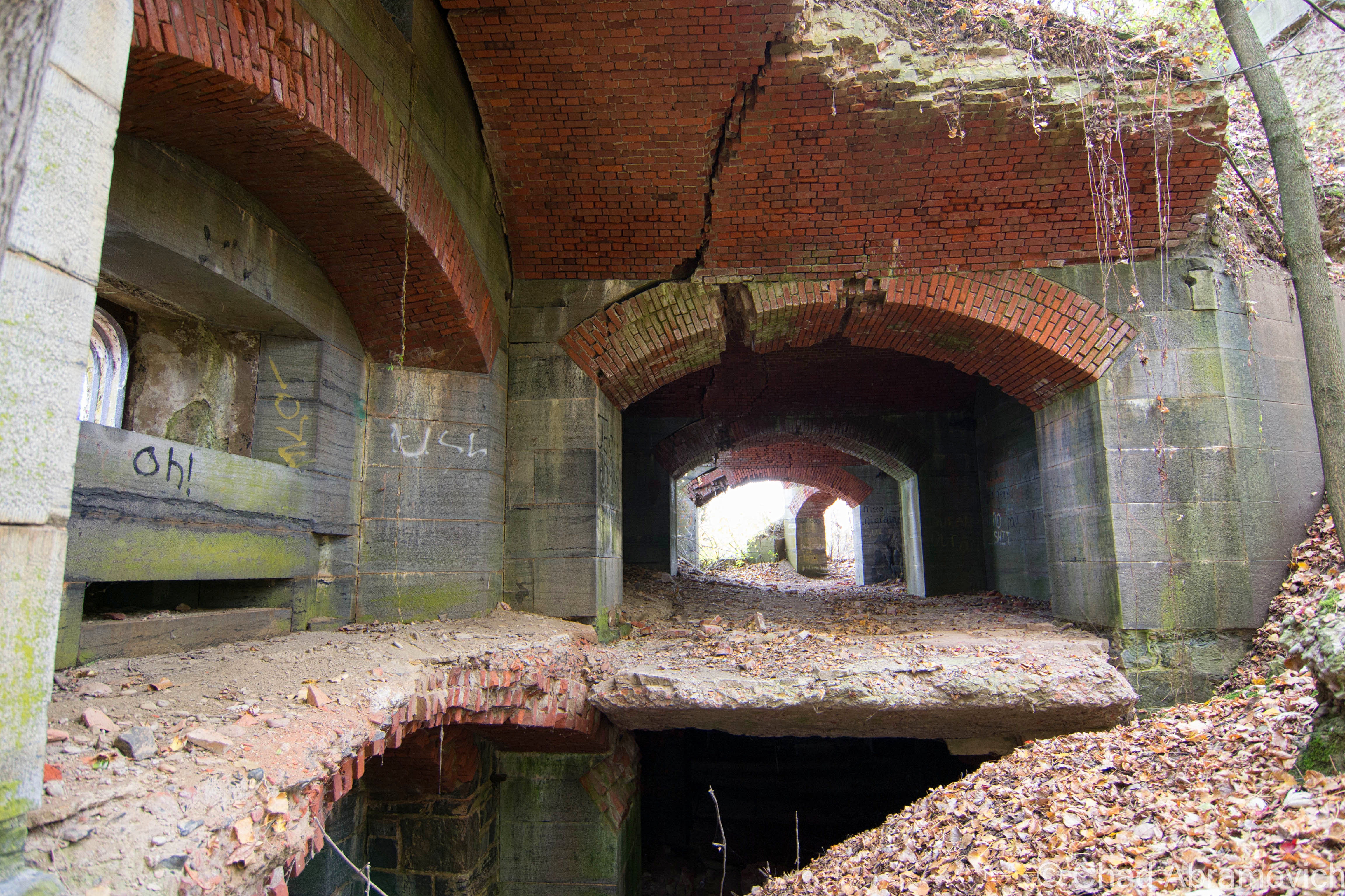
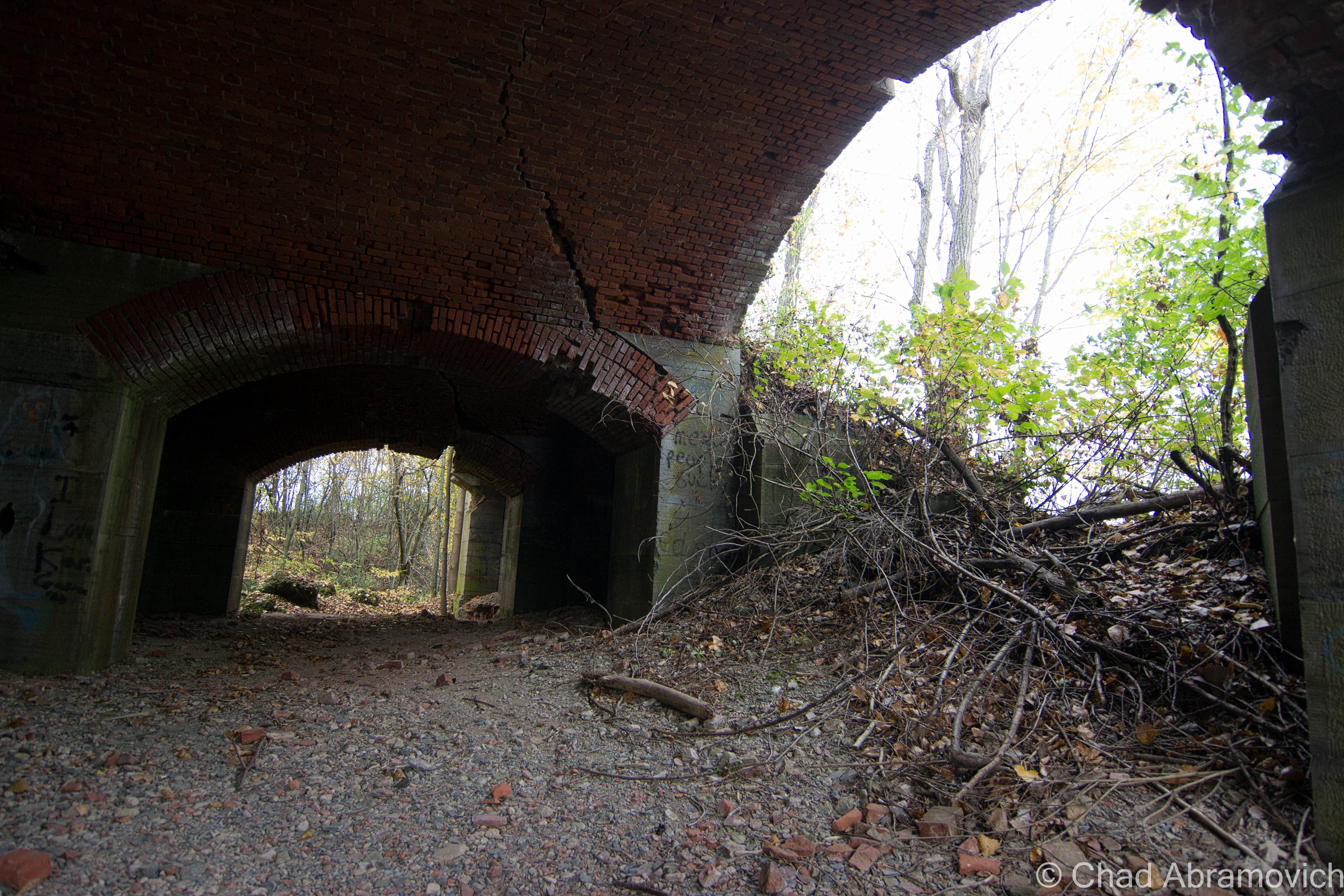
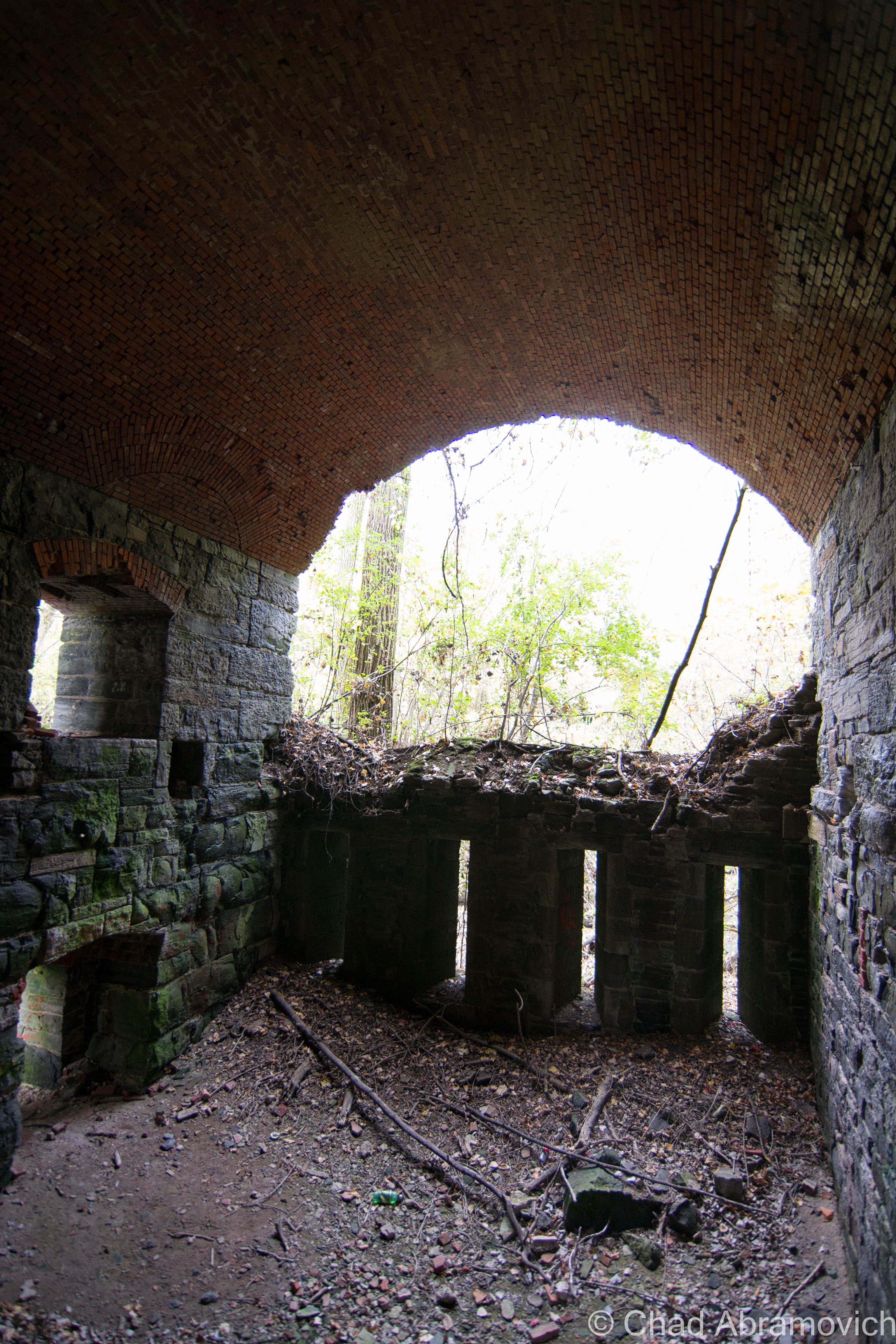
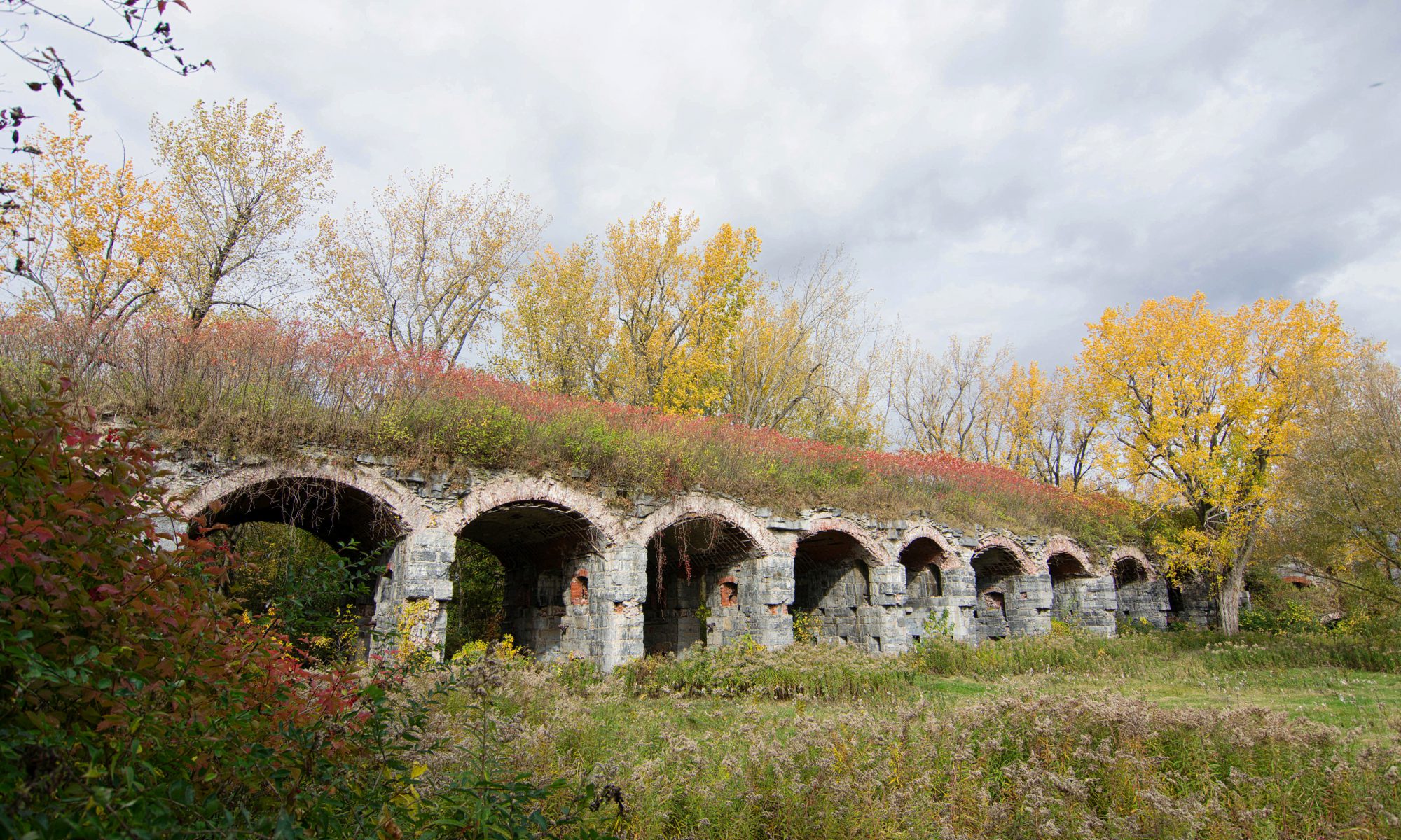
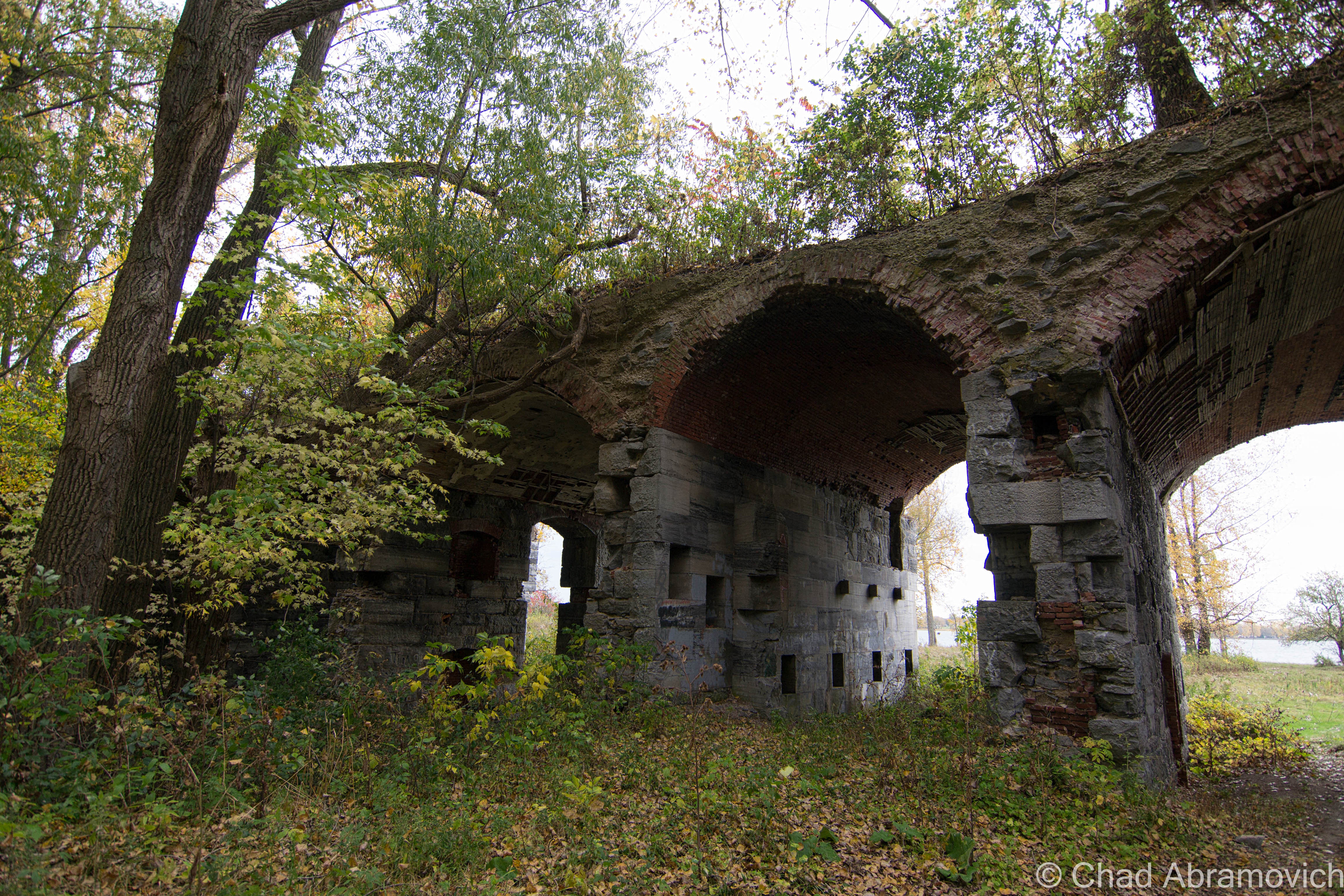
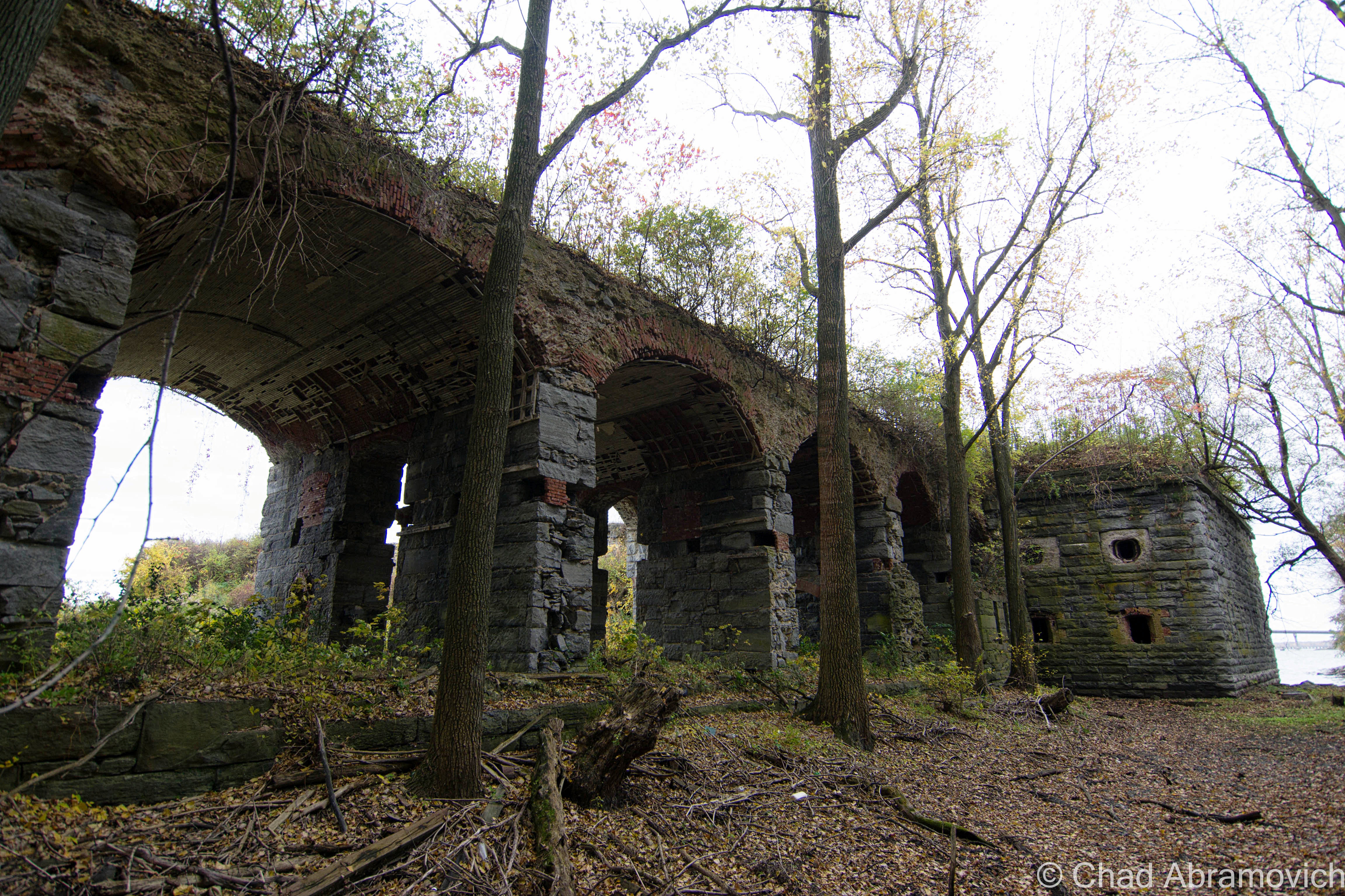
Stumbling my way around the impressively dangerous ruins of Fort Montgomery, as my presence disturbed hundreds of Pigeons that are now the fort’s permanent residents, I was nothing short of awe inspired. Though only 1/3rd (give or take) of the fort actually remains, it was immense in anyway you can measure it up. Stone and brick walls several feet thick, uniform archways framing collapsing brick ceilings and leafy hardwood trees lead into cavernous casemates that entombed a dank chilliness that left residue on the aging stones, regardless of the out of seasonal 80 degree fall day that we chose to explore.

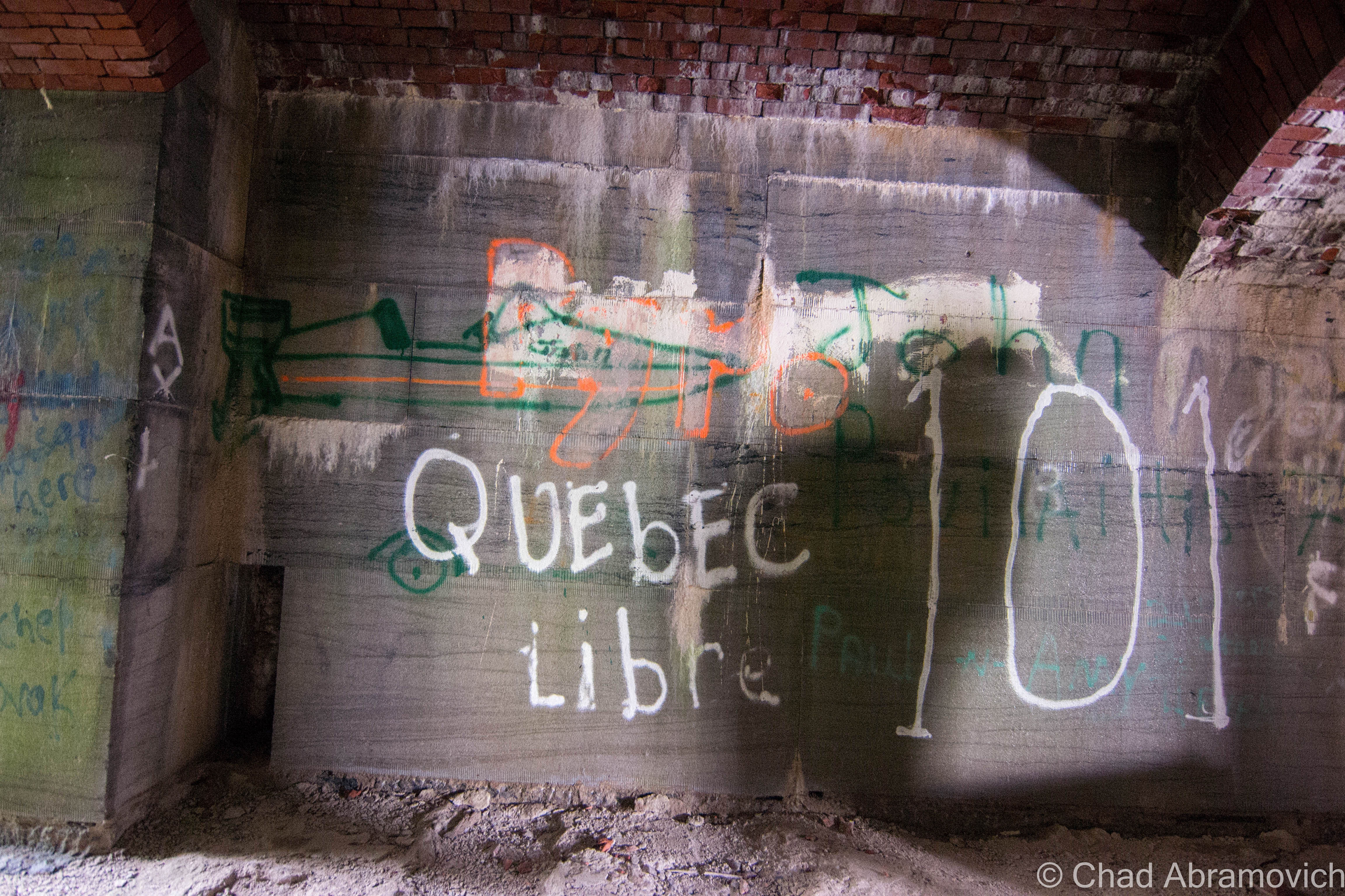
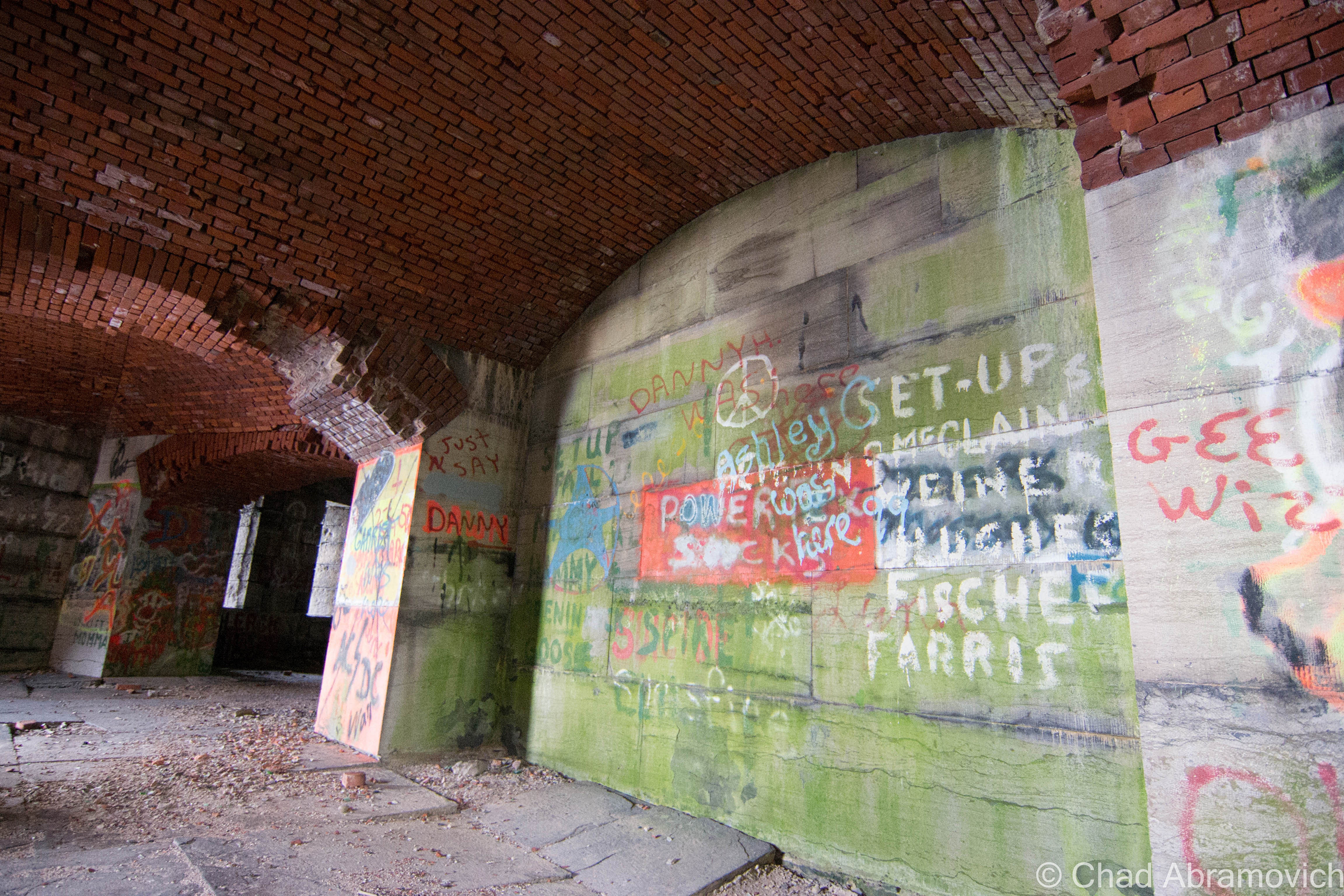
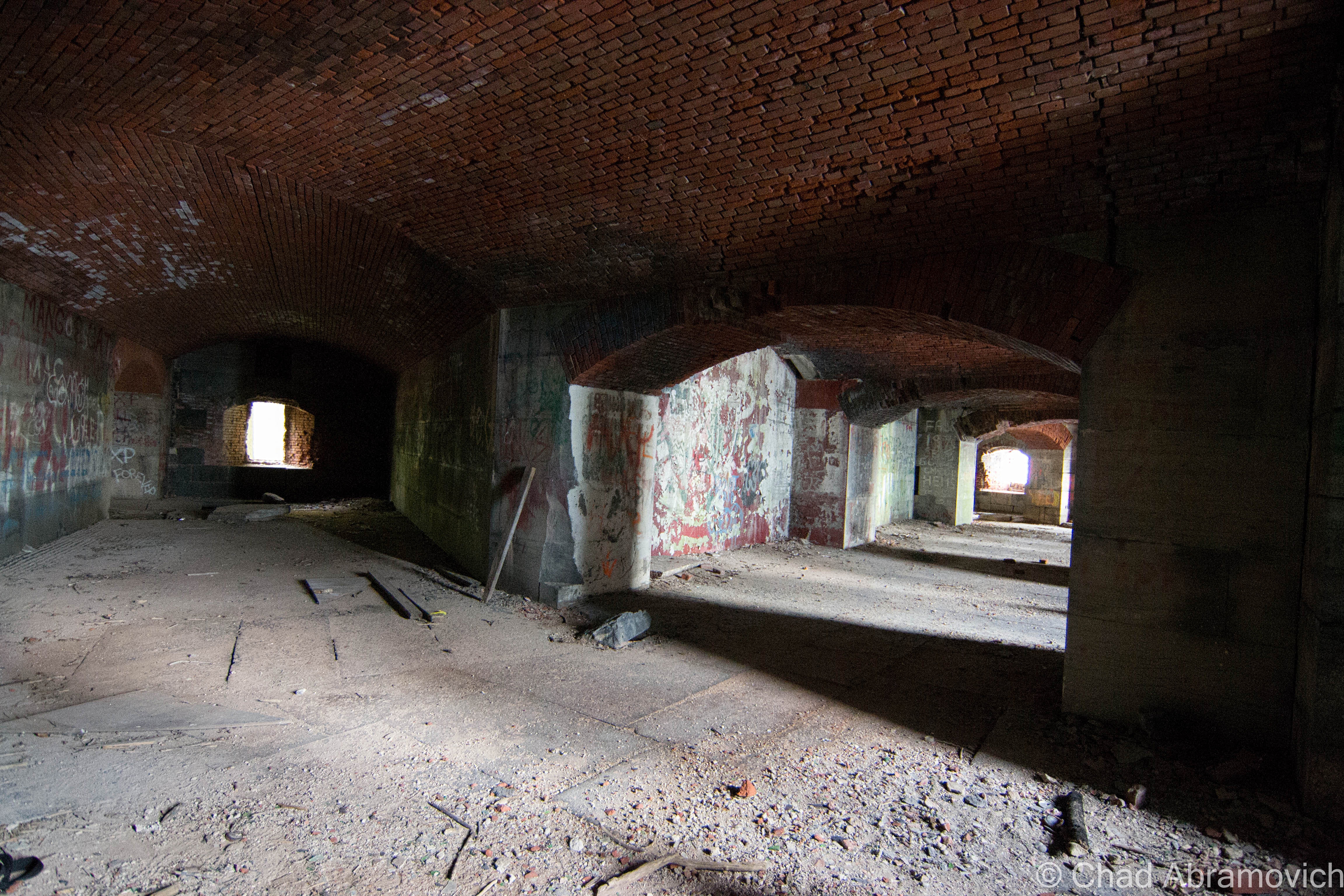
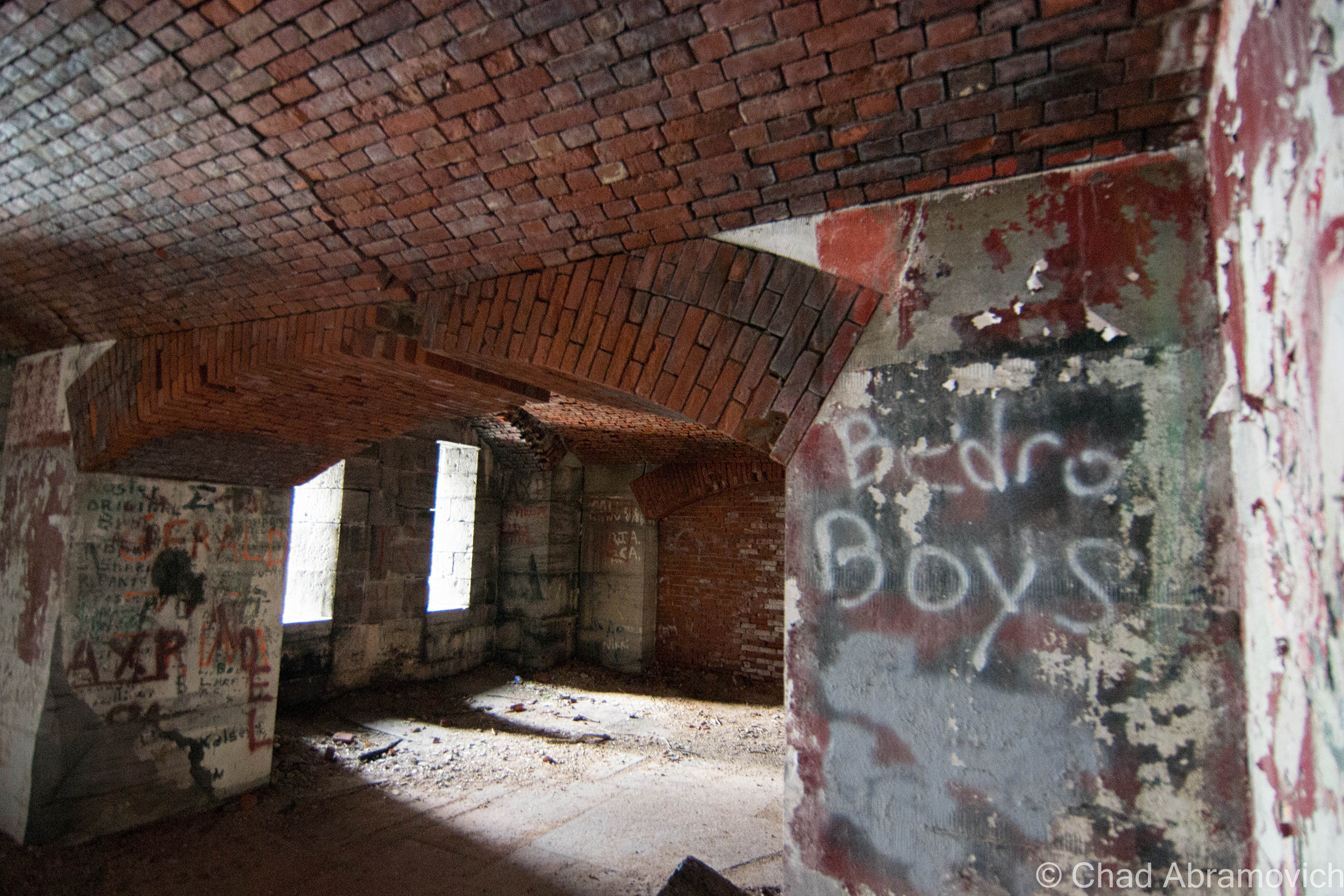
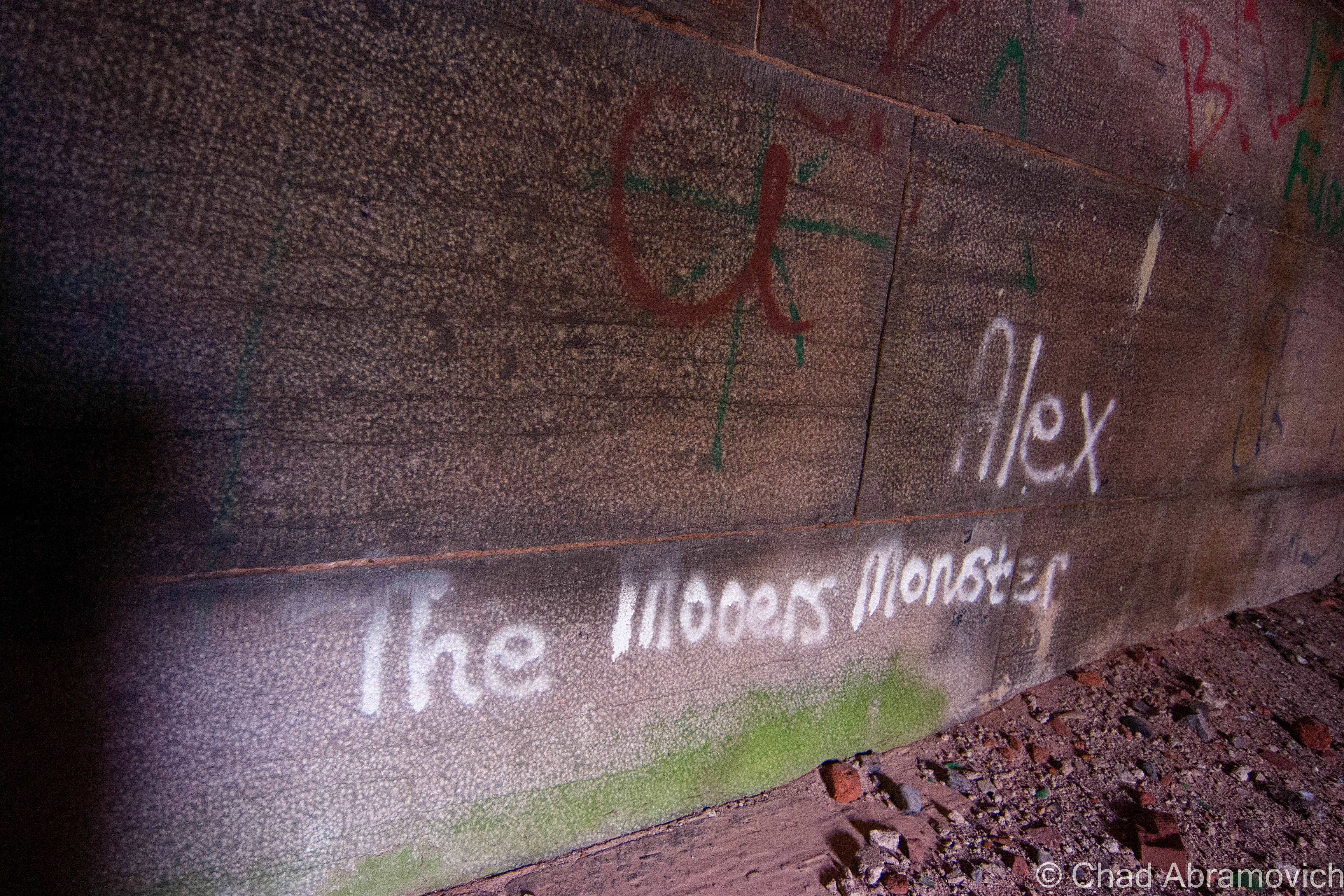
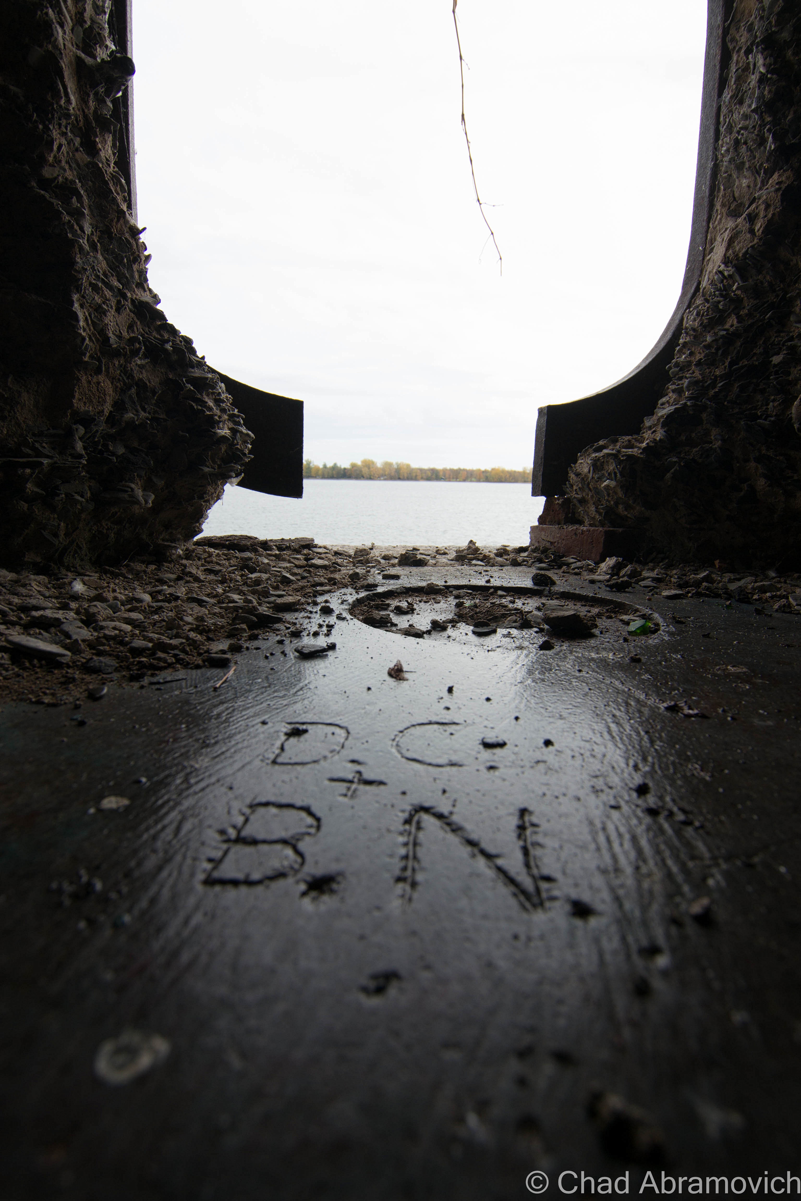
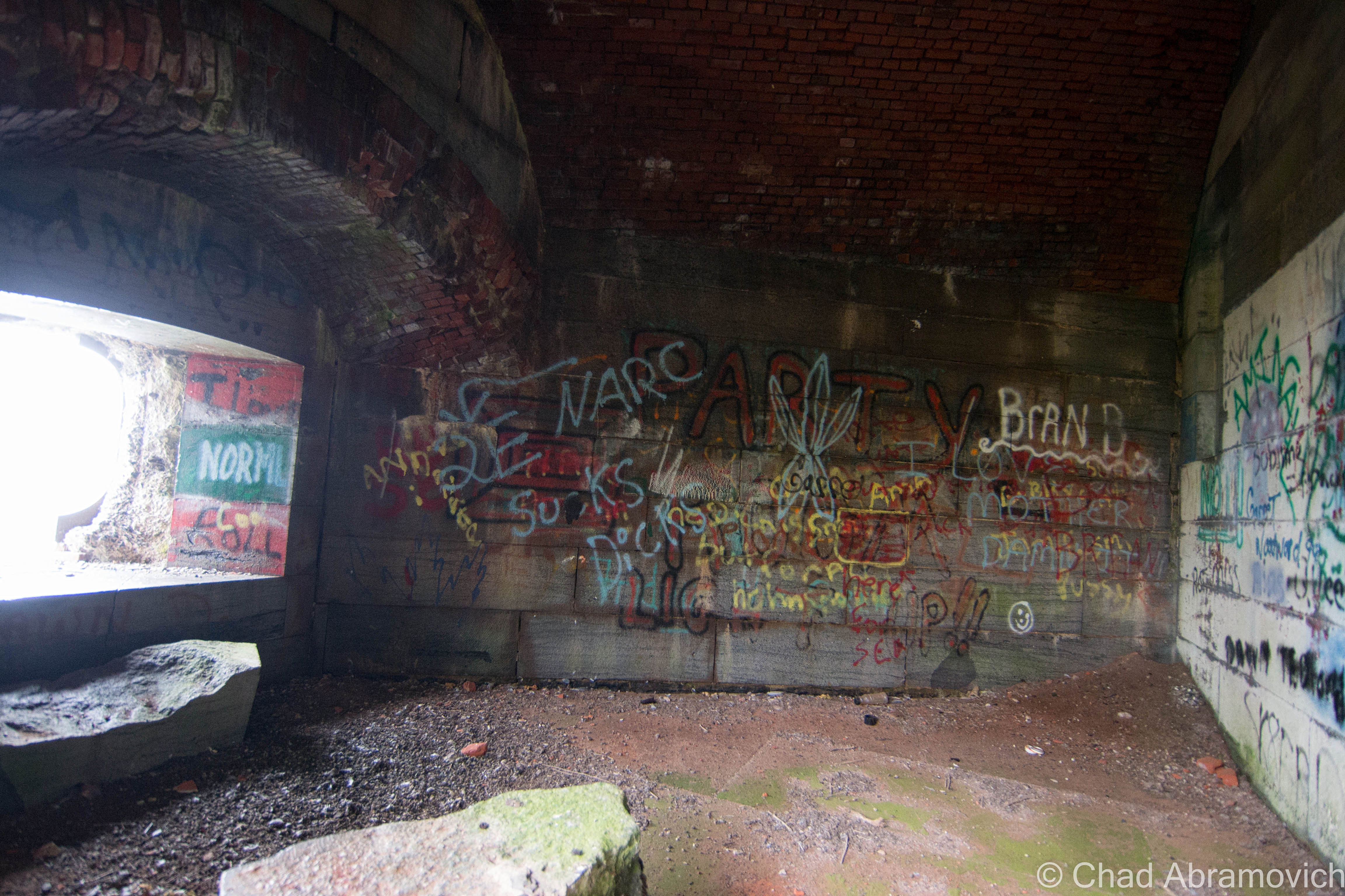
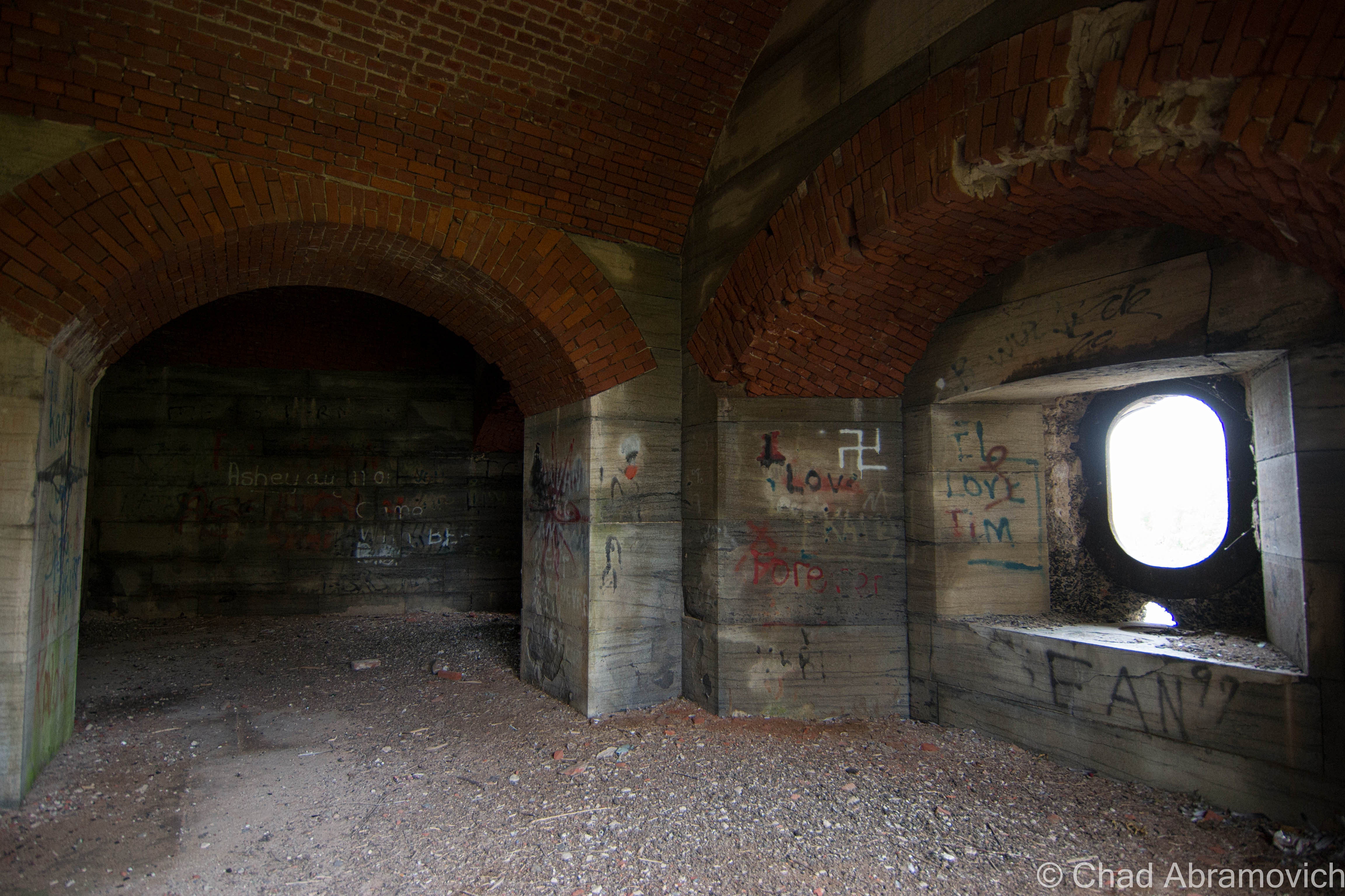
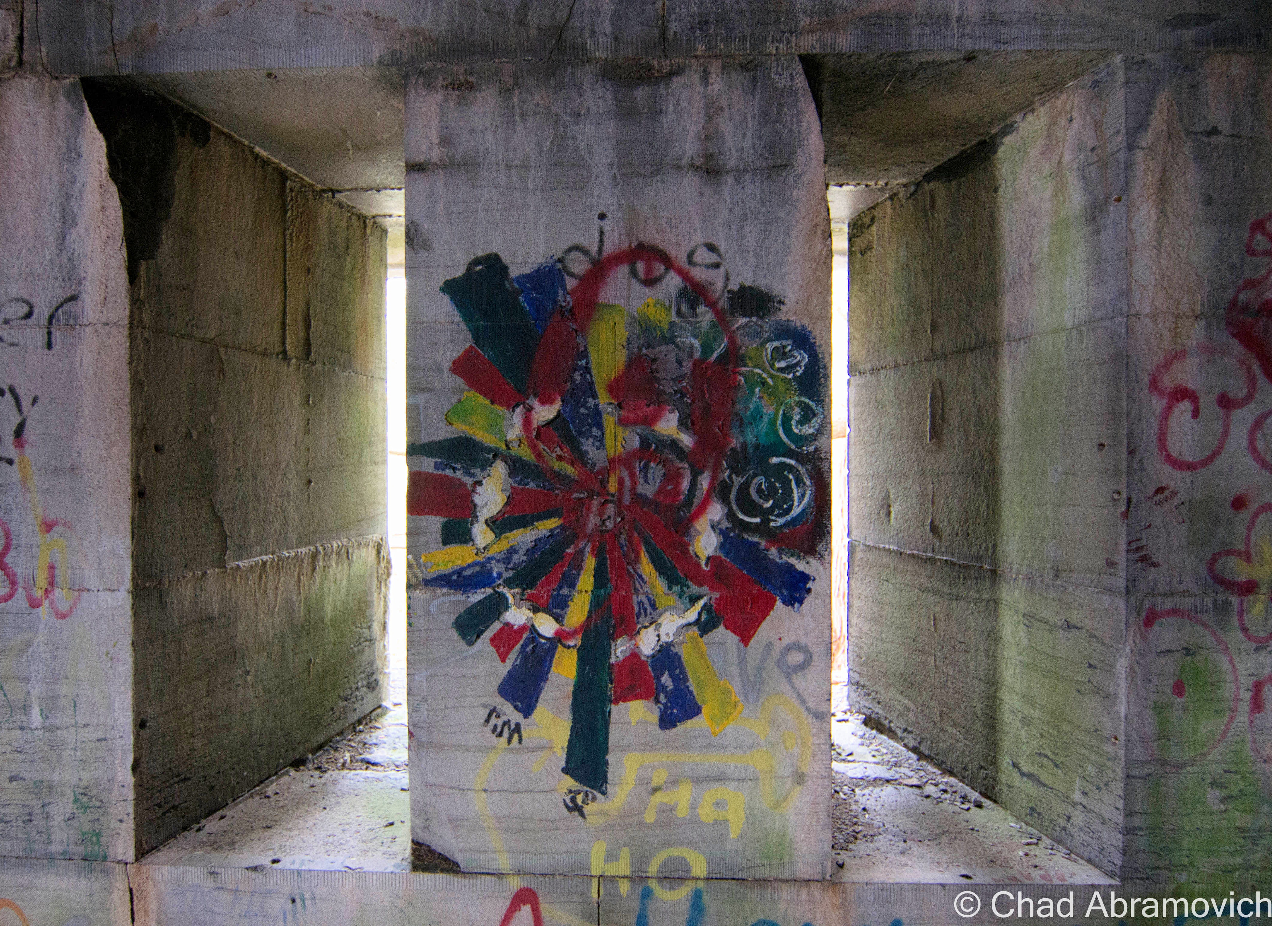
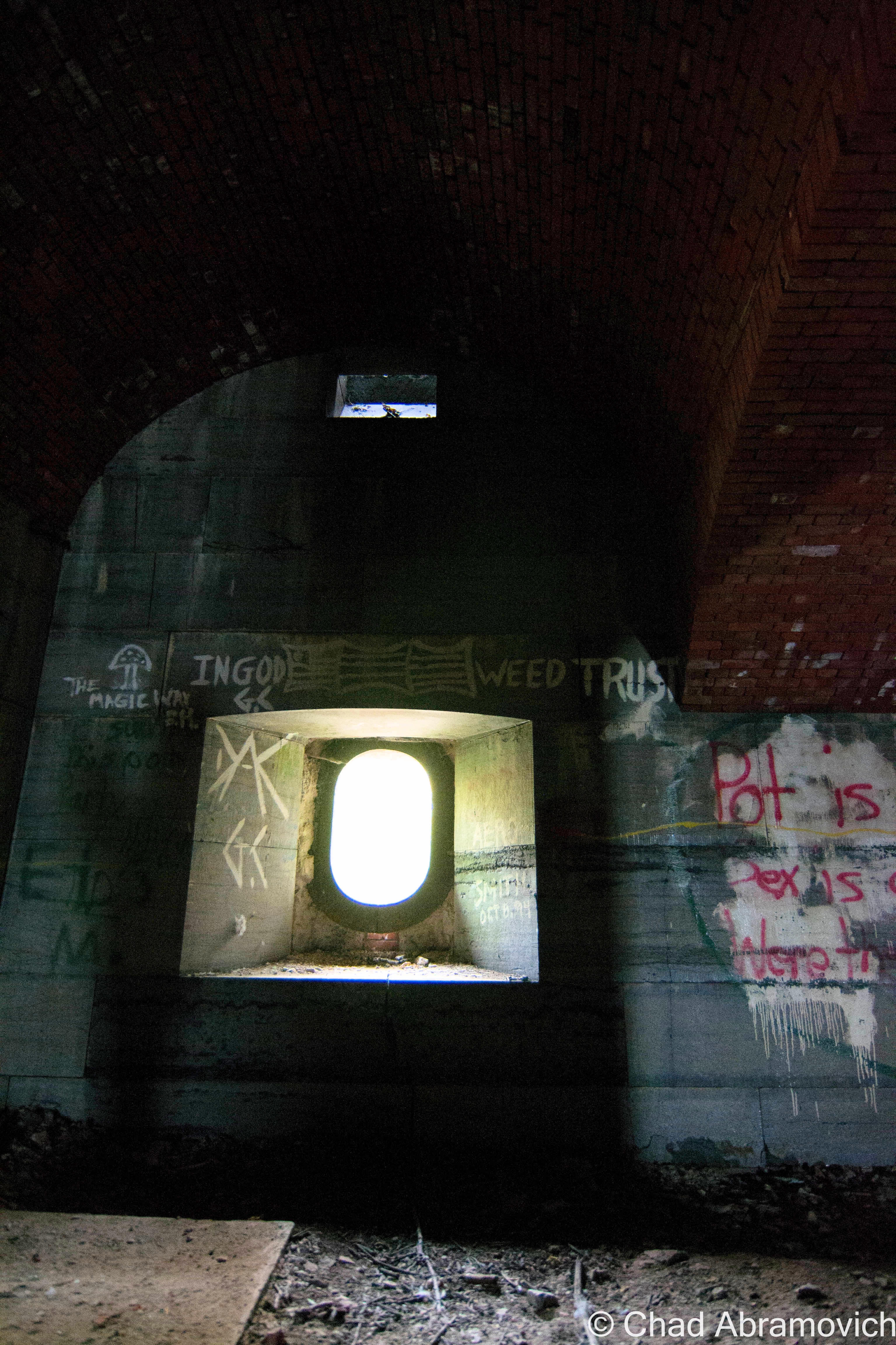
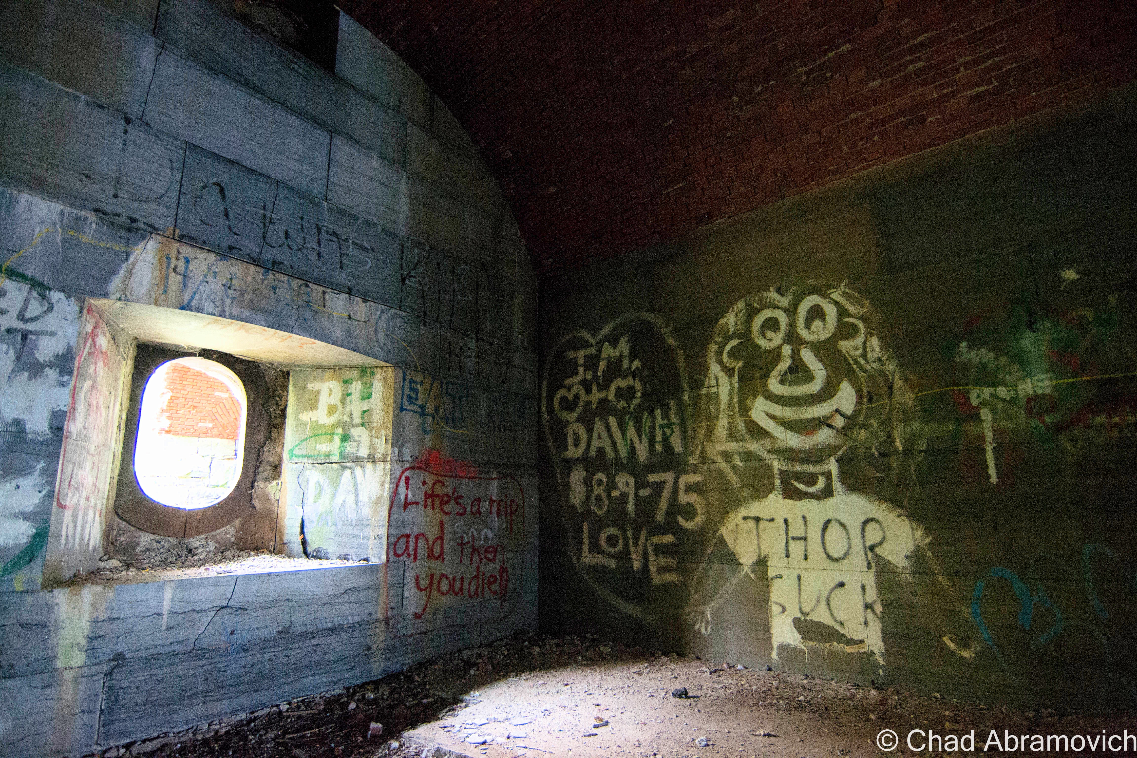
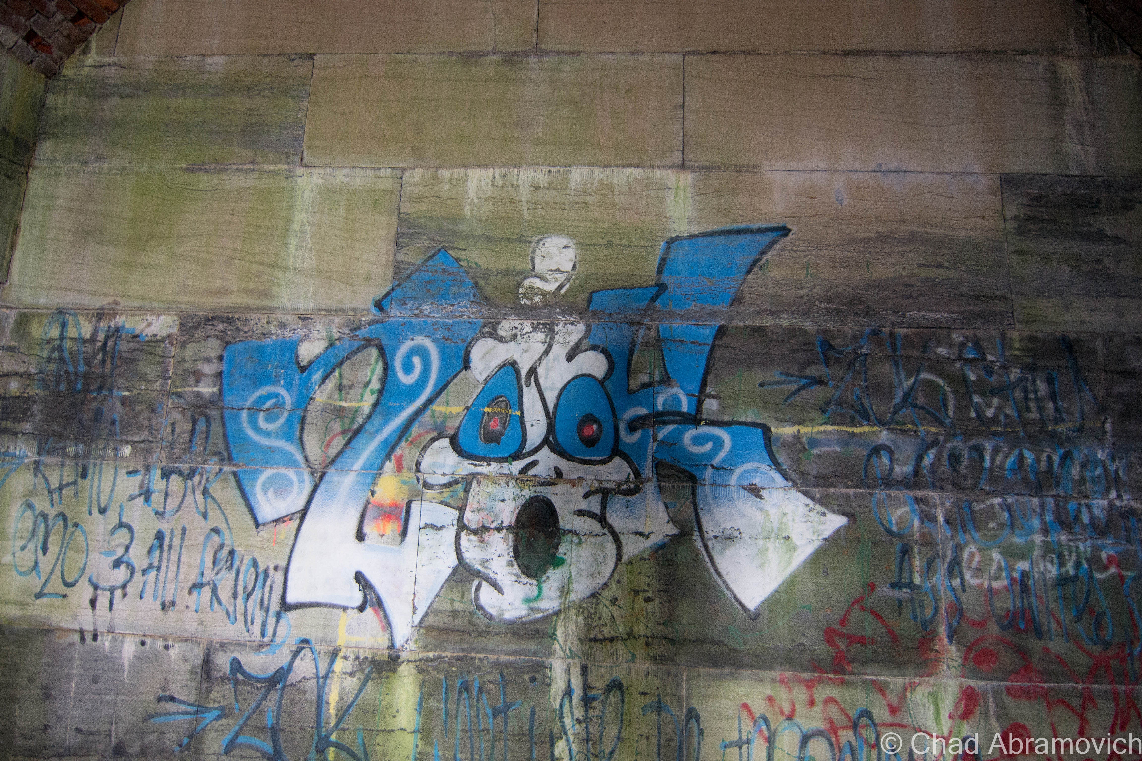
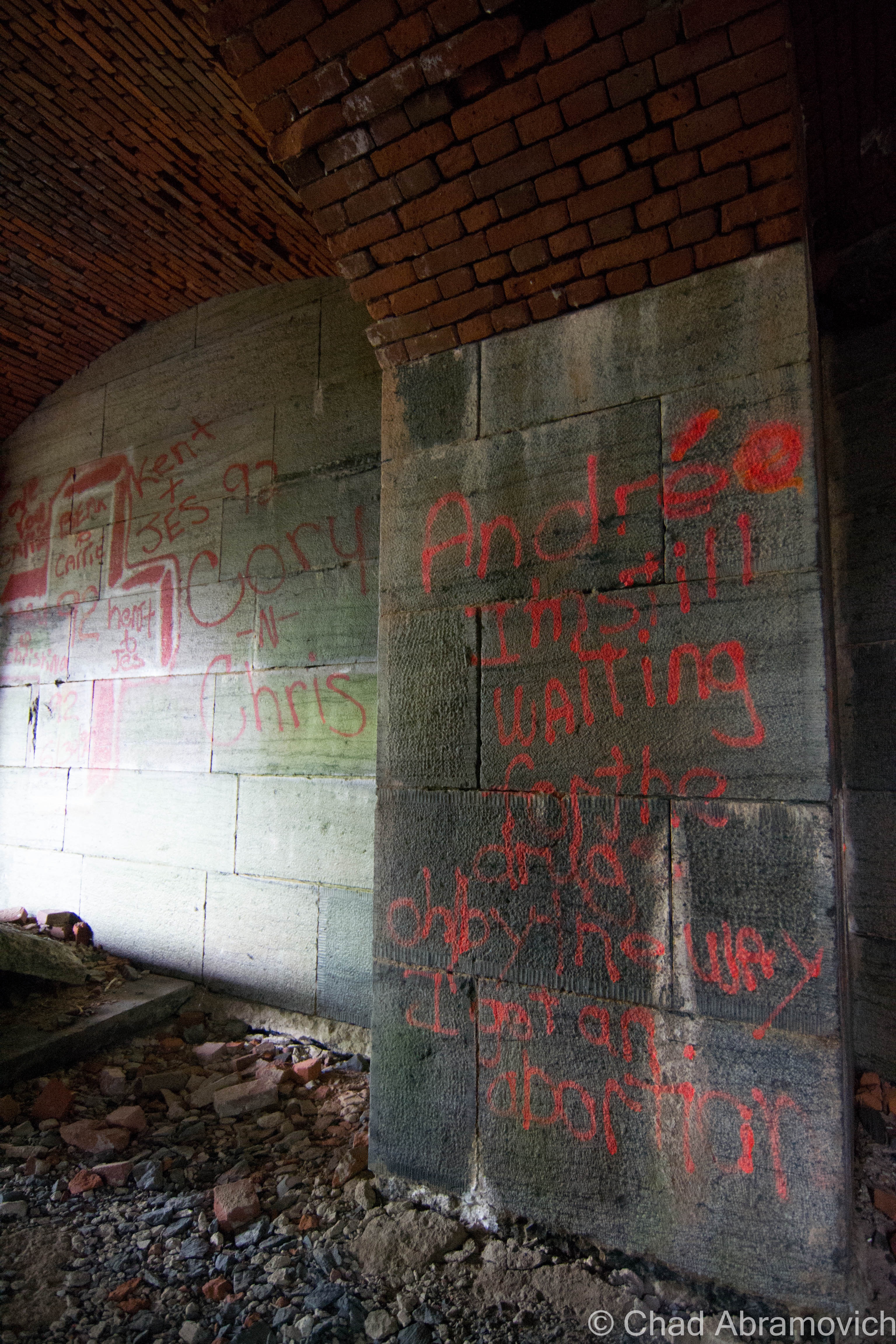
For being an abandoned relic relatively hidden in plain sight and yet, out of the way, it’s evident it receives a lot of foot traffic. Its arched hallways have almost no wall space left intact, covered by layers of graffiti, going back to as early as 1971. Or – the earliest we were able to find at least. Countless names, cultural expressions, slanderous accusations of obvious enemies and the occasional term of endearment could be read as you wondered around the property, which was pretty stimulating and could easily stand out alone as part of the experience.

Fort Montgomery was quite the fascinating place – something that I could explore, but in a sense, never be able to relate too. It was built during a time of when America had real fears of being invaded by the British via Canada, and our independence was actually in jeopardy.

But despite the resilient bones gently losing their will to fight mother nature, the fort has a rather underwhelming and ironic history, which would explain it’s rather unintimidating nickname, as far as forts go.

Its location was strategic, where Lake Champlain empties into Quebec’s Richelieu River, right on the Canadian Border between New York and Vermont. Construction on the unnamed fort began in 1816 and called for an octagonal structure with 30-foot walls. However, when President James Monroe visited the location in 1814 to see how the progress was going, he discovered they had made a huge mistake. Because of survey errors, the fort was inadvertently built in Canada. Oops. The resulting mistake lead to the fort’s nickname, Fort Blunder, which carried on into the 21st century. Construction was immediately halted and the fort was abandoned.

After much dispute between Canada and the United States over the sloppy boundary agreements and who owned what, the Webster-Ashburton Treaty of 1842 finally would resolve the problem for good, annexing Island Point – the location of Fort Montgomery, as part of the United States.

It was decided again that a fort should be constructed there, and in 1844, laborers broke ground on what would be known as Fort Montgomery. Fort Montgomery was a “third system” fort, or, one of the forts that were being built along the Northern frontier. Work on the fort was continuous through 1870, as the civil war raged on and another fear of a possible British invasion (the bad type) had everyone panicking.  And when the Saint Albans Raid happened in 1864, that fear seemed very reasonable now.

During the 30 year construction period, the attention to detail was immaculate – nothing was left unplanned, and with cutting edge military tactics and a round-the-clock labor crew of 400 of the best stone cutters and masons working at the site, it was intended to be a showpiece, a symbol of brazen resilience.

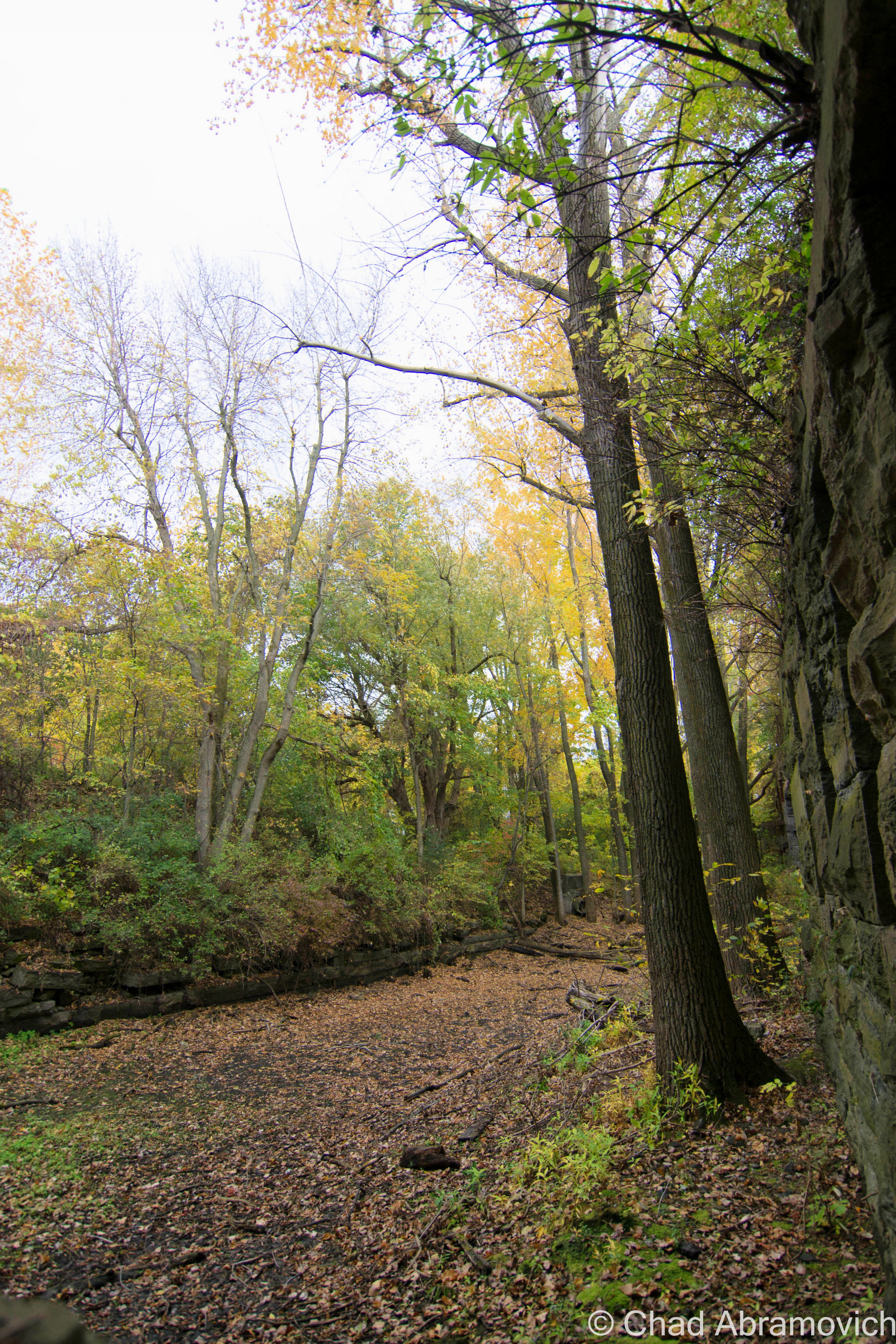
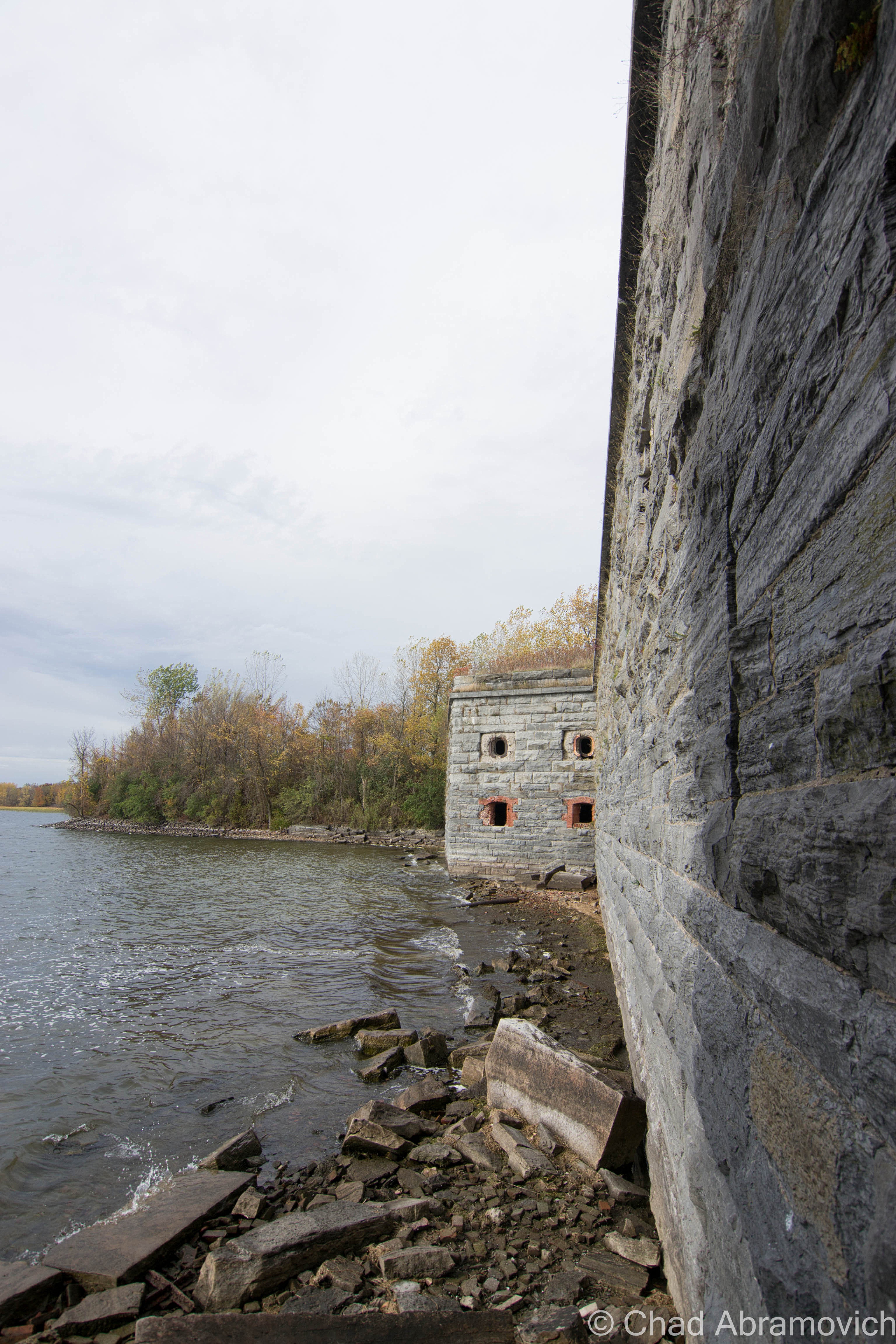
The fort also had a rare feature that only 9 forts in the United States possessed at the time; a moat. With the moat dug around the fort, it was situated on it’s on private island, with a drawbridge and a stone causeway it’s only land entrance. The moat can still be seen today, though, now filled in with layers of mud and runoff, with the creeping forest getting ever closer to ramble down it’s dirty stone retaining walls. The drawbridge also had a very unique feature – it acted essentially like a seesaw, being able to teeter on both sides with a central balance point.

Though it was intended to house 800 men, the fort never actually saw battle, and was really only used as a form of visual intimidation at the border – allowing your mind to really do the rest. One man manned the fort, and lived in a caretaker’s house nearby. Because the fort never saw battle, some surmise that this was also the reason why it was bestowed the notoriety of the nickname “Fort Blunder”. However you look at it, both of these huge mistakes are fitting reasons.

The fort officially went defunct in 1926 when it became obsolete, and the government sold it. Residents of Rouses Point took it upon themselves to salvage material from the fort, considering it was great material, and most importantly, free. Stone, brick and wood were used for construction projects all around town. Houses, sidewalks and retaining walls can still be seen today that incorporate a little Fort Montgomery in them. My friend, who is also an adventurer and who was playing the role of tour guide that day, said that he remembers someone in Alburgh he knew with original wood from the fort inside their farmhouse.

The fort was added to the National Register of Historic Places in 1977, and today, the property is actually for sale, and as far as I know, it hasn’t received any offers. Admittedly, the remains of a 19th-century fort in your backyard would be a far cooler feature than lawn gnomes or pink flamingos. While tromping around the overgrown grounds, we were discussing other great uses for the property, like a great outdoor music venue location.

My friend was the perfect tour guide. He used to come here back in high school, along with many of his friends, back when the fort was really forgotten. They had paintball matches here, which seems like an ideal location for such activities, and just generally hung out underneath the brawny yet ethereal stone archways. Countless area kids (and adults like myself) would also hangout there, as evident by the plethora of graffiti and Natural Ice cans left behind. Modern day relics. Walking around, he knew many of the names spray painted on the walls. One person in particular he recalled getting hit by a train when she was walking her dog years ago. Less poignantly, he also pointed out where his high school band rebelliously self-promoted themselves on a wall inside.

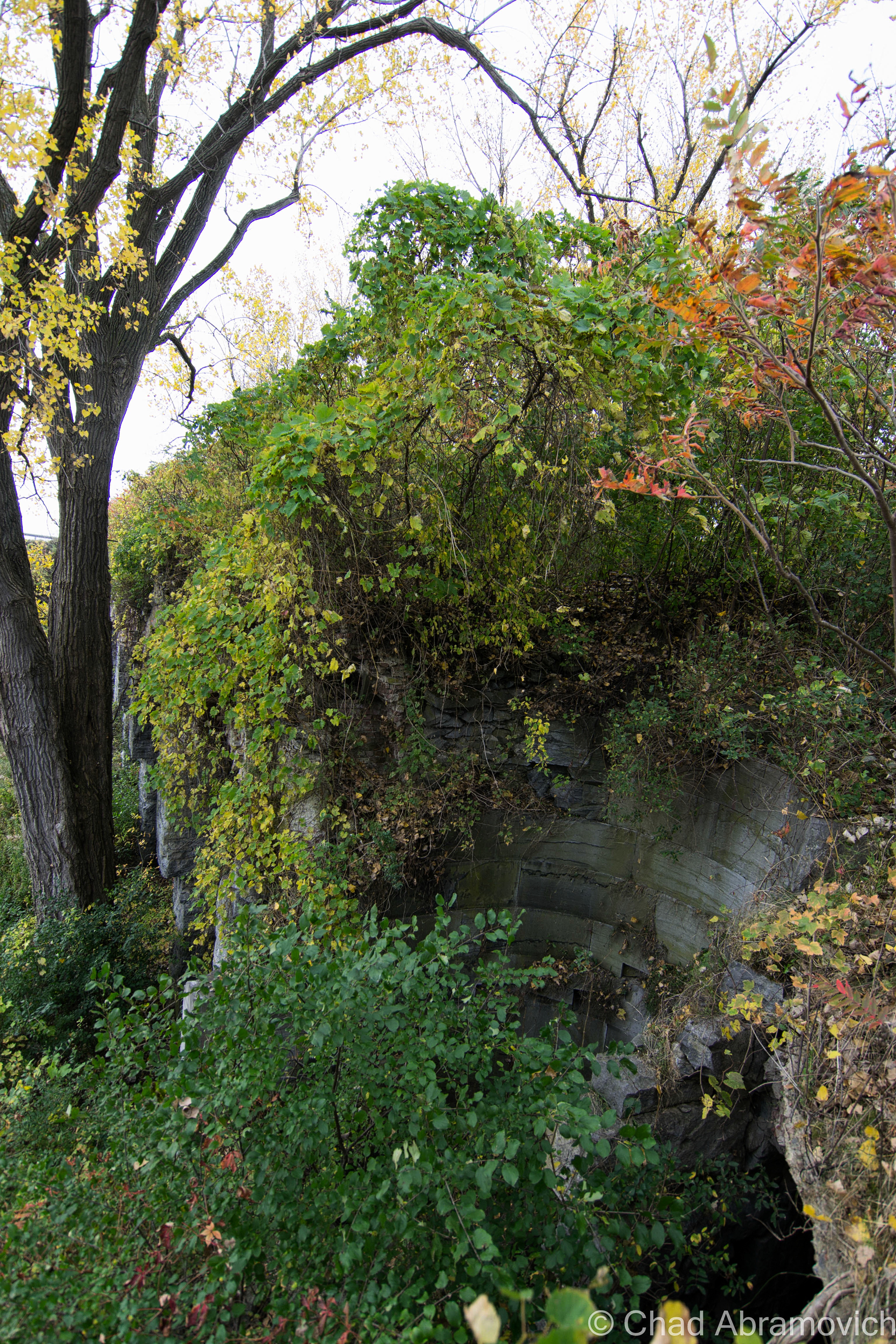
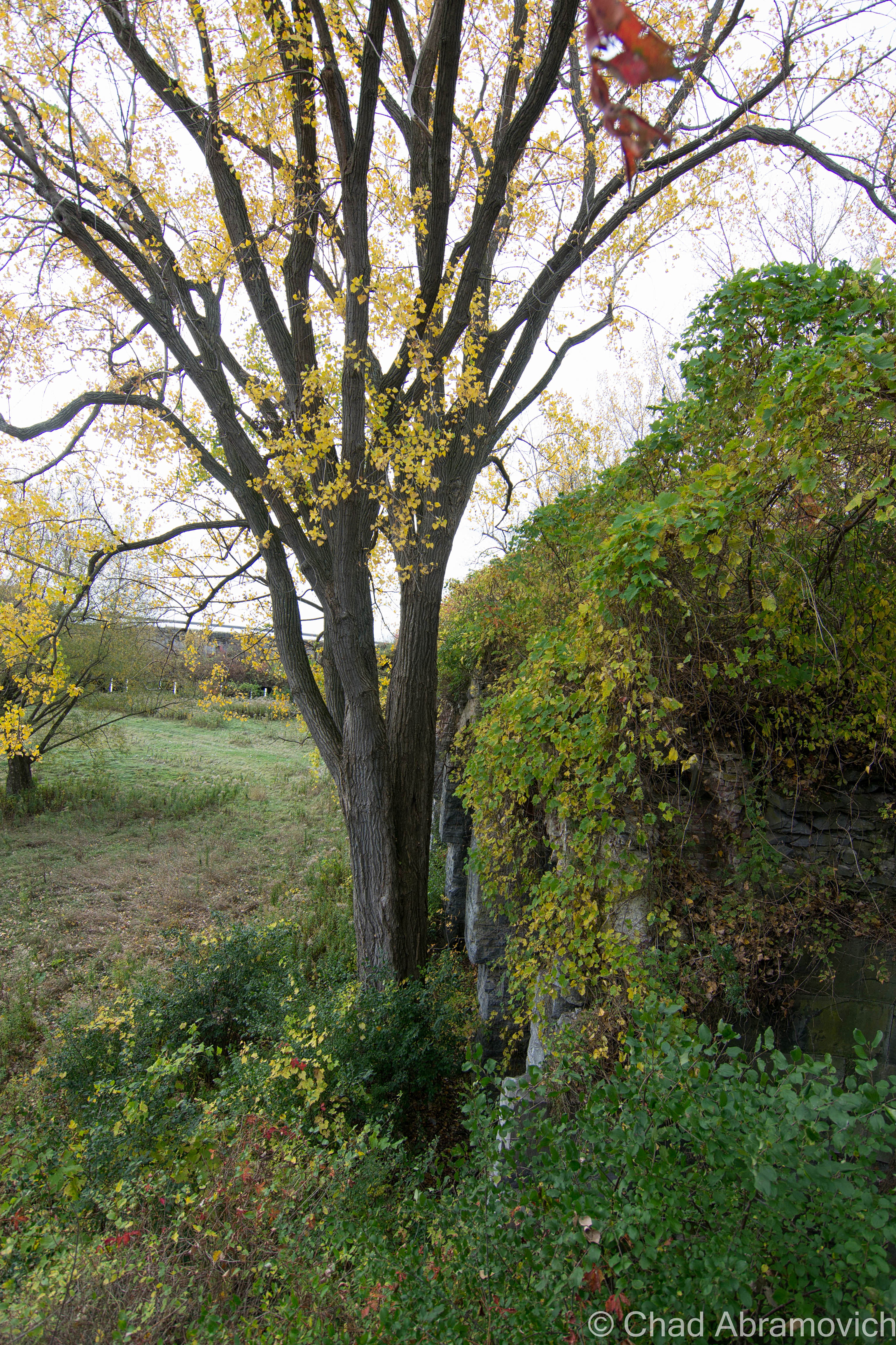
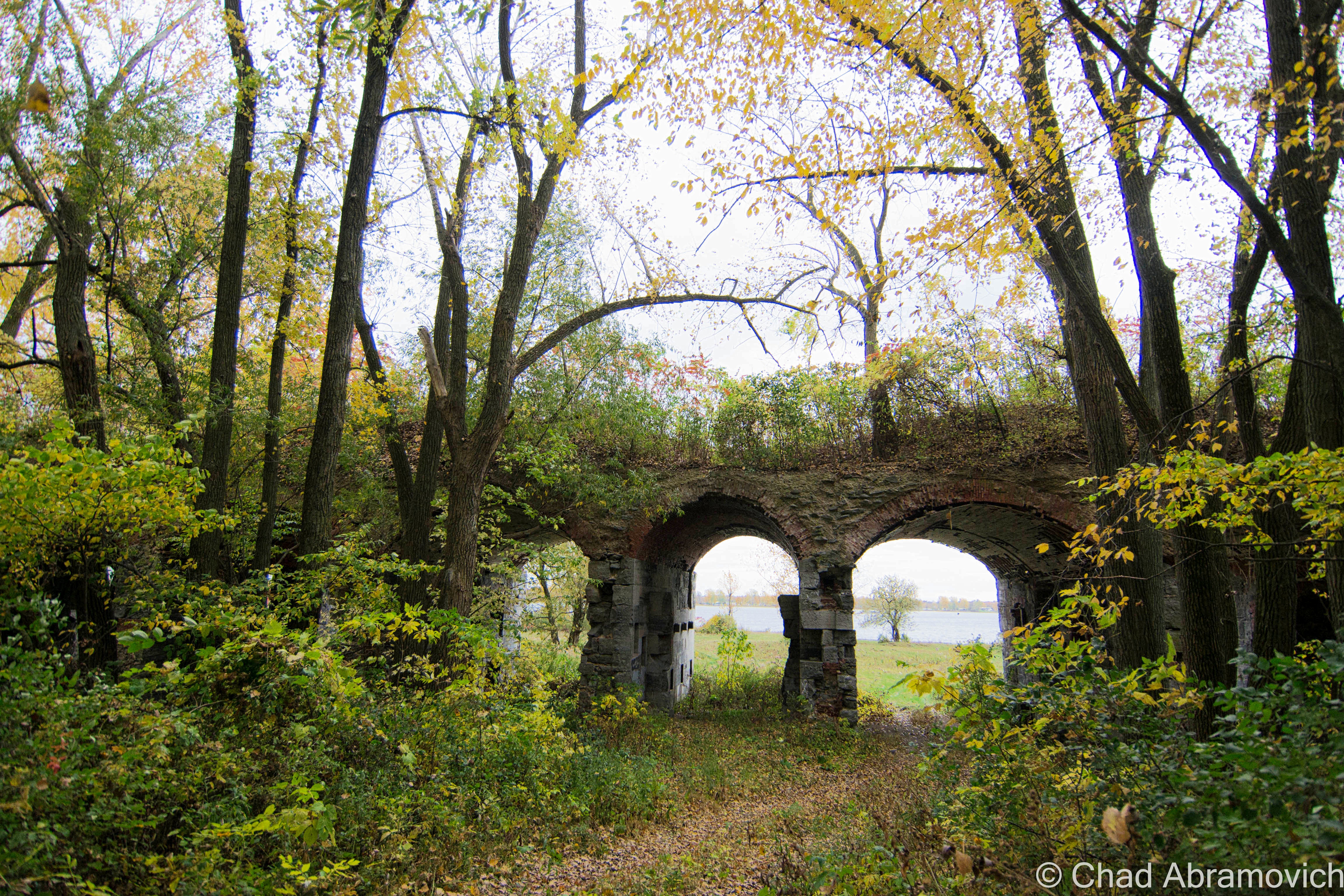
The ruins of the fort were disorienting, something else I didn’t expect. The place was so overgrown, that there were times while exploring the upper levels, that you actually perceived as just a walk in the woods, until you looked over and noticed you were actually 30 feet in the air, above a row of arches vanishing into thick vines and forests shedding their Autumn jackets. At times, literally climbing up earth banks to get to the second floor, you notice a black hole beneath your feet, with crumbling bricks falling into the dark and the deep below, reminding you that you are on a man-made structure.

And of course, walking through the airy hallways as the fragrant breezes blasted through the windows, countless Pigeons would swiftly bolt down the hallways, coming very close to smacking me in the face. Sort of an Alfred Hitchock type of situation, except, this was real.

Walking back across the moat and down the access road – which was no more than a 4 wheeler trail at this point, we noticed the old trees that lined the path had white chalky residue over their aged bark, evidence of the water levels of the lake. The lake was incredibly low this Fall, some of the lowest we’ve seen it we both agreed. It was sort of strange to see those marks well at waist level as we walked by.

“Fort Blunder” certainly added another layer to my prowess, an intimidating ruin that was both venerable and deceitful. But honestly, I enjoyed hearing the stories from my friend and his personal accounts there far more than it’s faded history – it somehow adds an entire new layer of mystery and character to it – something that is a little more tangible to me as I trudged through piles of dead leaves on the way back to the car.

I can’t help but think. What will archaeologists be able to uncover about our time in the distant future, and what will those things say about us?
DSC_0001_peDSC_0013_pe DSC_0014_pe DSC_0015_pe DSC_0016_pe DSC_0019_pe DSC_0023_pe DSC_0025

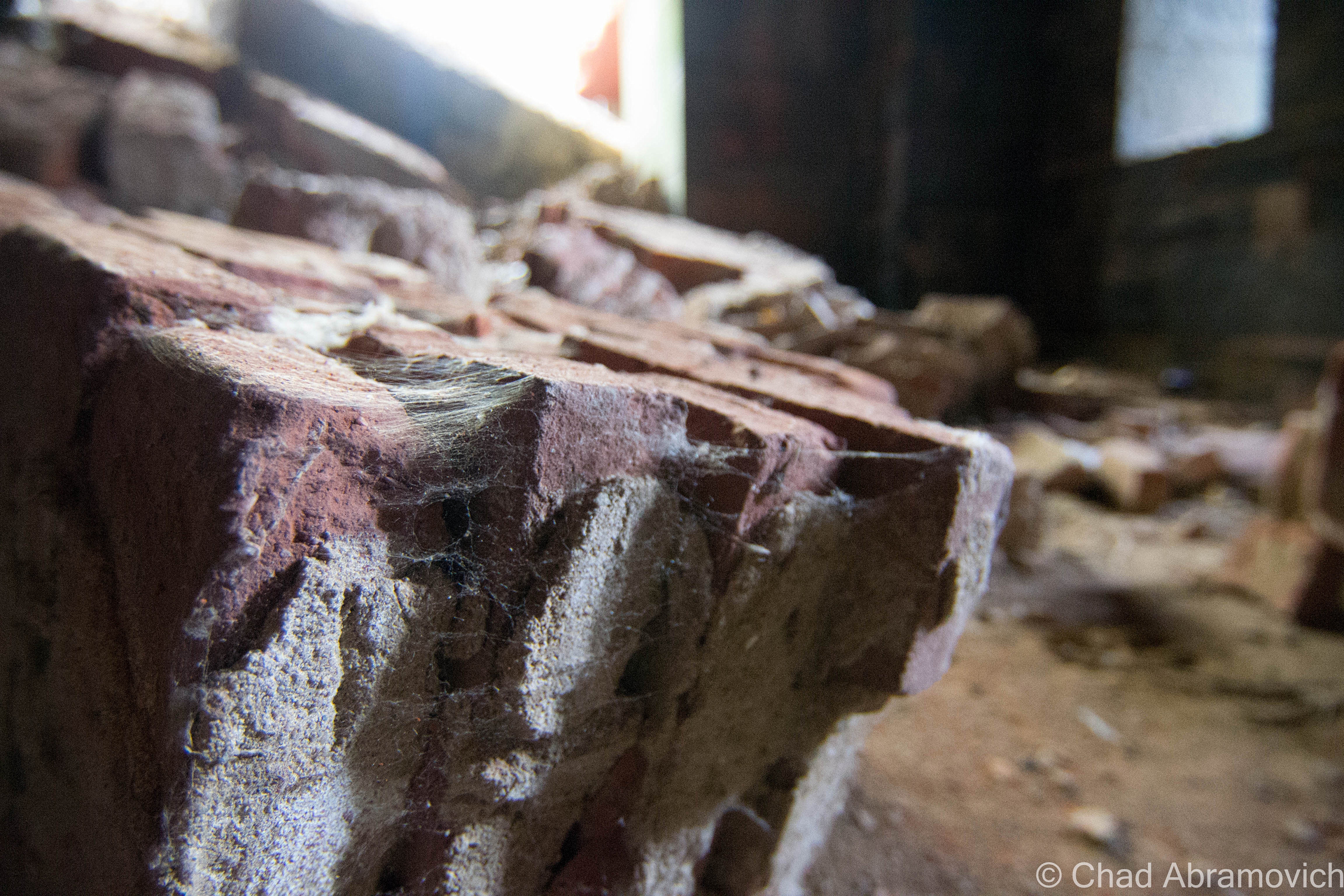
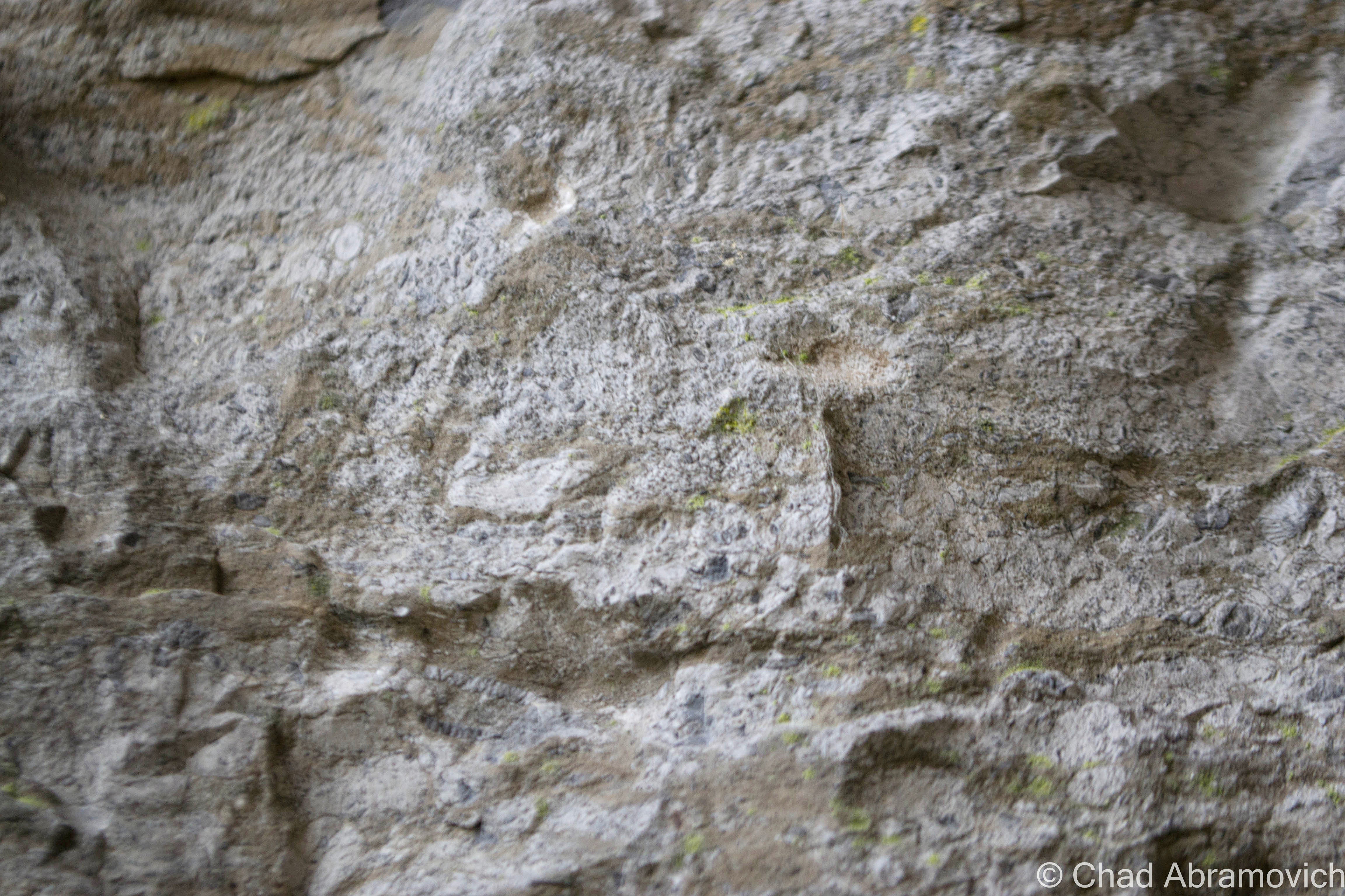
Throughout the fort, there was this sort of undulating stone used, with ambiguous patterns found in their surface. Me and my friend speculated they might be fossils from the Champlain Sea, which once covered the area we walked on over 480 million years ago. If these fossils can be found in Isle La Motte, which is nearby, it may be possible that the same rock was quarried and used in the fort walls. Or, so we assume...
Through-out the fort, there was this sort of undulating stone used, with ambiguous patterns found in their surface. Me and my friend speculated they might be fossils from the Champlain Sea, which once covered the area we walked on 480 million years ago. If these fossils can be found in Isle La Motte, which is nearby, it may be possible that the same rock was quarried and used in the fort walls. Or, so we assume…

DSC_0036_pe DSC_0034_pe DSC_0035_pe DSC_0038_pe DSC_0044_peDSC_0048_pe DSC_0049_pe DSC_0053_pe DSC_0055_pe DSC_0057_pe DSC_0059_pe DSC_0060_pe DSC_0065_pe DSC_0070_pe DSC_0073_pe DSC_0074_pe DSC_0080_pe DSC_0084_pe DSC_0089_pe DSC_0092_pe DSC_0100_pe DSC_0102_pe DSC_0105_pe DSC_0106_pe DSC_0110_pe DSC_0115_pe DSC_0116_pe DSC_0118_pe DSC_0121_pe DSC_0123_pe DSC_0126_pe DSC_0129_pe DSC_0132_pe DSC_0133_pe DSC_0137_pe DSC_0139_pe DSC_0140_pe DSC_0141_pe DSC_0142_pe DSC_0143_pe DSC_0145_pe DSC_0147_pe DSC_0152_pe DSC_0156_pe DSC_0168_pe DSC_0170_pe DSC_0173_pe DSC_0176_pe DSC_0179_pe DSC_0180_pe DSC_0182_pe DSC_0186_pe DSC_0190_pe DSC_0192_pe

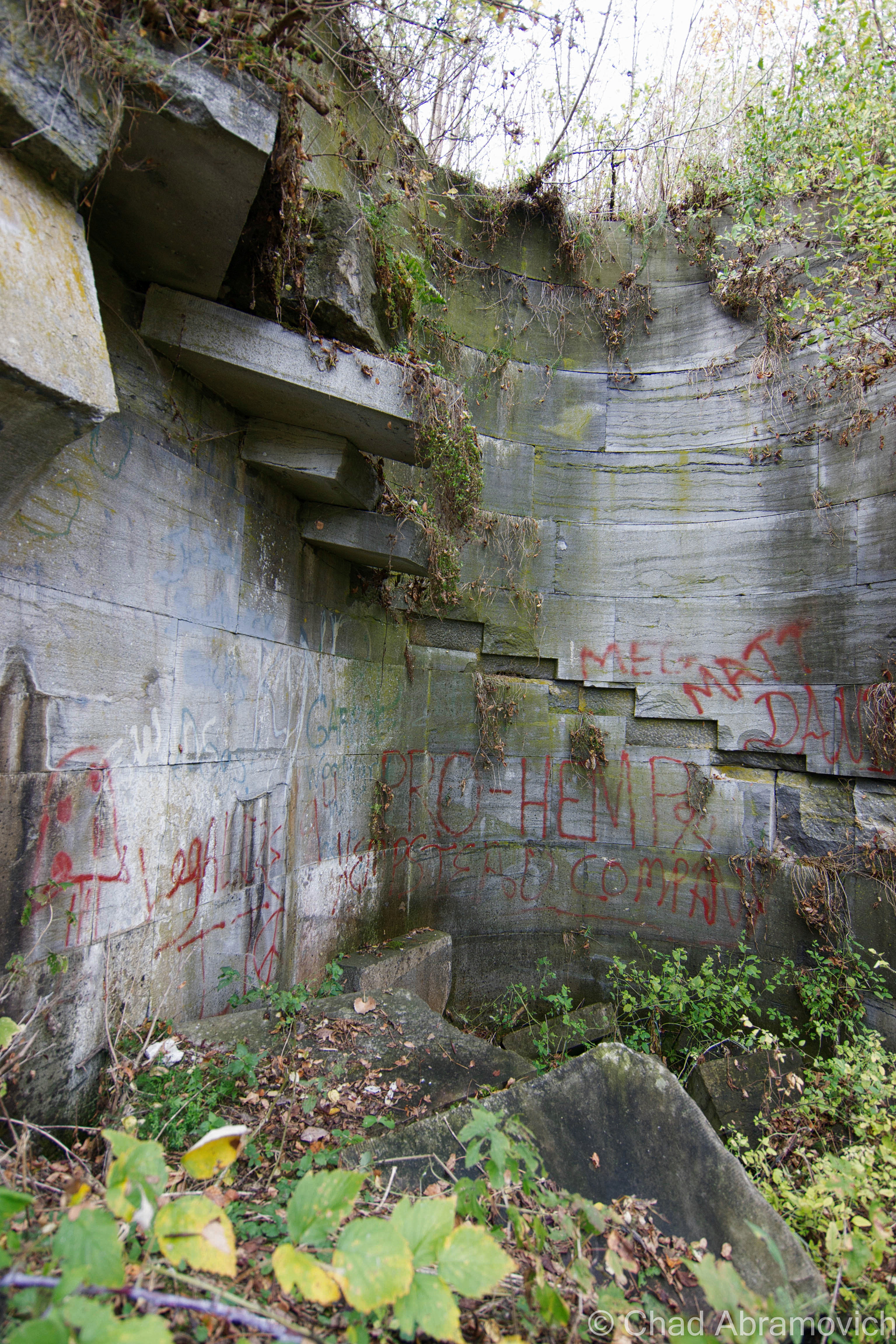
A feature of the fort I liked. It once had duel stone spiral staircases linking top to bottom. Today, both have collapsed, but the remnants of some steps still remain, retaining their circular motion down curved stone walls. One of them (not this one) was filled with so much earth and compost that it was still usable for a trip up and down.

DSC_0203_pe DSC_0207_pe DSC_0208_pe DSC_0209_pe DSC_0221_pe DSC_0223_pe DSC_0225_pe DSC_0227_pe DSC_0230_pe DSC_0235_pe DSC_0237_pe DSC_0243_pe DSC_0245_pe DSC_0247_peDSC_0249_pe

—————————————————————————————————————————————–

To all of my amazing fans and supporters, I am truly grateful and humbled by all of the support and donations through out the years that have kept Obscure Vermont up and running.

As you all know I spend countless hours researching, writing, and traveling to produce and sustain this blog. Obscure Vermont is funded entirely on generous donations that you the wonderful viewers and supporters have made. Expenses range from internet fees to host the blog, to investing in research materials, to traveling expenses. Also, donations help keep me current with my photography gear, computer, and computer software so that I can deliver the best quality possible.

If you value, appreciate, and enjoy reading about my adventures please consider making a donation to my new Gofundme account or Paypal. Any donation would not only be greatly appreciated and help keep this blog going, it would also keep me doing what I love. Thank you!

Gofundme: https://www.gofundme.com/b5jp97d4

Donate Button with Credit Cards

Milton Mysteries: The Indian Mound

On my quest to discover Vermont curiosities, weirdness and mysteries, I made the mistake of overlooking my former hometown of Milton, a community steeped in stories and legends. But Milton presented a challenge to me. While some lore seemed to be well recited among local residents, the actual stories behind the stories simply weren’t there. Over the past year, I began talking to people, writing down notes and choosing things I wanted to research further in detail. I wanted to bring these great stories to life once again, and through arduous research, I was finally able to fill in some missing pieces. This will be the first in what will hopefully be a few entries on Milton mysteries.

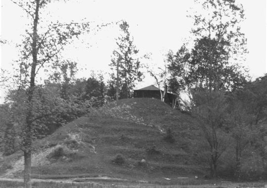
A year ago, I stumbled upon an old photo which fascinated me. The photo depicted a large mound of earth dubbed as “The Indian Mound”, it’s vague description locating it somewhere near the shores of Lake Champlain. Was there an Indian Mound in Milton?

I’ve traveled the many dirt roads of West Milton all my life, but have never seen a geological formation like this before. If there was such a mound, surely it would be of great importance. Why was it so discrete? Do people know of its existence? And, the most heavily weighed question, where was it?

An old photo of an alleged Indian Mound near the shores of Lake Champlain. Photo courtesy of The Milton Historical Society

Speaking with Lorinda Henry from the Milton Historical Society,  she explained that the mystery about the Indian Mound was far greater than the information about it.

After digging through stacks of papers and unlabeled binders at the historical society, I was able to find my first clue; that the mound was located down near Camp Everest in Milton, a hidden area off a series of remote back roads that don’t receive much traffic other than locals, and a name that may very well be lost to many Milton residents today.

A vestige of the days when Milton was a summer tourist destination, Camp Everest was just one of the many large camps that would be built up along the shores of Lake Champlain.

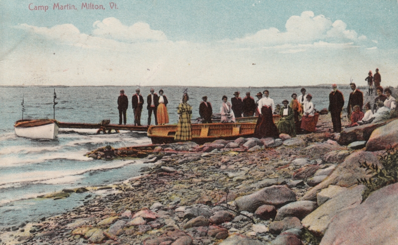
In the mid 1800s, camping in summer cottages and tents would draw people to the shores of Lake Champlain. Milton’s lakeshore was a murderers row of natural beauty, complete with stony beaches, Eagle Mountain’s giant looming rocks, marshlands, and deep forests. Land owners began converting their properties into camps to take advantage of this, and as a result, camps Rich, Martin, Watson, Cold Spring, and Everest would open for business.

Photo: UVM Landscape Change Program
Campers getting ready for a boat excursion on Lake Champlain at Camp Rich in Milton, Early 1900s. Photo: UVM Landscape Change Program

The camps all had farms, providing them with fresh food. Many of them boasted luxuries such as proximity to clear mountain springs, and the availability of fresh cream, eggs, milk and vegetables. The properties also offered many amenities such as recreation halls, lawn sports, fishing excursions and hayrides. Some camps even had handsome hotels built extravagantly and symmetrically, standing above the waters, with classic New England verandas, conical towers, decorative dormers and dramatic features that accentuated different sides of the buildings, almost to a point of tactility. Old advertisements for Camp Watson even boldly claimed that they had “positively no mosquitoes” – although, being quite accustomed to Vermont summers,  I can’t help wonder just how they went around keeping that promise.

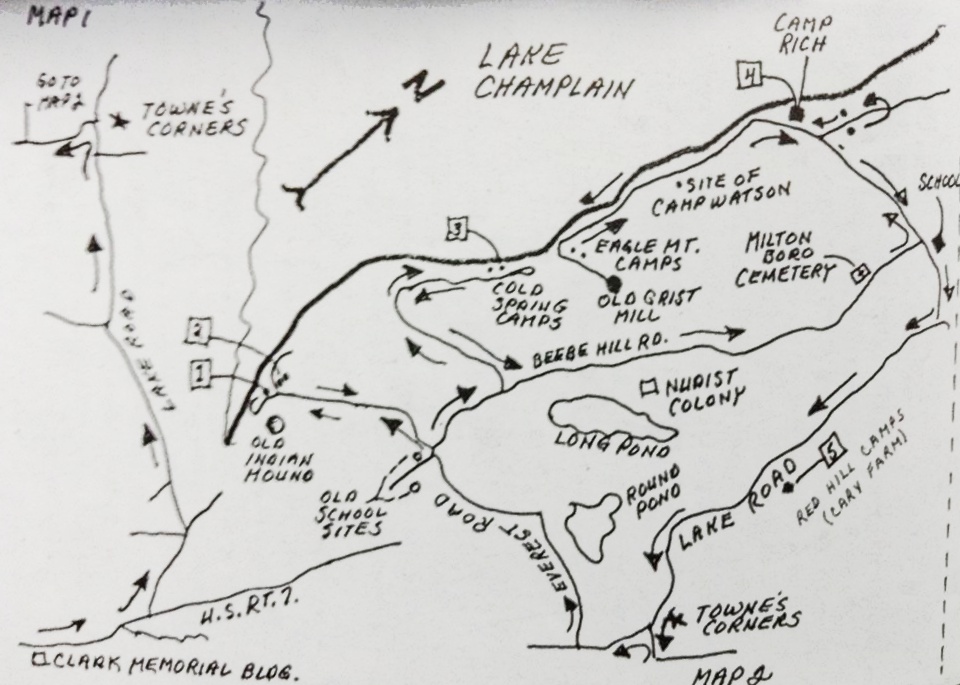
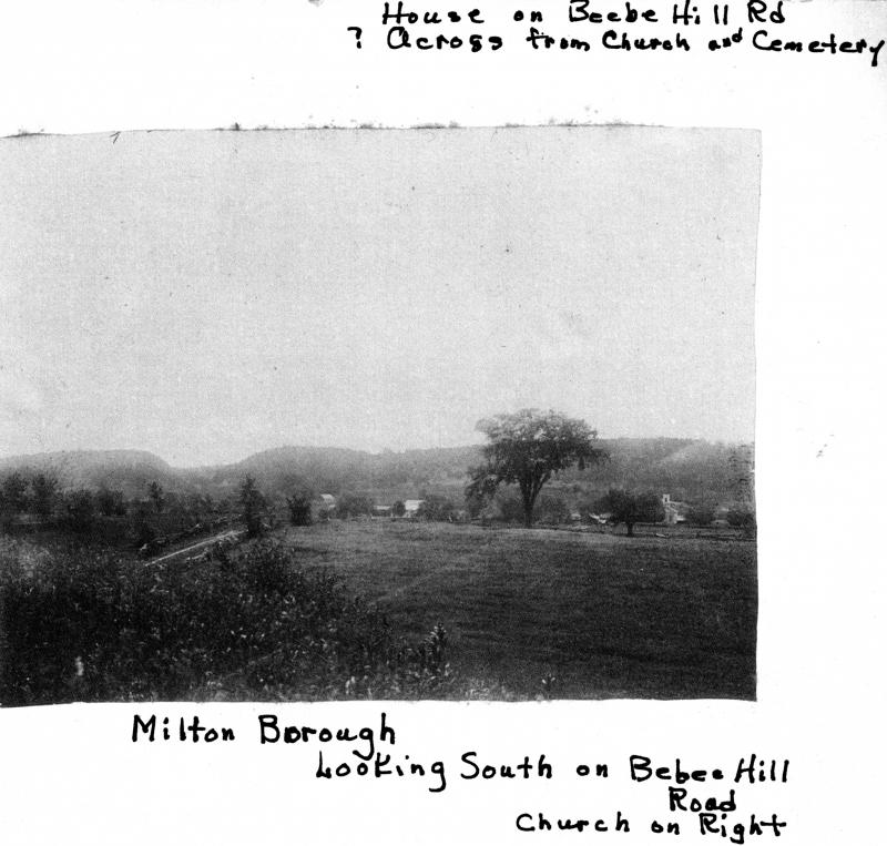
A hand drawn map of Milton’s summer camp colonies, and the area town known as Miltonboro. Photo courtesy of The Milton Historical Society.

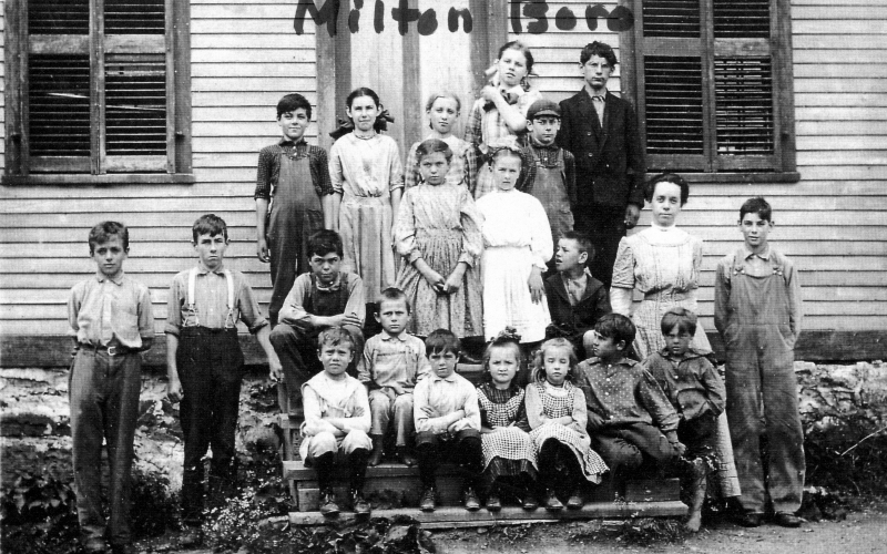
The area along the lakeshore became known as Miltonboro, which included schoolhouses, a church and meetinghouse which catered to the campers and locals who didn’t want to travel all the way to Milton village. Today, most of Miltonboro has vanished, leaving only a small cemetery ringed by a stone wall, and a name on a map.

LS33343_000_thumb_3
Children at the Miltonboro School, late 1800s. Photo: UVM Landscape Change Program
LS33346_000_thumb_3
Photo: UVM Landscape Change Program

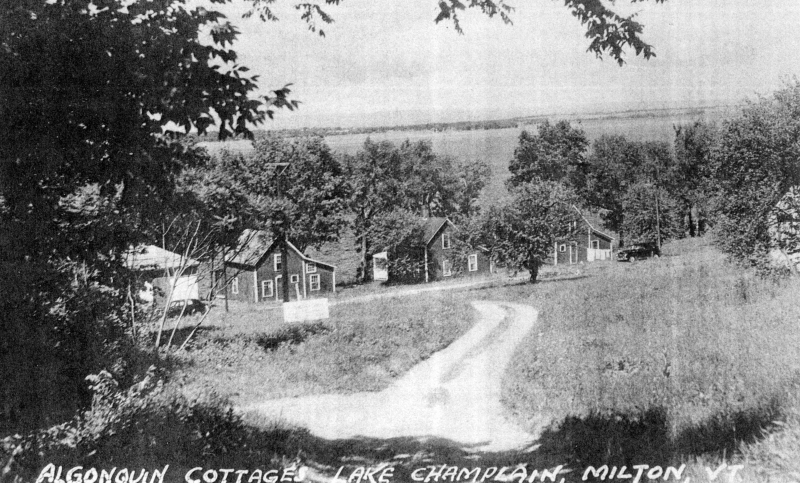
Camp Everest, the southern most of Milton’s lakeshore camps, was established in 1878 by Zebediah Everest and A.W. Austin, and they couldn’t have chosen a more splendid location. Bordered to the south by serpentine marshlands that now make up the Sandbar Wildlife Management Area, and to the north by the dizzying ledges of Eagle Mountain, with a sweeping view of South Hero island and the Adirondacks across the lake. The camp included a camp house, bowling alley and eight cottages, occupied by both family members and renters. It was here at Camp Everest where the alleged mound was located.

Early camps at Camp Everest, in an area called Algonquin Reef. Today, the name is emblazoned on your typical Green street sign.
Early camps at Camp Everest, in an area called Algonquin Reef. Today, the name is emblazoned on your typical Green street sign. Photo: UVM Landscape Change Program

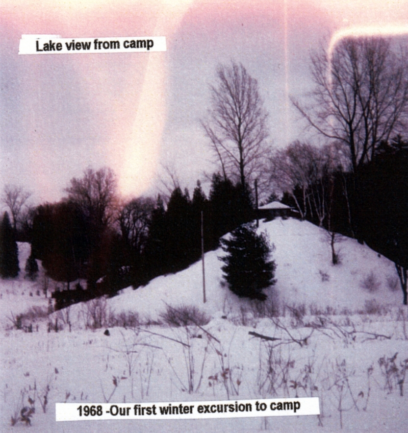
However, the information I read didn’t portray the mound as culturally significant, but rather in a bureaucratic sense – it was simply a piece of property. A camp was built atop the steep hill in 1927 by the Hutchins family, and named “Indian Mound”, perhaps romantically after what the earlier campers viewed the mound to look like. I was able to reach out to Barbara Hutchins, whose family originally owned the camp, and she was kind enough to give me further information.

She explained that the mound itself was probably formed during the glacier age, most likely a remnant of the Saint Lawrence Ice Sheet that once covered this part of North America. UVM did some digs around the mound in the 1950s, and found nothing of Native American significance, but they did find some old sea shells and fossils, evidence of the Champlain Sea,  the tropical sea which covered what is now Vermont millions of years ago.

The Hutchins eventually sold the camp, and lost track of the property. I was able to dig up choppy pieces of information at the historical society – listing the names of various people who leased the camp throughout the years. The dates got sparse after 1970. Eventually, the information just seemed to cease. So, what happened to it? Was it still there?

Lorinda Henry explained that the state of Vermont wanted to hack apart the mound and use it to fill in a nearby swampland in 1948, but further research told me that because the area was prone to flooding, they decided not to, because the amount of dirt they would have gotten from the mound would have most likely been lost within a few years, leading me back to my original question.

The existence of an Indian Mound is also curious, because Vermont was never thought to be associated with mound building Indians. But then again, at one time, it was thought that Native Americans never settled in what is now Vermont. But Milton farmers would constantly find artifacts and arrowheads while clearing and plowing their fields. Arrowheads were also allegedly found when Andrea Lane, a small neighborhood off Route 7, was being constructed years ago. Lorinda Henry explains that because of native traces in the area, there are parts of the neighborhood that can’t even be developed because of archaeological significance. If that myth was debunked, than would the presence of an Indian Mound be that hard to believe?

On a breezy August day this summer, I took the beautiful drive back down towards Camp Everest, with the intention of solving this mystery. The camp is much different from it’s heyday, now a series of private camps, owned by various people. The bowling alley and other amenities have long vanished into history and the creeping forests.

With the hand drawn map featured above in this post as my only reference, I scanned the roadside and across the many meadows bordering the area, but the imposing sight of the Indian Mound was never seen rising above the various clover filled fields or cedar forests near the roadside. I ran into several people, some jogging, others washing their SUVs in their driveways, and they were all happy to talk with me. But sadly, none of them knew about an Indian Mound or a camp of the same name. Some were out of staters and weren’t aware of the area’s history. But then again, a great deal of the area’s history has long vanished over the years.

From the map, I was able to sort of pin point the general location of the mound, but the area is much different than when the picture was taken. I had assumed, the mound might be still existing, now deep in the woods and covered in vegetation. But shortly after publishing this blog entry, I stumbled upon some further information.

Laurie Scott, who is an Everest, explained to me that the mound was eventually purchased by the grandson of the Hutchins family. The Everest’s lease most of the land where the camps sit, but her grandmother, Ethel Everest, sold the mound to them. The mound and the camp are still there, and as I assumed, is now obscured, hiding successfully behind a Vermont forest – an ideal getaway.

A photo of the Indian Mound, Winter 1968. Photo: UVM Landscape Change Program.

An interesting footnote to this story is that while trying to solve the mystery of this “Indian Mound”, Barbara Hutchins recalls that she heard there were a few other professed Indian mounds somewhere in Milton as well, but as for their locations, she doesn’t remember, leaving this intriguing mystery currently ongoing.

—————————————————————————————————————————————–

To all of my amazing fans and supporters, I am truly grateful and humbled by all of the support and donations through out the years that have kept Obscure Vermont up and running.

As you all know I spend countless hours researching, writing, and traveling to produce and sustain this blog. Obscure Vermont is funded entirely on generous donations that you the wonderful viewers and supporters have made. Expenses range from internet fees to host the blog, to investing in research materials, to traveling expenses. Also, donations help keep me current with my photography gear, computer, and computer software so that I can deliver the best quality possible.

If you value, appreciate, and enjoy reading about my adventures please consider making a donation to my new Gofundme account or Paypal. Any donation would not only be greatly appreciated and help keep this blog going, it would also keep me doing what I love. Thank you!

Gofundme: https://www.gofundme.com/b5jp97d4

Donate Button with Credit Cards

Port Kent’s Mysterious Fireball

Auer Family Boathouse | Circa 1950. Photo from my family archives.

This is a peculiar tale I recall from my childhood. It was a cool summers night – late July, 1998. I was 10 years old and was spending the night at my Grandfather’s boathouse, situated on one of the most splendid locations in all of the state. Located where the Winooski River meets Lake Champlain in a sandy delta of twisted Cottonwood Trees and fragile swampland in the eye of Burlington’s aching heart, The Auer Family Boathouse is a historic relic, built during simpler times and witnessed Burlington and Colchester change around it. It played an unassuming role in notable events such as prohibition (my great grandfather made bootleg whiskey in a still there) and witnessed the transformation of the Island Line Railroad into the now landmark bike path – as bicyclists and tourists soon replaced the traditional fishermen as customers and visitors as the years and its youth passed on.

It was past 10 PM and a surreal oily blackness slipped over Lake Champlain, the waters and the night sky were indistinguishable from one another. But every now and then, the creaks and groans from the wooden docks rocking gently in the water assured any living soul that the lake was still there.

On the front lawn, my Grandfather had 2 large wooden swings which over looked the lake, and were a very pleasant place to sit and relax, swinging gently in the shadows of the night’s song. It was on one of these swings where my 10 year old self was that very night, my Grandfather sitting next to me enjoying random conversation while a gentle breeze blew through the Willows above our heads.

But our reverie was interrupted when our gaze was drawn across the lake. On the distant shores somewhere near Port Kent, the silhouettes fell apart as a giant ball of fire was suddenly propelled from the terra firma rapidly into the New York skies above. It’s light was brilliantly bright as it soured into the lonely night, now far above the ground below. We both watched and held our breath. Then, it simply disappeared. No explosion, no firework finale, nothing. It’s journey was short, it lasted less then 5 seconds at the most. I knew enough to know that it certainly wasn’t a firework. So what was it?

“Did you see that?” my Grandfather asked me, confusion in his voice. I told him I did, but had no answers. And to our surprise, it happened again! Another ball of fire shot straight up from the ground and into the atmosphere above, where it simply fizzed out. This time, I was able to get a better look at it. From where we were standing, on the Vermont side of the lake, the mysterious flying object seemed to be as big as a basketball, and was launched at incredible speeds. It’s bold brightness illuminated the shadows around it, it’s flames being shaped by the winds its fast velocity created, and then simply vanished effortlessly as if it never existed.

“Have you ever seen this before?” I asked my Grandfather. Surely someone who had spent his entire life living near the lake would have some answers, but he had never seen it before and had no idea what to say. Once again, the familiar ball of light shot up again for a third time and followed the same routine. After 7 times, the phenomena stopped entirely, disappearing into memory.

So what did we see on that cool summers night? Some sort of failed fireworks attempt? An arcane home experiment? Or maybe it was something more secretive – perhaps carried out under the orders of Plattsburgh’s military personal? But the base in Plattsburgh had been decommissioned for years by then.

To this day, neither of us have any answers. We asked some of my Grandfather’s neighbors, as well as some friends of mine who live near the lake, and some friends who lived on the New York side of the lake, and not only did they not have any answers, but no one else reported seeing it. The American Meteor Society  had no reports or mentions either. It was like that mysterious ball of fire never even existed – and I have never seen it since.

—————————————————————————————————————————————–

To all of my amazing fans and supporters, I am truly grateful and humbled by all of the support and donations through out the years that have kept Obscure Vermont up and running.

As you all know I spend countless hours researching, writing, and traveling to produce and sustain this blog. Obscure Vermont is funded entirely on generous donations that you the wonderful viewers and supporters have made. Expenses range from internet fees to host the blog, to investing in research materials, to traveling expenses. Also, donations help keep me current with my photography gear, computer, and computer software so that I can deliver the best quality possible.

If you value, appreciate, and enjoy reading about my adventures please consider making a donation to my new Gofundme account or Paypal. Any donation would not only be greatly appreciated and help keep this blog going, it would also keep me doing what I love. Thank you!

Gofundme: https://www.gofundme.com/b5jp97d4
Donate Button with Credit Cards

Railroads and Silos

It was an icy Winters day as me and some friends drove through the Champlain Islands; destination unknown. It was one of those situations where we were seeking a place to explore, hoping to find some inspiration and intrigue in the brown fields burned by the harsh blue skies. In the Winter, the Champlain Islands loose the comfort and allure brought with the Summer months, vanishing with the shivers and darkness of the later half of the year as if it were a completely different place.

Not having any real luck in the islands, we crossed the Alburgh bridge into New York, the sturdy ruins of Fort Montgomery were not being pitied by the season as they were battered by the choppy and relentless waters of Lake Champlain.

For a region with such an extraordinary history and important connection to the rest of the country, a surprisingly large amount of it has been buried (metaphorically and literally), the occasional historical marker is scattered across the geography, hinting at what once was.

Rouses Point, New York has always been a heavily trafficked locality thanks to it being a portal into Quebec. It’s where the dotted border lines of New York, Vermont and Canada all meetup, as well as Lake Champlain and Quebec’s Richelieu River, which were the area’s original super highways before the interstate systems were built.

Automobile, rail and boat traffic is all siphoned through the gateway community, and because there are always nuances, that also includes the more illicit of things, like rum runners, smugglers, the underground railroad, and a few wars fought by the British and the Americans skirmishing on Lake Champlain over the past hundred years. Seriously, Rouses Point was such a noteworthy place that the feds financed a fort to be built at the mouth of the Richelieu just in case British troops wanted to invade us through Canada. Only, the United States was a much younger nation then, which meant that no one knew exactly where the border was, and the fort was accidentally built in Canada, later returned to the U.S, and never actually used. It was eventually partially salvaged for parts, and a lot of the small village was built up with the bricks, stone and wood salvaged from the brawny structure. From what I was told, the present day village offices were built on top of a former prohibition era dumping site of all the paraphernalia that was confiscated. Today, a drive through Rouses Point is mostly simple wood frame houses, moored sailboats and a Dollar General, a ubiquitous find in Upstate New York.

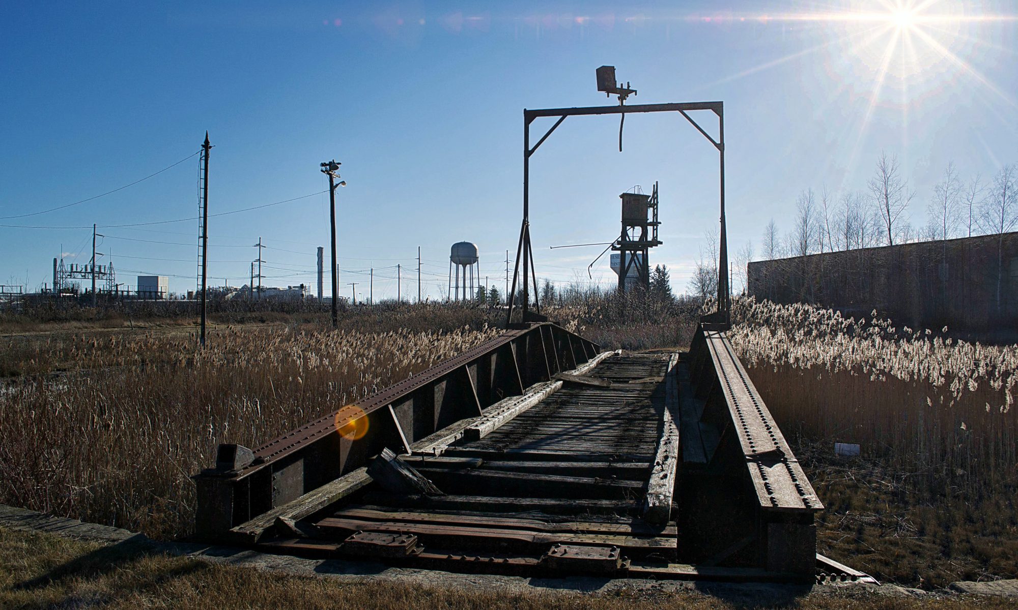
The village really did well for itself when the Delaware and Hudson Railroad decided to build passenger and freight facilities here and a rail yard to accommodate. Though Rouses Point is a pretty obscure community overall today, just outside the village limits are the remains of the oldest and last remaining Delaware and Hudson roundhouse turntables. Being battered by fierce winds, our trip here was short as the numbness in my hands began to outweigh my increasingly diluted curiosity. What can I say, I hate the cold.

This building was formerly used for washing down the rail cars

dsc_0448_pe

Interestingly enough, most railroads, the D&H included, didn’t bother to wash their steam locomotives. Every so often, they would go over them with a mop soaked in kerosene to make them shine, but that’s about it. Roundhouses were built in the steam era as a way to store and maintain the locomotives, as well as repair and prepare them for their next trips. Other buildings on the site would be a coach shop, which was used to repair passenger stock, a cooling tower which was used for fuel, water tower for water, and in some cases a freight house where less than carload items were sorted and shipped out.

So, what is the reason that so many roundhouses are now abandoned?  In short, diesel engines need much much less repair than steam engines. When the steam engines faded away, so did the roundhouses.

This building was used for holding freight.
The original roundhouse

Alburg is a 45th parallel town, and one of a handful of Vermont communities that have found themselves in a weird moniker contention, where the United States Board on Geographic Names decided that they needed to standardize place names around the country in 1891. Every city or town ending in ‘burgh’ had their H dropped, pretty much so the mail would go to the right places and to make them easier to write on federal documents.

Well, over a hundred years later, a few Vermont towns decided that the dropped consonant was something to get up in arms about, with a few bringing it back, and the other few not caring that much.

Back across the bridge, in the pancake flat farmlands of the Champlain Island archipelago, the landscape is dotted with trailers, sagging farmhouses done in vinyl siding, and silver silos that reflect the coarse December sunlight from their gleaming surfaces.

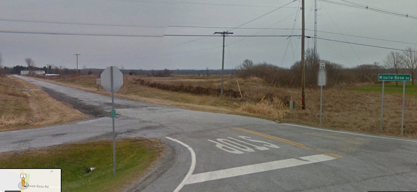
There is a rural road off of Route 2 called Missle Base Road, a moniker that supports the notion that this cul-de-sac is different from other Alburg byways . Whether or not it’s misspelling is a VTrans blunder or intentional, it’s sort of a weird road name in a region that only has a sheriff to bring down the law. That street sign is overshadowed by a much larger and more intimidating sign. In fading lettering, it sort of reads “Stop! Authorized Personnel Only Beyond This Point” in attention grabbing orange, while even more faded text behind it once read “Town of Alburg” (spelled without its H)

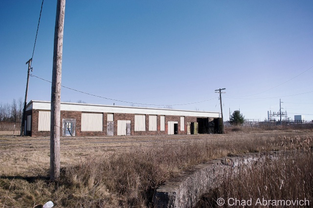
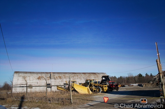
A drive down bad tarmac puts you dead ending in front of 2 rusted Quonset Huts, a chain gate, construction equipment that has seen better days and a dune of road salt. You’re looking at the Alburgh town garage!
But the Quonset Huts give its past away. Underneath the salt pile is the reason for the huts construction; an atlas missile silo.

This is the site of one of Vermont’s 2 nuclear missile silos. But you’d never know it. Towards the back of the property, a rusting pile of junk and a dune of road salt sits on top of the closed silo bay doors, each concrete door weighing 45 tons, enclosing the dark dripping confines of the flooded silo below.

Peering down the silo today would be a wondrous gaze into man’s eternal battle with evil and glorious ruin, but if you had peered down this shaft in the early 1960s, you would have been gazing at the tip of a nuclear missile.

In the 1960s, the military was scrambling to build defenses against the potential of a nuclear apocalypse that the Soviet Union was scheming, with the Soviets doing the same thing with the role of the villain reversed. The Army Corps of Engineers constructed 12 sites in a ring around the Air Force base in Plattsburgh — 2 in Vermont, 10 in New York, and absolutely no expenses were spared, with each site costing between $14 and $18 million to build, each one coming with a brazen claim that each could withstand a direct nuclear attack.

But these mysterious and aggressive projects were quite a feat to build. Many workers died during their constructions, with urban legends reciting that some unfortunate souls became entombed in the concrete silo walls they were hired to produce. The thought of the cold walls and dark depths of the missile silo as someone’s last vision is an image is a poignant one.

Ironically, despite the large expenses invested in these agents of destruction, the pulses of these missile silos were short lived, only active from 1962 until 1965, thanks to leaps in progressive apocalyptic technology. To add to the uncertainty, many were disputing afterward whether the missiles would have been able to hit their targets, and even be able to lift off the ground.

But they left a lasting impression on the landscape. However today, they hold contaminated waste and shadows smothered with valiant ghosts.

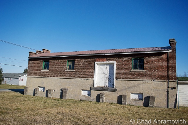
Each launch site constructed included two Quonset huts, a utility shed and an antenna that could detect a nuclear attack up to 30 miles away. The silo itself was 52 feet wide and 174 feet deep, encased in a shell of incredibly thick and durable concrete.

After their demise, the sites were abandoned. Ownership was now the burden of their communities, including this one, which was, uh, gifted to Alburgh, who turned it into their down highway department headquarters and dumped road salt over the perforation. Others were looted, some were sold to private investors and military enthusiasts. According to lots of testimonies over the intervening decades, most of them flooded to some degree.

Because everything has a market, interest in these intriguing properties has picked up in recent years, thanks to curious buyers who see the old silos as great “fixer-upper” projects, especially for private homes. But due to their deteriorating conditions, these sites require a buyer with a lot of money, patience and time. One of the former sites, in Champlain, New York was found and purchased on eBay. The new owner plans to clean it up and live in the remaining Quonset hut, and possibly in the launch control center. Taking his project a bit further, he has created an intriguing website which tracks his progress cleaning up the site, and gives everyone else a cool and rare look into these fabled locations.

Alburgh’s site wasn’t phenomenally interesting, but I still thought it was cool. I snapped a few photos of the Quonset Huts, because that’s more interesting than a photo of a pile of salt. I’m pretty confident in my assumption that the town won’t be opening up those blast doors anytime soon, so it’ll have to do. A town garage that doubles as a weird monument to humankind’s strange tendency to destroy itself. 

dsc_0480_pe dsc_0481_pe dsc_0483_pe dsc_0484_pe dsc_0485_pe

As of 2015, it looks like the street sign was spell checked, but Google maps still uses the misspelled moniker for the road.

—————————————————————————————————————————————–

To all of my amazing fans and supporters, I am truly grateful and humbled by all of the support and donations through out the years that have kept Obscure Vermont up and running.

As you all know I spend countless hours researching, writing, and traveling to produce and sustain this blog. Obscure Vermont is funded entirely on generous donations that you the wonderful viewers and supporters have made. Expenses range from internet fees to host the blog, to investing in research materials, to traveling expenses. Also, donations help keep me current with my photography gear, computer, and computer software so that I can deliver the best quality possible.

If you value, appreciate, and enjoy reading about my adventures please consider making a donation to my new Gofundme account or Paypal. Any donation would not only be greatly appreciated and help keep this blog going, it would also keep me doing what I love. Thank you!

Gofundme: https://www.gofundme.com/b5jp97d4
Donate Button with Credit Cards

Nostalgic Route 9: Abandoned Motels, Vintage Signs

Recently, I had my inaugural voyage to the Adirondacks of Upstate New York, an area I’ve became quite interested in. Lake Champlain, the massive body of freshwater roughly 500 square miles in size, forms the boundary between Vermont and New York, and with a limited amount of crossings to the next state, as well as a lack of reasons for your blogger to go visit, the state of New York was practically an unfamiliar exotic world to me, an undisputed disparity from the weird bubble that is Vermont. One of the most common things I hear flatlanders say about Vermont, is something like; “man, do you have any idea how weird Vermont is? Seriously, you guys are like a cult up here. It’s almost like you don’t belong in the rest of the United States”, and sometimes they eye me with momentary awe. And I’m immensely proud of that.

The Vermont side of the lake is gentler and up kept, while the New York side is wild and grungy, wallowing in its nostalgia. Boulders and forests slide into the lake, bordered by rural stretches of crumbling highways and tumbledown homes. The Adirondack experience is a multi-faceted one – a region that doesn’t give up all its secrets, but doesn’t hide its scars. A place that’s vast, desolate and intriguing.

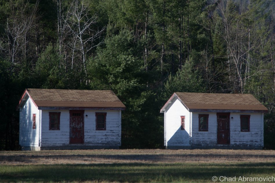
Meeting up with a good friend who is familiar with the region, he agreed to show me around some of his favorite haunts on a rather pleasant November day. Crisscrossing the region’s roads in the most inefficient manor possible, we decided to dedicate our escapade to a particular hue; the scores of old motels, vacation cabins and awesomely unkempt vintage signage and their visage of deterioration.

Everything related to this goal can be found along U.S. Route 9, where much of the area’s notoriety once came from. The route cuts through this huge region in a north south direction between the Adirondack Mountains and Lake Champlain. At one point, Route 9 was the original superhighway to the North Country before the Adirondack Northway, also known as Interstate 87, was built. In Route 9’s well traveled heyday, it was crawling with people tromping through its roadside attractions, curio, and motels which made lasting impressions in some tangible way. Today, a journey down Route 9 is more of a reflection of one of the more grimy truths of reality; impermanence. It’s now a desolate and forlorn drive through almost uninterrupted miles of forest, which is often sick and scraggily looking, as the Adirondack Northway carries most traffic now. But it’s a fascinating drive to me.

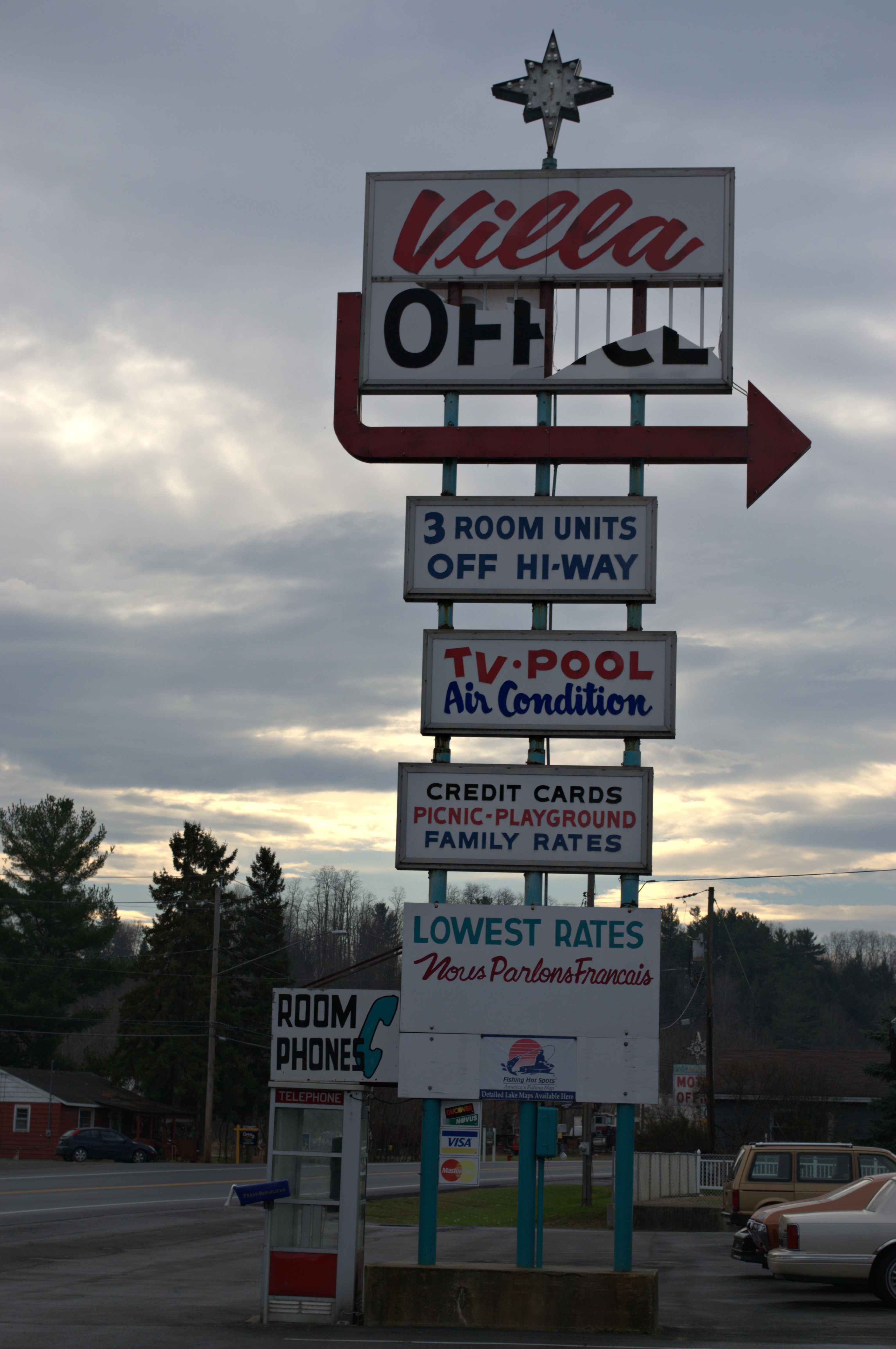
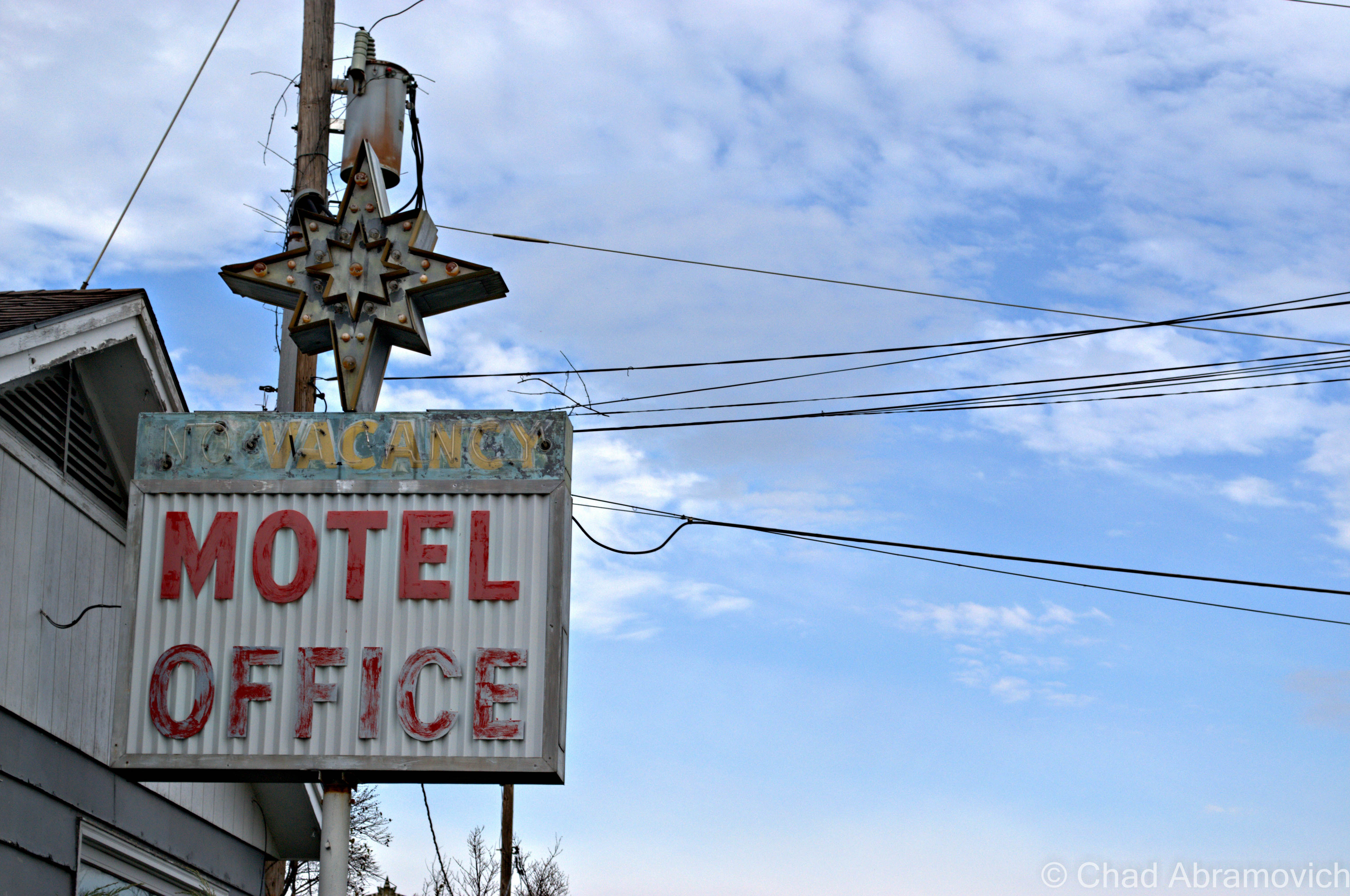
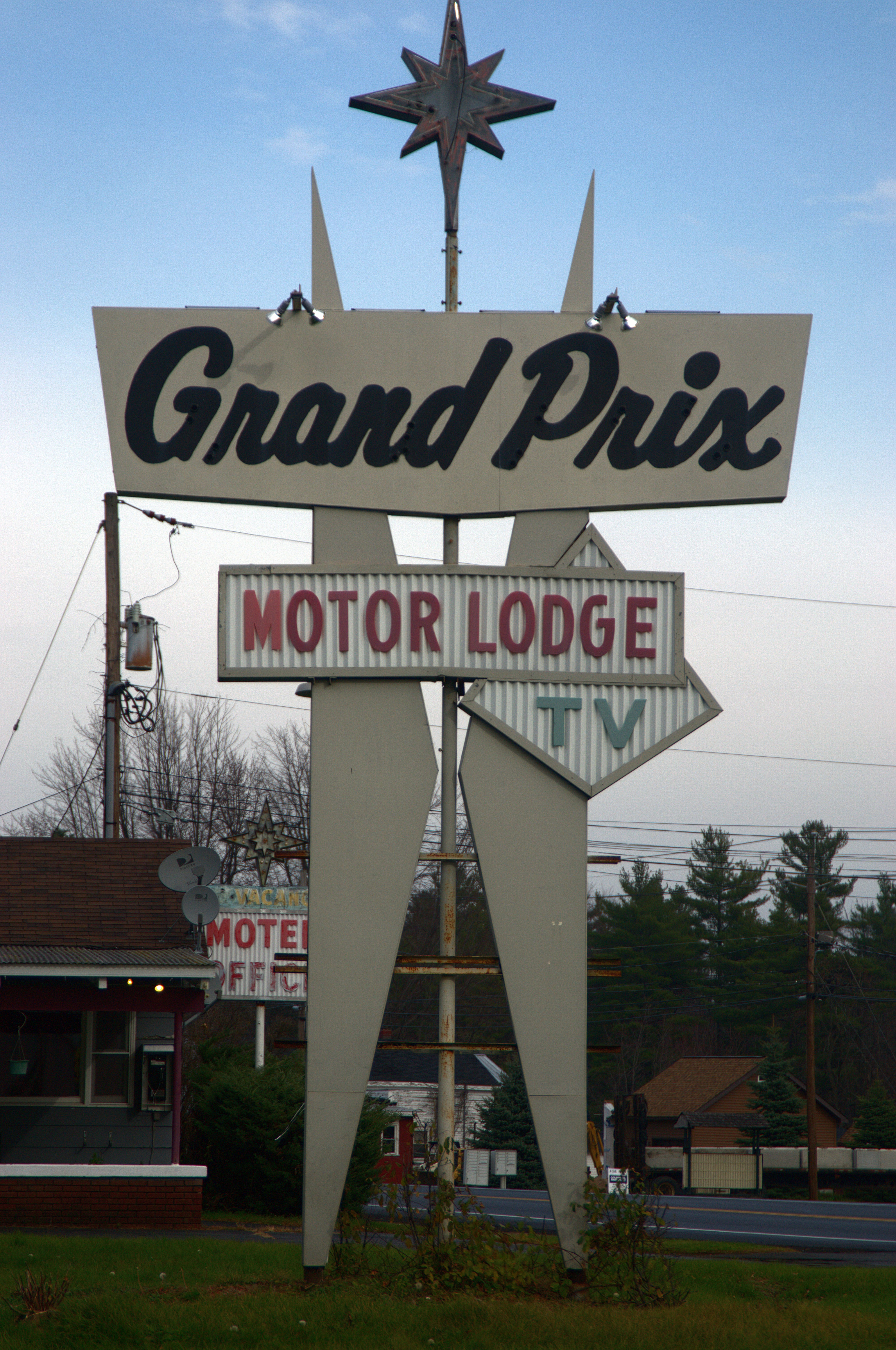
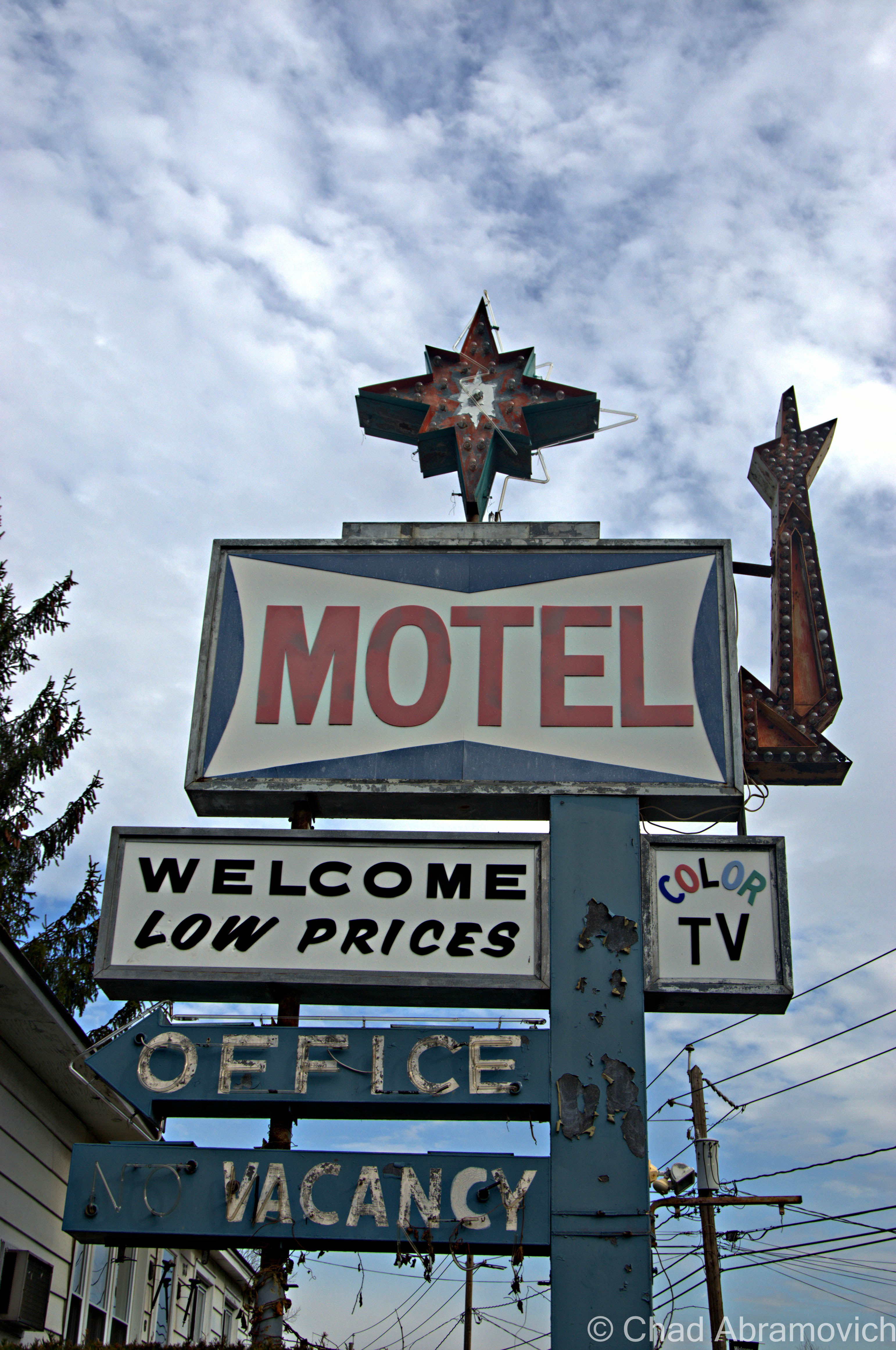
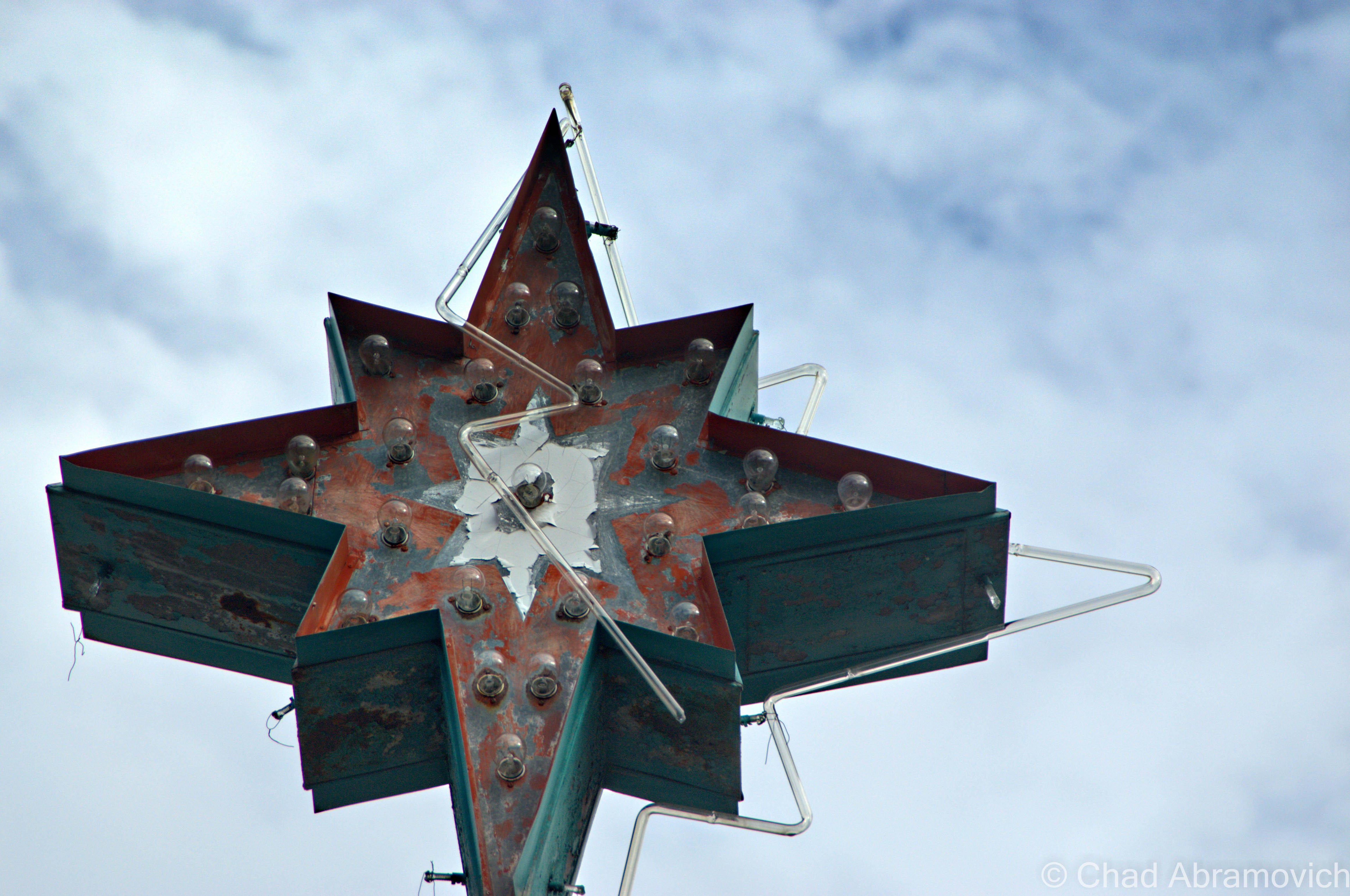
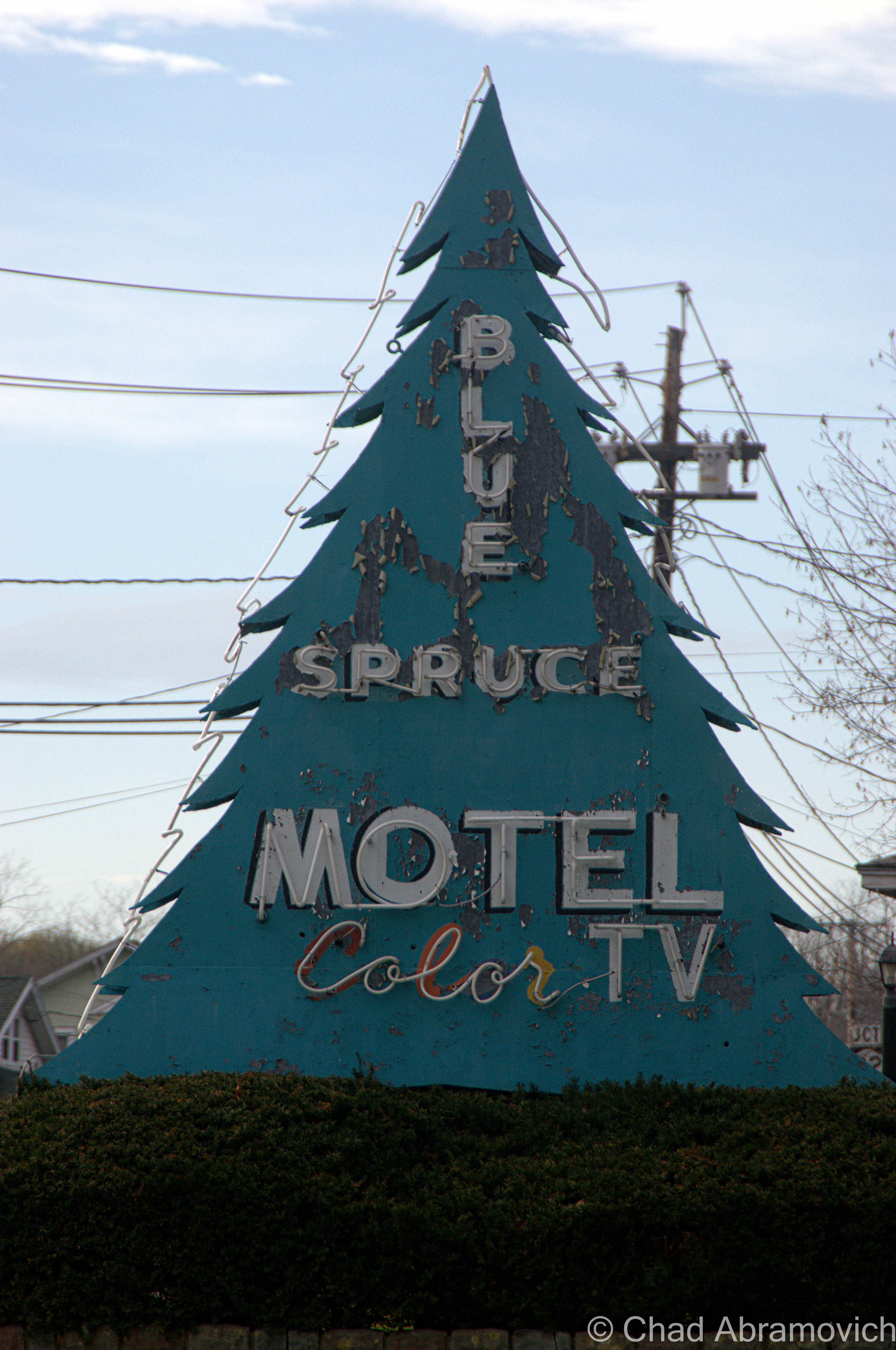
The landscape changes dramatically from the unanimated city of Plattsburgh and neighboring town of Keeseville as Route 9 heads south towards the tiny town of North Hudson and the ruins of Frontier Town, a frontier themed amusement park that was once the blood and pride of an otherwise easily missed town. The areas around Plattsburgh and Keeseville are lined by mid century motel establishments and their gimmicky retro signs complete with wondering arrows, neon lights and sharp angles; all designed to capture the travelers’ attention. Further south, unvarying one room wooden cabins are scattered in the midst of otherwise scraggly fir forests and increasingly long distances of highway with no signs of life for miles. Depressed hamlets like Lewis and New Russia spring out of the untamed forest like some sort of northern mirage, but are easily forgotten within minutes.

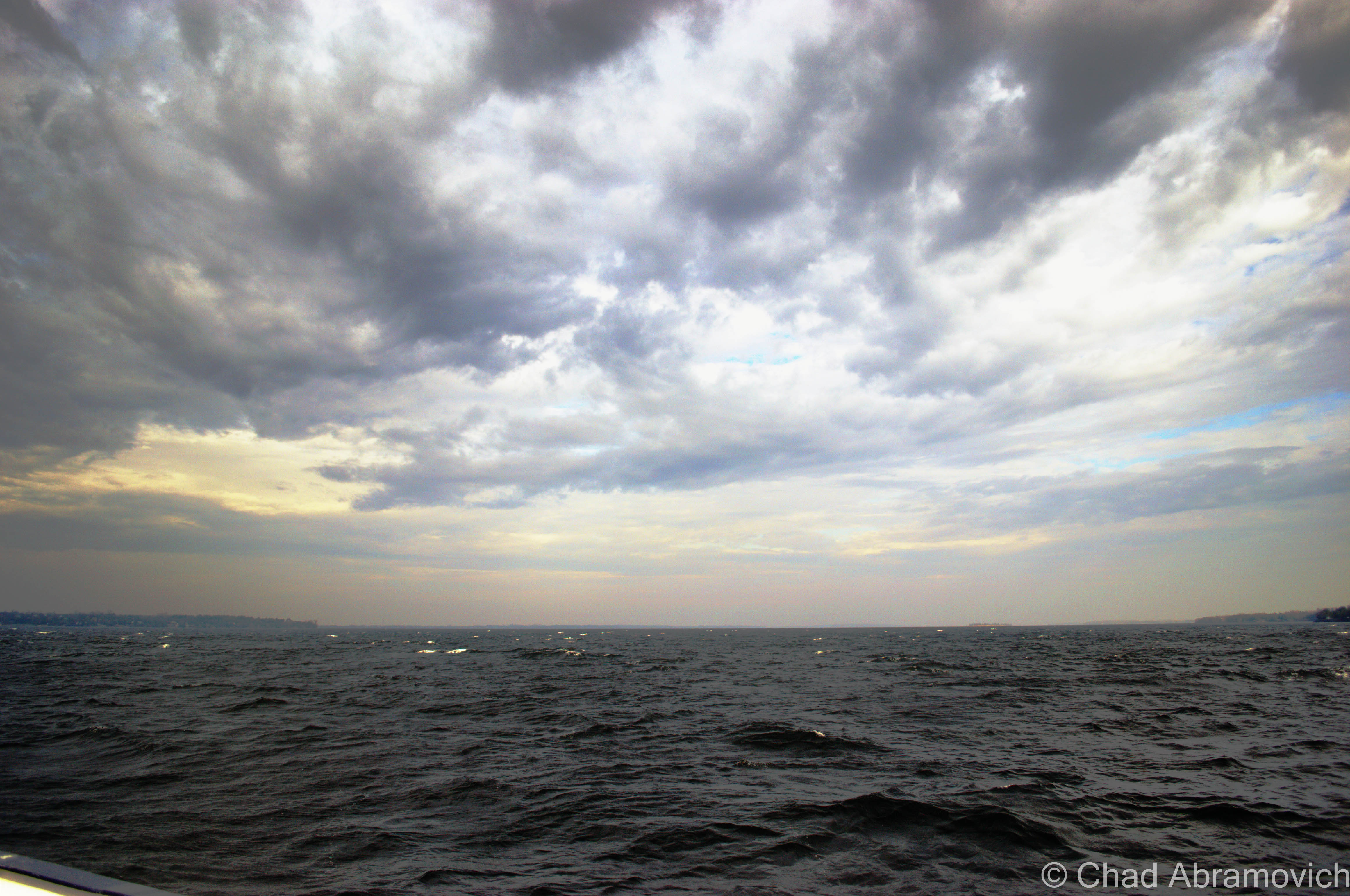
We decided the best route to New York would be The Grand Isle Ferry. From there, it would be a short drive down Route 314 to the destination Route 9 in Plattsburgh. The winds were incredibly fierce, the lake was choppy and full of whitecaps. Because of this, the ferry ride over was twice as long, as the captain attempted to navigate the rough waters safely, the boat viciously rocking back and forth and the waves spraying over onto the deck. For the fun of it, we got out of the car and attempted to get a few pictures of the rough conditions, but my, uh, sea legs had 25 years of inexperience working against me. The boat was rocking so badly that it was almost impossible to gain my balance. Admitting defeat, it was back in the car for me.

The choppy waters of Lake Champlain from the Grand Isle ferry.

DSC_0857_pe

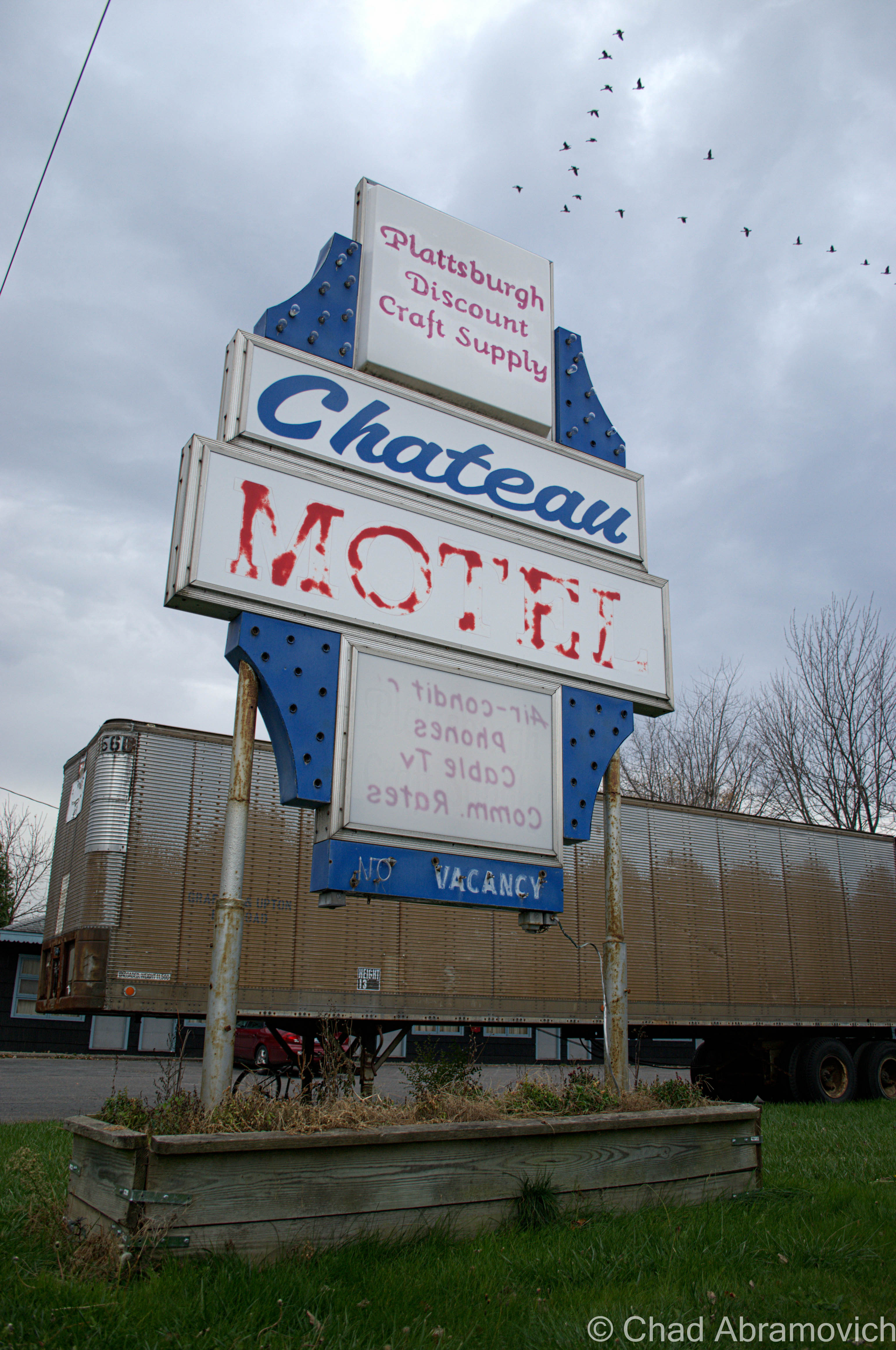
While taking pictures of this sign, the owner of the motel happened to be walking by, giving us a strange look. To relieve some of the tension, we told her we liked her sign, and asked how old it was. She scratched her head in thought, and said it's been here since the mid 50s.
While taking pictures of this sign, the owner of the motel happened to be walking by, giving us a strange look. To relieve some of the tension, we told her we liked her sign, and asked how old it was. She scratched her head in thought, and said it’s been here since the mid 50s. “I can’t believe you guys want to take a picture of it” she said laughing.

DSC_0889_pe DSC_0894_pe DSC_0906_pe DSC_0910_pe DSC_0918_pe

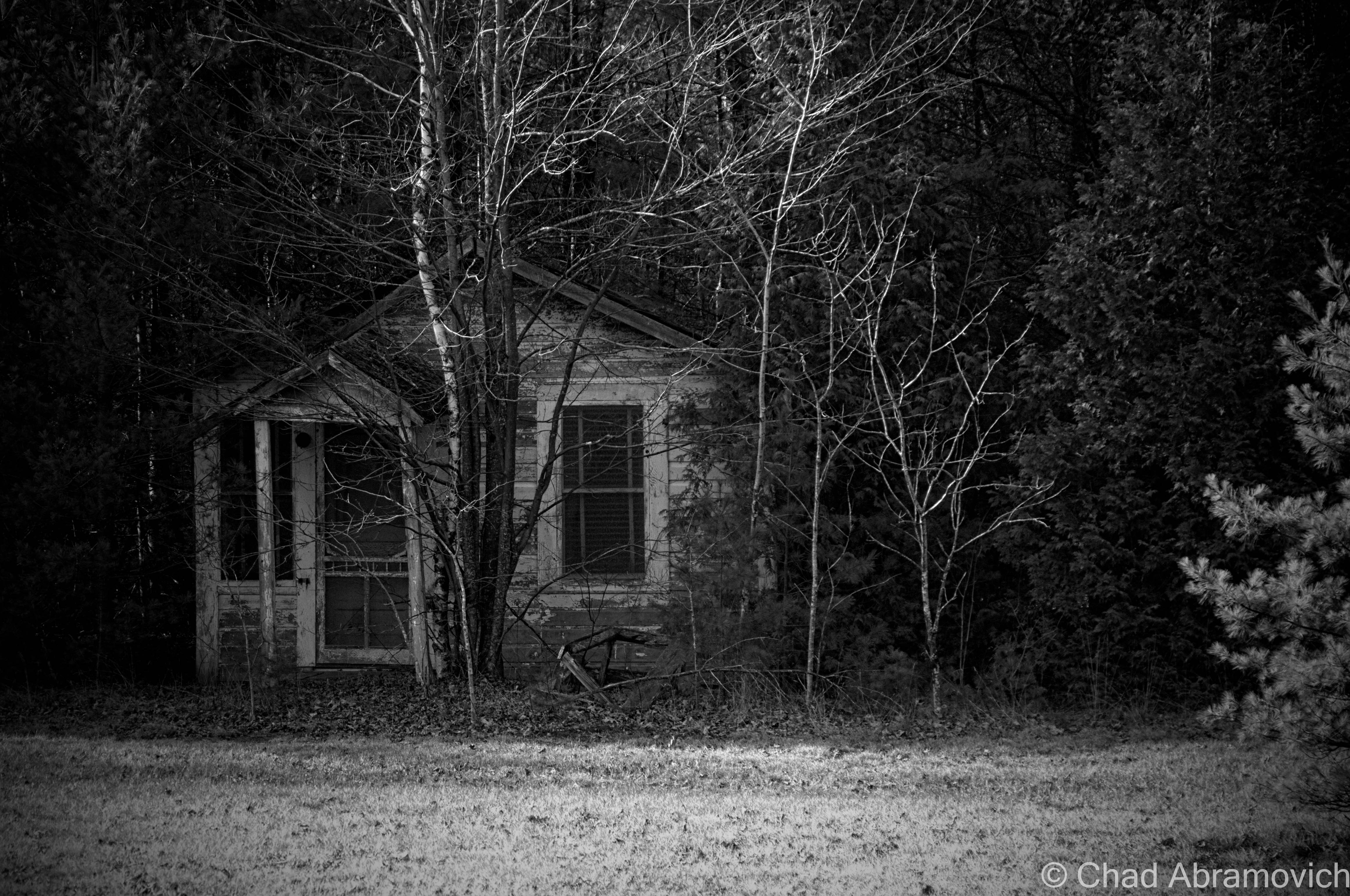
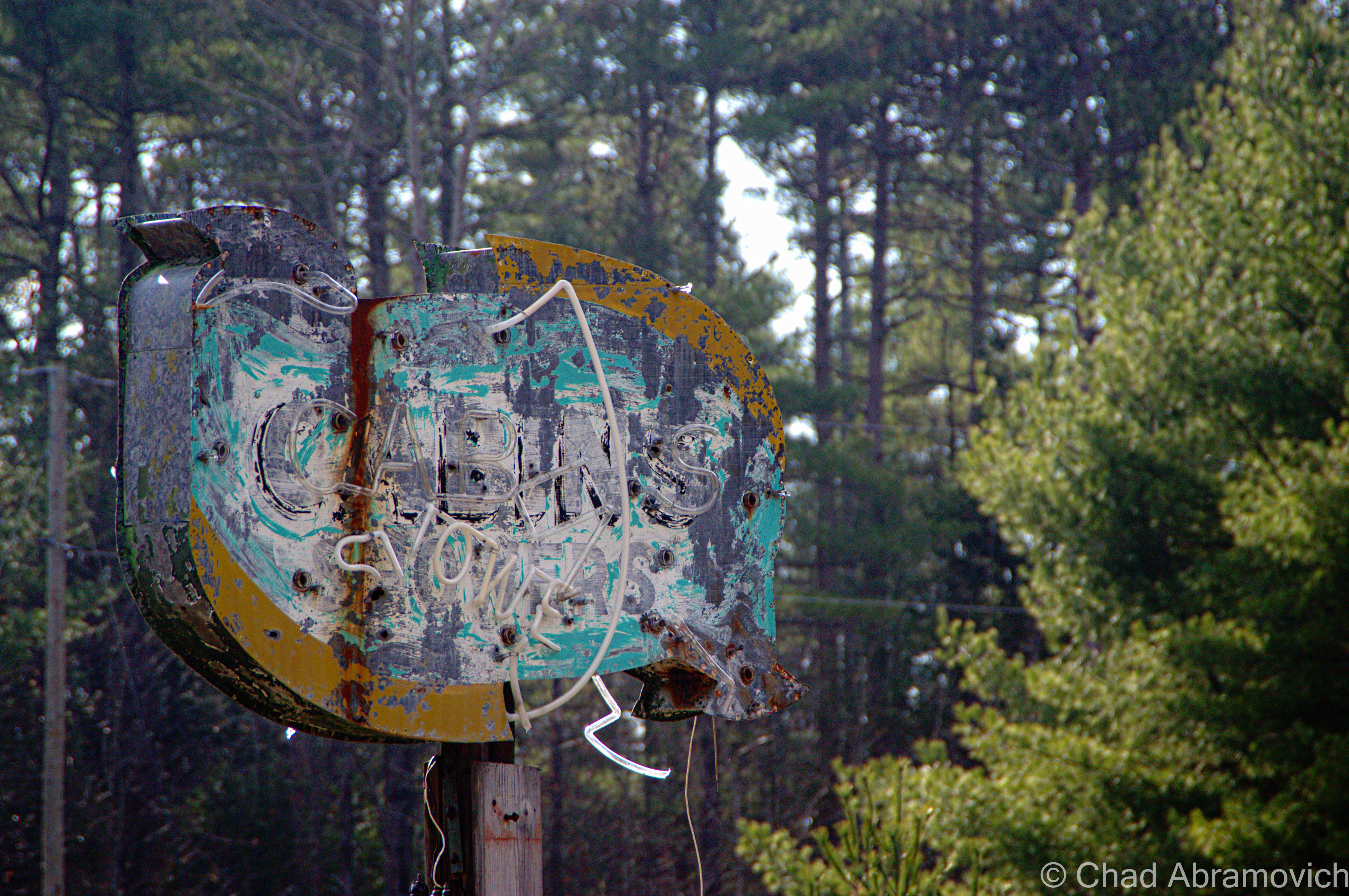
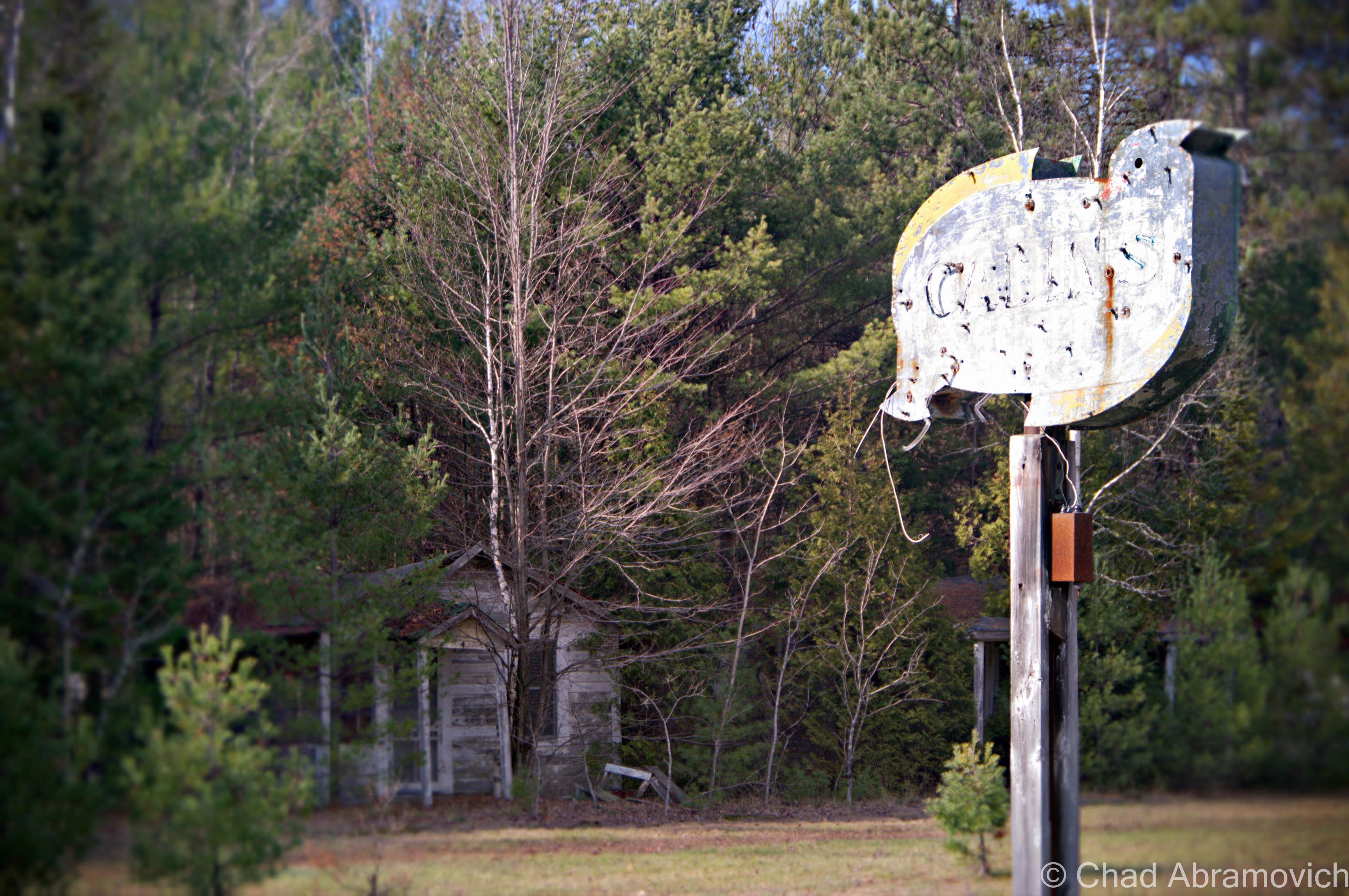
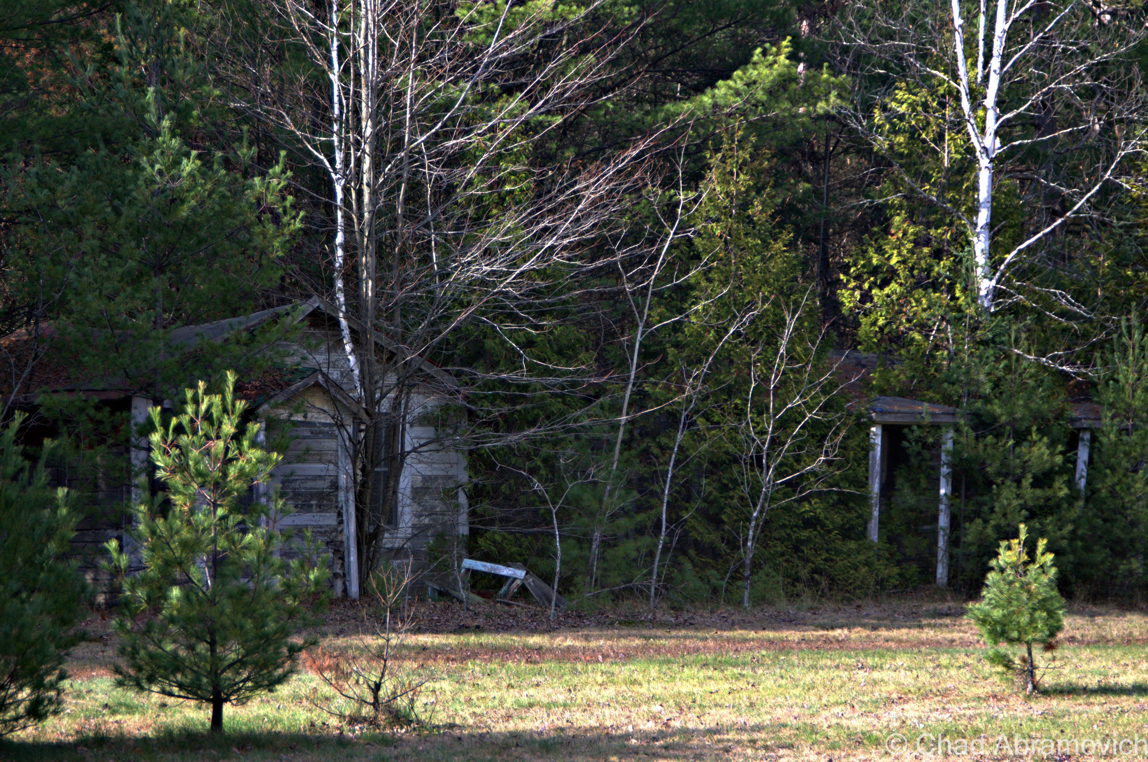
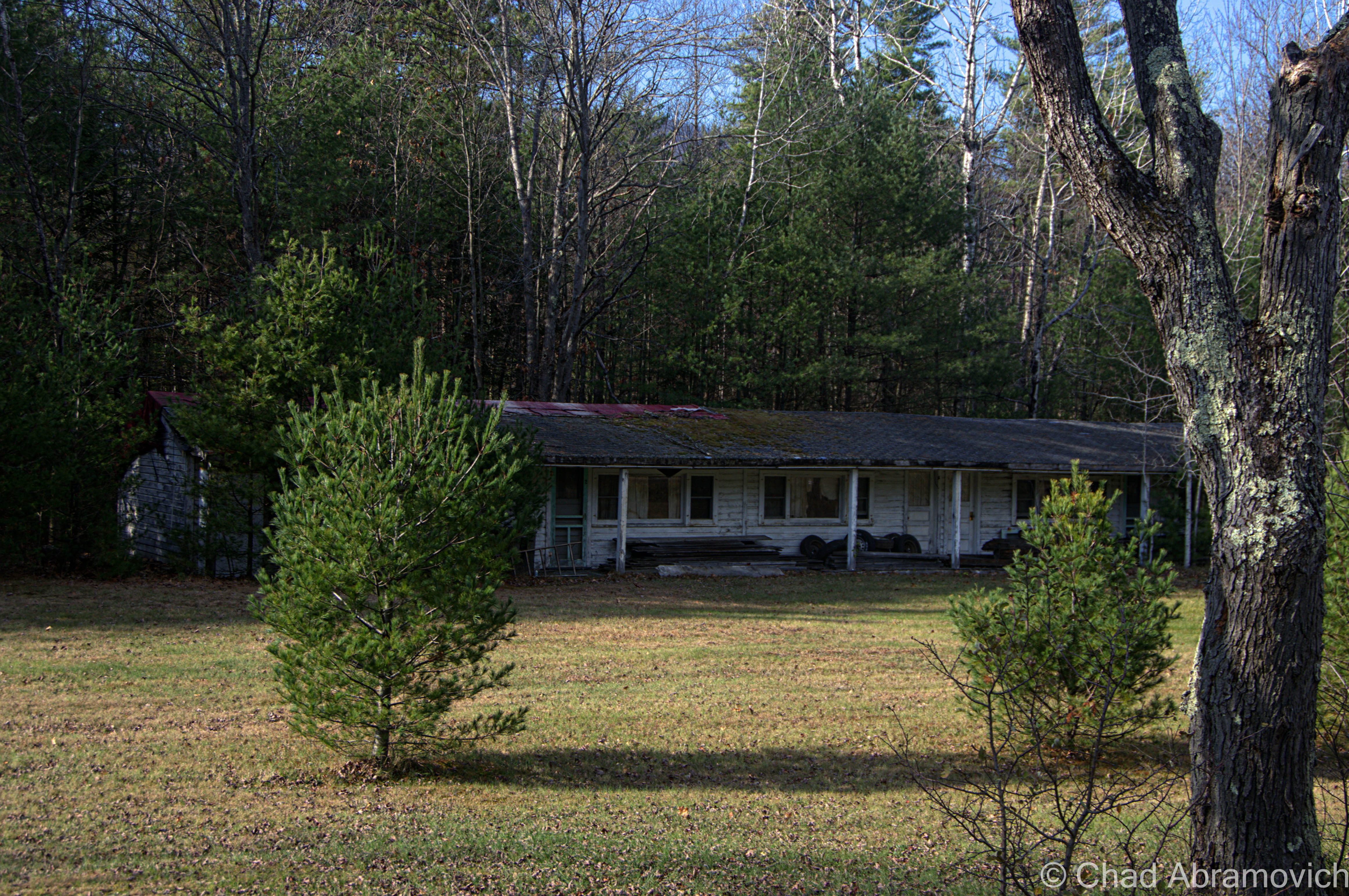
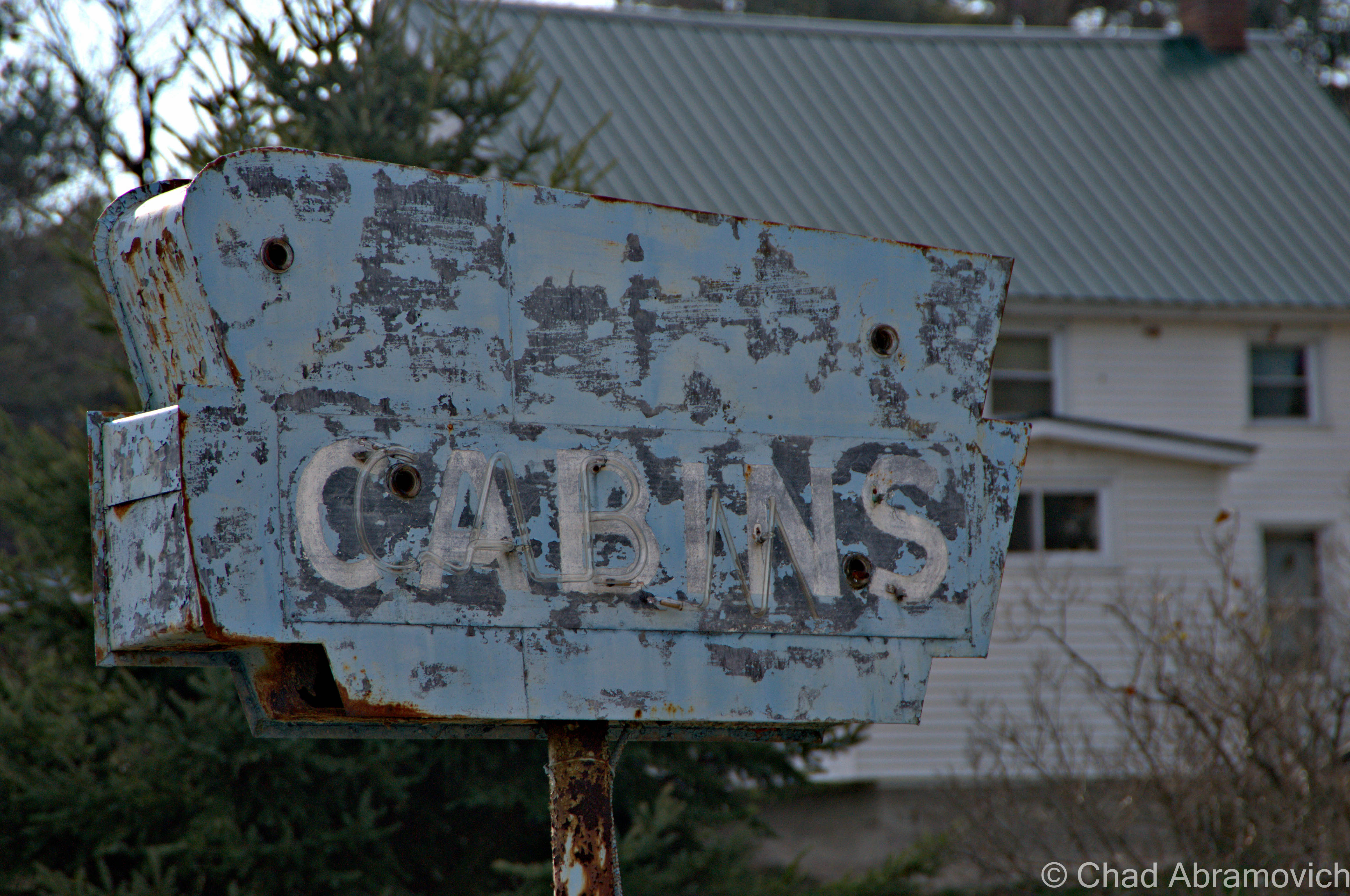
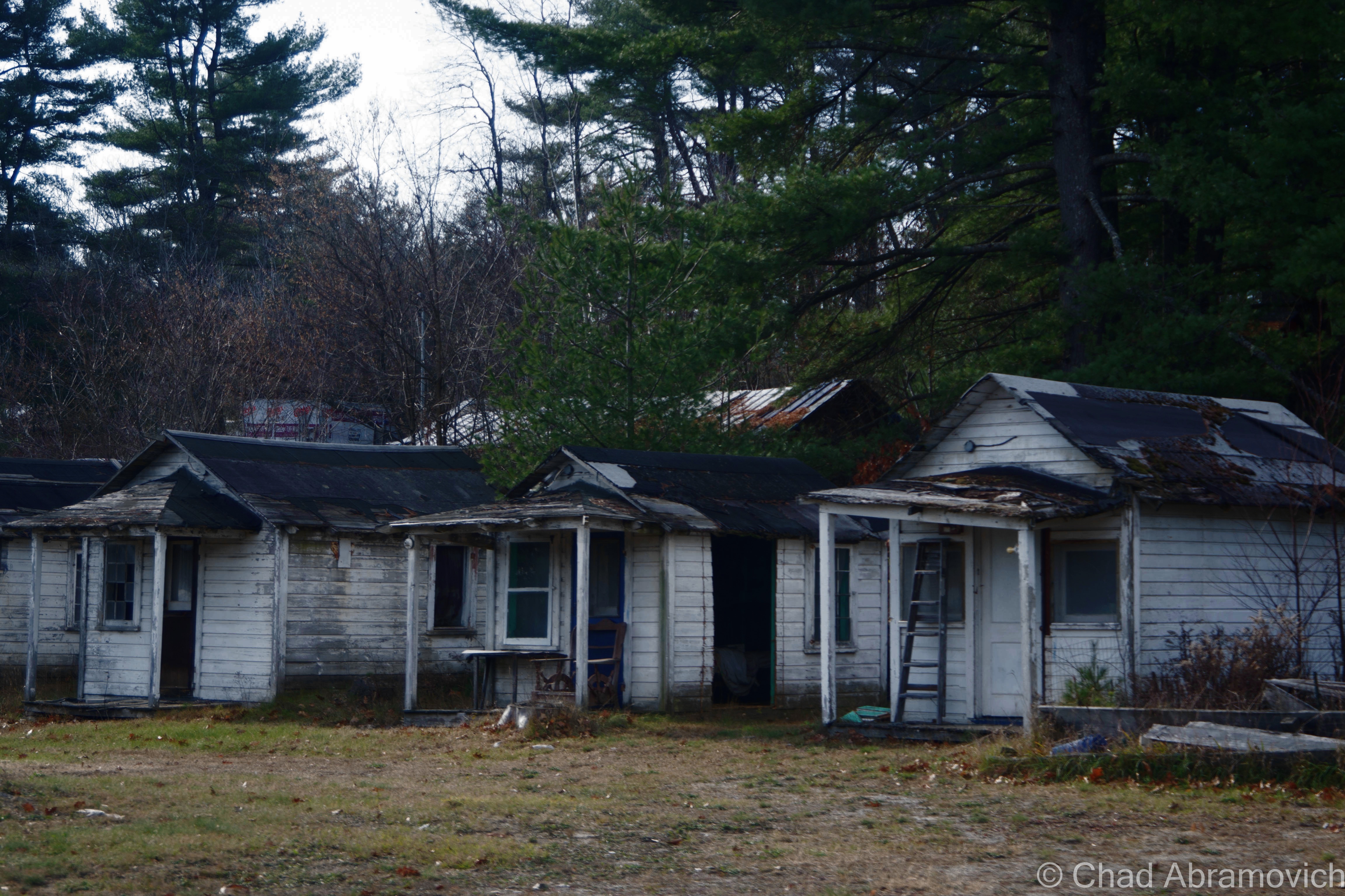
Out of the city limits now, Route 9 returns to stark wilderness. With the motels of Keeseville now gone, the desolation is now occasionally broken by crumbling roadside cabins shrouded in growth, with a decaying sign out front, their paint long faded and neon tubes hanging loosely around the sides.

Cabin Set #1

DSC_0948_pe DSC_0950_pe DSC_0952_pe DSC_0955_pe DSC_0960_pe DSC_0974_pe

Cabin Set #2

DSC_0982_pe

These cabins were practically in someone's front yard.
These cabins were practically in someone’s front yard.

Cabin Set #3

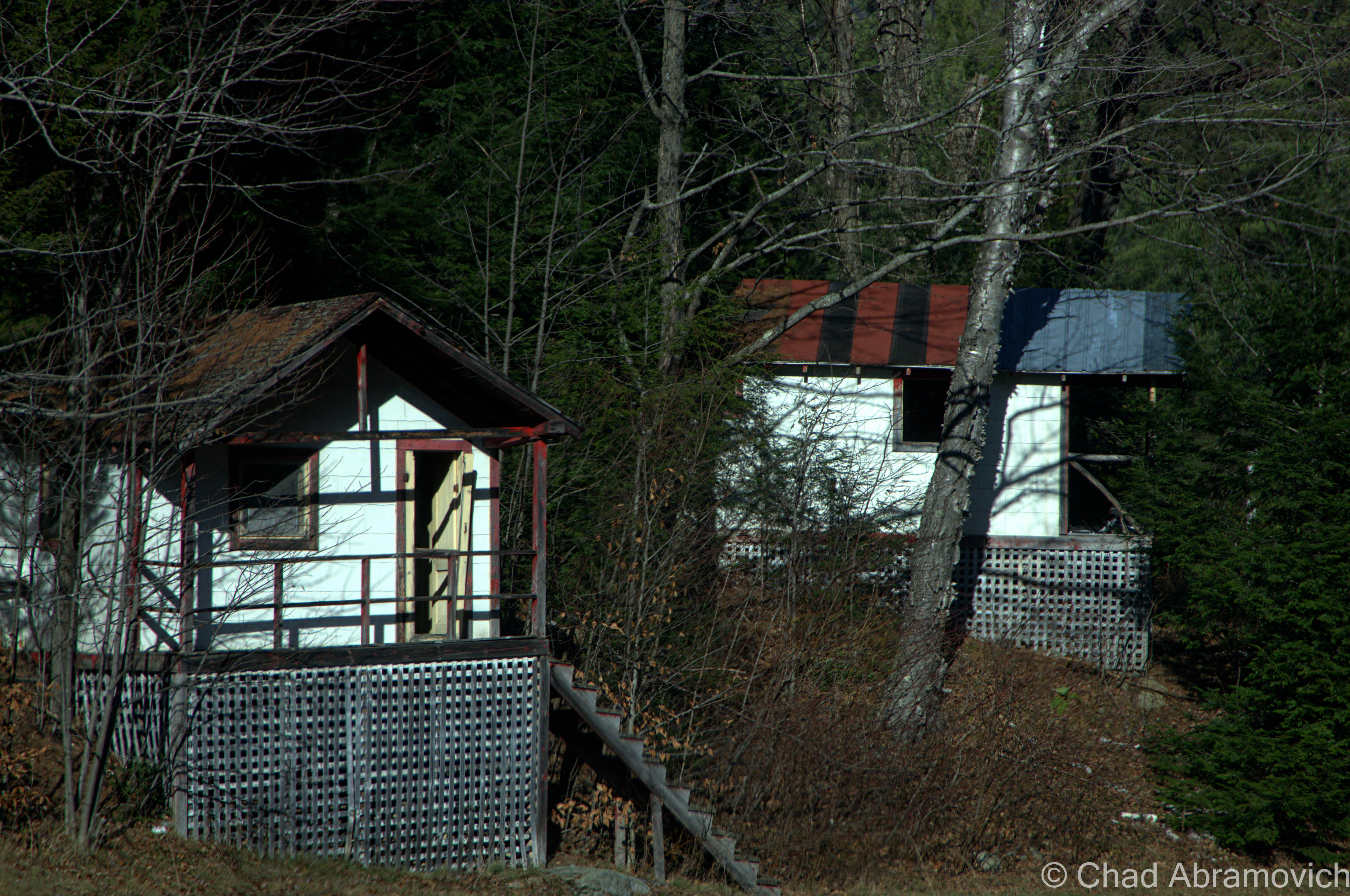
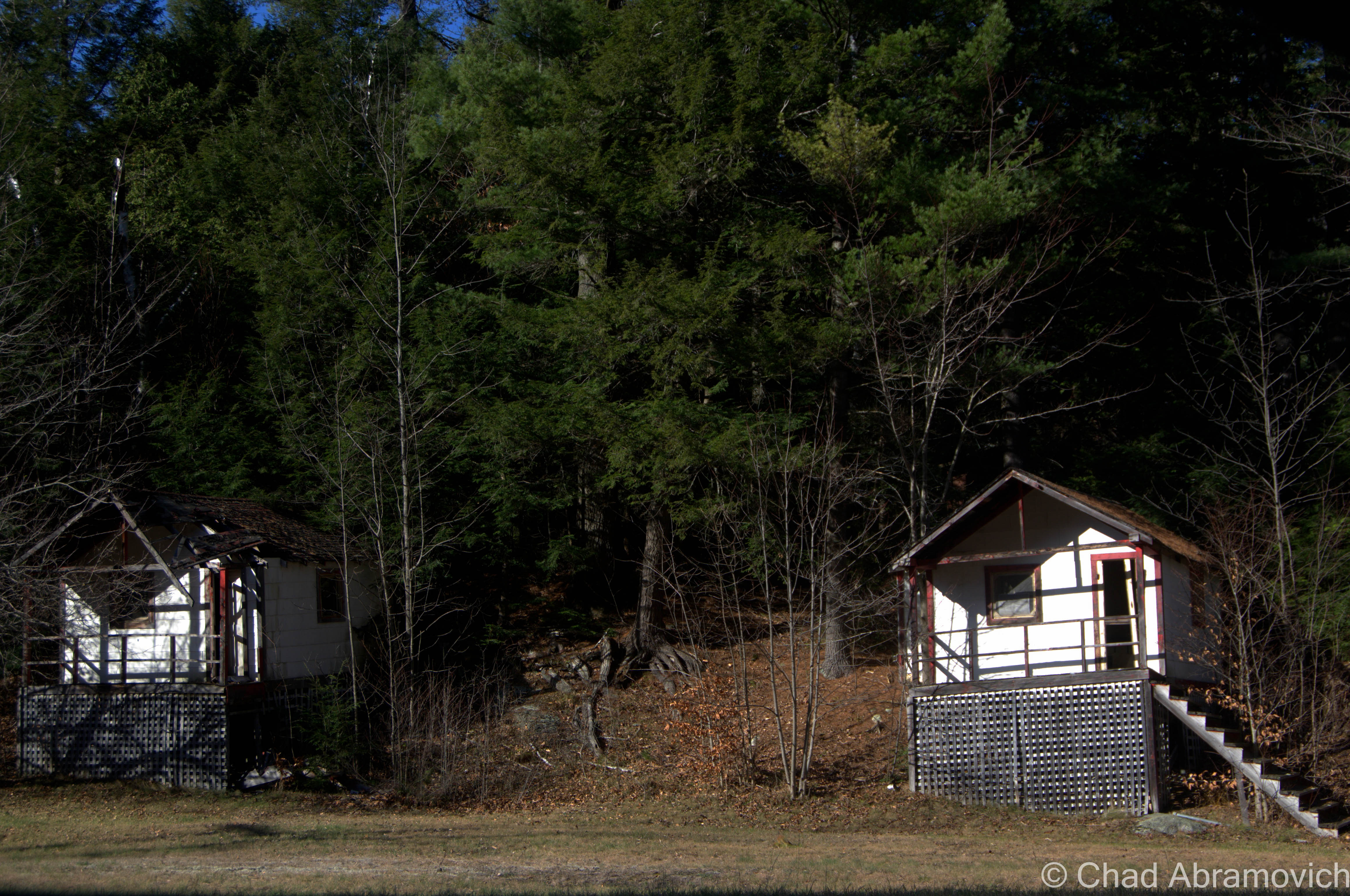
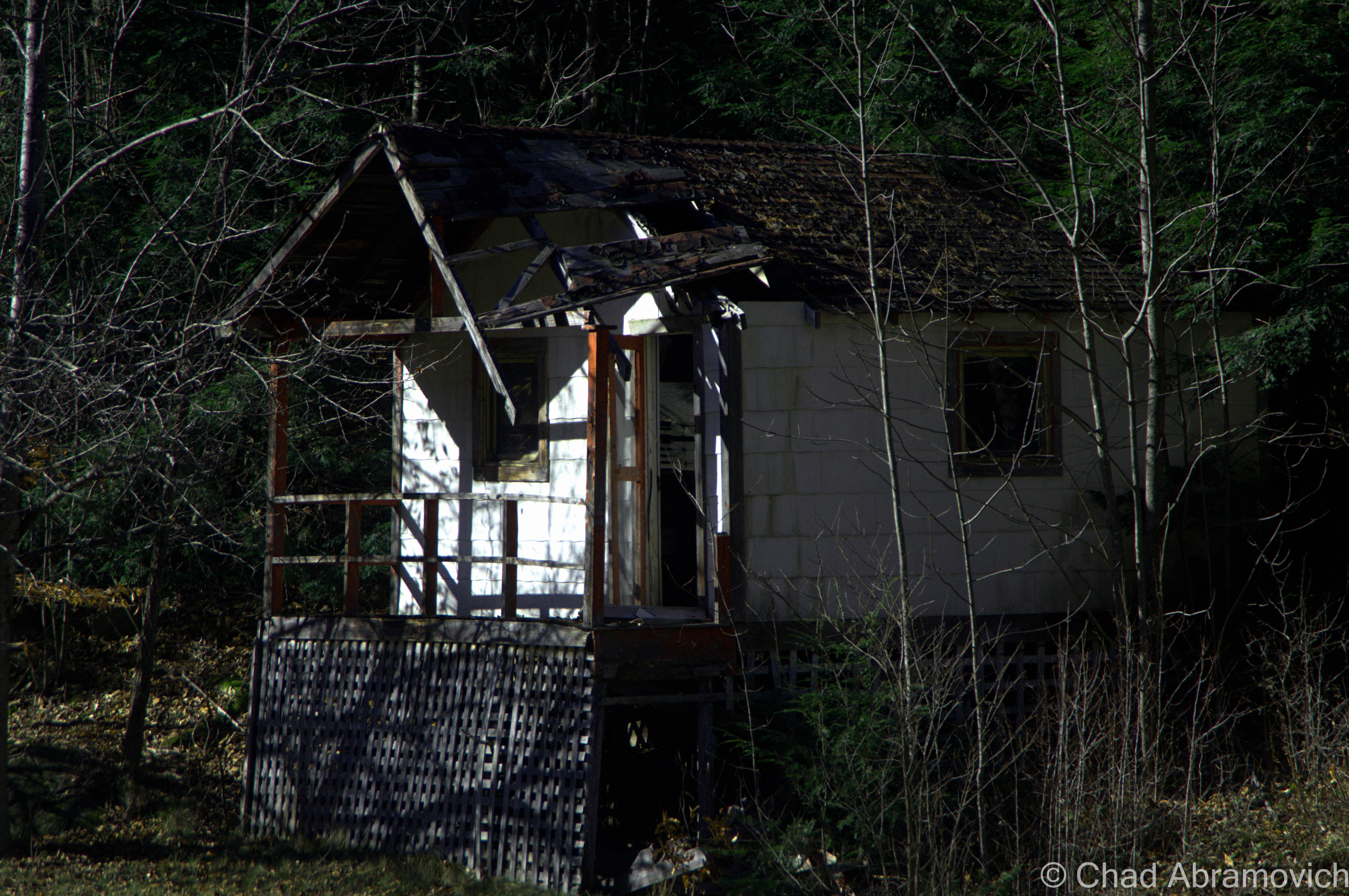
I found these to be interesting because of their unique hillside perch – and their remote location – there was nothing else around for several miles, making me think that these were sort of a “last chance” affair.

DSC_0989_pe DSC_0996_pe DSC_0999_pe

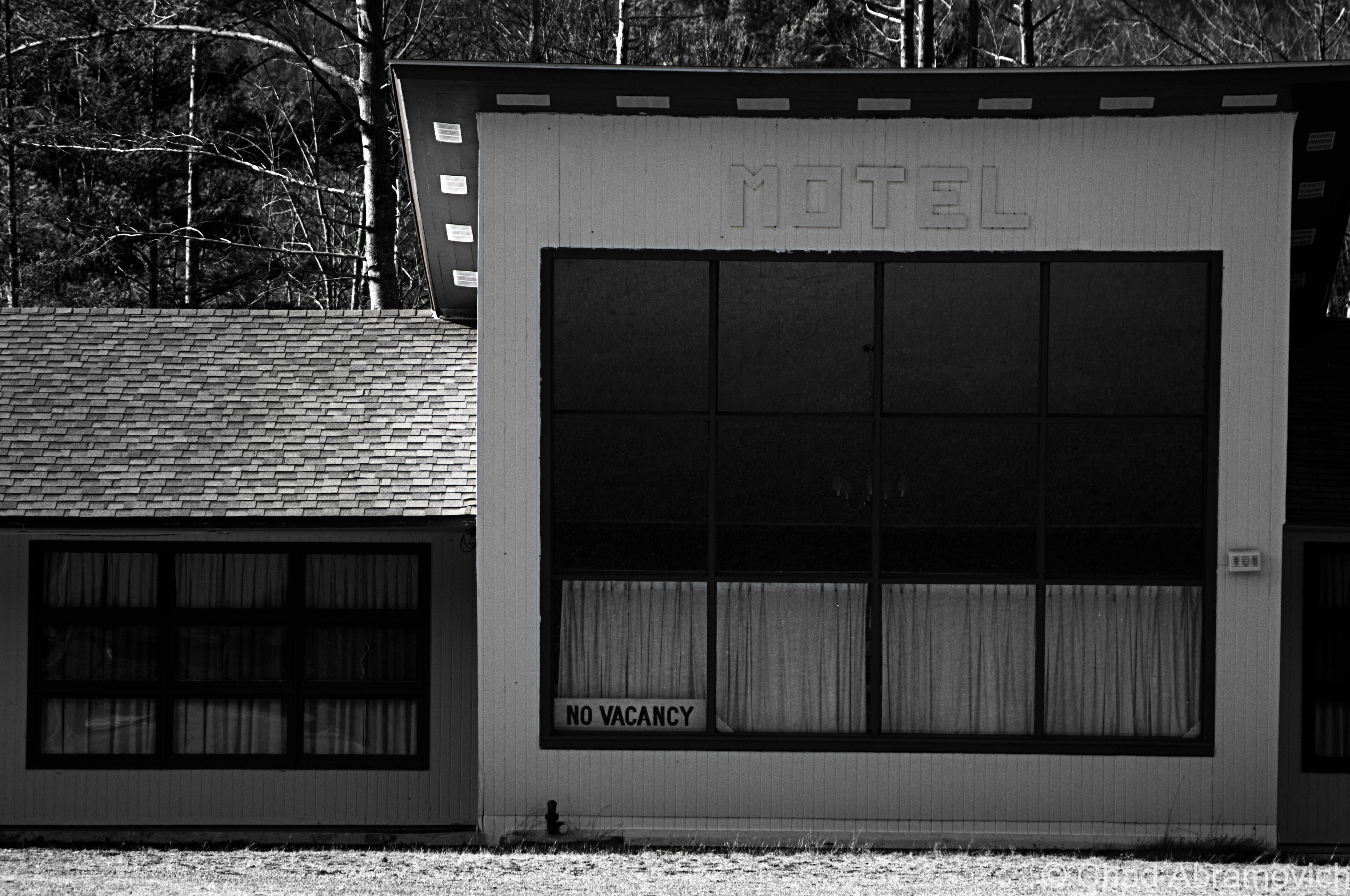
Now the landscape changed again from the cramped rustic abandoned cabins to abandoned motels.

Abandoned Motel #1

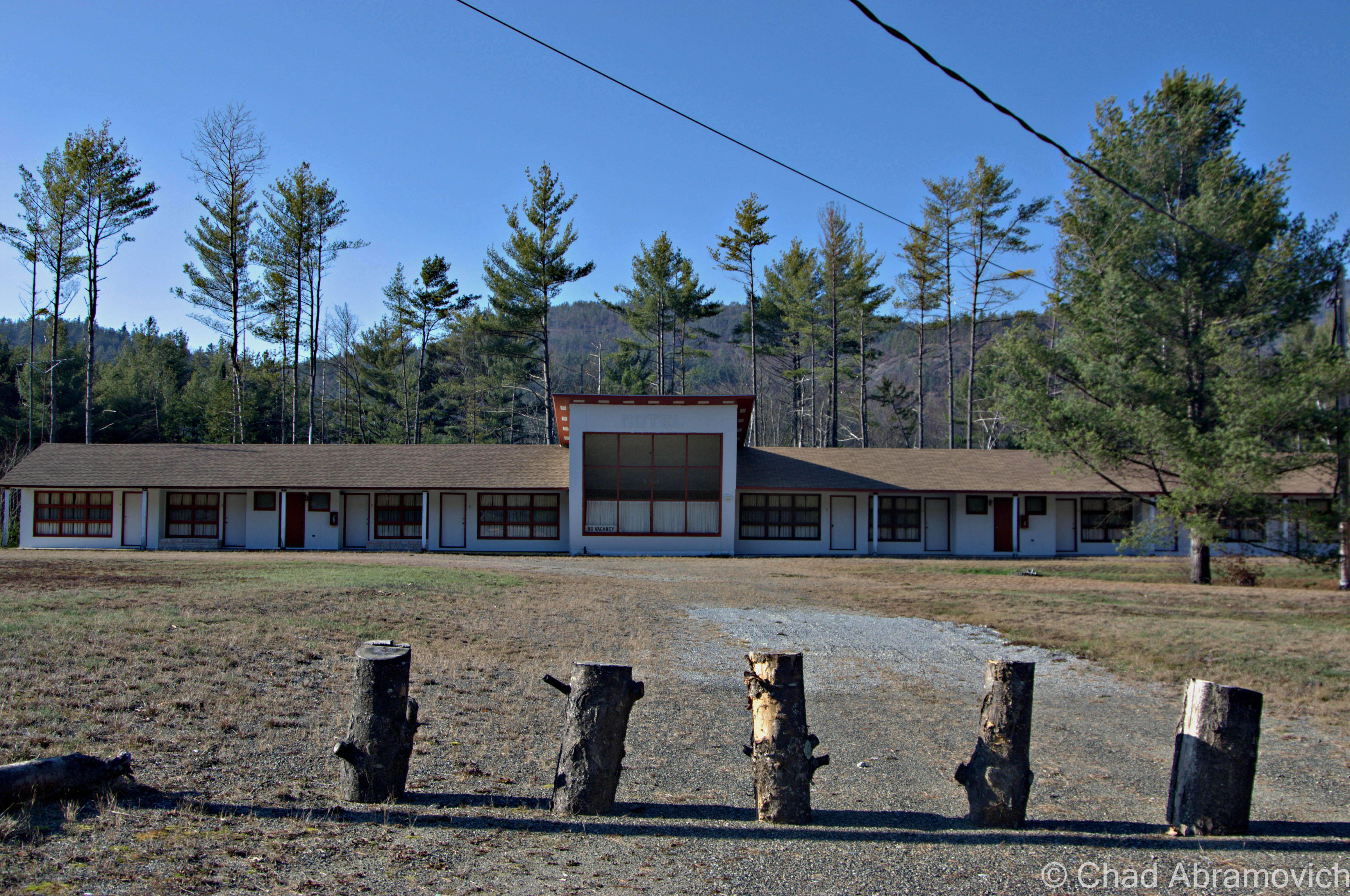
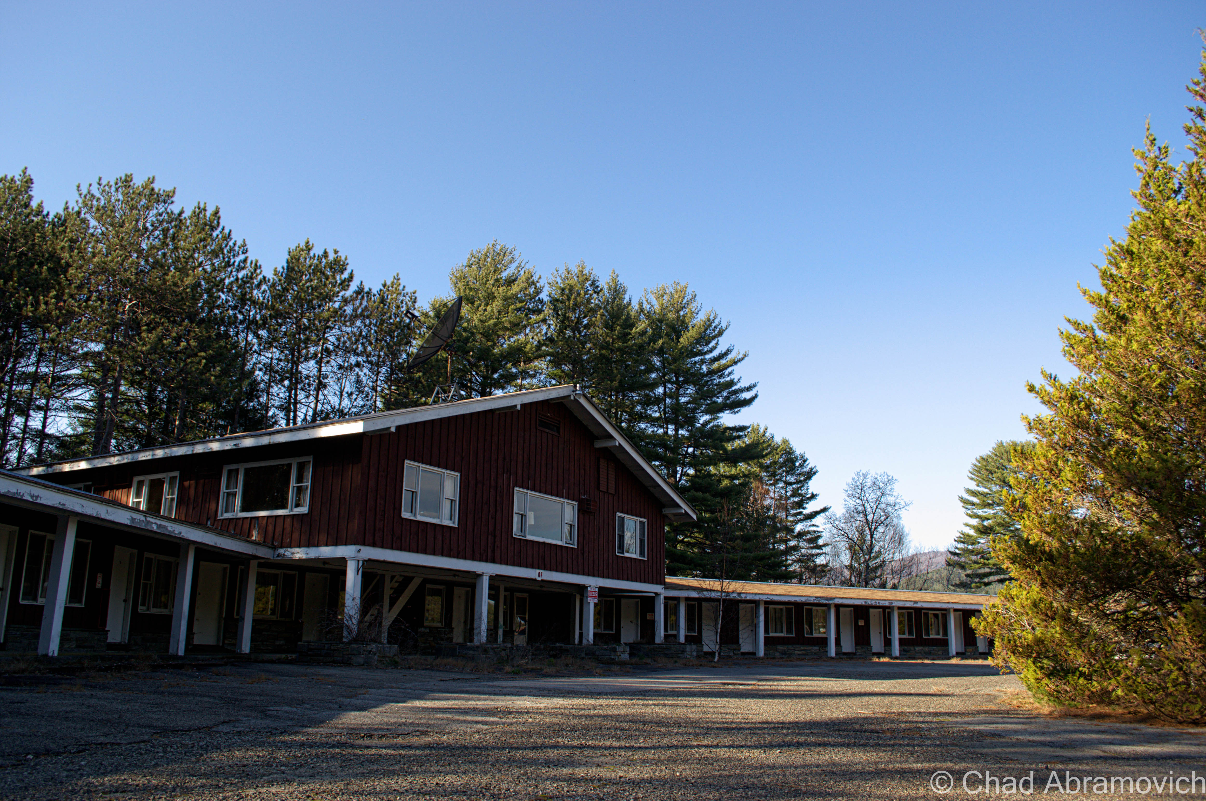
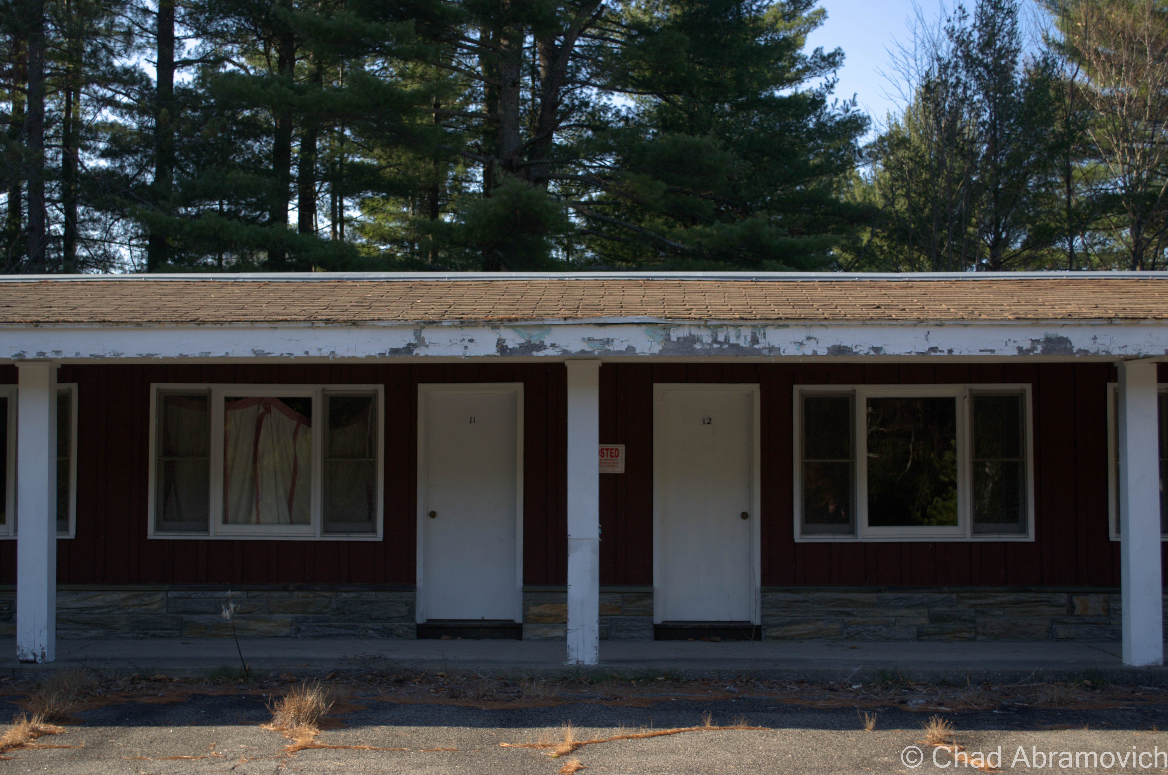
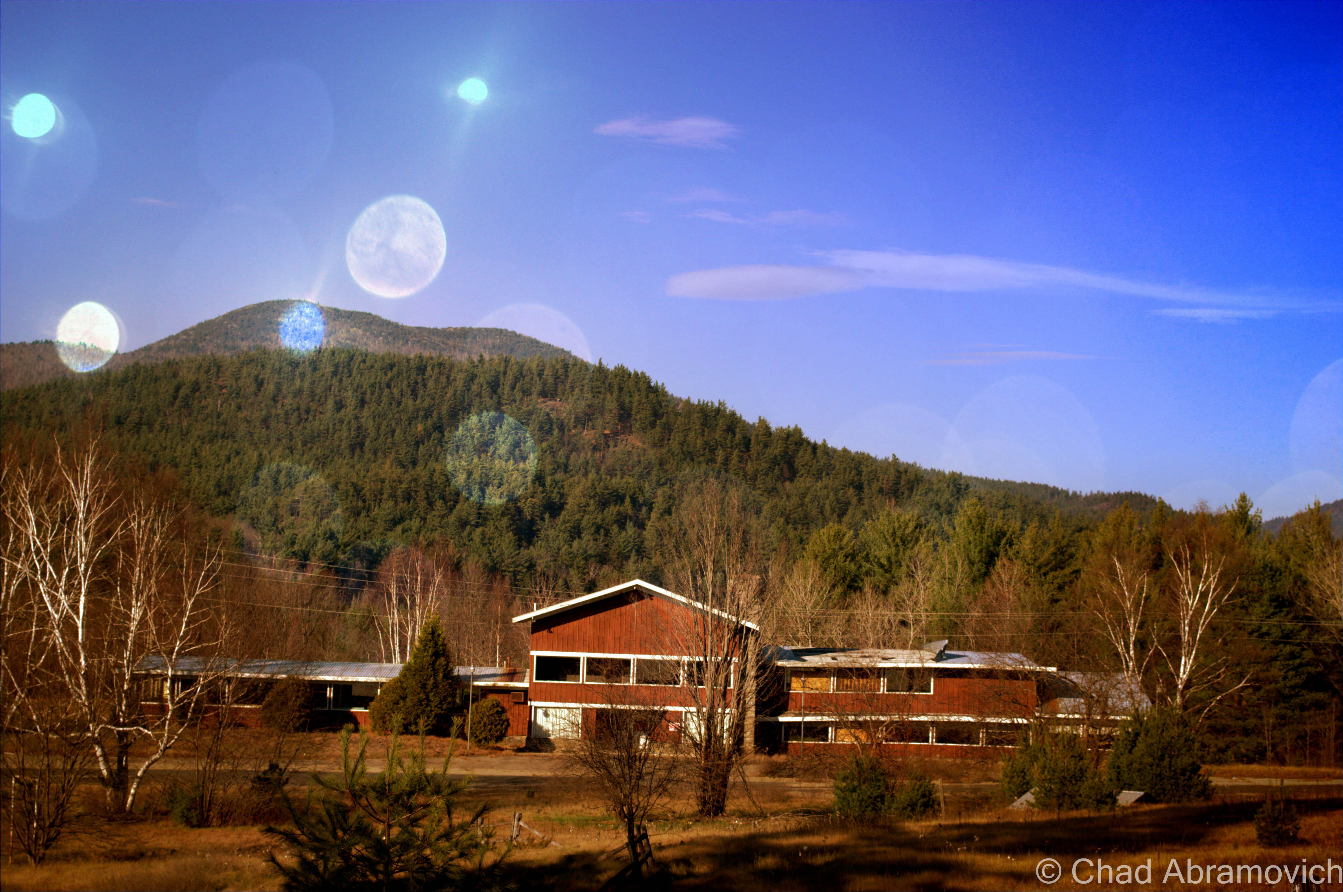
This abandoned motel seemed to be relativity up kept, its dated architecture looking almost as crisp as its heyday. The lawn was kept mowed, and the owners lived across the street in another former motel, which I suppose wasn’t very surprising.

DSC_0001_pe DSC_1006 DSC_1013_pe

Abandoned Motel #2

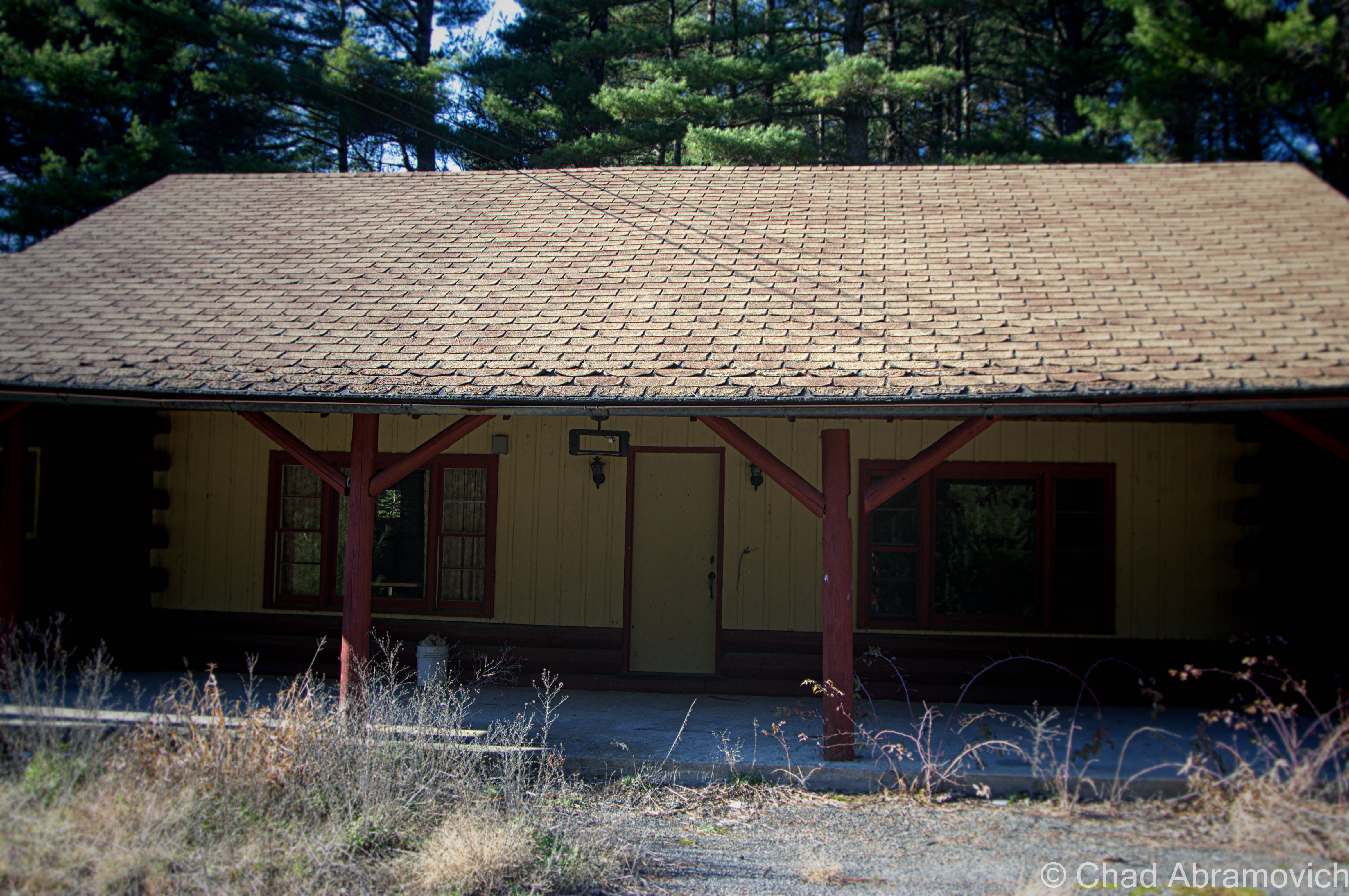
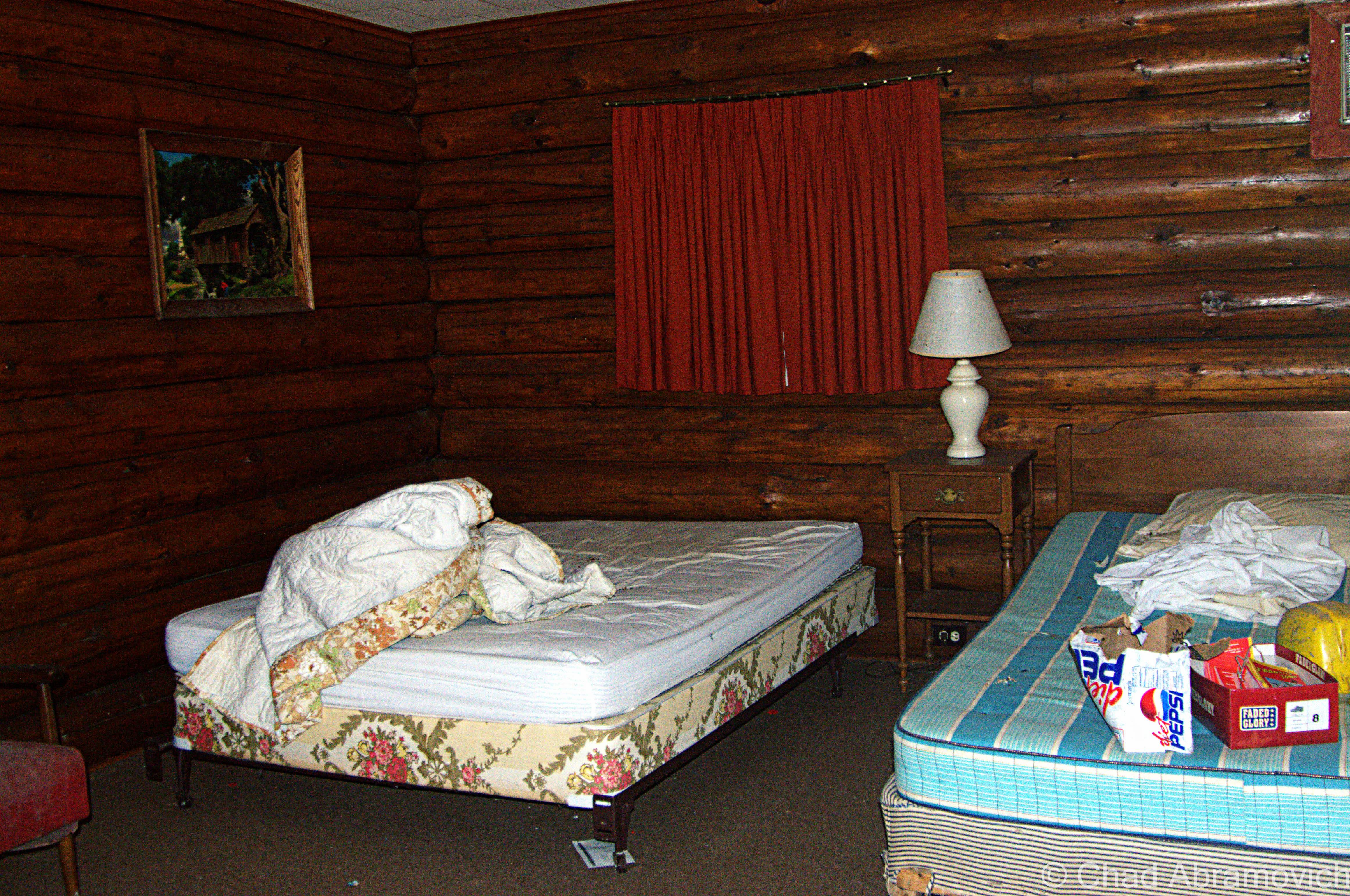
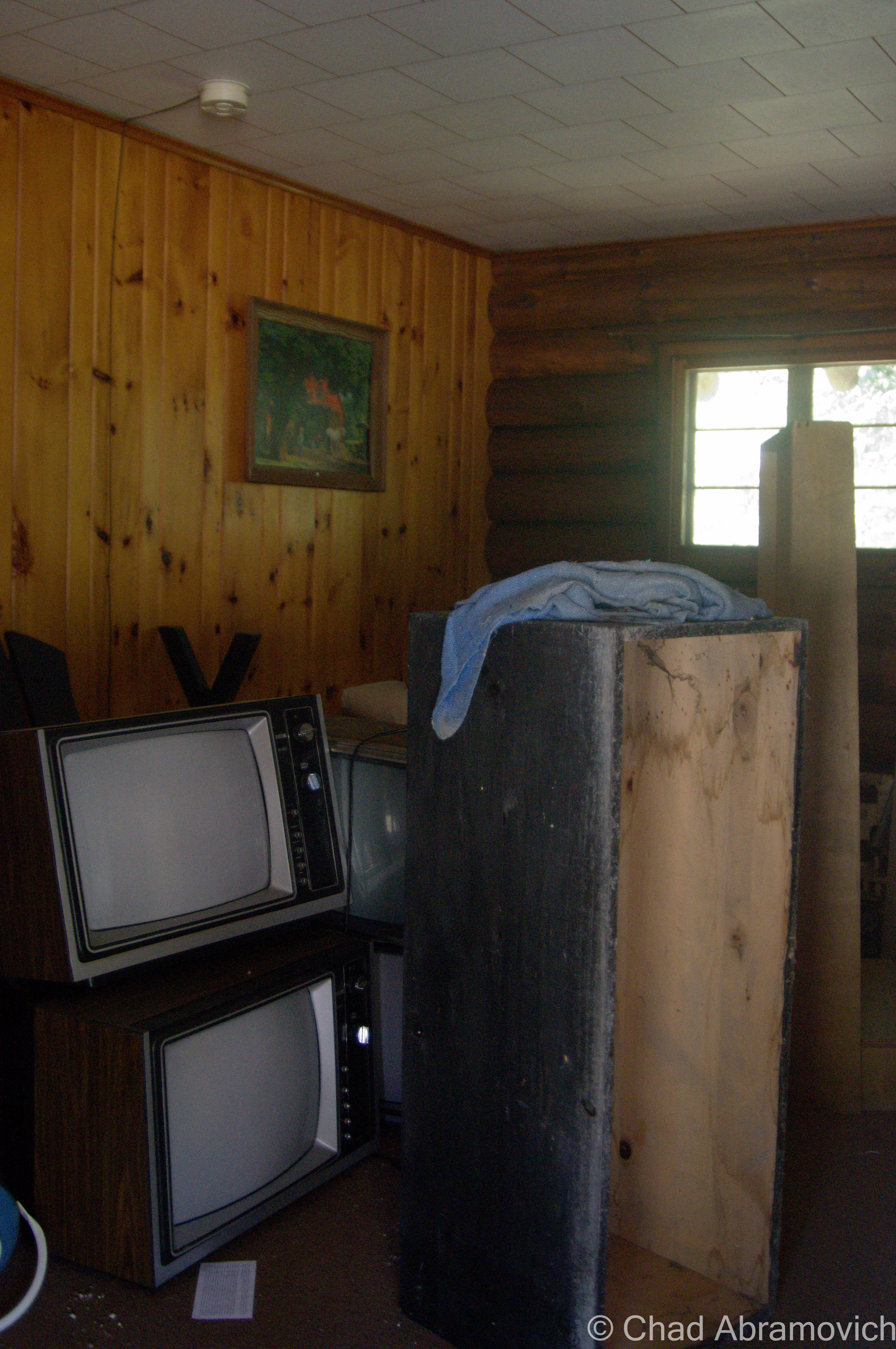
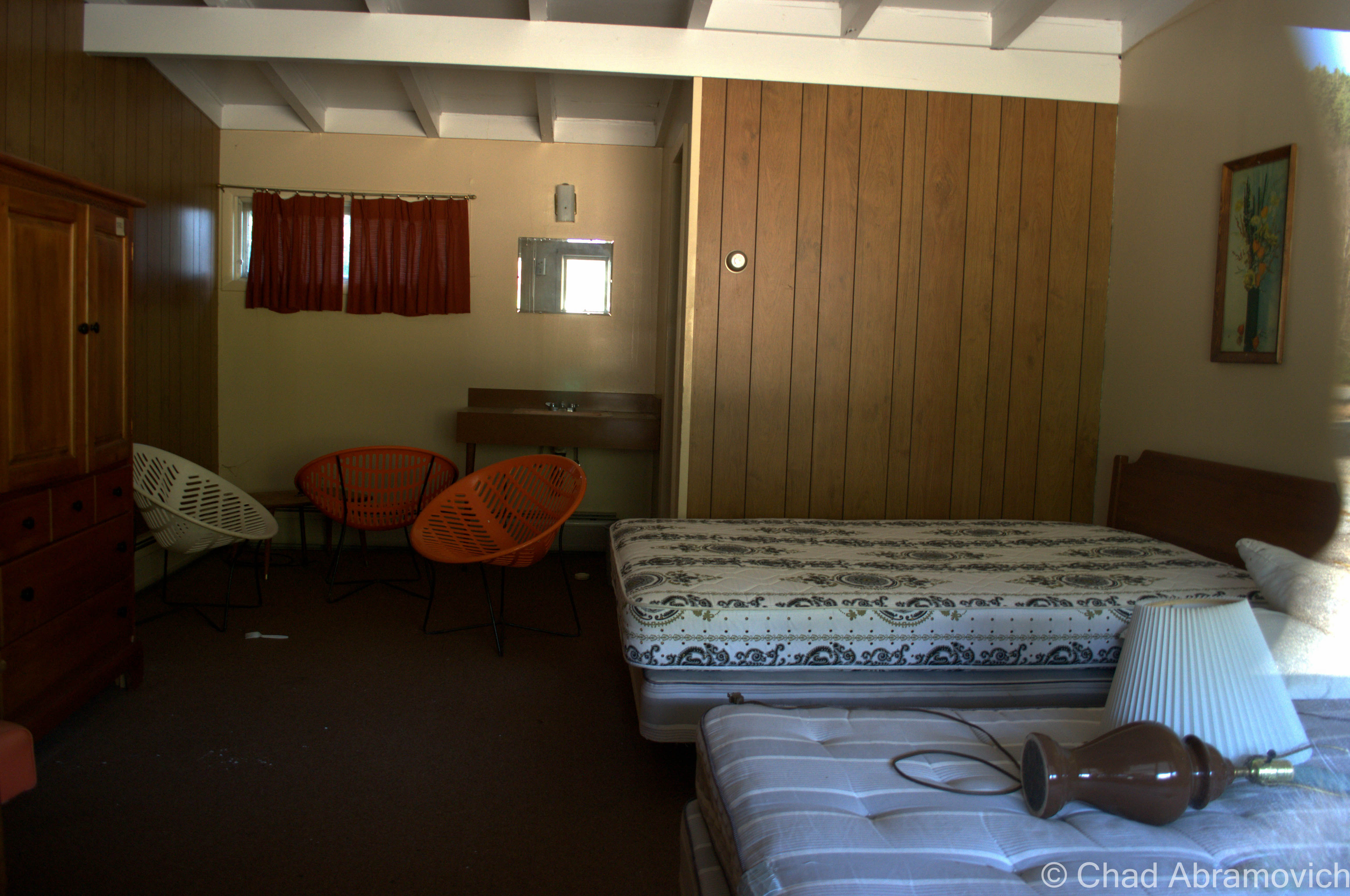
This motel was more desolate then the first one, done in a kitschy in a rustic log theme, which was inspired by the defunct amusement park, Frontier Town, which was just down the road. The crumbling parking lot had almost returned to a wild state overran with weeds, and the long front porch was becoming encroached with fir trees growing slowly inside it. This was the first place we noticed that hosted transient people. Some of the rooms had been broken into, and the obvious signs of human presence were everywhere, but thankfully none were around when we arrived.

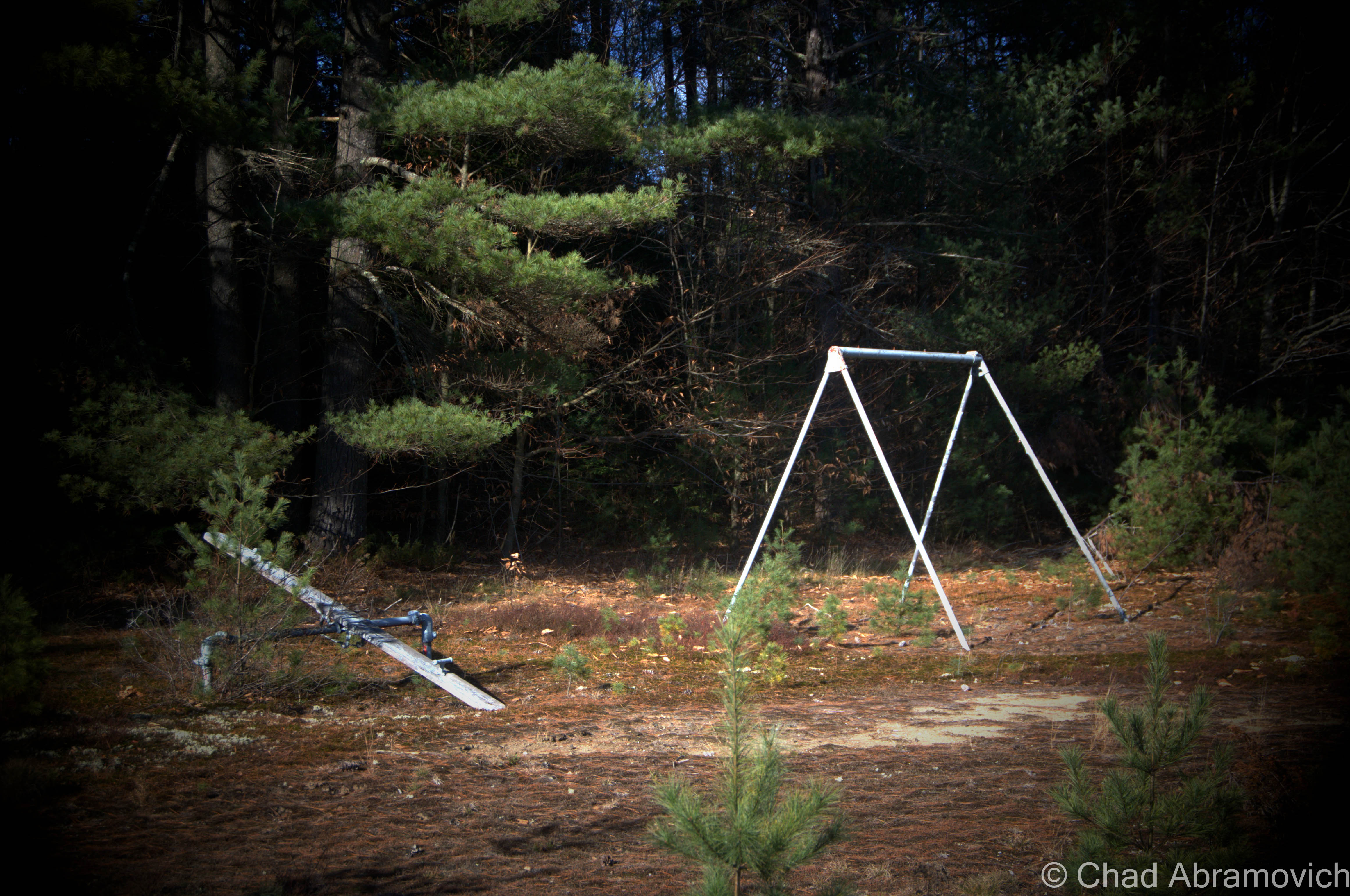
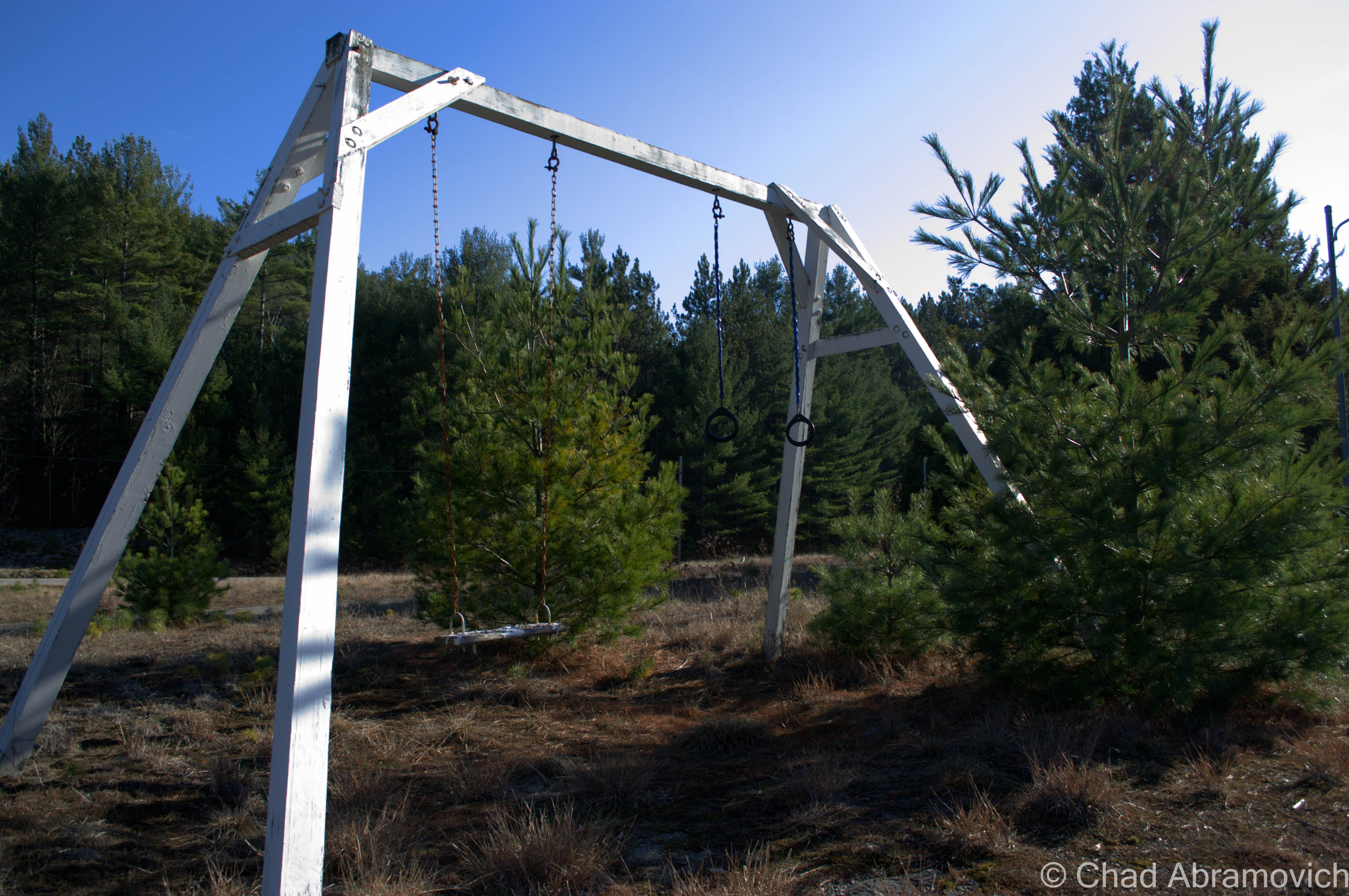
An abandoned playground weighed down by the desolation of the forest.

DSC_0010_pe DSC_0021_pe DSC_0024_pe

Frontier Town

Down the road is the uninteresting town of North Hudson, nothing more then a collection of ramshackle homes and trailers amidst the scraggly woods. But years ago, North Hudson was home to one of the most beloved tourist destinations in the Adirondacks; Frontier Town.

In 1951, an enterprising man named Art Benson chose the woods of North Hudson to be the home for his new vision; a theme park that would bring the wild west to upstate New York. He had no income, no background in construction or anything related to running a theme park, and yet, with ambition and bearing his charismatic personality, he managed to pull off one of the most beloved tourist traps in the Adirondacks. Decorated like a primitive frontier town of the 19th century and amusing it’s guests with interactive dioramas from folklore, popular culture and history, the park continued it’s role as a compelling spectacle until 1983, when Benson sold the park to another development firm, who closed the park in 1989, and reopened it shortly after with new attractions to try and lure more people to make up for the park’s dwindling audience. By 1998, Frontier Town closed for good, after being discombobulated by dropping finances and the latest victim of changing trends; the new notion that it was now dated and politically incorrect.

The vast property was seized in August 2004 by Essex County for past-due property taxes. Today, the park is a humble collection of ruins rotting in the woods, or along Route 9, which is where the main entrance was. The property is skirted by a collection of abandoned motels and restaurants that now look rather out of place in town.

There have been a few special interest groups organized with the goal to restore Frontier Town, and have it labeled as a historic landmark. But so far, none have been successful. Nearby the property is the seedy Gokey’s Trading Post, which has a few pieces of Frontier Town memorabilia for those looking for some nostalgia.

To read more about Frontier Town, you can click this link to be taken to my blog entry on that.

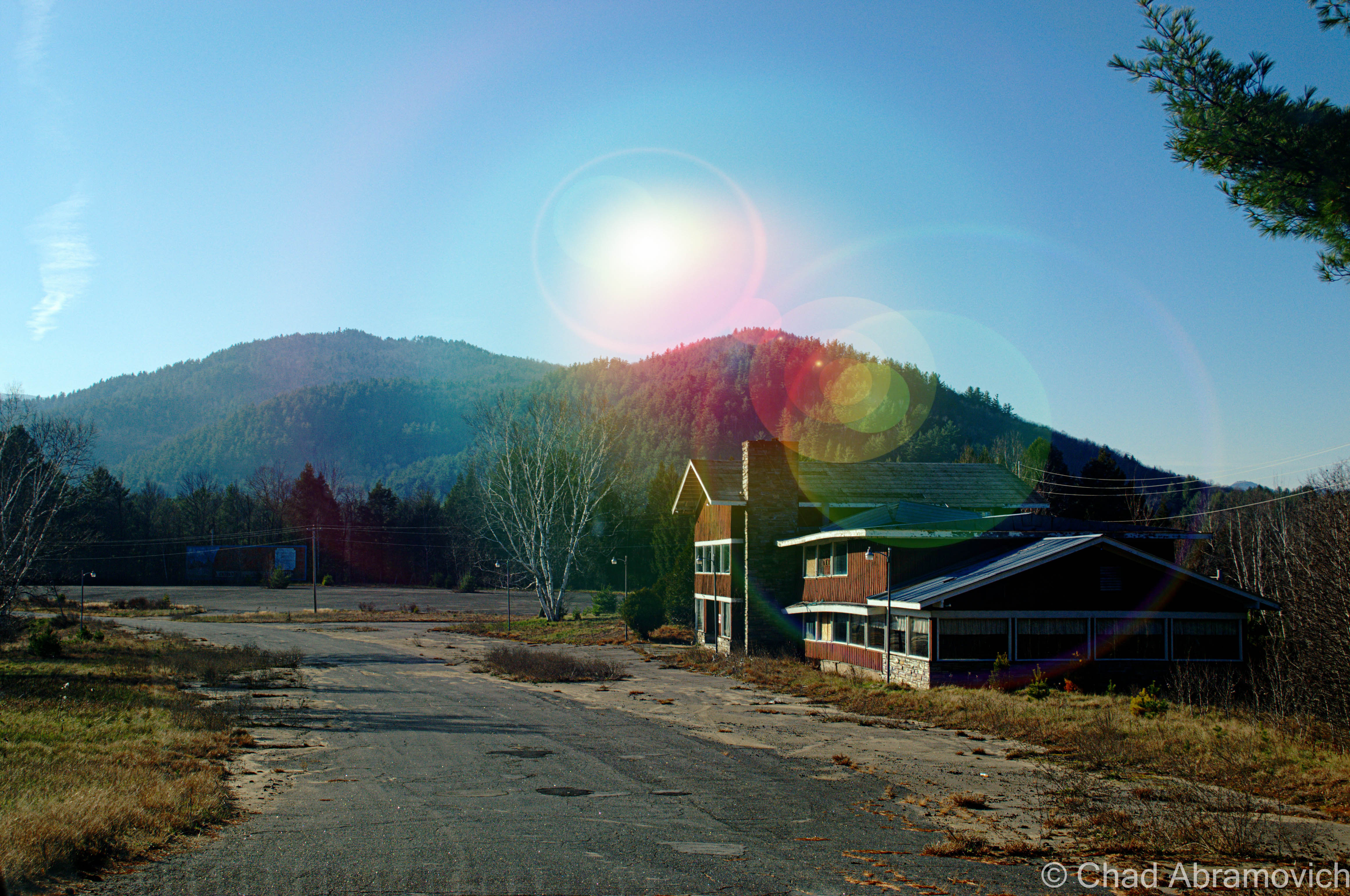
Abandoned Motel at the entrance to Frontier Town

DSC_0027_pe

Those swanky chairs.
this motel also came with a simple playground for the kids, which admittedly looked more disappointing than fun
From the motel parking lot, one of the remaining buildings of Frontier Town could be seen - a former restaurant and gift shop against the late Adirondack sun.
From the motel parking lot, one of the remaining buildings of Frontier Town could be seen – a former restaurant and gift shop against the late Adirondack sun.
DSC_0046_pe
Driving through abandoned roads still adorned with battered street lamps and the ruins of the remaining buildings is an eerie experience. Years ago, this area used to be packed with tourists, noises and life – today the only sounds are the mountain winds and the hum of traffic from Route 9.

DSC_0048_peSide Note: There is a ghost town in the mountains behind Frontier Town. If you’re curious, click on here to read about it.

DSC_0052_pe
In addition to the numerous motels, cabins and restaurants that are abandoned here – we found out that the interstate exit that once served Frontier Town was also abandoned as well. This abandoned Citgo station sat a few yards away from the exit ramps. Here, a poor traveler pulled into the parking lot and was panicking. “Hey guys, do you know where a gas station is?” We told him there was on in Schroon Lake, 10 miles down the road. His face dropped. “shit. I don’t think I can make it” he sighed. We watched him pull out and turn onto Route 9. I hope he made it before it was too late.
Abandoned at Frontier Town

Frontier Town is such a large property that I would need to devote an entire day to see it, which I hope to plan.

“Dysfunction Junction”

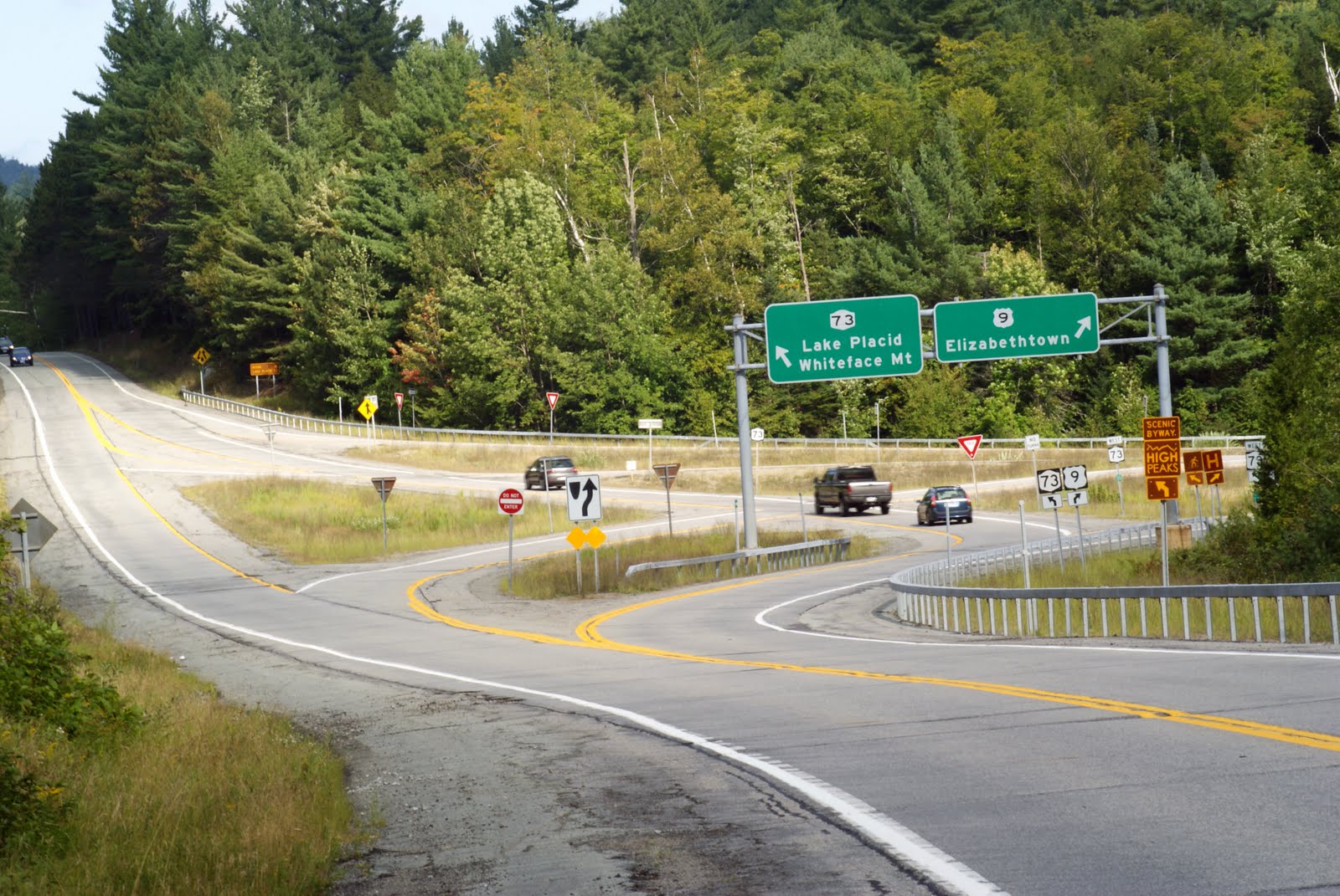
Heading back up Route 9, we drove through a unique, bizarre intersection at Routes 9 and 73 in New Russia, a hamlet of Elizabethtown. When Route 73 hits Route 9, the lanes split off in separate directions, crossing each other in a crazed and seemingly random pattern before coming together again. Everytime I’ve driven through it, I’ve wondered: why does this intersection exist? And the first few times – Where do I go?

A chance find on a Google search provided me with some answers. The locals call this “Dysfunction Junction”. The intersection was built in 1958, using a design that has been instituted (with slightly variations) in other areas of the state. The design is a “bulb type-T intersection” that “favors the heavier right-turn movement from the upper to the lower left leg of the intersection. Sight distances are excellent and approach speeds are approximately 40 miles per hour.”

So why was this design chosen for this spot? We have to go back to Route 9’s heyday as the main artery from Plattsburgh and points South. Before the Northway was built, Route 9 suffered far worse traffic congestion as it does now. Before the construction, a simple stop sign was in place, which overtime was unable to handle the flow of moving traffic. The design allows Route 9 traffic to flow through without stopping, while anyone continuing on 73 would have to wait. Today, they’d probably build a roundabout instead. While this design may have made sense in the 1950s, today’s traffic patterns have changed. But not everything thinks it’s a bad design. “If you just follow the signs, you’ll be alright” says one indifferent local.

Photo: Adirondack Almanac

—————————————————————————————————————————————–

To all of my amazing fans and supporters, I am truly grateful and humbled by all of the support and donations through out the years that have kept Obscure Vermont up and running.

As you all know I spend countless hours researching, writing, and traveling to produce and sustain this blog. Obscure Vermont is funded entirely on generous donations that you the wonderful viewers and supporters have made. Expenses range from internet fees to host the blog, to investing in research materials, to traveling expenses. Also, donations help keep me current with my photography gear, computer, and computer software so that I can deliver the best quality possible.

If you value, appreciate, and enjoy reading about my adventures please consider making a donation to my new Gofundme account or Paypal. Any donation would not only be greatly appreciated and help keep this blog going, it would also keep me doing what I love. Thank you!

Gofundme: https://www.gofundme.com/b5jp97d4
Donate Button with Credit Cards

Island of Shrieking Birds

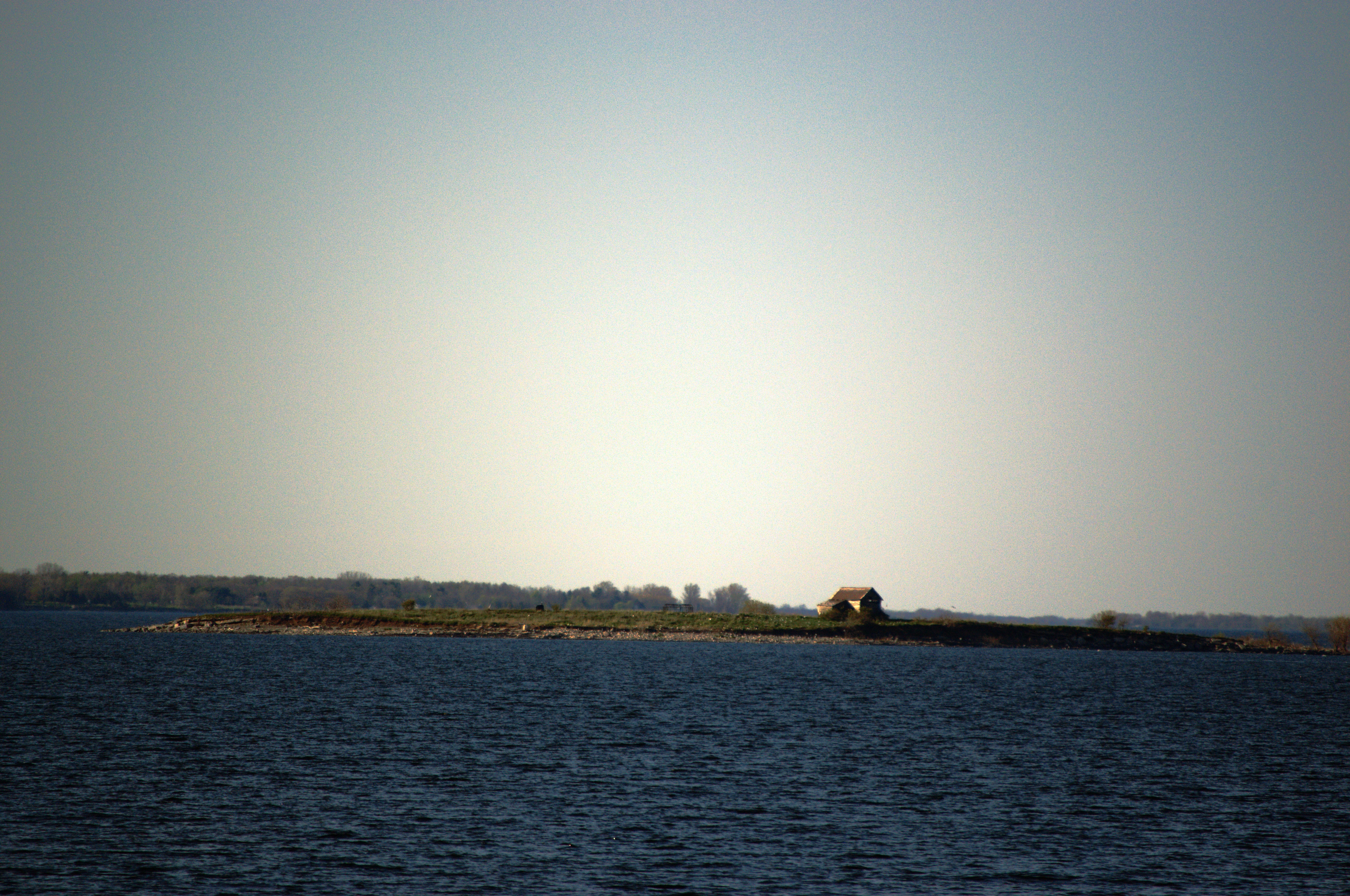
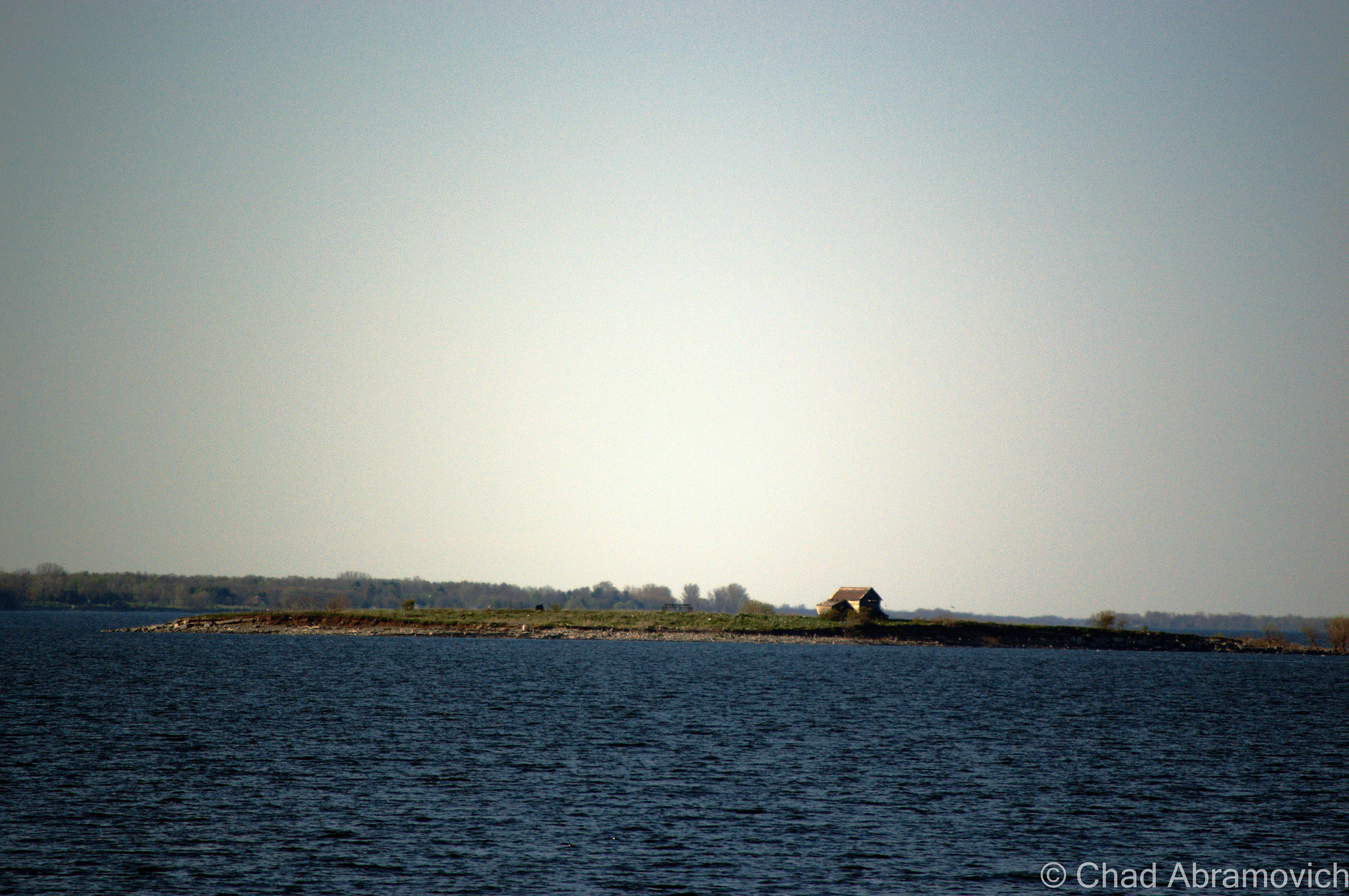
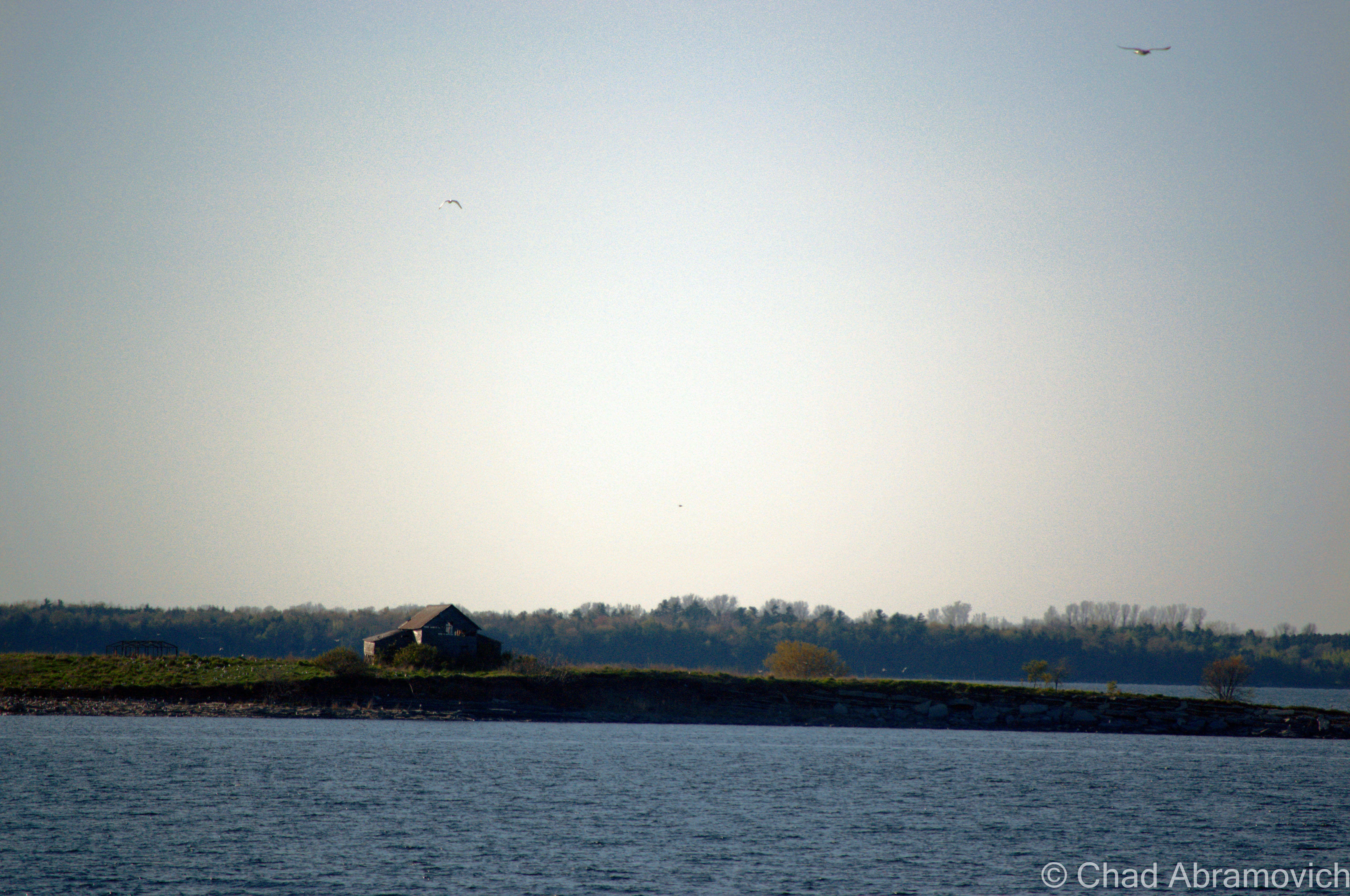
Young Island has very little in common with the atmosphere of a faraway planet, and yet, its alien design is completely foreign amongst the rest of the Lake Champlain Valley. A barren wasteland, all the trees and plant life are dead- their leaves and twigs long plucked off. Weeds most commonly found in wastelands are the only living things that can grow and survive in this inhospitable place. In the center of this eerie landscape is the rotting shell of an old cabin- evidence that there once was human habitation here. And everything that is something is covered in toxic bird guano and molted rotting feathers, left to bake under the sultry summers. This intimidating and miserable island enjoys a unique reputation, and perhaps is one of the most mysterious places on Lake Champlain.

Though the island’s official name is Young Island, residents of neighboring communities have another moniker for this foul place; bird island. This blunt nickname also tells us the story of this small island’s mutilation.

At certain times, the rocky slab of land off the coast of Grand Isle seems to actually be quivering, but it’s not the heat of the day or some sinister preternatural force at work. Instead, the culprits are thousands of birds flying around the island. More specifically, Double Crested Cormorants.

Immigrants to Vermont, they were first spotted in the area around the 1970s near Young Island. In 1981, that number grew to 35. Recently, the population exceeded 15,000, (some say over 20,000) with 98% living on Young Island, and more recently, are beginning to become discovered on other islands around the lake.

Cormorants like to nest on remote islands, safe from predators and human habitation, making Young Island an ideal choice. But sadly, they are not welcomed neighbors to our region because their nesting habits are destructive, which are endangering the ecosystem of the lake. Cormorants settle into their new found homes by plucking away at the vegetation and tree branches, using the material for their big messy nests, leaving dead skeletons in their place. Their nests can reach as high as 2 feet tall and are built strong because adult Cormorants can weight up to as much as 12 pounds. The bird guano that now covers the island is acidic, and also helps kill the trees and the shrubbery and its foul smell can radiate for miles when there is a strong wind. As their numbers grow, they become a dominant and intimidating presence and prevent other species from nesting in the area – and Young Island is small, and space is at a premium. So much so, boaters, fisherman and a few residents from as far away as Grand Isle have reported hearing the loud and belligerent sound of countless bird shrieks, as they fight for space to nest. The island has been turned into a war zone.

So, what is being done about this problem? Or perhaps, why has it been allowed to happen? The answer is a simple one; Cormorants are a protected species, with the state arguing that they have as much right to nest and live near the lake as any other species. But recently, The Vermont Fish and Wildlife Department has made exceptions because of an increasing worry that Cormorants will soon migrate and destroy other islands. And this fear has became a reality as neighboring Bixby Island, as well as The Four Brothers Islands in New York have already began to see Cormorants nesting on their shores. The Fish and Wildlife Department is trying to keep the population from exploding, by oiling their eggs so they won’t hatch, and blasting nests from other islands with high powered water hoses. Taking advantage of a unique situation, UVM uses Young Island as a research environment, to study the Cormorants and their nesting habits.

Thanks to egg oiling, some have told me that the population has actually dwindled to “the hundreds” as less and less are returning to Young Island, or migrating to other islands across the lake – but so far, the damage to their other new found homes hasn’t been as destructive. Yet.

Regardless of the accuracy of numbers, spending time on Young Island isn’t for the squeamish. As a matter of fact, I couldn’t think of many other places that you could feel more isolated on. When brave visitors make their way onto the disturbingly intriguing island and through layers of bird guano, the baby Cormorants defend themselves with the only ammunition they have, they throw up whatever they’ve eaten for the day.

And if that isn’t strange enough, Young Island is one of the few places on the lake where Yellow Perch literally fall out of the sky. But these aren’t Perch you want to eat, these have already been eaten, twice – coughed up by a soaring Cormorant. And of course, Cormorants are also considered a threat to the local fish population, with the alarmingly high numbers they consume.

If you wish to see this unusual area for yourself, take a drive to Grand Isle’s West Shore Road, near the Vantines fishing access area, and Young Island will be to the north west. You can’t miss it.

DSC_0680_pe
Young Island from Adams Landing Road
DSC_0695_pe
Best picture I could take with my zoom lens. Here, you can get more detail of the house and the scrubby island floor. Any closer and I’d have to be in a boat. Since this picture was taken, the cabin’s roof has caved in.

—————————————————————————————————————————————–

To all of my amazing fans and supporters, I am truly grateful and humbled by all of the support and donations through out the years that have kept Obscure Vermont up and running.

As you all know I spend countless hours researching, writing, and traveling to produce and sustain this blog. Obscure Vermont is funded entirely on generous donations that you the wonderful viewers and supporters have made. Expenses range from internet fees to host the blog, to investing in research materials, to traveling expenses. Also, donations help keep me current with my photography gear, computer, and computer software so that I can deliver the best quality possible.

If you value, appreciate, and enjoy reading about my adventures please consider making a donation to my new Gofundme account or Paypal. Any donation would not only be greatly appreciated and help keep this blog going, it would also keep me doing what I love. Thank you!

Gofundme: https://www.gofundme.com/b5jp97d4
Donate Button with Credit Cards