I recently had a lot of fun voyaging around the tiny angle that is New Hampshire’s 18 miles of seacoast! I haven’t been down towards the Granite State’s coast since I was 10 years old, so the nostalgia was stimulating and the sunburn was painful!
A few friends were tandem on this seacoast excursion, and one of the few goals I had for this trip was doing a bit of oddity hunting – and I was pleased with the few curios that I had eagerly put on my list. Beyond that, we just had a blast shunpiking around random coastal towns in both New Hampshire and Maine.
The environment is a bit exotic to me, in a sense that serpentine salt marshes and beaches on a waterbody you can’t see the other side of aren’t found up in Vermont (but we do have lighthouses!). This part of New England also has redolent history and mystery that have been fermenting far longer than Vermont has existed! I was definitely imbued with some unabashed excitement the whole time.
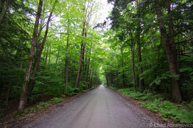
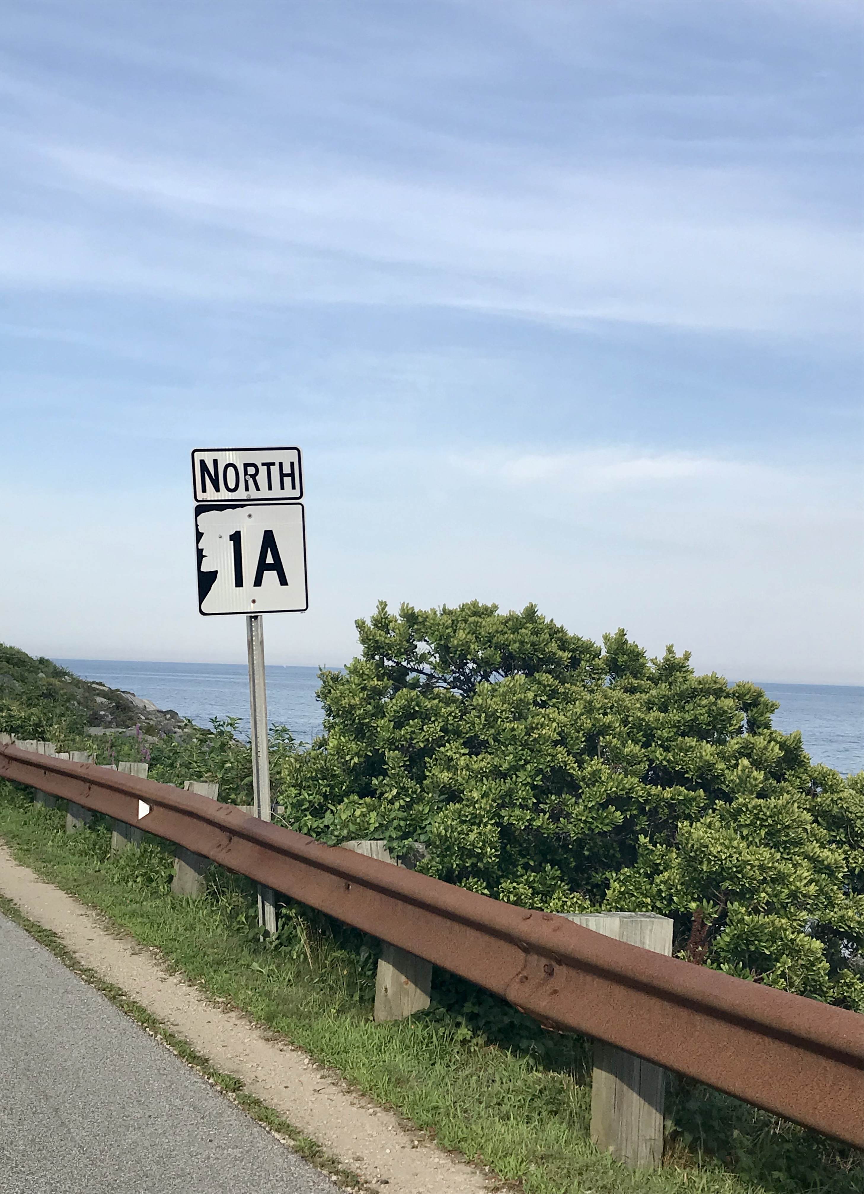
After all these years I’d never forgotten just how great of a drive New Hampshire State Route 1A was.
Before we checked into our hotel in Portsmouth, I suggested we took the requisite tour up Route 1A (known as Ocean Boulevard for most of New Hampshire’s seaboard) and the shore with the windows down and the breezy salt air coming in (and our music blasting out).
Starting in the brashy and tawdry beach burb of Hampton Beach and its famed 3-mile titular stretch of sand that are both long-established New England summer destinations, we then ventured northwards around a few rocky points with squinty views of the faraway rocks that are the Isle of Shoals – a group of forlornly not-quite-barren islands split between Maine and New Hampshire that are famed for their isolation, and grim and mysterious folklore – the spectrums of which include murder, shipwreck, ghosts, and a treasure – all suitable footnotes of any northern New England ocean island. I’d like to take a ferry ride out there next time I’m in the area.
We then passed through scenic Rye, with numerous state beaches, tidal wetlands, and ostentatious money enclaves that line Ocean Boulevard, and then ended up in Portsmouth.
Portsmouth, New Hampshire is a rad little city. As its name implies, it started out as a colonial shipbuilding hub and morphed into a rowdy naval port town where the Piscataqua River junctions with the Atlantic around the island town of New Castle.
The name was minted by the local Abenaki people and might mean something close to; “a river with a strong current”, which I’d say is pretty dead-on, but the details are a bit hard to parse, and because of that, there is a lot of speculative lore behind its name! It’s also the third fastest-flowing navigable river in the world. Though the city has long declined from being an employed port, the oldest naval shipyard in the new world is still active here on an island in the Piscataqua – which once launched some of the most important American warships and the first nuclear submarines. Now the shipyard is kinda moribund, but still functioning.
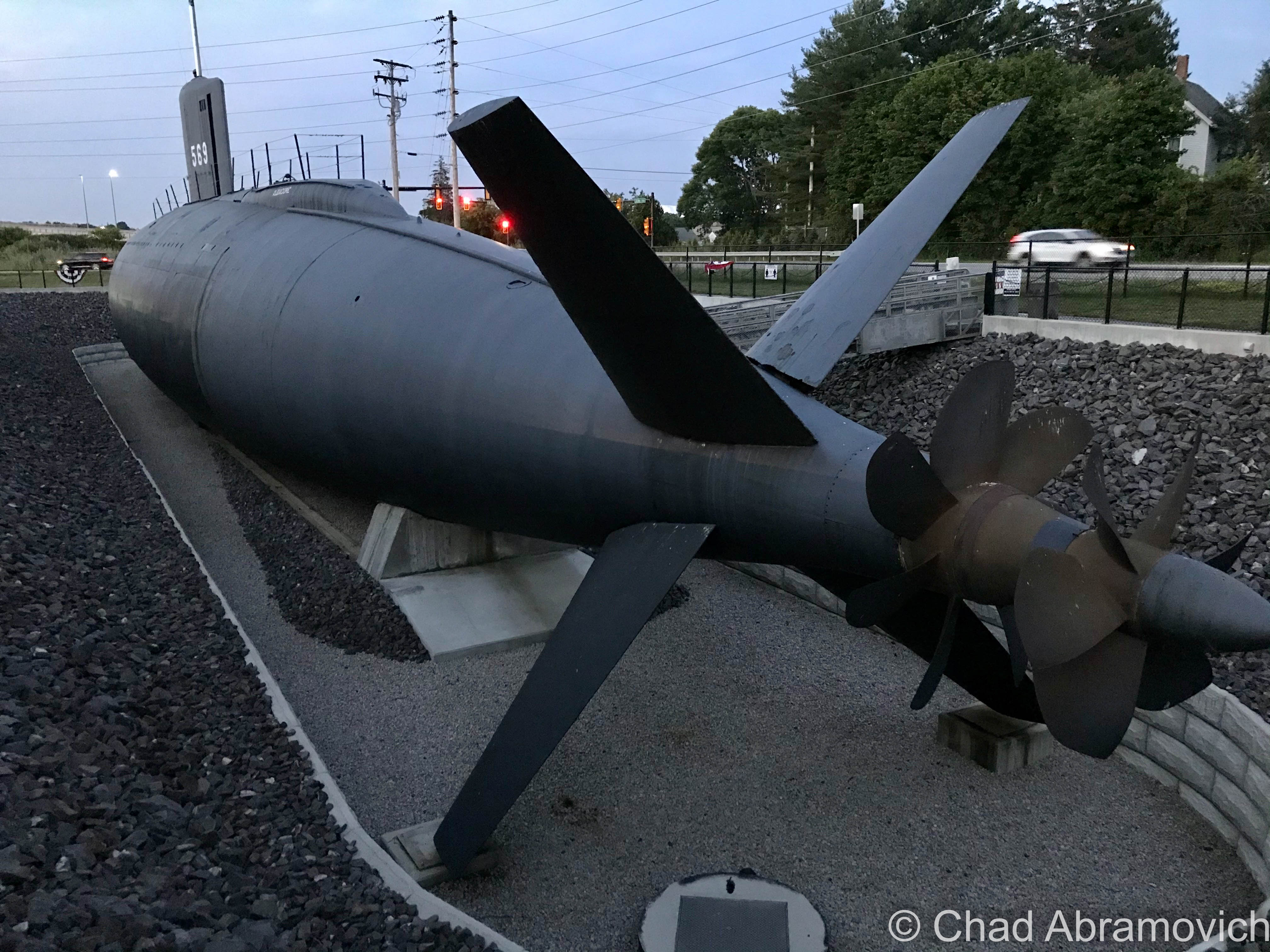
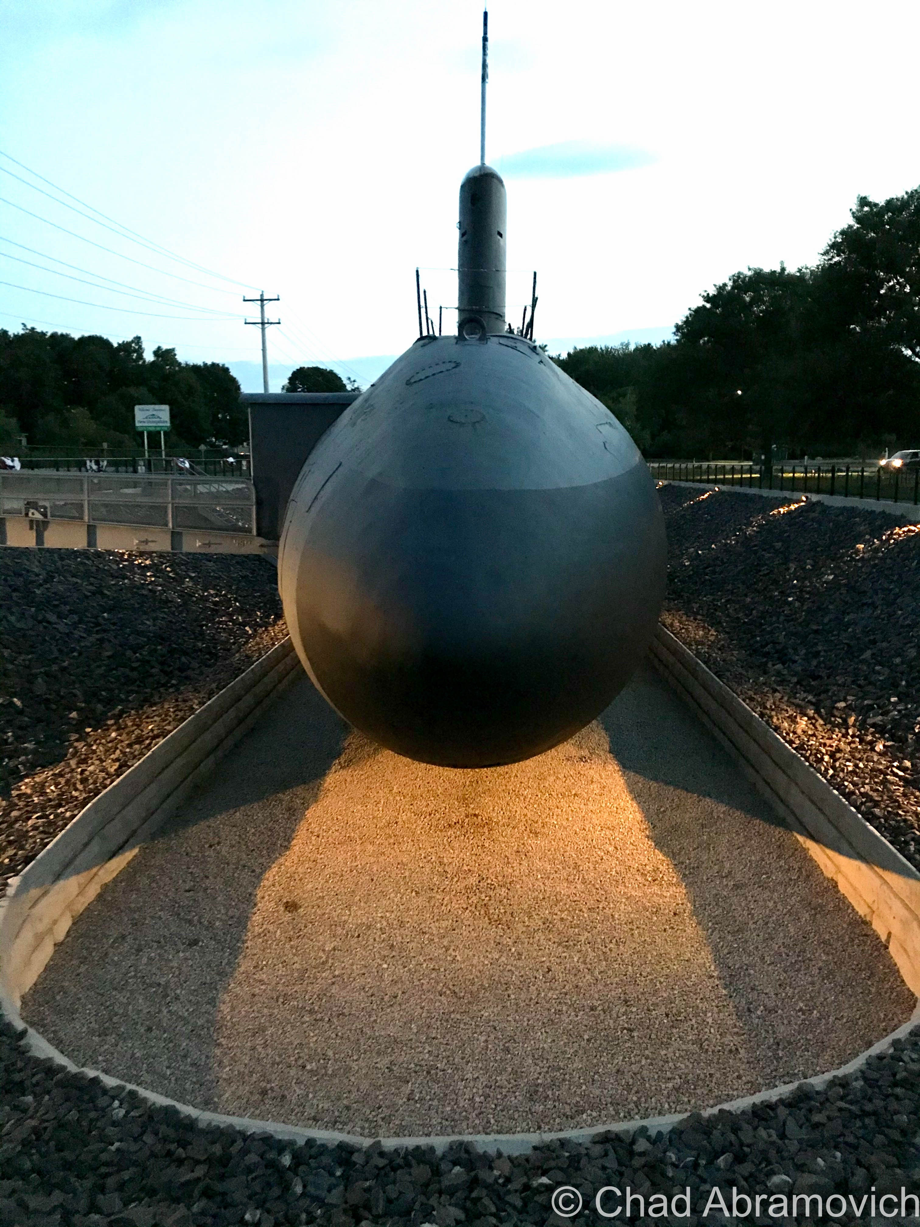
And speaking of submarines – there’s one in a hole right off the Route 1 Bypass! It had me and my friend exclaim: “Hold up… that’s a motherfuckin’ submarine!” when we passed it.
It’s the new home of the USS Albacore! Lauded as “the forerunner of the future” in its heyday, this vessel was built by the skillful laborers at the Portsmouth Naval Shipyard in 1953 and was intended to essentially be a paramount experiment of both its physical design and technological wizardry – one that the Navy was really depending on. Its teardrop-shaped body became the standard design for all subsequent submarines – and proved that submarines could actually sustain themselves and function while being submerged!
It became the world’s fastest submarine in 1966 when it set an underwater speed record of 40 miles per hour, and, it was used to innovate sonar equipment!
Now, it’s a neat roadside oddity and museum that we didn’t expect to see. Though it was closed when we pulled up as dusk hummed in, it was worth getting a few mediocre iPhone shots of!

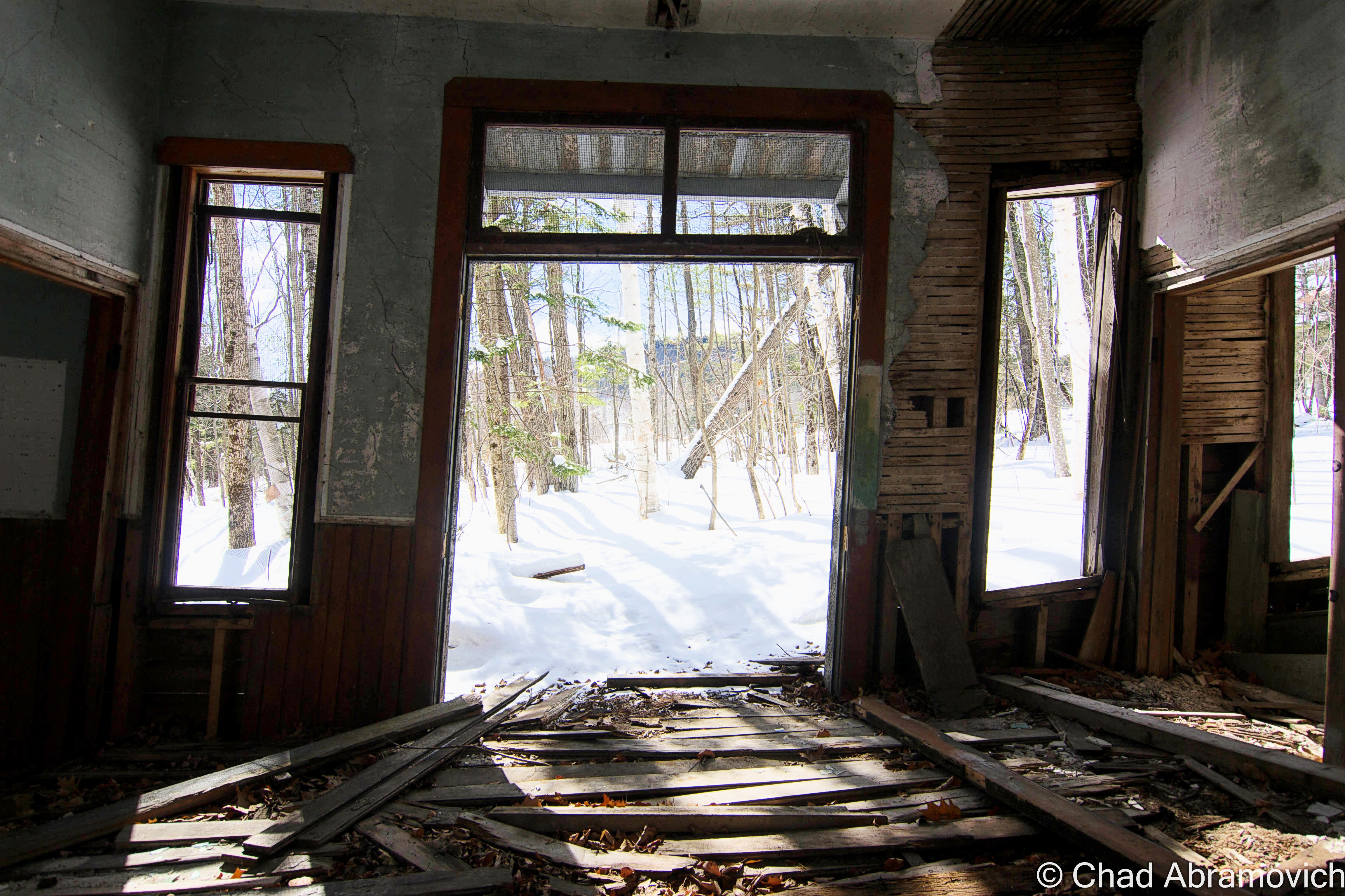
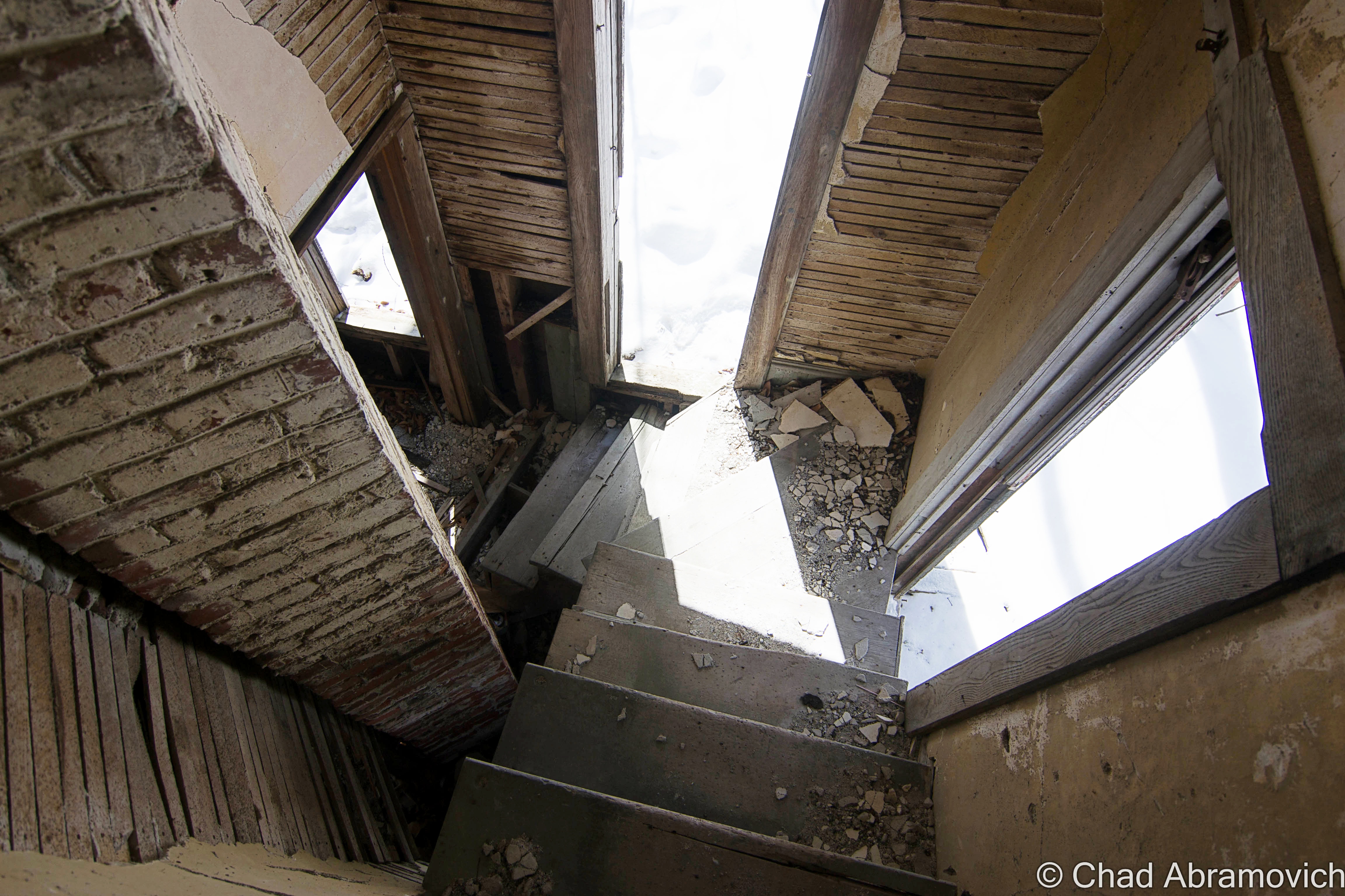
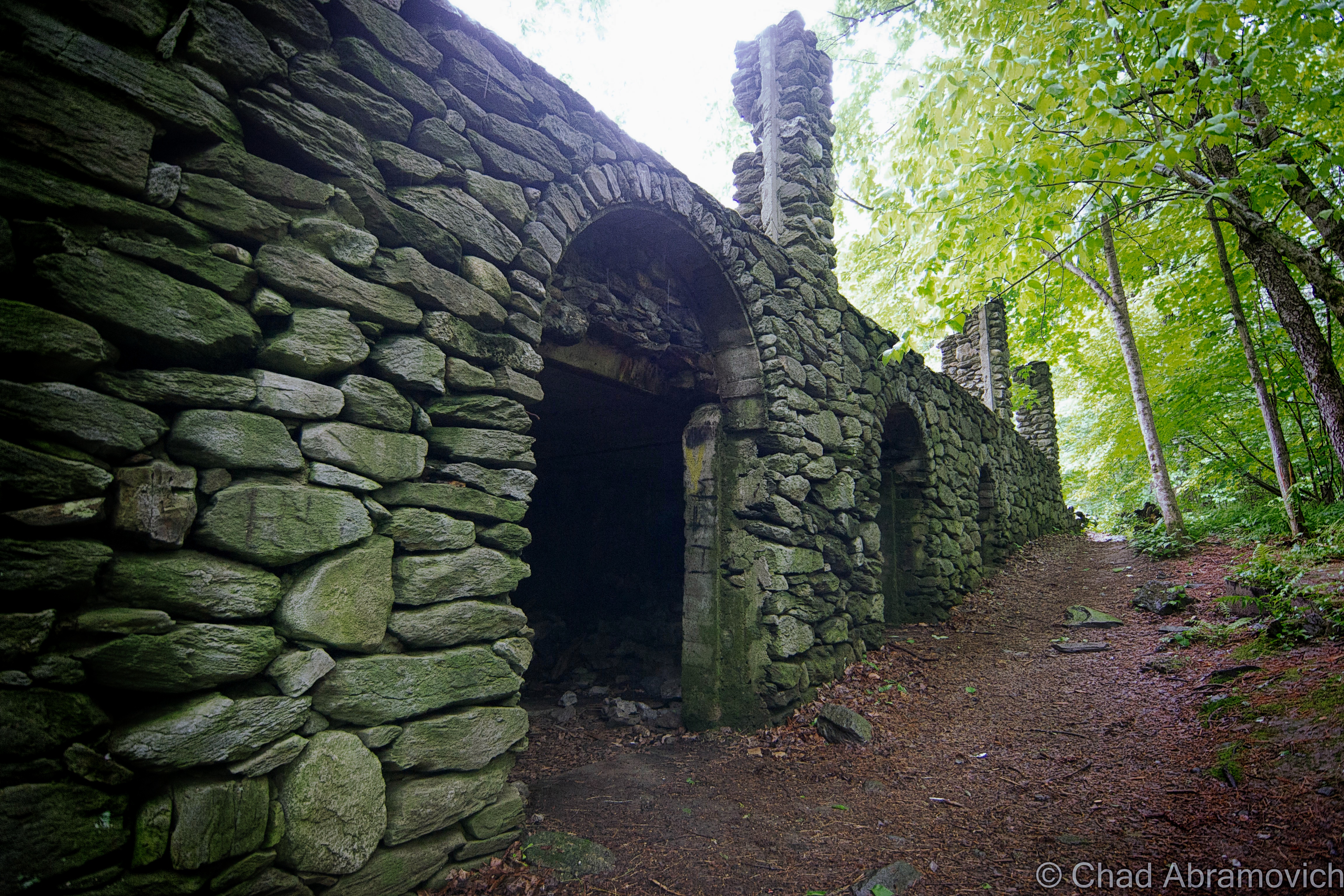
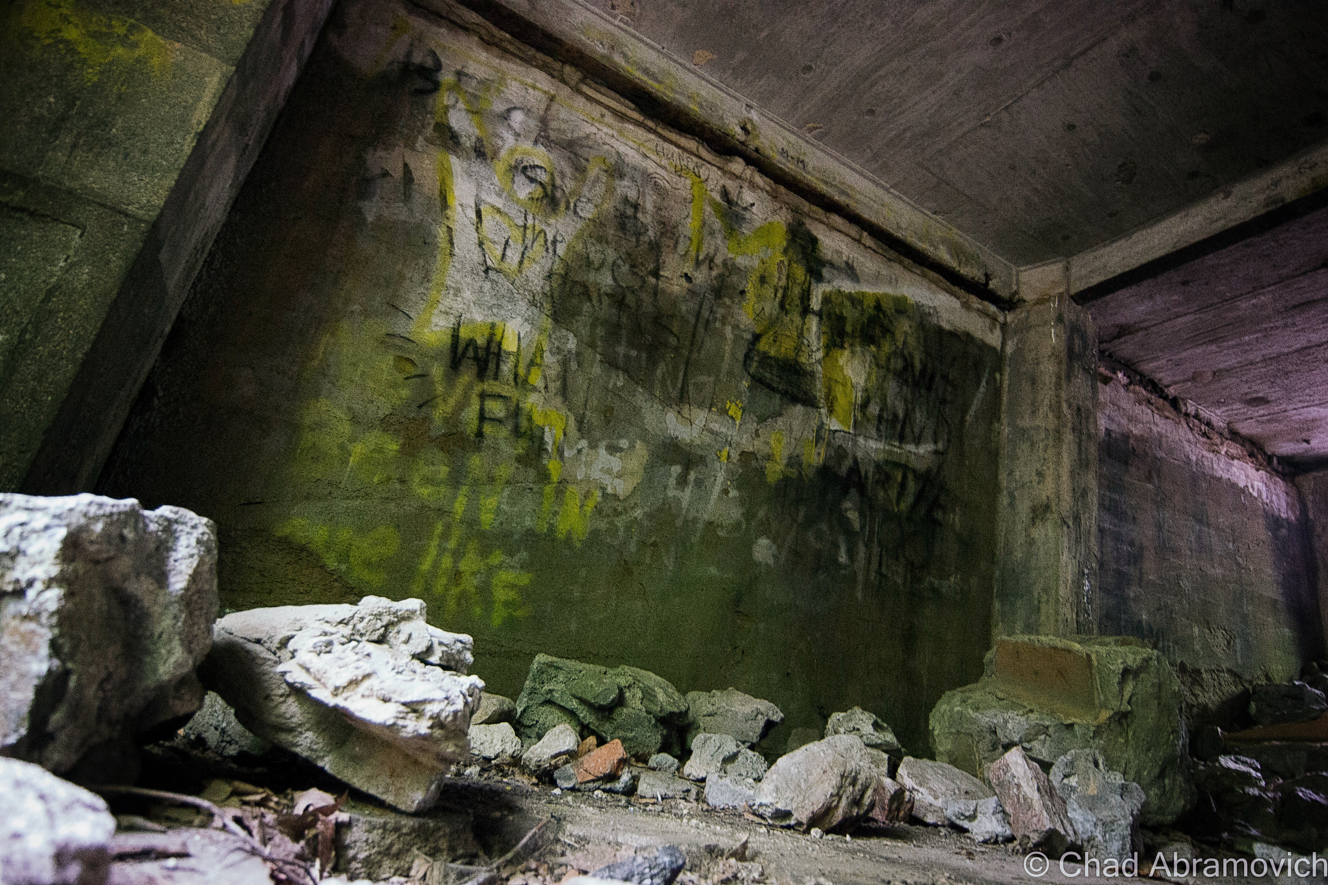
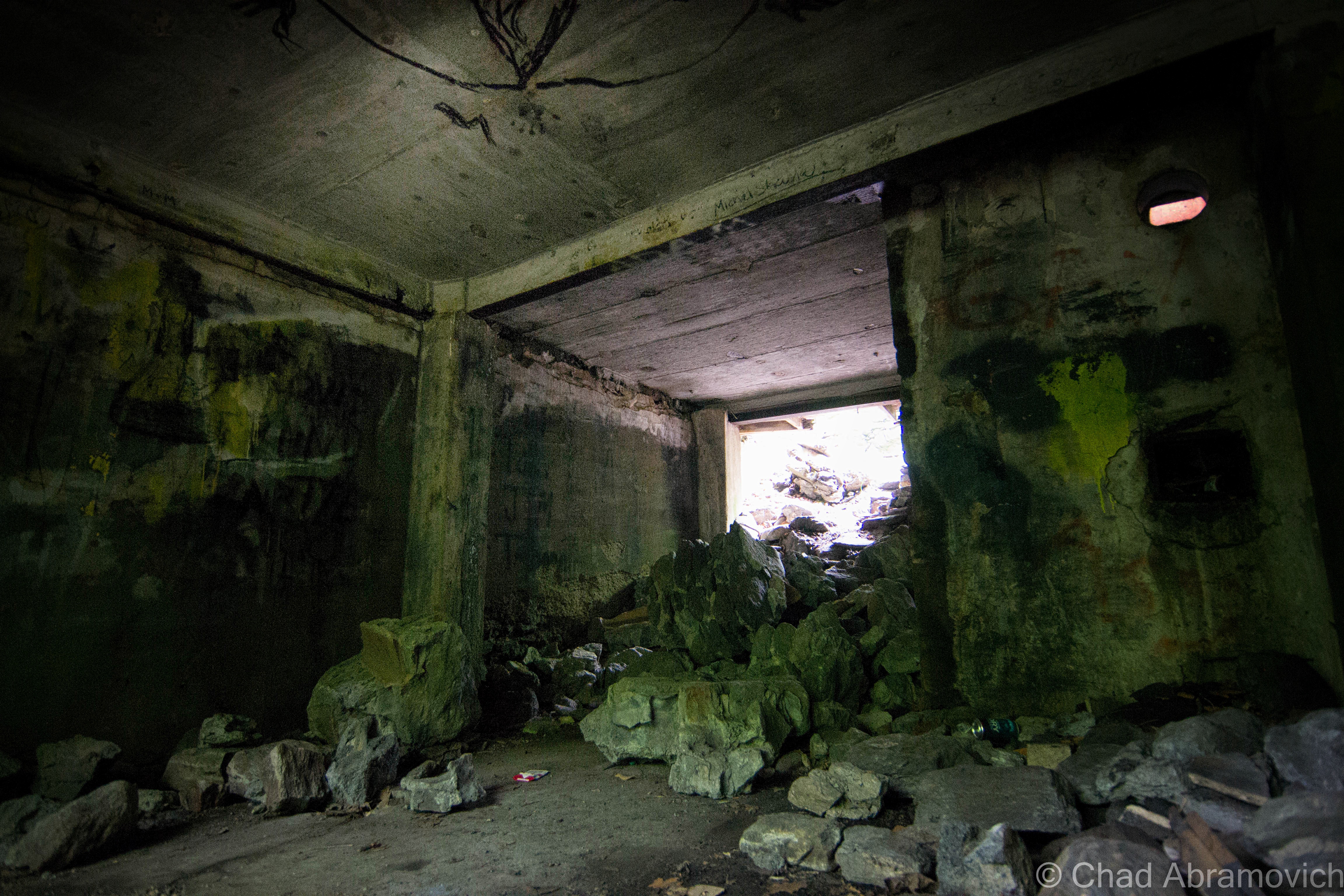
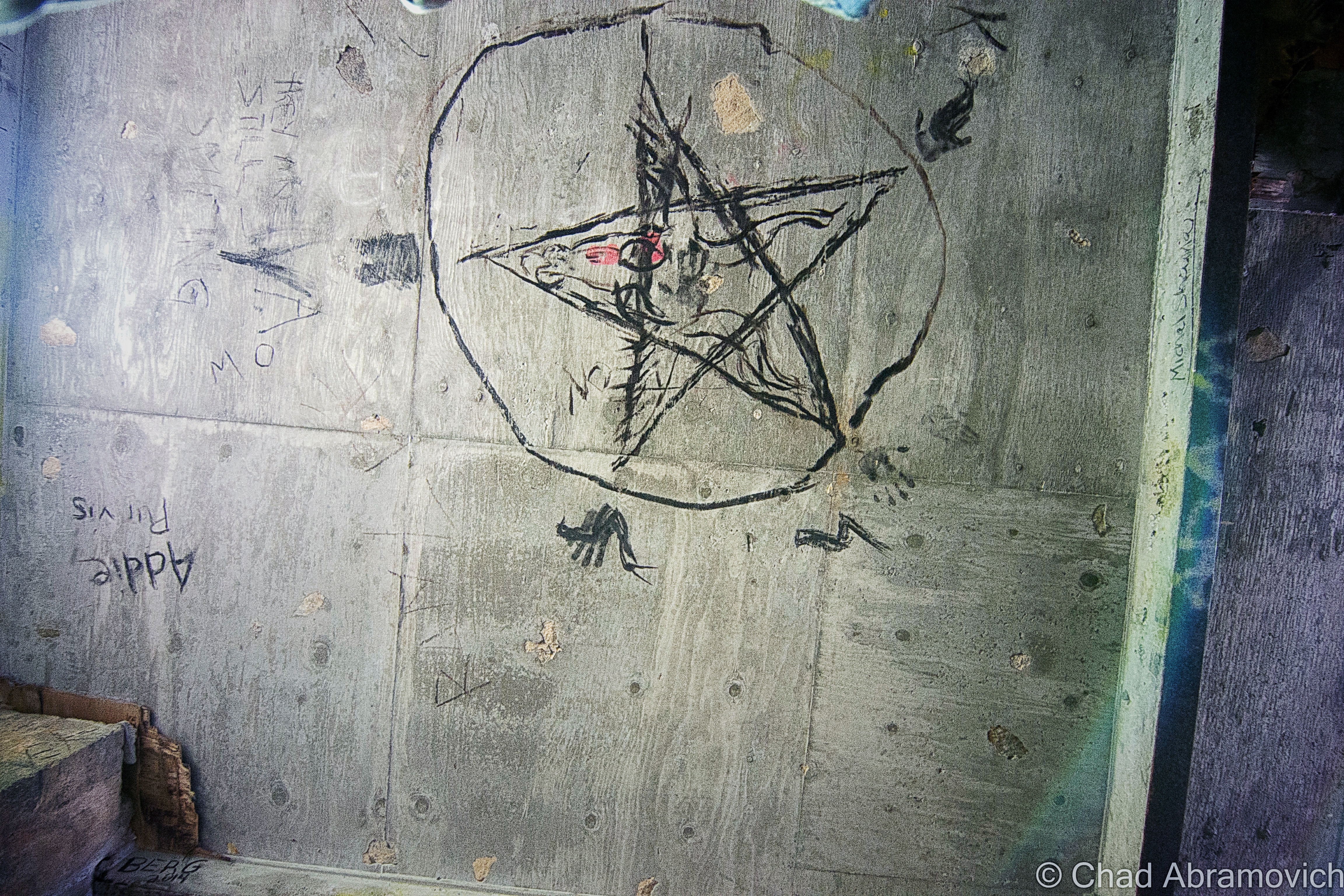
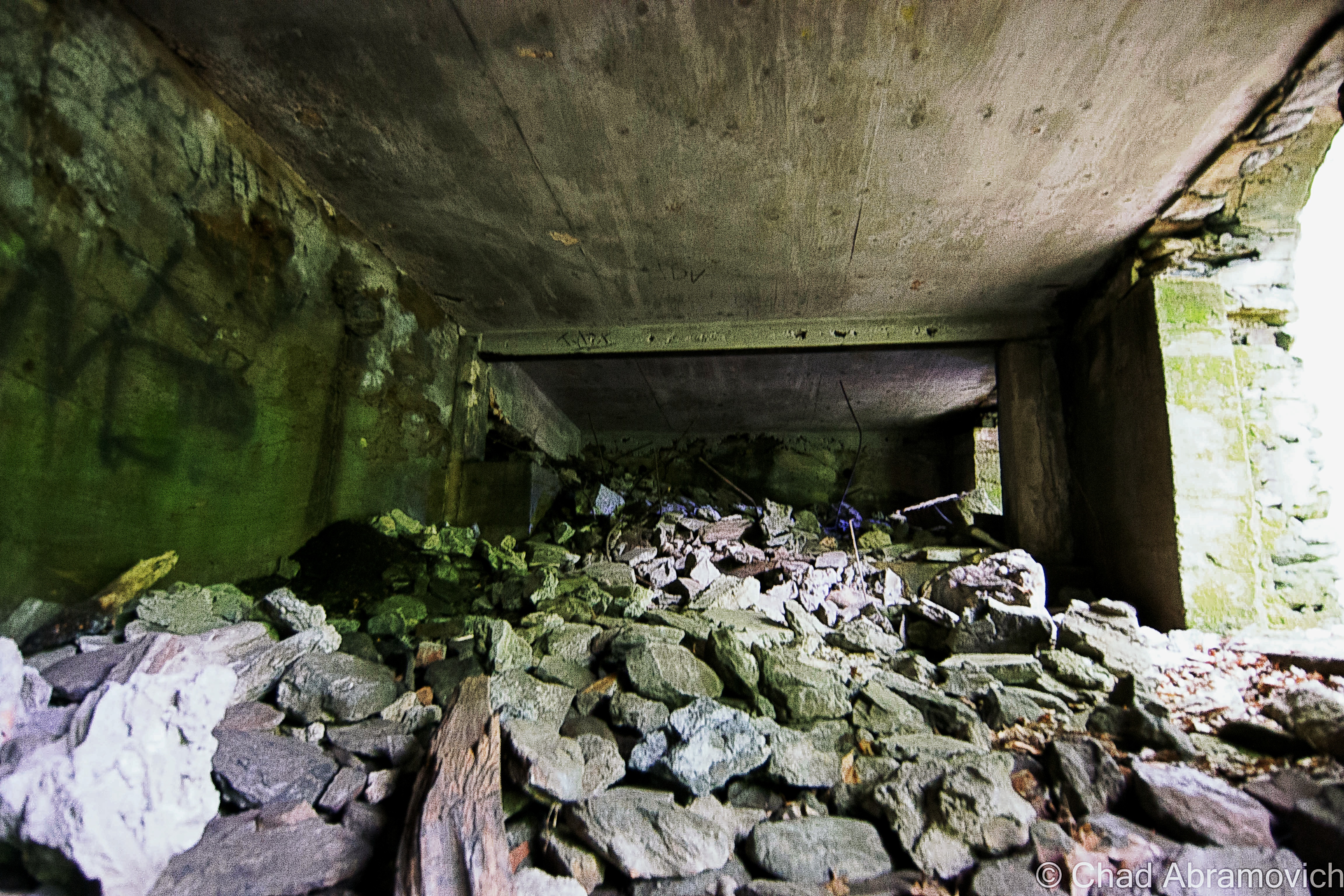
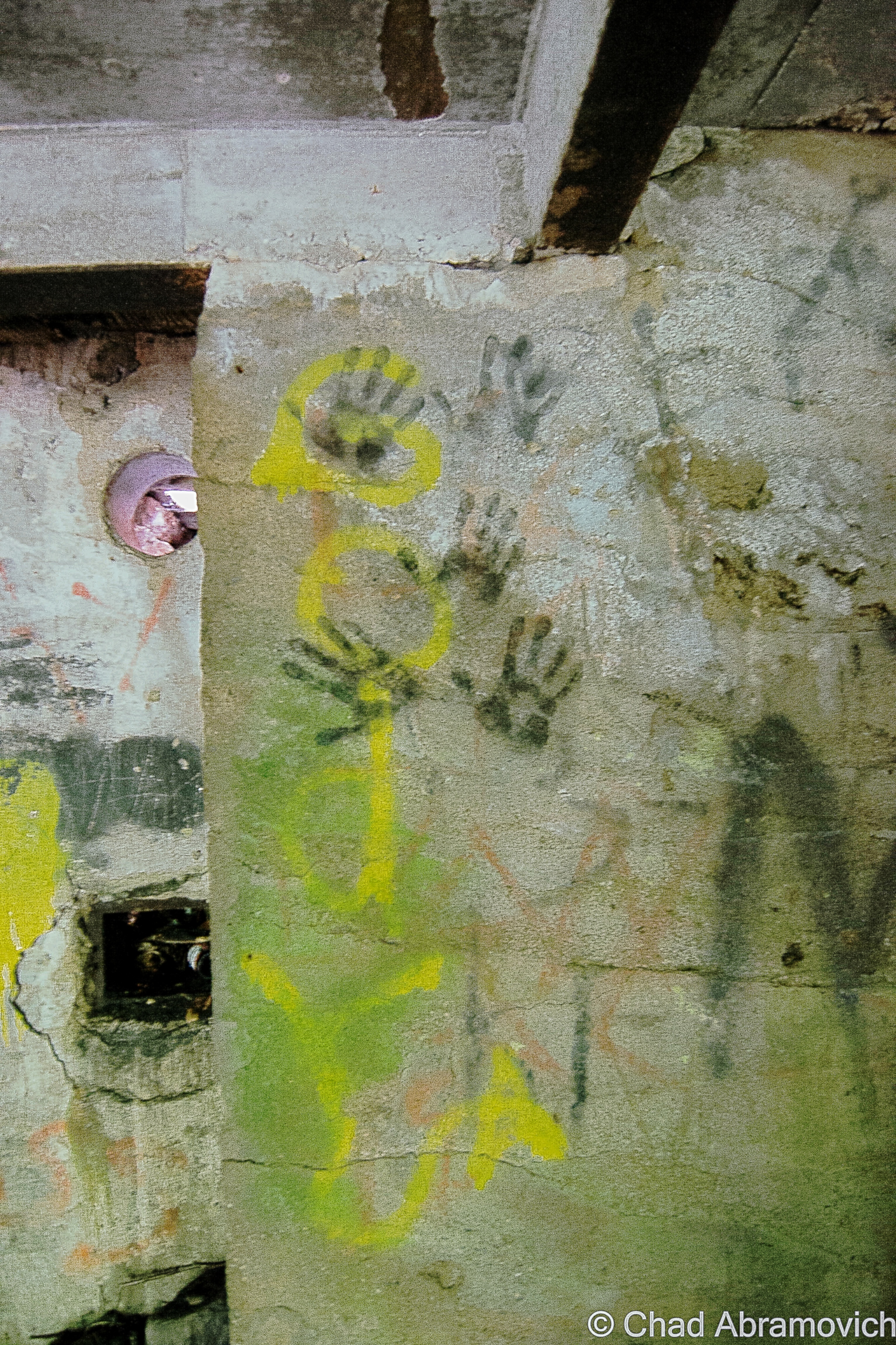
One of the most memorable features of the navy’s island lair – and the region itself – is a notorious abandoned naval prison designed as a dismal gothic nightmare – intentionally, I’m sure.
I guess it’s an unwritten cultural rule that if a prison is built on an island, it’s gonna eventually be known as “the rock”.
Like Alcatraz, the intimidating Portsmouth Naval dungeon also shares the same tag, even though it’s technically across the state line in Kittery, Maine – and when in operation, was one of the nation’s most feared military lockups that could hold a surprising 86,000 inmates. The guards, too, had something to fear, because according to folklore, if they let a prisoner escape, they would be finishing out the rest of the escapee’s sentence. And you’ll have something to fear if you decide to try and explore it, because you’ll most likely wind up being locked up (though probably at another facility). I have no doubt that there are other gristly tales of this “the rock” – and most likely, those are forever classified.
I’m a bit bummed that I didn’t get a shot of it while in Portsmouth, but it wasn’t until afterward that I discovered that there was actually a pretty good vantage point from a bridge that leads into New Castle. Oh well, I’ll have to get my shot next time I’m in town!

Nowadays, Portsmouth is a hip tourist town with loads of charm that front squiggly roads and brick sidewalks – part of that charm comes in the form of loads of colonial architecture that was the result of the burb being one of the most successful port cities in early America. It also comes from the fact that after the city was being gradually consumed by a multi-decade period of decline, a whole bunch of Portsmouthians found their civic pride in the 1950s, when the “urban renewal” contagion was spreading around America – which meant a proposal to bulldoze half of the city’s historic neighborhoods so they could put modern stuff in its place. Thanks to locals loathing that idea – the city has a fantastic array of impressively preserved old buildings from the city’s various stages of life that couldn’t be more archetypal New England, and lacks the antiseptic, banal, and cheap architecture that plague so many other American city centers today.
It also gives Portsmouth a wicked creepy vibe after dark when things get shadowy behind old houses, arboreal-tunneled streets, and replica historic gaslights. You definitely start to wonder what sort of fiendish monstrosities lurk in the black voids and eerie stillness that slides over the city from ocean mists.
And speaking of creepy things at night – this is a good time to transition into my first oddity excursion…
Grave With A Glow?
Back at the hotel room, I was doing some research a few hundred years deep into local cemetery records, trying to track down a particular corpse. Well – actually – her gravestone. You see, Portsmouthians have a mystery among them – an inexplicable phenomenon that might be solely unique to their city. As far as I know, anyways.
According to the vague legend – there’s a light coming from within Portsmouth’s sprawling south street cemetery at night – the result of 5 old rotyards eventually colliding into one over the centuries that Portsmouth has existed.
This is a radiance that might be preternatural, for it’s said to come from a tombstone.
Yup, I was trying to find a grave that glows, which was a bit of a task. There wasn’t a lot of chitter-chatter about this curious claim. I first discovered a brief snippet of it within Curious New England: The Unconventional Traveler’s Guide to Eccentric Destinations by Joseph A. Citro and Diane E. Foulds and was finally able to dig up a bit more sustenance on a blog entry I found, that now seems to have vanished.
What I found so intriguing about the claim is that the reason for the luminosity seems to be a mystery. There are no specter stories and it can’t be blamed on floating orbs or a reflective surface that mirrors nearby shine. I guess it’s an intrinsic feature.
The grave’s occupant, too, seems to be a rather unremarkable person, in a sense that she doesn’t seem to have any disquieting history to support her grave’s peculiar behavior. The usual plot twists to New England cemetery supernatural shenanigans don’t apply here. She wasn’t accused of being a witch, and she wasn’t done some sort of great injustice that made her utter a posthumous curse (though making her headstone glow for eternity seems like a pretty silly way to achieve retribution if you had that sort of power).
Though some morphed local lore takes a stab at answers and proposes that the stone glows because; it’s the grave of a murderer, a murder victim, or even that the gravestone itself has uranium (!) or a luminescent particle in its mix. Uranium in a gravestone is still amusingly easier to believe than this story is.
It just does its thing, apparently, and it has been for some time.
That’s another interesting detail – I haven’t been able to find any information on exactly when this marvel started to happen, or how long it’s been doing its thing for, or even any accounts of people who’ve seen it. Even a few locals I mustered up the courage to ask about it had no idea what I was talking about. It’s just been acting in that fashion for a while it would seem…
The naysayers who are aware of this tale scapegoat sources like the light of the moon, streetlights along Sagamore Avenue and South Street, the traffic light at the intersection of Miller, Sagamore, and South, or reflections from the sizable pond within the cemetery grounds, that for some reason, leap a considerable distance and hit just the one headstone. But if this is all to be believed, then even skeptics have to concede that it can’t be the moon, for the stone is said to glow perpetually, even on moonless nights.
With such a mysterious sensation allegedly happening within a few minutes of our hotel, how could I miss out on witnessing it for myself?!
One of my friends decided to humor me and come along, while the other one raised an unimpressed eyebrow at me and opted to stay at the hotel.
My skepticism was as thick as the summer humidity outside that night and I felt a little guilty, so to appease my friend for joining me on my midnight legend-chase that would most likely have no payoff, I told him we could get some night shots of the city afterward, which he was pleased to agree to.
Navigating Portsmouth’s gridless grid, the old-fashioned wood frame houses ominously glowing with jaundiced light from the streetlamps soon ended and the vast graveyard thick with indifferent shadows extended beside us behind its low delineating stone wall. It was really dark in there.
Despite how nearsighted I know I am, a greenish/white glow within an otherwise dark cemetery should have been easy to spot – but as far as first impressions went, we didn’t see anything except for the waning rectangular shapes of rows of headstones coupling with panoramic umbrae that seemed to be extra nebulous for some reason. It was actually pretty creepy.
From within the cemetery, we could discern the distance-weakened streetlights and an occasional flash of passing headlights, but there was nothing I could see that I’d mistake for an unceasingly glowing gravestone. It was a good thing that I did the research beforehand, too, because finding a grave in that cemetery at night would have been an unlikely task. Unless it glowed.
“What’s the name on the grave?” my friend asked as we walked around in the dark.
“Burns”
“Wait… seriously?”
“Yup, we’re gonna see if Mrs. Burns, burns”.
“Oh god, Chad…”
Our experience in the cemetery can be summarized succinctly; there were no glowing tombstones. Or tombstones doing anything that could be considered eccentric. We then drifted over to the Portsmouth waterfront, reveled in glorious summer weather as the water bells tolled distantly, and called it a night.
We did return the next day en route to another oddity I’m going to get into below, so I could get some documentation shots of the headstones for this blog post.
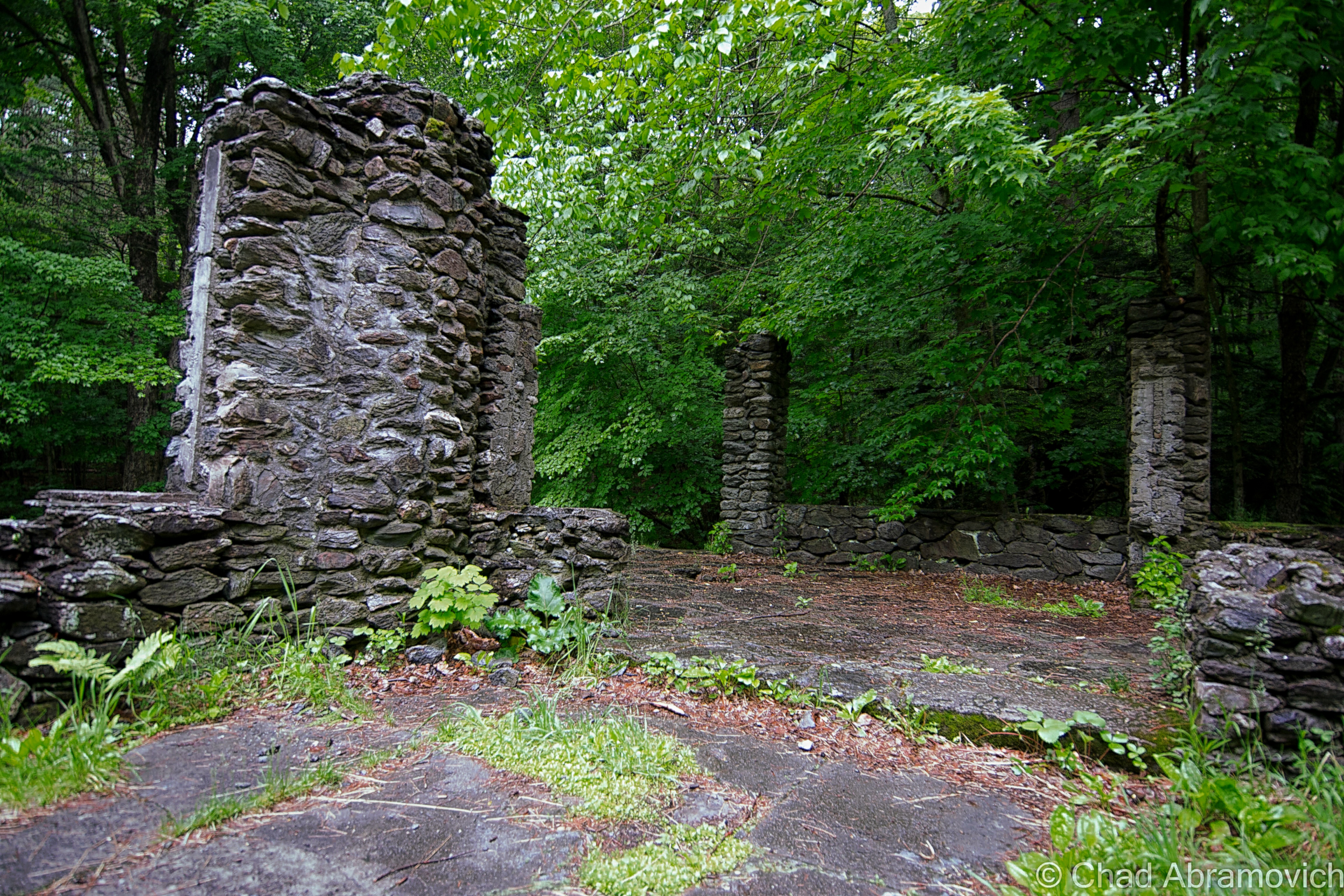
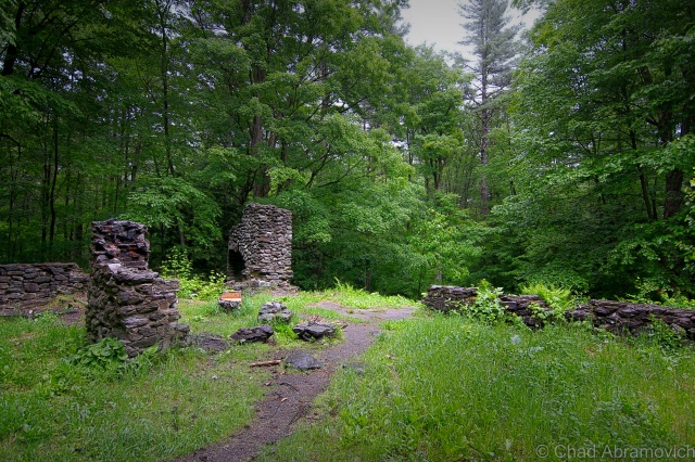
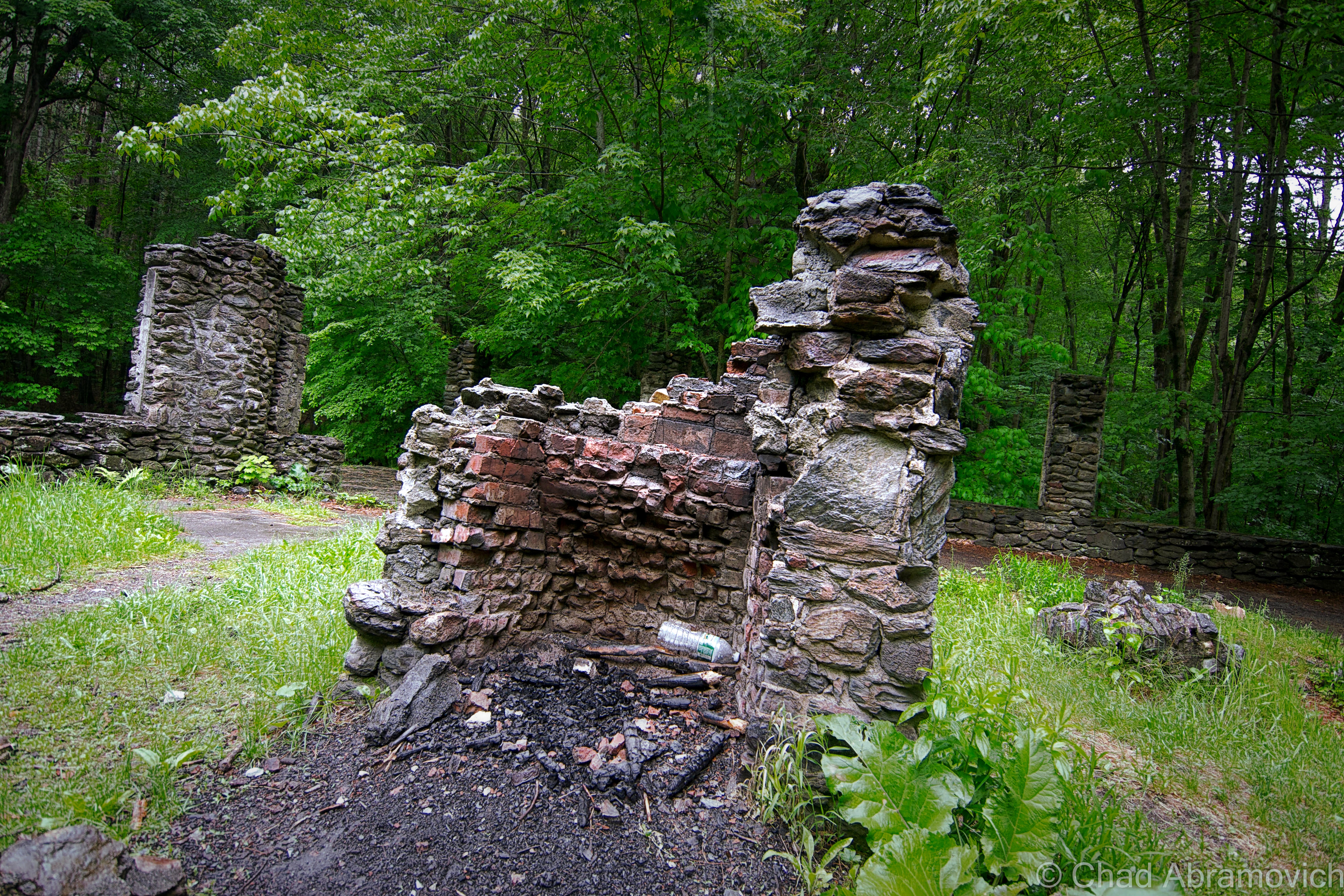
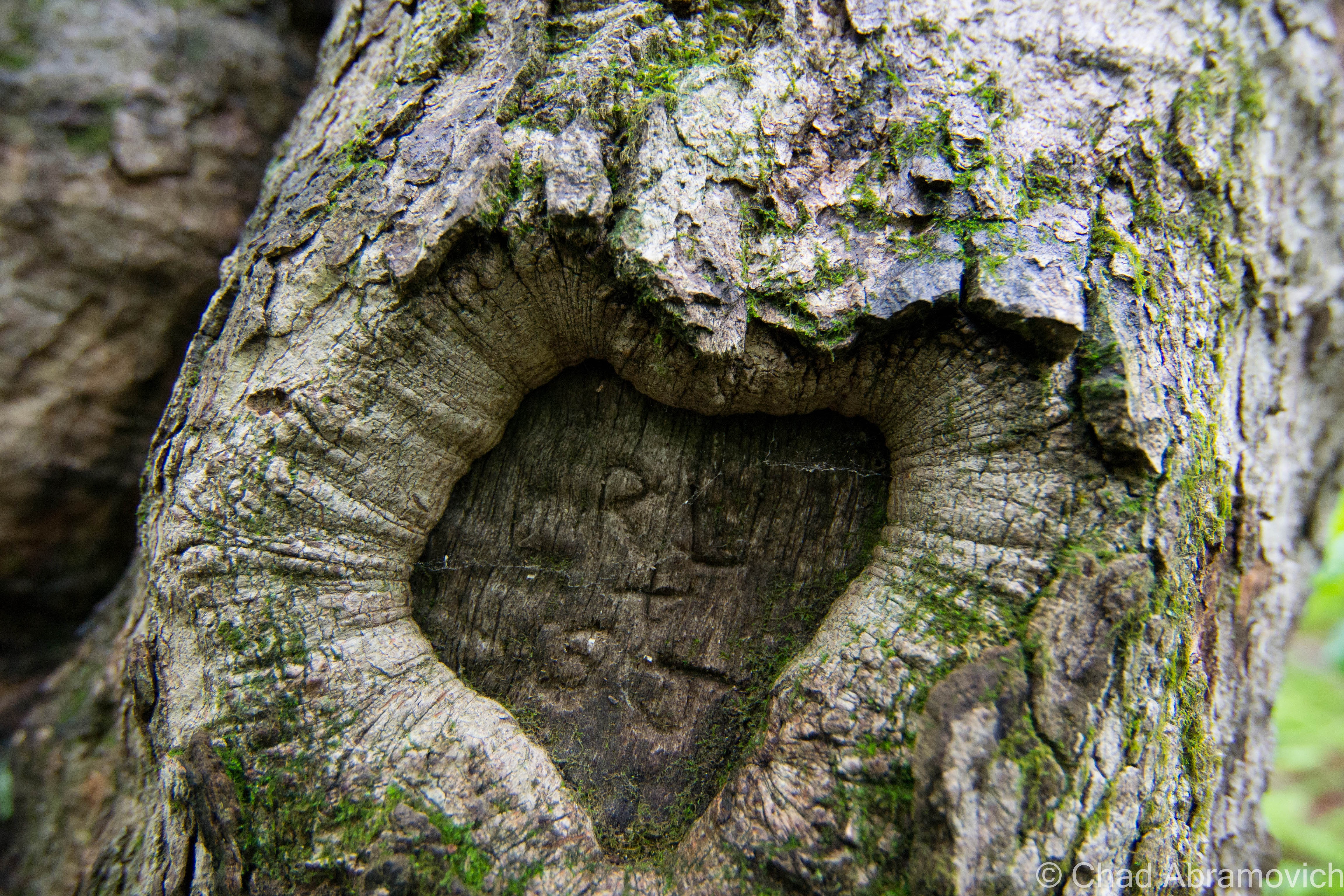
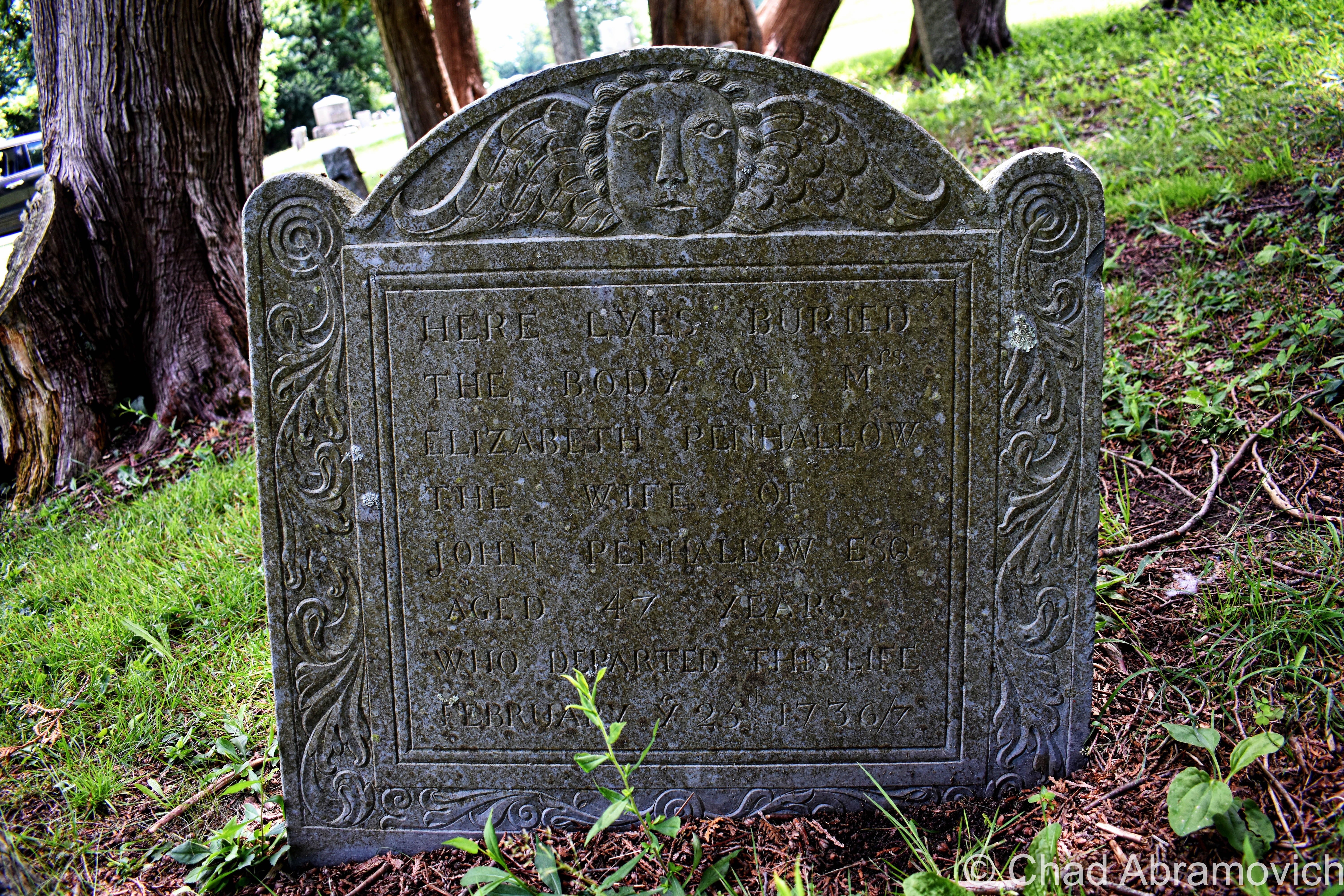
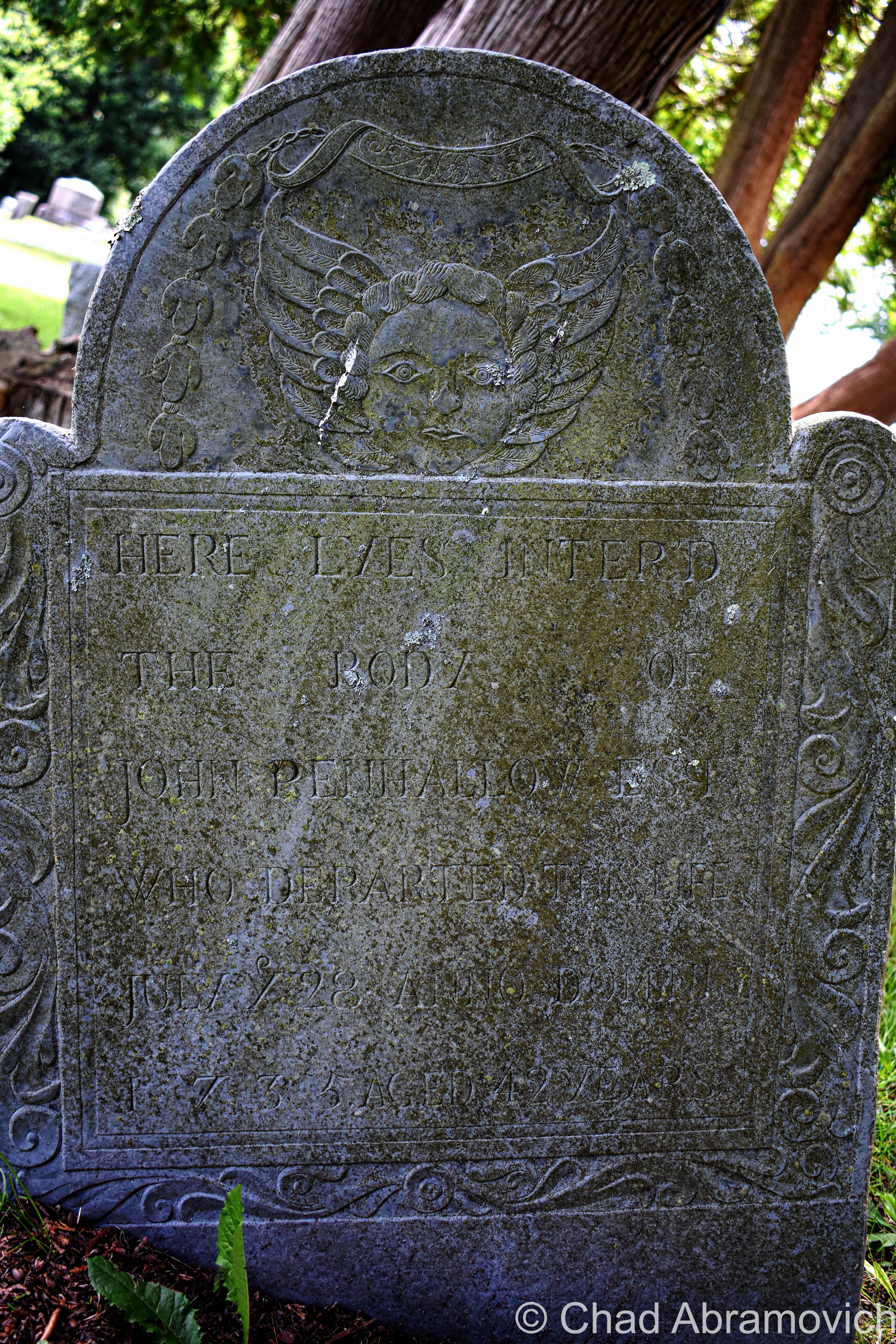
There, in broad daylight, were a set of 3 tombstones with the surname Burns on them joined at their base – 2 of them bonded by older looking stones and a third and unevenly distanced one on a newer concrete foundation. They were more or less unremarkable and dimmed by age and weather. In the middle was the anomaly – the grave of Eunice Burns, who died in 1884. The epitaph “mother we miss thee” engraved below her lifespan was actually kind of sad and made me wonder how she turned into a local folkloric figure.
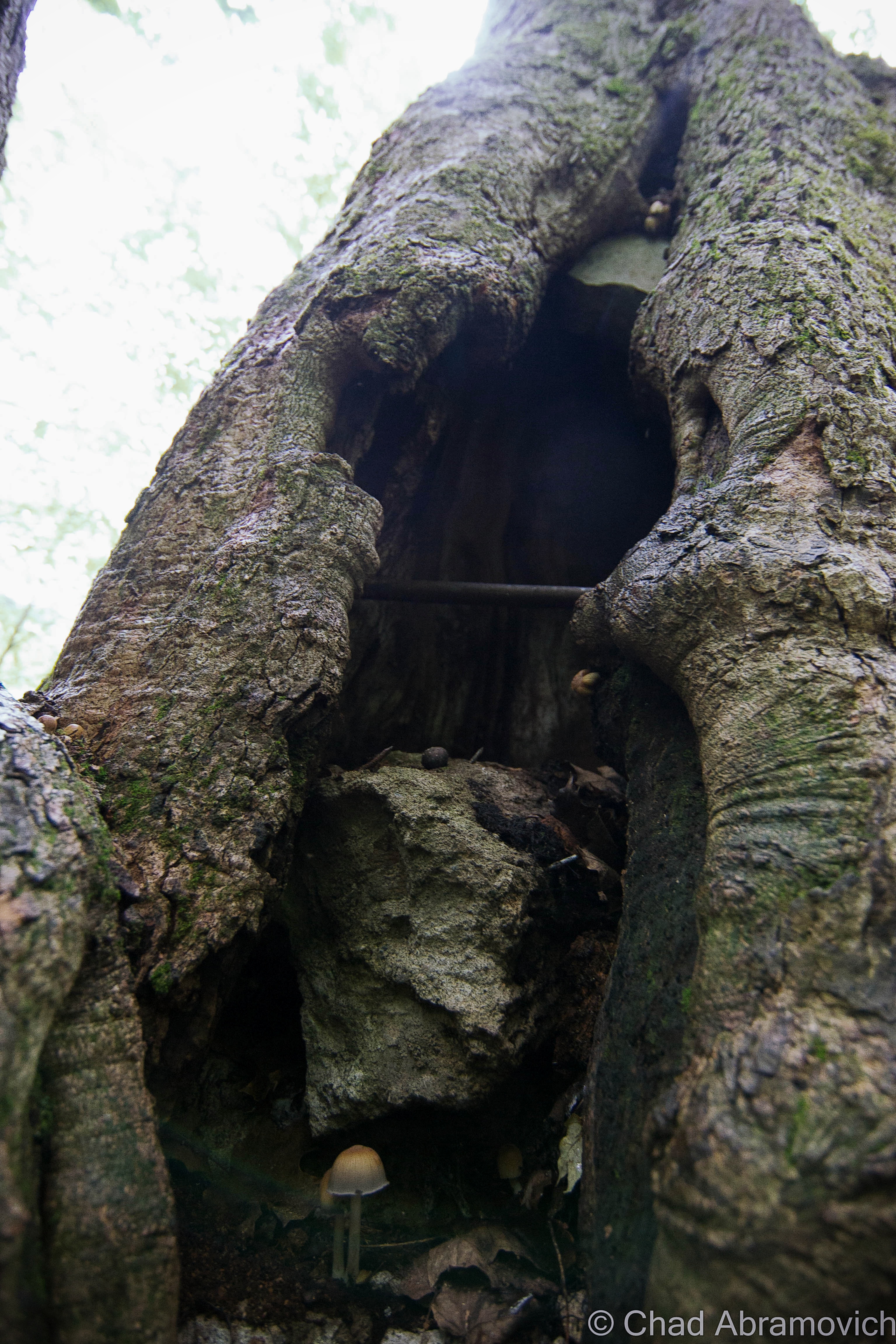
We also had a brief wander around the cemetery – a sprawling yard of little grave capped hills and a long pond, and observed a fantastic array of weathered old headstones and their memento mori and stories – dating all the way back to the 1600s, when Portsmouth was spelled as “Portsmuth”.
“So, it didn’t glow last night?” asked my other friend facetiously as I was putting my camera gear back in my bag.
“Nope. But who knows, it might be glowing right now and we just can’t tell because it’s sunny out”.
These are just a few shots of some headstones that I found to be interesting as I was leaving!
The Drowned Forest & The Transatlantic Telegraph Cable
More often than not, some of the most interesting things come to me completely by accident.
This is one such case, while traveling the fantastic New Hampshire State Route 1A through the town of Rye years ago.
My obsessive observational habits mean that I try to take in everything around me at once when I travel. Studying the landscape and reading every sign I see.
As we came across a small marshy area along Route 1A, I noticed a standard New Hampshire state historical marker standing a ways back from the road in the yellowed tall grasses. I’m a huge fan of those state historic/points of interest markers installed on roadsides and usually try to glance at them if I see them.
But this wasn’t the typical sign denoting a battle or historical event. Instead, it had two words that seemed to jump out at me; “Sunken Forest“.
I wasn’t expecting that, and almost immediately, my mind began to percolate.
After all, the term “sunken forest” does provide a lot for the imagination – conjuring up eerie images of giant pines and cedars submerged in a viscous, murky world of diffused light, their branches sullenly and slowly swaying with the mercy of the tides, fish encircling places where only birds could once perch and ship keels making their way over their crowns.
Did something like that exist in New Hampshire?!
Well, sort of.
After doing some internet research, I soon discovered that the reality was a little less phantasmagoric, but still pretty awe-inspiring!
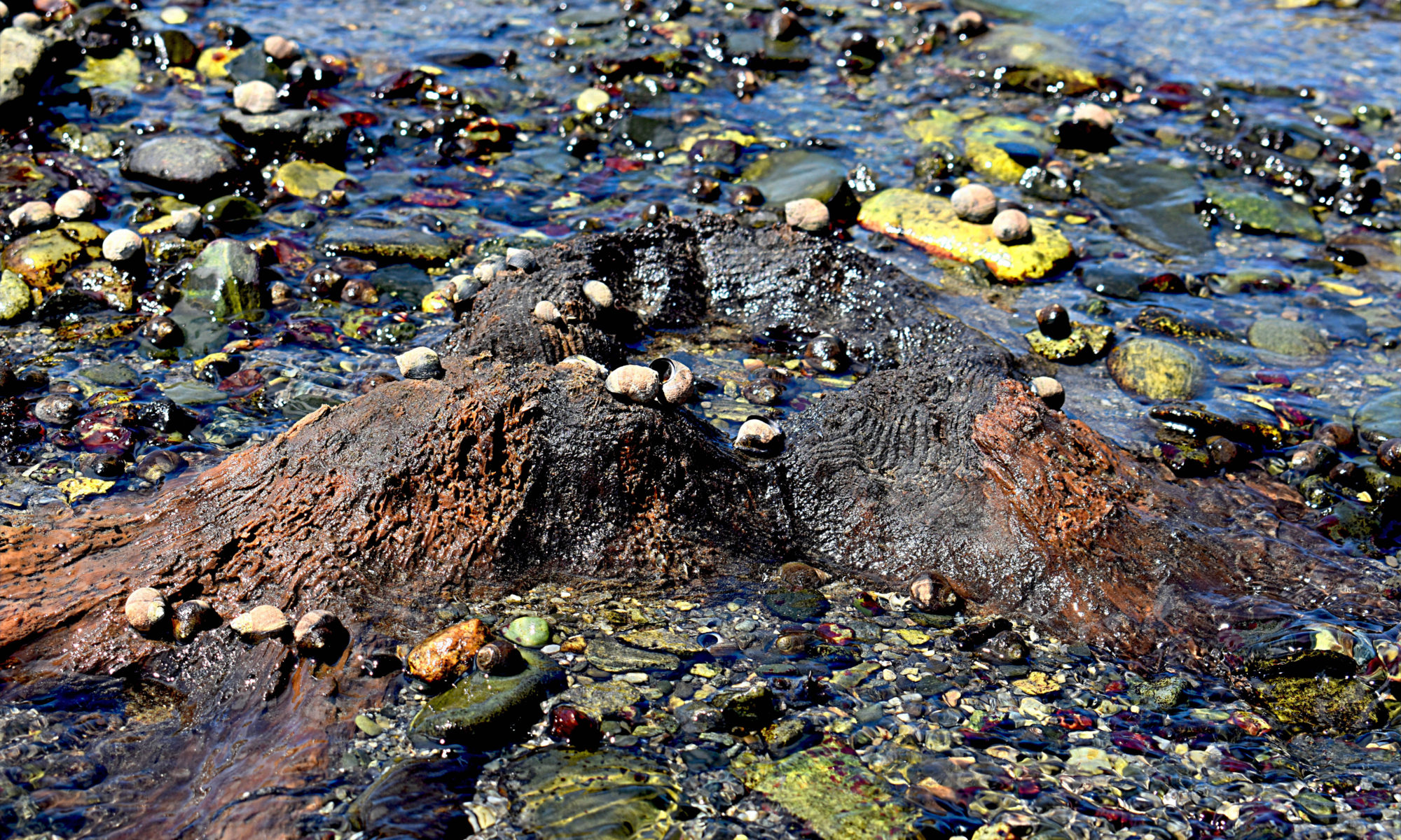
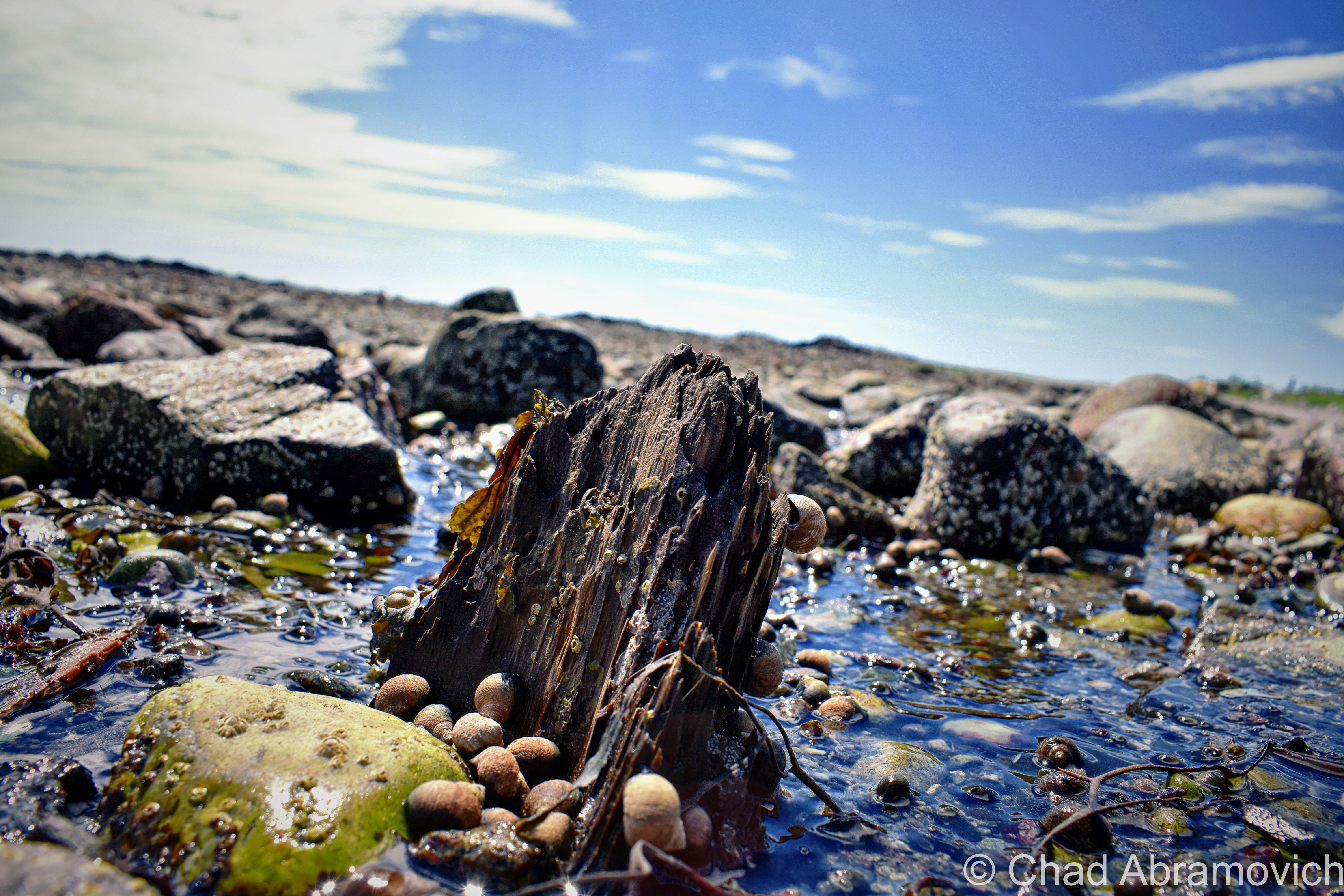
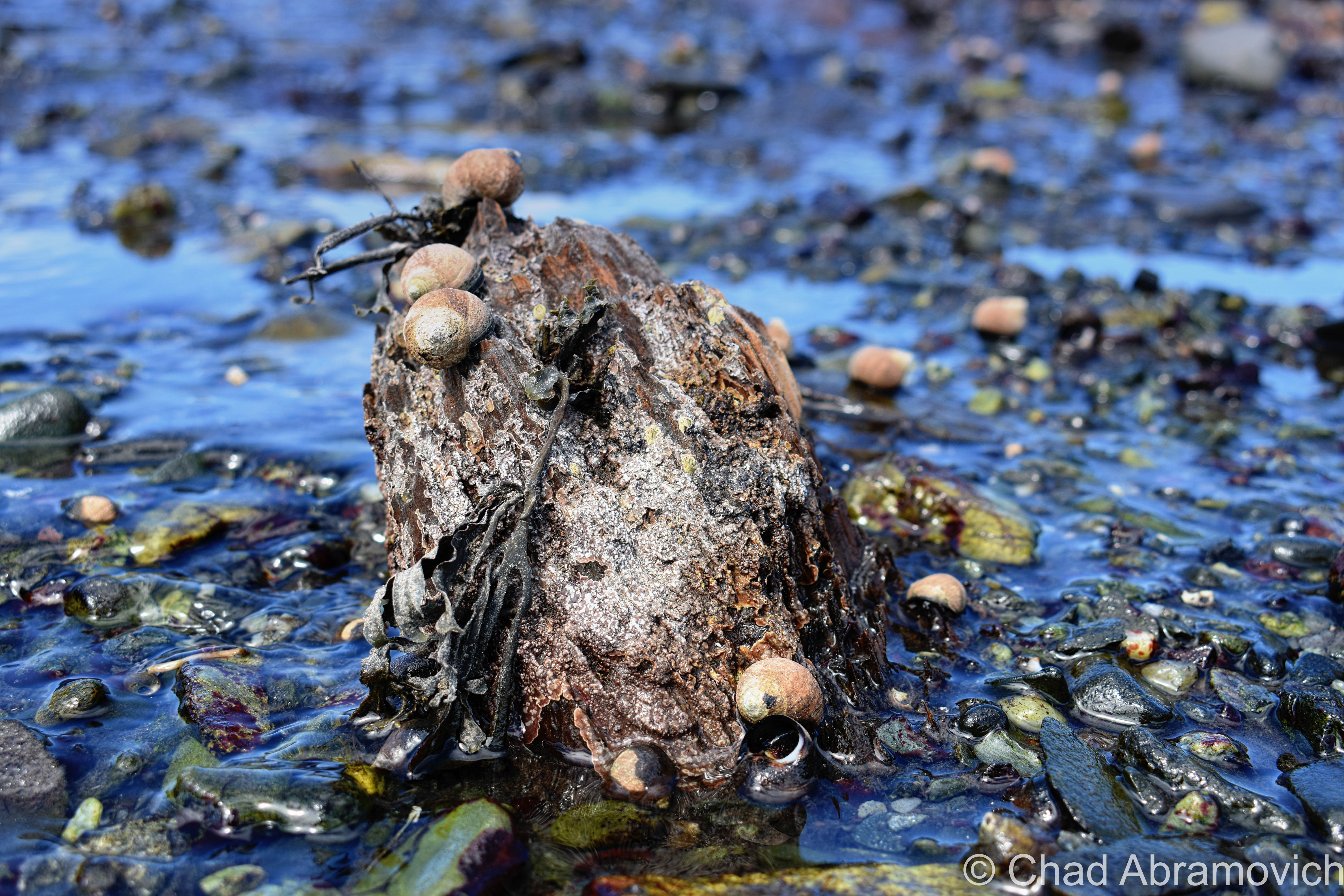
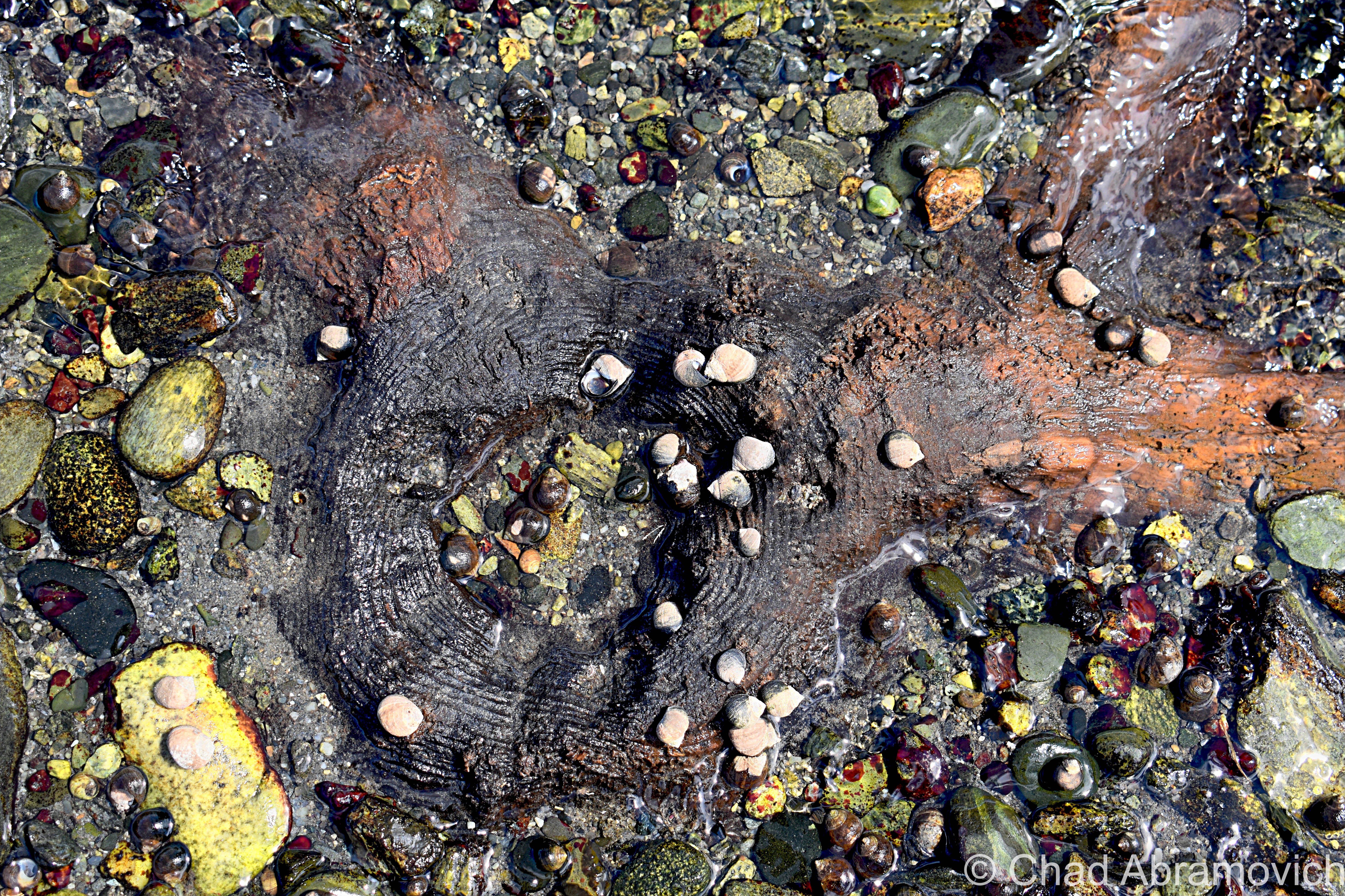
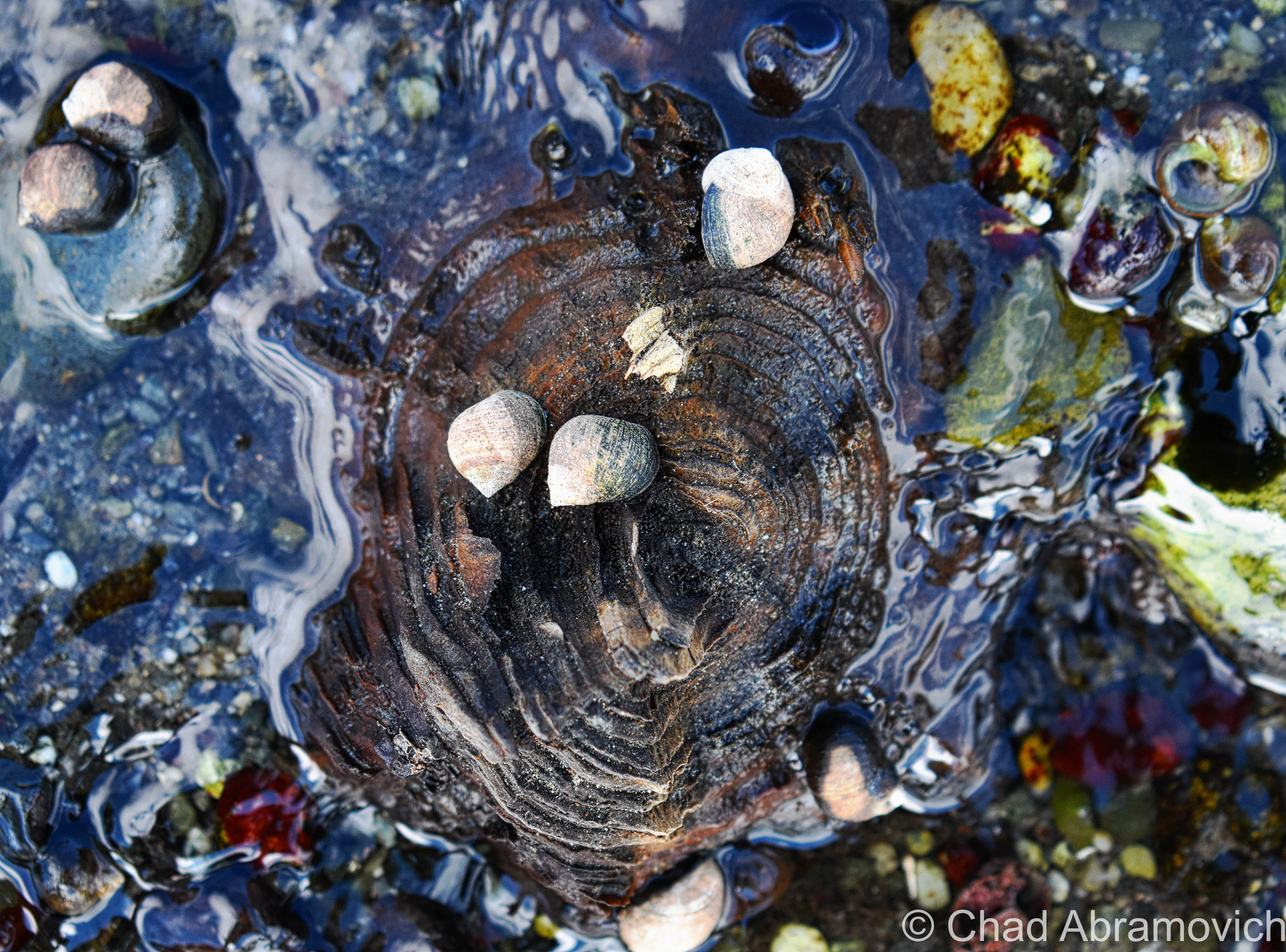
Rye’s sunken forest is the extant remains of a living forest of Hemlocks, Cedars, and Pines – reduced to a range of slimy tree stumps and contorted roots in thick peat mud, many of them barely noticeable and almost always obscured by high tides most of the year.
The traces of former forests and other things that the oceans have adopted into their secretive world can be found along the northeastern coast from Massachusetts as far up as Nova Scotia – and sometimes, a particularly low low tide can reveal these things, or give them back.
This fossilized forest is from a time when the New England coastline extended approximately 75 miles outward, thousands of years ago! When the giant ice sheets that covered North America began to melt, sea levels increased and changed the coastal signature of the area, and eventually, the once-great softwood forest found itself unable to adapt to its new environment; underneath the ocean.
New Hampshire’s inundated forest is one of the easiest to view of all the still-surviving ones, which makes it all the more unique and tantalizing to track down.
But, “easiest” still means little here. The visibility entirely depends on the tides, which means actually seeing them is a rarity. And if the conditions are more ideal, the arrangement of nudged sediments, stones, and mud might also work for or against your efforts.
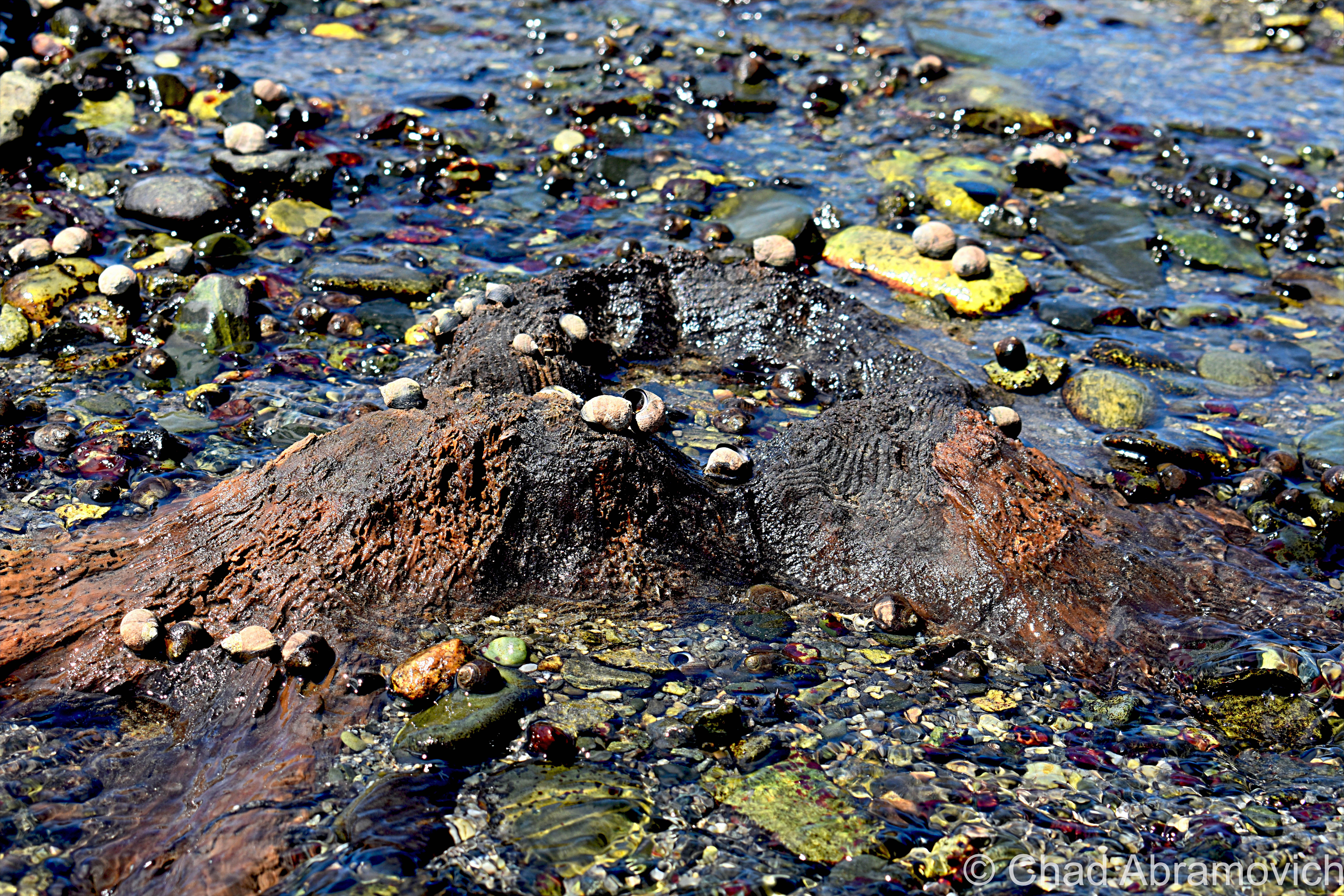
This oddity is bisected into 2 parts, which are either collectively known as “The Sunken Forest”, or isn’t. The one I tracked down, is the more frequently surfaced depending on the season and the tides, and is known to some as “The Drowned Forest” – which is mostly submerged in a rocky cove near the storied Odiorne Point. I like how graphic and violent sounding that name is, so I usually just go with that one. It also makes more sense logically to me, because the whole reason this oddity exists was because it was literally drowned.
Spring and summer are the best times to detect it, because in the latter part of the year, the low tides are only at night. Also, luck and persistence will help a lot too. Seriously. This was my third attempt at trying to see this – and not being from an area that has ocean frontage, this was also a required opportunity to teach myself about the tides.
The more of a chore-to-view is called “The Sunken Forest”, and is southwards down at the northern end of broad Jenness Beach – which mostly Houdinis itself except for once every few decades if conditions are just right. But, the Jenness Beach portion is also the best-preserved – with the stumps actually looking more like stumps, as opposed to up at Odiorne where centuries of ocean movement have grounded down the stumps almost level with the earth.
But when they are exposed, they have been carbon-dated to around 3,600-4,000 years old – and using dendrochronology, some of the tree stumps were shown to reach around 100 years old before they met their fate!
Finding this patch of remarkable flora was the main persuasion for me going to the New Hampshire shore – and it also was the thing that managed to twist my arm towards a beach. Not that I don’t like pretty places, but I’ve never been much of a beach person, mostly because I don’t really dig crowds or heatstroke.
By the time we arrived at Odiorne Point to meet low tide, though, it was already on the cusp of 100 degrees, and that heat just sucked the life outta me.
But I couldn’t contain my excitement as I made my way out into a rocky cove that wreaked of the fragrances that come with low tide. This was a special kind of ocean controlled oddity, sort of like when old shipwrecks will surface every now and then off, or on, New England beaches, so being able to actually behold it for myself was pretty rewarding – even more so knowing that within an hour or so, it would all be submerged again.
Scores of parents and even more kids were roving around the stony banks bracketed by seagrass stands and splashing around in the tide pools – most of them having no idea that they were in proximity to 2 very cool curiosities. But me – I was roaming around with my camera and prattling about seaweed-covered mounds that I was trying to differentiate from either being the oddity I was looking for, or just a regular sodden lump.
Some of the stumps and exposed contorted roots were almost inconspicuous in muddy sediments and other remains were found but sort of veiled below ankle-deep water with surface sun glimmer in the shifting tide pools.
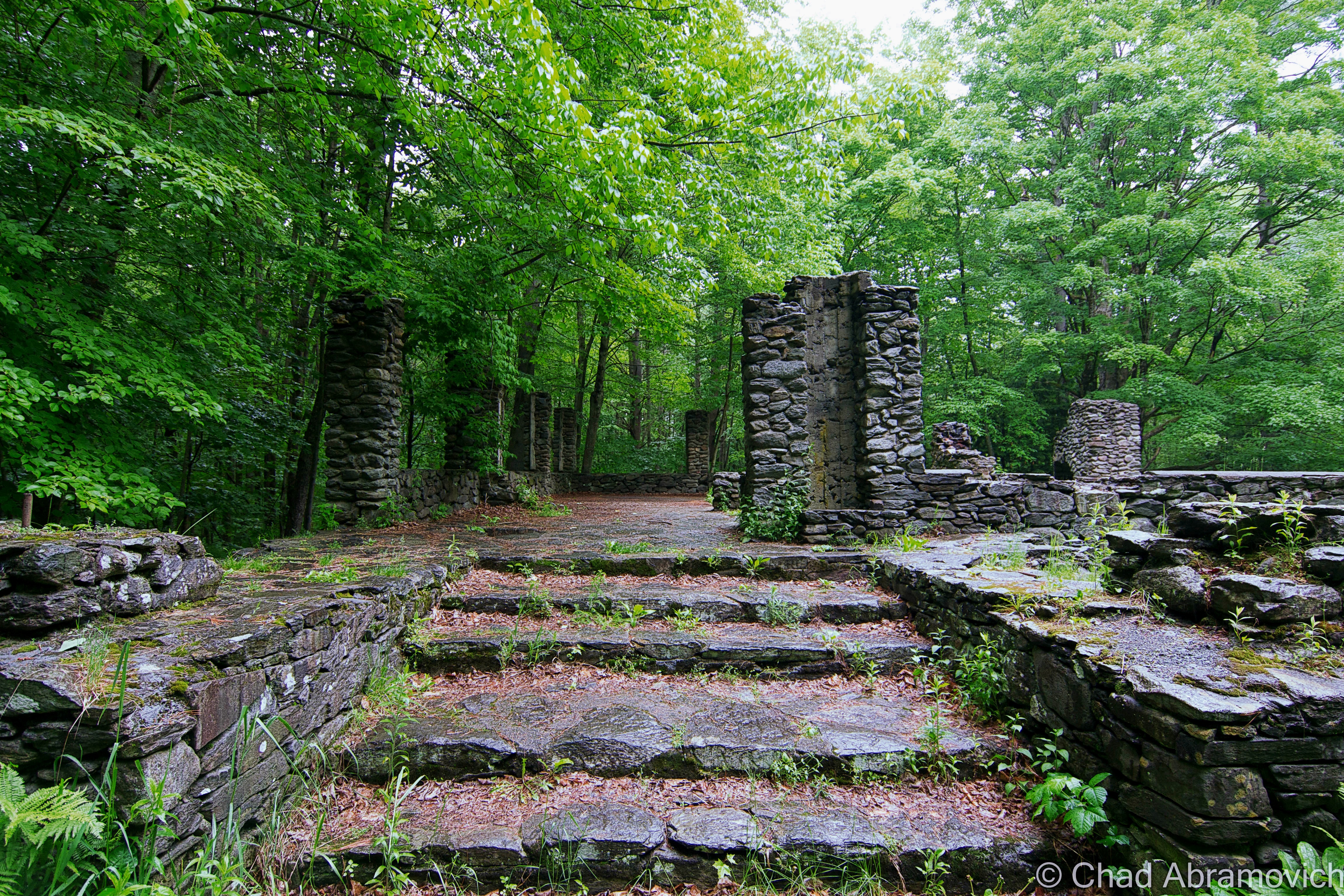
Odiorne Point unassumingly has quite the history – many of the ruins that mark the point’s fluctuating timeline can still be detected – scattered through the state park that now occupies the land around the point.
The Abenaki and the Penacook gathered here for the copious resources like muscles and clams found in the tide pools, and It became the first spot in New Hampshire that seafaring Anglos set foot on a few centuries ago.
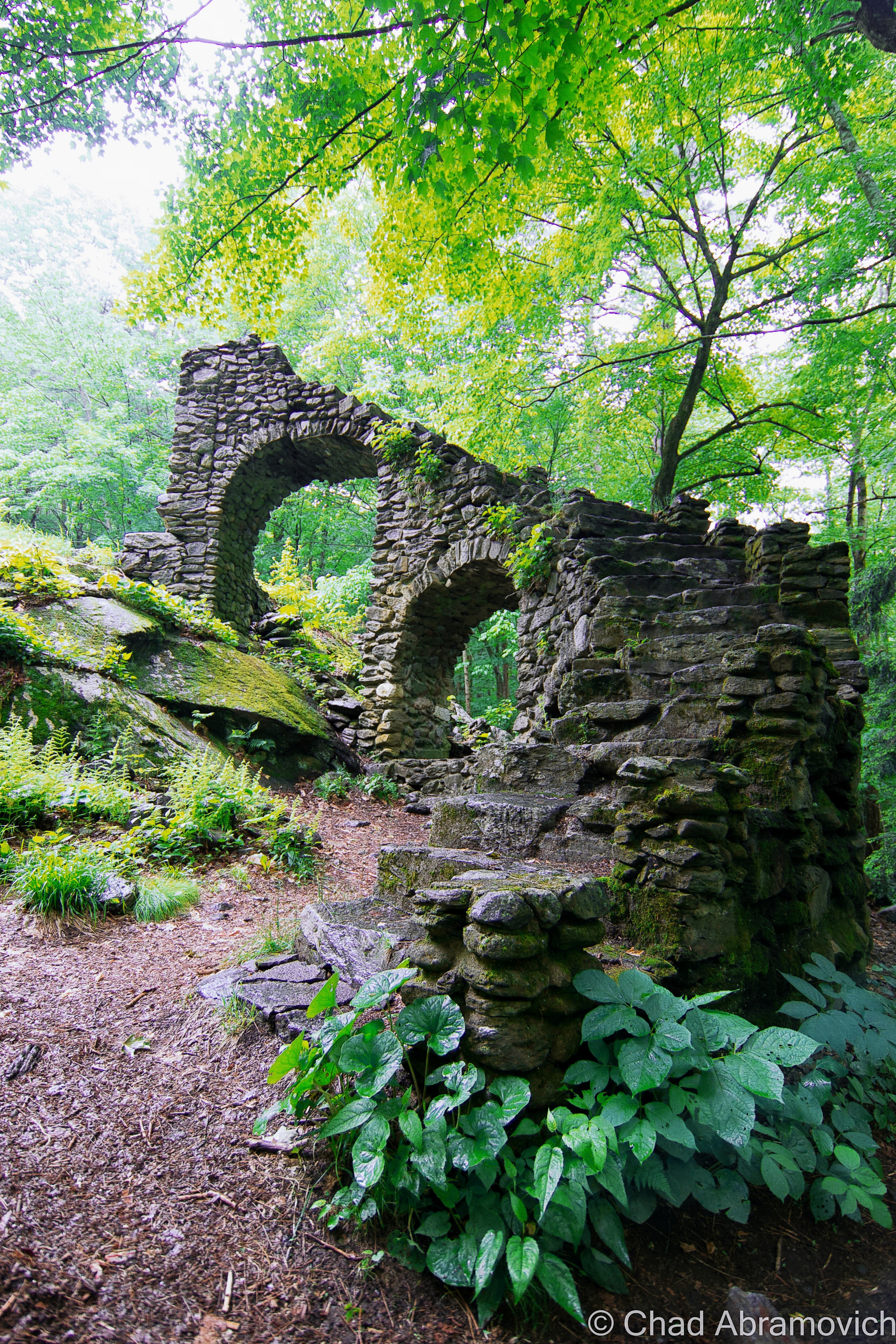
While century-old gravel pitting operations obliterated any traces of those original settlements (besides the oldest known cemetery in the state!), the brawny vestiges of a vital World War 2 coastal defense fort still exist within the park’s woods, as well as a conspicuously curious watchtower that can be seen 83 feet above the shingled homes of a small neighborhood off Route 1A that once was a satellite of the fort and was used for intelligence.
It’s the lone extant survivor of New Hampshire’s original 14 coastal World War 2 watchtowers, and is, for the most part, closed to the public. The tower is named after a neighboring natural landmark – Pulpit Rock – a jutting flat-ish topped rock formation that thrusts into a bouldery range of shoreline.
We had originally wanted to go check out the old gun mounts and batteries (and investigate rumors of secret tunnels), but by the time we were done with the Drowned Forest, I guess the heat had gotten to us and our enthusiasm, and we opted for the air conditioner in the car instead. I’ll be sure to put them on my itinerary the next time I’m in the area. Just look at these photos!
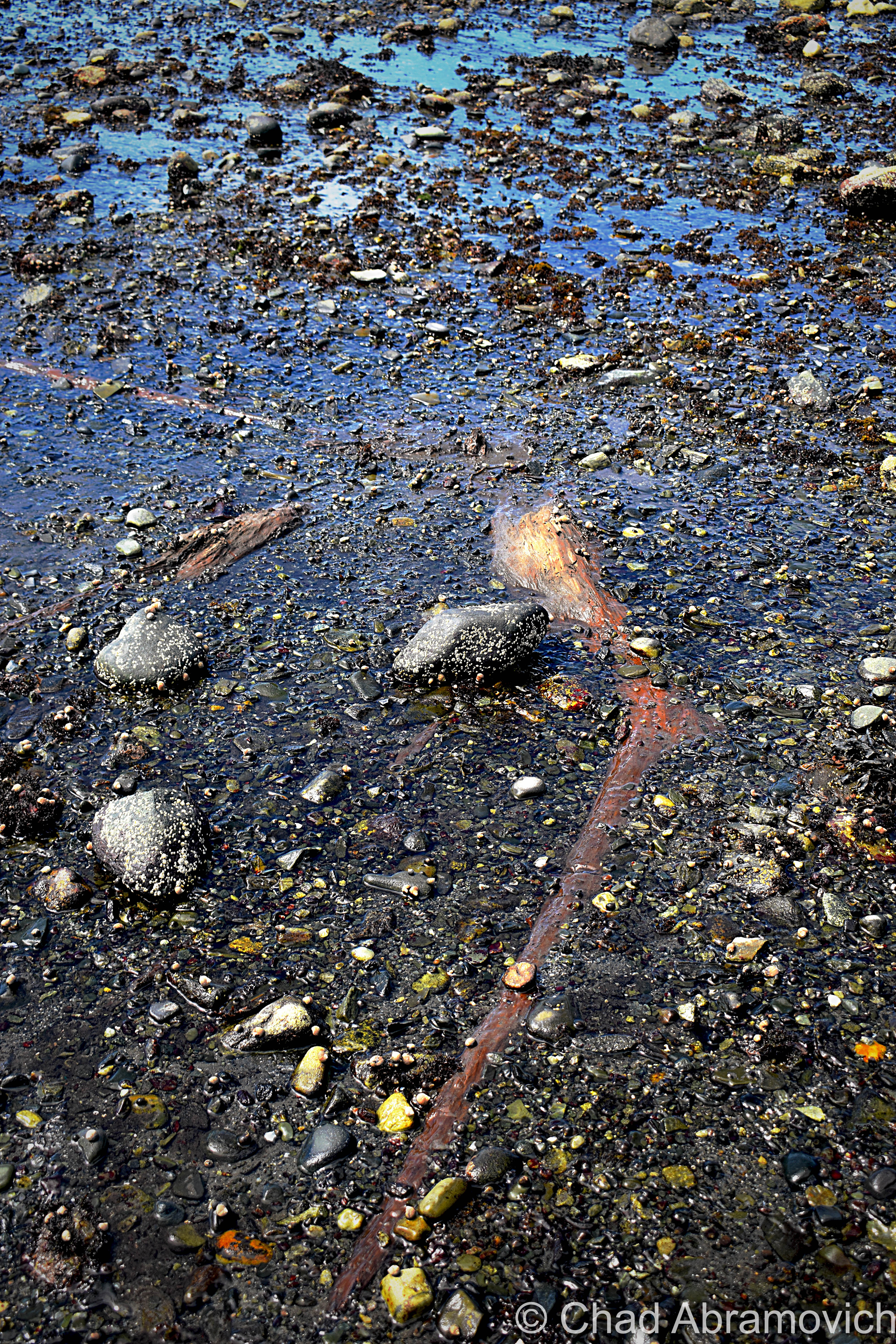
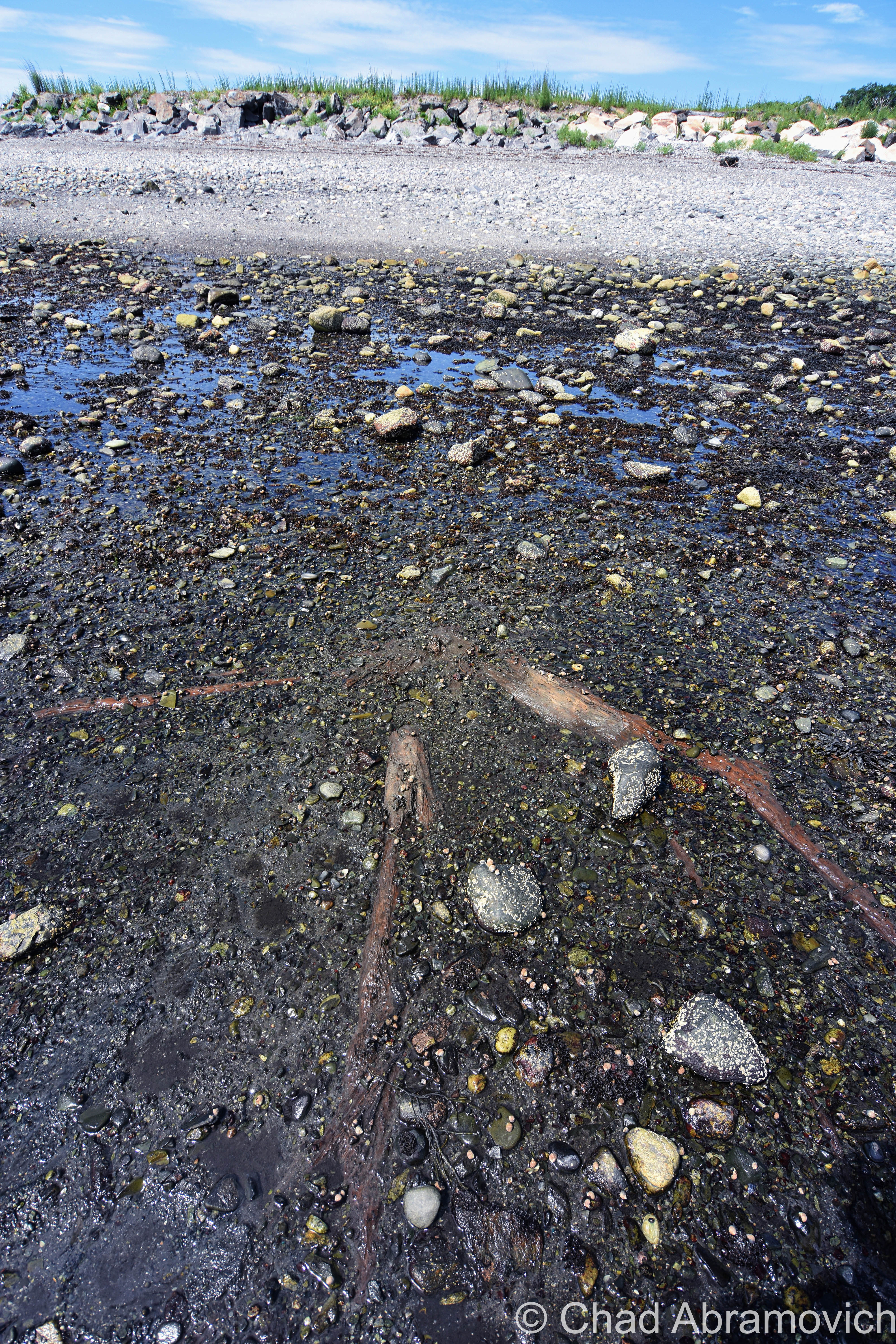
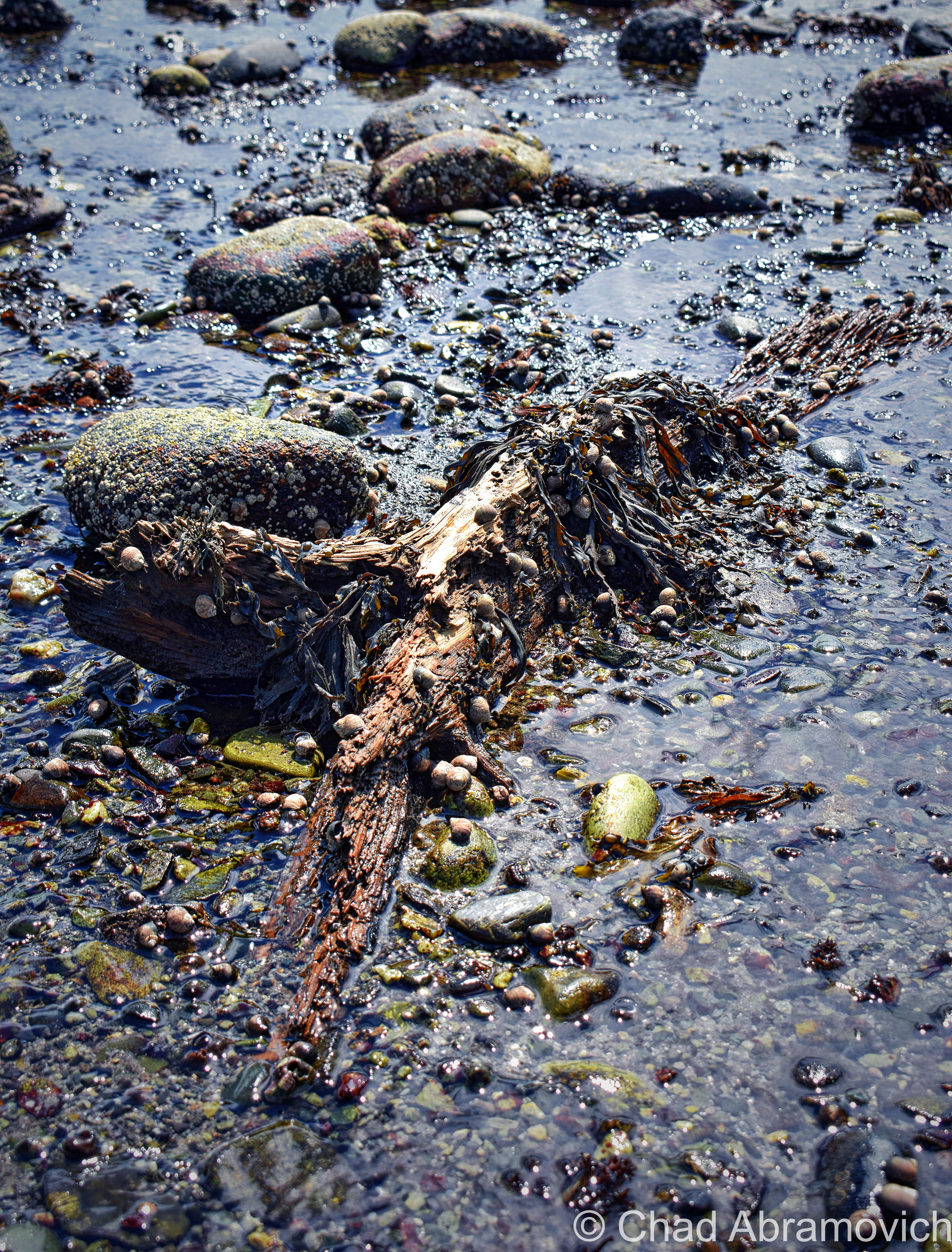
This turned out to be a conjoined oddity – the second item on my agenda happened to have been coincidentally laid down right through the Drowned Forest, and was much more obvious to detect!
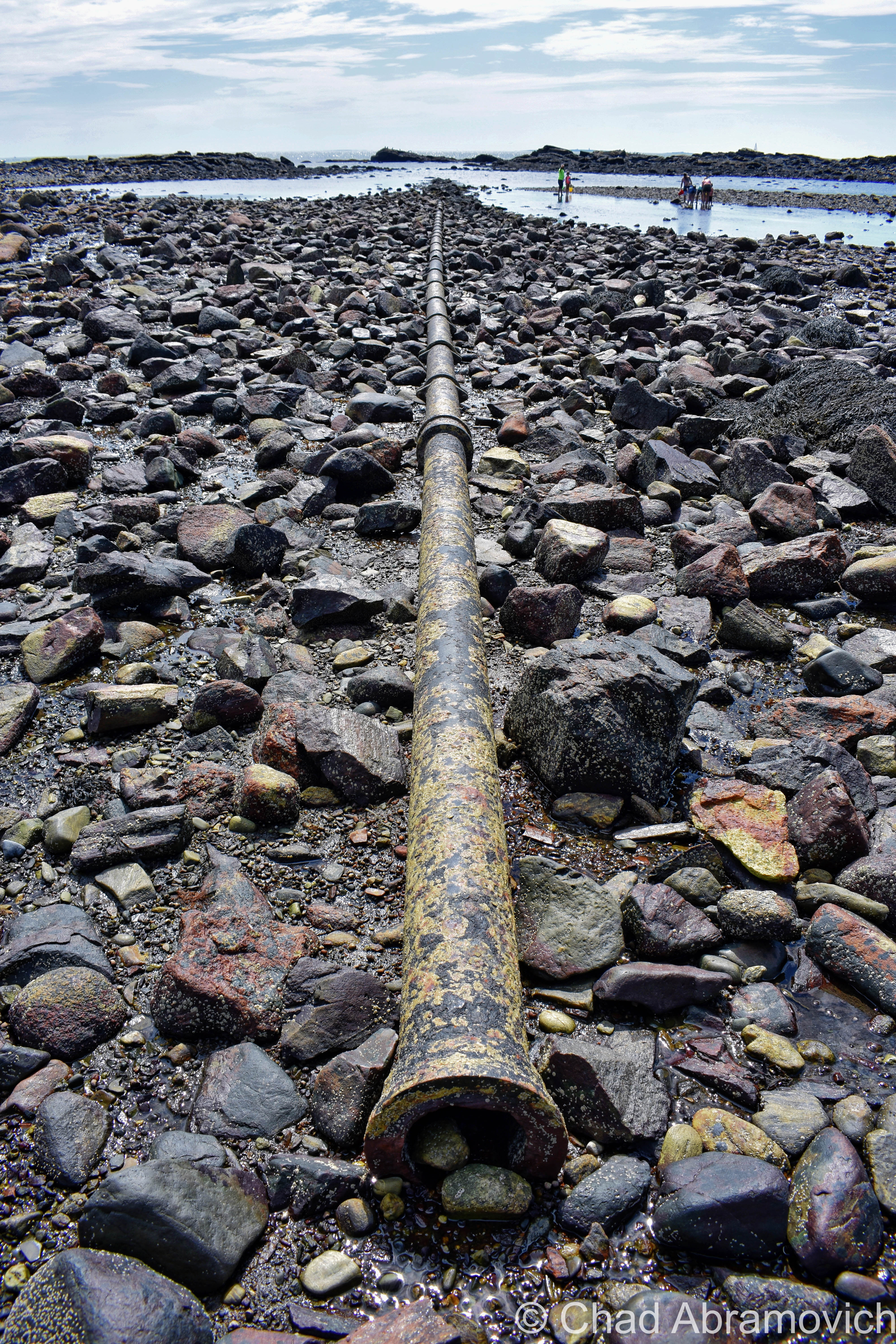
You’re looking at the rusted umbilical of one of the first transatlantic telegraph cables – the first one to be installed on United States soil!
The 19th century was the sparking point for a wondrous period of advancement and invention for America. Communication – being one of the seminals of the human existence – was naturally pulled into the gravity of the changing methodology.
The telegraph could cut delivery of information from weeks to a matter of hours, or even minutes, by transferring a pattern of electrical signals called Morse Code between 2 receiving stations via a special wire, which would then have to be deciphered.
American businessman Cyrus West Field knew absolutely nothing about telegraph cables, but he had a lot of faith in their prospect, bellwethered that the telegraph was going to grow in importance, and wanted to capitalize on it in a way that nobody else was doing.
By the 1850s, underwater telegraph cables were beginning to run in small dimensions, like from Newfoundland to Nova Scotia, and across the English Channel.
Field utilized this information and thought bigger, literally. He wanted to establish a telegraph cable across the Atlantic – linking North America and Europe.
The idea also became a good way of international flexing, and the governments of America and The United Kingdom jumped on the bandwagon and helped fund the endeavor.
Because the cable was too large/heavy to load on a single ship, 2 appointed ships would sail from opposite ends of the ocean; Southern Ireland and Newfoundland, Canada, and meet in the middle to splice the cables together.
But, so many calamities bedeviled the journey that both governments and investors began to feel like fools after 3 failed attempts in 8 years.
Eventually, though, the first transatlantic cable finally happened in 1866, and it was a moving affair – with both governments lauding it as a paramount shift in human accomplishment. But, it took upwards of 2 minutes to send a single character because of the length, and then the cable was debased early on because of the voltage sent down it was too high. But, eventually, they got the kinks worked out, which pushed the project’s legitimacy card.
But – any messages destined for America still had to be sent down from the boonies of Newfoundland, which was often a slow or clumsy process. So, the Direct United States Cable Company was formed in 1873 by the Siemens Brothers, which routed another underwater telegraph cable down from Nova Scotia to Rye Beach, New Hampshire on July 15, 1874.
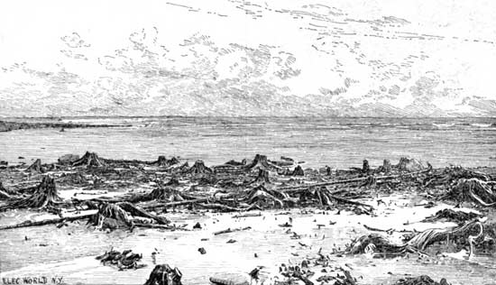
Because this was the first such cable to terminate on American soil – it was a big deal, and a huge crowd gathered at the beach the day of its installation – and garnished up some pretty dramatic Victorian newspaper illustrations in Harper’s Weekly with symbolistic ethereal light beams parting dark clouds onto the spot where the cable met the beach.
An official cable house was built that winter, which closed in 1921 when the cable’s usage significantly slowed down after its zenith during WW1 when it was kept busy practically 24 hours a day.
The cable house still cooly exists and is nowadays a nicely preserved private residence. It’s also why “Cable Road” has its curious name – something I wondered about when I read its name on Rye’s signature white and black street signs when I was a kid.
I tell everyone who feels like lending their ears that New England really is a special and strange place, maybe a few shades more so than the rest of this country’s iconic regions because of the comprehensive spectrum of spectacles that make themselves at home here, and these treasures are just a small representation of this. I was talking to a friend that lives in New Hampshire about The Drowned forest in particular, and he was delighted that something like that existed in his own backyard, and for years, wasn’t aware of it.
As I grow older, those are the types of discoveries that really fire me up more and more. Adventuring can really open up your mind. You don’t always need to go poke around a behemoth of an over-Instagrammed ruin to have a “real adventure”. The magic is kinda what you make of it.

Here are a few links:
There’s a pretty fascinating documentary on the design and installation of the first transatlantic telegraph cable that I’ll link you below for your pleasure!
ALSO – if this kind of thing strikes your fancy – then definitely make sure to check out the website atlantic-cable.com – which was an integral part in my research on this curiosity!
The blog “Cow Hampshire” also has a good and more succinct blog post on it.
And – there’s another neat article on Hackaday
The Rye, New Hampshire Historical Society has some neat photos of the Drowned Forest from the 1800s.
Are you from New Hampshire or a fellow Vermonter? I’m looking for weird, wild, or hilarious stories, wonderous and odd places, incredible people, and especially abandoned locales! So if there’s something you’d like to share with me, I’d love to hear from you!
I’d also really love to grow this blog and present unique, meaningful, and extraordinary content that’s a departure from the same regurgitated stuff you find everywhere else online, and your help would be hugely appreciated!
Feel free to drop me a line at chad.abramovich@gmail.com
Also – if you appreciate me and this blog, perhaps consider making a donation at my PayPal below? The pandemic has hit my finances and my mental health pretty hard, so any amount is humbly appreciated. I’m also on Venmo if that works better.
Since 2012, I’ve been seeking out venerable examples of Vermont weirdness, whether that be traveling around the state or taking to my internet connection and digging up forsaken places, oddities, esoterica, and unique natural features. And along the way, I’ve been sharing it with you on my website, Obscure Vermont. This is what keeps my spirit inspired.
I never expected Obscure Vermont to get as much appreciation and fanfare as it’s getting, and I’m truly grateful and humbled. Especially in recent years, where I’ve gained the opportunity to interact with and befriend more oddity lovers and outside the box thinkers around Vermont and New England. As Obscure Vermont has grown, I’ve been growing with it, and the developing attention is keeping me earnest and pushing me harder to be more introspective and going further into seeking out the strange.
I spend countless hours researching, writing, and traveling to keep this blog going. Obscure Vermont is funded almost entirely by generous donations. Expenses range from hosting fees to keep the blog live, investing in research materials, travel expenses and the required planning, and updating/maintaining vital tools such as my camera and my computer. I really pride and push myself to try to put out the best of what I’m able to create, and I gauge it by only posting stuff that I personally would want to see on the glow of my computer screen.
I want to continuously diversify how I write and the odd things I write about. Your patronage would greatly help me continue bringing you cool and unusual content and keep me doing what I love!

![]()