

photo: Ray Parizo
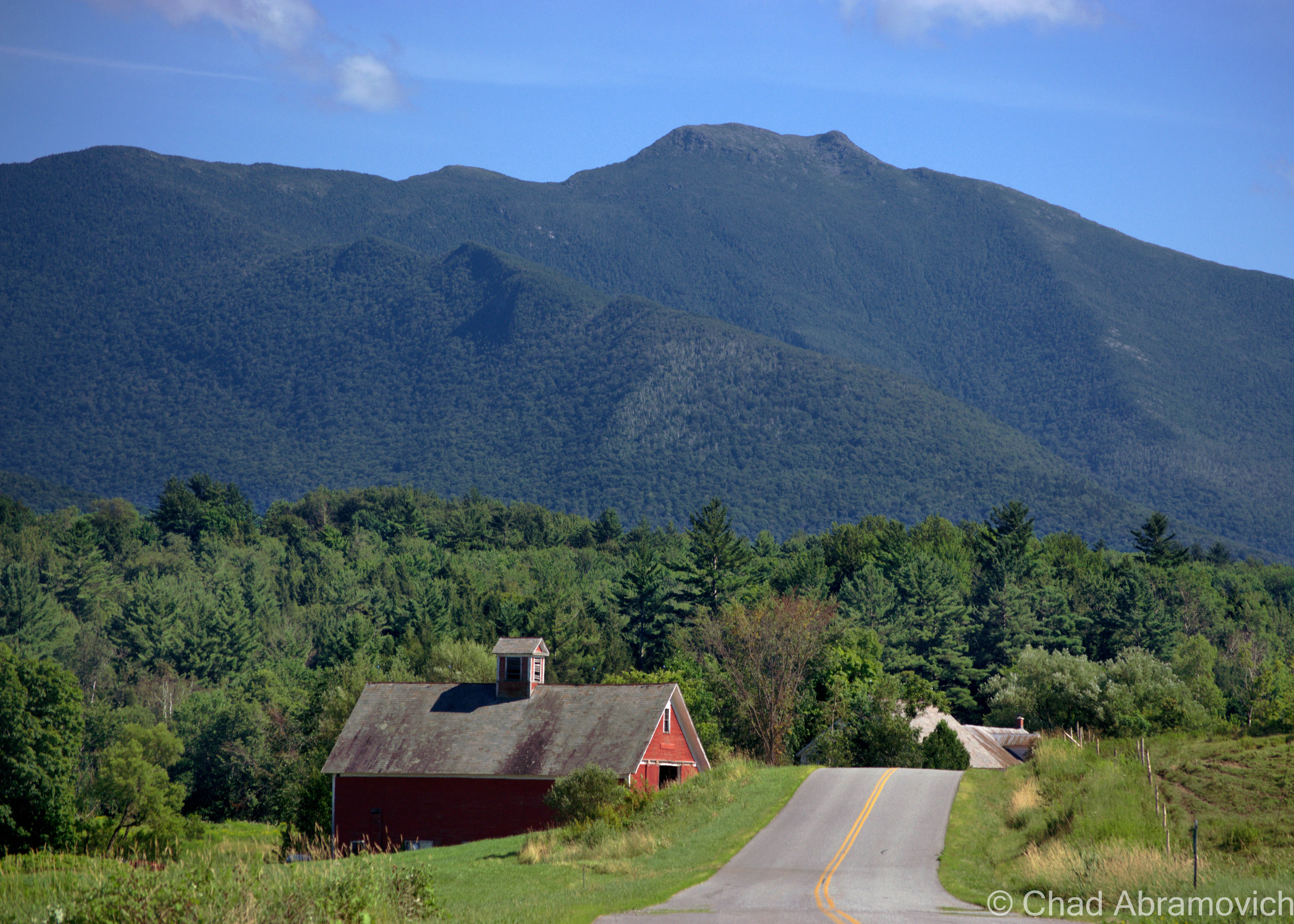
Mount Mansfield is literally the largest thing in Vermont. The state’s loftiest peak rises above everything at 4,395 feet, coming to an end on a wind-battered rocky summit anchoring the blinking lights of transmitter towers that serve area media companies, throngs of hikers, and one of the few places in the east that can support rare arctic alpine tundra – actual surviving vestiges from the ice age.
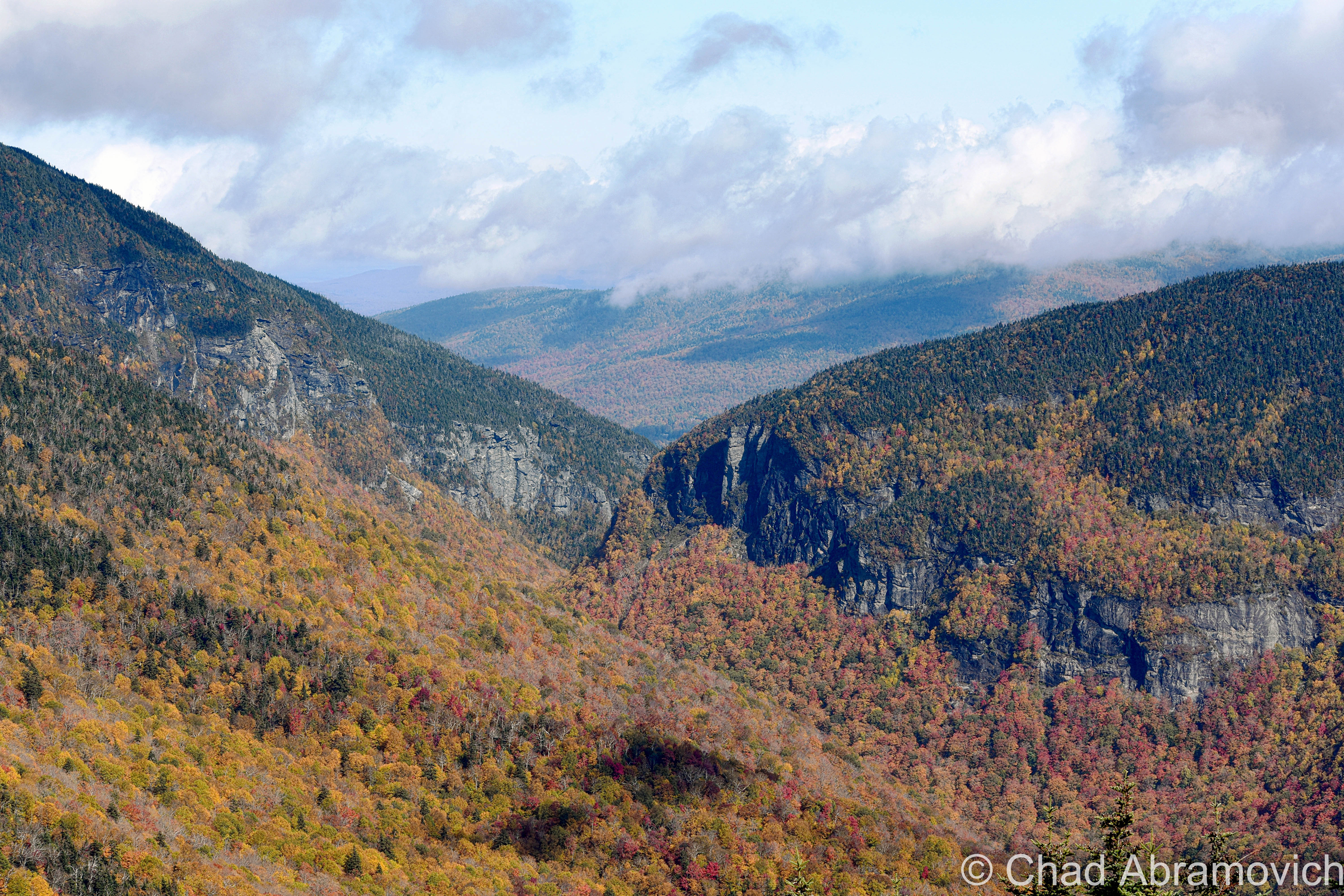
The sprawling ridge line’s anthropomorphic profile explains the names behind it’s distinct standout topographical features, such as The Forehead, The Nose, The Chin (officially the tallest elevation), and Adam’s apple, although not everyone apparently agrees on seeing a human face. Interestingly enough, the idea of seeing a human face in the rocks may just come from some Yankee competition around the 19th century, when neighboring New Hampshire officially decided that a rock formation in the White Mountains looked like an old man, turning it into a regional mascot and a symbol of state pride in a time when the mystic and science of geology was a growing interest. The best Vermont could do was to find one in the upturned profile of Mount Mansfield, but it was nowhere nearly as admired.
If you arrange the pieces of the face together, “the chin” is much higher than “the forehead”, so I guess it’s sort of a stretch of the imagination. On an interview with VPR, historian Jill Mudget had a humorous observation. During the 19th century, a time where new and radical ideas spread like wildfire, there was an introduced theory that you could tell a lot about a person’s intelligence by their facial features, which I suppose would mean that Mansfield’s profile isn’t very intelligent.
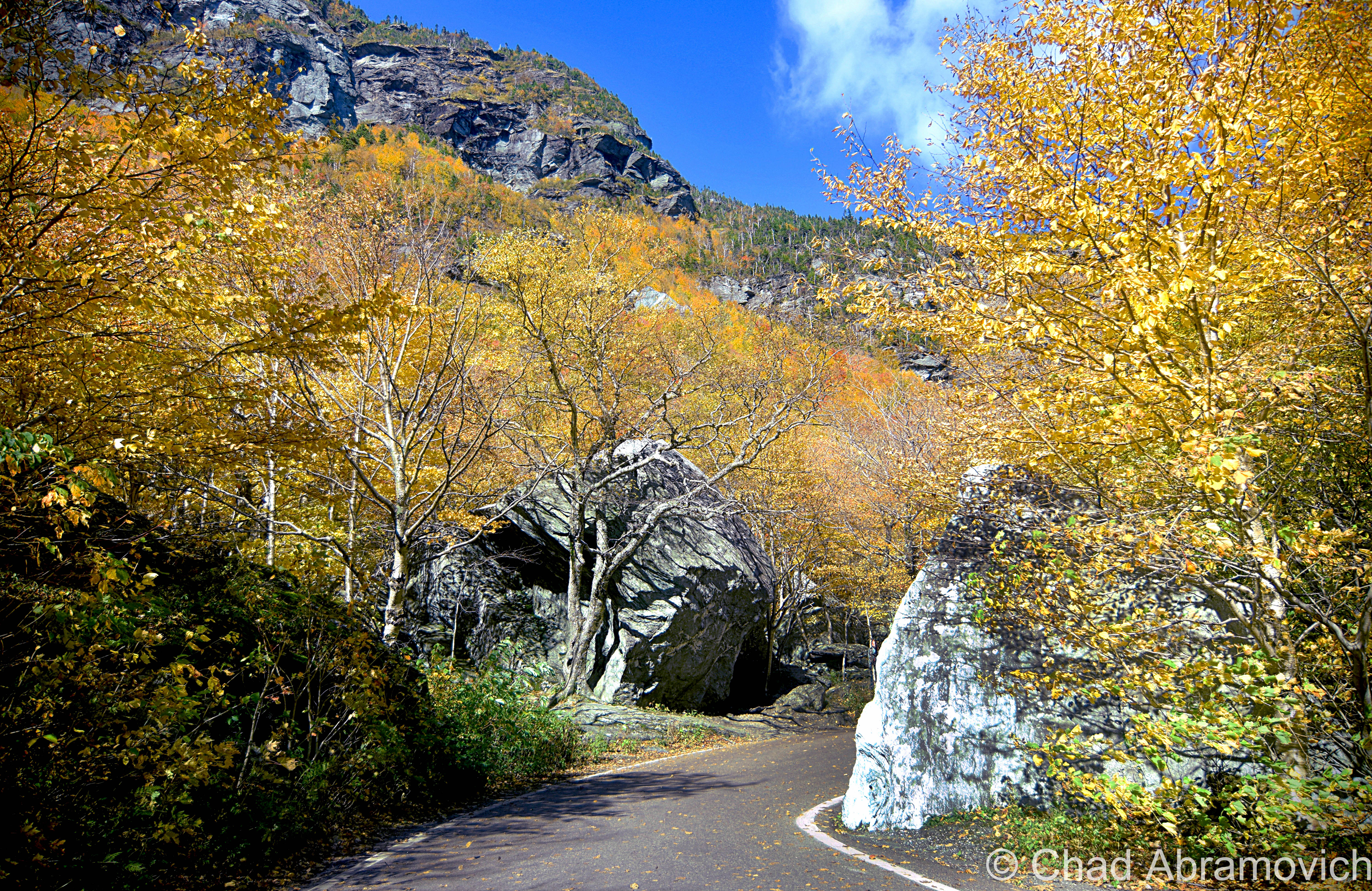
The gargantuan landmass separates two counties, Chittenden and Lamoille, and it’s eastern slopes contain one of the more popular ski resorts in the eastern United States; the ritzy Stowe Mountain Resort. The rest of the mountain is forever protected by the Mansfield State Forest and Underhill State Park, which has spared the mountain from ruinous development, including one notable 1930s project when it was actually proposed to build a scenic highway that would have ran right over the summit! Today, a different sort of highway runs along the top of the mountain, the oldest long-distance hiking trail in America, the celebrated Long Trail.
Mount Mansfield is a grand mountain in many considerations, with a complex biography of history and myth, but perhaps one of my favorite aspects of the topographical area is how things here got their names.
It’s original Abenaki name, Mozodepowadso, was English translated to Moosehead Mountain when people began to settle closer to its slopes, but unlike other Indian names that have stuck around and worked their way permanently into local parle, Moosehead didn’t, and the mountain eventually became known as Mansfield. But the origin of the name is mysterious. Some speculate that Mansfield was named after the town of the same name, which was charted literally on the steep and practically inaccessible slopes, making development slow and survival far tougher than the surrounding towns.
Eventually, Mansfield, and the neighboring town of Sterling, became ghost towns, and were carved up into the present day towns of Stowe, Cambridge and Underhill, giving them their unusually large and weird shapes. Other theories speculate that the state’s most prominent feature may have derived from the name “Mans Field”, named after the burly and intrepid early settlers who endured strenuous labor to make a living in the harsh wilderness. Either way, the name stuck.
Another much smaller monument to mankind can be found along the summit. There is an innocuous cairn with an interesting name. Called Frenchman’s Pile, it marks the spot where a man was struck by lightning many years ago, and killed on the spot.
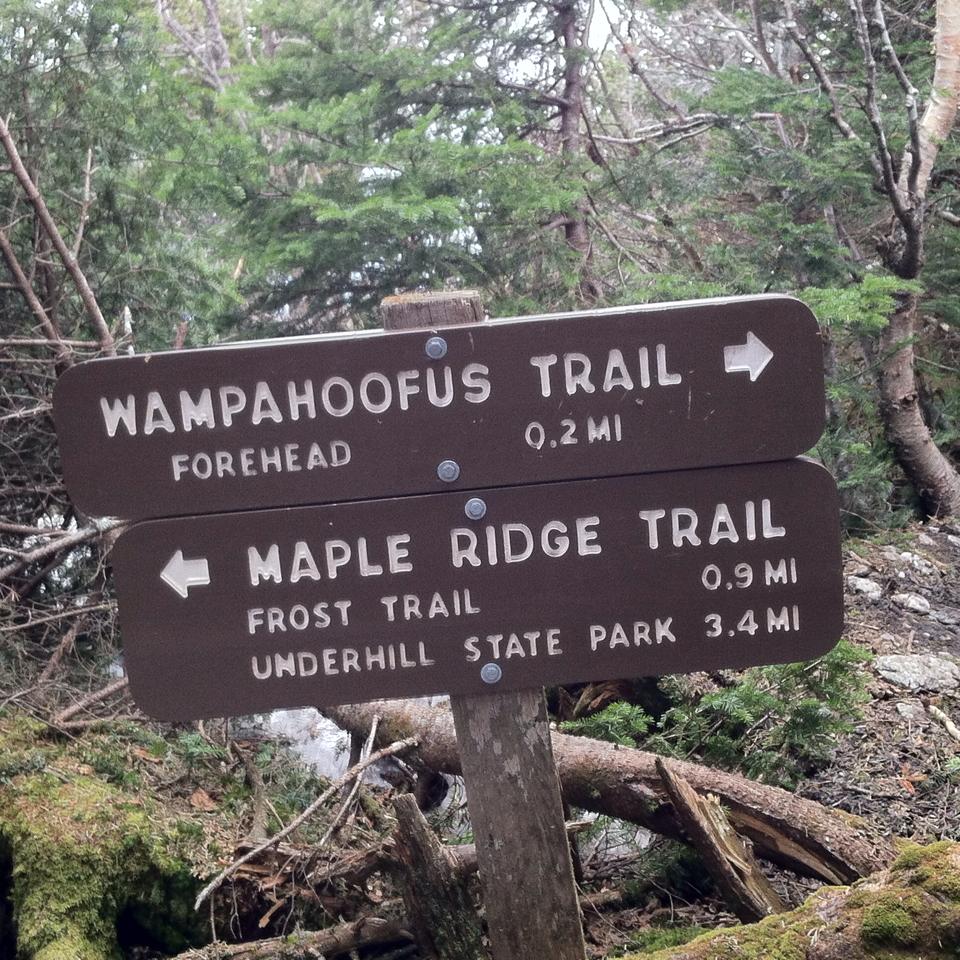
Hiking is one of my favorite activities to do, and with so many trails that snake their way over the mountain and such varied terrain, I always have some sort of new experience that keeps me wanting to come back and explore. While hiking the mountain a while ago, I came across the most peculiar name for a hiking trail I had ever seen in my time in the woods – Wampahoofus Trail. I had to stop for a second, the name wasn’t familiar at all. I couldn’t help but wonder, just what the hell was a Wampahoofus? What did it mean?
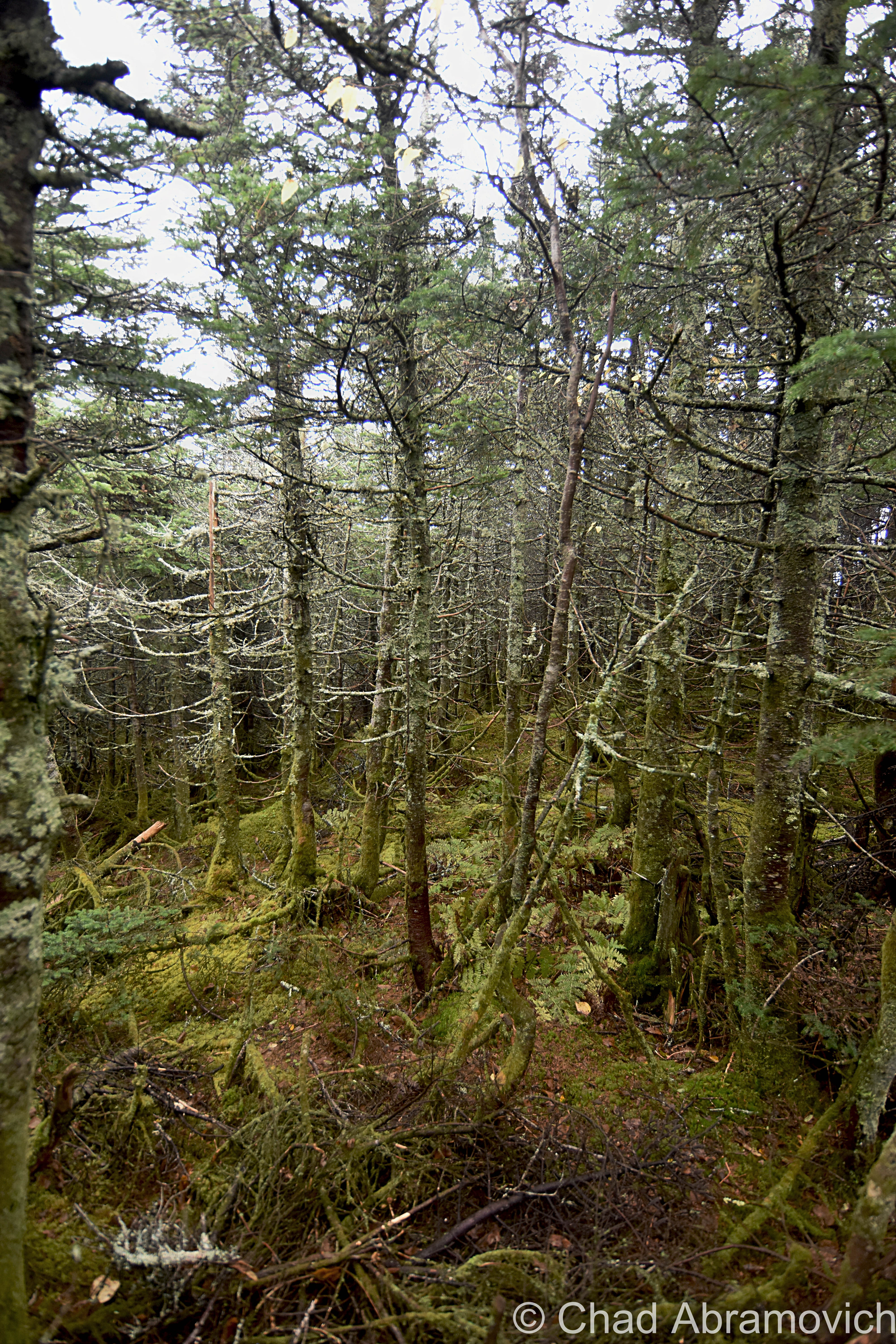
I took my search to the internet and got a wonderfully strange story behind the etymology. The name derives from an animal which is now extinct, and their story is a tragically ironic one. The Wampahoofus, (sometimes referred to as Sidehill Gougers), was a large mammal, that some say resembled a hybrid that was part deer, part wild boar. The only place in the world you could find one was limited to a certain area of Mt. Mansfield, usually between 2,600 and 3,200 feet in elevation, and some say the slopes of the deep and remote Chateauguay wilderness near Bridgewater.
The Wampahoofus wondered around the mountainsides, moving in lateral directions across the slopes, and were well adapted to Vermont’s mountainous terrain, especially because of a peculiar characteristic. The males traveled in a clockwise direction, and the females in a counterclockwise direction, never deviating. Because of spending generations moving laterally in these patterns, their legs adapted, and one of them became much shorter than the other as a result, depending on the direction they moved. This also allowed them to graze quite comfortably on steep hillsides.
They stayed in their particular region, never venturing to the valleys below or the summits above, the females taking an especial liking to the Nebraska Notch area. The only time males and females interacted with each other was during mating season, and because of their odd traveling patterns and different sized legs, mating could only occur then, when they literally came in contact with each other as they traveled around the mountain.
They were said to move at haste speeds, theoretically making them very difficult to come across, but if you did want to encounter one, maybe all you need to do is travel straight up or down a slope?
Their unusual evolutionary adaptation wasn’t an issue for many generations – but unfortunately, it would eventually be their undoing. The males’ right legs and the females’ left legs kept getting shorter and shorter, until eventually, when a couple met to mate, they were no longer able too. As a result, the Wampahoofus died out, leaving these great terrestrial beings unceremoniously remembered by their name carved on a sign.
But how did this trail officially receive its name? That honor was dubbed by a Professor Ray Buchanan, when he saw a rock formation nearby that he thought resembled the profile of a Wampahoofus. (source: Joe Citro’s The Vermont Monster Guide)
As long as we’re on the topic of Mount Mansfield mysteries, The Abenaki told legends of beasts called Gici Awas, or, giant hairless bears that they said used to roam the mountain and were dangerous if encountered, but no trail is named in their honor. Perhaps Wampahoofus is just a catchier name?
How to get there:
The Wampahoofus Trail can be reached via the Butler Lodge Trail from the Stevensville Trailhead in Underhill Center. Follow the trail around the back of the Lodge, pass the start of the Rock Garden Trail.
Interesting Links:
The Wampahoofus: A Sad Evolutionary Tale
Happy Hiker: My First Hike to Mount Mansfield – great account and pictures from a hike on Mansfield, that gives a better idea of the rugged mountain.
—————————————————————————————————————————————–
To all of my amazing fans and supporters, I am truly grateful and humbled by all of the support and donations through out the years that have kept Obscure Vermont up and running.
As you all know I spend countless hours researching, writing, and traveling to produce and sustain this blog. Obscure Vermont is funded entirely on generous donations that you the wonderful viewers and supporters have made. Expenses range from internet fees to host the blog, to investing in research materials, to traveling expenses. Also, donations help keep me current with my photography gear, computer, and computer software so that I can deliver the best quality possible.
If you value, appreciate, and enjoy reading about my adventures please consider making a donation to my new Gofundme account or Paypal. Any donation would not only be greatly appreciated and help keep this blog going, it would also keep me doing what I love. Thank you!
Gofundme: https://www.gofundme.com/b5jp97d4
