The Jones and Lamson Factory

It’s kind of a rarity to find abandoned industrial lots in Vermont nowadays, so when I was made hip to the existence of this old factory in Springfield, I bumped it up to the top of my to-explore list. And I’m glad I did – it’s since been demolished.

On the banks of the town’s engine; the Black River, existed the ruins of a far-reaching factory – in both its size and its metaphor.

The origin of this building goes back to 1907 and the genesis of Springfield’s metamorphosis into a hub of innovation and industry – a culture that would become inexorable to the extraordinary marvels that enhanced Springfield’s legacy and is still an enduring source of discourse even after the bustle went bust.

Seriously, it’s rumored that Springfield, Vermont was such an adversary, that Hitler allegedly put it on his number two spot to bomb into oblivion had his Nazi party of terrorists ever atrocitied their way over here to America.

That all changed after the second world war’s hunger for humans ended. Job-seeking soldiers started coming back home, while machine tool contracts stopped coming in – and the town’s prosperity stalled, before succumbing to a steady multi-decade death rattle, leaving Springfield’s postmortem giving off incredulous vibes that anything I’ve talked about in the above paragraphs ever happened here.

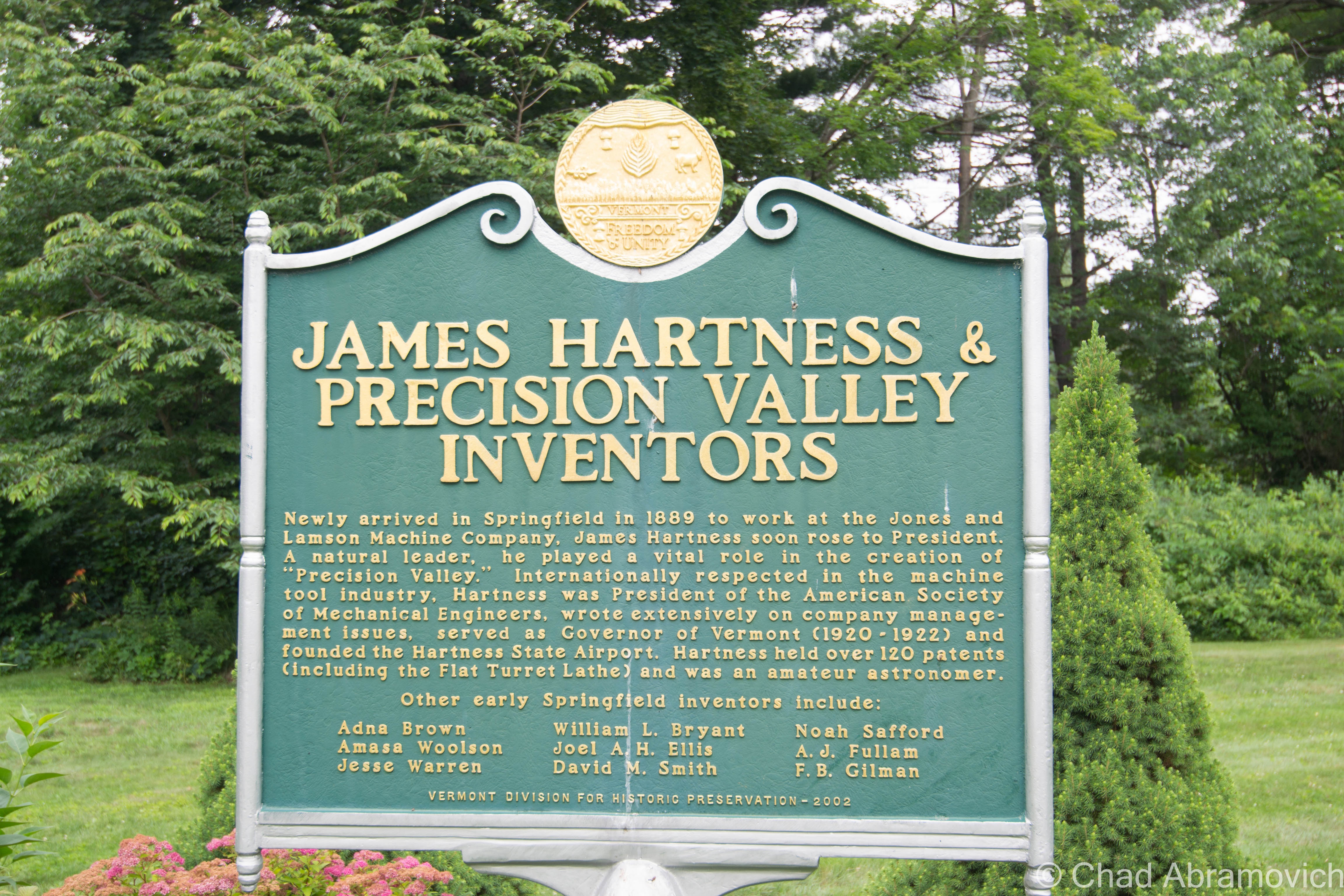
But, a lot of stuff used to be invented and then made here – until as recently as a few decades ago. So much so, that for about a good century – from the 1890s to the end of the 1980s – the region became to be known as “Precision Valley” – due to it practically inventing the precision tool industry, and had the highest per-capita income in all of Vermont. Even today, some locals still call their part of the state Precision Valley – which approximately is considered to be anchored from Springfield to Windsor (Windsor is another very cool little Vermont town worth a road trip). The most significant component of all this was the machine tool industry, and the decrepit factory that I’m gonna be blogging about was once the heavyweight of the genre.

In 1869, the Black River rivered too much and flooded and wrecked Springfield village, and as the town struggled to rebuild in the subsequent years, a big fire in 1880 basically undid all the progress and doubled down on the destruction. So a few Springfieldians schemed up a hook to lure people and investment.

Adna Brown, the general manager of Parks and Woolson – a manufacturer of woolen cloth finishing machinery that was both the first existing manufacturing complex and the last major mill to operate in Springfield – heard that the struggling Jones and Lamson machine tool factory up in Windsor was for sale, and was struck by cleverness. Jones and Lamson had been in business since 1829 and had made a smorgasbord of goods, from rotary pumps, rifles, machines to drill gun barrels, stone channelers, engine lathes, and sewing machines. Their old building is the present-day American Precision Museum, one of Vermont’s coolest archives that showcases many of the things invented in Precision Valley!

Brown put together a group of intrigued investors, and in 1884, persuaded the invoked of a new Springfield law that exempted any industry that would move to town from taxation for 10 years. It worked. 

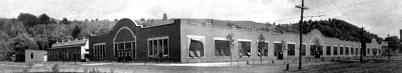
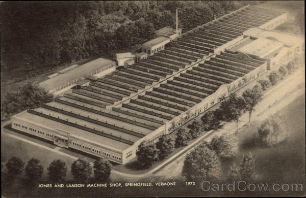
Brown bought Jones and Lamson and moved it to Springfield in 1888. Construction started on the new J&L digs in 1907 on the banks of the Black River, and Brown’s good business sense kenned he’d need the right person to run the new enterprise.

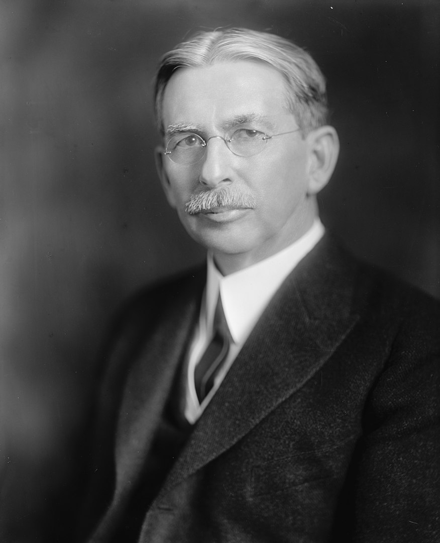
After their first choice turned down the offer because he thought Springfield was too podunk for his liking, they settled for their next option, and little did they know that he’d turn out to be a renaissance tool man. That person turned out to be a young precocious machinist and inventor named James Hartness. Born on September 3, 1861 in Schenectady, New York, he already had experience from cutting his teeth working in machine shops in Connecticut since he was a lad, and used his know-how and indefatigable optimism to flip the company.

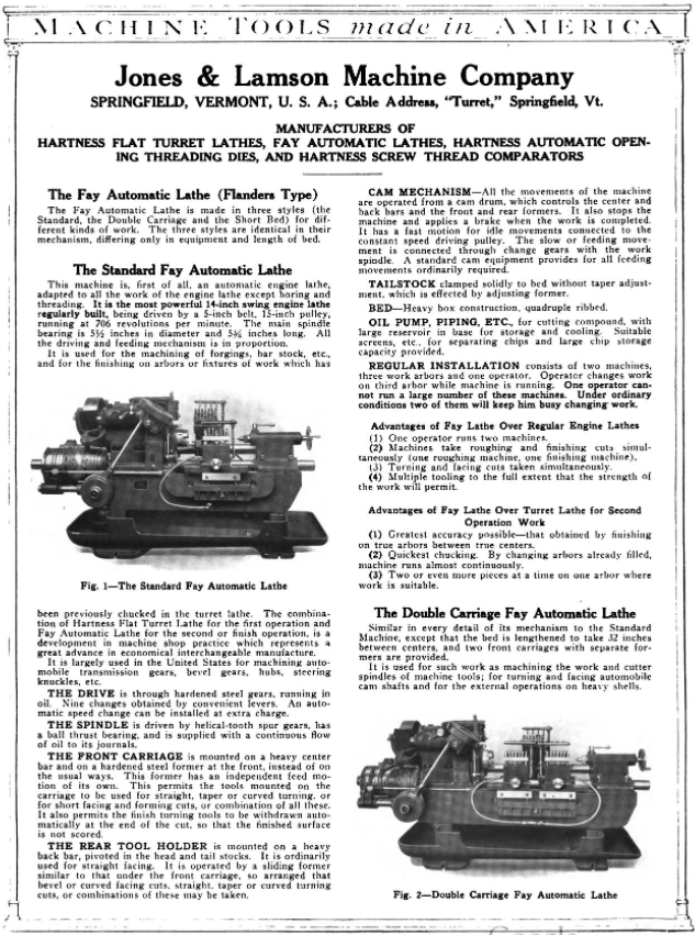
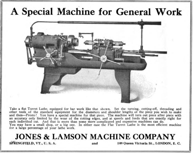
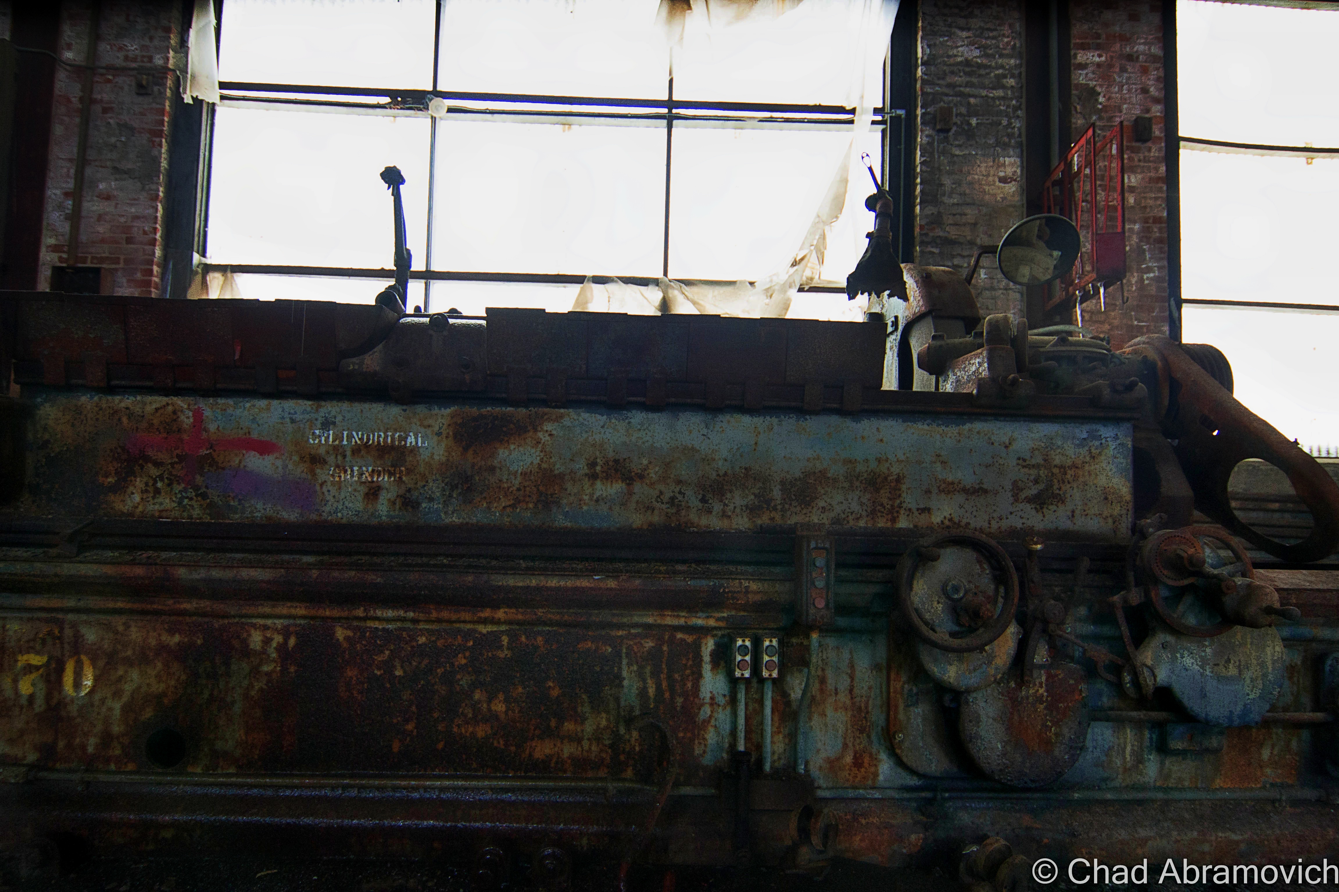
On his first day on the job, he decided that manufacturing so many different things was stupid, and declared that from that point onwards, J&L would only manufacture one thing; the eponymous Hartness Flatbed Turret Lathe, which he invented himself – the machine could shape wood, metal, or other materials by means of a rotating drive which turns the piece being worked on against changeable cutting tools.

The business decision was simple, extraordinarily effective, and a little bit revolutionary – something that seems kinda peculiar nowadays; manufacture a single item, and be really really good at it. And given Hartness’s subsequent rap sheet, it seems to work – and became inherent to the novel format.

Other turret lathe models existed, but Hartness’s was by far the most efficient – being able to mill and shape practically all lengths of metal and could combine multiple tasks with higher precision and longer cuts. It was so good, that it was nicknamed “the silent salesman”.

He also benefited pretty serendipitously from his invention, earning $1,000 a year plus a $100 bonus for every turret lathe the factory sold. Some weeks, he was bringing home more money than most Vermonters were making in a year. Hartness also gained a reputation for continuously advocating for better working conditions and more efficient company management to ensure the business would be as successful as possible. But he wasn’t unscrupulous. He also gained a reputation for pushing for the dignified treatment of the workers, which seemed a little bit weird then at a time of historic emerging social class strife, and still seems a little strange presently, in a modern America where the opposites our past generations fought to improve are becoming the norm again.

Hartness’s brilliance, though, came from the fact he didn’t just invent things, he sort of invented new versions of people and their latent talents. And that just happened to jive with his ideal of a company sticking to producing a single product to thrive.

For example, Hartness saw prospect in and hired an engineer and inventor named Edwin Fellows, who developed a machine that would accurately cut gears that he named a Gear Shaper. Hartness spun off the Fellows Gear Shaper Company in 1896, with its namesake operating as its manager. Fellows’ innovation would then opportunely overlap with the rise of the automobile industry a few years later.

After Fellows left J&L, Hartness needed to seek an engineer to replace him. He found William LeRoy Bryant, a student at the University of Vermont, who joined J&L in 1897 as a draftsman and worked closely with Hartness on the cross-sliding-head turret lathe, which is where Bryant took an interest in grinding. Building on a J&L lathe that used a chuck — a specialized type of clamp to hold a piece in place while it was shaped and bored — Bryant developed a new chuck that was both easier to use and more accurate. By 1909, Hartness conjured up another spin-off: the Bryant Chucking Grinder Company. And this pattern continued.

When Hartness hired Fred Lovejoy to replace Bryant at J&L, Lovejoy became an expert in small-tool design, and he eventually created interchangeable cutters that could be swapped in and out of machines. In 1916, Hartness provided the startup capital for the Lovejoy Tool Company, which awesomely still survives and operates in Springfield!

In 1912 Jones and Lamson acquired Philadelphia’s Fay Machine Tool Co, which made the Fay Automatic Lathe – which was designed for the automatic turning of work held between centers. The lathe was significantly improved by a team at J&L led by Ralph Flanders that would be so victorious, that it would ironically eventually evolve into the creation of CNC, which made the manually operated lathe obsolete because the new ones could now operate all by themselves.

Hartness and his prowess fueled Springfield’s combustive growth from the turn of the 20th century until well past World War II, and he did it by introducing one auspicious product after another, each named for its creator.

Because of this, Springfield astonishingly became the machine tool capital of the world.

A later portrait of James Hartness | via The Library of Congress and Wikipedia
Old postcard of the brand new Jones and Lamson Factory, Springfield, VT. Circa 1094-1918. Present-day Clinton Street/VT Route 11 runs right out front.
Jones and Lamson Factory, circa 1917 | Via Vintage Machinery
Old postcard of the sprawling former Jones and Lamson Factory in Springfield, circa 1973. The factory would expand to 270,000-square-feet over 12 acres. | Cardcow.com
A full page spread taken from Machine Tools Made In America (1921). This one includes both the Hartness Lathe and the Fay Lathe! – via MyCompanies Wiki
Advertisement from The Iron Age (Dec. 27, 1917) – via MyCompanies Wiki

However, in 1919, Hartness would break his own rule for the only time, when he collaborated with engineer, arctic explorer, and Springfieldian Russell Porter – and invented the optical comparator, a device to precisely measure screw threads that are still manufactured today – it’s so efficient, that any parts that are inspected can be magnified over 200 times, making the smallest flaws detectable!

Hartness and Porter’s mutual fascination with astronomy partially inspired this quantum leap, which is why Hartness wanted Porter to run the comparator business, but Porter was interested in literal bigger heights and decided to instead move to California, where he helped design the Palomar Observatory telescope, so in a rare move, Hartness decided to keep the comparator division close to his side in-house at J&L.

But before Porter departed, he and Hartness also founded The Springfield Telescope Makers – a club that operates in an accidentally trademark pink clubhouse atop Breezy Hill. The story of its standout color is, basically, when it was first built, its enthusiastic members were broke – so they went around to area hardware stores and asked if they’d donate some paint. They ended up with three gallons of barn red, two gallons of white, and a gallon or orange – which they mixed together and got hot pink, which is now emblematic. The clubhouse was christened Stellefane, which is Latin for “shrine to the stars” and not something that you can wrap your leftovers with, is now a national historic landmark, and is still home to both the club, and the annual Stellefane Convention of Amateur Telescope Makers.

Being an avid pilot – one of Vermont’s first – Hartness became president of the  Vermont Aero Club and donated land for Vermont’s first airport – Hartness State Airport – just north of Springfield, and had his pal Charles Lindbergh even stop by for a spell in 1927 after his world flabbergasting trans-Atlantic flight. He also served as governor of Vermont for a single term, from 1921 to 1923, but didn’t run for reelection after realizing that Vermont’s rural and poor economy of the time just wasn’t ready for his aims to further industrialize the state. He would die on February 2nd, 1934, and Springfield’s reliable factories became reverberating manifestations of the American dream. Until they didn’t.

This is a surreally enjoyable upbeat clip from a vintage informational film about the concerns and potential disasters of a dwindling economy after World War 2. At the 5:00 mark, the film showcases Springfield AND the Jones and Lamson Factory! Give it a watch – it’s pretty neat! You can get an idea of what the factory, and the town itself, used to be like in the atomic age! 


So, what went wrong here?

After Hartness’s death, Jones and Lamson continued to absolutely thrive and continue to become the industry benchmark for their craft, and was considered the zenith of Springfield’s enterprises, employing anywhere between 3,000-4,000 people for most of the 20th century.

So what exactly is the culprit for J&L’s, and Springfield’s, event horizon? Well, that’s a tumultuous conversation, because there isn’t just one thing at play, a lot of circumstances kinda just started to materialize on the scene and began shaking hands with one another – all contributing to Springfield’s ode to its fall-through.

Some locals point fingers at the machine tool unions, who in the 1970s, began to row with the companies about ensuring higher wages for their employees, and would hold a few long strikes to get their point across, something that, evilly, is sadly still being fought for today.

Another reason might be something that’s also been steadily plaguing America since around that time period – outsourcing jobs for cheaper labor costs. Many of these companies were family or locally owned, and when next-generation kin wasn’t interested in taking them over due to the more independent/free-spirited culture that was emerging, they were purchased by larger outside firms starting around the 1960s, which seems to be the beginning of Springfield’s ratchet blues. Detached management started to give the machine tool factories less control and began to fracture the former tight-knit inner communities.

But the bigger causality might just be the companies’ refusal to be self-aware. Japan had been studying American machine tool know-how and began to enter the market themselves – and they did so by dramatically innovating their products.

Around the 1980s, the Japanese hustled billions of dollars into the research and development of computerized machining centers that were faster, more accurate, no longer required a human operator, and cheaper than a J&L turret lathe. Back in Springfield, the factories were sticking to their traditional course, and while they were still making quality reliable machines, they began to become outdated in the new frontier of the trends, and eventually, obsolete, as the market shifted to foreign products that were offering more convenience for a cheaper purchase. I know “if it ain’t broke don’t fix it”, but unless these new fads aren’t just impractical enticements that won’t be good in the long haul, if you refuse to innovate and stay at pace with the competition, it can be a guaranteed ticket to extinction.

Unfortunately, that’s what happened to Springfield. 

What’s stressful is that, to be innovative, sometimes that takes substantial amounts of funds, and then, the wisdom just where you want them divested, and for smaller operations, that can be tough decision making, and sometimes, even a fatal conclusion. Hartness certainly had a special knack for it, so much so, that it was said that one bank eventually refused to give him any more loans because they thought he was too creative! I mean, Hartness would amass a little over 120 patents in his lifetime…

Jones and Lamson would be bought by a few different companies starting in the 1960s, and eventually go bankrupt in September 2001, but, the assets were sold to Bourn & Koch Inc. who coolly still continue to supply replacement parts for the extant J&L machines today. However – the optical comparators division of Jones and Lamson, called J&L Metrology, still exists! They’re the only company making optical comparators today in the United States, and are still headquartered in Springfield – attached to the ruins of the rest of the J&L empire (well, after moving to South Carolina for a stint but then coming back)!

The only other stalwart to exist from the ruins of the machine tool era is the Lovejoy Tool Company – who also still operate in town!

A good portion of the old Fellows Gear Shaper factory compound still exists too, and it’s been thoughtfully renovated into mixed commercial and industrial spaces – which is absolutely a preservation win!

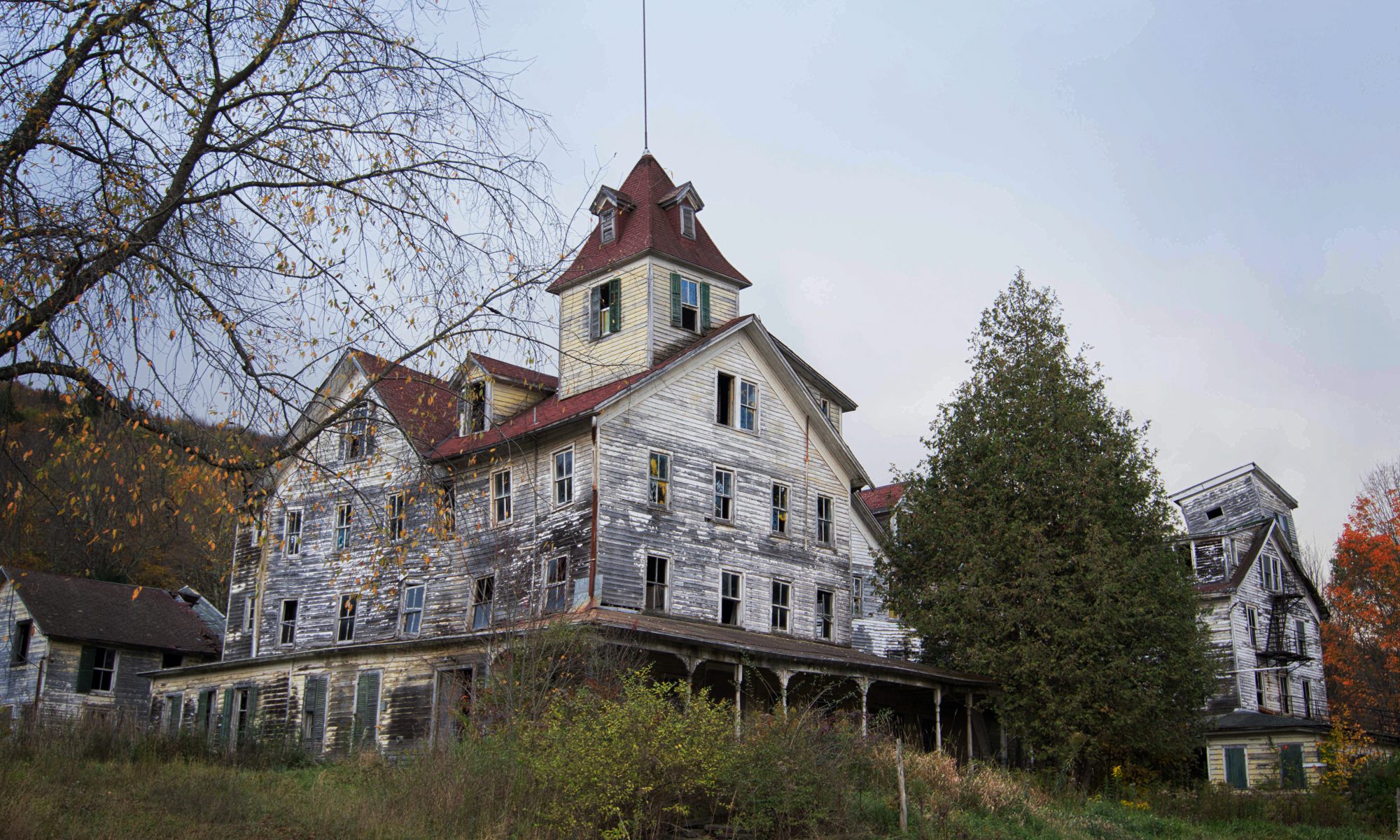
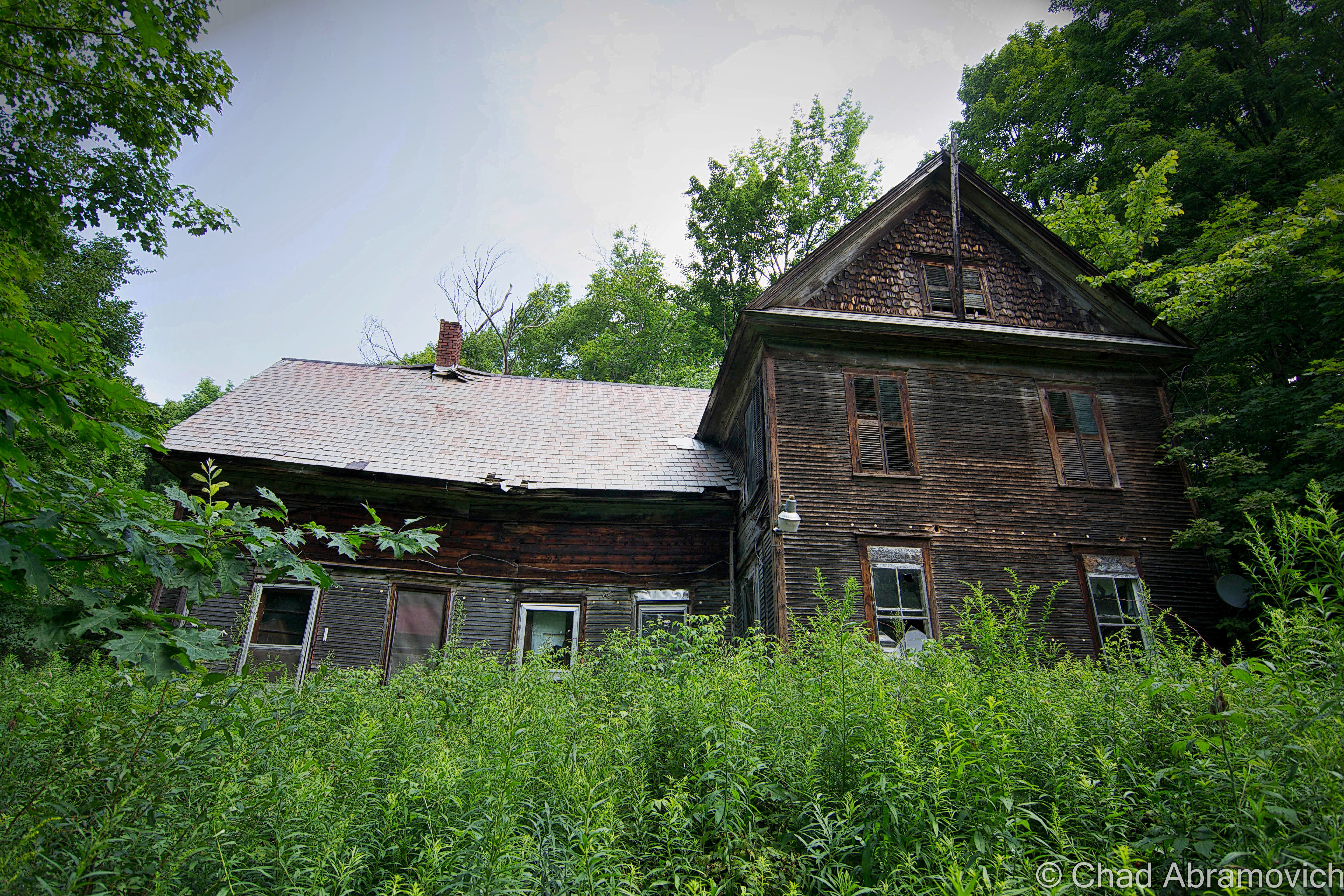
Another vestige of that age is the incredible Hartness mansion itself, which has been turned into a bed and breakfast (and at the time I’m writing this blog post, is up for sale according to Yankee Magazine). I’ve visited before and was excited to investigate the house’s most curious feature – an underground telescope connected to the house by a secret tunnel that also lodged Hartness’s private underground laboratory that’s now a museum to Mr. Hartness, The Stellafane Society, and Russell Porter. Man that was cool! Even today, there are rumors that still persist that Hartness built more secret tunnels and even secret rooms that branch out underneath Springfield that have been sealed up, or kept clandestine.

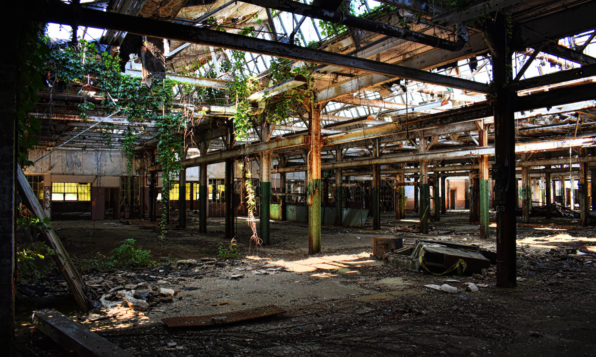
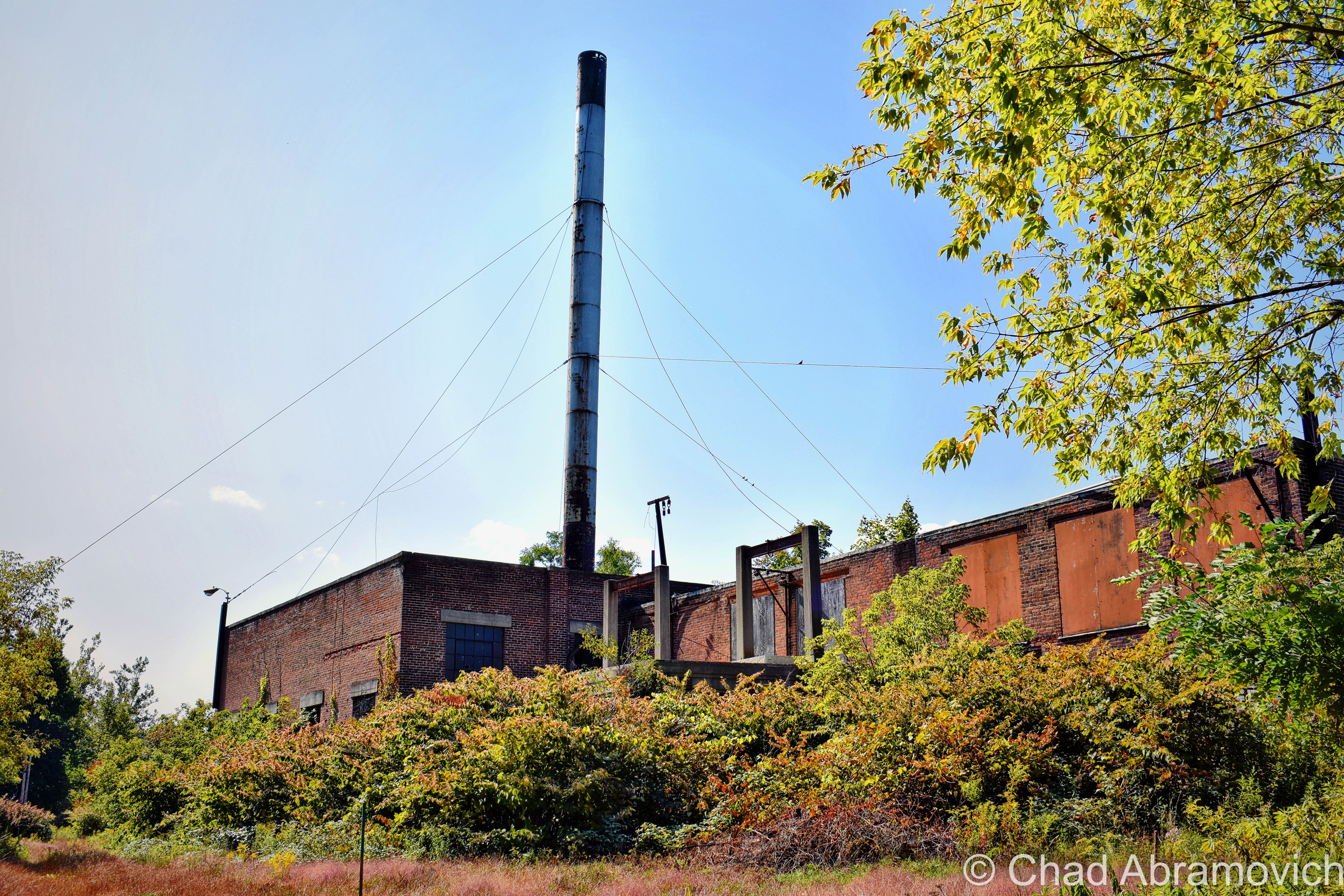
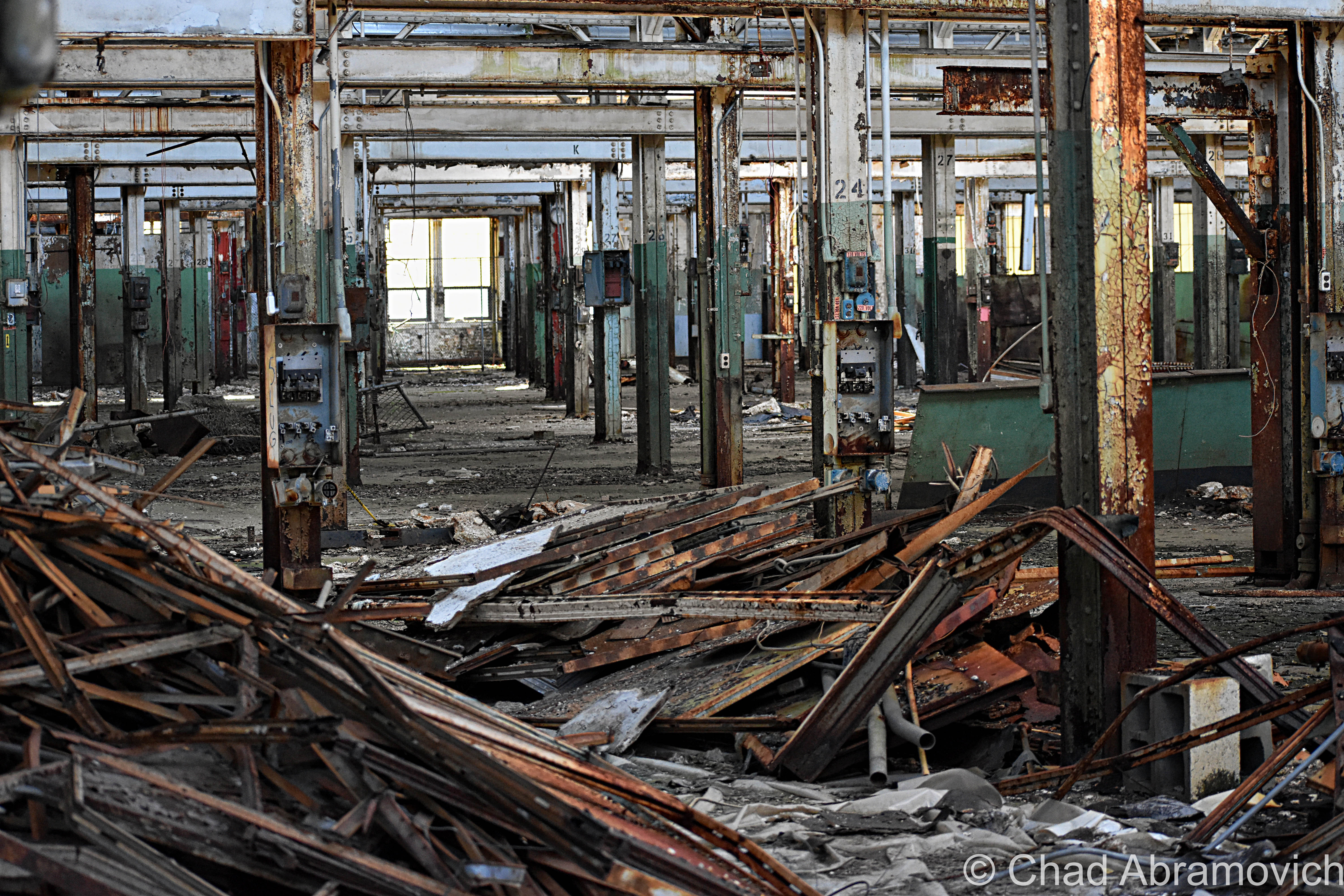
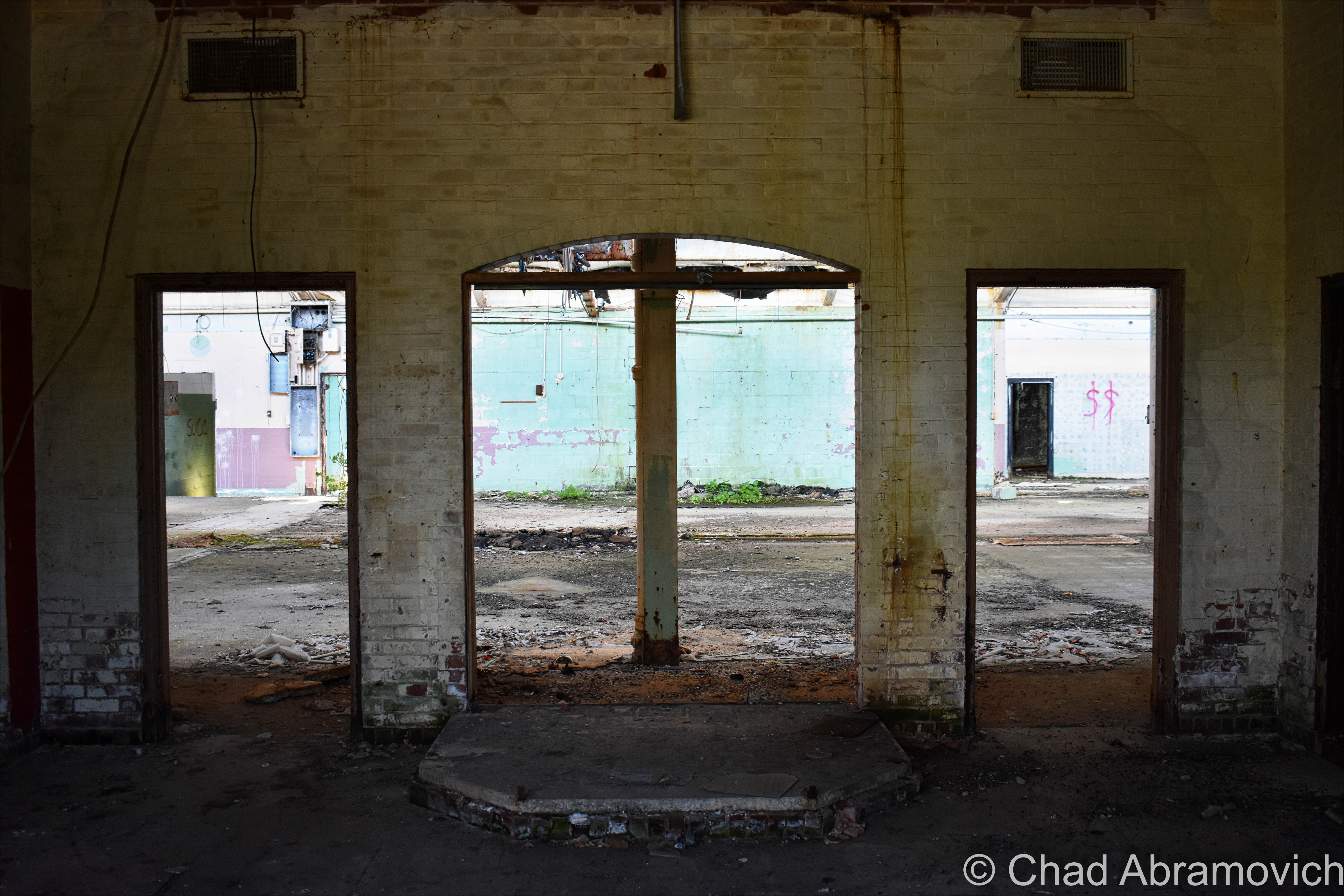
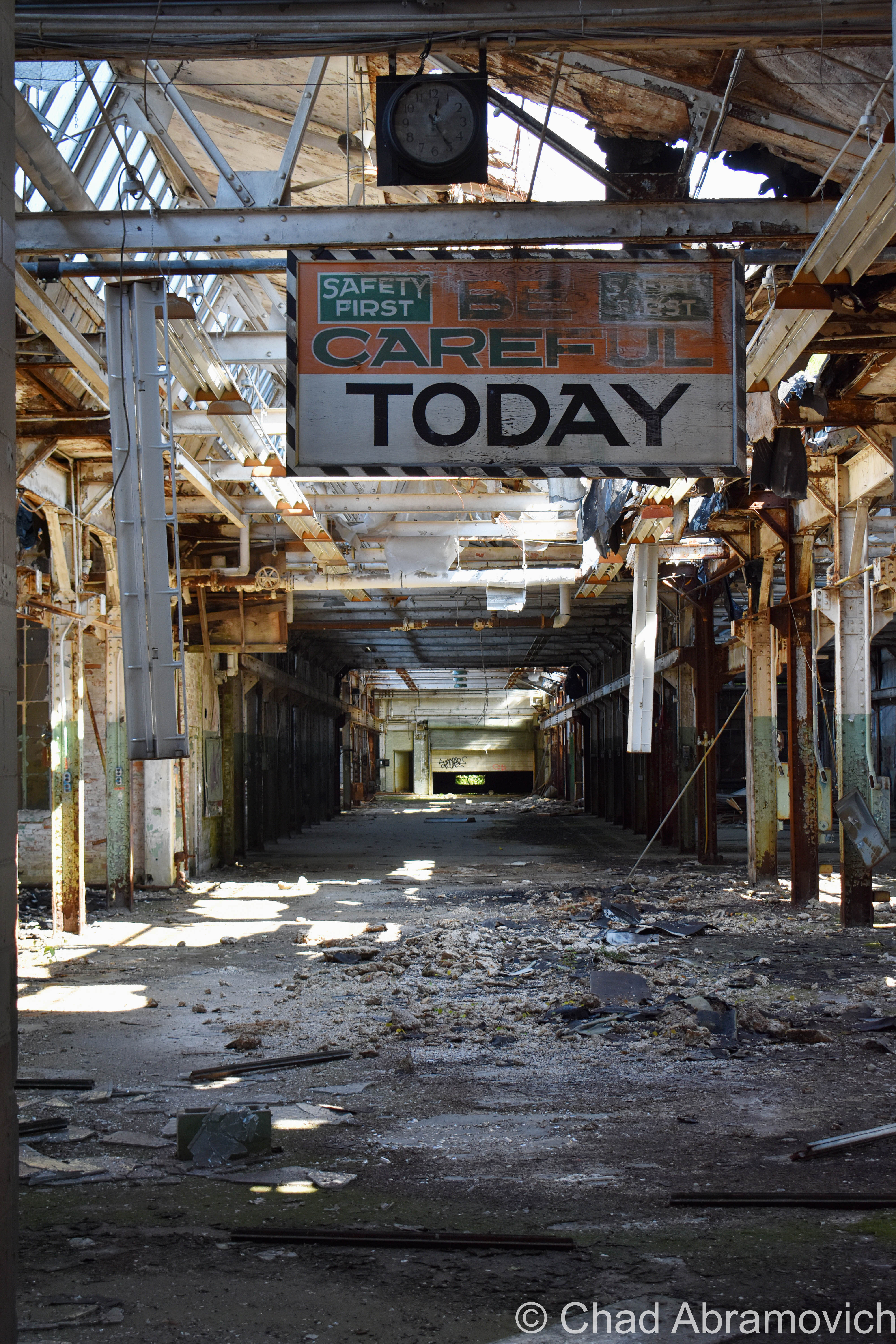
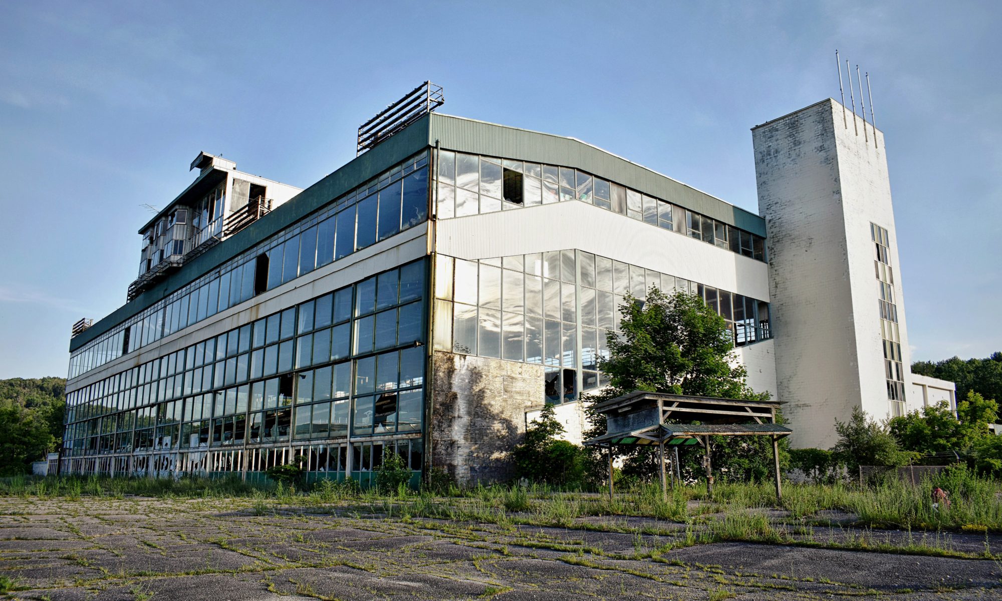
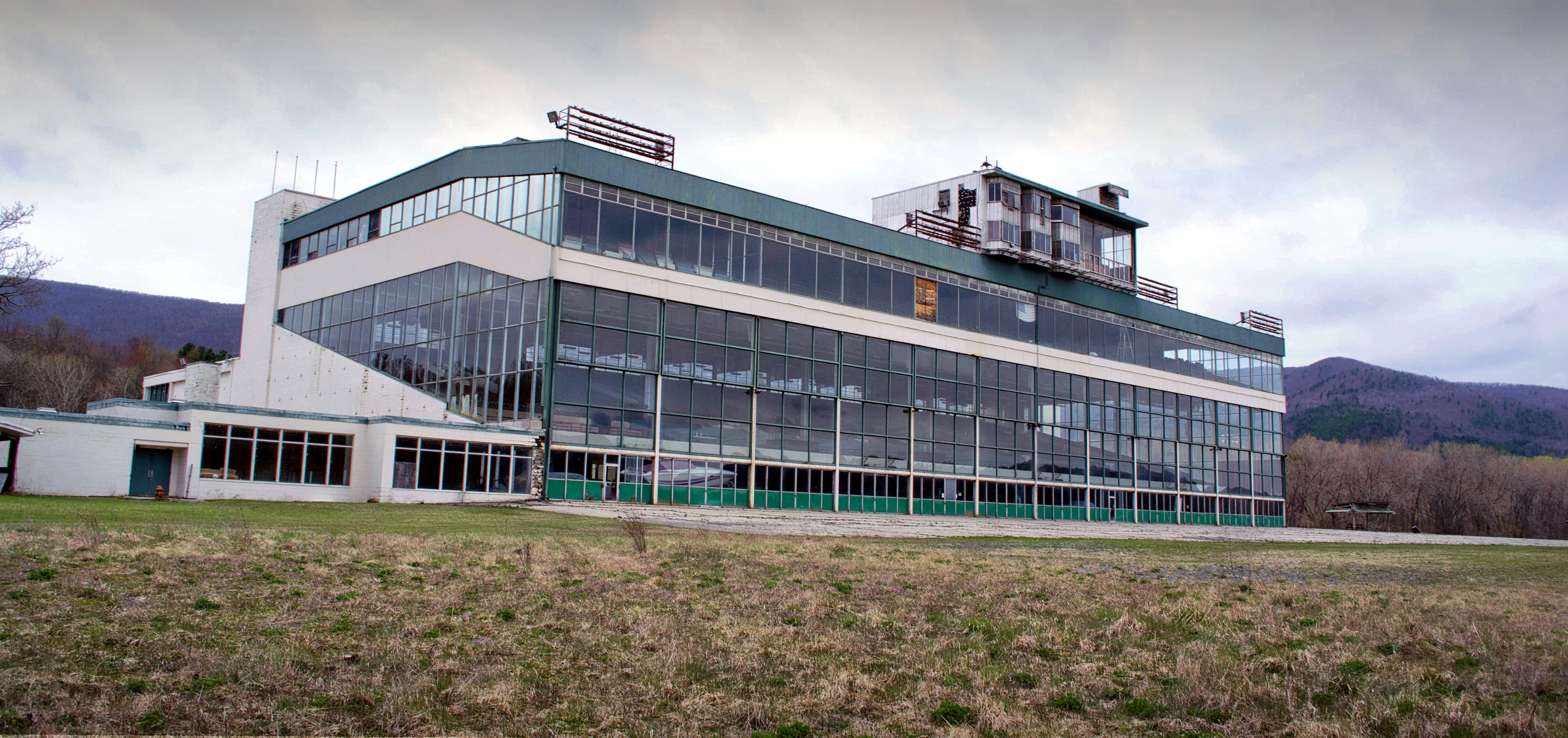
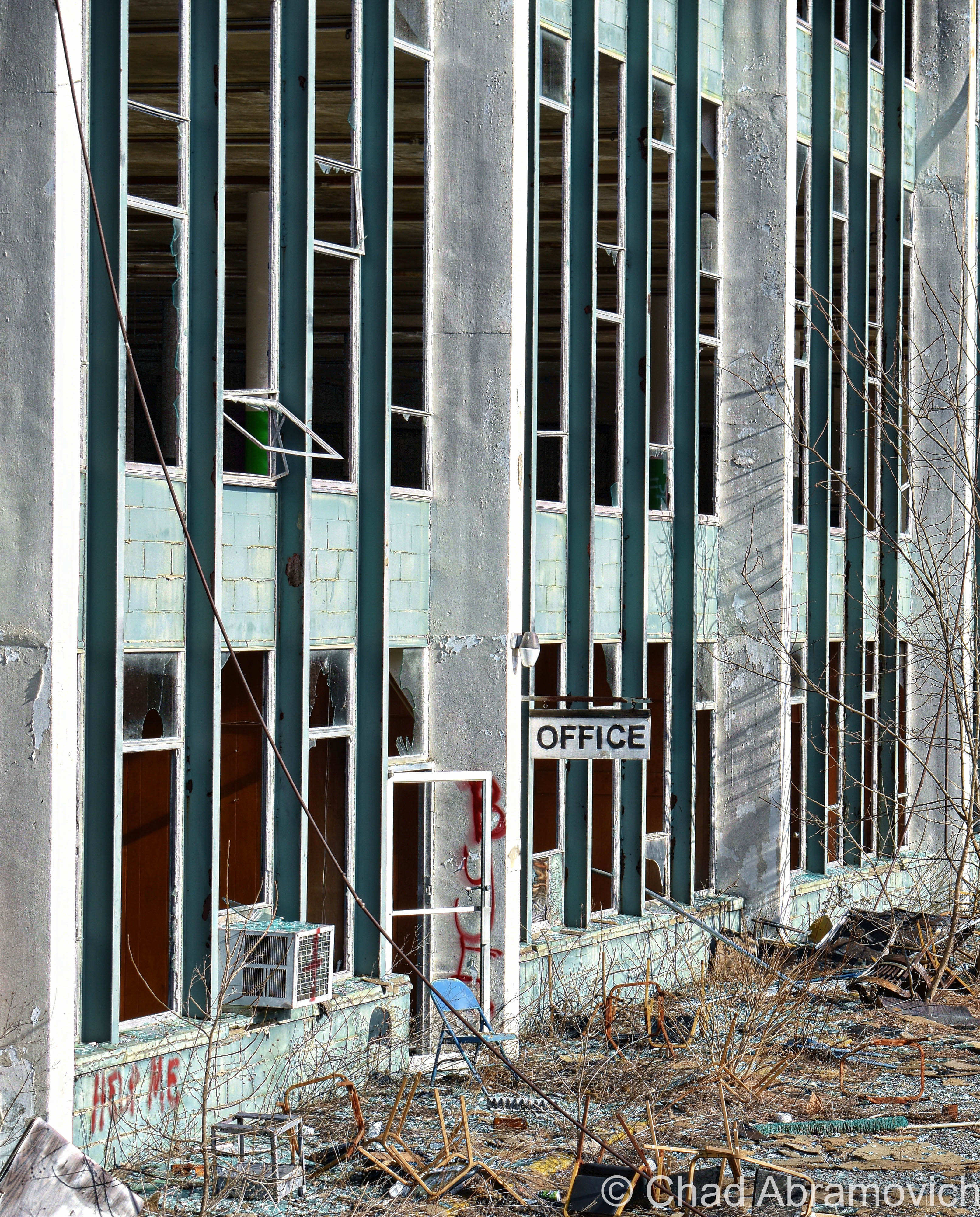
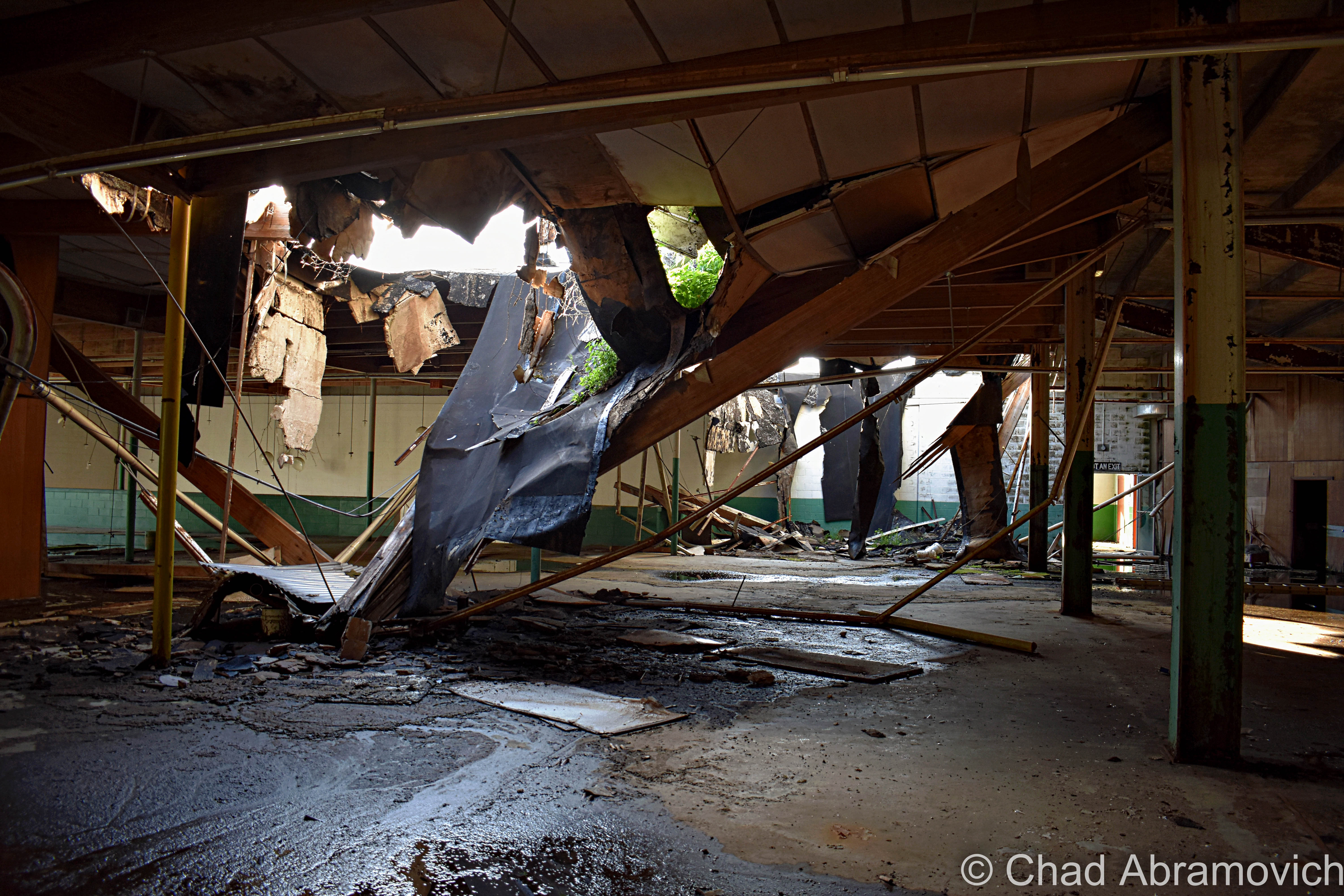
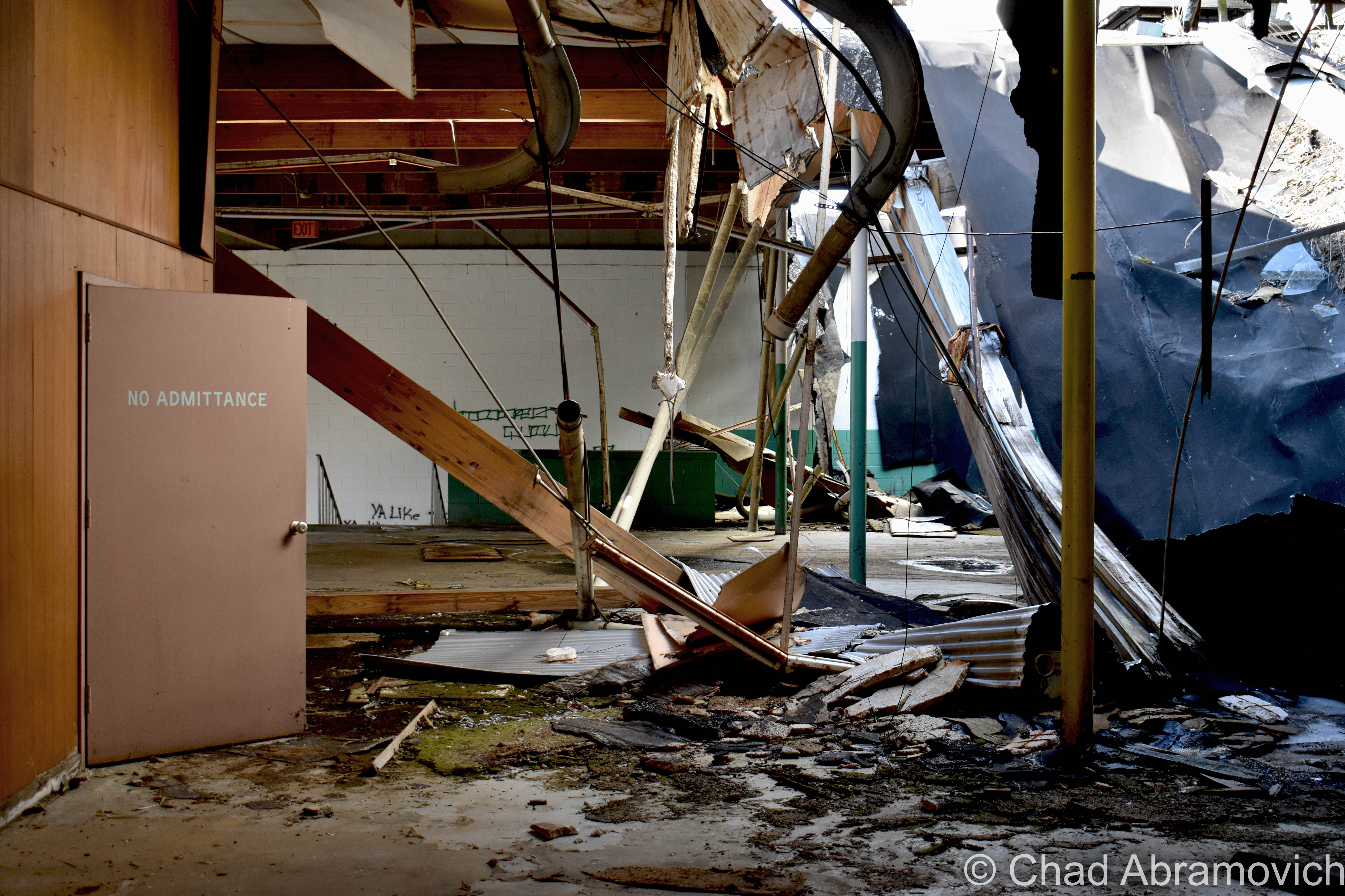
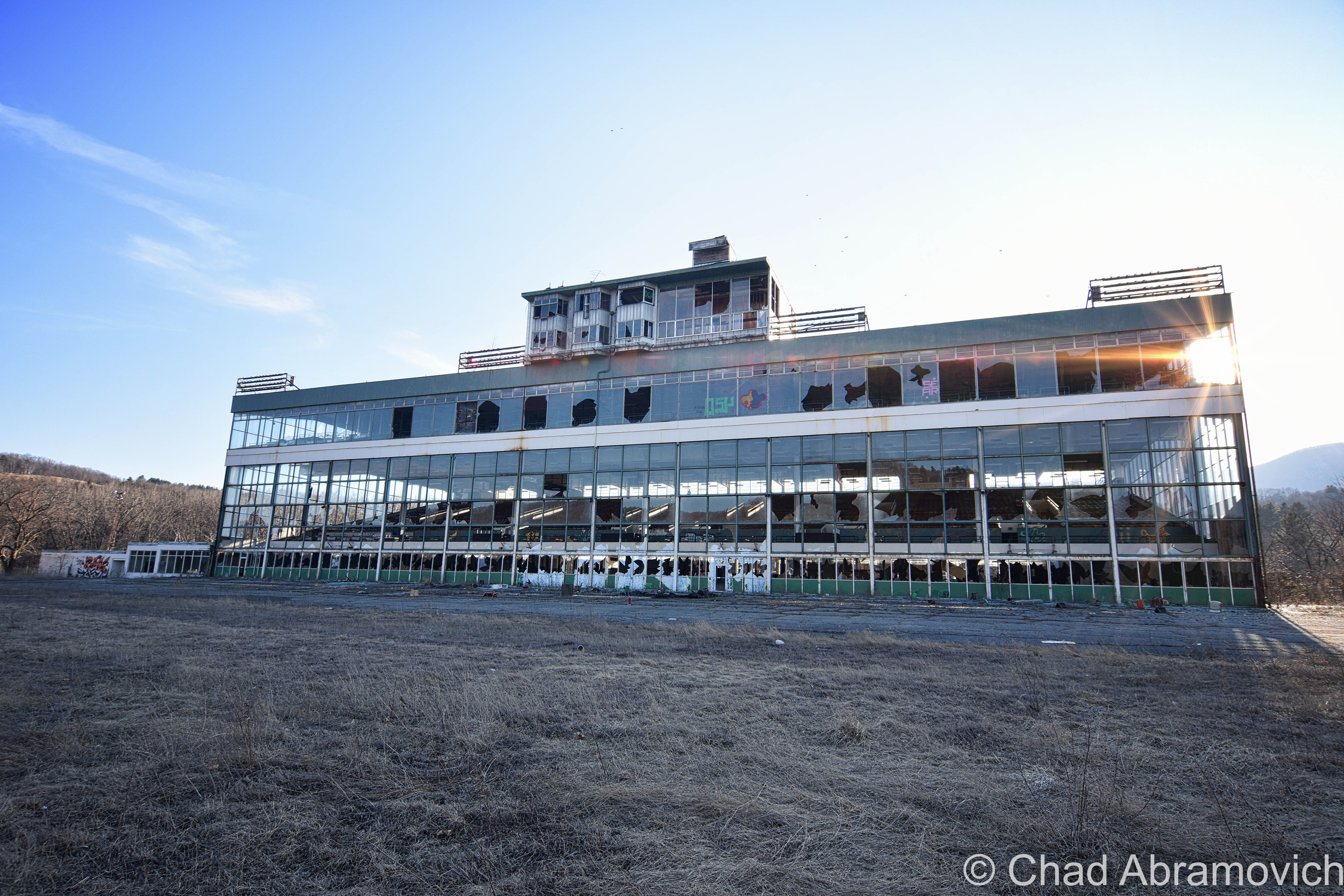
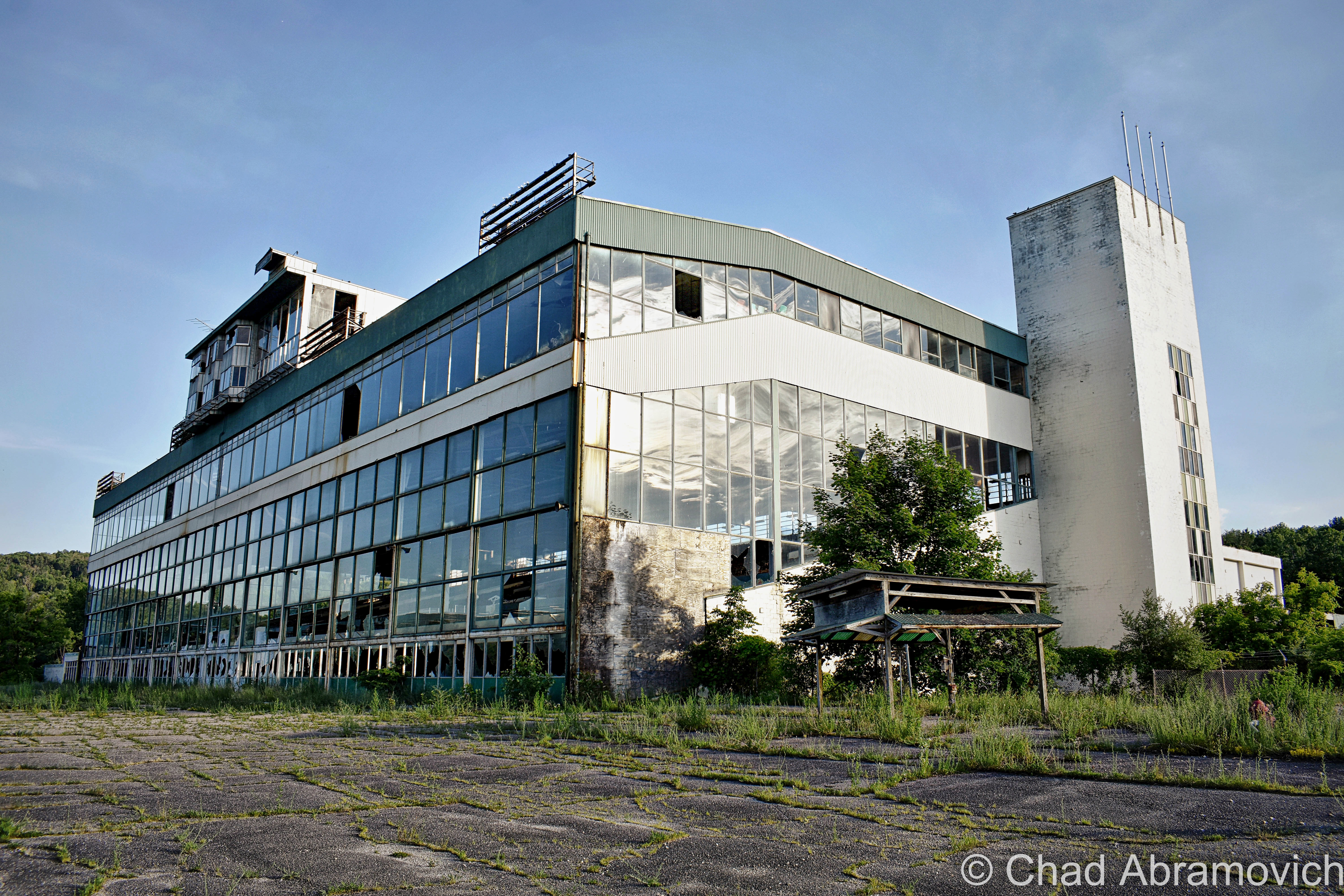
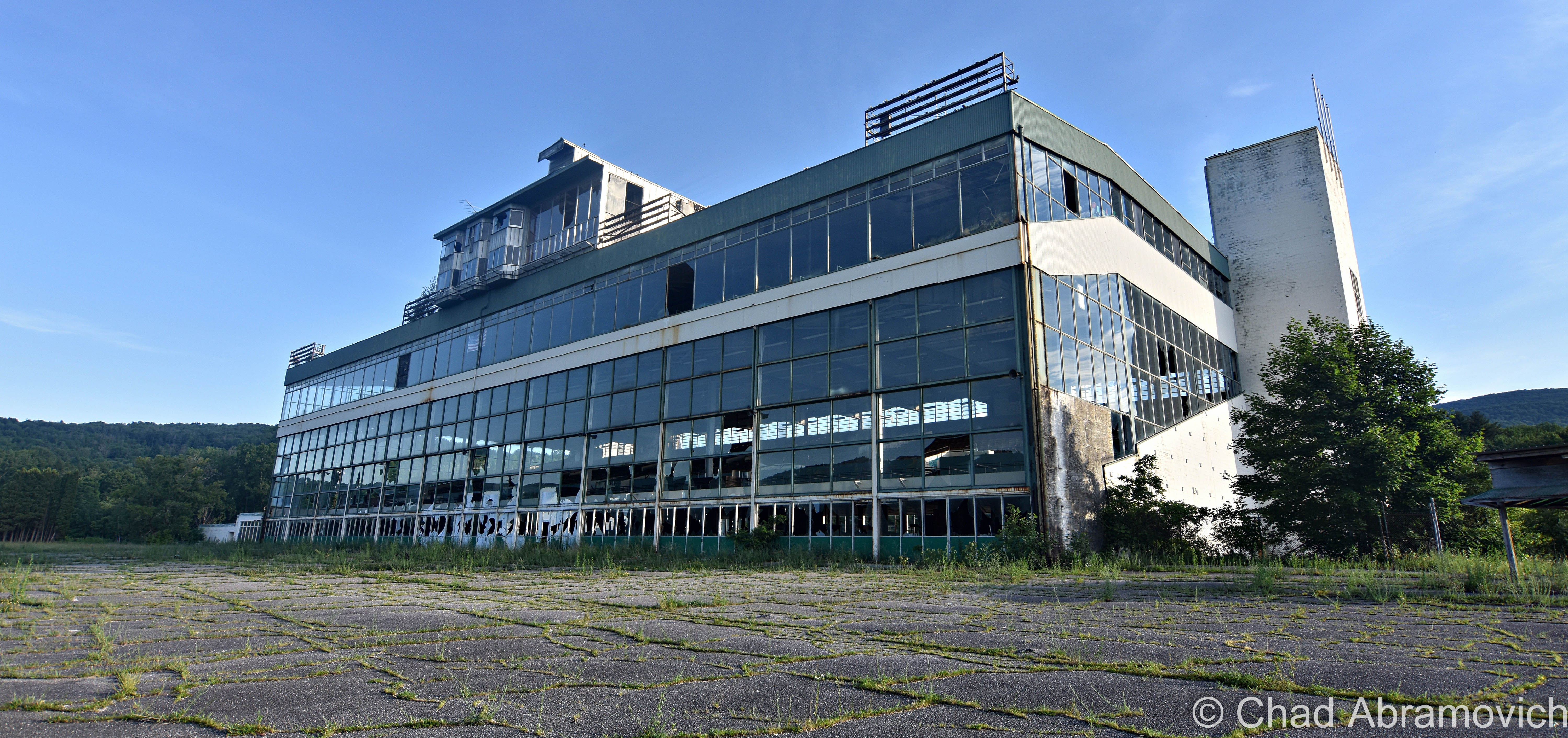
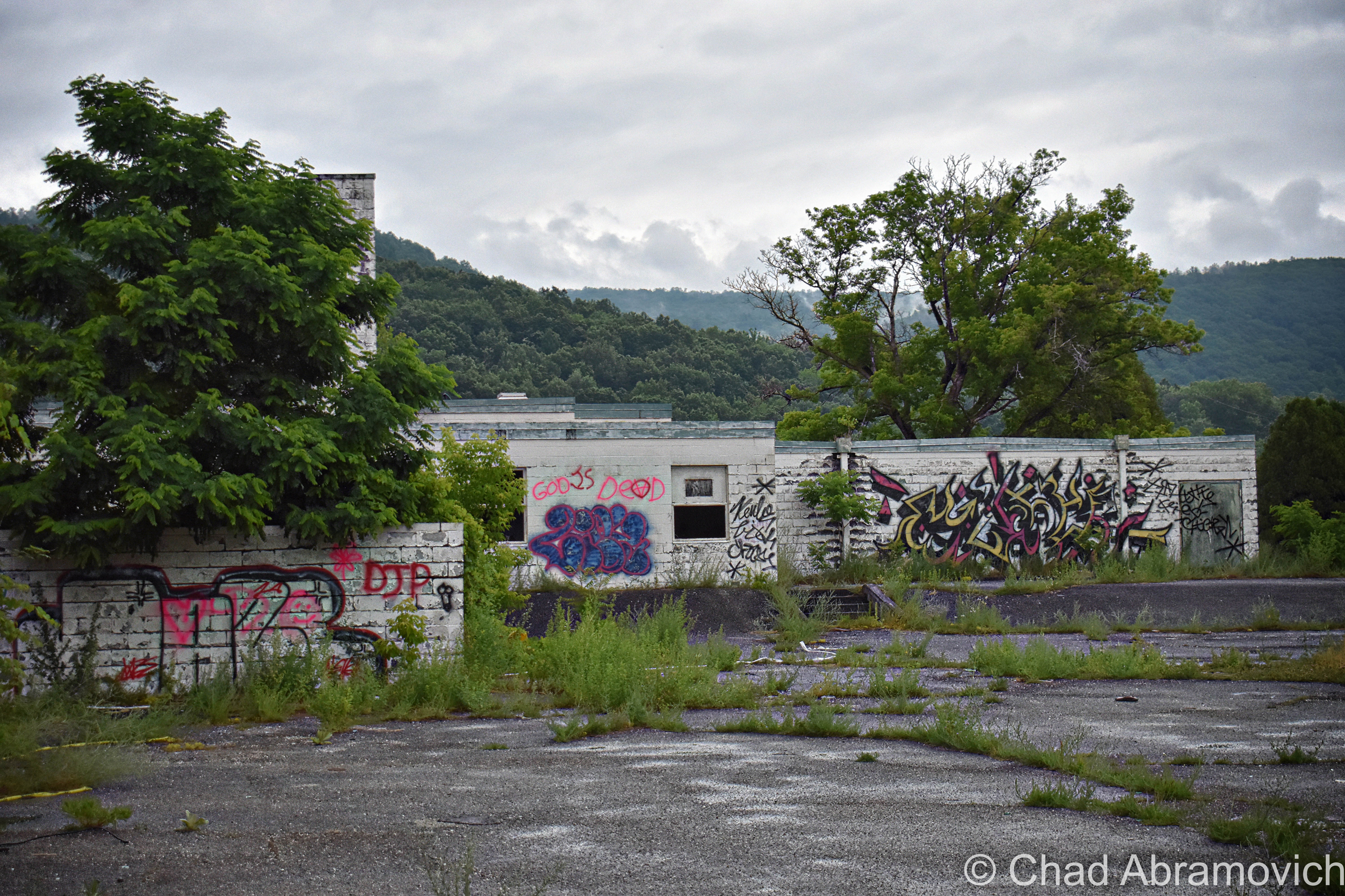
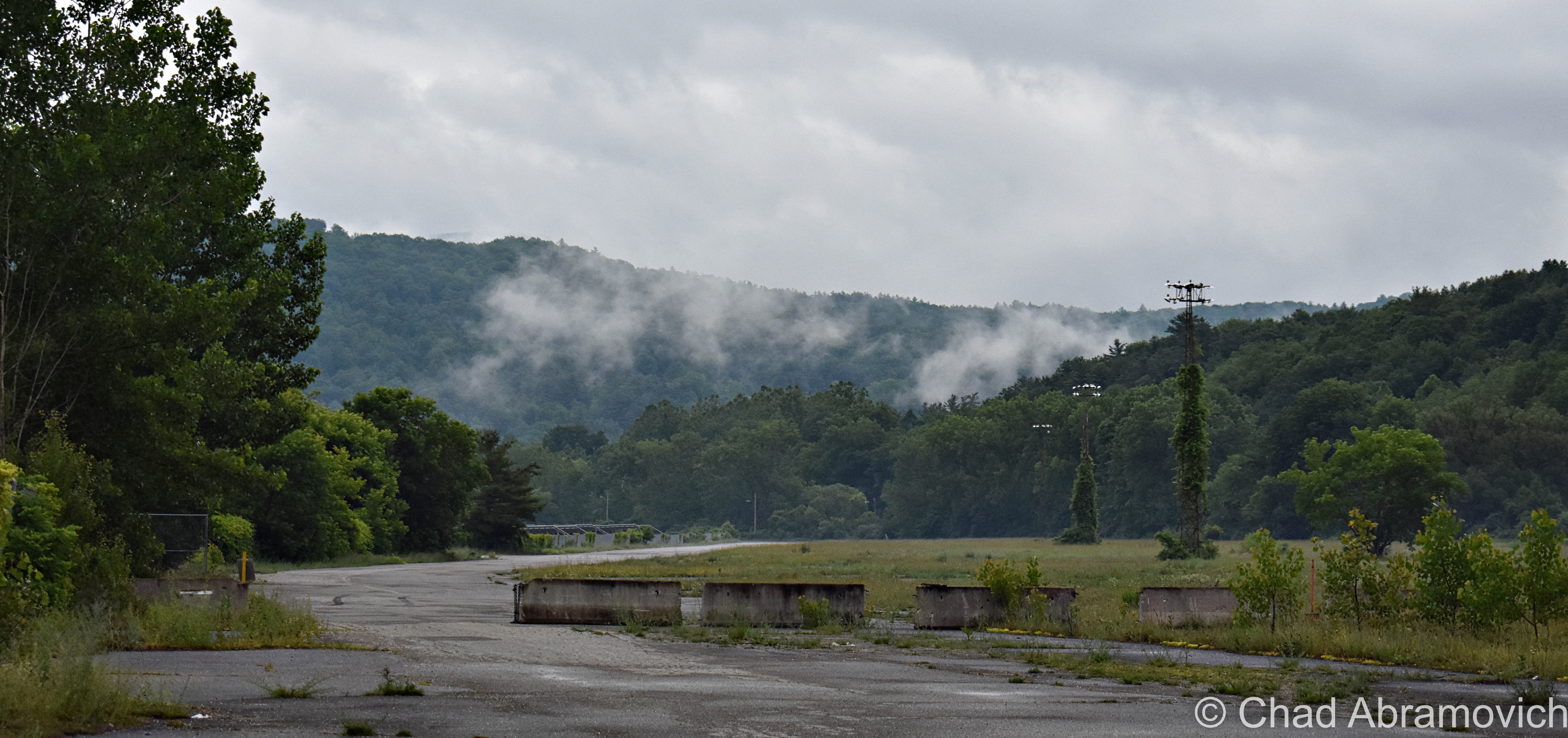
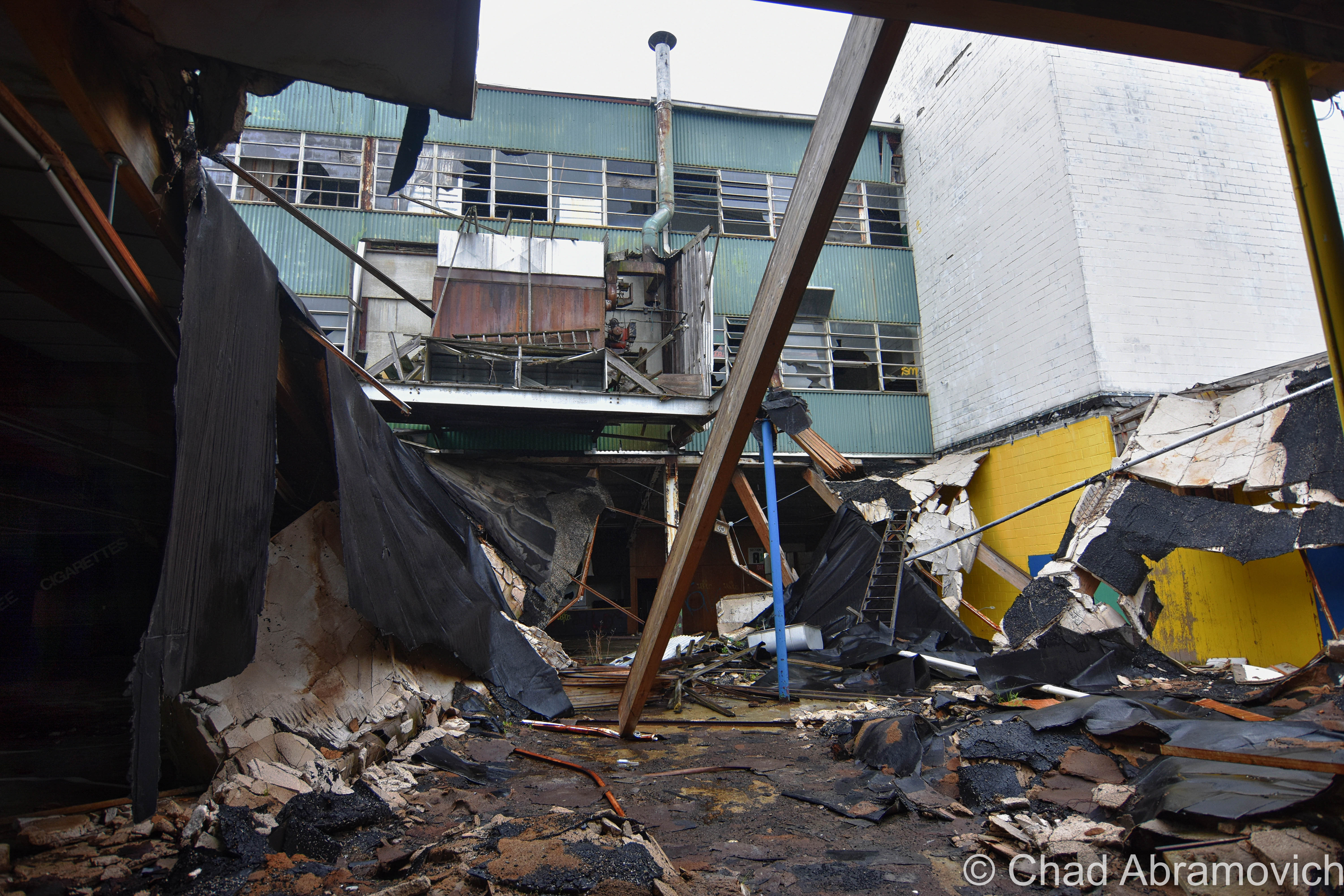
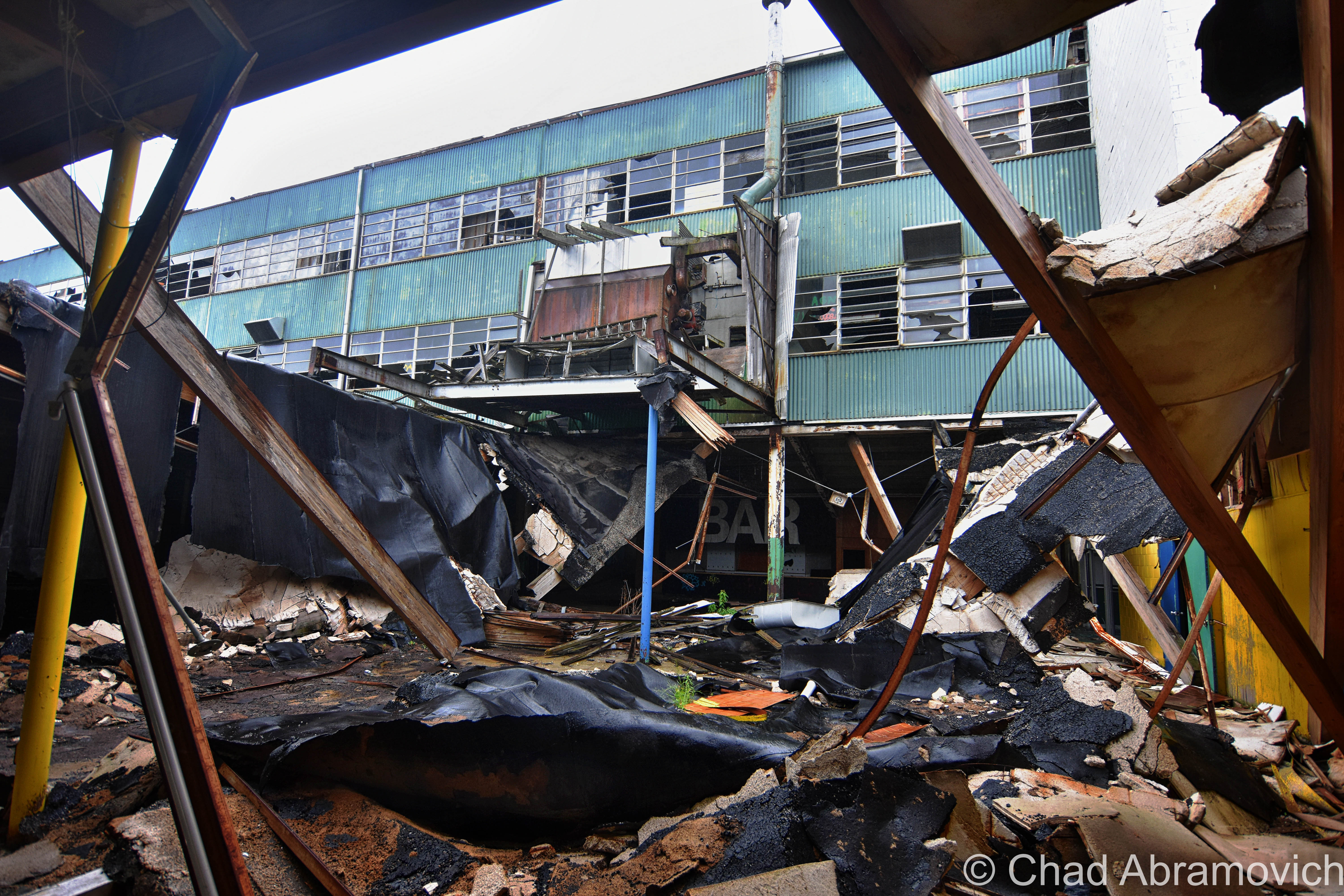
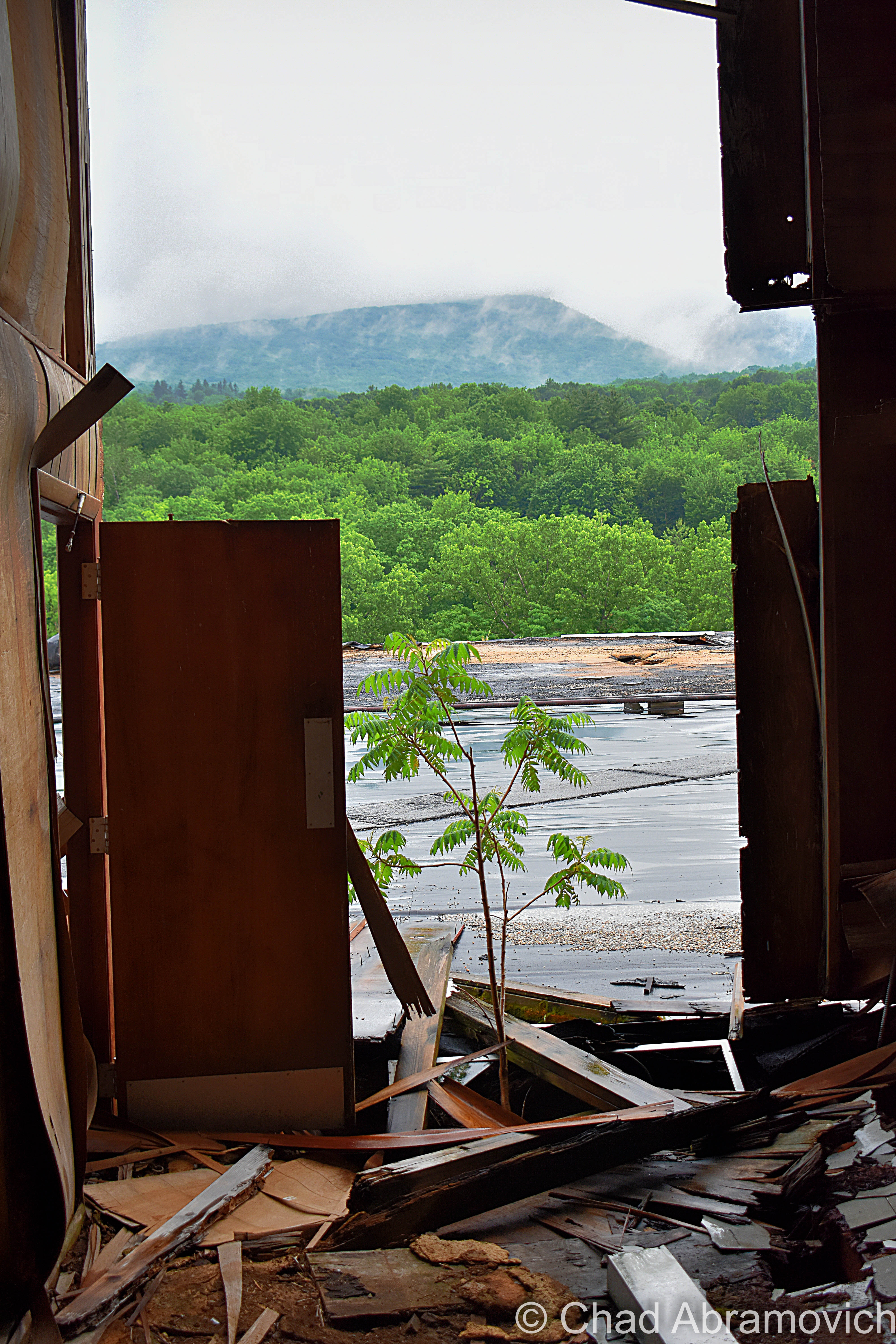
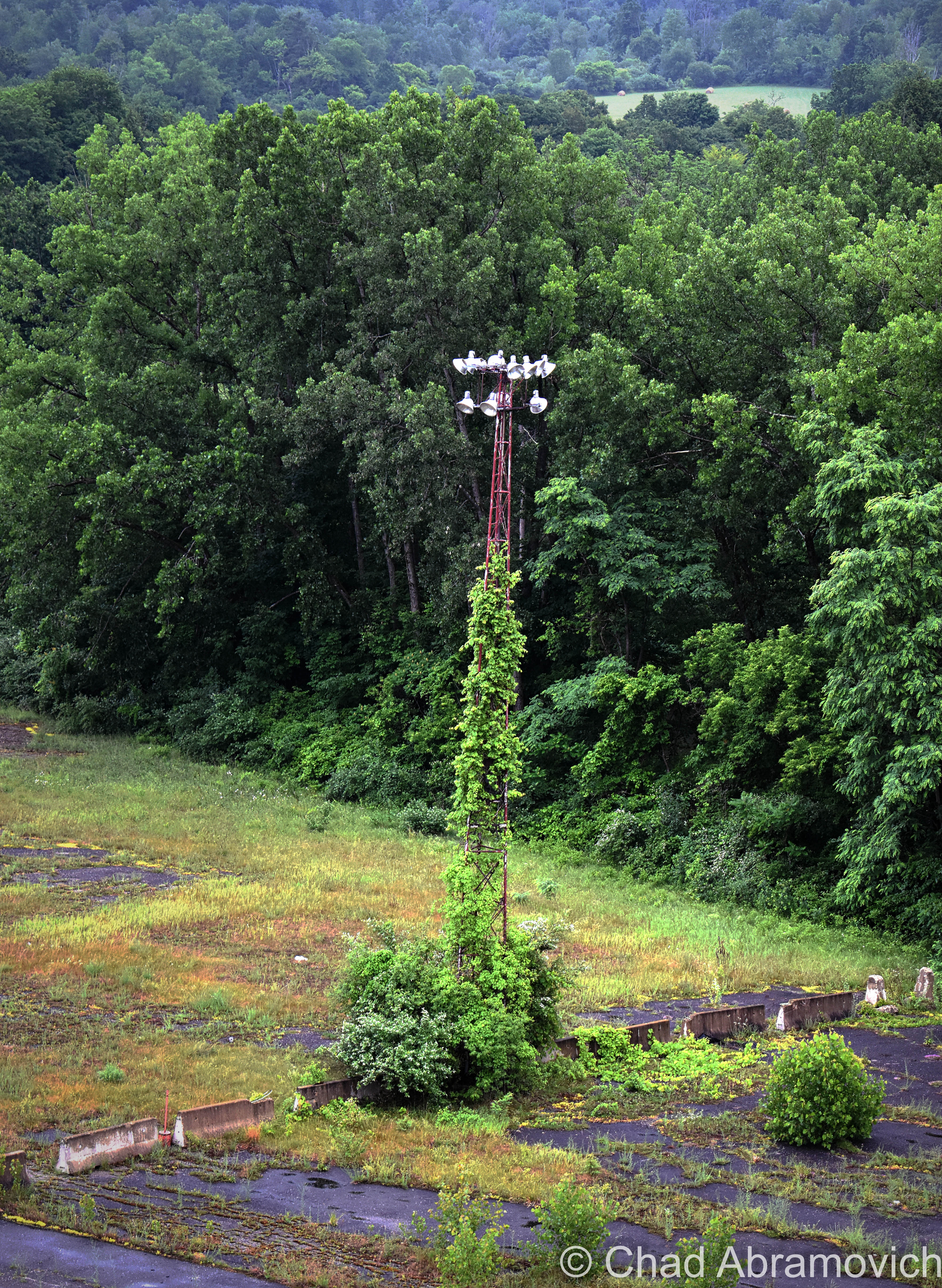
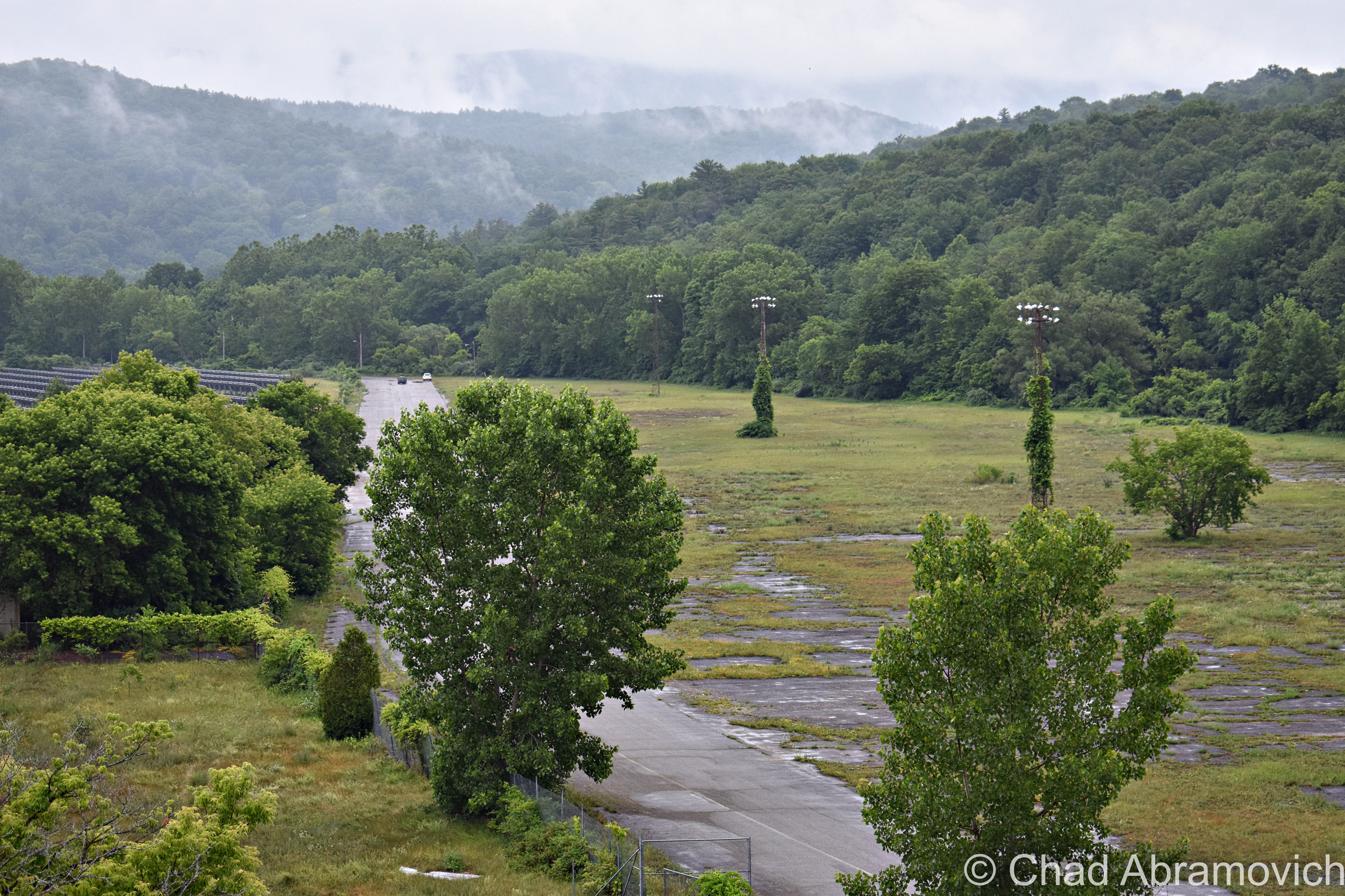
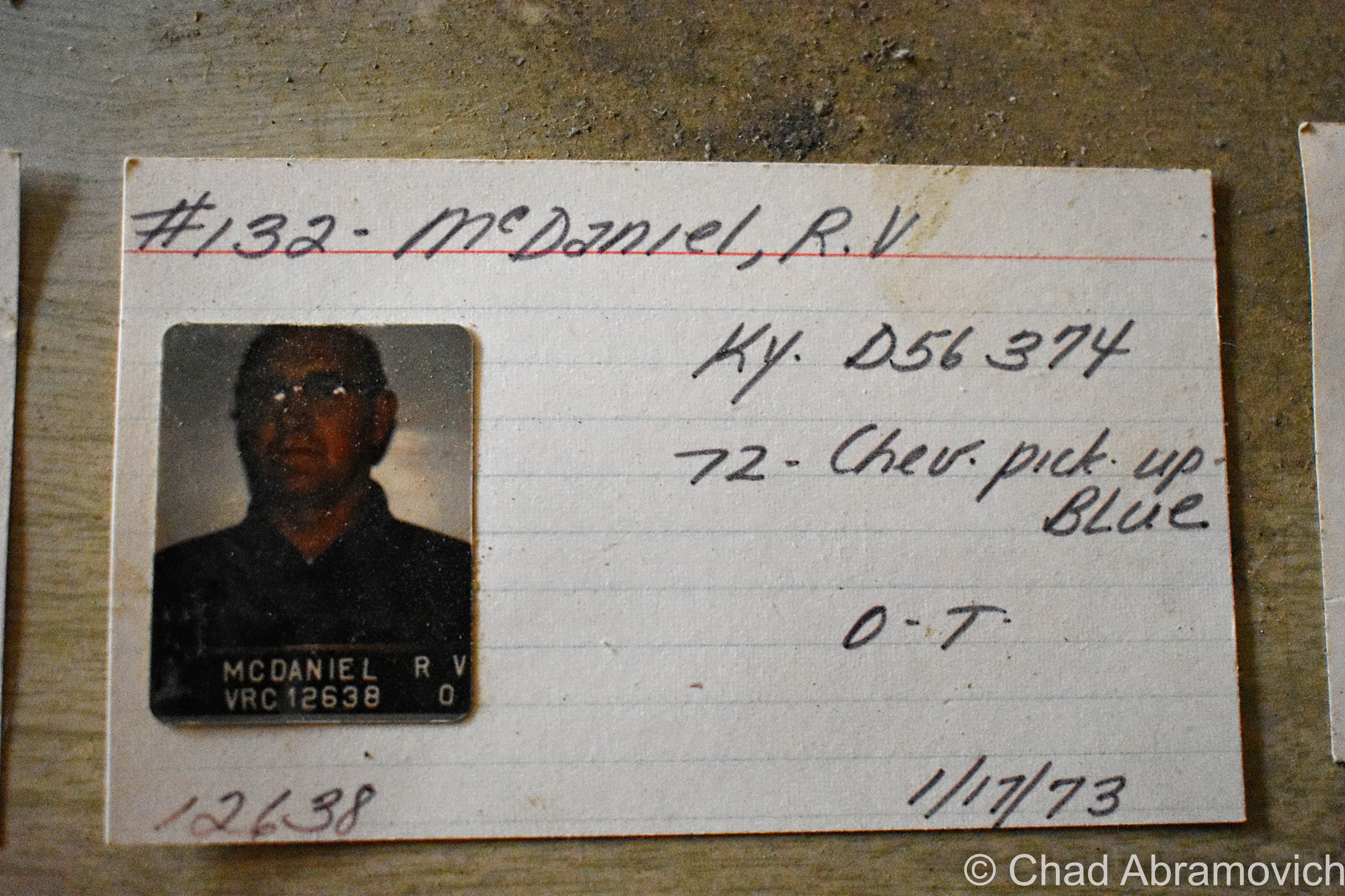
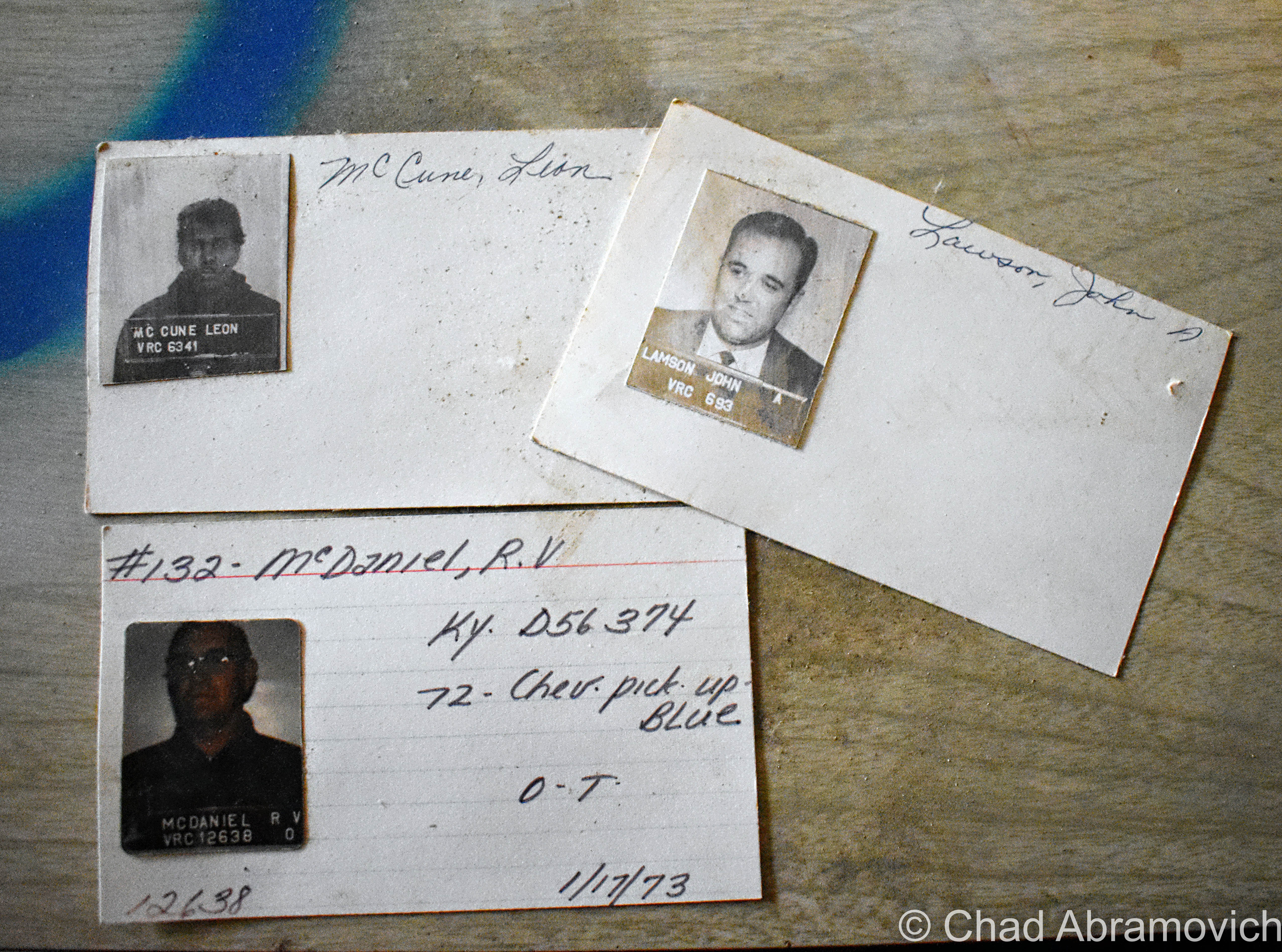
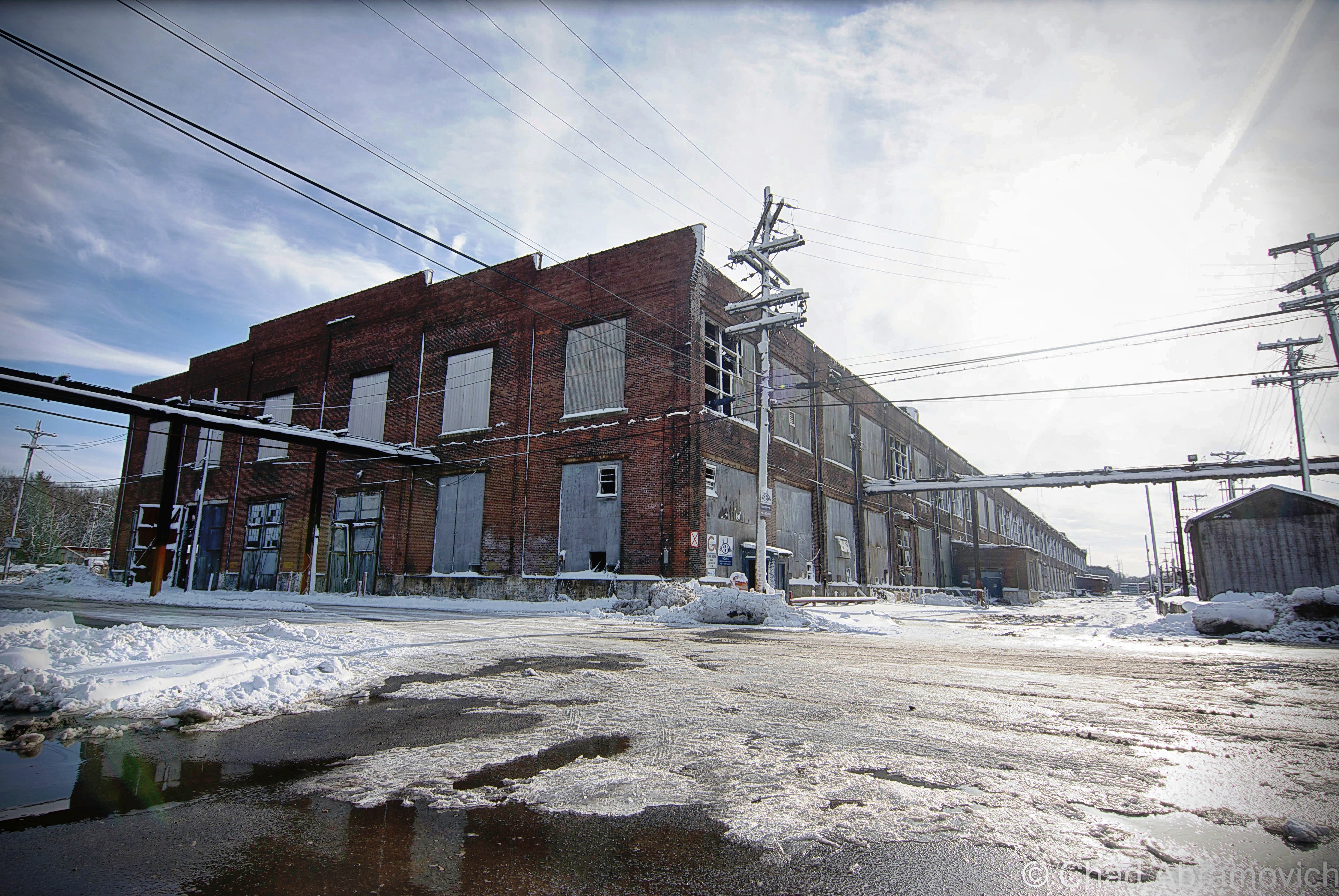
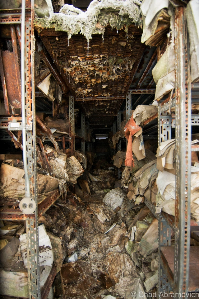
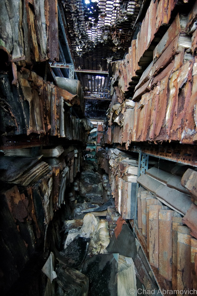
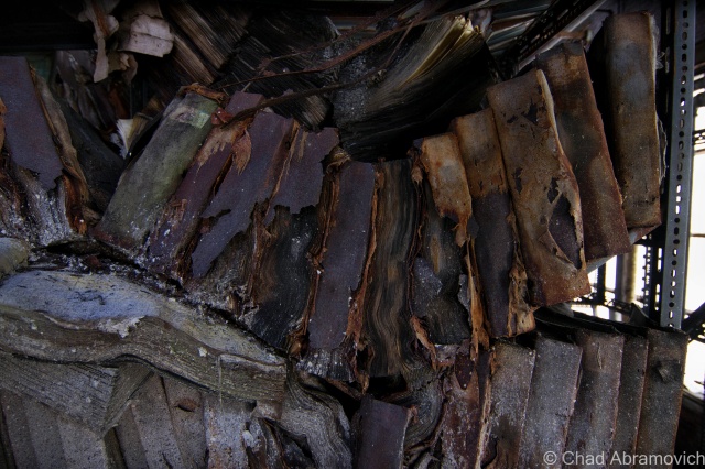
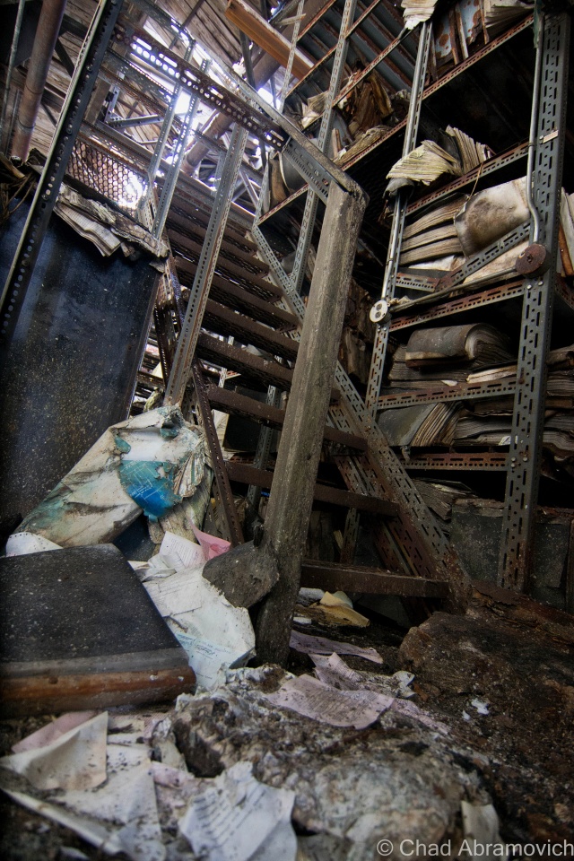
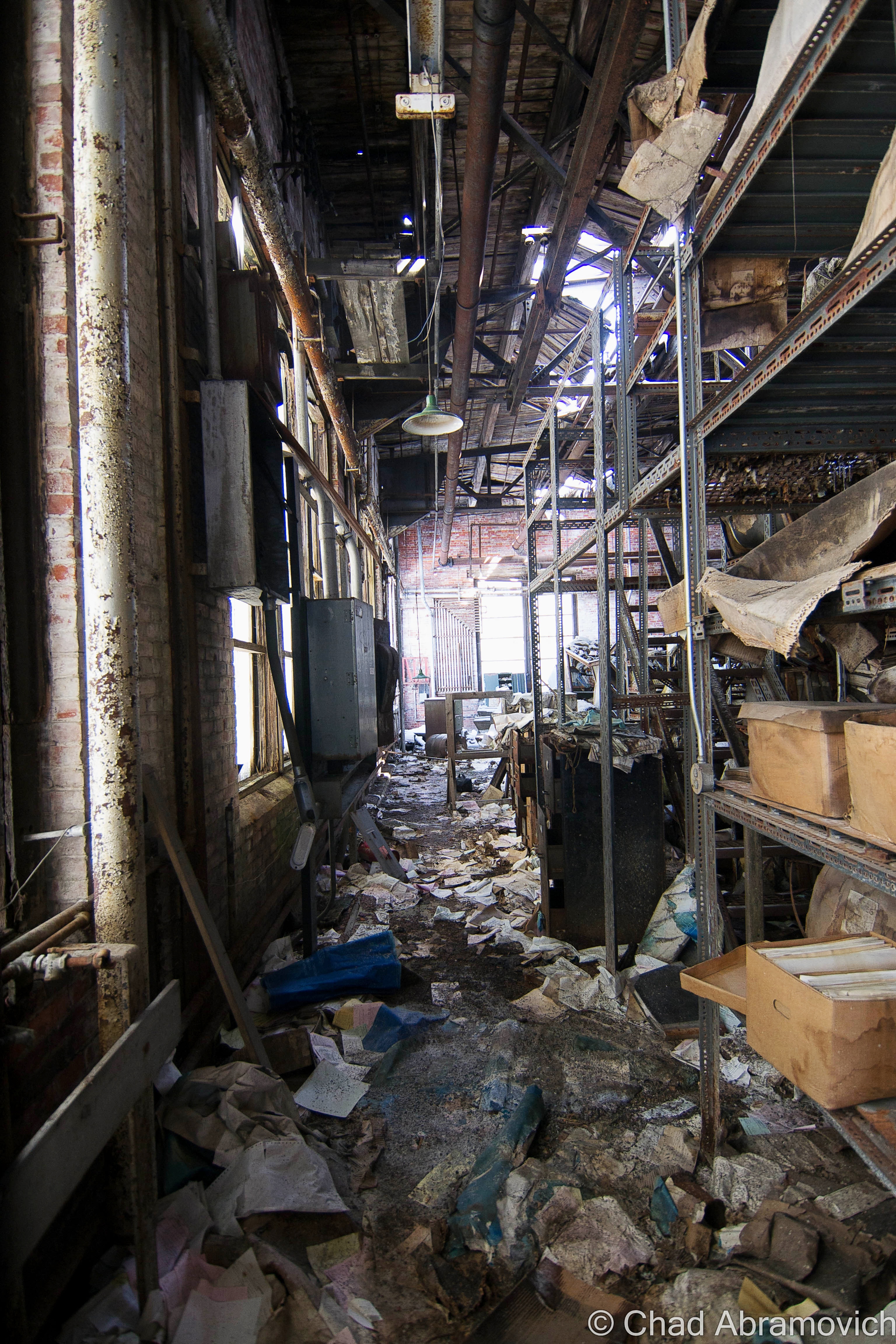
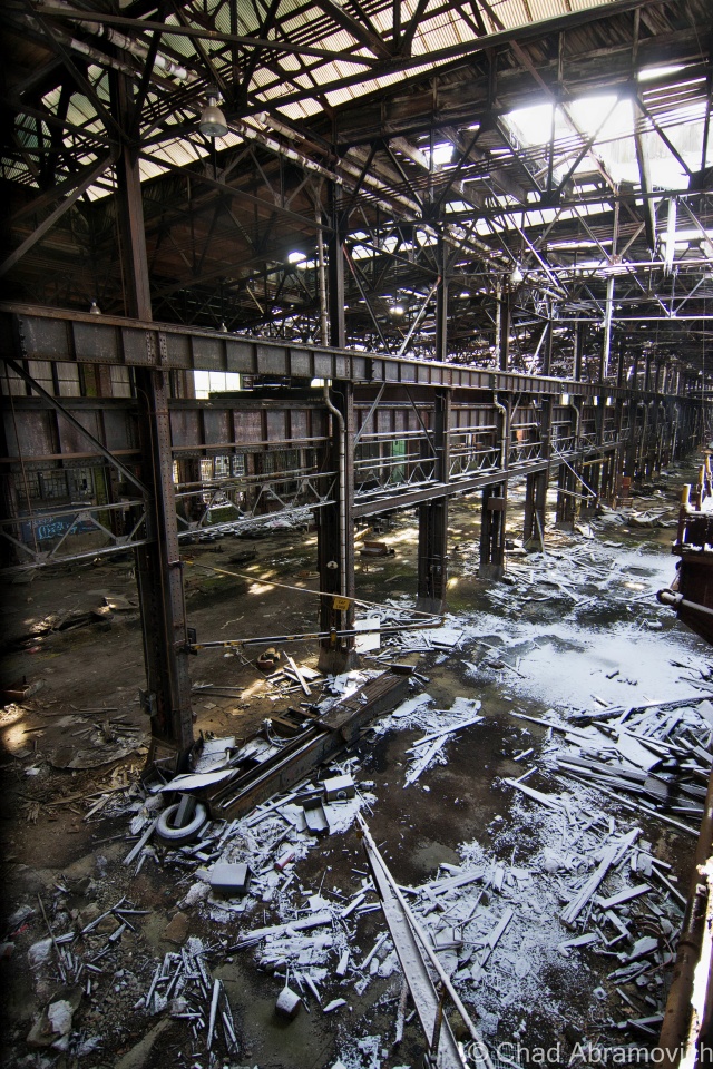
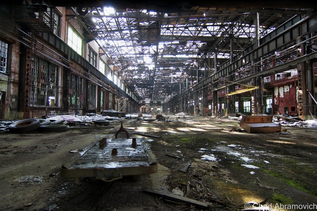
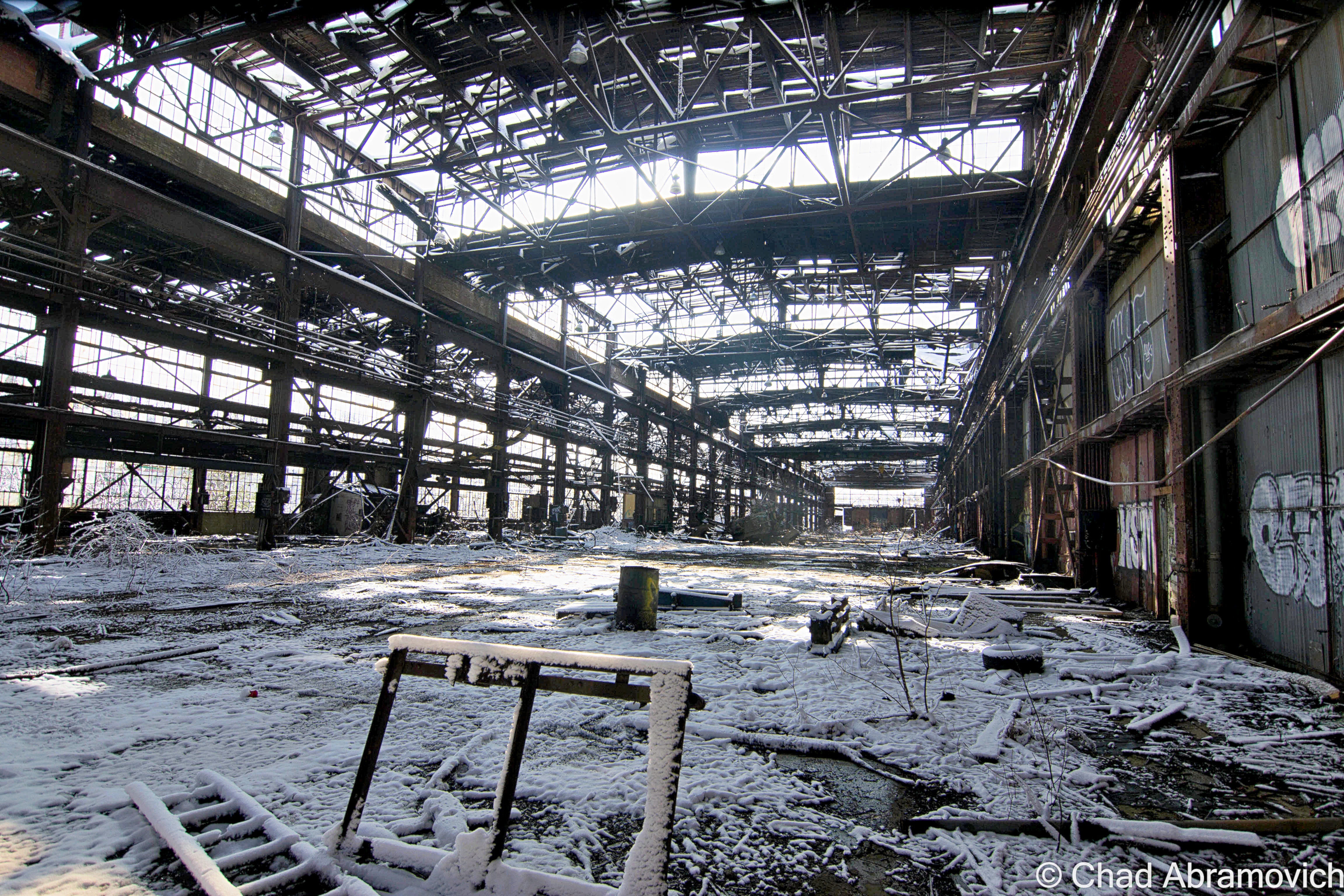
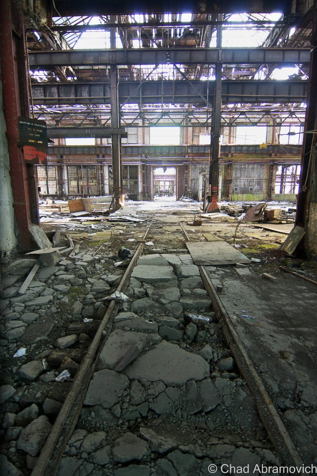
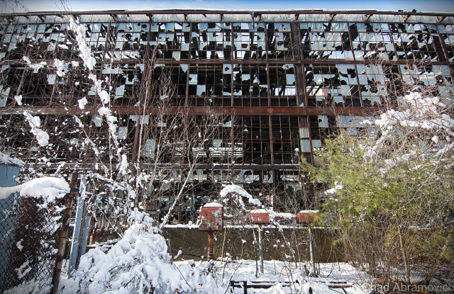
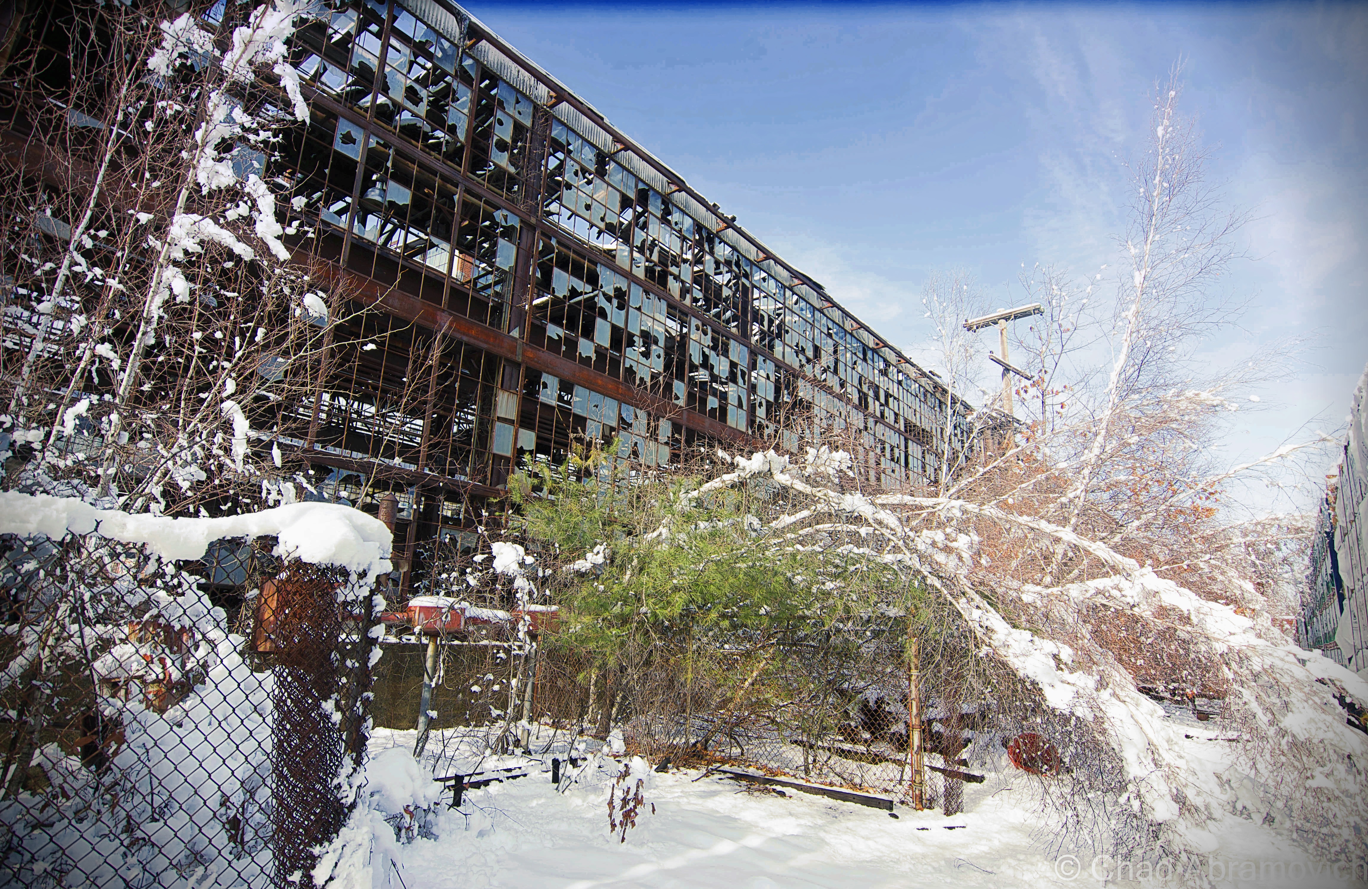
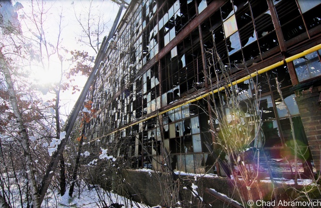
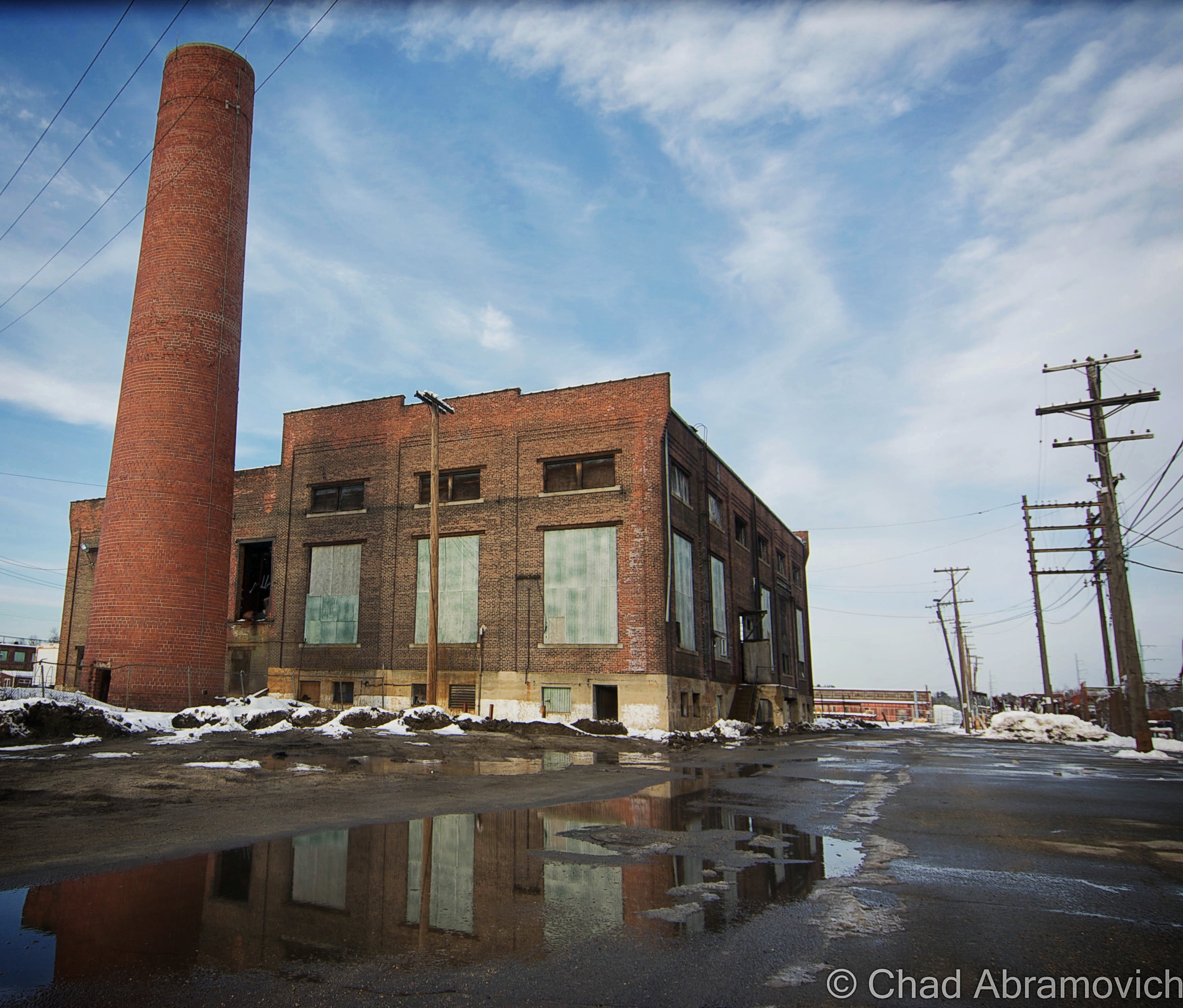
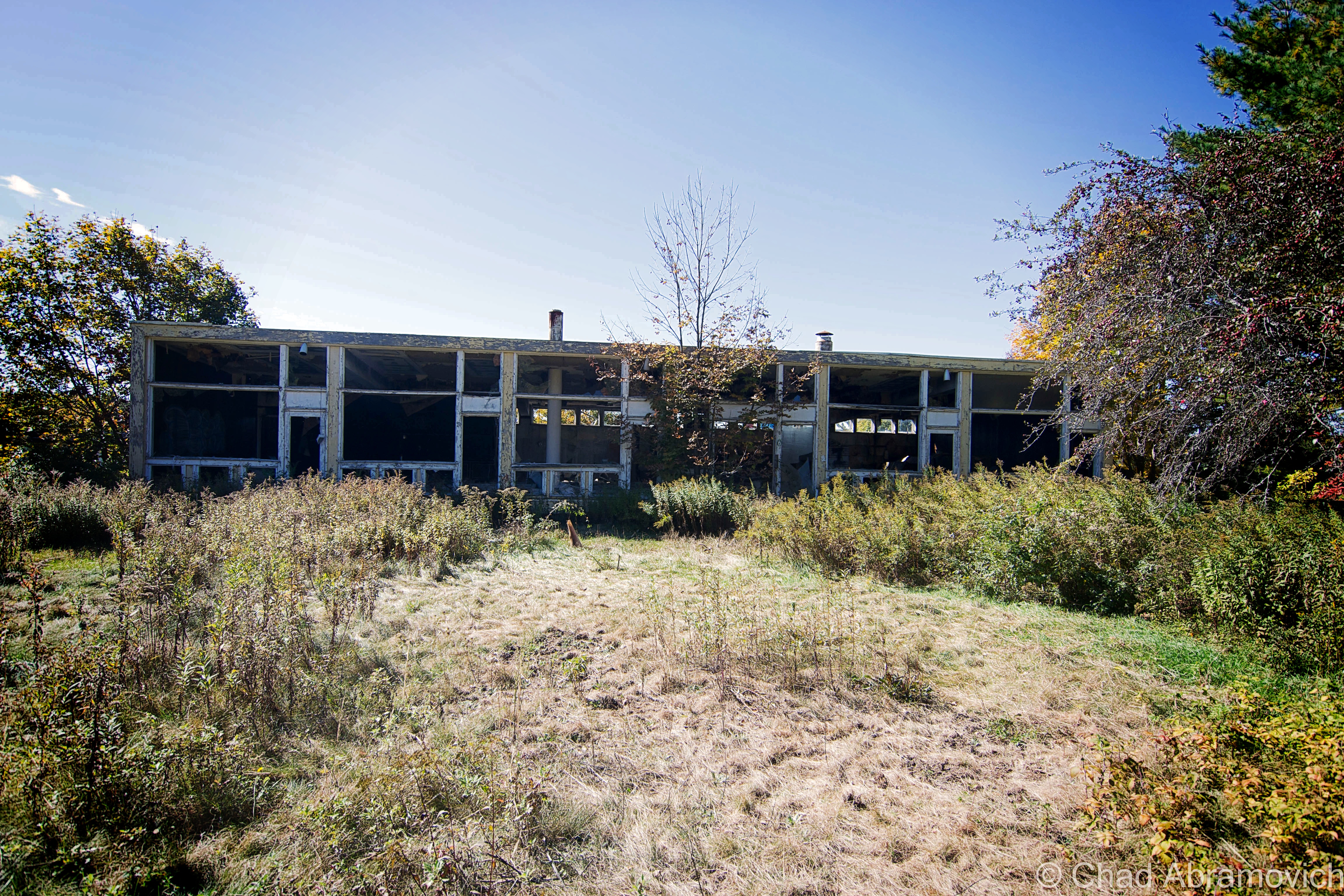
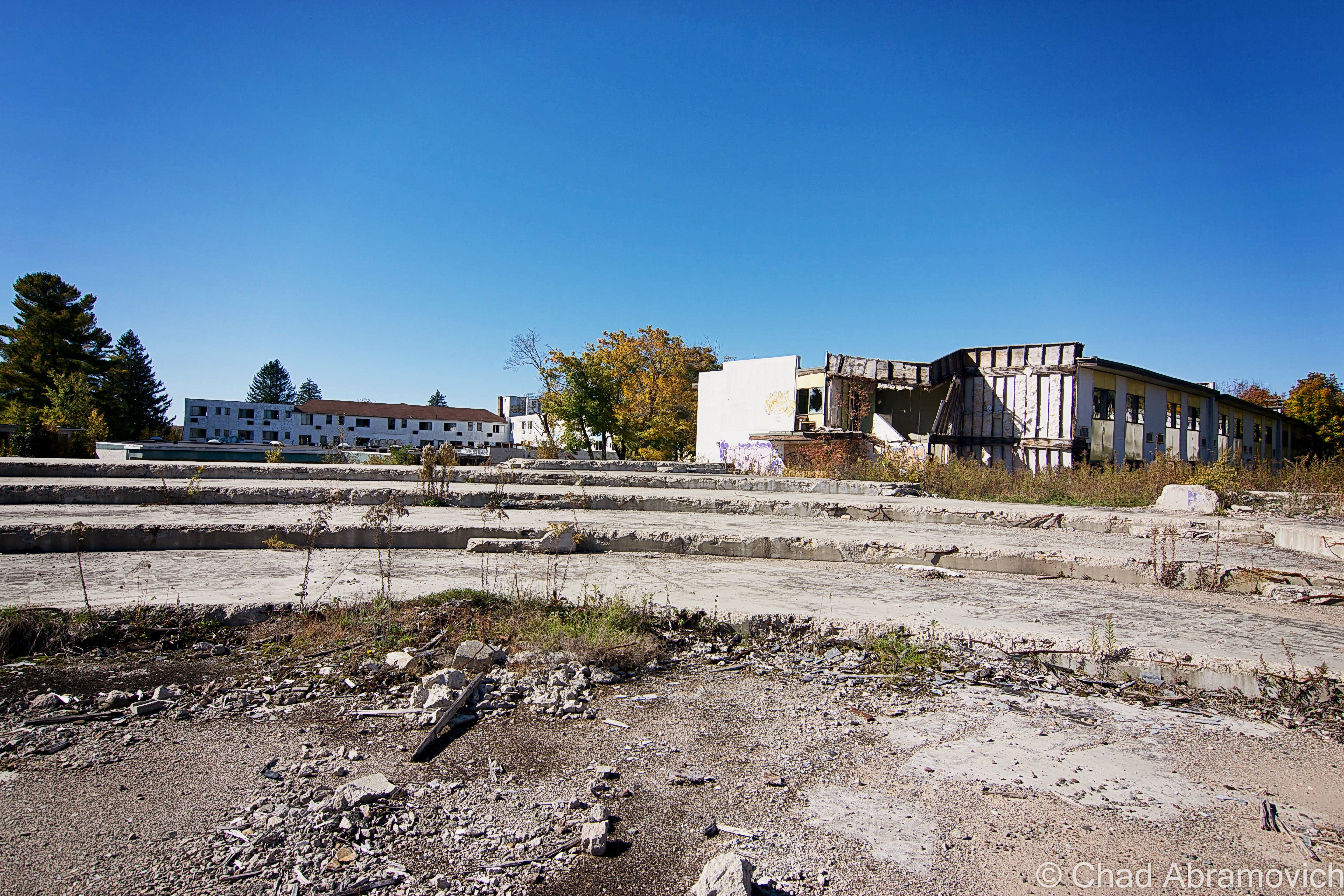
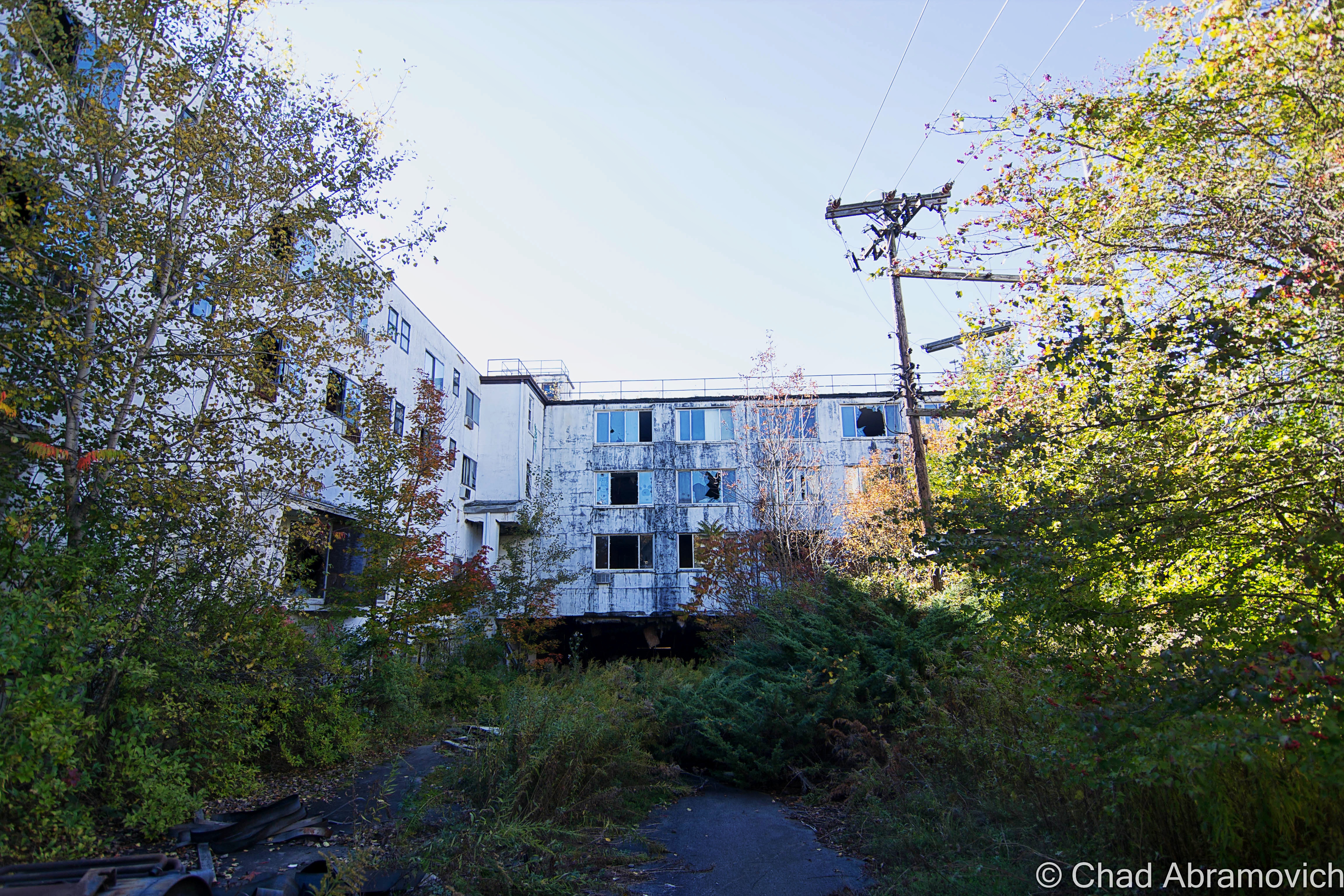
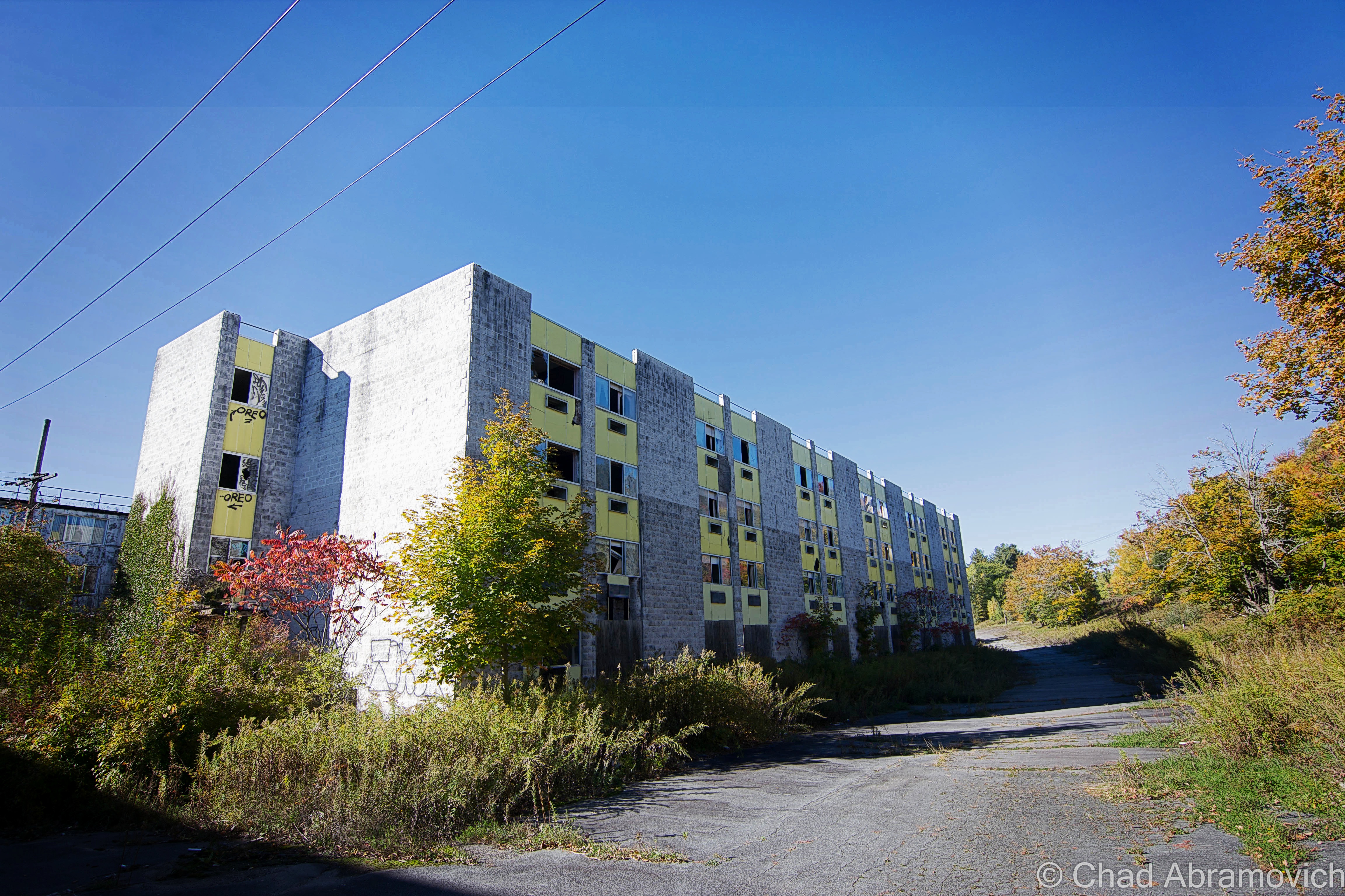
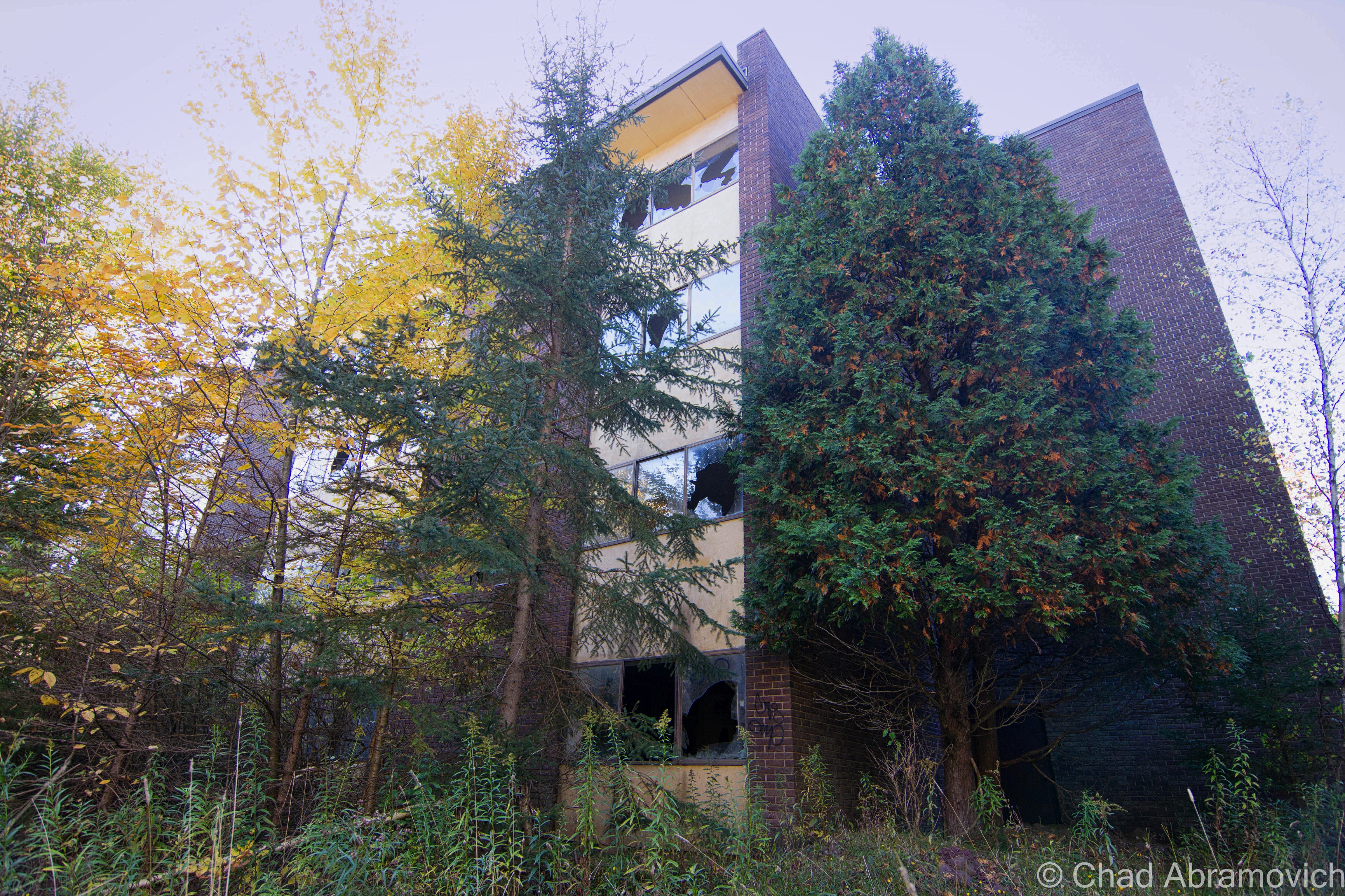
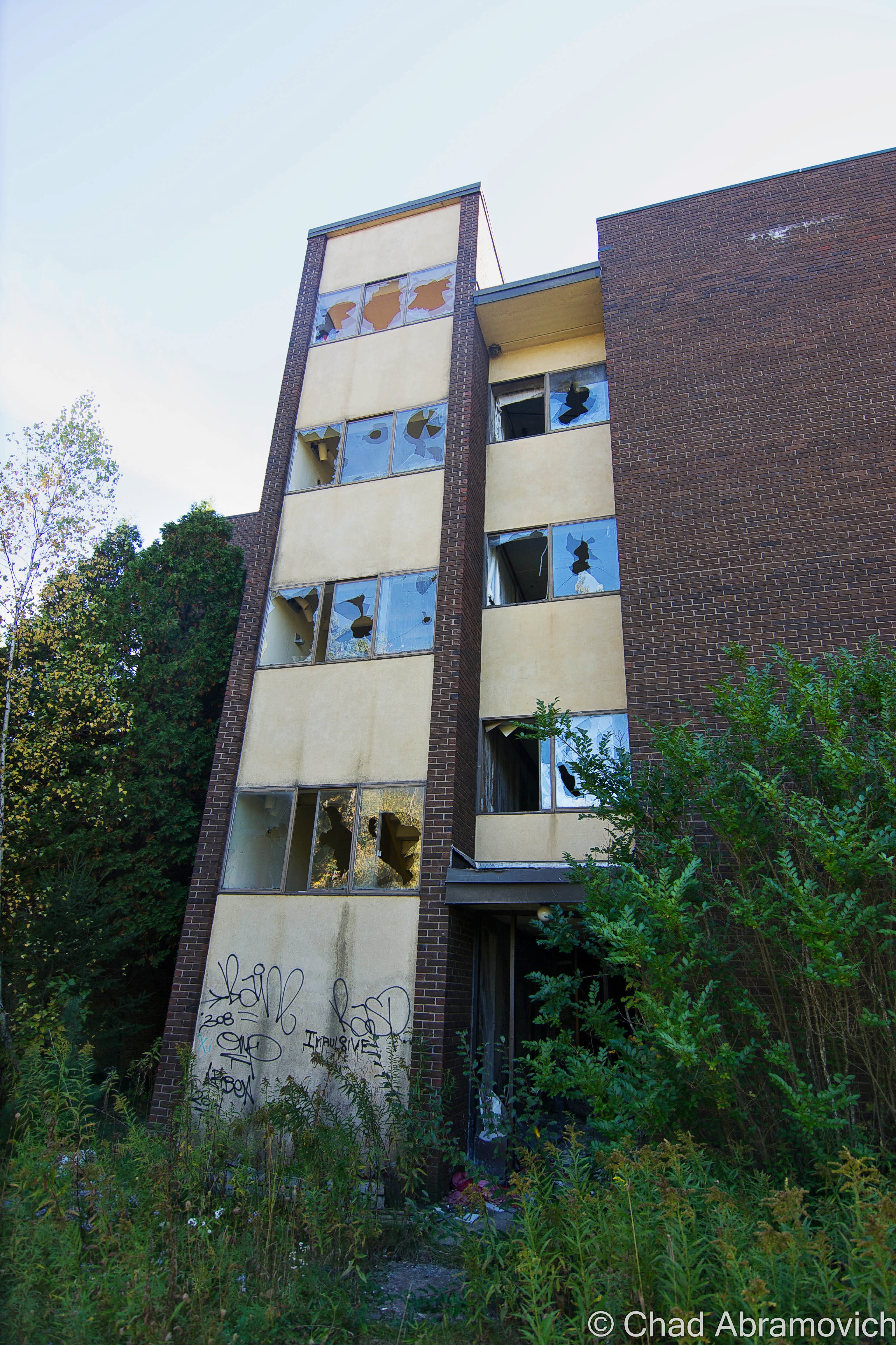
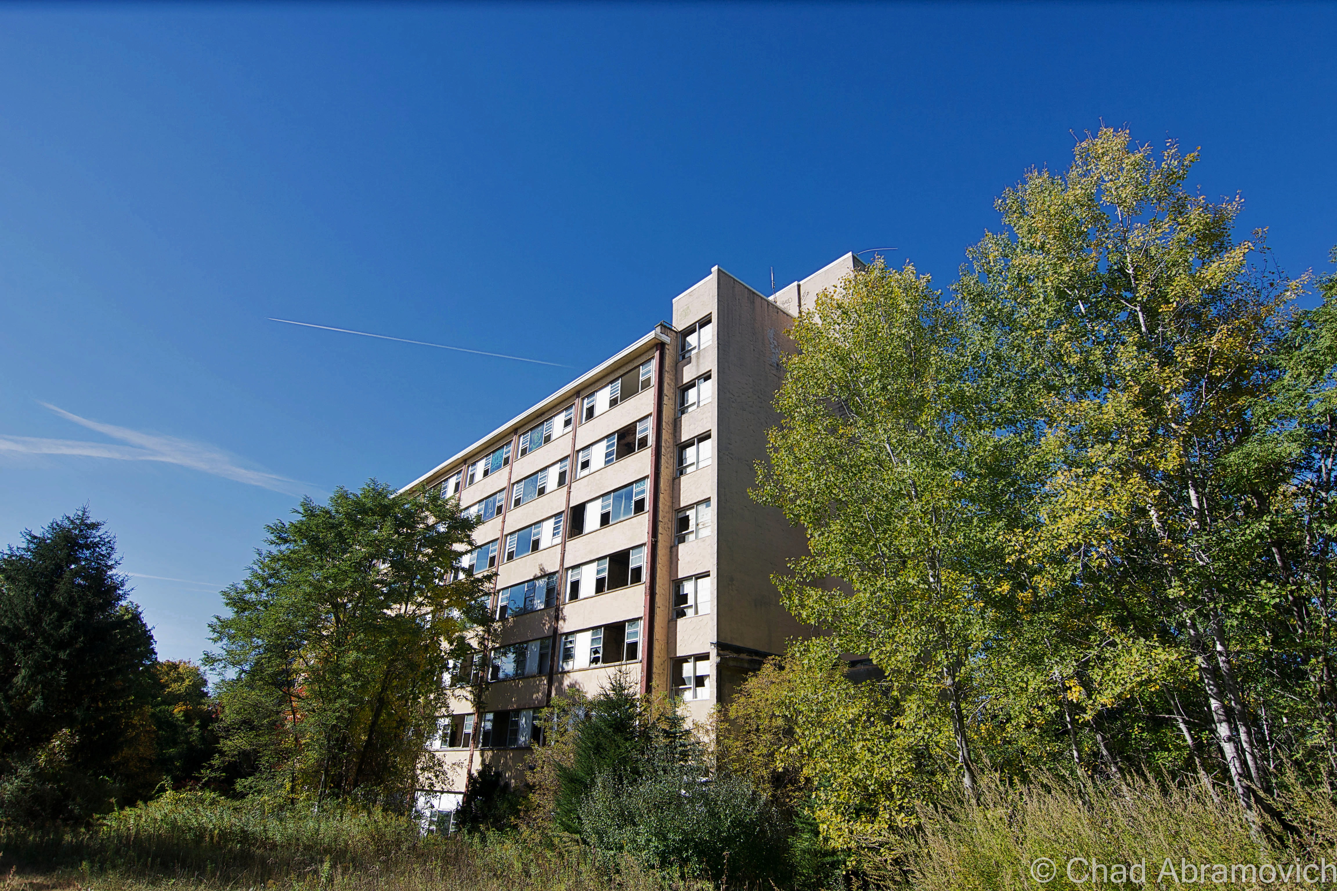
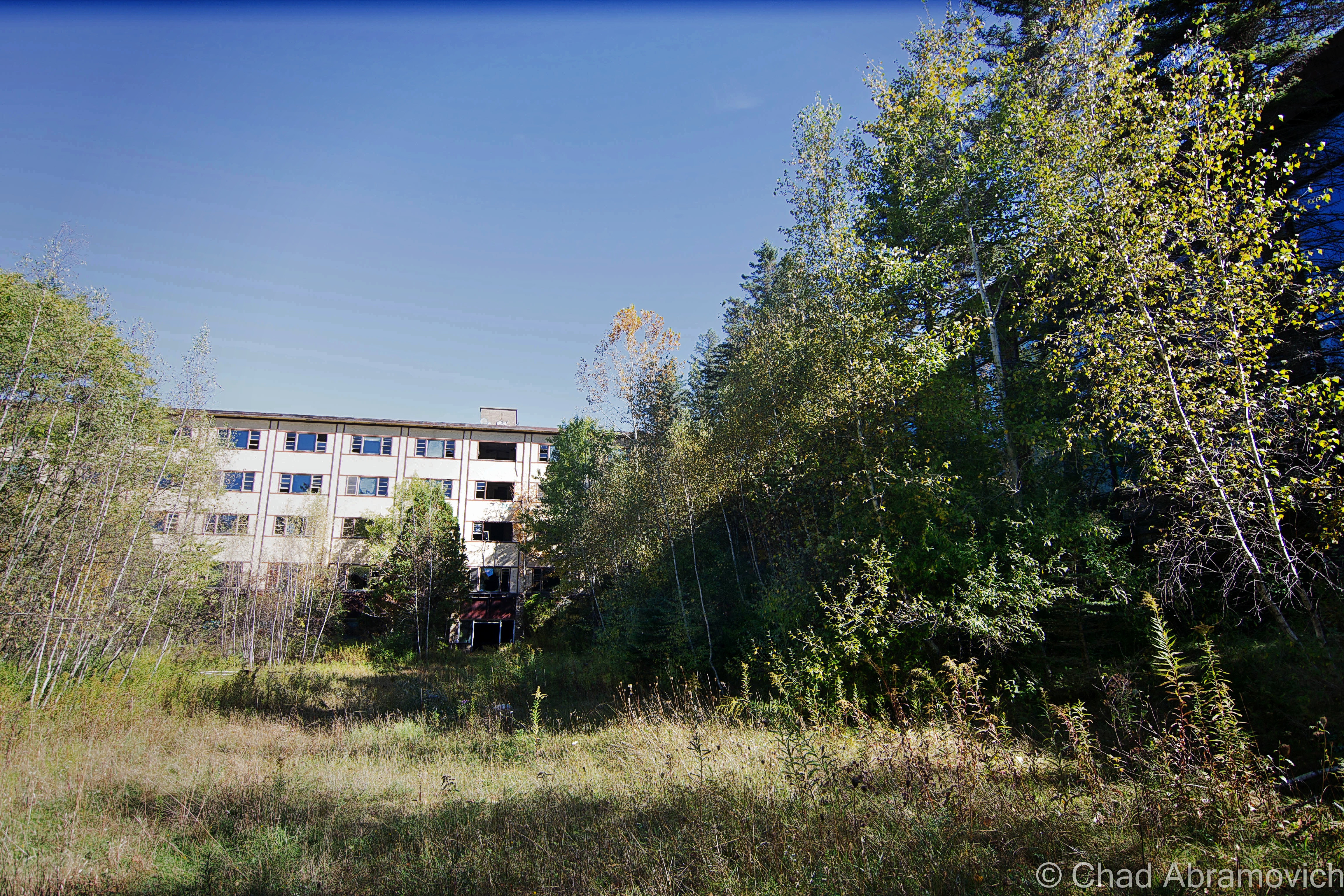
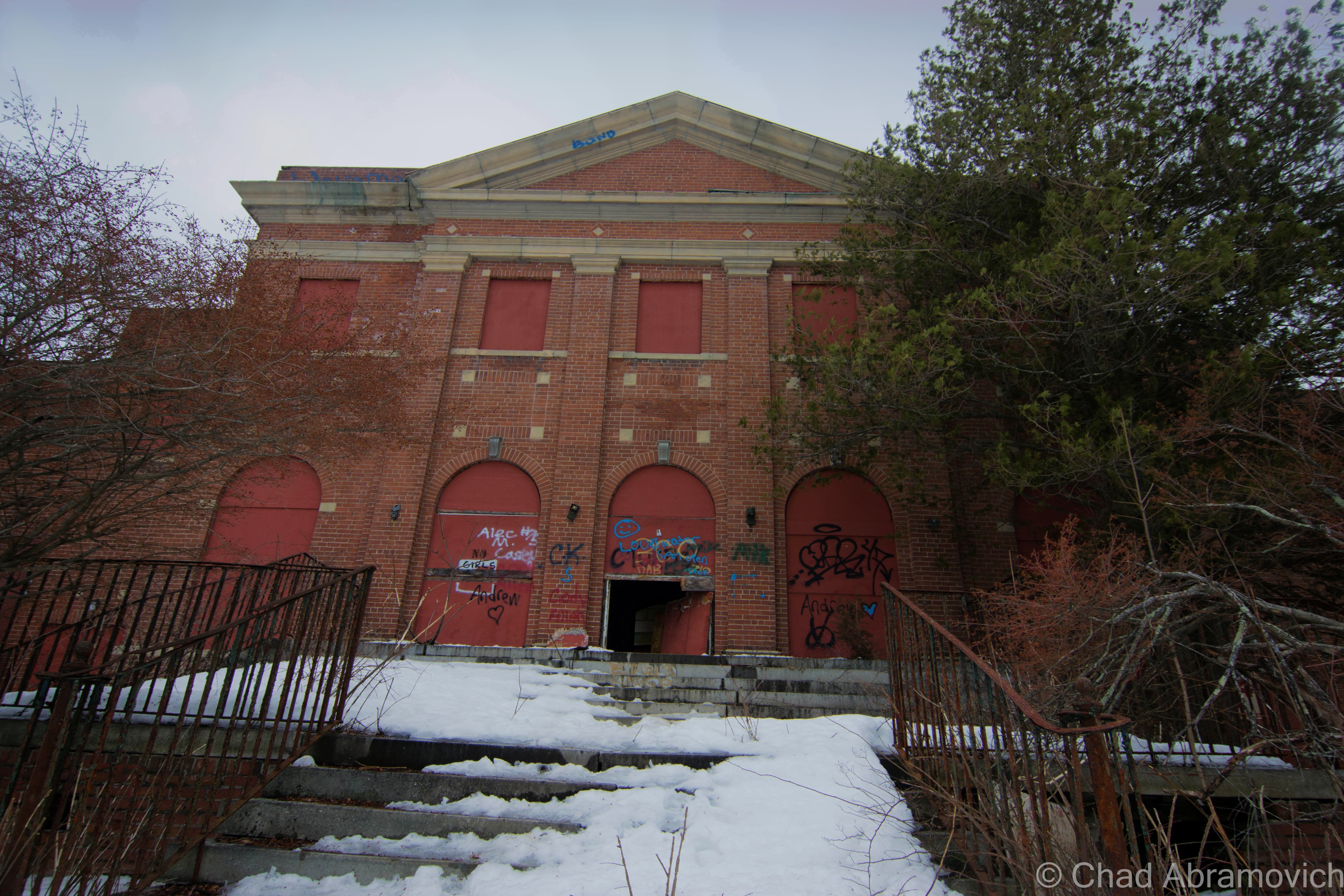
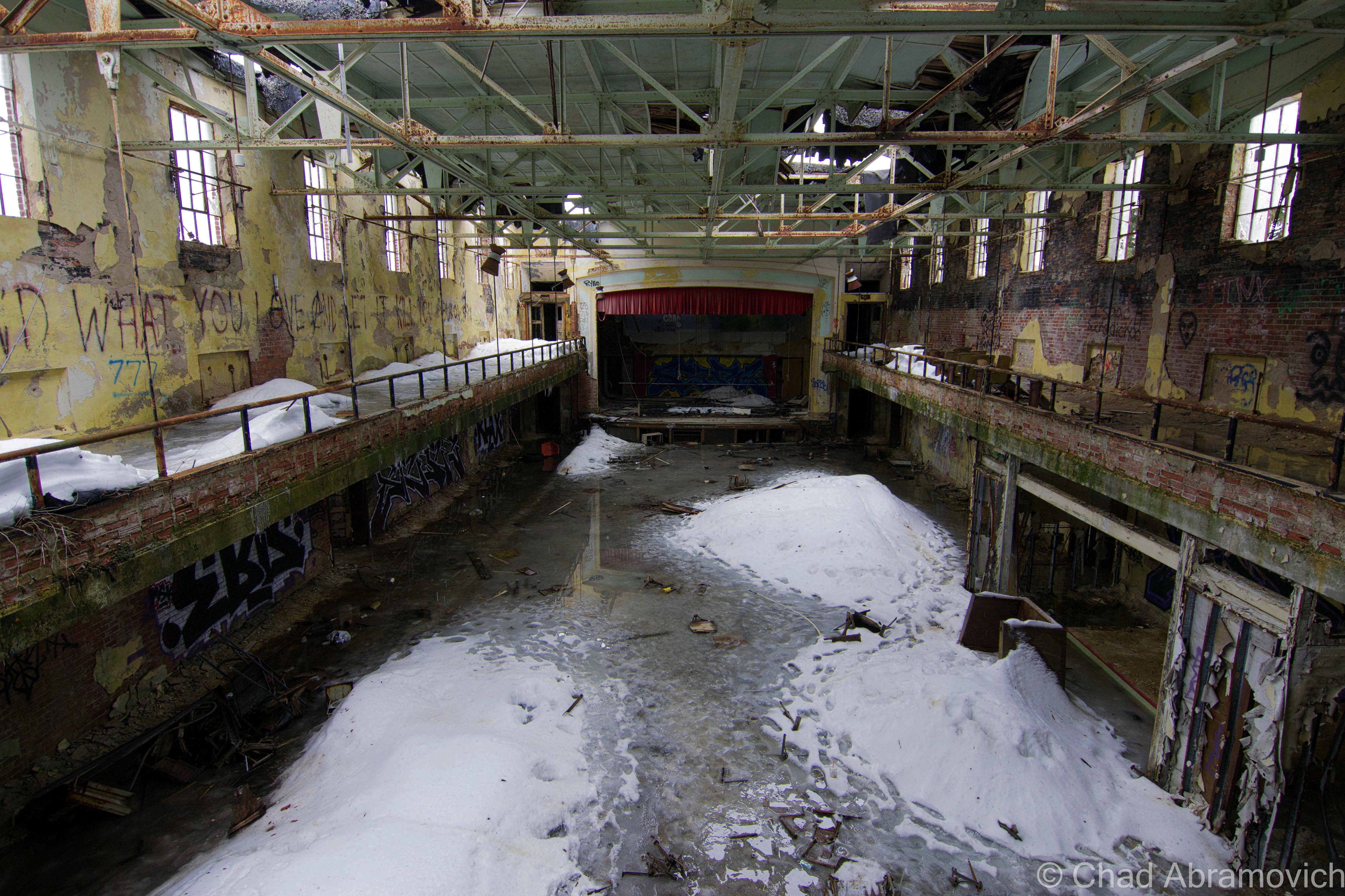
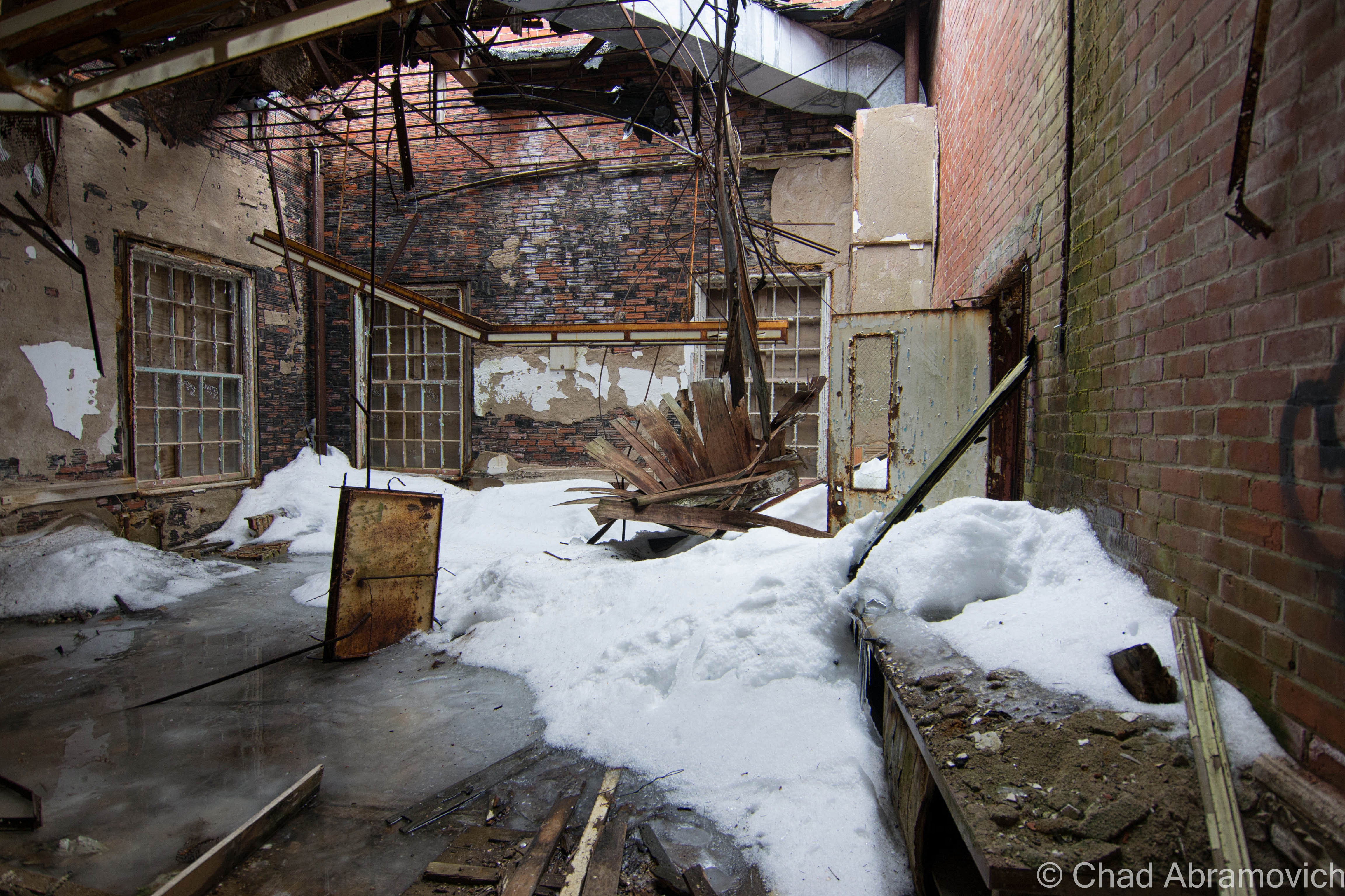
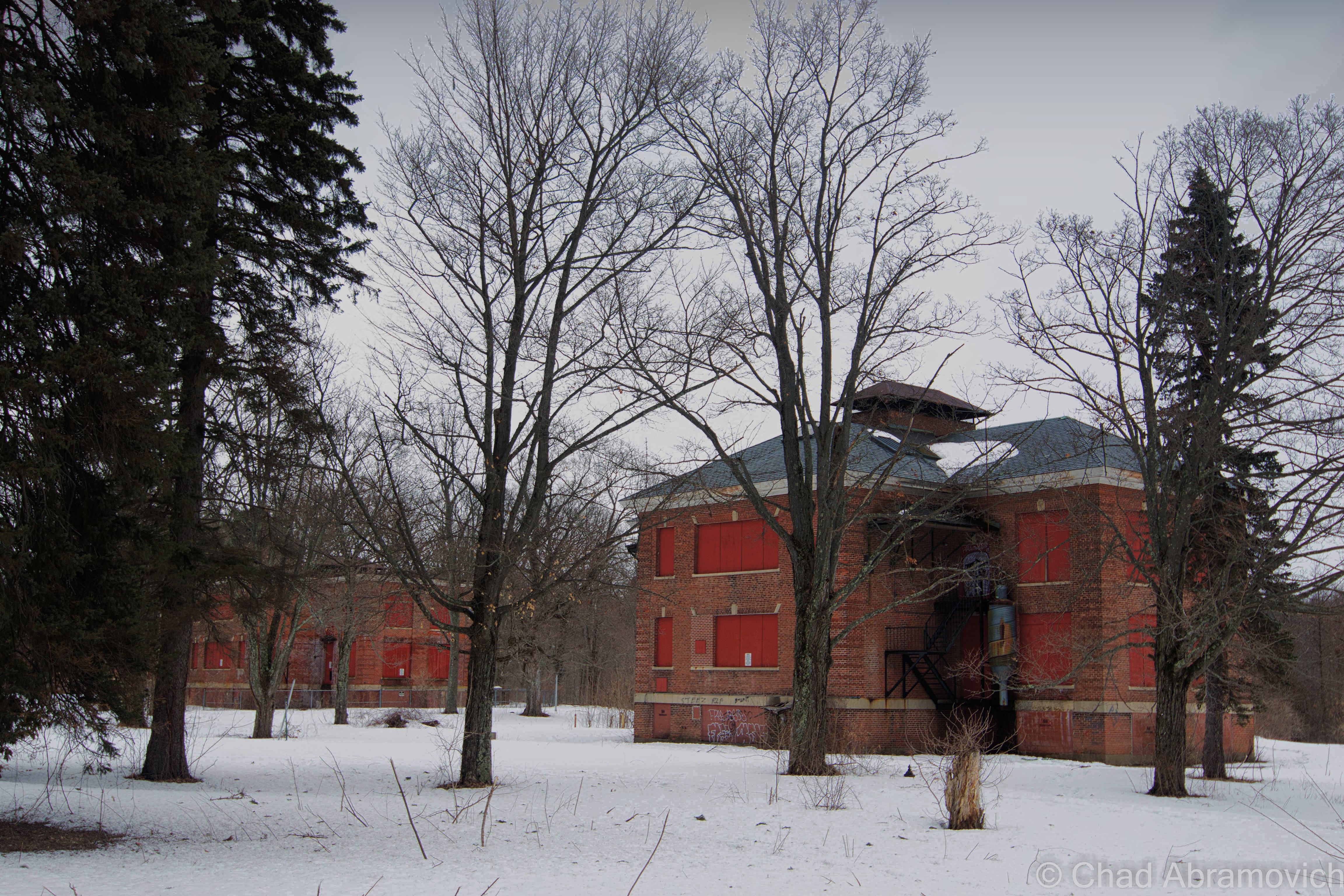
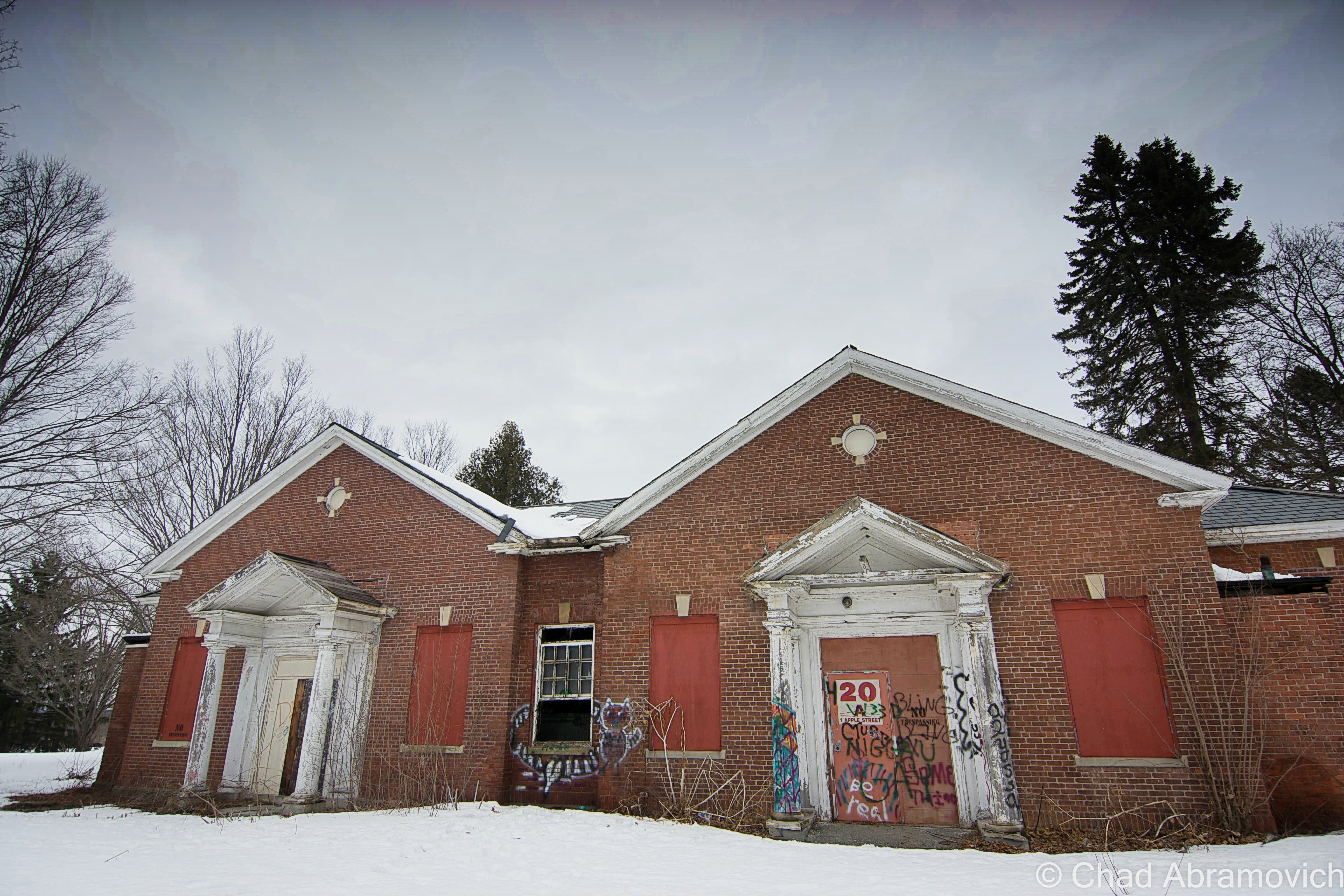
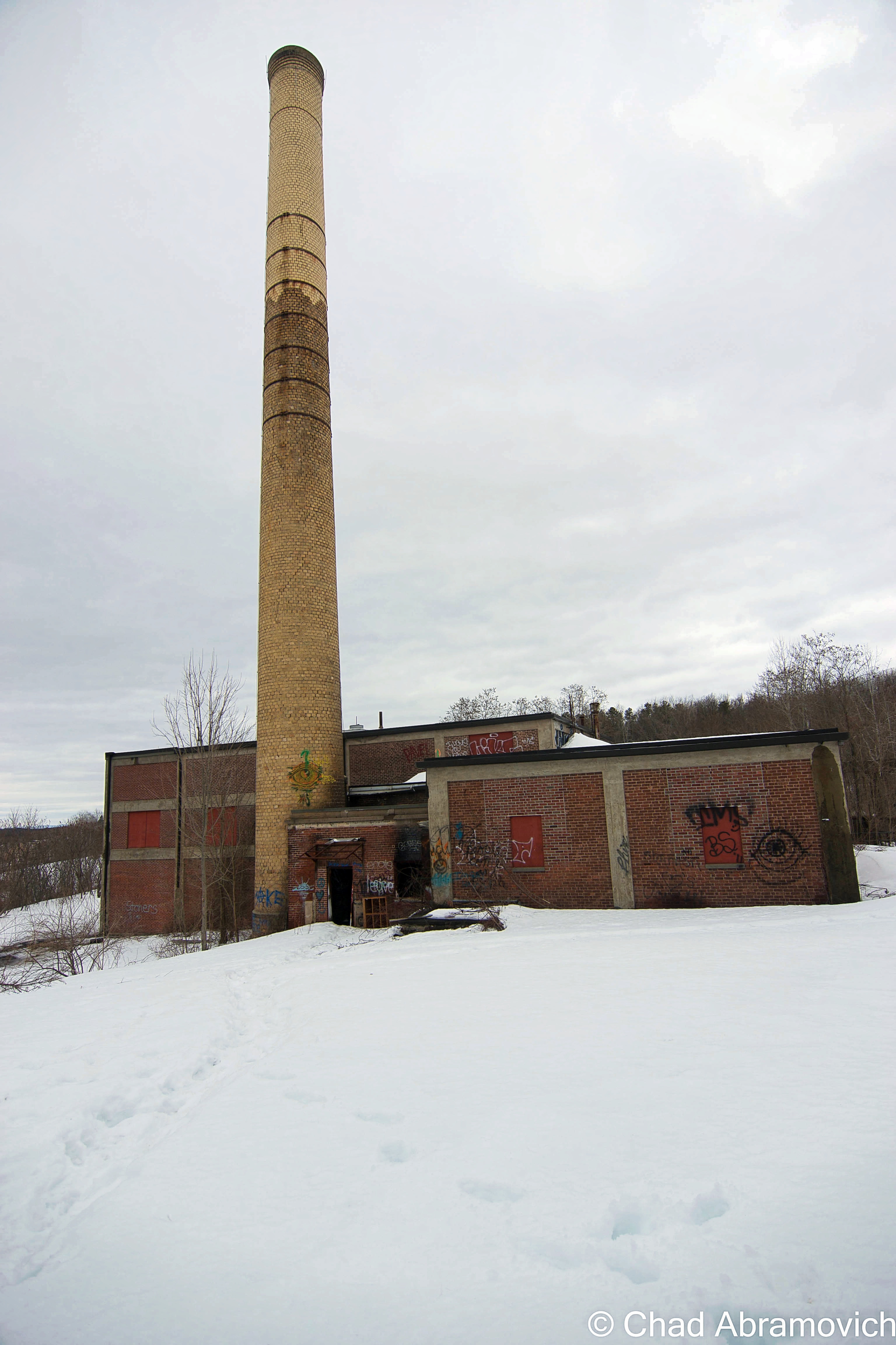
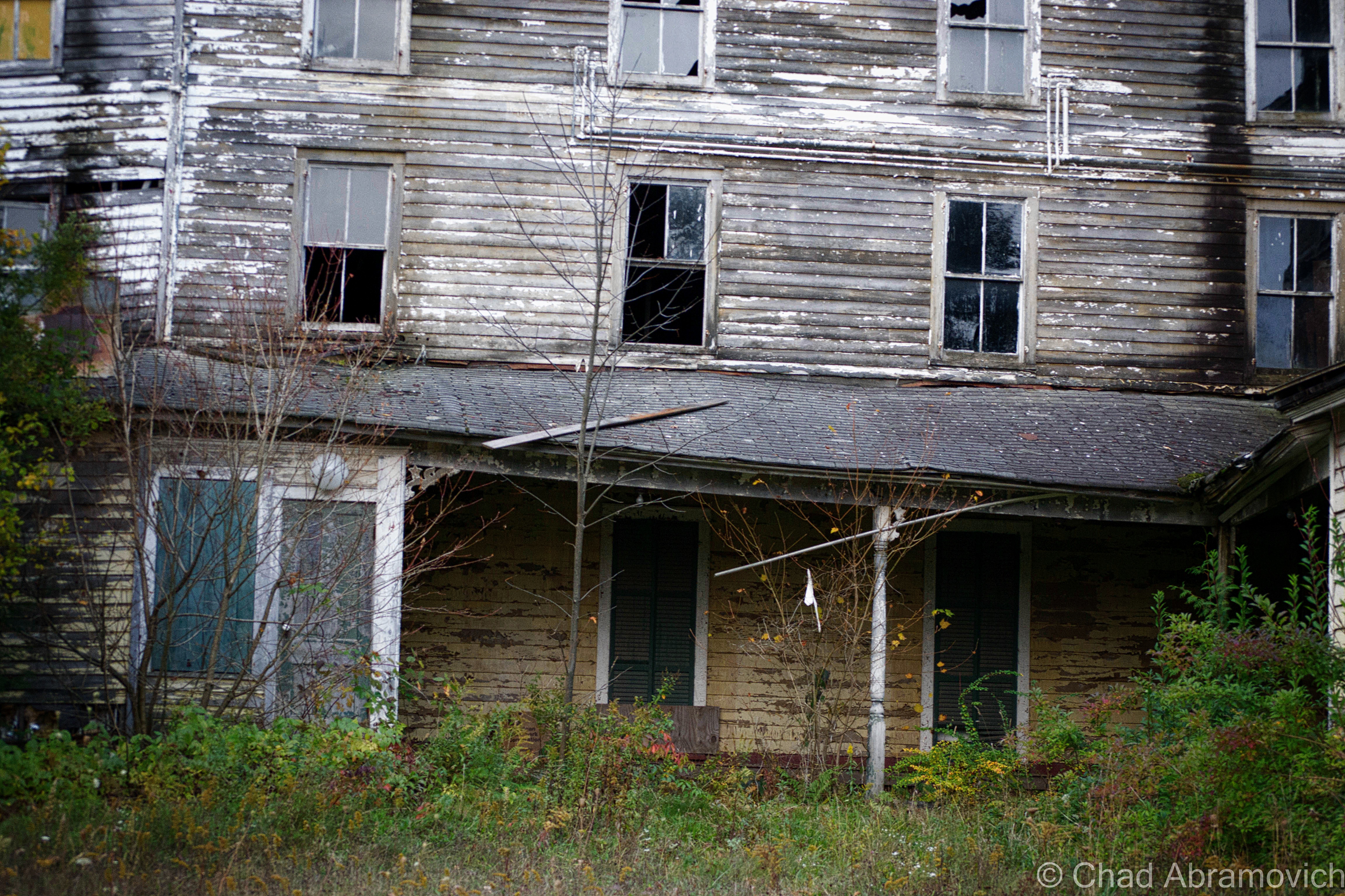
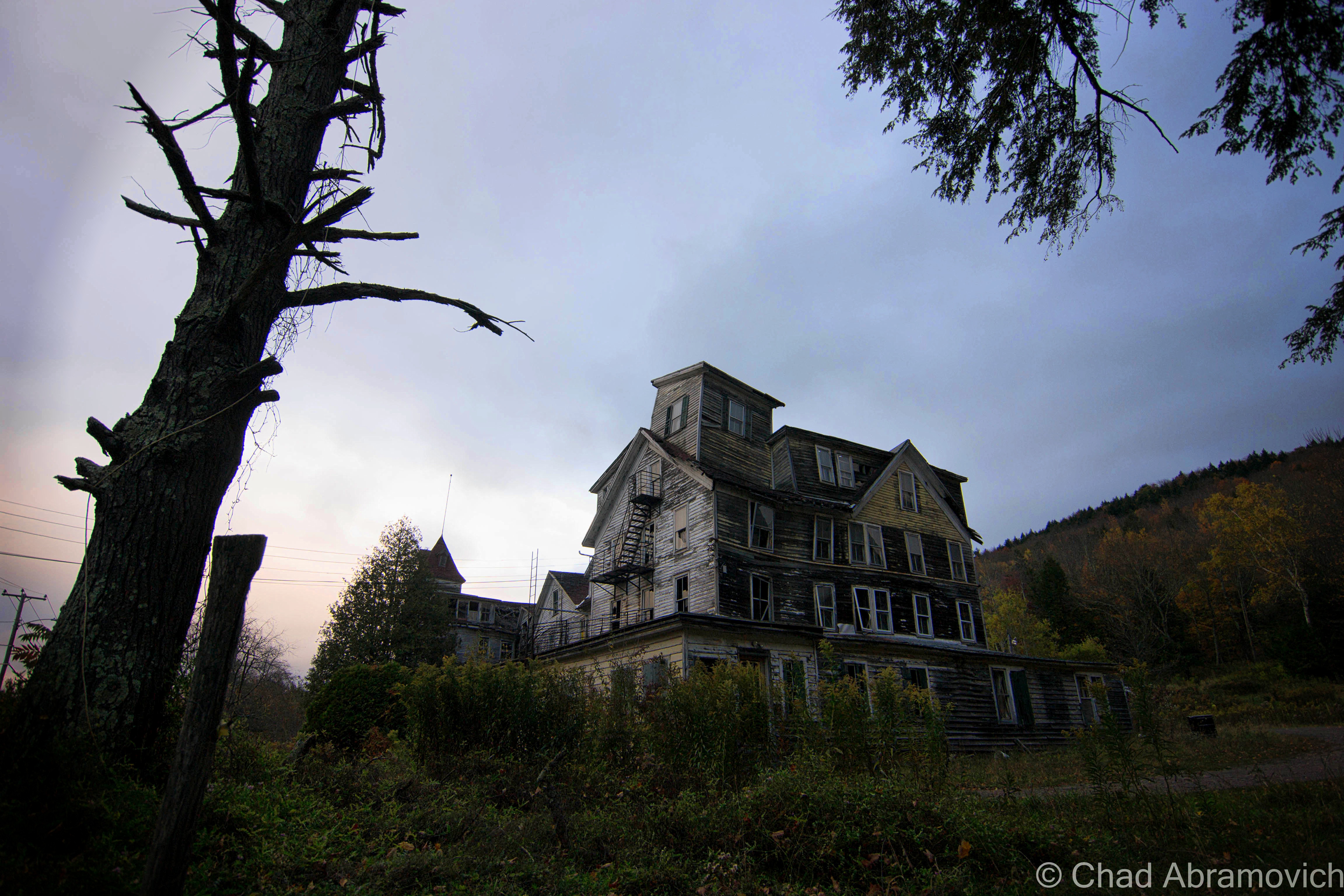
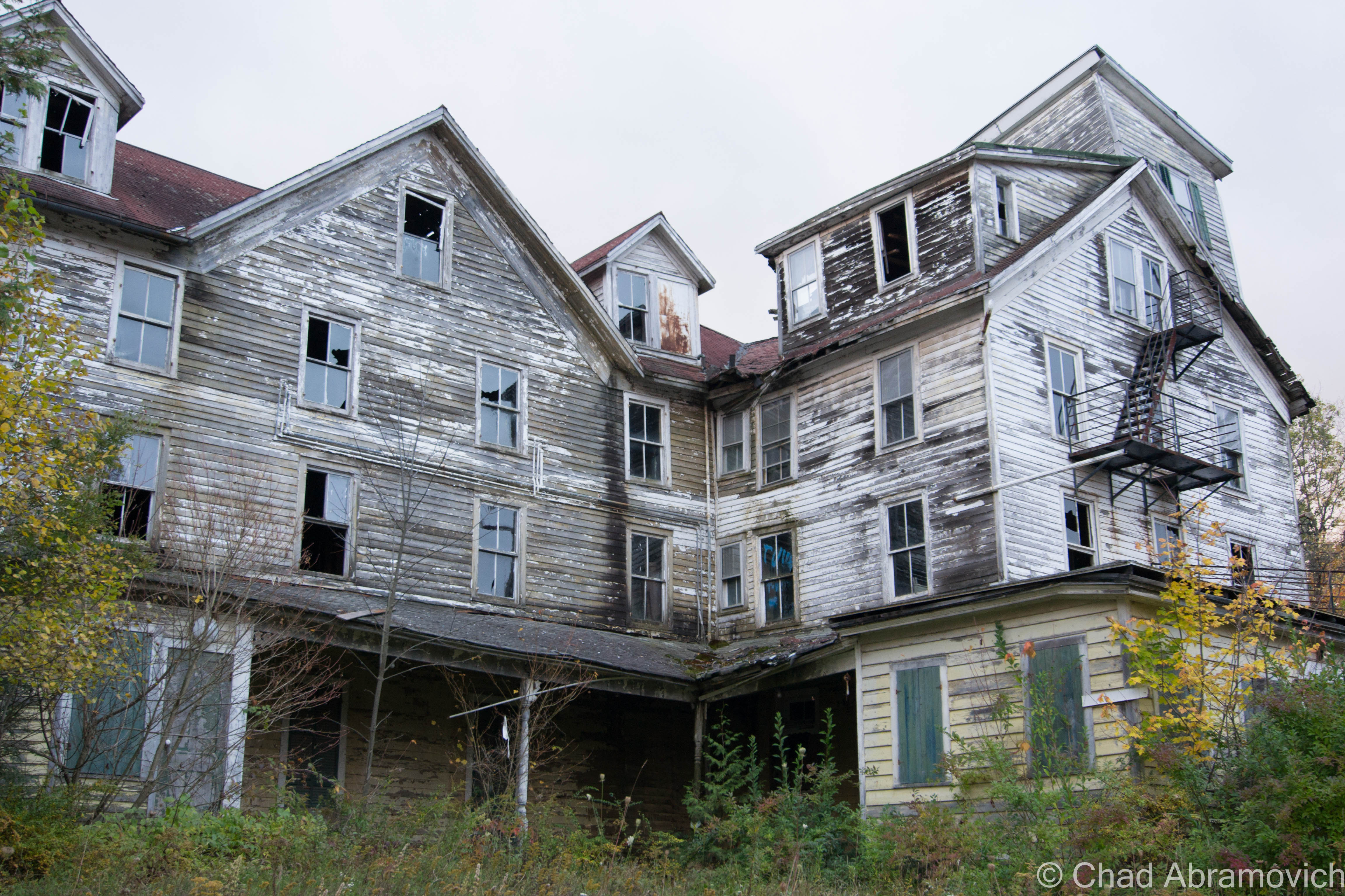
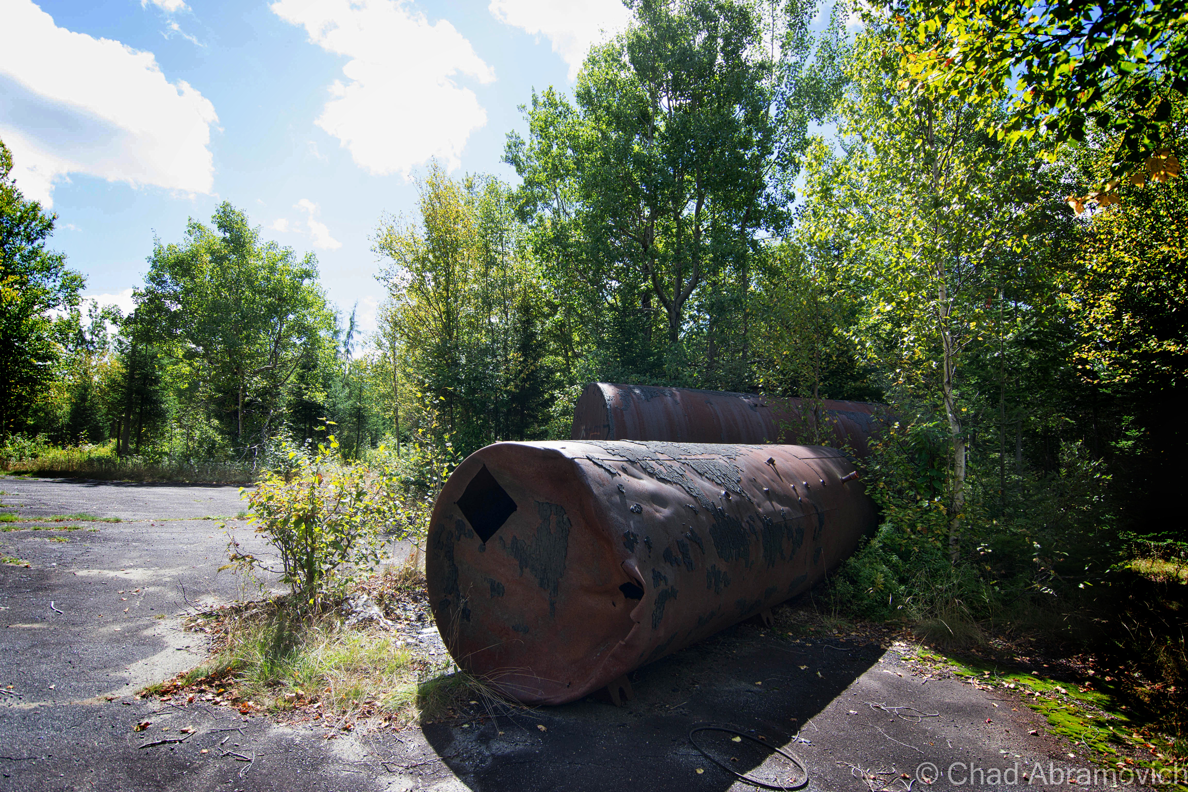
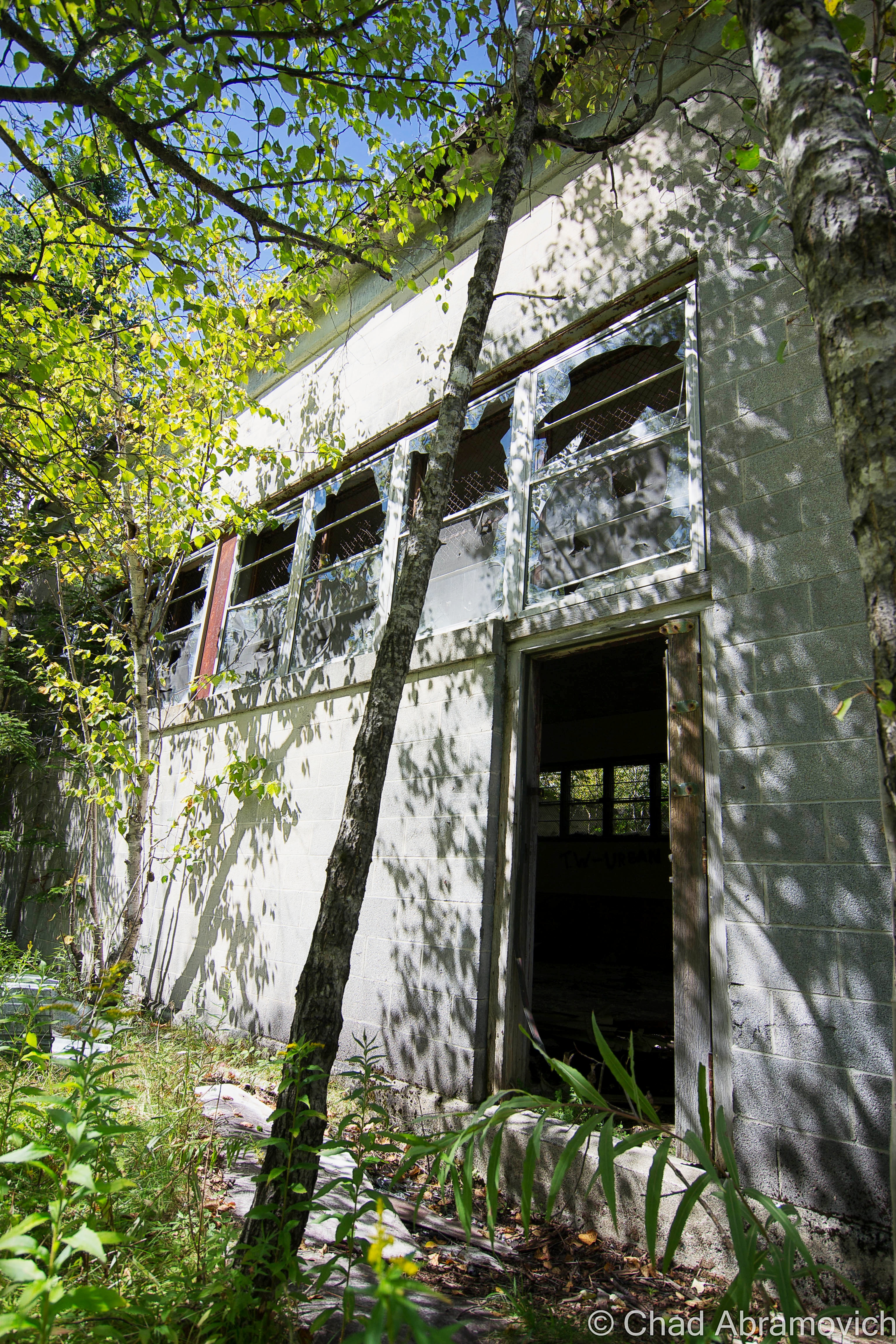
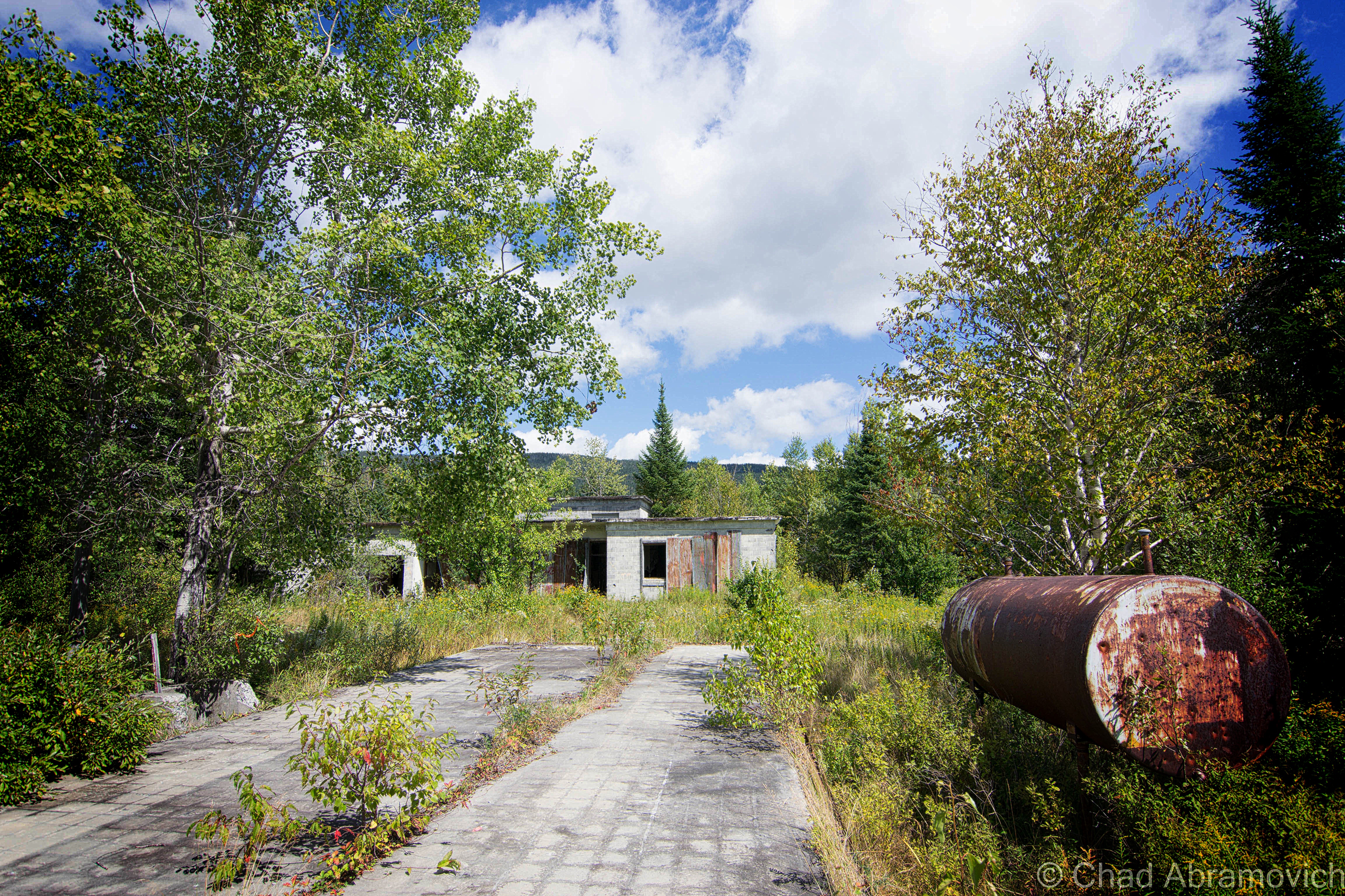
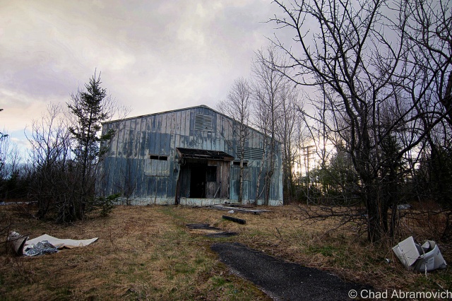
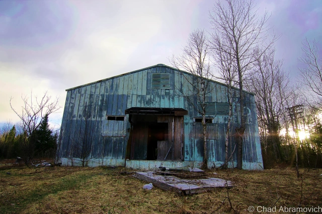
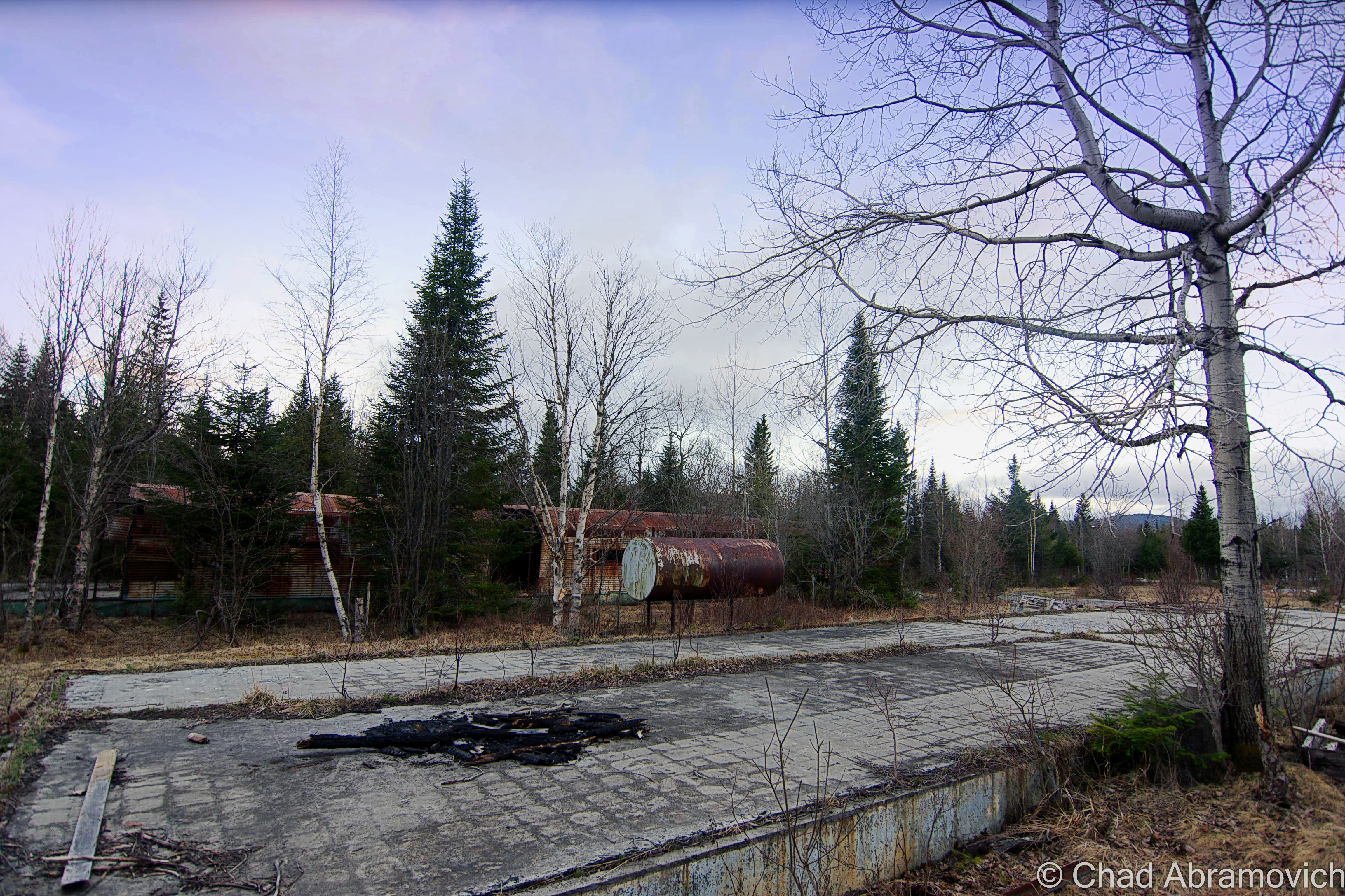
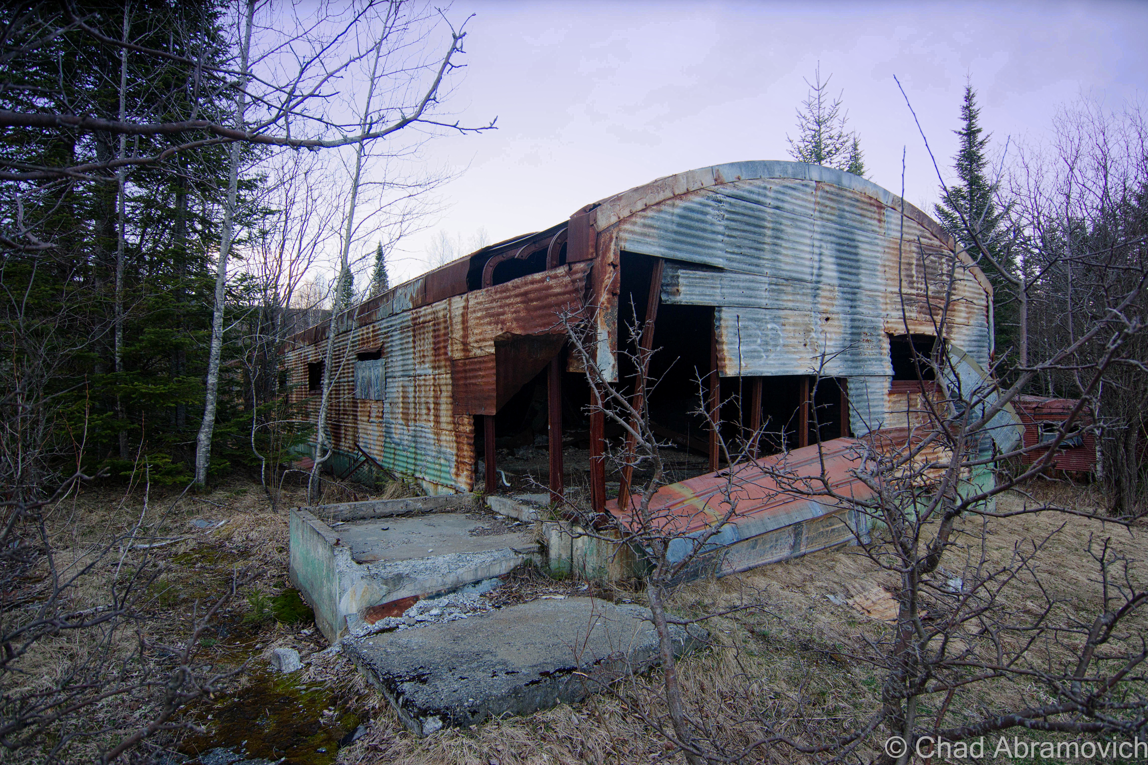
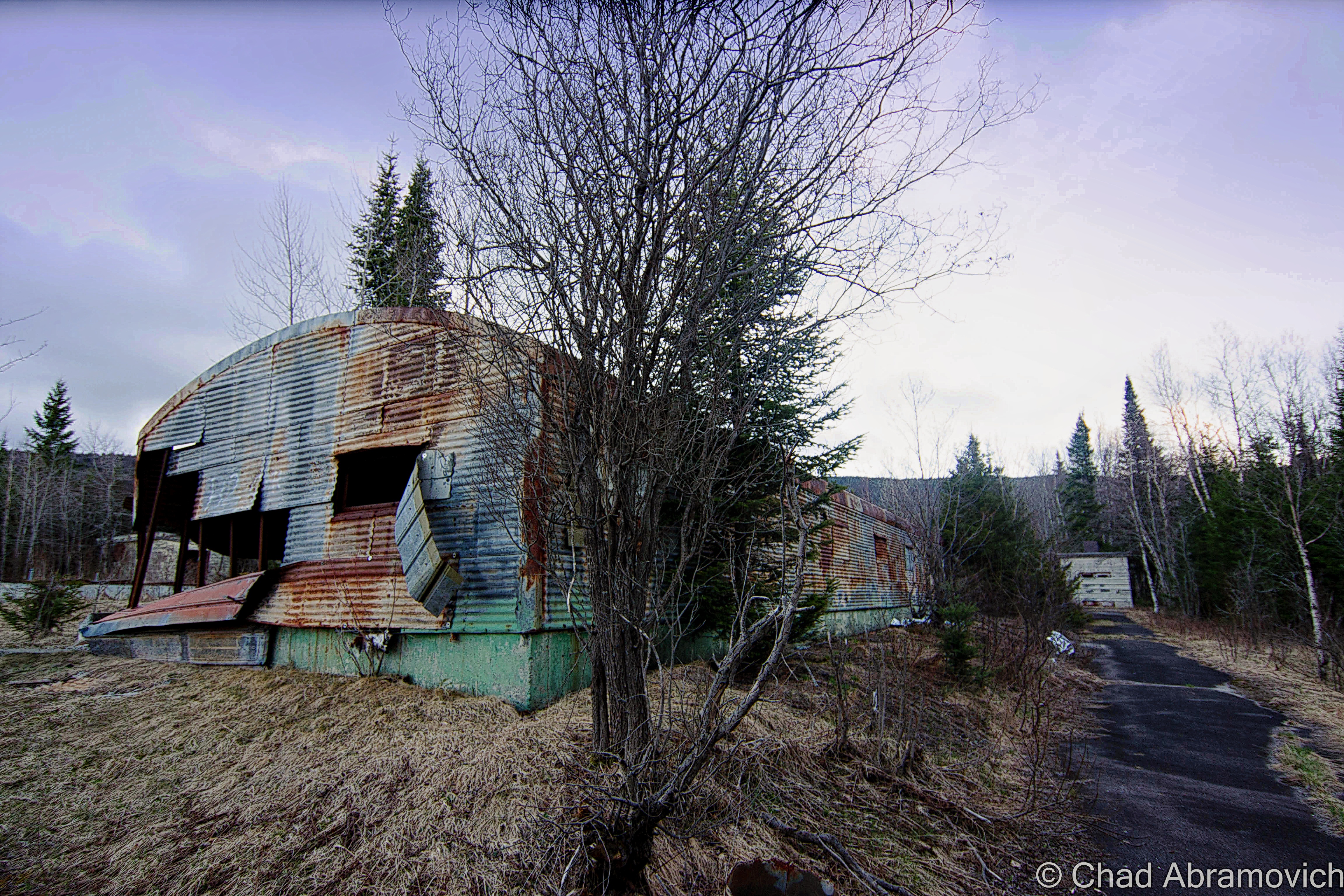
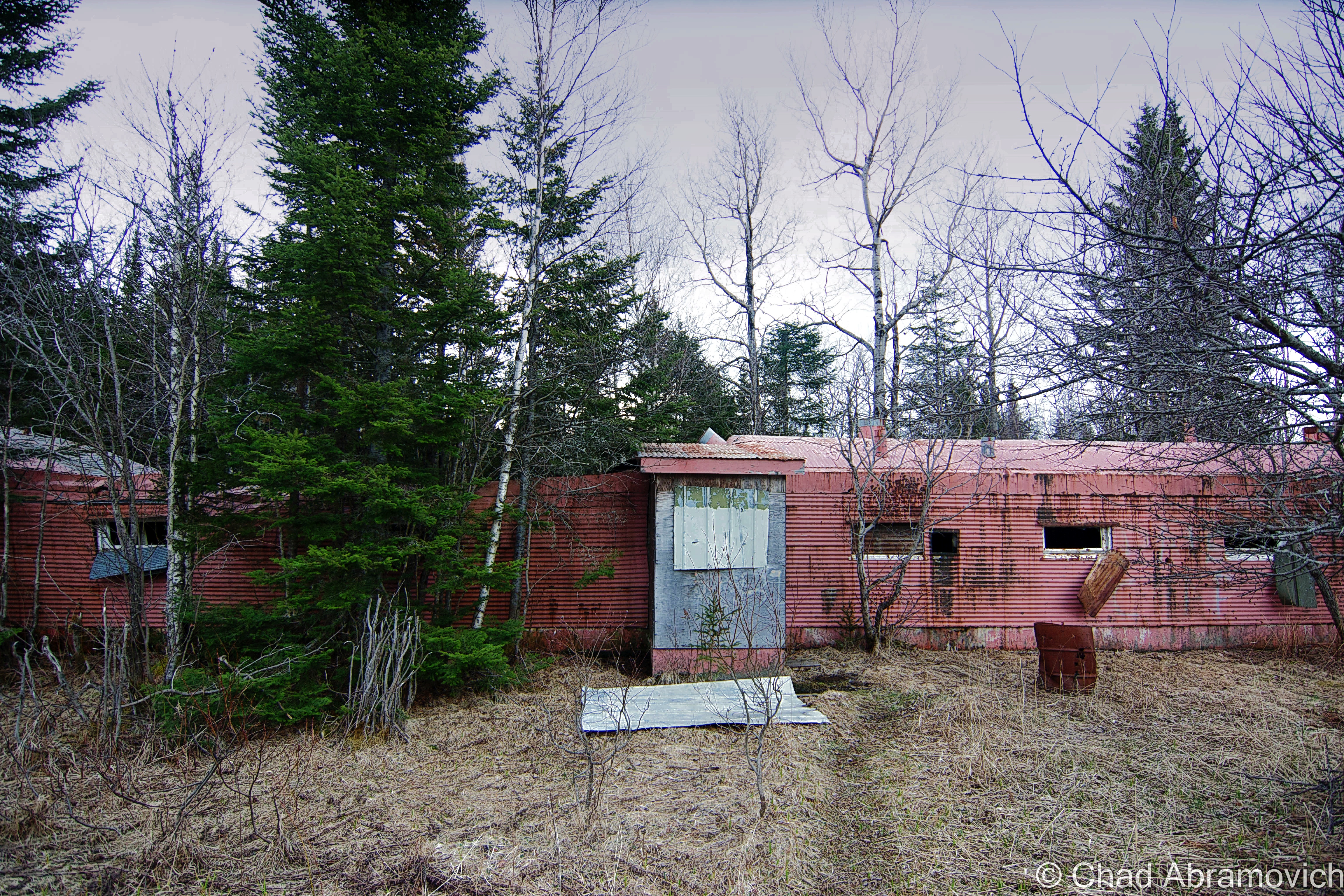
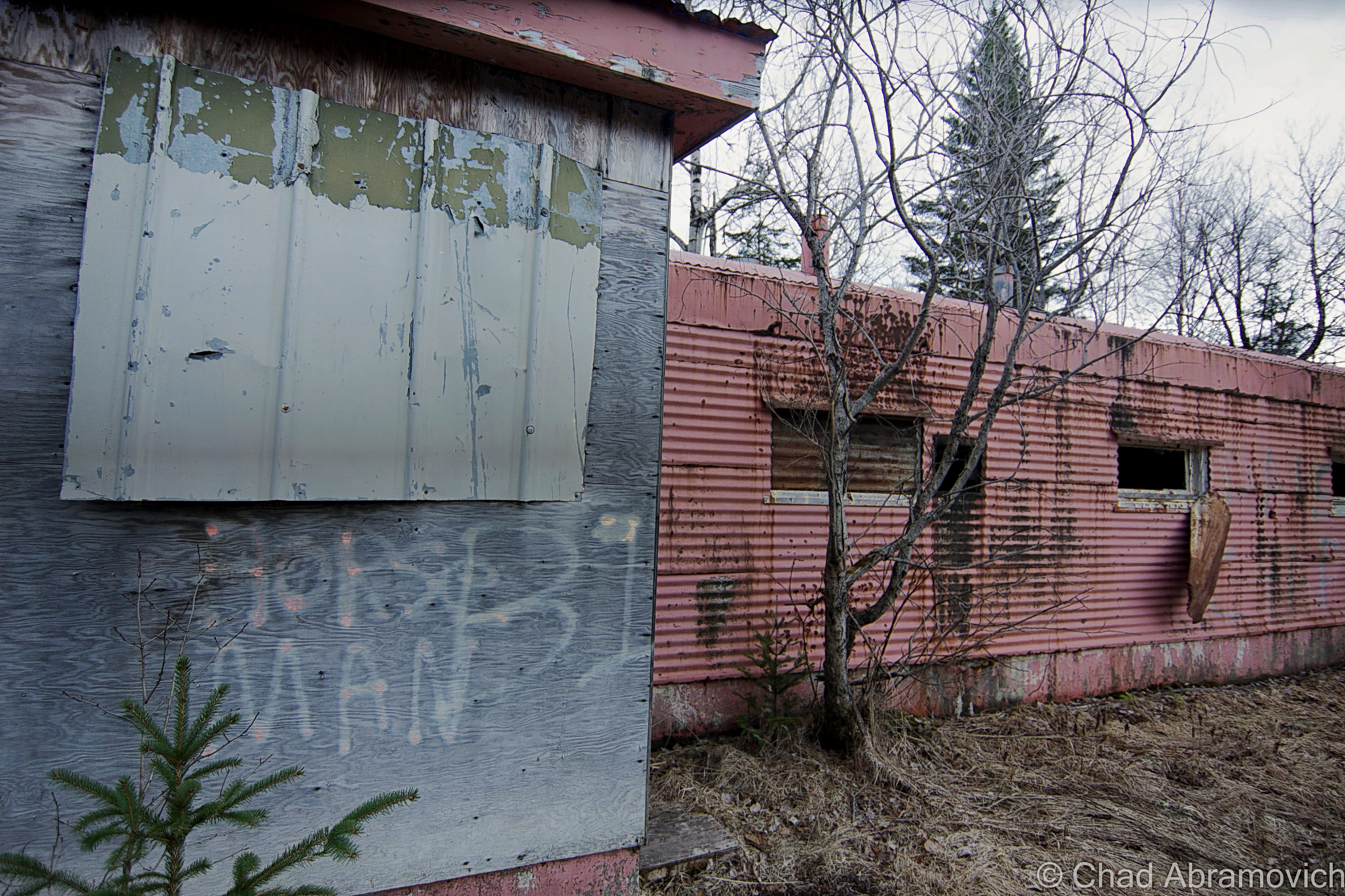
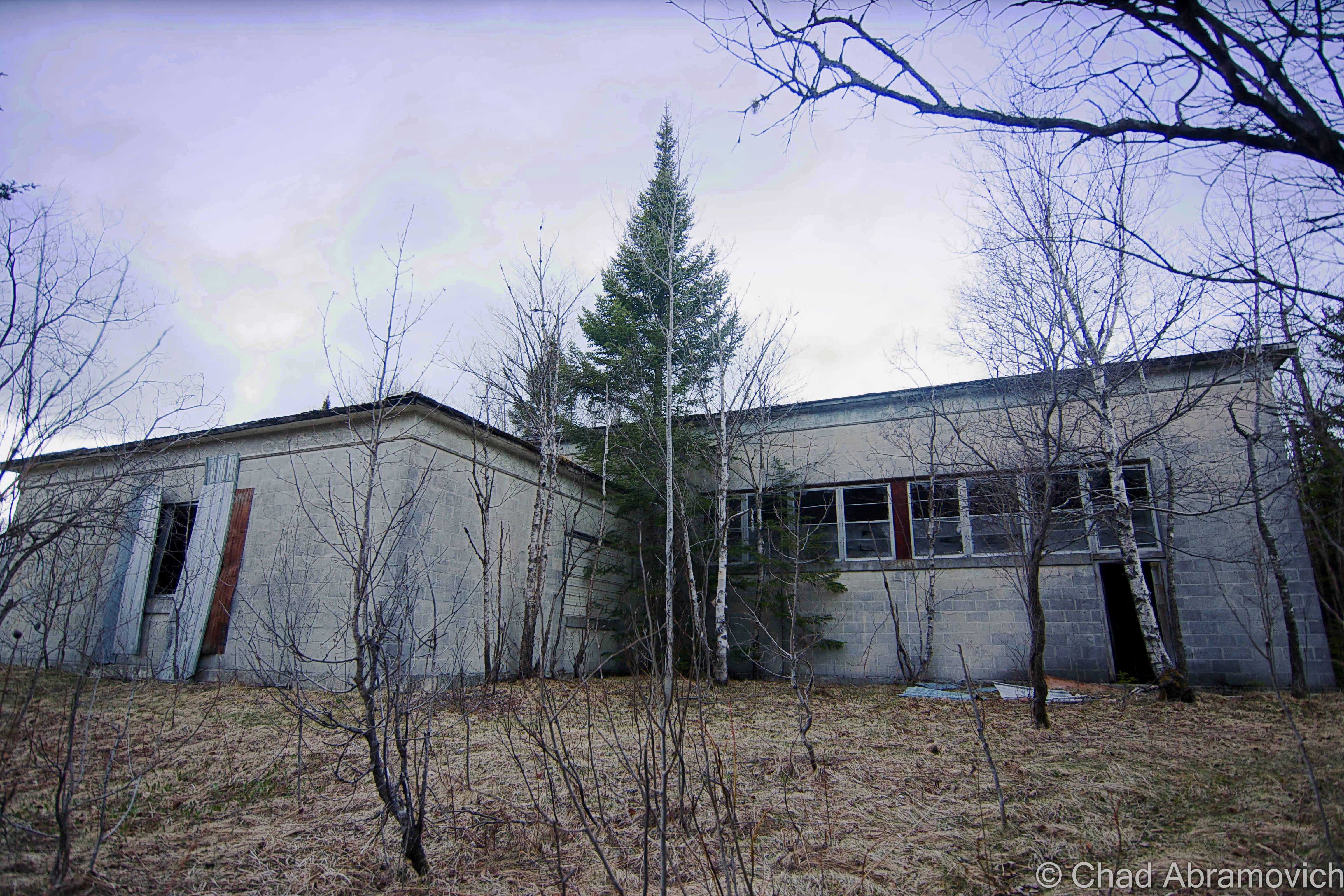
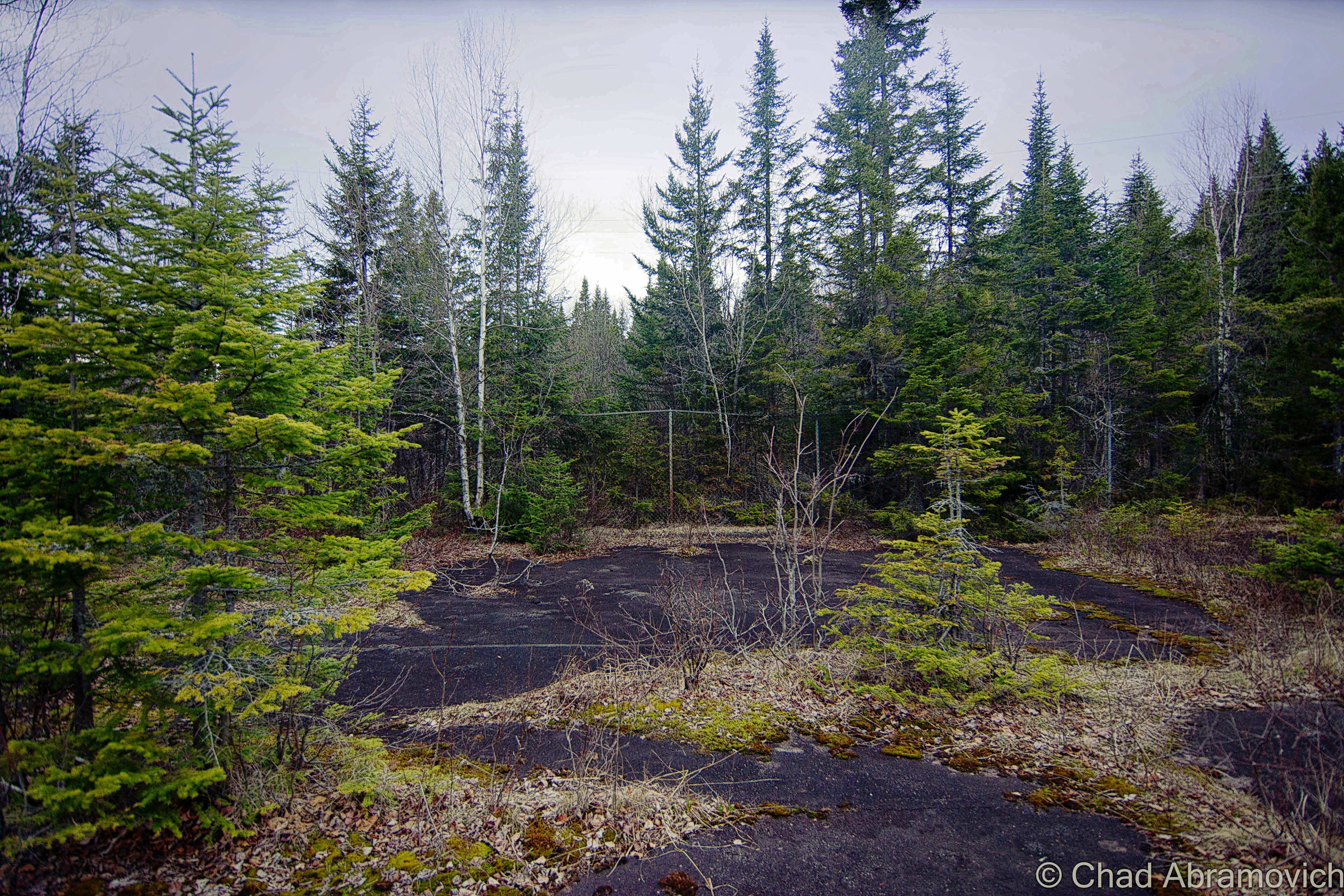
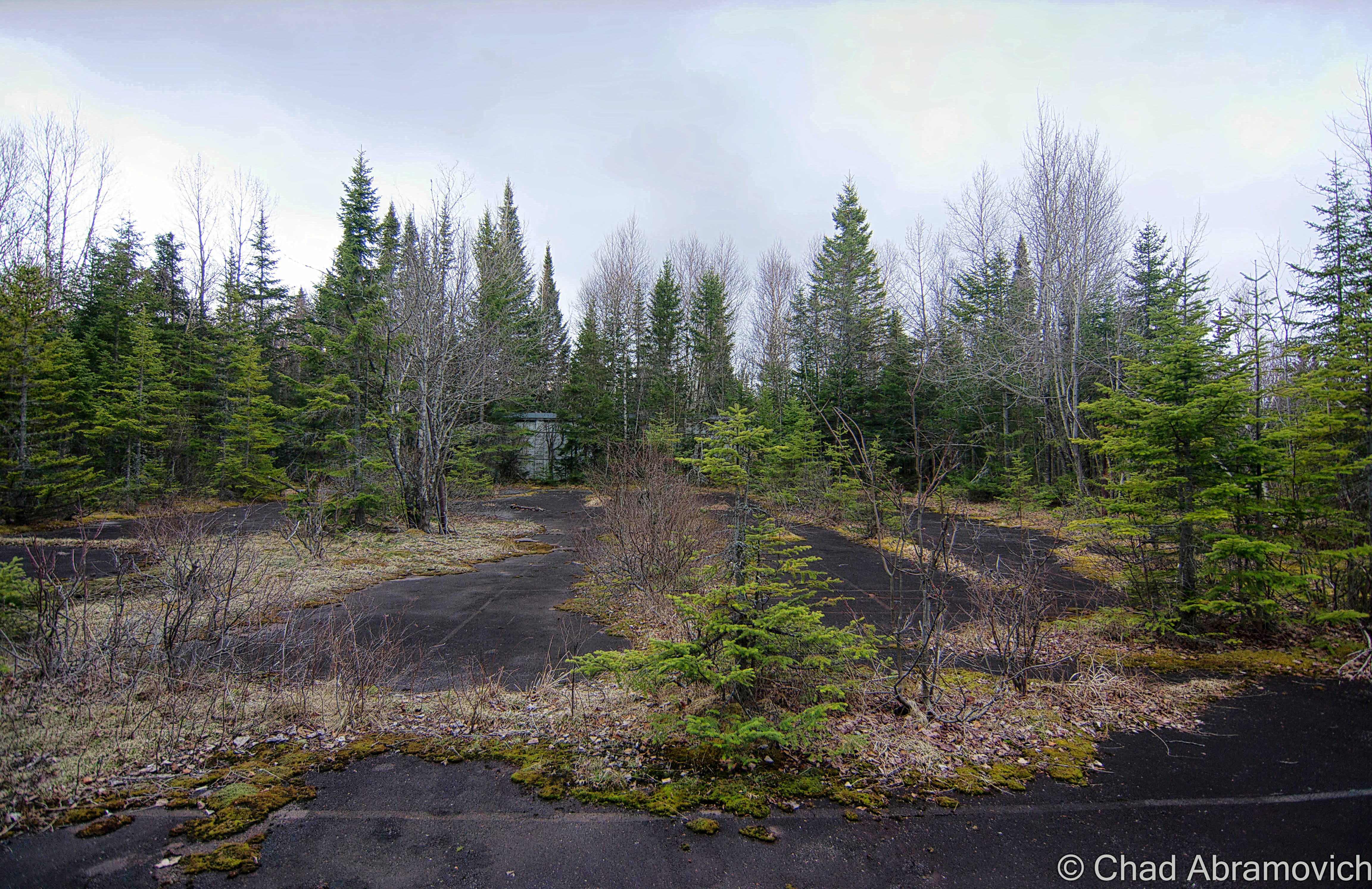
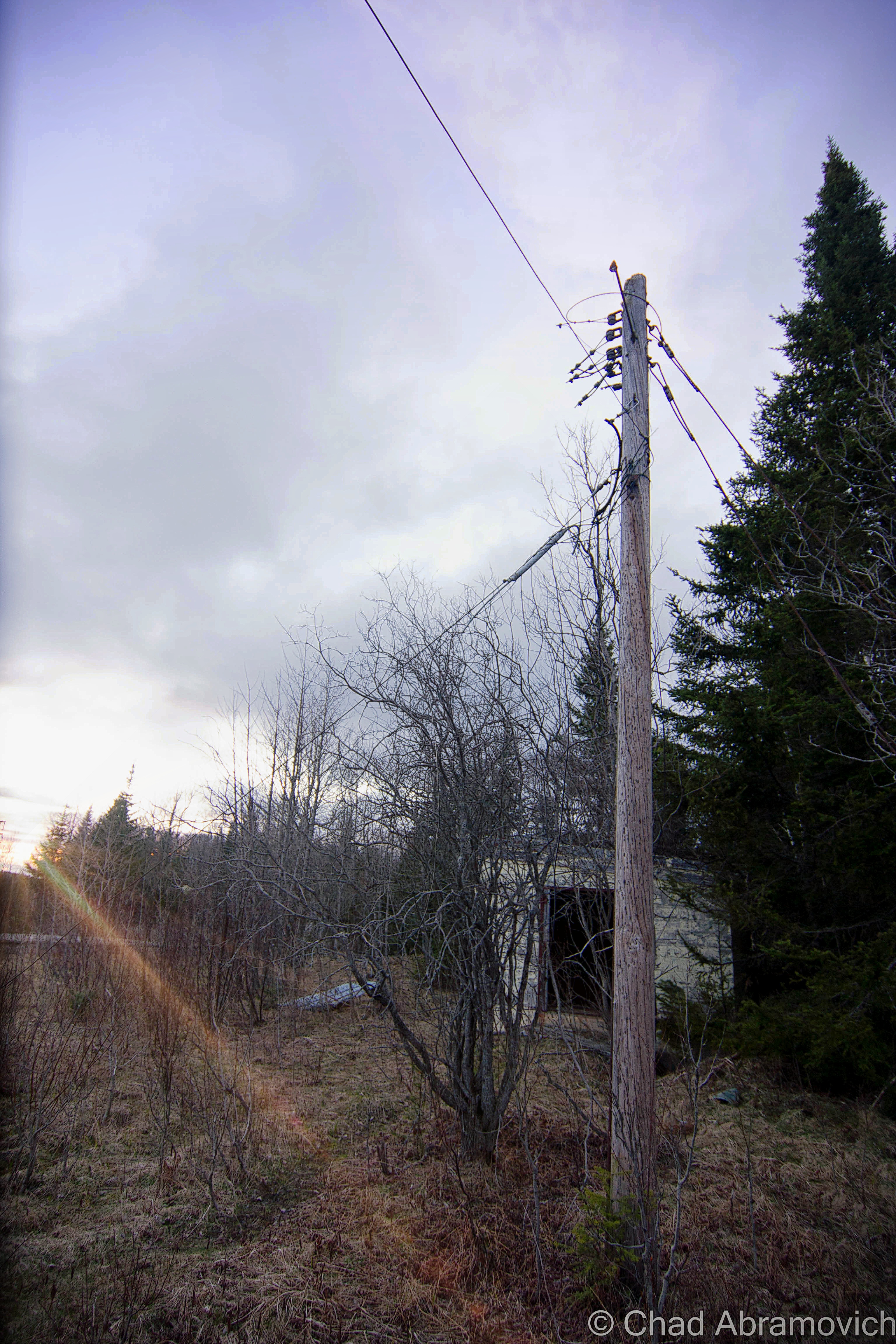
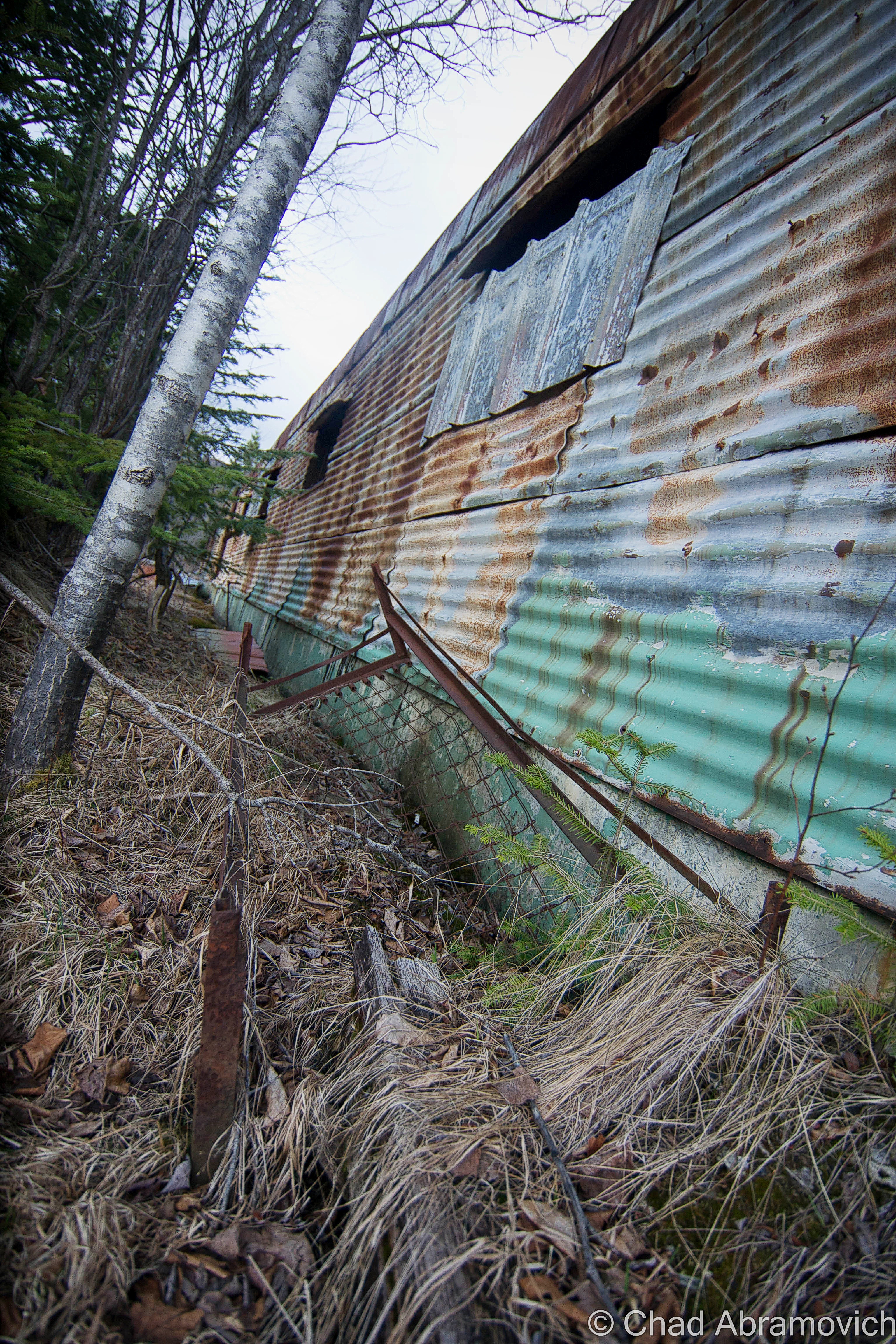
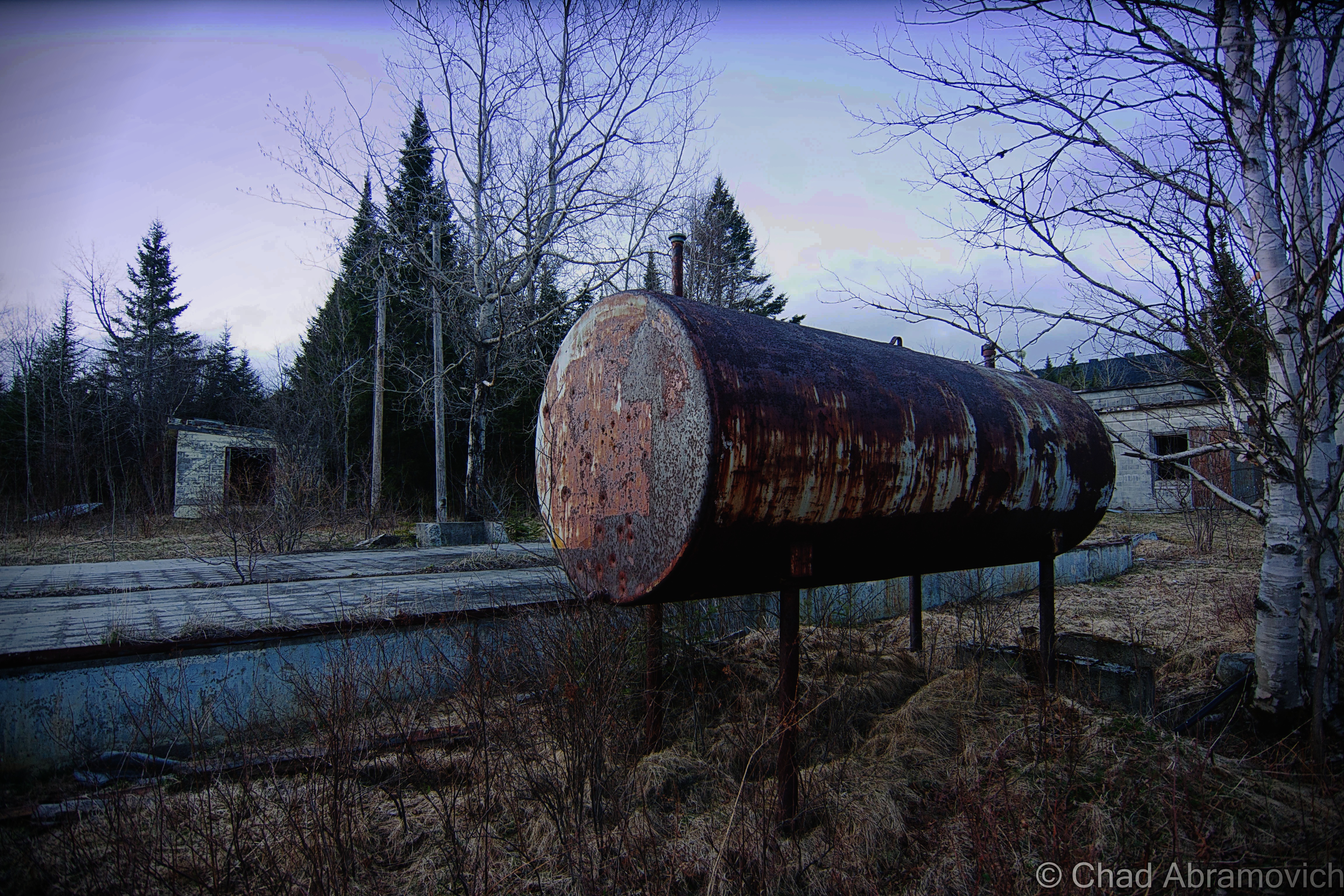
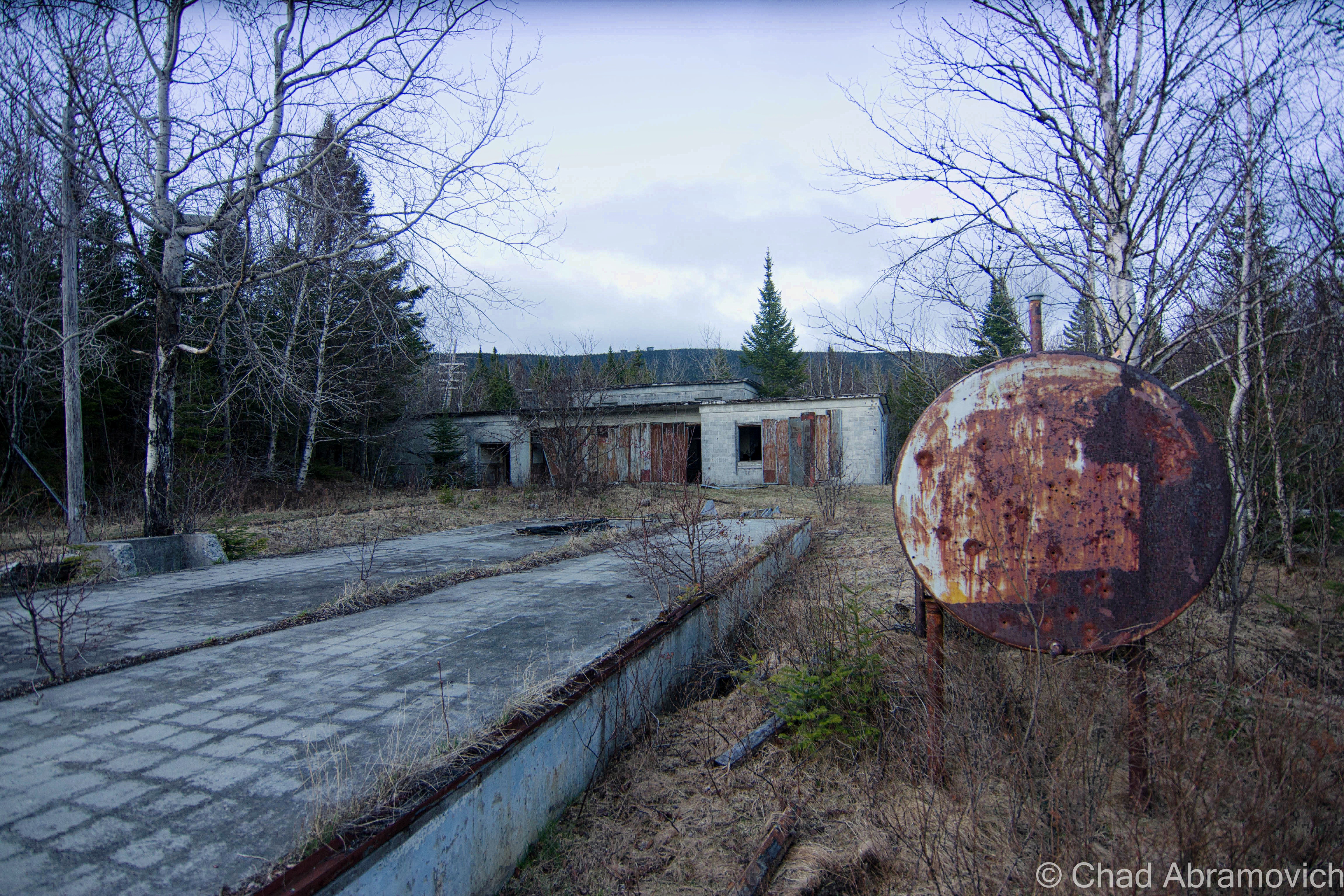
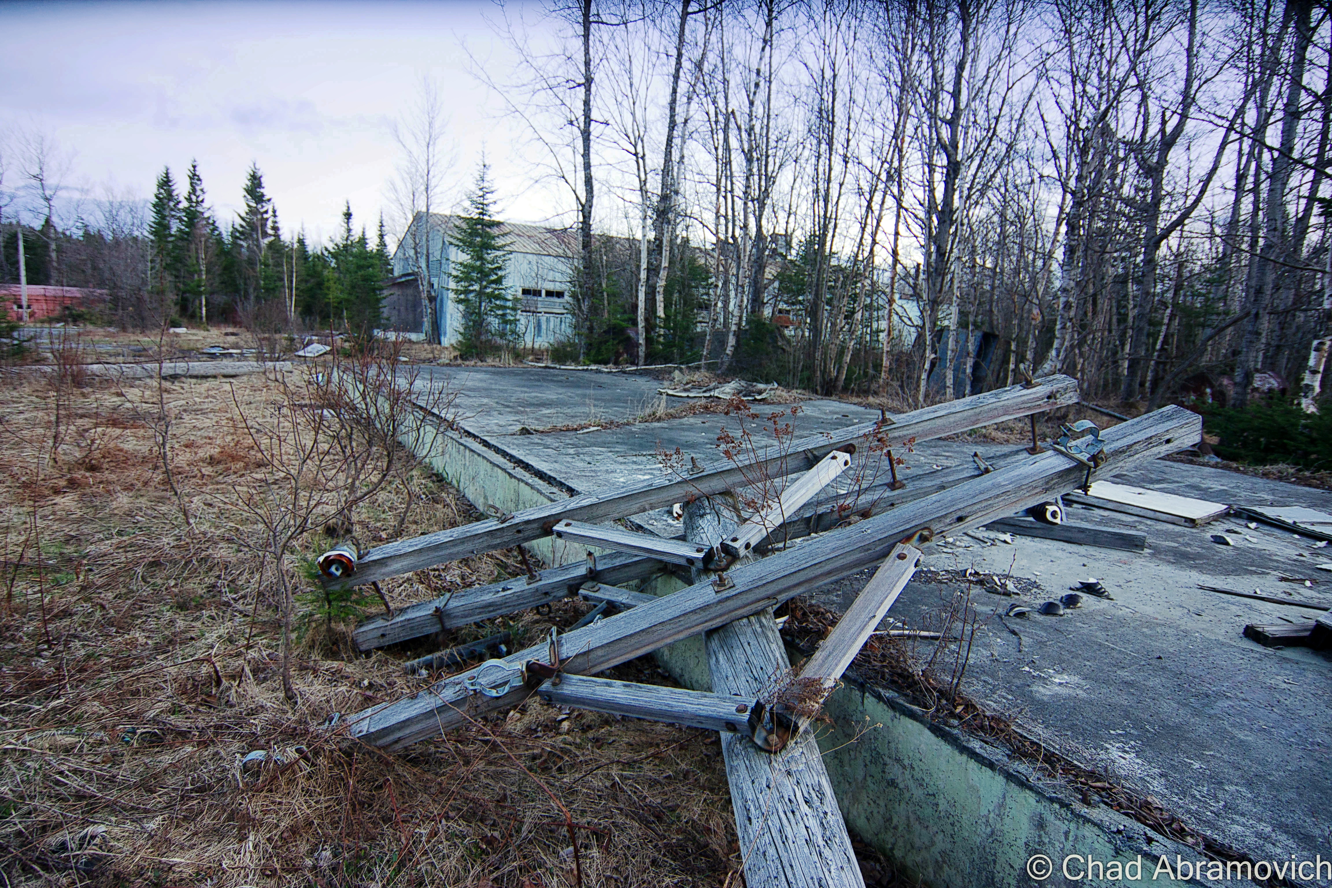
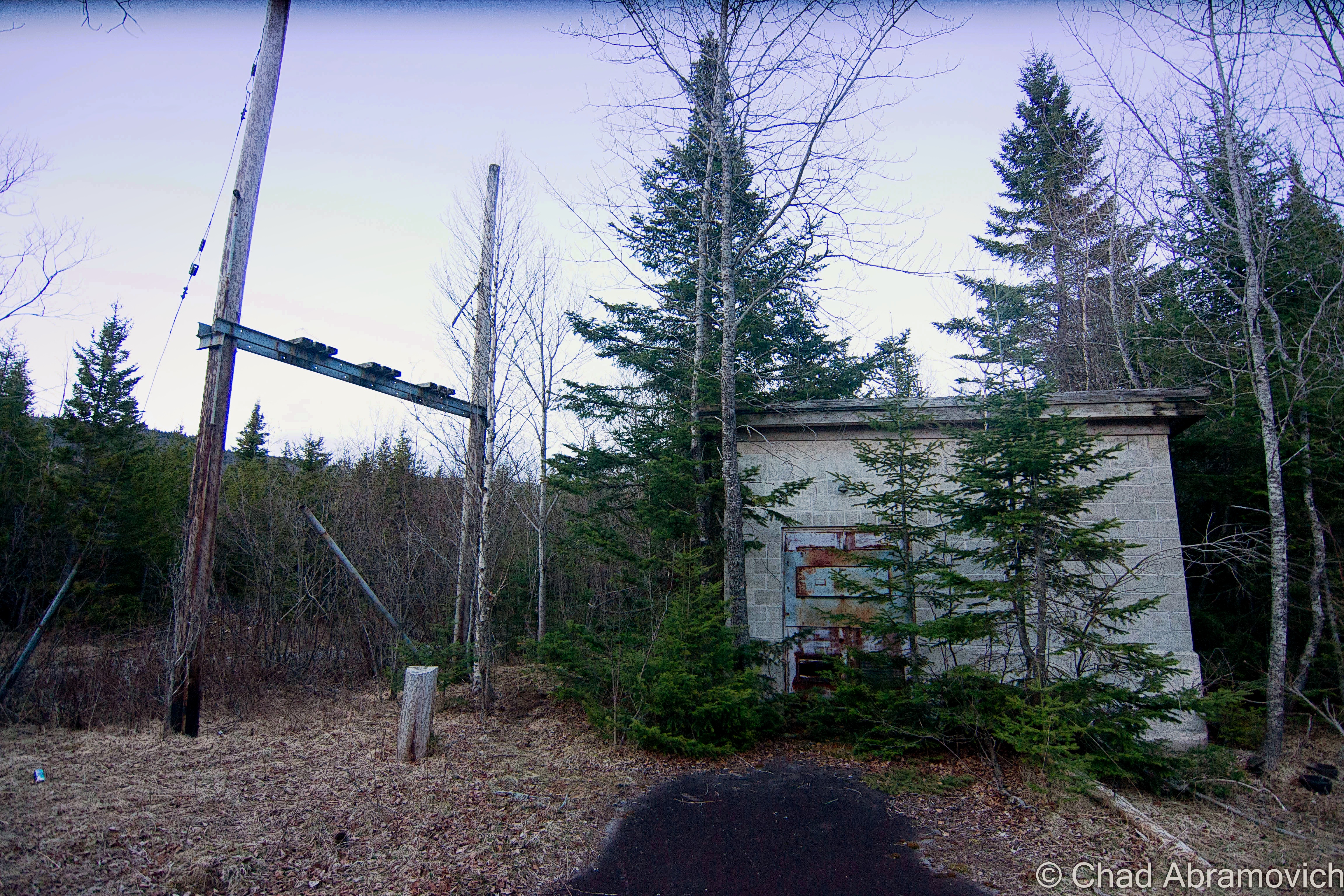
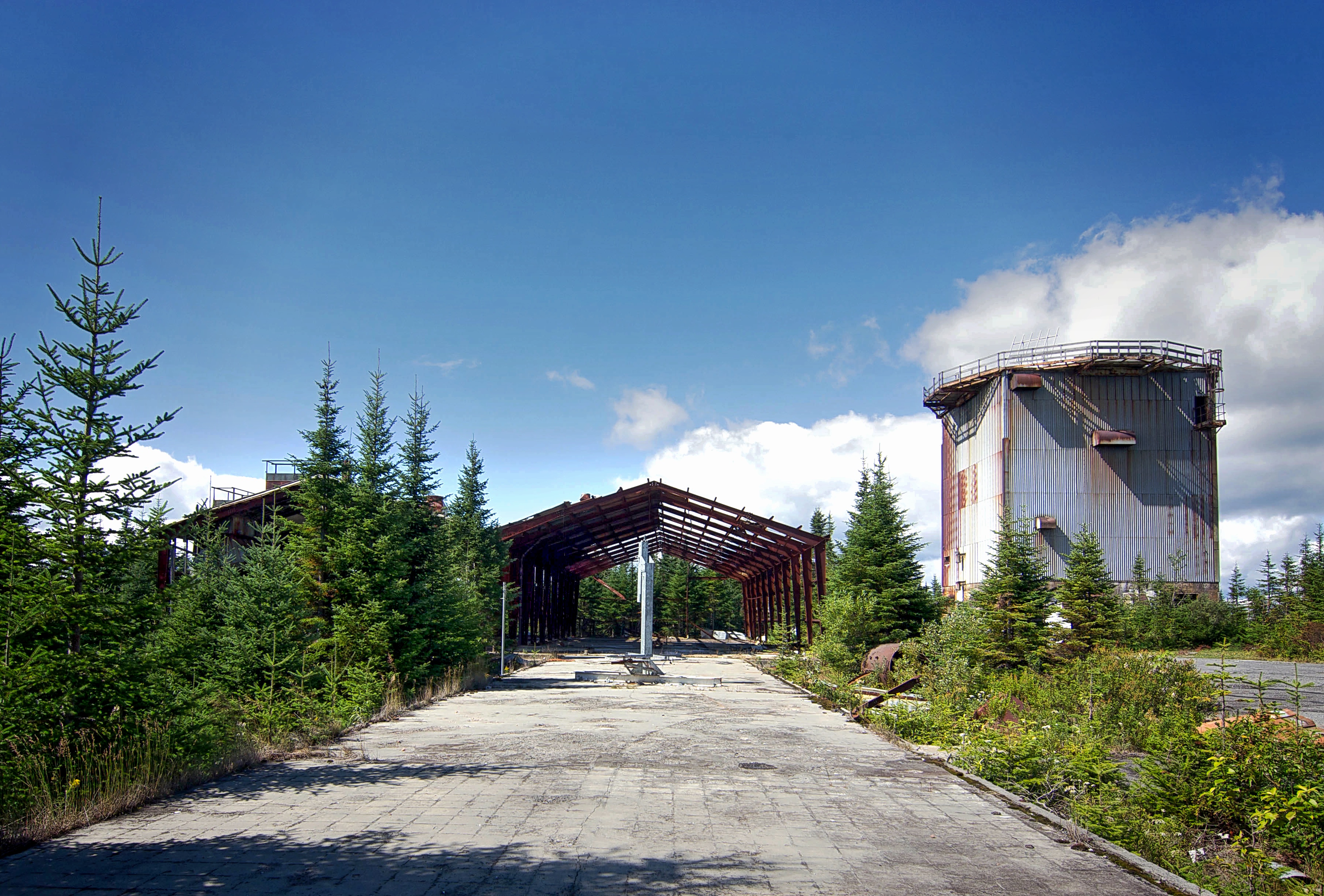
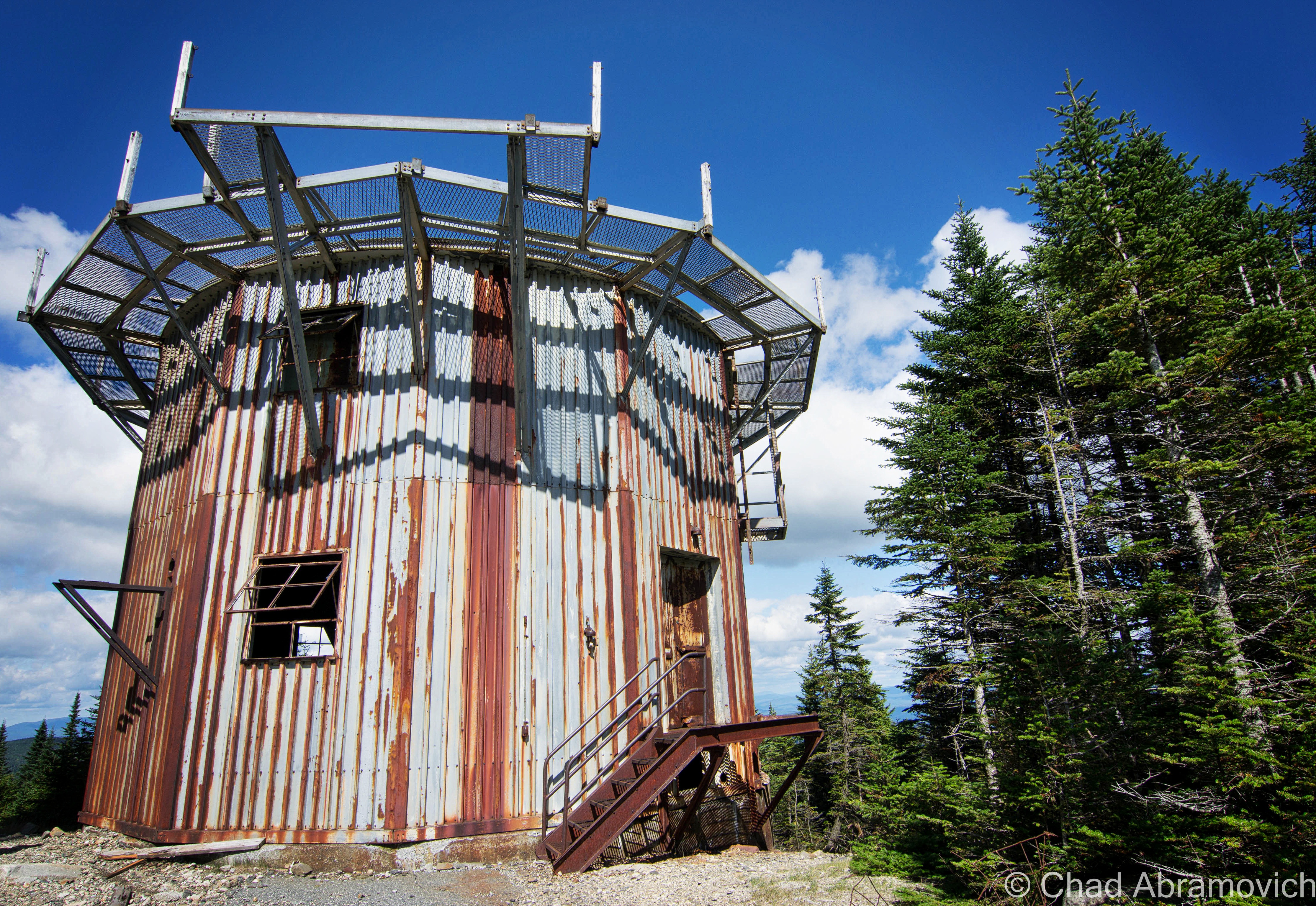
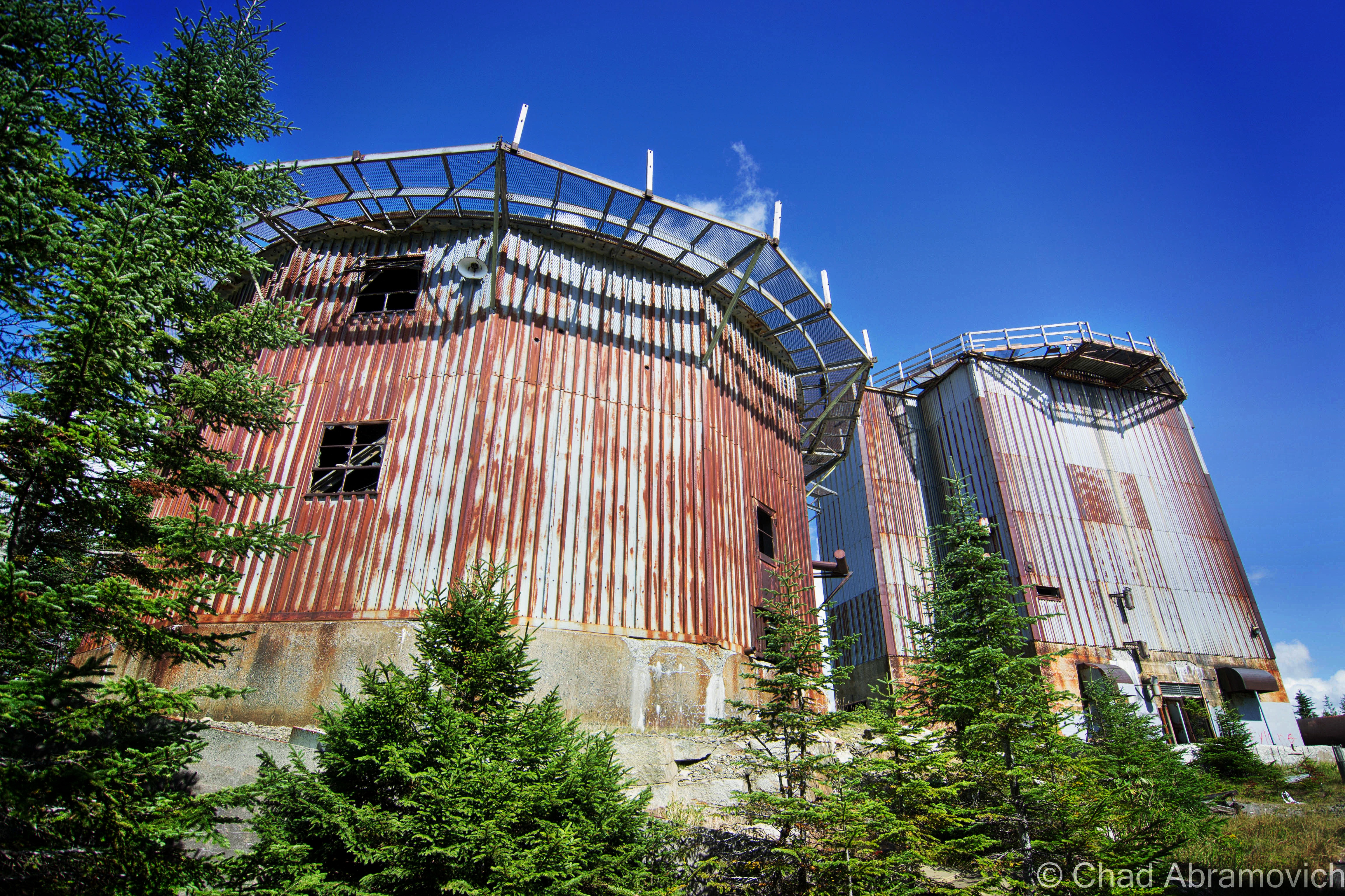
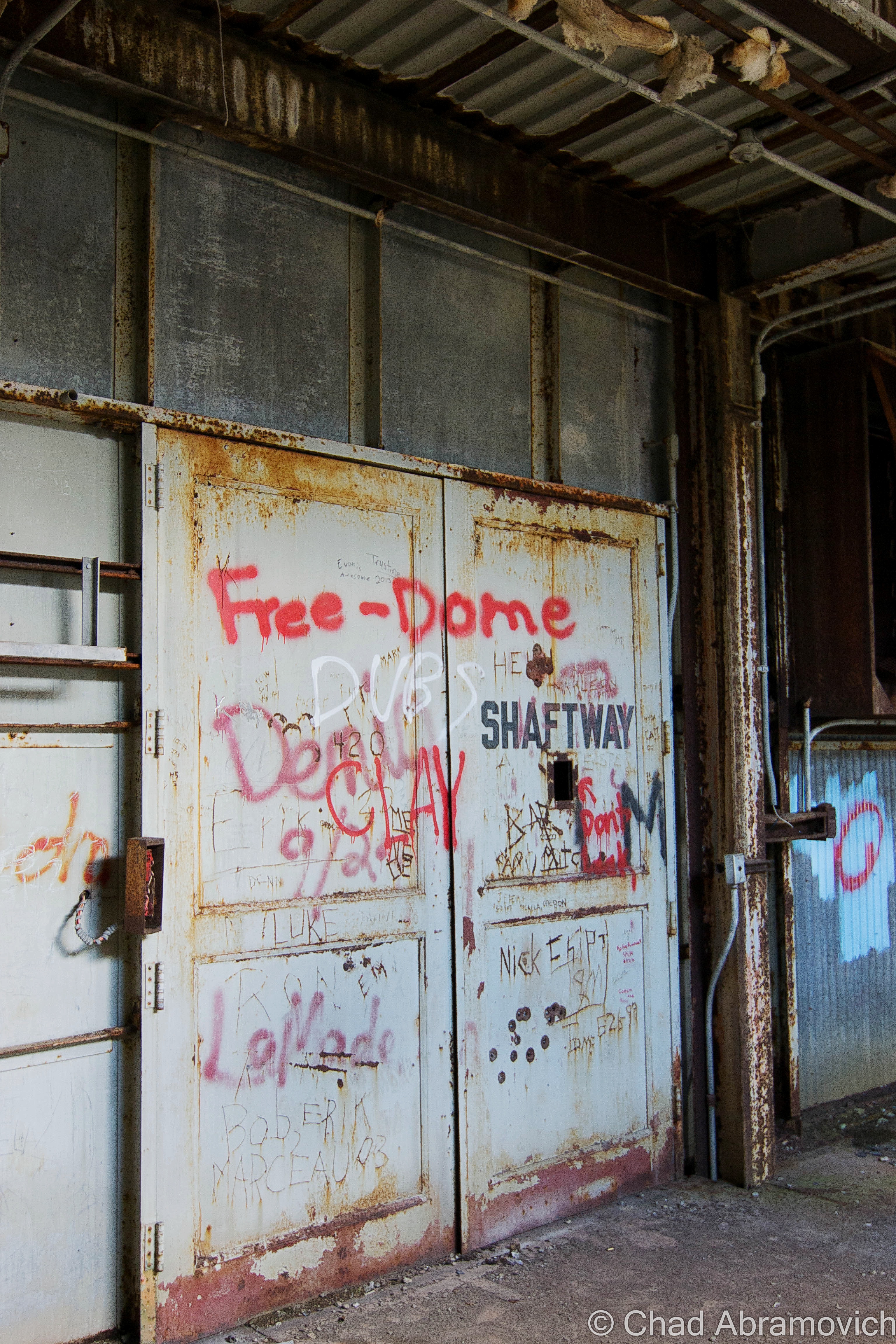
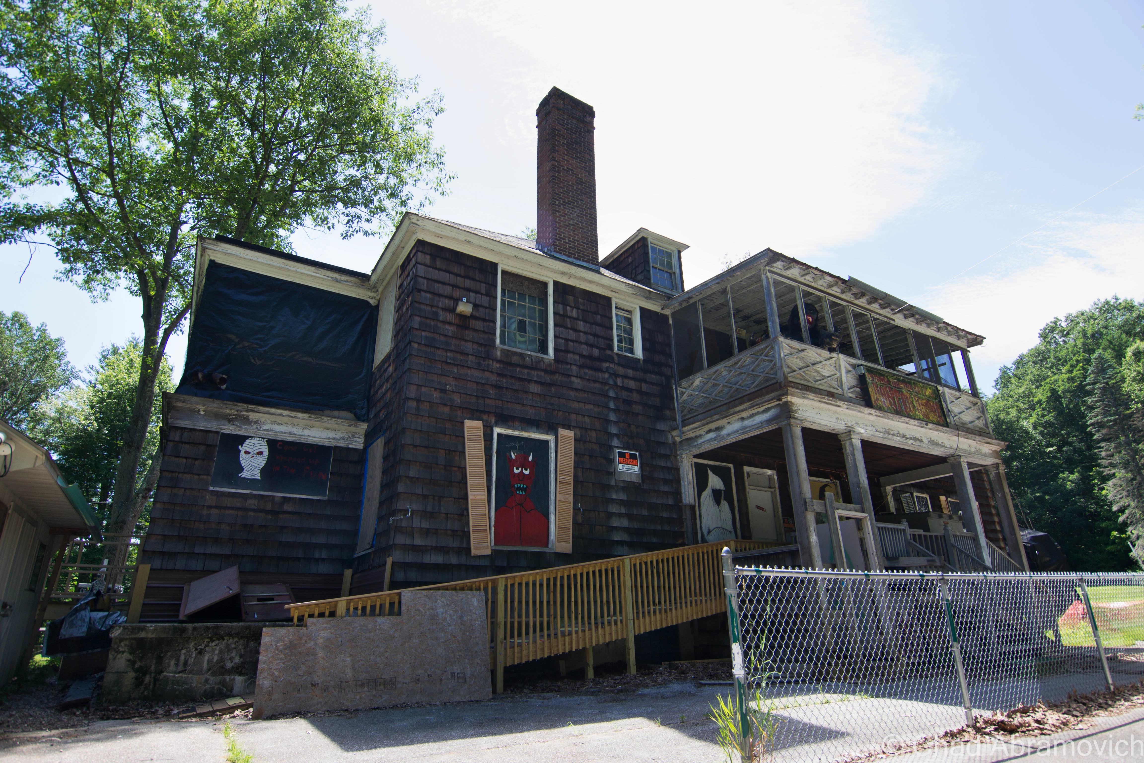
The Jones and Lamson factory had been abandoned since 1986, and for decades, its ruins became a conspicuous landmark that marked one of the main entry points into town. And it was an absolutely gigantic property: 270,000 square feet of decaying building that sprawled over 12 acres of land between the Black River and VT State Route 11, known as Clinton Street through that part of town.

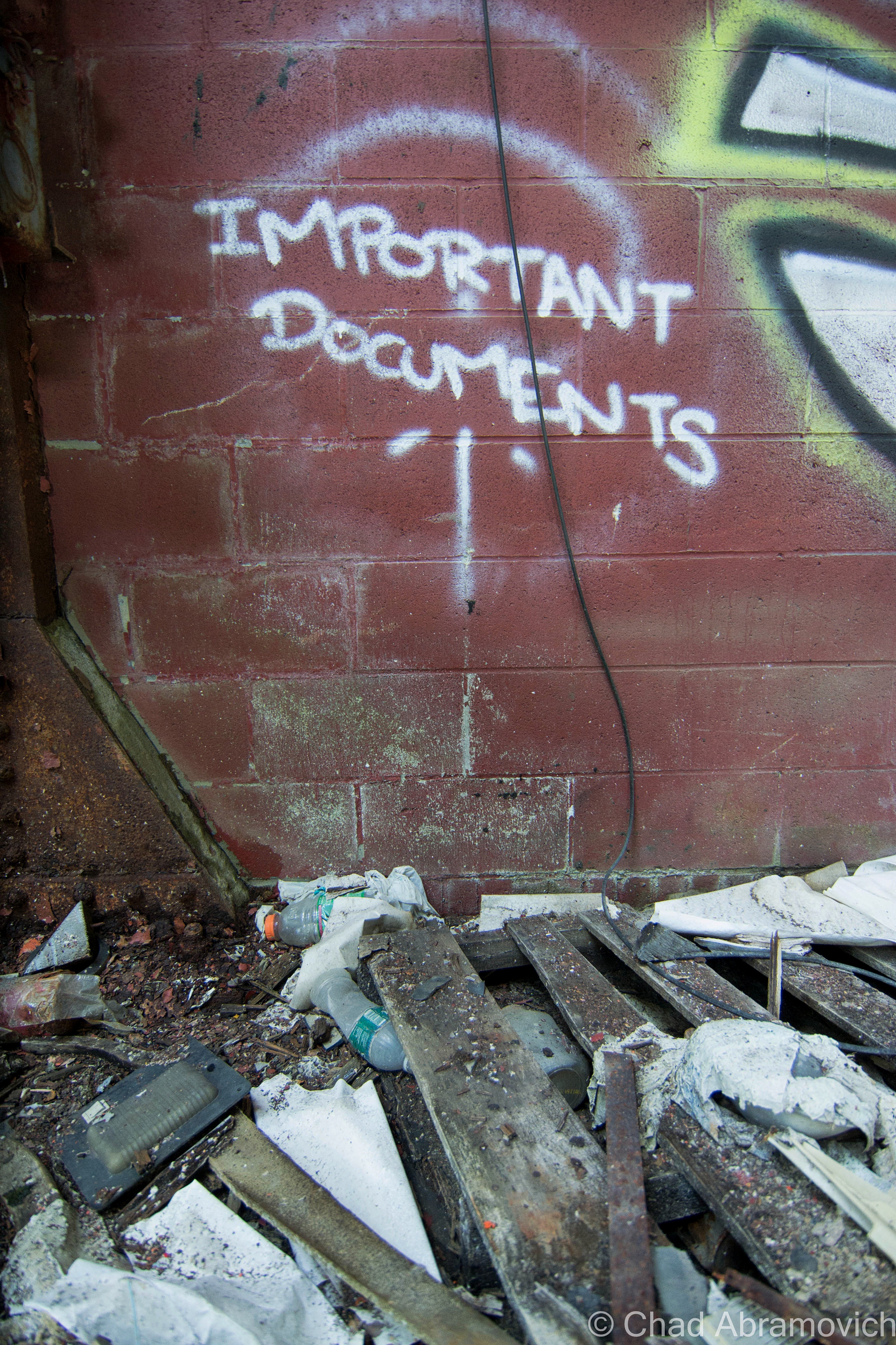
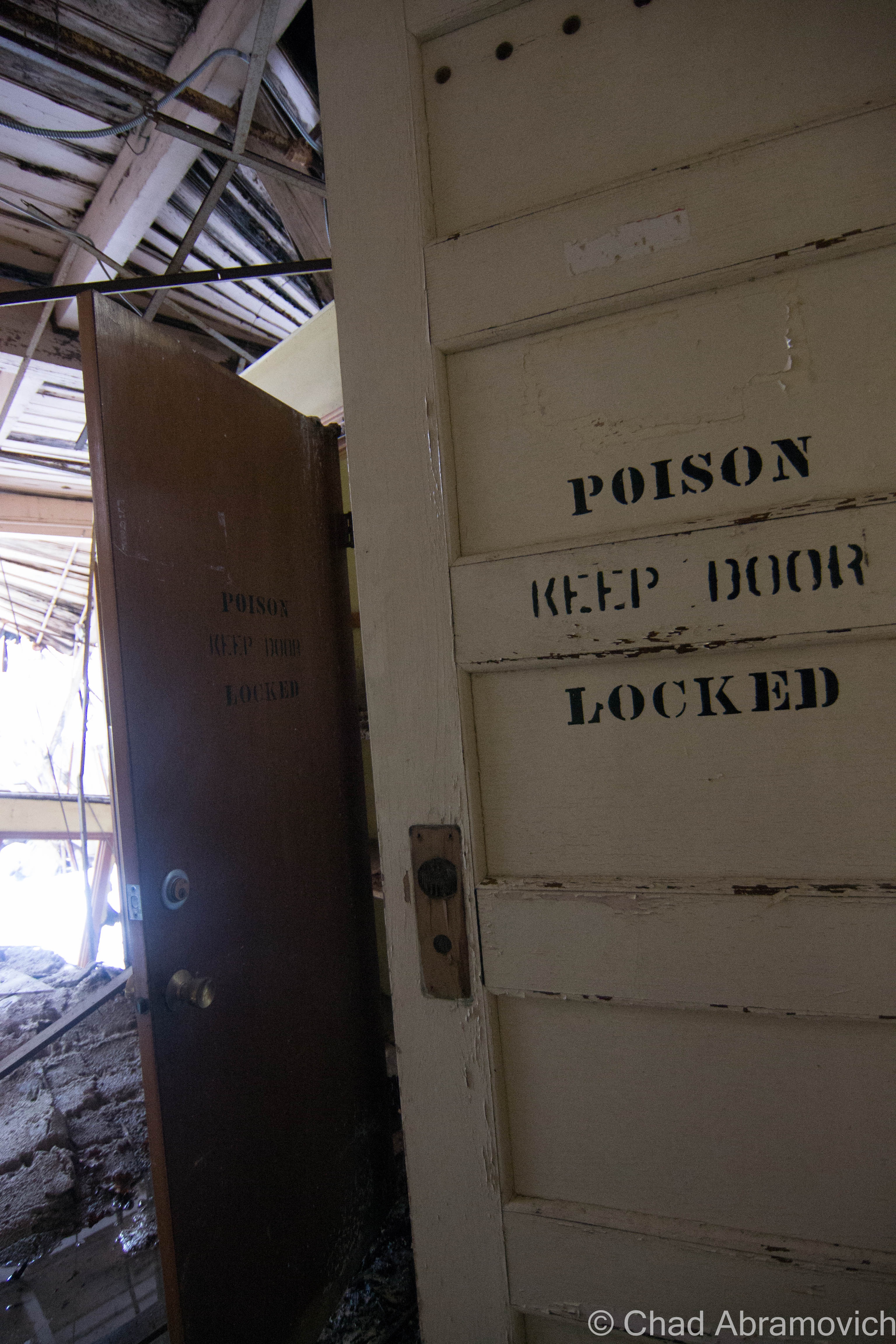
In 2004, the Springfield Regional Development Corporation purchased the property in hopes to, well, do something with it, but its runaway deterioration and designation as a brownfields site – or – a property that’s enormously polluted by toxic materials, usually as the residual of former industrial use, kinda problematized any headway that could have been made. The old J&L factory played host to tons of industrial chemicals, including polychlorinated biphenyls (PCBs); trichloroethylene (TCE); and light, non-aqueous phase liquids (NAPLs), and to remediate hazards like those, you need to secure lots of capital and involve lots of bureaucracy.

In November of 2021, cleanup grants had been secured, and the factory was demolished, which I can’t help but be pretty bummed about. What a shame, it was such an irreplaceably neat building that I feel had the potential to morph into a great new resource for Springfield if given the love.

But – the plan is that they hope to sort of go full-circle with the lot, and lure another industrial gig to town that hopefully will continue to push back the boundaries of the unknown and isn’t just another awful Dollar General. The land is flat, which is pretty a valuable deal in Springfield because most of the village is built up around low-profile slopes that contort around the Black River. It’s also apparently hooked up into some of the fastest internet connections in all of Vermont, which is also a huge deal here given the state’s notoriously lacking rural infrastructure. It’ll be interesting to see what comes along – and I really hope that it’ll be something that will serve Precision Valley with dignity for another century. Springfield is absolutely a town worth rooting for!

An interesting side note to all this, is that because of the rich industrial history and current fading ghosts of the area, the town has kind of amassed a bit of a steampunk scene, which has since turned into a notable cultural festival.

Acreage

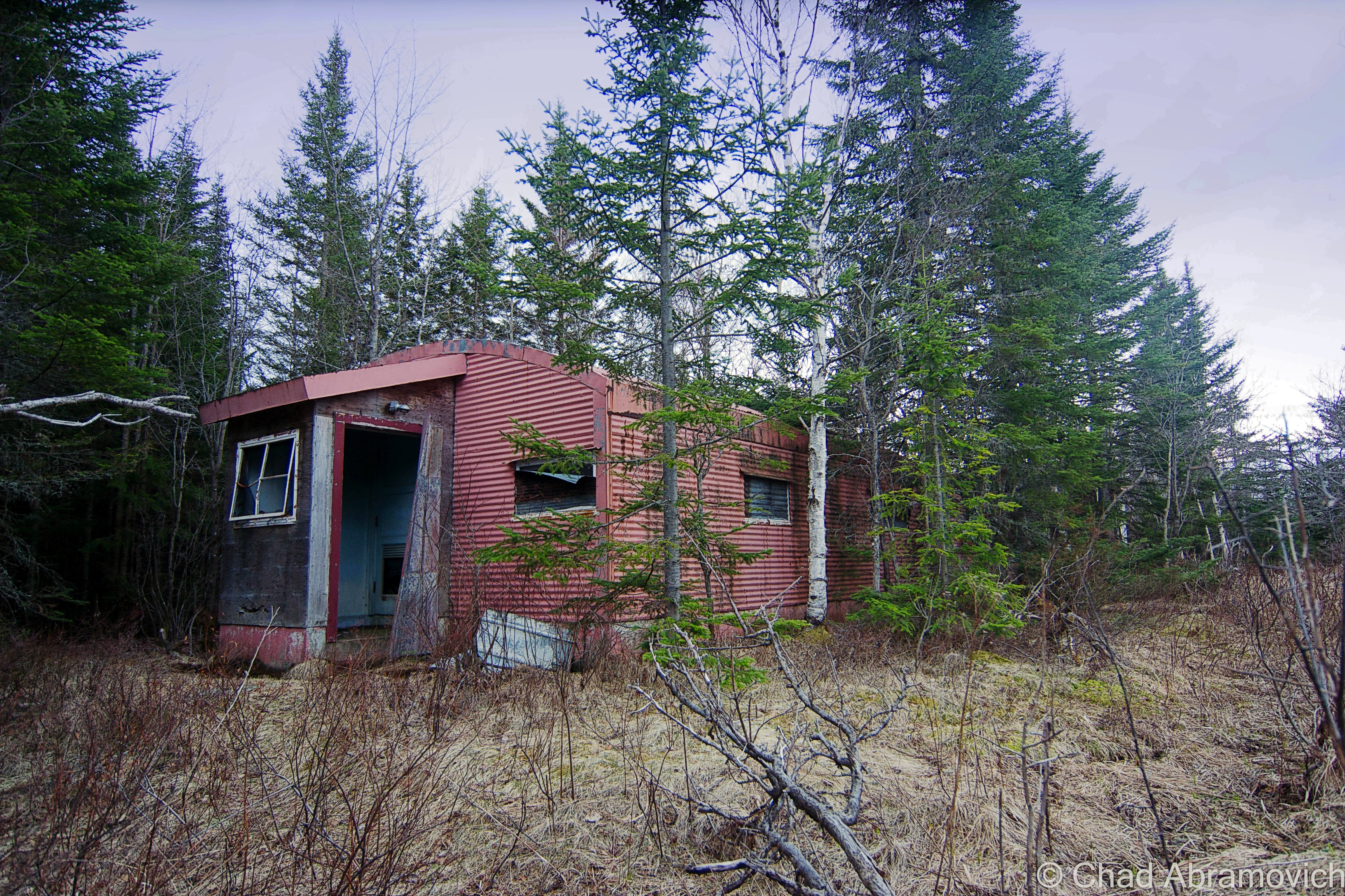
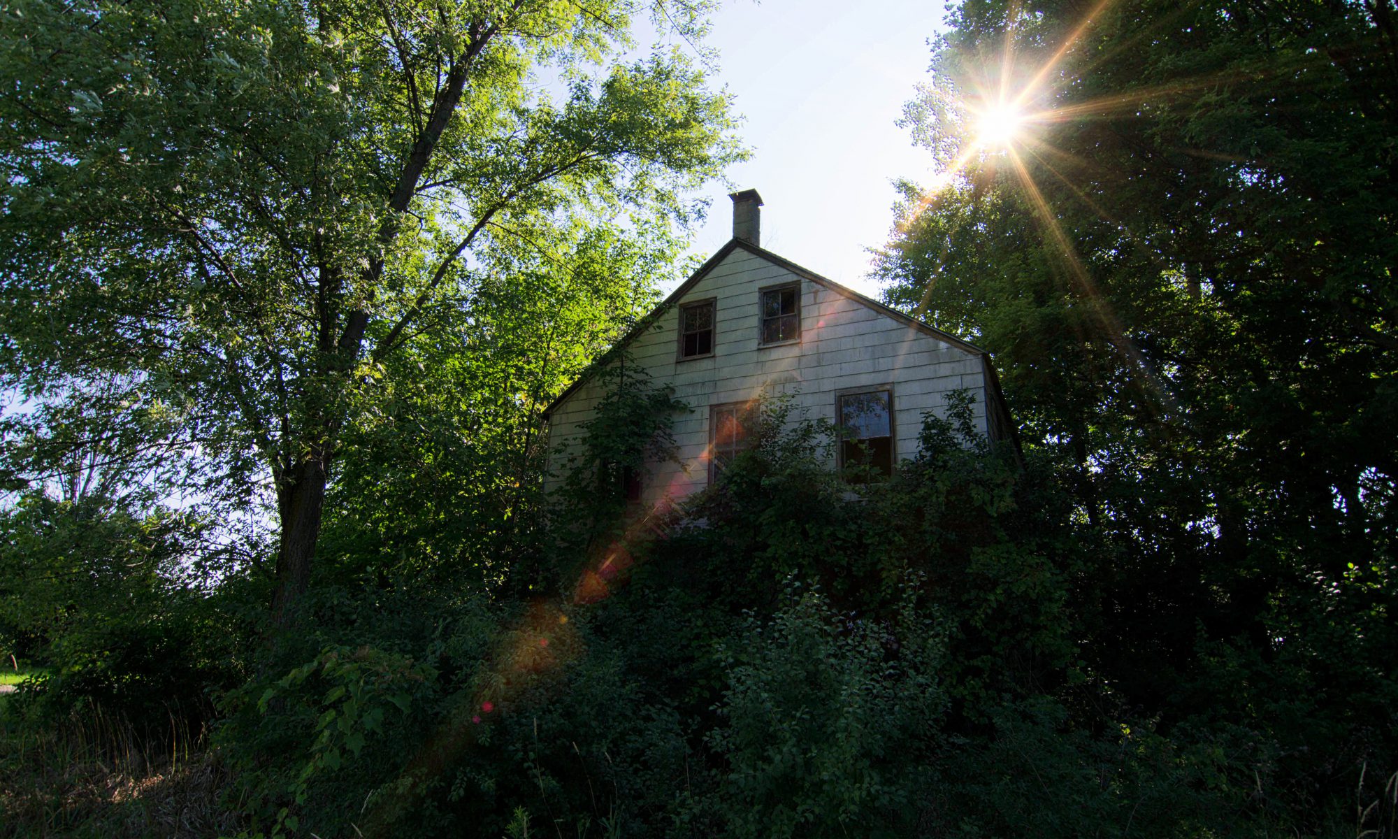
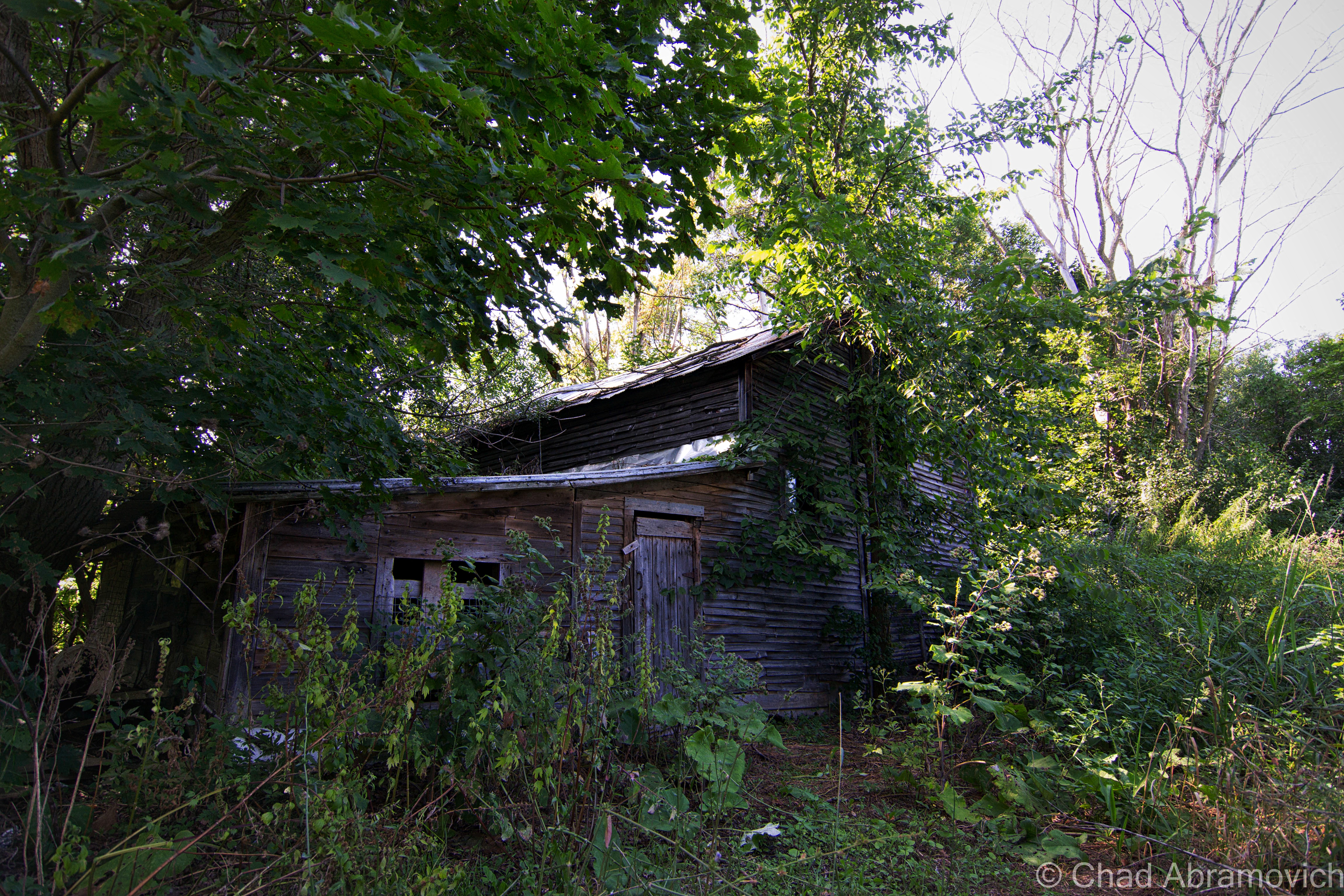
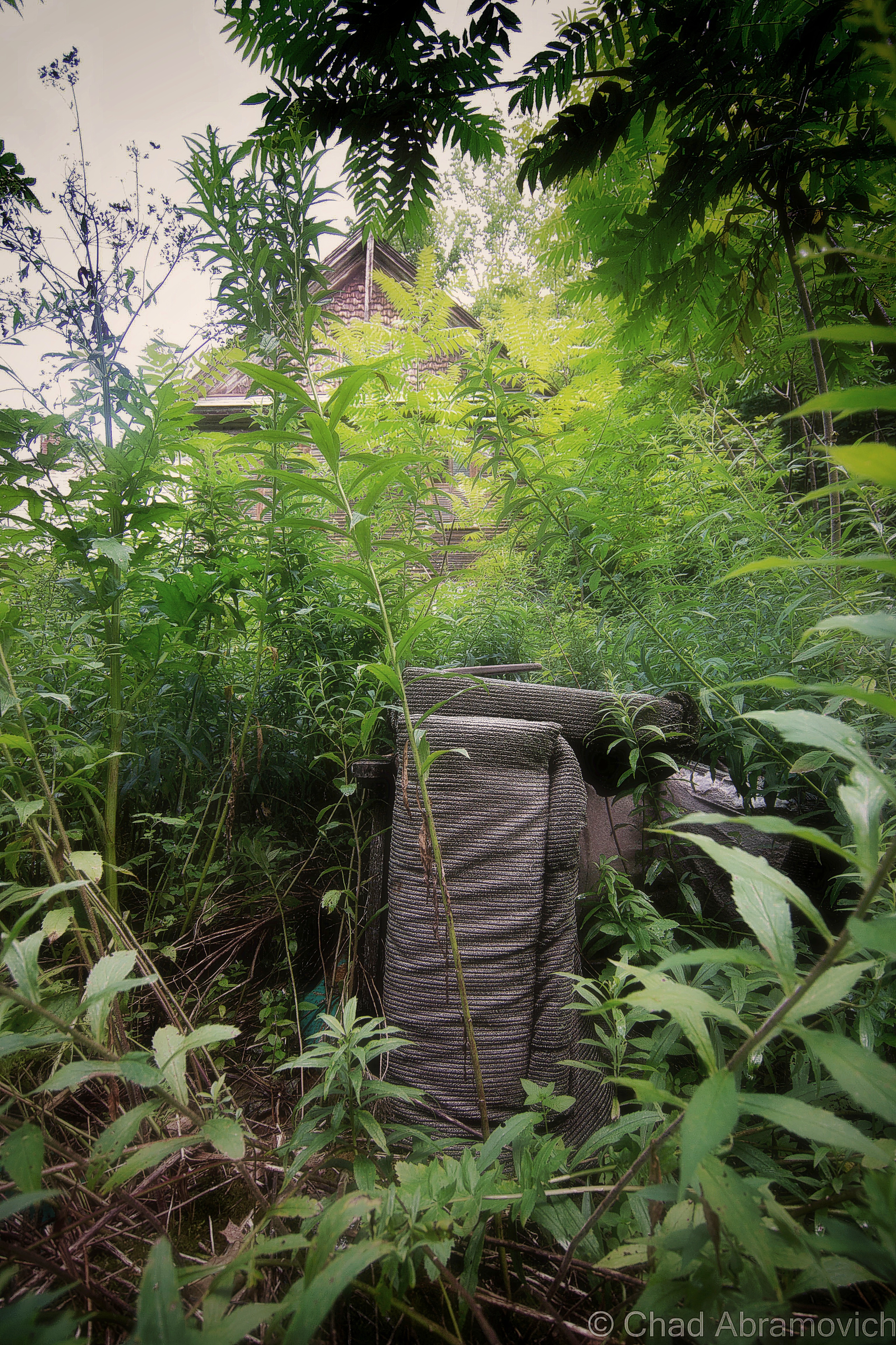
I was excited. I was meeting up with a friend from college I hadn’t seen in years who was getting ready to move out of state, so we figured an explore was a good way to part ways. And it was a lovely early fall afternoon – light jacket weather and foliage just barely starting to change into its death hues – the perfect adventuring weather. It had been a while since I’d had a good urbex – my soul was really jonesing for this excursion.

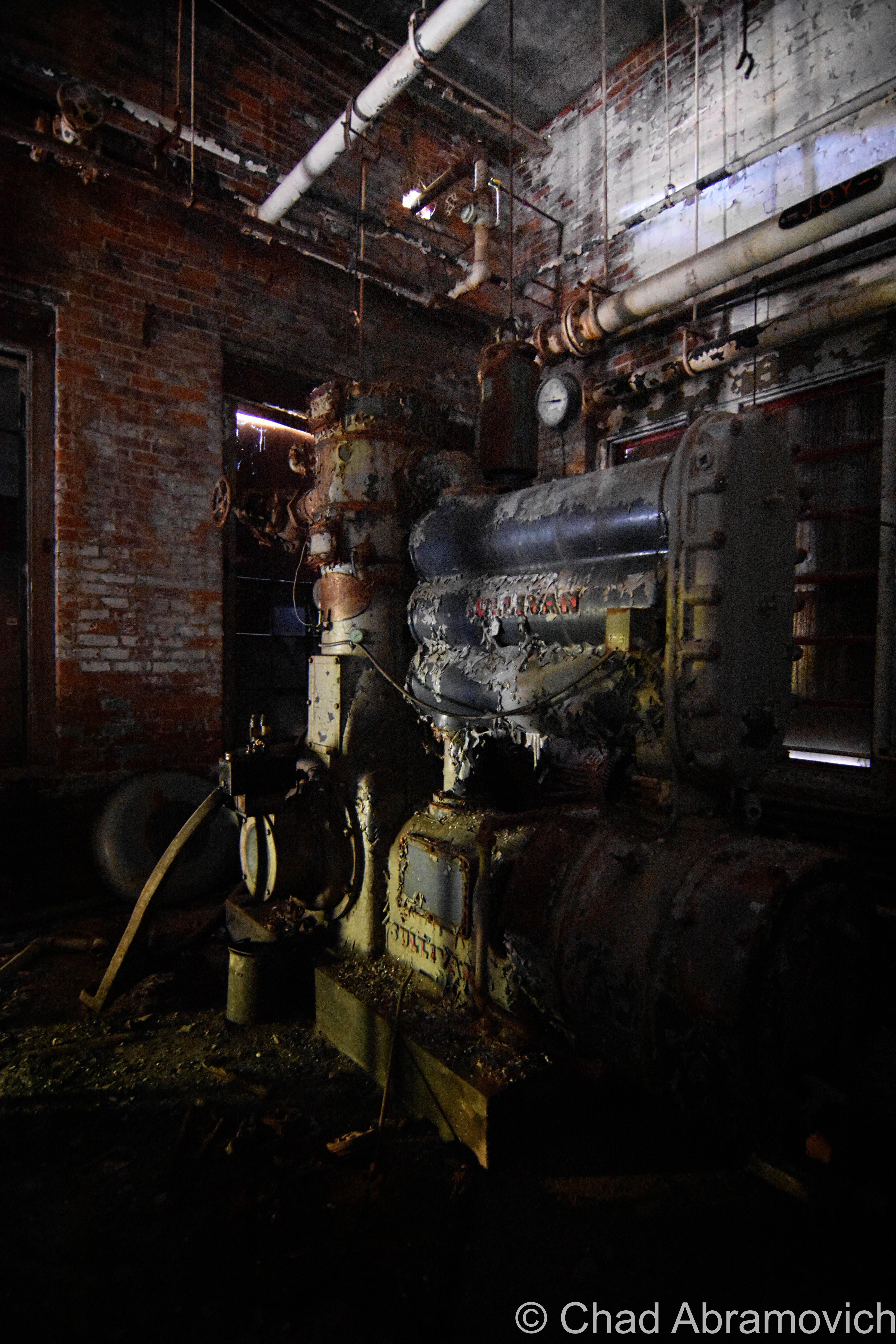
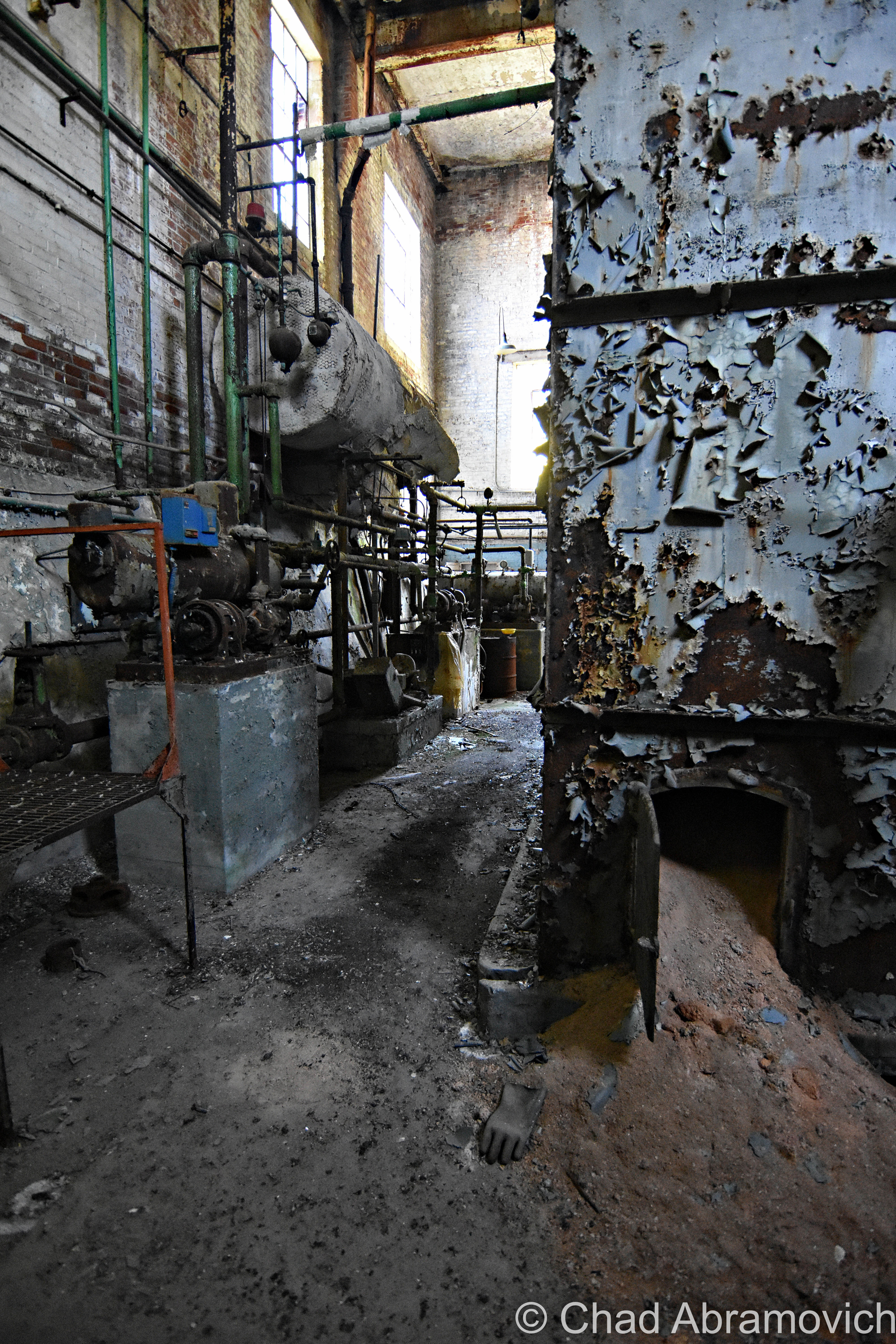
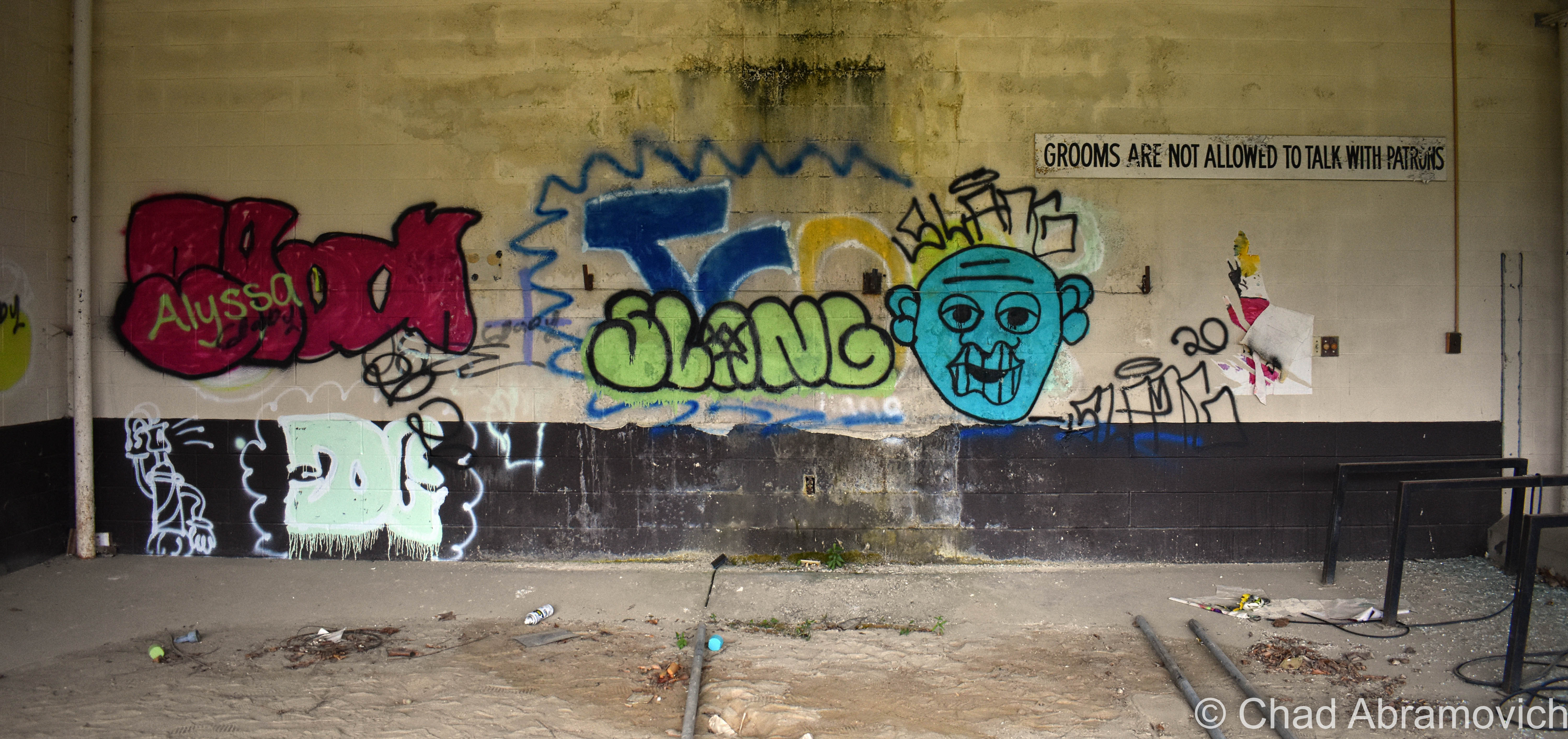
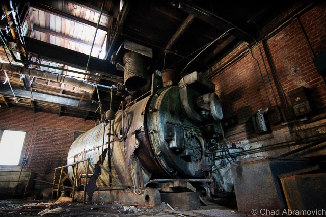
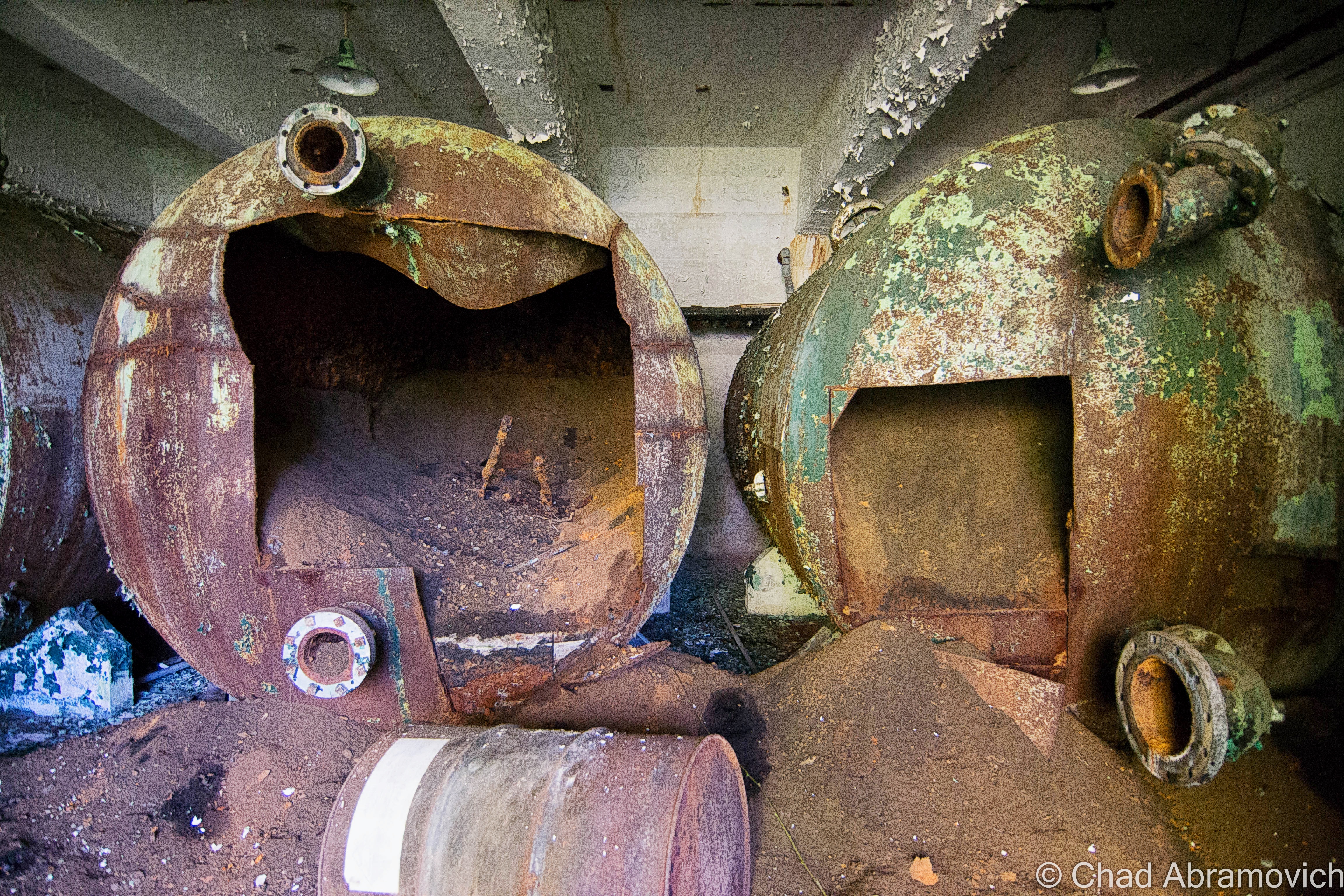
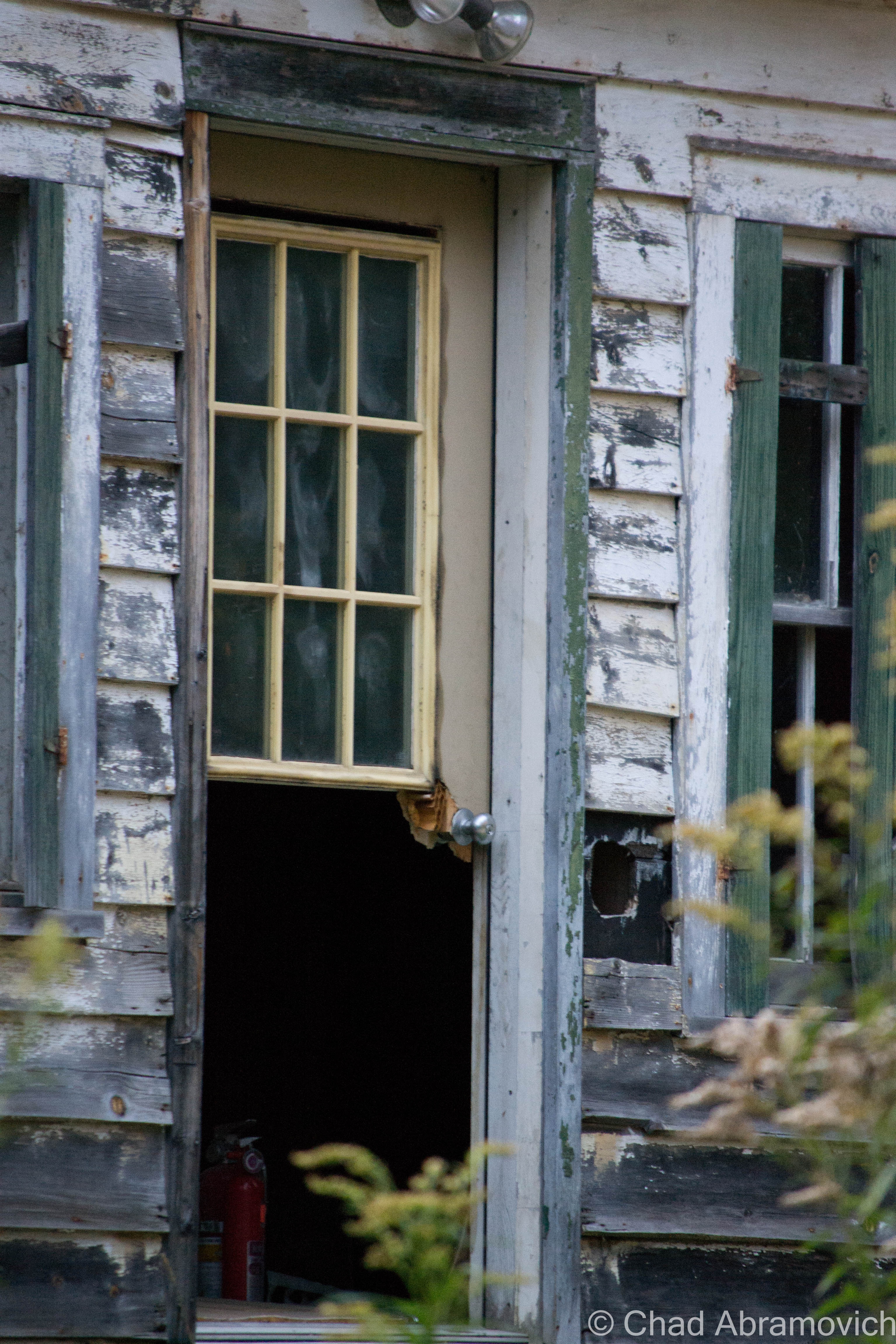
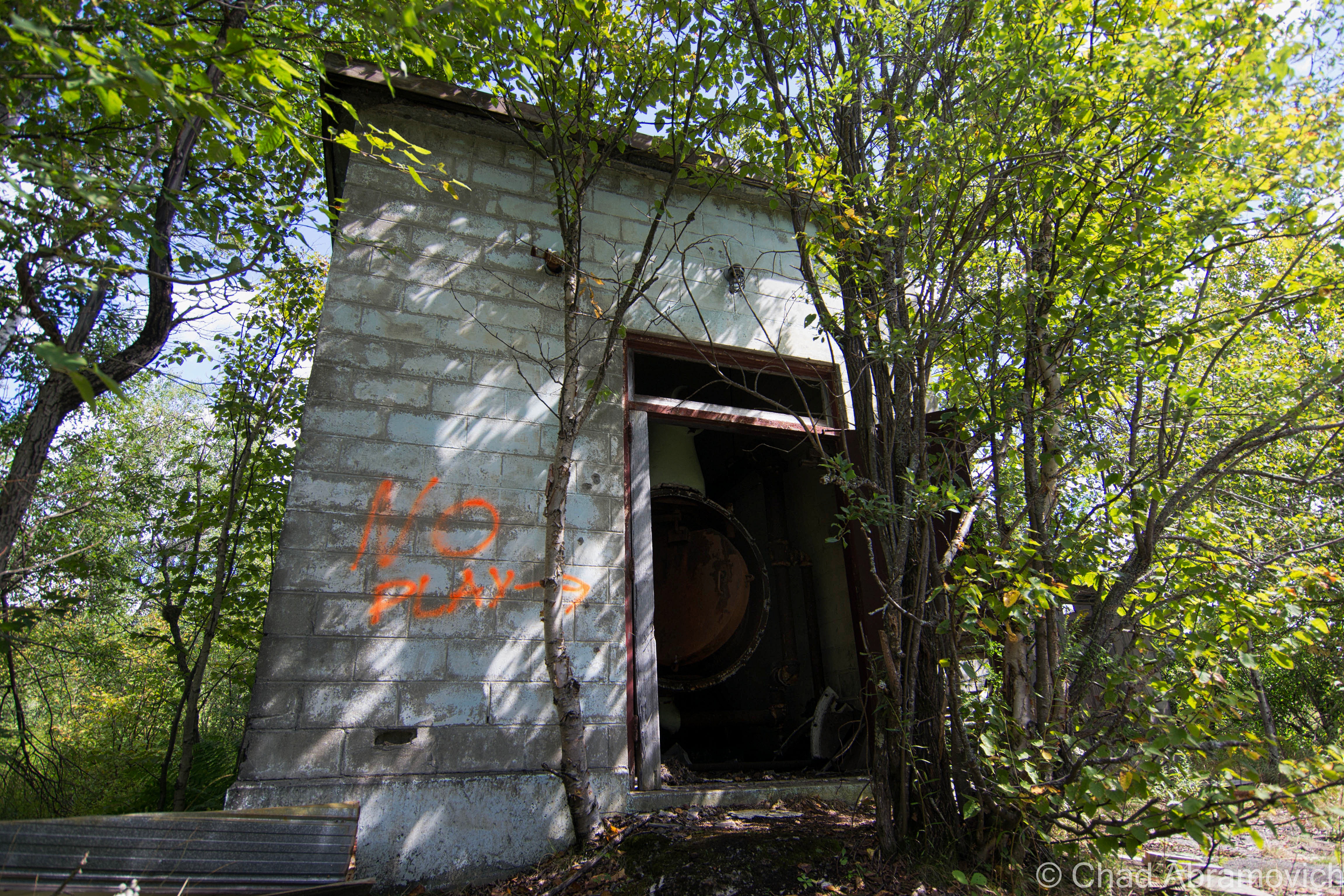
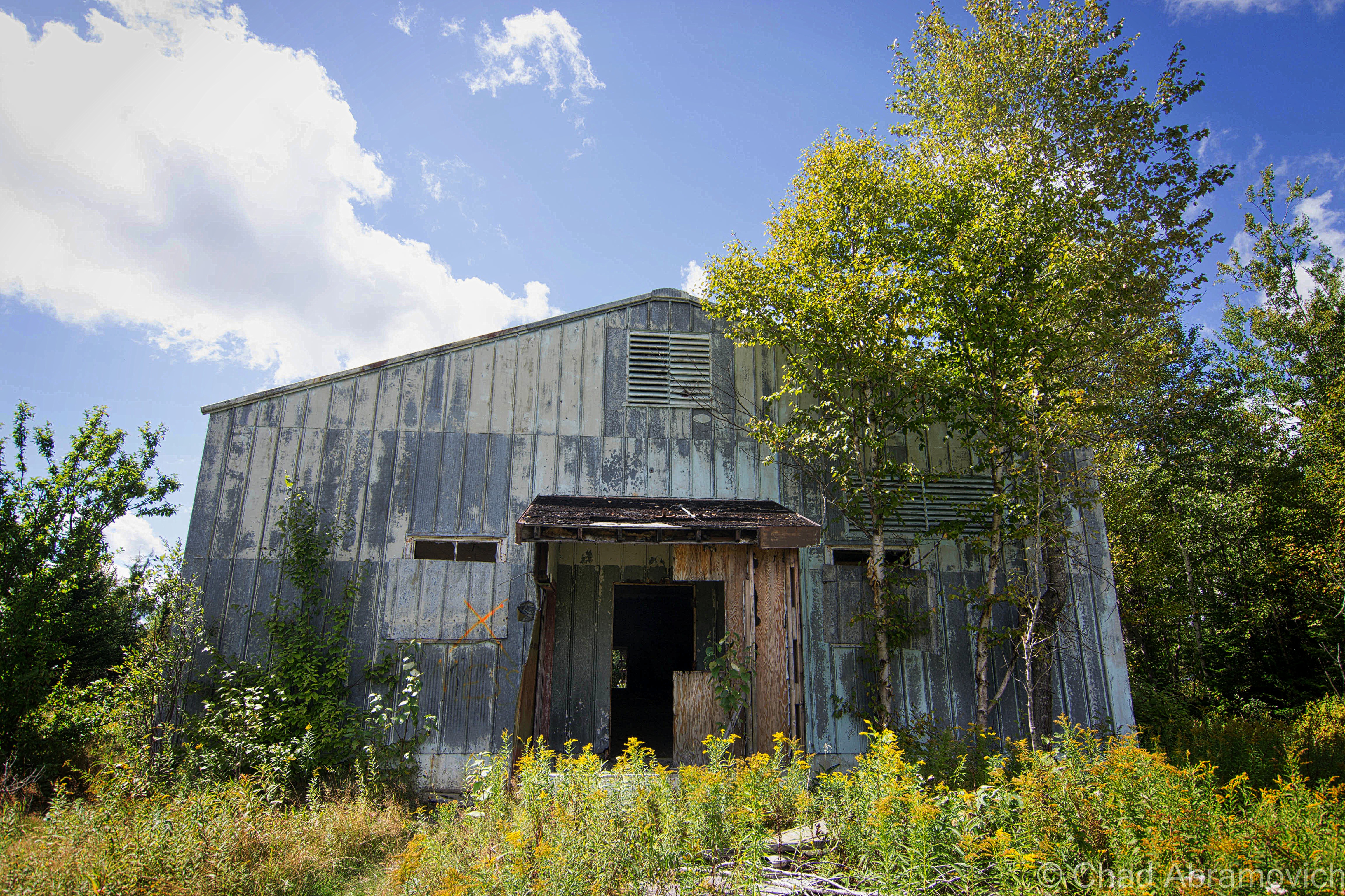
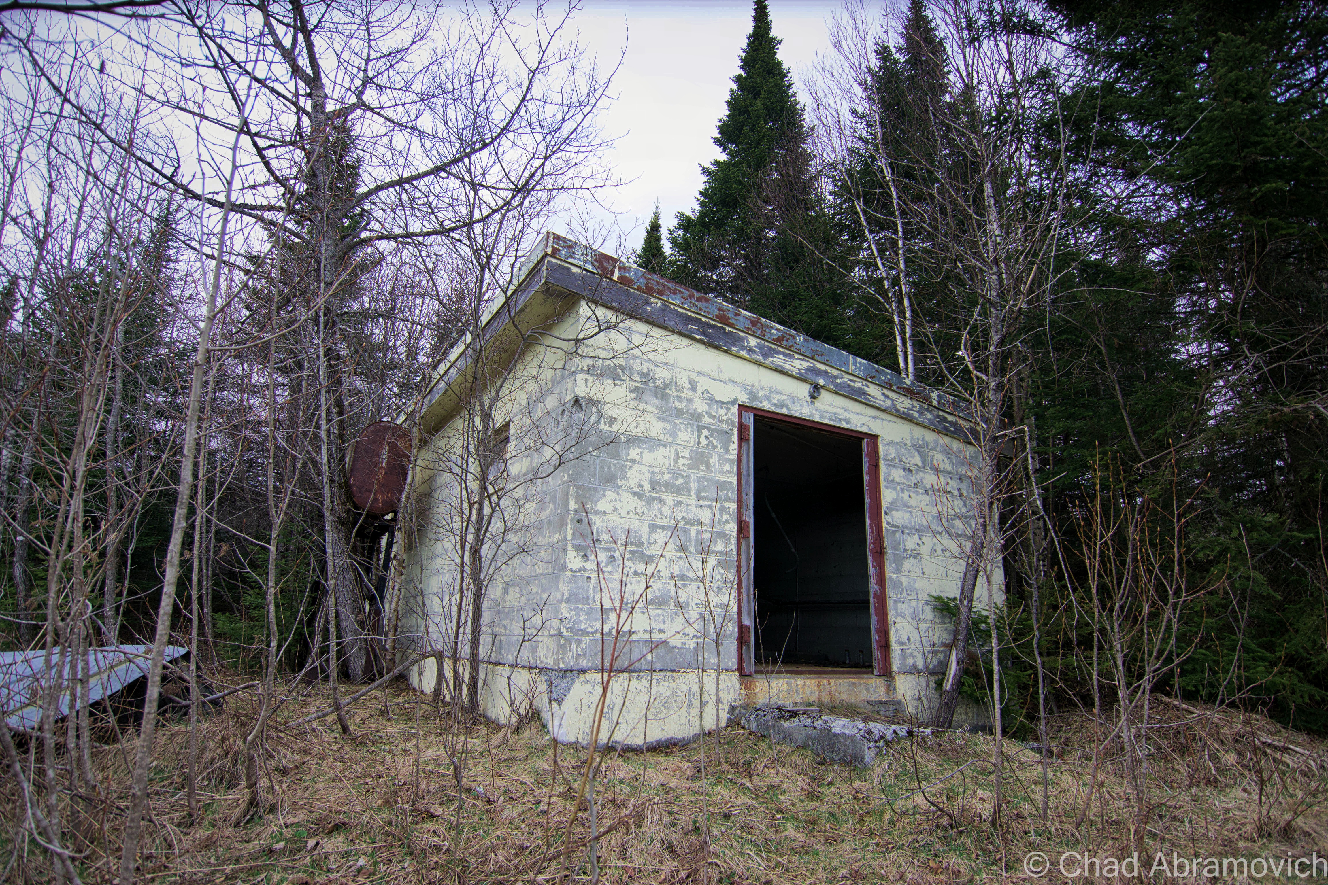
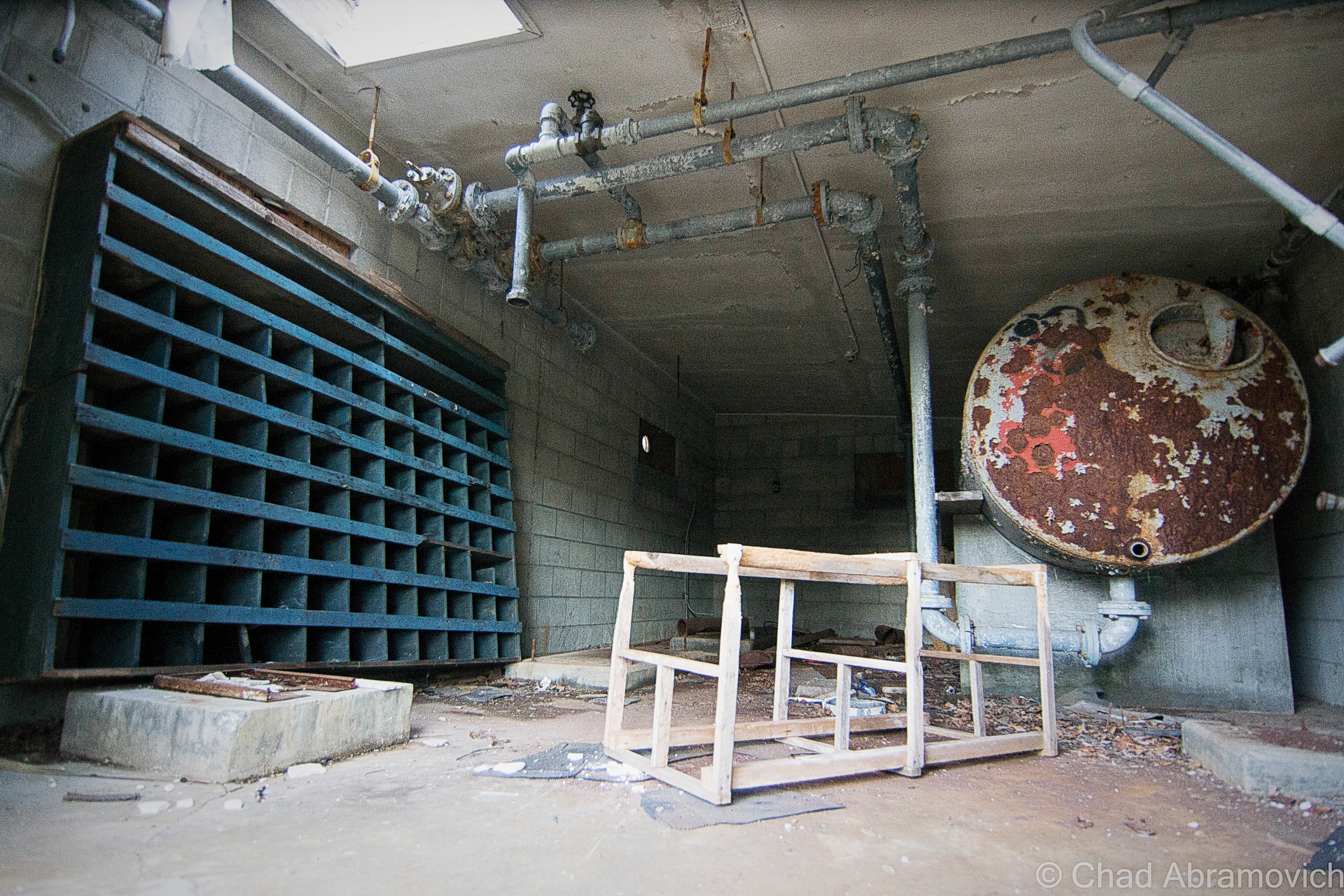
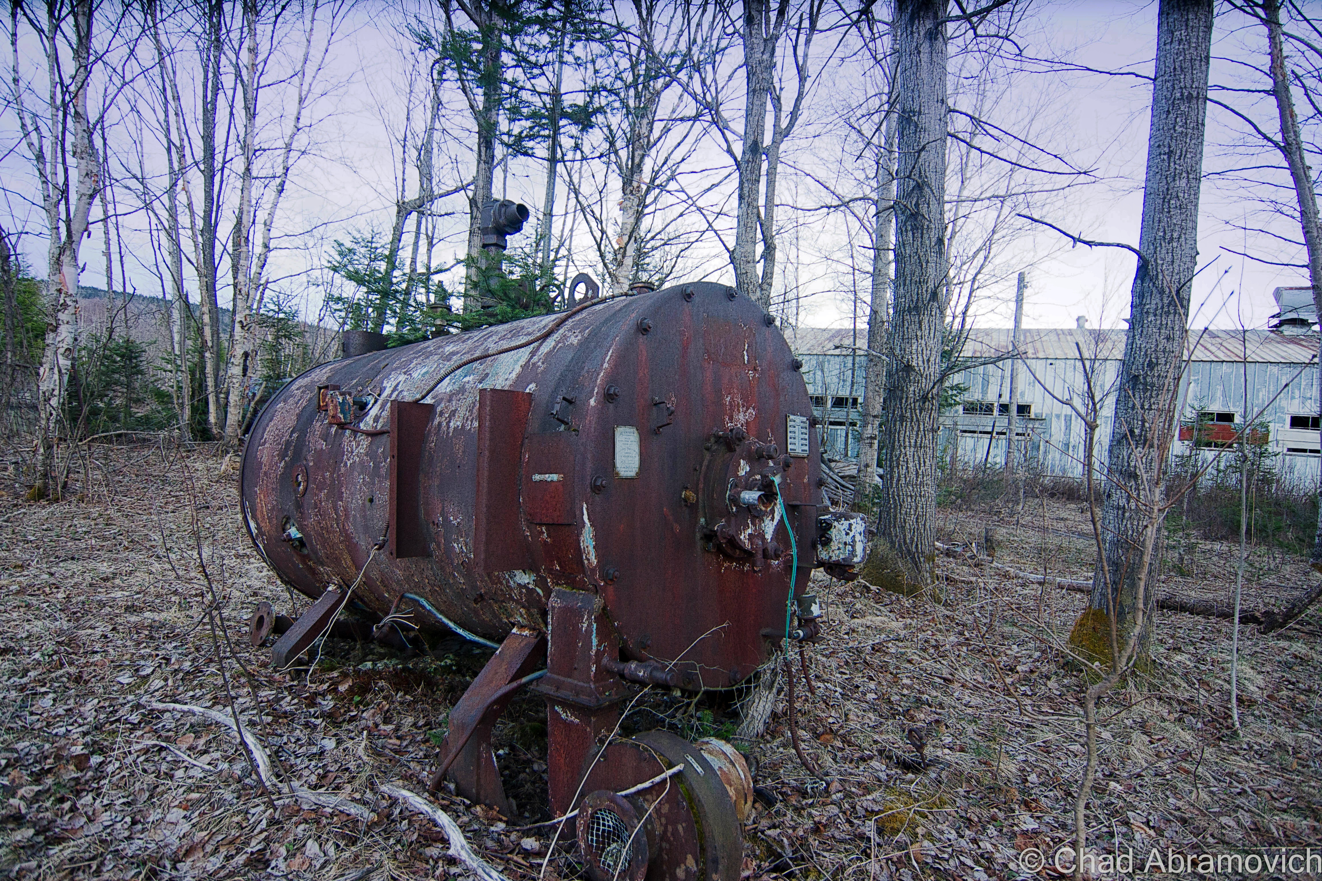
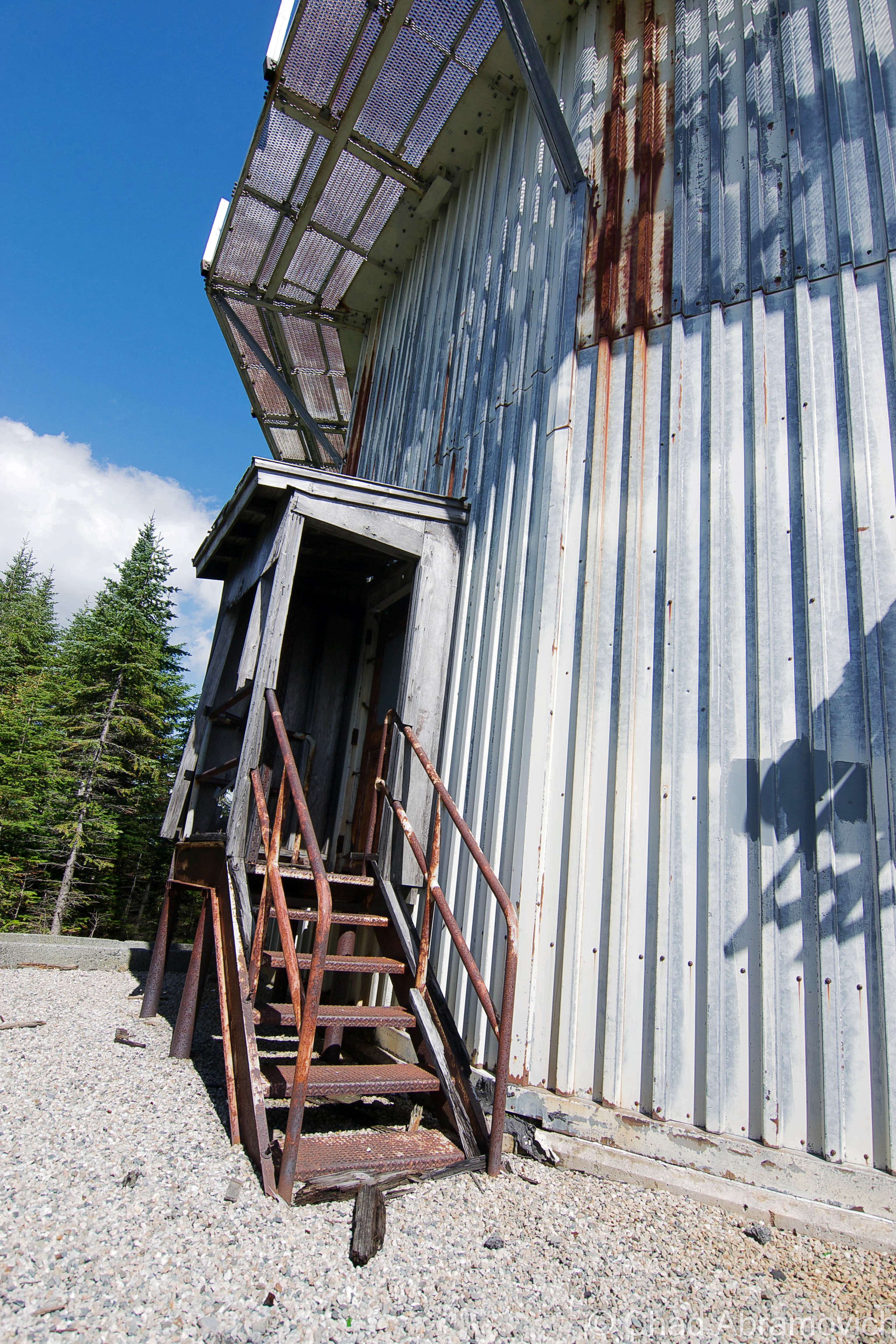
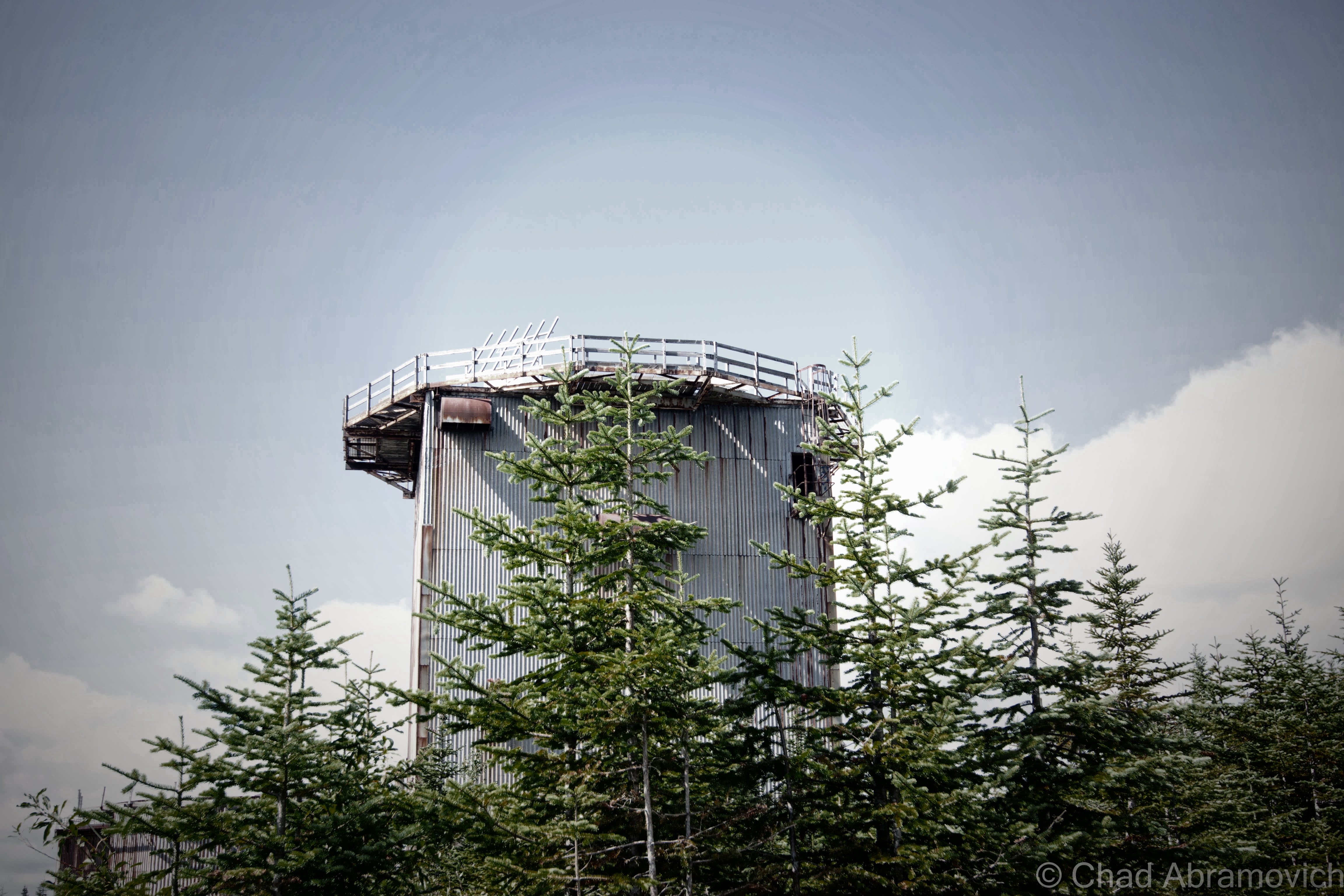
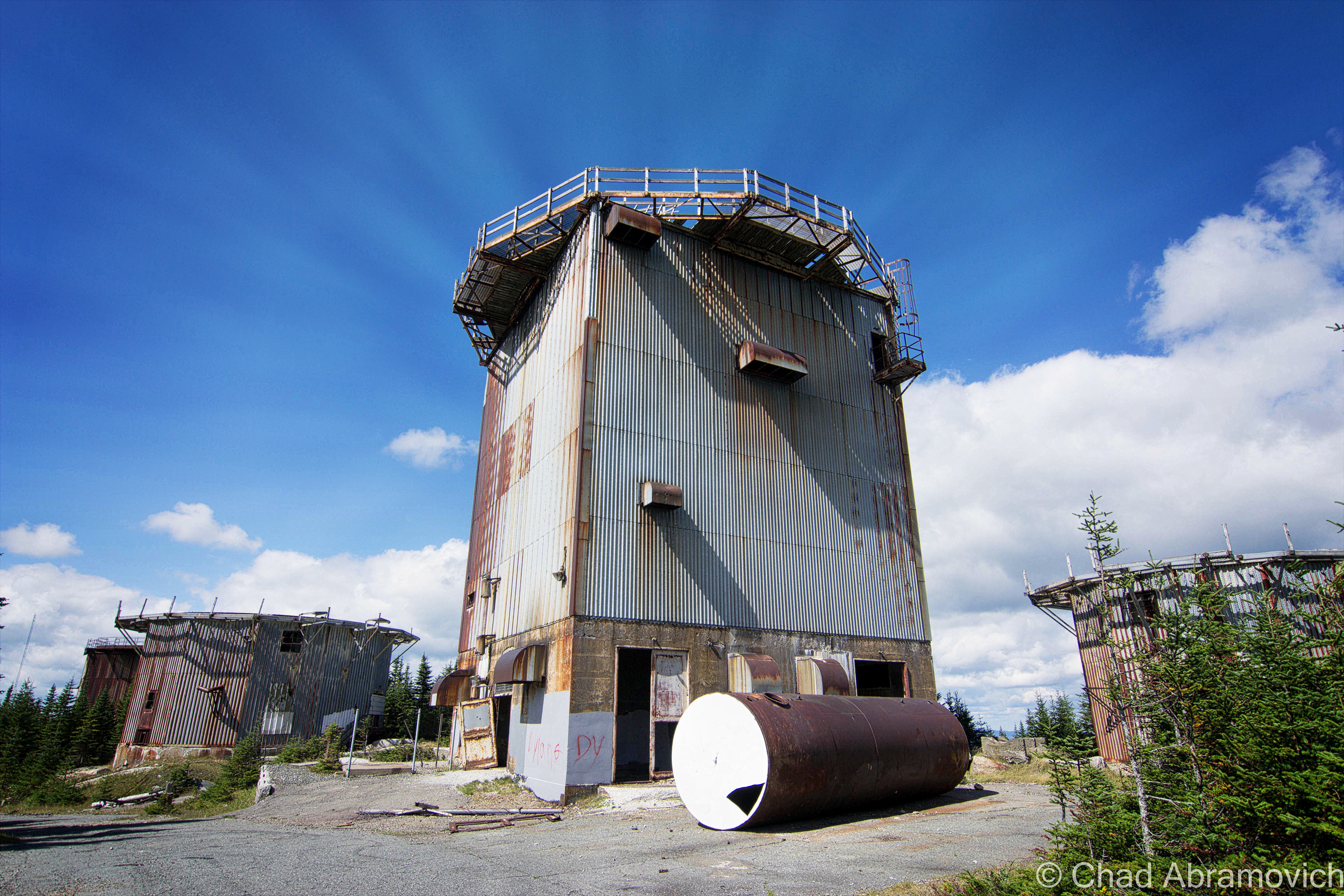
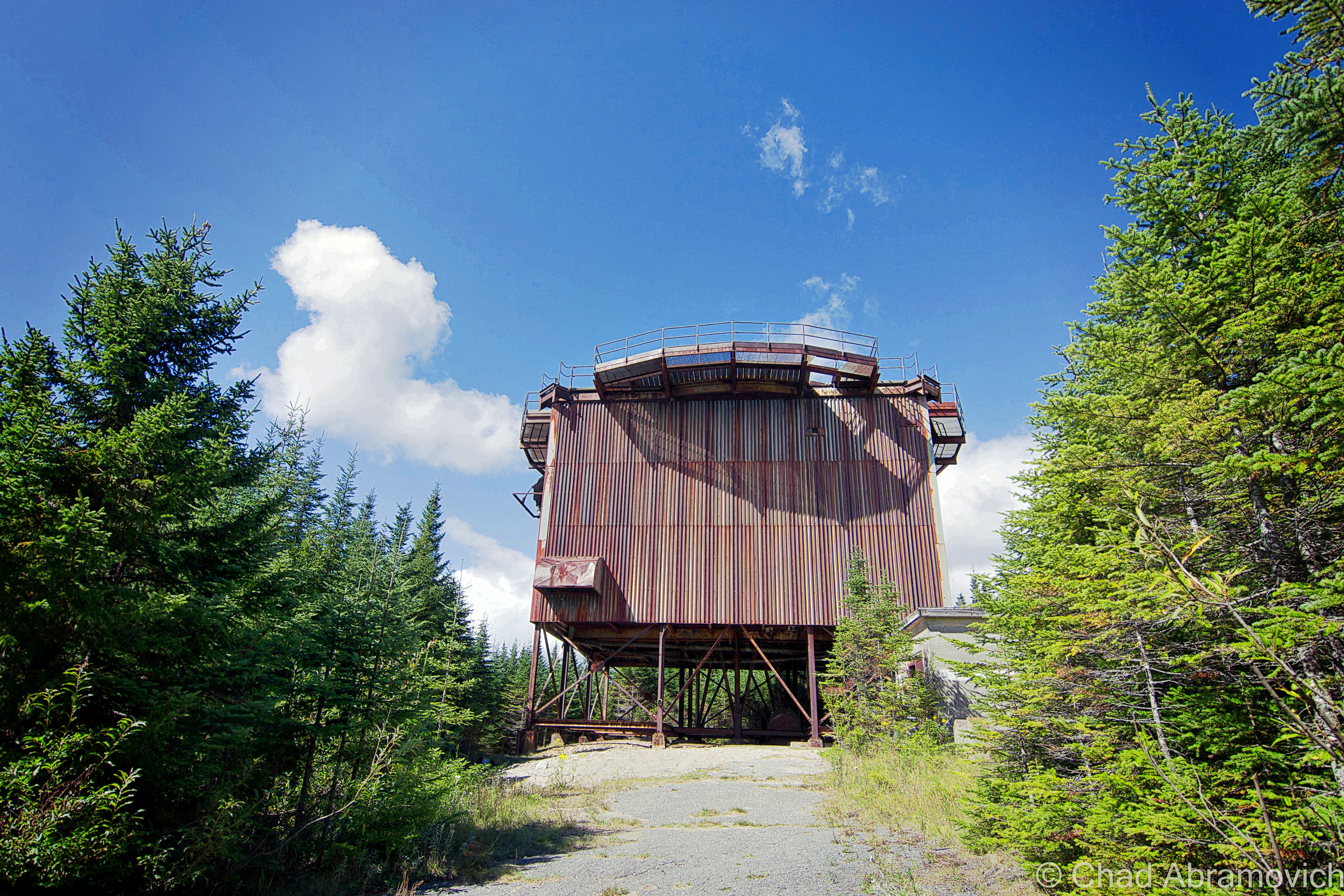
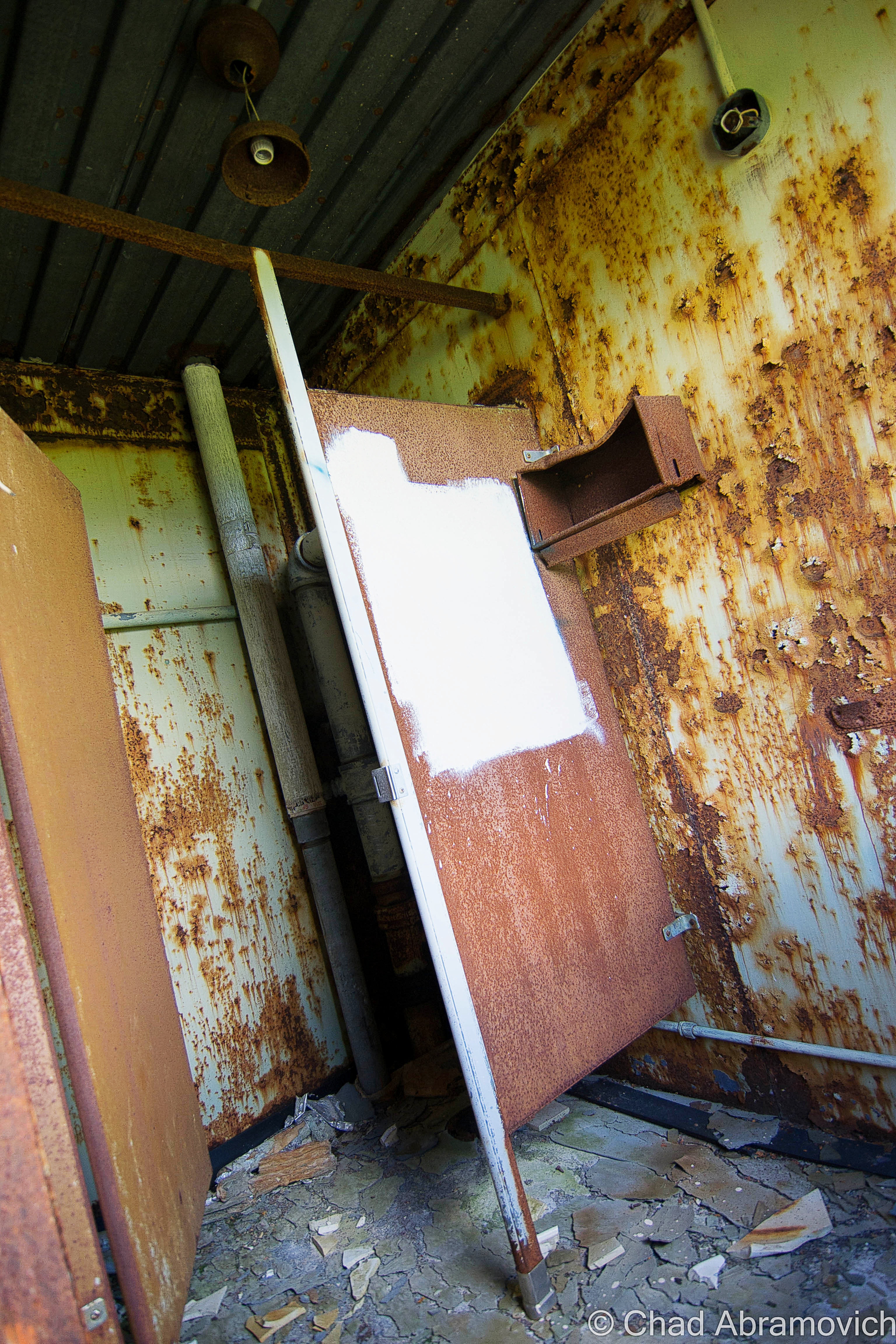
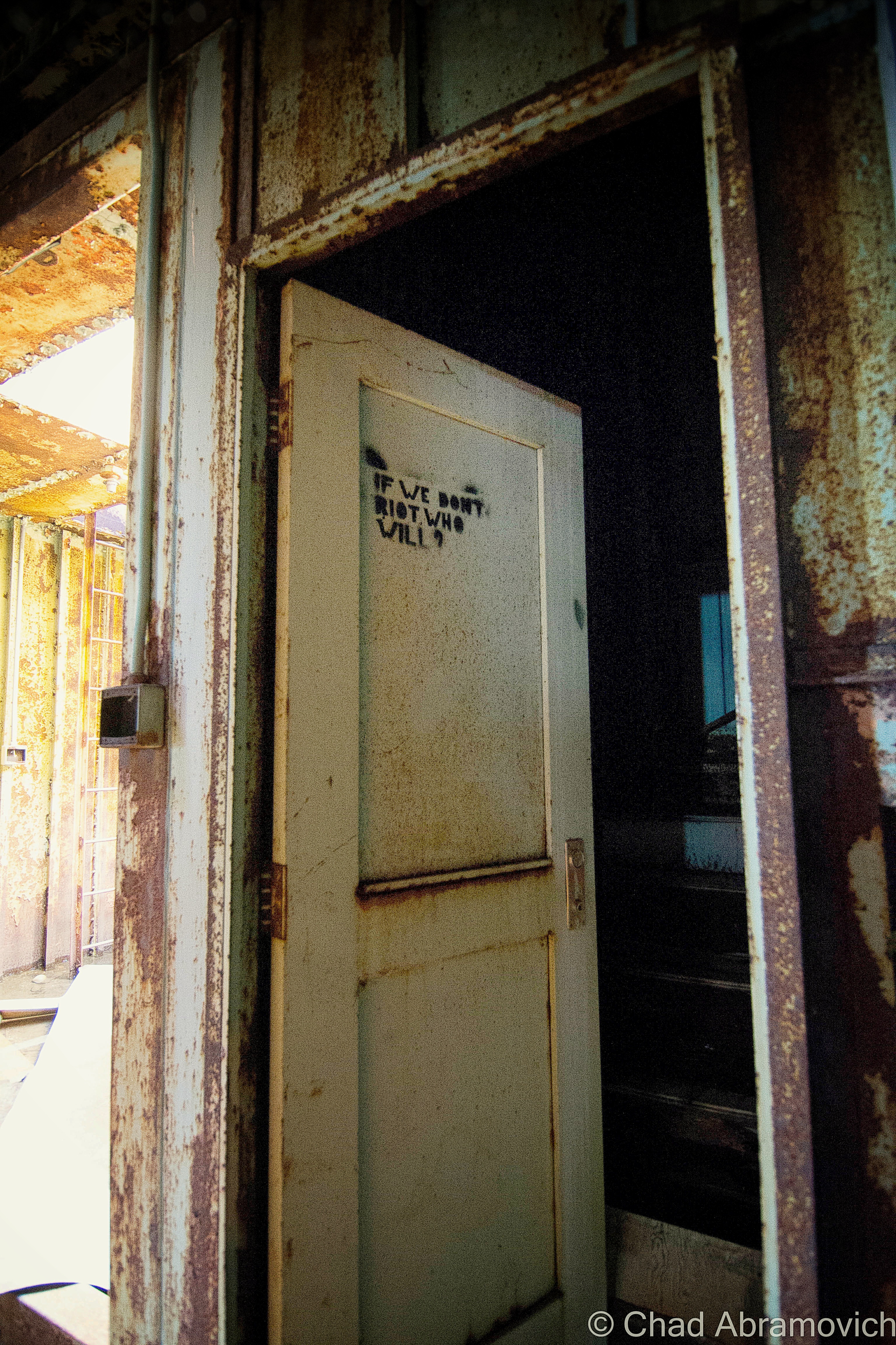
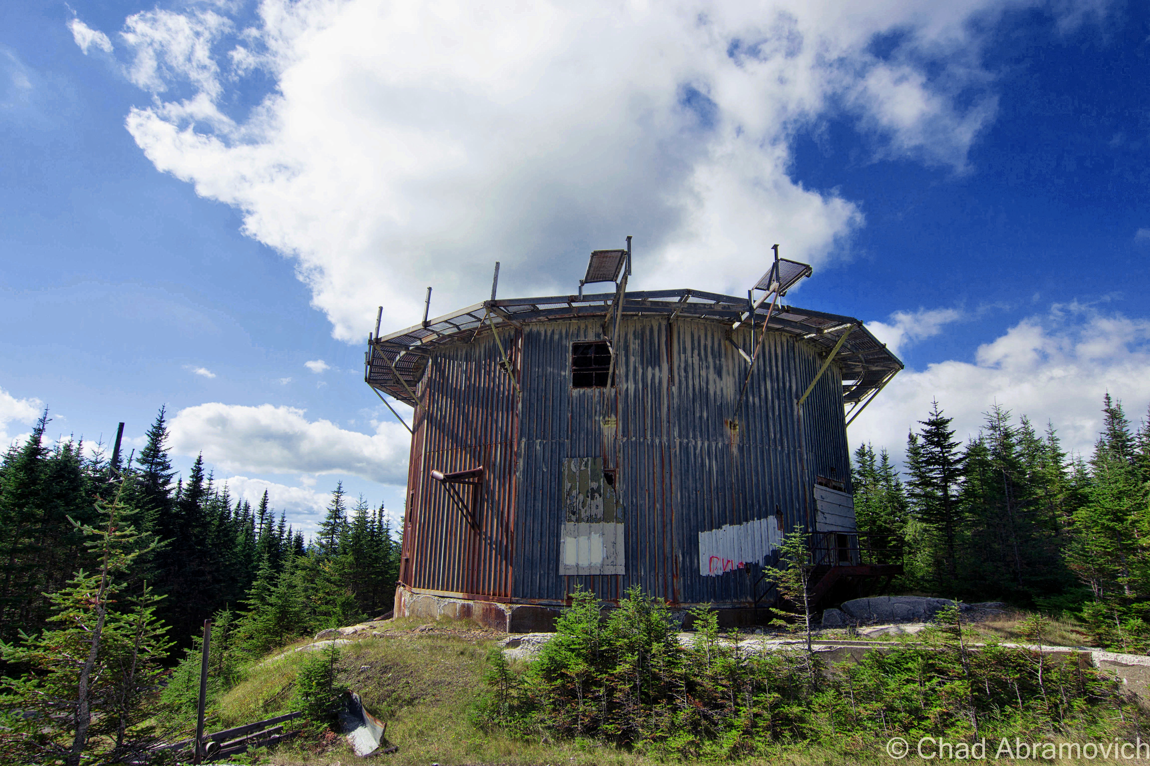
Finding a place to park that we hoped wasn’t suspicious, we casually made our way down the sidewalk, and then made a dash for it. The factory grounds had grown wild, and the brush was almost like it was alive – clinging and scratching with every tendril available, as we hastily stumbled our way towards the tall metal smokestack that marked the factory’s personal powerplant. We figured we’d start in there via squeezing through a hole in the door, and work our way over to the main factory building after. Man I’m glad I’m still a scrawny dude that can wiggle through holes in the walls and broken windows.

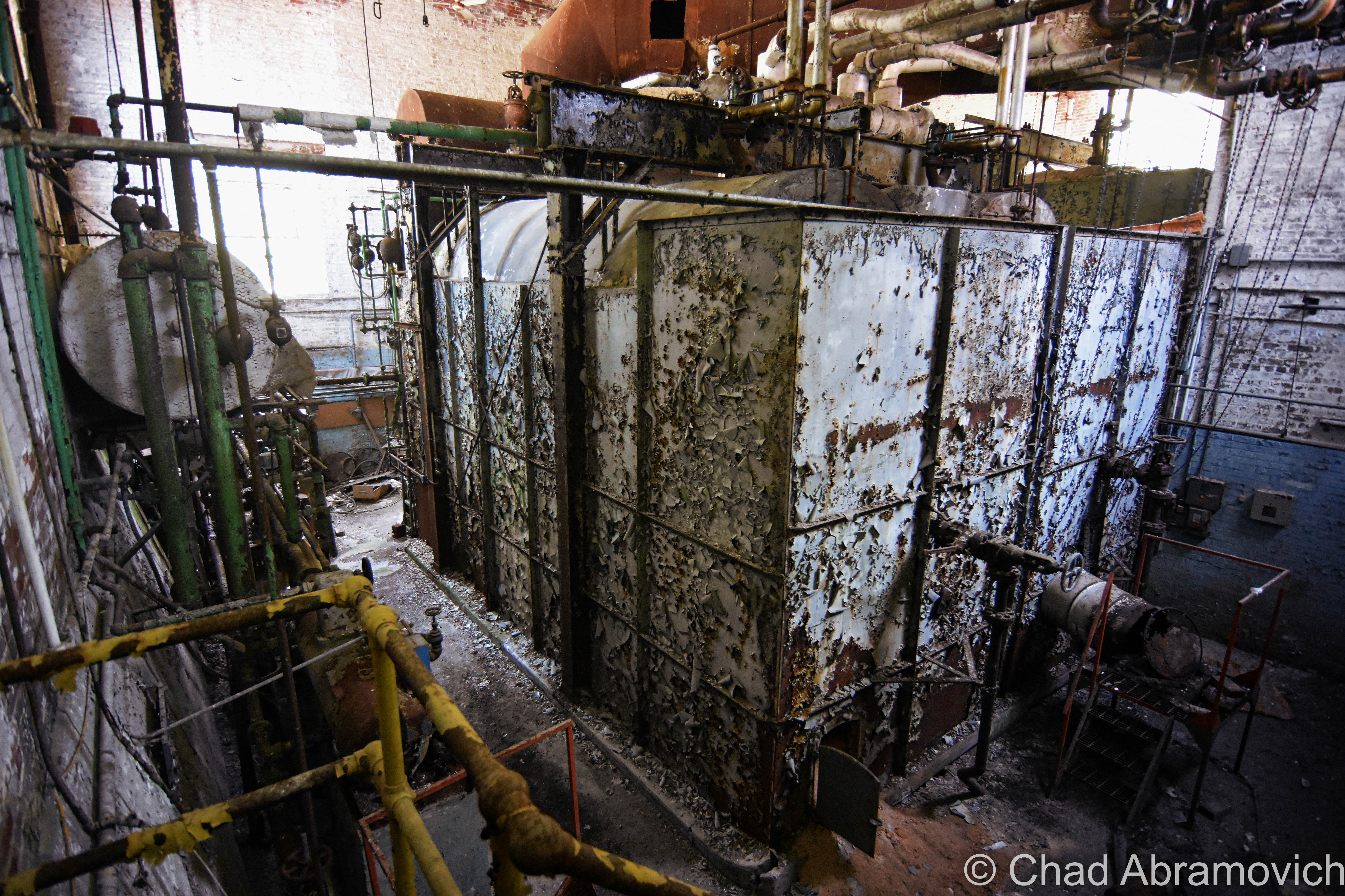
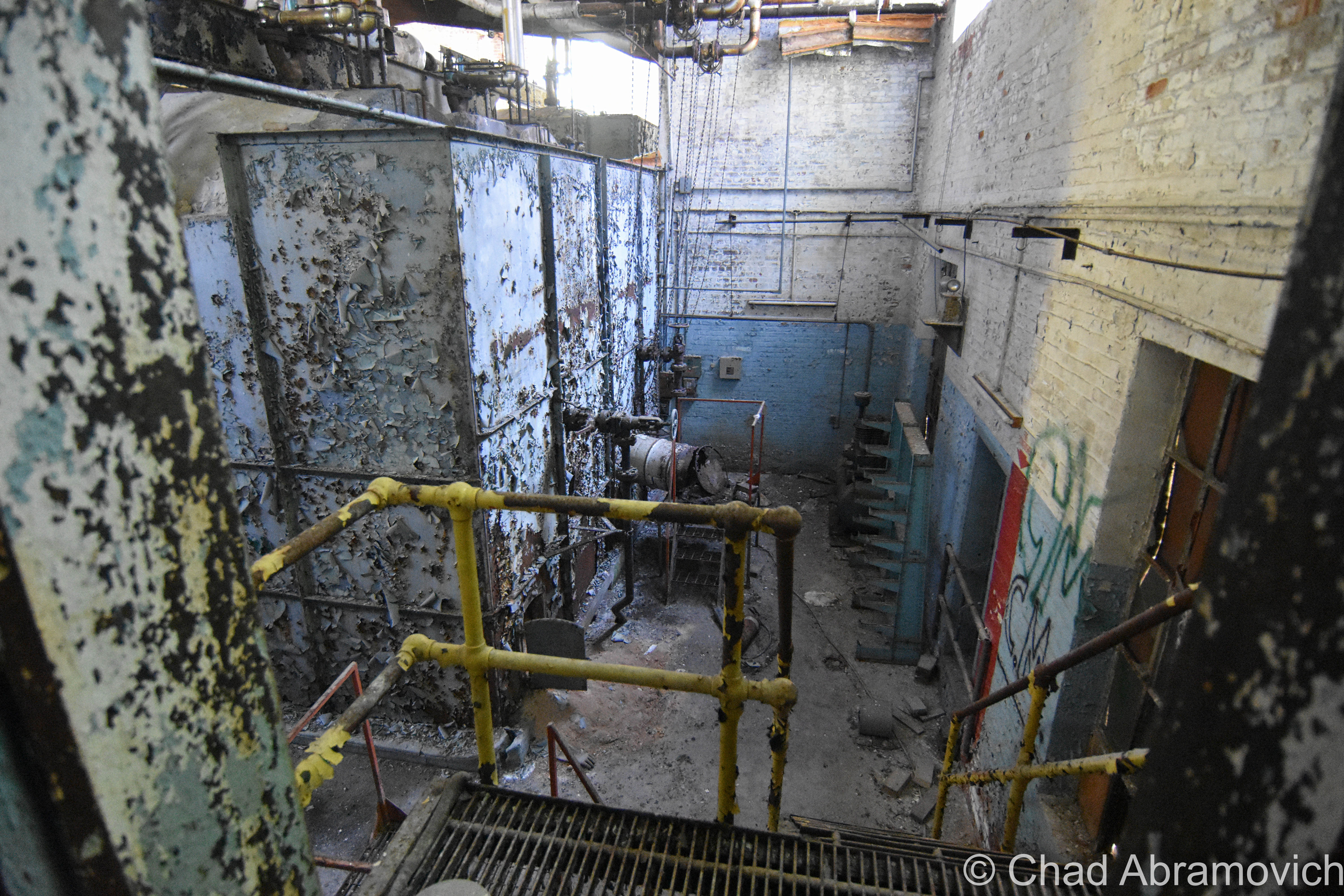
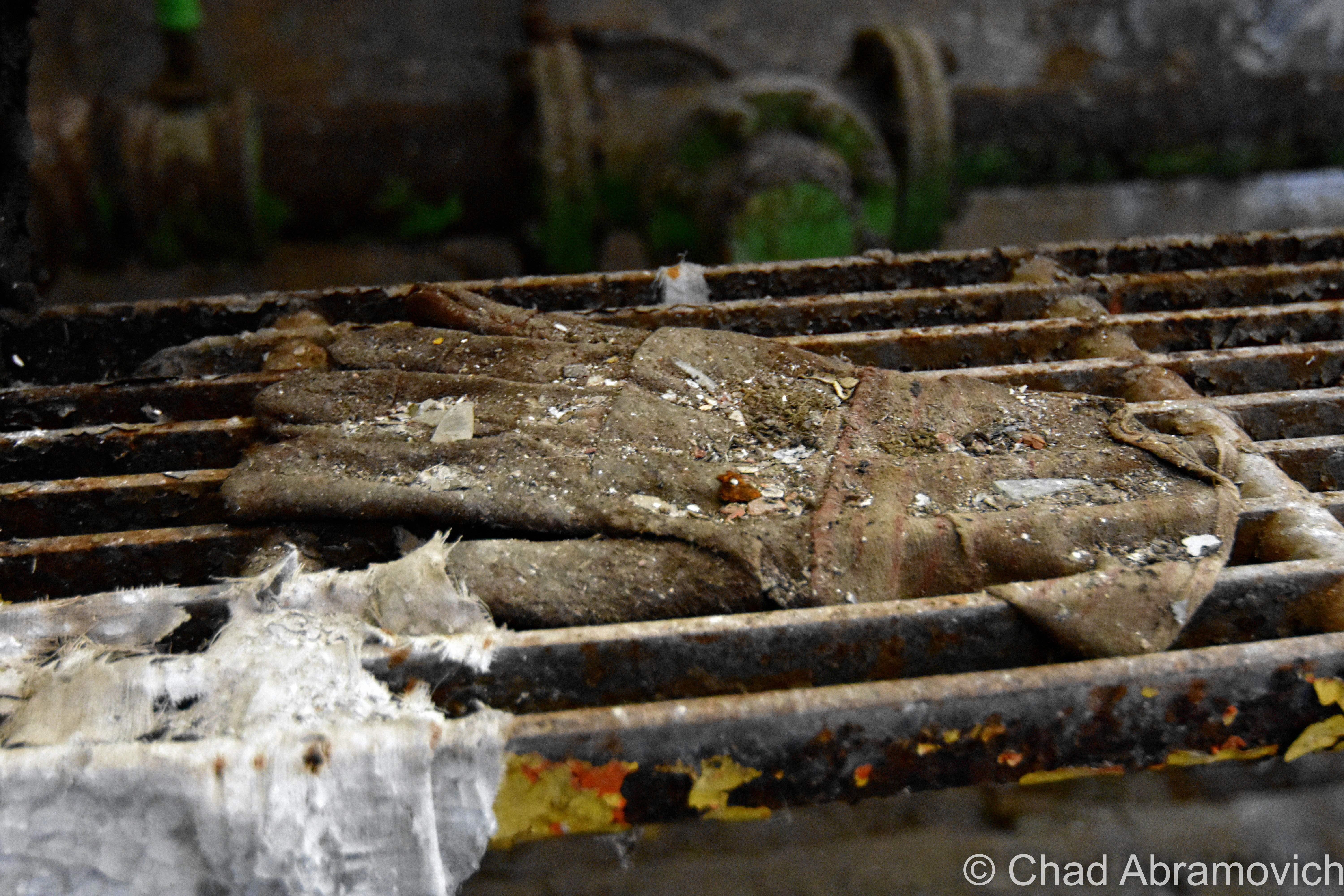
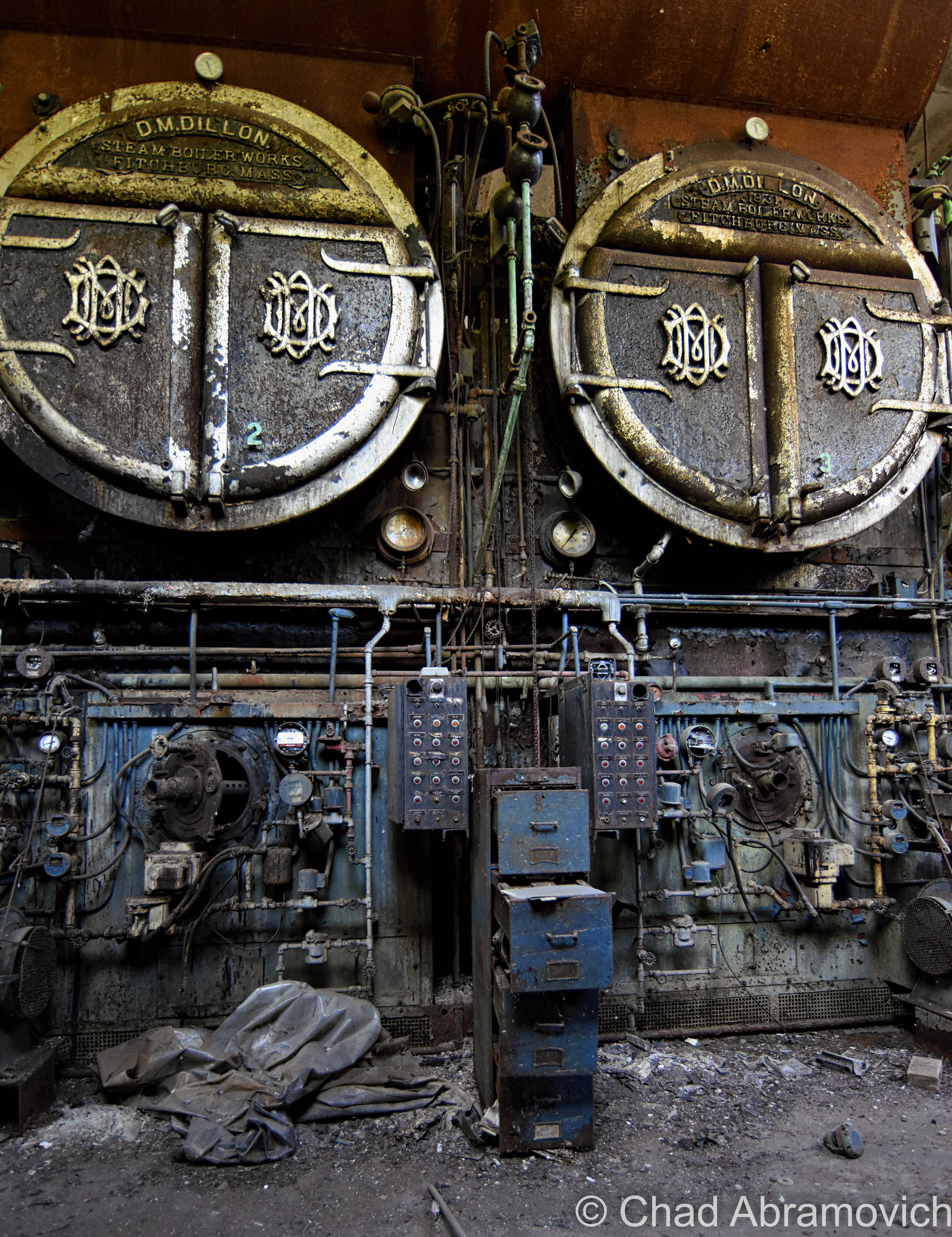
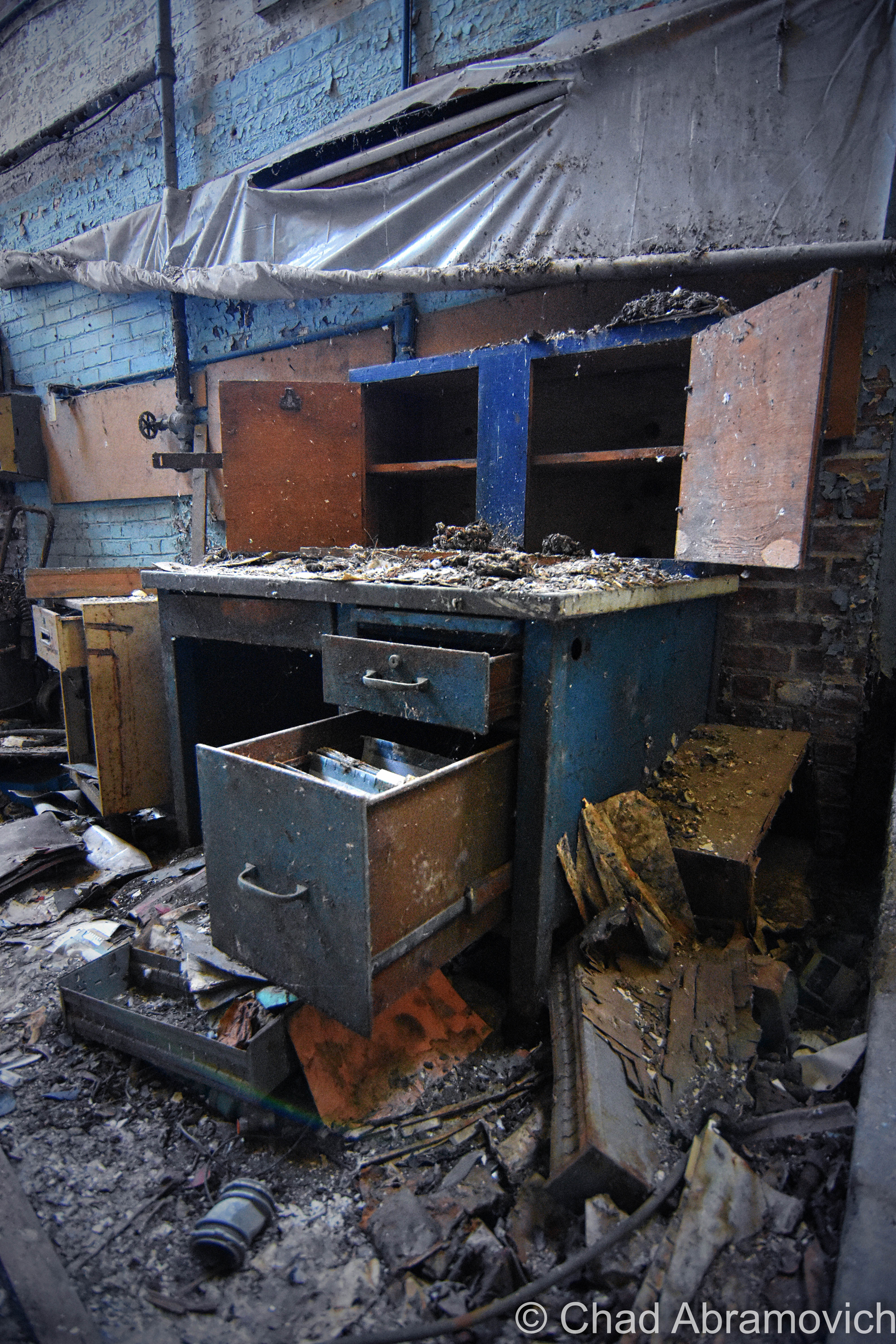
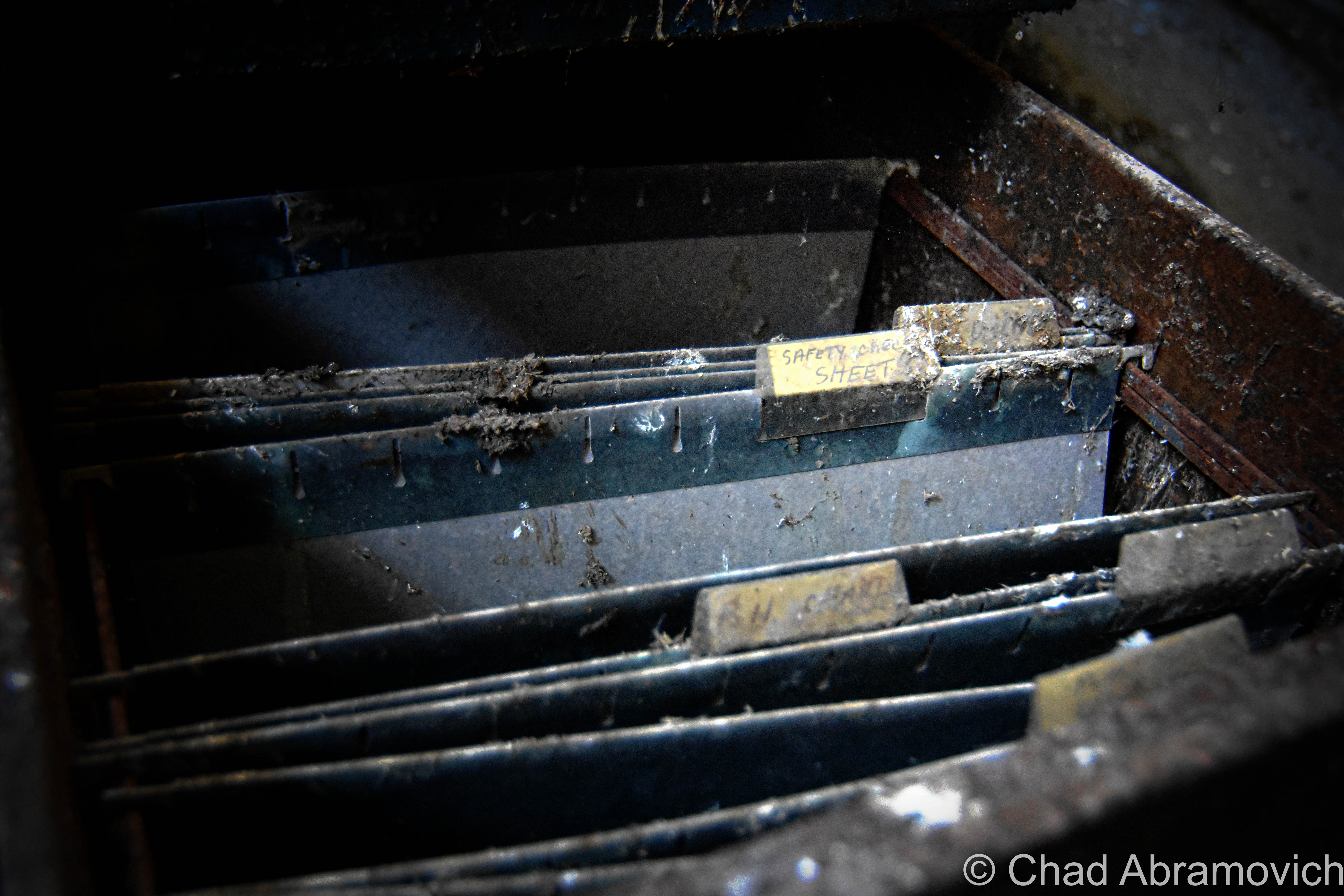
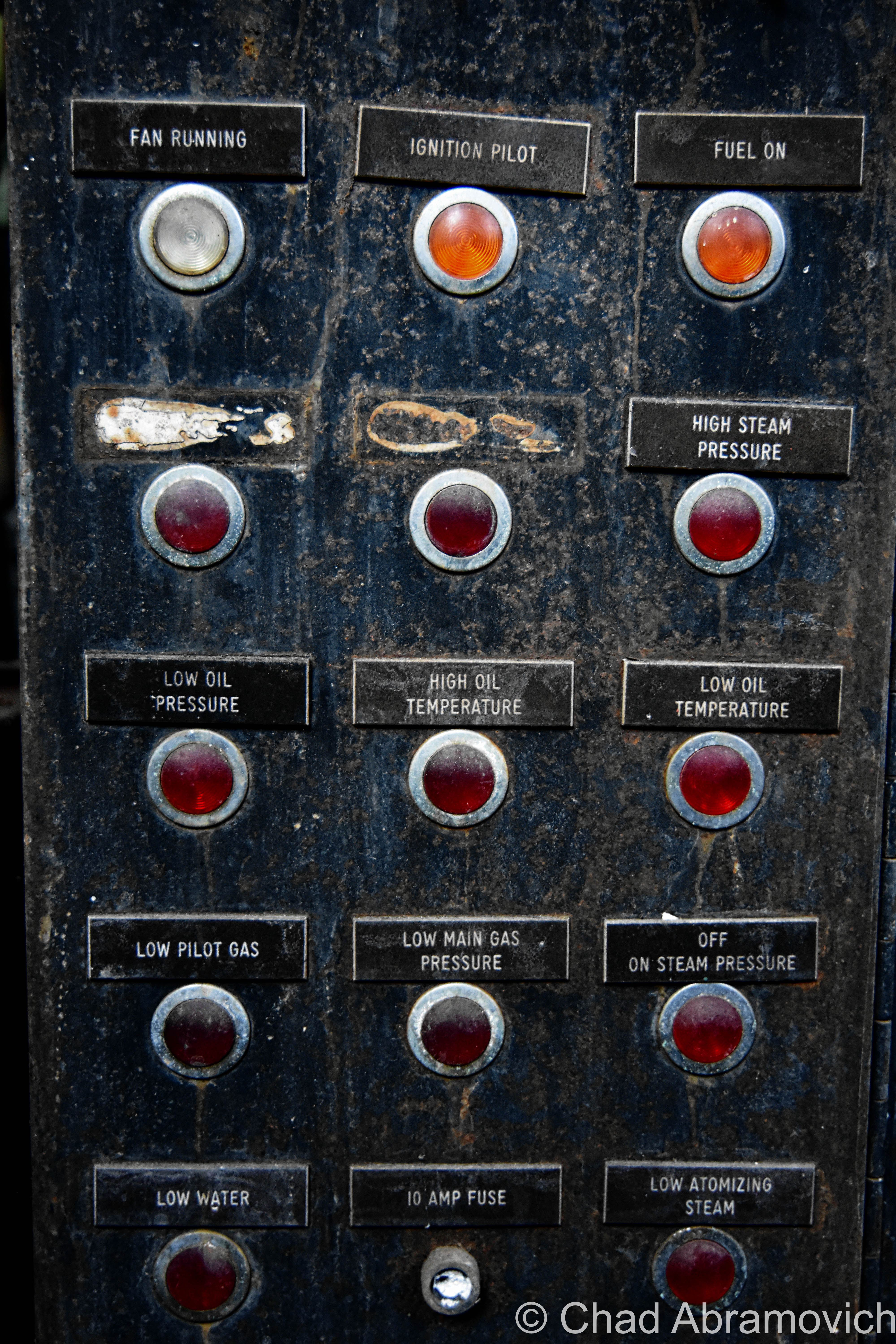
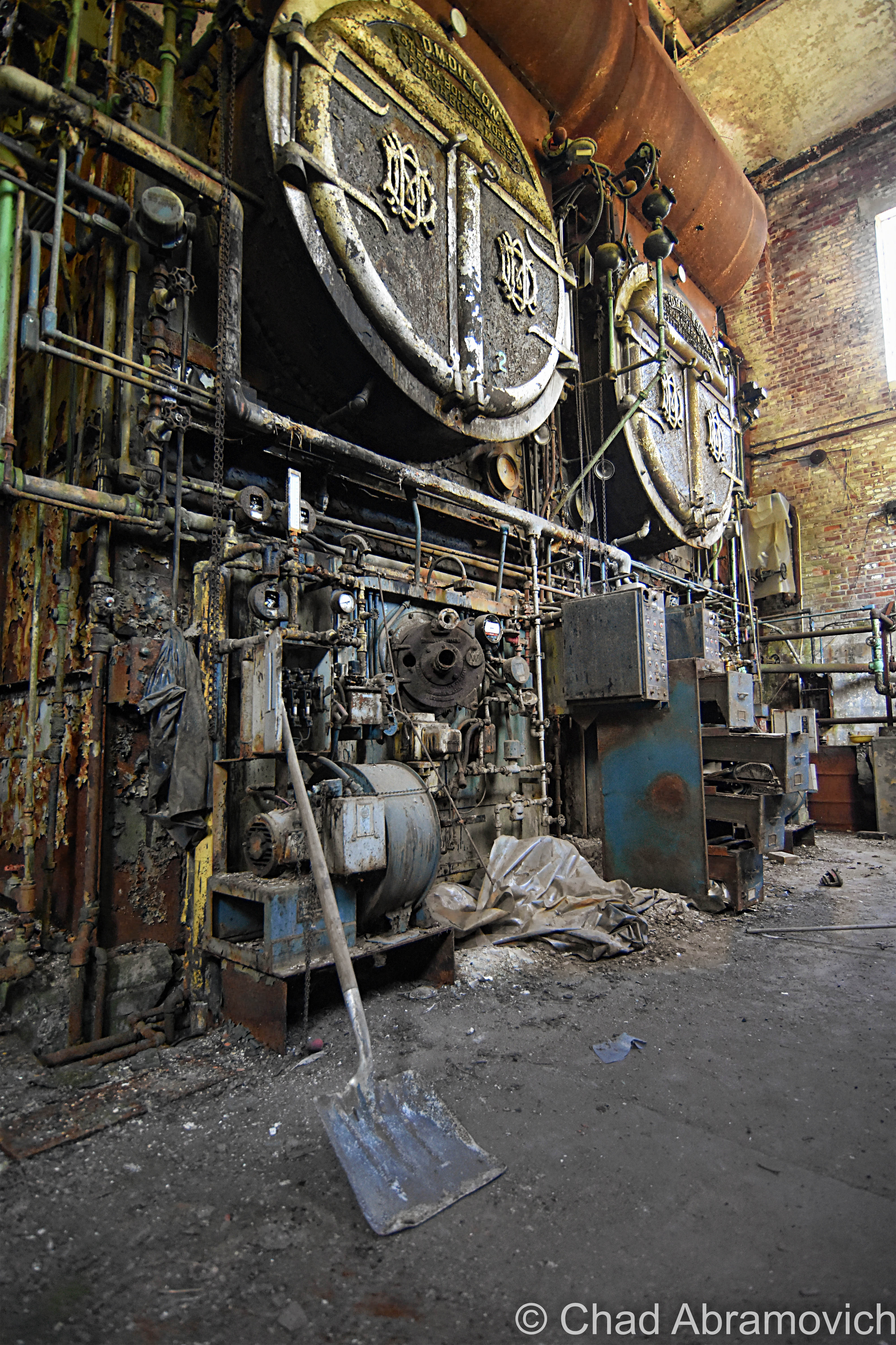
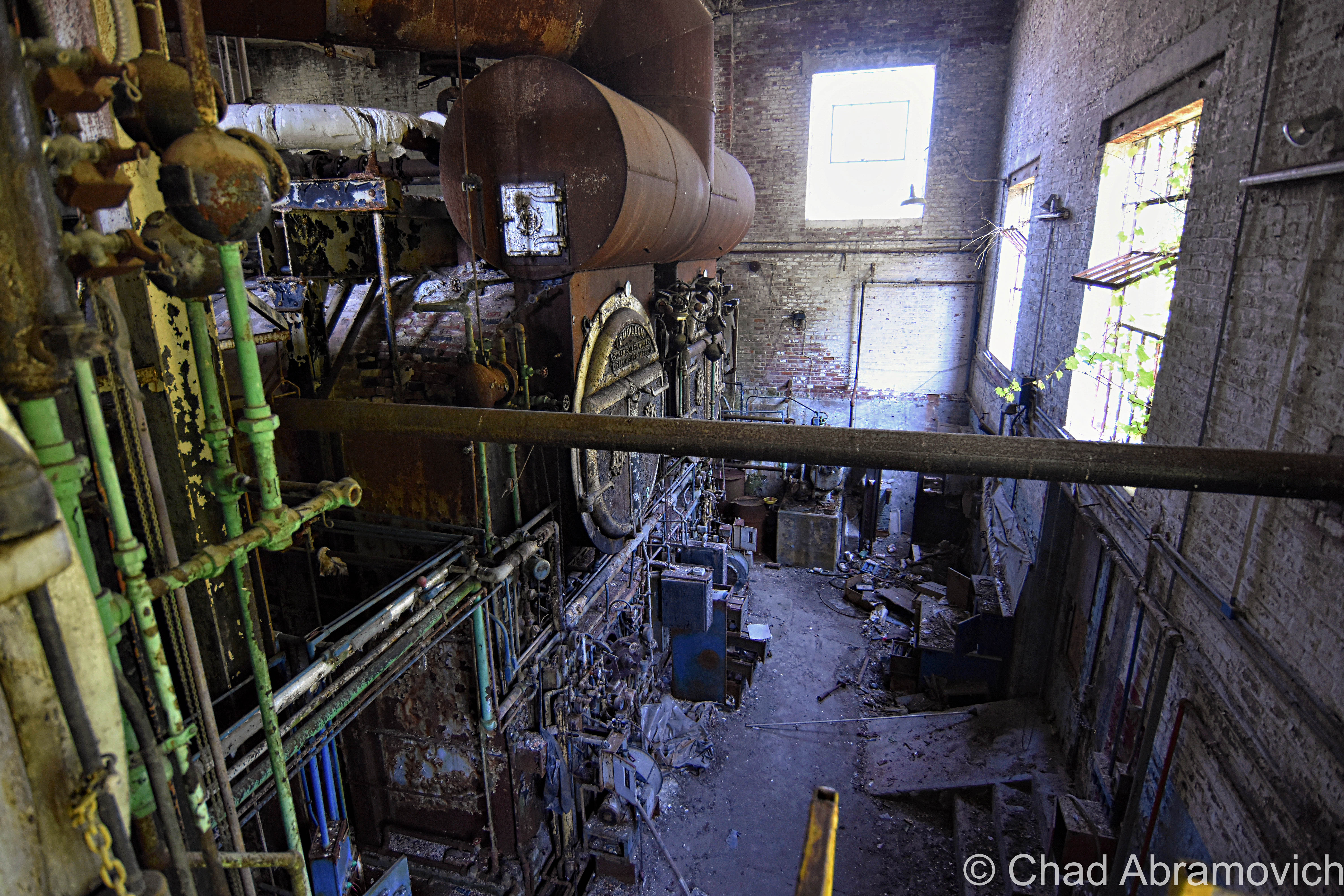
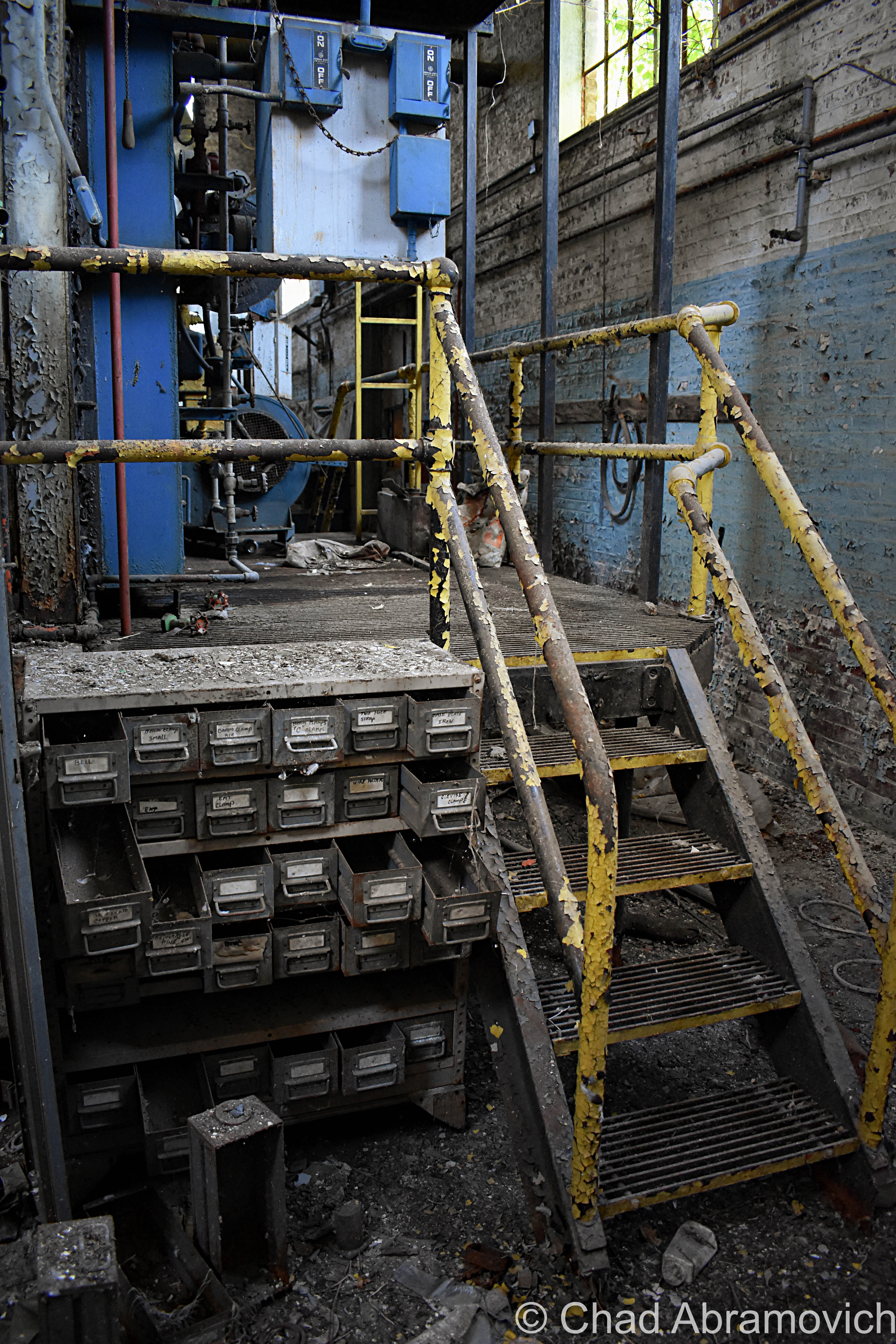
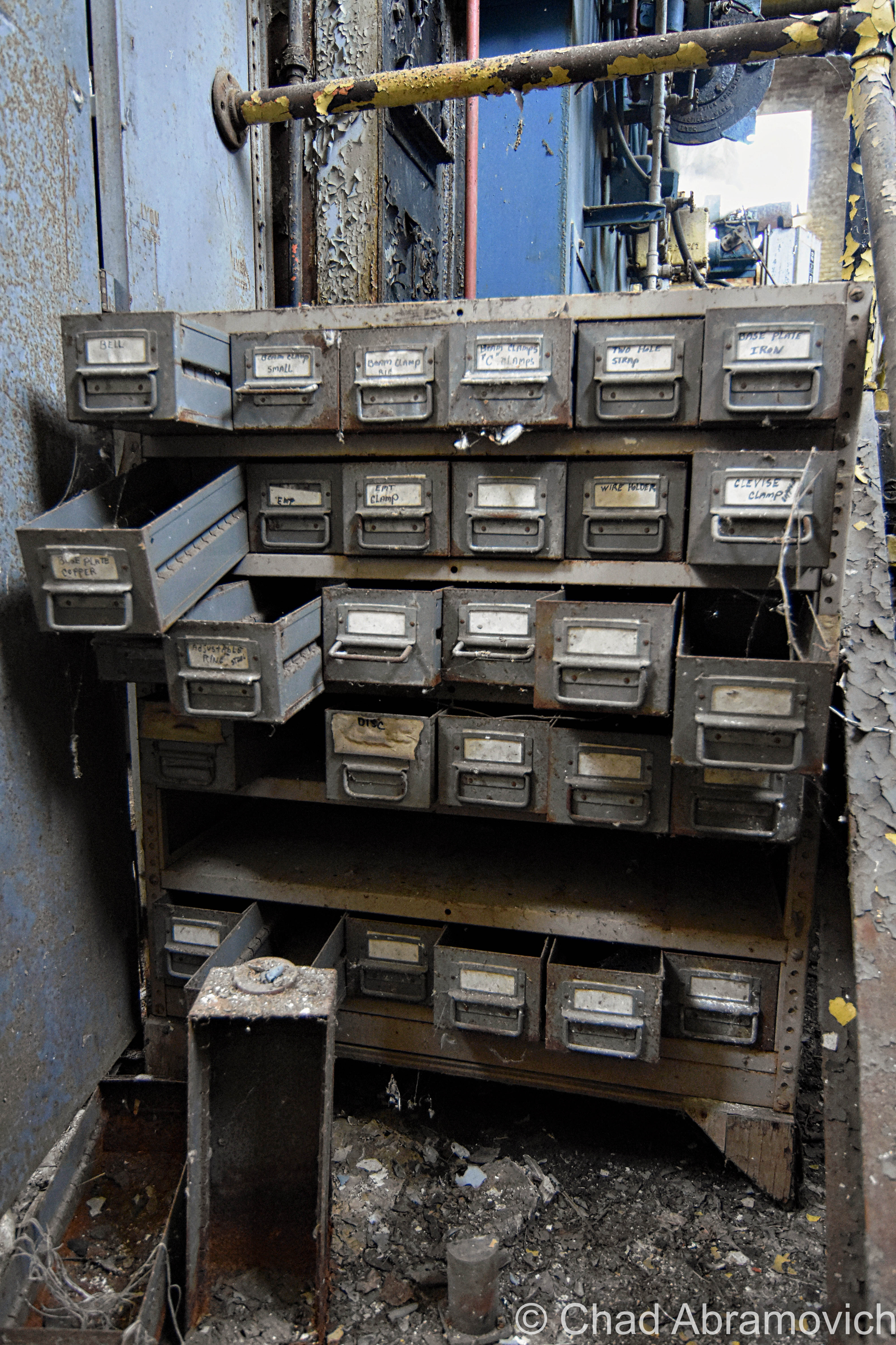
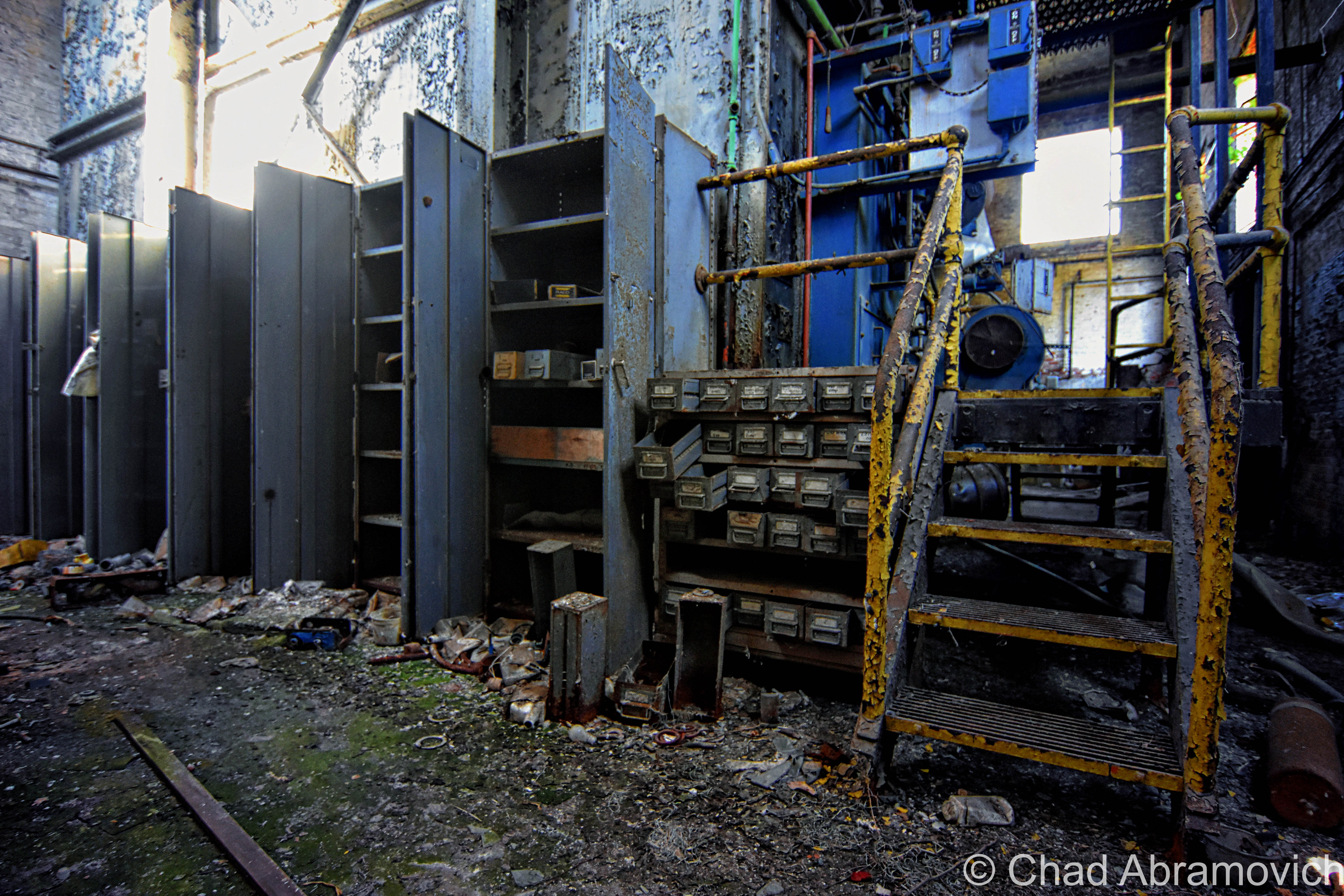
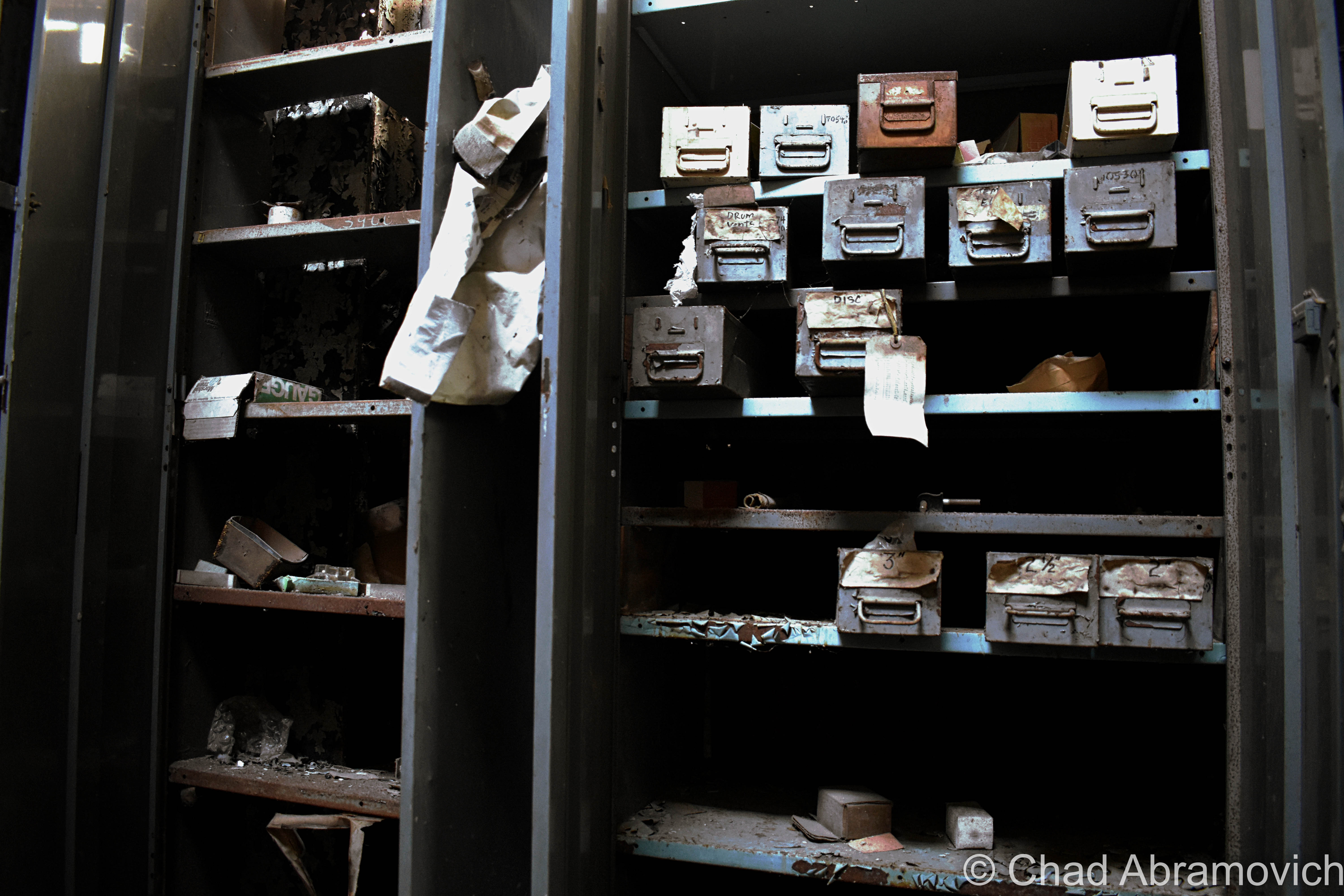
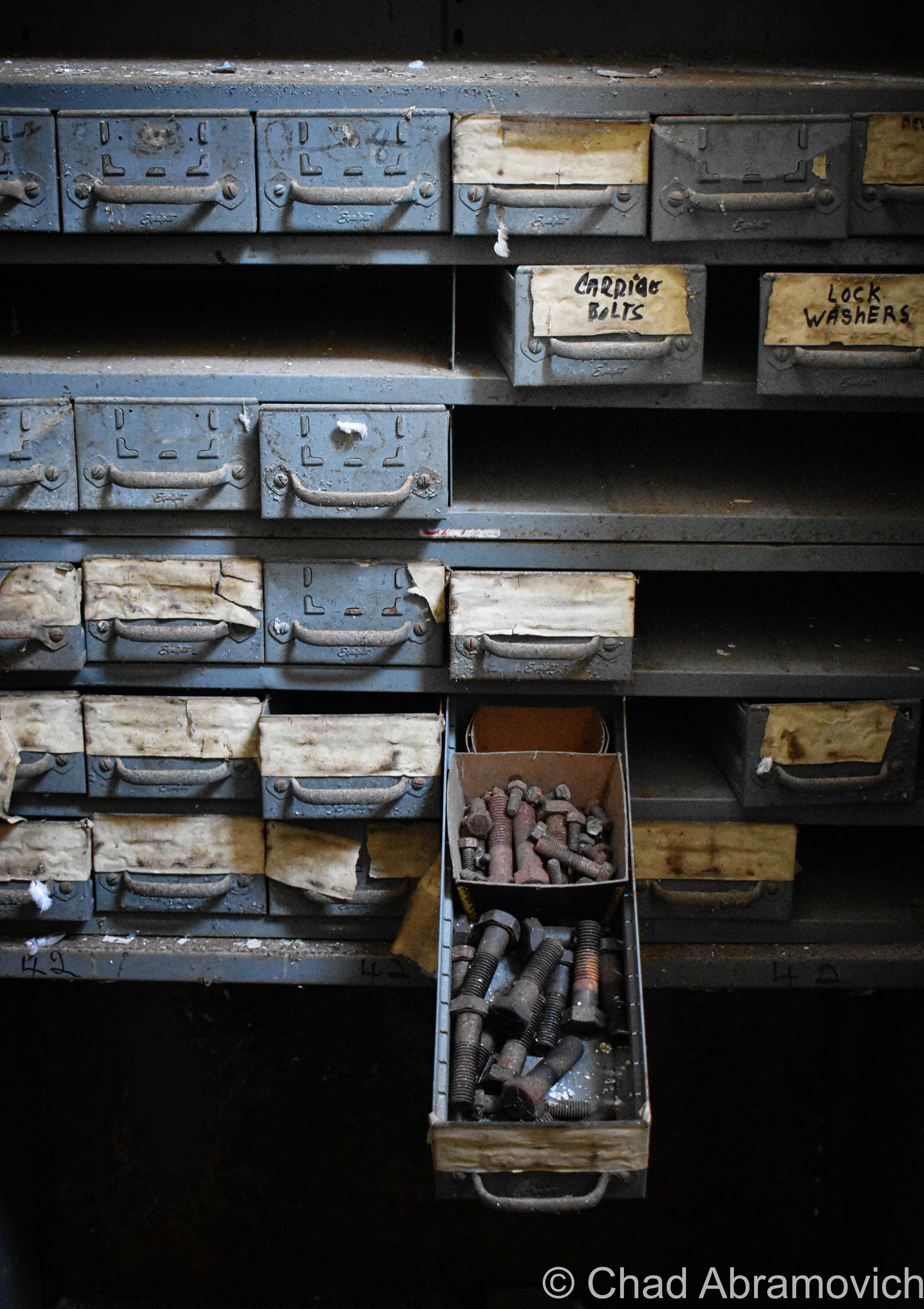
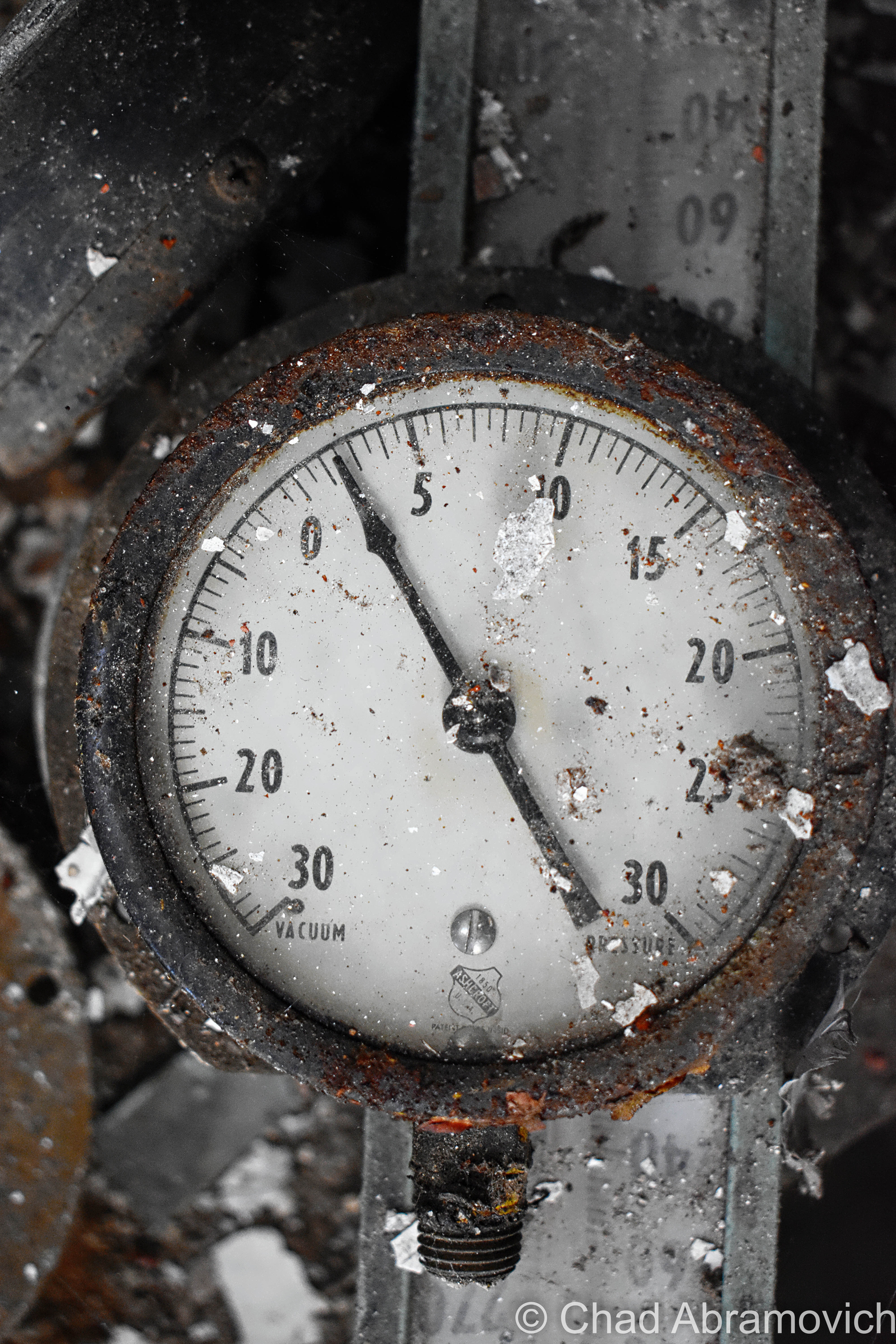
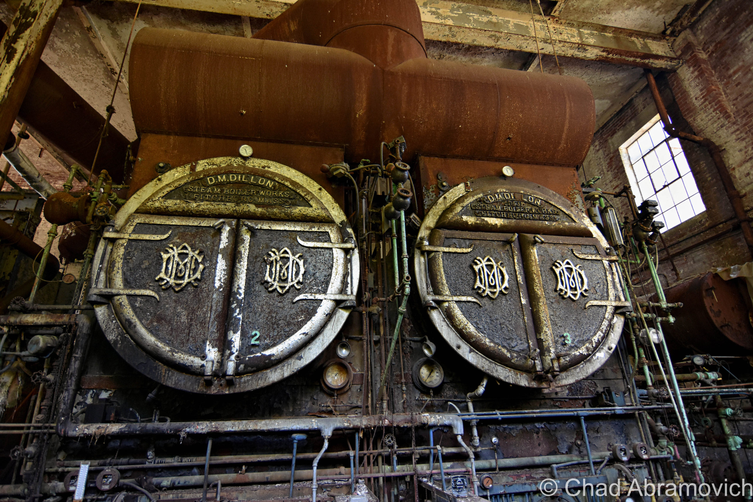
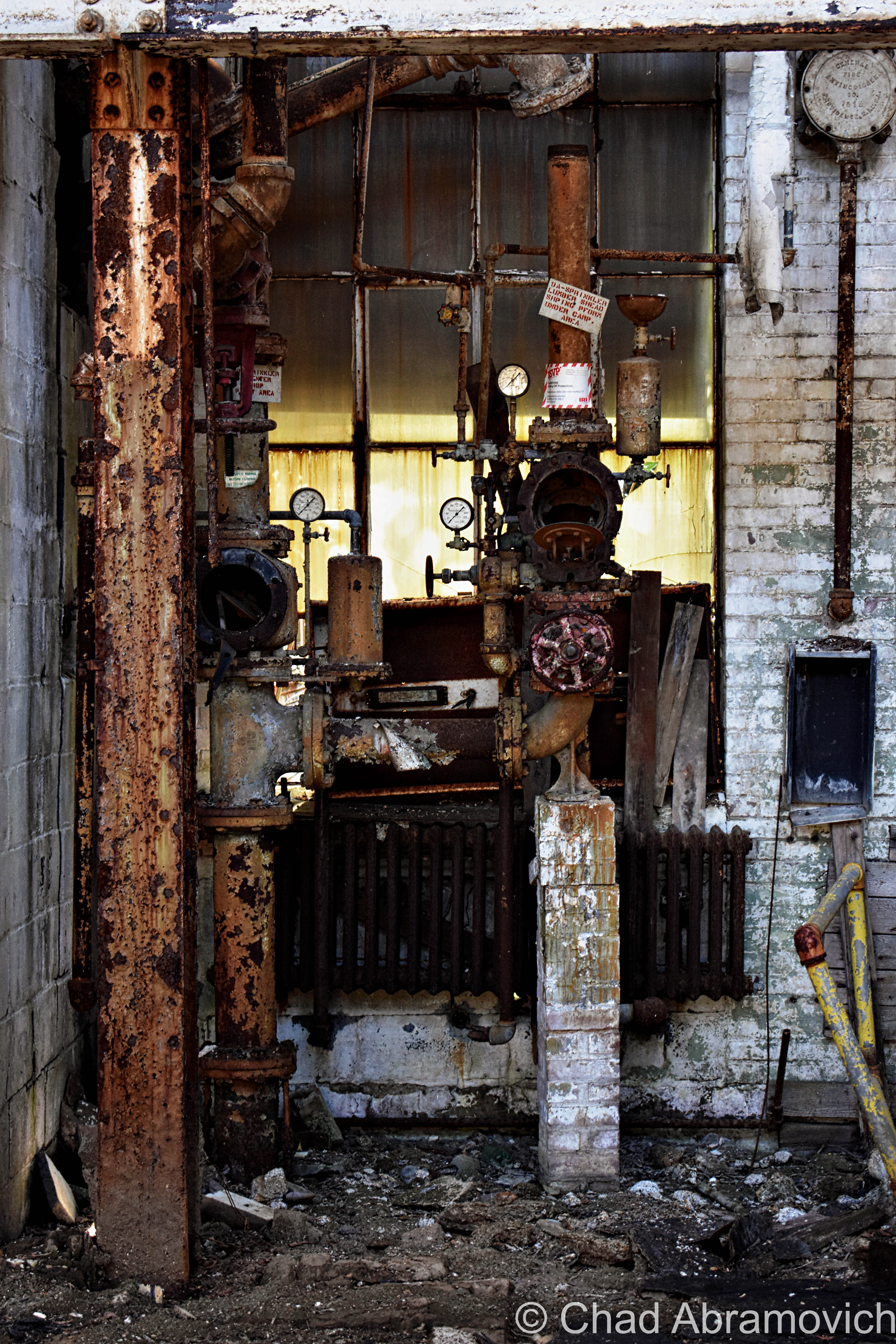
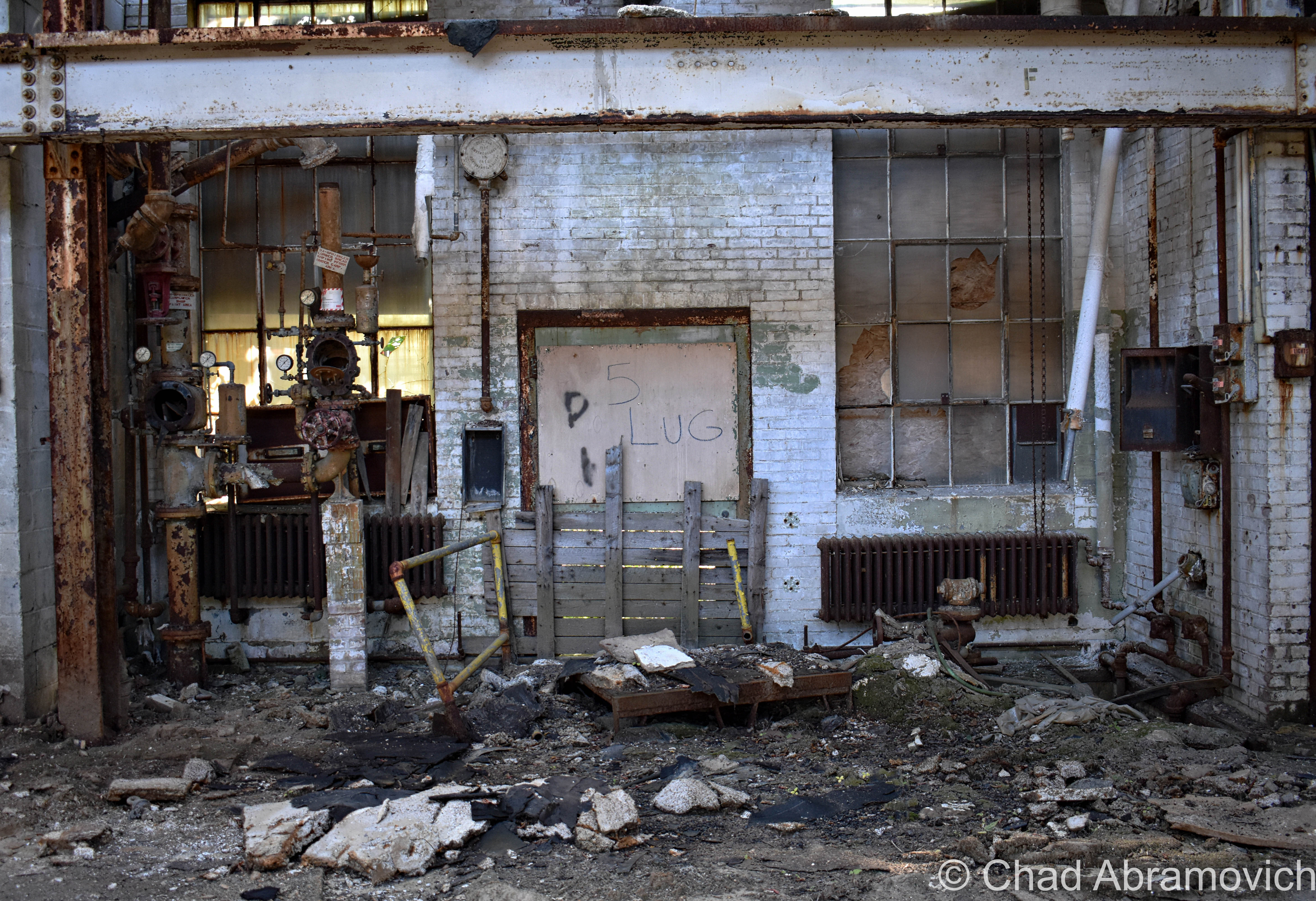
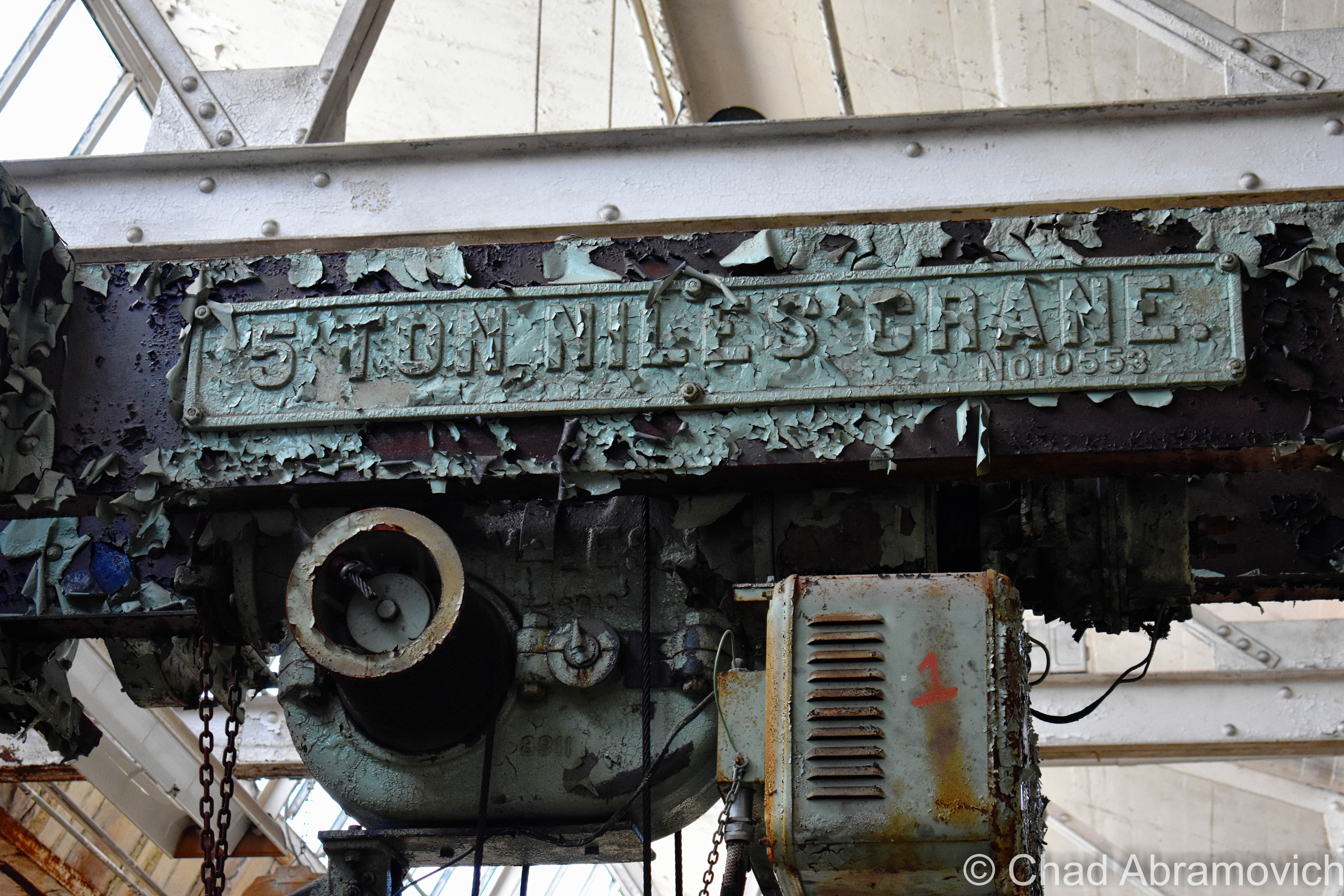
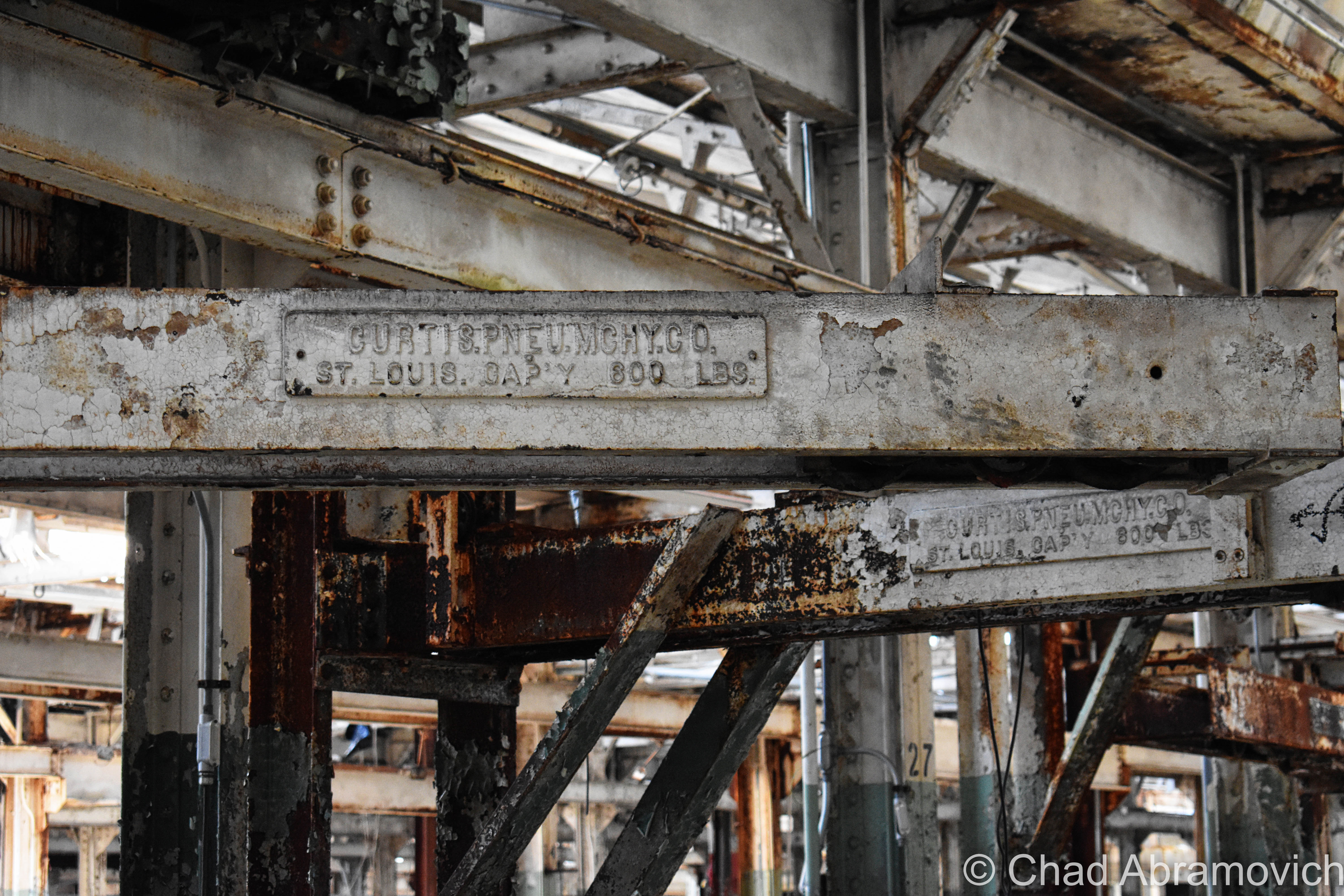
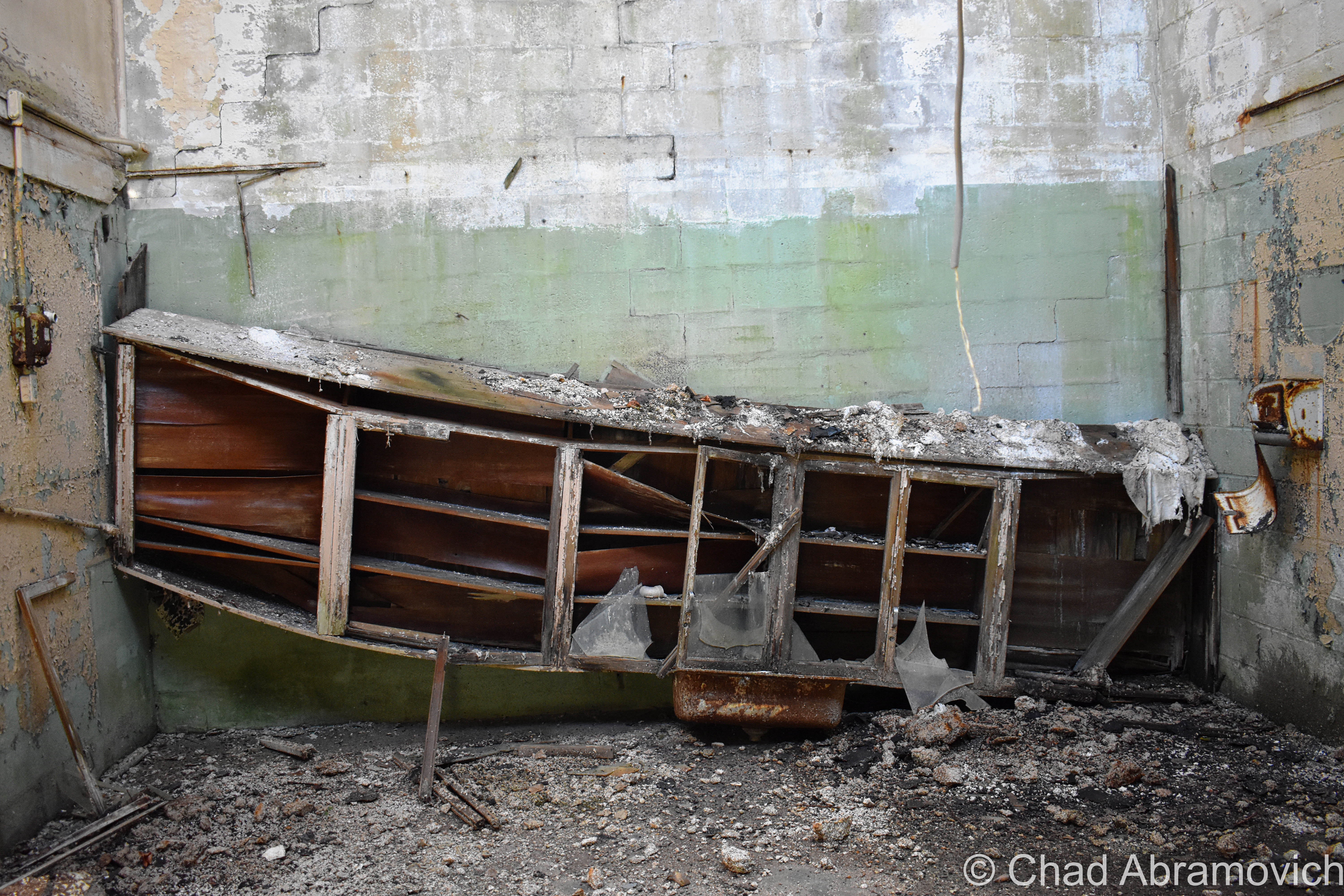
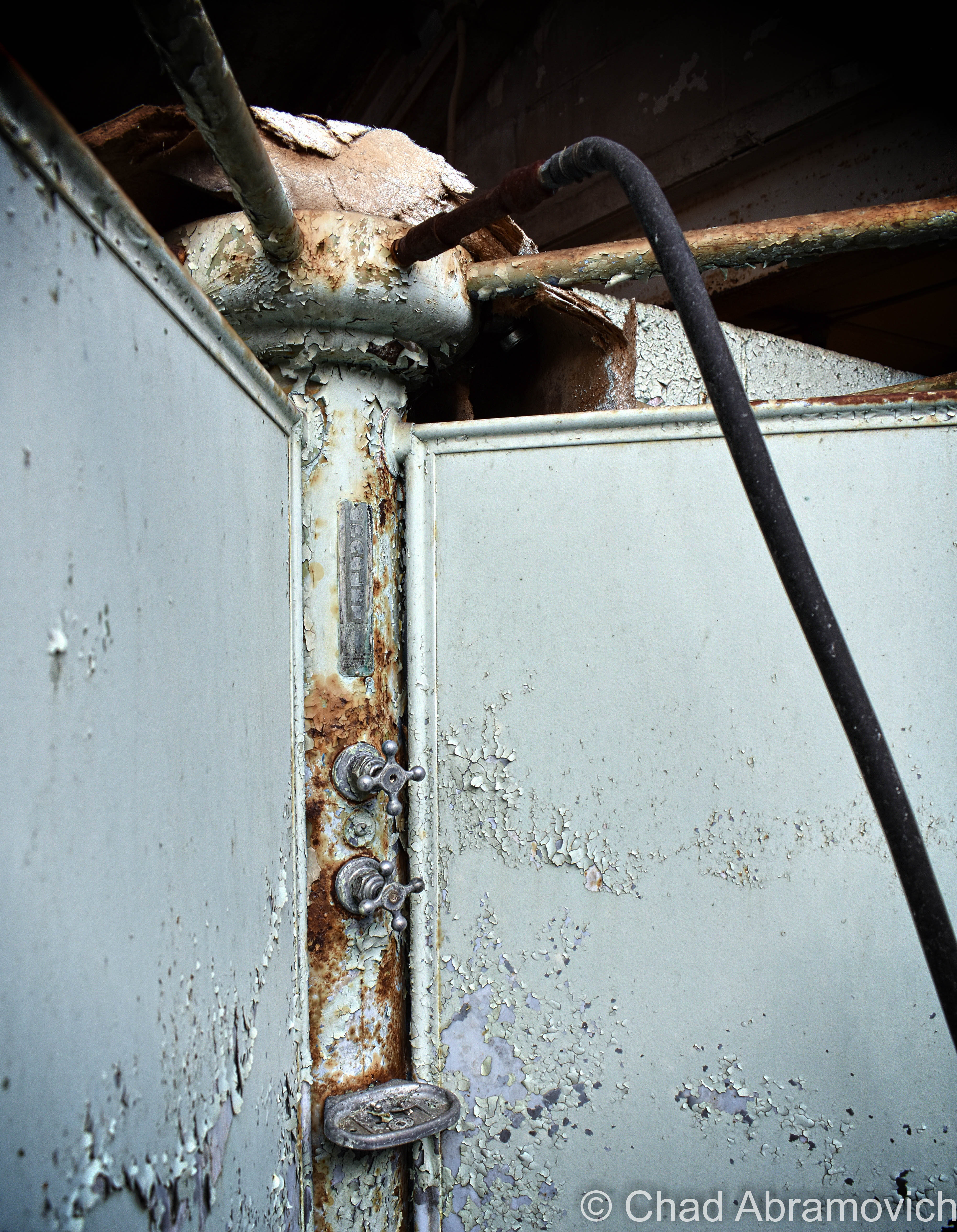
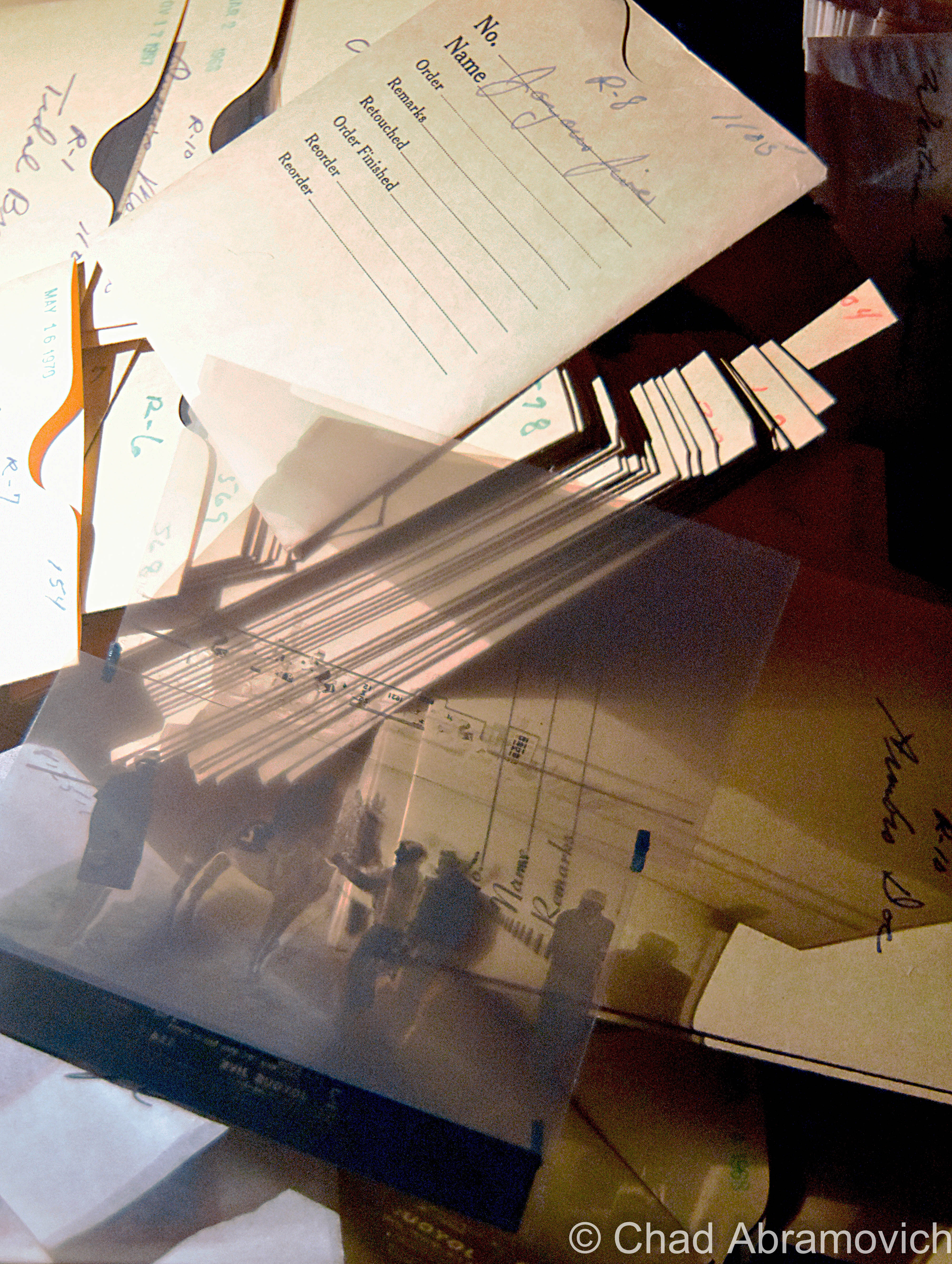
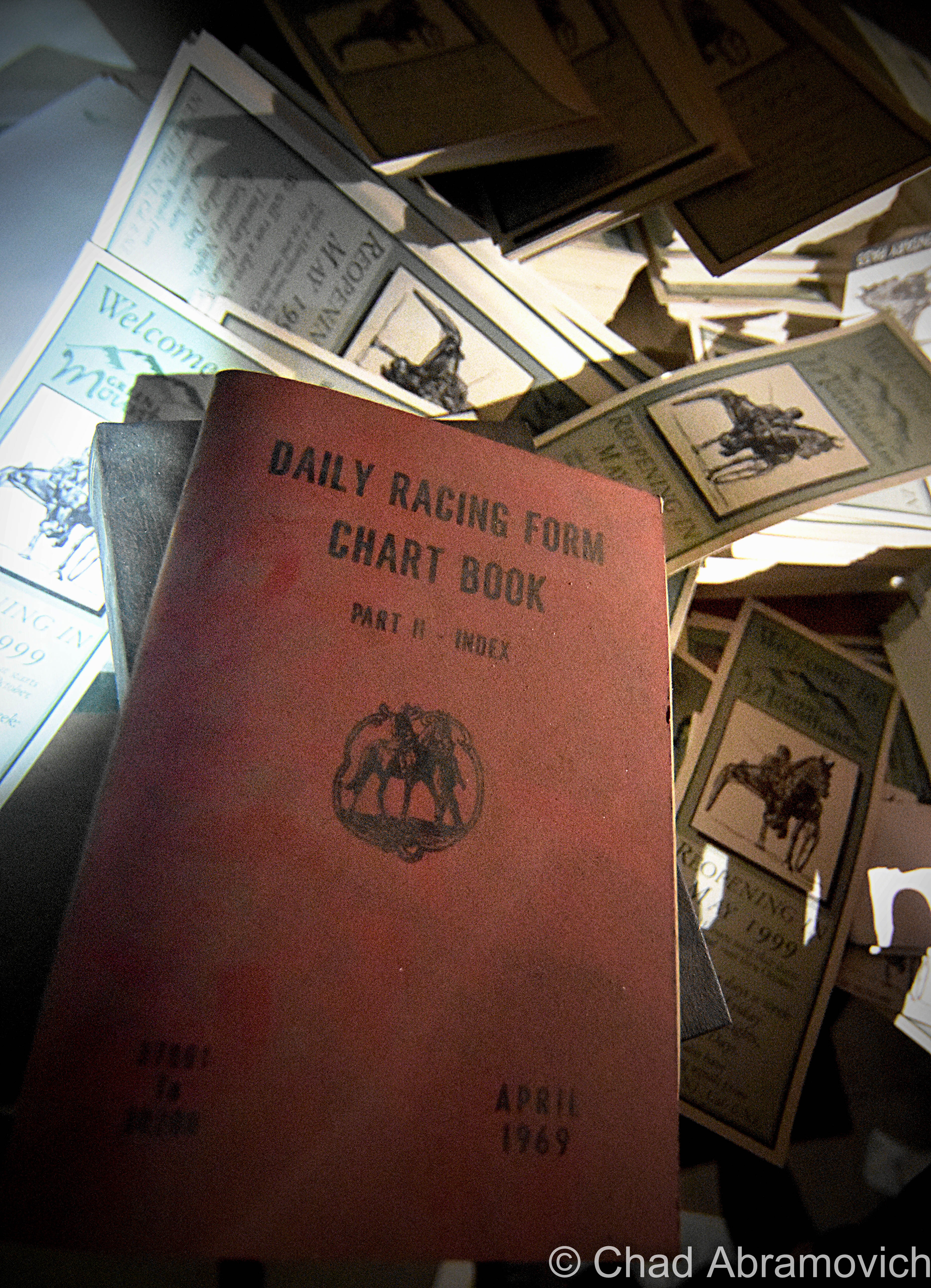
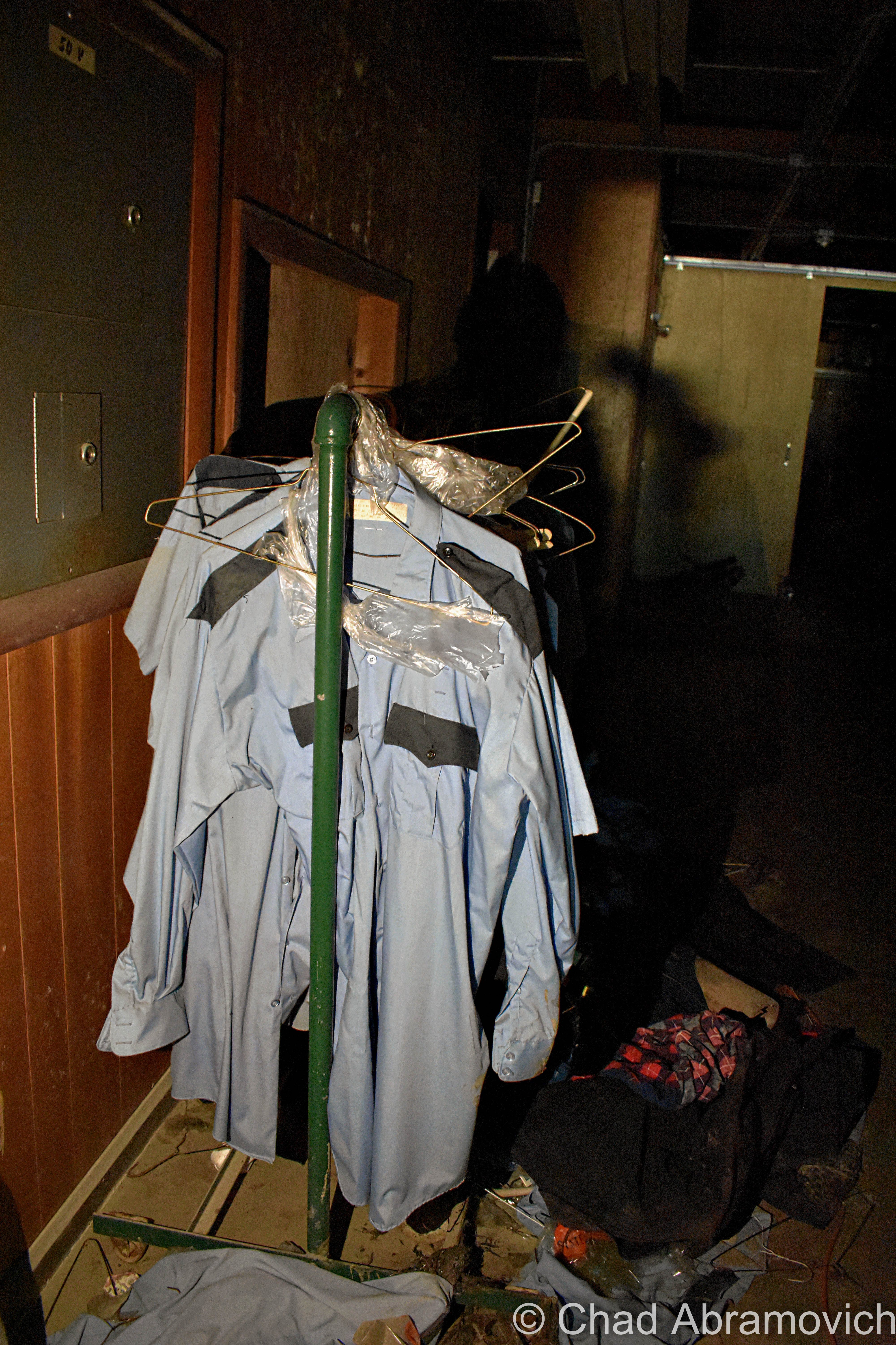
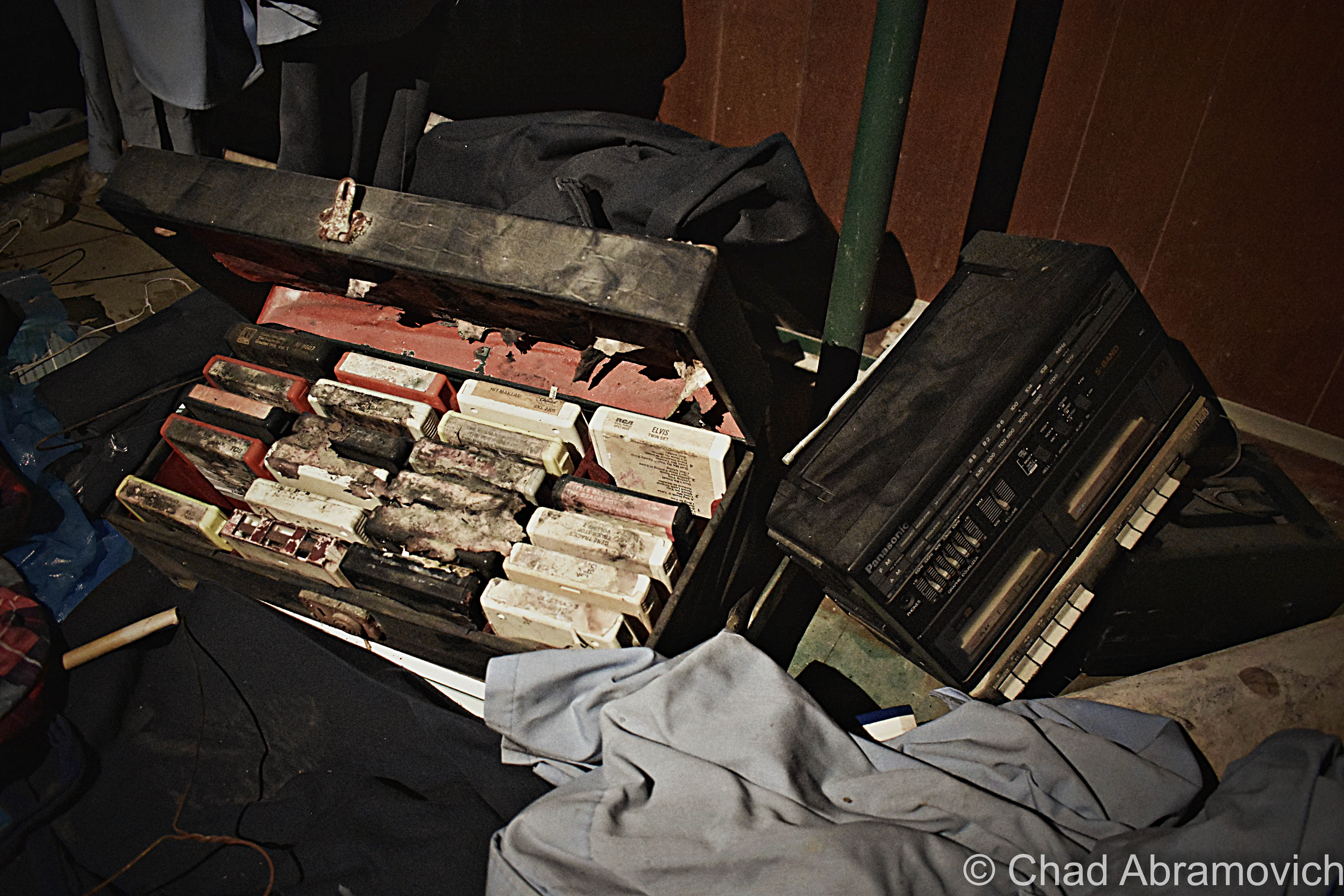
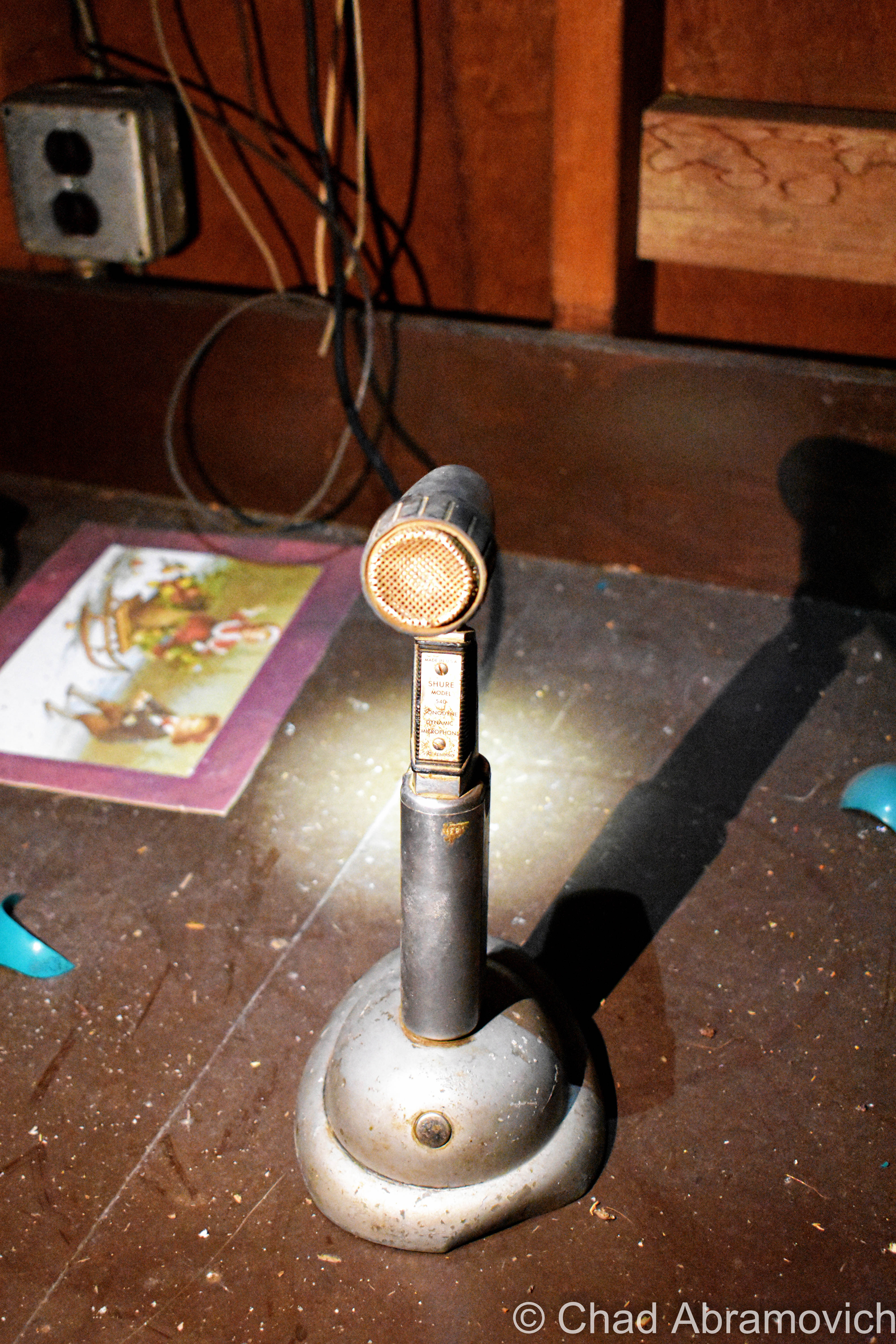
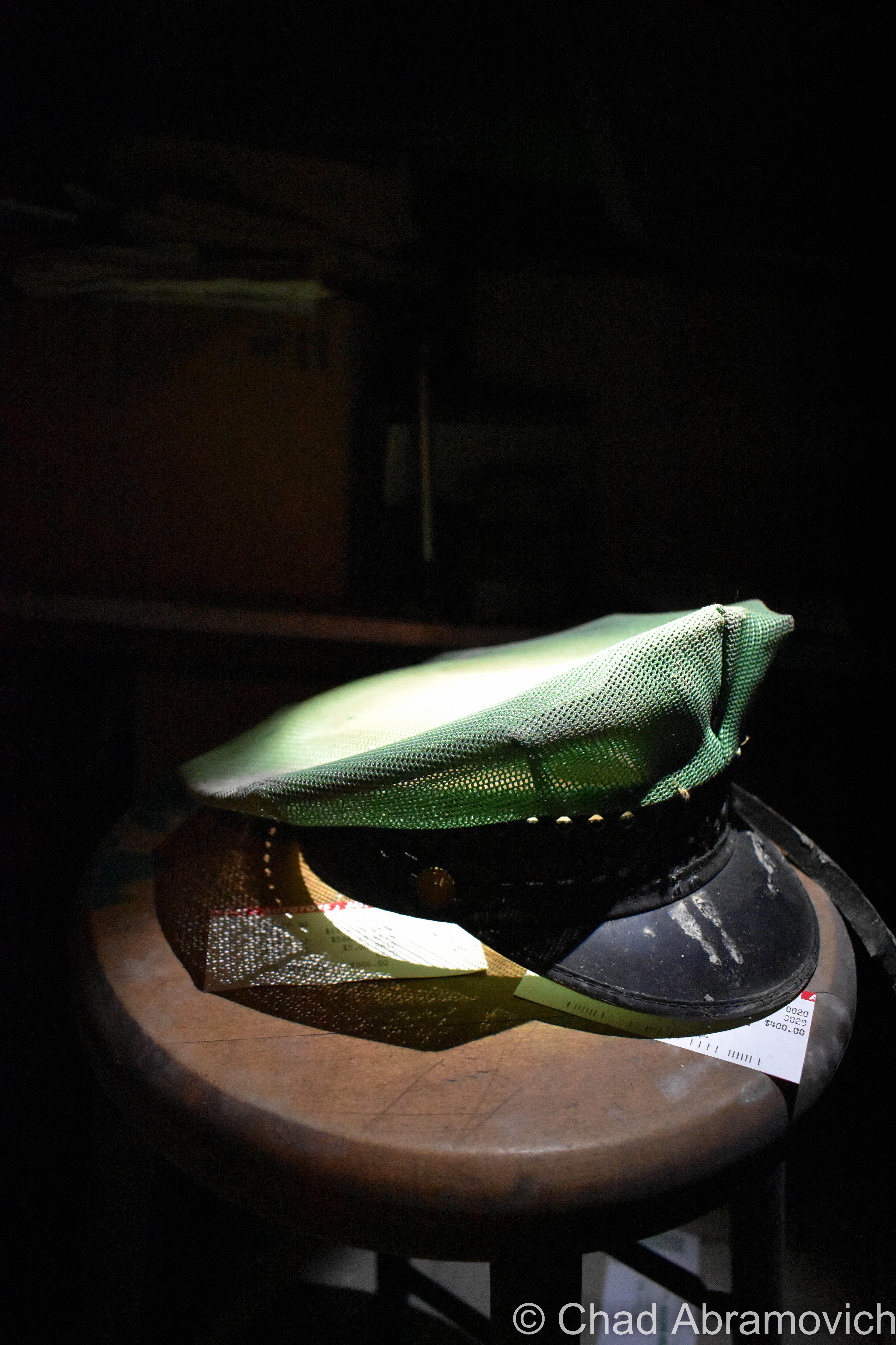
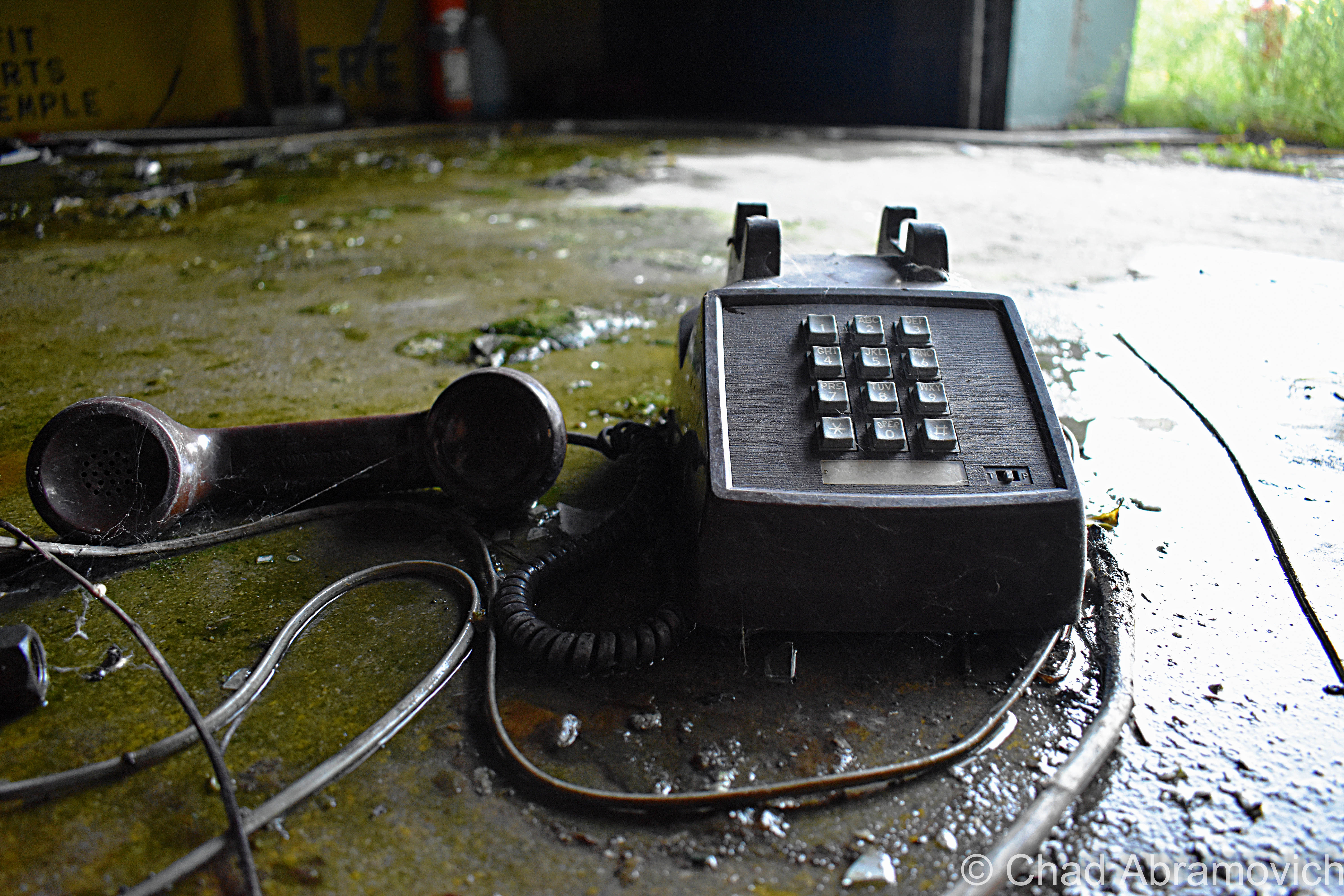
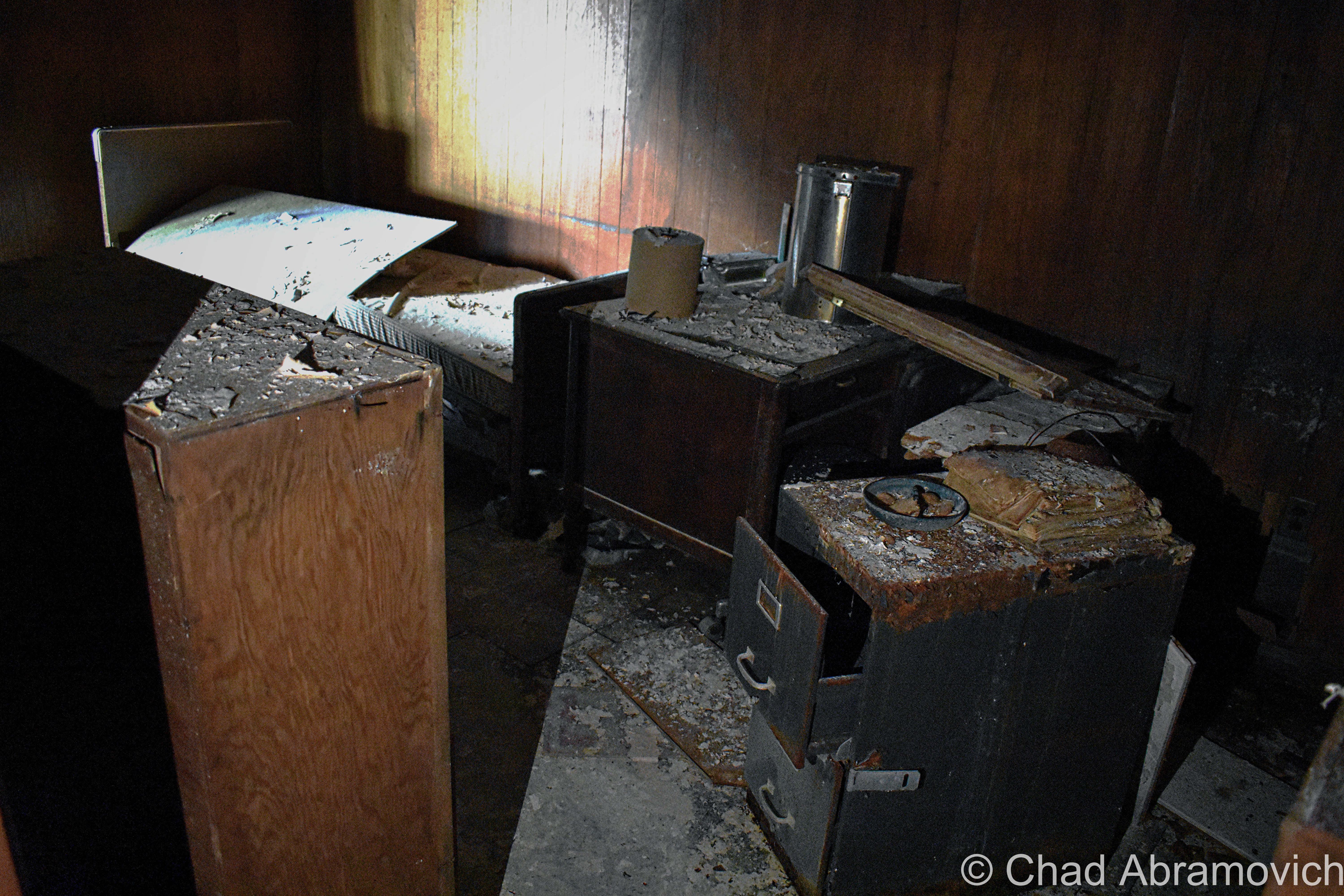
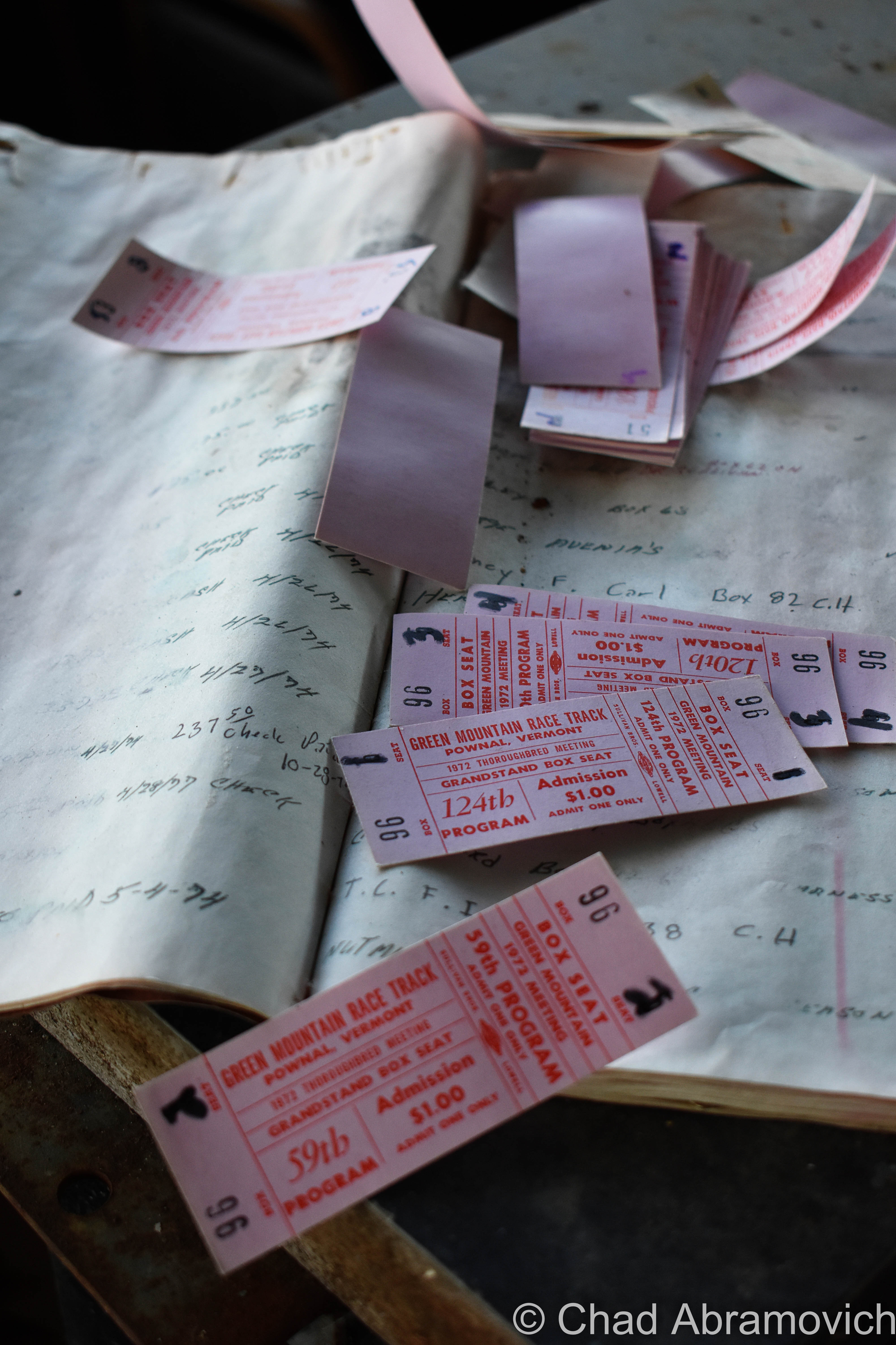
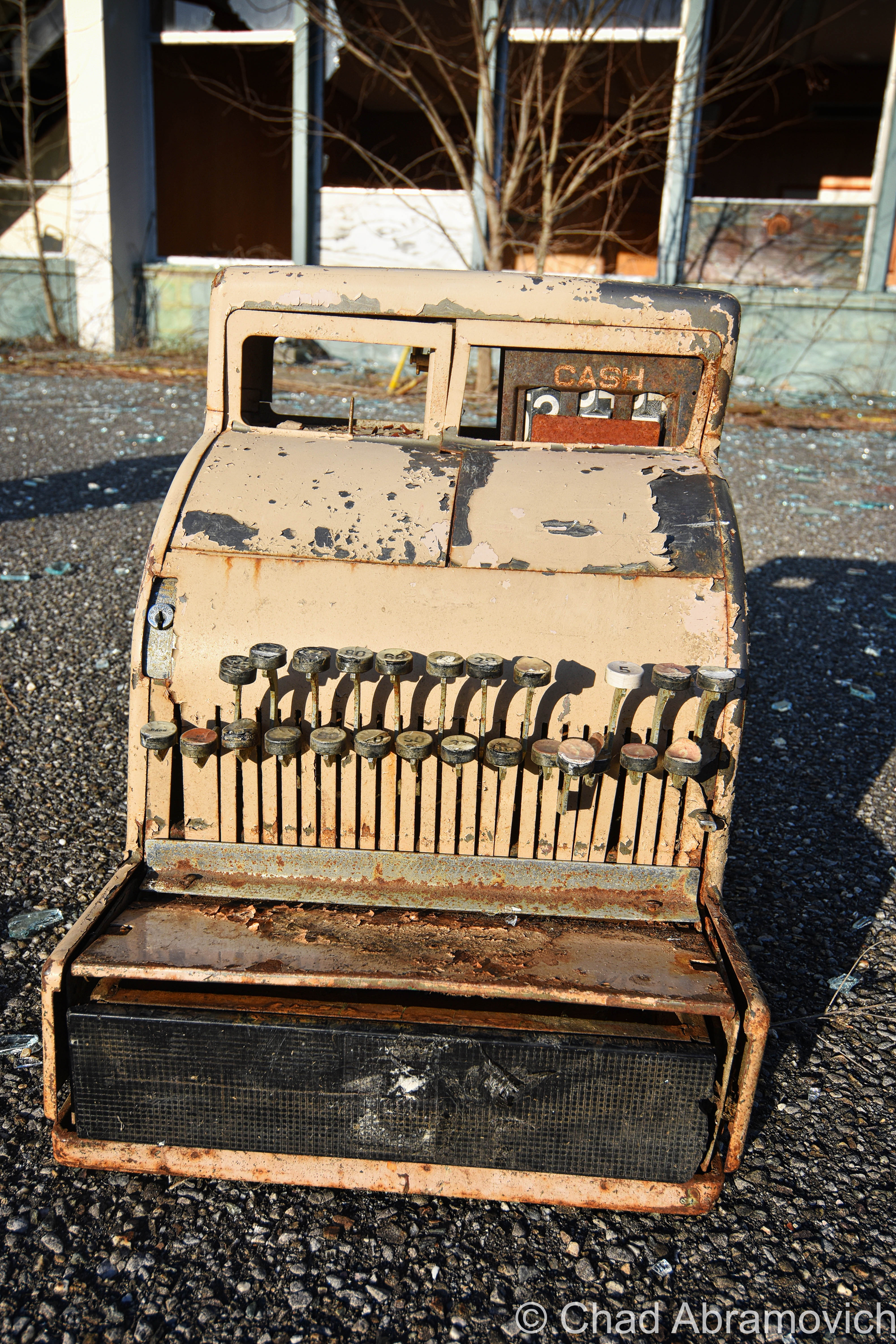
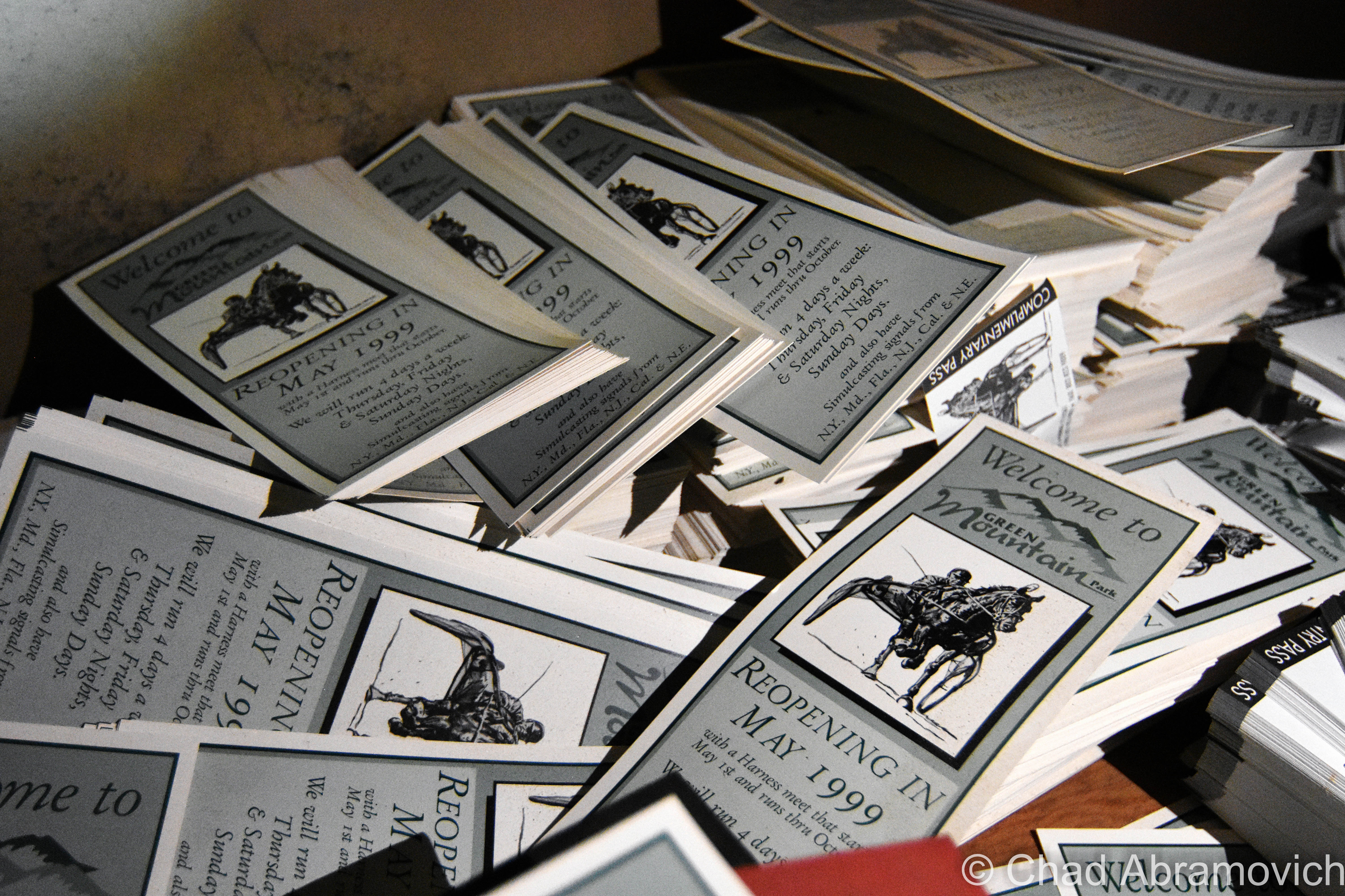
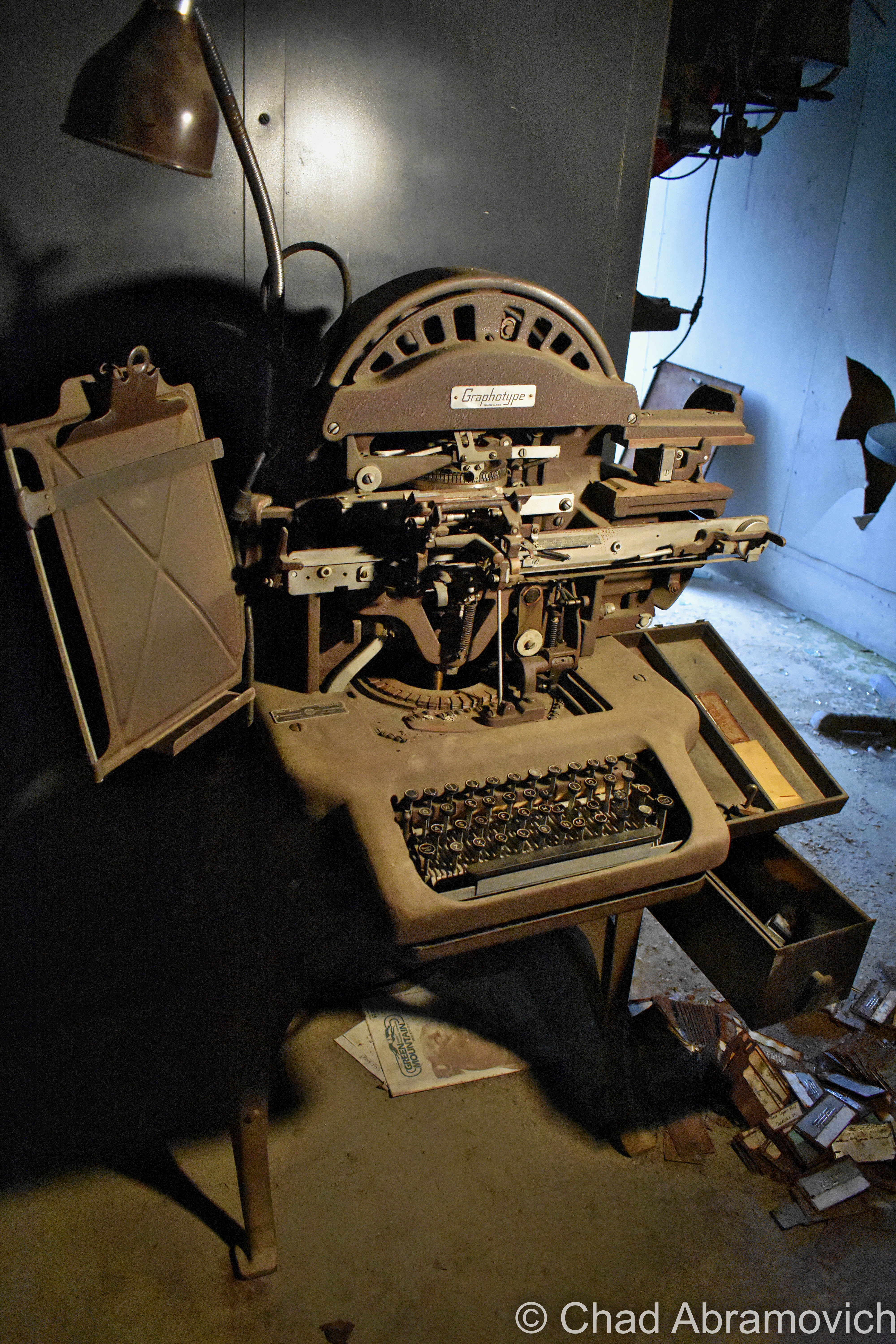
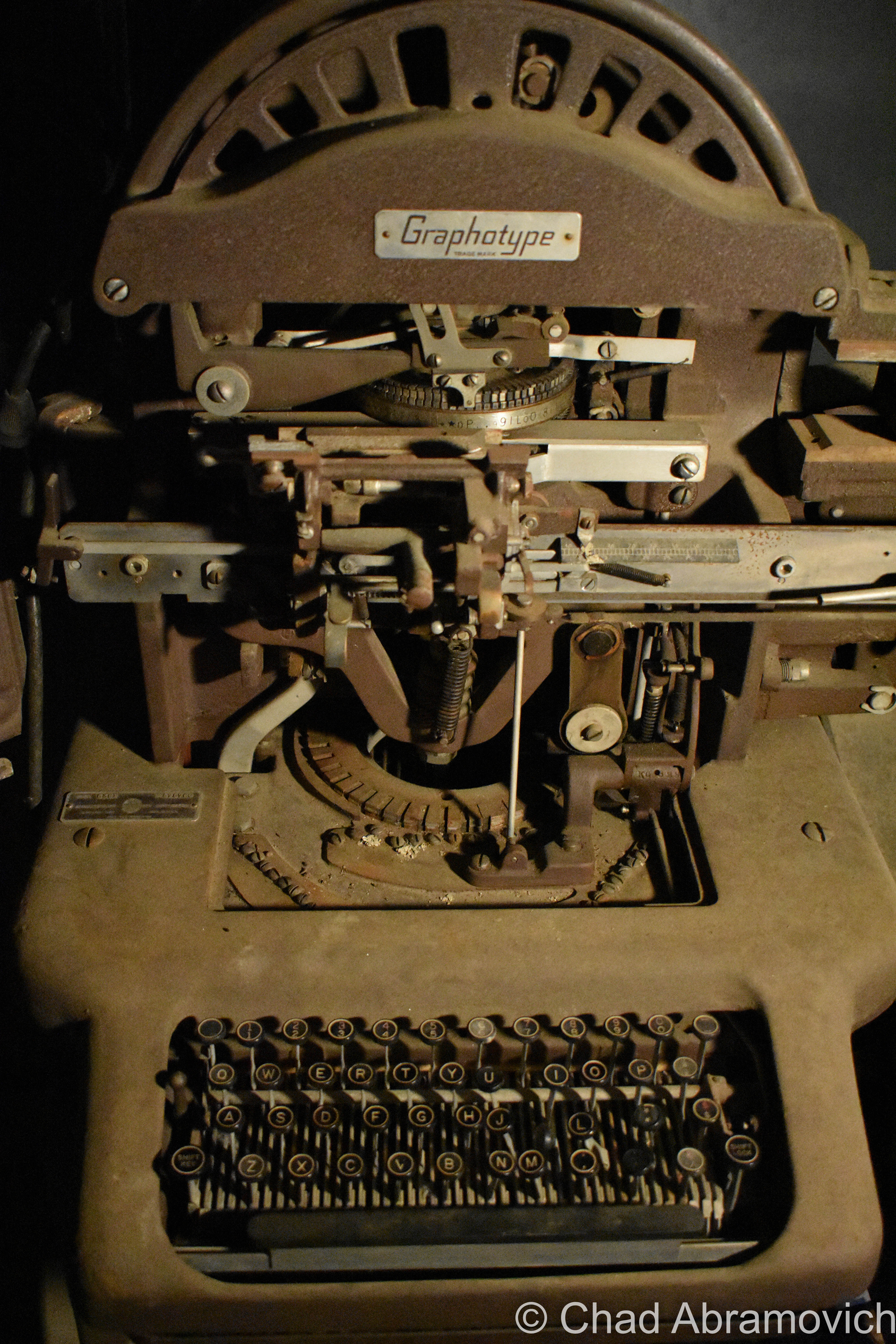
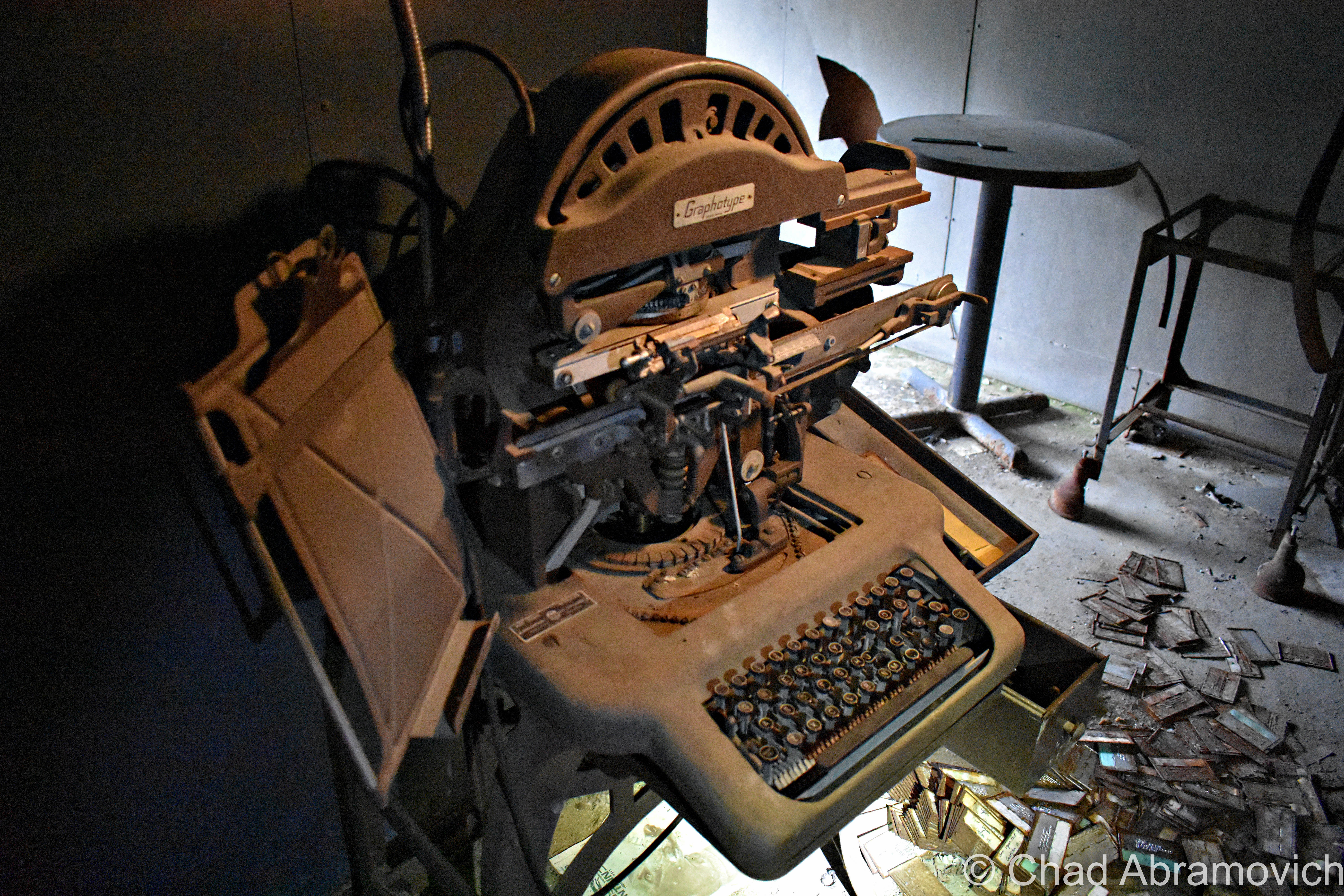
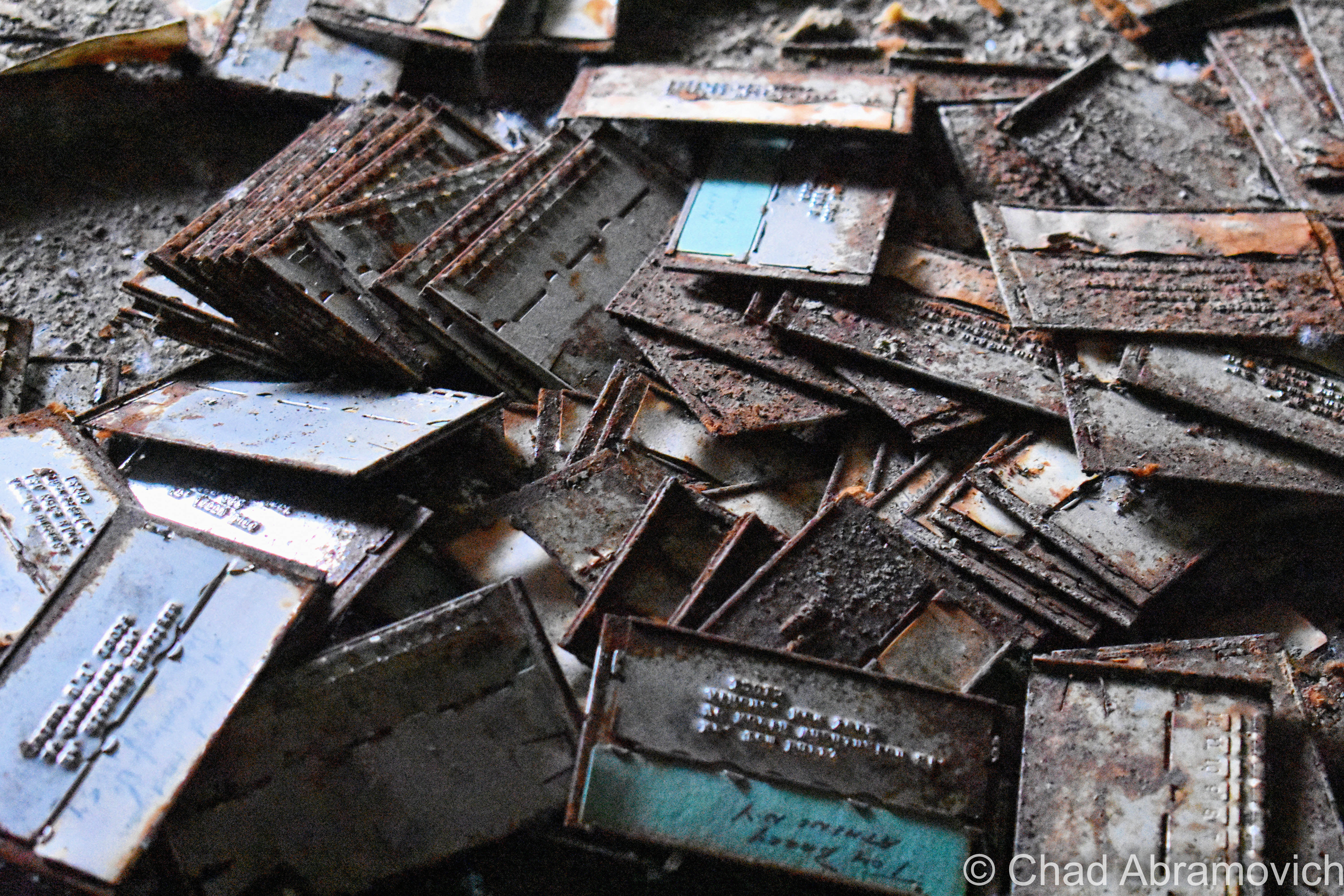
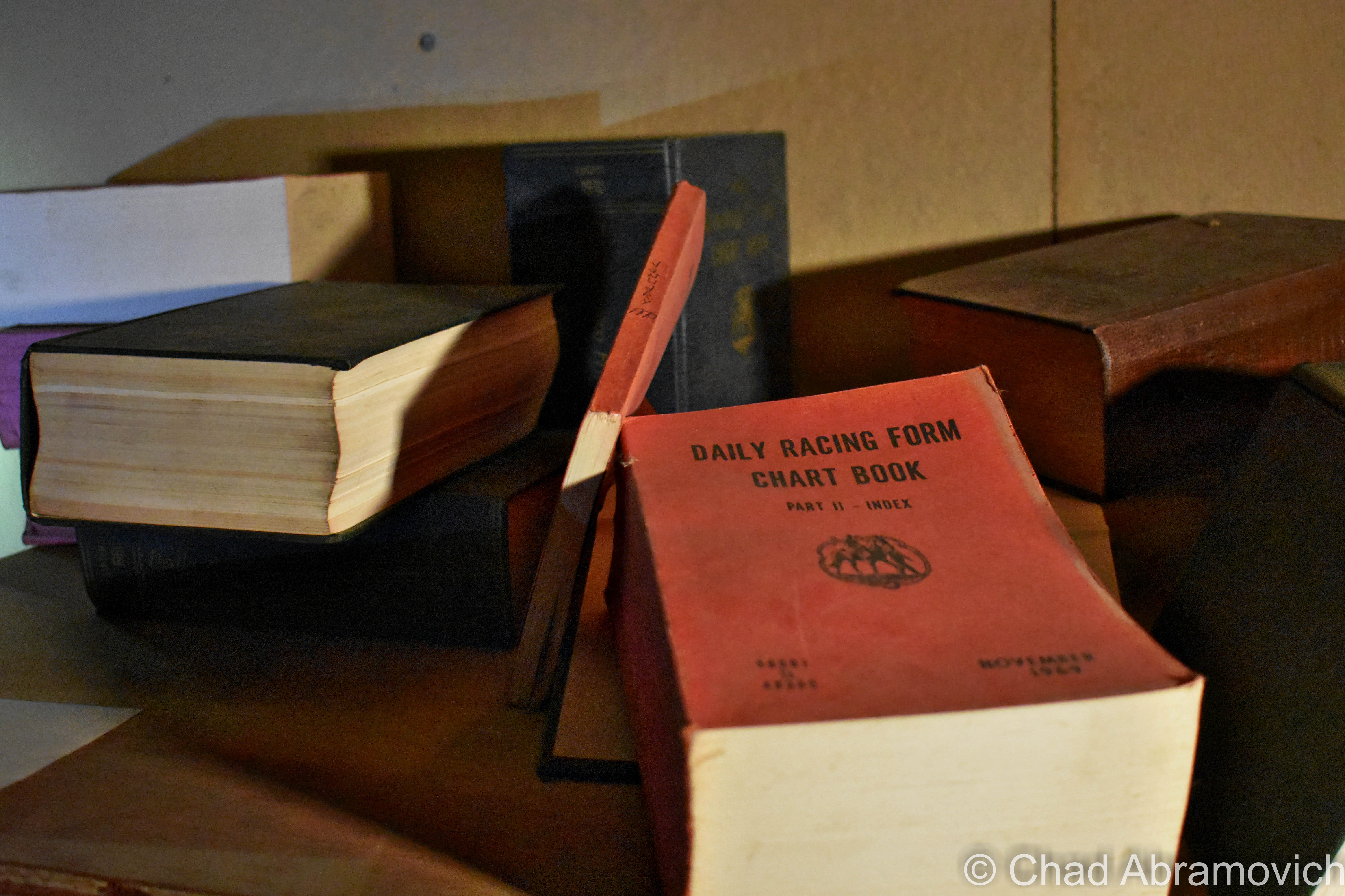
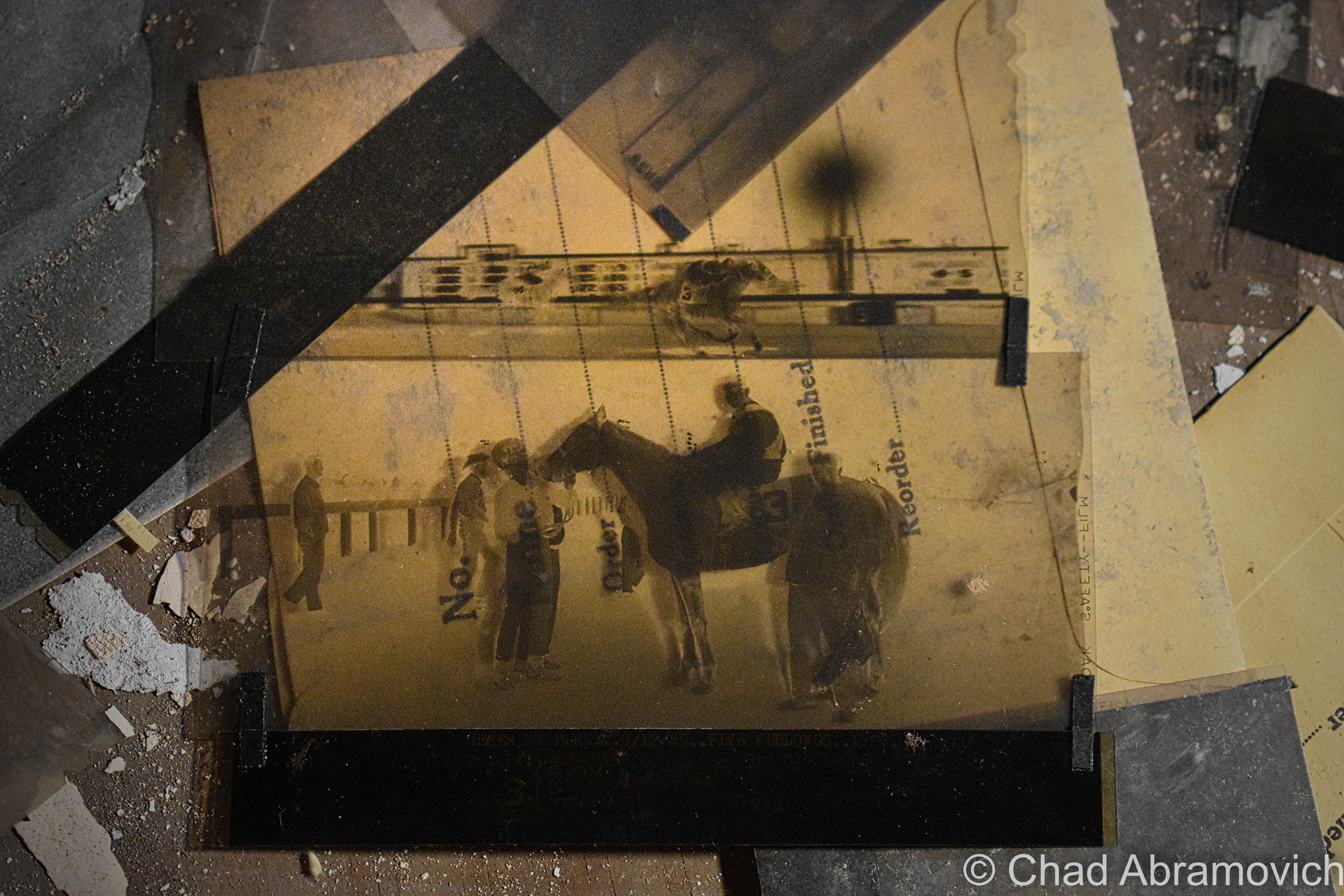
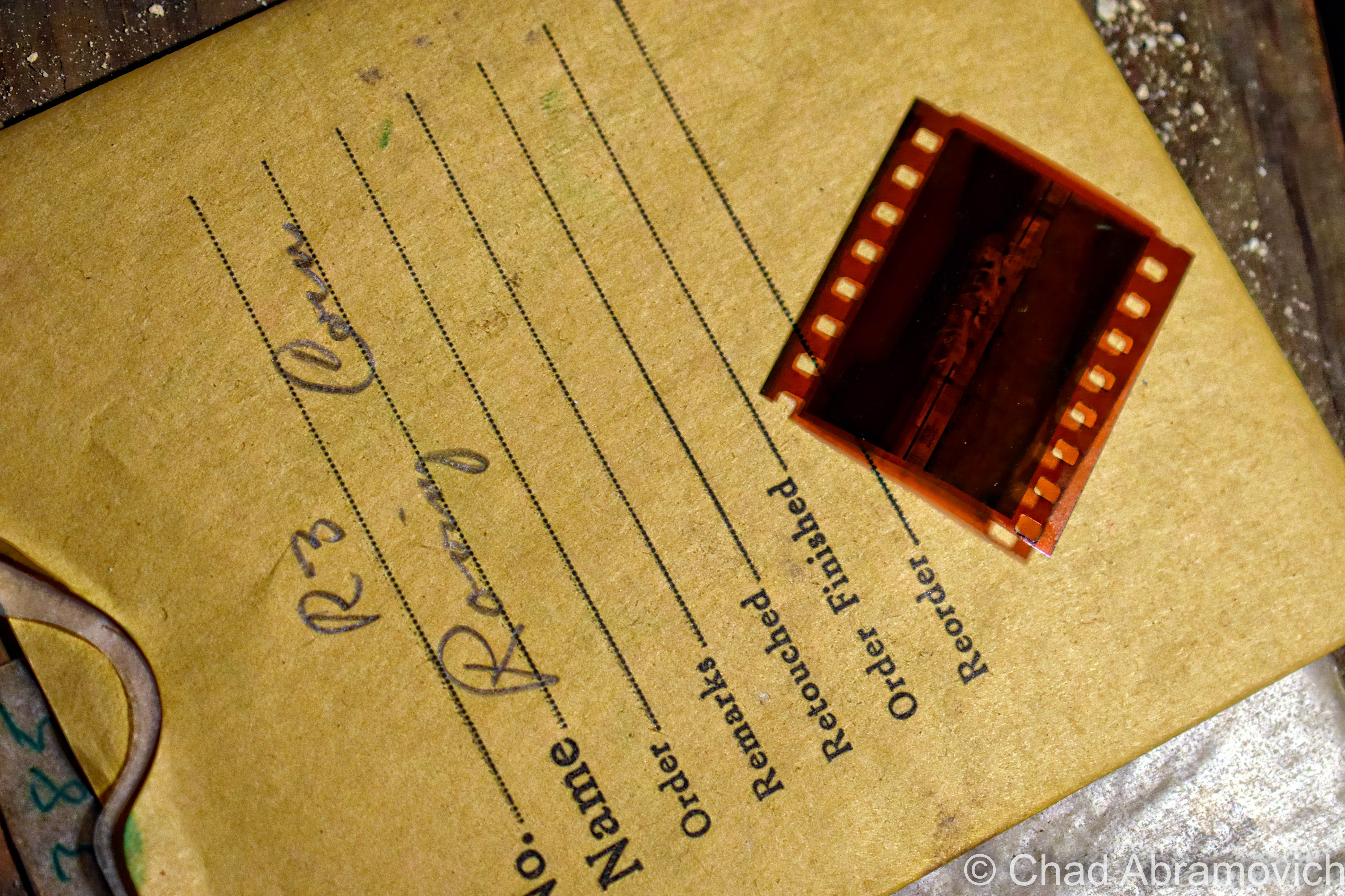
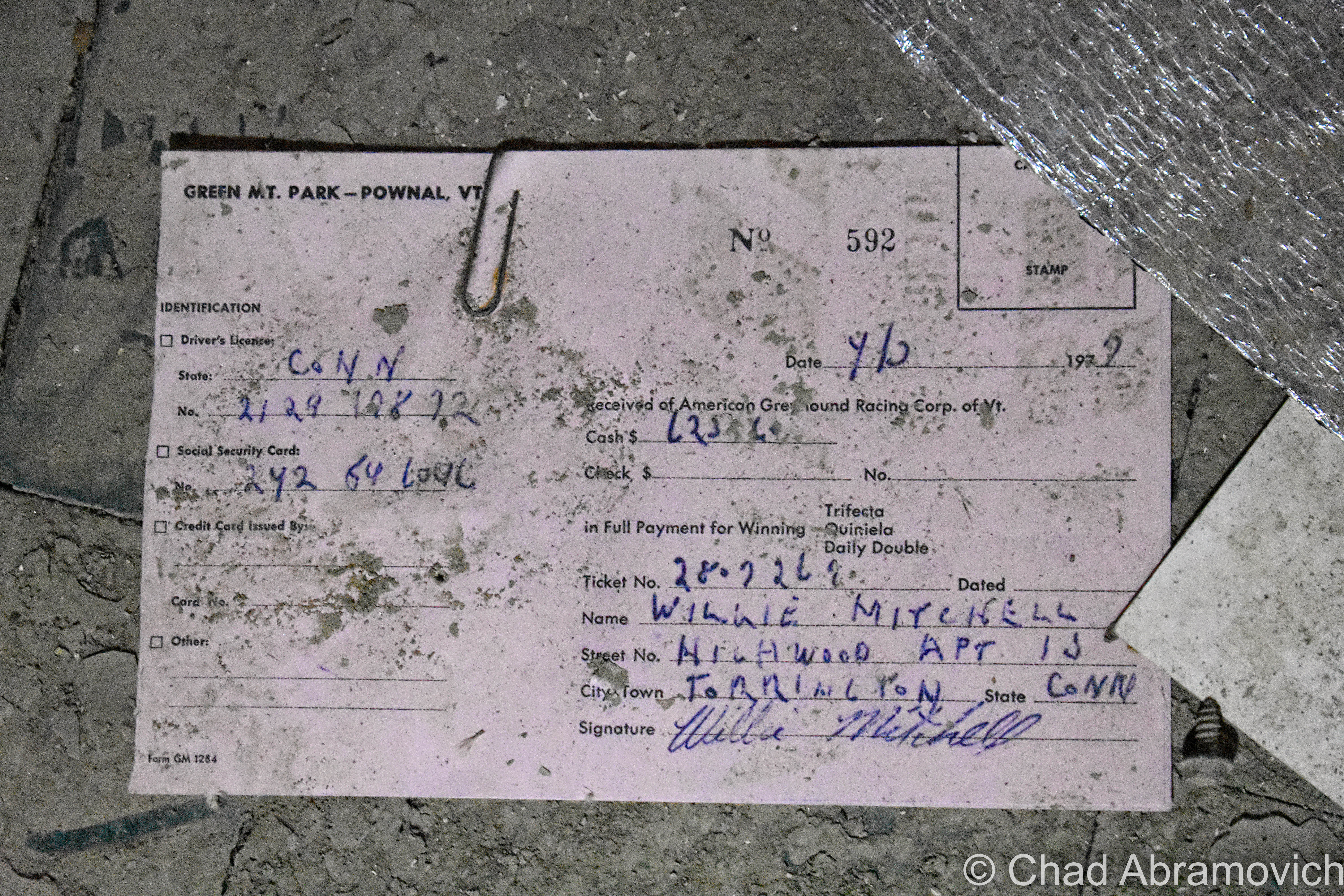
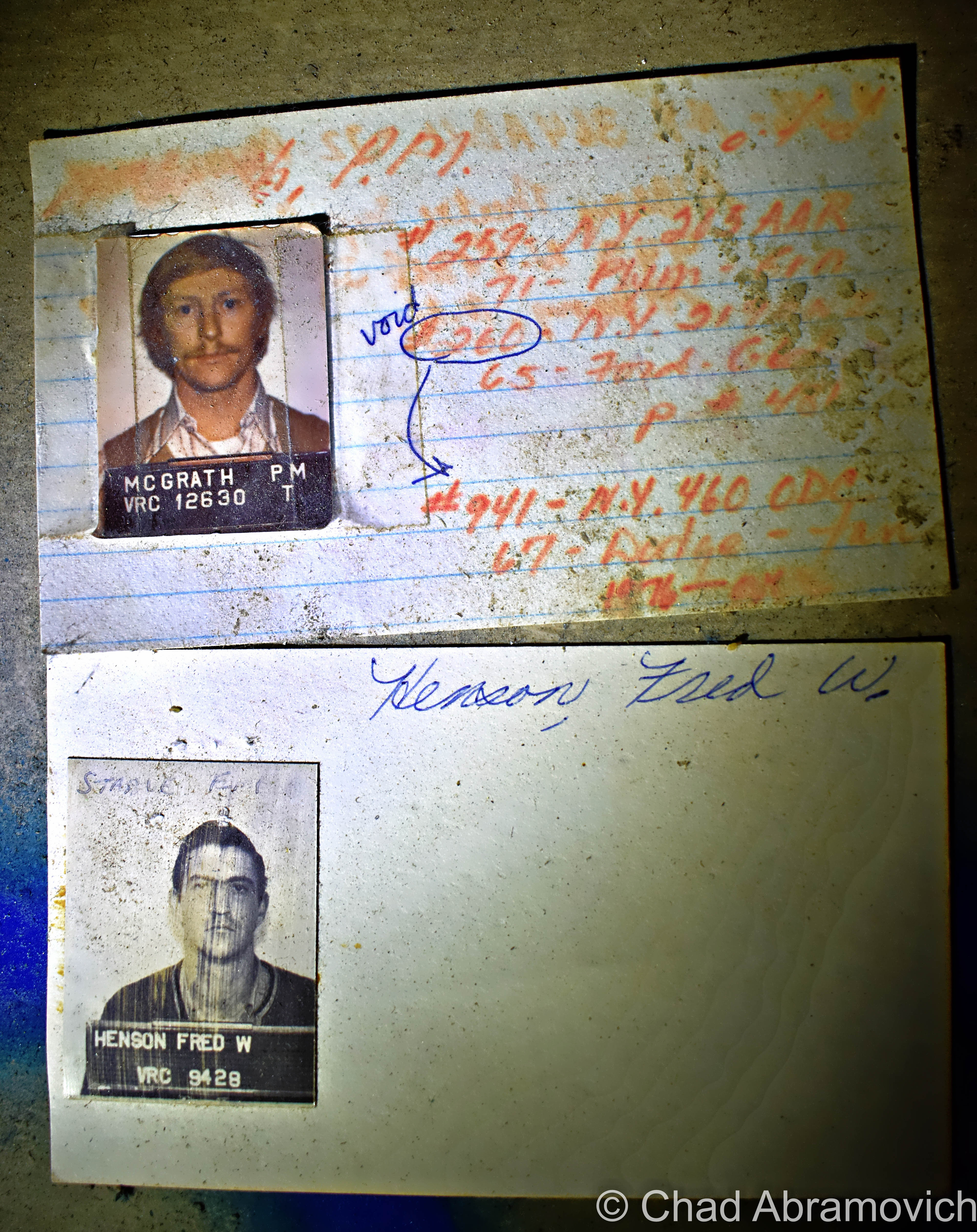
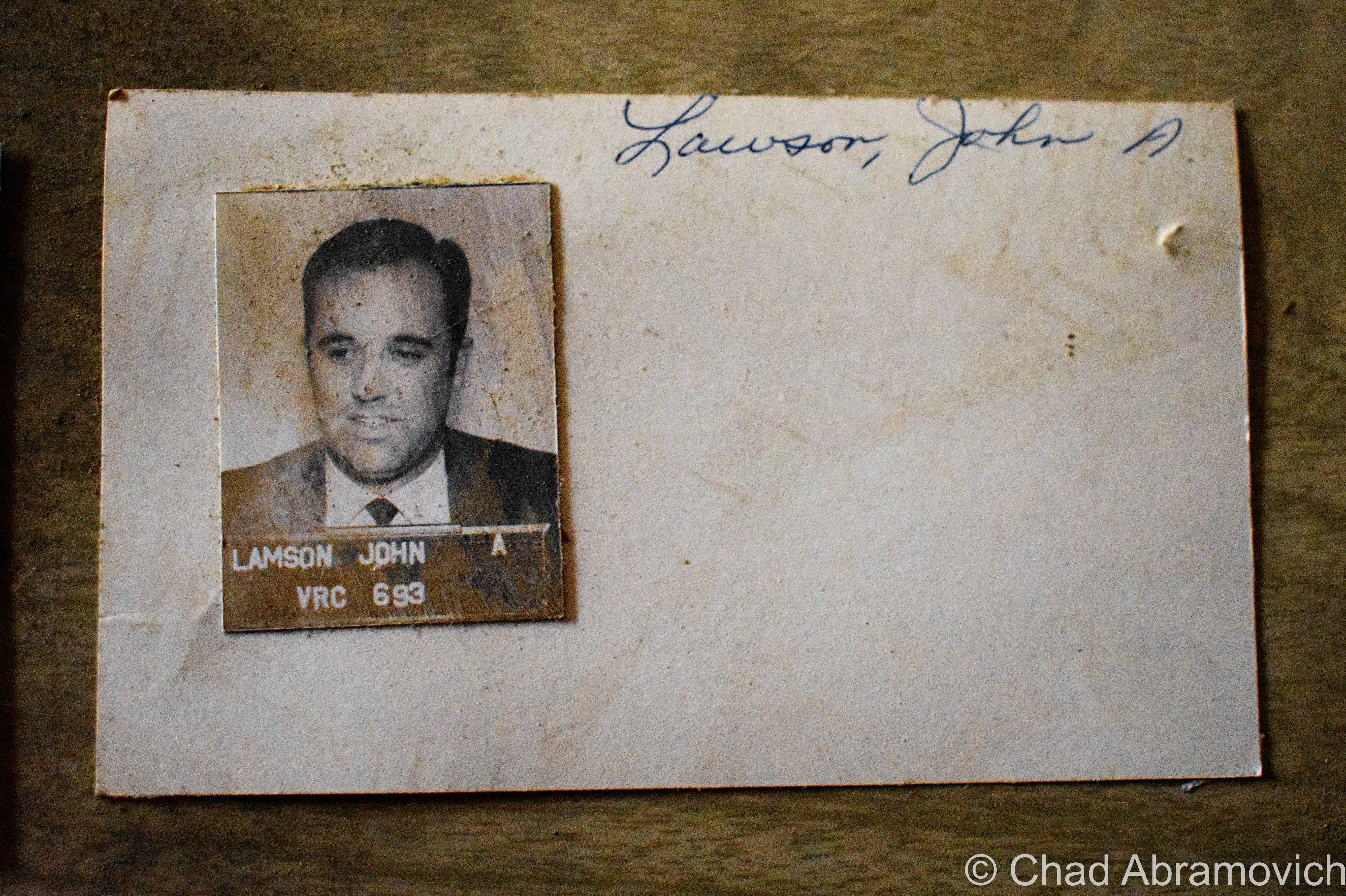
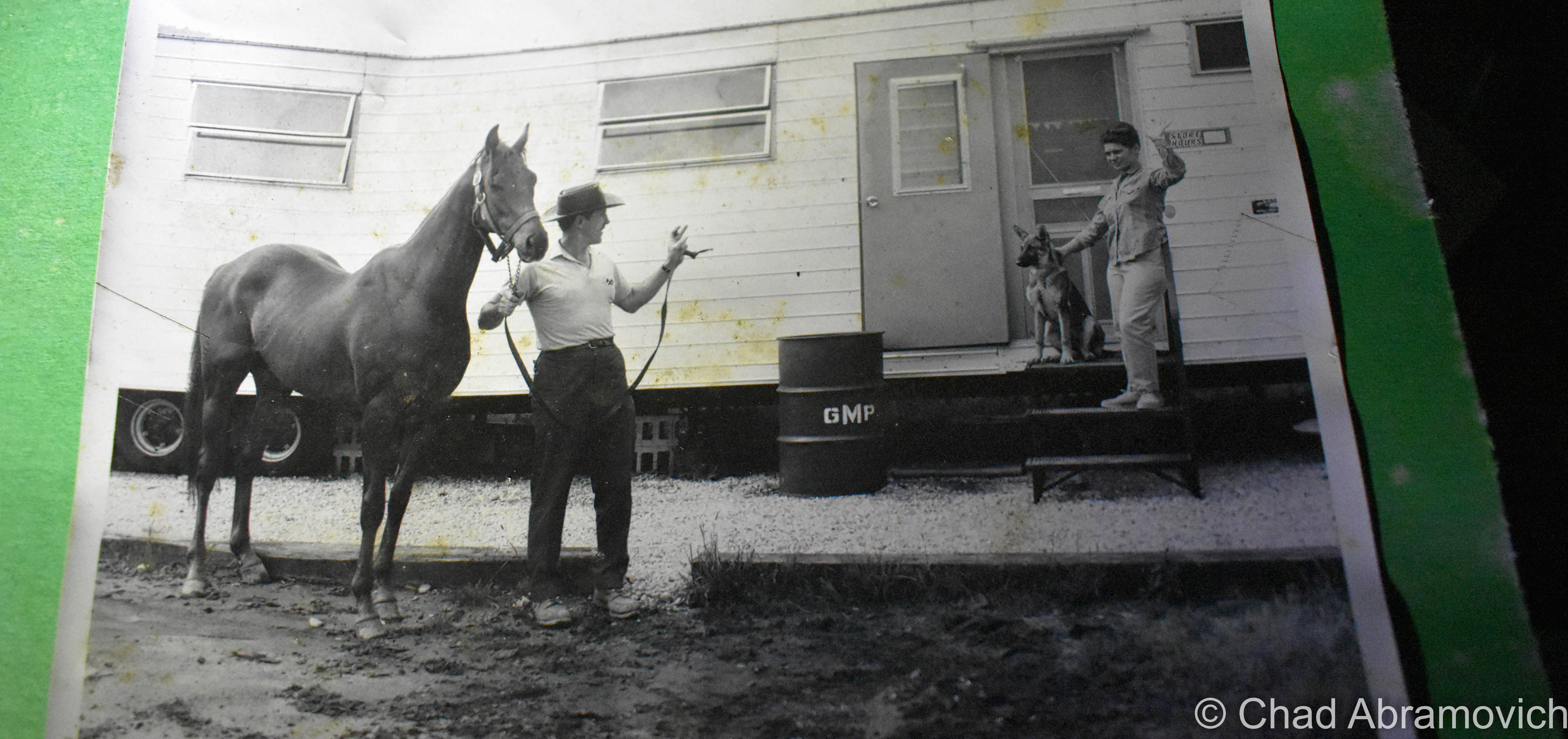
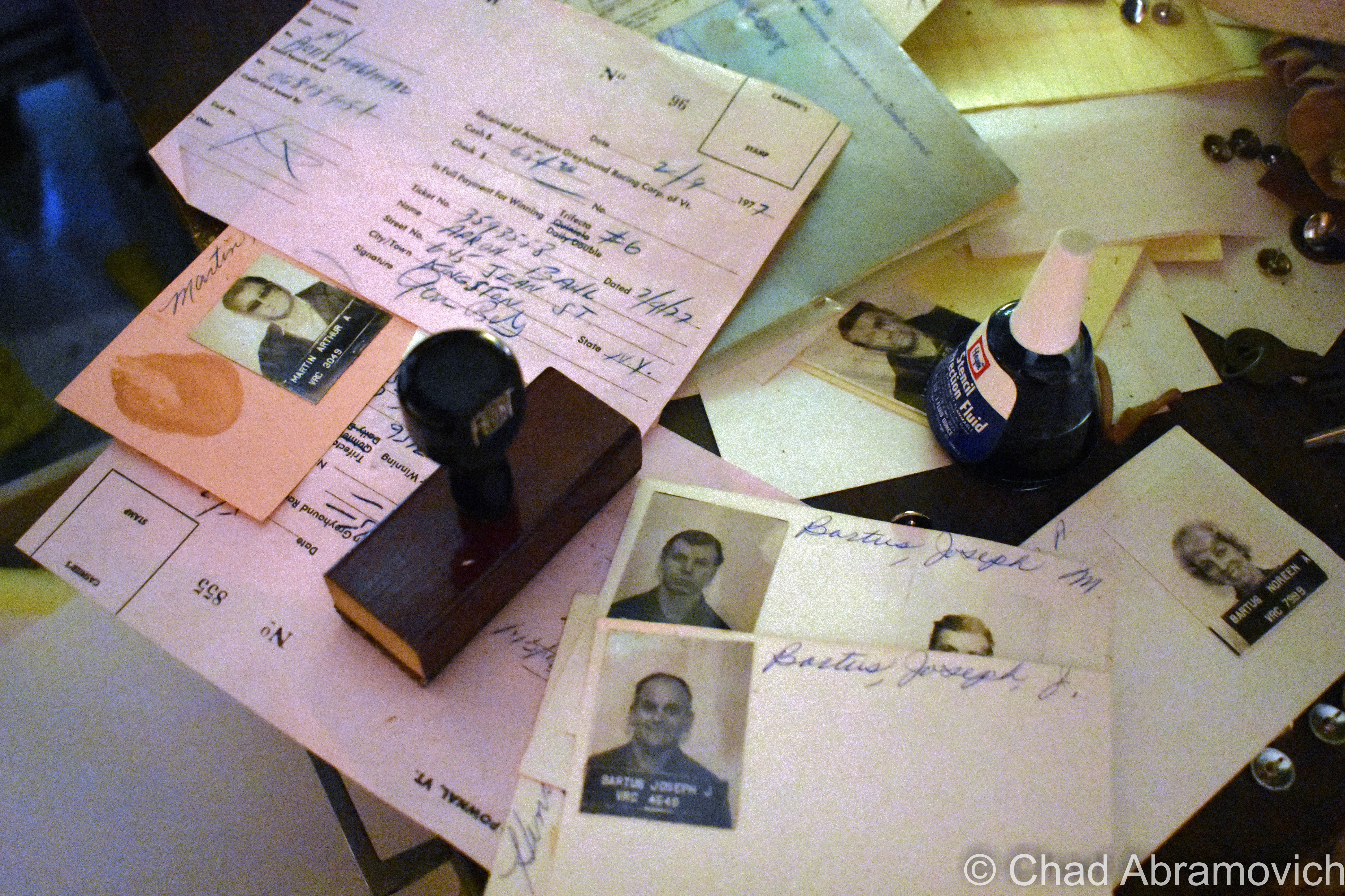
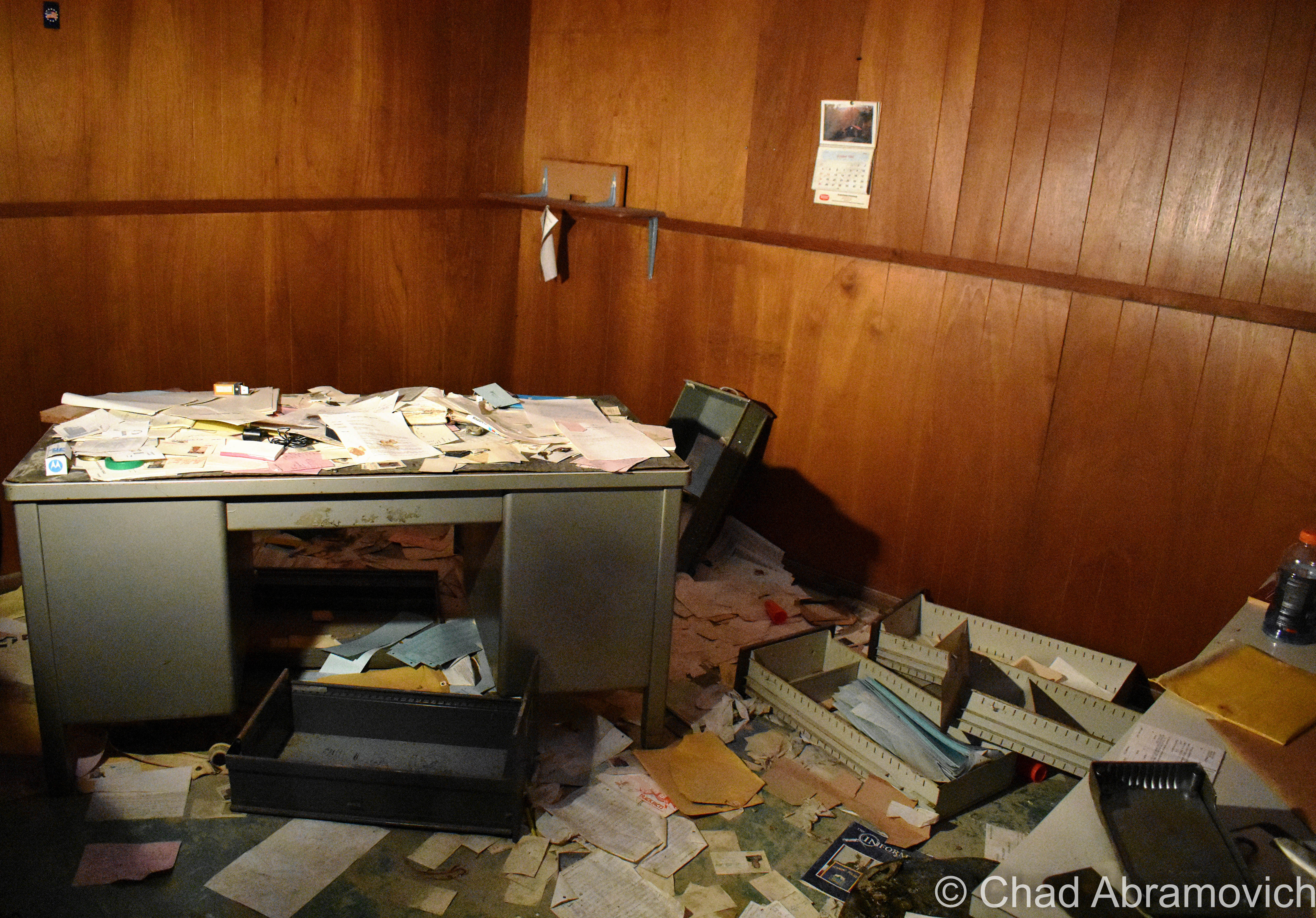
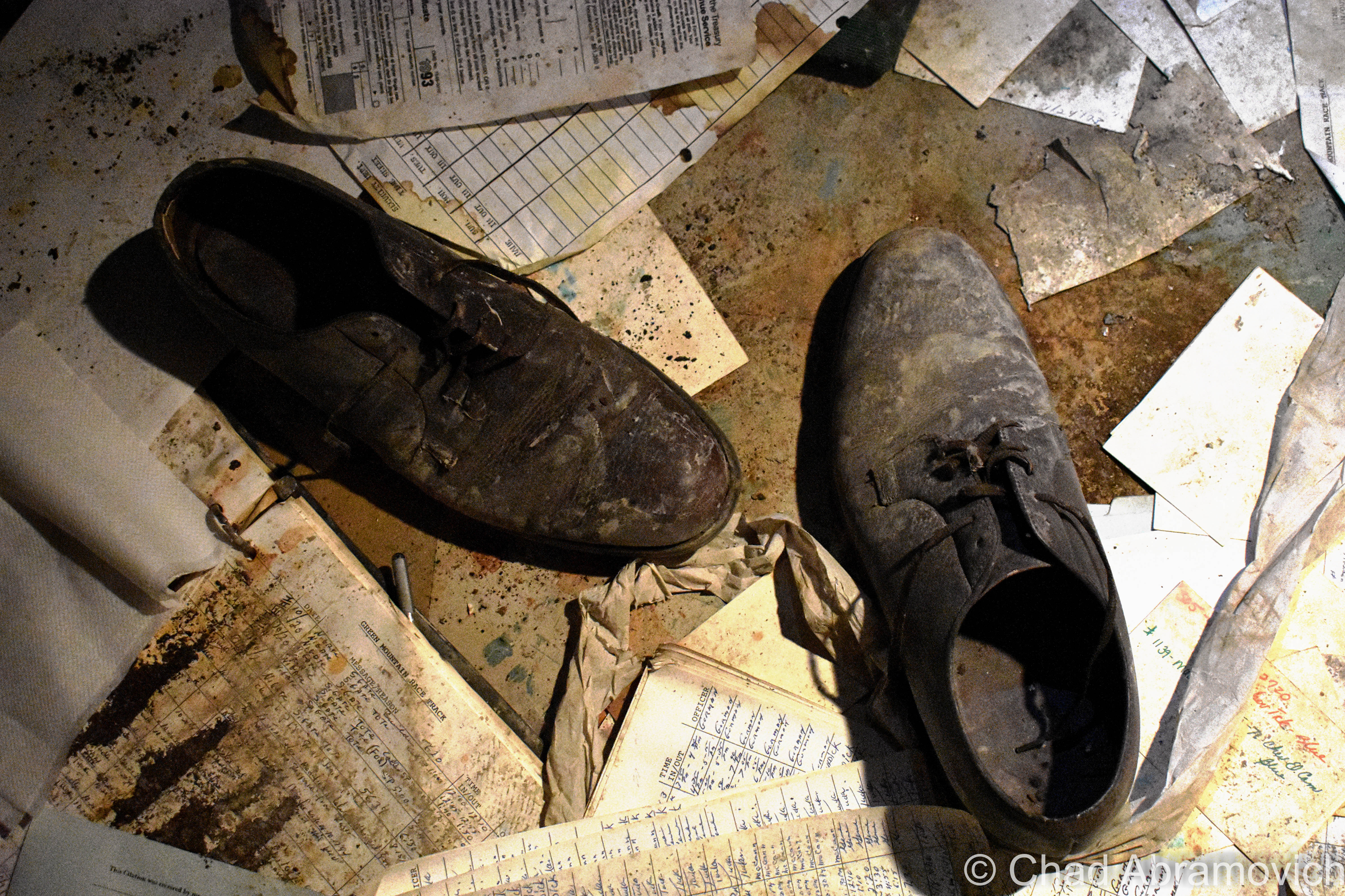
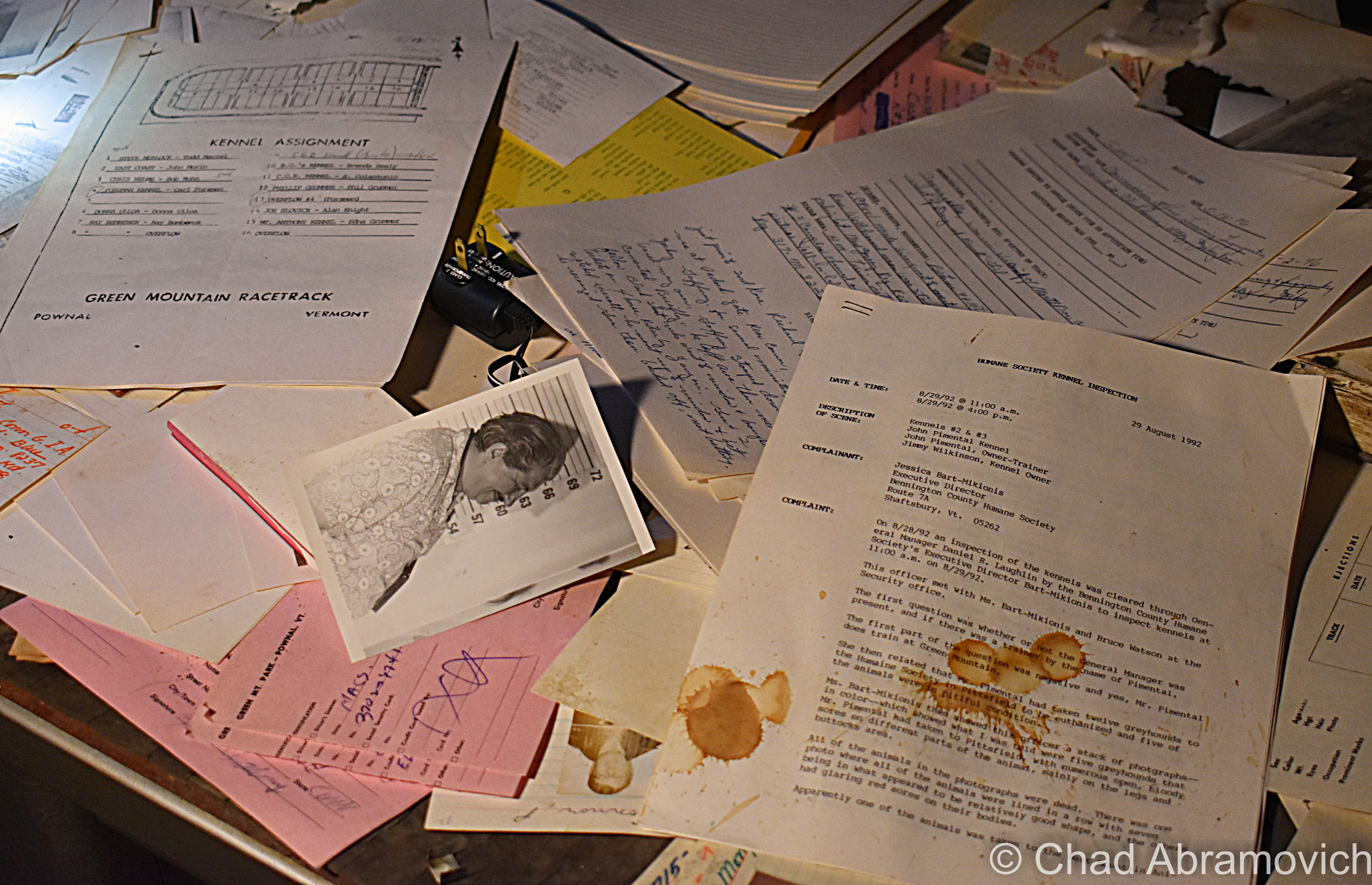
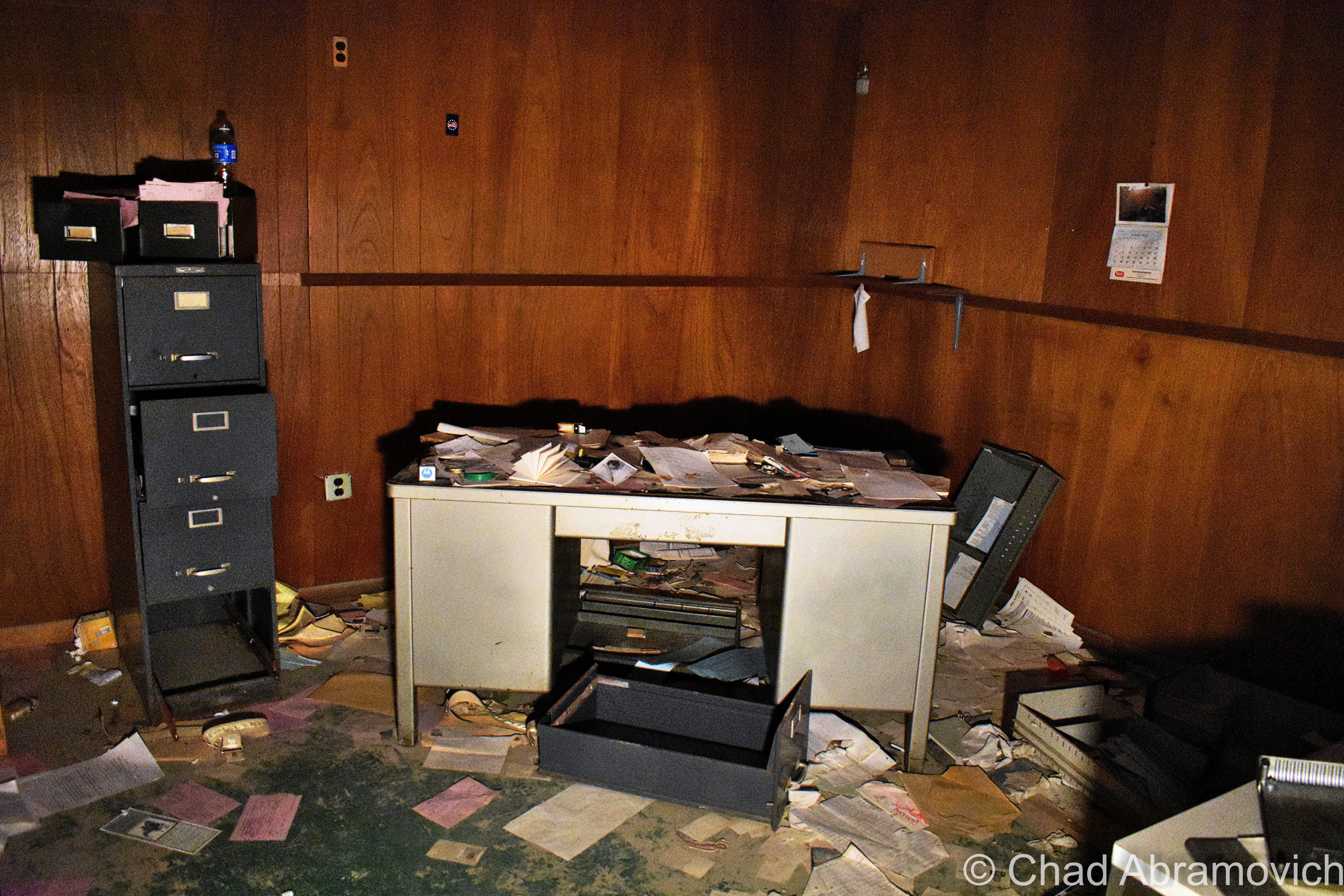
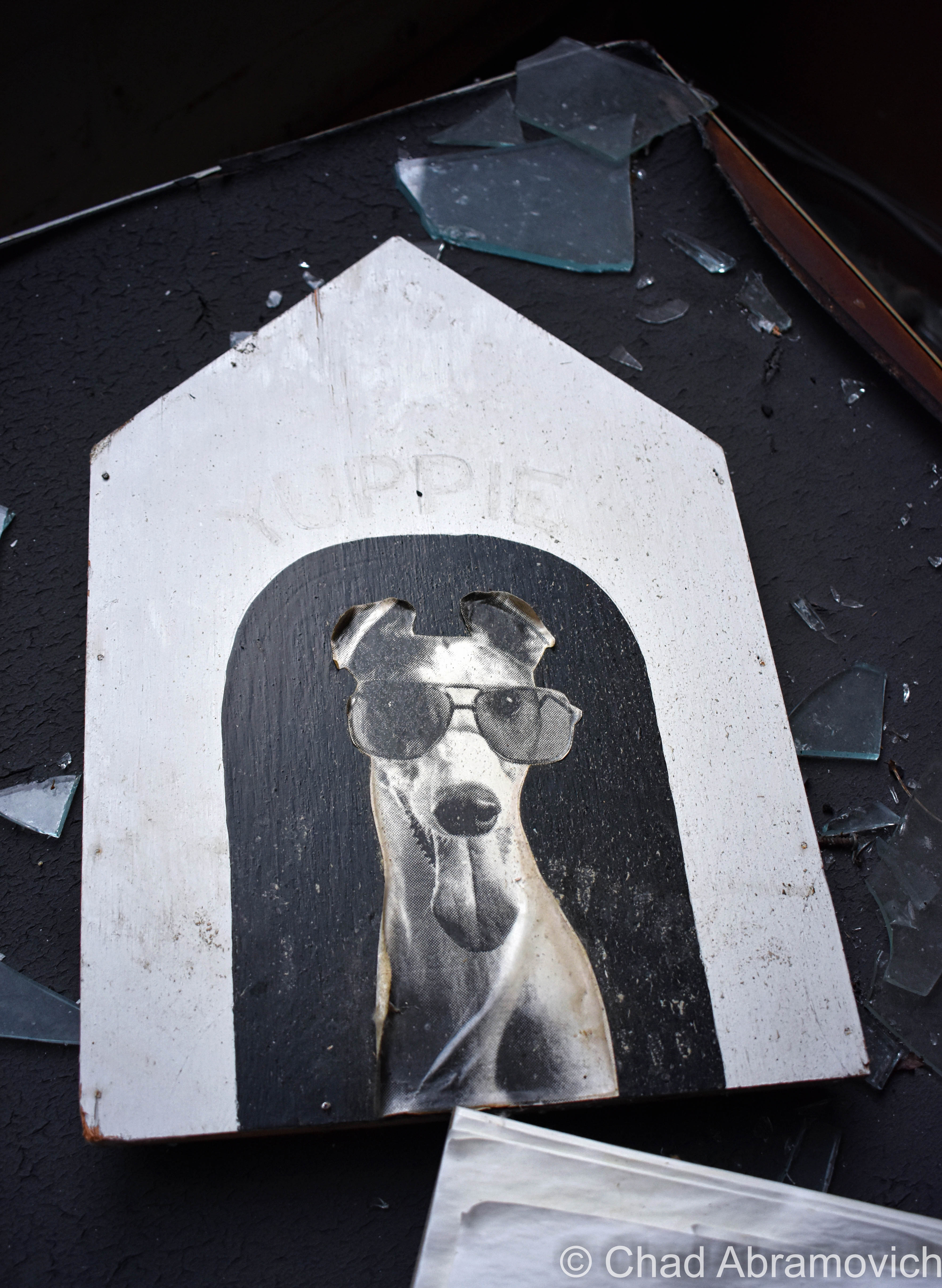
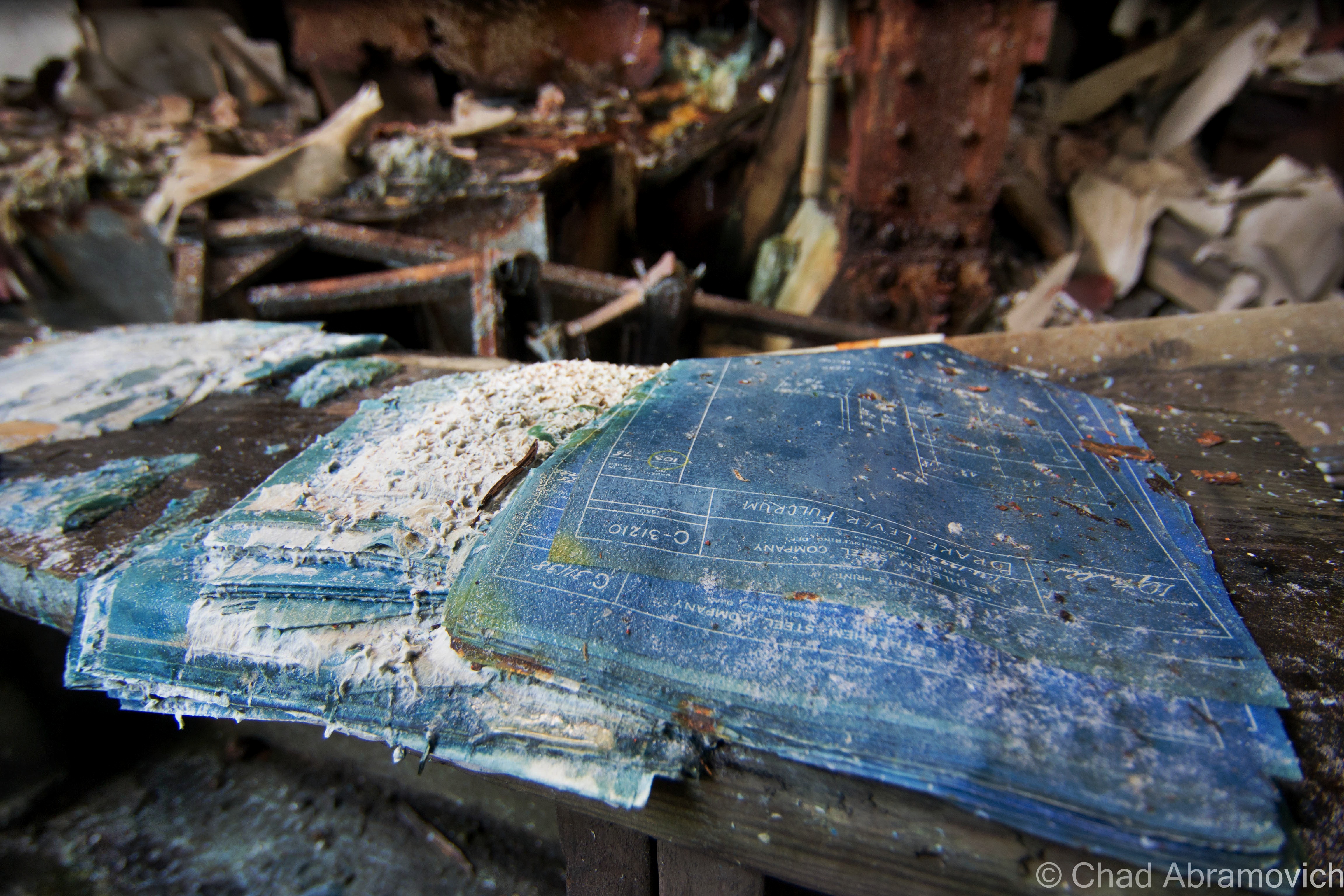
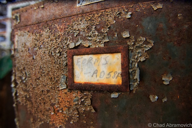
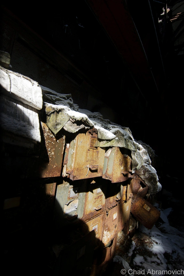
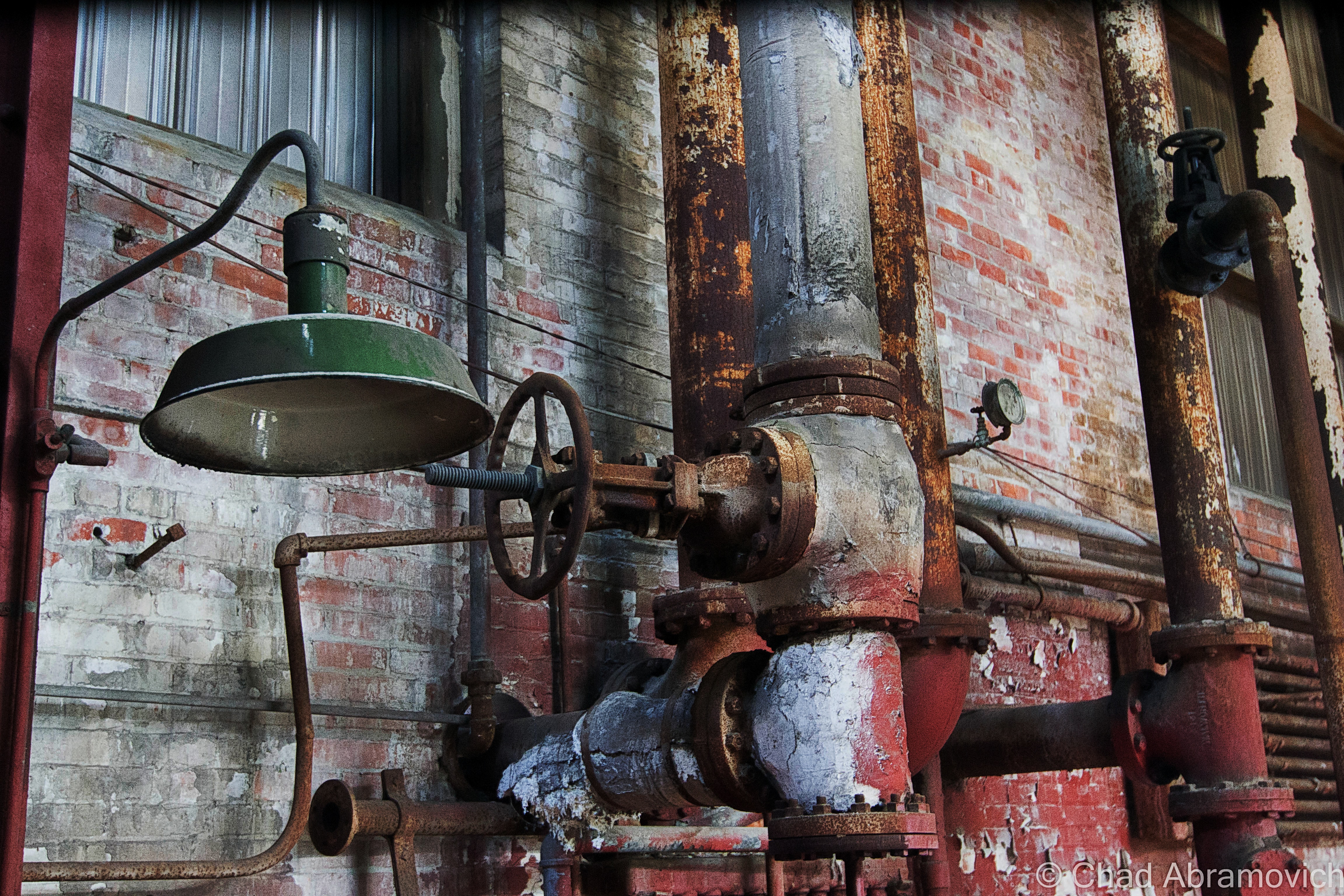
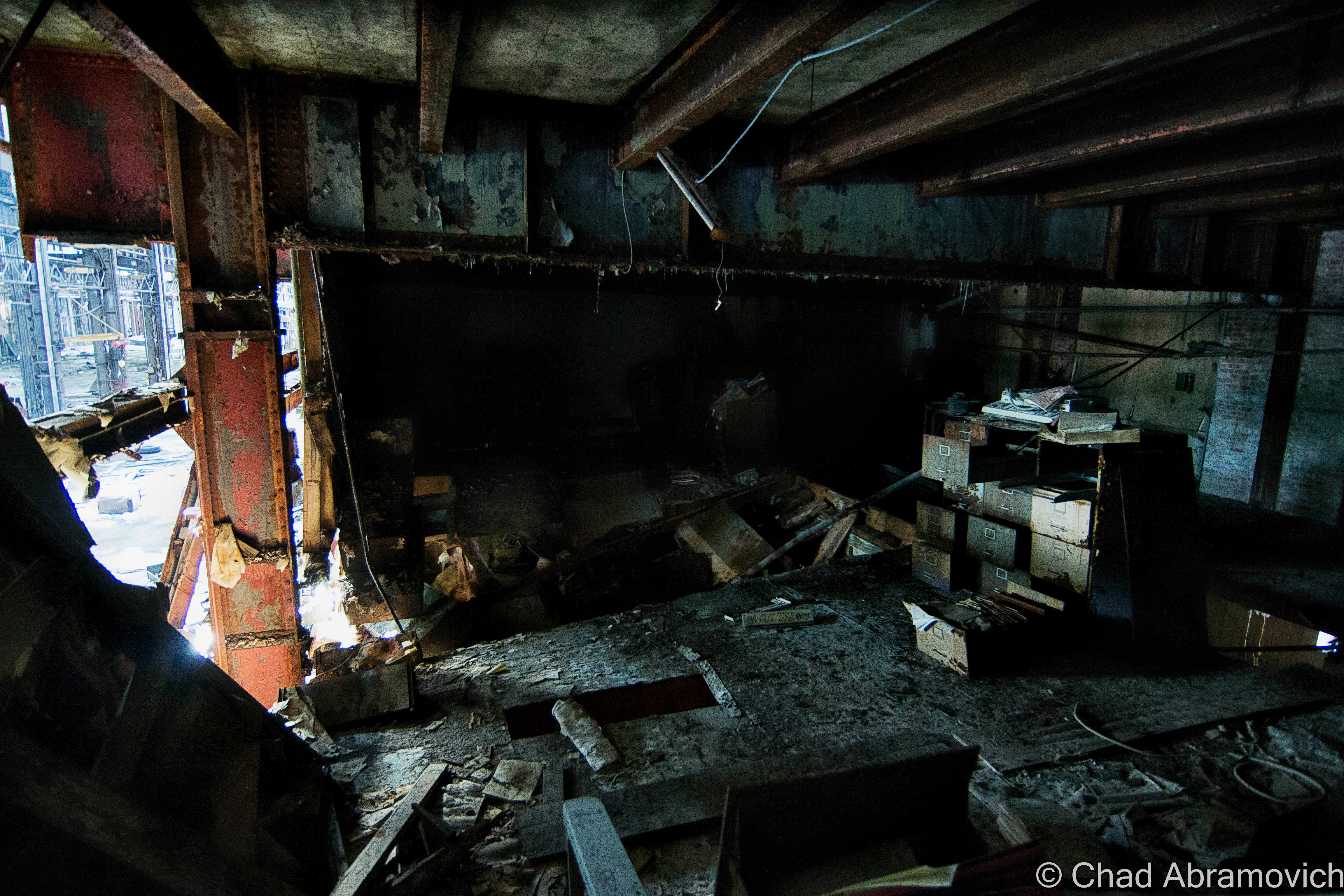
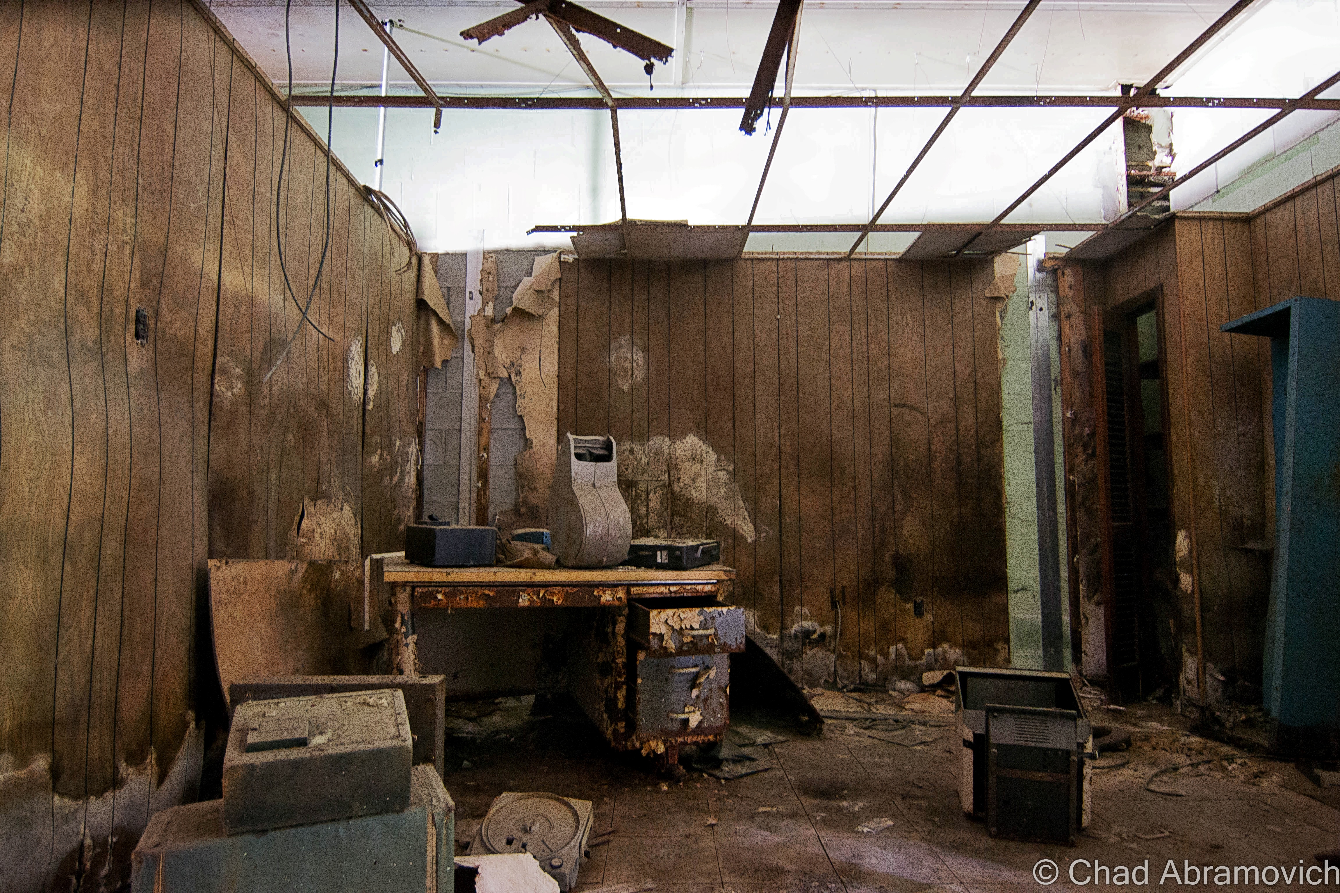
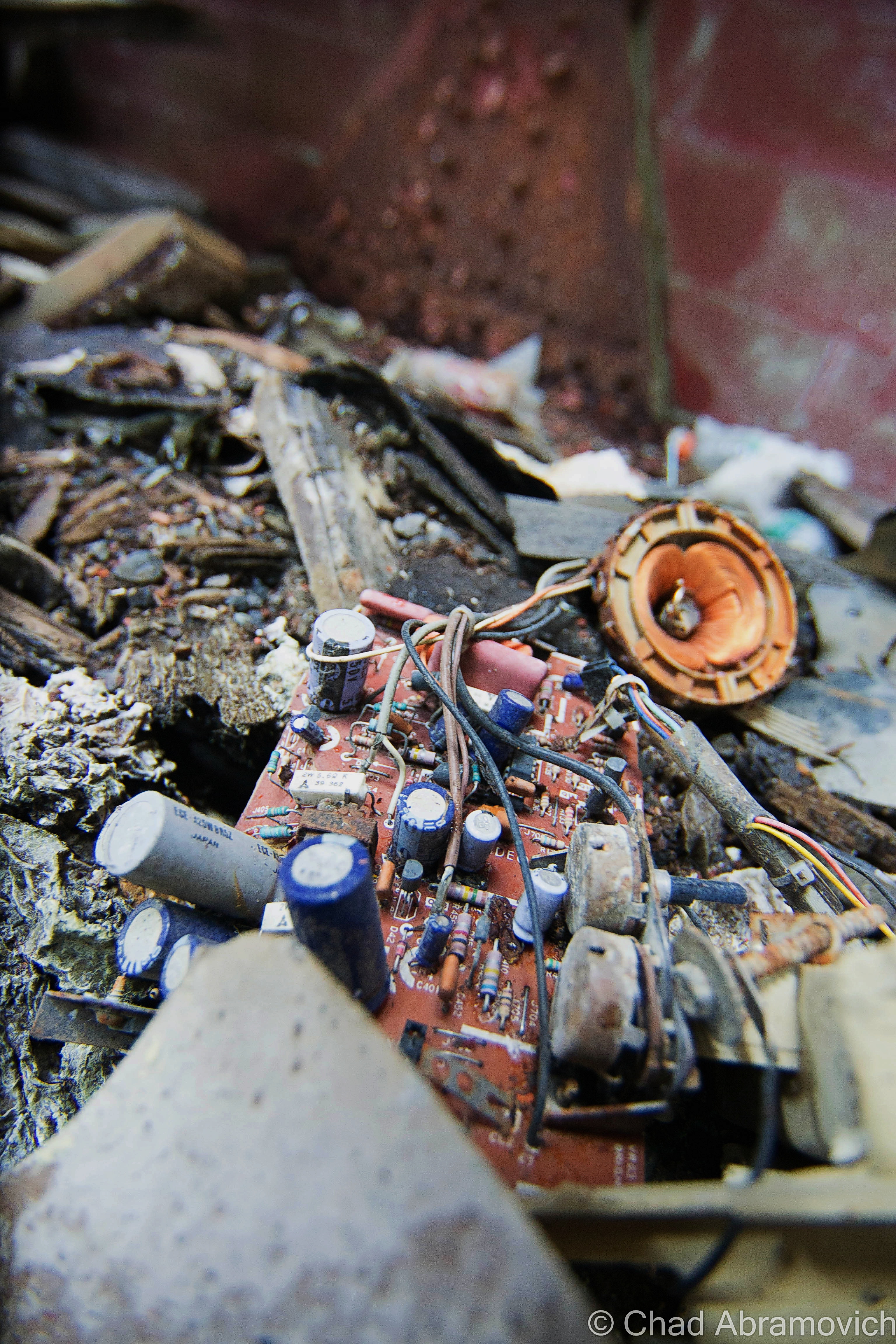
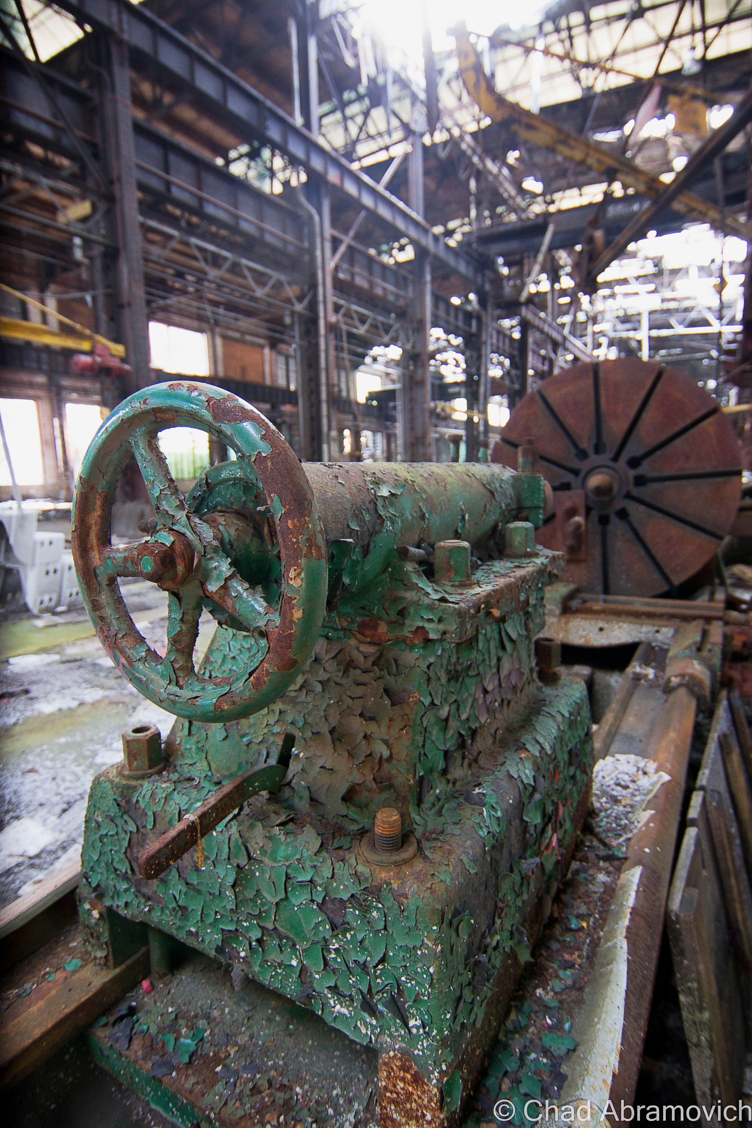
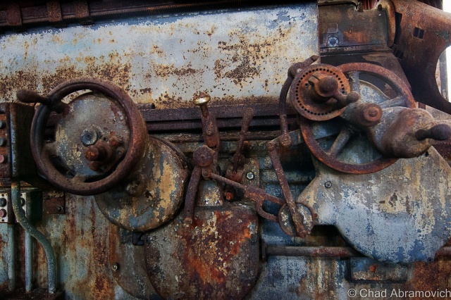
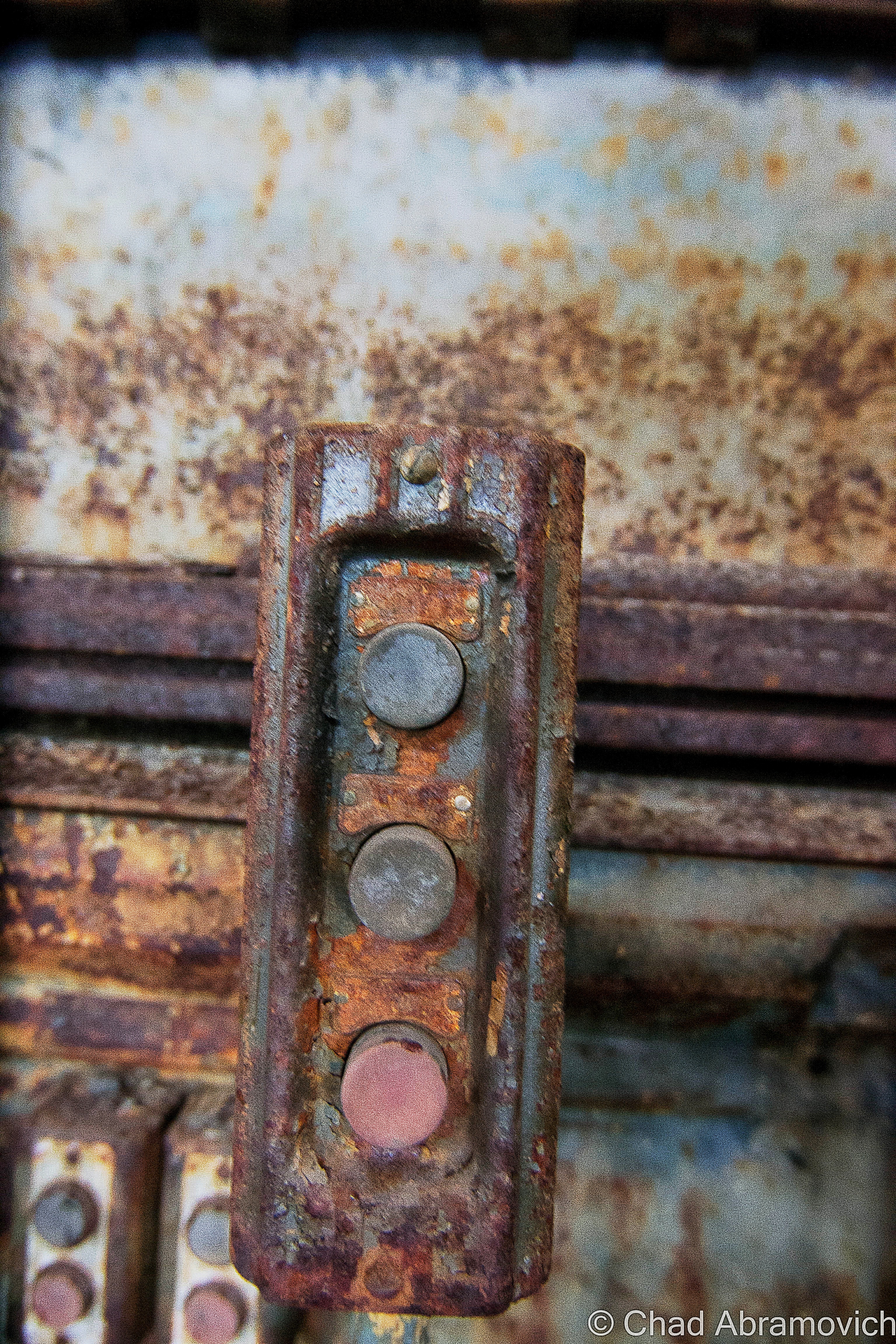
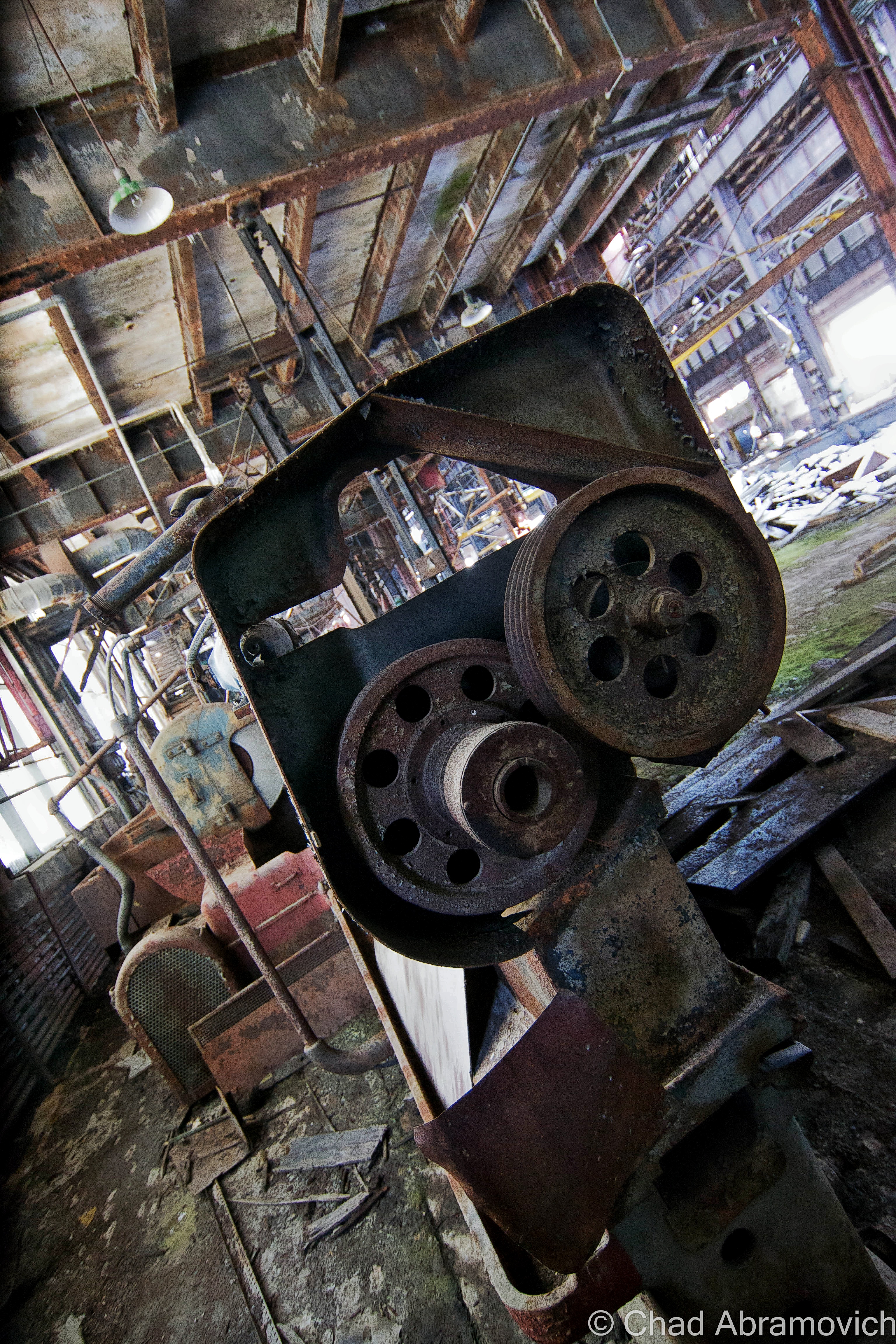
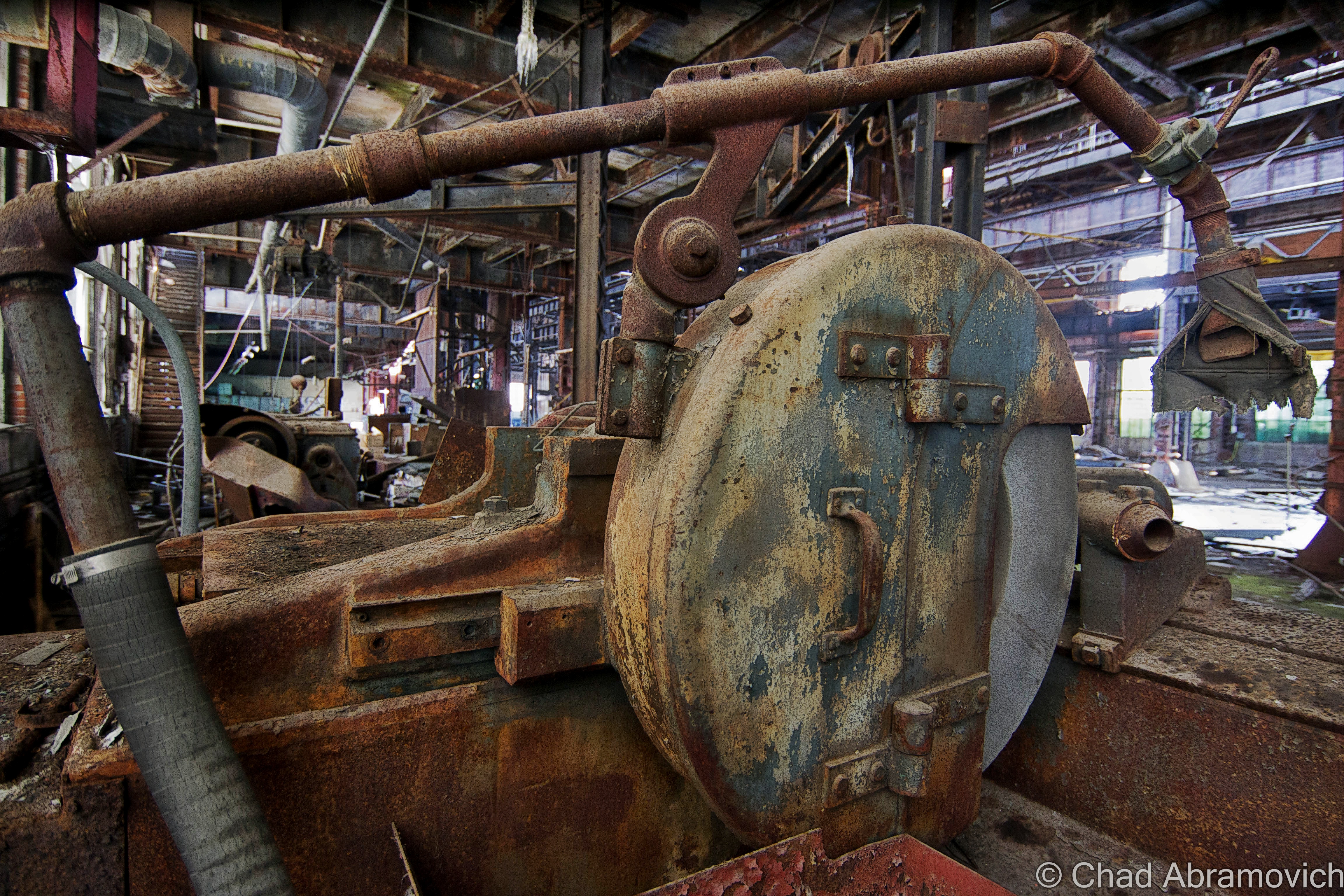
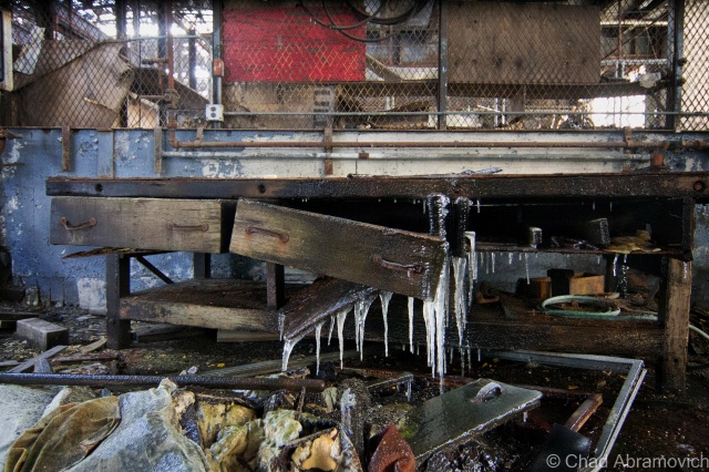
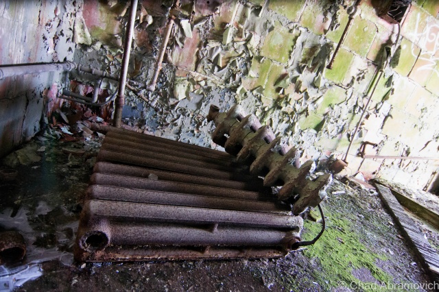
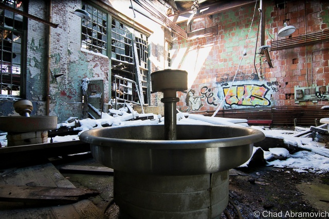
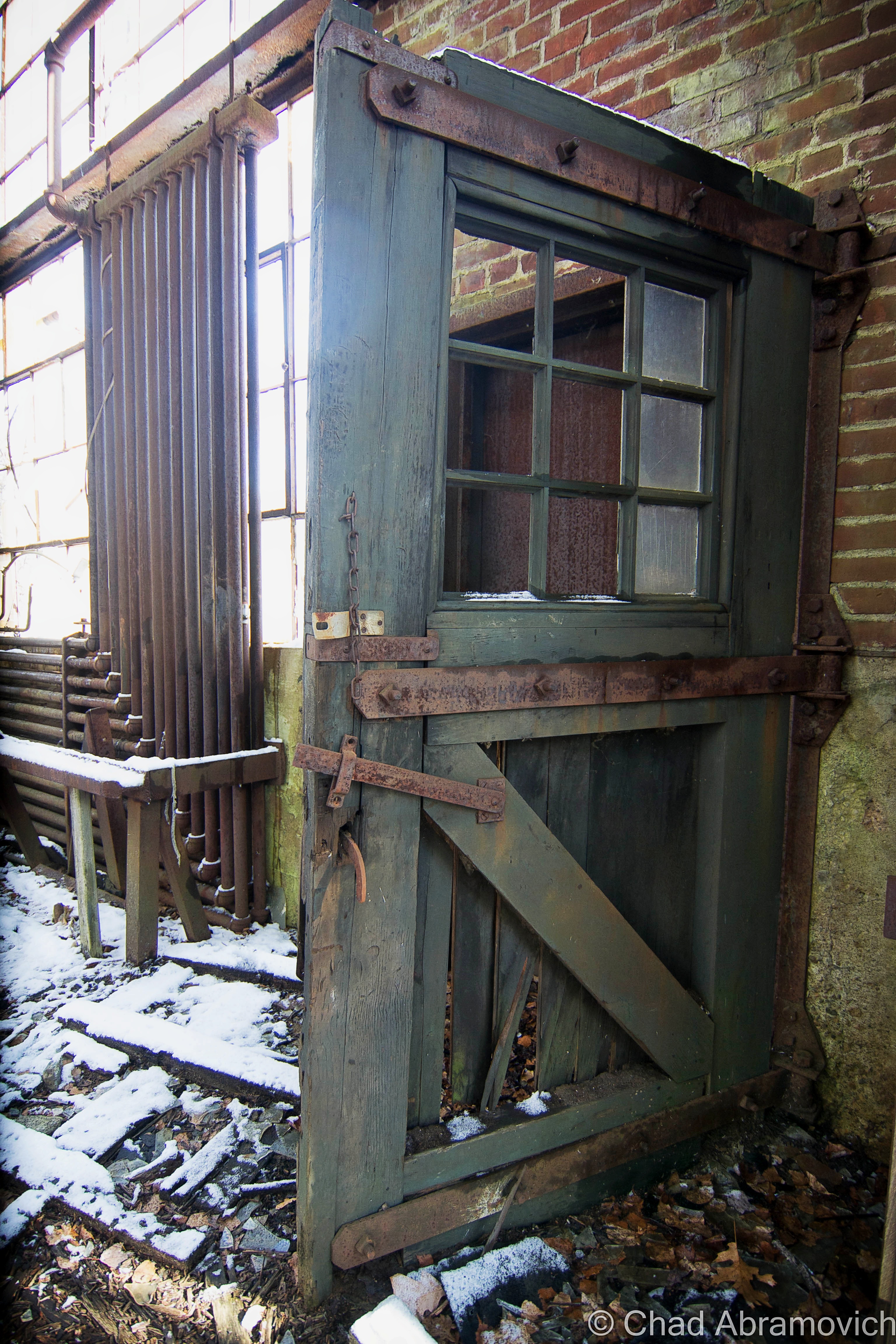
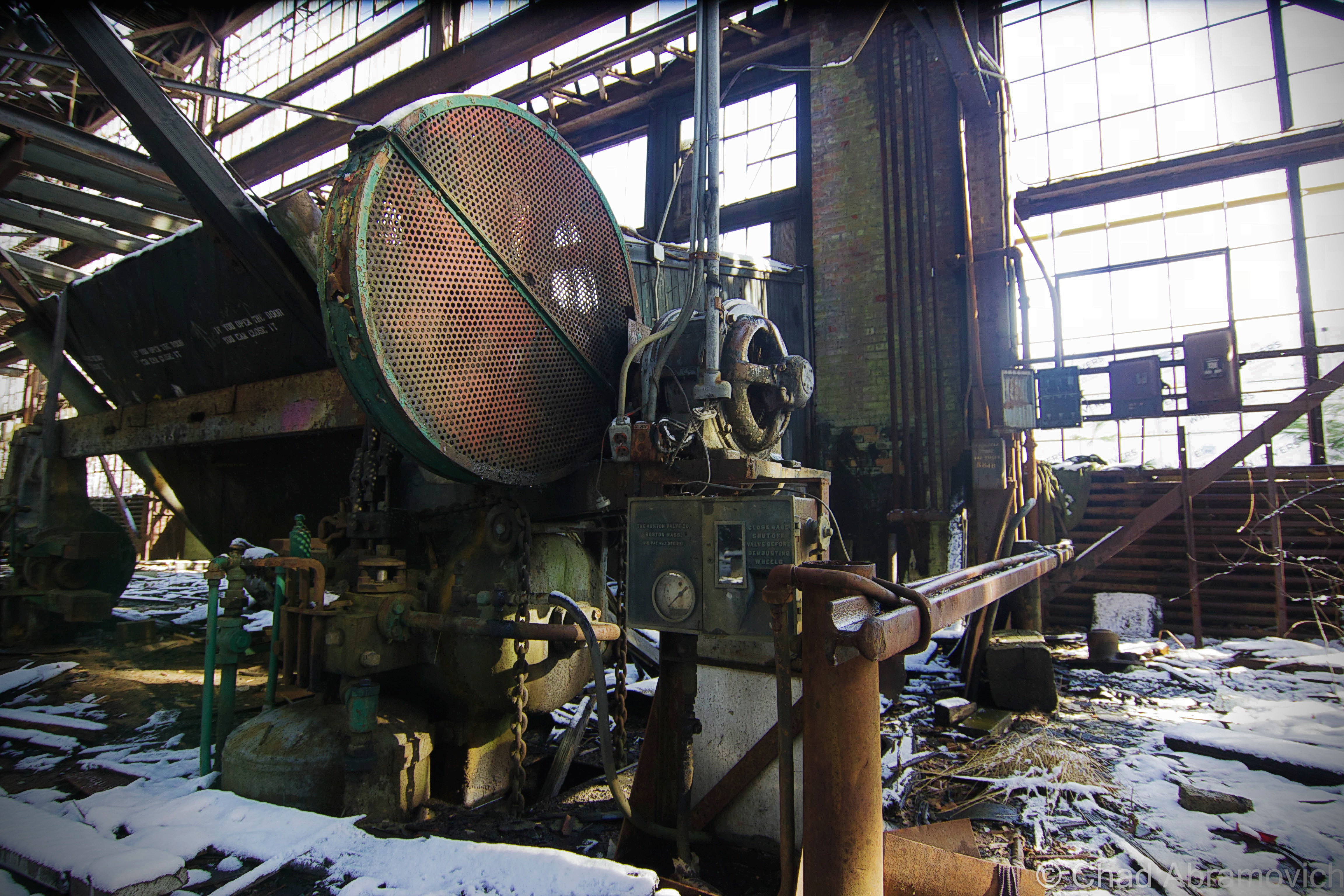
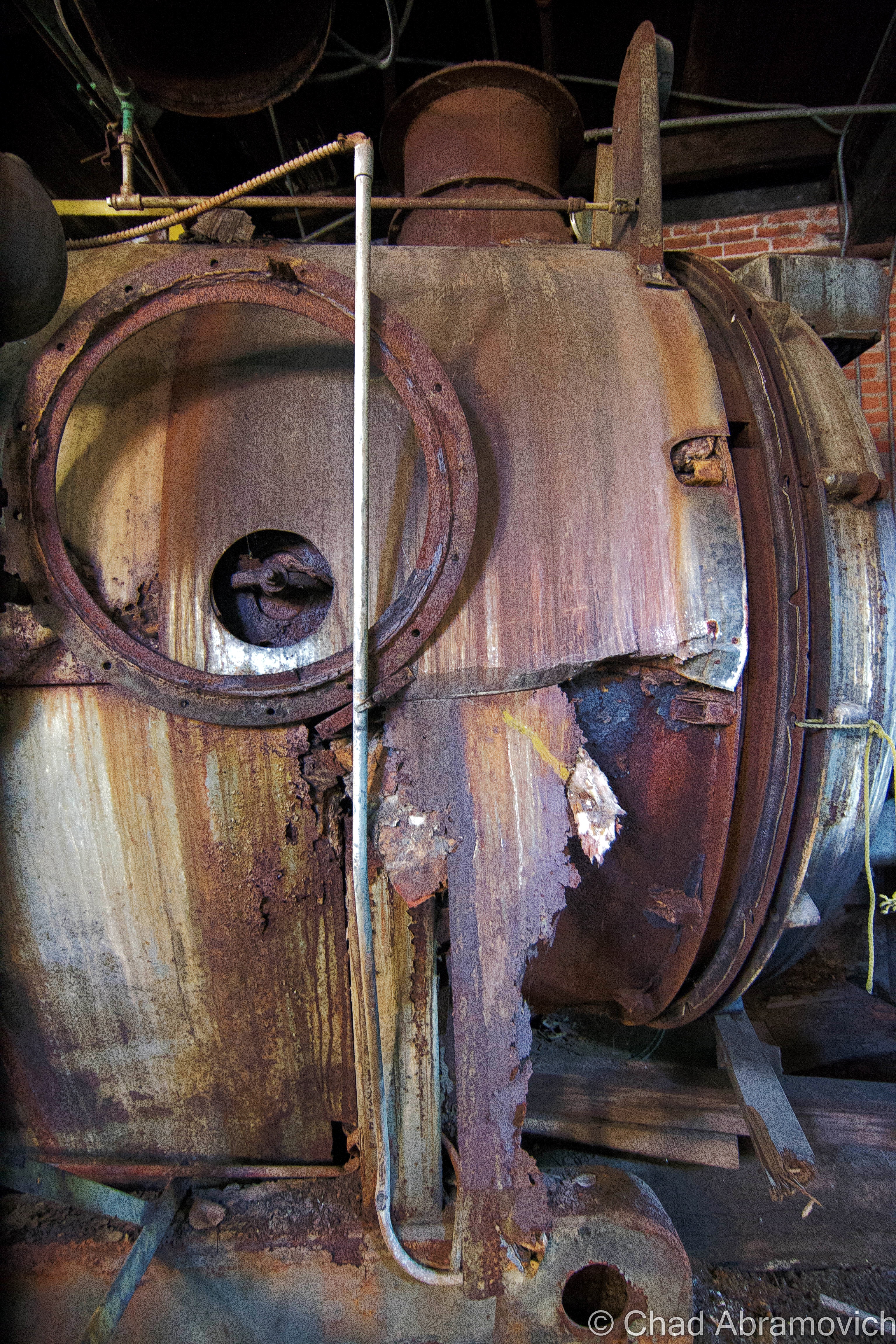
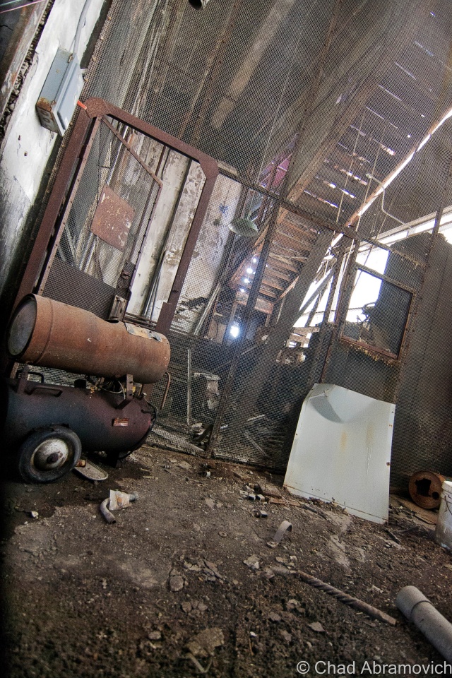
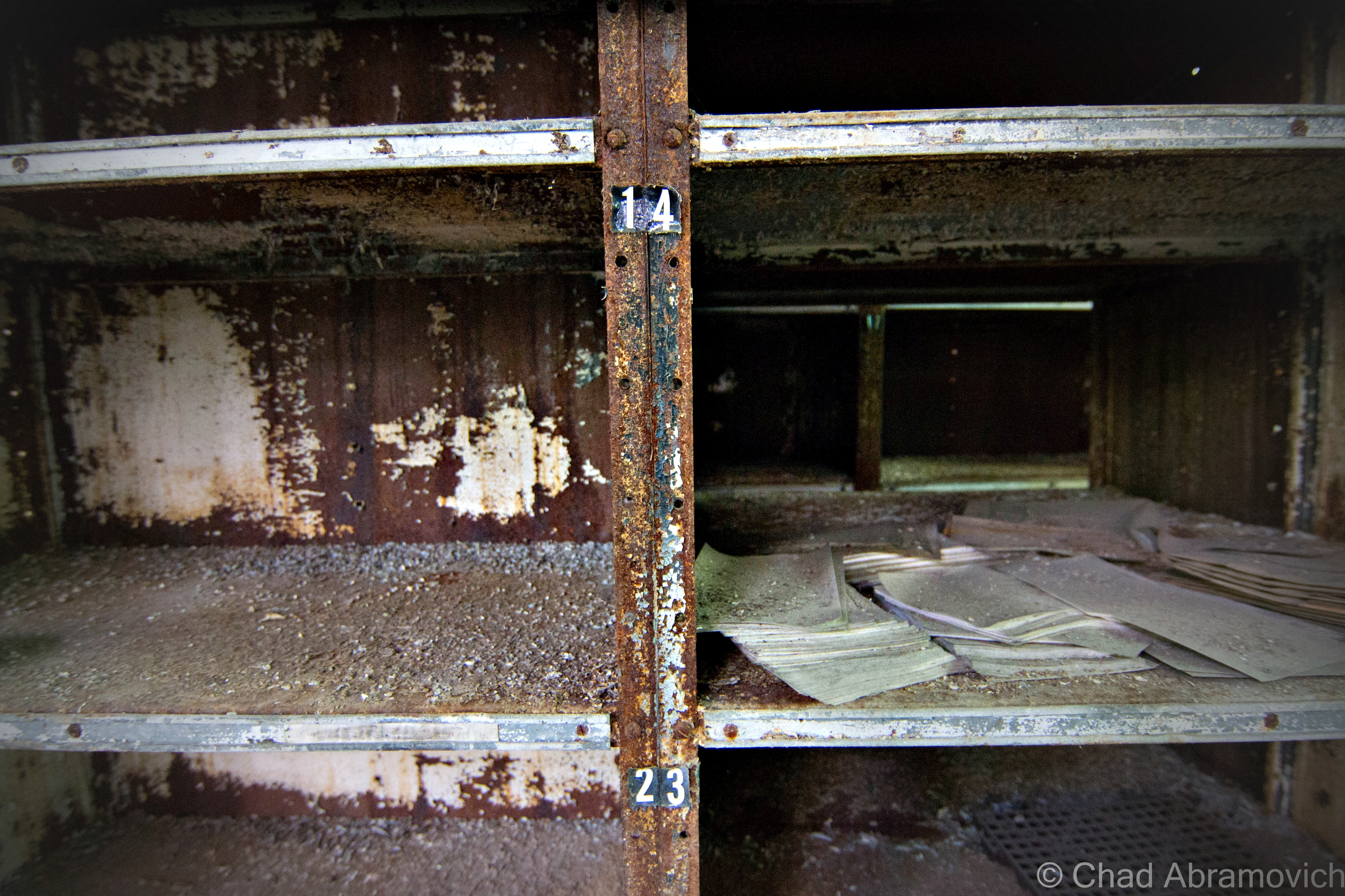
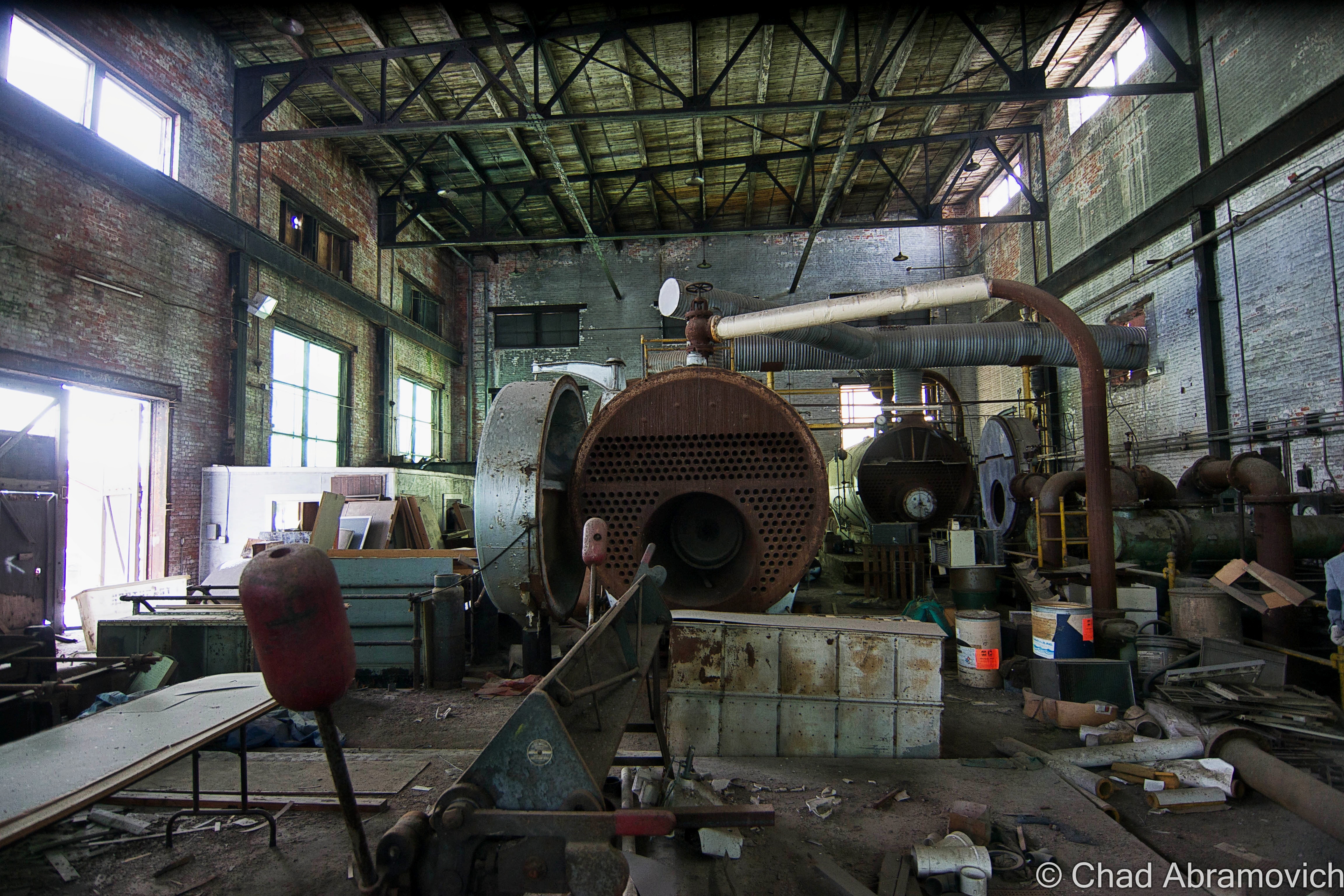
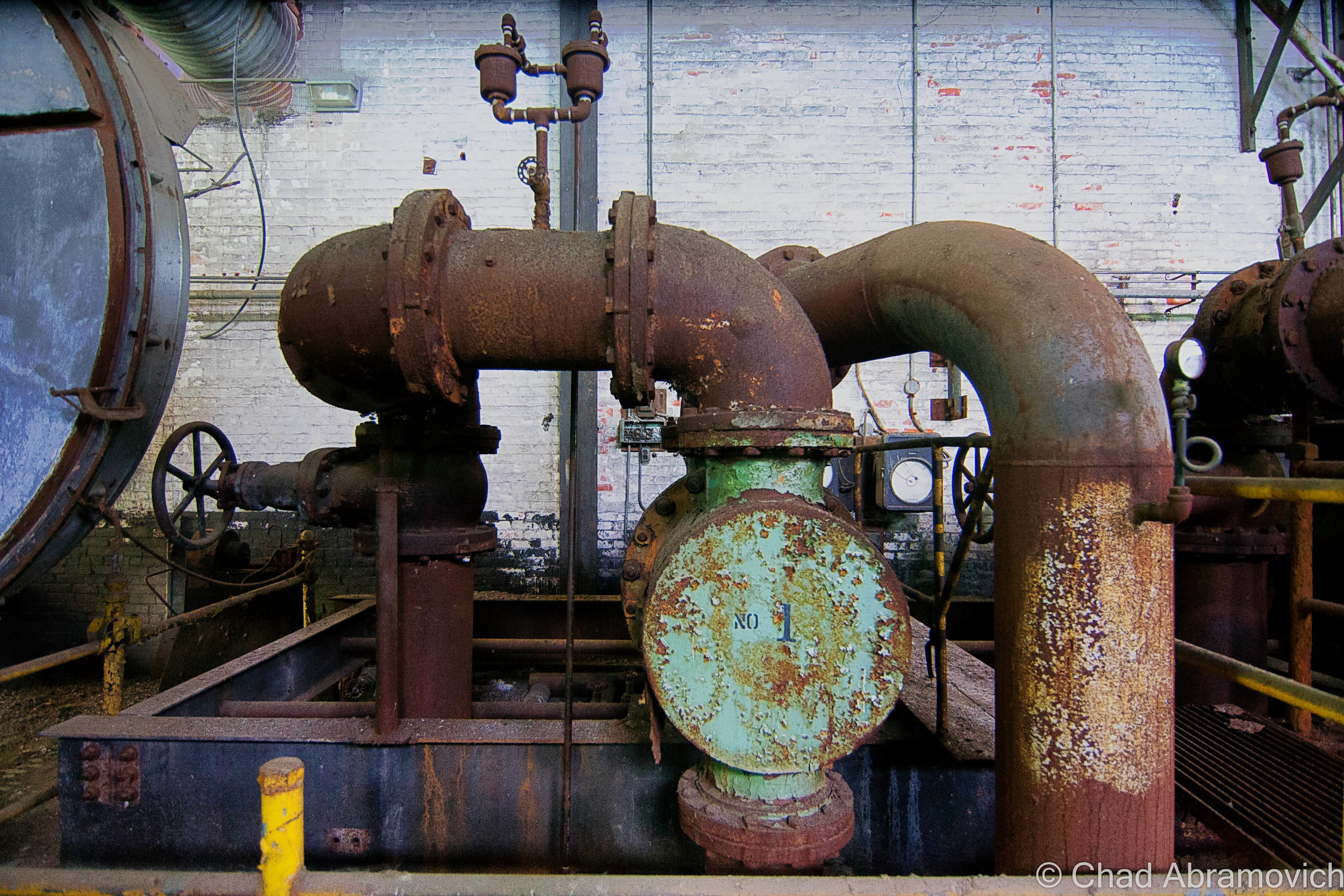
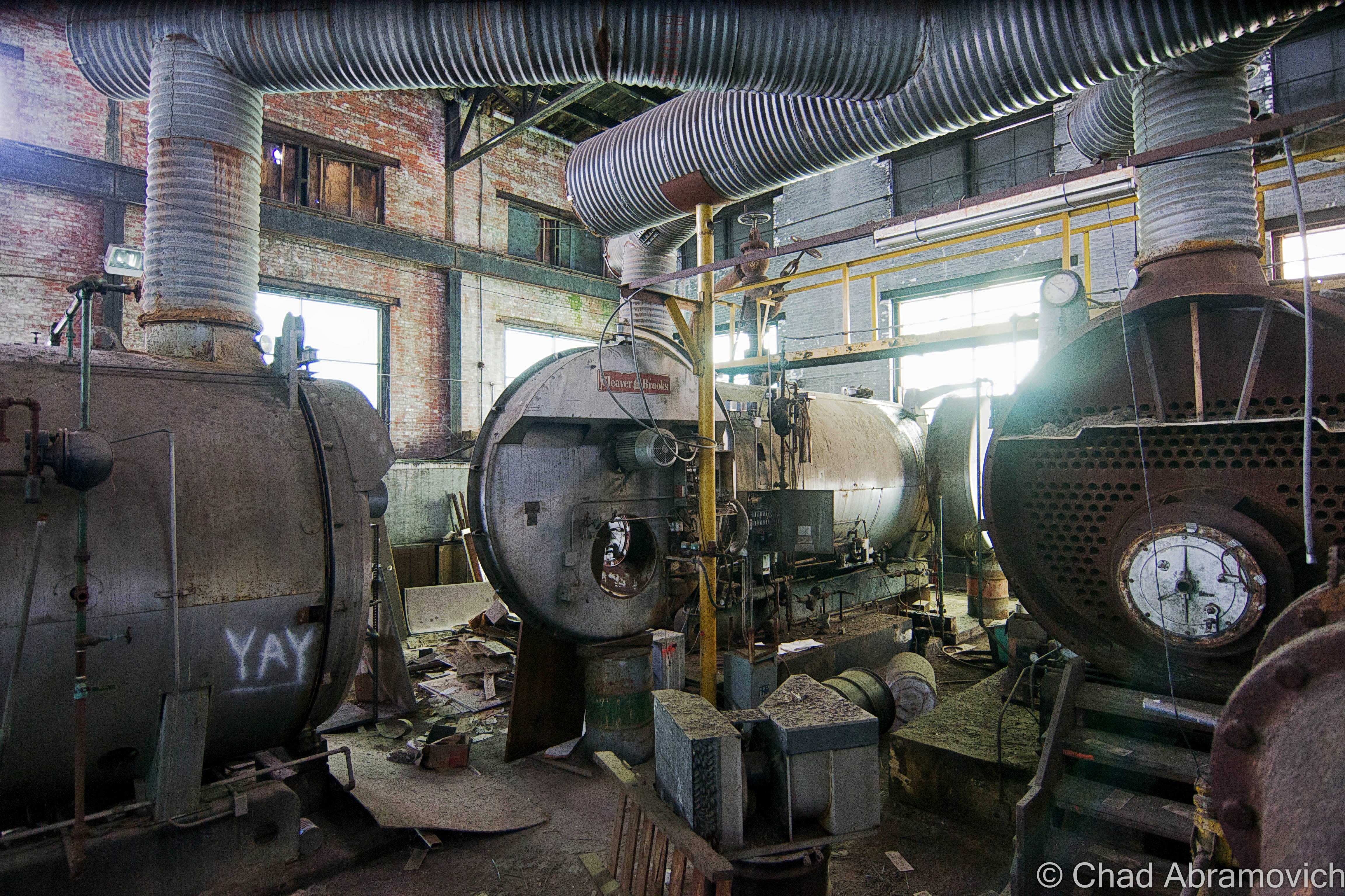
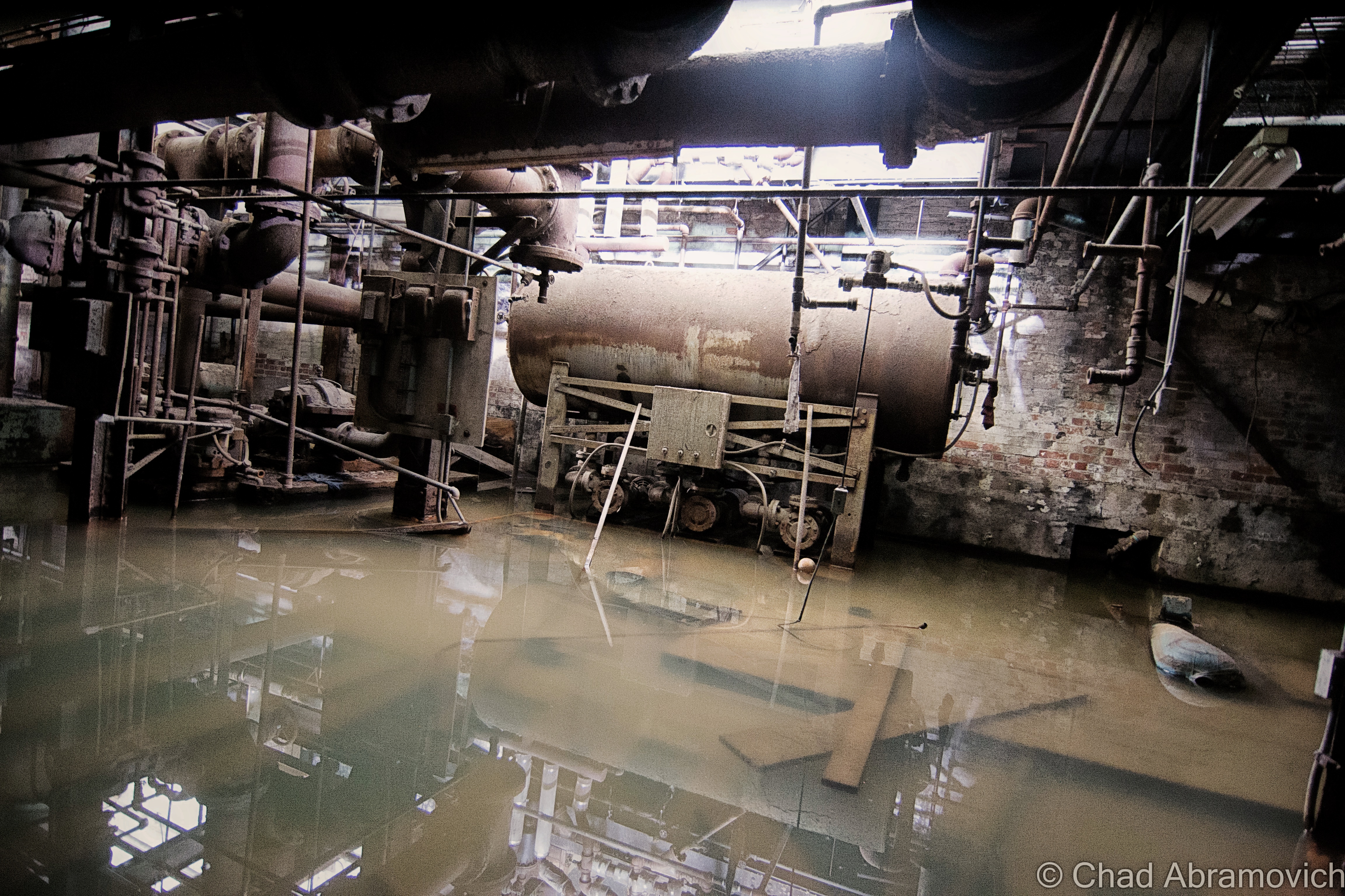
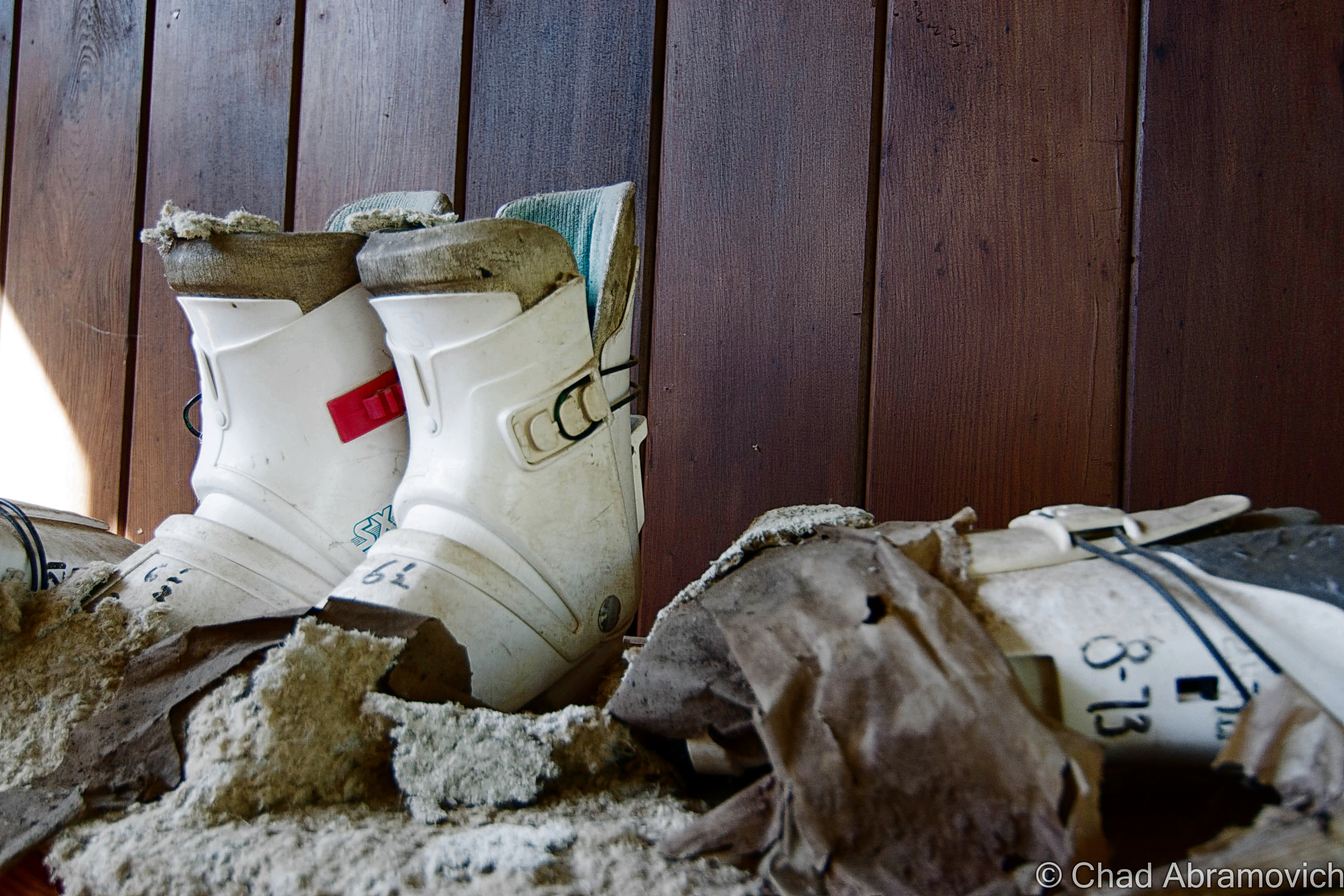
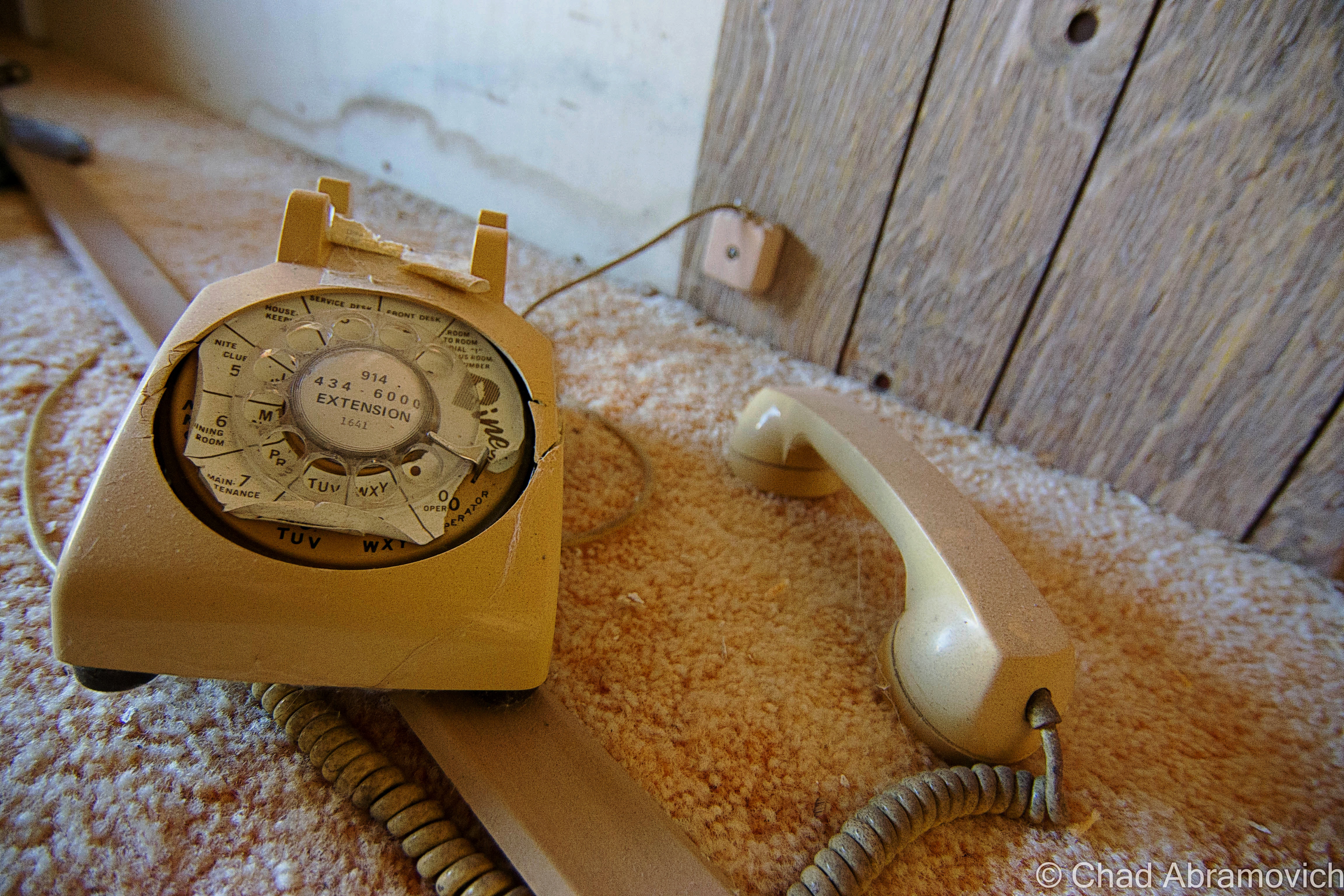
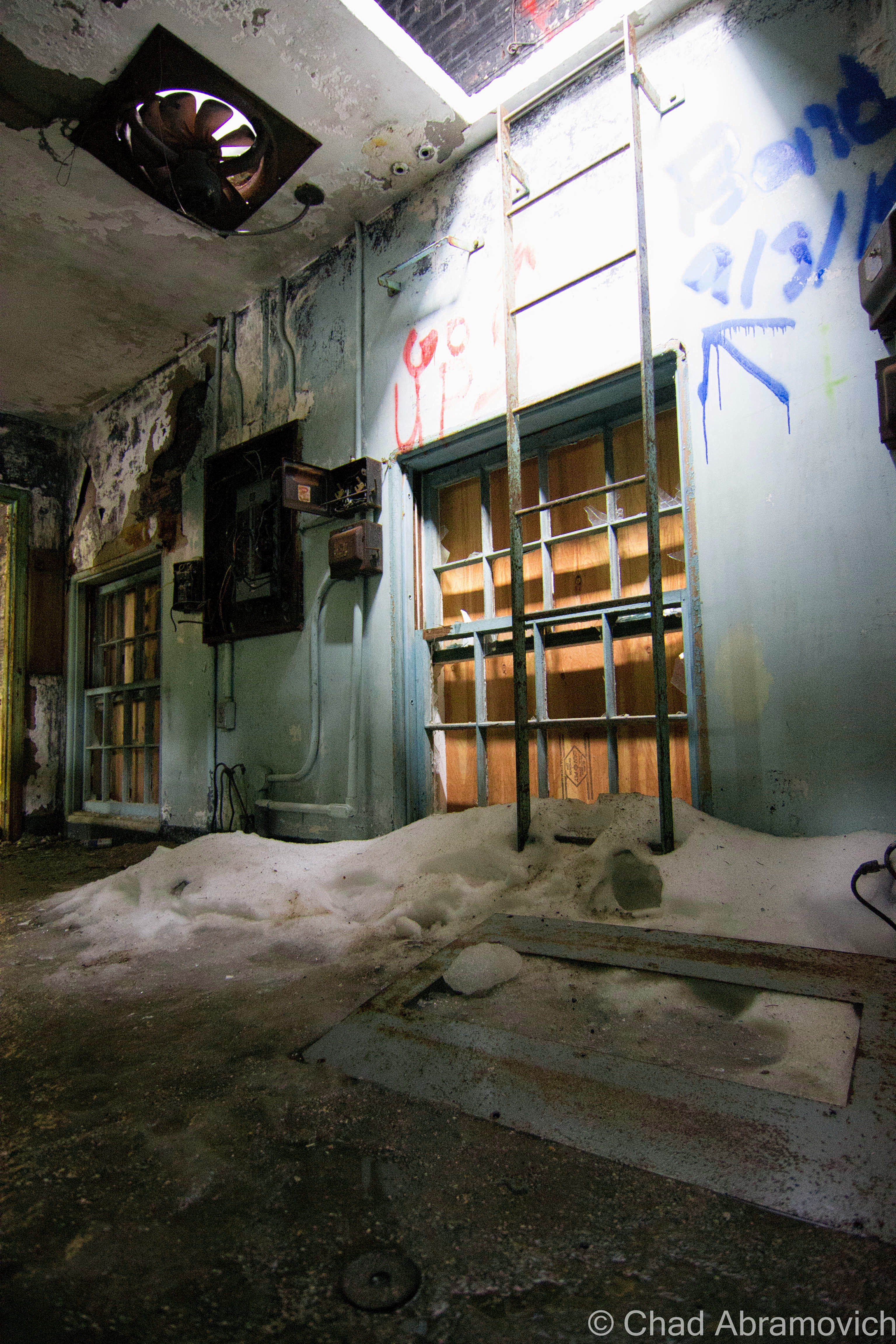
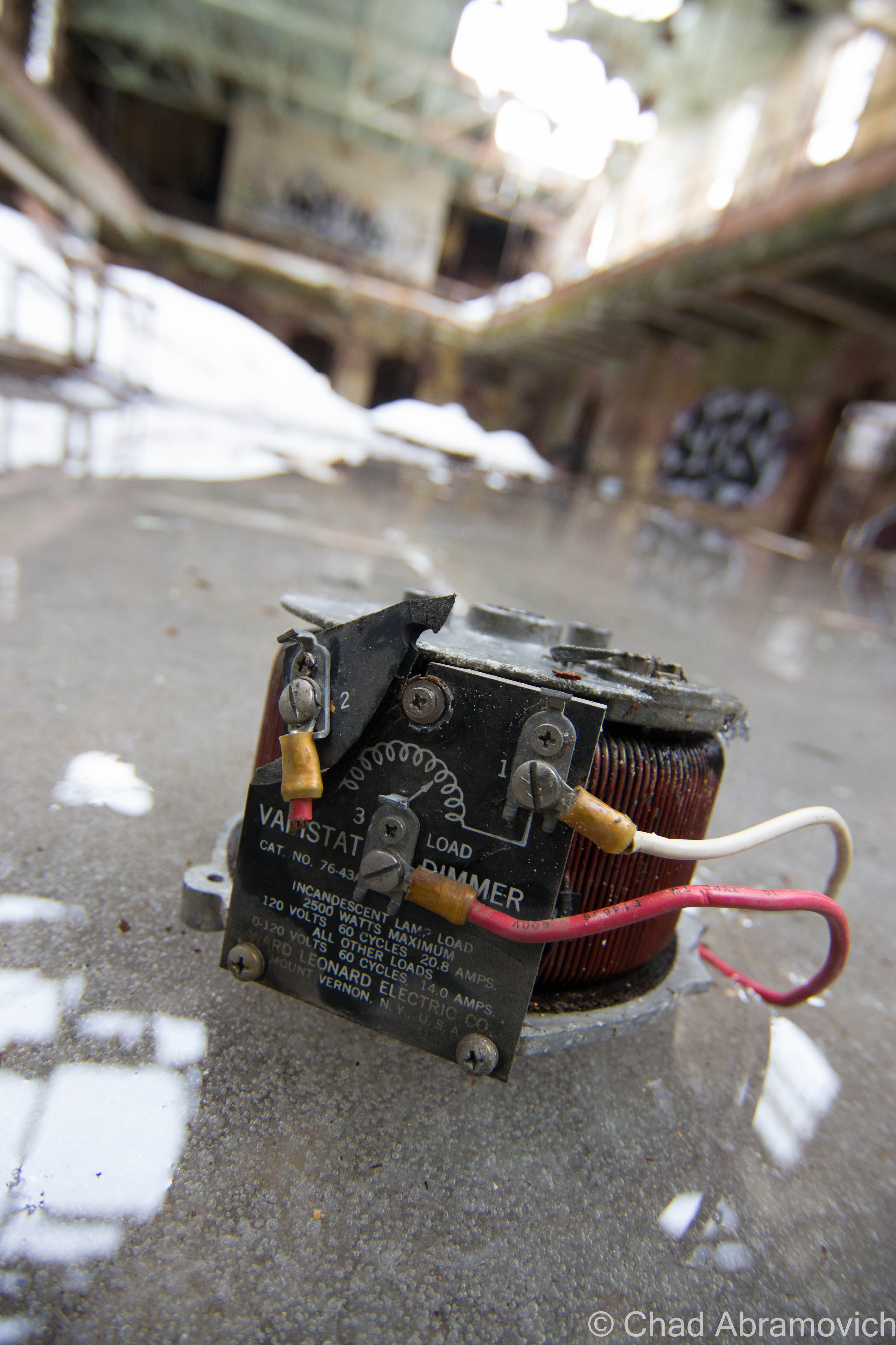
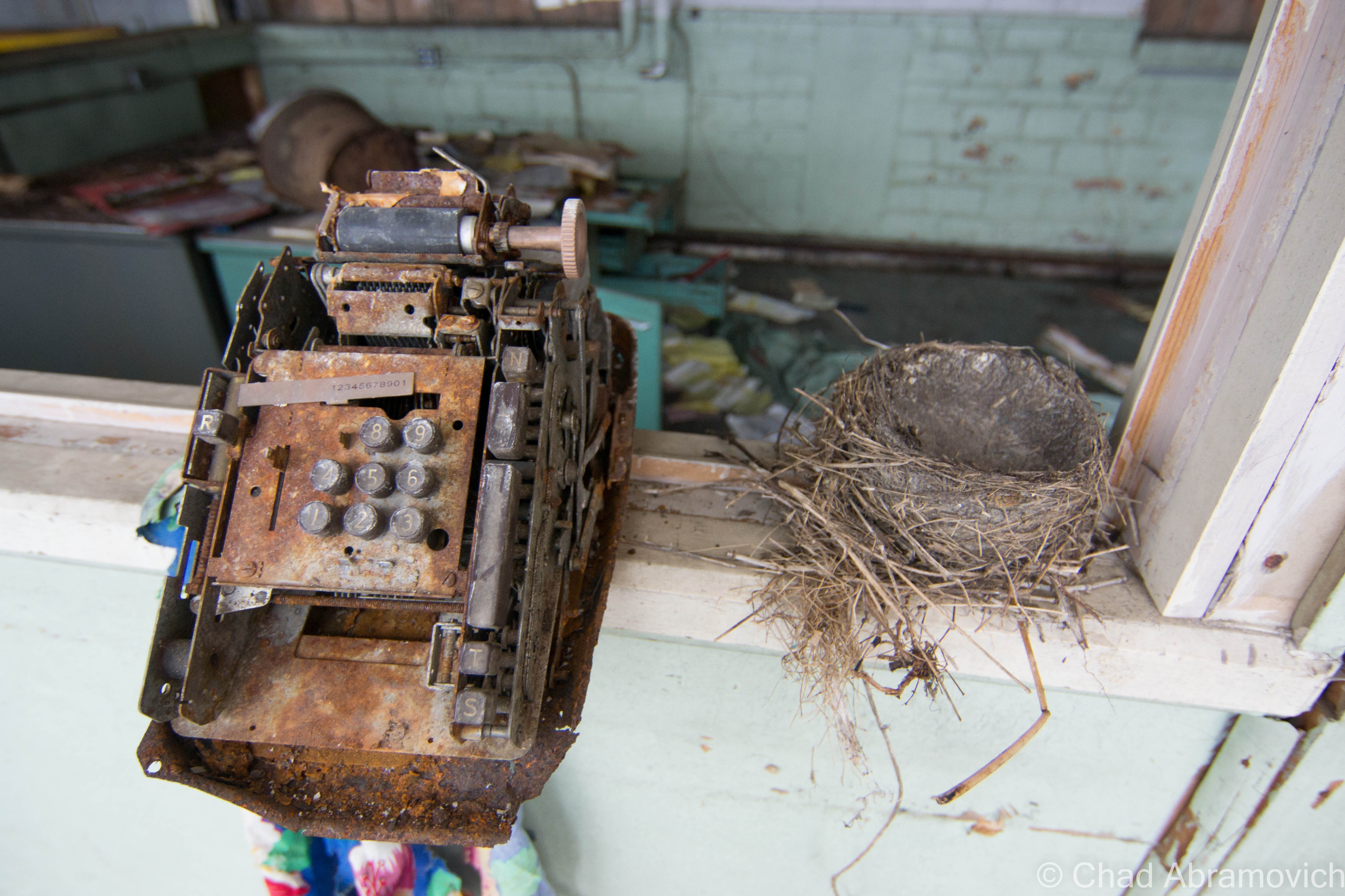
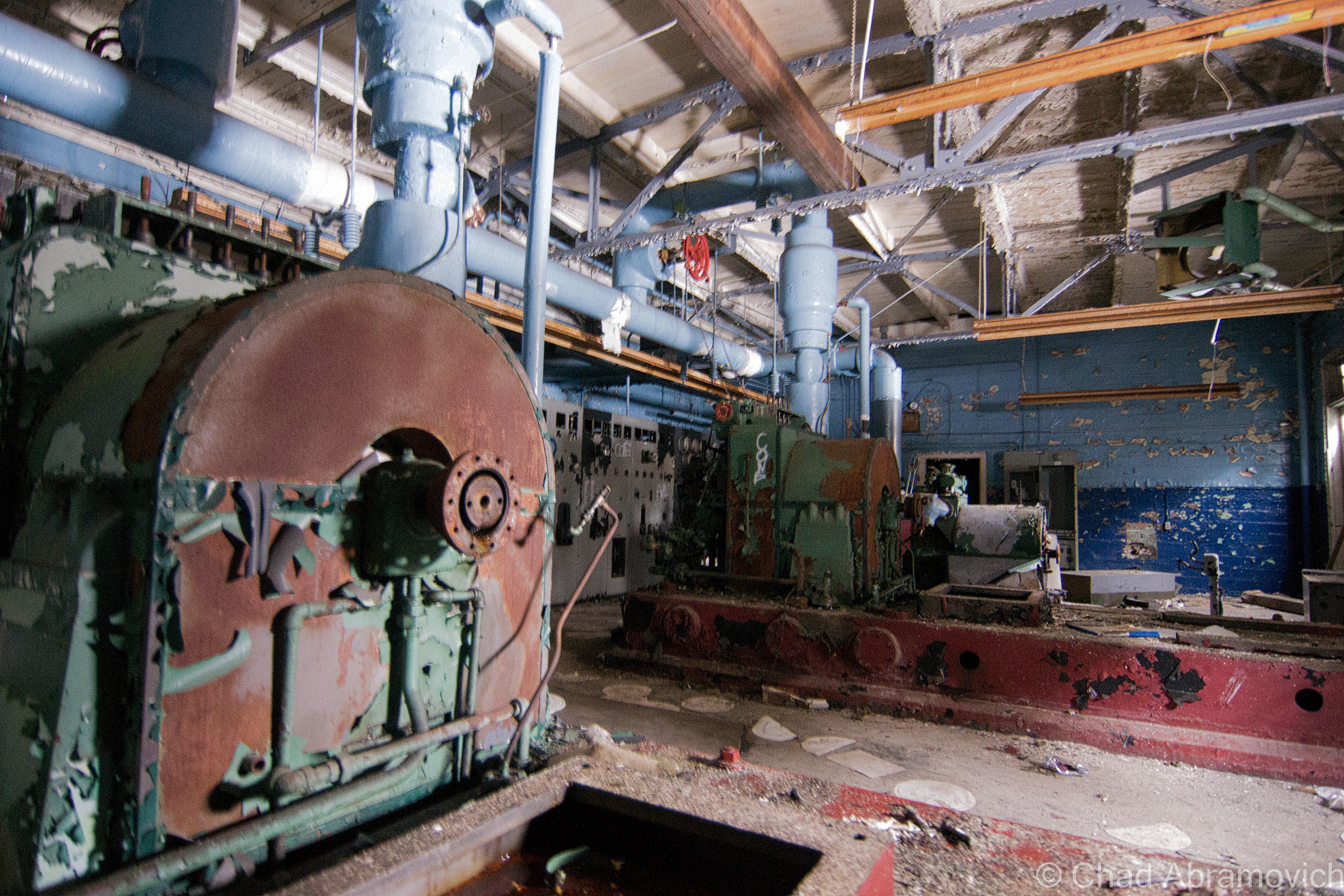
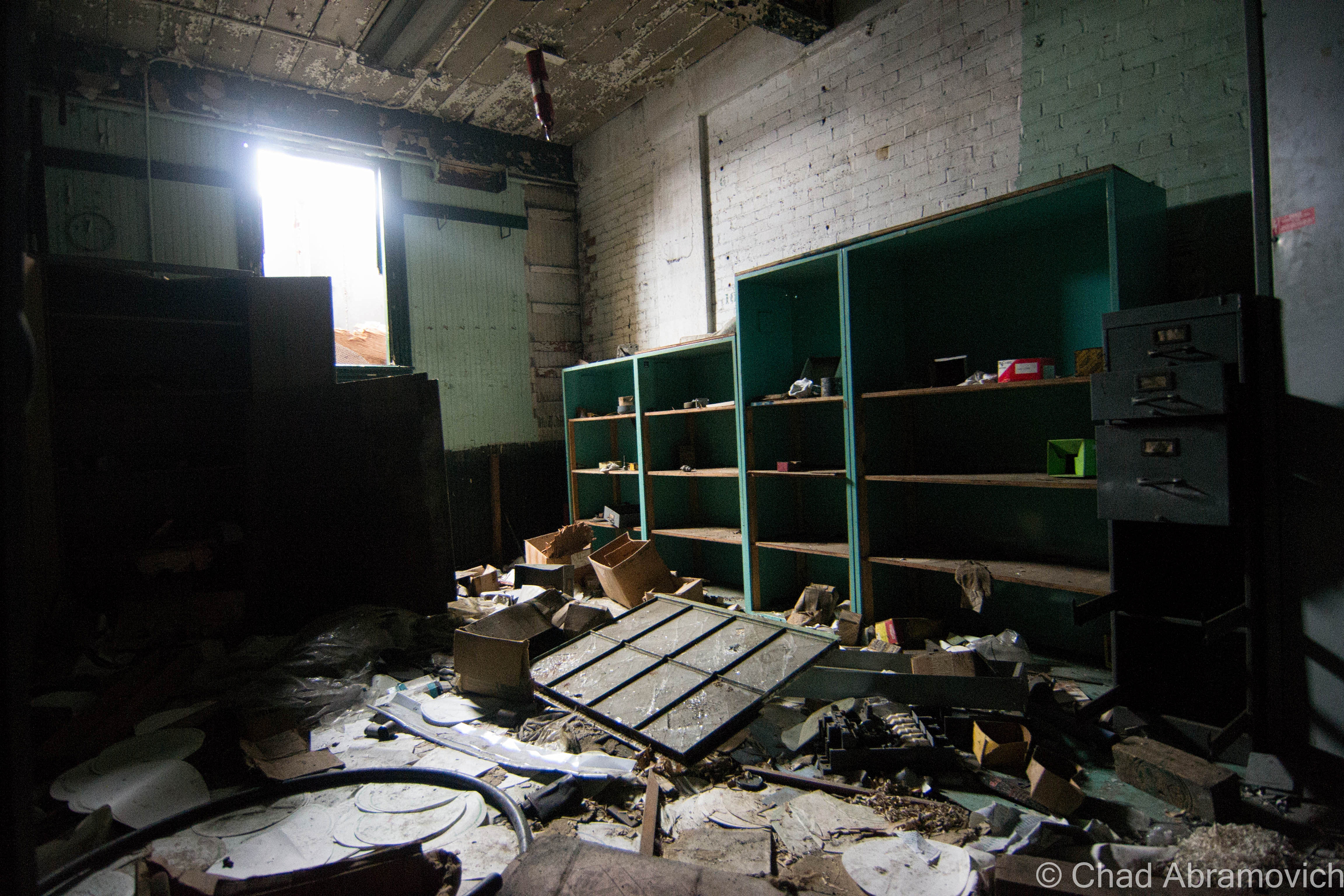
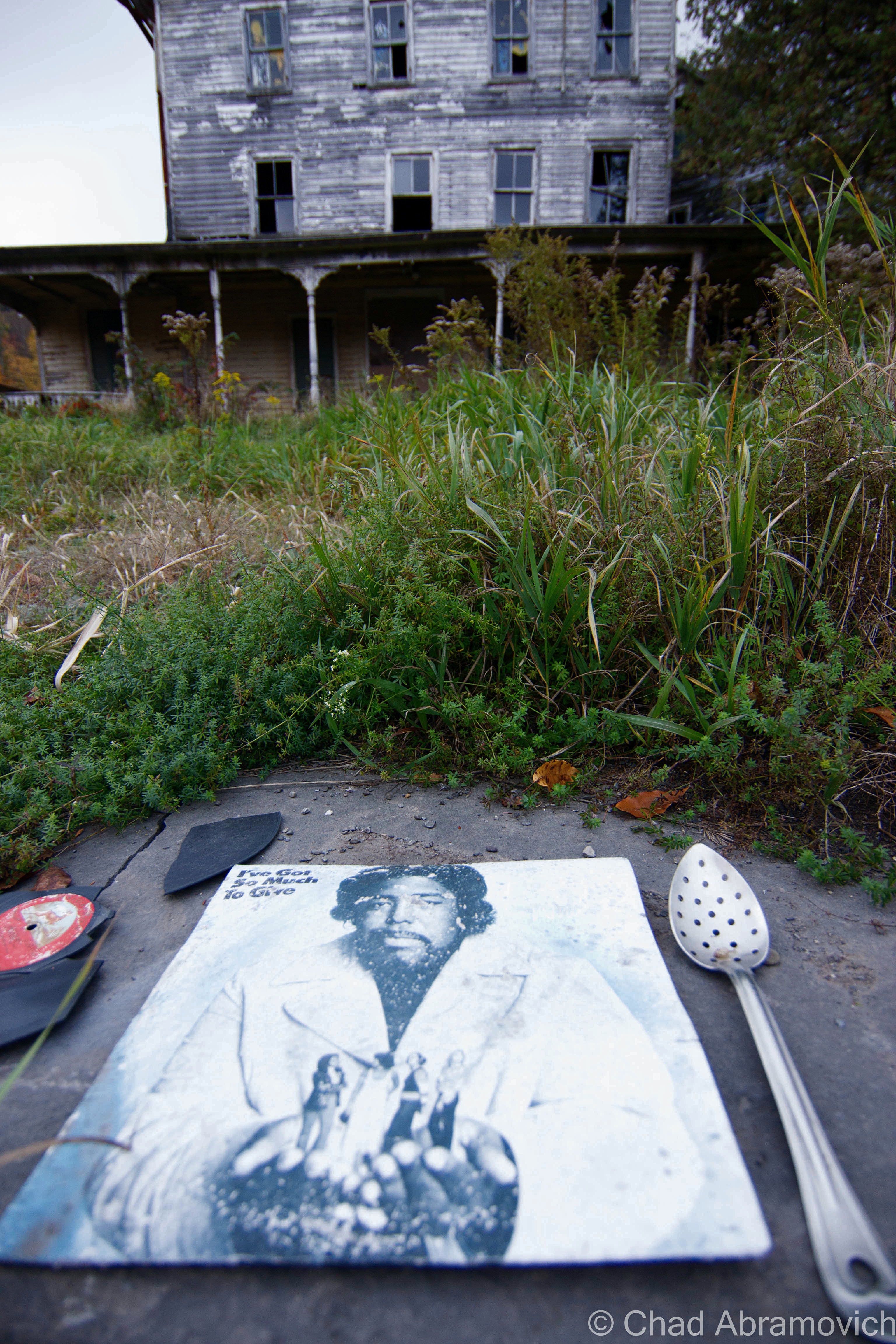
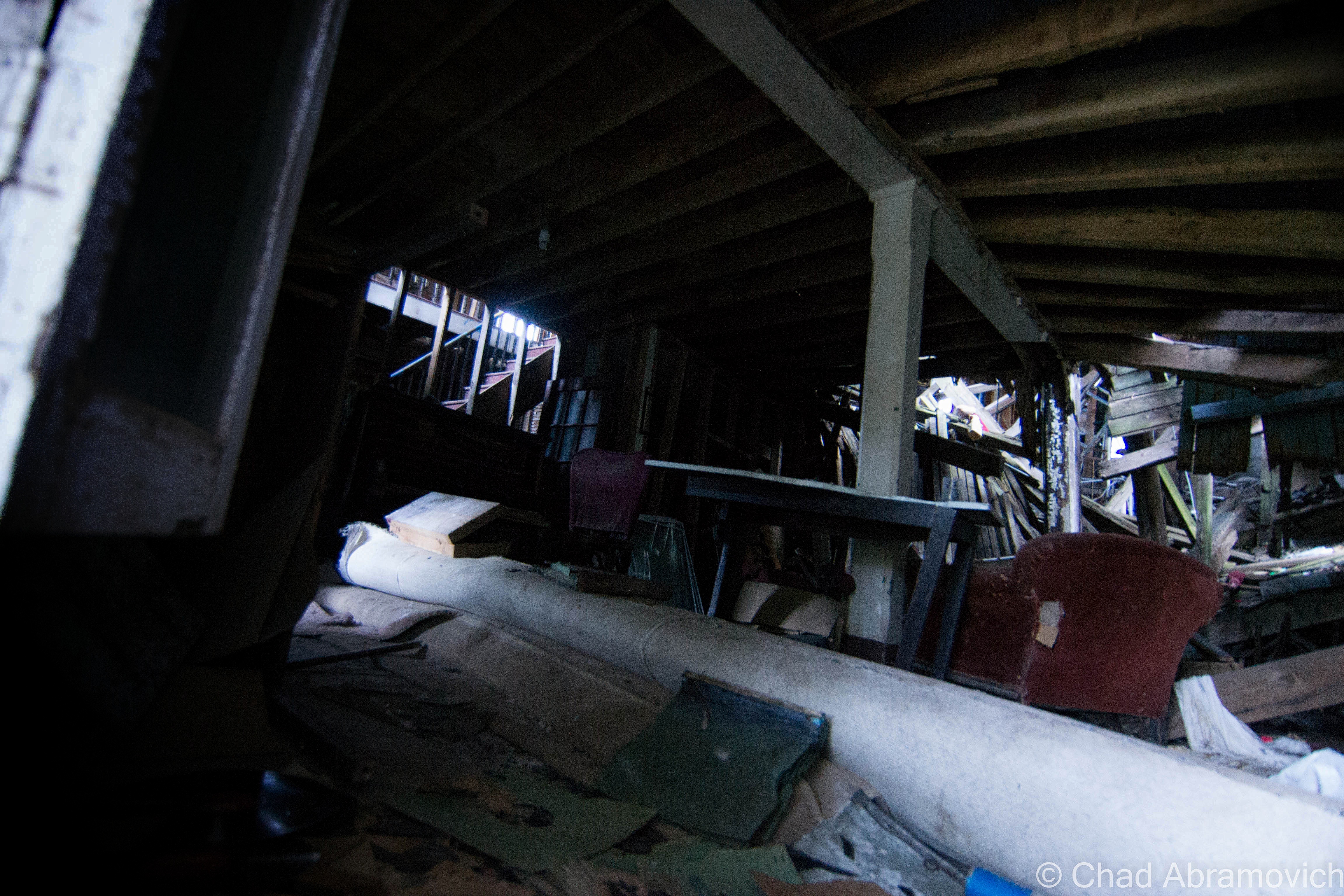
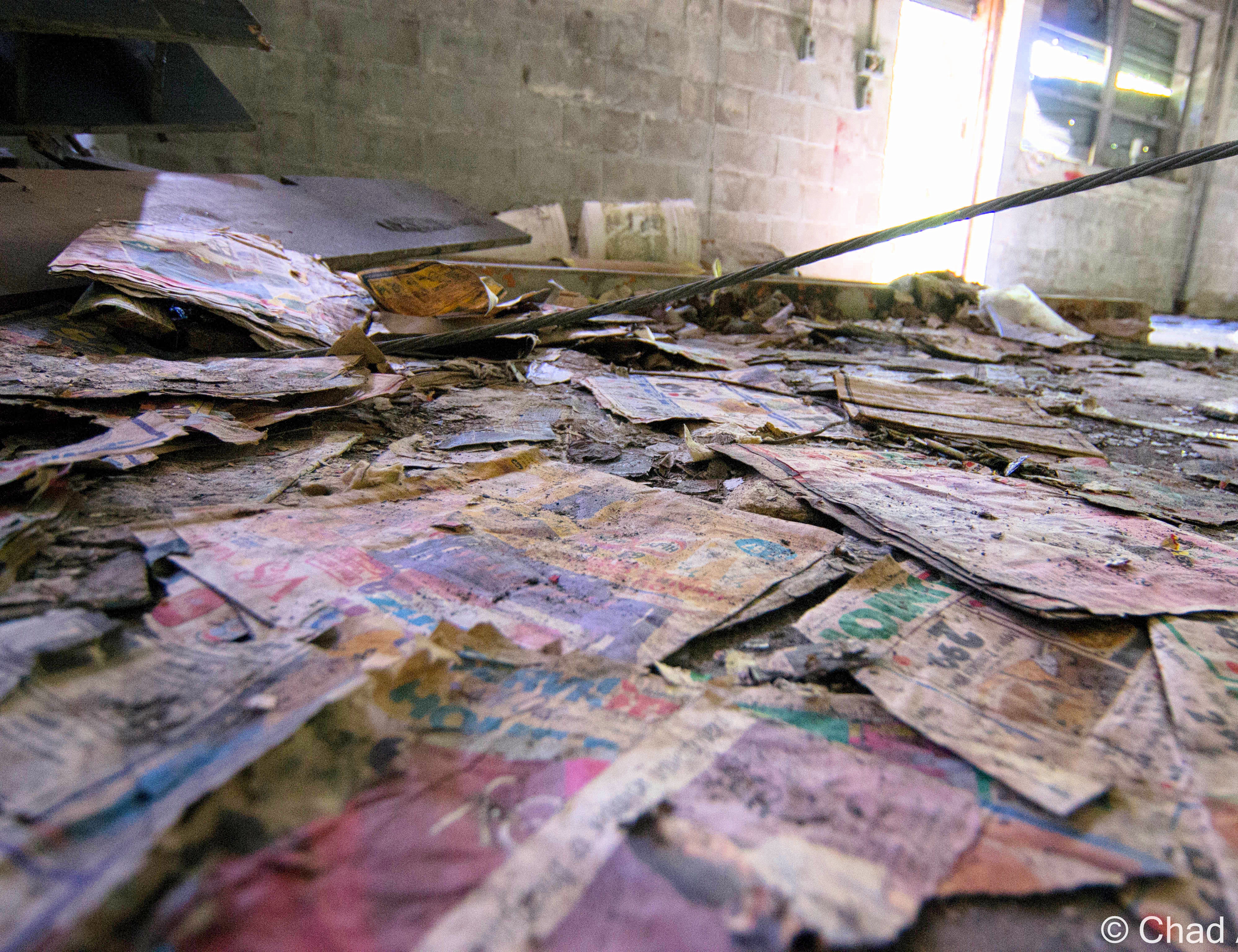
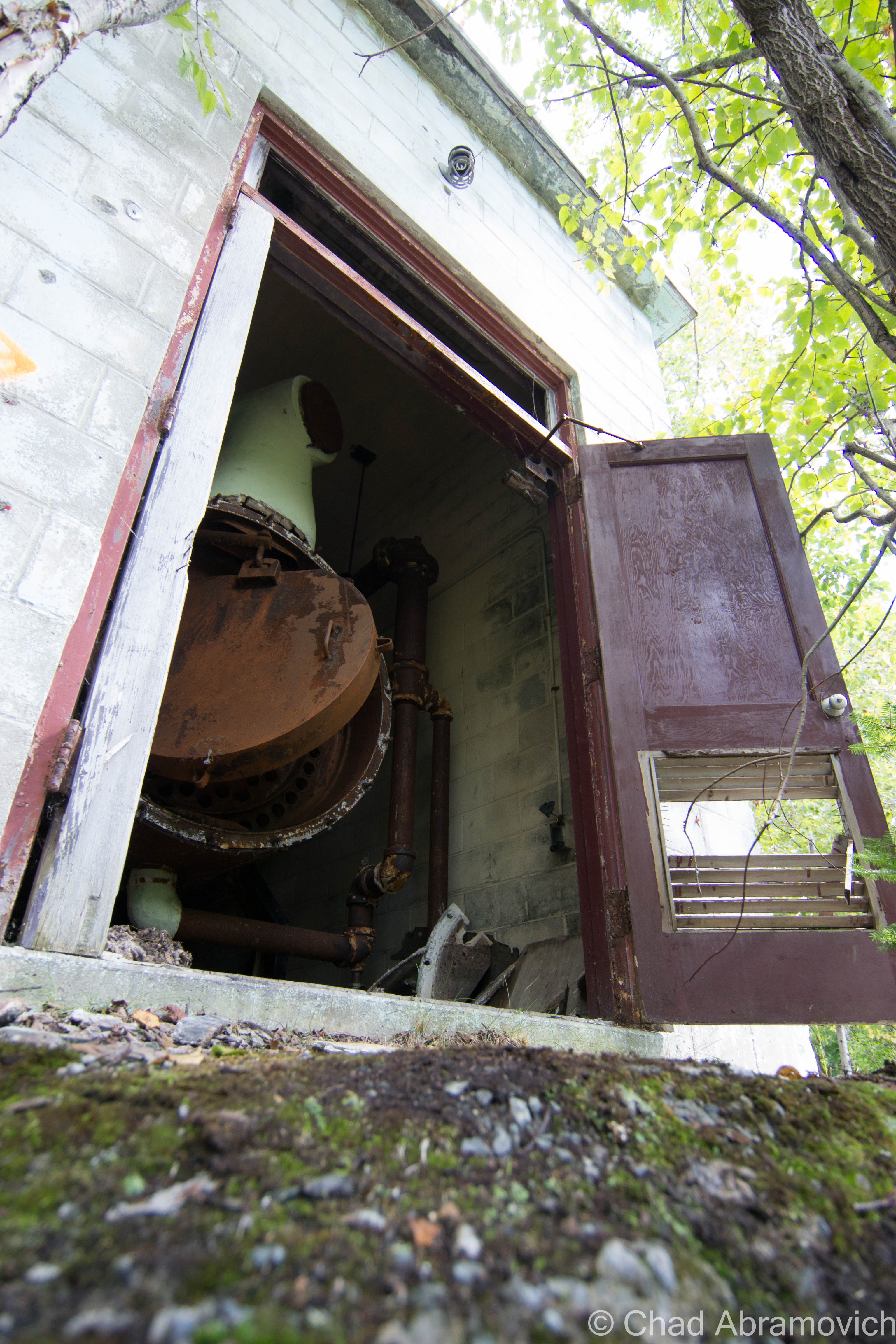
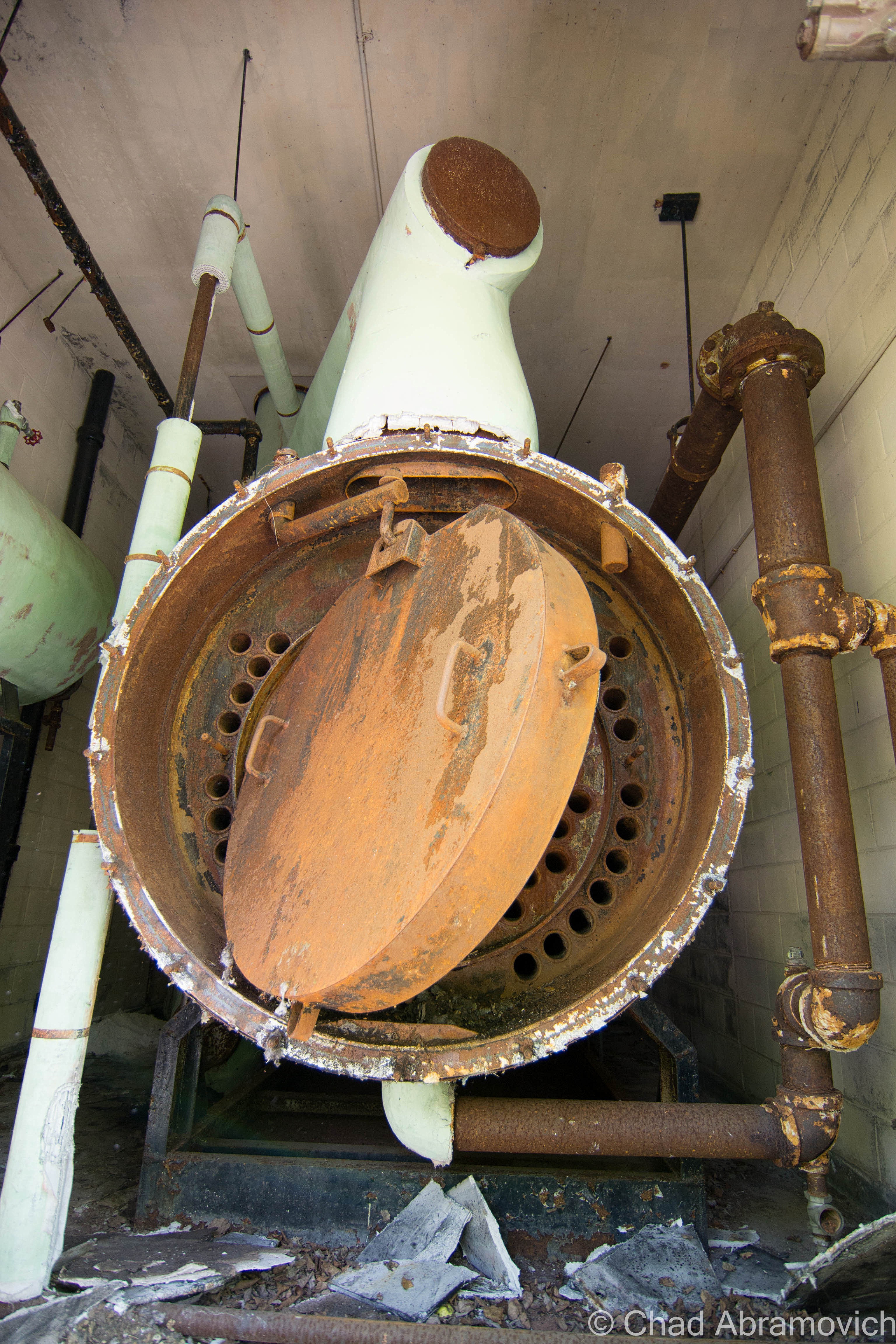
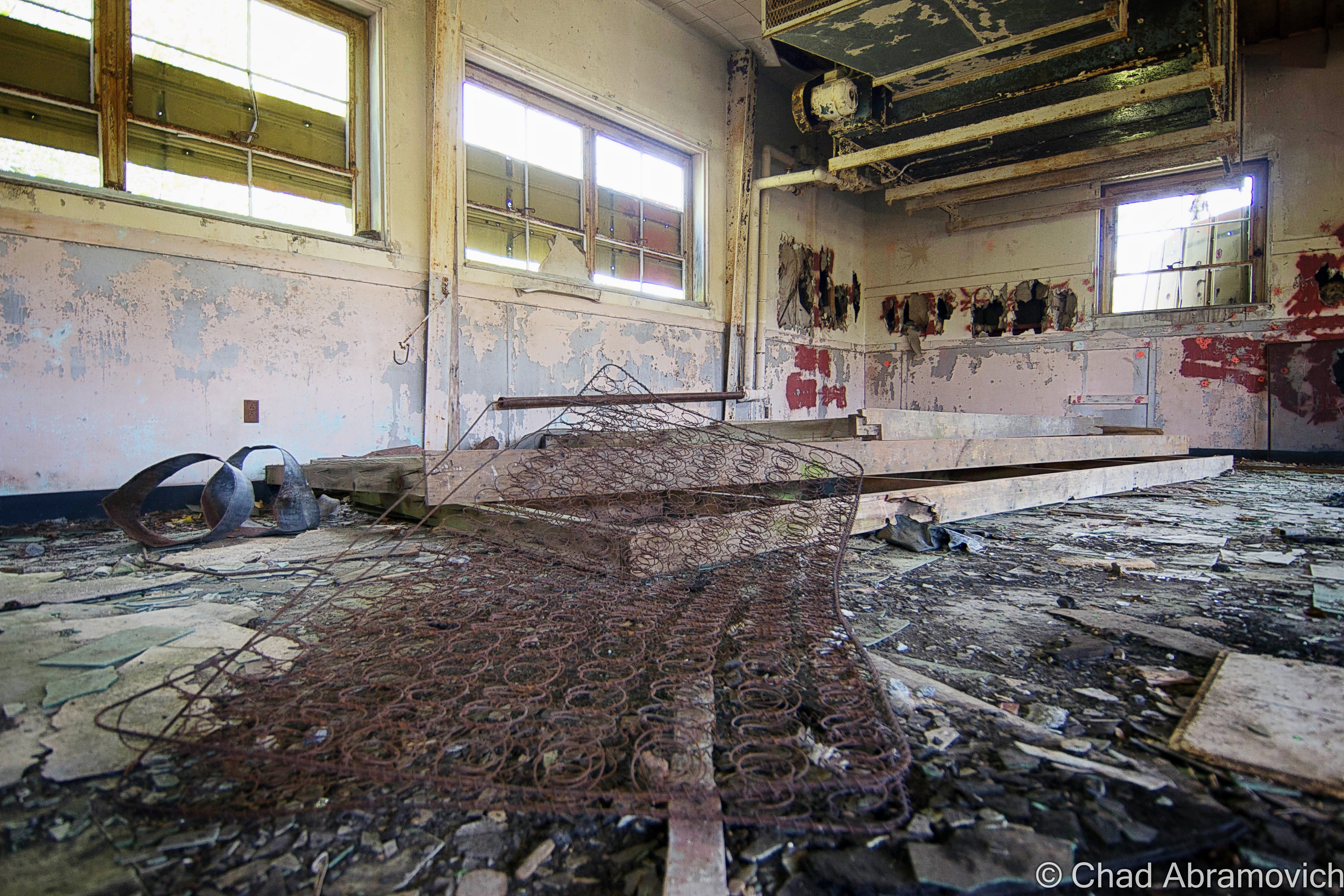
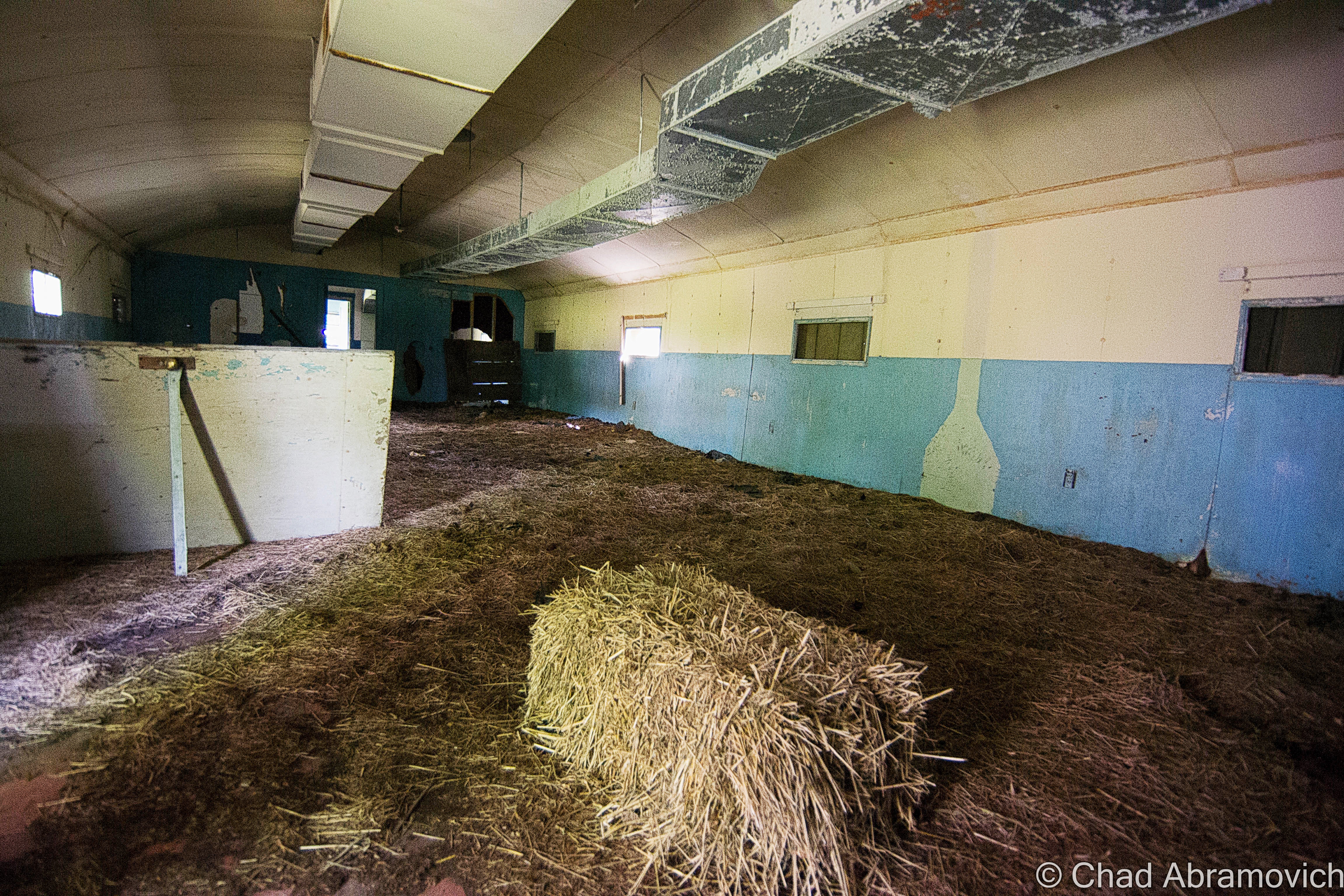
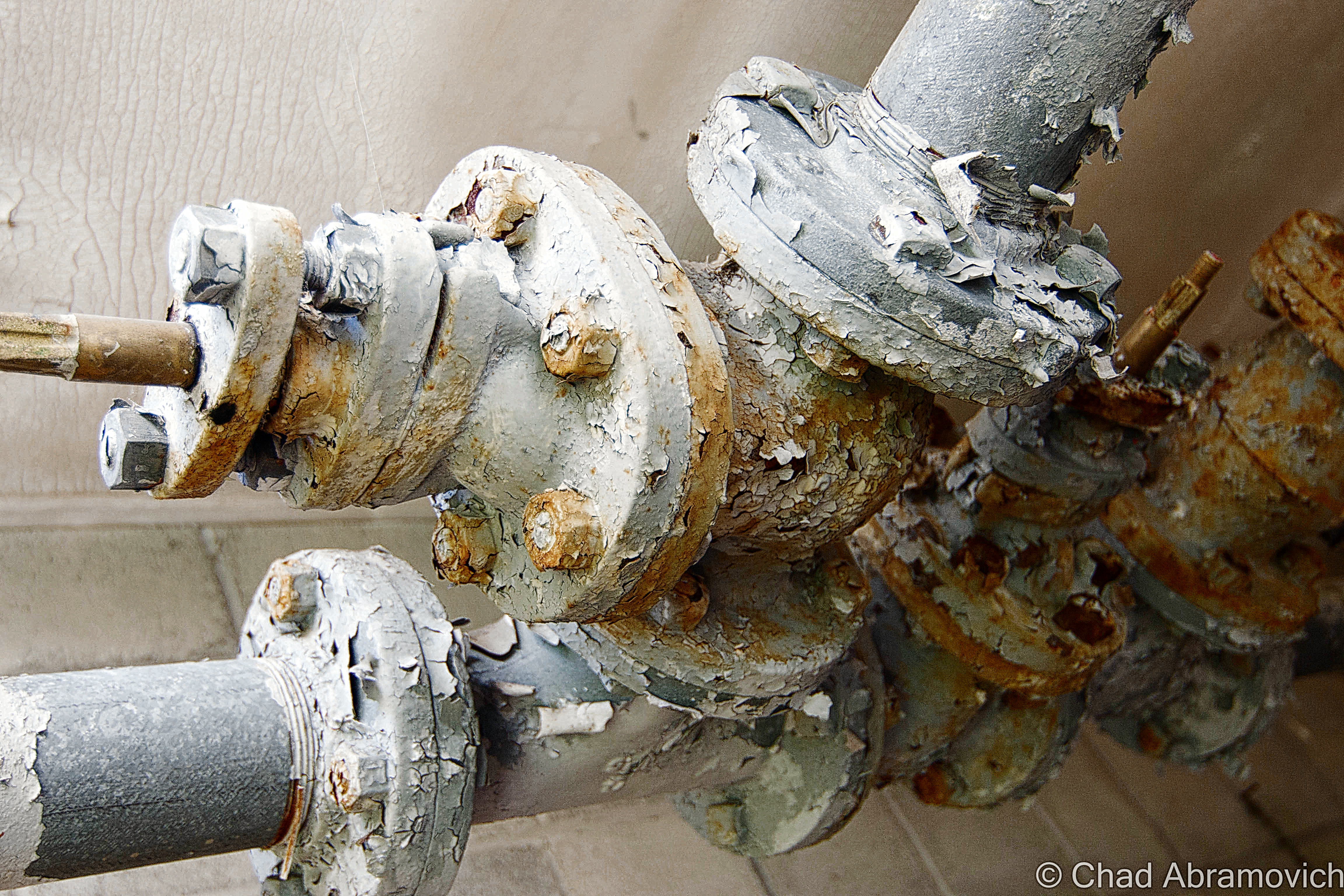
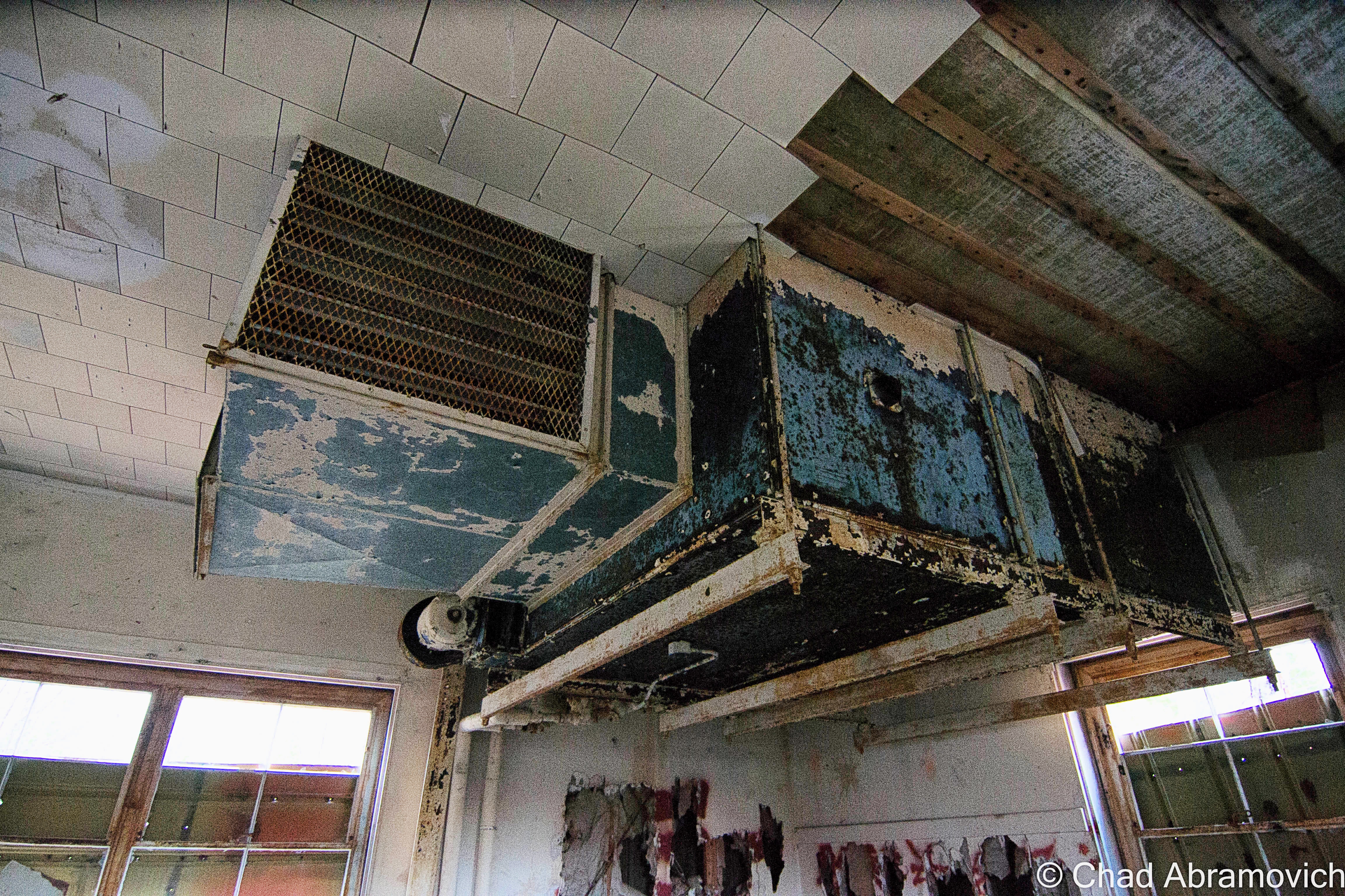
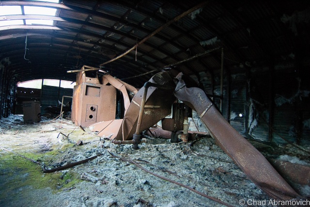
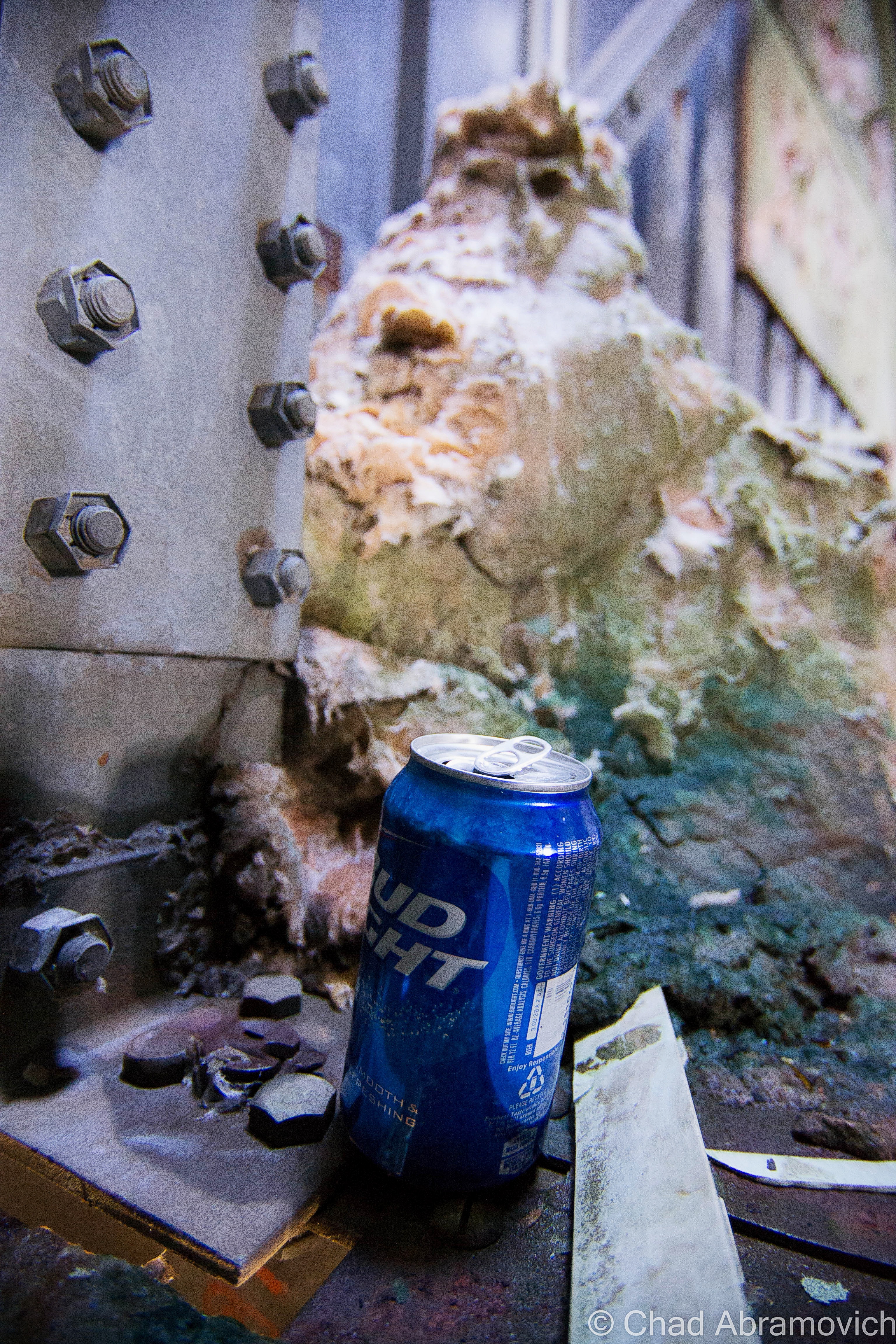
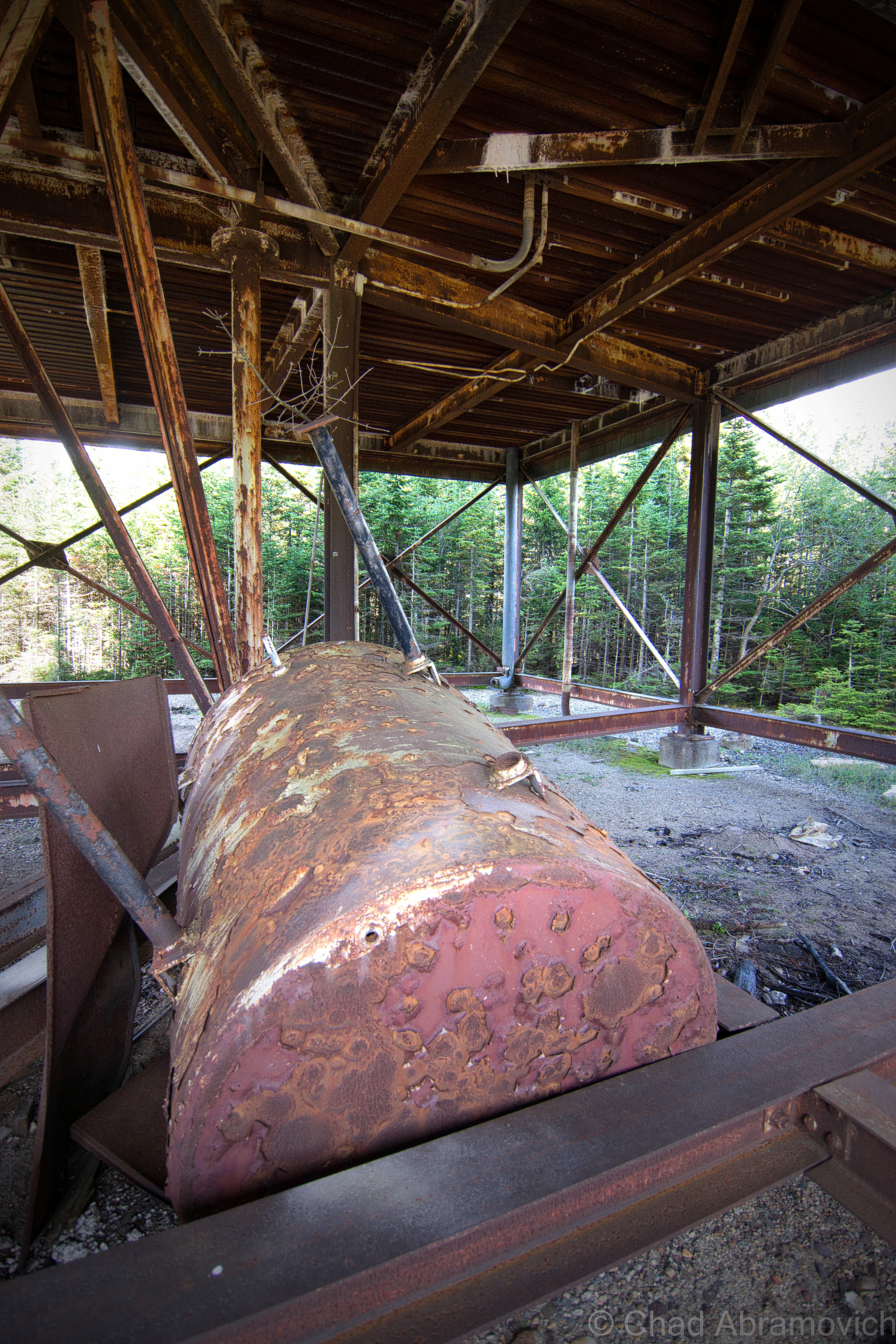
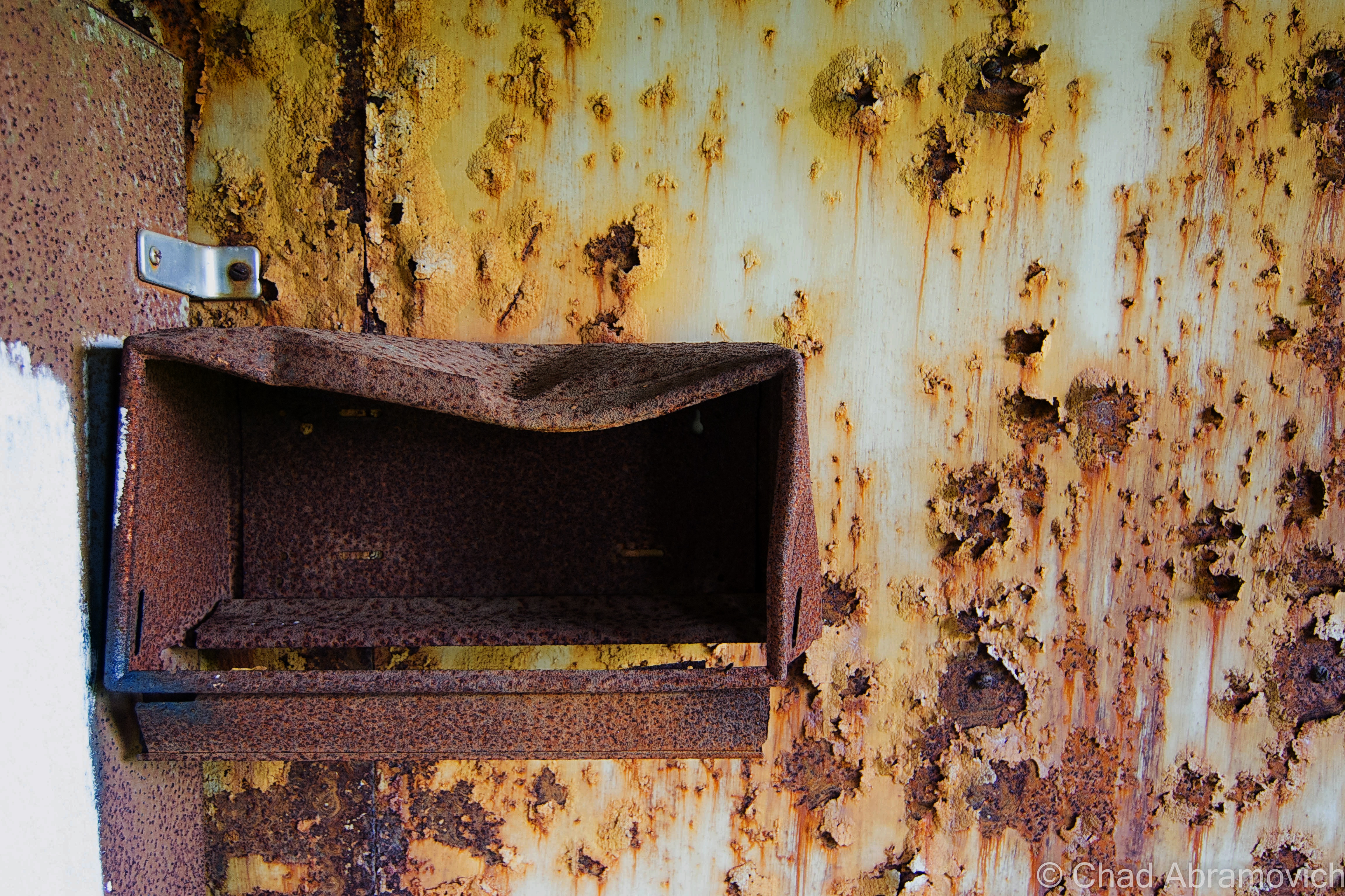
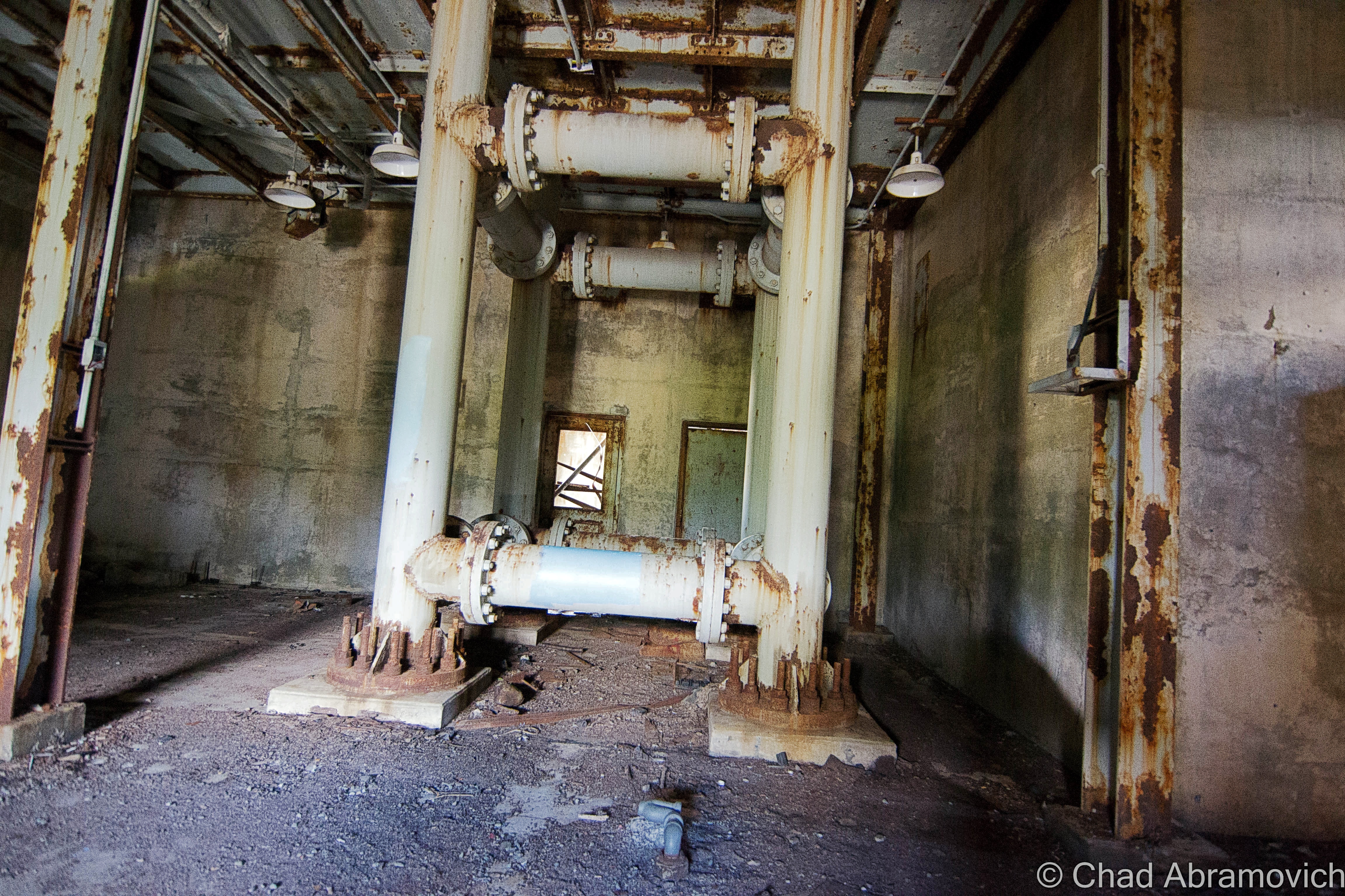
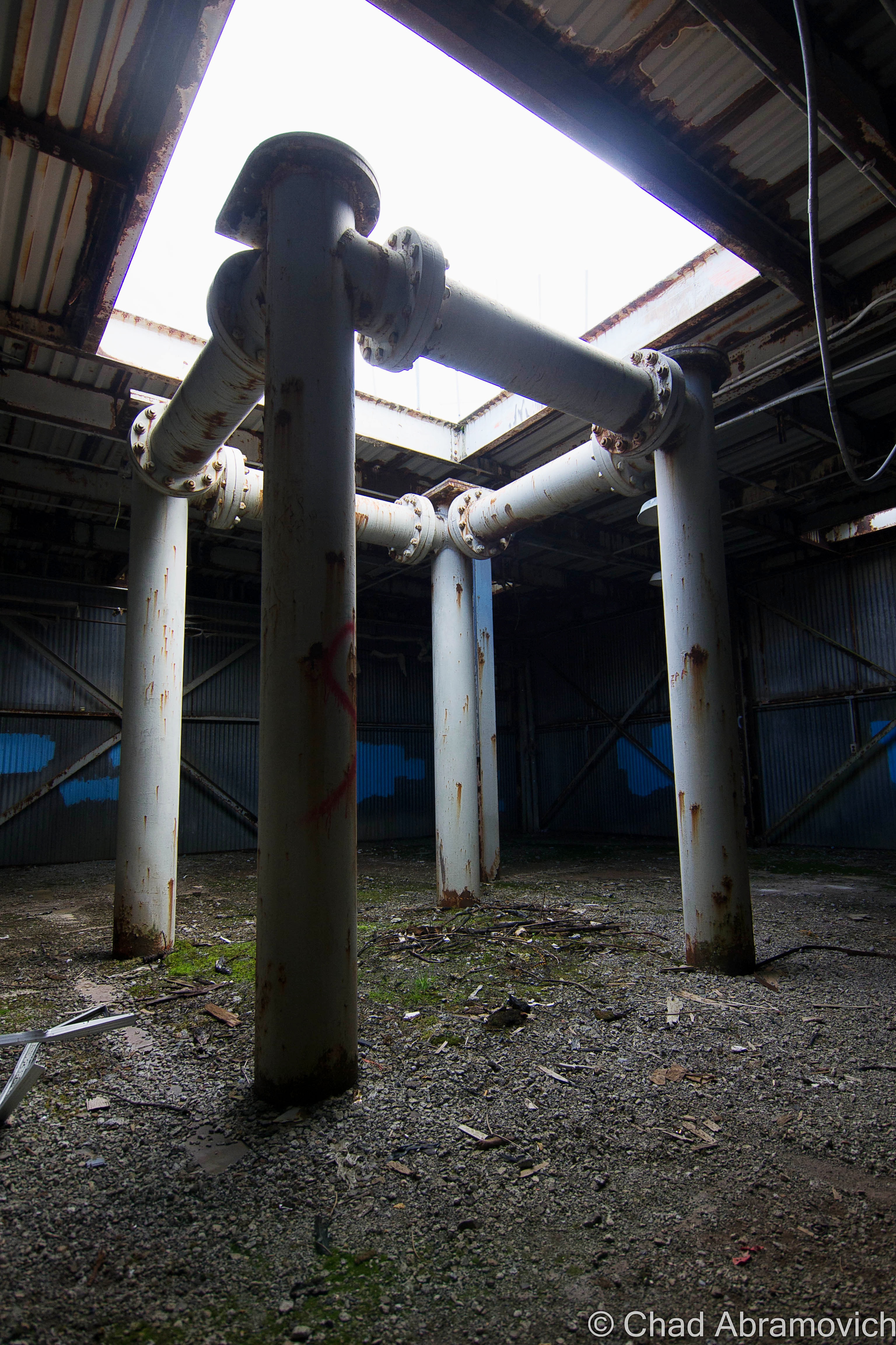
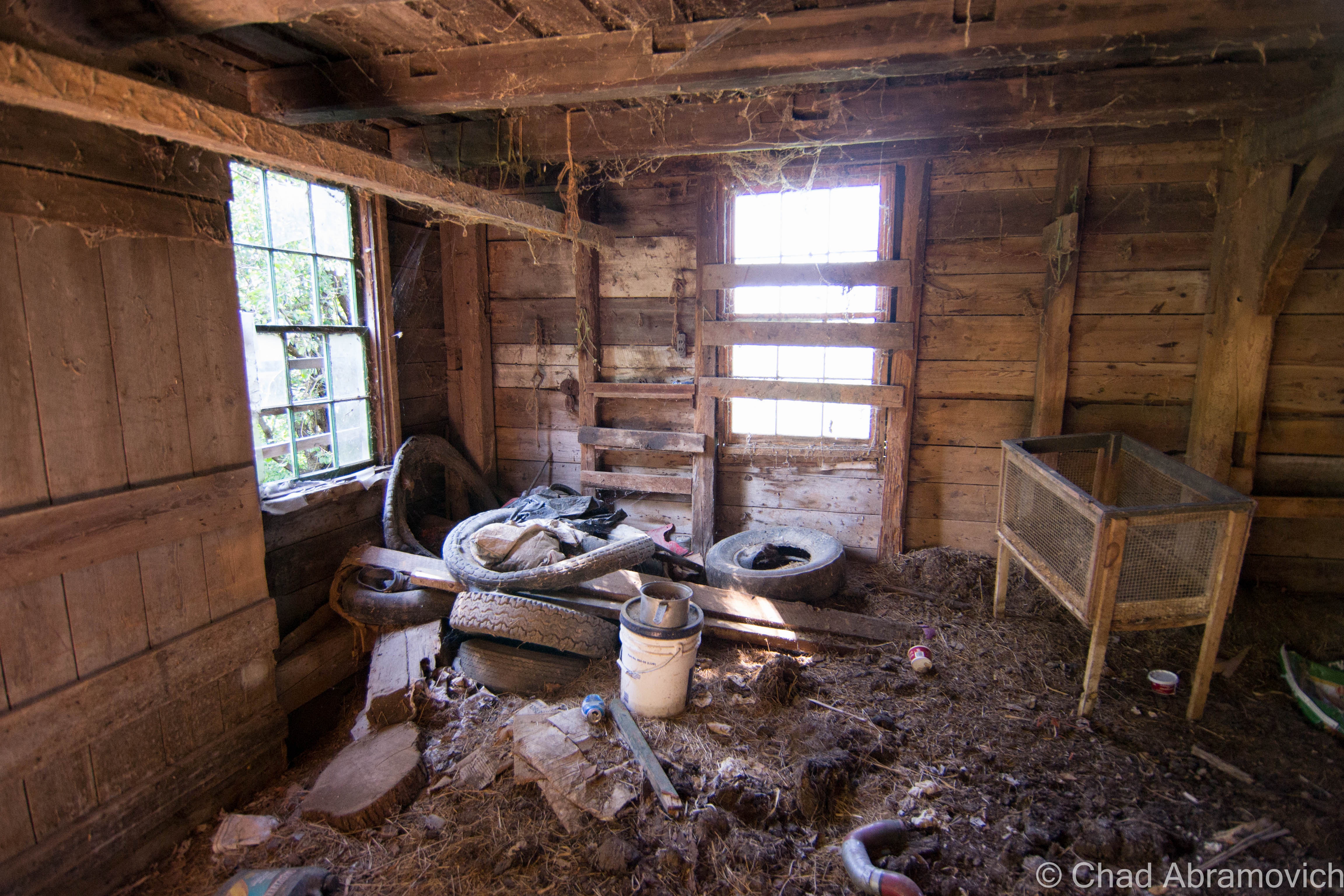
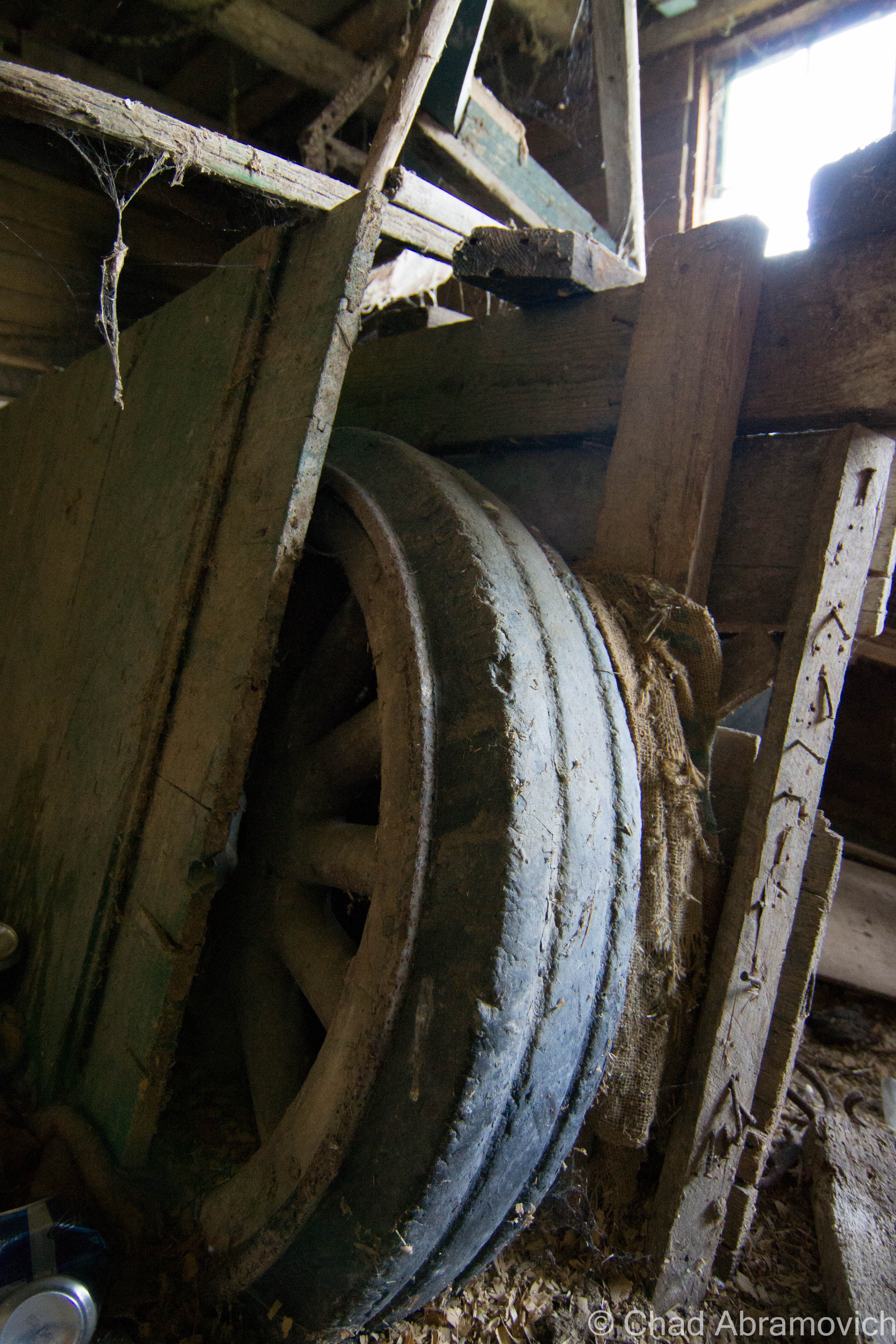
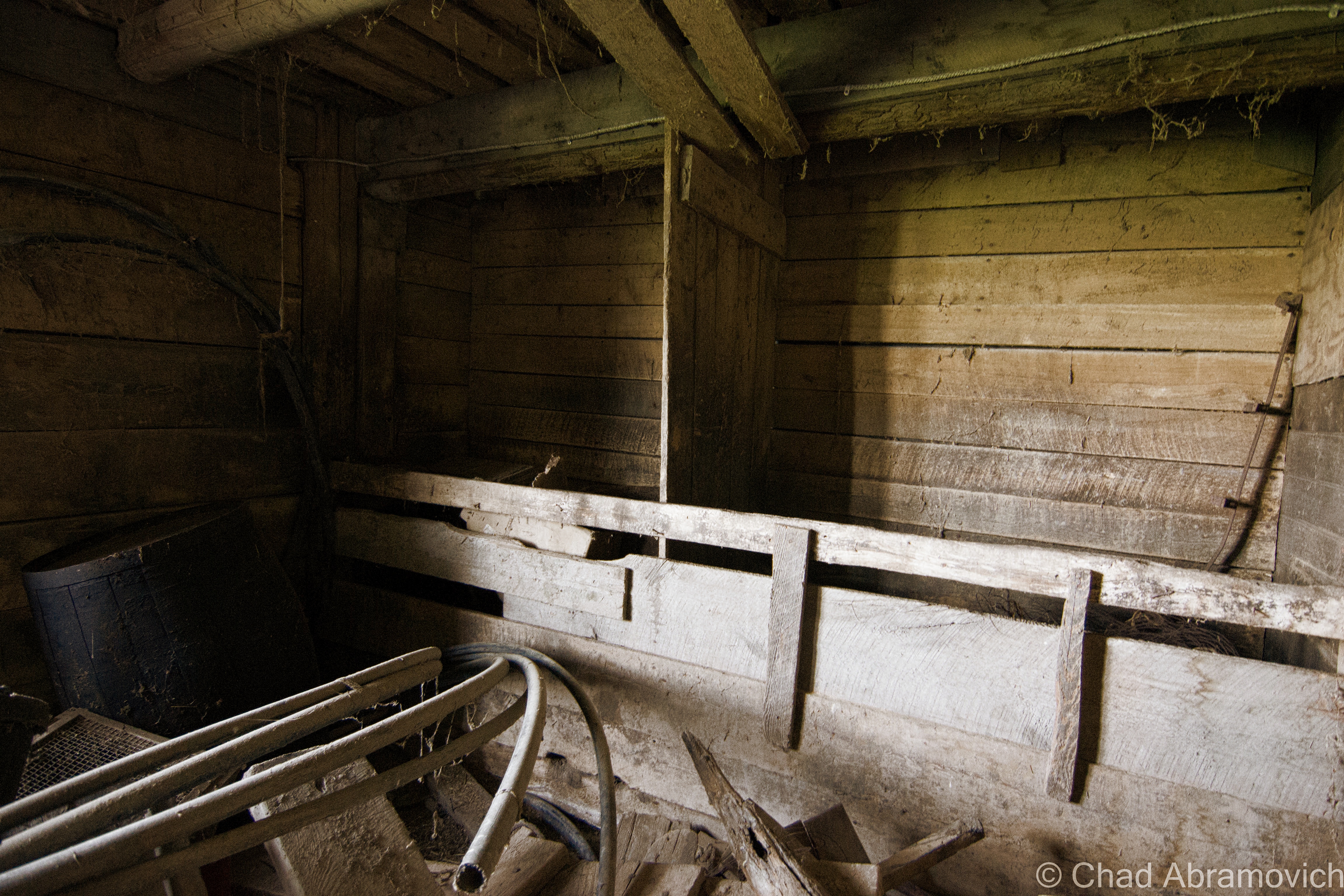
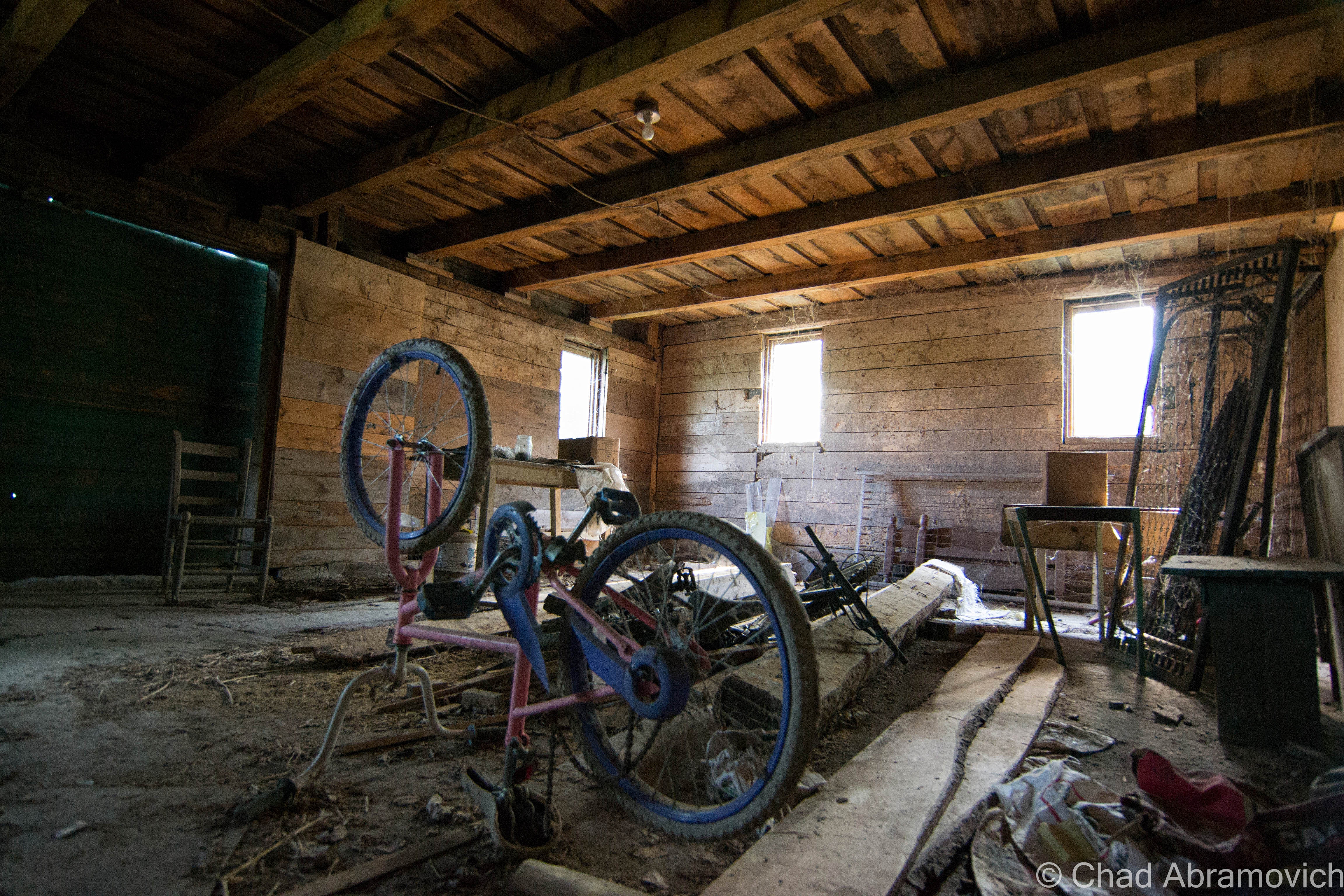
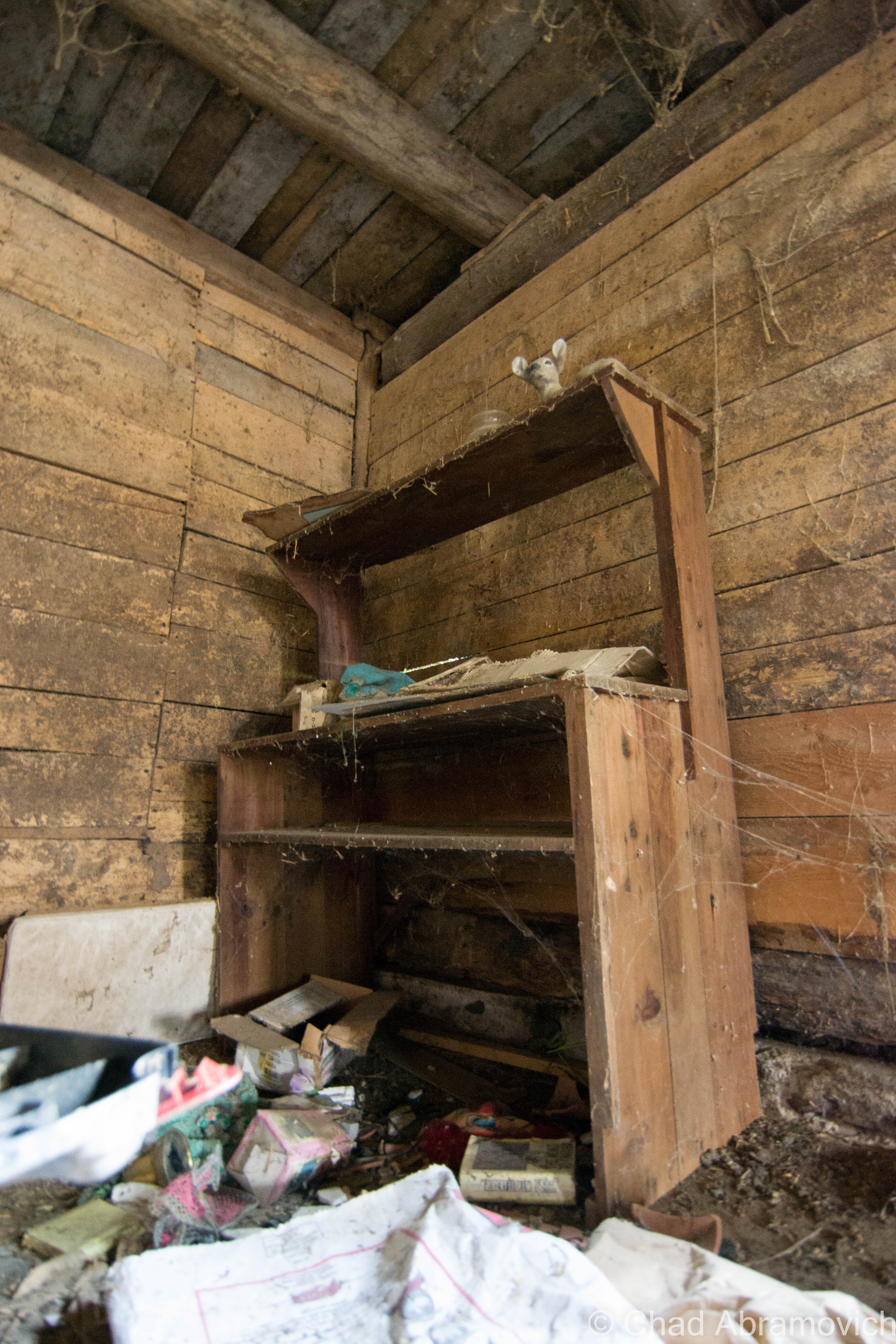
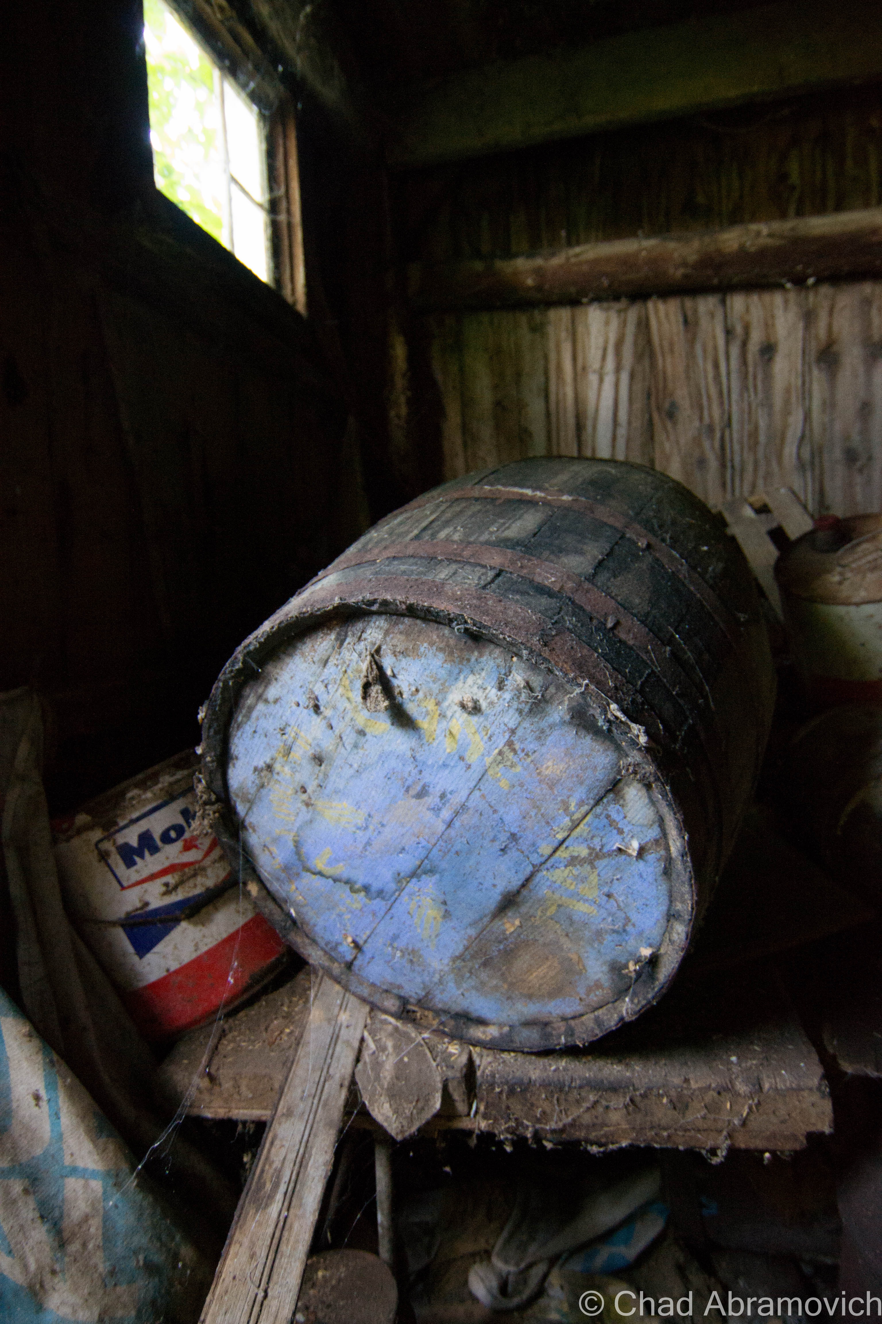
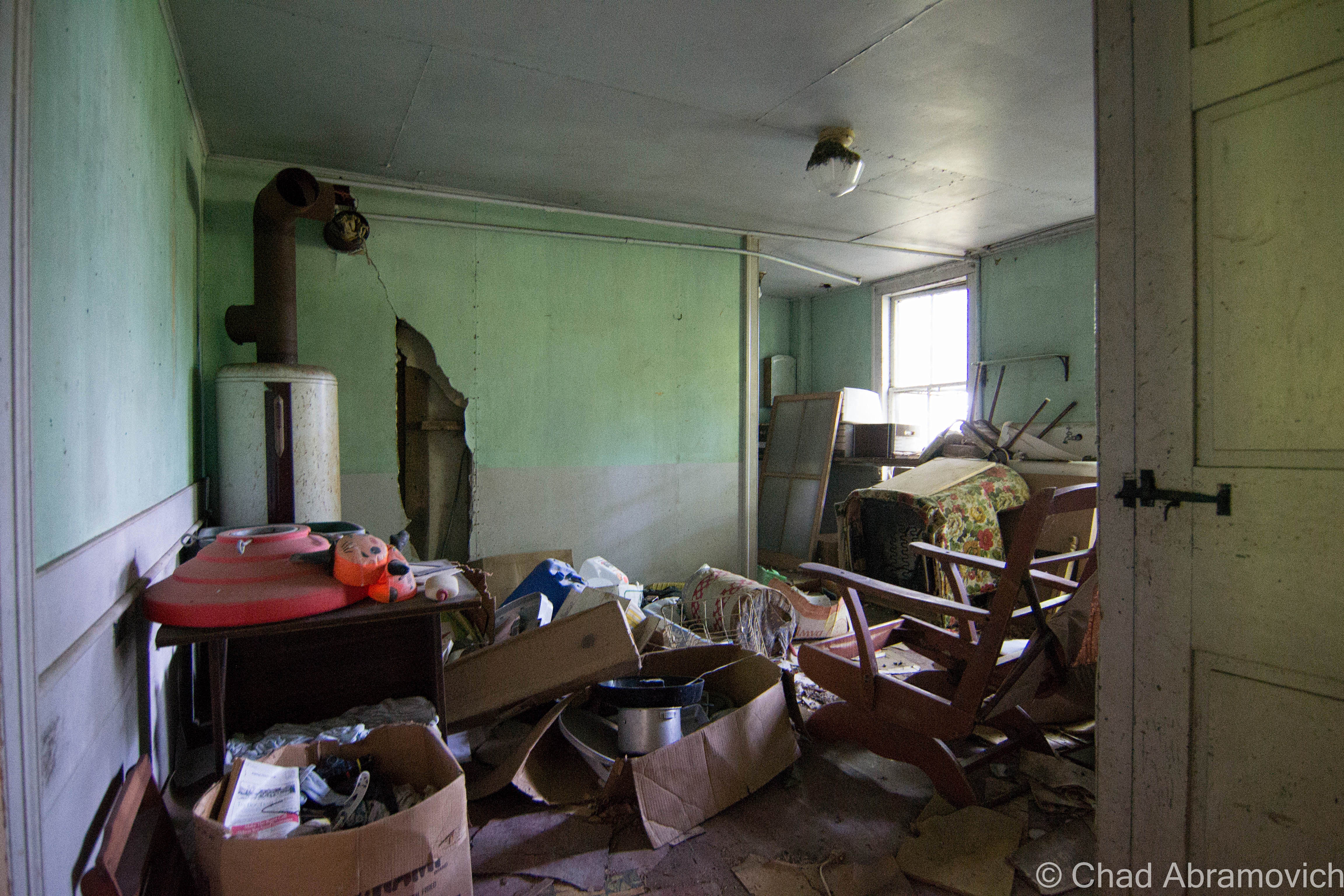
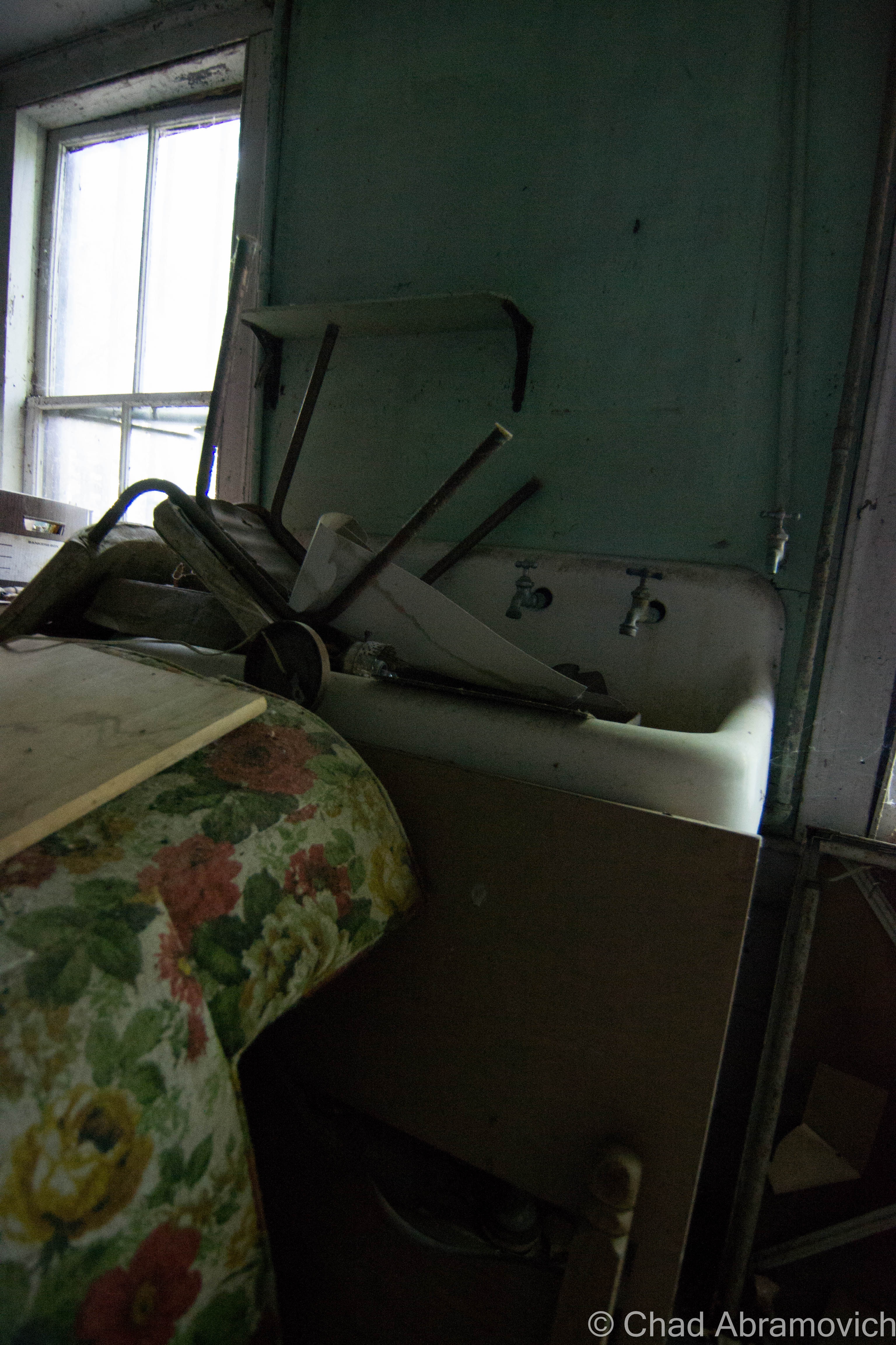
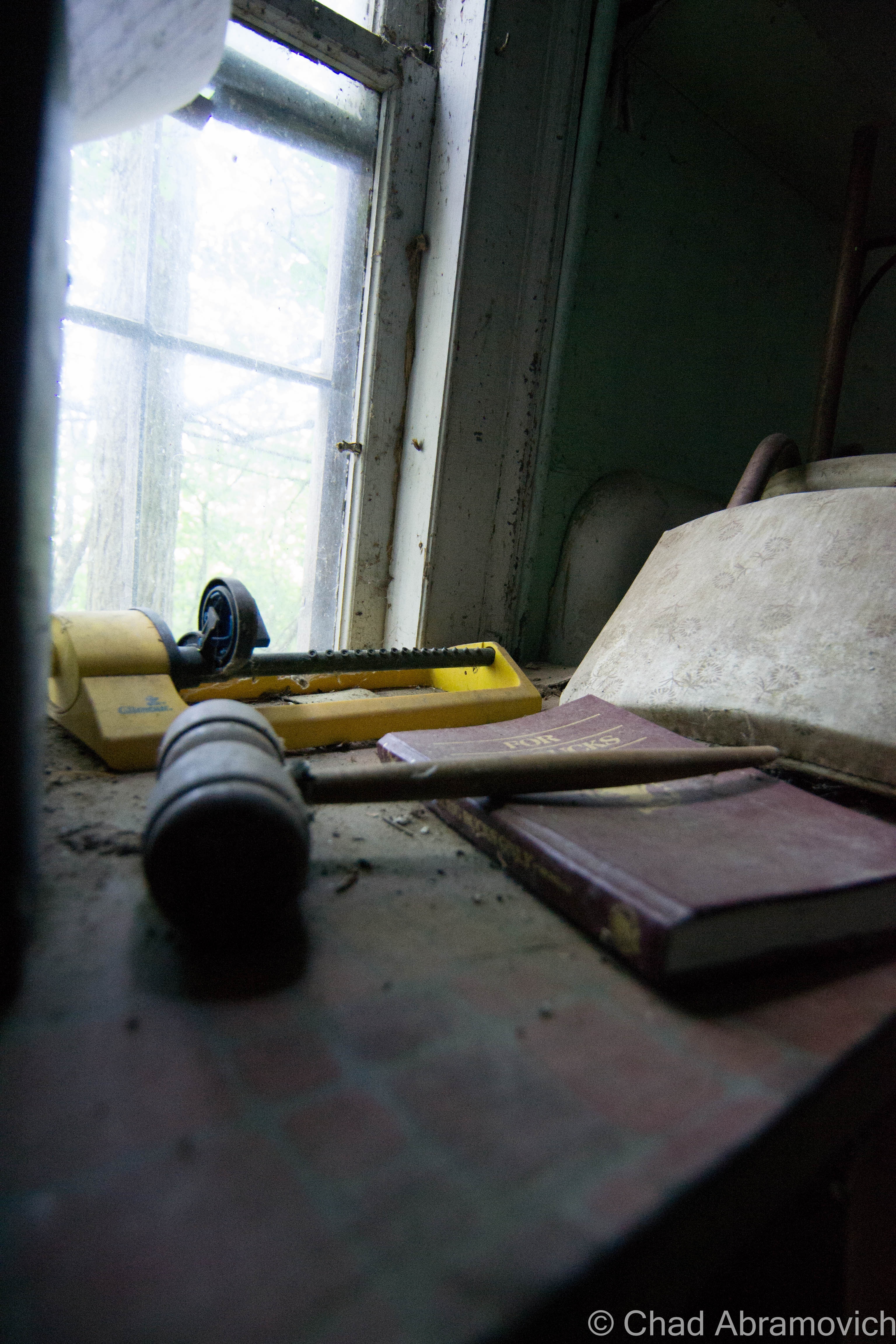
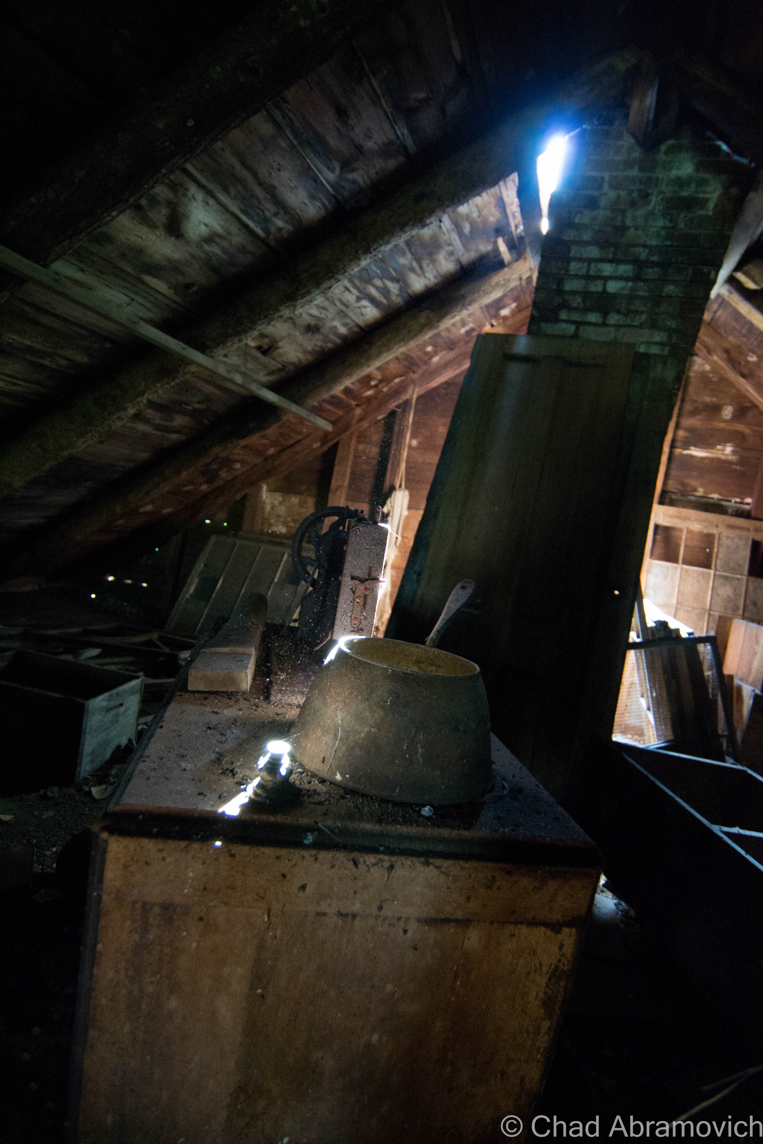
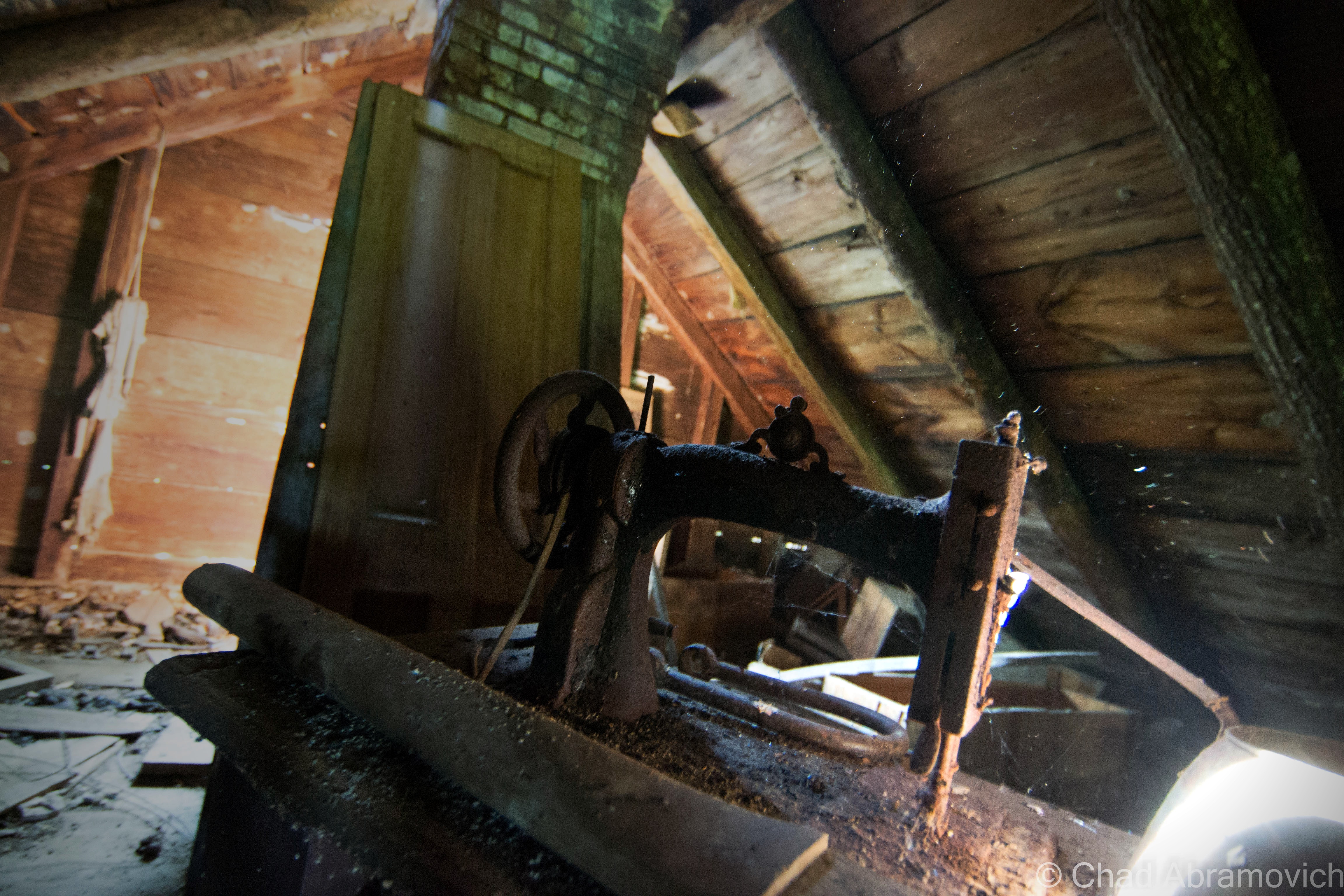
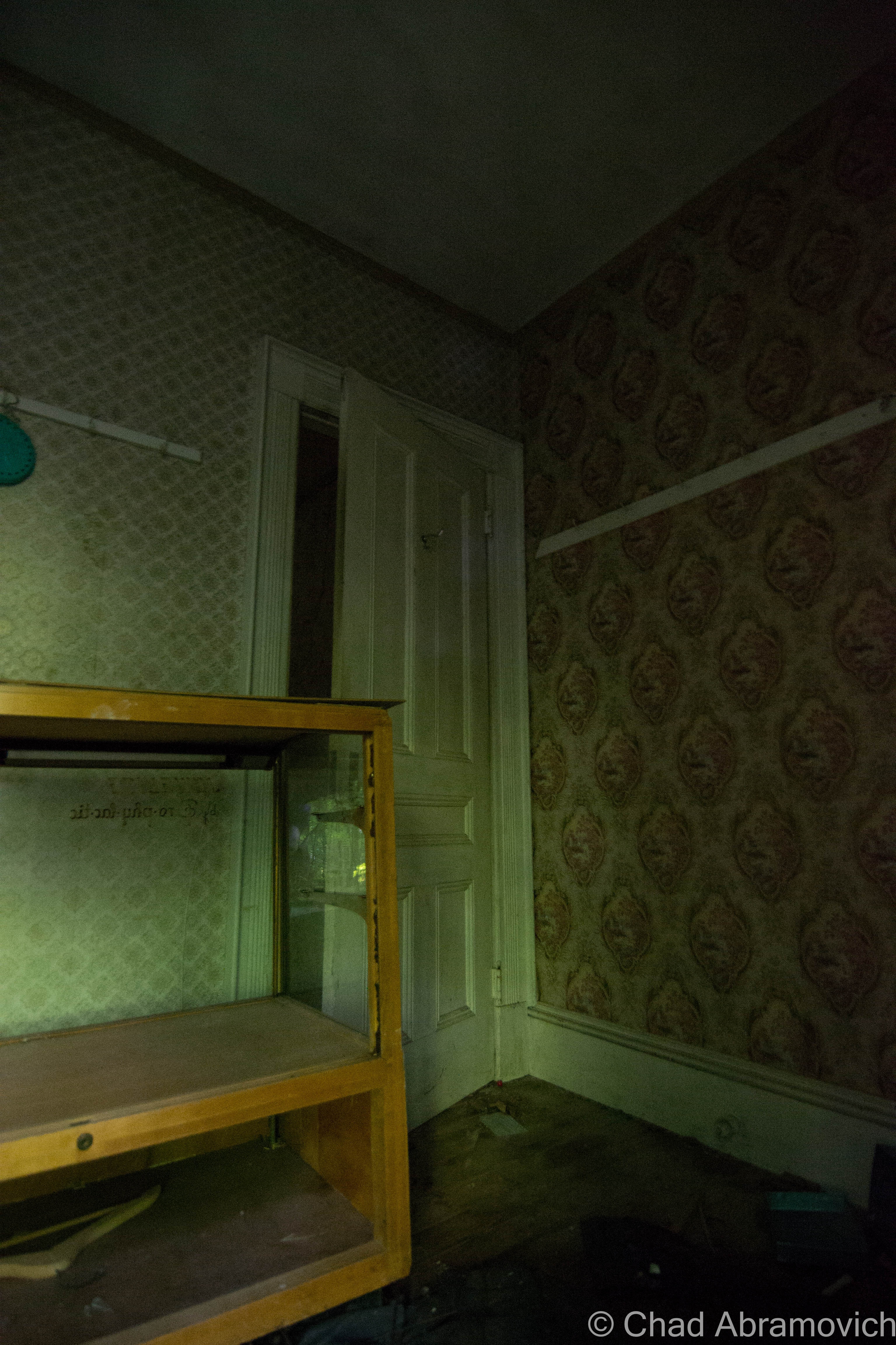
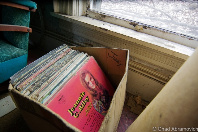
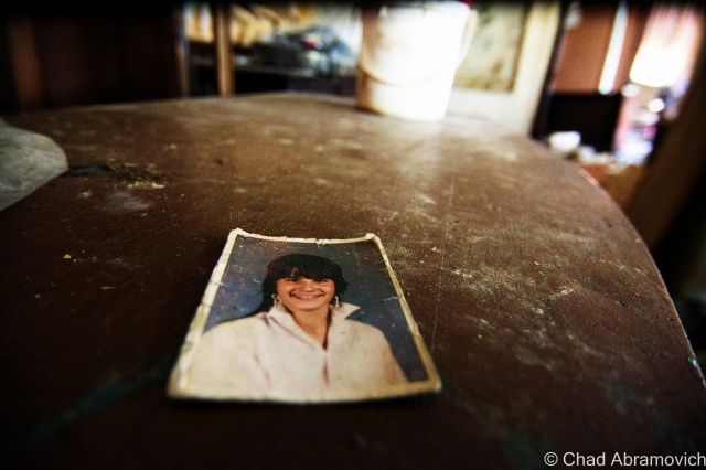
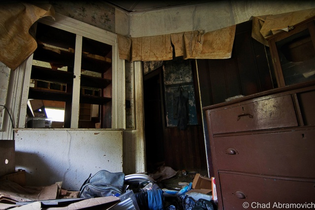
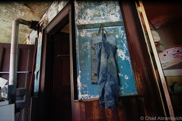
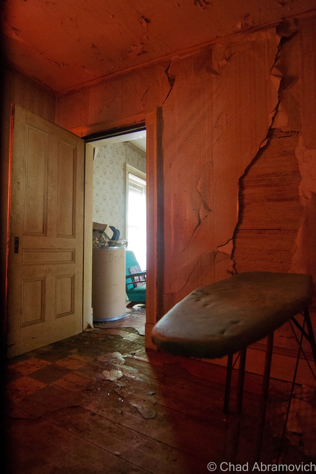
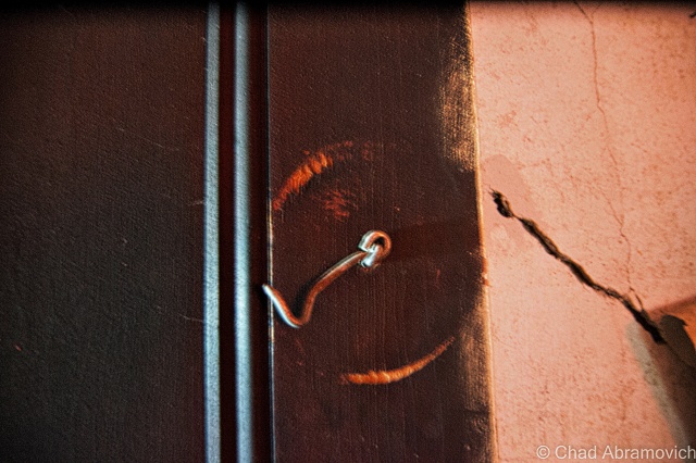
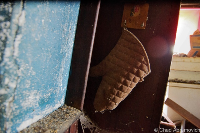
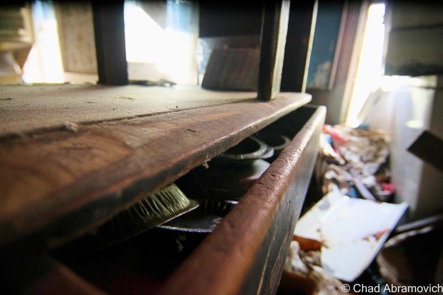
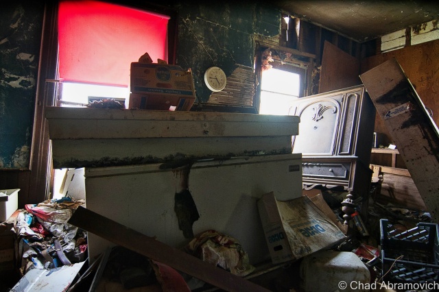
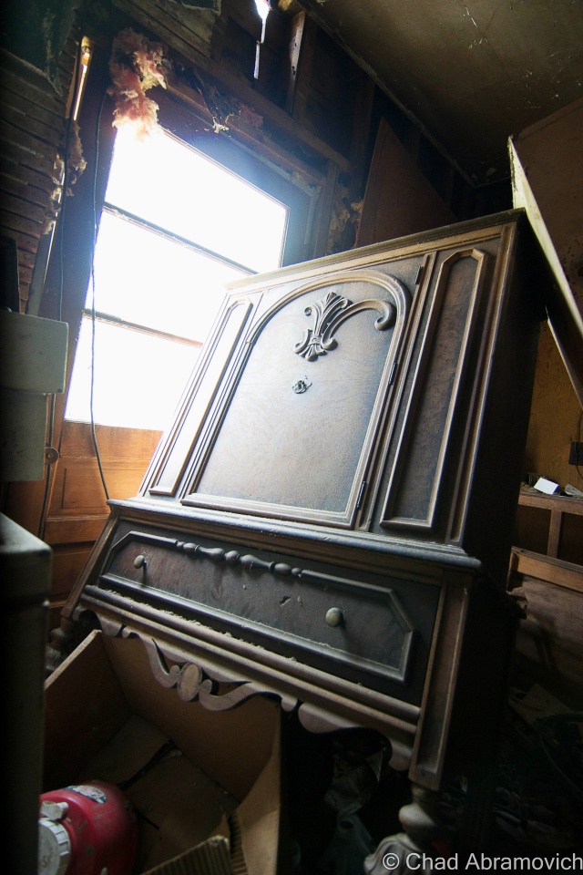
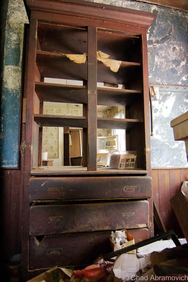
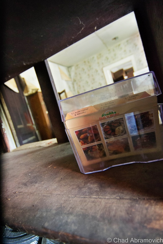
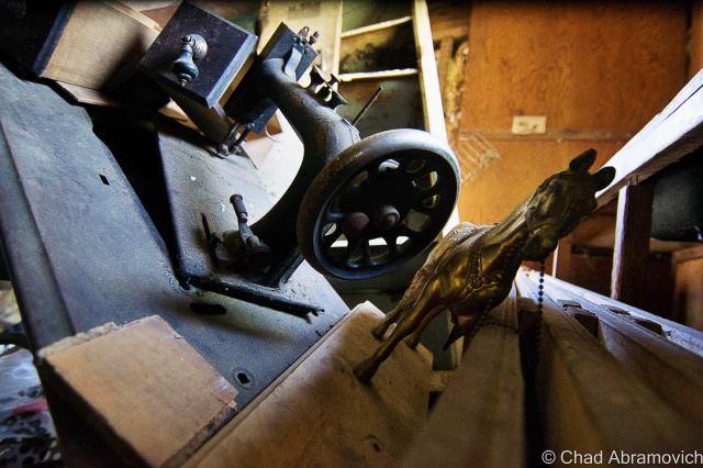
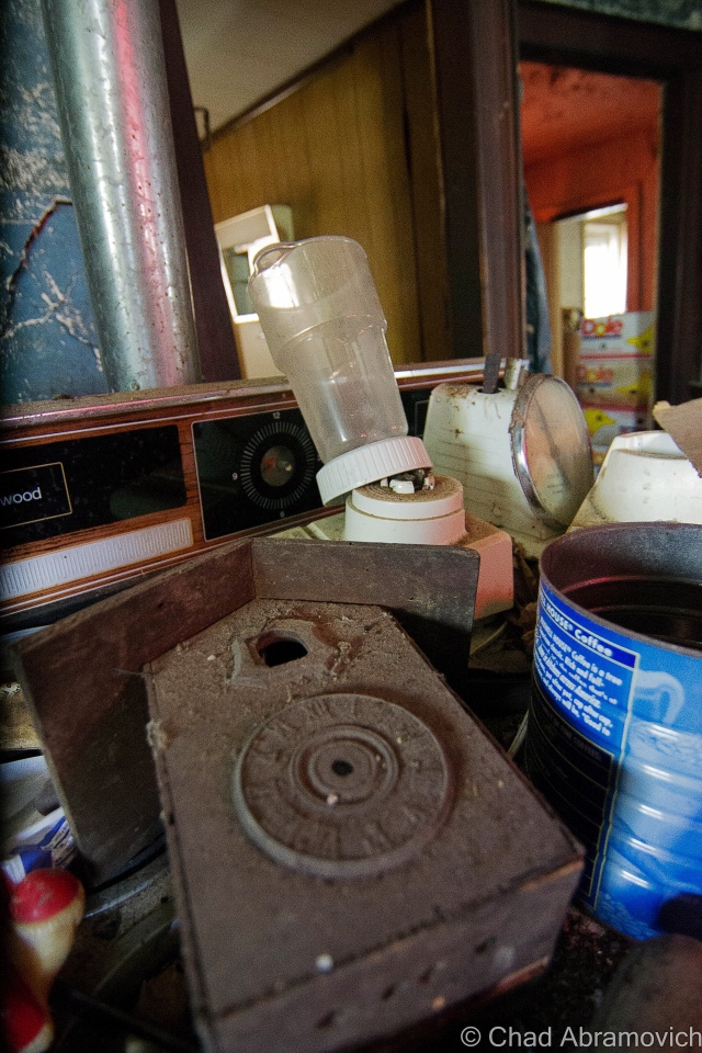
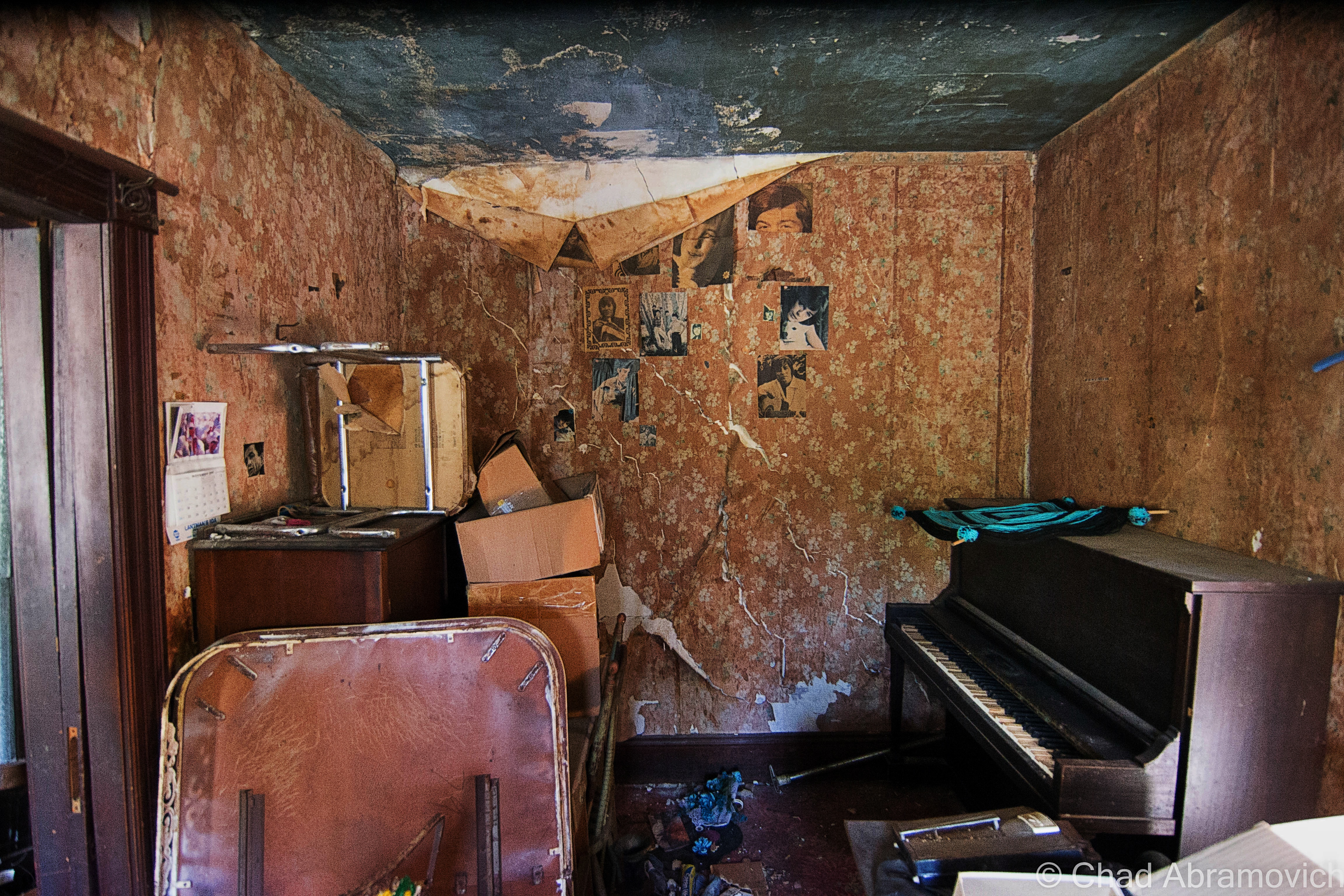
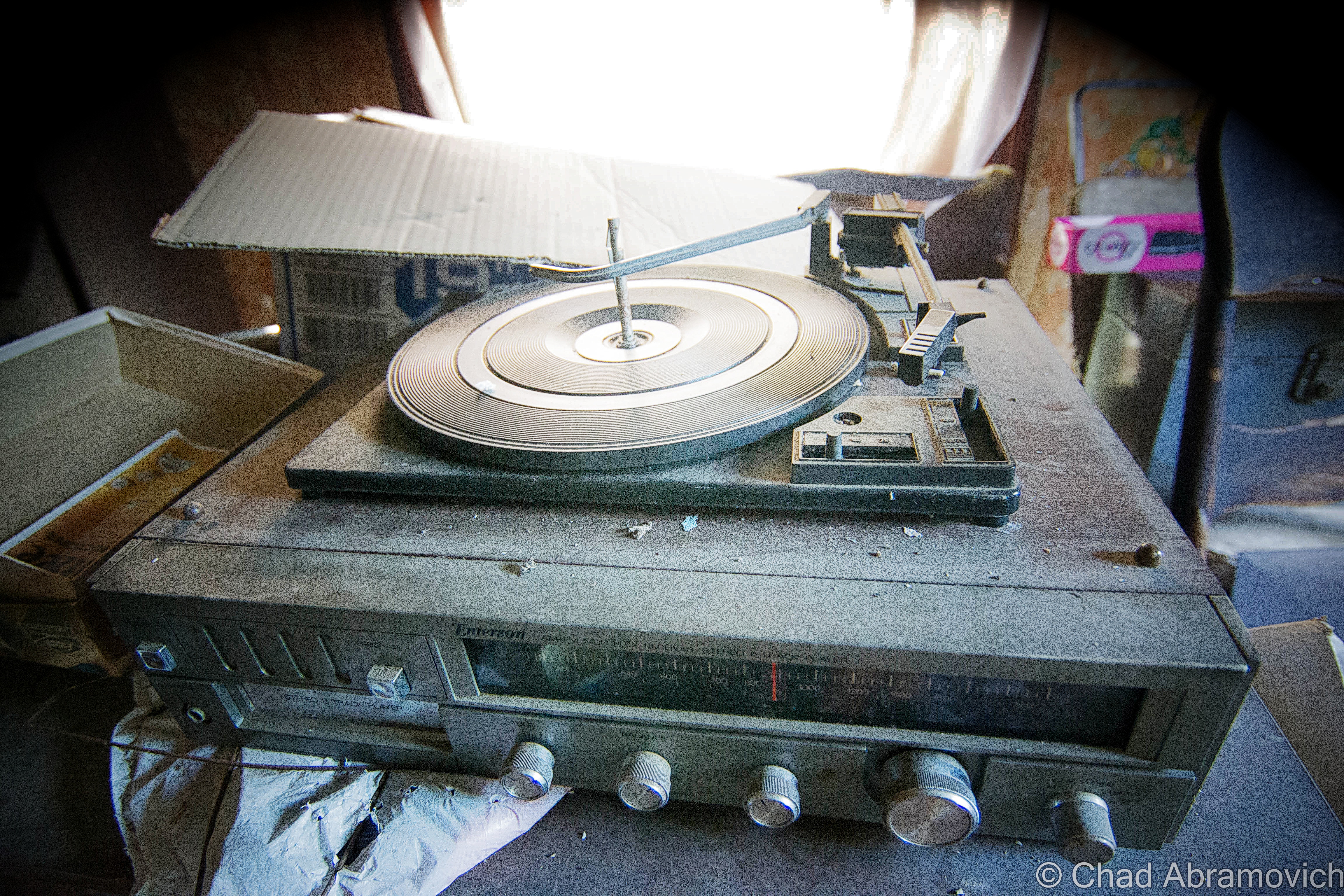
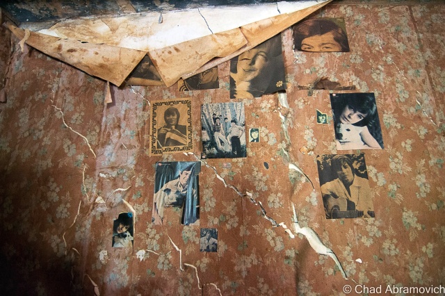
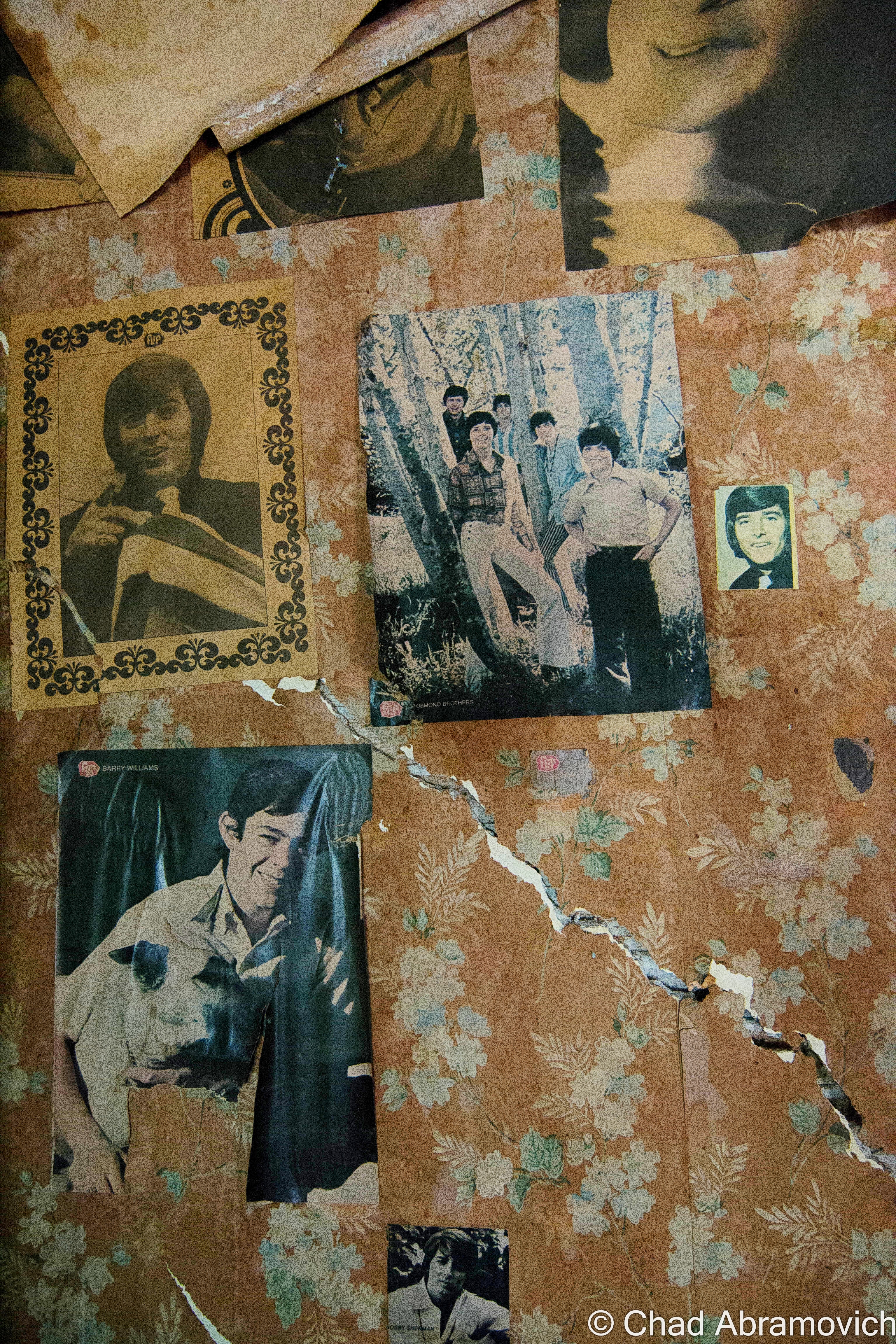
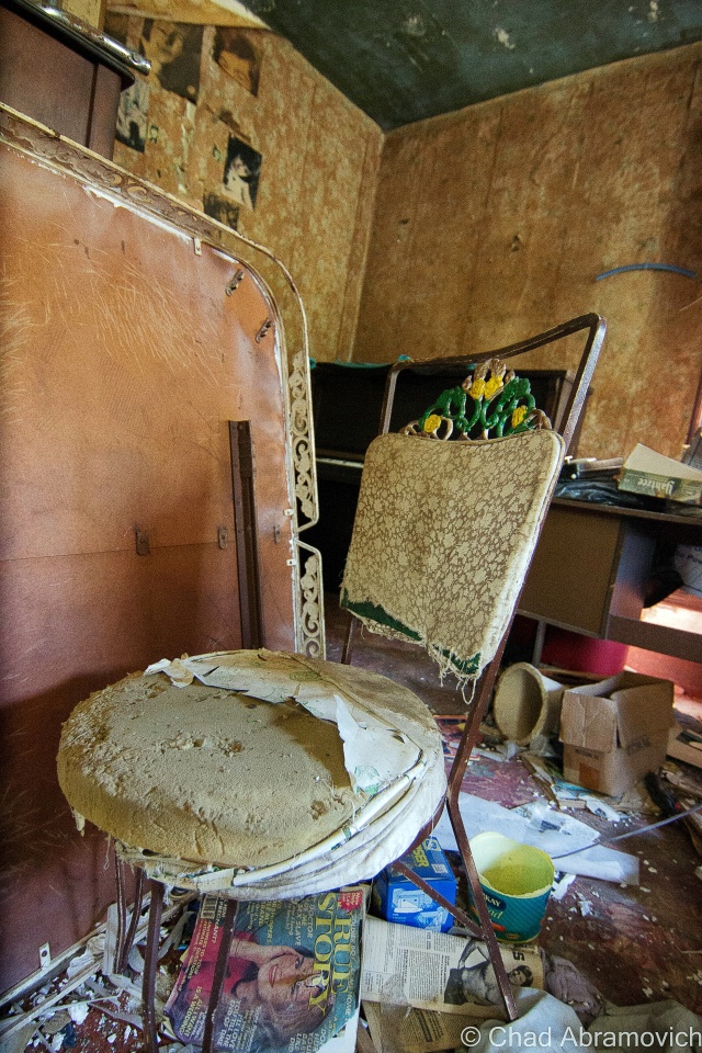
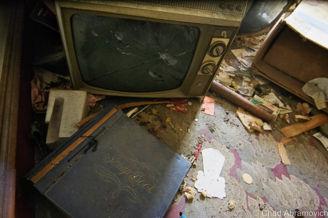
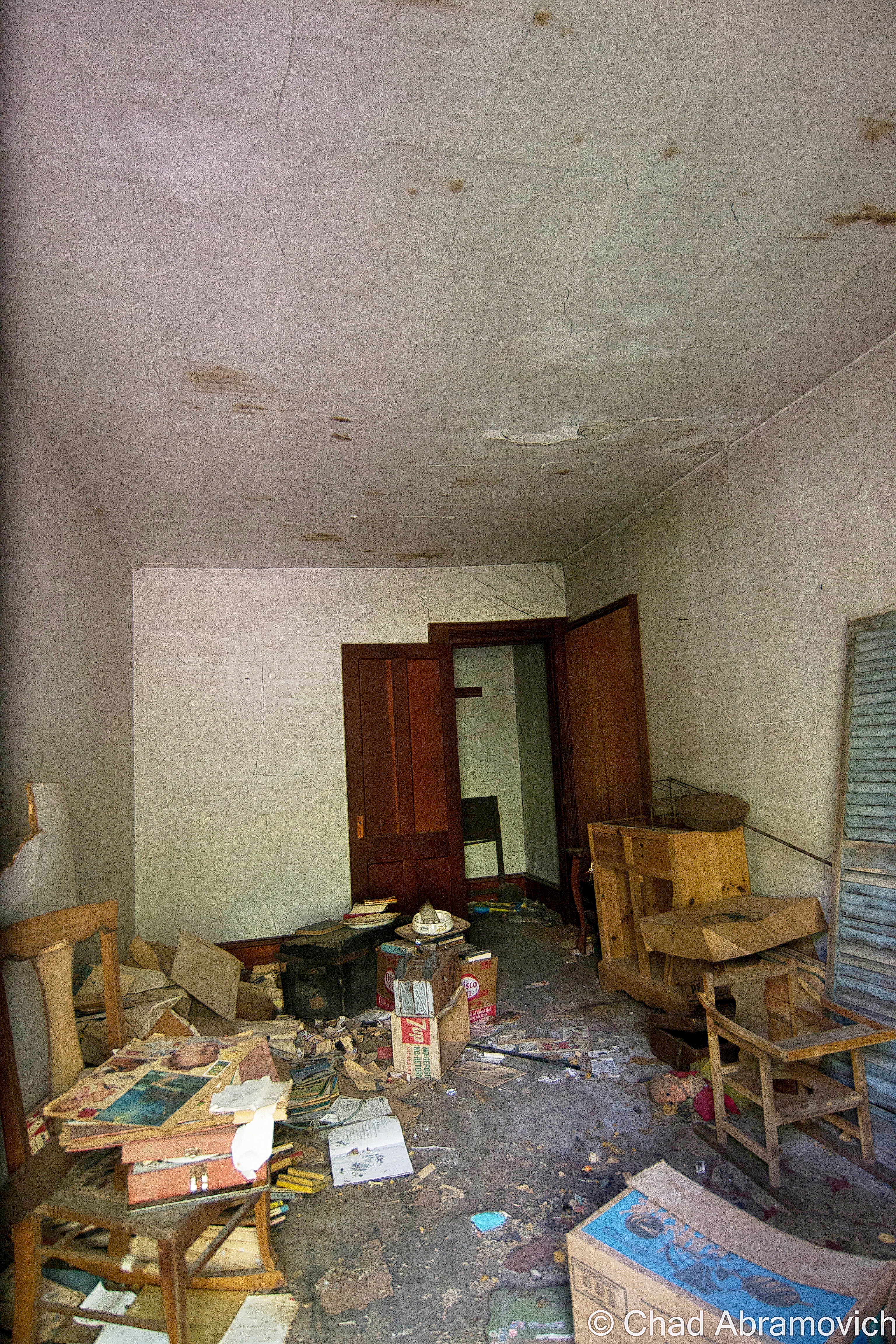
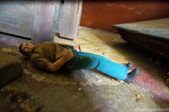
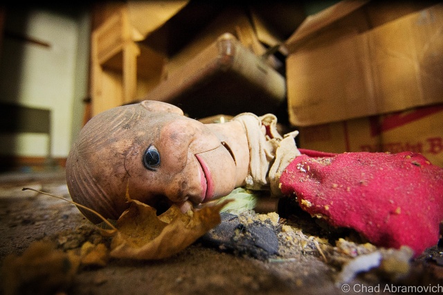
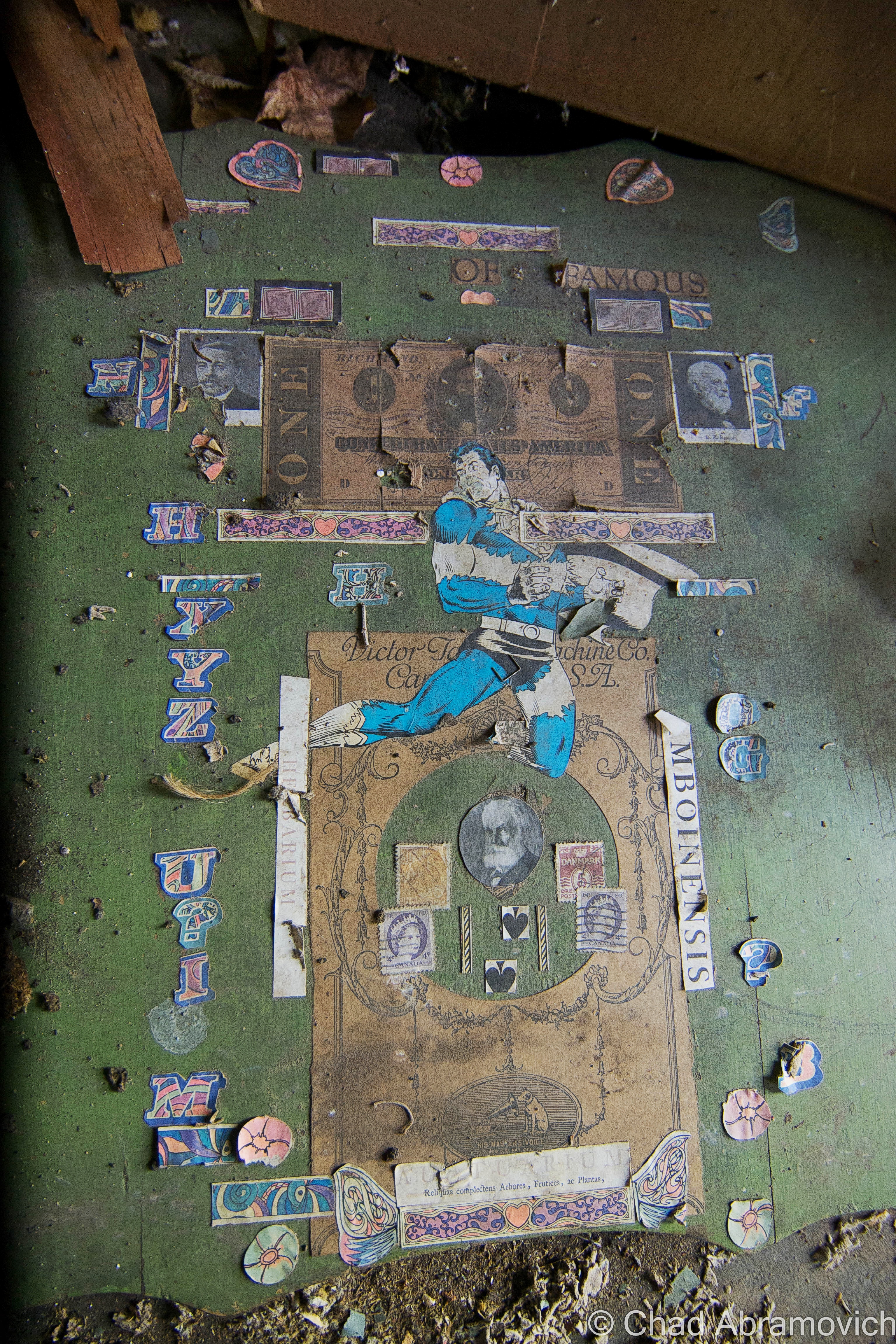
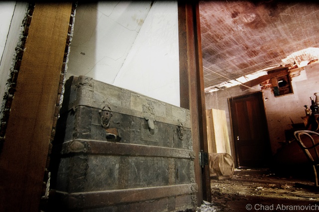
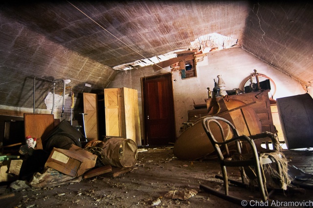
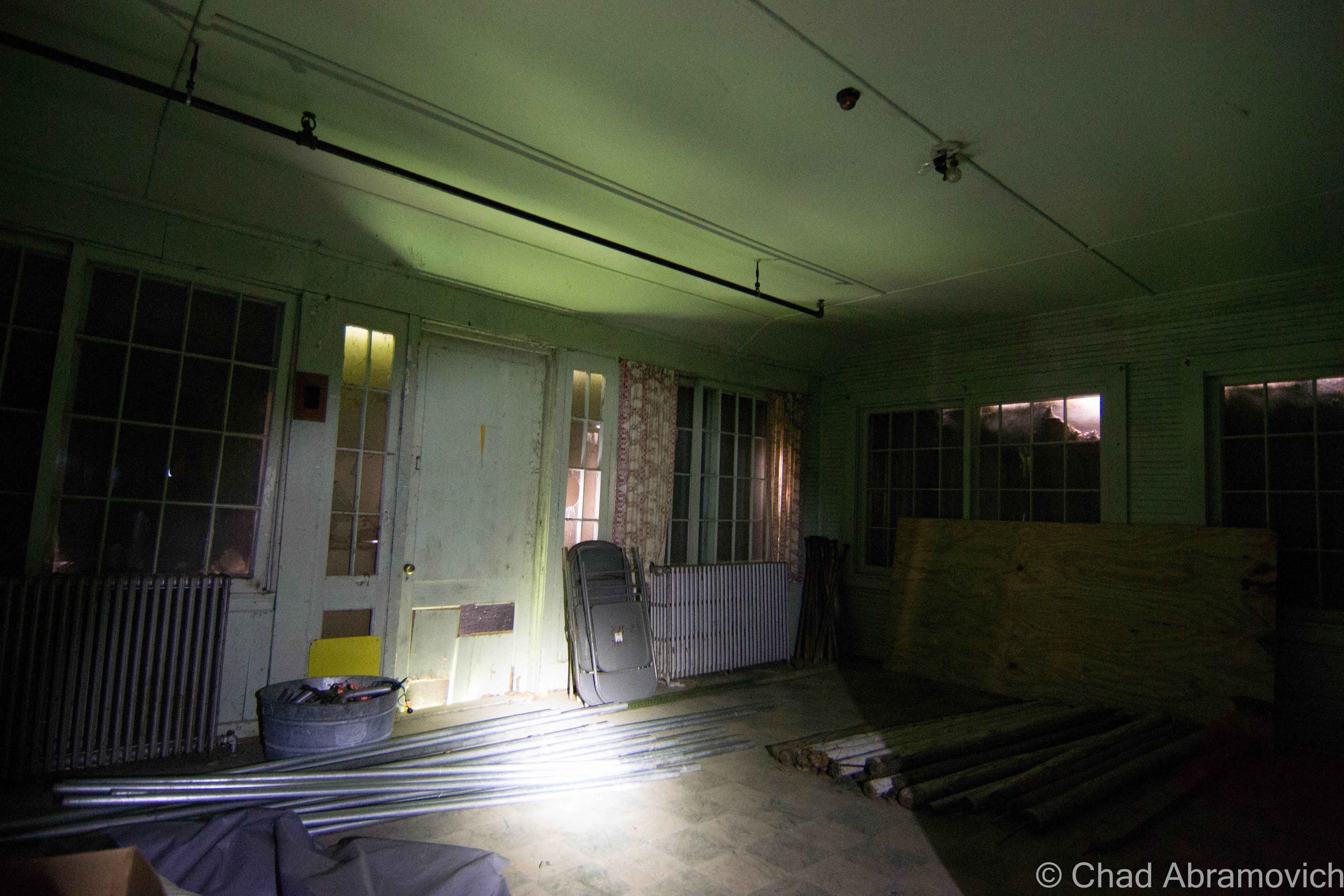
The power plant was a real unexpected treat, and my favorite portion of the grounds that we saw that day.  Unlike the main building, the generating station had most of its goodies still contained within drifting dust creating its own little universes in envelopes of light that scattered around the brawny boilers that were from an era that built things to last, and scores of gauges. Floors with hummocks of lead paint flakes and dirt. Desks and chests of drawers were still cluttered with miscellany and workshop brick-a-brack. This was definitely a pleasure to point my camera at.

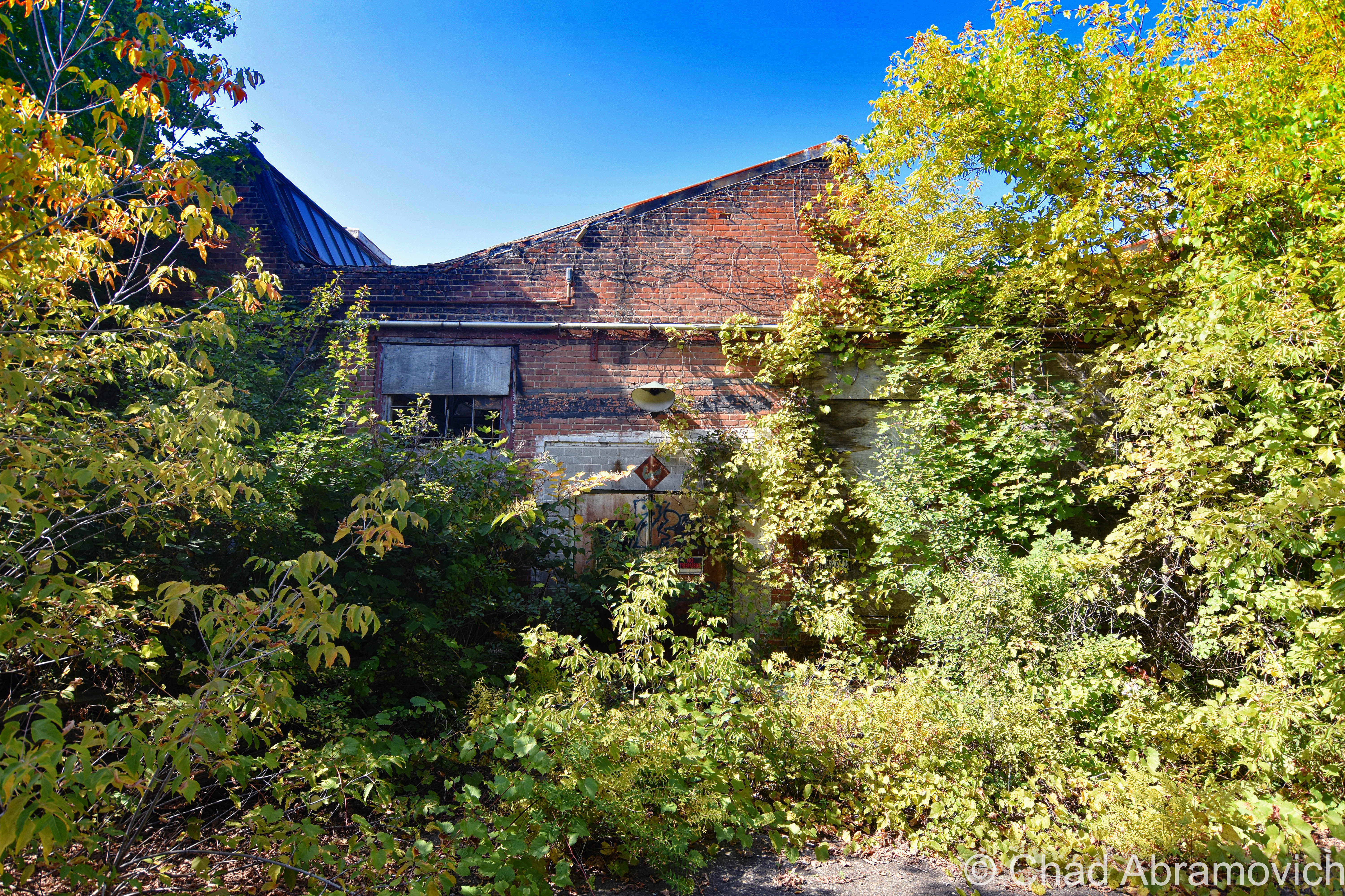
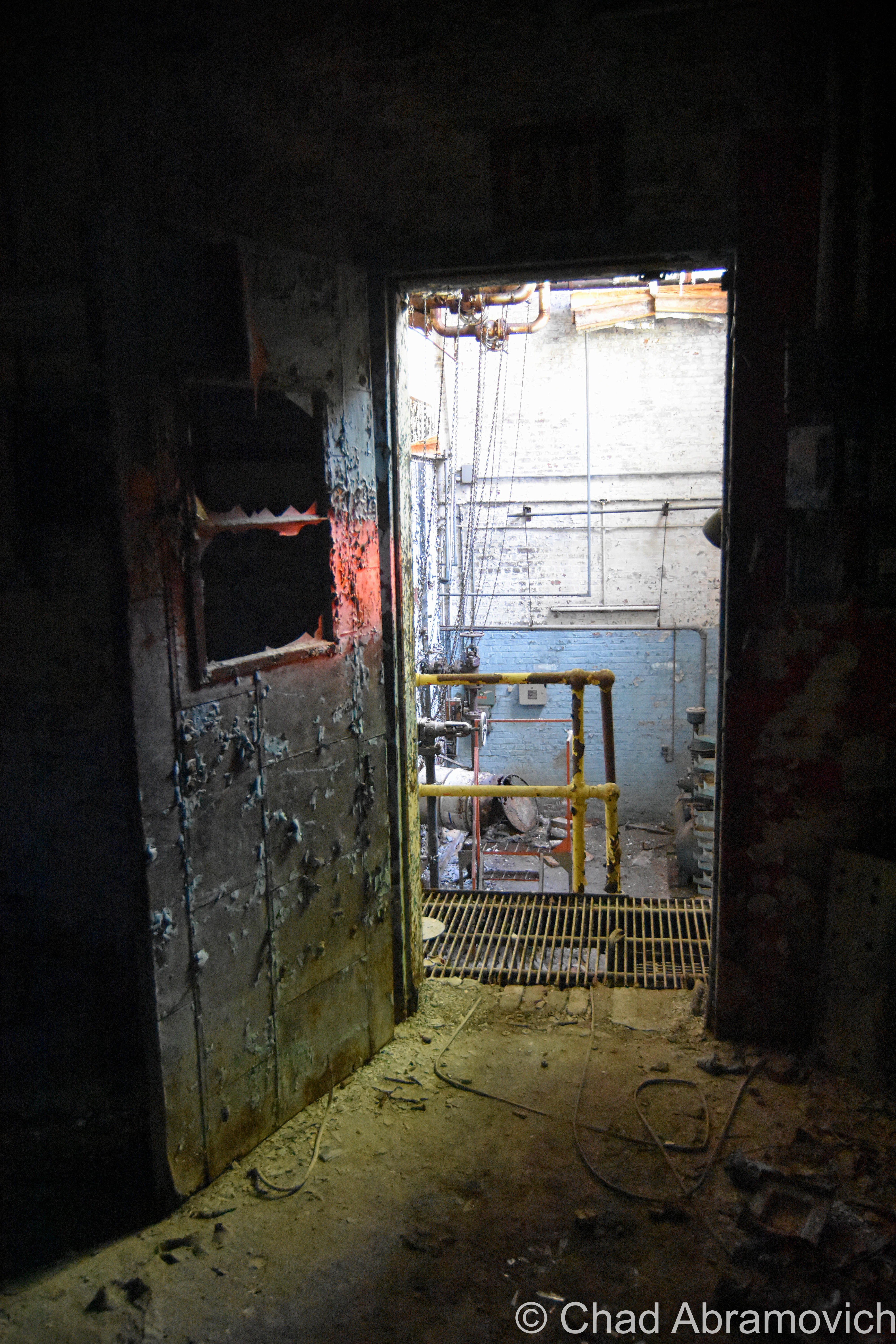
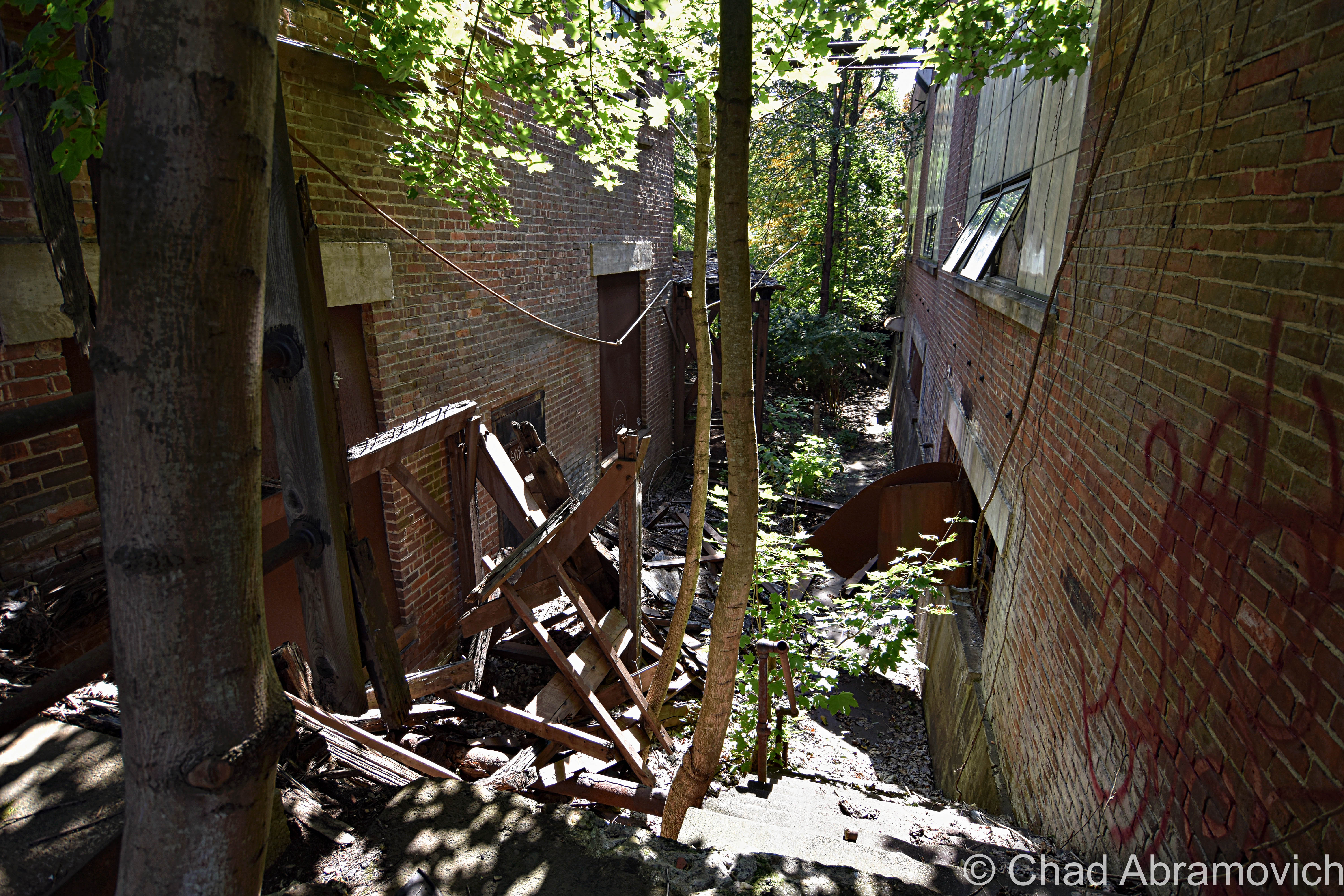
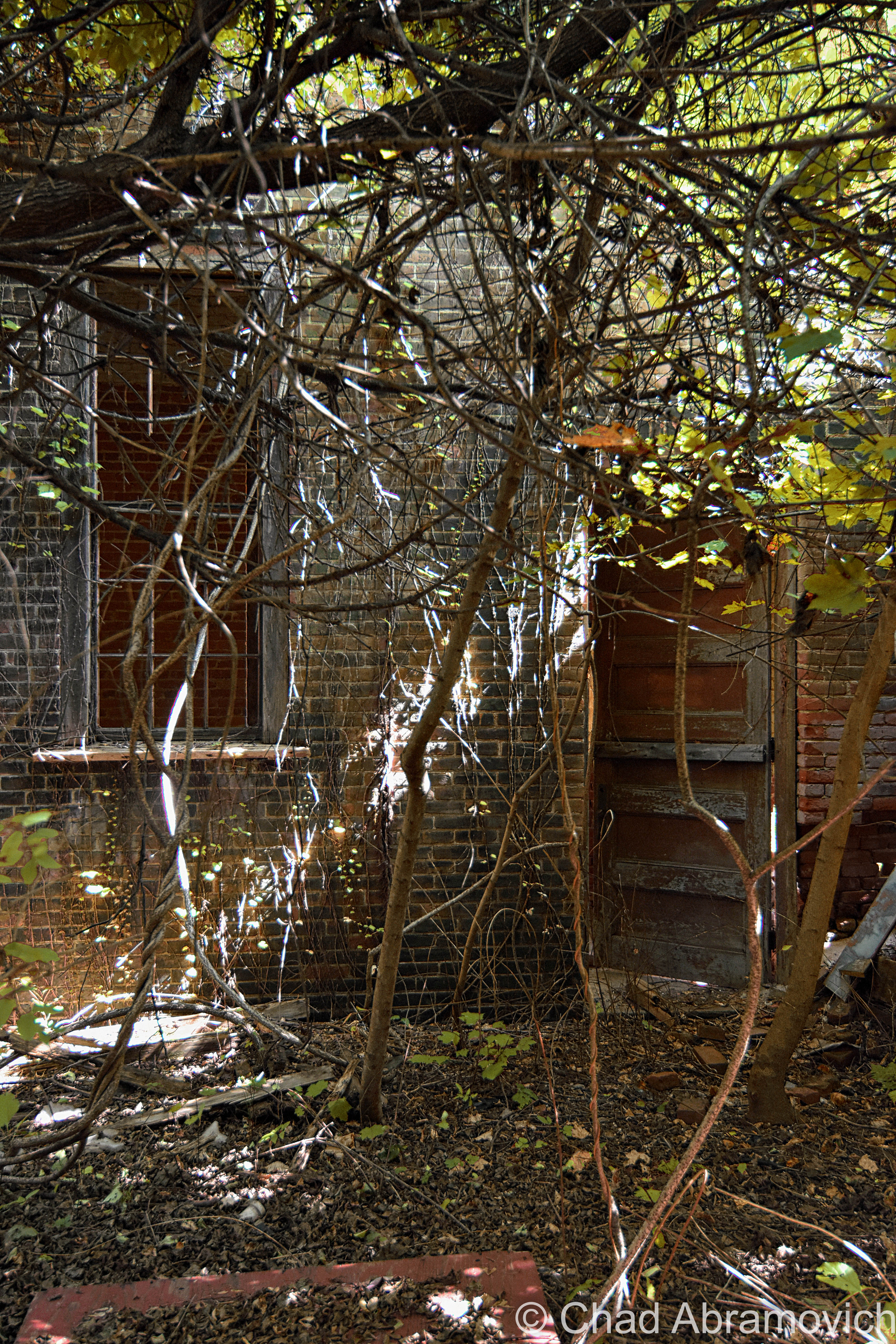
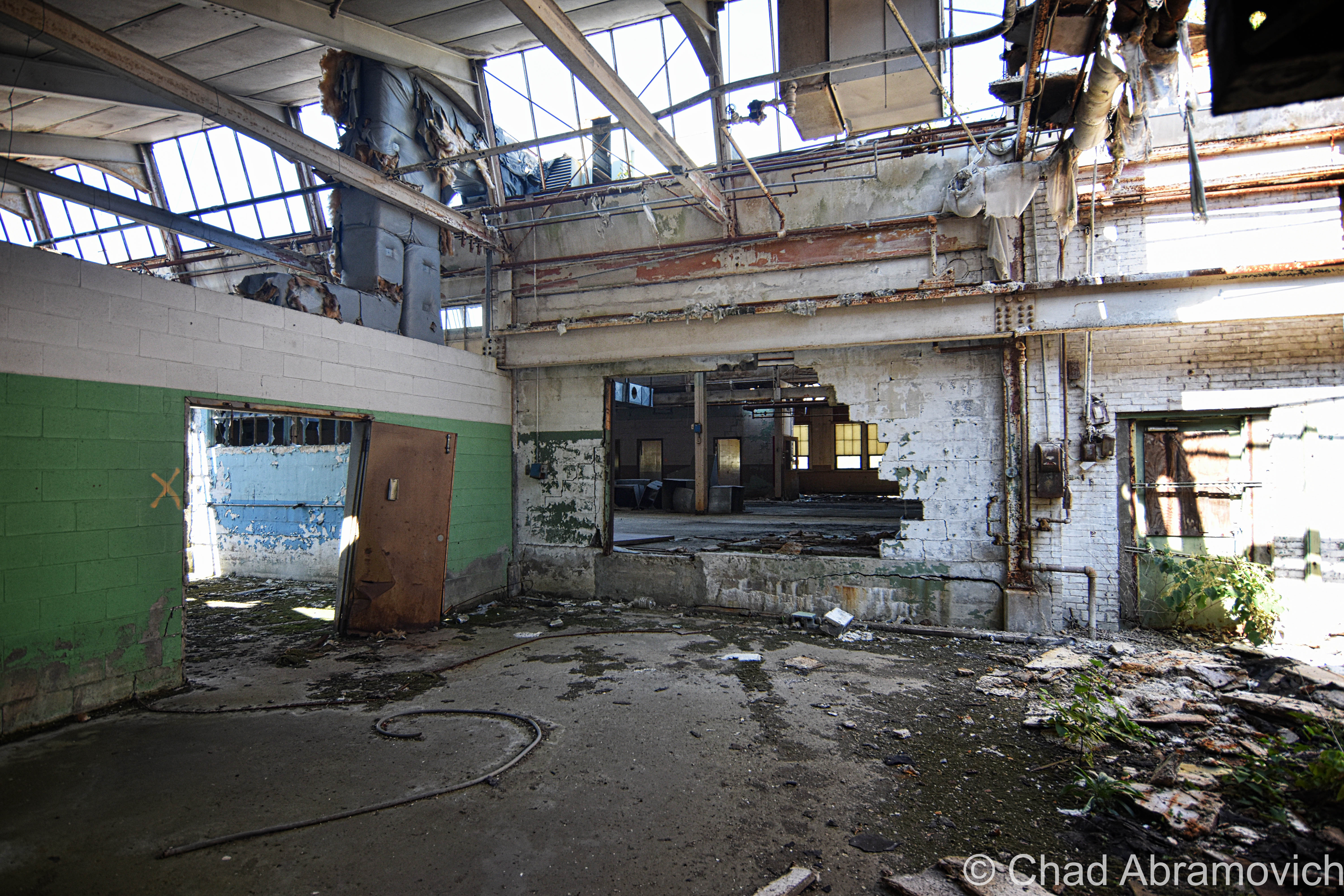
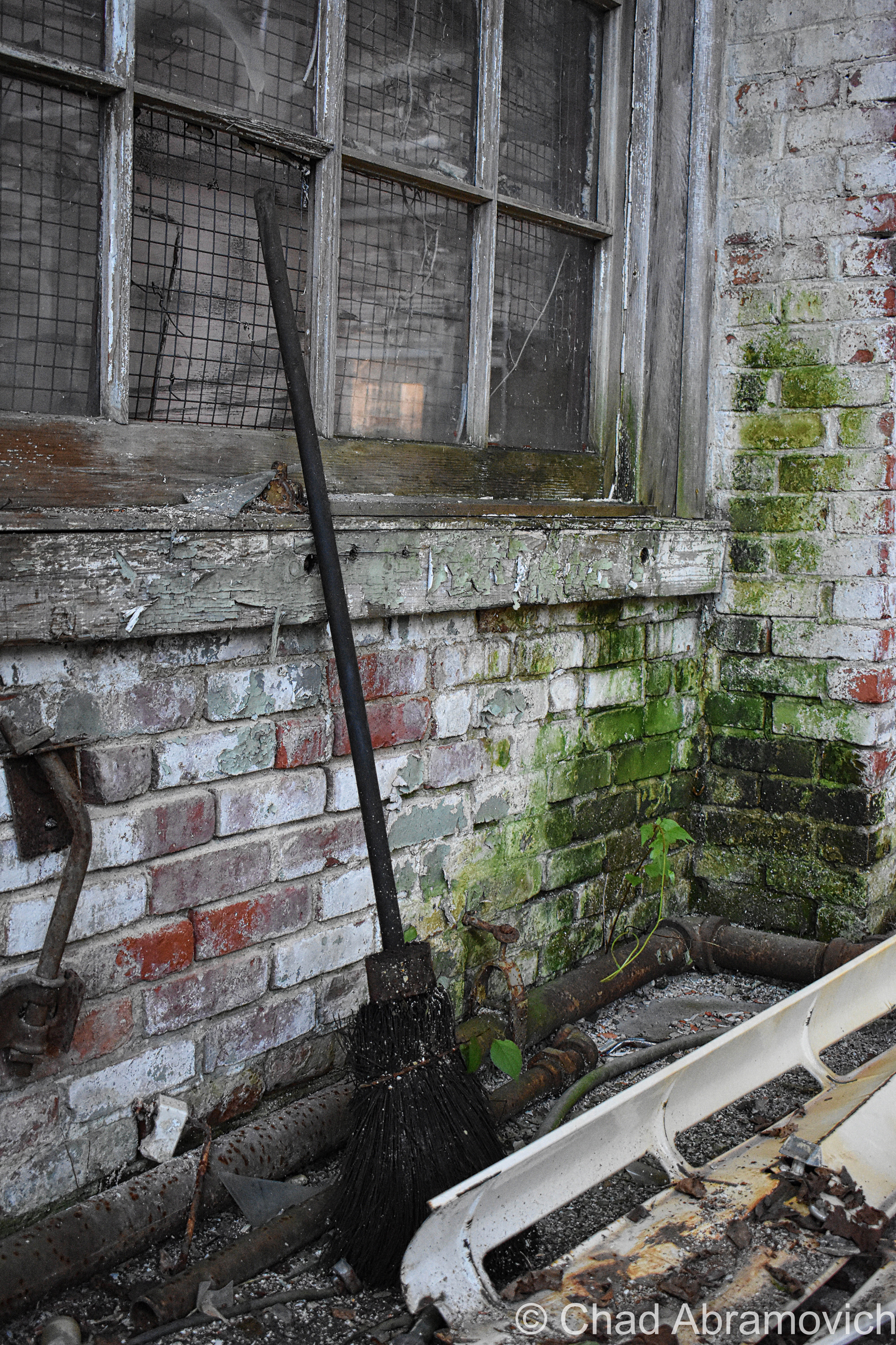
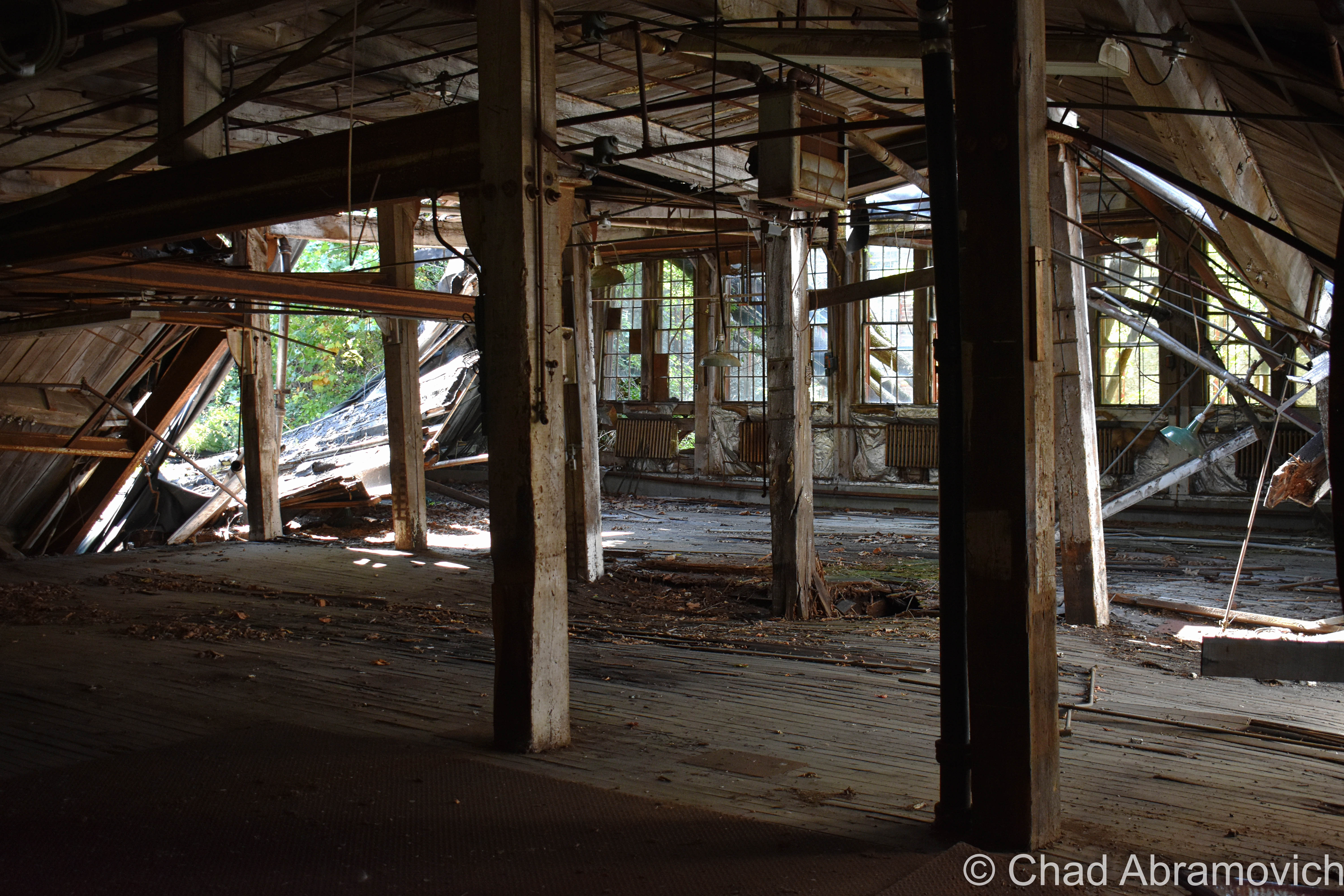
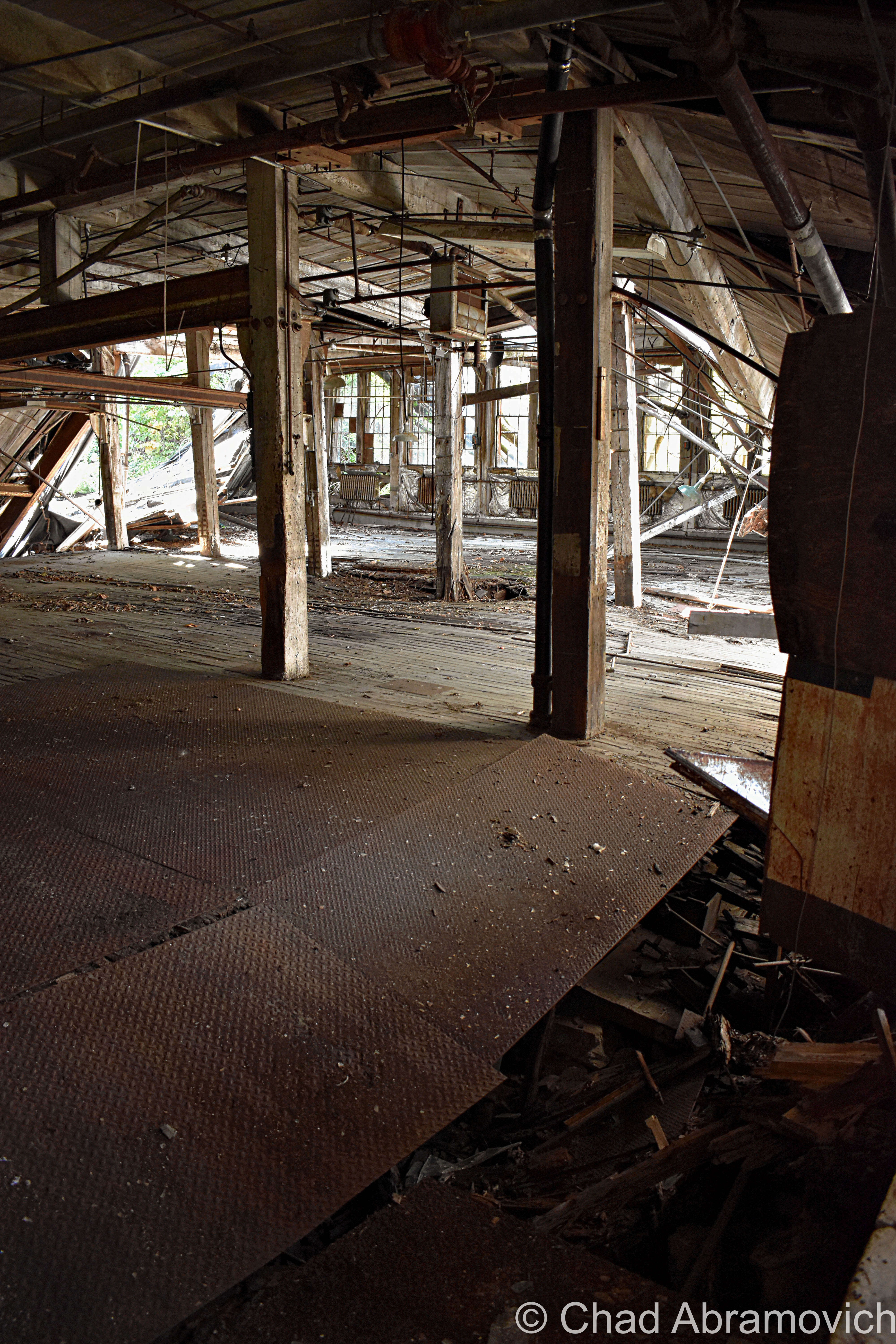
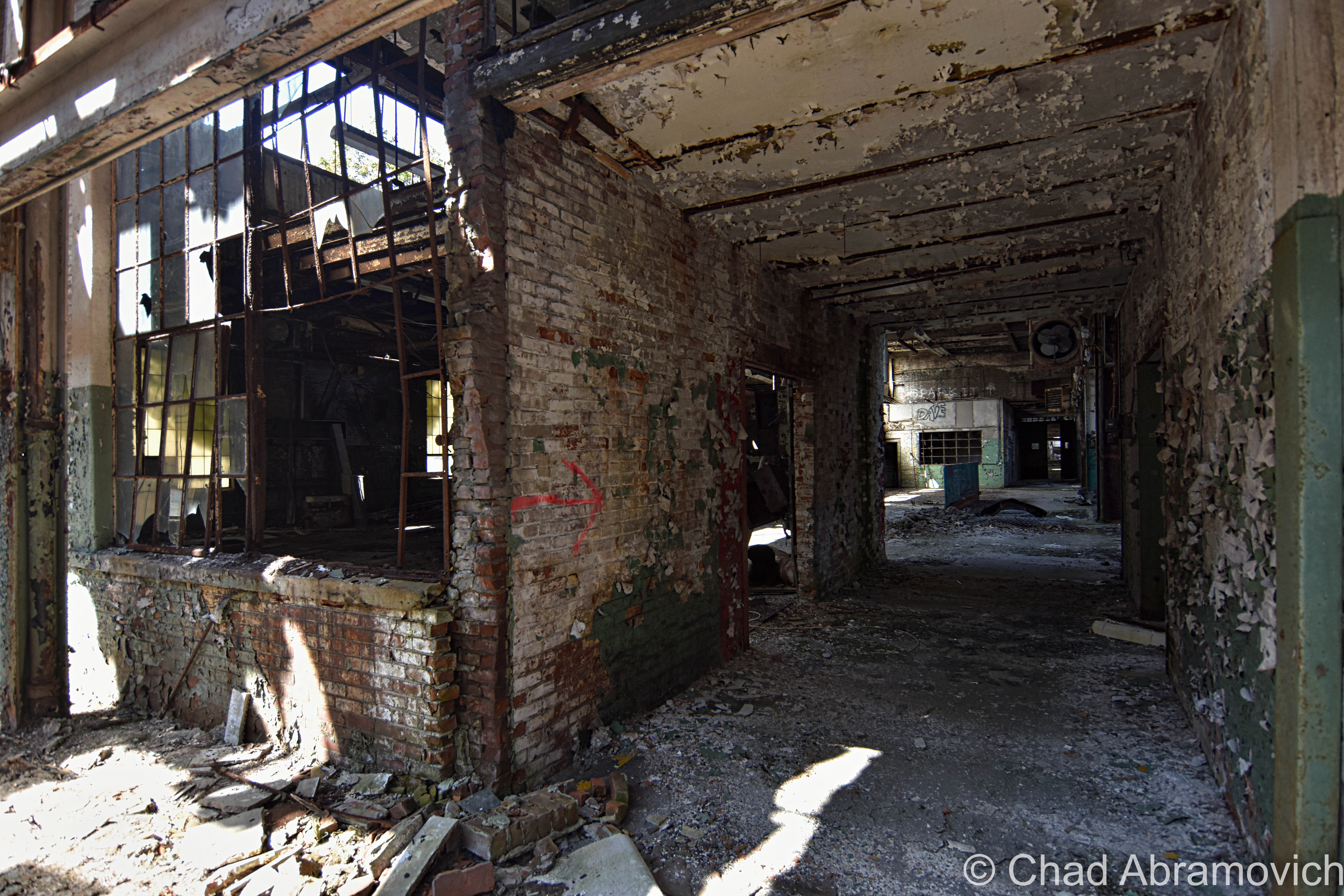
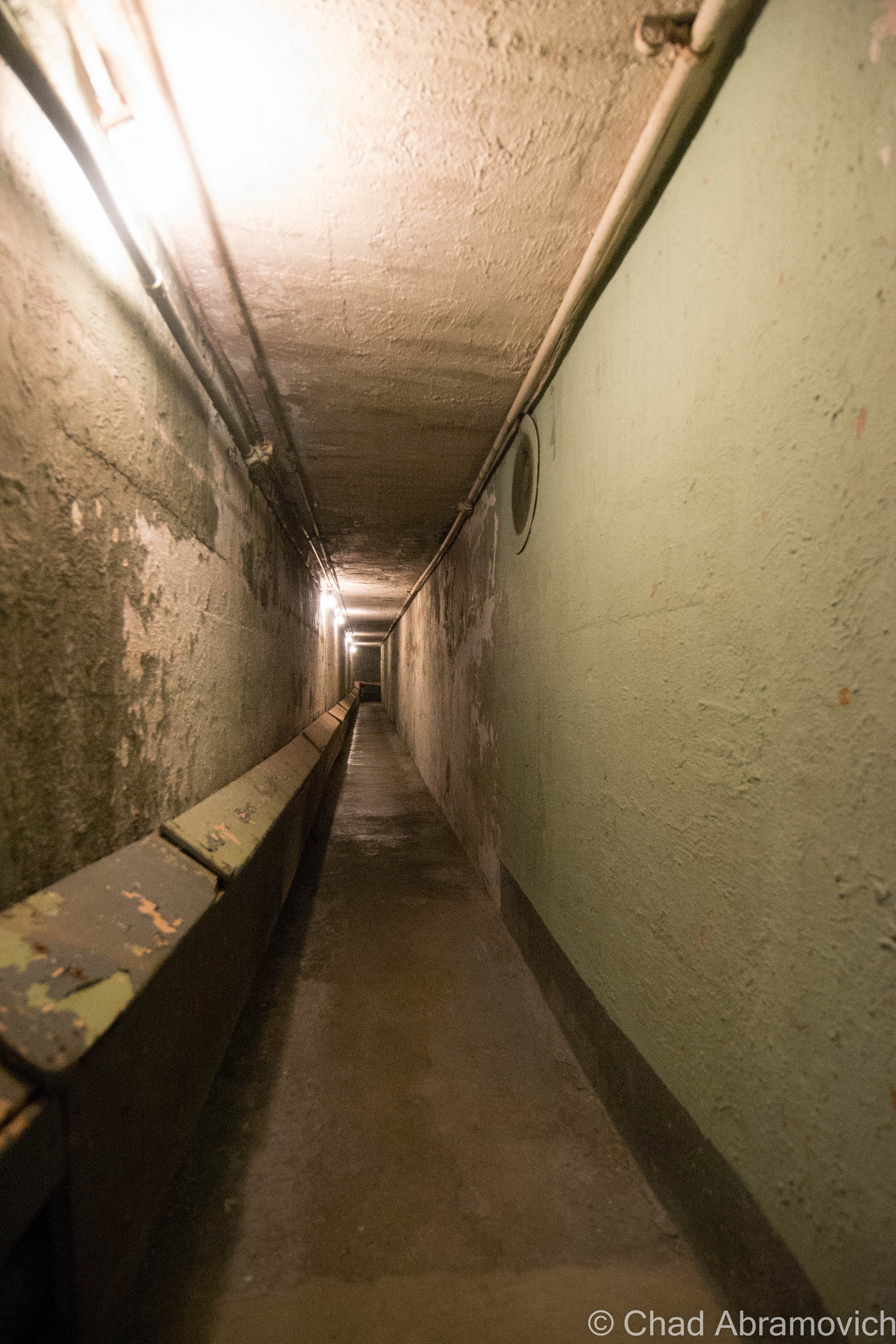
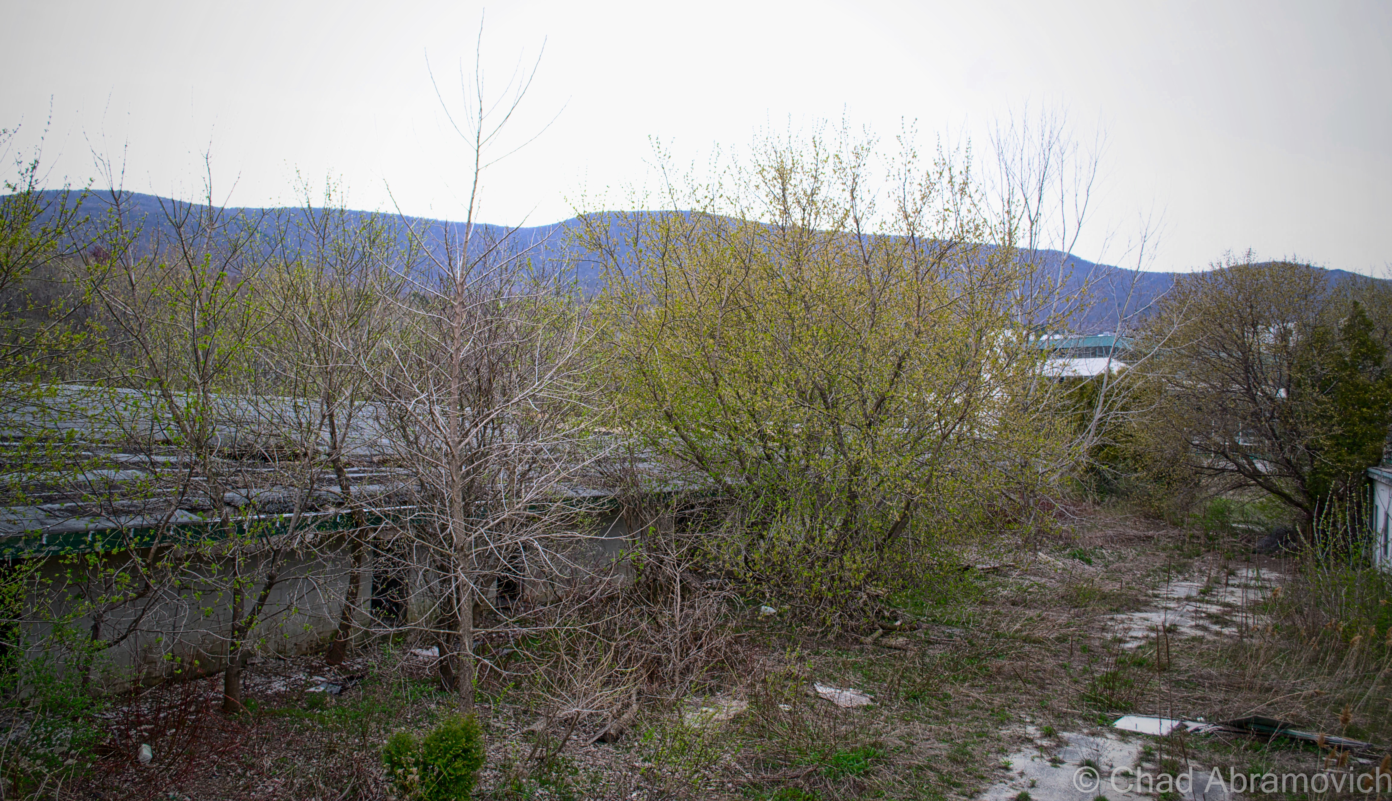
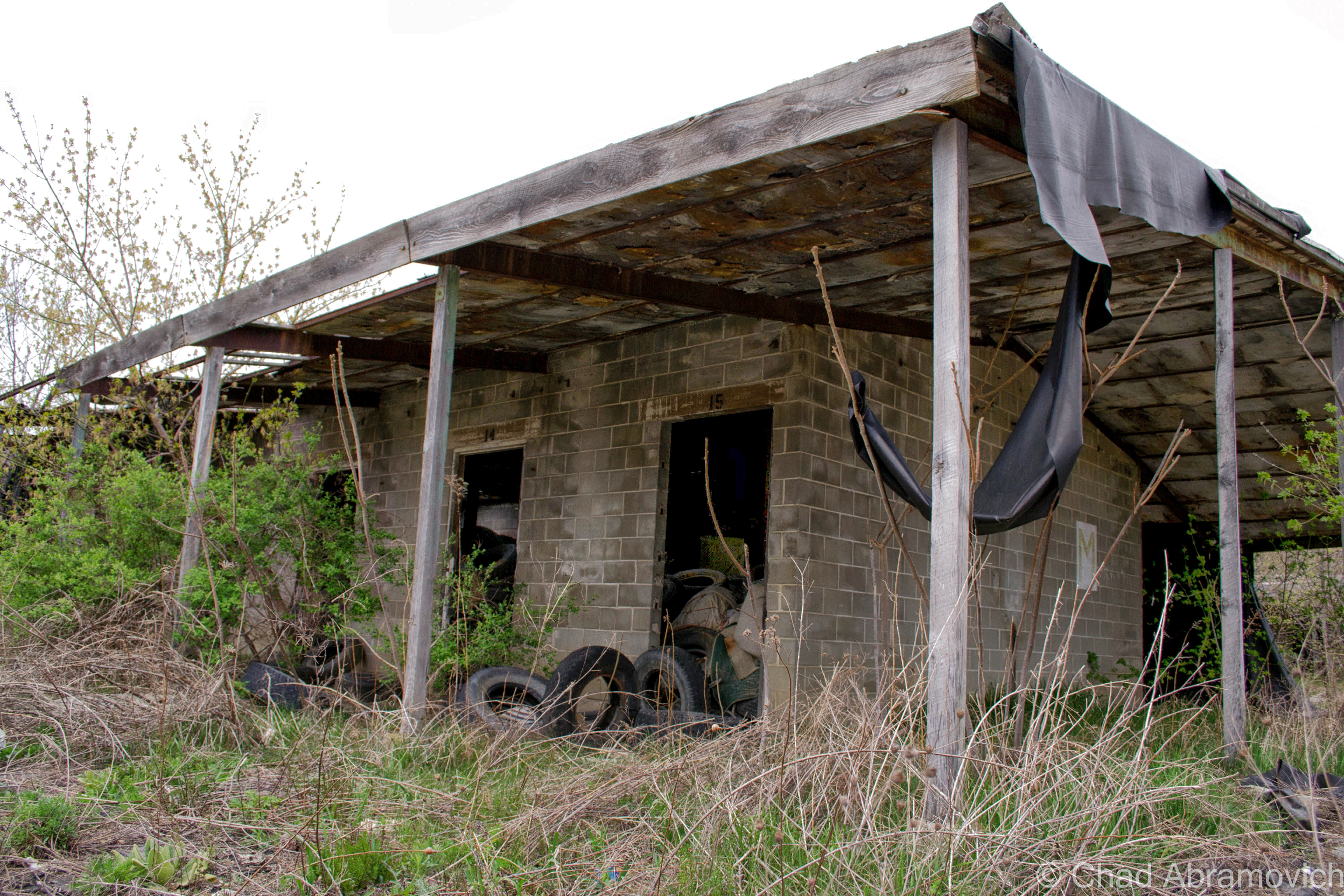
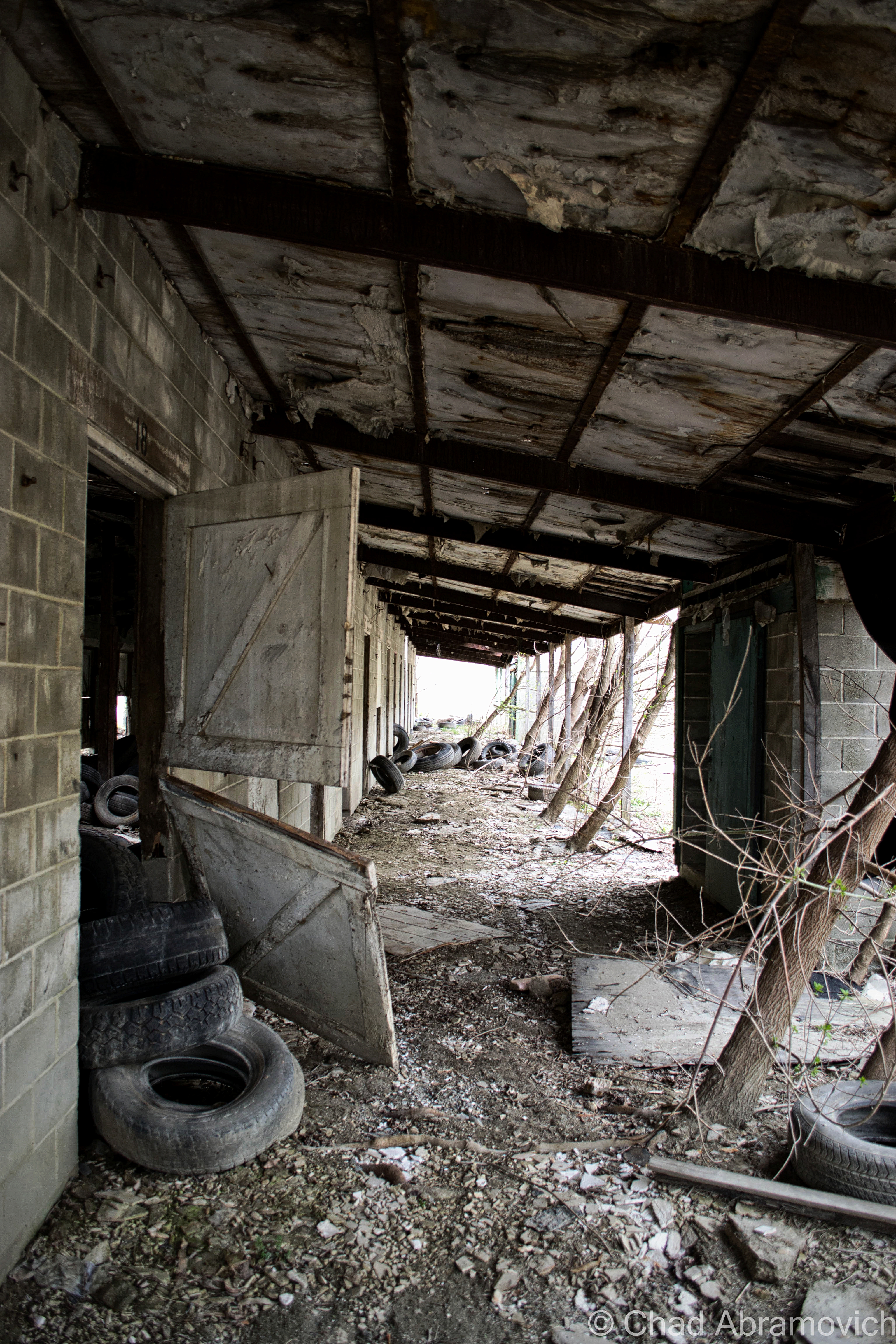
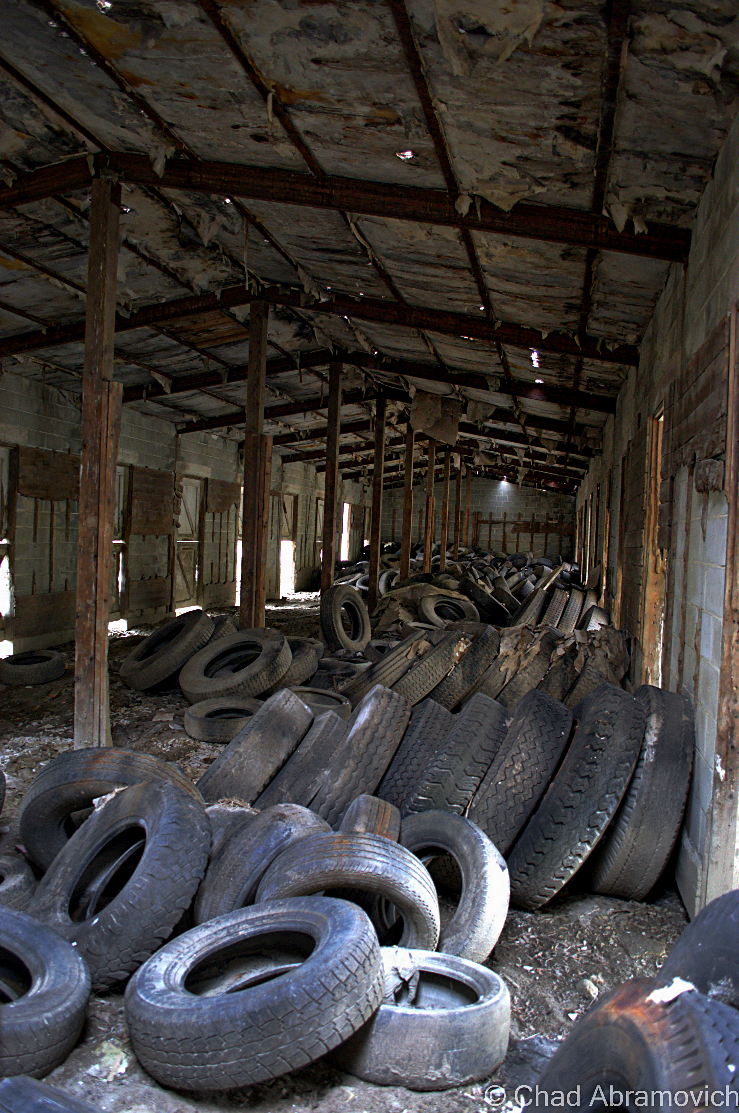
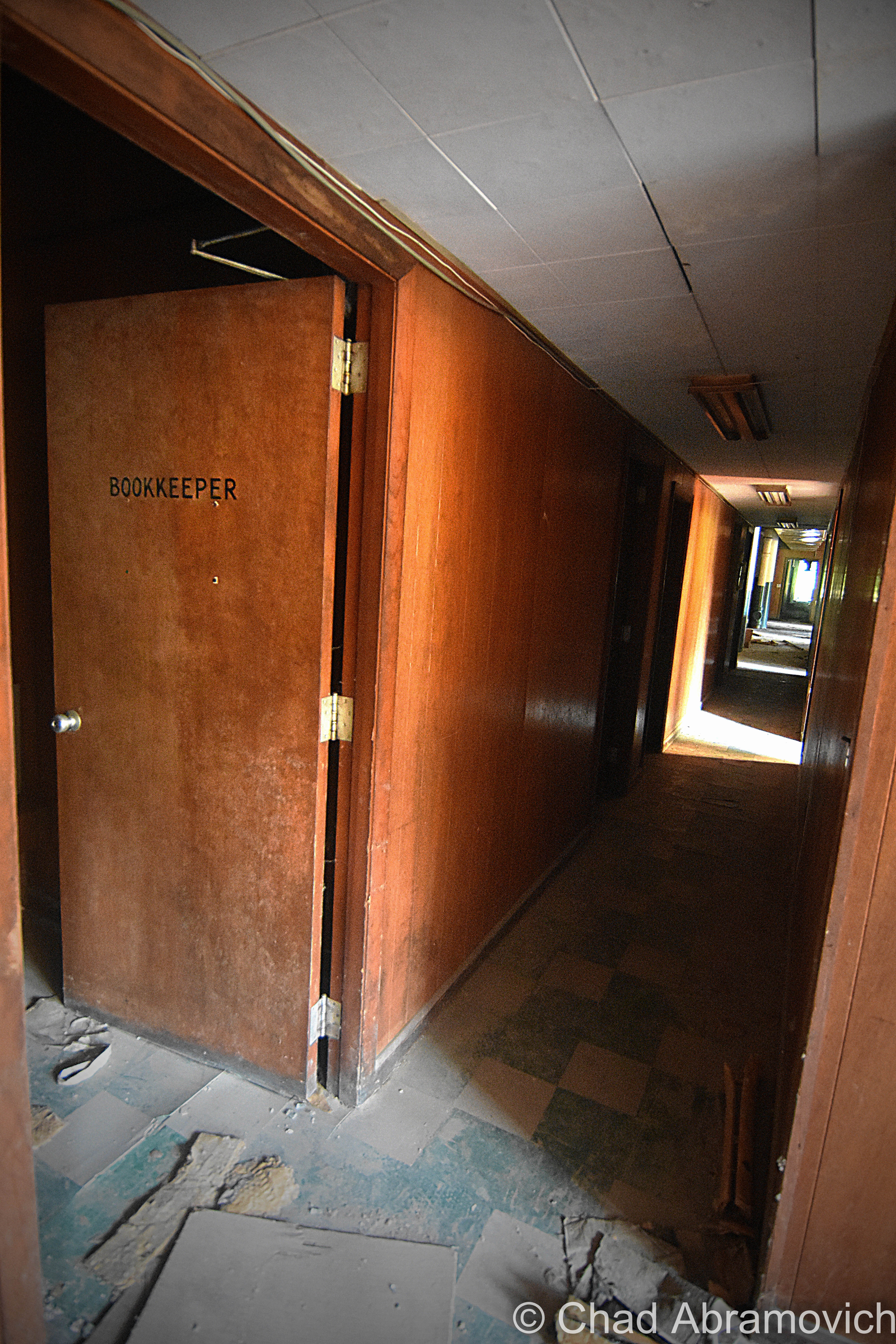
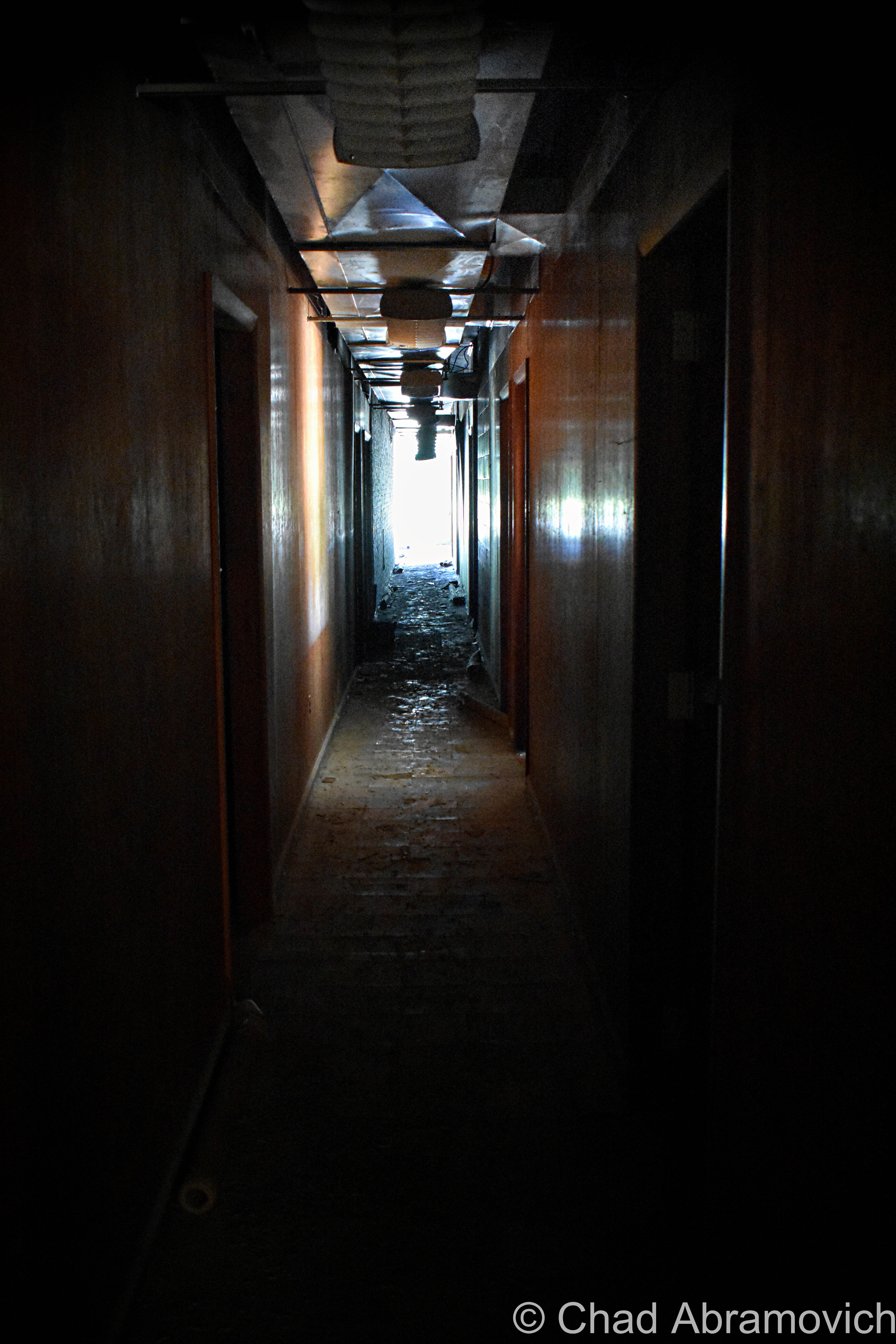
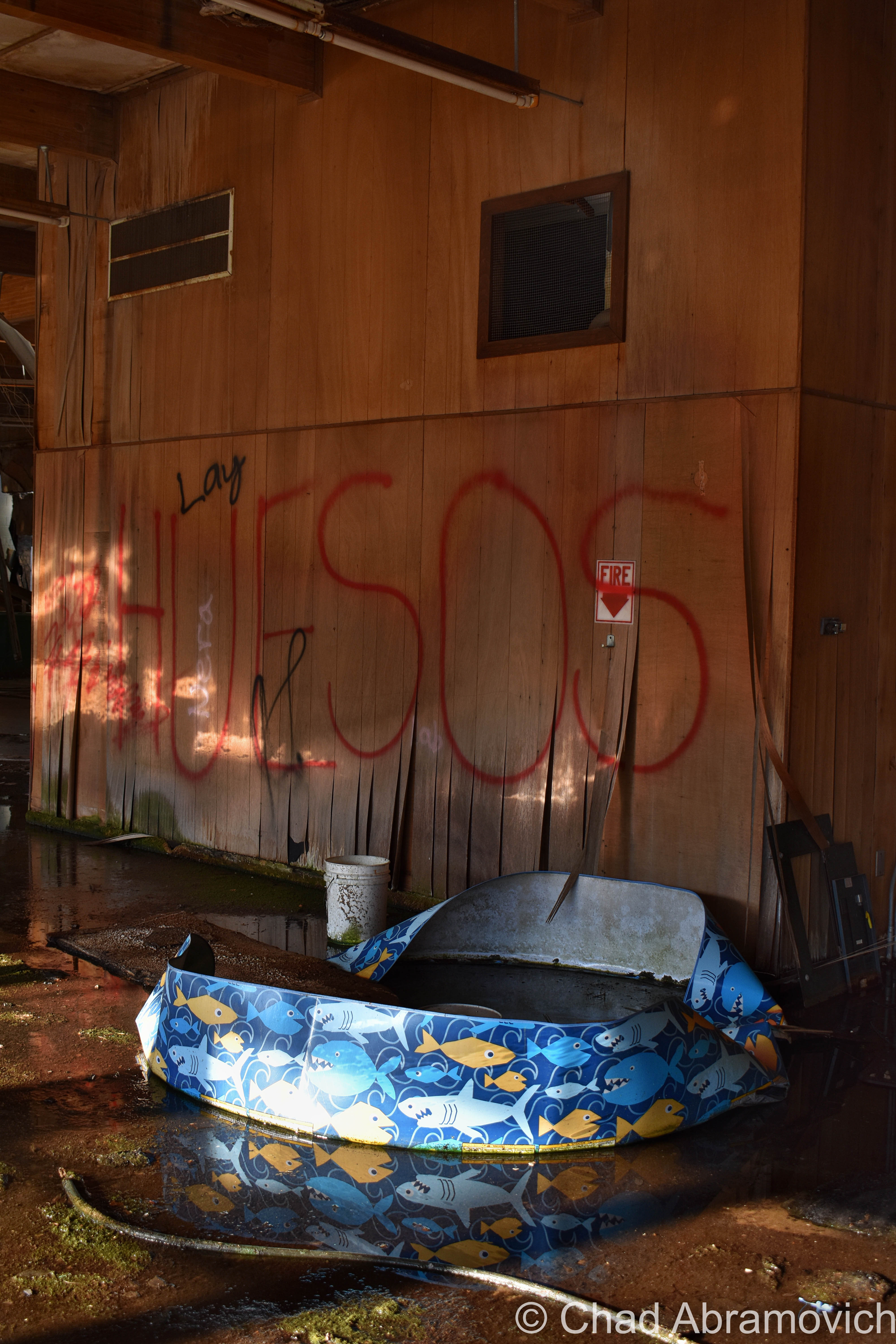
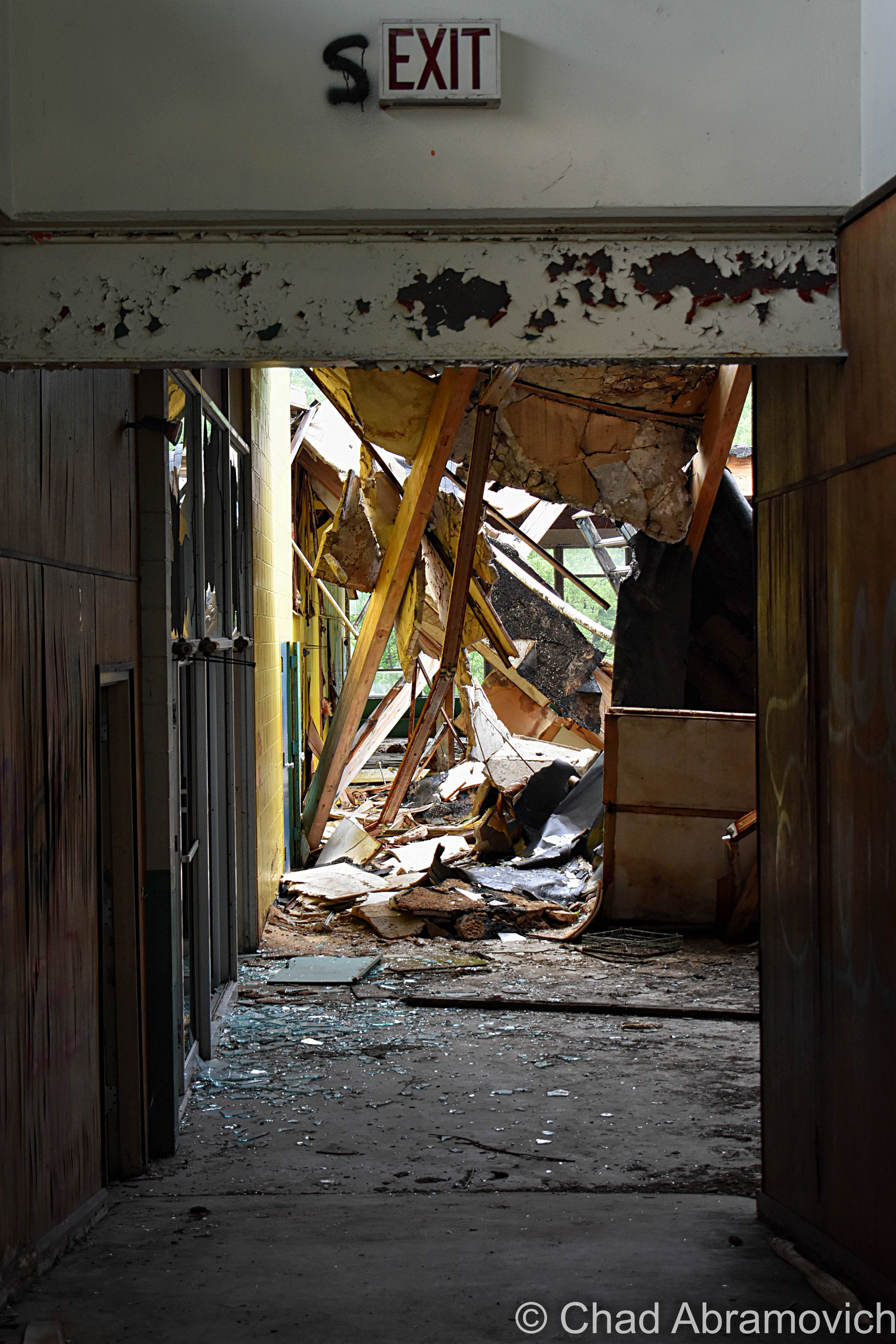
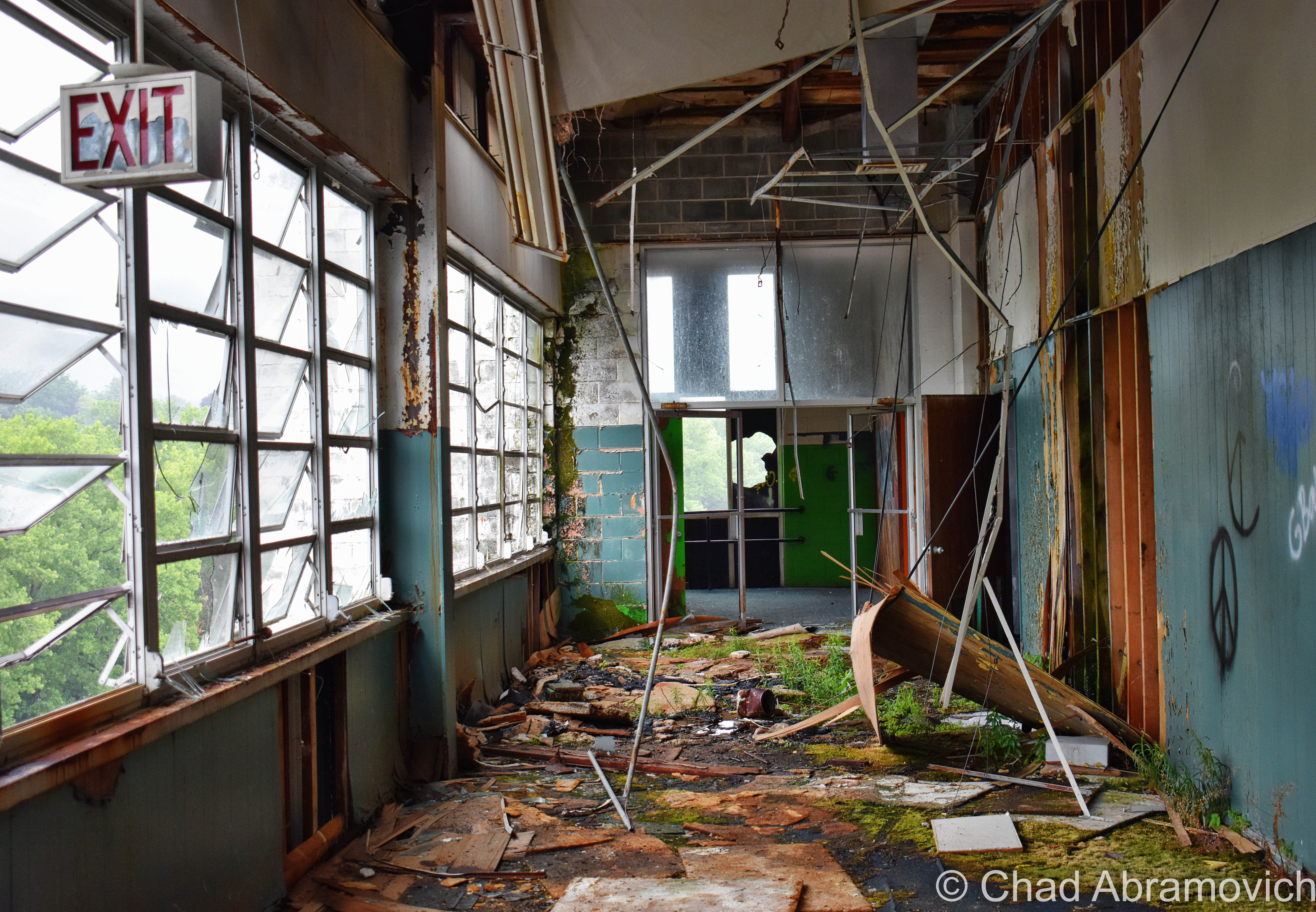
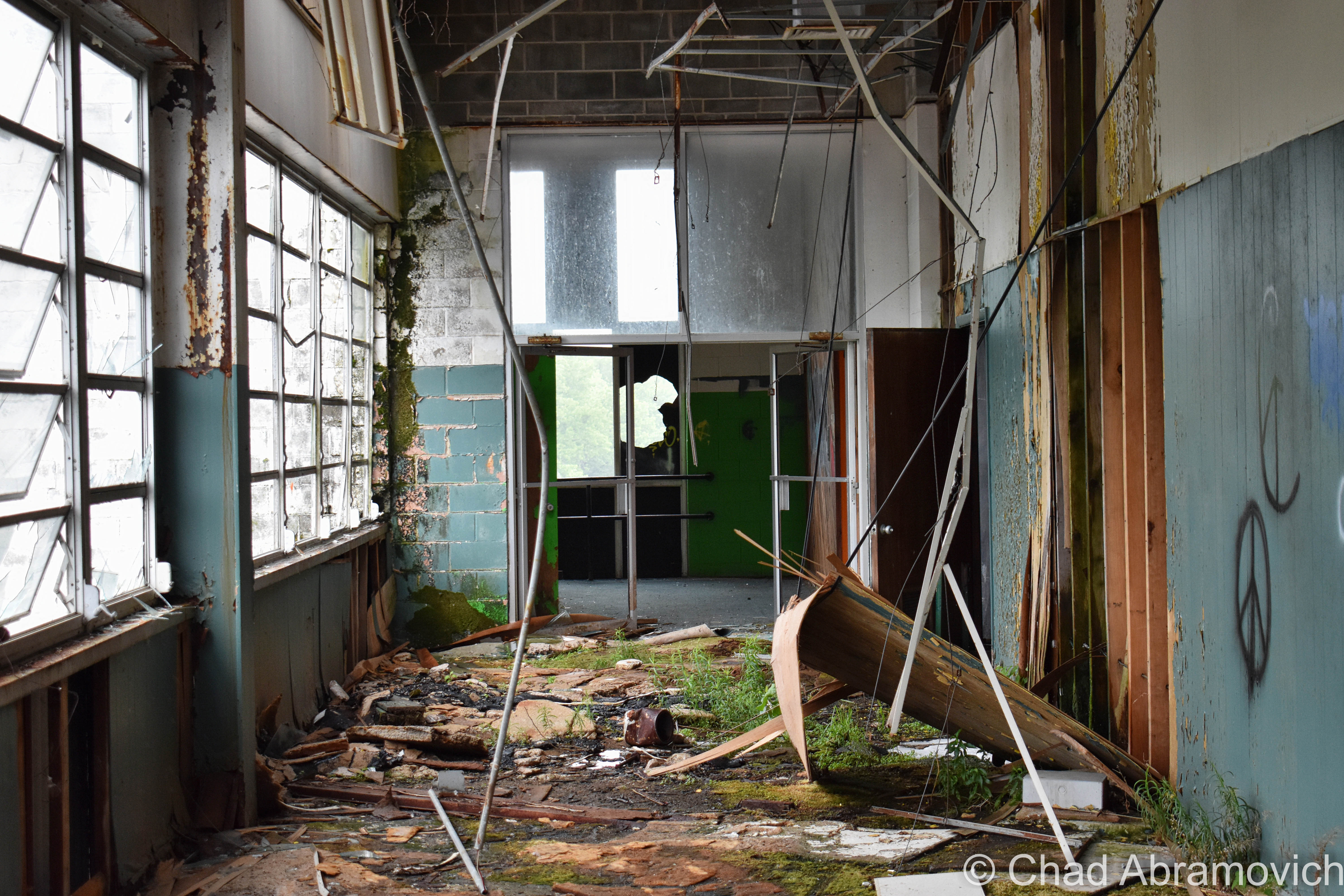
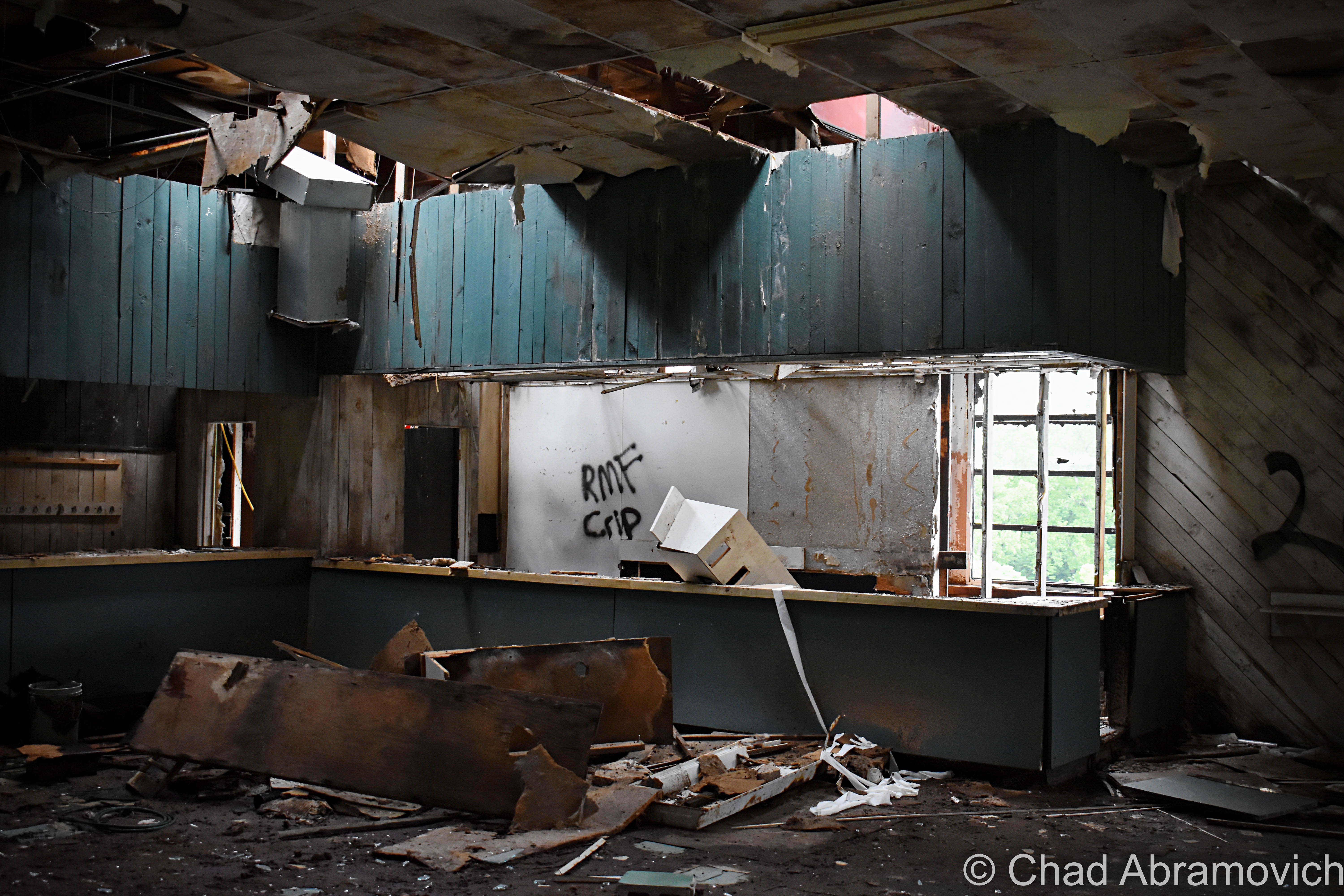
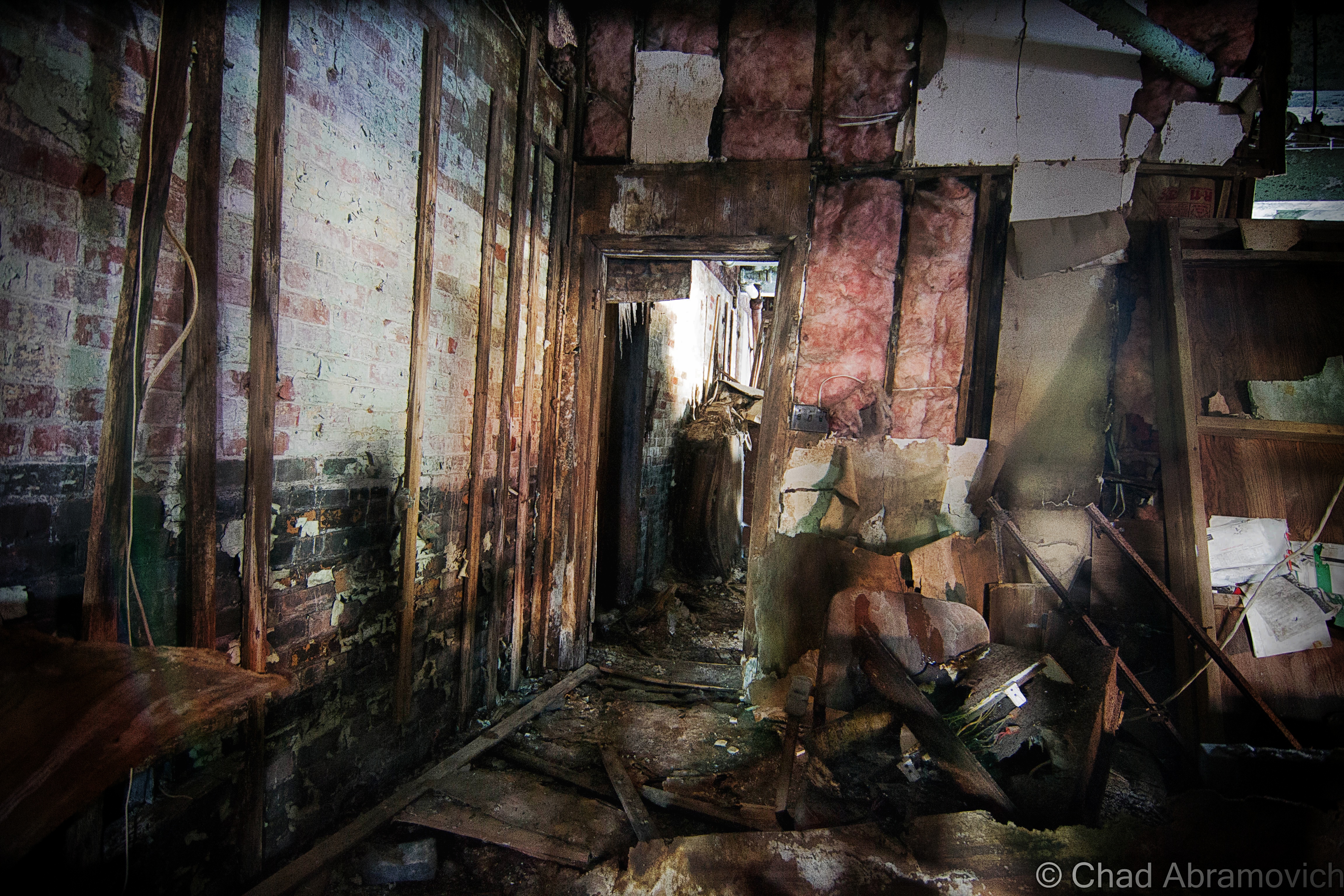
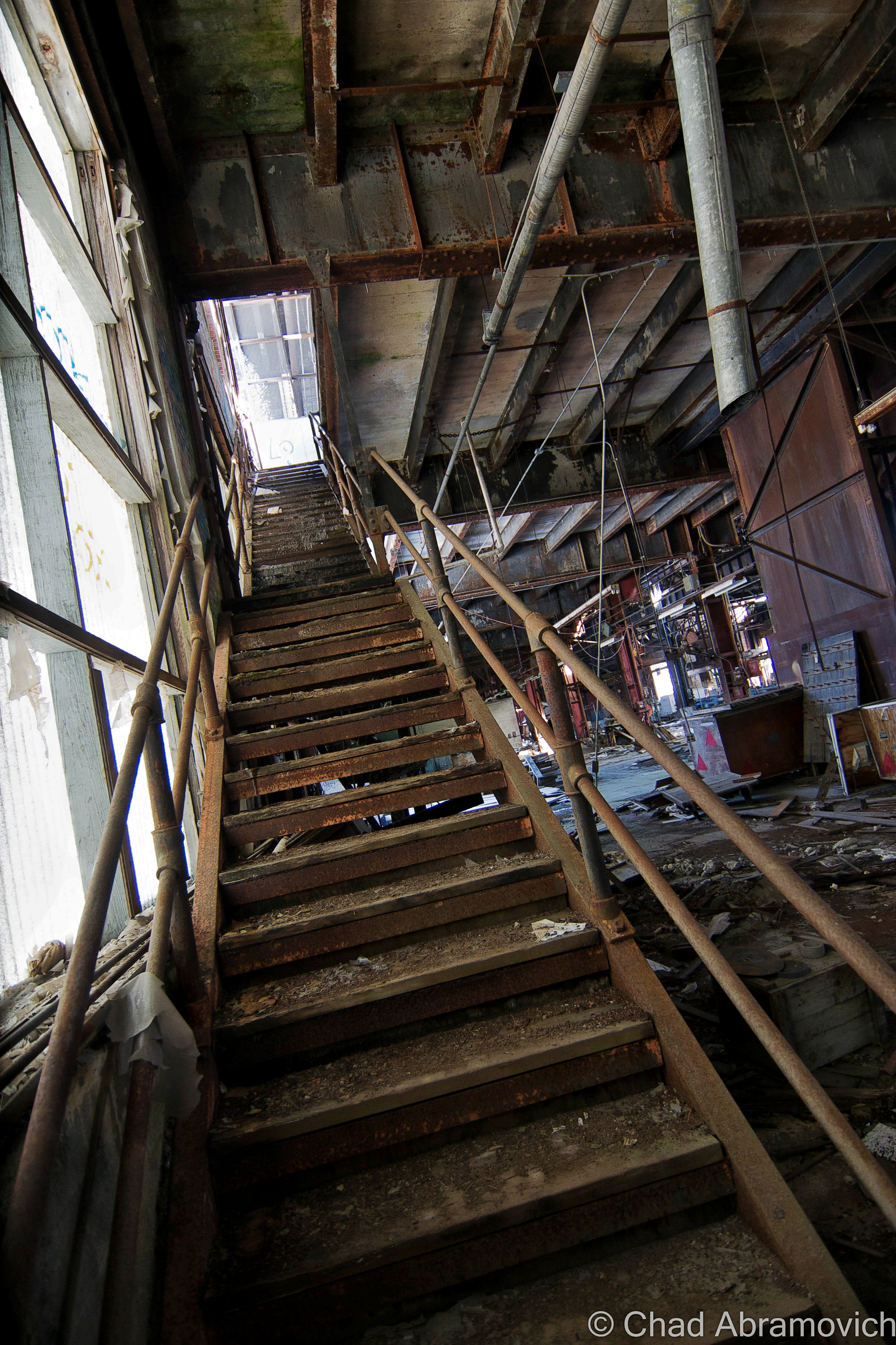
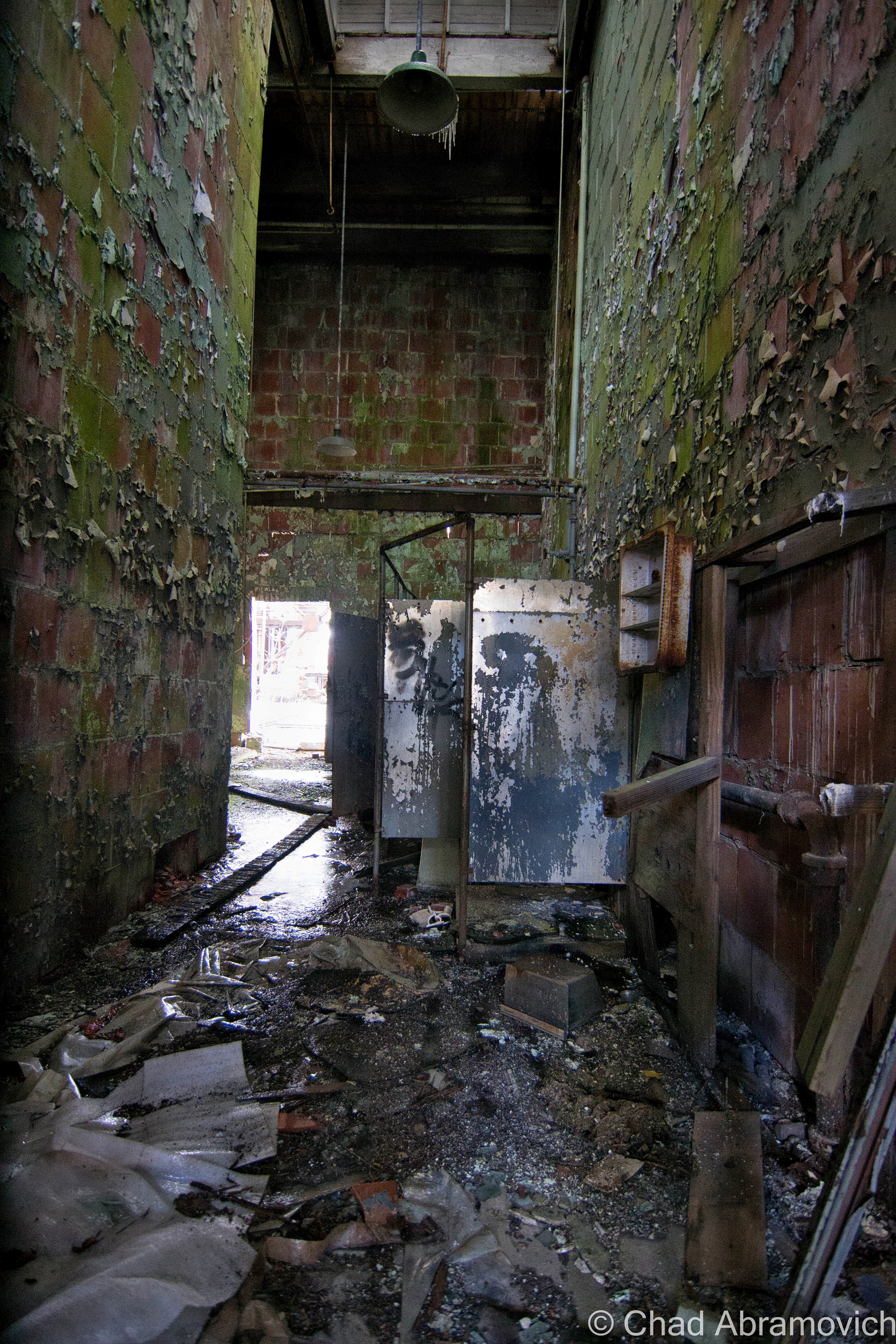
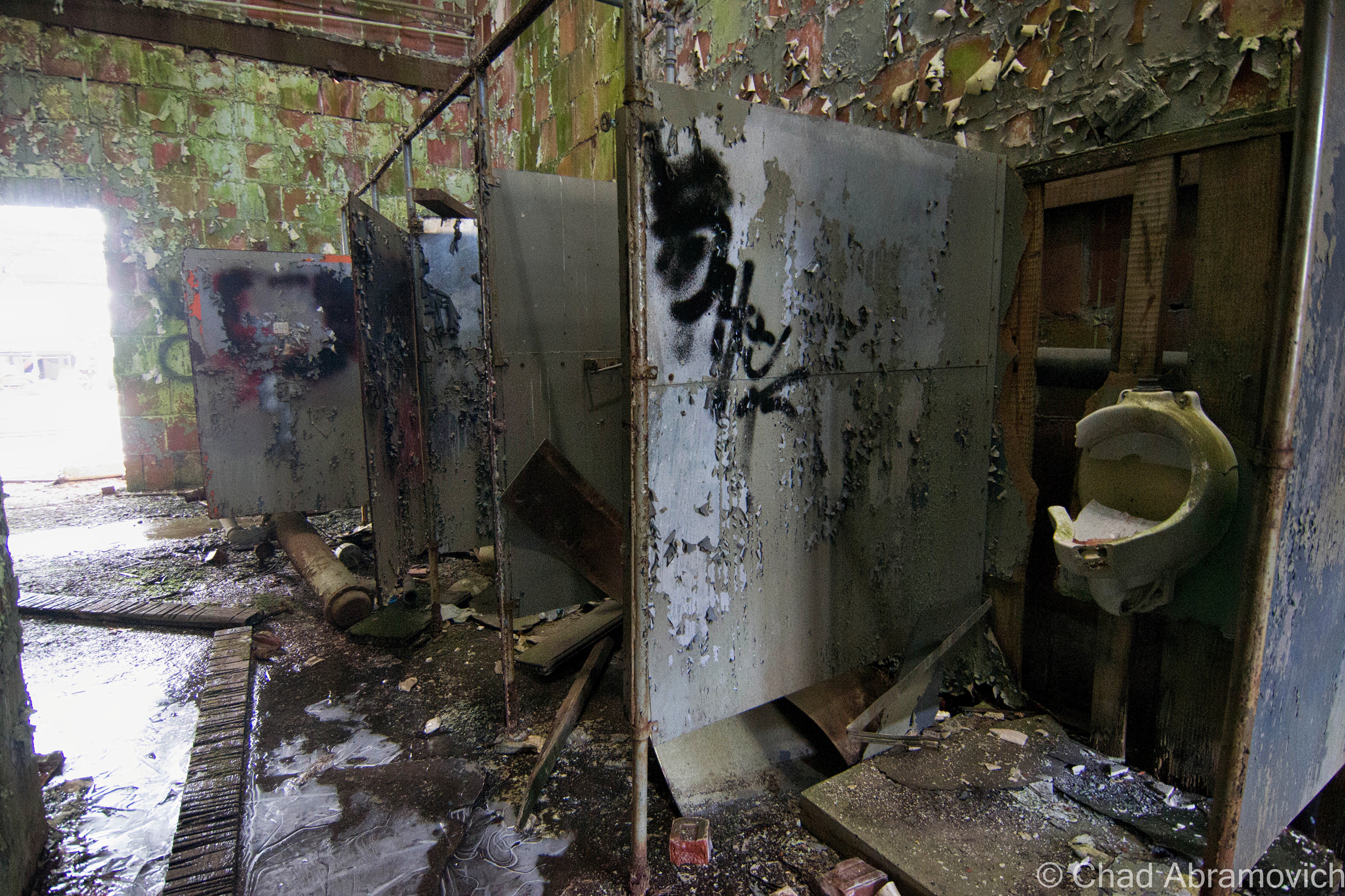
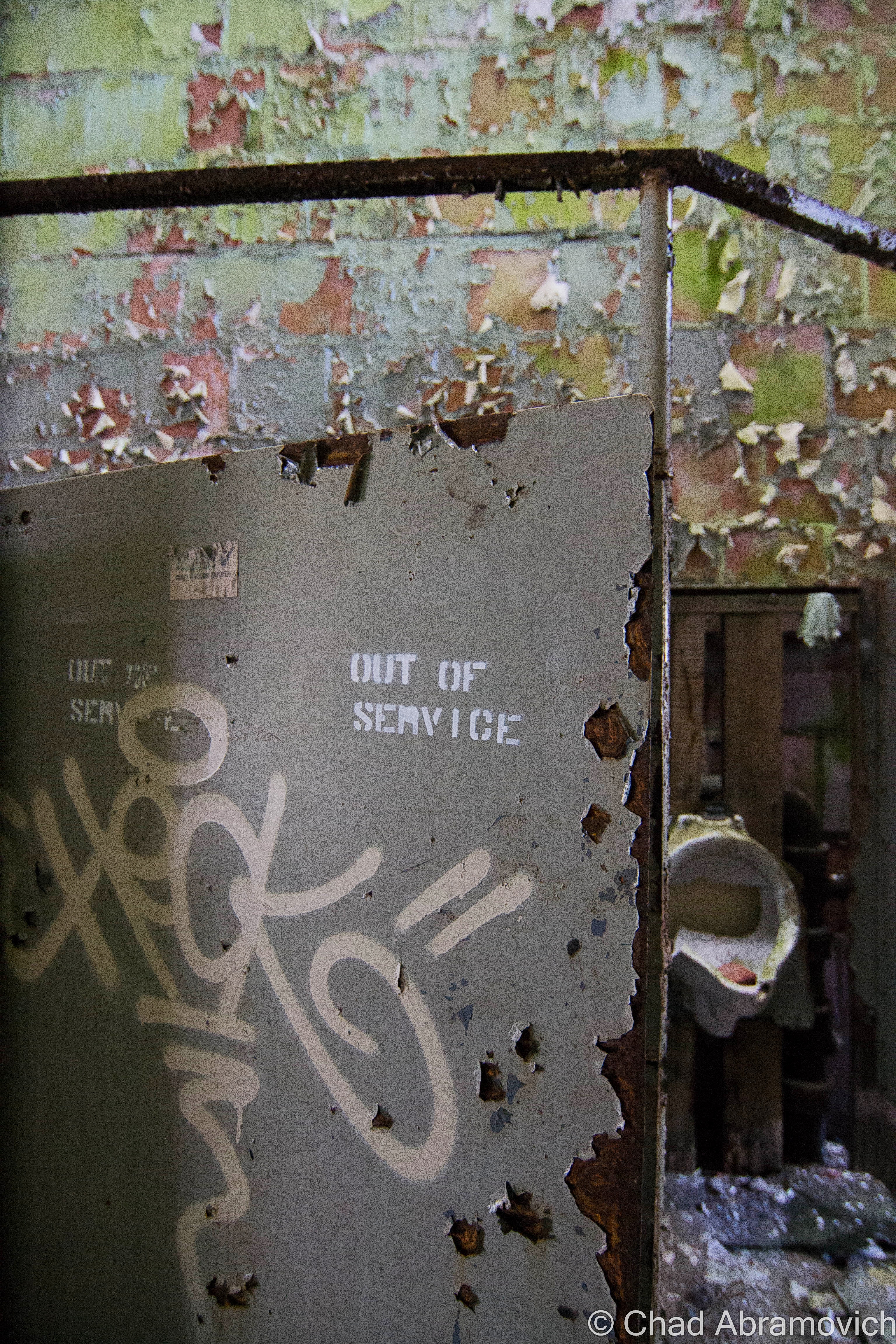
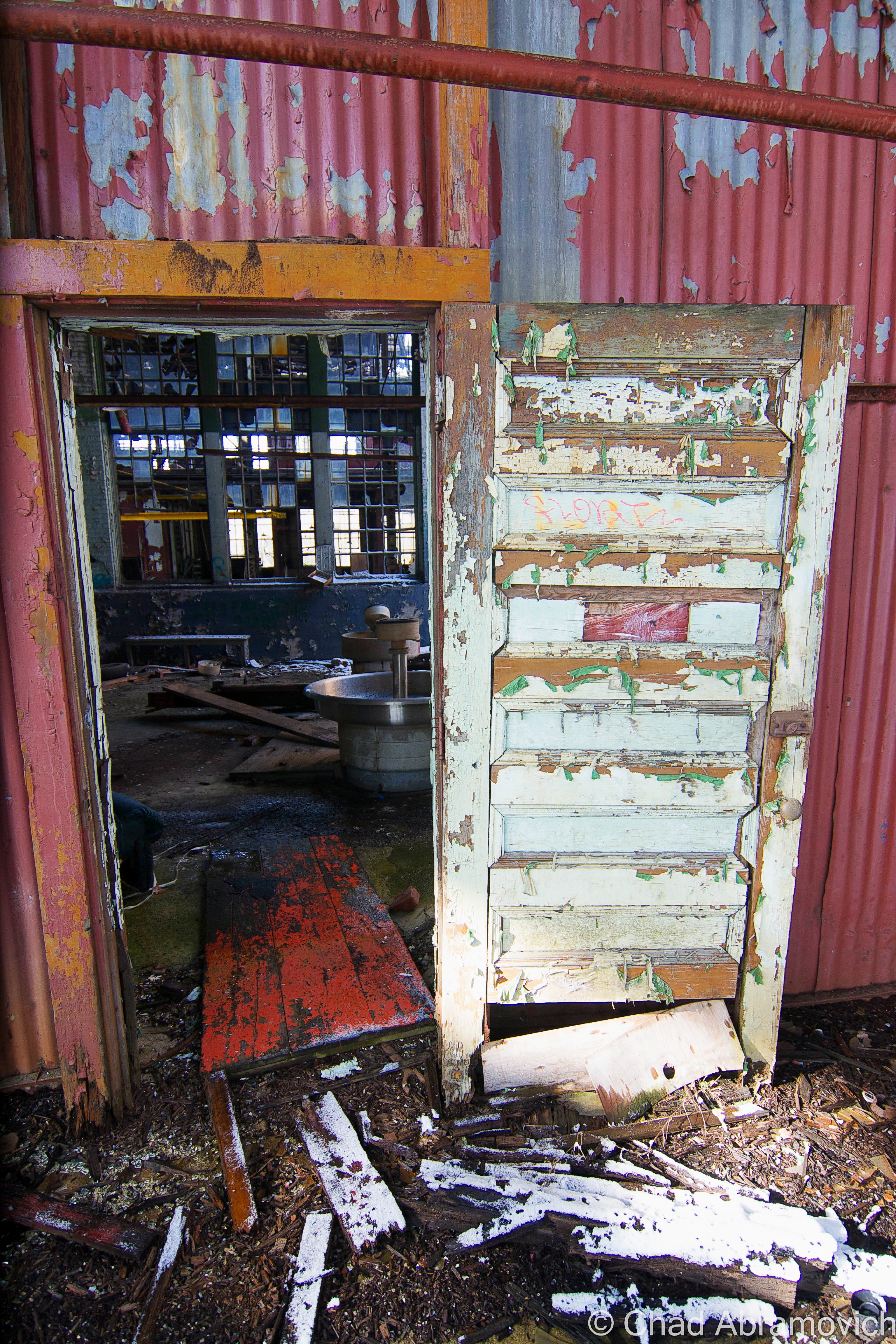
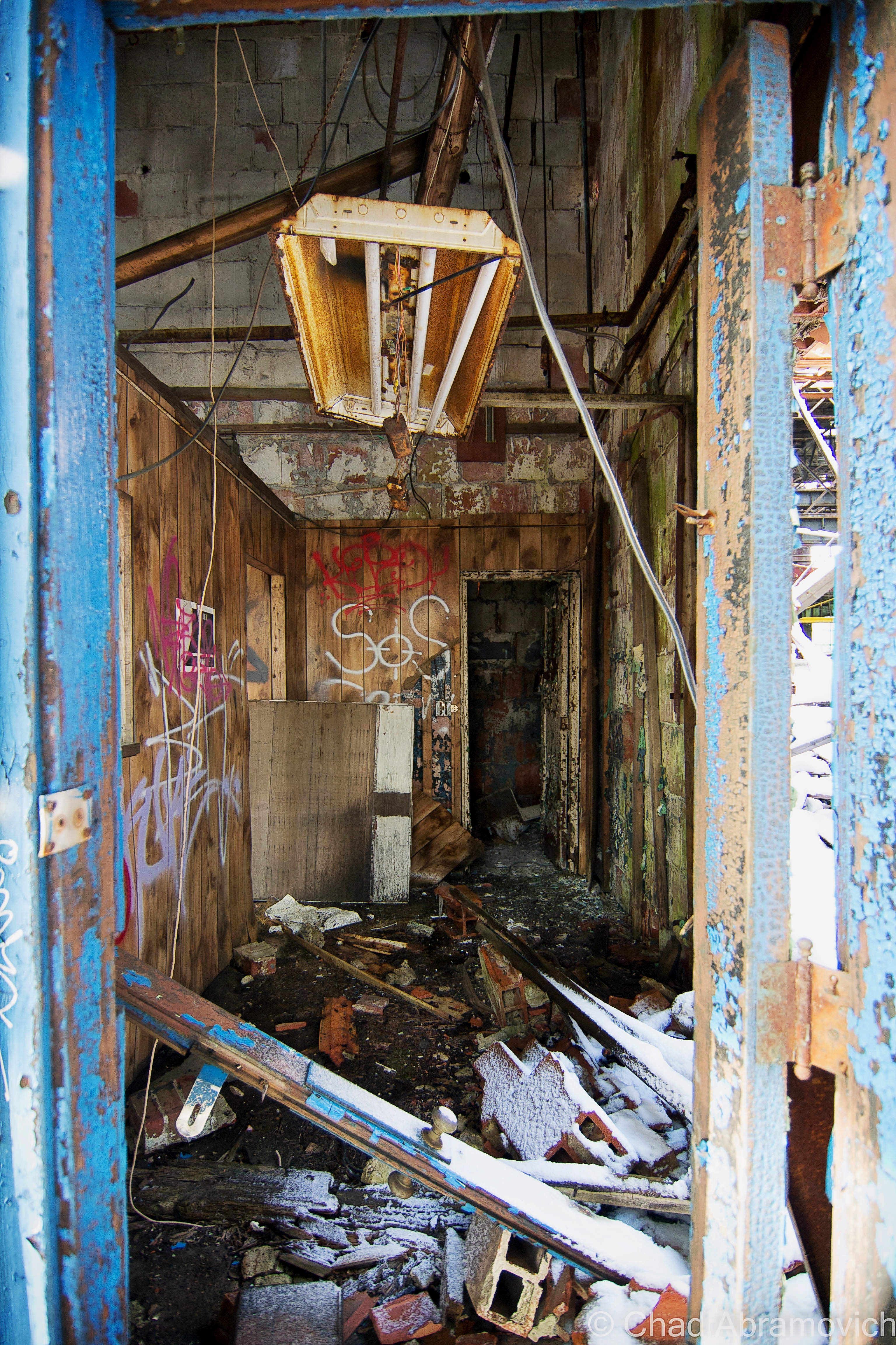
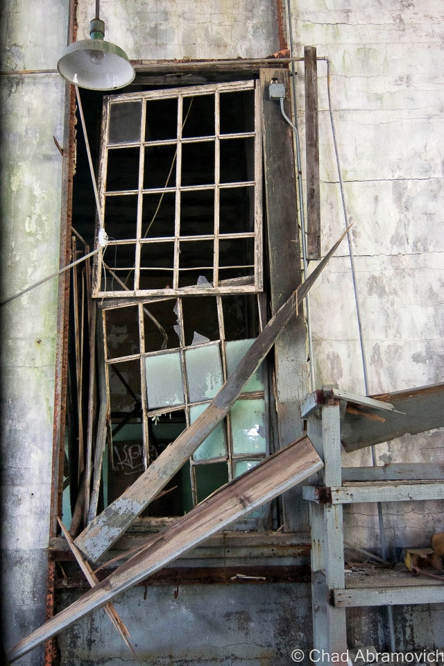
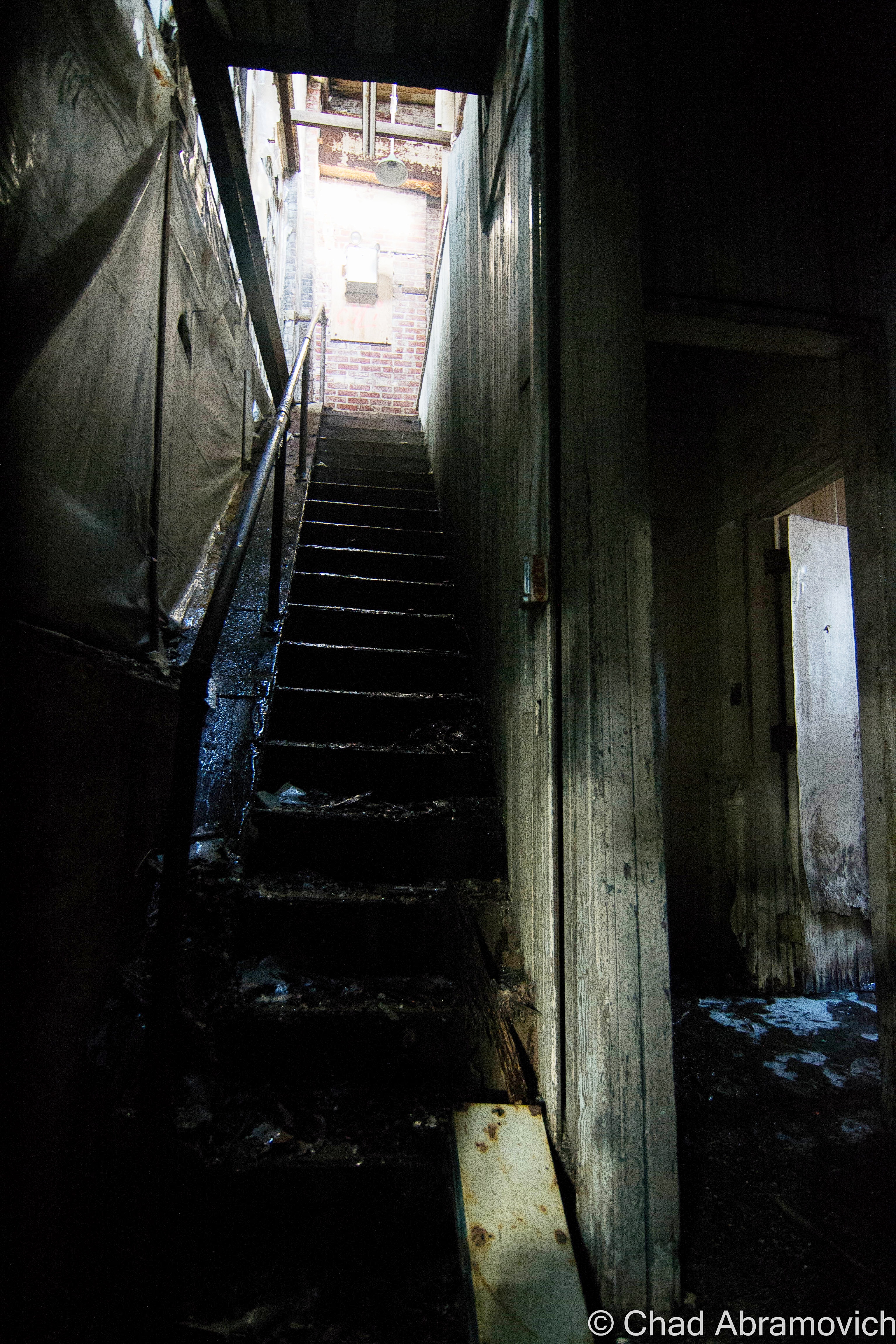
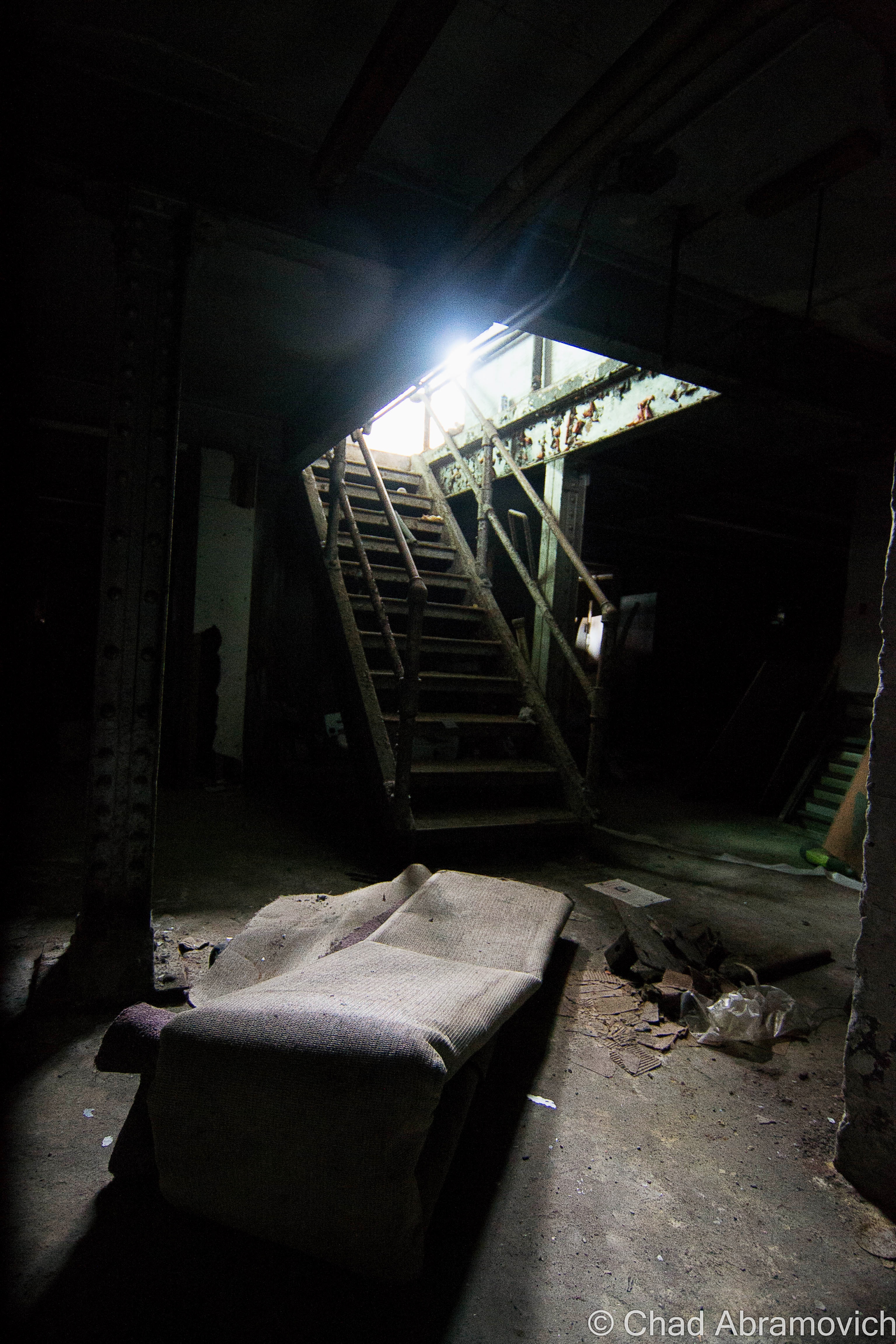
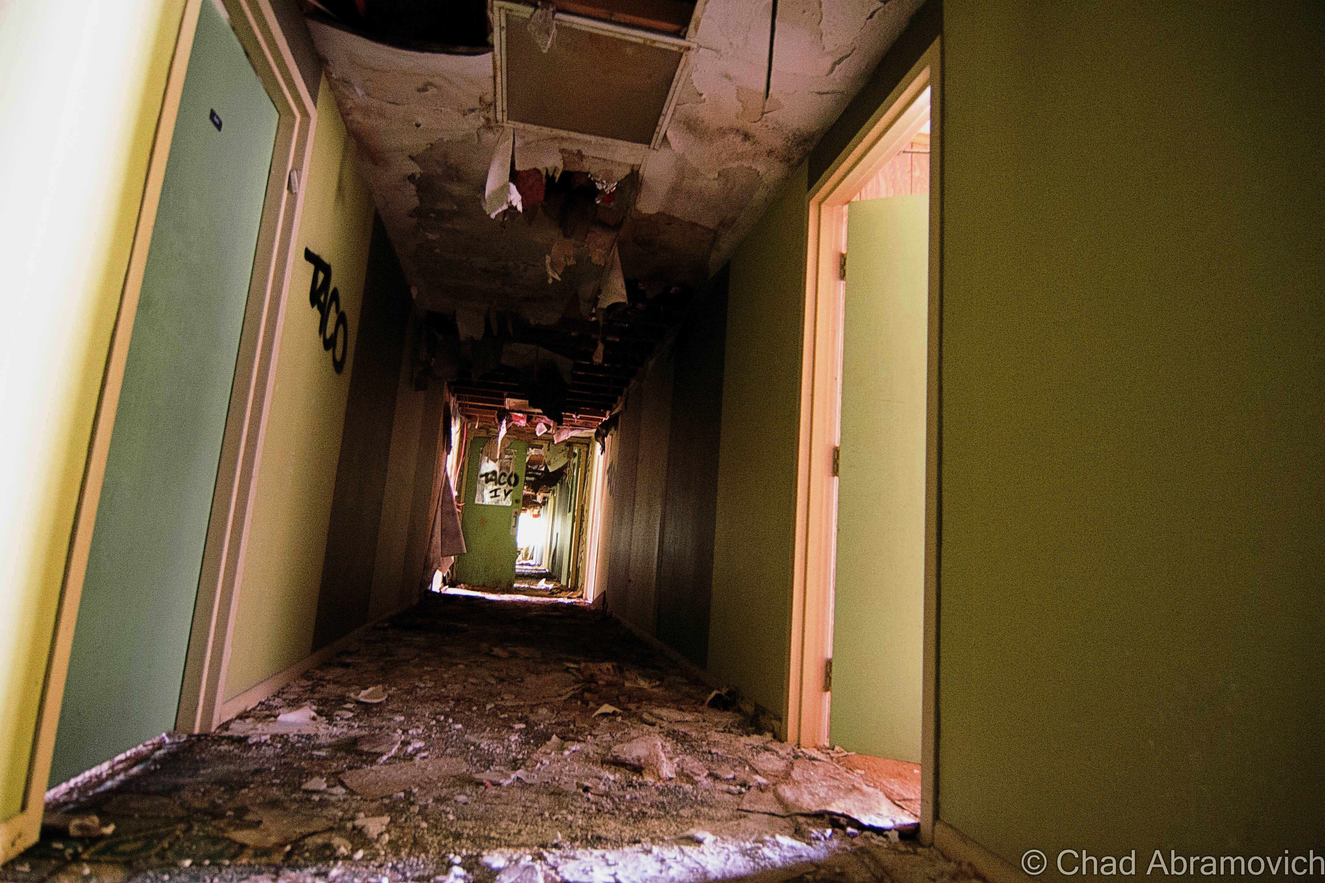
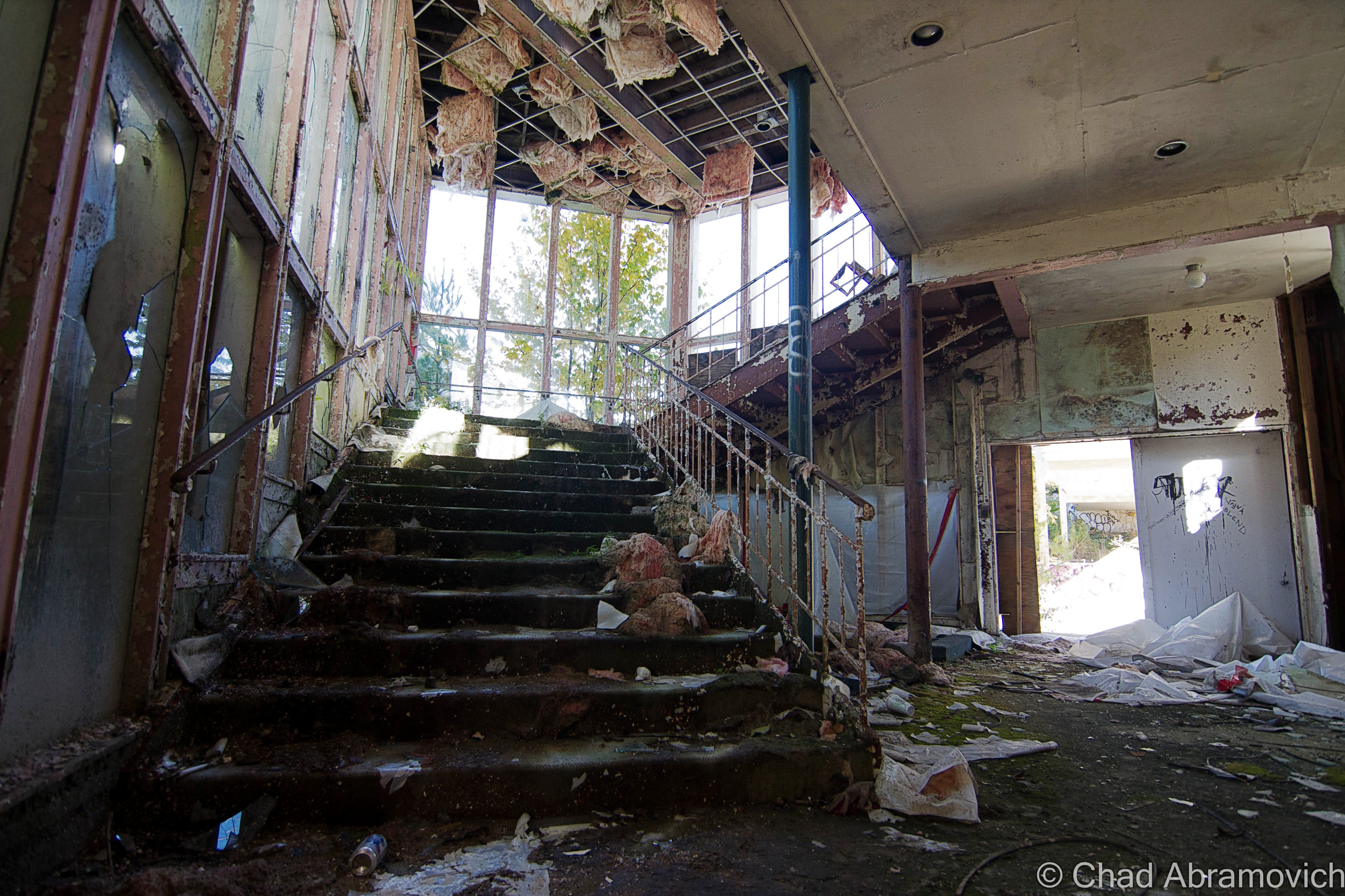
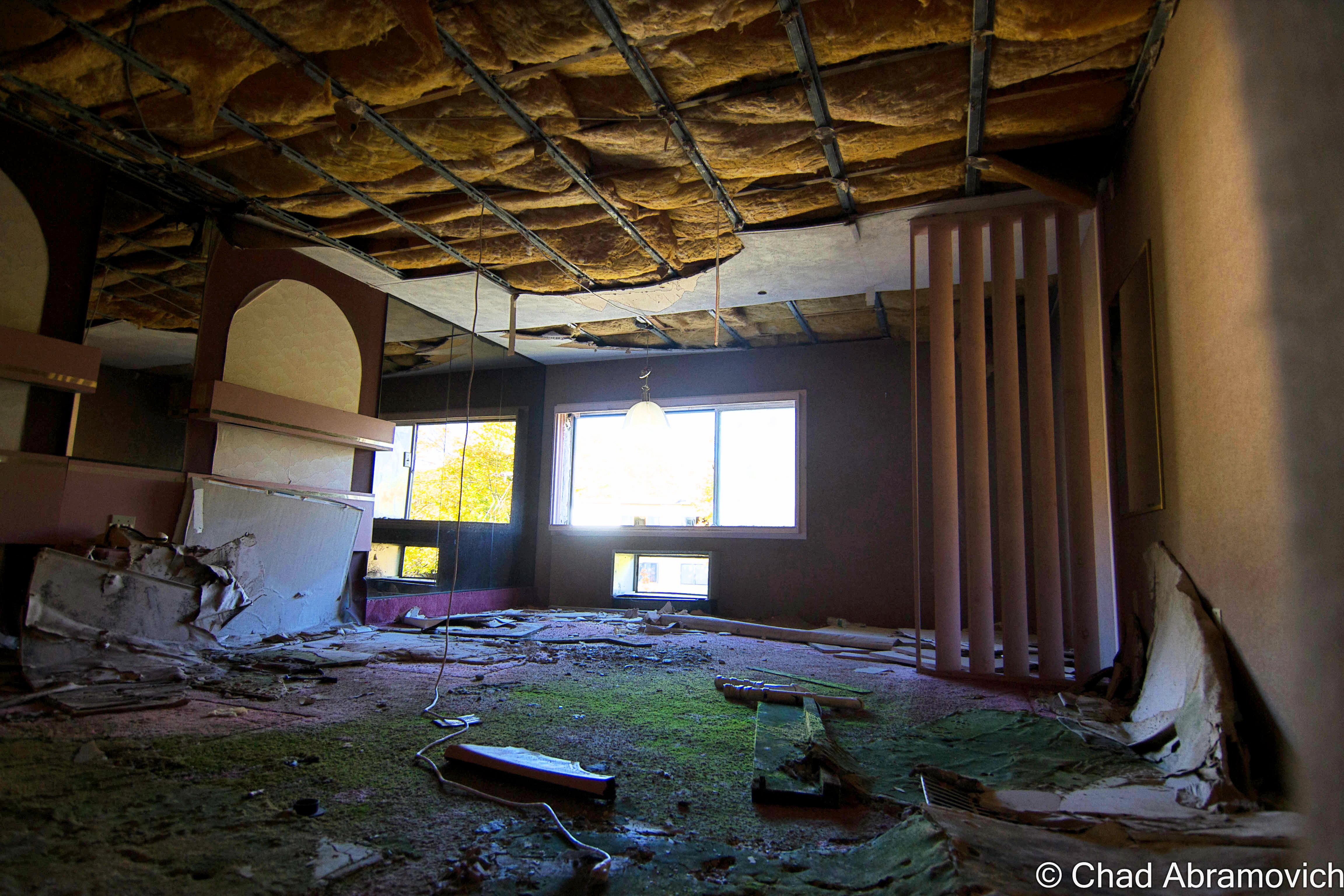
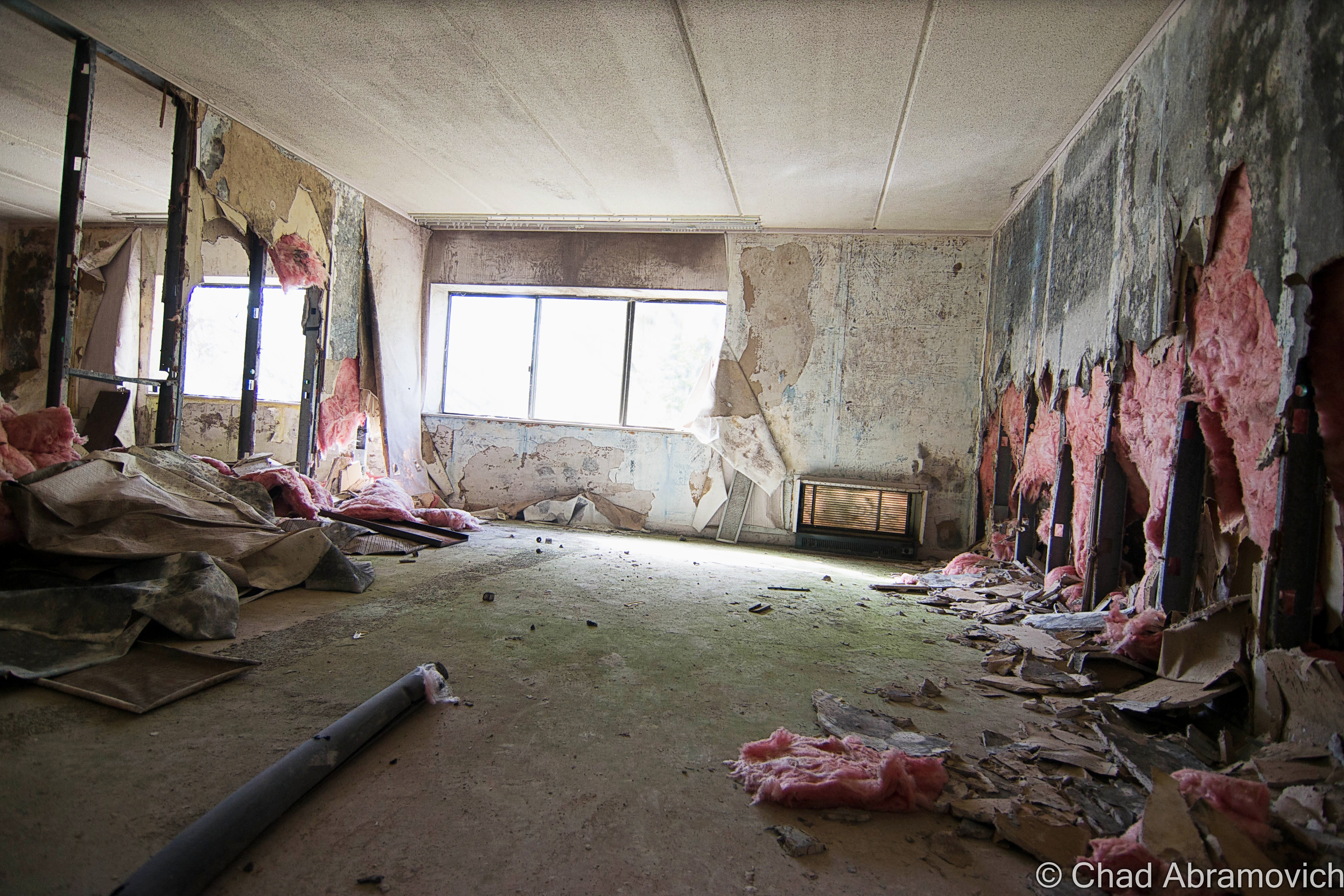
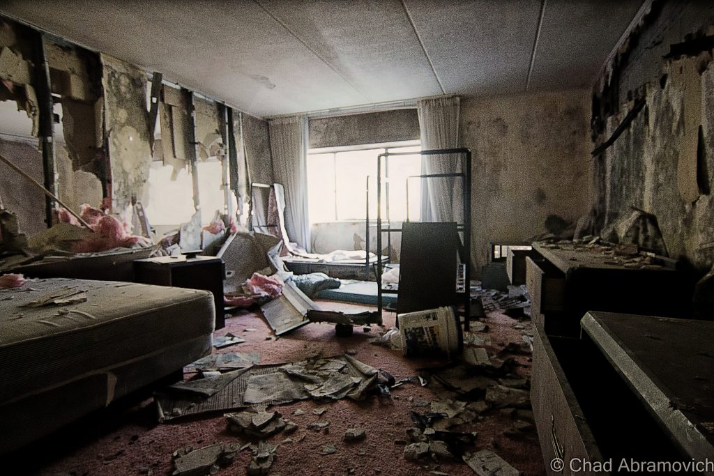
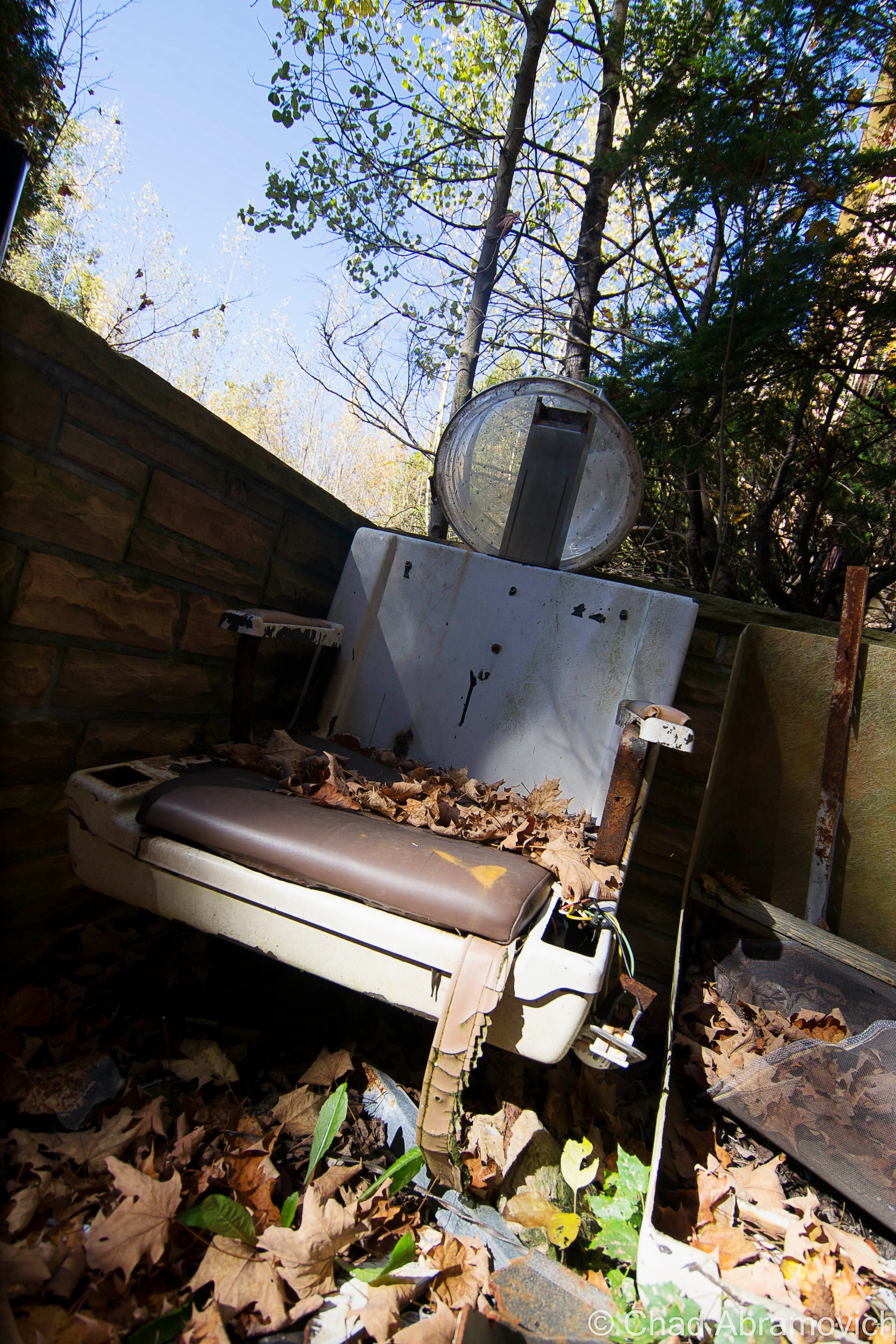
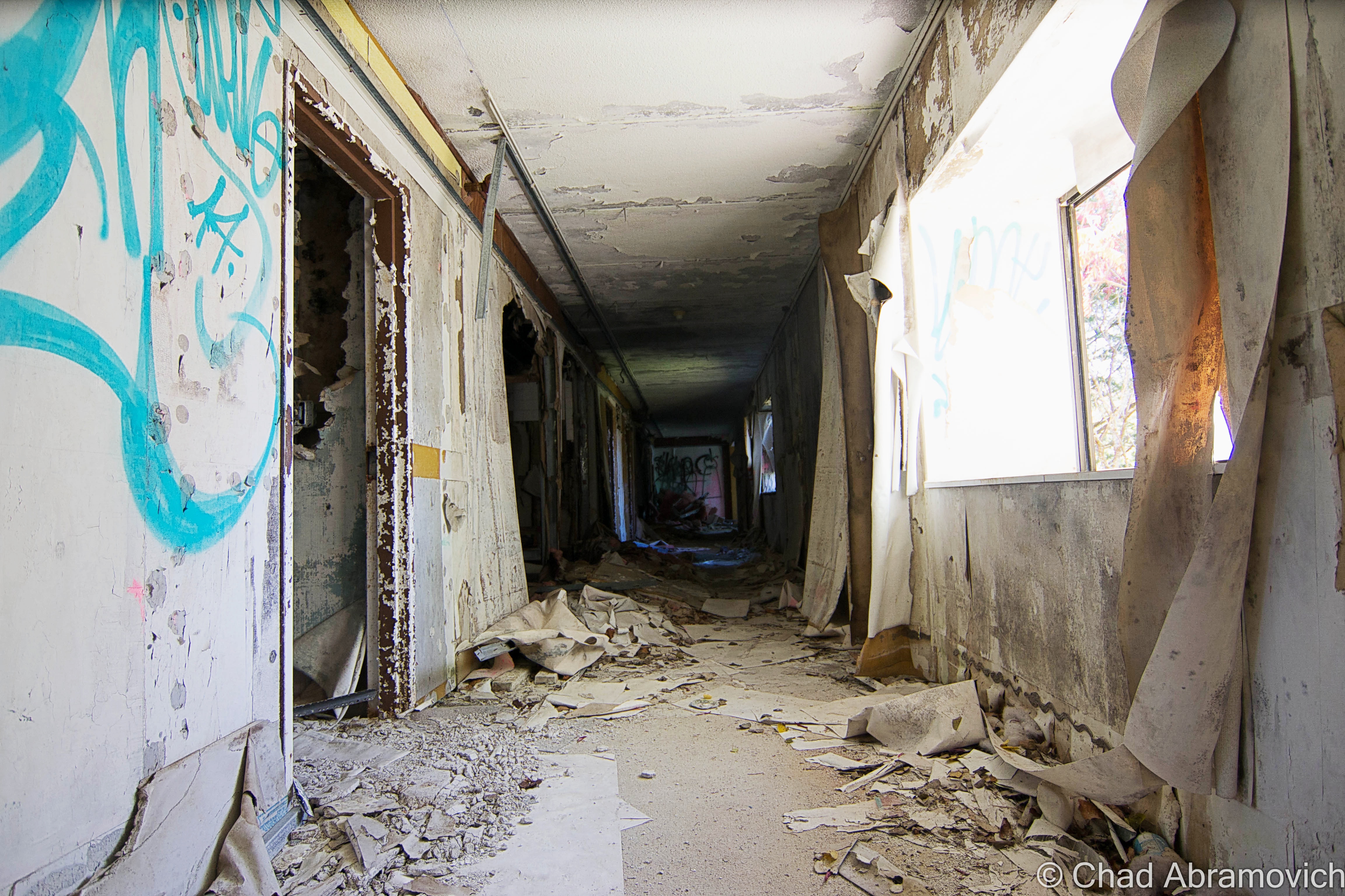
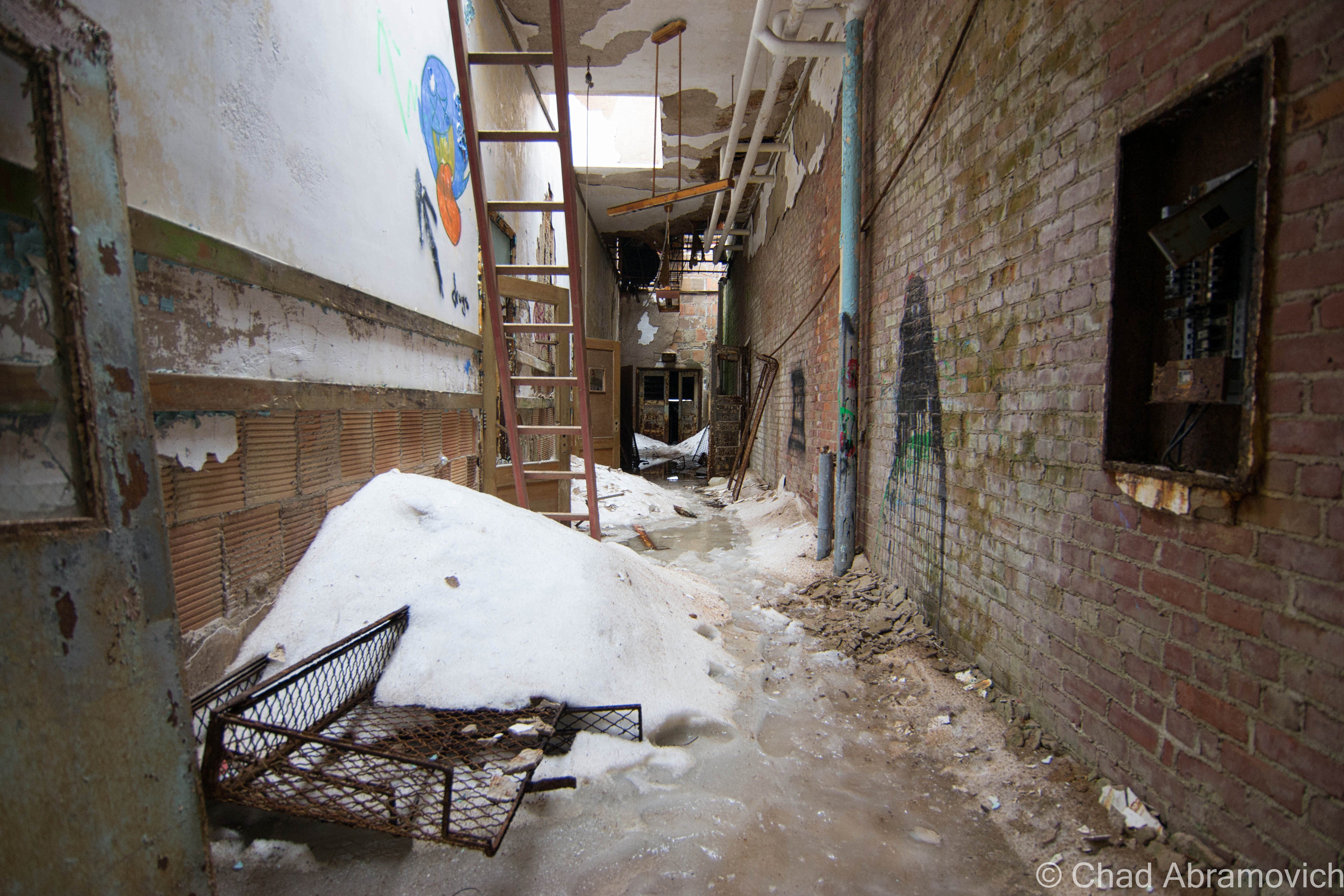
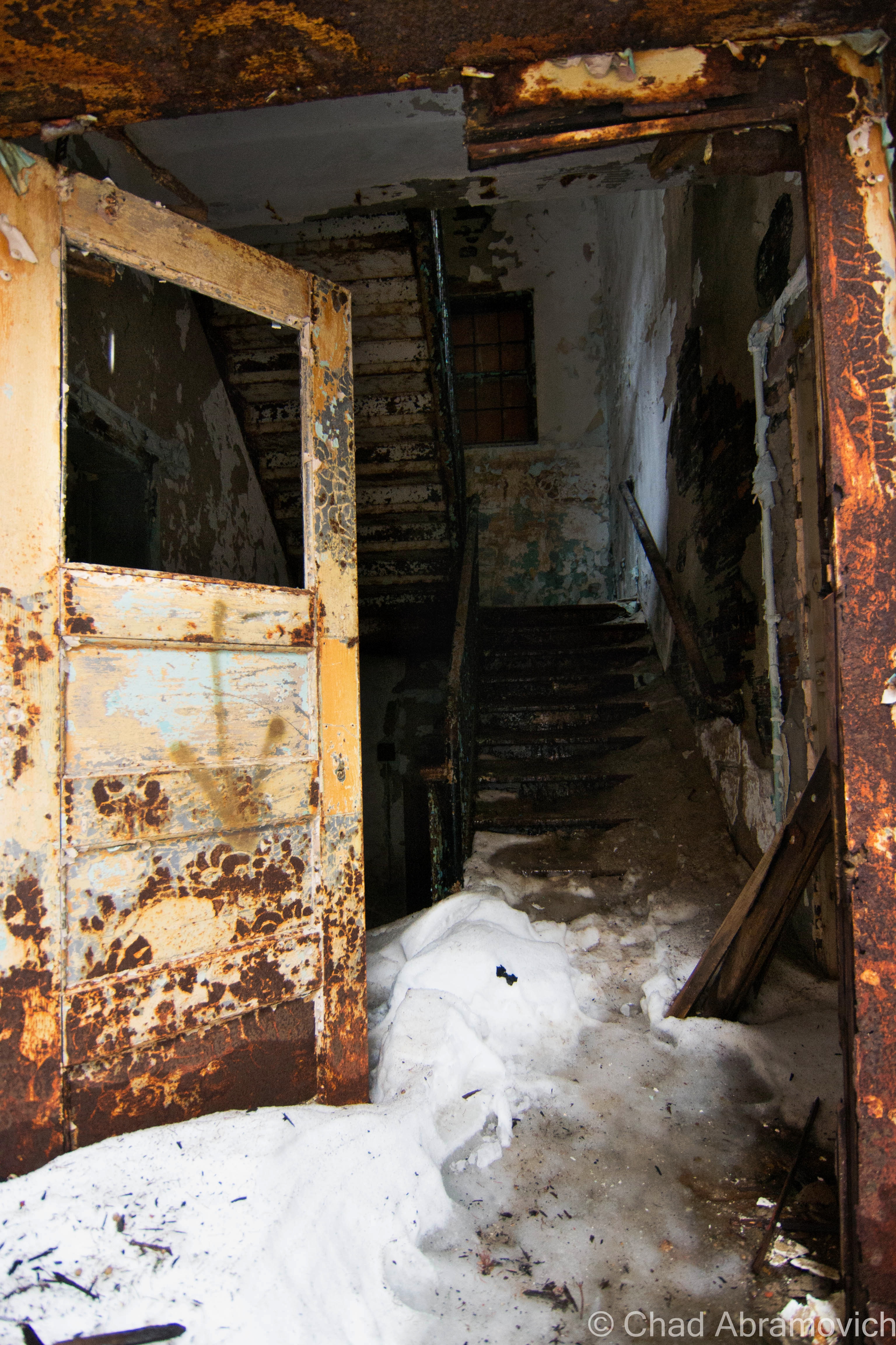
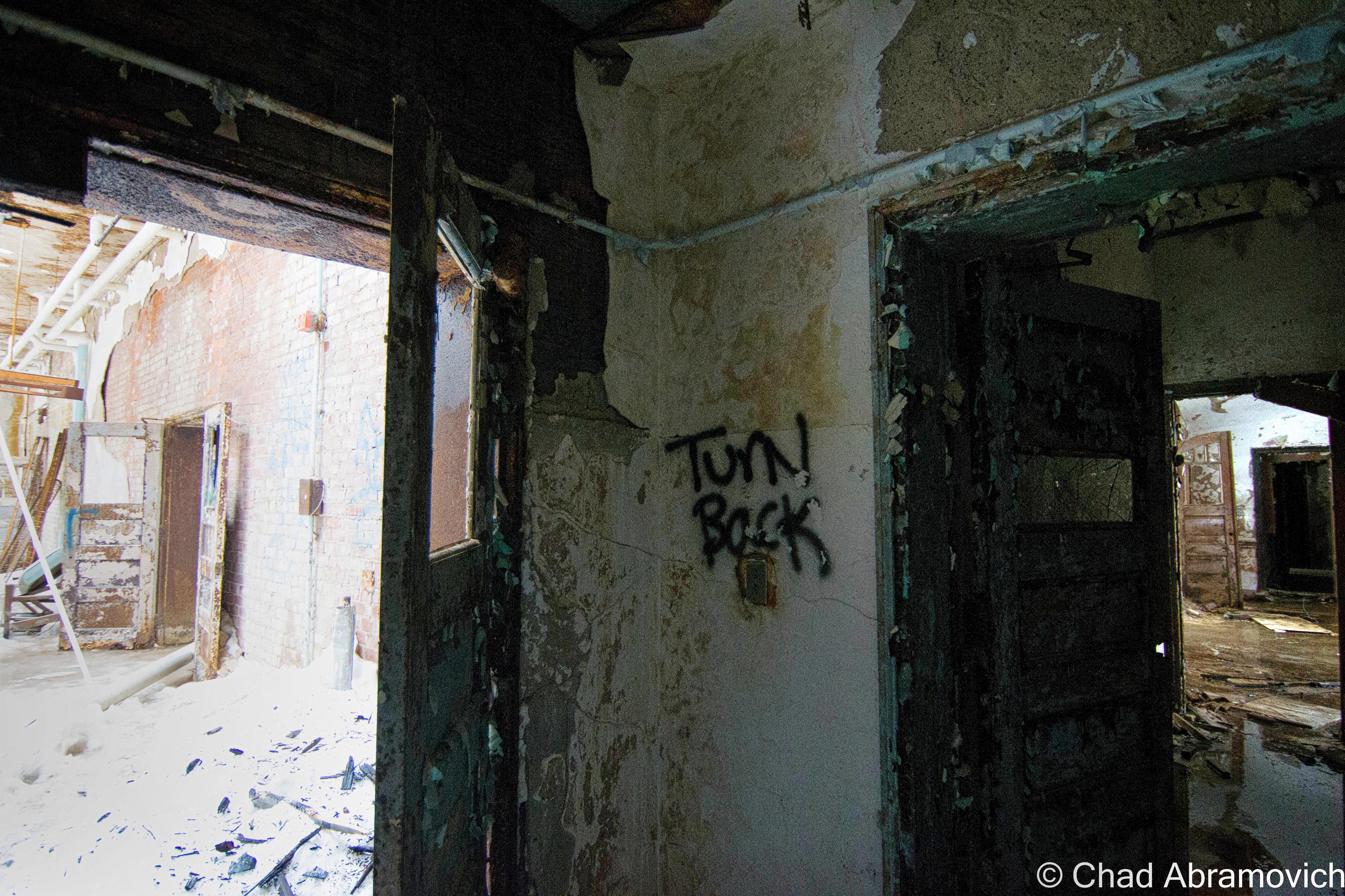
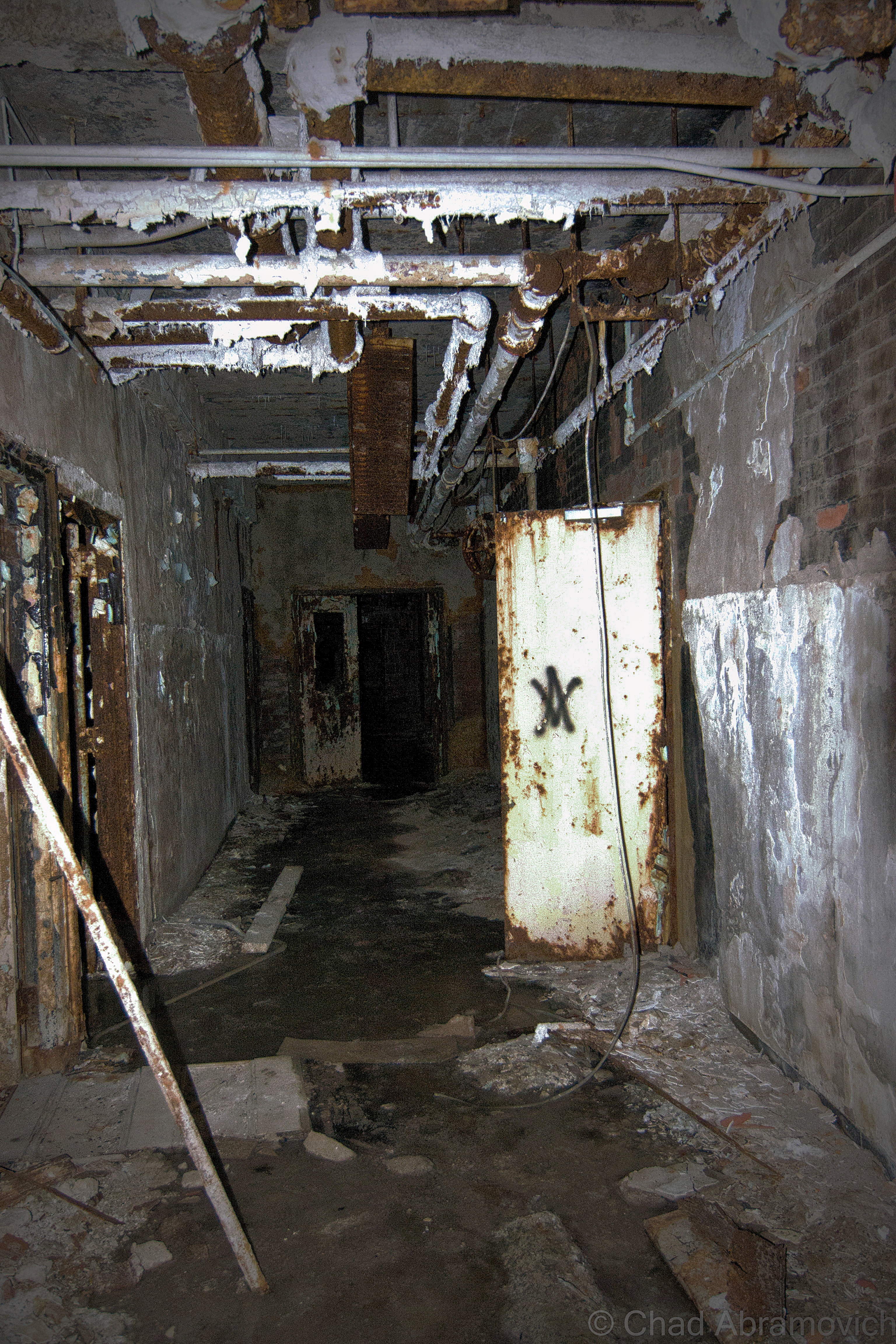
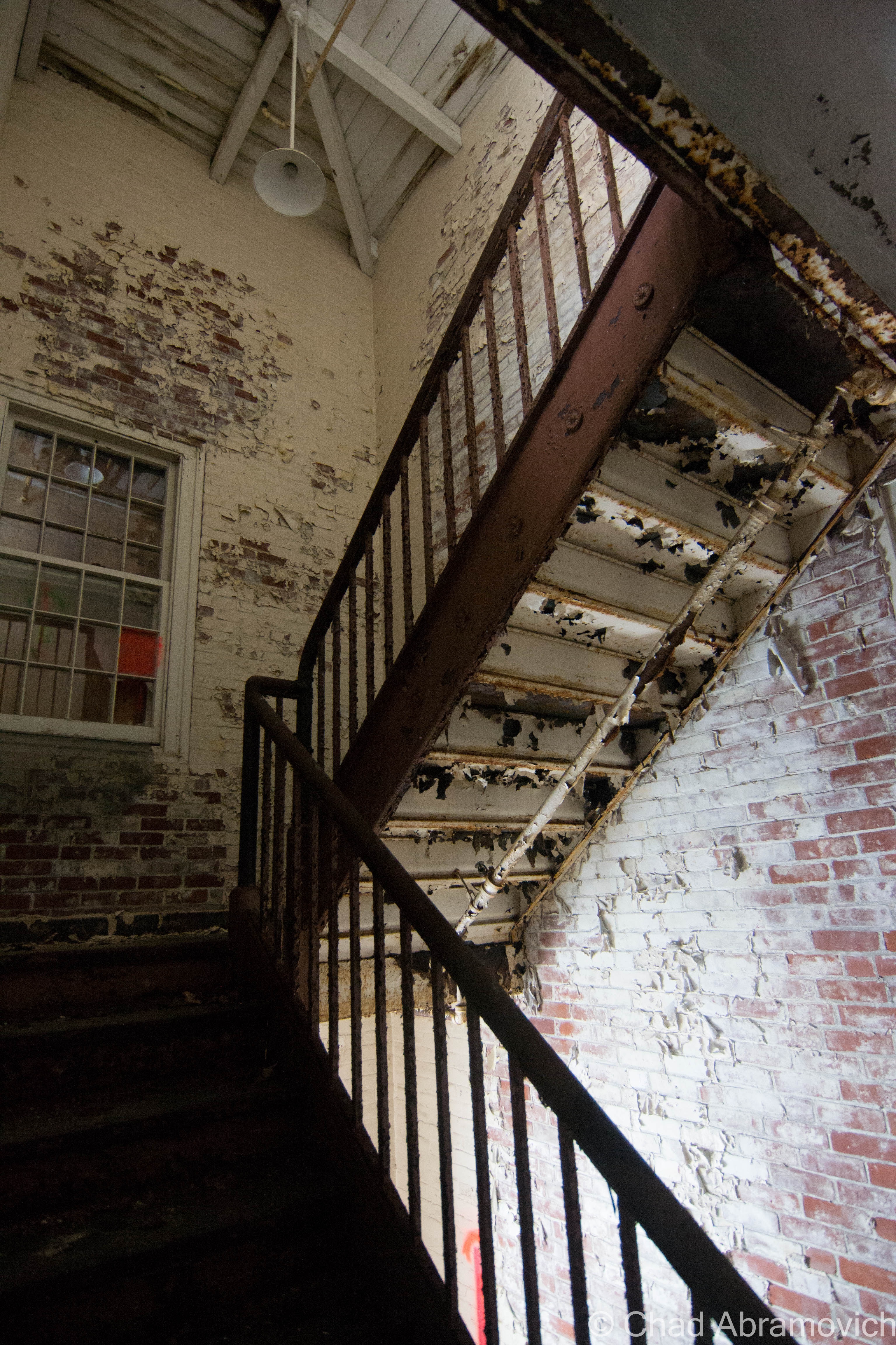
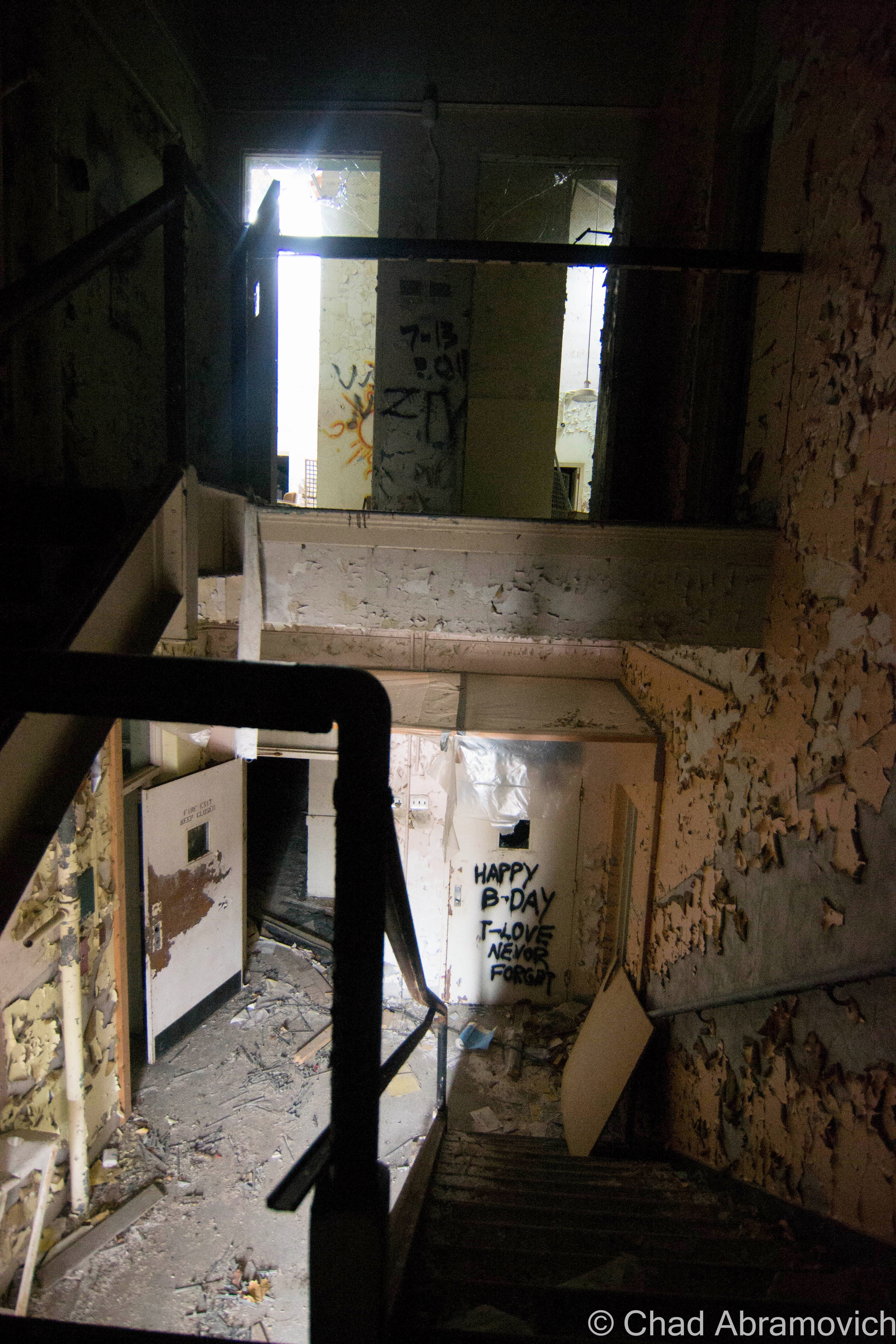
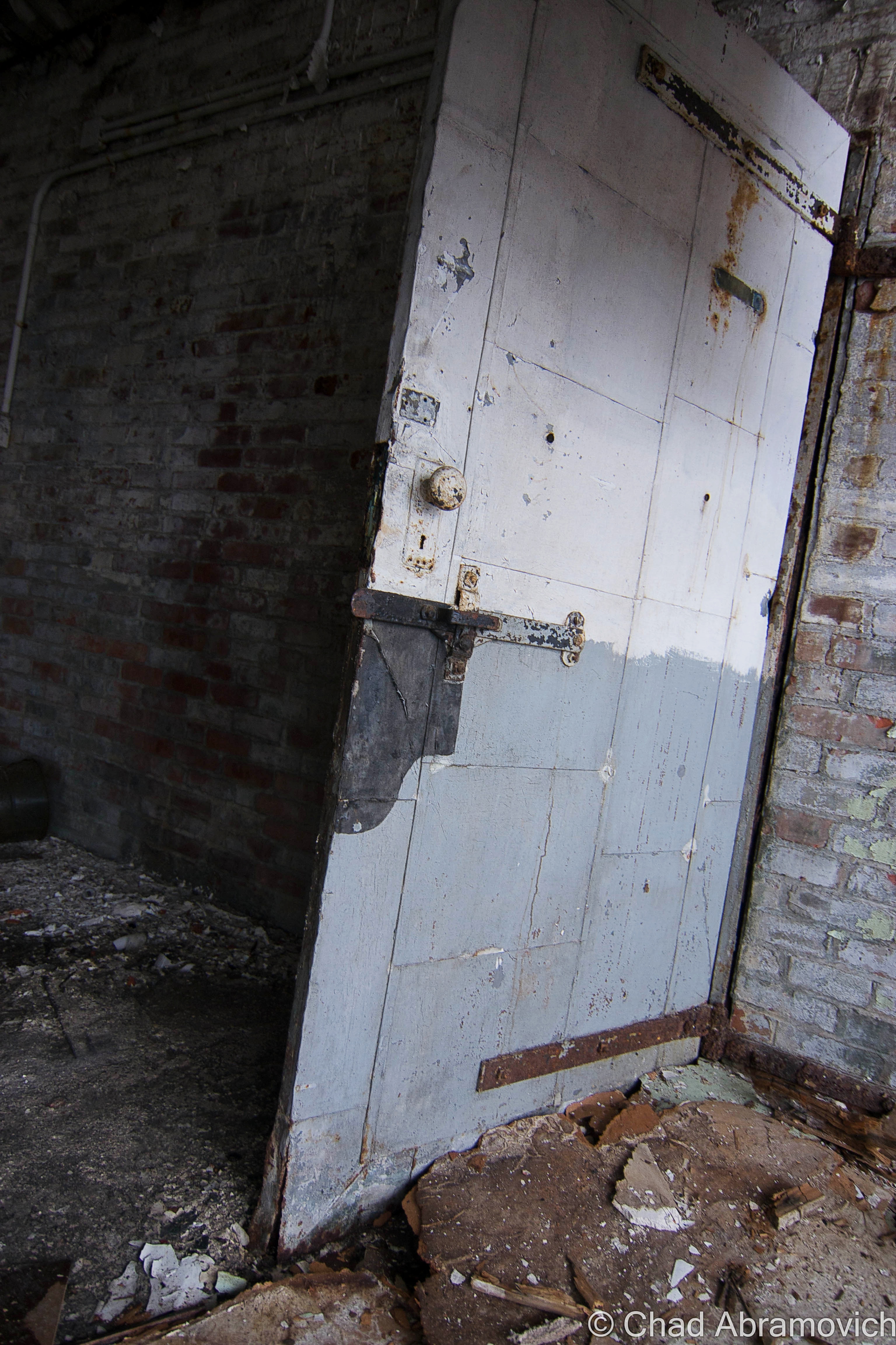
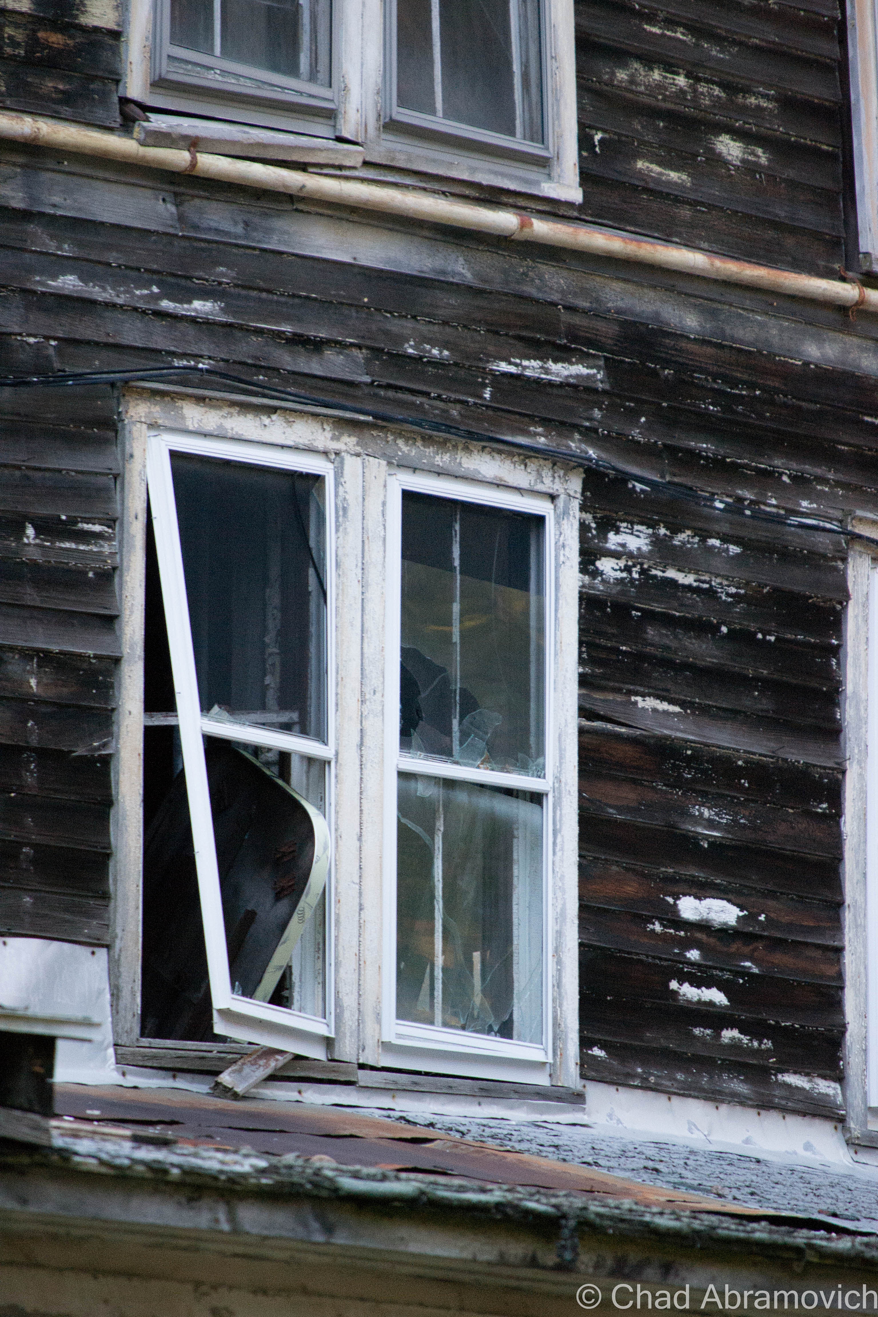
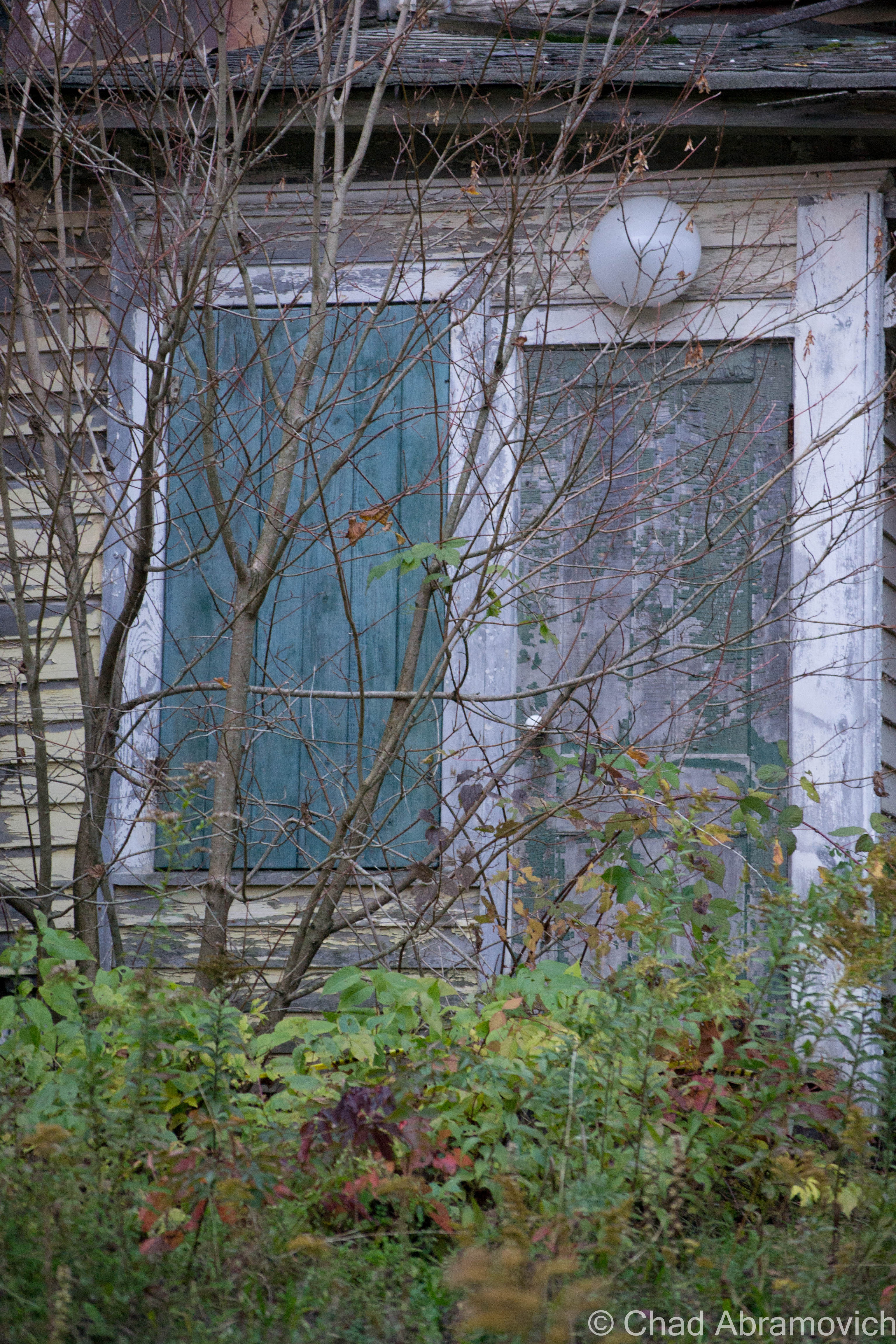
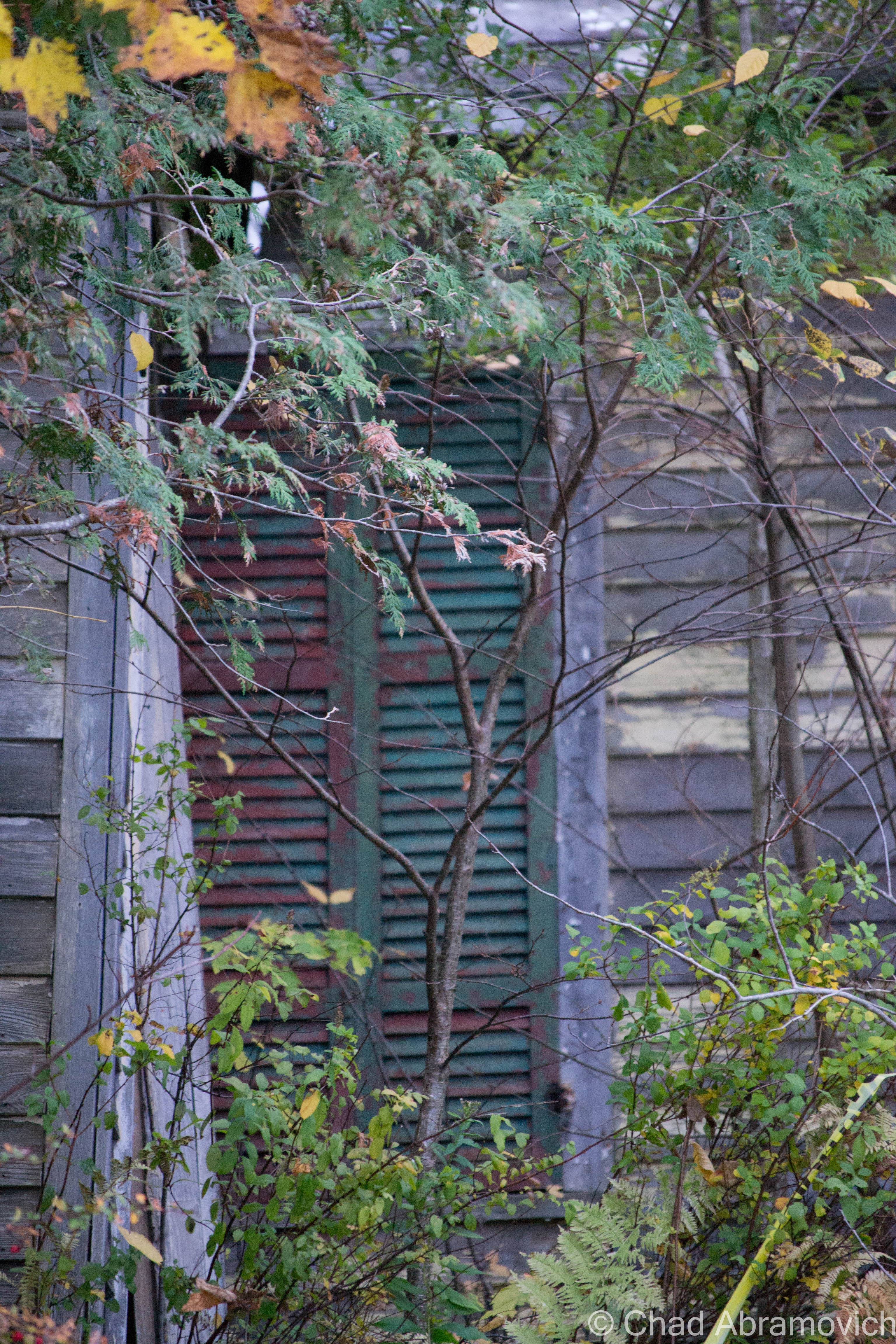
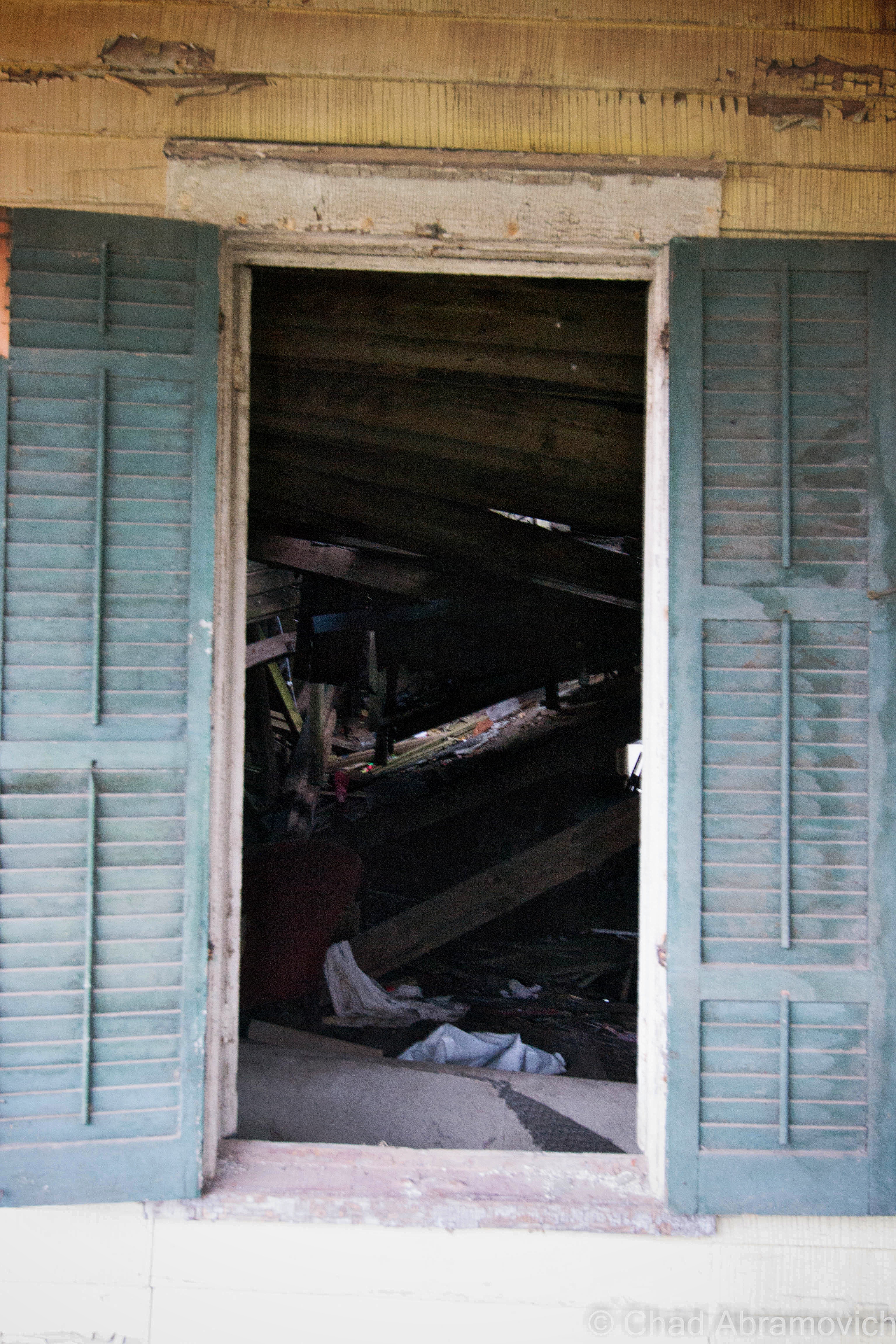
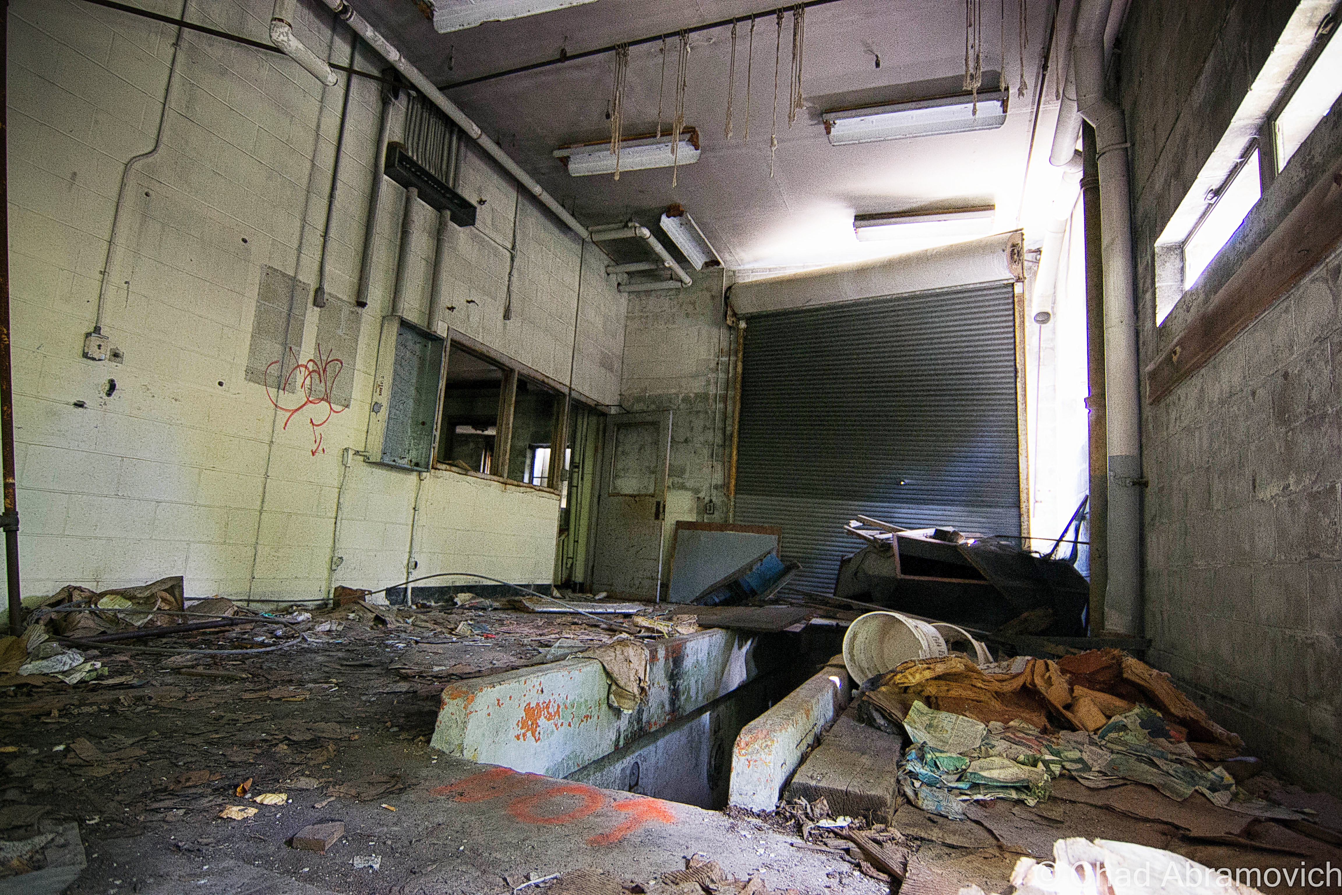
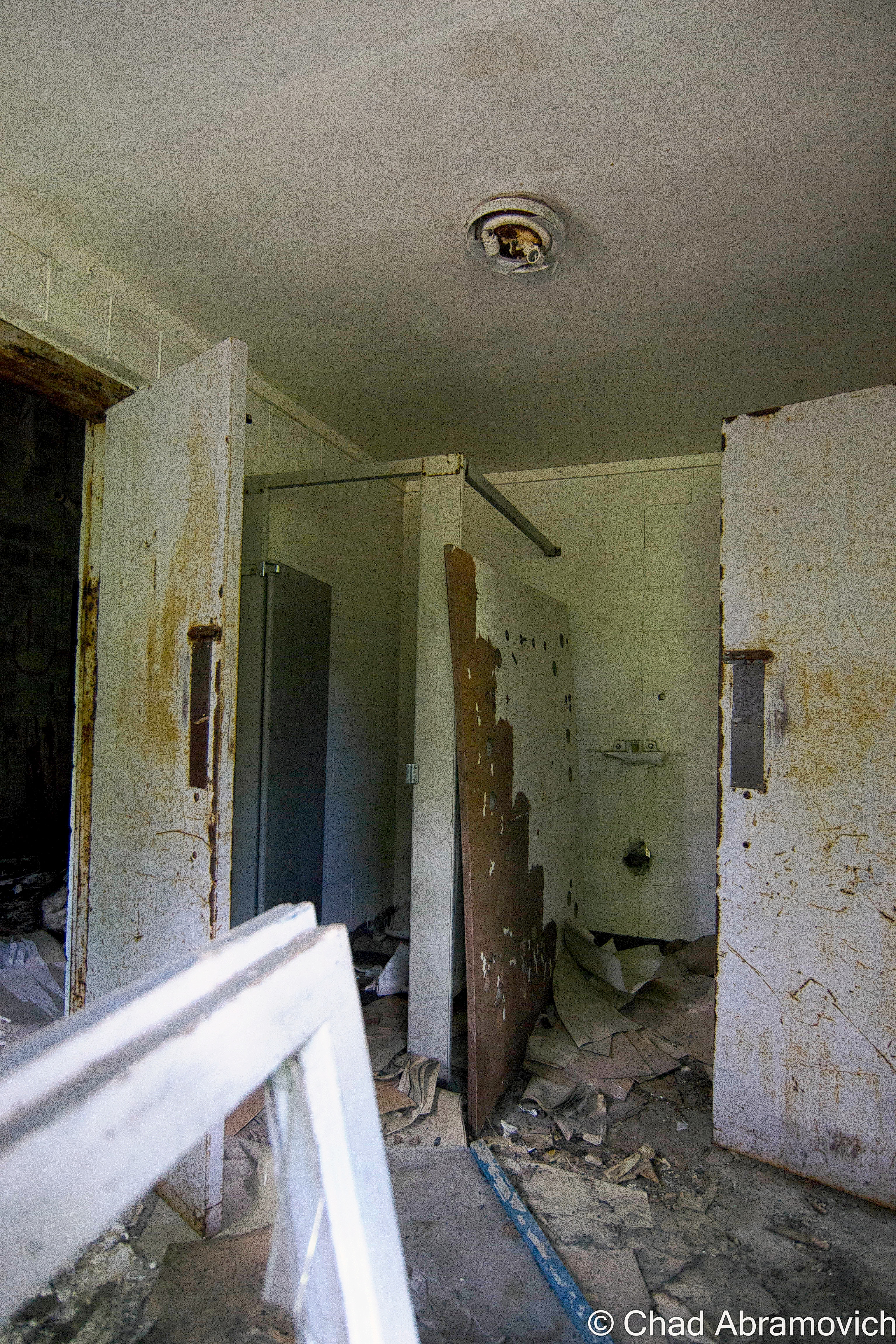
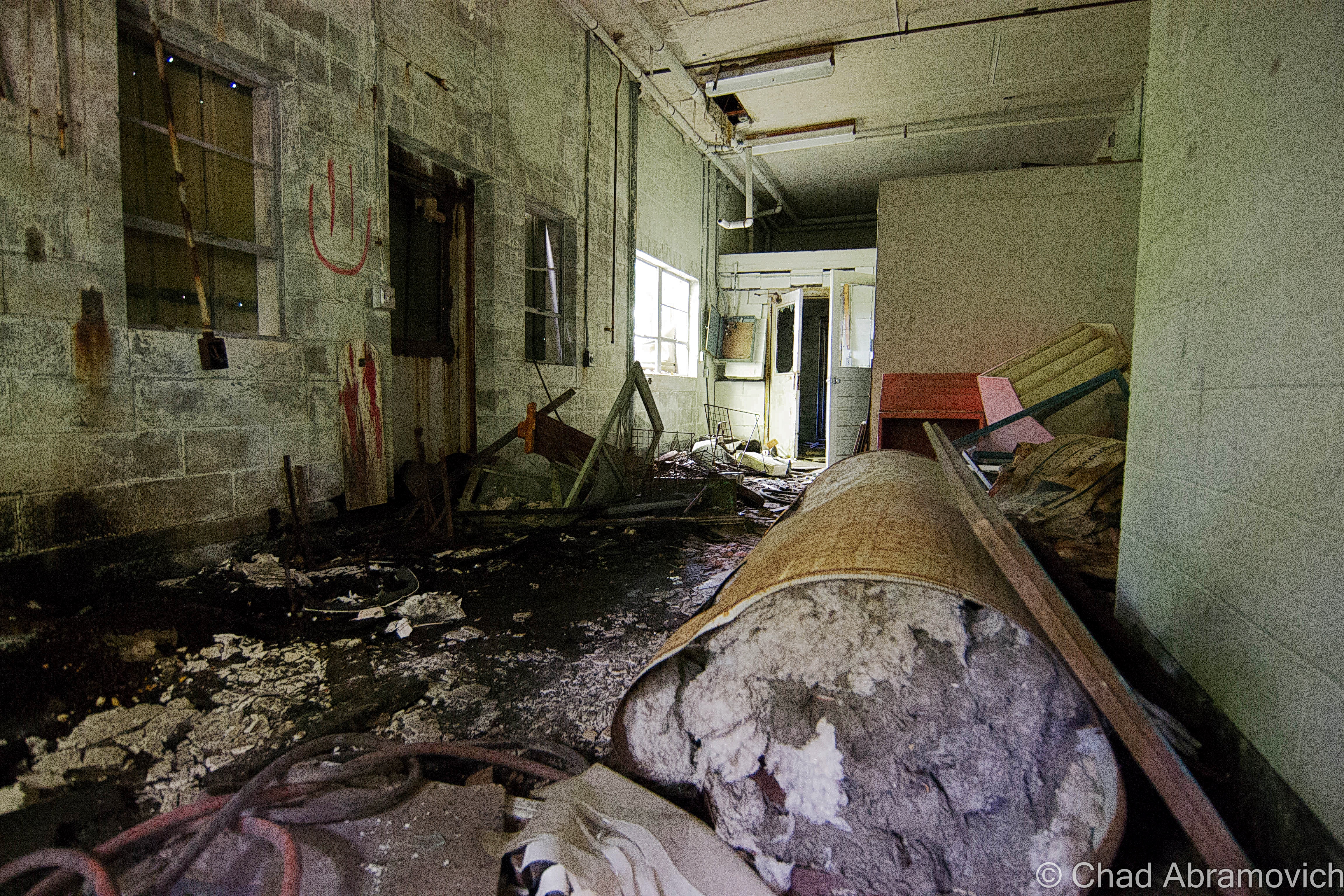
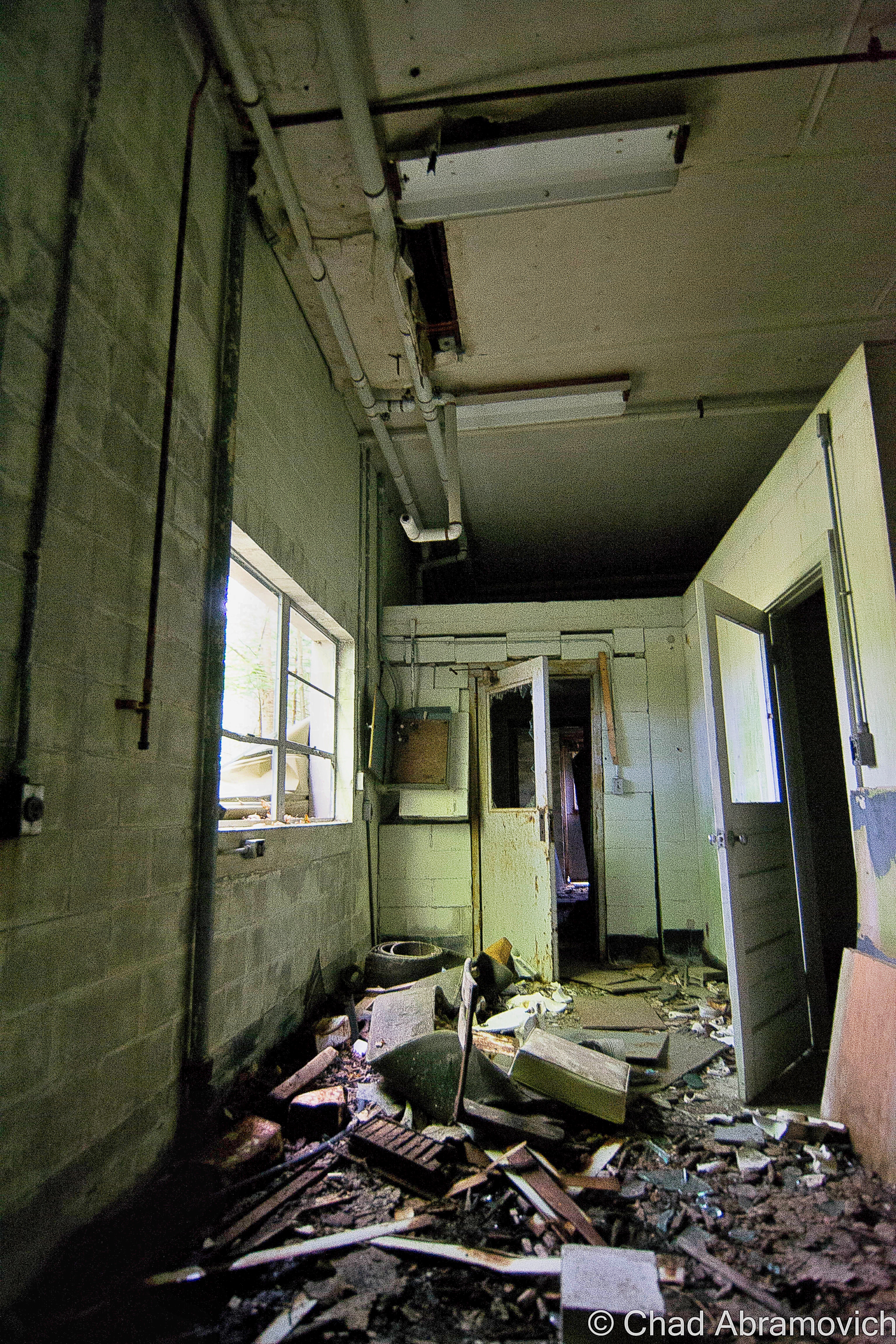
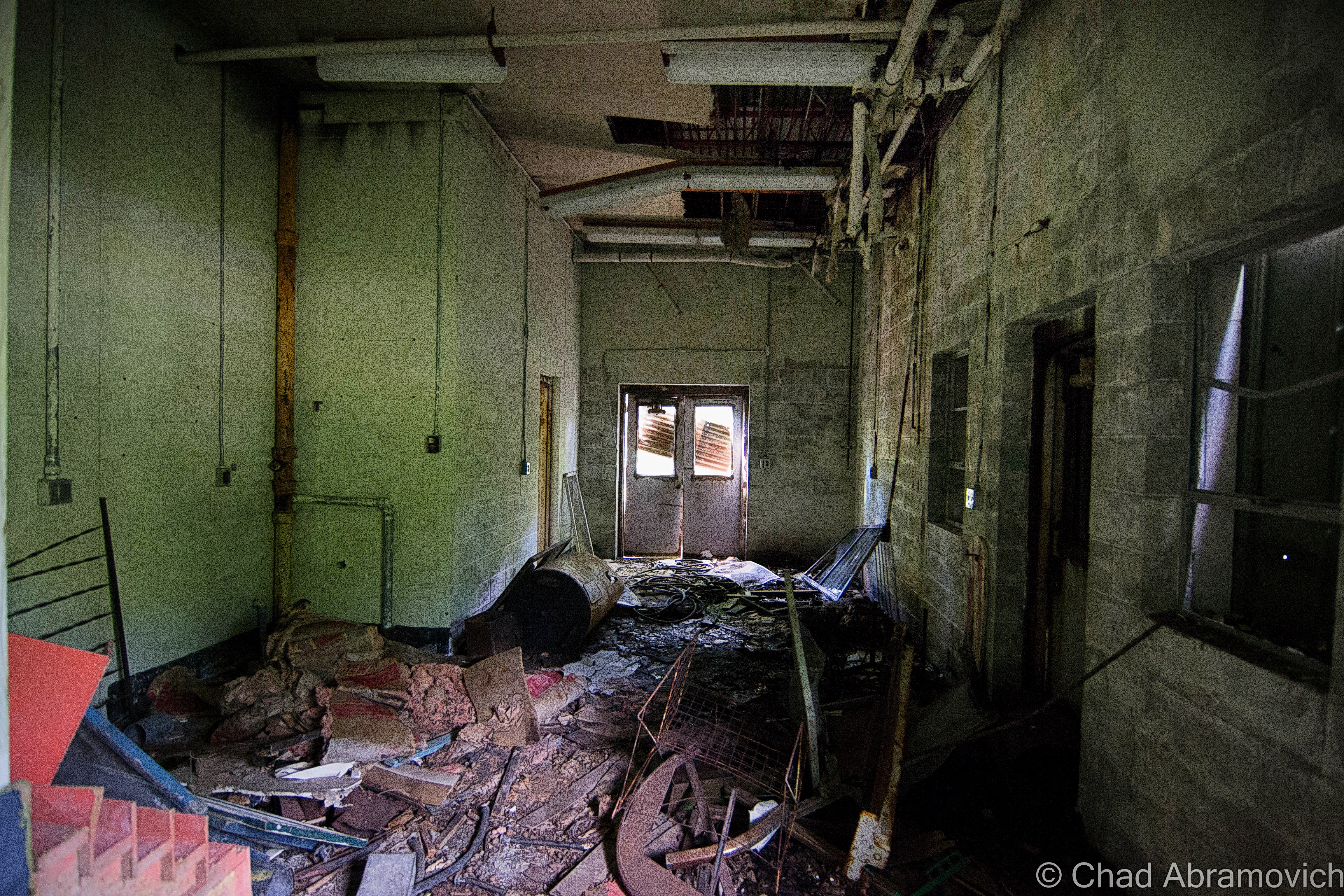
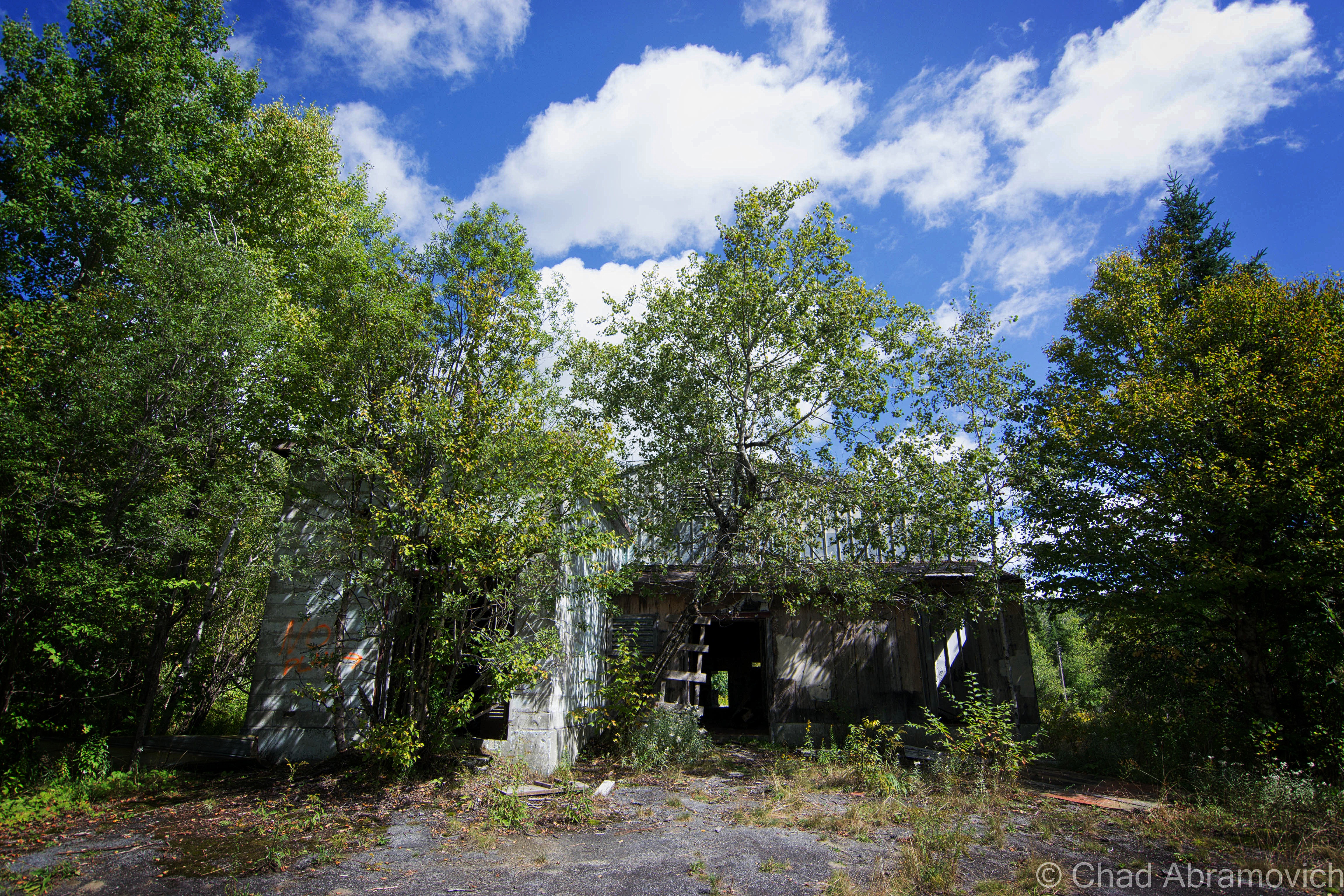
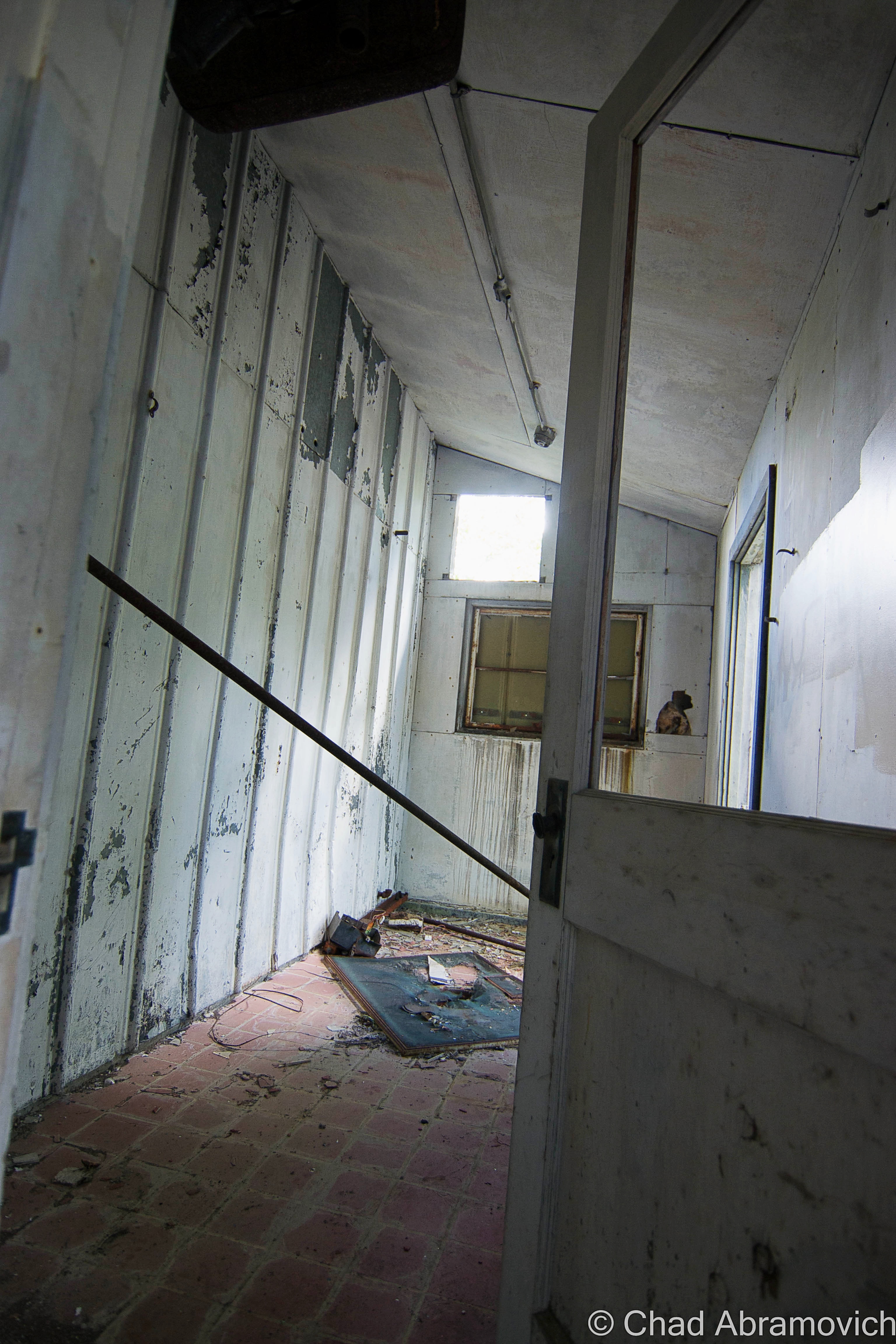
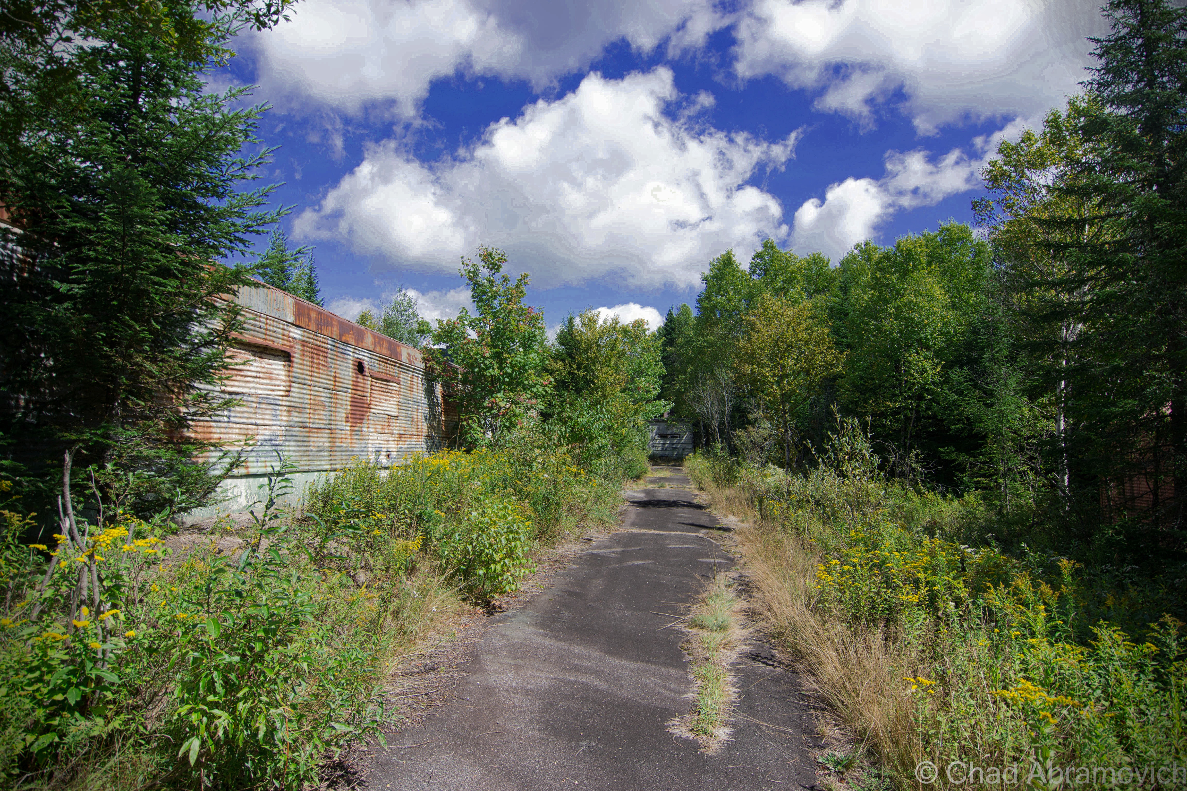
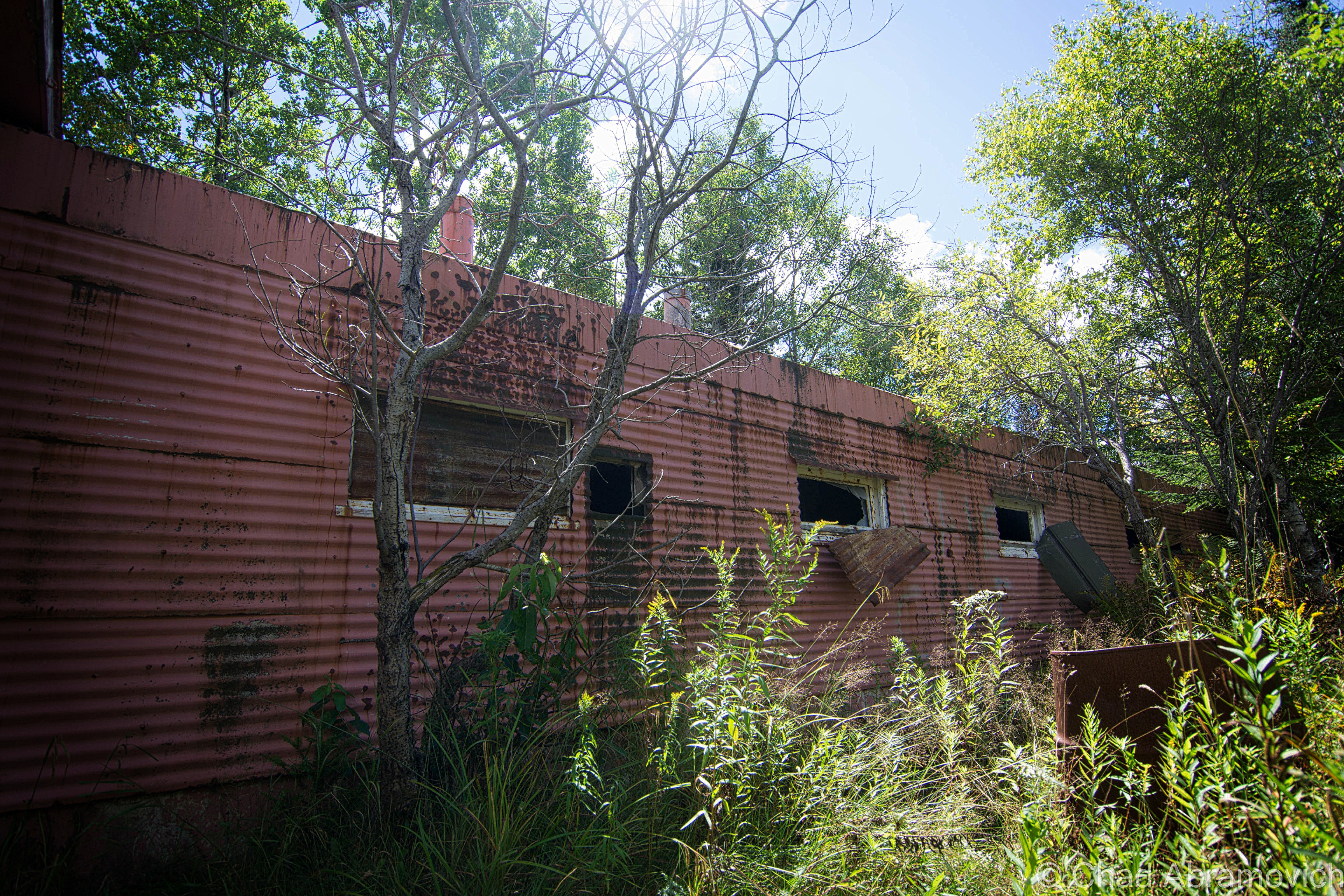
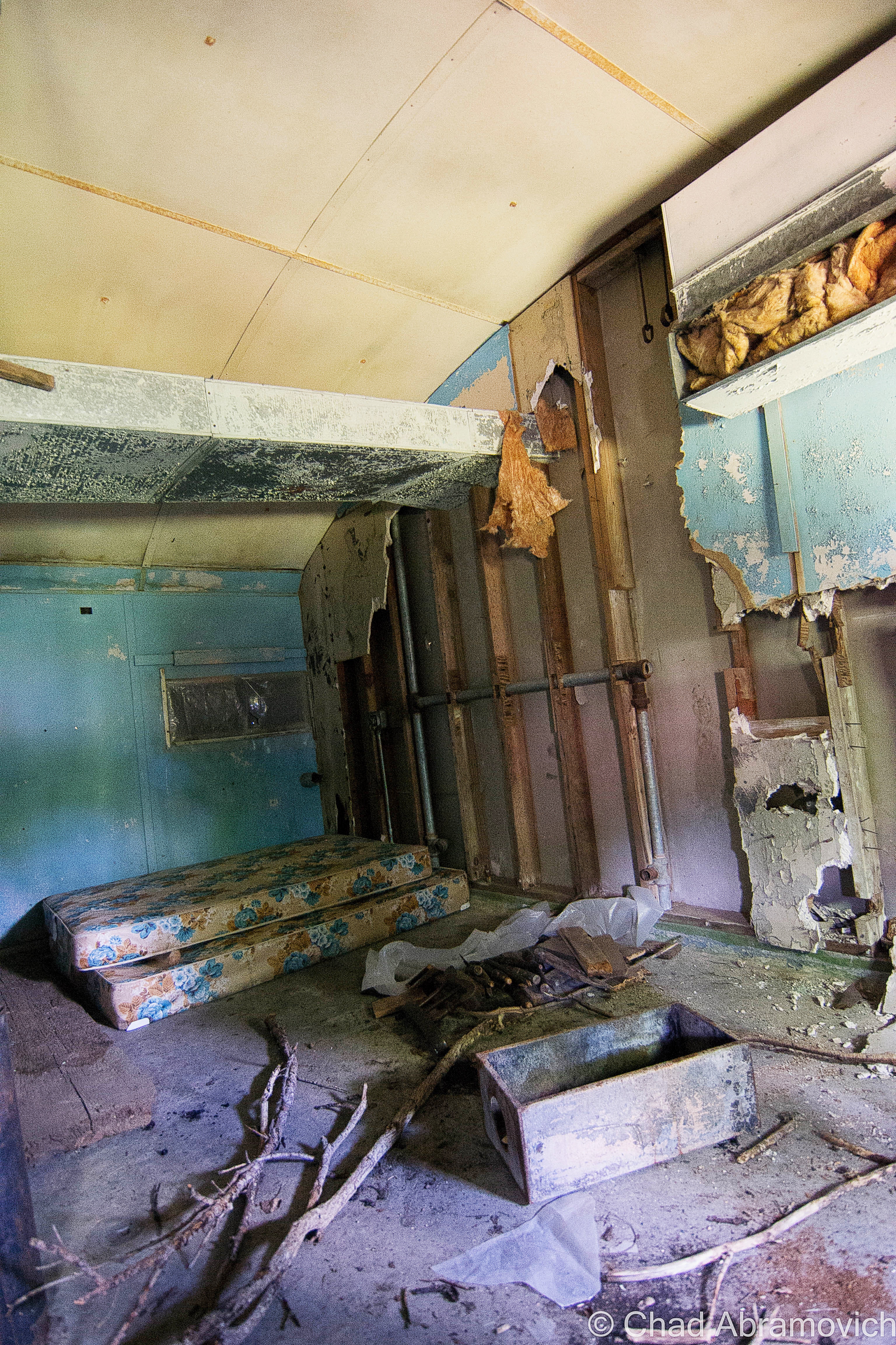
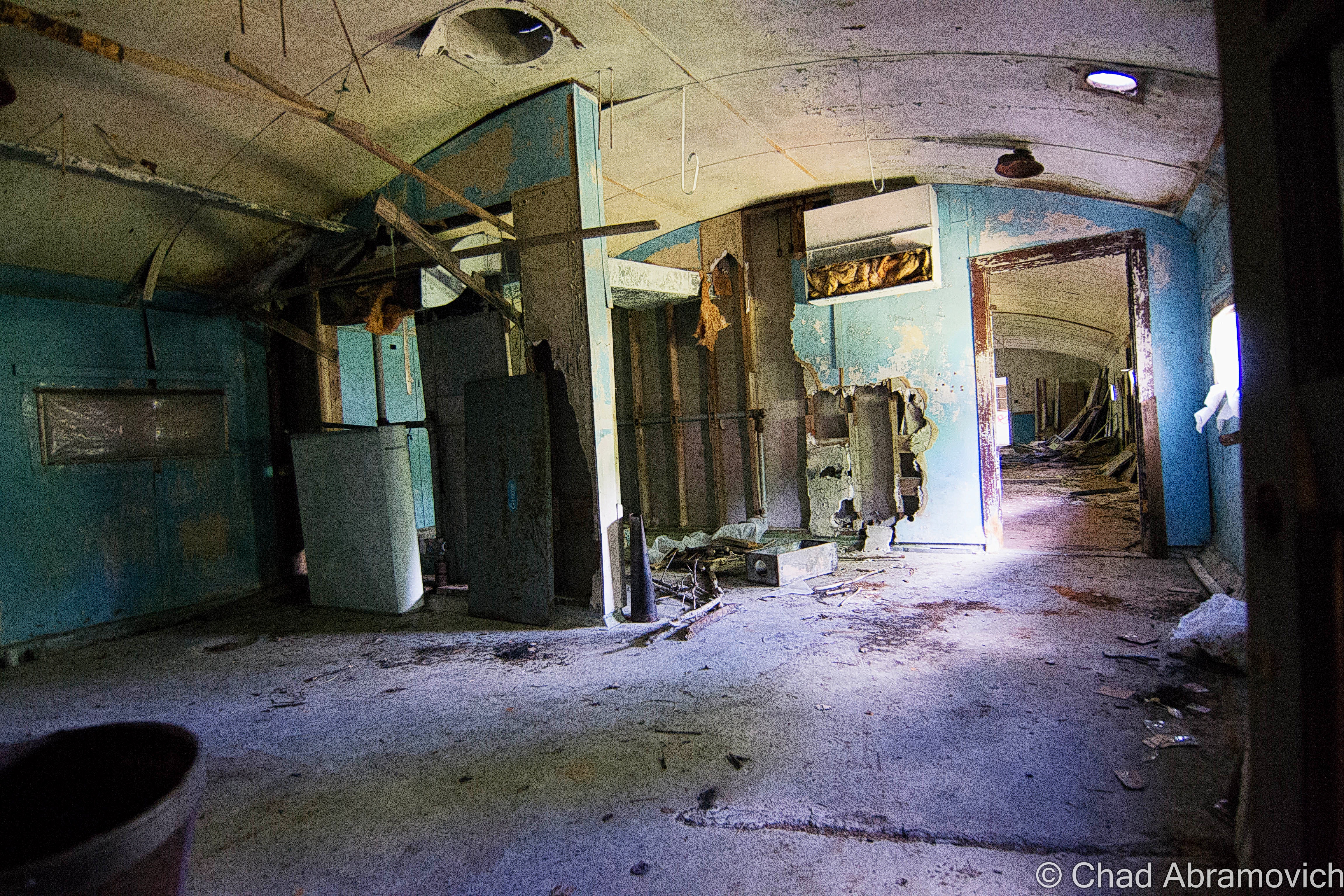
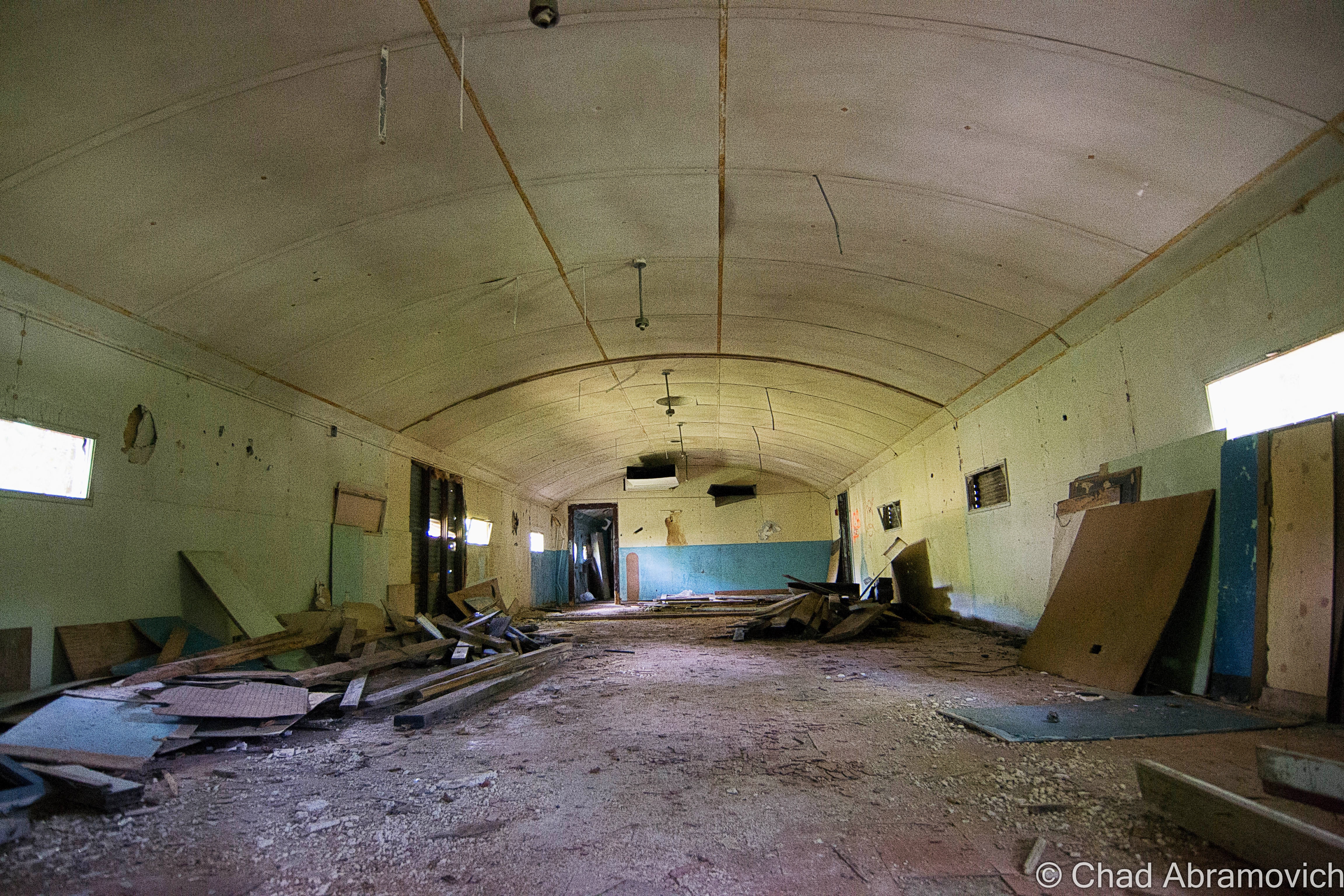
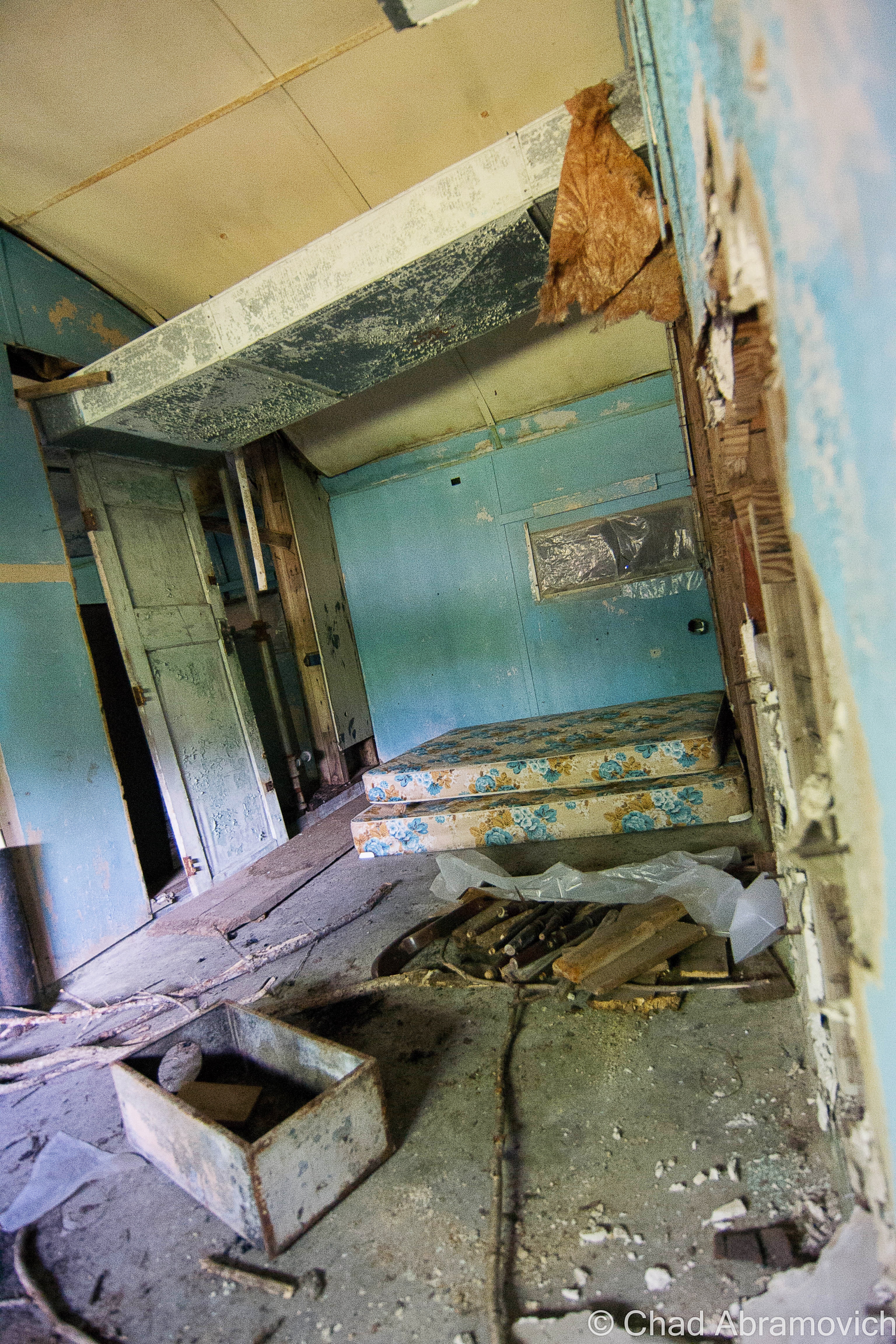
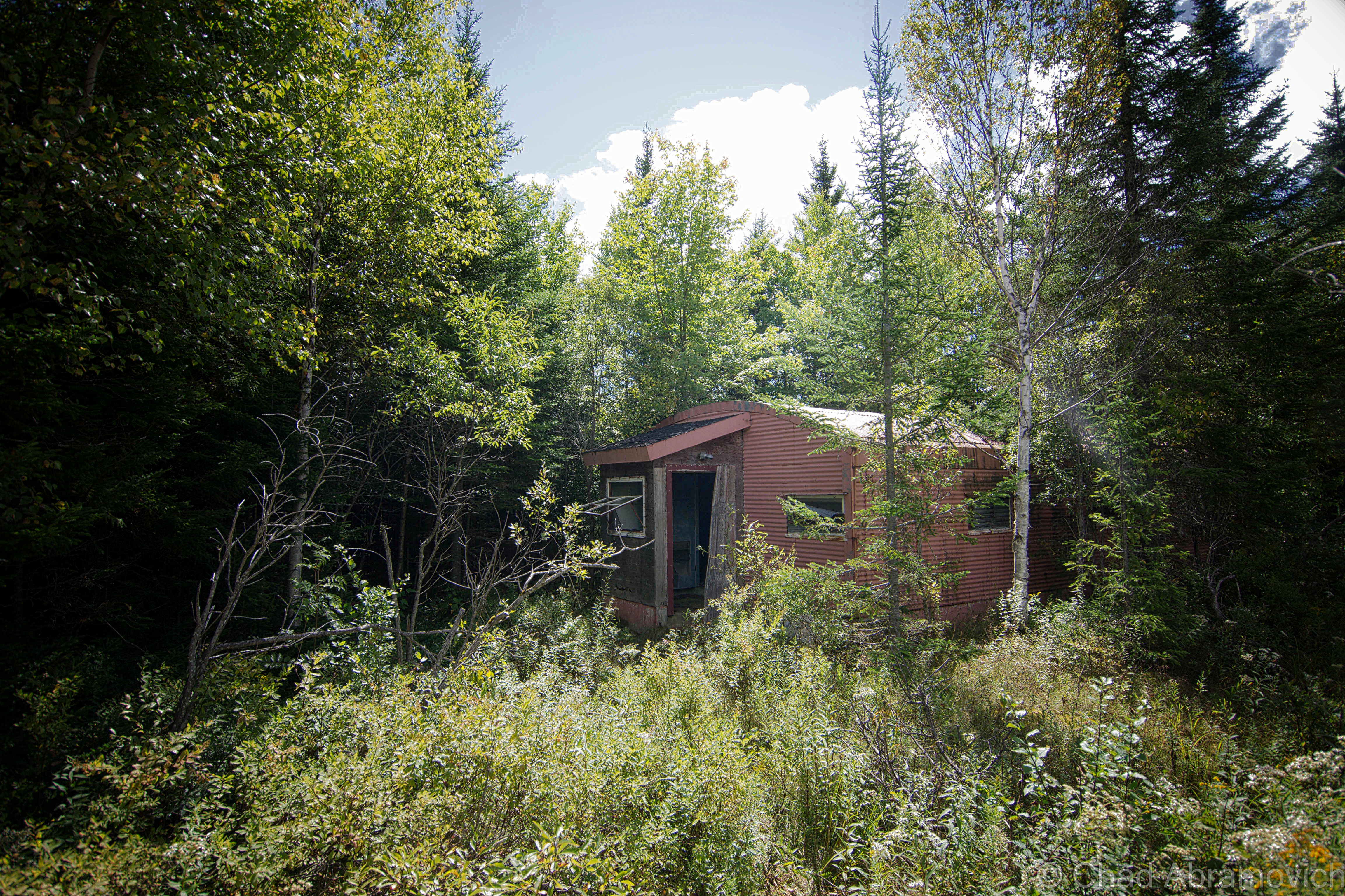
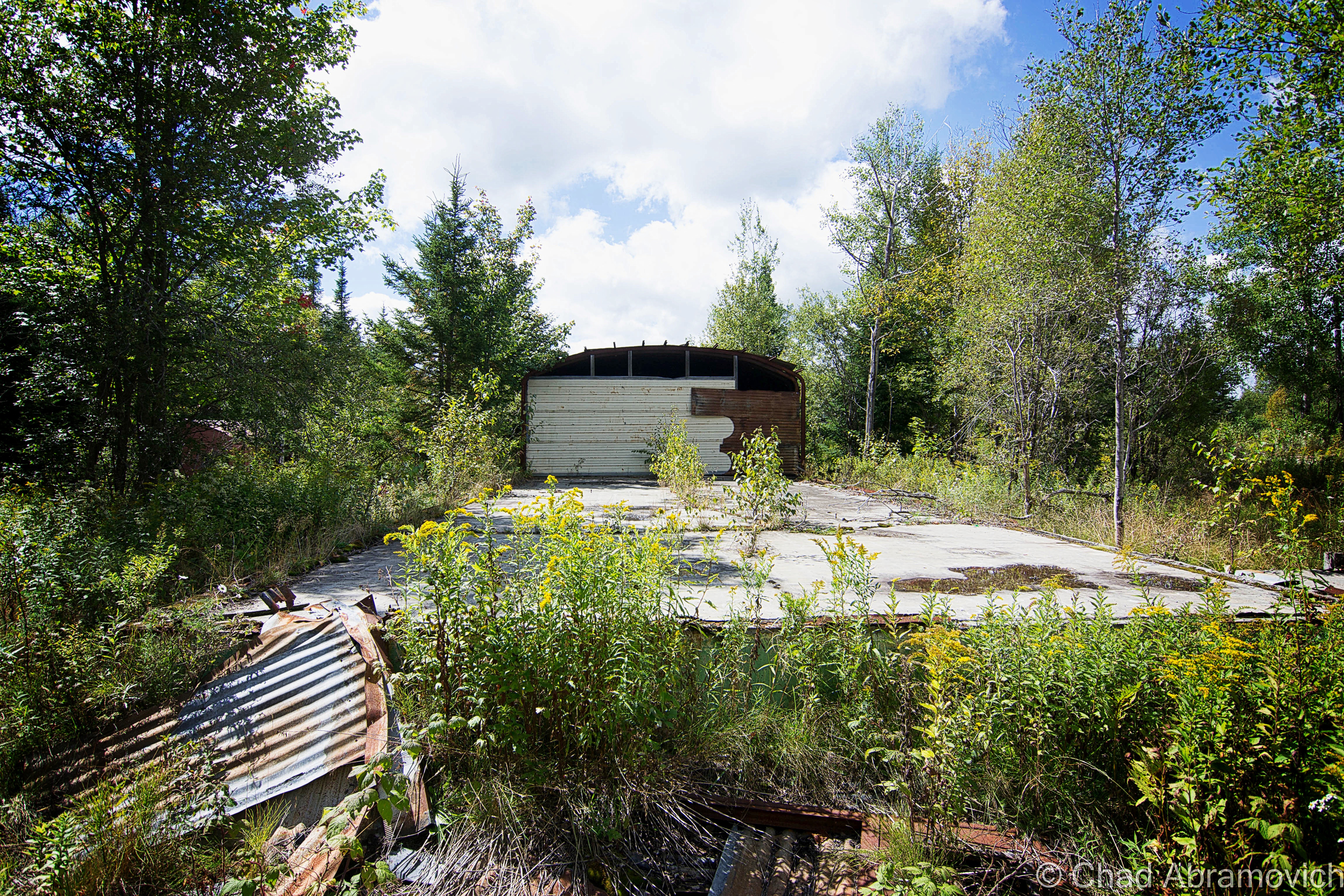
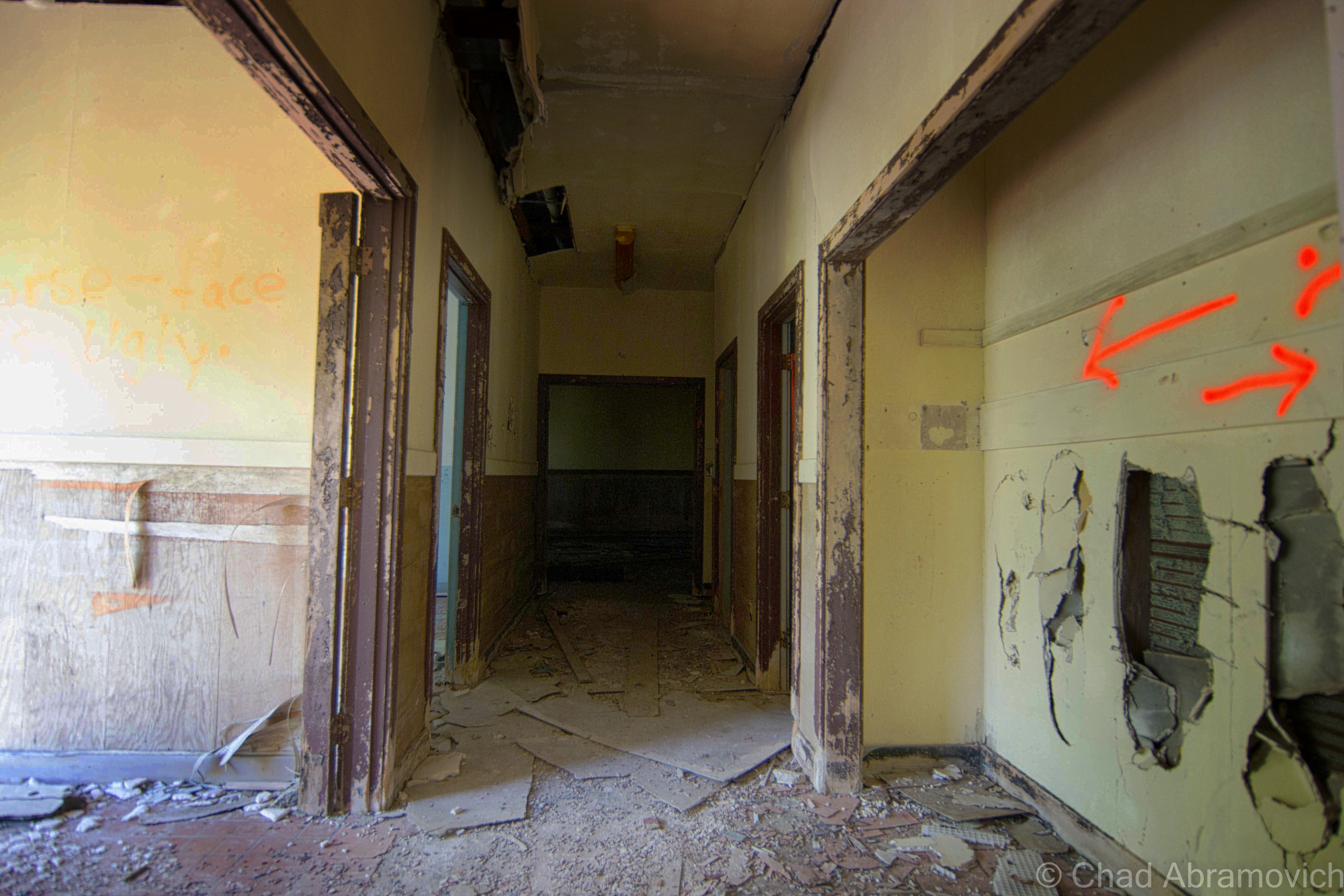
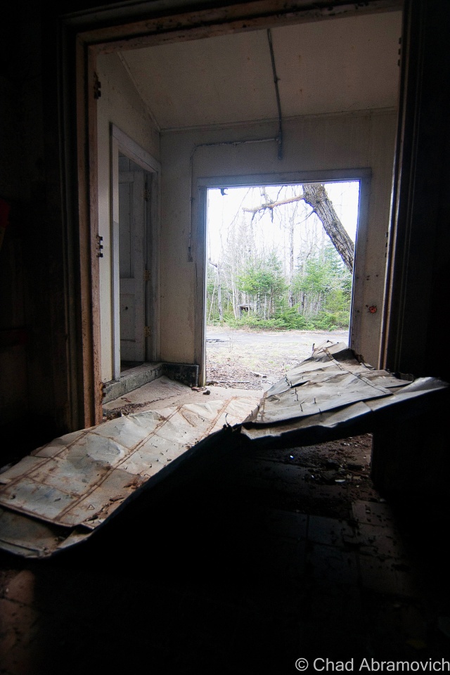
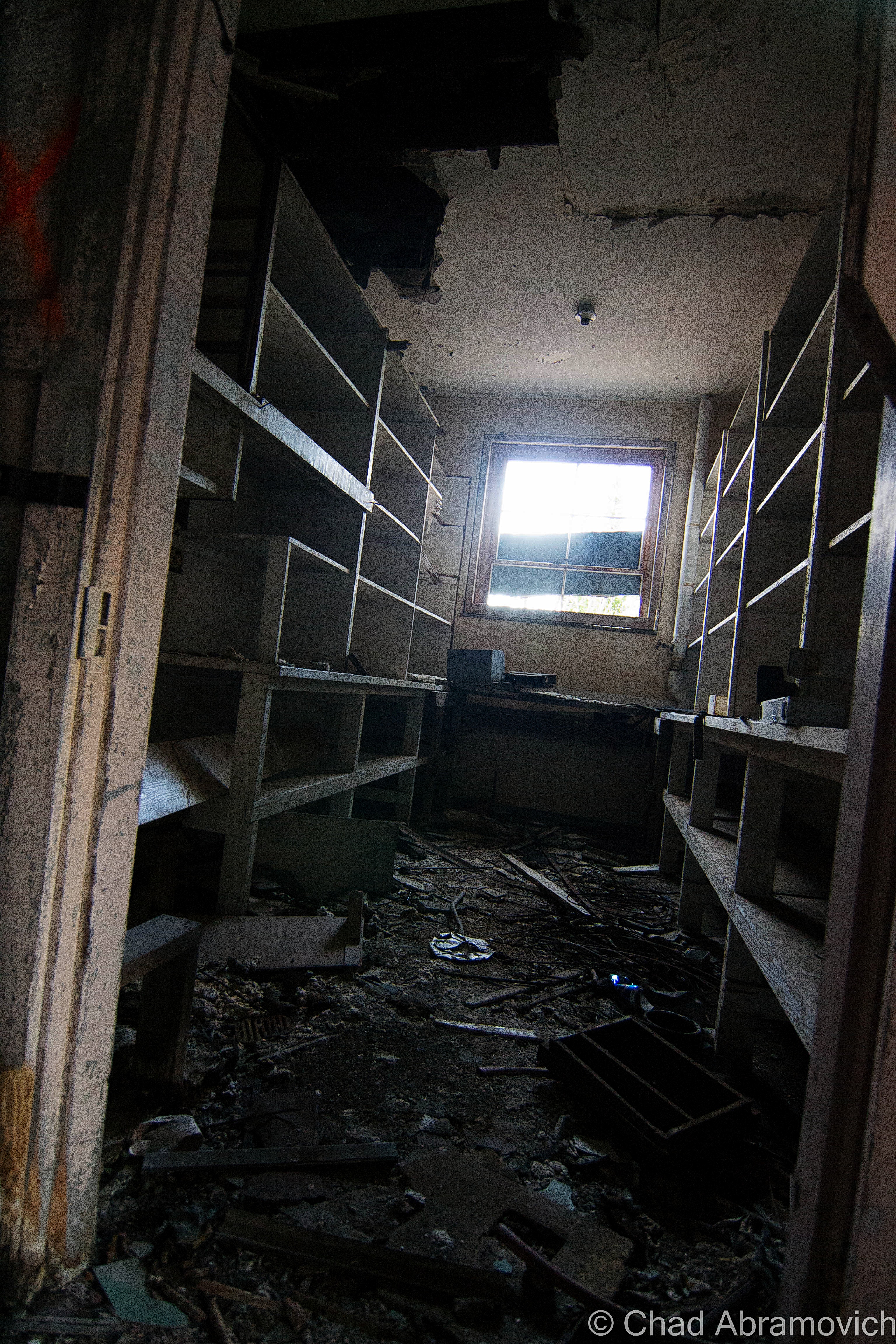
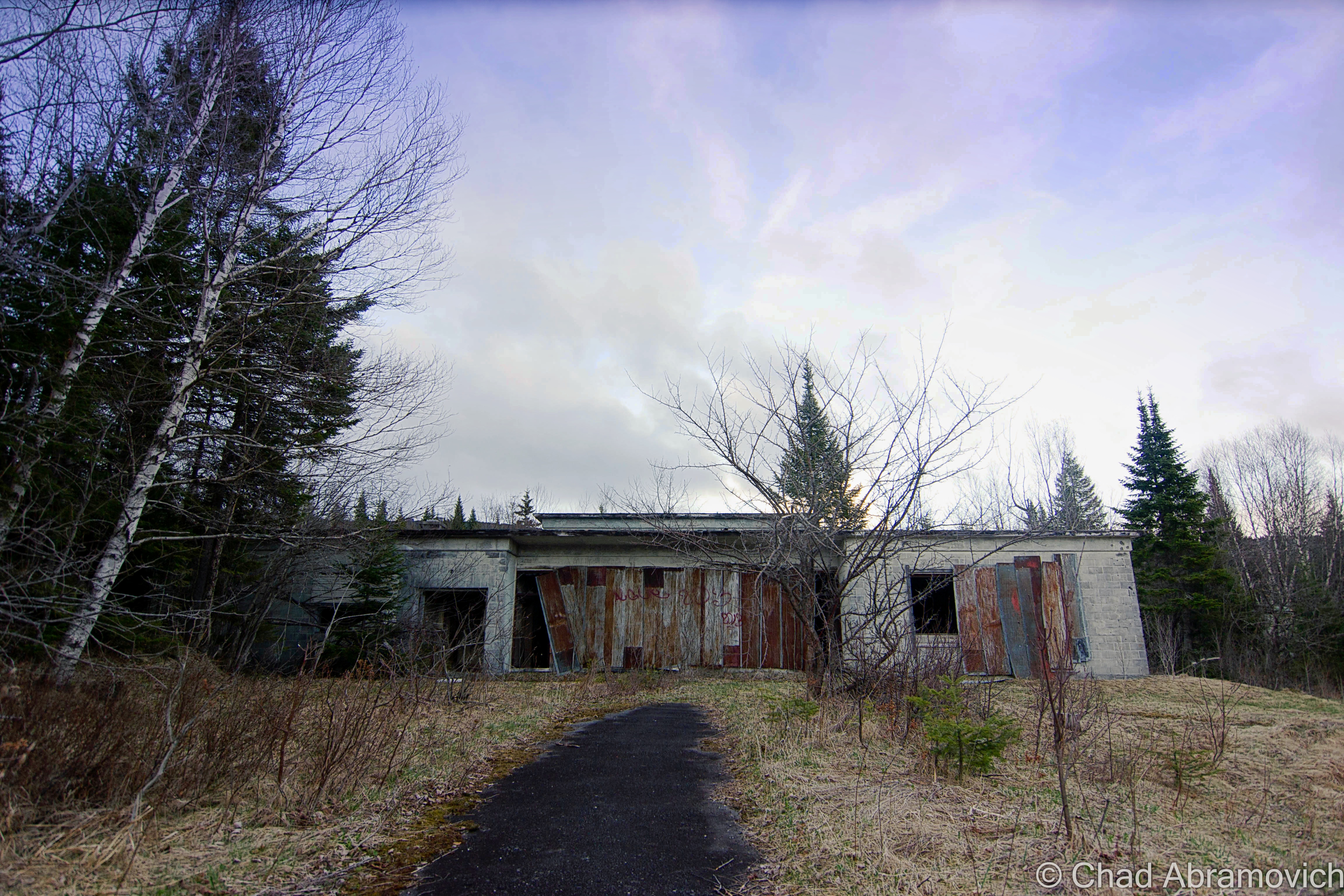
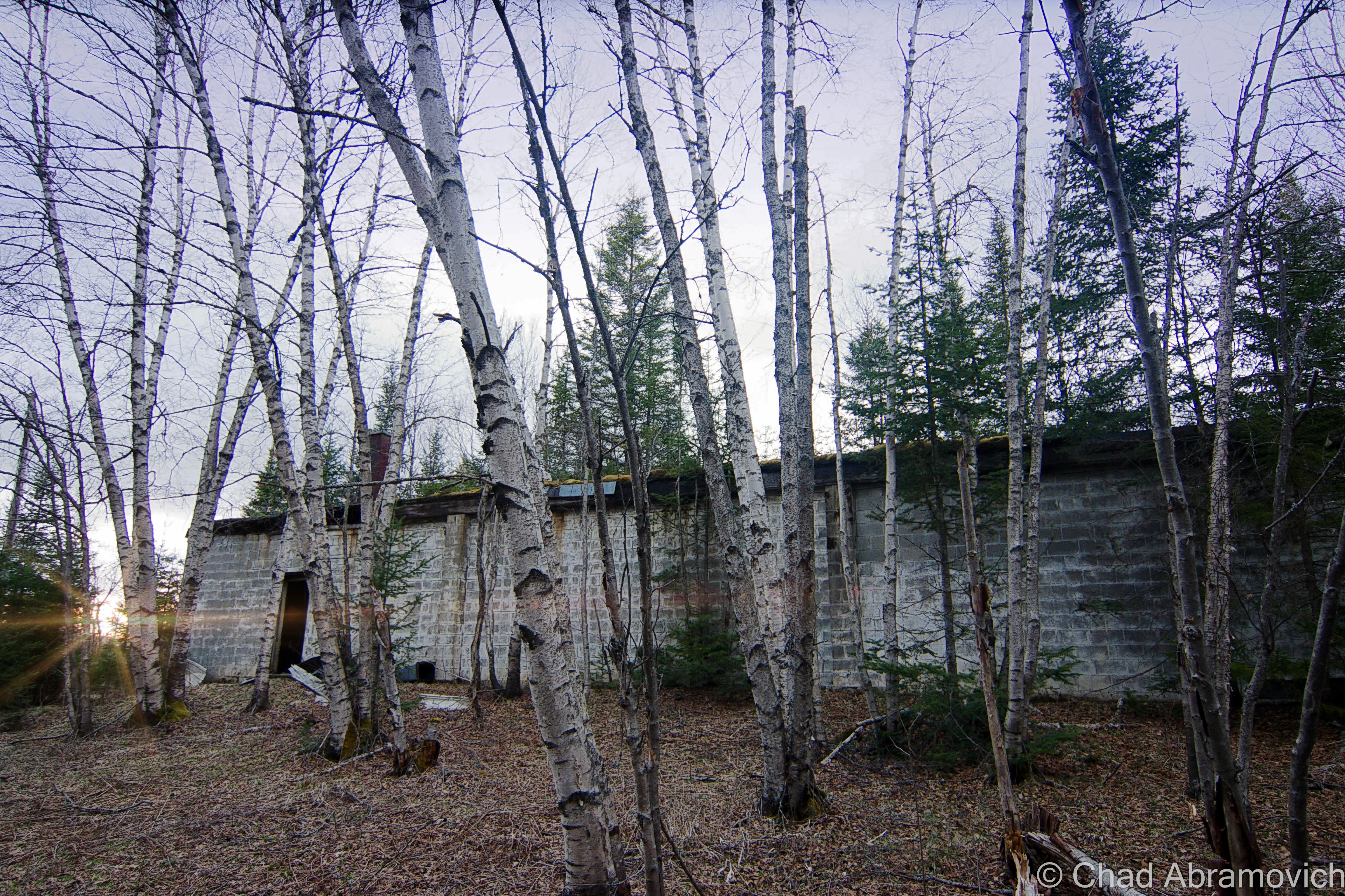
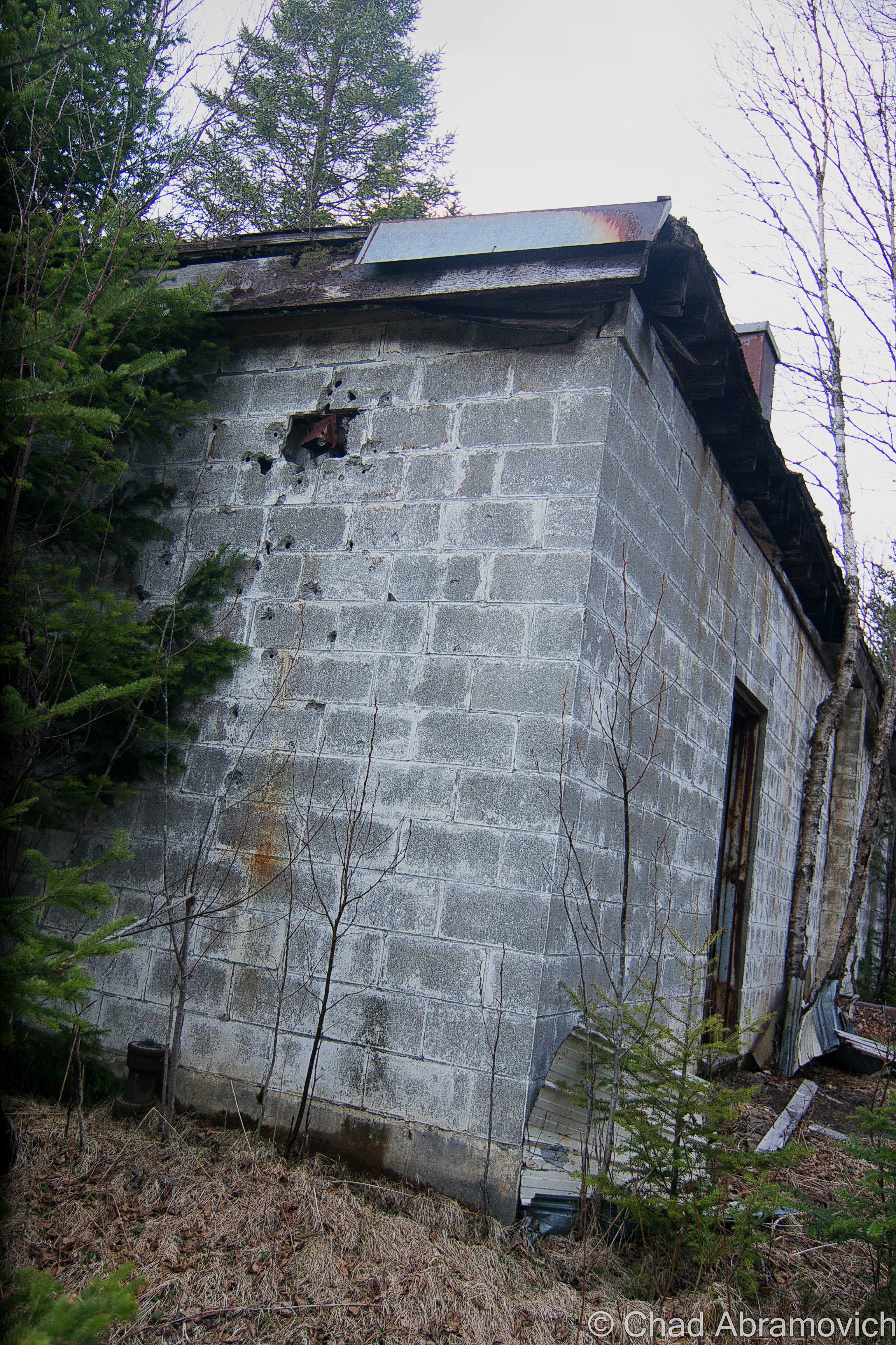
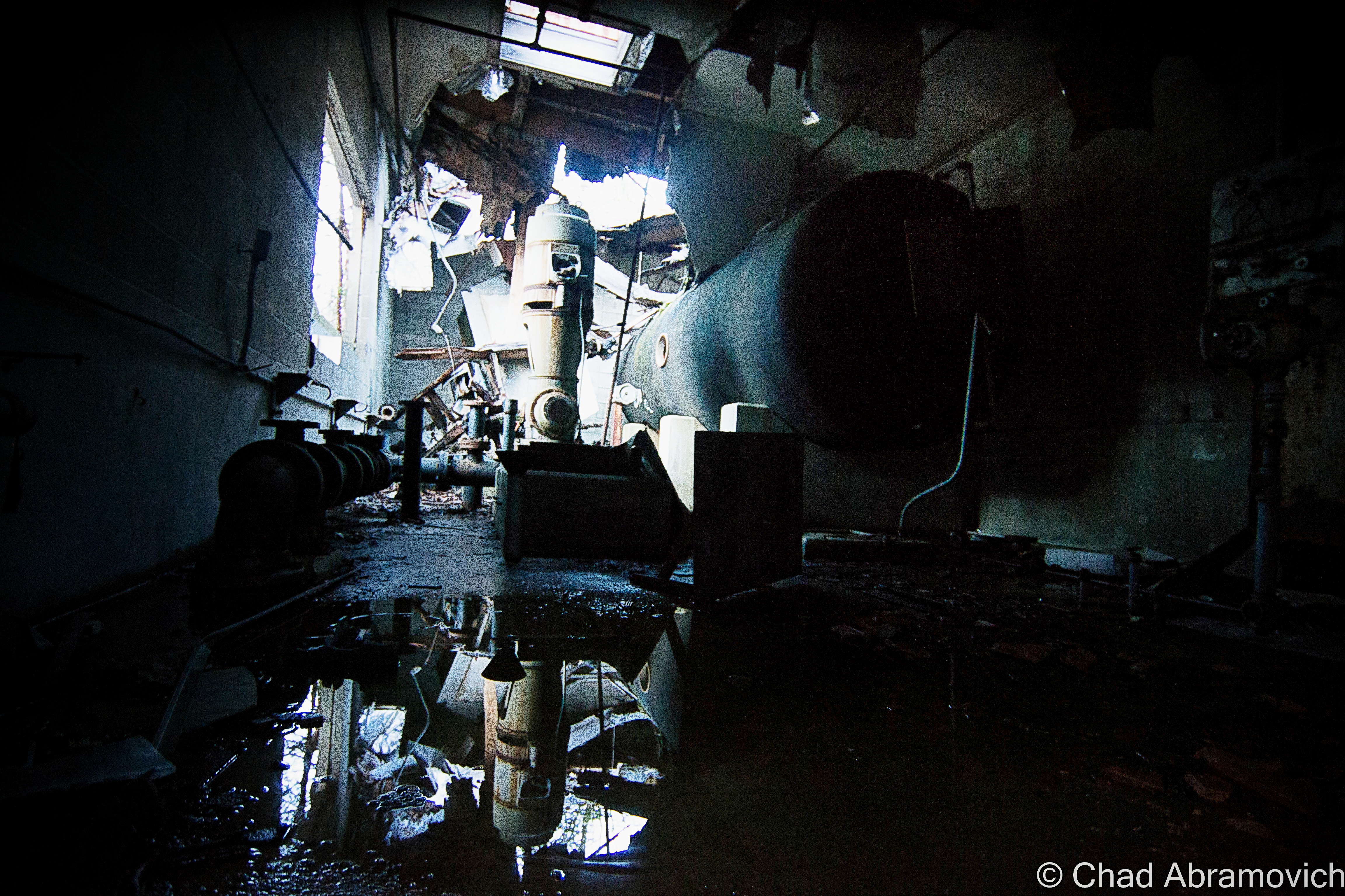
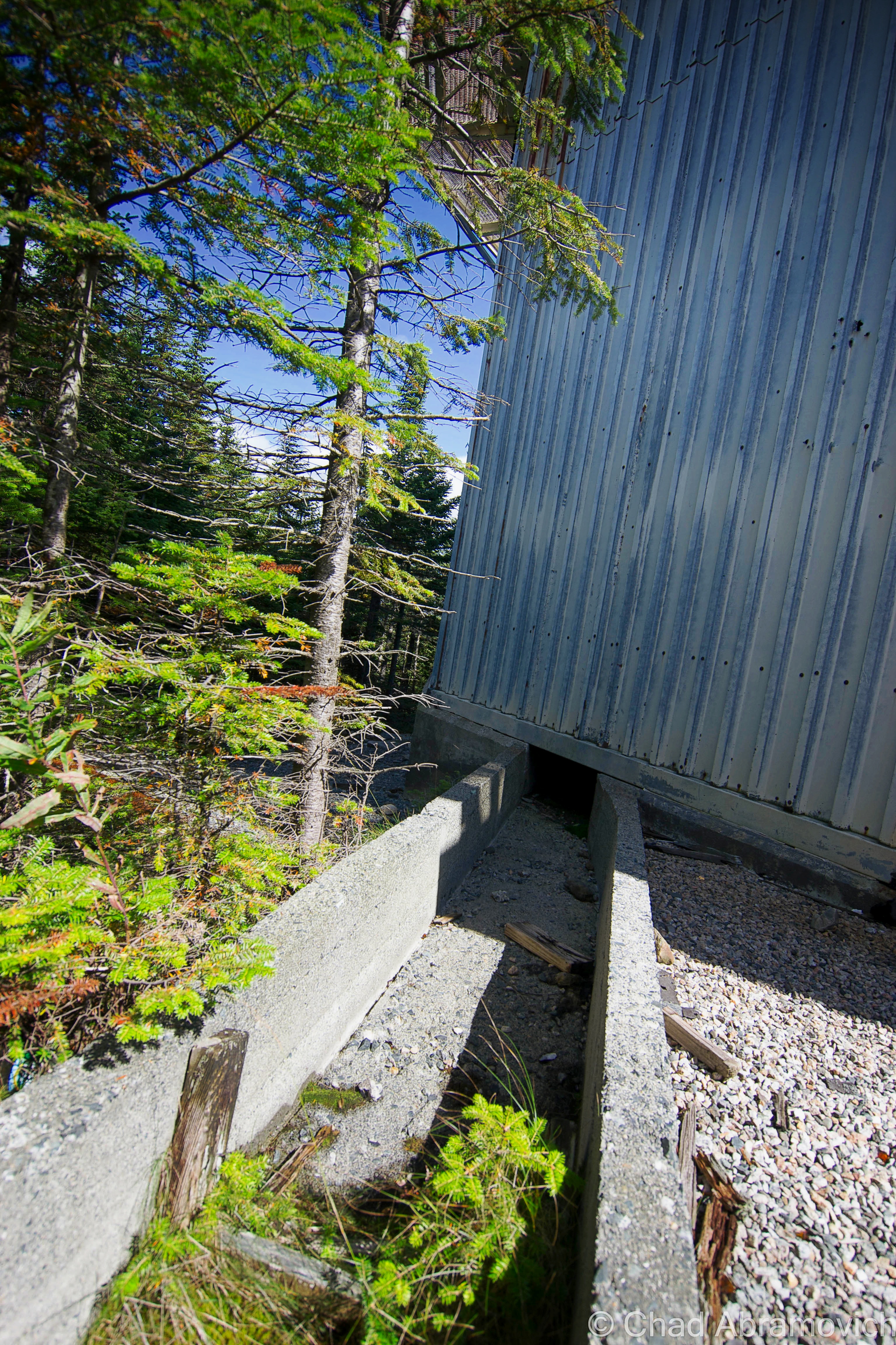
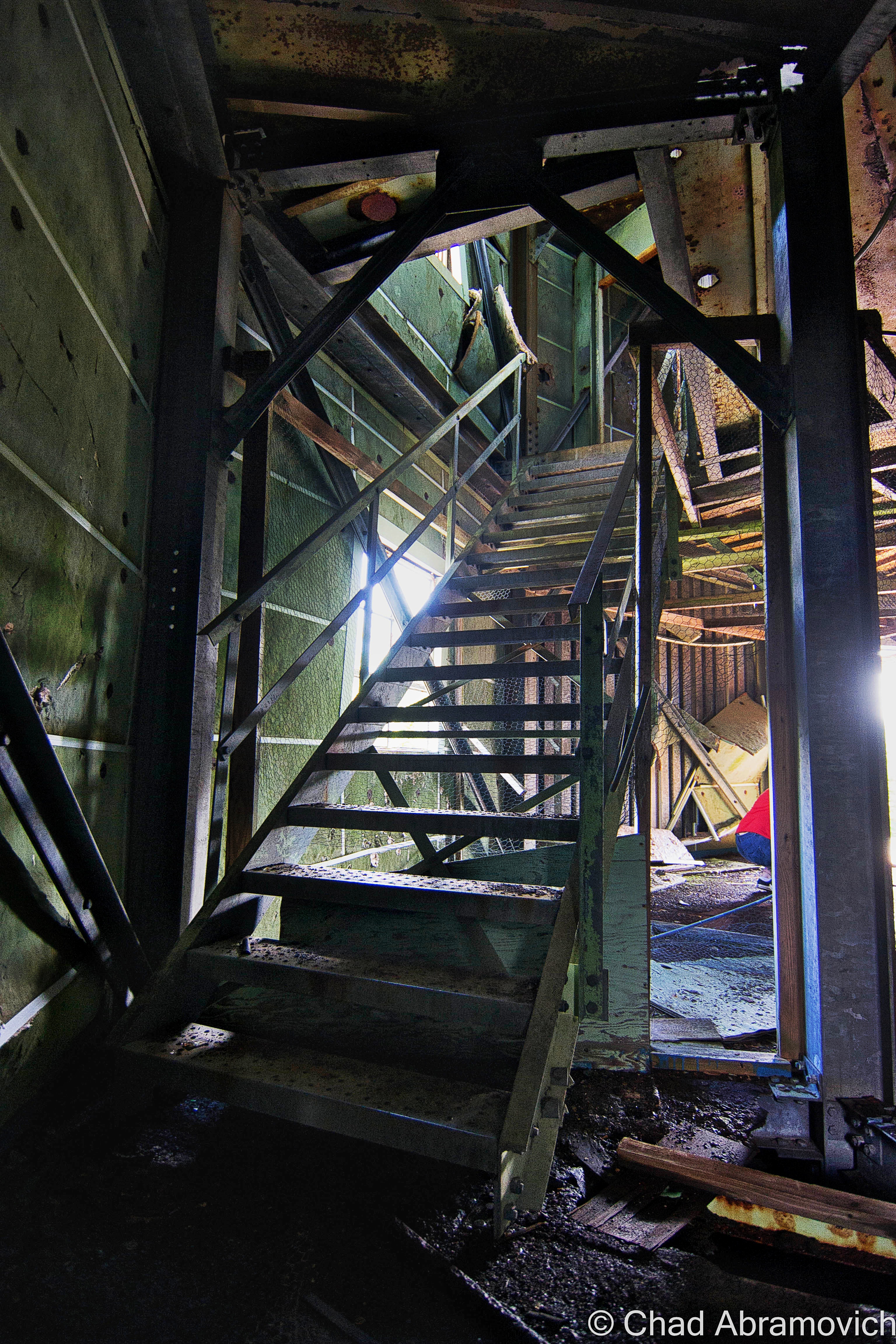
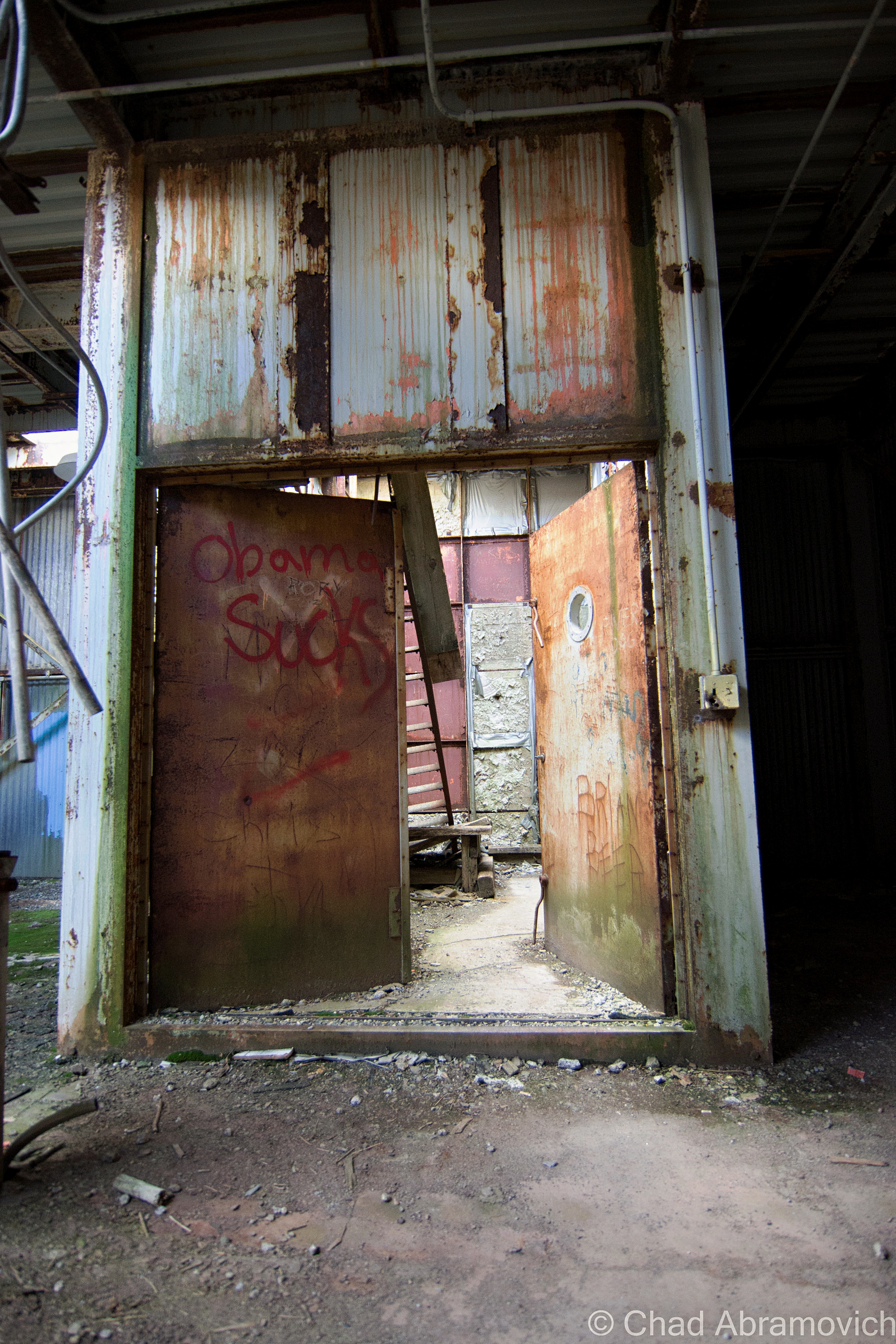
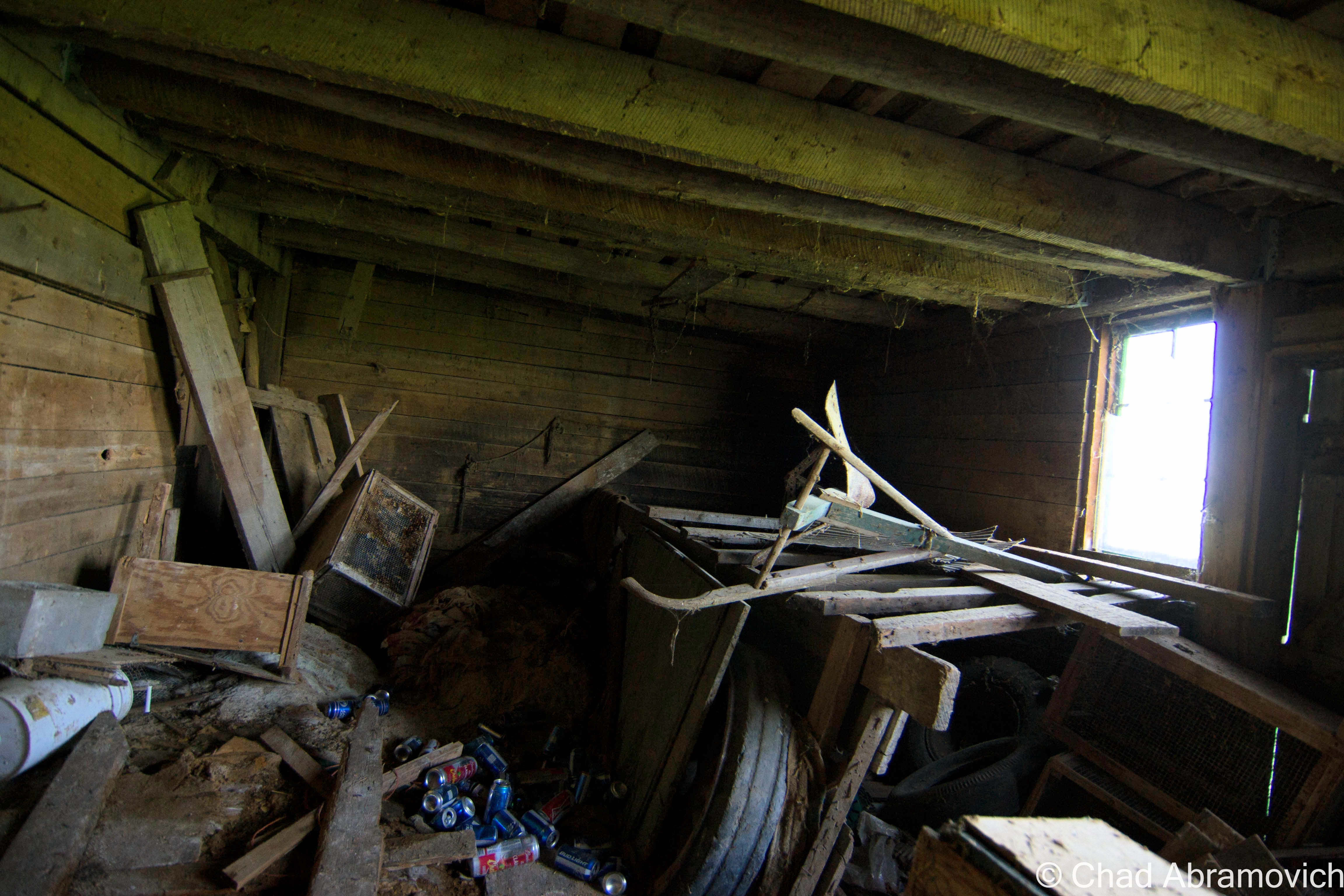
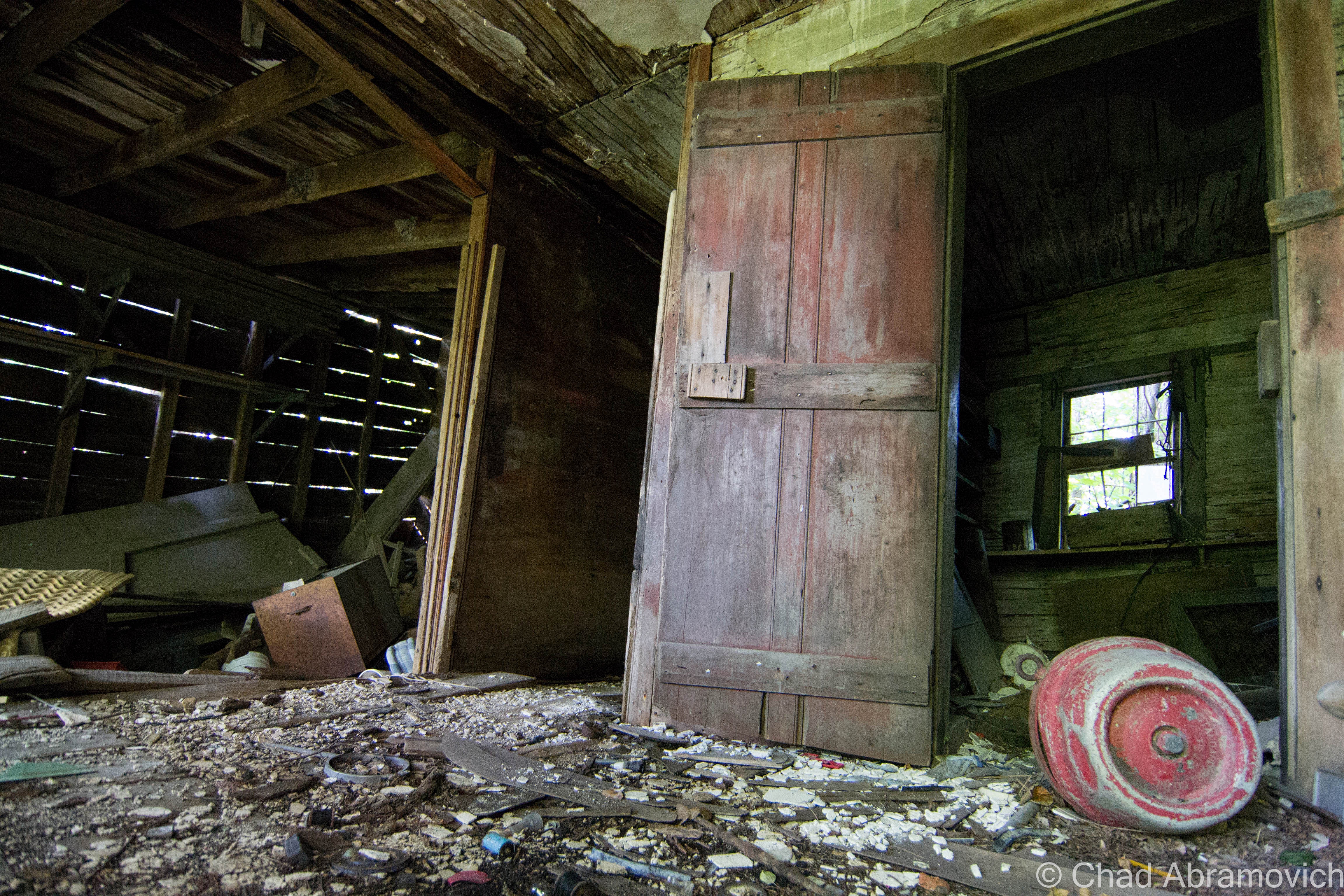
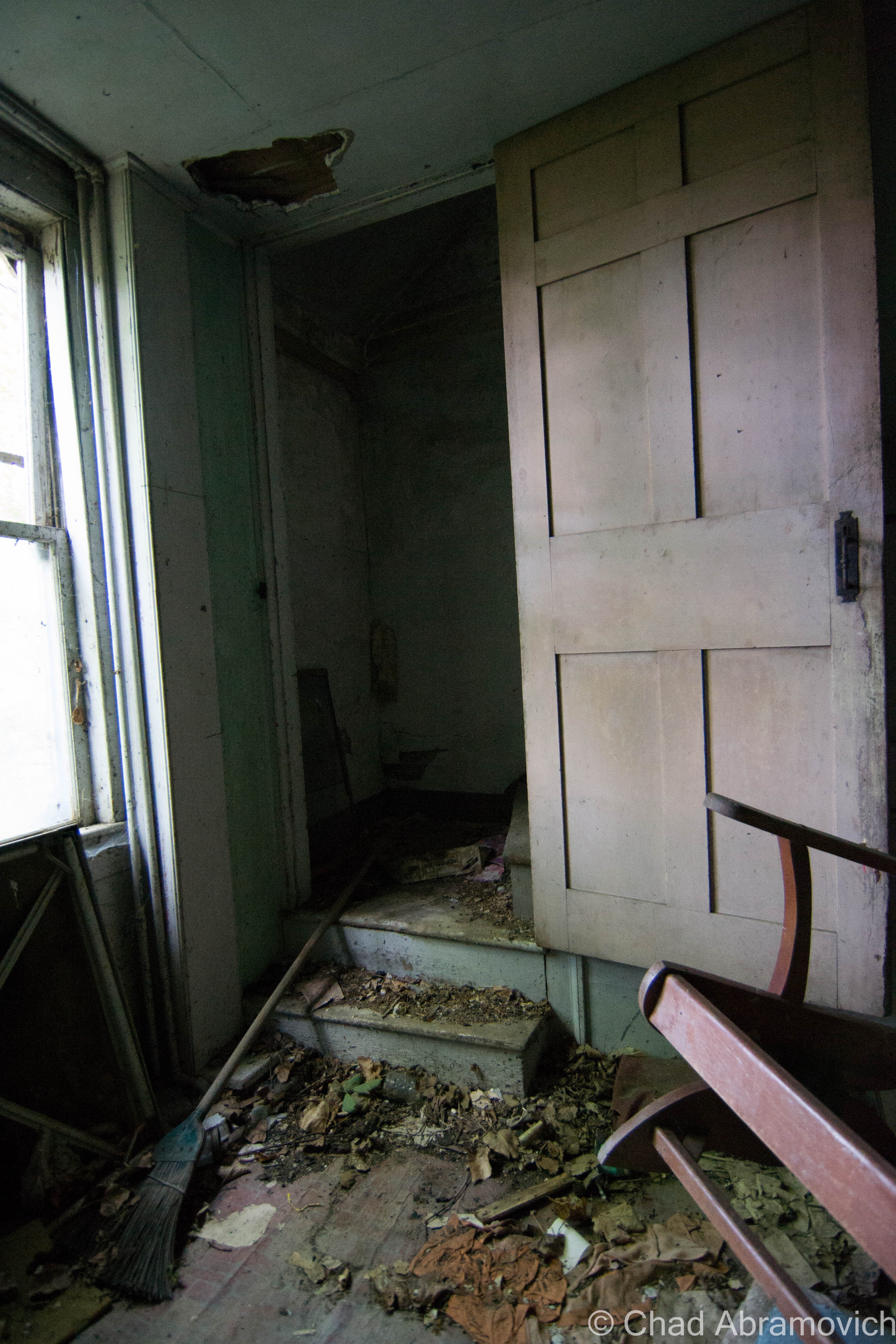
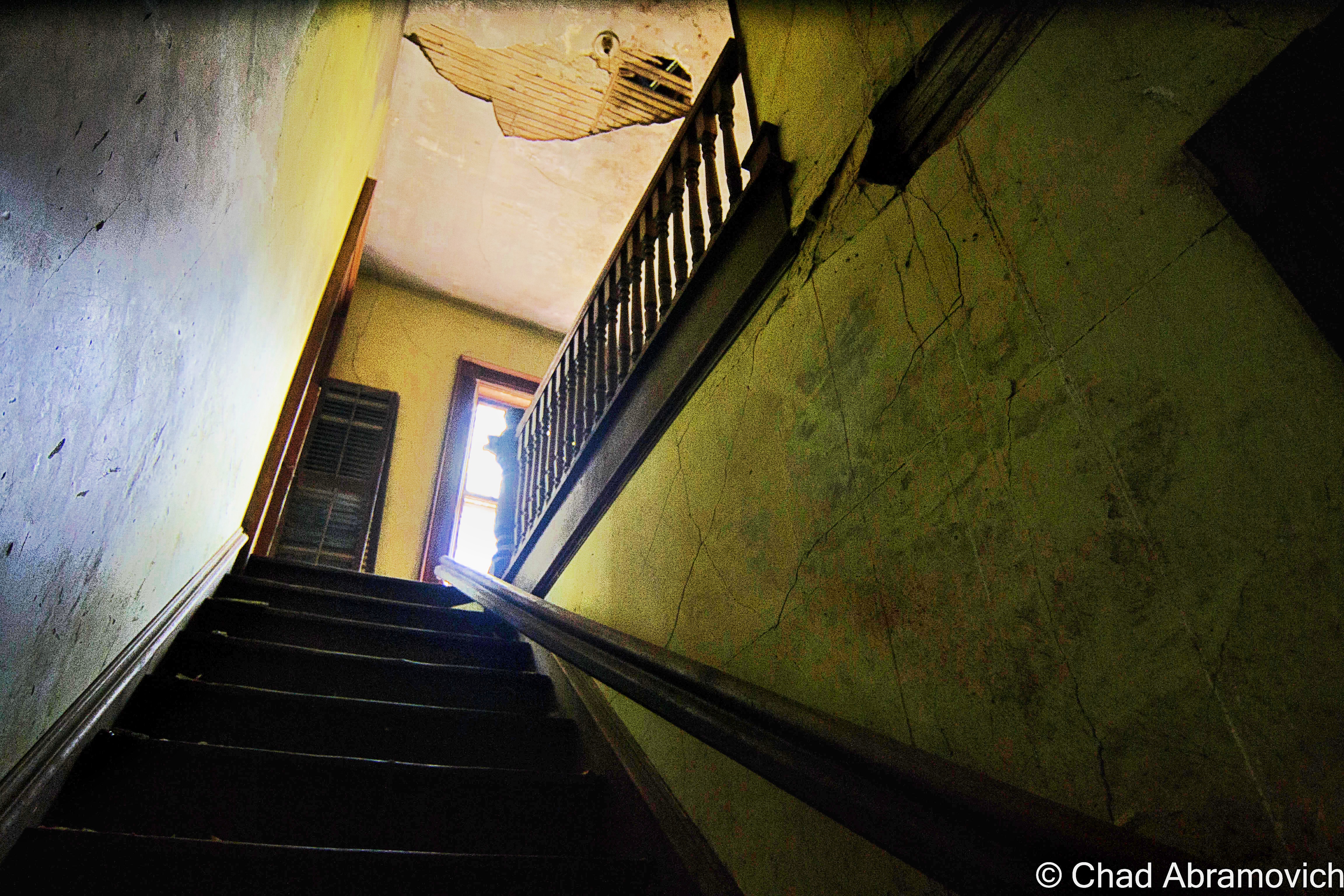
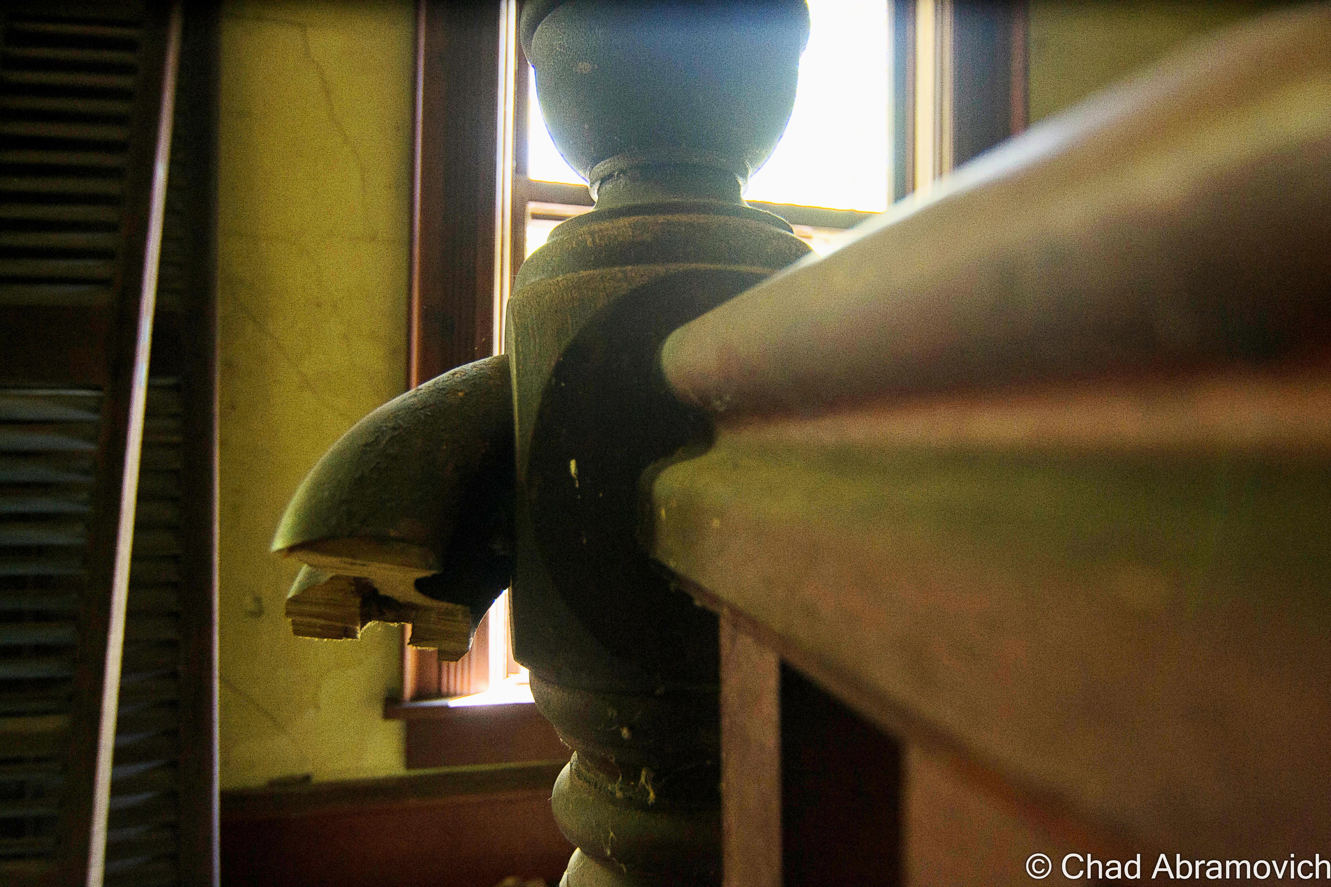
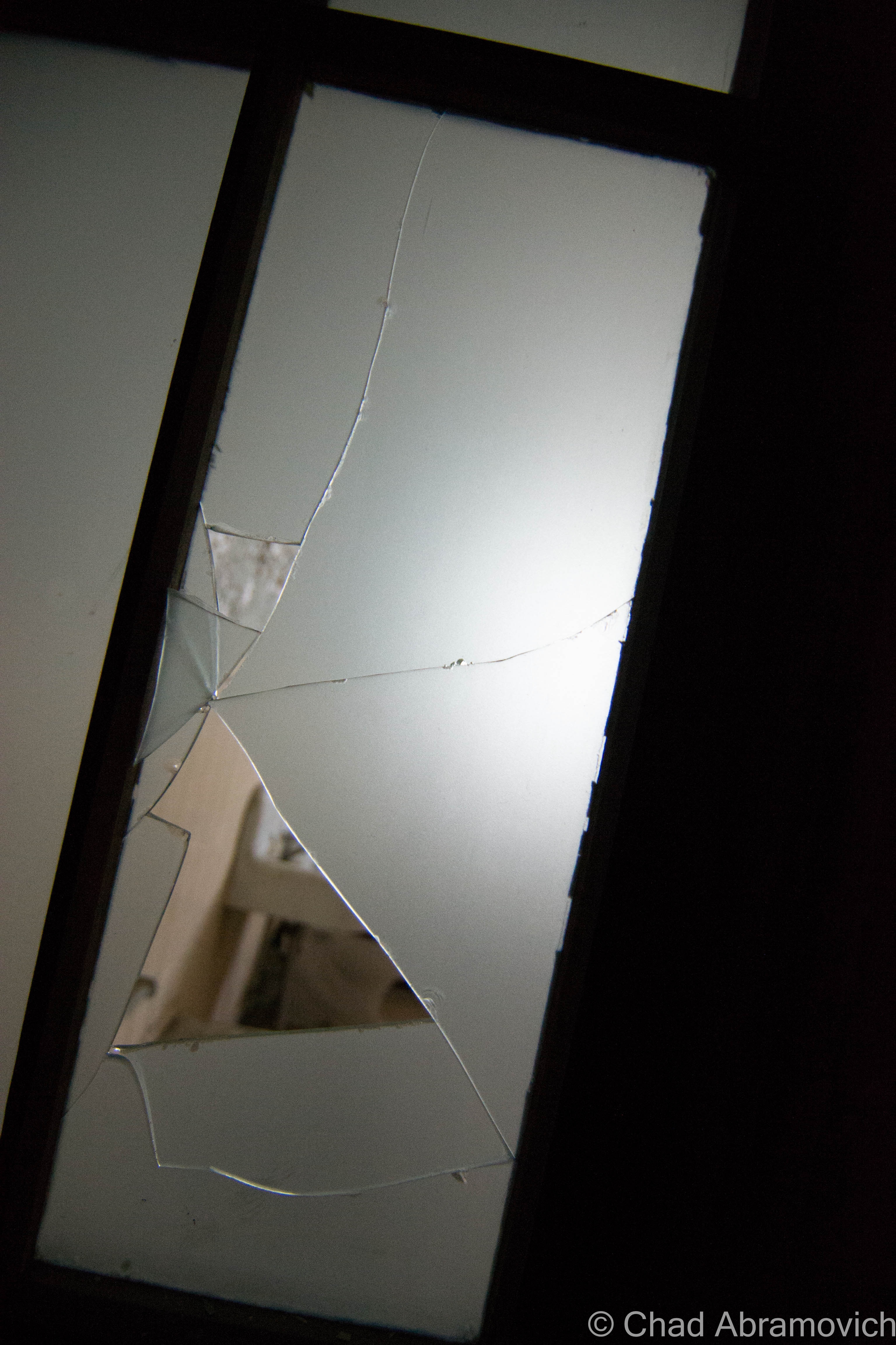
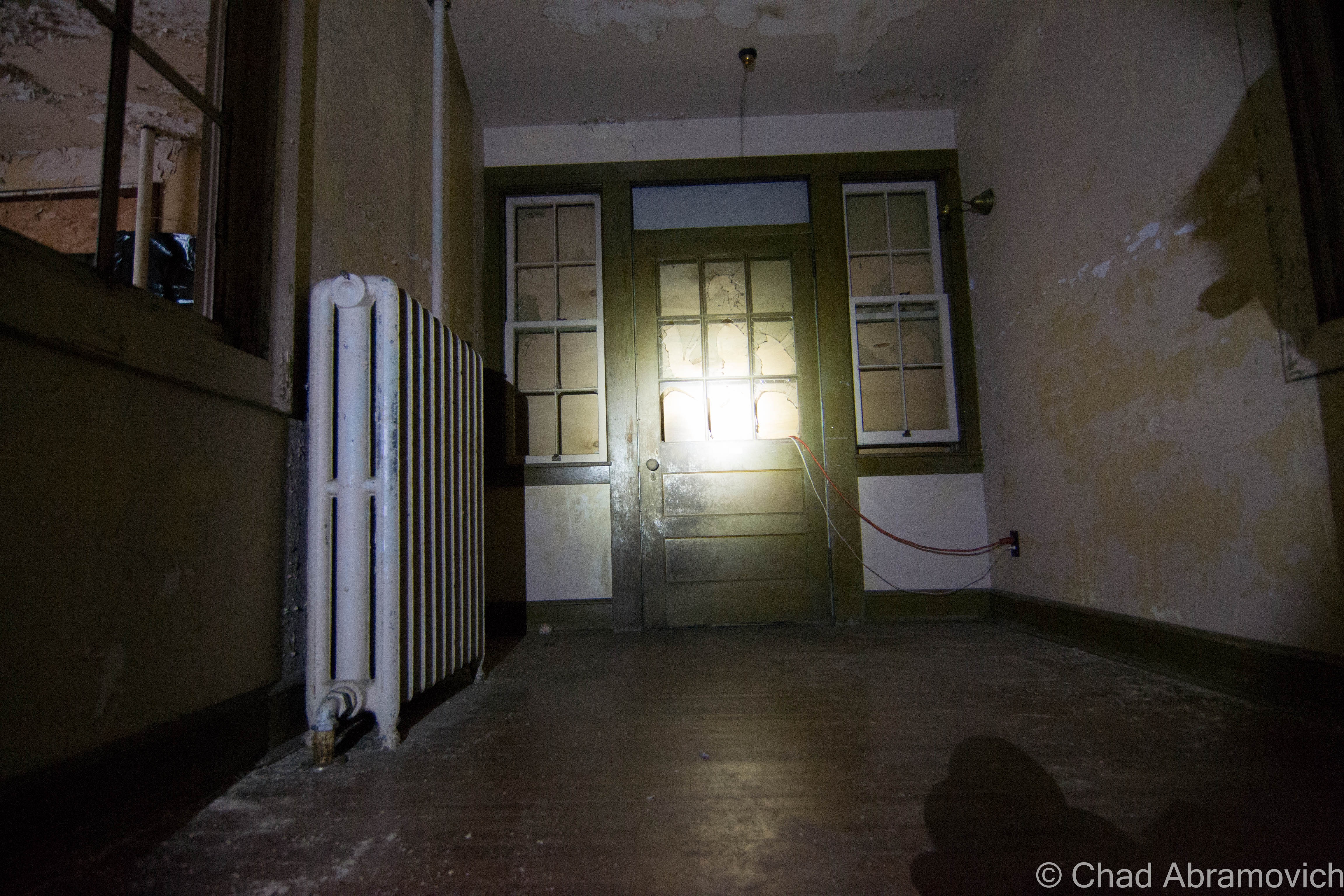
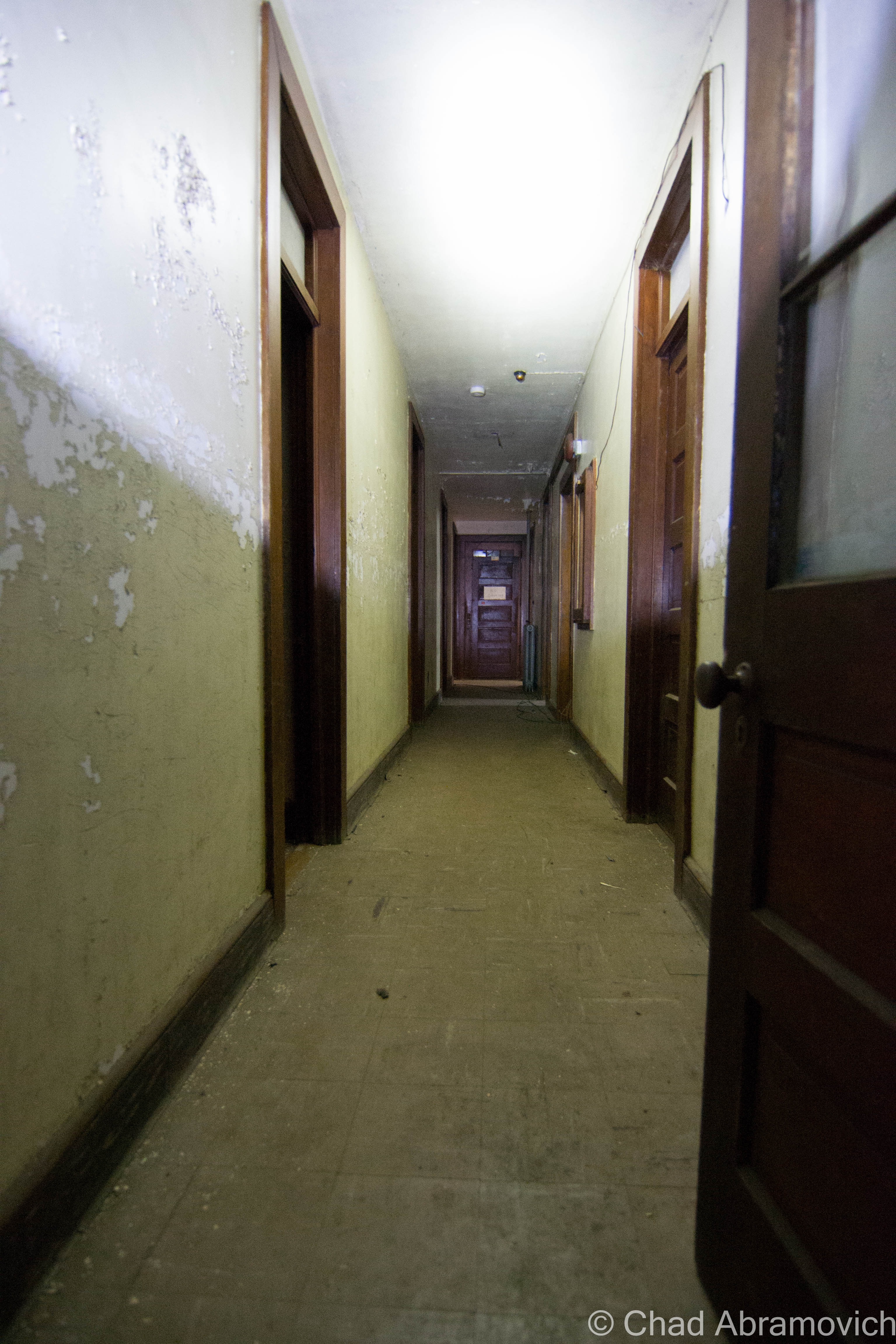
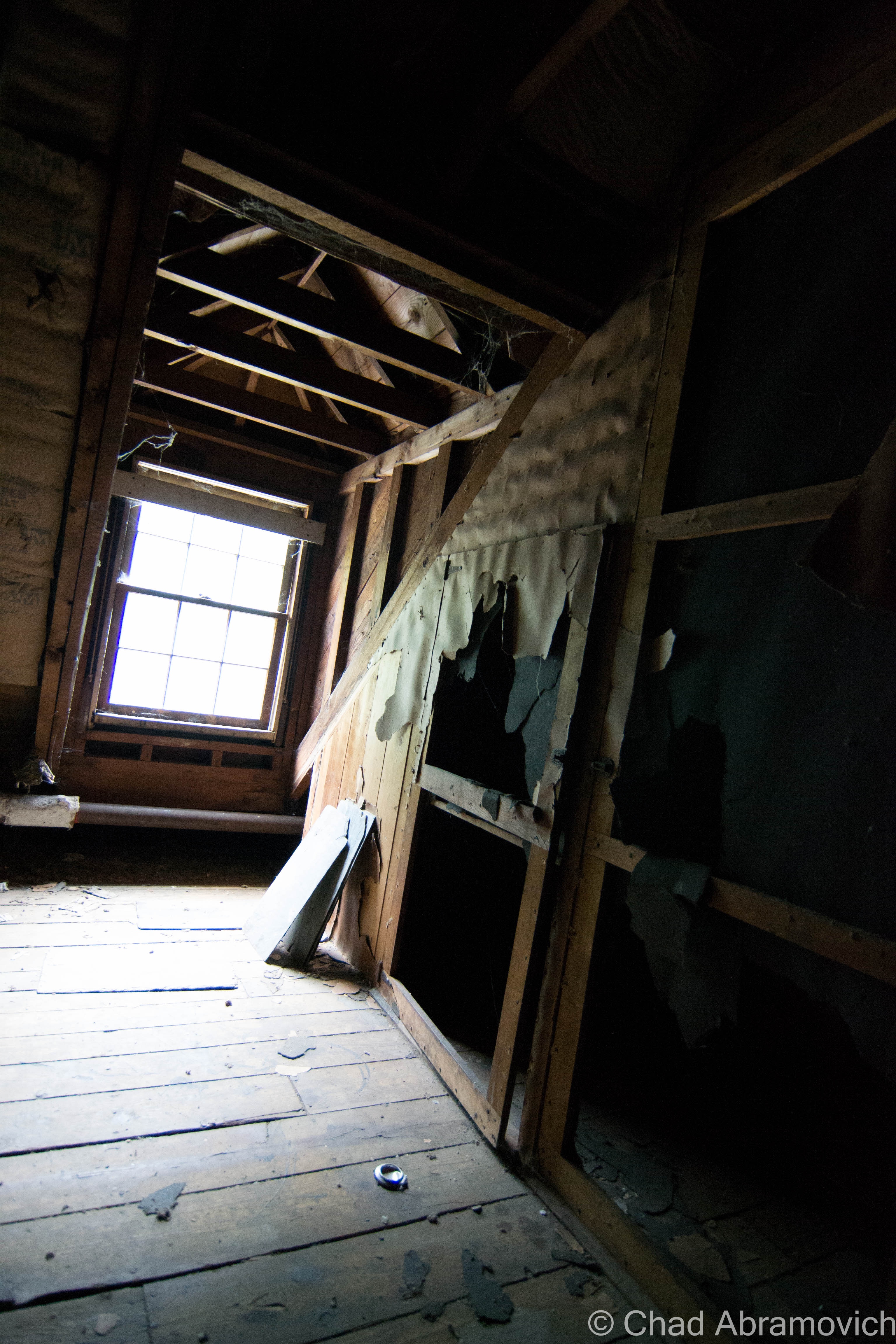
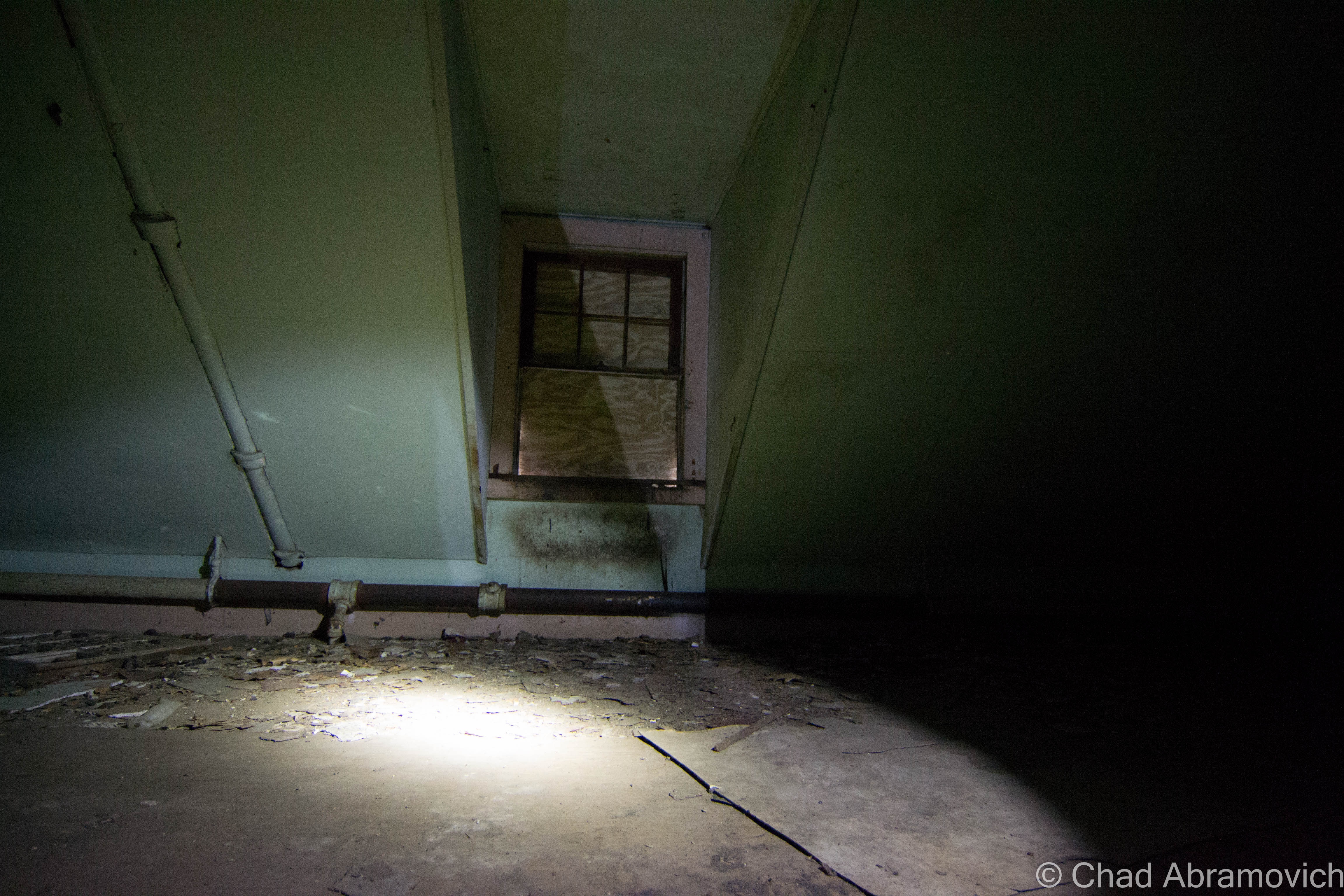
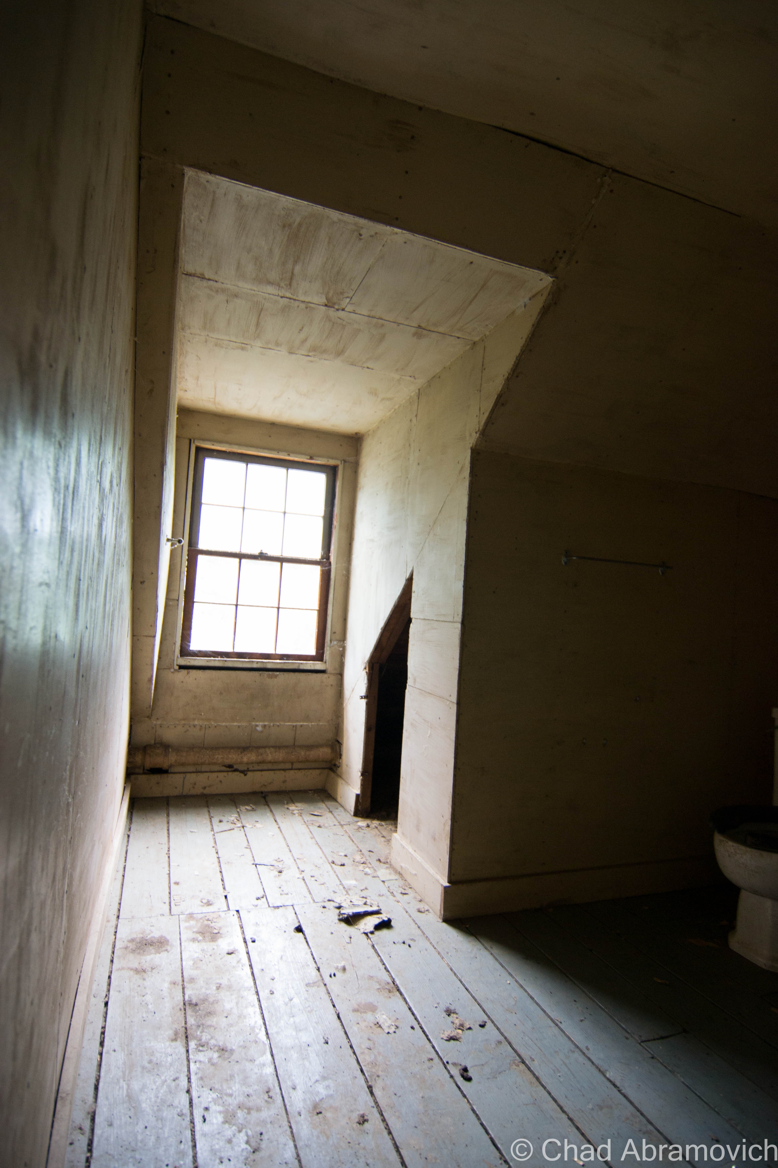
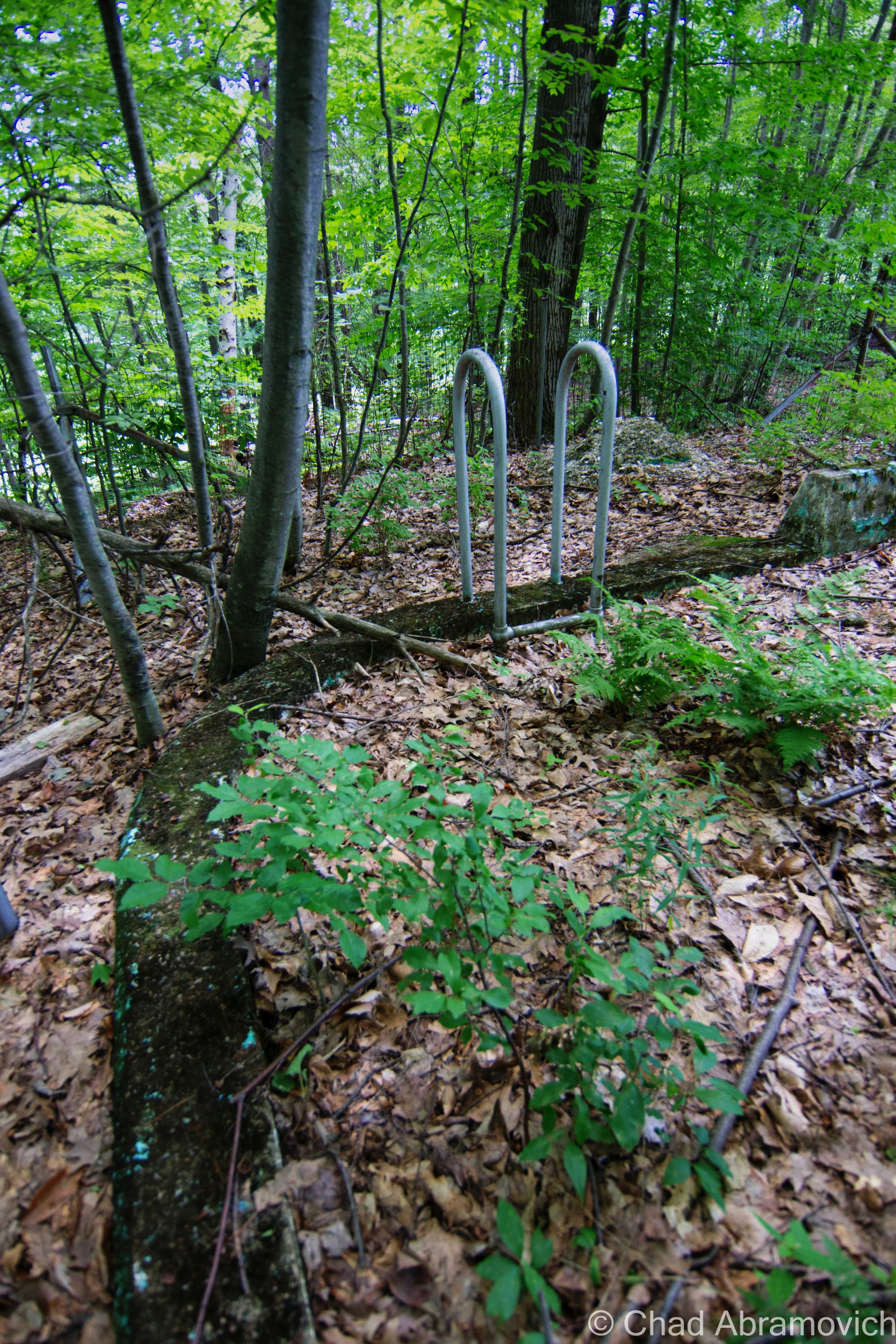
Afterward, we entered the jungle that has consumed the back fringes of the main building – found our way down a forgotten concrete staircase that was being slowly crumbled by encroaching trees that we were constantly shielding from smacking us in our faces, inside an outbuilding that had totally fused with nature, and contorted through a broken window.

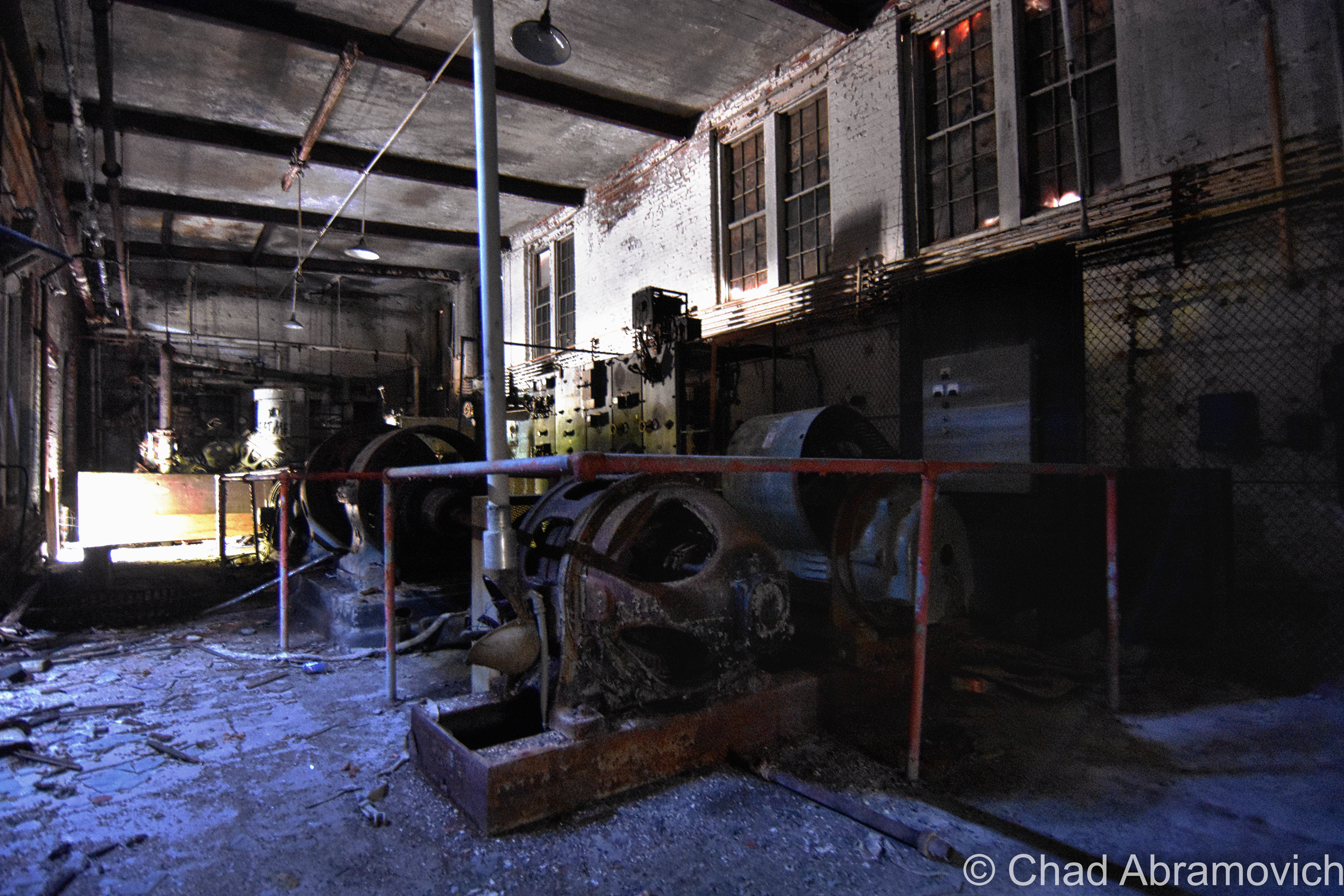
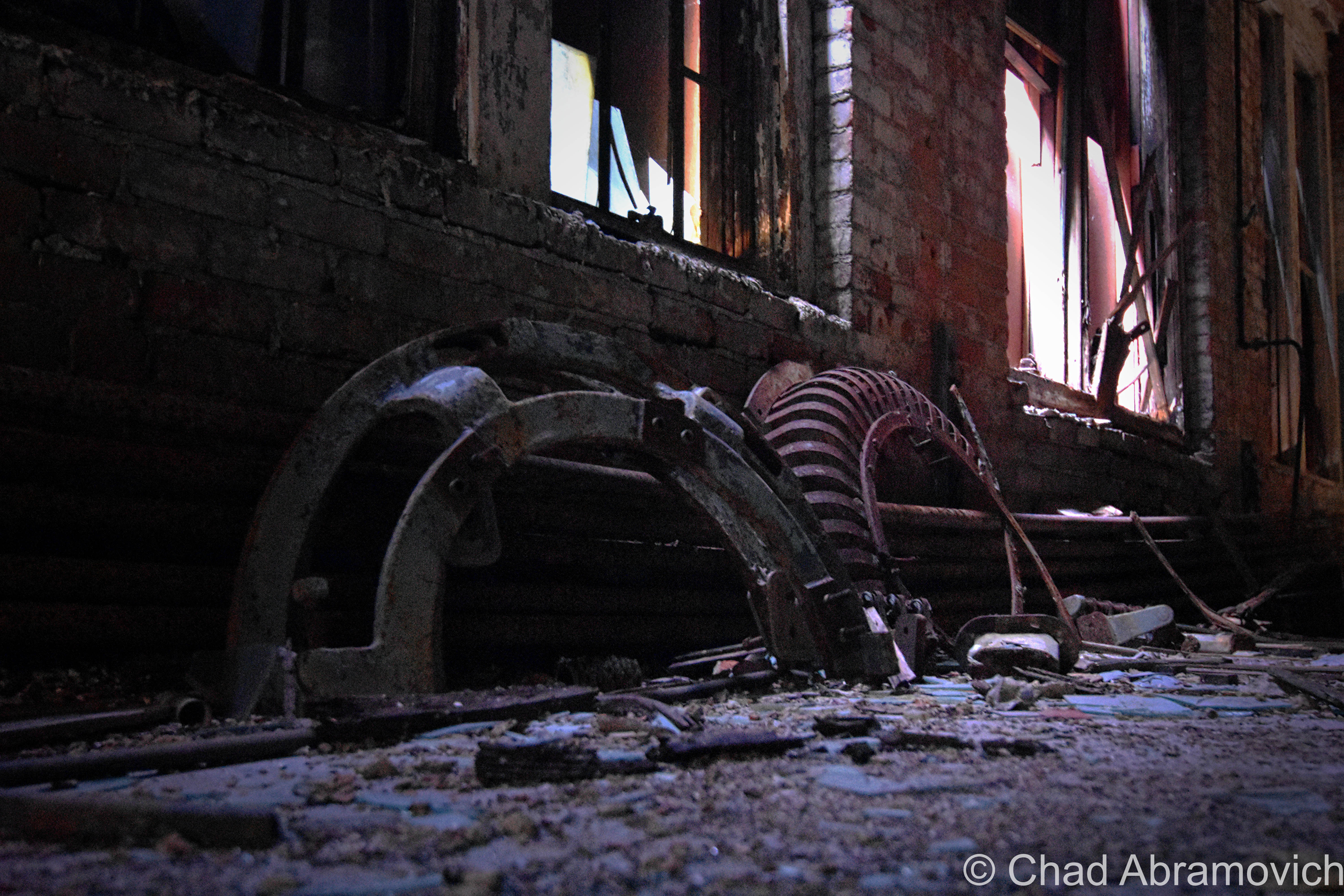
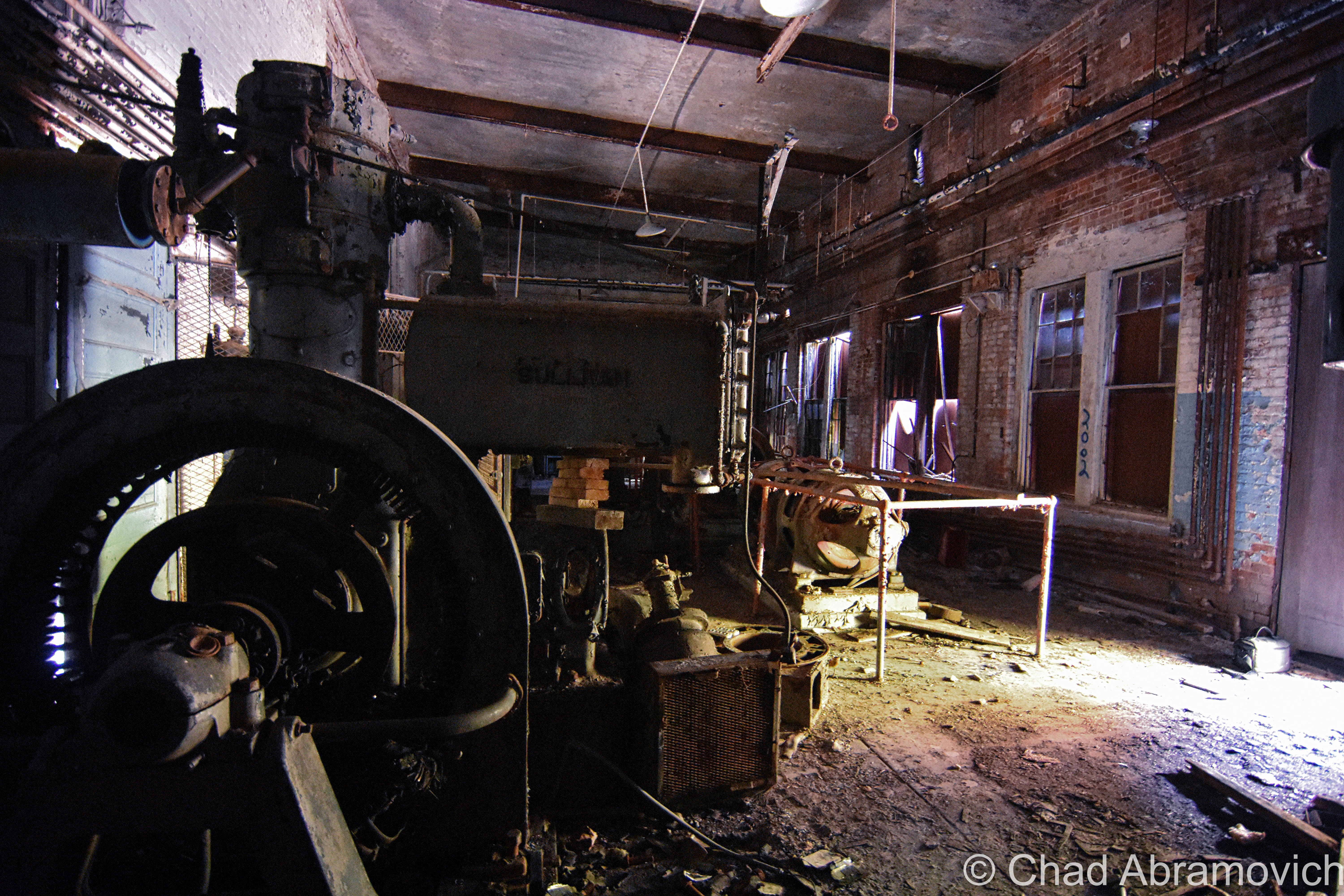
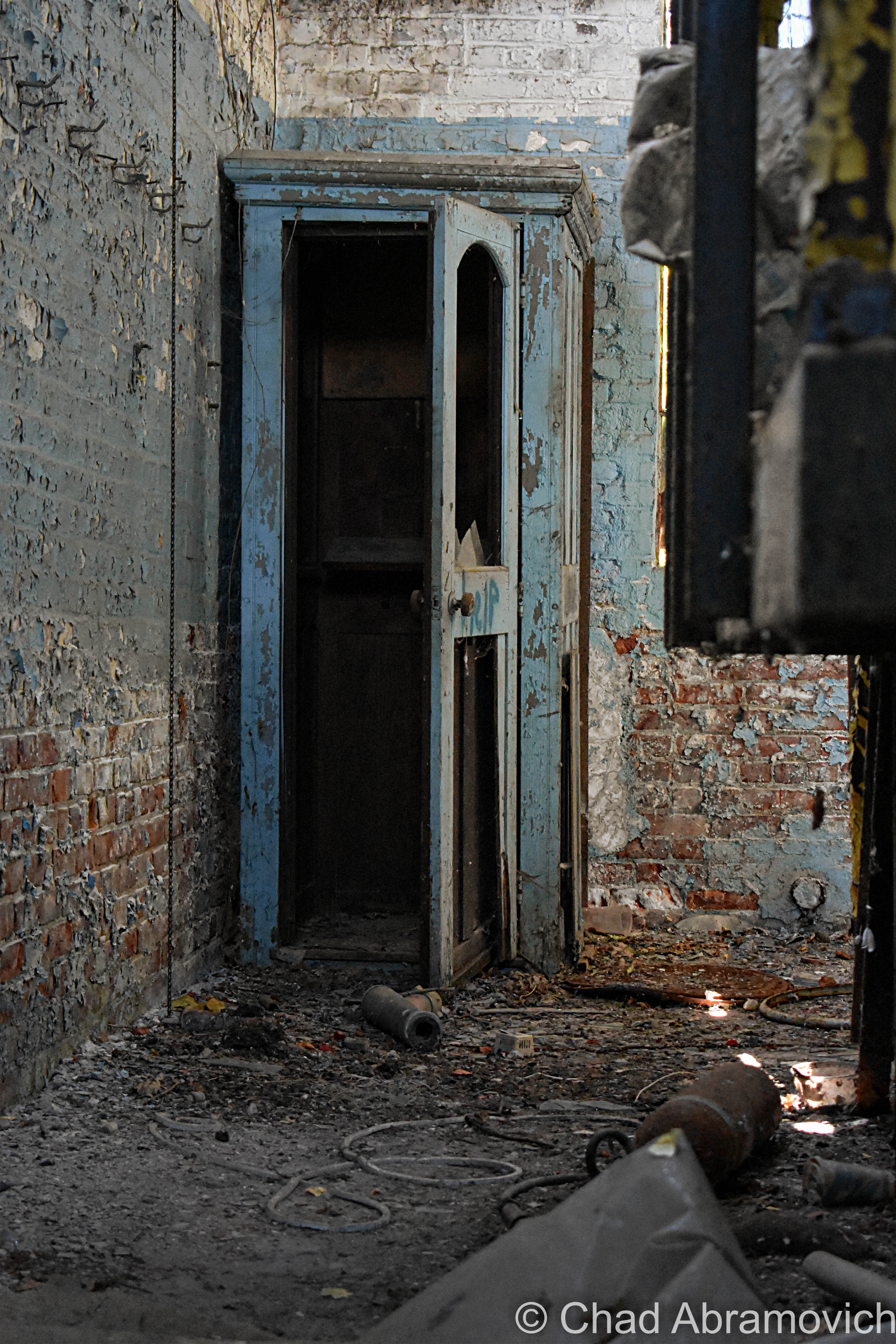
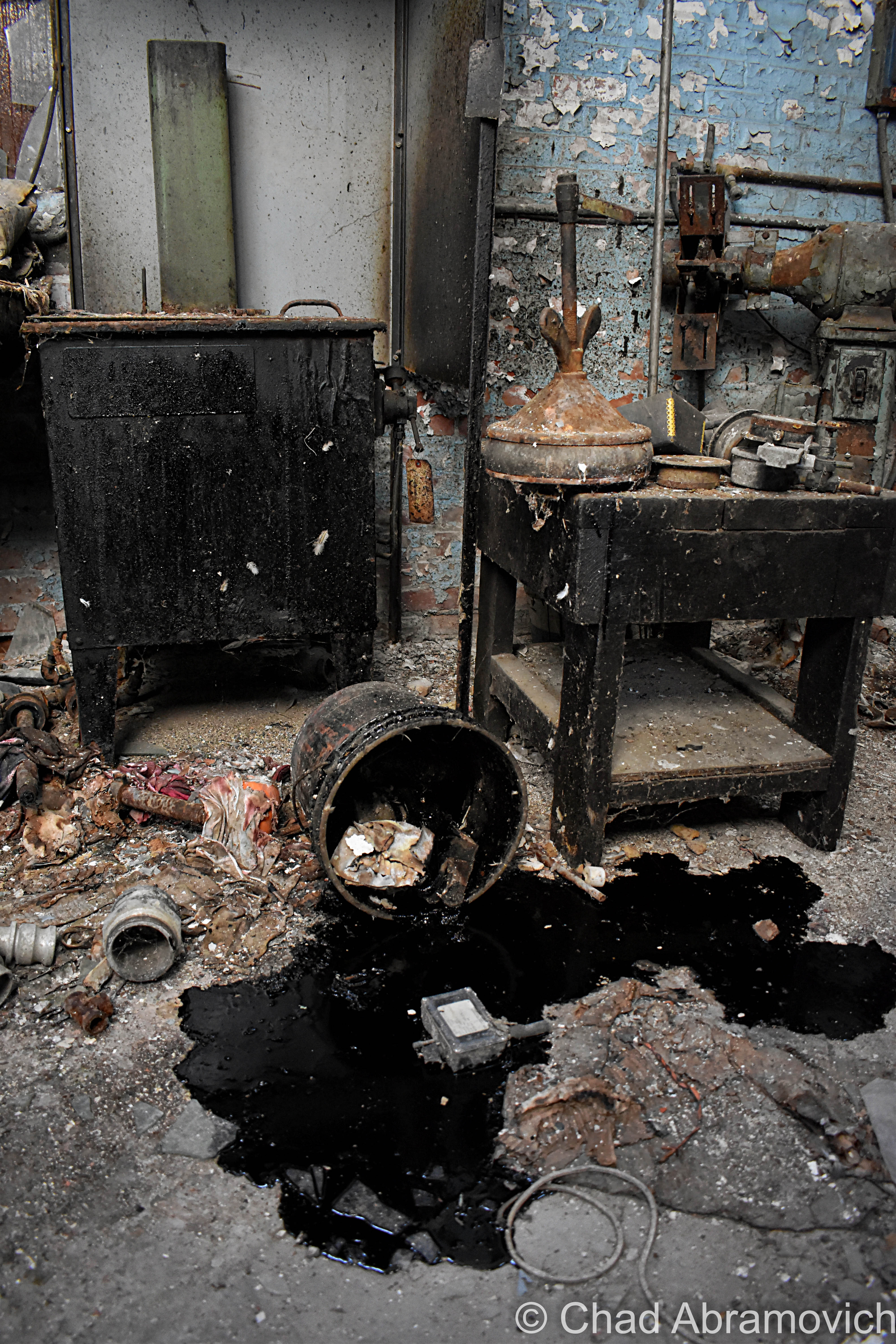
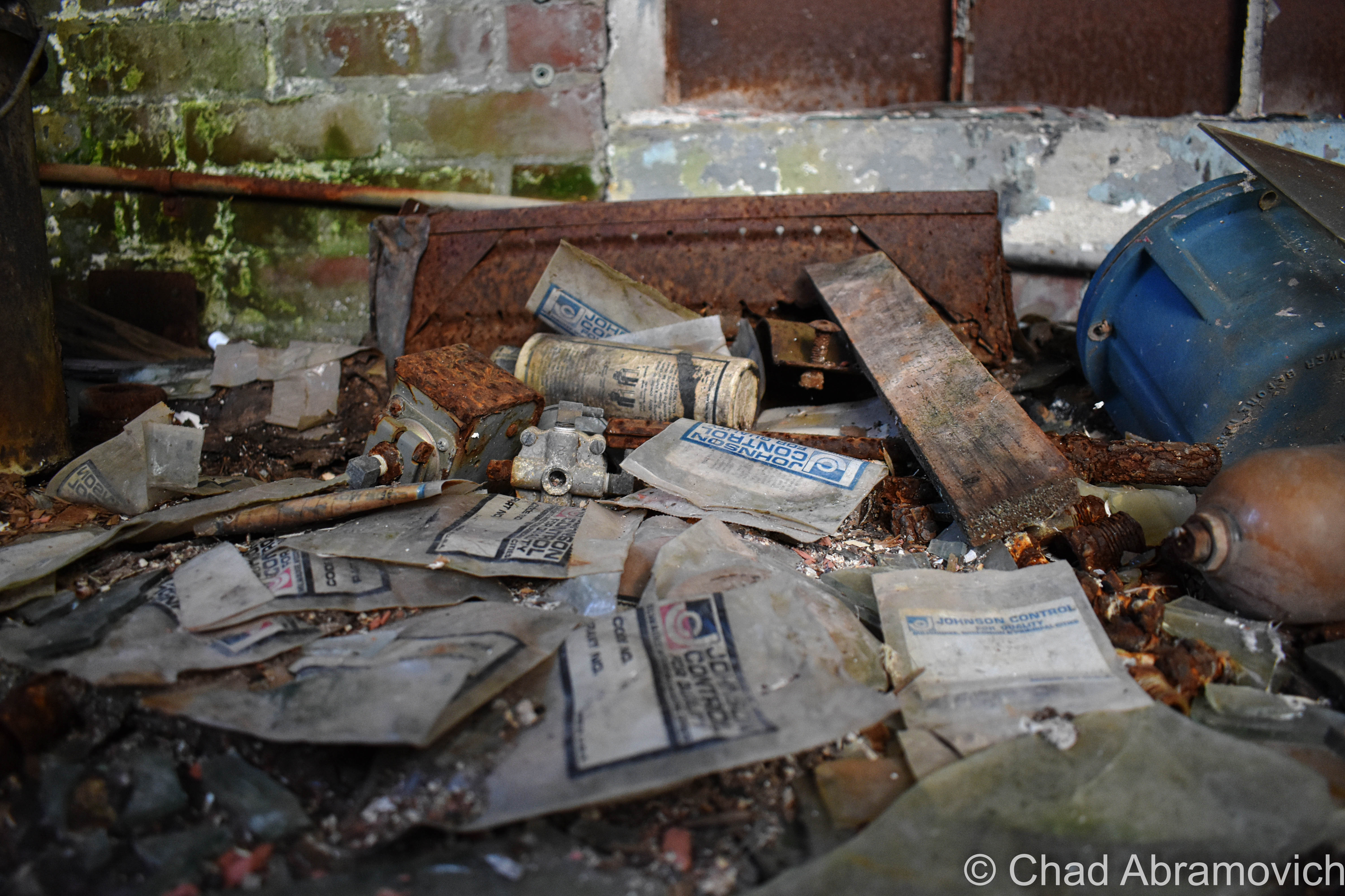
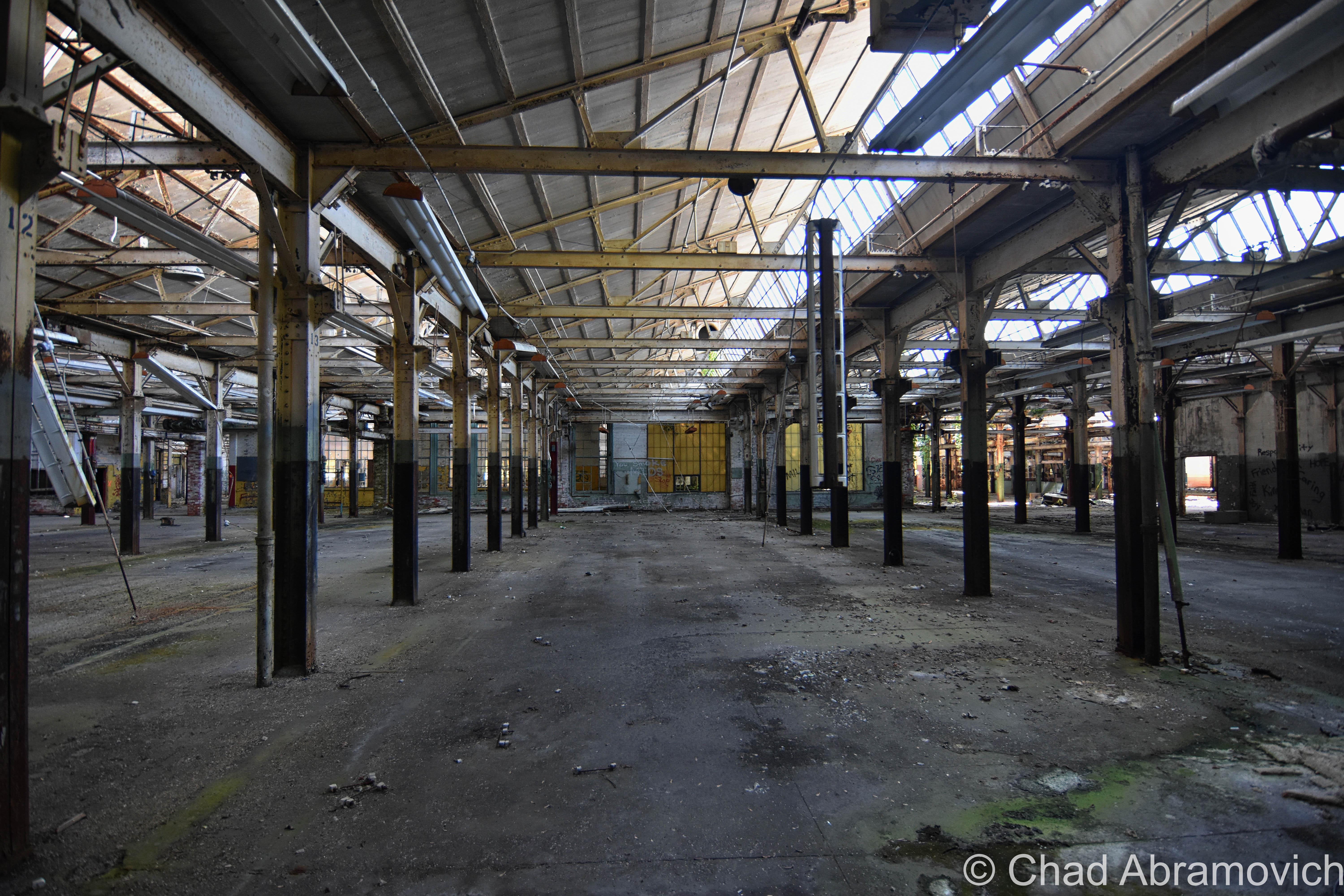
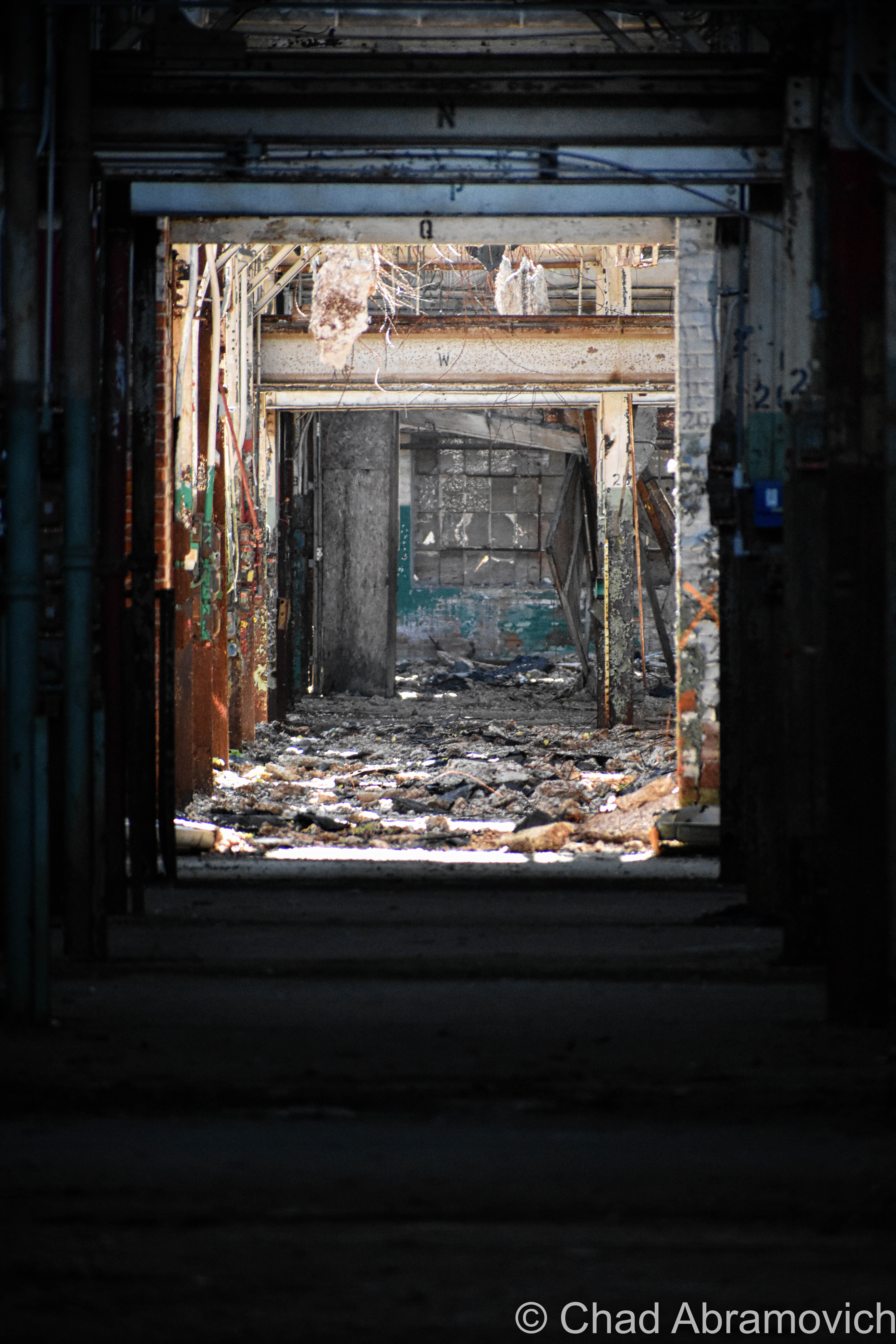
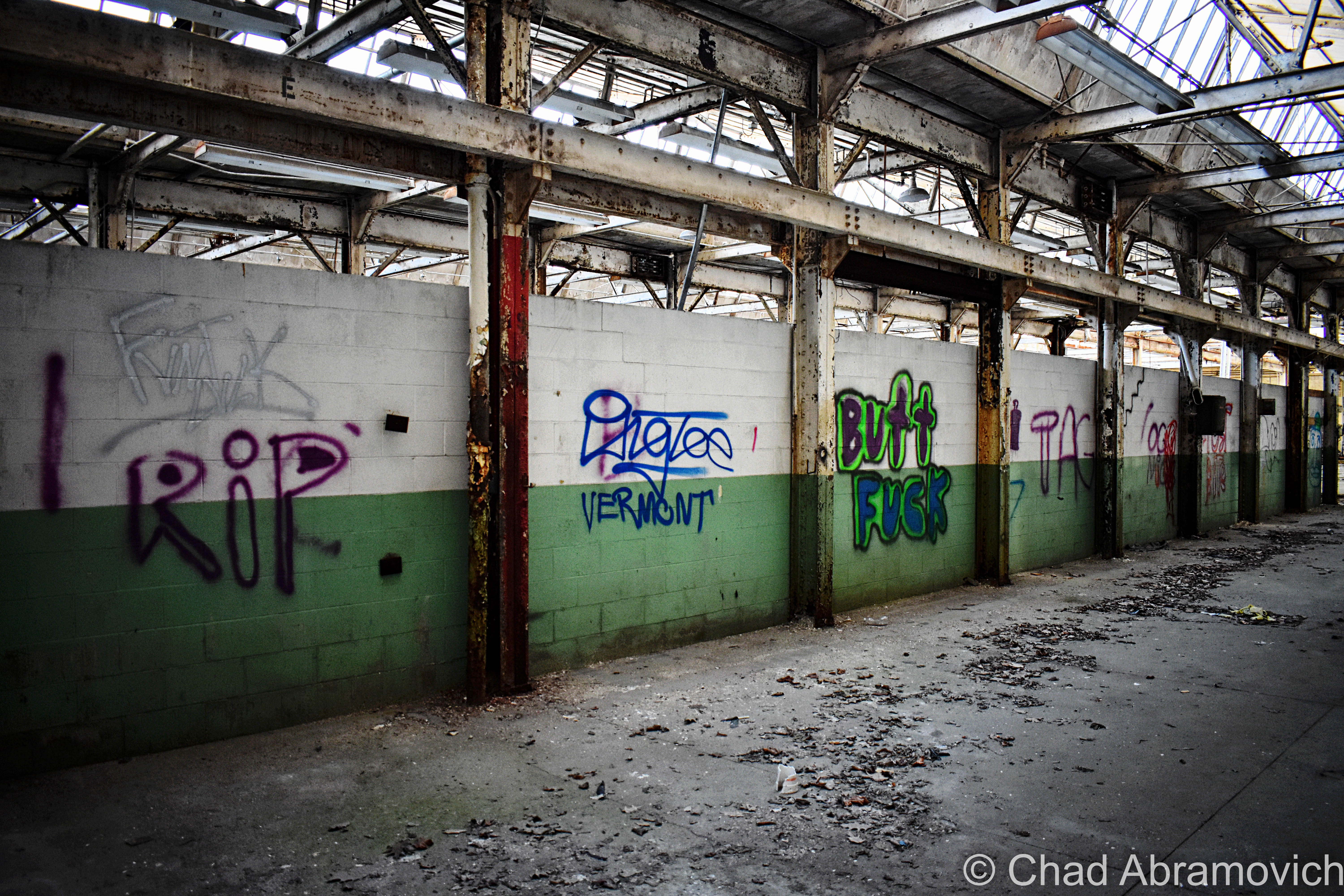
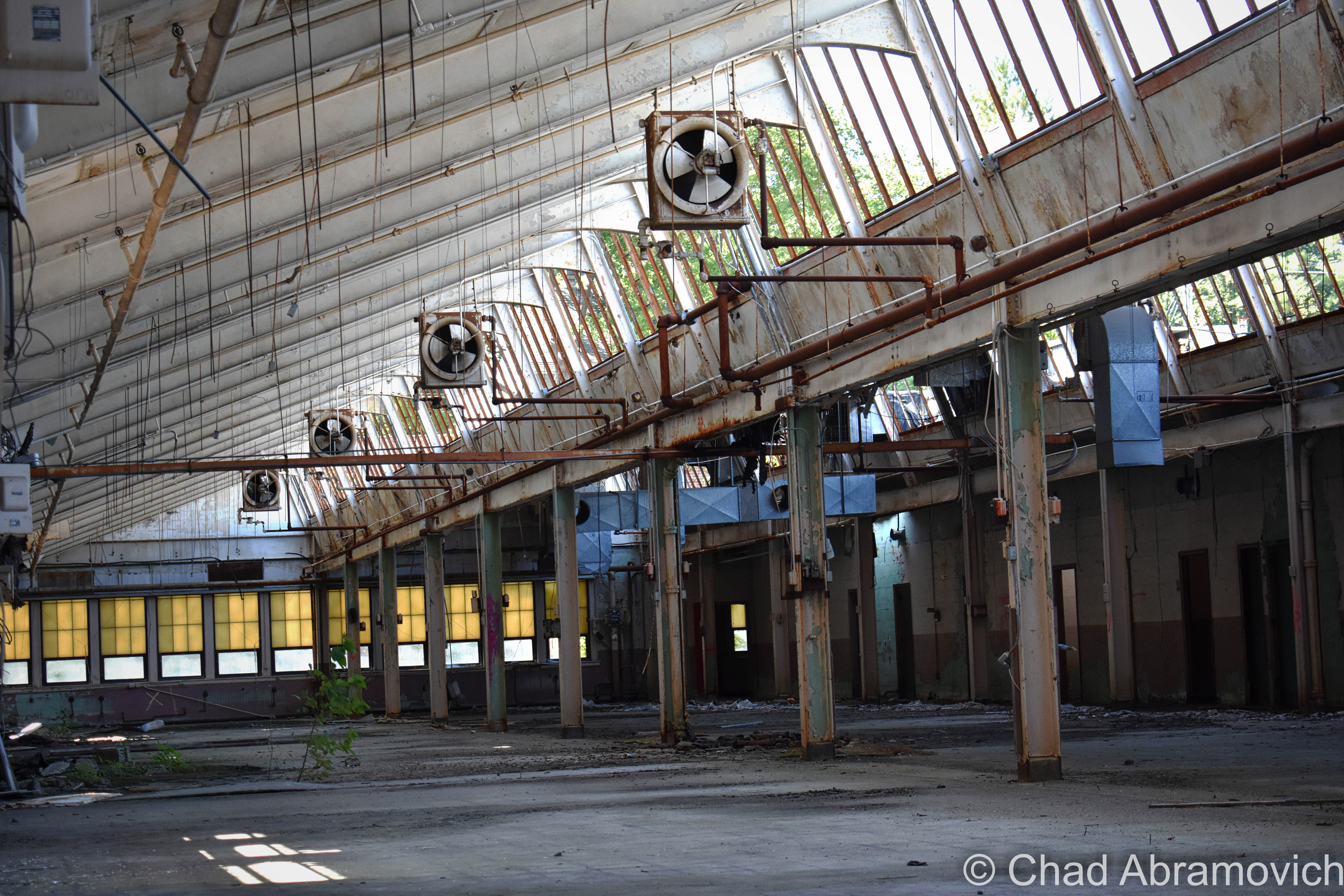
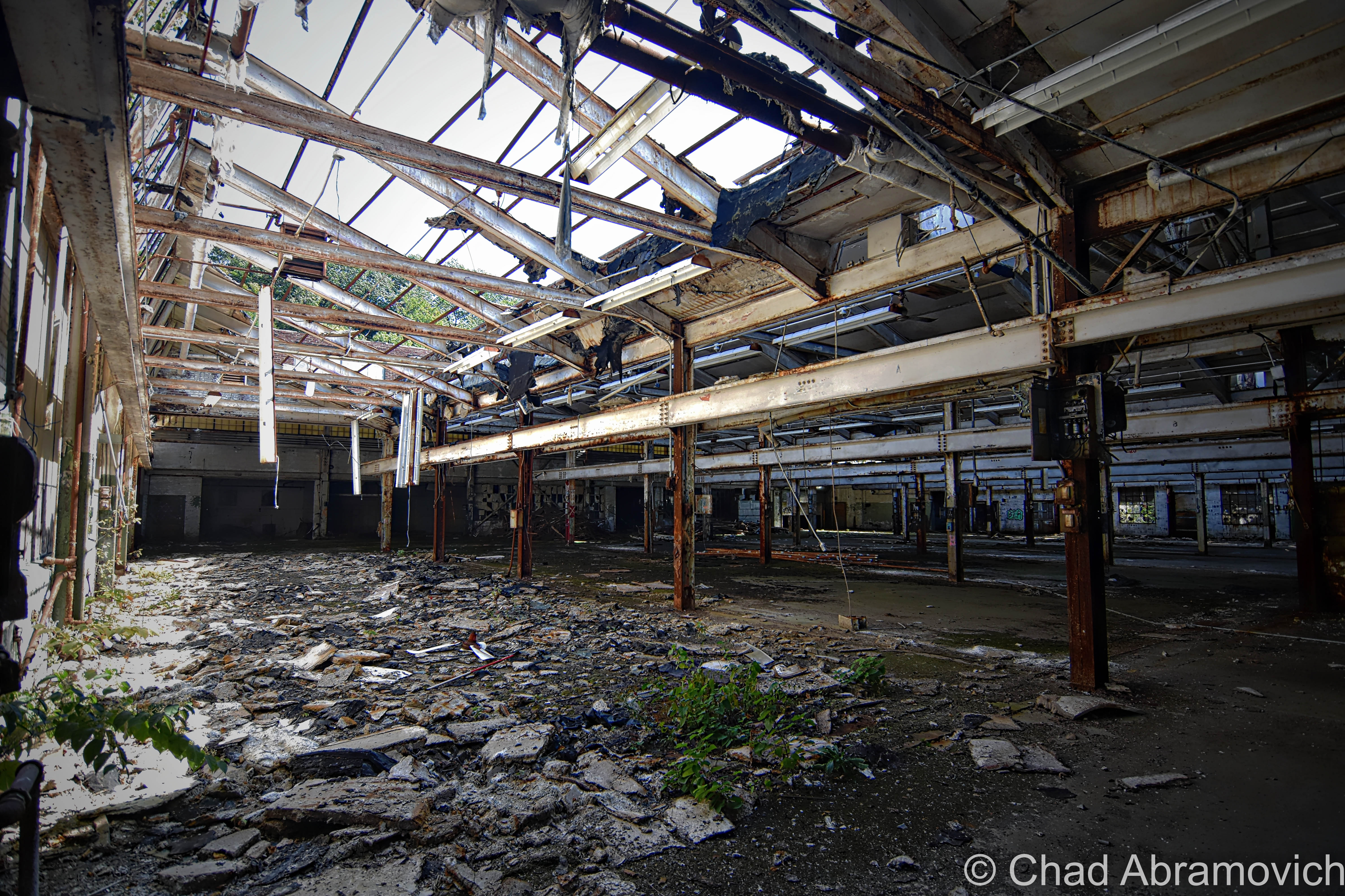
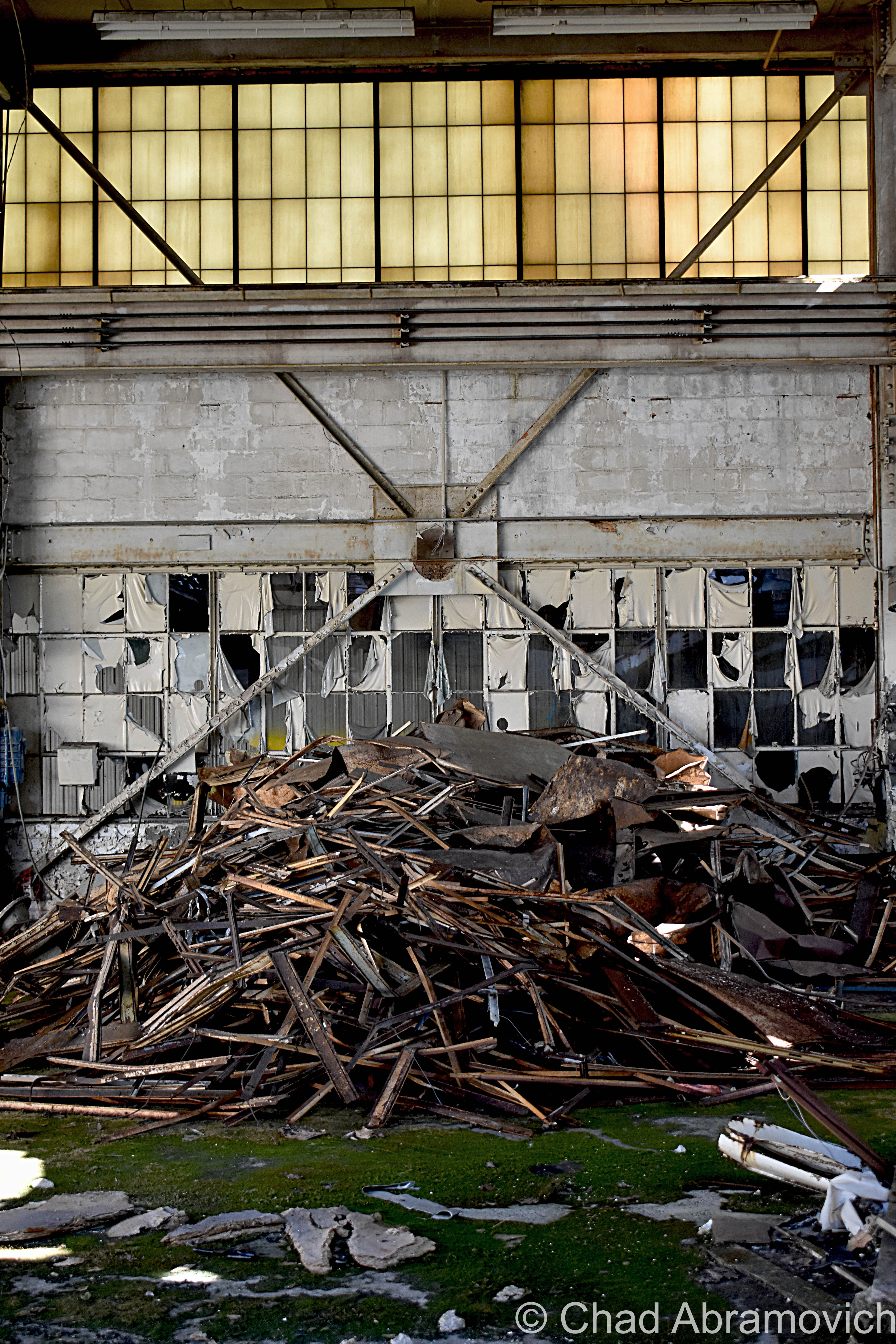
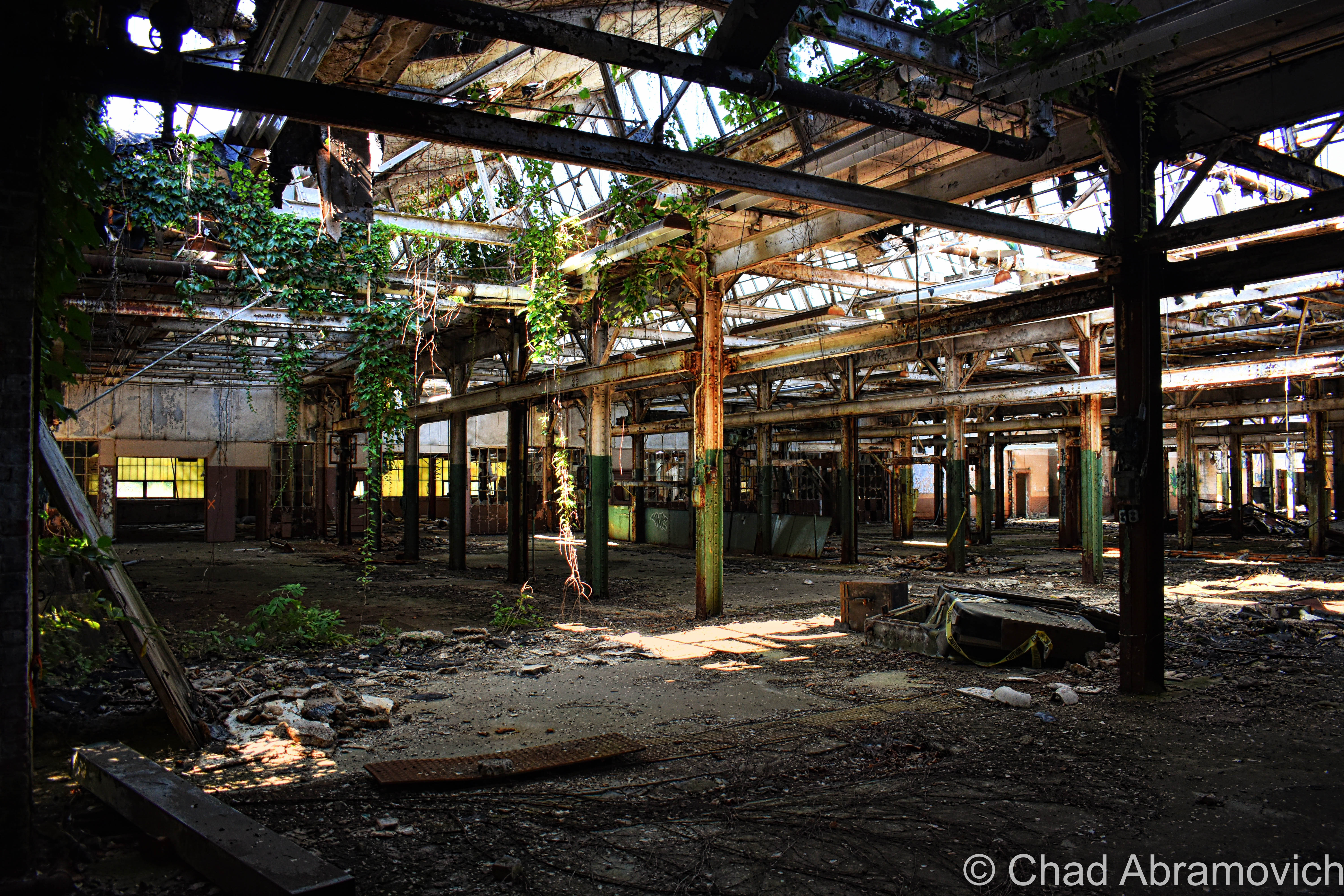
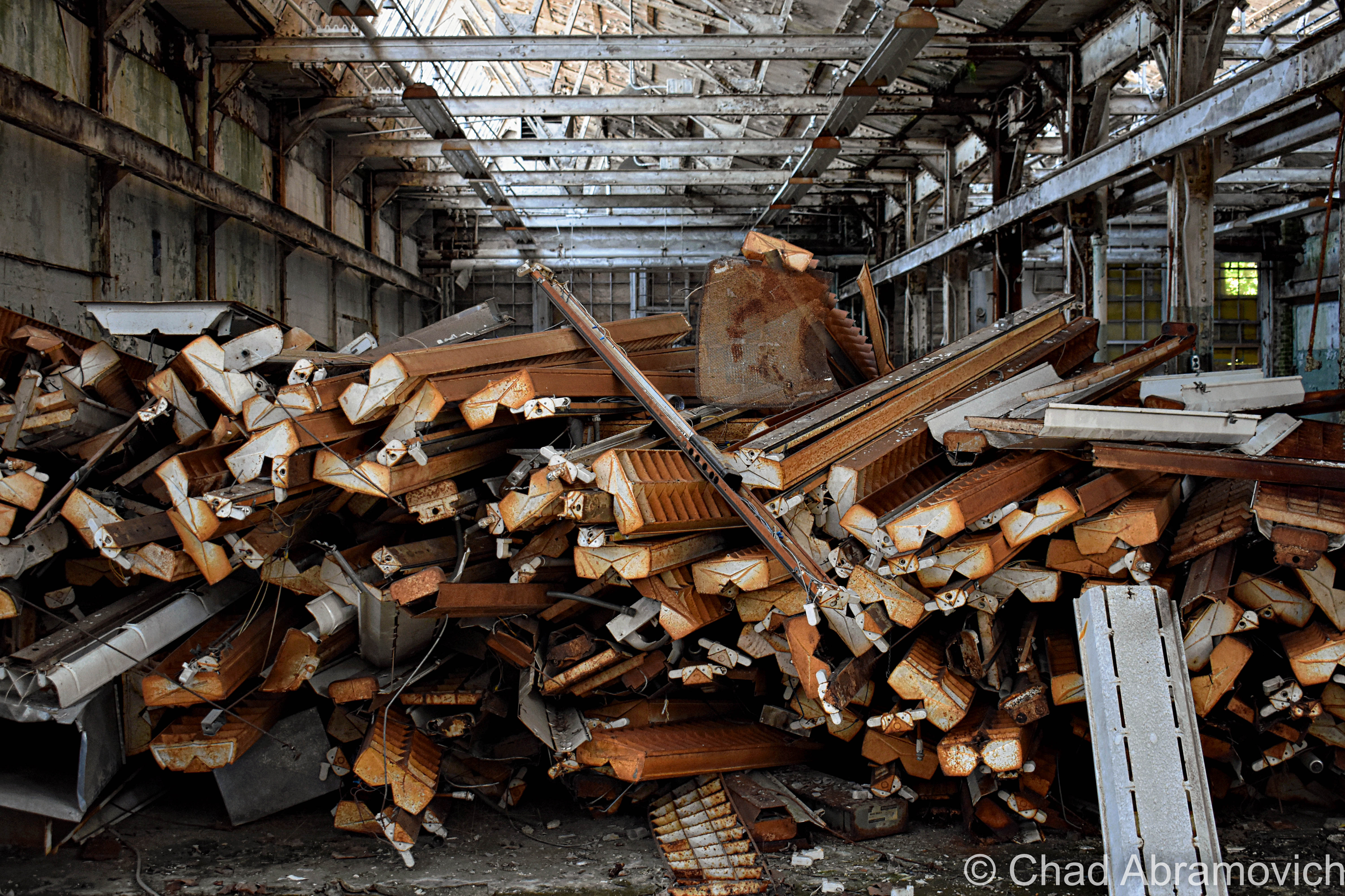
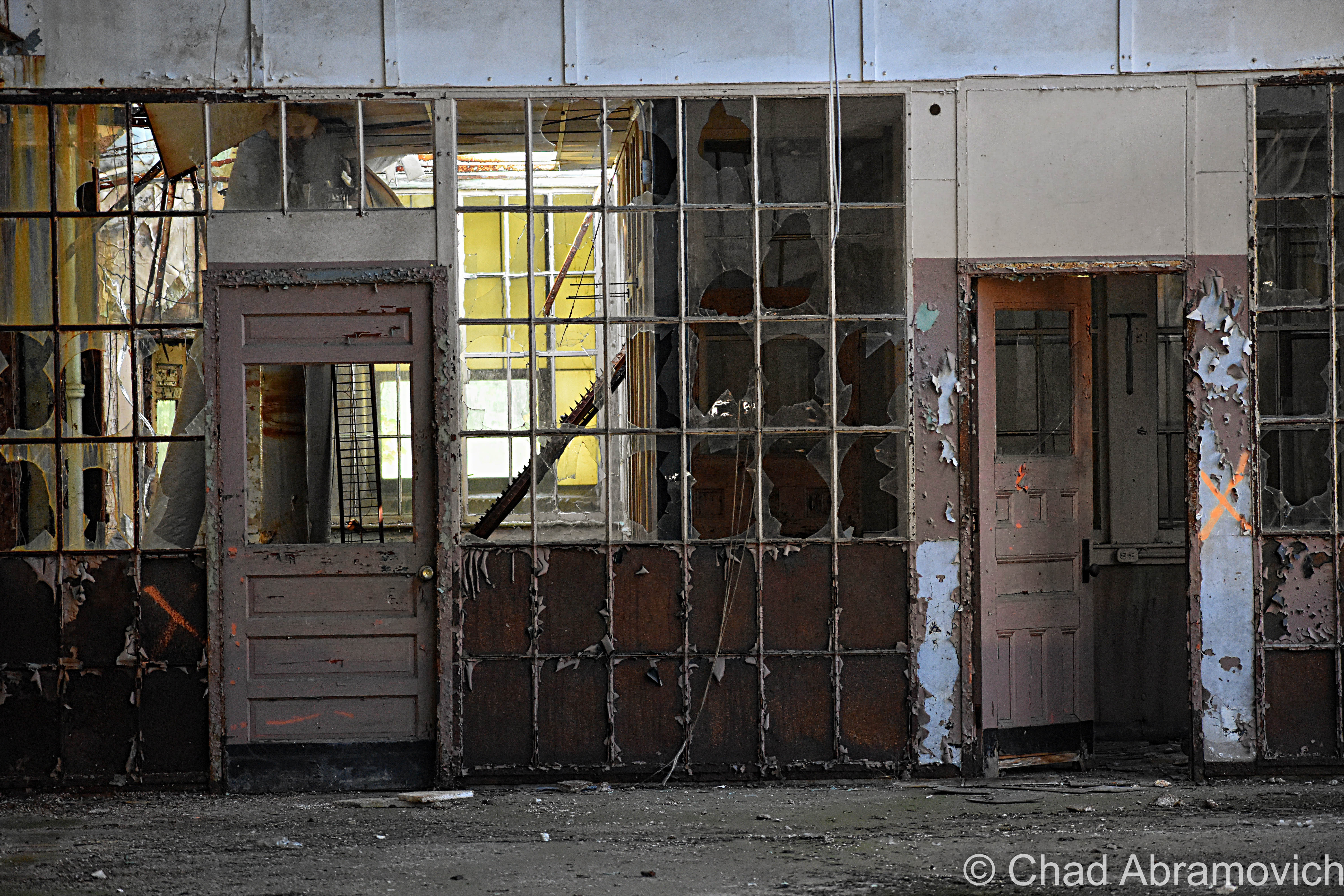
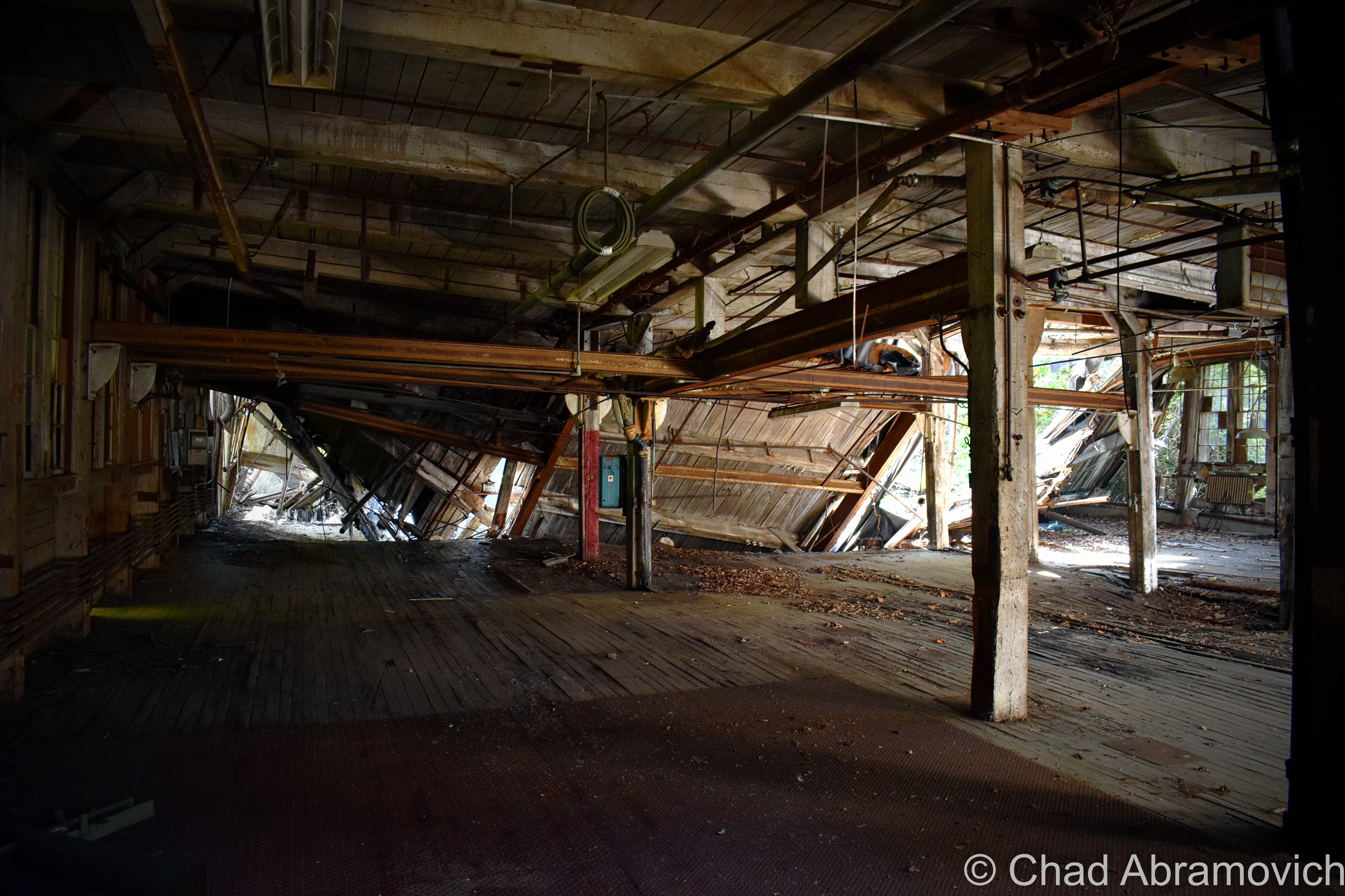
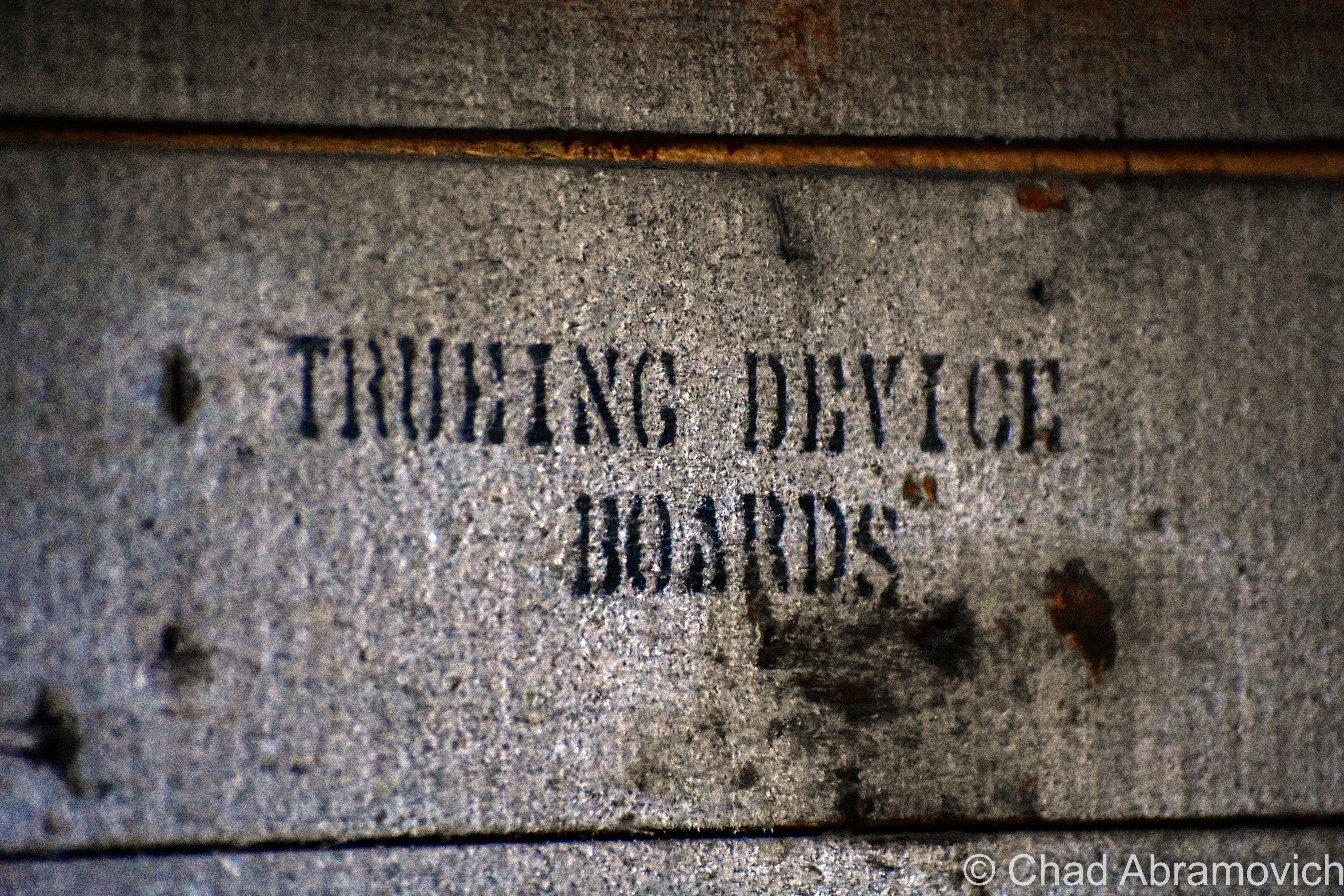
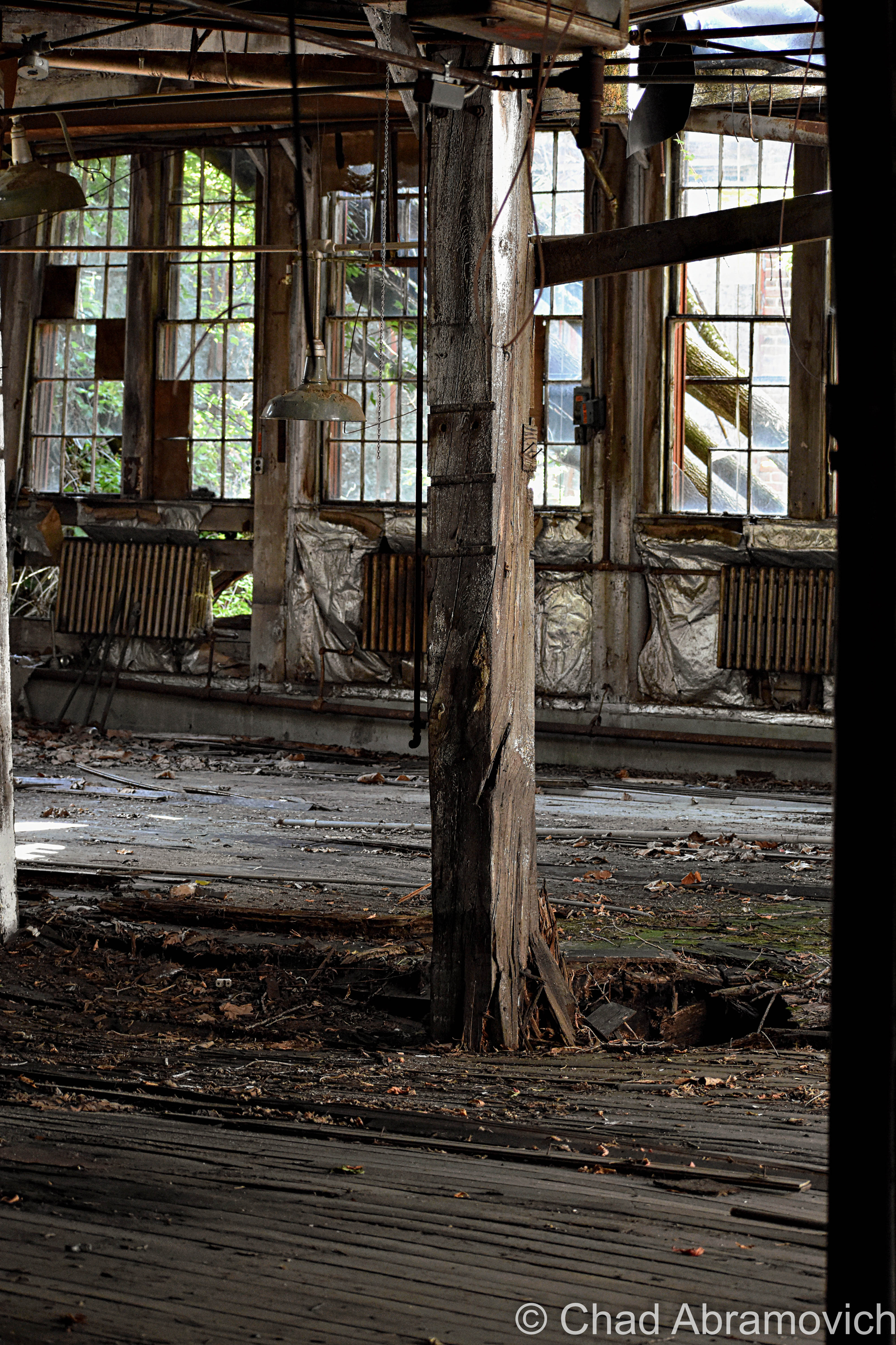
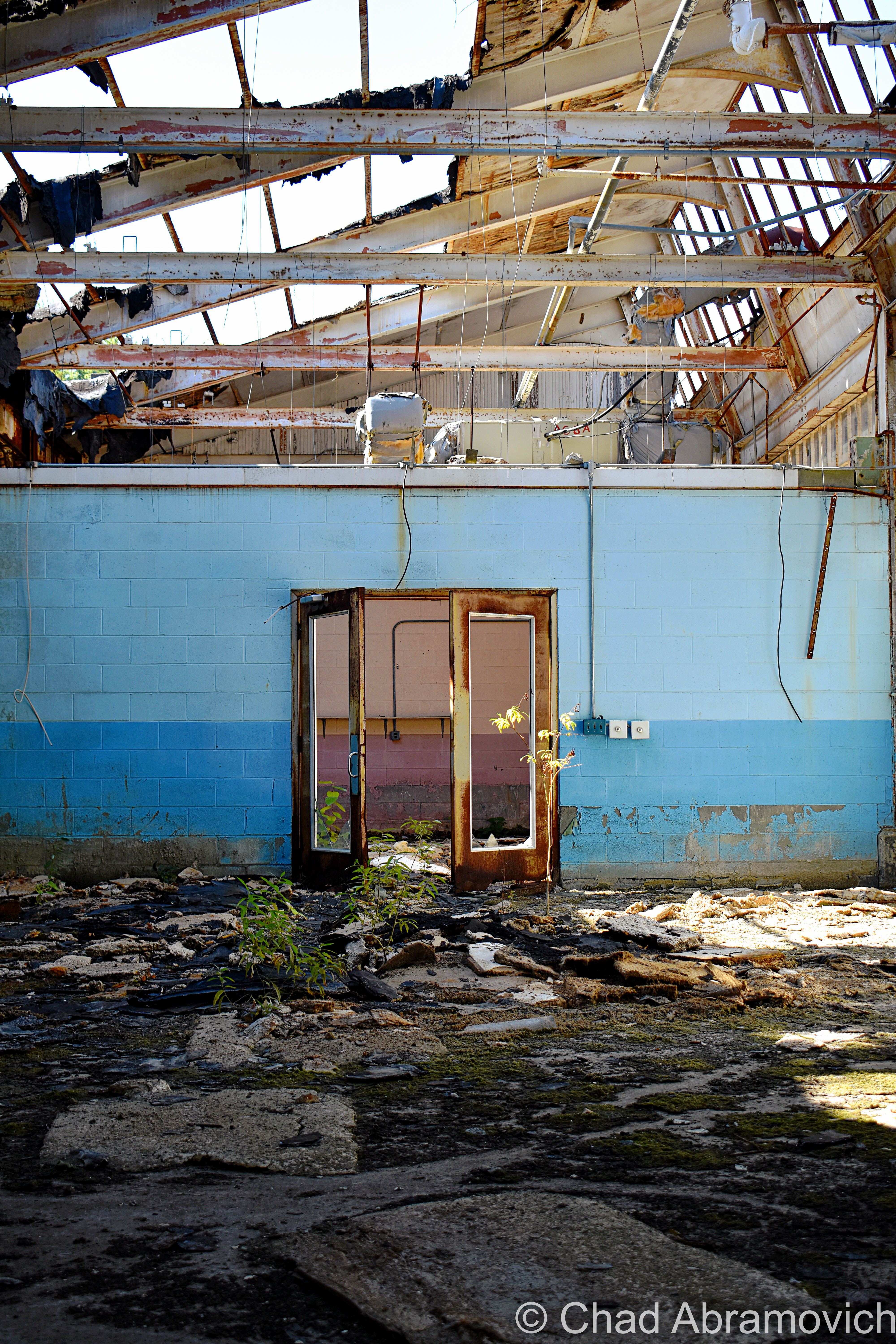
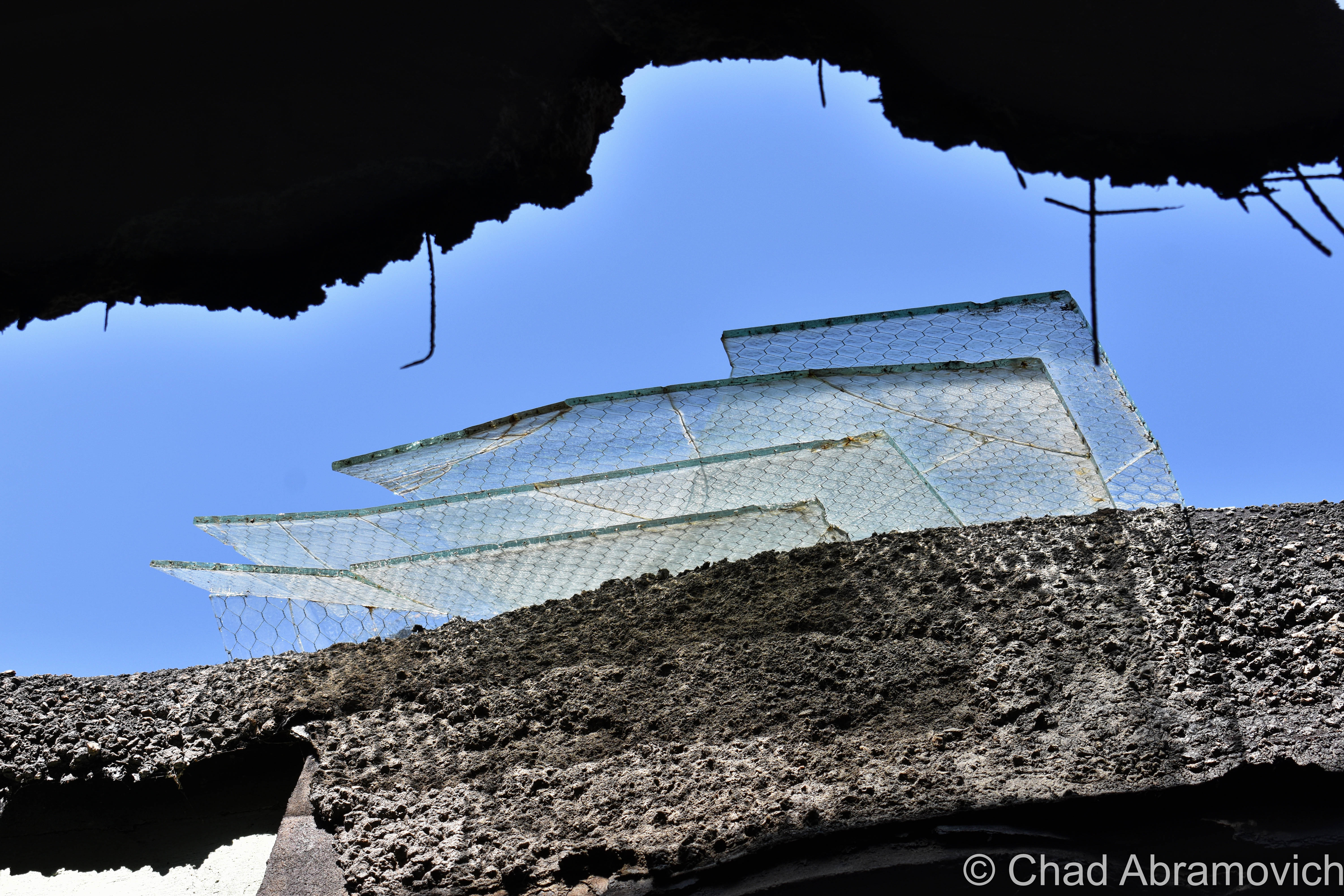
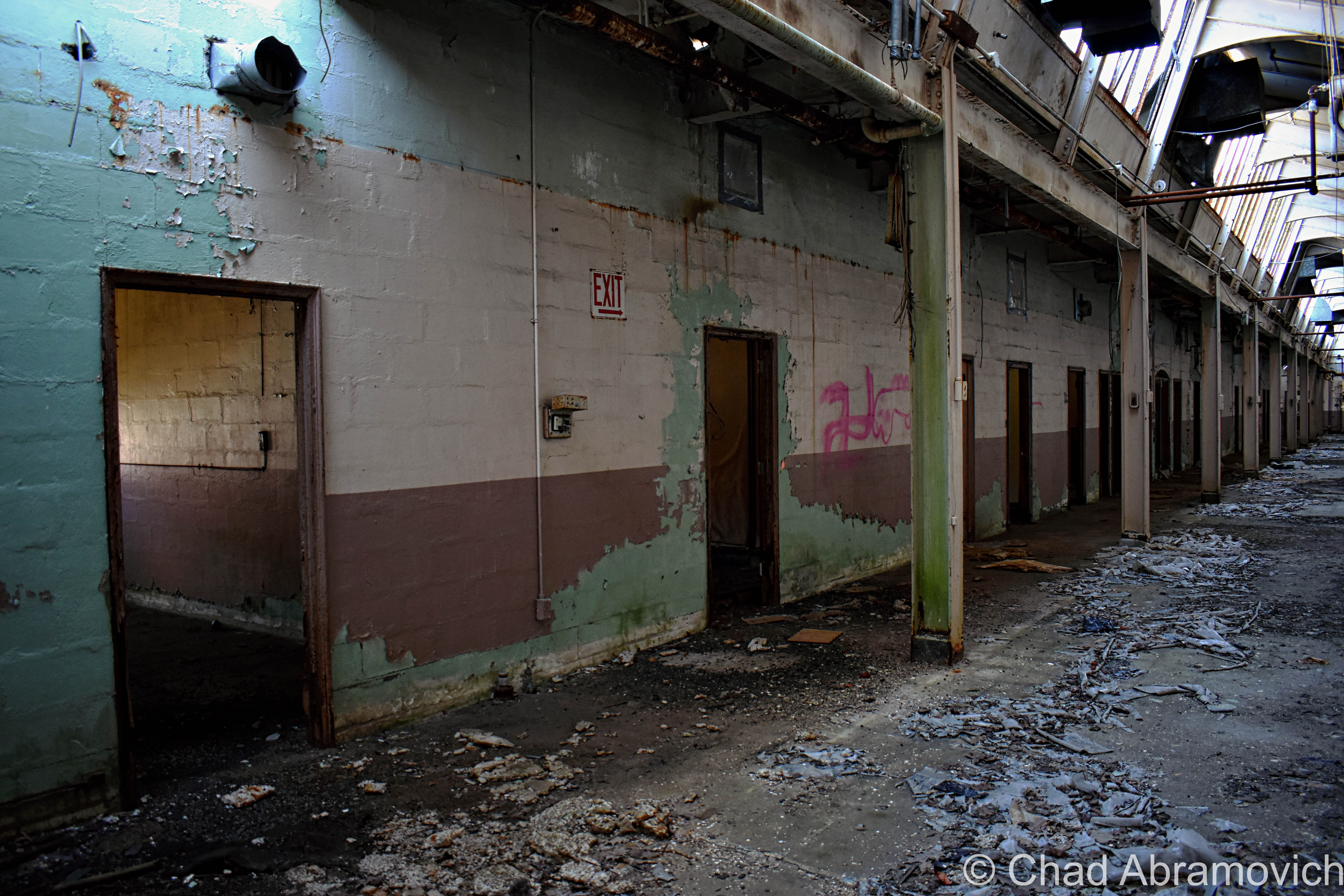
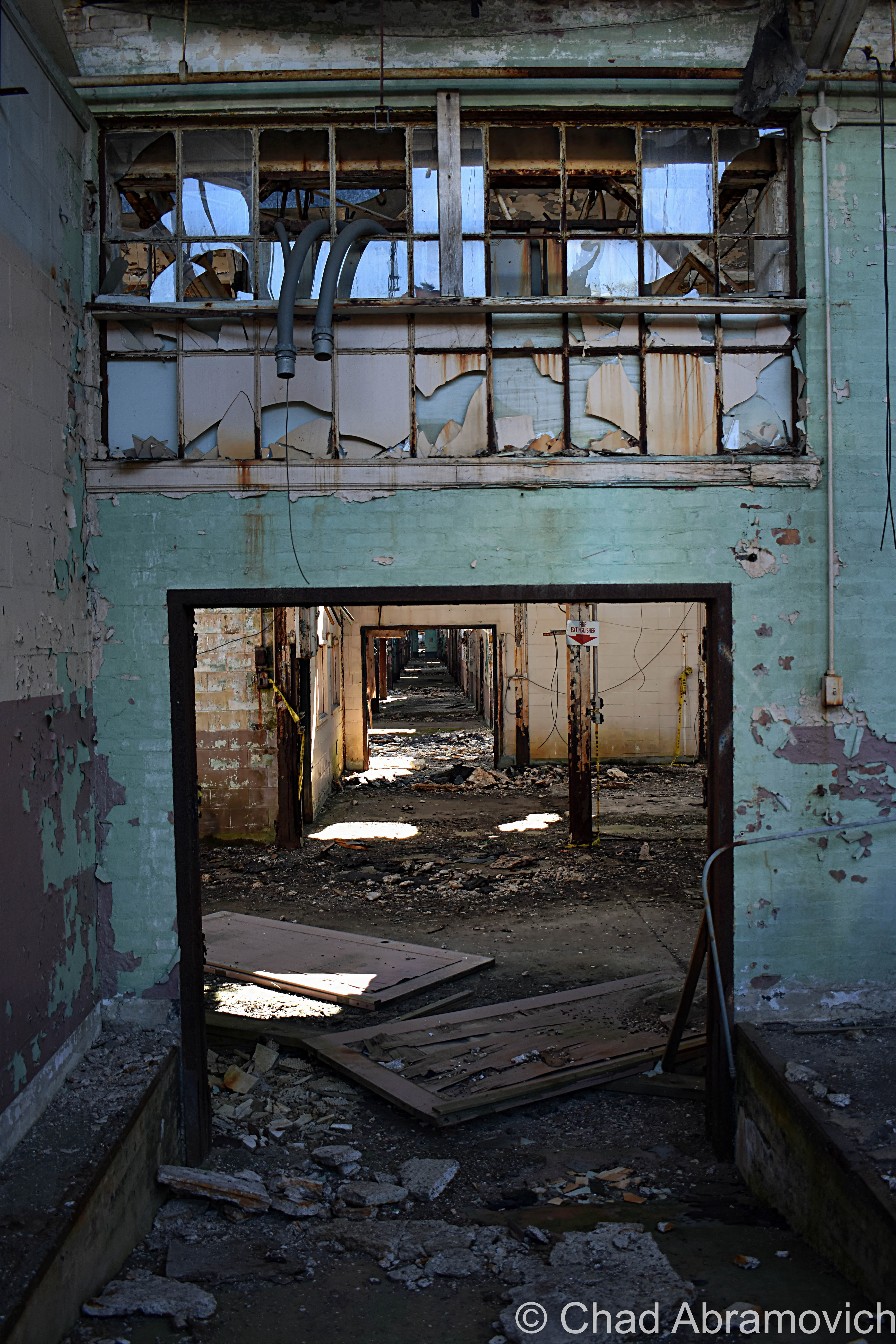
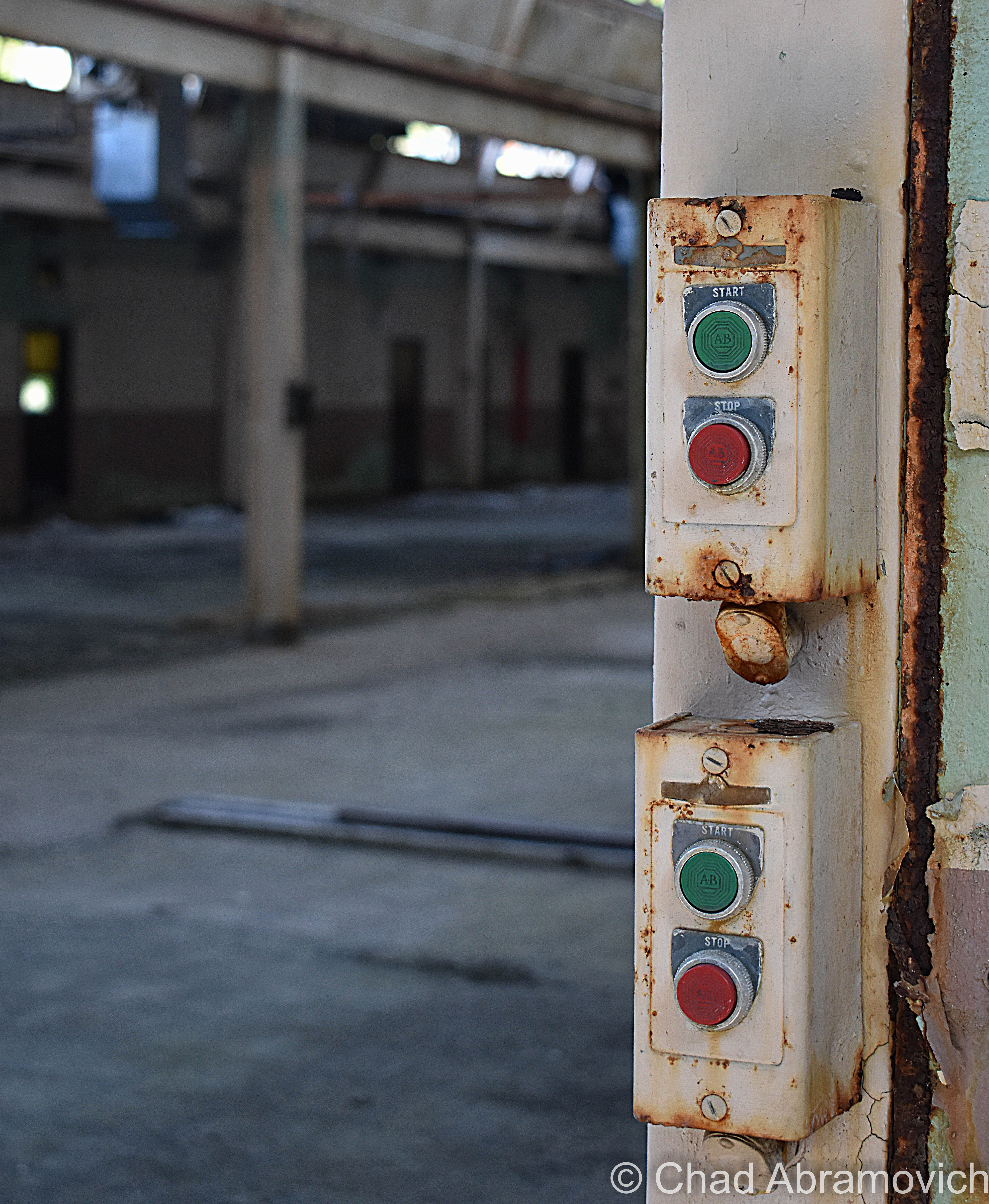
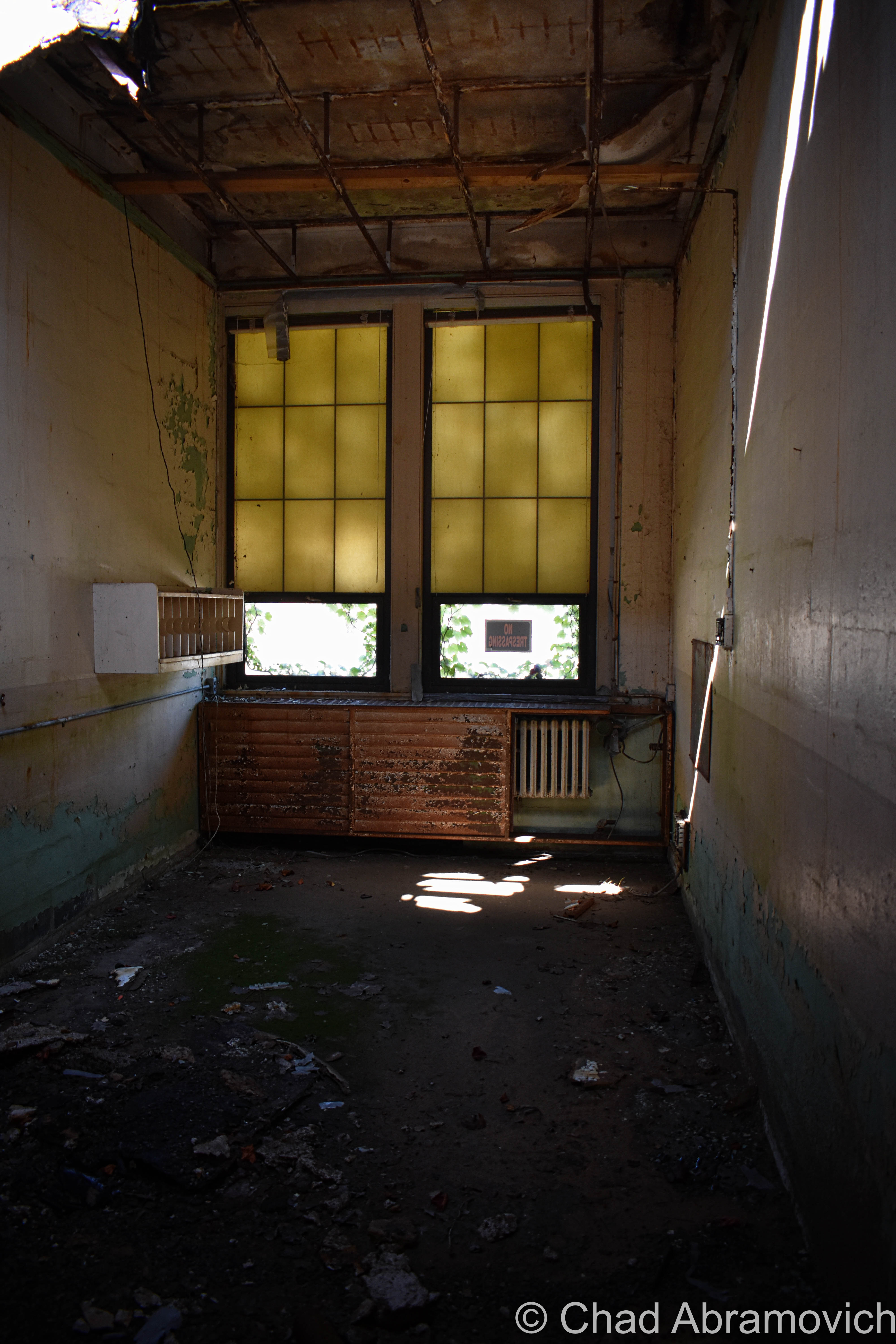
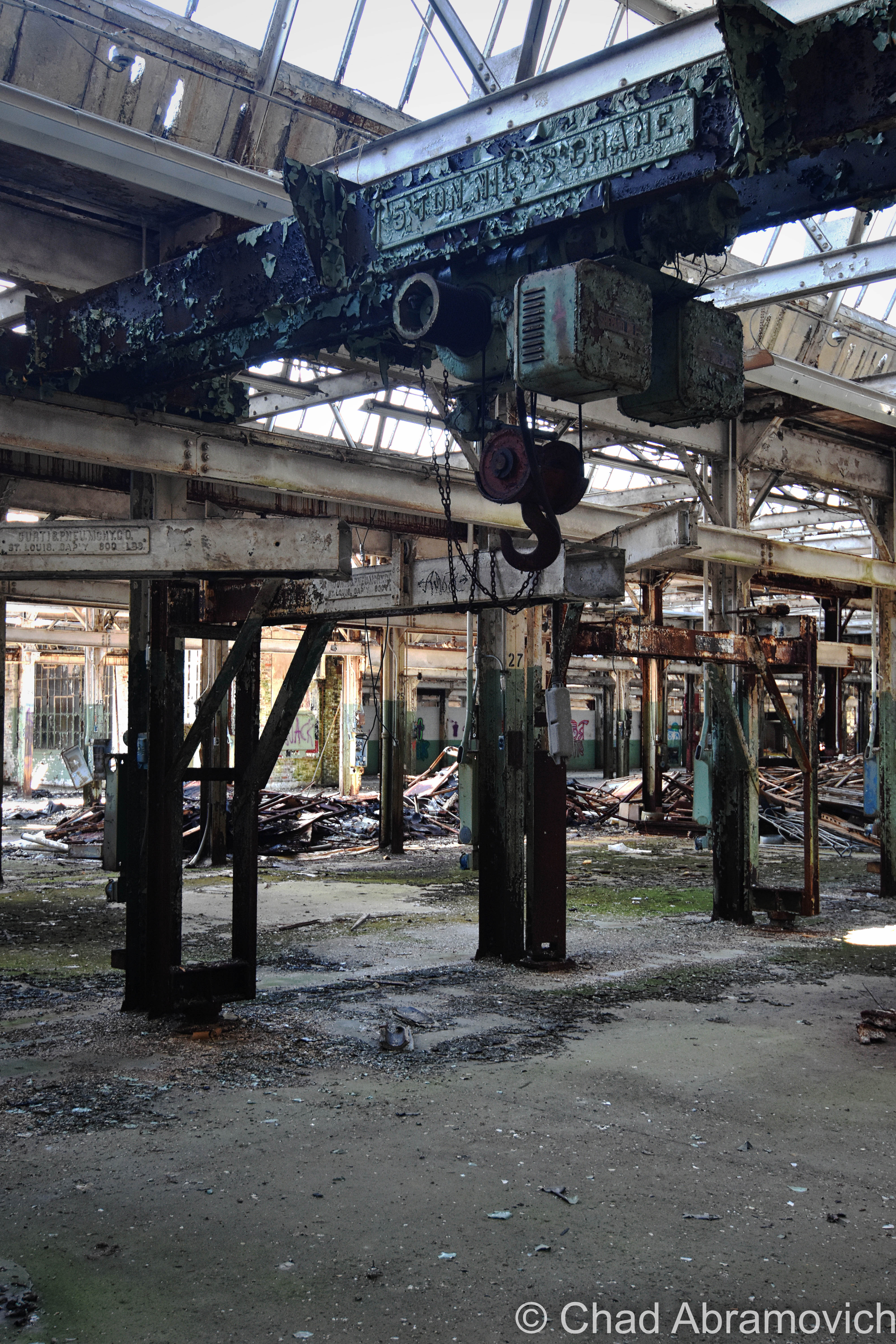
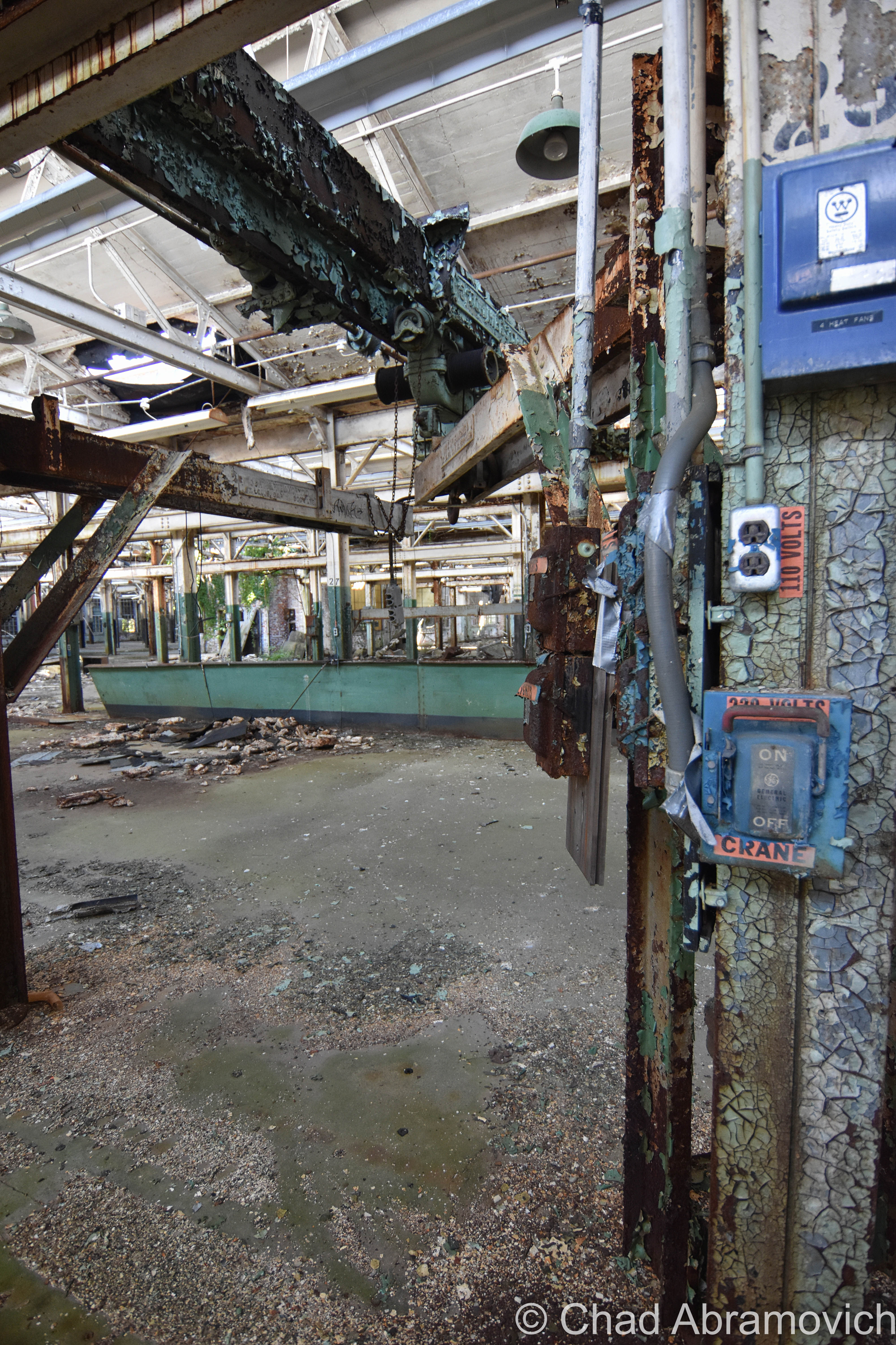
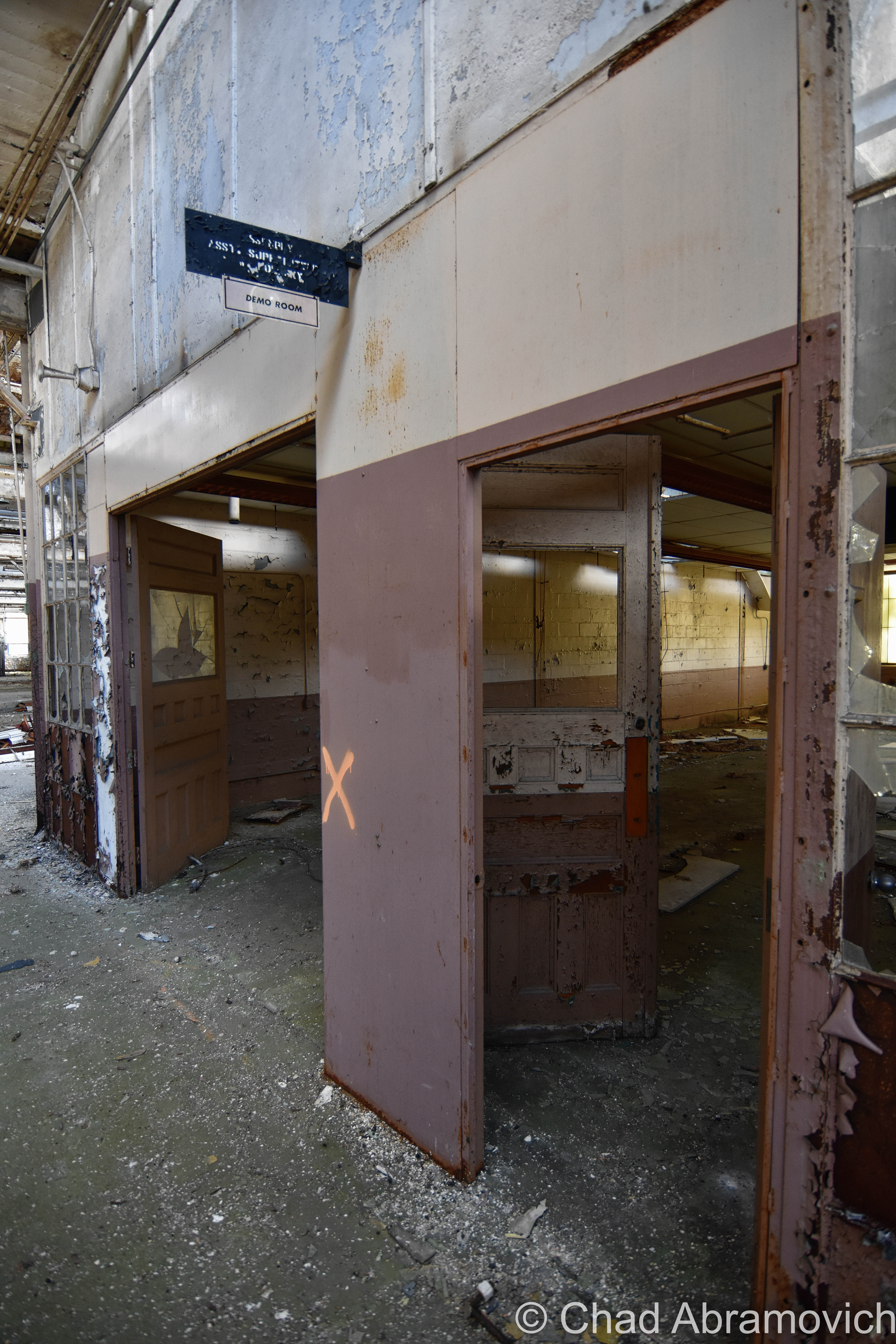
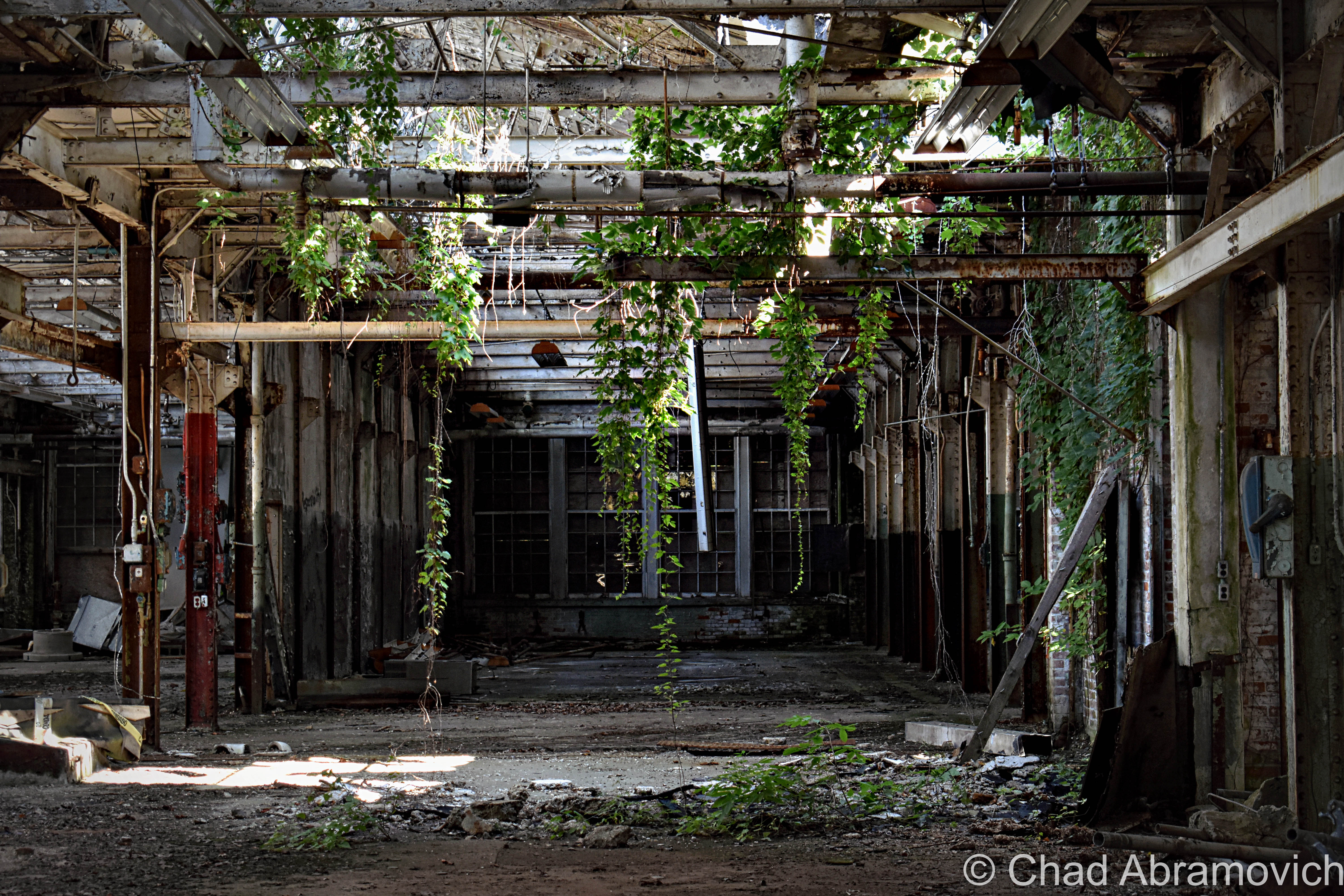
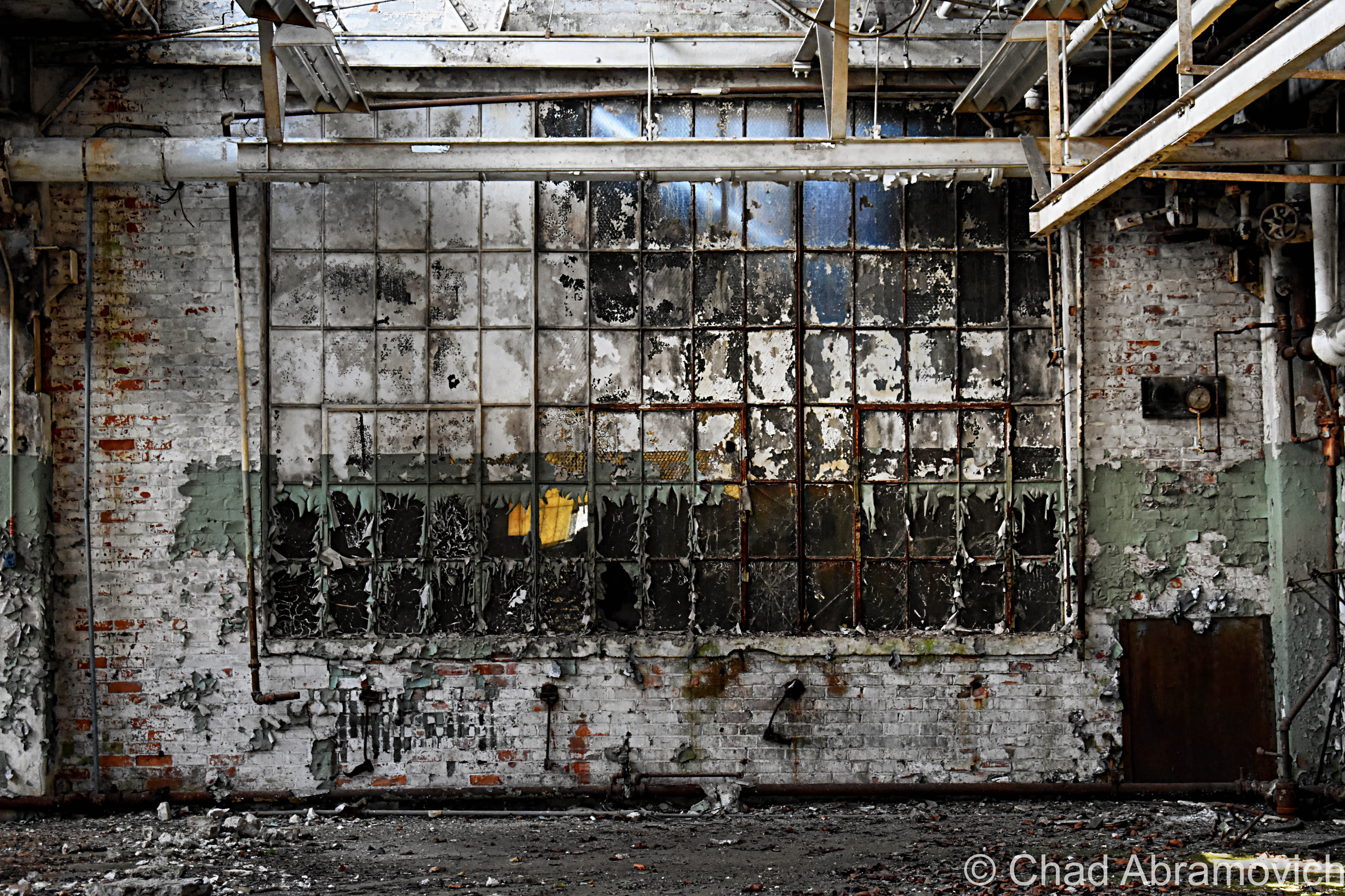
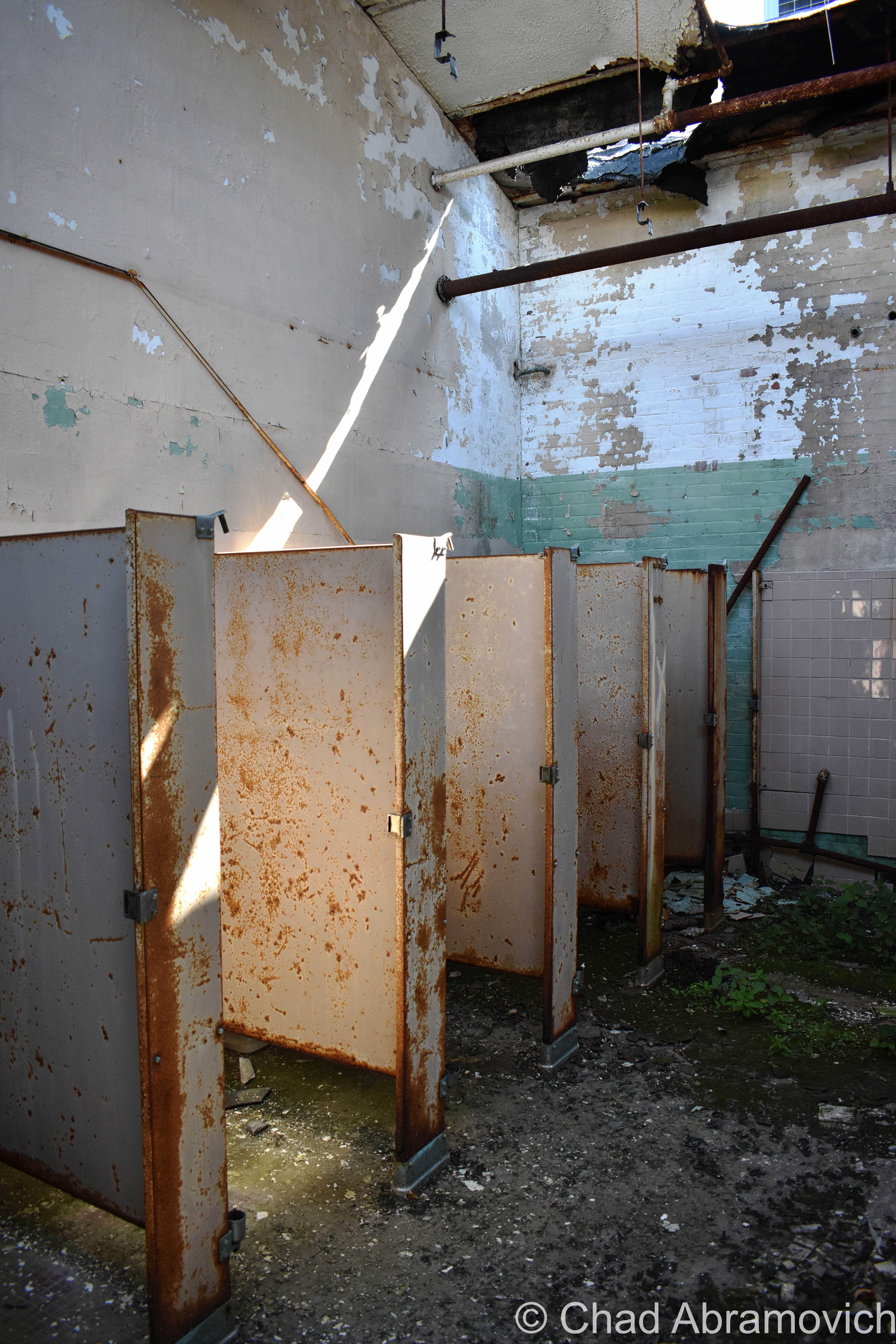
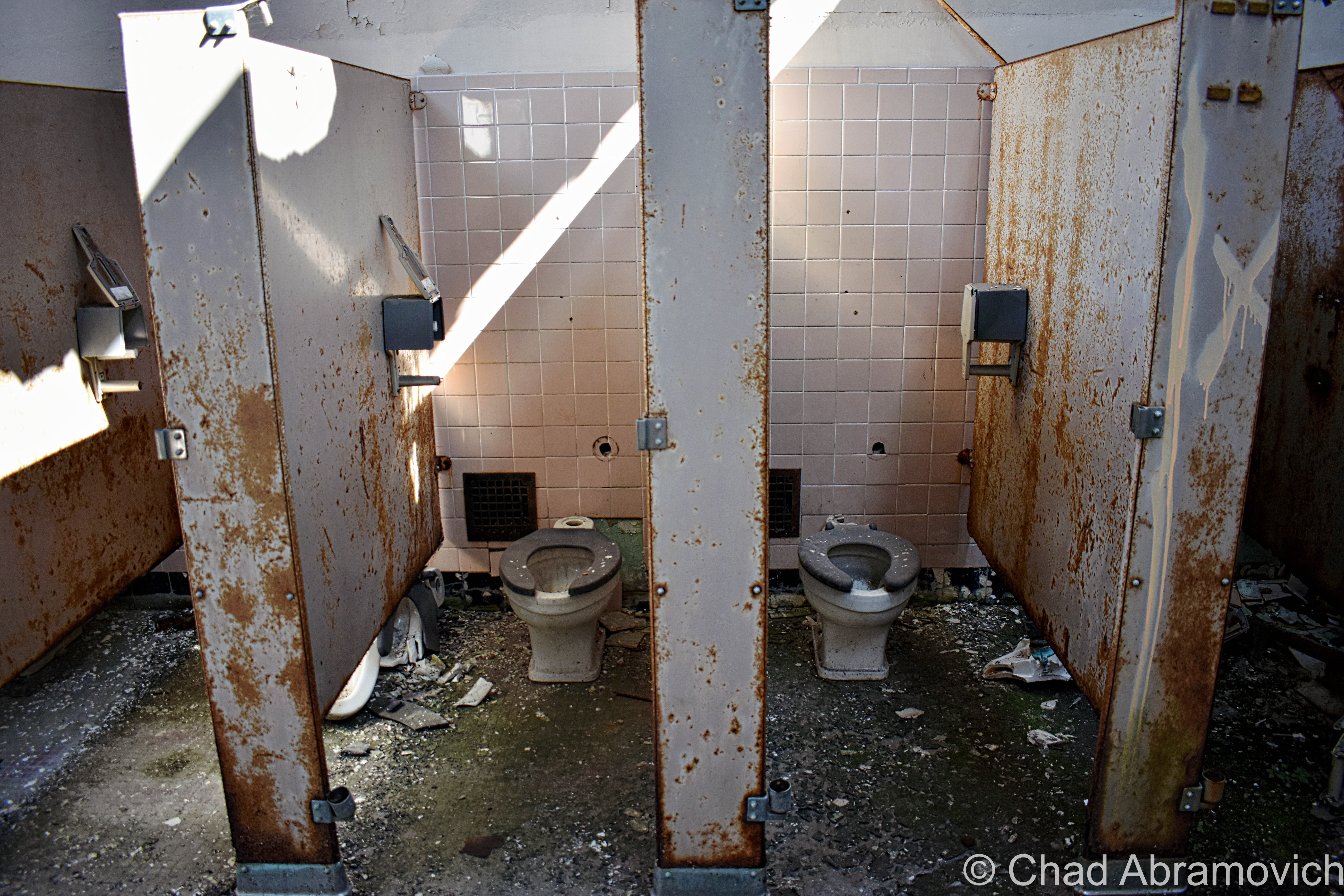
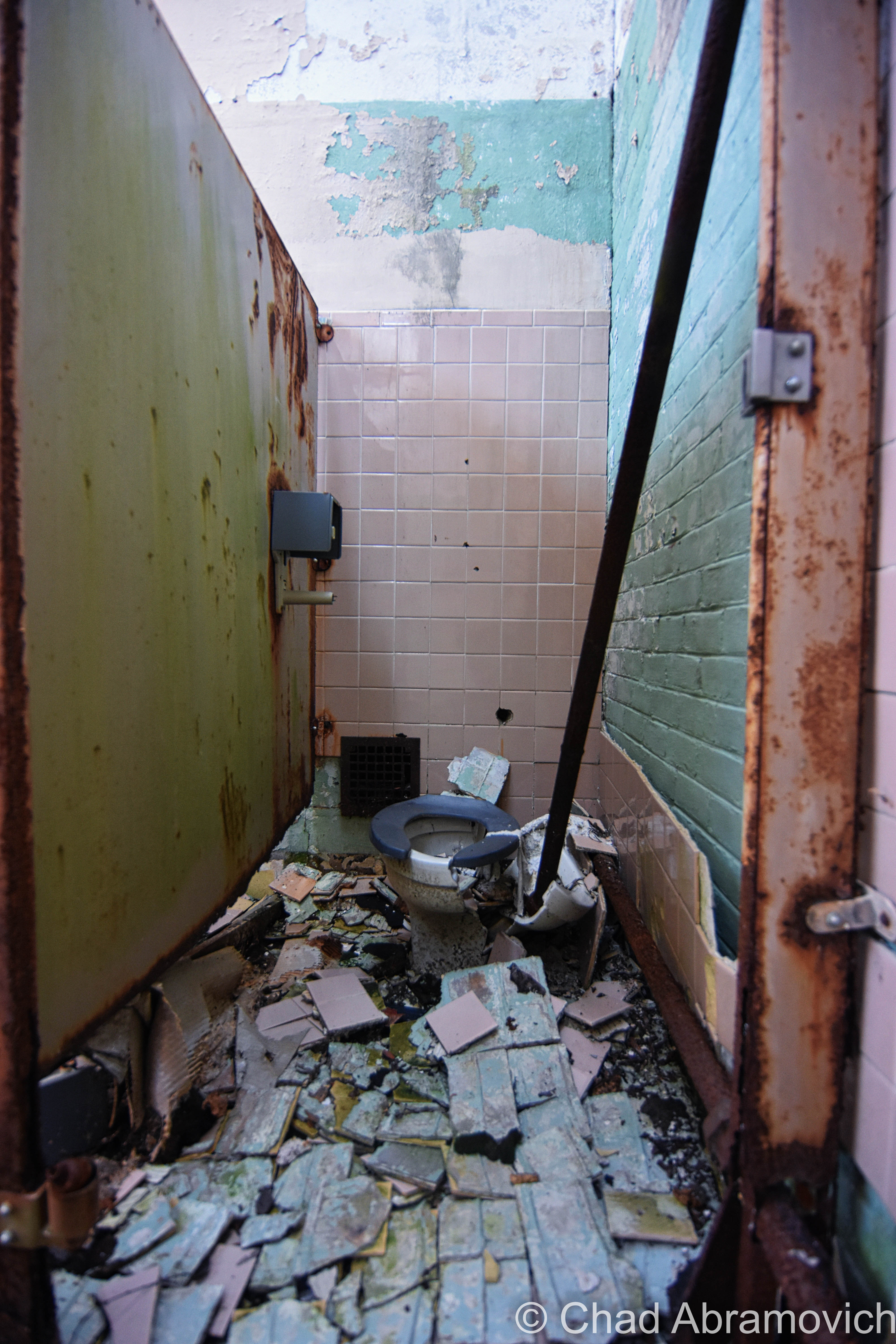
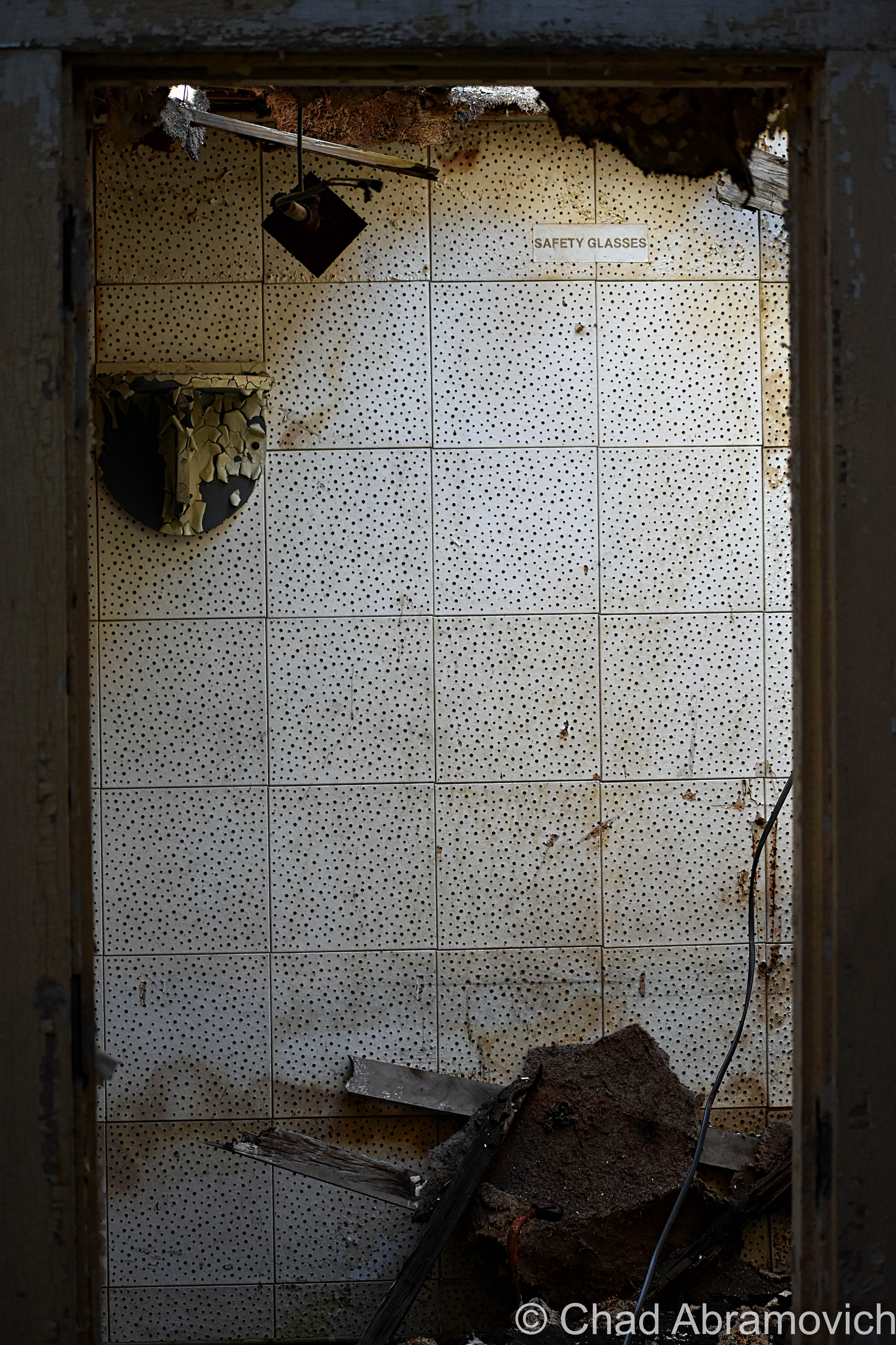
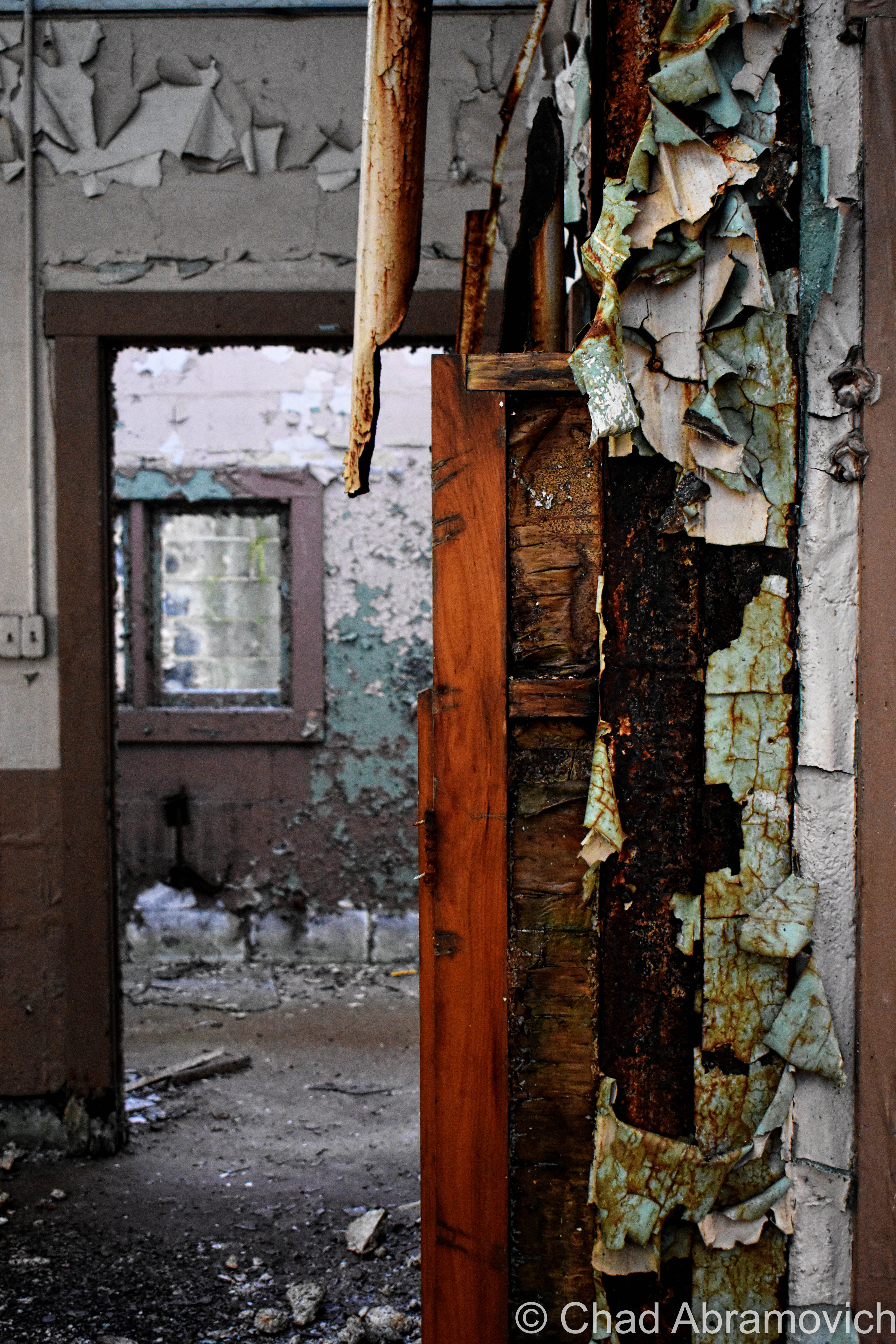
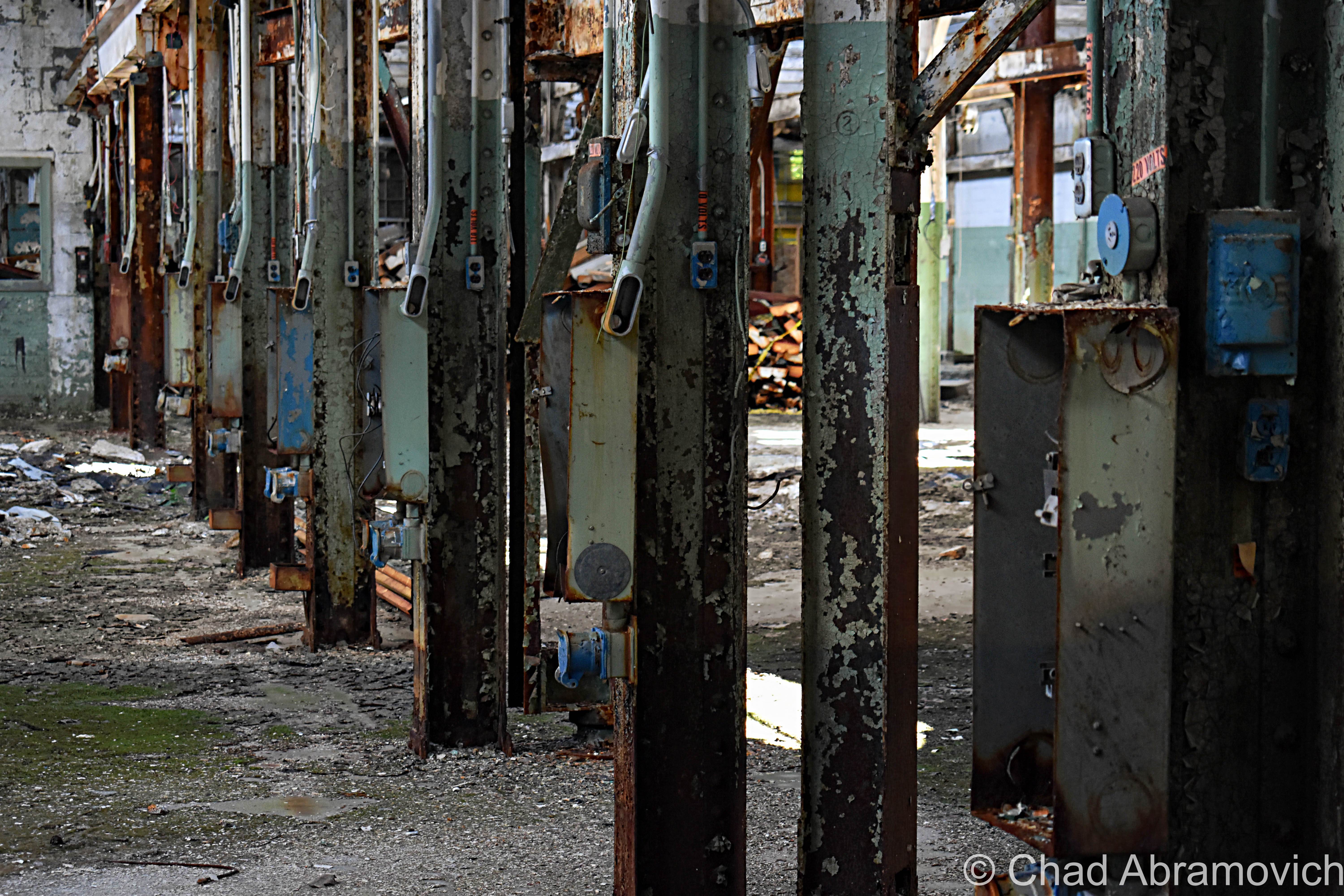
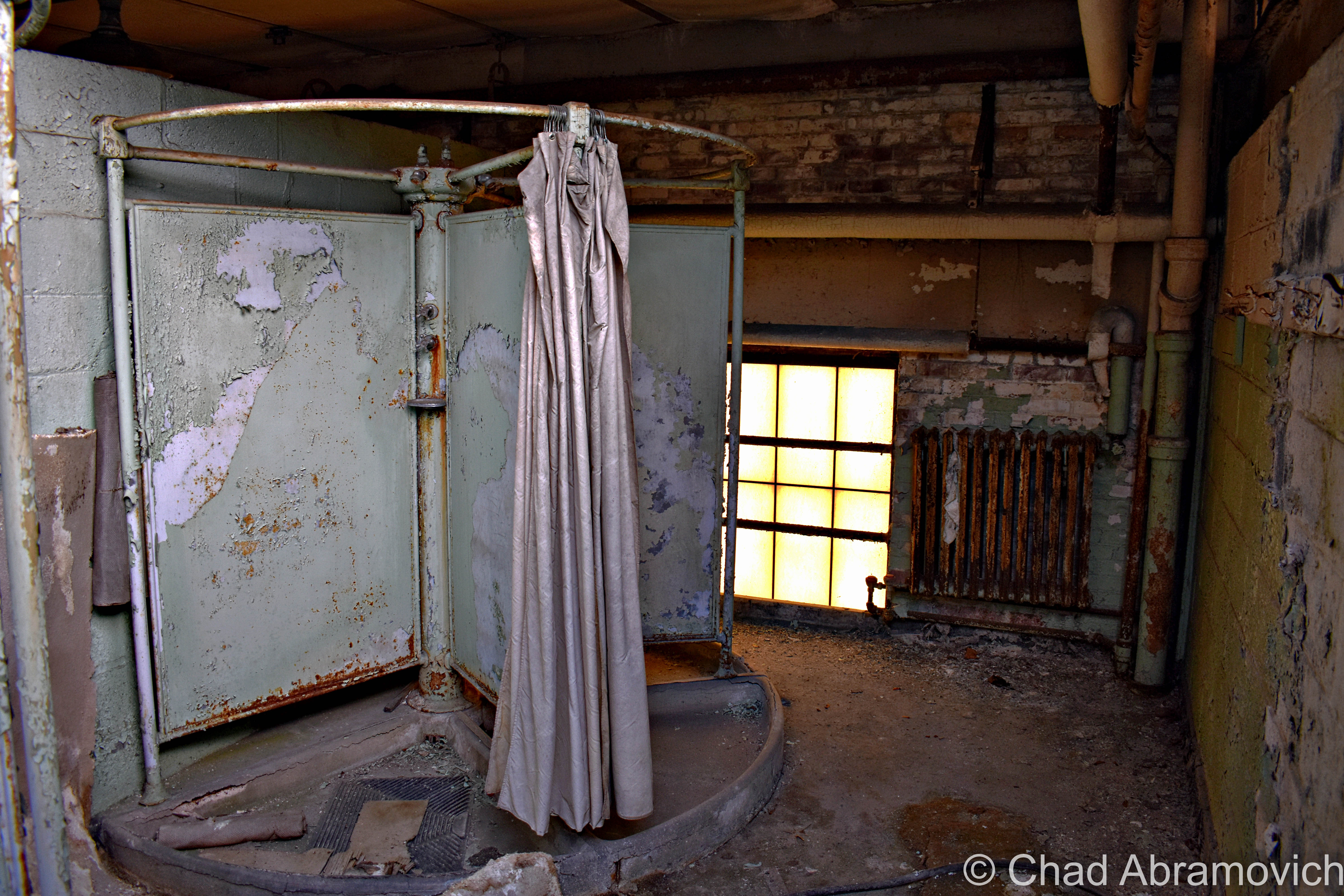
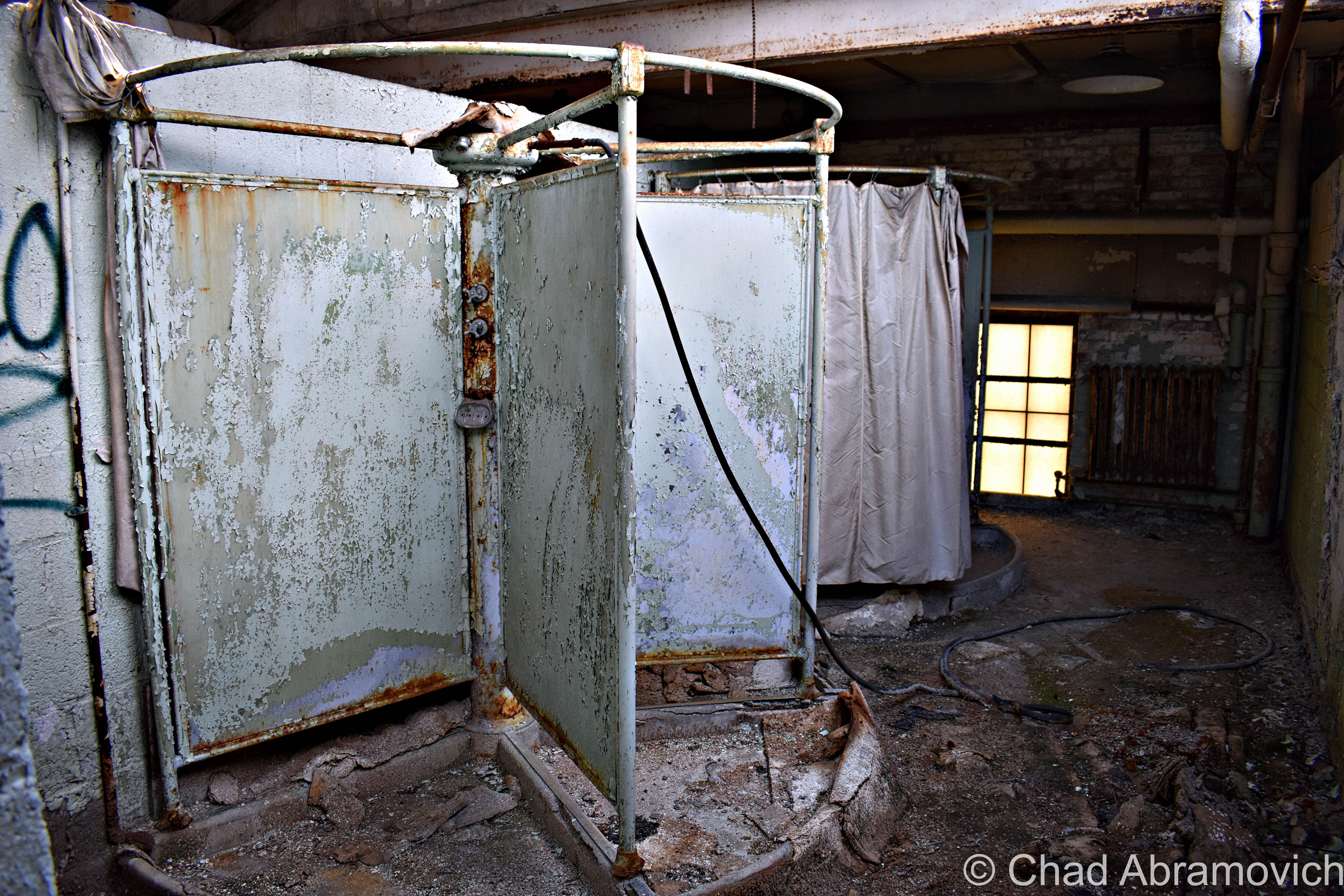
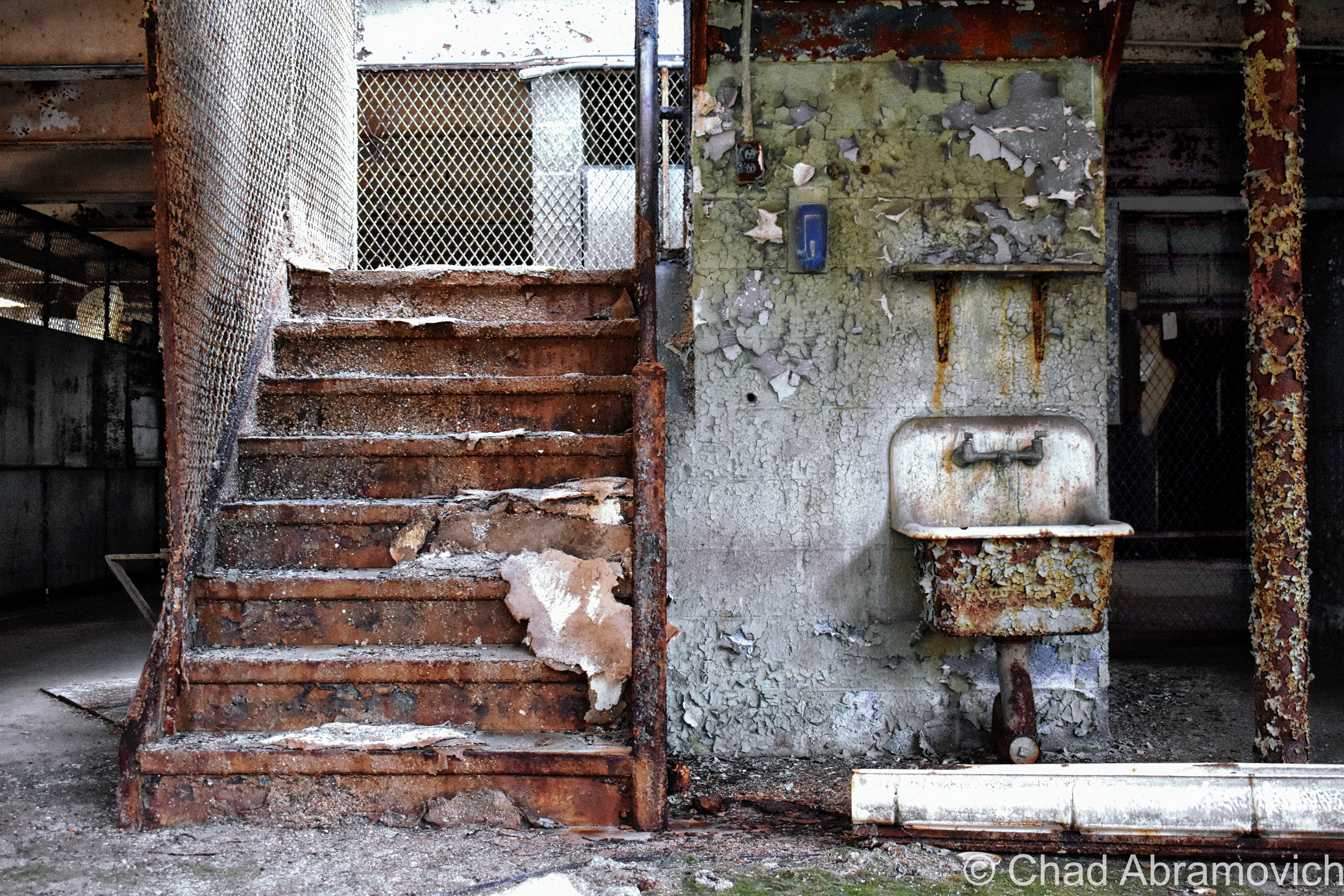
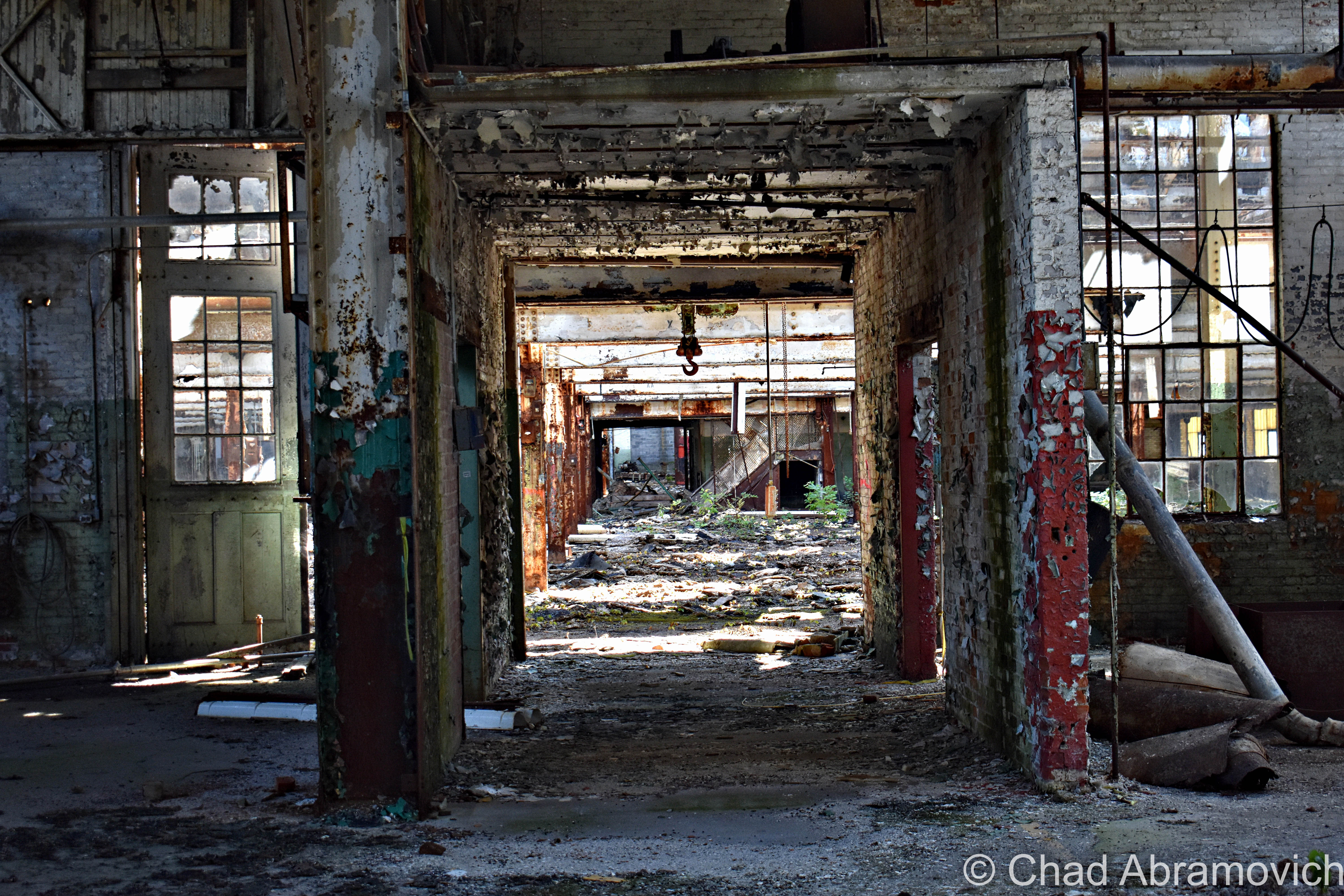
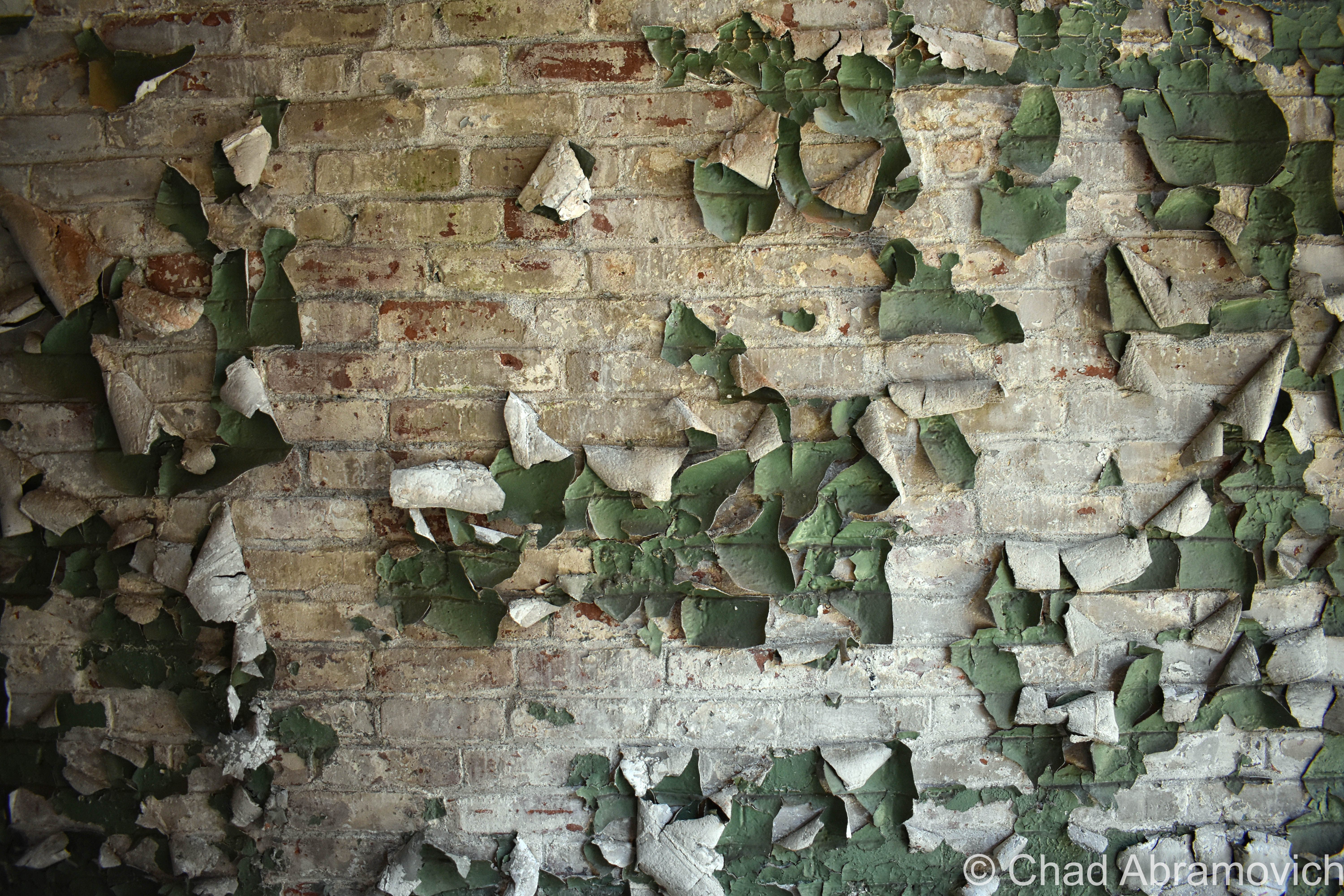
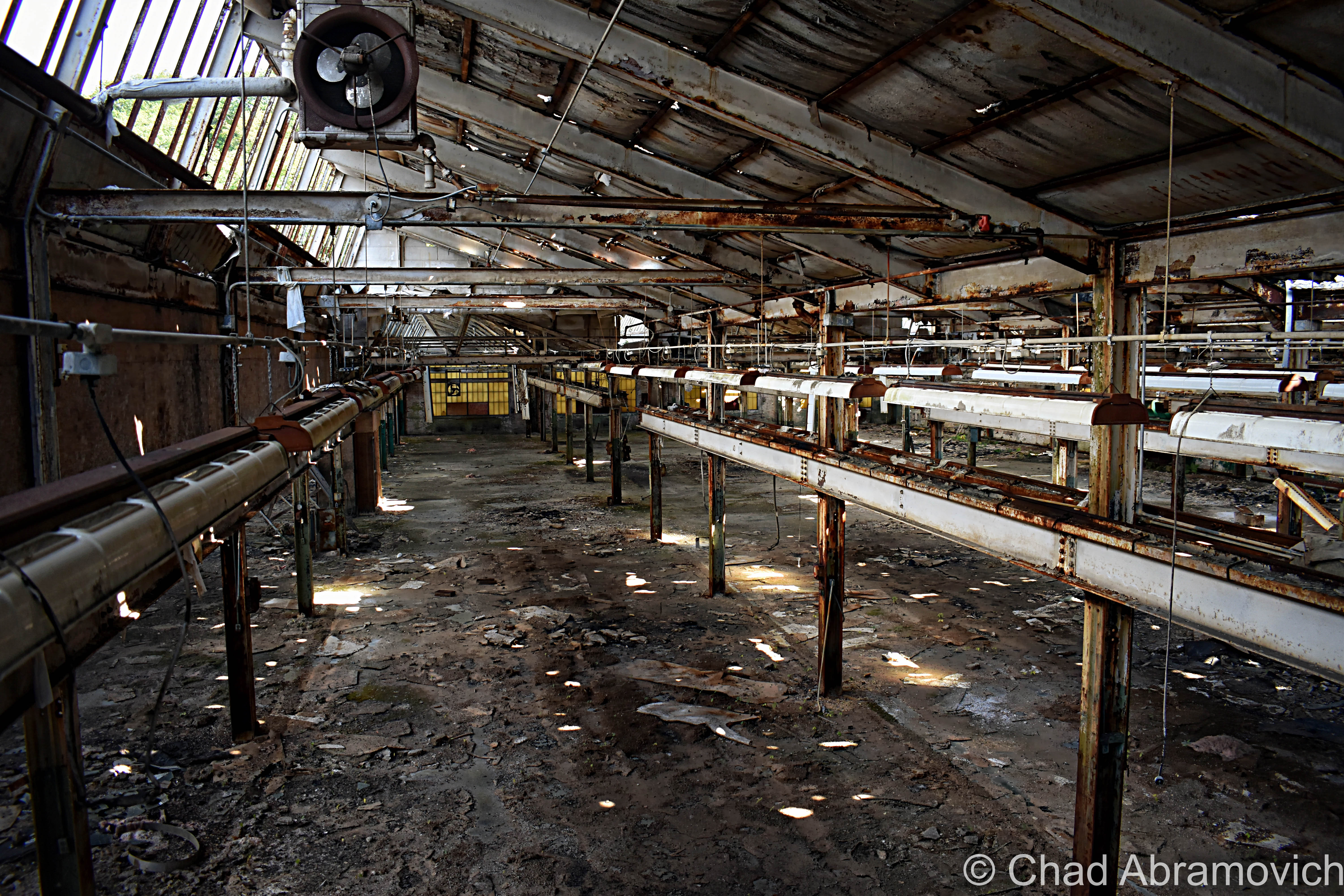
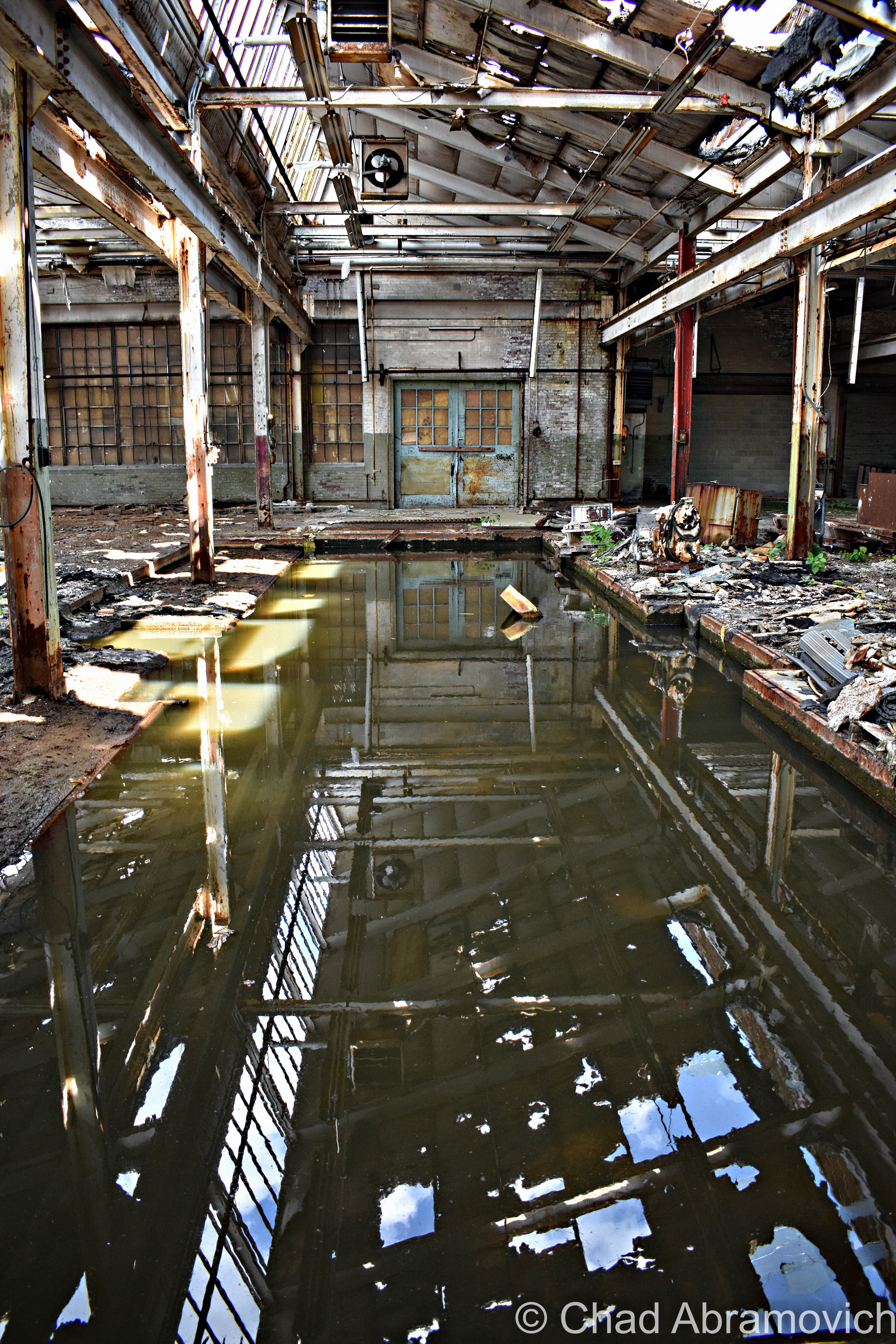
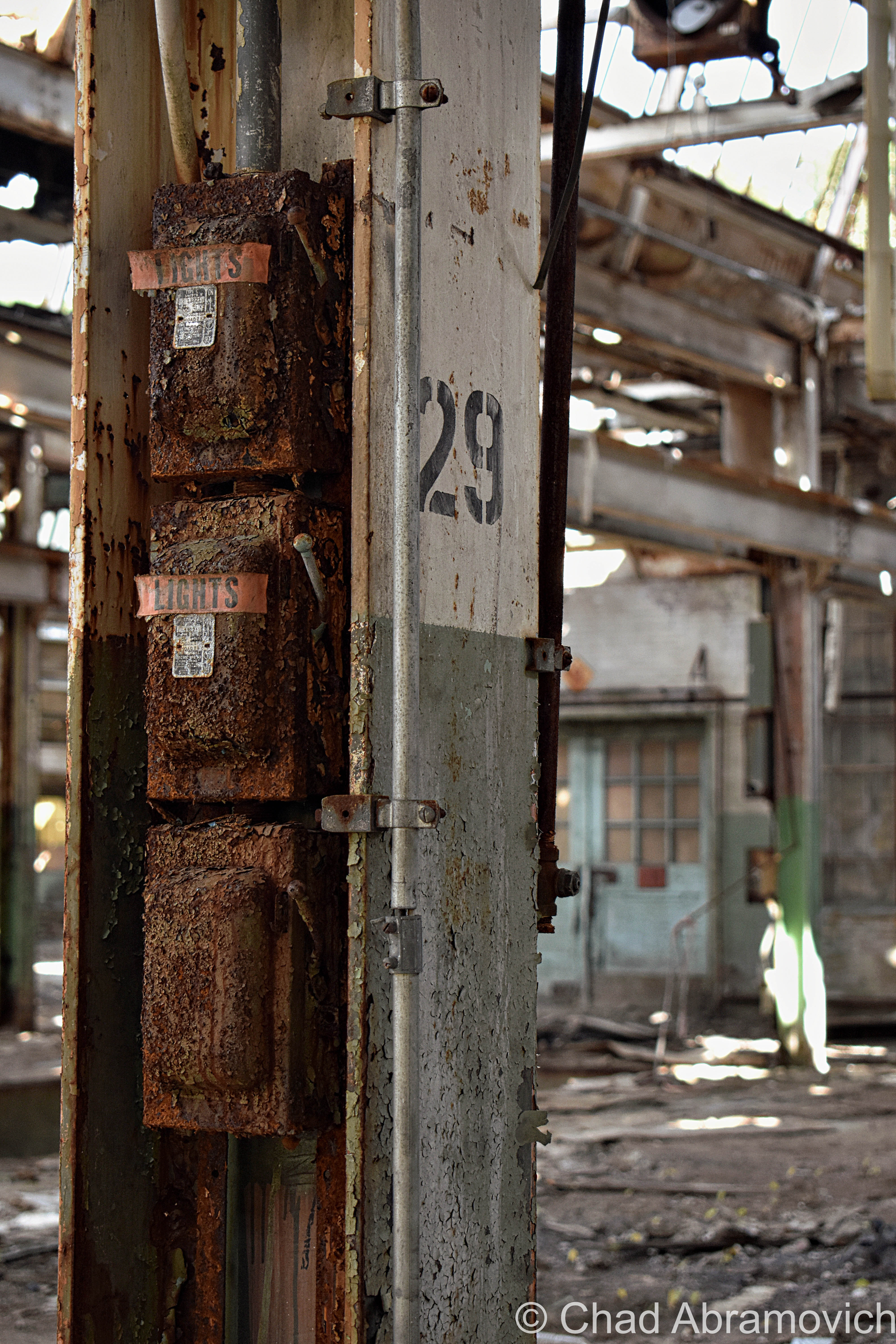
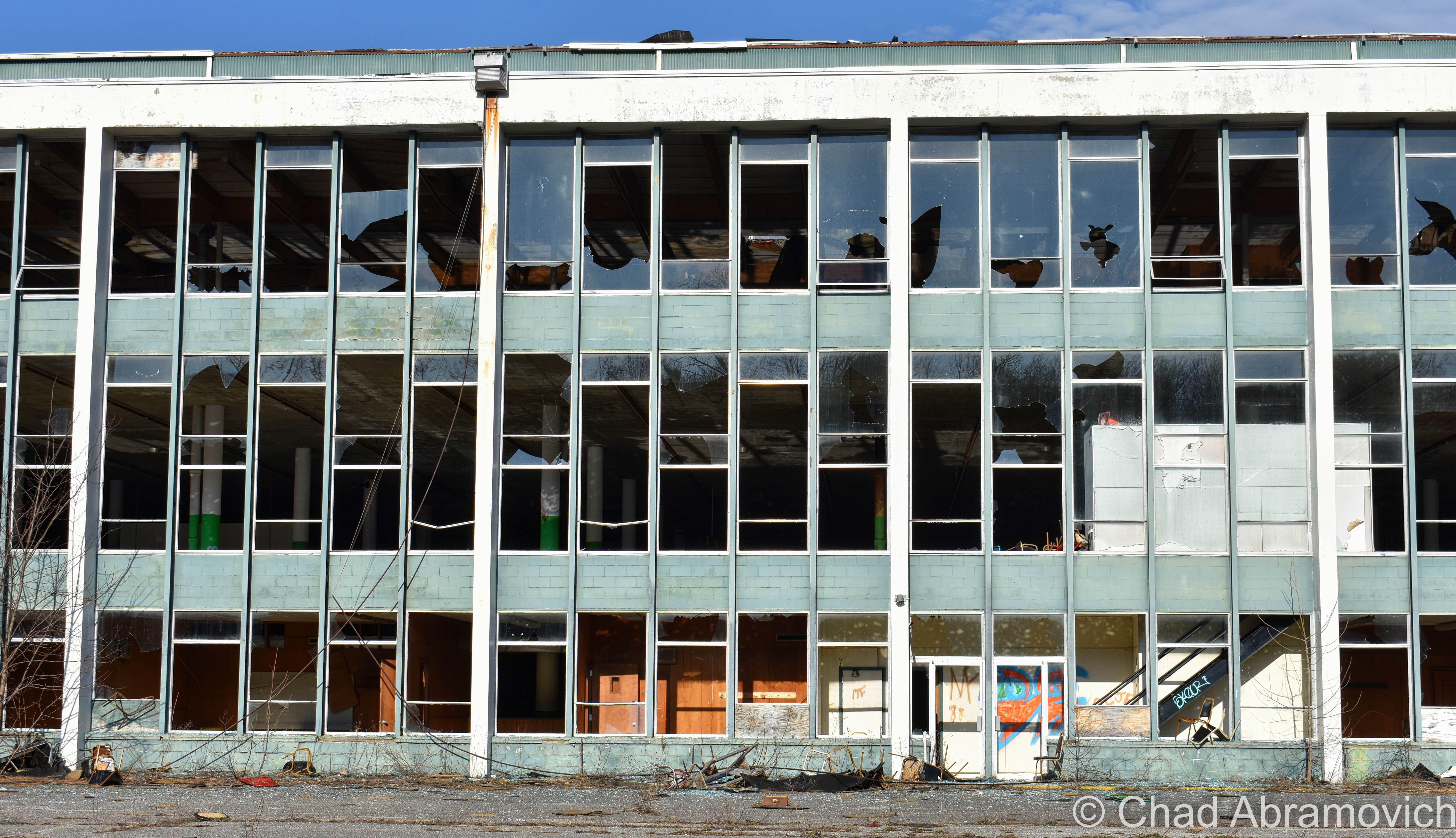
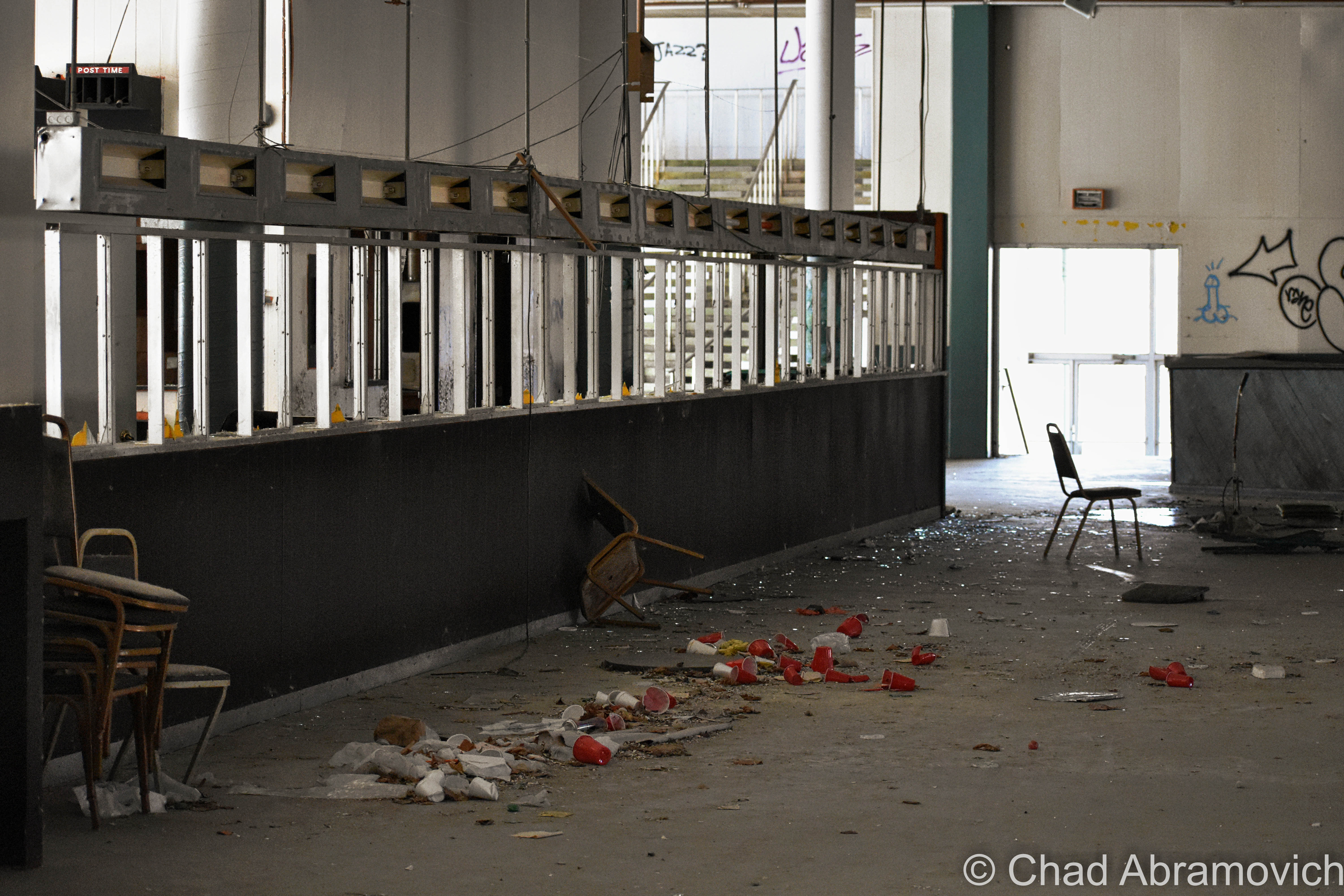
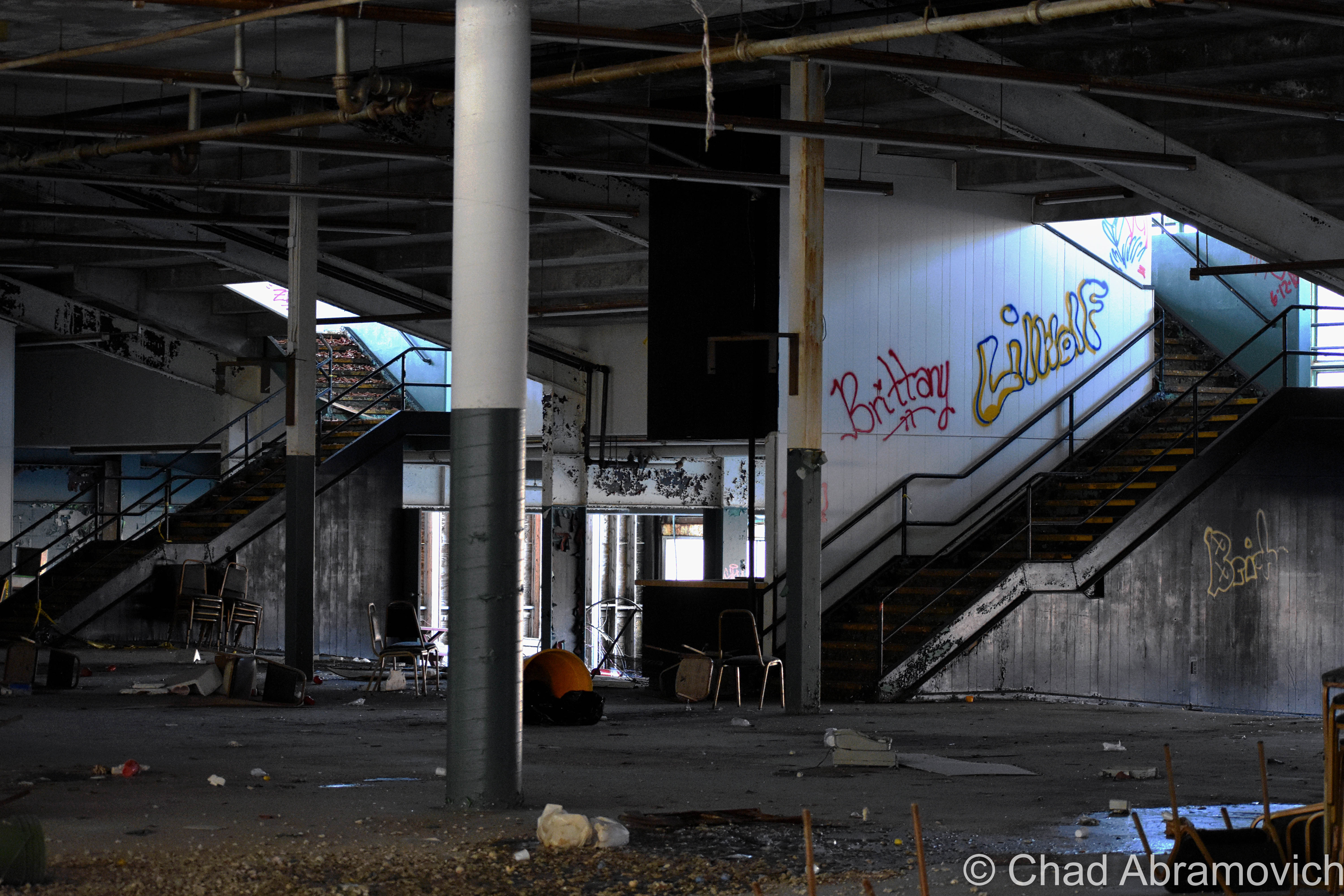
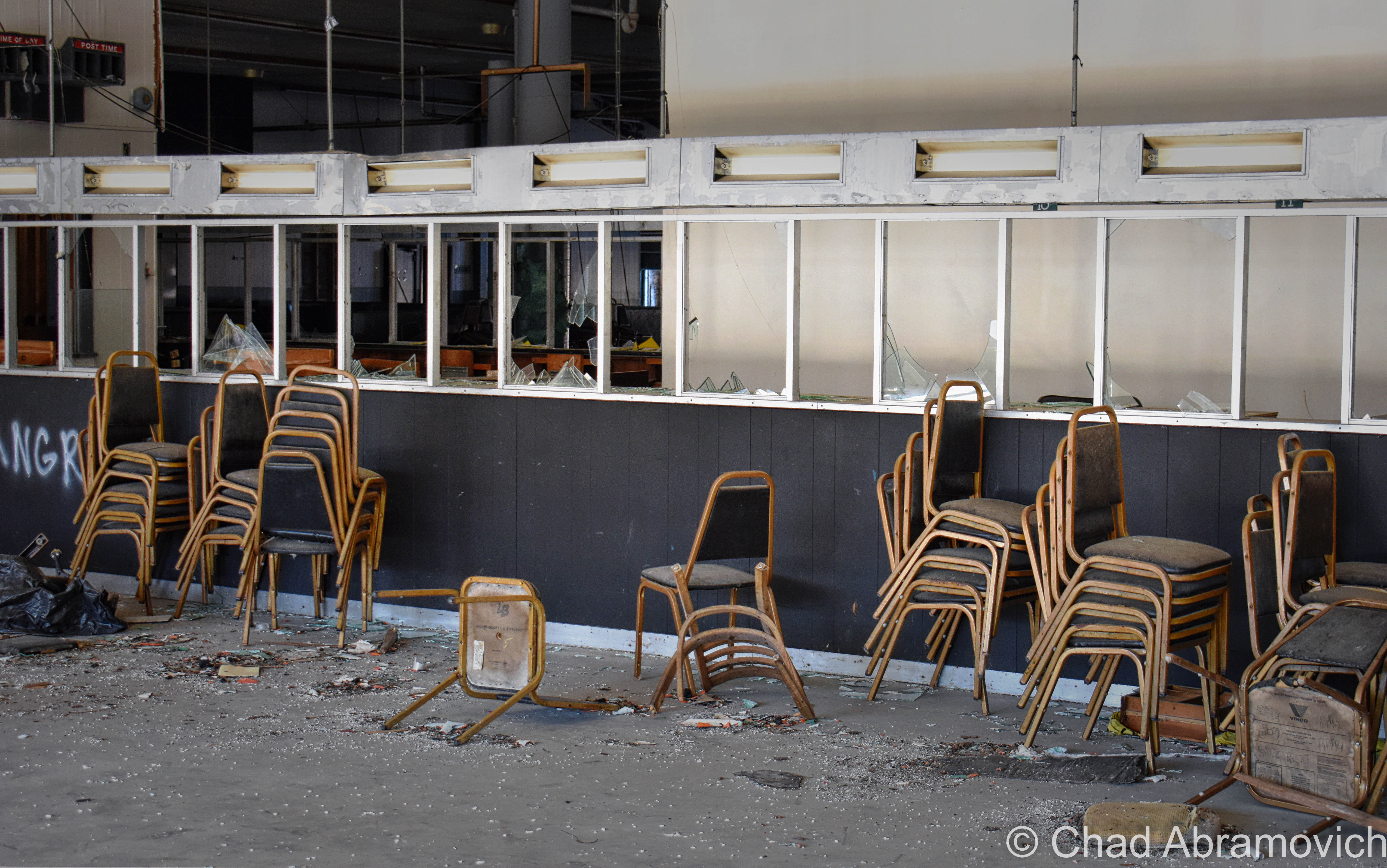
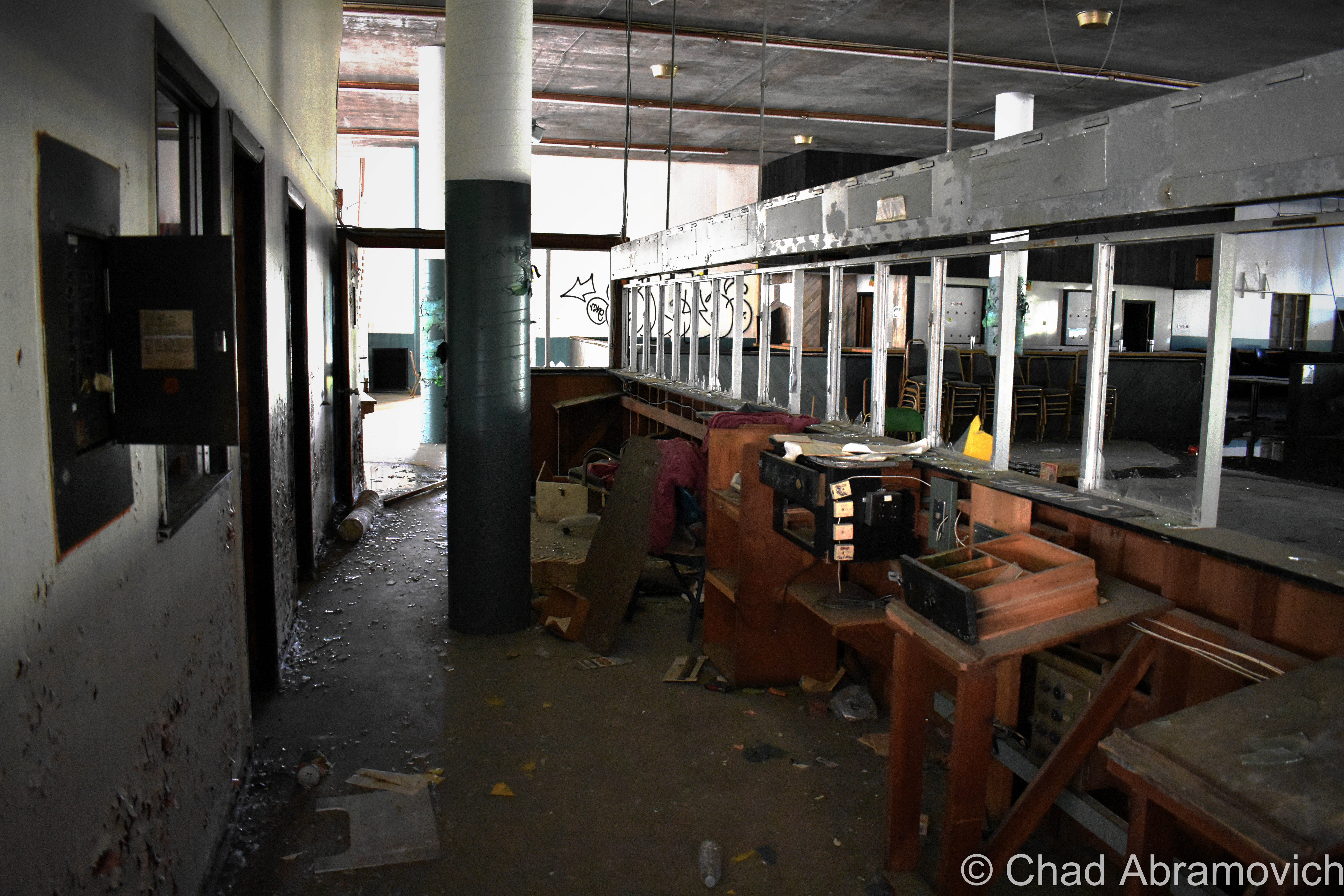
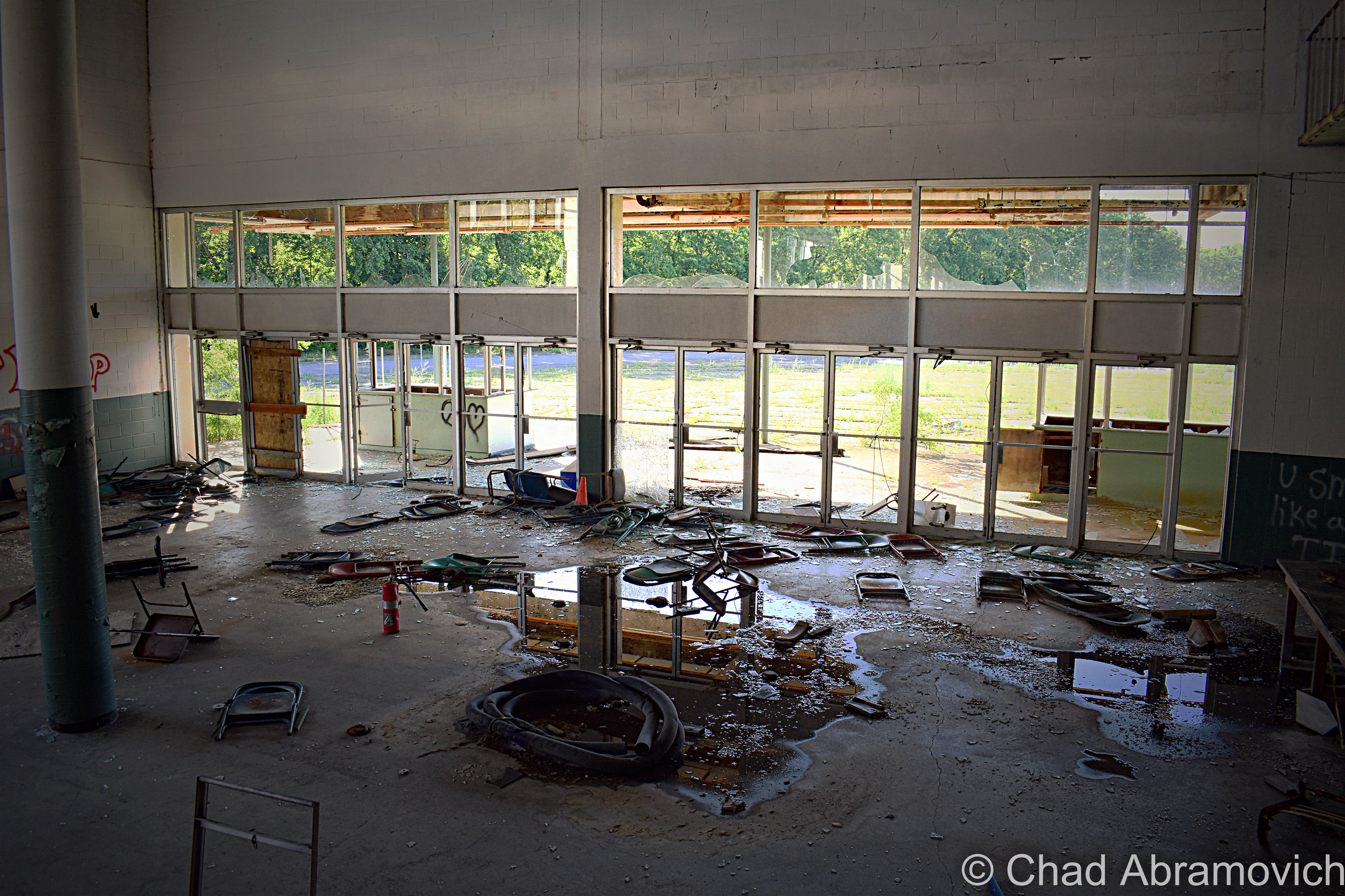
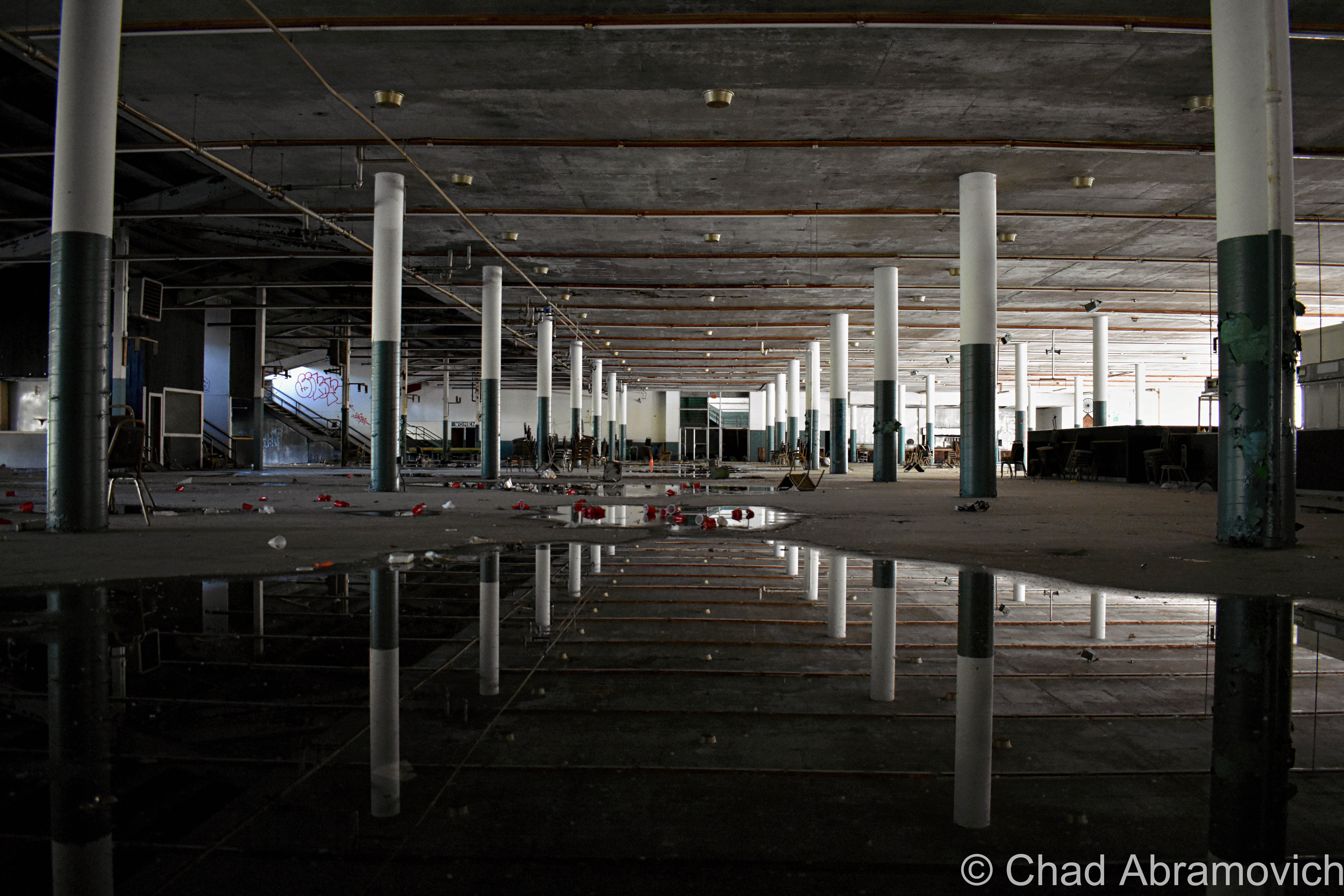
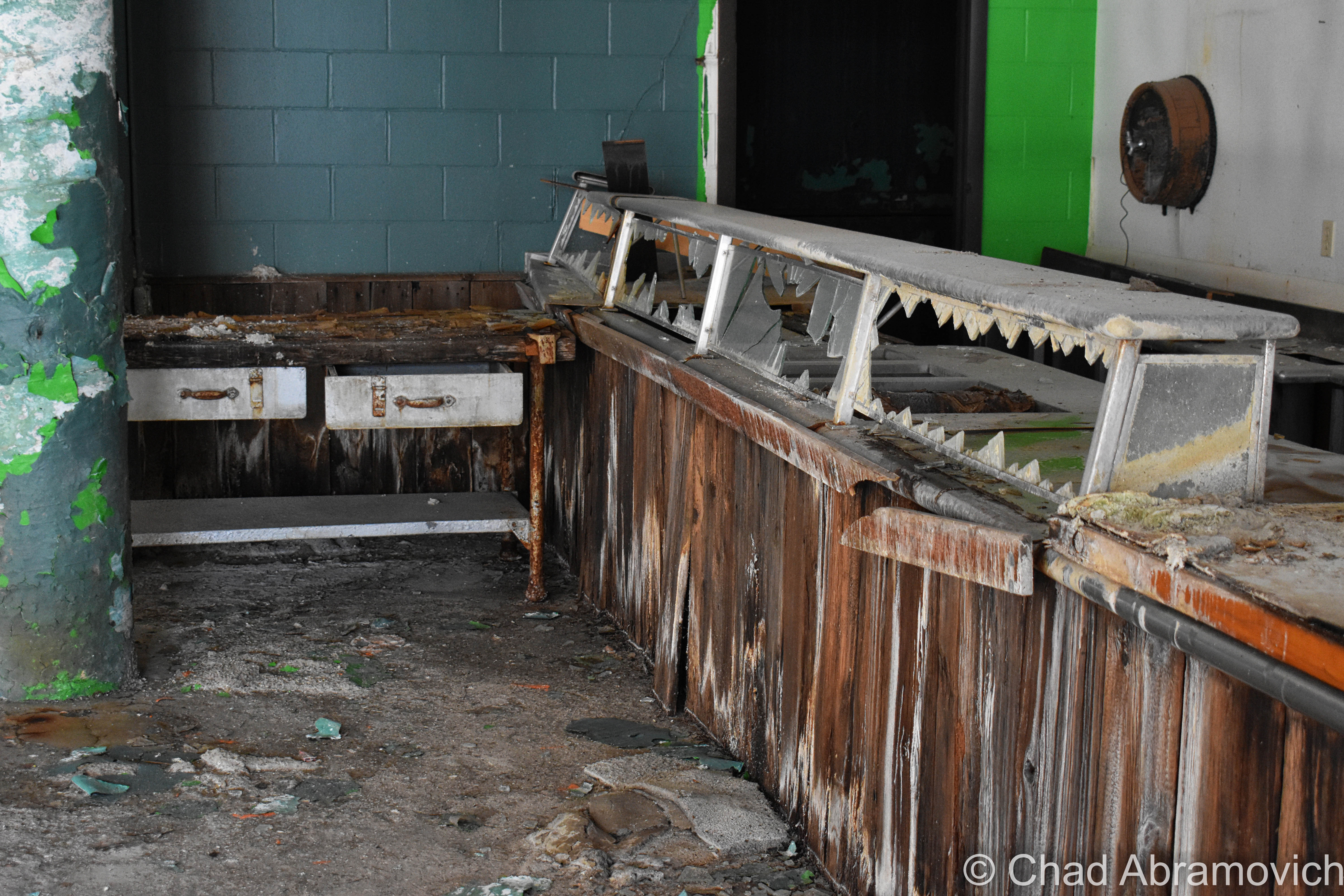
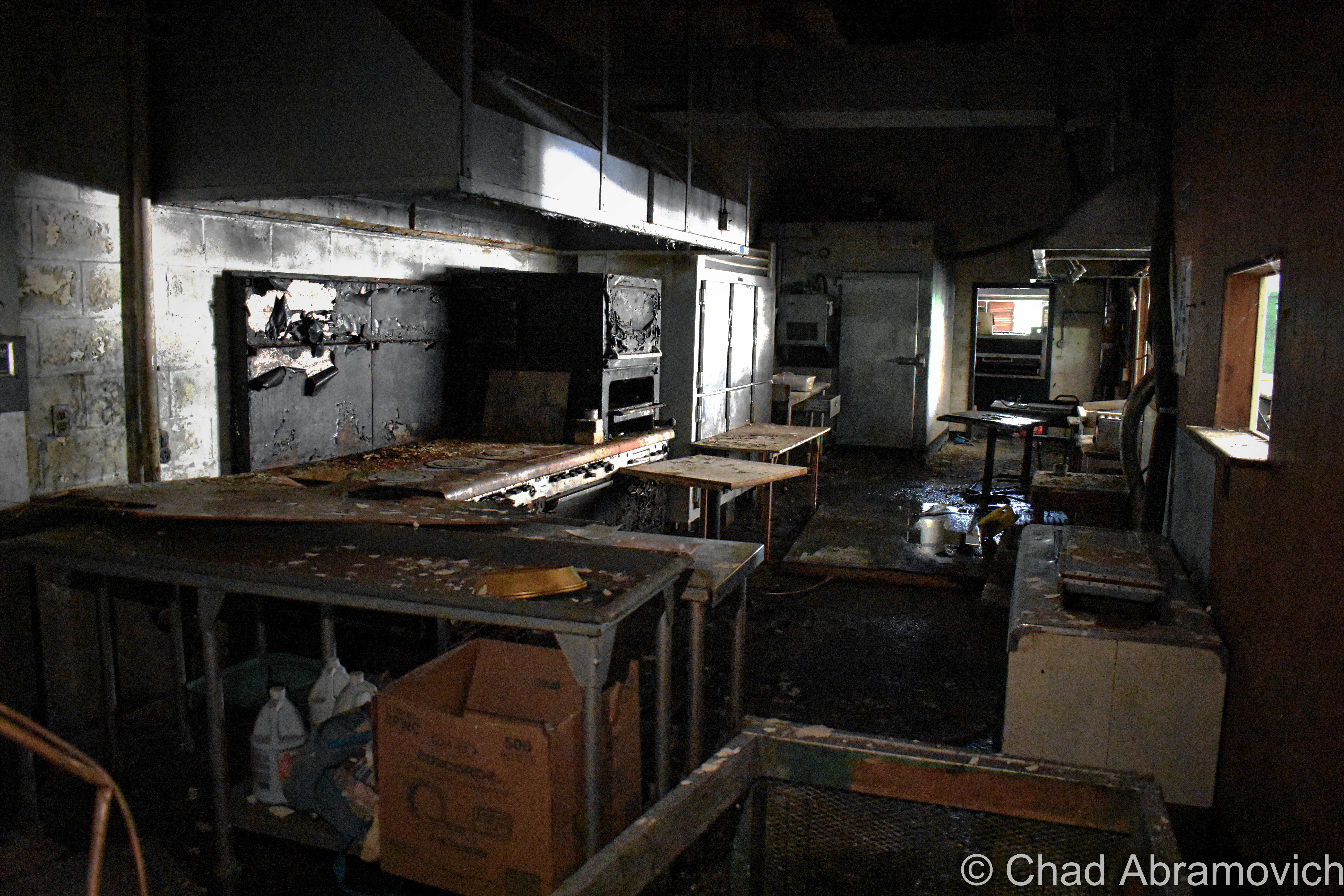
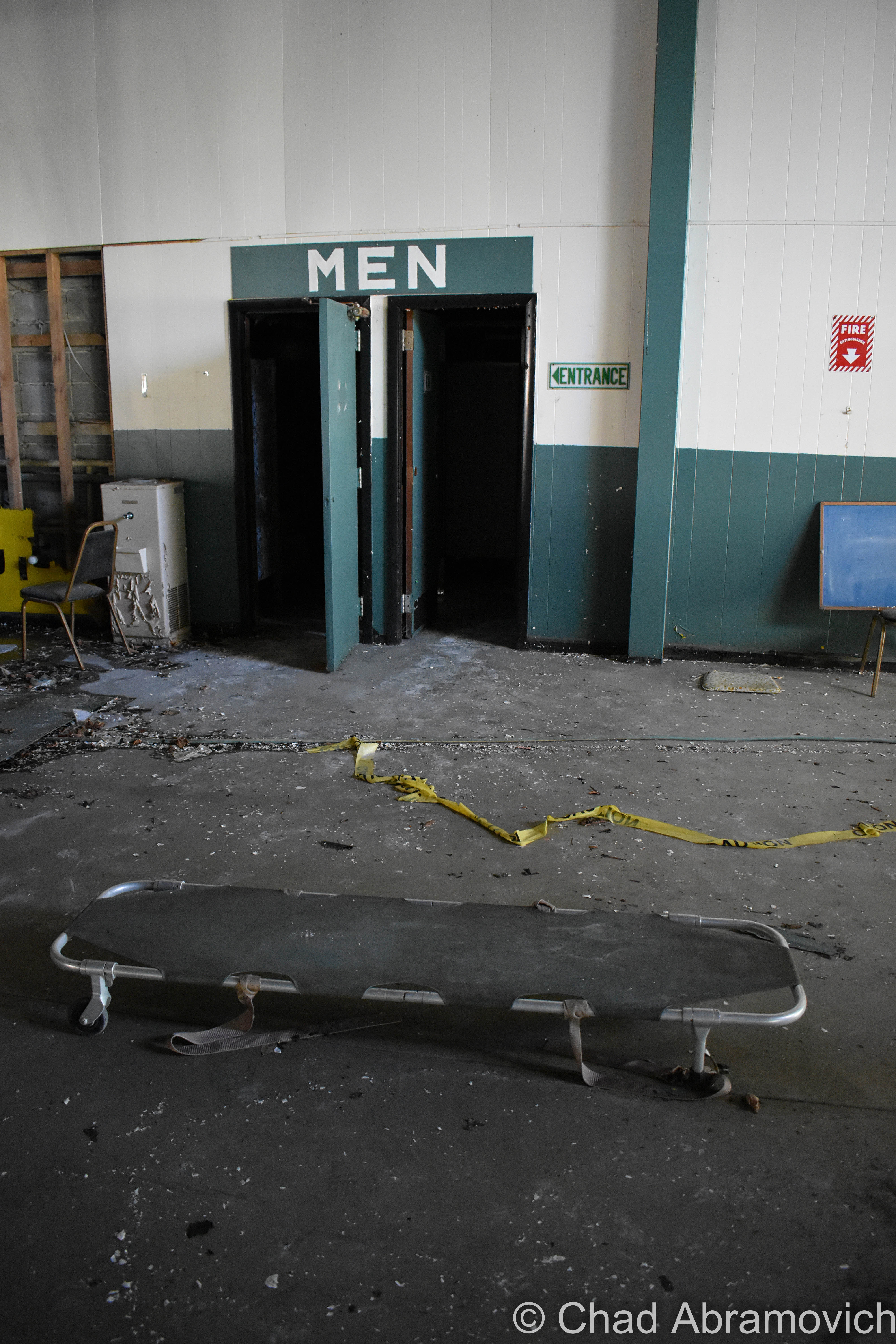
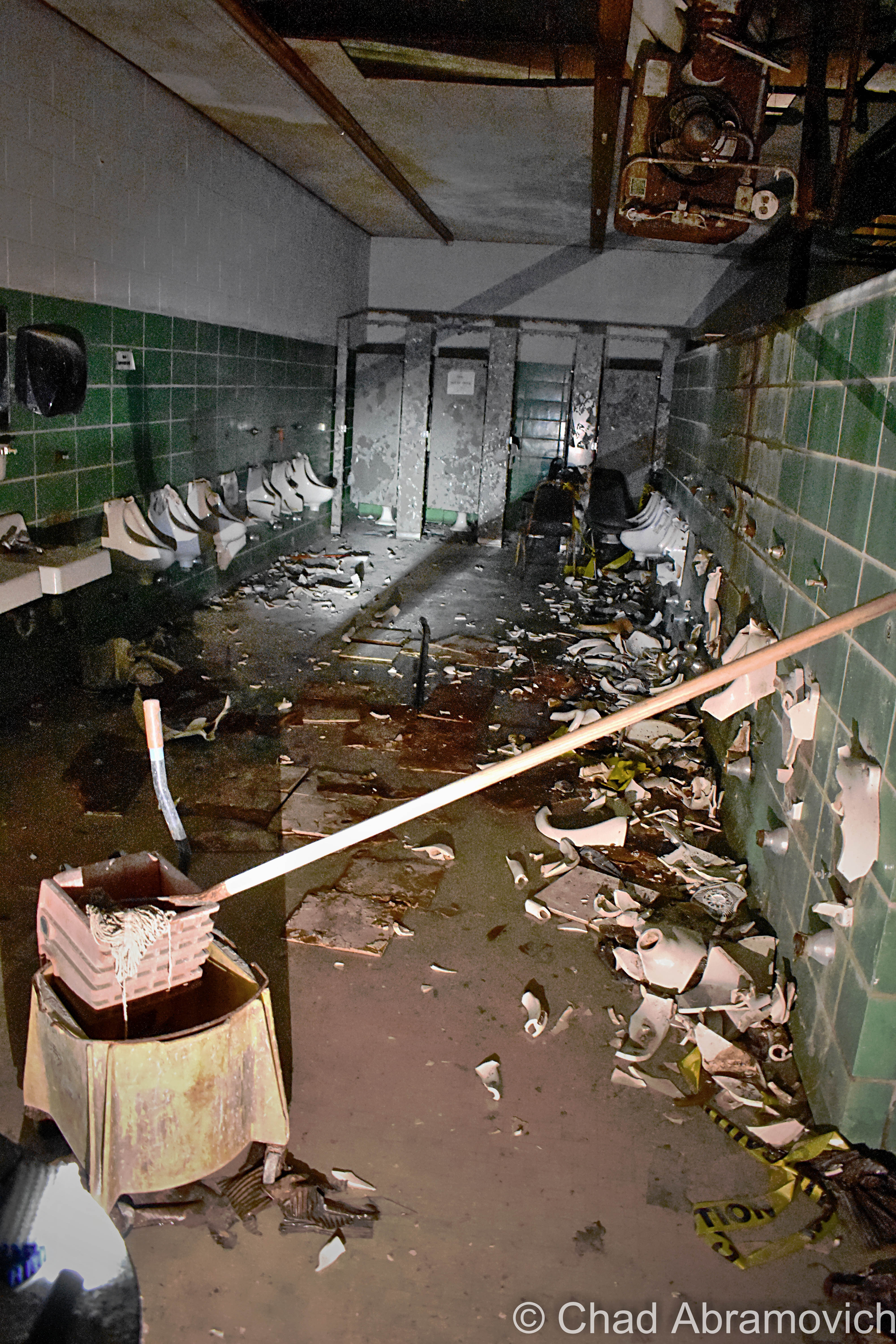
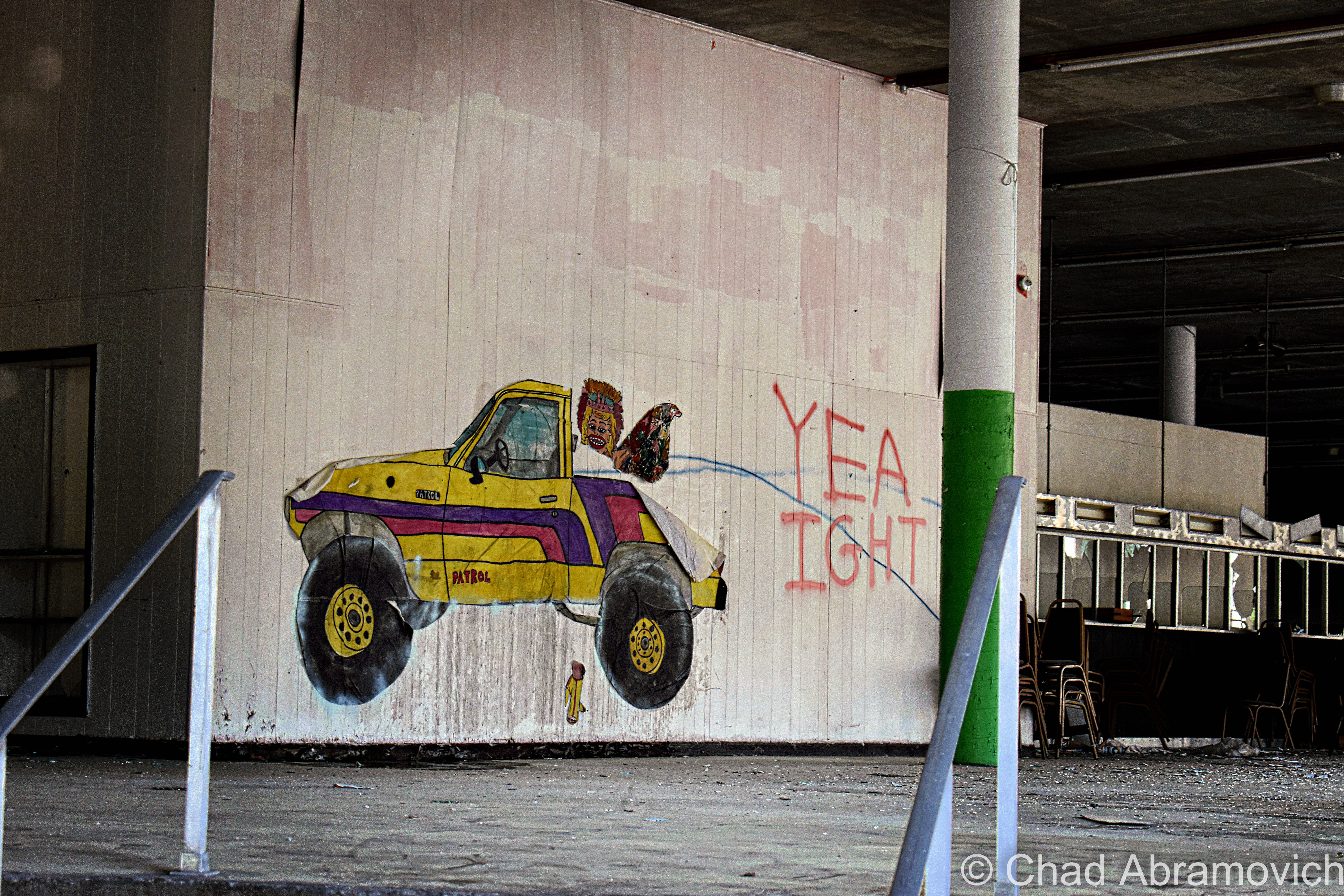
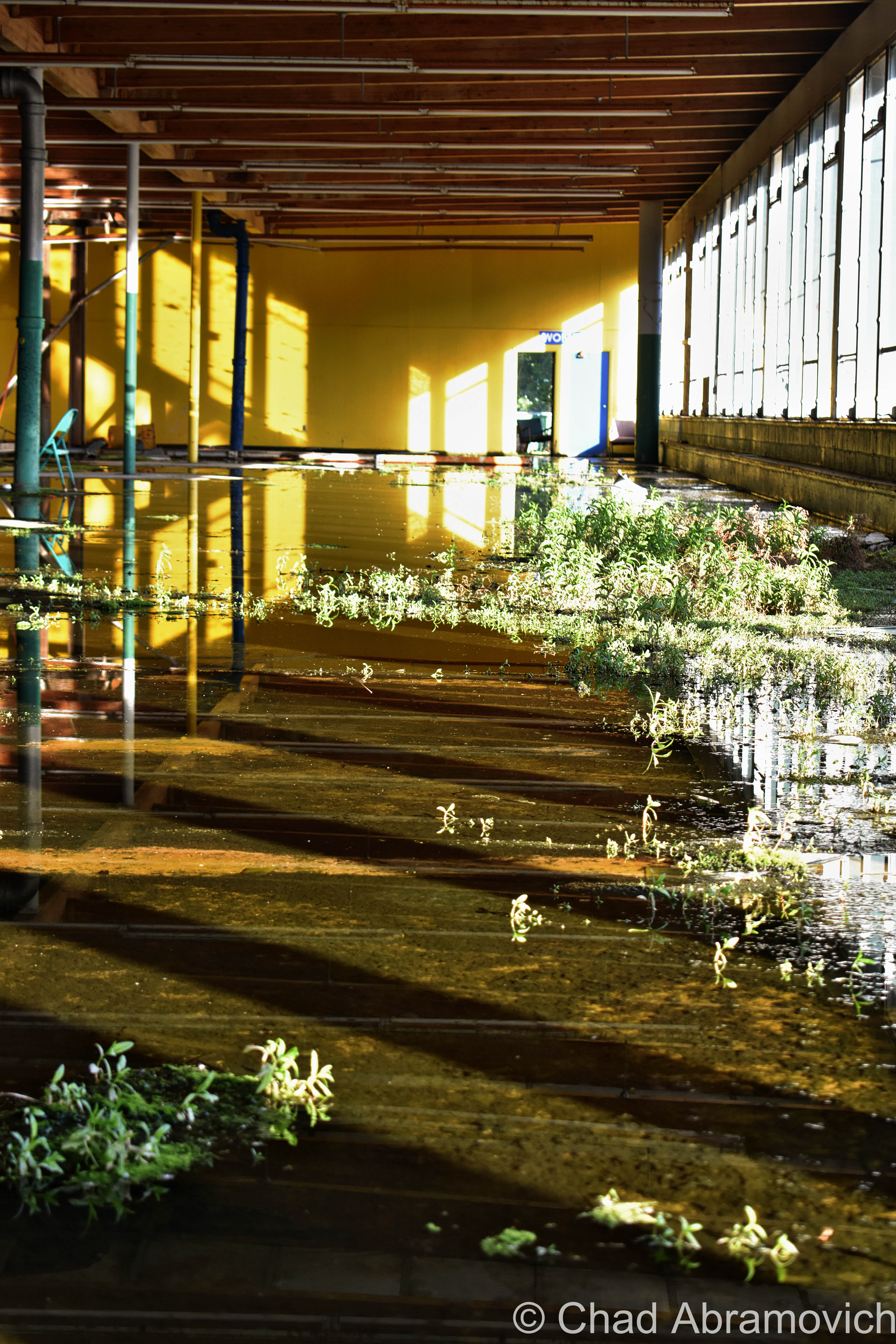
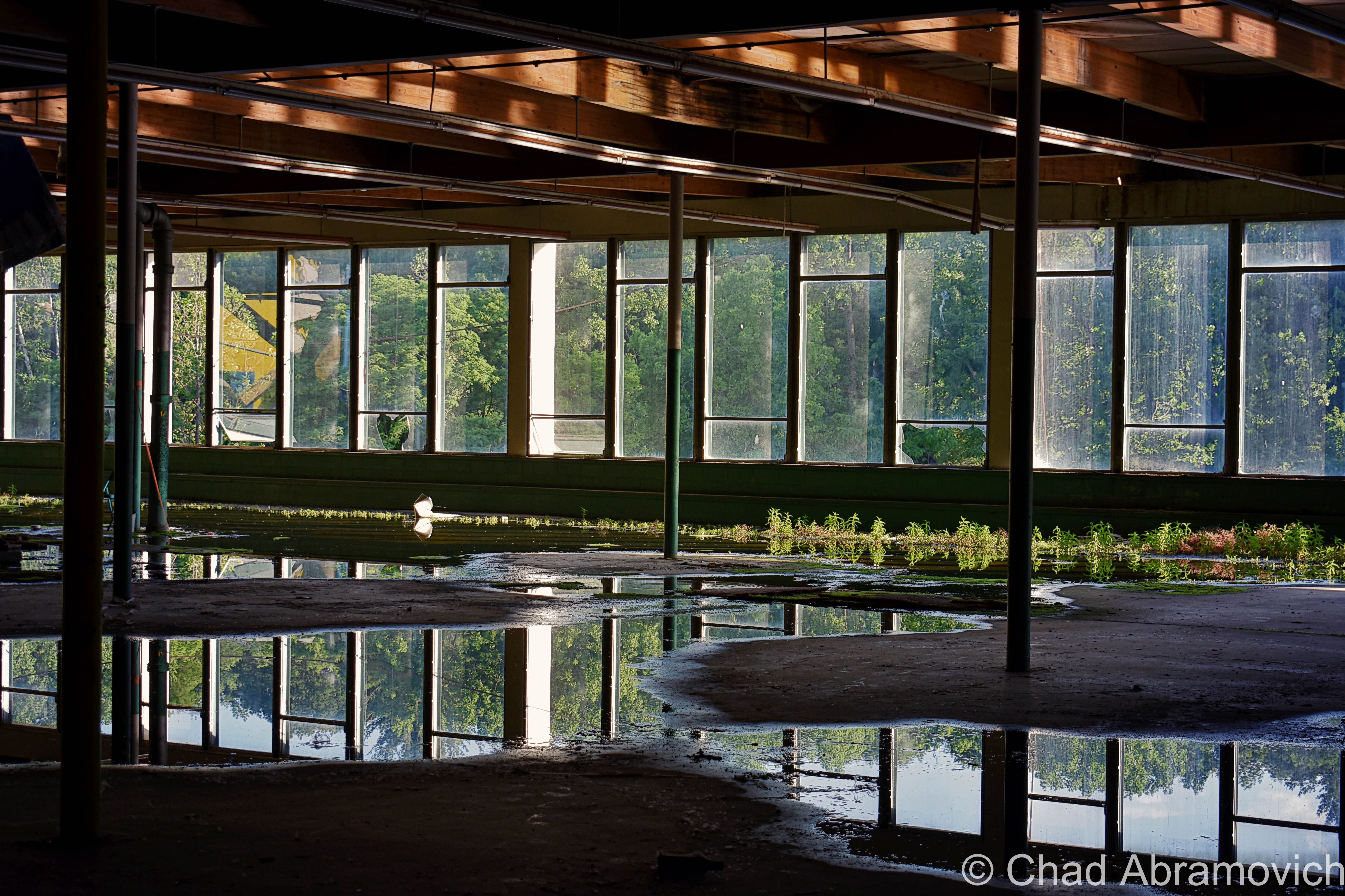
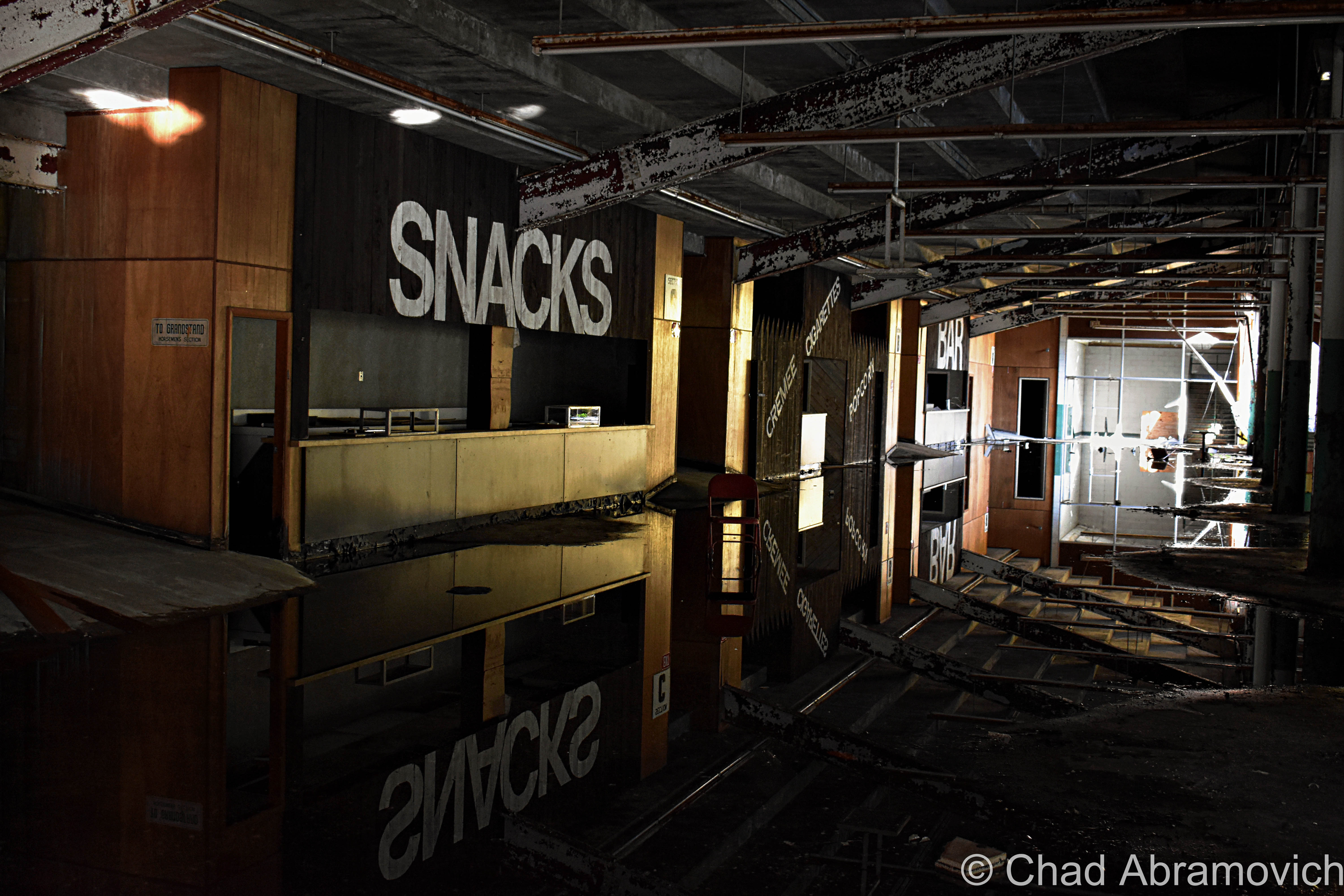
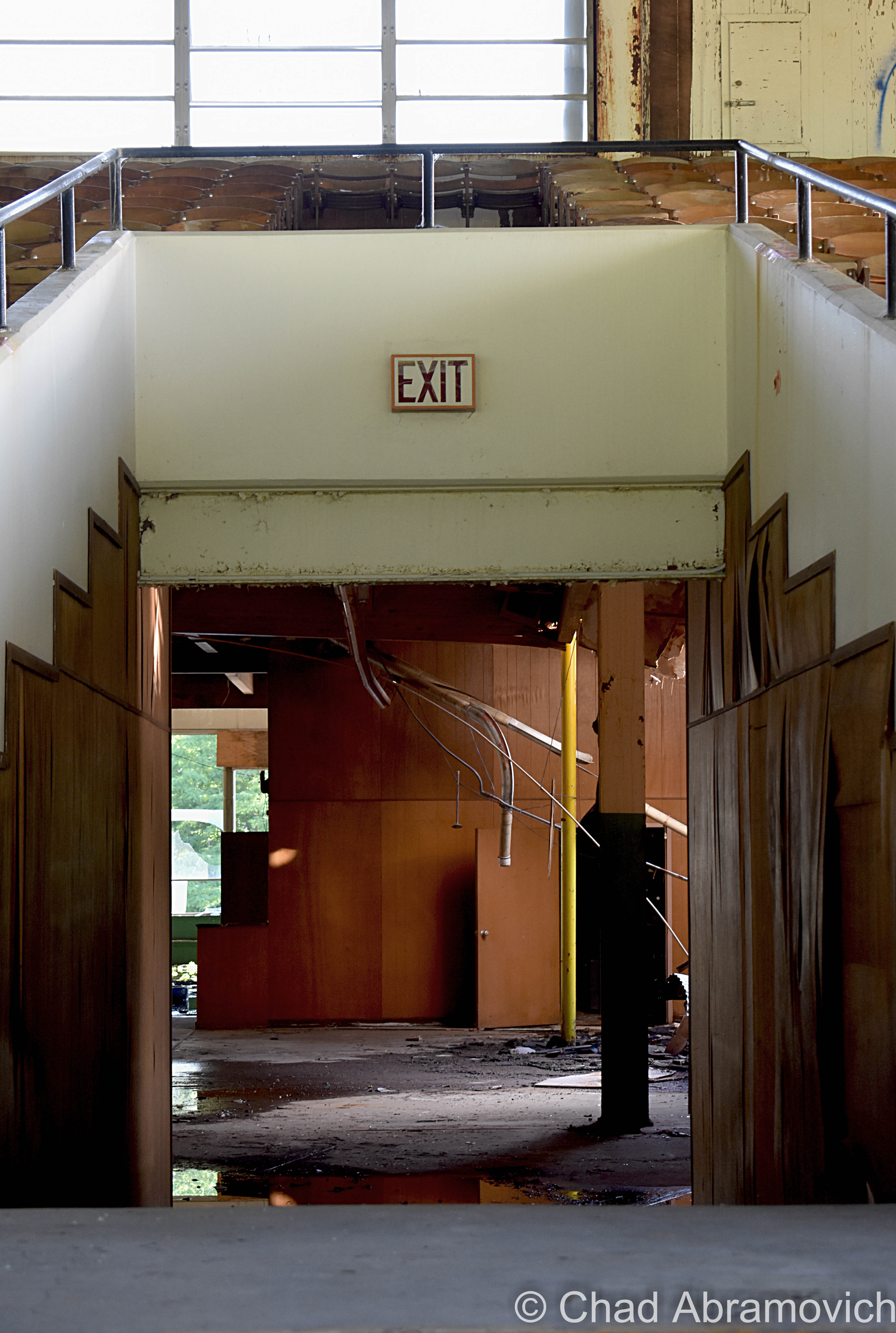
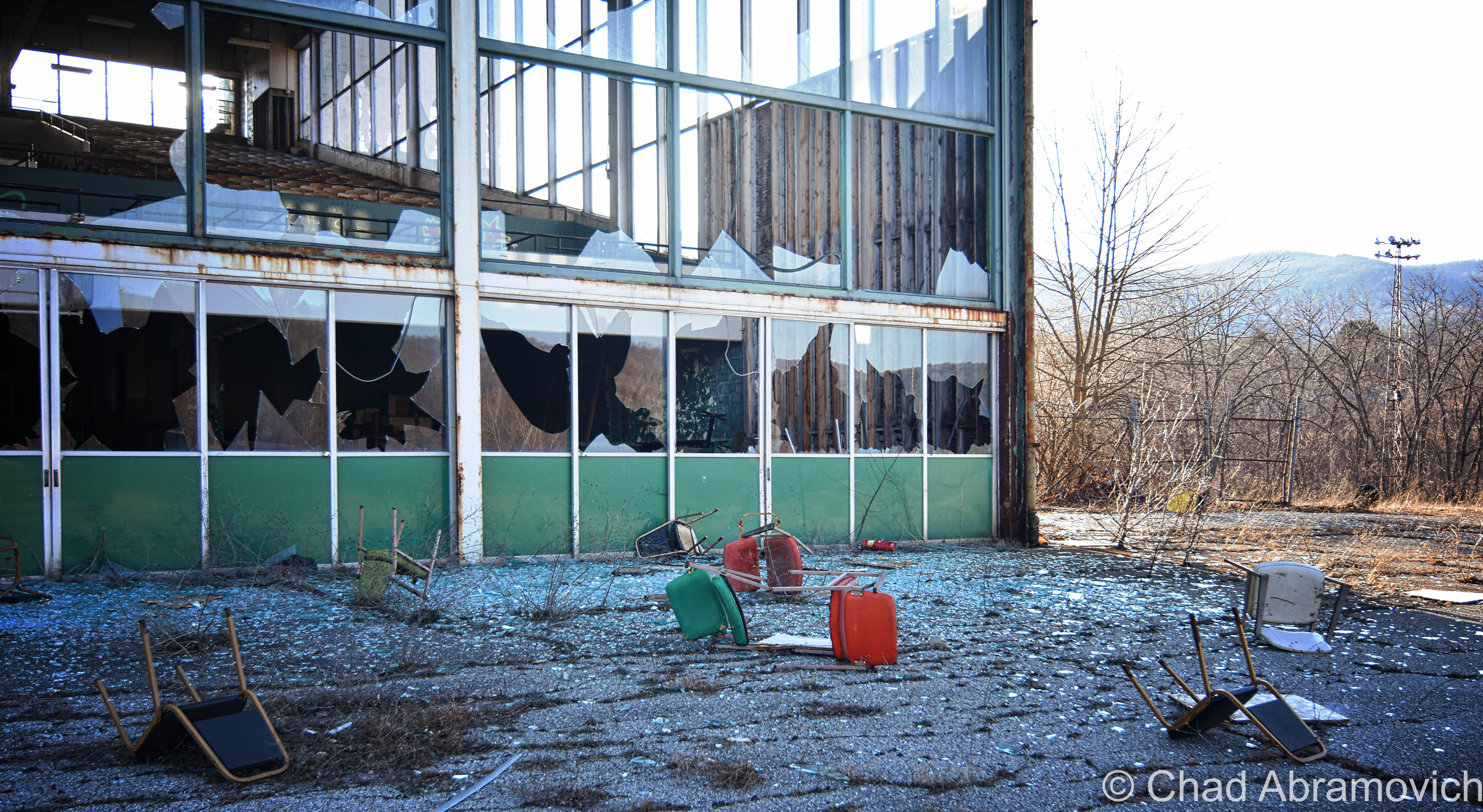
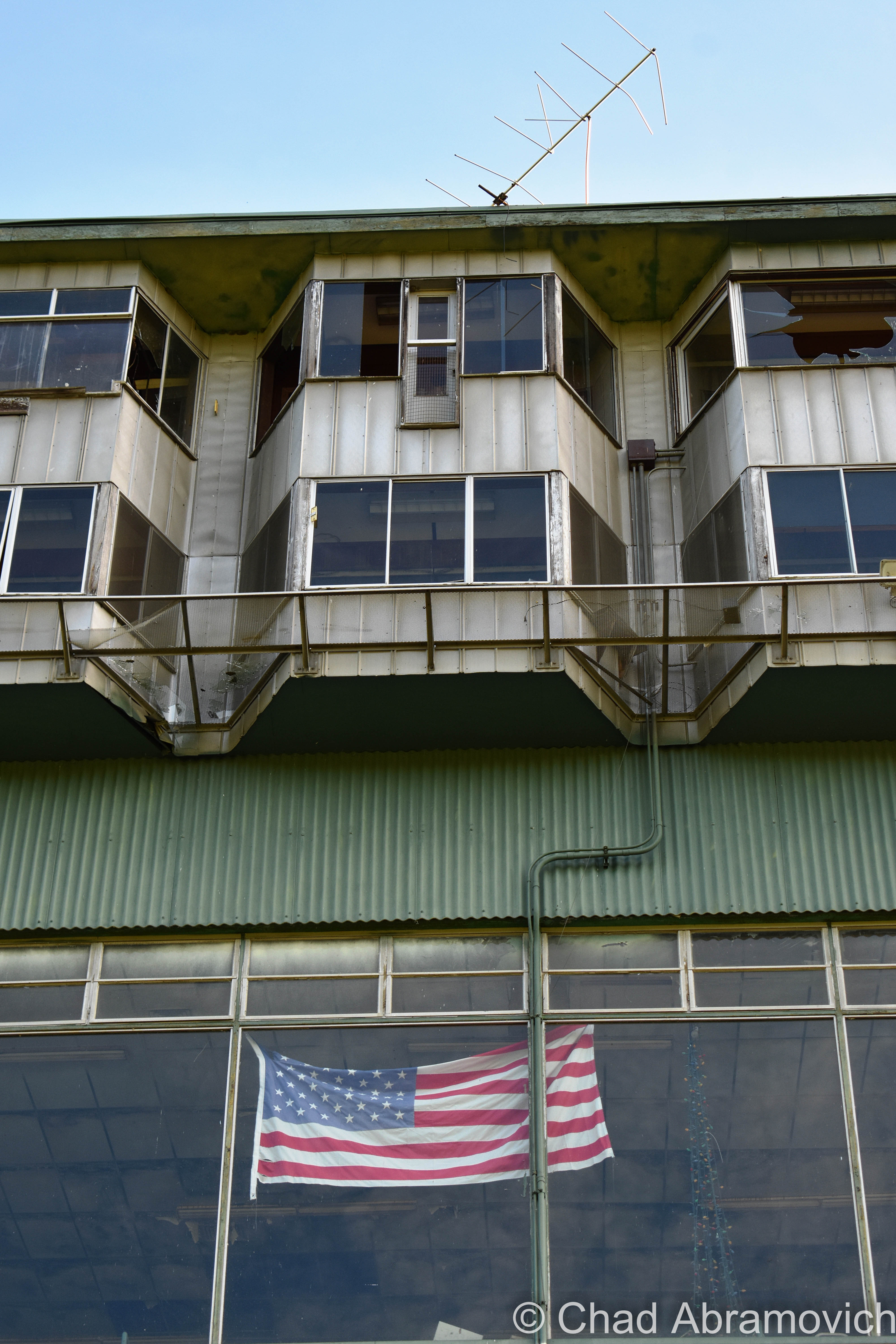
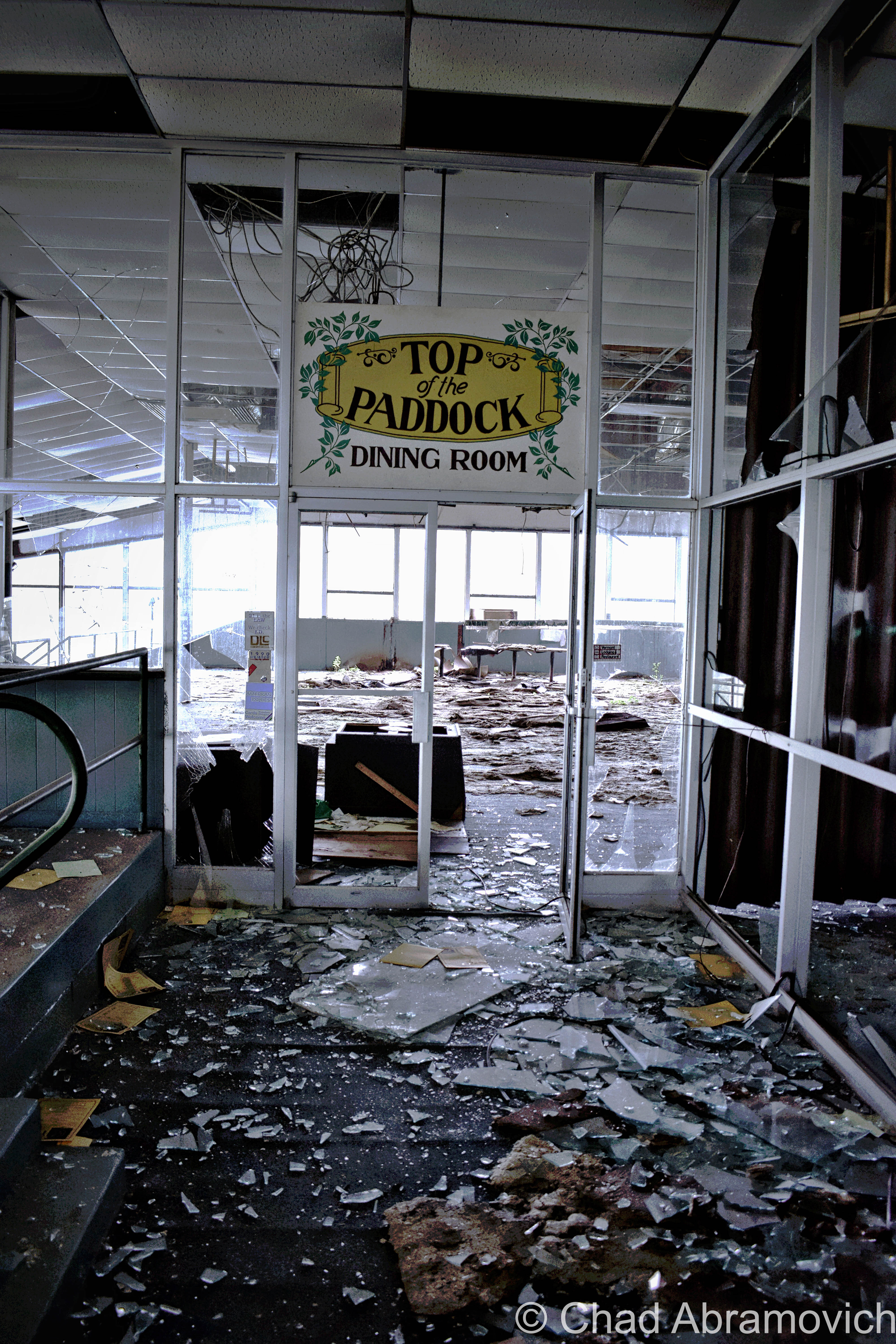
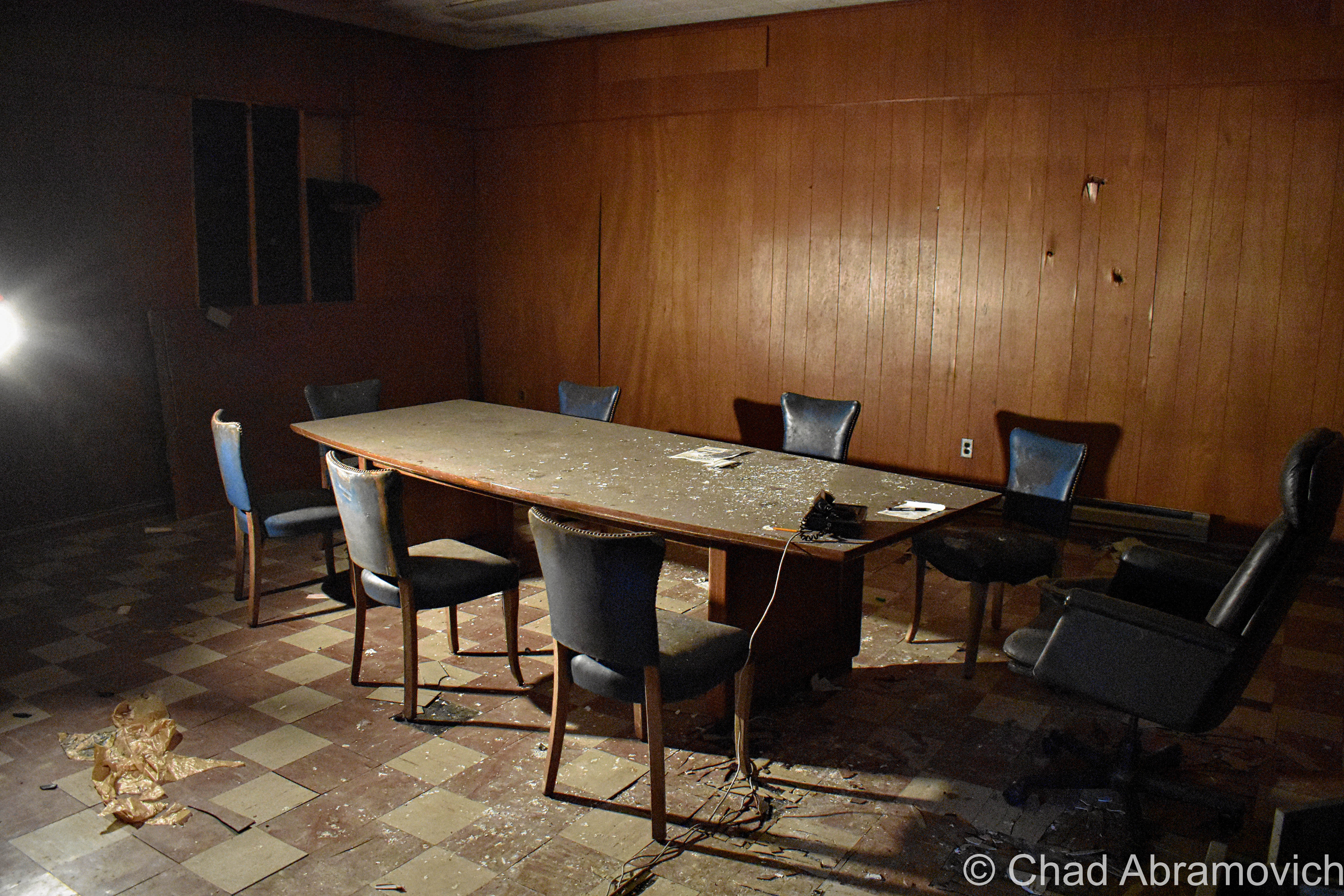
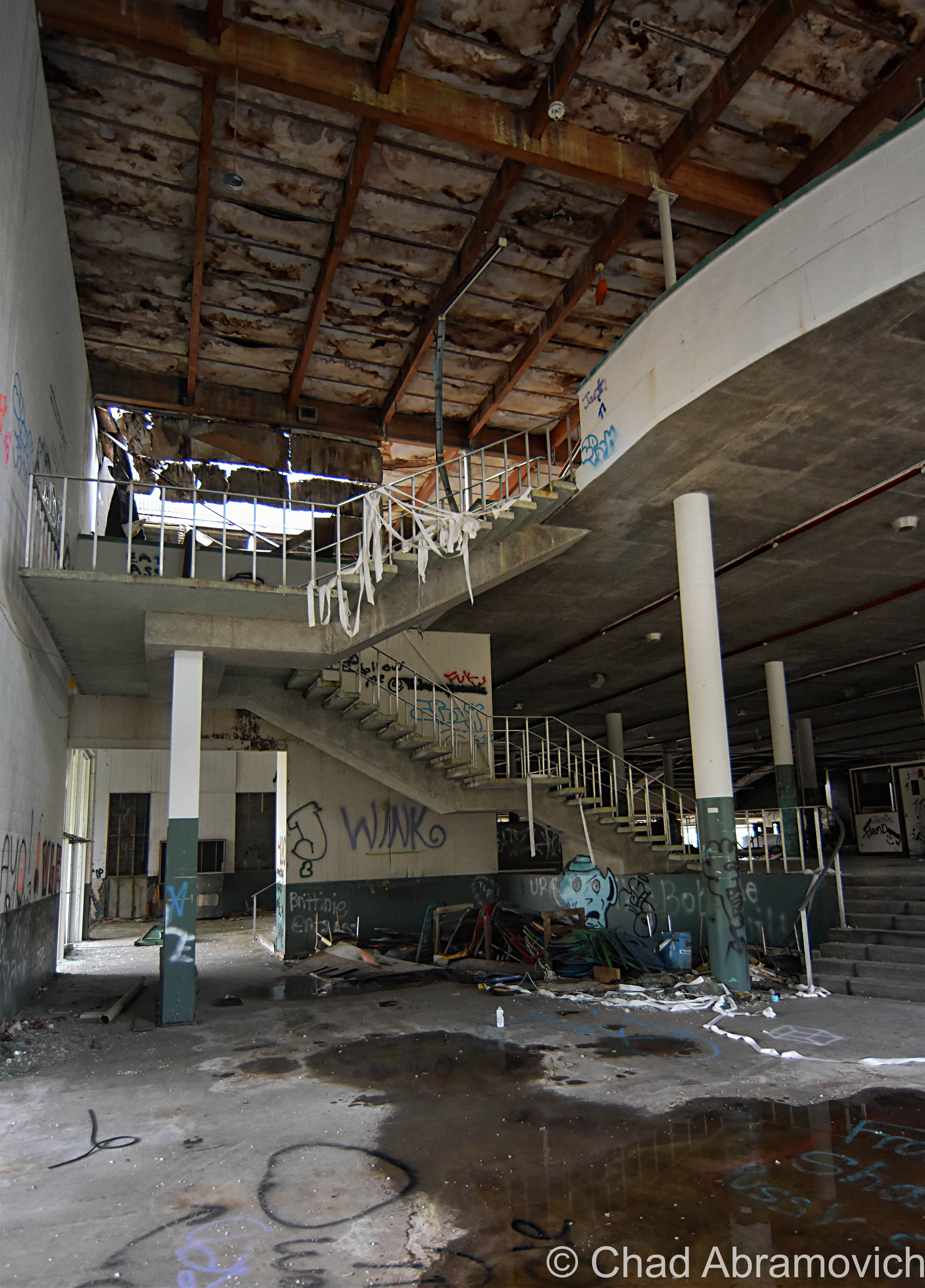
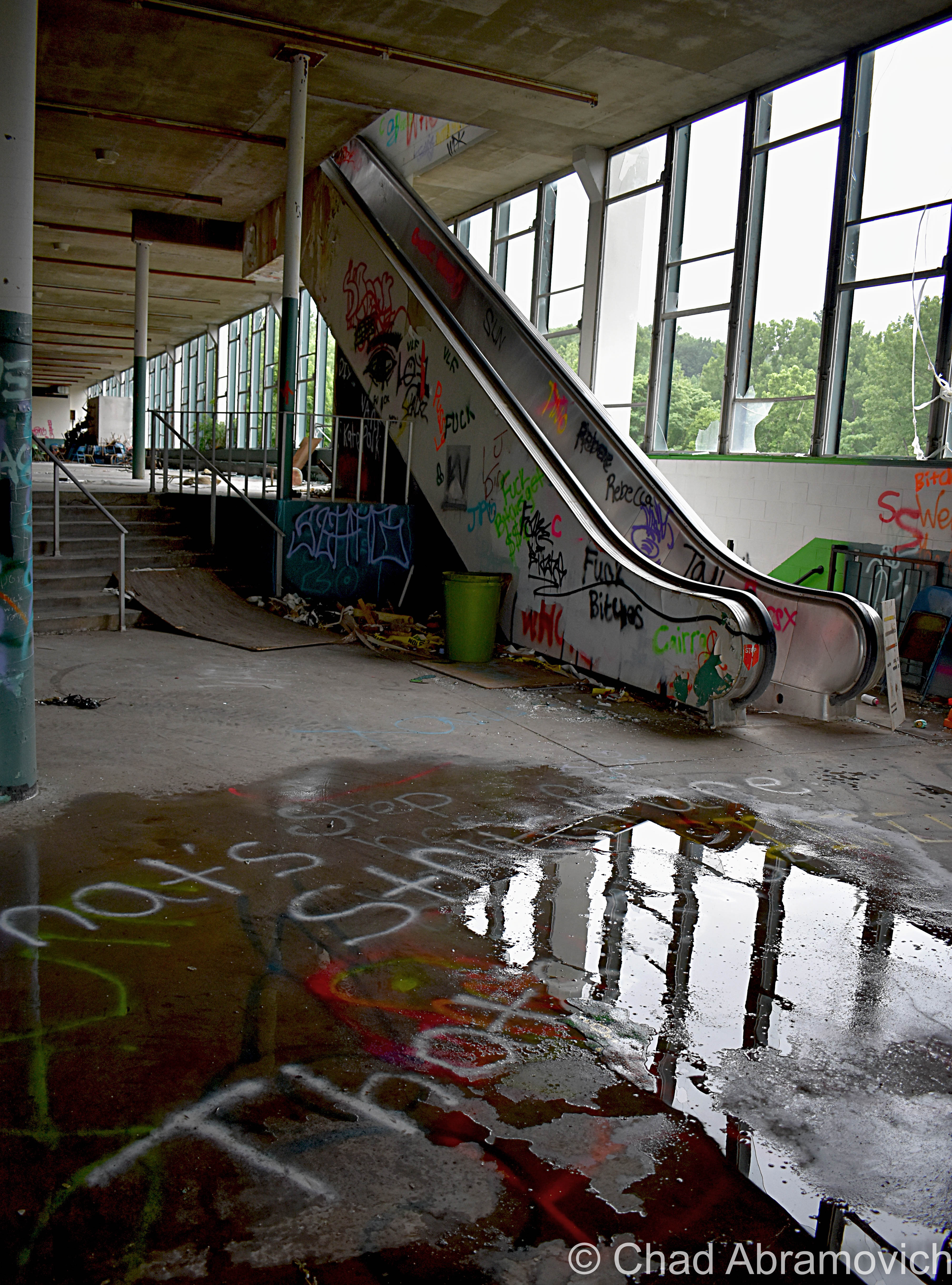
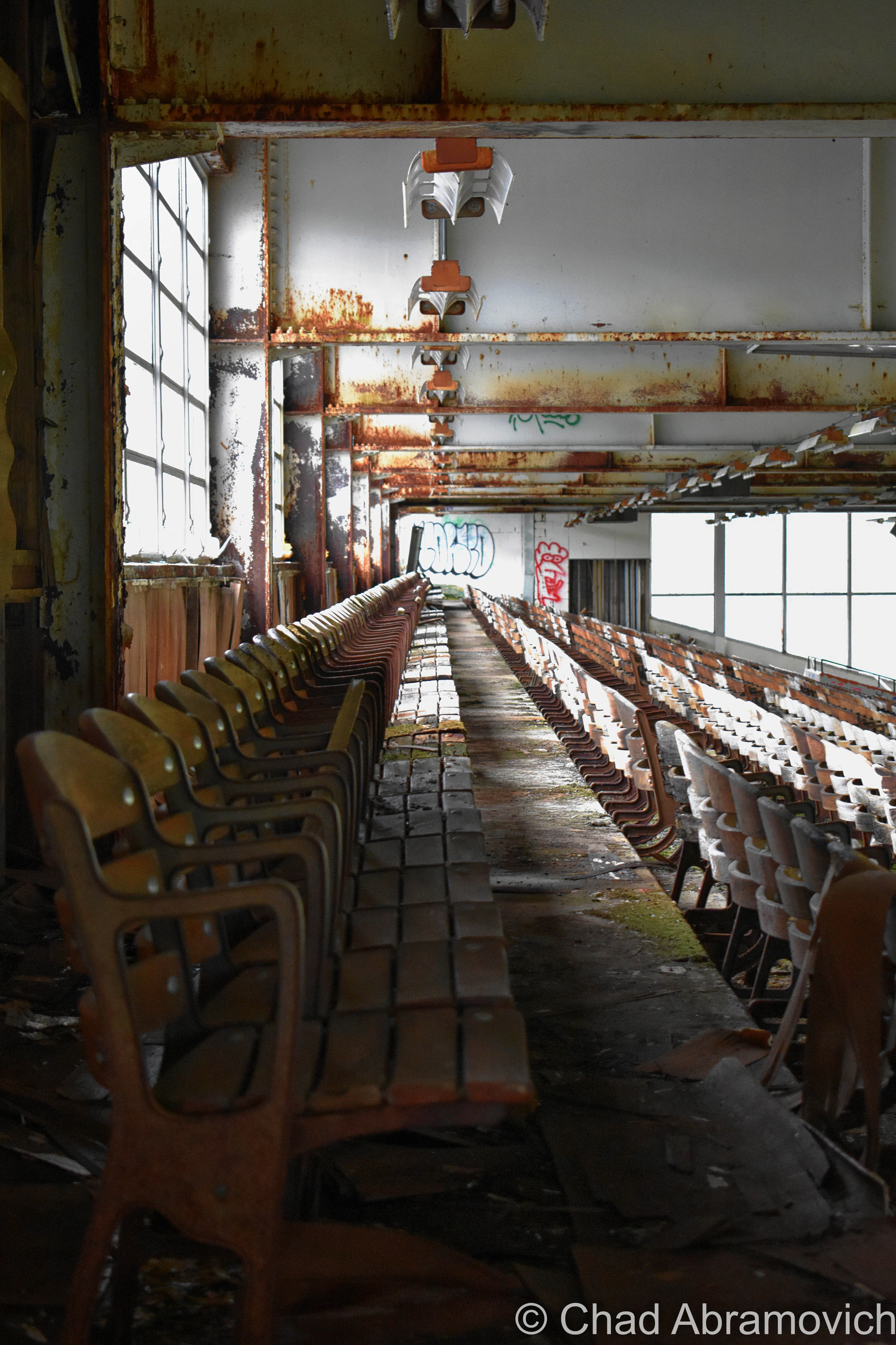
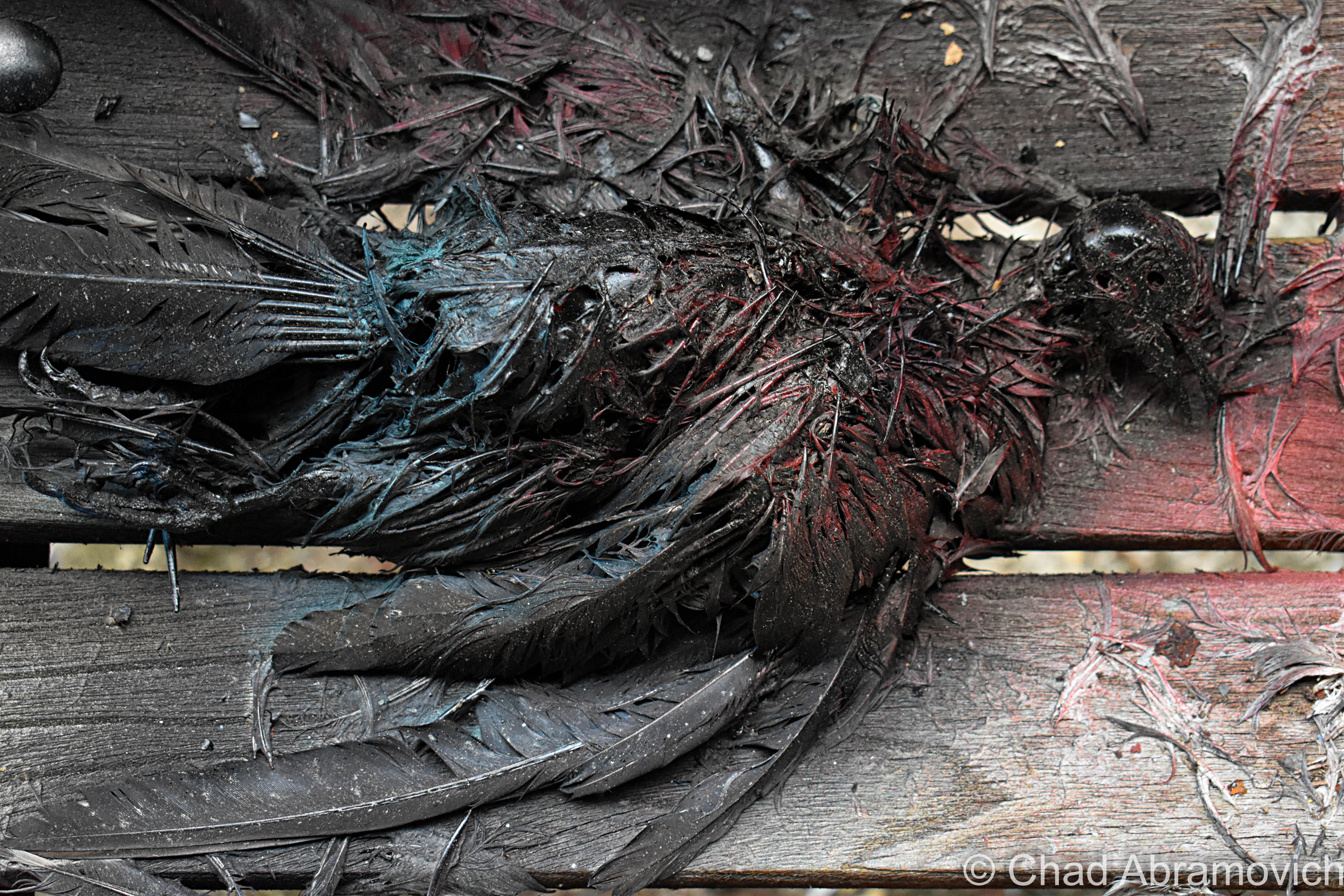
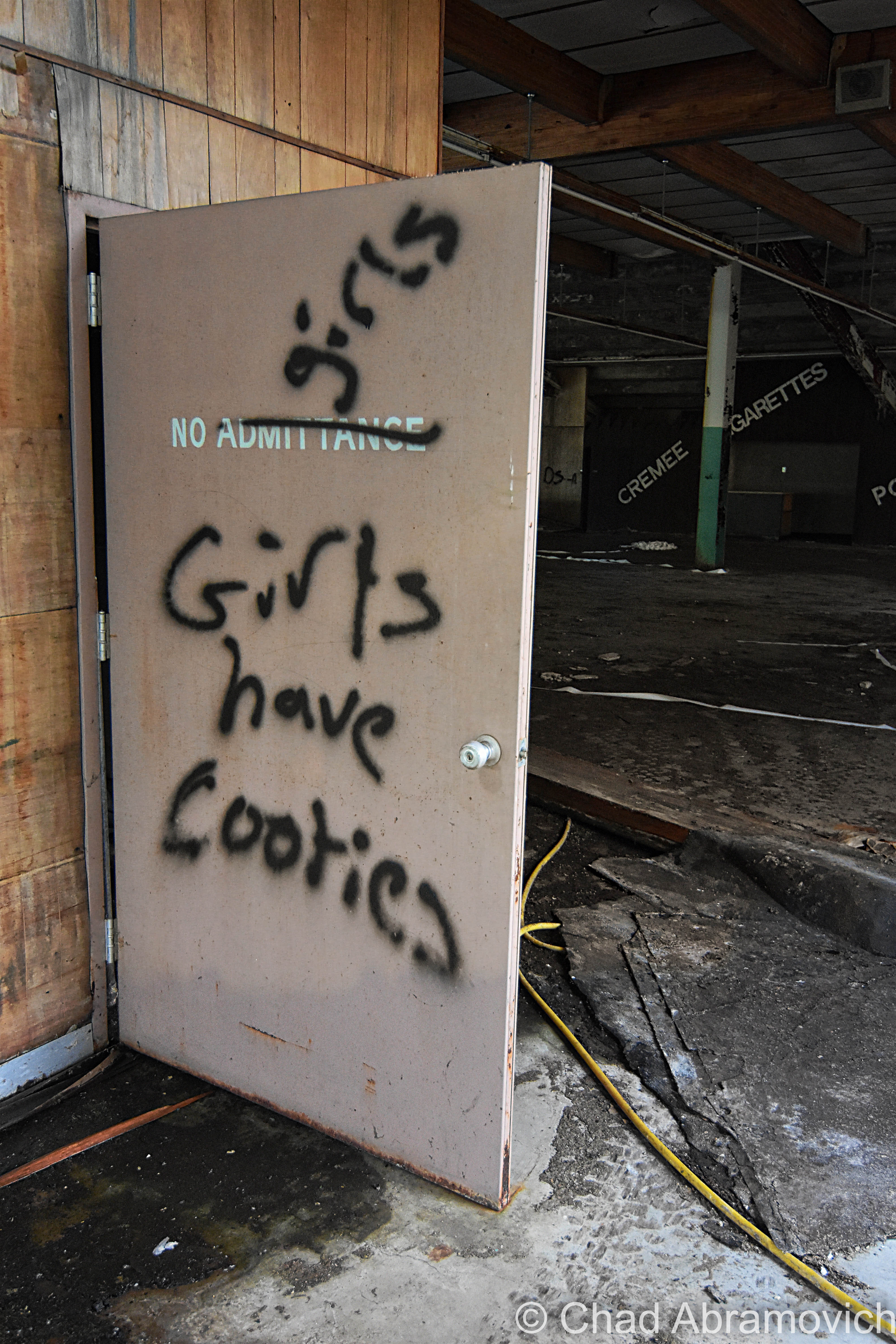
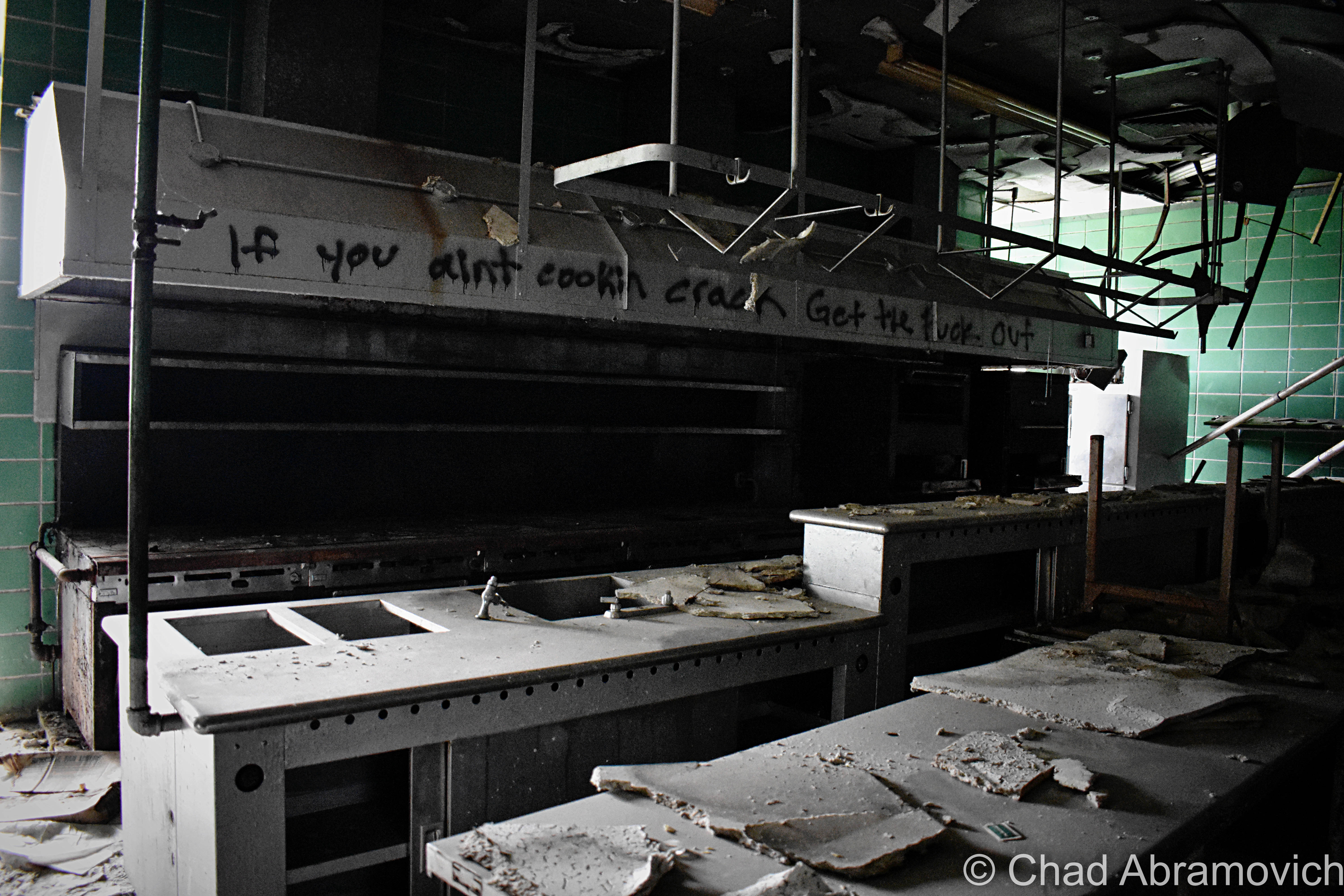
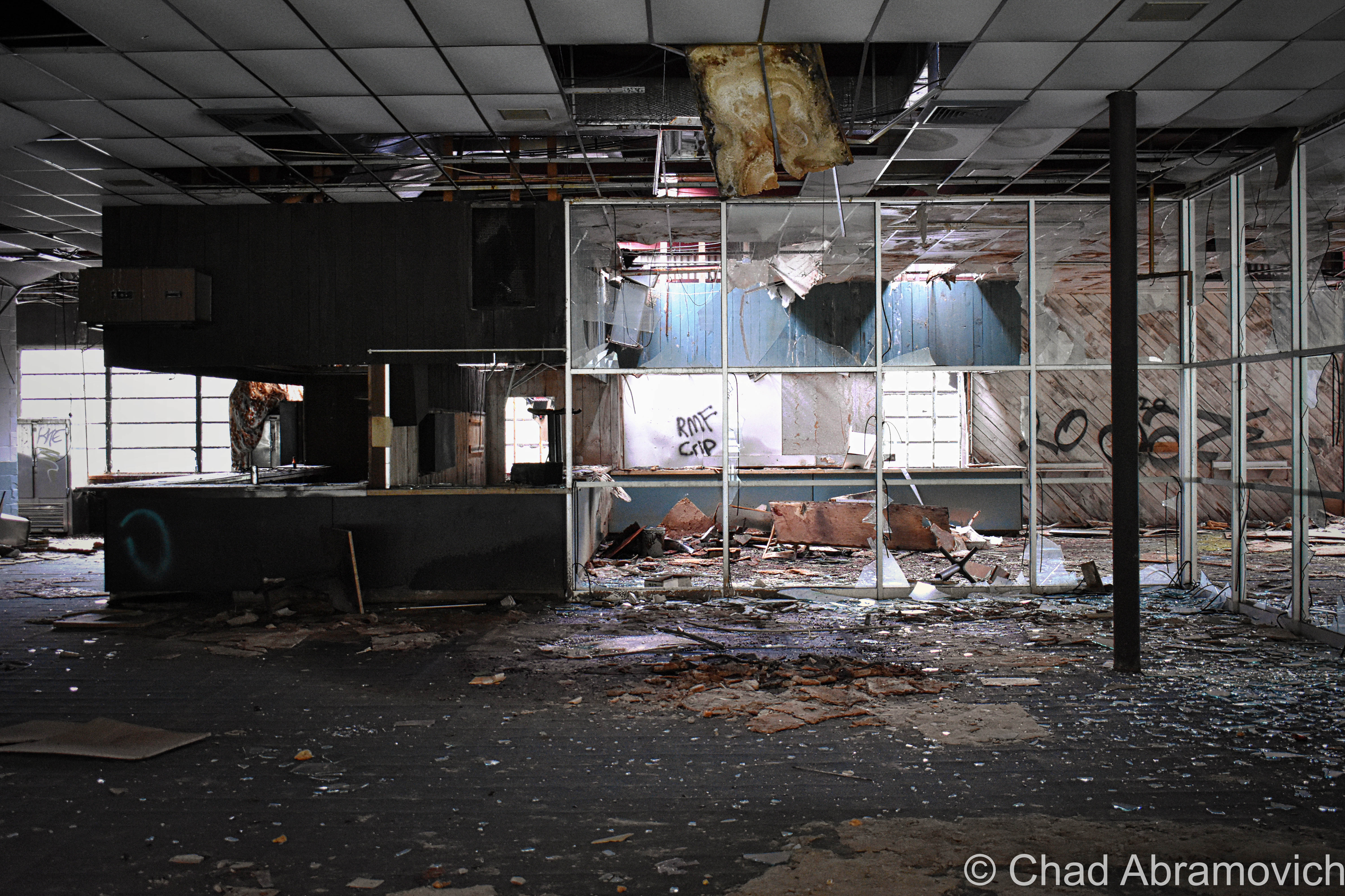
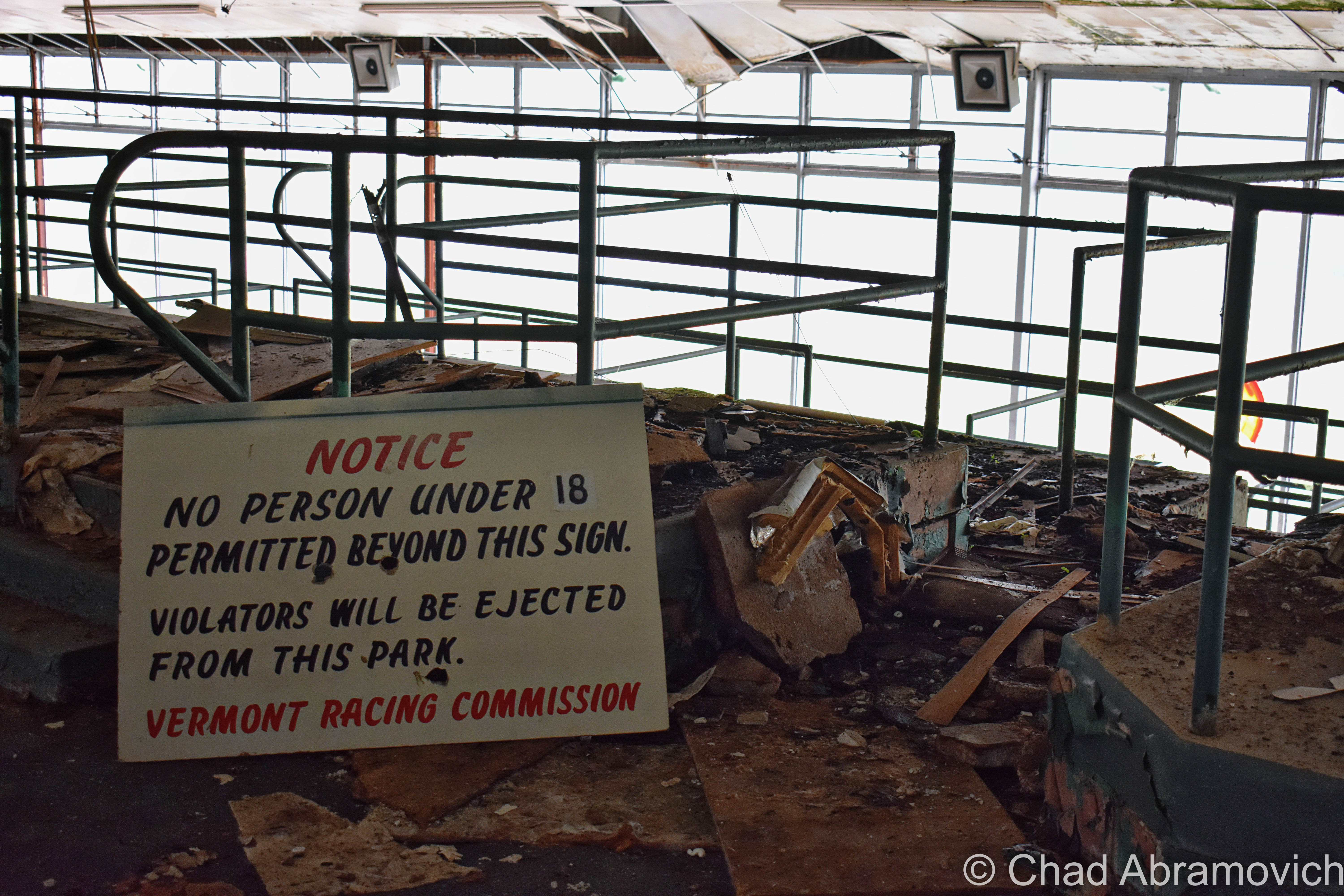
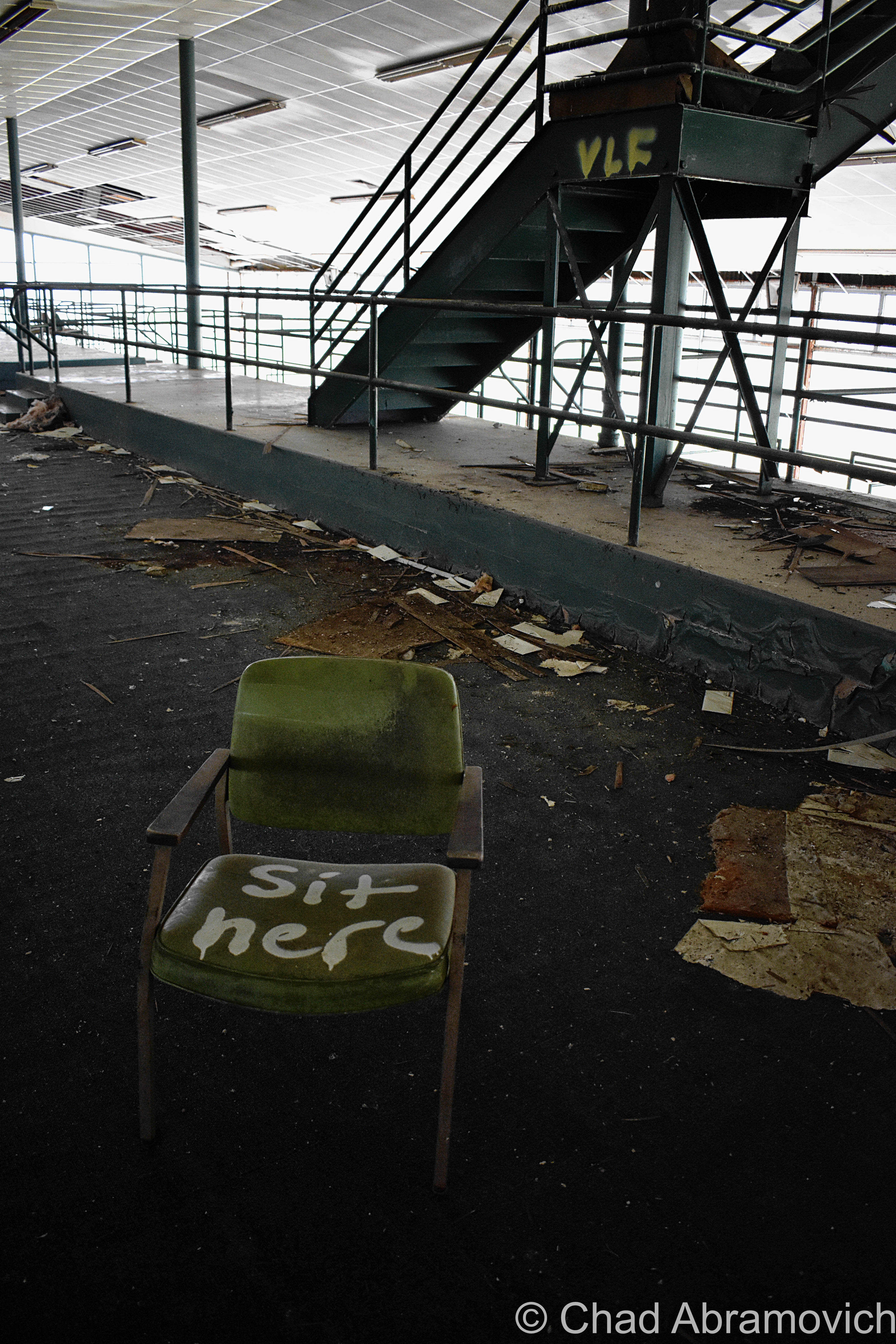
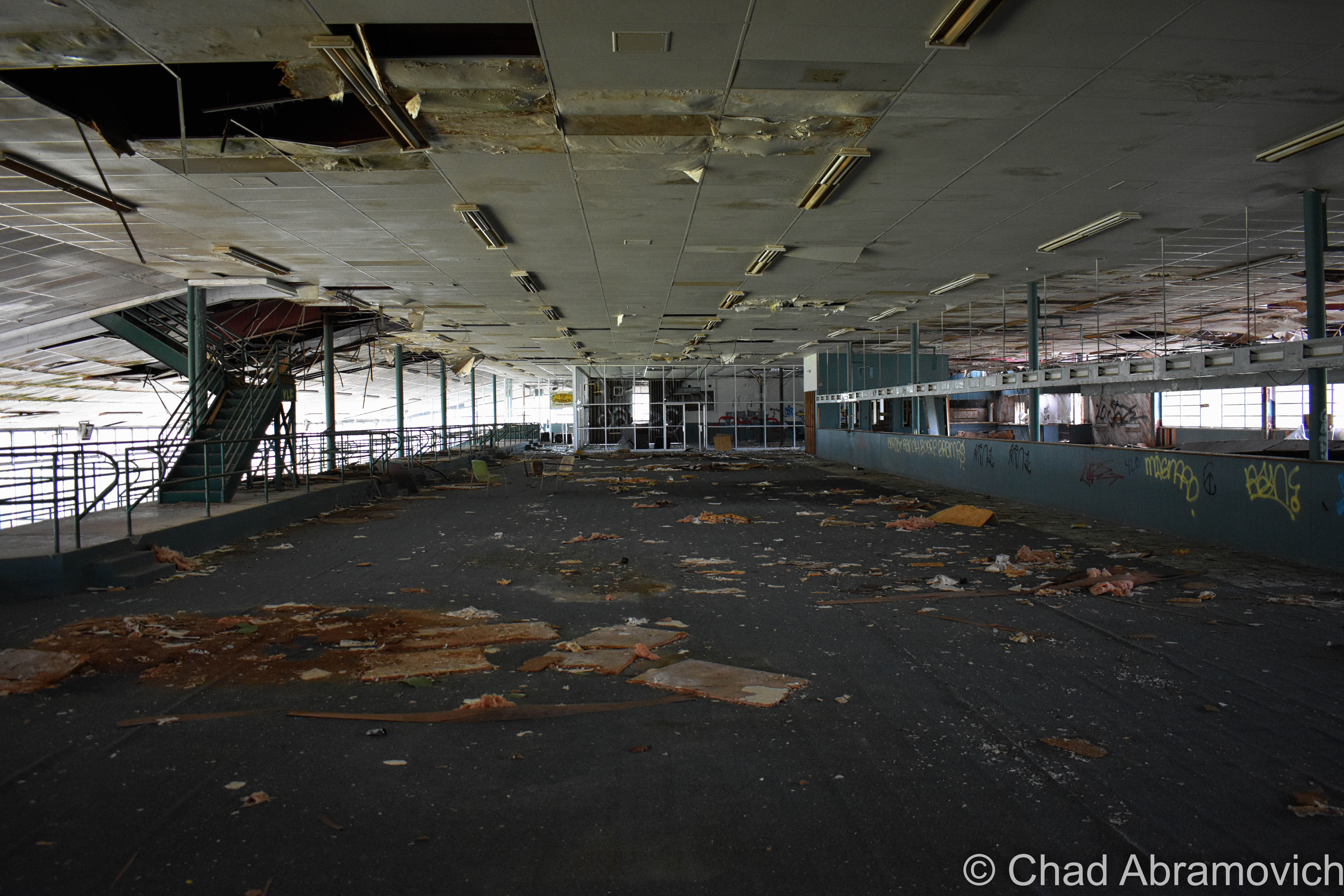
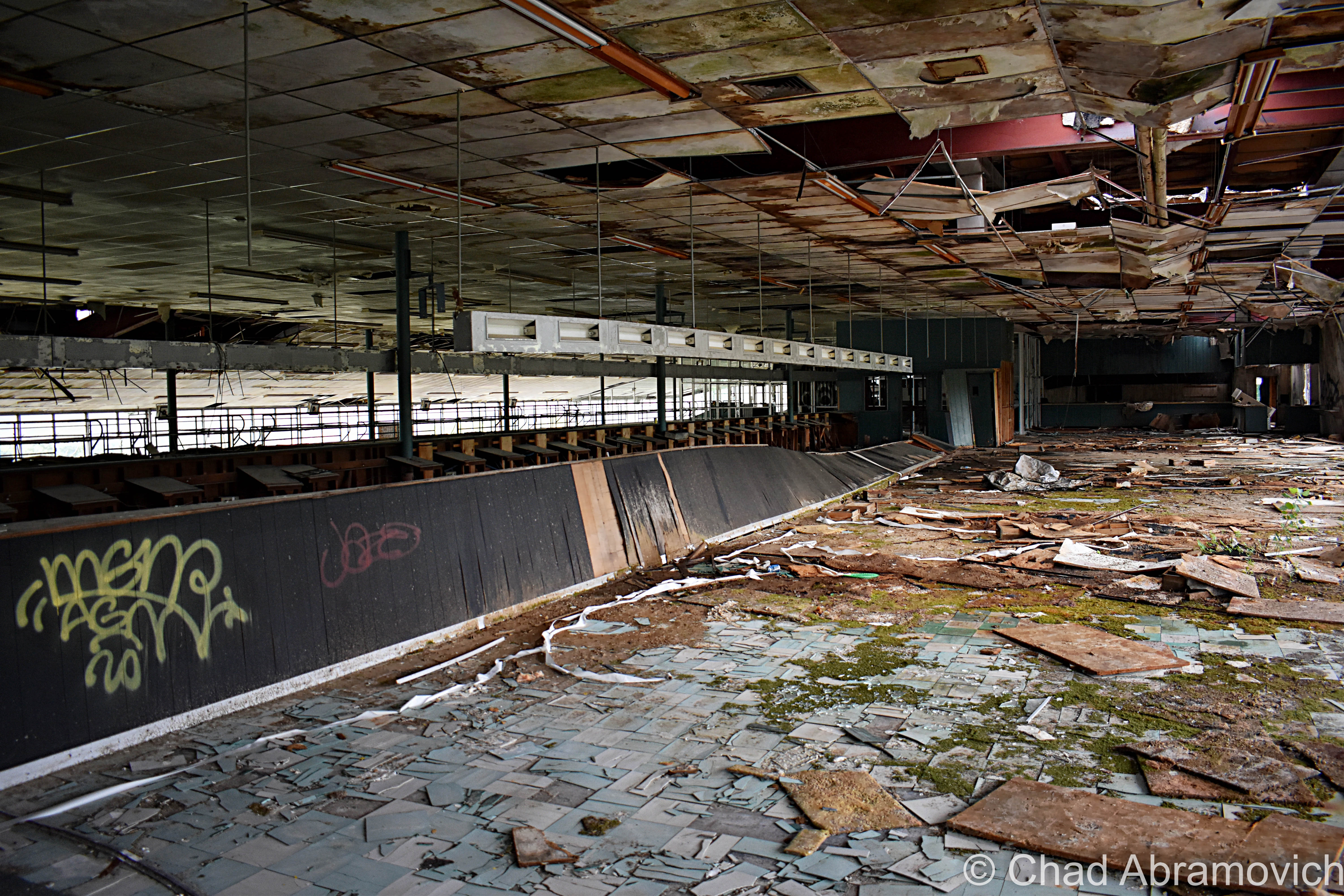
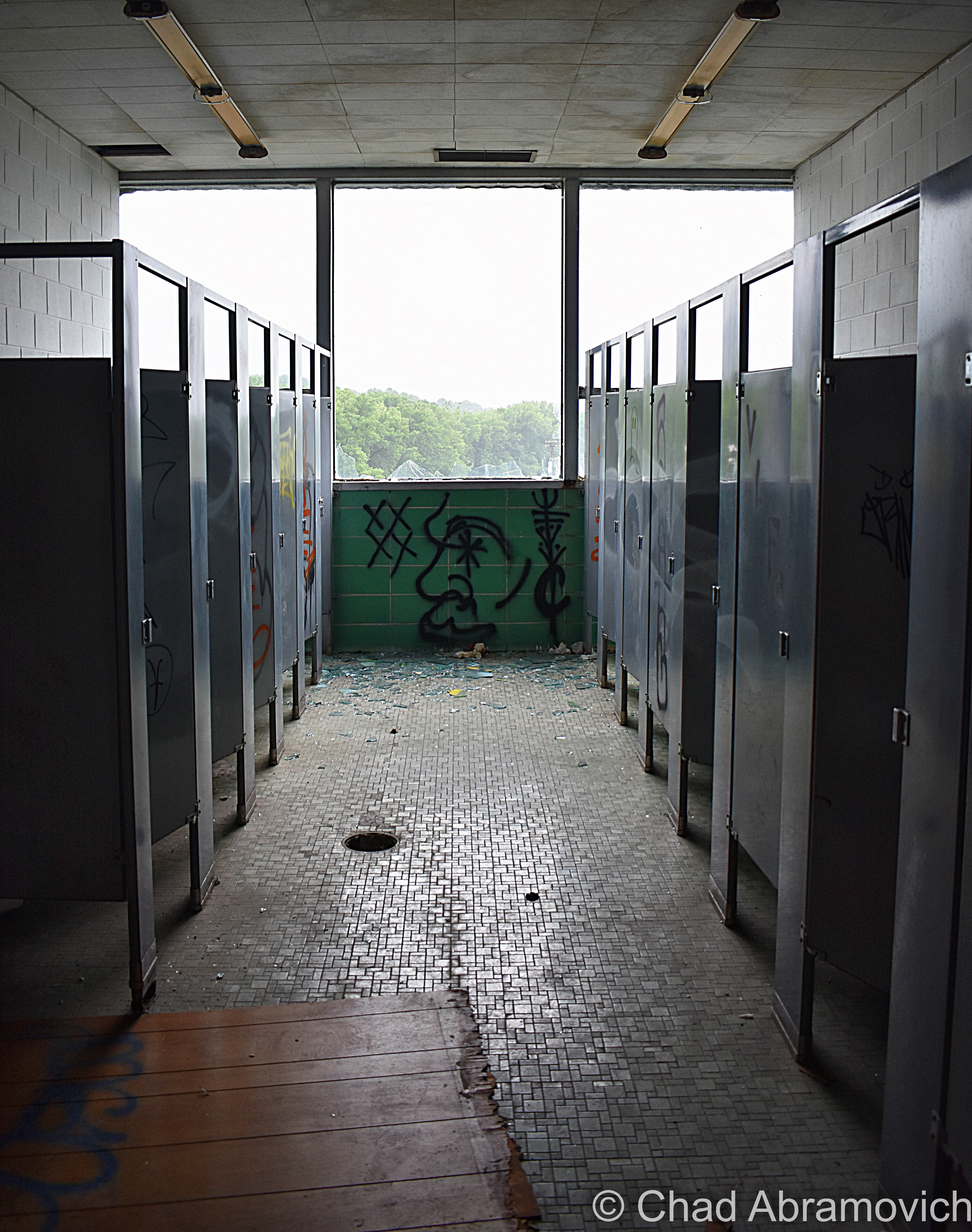
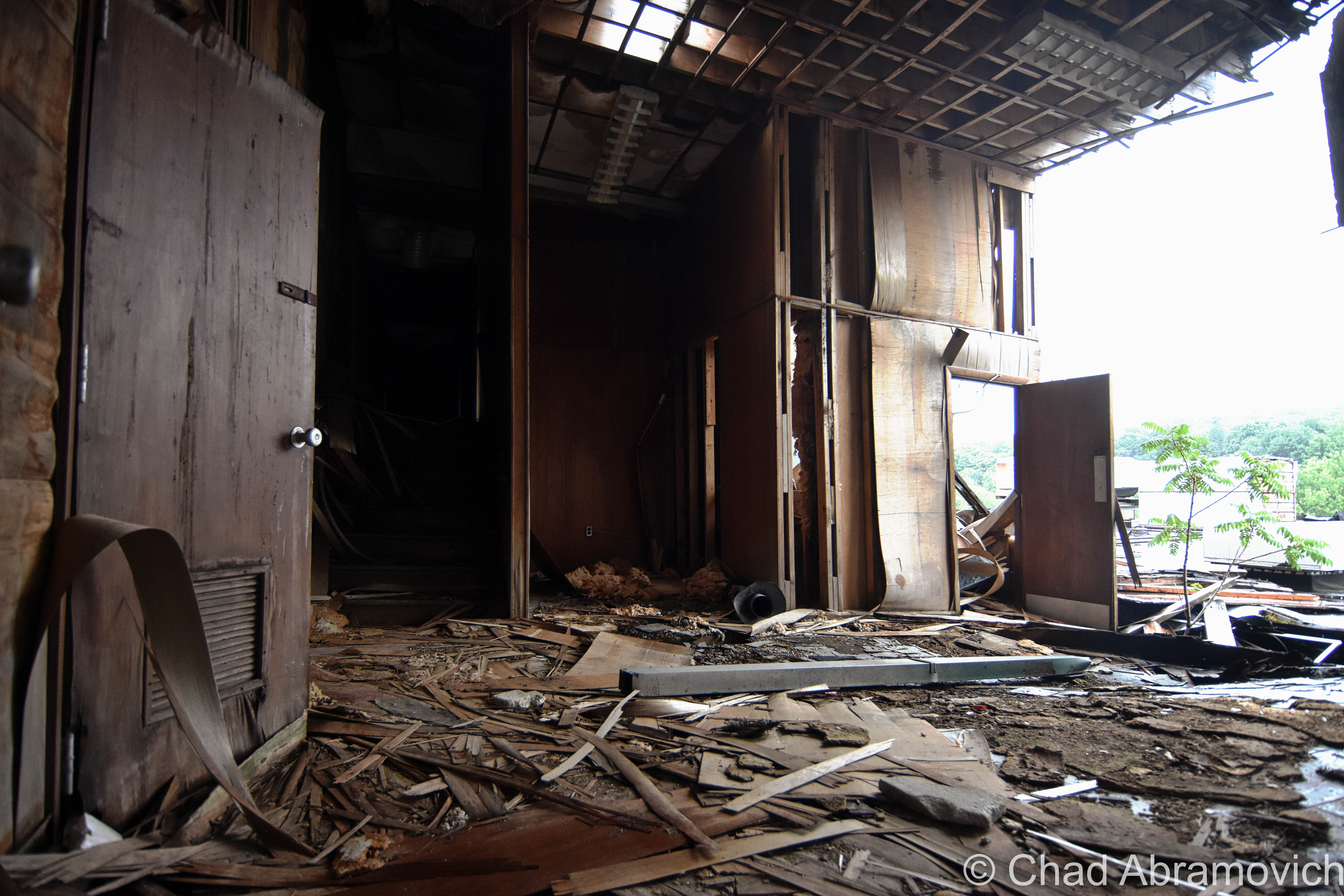
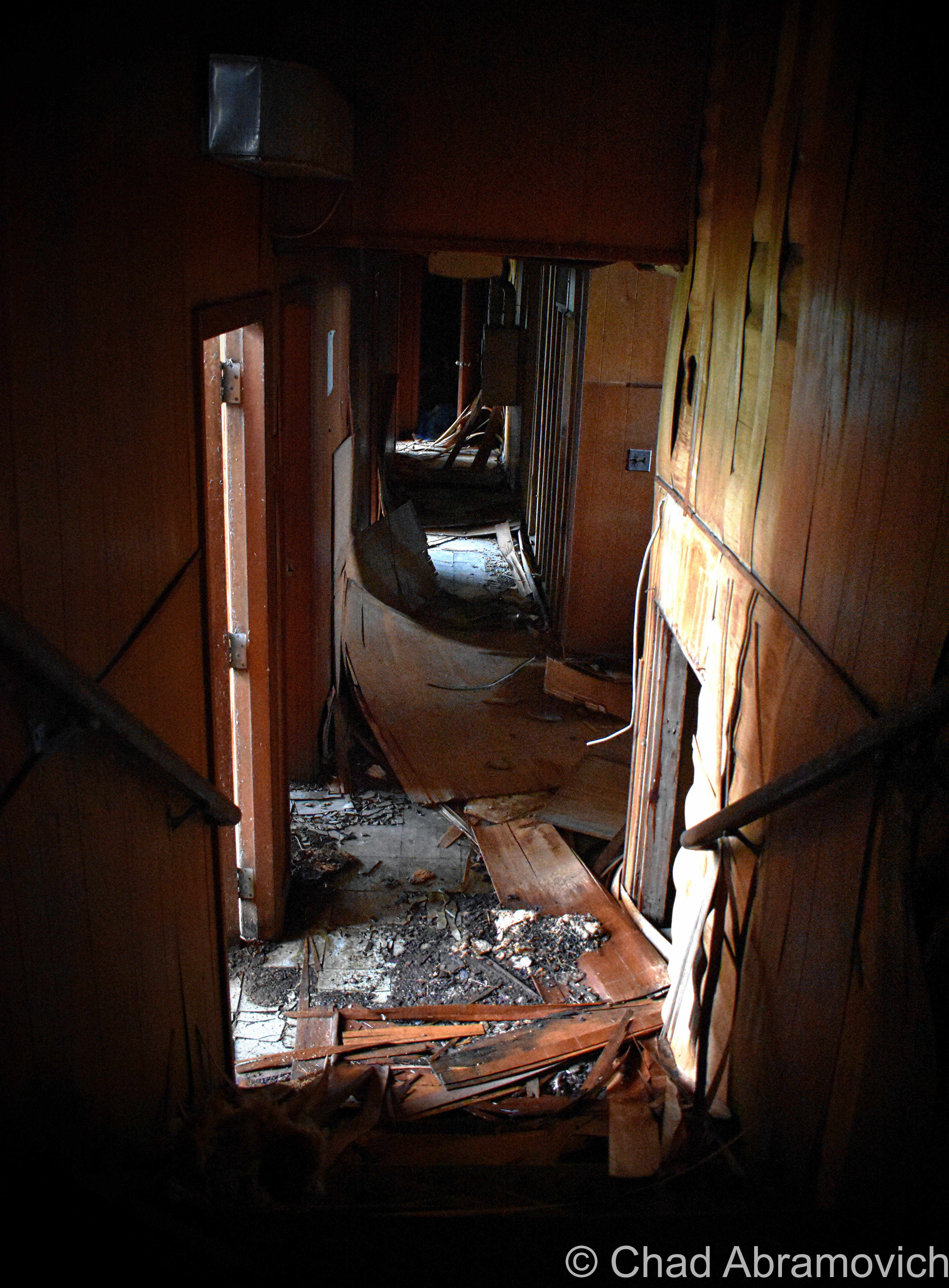
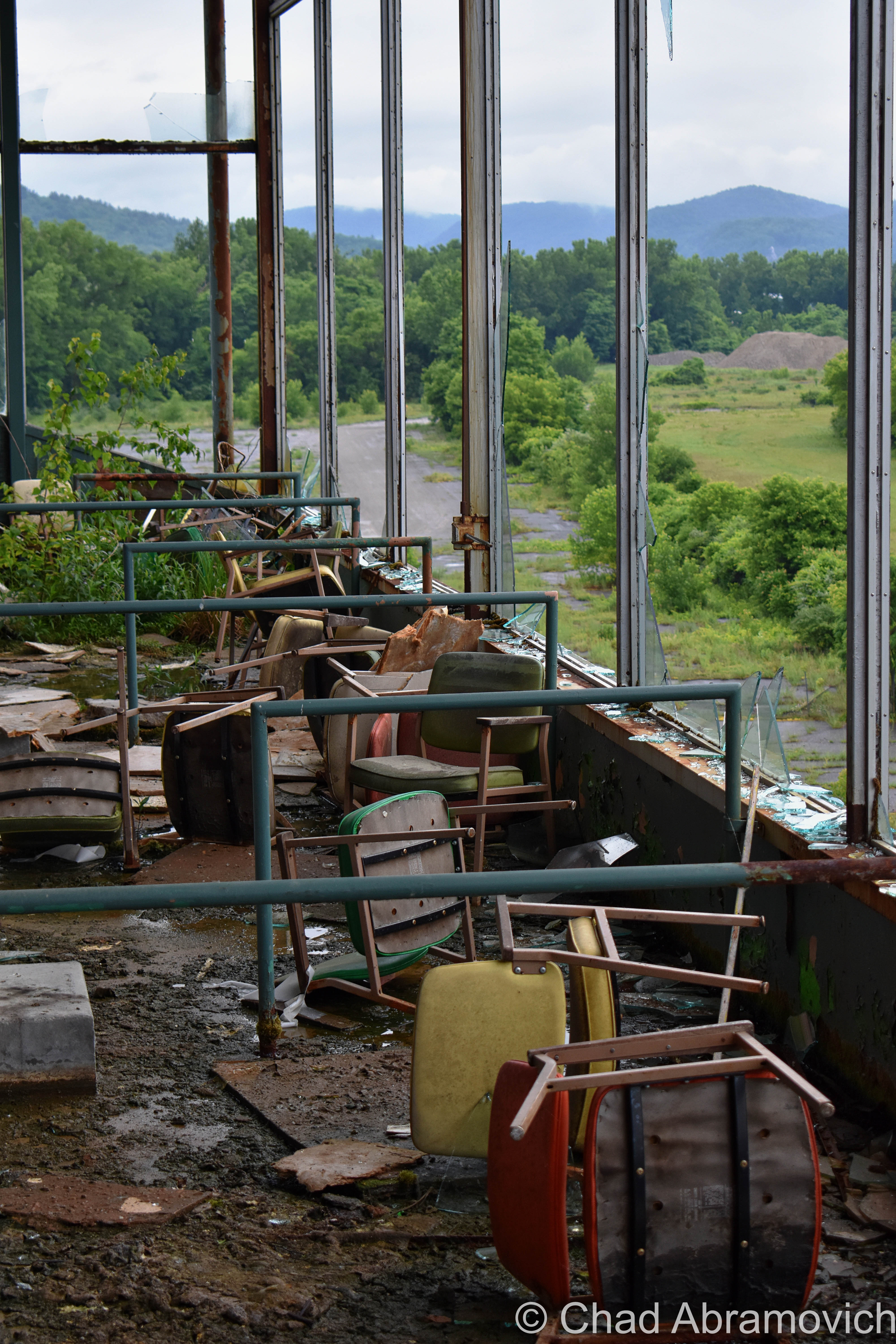
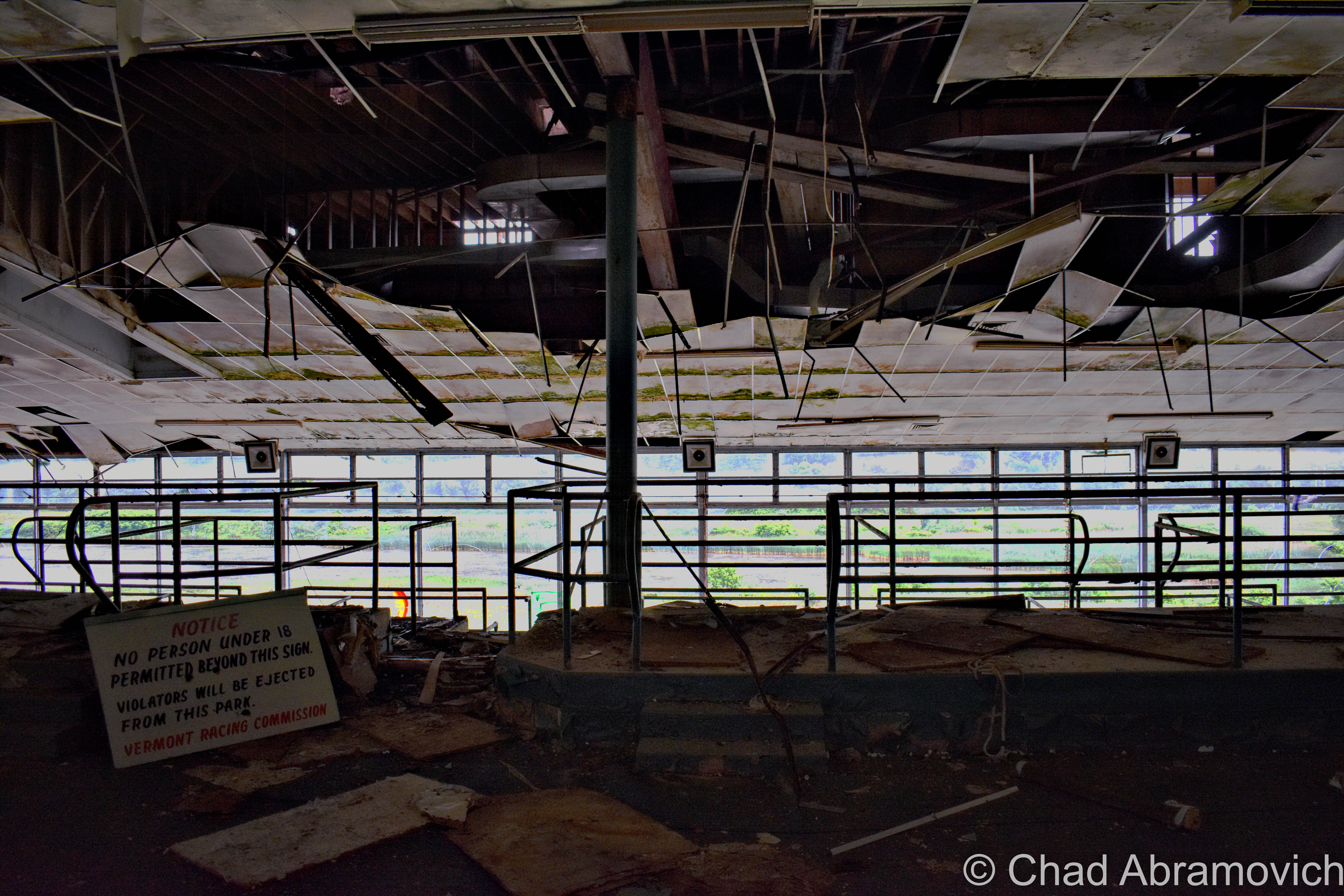
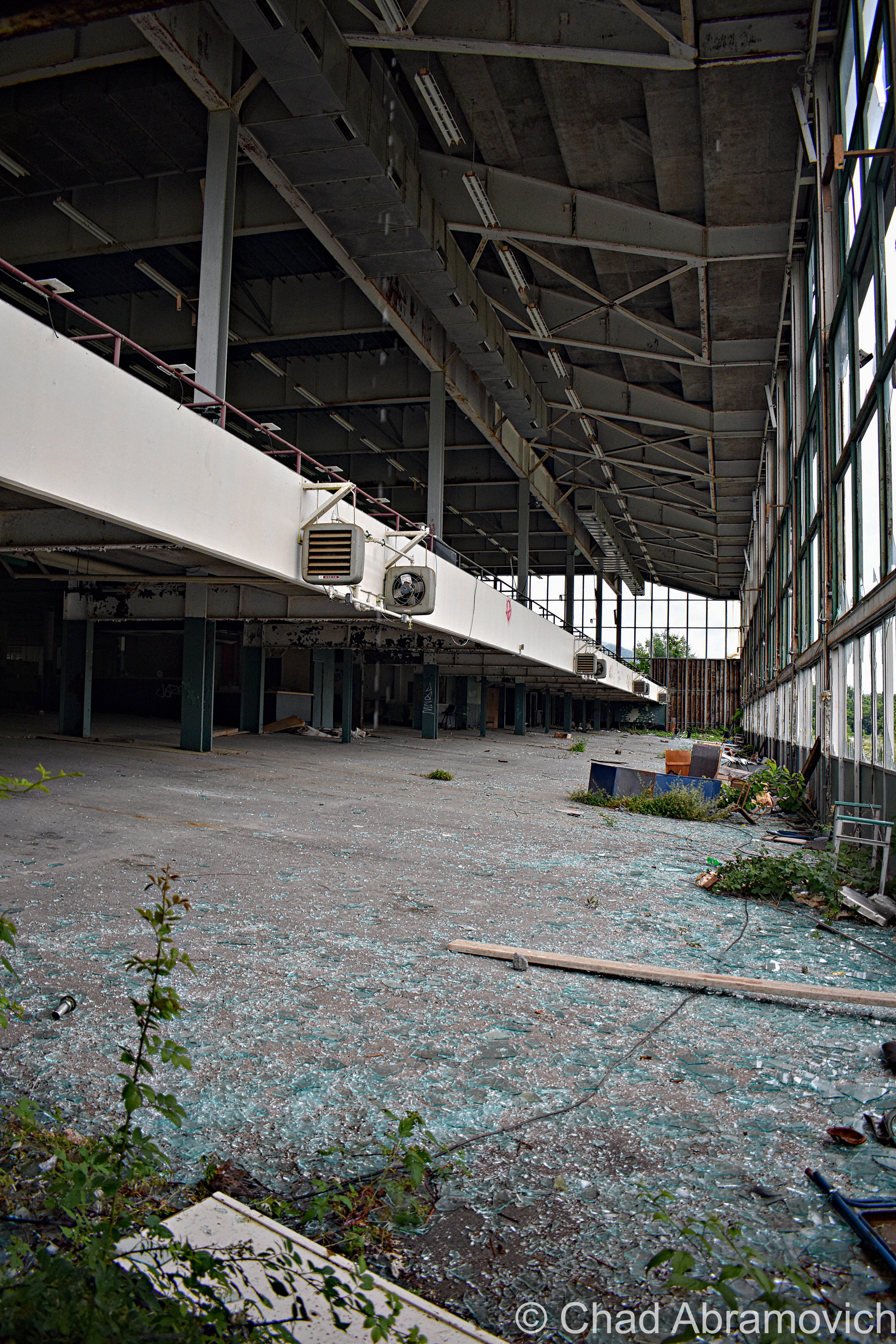
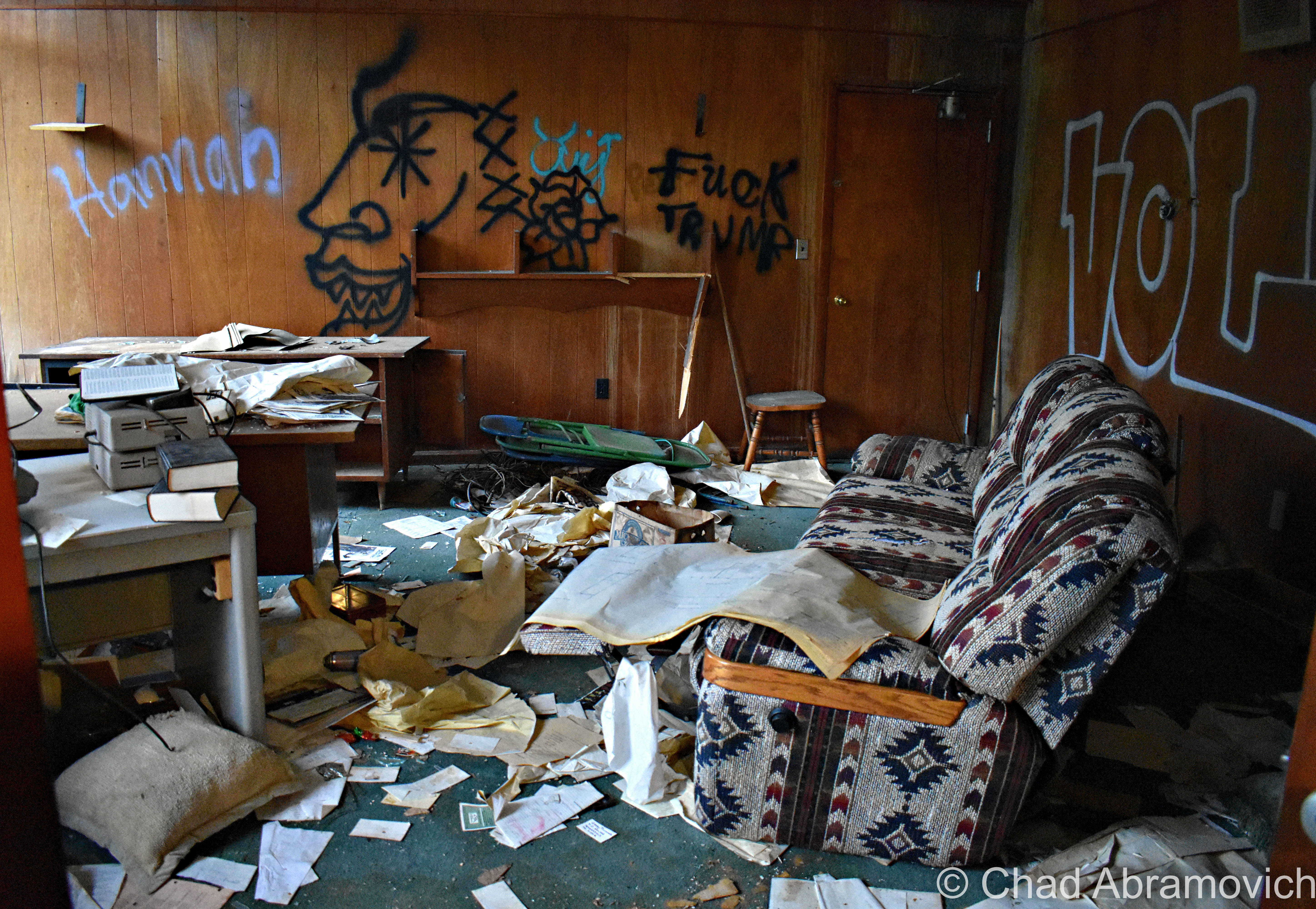
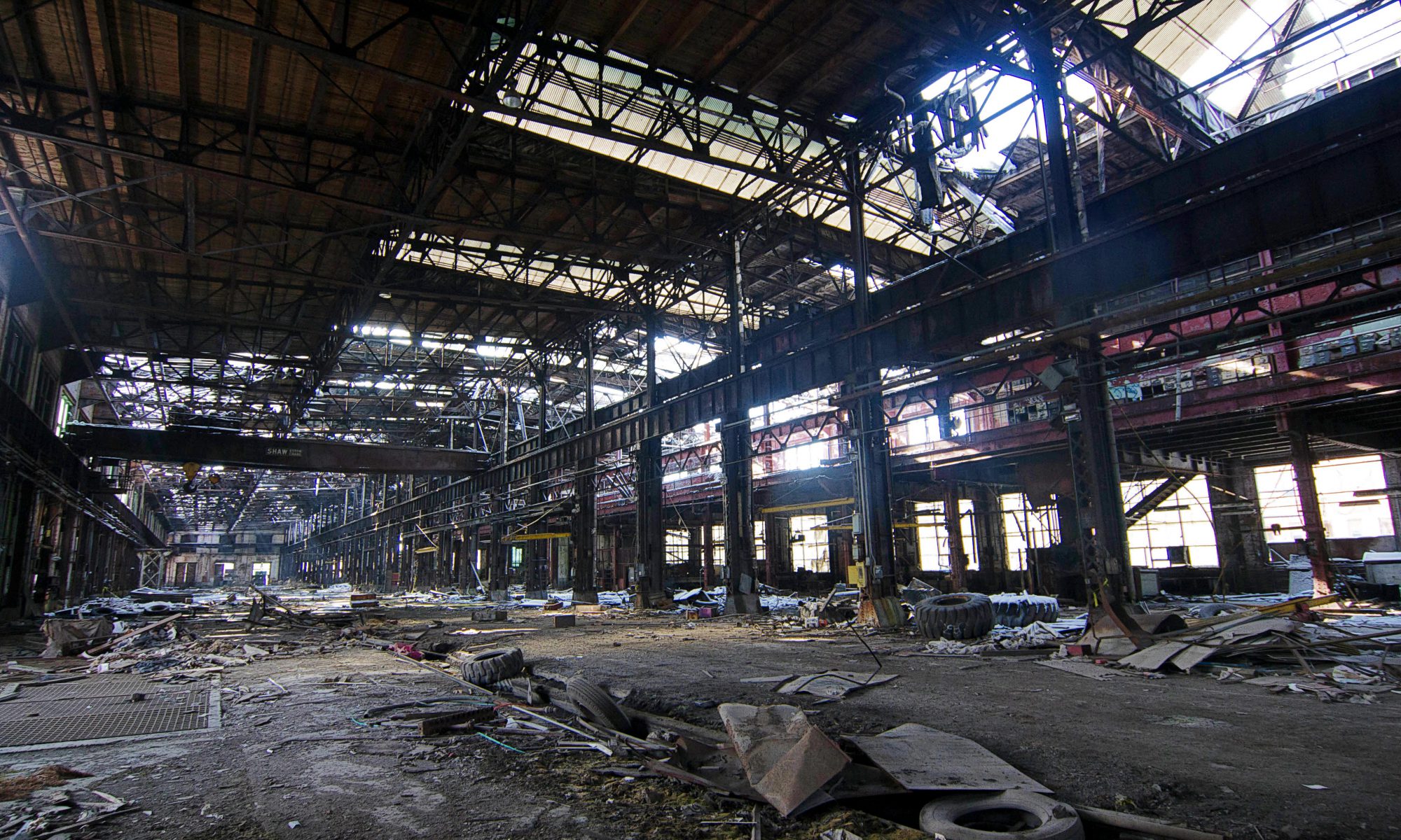
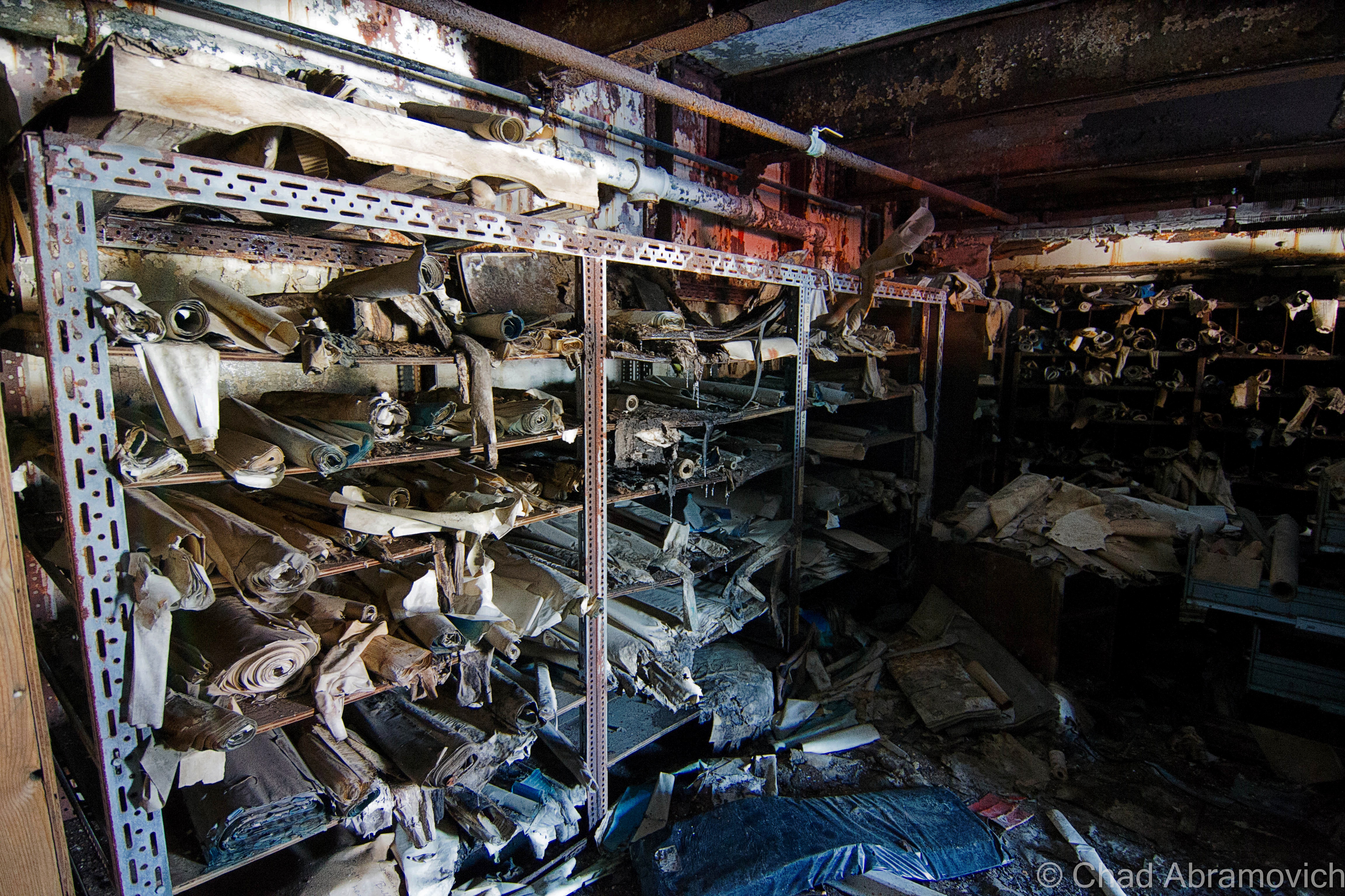
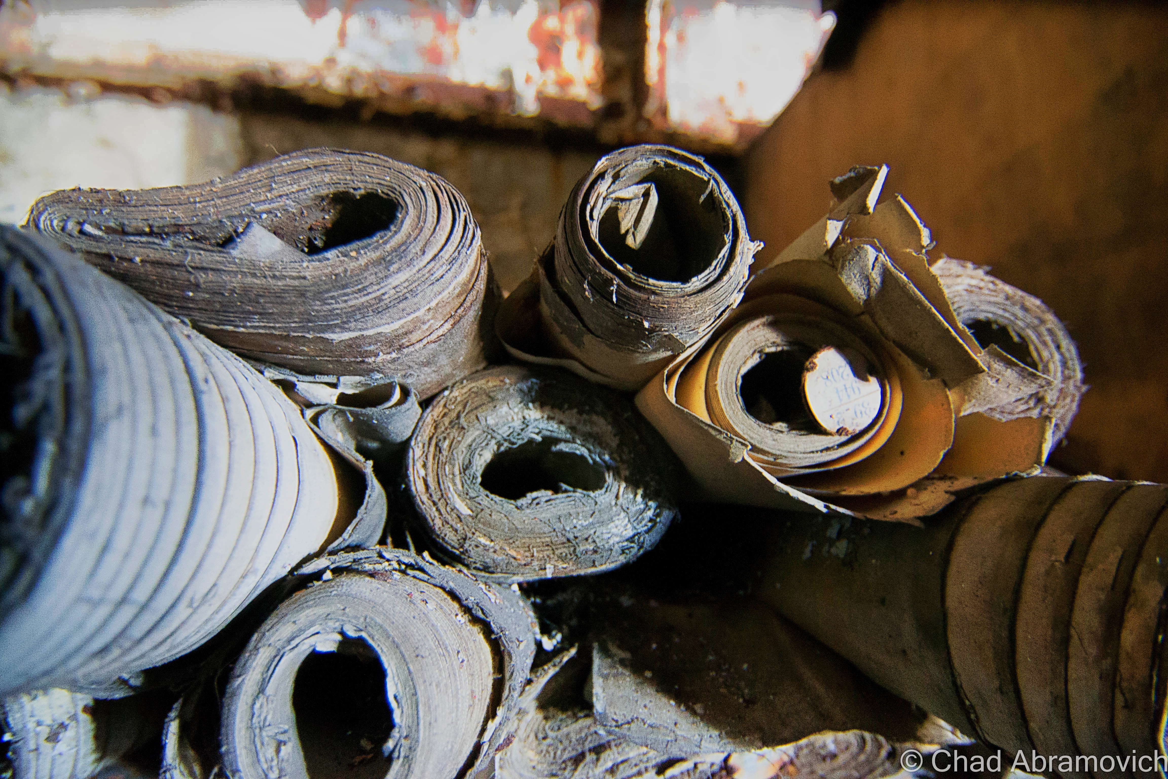
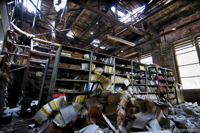
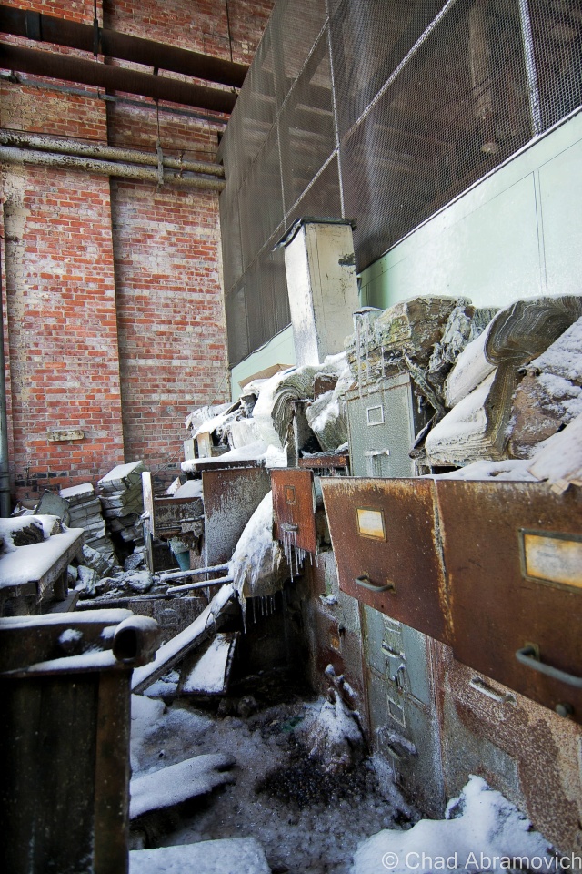
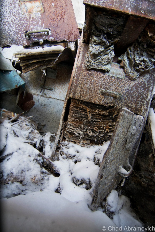
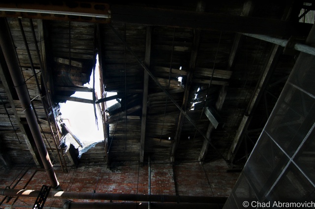
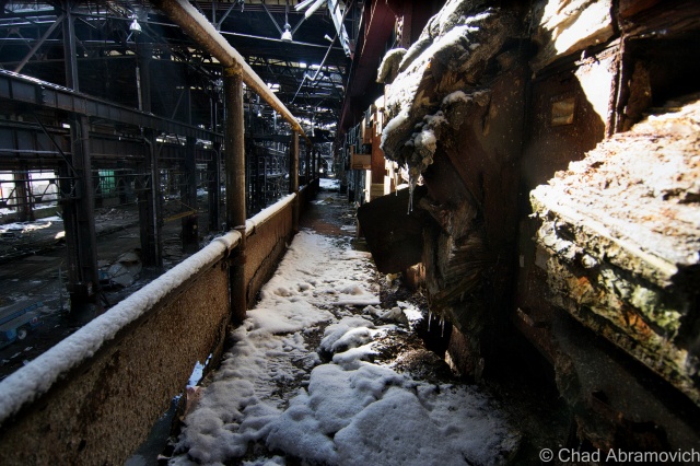
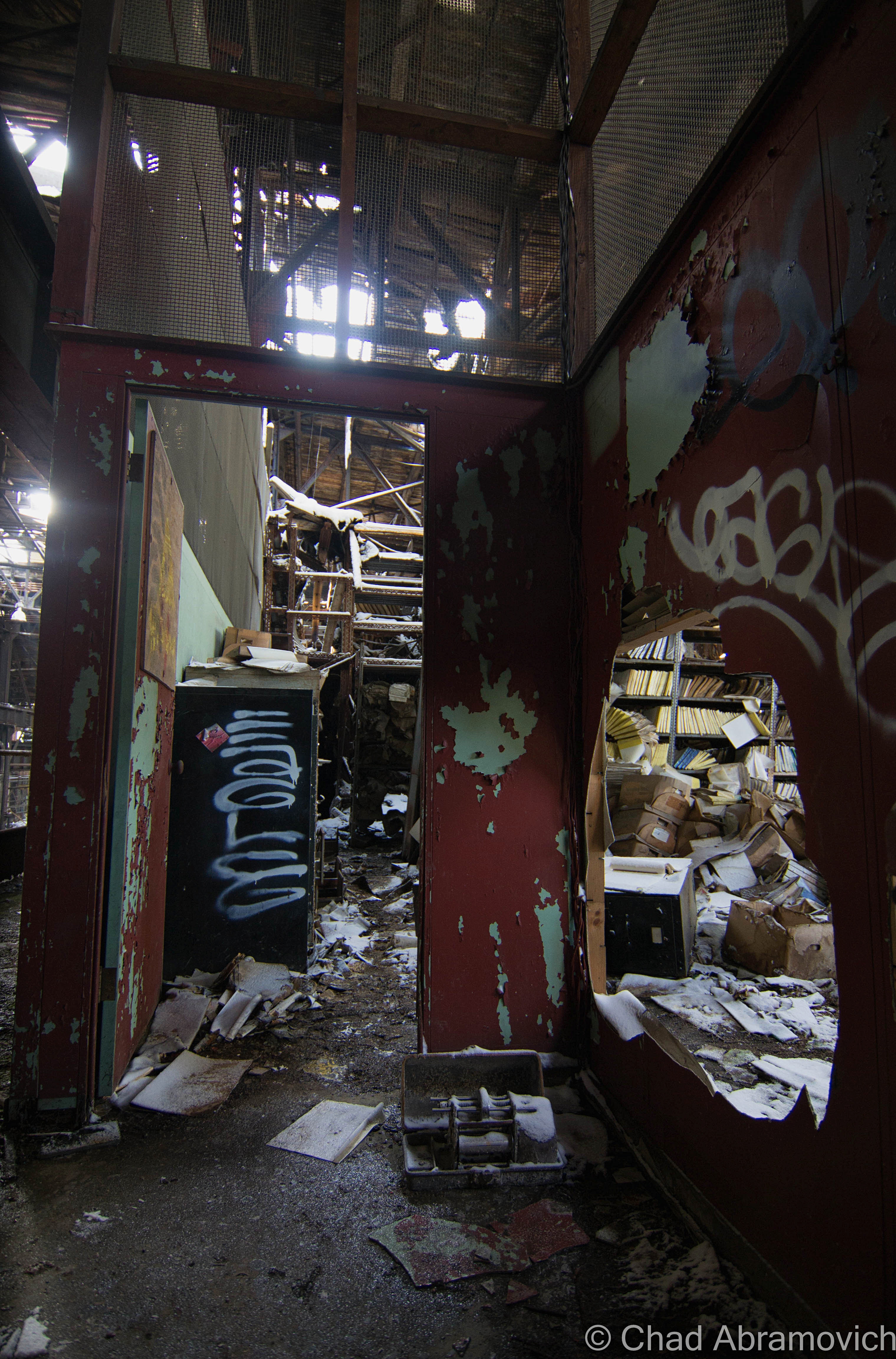
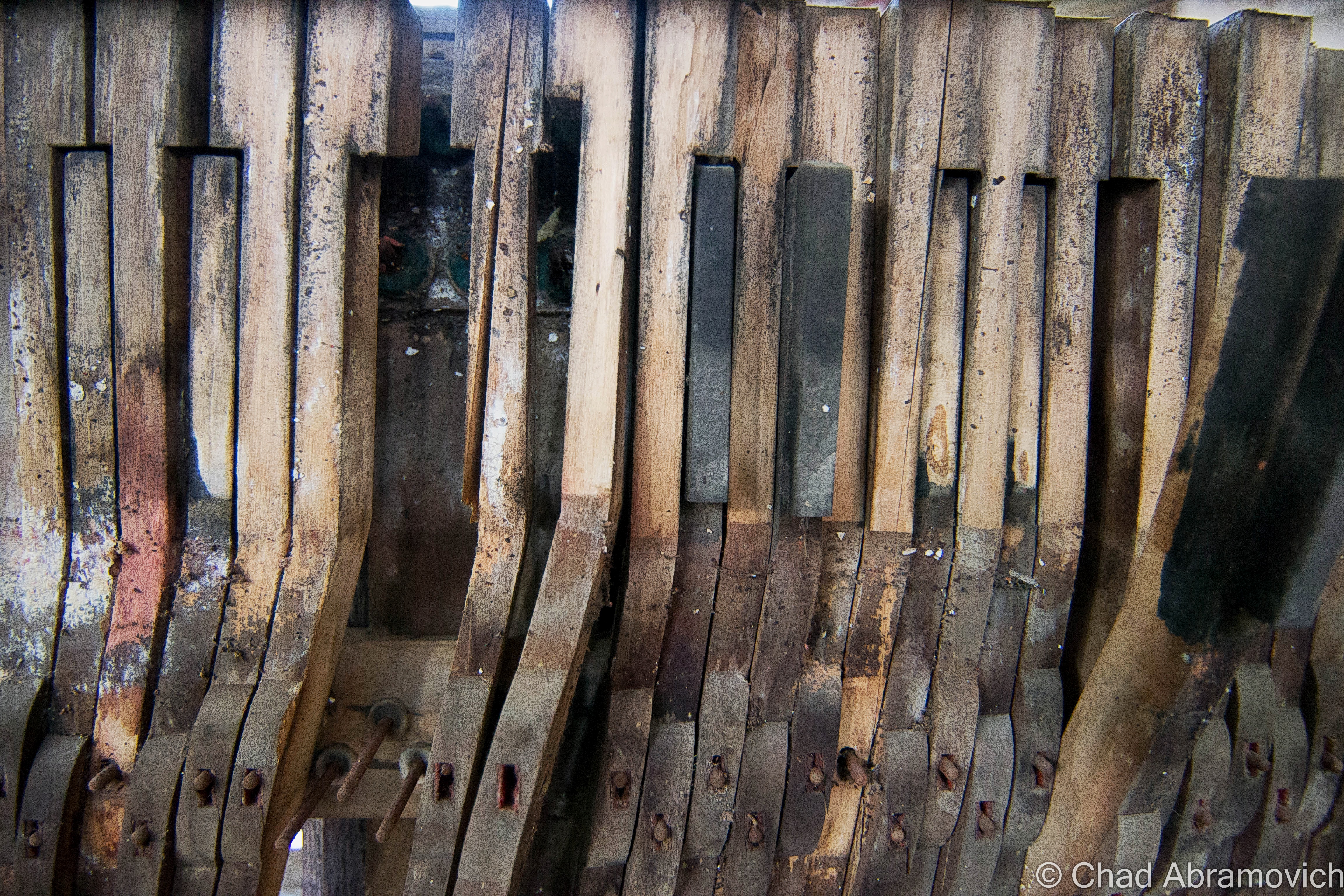
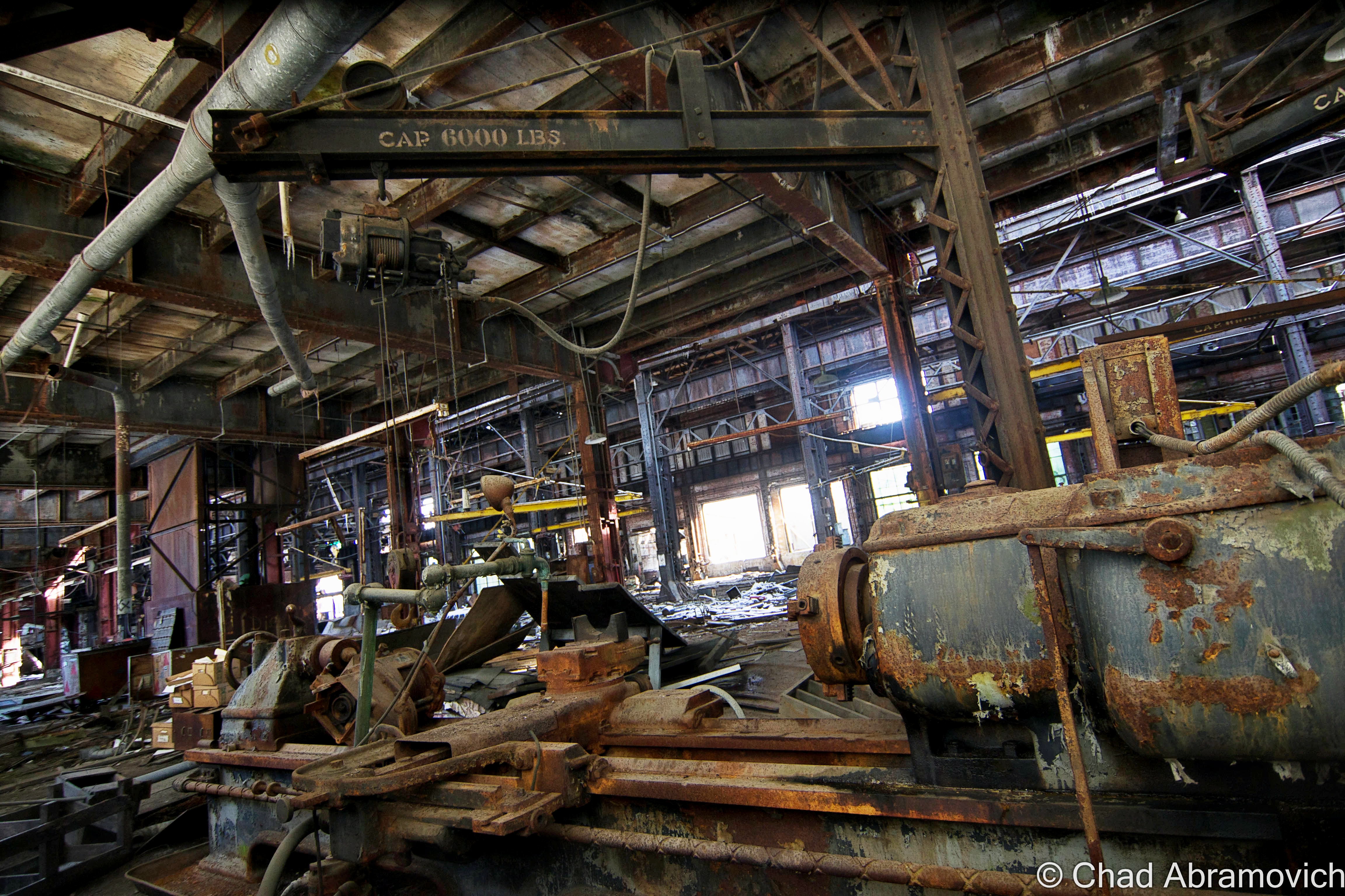
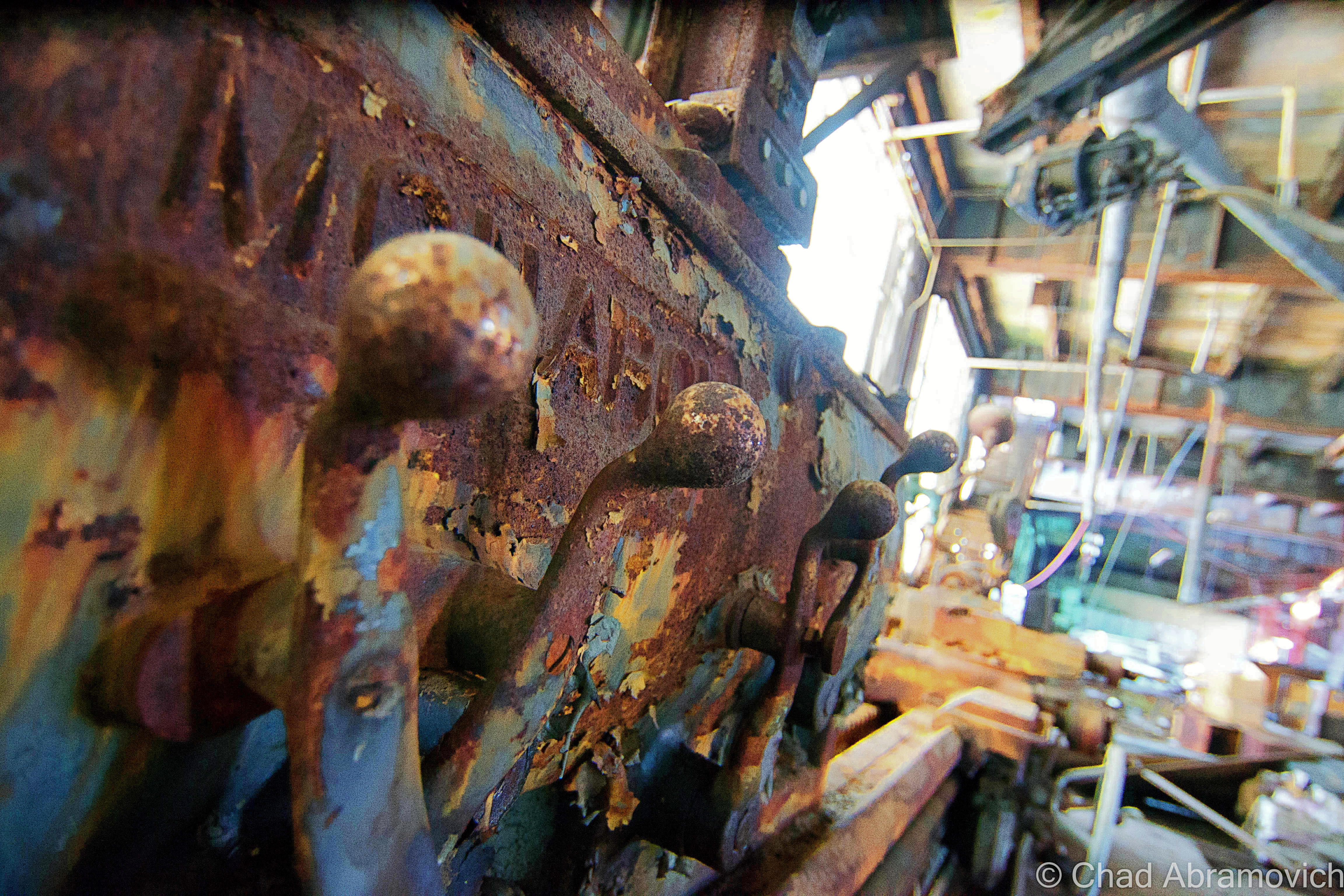
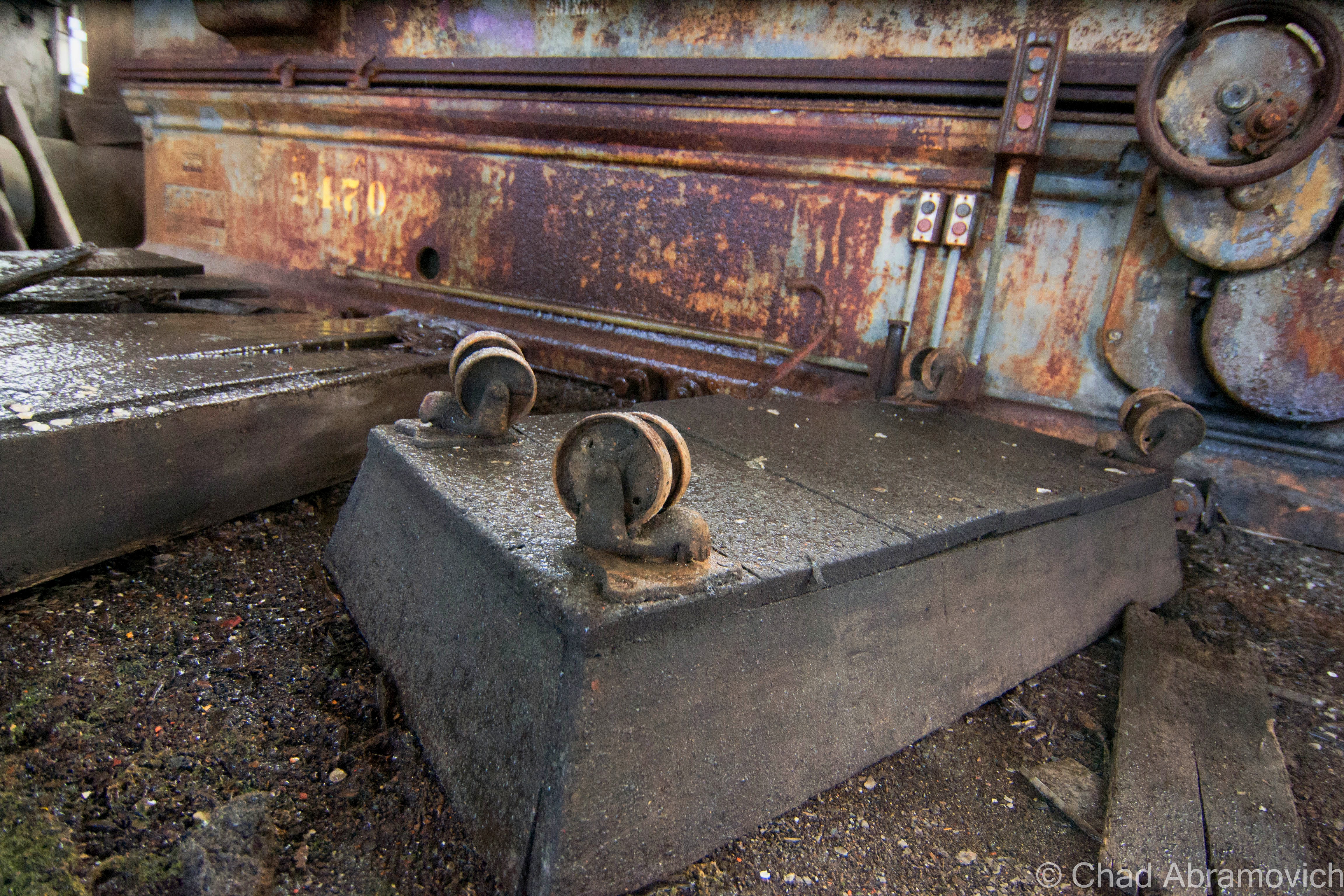
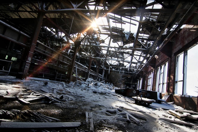
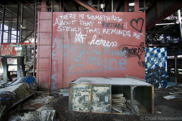
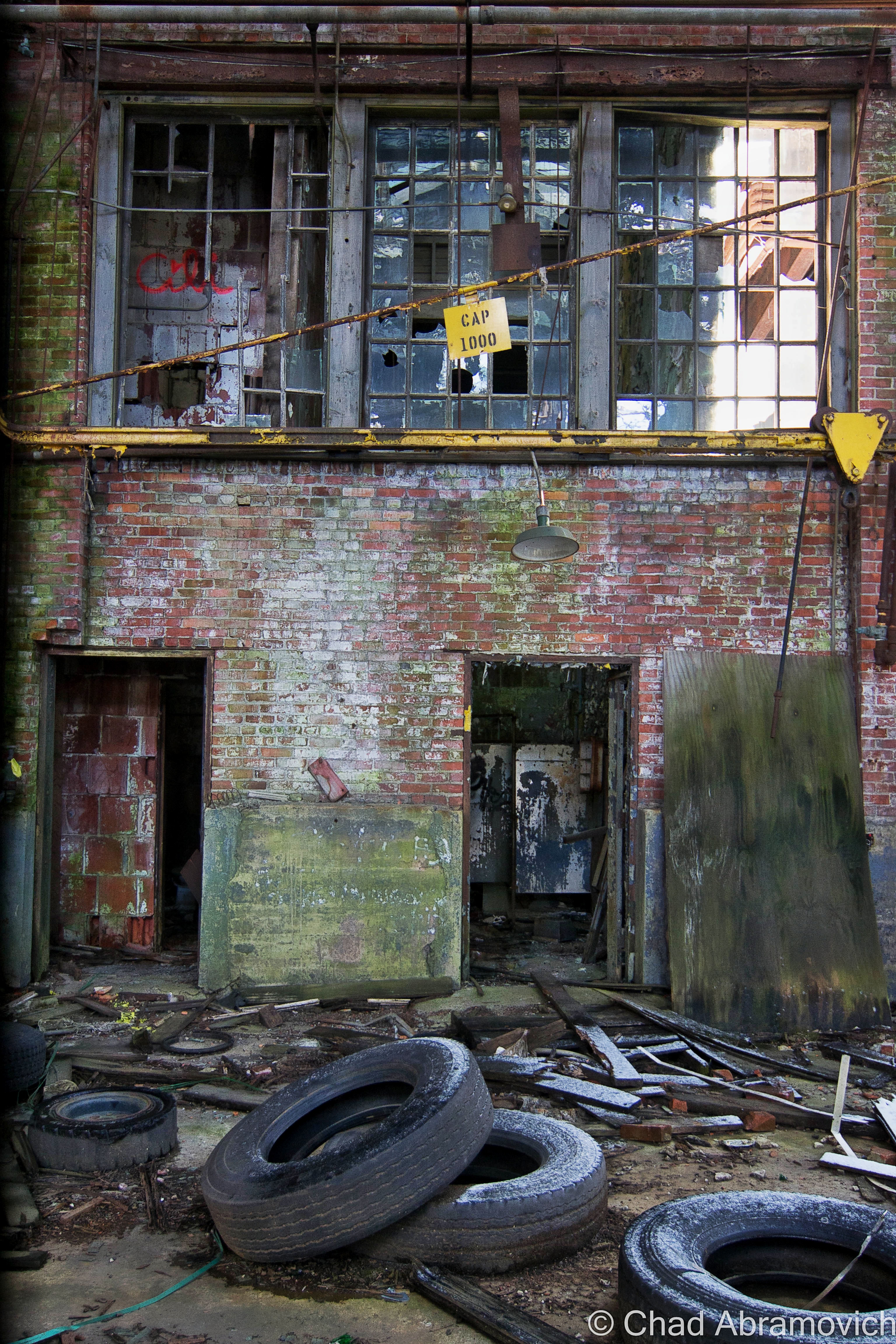
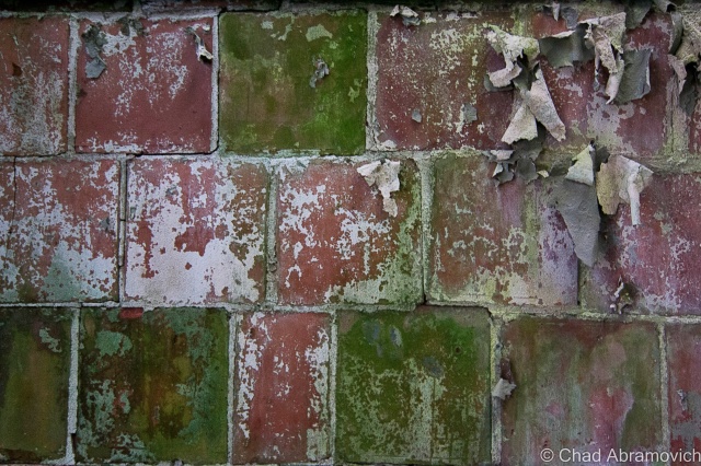
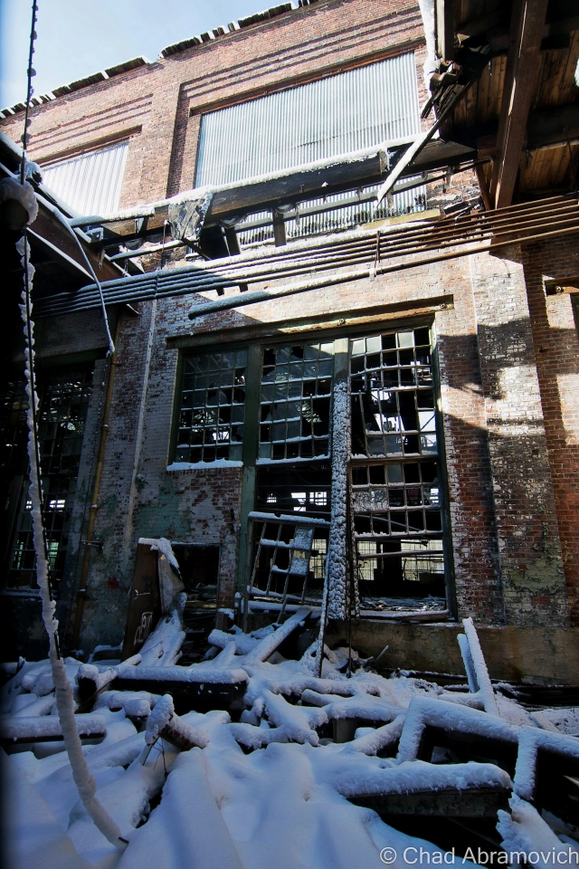
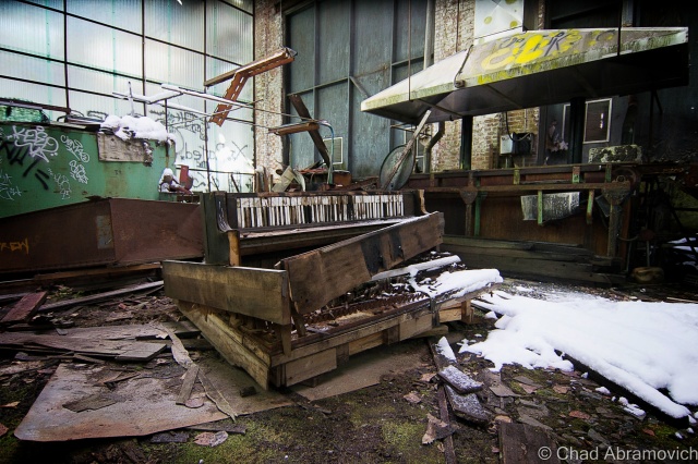
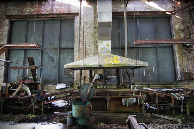
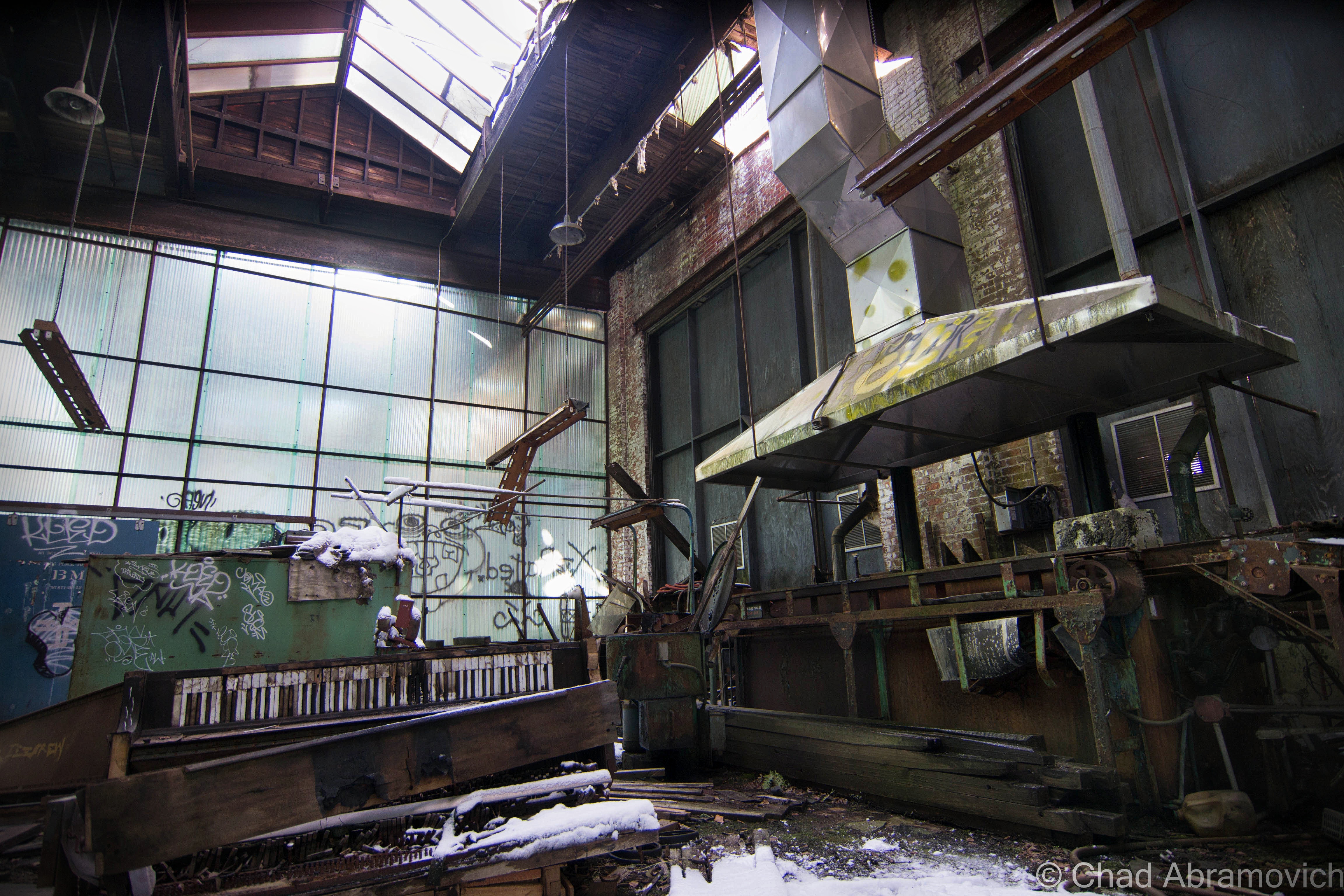
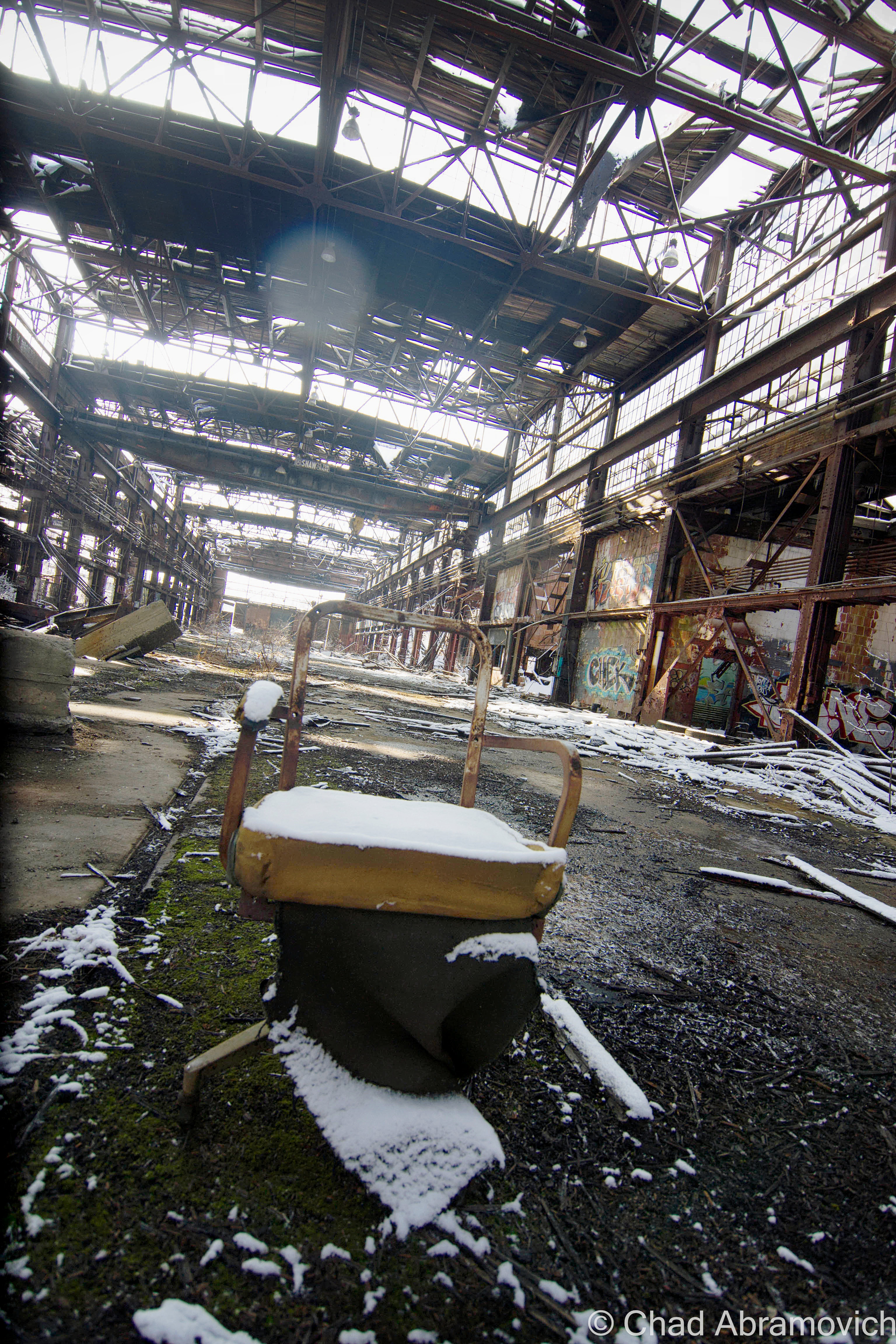
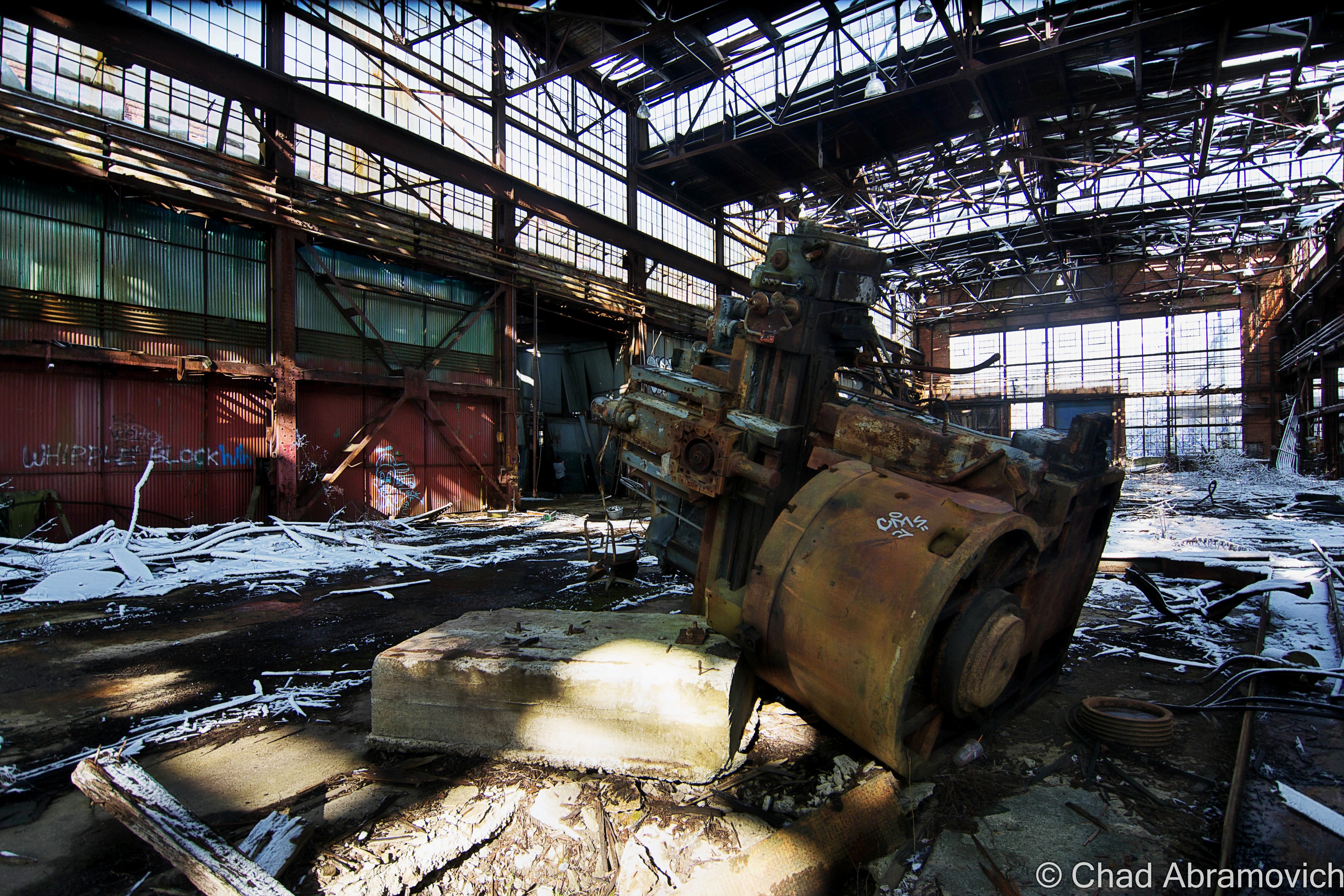
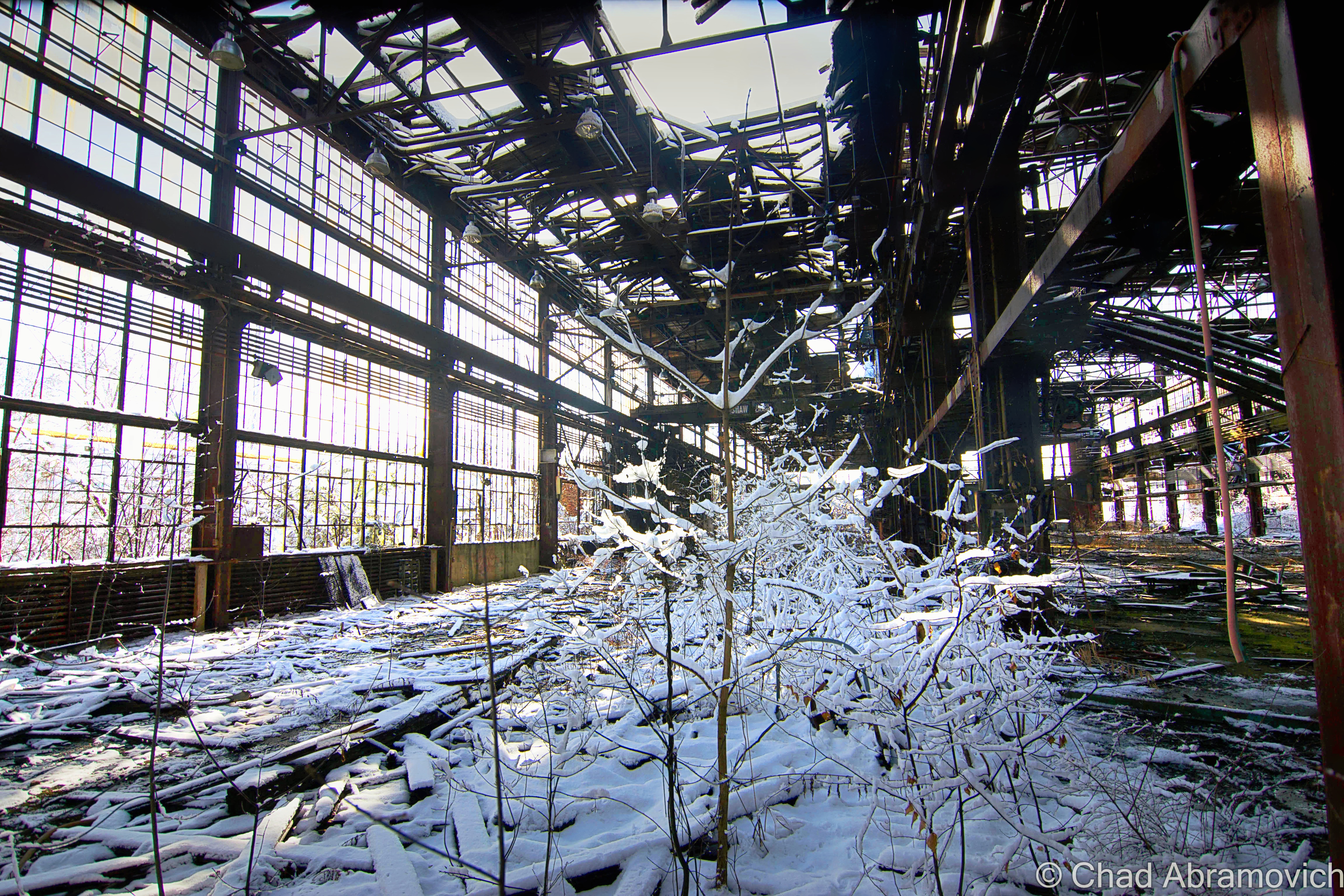
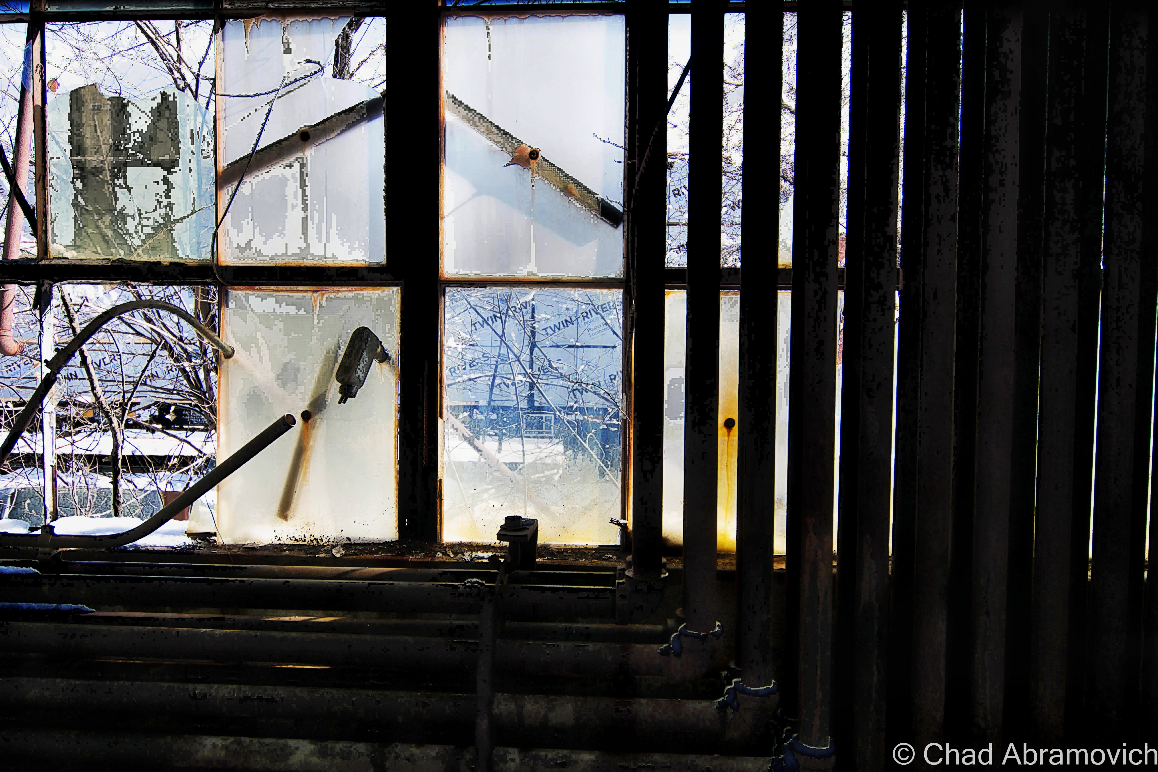
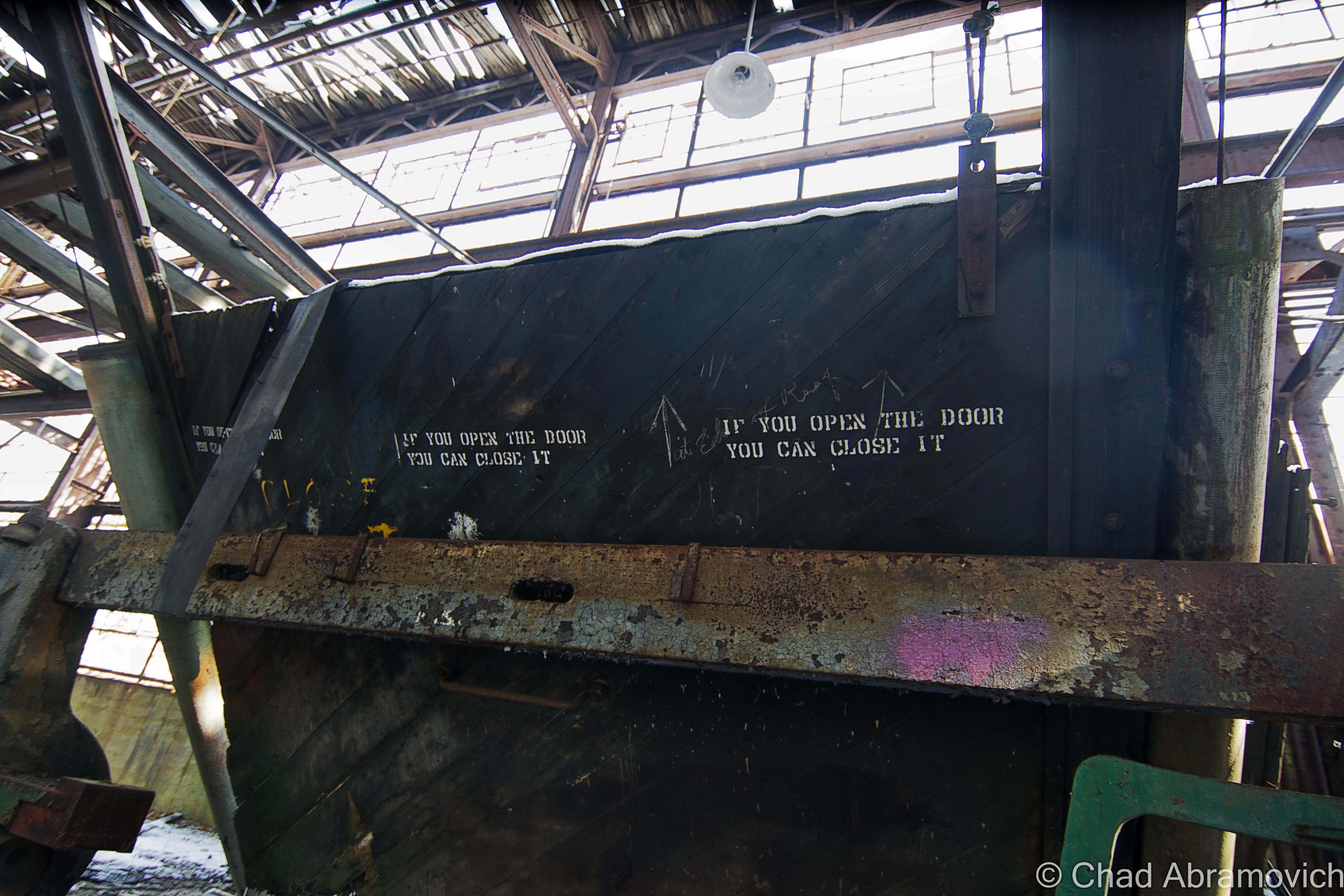
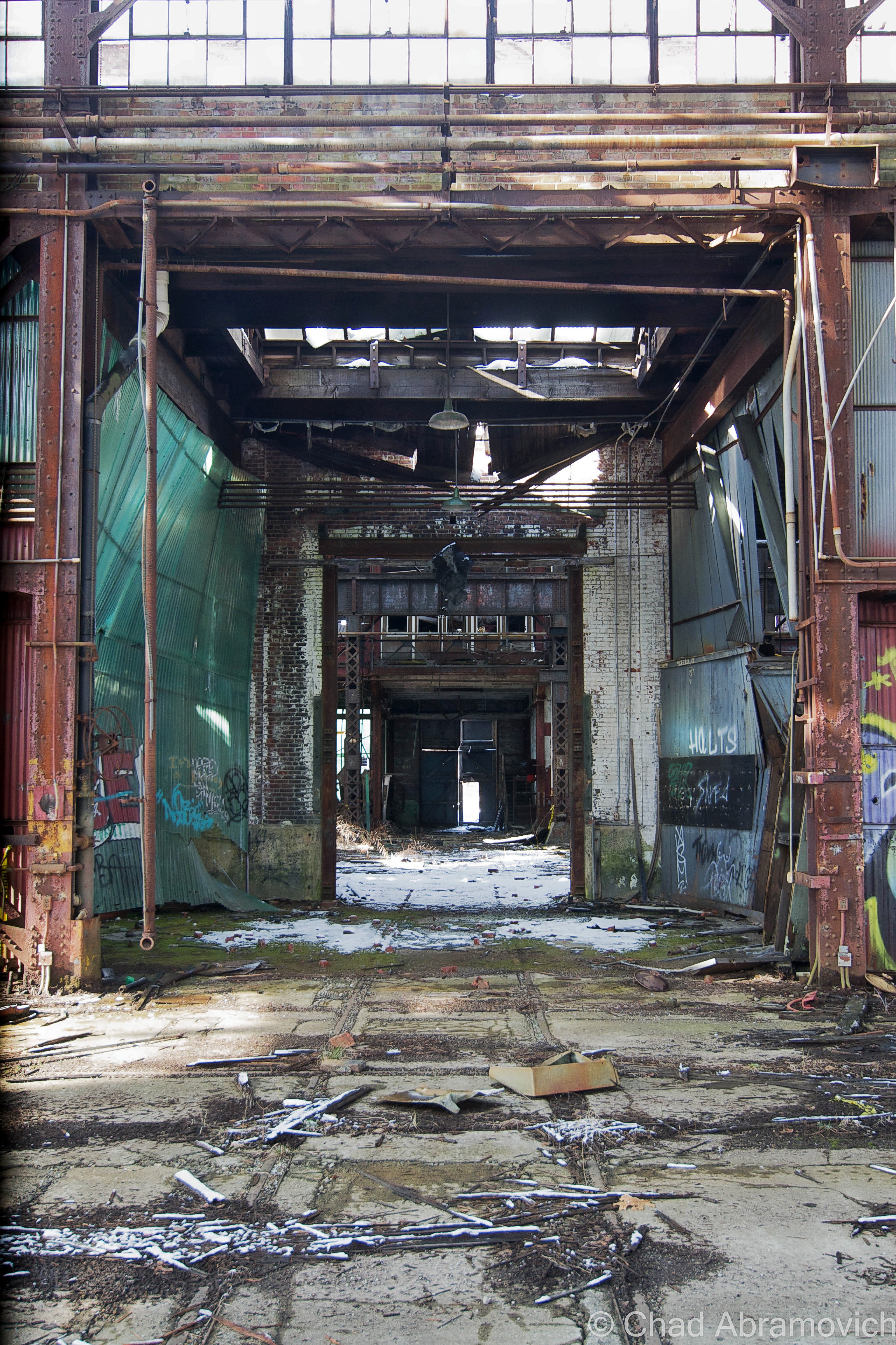
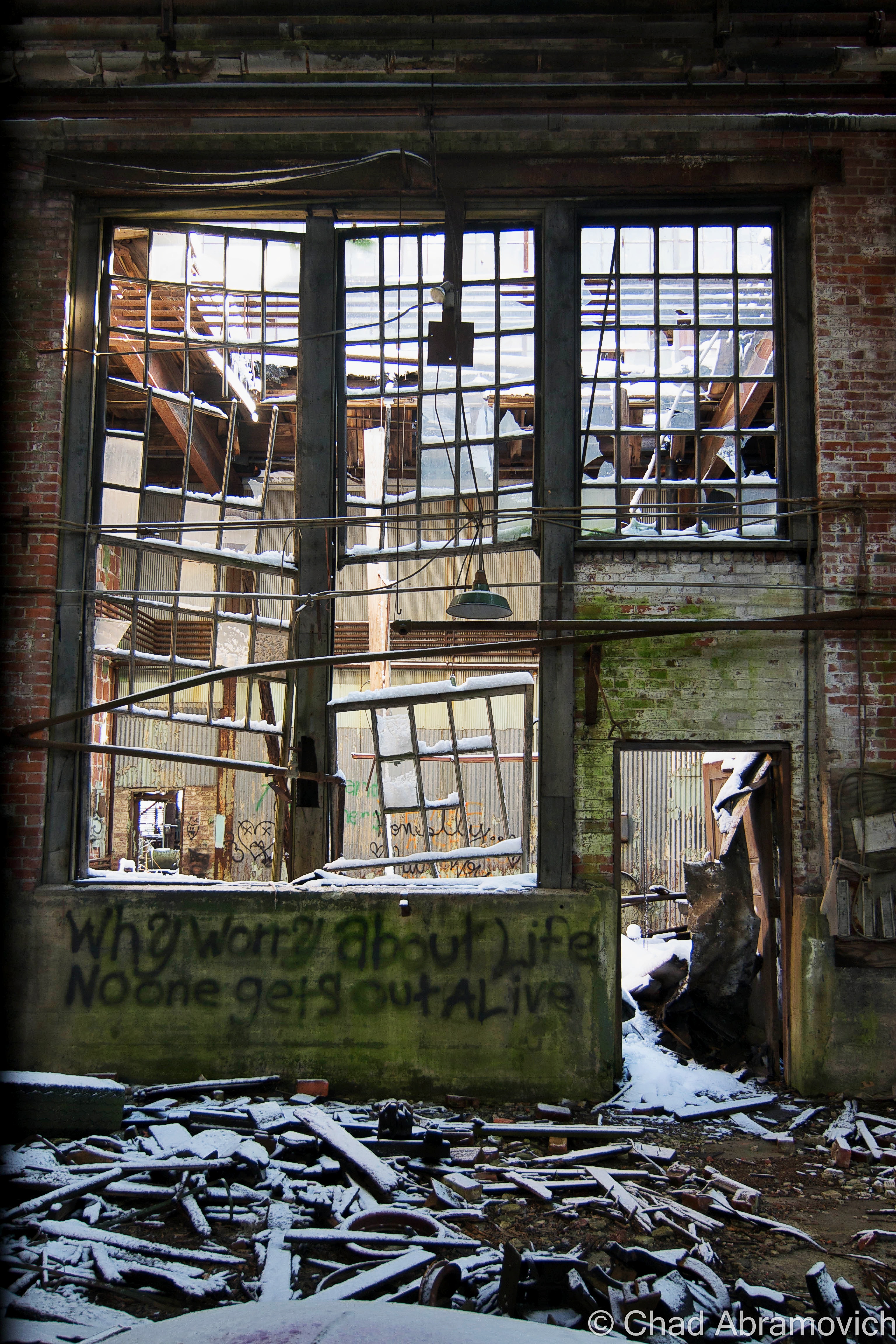
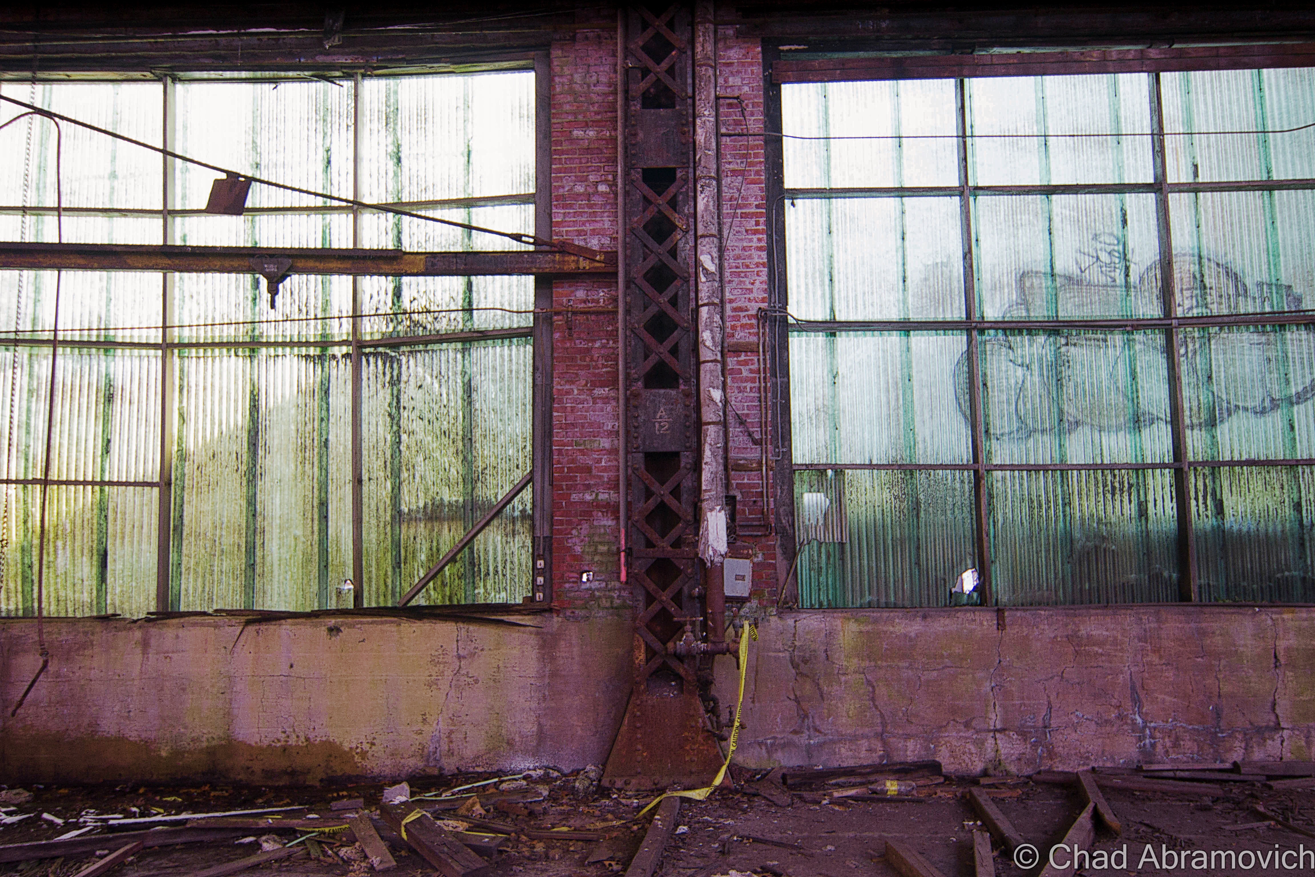
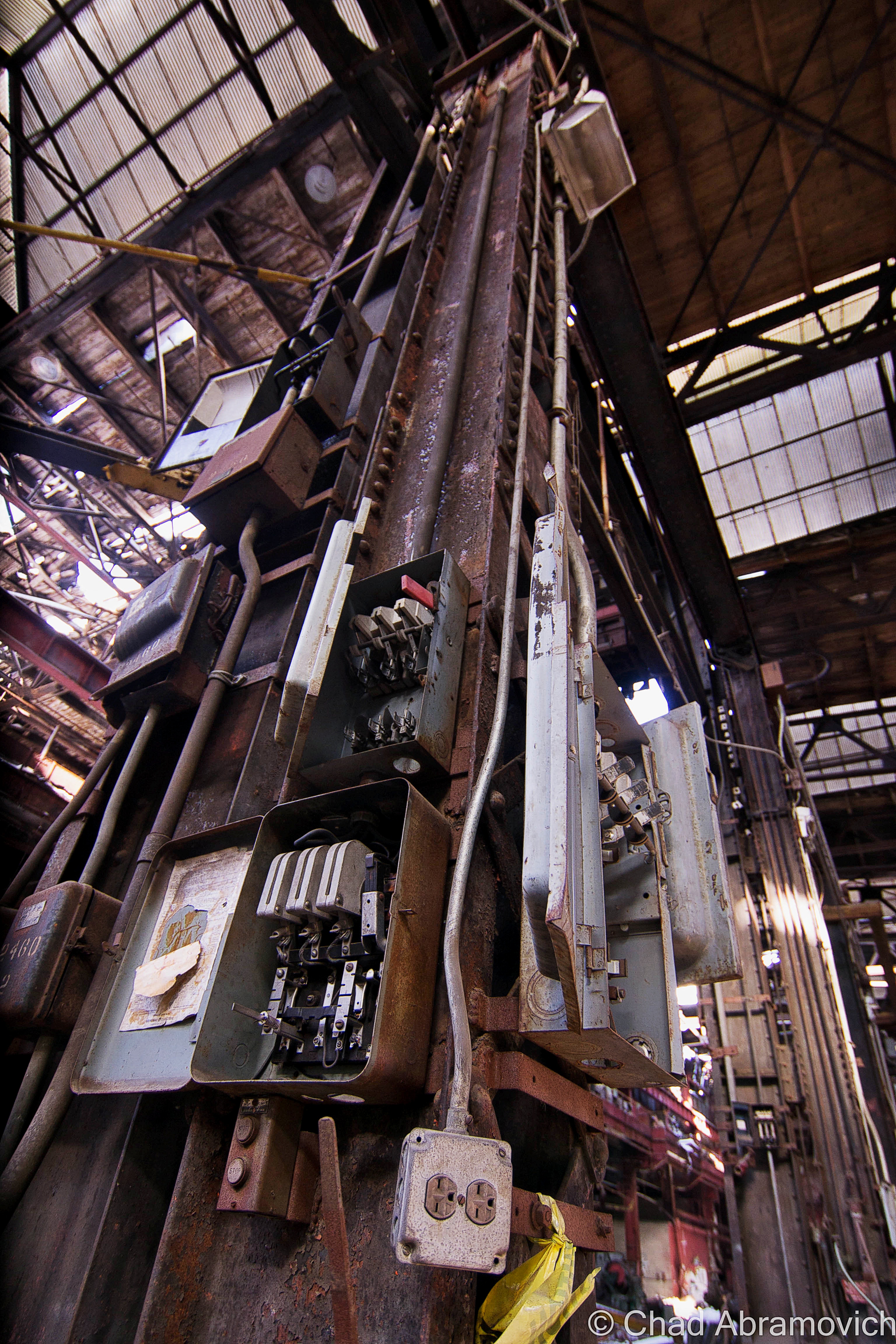
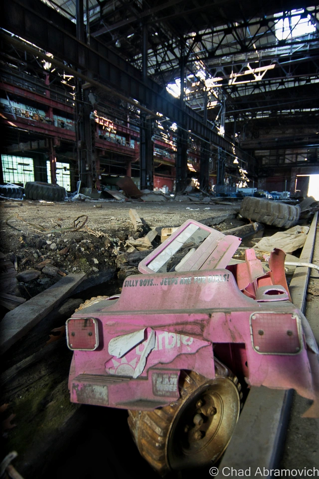
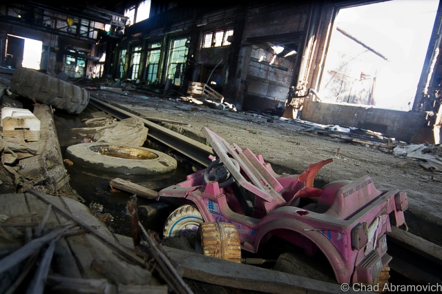
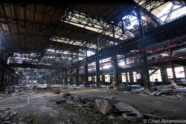
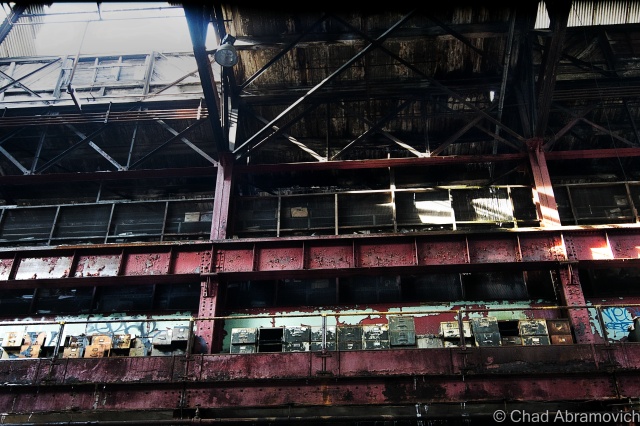
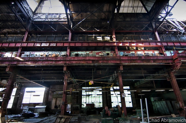
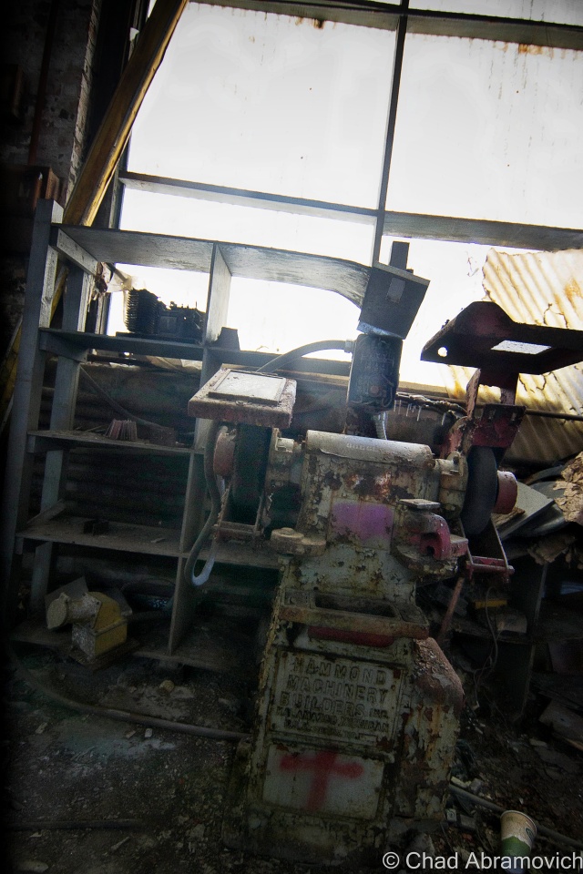
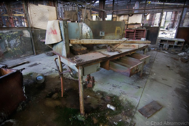
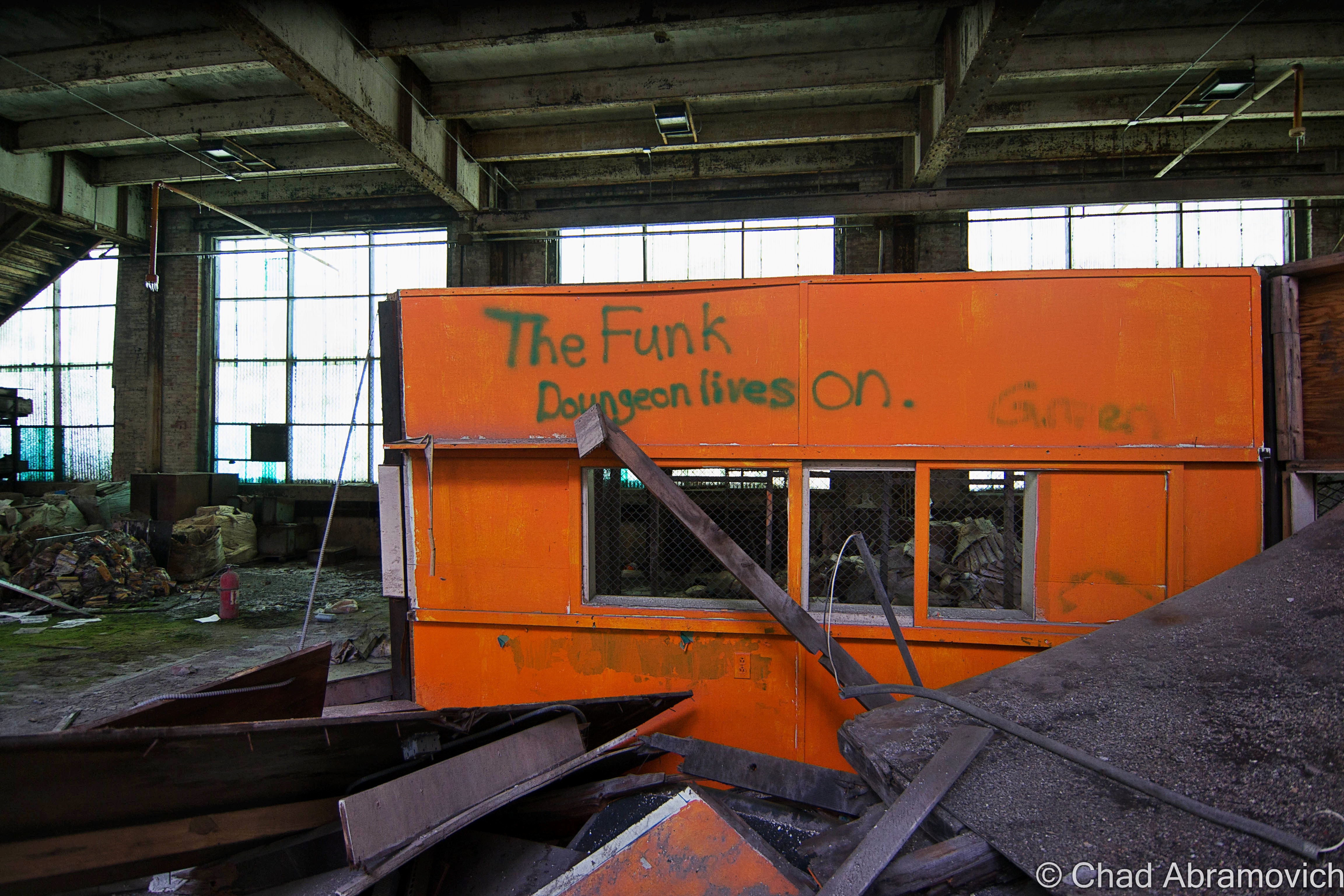
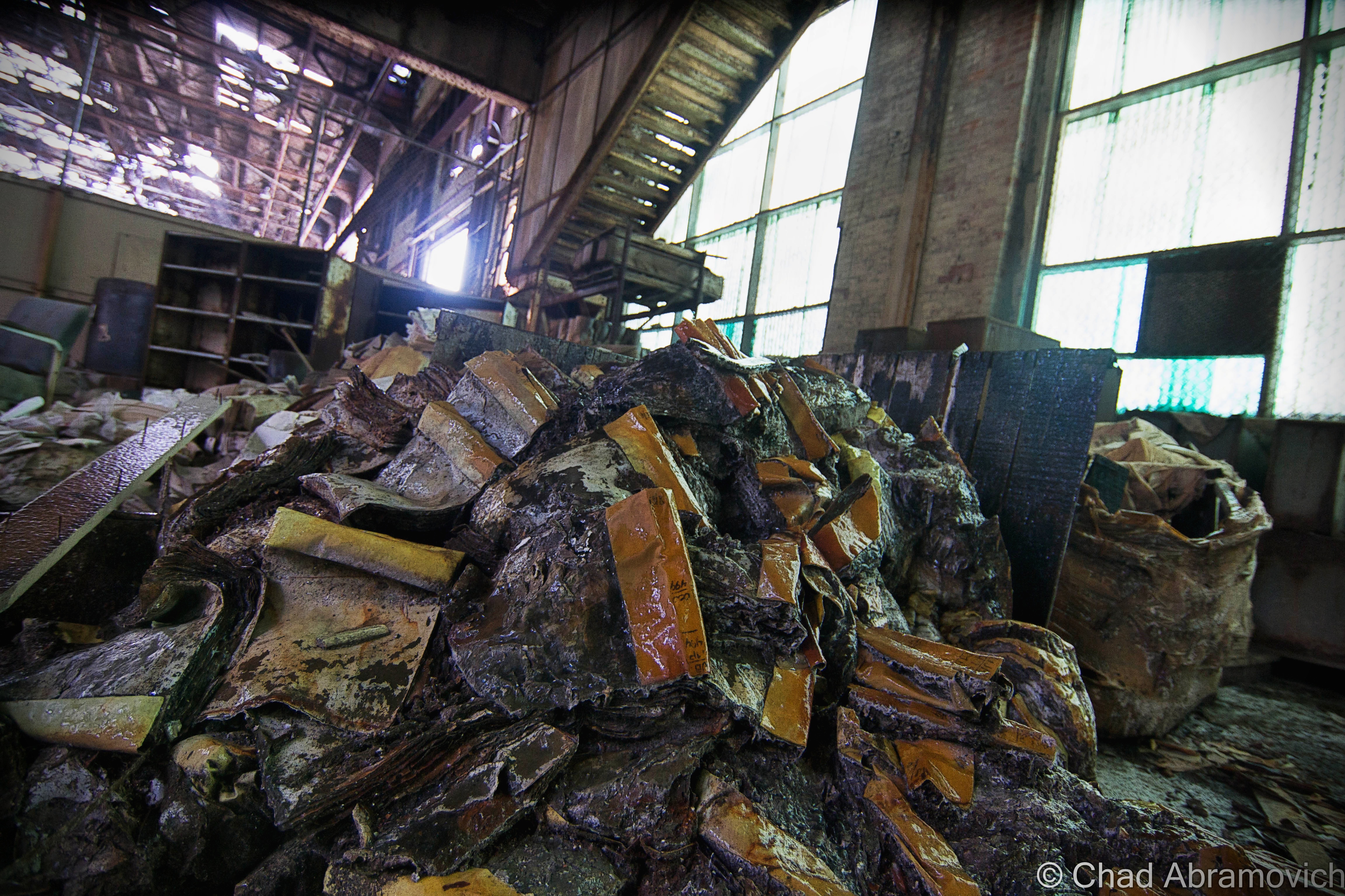
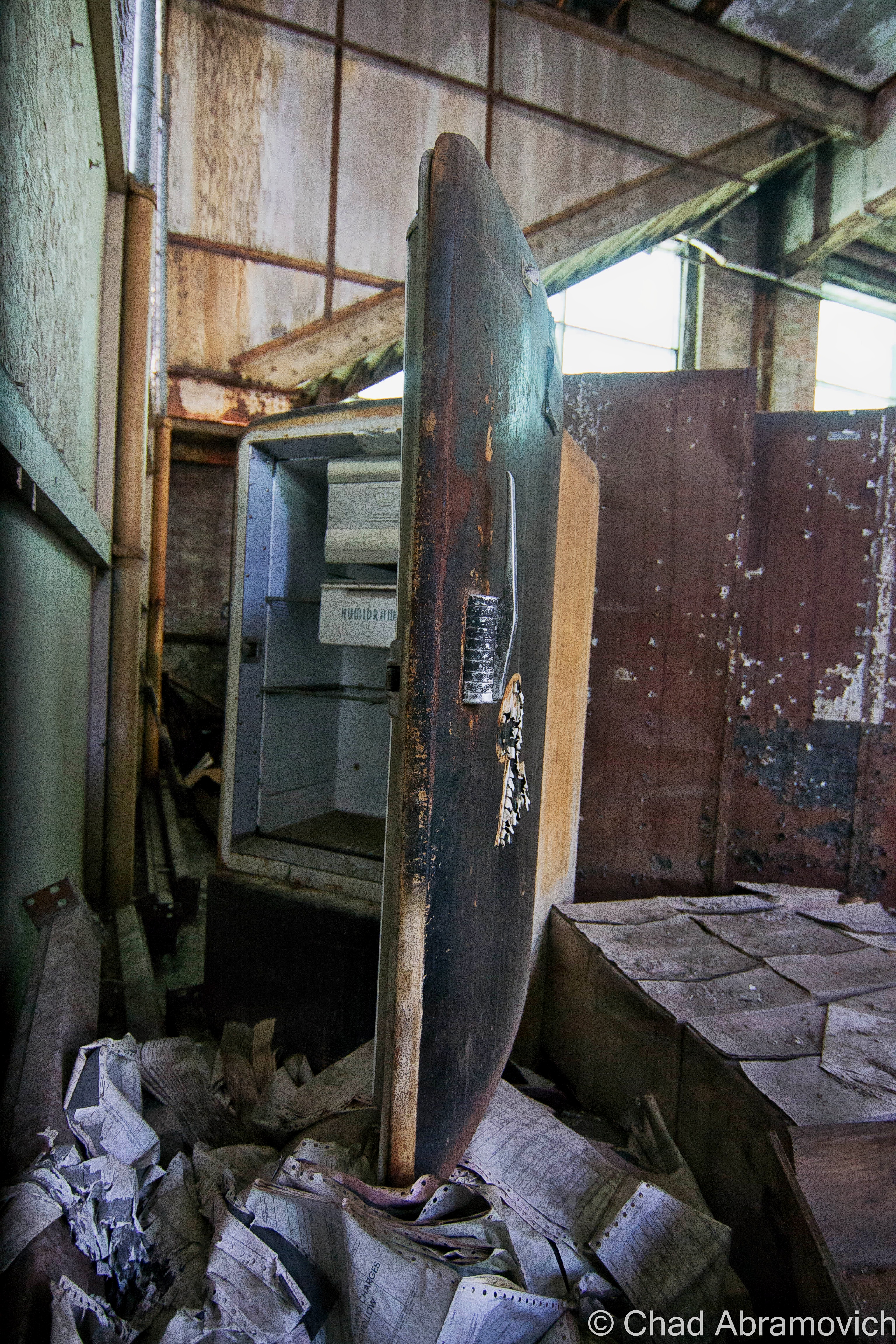
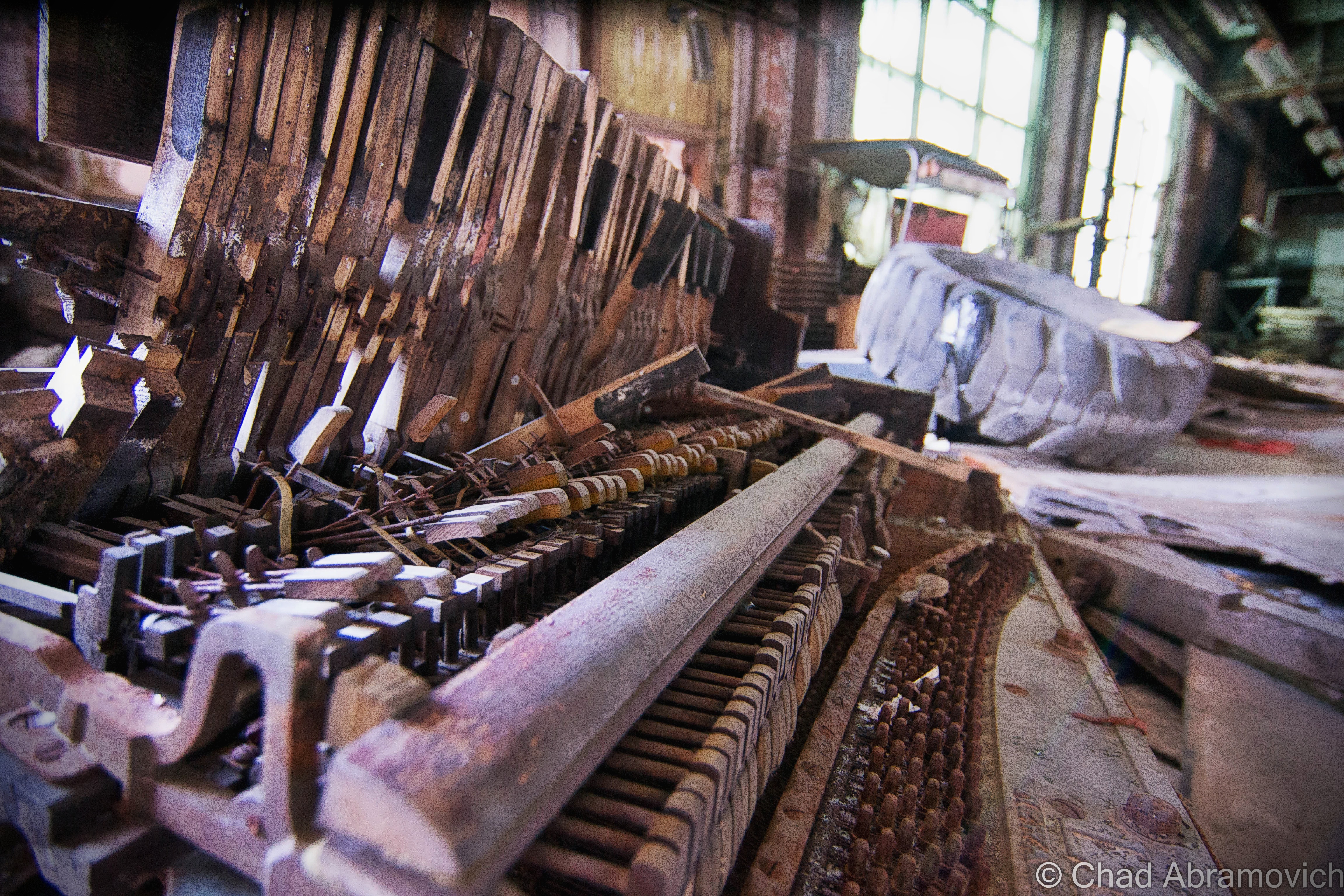
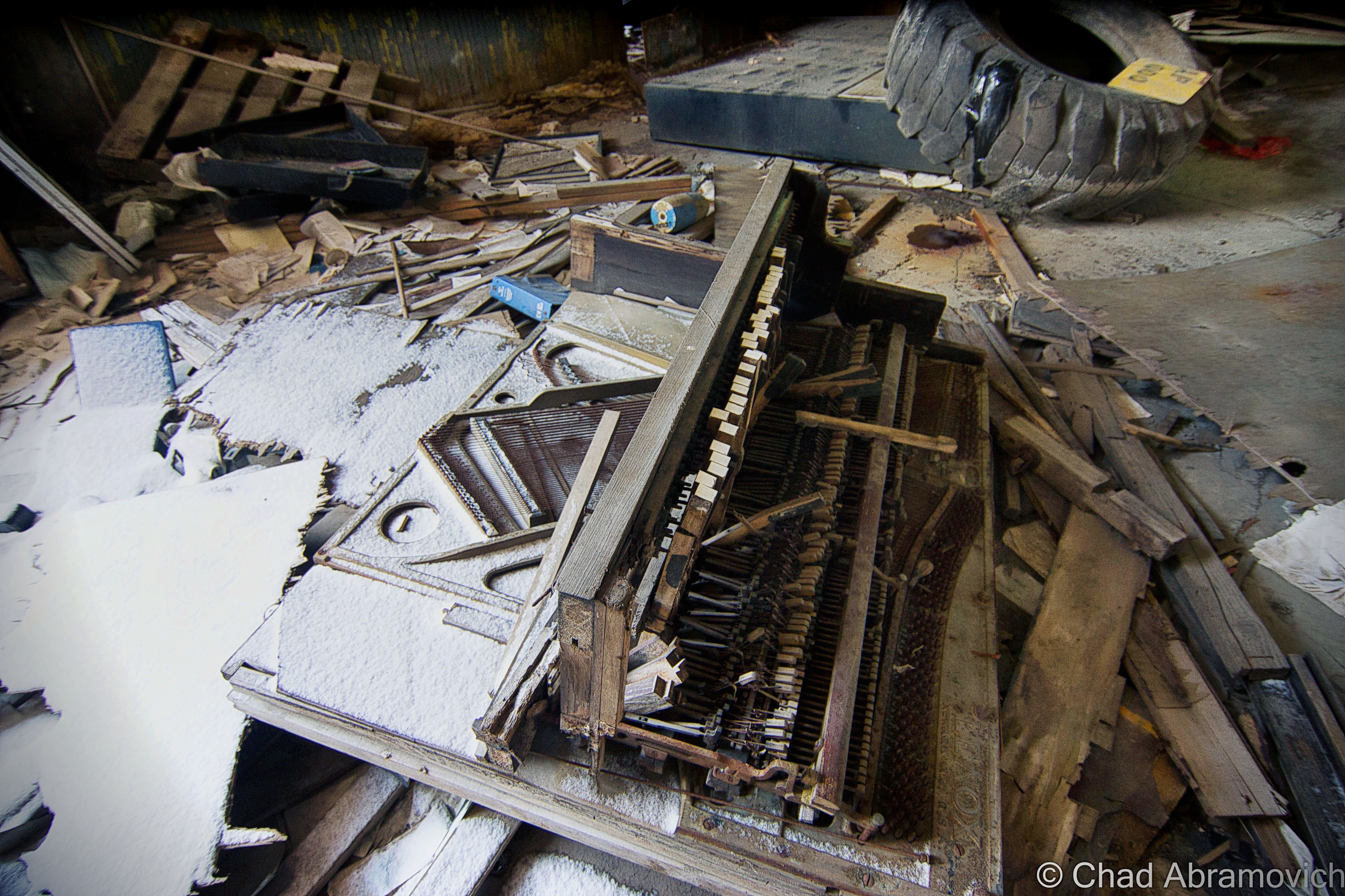
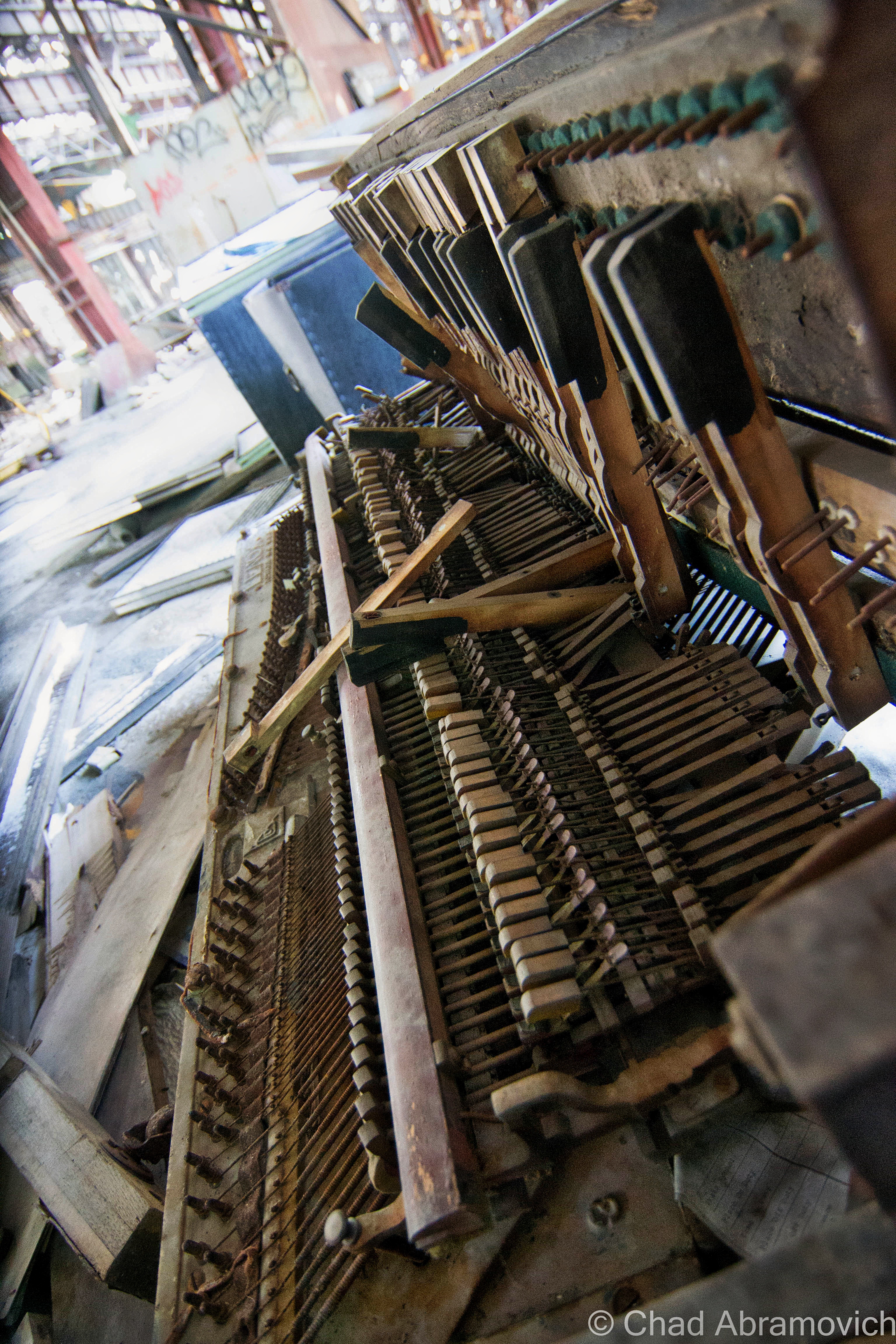
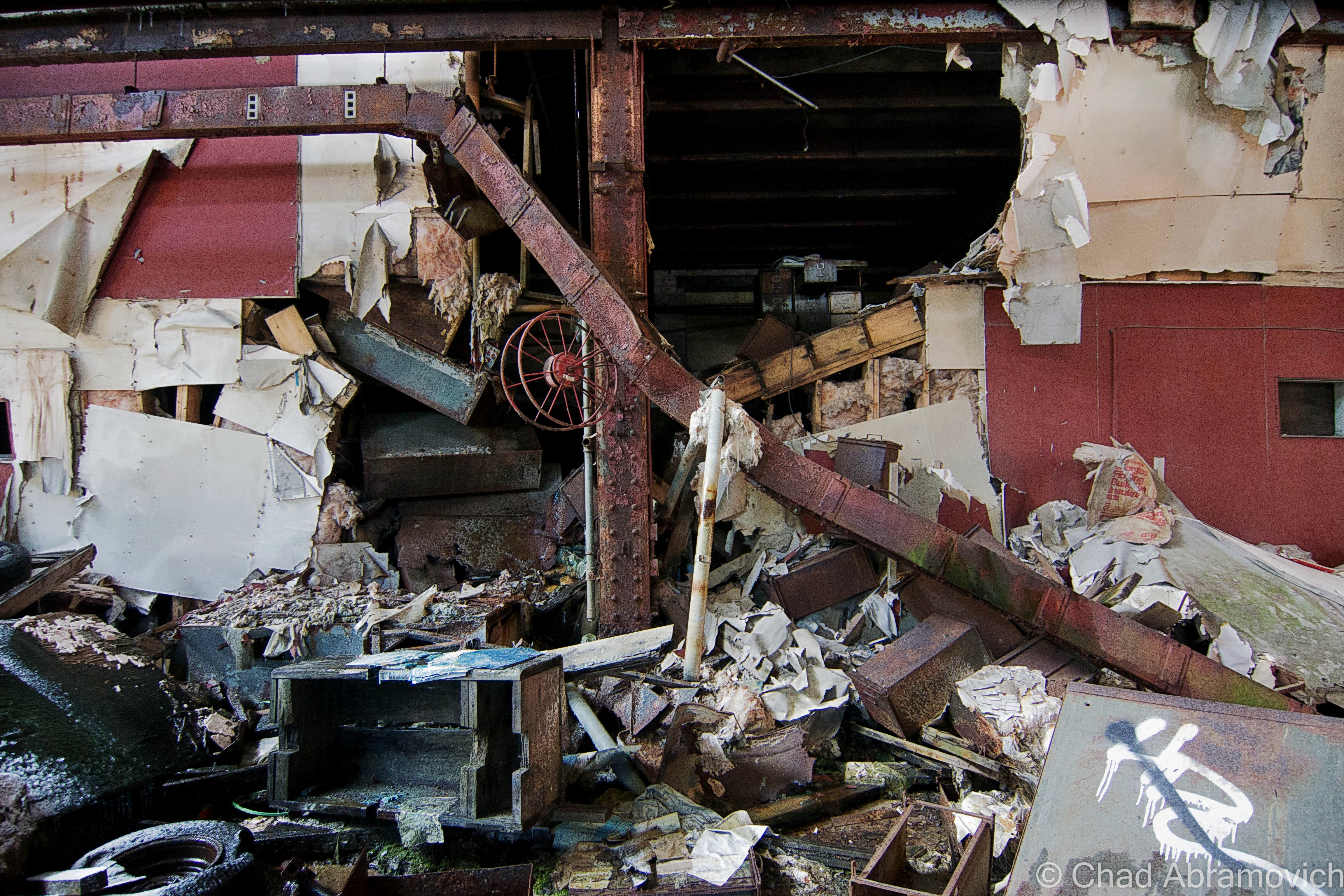
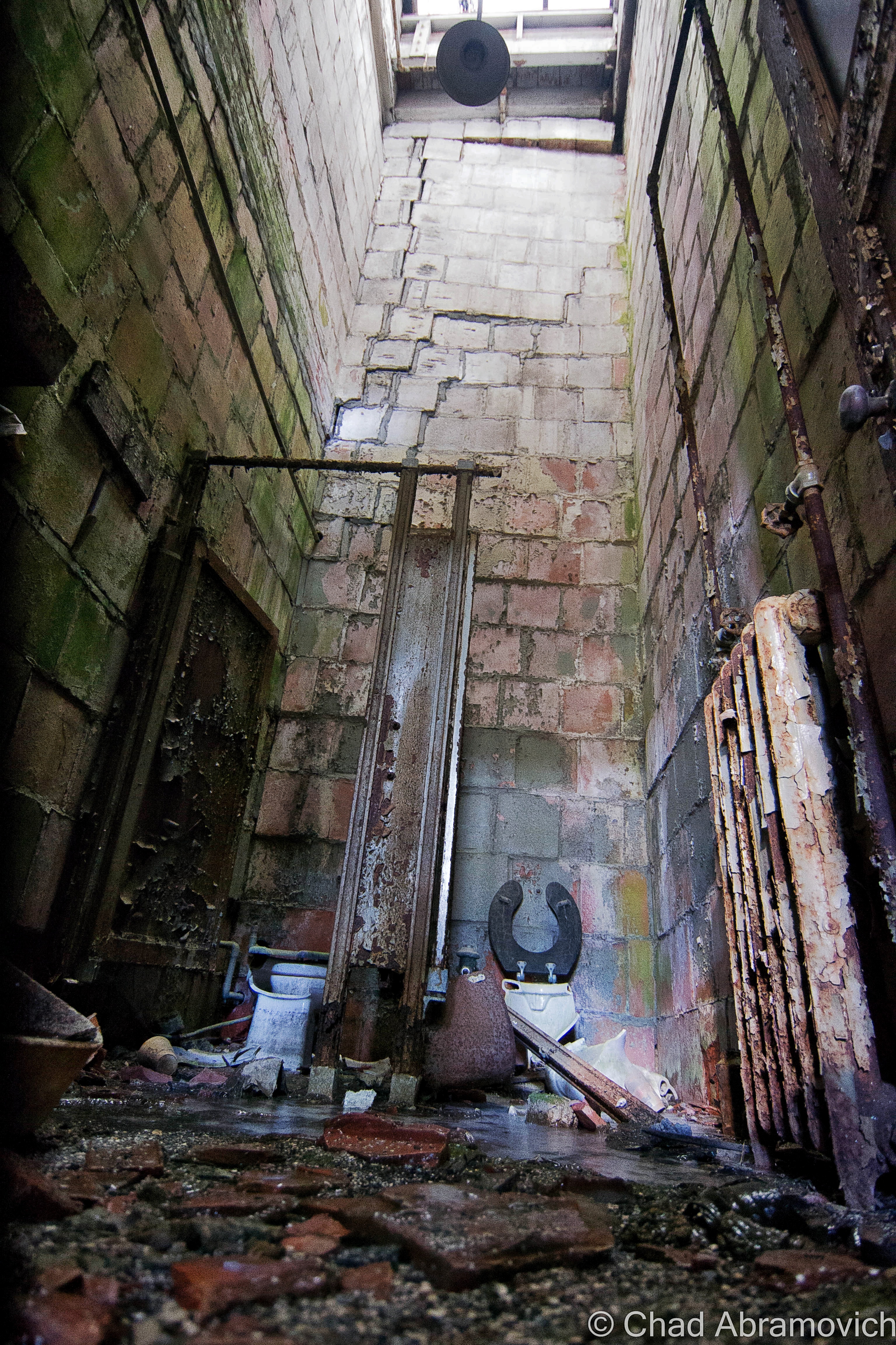
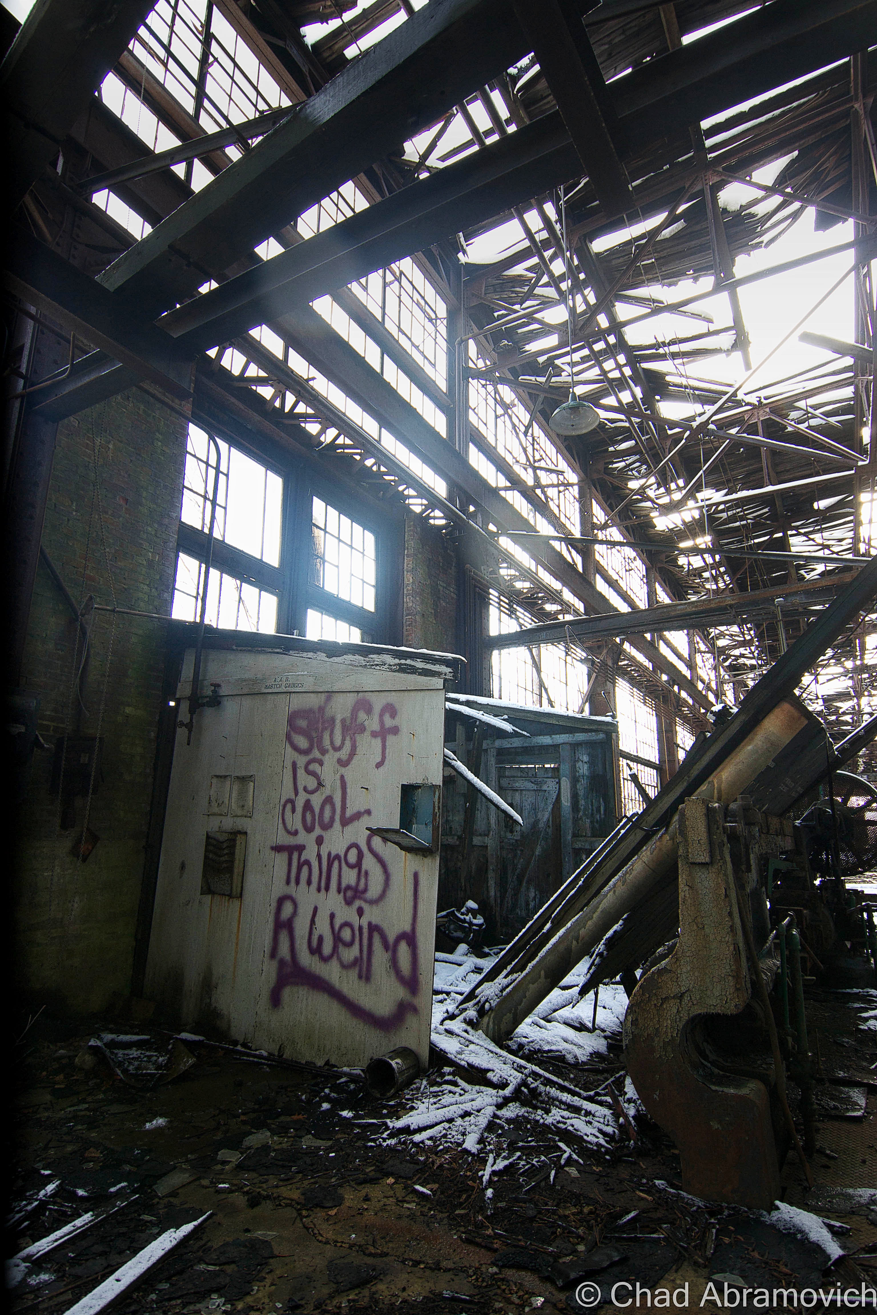
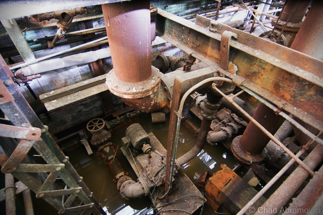
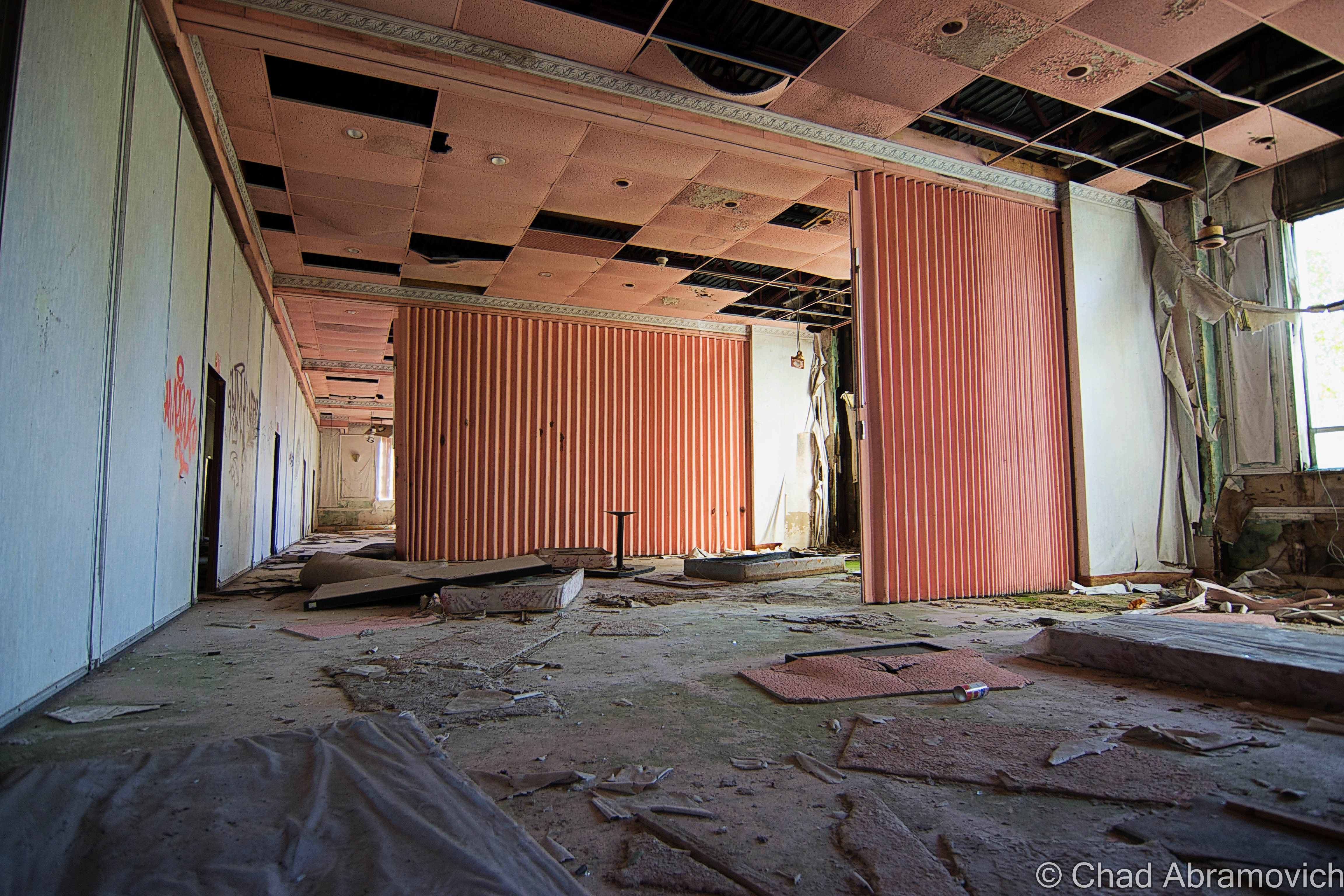
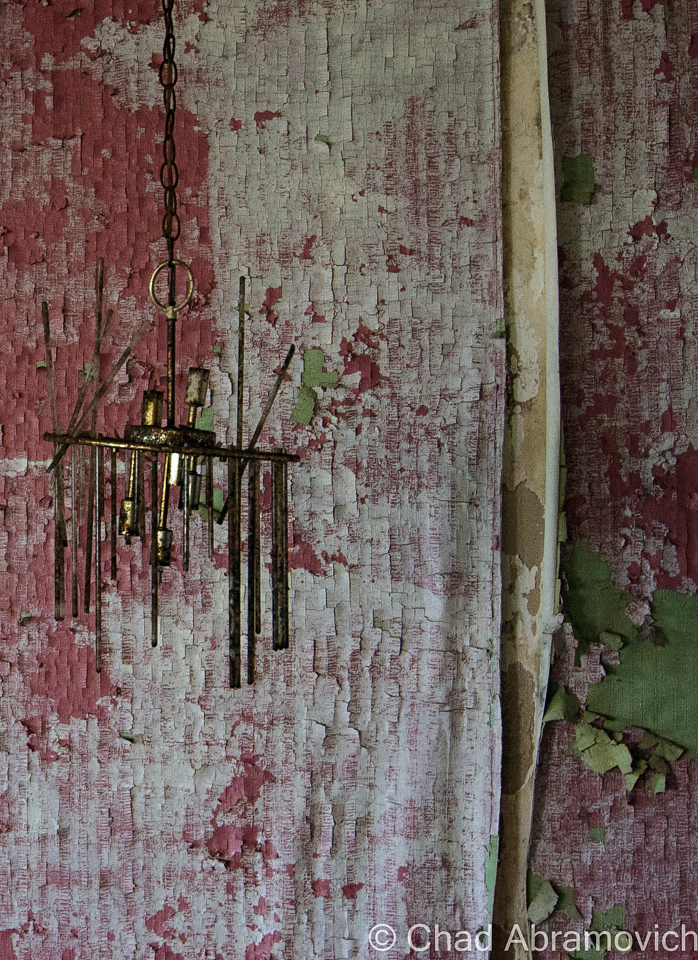
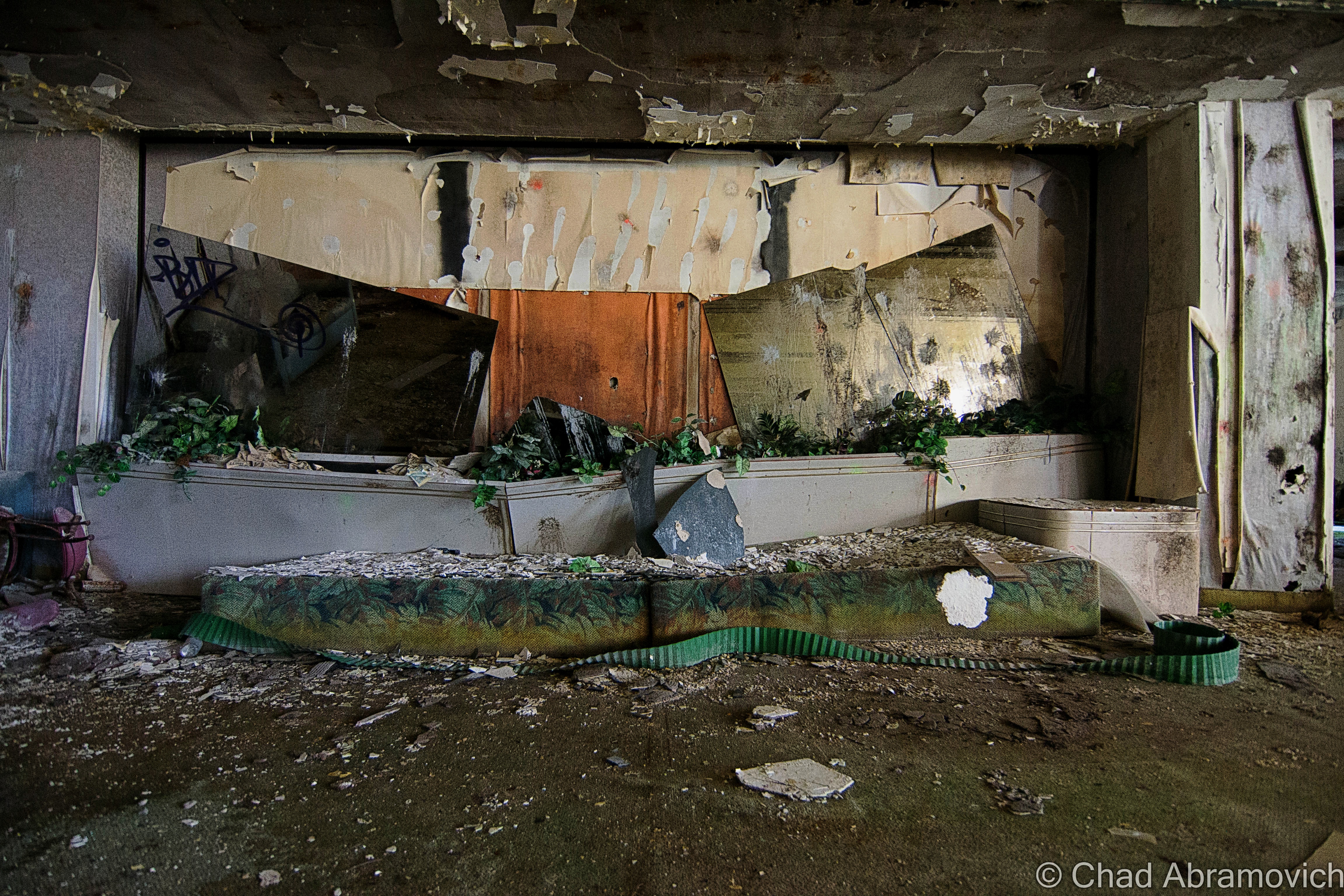
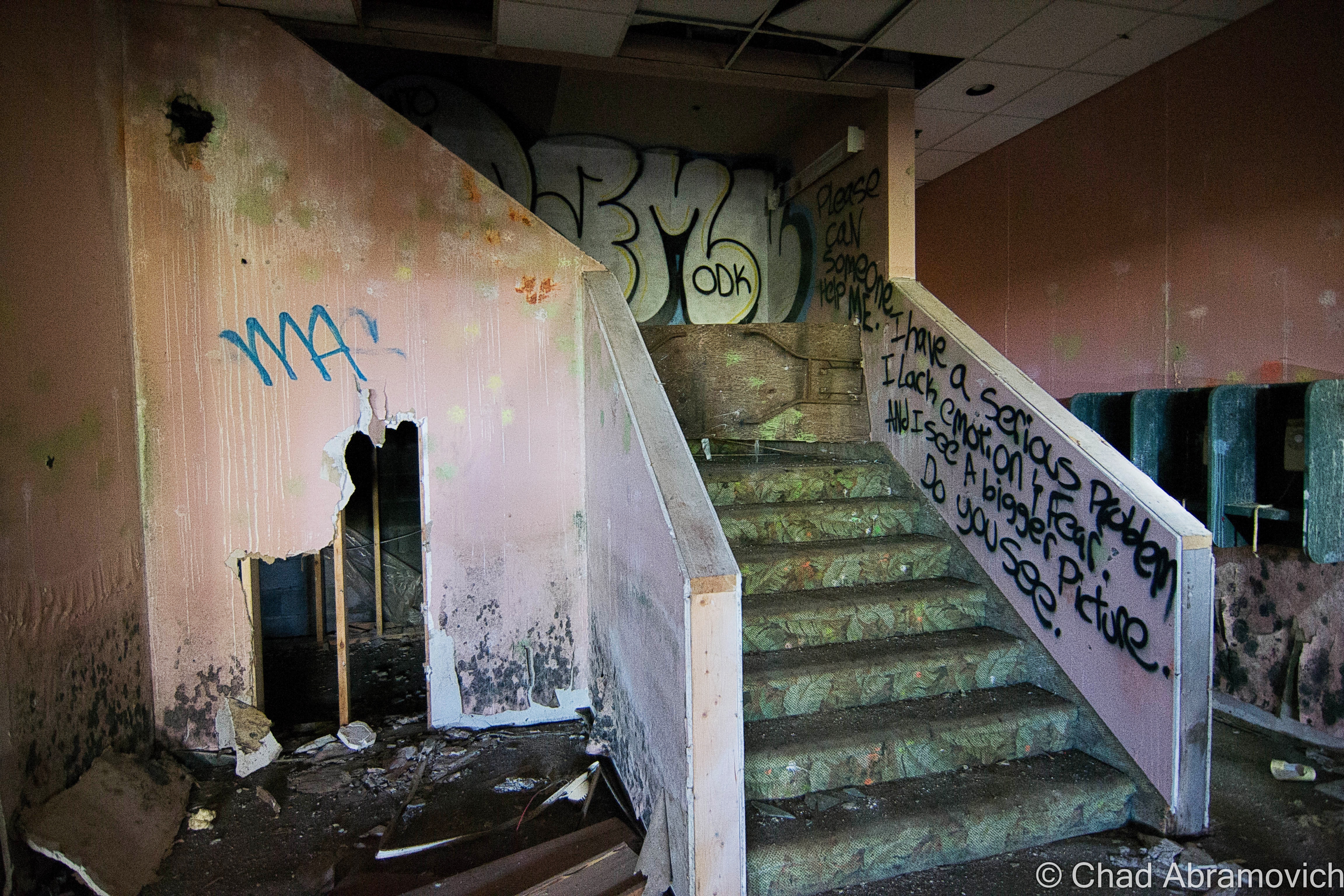
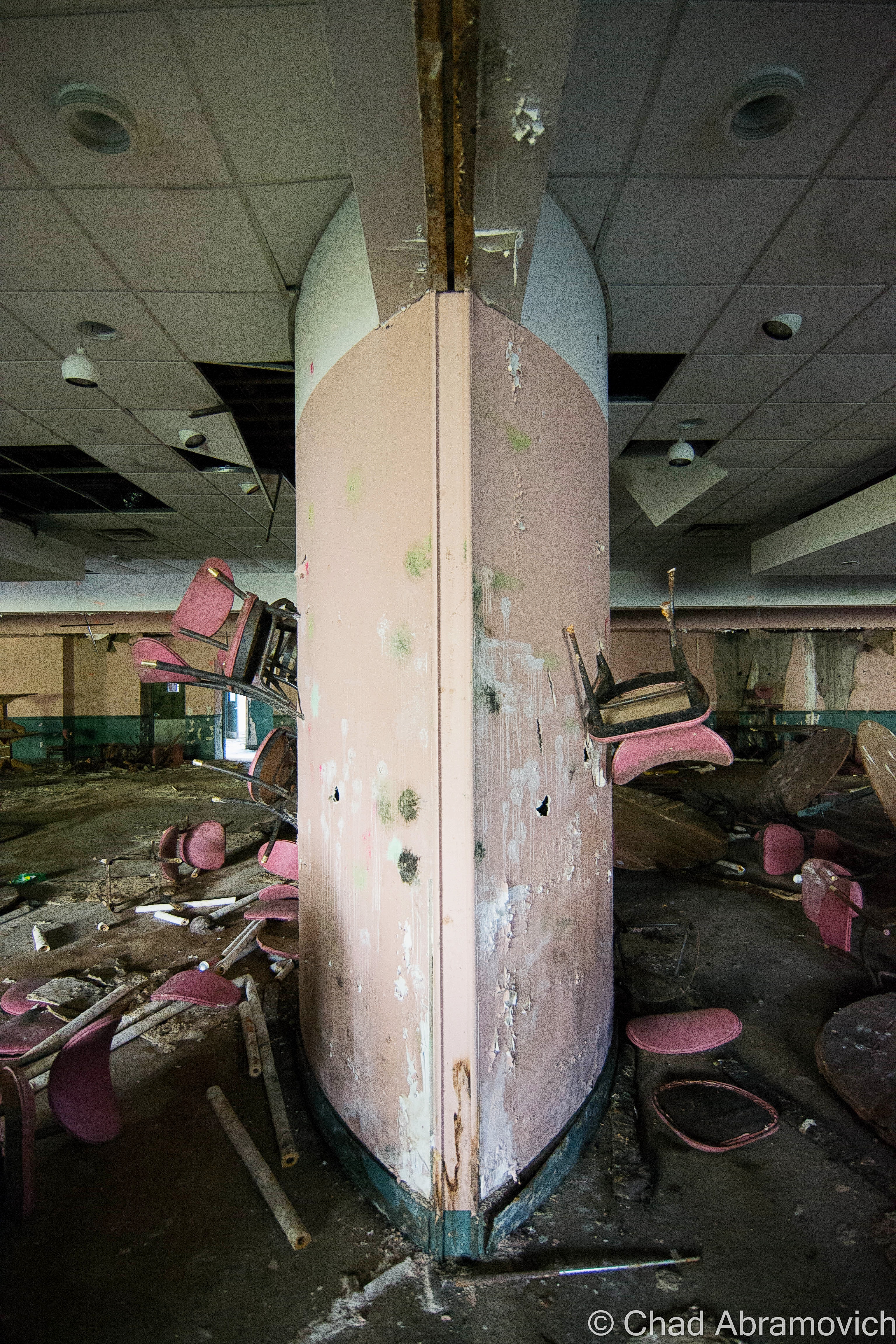
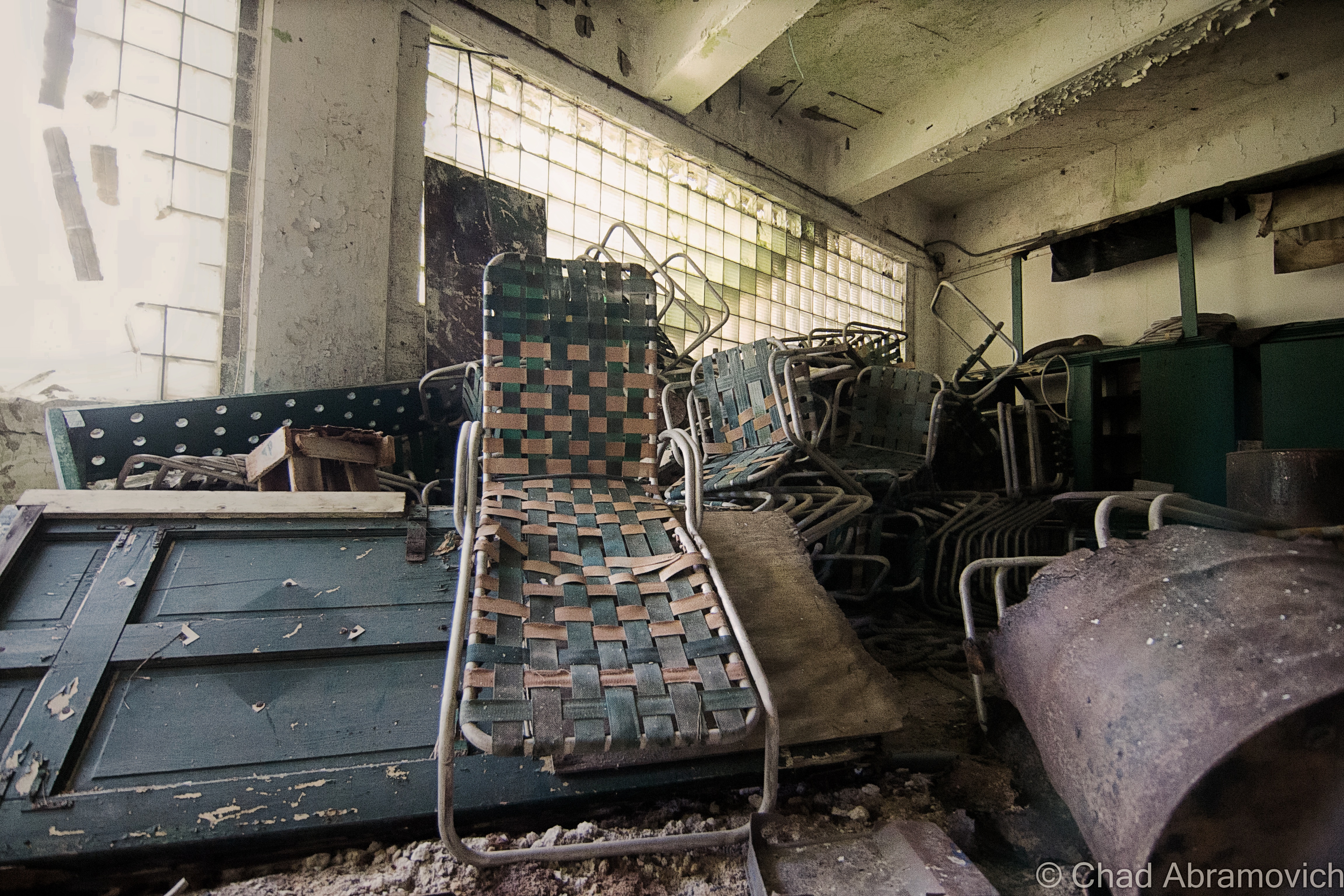
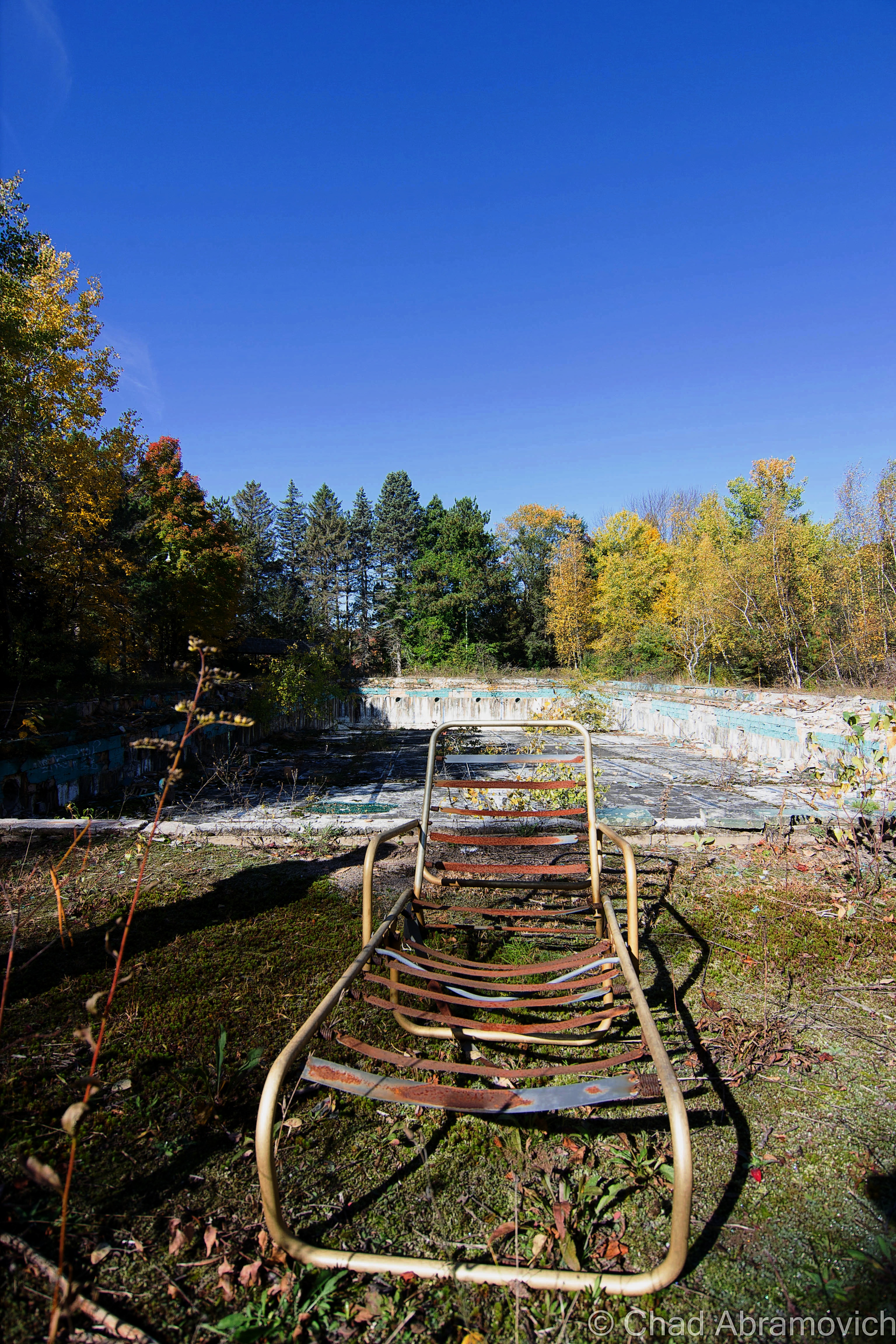
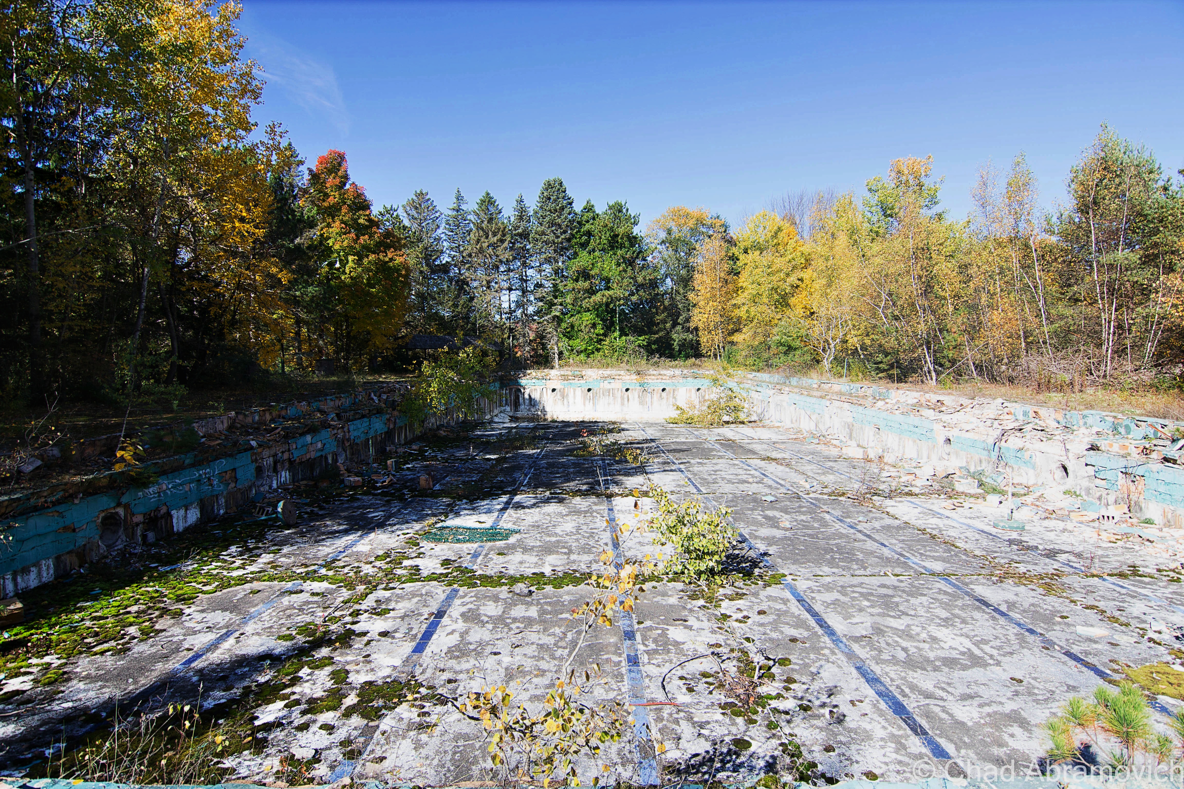
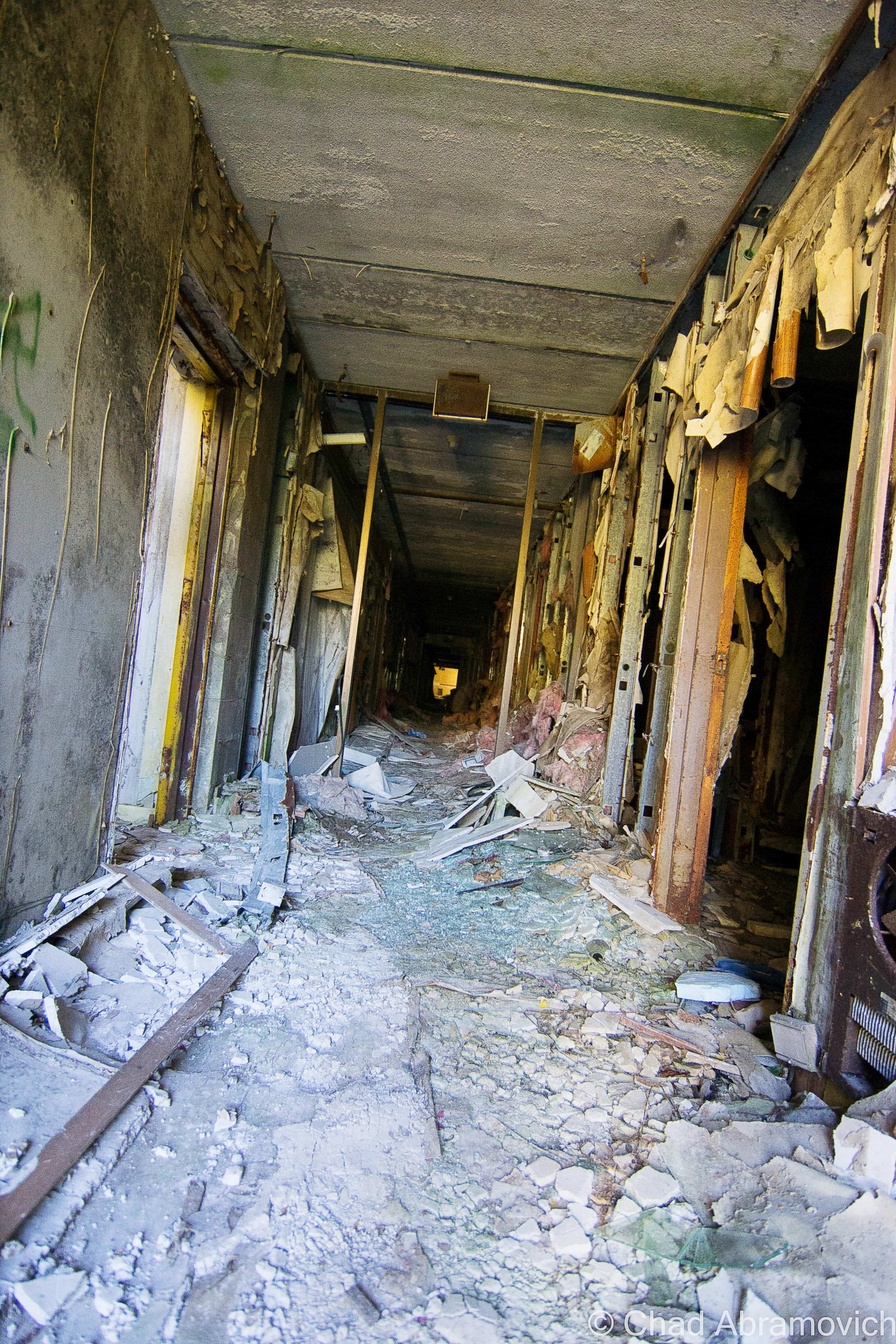
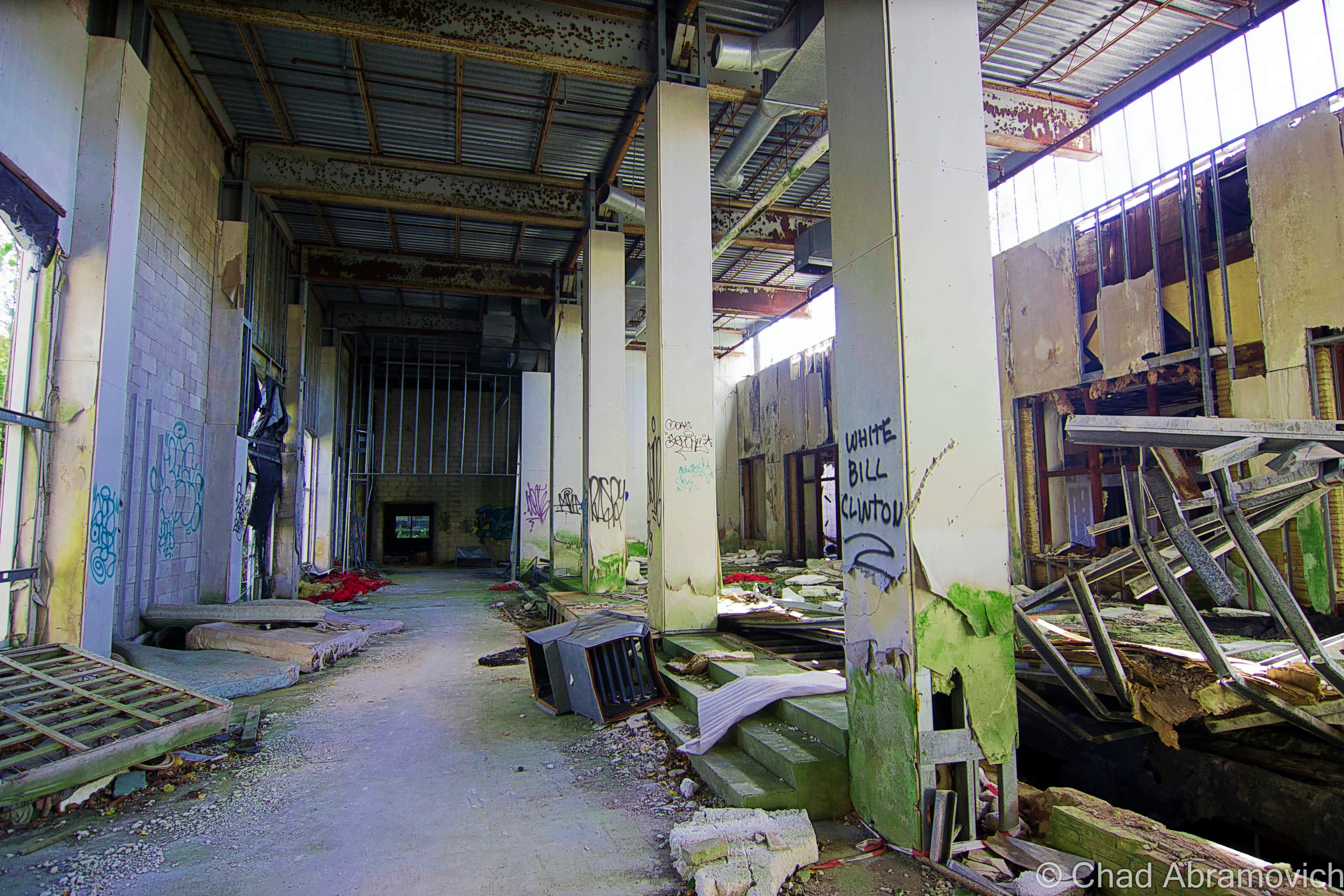
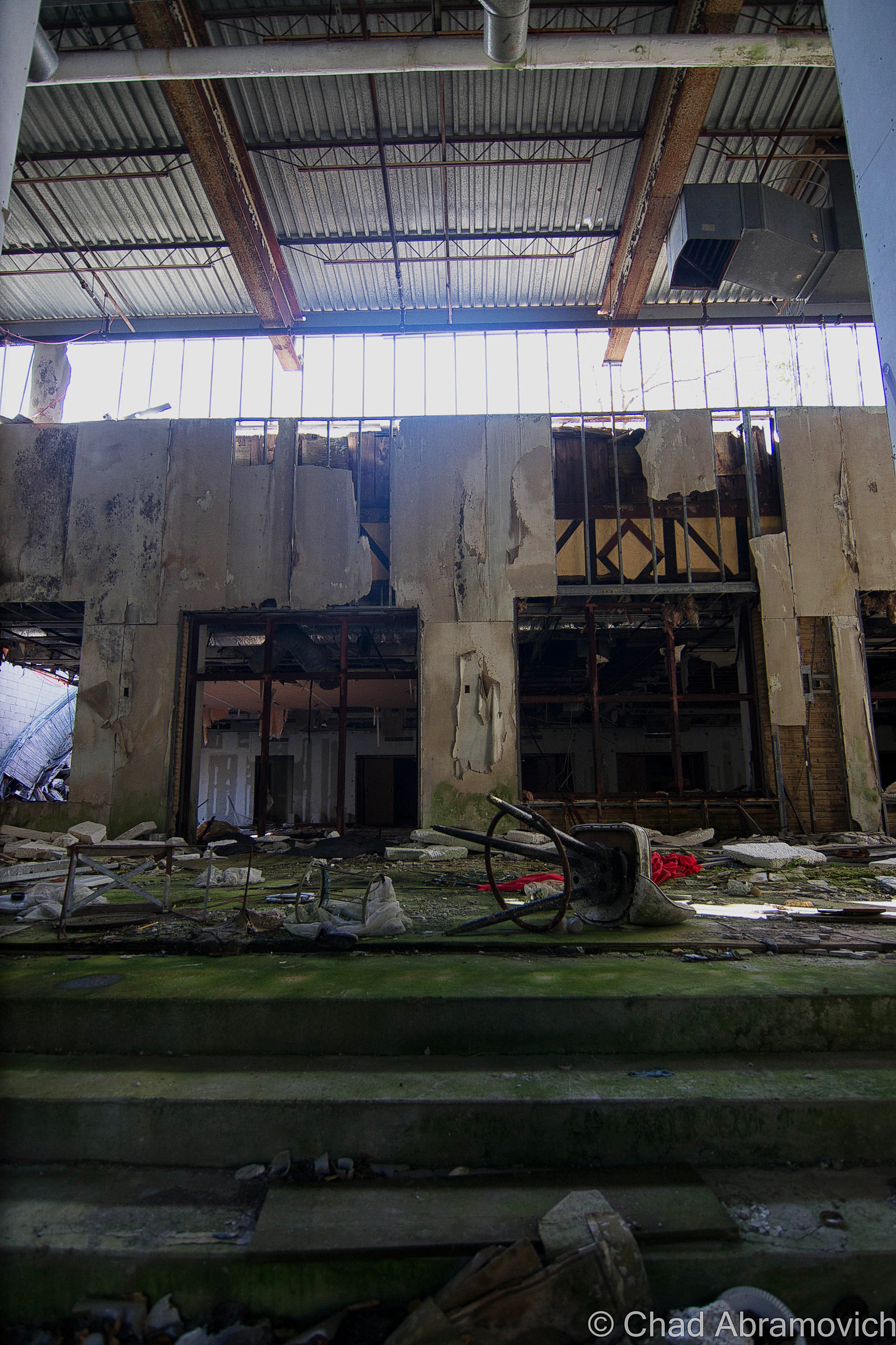
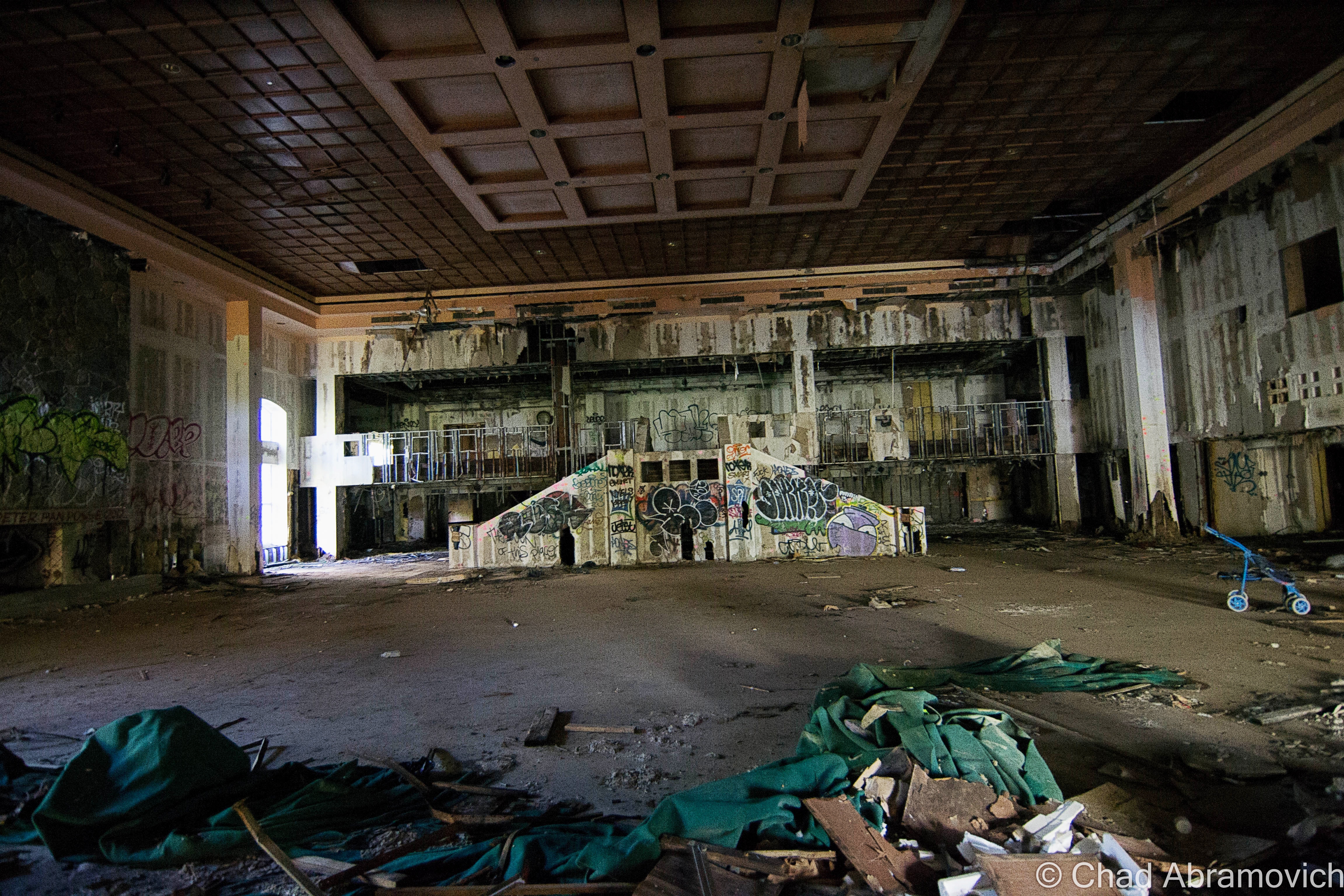
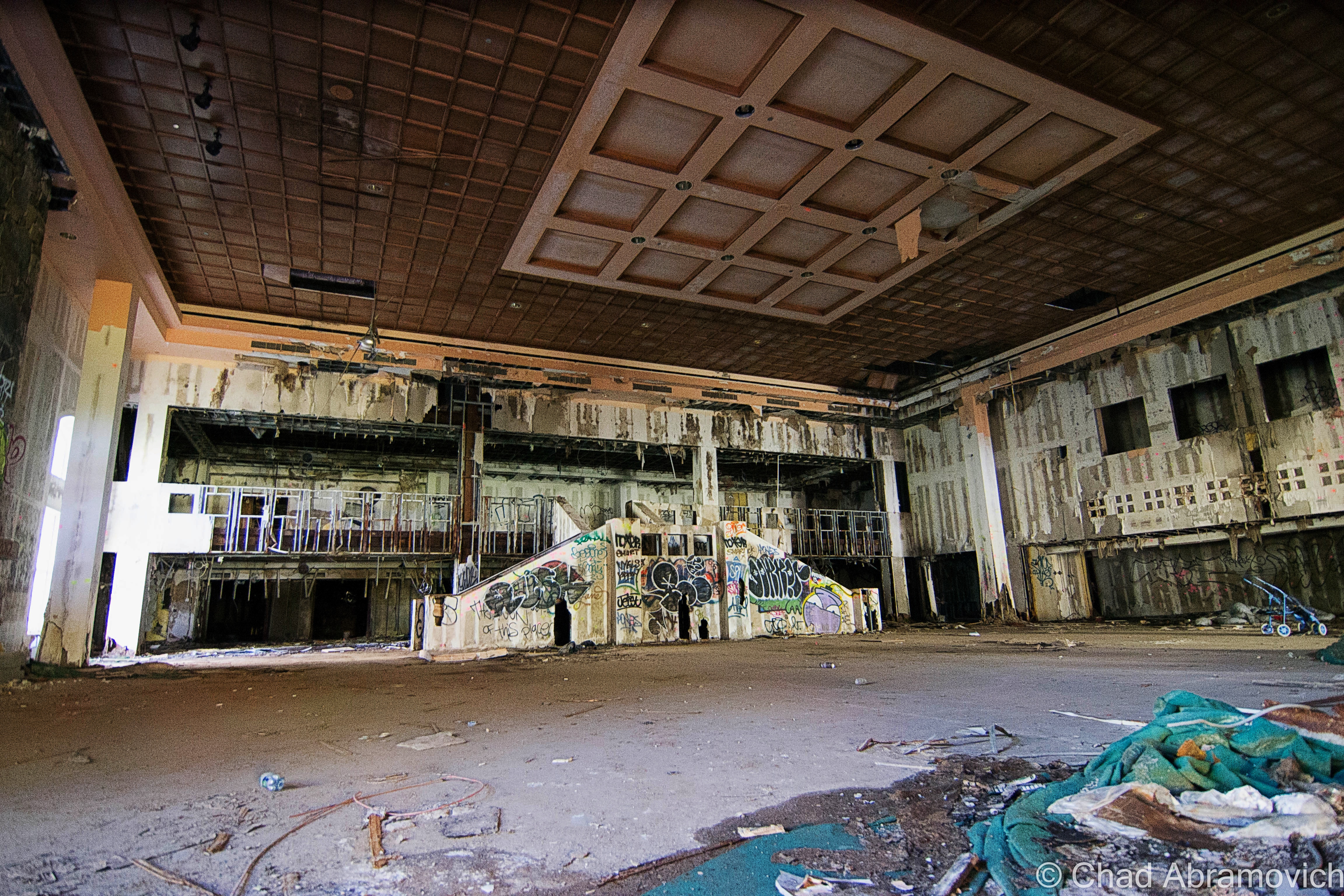
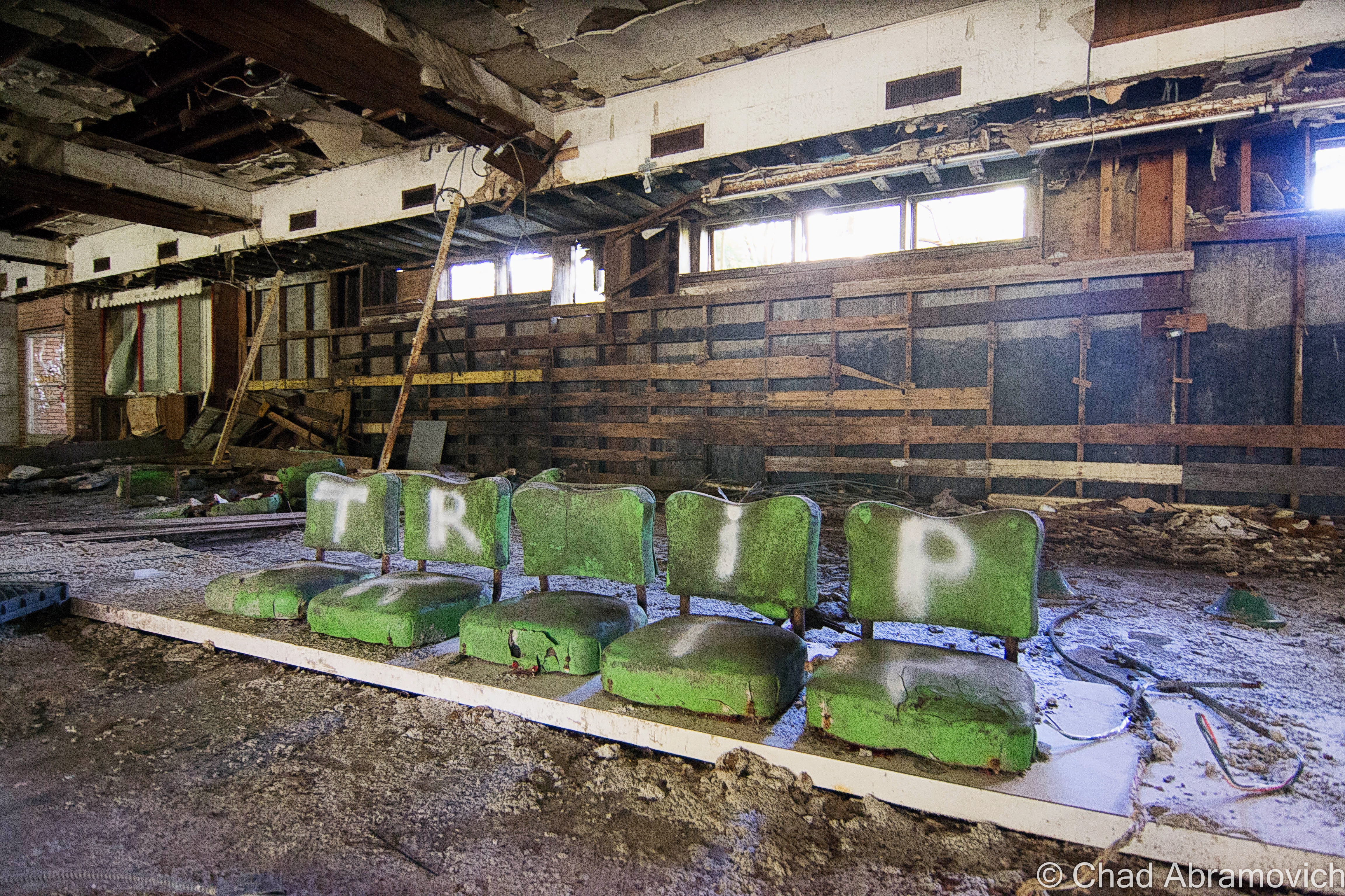
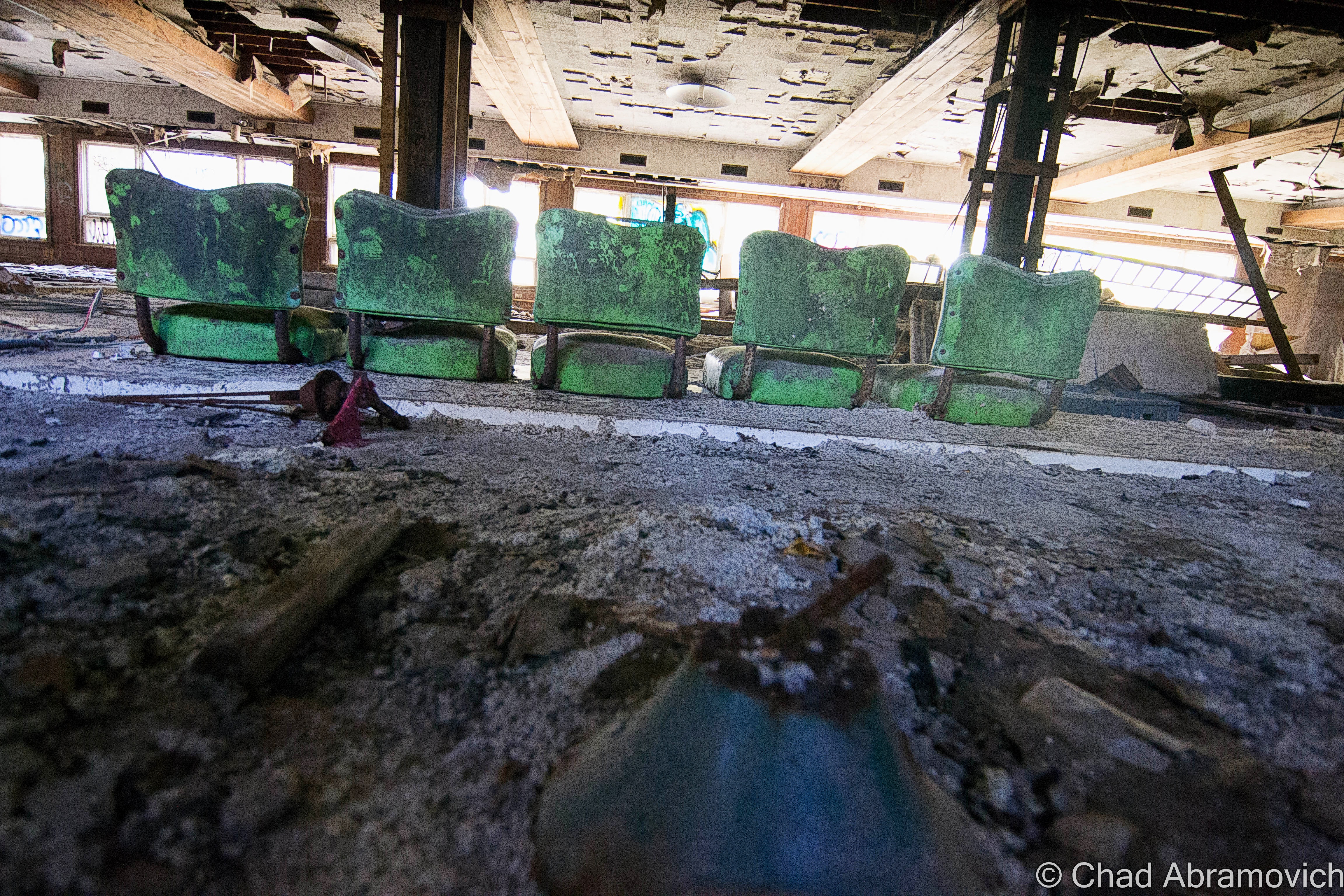
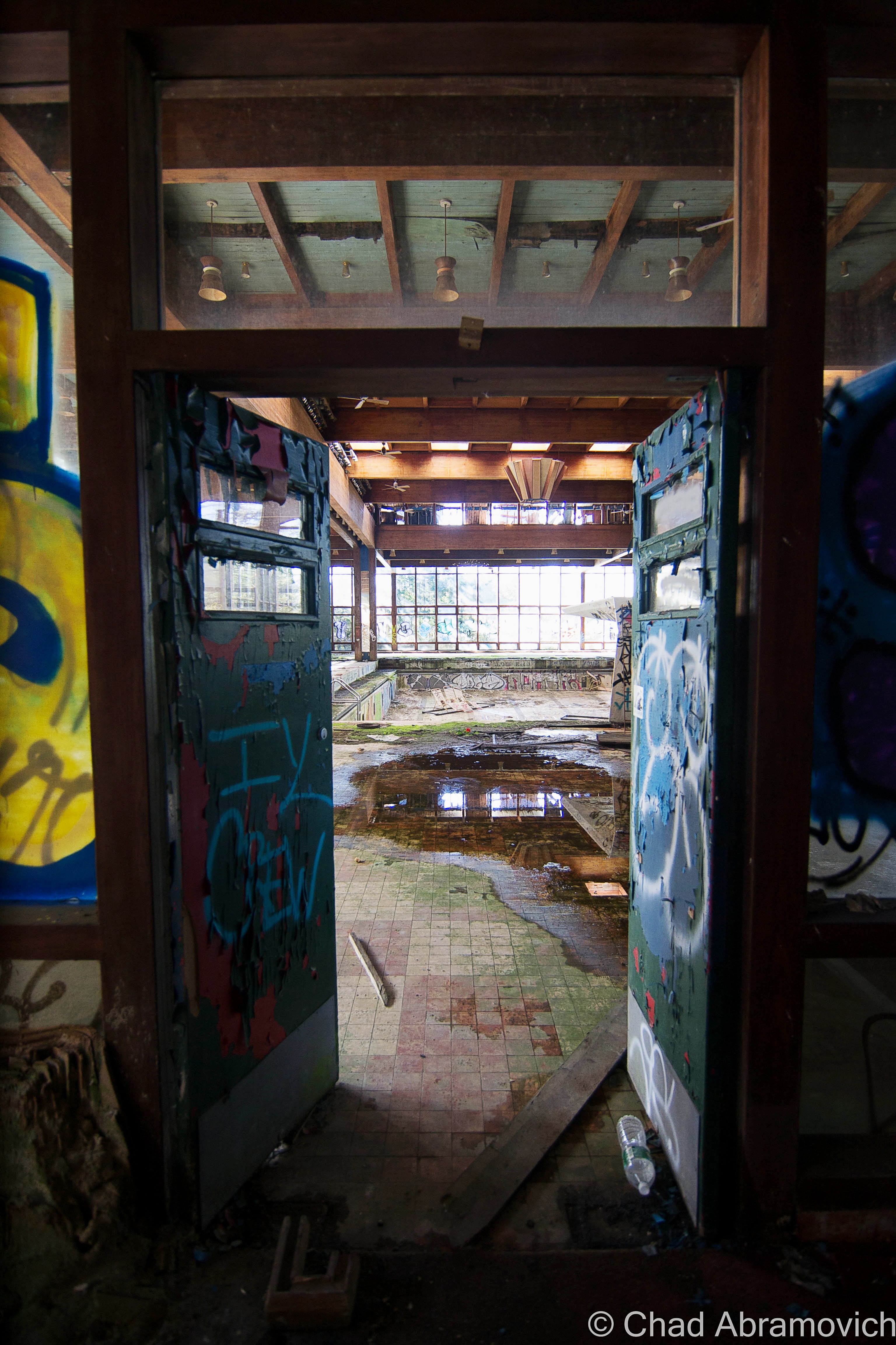
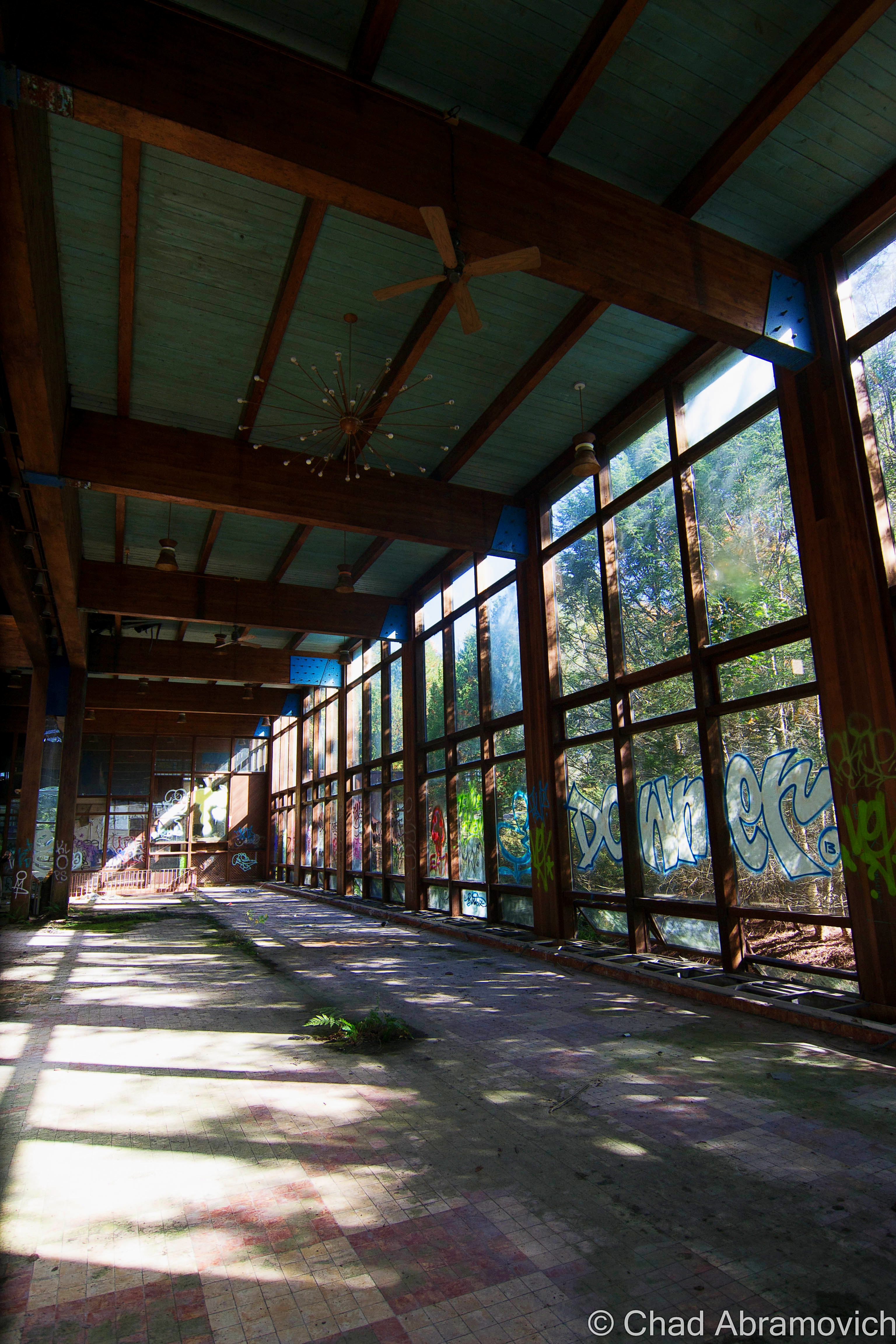
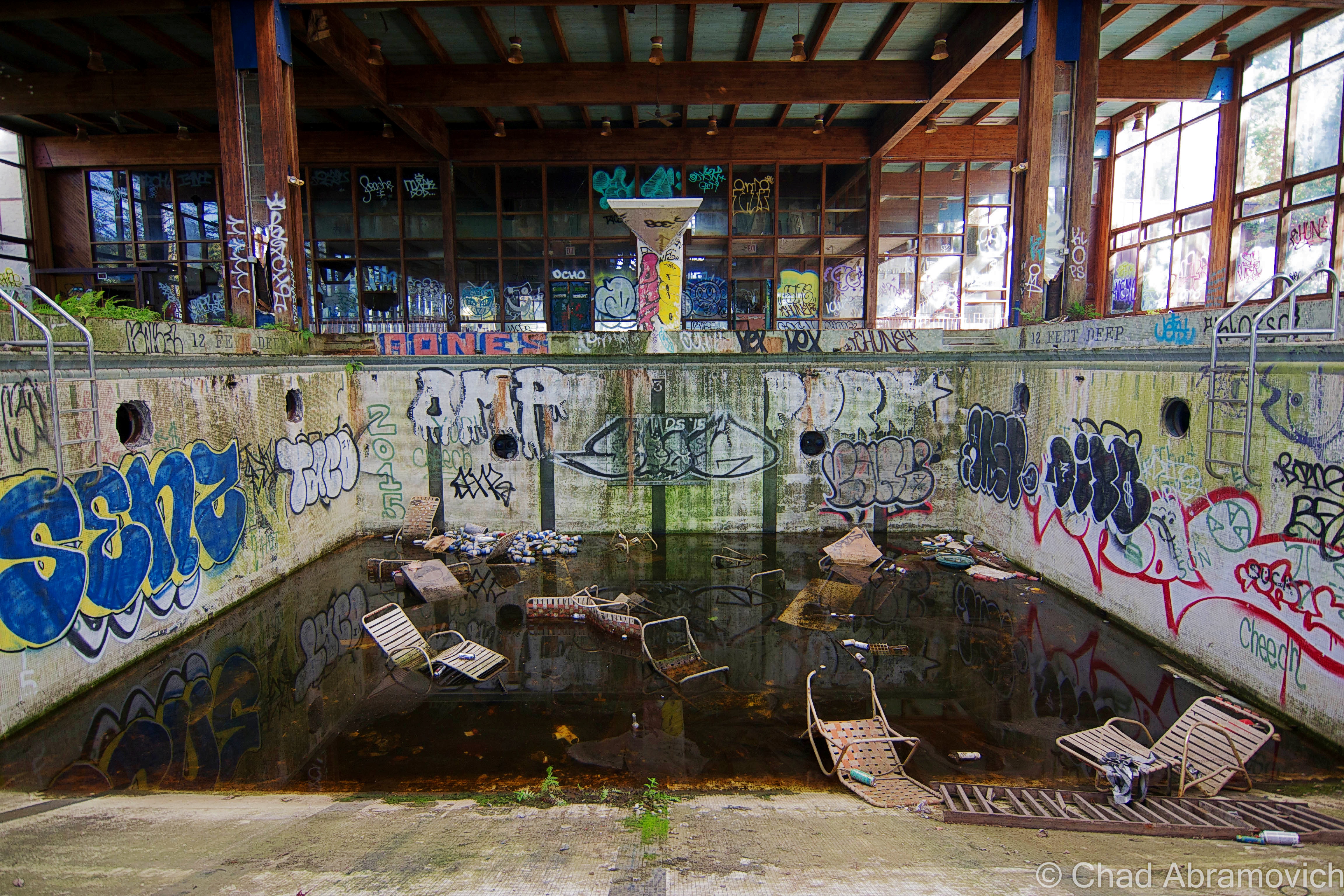
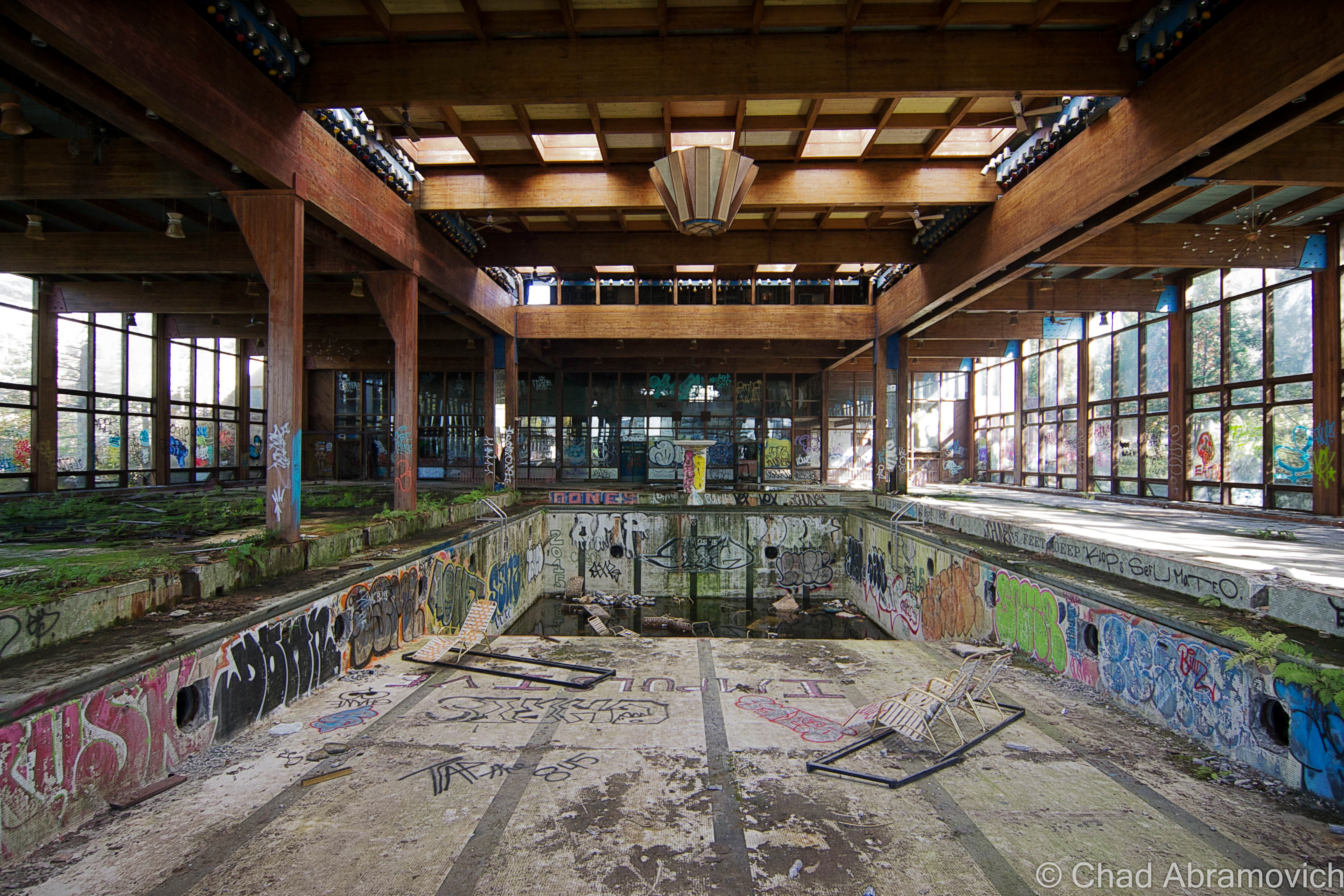
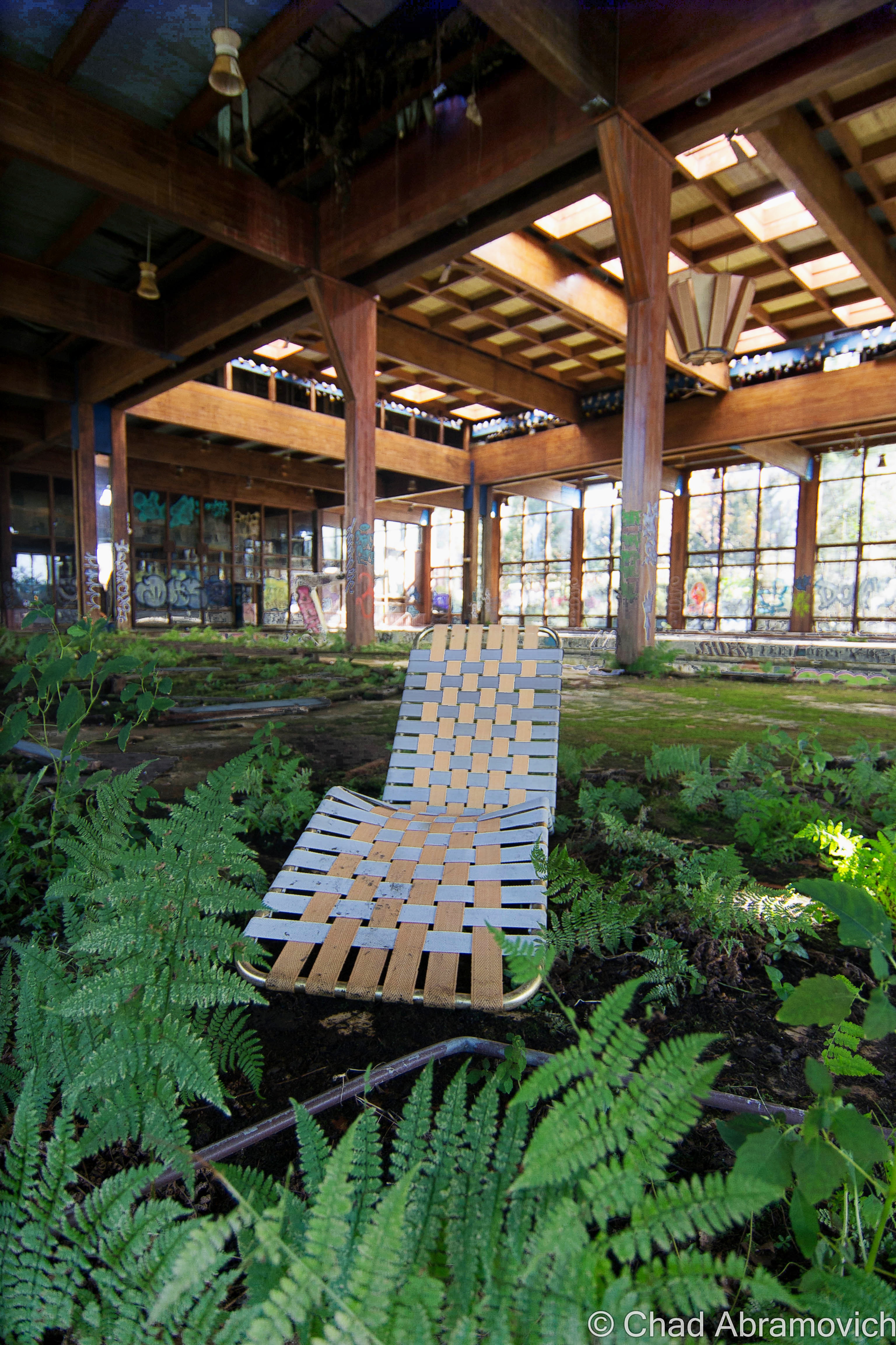
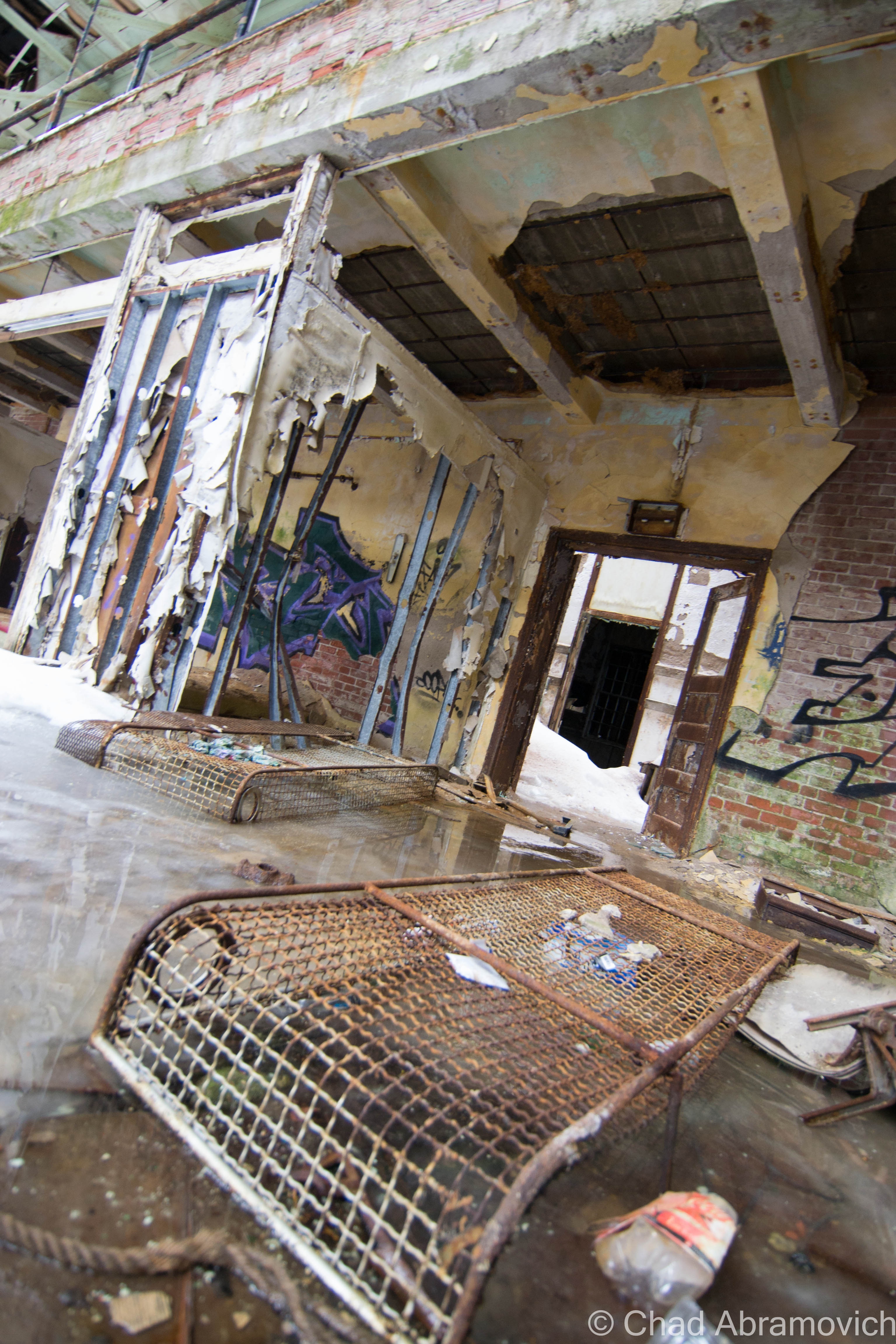
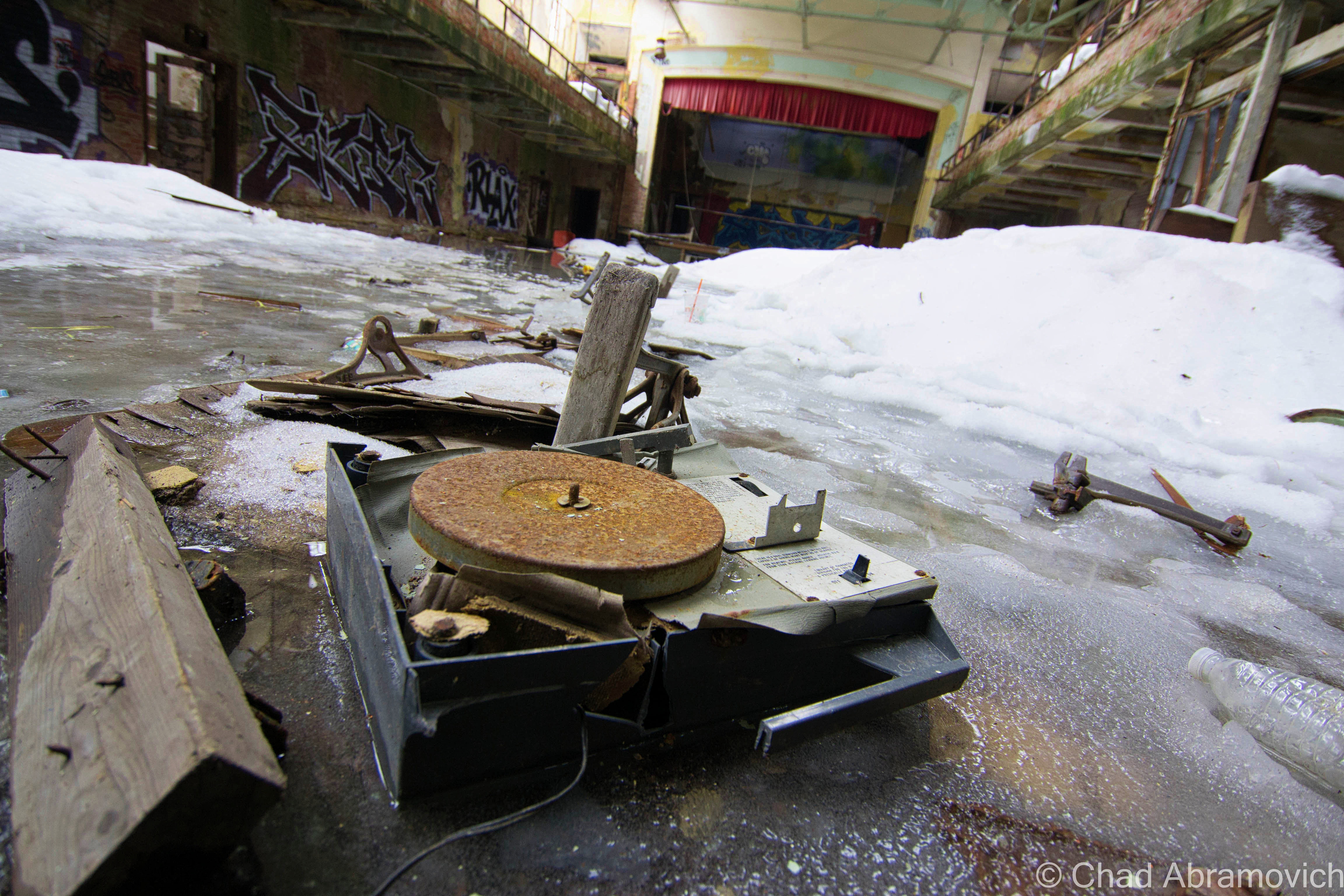
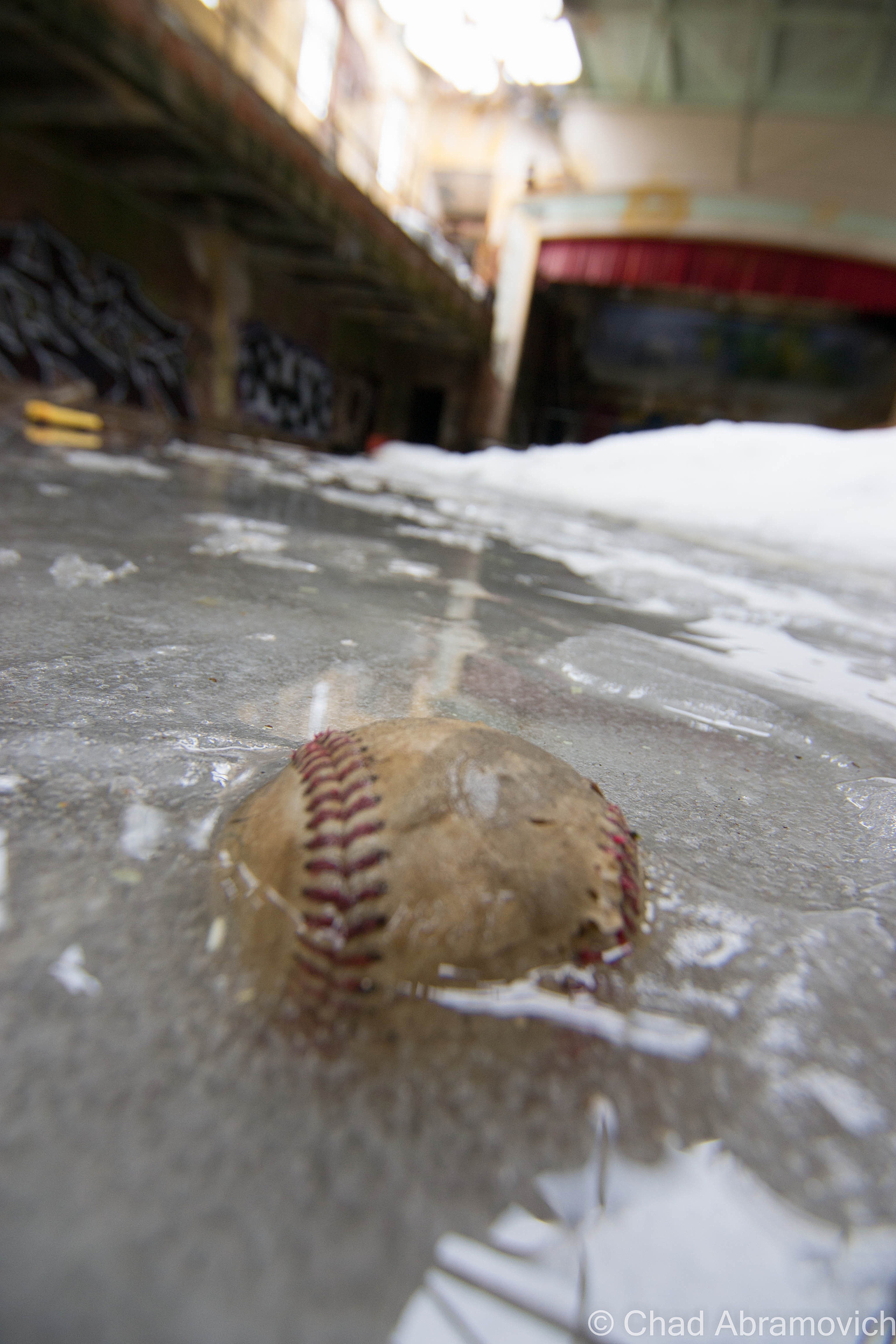
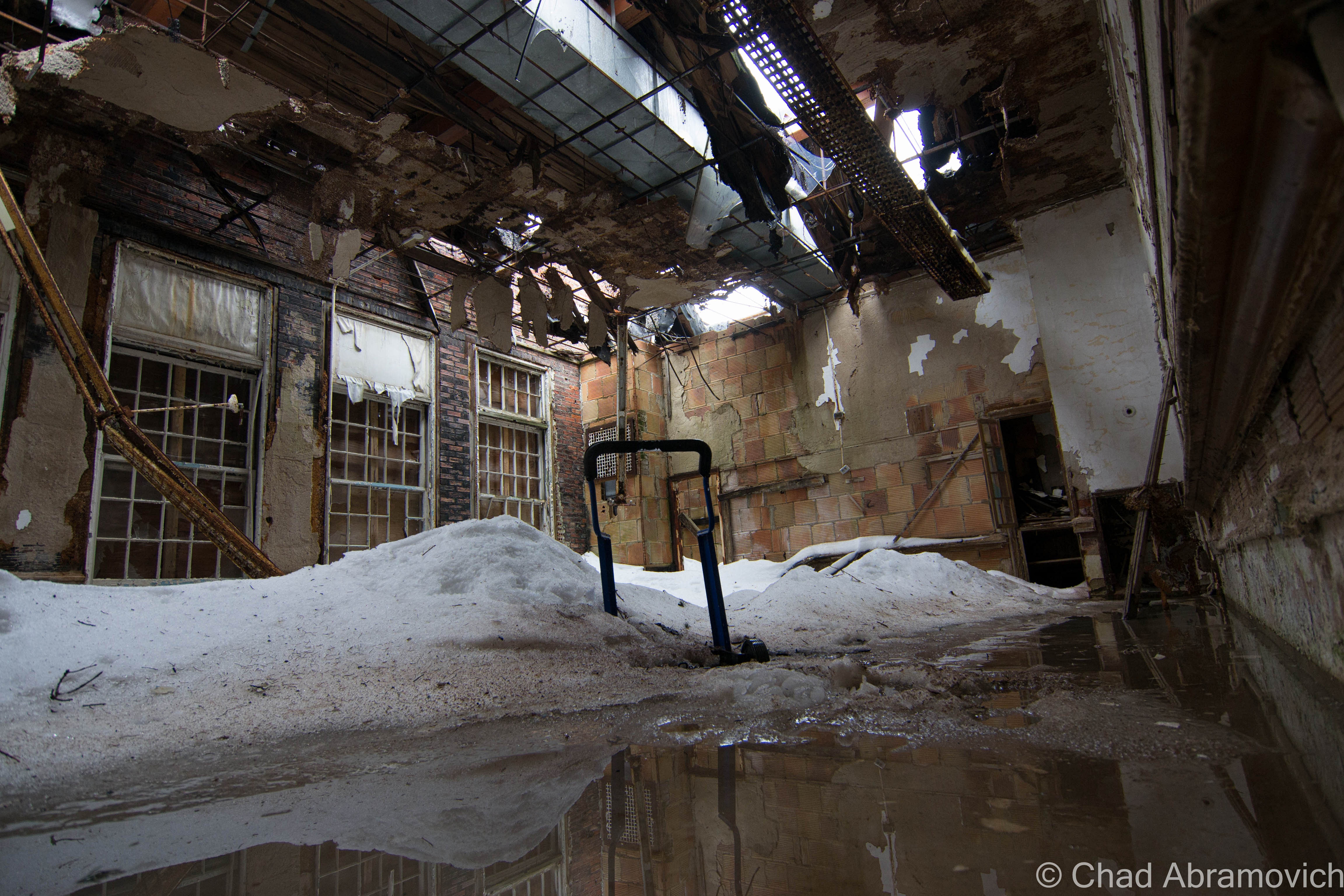
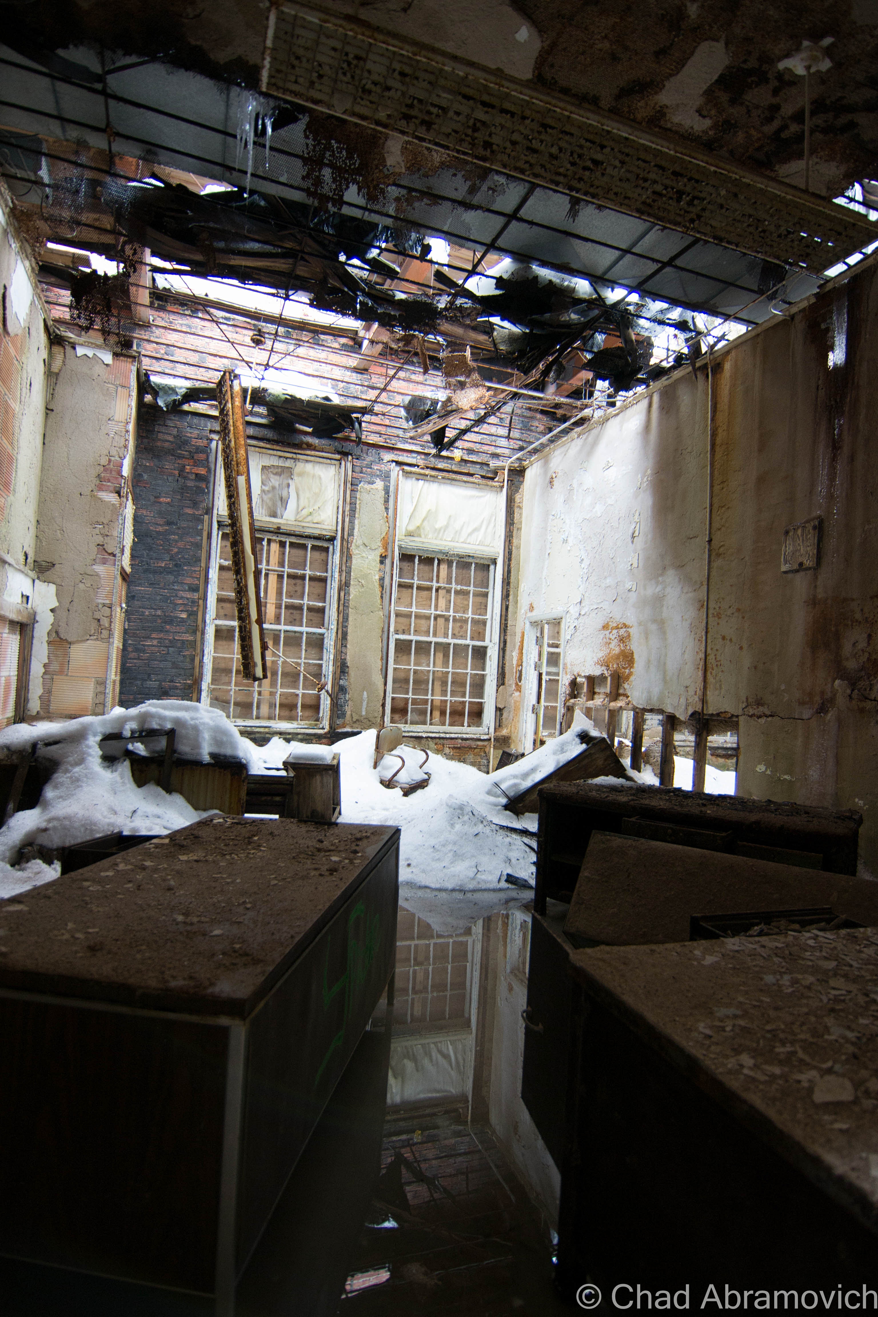
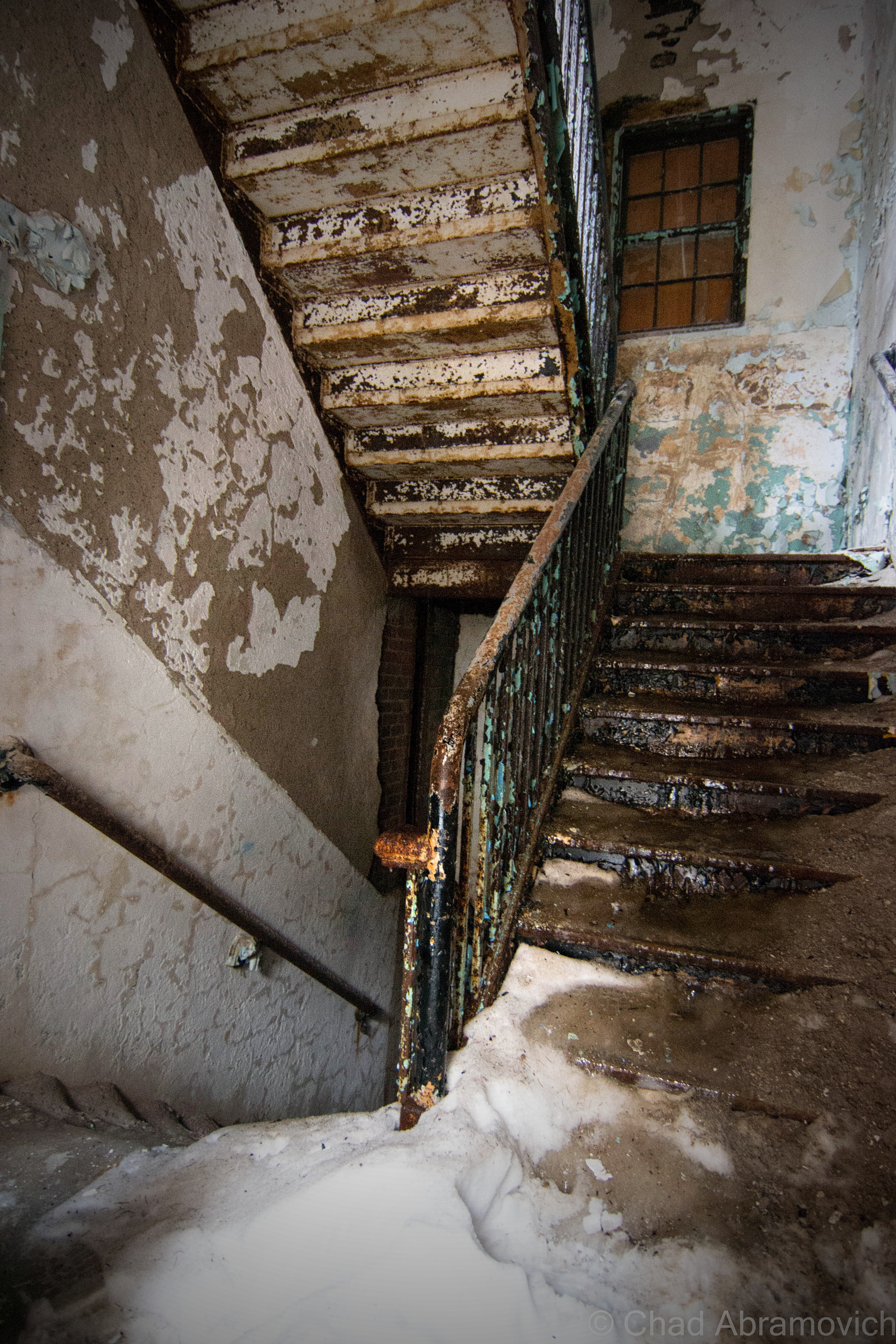
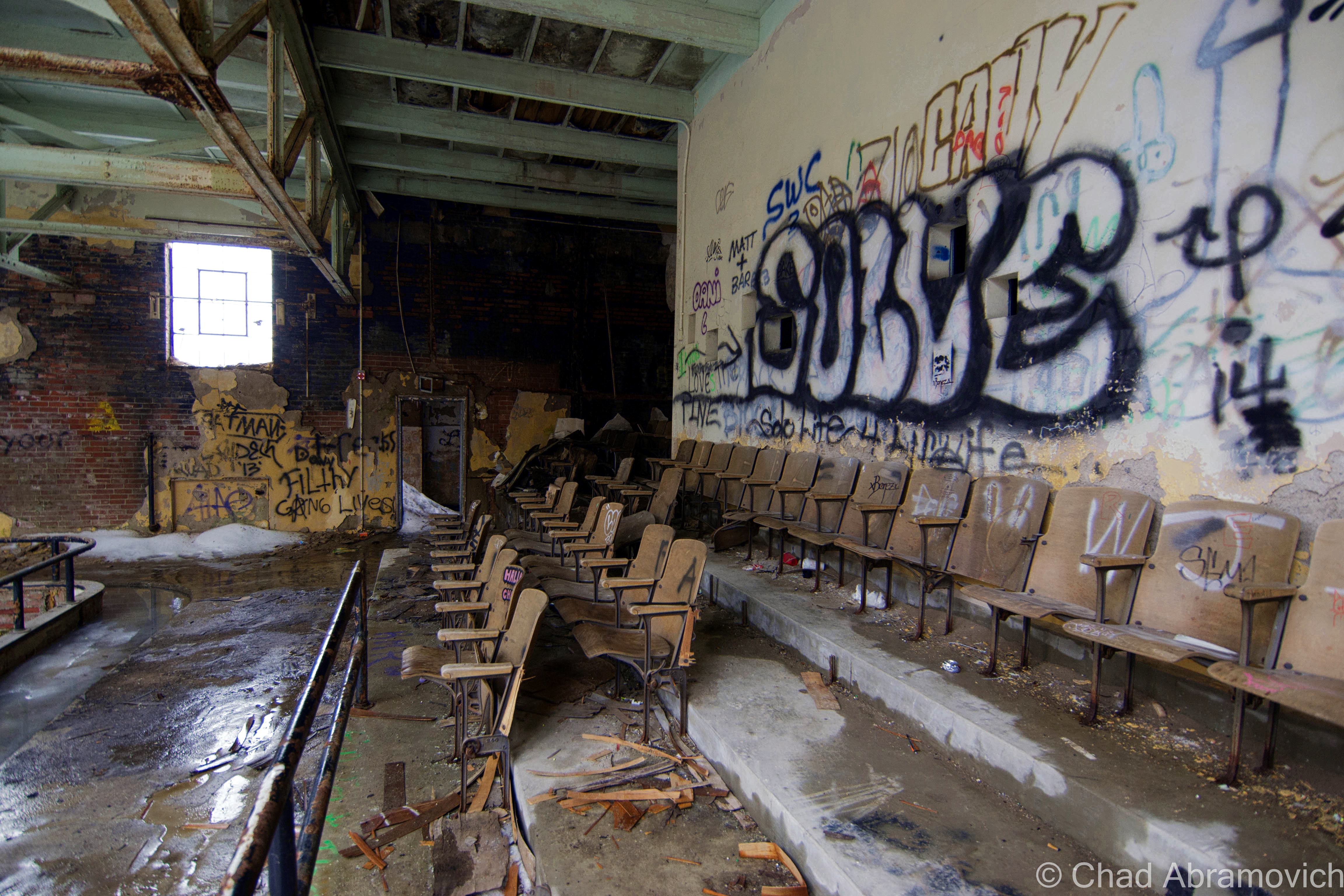
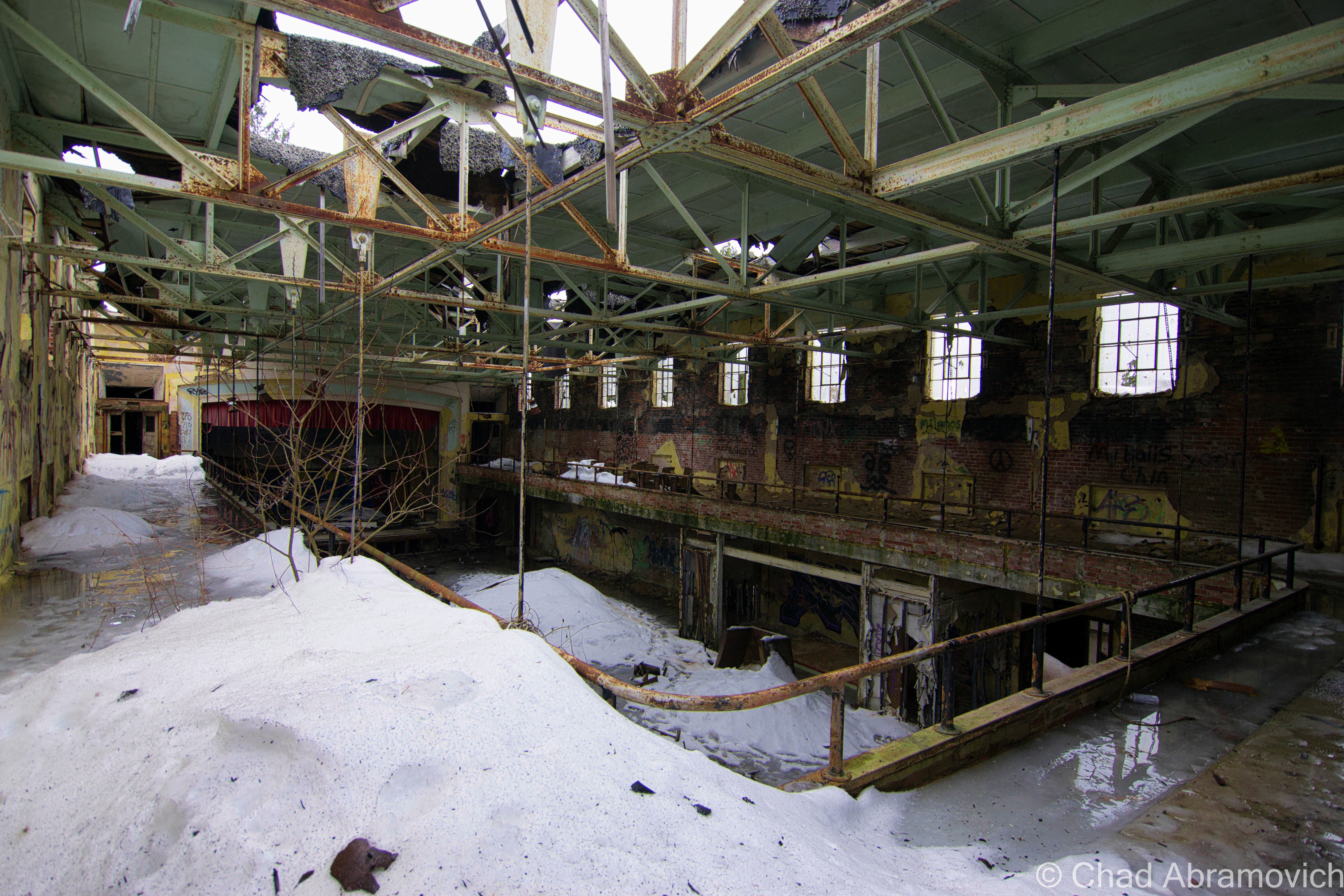
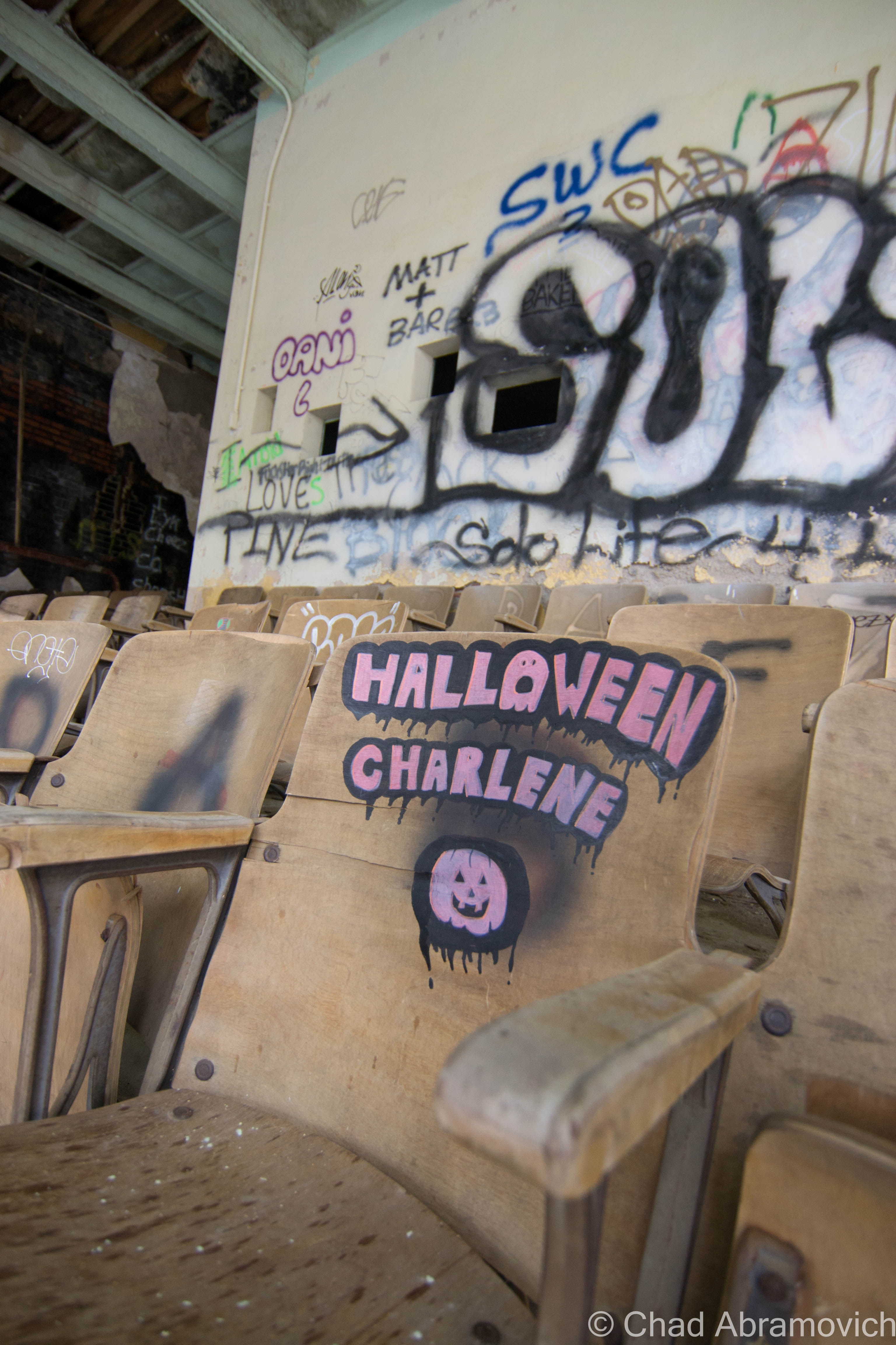
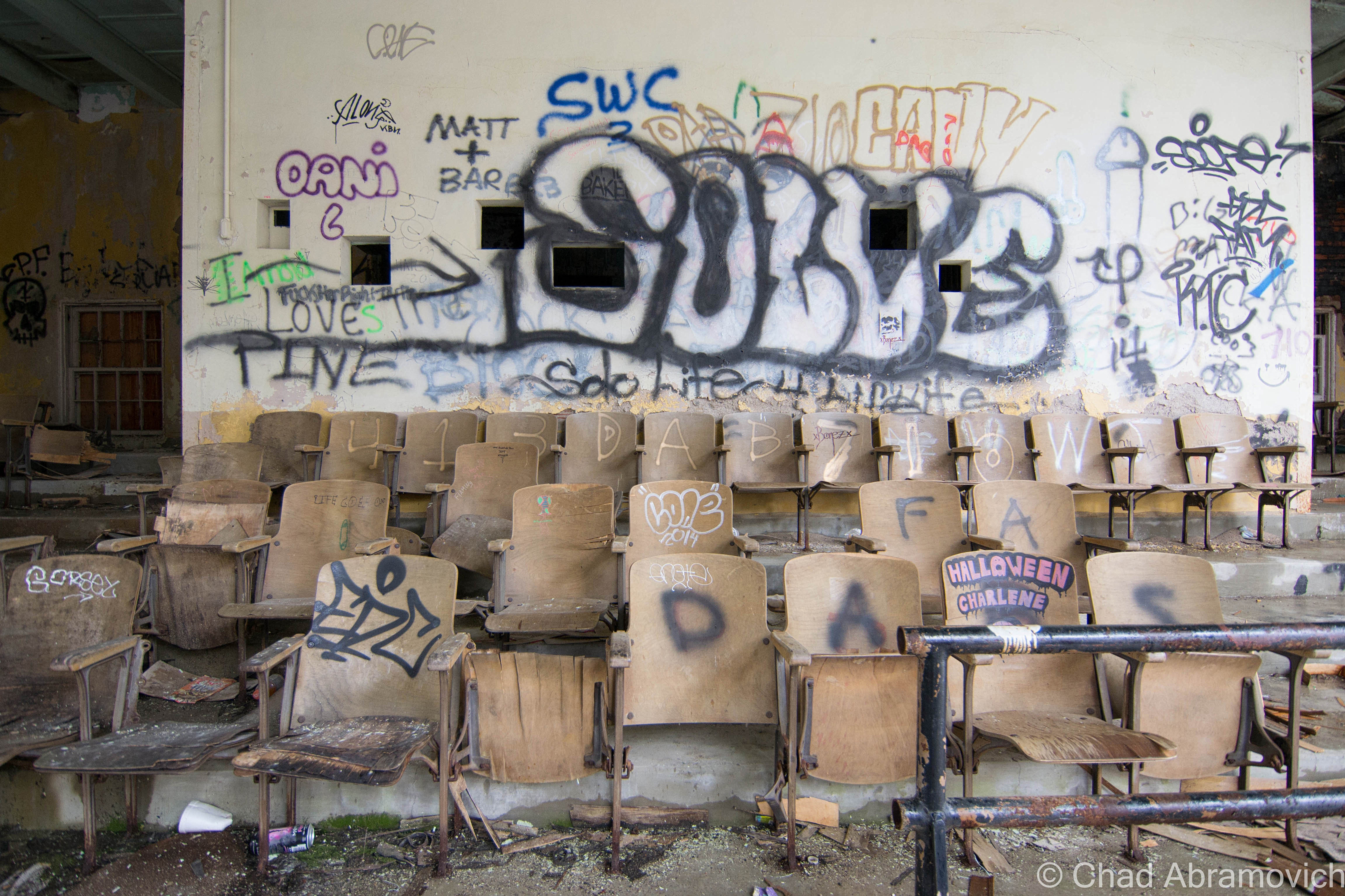
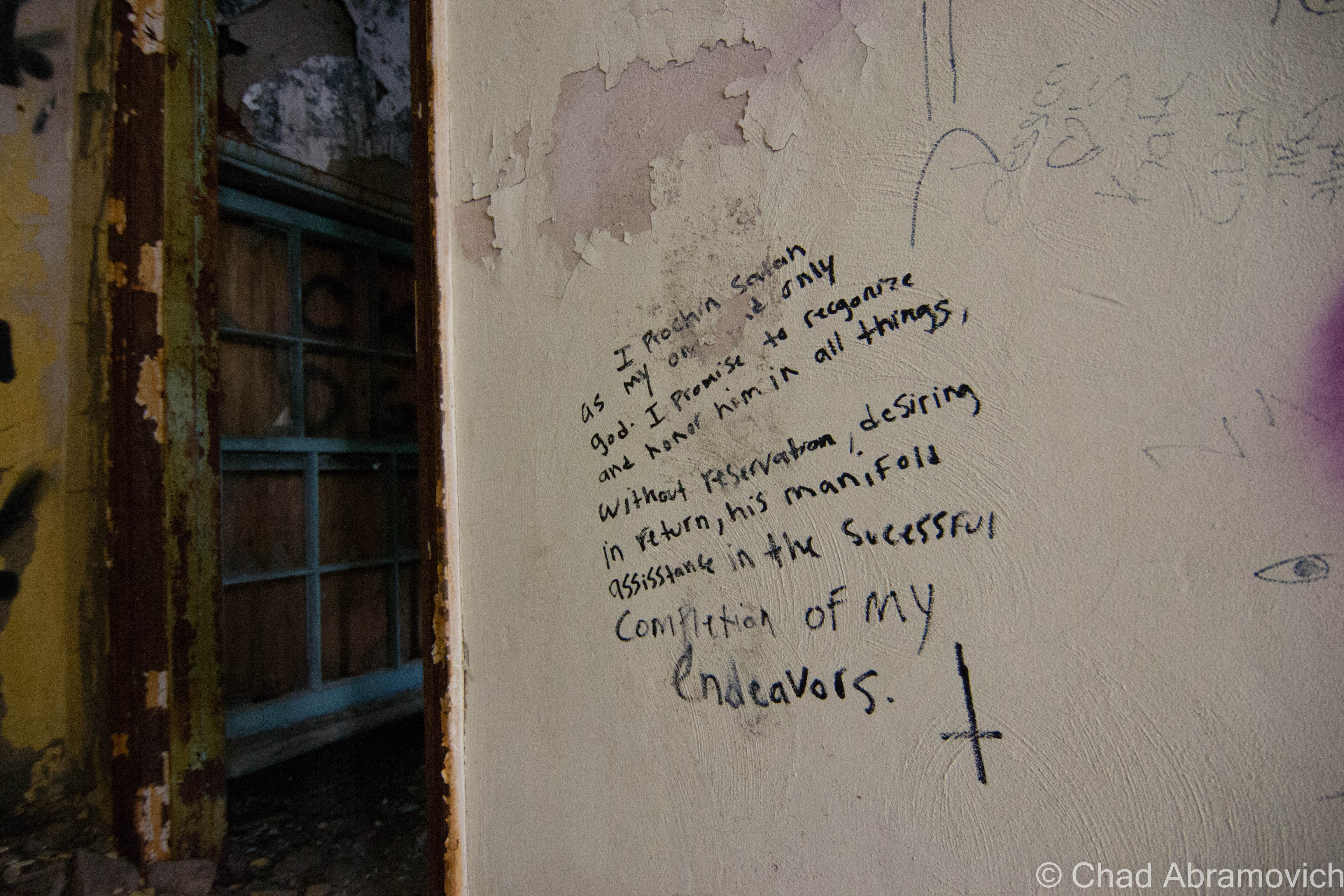
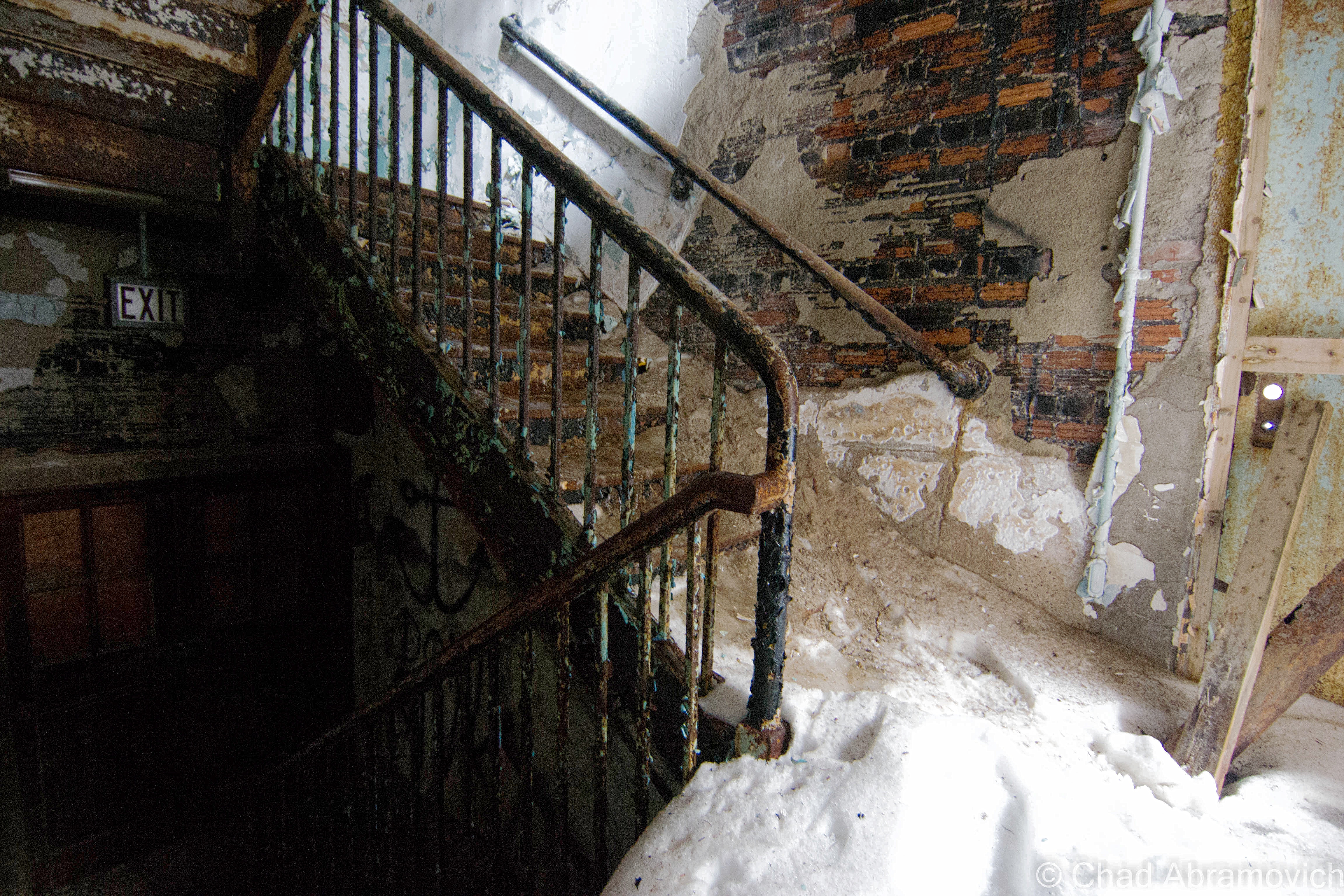
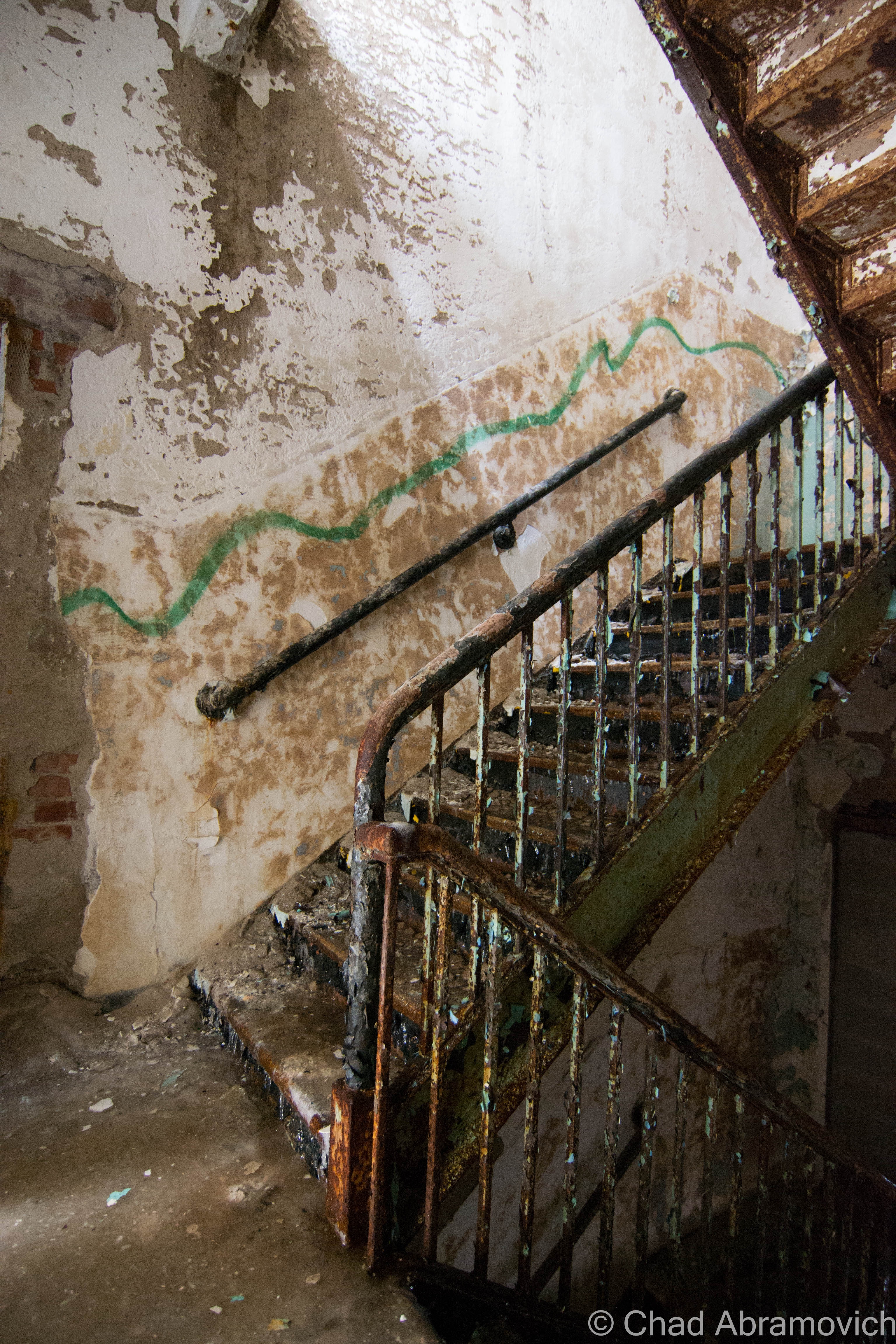
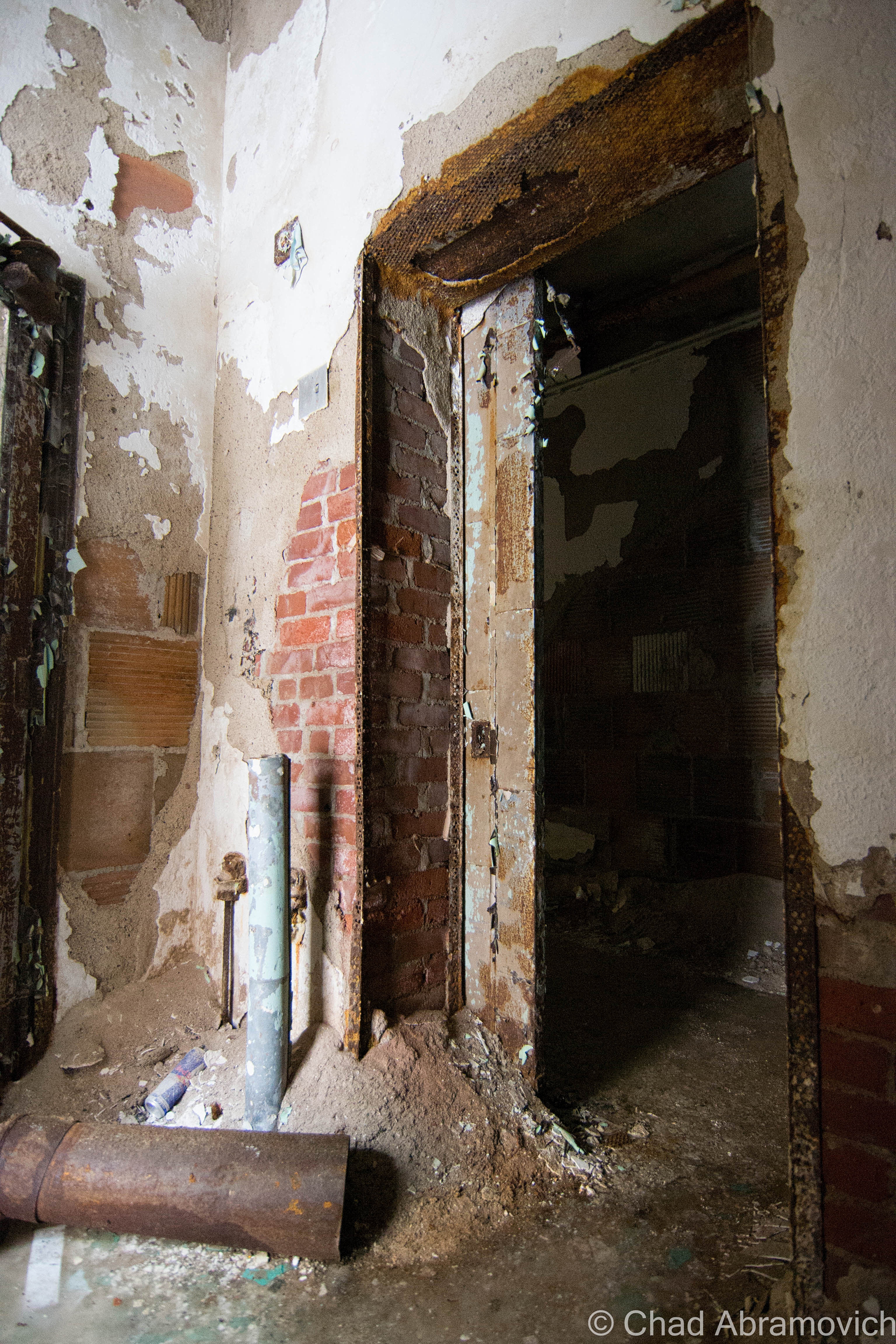
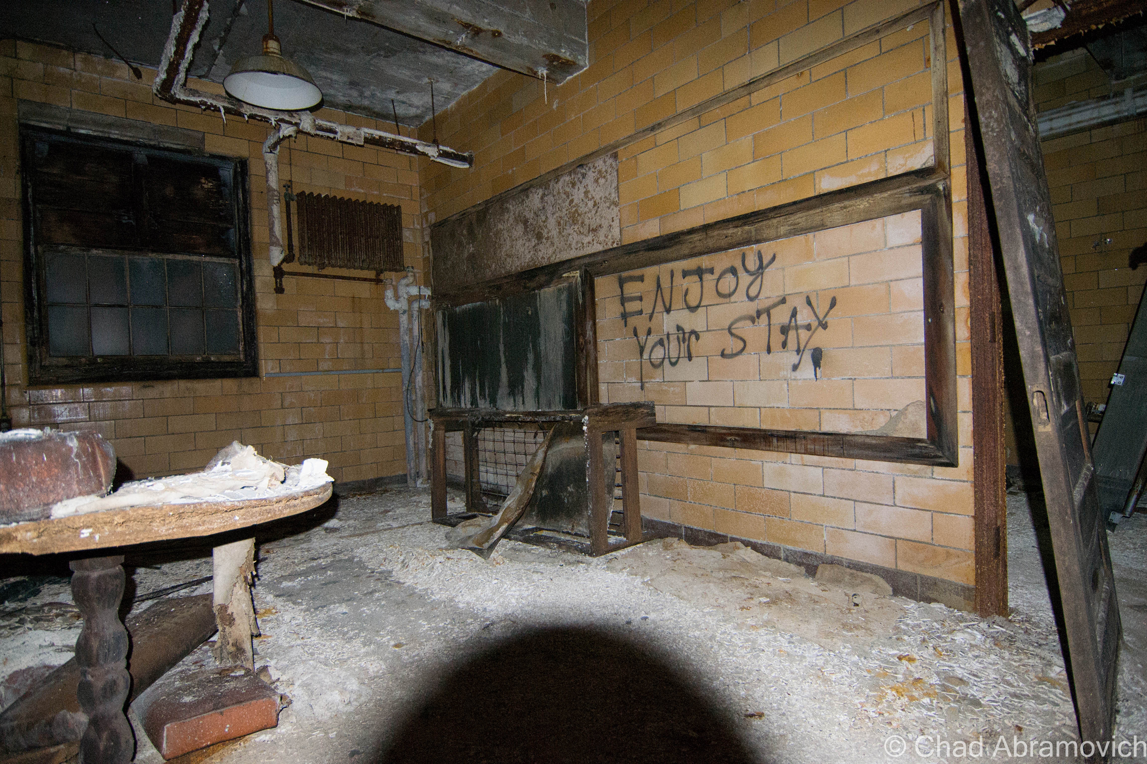
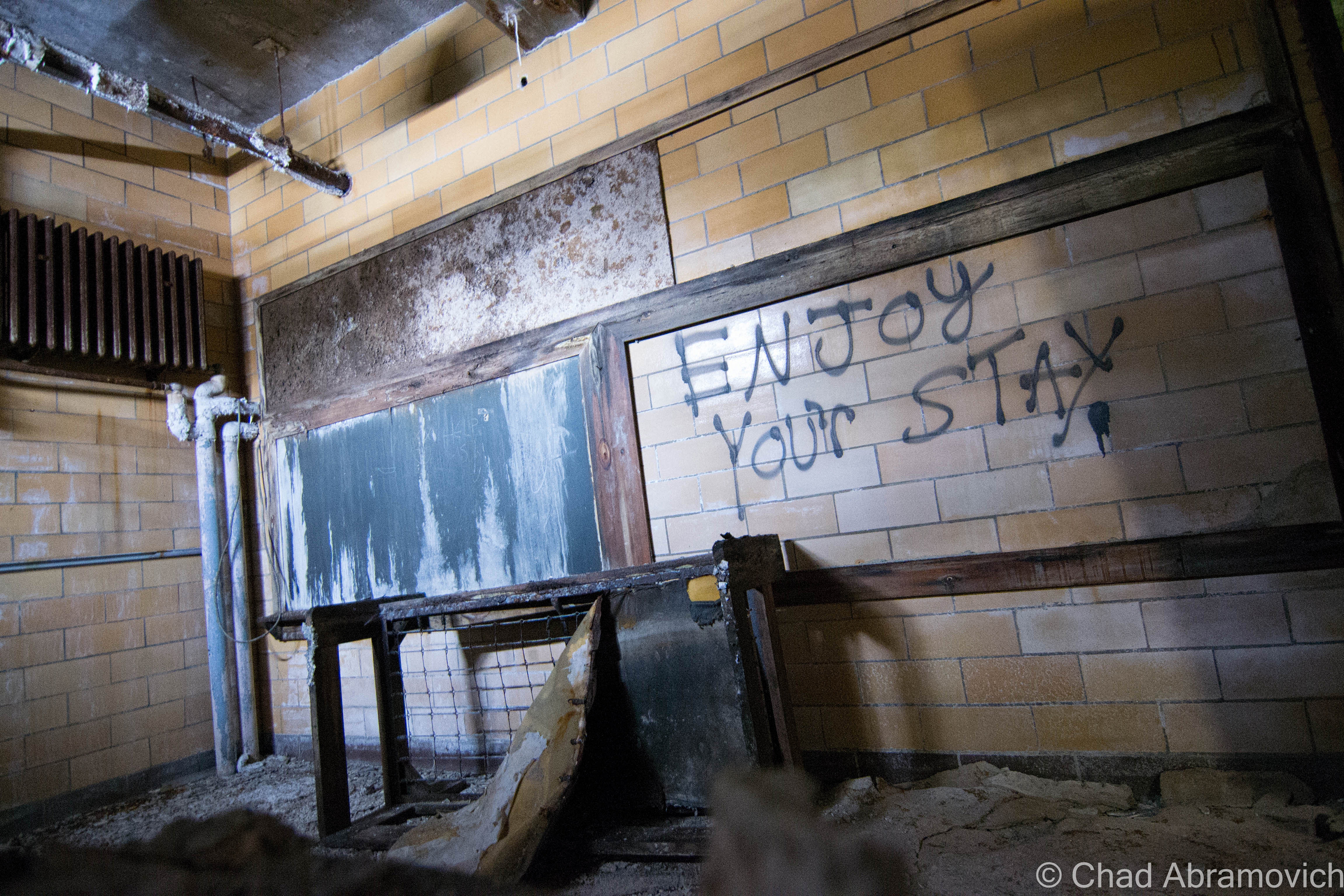
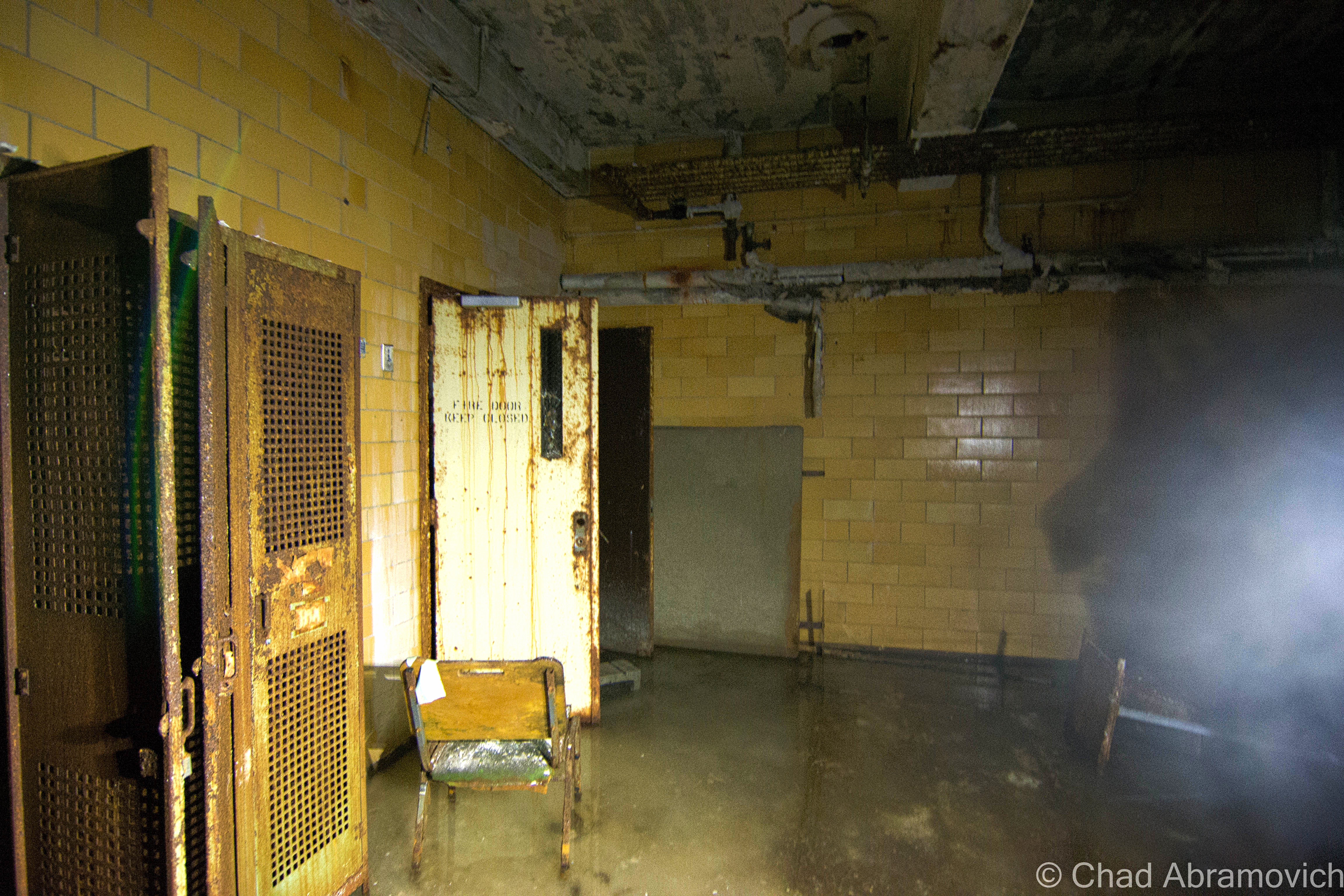
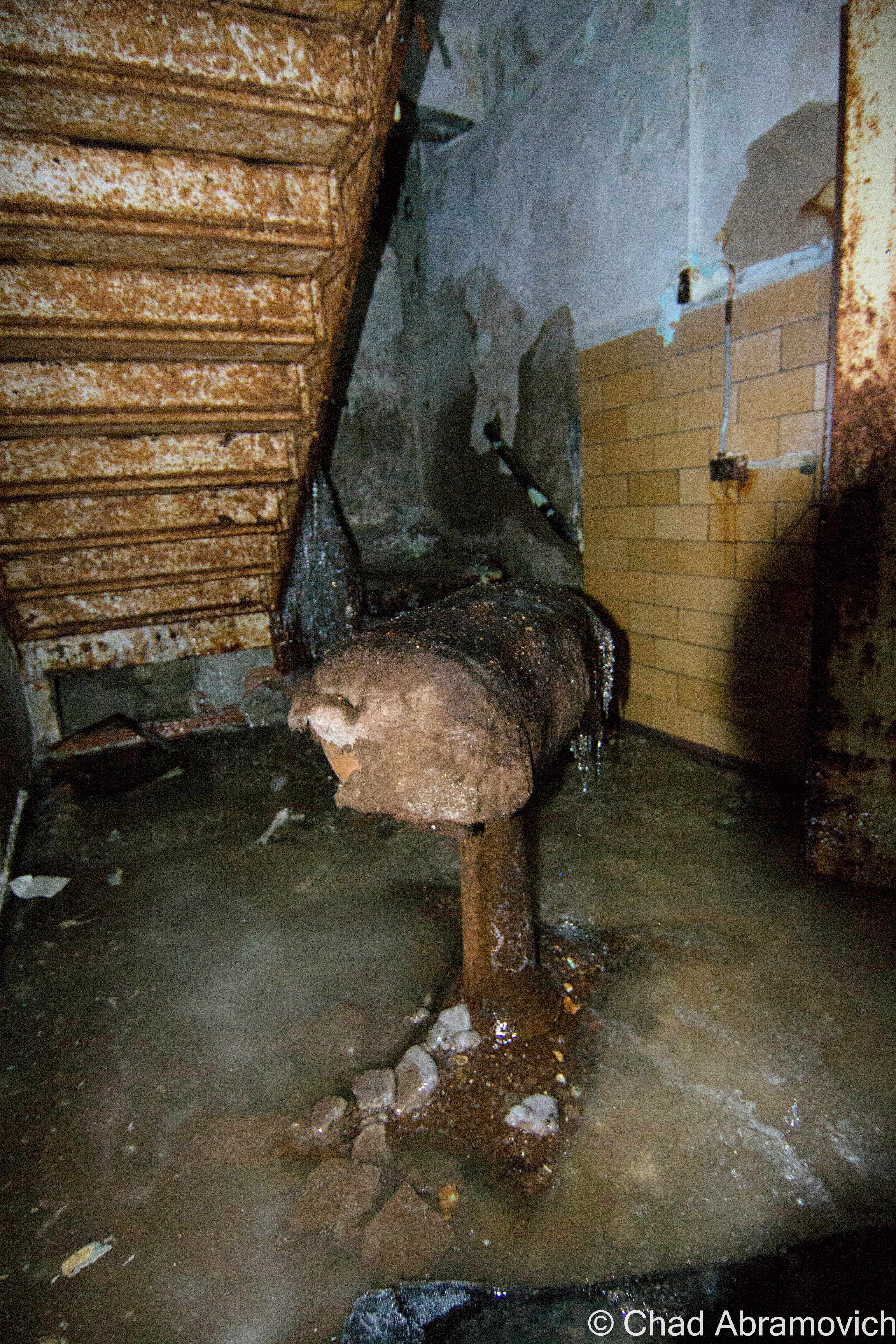
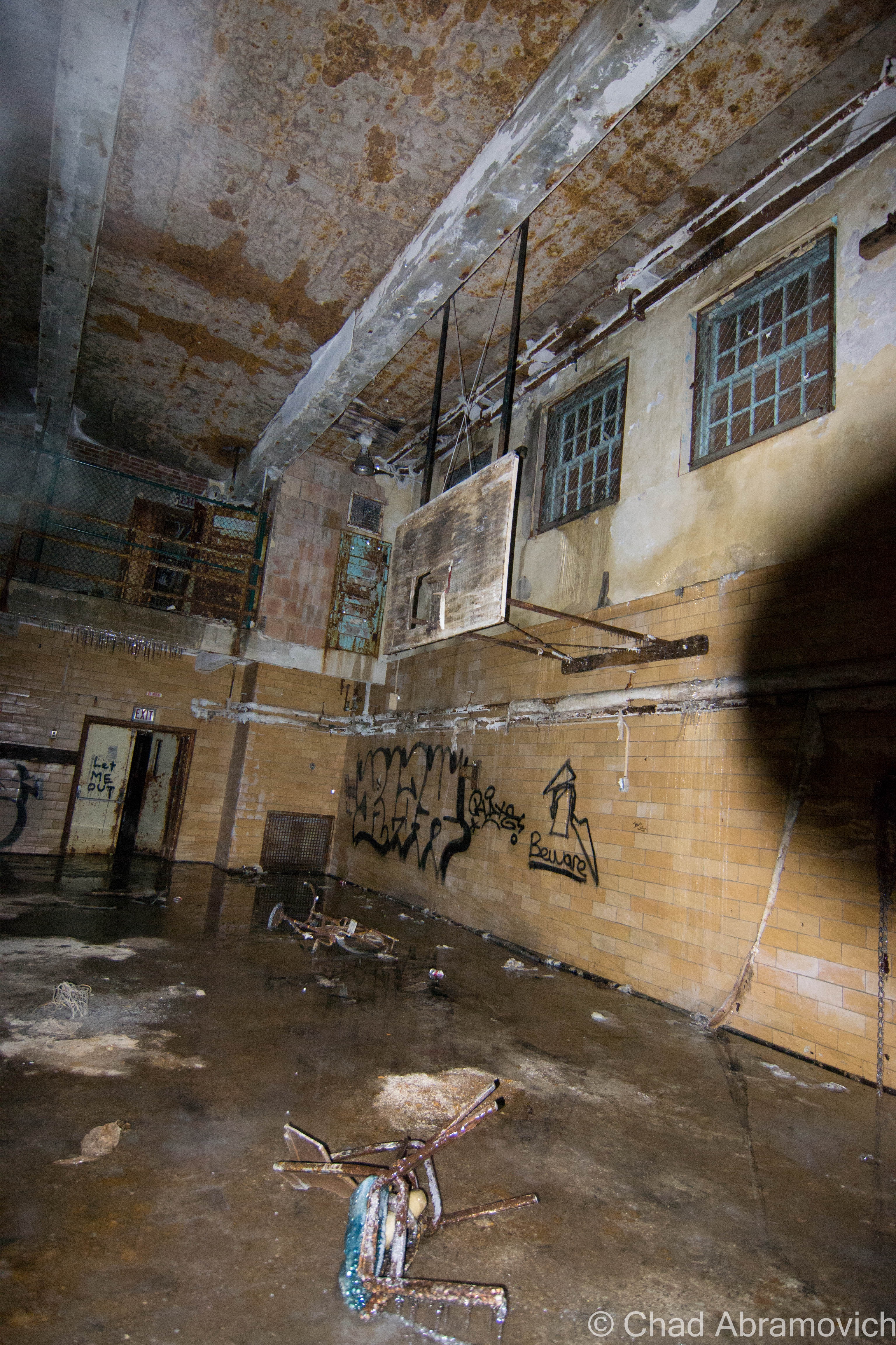
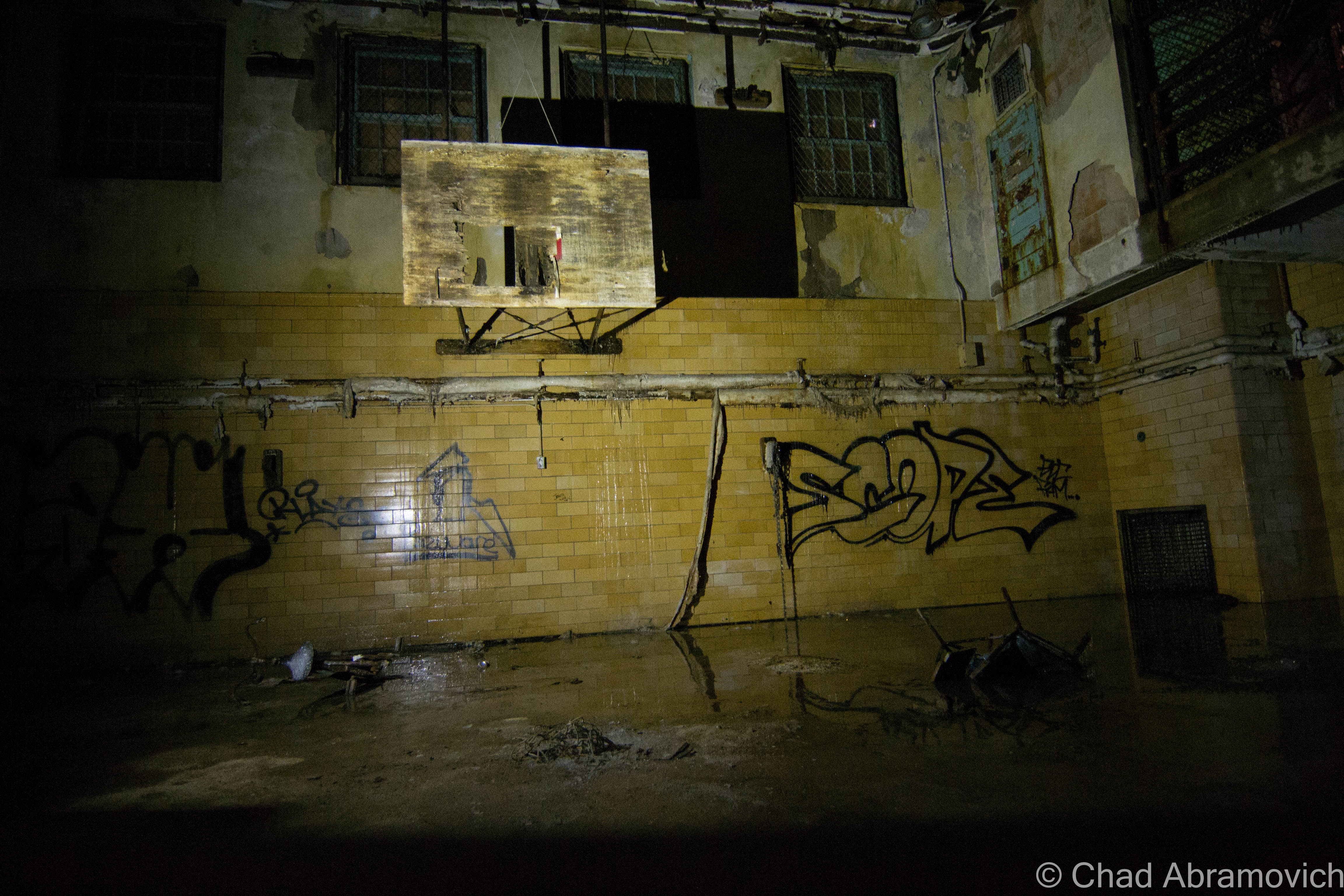
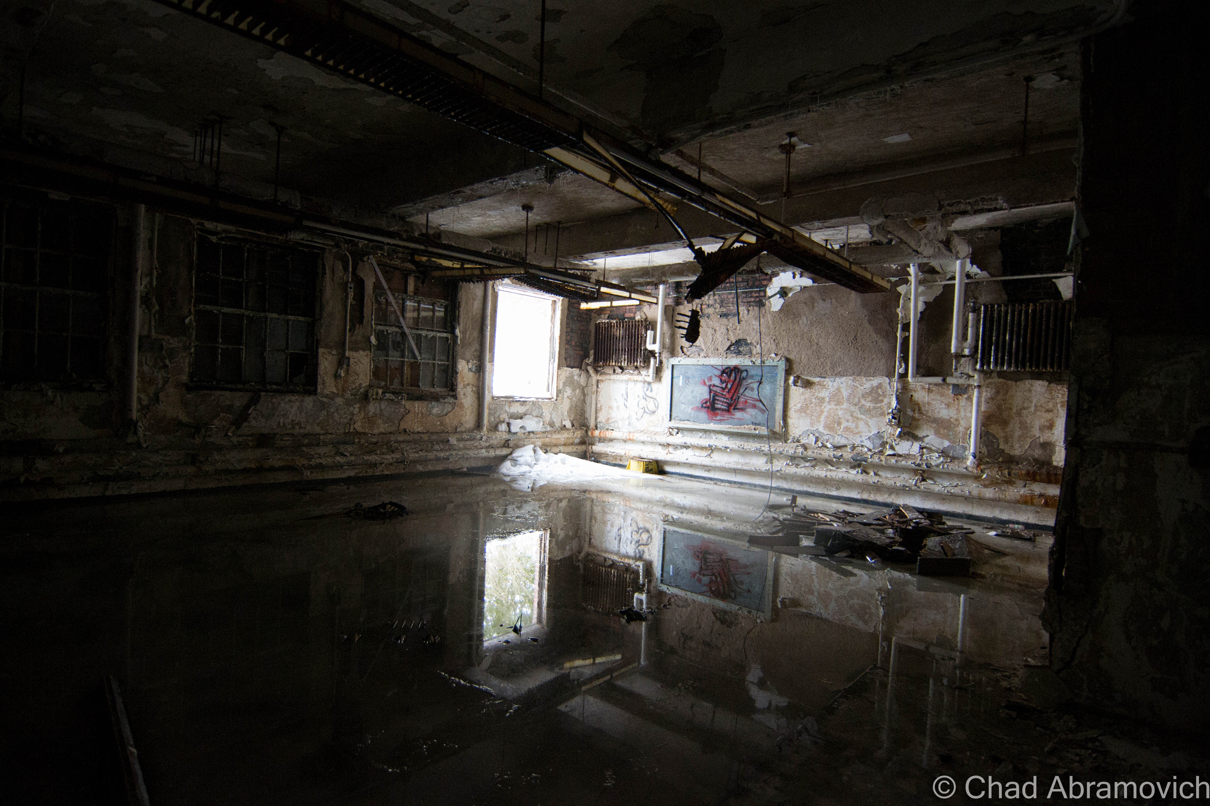
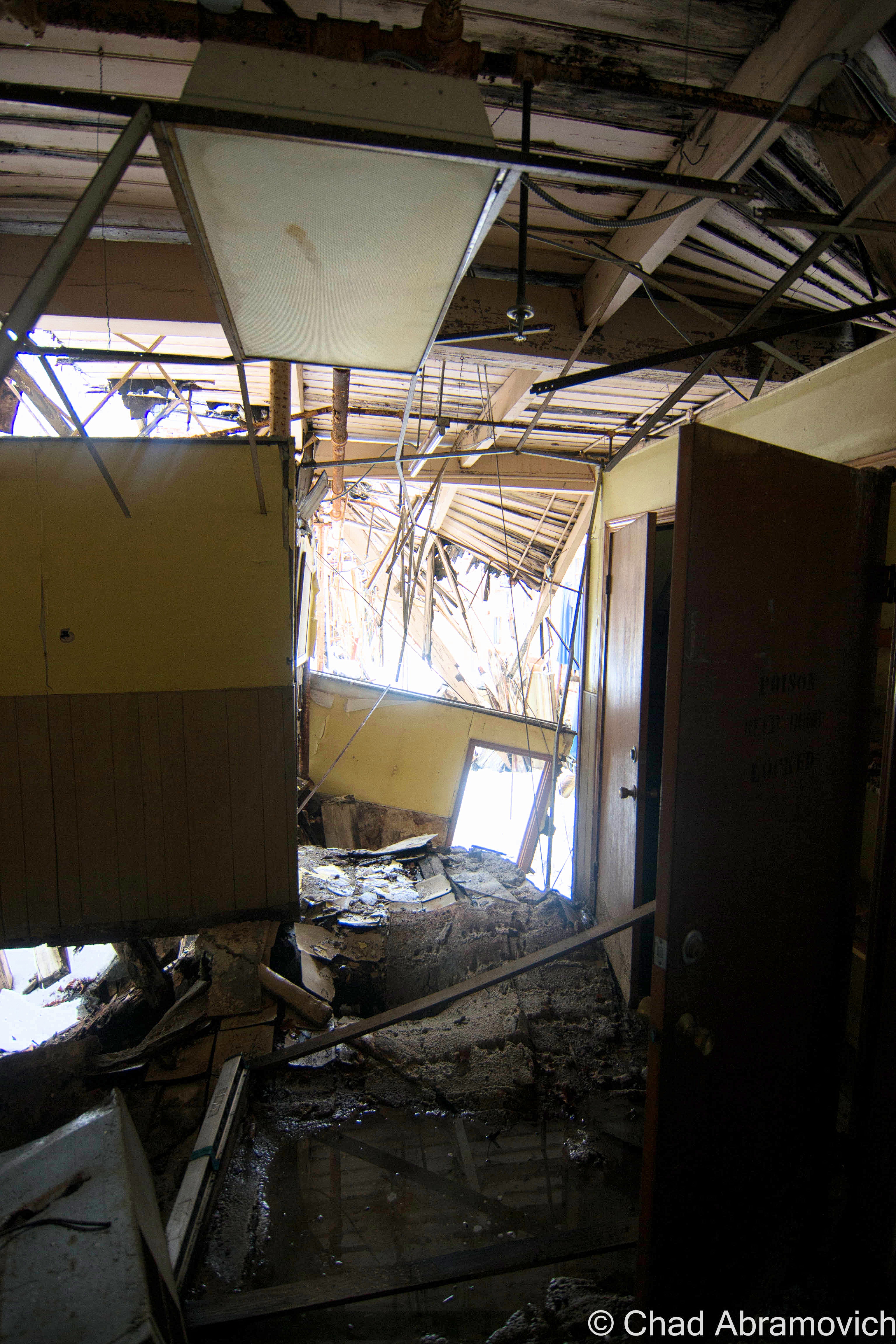
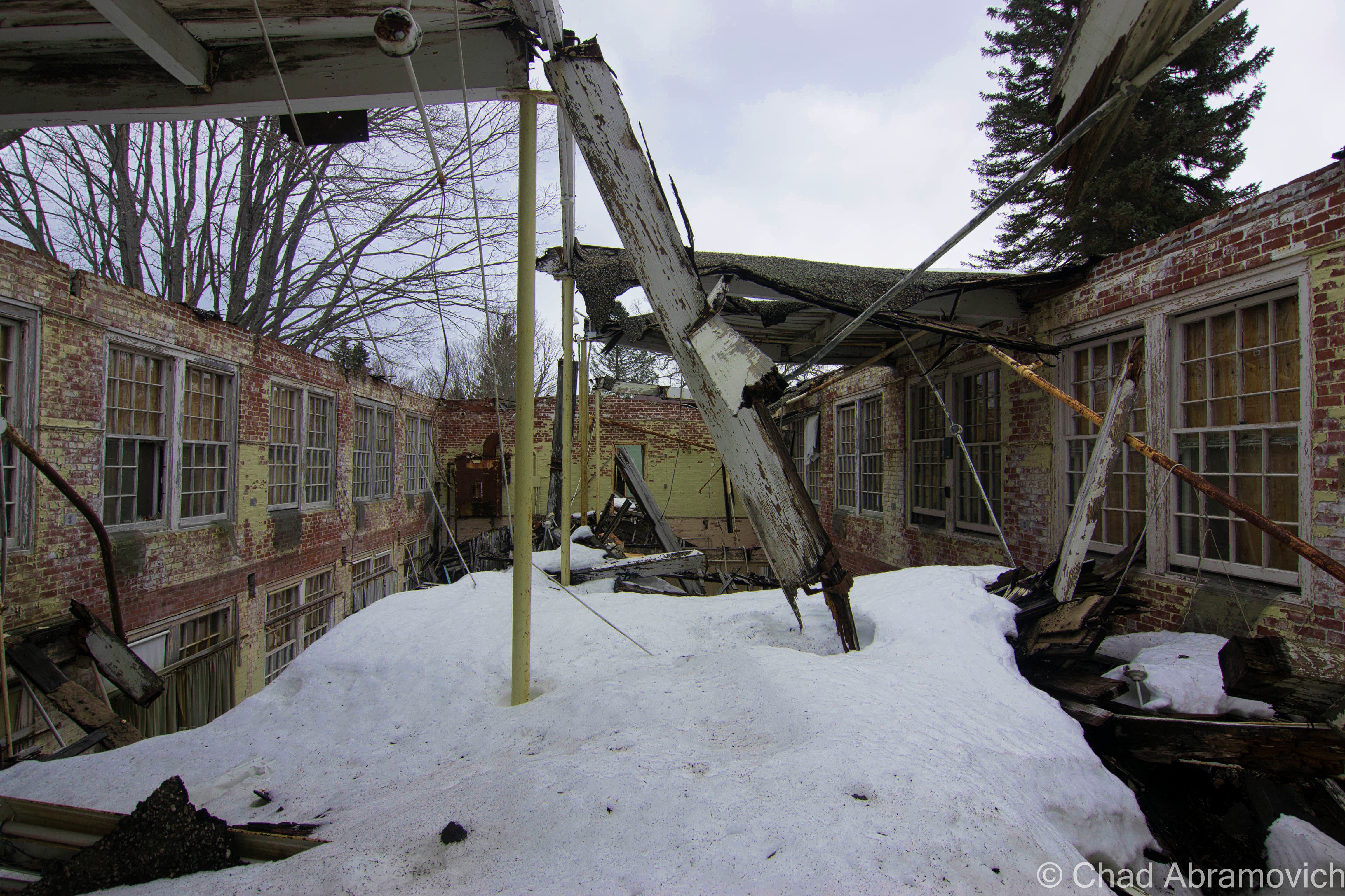
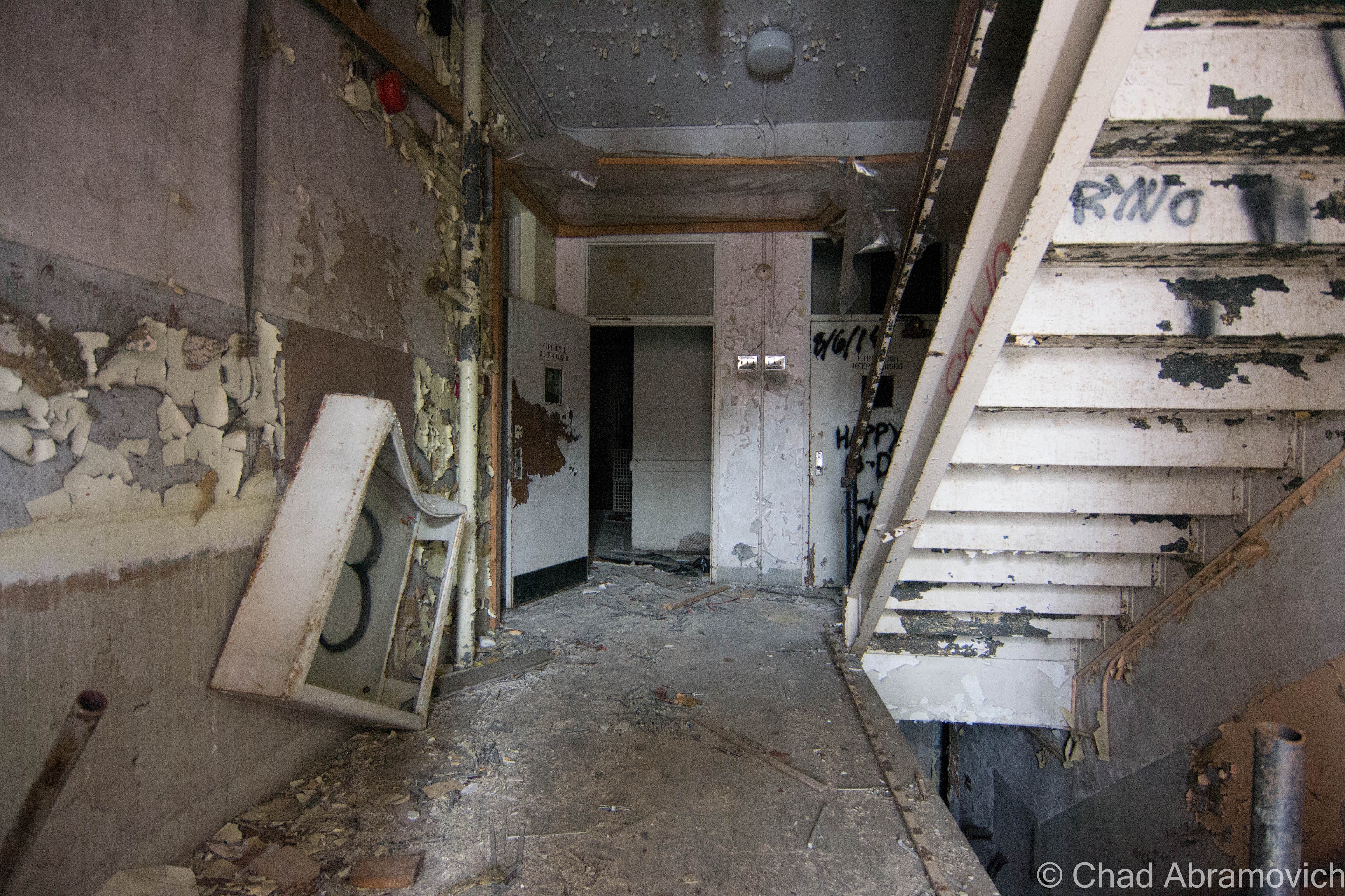
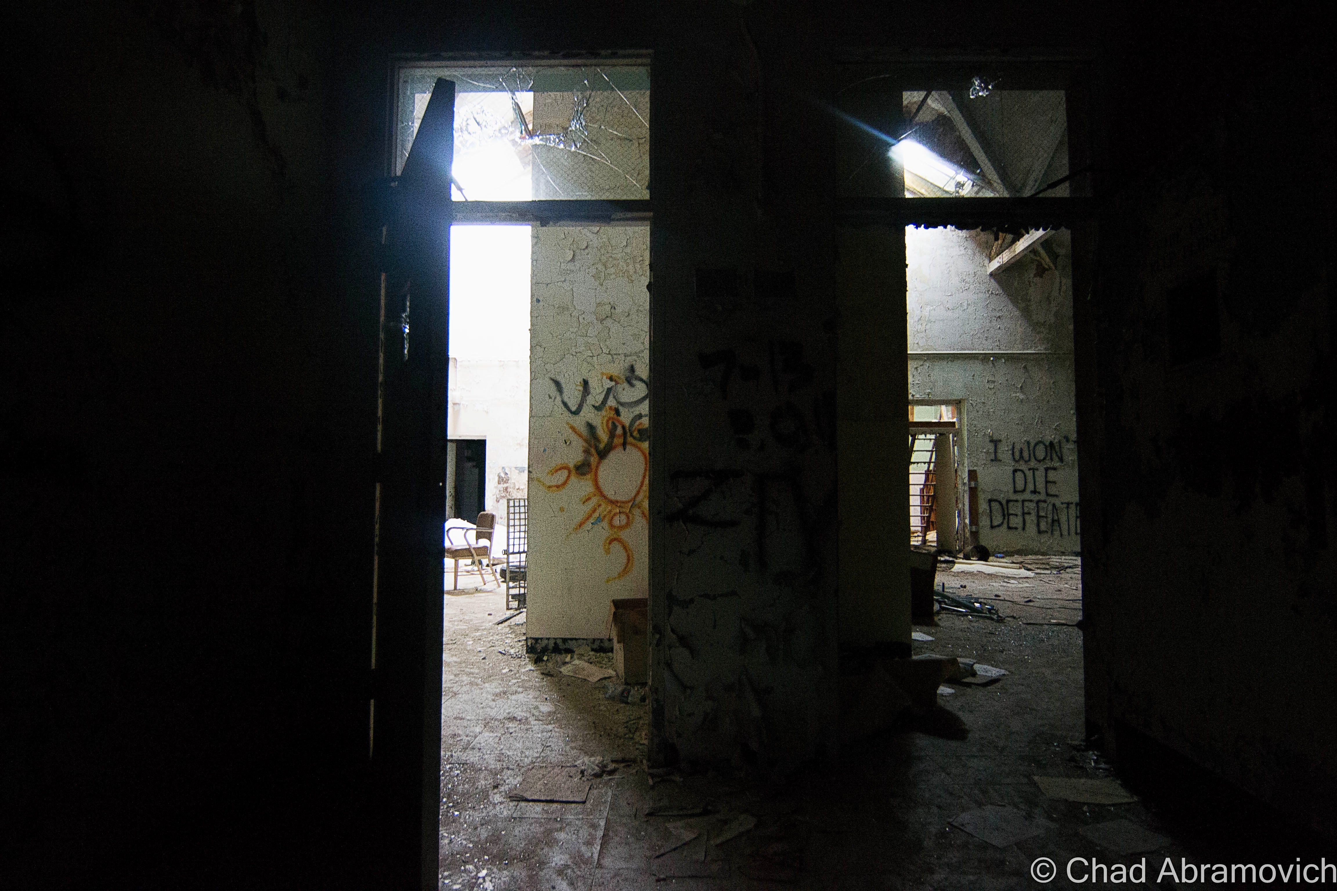
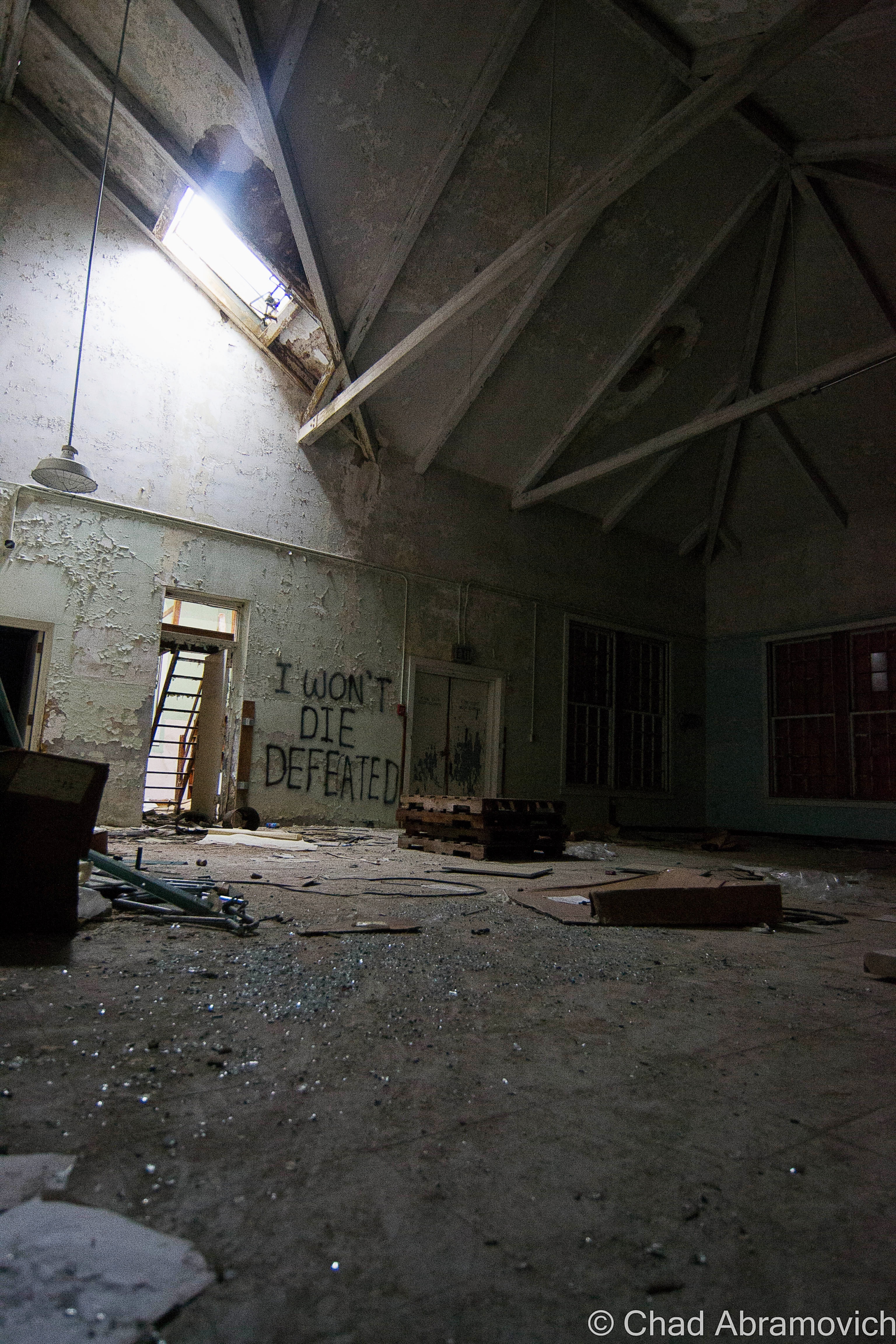
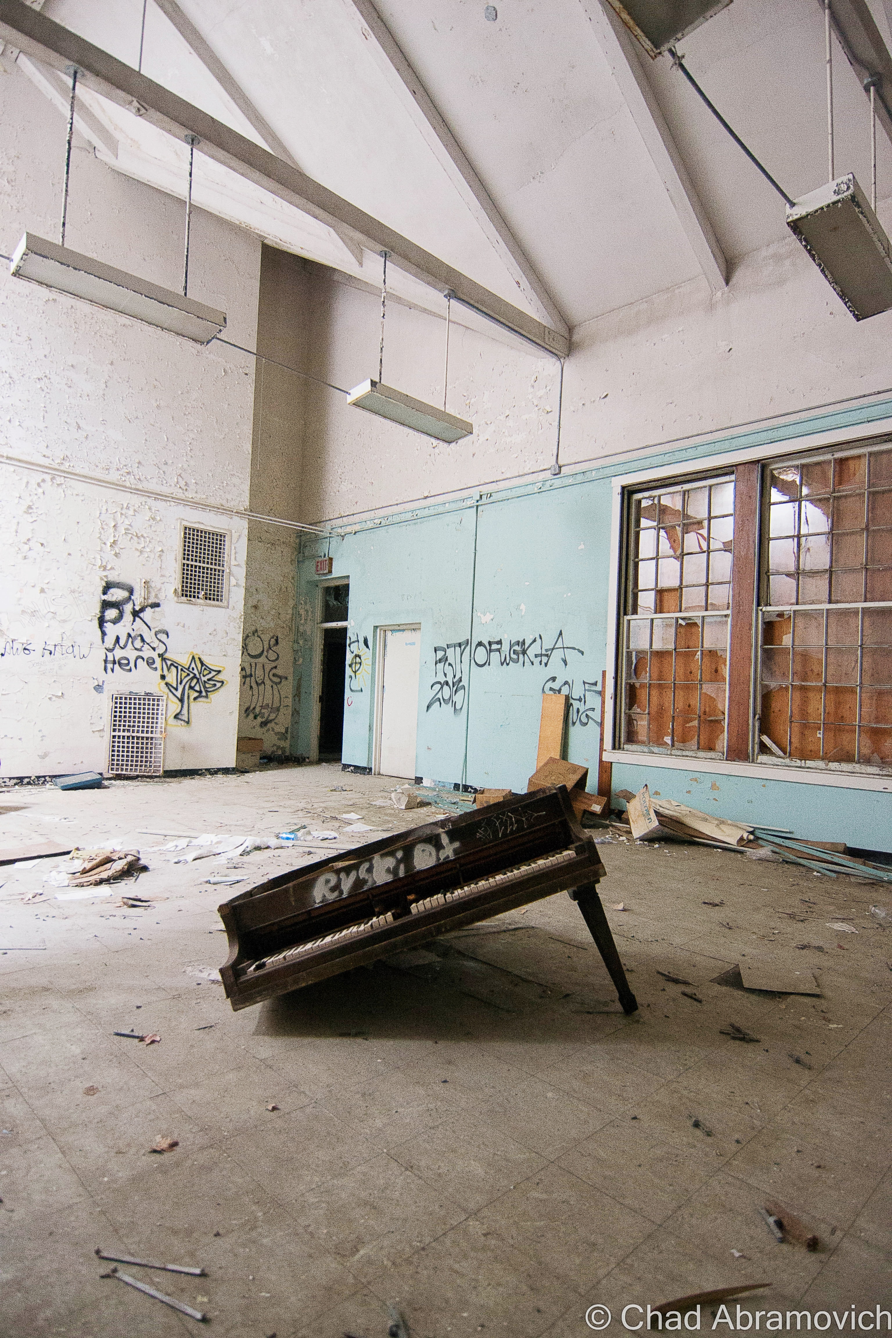
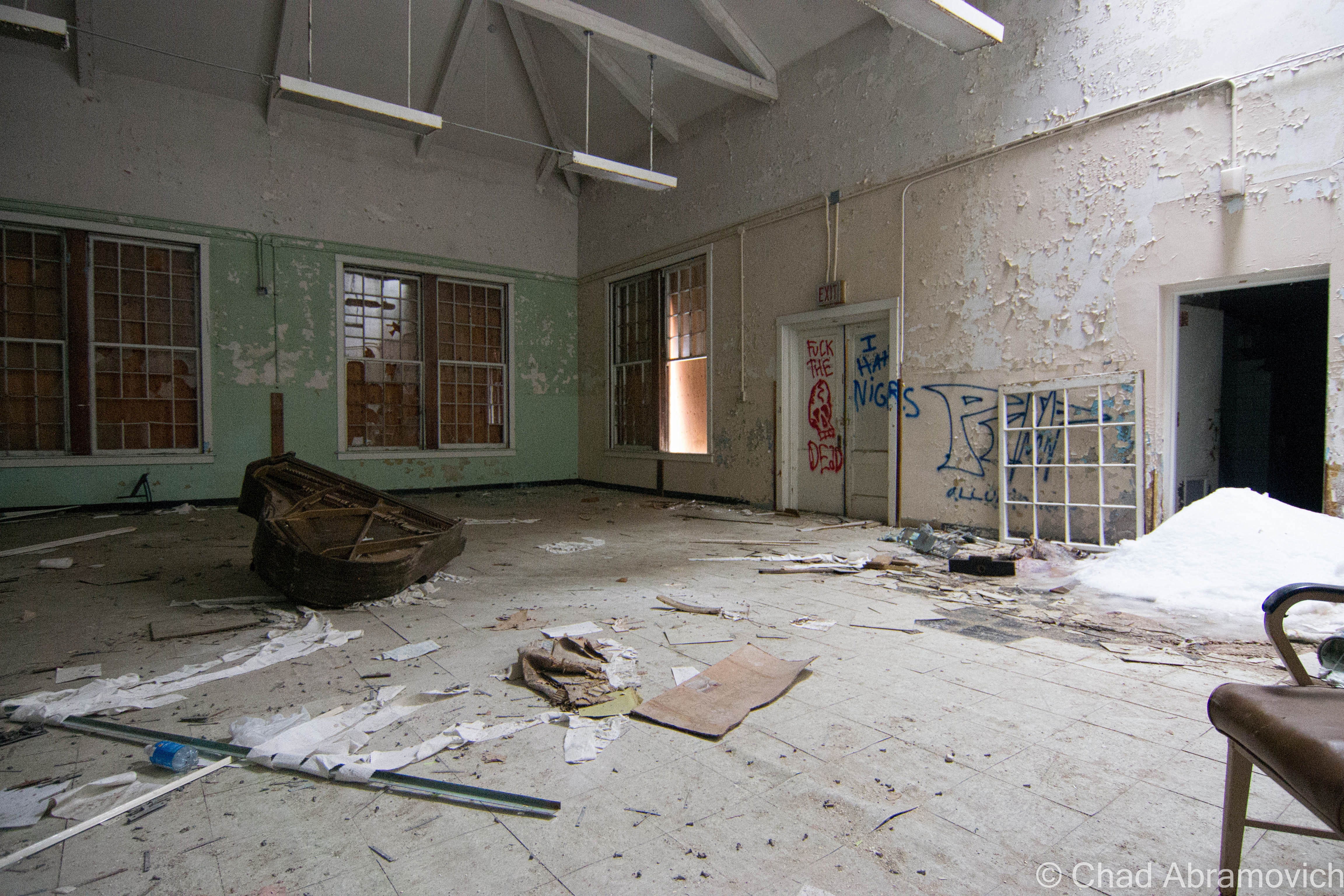
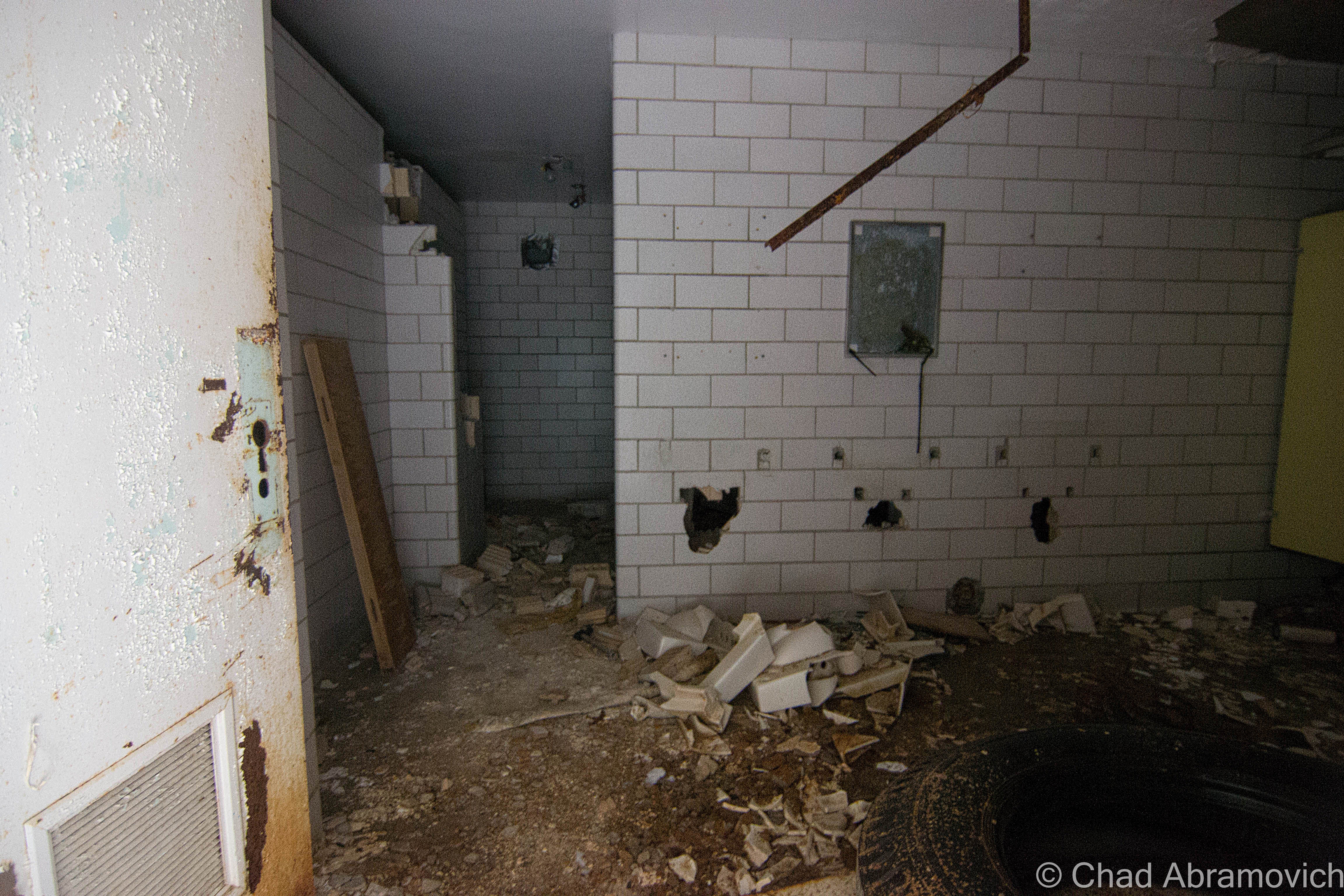
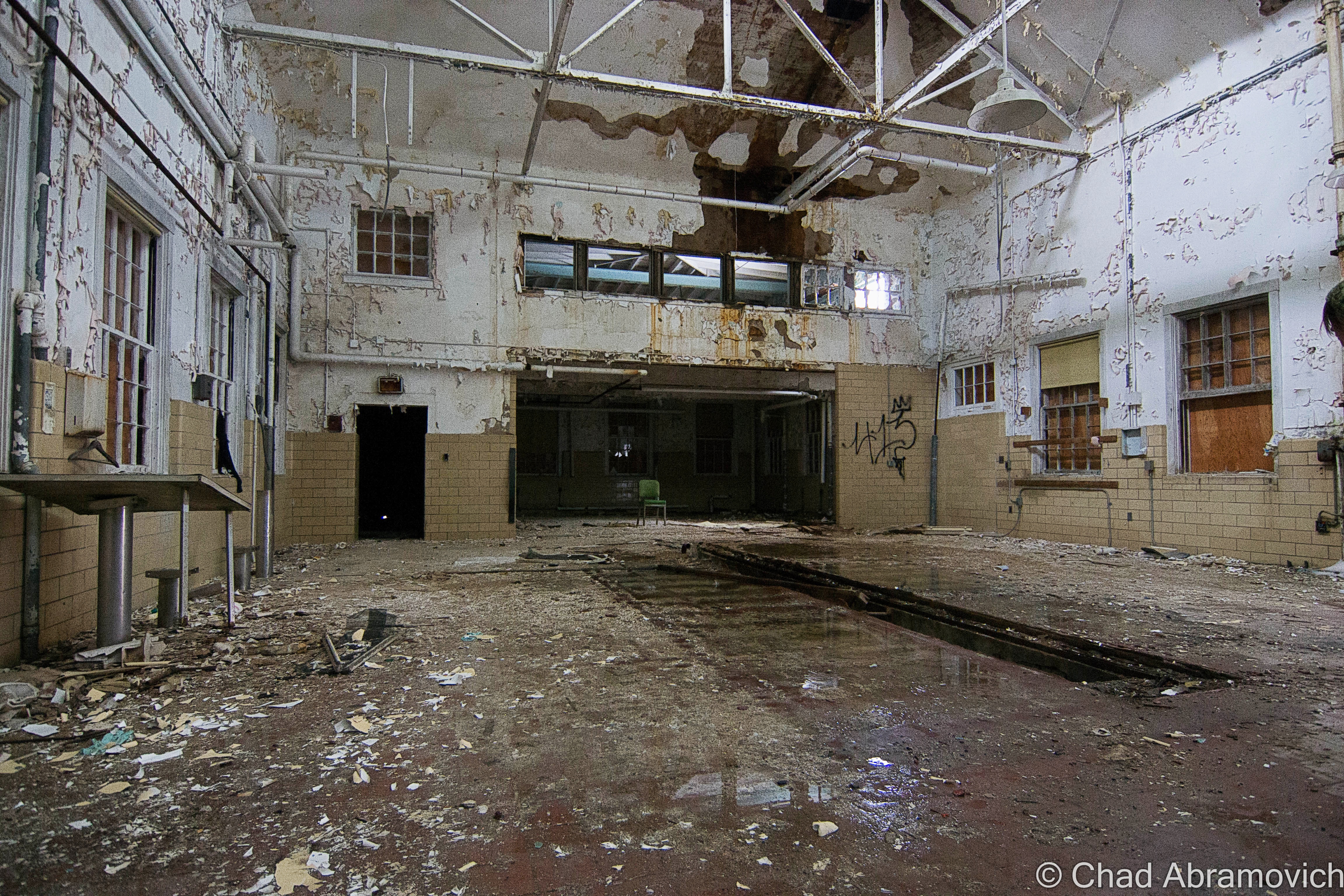
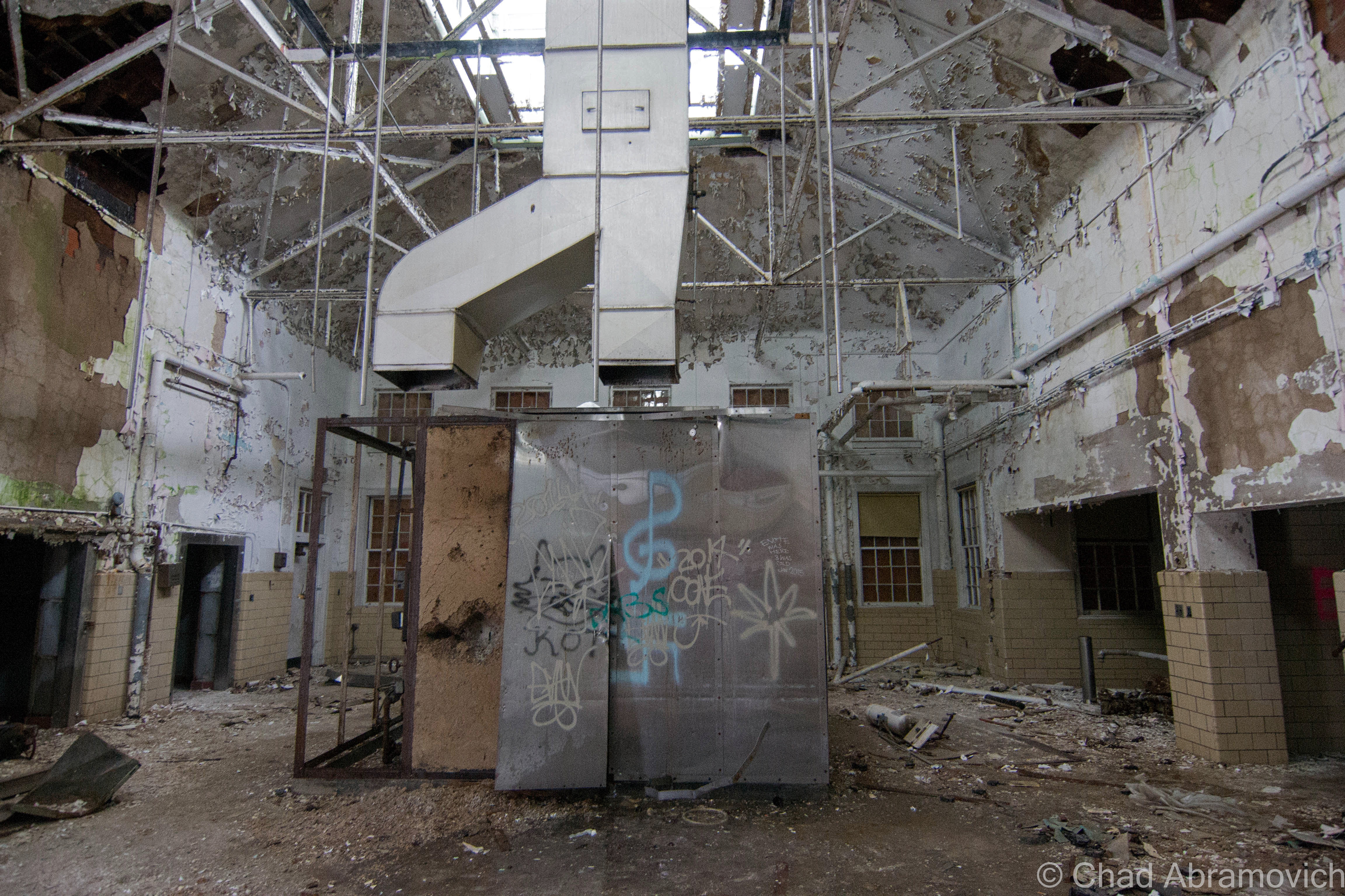
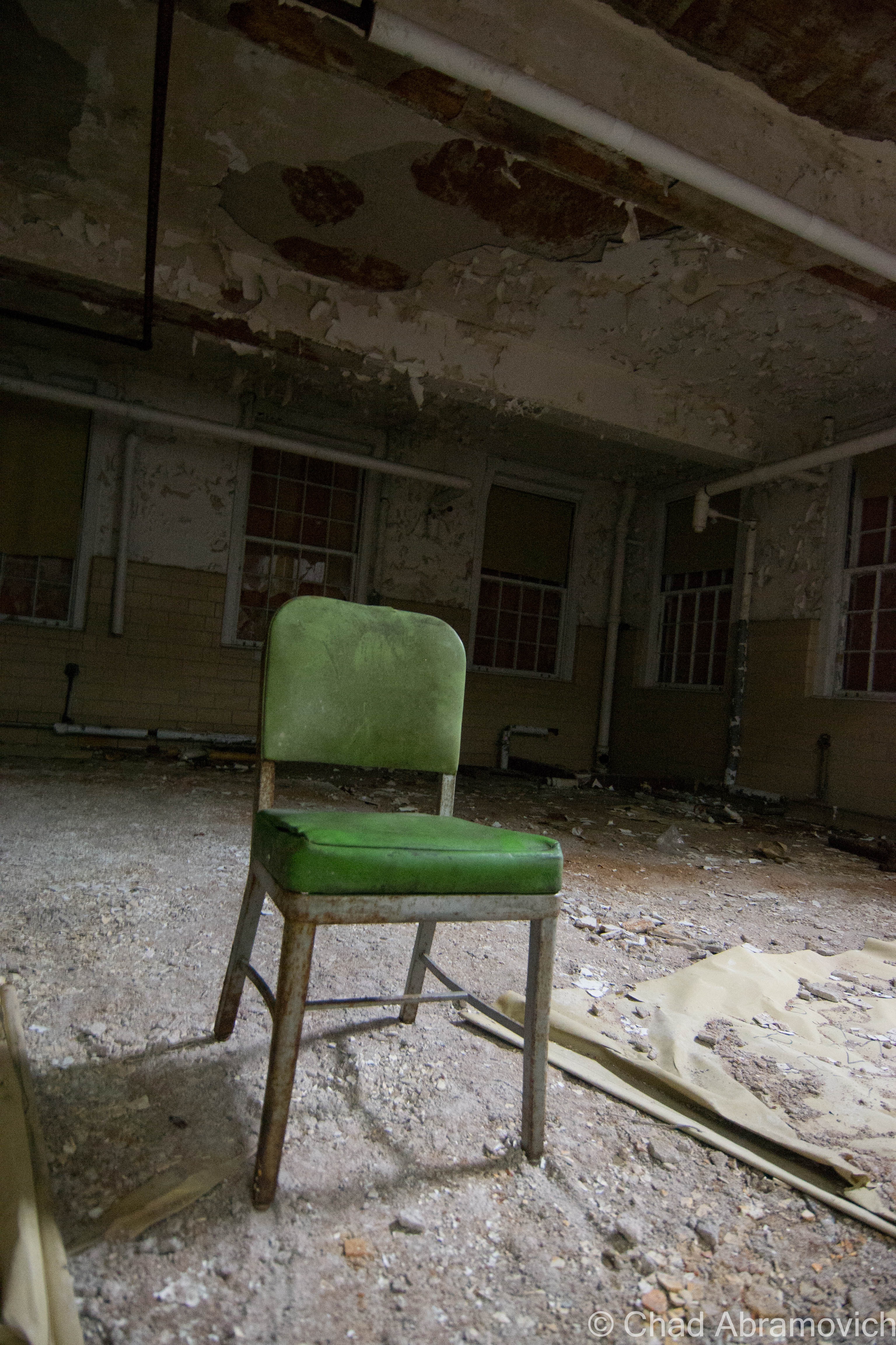
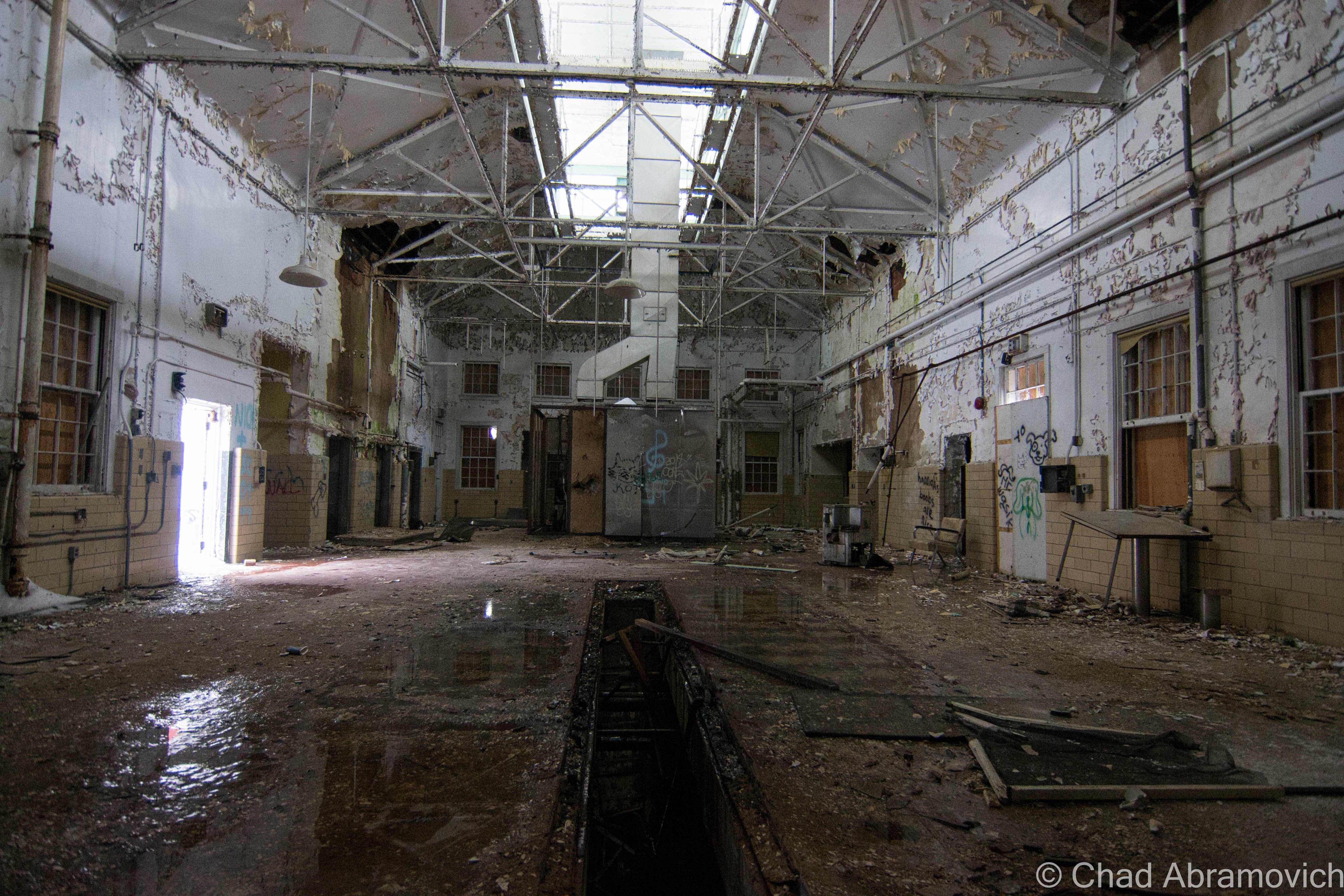
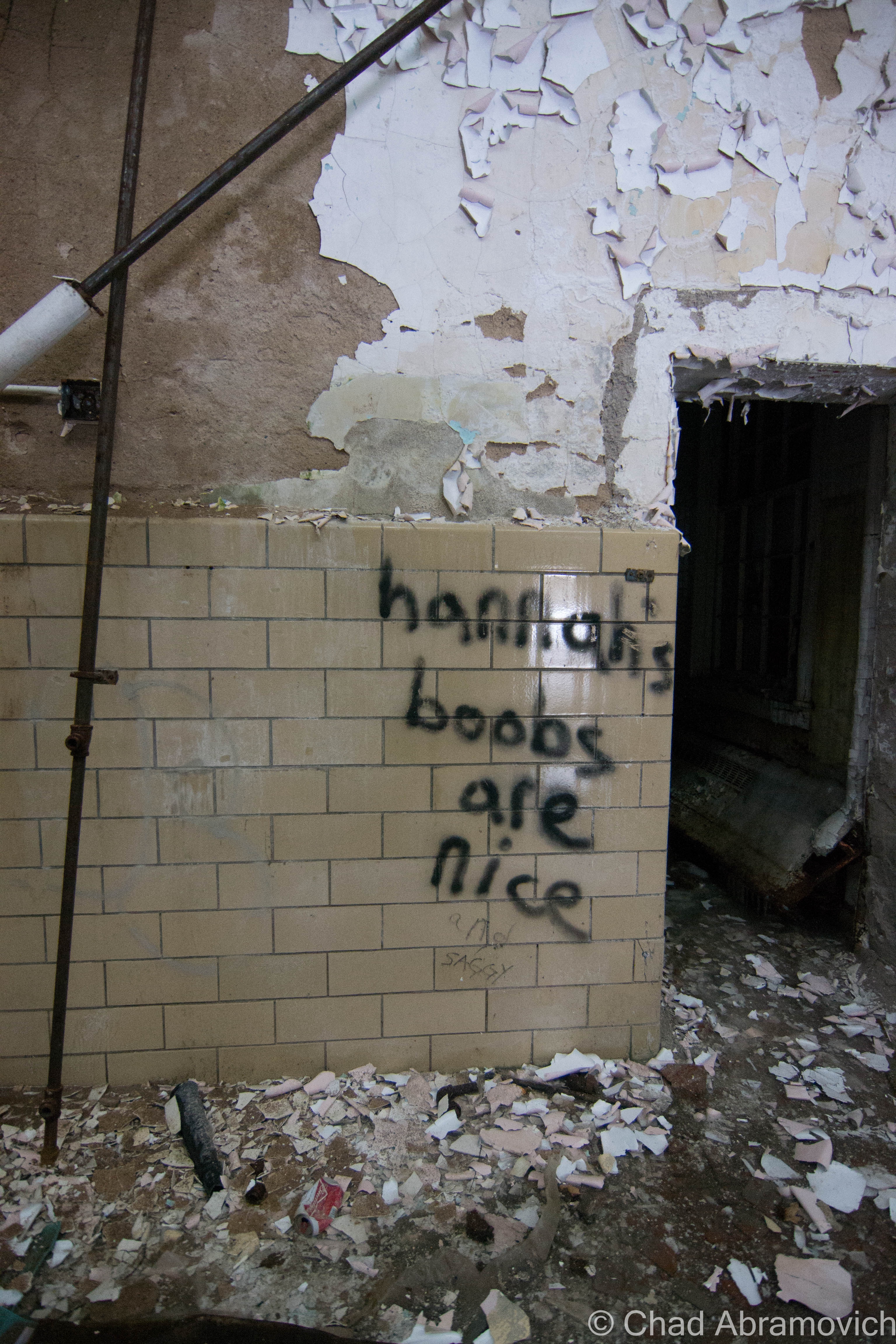
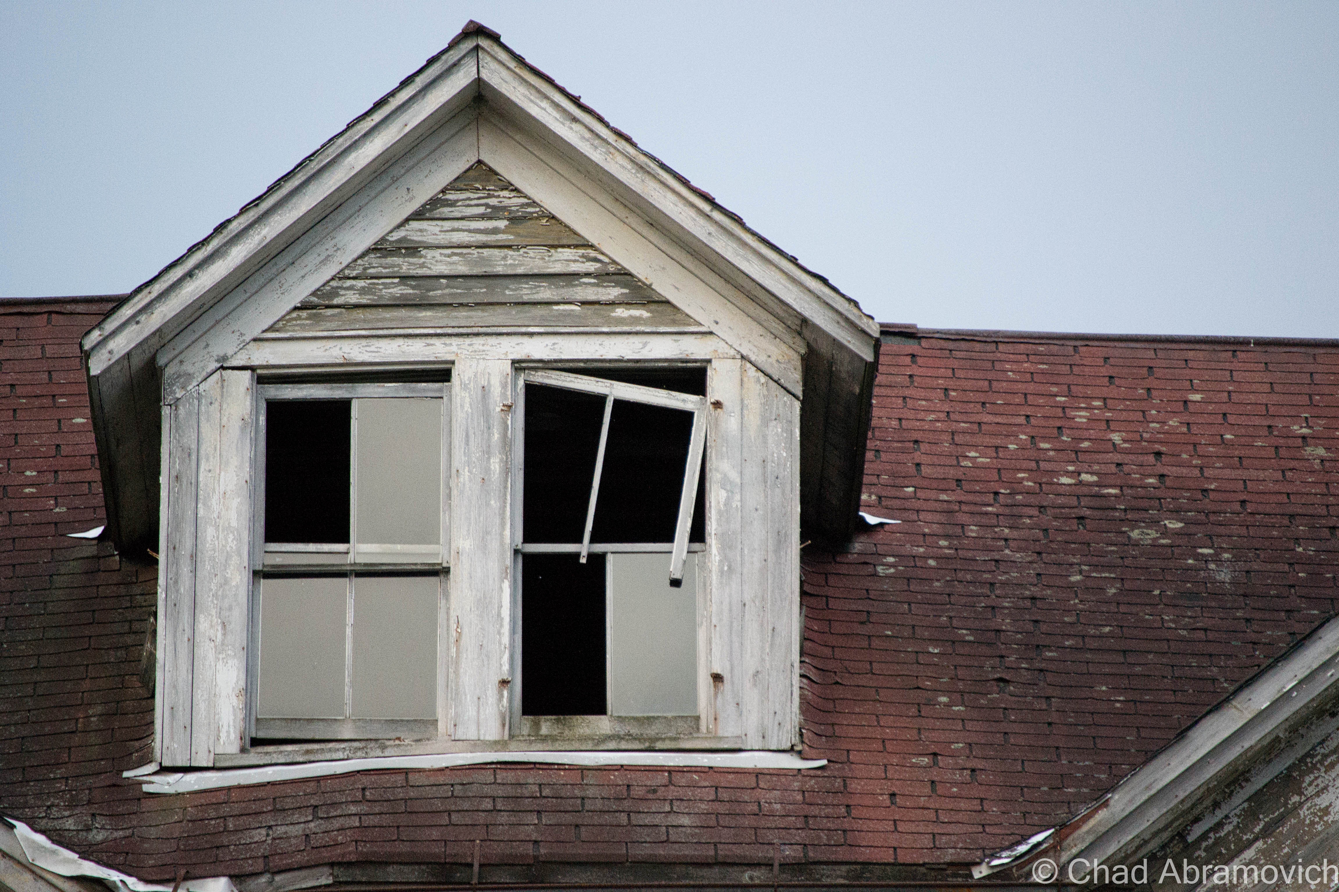
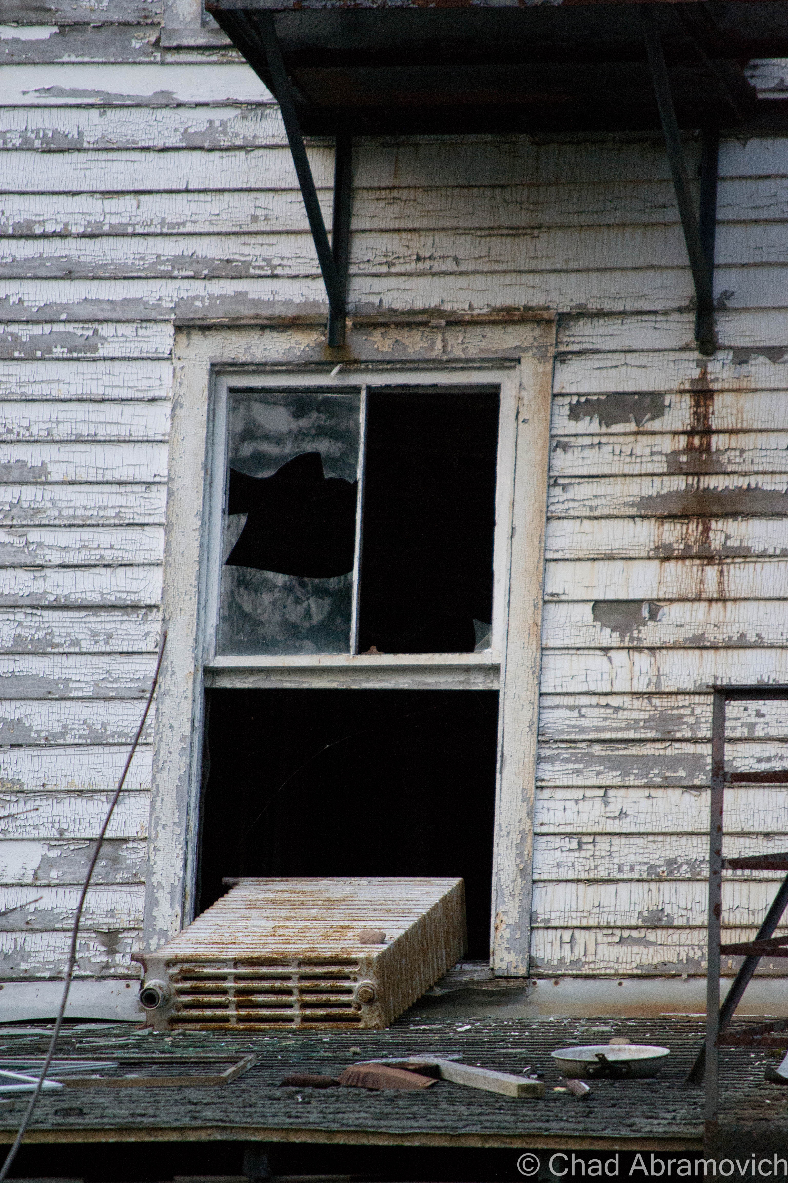
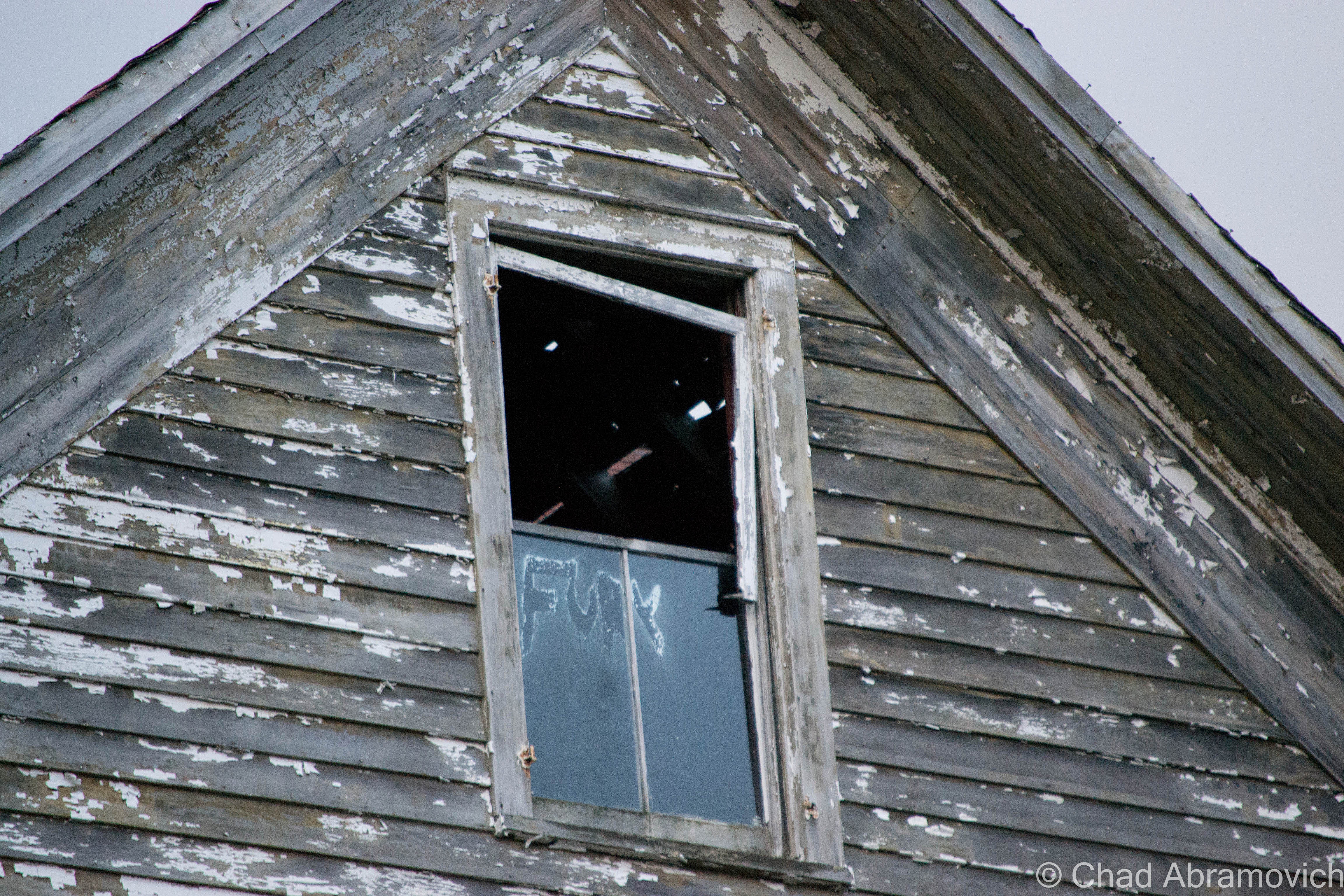
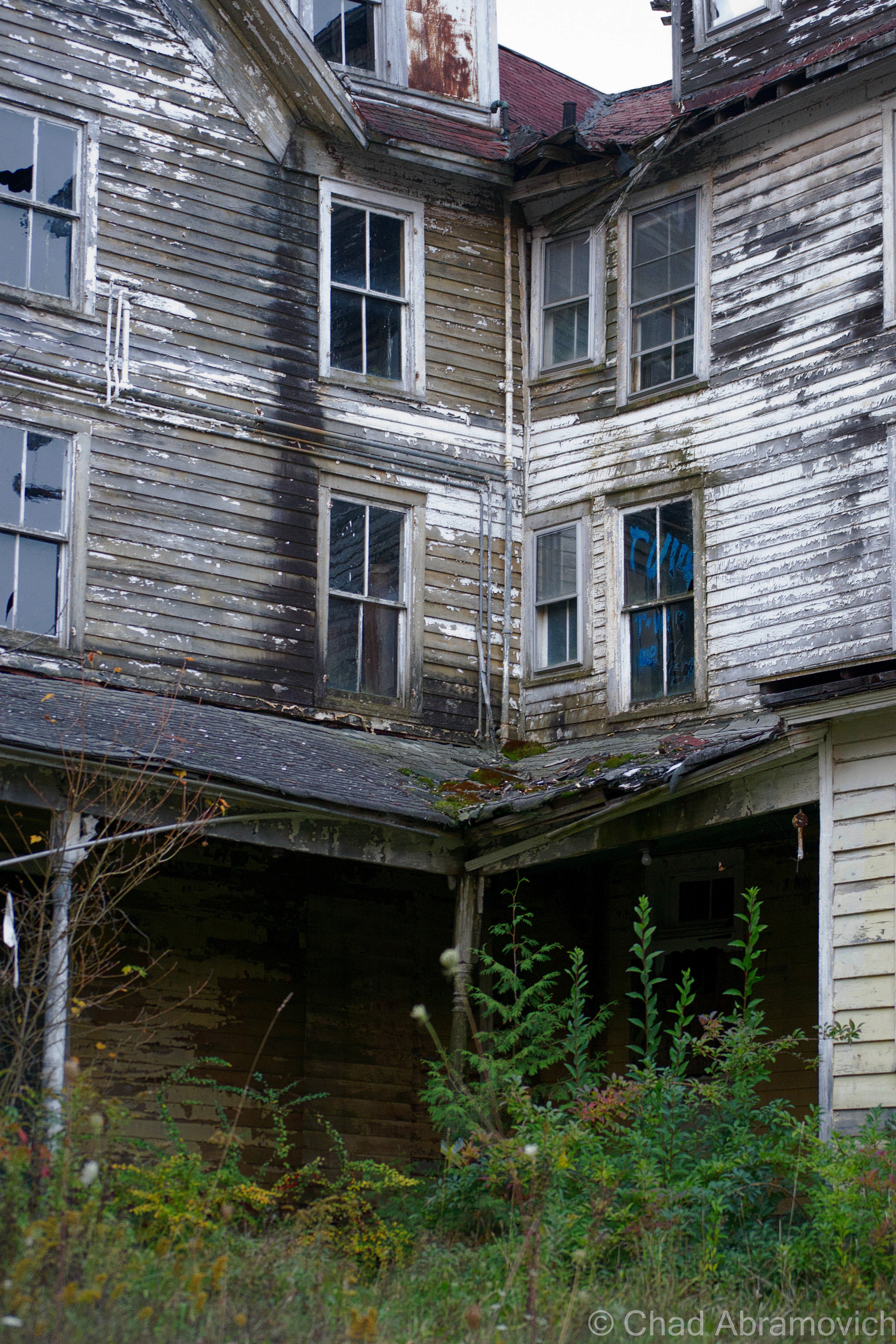
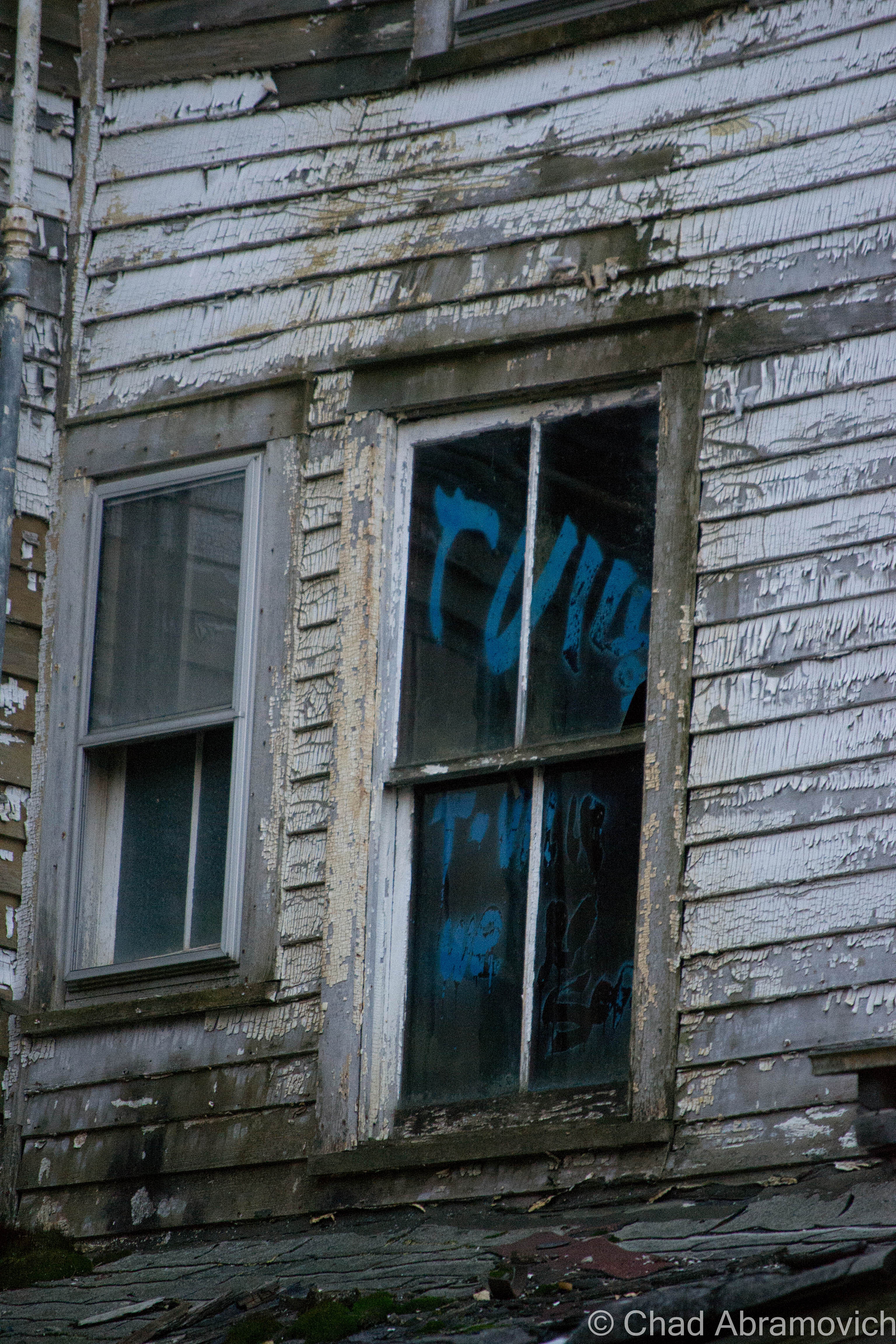
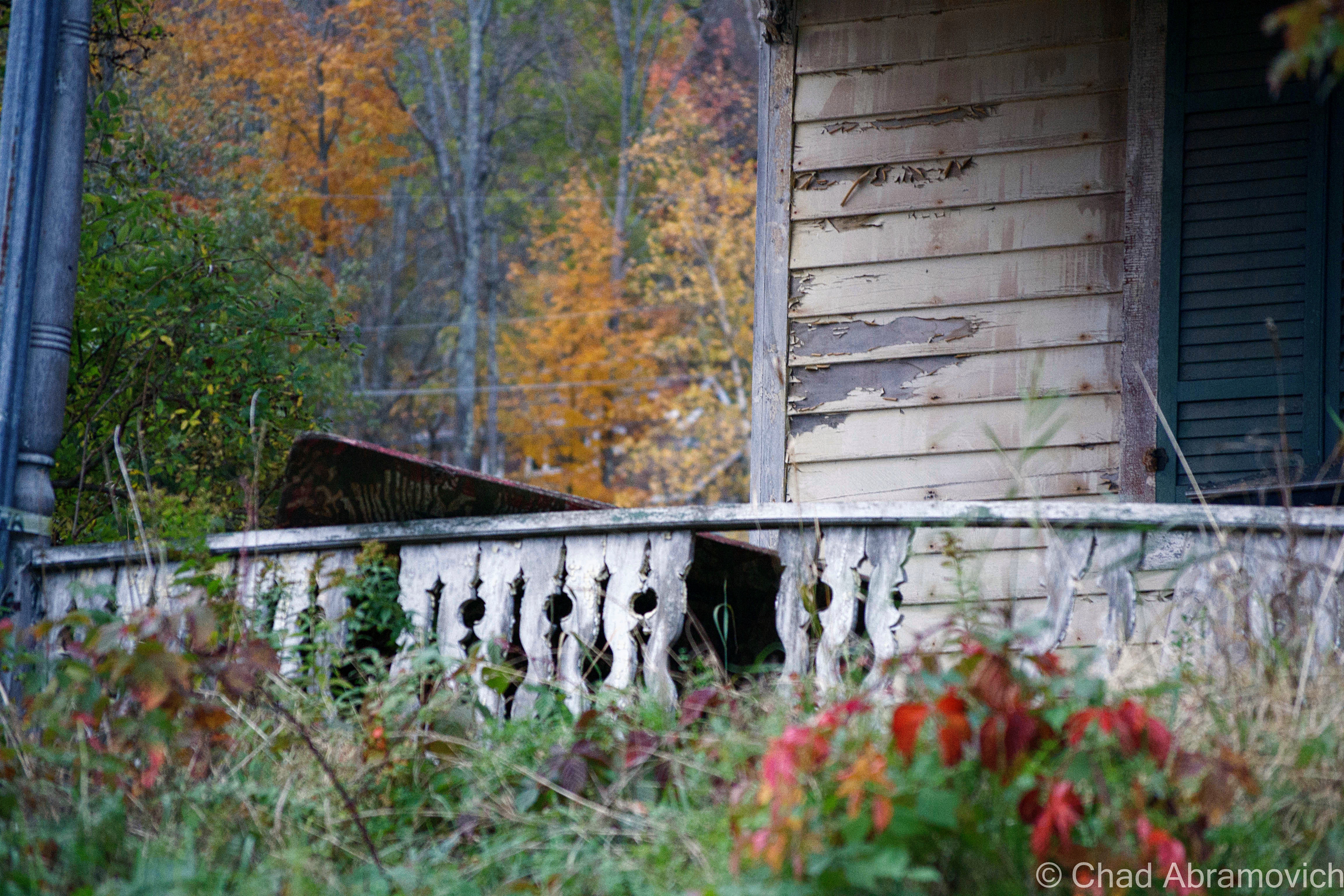
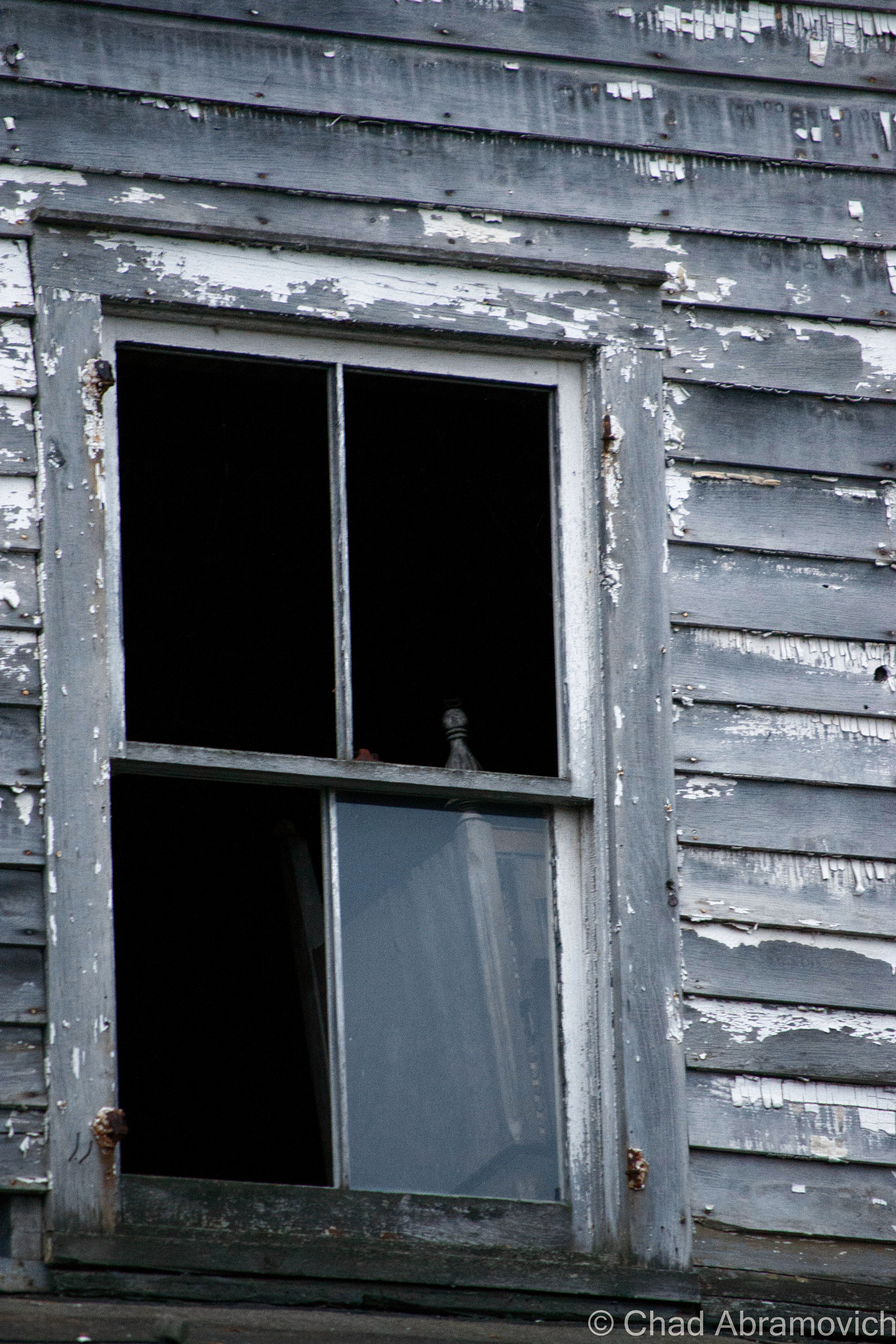
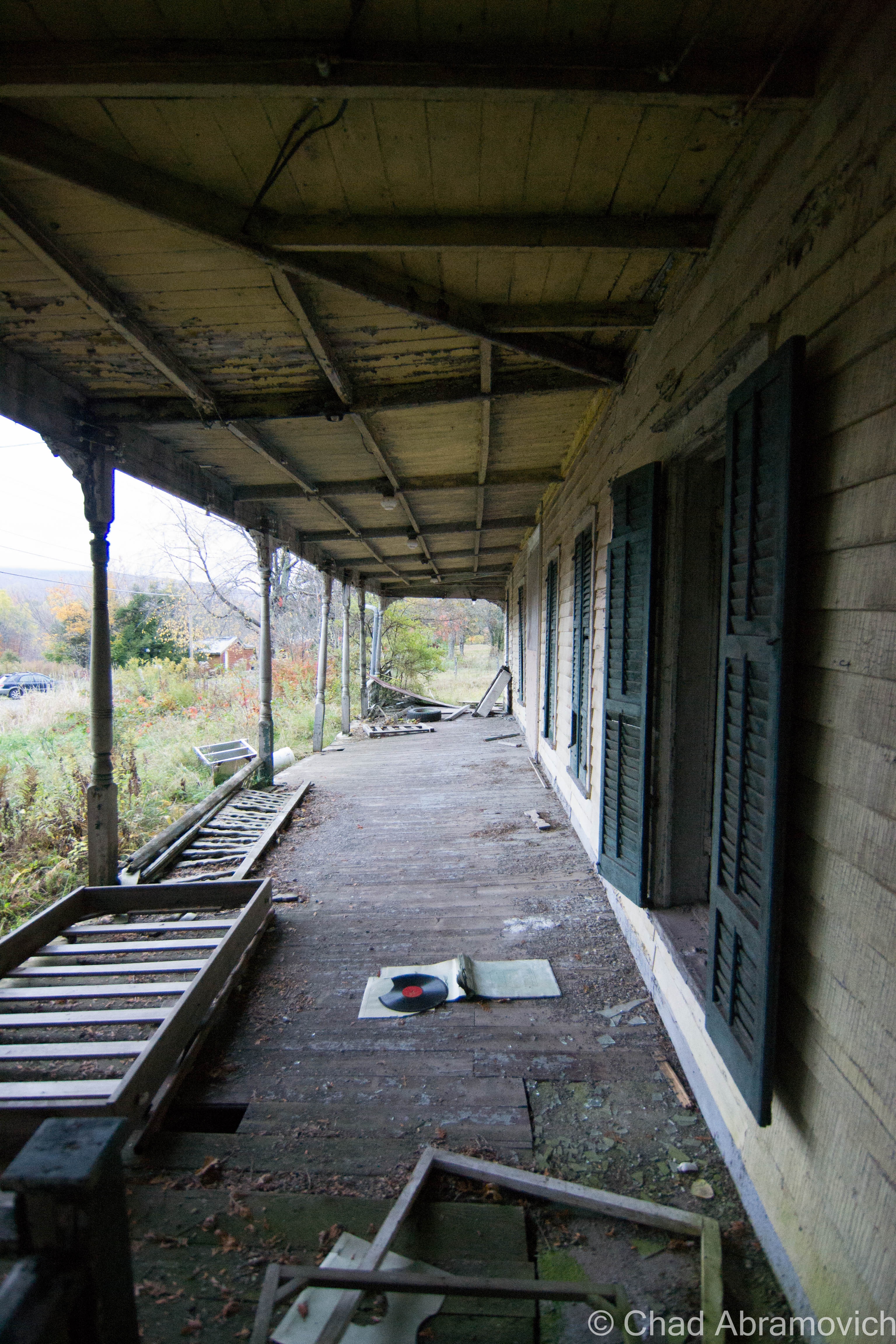
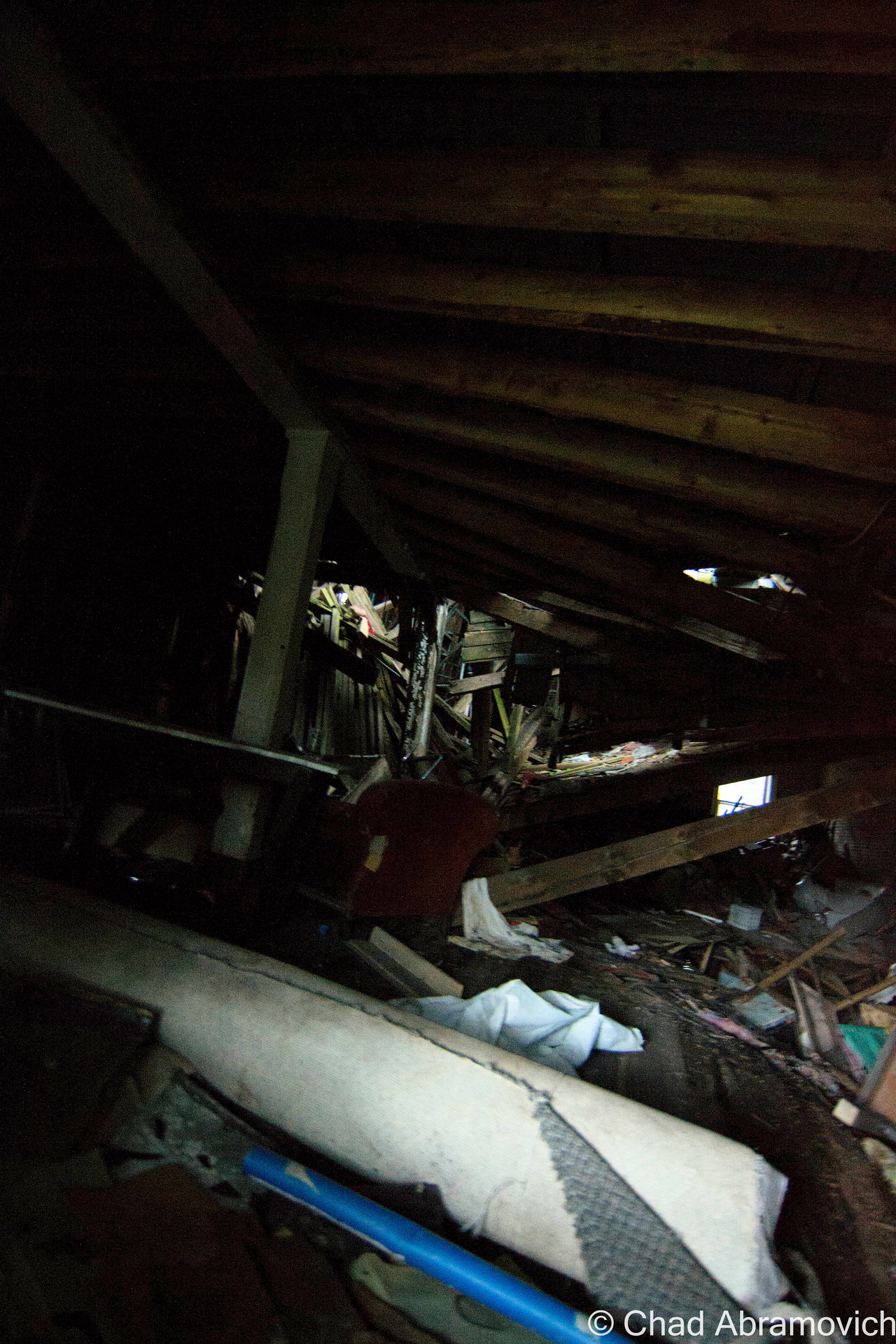
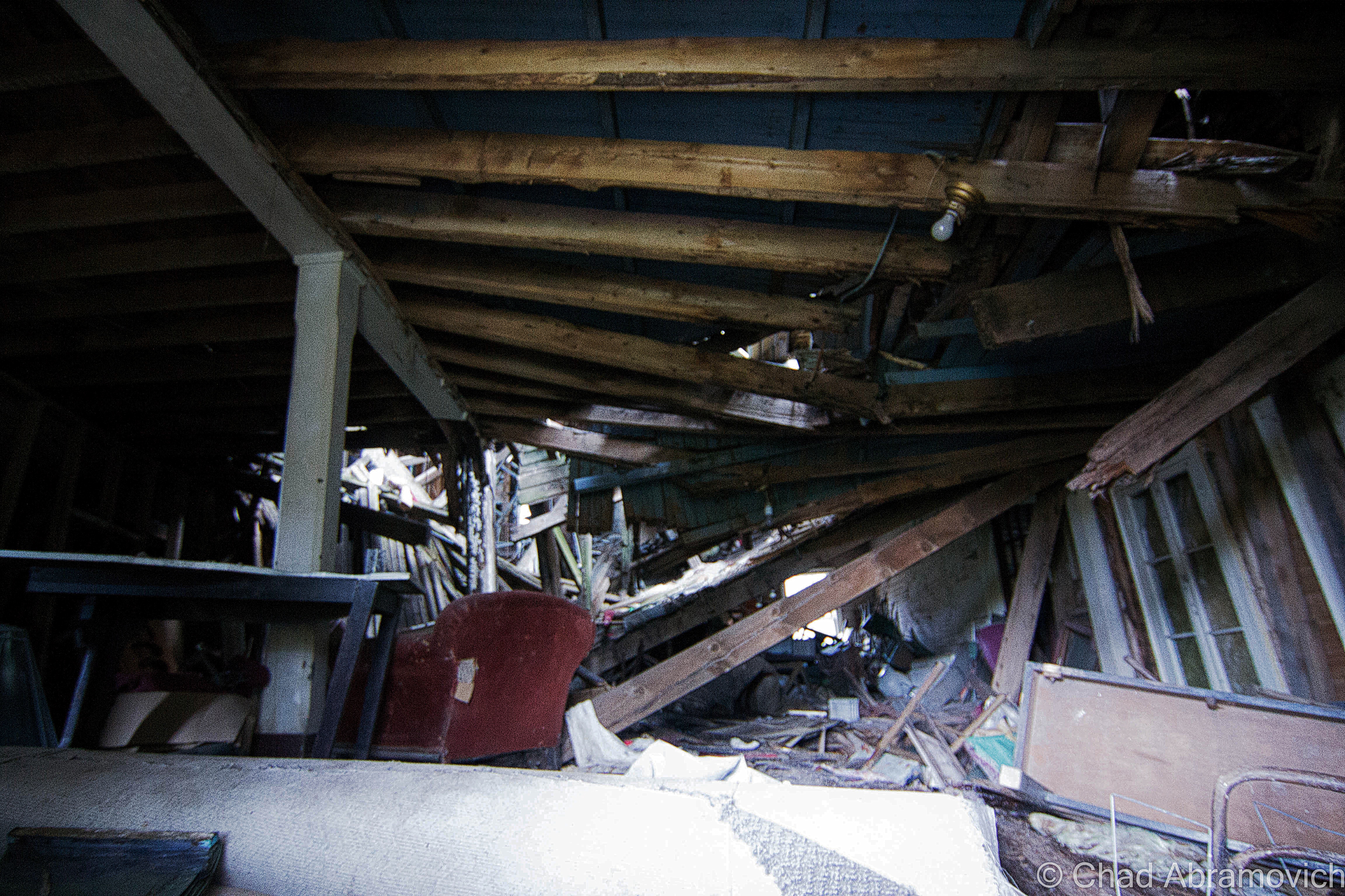
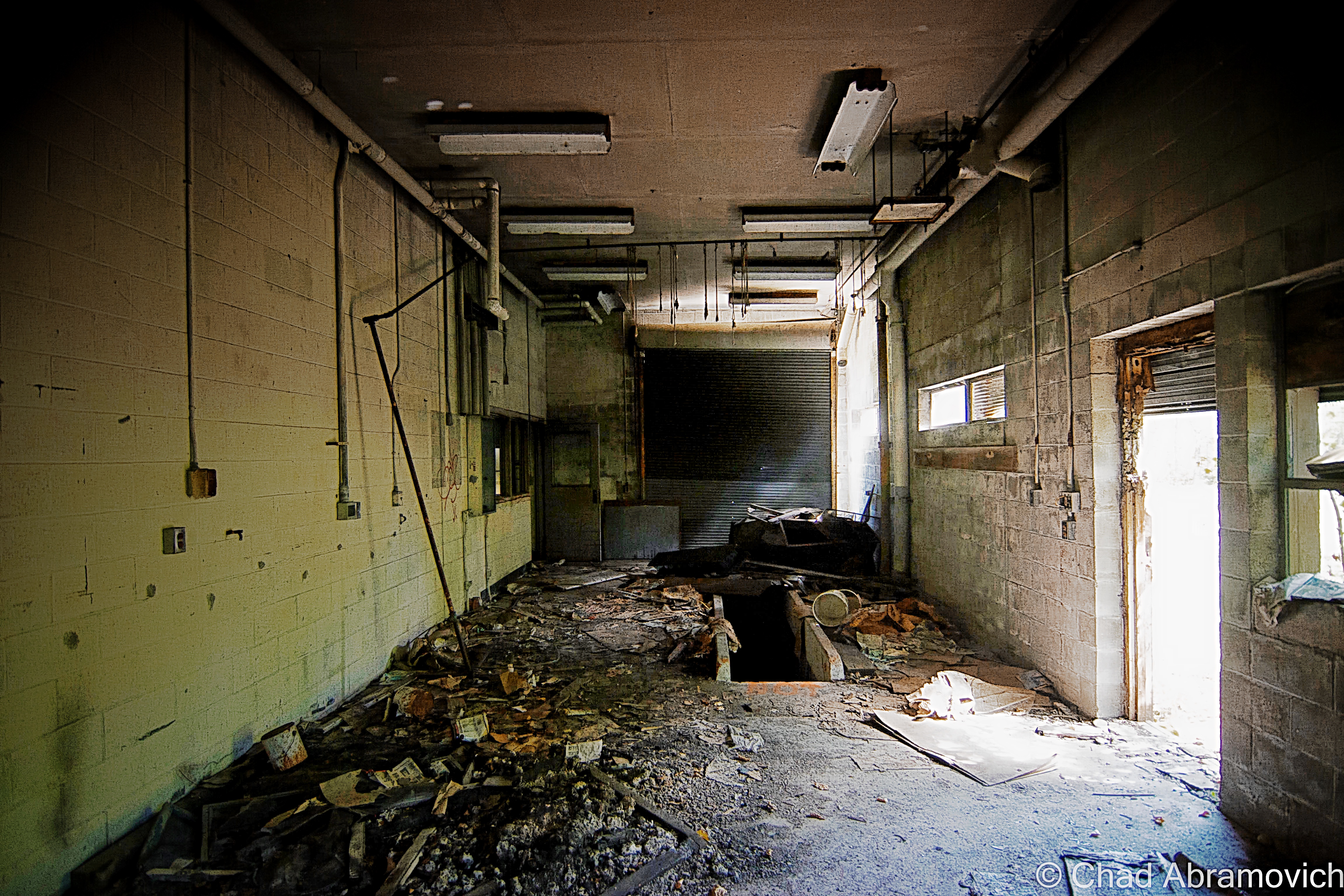
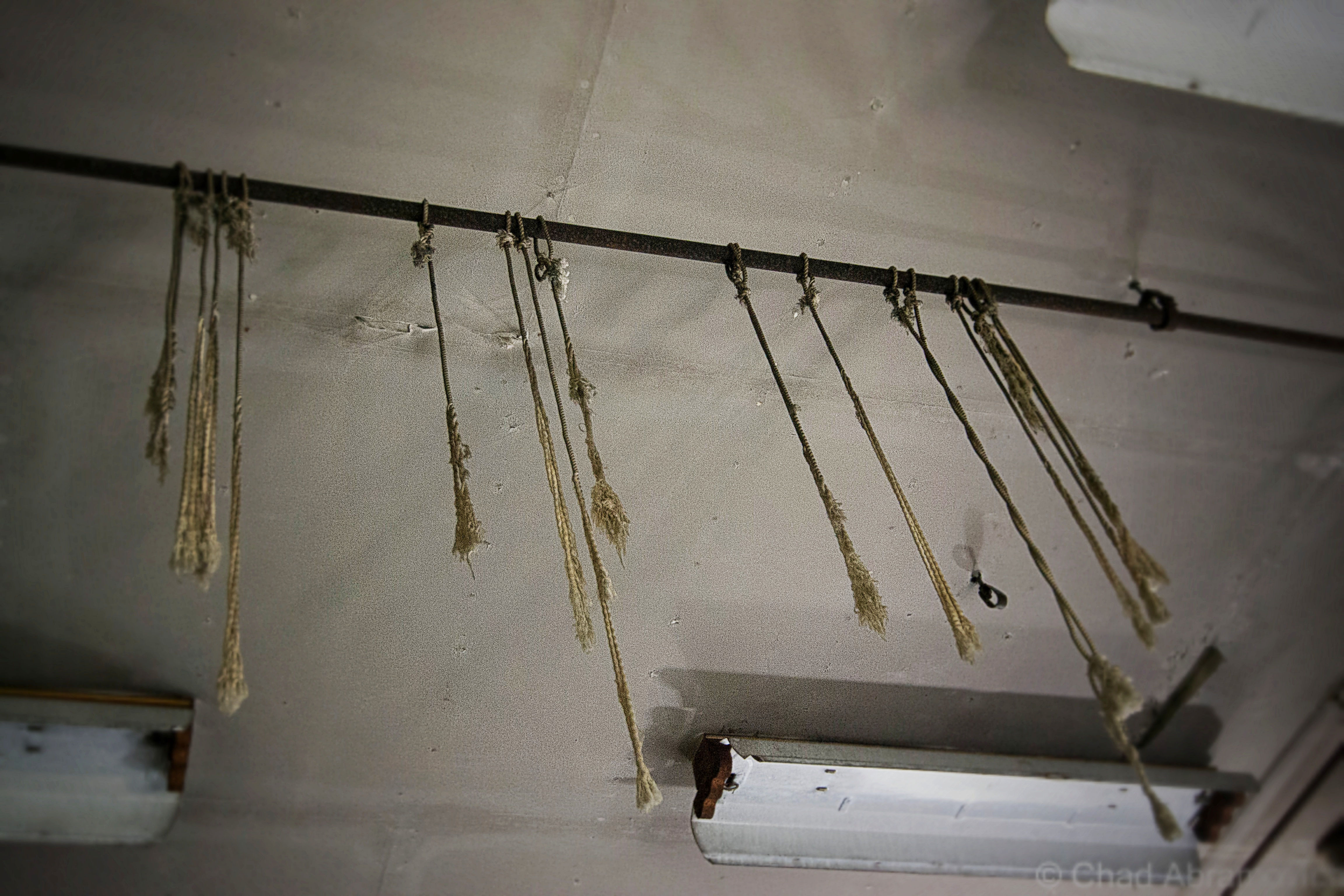
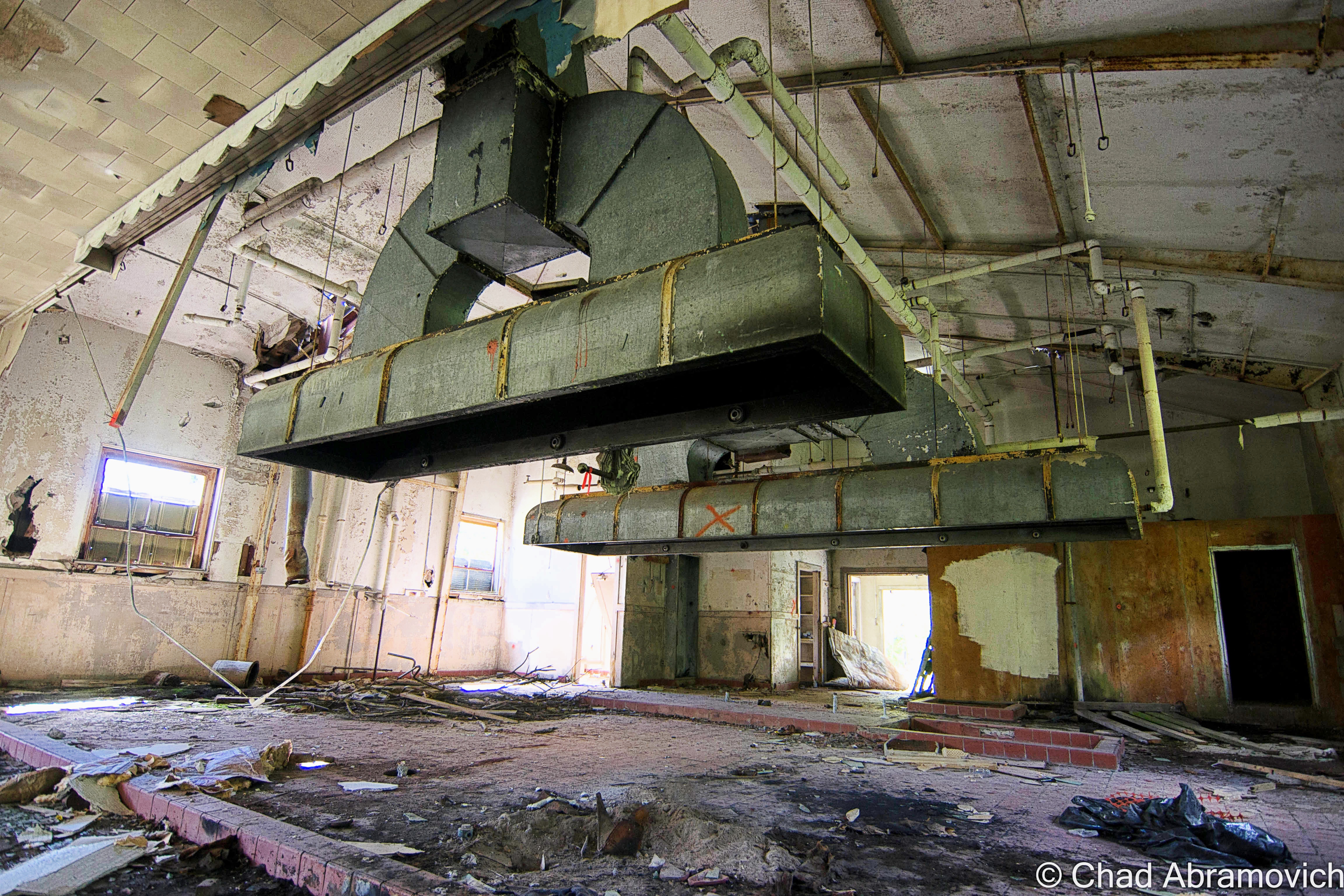
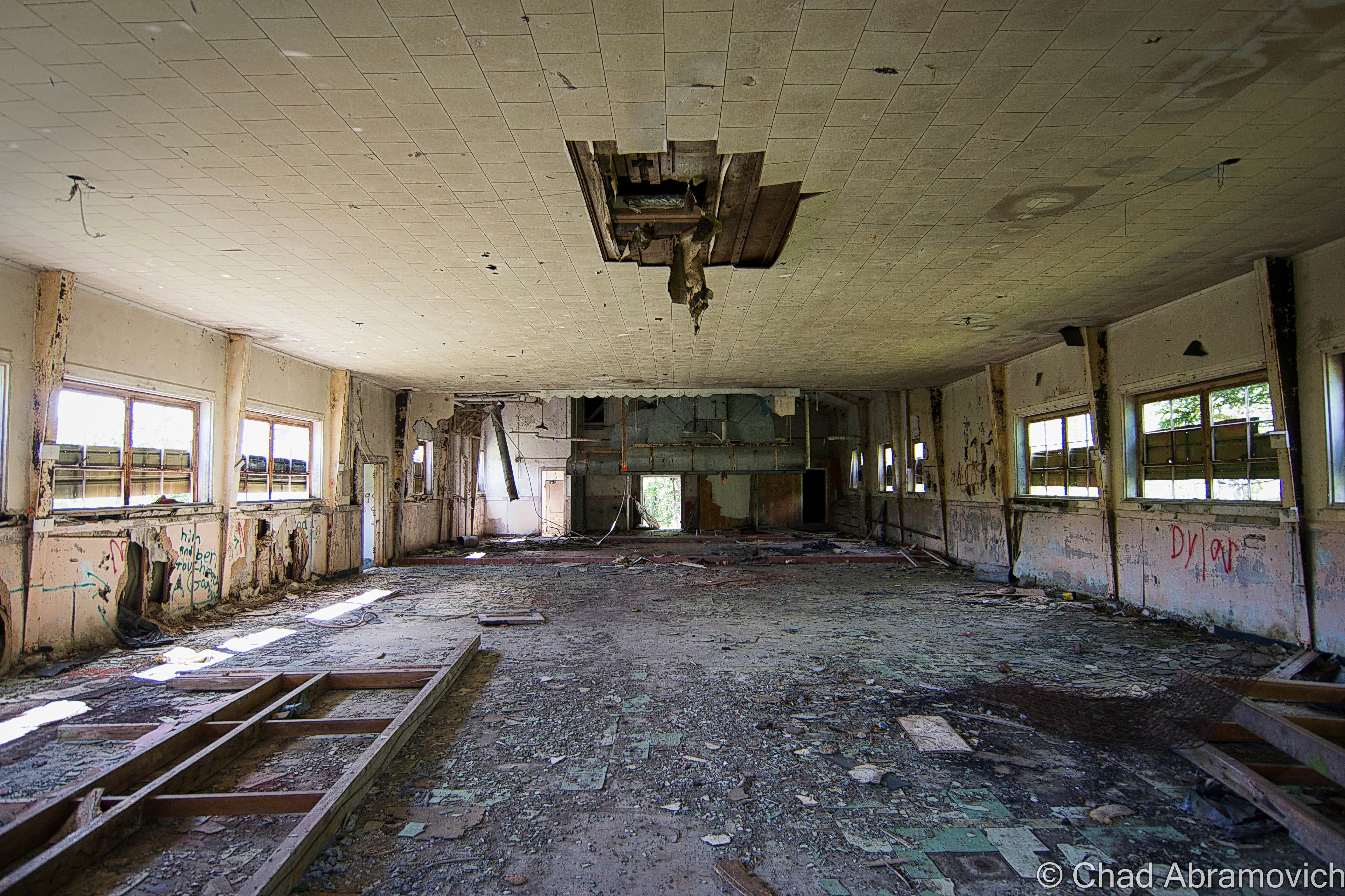
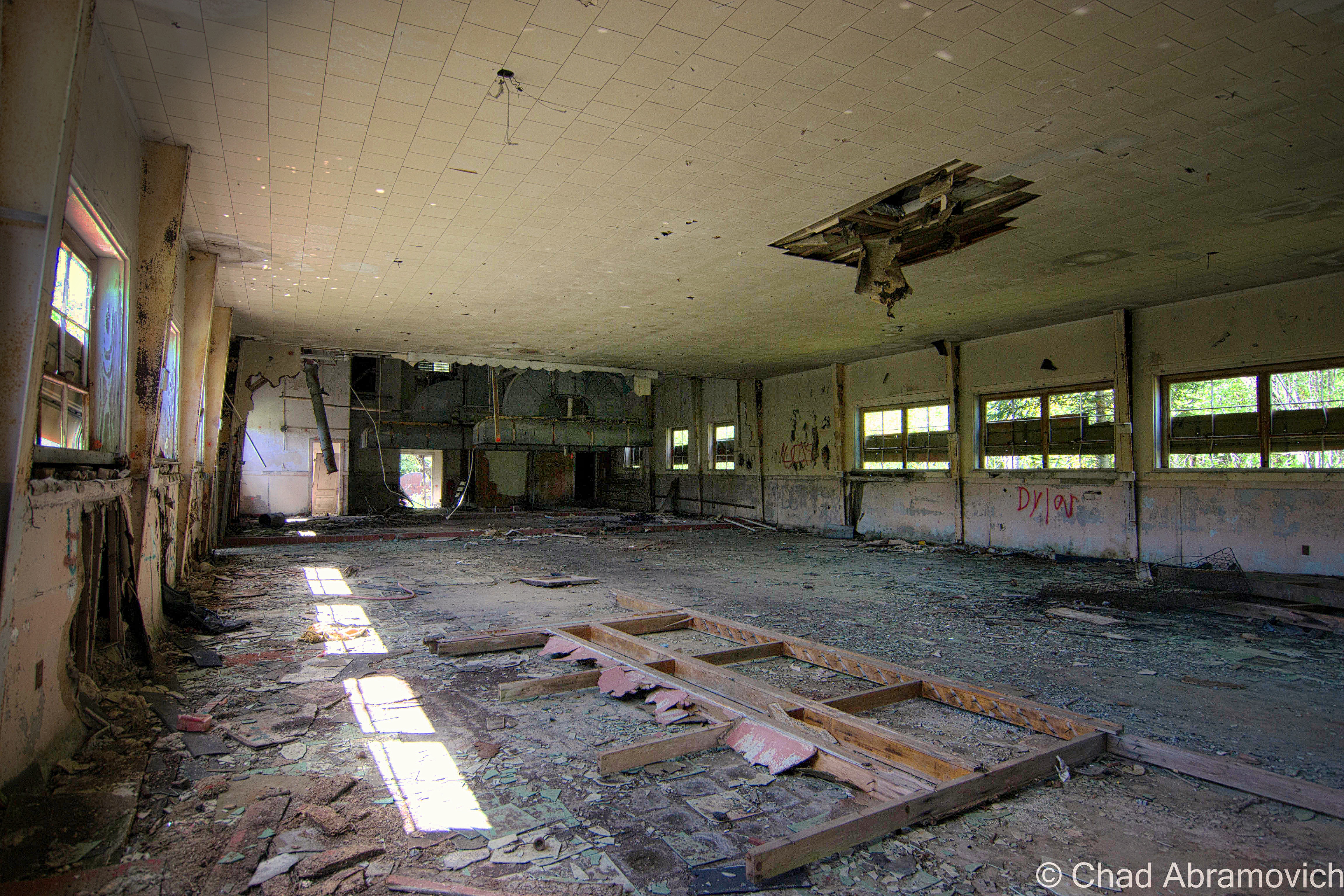
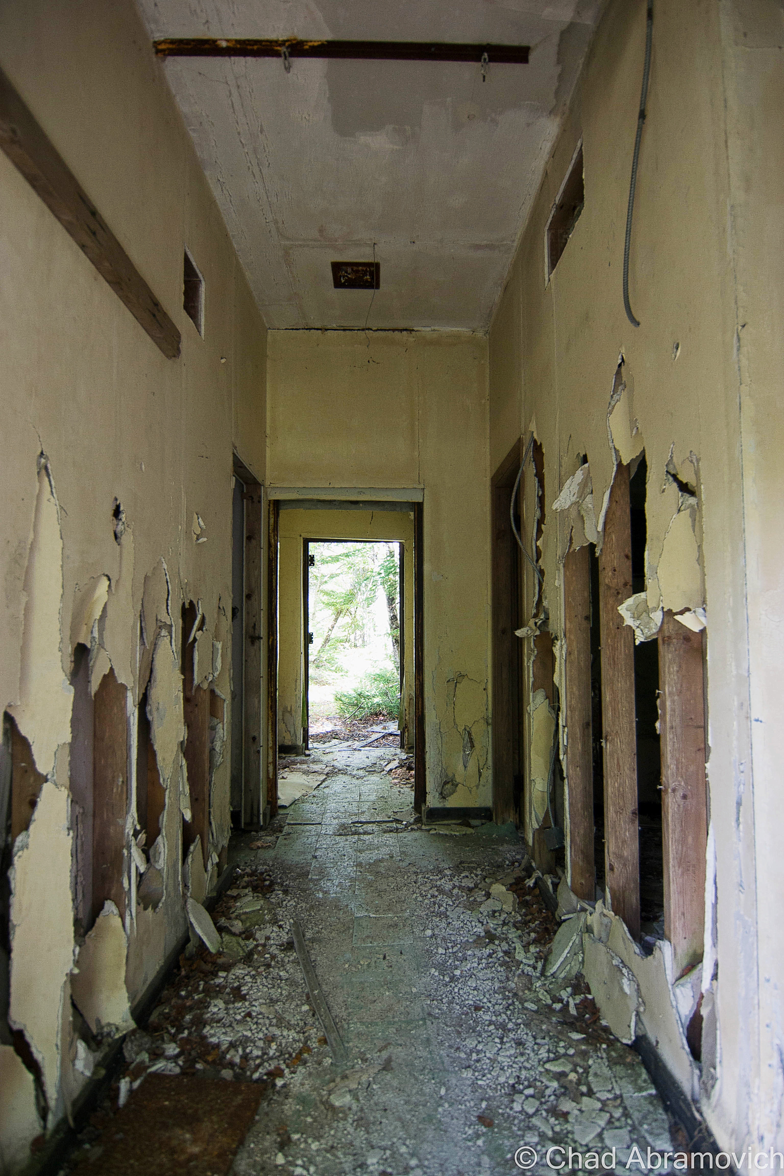
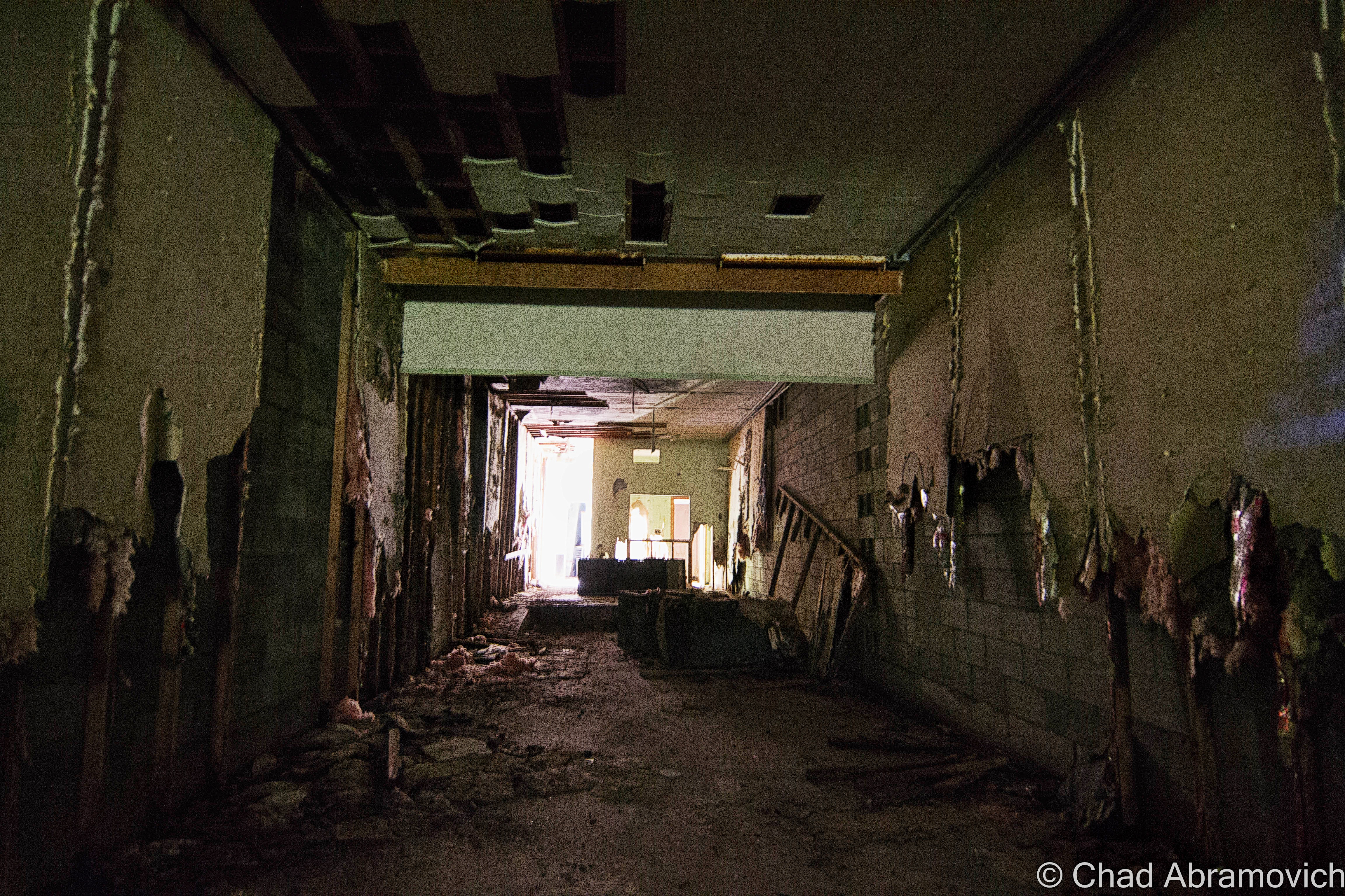
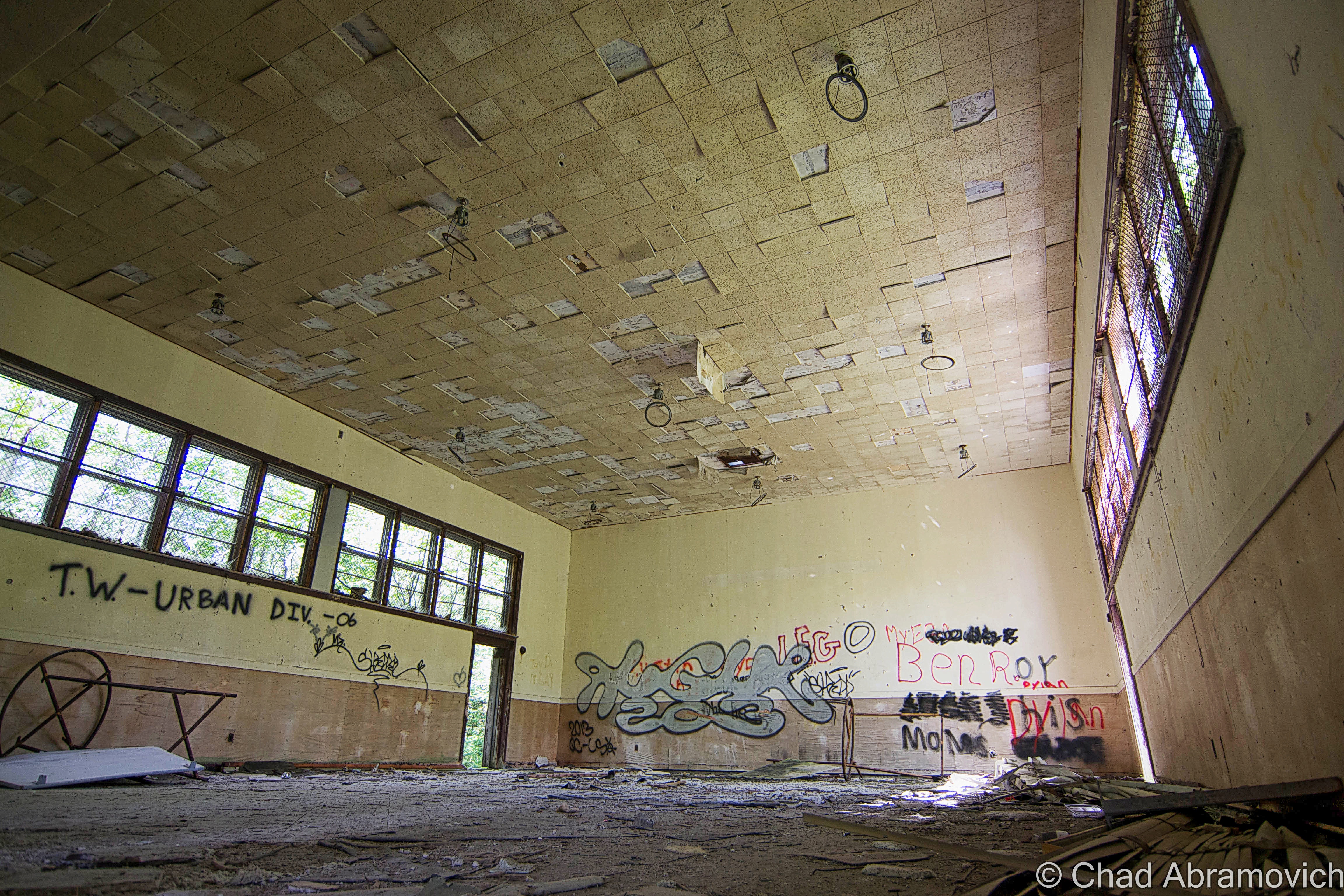
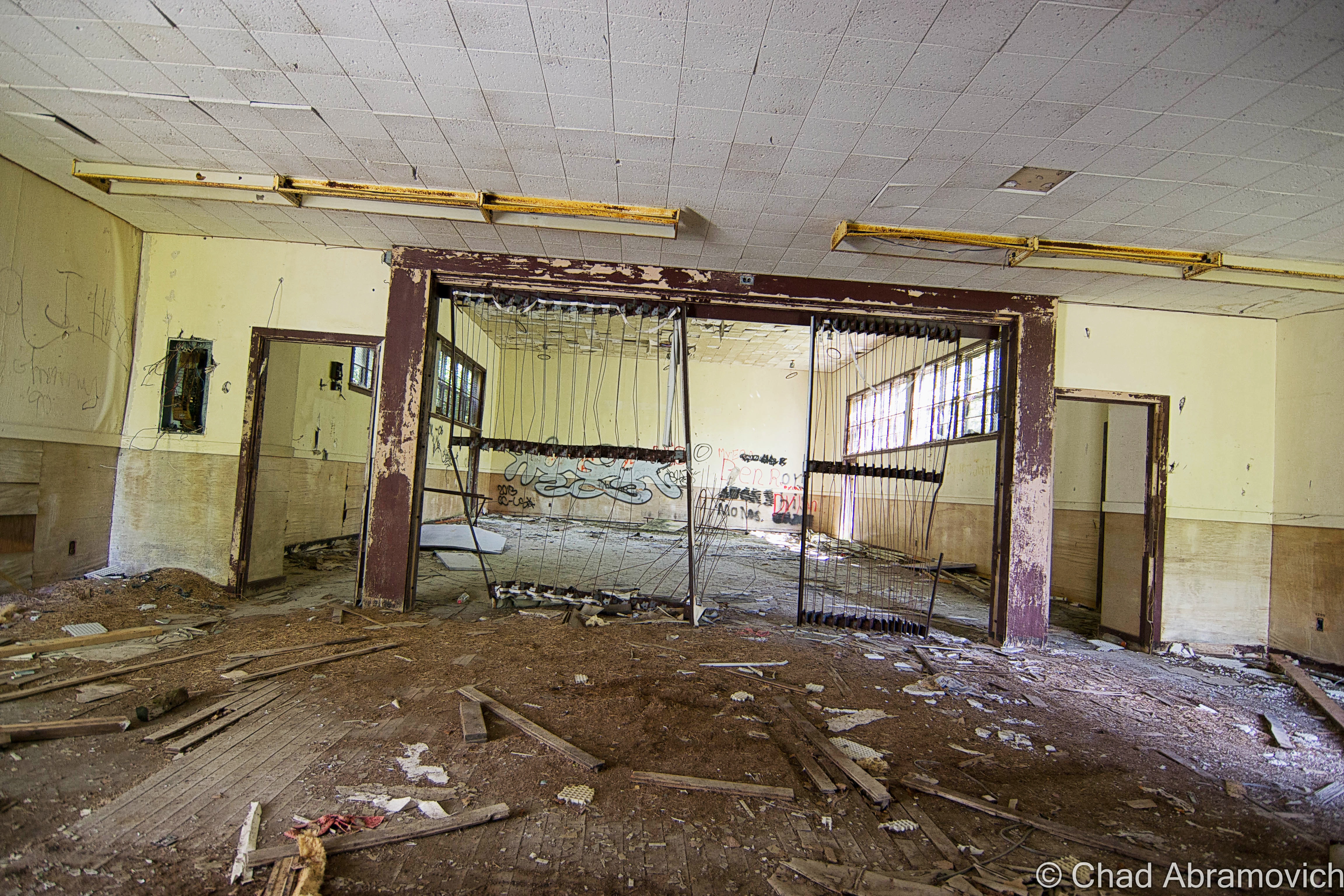
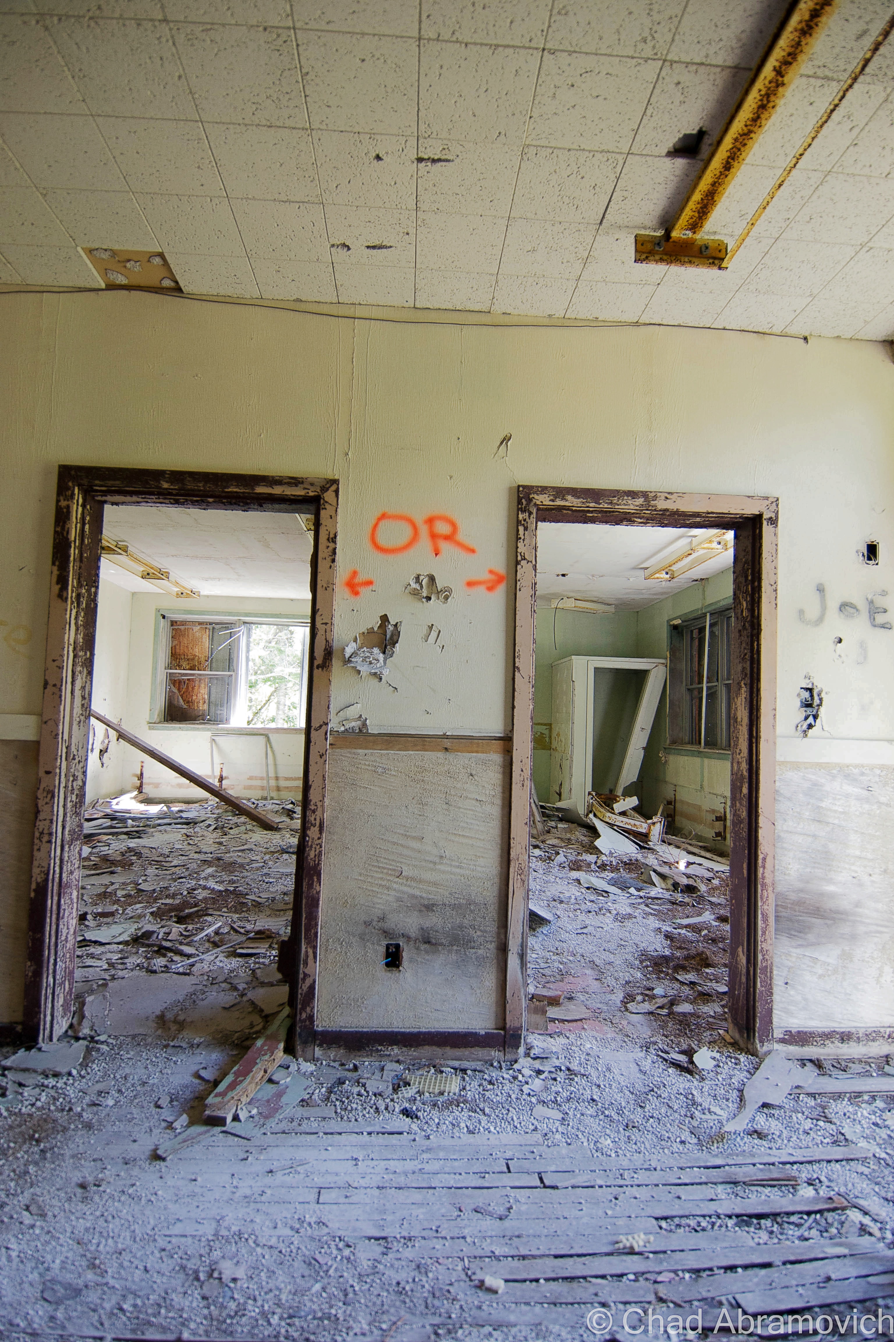
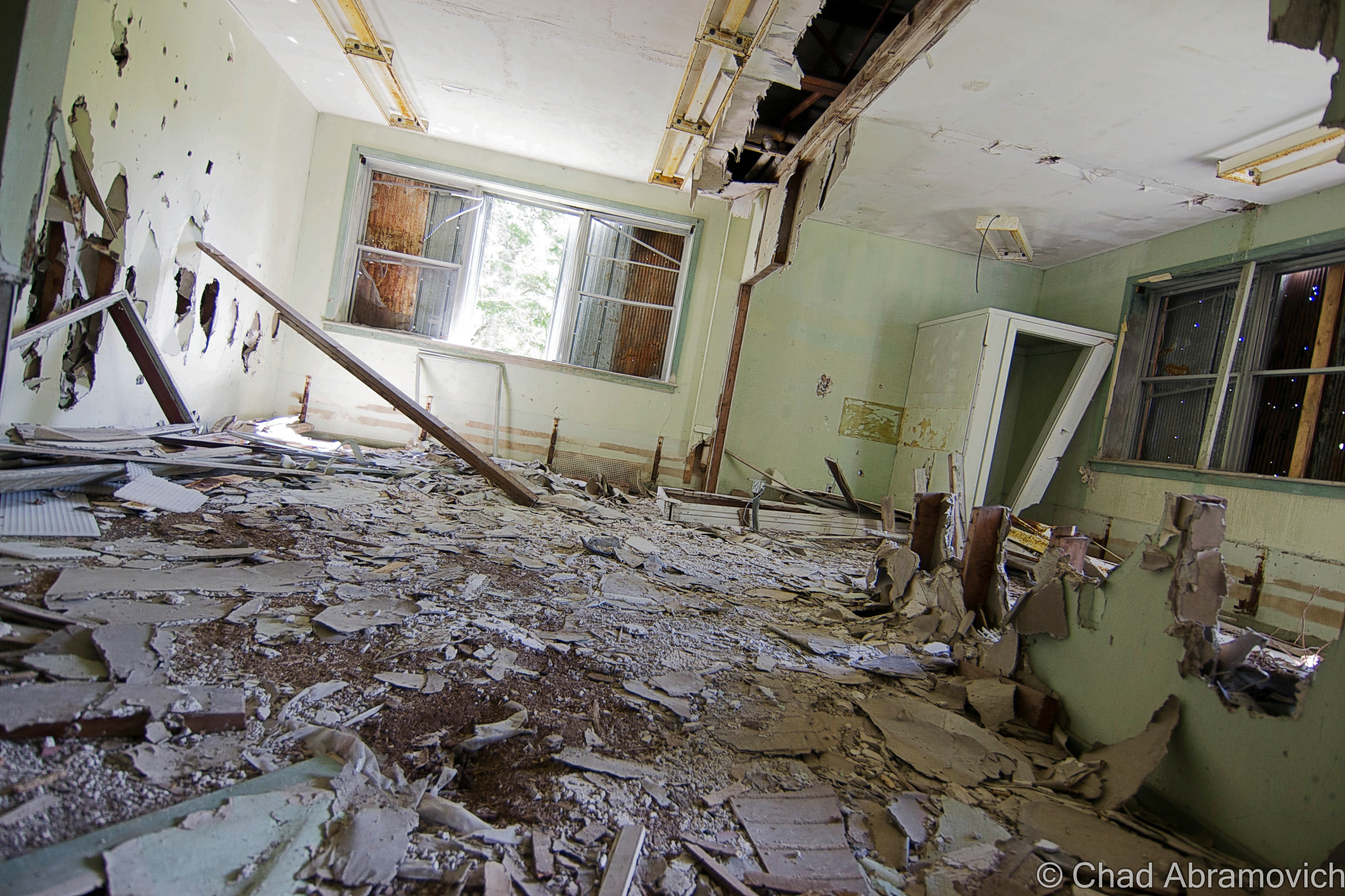
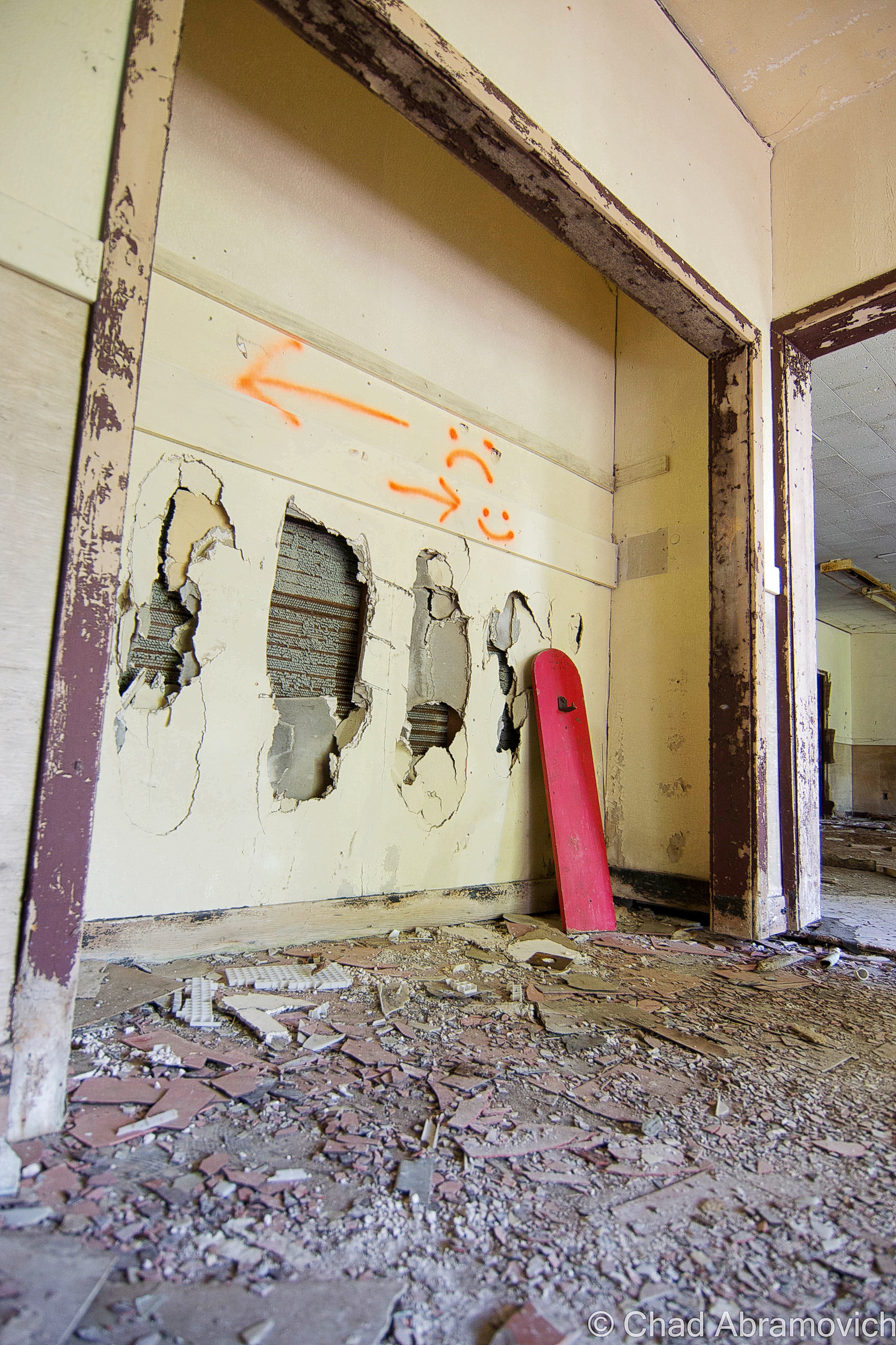
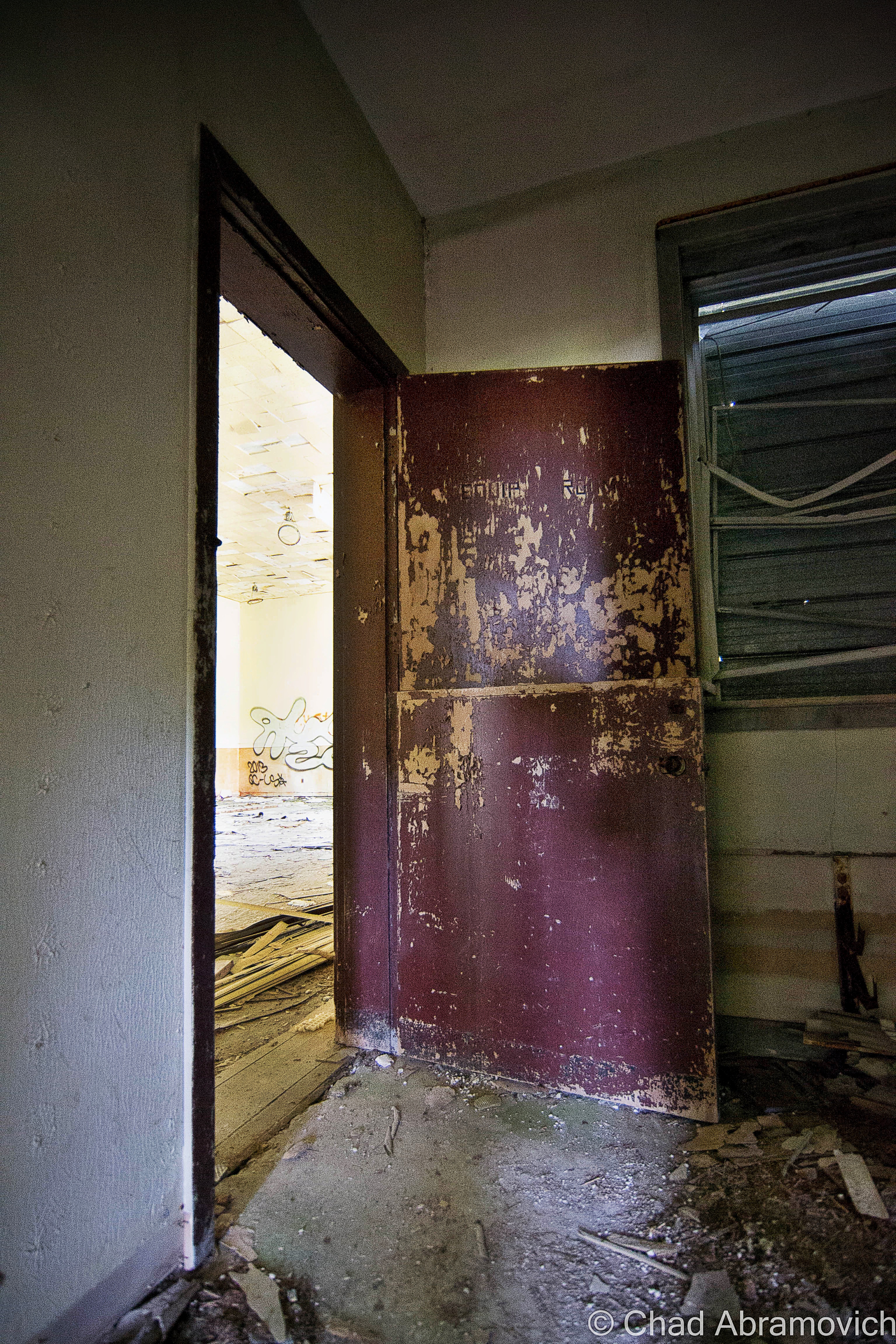
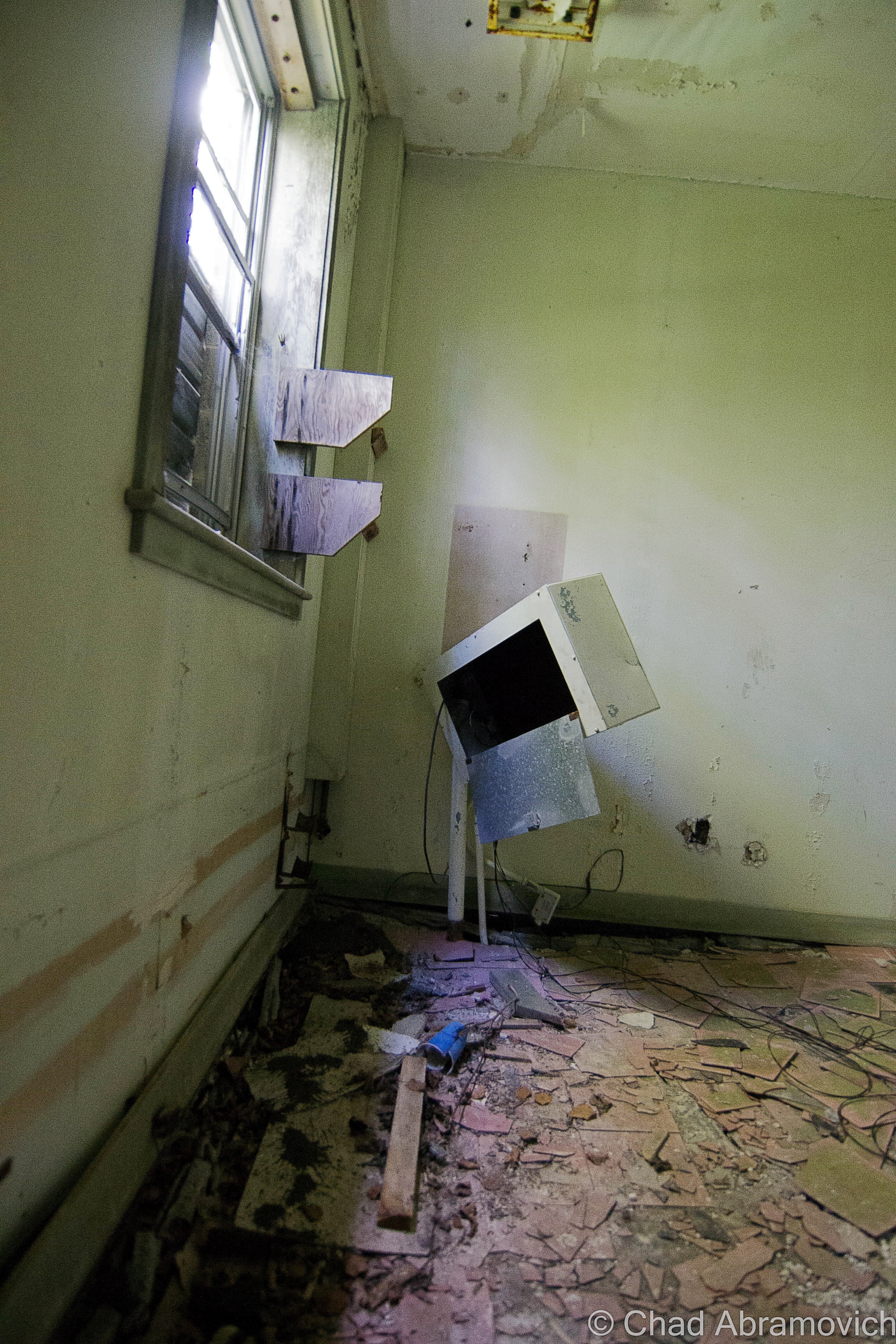
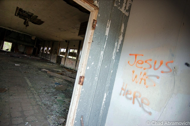
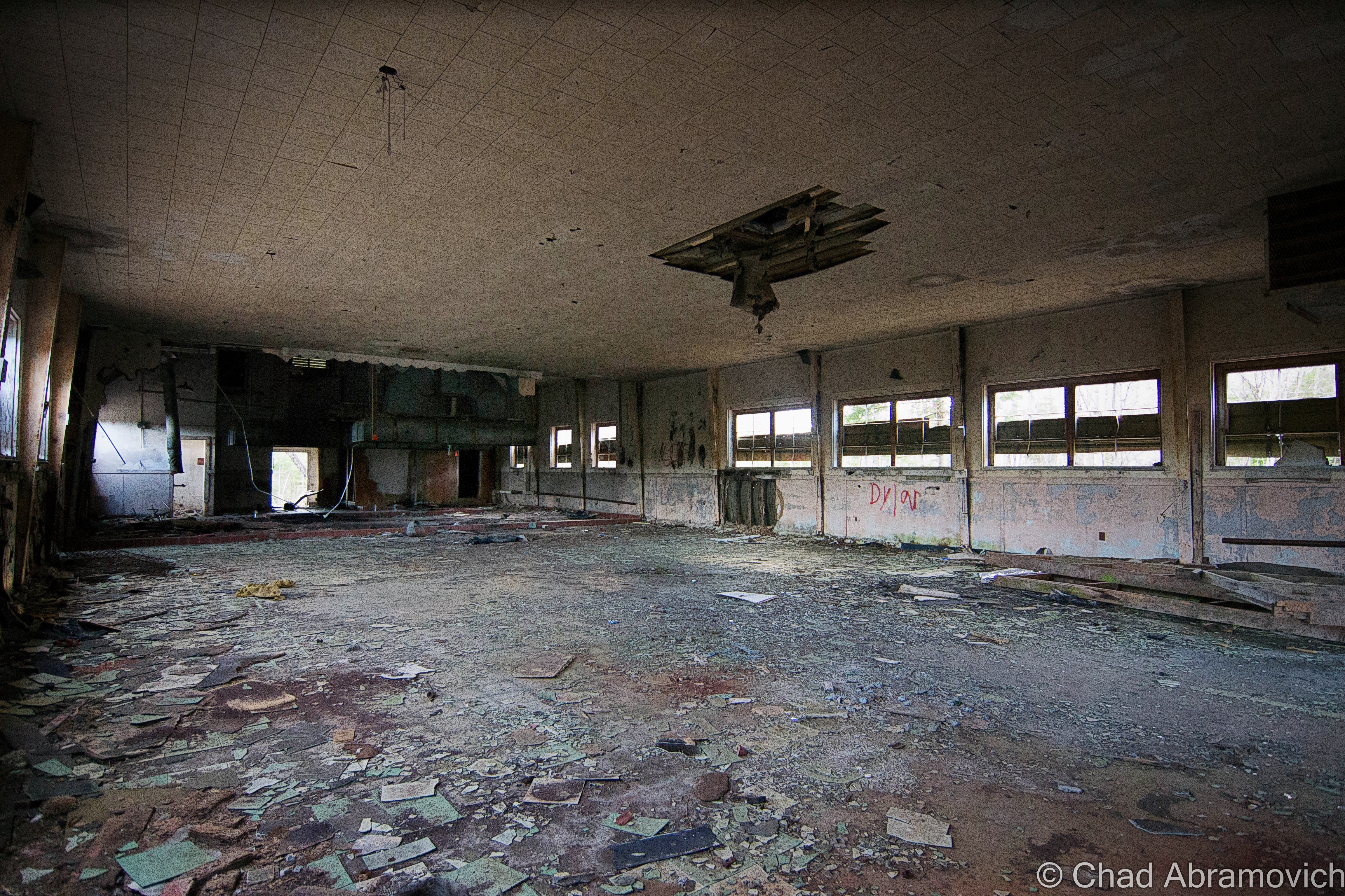
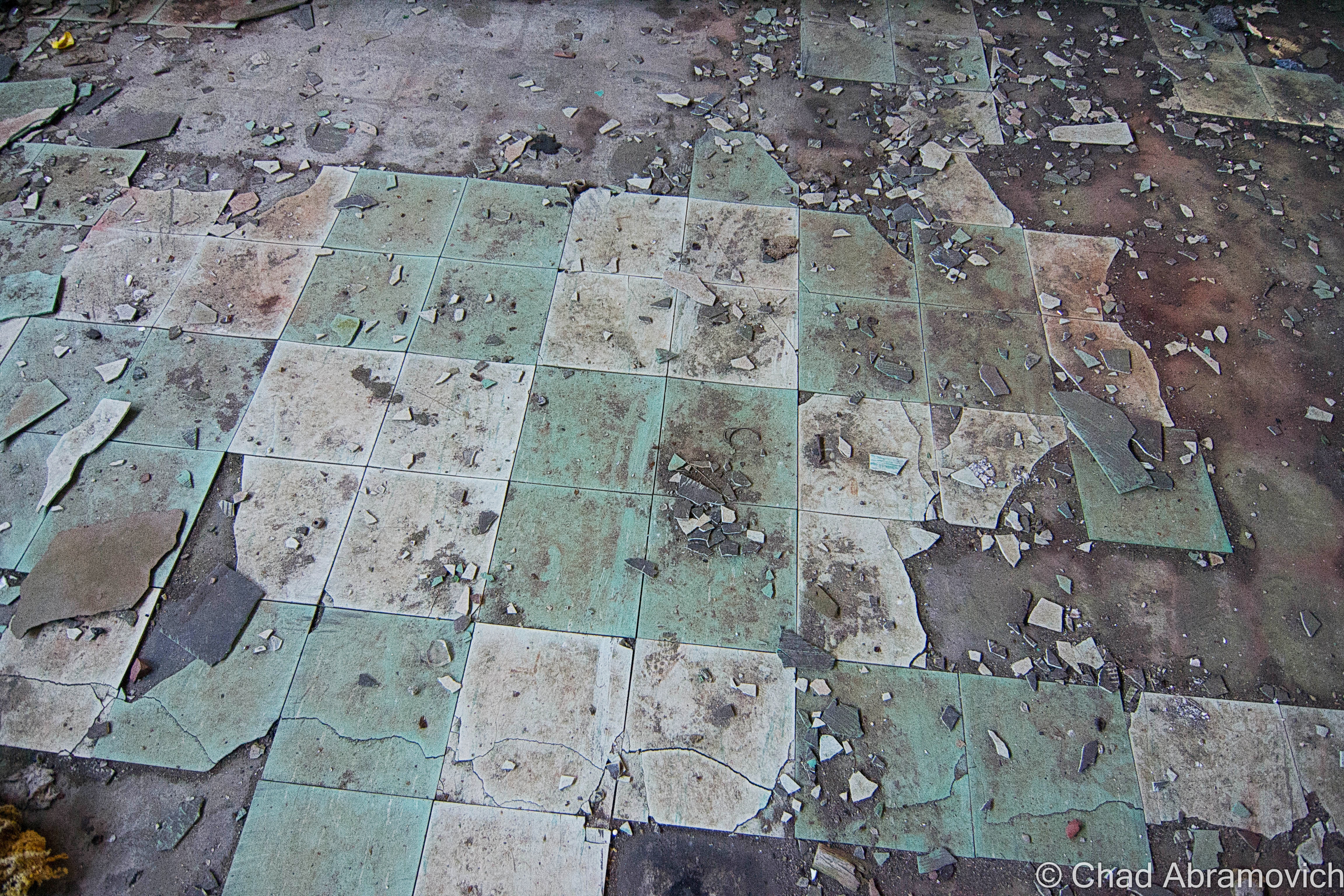
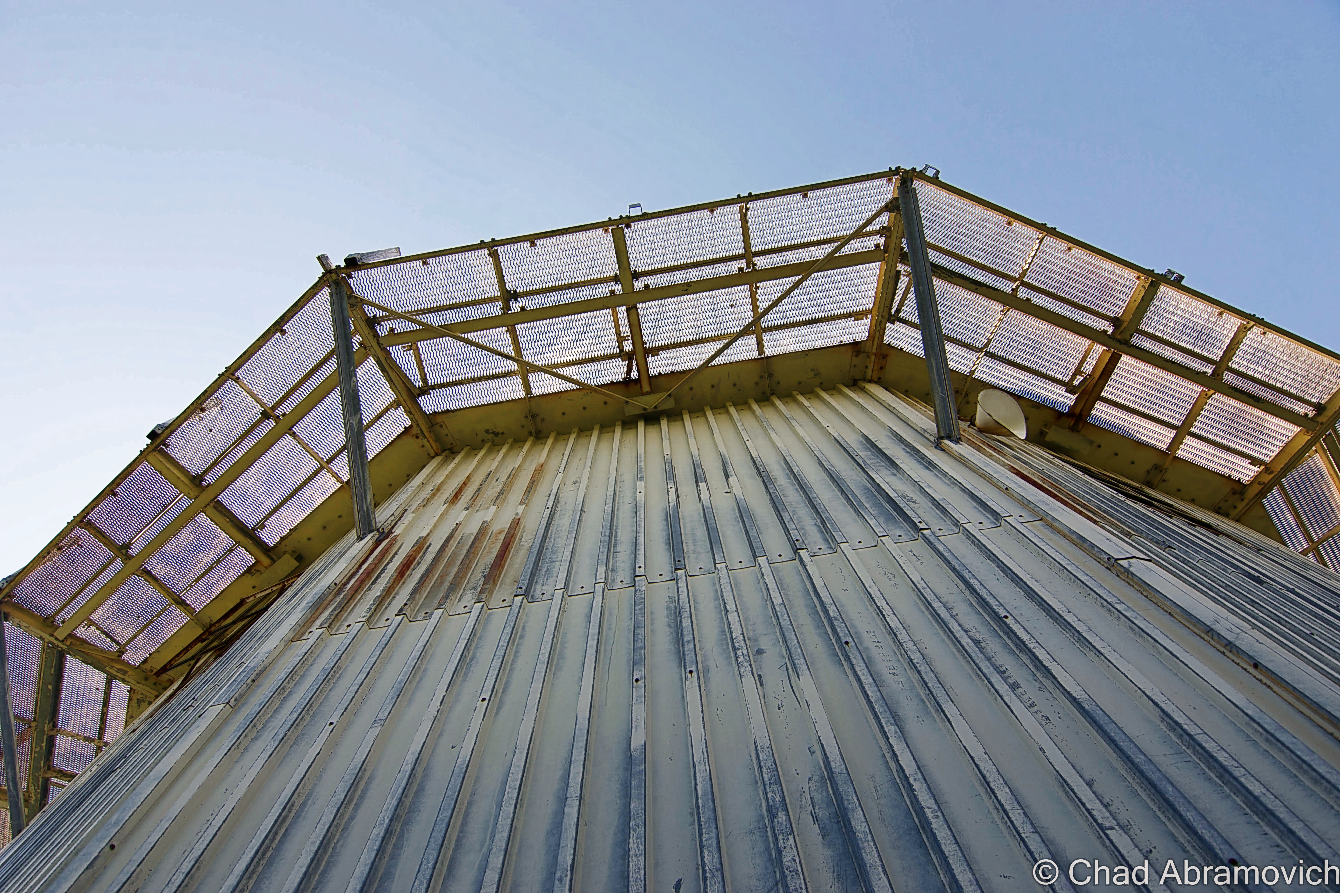
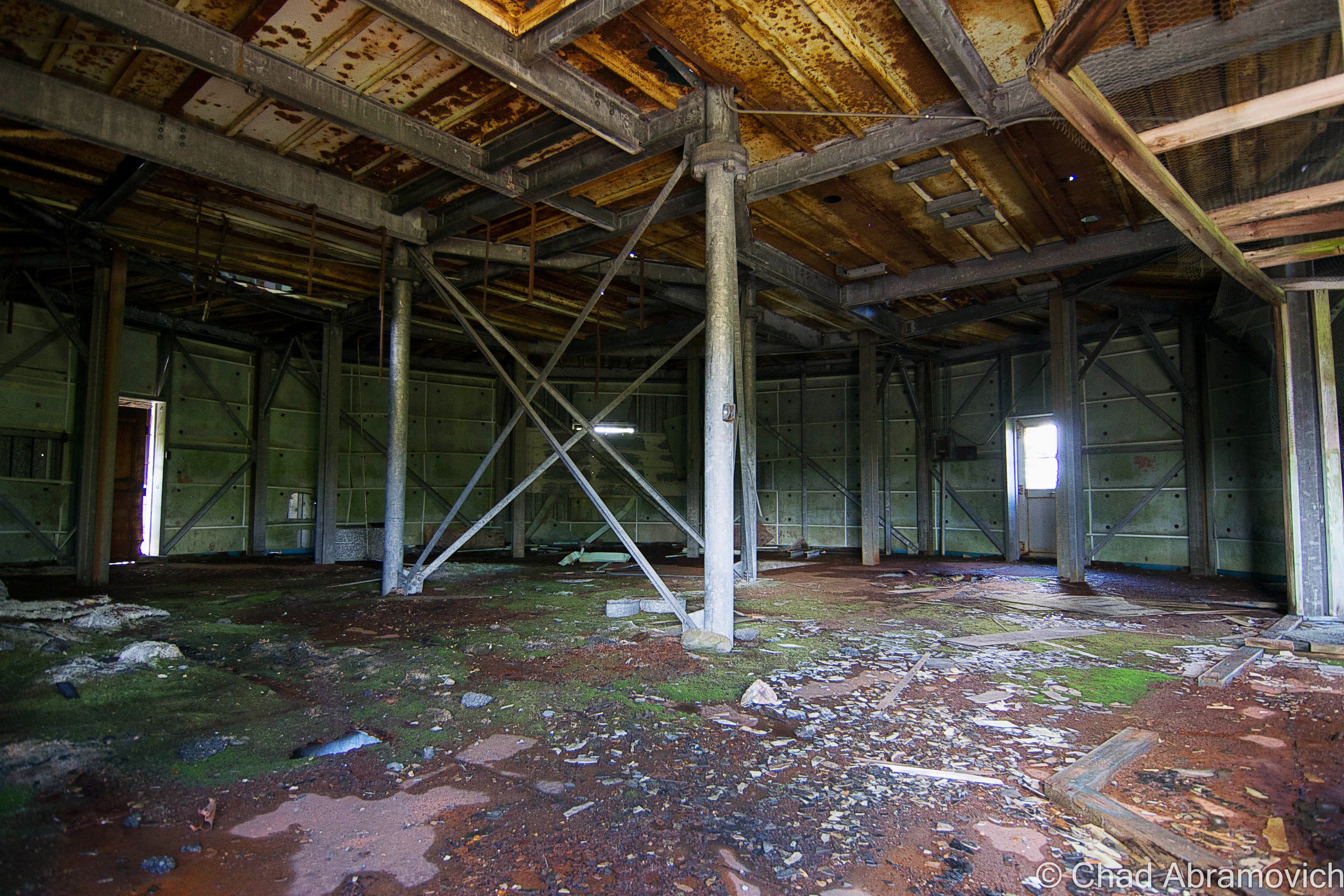
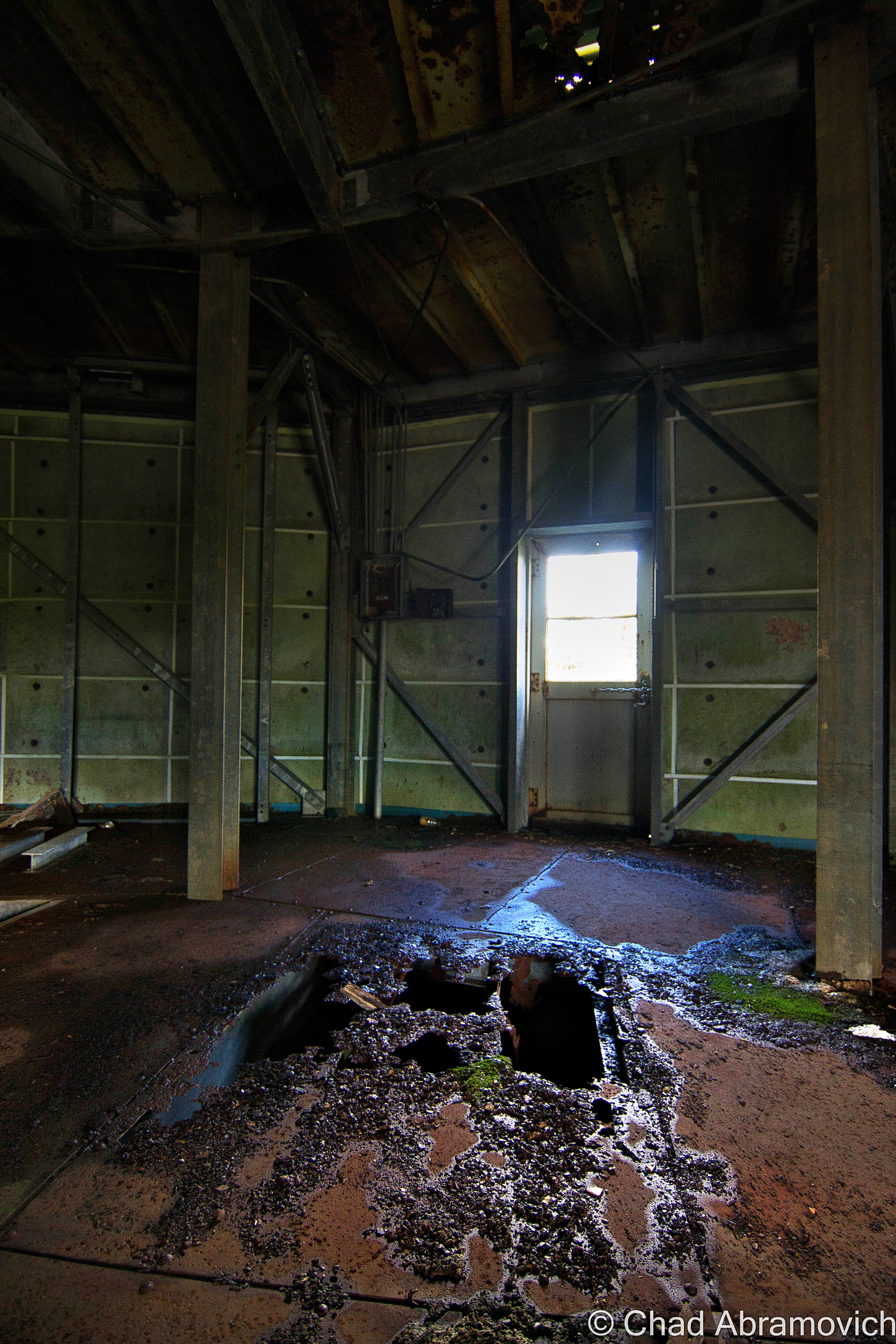
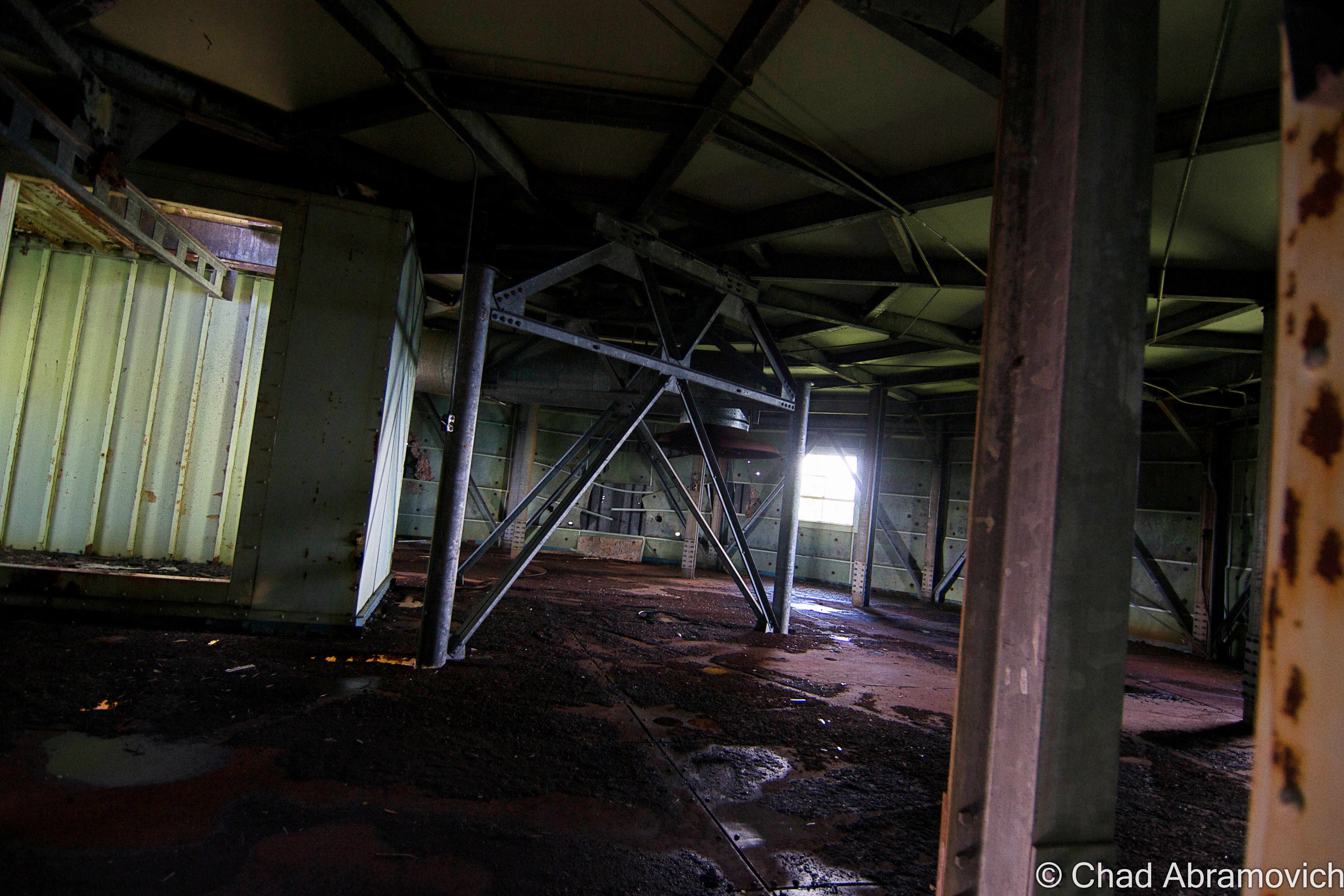
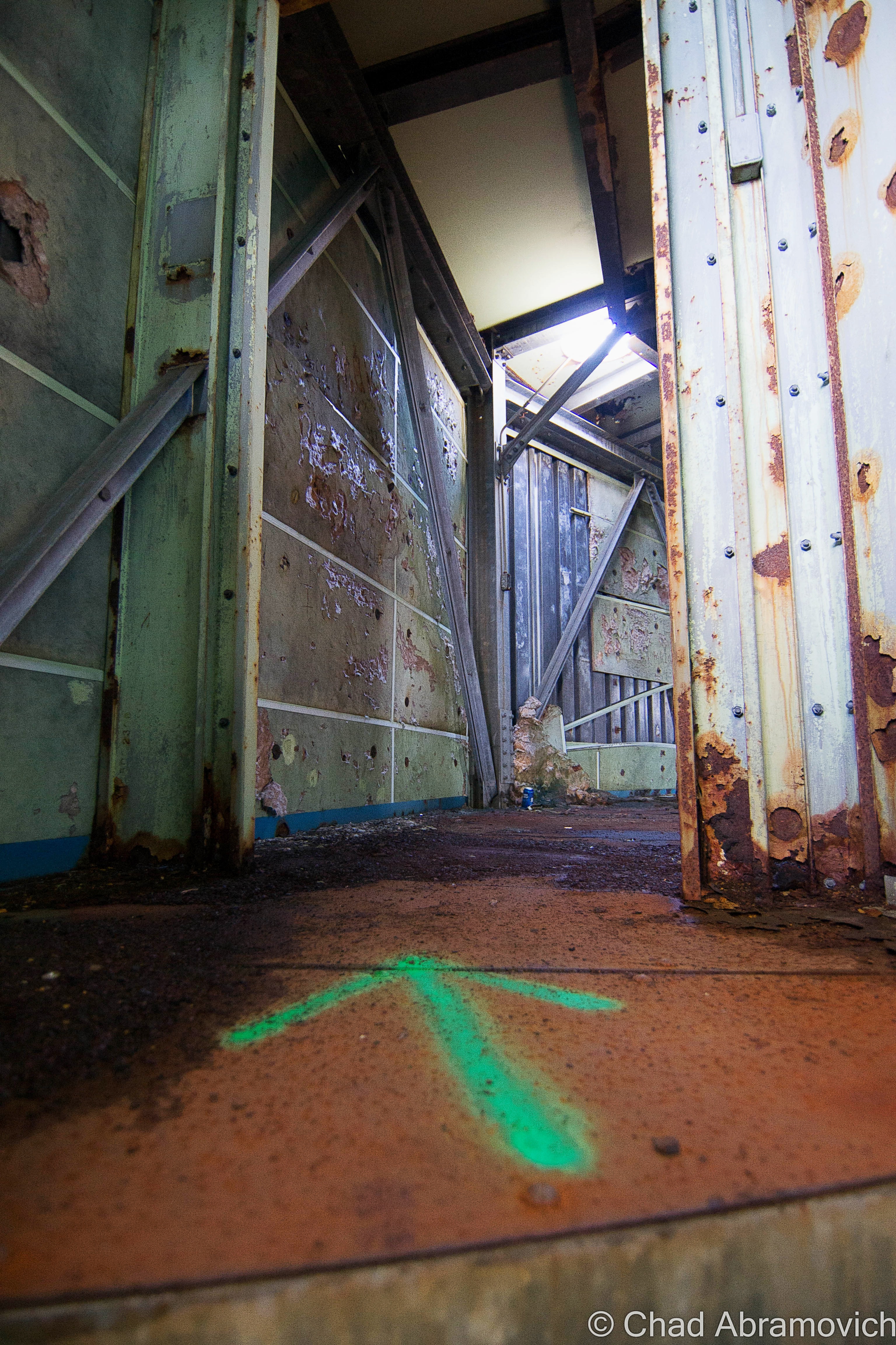
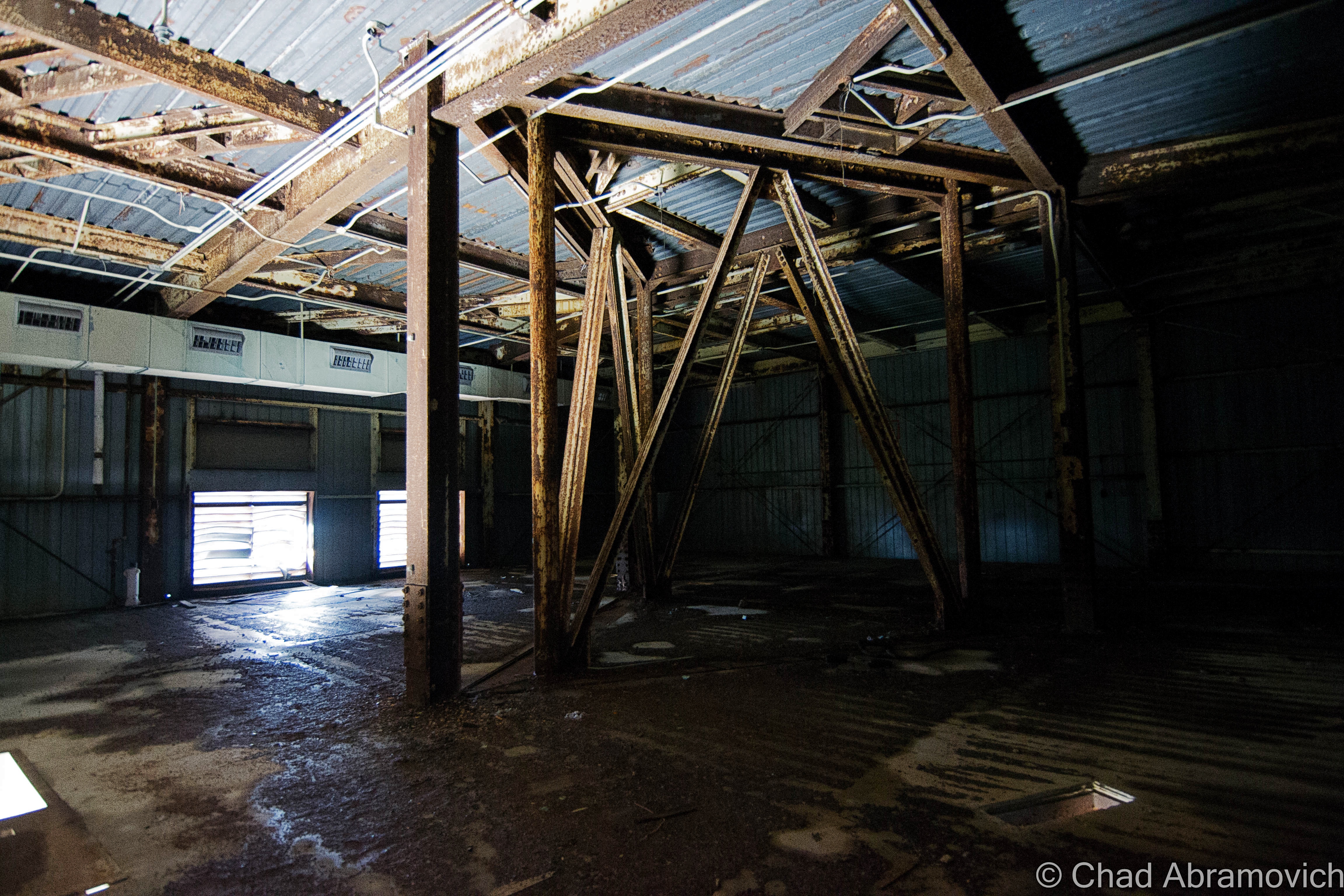
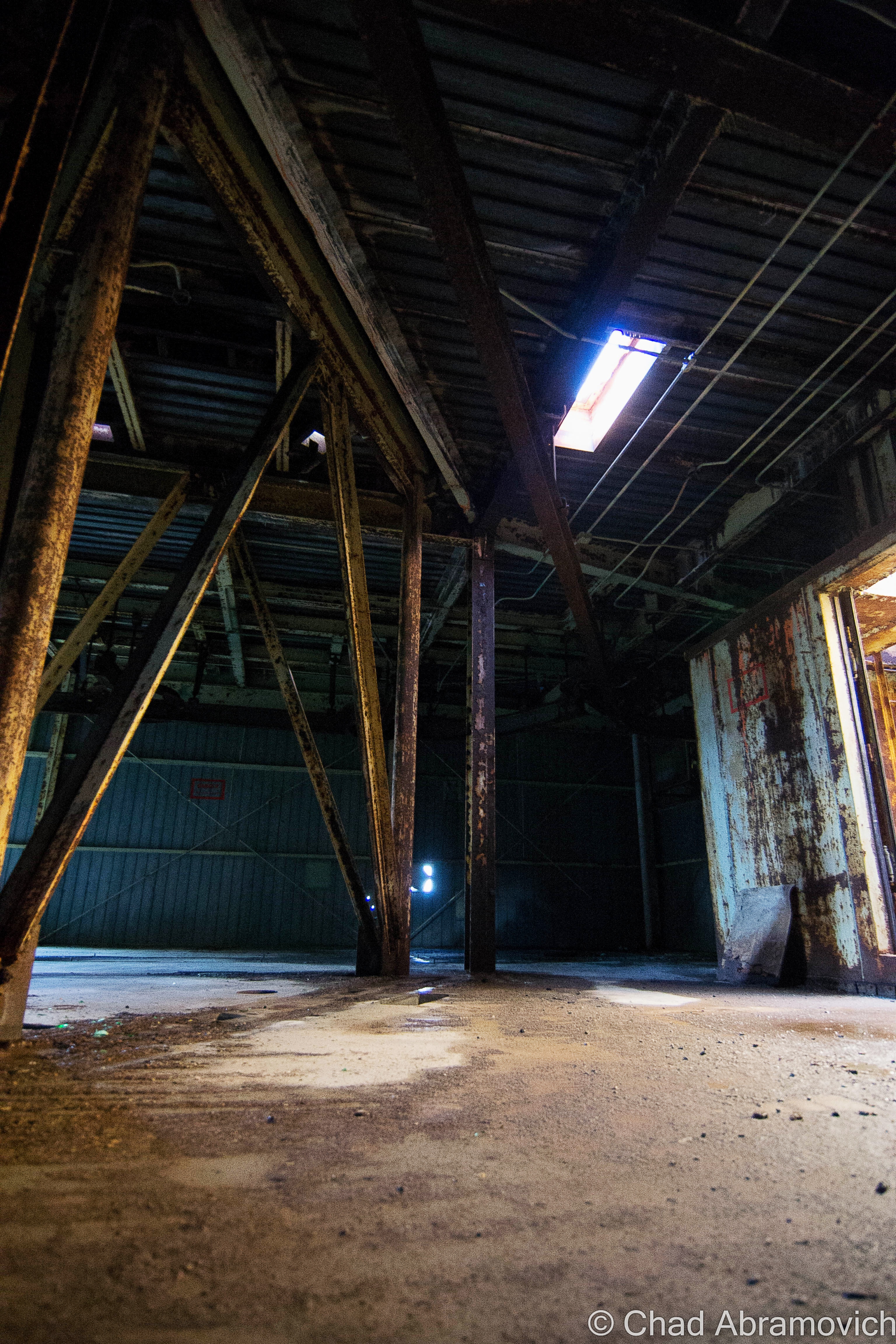
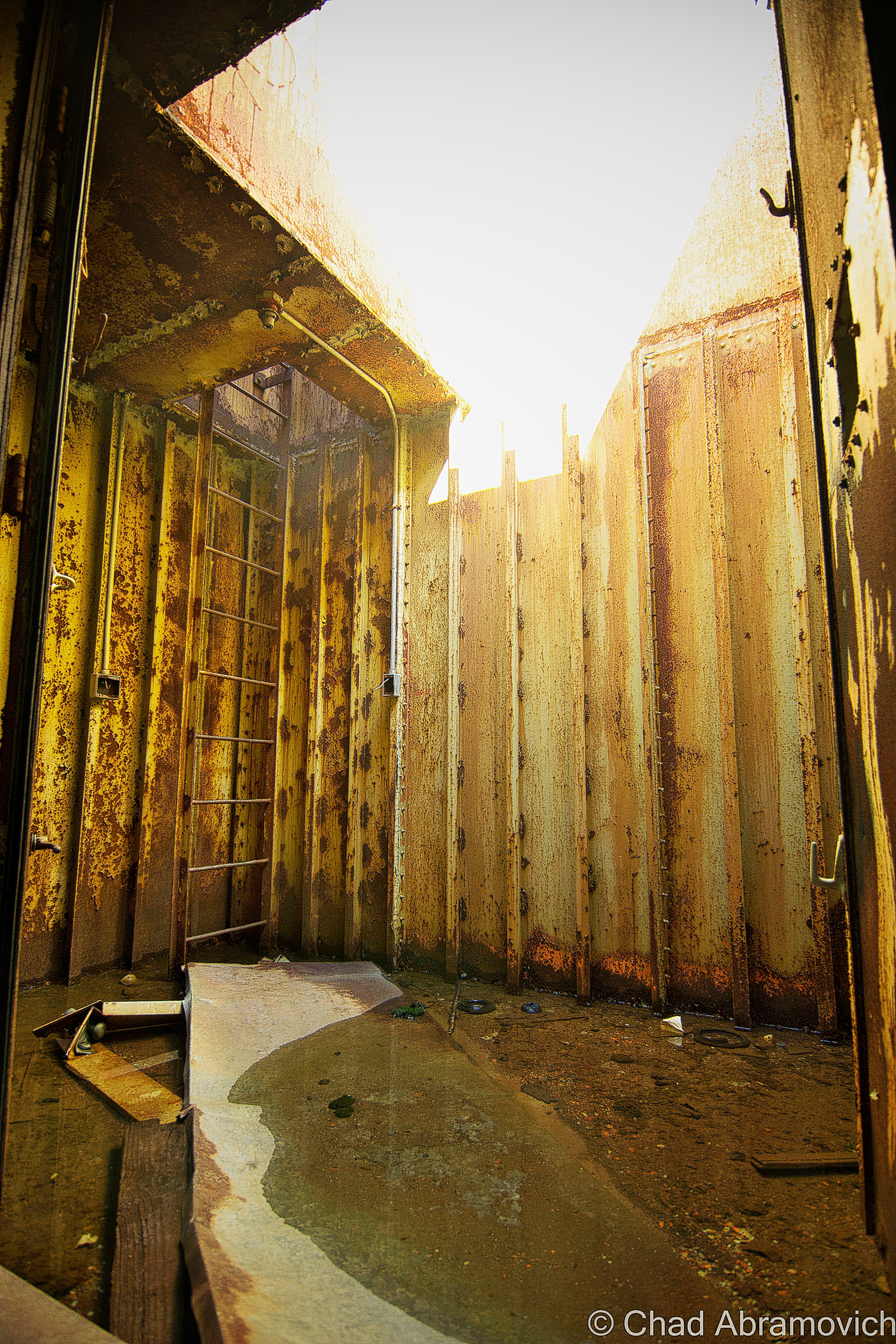
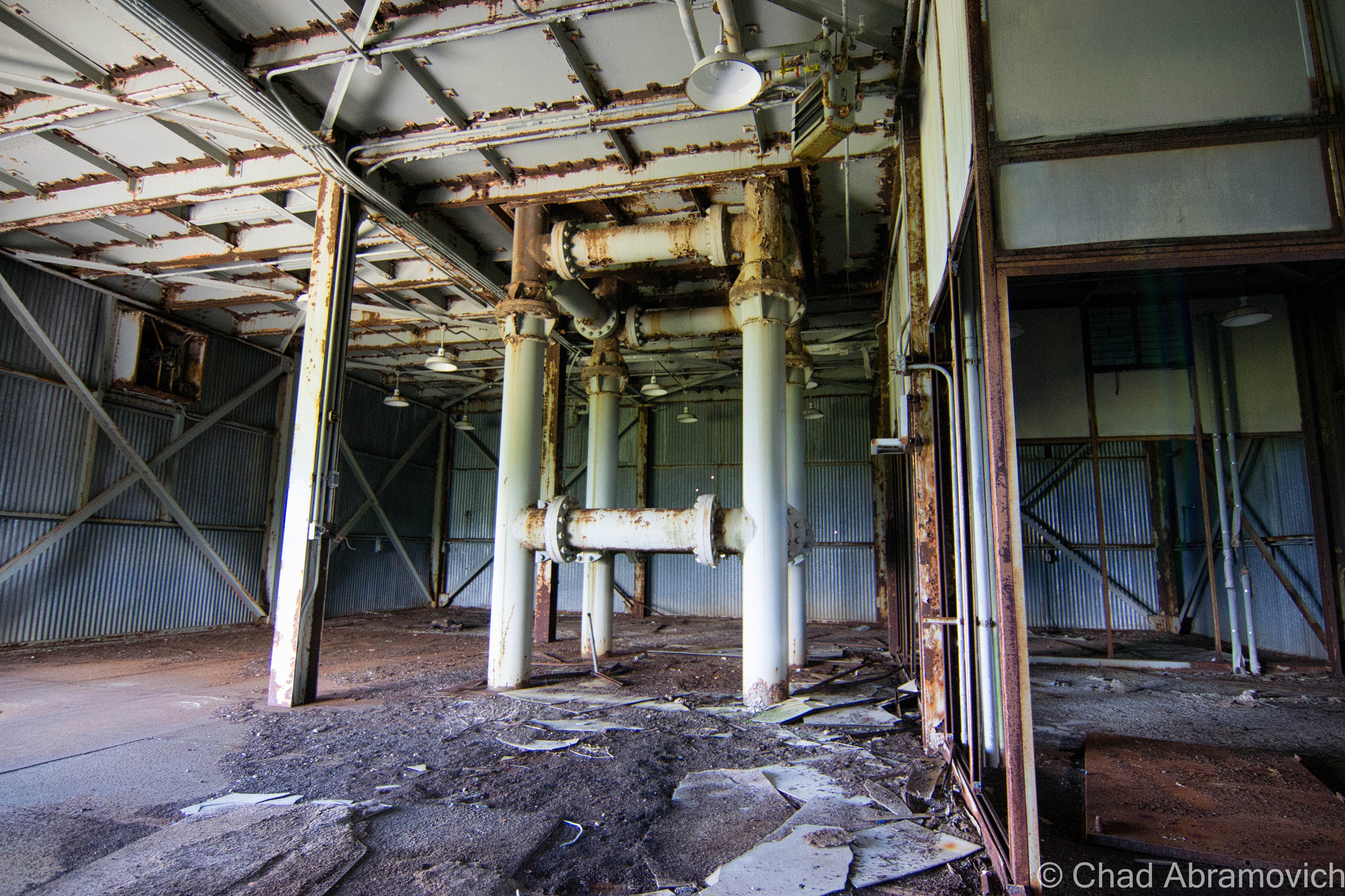
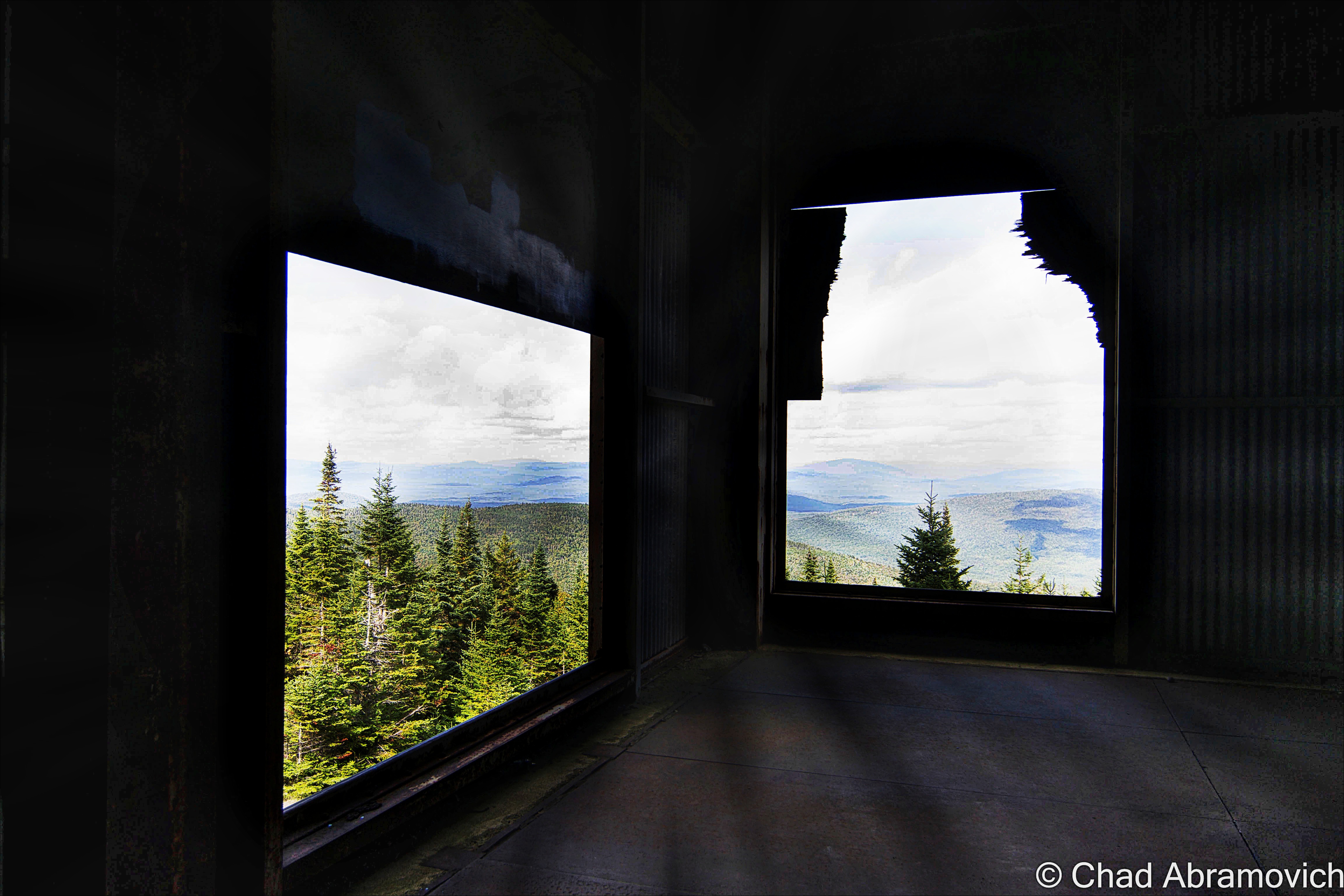
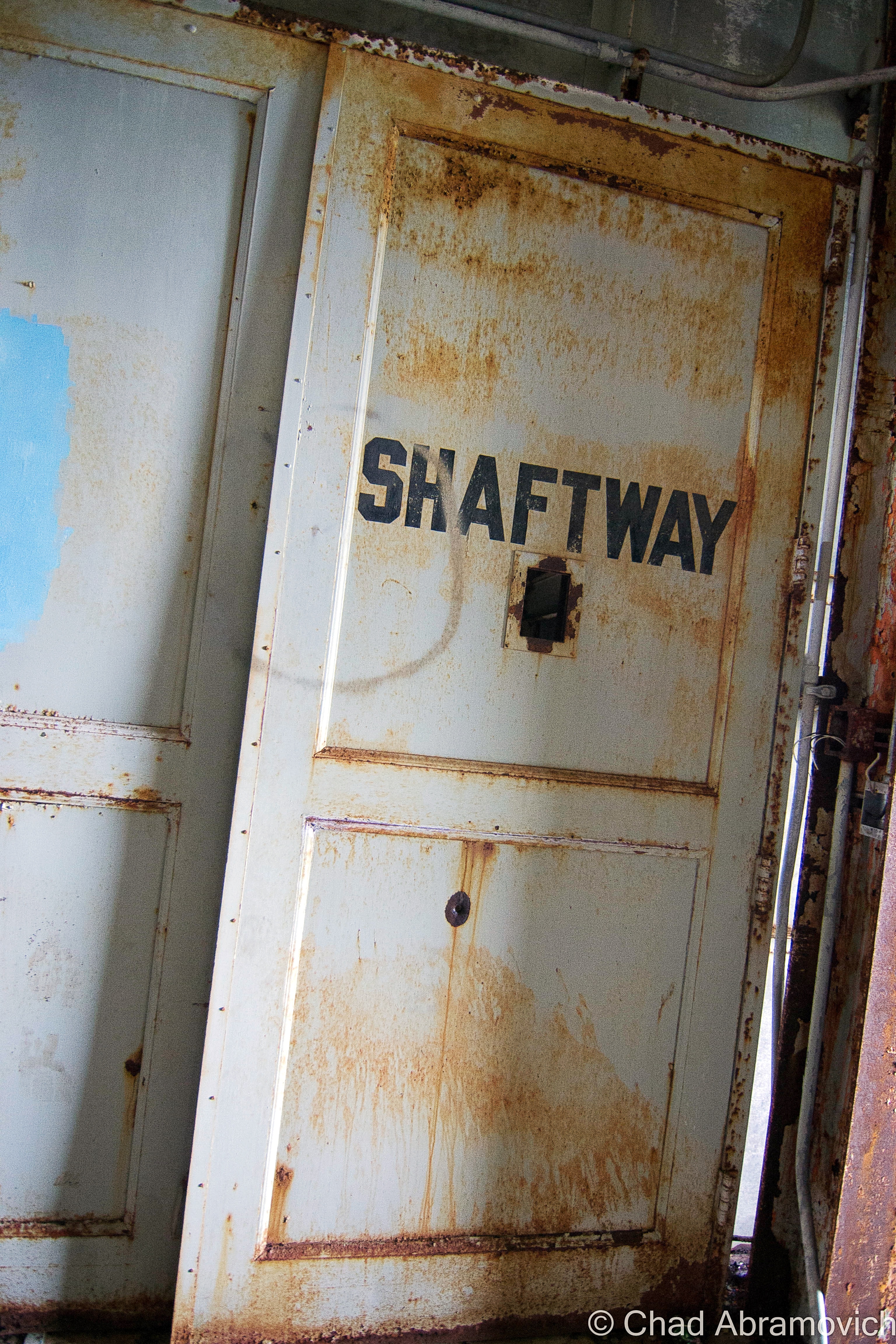
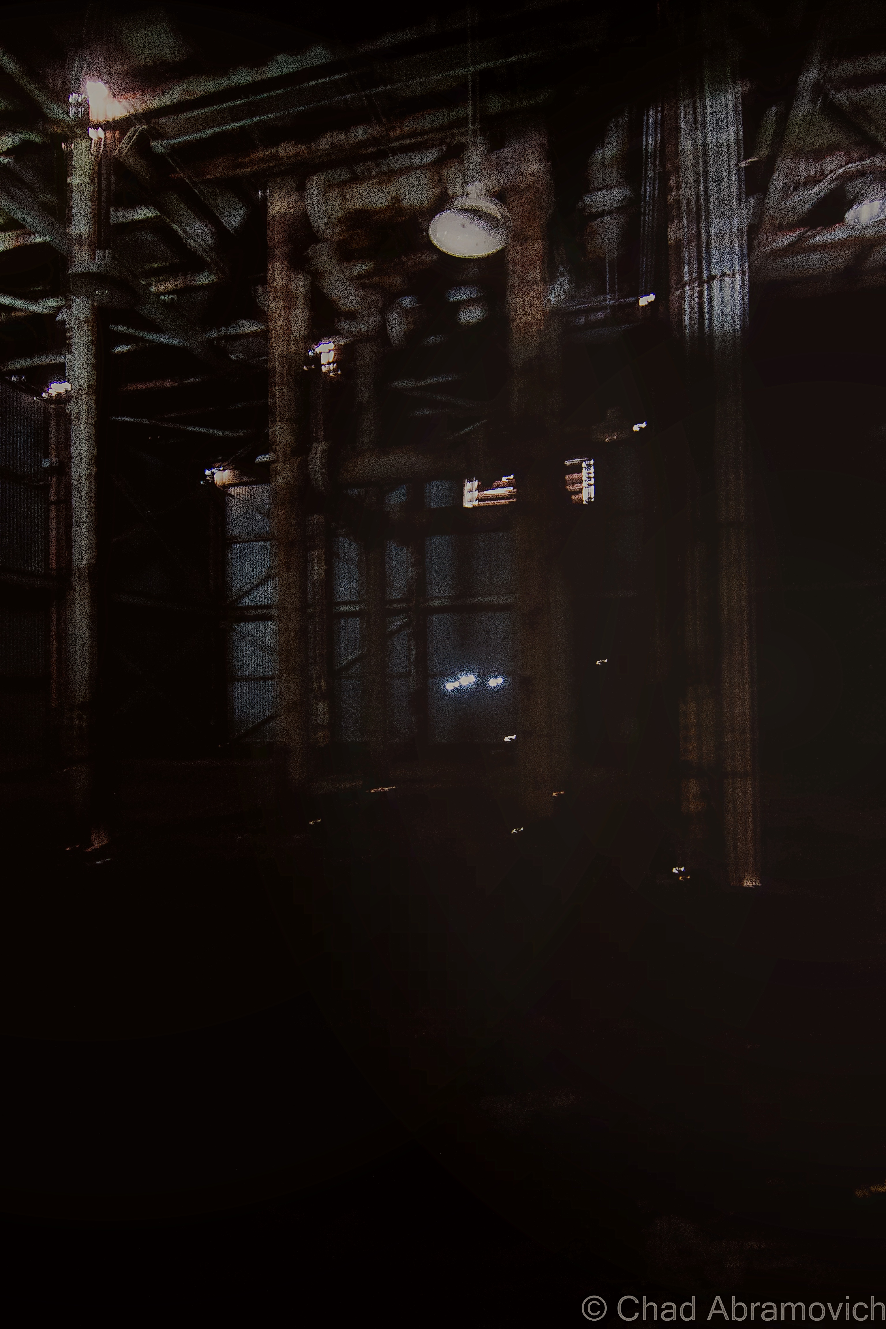
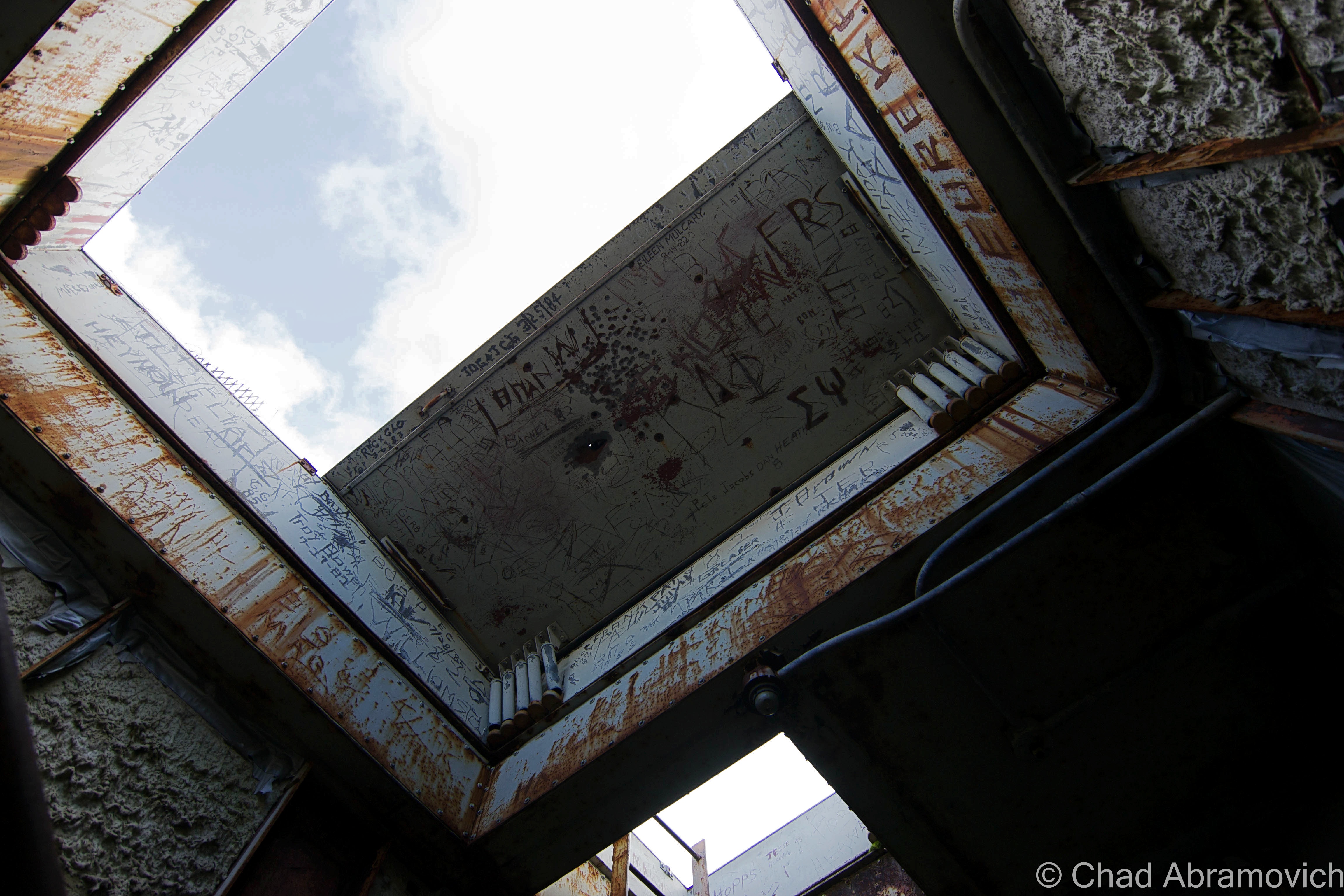
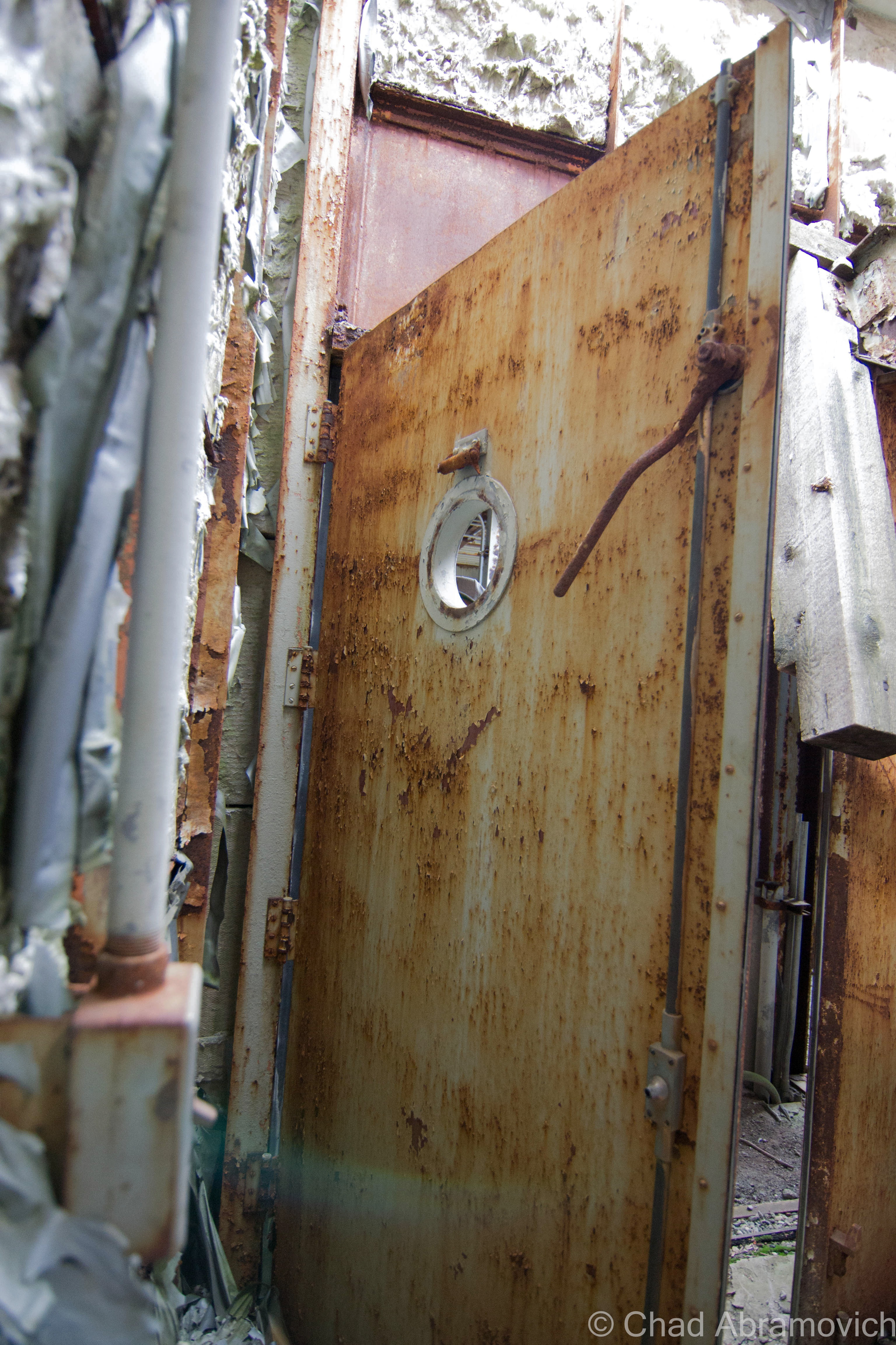
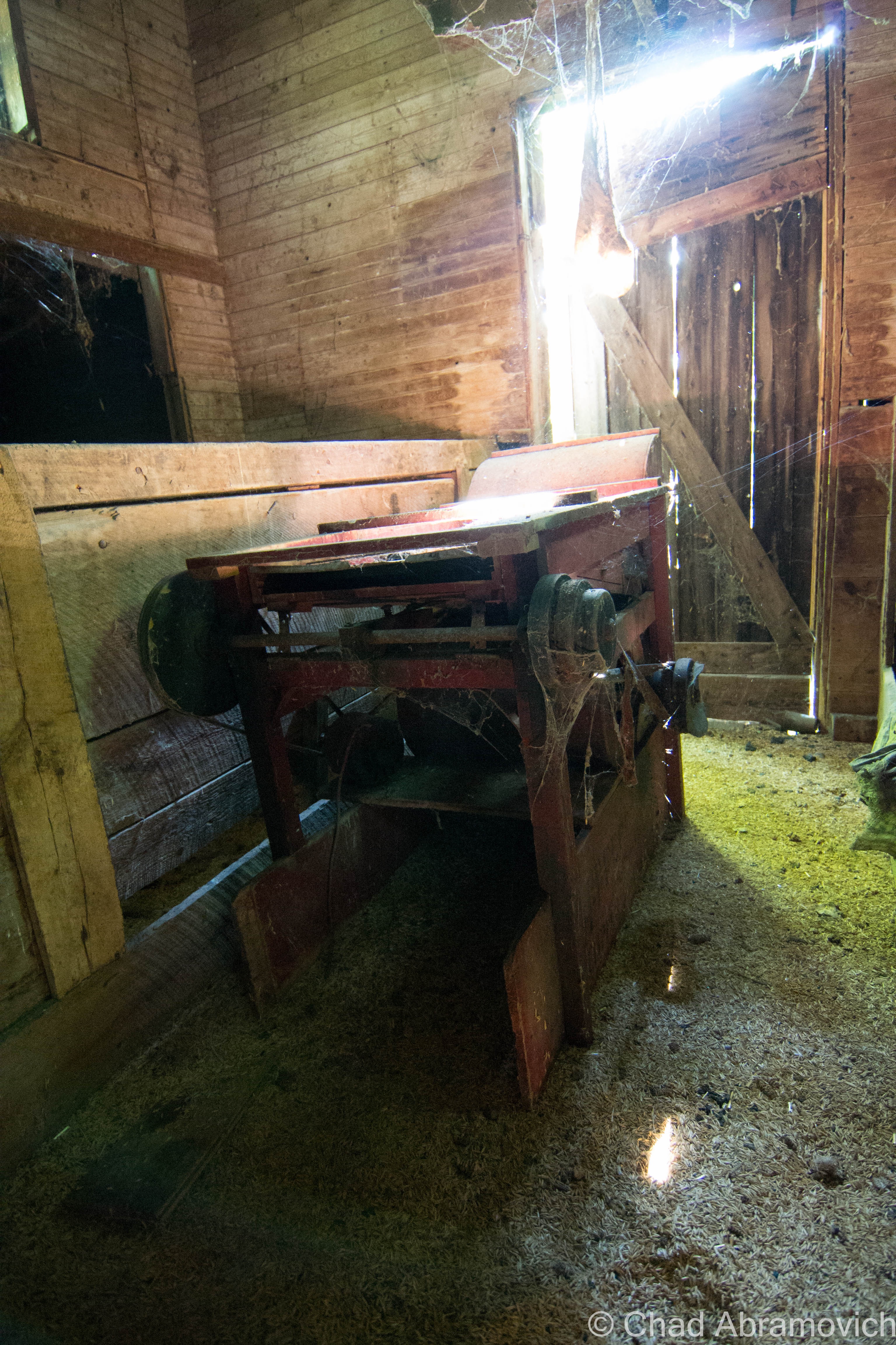
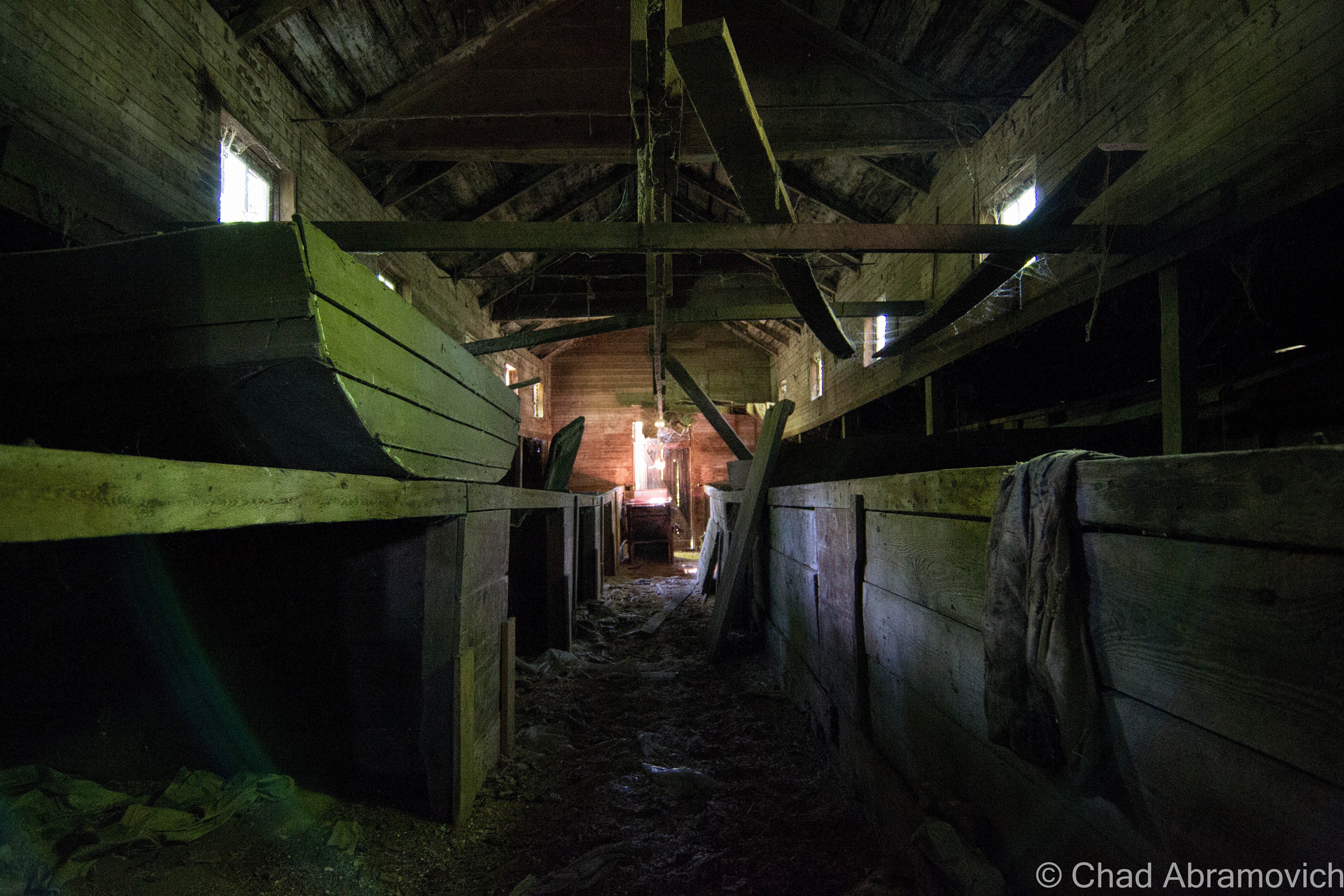
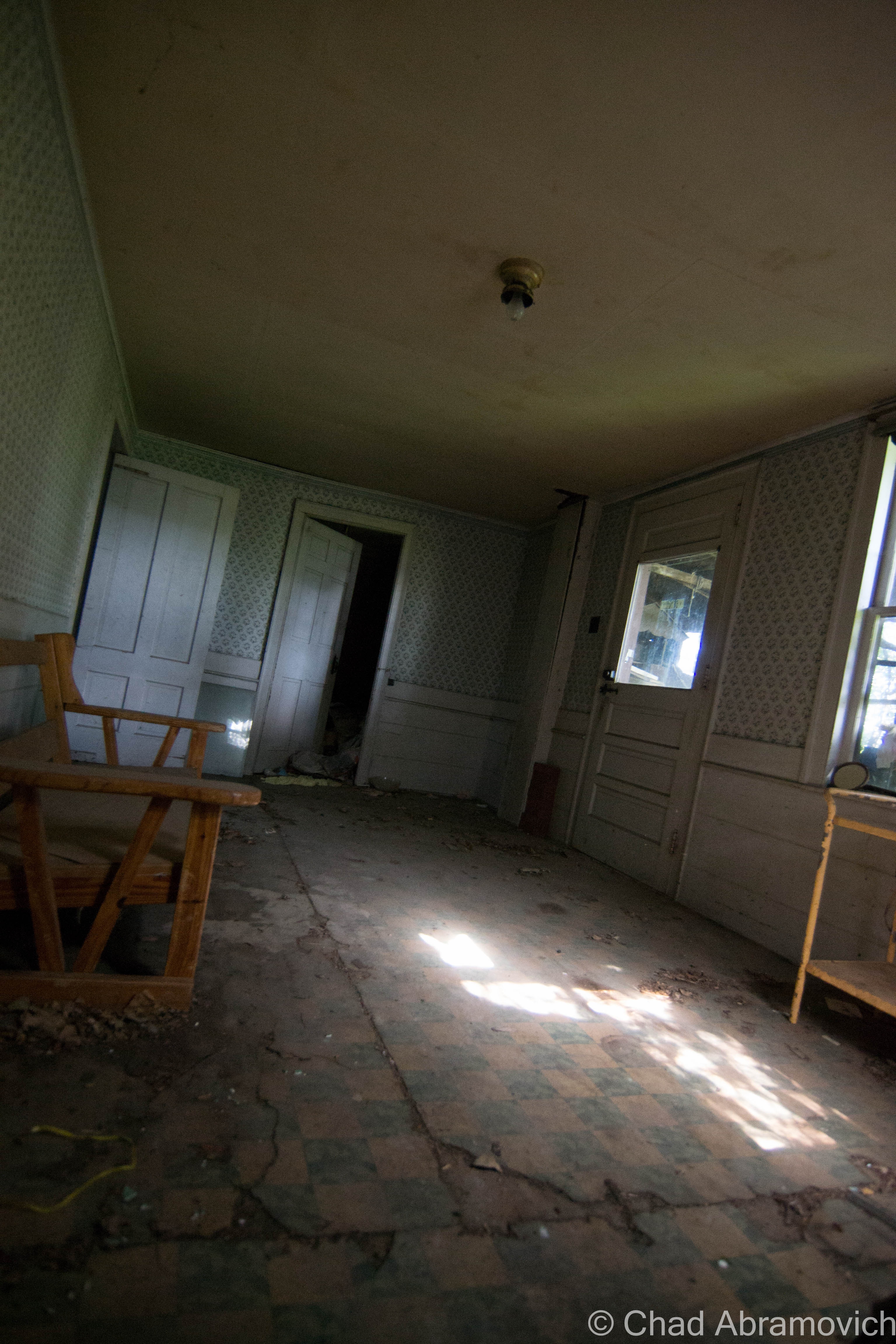
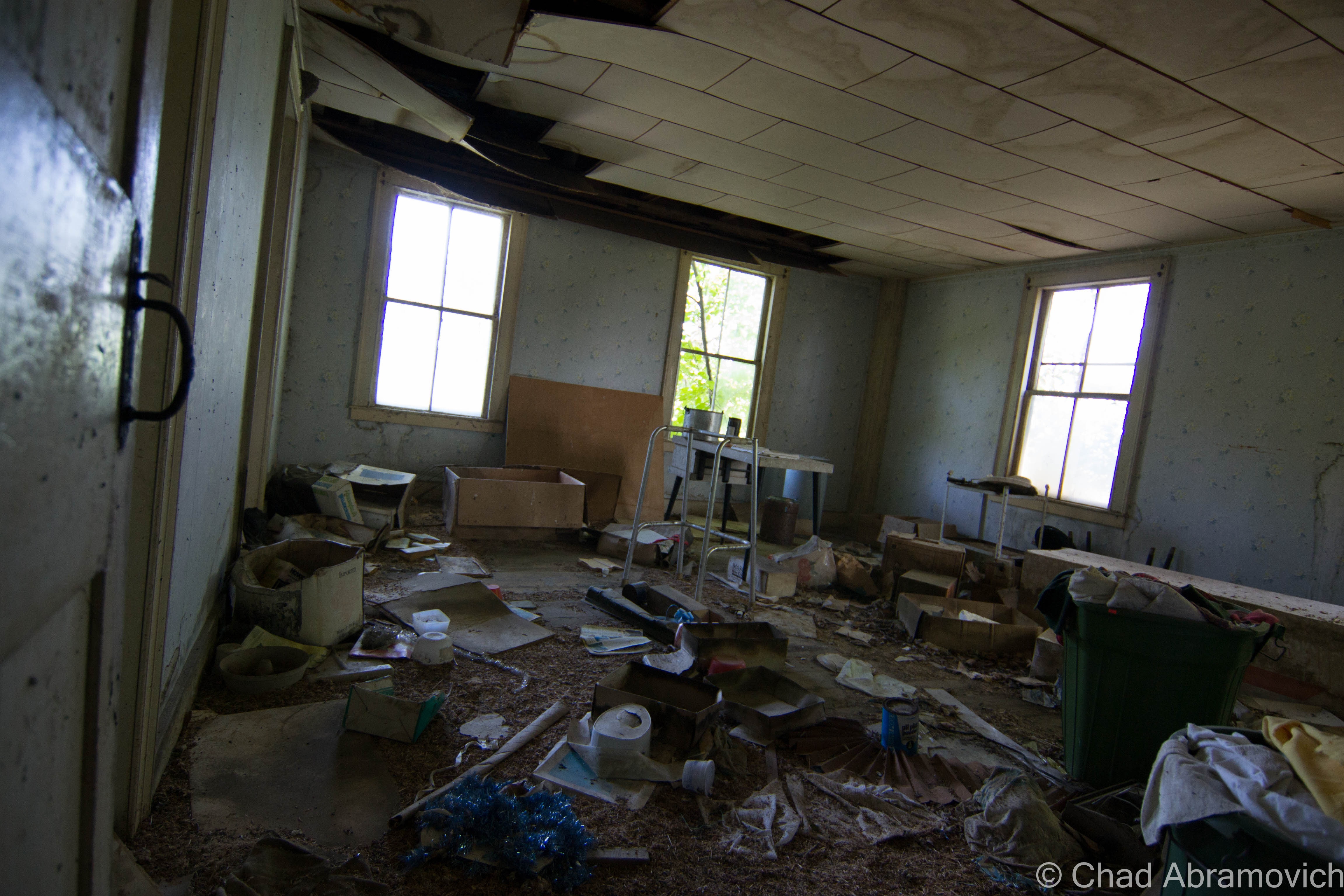
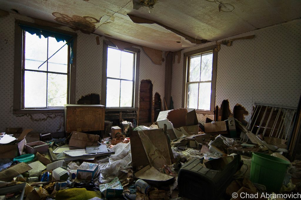
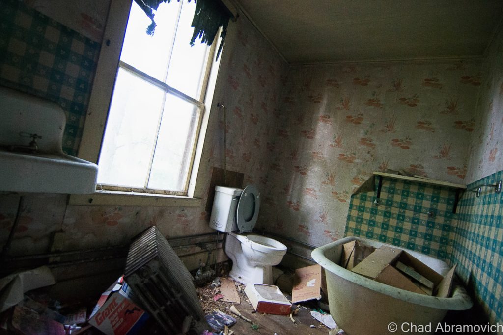
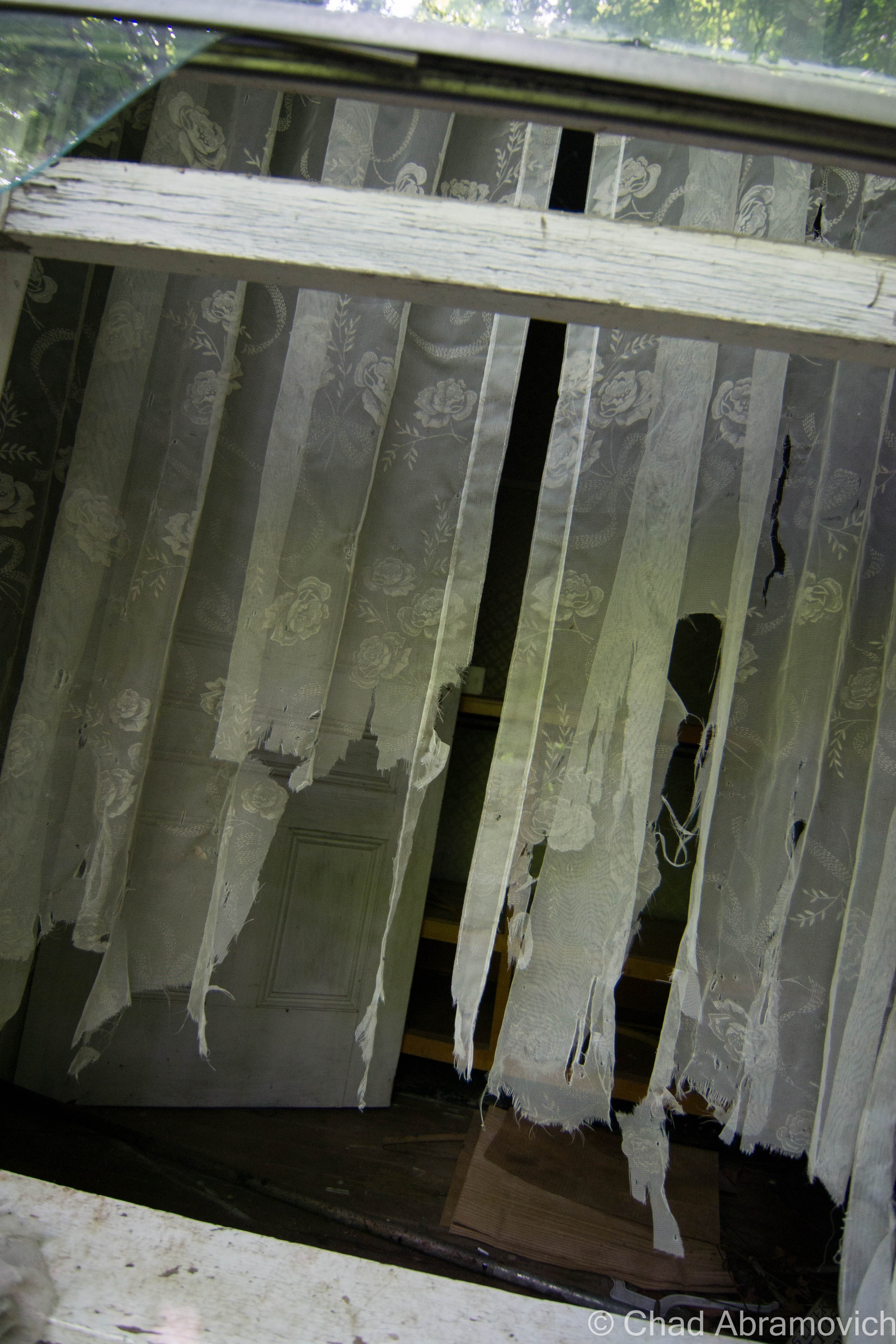
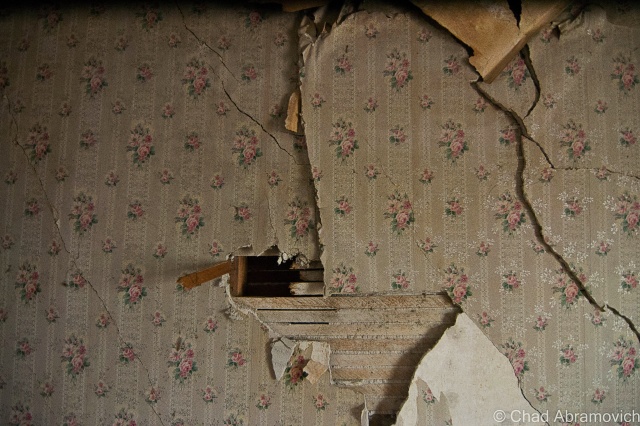
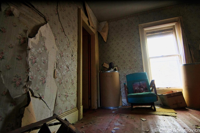
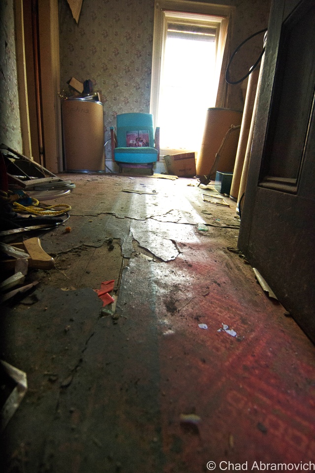
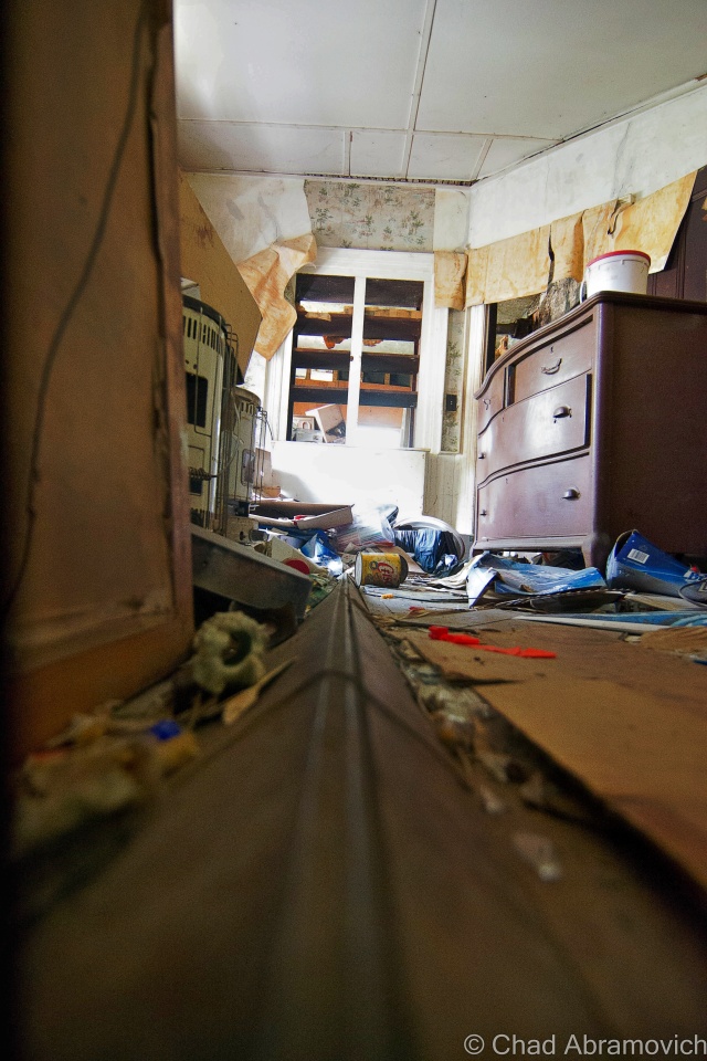
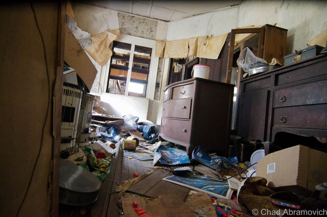
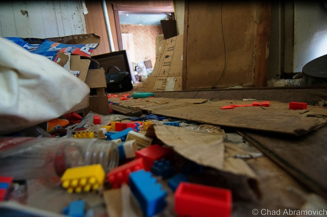
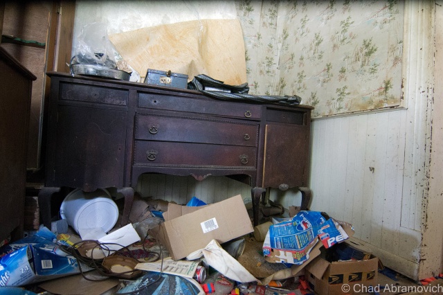
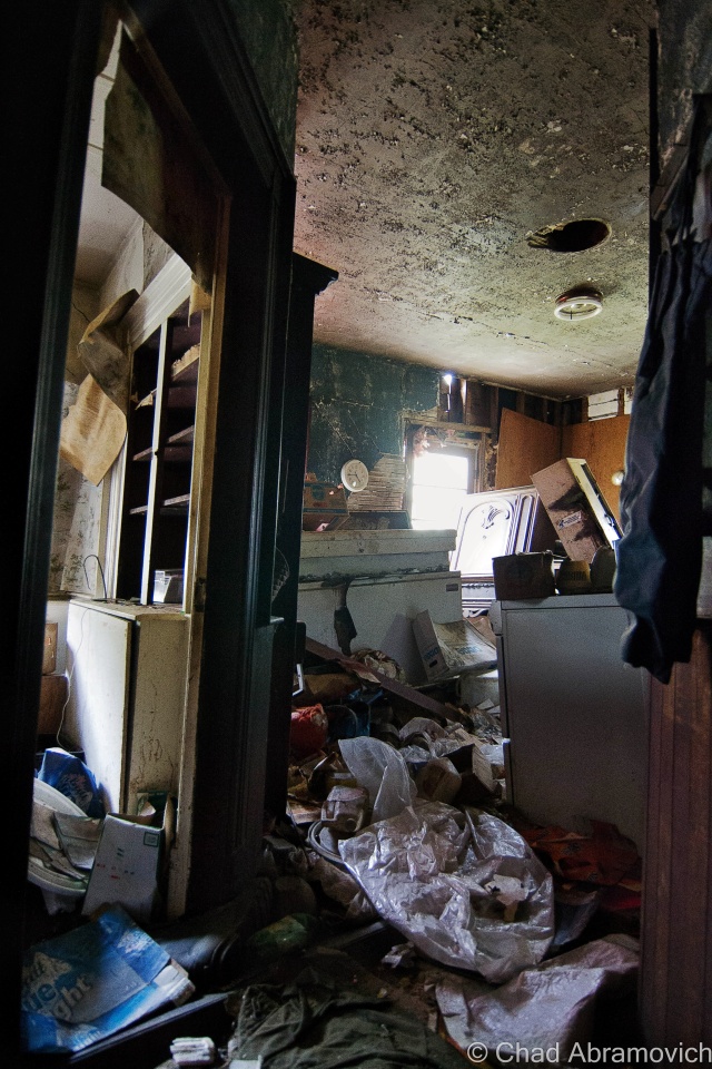
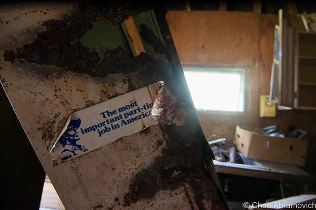
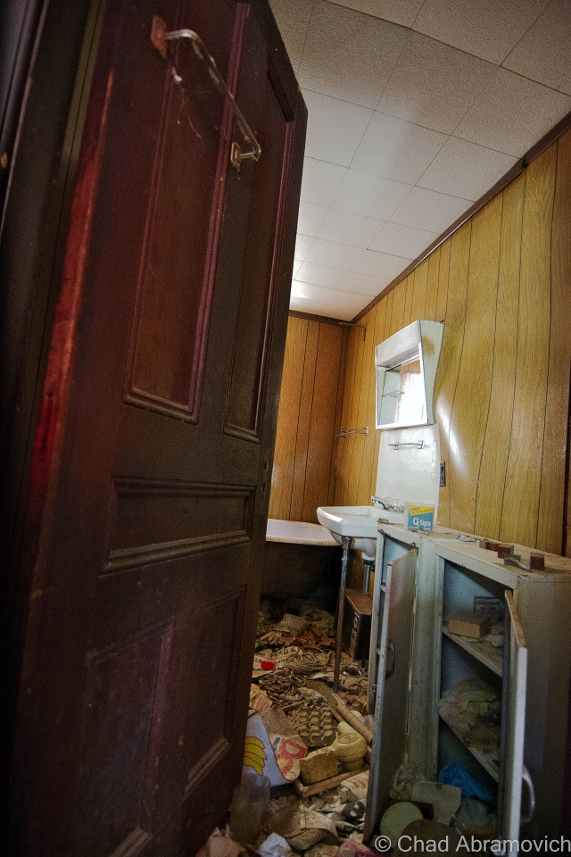
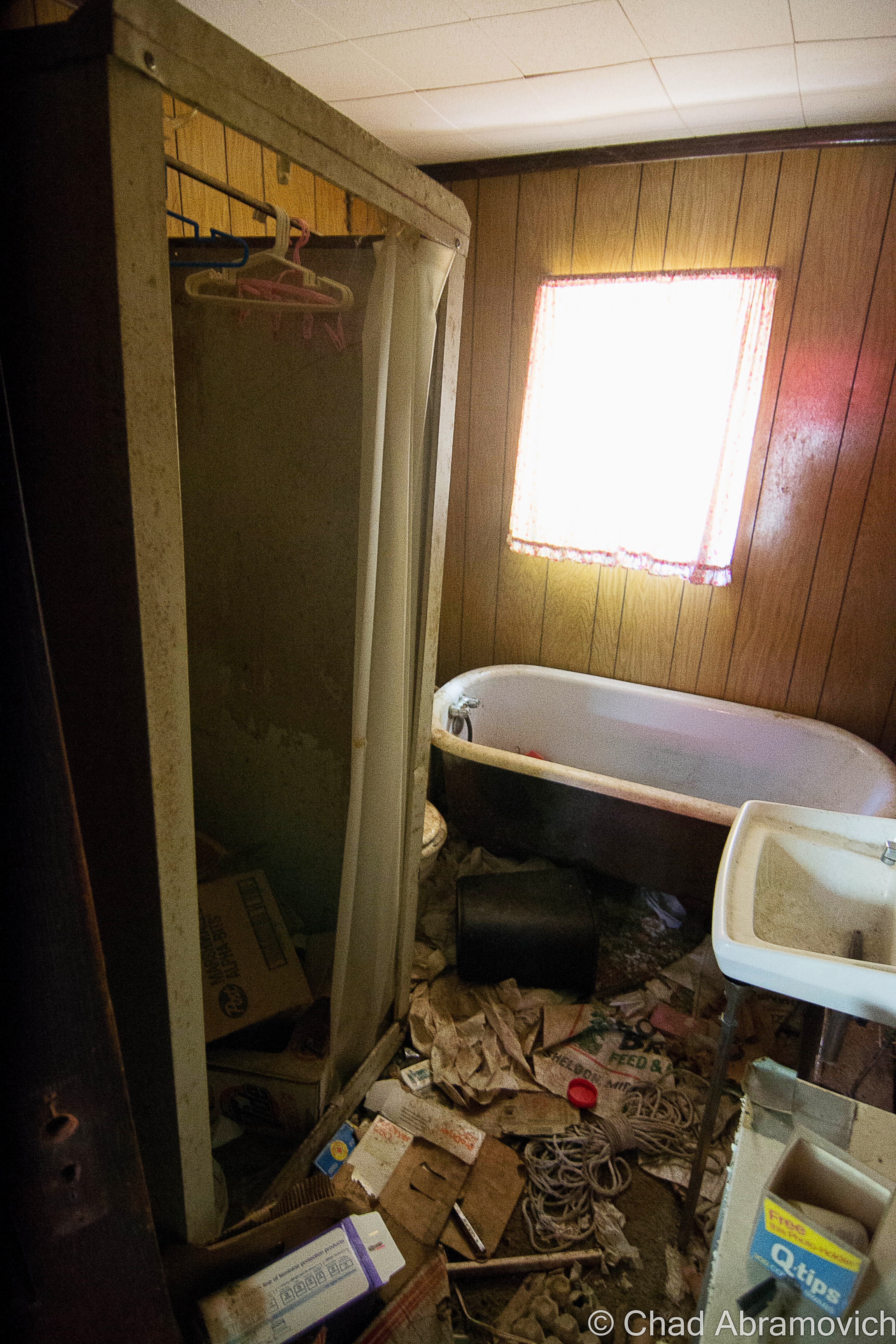
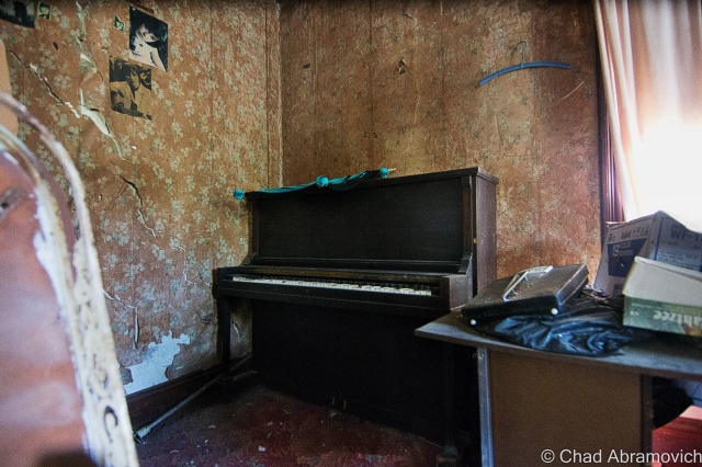
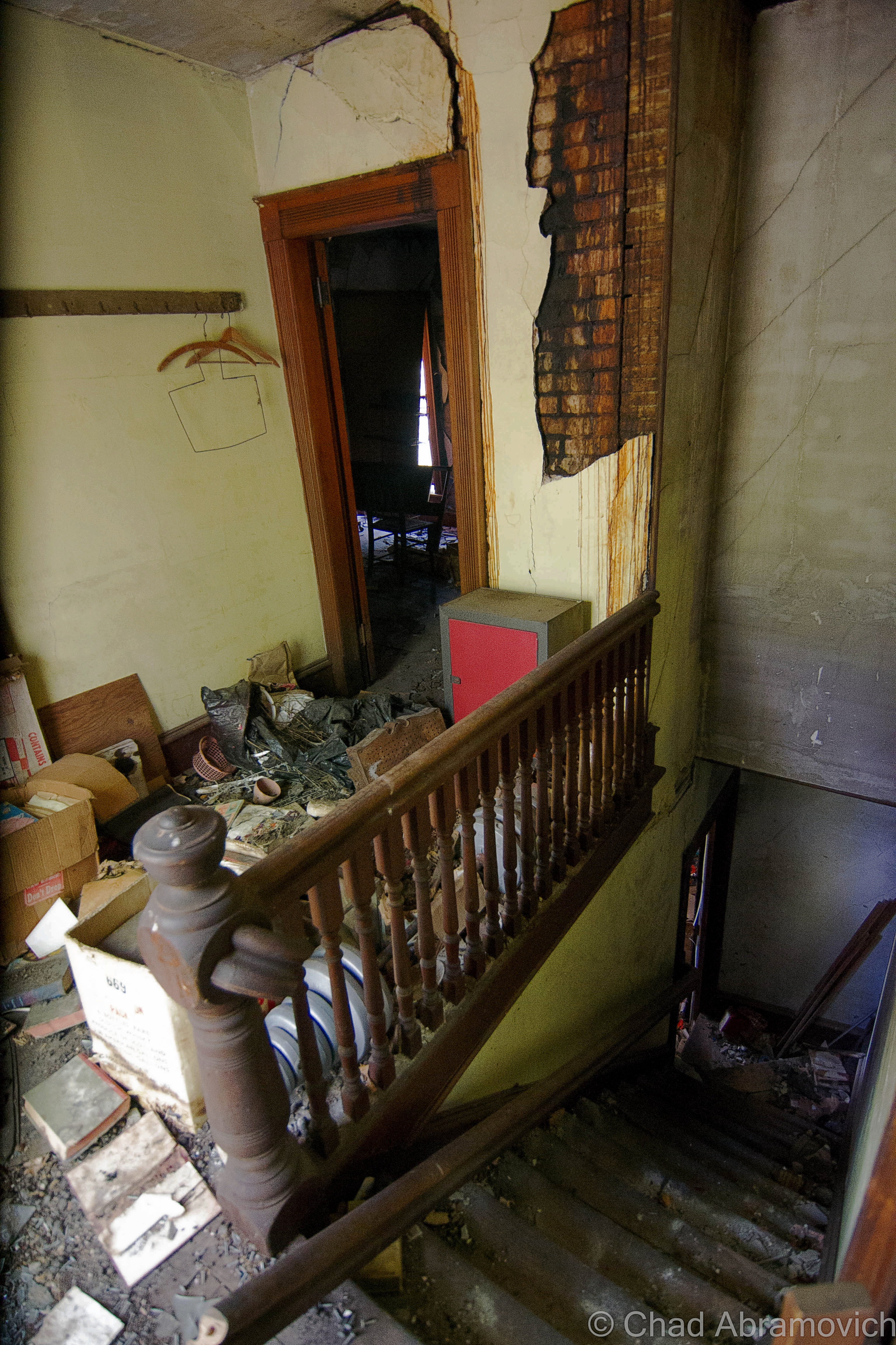
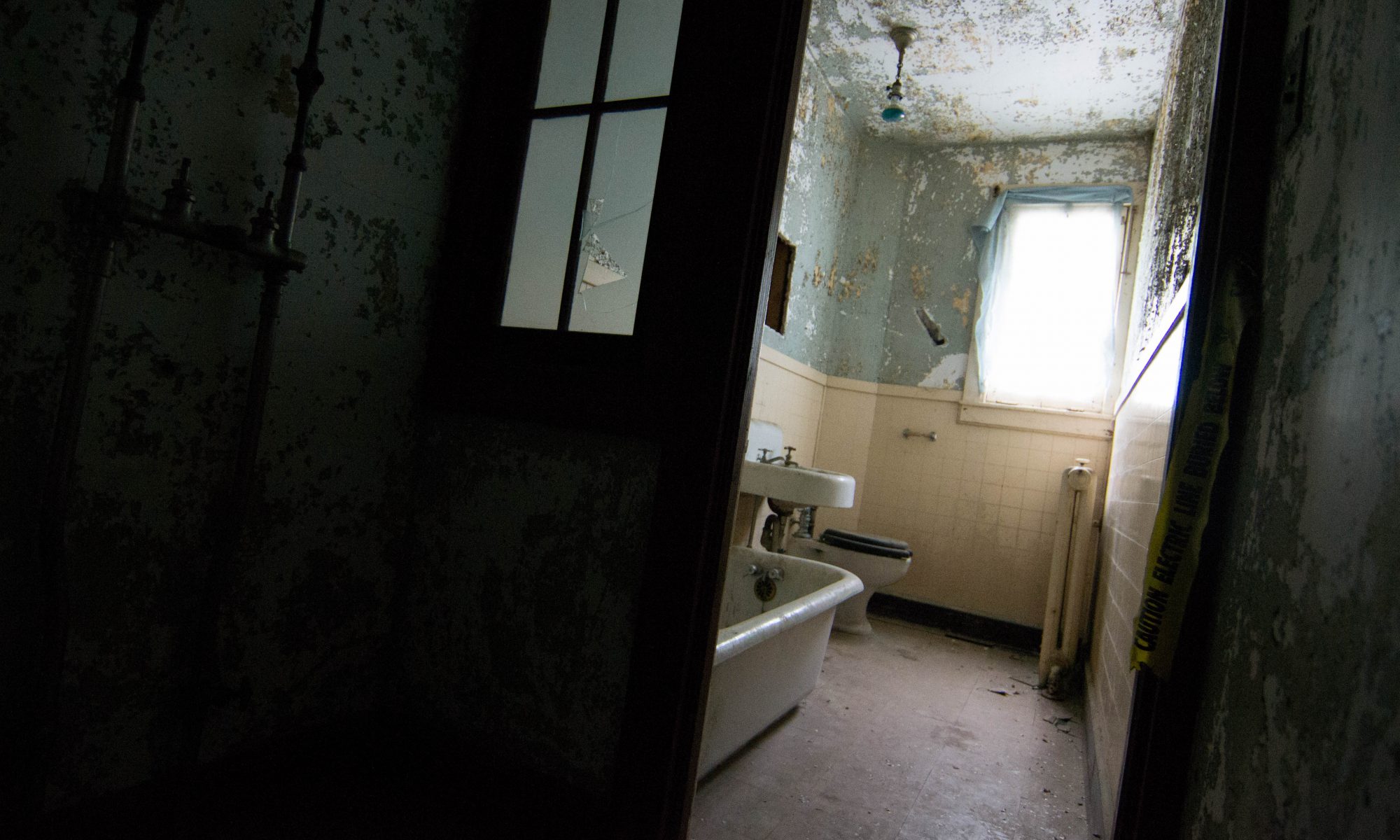
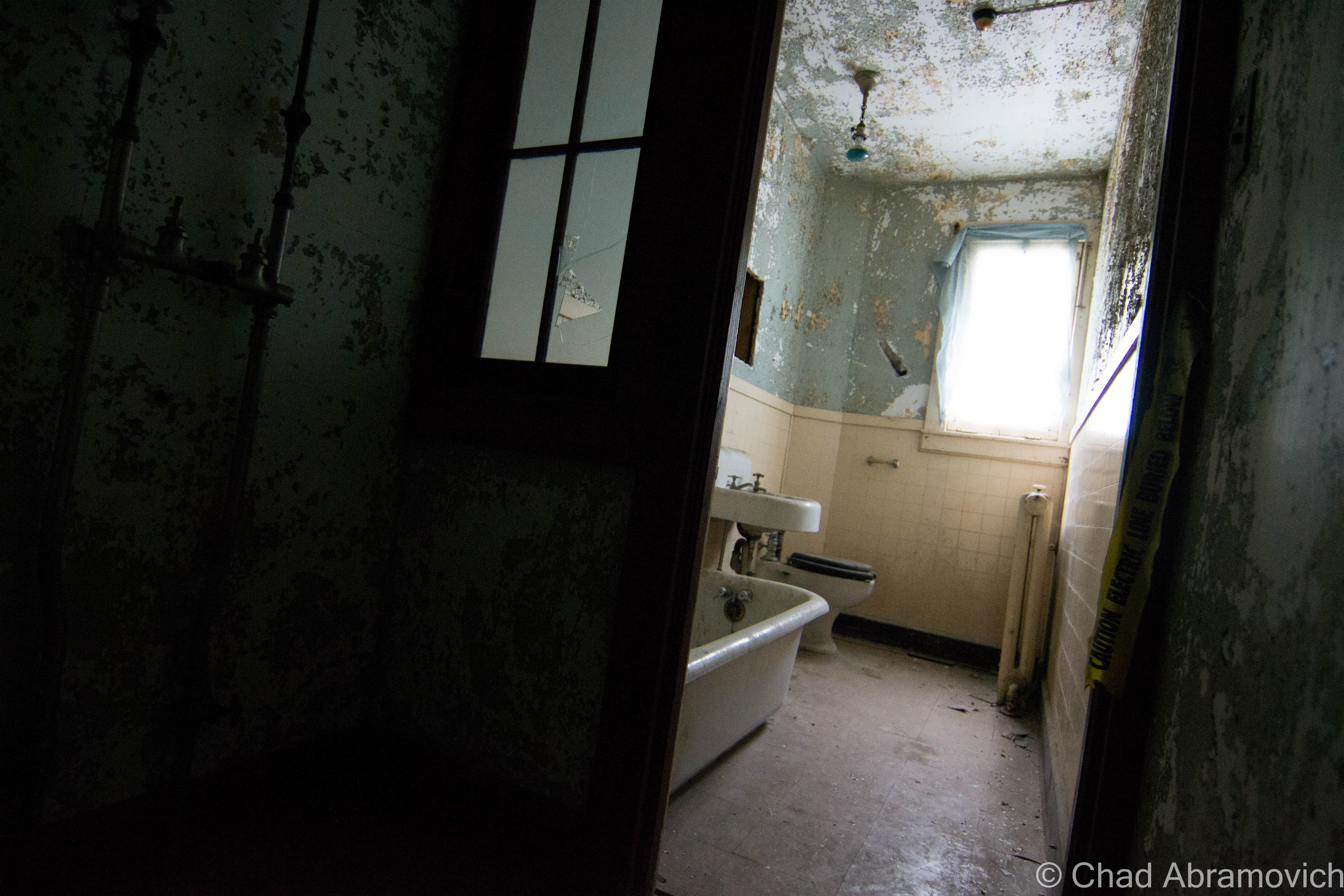
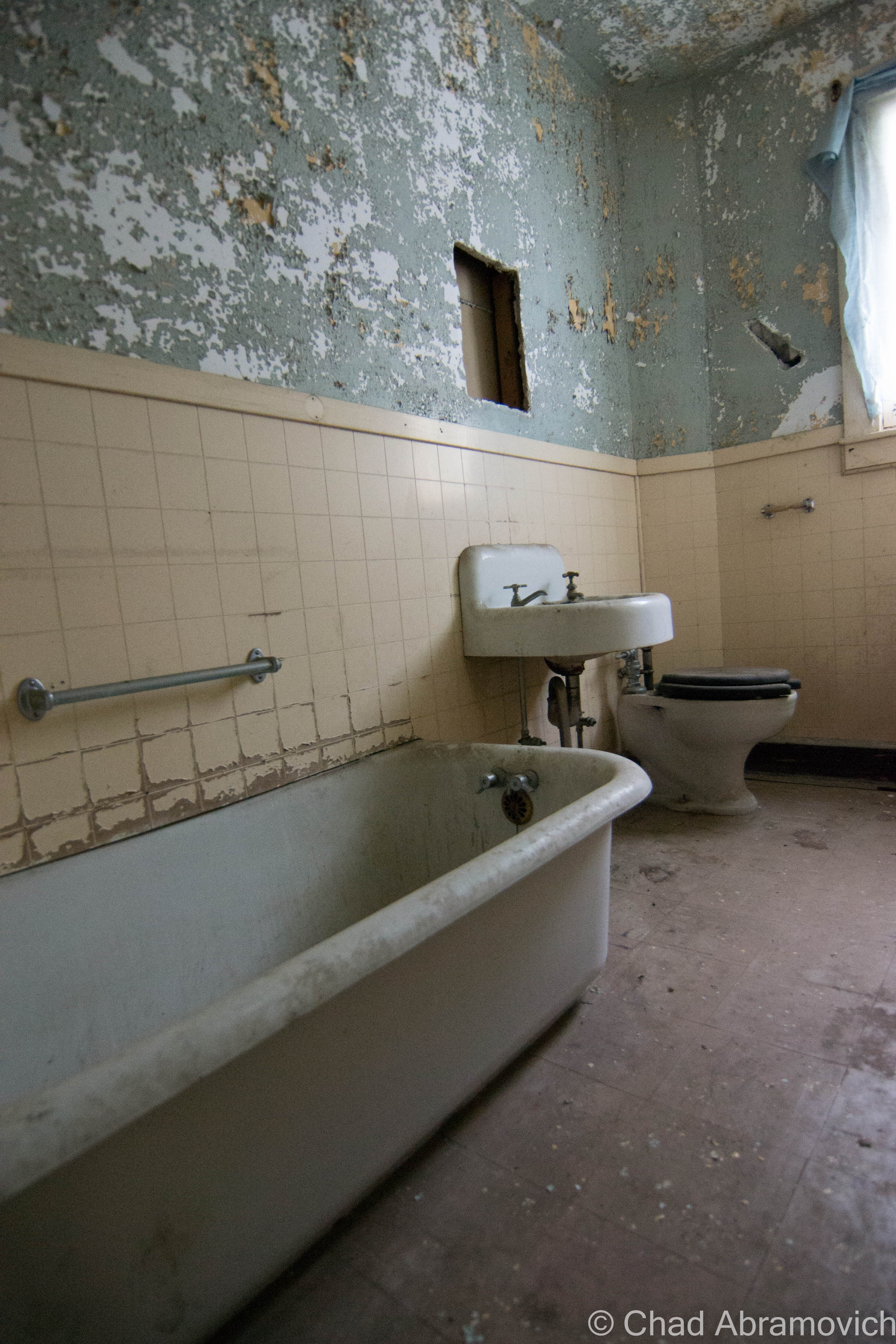
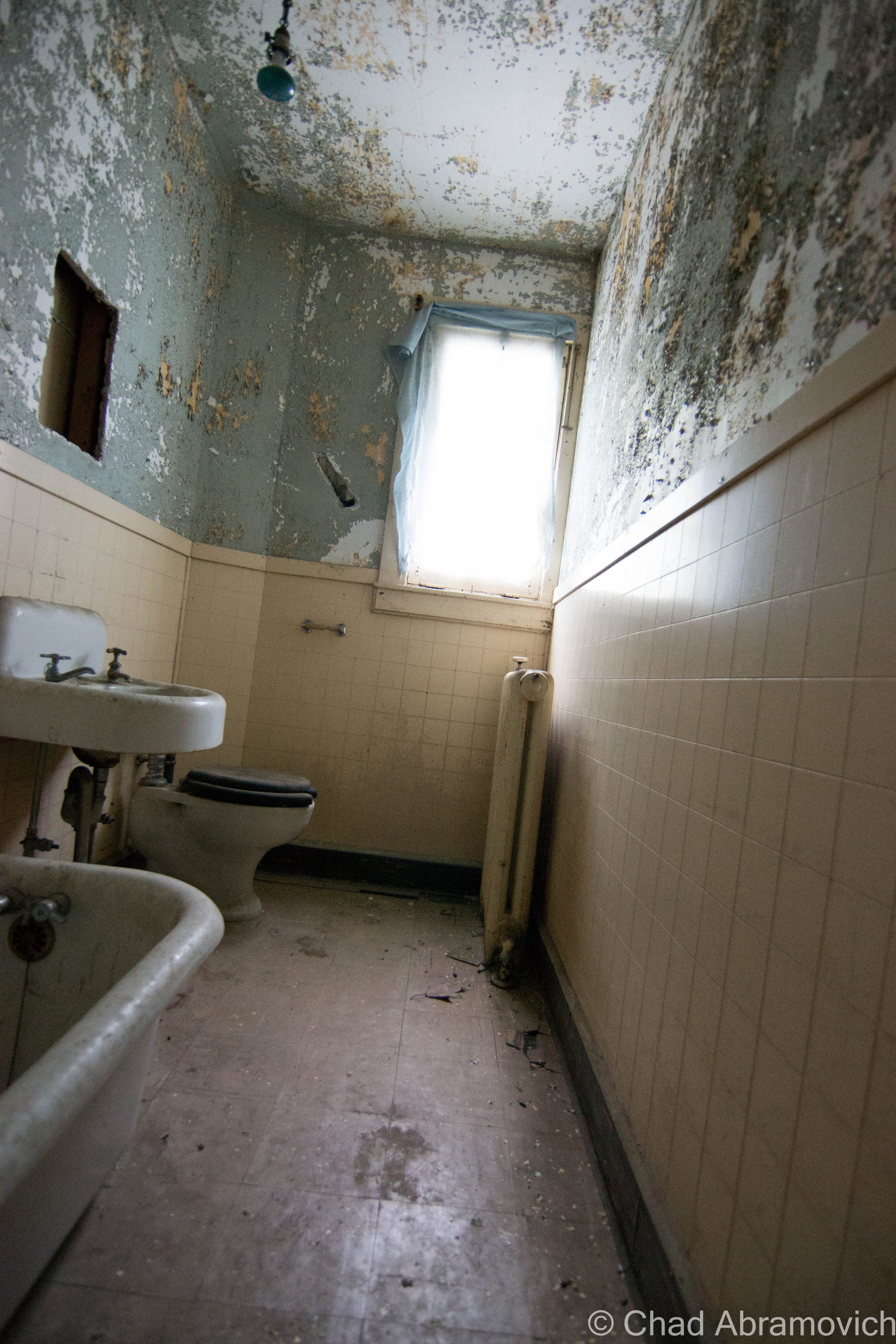
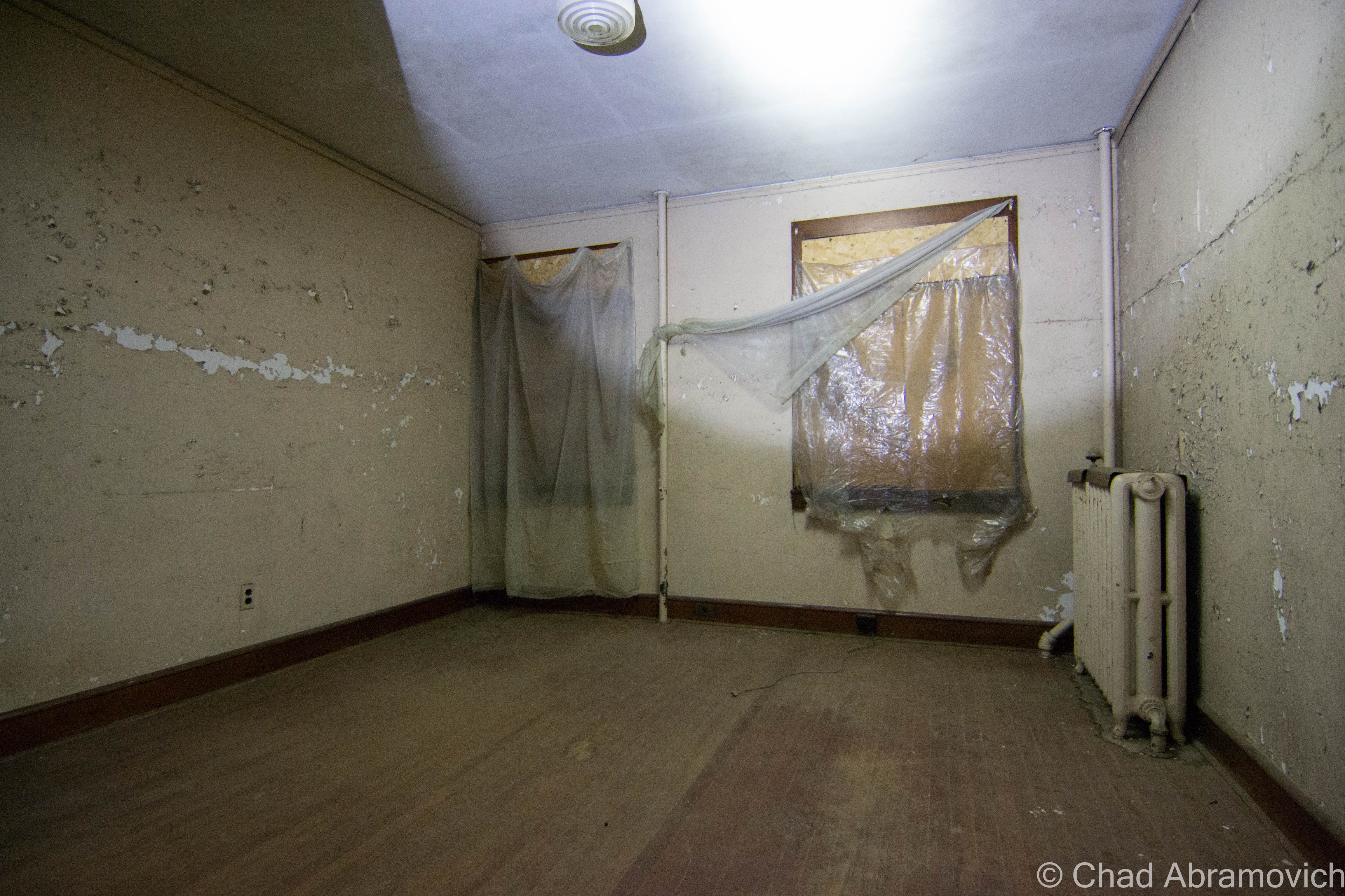
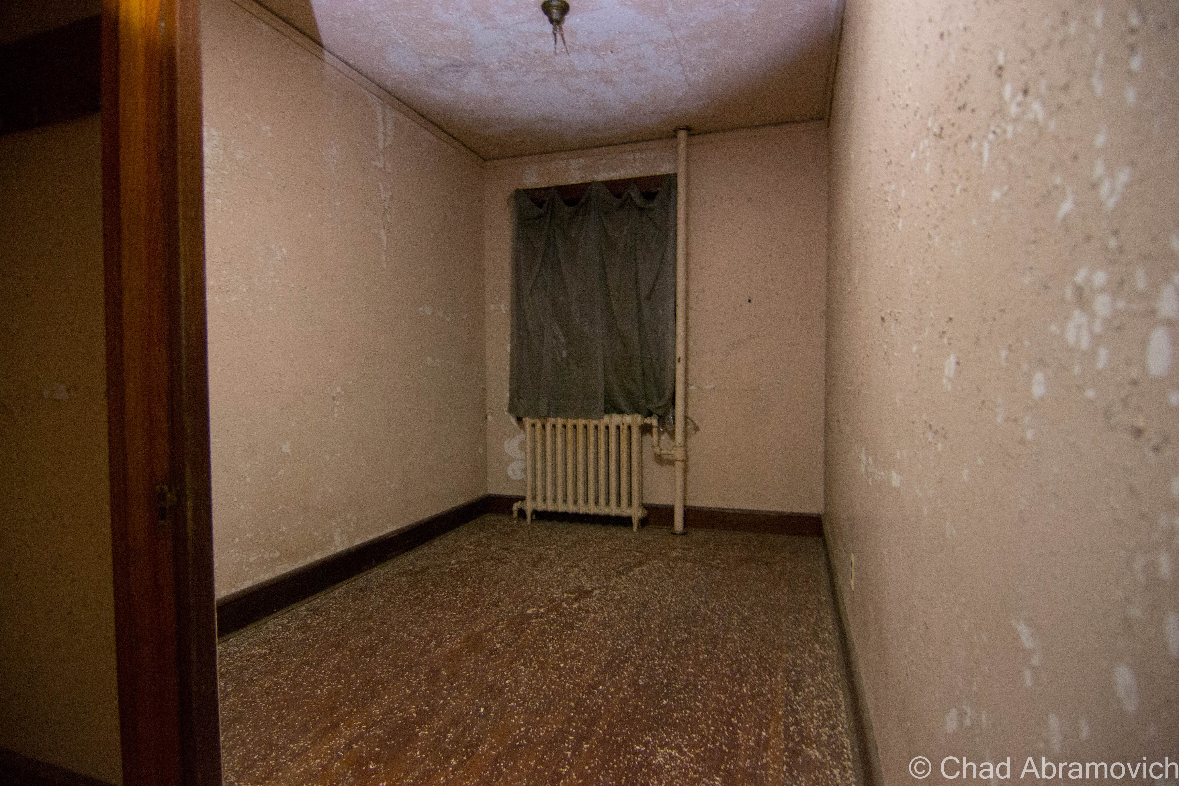
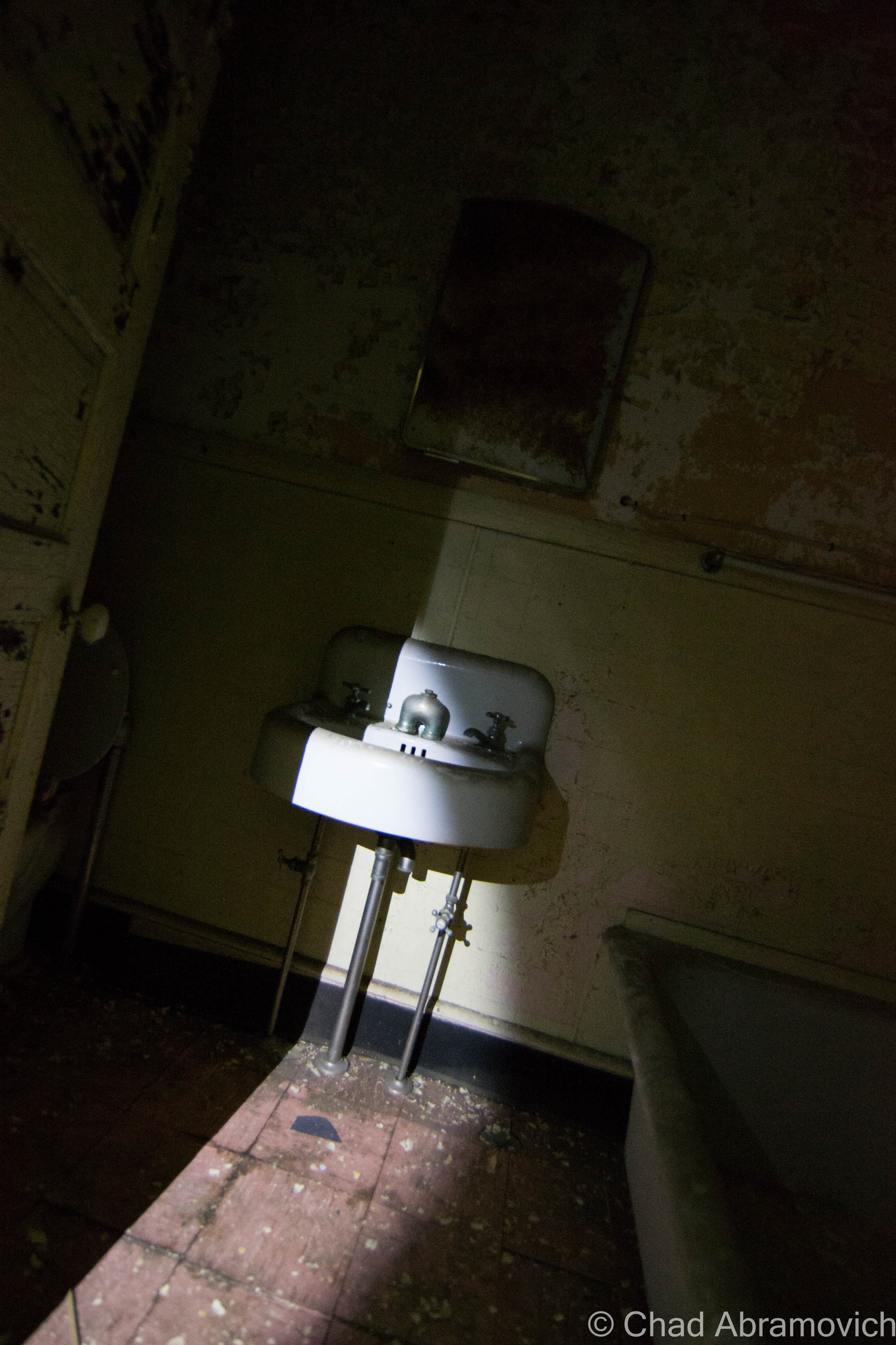
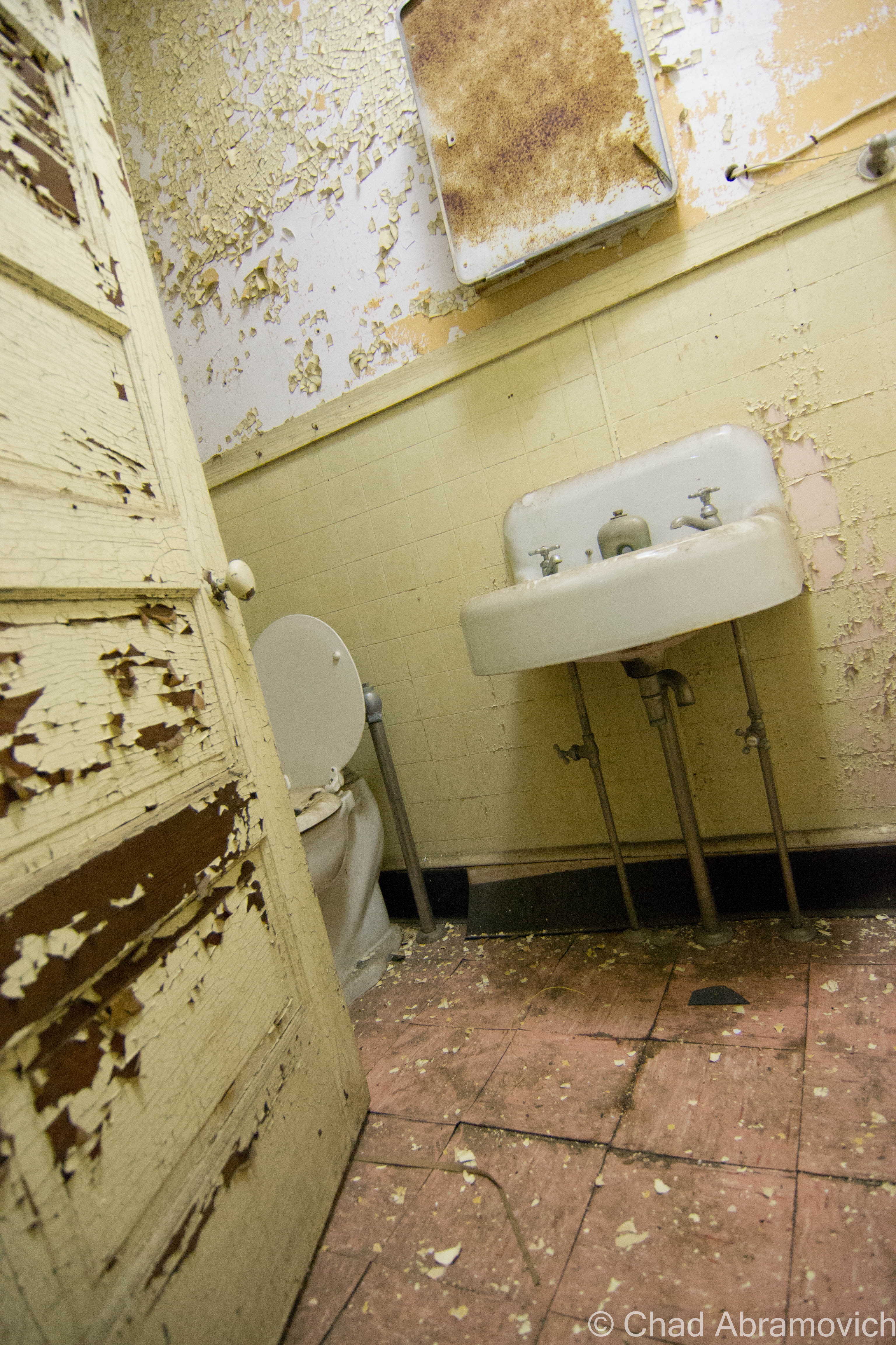
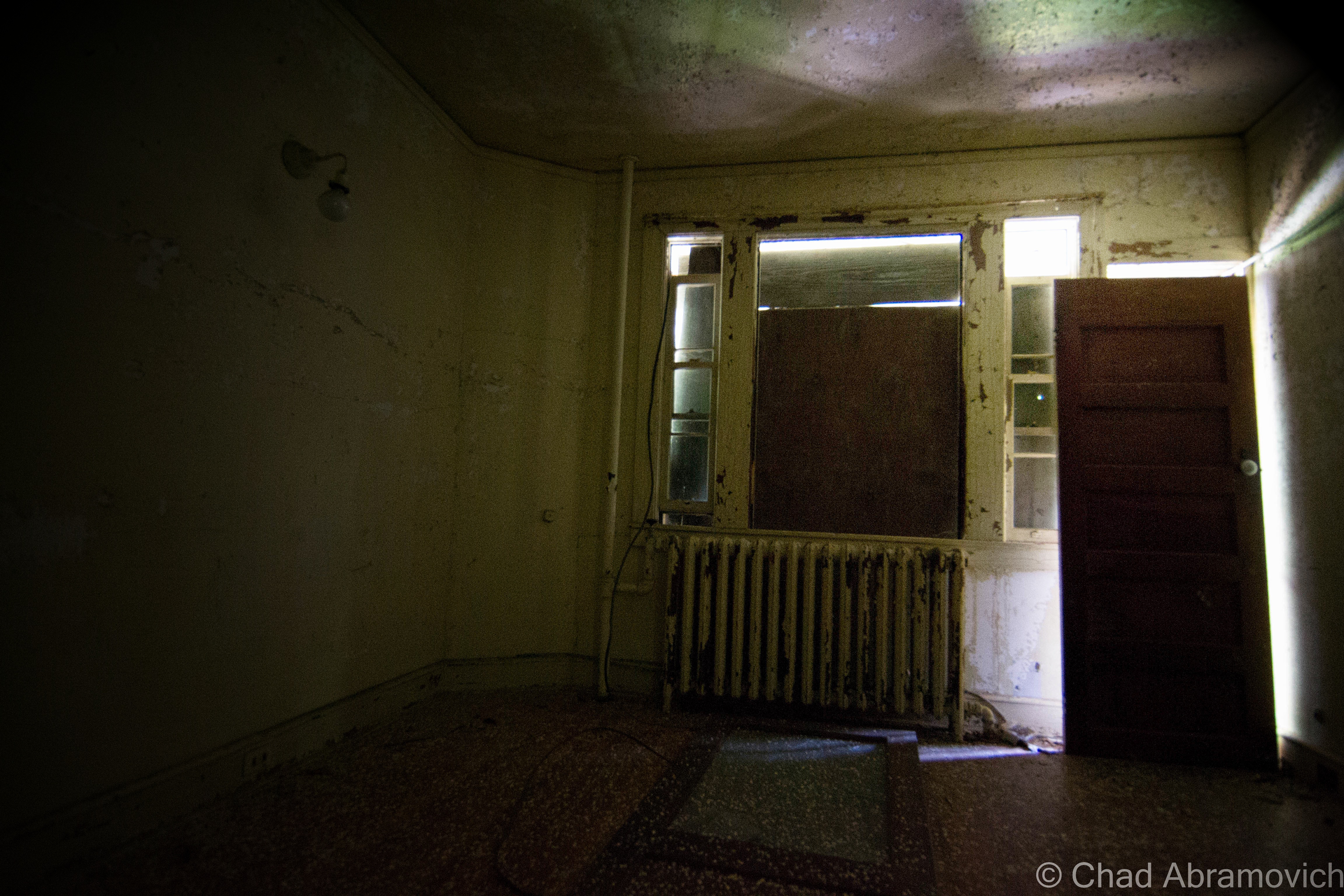
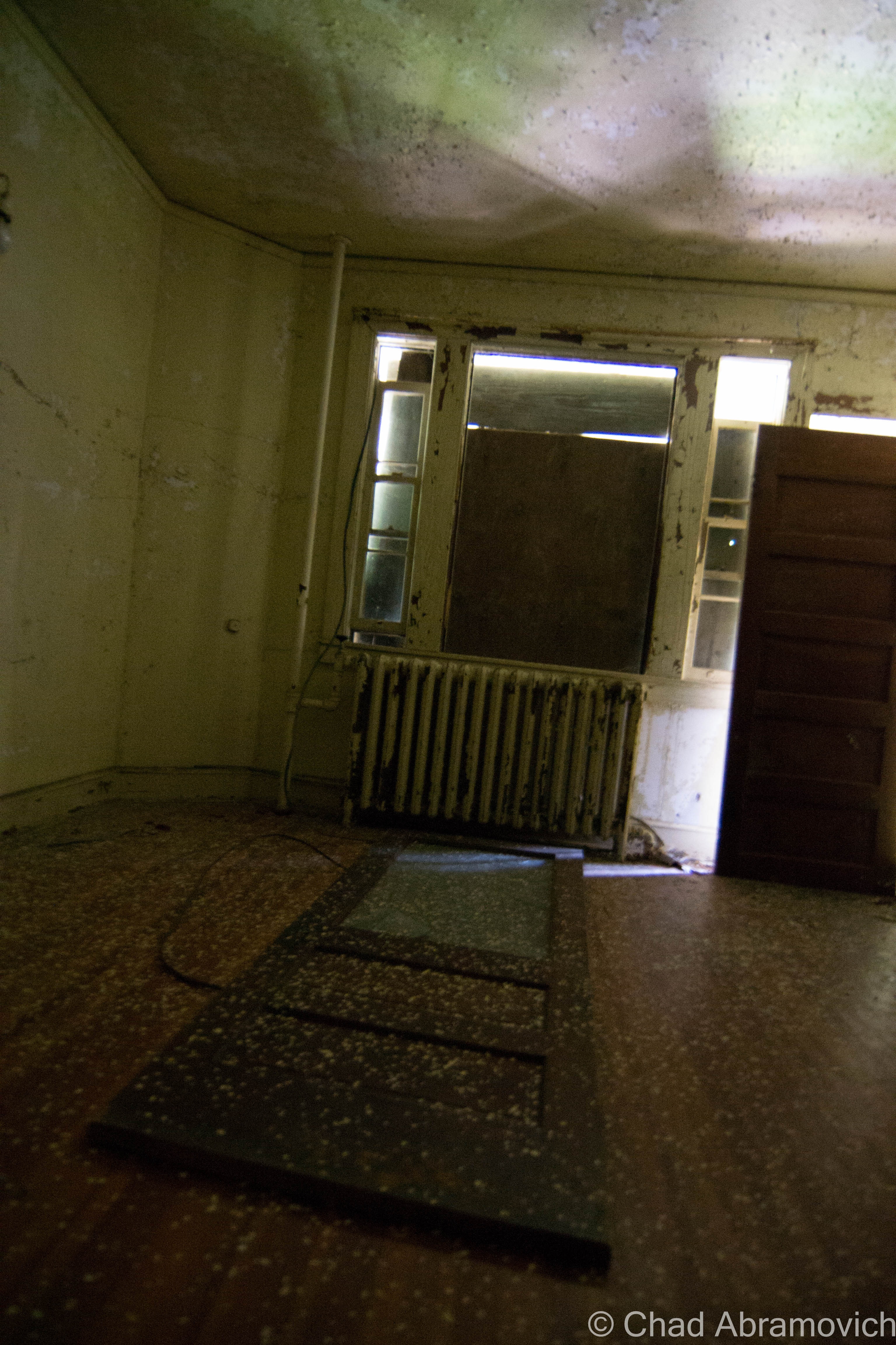
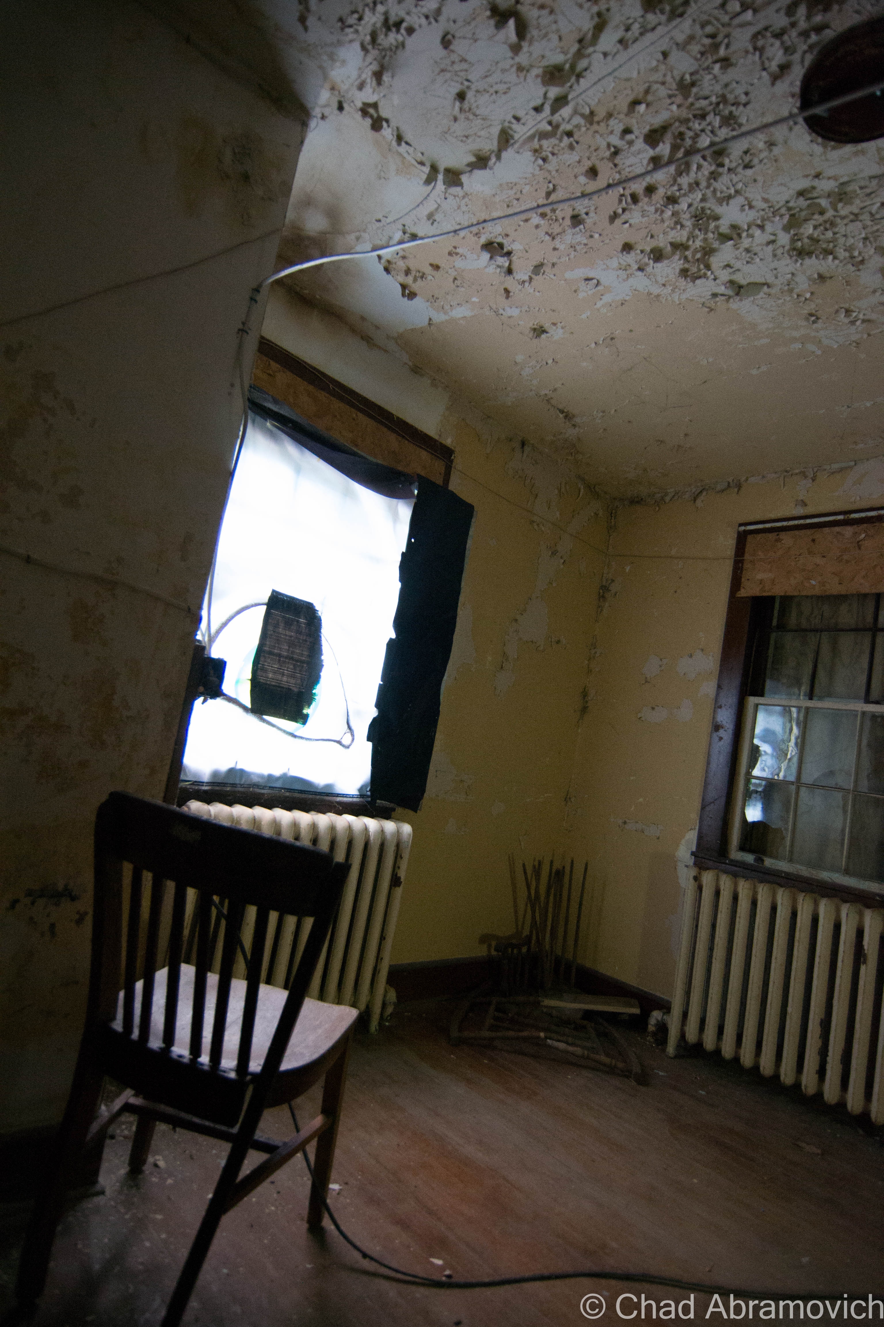
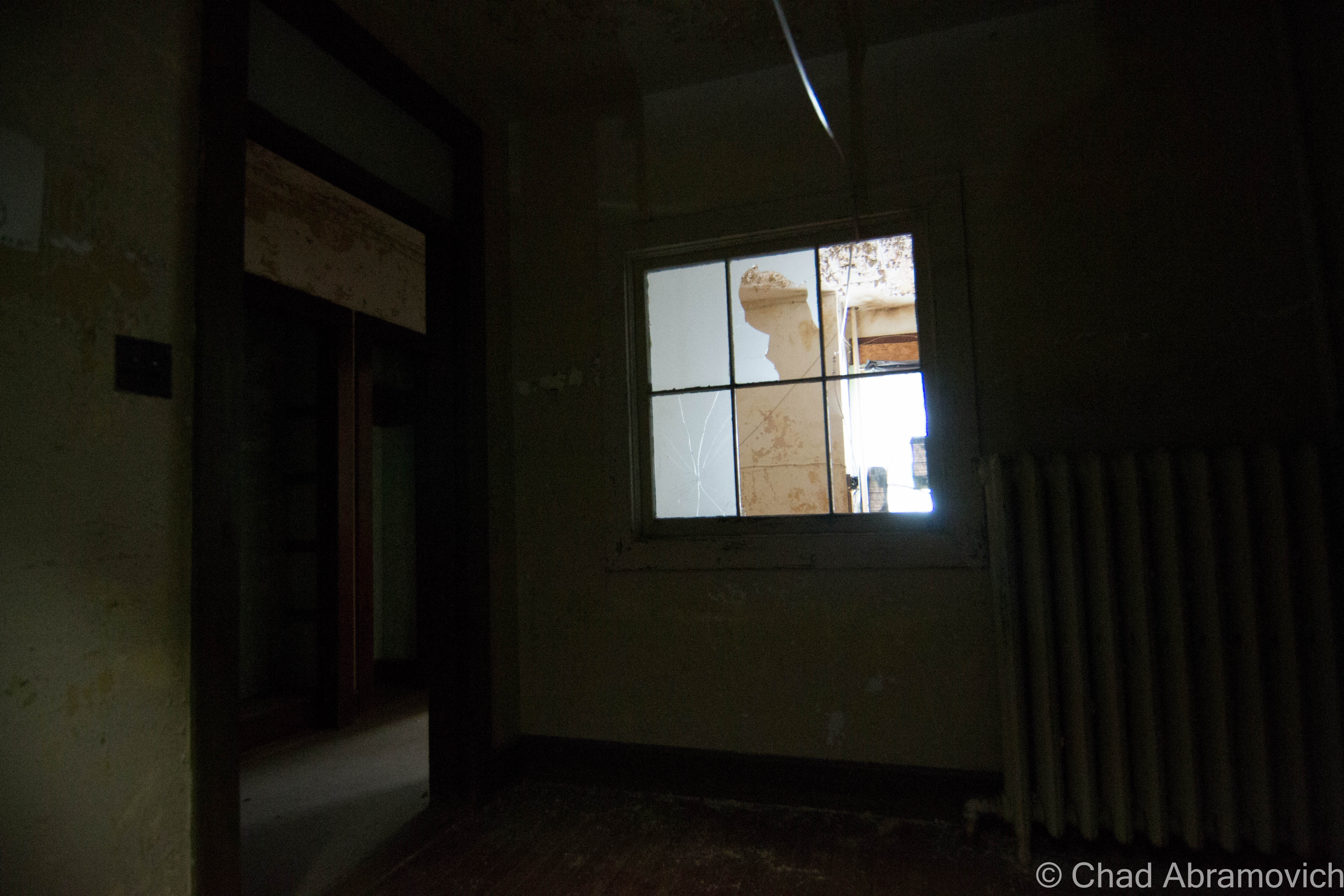
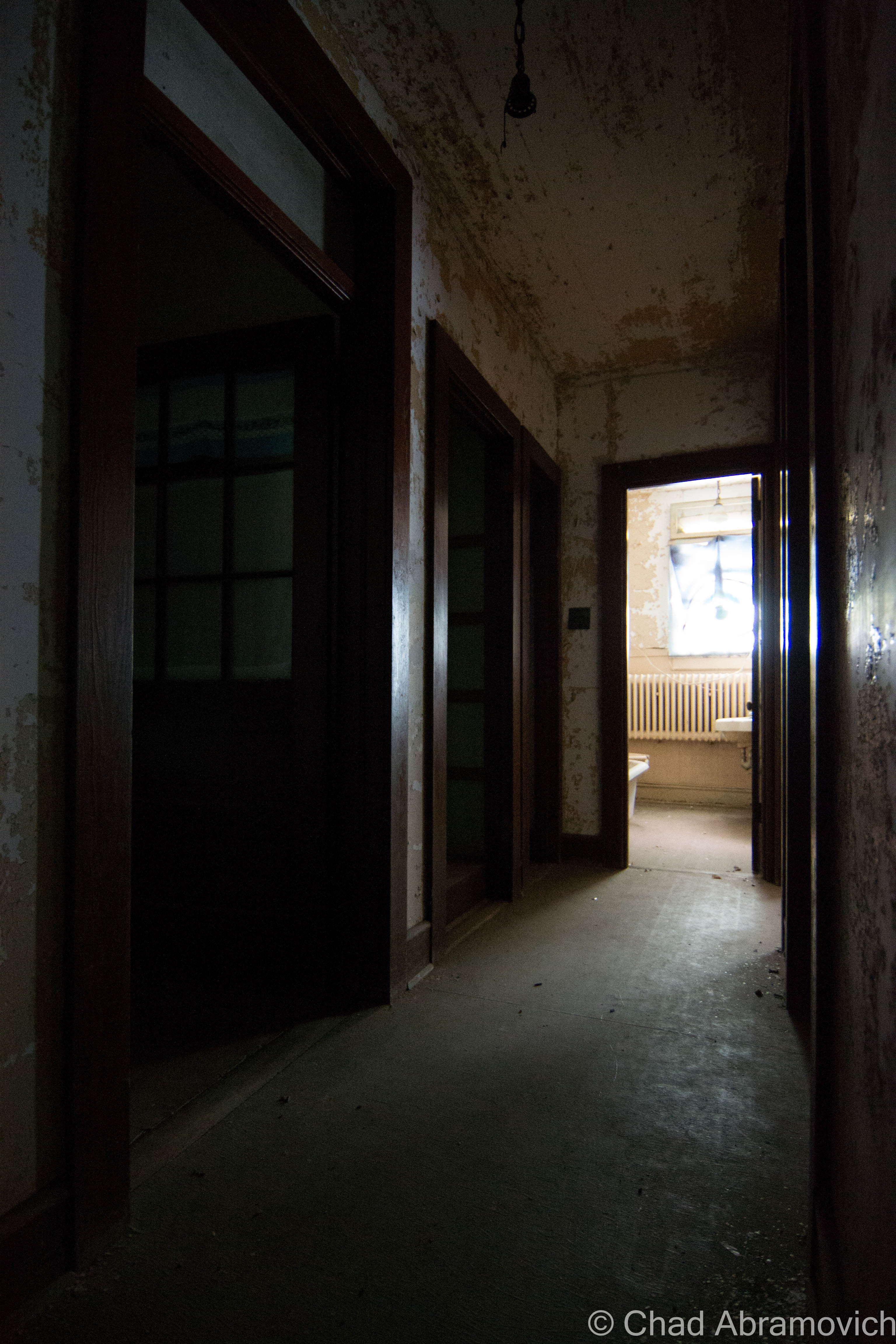
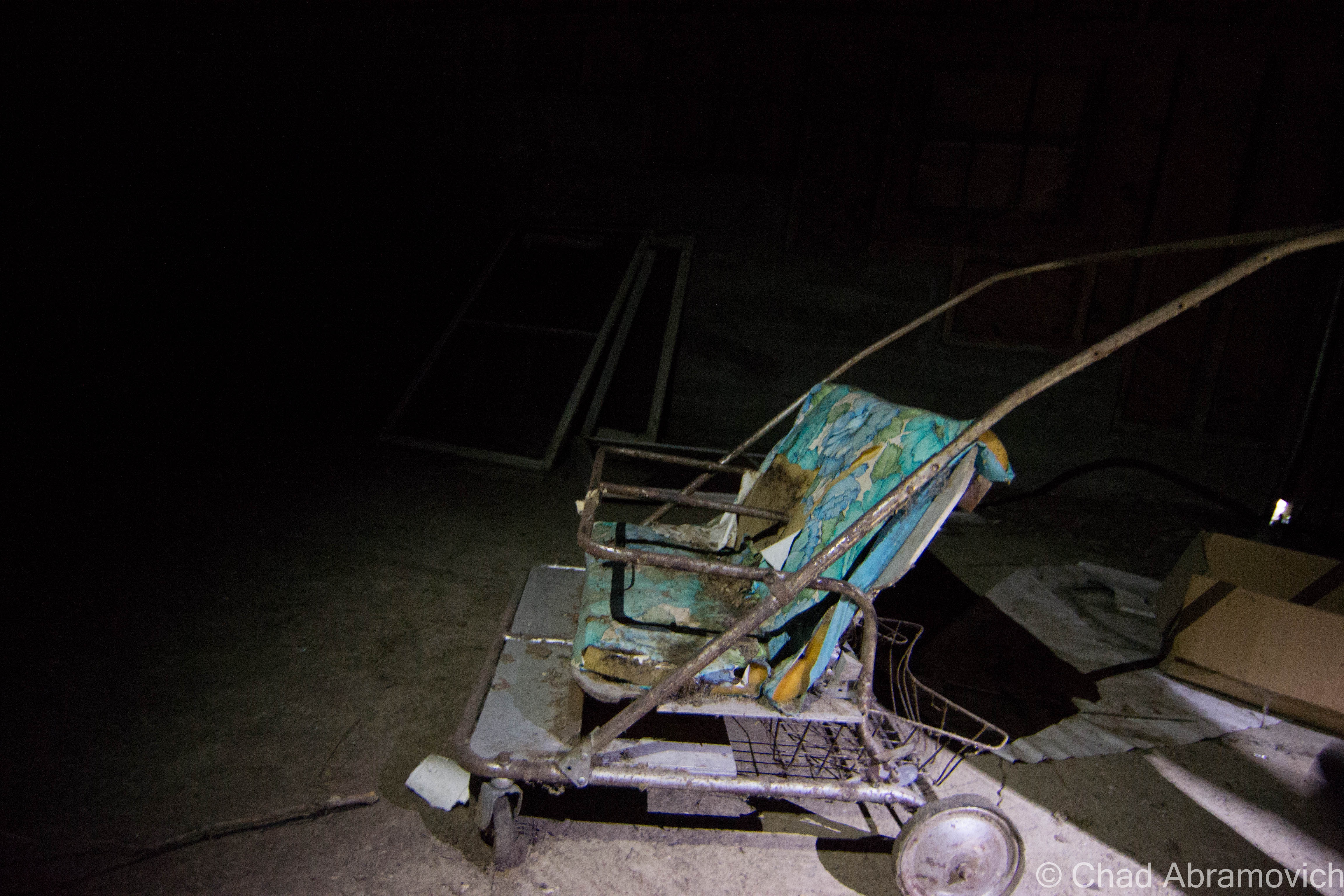
We wandered around for close to 5 hours and still didn’t see everything! The insides of the main plant were cavernous spaces infiltrated by glorious natural light that descended through awesome sawtooth roofs – a design I absolutely love. Lead paint, asbestos, and whatever mother nature blew inside lazily fell like snow, and nature was doing what it does best; reclaiming its territory. Trees and creeping vines had interestingly taken root on the roof and the grounds were thick with vegetation – vines fell down through busted sawtooth windowpanes and tendrilled into the atmosphere. A century of adaptations, renovations, and subsequent deferred upkeep had created a fantastic accidental pastiche on old bricks and steel girders.

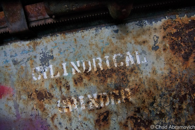
Some things sagged down in fatigue, and other verdant things thrust upwards and willing. It seemed the new trees and vines almost created a muted cacoon within, where time oddly stopped and there were only wonders, a vacation world that we could borrow for a while. Strange audio hallucinations fell in all directions, and shadows waltzed behind steel beams and checkerboard walls of broken glass. Though I guess I was a bit disappointed I didn’t find a rusty old Hartness turret lathe still within, this explore was so much fun! (There IS, however, – a Hartness Turret Lathe on display at the American Precision Museum in Windsor!)

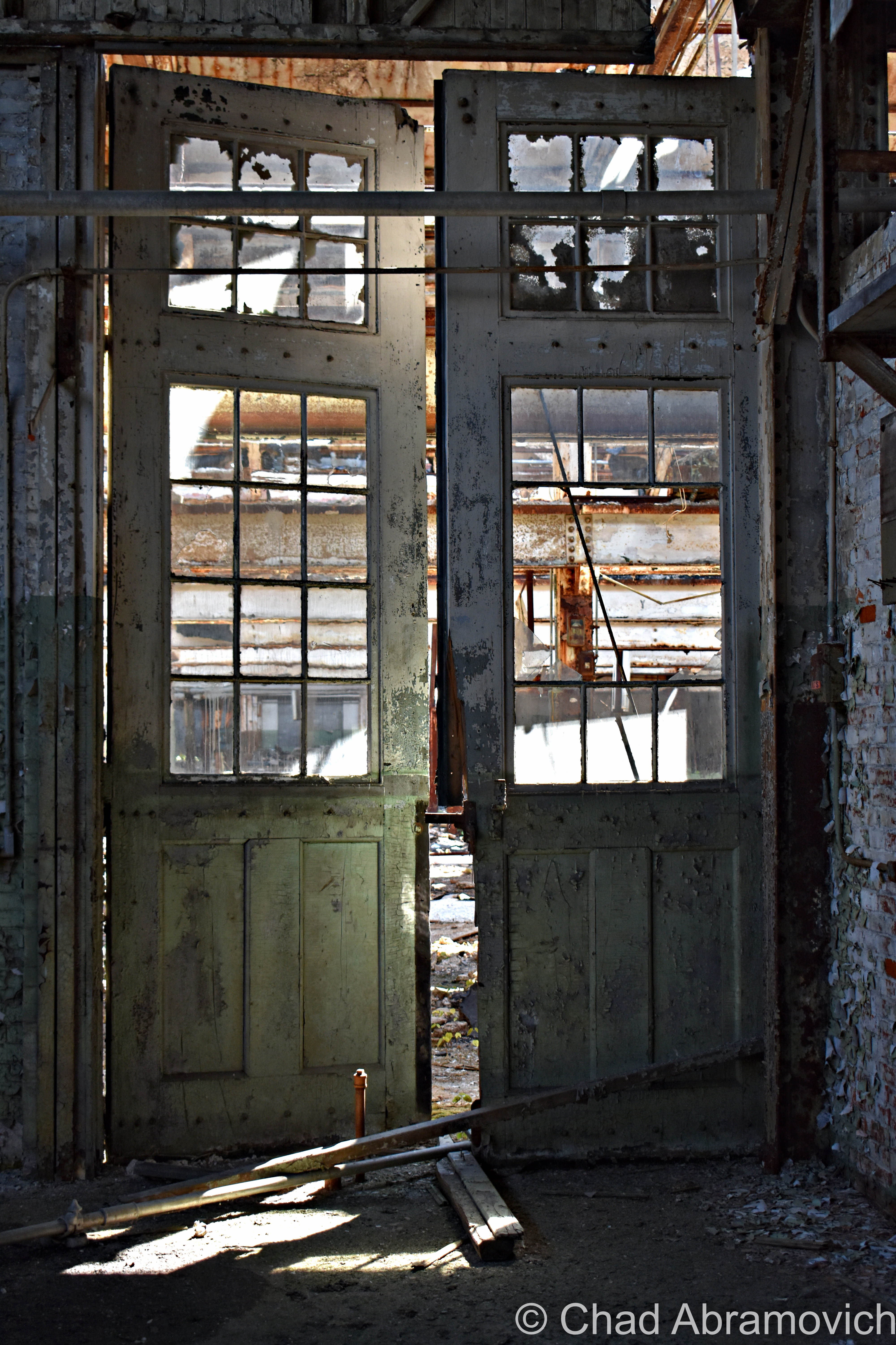
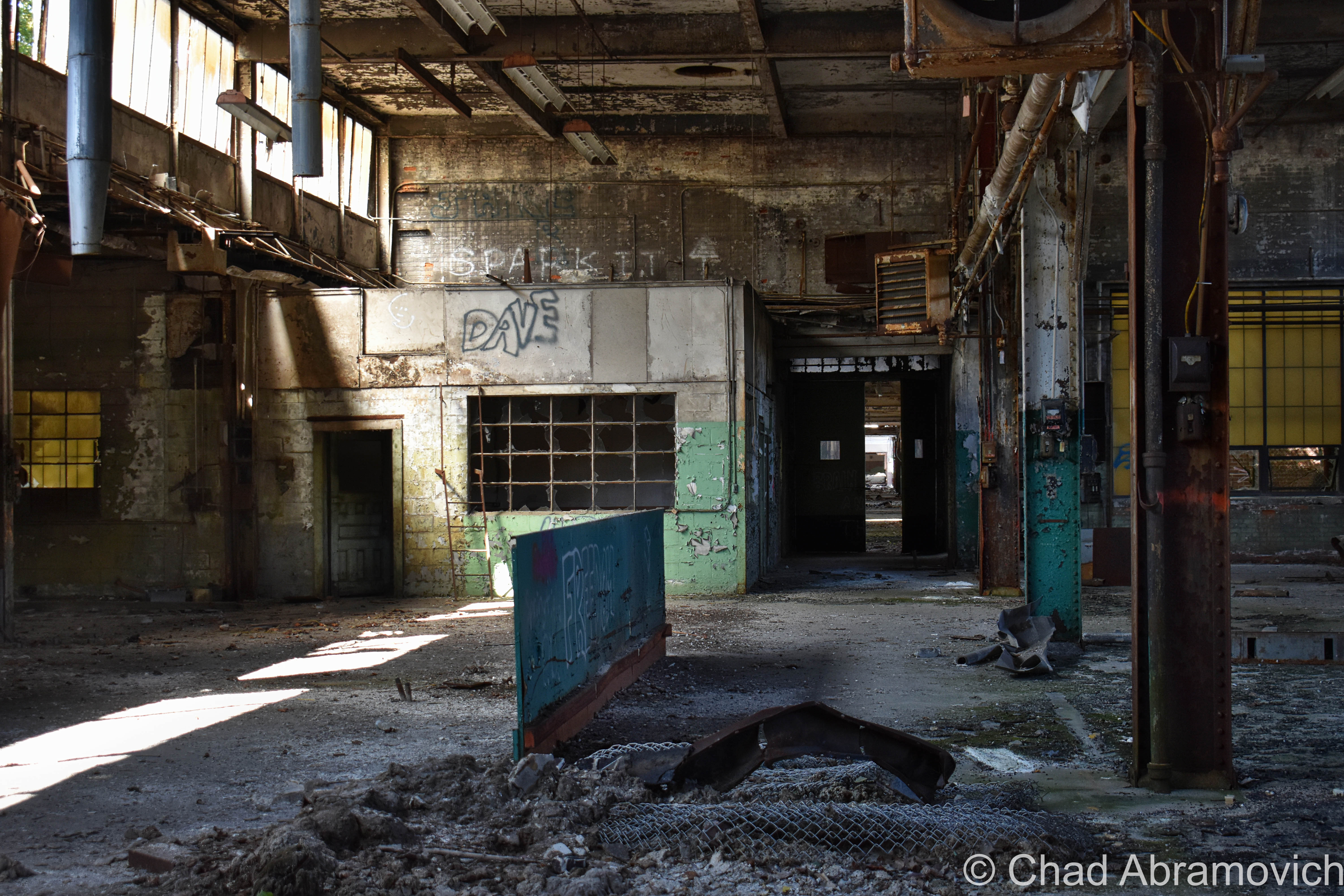
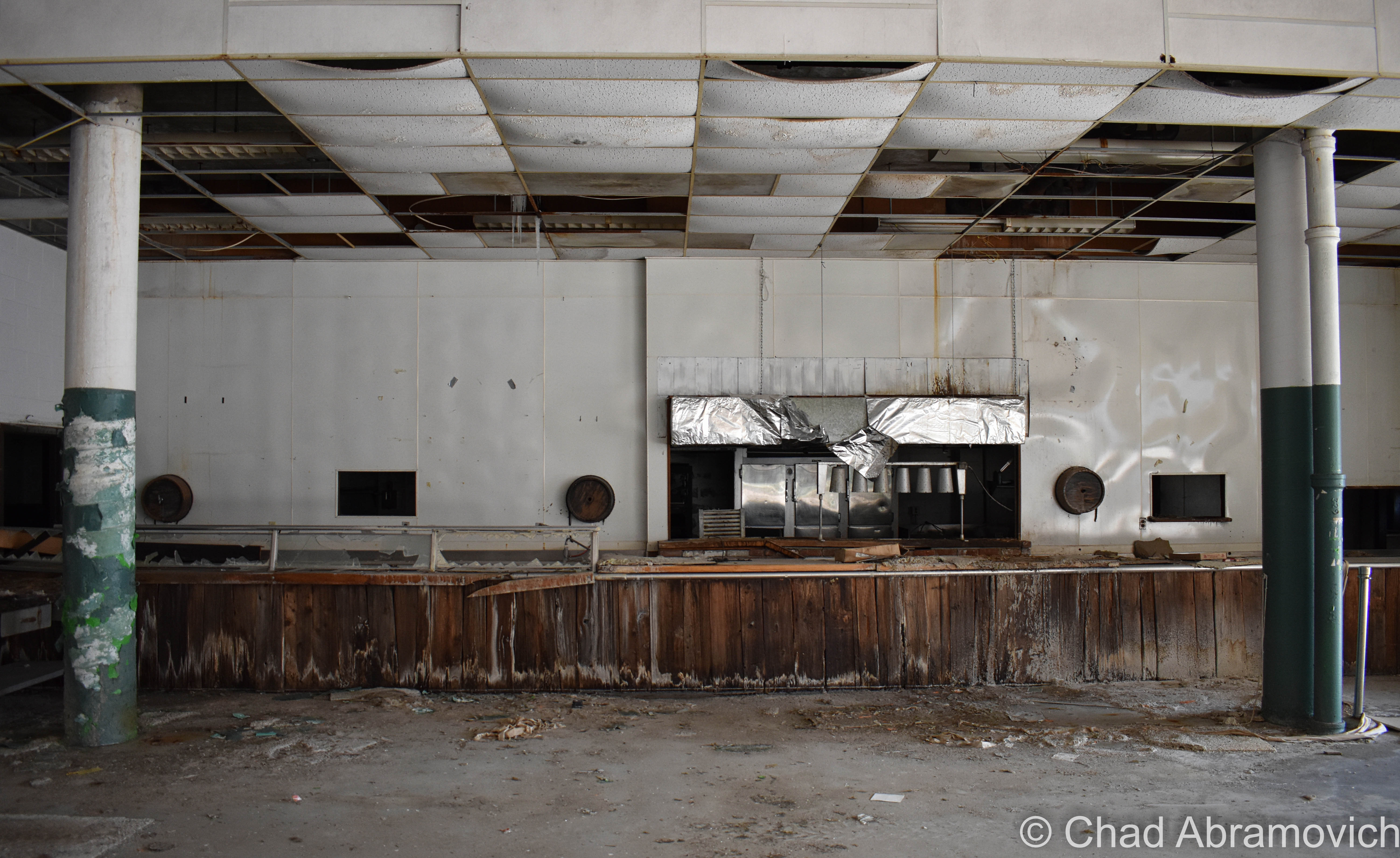
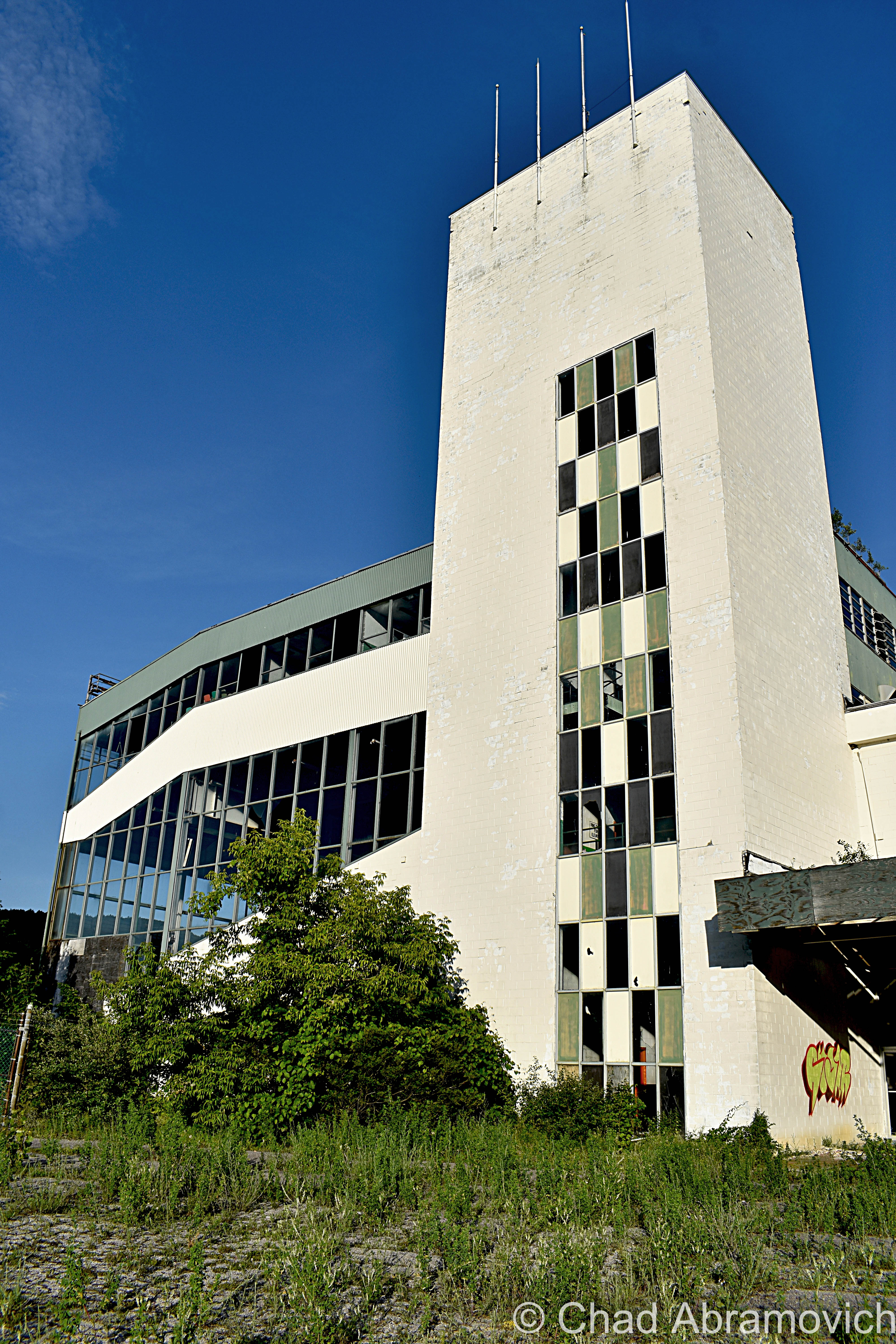
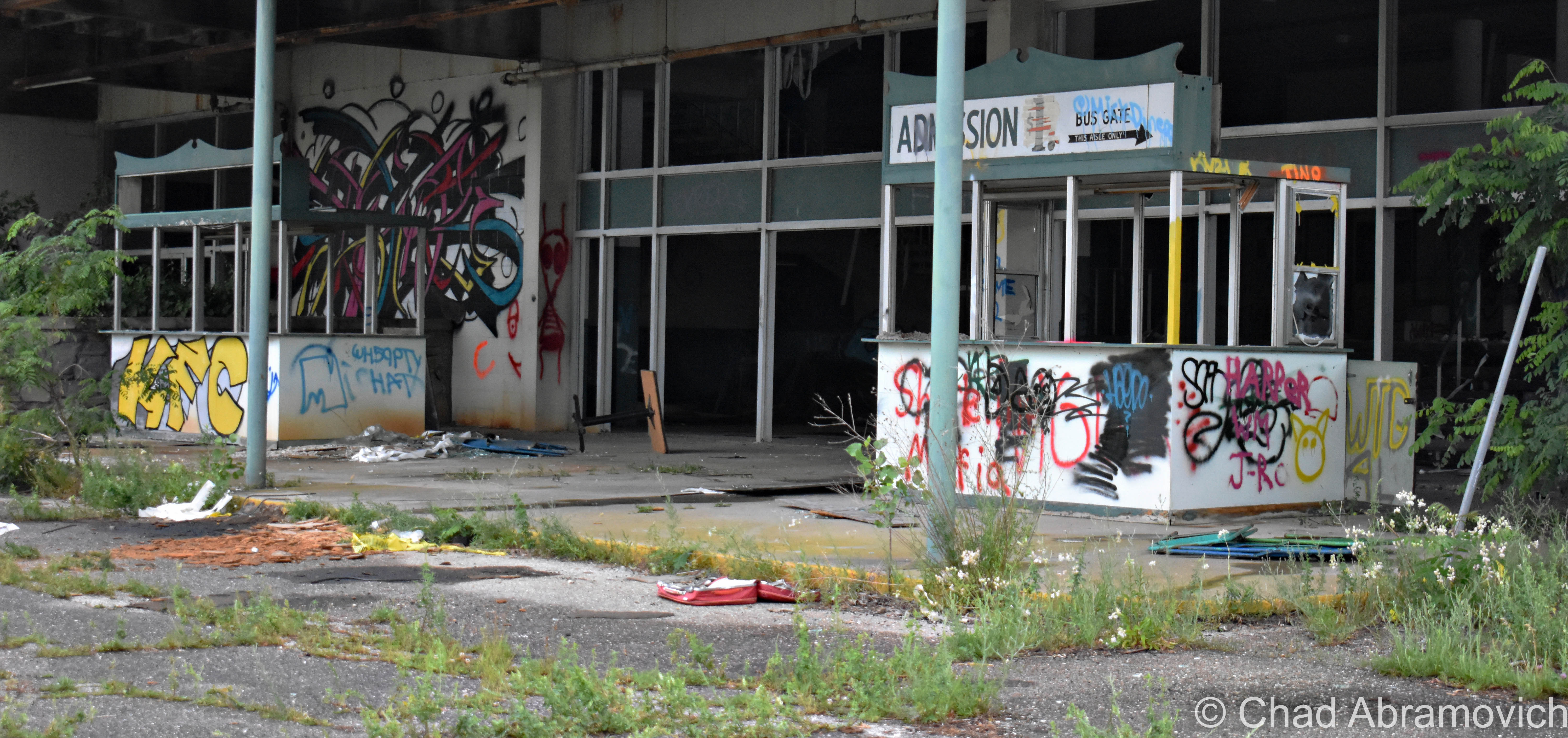
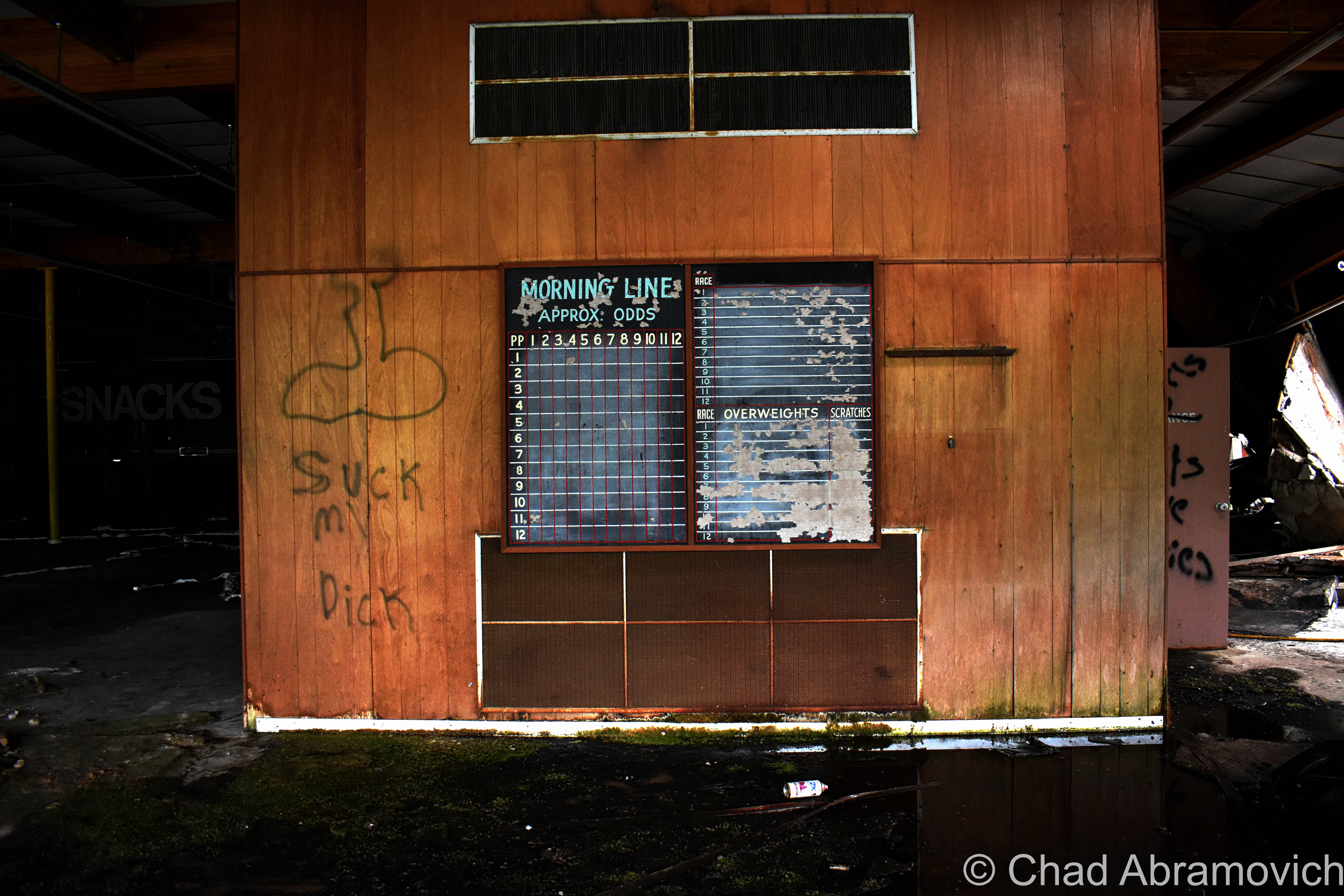
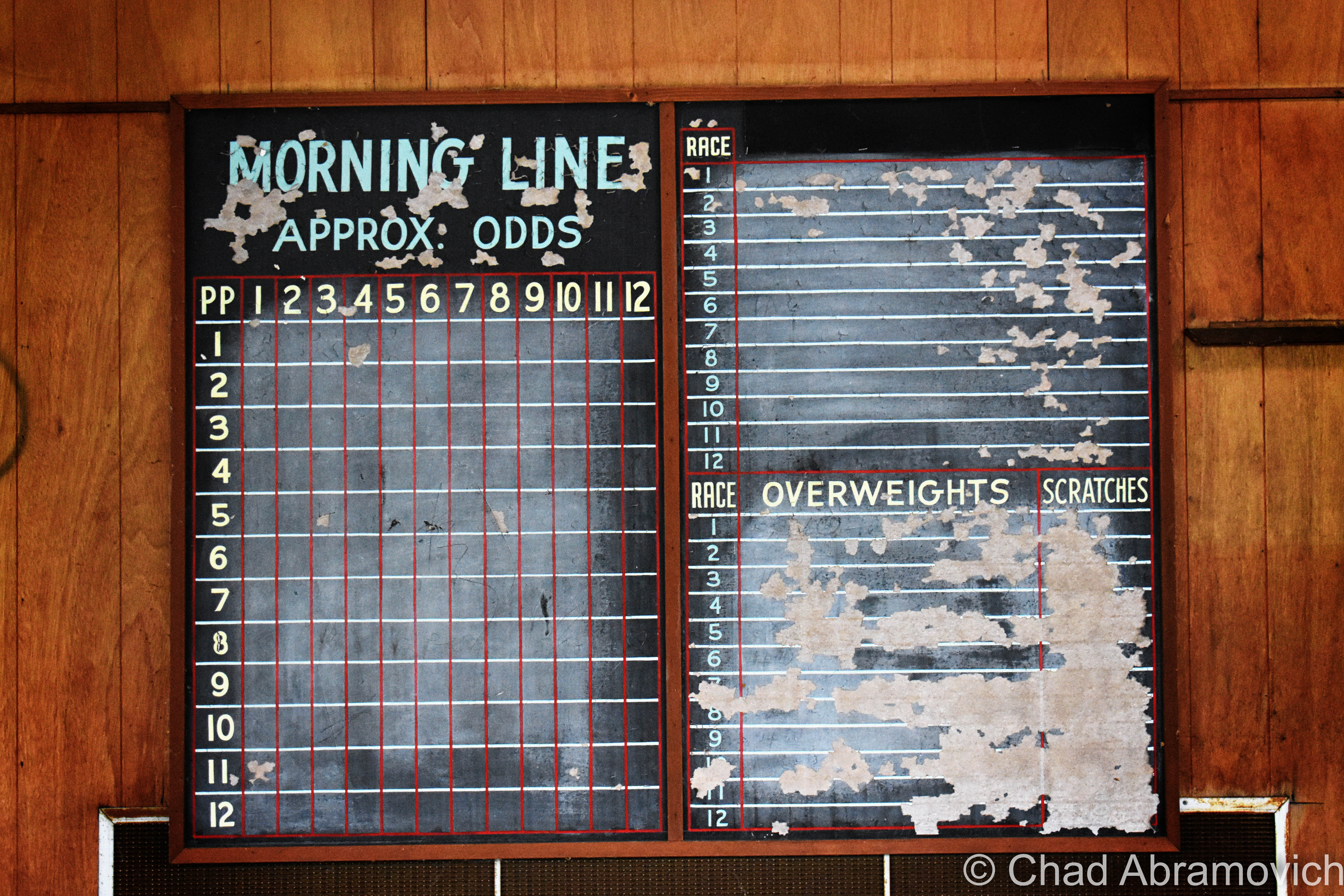
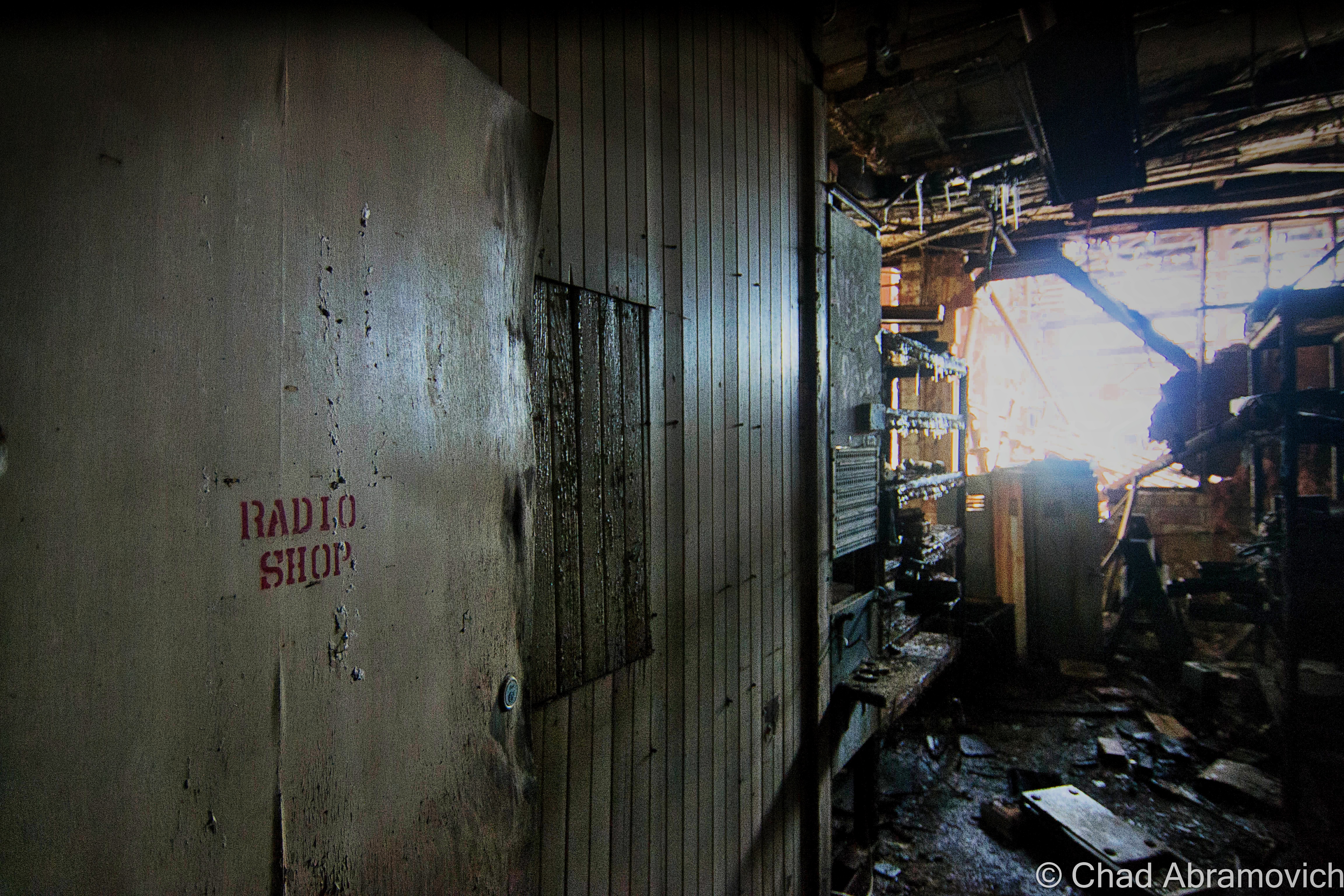
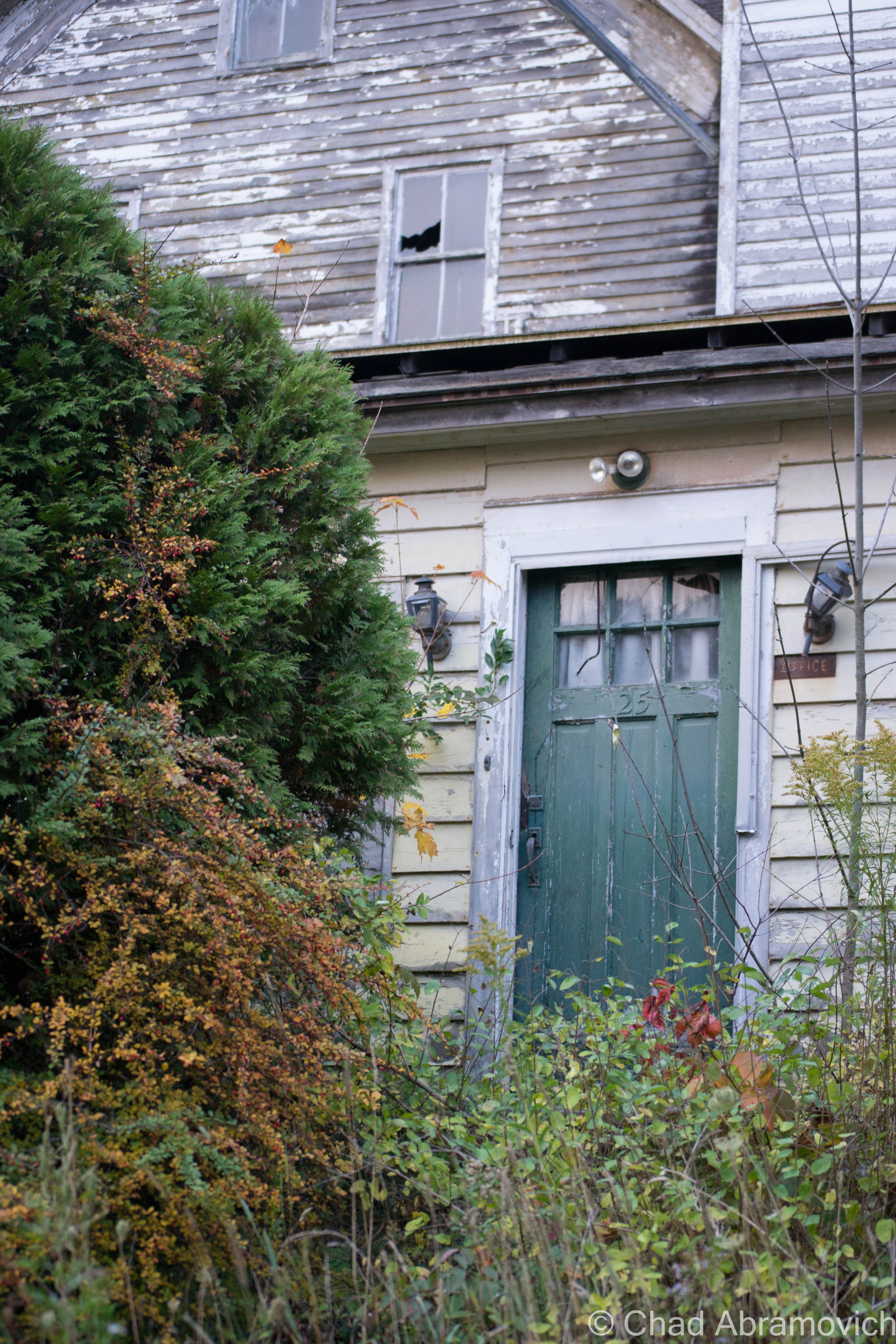
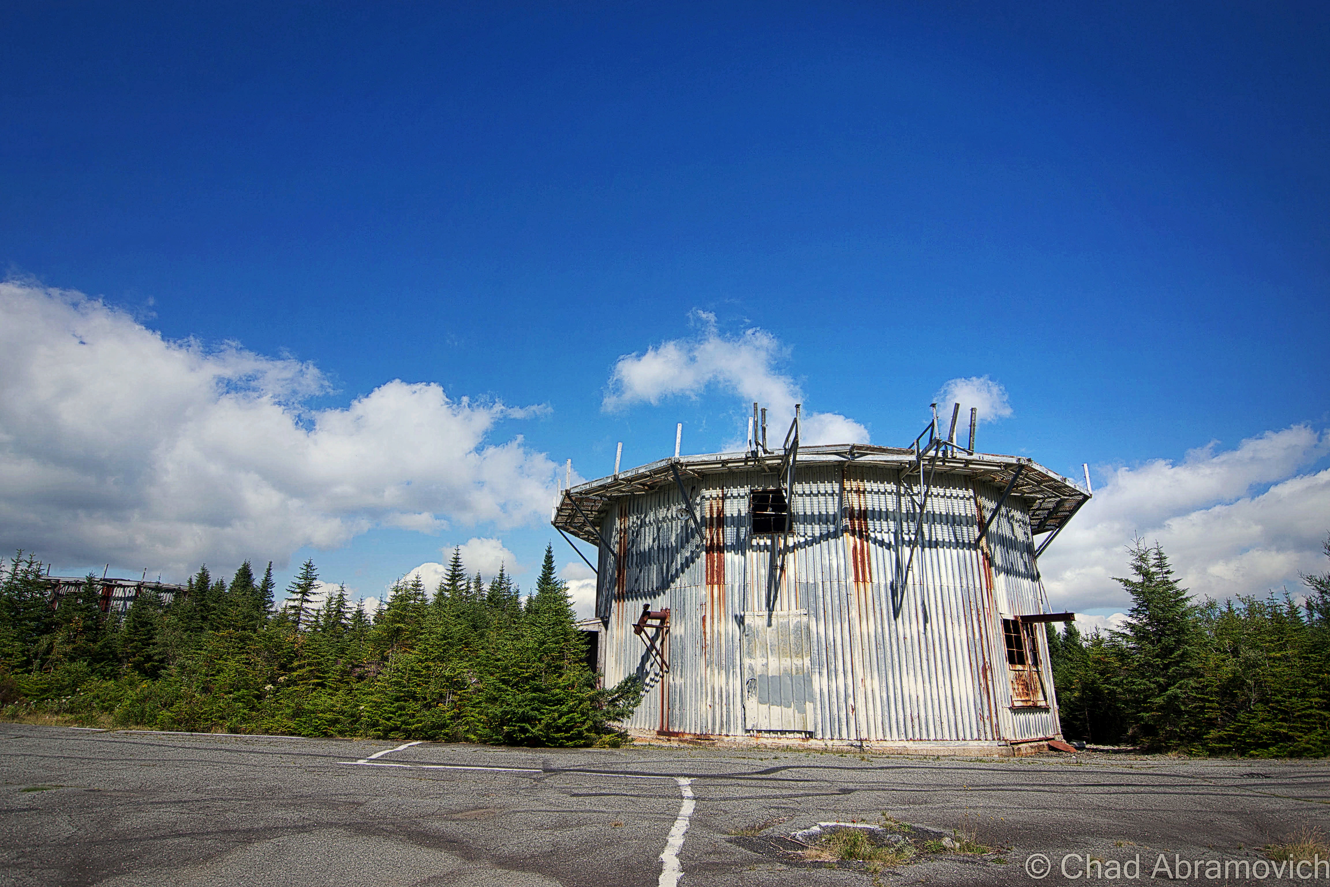
There was a tiny portion of this massive complex that was still an active business, J&L Metrology – the last remaining morsel of the greater Jones and Lamson enterprise. Their really utilitarian and ugly wing appeared to be added on much later – and it was something that I made a note of as we pulled into town hours earlier. The two spaces were divided by the original exterior brick wall, but there was a connecting pair of double doors that allowed whoever was at work over there inside the abandoned portion of the building, and that’s exactly what happened.

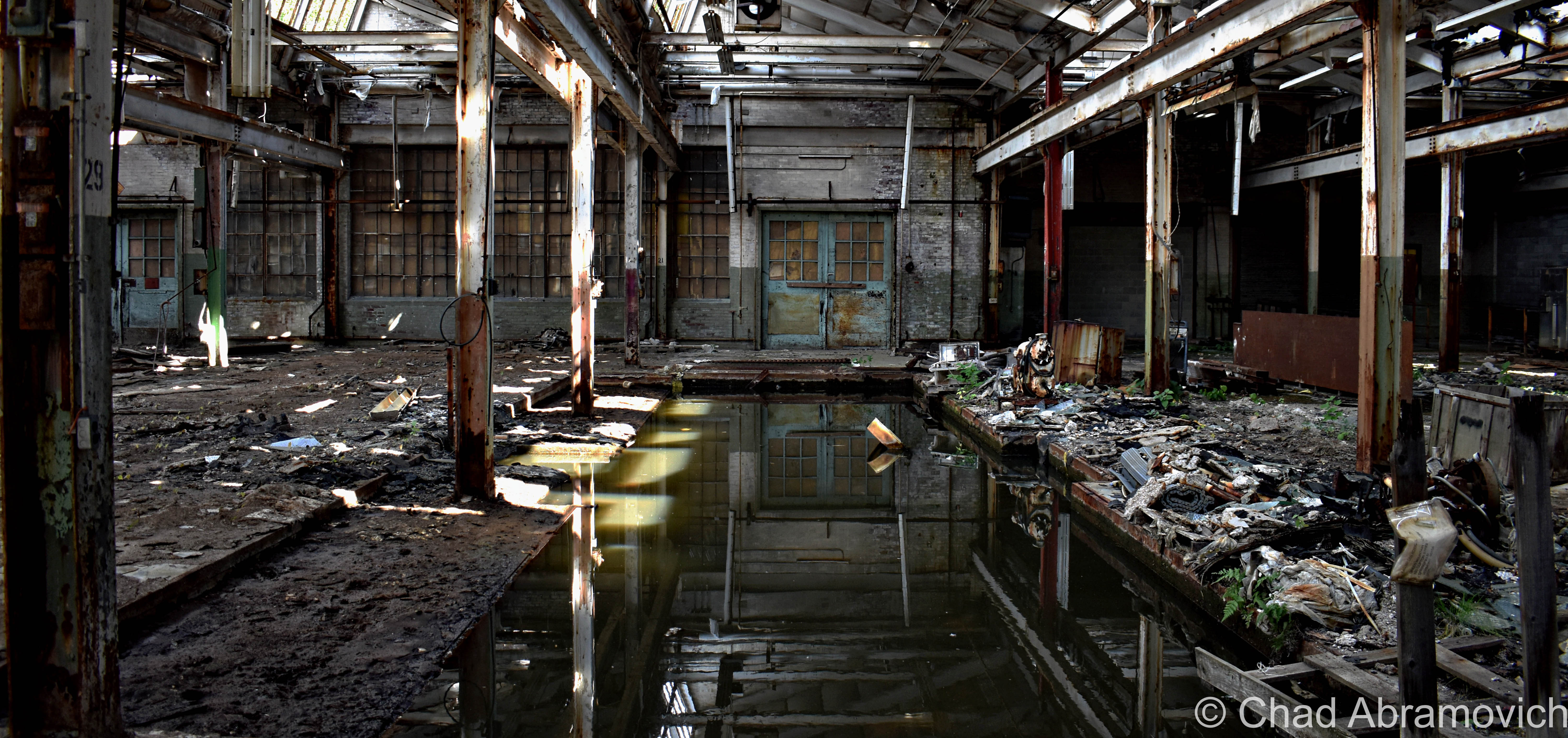
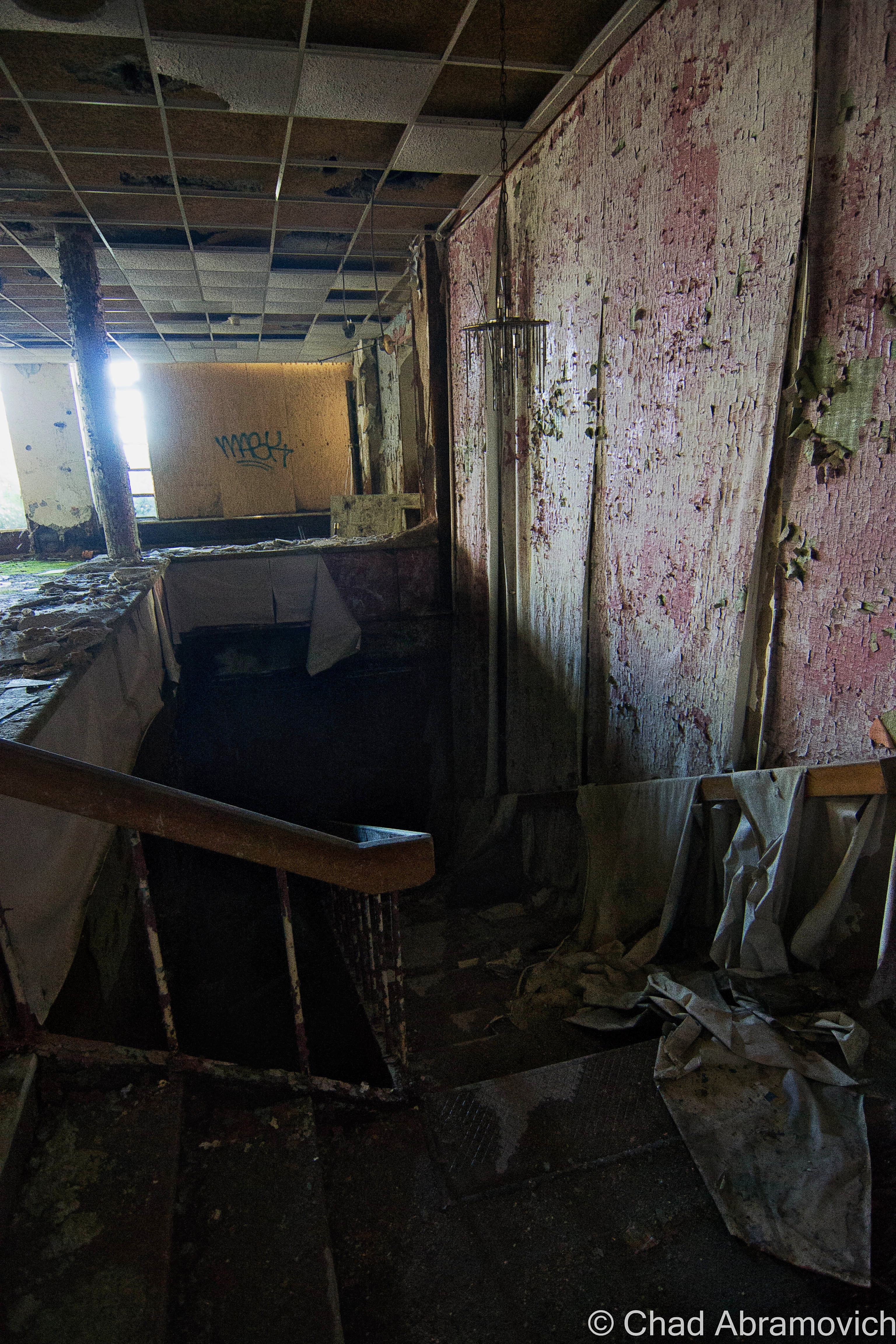
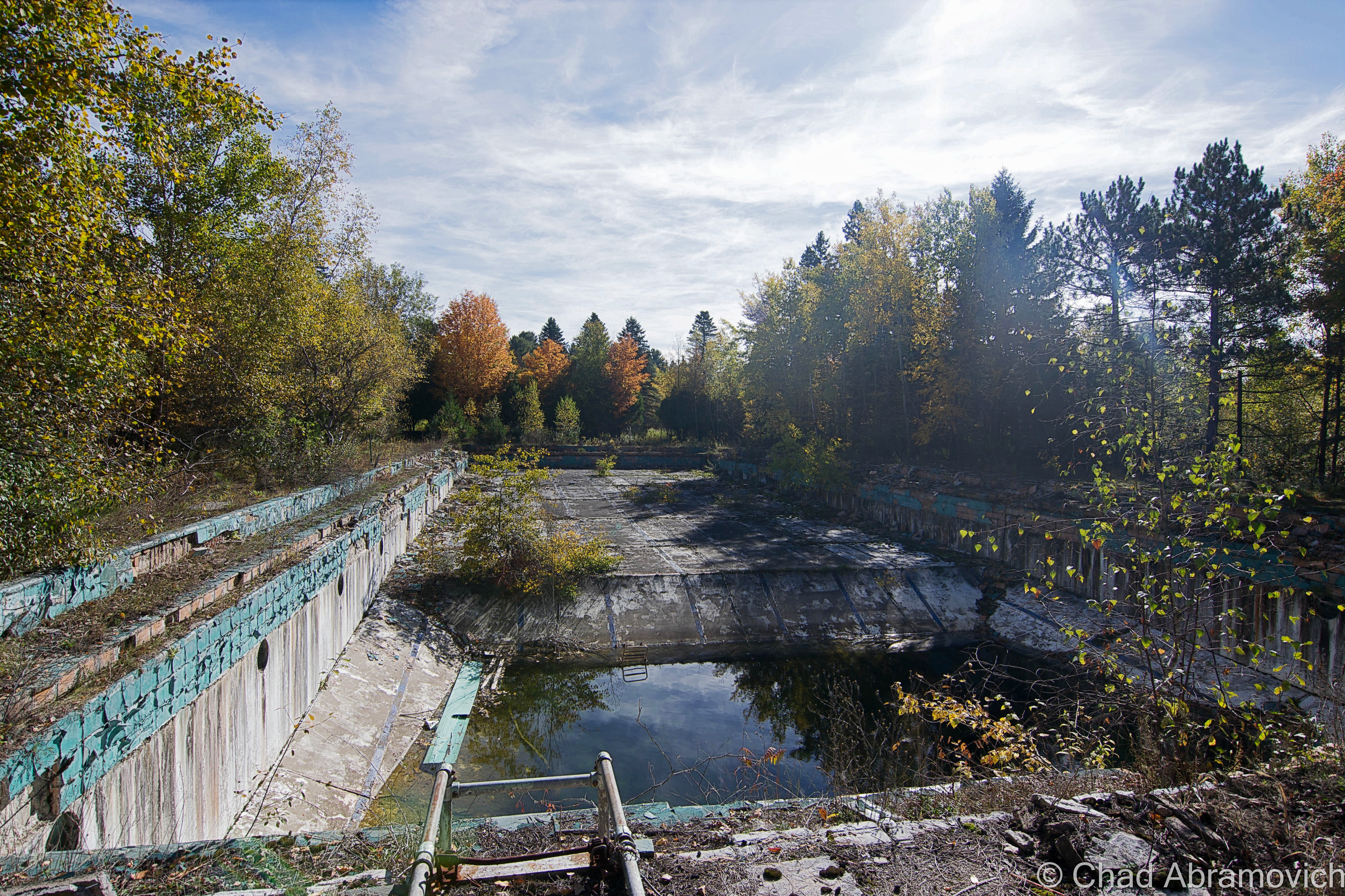
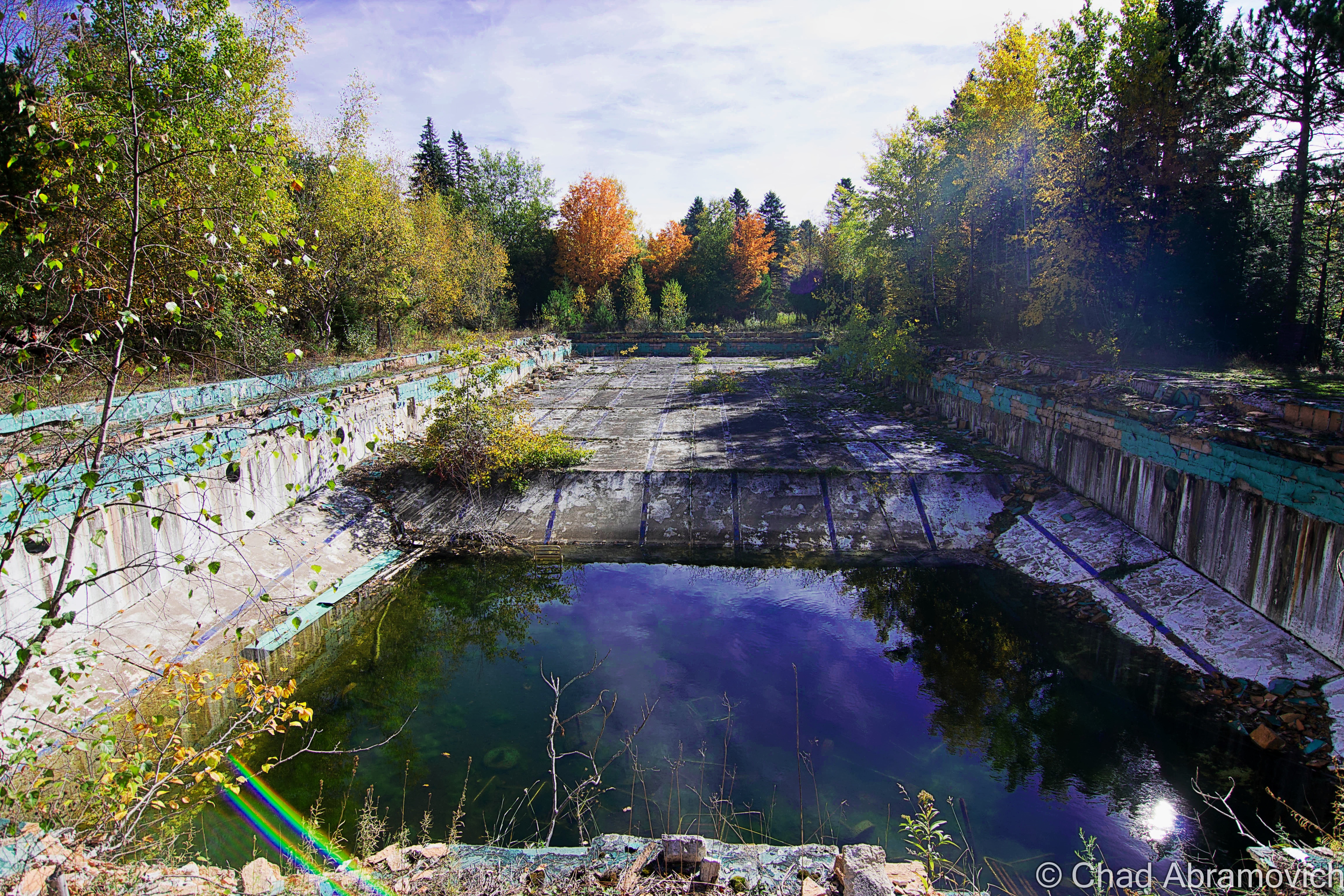
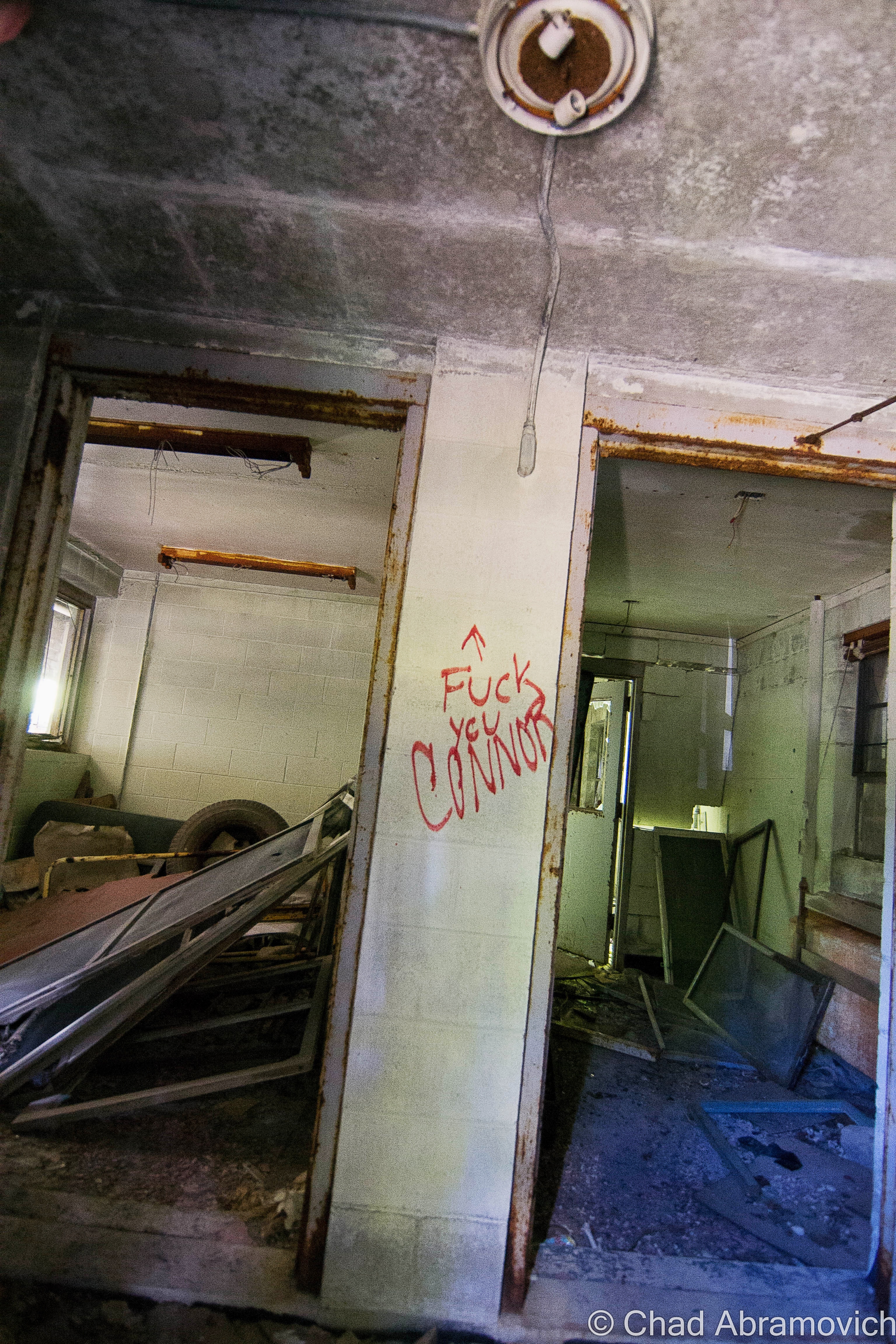
Just as I was snapping a few photos of some kind of rectangular cavity in the concrete floor that had long been turned into a pool of rainwater and who knows what else, those doors burst open, and some guy powerwalked into the abandoned factory with the trajectory that communicated he was on a mission – a mission that was suddenly interrupted by me.

His boots literally skidded to a halt on the gritty floor, snapped his head to his left, and gave me an appraising and surprised look through a squinty demeanor, then angrily huffed; ” Are you supposed to be in here?” I turned to look at my friend, who was still as a statue, turned back to the man, and decided that answering honestly was my best option, so with a shoulder shrug, I called over “I mean… probably not?” He just glared at me in a kind of tense silence, before pursuing his former mission – and stomped off deep into the huge spaces of light shafts and rusty steel. We both knew that was a good sign that we should leave, and we bolted.

I don’t have many pictures of myself, so thanks to my friend Jay for taking this candid shot of me doing my thing!

I’m disappointed that I never got a shot of the front exterior of the factory to include in this blog post, but I think there was some re-paving going on out front that day, and we were more focused on leaving before the cops were called on us. Unfortunately, I procrastinated a bit too long and never made it down to get that shot before the demolishing.

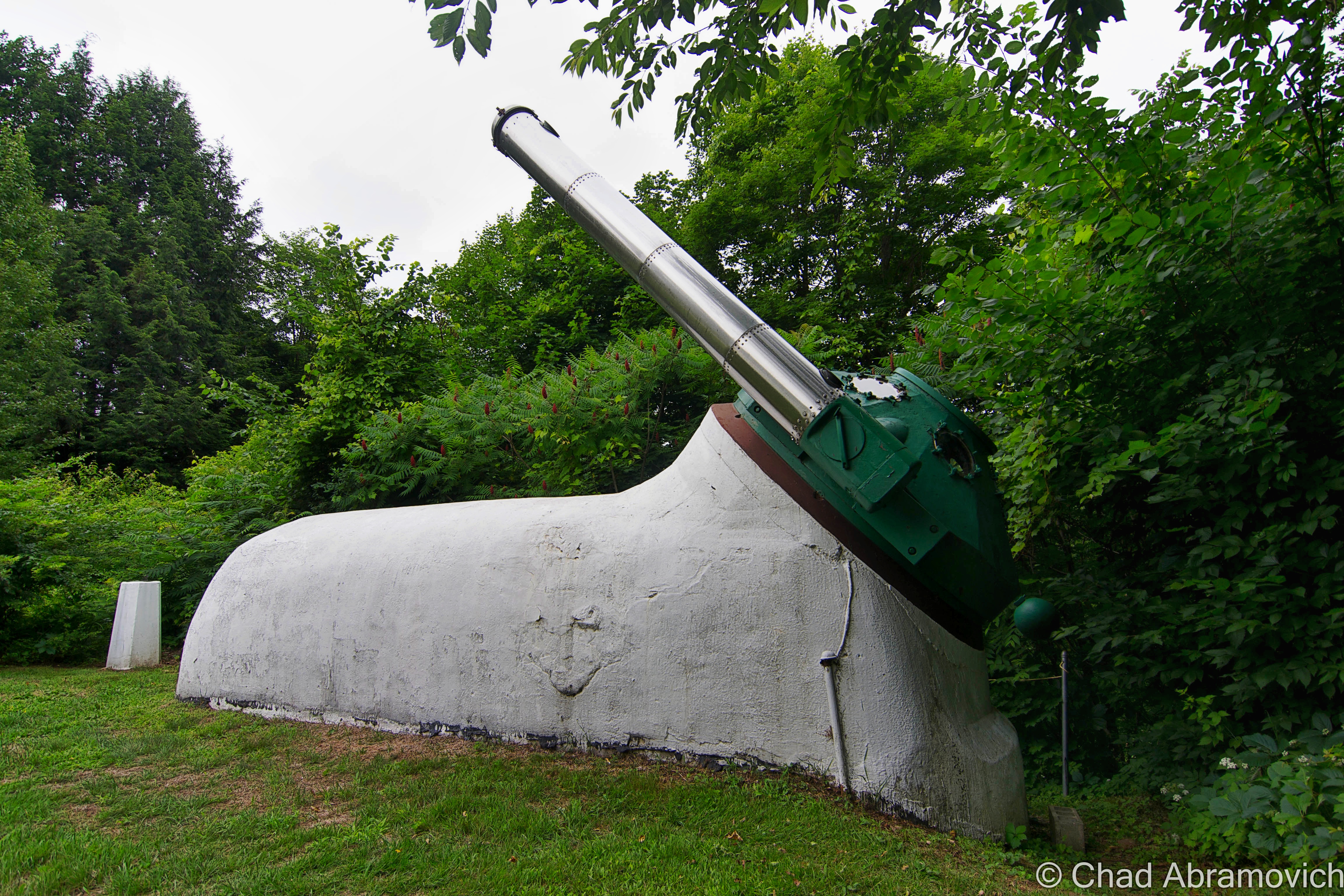
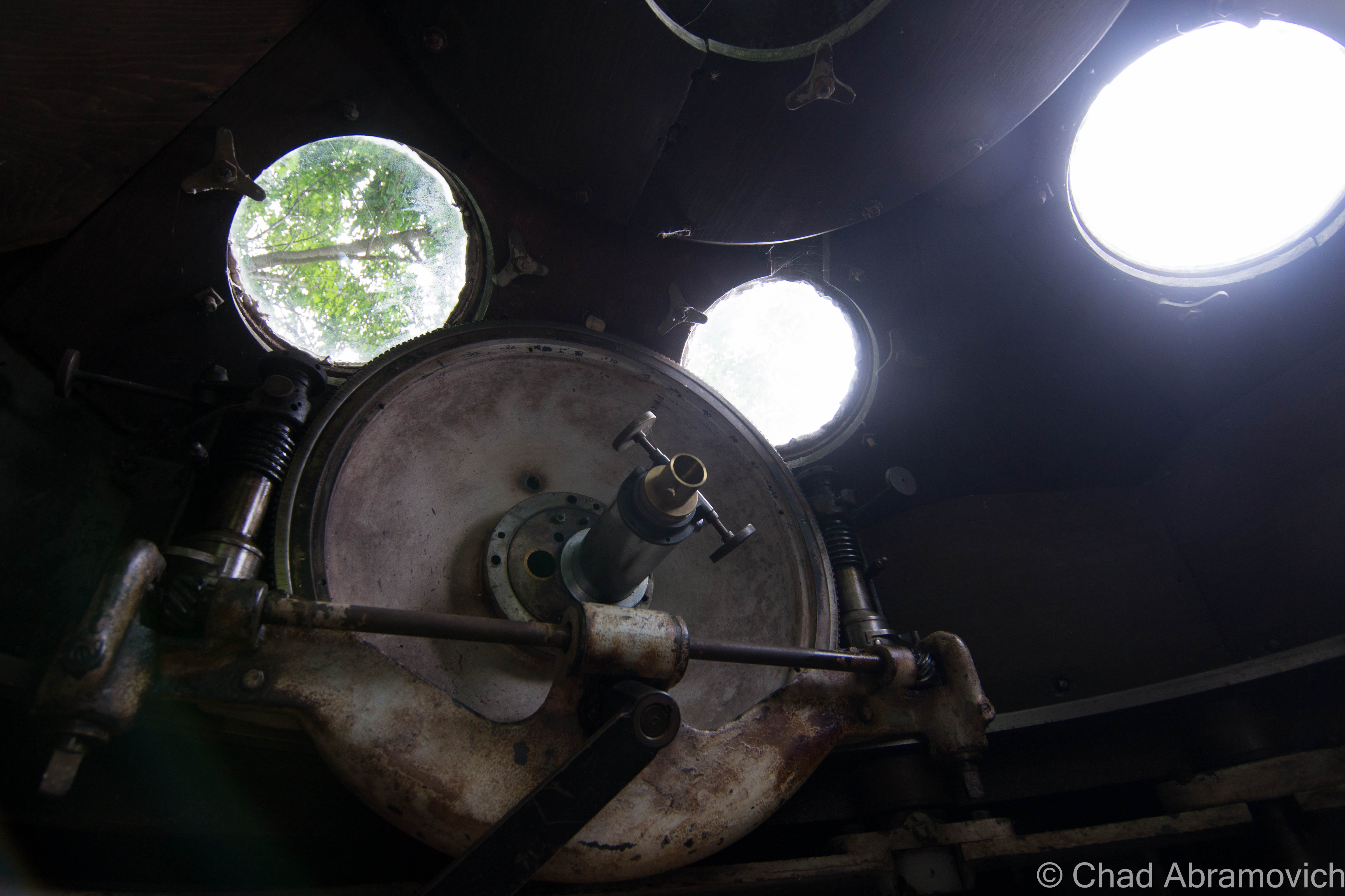
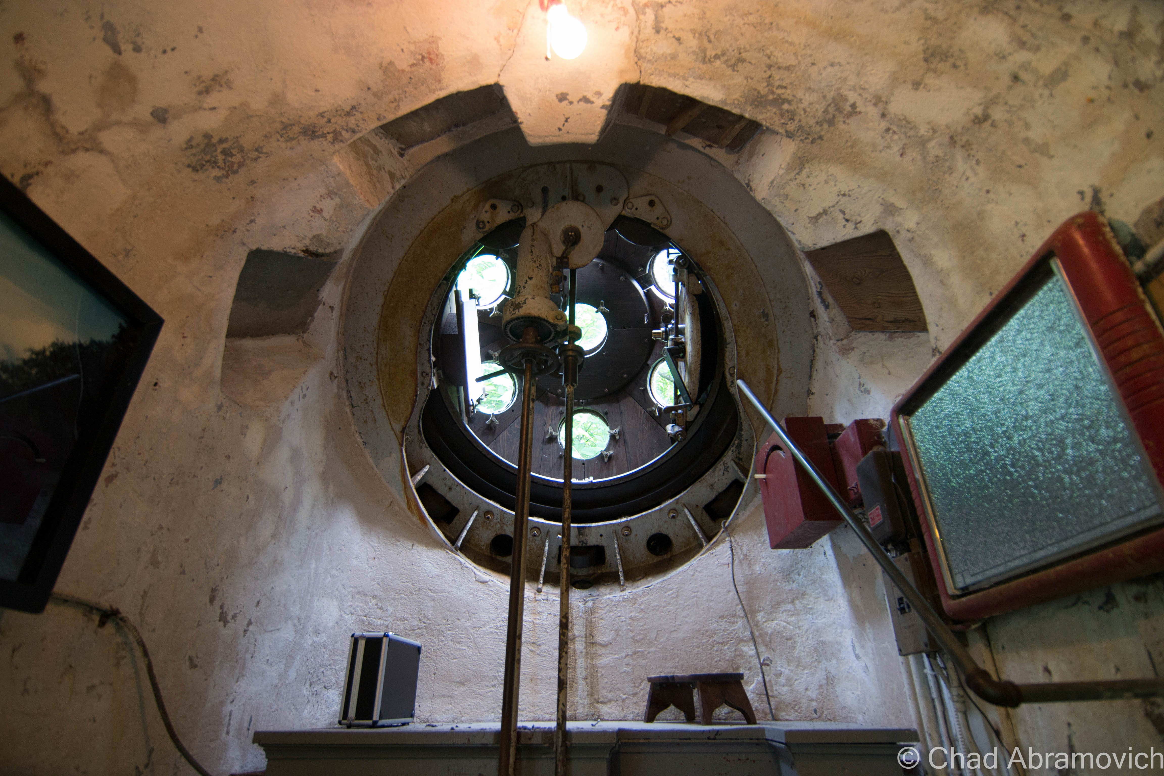
But something I did get to see, was Hartness’s aforementioned personal Equatorial-Plane turret telescope back on a rainy and humid June afternoon of 2015!

The rotating green turret rides on rollers supported by the white concrete structure, and it’s also where the stainless steel telescope tube with its ten-inch achromatic objective is installed, which is a modern upgrade to the original. Hartness developed the optics of the telescope to pass through a lens in the wall of the dome, which allowed him to stay warm in Vermont’s brutal winters.

The funny-looking protrusion is in front of Mr. Hartness’s stately former home – looking exactly like something a venerable turn of the last century tycoon would dwell in. At the time, the hotel offered free tours of the telescope and tunnel, no reservations needed, but because the property is currently a real estate listing, I’m not sure if the telescope is closed to the public or not, but absolutely hope that this treasure will continue to be shared with all the inquisitive.

I’ve always been someone that has loved human ingenuity and the magic of camaraderie, so this post was a lot of fun to research and write. So many amazing things happened in this era of America from the genius of common people that I just find so remarkable – and a little bittersweet thinking that we may never have another country-defining boom quite like it.

The earth is kinda played out, so it’s amazing that these strange new frontiers and discoveries can still be made in places like this that were once mapped, and then been forgotten.

For your consideration:

The Vermont Historical Society is one of my favorite organizations in the state – and they have a few nifty videos that briefly chitchat about both James Hartness and The Precision Valley. I’ve linked them below!

There’s a terrific archived article on Mr. Hartness, Springfield, and Jones and Lamson from Mechanical Engineering Magazine thanks to the Wayback Machine!

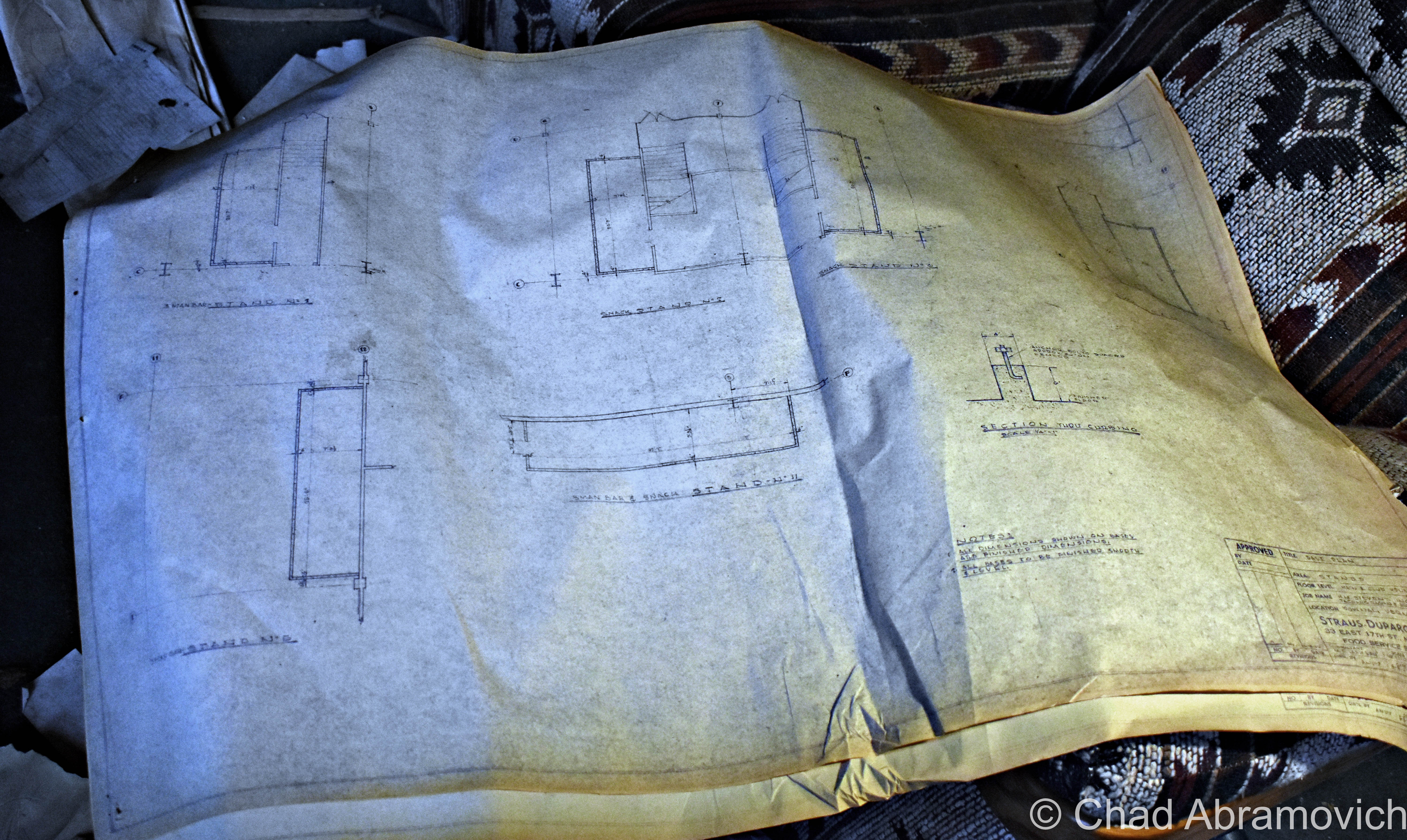
Are you wondering how a J&L Turret Lathe works? I was able to find a really cool dual brochure and scanned instruction manual from 1910 that includes illustrations!


Since 2012, I’ve been seeking out venerable examples of Vermont weirdness, whether that be traveling around the state or taking to my internet connection and digging up forsaken places, oddities, esoterica, and unique natural features. And along the way, I’ve been sharing it with you on my website, Obscure Vermont. This is what keeps my spirit inspired.

I never expected Obscure Vermont to get as much appreciation and fanfare as it’s getting, and I’m truly grateful and humbled. Especially in recent years, where I’ve gained the opportunity to interact with and befriend more oddity lovers and outside-the-box thinkers around Vermont and New England. As Obscure Vermont has grown, I’ve been growing with it, and the developing attention is keeping me earnest and pushing me harder to be more introspective and going further into seeking out the strange.

I spend countless hours researching, writing, and traveling to keep this blog going. Obscure Vermont is funded almost entirely by generous donations. Expenses range from hosting fees to keep the blog live, investing in research materials, travel expenses and the required planning, and updating/maintaining vital tools such as my camera and my computer. I really pride and push myself to try to put out the best of what I’m able to create, and I gauge it by only posting stuff that I personally would want to see on the glow of my computer screen.

I want to continuously diversify how I write and the odd things I write about. Your patronage would greatly help me continue bringing you cool and unusual content and keep me doing what I love!

Do you have any stories you’d like to share? Know of anything weird, wonderful, or abandoned? Email me at chad.abramovich@gmail.com

Donate Button with Credit Cards

A Day At The Races: The Old Green Mountain Racetrack (and Pownal Peculiarities)

I remember first passing this ugly hulking blight as a young kid on a trip to Connecticut, and never forgot it. It took me until the past few years to really investigate it, though, because I assumed it was just going to be a boring empty building enclosing rows of old stadium seats. But damn, I really under-estimated the interest factor here.

This place is so incongruous and inconspicuous in contemporary Vermont, that many people are pretty surprised to find it actually ever existed at all. And though it was never a huge success, it was a standout place for this compartment of American culture and ran for most of the latter half of the 20th century.

In the spring of 1965, a horse racing track started up in the hardscrabble town of Pownal – where three fascinating mountain ranges, the Green Mountains, Taconics, and Berkshire Hills, collide.

Its three creators’ idea was to duplicate the success of Saratoga, New York, and then compete with it by creating another track in a charming rural area – and the Pownal Valley, which has been literally viewed as one of America’s most photogenic, was chosen.

But it was also a very practical decision. Pownal is the extreme southwestern corner of Vermont – bordered to the west by New York State, and Massachusetts and their weird Berkshire Hills to the south. Pownal, being a primary portal into Vermont, is closer to the more urban burbs of southern New England and New York State than the rest of Vermont is, so the track effortlessly racked up a lot of visitors from the “flatlands”. 

Pownal’s history is a small magnum opus for yarn spinners and history nerds like me because so much has seemingly happened there, while parts of town look like so much hasn’t happened there, and I’m sure even more tales molder away in the town’s backroad hovels and neat antiquated farms. (Seriously, some environs look like they have been untouched by modern headways –  like you’ve stumbled into a deep southern Appalachia, or as my friend calls it; “Pennsyltucky”.)

Perhaps that’s because there’s just something, well, weird about the town, something endemic and enigmatic that might be as old as its mountains, and that draws me in like a torch in search of a flame. The town definitely has a different kind of vibe to it than the rest of Vermont. I really like Pownal – it’s seriously one of the coolest towns in the state! When I sat down to put together my blog post from this explore, I couldn’t think of this old racetrack without thinking about all of the other amazing things that I’ve gleaned about this town over the years.

Originally, the area was inhabited by Mahicans, whose savage fate may have been foretold by prophetic rocks on a Pownal mountainside.

Its realm was the only part of what is now Vermont that was ever trodden on by Dutch colonizers from New York in the 1600s (The Albany/Hudson Valley region of New York has a really cool lingering trace of Dutch-inspired architecture, toponyms, and seemingly ancient muniments as a result! I’d love to do far more exploring/researching there)

What might be the oldest home in Vermont is in Pownal village – The Mooar-Wright House – which was constructed around 1750.

Vermont’s only witch “trial” happened here in the early days of Pownal, where some folks victimized a Dutch widow named Mrs. Krieger for “possessing extraordinary powers,” whatever that meant. The obscure account was originally (and fortunately) recorded by lawyer and historian T.E. Brownell, and has managed to survive into the 21st century, though still pretty obscure.

I’ve read about a few Vermont women who were said to be witches, and usually, the accusations and “evidence” were in the camps of “consorting with the devil” or using “magic”, which lead to mischief like making cows stop producing milk, crop failures, townsfolk suddenly being inflicted by mysterious maladies, and innocuous stuff like predicting the weather before it happens. Other more sinister tales include the conjectured witch conjuring up a vast spectrum of malicious acts towards others she didn’t like.

I’ve been told that my great grandmother could predict the weather, held seances in her parlor, told fortunes she read in tea leaves, and once unwittingly shared a barn dance with the devil himself, but she seemed pretty well-liked and esteemed.

Unfortunately, widows were sometimes the prey of discrimination back then, because they were seen as not only a “burden” to the community, but they were easy targets because they had no family to defend them. Human beings are the real monsters.

Whatever it was that the widow Krieger was doing was seen as diabolical enough to condemn her, and a “safety committee” was organized to deal with it.

The Hoosac Valley: Its Legends And Its History by Pownal-ite Grace “Greylock” Niles tells that the committee sentenced widow Krieger (spelled “Kreigger” in her pages) to trial by ordeal, and gave her two choices. The first choice was she could climb a tree and wait for a group of men to chop it down. If she wasn’t killed outright, she was innocent. Or, she could face “trial by water” – which meant that a group of townsfolk cut a hole through the ice of the Hoosic River, bound her, and then tossed the poor woman into the frigid current. This surefire method stemmed from an old belief that water was sacred, and would undoubtedly sort these provoking preternatural things out. If she sunk, she was innocent, but if she floated, then that meant that she was in allegiance with the devil or some other variety of evil, and would have absolutely nothing to do with science/physics. I also noticed the confirming circumstances of the two methods contradict one another (if she wasn’t killed, she was innocent, versus if she was killed, she was innocent. What).

The widow Krieger chose the latter, thinking it was the safer choice, and sank like a stone. That was apparently good enough for those Pownal-ites who gathered for the show. Unlike neighboring Bay State witch hunters, though, these Vermonters seemed to be a bit more philanthropic, and a group of men suddenly panicked and scrambled down the riverbank to fetch her. Not only did she live through the ordeal, but I’m assuming things were really awkward afterward. As the committee resolutely said afterward; “If the widow Kreigger had been a witch, the powers infernal would have supported her”

Today, there’s a standout cliff near North Pownal that local parlance still knows as “Krieger Rocks” – both a homage to early Dutch influence and an informal parable of a hapless woman.

I also found this occurrence even more uncanny, because while the epoch of the infamous witch hysteria of Salem and southern New England occurred in the 1690s, Vermont’s lone delirium happened sometime in the 1760s, probably after 1761 when the town was charted. (Actually, Yankee witch based superstitions, though weakened, remained alive into the 19th century!)

Perhaps Pownal just needed to install a few witch windows? 

In October of 1874, Thomas Paddock, a well-respected farmer with an amicable character, suddenly found his property under a maelstrom from poltergeist-like activity.

Stones – varying in size from pebbles to a 20-pound boulder (!) rained down on his house and outbuildings, but neighboring properties were completely unaffected. The stones were found to be hot when handled, even on chilly nights, and a few of them reportedly defied gravity, and rolled uphill, or even up and over the peak of the roof after landing, almost as if they were propelled. Mr. Paddock dubbed whatever it was “the stone-throwing devil”, word got out, and for a brief time, it caused a sensation.

He even offered a reward of one dollar for anyone who could solve these shenanigans, but shortly after, the cache of tourists and newsmen cleared out when the odd activity finally stopped. Nobody was any wiser at what exactly happened at the Paddock farm, not even today (though cursory blame was attempted on a hired farm boy named Jerry, who coincidentally was in the vicinity of the falling rocks more often than not…) Interestingly enough, the farm just happened to be near-ish the Krieger Rocks part of town…

Local girl Addie Card, who once labored at the now-demolished and superfunded Pownal Tannery (a site I’m sorry I missed out on), was photographed by the now-famous documentarian Lewis Hines and the image became a barometer in his efforts to stoke public objection about turn of the last century child labor in America. A collection of dilapidated shacks off state route 346 on a dented dirt drive known as “French Hill” are original tenement houses of the old tannery and one of the last reminders that the place actually existed in North Pownal.  

There’s still an existing and forgotten granite tri-point state marker erected by surveyors in the 1800s that’s now lost in the thick forests of the hills – some of those slopes still cooly contain colonial-era scrawlings on glacial deposited boulders of predecessing hikers and explorers – just some of the many relics I’m sure these hills contain. I know some people that hit a jackpot with their metal detectors around it. Who knows what else can still be found within the southern Green Mountains?

Another notable person with alleged wild talents was Clara Jepson, Pownal’s official seer – a profession that you don’t hear that much of in contemporary times (except maybe advertised on television at 3 AM). But until she died at 87 in 1948, she was the best-known clairvoyant in Vermont and created a pretty venerable reputation to back up her accumulated character.

Among her professed talents, she could allegedly hunt the location of lost or hidden objects, and was consulted on several cases, including one of the terrifying disappearances in the nearby mountains that would later become an area known as the “Bennington Triangle” (one of my favorite Vermont stories). According to witnesses, her answers would manifest themselves in a cryptic language within the folds of a lacy white handkerchief she would fondle during her sessions. (If anyone is old enough to recall ‘seeing’ her in real-time, or has any kind of story related to, I’d love to hear from you!)

It seems like Pownal’s always done things a bit differently, in ways that seem to almost be a few shades deeper into the mystic that’s masqueraded by a rough enchanting landscape, and maybe that’s augmented because of the town’s historically independent spirit, mountain isolation, and influenced by its border state surroundings. I honestly don’t think that this racetrack project could have happened in any other spot in Vermont.

And speaking of the racetrack, it also seems to be the last big spike in Pownal’s histogram, for the time being anyway. The track opened in May of 1965 at a cost of six million dollars in a former cornfield along the Hoosic River.

But from the start, Vermont’s only pari-mutuel racetrack failed to draw in the crowds that its investors were anticipating – the actual attendees were half that. But it kept on keeping on, despite quite a few subsequent telltale ownership changes, and oddly became kind of significant for east coast horse racing, ironically because of the efforts made just to keep the place buoyant. It was one of the earliest to do gimmicky nighttime races, and the first to do Sunday matches anywhere east of the Mississippi during the days of yore when the rest of the country still adhered to the blue laws. It created a sort of niche fanbase and wound up employing a lot of locals, which was a boon in a region with an economy that was becoming pretty hard-up. Casual tourists enjoyed the racetrack, too, and I was told it was a popular stop for folks who’d take Sunday drives through the mountains of Southern Vermont.

Old postcard of the Green Mountain Racetrack via CardCow.com
Old postcard of the Green Mountain Racetrack, with Route 7 in the foreground – via CardCow.com
Old postcard view from inside the grandstands.

A packed parking lot at the Pownal Track – sometime in the sixties.

Twelve years later, horses were dropped from the itinerary, and Greyhound racing was the only thing occupying the oval (which I guess is the bottom echelon of these kinds of places, according to some nostalgia sites I browsed) until 1992, when the track closed for good – in part to animal rights activists, waning income, and the state making the activity illegal. A resurrection was attempted around the turn of the millennium but ultimately failed. It was strange seeing moldy flyers and banners ambitiously announcing its “grand re-opening” stored in soggy piles in the dank basement levels. I’d love there to be more economic prosperity for Pownal and Bennington County, but not in the form of animal exploitation.

Today, the 144-acre property is abandoned, despite multiple failed attempts to do something with it, and it’s a real shame that nothing has happened yet. Further damage was done when the nearby Hoosic River, a perimeter defining watercourse that wears the Indian appointed name of many local toponyms that variate between “Hoosic” and “Hoosac” – and has a history steeped in local lore – flooded its banks significantly a while back and seeped into the lower levels of the building.

The site has so much potential – especially being off the most traveled road in Vermont. Lollapalooza held their festivities on the expansive grounds in 1996, and a few antique car shows also took advantage of the space between 2005 and 2008, which fits right in seeing as the iconic Hemmings Motor News is located up the road in Bennington in a rad, restored Sunoco station.

Williams College, a few miles south of the old track, even did a study about the property in 2011 and suggested everything from affordable housing, light manufacturing, or bringing back some agriculture.

Until any of that happens, you can’t miss the place. It’s an intriguing, conspicuous eyesore at one of the main entry points into the state – dominating a portion of the view as Route 7 begins to climb the mountains towards Bennington.

One of the biggest curiosities about this property to me was the name of its access road. The unassuming road is named after a cemetery, but I’ve walked around the grounds and I couldn’t spot any boneyards. It made me wonder – back in the day, moving an old cemetery wasn’t as big of a deal as it would be nowadays. Could there have been an old family plot from an old farm that was erased? Are there still corpses trapped underneath the sea of weedy asphalt that encircles the grandstands, or maybe underneath the earth of the old track?

Well, according to Google, the cemetery still exists in a far-flung corner of the property, and it’s the oldest in town – with a gathering of faded and broken 19th-century headstones placed in the woods (Interestingly, Pownal has a lot of cool old cemeteries – and many of them are old farm family plots, which might seem kind of an odd concept in today’s world). I’ll have to give it a visit the next time I stop by.

Many of the glum-looking crumbling cinderblock stables were razed for a solar farm, which is awesome, but the gigantic grandstands building still stood at the times of my visits, and was a spooky but really fascinating time capsule of the late sixties and early seventies, with its cold cement blocks and hideous fake vinyl wooden wall paneling – an architectural design element I hate. I especially admired the extinct fonts on all the office doors; “bookkeeper”, “telegraph”, “photographers suite” etc – that was pretty neat to see. One unifying theme to the property was the use of a particular dark green – thematic of its location in the Green Mountains, which was used on everything from the exterior paint job to the color of its graphic design marketing. The appeal, though, was a little curious. Everything about the place felt cheap and kinda sleazy.

The building was an unassuming labyrinth of smelly and squalid offices and catacombs of dark and drippy maintenance and miscellany areas all filled with relics, gross puddles of goopy chemicals on the floors, and wandering birds.  The roof had long failed, and nature has been metamorphosing the structure in gross ways for over a decade.  One of the coolest things I found was the former track photographers suite, which was still filled with heaps of developed and undeveloped film of the old races. The basement had such a foul odor that, eventually, we had to dip back outside for some fresh air revitalization.

Upstairs, the former venue, snack bars, and grandstands are all cavernous spaces that have been trashed, smashed to smithereens, graffitied, succumbing to water and decay, and turning into terrariums, as moss and young plants have begun to take habitat on the floors and the rooftop. A whole colony of what was probably hundreds of pigeons had taken up residence on (and within the cavities of) the defective roof and constantly circled the large, mid-century structure.

It was a creepy explore, with lots of eerie sounds that croaked and carried through the wide spaces and dark crevices. The smell of rancid decay permeated everywhere.

Overall I thought this was a real bummer of a place – an attitude formed by the dated and ugly ruins, and the fact I’ve never enjoyed or supported the kinds of revelry that once went on here.

The real reason I chose to make multiple explores here was simply because of the fact that it exists, and my sense of wonder seduces me to explore as much of Vermont as possible – especially the abandoned stuff. And admittedly, a few visits had me appreciating it in a totally different light and discovered that it was a treasure trove of an explore and architecturally evocative of its time. But I found it a real shame that other people who’ve stopped by have decided to completely decimate this place and use it as a law-free zone.

The amount of destruction in the past few years was astonishing – I noticed a humongous difference between my visit in July of 2019 and March 2020, and towards the last months of its life, the bad road tar of the old parking lot and access road almost always had multiple cars – many with out of state plates, parked around.

The people that come here are quite a circus show of other amiable explorers, curiosity seekers, locals, and shady characters – it seems like many out of staters or area hooligans are using the old track as a law-free zone. A few people we ran into definitely made us uncomfortable.

Dusk was humming up, and as we were getting ready to leave, three boys on ATVs zoomed through the parking lot, and a Nissan Altima full of teenagers parked in the weeds in front of the building and had an “oh shit!” moment as we pulled out and all locked eyes as they were removing copious packs of Twisted Tea out of their trunk, while nearby, a young twenty-something couple was awkwardly trying to wedge a sign they had taken into the backseat of their Ford Focus.

I had this post sitting in my WordPress drafts for a while. Because I’m a perfectionist, I wanted to get the feeling right and make this post interesting and fun, but I was also concerned about posting the location. I realize that in the past few years, a larger amount of people have been using my blog to add places to their exploration checklists, and I’ve been really re-evaluating my responsibilities as a preservationist and a local weird worker, what I post, and how I write about it.

I already saw the racetrack morphing into a weird beacon for trouble, and I guess I didn’t want to add to it. Thanks to the internet, nothing is a secret anymore, and I’ve seen an alarming increase in the momentum of special places, in general, being over-touristed and ruined by unlikely people.

Unfortunately, at some point on the night of September 16th, 2020, a “suspicious fire” was started in the grandstands that used the wooden seats for fuel, and the entire building was cooked and even more destroyed than it already was. The fire fueled a local outcry of folks who are fed up with all the fools turned sightseers. This is one of the many reasons why I never give out locations. Practically everything you’ll see in my photos has been reduced to ashes, but the mangled and blackened shell sadly still looms beyond Route 7 looking pretty haunted. If you’re interested, the Berkshire Eagle has some illuminating drone photography of the damage.

I’m so grateful I had the chance to enjoy a few explores and make some fun memories here when I did, and am saddened by the loss of what oddly was such an uncommon wreck. There was so much more that I wanted to see, that now I never will.

I think that the Green Mountain Racetrack was uniquely special. Because of its smooth accessibility, its literal open-door policy intrigued all kinds of souls who decided to let their curiosities lead them here. I was scanning loads of posts on Instagram and was a bit startled to see just how many people not only have snooped around here, but were genuinely fond of this place in their own ways, and had fun making multiple trips here to satisfy the natural human urge of investigation. Abandoned places inspire that kind of magic that encourages us to forget about the chains of society and our inhibitions. When the news hit that this place burned down, people started commiserating.

This was a continued lesson for me not to take places for granted. I was just speaking to a good friend a few weeks ago about planning yet another return here because of all the fun we had last time – but we took this old track for granted, and now it’s gone. Everything is finite.

So here you go; a whole bunch of photos of the old Green Mountain Racetrack!

The Green Mountain Racetrack when I visited back in Spring 2011. 

The Green Mountain Racetrack June 2019/March 2020

The old track oval, now a field growing wild. Looking at this image, I still remember this summer evening; the humidity dripping down my skin and shallow breathes in heavy air, with the gentle sound of rustling long grasses and a nocturne of peepers. The end of the Green Mountain range can be seen in the distance.

Green Mountain Racetrack June 2020

Photos from my last sojourn here. It was a sultry early summer day as mists slid of new green slopes vibrant against gloomy ashen skies and uncomfortable humidity that drenched us in sweat. The entire place reeked of something sodden and foul. It had started to rain, and the roof, which had long failed, was letting fetid water in which dripped down and baptized us and made the upper carpets like stepping on a wet sponge.

“You’ve been baptized – your soul belongs to the race track now” I joked as a trickle of mystery water dribbled down upon my friend’s head and shoulders. She involuntarily cringed at the sensation and shot me a glare.

Man oh man, I really miss this place.

I realize the noun “Paddock” means a field/enclosed area where horses are kept and exercised (duh, because it’s an old horse track), but I personally can’t help always think of the aforementionedly bedeviled Pownal farmer Thomas Paddock when I’ve passed under this sign, and all the inexplicable weirdness that went down (literally) on his local farm. Personally, I think that would have been a way cooler restaurant name reference.
A groovy old conference room in the basement

I’d really love to do more shunpiking and exploring around the Pownal area – it really is a gem of a town, with far-stretching vistas, old farms, backroads that convert into gnarly class D forest roads, and hidden swimming holes under mountain cascades.

When I was curiously searching for other people’s media from their explores here, I found quite a few talented folks who bring some great stuff to the table. Here’s one of my favorites; a great urbex video by explorer “Dark Exploration” (who, in my opinion, got wayyy better shots than I did!)

Check out this cool drone footage shot by Youtuber Dagaz FPV! It gives you a scope of just how big the property was and some rad POVs that I couldn’t capture. Maybe I should invest in one of these…


Are you from Pownal or the surrounding environs of Southern Vermont/The Berkshires/New York State? Or are you a Vermonter in general? I’m looking for weird and wild stories, wonderous places, incredible people, and especially abandoned locales! So if there’s something you’d like to share with me, I’d love to hear from you!

I’d also really love to grow this blog and present unique, meaningful, and extraordinary content that’s a departure from the same regurgitated stuff you find everywhere else online, and your help would be hugely appreciated! I have bad social anxiety, so I’m not always on social media as often as I probably should be.

Feel free to drop me a line at chad.abramovich@gmail.com

Also – if you appreciate me and this blog, perhaps consider making a donation at my PayPal below? The pandemic has hit my finances and my mental health pretty hard, so any amount is humbly appreciated. I’m also on Venmo if that works better.


Since 2012, I’ve been seeking out venerable examples of Vermont weirdness, whether that be traveling around the state or taking to my internet connection and digging up forsaken places, oddities, esoterica, and unique natural features. And along the way, I’ve been sharing it with you on my website, Obscure Vermont. This is what keeps my spirit inspired.

I never expected Obscure Vermont to get as much appreciation and fanfare as it’s getting, and I’m truly grateful and humbled. Especially in recent years, where I’ve gained the opportunity to interact with and befriend more oddity lovers and outside the box thinkers around Vermont and New England. As Obscure Vermont has grown, I’ve been growing with it, and the developing attention is keeping me earnest and pushing me harder to be more introspective and going further into seeking out the strange.

I spend countless hours researching, writing, and traveling to keep this blog going. Obscure Vermont is funded almost entirely by generous donations. Expenses range from hosting fees to keep the blog live, investing in research materials, travel expenses and the required planning, and updating/maintaining vital tools such as my camera and my computer. I really pride and push myself to try to put out the best of what I’m able to create, and I gauge it by only posting stuff that I personally would want to see on the glow of my computer screen.

I want to continuously diversify how I write and the odd things I write about. Your patronage would greatly help me continue bringing you cool and unusual content and keep me doing what I love!

Donate Button with Credit Cards

Ephemera

“Wow, how does a place like this even exist?” mulled my friend aloud, lost in her own luminous reverie. I had seen photos of this beautiful dereliction online, but I was just as awed, as the stagnant cold inside stung my hands.

The early morning wintry cold was still hanging over the misty hills of Bolton flats in a hundred shades of blue as we departed for southern New England. While we drove we sat in silence, with heated seats, coffee and the wonderful sounds of Caspian coming through my iPod. After a few hours, Vermont’s brown frozen hills gave way to eight lanes of interstate traffic and lots of Dunkin Donuts signs.

Thirty-two years of fluctuating New England weather and zero upkeep had rotted out the drafty interior. The metal stairwells became stretches of rusty spiderwebs, some were completely untrustworthy. The snow that fell through between broken roof was so loud that you would have thought it was thundering outside. The thick brick walls oozing with slime and glazed by ice blocked cell phone reception pretty well. I received a few texts sent by my friend asking me where I was, hours after she had sent them and on the road back to Vermont, which I guess meant that contact in case of emergencies would have been pretty unaccommodating.

The complex appeared to be a utilitarian and symmetrical layout of two large spaces adjoined by a central row of offices, bathrooms, and mechanical areas. But upon closer and intimate inspection, I was actually more and more surprised at just how many rooms and levels there were, packed in by a labyrinth of confusing staircases and elevated runways. Some spaces were more or less original to their inaugural construction at the turn of the last century, and in the throes of the shifty ways of time, more were accommodated. There were quite a few dank 1970s office spaces put up hastily in areas that contained the infamous giveaway vinyl wall paneling and drop down ceilings, all which were accordion-ing now thanks to precipitous moisture. Some spaces were utterly unidentifiable under the entropy, with collapsing floors and sketchy staircases that lead into ambiguous soggy blackness above. But it was the two main rectangular chambers and their brawniness of broken glass and steel that I was interested in. These cavernous spaces had quite the compendium of artifacts left behind; from magnificent and remarkably intact machinery, actual steel rails still embedded in the floors, to just about anything you can fathom that had somehow found it’s way inside and subsequently left there to waste away. There’s a lot for a person to think about as they walk along the crumbling floors inside this illusion of another world. Just watch out for nails. There are plenty to step on.

The most interesting of things left to rediscover was the extraordinary amounts of sordid books, paperwork and filing cabinet miscellany (and their accompanying filing cabinets) that had been left behind. I’m talking entire floors filled with wall to collapsing wall of old records mummified in decay. Most of the paperwork was illegible, but the oldest date I was able to find was 1931. Another friend and explorer had joked that a photo of mine was the literal embodiment of “squishy”, but as of now, no destination has been able to surpass The Pines Hotel as my “squishy-est” explore, though this place is definitely a contender.

Though we live in a world that has largely been explored, mapped and reclaimed, these human-made spaces become utterly fascinating after their functionality ceases to exist. The mystery continuum of their inner spaces become sort of last frontiers, as nature begins to reclaim everything that has been forsaken by us, transforming these spaces into something incredible. It’s on these explores that I like to attempt a little amateur forensic archaeology, and try to pick at the bones.

The suburban New England town I traveled too became the chosen plot of land for the formerly prestigious Boston & Maine Railroad to build their rail yards and repair/manufacture shops in 1913. What is considered to be one of American’s oldest suburbs was built up in the adjacent area to accommodate the growing need for laborers, many of the garden enhanced neighborhoods eventually were built up over old track beds that were once spur lines leading back towards the roundhouse, depot and loading docks. The continuously shape-shifting property grew to massive scales as the railroad industry became a future facing wonder, as growing mill towns and their populations created a ravenous market. That is, until the automobile became de rigueur.

The popularization of the automobile and the trucking industry seems to be the harbinger of death for a good amount of the ruins I visit, and this seemed to follow the same storyline, as both the automobile and leveling of the same manufacturing that created the demands for the railroad, murdered it. The railroad had grown so much during its boom years, that it went into unpayable debt for the miles of tracks they laid and smaller companies they acquired in the throes of good-natured greedy competition. Towards the latter half of the 20th century, the railroad industry indignantly stepped back into a darker corner of civic and popular culture, and the massive campus was now useless.

The B&M went bankrupt in 1970 and despite efforts to reorganize and restrategize, became a ghost by 1983, when it was bought by another regional rail company. By 1984, the complex was abandoned altogether because all that space simply wasn’t needed by the diminishing industry. But, not before they left a naively irresponsible legacy of destruction and negligence behind them, as the massive yards were also used for toxic waste dumps and a place to haul train wreck shrapnel over the years, which earned the place an official designation on the Superfund site list, a bone of contention that isn’t even expected to be taken seriously until 2031-ish because like everything else, the EPA doesn’t have the money. To the locals understandable displeasure, there was quite a bit of opacity about their houses abutting a literal toxic waste dump – information which wasn’t even made widely public until some neighbors did a little digging in the late 80s when a pervasive chemically smell began to waft through side streets near the industrial park, and became an uncelebrated normal.

I was able to find a few articles on the local public radio website that explained that the entire 553 acres are so swamped with pollution – ranging from asbestos, arsenic, cadmium, lead, selenium, petrochemicals and wastewater lagoons that it not only earned a spot on the national Superfund database list, but it’s one of the worst in America. “You couldn’t leave your house to go out and even have a nice barbecue because the odor was so bad”, said an interviewed resident recalling how bad it was a few decades ago. To makes things more apprehensive, The EPA says human exposure risk is still “not under control”, though it seems far more controlled today than when the report was written. I guess I can cross off walking around a toxic waste site off my bucket list, regardless of the fact it wasn’t on my list.

Today, most of the former property has been reincarnated as a shabby looking industrial park. The largest railway in New England has it’s main headquarters here still, that sits directly in the decrepit shadow of the abandoned shop buildings I was walking around, among a few other places with no-frills signage and creepy vacant looking front entrances. That being said, this is still an active industrial park, with employees, cops, and on my visit, guys who operate plows, that are present on a daily basis. Unlike me, who technically has no reason to be here other than curiosity. The rail lines that hem in the property are also still in use, and some of the industrial businesses in the park receive rail traffic.

There is always a certain reward to risk ratio that I use as the dichotomy or gauge of how I treat my explores. On this trip, my friend and I and my friend decided to simply walk towards the buildings with our cameras, as there was no way we could get inside without someone seeing us, and I didn’t drive through three states just to turn around. The man in the plow noticed us as he was relocating a snow drift. We all mutually nodded our heads in affirmation and confidentially walked inside. We were exploring for four hours or so, and the cops never came, which was great, because this fascinating locale has easily turned into one of my fondest explores. This is one of those places I could return to multiple times and have a different experience at.

But I wouldn’t take that one fortunate opportunity for granted. I know a few people who have been dragged out by the powers that be before, which is why brushing up on trespassing laws in other states isn’t necessarily a bad thing.

Until some serious clean up and the accompanying scrutiny happens, these hulking and fetid ruins and all their soggy decay are more or less, in limbo.

DSC_0017_pe DSC_0025_pe DSC_0027_peDSC_0042_peDSC_0047_peDSC_0054_peDSC_0062_peDSC_0070_peDSC_0071_peDSC_0076_peDSC_0065_peDSC_0077_peDSC_0083_peDSC_0088_peDSC_0089_peDSC_0090_peDSC_0091_peDSC_0098_peDSC_0101_peDSC_0108_peDSC_0116_peDSC_0121_peDSC_0123_peDSC_0139_peDSC_0149_peDSC_0151_peDSC_0160_peDSC_0161_peDSC_0163_peDSC_0173_peDSC_0175_peDSC_0150_peDSC_0180_peDSC_0185_peDSC_0190_peDSC_0194_peDSC_0199_peDSC_0202_peDSC_0209_peDSC_0212_peDSC_0218_peDSC_0229_peDSC_0230_pe_peDSC_0237_peDSC_0241_peDSC_0243_peDSC_0248_peDSC_0250_peDSC_0251_peDSC_0253_peDSC_0261_peDSC_0274_peDSC_0278_peDSC_0287_peDSC_0288_peDSC_0290_peDSC_0291_peDSC_0292_peDSC_0295_peDSC_0300_peDSC_0303_peDSC_0304_peDSC_0307_peDSC_0310_peDSC_0311_peDSC_0313_peDSC_0314_peDSC_0315_peDSC_0318_peDSC_0320_peDSC_0322_peDSC_0324_peDSC_0329_peDSC_0333_peDSC_0337_peDSC_0339_peDSC_0344_peDSC_0348_peDSC_0349_peDSC_0136_peDSC_0351_peDSC_0354_peDSC_0360_peDSC_0361_peDSC_0366_peDSC_0367_peDSC_0369_peDSC_0381_peDSC_0392_peDSC_0395_peDSC_0399_peDSC_0405_peDSC_0409_peDSC_0413_pe

—————————————————————————————————————————————–

To all of my amazing fans and supporters, I am truly grateful and humbled by all of the support and donations through out the years that have kept Obscure Vermont up and running.

As you all know I spend countless hours researching, writing, and traveling to produce and sustain this blog. Obscure Vermont is funded entirely on generous donations that you the wonderful viewers and supporters have made. Expenses range from internet fees to host the blog, to investing in research materials, to traveling expenses. Also, donations help keep me current with my photography gear, computer, and computer software so that I can deliver the best quality possible. Seriously, even the small cost equivalent to a gas station cup of coffee would help greatly!

If you value, appreciate, and enjoy reading about my adventures please consider making a donation to my new Gofundme account or Paypal. Any donation would not only be greatly appreciated and help keep this blog going, it would also keep me doing what I love. Thank you!

Gofundme: https://www.gofundme.com/b5jp97d4

Donate Button with Credit Cards

The Soggy Remains of The Pines

Last weekend, I took a road trip with a friend to The Borscht Belt, a tongue-in-cheek colloquial moniker given to an area of New York’s Catskills Mountains interspersed with decaying hotels from a bygone era.

In the 20th century, New York’s Jewish community were being battered with a growing antisemitism inclination which shunned them from many mainstream hotels and vacation destinations.

That well-realized awareness encouraged them to cultivate their canny, and build a destination of their own. The Catskill Mountains a few hours north of New York City became their prospective topography that would be superimposed with lots and lots of blueprints.

Many establishments started out as simple farmhouses that offered kosher meals and a place to sleep, attracting mainly urbanites who wanted to part from the din of a city crawling with bodies. Other early attempts at tourism capitalized on the mineral springs fashion of the Victorian age.

It seemed like these investments were working, because around the 1930s, the area began to turn celebrity.

A sundry of small hardscrabble Catskill towns began to slip into destination communities as those boarding houses and cabins began to transition into increasingly lavish, all-inclusive resort hotels that sprang up on former farms and woodlots.

The emerging realm took on a few epithets, most popularly known as “The Borscht Belt”, after the traditional sour soup brought over by scores of eastern European immigrants who settled in New York City. The area was also slanged as “The Jewish Alps” and in Sullivan County’s case, “Solomon County”.

As time progressed, some places became so popular that private airstrips were being envisioned so they could accommodate a predicted increase in air travel from the city. The most revered appeal of the Catskills was that many of these resorts offered upper-class amenities and made them accessible to folks that normally couldn’t afford those luxuries, and as a result, other non-Jewish proletariat started becoming hip to the region.

The Pines was one of those hotels, once beloved, now moldering in the presently tiny and depressed little village of South Fallsburg.

Existing since 1933, The Pines wasn’t one of the largest Borscht Belt resorts, but it was arguably one of it’s grandest. It grew to offer 400 rooms, a golf course, tennis courts, indoor and outdoor pools, a ski chalet and trails, an indoor skating rink, conference rooms, a nightclub and theater that hosted notable Jewish Alps entertainers of the day like Buddy Hackett and Robert Goulet, and a restaurant and bar.

The Catskills popularity found its pivot point during the 1970s, when social changes stepped out of the throes of the fight that many younger members of the Jewish culture no longer had to face as their parents did.

That, and cheap air travel could take people to other places for around the same price as a trip upstate. Now, people could go to Florida or Europe and didn’t need to settle for the Catskills. Ironically, even the Adirondacks, the loftier and bumpier part of upstate New York, was still increasing in popularity, leaving the Catskills to corrode in rust and sorrow.

The Pines’ story seems to end like most of these stories do. The sprawling hotel was sold in 1998 and bought by The Fallsburg Estates LLC, who wished to revitalize the 96-acre property, and, in addition to revamping the ski hill and golf course, build shiny new condos over the ramshackle hotel. But by 2002, they filed for bankruptcy, which is consequently why the hotel is in the deplorable and vulnerable state it’s in today.

The remnants of the Catskill craze are still around, even if the craze isn’t. Today, the region is littered with abandoned properties – fantasies of blight whose visages bear slovenly expressions that welcome vandals, explorers, arsonists, scrappers and teenagers who are excited by the prospect of a paintball game or a place to drink cheap beer.

Arriving in South Fallsburg, I felt awkward driving around it’s deserted residential streets. Much of the area looks strangely incongruous, like a mockup community built by the government during the cold war that was awaiting the detonation of a nuclear bomb. The weird inner city like apartment blocks sitting in the woods were oddly desolate and forlorn looking, and the increasing amount of signs in Yiddish further sent me a feeling of dislocation.

Hiking up through the woods on a great 63 degree October afternoon, myself and my friend soon found ourselves staring at the brooding and ugly ruins of what was left of The Pines, and there wasn’t all that much. I had came a bit late, after it’s exploration heyday it seems, leaving me with what remained of it’s rotting bones.

The old hotel was absolutely trashed, being inside was like stepping into a rotting cave. The perpetually soggy carpets and dripping water immediately soaked my boots and the air was absolutely foul without a respirator mask.

Some levels had entirely collapsed, while other wings were more hole than floor. Moss, mold and plant life grew wild on the carpets and walls. Some rooms were completely destroyed, while others were strange enclaves of preservation, the difference at times depended on which side of the hallway you were on.

Mimicking the residual motions of the long gone guests, I spent several hours walking around its dark passages, feeling disparate nostalgia for a time I never even lived through.

Scrappers had ransacked the surviving sordid buildings for any valuable materials they could rip out of the walls or ceilings. Evidence of squatters camps could be found in a few rooms, which was a real poignant and sobering sentiment that there are some who do spend the night in this grim place, leprous with mold, rot and water damage that was beginning to make entire buildings buckle and bend as sections begin to lose their ability to do what they were designed to do.

A few different arson attempts were successful around 2003 and 2007 and consumed a few smaller outbuildings. Later, the indoor pool, theater, and indoor skating rink were razed, with an implied intent that the rest of the property was soon to follow. But demolition was halted, and the property sits in perishing limbo, somewhere between what it once was, and whatever it’s turning into.

Vintage Postcard of The Pines, circa 1960s. via cardcow.com
The Persian Room, the nightclub and theater at The Pines, now demolished. via cardcow.com
The Pines’ kidney shaped outdoor pool with concrete arch bridge. via cardcow.com
Indoor Pool, now demolished. via cardcow.com
Indoor/outdoor skating rink. The Pines was one of the early resorts to use artificial snow making in the area. Now demolished. via cardcow.com
Oof. A Very dated guest room at The Pines, circa 1960. Those sheets look pretty interesting, how they are designed to fold snugly around the shape of the bed and over the pillows, like housekeeping wanted to make sure you had the most sanitized night sleep of any hotel you’ve stayed at. via http://uglymotelrooms.blogspot.com/

Here is a promo made around the 1980s I found on Youtube, to give you an idea of what this place used to be like.

My talented friends at Antiquity Echoes made this great edit of their exploration to The Pines a few years ago, and their thoughtful camerawork shows much of the hotel that has long vanished.

DSC_0165_peDSC_0168_pe

DSC_0171_pe
The first building we came upon was the former clubhouse on the golf course, a cool mid-century building with an angled roof line. The building was two stories, and housed locker rooms and a pro shop. The interior was strewn with soggy insulation and broken glass, skis and ski boots, golf bags and pairs of cleats, and a weird pile of plastic ‘Hawaiin’ leis in the basement.

DSC_0184_pe DSC_0188_pe DSC_0194_pe DSC_0200_pe DSC_0202_pe DSC_0204_pe DSC_0247_pe DSC_0249_pe

First up was the two story Regency wing.
Next up, the two story Regency wing.
DSC_0265_pe
The dark interiors were a ruined and spongy creation of hip 1970s avocado pallets.

DSC_0270_pe DSC_0279_pe DSC_0289_pe DSC_0291_pe DSC_0296_pe

dsc_0318_pe
All that remains of the Persian Room is the signature concrete terraced levels.


DSC_0347_pe.jpg
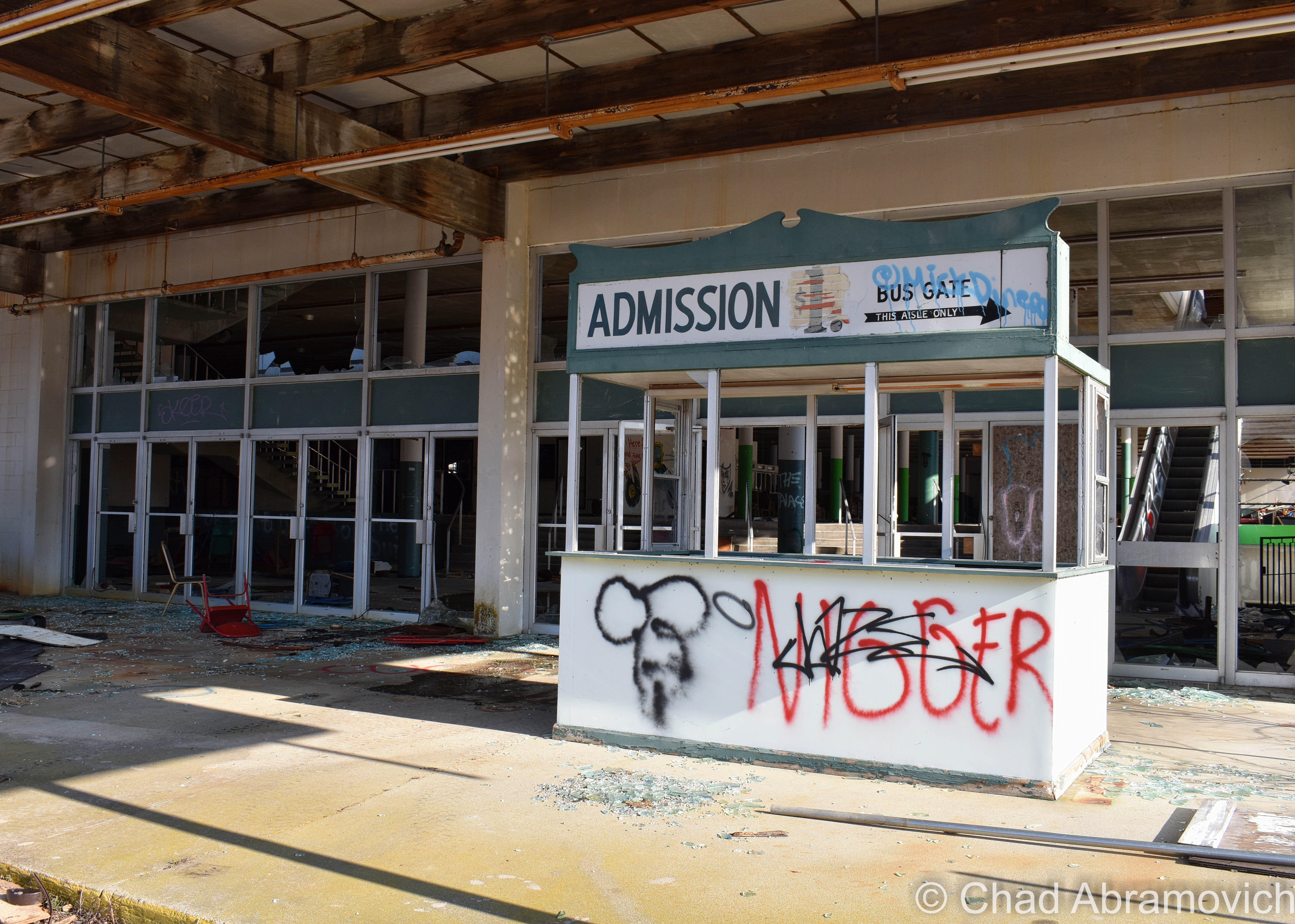
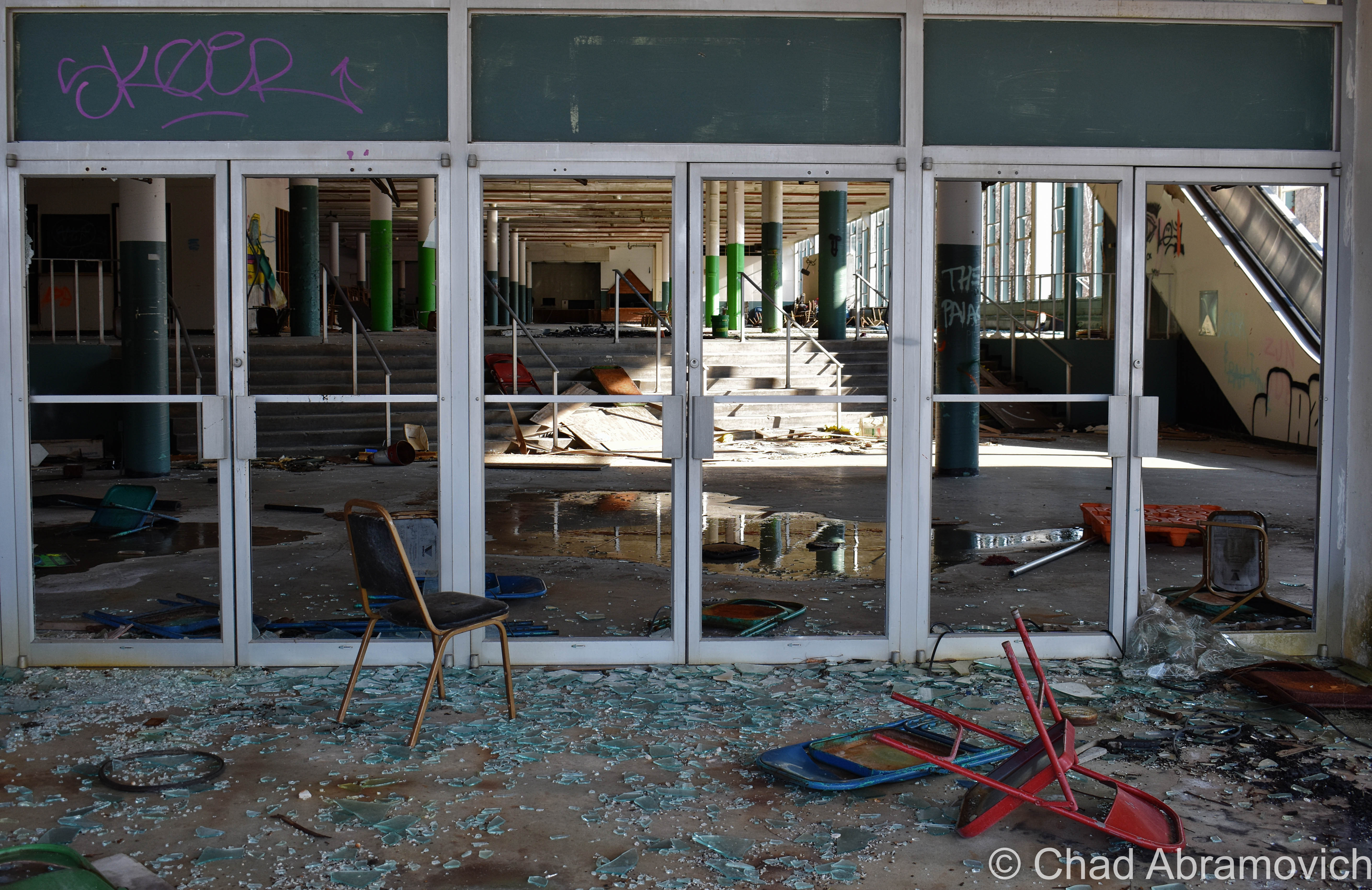
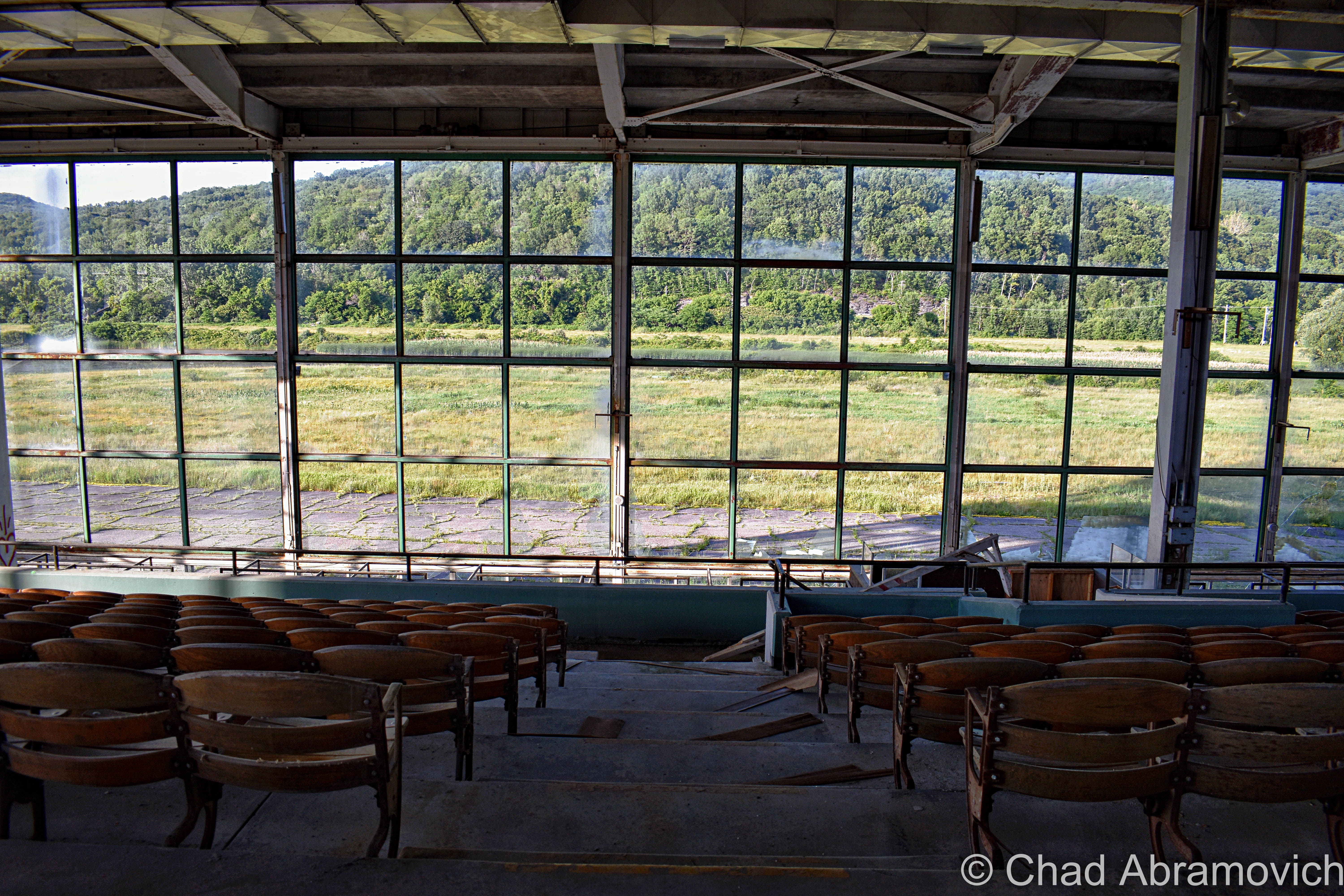
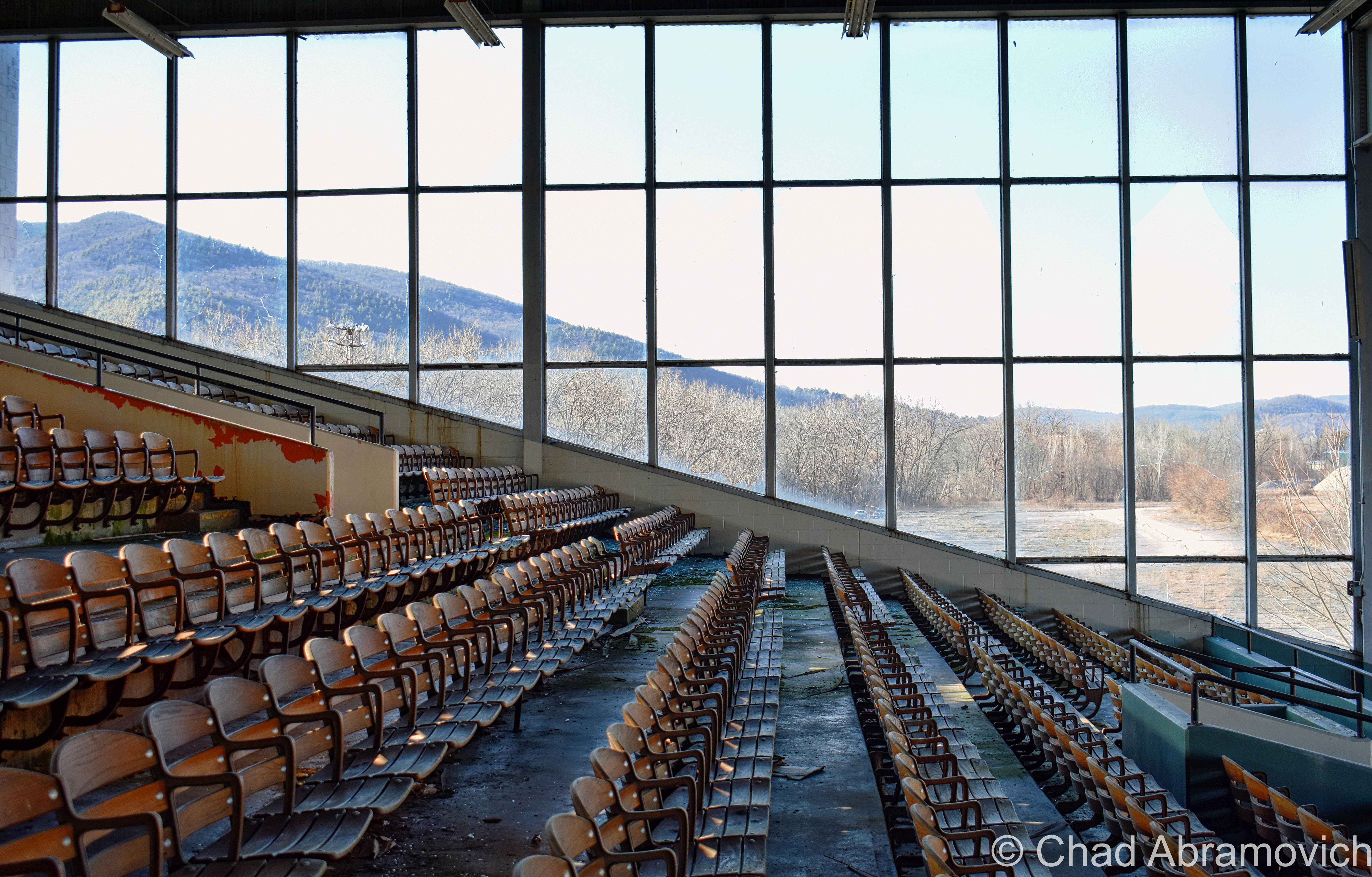
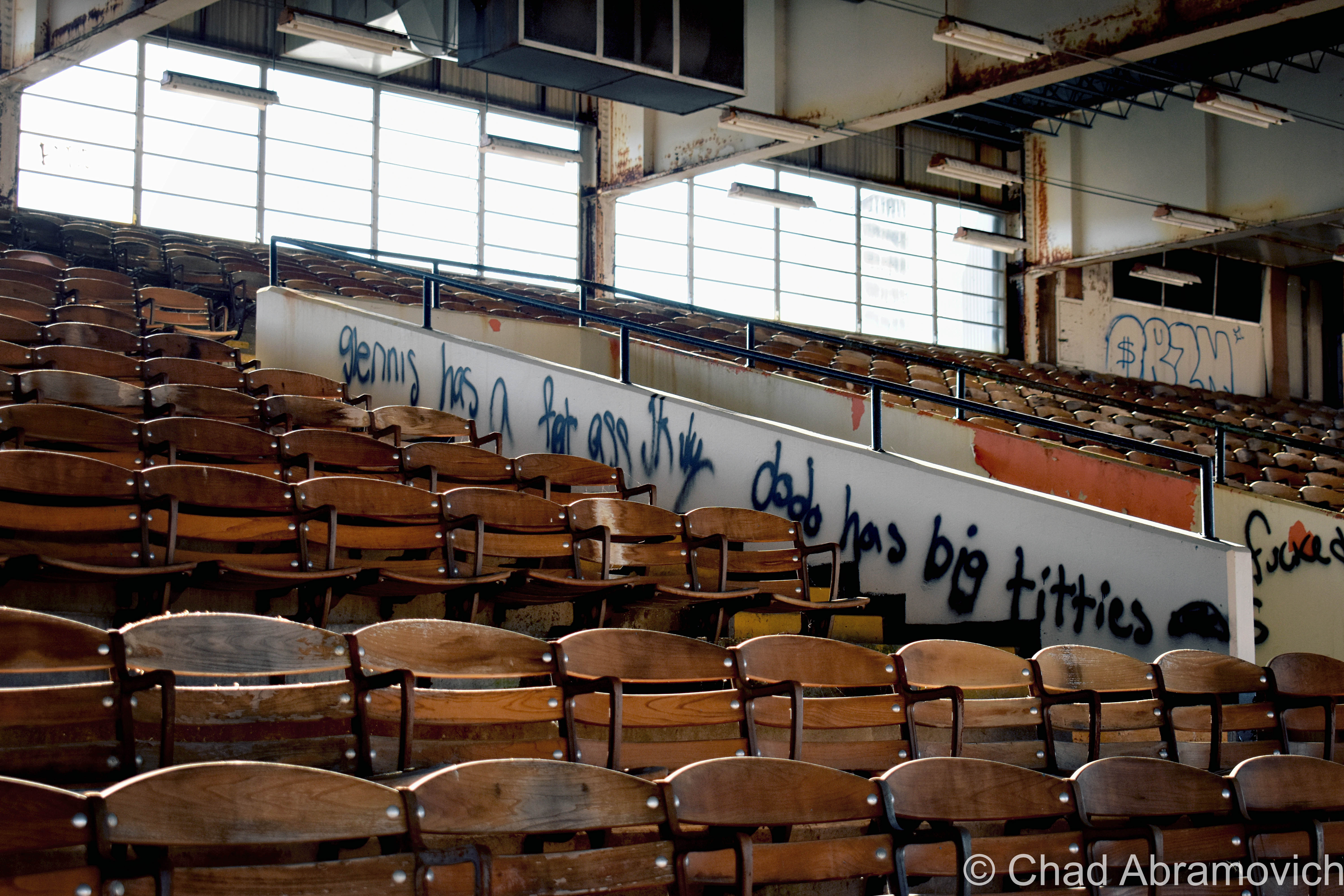
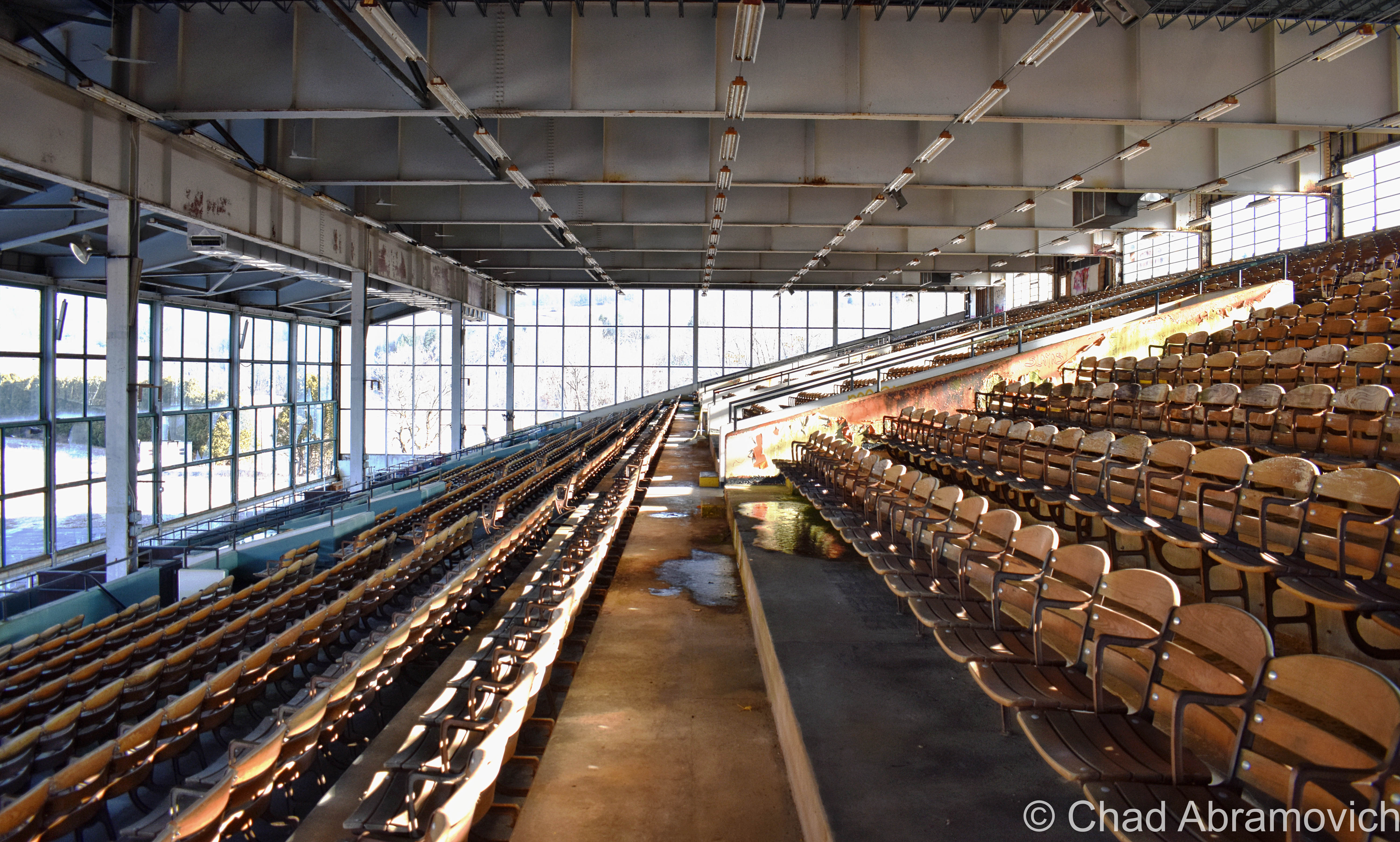
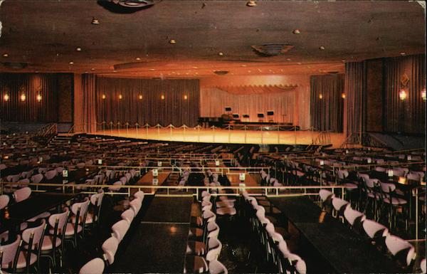
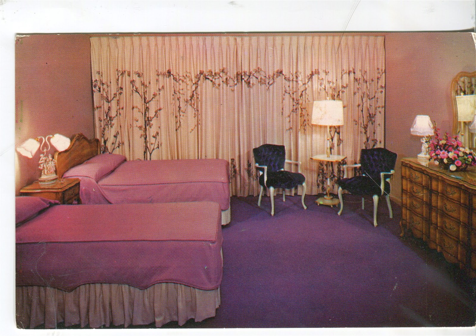
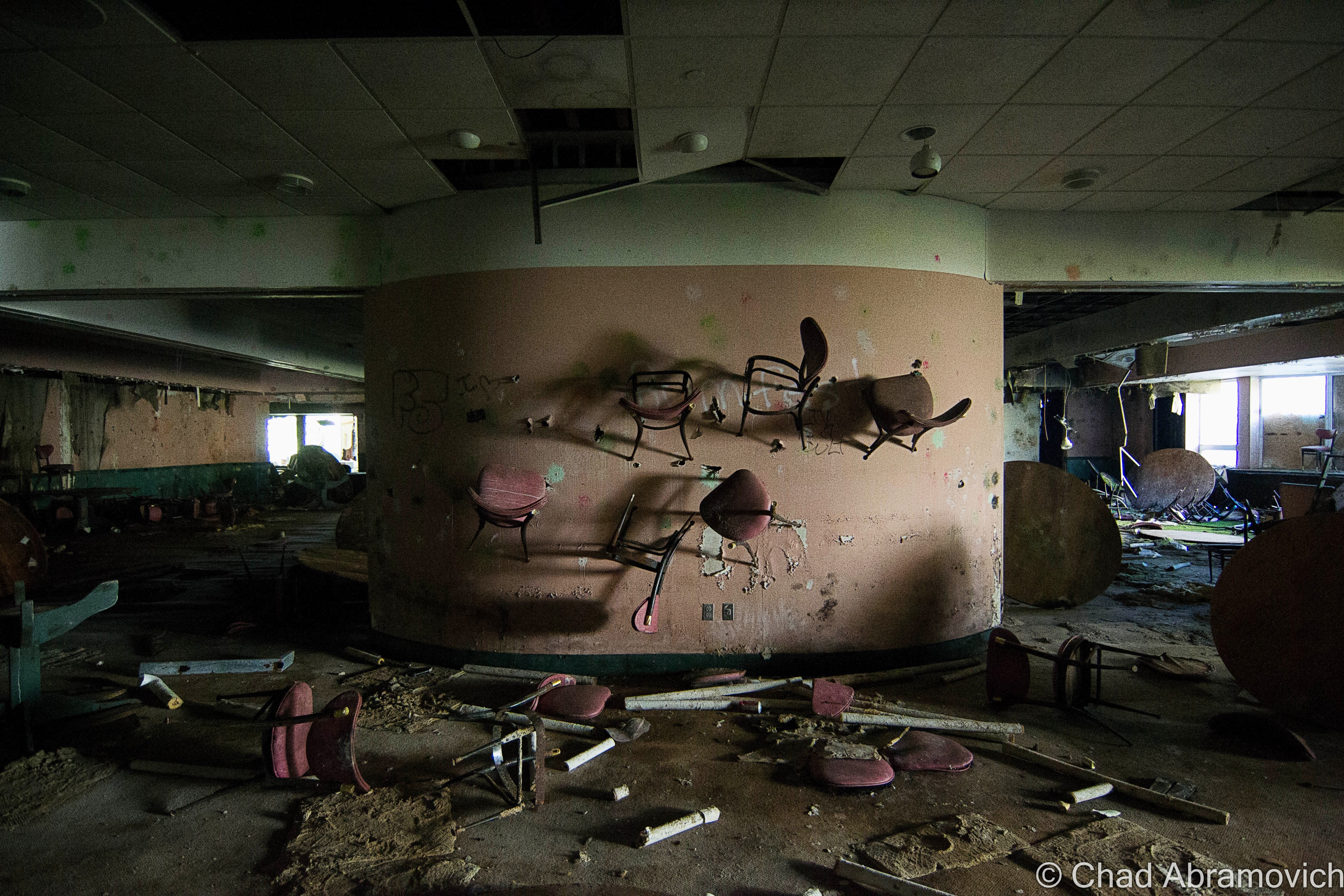
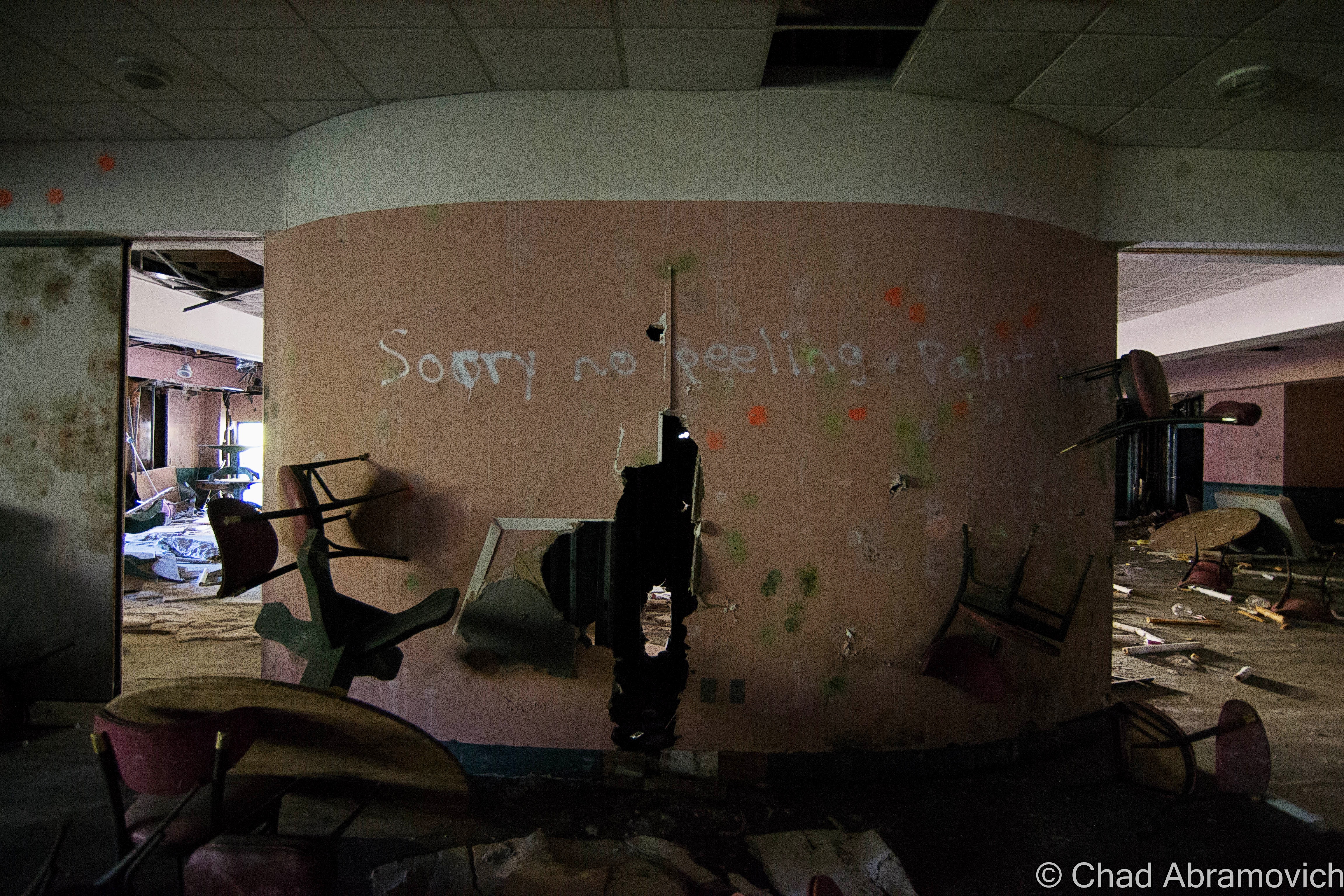
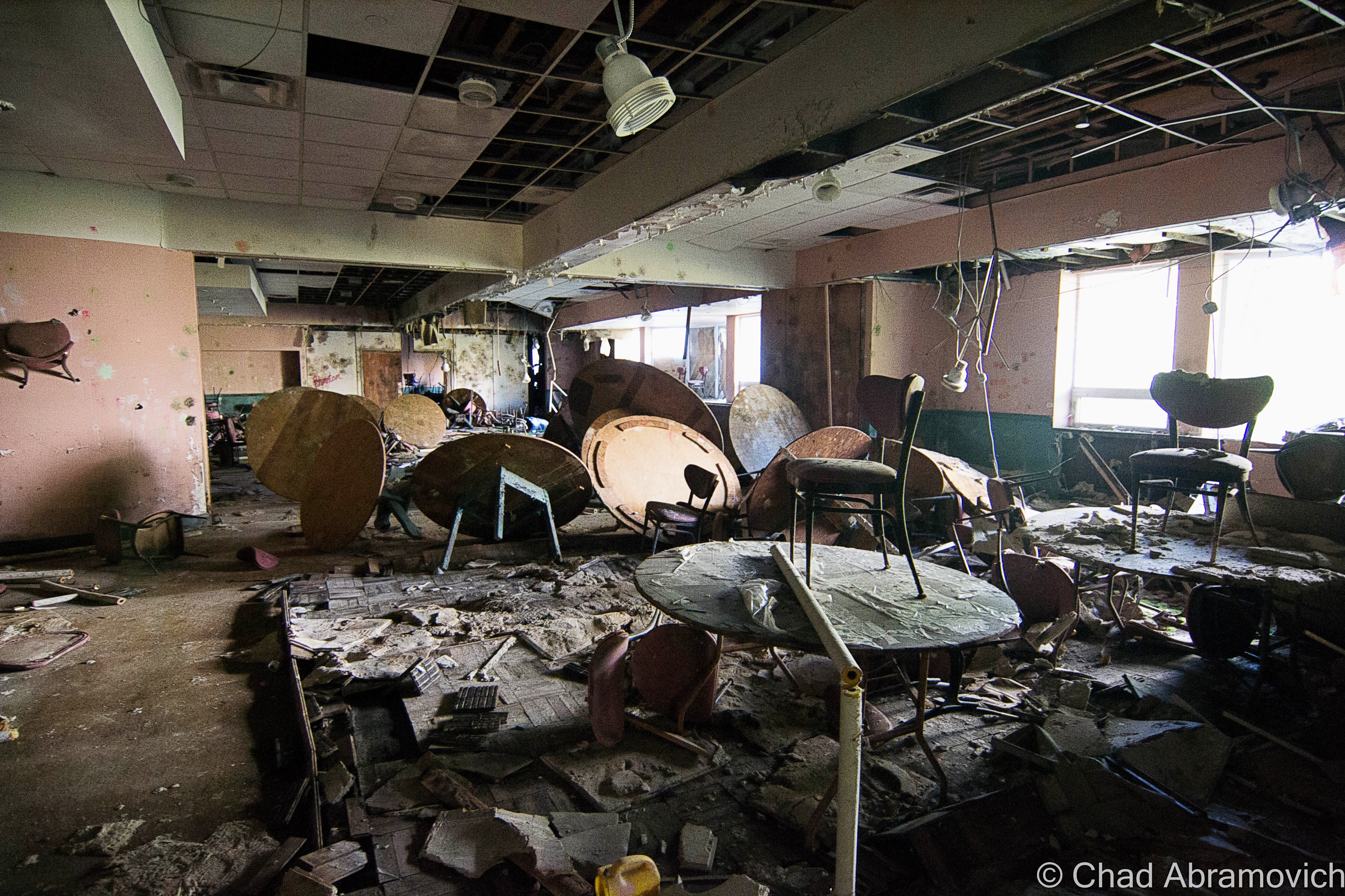
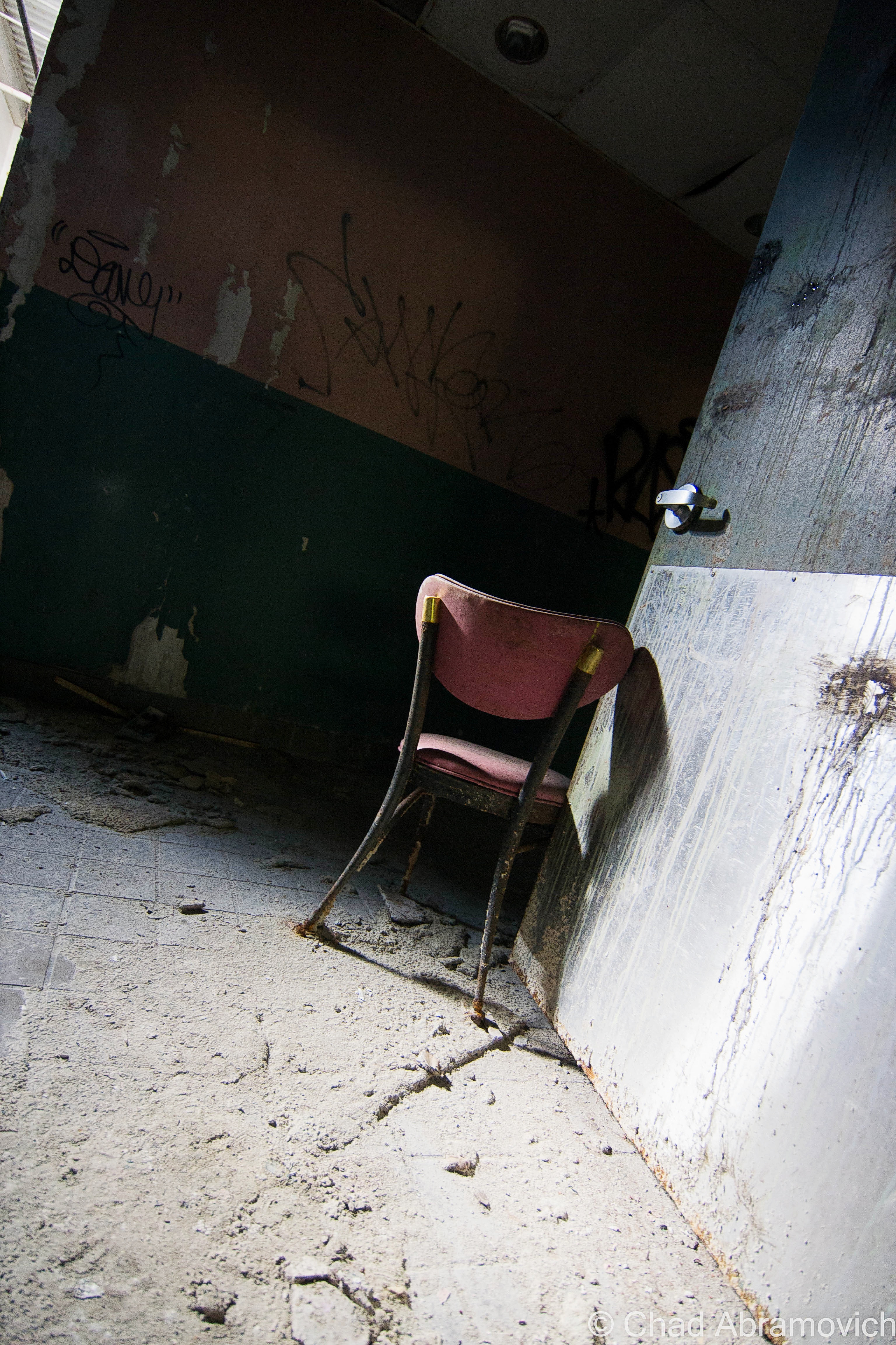
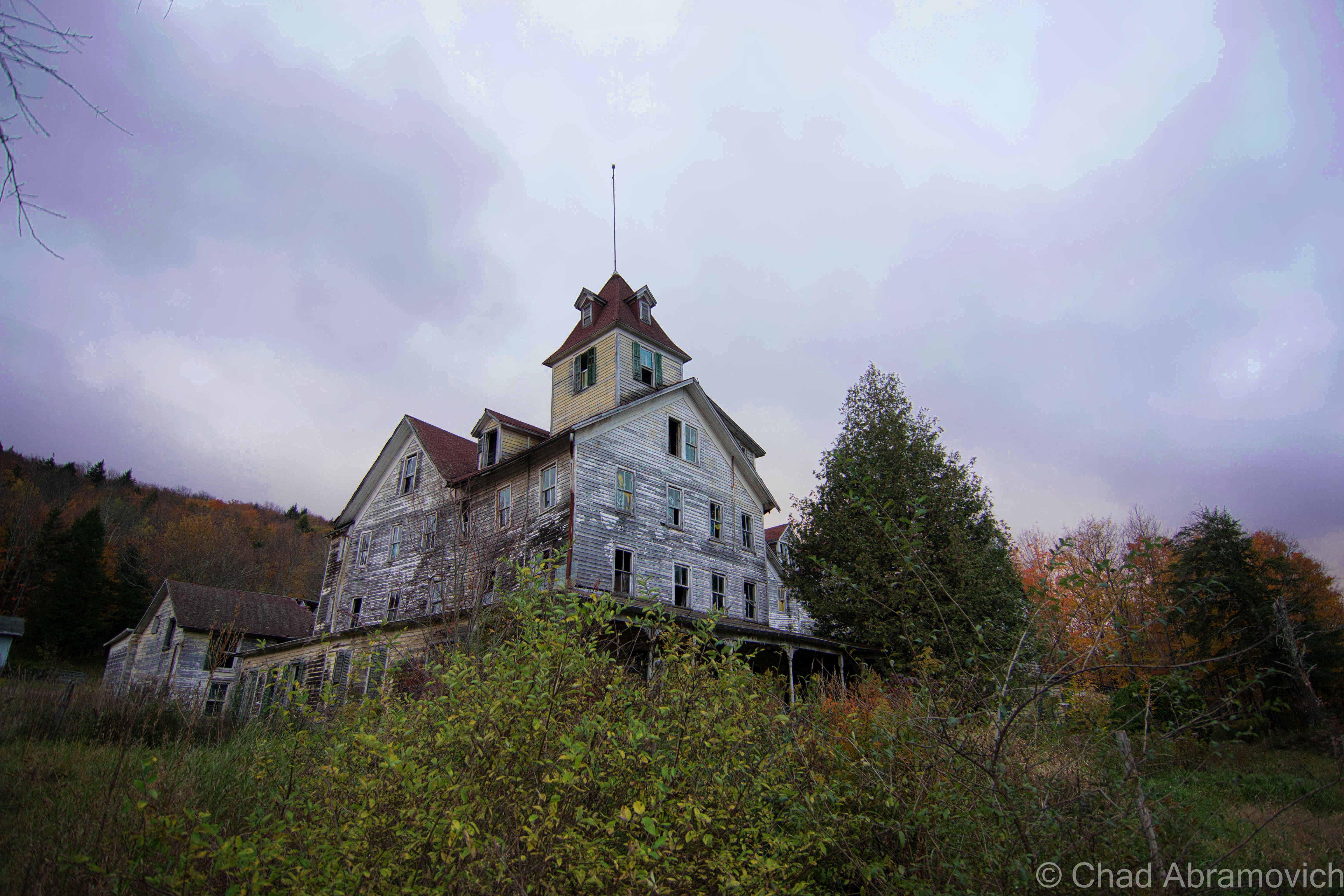
In the 1990s, convention centers were becoming Catskills de rigueur, so many hotels, including The Pines, built them up on their properties.

DSC_0344_peDSC_0360_peDSC_0368_peDSC_0376_peDSC_0377_peDSC_0384_peDSC_0390_peDSC_0399_pe

One of the catwalks that connected the many buildings of the hotel together, so guests could get from place to place in convenient comfort.

DSC_0405_peDSC_0427_pe_peDSC_0412_pe.jpgdsc_0431_peDSC_0420_pe.jpg

DSC_0432_pe
The soggy remains of the lobby. The entire carpet had grown a lawn of moss and plant life, and the eerie sound of dripping water through rotten ceiling tile was the only sound that could be heard in the otherwise silent building.
DSC_0439_pe
One of the former bars of the spacious two-story lobby. This reminds me of a story I read somewhere on the internet a while back (whose source I’ve forgotten). Years ago, an explorer who was visiting The Pines found some Zima’s in a refrigerator that had clearly not been refrigerated for years. For some reason, they drank all 6 of them. About a year later, they were at a party, and a girl opened a fresh Zima. In horror, they discovered that Zima were supposed to be clear in color. Though not drinking suspicious beverages left at an abandoned location is exploring 101 for me, I strangely know a few people who have done this and were absolutely okay with it. I love adventures, but that’s a bit more adventurous than I want.

DSC_0437_peDSC_0445_peDSC_0455_peDSC_0457_peDSC_0459_pe

What remained of the restaurant. There was quite a bit of leftover evidence of a paintball game that had happened here. But that got me questioning. The floors here were more hole than not, with us stumbling into several occasions when we discovered that the carpet was the only thing preventing us from falling down into the basement. How the hell did they play paintball here??

DSC_0464_pe

The massive kitchen was lit up generously by lots of skylights.

DSC_0469_peDSC_0474_peDSC_0482_peDSC_0486_pe

Straight ahead is the Essex building. The dark space underneath is where guests would have driven under upon arrival.

DSC_0501_pe

The Savoy Wing was a funky, kitschy nightmare of shag carpeting, red and pink walls, and guestrooms outfitted with mirrored walls and faux window treatments. Excessive water damage and clogged gutters allowed years of water to pour down through the ceilings and eventually lead to a large collapse in the center of the building.
The Savoy Wing was a kitschy experience of psychedelia, with shag carpeting, red and pink walls, and guestrooms outfitted with mirrored walls and faux window treatments. Excessive water damage and clogged gutters allowed years of water to pour down through the ceilings and eventually lead to a large collapse in the center of the building.

DSC_0511_peDSC_0514_peDSC_0497_pe_pe

Autumn just makes road trips better. Driving north towards Middleburgh, we were immersed deep within the surprisingly vast destitution of the Catskill Park Wilderness, which meant driving on curvy paved back roads around beaver meadows and rolling hills all dying in a brilliant uniform yellow for several hours, occasionally passing through a small town that was a collection of unmaintained old houses and maybe a church. There are no gas stations in the Catskills, which always makes my anxiety glance at the gas gauge needle and sucks if you need a bathroom.

Another noticeable difference between the Catskills and Vermont, besides the singular foliage color of yellow, was that while I may encounter 3 deer wandering out into the middle of the road in 3 years in Vermont, in the Catskills, we had to slam on our breaks for 8 deer in a single drive.

Eventually, we happened upon a state park and camped out for the night on the last available night of the state park season. The temperature dropped into the teens and I was kept awake all night by wailing coyotes and things that scampered through the dead leaves around my tent. But with a cozy campfire and some microbrews bought at nearby Middleburgh; a startling and mood improving oasis of blue-collar businesses and a Christmas light covered main street, it was a great night. The next morning, I was as rested as sleeping on a tent pitched on a gravel bed in 18-degree weather would get me, and we were off.

Gross at Grossingers

About a half hour from The Pines sat another enormous abandonment where I briefly stopped to photograph. This hotel was legendary and was arguably the hotel that became the representation of the region, growing to a size of 35 buildings on 1,200 acres. In 1952, it would enter its place in worldly accolades as the first place that used artificial snowmaking on its ski slopes.

So large in dimension and repute was this hotel that a private airstrip was once constructed to handle predicted private aircraft traffic that never came.

Grossingers’ rise and fall echoes The Pines’ own tragedy and became a ghost just as fast as it triumphed.

The prodigious property is a victim to one of the grimmest truths of reality. It’s so deplorable after two decades of raving and destruction that its disgusting ruins were sadly a disappointment to walk through – a sad fall and postmortem.

DSC_0522_pe
The first thing I saw as I bushwhacked my way onto the property was the area below the former landmark outdoor pool, which is a ruined storage area of poolside lawn chairs and boilers completely ruined by corrosion.

DSC_0525_pe

DSC_0527_pe
The Olympic sized outdoor pool. This hotel was famous for it back in the day, and it’s remote positioning at a far flung and overgrown corner of the grounds make it a mostly missed site for visitors.
Historic postcard of Grossinger’s Olympic sized outdoor pool, circa 1960s.

DSC_0526_pe DSC_0530_pe DSC_0531_peDSC_0534_pe

The eeriness of the property was unshakable as I walked around. The ugly and dated buildings were reduced to indignant and unsettling billboards that reckless destruction wrote. All the windows were broken, the doors and walls kicked in. A fetid stench was the first thing I noticed long before I tromped under the coolness of the building shadows, a stagnant foul entity that permeated around the entire property.
The eeriness of the property was unshakable as I walked around. The ugly and dated buildings were reduced to indignant and unsettling totems that reckless destruction wrote. All the windows were broken, the doors and walls kicked in. A fetid stench was the first thing I noticed long before I tromped under the coolness of the building shadows, a stagnant foul entity that permeated around the entire place.
The eeriness of the property was unshakable as I walked around. The ugly and dated buildings were reduced to indignant and unsettling billboards that reckless destruction wrote. A fetid stench was the first thing I noticed long before I tromped under the coolness of the building shadows, a stagnant foul entity that permeated around the entire property.
I actually had reservations going inside, which was a startling sentiment than my eager mood I was conduiting a few minutes ago. It felt like I was being watched the entire time I was there.
DSC_0543_pe
Creeping down the dark hallway with my mag-light in front of my like a weapon, my feet sinking into some unknown mush, my friend suddenly stiffed up, motioned for me to push up against what was left of a hole filled wall, and pointed at this guest room as my hand went for my knife. “See that stuff? I think someone was here, very very recently. He may still be around…” Thankfully, we didn’t run into anyone who left behind a new looking sleeping bag and a pack of cigarettes. But I didn’t stick around.
DSC_0550_pe
Rumor has it that somewhere on the grounds, there is a single, bizarrely intact/preserved hotel room, which is sort of an amusing urban legend of this hotel. I’ve seen a few photos, but many have failed to find it, or at least include it in their blog entries. (This isn’t the room). We had to be back in Vermont by nightfall, so on this trip, I didn’t get to find it.
DSC_0554_pe
What would have been a foyer off the grand ballroom, now a mess of a structure with collapsing floors that fall into the blackness of whatever is below.

DSC_0556_pe

What might just be the most recognized building of the Catskills is an abandoned 1960s wing of the hotel, which also happens to be the tallest on the property.
DSC_0567_pe
In the 80s, the hotel was losing money, so the idea was to build a new resort – a bigger, better showpiece! But the gaudy, shopping mall-esque editions that were going up around the more traditional buildings only differentiated from the place. But their ambitious new image wouldn’t save them, and the whole resort closed in 1986 when it, and the Catskills fell out of style. This would have been the new lobby, halted and abandoned in mid construction.

DSC_0564_pe DSC_0568_pe

These 4 rotting bar stools are a photographic icon of this property. At one point, there were more of them, and they were all standing in a row lining the bar that they once accompanied. Today, only these 4 remain, barely.
These 5 rotting bar stools are a photographic icon of this property. At one point, there were more of them, and they were all standing on supporting vertical poles in a row lining the bar that they once accompanied. Today, only these 5 remain, barely.

DSC_0576_pe

An old beauty salon chair, located down in dank and dark levels below, seemed to have been dragged outside and left out near the bar.

DSC_0580_pe

DSC_0581_pe
Another wing of the property, which looked almost identical to all the other buildings now in their incarnation of wasteland and mystery.

That is, except for its extraordinary natatorium.

The mid-century marvel was under the weight of its silence, not even the birds were chirping as I walked around the massive space. Though the electricity was shut off decades ago, the atrium’s great design ensured the place was nicely lit up by plenty of skylights in-between some striking starburst chandelier style light fixtures from the 1950s that were still shockingly preserved . Walking around coats your boots in slick sludge and stubble white mold that has been reclaiming the buckling pool tiles. The pool itself is a chaise lounge graveyard, tossed into some murky filth and curating rot that has collected in the Olympic-sized pool’s deep end.

This place has achieved legendary status for explorers, photographers and curious visitors all around the east coast. A visit here jestingly pushes your explorer legitimacy card. Just before I walked in with my camera, a bunch of teenagers were just finishing shooting a music video here.

Historic postcard of Grossinger’s beautiful natatorium

DSC_0614_pe DSC_0611_pe DSC_0606_pe DSC_0604_pe DSC_0601_pe DSC_0597_pe DSC_0595_pe DSC_0592_pe

The most troublesome part of my visit here was actually trying to leave. When we were walking back to the car, my friend and I were inducted into a circumstantial game of face off with a vicious dog, who was creating a raucous of barking and snarling at our presence walking down a quiet back road with our cameras.

After about 20 minutes or so of keeping our tentative distance and wondering if he was going to dash off the front lawn in our direction if we got any closer, it walked around the back of the house and oddly, disappeared. No one came outside, and we heard no doors opening (we were that close). We waited another five minutes or so, and finally decided we were going to chance moving forward. Luckily, we made it safely back to our car with our internal organs in their places.

—————————————————————————————————————————————–

To all of my amazing fans and supporters, I am truly grateful and humbled by all of the support and donations throughout the years that have kept Obscure Vermont up and running.

As you all know I spend countless hours researching, writing, and traveling to produce and sustain this blog. Obscure Vermont is funded entirely on generous donations that you the wonderful viewers and supporters have made. Expenses range from internet fees to host the blog, to investing in research materials, to traveling expenses. Also, donations help keep me current with my photography gear, computer, and computer software so that I can deliver the best quality possible.

If you value, appreciate, and enjoy reading about my adventures please consider making a donation to my Paypal. Any donation would not only be greatly appreciated and help keep this blog going, it would also keep me doing what I love. Thank you!


Donate Button with Credit Cards

The School Of The Feeble Minded

Around the turn of the 20th century, there was a changing attitude on mental illness, and that created state schools. Though it’s considered a school by name, that’s a misnomer. No forms of education were carried out here, this was a warehousing facility. It was built to house around 700 residents, but shortly after it opened, it far exceeded it’s capacity, topping out at around 1,500 between the ages of 1 and 18, all housed in 13 dorms.

State schools were essentially warehouses for “feeble minded children”, or children who were infirm or autistic that parents just didn’t know how to deal with. So, federal and state governments allocated tons of money for these facilities to be built, in the name of “progress” of how societies invalids were treated and supported.

Though these places were supposed to help these children grow to their potential in a safe and educated environment, the unfortunate charges who were sent to these places were most likely abused by overworked and untrained staff, lived in squalid, over crowded conditions and received no developmental services.

While many of these institutions were brought forward with virtuous intentions, social philosophies would soon change towards World War 2, when the American Eugenics Movement and Darwin’s theory of natural selection would become popularized and propelled by misguided politicians, scientists and physicians. These “schools” became laboratories, and the unfortunate inmates would become test subjects, because once you were locked away in these sort of places, it was easy to carry out these sort of ghastly things that says a lot more about the human race than I’m comfortable with, without the general public getting word of it.

This undisclosed 876 acre state school was constructed in 1922 to serve these troubled youth, and would expand to 50 buildings. While many institutions before this one were centered around magnificent Kirkbrides, times had changed, and this facility was streamlined, focusing more on functionality in the form of duplicate buildings in a colonial brick style with white trim, which were pretty admittedly pretty drab.

The usual suspects – overcrowding and understaffing, lead to the campus to sink into deplorable conditions. Because employee responsibilities were stretched so far, treatment of the those in their care became atrocious. Many of the children were left unattended, and would wonder the halls, moaning, and covered in their own excrement. Others who were physically handicapped would be simply left restrained to their beds and forgotten, often for weeks. Sometimes, if a stubborn inmate was really unlucky, all their teeth would be removed to make feeding them easier, especially force feeding. If they weren’t neglected, many staff members would physically beat them to keep them under control, or worse, because they felt like it. If this wasn’t bad enough, the buildings were deteriorating because of neglect and no funding to maintain them, and eventually, that lead to a vermin infestation.

Though this article wasn’t written about this particular psychiatric facility, it miserably details a personal experience living in one of these state institutions by a former patient.

Conditions and life here were unknown to the outside world, until 1971, when the father of a patient filed a class-action lawsuit against the school, claiming that its young residents were not only the victims of sexual abuse, but were also living in horrific conditions. He wrote of abhorrent things like; “maggots wriggling inside or crawling out of the infected ears of several helpless, profoundly retarded persons while they lay in their crib-beds.” Investigations began making their way in, as public outrage exploded.

Rampart lawsuits and scandals in the later half of the 20th century began the slow process of these snake pits shutting down, and becoming abandoned, as people began to get an idea of what life was really like in these campuses. The fate of this hospital sadly followed many in the United States, and the stuff that was brought to the surface is horrible.

But despite these disturbing discoveries, this school awkwardly hobbled along, sinking further into a spiral of decline until all operations officially ceased in 1992 – almost 2 decades later, leaving a maze of rotting wards and tunnels behind.

A Winter Visit

I heard the end was coming. Asbestos abatement had began in a few buildings, and plans had been announced to slowly begin demolition on the school. I didn’t have to sneak around much. Though the entire property was covered in snow drifts that often came up to knee deep levels and filled my boots, the attitude here was relaxed. Other photographers meandered their way around various buildings, and a few people were walking their dogs.

A majority of the buildings were sealed up, but a good amount had their doors torn open, and security was nowhere to be seen. Many of the buildings were boarded up and were pitch black. If it wasn’t for the wintery cold, the mold and asbestos inside would have probably been insufferable. Others had entire sections which had completely collapsed.

Though there was much to see, most of the buildings were void of anything of interest. The auditorium was by far the most splendid place to explore, and also the most dangerous. The overcast and bleak landscape made the cavernous interior more sad and dreary that day. The entire building was coated in a dangerous layer of ice, so moving around the collapsing structure had to be done carefully and methodically. Some of the wooden floors were more soggy than I felt comfortable with trusting, and every staircase was coated so thickly with ice that I had almost debated not taking the risk climbing them. I was already exploring an abandoned hospital, I didn’t need to visit a real one! But I took the risk, and I’m glad I did. The floor plan kept continuing, and became a bit of a maze as more hallways and staircases kept revealing themselves.

Below the rotting auditorium was one of the better finds, the old gymnasium, a spacious area outfitted in grungy yellow hospital tile that was coated with mold and rot. The basement area consisted of two levels, and it was inky black. The lowest level was filled with knee deep water, with a layer of ice underneath, making passage treacherous. With the aid of our maglites, we made it into the gym. All I could hear was a roaring cacophony of dripping water raining down from the decaying abyss above our heads which ran down the back of our necks. It was so cold downstairs that I could see my breath in the beam of my flashlight. A friend of mine later told me that it wasn’t much different during the warmest months of the summer.

Another find worth photographing was the large cafeteria building far back, and the old power plant complete with dysfunctional and rusting machines sitting in dark spaces. The wooden floors in there were suspicious so I didn’t spend a great deal of time inside. Though I had arrived relatively early, I was surprised at how much time I spent shooting here, and now I was loosing daylight. Between that, and the effort it took to trudge through the snow, I was exhausted.

But I’m glad I got to see such a place, an epoch of human history and how far we’ve came, or maybe how far we still have yet to go. If the powers that be stick to their schedules, it should be luxury condos and mixed use space come next summer.

DSC_0831_peDSC_0863_peDSC_0834_peDSC_0857DSC_0031_peDSC_0881_peDSC_0886_peDSC_0888_peDSC_0904_peDSC_0908_peDSC_0910_peDSC_0914_peDSC_0919_peDSC_0928_peDSC_0931_peDSC_0937_peDSC_0938_peDSC_0939_peDSC_0942_peDSC_0943_peDSC_0945_peDSC_0946_peDSC_0969_peDSC_0978_peDSC_0982_peDSC_0984_peDSC_0988_peDSC_1002DSC_1004_peDSC_1005_peDSC_1013_peDSC_1018_peDSC_1024_peDSC_0001_peDSC_0004_peDSC_0006_peDSC_0008_peDSC_0010_pe

I was pretty much depending on my flashlight to get me through the basement levels, which were black and icy.

DSC_0021_peDSC_0059_peDSC_0043_peDSC_0044_peDSC_0048_peDSC_0049_peDSC_0054_peDSC_0063_peDSC_0064_peDSC_0068_peDSC_0077_peDSC_0074_peDSC_0078_peDSC_0085_peDSC_0093_peDSC_0095_peDSC_0096_peDSC_0038_peDSC_0099_peDSC_0191_peDSC_0109_peDSC_0112_peDSC_0114_peDSC_0120_peDSC_0121_peDSC_0111_peDSC_0126_peDSC_0131_peDSC_0146_peDSC_0147_peDSC_0154_peDSC_0183_peDSC_0163_peDSC_0168_peDSC_0167_peDSC_0188_peDSC_0187_peDSC_0186_pe

—————————————————————————————————————————————–

To all of my amazing fans and supporters, I am truly grateful and humbled by all of the support and donations through out the years that have kept Obscure Vermont up and running.

As you all know I spend countless hours researching, writing, and traveling to produce and sustain this blog. Obscure Vermont is funded entirely on generous donations that you the wonderful viewers and supporters have made. Expenses range from internet fees to host the blog, to investing in research materials, to traveling expenses. Also, donations help keep me current with my photography gear, computer, and computer software so that I can deliver the best quality possible.

If you value, appreciate, and enjoy reading about my adventures please consider making a donation to my new Gofundme account or Paypal. Any donation would not only be greatly appreciated and help keep this blog going, it would also keep me doing what I love. Thank you!

Gofundme: https://www.gofundme.com/b5jp97d4

Donate Button with Credit Cards

The Cold Spring House

It’s hard to describe a place like the deteriorating ruins of The Cold Spring House, especially if you’ve never had the experience of visiting it yourself.

The remaining residue of The Catskill Mountains and their heyday as a resort destination – hotels such as this one once catered to primarily Jewish clientele during the 20th century, looking for a little relaxation from the turbulence of New York City in the scenic Catskills.

Driving through the gripping, winding road through the Kaaterskill Forest, with wild rivers cutting through steep hardwood shrouded peaks that resembled worn saw teeth, it wasn’t hard to see the allure.

This is the first time I had ever been to the Catskills region before, and my target village of Tannersville made an attractive first impression, which I was incredibly relieved with after the problematic start to my day. It almost seemed like I would never make it to the Catskills, as numerous setbacks, construction projects, and traffic jams kept delaying travel time, each hour of precious daylight being swallowed by the oncoming October evening. Because we were making a 5-hour drive down from Vermont, I was determined to make this count.

Navigating the highways of New York, we passed by many derelict structures and sordid towns that were more depressing than anything, reminders of the decreasing amount of tourists in the region. It’s one thing to figure a portrait of a place from conversations with friends who grew up around there, and a few things I’ve read, but it was another type of cool entirely to gaze at what was coming through the view of the windshield.

As we approached Tannersville, the comedown daylight was filtered through a black sky foreshadowing fury that never seemed to come. The air was crisp, carrying the smell of dead leaves, as chilly mists began to settle on our faces. It felt like it was going to rain, but it never came, and the mists continued to be misleading.

There we were, staring up at the imposing ruins of the Cold Spring House, and it’s various stages of decay.

The slumping roofs and bending wooden frame ripped open several holes in the building, giving off dead weight that popped out windows and pushed various items through the glass. It was well into the evening now, but we had made it, with just enough light to photograph and do a little exploring. But the question was, where do I even start?

From what I know about the place, it was one of the earlier Catskills hotels, on the outskirts of the Borscht Belt, an area once a dazzling vacation-land now reincarnated as a collection of behemoth and storied abandonments. The Cold Spring House was a grand showpiece, which was very different from the closet cottages and revelrous resorts the area was known for at that time.

Built on what is now Spruce Street in the 1890s, it was the second largest hotel in Tannersville, as well as the first Jewish hotel in town – able to accommodate 200 guests at the base of mountains rising to around 2,200 feet. It started as a hotel called Bieber’s Cold Spring House but was sold in 1922 to Saber Khouri, and re-branded simply as The Cold Spring House.

According to a 1904 advertisement I was able to find online, the property featured expansive lawns, offering tennis and croquet grounds, surrounded by old trees offering comfortable shade on summer days. There were farms on the property that supplied the hotel with fresh milk and vegetables everyday, which were paired with what the ad boasted as excellent table service in the form of German and Hungarian cuisine. And of course, fresh spring water was offered – from the springs which the hotel derived its name from.

The hotel was also widely regarded for its popular classical concerts on the lawn. Two signature towers at opposite ends of the building, now slumping dangerously, were once observatories, giving guests extensive views of the mountains. Today, that view would be worth the price of your life.

What I found interesting about the advertisement was that it boasted such amenities as “sanitary plumbing and fire extinguishers on every floor” – items that we take for granted today, but around that time period, were new features and were only beginning to be enforced by laws. I’m sure that was a selling point – definitely a plus when I choose a hotel. But it makes sense. The time period was a time of transition. There was a nationwide push that required to implement such systems, but it was a costly expense to outfit these old buildings, and many old hotels couldn’t afford keeping up with the competition.

The advertisement also stated that the hotel was continuously expanding as it’s increasing popularity was luring more and more people to stay there each season. Older photos showed a much different building, with only one tower, and most of the western wing not yet added. The final product was a much larger and grander property – the brooding structure you see today.

But times certainly have changed. During the late 20th century, much of the region fell out of favor as a vacation destination. With an increase of automobile travel and an ever-burgeoning highway system, more Americans were driving, and could travel farther distances and see more places. Now, they no longer had to settle for the closest area available – a trend that I’ve seen so many times in humbled abandonments I’ve visited. Tannersville was no exception. Many vacation homes eventually were abandoned and hotels were shuttered. The Cold Spring House fell into the trend and was abandoned in the 60s, leaving quite the compelling ruin in its wake.

It literally hunches over Spruce Street in its old age, leaning in all directions. A symbol of human progress and the change of the times, something inevitable that tends to leave growing pains on the often bumpy road of advancement and the fodder of bandwagon fads. In an ironic sense, this more offbeat form of tourism can also serve as a poignant melding of public awareness, a chance to learn from our past.

Today, Tannersville is more known for it’s proximity to Hunter Mountain Ski Area than a summer destination, but while many Borscht Belt towns are still struggling, Tannersville seems to be in the middle of some sort of revival. As it was explained to me, people started to rediscover the town and were taken by its natural beauty. Old vacation homes began to be fixed up at expensive costs because of the bad shape they had deteriorated to, and more businesses have opened up on Route 23A.

As for the Cold Spring House though, I had the pleasant chance to speak with photographer Linda O’Donnell, who has been researching and documenting the building’s deterioration for the past several years. She informed me that the place has been scheduled for demolition since 2012, but demolition by neglect may happen before any actual bulldozers arrive on the property. It makes you wonder, when will the familiar become just history?

Dying Light

This was truly one of the most spectacular places I’ve had the chance to photograph (and a great change of scenery from Vermont!), but with its awe-inspiring profile came very tangible dangers. As I walked around and got to know the place better, I was able to recognize something very quickly. The building was far too dangerous to venture inside, and because of our late start, there was little daylight left. Peeking in through an opened window, I was met with an interior of collapsing floors, wooden walls intended to support the structure were crushed into an accordion-like resemblance, and various artifacts collected in indistinguishable piles of fragments covered in dust and lead paint speckles. The weight was so great in some places that many things had actually been pushed through the floor, which was already cracking on the added weight of my body. That musty old building smell wafted out from the opening, mixed with a heavy damp musk. To my far left, a staircase, illuminated by the dull light of broken windows, climbed above the wreckage and into the mysterious upper floors. Or what was left of them. Though I ached to go inside, that would have been an idea that probably would have been counterproductive to my travel plans, which were to leave intact and alive.

For a relatively rural back street, the traffic was thunderous, a constant roar of pick up trucks going by, and slowing down when they noticed me with my camera. Because New York State has very unforgiving rules against trespassing, and with me being in such a surprisingly public area where I would no doubt be trapped should I be caught, the odds were stacked against me.

I had no choice but to keep a safe distance. But the exterior alone was worth the drive. The tops of the building still wore it’s yellow paint job, the original color of the hotel, while the lower levels were weather worn into a dull grey and showed signs of various stages of rotten cavities that completely ate through the walls. Older photos showed a sign that read “Cold Spring” that hung over the porch near the front entrance, but when I visited, that was also long gone, the last clue to its identity.

Signs of human presence were everywhere. Graffiti was found on many of the upper windows, but not the good kind of graffiti. That also meant that some adventurous intruders made the trip to the upper floors…

I often find strange items left behind when I explore – and this was no exception. There was an interestingly large collection of abandoned records found all around the hotel, most on the front lawn, tangled in tall grass and cedar trees. Some of them were arranged specifically, with various items such as kitchen utensils and bottles filled with suspicious colored liquids in them, propped purposely around the sides. I didn’t recognize any of the artists – but some looked like they would have been right at home in some embarrassing 70s porno.

Just gazing up at the place and looking in the numerous windows offered many things to see. Radiators that had fallen out broken windows. A glimpse of a bedpost. Dark rooms with holes in the ceiling letting in the dying daylight. Old glass bottles left on windowsills. Then the wind blows, and the eerie creeks of a shutter can be heard, before it bangs loudly against a wall several stories above, you see the movement, and your pulse quickens as you jump to conclusions. Despite the reliable hum of noise outside, closer to the hotel, things faded into an uncomfortable silence that was almost loud in itself. It was quite startling considering it was just a short walk down the lawn that offered such a fast transition.

Not wanting to draw attention by staying too long, we left and began the journey back to Vermont, the Cold Spring House leaving a lasting impression.

ColdSpring
These are some great historical photos of the Cold Spring House in its heyday, which I found online accidentally and was kindly given permission to re-link by Flickr user Linda O’Donnell. Not sure of the dates, but it really gives you a sense of what this place used to be like.
ColdSpring2
Used with permission from Flickr user Linda O’Donnell
ColdSpring3
Used with permission from Flickr user Linda O’Donnell
ColdSpring4
Used with permission from Flickr user Linda O’Donnell

  The Cold Spring House Today

DSC_0861_pe DSC_0881_pe DSC_0888_pe DSC_0890_pe DSC_0893_pe DSC_0899_pe DSC_0916_pe DSC_0922_pe DSC_0924_pe DSC_0925_pe DSC_0929_pe DSC_0933_pe DSC_0935_pe DSC_0941_pe DSC_0942_pe DSC_0945_pe DSC_0946 DSC_0955_pe DSC_0961_pe DSC_0999_pe DSC_1000_pe DSC_1001_pe DSC_1002_pe DSC_1003_pe DSC_1004_peDSC_0981_pe DSC_0993_pe

Information:

There doesn’t seem to be a lot of information on this place. Most of what I was able to compile in this post came from speaking with various people, and a good article I found online from the Register-Star 

There is also a group on Flickr I found, dedicated to sharing memories and photos of it.

This is one of my favorite things I came across while researching. Here is a fascinating article and photographic journalism piece about the Borscht Belt

—————————————————————————————————————————————–

To all of my amazing fans and supporters, I am truly grateful and humbled by all of the support and donations through out the years that have kept Obscure Vermont up and running.

As you all know I spend countless hours researching, writing, and traveling to produce and sustain this blog. Obscure Vermont is funded entirely on generous donations that you the wonderful viewers and supporters have made. Expenses range from internet fees to host the blog, to investing in research materials, to traveling expenses. Also, donations help keep me current with my photography gear, computer, and computer software so that I can deliver the best quality possible.

If you value, appreciate, and enjoy reading about my adventures please consider making a donation to my new Gofundme account or Paypal. Any donation would not only be greatly appreciated and help keep this blog going, it would also keep me doing what I love. Thank you!

Gofundme: https://www.gofundme.com/b5jp97d4

Donate Button with Credit Cards

Experiencing East Mountain

It was the mid 1950s, and the United States and The Soviet Union were in the middle of the Cold War. The race was on, both nations stockpiling enough firepower to wipe out most major cities, vaporized in a discharge of enormous mushroom clouds. The ensuing radiation would take care of the rest. According to those in the know, if a nuclear bomb was dropped, the result would be an obliterating flash of light, brighter than a thousand suns.

Paranoia gripped the nation, and preventative measures were taken by the government. Vermont’s desolate Northeast Kingdom became one chosen location to detect and be an early warning against the end of the world.

The United States Air Force chose East Mountain, a 3,438 foot sprawling ridgeline surrounded by some of the most remote wilderness in all of Vermont, to be the site of a radar base. Construction started in 1954, and by 1956 and 21 million dollars later, the North Concord Air Force Station was functional. The base was designed to provide early warning signs and protection from nuclear fallout, as well as sending information to Strategic Air Command Bases.

About 174 men lived in the base in a village of tin and steel Quonset Huts known as the administration section, situated on a mid-mountain plateau surrounded by almost impenetrable bogs. Their job was to guard the radar ears, which resided in massive steel and tin towers on the summit of East Mountain – constantly straining to hear the first whines from Soviet bombers coming from the skies above. The giant buildings were topped with large inflatable white domes that protected the radars. The government spared no expense protecting the United States from a possible Soviet attack. People were urged to build bomb shelters in their basements, “duck and cover” drills were actually implemented in school kids’ curriculum, and almost every town had a fallout shelter (which everyone was encouraged to memorize the location of).

The Quonset village offered amenities such as a store, bowling alley and theater, barber shop and mess hall. But the wilds of Vermont were a tough place to live, especially in the winters, when snow drifts could often reach the edge of the roofs. Sometimes, the air boys would be stuck on the mountaintop when the mountain road became impassible, and would have to wait out the storm up there. Some enlisted men dreaded serving their time in Vermont because of this, but it was the city boys who hated it especially – many who served from the Chicago area. A mural of Chicago’s Lake Shore Drive once covered an entire wall of the mess hall in an effort to make the men feel more at home (but that mural can’t be anywhere near detected today). The base also provided a bus that drove to Saint Johnsbury every night, for a little stress relief and therapeutic contact with civilization, so the men could see a movie and hit the bars.

At first, there was only one way to access the base, a dirt road that traveled through tough mountain valleys and up steep slopes to the base, a 9.3 mile drive. In the winters when the snow drifts gained mass, army personnel would have to phone the base from the bottom of the mountain to let them know they were on their way up, because the road was so narrow it only offered room for one vehicle traveling one way at a time, and if you ran into someone else, well, good luck.

Later, a paved road was constructed from East Haven on the mountain’s western slope, offering another approach. Though the base was a cold functioning monument to man’s urge to destroy itself and the trembling hands of fear, it also offered a boost to the area’s economy as well as social impacts to area towns. In 1962, the base’s name was changed to the Lyndonville Air Force Base.

But the functional life of the East Mountain Radar Base was brief, as expensive costs to keep it running were adding up, and advancing technology made it obsolete before construction was even completely finished. It officially closed in 1963. Since then, its became the idol of local legends. Strange stories of death, UFOs and unknown characters skulking behind rusting ruins and evergreen forests slowly began to haunt the place.

The weirdness started before the base even closed. In 1961, a strange object – which many speculate was a UFO – was identified in the skies above East Mountain, which the military reported as lasting for around 18 minutes. A few hours later, Barney and Betty Hill were allegedly abducted by a UFO near Franconia Notch, New Hampshire, which lead some to believe there is a connection between the two coincidental events.

In 1965, Ed Sawyer of East Burke bought the property from the government for $41, 500, and what a purchase it was. The base was in pristine and authentic condition at the time, and he loved it. Sawyer made money by selling surplus equipment and scrap metal. He moved into one of the Quonset Huts and also ran a woodworking shop there. In 1969, a group of snowmobilers rode onto the property without permission. As they were traversing the lengthy access road, one of them hit a chain slung across the road as a makeshift gate, and was decapitated.

Not long after, trespassers and vandals discovered the base, and started making trips up into the vast wilds of the mountains hoping for an adventure. Sawyer installed several gates going up the roads to deter people from coming up, but he would numerously find several padlocks had been pried off and ruined. Sawyer had to replace about 35 padlocks a year. He would eventually result in shooting at trespassers to protect himself when menacing visitors became destructive and violent. He had even been threatened before.

Not only would they loot and steal everything from wiring and original furniture, but they destroyed the buildings. There was even an account where he woke up one night to a bunch of snowmobilers who were able to ride over the roof of his building because the snow drifts were so high!

The constant influx of vandalism and weather took its toll on the radar base, which has since further deteriorated and taking on a forlorn, haunting appearance underneath bounding hills and silent forests.

The property was put on the market, and remained unsold for many years, until recently when Matthew Rubin purchased it, who envisioned building a wind farm on the site, and anyone who has been on East Mountain would understand why. But after years of attempting to get permits from the state, he postponed the project indefinitely. The property has since been added to Vermont’s list of hazardous places, for massive soil contamination from oil and other motor fluids.

Around 1990, another person met their own mortality on East Mountain, when they fell from one of the radar towers and was killed. To add to the radar base’s already mysterious reputation, it’s been said that the rotting ruins have also been home to hobo camps and a hideout for the Hells’ Angels at one point.

Today, the radar base, known variously as East Haven, East Mountain, Lyndonville, and Concord, sits abandoned in a nebulous haze that hangs over the kingdom forests, the incongruous ruins littering the mountain top – the eerie silence is occasionally broken by the winds and the scraping sounds of rusted metal. A disconcerting and questionably regressive riddle to the end of one apocalyptic dream, and the uncertainty of what the future will bring.

The Quonset Village, Circa 1961-62
The radar towers on the summit

photos-LyndonvilleAFSNorthConcordVT61fall photos-LyndonvilleAFSNorthConcordVT61radarevening photos-LyndonvilleAFSNorthConcordVT61topsidewinter

Historical Images via The Air Defense Radar Veterans’ Association – photos from the 1960s

The East Mountain Radar Base - satellite view
The East Mountain Radar Base – satellite view. The Quonset living area is in the lower left corner, and the radar towers are in the upper right, to give you a sense of scale.

The East Mountain Radar Base was one of the most unique places I have ever gotten the chance to explore, and that adventure started even before we arrived there.

We approached our destination from the small town of Victory underneath the bravado of September skies and rambling mountains. Victory has one of my favorite names for a town in Vermont – it’s one of the few place names in the state that derives from an idea rather than a person or place. A suggestion for the cool name may date back to 1780, when settlers across New England were caught up in a general sentiment of Victory after the tides were beginning to turn against the British, especially after the French had decided to join the American cause.

It’s stand out name is kind of ironically fitting for it’s it’s admittedly stand out culture as a place of uninviting destitution, the power of it’s isolation is irrefutable. There are no state routes or paved roads – only unkempt dirt roads that are rutted into a landscape of hills with mangy looking forests partially scarred by ugly logging activity and expansive bogs with heavy moose traffic. The town is remote, even for Vermont’s idea of the term. It has none of the things that many towns have to formulate an identity; it has no post office, general store, gas station, school, police station, fire department or churches. Instead, a cluster of trailers in various states of upkeep huddled together at the bottom of a steep hill is the closest thing the community has to a village center, an area called “Gallup Mills”, which are what VTran’s green reflective way finding signs direct you to as opposed to Victory.

It does have a town hall though – in a restored one-room schoolhouse, which apparently sees far more feuding amongst the 62 people that live in Victory than actual productive town business affairs.  I’ll take a quote from Victory resident Donna Bacchiochi in a Seven Days article that I think sums up the town; “You see how lonely it is, how out of the way it is? The reason we moved here is we aren’t social. People in Victory are like that. They don’t visit each other, they don’t kibitz, they don’t do anything like that. It’s vicious.”

In 1963, Victory made local and national news by becoming the last town in the state to get electricity, and that was pretty much owed to the by then defunct radar base being nearby. With millions spent running power up the mountains to the base, Victory took advantage of a fortuitous situation and made connections down to the valley from the existing grid.

Traveling off into the hills of Victory, we made our way up Radar Road which was built parallel to the bouldery banks of The Moose River and underneath fallen trees that hung over the road, as our tires jarred into pothole washouts. As I’m writing this, I can’t think of accurate words to describe the sense of isolation we felt up in the mountains of East Haven. Miles away from anywhere, no cell phone service, no sounds of the familiar world to ground you and give you a sense of place.

Eventually, we came across a weedy clearing in a sea of Green forest, the formidable forms of the Quonset Huts with their rusted steel facades and broken glass skulking behind the fading colors of early autumn. We had reached the former living area of the base – the sentinel forms of the radar towers high above us could be seen on a steep ridge where congested softwood forests climbed out of the swamps. Many of the huts had been razed already, leaving cement slab foundations choked with weeds. One of them was dismantled and given to the Caledonia County Snowmobile Club, where it was re-assembled. The remaining buildings were low profile, almost completely obscured by the forest that was slowly reclaiming what it once had.

A walk through the buildings was a sentient experience over broken glass, soggy and exposed insulation, a storied compendium of generations of graffiti, and evidence of human habitation, arson and partying.

Administration Section – Fall, 2014

DSC_0002_pe
The Motor Pool.
DSC_0066_pe
Every building on the base was fueled and heated by it’s own enormous oil tank, which also result in the heavy soil pollution there today. The tank pictured here was probably more towards the mess hall – but the new property owners have since moved it to block the road just beyond the administration section, to prevent people from driving up to the towers on the summit now. The only way up is via a 2 hour hike, or if you have 2 wheels.

DSC_0007_peDSC_0011_pe_pe

We didn't know this at the time, but the cumbersome Formica board leaning inside one of those busted bathroom stalls is the former control board interface for the radar computers up on the top of the mountain. The unexposed side still had it's typography, button slots and scones where light bulbs were. It has since been removed.
We didn’t know this at the time, but the cumbersome Formica board leaning inside one of those busted bathroom stalls is the former control board interface for the radar computers up on the top of the mountain. The unexposed side still had it’s typography, button slots and sconces where light bulbs were. It has since been removed.

DSC_0028_peDSC_0036_peDSC_0047_peDSC_0060_peDSC_0063_peDSC_0064_pe_peDSC_0080_peDSC_0081_peDSC_0074_pe_peDSC_0073_peDSC_0084_peDSC_0087_peDSC_0091_peDSC_0094_pe_peDSC_0099_peDSC_0100_peDSC_0103_pe_peDSC_0107_peDSC_0108_pe_peDSC_0115_peDSC_0120_peDSC_0121_peDSC_0124_peDSC_0126_peDSC_0130_pe_peDSC_0136_pe_peDSC_0138_peDSC_0140_peDSC_0146_peDSC_0154_peDSC_0162_peDSC_0168_peDSC_0171_peDSC_0174_pe_peDSC_0176_pe_peDSC_0177_pe_peDSC_0186_pe_peDSC_0180_pe_peDSC_0197_peDSC_0193_peDSC_0194_pe_pe

Return to Radar Mountain – Mothers Day Weekend 2016

On mothers day weekend, I met up with a few friends and we ventured up to radar mountain. It was 72 degrees – perfect for a road trip – and I really needed to get out of the house.

Although, a late start ensured that we got up on the mountain just an hour or so before sunset, but that didn’t stop us from having a little fun. We got a campfire going and my friend hooked up his record player to some period-accurate loud speakers, and played era-appropriate music from the 50s, when the base would have been in operation. I only have eyes for you” was playing as I shot this, making eerie tin can sounds and tossing them across silent swamps and the silhouettes of nearby mountains – which we joked was the radar base theme song.  It was an extraordinarily cool night. 

DSC_0533_pe DSC_0536_pe DSC_0538_pe DSC_0542_pe

DSC_0546_pe
Among the stranger things that we have found inside an abandoned location, my friend said that one of his more uncomfortable finds happened here in the asbestos dusted mess hall – when he found a pair of contact lenses on the gritty floor tiles a few years back.

DSC_0547_peDSC_0550_peDSC_0553_peDSC_0554_peDSC_0556_peDSC_0558_peDSC_0566_peDSC_0567_peDSC_0568_pe

DSC_0569_pe
“Horse Man”

DSC_0571_pe

Furnace. When the building caught fire, the asbestos did what asbestos does, and prevented the hazard from spreading, but in the process, it was also left horribly exposed, making the building a hazard of different proportions.
DSC_0573_pe
What I found really interesting about the construction of the administration area, was that because it was literally built over a mountain swamp, some of the terrain had to be leveled to accommodate the foundations, but that terra-forming was only done around the sites that they were working on, leaving the rest of the area more or less as they found it, as evidenced here by the swampy stand of birches (there are a lot of birches up there) next to a more leveled cinder block construction. I speculate that if this base were to be constructed today, the entire property would just be flattened.
DSC_0575_pe
We know that all sorts of people come up here for various reasons that one would want to come up to a defunct radar base far from the concept of society and law. Plenty of them have firearms. But in this case, these strangers were inside of the building as they were shooting up the walls. My camera lens was staring at bullet exit holes.
DSC_0577_pe
The former gymnasium and theater building. I had never seen it before without all the leaves on the trees. This structure arguably had the largest of all the fuel needs for the administration area, and probably the most asbestos contamination. So big that the gym had it’s own furnace and power plant wing build behind it. Today, the swamp behind the gym is an impenetrable, scrubby and foul area that is burdened by plenty of oil contamination after the base closed.
DSC_0579_pe
Behind the gymnasium, you can still trace the tennis courts. Remarkably well. Though the base has been defunct for 53 years now, it’s paved extremities like the road itself, and this tennis court, have held up very well over the intervening years all things considered. Though, the paved surface is breaking out in isolated subterranean build ups that make rounded protrusions and bumps through the tarmac. Parts of surviving property delineating chain link fence were even still standing.

DSC_0581_peDSC_0584_peDSC_0588_peDSC_0589_peDSC_0597_peDSC_0598_peDSC_0602_peDSC_0604_peDSC_0607_peDSC_0613_peDSC_0618_pe

The old guard shack, which is slumping a bit more as the years go by. Radar Road's 1960's pave job still holds up better than many of Vermont's roads that VTrans dubs as "usable".
The old guard shack, which is slumping a bit more as the years go by. Radar Road’s 1960’s pave job still holds up better than many of Vermont’s roads that VTrans dubs as “usable”.

The radar base was already proving to be a creepy area to explore. The compelling silence up there was occasionally met with auditory hallucinations – we would jump at the sound of what we thought were other people lurking somewhere nearby, or the oncoming roar of a motor of a passing vehicle, only to be greeted by nothing but our own fears and the self imposed things that crawled into our heads.

From the administration section, we climbed back in the car and drove up the remaining stretch of Radar Road, and were immediatly met with the most imposing road I’ve ever traveled on. The forest literally was swallowing the road – the cracked paved surface immediately pitched upwards on a grueling steep grade that kept on climbing – the growth was so thick that tree branches came in through our open windows and began to smack us in our faces, until we were forced to roll up the windows. The road was only wide “enough” for one car, and that was even far fetched. There was no place to pull over, no place to turn around. If another car was coming in the opposite direction, especially around one of the many blind hairpin turns that also happen to travel uphill, you would be screwed. One of you would have to give. At this point, the orange glow of my friend’s low fuel light illuminated on the dashboard, giving us another reminder of just how far away we were. If we ran out of gas up here, it would be a very long walk back to civilization.

But the drive to the top was exhilarating – the intoxicating scent of Spruce and Balsam trees blew in the winds and filled the car. Soon, the trees became stunted and the horizon began to open up from the dark forests, and the shapes of hazy blue mountains with their knife sharp ridge lines began to undulate in the horizon. All of the sudden, we were underneath the imposing steel skeletons of the radar towers. We had made it.

Summit Radar Towers – Fall 2014

DSC_0208_pe
Radar Road as it flattens out on the summit. From up there, you can see New Hampshire’s Presidential Range.

DSC_0211_peDSC_0212_pe_peDSC_0222_peDSC_0225_peDSC_0226_pe_peDSC_0231_pe_peDSC_0233_pe_pe

Almost immediately, we were greeted with a good reminder at just how dangerous this place was. Several of the floors in the steel towers were rusted through, some with holes, and others with entire sections that actually swayed and bended with each passing step. Mysterious liquids of various colors rested in odorless pools on the floors and dark spaces, as the wind howled outside and rattled the walls. Rust was everywhere, and the possibility of Tetanus discomforting.

DSC_0236_pe_pe

DSC_0238_pe_pe

It wouldn’t be an adventure if we didn’t find a Bud Light can along the way, which seems to be the drink of choice for people who frequent these types of locations.

DSC_0242_pe_peDSC_0246_pe_peDSC_0248_pe

This 5 story tower is the tallest structure on the base, and was never actually completed. It was halted before radar equipment was ever installed because the base was decommissioned.

DSC_0253_pe_peDSC_0258_pe_peDSC_0259_pe_peDSC_0261_peDSC_0265_pe_peDSC_0266_peDSC_0279_pe_peDSC_0282_pe_peDSC_0286_peDSC_0288_pe_peDSC_0298_peDSC_0303_pe_peDSC_0306_peDSC_0311_peDSC_0324_pe_peDSC_0330_pe_peDSC_0332_peDSC_0340_peDSC_0342_pe_pe_peDSC_0343_pe_peDSC_0344_peDSC_0345_peDSC_0347_pe_peDSC_0348_pe_peDSC_0349_pe_peDSC_0350_pe_peDSC_0355_peDSC_0357_pe_peDSC_0358_peDSC_0361_pe_peDSC_0367_pe

The best part about the visit here was no doubt the magnificent 360 panorama of the Northeast Kingdom and New Hampshire from the top of the tallest radar tower, but getting there was a game of nerves. Climbing up the already questionable structures reverberating with the groans of rusting tin moving in the wind, and up a rusted ladder coated in a layer of mysterious slime that gave you no traction. If you slipped, you plummeted several feet down towards a hard concrete floor into pools of fluids obscuring soggy insulation and rusted objects. But once on top of the tower, as you gaze into unbroken wilderness as far as you can see, and you bask in the profound silence, it’s completely worth it.

At the summit, there were visible campsites made on the slopes beneath the towers. I couldn’t help but think about how amazing it would be to camp up here in the deep, underneath the constellation light. I’m sure it would be a spectacular experience, perhaps even unsettling. As we were leaving, another car came up the road and parked, before a group of teenagers climbed out holding quite a few packs of Twisted Tea. I guess other people are taken by the strange allure of this place as well – and it draws characters of all kinds.

Proving this point, on the way back down the road, we met up with another vehicle, its roof and grill lights flashing, and it was barreling up the road. Thinking it was the police, we found a place to pull over. As the car passed us, we clearly read the words” Zombie Apocalypse Survival Vehicle” written on the sides in police-esque decals, the car soon sped out of sight as it headed towards the mountaintop.

Sometimes, the pursuit of life can bring you to some incredible places.

Update as of August 2015

A while after I had published this post, I was amused when I saw an inbox message on the blog’s Facebook page from the owner of the “Zombie Apocalypse Survival Vehicle”, which pretty much started out with the line “Hey! I’m the guy with the car!” As it turns out, he’s also one of the members of the East Mountain Preservation Group and might just be the person who is most intimate with the place. He practically lives up there, spending his free time examining it’s ruins and doing some urban archaeology to figure out how the base functioned, and the stories behind the things I saw on my trek up the mountain. So, we struck up a casual social media friendship, which transitioned into a real time friendship, which lead to us planning a radar trip together.

He picked me up in the affor-referenced Zombie Apocalypse Survival Vehicle, and we made a special trek up to the kingdom, to explore the base on the 52nd anniversary of it becoming defunct. He gave me a much more detailed tour of the place, showing me things that I had walked right by or took no notice too. One of my favorites was the collection of old cars that had been junked in a swamp that ringed the administration section. When the base was abandoned, the army trashed the place, heaping their junk and cars into the woods, and dumping lots of excess waste, such as oil and fuel tanks, into the soil. The faint acrid stench of contamination still permeates in the swamps today. Following well packed super highways made by what seem to be countless passing Moose, we were able to find the rusting remains of the vehicles. We also found an old switchboard that once controlled radar and ventilation equipment, switchboards that once served the telephones and their lead cased wires, and several old wells now contaminated with iron that stained the water a stagnant red.

But the most surprising find was what we refer to as “The Boulders”; a very literal moniker we bestowed on a man made road block just beyond the Quonset Huts. Logging equipment was used to dig a trench through the road, and then to drop four gigantic boulders into it, to prevent anyone with a vehicle from driving up the remaining two miles to the radar towers on the summit.

By far the coolest part of the trip was when we were able to get the power running in some of the buildings, after a great deal of rigging and assistance, I heard the eerie yet rewarding sound of a light that hasn’t flickered or hummed in 52 years, come to life. Not a bad way to spend an anniversary.

As it stands as I write this in 2016, the radar base and all visible surrounding property was purchased by a logging company out of Washington State. From what I was told – the company doesn’t plan on being as friendly to recreational land use as the prior landowners were. To get some tax breaks on all those acres of forest, they have to allow some, so they’re focusing on moose hunting permits. But from what I heard, all 4 gates up Radar Road will most likely be closed more than they’re open from now on, so logging and quarrying crews can do their thing without the constant interruptions of over sized trucks with out of state plates coming up the road, which surprisingly carries the traffic volume of a suburban neighborhood than a logging road in the middle of the kingdom. But, only time will tell.

DSC_0882_pe DSC_0883_pe DSC_0885_pe DSC_0887_pe DSC_0888_pe DSC_0889_pe DSC_0892_pe DSC_0895_pe DSC_0896_pe DSC_0906_pe DSC_0908

—————————————————————————————————————————————–

To all of my amazing fans and supporters, I am truly grateful and humbled by all of the support and donations through out the years that have kept Obscure Vermont up and running.

As you all know I spend countless hours researching, writing, and traveling to produce and sustain this blog. Obscure Vermont is funded entirely on generous donations that you the wonderful viewers and supporters have made. Expenses range from internet fees to host the blog, to investing in research materials, to traveling expenses. Also, donations help keep me current with my photography gear, computer, and computer software so that I can deliver the best quality possible.

If you value, appreciate, and enjoy reading about my adventures please consider making a donation to my new Gofundme account or Paypal. Any donation would not only be greatly appreciated and help keep this blog going, it would also keep me doing what I love. Thank you!

Gofundme: https://www.gofundme.com/b5jp97d4

Donate Button with Credit Cards

Disappearing

A favorite activity of mine is to go shunpiking – cruising around Vermont’s back roads and letting my eyes and mind soak up whats out there. A few nights ago while traveling down a straight-of-way in Addison County, a pancake flat paved rural roadway surrounded on both sides by expansive hay fields, I came across a forested island in the middle of a vast expanse of nothing – a small patch of surprisingly dense hardwood trees, tall grasses, and the Vermont state flower, the Clover.

Behind the growth, I noticed there was something man made here that was coexisting with the small jungle – the second story of a sordid farmhouse could be seen above a fortress of clinging vines that were almost consuming the structure. Slowing down to take a better look, I realized there was yet another abandoned house across the street that was nearly invisible, and behind it, I could make out the shapes of a scattering of barns and sheds, all falling and fading. I had stumbled on an abandoned farm.

Pulling off into what was once probably a driveway, I basked for a moment in the silence that hung around the farm. The sounds of crickets and the smell of clover came through the open windows, and the breeze gently rustled the trees. As I was sitting in my late summer reverie, movement caught my eye. From behind the abandoned farmhouse I was near, a solitary figure rode into the opening on a bike, through thick grass and tanglewoods that I assumed were probably very difficult to bike through. Manning the bike was a haggard looking fella, who appeared to be in his 40s, outfitted in moth-eaten clothing and a rather new looking bike helmet. He approached the car, and I braced for his encounter the best I could, giving him a small smile, waiting to see what was about to unfold.

“What are you doing here?” was his first question, which I predicted as much. “I’m just turning around, took the wrong road” I said calmly and cautiously. “Do you own this land? I’m sorry, I didn’t mean to bother you”. “Oh, I worked here for over 30 years, so I pretty much do own the land” he began. “The farm is abandoned now, the family is pretty much all dead. I still come by almost every week and check up on things though” “Oh wow, that’s pretty incredible. This place looks like it has a lot of history” I observed. And that seemed to light an internal fire – a simple initiation of conversation, and suddenly, his reserves were taken down, and he opened up to me. “Oh man, the stories I could tell you”. I smiled at him and explained my passion for stories and history. His eyes lit up like flashbulbs. “Actually – do you have some time, I can show you around?”

Next thing I knew, I had my camera in hand, and was ignoring my better senses as I followed a total stranger through thick tall grasses, well out of sight from the relative safety of the road out front. He introduced himself as Ivan as we went to shake hands. Putting blind faith in this gentleman, I allowed him to lead me around the property and we began to talk about the shifty ways of time, his stories cutting deep into history.

“I started working here when I was 10, back in the 60s”, Ivan began. “I used to carry hay bails from the fields to the barn all day long. That’s how I got these” he snickered, as he flexed his muscles. “I used to work all day long, never took a water break. People always used to warn me I’d get dehydrated, but I never did” he said proudly.

We found ourselves standing in front of a barn. “These barns are over 150 years old, built from Oak, Cherry and Ash, all cut right here on this property. There used to be a mill over there” he gestured to now open pastureland. He walked over and wedged a sliding door open, it made a loud groaning noise as the door grinded against the building. The entire facade seemed to tremble at this disturbance.

Inside was a forgotten world. Incredibly thick quilts of spiderwebs clung to brawny timber beams and fell from the ceilings like snow, getting tangled in my hair. Hay scattered on the dirt floors 30 years ago was still there, matted and molding. Certain rooms were packed wall to wall with various artifacts. wooden apple crates, tires with wooden rims, old bikes, desks and shelves filled with various artifacts and paraphernalia, accounts of over 150 years of farming now sitting forsaken underneath swirling dust and sunlight coming in through dirt streaked windows. On our way out, he noted me looking at the apple crates. “I love these things. I have a few of them in my apartment, holding books and stuff” I commented. “Oh yeah, I love those old crates too. There used to be an apple orchard right behind this barn. Over 100 trees! I remember, we all used to eat so many apples – they were great on a hot summer day. They tore them all out a few years ago, the entire orchard”

Making our way through the tall grasses, we made our way across the property. In a neighboring barn almost completely concealed by tree growth, he pointed out that that particular barn was used exclusively for trapping. The farmers used to trap unlimited beavers, otters and raccoons on their property and the nearby creek, and used to bring all the pelts to hang and dry in that barn – where a long narrow hallway ran between two sets of walls where the hooks still were hanging.  “This barn used to be full of hides – all the walls would be covered” he reminisced. “We used to either eat them or sell them. Any bit of money helped” It was a strange image, staring at those filthy and barren walls that afternoon underneath filtered light streaming through broken boards. I noticed a dated industrial grain sorting machine at the very end of the narrow hall. He told me that the farm used to also produce its very own grain. The floor was still coated in ankle high piles of the stuff and it had gotten in my shoes. Standing inside, there was a moment of silence as we took in our surroundings, and weird sounds seeped throughout, the soft summer breeze clearing my mind.

Wondering back around one of the abandoned houses, he told me that after the farm started to go out, the house was rented out to people outside the family. The last occupiers apparently stole a great deal from the farm. Valuable antiques such as firearms, milk jugs and other artifacts they had been taken. Most of the original family had died off, all but one member, who is now well into her senior years, and still lives nearby. She’s tired and doesn’t have the want to upkeep the farm anymore, and is almost completely unaware of it’s slow collapse. “It’s a real shame” he said. “Once she dies, a guy wants to buy the place, come in and bulldoze all the barns, the houses, everything. They want to expand the fields and farm this area. Everything here will be lost”.

Walking across the road, he brought me over to another abandoned farmhouse. “Back in the 60s – this used to be filled with people from California. Used to come up here by the bus loads – there must have been at least 20 or so people living in this house. They were the ones who were in charge of keeping this farm running ship shape”

The door to the house opened effortlessly, swung inwards and banged against the neighboring wall – the sound was like a shotgun blast in the somber interior. Inside, the life was gone, but something kept on creeping on, the floors creaked as the past walked by. The interior was what I expected to find in an old Vermont farmhouse. Faded linoleum floors, porcelain sinks, peeling wallpaper and rooms filled with garbage. There were holes where stove pipes used to run and heat the house, and an the exposed skeletons of an electrical system that looked like it was done haphazardly years ago. “There used to be rows of bunk beds in these rooms – they all used to sleep in here” he pointed out as he swung open a door of an upstairs room.

As we walked back down the stairs, he paused at one door we hadn’t opened yet – the basement door. The entire farmhouse had shifted and slumped over the years, almost trapping the door in its frame, but after a few hard tugs, it wrenched free, sending splintered fragments of crown molding in the air. The basement was pitch black, and the old wooden stairs were no longer standing. “You know, I’ve always wondered if there was like a chest full of gold or something down there” Ivan said as he scanned the darkness with his eyes. I was now curious. Was he making a joke? But he was quick to explain. “Back when I was growing up – I heard stories that the older members of the family had hidden gold coins around the farm. There was some sort of currency scare in the 1800s where people assumed paper money was going to loose its value, so they all started to switch to gold coins. I guess I heard they had a few stashes hid around the houses” Hidden treasure was certainly intriguing to me, so I asked him if he had ever found any of these alleged gold coins perhaps hidden under a floorboard or in the pipe of a woodstove. “Nope, never. I think it’s just a story” he said.  With a little research later, I discovered that there was in fact a large scale panic in the mid 1800s, The Panic of 1837, where wages, prices and profits went down, and unemployment and a general distrust of banks went up. As a result, I’ve heard other stories of old Vermonters investing in gold currency, something they were confident was dependable and safe, and kept it around the house as opposed to opening an account at a bank. Even if his intriguing story was a rumor, or if he was simply trying to spin a yarn, it did have its roots in historical accuracy.

Now outside the house, he brought me over to another barn and stared up at a rusted basketball hoop rim that was hung above one of the entrances. “Used to play here a lot as a kid to pass the time” he recalled nostalgically. “We used to have games, me and the Californians. Was thinking about going out for the basketball team in high school, but I never did”

“How often do you come by?” I asked Ivan, now curious by our chance meeting. “About every week” he replied. “I like to check up on the place, to make sure things are alright, to make sure it’s all as it should be”. It seemed Ivan was waiting in vain for something to happen – throbbing, and wincing, not knowing who to love or who to blame.

Getting ready to leave, I reached out to shake his hand, and sincerely thank him for his grand tour. It always means a lot when people open up to me – those experiences suddenly become shared experiences, and effect both parties involved. “It’ll sure be sad when this place goes, that’s for sure. Just down the road, the neighboring farm already sold parts of their land to other people, and they built houses on them” I knew too well what he was talking about. “Yeah, that’s pretty common. A lot of the farms I remember growing up around have succumbed to development now” My comment seemed to strike him off his feet. “What? Oh no…I’ve never really left town, haven’t really been anywhere I guess. So I wouldn’t really know” he said wistfully, he almost seemed to grieve from the disease of change and urbanism. I felt badly for him, it seemed all he wanted was a sense of place, but there was only silence and heavy humidity.

It’s always interesting to think about how many great stories are still existing in Vermont that have gone untold, and are in danger of completely disappearing. Images of proud men slick with sweat sticking to tractor seats and labor that would break the summer’s back. Farm life isn’t a romanticized escape from the bustle of modern life, it’s sadly an often thankless, lynchian job of back breaking work with little to show for it. But it also is a labor of love and devotion matched by earnest gazes and blue skies that have seen the same troubles as us. Exploring abandoned places like this sometimes compels you to look for answers to your own questions, but all I seemed to find is everything seems to change. As the world progresses into a future that seems like a dream now, countless more farms may find themselves like this one. It’s an experience like this in a haze of turbulent innocence, where you get a hard reminder that nothing stays the same.

Update, August 2015

A month of so after I had posted this blog post, I received a Facebook inbox message from the owner of this property. I opened it hesitantly, thinking that it’s contents would be angry and accusative, but to my very pleasant surprise, he was actually telling me he digged my blog, and loved this particular entry. But one thing was bothering him. He asked me about my tour guide, Ivan, and said that the family never employed anyone under that name on the farm before. A bit befuddled, I gave him a detailed profile of the guy. “I knew it!” He started. “His name isn’t Ivan, he lied to you. That was Tom, the town drunk. He’s the guy who set the meetinghouse on fire a few years ago, then tried to come here and light up one of our barns”. I certainly didn’t expect that.

DSC_0797_peDSC_0781_pe DSC_0782_pe DSC_0783_pe DSC_0786_pe DSC_0789_pe DSC_0792_pe DSC_0795_pe DSC_0796_peDSC_0809_pe DSC_0799_pe DSC_0804_pe DSC_0805_pe DSC_0859_pe DSC_0810_peDSC_0811_peDSC_0855_peDSC_0815_peDSC_0819_peDSC_0820_peDSC_0821_peDSC_0827_peDSC_0830_peDSC_0849_peDSC_0852_peDSC_0858_pe

—————————————————————————————————————————————–

To all of my amazing fans and supporters, I am truly grateful and humbled by all of the support and donations through out the years that have kept Obscure Vermont up and running.

As you all know I spend countless hours researching, writing, and traveling to produce and sustain this blog. Obscure Vermont is funded entirely on generous donations that you the wonderful viewers and supporters have made. Expenses range from internet fees to host the blog, to investing in research materials, to traveling expenses. Also, donations help keep me current with my photography gear, computer, and computer software so that I can deliver the best quality possible.

If you value, appreciate, and enjoy reading about my adventures please consider making a donation to my new Gofundme account or Paypal. Any donation would not only be greatly appreciated and help keep this blog going, it would also keep me doing what I love. Thank you!

Gofundme: https://www.gofundme.com/b5jp97d4

Donate Button with Credit Cards

House of the Syrup Folk

There is always that one place that stands out from the rest – and on a breezy August morning, I stood in front of what has to be the most unnerving house I have ever explored, and it was the question of why that really bothered me the most…

Skulking off a quiet backroad underneath the canopy of dense forests, on a slope with at least a 9 percent grade – this fading weathered house sits in the forest like an infected sore – a strange world where nature slowly undoes the deeds of man, with skin so thick, it’s empty eyes were like knives, not worried about who was receiving them.

The awkwardness started from the moment I got out of the car, and got a good look at the place over a forest of thorns and vines that had been tangled in the wind – a solitary trail sleuthed its way through the growth towards the house. Something had been through here recently. Staring up at it’s faded and splintery facade that almost matched the wilderness around it, there was something unsettling about the place. You could actually feel it’s age, and you could smell the smells – that typical old house perfume and rot that hung around the property like musk. Through the broken windows, the interior was pitch black, with secrets smothered in dirt. Though my fears weren’t routed in anything empirical, my skin was trembling.

Deciding to get a better look at the place, I proceeded to stumble through the grass. I was already regretting it. The thorns immediately sliced my arms and legs to ribbons, and I began to stumble over things that were previously hidden. Rusted trailers, oil barrels, broken glass and a knotted web of disused sap lines lay along the weedy floor, all covered in condensation which coated my boots, and made me slip more than once. Just getting over towards the place was turning into an adventure. Bees swarmed from flower to flower, and unseen creatures slithered in the grass, making the stalks snap and rustle.

Standing at the foot of it’s darkness, I noticed some things that immediately made me stop my pursuit. There was a new looking satellite dish on the side of the building, and an even newer looking utility box. But, there was no electrical hookup to the house. Some of the wires sat exposed, pulled out of the walls, and chewed on. Could someone actually live here? There were giant holes in the wall, and half the windows had long been shattered, but from my experience, that isn’t always evidence…

Upon closer investigation, I noticed an odd sight. Someone had actually taken the time to pick up the large fragments of broken window glass, and set them back into the wooden window frames. Other windows were barricaded from the inside, with chairs pushed up against them holding curtains in place. Someone made vague attempts to keep people out it seemed, but just around the corner, there was a door that was wide open, and a broken window would easily allow access. What was going on here? Peering inside a window, the interior of the house was cast in shadow, further and further, until there was nothing but strange land. A cold dampness settled on my face, and I could taste the musk as it settled in the air on my tongue.

I couldn’t explain it, I was incredibly uncomfortable at this point. I felt like something was watching me, like something was lurking just beyond the lens of my camera, offering no explanation. Though the inside of the house was smoldering in an entombed silence, there were strange noises coming from the places out of reach, like something was moving, something unknown saying, if I stay here, trouble will find me. To add to my unnerved state, tree branches around the house started to snap, but no one was around.

Eventually, I trekked back towards the road and rejoined my friend, who had opted not to go any closer to the place. I guess I couldn’t really blame him at this point. “I heard weird noises coming inside – I decided to leave” I said when I saw his questionable face. “Oh, I thought I heard something as well” he said. “I thought it was the syrup folk or something coming by” I stopped. “syrup folk?” He then pointed to the labyrinth of active sky blue sap lines that criss-crossed around the property. Though I now understood what he meant, there was something cryptic, almost ominous (and probably uniquely Vermont) about the term “syrup folk” that really stuck with me, hence the name for this blog post.

Though my trip here was discomforting, it’s these sort of experiences that often can be regarded as some of our finest ones – allowing you to discover what’s deep between your own skin and bones. And at the very least, they make for the best stories.

As we were about to leave, just to confirm my suspicions that something was inside, a raccoon popped it’s head out of the third story window, through a broken section of shutter, stared at us for a few seconds, than dipped back in to the deep cold darkness inside.DSC_0702_pe_pe_pe

DSC_0707_pe_peDSC_0706_pe_peDSC_0711_pe_peDSC_0712_peDSC_0755_pe_peDSC_0754_pe_peDSC_0746_peDSC_0744_pe_pe DSC_0753_pe DSC_0758_pe DSC_0760_pe DSC_0762_pe

This conjured up a few "Breaking Bad" jokes.
This conjured up a few “Breaking Bad” jokes.

DSC_0732_pe DSC_0766_pe DSC_0767_peDSC_0630_peDSC_0632_peDSC_0640_peDSC_0641_peDSC_0653_peDSC_0655_peDSC_0660_peDSC_0662_peDSC_0668_peDSC_0669_peDSC_0670_peDSC_0673_peDSC_0674_peDSC_0677_peDSC_0681_peDSC_0683_peDSC_0686_peDSC_0687_peDSC_0688_peDSC_0694_peDSC_0696_peDSC_0697_peDSC_0701_peDSC_0704_peDSC_0707_peDSC_0709_peDSC_0712_peDSC_0717_peDSC_0721_peDSC_0724_peDSC_0726_peDSC_0732_peDSC_0735_peDSC_0740_peDSC_0750_peDSC_0756_peDSC_0758_peDSC_0762_peDSC_0763_peDSC_0765_peDSC_0766_peDSC_0767_peDSC_0774_peDSC_0771_pe_peDSC_0776_peDSC_0778_peDSC_0780_peDSC_0783_peDSC_0790_peDSC_0793_peDSC_0795_pe


—————————————————————————————————————————————–

To all of my amazing fans and supporters, I am truly grateful and humbled by all of the support and donations through out the years that have kept Obscure Vermont up and running.

As you all know I spend countless hours researching, writing, and traveling to produce and sustain this blog. Obscure Vermont is funded entirely on generous donations that you the wonderful viewers and supporters have made. Expenses range from internet fees to host the blog, to investing in research materials, to traveling expenses. Also, donations help keep me current with my photography gear, computer, and computer software so that I can deliver the best quality possible.

If you value, appreciate, and enjoy reading about my adventures please consider making a donation to my new Gofundme account or Paypal. Any donation would not only be greatly appreciated and help keep this blog going, it would also keep me doing what I love. Thank you!

Gofundme: https://www.gofundme.com/b5jp97d4

Donate Button with Credit Cards

The Caverly Preventorium

Though I’ve written about The Caverly Preventorium previously for The Rutland Reader, it wasn’t until a few days ago when I would actually get to set foot inside for myself. Meeting up with Paul Dulski from Haunted Vermont, we set out for the Rutland County town of Pittsford.

As tuberculosis gripped the United States of the early 1900s, there was a growing need for hospitals and places to treat the ever growing number of people falling ill to the terrible disease, as what was once thought to be the work of vampirism in 18th and 19th century New England was finally becoming understood more. Sanatoriums were soon constructed across the country to not only house and attempt to cure all those who were grieving from the disease, but to remove them from the rest of society.

Researching the storied and often troubling history about the hospital, as well as listening to numerous people telling me of uncomfortable and most often unaccountable events that they experienced inside the building, this abandoned tuberculosis hospital in the woods has long held my interest. It certainly is a unique place in the Green Mountain State. Even DeadFi productions offered strange accounts they remembered while filming there one night last fall. But it wasn’t until visiting the place that I truly had a better understanding on just how compelling it really was.

Pittsford Volunteer Fire Department members Cody Hesse and Ethan Nordmeyer, who also help run the Pittsford Haunted House, a Halloween attraction ran on the first floor of the abandoned hospital every October, were kind enough to agree to unlock the building and give me a first hand tour. Sitting outside, swatting away swarms of mosquitoes under summer humidity, I got my first look at the hospital. Already, it was firing my imagination, and I underestimated it. The building looked smaller than I had thought – and with the tacky Halloween props decorating the facade, I admittedly wasn’t taking my first impressions all that seriously.

However, I had subconsciously broken my first rule of adventuring, to come in with an open mind. And as I was soon to find out,  that would end almost immediately as they unlocked the basement door, and beckoned for me to step inside. I knew things were going to be interesting when I saw the amount of effort the fire department took to keep people out. Each entrance was outfitted with deadbolts and padlocks. Ethan explained that several people had attempted to break in recently. Some of the doors were damaged from where a forced entry via crowbar was unsuccessfully attempted.

Apart from renovations to create the different areas of the haunted house, the bones were still authentic. The basement was musty and dark, a labyrinth of side rooms and doors. A massive old boiler adorned with ornate decor on its cast iron door was illuminated by the beam of a flashlight, standing out from swirling dust. Old industrial porcelain sinks, and relics from the old hospital lay stacked up in piles, leaning against the old walls in silence.

Almost immediately, my camera began to act up, which was a rare occurrence for me. It refused to focus when I attempted to take a photo and my battery kept loosing energy. To the group’s amusement, they all laughed at my misfortunes, and nodded their heads in mutual affirmation. They had all seen this happen before.

Cody fiddled with another padlock and swung open a camouflaged side door, revealing the staircase leading up towards the second floor, an area that visitors aren’t allowed to see. Almost instantly, the atmosphere changed, and we went from black painted walls and hanging demon clowns set to spring at you, to a funereal atmosphere of peeling lead paint, pensive silence and dull light coming through dirty windows. This was what I wanted to see, this was the bona fide experience.

Almost immediately, I felt different, it was something tangible, something I noticed crawl underneath my skin. Our feet clomped up the wooden stairs, the aging planks groaning and cracking beneath our feet that seemed to crack the heavy silence. Gazing downwards through the beam of our reliable mag lights, the original hospital floor, which had long faded, could still be seen, covered in lead paint speckles, dust, and raccoon feces. Cody explained that they always found evidence of raccoon and other critters on the upper floors.

We were met with a long and narrow hallway, with lines of wooden doors leading in either direction. Most of the rooms were almost identical, and empty, with robust radiators sitting underneath windows, showered with more flaking lead paint. It was strange to think about how these decrepit spaces were once occupied by suffering children who knew all about agony, now vacant, lifeless, and miserable in a completely difference sense, haunted by silhouettes. Things that were once in order, now seemed so strange.

Through the stale air, we pressed on, flashlight beams momentarily brightening dark rooms. Walking around up there wasn’t for the faint of heart. With lead paint, animal feces and asbestos, it wasn’t a sanitary place to be, but there was another quality that smoldered within the empty halls, we all felt uncomfortable being there.

Parts of the building had been taken down or have collapsed over the years. Former porch areas had been razed, leaving doors on the second floor opening into nothing but a straight drop down to the lawn below. Other sun porches – which was once thought to be a tuberculosis treatment, were now rotted beyond repair and unsafe to tread on, barricaded by doors that had been screwed shut.

The main house was surrounded by three smaller cottages, which offered a similar landscape of grungy hospital tiles, awkward spaces and stale air, all sealed up like a tomb. It would honestly be quite easy to loose your mind inside one of these buildings. The entire time I was inside, I felt like I had been spending my time in dislocation.

After the grand tour, we all gathered again on the front lawn, and as Cody and Ethan swapped their own stories of strangeness, I had a better idea of why The Caverly Preventorium had such a dark reputation. It was one of the few places I’ve gotten involved with where most people openly and insistently admitted to experiencing something inside. Though I didn’t see any ghosts or witness anything baffling, I can honestly say that this was one of the most unsettling places I’ve ever explored, and it certainly left an impression on me.

DSC_0346_peDSC_0363_pe DSC_0365_pe

This is Mary's Room, the hospitals most famous haunt. While people speculate that several children who died here still wonder the halls and empty rooms upstairs, Mary is the only one who really has an identity. She was formerly a nurse here, who died tragically by either falling down the very staircase we walked up and broke her neck, or contracted tuberculosis while caring for the sick children and died in her room. Many people have allegedly reported run ins with Mary.
This is Amy’s Room, the hospital’s most famous haunt. While people speculate that several children who died here still wonder the halls and empty rooms upstairs, Amy is the only one who really has an identity. She was formerly a nurse here, who died tragically by either falling down the very staircase we walked up, breaking her neck, or contracted tuberculosis while caring for the sick children and died in her room. Many people have allegedly reported run ins with Amy, including seeing her staring down at visitors from her window. The fire department reported that light bulbs would mysteriously burst inside this room as well, with no accountable explanation.

DSC_0370_pe DSC_0371_pe DSC_0373_pe DSC_0376_pe DSC_0377_pe DSC_0378_peDSC_0380_pe DSC_0381_pe DSC_0382_pe DSC_0385_pe DSC_0387_pe DSC_0392_peDSC_0393_pe DSC_0395_pe DSC_0398_pe DSC_0401_pe DSC_0403_pe DSC_0405_peDSC_0407_pe DSC_0408_pe DSC_0409_pe DSC_0412_pe DSC_0416_peDSC_0419_pe DSC_0420_pe

Behind the cottages, another vestige of the former hospital remain, a former swimming pool, now almost entirely filled in by mother nature.

DSC_0429_pe

Years ago, when the haunted house was being created and the fire department was touring the buildings, this room was filled with piles of old post cards and paperwork from the hospital's functioning days, a scenario which was very typical of any abandoned hospital of asylum.
Years ago, when the haunted house was being created and the fire department was touring the buildings, this room was filled with piles of old post cards and paperwork from the hospital’s functioning days, a scenario which was very typical of any abandoned hospital of asylum.

DSC_0435_pe DSC_0436_pe

Much of the hospital is used for storage, making you feel claustrophobic as you wonder around the halls and rooms inside. Underneath mounds of various items, original features can still be seen.

DSC_0438_peDSC_0442_pe DSC_0443_pe DSC_0446_pe DSC_0447_pe

—————————————————————————————————————————————–

To all of my amazing fans and supporters, I am truly grateful and humbled by all of the support and donations through out the years that have kept Obscure Vermont up and running.

As you all know I spend countless hours researching, writing, and traveling to produce and sustain this blog. Obscure Vermont is funded entirely on generous donations that you the wonderful viewers and supporters have made. Expenses range from internet fees to host the blog, to investing in research materials, to traveling expenses. Also, donations help keep me current with my photography gear, computer, and computer software so that I can deliver the best quality possible.

If you value, appreciate, and enjoy reading about my adventures please consider making a donation to my new Gofundme account or Paypal. Any donation would not only be greatly appreciated and help keep this blog going, it would also keep me doing what I love. Thank you!

Gofundme: https://www.gofundme.com/b5jp97d4

Donate Button with Credit Cards