On my quest to discover Vermont curiosities, weirdness and mysteries, I made the mistake of overlooking my former hometown of Milton, a community steeped in stories and legends. But Milton presented a challenge to me. While some lore seemed to be well recited among local residents, the actual stories behind the stories simply weren’t there. Over the past year, I began talking to people, writing down notes and choosing things I wanted to research further in detail. I wanted to bring these great stories to life once again, and through arduous research, I was finally able to fill in some missing pieces. This will be the first in what will hopefully be a few entries on Milton mysteries.
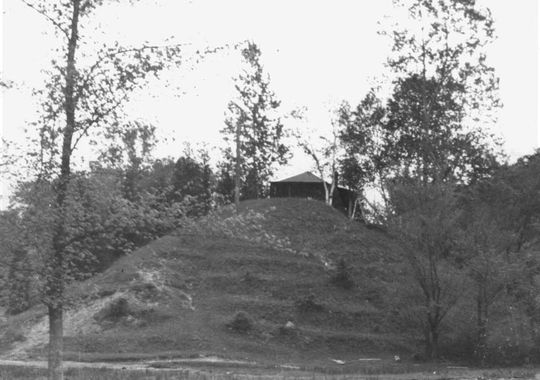
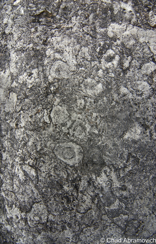
A year ago, I stumbled upon an old photo which fascinated me. The photo depicted a large mound of earth dubbed as “The Indian Mound”, it’s vague description locating it somewhere near the shores of Lake Champlain. Was there an Indian Mound in Milton?
I’ve traveled the many dirt roads of West Milton all my life, but have never seen a geological formation like this before. If there was such a mound, surely it would be of great importance. Why was it so discrete? Do people know of its existence? And, the most heavily weighed question, where was it?
An old photo of an alleged Indian Mound near the shores of Lake Champlain. Photo courtesy of The Milton Historical Society
Speaking with Lorinda Henry from the Milton Historical Society, she explained that the mystery about the Indian Mound was far greater than the information about it.
After digging through stacks of papers and unlabeled binders at the historical society, I was able to find my first clue; that the mound was located down near Camp Everest in Milton, a hidden area off a series of remote back roads that don’t receive much traffic other than locals, and a name that may very well be lost to many Milton residents today.
A vestige of the days when Milton was a summer tourist destination, Camp Everest was just one of the many large camps that would be built up along the shores of Lake Champlain.
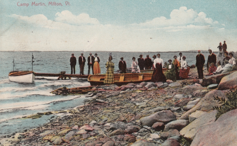
In the mid 1800s, camping in summer cottages and tents would draw people to the shores of Lake Champlain. Milton’s lakeshore was a murderers row of natural beauty, complete with stony beaches, Eagle Mountain’s giant looming rocks, marshlands, and deep forests. Land owners began converting their properties into camps to take advantage of this, and as a result, camps Rich, Martin, Watson, Cold Spring, and Everest would open for business.
Campers getting ready for a boat excursion on Lake Champlain at Camp Rich in Milton, Early 1900s. Photo: UVM Landscape Change Program
The camps all had farms, providing them with fresh food. Many of them boasted luxuries such as proximity to clear mountain springs, and the availability of fresh cream, eggs, milk and vegetables. The properties also offered many amenities such as recreation halls, lawn sports, fishing excursions and hayrides. Some camps even had handsome hotels built extravagantly and symmetrically, standing above the waters, with classic New England verandas, conical towers, decorative dormers and dramatic features that accentuated different sides of the buildings, almost to a point of tactility. Old advertisements for Camp Watson even boldly claimed that they had “positively no mosquitoes” – although, being quite accustomed to Vermont summers, I can’t help wonder just how they went around keeping that promise.
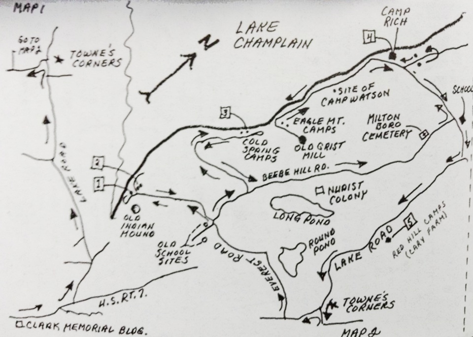
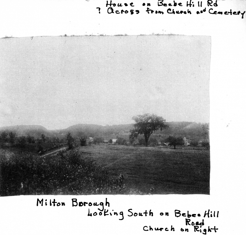
A hand drawn map of Milton’s summer camp colonies, and the area town known as Miltonboro. Photo courtesy of The Milton Historical Society.
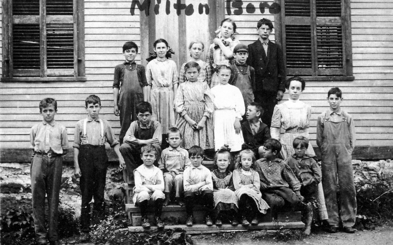
The area along the lakeshore became known as Miltonboro, which included schoolhouses, a church and meetinghouse which catered to the campers and locals who didn’t want to travel all the way to Milton village. Today, most of Miltonboro has vanished, leaving only a small cemetery ringed by a stone wall, and a name on a map.
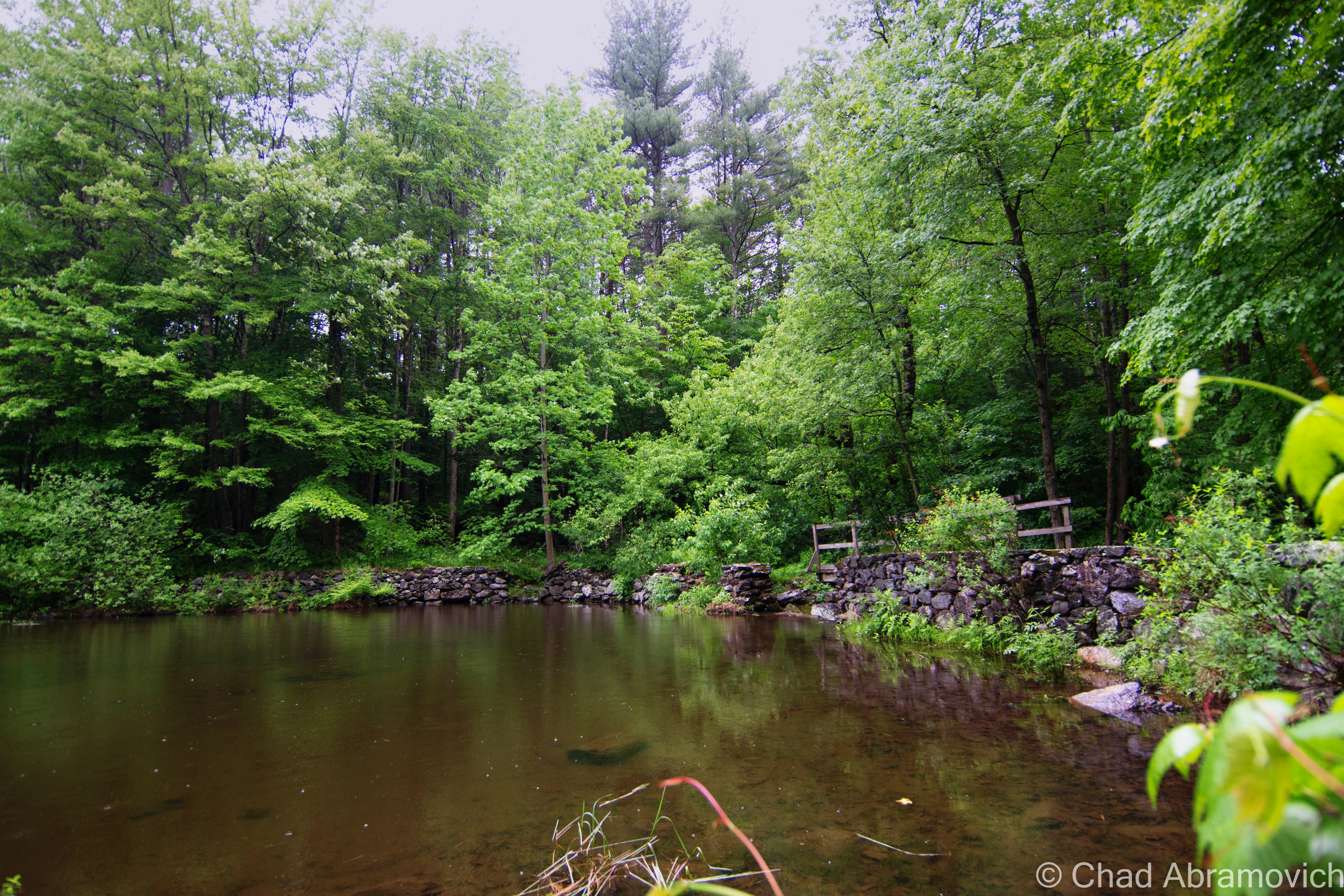
Camp Everest, the southern most of Milton’s lakeshore camps, was established in 1878 by Zebediah Everest and A.W. Austin, and they couldn’t have chosen a more splendid location. Bordered to the south by serpentine marshlands that now make up the Sandbar Wildlife Management Area, and to the north by the dizzying ledges of Eagle Mountain, with a sweeping view of South Hero island and the Adirondacks across the lake. The camp included a camp house, bowling alley and eight cottages, occupied by both family members and renters. It was here at Camp Everest where the alleged mound was located.
Early camps at Camp Everest, in an area called Algonquin Reef. Today, the name is emblazoned on your typical Green street sign. Photo: UVM Landscape Change Program
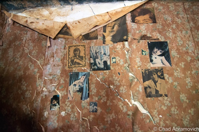
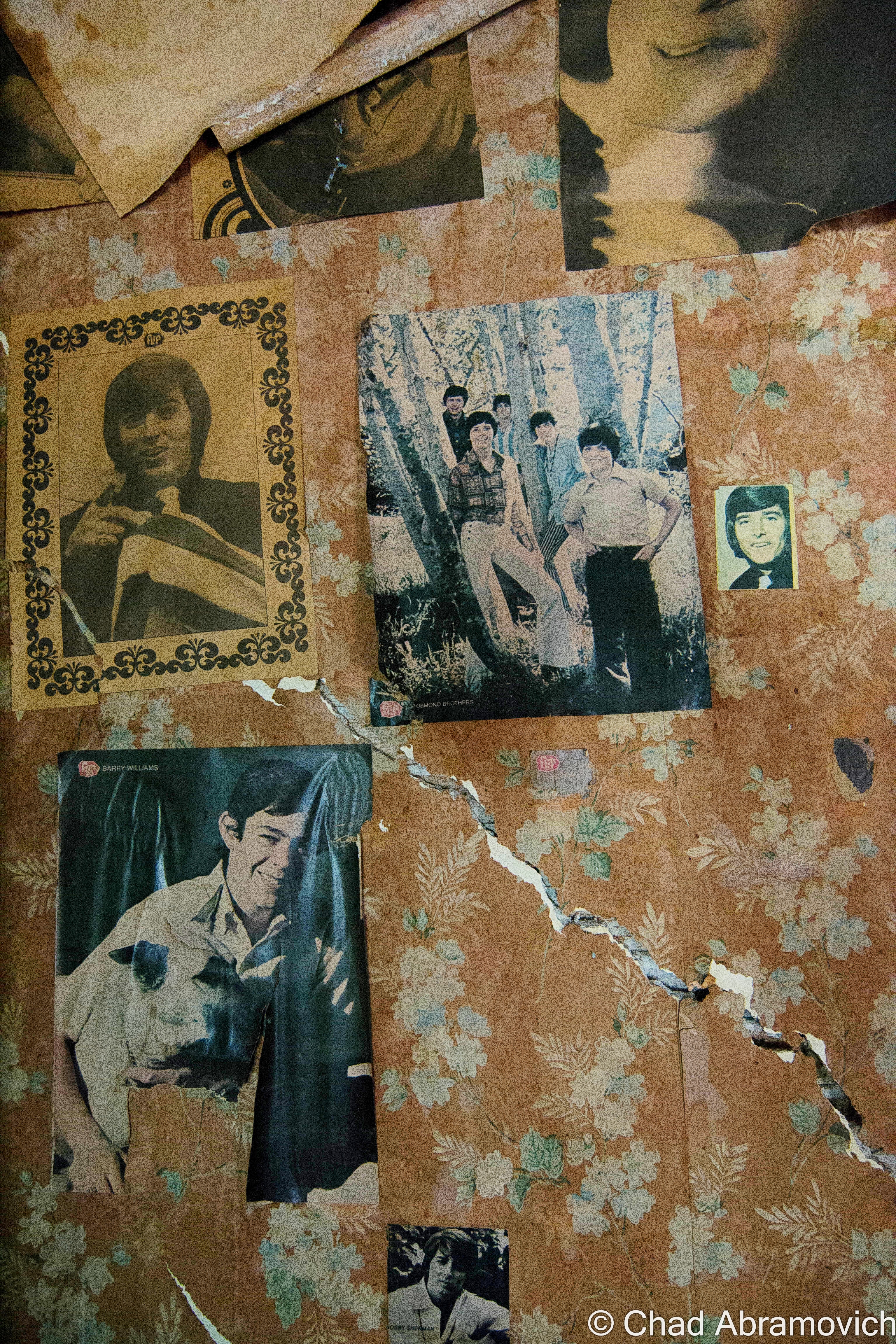
However, the information I read didn’t portray the mound as culturally significant, but rather in a bureaucratic sense – it was simply a piece of property. A camp was built atop the steep hill in 1927 by the Hutchins family, and named “Indian Mound”, perhaps romantically after what the earlier campers viewed the mound to look like. I was able to reach out to Barbara Hutchins, whose family originally owned the camp, and she was kind enough to give me further information.
She explained that the mound itself was probably formed during the glacier age, most likely a remnant of the Saint Lawrence Ice Sheet that once covered this part of North America. UVM did some digs around the mound in the 1950s, and found nothing of Native American significance, but they did find some old sea shells and fossils, evidence of the Champlain Sea, the tropical sea which covered what is now Vermont millions of years ago.
The Hutchins eventually sold the camp, and lost track of the property. I was able to dig up choppy pieces of information at the historical society – listing the names of various people who leased the camp throughout the years. The dates got sparse after 1970. Eventually, the information just seemed to cease. So, what happened to it? Was it still there?
Lorinda Henry explained that the state of Vermont wanted to hack apart the mound and use it to fill in a nearby swampland in 1948, but further research told me that because the area was prone to flooding, they decided not to, because the amount of dirt they would have gotten from the mound would have most likely been lost within a few years, leading me back to my original question.
The existence of an Indian Mound is also curious, because Vermont was never thought to be associated with mound building Indians. But then again, at one time, it was thought that Native Americans never settled in what is now Vermont. But Milton farmers would constantly find artifacts and arrowheads while clearing and plowing their fields. Arrowheads were also allegedly found when Andrea Lane, a small neighborhood off Route 7, was being constructed years ago. Lorinda Henry explains that because of native traces in the area, there are parts of the neighborhood that can’t even be developed because of archaeological significance. If that myth was debunked, than would the presence of an Indian Mound be that hard to believe?
On a breezy August day this summer, I took the beautiful drive back down towards Camp Everest, with the intention of solving this mystery. The camp is much different from it’s heyday, now a series of private camps, owned by various people. The bowling alley and other amenities have long vanished into history and the creeping forests.
With the hand drawn map featured above in this post as my only reference, I scanned the roadside and across the many meadows bordering the area, but the imposing sight of the Indian Mound was never seen rising above the various clover filled fields or cedar forests near the roadside. I ran into several people, some jogging, others washing their SUVs in their driveways, and they were all happy to talk with me. But sadly, none of them knew about an Indian Mound or a camp of the same name. Some were out of staters and weren’t aware of the area’s history. But then again, a great deal of the area’s history has long vanished over the years.
From the map, I was able to sort of pin point the general location of the mound, but the area is much different than when the picture was taken. I had assumed, the mound might be still existing, now deep in the woods and covered in vegetation. But shortly after publishing this blog entry, I stumbled upon some further information.
Laurie Scott, who is an Everest, explained to me that the mound was eventually purchased by the grandson of the Hutchins family. The Everest’s lease most of the land where the camps sit, but her grandmother, Ethel Everest, sold the mound to them. The mound and the camp are still there, and as I assumed, is now obscured, hiding successfully behind a Vermont forest – an ideal getaway.
An interesting footnote to this story is that while trying to solve the mystery of this “Indian Mound”, Barbara Hutchins recalls that she heard there were a few other professed Indian mounds somewhere in Milton as well, but as for their locations, she doesn’t remember, leaving this intriguing mystery currently ongoing.
—————————————————————————————————————————————–
To all of my amazing fans and supporters, I am truly grateful and humbled by all of the support and donations through out the years that have kept Obscure Vermont up and running.
As you all know I spend countless hours researching, writing, and traveling to produce and sustain this blog. Obscure Vermont is funded entirely on generous donations that you the wonderful viewers and supporters have made. Expenses range from internet fees to host the blog, to investing in research materials, to traveling expenses. Also, donations help keep me current with my photography gear, computer, and computer software so that I can deliver the best quality possible.
If you value, appreciate, and enjoy reading about my adventures please consider making a donation to my new Gofundme account or Paypal. Any donation would not only be greatly appreciated and help keep this blog going, it would also keep me doing what I love. Thank you!
A favorite activity of mine is to go shunpiking – cruising around Vermont’s back roads and letting my eyes and mind soak up whats out there. A few nights ago while traveling down a straight-of-way in Addison County, a pancake flat paved rural roadway surrounded on both sides by expansive hay fields, I came across a forested island in the middle of a vast expanse of nothing – a small patch of surprisingly dense hardwood trees, tall grasses, and the Vermont state flower, the Clover.
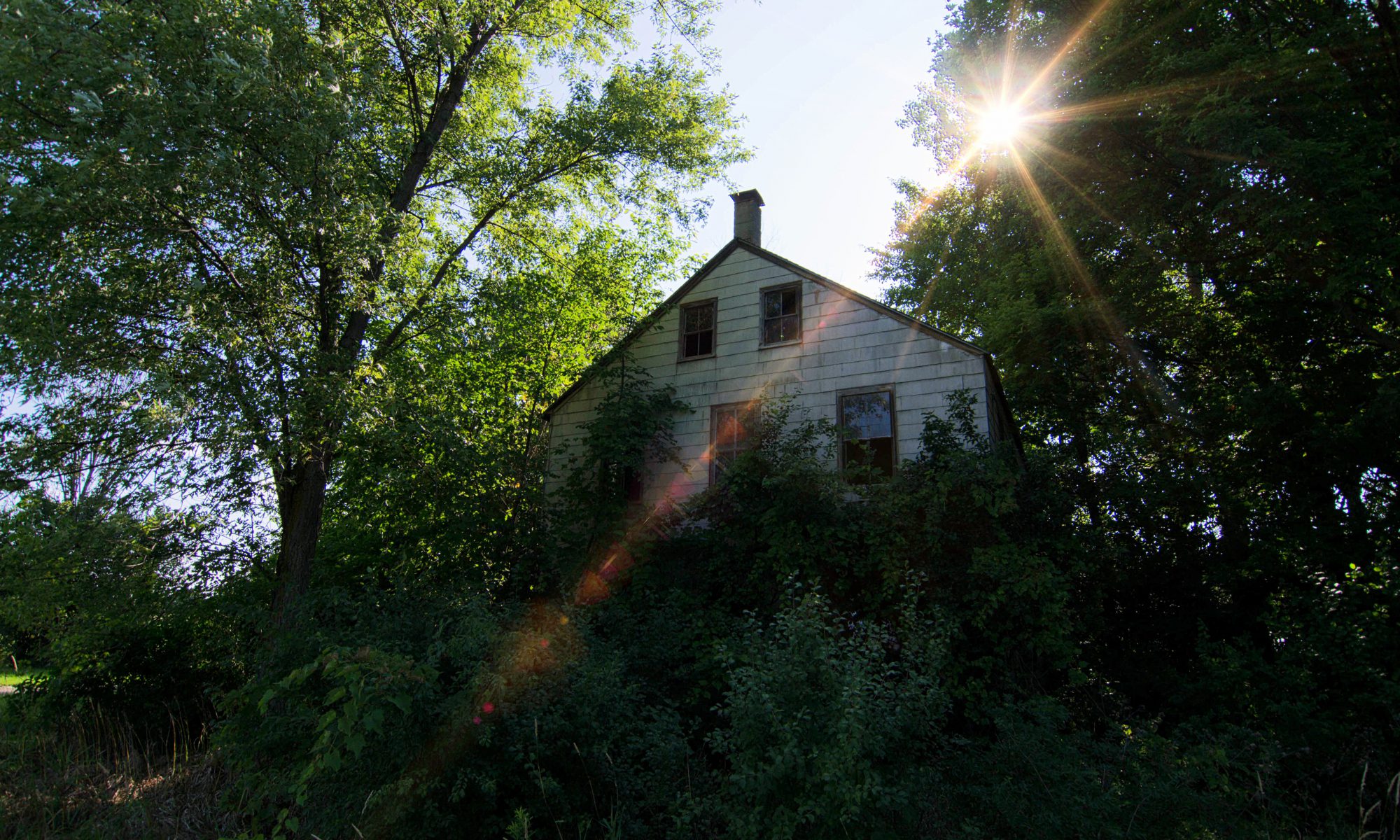
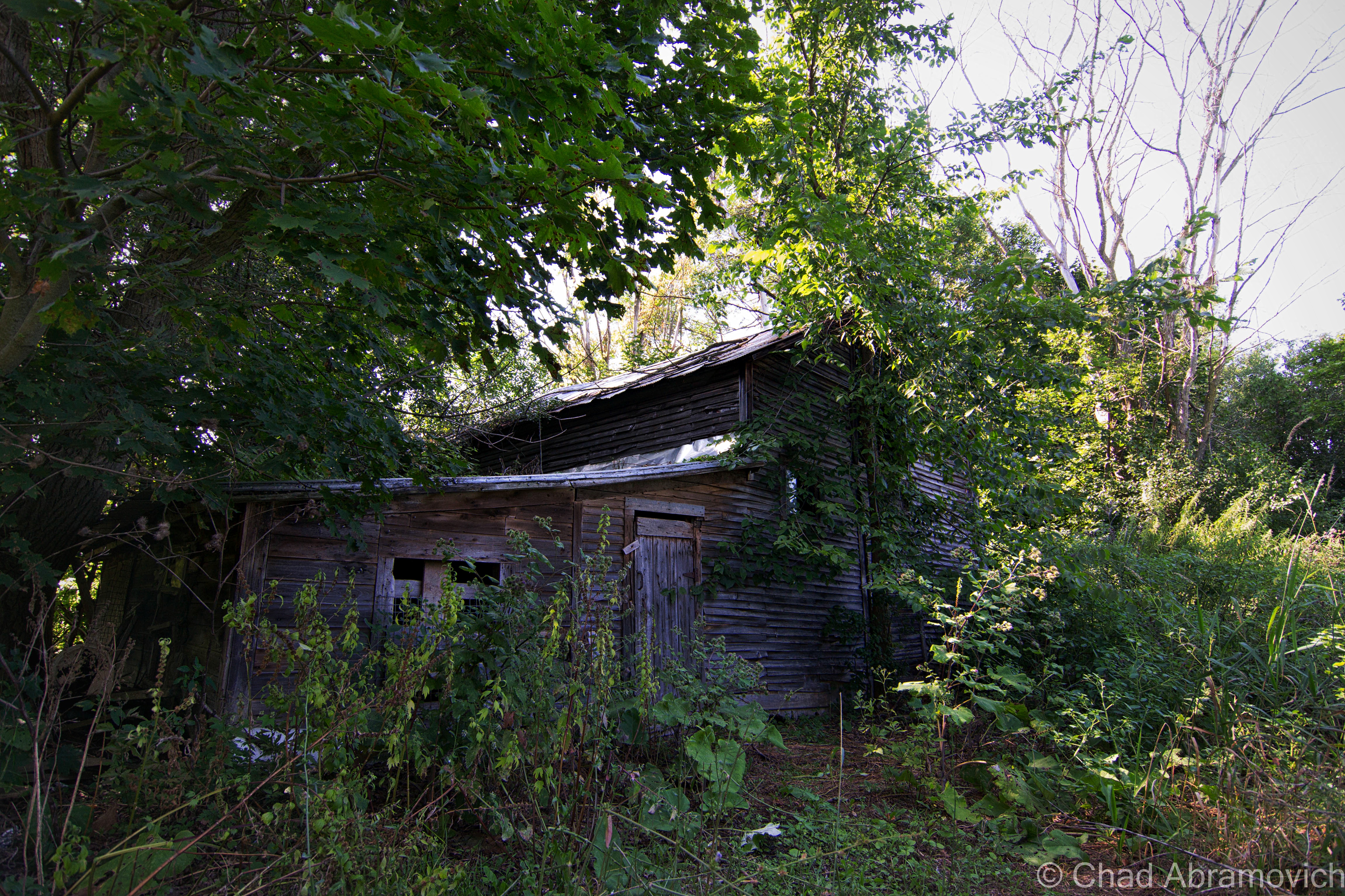
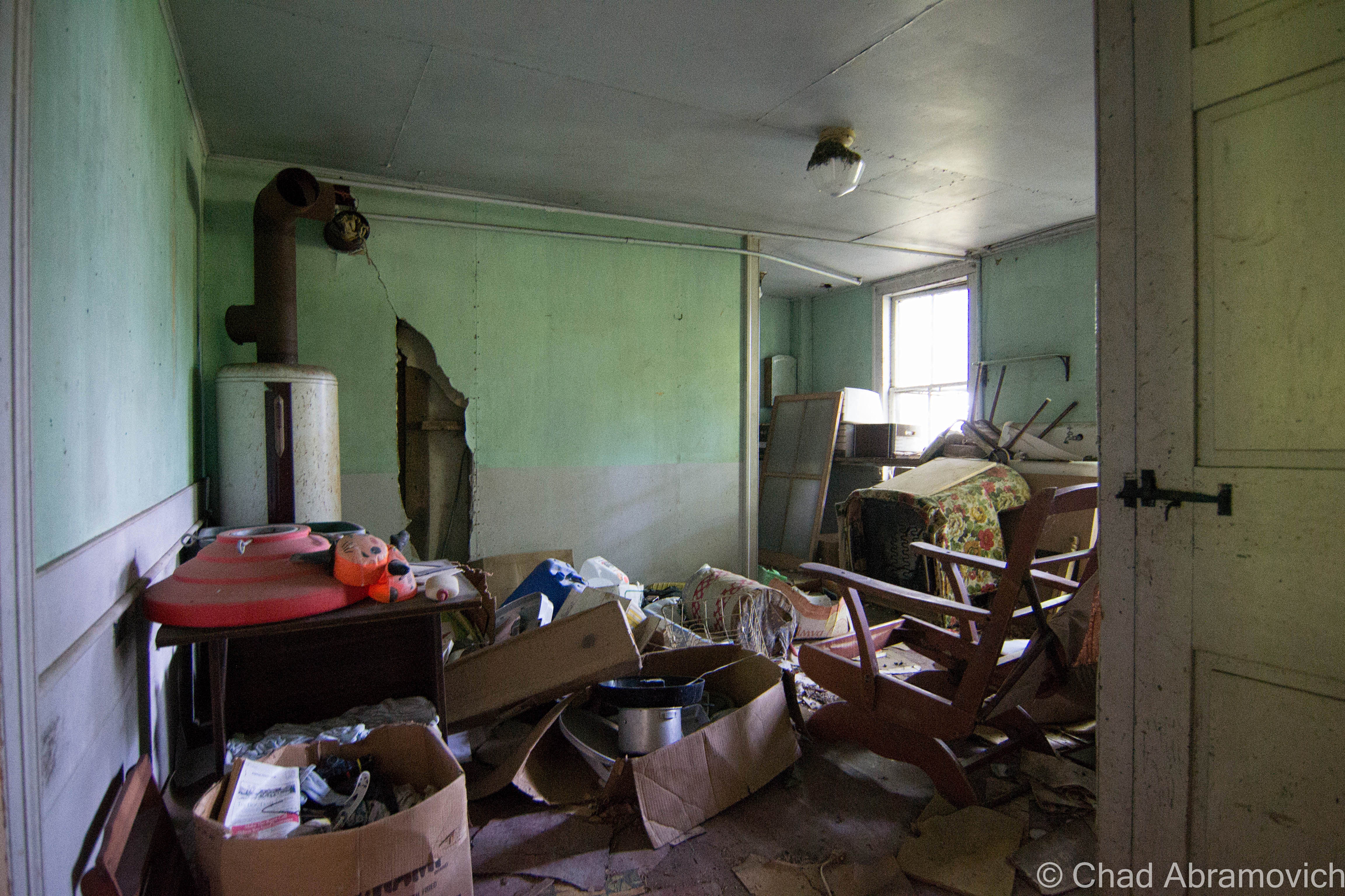
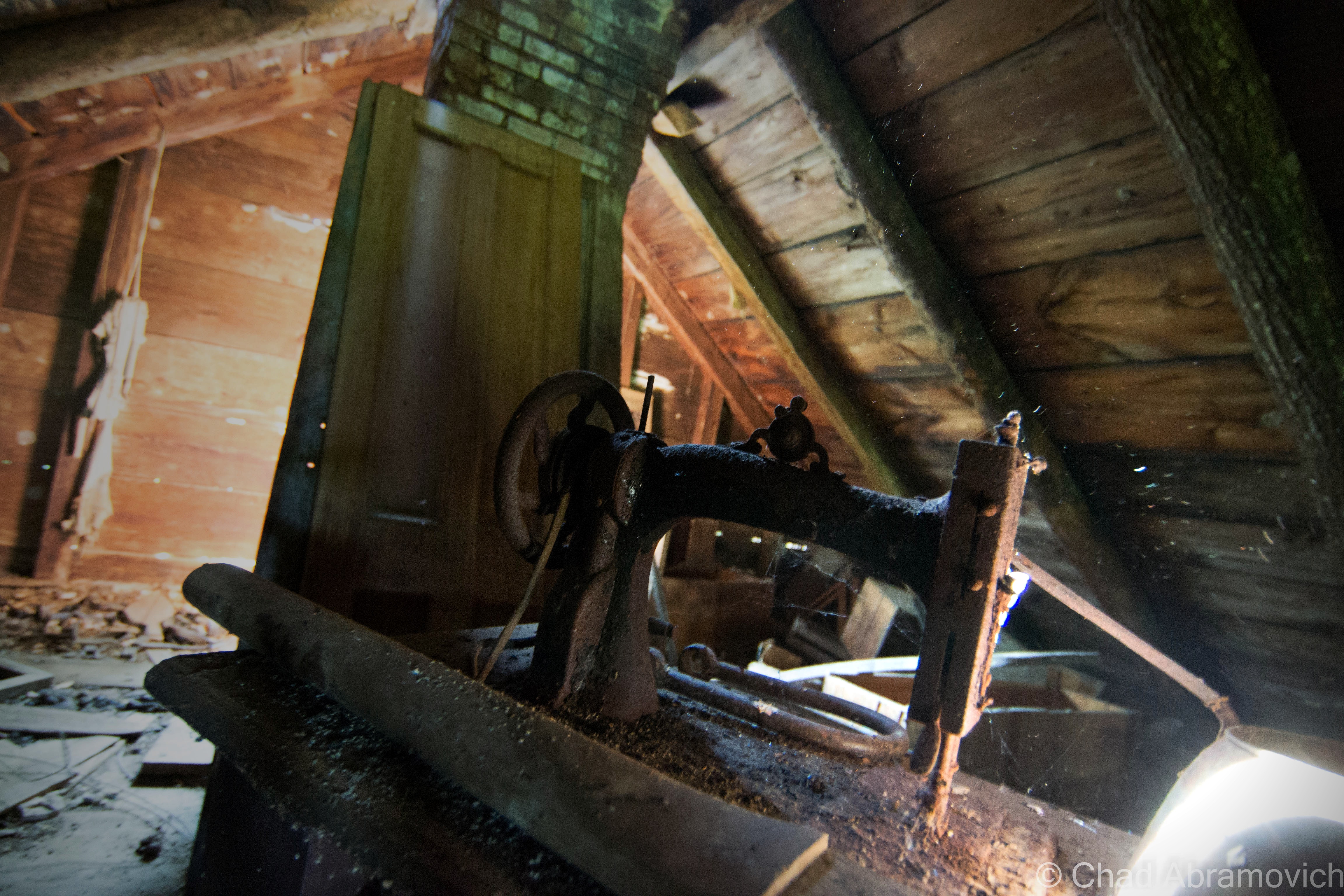
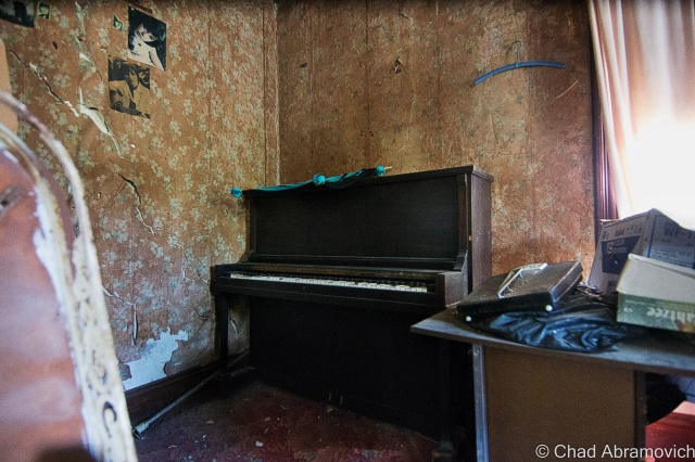
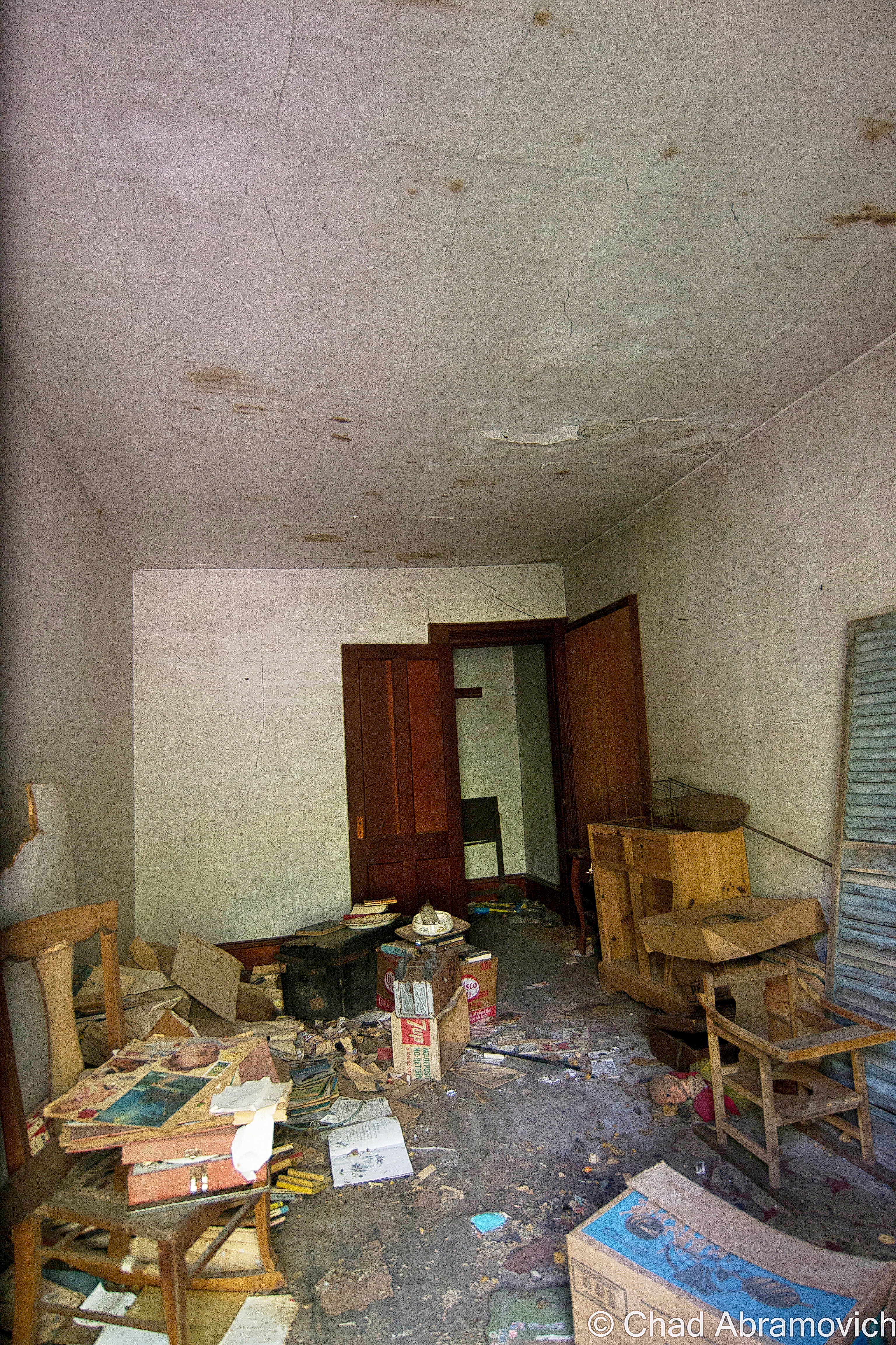
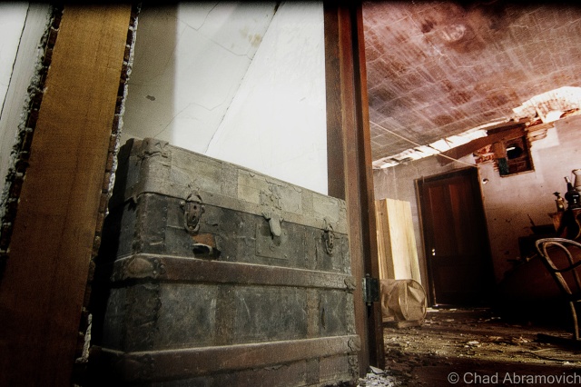
Behind the growth, I noticed there was something man made here that was coexisting with the small jungle – the second story of a sordid farmhouse could be seen above a fortress of clinging vines that were almost consuming the structure. Slowing down to take a better look, I realized there was yet another abandoned house across the street that was nearly invisible, and behind it, I could make out the shapes of a scattering of barns and sheds, all falling and fading. I had stumbled on an abandoned farm.
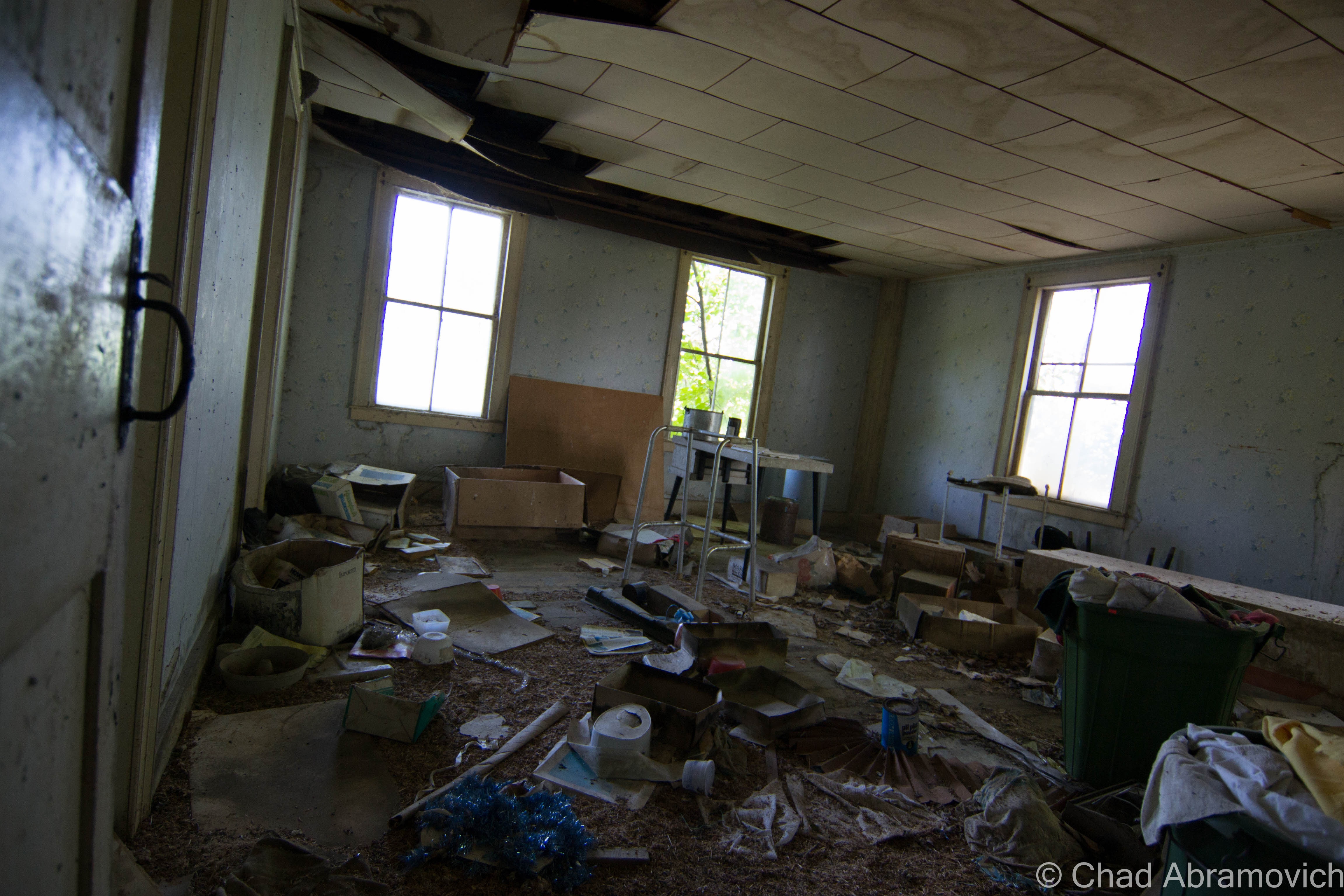
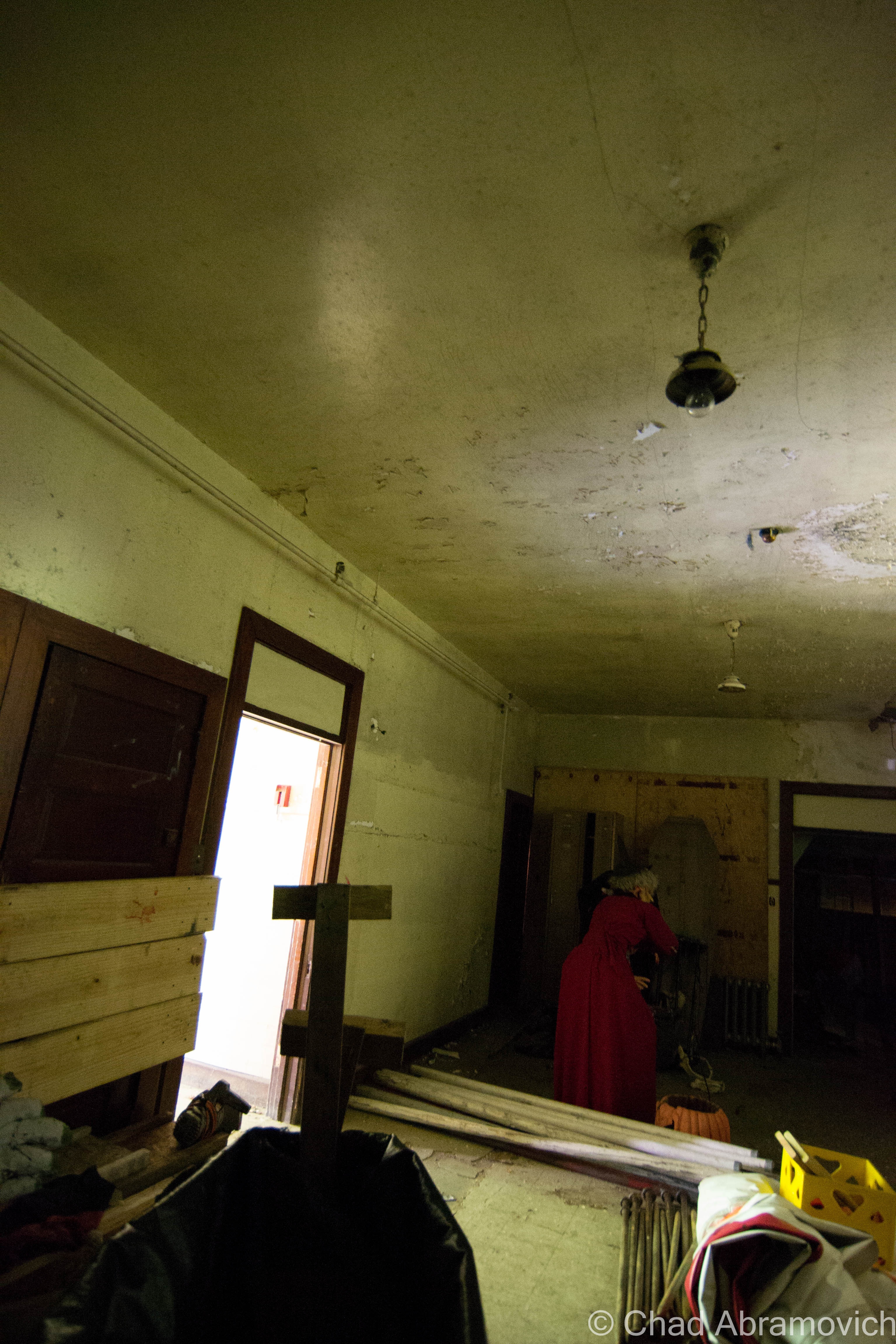
Pulling off into what was once probably a driveway, I basked for a moment in the silence that hung around the farm. The sounds of crickets and the smell of clover came through the open windows, and the breeze gently rustled the trees. As I was sitting in my late summer reverie, movement caught my eye. From behind the abandoned farmhouse I was near, a solitary figure rode into the opening on a bike, through thick grass and tanglewoods that I assumed were probably very difficult to bike through. Manning the bike was a haggard looking fella, who appeared to be in his 40s, outfitted in moth-eaten clothing and a rather new looking bike helmet. He approached the car, and I braced for his encounter the best I could, giving him a small smile, waiting to see what was about to unfold.
“What are you doing here?” was his first question, which I predicted as much. “I’m just turning around, took the wrong road” I said calmly and cautiously. “Do you own this land? I’m sorry, I didn’t mean to bother you”. “Oh, I worked here for over 30 years, so I pretty much do own the land” he began. “The farm is abandoned now, the family is pretty much all dead. I still come by almost every week and check up on things though” “Oh wow, that’s pretty incredible. This place looks like it has a lot of history” I observed. And that seemed to light an internal fire – a simple initiation of conversation, and suddenly, his reserves were taken down, and he opened up to me. “Oh man, the stories I could tell you”. I smiled at him and explained my passion for stories and history. His eyes lit up like flashbulbs. “Actually – do you have some time, I can show you around?”
Next thing I knew, I had my camera in hand, and was ignoring my better senses as I followed a total stranger through thick tall grasses, well out of sight from the relative safety of the road out front. He introduced himself as Ivan as we went to shake hands. Putting blind faith in this gentleman, I allowed him to lead me around the property and we began to talk about the shifty ways of time, his stories cutting deep into history.
“I started working here when I was 10, back in the 60s”, Ivan began. “I used to carry hay bails from the fields to the barn all day long. That’s how I got these” he snickered, as he flexed his muscles. “I used to work all day long, never took a water break. People always used to warn me I’d get dehydrated, but I never did” he said proudly.
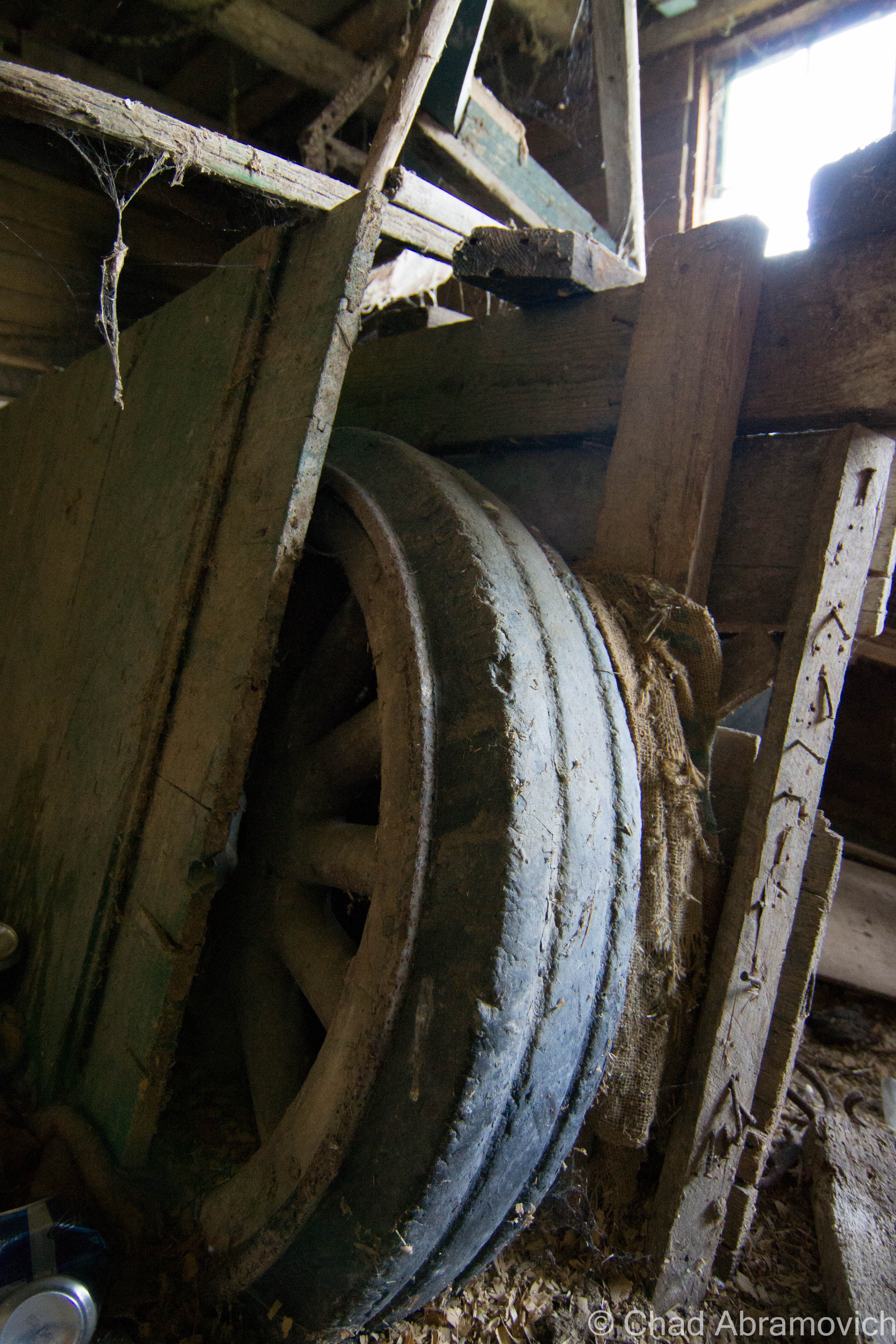
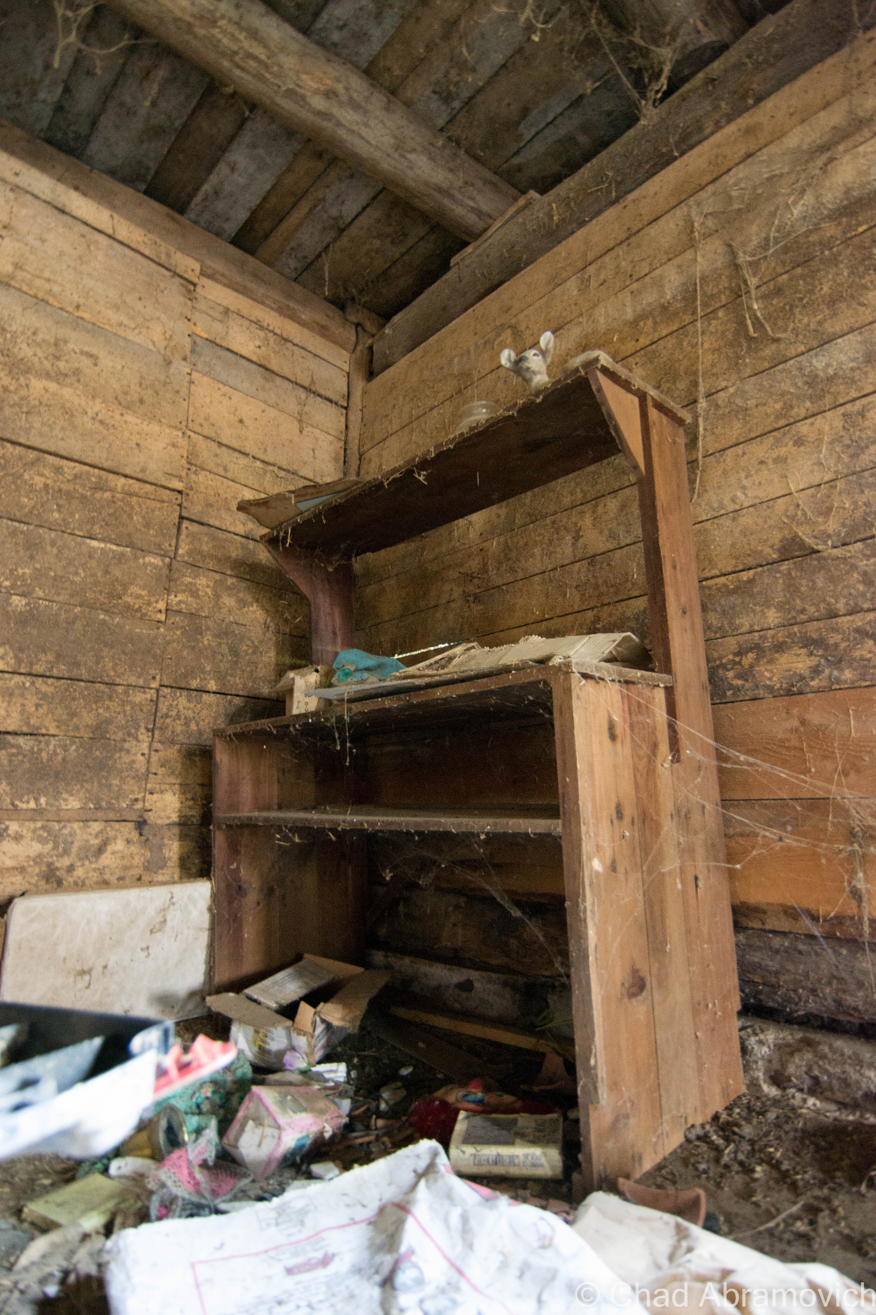
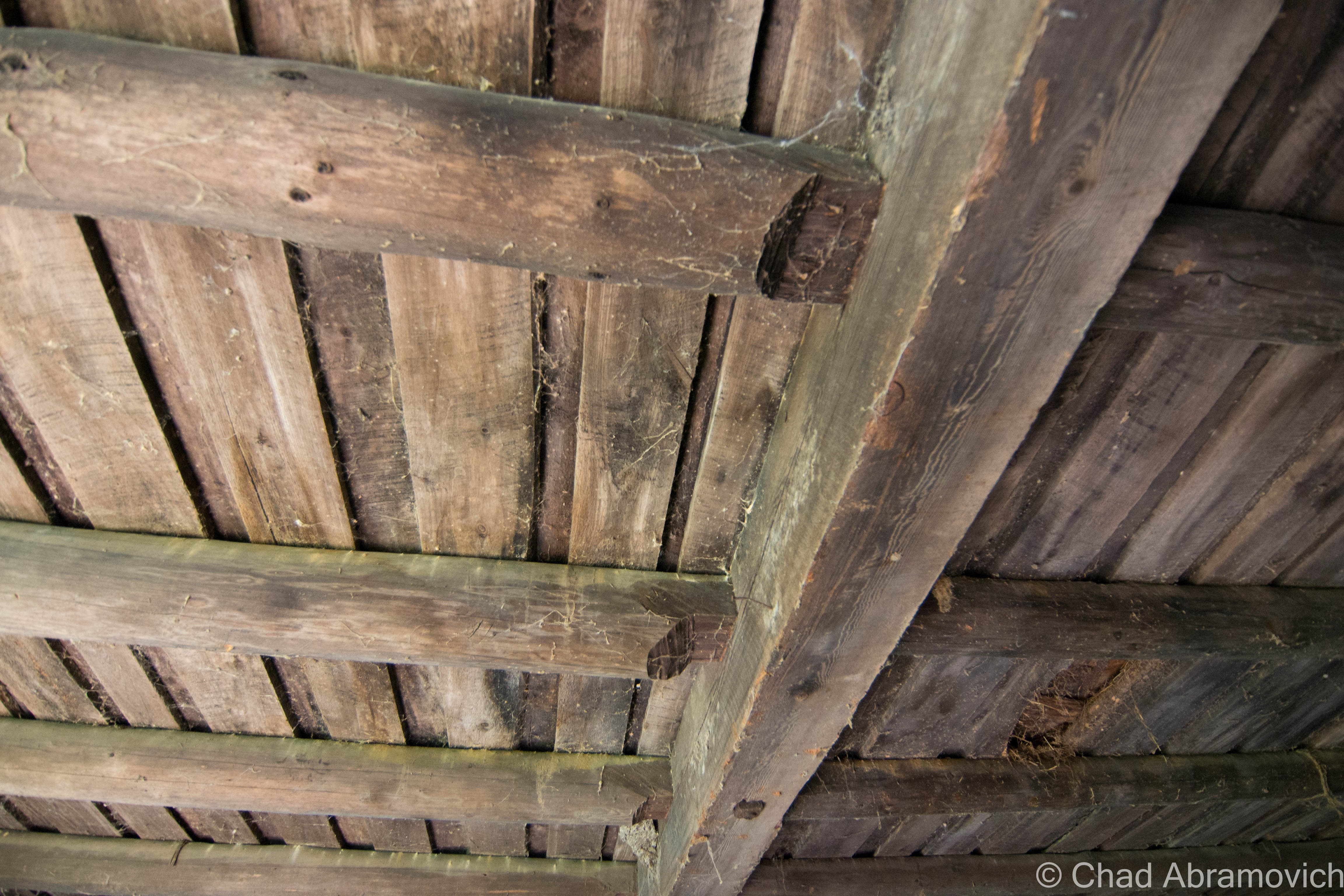
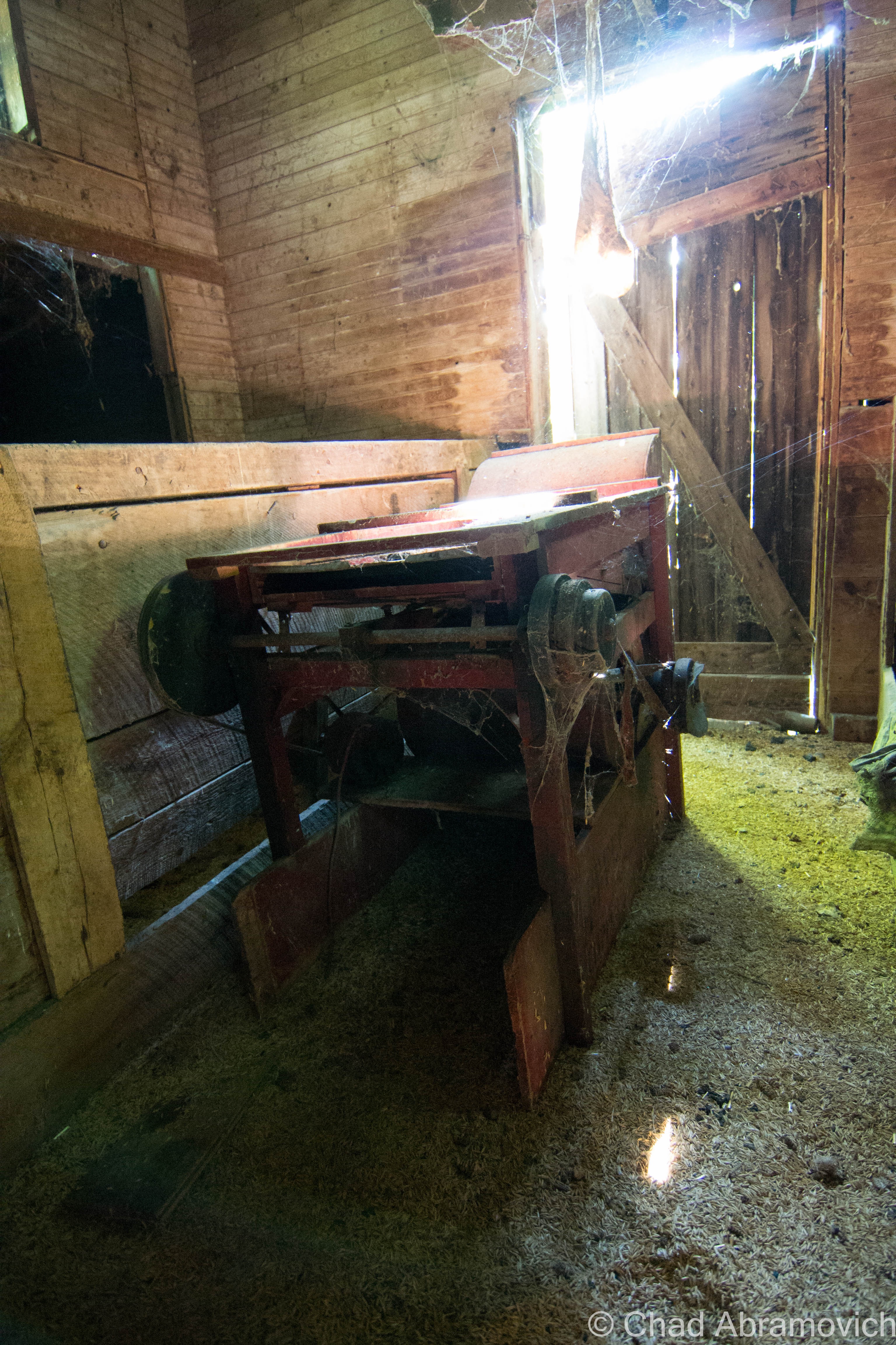
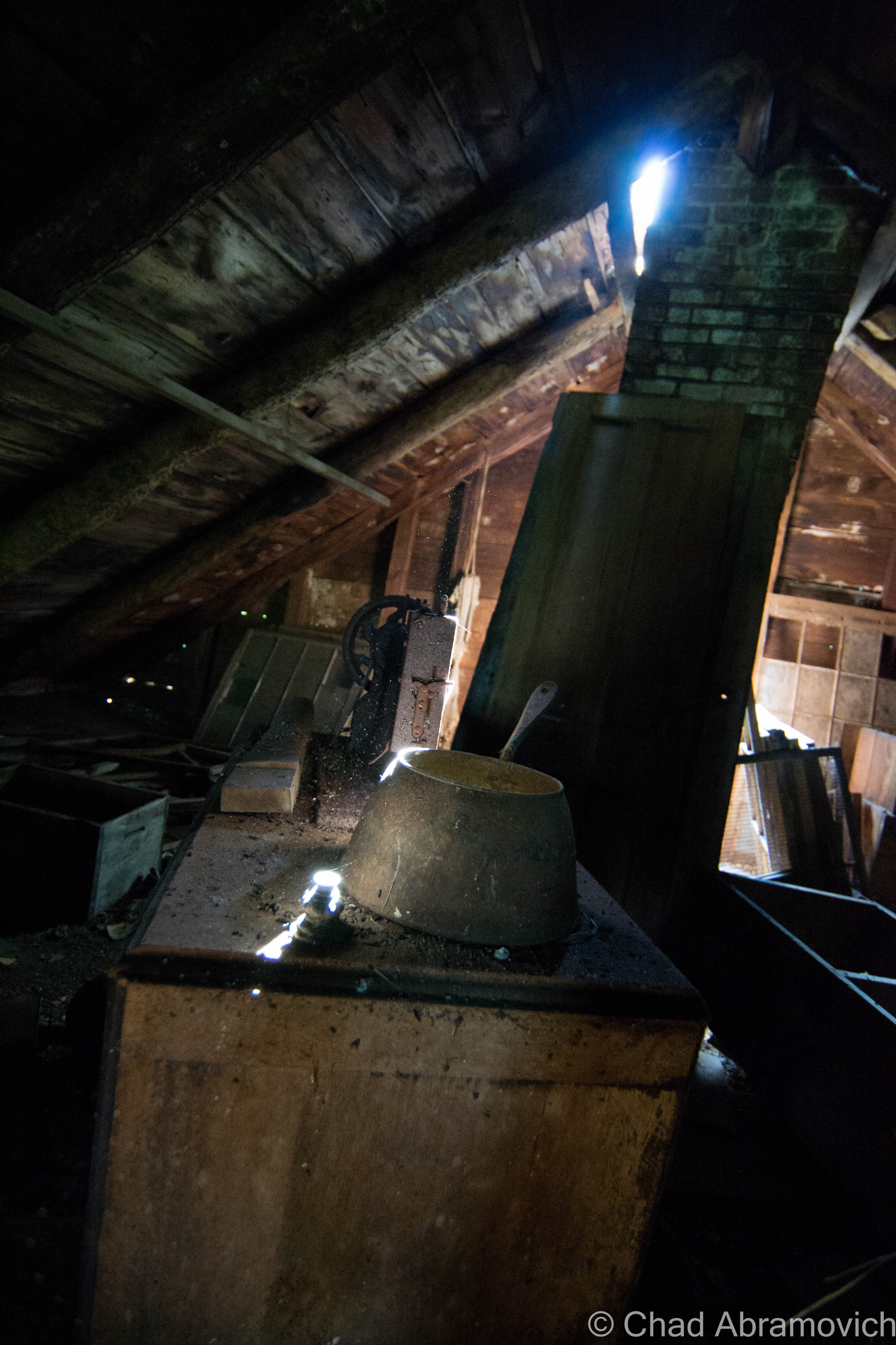
We found ourselves standing in front of a barn. “These barns are over 150 years old, built from Oak, Cherry and Ash, all cut right here on this property. There used to be a mill over there” he gestured to now open pastureland. He walked over and wedged a sliding door open, it made a loud groaning noise as the door grinded against the building. The entire facade seemed to tremble at this disturbance.
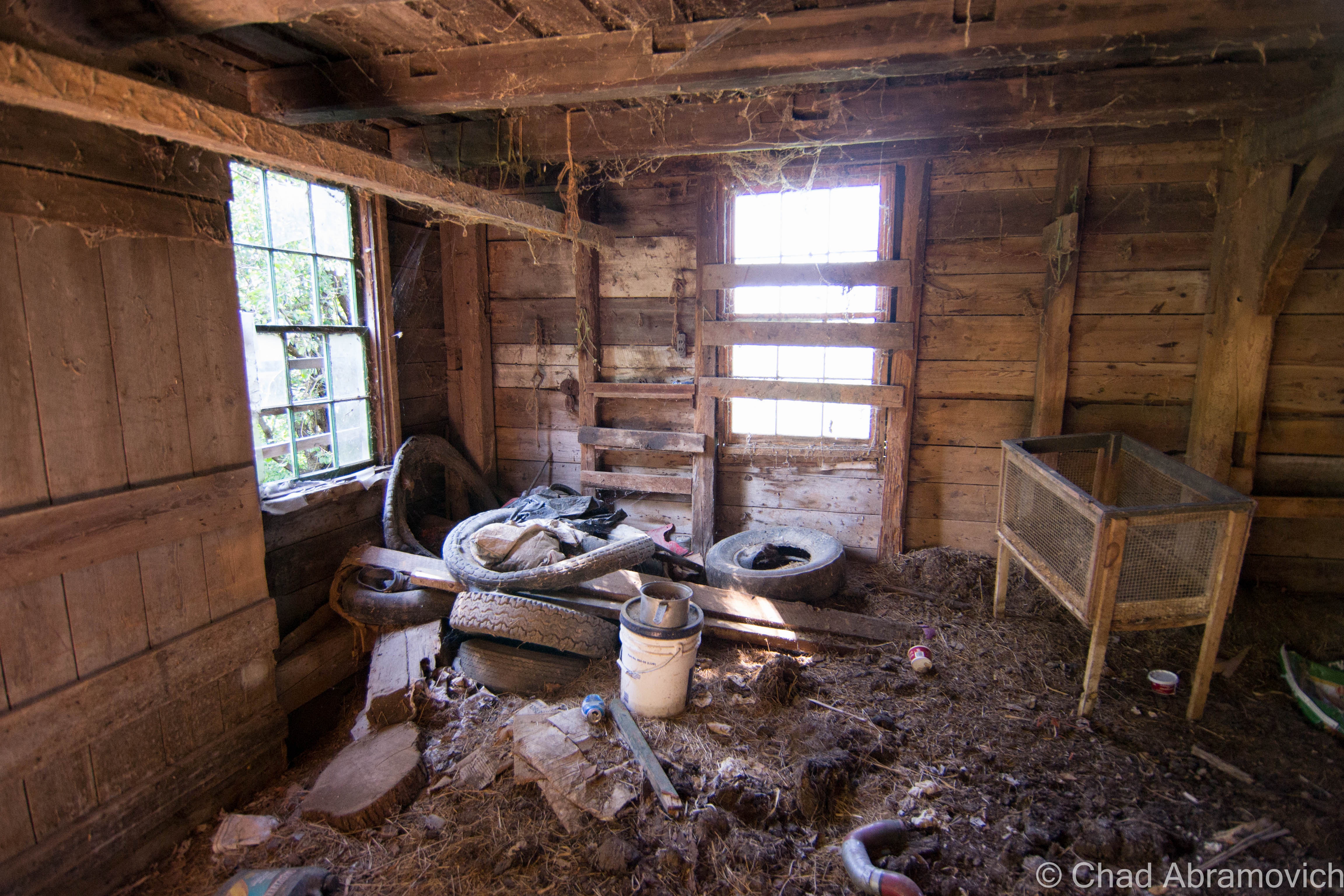
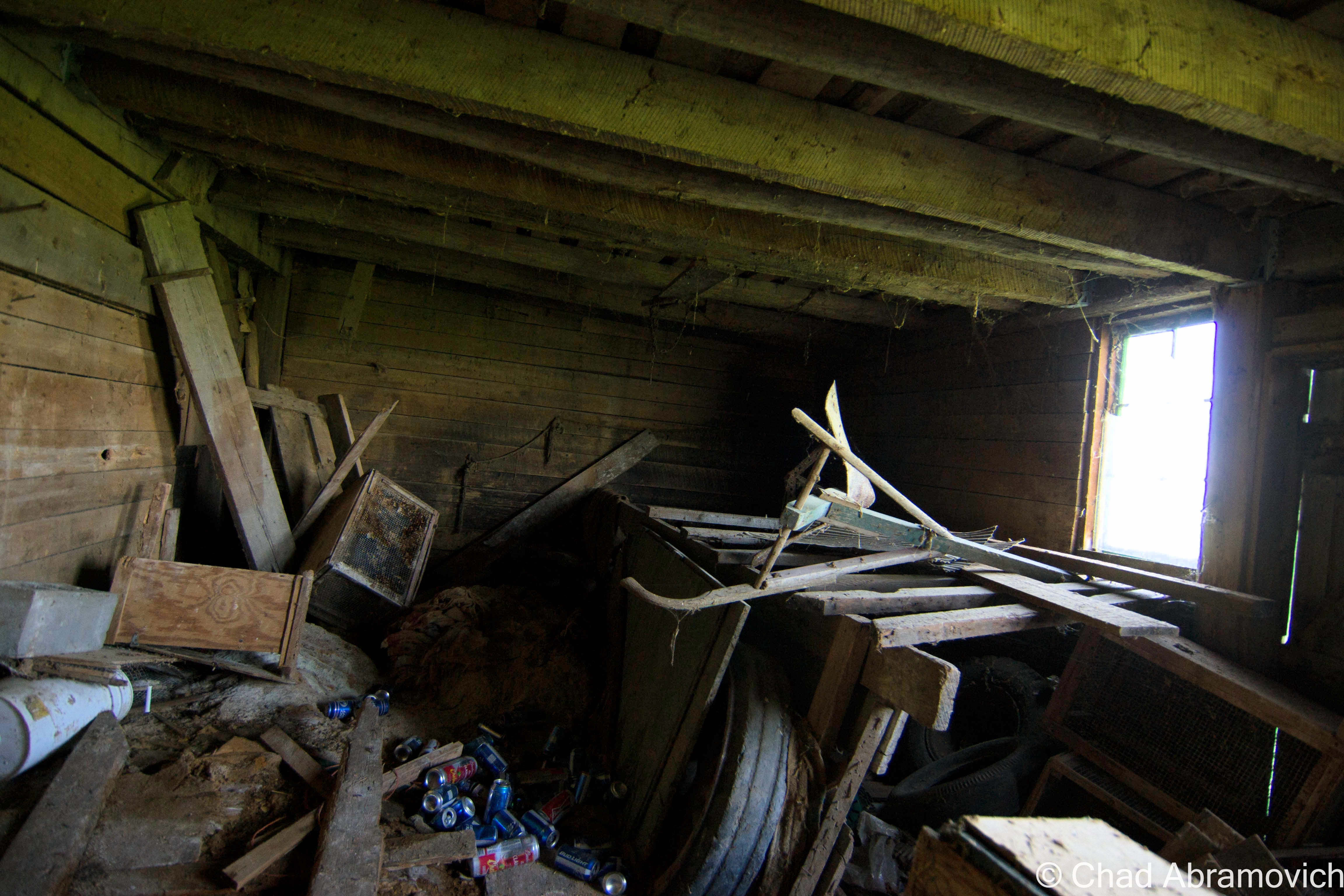
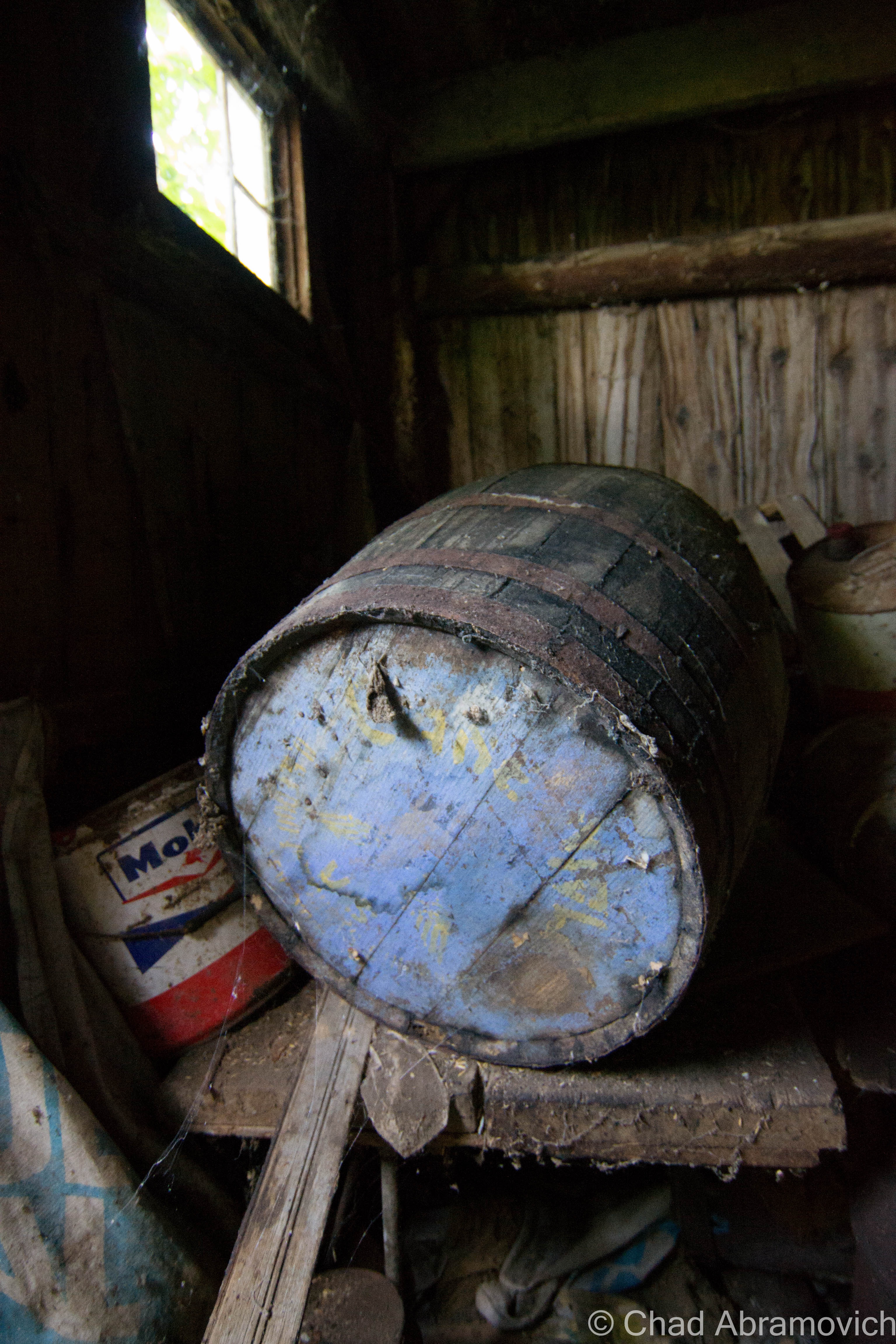
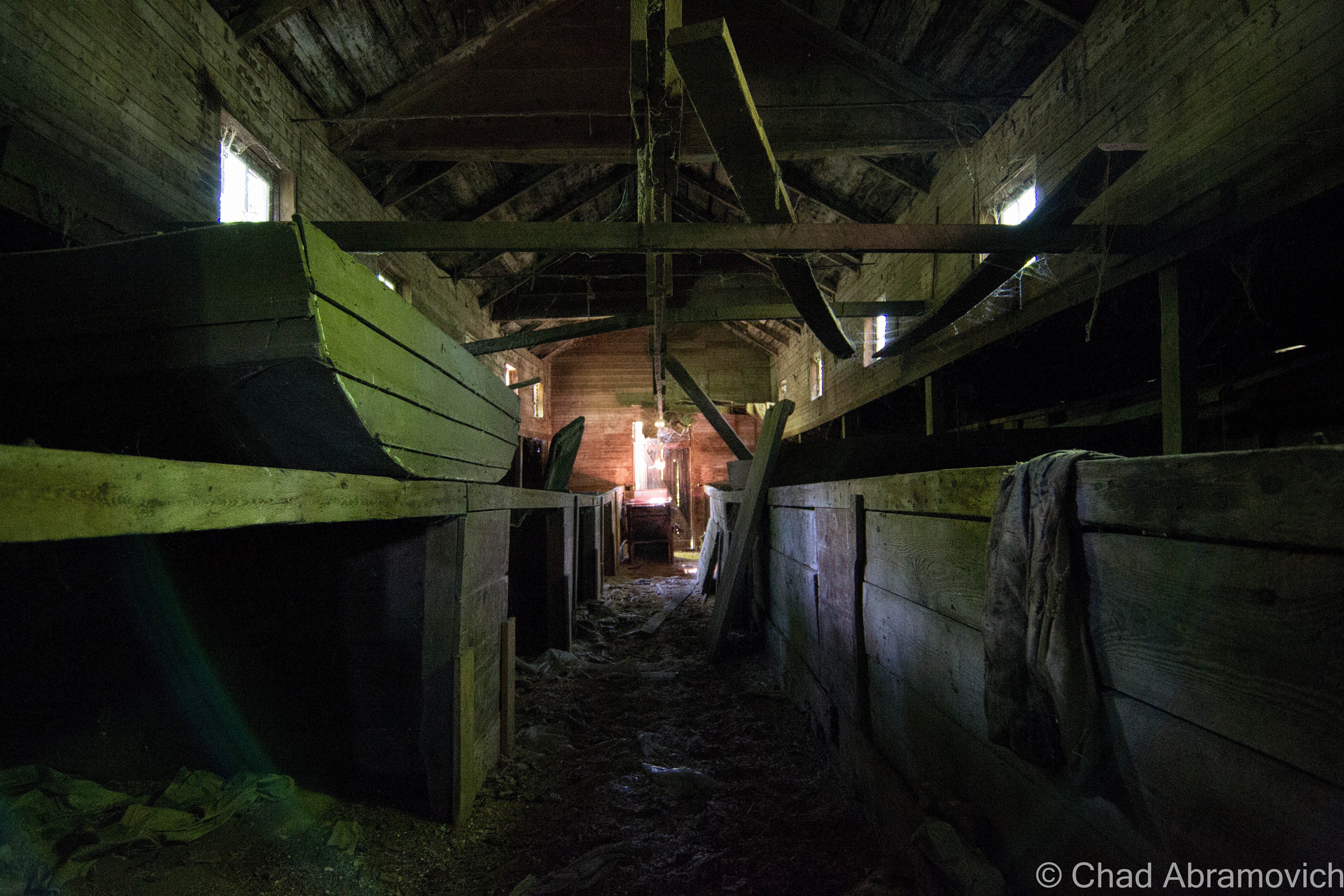
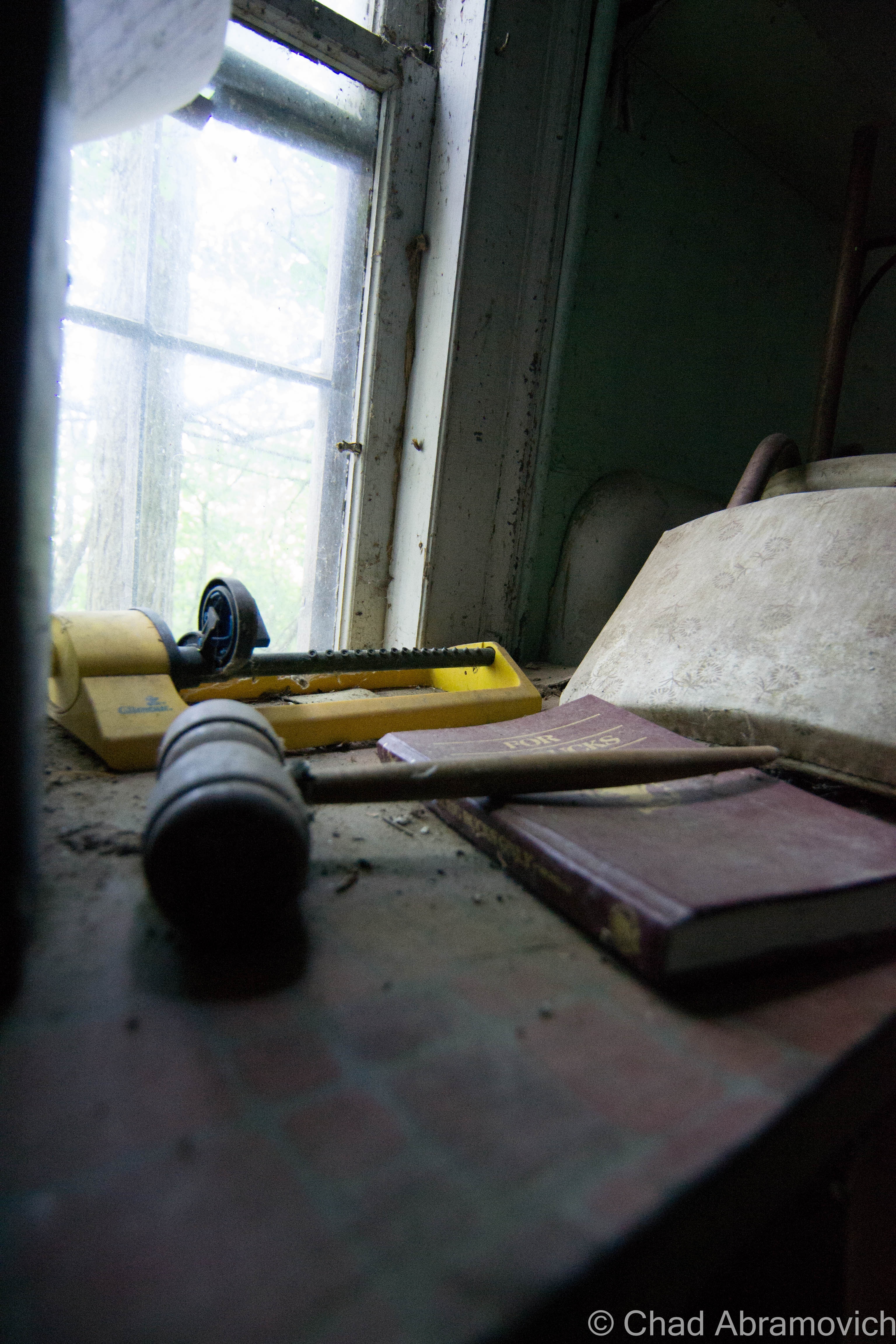
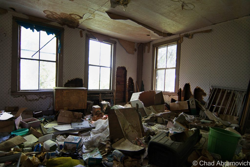
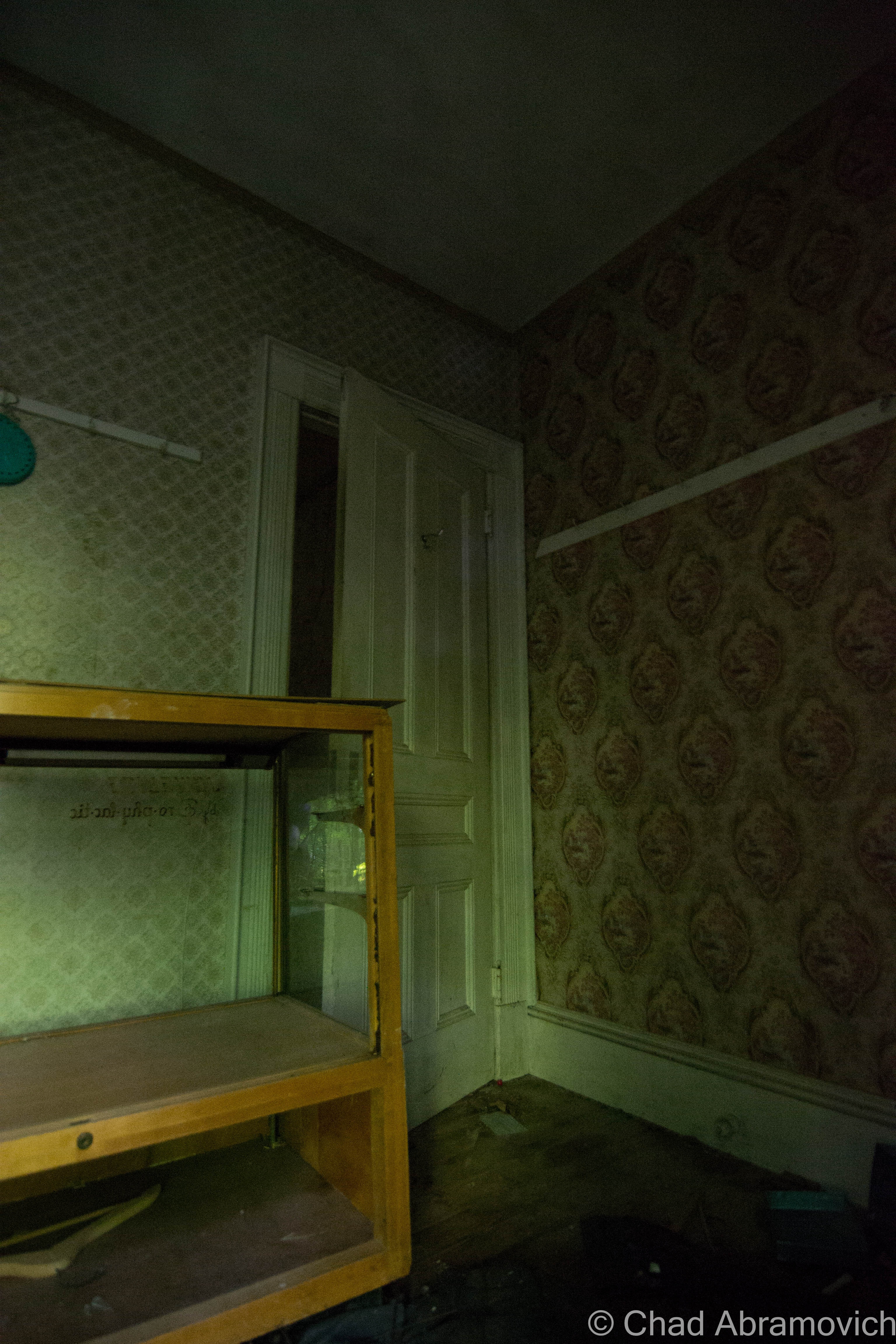
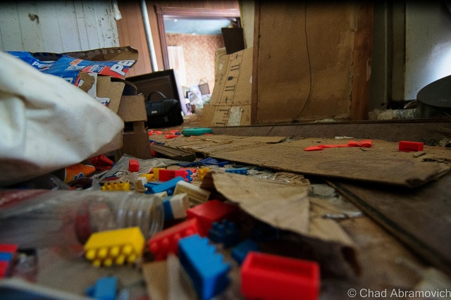
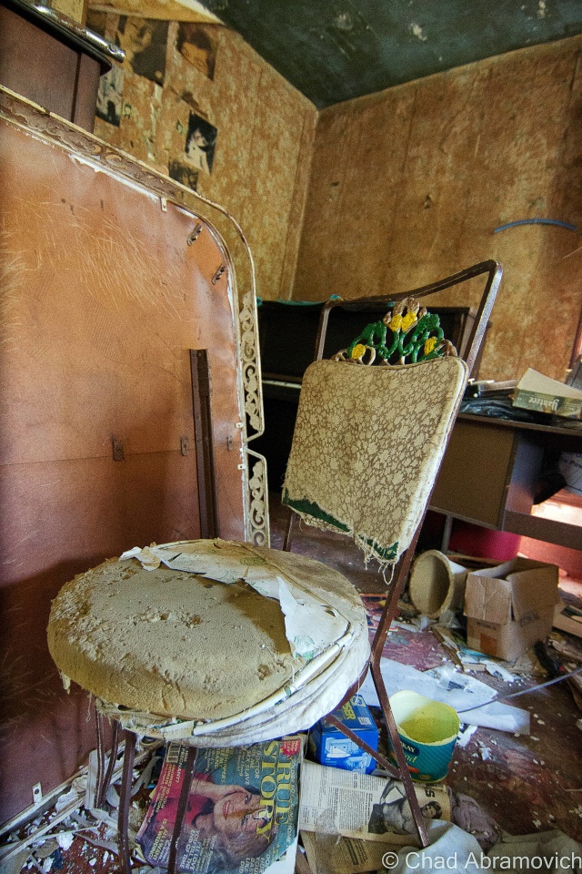
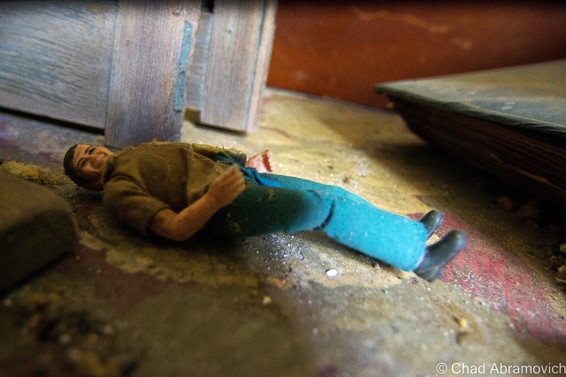
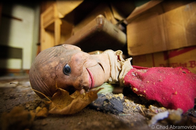
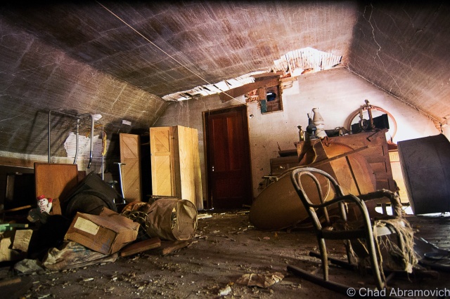
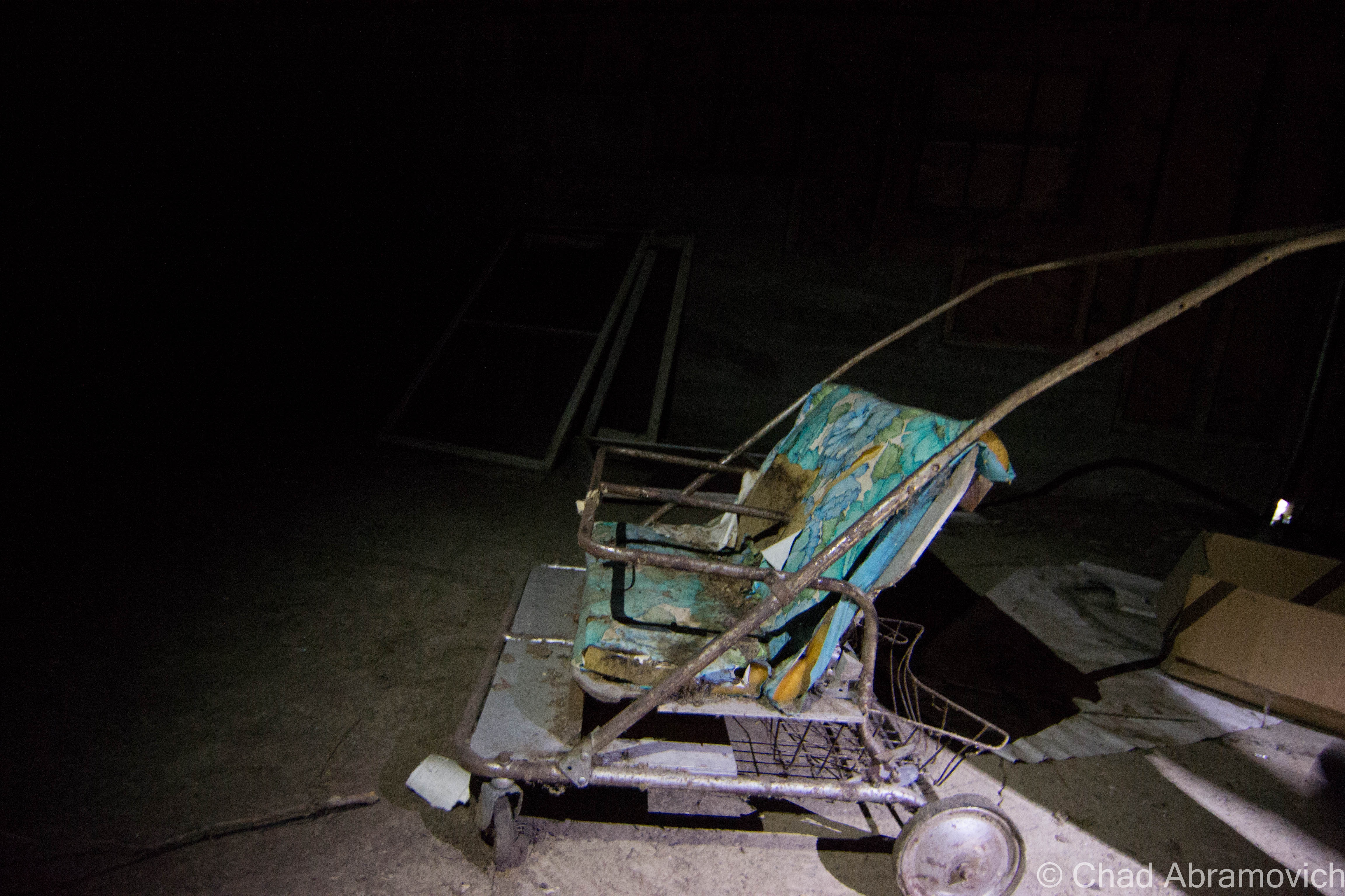
Inside was a forgotten world. Incredibly thick quilts of spiderwebs clung to brawny timber beams and fell from the ceilings like snow, getting tangled in my hair. Hay scattered on the dirt floors 30 years ago was still there, matted and molding. Certain rooms were packed wall to wall with various artifacts. wooden apple crates, tires with wooden rims, old bikes, desks and shelves filled with various artifacts and paraphernalia, accounts of over 150 years of farming now sitting forsaken underneath swirling dust and sunlight coming in through dirt streaked windows. On our way out, he noted me looking at the apple crates. “I love these things. I have a few of them in my apartment, holding books and stuff” I commented. “Oh yeah, I love those old crates too. There used to be an apple orchard right behind this barn. Over 100 trees! I remember, we all used to eat so many apples – they were great on a hot summer day. They tore them all out a few years ago, the entire orchard”
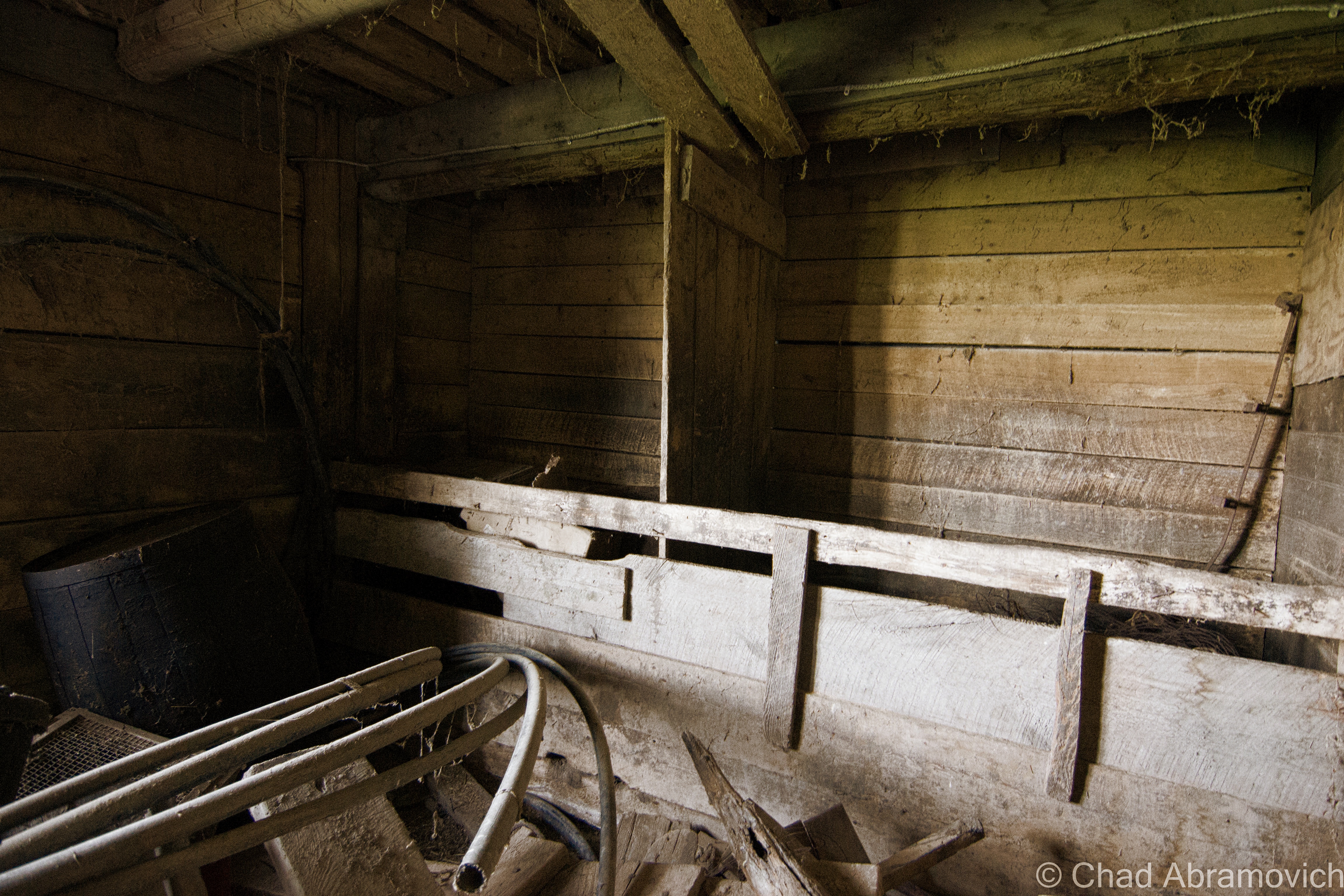
Making our way through the tall grasses, we made our way across the property. In a neighboring barn almost completely concealed by tree growth, he pointed out that that particular barn was used exclusively for trapping. The farmers used to trap unlimited beavers, otters and raccoons on their property and the nearby creek, and used to bring all the pelts to hang and dry in that barn – where a long narrow hallway ran between two sets of walls where the hooks still were hanging. “This barn used to be full of hides – all the walls would be covered” he reminisced. “We used to either eat them or sell them. Any bit of money helped” It was a strange image, staring at those filthy and barren walls that afternoon underneath filtered light streaming through broken boards. I noticed a dated industrial grain sorting machine at the very end of the narrow hall. He told me that the farm used to also produce its very own grain. The floor was still coated in ankle high piles of the stuff and it had gotten in my shoes. Standing inside, there was a moment of silence as we took in our surroundings, and weird sounds seeped throughout, the soft summer breeze clearing my mind.
Wondering back around one of the abandoned houses, he told me that after the farm started to go out, the house was rented out to people outside the family. The last occupiers apparently stole a great deal from the farm. Valuable antiques such as firearms, milk jugs and other artifacts they had been taken. Most of the original family had died off, all but one member, who is now well into her senior years, and still lives nearby. She’s tired and doesn’t have the want to upkeep the farm anymore, and is almost completely unaware of it’s slow collapse. “It’s a real shame” he said. “Once she dies, a guy wants to buy the place, come in and bulldoze all the barns, the houses, everything. They want to expand the fields and farm this area. Everything here will be lost”.
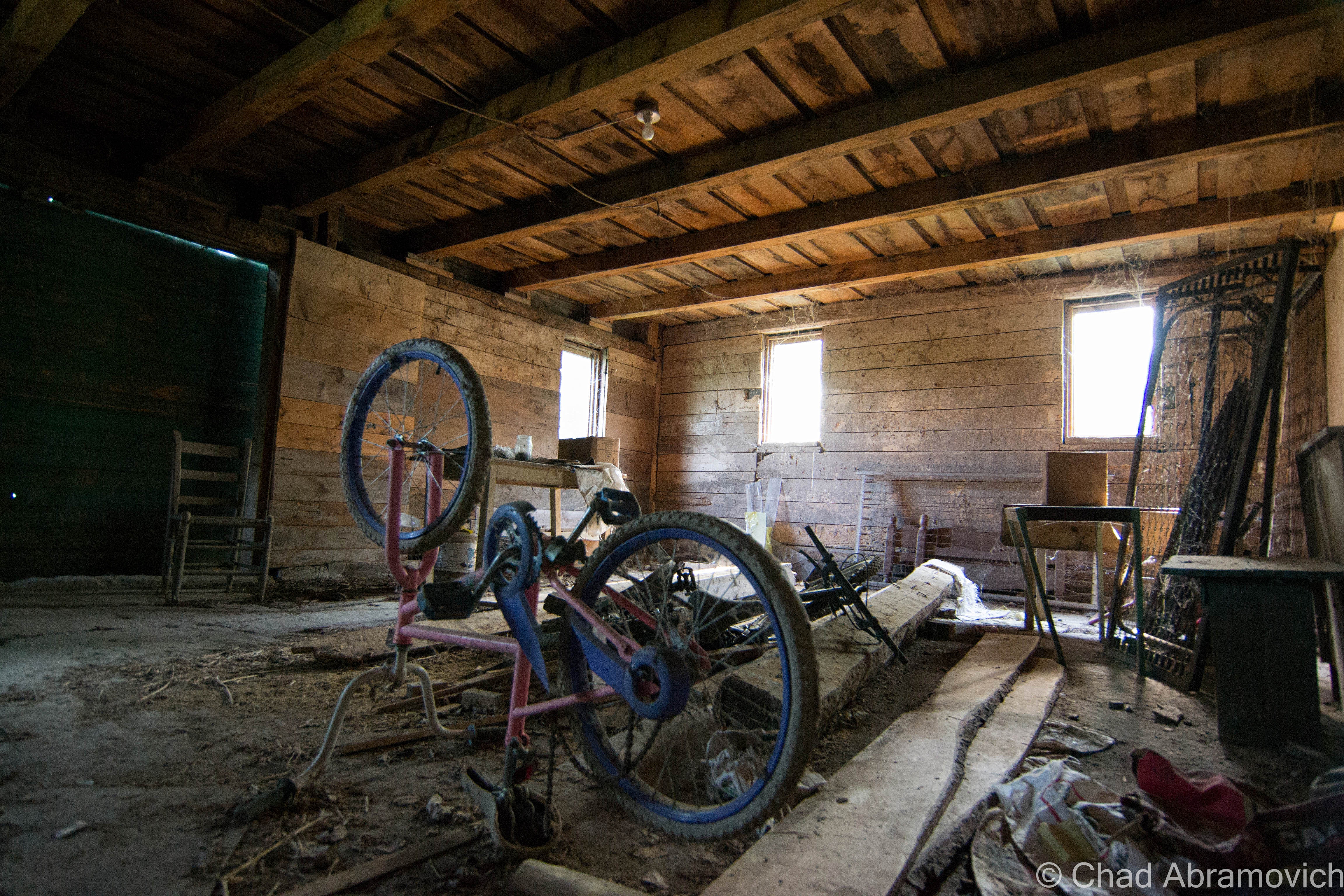
Walking across the road, he brought me over to another abandoned farmhouse. “Back in the 60s – this used to be filled with people from California. Used to come up here by the bus loads – there must have been at least 20 or so people living in this house. They were the ones who were in charge of keeping this farm running ship shape”
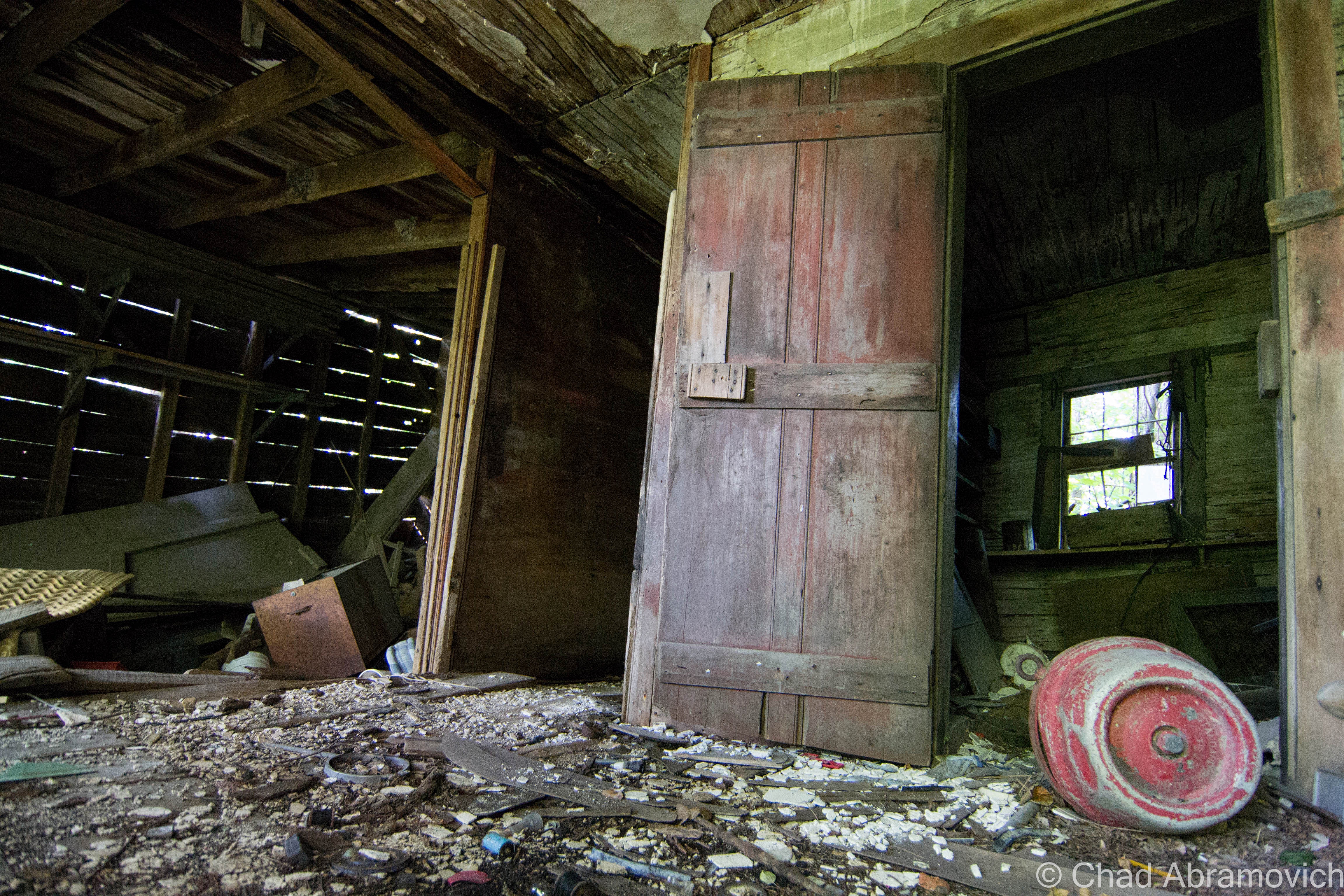
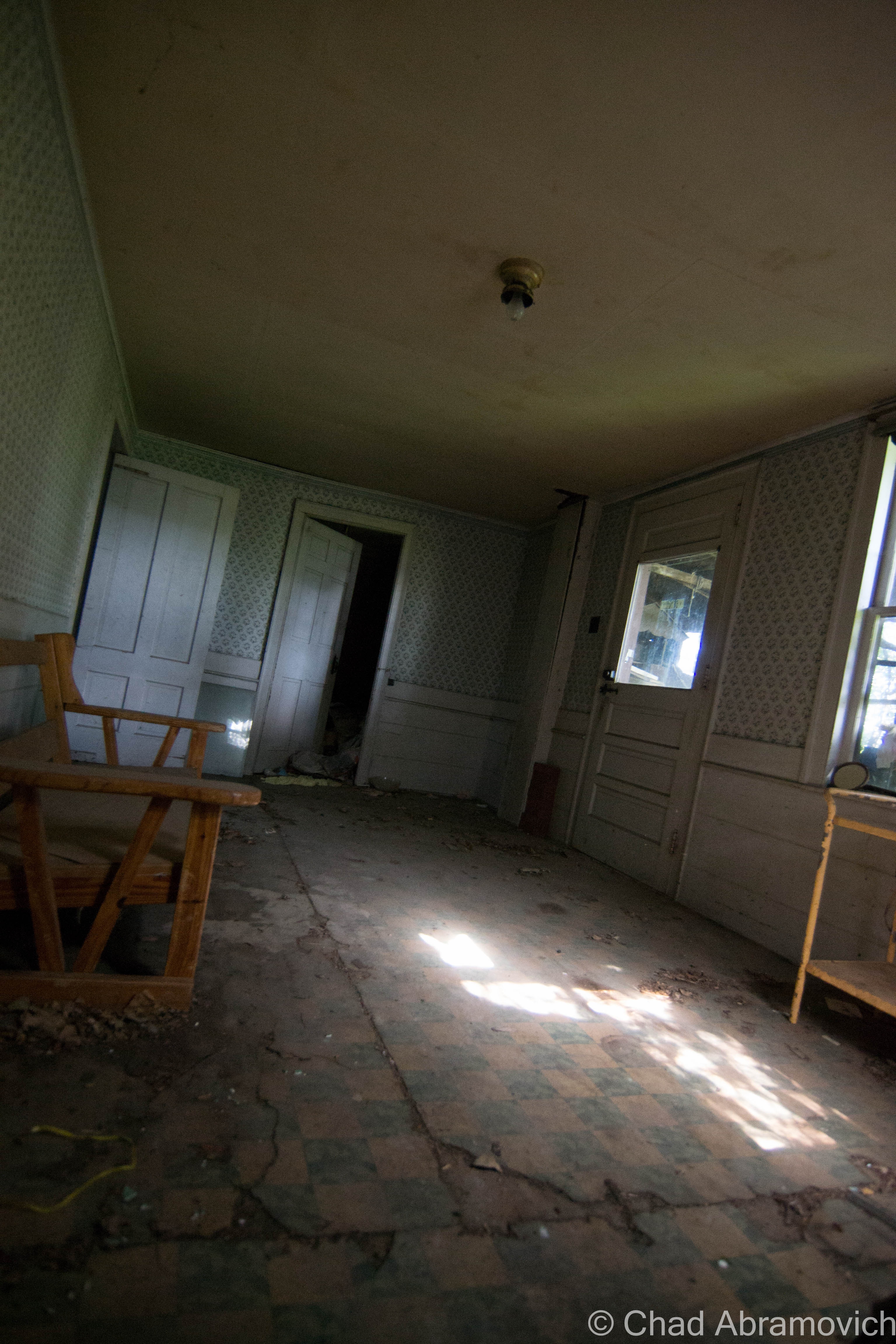
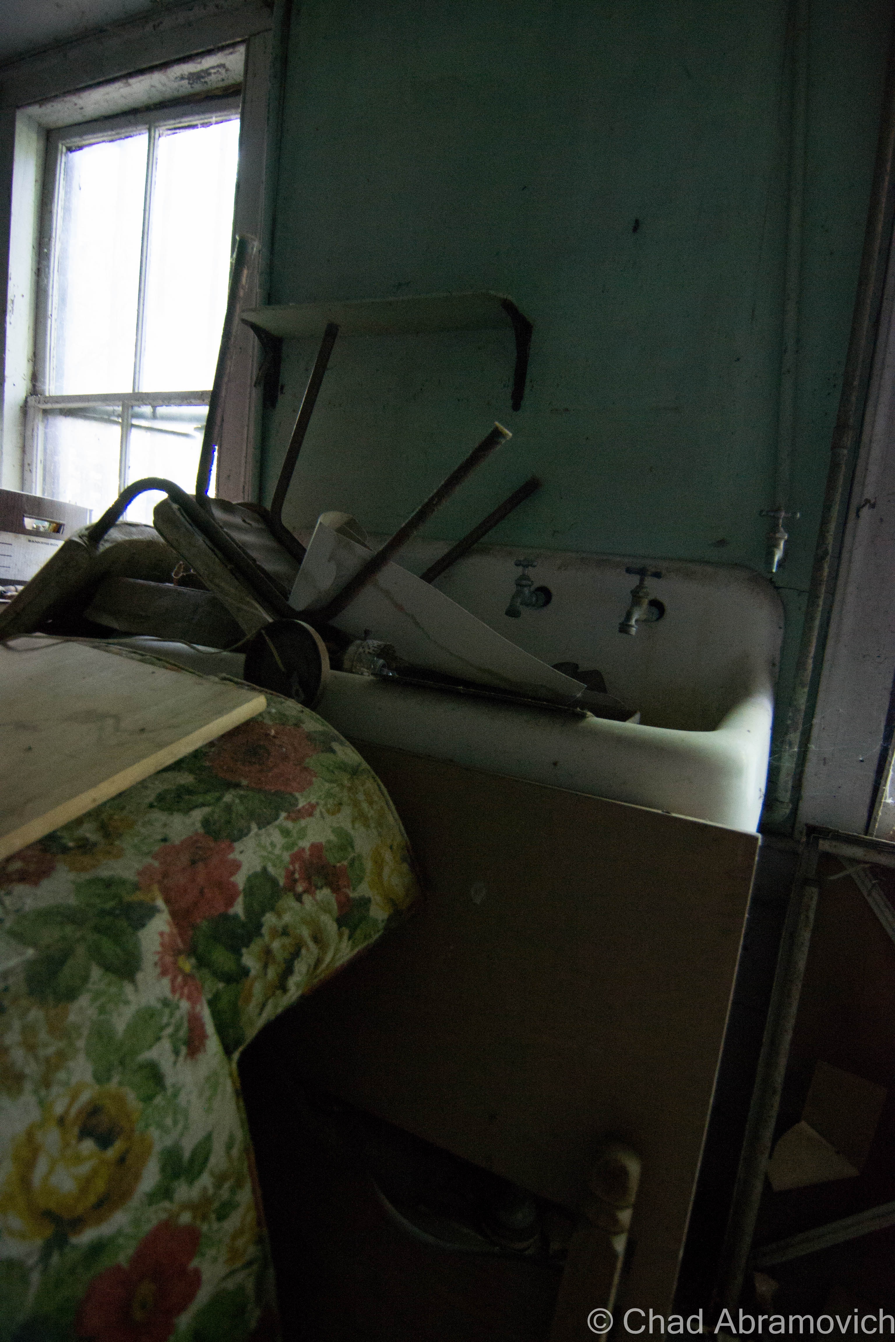
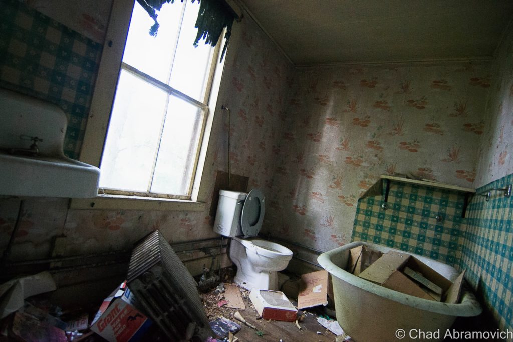
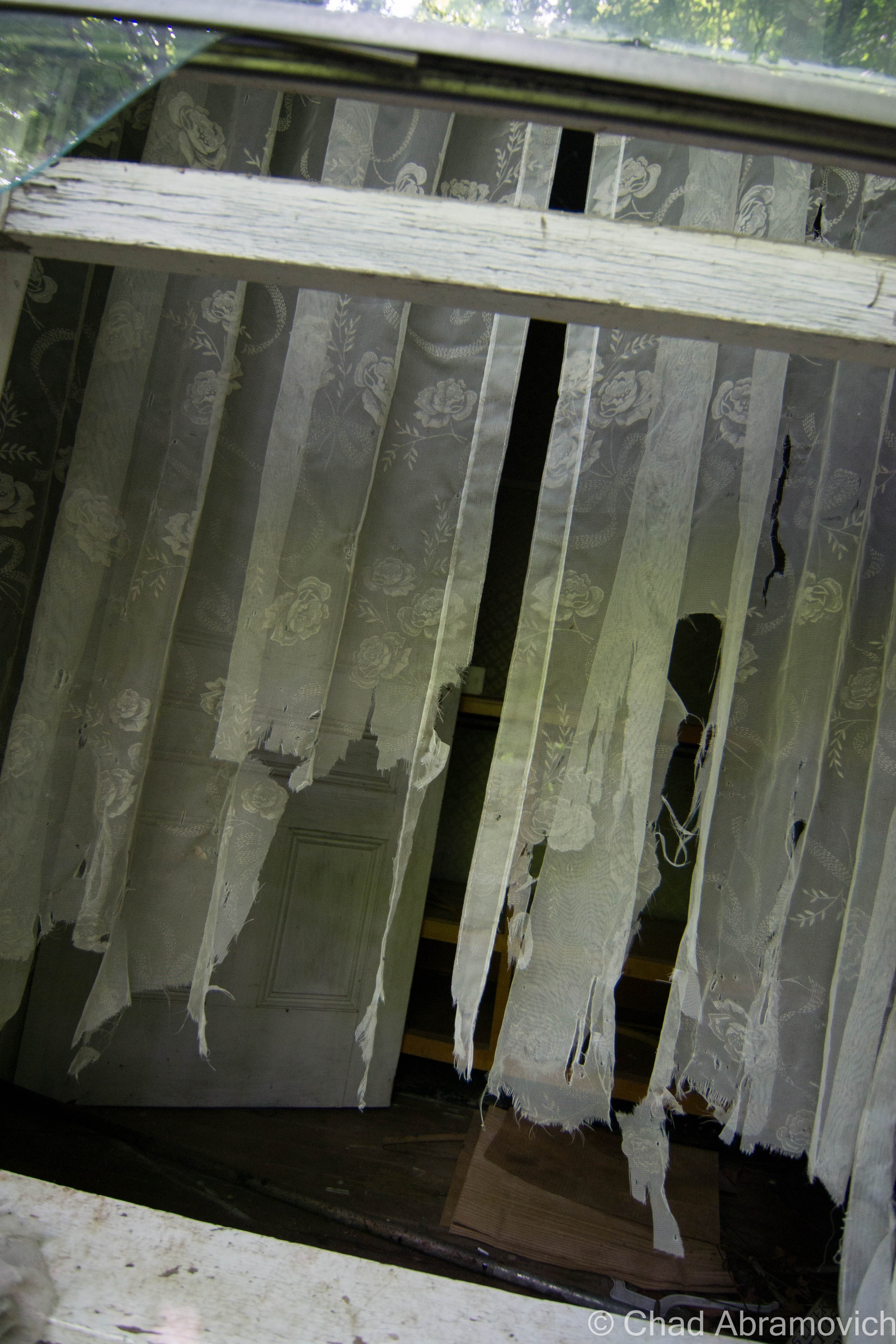
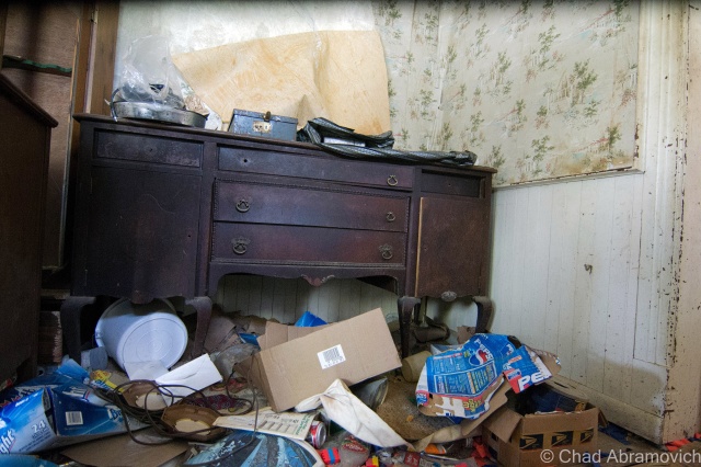
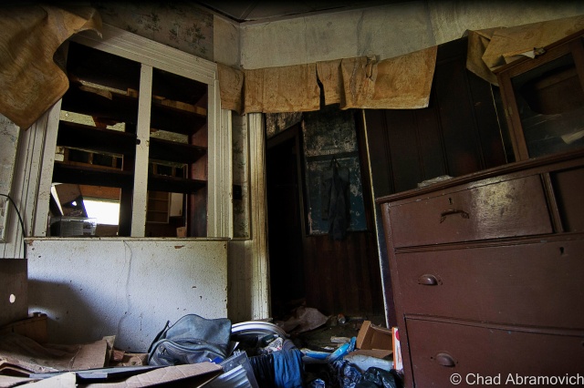
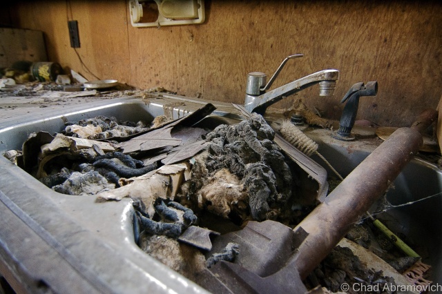
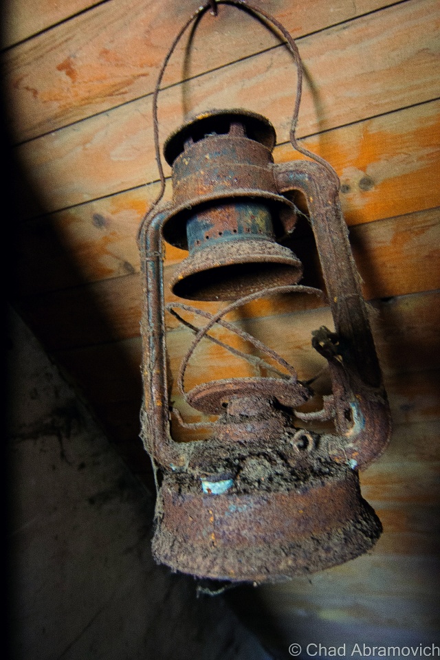
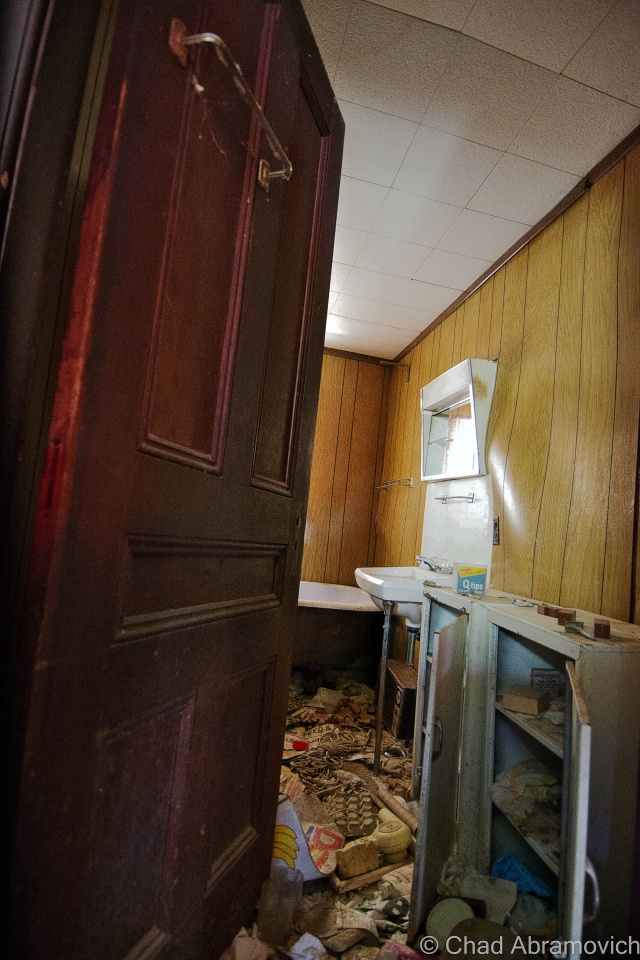
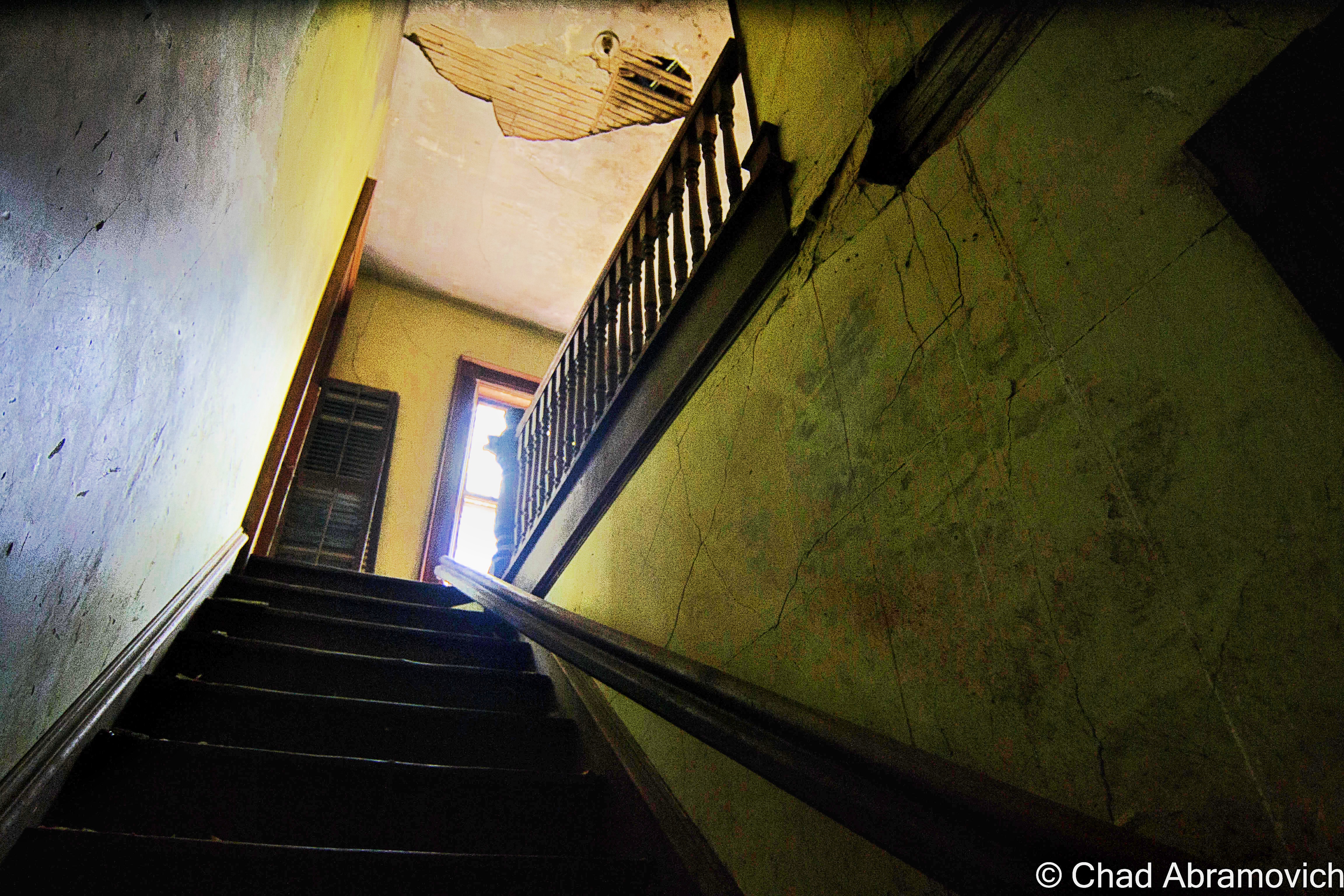
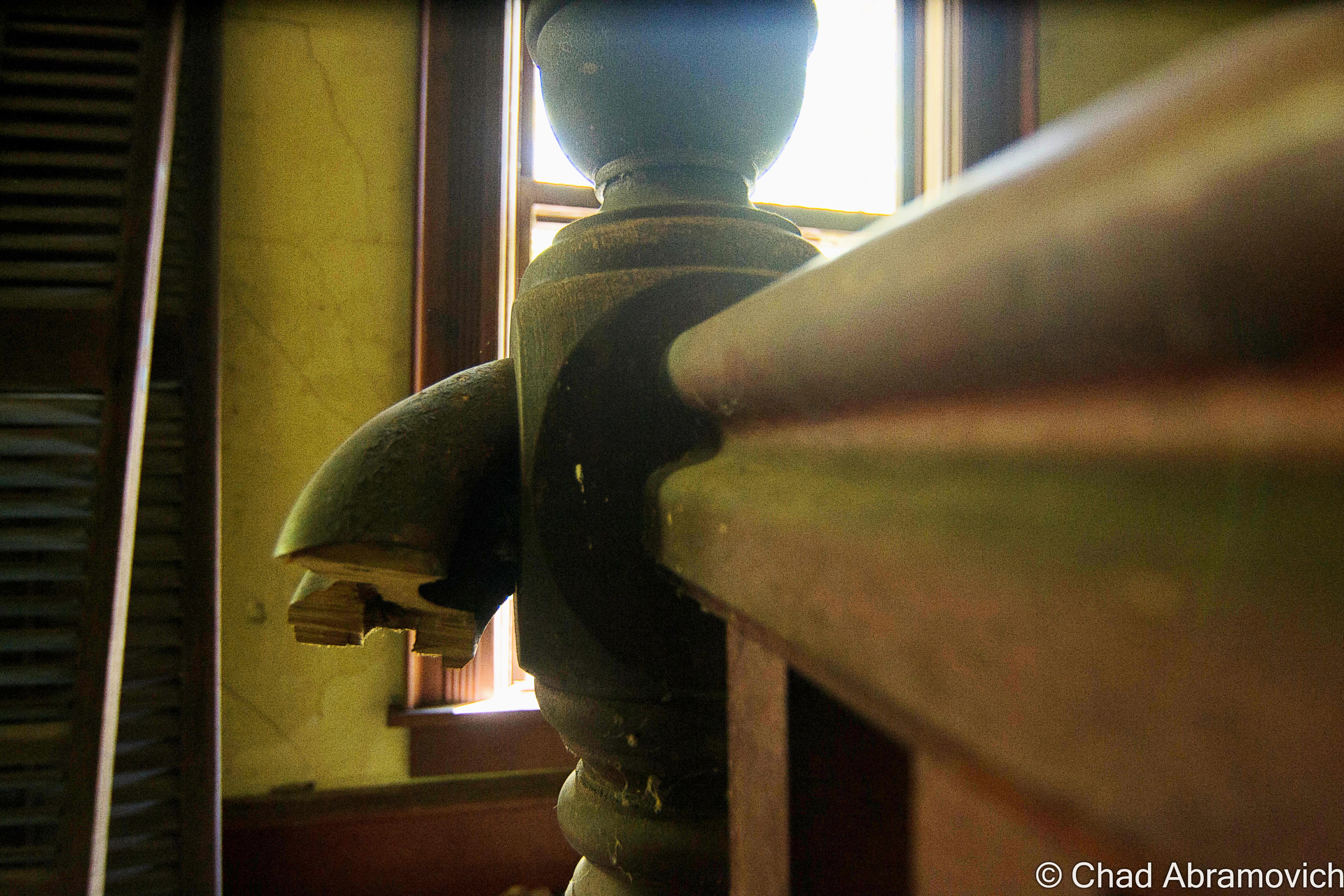
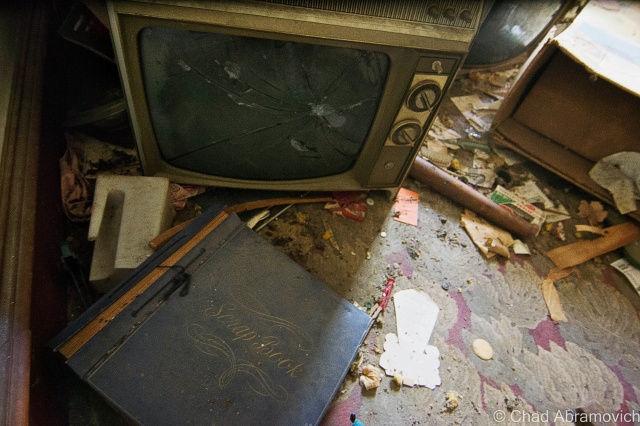
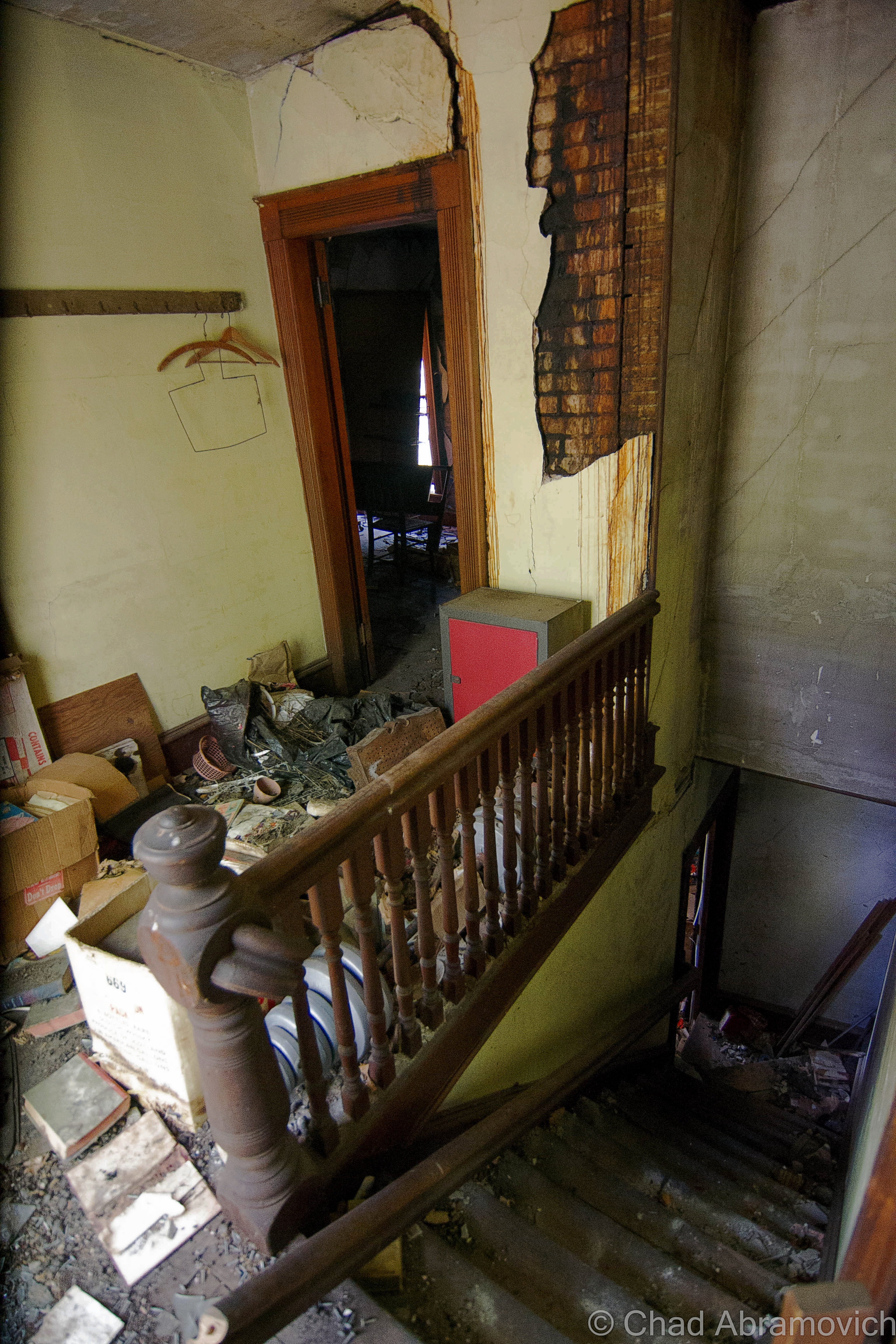
The door to the house opened effortlessly, swung inwards and banged against the neighboring wall – the sound was like a shotgun blast in the somber interior. Inside, the life was gone, but something kept on creeping on, the floors creaked as the past walked by. The interior was what I expected to find in an old Vermont farmhouse. Faded linoleum floors, porcelain sinks, peeling wallpaper and rooms filled with garbage. There were holes where stove pipes used to run and heat the house, and an the exposed skeletons of an electrical system that looked like it was done haphazardly years ago. “There used to be rows of bunk beds in these rooms – they all used to sleep in here” he pointed out as he swung open a door of an upstairs room.
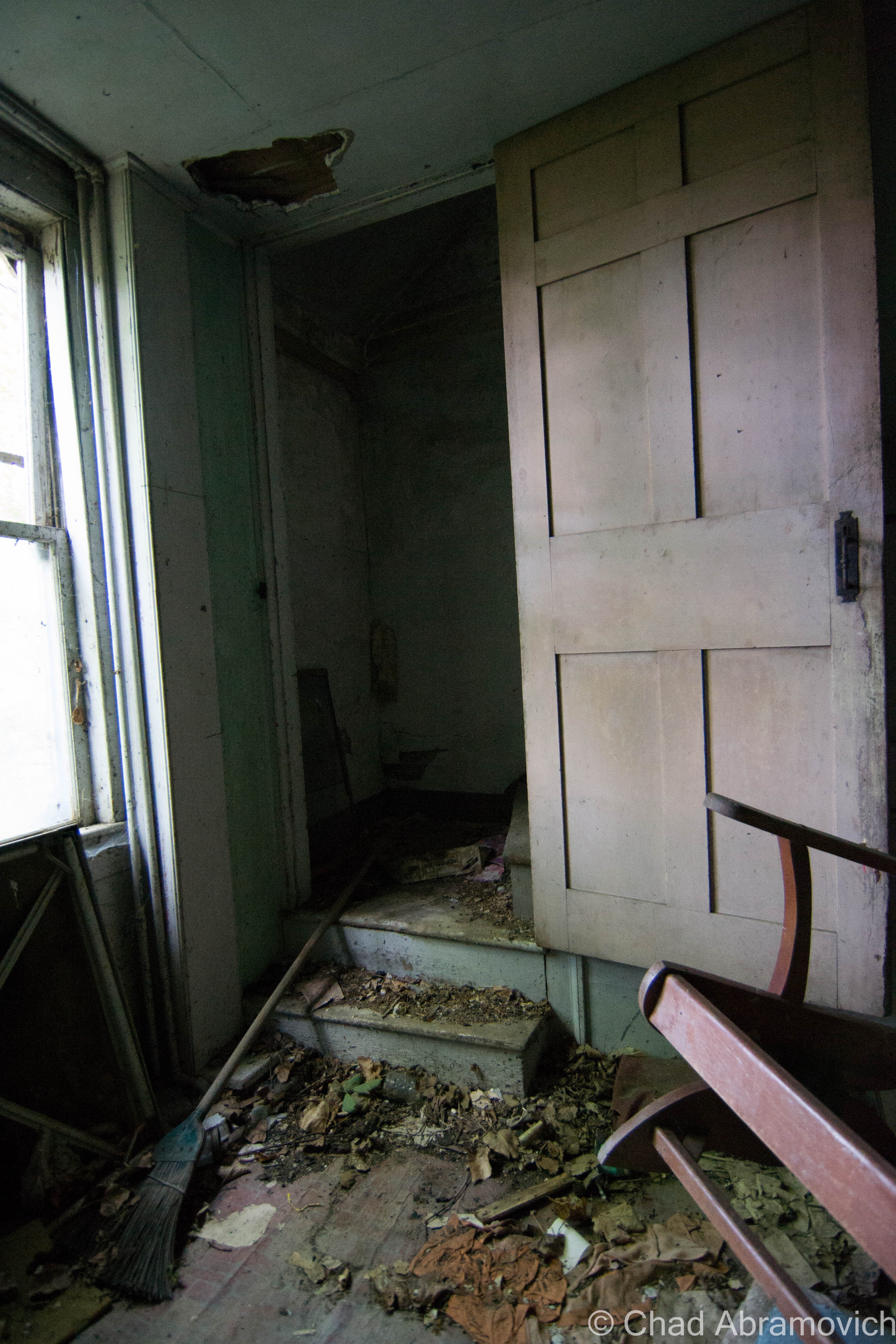
As we walked back down the stairs, he paused at one door we hadn’t opened yet – the basement door. The entire farmhouse had shifted and slumped over the years, almost trapping the door in its frame, but after a few hard tugs, it wrenched free, sending splintered fragments of crown molding in the air. The basement was pitch black, and the old wooden stairs were no longer standing. “You know, I’ve always wondered if there was like a chest full of gold or something down there” Ivan said as he scanned the darkness with his eyes. I was now curious. Was he making a joke? But he was quick to explain. “Back when I was growing up – I heard stories that the older members of the family had hidden gold coins around the farm. There was some sort of currency scare in the 1800s where people assumed paper money was going to loose its value, so they all started to switch to gold coins. I guess I heard they had a few stashes hid around the houses” Hidden treasure was certainly intriguing to me, so I asked him if he had ever found any of these alleged gold coins perhaps hidden under a floorboard or in the pipe of a woodstove. “Nope, never. I think it’s just a story” he said. With a little research later, I discovered that there was in fact a large scale panic in the mid 1800s, The Panic of 1837, where wages, prices and profits went down, and unemployment and a general distrust of banks went up. As a result, I’ve heard other stories of old Vermonters investing in gold currency, something they were confident was dependable and safe, and kept it around the house as opposed to opening an account at a bank. Even if his intriguing story was a rumor, or if he was simply trying to spin a yarn, it did have its roots in historical accuracy.
Now outside the house, he brought me over to another barn and stared up at a rusted basketball hoop rim that was hung above one of the entrances. “Used to play here a lot as a kid to pass the time” he recalled nostalgically. “We used to have games, me and the Californians. Was thinking about going out for the basketball team in high school, but I never did”
“How often do you come by?” I asked Ivan, now curious by our chance meeting. “About every week” he replied. “I like to check up on the place, to make sure things are alright, to make sure it’s all as it should be”. It seemed Ivan was waiting in vain for something to happen – throbbing, and wincing, not knowing who to love or who to blame.
Getting ready to leave, I reached out to shake his hand, and sincerely thank him for his grand tour. It always means a lot when people open up to me – those experiences suddenly become shared experiences, and effect both parties involved. “It’ll sure be sad when this place goes, that’s for sure. Just down the road, the neighboring farm already sold parts of their land to other people, and they built houses on them” I knew too well what he was talking about. “Yeah, that’s pretty common. A lot of the farms I remember growing up around have succumbed to development now” My comment seemed to strike him off his feet. “What? Oh no…I’ve never really left town, haven’t really been anywhere I guess. So I wouldn’t really know” he said wistfully, he almost seemed to grieve from the disease of change and urbanism. I felt badly for him, it seemed all he wanted was a sense of place, but there was only silence and heavy humidity.
It’s always interesting to think about how many great stories are still existing in Vermont that have gone untold, and are in danger of completely disappearing. Images of proud men slick with sweat sticking to tractor seats and labor that would break the summer’s back. Farm life isn’t a romanticized escape from the bustle of modern life, it’s sadly an often thankless, lynchian job of back breaking work with little to show for it. But it also is a labor of love and devotion matched by earnest gazes and blue skies that have seen the same troubles as us. Exploring abandoned places like this sometimes compels you to look for answers to your own questions, but all I seemed to find is everything seems to change. As the world progresses into a future that seems like a dream now, countless more farms may find themselves like this one. It’s an experience like this in a haze of turbulent innocence, where you get a hard reminder that nothing stays the same.
Update, August 2015
A month of so after I had posted this blog post, I received a Facebook inbox message from the owner of this property. I opened it hesitantly, thinking that it’s contents would be angry and accusative, but to my very pleasant surprise, he was actually telling me he digged my blog, and loved this particular entry. But one thing was bothering him. He asked me about my tour guide, Ivan, and said that the family never employed anyone under that name on the farm before. A bit befuddled, I gave him a detailed profile of the guy. “I knew it!” He started. “His name isn’t Ivan, he lied to you. That was Tom, the town drunk. He’s the guy who set the meetinghouse on fire a few years ago, then tried to come here and light up one of our barns”. I certainly didn’t expect that.
—————————————————————————————————————————————–
To all of my amazing fans and supporters, I am truly grateful and humbled by all of the support and donations through out the years that have kept Obscure Vermont up and running.
As you all know I spend countless hours researching, writing, and traveling to produce and sustain this blog. Obscure Vermont is funded entirely on generous donations that you the wonderful viewers and supporters have made. Expenses range from internet fees to host the blog, to investing in research materials, to traveling expenses. Also, donations help keep me current with my photography gear, computer, and computer software so that I can deliver the best quality possible.
If you value, appreciate, and enjoy reading about my adventures please consider making a donation to my new Gofundme account or Paypal. Any donation would not only be greatly appreciated and help keep this blog going, it would also keep me doing what I love. Thank you!
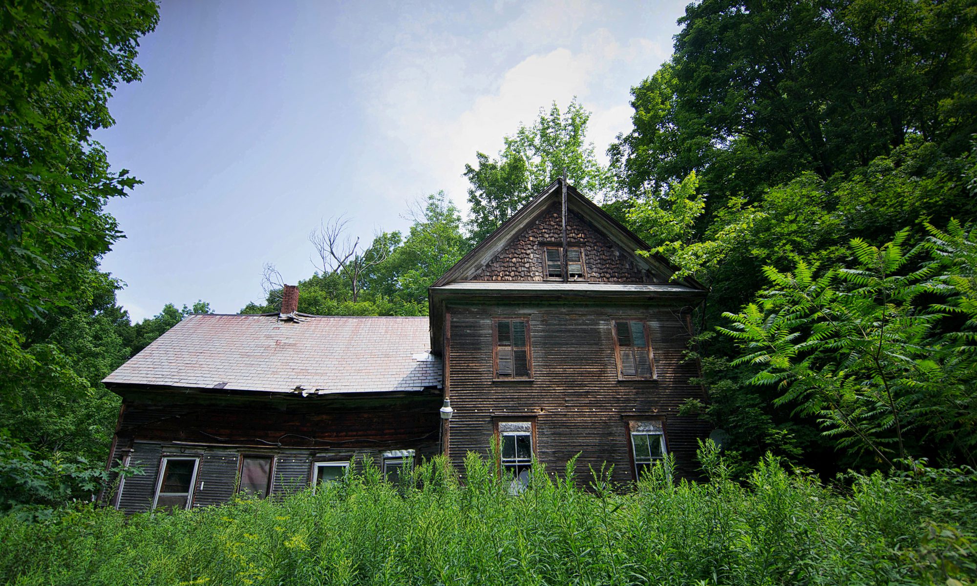
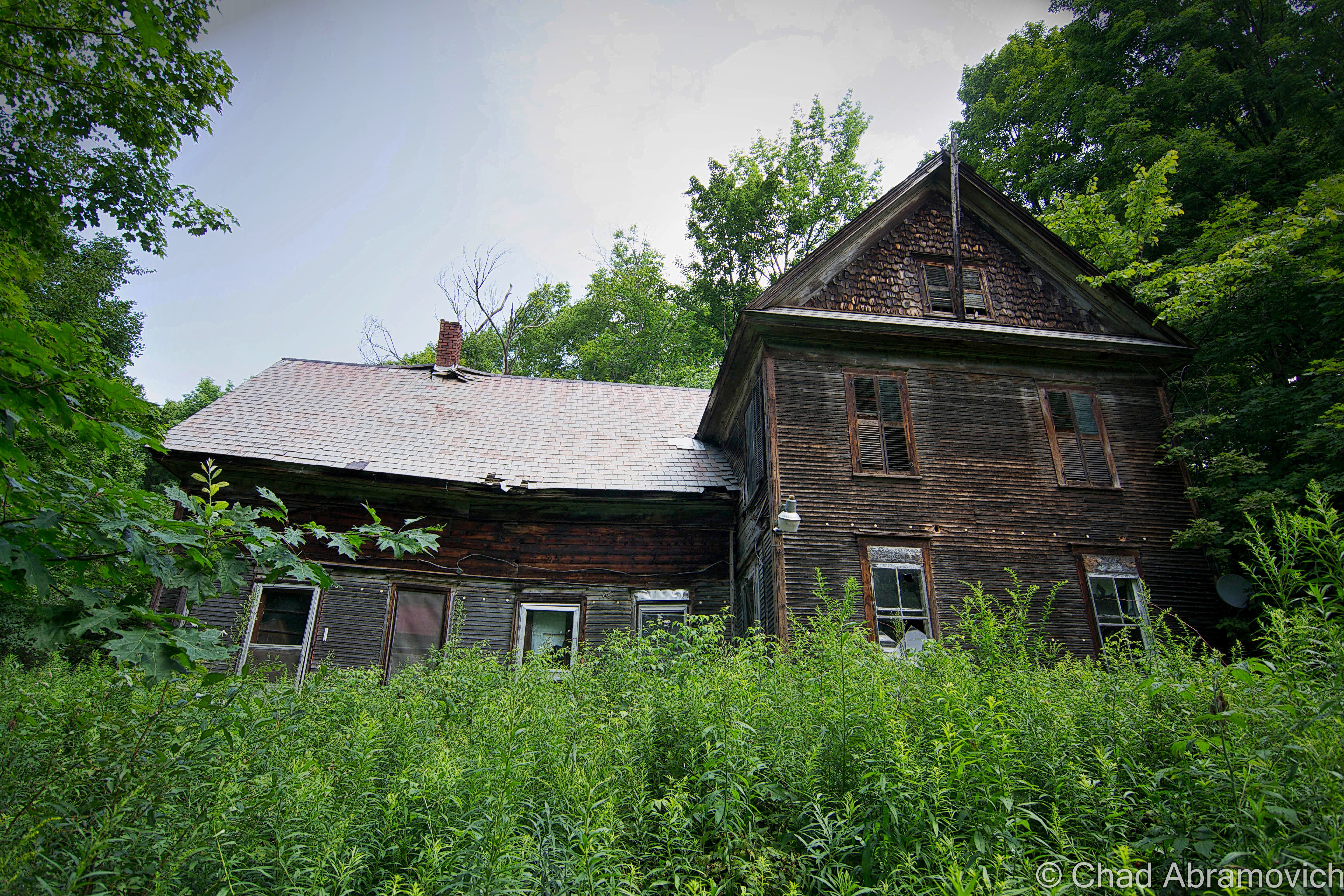
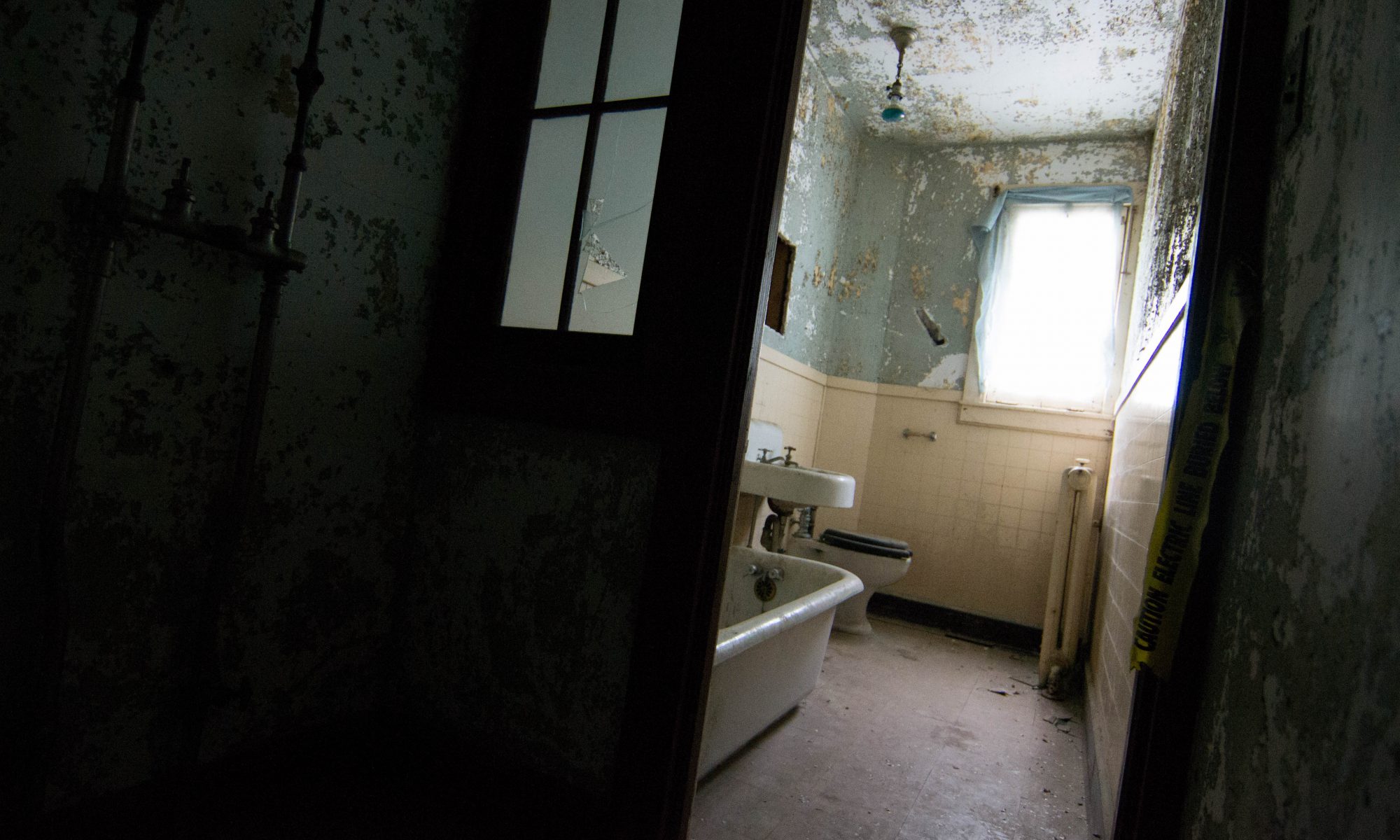
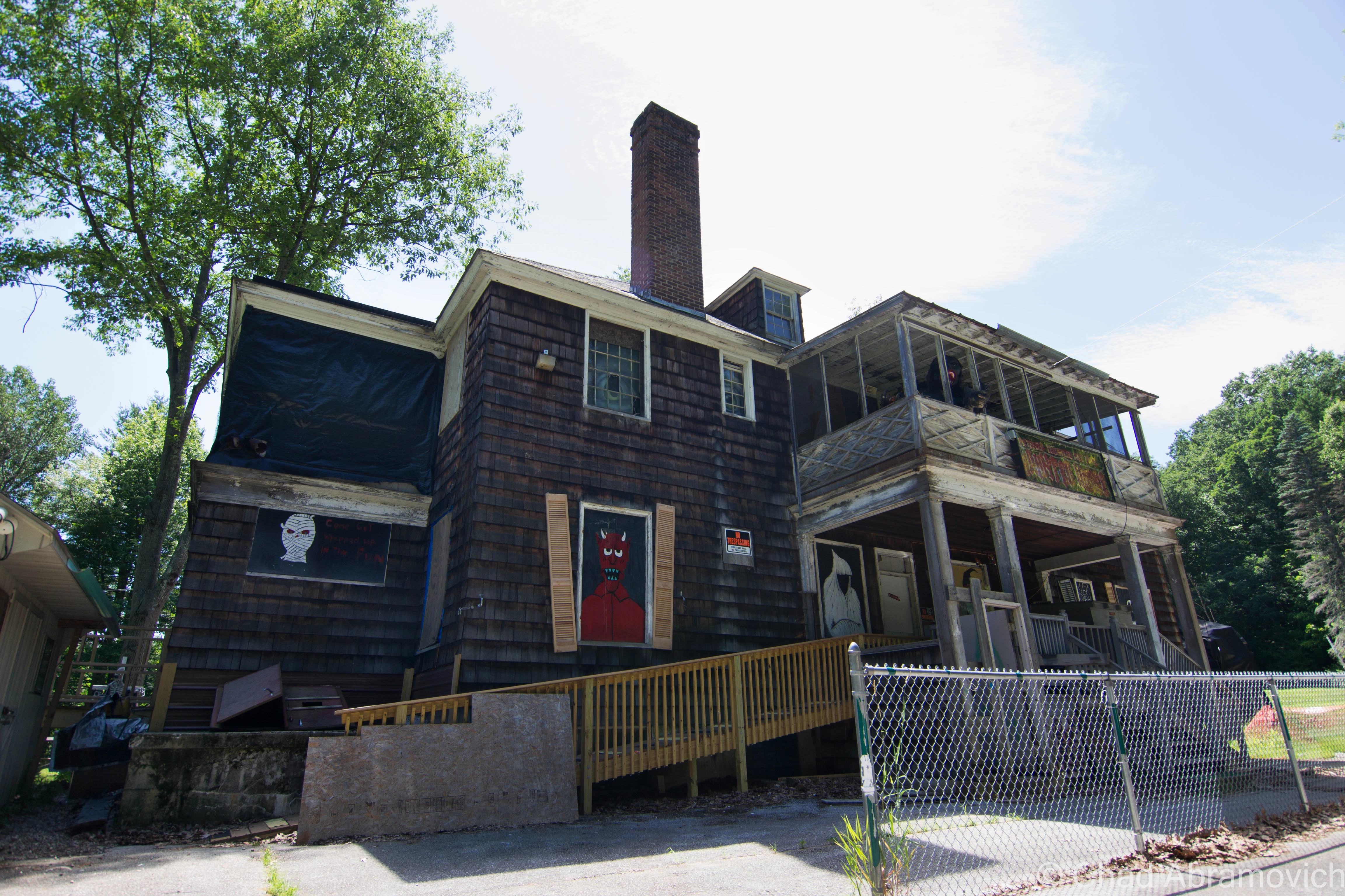
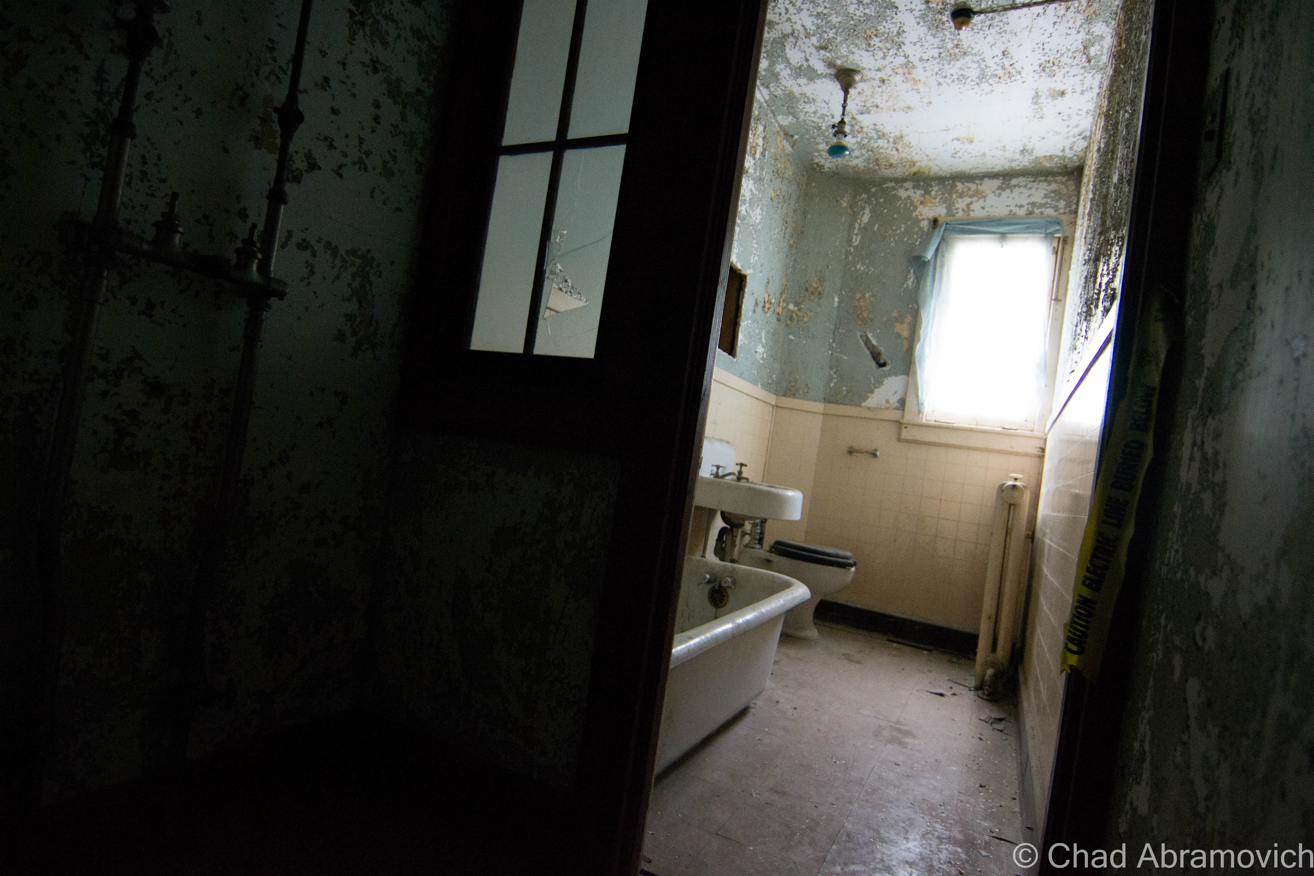
There is always that one place that stands out from the rest – and on a breezy August morning, I stood in front of what has to be the most unnerving house I have ever explored, and it was the question of why that really bothered me the most…
Skulking off a quiet backroad underneath the canopy of dense forests, on a slope with at least a 9 percent grade – this fading weathered house sits in the forest like an infected sore – a strange world where nature slowly undoes the deeds of man, with skin so thick, it’s empty eyes were like knives, not worried about who was receiving them.
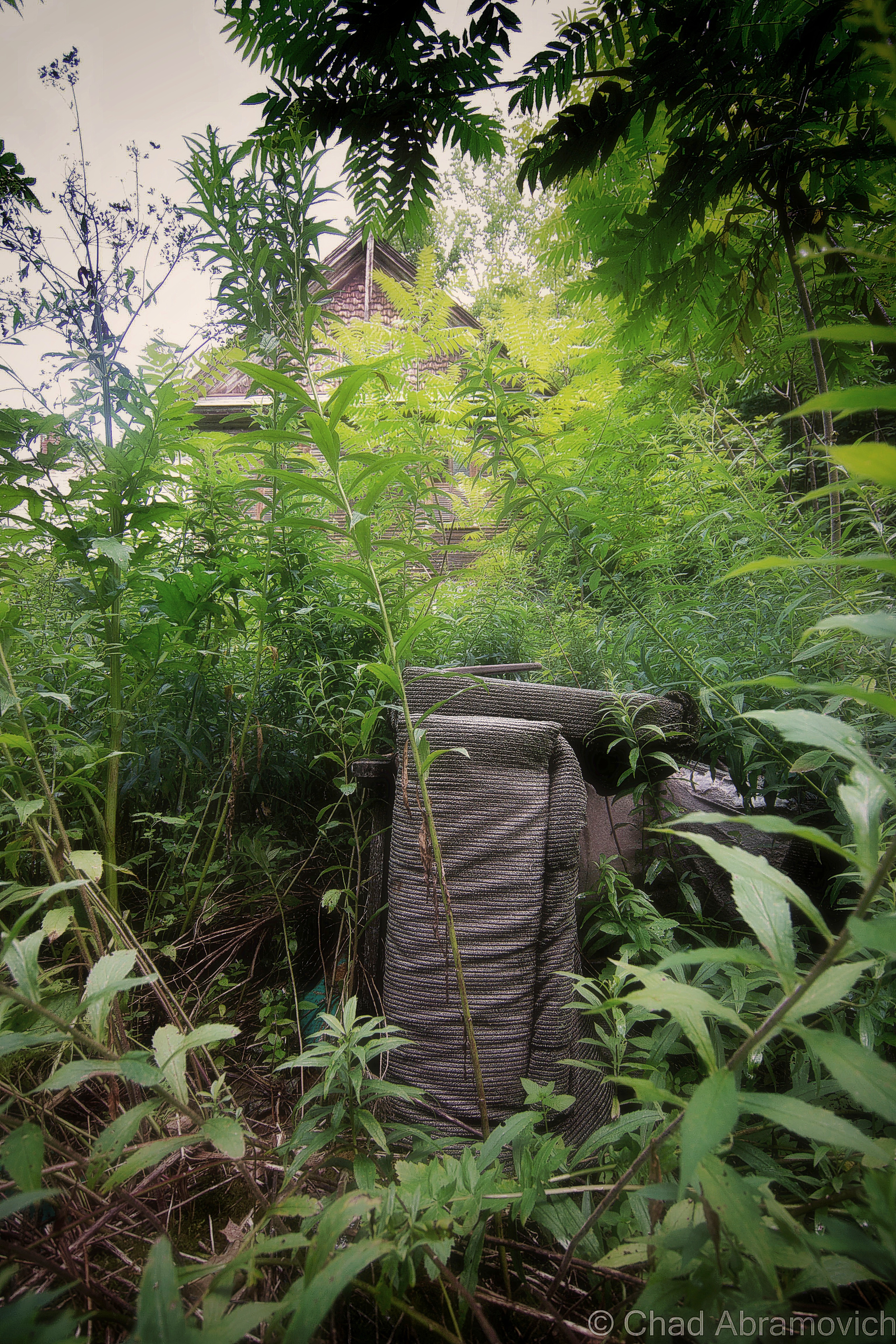
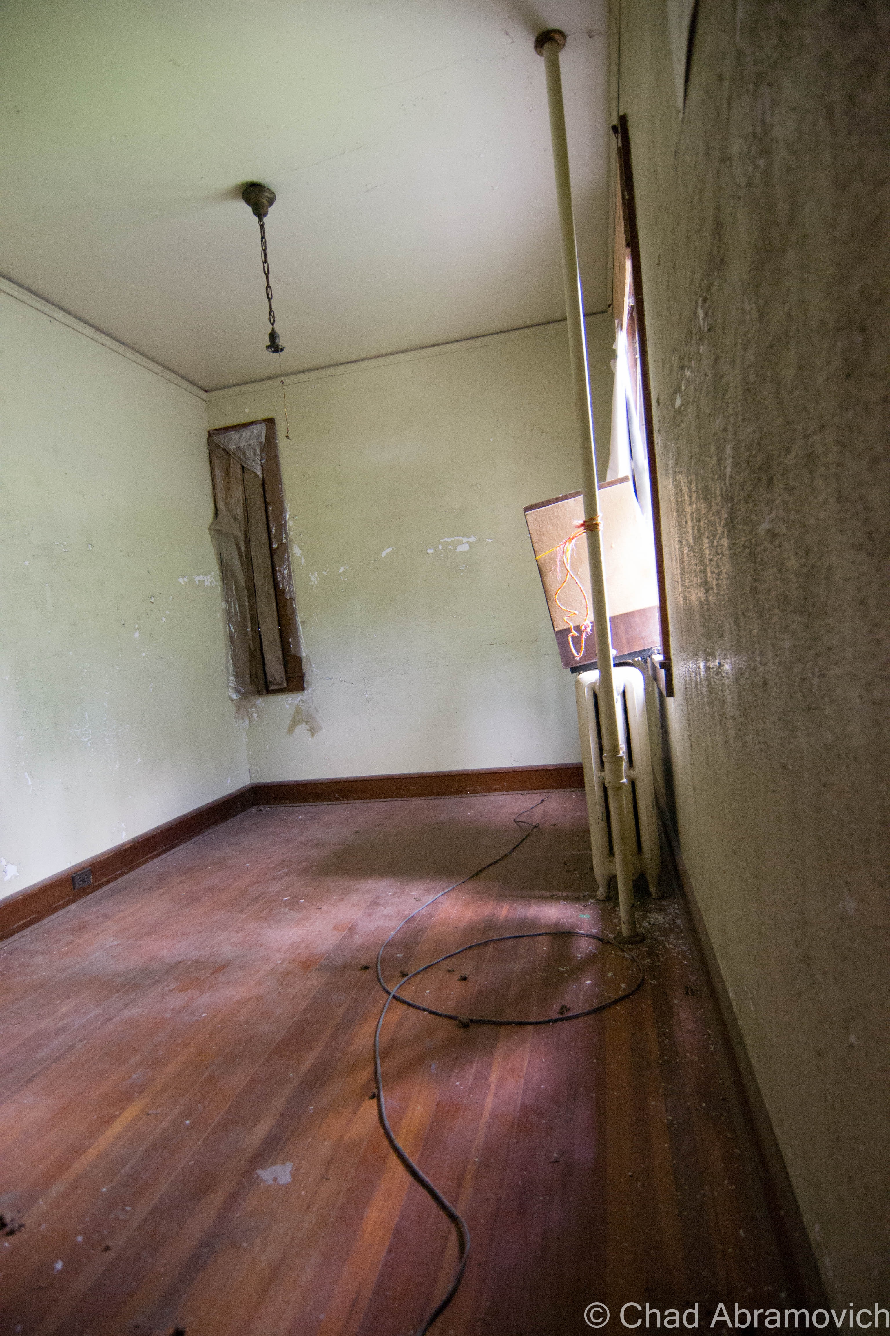
The awkwardness started from the moment I got out of the car, and got a good look at the place over a forest of thorns and vines that had been tangled in the wind – a solitary trail sleuthed its way through the growth towards the house. Something had been through here recently. Staring up at it’s faded and splintery facade that almost matched the wilderness around it, there was something unsettling about the place. You could actually feel it’s age, and you could smell the smells – that typical old house perfume and rot that hung around the property like musk. Through the broken windows, the interior was pitch black, with secrets smothered in dirt. Though my fears weren’t routed in anything empirical, my skin was trembling.
Deciding to get a better look at the place, I proceeded to stumble through the grass. I was already regretting it. The thorns immediately sliced my arms and legs to ribbons, and I began to stumble over things that were previously hidden. Rusted trailers, oil barrels, broken glass and a knotted web of disused sap lines lay along the weedy floor, all covered in condensation which coated my boots, and made me slip more than once. Just getting over towards the place was turning into an adventure. Bees swarmed from flower to flower, and unseen creatures slithered in the grass, making the stalks snap and rustle.
Standing at the foot of it’s darkness, I noticed some things that immediately made me stop my pursuit. There was a new looking satellite dish on the side of the building, and an even newer looking utility box. But, there was no electrical hookup to the house. Some of the wires sat exposed, pulled out of the walls, and chewed on. Could someone actually live here? There were giant holes in the wall, and half the windows had long been shattered, but from my experience, that isn’t always evidence…
Upon closer investigation, I noticed an odd sight. Someone had actually taken the time to pick up the large fragments of broken window glass, and set them back into the wooden window frames. Other windows were barricaded from the inside, with chairs pushed up against them holding curtains in place. Someone made vague attempts to keep people out it seemed, but just around the corner, there was a door that was wide open, and a broken window would easily allow access. What was going on here? Peering inside a window, the interior of the house was cast in shadow, further and further, until there was nothing but strange land. A cold dampness settled on my face, and I could taste the musk as it settled in the air on my tongue.
I couldn’t explain it, I was incredibly uncomfortable at this point. I felt like something was watching me, like something was lurking just beyond the lens of my camera, offering no explanation. Though the inside of the house was smoldering in an entombed silence, there were strange noises coming from the places out of reach, like something was moving, something unknown saying, if I stay here, trouble will find me. To add to my unnerved state, tree branches around the house started to snap, but no one was around.
Eventually, I trekked back towards the road and rejoined my friend, who had opted not to go any closer to the place. I guess I couldn’t really blame him at this point. “I heard weird noises coming inside – I decided to leave” I said when I saw his questionable face. “Oh, I thought I heard something as well” he said. “I thought it was the syrup folk or something coming by” I stopped. “syrup folk?” He then pointed to the labyrinth of active sky blue sap lines that criss-crossed around the property. Though I now understood what he meant, there was something cryptic, almost ominous (and probably uniquely Vermont) about the term “syrup folk” that really stuck with me, hence the name for this blog post.
Though my trip here was discomforting, it’s these sort of experiences that often can be regarded as some of our finest ones – allowing you to discover what’s deep between your own skin and bones. And at the very least, they make for the best stories.
As we were about to leave, just to confirm my suspicions that something was inside, a raccoon popped it’s head out of the third story window, through a broken section of shutter, stared at us for a few seconds, than dipped back in to the deep cold darkness inside.
This conjured up a few “Breaking Bad” jokes.
—————————————————————————————————————————————–
To all of my amazing fans and supporters, I am truly grateful and humbled by all of the support and donations through out the years that have kept Obscure Vermont up and running.
As you all know I spend countless hours researching, writing, and traveling to produce and sustain this blog. Obscure Vermont is funded entirely on generous donations that you the wonderful viewers and supporters have made. Expenses range from internet fees to host the blog, to investing in research materials, to traveling expenses. Also, donations help keep me current with my photography gear, computer, and computer software so that I can deliver the best quality possible.
If you value, appreciate, and enjoy reading about my adventures please consider making a donation to my new Gofundme account or Paypal. Any donation would not only be greatly appreciated and help keep this blog going, it would also keep me doing what I love. Thank you!
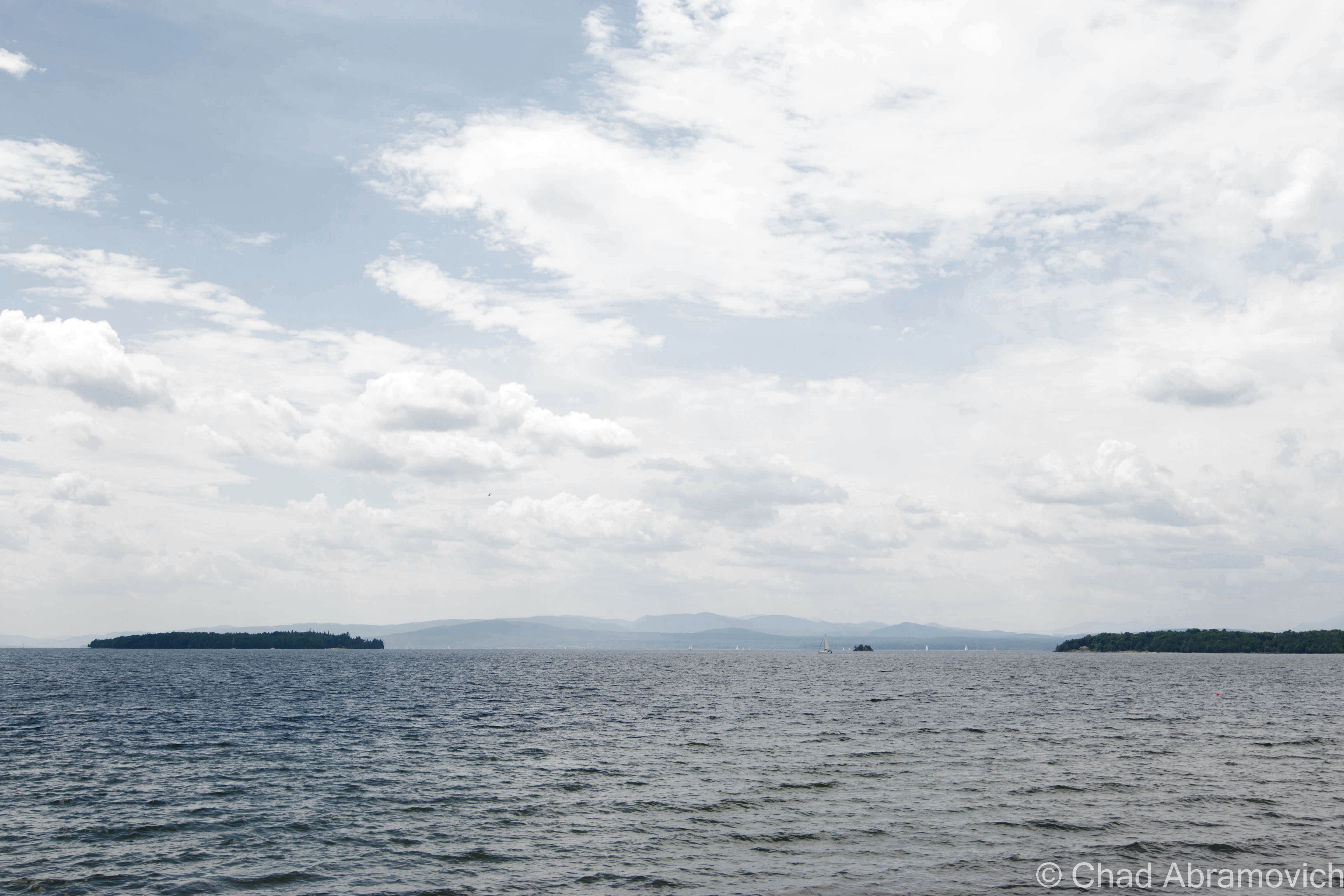
Though Vermont is the only New England state without a seacoast, we have our fair share of vast waters and attractive islands here. The Champlain Islands – an archipelago stretching from the Canadian Border, encompassing roughly 200 miles of shoreline around a trio of islands and a peninsula, is practically a different world. Accessible only by 3 bridges or a ferry from Cumberland Head, New York, the islands are isolated from the rest of the state, and as a result, are relaxed (though, 21st century stress doesn’t entirely escape) and carry a different attitude.
With the Adirondacks rising dramatically to the west across the lake, and the Green Mountains to the east and the south, the islands are a beautiful place. There’s not much to do, and that’s exactly what I love about this region. Route 2, the main artery, passes through 4 out of 5 towns that make up Grand Isle County, with the only stoplight being on the drawbridge that separates North Hero from Grand Isle. The economy is largely dependent on agriculture and tourism, most often combining the two in agritourism pursuits of farm stands, restaurants, and a few vineyards now days.
Things can coexist up here in the world around it peacefully, and sometimes, even manage to go largely undetected. And those sort of conditions are just ripe for mysteries. The numerous smaller and inaccessible islands that dot the lake are mysteries unto themselves – which are also most commonly private property. It’s easy and fun to speculate what sort of things happen on those remote chunks of rock, and what can be found there.
Carleton’s Prize
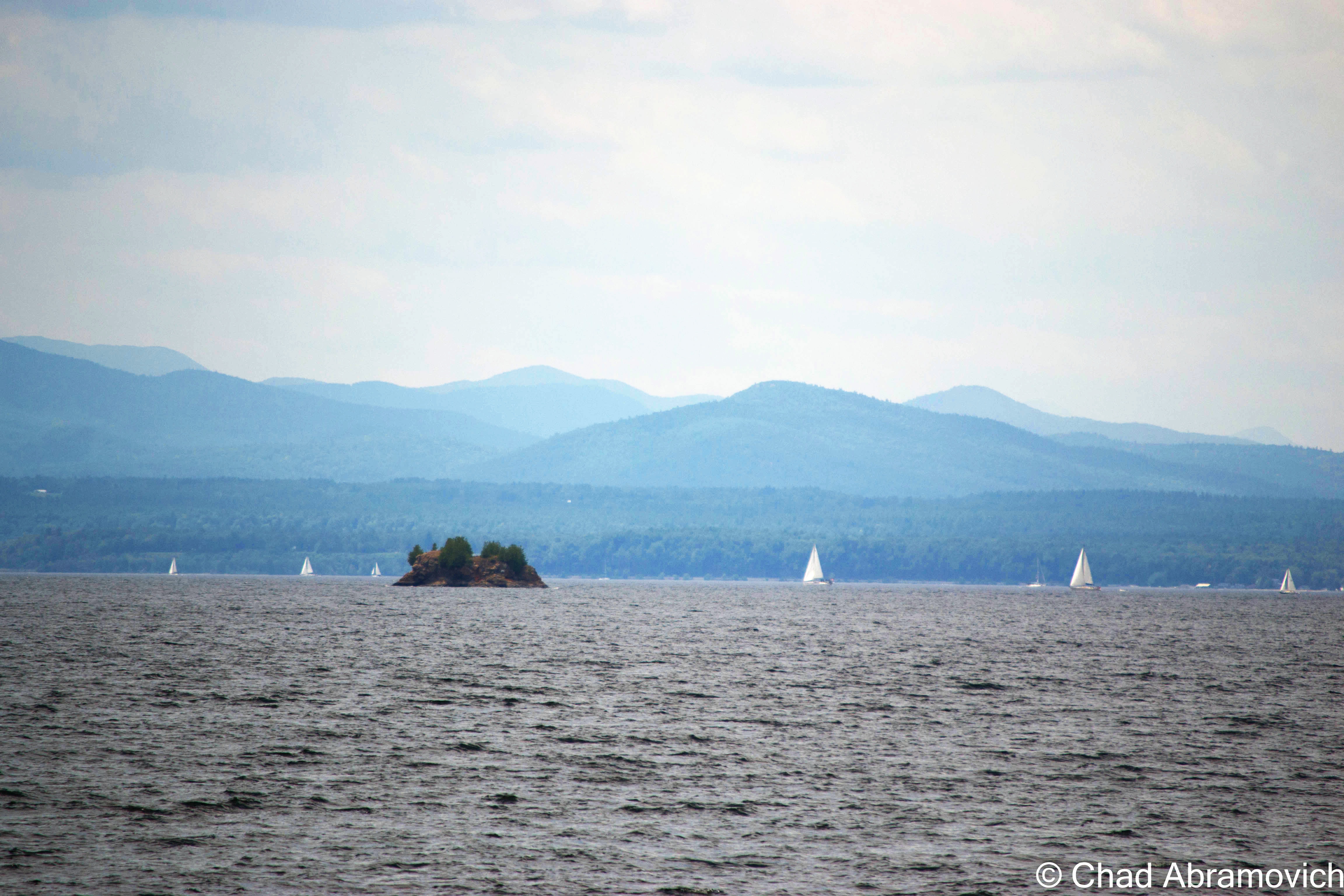
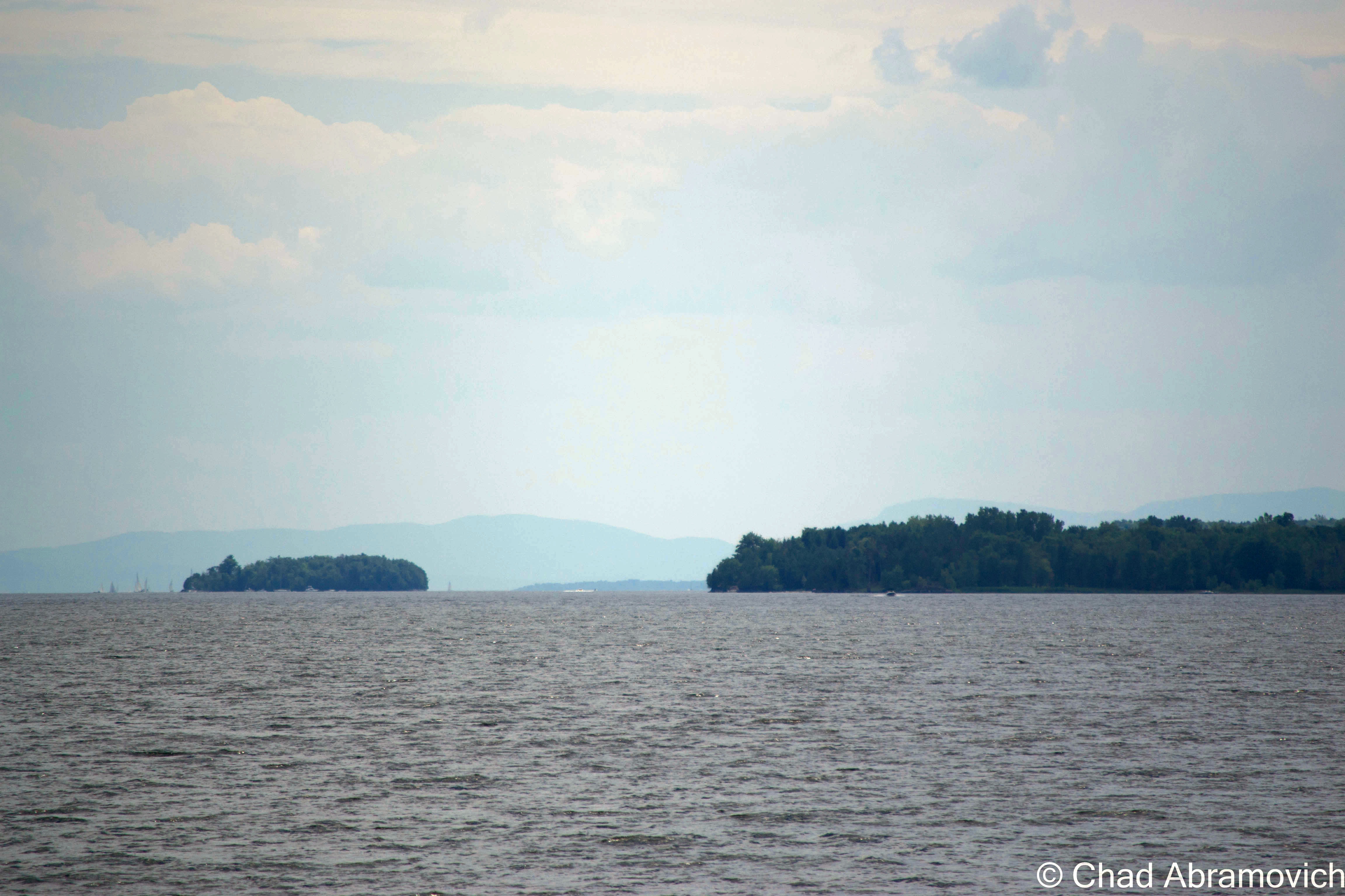
One of the most interesting stories I heard comes from off the south west coast of South Hero – a small chunk of rock rising 30 feet from the choppy waters of Lake Champlain, in a large passage between Providence and Stave Islands. One day, I was searching on Google maps, and noticed that this almost insignificantly tiny scrap of land had a rather peculiar name; Carleton’s Prize. Why would a small rock have such a strange name? What exactly is the prize here?
As it turns out, the name can be dated back to the Revolutionary War. Local lore has it that Benedict Arnold escaped around Valcour Island with what remained of his fleet during the battle of Valcour Island– and a dense fog had draped over the lake. The trailing British fleet, lead by Sir Guy Carleton, were searching for escaping American fleets, but unknown to them, the Americans had slipped by them in the cover of night.
But up ahead, through the fog, they spotted something. A silhouette of what appeared to be a ship. This was their chance. The British bombarded it with cannon fire. However, the smoke from all the black powder obscured their vision even more, and eventually, they couldn’t see a thing. But determined to take down those no good Americans, they kept on firing. An hour later, the cannon fire finally stopped, and they realized that they had wasted several rounds of ammunition on a small rocky outcropping in the lake they had mistaken as a ship.
Since then, somehow and somewhere down the line, the small landmass has been referred to as Carleton’s Prize. Some say that you can still see the scars from cannon fire, and maybe even a cannonball or two on the island’s rocky shore to this day.
This is where the story gets a bit hard to trace. This story apparently isn’t well documented, and not much information exists to actually back this up – apart from a Wikipedia article and a blog entry – but even the blogger was questioning the truth of this interesting legend. So, did this blunder actually happen? I suppose we can only speculate. As far as I know, no one has came back with a cannonball yet.
Though the story of Carleton’s Prize is intriguing, the island’s original name is far more mystical. In the book, In Search of New England’s Native Past, author Gordon Day tells us the Abenaki knew this small rock as odzihózoiskwá, or “Odzihozo’s wife”. But who or what is Odzihozo?
Odzihozo, “the transformer”, was the supernatural being who created Lake Champlain, the mountains and all the lands that made up their homeland.
According to the legend, Odzihozo was an impatient deity, and before he was even completely formed with a head, legs and arms, he set out to change the earth. His last creation was Lake Champlain, which he considered his masterpiece – and he was incredibly happy with it. So happy in fact, that he climbed onto a rock in Burlington Bay and turned himself to stone so he could watch and be near the lake for the rest of eternity. The rock still resides in Burlington Bay, and is known to boaters as Rock Dunder – several miles away from his wife. It was said that the local Abenaki would bring offerings of tobacco to the rock as late as the 1940s.
travel tip: near White’s Beach, make sure to check out the alluring bird house forest and keep an eye out for the miniature Barber castles scattered around the island.
Carleton’s Prize – the small bump in between Stave Island (home to one of the few fire towers on Lake Champlain) and larger Providence Island (where one of Vermont’s only malevolent ghosts is said to haunt the bedroom of a lake house – the very room he strangled his wife to death in decades ago…)Carleton’s Prize from White’s Beach in South Hero
Isle La Motte’s Prehistoric Treasure
Isle La Motte has such a different vibe from its other island neighbors, or from the rest of Vermont for that matter. It’s the smallest, most rural, and the most mysterious (in my humble opinion) of Vermont’s Champlain Islands.
It’s the first spot in Vermont that Europeans set actual foot on, when French explorer Samuel De Champlain docked and camped here in 1609. The island is also home to Saint Anne’s Shrine, built atop the original and short lived French settlement. A friend of mine said that a relative of his was allegedly a renown miracle worker at the shrine back in the early 1900s, but to my disappointment, the miracles he might have performed were never penned down in the family history.
Isle La Motte is also the only Grand Isle County town to not be accessible via Route 2, which imparts the island a noticeably quieter, downlevel atmosphere that makes this remarkable oddity find pretty compatible.
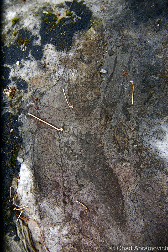
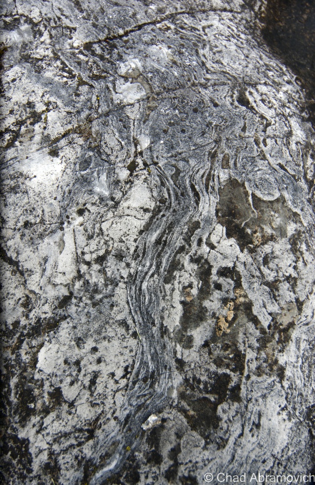
The entire southern third of the tiny island is made up of what experts consider the oldest fossilized coral reef in the world – at some 480 million years old!
This spectacular natural resource pokes through cedar woods and fields thick with wildflowers in contoured rocky outcroppings. It’s both baffling and awe-inspiring – you’d never think you’d find something like this up in the far, occasionally frozen northwestern corner of the state.
But why would a fossil reef be up in Isle La Motte?
This is a state mystery that is actually easy to solve. In the farther reaches of Vermont’s past, some 480 million years ago, the land that is now the green mountain state was under the waters of a tropical sea near where Zimbabwe is. Officially dubbed the Chazy Reef, it once stretched from an area covering Quebec to Tennessee.
But over the millennia, volcanoes, earthquakes, the pull of the tides and other natural phenomena did some terraforming and shifted the earth’s crust. Limestone eventually began to form and preserved a petrified snapshot of pre-Paleozoic life.
With this incredible natural wonder being in my home state, I figured I couldn’t say I was a bonafide Vermont enthusiast unless I drove up to see it for myself, and on a soft summer day, I found myself tracking down the Goodsell Ridge Preserve, where the best-preserved chunk of the reef is.
I was immediately taken by the tranquility of the place. It was a timeless vantage point, which can be said about the entire town of Isle La Motte. And yet, if there weren’t signs to hint at what you were looking at – you might not even know you were walking around such a magnificent treasure.
Scientists from all over venture to Vermont to study its coral reef – trying to connect the dots of this primitive instruction manual left by mother nature.
It’s even more intriguing to think about how many sites in the region possibly contain some of these fragile fossils in their stonework. It’s said that their organic shapes can be spotted in the ruins of Fort Blunder, and someone else wrote to me declaring they think they spotted some in a railroad stone block retaining wall on the Burlington waterfront.
Perhaps the real mystery is why the best-preserved piece of the reef is in Isle La Motte. That still remains to be explained.
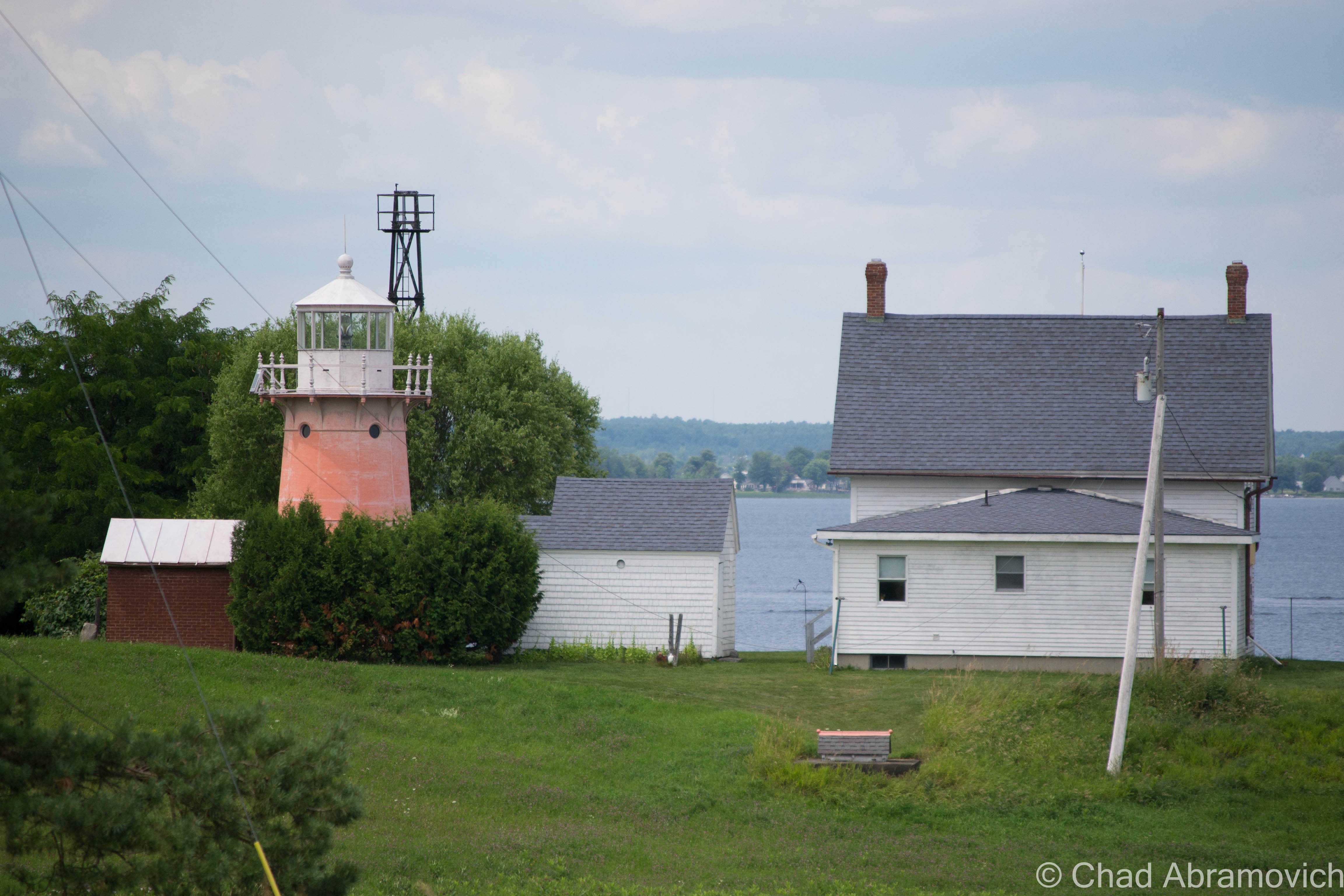
A Pink Lighthouse
To some, the idea of a traditional lighthouse seems out of place in tiny landlocked Vermont. But Lake Champlain’s 587 miles of shoreline is home to 12 lighthouses, 6 of them belonging to The Green Mountain State.
At a total of 120 miles long and 12 miles across at its widest point, Lake Champlain is the 6th largest freshwater lake in the United States – and even had a short distinction as being the 6th great lake, before complaints from the other 5 revoked the title, but we think it’s still pretty great.
Often dubbed as “New England’s West Coast”, the lake was a vital part of the settlement of the region and has been inseparable from local history. In 1819, the Champlain Canal was completed, connecting the lake to the Hudson River and eventually New York City. This would change the culture of the lake as it was propelled into a transportation route for trade and tourism. Burlington became the largest port on Lake Champlain, and the third largest lumber port in North America. With this much travel on the lake, lighthouses were needed to make sure travel could be made safely from one end to the other. And with a series of dangerous reefs and no less than 70 islands scattered throughout the lake, these lighthouses played important parts to keeping the lake running efficiently.
In 1819, the Champlain Canal was completed, connecting the lake to the Hudson River and eventually New York City. This would change the culture of the lake as it was propelled into a transportation route for trade and tourism. Burlington became the largest port on Lake Champlain, and the third largest lumber port in North America. The waterfront was transformed into a bustling and chaotic shoreline of mills, factories and no shortage of cargo ships and passenger steam liners. With this much travel on the lake, lighthouses were needed to make sure travel could be made safely from one end to the other. And with a series of dangerous reefs and no less than 70 islands scattered throughout the lake, these lighthouses played important parts to keeping the lake running efficiently.
Today, the lake is a different place then it was 200 years ago. Heavy ship travel have been replaced by personal recreation boats and a few ferries carrying people across the lake. Interstates 87 and 89 run along both sides of the lake, and have became the main routes of travel between Canada and the United States, leaving the lighthouses unnecessary. Now, these vestiges of the past have slowly been forgotten as the lake tides carry their memories into the mists. However, they are still surviving, finding new lives as private estates or cultural showpieces. Some are landmarks, and others have made large efforts to camouflage them from public knowledge, an irony to their original purpose.
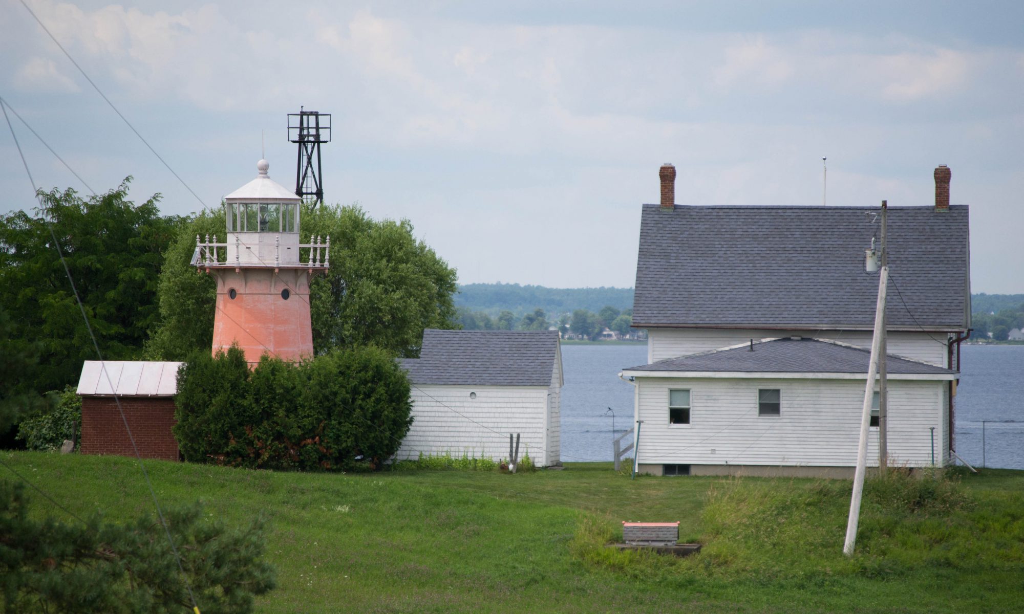
The lighthouses of the lake have always been a curious subject for me. I’ve spent summers traveling around the shorelines and seeing countless summer camps, McMansions and beaches, but a lighthouse is a rare, almost unseemly. But as it just so happens, one of the 6 lights in Vermont rests on Isle La Motte, and unlike most, you can sort of catch a glimpse of it.
The realization of the need for a light on Isle La Motte started humbly in 1829 with some good old-fashioned Yankee ingenuity; by hanging a lantern light on a tree branch on the Northwestern tip of the island, to help mariners navigate their way around the island and through the channel.
In 1856, the U.S. government purchased the land around the point for $50. The first attempt at a real structure was made in the form of a pyramid-shaped limestone tower that would hold the lantern. However, the lantern would always blow out on stormy nights, and eventually, the need of an actual lighthouse became evident, and in 1881, the first permanent lighthouse was finally constructed on Isle La Motte.
A twenty-five-foot tower made of curved cast-iron plates was constructed. Originally painted bright red, the tower features many attentions to detail, such as an Italianate cast railing, arched windows, and molded cornices. Over time, it has faded to a light pink.
During the 1930s, in a cost-saving measure, lighthouses began to be replaced with automated steel skeletal towers. The Isle La Motte light was replaced in 1933. But in 2001, the Coast Guard determined it would be cheaper to bring back the original lighthouse rather than replace the deteriorating steel tower and on October 5, 2002, the lighthouse was once again functional.
A reminder from the locals that they would prefer you not drive down aptly named Light House Point Road – it’s a private road, and the lighthouse is private property.Isle La Motte’s Lighthouse, as seen from North Point Road – the best place to get a good view of it, unless you have a boat or a kayak.
Cloak Island
Off of Isle La Motte’s south-east coast is a small island with a weird name; Cloak Island. Why would you name an island, Cloak Island? In Tara Liloia’s book Champlain Islands, the name behind the interesting moniker is revealed.
According to a re-printed 1857 era map of Lake Champlain and the islands, the tiny island was originally known as Hill’s Island, or Hill Island, most likely named after the owners, as most Lake Champlain islands are. So what’s with the name change?
As the story goes, a domestic quarrel in the 1770s boiled over, when Eleanor Fisk got sick of her husband’s angry tempers. She hitched up her team of horses and set out across the frozen lake towards Alburgh, but never made it. Later, her red cloak was found along the bushes and rocks of the island, which would forever be known as Cloak.
But there is another variation of the story. After Eleanor Fisk went missing, concerned townsfolk suspected she had drowned but needed proof. So, they gathered down near the lake and dropped her red cloak into the water. An old Yankee superstition dictated that to find the body of a drowned victim, all you had to do was drop a cloak belonging to the missing woman in the water and it will come to rest above the body. The cloak eventually found its way over to the island and got tangled on the beach, thus giving Isle La Motte’s tiny neighbor its name.
Noisy Beach
But perhaps my favorite abnormality is a tale of a beach, ‘somewhere’ on Lake Champlain, that is said to be made of sand with a remarkable idiosyncrasy. It’s said that if you fill up 2 bags with sand and clap them together, it makes ‘dog noises’. Not surprisingly, I haven’t been able to track down this marvelous beach or find anything further about this strange anecdote.
Cloak Island
—————————————————————————————————————————————–
To all of my fans and supporters, I am truly grateful and humbled by all of the support and donations through out the years that have kept Obscure Vermont up and running.
As you all know I spend countless hours researching, writing, and traveling to produce and sustain this blog. Obscure Vermont is funded entirely on generous donations that you the wonderful viewers and supporters have made. Expenses range from internet fees to host the blog, to investing in research materials, to traveling expenses. Also, donations help keep me current with my photography gear, computer, and computer software so that I can deliver the best quality possible.
If you value, appreciate, and enjoy reading about my adventures please consider making a donation to my new Gofundme account or Paypal. Any donation would not only be greatly appreciated and help keep this blog going, it would also keep me doing what I love. Thank you!
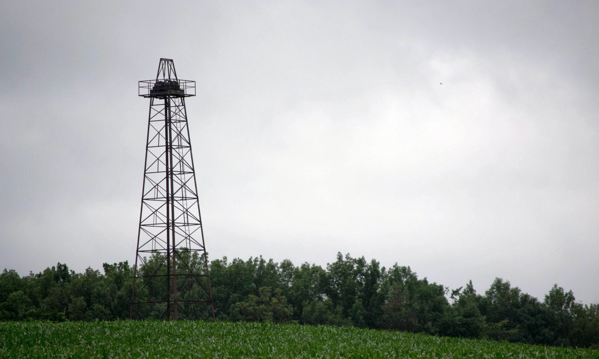
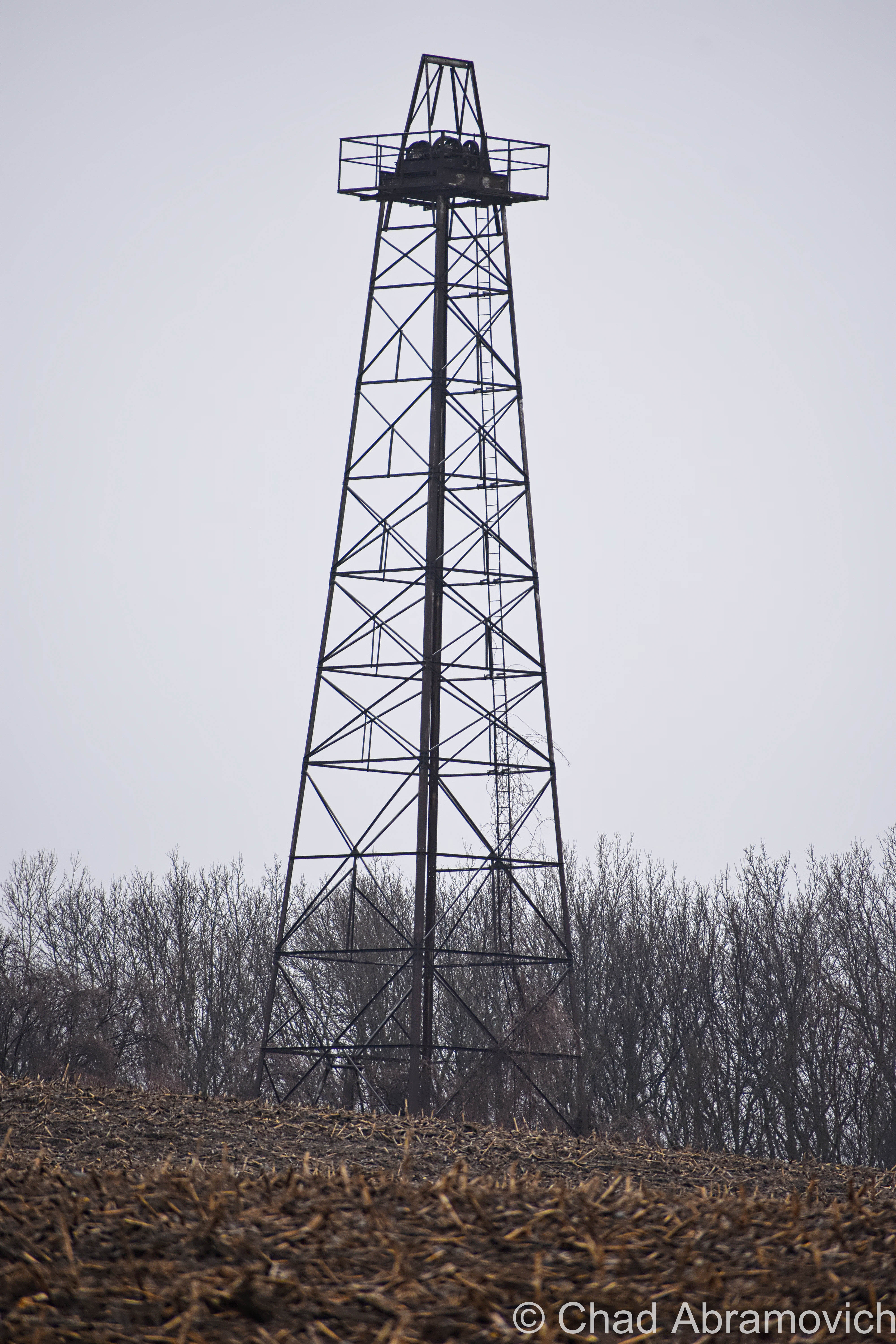
On a recent cruise along the back roads of St. Albans town, I came across something peculiar among the sprawling pastures and humble farmhouses. Heading down the dips and rises of Lower Newton Street, the strange object could be seen a long distance away from it’s location, towering above the forests and silos of farm country, and it stuck out. Pulling over to get a better look at this curiosity, my first thought was, “it looks like an oil derrick “. But I stopped. The idea of an oil derrick in Vermont seemed out of place, especially today. So, was this rusting tower, slightly leaning over an entanglement of field grass, in fact an oil well? When I arrived home, coffee mug sitting nearby, I took to the internet, and found what seems to be a lost, yet briefly fascinating era of Vermont history.
Vermont has a rich history of treasure seeking it seems. From the annoyingly mysterious Captain Mallett supposedly burying his gold chest near Coats Island on Malletts Bay, Spanish prospectors finding silver deep within our granite mountains, or the suspected Celtic copper seekers and the strange stone domes left behind from their visits.
The northwest part of the state can also join the ranks of treasure booms, and like many tales, it took a matter of digging deeper to uncover it.
The strangeness started with the Bellrose family of Swanton. Lawrence Bellrose had just dug a 650 foot well, and successfully struck water, which he had then hooked up to the plumbing of their house. Shortly after, a fuse blew out in the cellar, followed by a strange hissing noise. Mr. Bellrose descended the stairs to investigate the damage but was taken by that foreign sound. He struck a match for light, and the room lit up with a fireball.
But this apparently wasn’t an isolated incident, as other Vermonters from around the region have also had similarly bizarre encounters in their own homes.
Highgate Center well digger Lyman Feely was drilling a well in South Alburgh. He had reached 465 feet and hit an abundant water source, which provided 60 gallons a minute. One of his men had light a small fire nearby to keep his hands warm – and when the drill hit water, there was a large explosion which tore through his rig and and badly injured two of his men. After the explosion, Feely found that the well was filled with bubbling gas and floating rock.
Kitchen faucets at Robert Carpenter’s farm in nearby Alburgh blazed like torches, which some people might consider to be attributed to a rare phenomena called fire water. What was going on here?
In St. Albans, a similar event unfolded, but this time, something was different. After a farmer near the Yandow farm accidentally set his entire field ablaze, they noticed that most of the flame quickly went out, but a small crevice continued to burn, which was the key to this seemingly nonsensical phenomena. This wasn’t something supernatural – this was just the opposite and very much natural. They had discovered natural gas deposits in Northern Vermont.
Though this might have came to a shock for some people, as early as the 1950s, The American Gas Association had mapped and studied the Lake Champlain valley and claimed that the region would be a valuable source for natural gas and oil in the future. And it seemed to be true. Robert Carpenter recalled that a lot of neighboring wells dug in Grand Isle County would often be found to be filled with natural gas.
Nothing was really ever acted upon, until St. Albans businessman Douglass Kelley became interested, and launched Vermont’s first oil boom. Because natural gas is often discovered before oil, Kelley assumed he was sitting on top of a black gold mine.
Kelley banded together a group of like minded associates, and started the now defunct Maquam Gas and Oil Company. On April 19th, 1957, Isadore Yandow’s St. Albans farm became the first place in Vermont to be drilled for oil. Soon, neighboring landowners were swayed by dreams of becoming rich and the rest of the state dreamed of the prosperity that the oil boom had brought other places in the country. Kelley even brought school buses full of children and tourists out to rural St. Albans to see the rig. Everyone seemed to be interested.
But after months of drilling to a depth of 4,500 feet, labor teams working intensely around the clock, and striking rocks, methane, water and everything but oil, operations finally stopped and the prospects were abandoned. Because Vermont was new to the oil culture, maybe they didn’t realize that often only one out of several wells that would be constructed would ever actually strike oil – and Kelley only financed and constructed a single well.
But the seeds were already planted, and a few years later, two more wells were financed and constructed in Malletts Bay, but after reaching 10,000 feet, they ran out of money and left empty handed as well.
Rutland resident and geologist Earle Taylor wasn’t so quick to abandon the dream. He also figured if they found natural gas deposits, then oil would surely follow. Taylor contacted Rutland attorney James Abatiell, and with 24 other Vermonters, formed the Cambrian Corporation, and Taylor’s expertise proved to be as “good as gold”. He did a large scale geological survey of Vermont, costing well over $100,000, and the results were promising.
Between 1962 and 1963, Cambrian persuaded Belgian oil company Petrofina to come to Vermont and run an operation on a parcel of farmland in Alburgh. From the accounts of the operation, things were looking good – the company had drilled to a depth of over a mile with a tower 160 feet high. This was also the first dig in Vermont to use rotary equipment – and extensive further studies were conducted as the beginning cuts were made. They even went as far as doing sonic and gamma-ray tests on the topography. It seems this was incredibly and painstakingly well researched and meticulously planned. The crew was said to have kept saying “It’s looking good, it’s looking good!” the entire time. But something happened. They just stopped, left, and gave no explanation. To this day, that remains a mystery. And just like that, Vermont’s first and only oil boom came to an end with little commotion.
Today, almost no visible evidence remains of this short lived time in Vermont history, except for that single abandoned derrick in rural St. Albans, rusting at the edge of a sprawling cornfield. The wooden blocks at the base of the derrick have rotted away long ago, slowly making the derrick tip to about 30 degrees, eventually coming to rest on the well head.
I can’t help but wonder, if someone were to pick up where Kelley left off, would they find a rich supply of Vermont oil just feet before the cutoff point?
If you’re curious, the Vermont Geological Society has a map with all of the former oil drilling operations in the Northwest part of the state – and you can view that here.
“Vermont Crude“, Green Mountains Dark Tales by Joseph Citro
On Vermont’s Great Oil Boom, Lance Khouri, Vermont Life Spring 1977
—————————————————————————————————————————————–
To all of my amazing fans and supporters, I am truly grateful and humbled by all of the support and donations through out the years that have kept Obscure Vermont up and running.
As you all know I spend countless hours researching, writing, and traveling to produce and sustain this blog. Obscure Vermont is funded entirely on generous donations that you the wonderful viewers and supporters have made. Expenses range from internet fees to host the blog, to investing in research materials, to traveling expenses. Also, donations help keep me current with my photography gear, computer, and computer software so that I can deliver the best quality possible.
If you value, appreciate, and enjoy reading about my adventures please consider making a donation to my new Gofundme account or Paypal. Any donation would not only be greatly appreciated and help keep this blog going, it would also keep me doing what I love. Thank you!
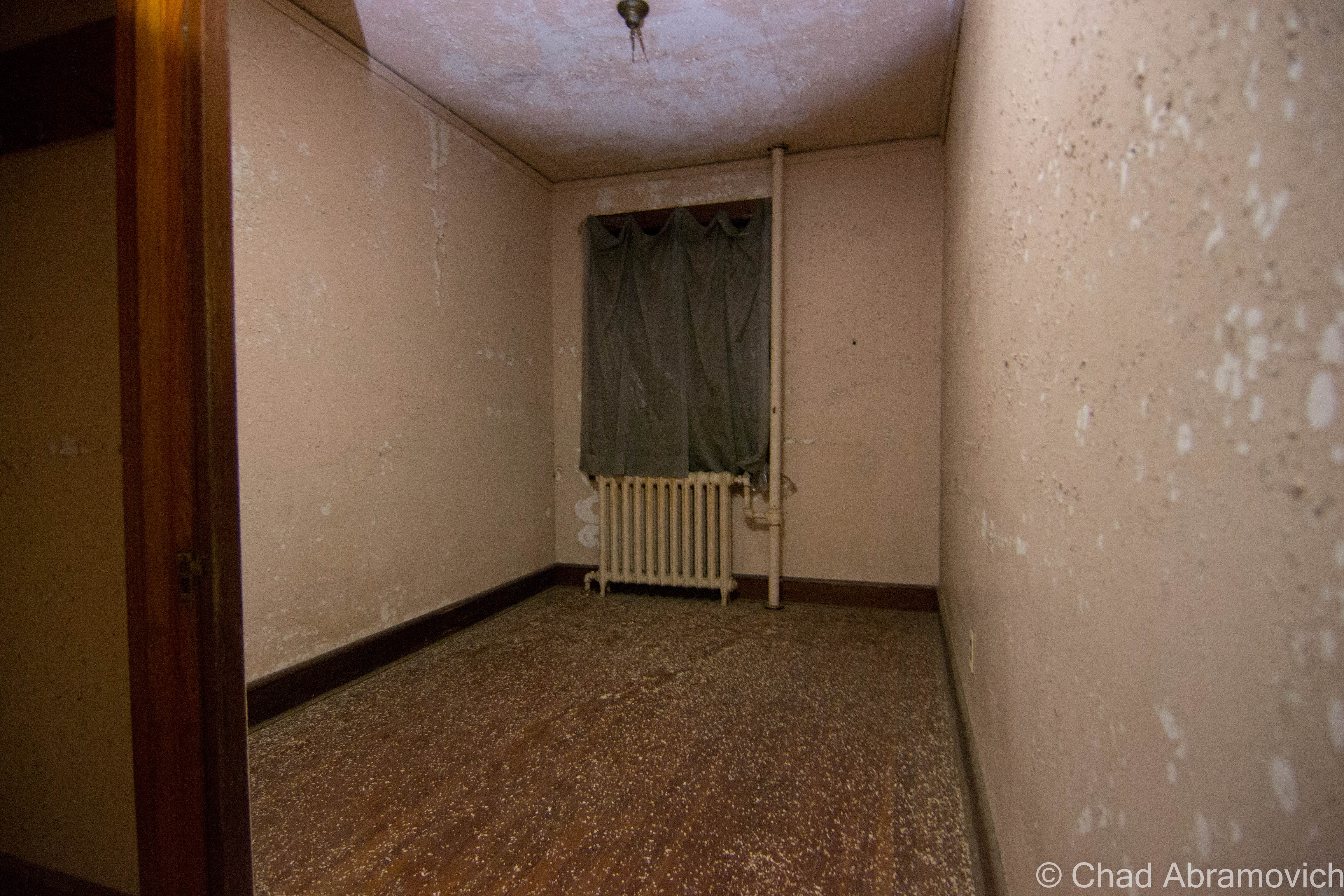
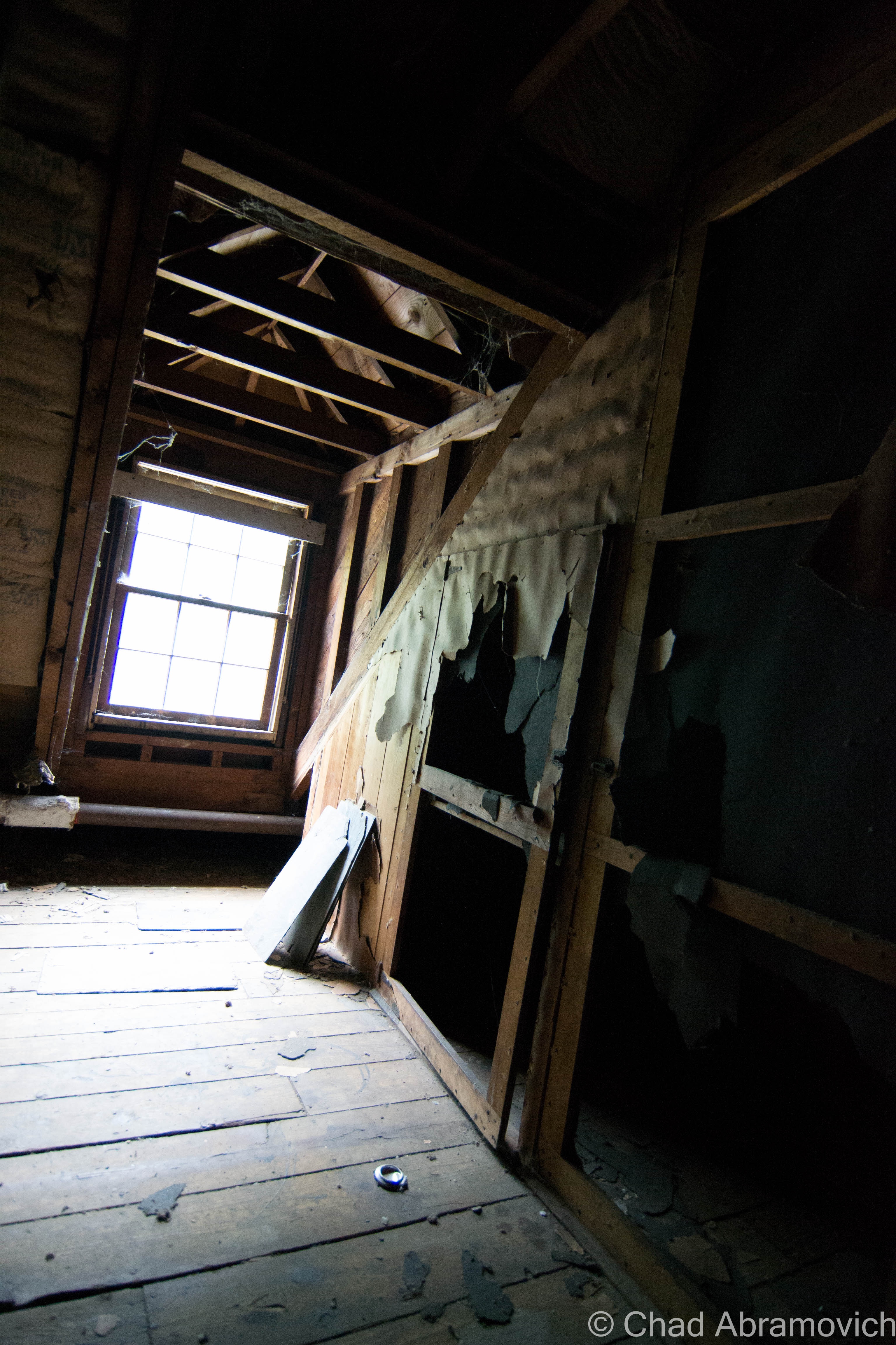
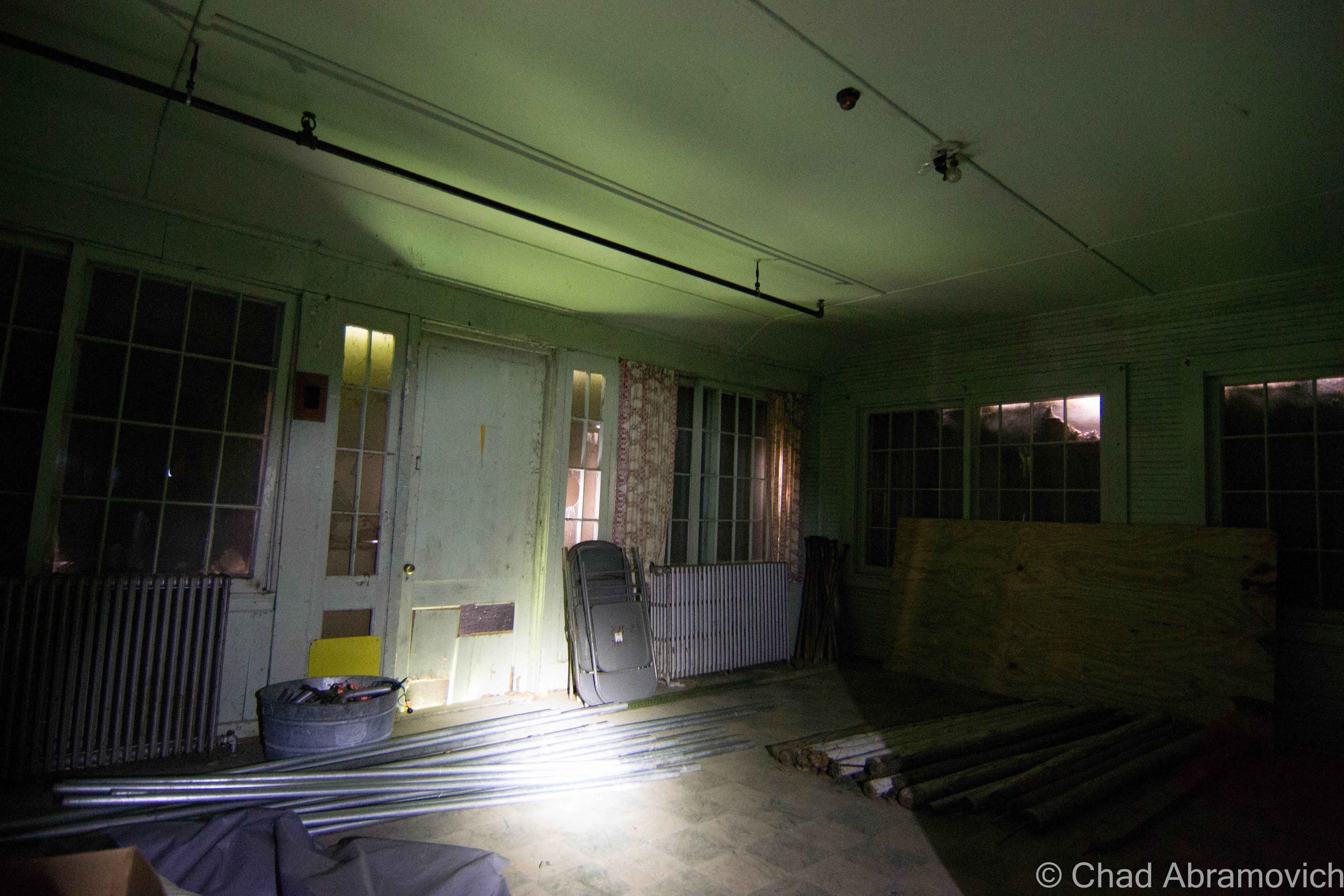
Though I’ve written about The Caverly Preventorium previously for The Rutland Reader, it wasn’t until a few days ago when I would actually get to set foot inside for myself. Meeting up with Paul Dulski from Haunted Vermont, we set out for the Rutland County town of Pittsford.
As tuberculosis gripped the United States of the early 1900s, there was a growing need for hospitals and places to treat the ever growing number of people falling ill to the terrible disease, as what was once thought to be the work of vampirism in 18th and 19th century New England was finally becoming understood more. Sanatoriums were soon constructed across the country to not only house and attempt to cure all those who were grieving from the disease, but to remove them from the rest of society.
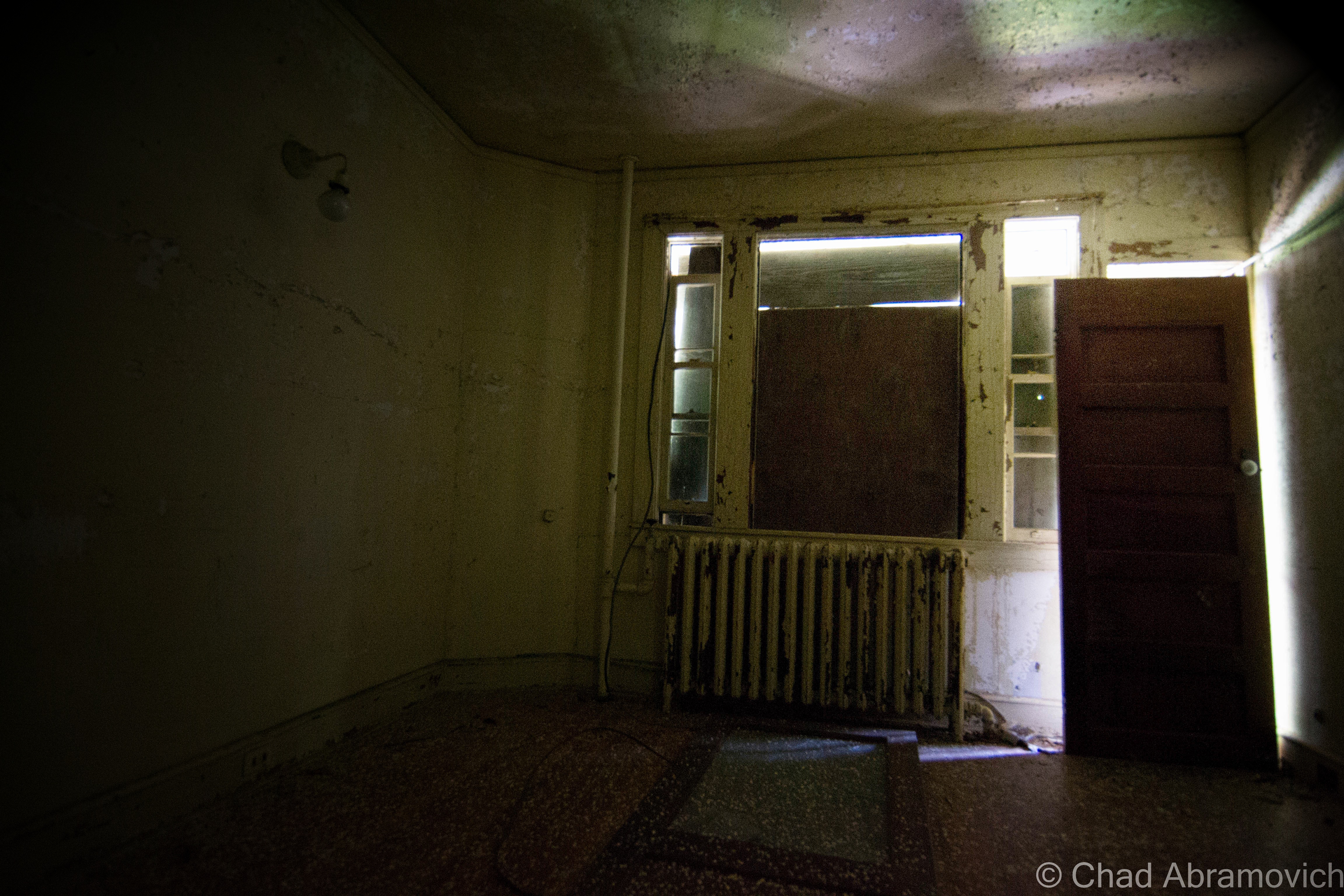
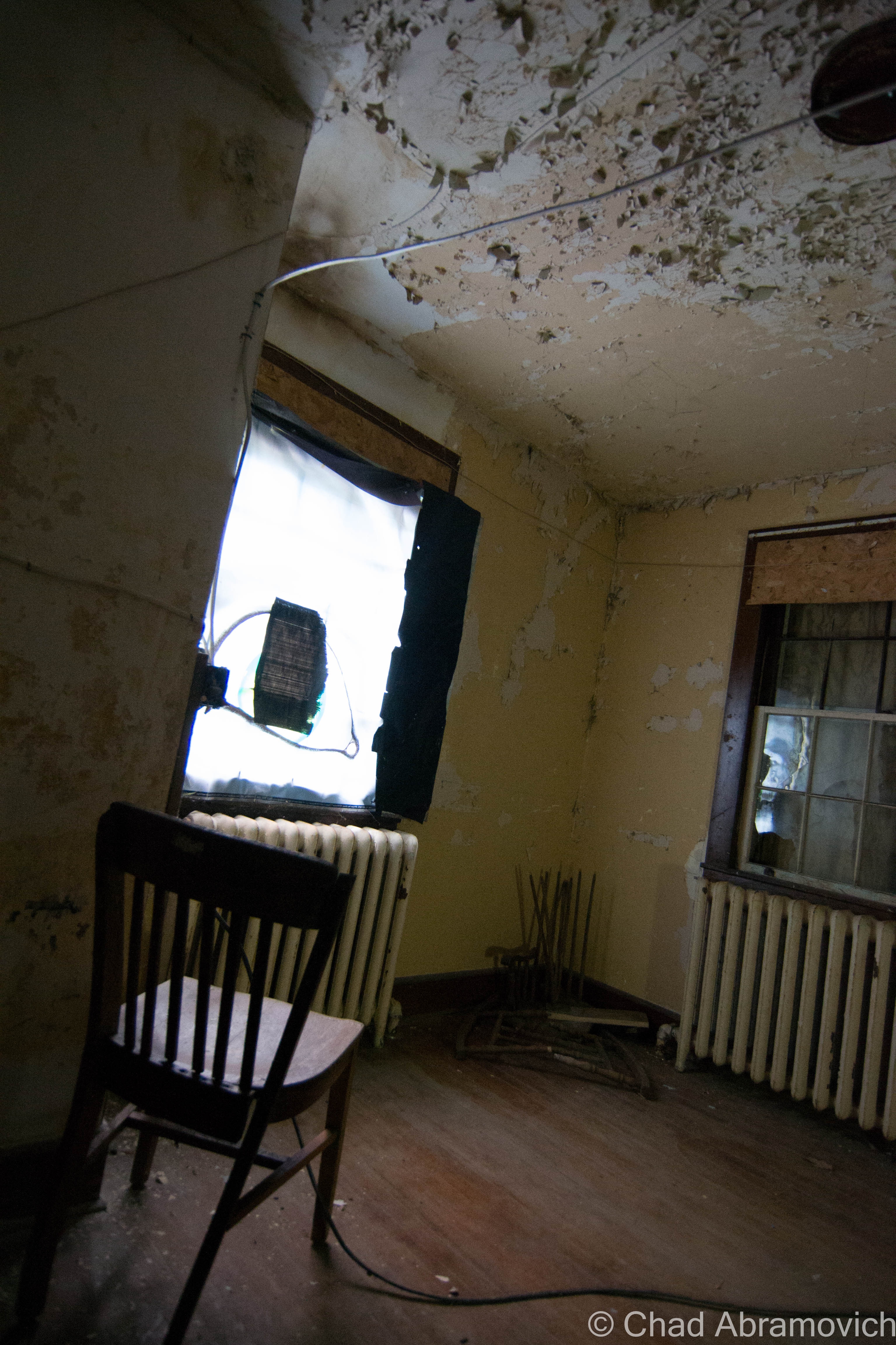
Researching the storied and often troubling history about the hospital, as well as listening to numerous people telling me of uncomfortable and most often unaccountable events that they experienced inside the building, this abandoned tuberculosis hospital in the woods has long held my interest. It certainly is a unique place in the Green Mountain State. Even DeadFi productions offered strange accounts they remembered while filming there one night last fall. But it wasn’t until visiting the place that I truly had a better understanding on just how compelling it really was.
Pittsford Volunteer Fire Department members Cody Hesse and Ethan Nordmeyer, who also help run the Pittsford Haunted House, a Halloween attraction ran on the first floor of the abandoned hospital every October, were kind enough to agree to unlock the building and give me a first hand tour. Sitting outside, swatting away swarms of mosquitoes under summer humidity, I got my first look at the hospital. Already, it was firing my imagination, and I underestimated it. The building looked smaller than I had thought – and with the tacky Halloween props decorating the facade, I admittedly wasn’t taking my first impressions all that seriously.
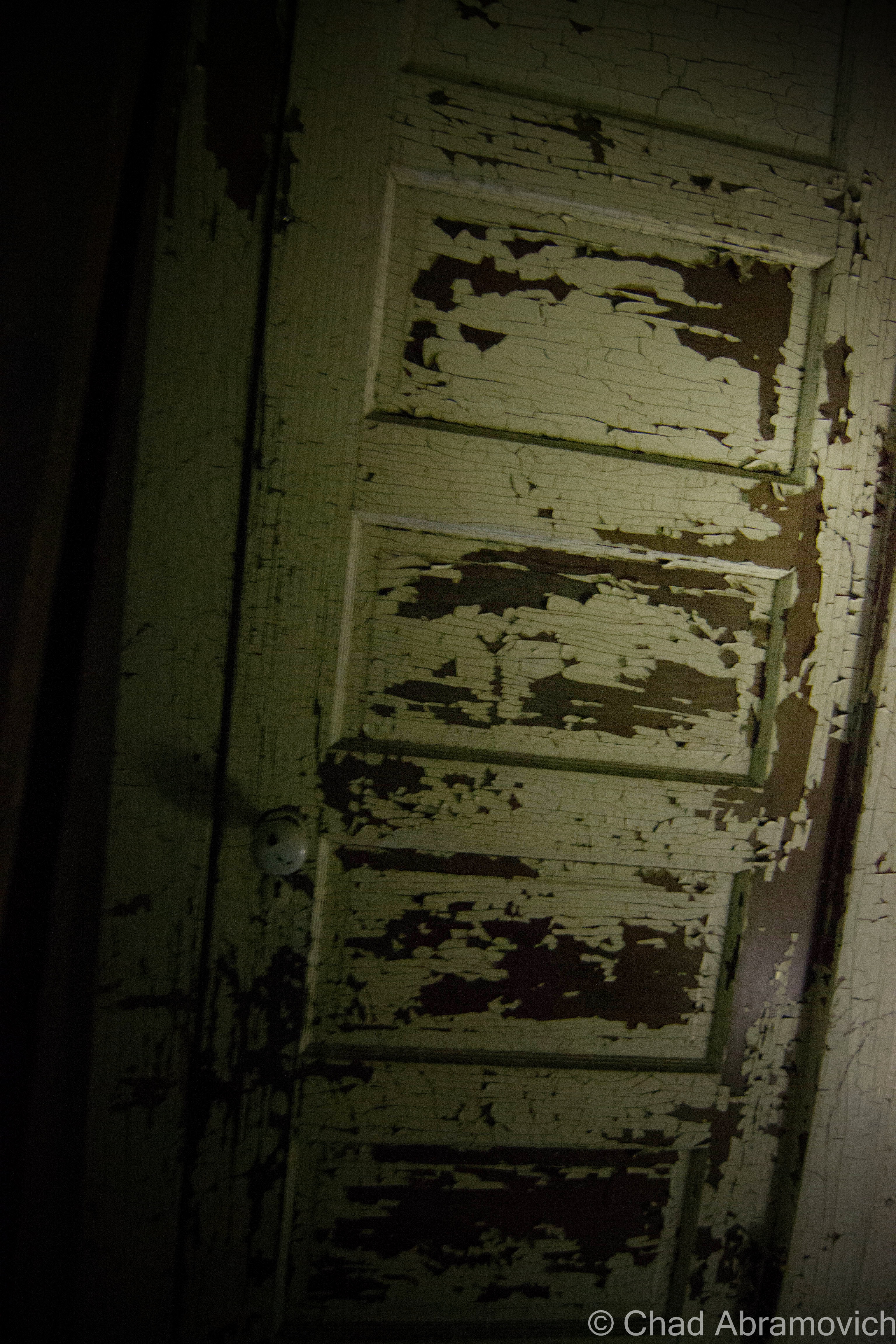
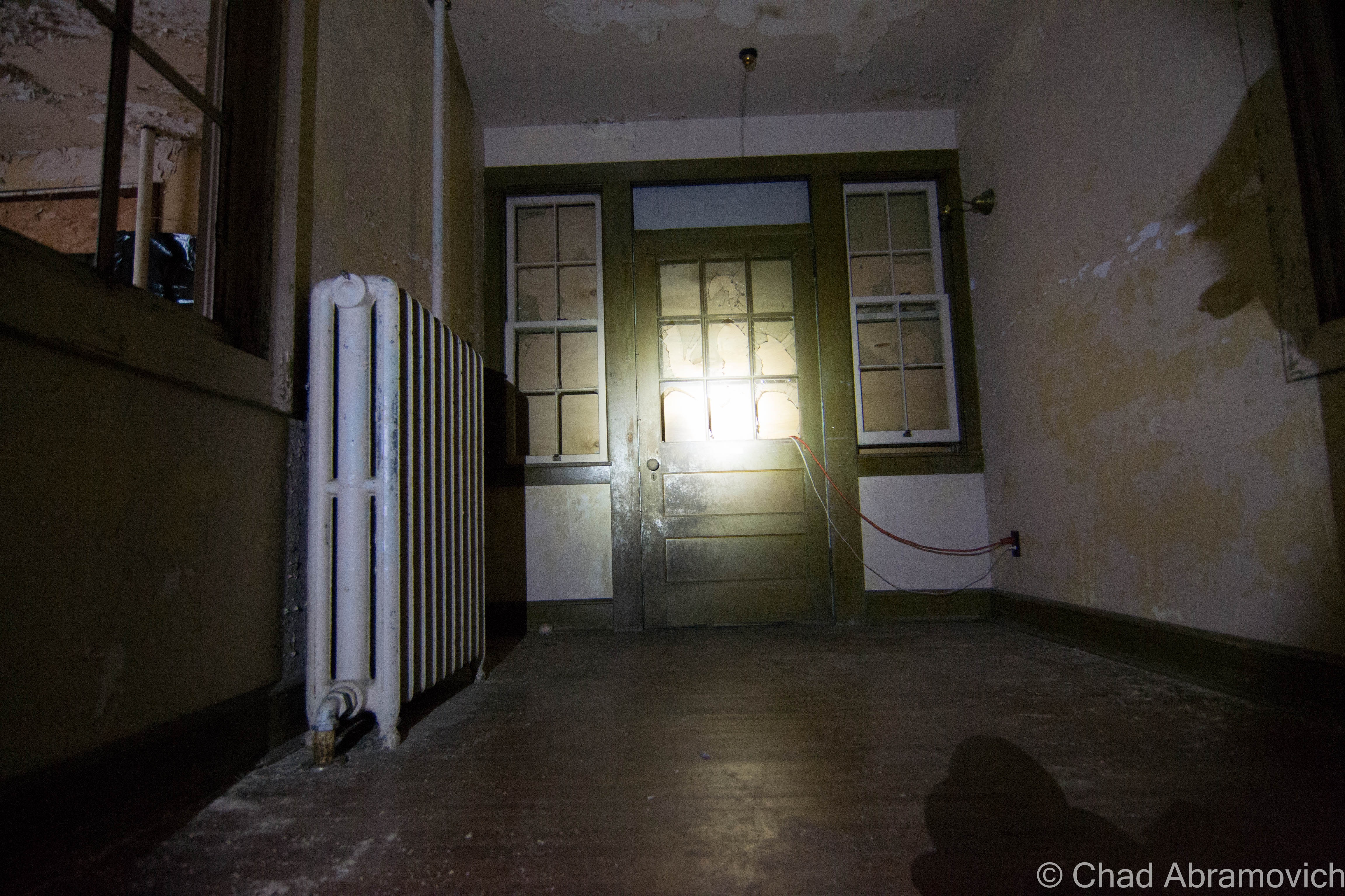
However, I had subconsciously broken my first rule of adventuring, to come in with an open mind. And as I was soon to find out, that would end almost immediately as they unlocked the basement door, and beckoned for me to step inside. I knew things were going to be interesting when I saw the amount of effort the fire department took to keep people out. Each entrance was outfitted with deadbolts and padlocks. Ethan explained that several people had attempted to break in recently. Some of the doors were damaged from where a forced entry via crowbar was unsuccessfully attempted.
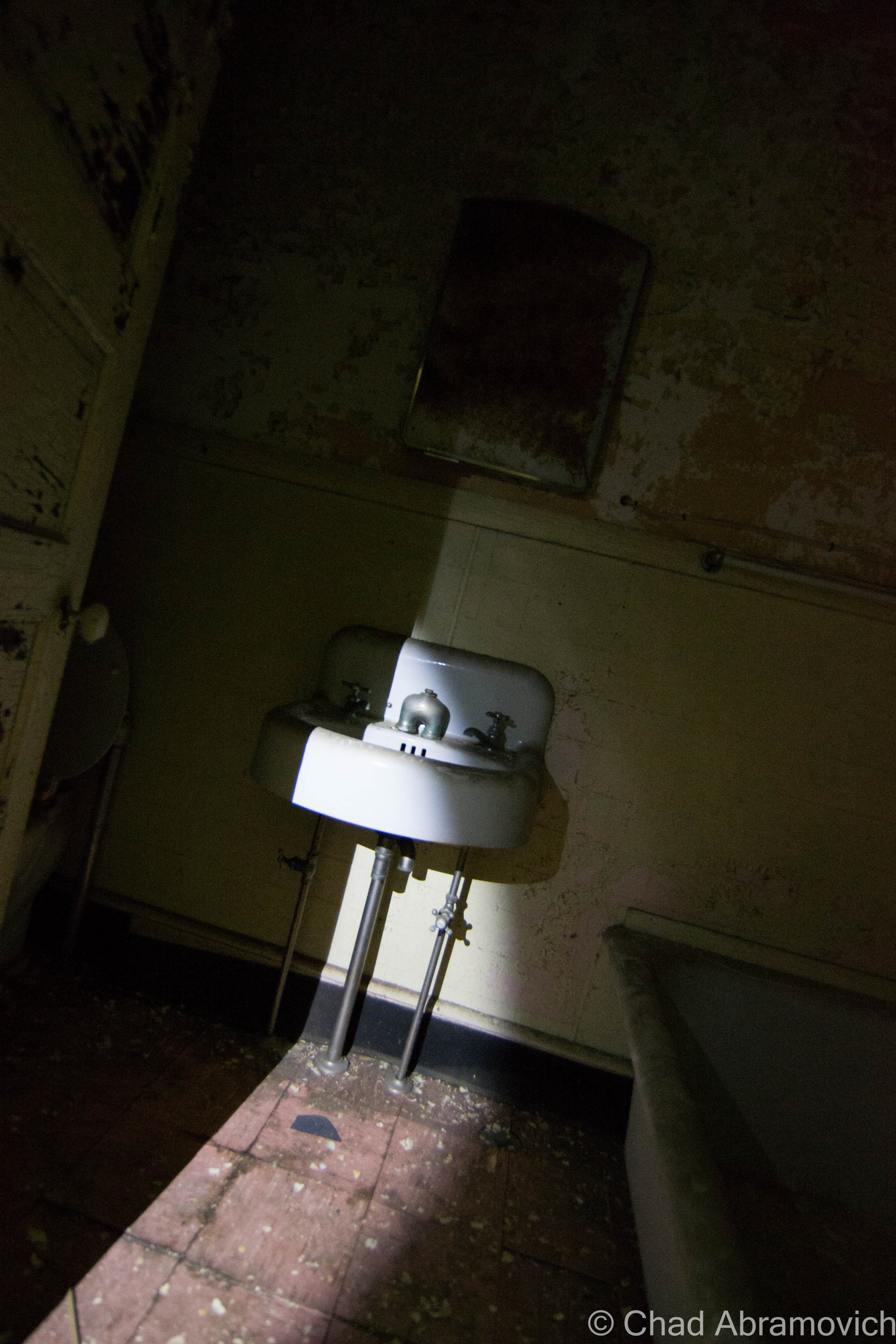
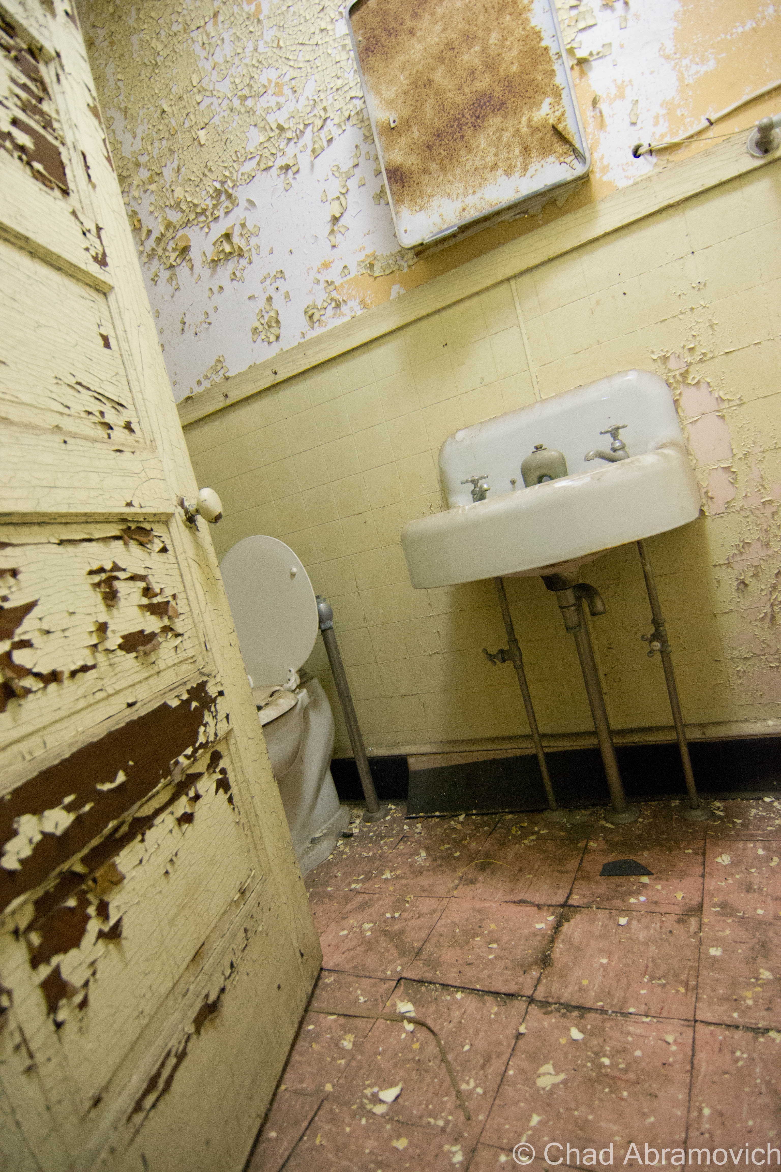
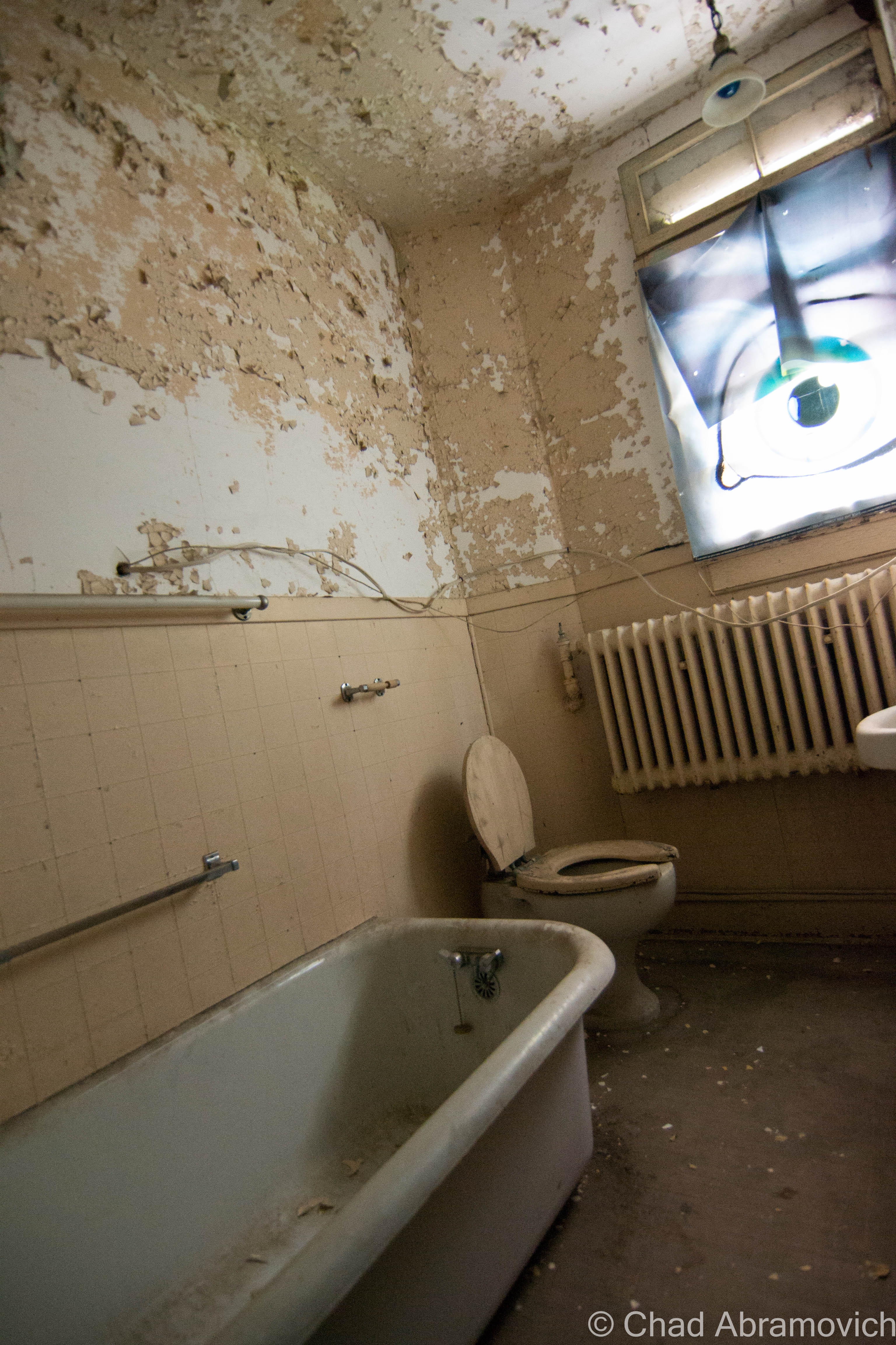
Apart from renovations to create the different areas of the haunted house, the bones were still authentic. The basement was musty and dark, a labyrinth of side rooms and doors. A massive old boiler adorned with ornate decor on its cast iron door was illuminated by the beam of a flashlight, standing out from swirling dust. Old industrial porcelain sinks, and relics from the old hospital lay stacked up in piles, leaning against the old walls in silence.
Almost immediately, my camera began to act up, which was a rare occurrence for me. It refused to focus when I attempted to take a photo and my battery kept loosing energy. To the group’s amusement, they all laughed at my misfortunes, and nodded their heads in mutual affirmation. They had all seen this happen before.
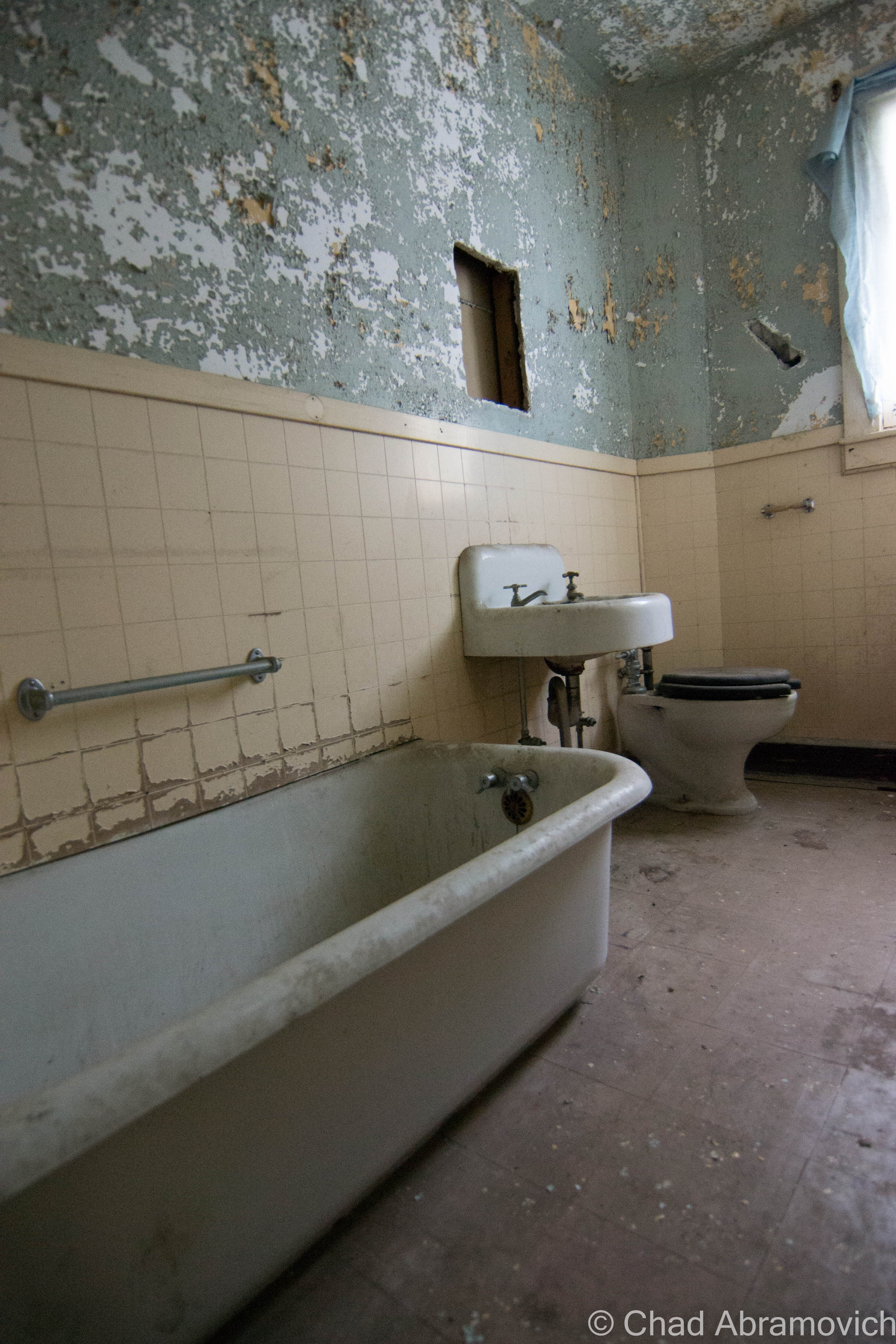
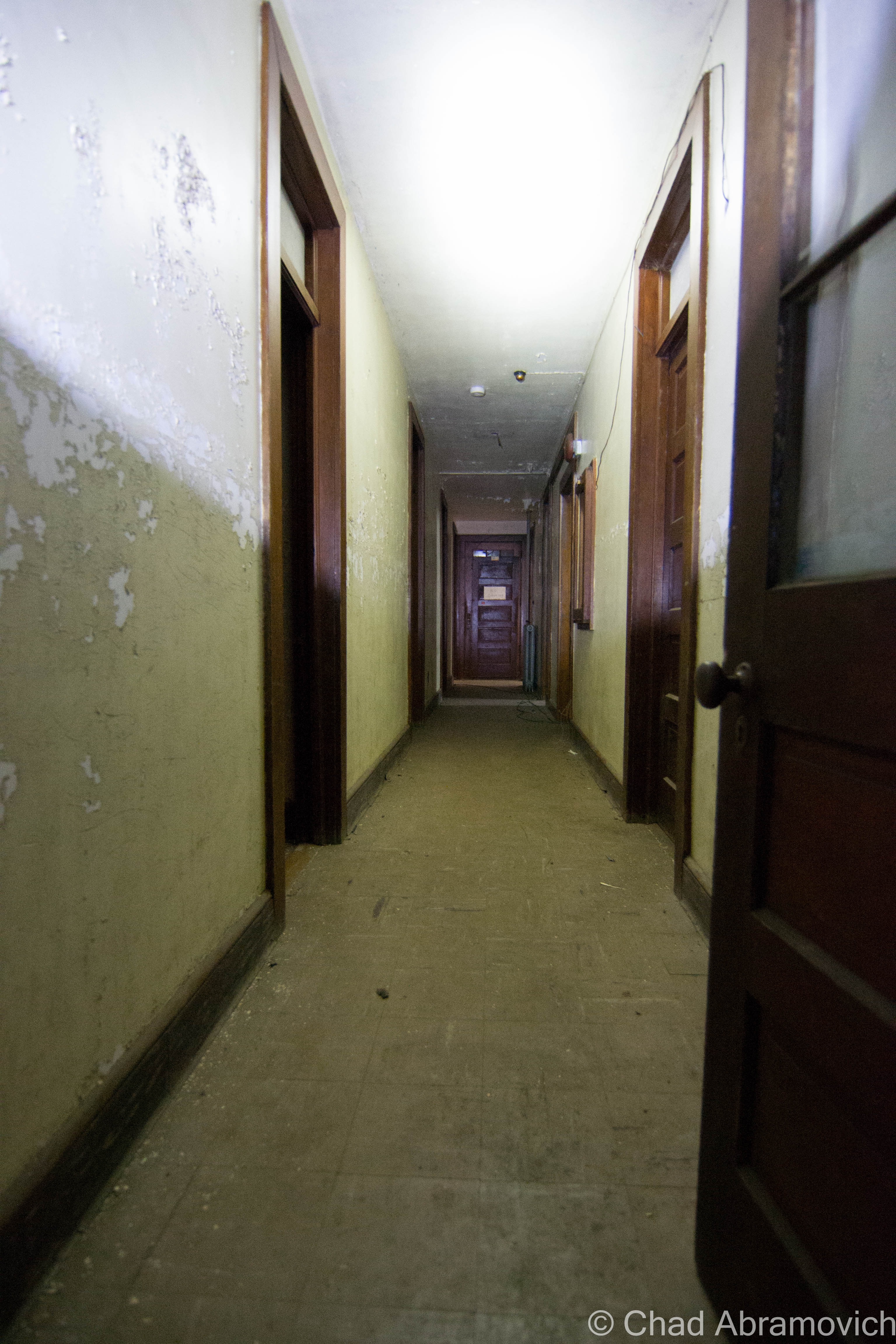
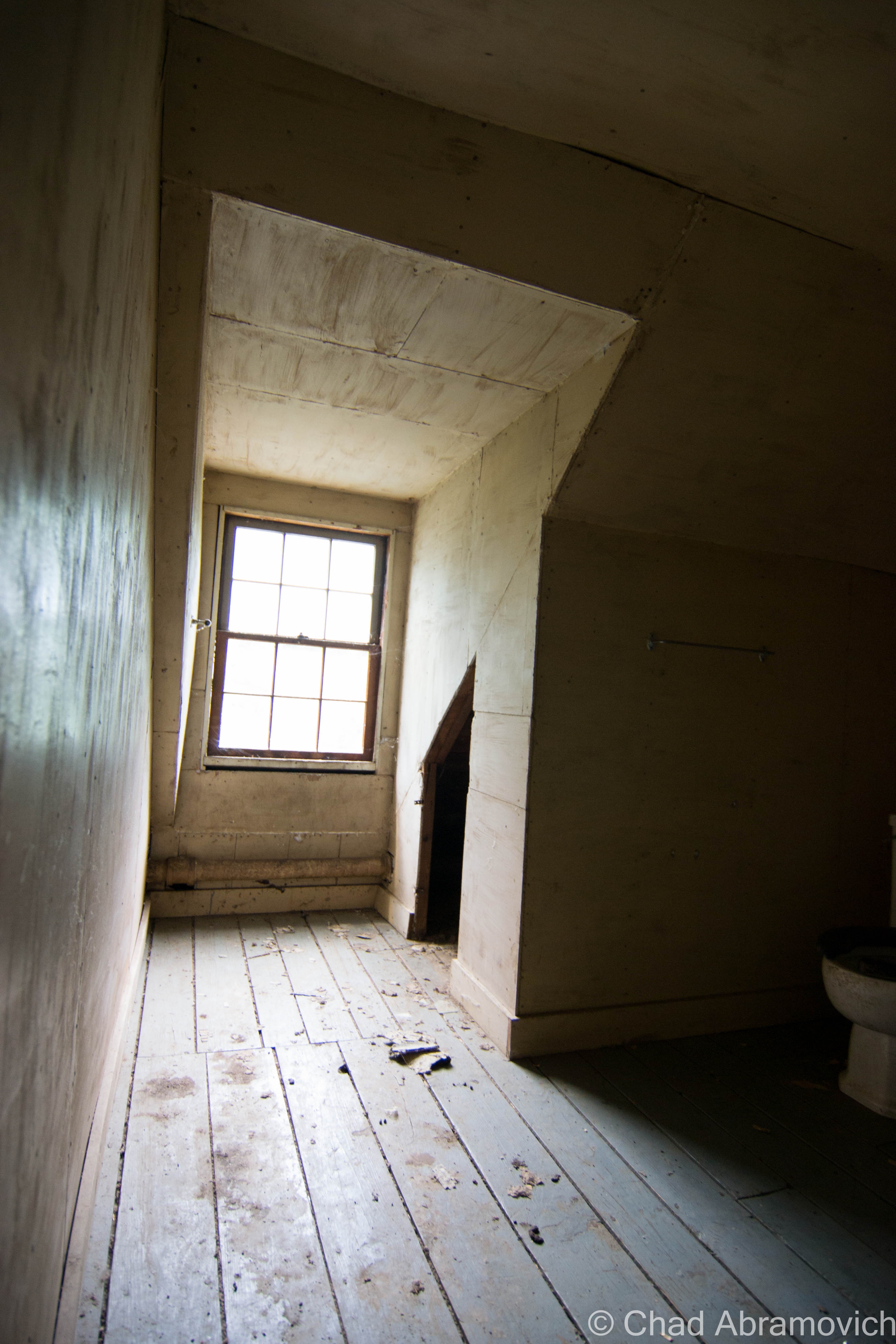
Cody fiddled with another padlock and swung open a camouflaged side door, revealing the staircase leading up towards the second floor, an area that visitors aren’t allowed to see. Almost instantly, the atmosphere changed, and we went from black painted walls and hanging demon clowns set to spring at you, to a funereal atmosphere of peeling lead paint, pensive silence and dull light coming through dirty windows. This was what I wanted to see, this was the bona fide experience.
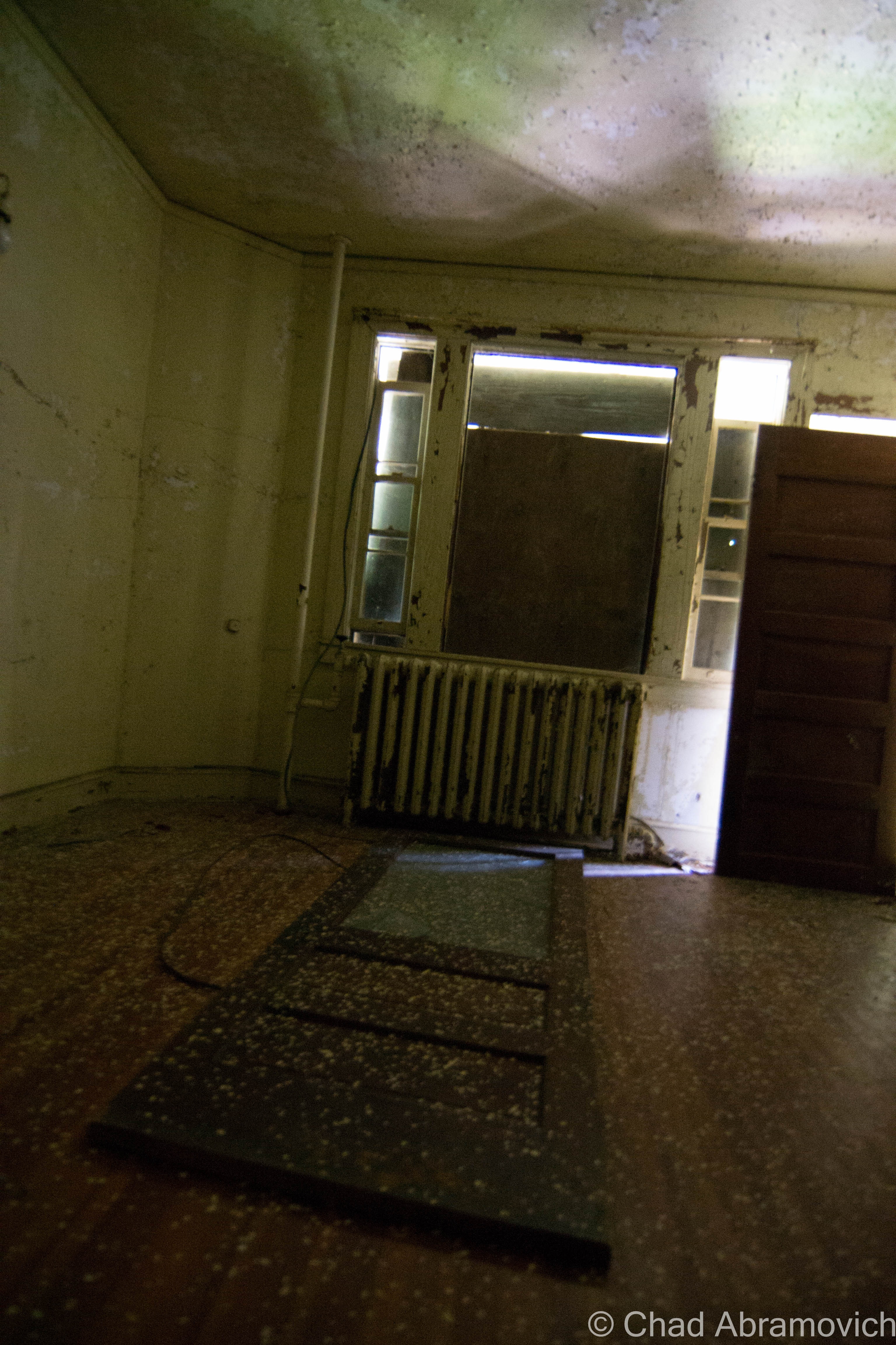
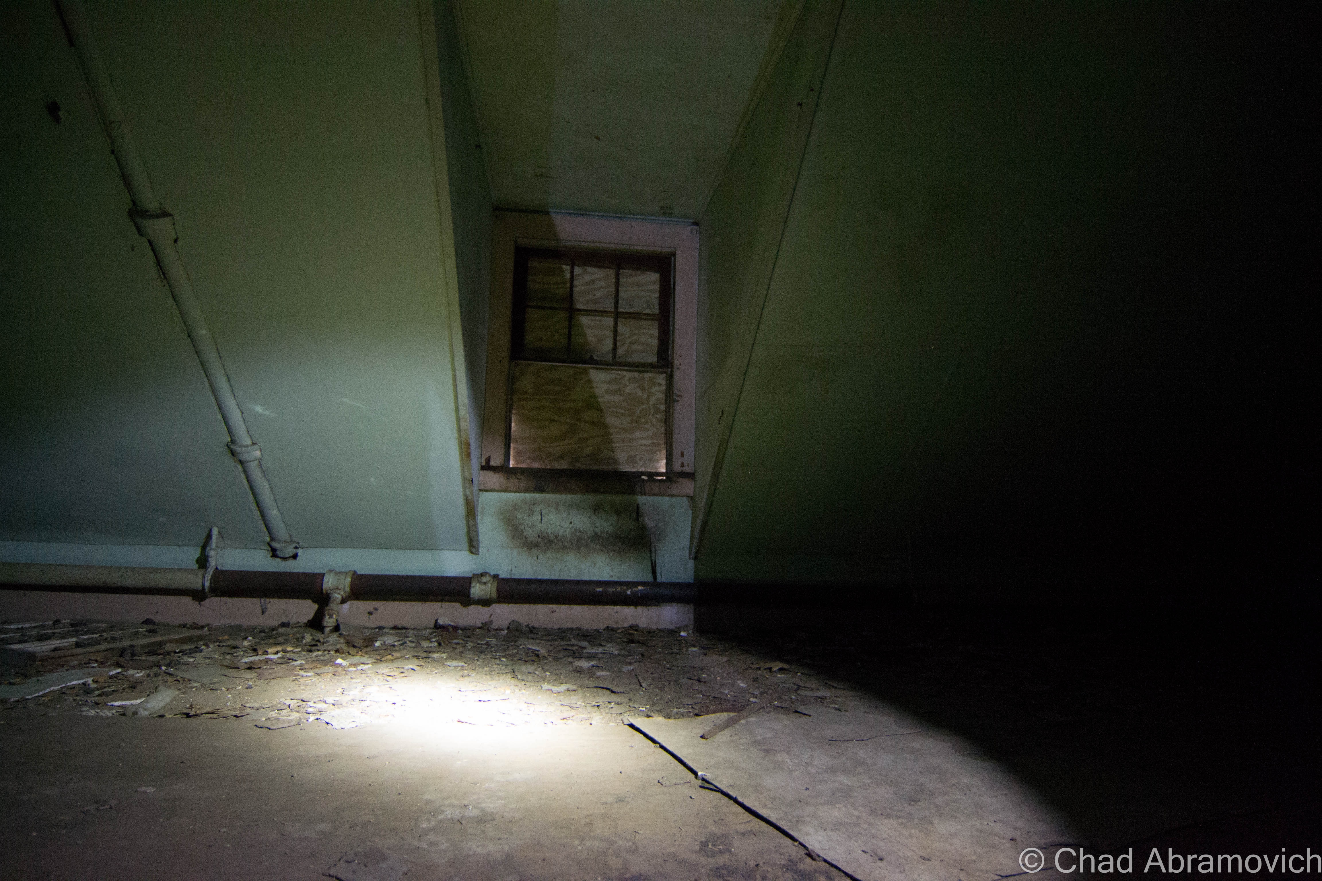
Almost immediately, I felt different, it was something tangible, something I noticed crawl underneath my skin. Our feet clomped up the wooden stairs, the aging planks groaning and cracking beneath our feet that seemed to crack the heavy silence. Gazing downwards through the beam of our reliable mag lights, the original hospital floor, which had long faded, could still be seen, covered in lead paint speckles, dust, and raccoon feces. Cody explained that they always found evidence of raccoon and other critters on the upper floors.
We were met with a long and narrow hallway, with lines of wooden doors leading in either direction. Most of the rooms were almost identical, and empty, with robust radiators sitting underneath windows, showered with more flaking lead paint. It was strange to think about how these decrepit spaces were once occupied by suffering children who knew all about agony, now vacant, lifeless, and miserable in a completely difference sense, haunted by silhouettes. Things that were once in order, now seemed so strange.
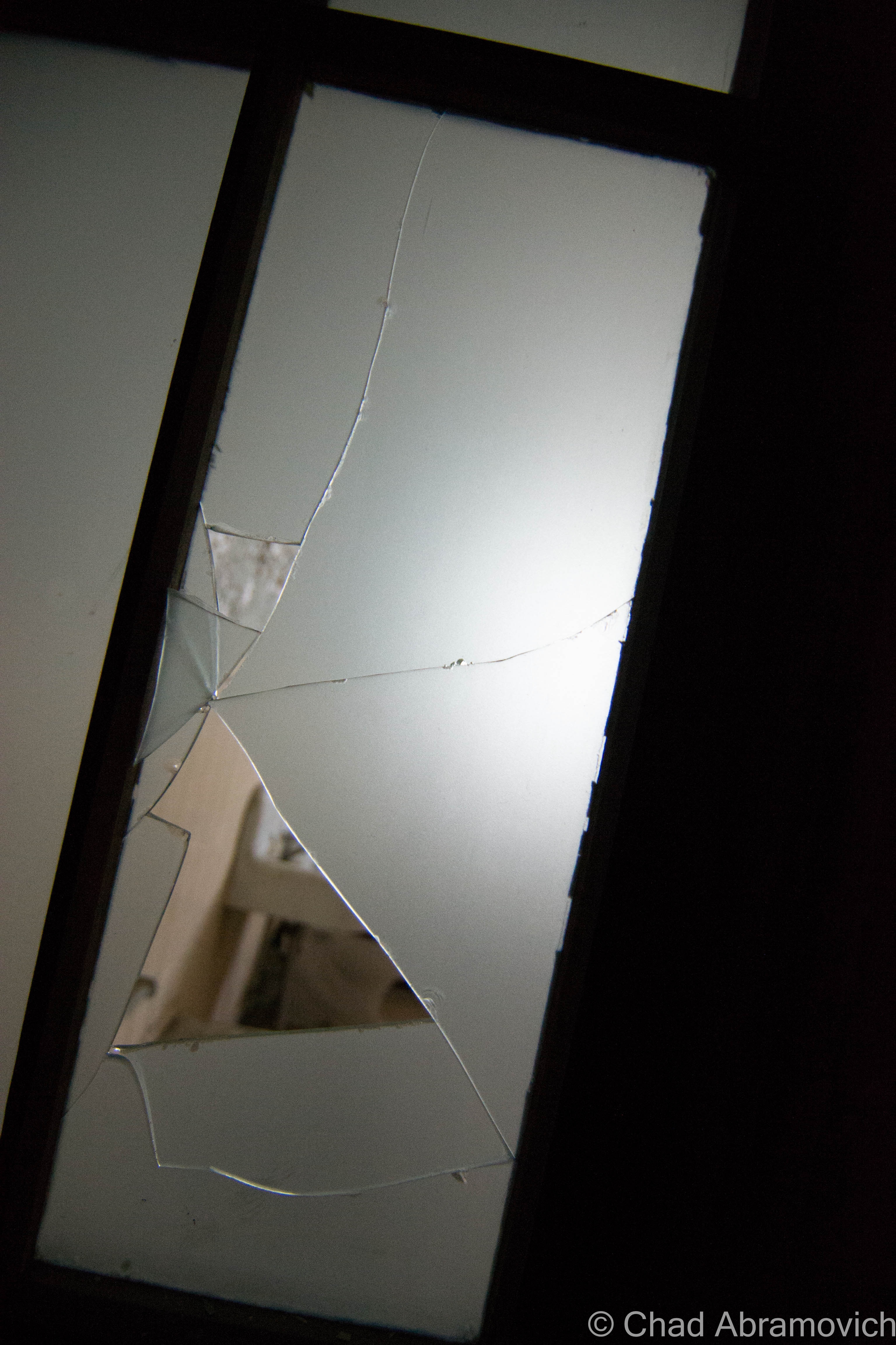
Through the stale air, we pressed on, flashlight beams momentarily brightening dark rooms. Walking around up there wasn’t for the faint of heart. With lead paint, animal feces and asbestos, it wasn’t a sanitary place to be, but there was another quality that smoldered within the empty halls, we all felt uncomfortable being there.
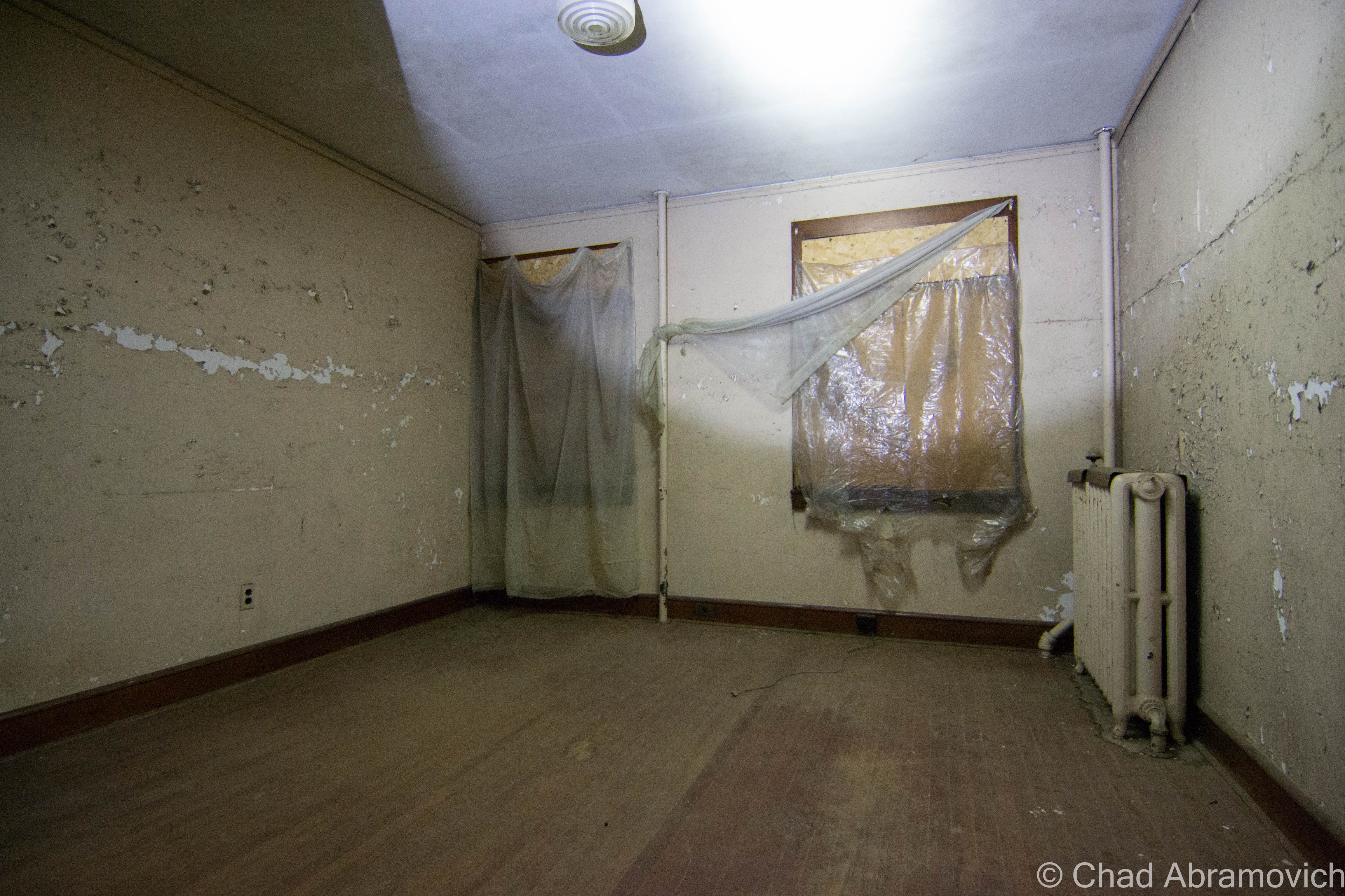
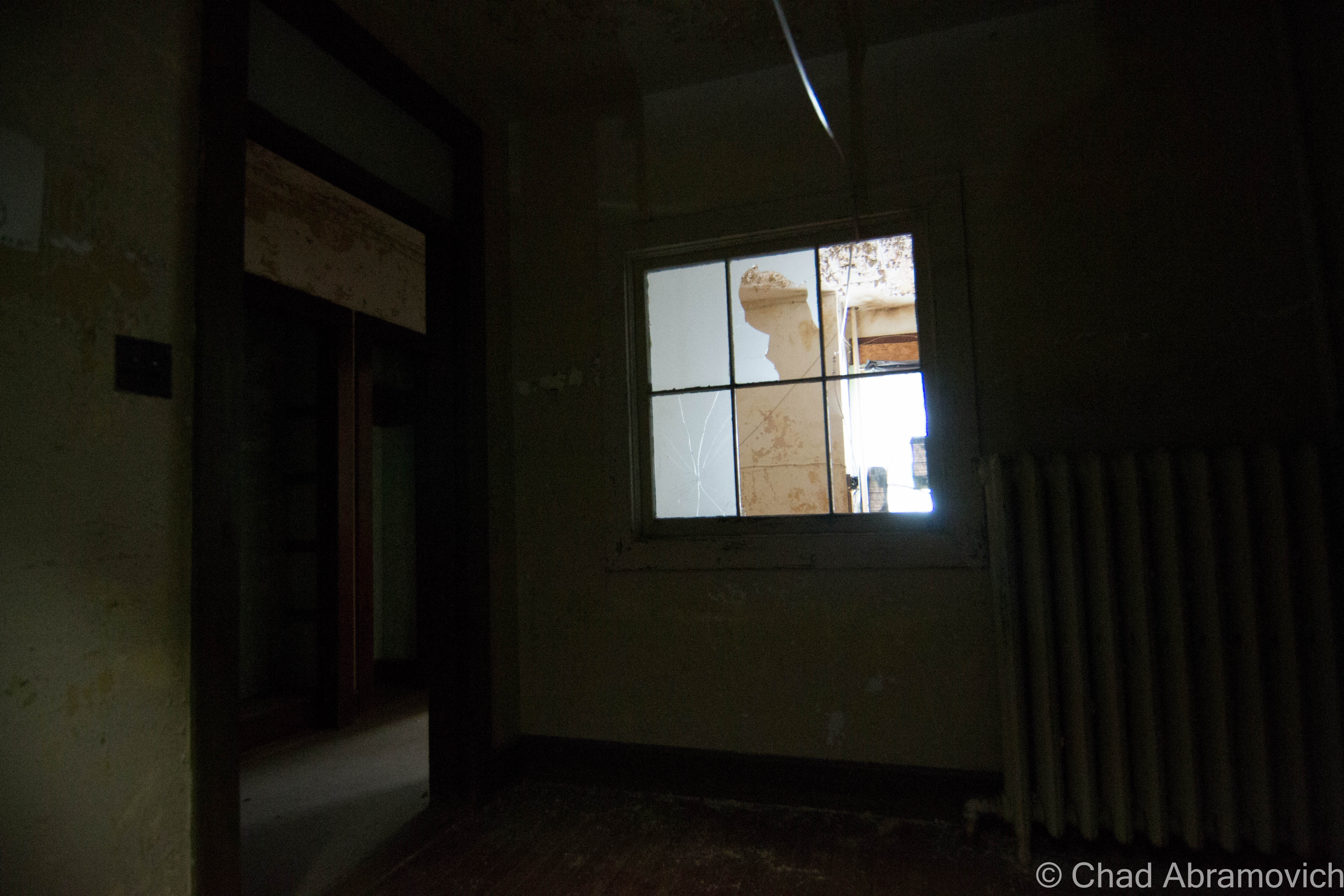
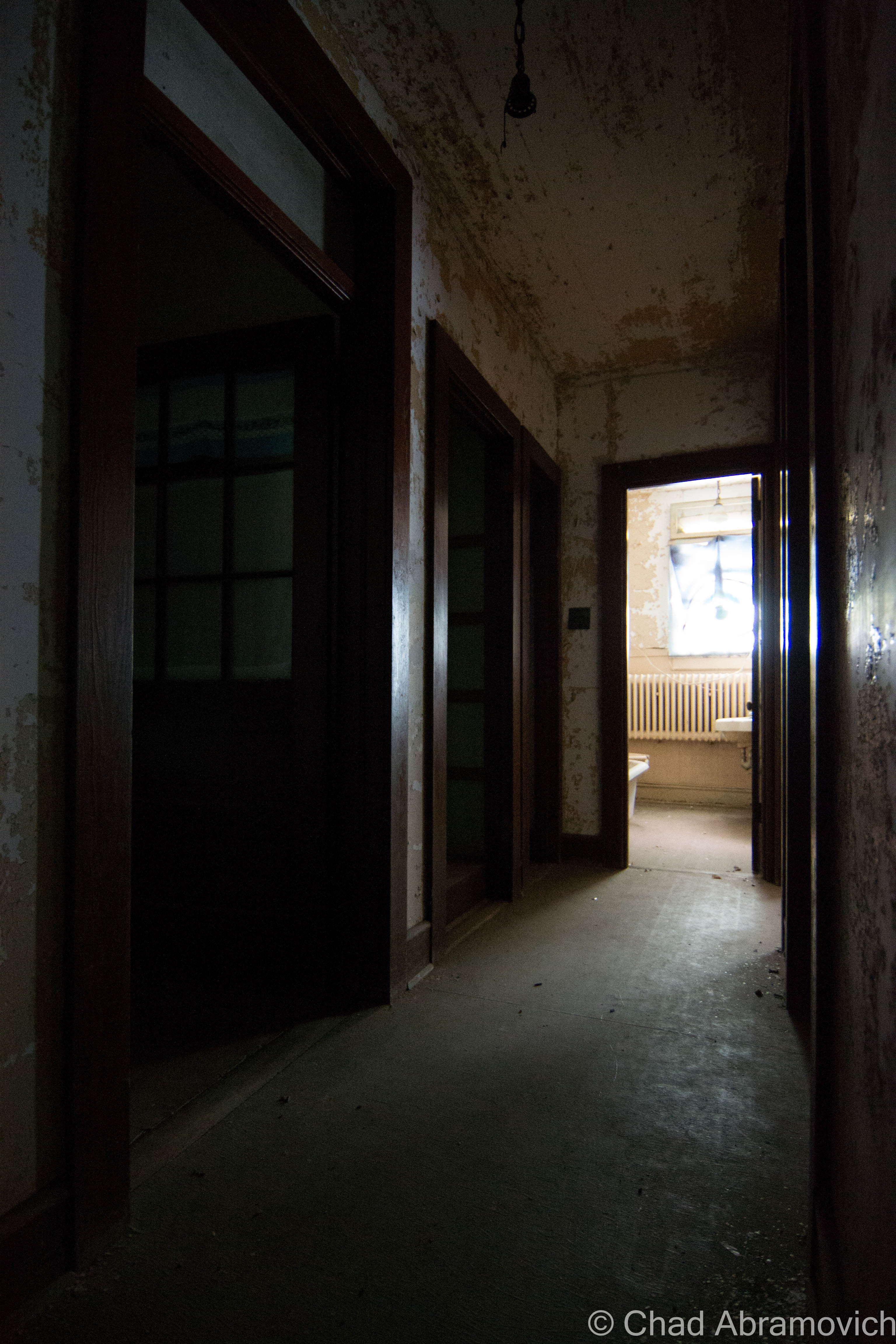
Parts of the building had been taken down or have collapsed over the years. Former porch areas had been razed, leaving doors on the second floor opening into nothing but a straight drop down to the lawn below. Other sun porches – which was once thought to be a tuberculosis treatment, were now rotted beyond repair and unsafe to tread on, barricaded by doors that had been screwed shut.
The main house was surrounded by three smaller cottages, which offered a similar landscape of grungy hospital tiles, awkward spaces and stale air, all sealed up like a tomb. It would honestly be quite easy to loose your mind inside one of these buildings. The entire time I was inside, I felt like I had been spending my time in dislocation.
After the grand tour, we all gathered again on the front lawn, and as Cody and Ethan swapped their own stories of strangeness, I had a better idea of why The Caverly Preventorium had such a dark reputation. It was one of the few places I’ve gotten involved with where most people openly and insistently admitted to experiencing something inside. Though I didn’t see any ghosts or witness anything baffling, I can honestly say that this was one of the most unsettling places I’ve ever explored, and it certainly left an impression on me.
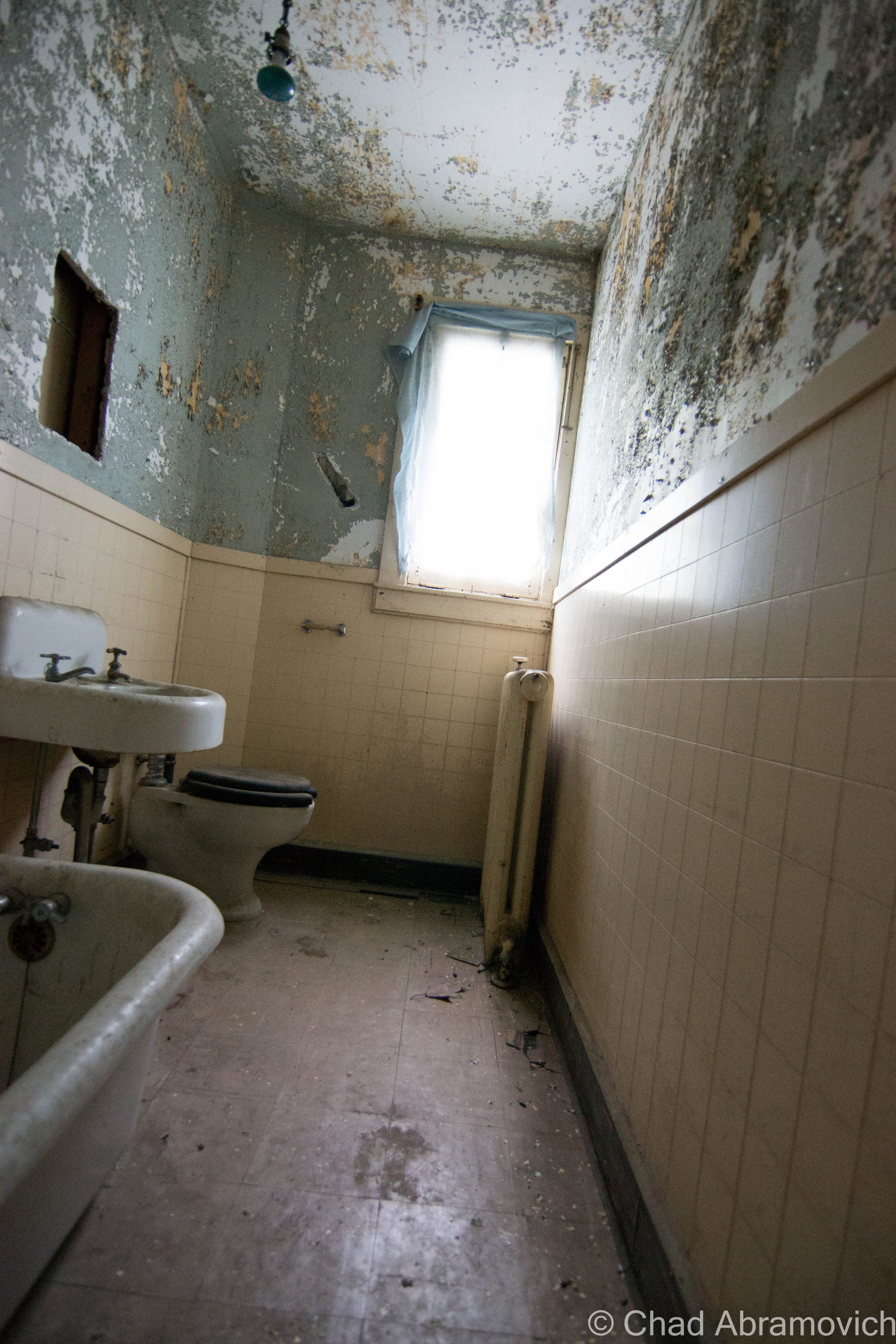
This is Amy’s Room, the hospital’s most famous haunt. While people speculate that several children who died here still wonder the halls and empty rooms upstairs, Amy is the only one who really has an identity. She was formerly a nurse here, who died tragically by either falling down the very staircase we walked up, breaking her neck, or contracted tuberculosis while caring for the sick children and died in her room. Many people have allegedly reported run ins with Amy, including seeing her staring down at visitors from her window. The fire department reported that light bulbs would mysteriously burst inside this room as well, with no accountable explanation.
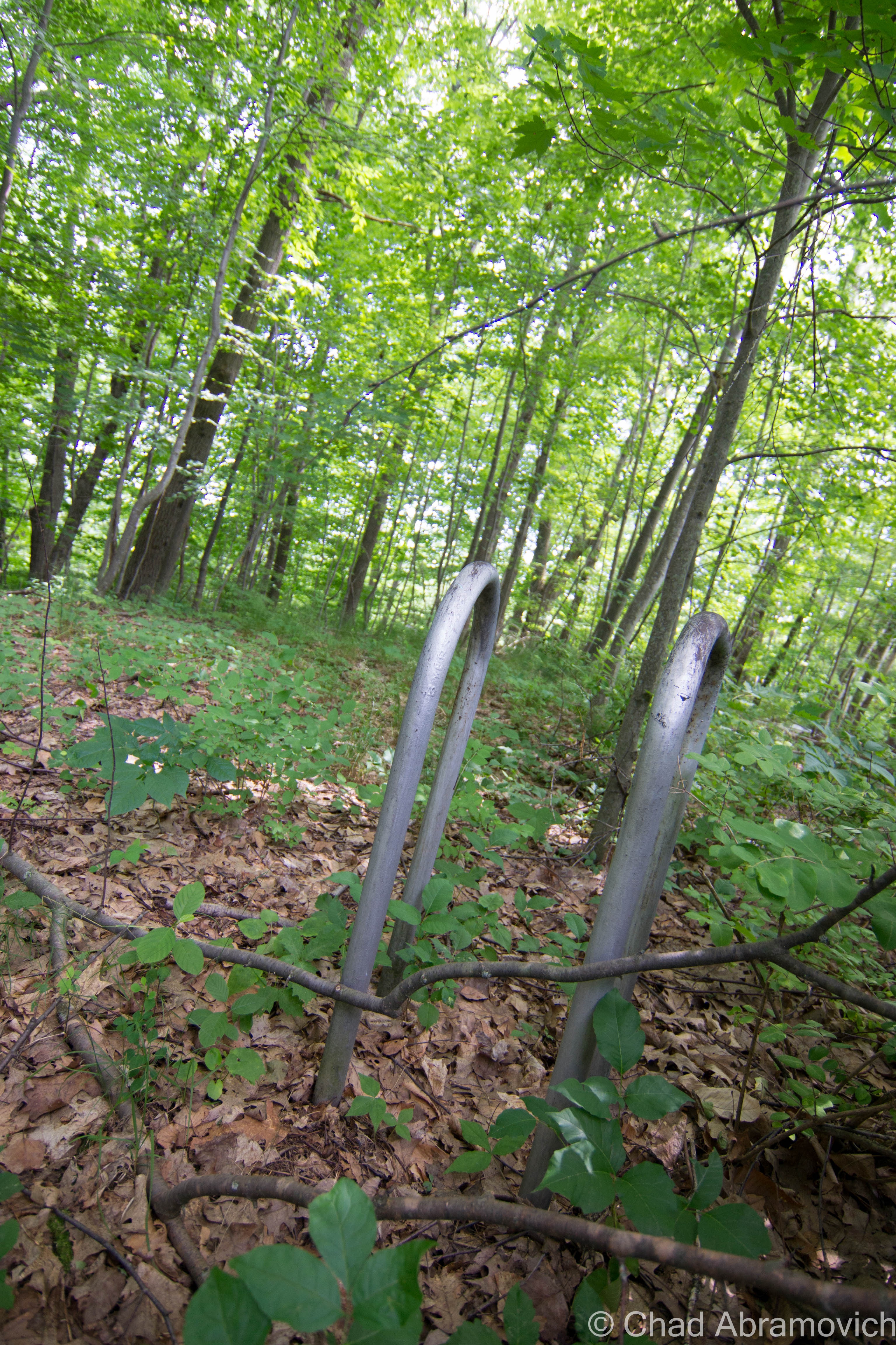
Behind the cottages, another vestige of the former hospital remain, a former swimming pool, now almost entirely filled in by mother nature.
Years ago, when the haunted house was being created and the fire department was touring the buildings, this room was filled with piles of old post cards and paperwork from the hospital’s functioning days, a scenario which was very typical of any abandoned hospital of asylum.
Much of the hospital is used for storage, making you feel claustrophobic as you wonder around the halls and rooms inside. Underneath mounds of various items, original features can still be seen.
—————————————————————————————————————————————–
To all of my amazing fans and supporters, I am truly grateful and humbled by all of the support and donations through out the years that have kept Obscure Vermont up and running.
As you all know I spend countless hours researching, writing, and traveling to produce and sustain this blog. Obscure Vermont is funded entirely on generous donations that you the wonderful viewers and supporters have made. Expenses range from internet fees to host the blog, to investing in research materials, to traveling expenses. Also, donations help keep me current with my photography gear, computer, and computer software so that I can deliver the best quality possible.
If you value, appreciate, and enjoy reading about my adventures please consider making a donation to my new Gofundme account or Paypal. Any donation would not only be greatly appreciated and help keep this blog going, it would also keep me doing what I love. Thank you!
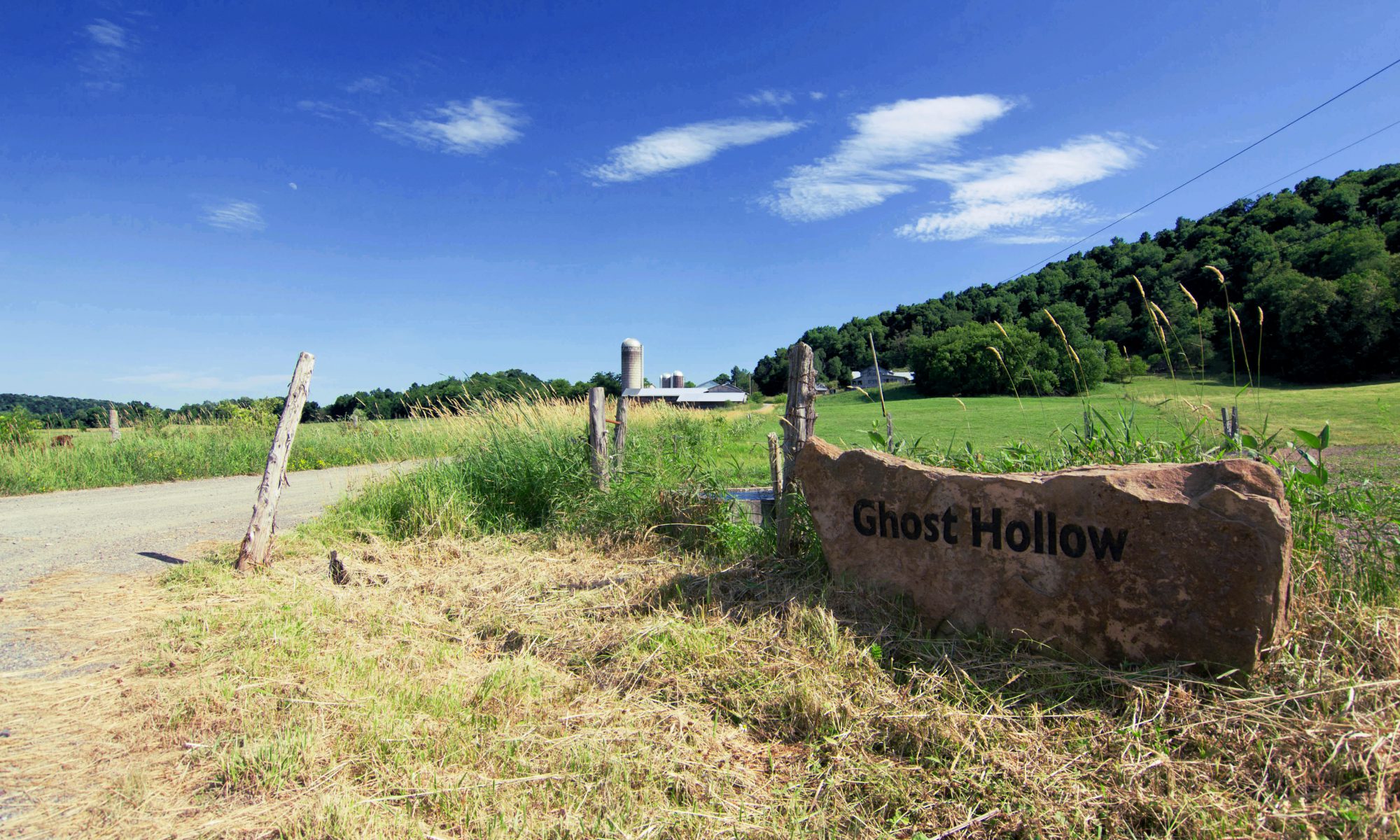
West Haven’s Ghost Hollow is the only geographical location in the state named after a paranormal occurrence. Well, as far as I know.
The name is sure to fire up the imaginations of any curious traveler or map gazer. The tiny town of West Haven is on the extreme southern tip of Lake Champlain, where the lake joins the Poultney River. Surrounded almost completely by water on most sides, the town forms an awkward looking peninsula that dangles into New York State. There are no state routes or highways passing through town (with the exception of Route 22A clipping a tiny portion on the eastern border, near landmark Devil’s Bowl Speedway), West Haven is isolated from the rest of Vermont – a land of rolling farmland and hardwood forests, rising above deep bays and winding rivers of brown water.
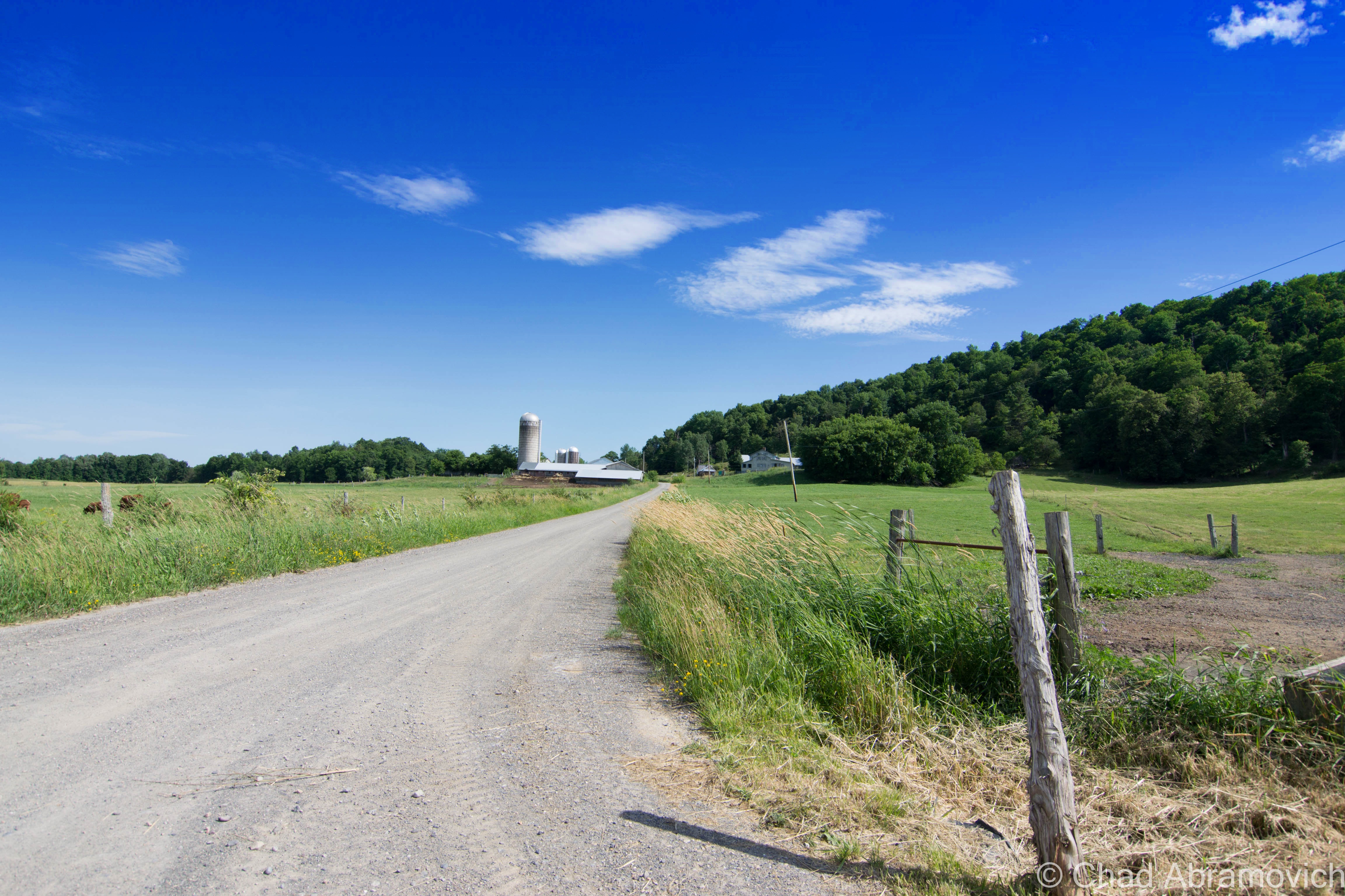
Among West Haven’s assortment of quiet byways is a narrow and winding dirt road, barely wide enough for 2 cars, passing through quiet pastures and rocky ledges, called Ghost Hollow Road. But why the interesting moniker?
The story is an old one, dating back to the days before established roads and railroads linked Vermont together, Lake Champlain was the main highway between Canada and New York City. Rough communities sprung up around the water, building landing areas for boats. Once on land in West Haven, a long narrow rutted road spurred away from the wharf and into a wooded hollow, where even on sunny days, it was said to be dark.
It was on this unwelcoming path that a young man found himself sprinting upon one night over 2 centuries ago. He frantically made his way through the dark and cold woods to see his wife, who was in labor. Back in those days, the chances of surviving childbirth were poor, especially in rural locations where often the only ones to aid you were neighbors and friends, who were likely inexperienced with delivering a baby.
As the young man was racing ahead through the woods, he noticed something ahead. It was a figure, and it was approaching him. As he slowed down to assess the situation, he realized he was staring at a radiant young woman, dressed in the moonlight and paler than bone, in a white gown. A sudden realization gripped him as he grew closer. The woman in white was his wife! Almost immediately, he began to panic. As he raced over towards her, about to ask her what she was doing out of bed in a time like this, she vanished.
The young man’s curiosity and concern now turned into terror, and as he raced back home and stumbled in the front door, he was confronted by what he dreaded most, his wife had died in childbirth. The last time he ever saw his wife was that encounter in the hollow.
Ever since then, the area has been known as Ghost Hollow. Ghost Hollow Road itself is nothing like the legend alludes to. Today, there is nothing ghostly about it. It’s a pleasant back road that menders through beautiful countryside and hay fields with grass that undulates under summer breezes. It’s a quiet place, where all you can hear is the gravel crunching underneath your tires.
I was told that the street sign for Ghost Hollow Road was stolen so many times (it may possibly be found in some teenager’s bedroom) that the town of West Haven decided to create a solution, by printing the name of the road on a giant boulder near the intersection. I’d like to see someone try to steal that.
—————————————————————————————————————————————–
To all of my amazing fans and supporters, I am truly grateful and humbled by all of the support and donations through out the years that have kept Obscure Vermont up and running.
As you all know I spend countless hours researching, writing, and traveling to produce and sustain this blog. Obscure Vermont is funded entirely on generous donations that you the wonderful viewers and supporters have made. Expenses range from internet fees to host the blog, to investing in research materials, to traveling expenses. Also, donations help keep me current with my photography gear, computer, and computer software so that I can deliver the best quality possible.
If you value, appreciate, and enjoy reading about my adventures please consider making a donation to my new Gofundme account or Paypal. Any donation would not only be greatly appreciated and help keep this blog going, it would also keep me doing what I love. Thank you!
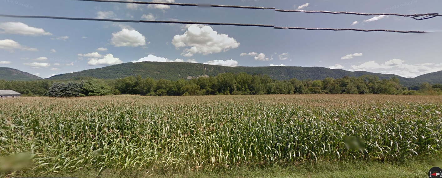
Every story has to start somewhere, and in the case of Mount Abraham, which rises over the eastern edge of Addison County, it has compacted and intertwined layers of history and folklore that make up a layer of bedrock that can’t be studied by geologists.
Mount Abraham is the fifth largest peak in the state of Vermont, rising at a lofty 4,017 feet. It’s crossed by Vermont’s fabled Long Trail, and is the tallest peak in Vermont’s presidential range, a range within the Green Mountains.
At the mountain’s base is the small town of Lincoln, a gateway to the Green Mountain National Forest. From the back roads that mender along the narrow valleys, the mountains form an imposing wall that almost look impenetrable, as the hardwood forests slide into the evergreens as your eye travels up towards the ridge lines. It almost may come as a surprise to some when Lincoln Gap Road becomes steeper and steeper as it switchbacks up sheer ledges and stunted hardwood trees before finally going up and over Lincoln Gap, a steep and wild mountain pass at 2,424 feet – making it the highest gap road in Vermont. The road is narrow and considered so steep that many Vermonters consider it one of the most difficult drives in the state, and for that reason alone, it’s closed in the winter. In the summer, it’s common for you to find the already unnerving road clogged with parked cars and hikers.
The Lincoln Gap Road, from the Lincoln approach.
I love Lincoln Gap, it’s a real beauty. I love all of Vermont’s mountain passes, called gaps or “notches” here. For someone who loves road tripping and discovering as much of Vermont as I can, these clefts in the mountains offer great drives, scenery, and outdoor recreation opportunities. There’s just something so satisfying about driving over a mountain, for some reason. In the winter, the gap is a magnet for adventurous people who like to fly down a mountain on sleds, skis or snowboards – with a 1,000 foot drop achieved in about a mile on the Lincoln Gap Road.
But long before a road ran up over the gap and Vermont was an established state, this land was occupied and settled by another group of people, The Abenaki.
The Abenaki generally settled in the fertile lowlands of the Champlain Valley, where the rivers and lake provided excellent fishing and the rolling hills and their deep forests offered reliable hunting. They generally avoided going up into the mountains, not because of curses, but because they were sacred places, where their god, Gluskabe, lived, which translates interestingly into the title of “The Owner”.
Cuts in the mountains such as Lincoln Gap were used to travel means, routes linking hunting parties with the Mad River Valley to the east and The Champlain Valley to the west. But when the White Europeans came down Lake Champlain and eventually streamed into the valleys and built settlements, the Abenaki were eventually pushed off their land. Some assimilated into the new culture and adopted Christianity as their religion, while others sought refuge in the higher elevations, including places like Lincoln Gap, which were seemingly safe in that impenetrable Green Mountain wall. What I found very interesting was to learn that as late as 1940, Abenaki long house villages could still be found along the Addison County shore of Lake Champlain, before becoming a part of something largely forgotten.
Today, the Abenaki have held on and survived, and can be found living around Vermont, especially in the north west corner near Canada. But some people say that the ghosts of an Abenaki party have remained, skulking behind the trees and outcroppings of Lincoln Gap. Also known as “the protectors of the Gap”, these presences occasionally make their existence known. The smell of burning wood from campfires has sent hikers off the trails to investigate the source of the smell, only to find nothing. Some have reported that the scent of the fire changed directions when the wind changed. Others shrugged it off as someone burning down in the valley, but did admit to them thinking that the fire sure seemed like it was close by. Other hikers have reported seeing eyes staring at them through the woods and fleeting shadows moving at inhuman speeds along the trails, but never getting too close. Not much is known about this ghostly hunting party, but they’ve been written about in quite a few publications on Vermont ghosts and folklore. One theory is that they are trying to forever protect the wilderness of Lincoln Gap, one of Vermont’s last wild places.
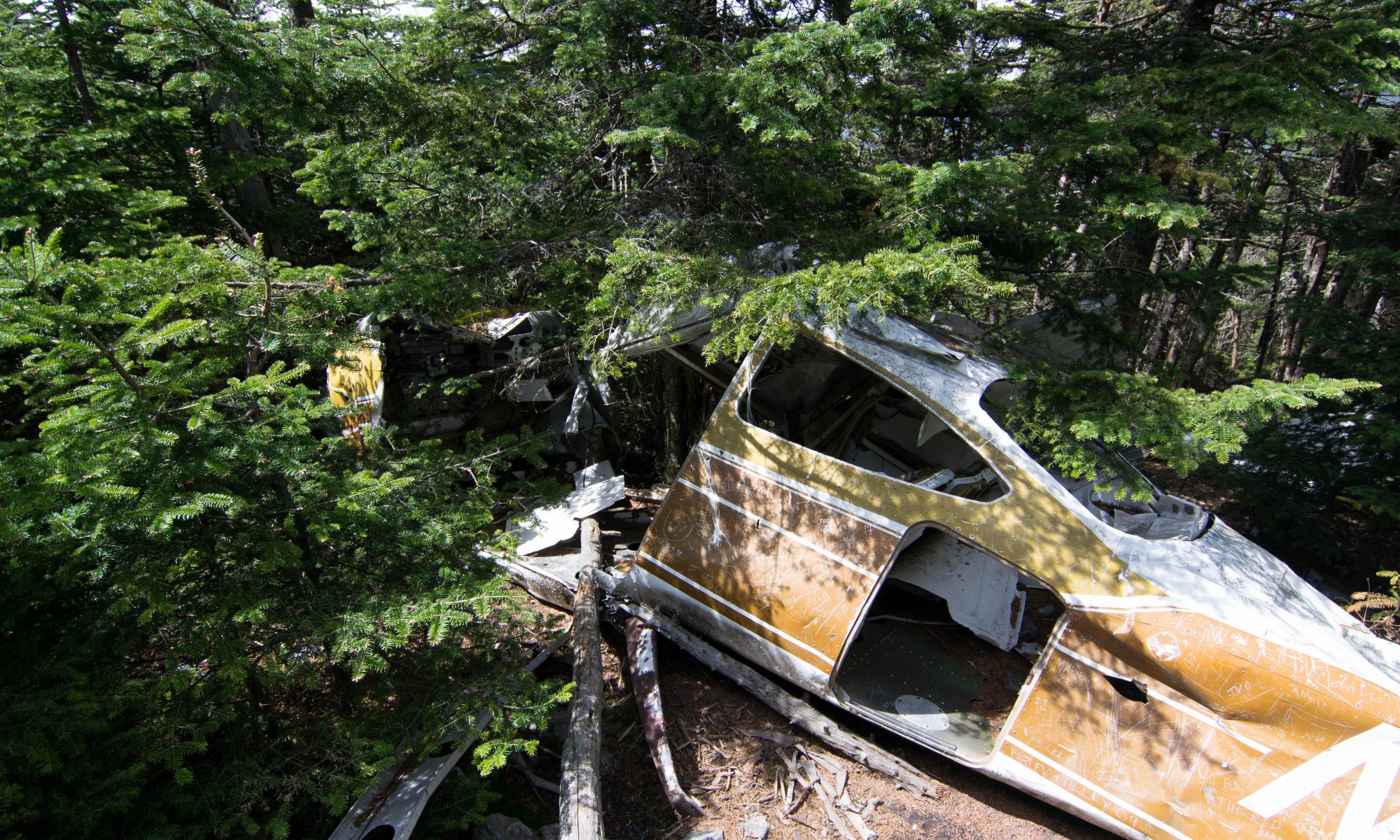
Twisted Shrapnel and Sweeping Views
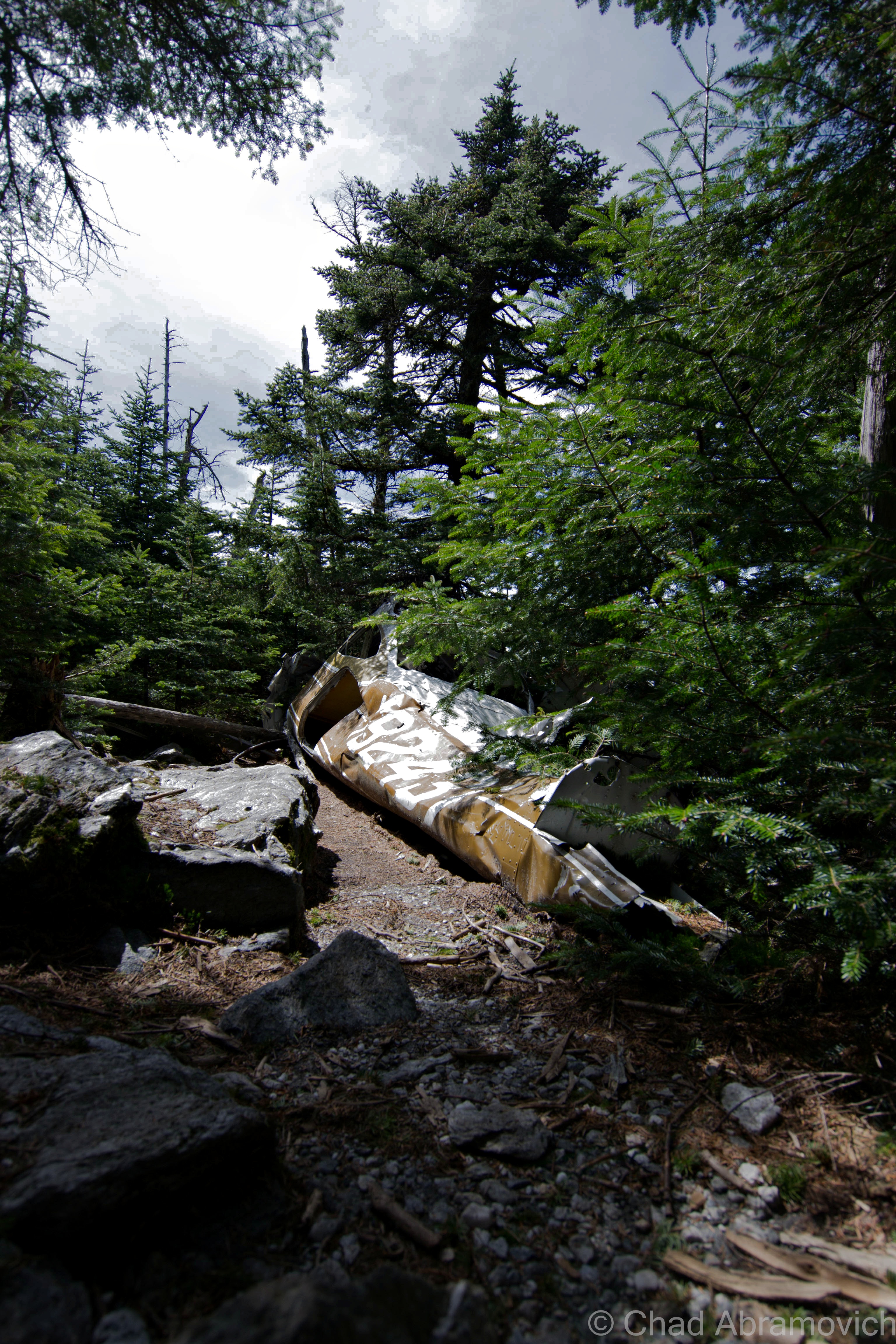
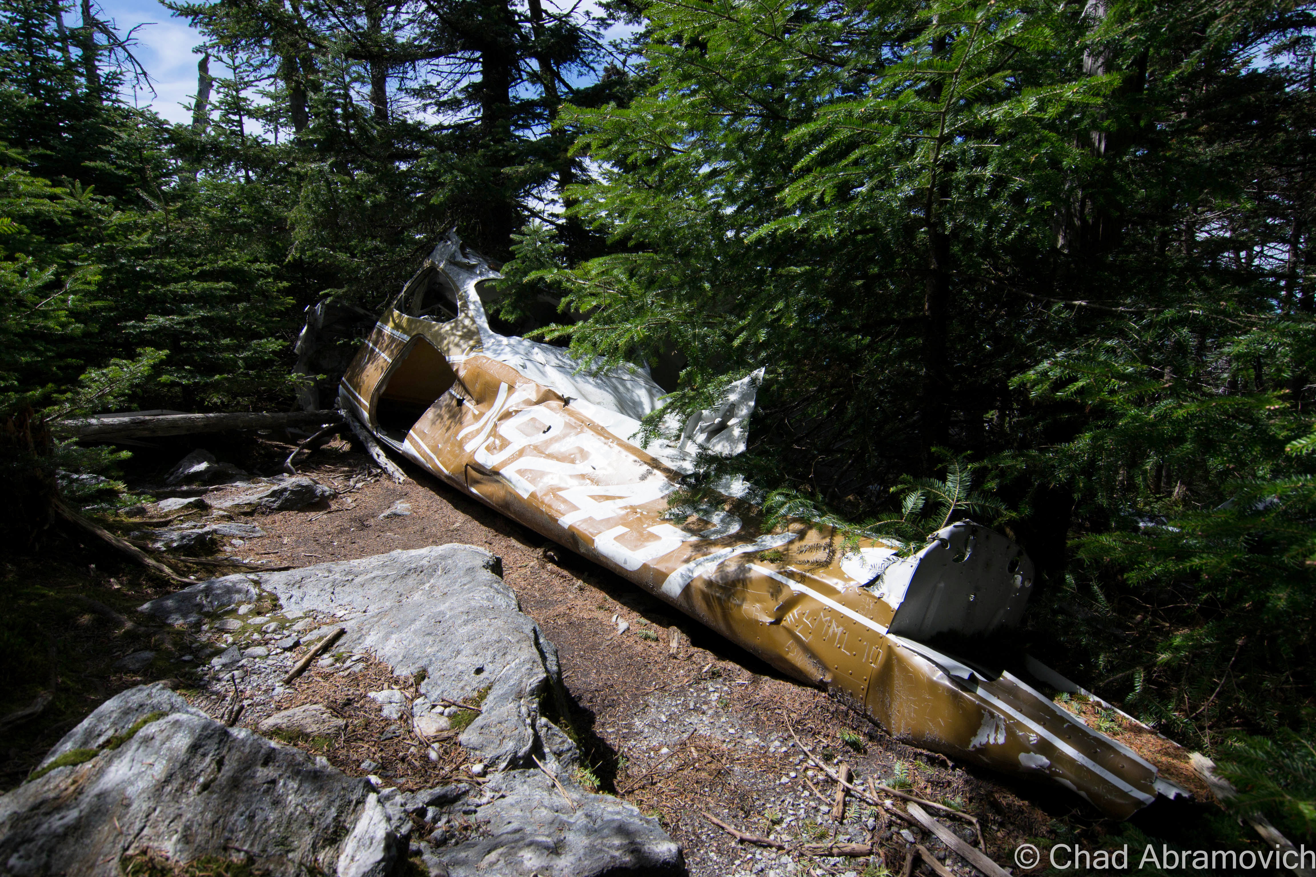
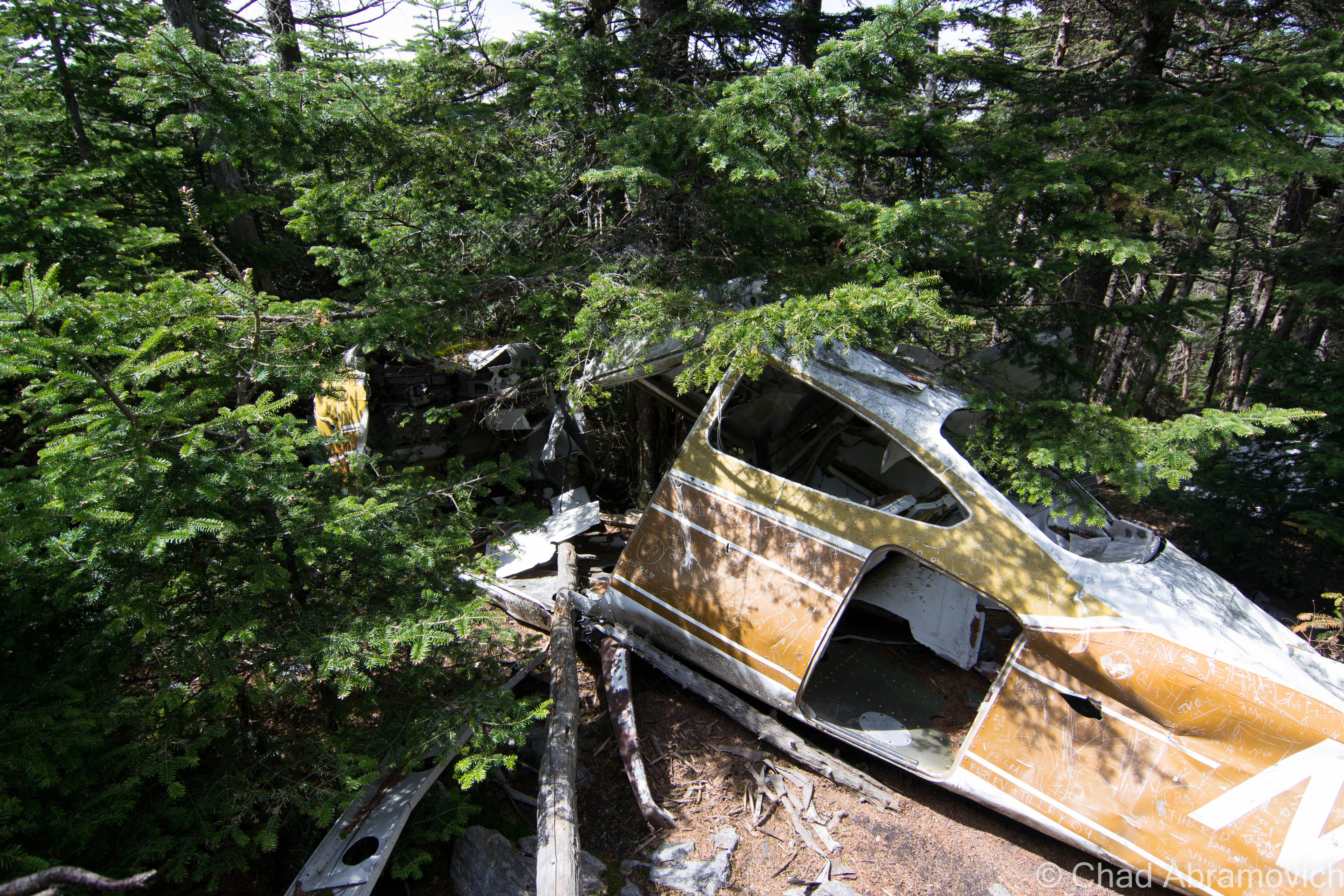
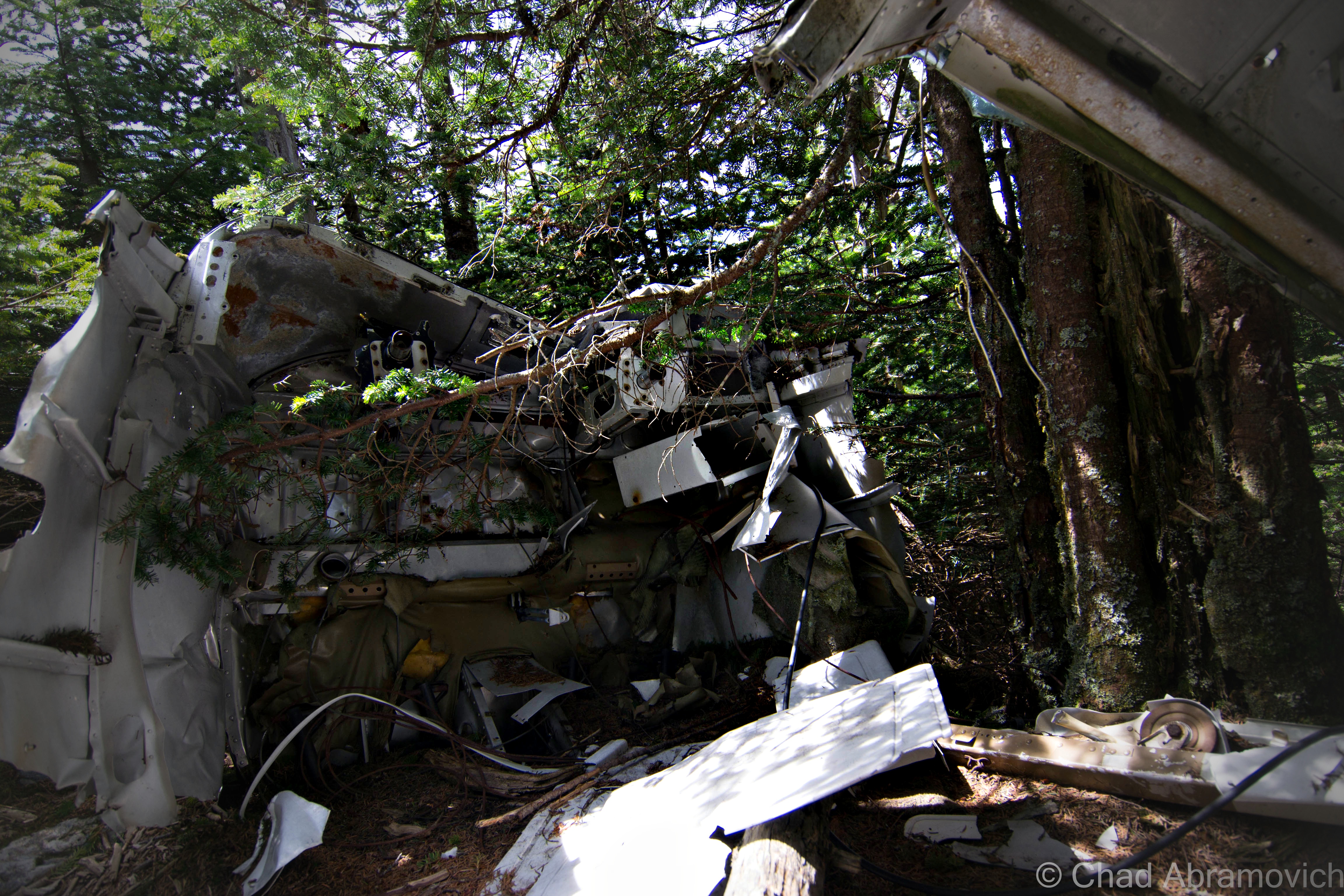
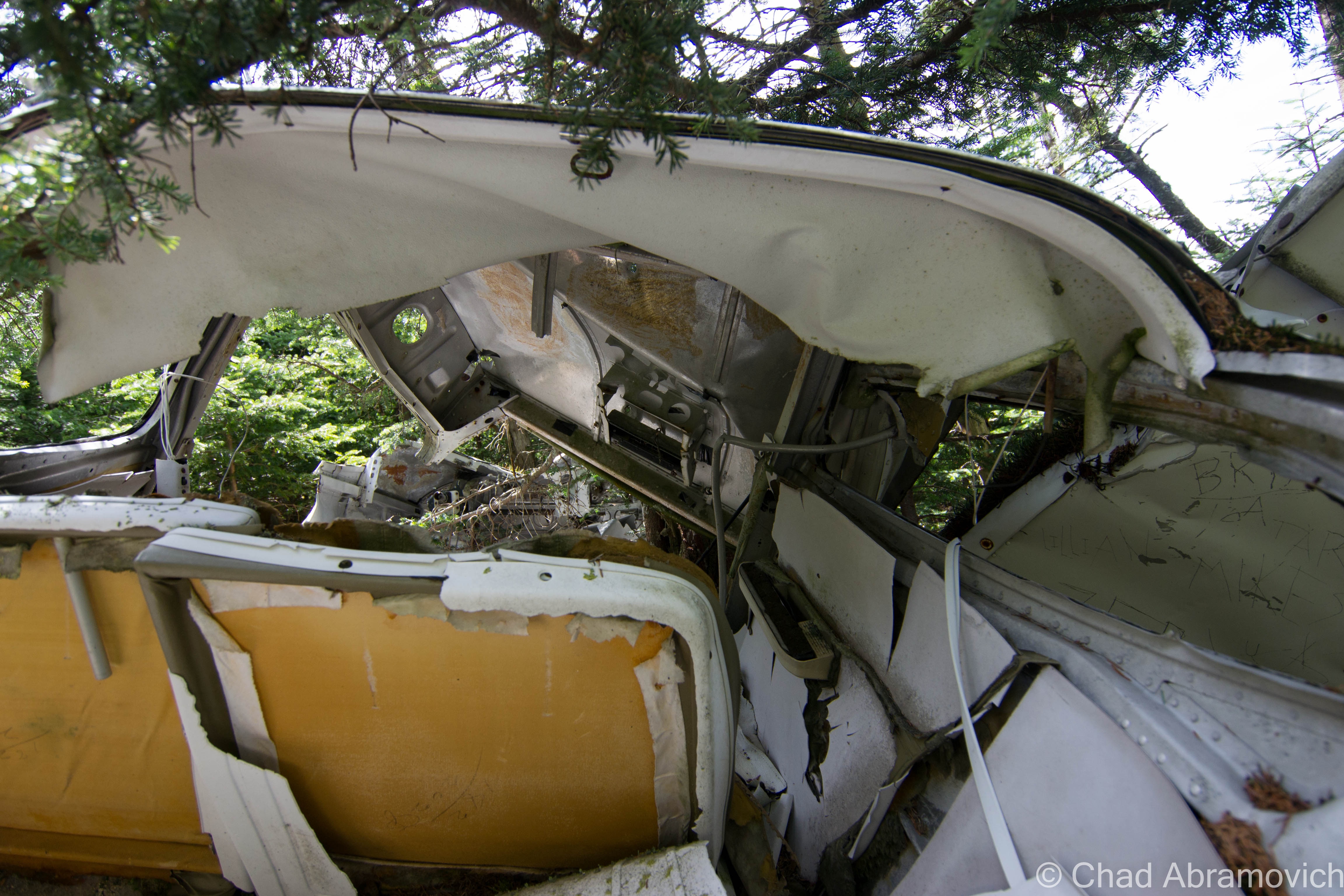
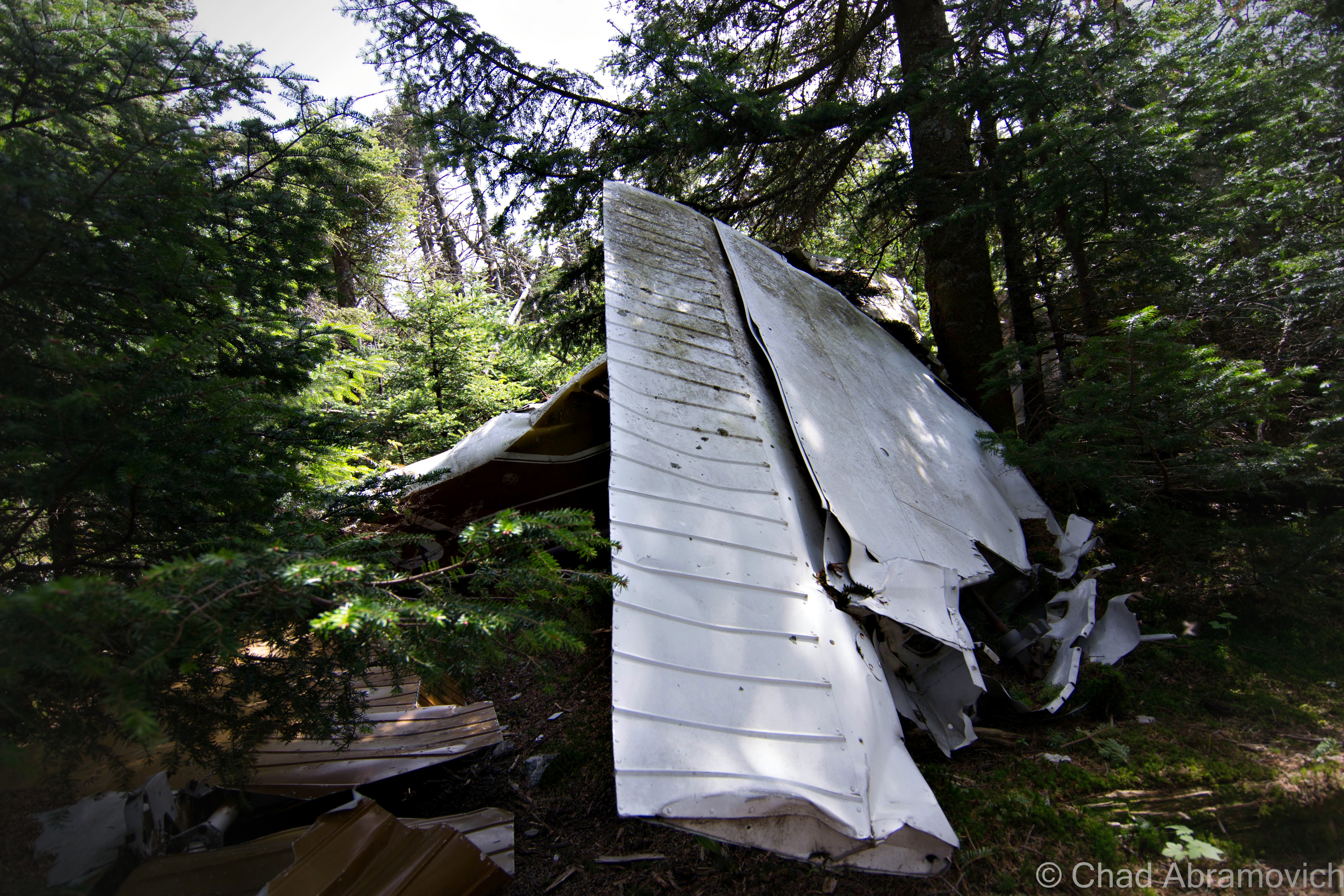
Somewhere below the wind swept summit of Mount Abraham lies another interesting part of the mountain’s history – the battered remains of a plane wreck, rotting below scented Spruces.
The story behind this interesting wreckage is rather uncomplicated. The plane is a Cessna 182N model, and it crashed on June 28th, 1973 when a pilot was trying to navigate a cloud bank and instead struck the slopes of Mount Abraham, just below the 4,000 foot mark. The pilot survived the crash. According to local lore, he climbed out of the plane and walked down the mountain. Not much is left of the wreck, apart from crumbled pieces of twisted metal. Most of the cockpit, the controls and the interior have been completely deteriorated. The engine is missing as well, possibly hurled further down the slopes, resting somewhere in deep scraggly forests not treaded in by humans in years. The fuselage may have been the most interesting thing about the wreck – completely carved with various graffiti of countless passersby who have all left their mark here. Thought the wreck might be a little underwhelming, it’s what the wreck isn’t that is the most fascinating. A representation of the ongoing story of man’s battle with nature, and the will to survive.
The mountains of Vermont are scattered with various plane wrecks, most people can recall the most famous one being on Camels Hump, but there are plenty others worth the adventure, all offering stories to tell to someone other than the mountain winds.
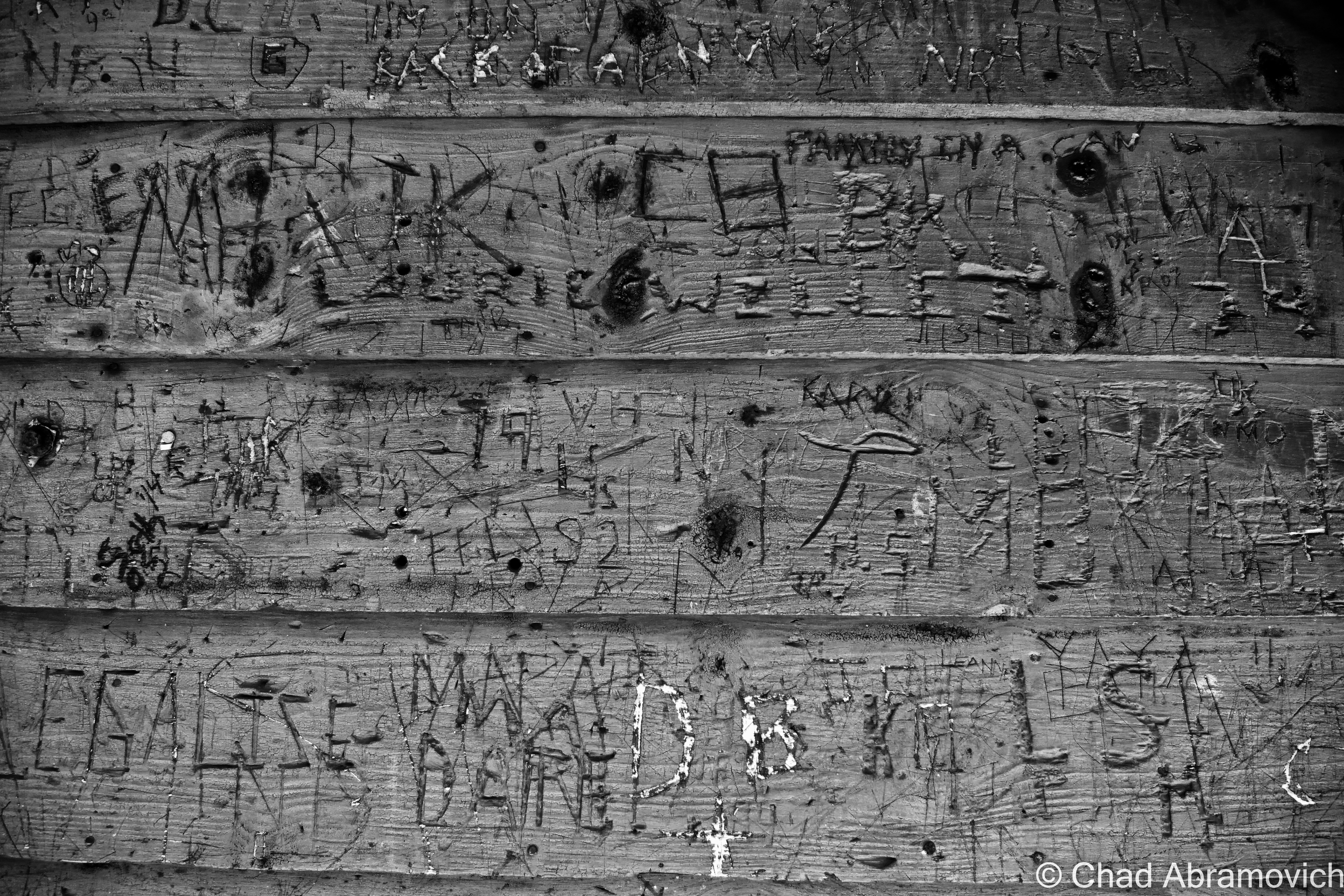
Another interesting sight, the carved walls of Mount Abraham’s Battel Shelter, located on the Long Trail just south of the summit.
—————————————————————————————————————————————–
To all of my amazing fans and supporters, I am truly grateful and humbled by all of the support and donations through out the years that have kept Obscure Vermont up and running.
As you all know I spend countless hours researching, writing, and traveling to produce and sustain this blog. Obscure Vermont is funded entirely on generous donations that you the wonderful viewers and supporters have made. Expenses range from internet fees to host the blog, to investing in research materials, to traveling expenses. Also, donations help keep me current with my photography gear, computer, and computer software so that I can deliver the best quality possible.
If you value, appreciate, and enjoy reading about my adventures please consider making a donation to my new Gofundme account or Paypal. Any donation would not only be greatly appreciated and help keep this blog going, it would also keep me doing what I love. Thank you!
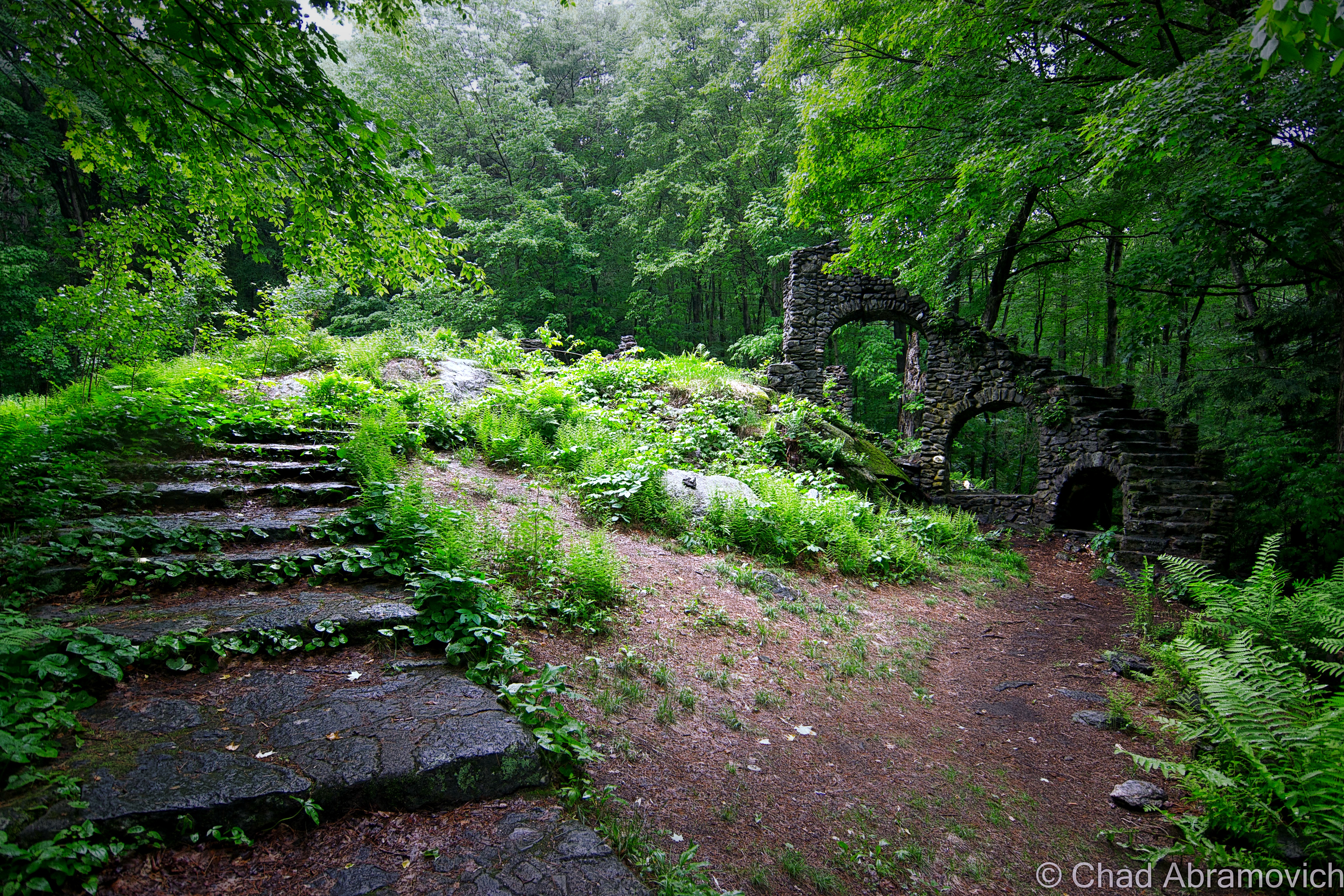
One thing about human beings, is we tend to leave behind fascinating ruins that simultaneously tell our story and raise far more questions. New England is a little lackluster on such places – opting for cellar holes, old cemeteries and names on a map instead. But we do have our share – like Connecticut’s mysterious Gungywamp or New Hampshire’s Stonehenge of America, all incorporating what is found in abundance here, stone.
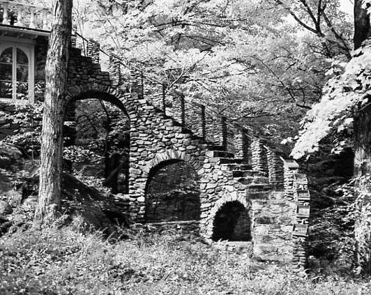
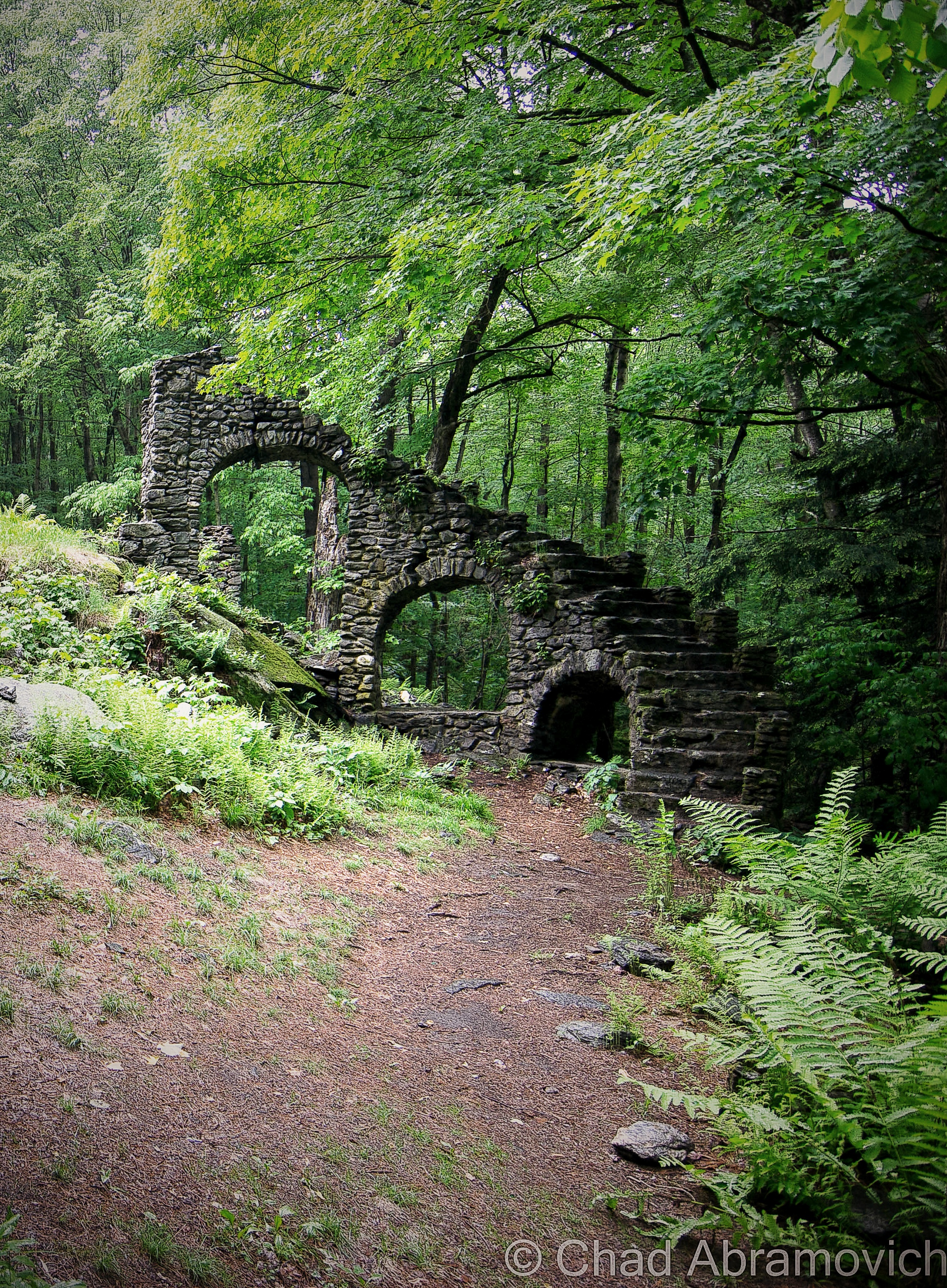
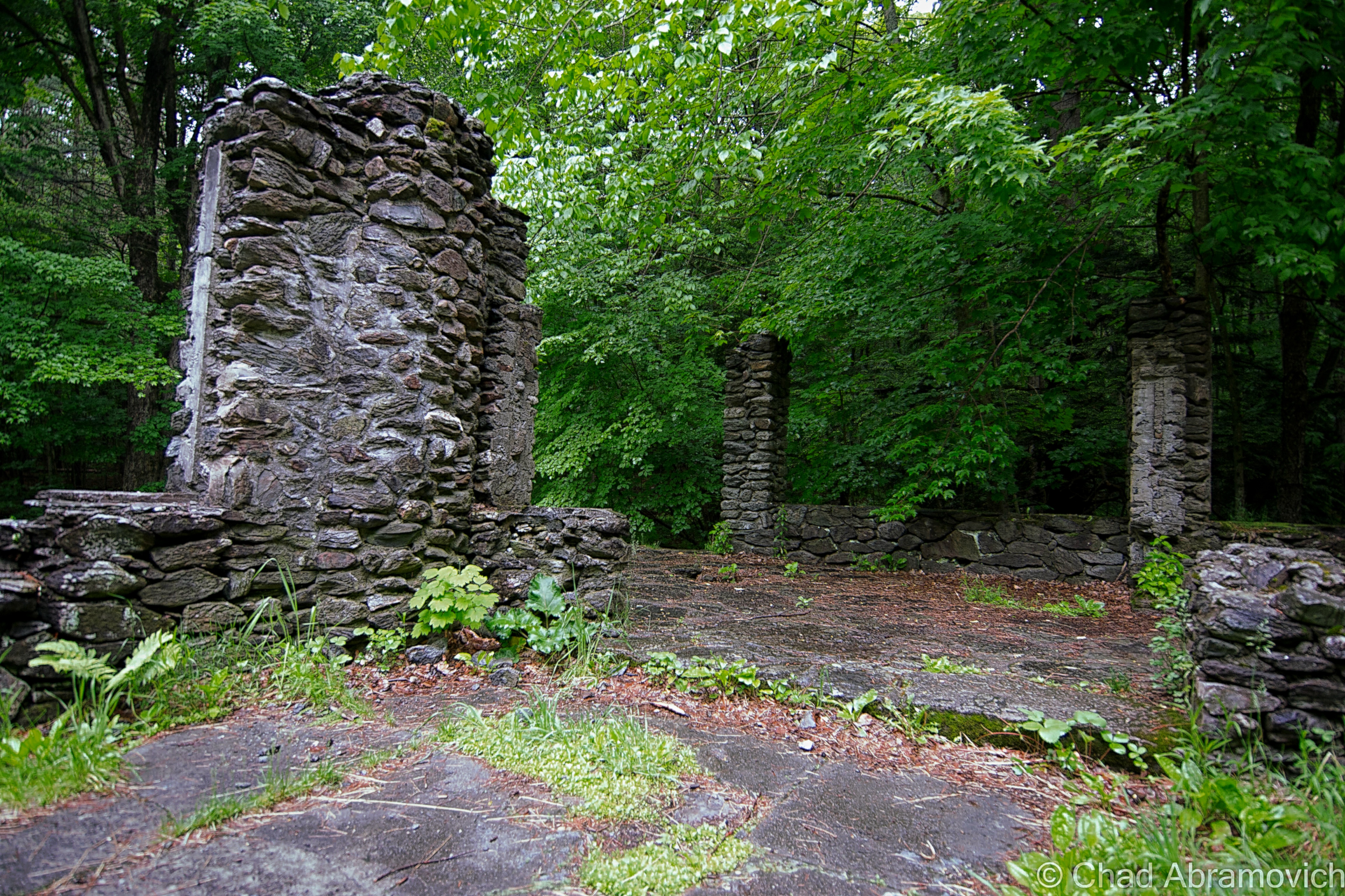
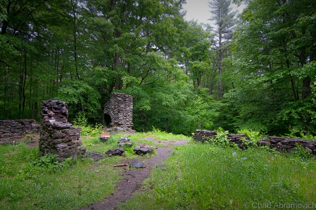
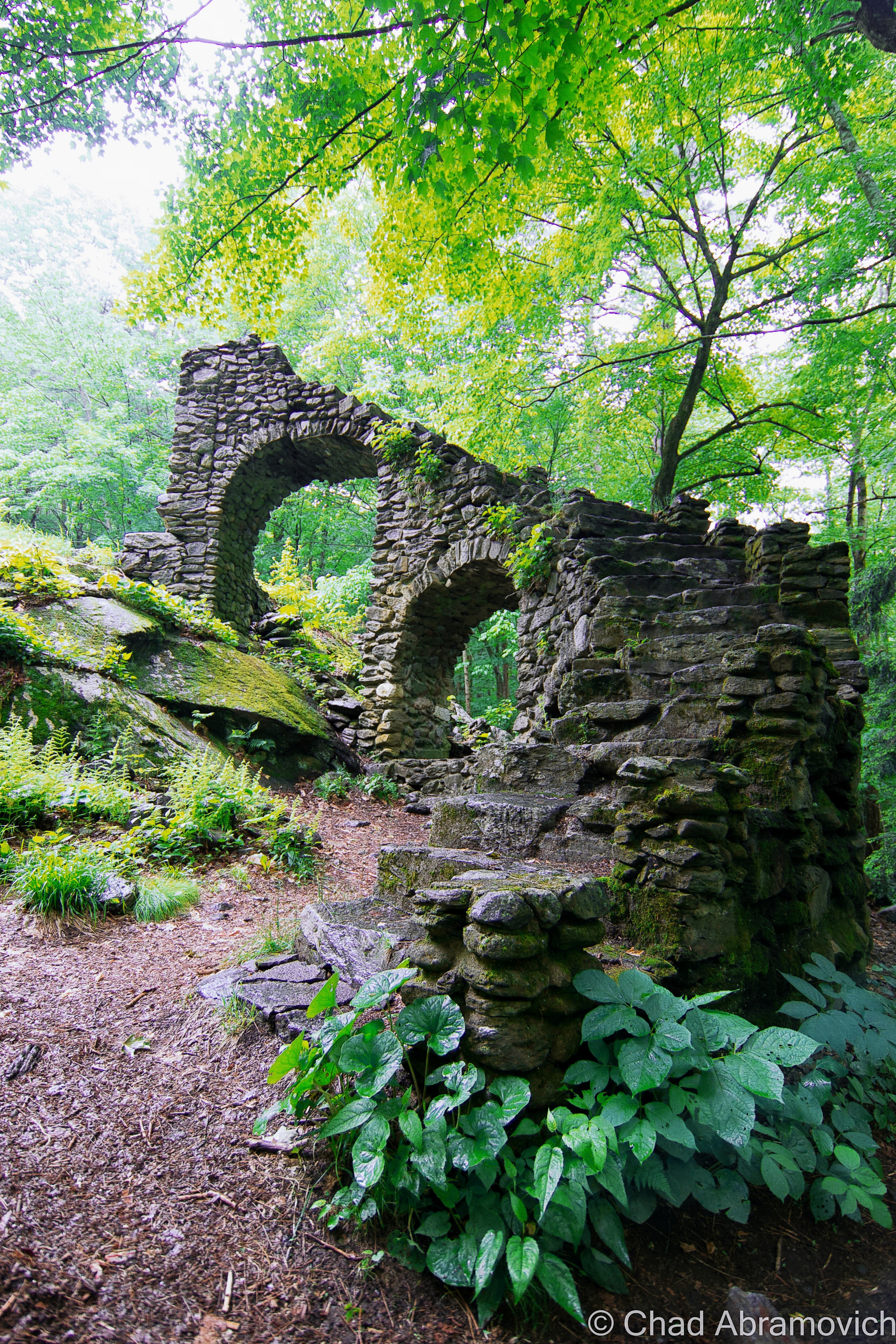
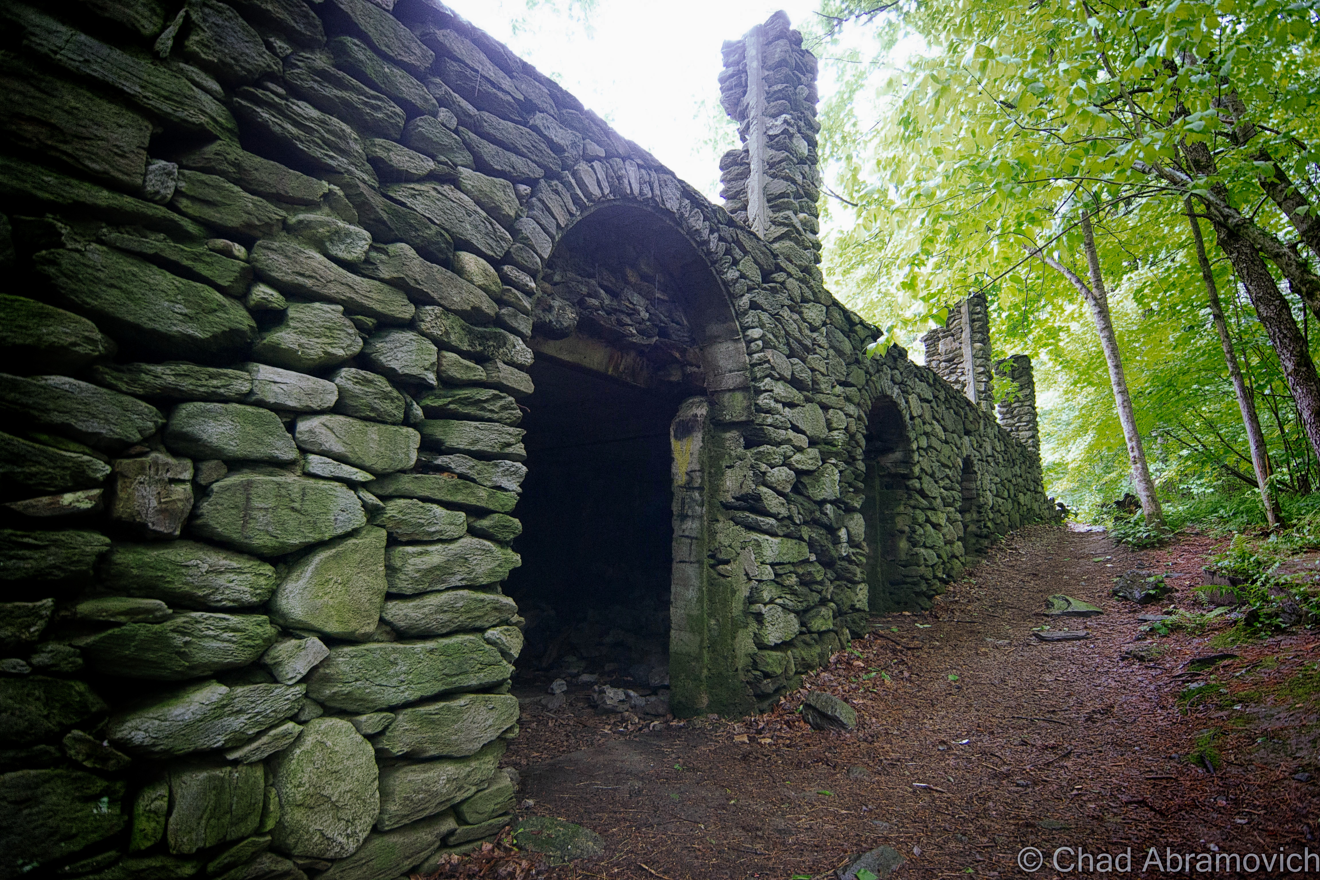
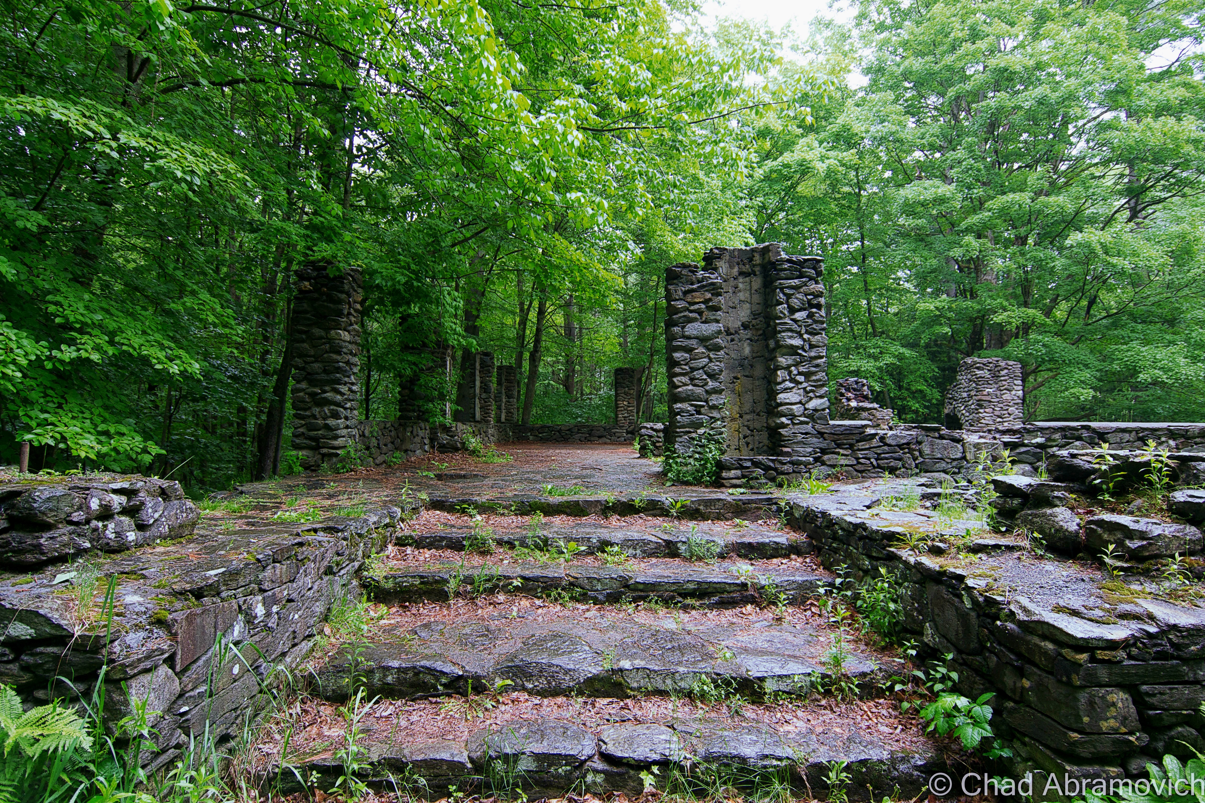
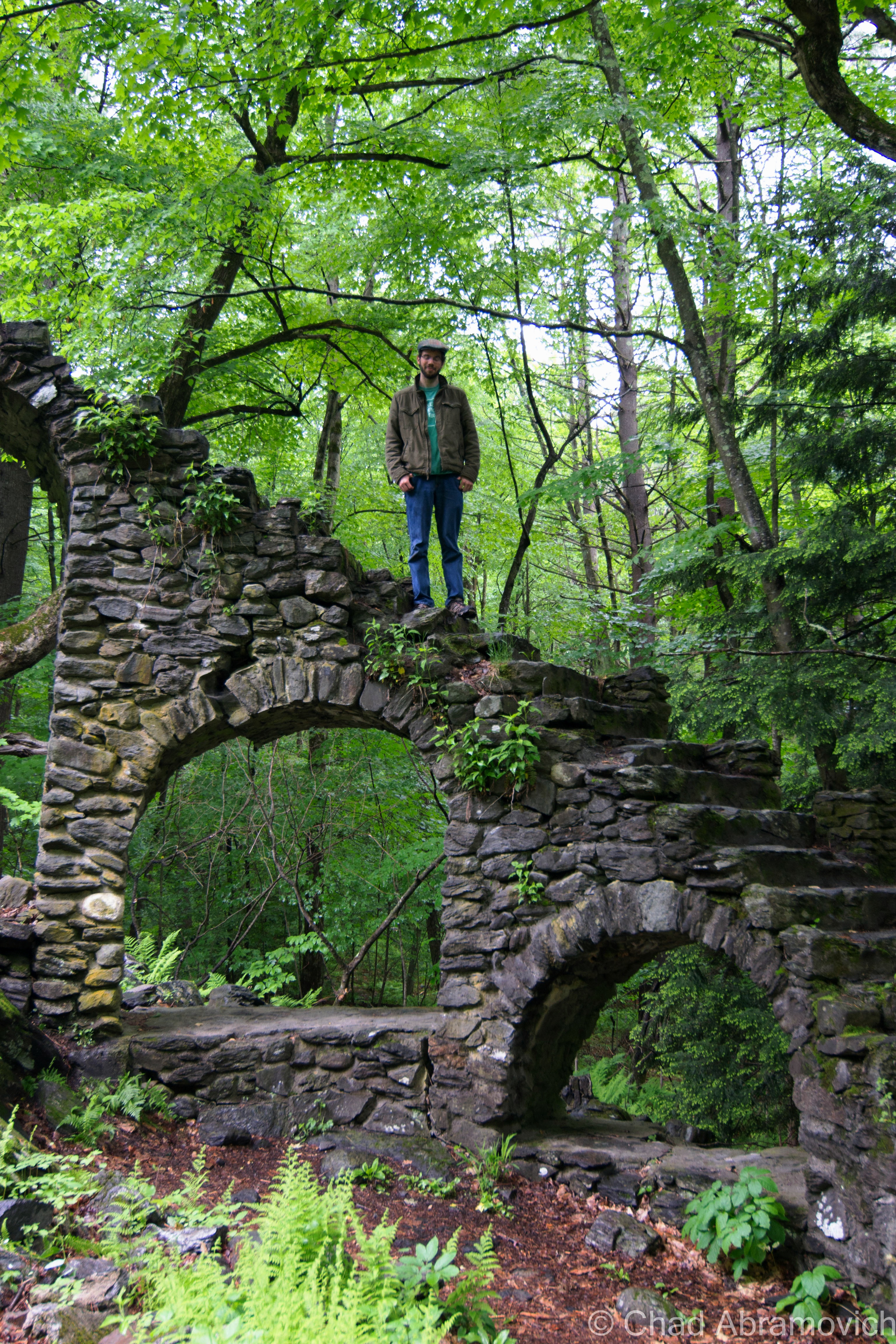
In Chesterfield, New Hampshire, across the river from the bustling town of Brattleboro are a set of stone ruins that are incredibly recent in the grand scheme of things. A dramatic stone staircase soars 20 feet into the air before ending abruptly above a collection of crumbling stone pillars and weed chocked foundations in the background of a dense forest unbroken as far as the eye can see.
The official name for this place is Madame Sherri Forest. Locals call it Madame Sherri’s Castle, and it’s 500 acres of wild and protected land combed by hiking trails, beaver ponds and ledges.
But who is Madame Sherri? Madame Antoinette Sherri, (who is just as interesting as the ruins of her grand home) was a French costume designer, born in Paris and transplanted in New York. However, her fame would be achieved not in the empire state, but tiny New Hampshire. She bought land in Chesterfield and built a summer home tucked away in the deep forests and gulfs during the 1920s. What started as a simple farmhouse turned into a lavish summer home by 1931 as she wasted no expenses in expanding.
She was well known for her wildly lavish parties she threw at her “castle” with an equally eclectic group of friends from the city. When she wasn’t partying, she was known for being the life of the party elsewhere by doing such things as riding around the region in her Packard touring car in nothing but a fur coat. Reportedly, she eventually ran out of money and abandoned her her grand home as it fell into ruin. But with a personal mantra like “only the best”, I suppose this was inevitable. By 1946, she abandoned her castle. A fire in 1962 eventually brought the demise of her property, leaving only the stone ruins left to this day, sitting curiously in the middle of the forest.
The fire left behind a rather forlorn yet satisfying medieval-looking ruin, displaced in the middle of New England, which is most likely where the “castle” moniker came into its name, from people who have visited since. After comparing older photos of the mansion, it definitely looks more like a castle now than it did when it was inhabitable.
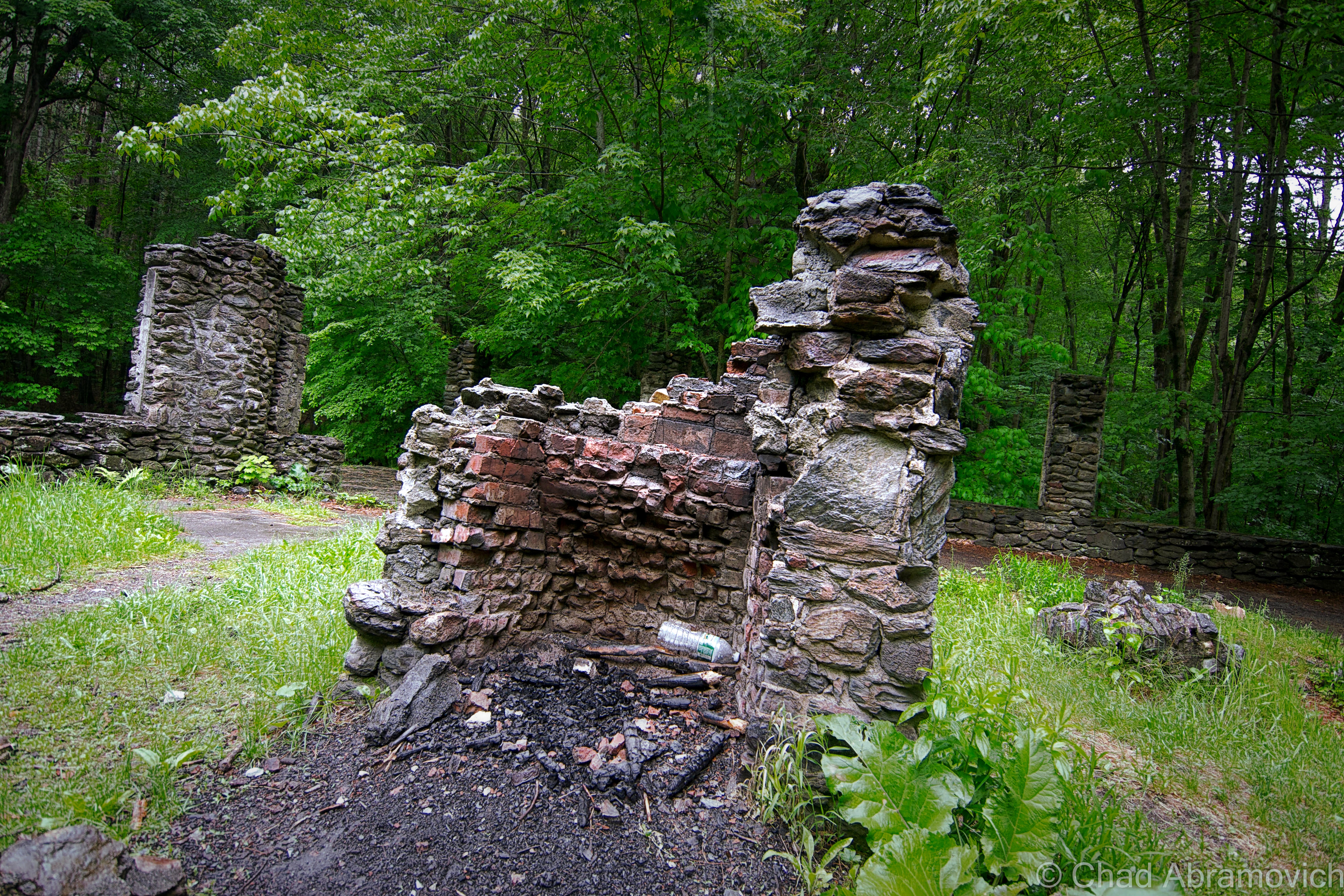
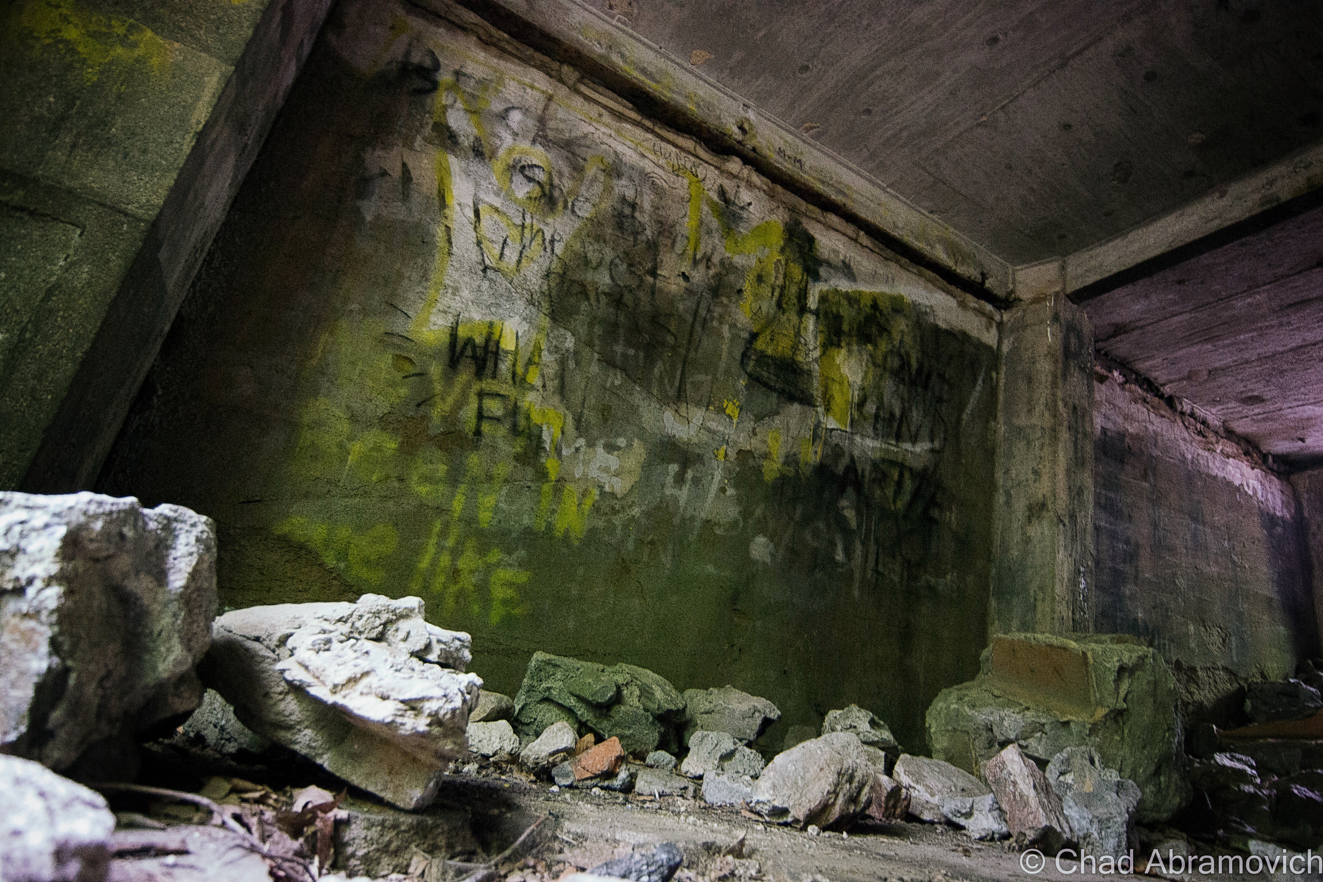
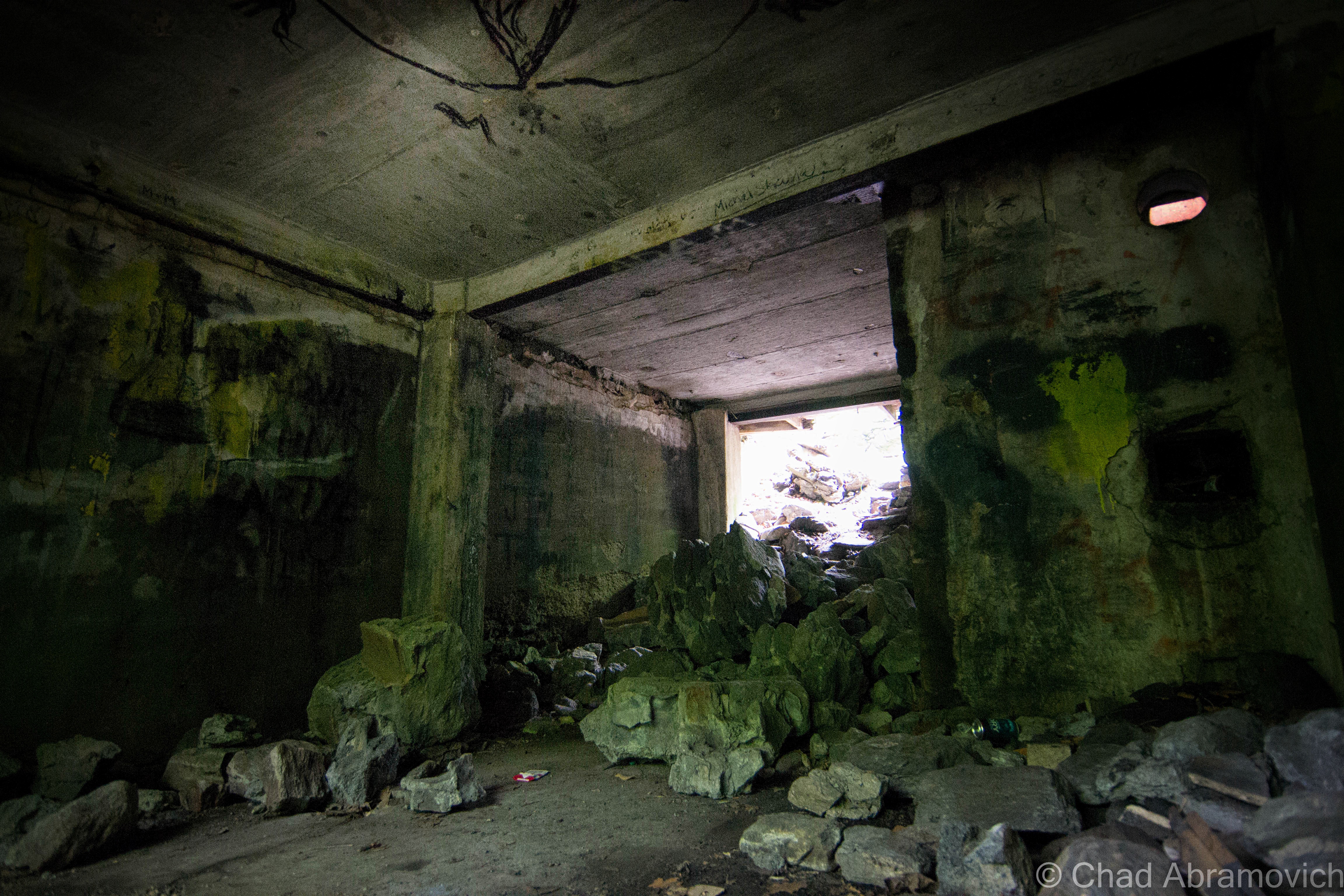
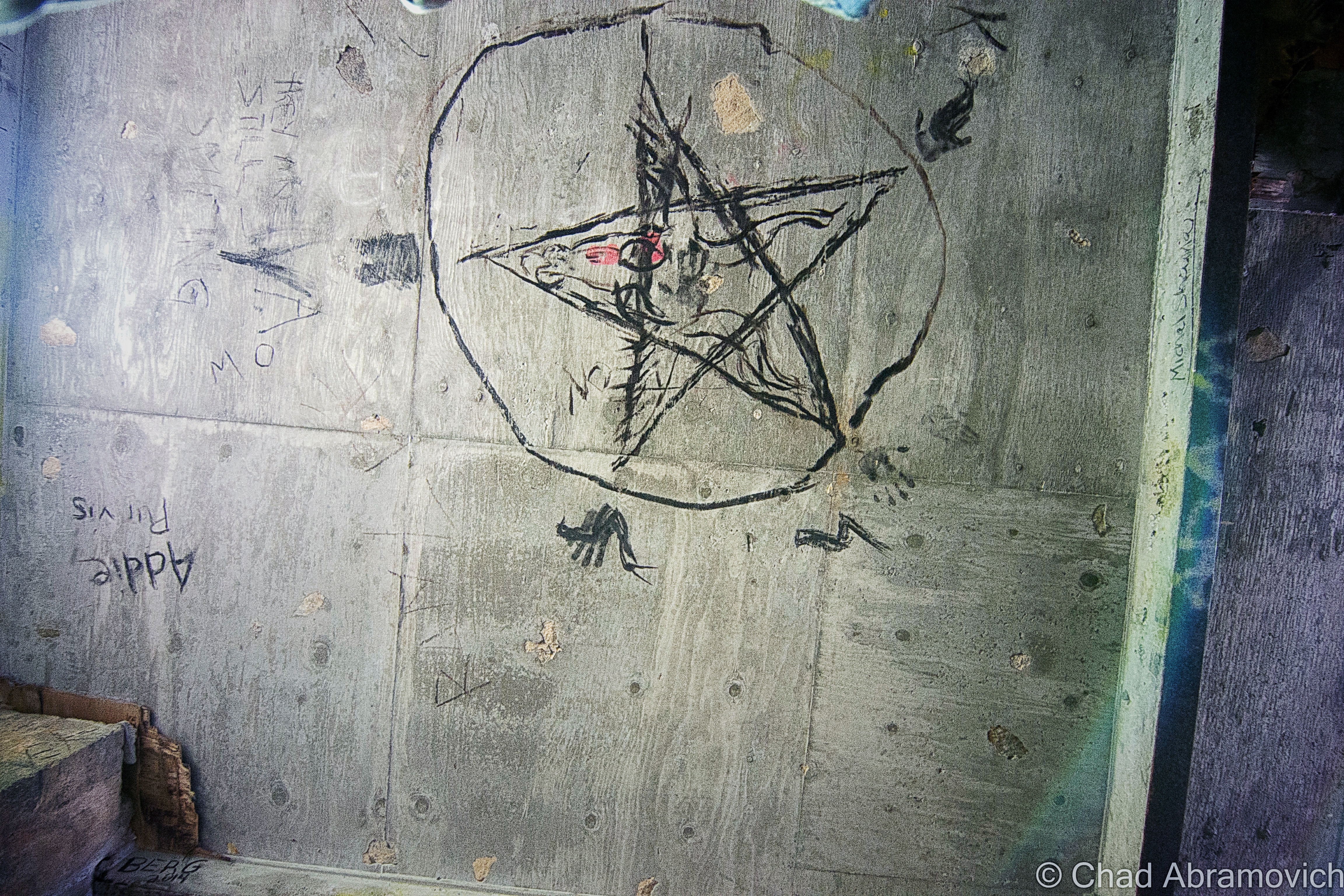
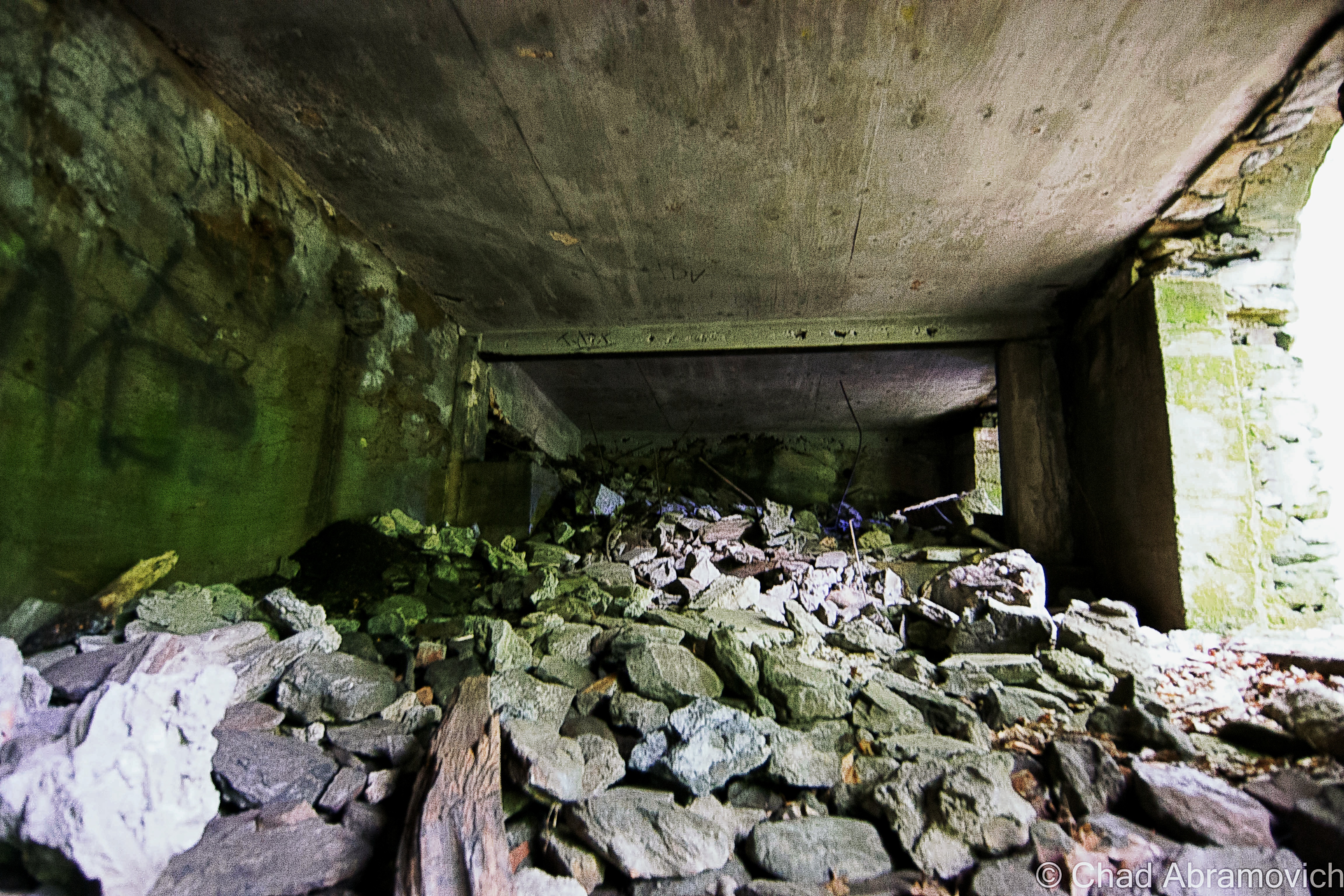
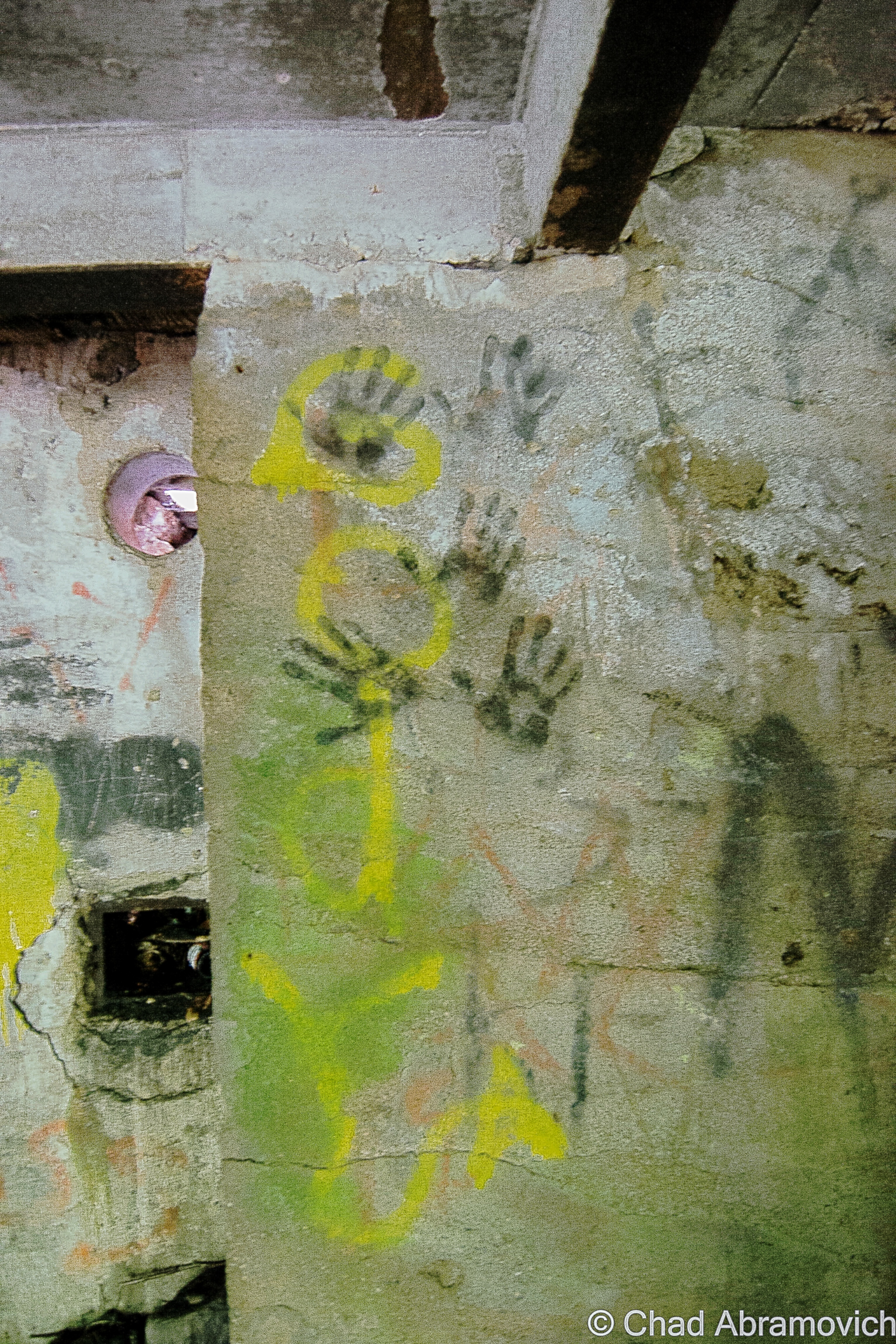
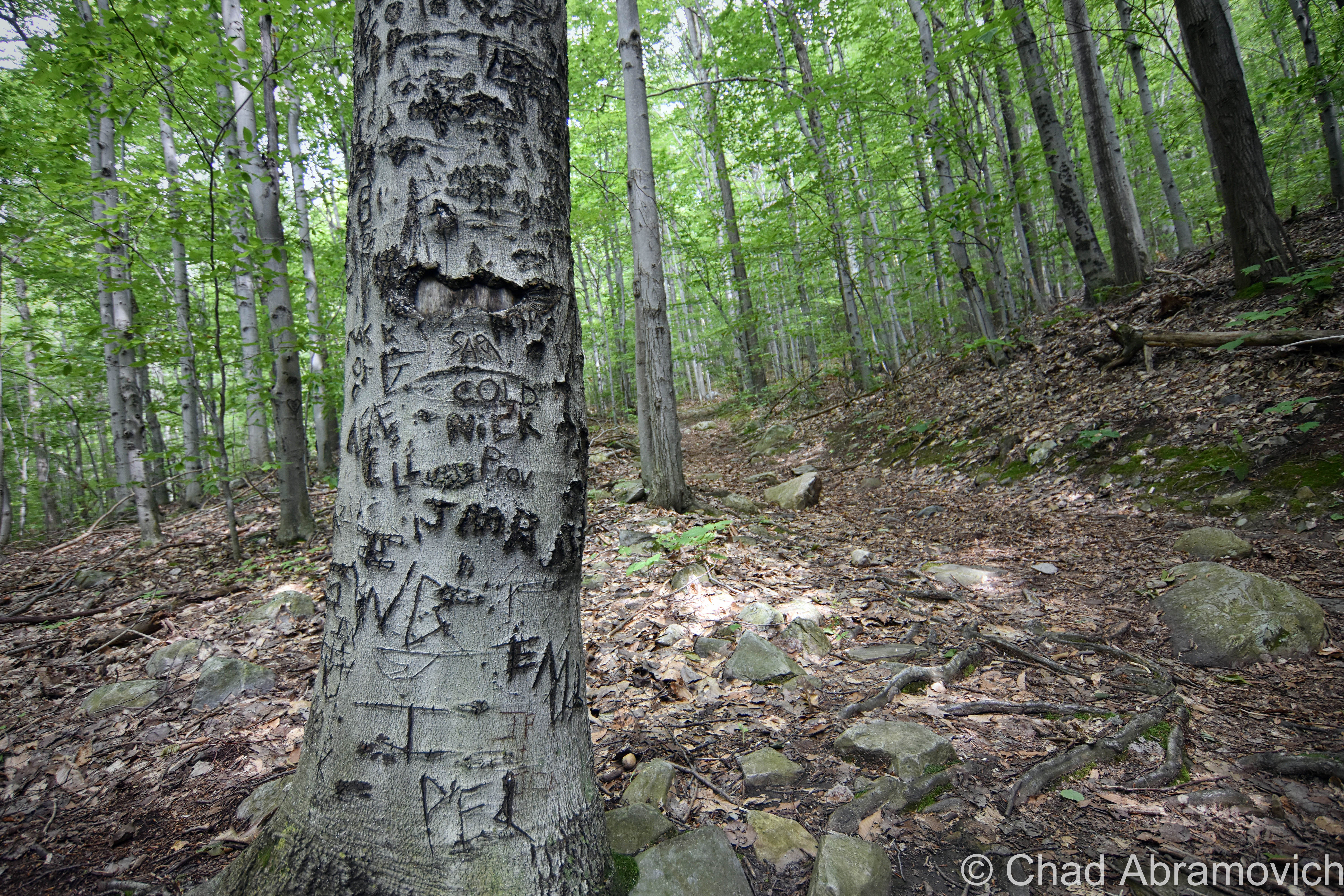
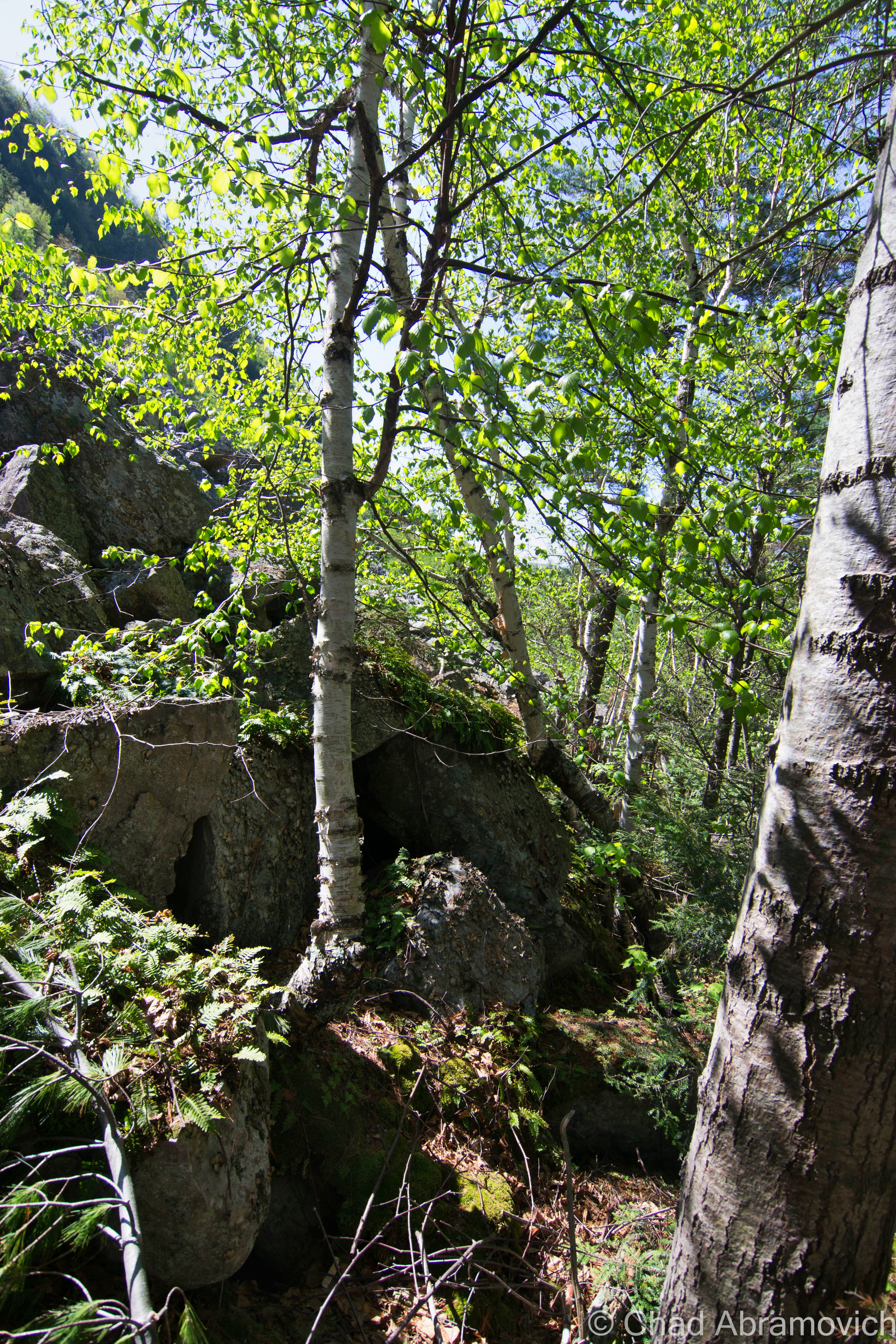
The “first floor”, or, the only floor, of the ruin still has a few surviving stone columns and chimneys that sit above crumbling remnants of the old stone floor, covered in weeds and wild flowers. But there is a level beneath the rocks which is starting to slowly cave in, filled with detritus, broken beer bottles and satanic graffiti. It may have been larger at once point, but with the level of collapse, it’s hard to tell. It’s very evident from the discarded bottles, cigarette packs and smoldering charcoal that people party here – and perhaps worship the paranormal, just as Madame Sherri would have wanted.
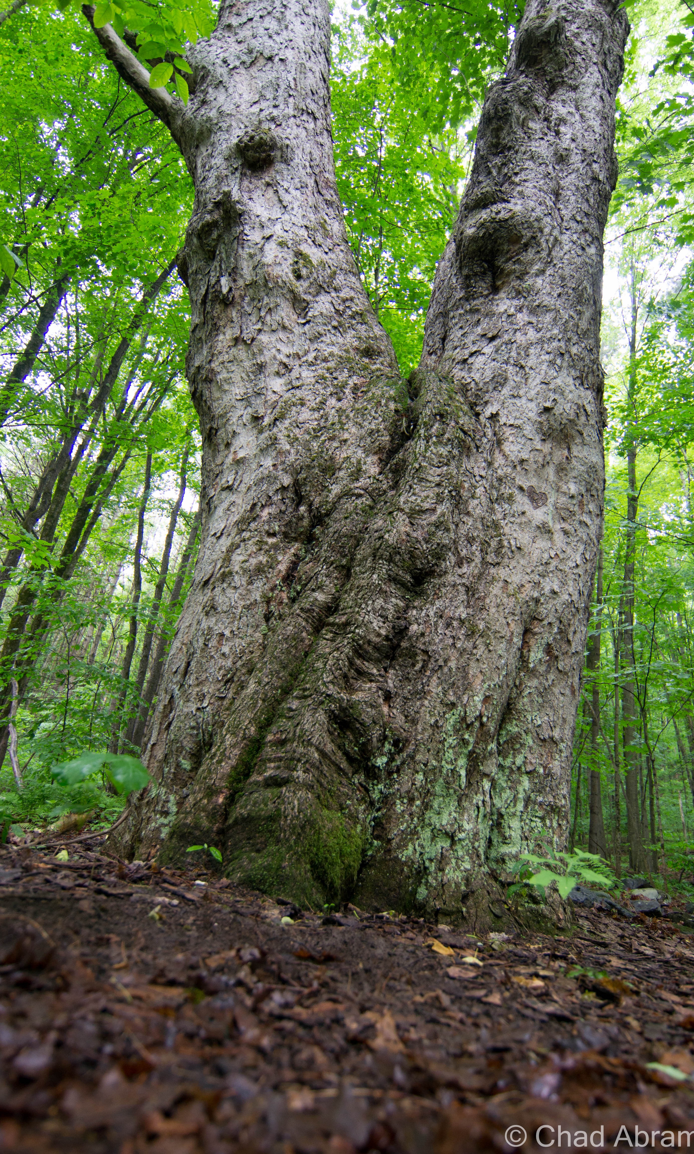
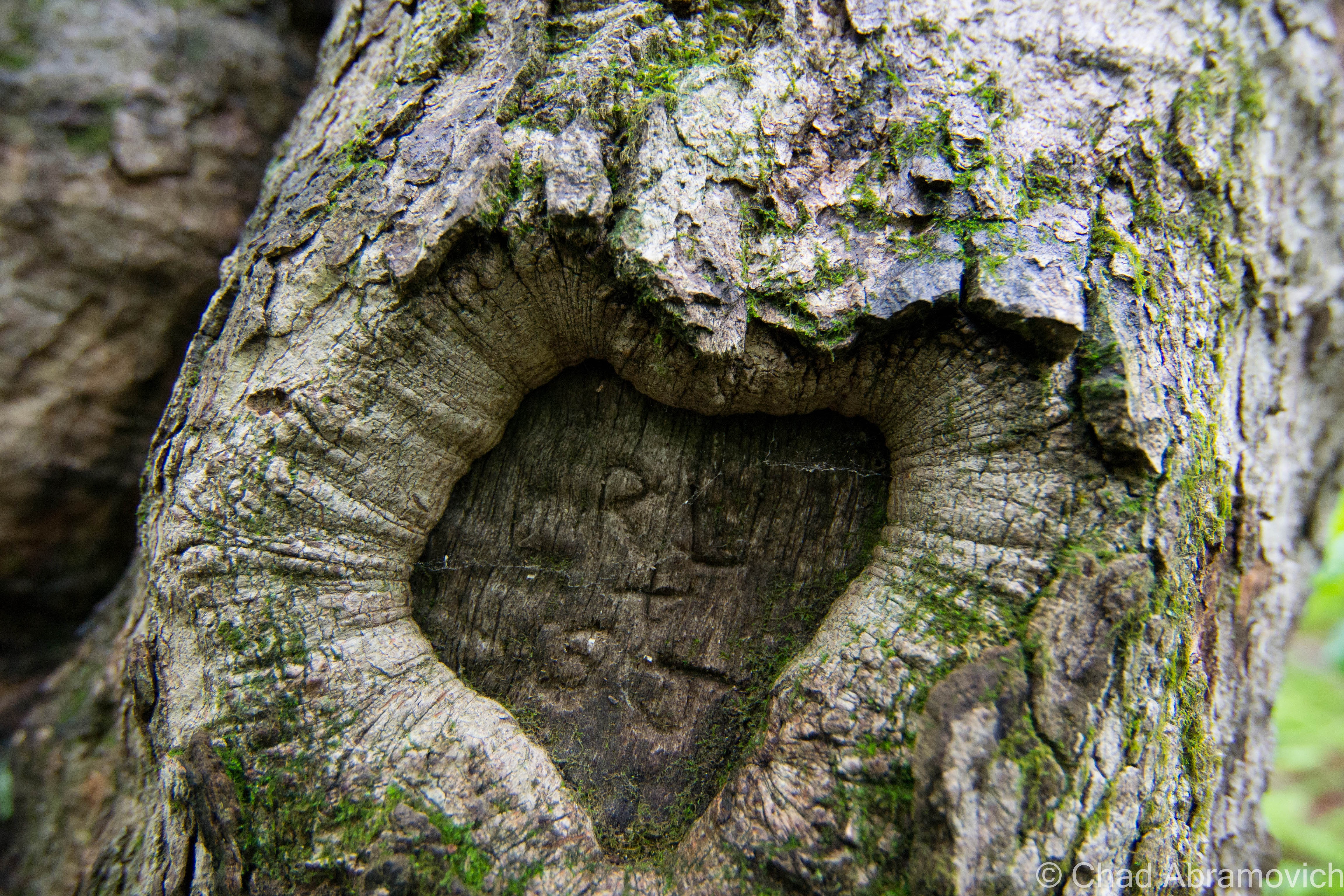
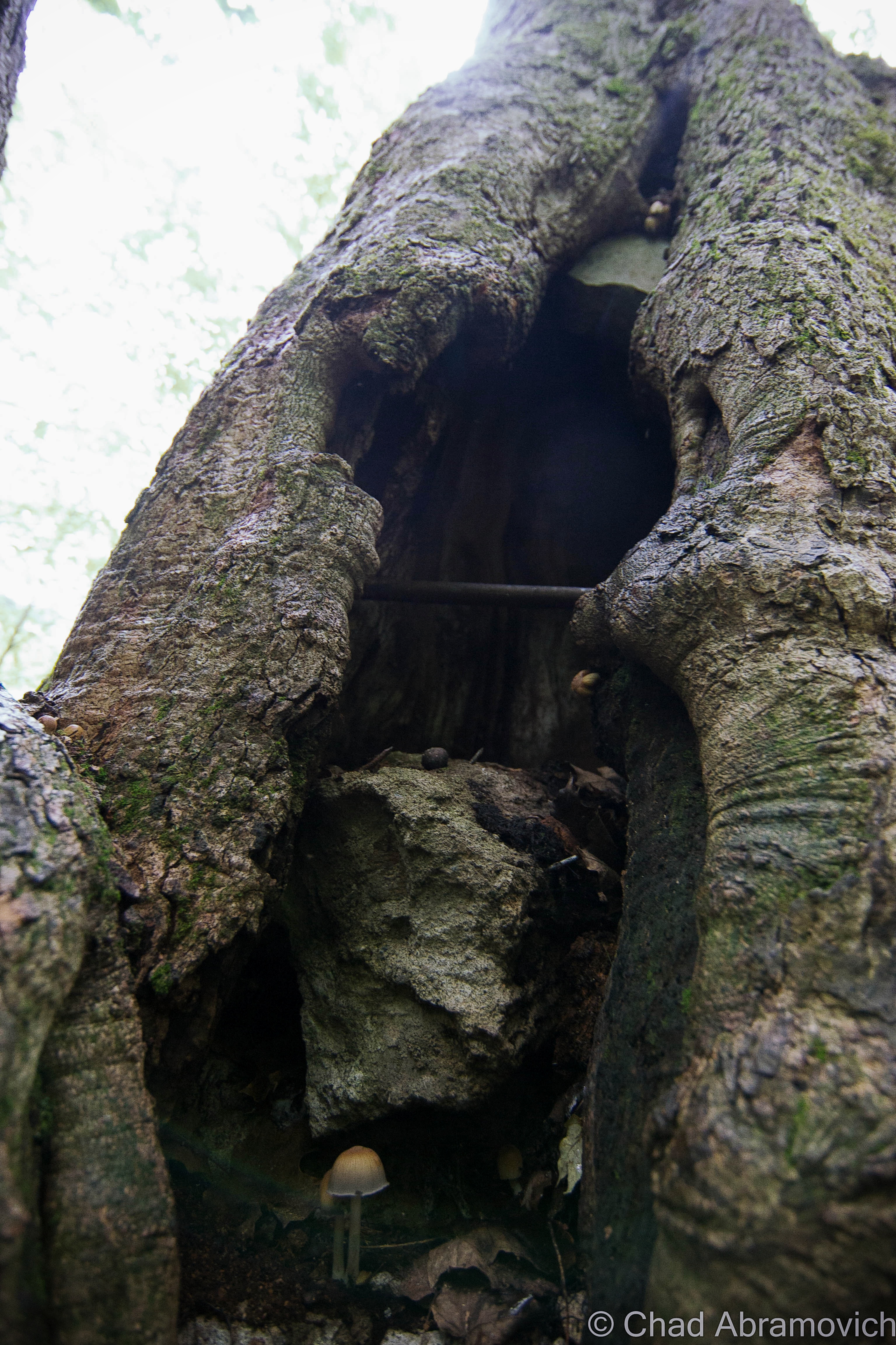
On my somber visit here today, it had been raining steadily since I got off the interstate in Brattleboro. Once crossing the river, I turned down Gulf Road, a distractingly beautiful drive through beautiful forests and jagged cliffs leering over the road covered in moss – everything was below a come down fog. The rain however made the ruins more of a dangerous trek than anticipated. The stones were slick and it was easy to loose your footing. This was most evident when I tried climbing up to the top of the large staircase. There are large cracks in several places, part of the stonework is eroding, and the steps offered no traction. Avoiding my own stupidity being my murderer, I tromped around the rest of the ruins. The dank cellar area was littered in interesting graffiti, and there was lots to read. People who came and went, their names, quotes and opinions underneath dripping ceilings, especially someone named Tyler telling me he visited as recent as this year. Around the property were older growth trees, most likely original to the house, towering above the young forest. One tree in particular was peculiar, the inside was partly hollow, and it was filled curiously with lead pipes and a various assortment of placed boulders. There were also several inscriptions and carved initials in the bark, which were amusing to read.
I think the impression that weighed with me the most about this place, was just how silent and deep the forest was around the dripping ruins – I truly felt something pleasant slip under my skin, but the ruins held supreme, over taking the striking beauty of the New Hampshire forest, the sound of rain falling onto the leaves.
The eccentric and mysterious Madame SherriThe iconic stone staircase, equipped with a hand railing, leading to a very nice looking balcony.Madame Sherri’s Packard touring car. According to legend, she used to cruise around town wearing nothing but a fur coat.Madame Sherri’s “Castle”
“Because she throws the best parties….What fun!…She throws grand parties”
your blogger.
—————————————————————————————————————————————–
To all of my fans and supporters, I am truly grateful and humbled by all of the support and donations through out the years that have kept Obscure Vermont up and running.
As you all know I spend countless hours researching, writing, and traveling to produce and sustain this blog. Obscure Vermont is funded entirely on generous donations that you the wonderful viewers and supporters have made. Expenses range from internet fees to host the blog, to investing in research materials, to traveling expenses. Also, donations help keep me current with my photography gear, computer, and computer software so that I can deliver the best quality possible.
If you value, appreciate, and enjoy reading about my adventures please consider making a donation to my new Gofundme account or Paypal. Any donation would not only be greatly appreciated and help keep this blog going, it would also keep me doing what I love. Thank you!
I gotta hand it to teenagers, they always seem to find the coolest places to hang out. The Bristol Cliffs will verify that.
I was heading to my old roommate’s parents’ place near Lincoln to help him do a little farm work, and he was pointing out cool terrestrial hangouts he used to haunt when he was a kid. If you’re a Vermonter, chances are, you spent a lot of your youth outside, and Bristol denizens might just have one of the best towns in the state for inspiring geography. That’s also because the entire eastern charted part of the township is cliffs and mountains that are gruelingly steep, which annoyed early settlers quite a bit. Today trends have changed and now it makes for desirable real estate because people want views.
We turned up near Bristol Falls, a hugely popular swimming hole with crowds so thick in the summer that it makes a trip there not worth it at all, at least to me. But the draw is completely understandable, especially viewing the place on an off season day when you’re the only one there.
Hemming in the falls are a set of craggy cliffs that are the side of a 1,825-foot rise known by the Vermont geographical place names board as Deer Leap. Locals just call it Bristol Cliffs, because they’re cliffs, in Bristol.
It’s a win-win for Bristol-ites, because you can admire the eye magnetic precipice from almost any point in town, and also get extraordinarily cool views of Addison County from the top of the to-the-point named ledges if you know which unmarked trail will get you up there. It seems like most area teens do.
Local lore spins a yarn about Abenaki hunting parties chasing deer to the cliff sides and running them off the edges, where more hunters waited at the bottom to collect the carcasses.
But there is another tale that may offer an explanation, and it seems like sort of an archetypal tale that many small towns across America have in their own particular cast.
In the vague timeline of the 1800s or early 1900s, 2 love struck teens decided to commit suicide here by jumping because their families forbade them from being together, for reasons that never made it into the story. The guy held the girl’s hand, and allegedly said “Ok, dear. Leap!”. But that much of a precise detail would have had to involve a witness, and to my knowledge, none have ever came forward. I think that would make it into conversation at some point.
Today, the almost grueling hike gives you terrific views of Bristol village and Addison County and a sweat soaked shirt. It’s also a Peregrine Falcon nesting area, which can dive bomb at speeds of 200 mph.
The Ledges of Deer Leap in BristolThe trail up Bristol Cliffs. I love finding tree carved screed.Hiked above the haze today up to Bristol Cliffs, not to be confused with the other Bristol Cliffs one mountain over. Made it up just in time to feel a change coming up and a storm rumbling in.
“The Money Diggers”
It was one of those first great spring days of the year where having fun sounded better than my adult responsibilities, and I set out towards Bristol with an adventure in mind. My only obstacle was how to get there, which was at least 80% of that aforementioned adventure.
My plan was to bushwhack up towards a remote and grueling area of the Bristol mountainscape spitefully called “Hell’s Half Acre” by silver miners over a century ago. An area with an incredibly gothic ledger of tales affixed to it.
There are no trails here. No signage or public access. Just a giant mountain as a general compass point, which was a huge part of this wild area’s appeal to me. With a photocopied town tax map in hand, I studied the property boundaries and saw my portal; a narrow sliver of land between two lots that was owned by the national forest. That would be my way up to a miserable elevation called South Mountain.
Parking the car off a no trafficked gravel backroad, I simply entered the woods and walked in the direction of the mountain. I knew as long as I was going up, I was technically going in the direction I wanted.
My feet began finding numerous pine needle covered holes in the ground that are easy to slip into while walking, and roll an ankle if you’re lucky. Others are more unfortunate I suppose, and leave with broken limbs.
Eventually, the topical Quartzite rock slide loomed before me as I trekked through the budding woods in bloom, as the sun was already baking their chalky white surfaces. Undoubtedly, this is some of the most inhospitable land in Vermont.
The rocks were still retaining some of their winter moisture and snow runoff and were surprisingly damp and cool underneath where the sun couldn’t reach. It was a surreal world up there on those slopes. I could only imagine what the miners of yesteryear had to endure here. Some of the old shafts were still visible underneath toppled boulders and through drifts of decomposing leaves and pine needles, but were far too dangerous to venture down into without more planning on my part. And alas, no silver to be found.
What’s this about silver? This formidable landscape of boulders is where Vermont’s most well-known treasure tale once conspired a few centuries ago, and is practically a ghost of an occurrence nowadays that can barely be traced with a bit of optimistic scrutiny.
Trekking through the woods, the land soon became strewn with boulders and loose rocks that tumbled underneath your feet as you climbed higher up the slopes.Closer to the rock slides, trees have long adapted to the rough area and have grown up, around and even on top of large boulders.The sun baked Quartzite surfaces of Hells’ Half Acre
For a landlocked state, I was surprised and pleased to hear that Vermont had quite a few buried treasure stories through years of folklore research. And a rough area south of Bristol village seemed to be Vermont’s most notorious and alluring. Mostly because this one enticingly remains unclaimed under inexplicable circumstances- if it ever existed to begin with.
Could there still be a huge load of unclaimed silver up there waiting to be uncovered by a passing woods person? Clambering my way around the dark holes entering into the bowels of Hells’ Half Acre that validated these claims, I wanted to know more about what happened here. So I took to researching it, and it’s a terrific story, even if some of it may be nothing but fabrication. I’ll try to condense everything as best I can.
We can begin with this whole treasure hunting business with an outsider appearing in Bristol in 1800, a Spaniard named DeGrau. Because Bristol, Vermont was a small, insular town at the time, the locals took notice to a nonnative wandering into the general store to purchase mining supplies, of all things. He kept to himself, never asked for any favors, and didn’t hang around long enough to socialize.
But it wasn’t until bewildered and frightened kids began telling their parents that a strange gentleman had been threatening them in some unfamiliar tongue when they were playing up South Mountain. They had heard some strange clout and other noises and when they went to investigate, they ran into him and he chased them off. The description matched the fellow folks saw in the general store.
His violent attitude and secretive demeanor was all the reason fathers and older brothers needed to form an angry mob. They armed themselves and marched up onto the mountain with two clear choices for the man; explain his business here, or get driven out of town. Or, maybe both if he was really unlucky.
There, they heard the collision of metal against rock – the same noises that attracted their kids before – and creating the noise was the oddly dressed Spaniard who was already out of place in the hardscrabble Bristol of the 19th century. The mob surrounded him and gave him their ultimatum.
Seeing no other way out, he dropped his ax and exhaustively told his accusers that his name was DeGrau, and proceeded to enlighten the curious group with quite the tale.
Many years ago, his father, who was a miner, traveled the area with a group of Spanish explorers in search of precious metals and they found a rich vein of silver near the area he was digging, when Bristol was nothing more than a crude collection of cabins called Pocock.
They procured the mining equipment and a larger crew and began operations. Almost immediately, they found great success – the ore was rich and easily smelted into silver bars. They mined throughout the summer and into the fall and when they were ready to leave, they found that they couldn’t carry everything back with them – they had too much! So, they hid the remaining silver in a cave and hid the entrance. They all agreed they would come back for the rest of the silver, on the condition that they would have to be together. But, complications prevented them from coming back, until years later when DeGrau, who was now a very old man, was the only survivor of the original group.
The residents of Bristol not only believed his tale – they were fascinated by it! But there was a problem. DeGrau couldn’t find the treasure, the mountain looked different now, he didn’t remember where the cave was. It was probably covered by some rock slide that is the trademark feature of this unforgiving landmass. But, the locals who were now doing some scouting of their own, were able to find evidence of old mining operations around the area, which validated his claim to them. Soon, he faded out of the picture, and eager Bristol residents took his place, digging around the base of the mountain, hoping to strike it rich.
Soon, he faded out of the picture, perhaps more grumpy and disheartened than he was before his last arrival in town, and eager Bristol residents took his place, digging around the base of the mountain, hoping to strike it rich.
The rock slides and cliffs of Hells’ Half Acre and South Mountain, as seen from Route 116. via Google street view.
Over time, people from beyond Bristol’s borders made their way to the mountain slopes to seek their fortunes.
Small-time operations existed in the area until around 1840, when a group of Canadians lead by a mysterious “Uncle Sim” trekked down to Bristol and began more intense mining operations. Uncle Sim was said to do no work himself, but instead, would direct and control the operations in idiosyncratic ways. He was said to be very charismatic, and incredibly persuasive, which I guess most hucksters are. He raised all his investments by promising $100 returns for every dollar raised.
Instead of doing the traditional scouting and digging, which relied on methodology and wisdom, Uncle Sim had a better idea, and hired a fortune teller, a clairvoyant Calais woman named “Sleeping Lucy” Ainsworth, Vermont’s most infamous spiritualist, to guide them and tell them where to dig mine shafts.
Stories of miners hiding behind rocks and in caves and making bear noises to scare local kids were also told. When that didn’t work, the diggers also made up terrifying folk tales about ghosts and vicious dogs that haunted the mine.
In just a half acre, they dug numerous shafts into the rocky mountain soil, some that were said to reach 50 feet down, and then travel hundreds of feet directly under the mountain. The area was honeycombed with so many shafts that were said to be miserable, dark and cold that the area was given the nickname, Hell’s Half Acre. And the name couldn’t have been more fitting.
With months of back breaking labor yielding no results, tragedy and bad luck seemed to be the only thing the ambitious crews were discovering. Mine shafts had to be abandoned due to “foul air”, flooding issues and snow drifts. More work went into reclaiming the shafts than digging them. If that wasn’t bad enough, it was hard to haul food and supplies up into the mountains, so a lot of men were close to starving after a while.
By 1852, Uncle Sim begrudgingly gave up, packed up his crew and headed back to Canada. But he was apparently a determined or foolish man, and a decade later, he returned to the site. With the aid of a new conjurer, he was assured that all he had to do was move a few rocks, and he would discover the elusive passage which contained the treasure. But his effort was shorter lived than his first one. An old man by now, he eventually swallowed the taste of defeat and left Bristol, vanishing into obscurity.
A few other attempts at mining were made throughout the years, but no success ever came out of it, and as far as we know, there is a large treasure of silver still waiting somewhere within the foul depths of Hells’ Half Acre.
Is There Truth Here?
I’m not sure now, after researching this intriguing series of events more closely.
The problem here is that silver isn’t native to Vermont, according to the state geologist- and the idea of Spanish parties trekking down through the out of the way wilds of Vermont’s green mountains and finding veins of silver here is a little, well, unbelievable, considering they really had no reason to be here during that time frame. Unless of course, that silver was brought here and stashed for safe keeping that was all too successful? More interestingly, a few other Vermont towns have their own treasure tales, which are pretty similar to this one. But they all happen to be inspired by Silver, as opposed to Gold, which can be found in Vermont.
About the one thing I can confirm without a doubt is that the mining attempts did happen, and we have the old mine shafts and odds and ends still found underneath loads of pine needles on the forest floor to prove it.
Even the ubiquitously used term “Money Diggers” is a misnomer. They weren’t digging for money, but rather, a precious metal. At least they thought they were.
And “Uncle Sim” was real too. In a few additions of the defunct Bristol Herald, printed circa 1888-89,newspaper writer Franklin S. Harvey recalled personal accounts of a run in with him in 1860, when Uncle Sim was at that point, a feeble old man. The sight of him digging around the rocks and cliffs looking for that silver was apparently so pitiful, that Harvey forgave him for jumping out behind rocks and making bear noises that scared him so badly when he was a kid investigating the diggings for himself. Harvey even claimed to speak with reliable Bristol old-timers who still remembered DeGrau, so we know he was real too. But the fact DeGrau dug and labored and found nothing also brings a little flimsiness to the story. Later on, Harvey’s accounts were collected into a now out of print book called The Money Diggers.
The venerable Joseph Citro thinks that the story may be bunk, and brought forth some great validating research on this story. Through Citro’s research, he uncovered an interesting thought by New England folklorist and historian Edward Rowe Snow, who speculated that the silver may have found its way into Vermont because of the plundering of a distressed ship off the coast of New London, Connecticut.
In November of 1752, the Spanish ship Spanish ship Santa Elena y Senor San Joseph was on it’s way from Hondorous to Spain. Its hold was loaded with at least 40 chests filled with silver. But on November 24th, the vessel ran into some trouble at sea and was forced to dip in towards New London where it anchored. It should have been a straightforward repair if the requests for aid weren’t met by thievery instead. Most of that silver somehow vanished while in port, and the whereabouts are a mystery that probably will never be solved. Maybe the stolen loot somehow found its way up into the far-flung wilds of Vermont to be stashed, or maybe the party was on their way to Canada. Maybe. If that’s the case, what about the other Vermont towns and their similar treasure tales?
Another theory is that the local Indians may have put it there, but that also lacks validation.
Ghastly Tales
I guess the laws of buried treasure state that when you have one, you also have the supernatural. In Bristol’s instance, a ghost or two.
The original and more morbid of the tales is that when the mysterious Spanish prospectors were mining the base of South Mountain, they sacrificed a local boy and his dog under the moon, its light burning their blood on the stark white boulders. I guess it’s no secret that avarice brings out the worst in people and our monsters often say the most about humanity.
Anyways, this grim act was supposed to supernaturally bound the boy to protect the mine for all eternity, shambling through the shadowy woodlands around tree stumps and near caves, with a smoldering hot branding iron and a frightful gash across his throat, chasing away anyone who gets too close to the fabled mine. His dog turned hell hound is said to join him, growling and threatening to tear the throats out of anyone who ventures too close. Strangely enough, Harvey once wrote that some of those miners, who were gray-haired, aged men, actually admitted to hearing weird howls and groans at dusk.
The more modern version turns the boy and his dog into sympathetic figures. One fall afternoon, a boy and his dog went hiking in the woods around Hell’s Half Acre, exploring the abandoned mines and cavities and rotting wooden platforms. And perhaps maybe, something flickered in the back of the boy’s mind as he continued with his dog, something about a lost fortune of silver that was never found…
But as night fell, they never came home. His worried parents soon launched a search party, and plenty of neighbors and volunteers combed the woods and found nothing. After weeks of searching, they reluctantly gave up, and the cold Vermont winter rolled in. The next spring, a passing woodsman was walking through the woods, when he noticed something peculiar at the edge of a mine shaft. As he got closer, he recognized it as the skeleton of a dog. Then it clicked. If he was looking at the remains of a dog, sure enough, that vanished boy had to be nearby.
At the bottom of the 50-foot shaft, the skeleton of a little boy was found. The boy had fallen into the mine shaft and broken both his legs, unable to get out, he starved to death. His faithful dog refused to leave his side, and died at the edge of the hole. And then, supernature happened.
For years after, and maybe even today, folks up around Bristol Notch would say that when the weather was just right on certain nights, they could hear something coming through the woods. Something that may have sounded somewhat like a lonely cry for help.
Regardless if any of this is true or not, it was a great area to bushwhack up to none the less, and the landscape, which is strangely alien and dangerous, makes for a great elixir for your imagination.
Sources:
There was some great material to aid my research here; including:
The Money Diggers by Stephen Greene ( in the compilation book; Mischief in the Mountains)
Green Mountains, Dark Tales by Joseph Citro
The Money Diggers, by Franklin Harvey
—————————————————————————————————————————————–
To all of my amazing fans and supporters, I am truly grateful and humbled by all of the support and donations through out the years that have kept Obscure Vermont up and running.
As you all know I spend countless hours researching, writing, and traveling to produce and sustain this blog. Obscure Vermont is funded entirely on generous donations that you the wonderful viewers and supporters have made. Expenses range from internet fees to host the blog, to investing in research materials, to traveling expenses. Also, donations help keep me current with my photography gear, computer, and computer software so that I can deliver the best quality possible.
If you value, appreciate, and enjoy reading about my adventures please consider making a donation to my new Gofundme account or Paypal. Any donation would not only be greatly appreciated and help keep this blog going, it would also keep me doing what I love. Thank you!