Roads Less Traveled

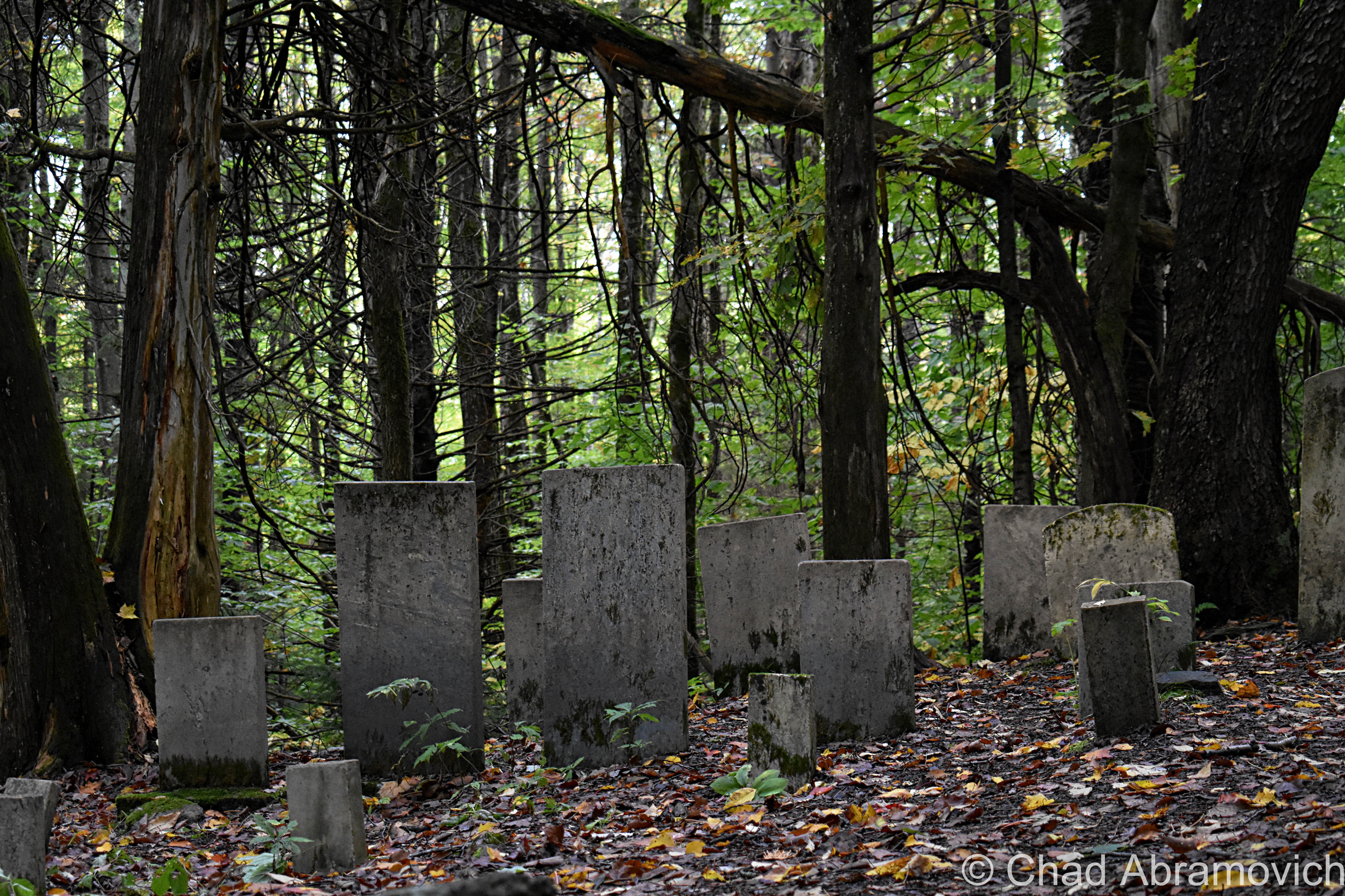
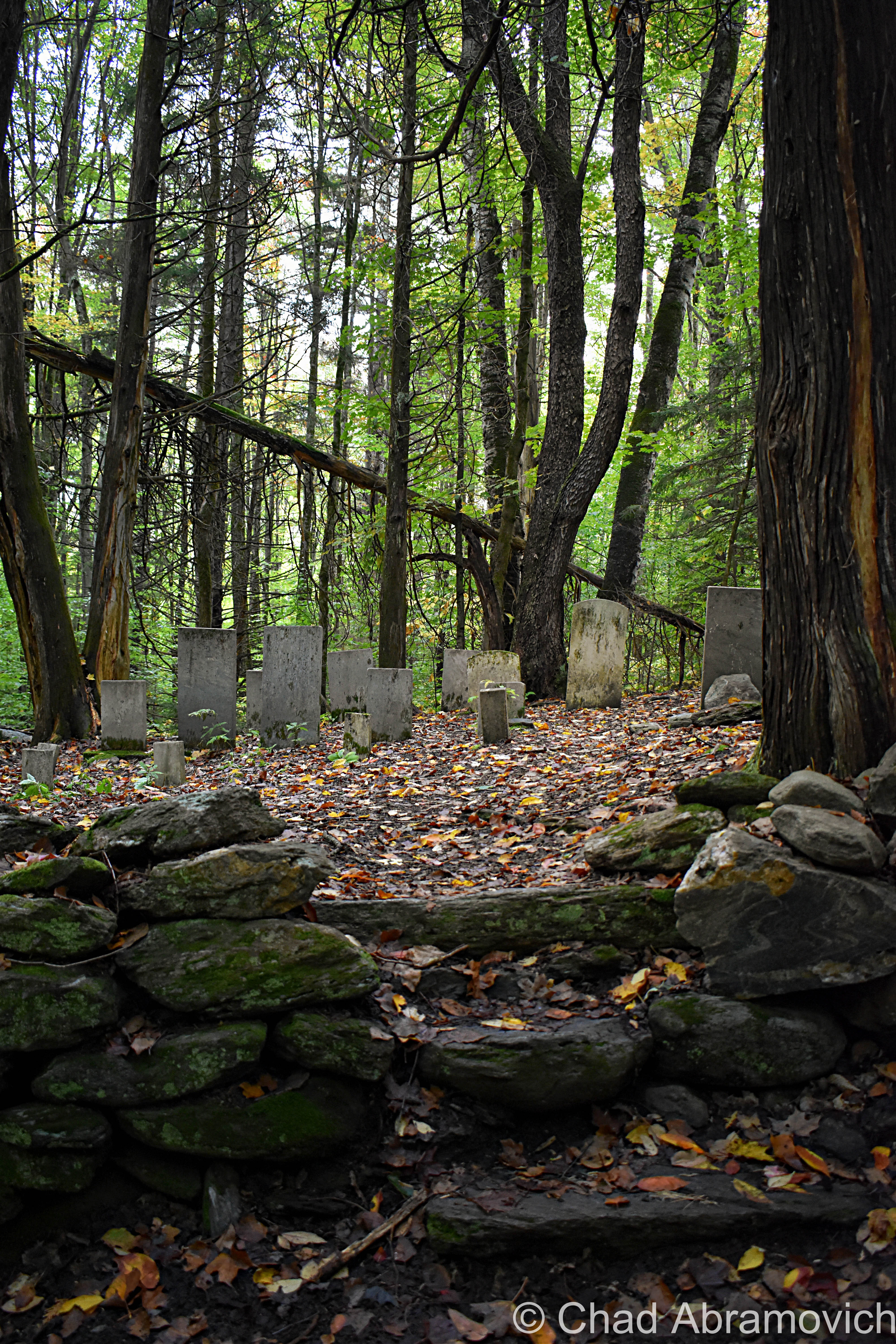
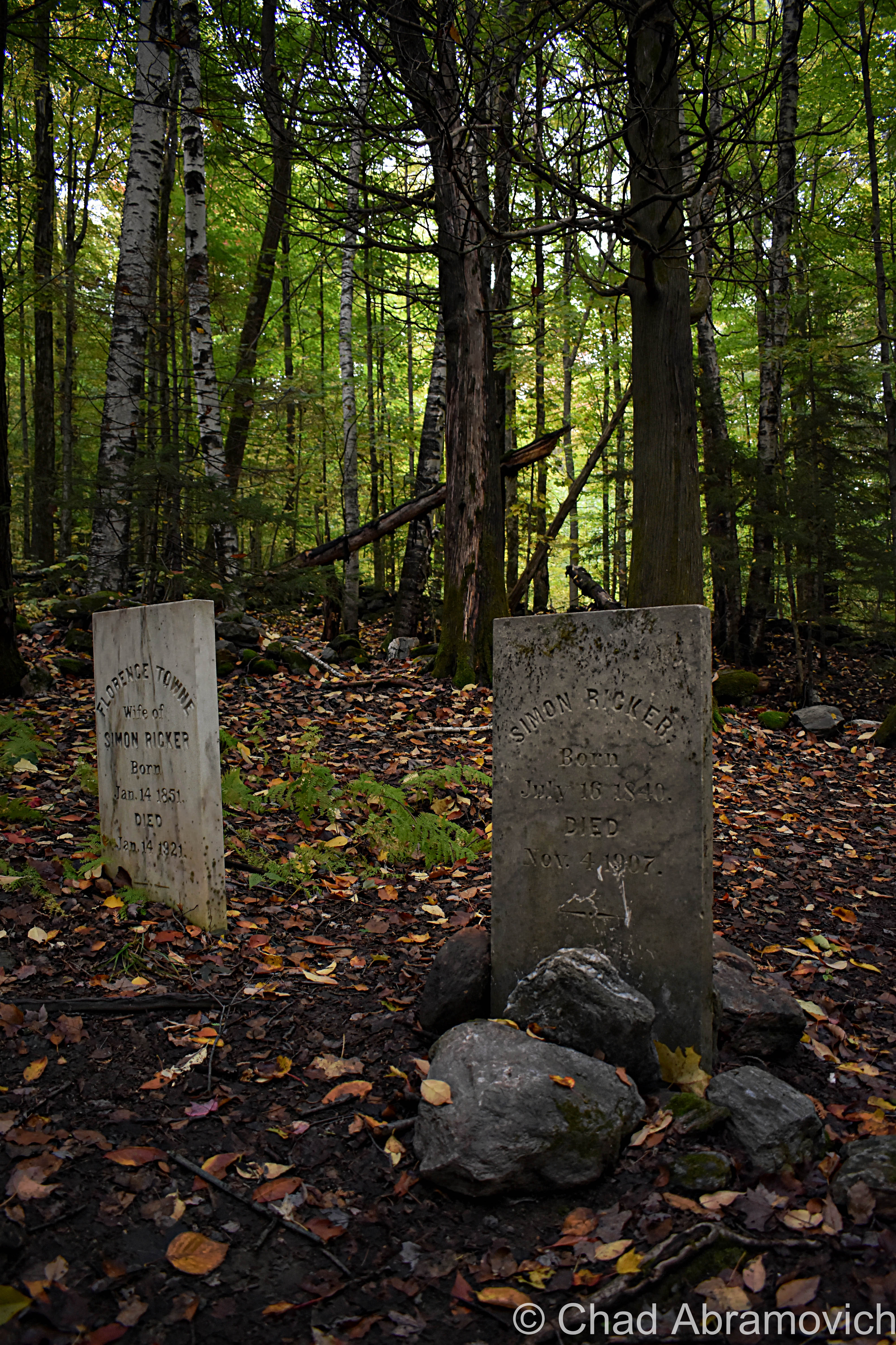
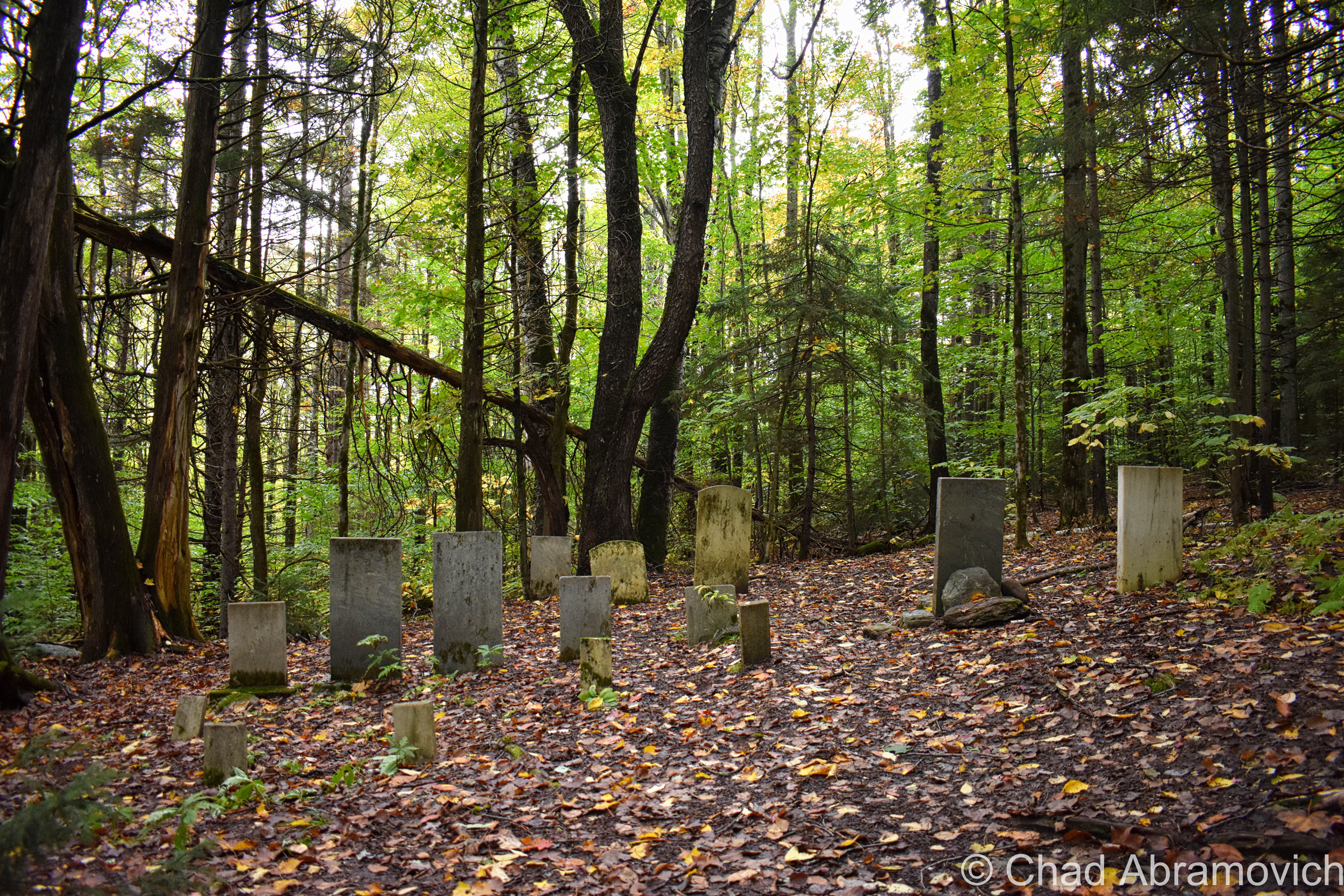
Abandoned roads have a story to tell. They represent abandoned dreams and ambitious projects that reflect the growth and often tumultuousness of our society, or the irresponsibility of our governments, cracked asphalt scars that mar the landscape and are reincarnated into monuments of failure.

The Southern Connector

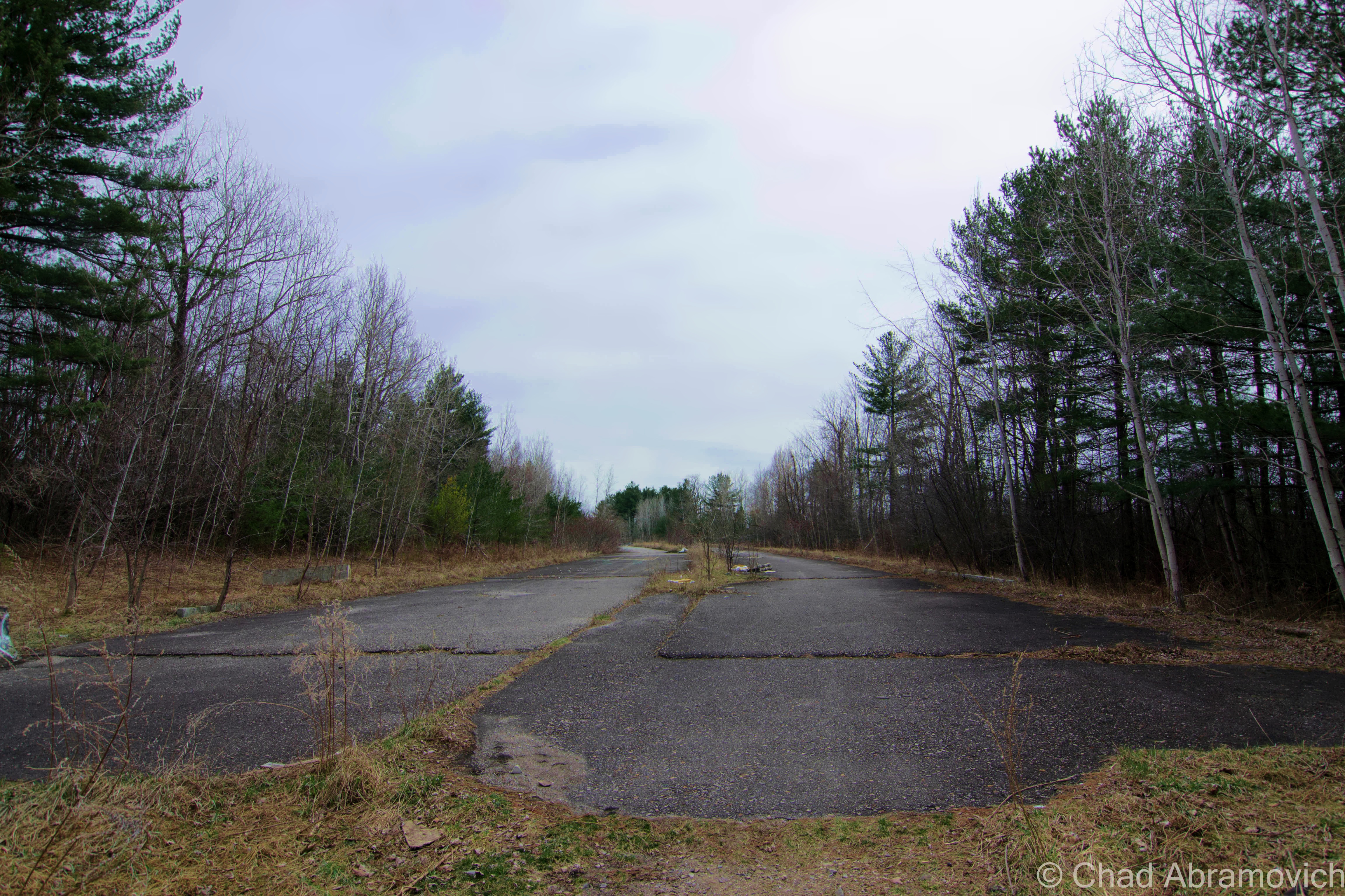
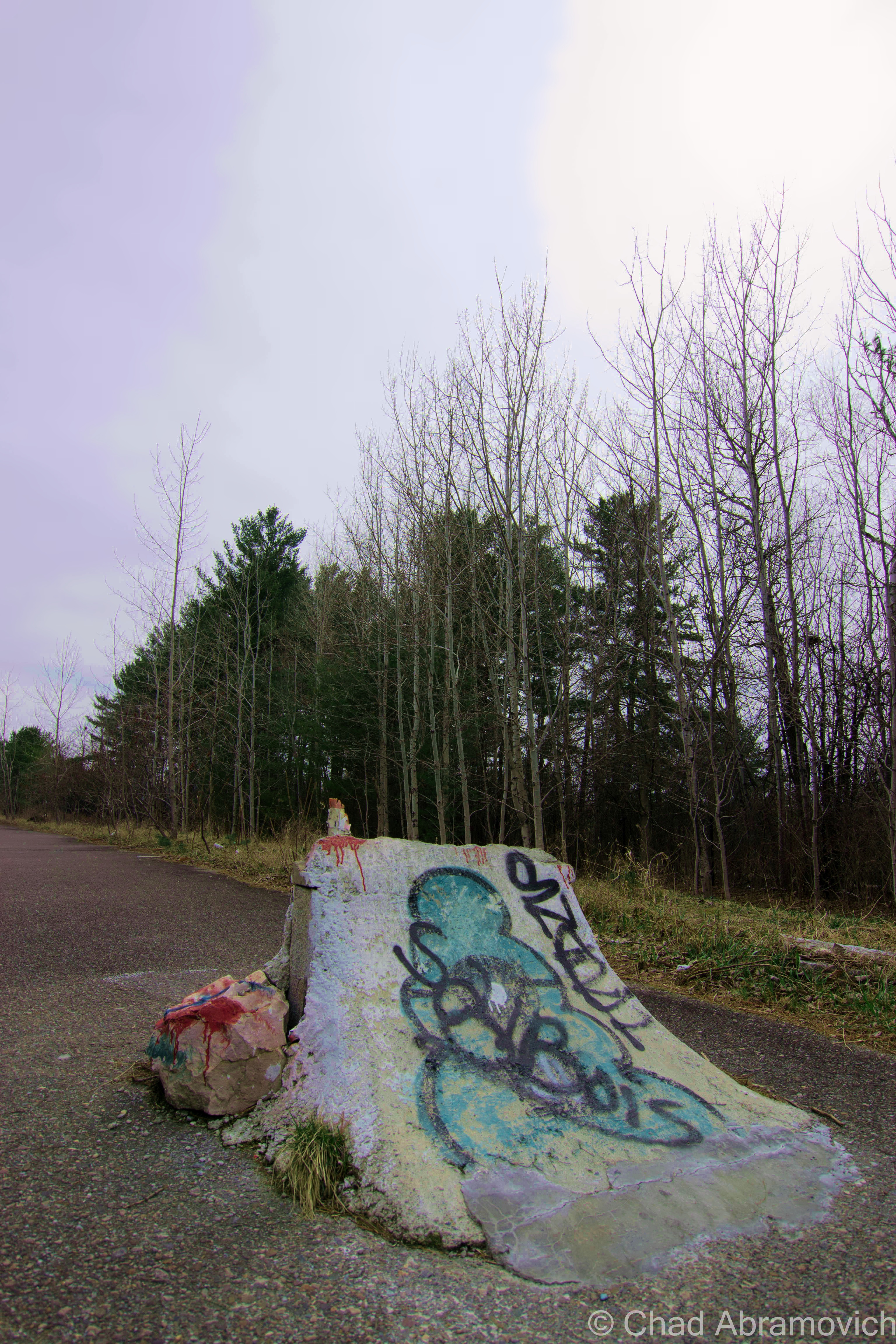
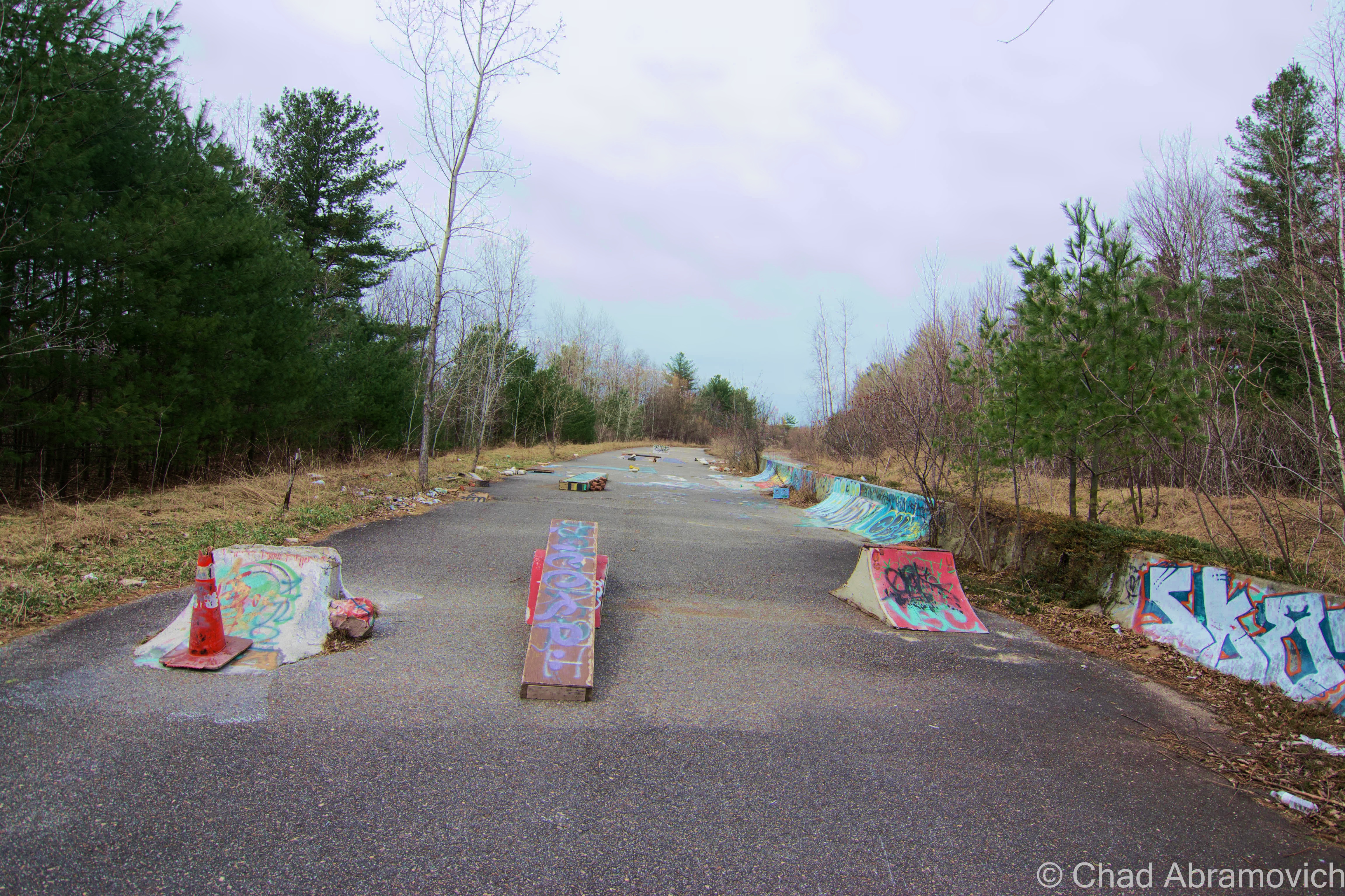
There is a stretch of abandoned interstate highway in Burlington’s south end, crumbling to pieces as the urban development around it was designed purposely to obscure the fact the blighted stretch of pavement even exists, with privacy fences and shrubbery. If you’ve approached town via exit 13 or have driven on the southern section of Pine Street where it ends at Queen City Park Road, you’ve most likely seen the incongruous graffitied space blocked off by jersey barriers. And maybe, you’ve wondered what it was, or why it was there.

In the 1960s, American cities were jumping on the massive urban renewal bandwagon, which was aimed at revitalizing communities long forgotten by neglect, and the de rigueur of American suburbia. Being Vermont’s largest city, Burlington was having an identity crisis, and figured that Vermont’s largest city should be something more than an unflattering image of blighted industrial waterfront and vacant downtown. So, The Queen City jumped on the urban renewal bandwagon. Their grand vision was a multifarious one which envisioned many future facing wonders; a shiny new downtown area connected to it’s environs by an efficient circumferential highway. They achieved this dream by using the power of eminent domain, and discombobulated an entire neighborhood of primarily Italian immigrants, to build canyons of featureless brick, glass and concrete, with loads of parking real-estate, which reflected the precipitously rising car culture obsession.

Stage two of the plan was to build a highway that would move traffic in and out of the city efficiently. Because Burlington was built on an awkward grid system from the 1800s, the city layout was never met to accommodate an unprecedented population rise or a society where everyone drove a car. Traffic was already piling up and into residential neighborhoods, which was frazzling local residents.

Construction broke in 1965, and the “Southern Connector” was started, creating today’s exit 13, aka, the Shelburne Road exit. But, the project quickly ran into problems.

Directly in the path of the proposed highway was a contaminated swath of swampland wedged between Pine Street and the lake.The Pine Street Barge Canal, a former industrial waterway turned Superfund site, was discovered to be highly polluted by the state of Vermont in the late 60s. If construction crews were to build over the canal, all of the trapped ground contaminants such as coal ooze and gasoline from irresponsible industrial disposal decades ago would all be released into the lake.

Because of this, construction halted, and a forlorn stretch of pavement was left stretching from Shelburne Road to Home Avenue. The only solution was to just block off the remained of the now unusable highway, and divert the exit to dump out onto Route 7. The project could go no further. Plans to finish the highway were proposed for several years, but it wasn’t until 2010 when plans resurfaced again. This time, it was recreated as “The Champlain Parkway”, and the reinvented idea was to merge the highway onto the south end of Pine Street, then turn the street into a 4 lane boulevard with updated pedestrian crossings and sidewalks, creating a main artery to and from downtown. But that too fell into problems, including concerns from south end residents who weren’t thrilled with the idea. Eventually, a compromise was made between city hall and opposed denizens, that include selective signage that only mark the anticipated parkway from certain directions, in an attempt to reduce traffic flow. But in the GPS era, I doubt that omitting signage in certain areas of the city will truly be a solution.

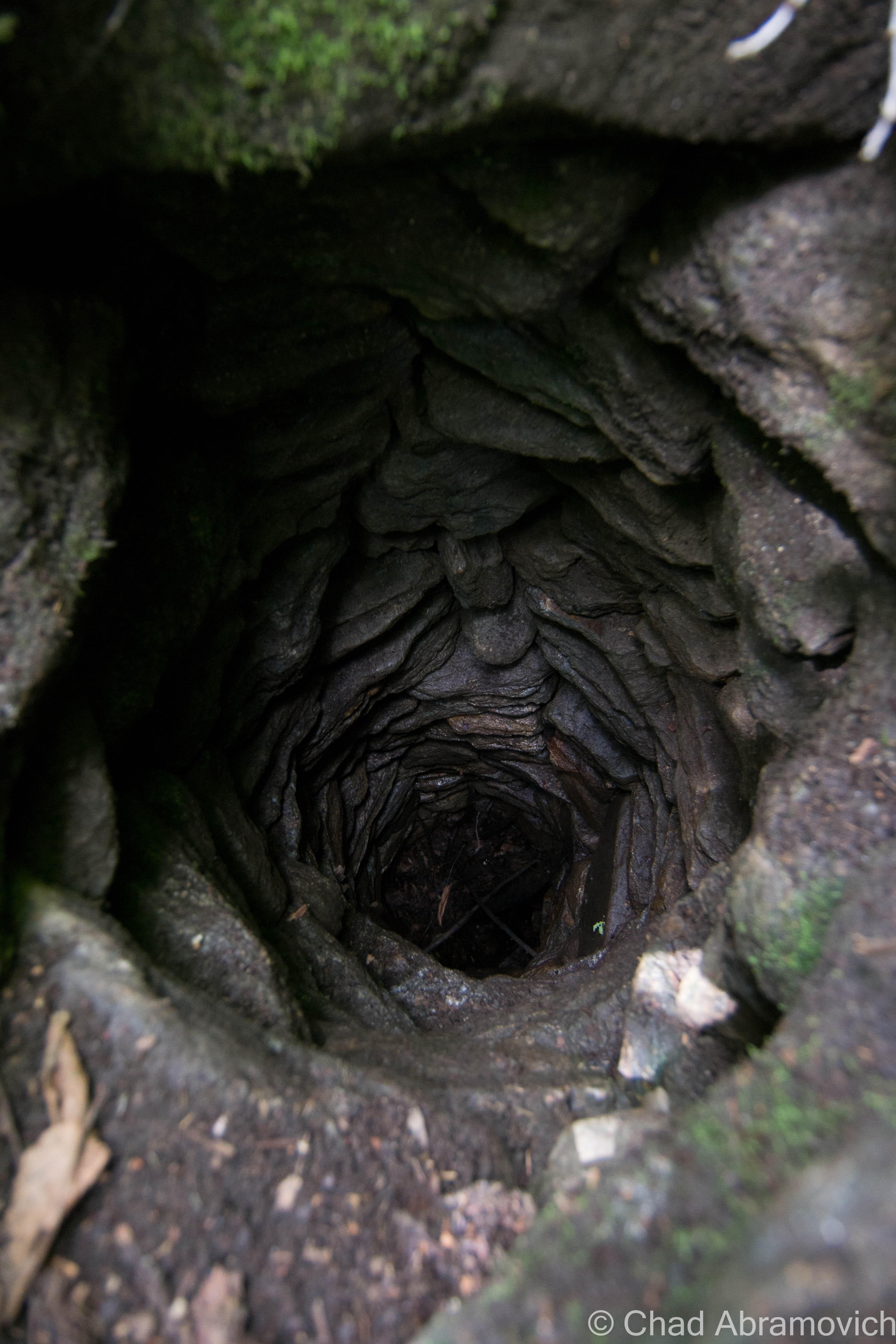
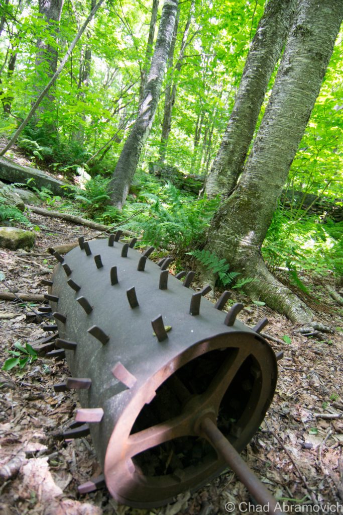
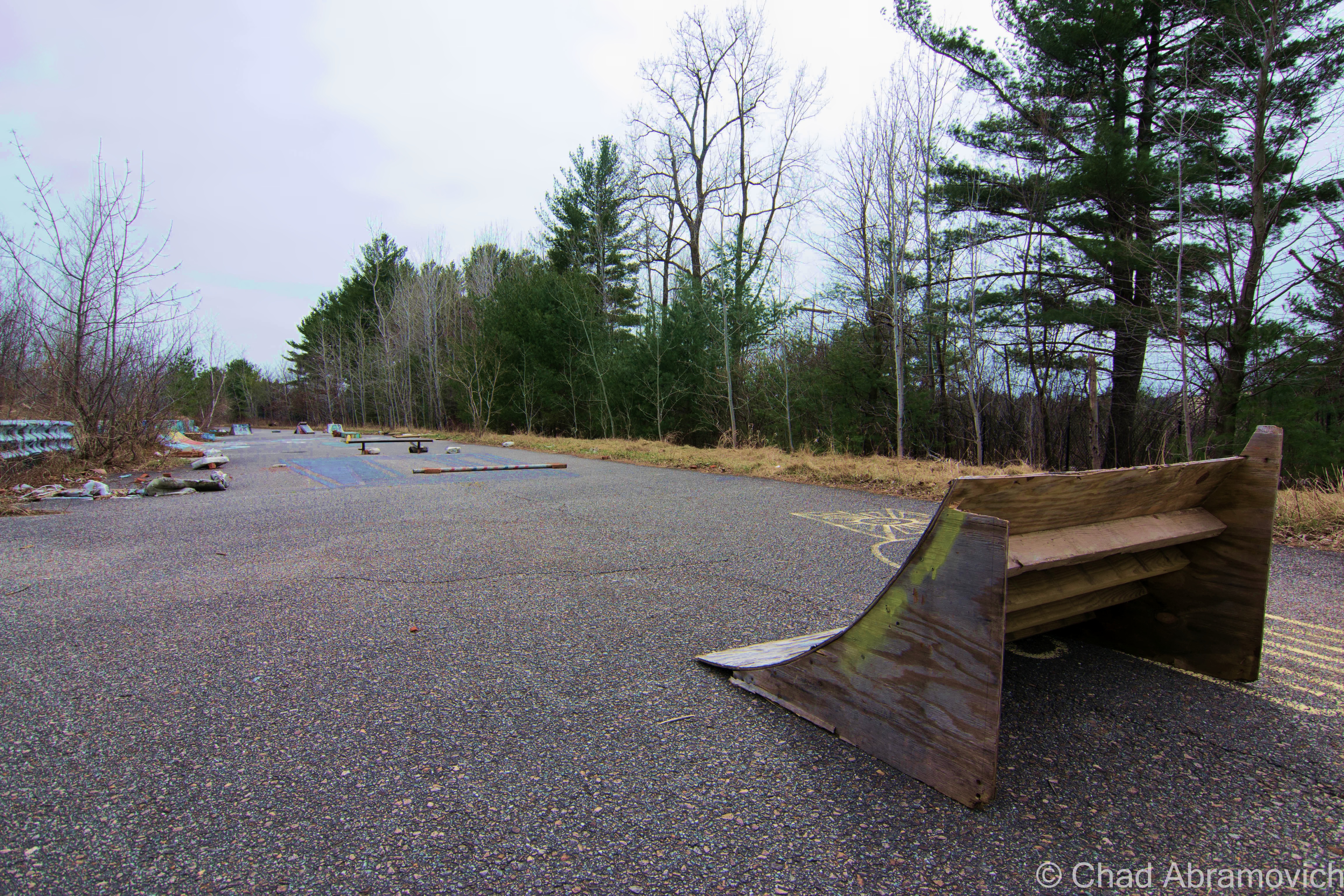
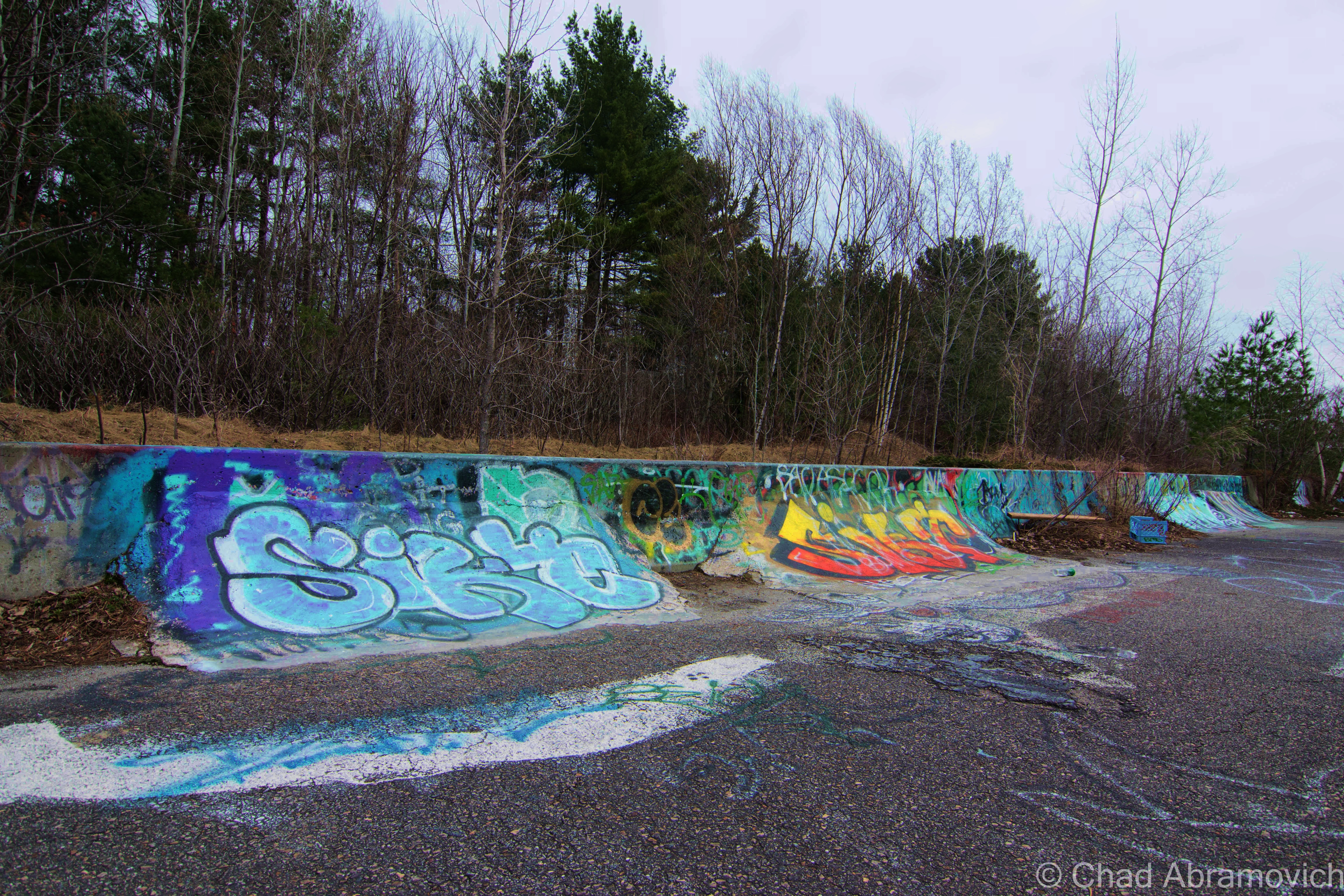
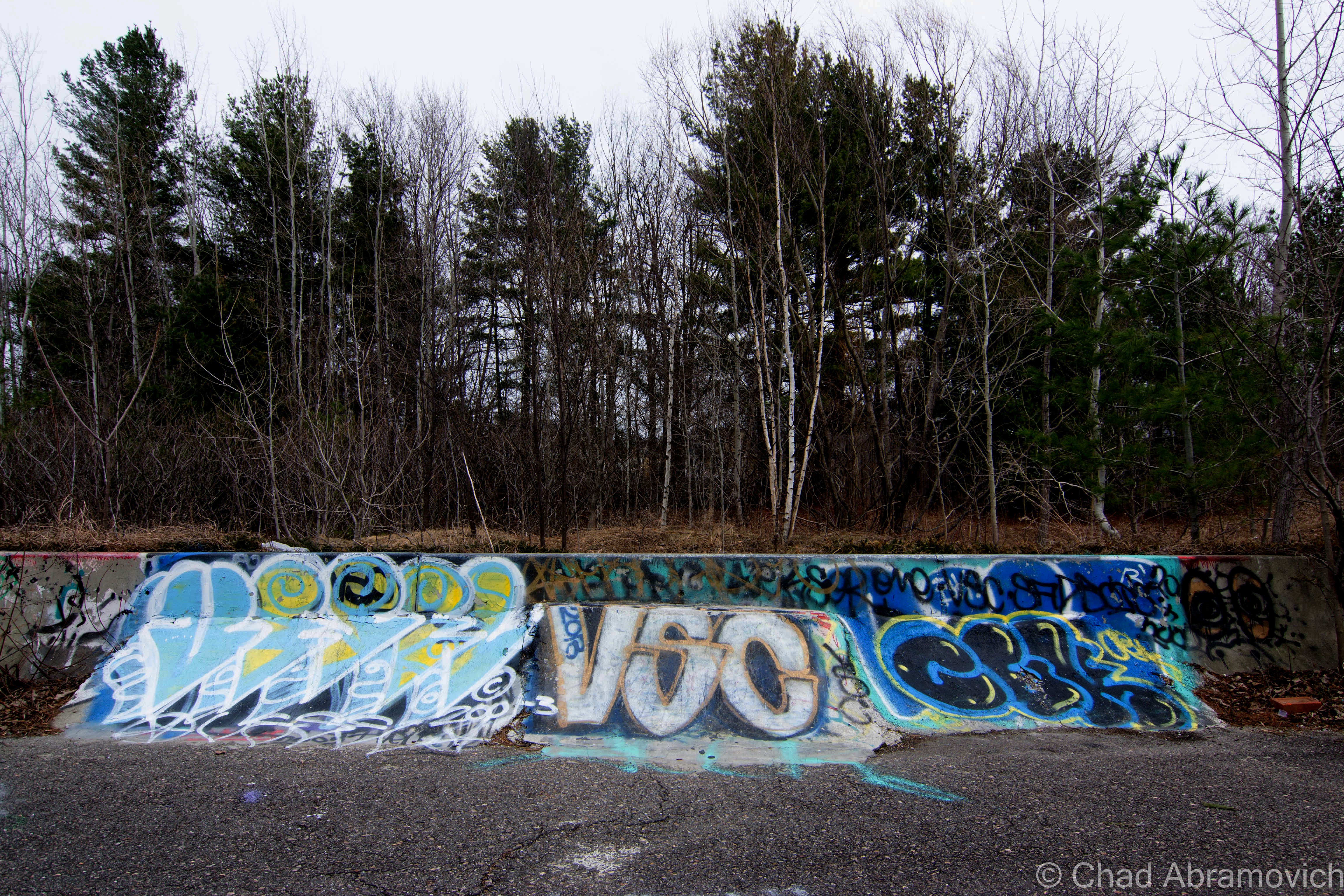
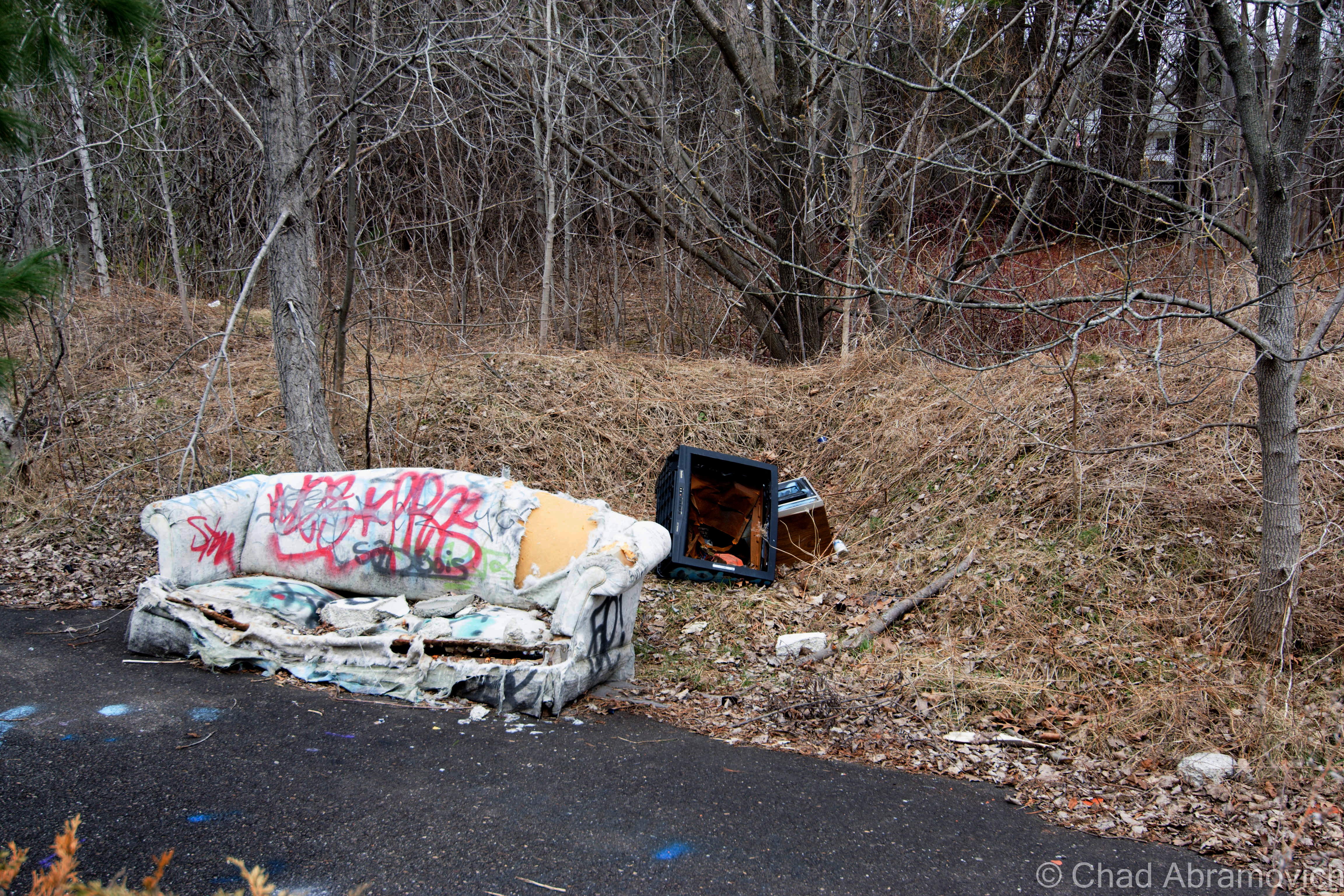
Today, the so called road to nowhere still goes nowhere, There are remnants of many homeless camps behind crumbling jersey barriers, and the local teen crew has converted much into a make shift skate park and a canvas for graffiti artists. It’s an interesting place to walk around on a warm spring day.

Places like this are special – an unusual contrast only separated from the dead eyes of the city by a chain link fence and new growth trees. Here it’s a different world, frequented by mysterious people of all types, all leaving their marks and appreciating what was otherwise left to rot.

DSC_0001 DSC_0004_pe DSC_0007_pe DSC_0009_pe DSC_0010_pe DSC_0013_pe DSC_0020_pe DSC_0021_pe DSC_0023_pe DSC_0024_pe DSC_0027_pe DSC_0030_pe DSC_0032_pe DSC_0037_pe DSC_0040_pe DSC_0042_pe

The Milton Speedway

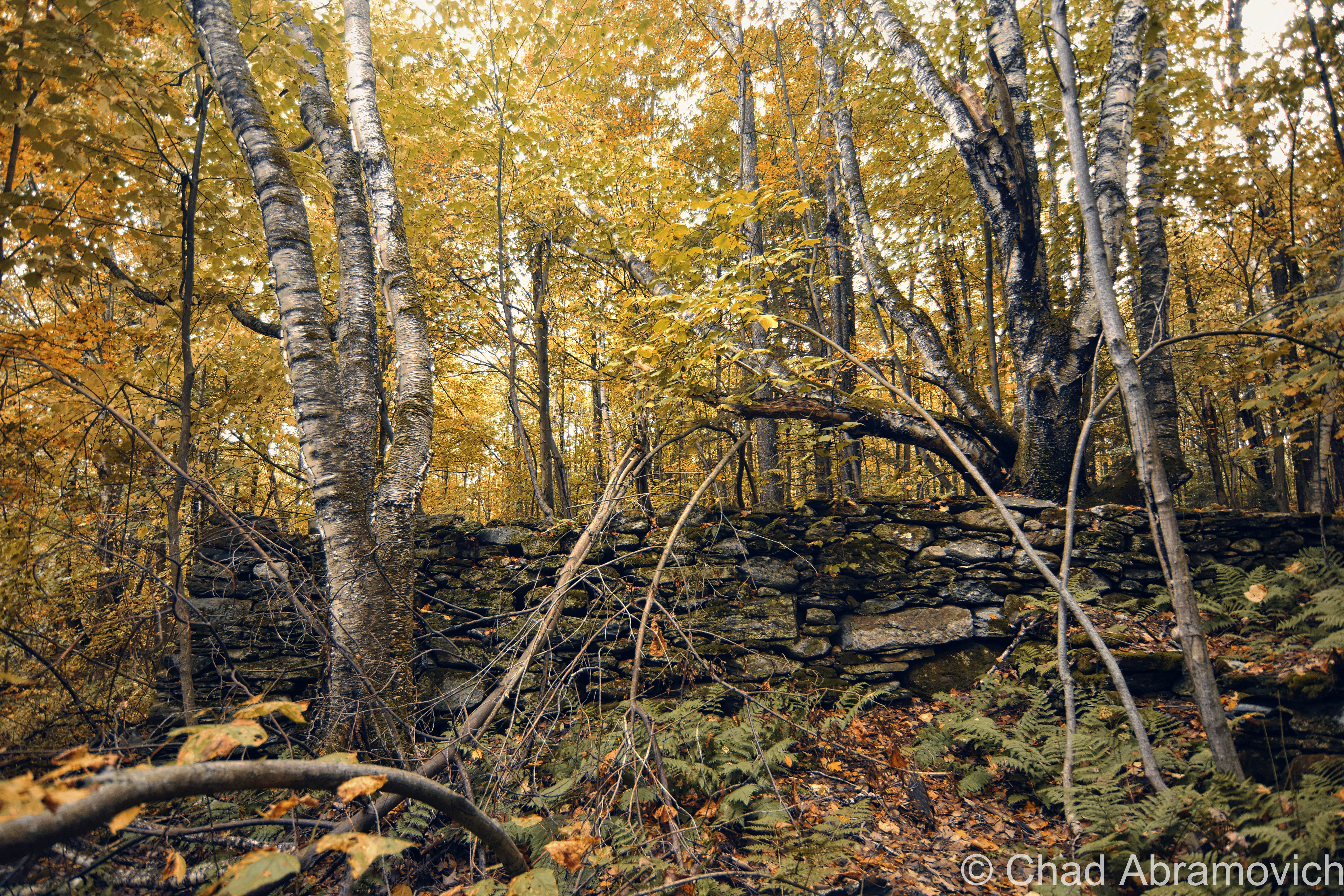
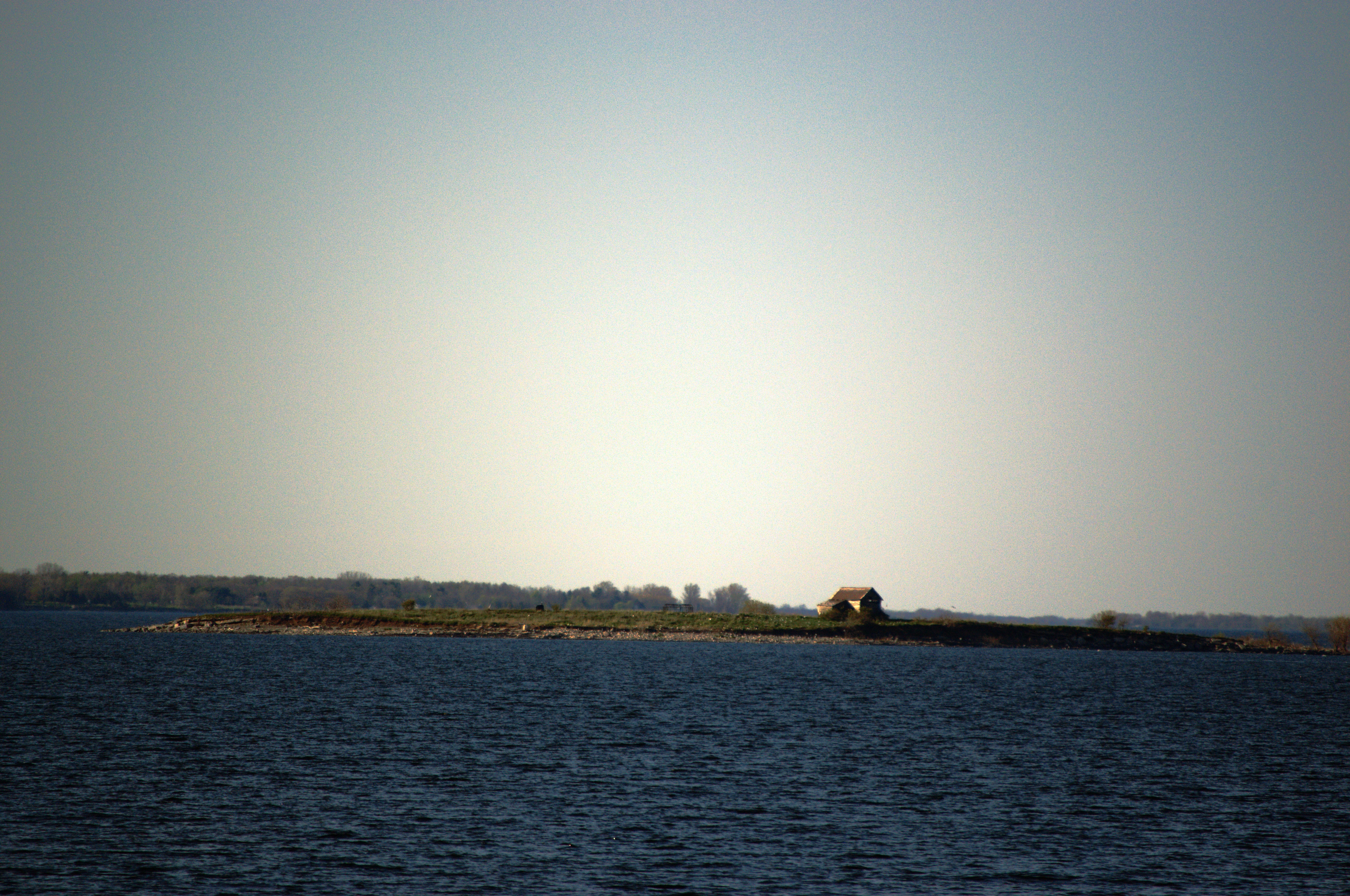
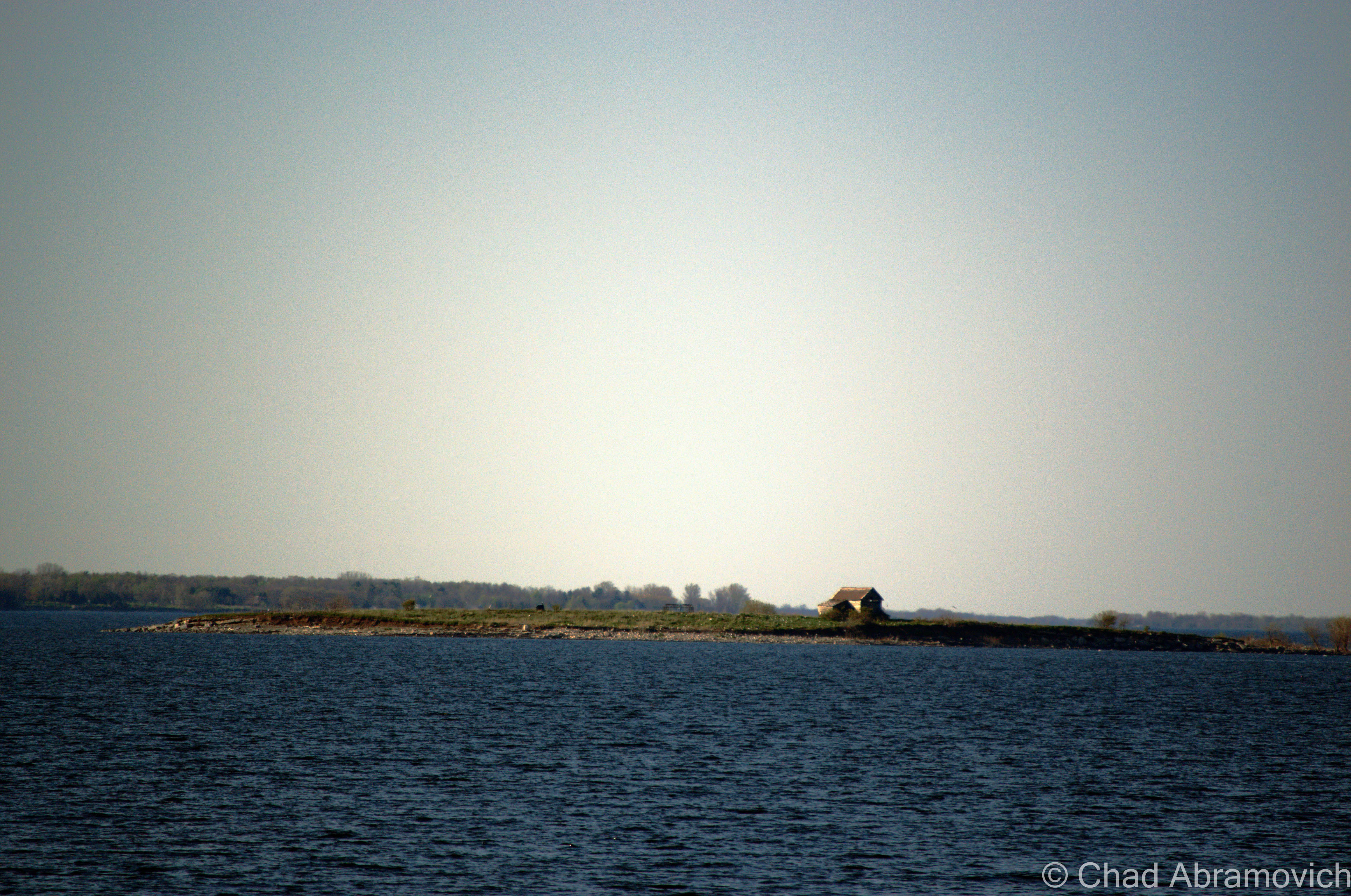
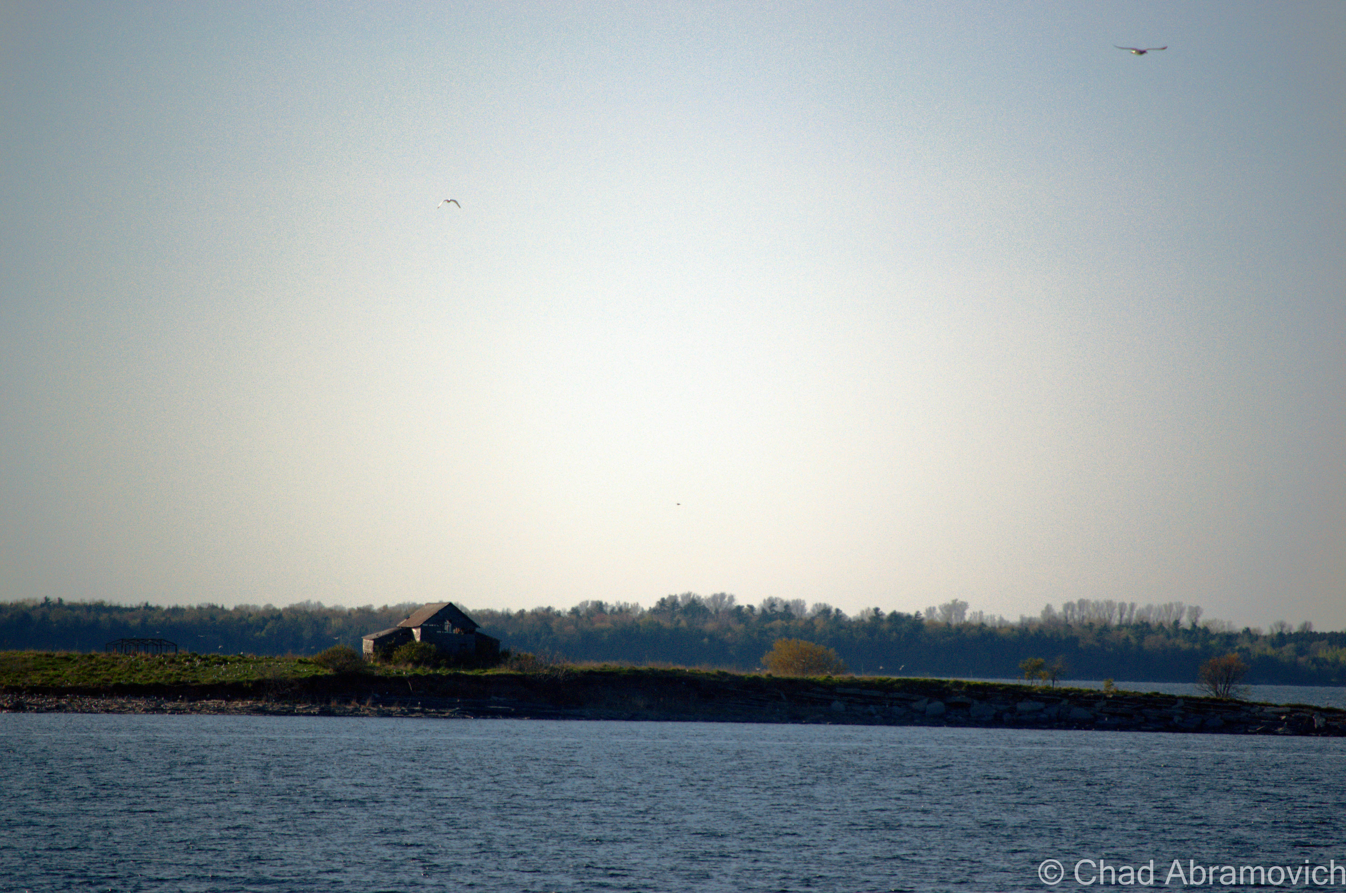
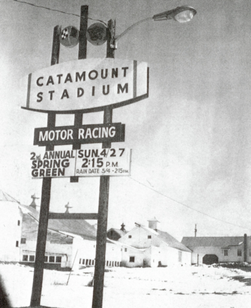
A few miles to the north of Burlington is the growing town of Milton, which is nostalgically remembered for being the former home of Catamount Stadium, a legendary stock car racing stadium and a now demolished staple of local culture.

LS34194_000_thumb_3
Photo: Milton Historical Society
Photo: UVM Landscape Change Program
Catamount Stadium. Photo: UVM Landscape Change Program

In the 1960s and 70s, Milton had a reputation for being the “race town, with a strong local culture and two lively institutions supporting it.

In the last century, Vermont had over 22 race tracks, with many being hastily created to assist the growing American car culture and it’s ripple effects. In 1960, the iconic Thunder Road would open in Barre, which was noted for it’s fine and thoughtful construction – something that resembled a modern track instead of the many crude and clumsy oval type tracks that were otherwise being built across the state. Thunder Road was such a success that the Vermont racing community began to brain storm. Building a track in a populated area near major transportation arteries would not only expand awareness of local racing culture, but give it’s participants more places to, well, race.

Milton’s proximity to New York, Quebec and Burlington and land which now was found to be conveniently suited for a racing track would be what would inspire Catamount to be financed and built by 1965 on farmland purchased from Kermit Bushey. A racetrack in town drew in lots of Milton locals and got them involved as racers, spectators or mechanics, which would prove to be one the things that would make the 1/3rd of a mile oval track such a success story.

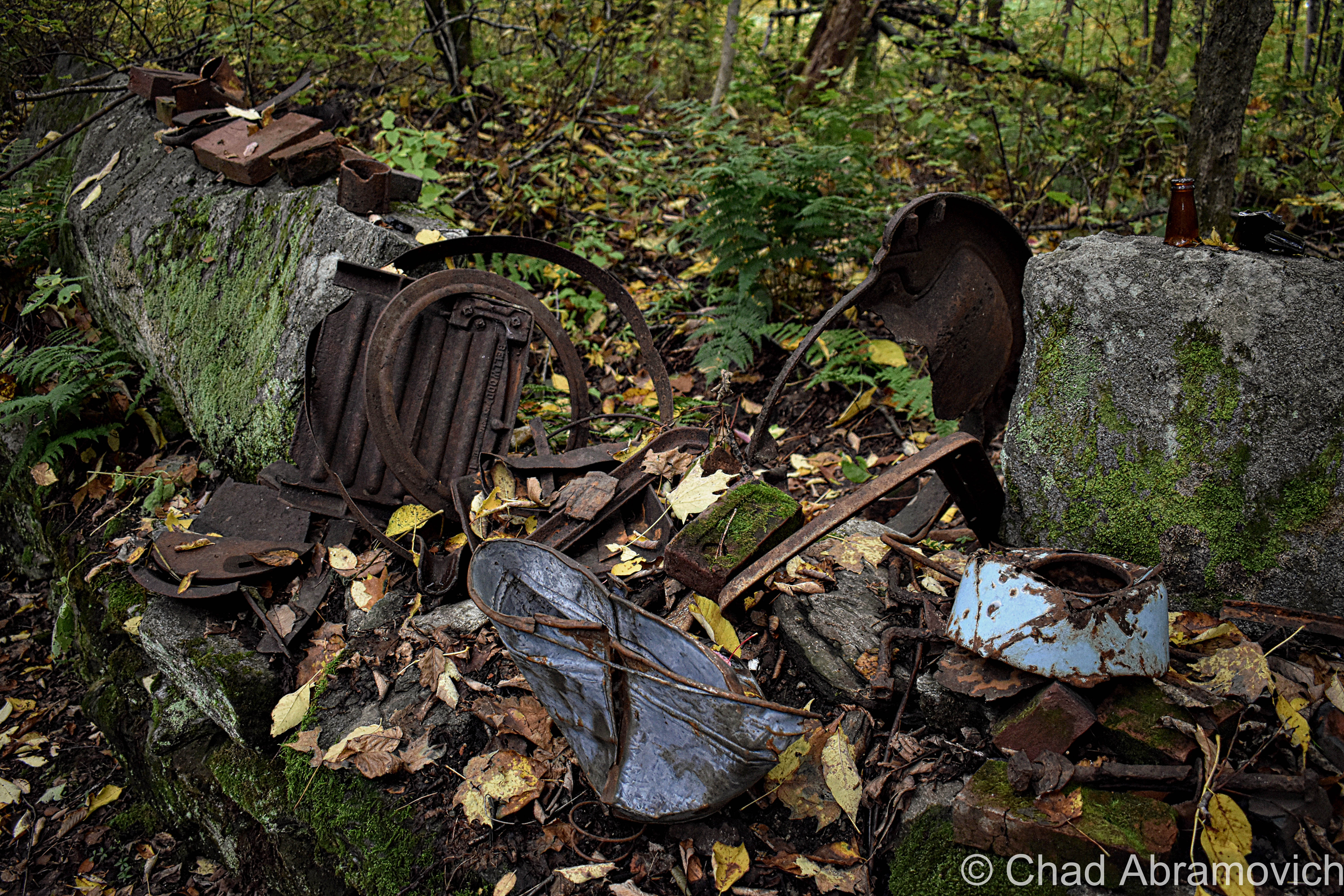
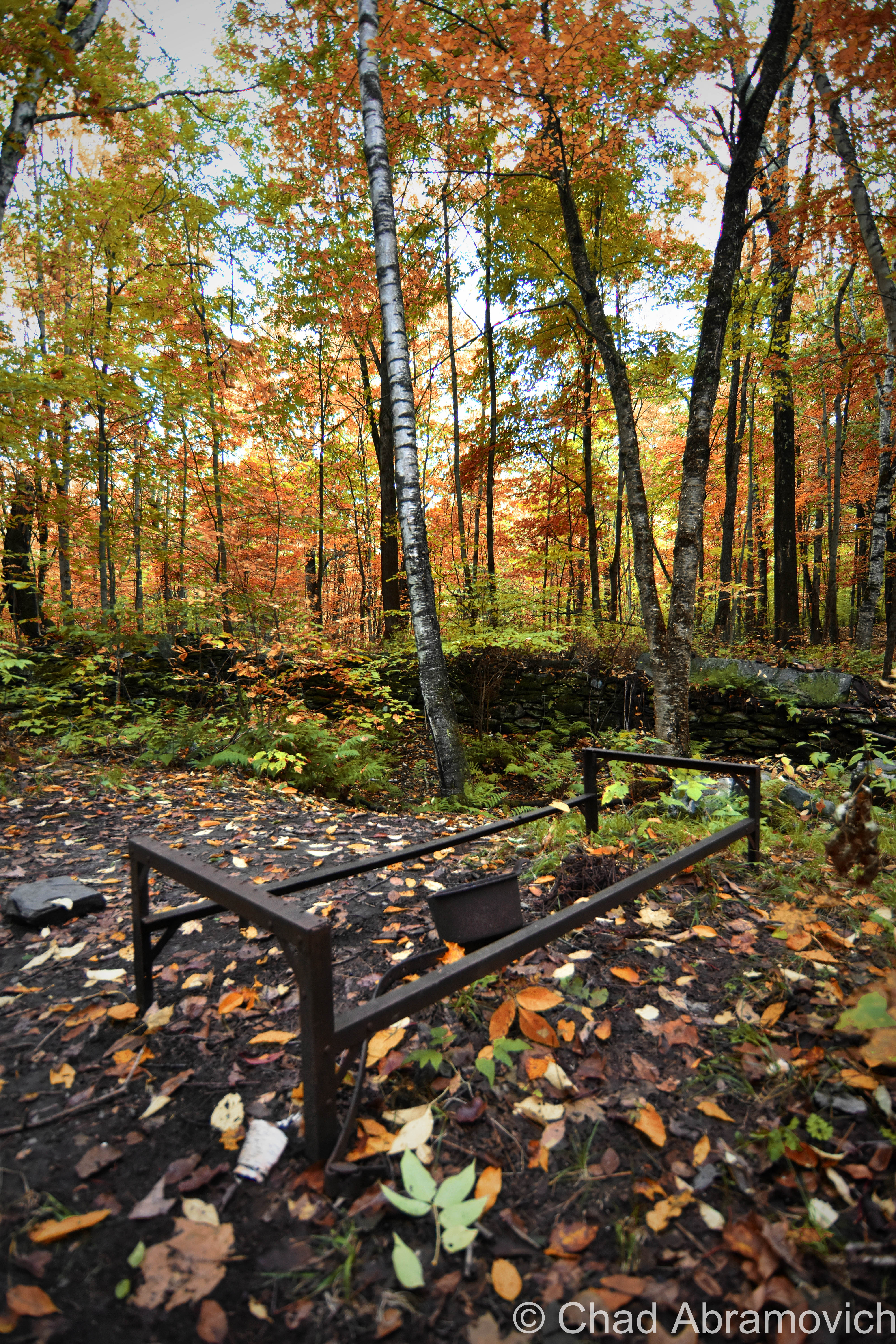
The track was built to NASCAR specifications by excited local contractors and businessmen, and enjoyed considerable notoriety, those who remember it speak fondly of it. It hosted drivers of all skill, from nationally acclaimed to local heros, and would hold races of all varieties from circuit races to it’s grand finale of an enduro race, which many feel was an insulting way to go out. It was the type of place where car lovers and the curious could witness the latest trends in what would be racing on the track, or the more rigged homemade inventions and the characters that drove them. The locals would come with chips and a cooler full of beers, while the more prestigious could pay to sit in private boxes. All were there for a good time. One summer nights, the stadium could most often be found filled to capacity, and created a loyal fan base. The track would play host to adrenaline and voyeurism until 1987 when the Greater Burlington Industrial Cooperation, who curiously came in possession of the land, wouldn’t agree to renew the track’s lease, leaving Catamount with no choice but to shut down.

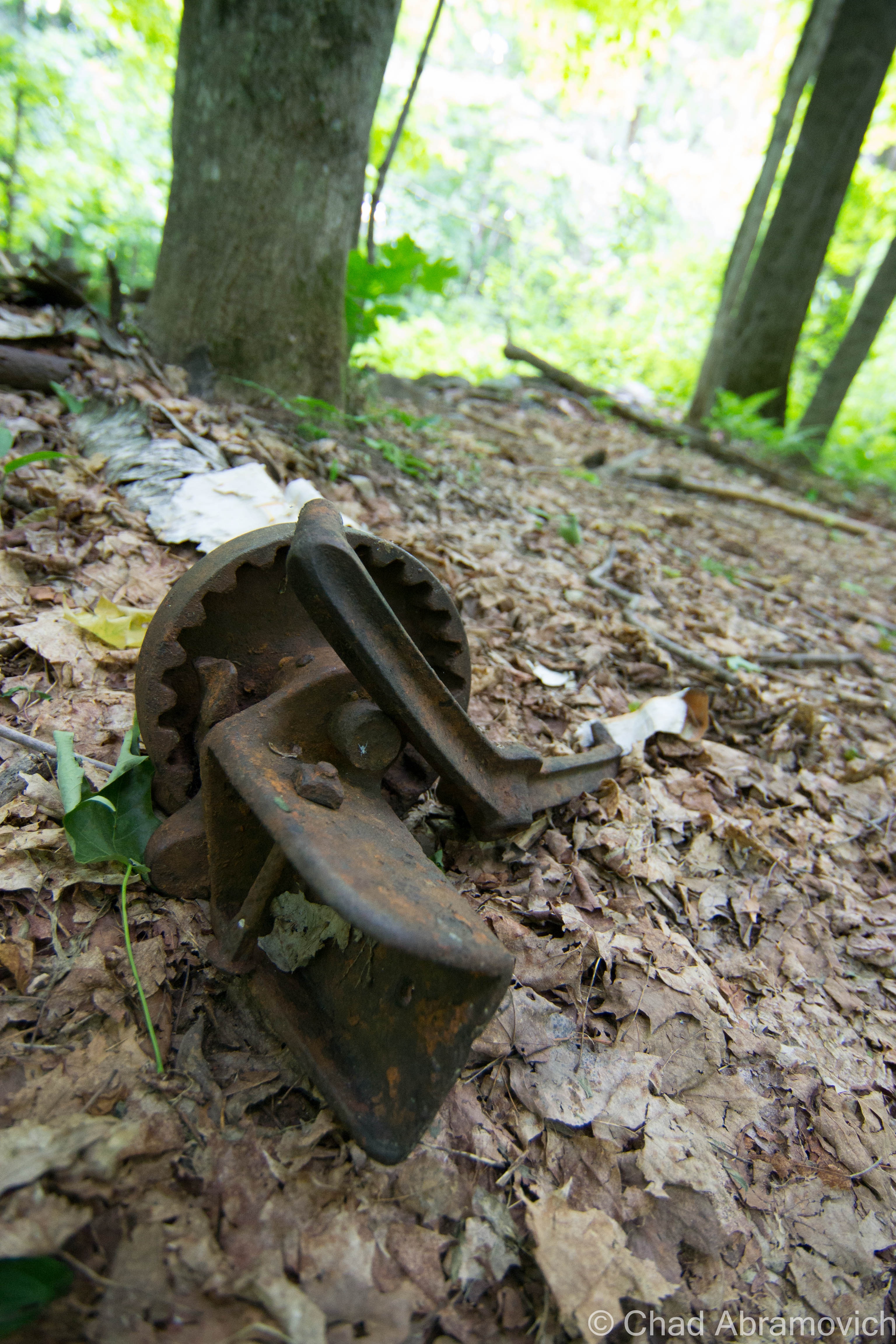
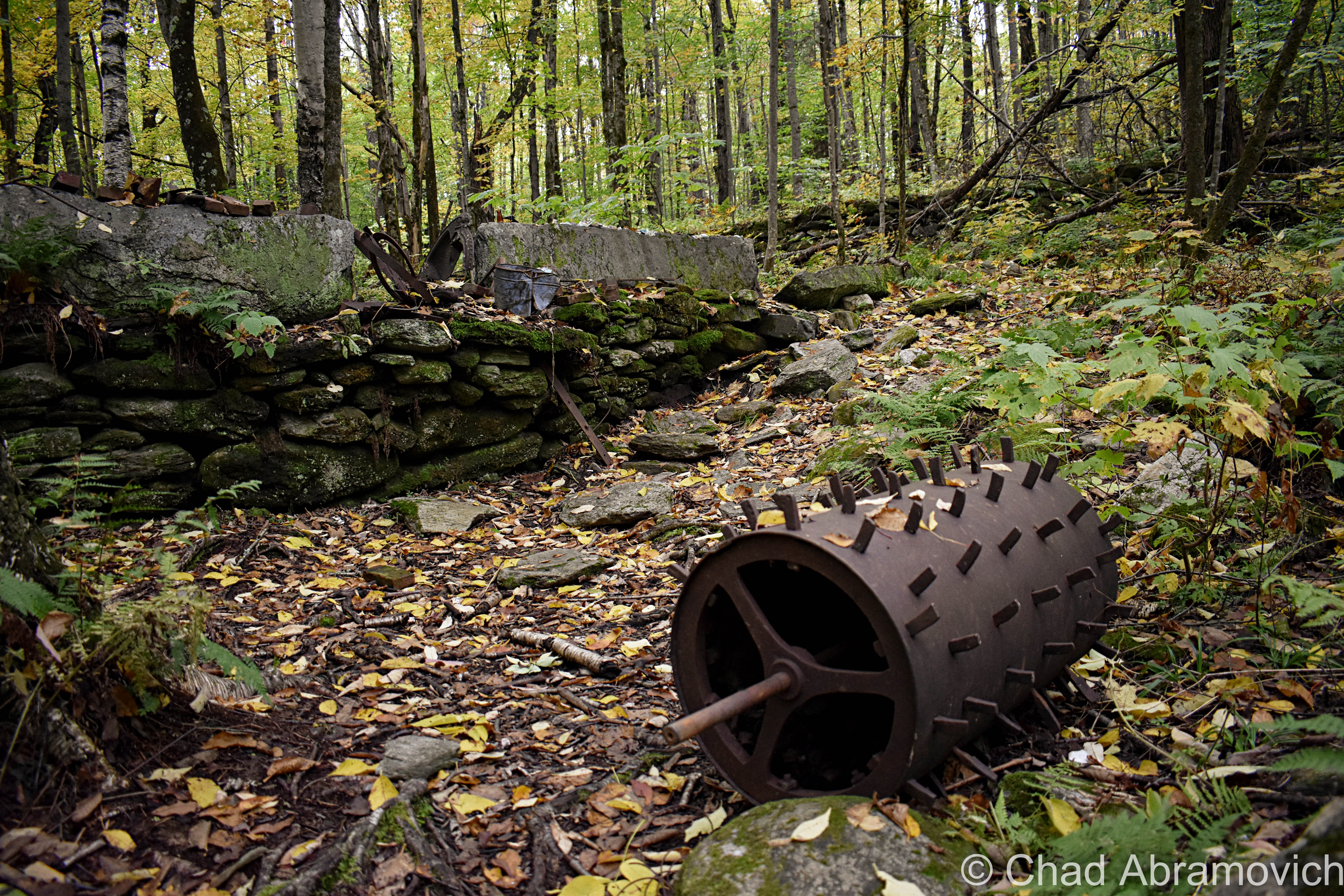
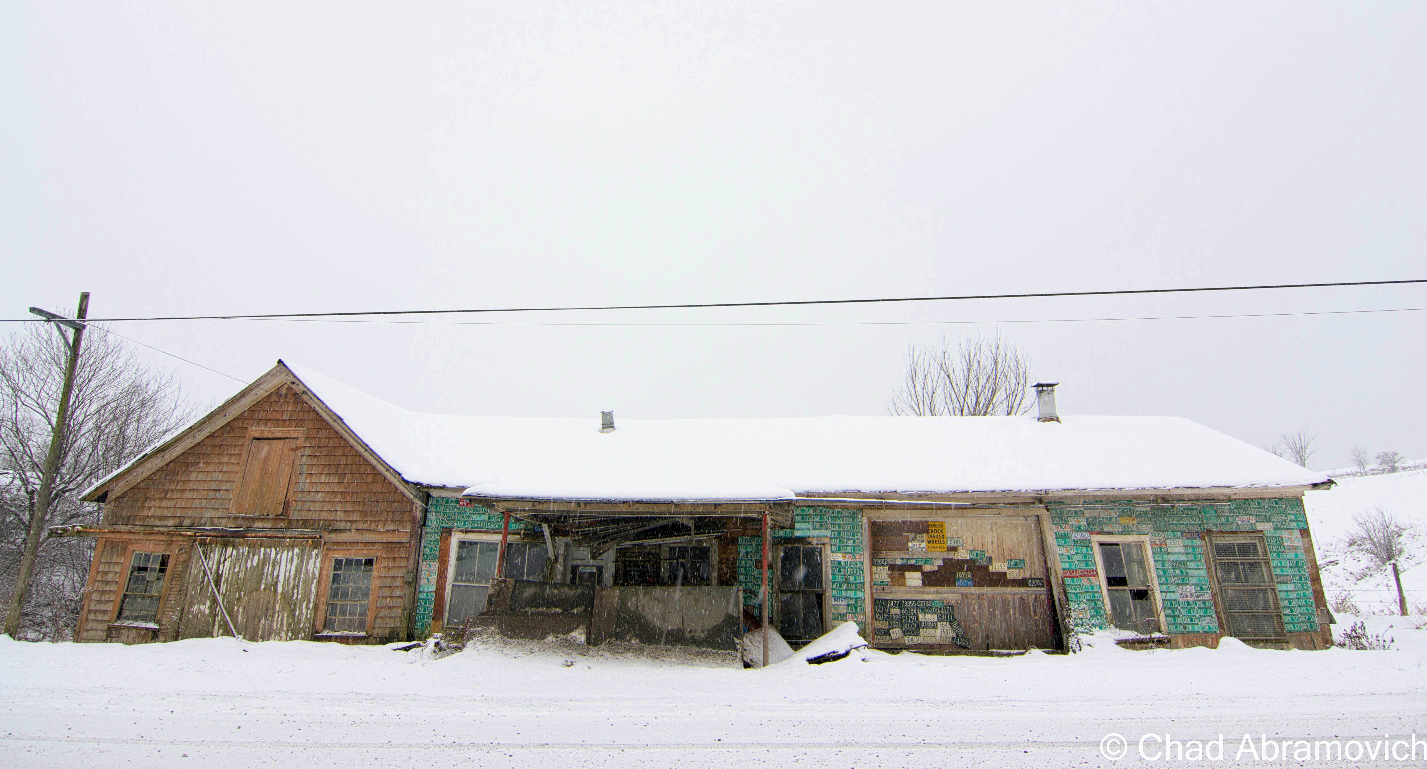
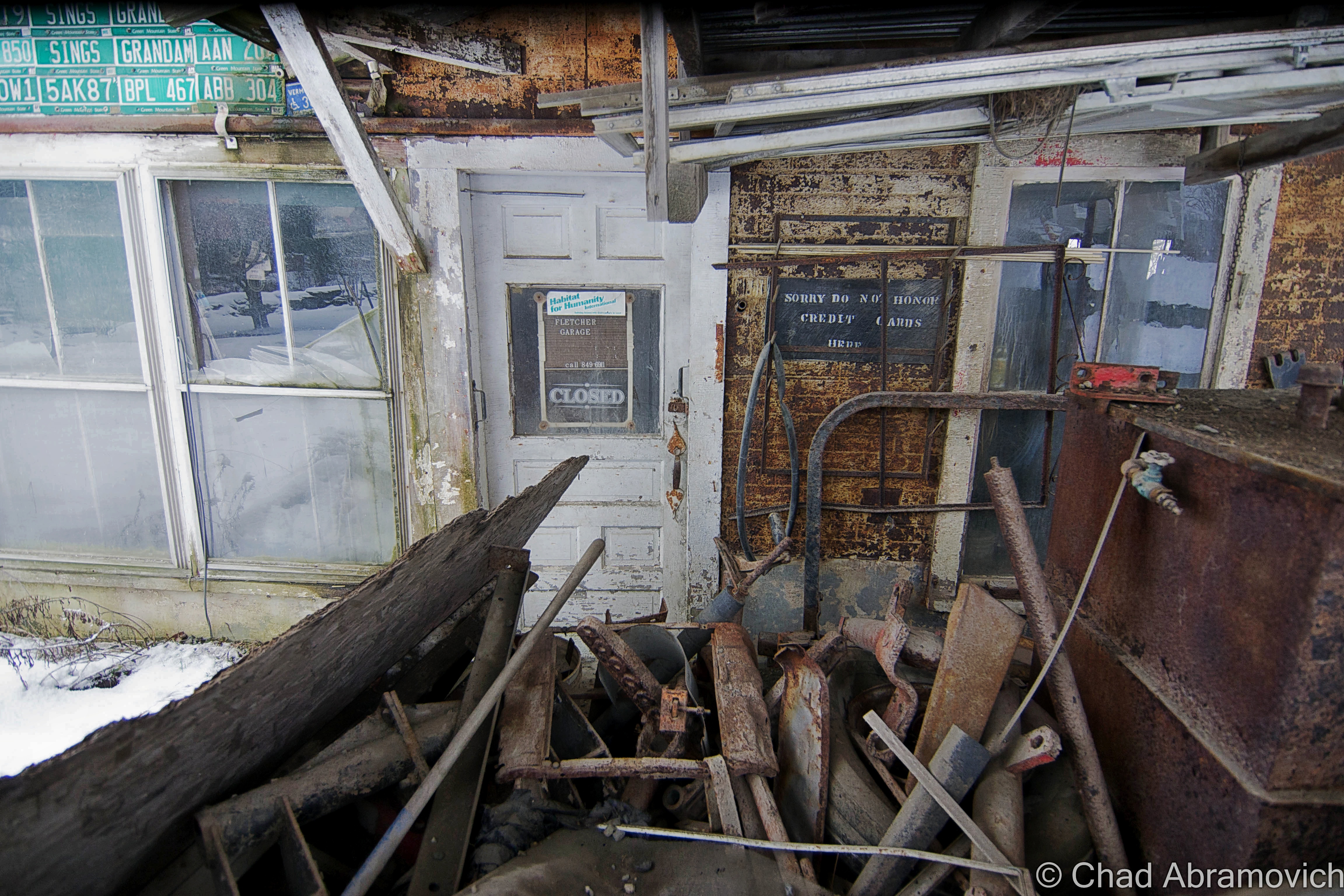
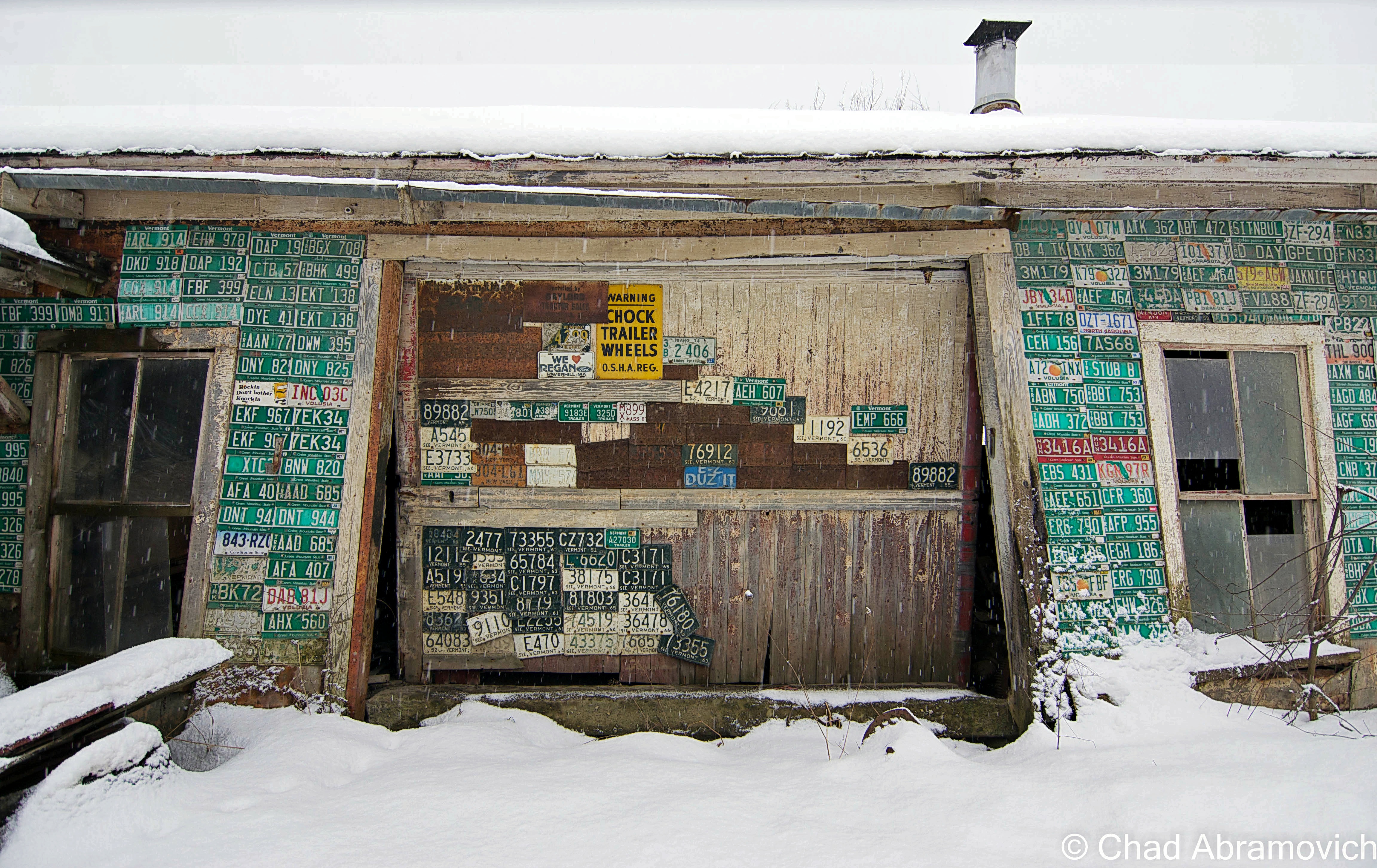
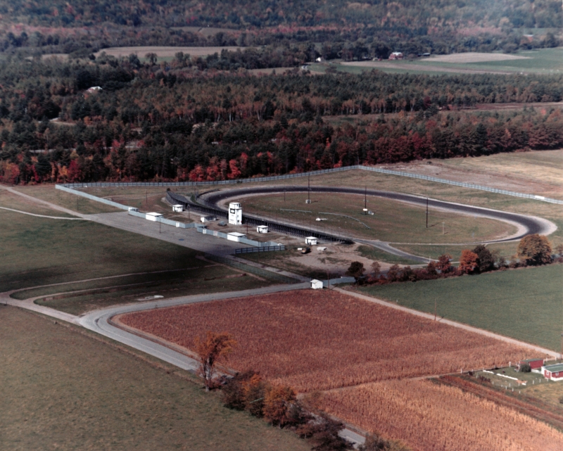
Apart from the stadium, Milton had another monument to man’s love of his car and pushing the limits of societal boundaries; a drag strip. In the 1950s, the young and reckless would find isolated stretches of road to drag race on. In 1963, the illegal sport’s popularity inspired local residents Herbert McCormick and Maurice Bousquet, owners of the former B&M Motors, to finance a drag strip of their own. At a quarter mile long, the track was a spectacle itself, located near the Route 7/West Milton Road interchange.

Photo: UVM Landscape Change Program
The Milton Speedway. Photo: UVM Landscape Change Program

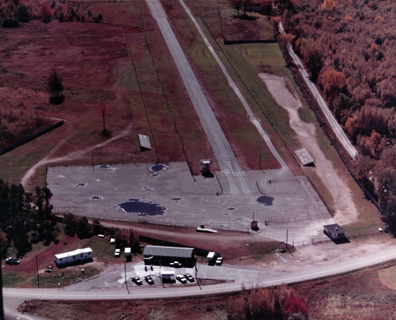
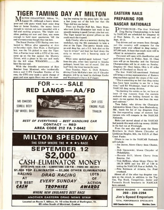
Billing itself as “The Milton Speedway”, it was apparently quite active in its heyday. Old newspaper clippings show that the speedway was an animated place, and boasted cash prizes and contests. It’s allure drew some notable clientele such as Shirley Muldowney and The Royal Pontiac GTO Racing Crew, who all raced in Milton at one point.  But the drag strip’s existence was brief, as the phenomenal costs of resurfacing the road proved to be too much. It was closed by 1971.

clipping clipping2 clipping4

In the 1980s, Milton experienced a real estate boom – with the lure of cheap land and close proximity to Burlington – the community soon found itself shedding its old skin as a farming town, and becoming a bedroom community. A few neighbors of mine talked about how they remembered the old stadium when they first built their houses around 1984. Even 4 miles away, they recalled standing on their back decks at night underneath the cool summer skies and hearing the howl of the engines being carried through the dark.

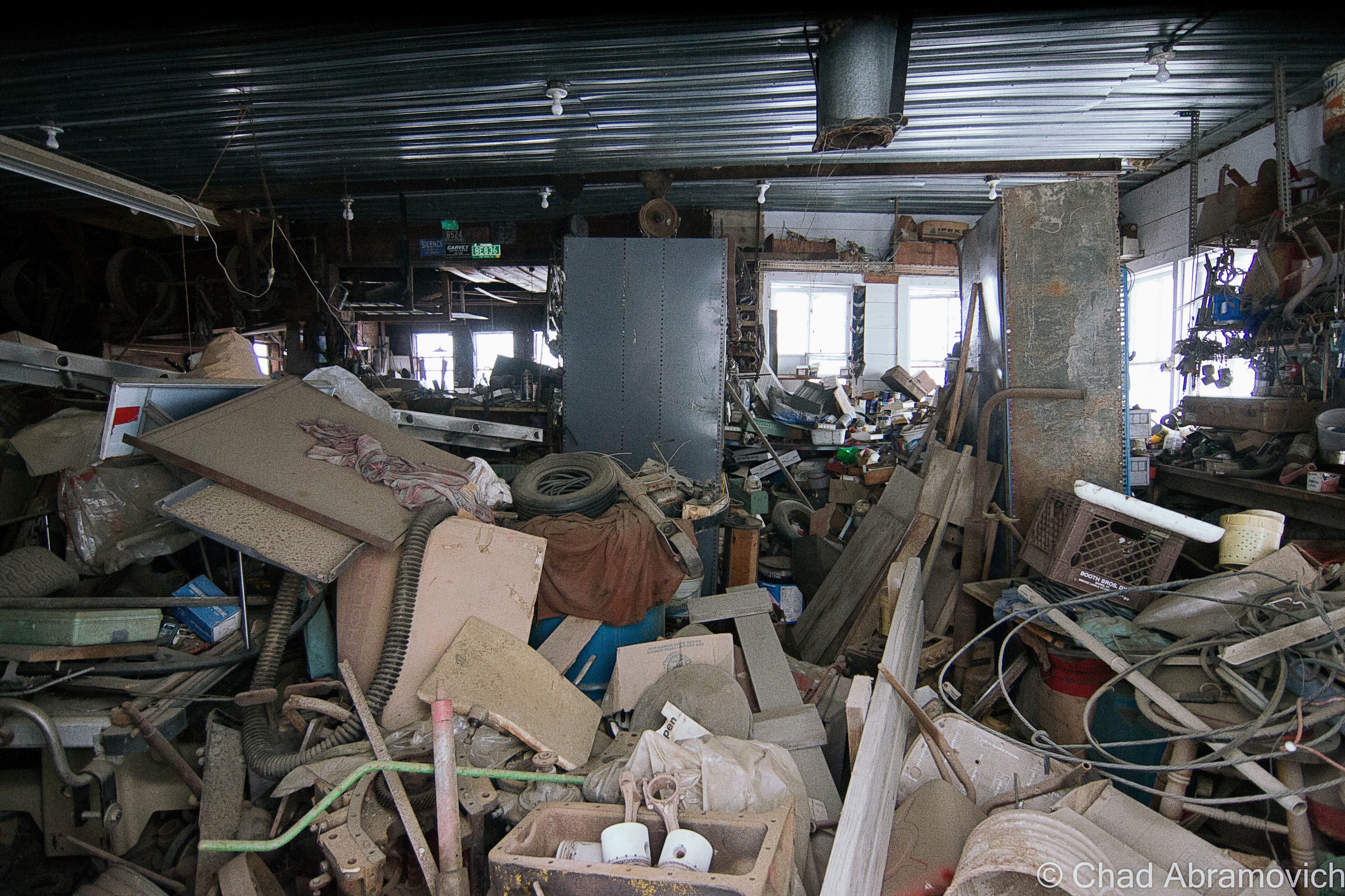
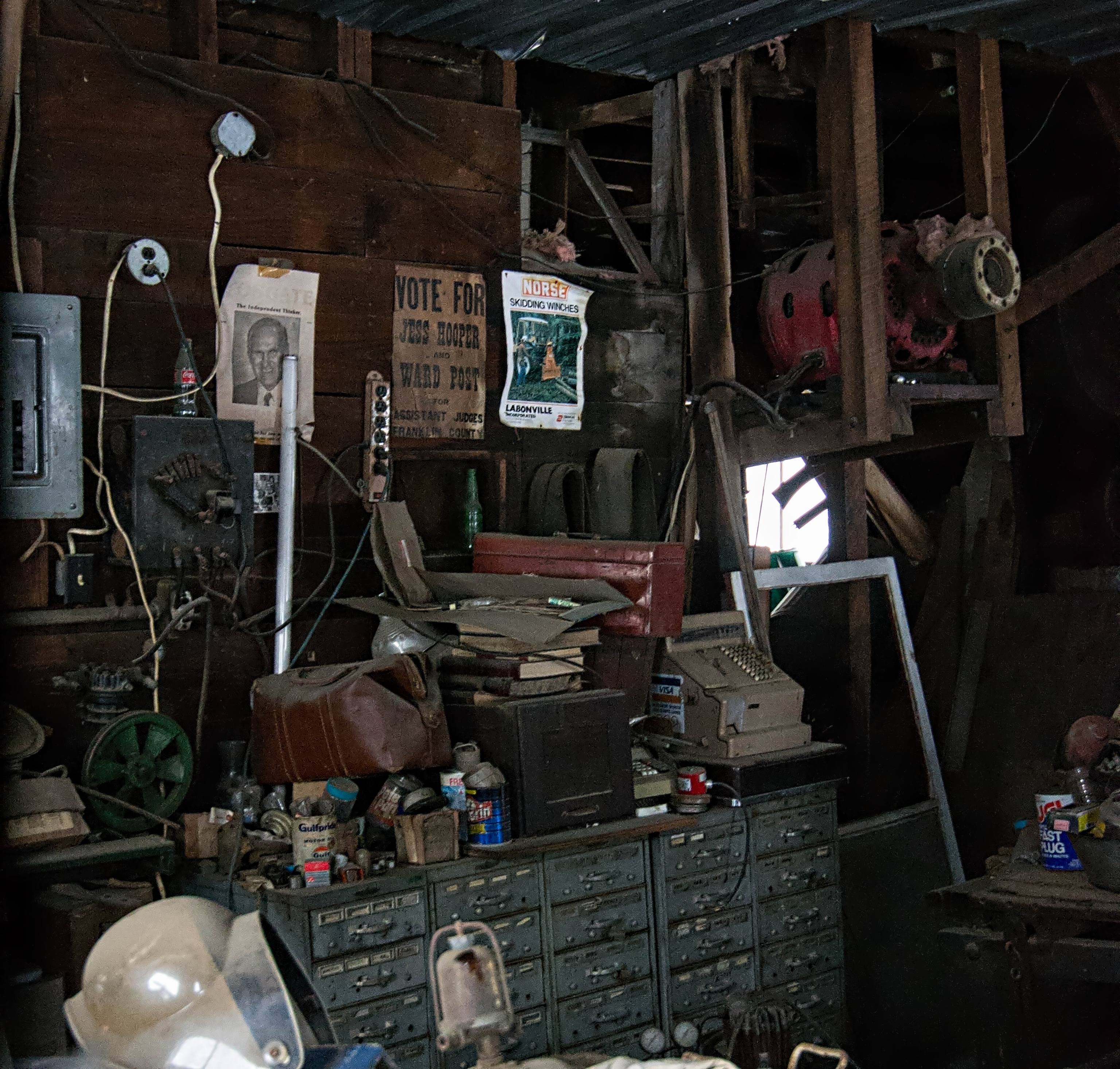
By 1987, partially due to the exorbitant cost of automobile and track maintenance, the stadium closed forever, a sad loss for Milton. The Catamount Stadium was appreciated by the entire region, and its closure was a bitter one. Catamount was very much a community affair. A few Milton residents who I spoke with recalled their fathers, friends and neighbors who used to race there over the years. Today an almost excessive plenitude of automobile related businesses still line Route 7 through town, a fading reminder of a dead era.

The Catamount Stadium grounds were redeveloped to the successful Catamount Industrial Park, which today among other things, houses a helicopter sales business, a warehouse for Burlington based Gardener’s Supply Company and a printing company.

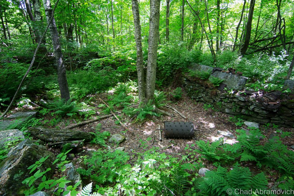
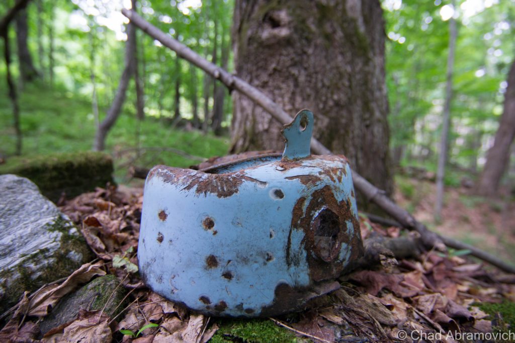
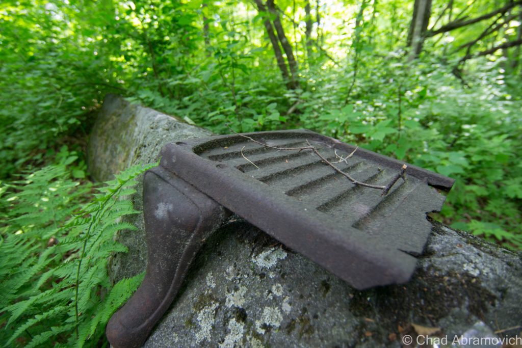
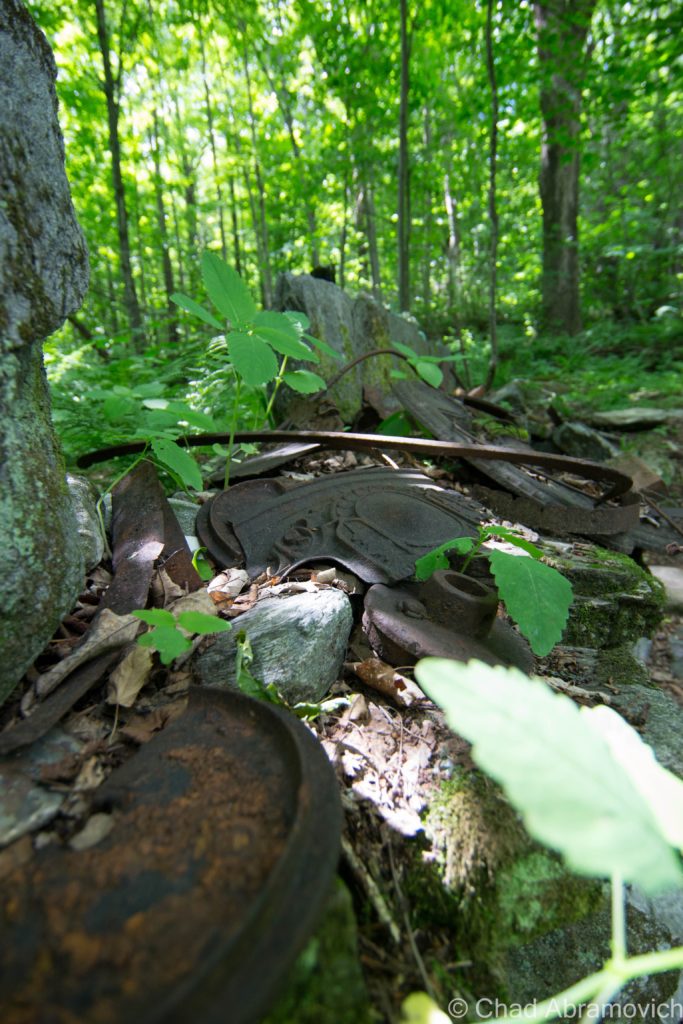
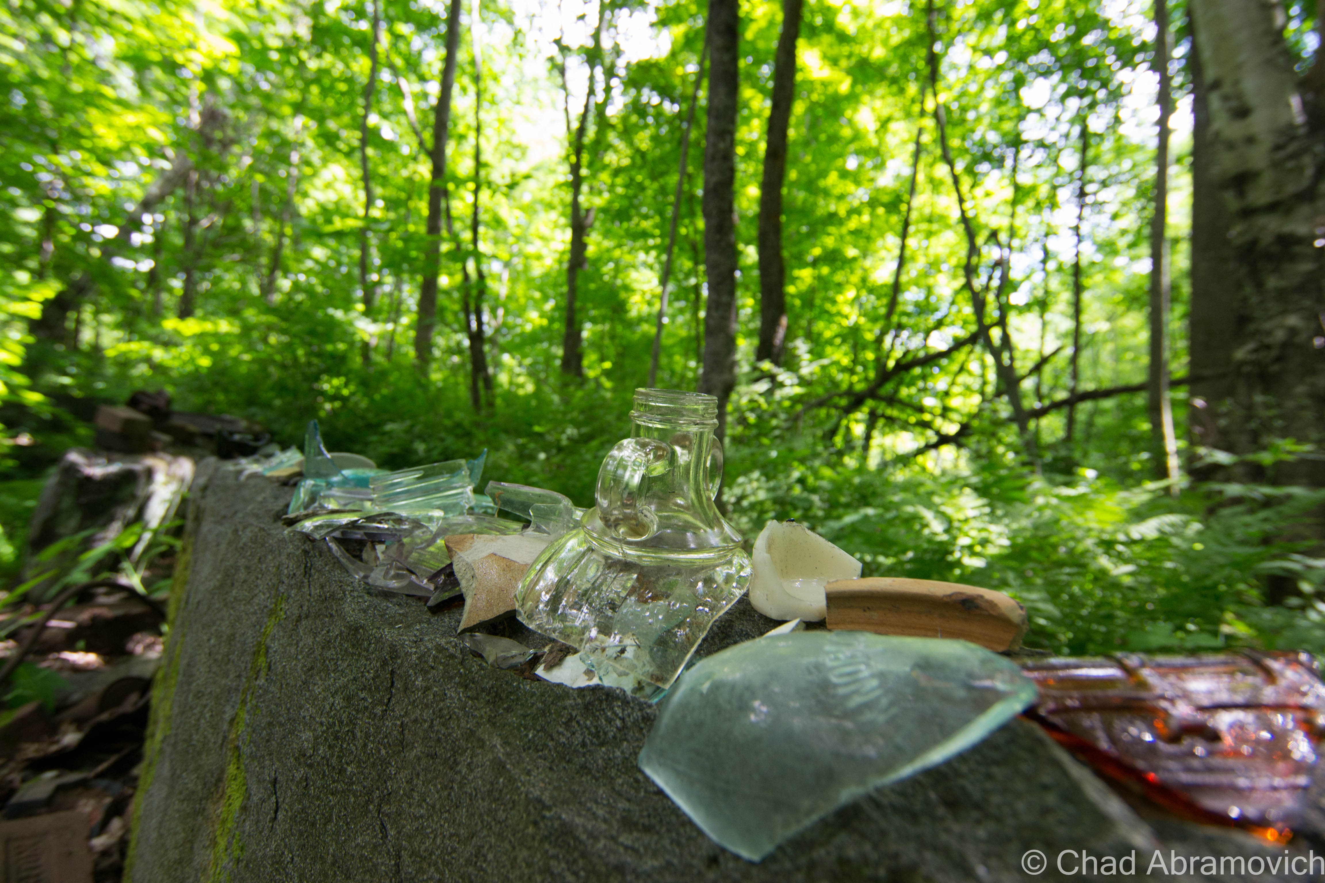
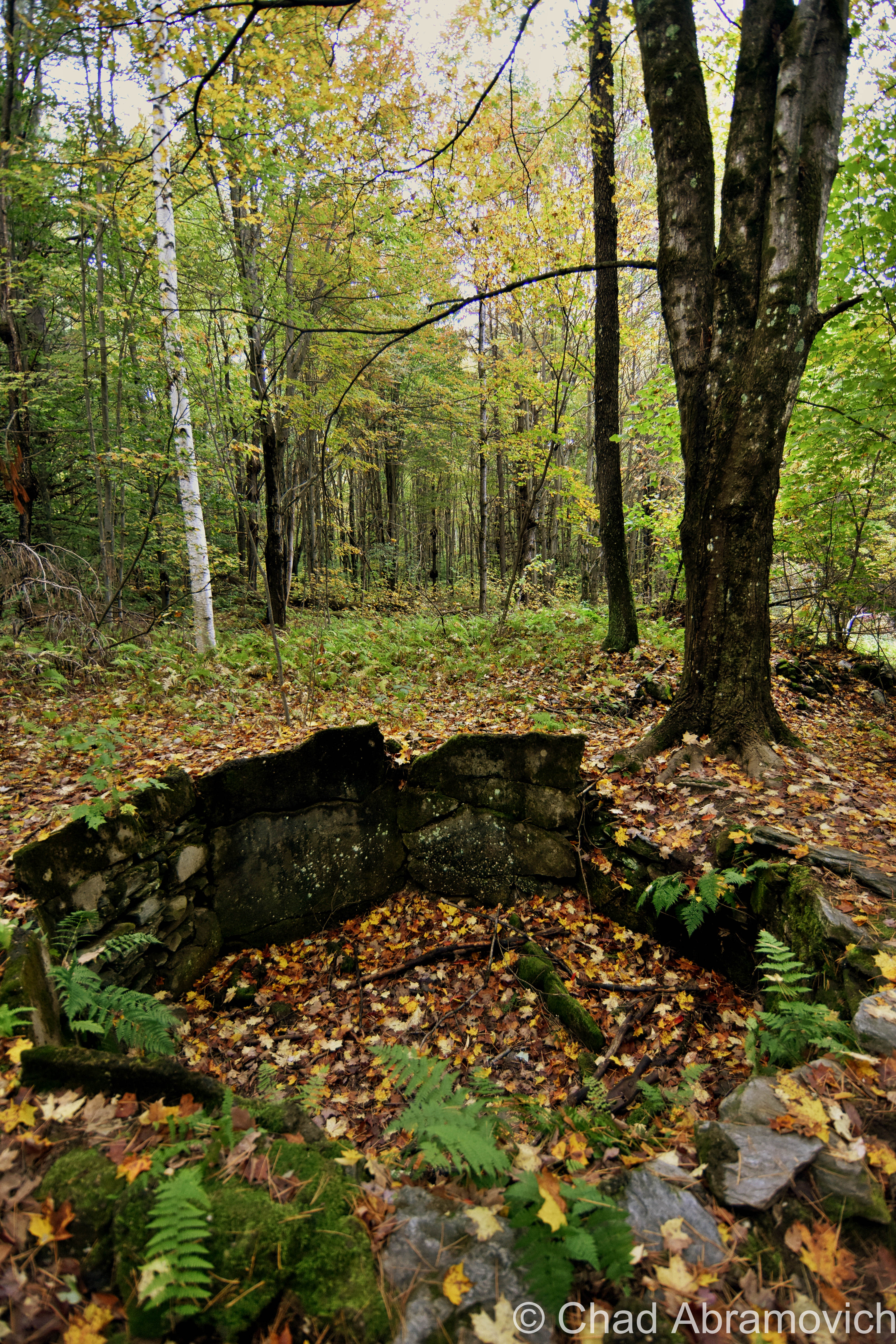
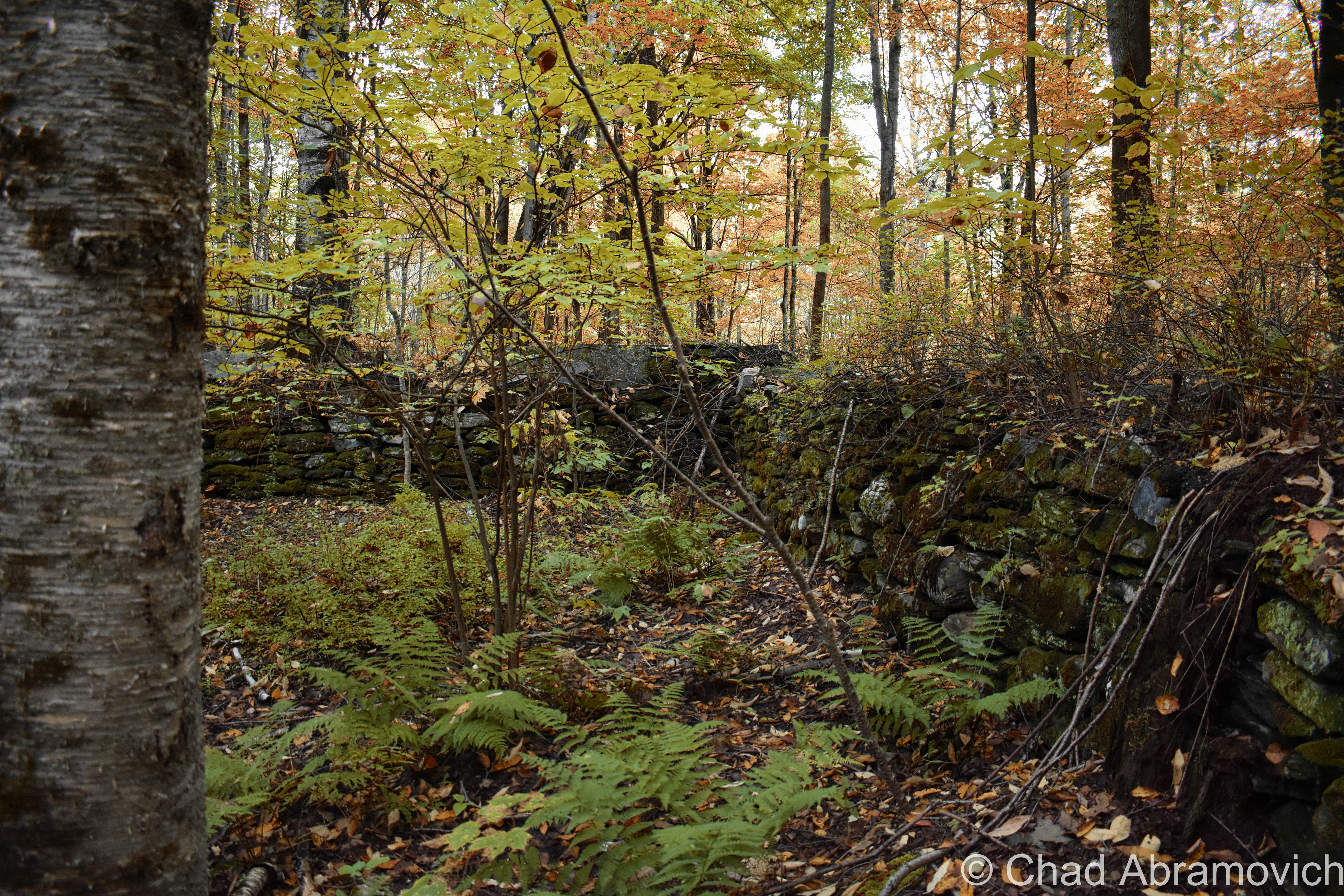
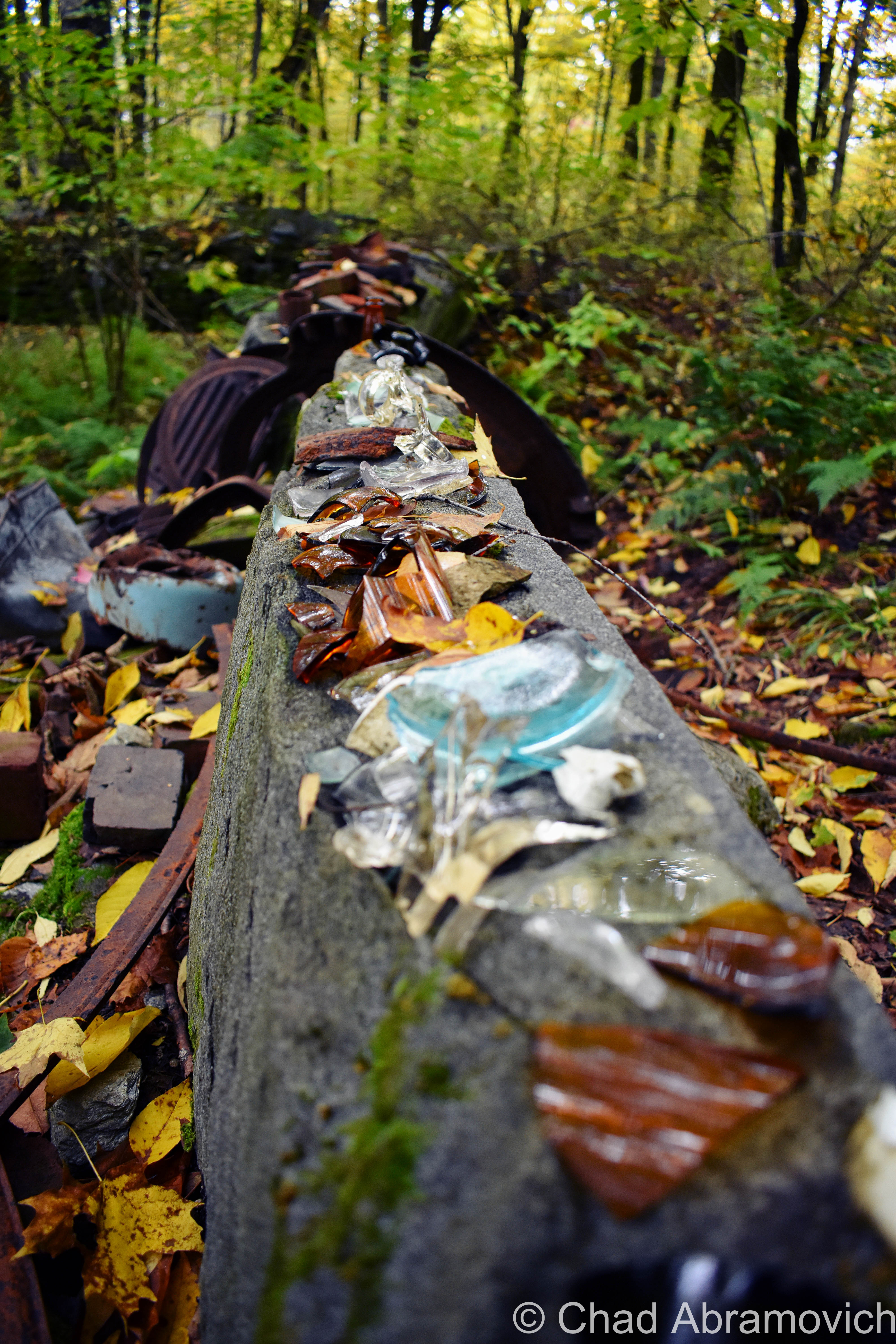
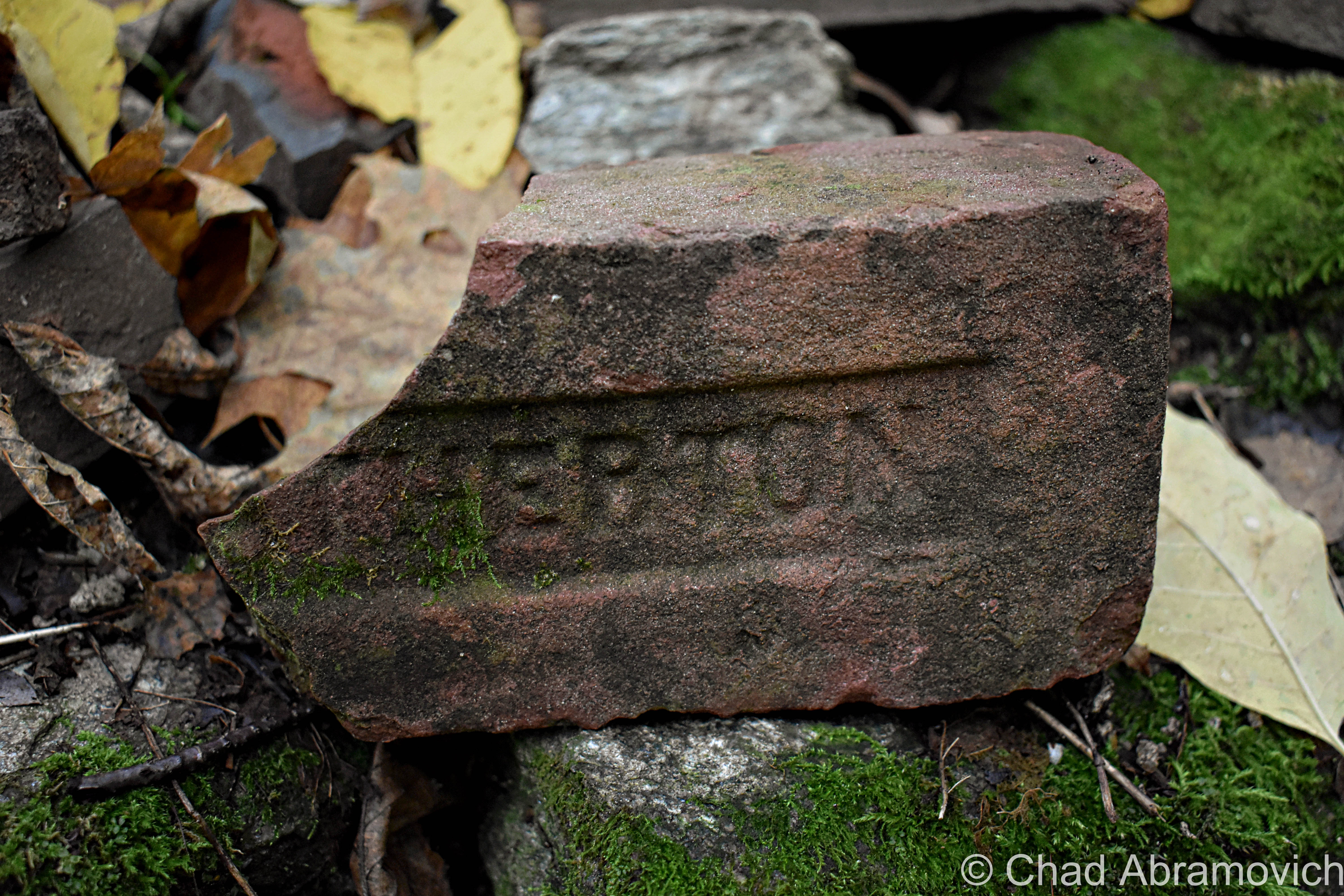
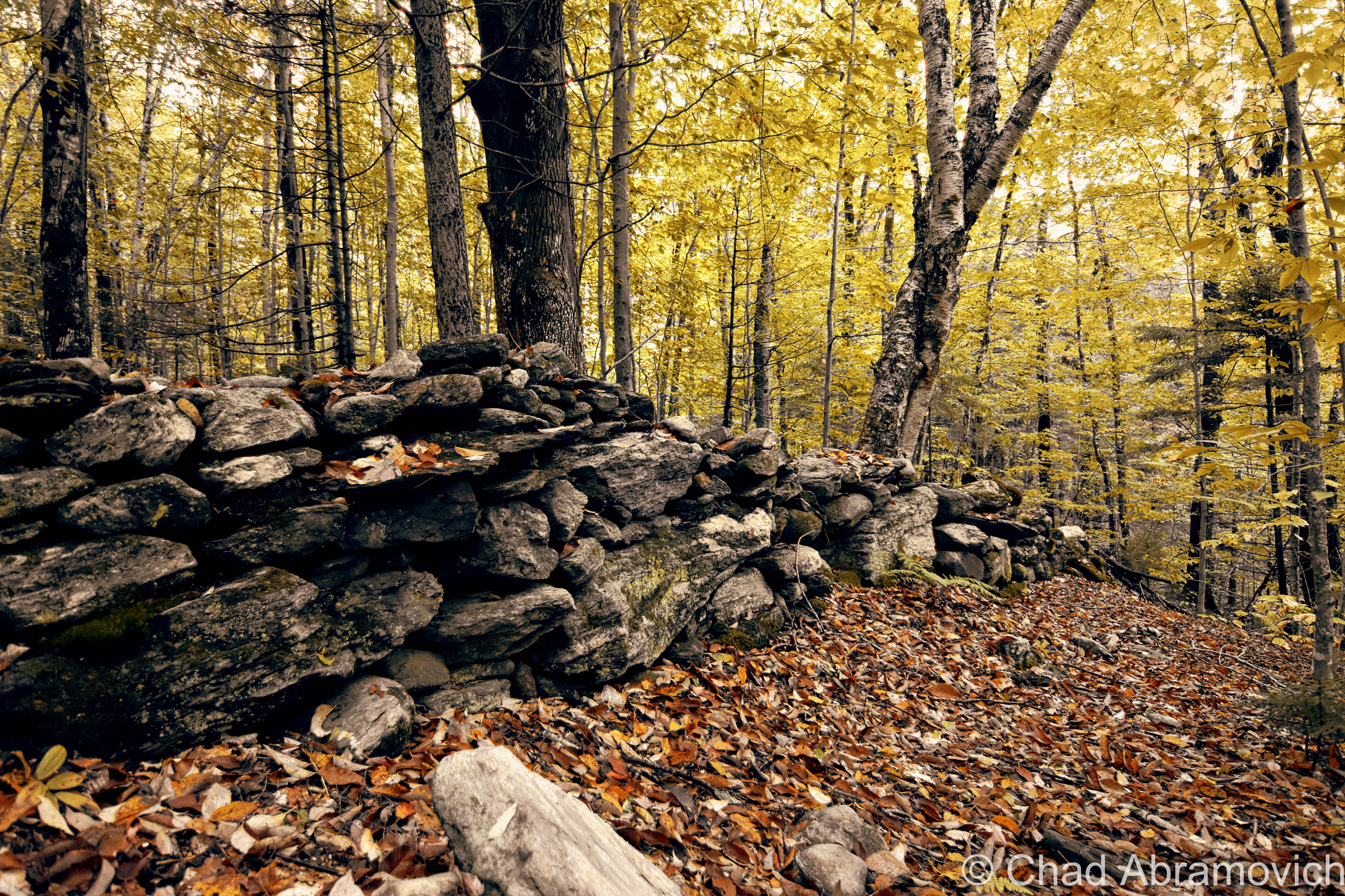
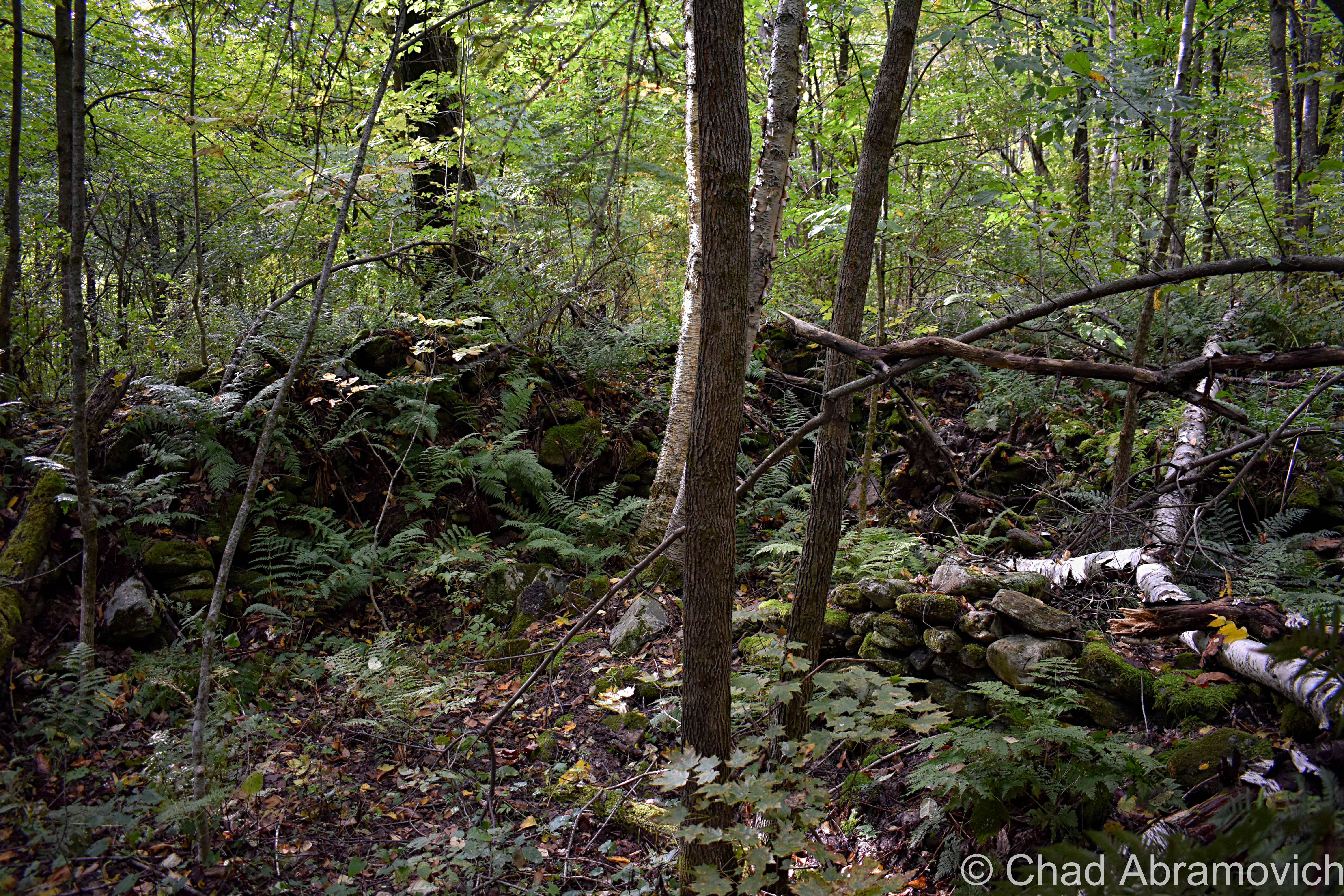
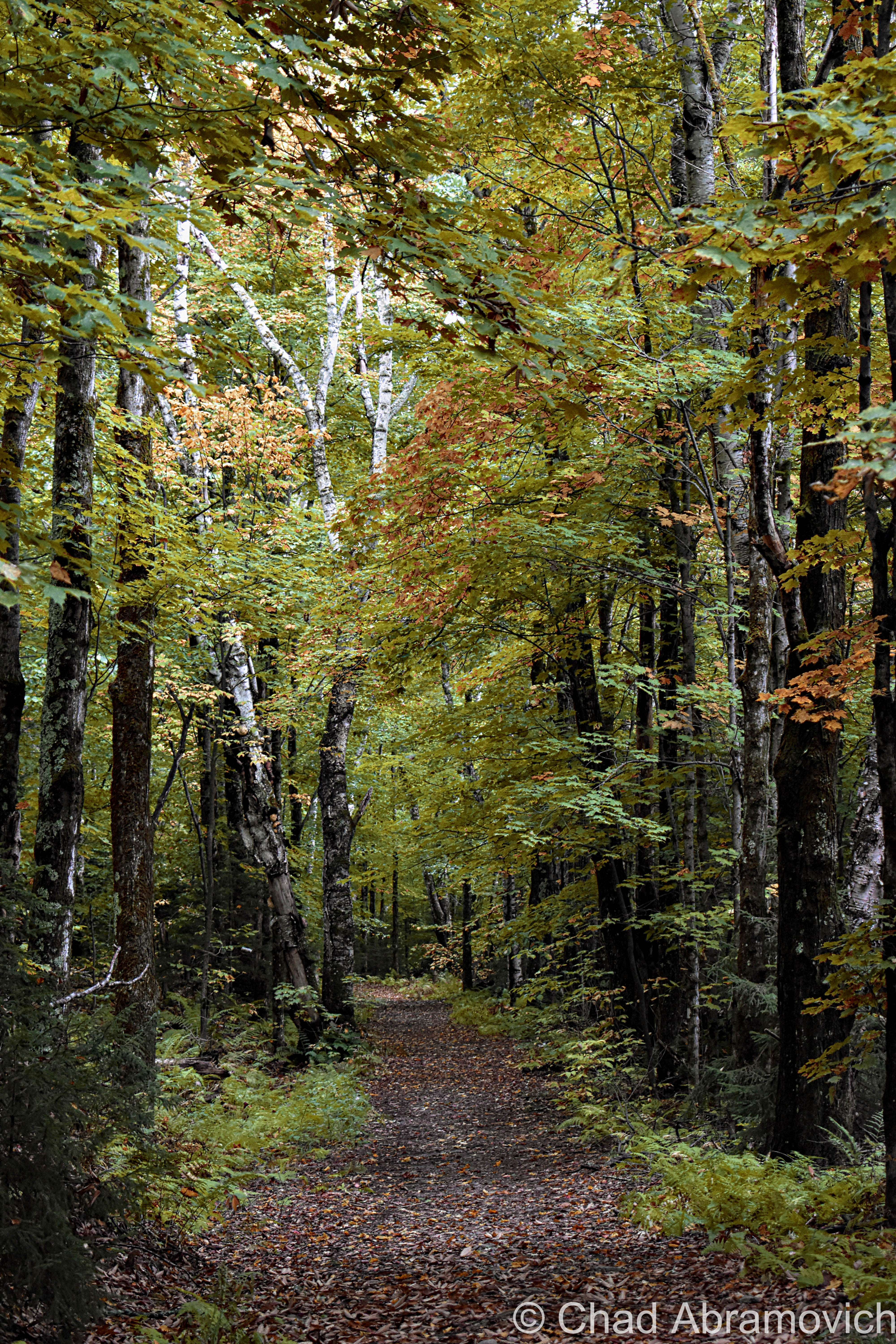
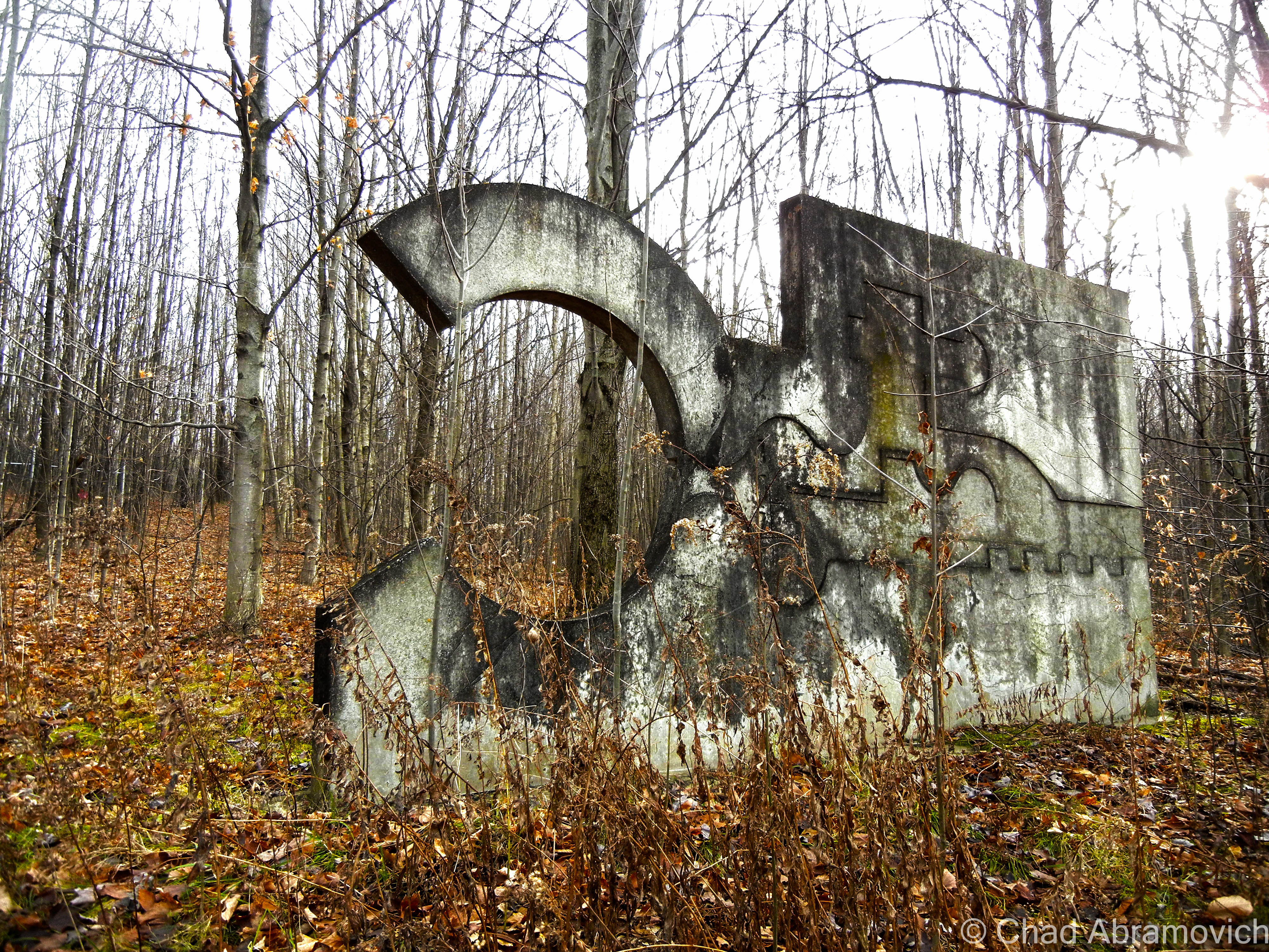
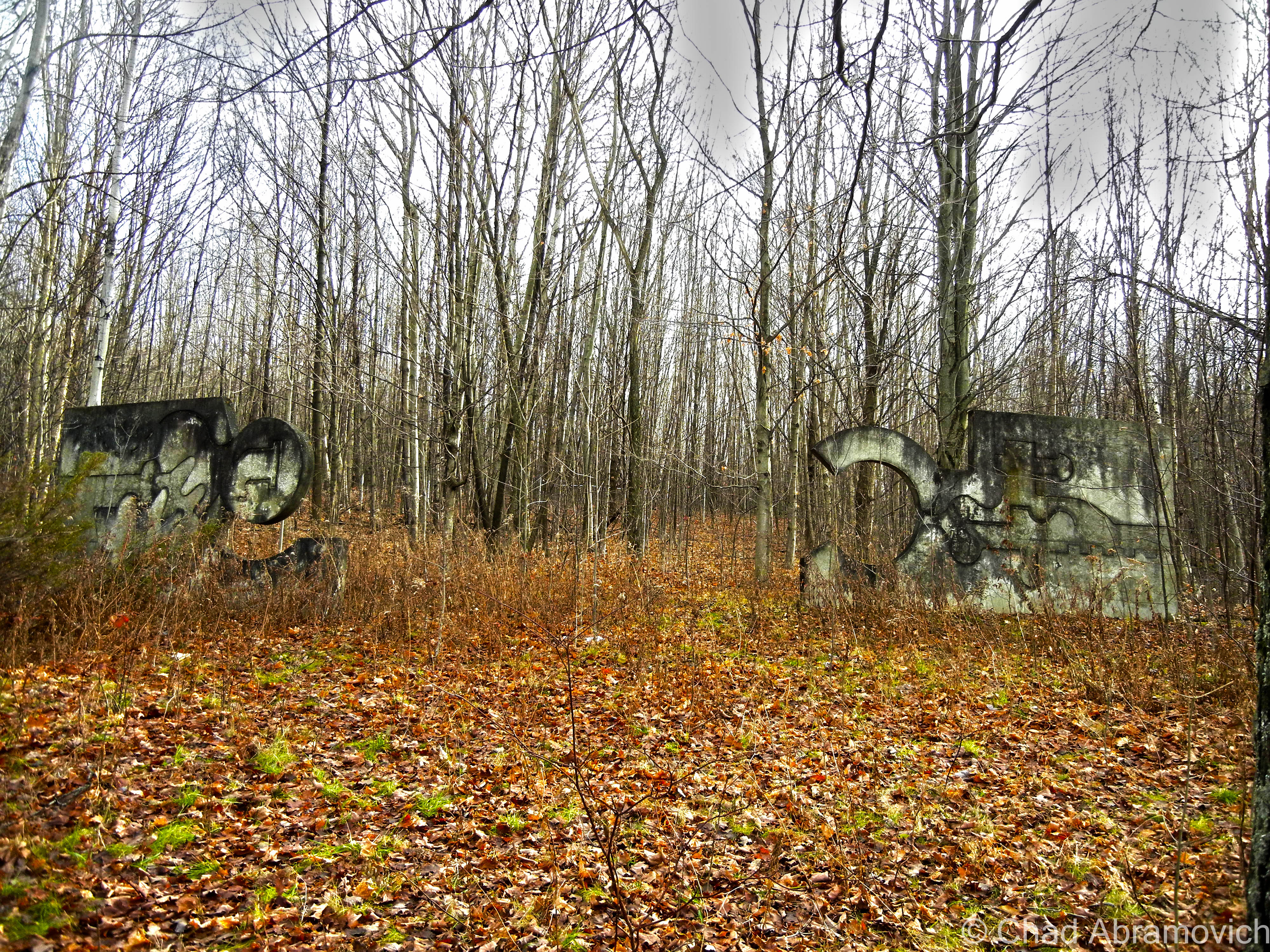
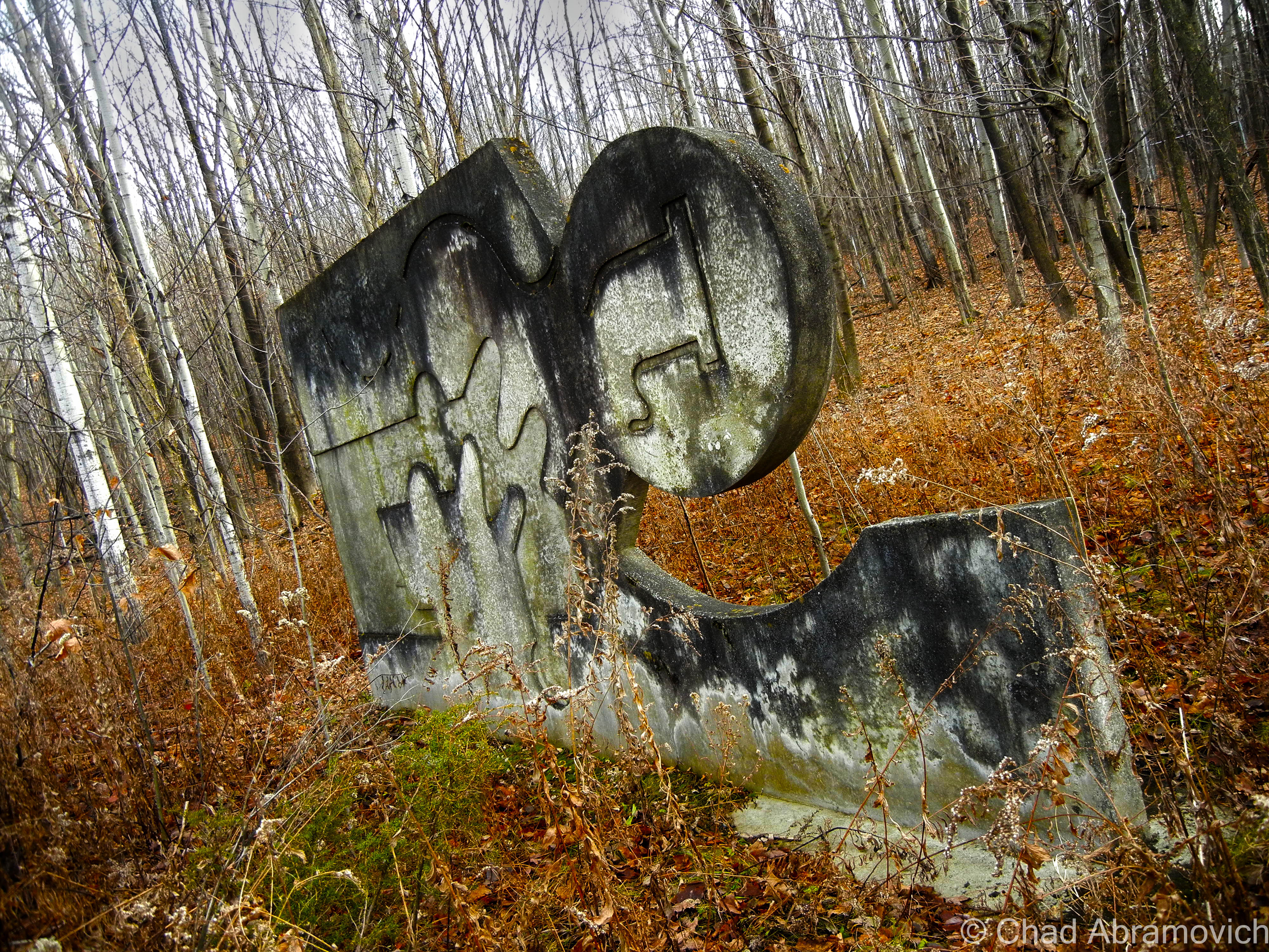
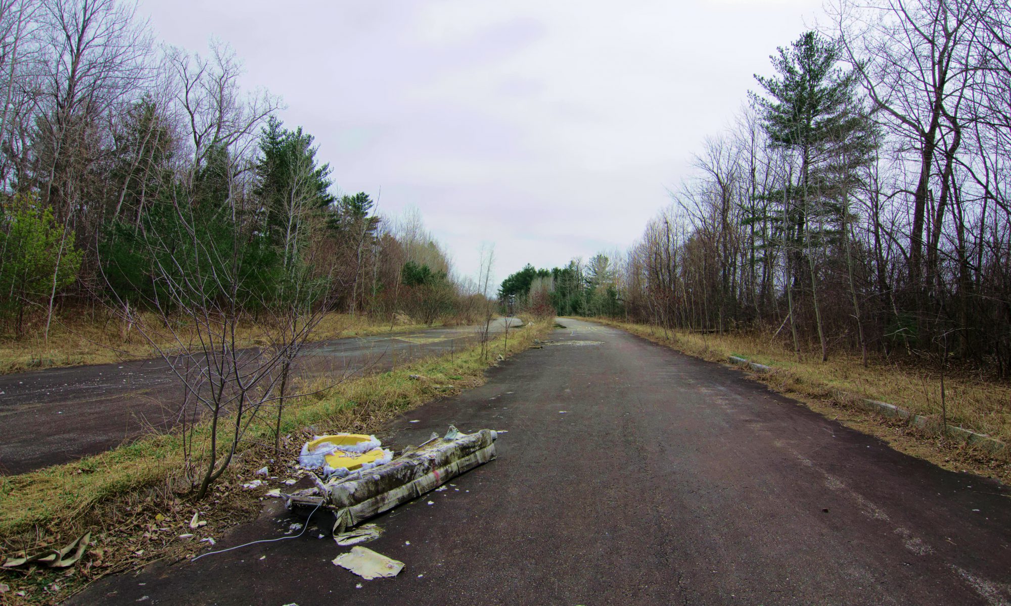
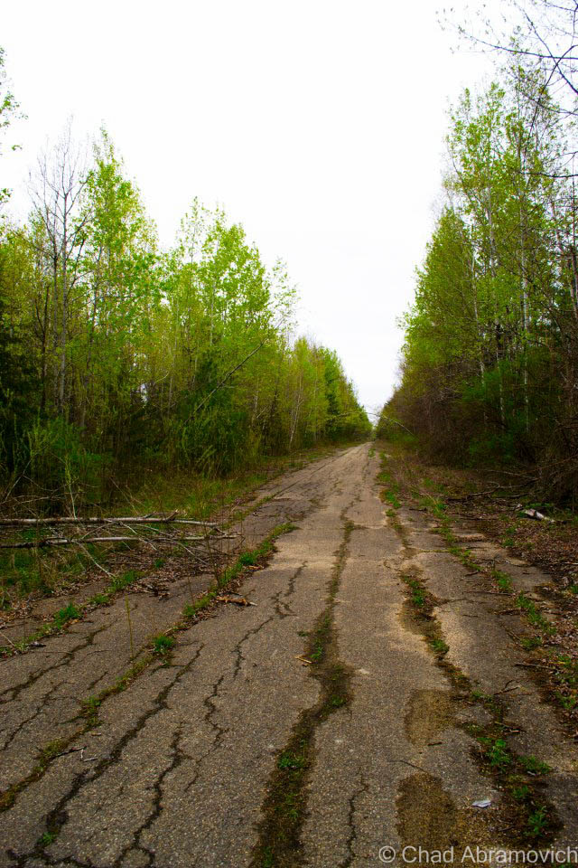
But one relic of Milton’s automobile past does still remain, if you do a little searching. If you head into town on Route 7, towards the grungy stained cinderblock walls of the Milton diner, there is a large vacant and gravely weed chocked field on your right. If you look far back into the field, you notice a perfectly straight segment of roadway that seems to emerge from the otherwise dead ground, and cuts into the woods behind it, going back as far as the eye can see. The pavement is cracked and potholed, weeds are plentiful, and the entrance is blocked by a set of very old Jersey barriers. This is all that remains of Milton’s drag strip.

The drag strip is hard to find now because everything is so grown up around it, so it doesn’t come as a surprise that most people don’t realize this small piece of history still exists. And if they stumble across it, do they know what they are staring at? The overgrown footprint continues for a few miles, until it abruptly ends in crumbling asphalt and birch trees, its ghosts sitting in the branches that tangle over your head.

Today it is a somber place, sitting behind a building supply store and a local diner, pretty much forgotten by the locals. The few that do remember the old strip refer to neighboring Racine Road as “Racin Road”, because the road runs directly parallel to the former strip, and is perfectly straight. Not surprisingly, some like to occasionally race there.

Last I heard, condos are scheduled to be developed on the upper half of the drag strip.

Two stretches of abandoned highways, both with very unique stories to tell.

The Milton Speedway Today.

A great find on Youtube! The Milton Drag Strip, 1963. The identifiable shape of Cobble Hill can be seen in the background.

Links

If you are curious about the Catamount Stadium, or have fond memories of it, there is a great website devoted to it

—————————————————————————————————————————————–

To all of my amazing fans and supporters, I am truly grateful and humbled by all of the support and donations through out the years that have kept Obscure Vermont up and running.

As you all know I spend countless hours researching, writing, and traveling to produce and sustain this blog. Obscure Vermont is funded entirely on generous donations that you the wonderful viewers and supporters have made. Expenses range from internet fees to host the blog, to investing in research materials, to traveling expenses. Also, donations help keep me current with my photography gear, computer, and computer software so that I can deliver the best quality possible.

If you value, appreciate, and enjoy reading about my adventures please consider making a donation to my new Gofundme account or Paypal. Any donation would not only be greatly appreciated and help keep this blog going, it would also keep me doing what I love. Thank you!

Gofundme: https://www.gofundme.com/b5jp97d4

Donate Button with Credit Cards

Grave Concerns

Every once and a while, I’ll have someone tell me a bizarre or strange tale that they swear has supposedly happened to them. Some of them are entertaining at best, but others surpass that, and create long lasting impressions. I don’t know, maybe I love these tales because they make me think that perhaps we’re something else than meat and bones, or perhaps it’s the allure of the ability for things to still exist that can defy any explanation that can be backed by science. Simply put; they challenge my very logical way of thinking and make me look at the familiar in an unfamiliar way. These are the stories that I would like to feature on this blog, and I think I found a good one to start with.

A Lost Town

Little River State Park in the town of Waterbury has shoreline on the beautiful Waterbury Reservoir, and extends into a grand patch of bumpy land that climbs up the mountains that form the back spine of lofty Mount Mansfield. Driving up Little River Road as it follows the sand banked river of the same name, it immediately becomes apparent that the area is wildly beautiful. But it’s tumbling topography yields another truth; the land up this way is rugged and rough. While outdoor enthusiasts really dig the state park, a century ago, the people who settled here weren’t as fond of the place – but their desperation for independence and land to build that on outweighed the many pitfalls.

The sinuous reservoir that snakes around green mountains was built for more practical purposes; to attempt to prevent ruinous floods that wiped out the town that once used to be here.

A century ago, real estate worked a bit differently than today’s trends. Prospectors pretty much settled anywhere where there was available land, including topography of the rough and rocky variety. Higher elevations were also less prone to flooding than down in the valleys, which is why many old stage roads or settlements can be found in higher elevations or places we may consider strange.

The slopes of Western Waterbury were cleared in the 1800s, and a small community of about 50 people formed, unofficially called “Ricker Mills”, “Ricker Basin” or sometimes, “The Ricker Mountain District”, all monikered after the large cluster of people who settled there with the same last name.

The settlement would eventually grow to encompass about 4,000 acres on the southeastern slopes of Ricker Mountain, which also took on the prevalent surname. But their choice of location made life up in the hills pretty rotten.

Most settling families were impoverished but they got by alright, their farms -which were hard to support on land that was mostly rocks – never prospered. The only other industries to really take off here were sawmills, taking advantage of mountains of timber and the many streams that picked up speed as they tumbled down to the valleys below.

Even today, some elderly residents who live in neighboring towns can still recall Ricker Mills as an existing place, and tell nostalgic stories of hardships. Families all had to pitch together to work on the farms in order to run a successful operation, and if one member wasn’t doing their job, the farm would limp or come to a stand still.

Eventually, younger generations began to slowly move away, looking for better opportunities. But the town’s death was sped up by the infamous flood of 1927 on November 3rd and 4th, when torrential rainfalls and frozen ground created a disastrous flood that paralyzed Vermont. The little river’s rising waters drove the valley residents to their roofs and isolated the settlement from the rest of Waterbury when the roads were washed out. In 1934, a second flood put an end to the already crippled community. Those who already hadn’t moved away were forced out when the state decided to close the roads into town for good, then began buying up all the land. The flooding inspired the creation of the aforementioned Waterbury reservoir and dam, a toilsome task built by five thousand men of the U.S. Army Corps Of Engineers and the Civilian Conservation Corps, who finally finished the massive retention project in 1938.

I attempted to go back roading back in March with a buddy, which was really just us sliding around wash boarded, muddy dirt roads a lot and wondering if it was a good idea.
We found ourselves at the foot of the Waterbury Dam. I was really digging the Art Deco detailing I was seeing.

Today, old cemeteries, sawmill remains, old town roads, bridges, and many cellar holes can still be seen as evidence of a past community. Surprisingly, a lone farmhouse from the settlement’s existence also survives off one of the trails; the ramshackle and haunted looking Almeran Goodell farmhouse, which was at one point a hunting camp before the park took possession of it. Little River State Park owns the land know, and a walk on one of its many hiking trails make these ruins easily accessible for anyone who wants to see them. Local lore maintains that when the water levels are low enough in the reservoir, which is now a popular place for outdoor recreation lovers, you can see the soaked and rusted remnants of the old iron bridge that once bridged Little River and was the main entrance into town.

Though the ghost town is an almost unsatisfyingly easy place to get too via Little River Road that parallels its river namesake, once you’re on one of the well-trodden hiking trails, it’s a surprisingly vast and desolate place, almost otherworldly. Tromping around the scattered ruins through bushy foliage that is brilliant in the fall, you can actually get a good sense of vanishing history.

DSC_0022_pe
Stone foundations and a variety of constructions can be found throughout the woods on the trails.
dsc_0029_pe
If you wanted to travel anywhere in the mountains, you had to cross plenty of streams, so local communities built “high bridges”, or, bridges built atop stone culverts to better withstand flood waters. But they often didn’t.
dsc_0032_pe
The old road has long faded into obscurity.

DSC_0044_pe

Last remaining house at Little River
The Goodell House is the last remaining house on Ricker Mountain, partially thanks to help from local Boy Scouts who fought to restore it, at over 140 years old.

DSC_0051_pe_peDSC_0055_pe

DSC_0115_pe
Foundation at Little River
Looking down an old well.
Artifacts left behind

DSC_0135_pe

But does something else remain here other than stone foundations and weathered gravestones? Does something unknown skulk among the trees and silent swampland? I’ve heard more rumors than I thought I would that Little River State Park was haunted, but never have actually heard any specific accounts to back them up. Most details fall flat and don’t offer anything credible. A ghost town in the middle of a pretty remote stretch of woods is certain to conjure up some sort of folklore, though. Vermont is a state of extremes where either a topic has been written about to monotony, or it hasn’t been covered at all. I was hoping to break some ground here, and I knew I was onto something good when I heard this story.

A Night In The Woods

I’m proud to have been entrusted with this story, and to write about it in my blog. This is the first time this has ever been written down or told beyond a quite campfire in my backyard.

A few years ago, John, an experienced hunter took a hike into the wilds of Ricker Mountain. His plans were to spend a few days in the woods hunting and camping under the stars – a little much-needed rest and relaxation.  Being an experienced woodsman, he planned carefully. He found a suitable spot for his campsite, and began to clear it of brush and tree branches. He even found some nice flat stones nearby to construct a fire pit from.

People generally are in two different camps when it comes to spending the night in the woods. John loved it. The first night, he was almost asleep inside his tent when he heard a strange noise. In the darkness, he listened carefully. It sounded like fingertips that were scratching the outside of his tent. He knew he had cleared the area of any tree branches, and it was a windless night, so he thought it had to be an animal. But he noticed that the woods had descended into an eerie silence, a silence he has never heard before. After a while, the tapping stopped. He waited for it to start up again, but it didn’t. He soon shrugged it off and fell asleep.

The next night, he awoke to the sound of someone or something, tugging at his tent straps. Again the woods fell into that eerie silence. He sat up in his sleeping bag and tried to assess the bizarre situation, but couldn’t really think about what to do other than wait for something to happen. The tugging soon stopped, and nothing ever happened. But he didn’t go back to sleep – and spent the rest of the night in anticipation, waiting until the sun rose. The next morning he noticed that the tent strap hadn’t just been pulled, it had been cut! It was a clean-cut, as done with a knife, yet he hadn’t heard the sound of tearing fabric, or the noises of any other human around.

Weighing his options, he decided to stay another night, trying to jump to a logical conclusion that could explain the previous night’s events while also falling into the gravity of his stubborn nature. He nonchalantly assumed that whatever it was, it didn’t really pose a real threat to him, and it didn’t know how long he was camping here because even John didn’t know! Surely it was gone by now. He wanted to leave when he’s good and ready, because it was hard enough to get time off from work and he wanted to enjoy the little time he had. So he decided to stay.

But on the third night, John got the surprise of his life. He woke up suddenly when the bottom of his sleeping bag, which had moved in his slumber and was touching the tent wall, was grabbed violently “as with human hands” and forcefully yanked towards the tent door. He instinctively grabbed his shotgun next to him and yelled “try that again and you’ll be sorry!” and waited with bated breath and adrenaline for something to happen. But nothing did. Again he noticed the eerie, almost unnatural silence of the woods. Nothing was making a sound, and this time, he recalled being incredibly uncomfortable by it. Surely he would have heard whatever the intruder was, retreating across all the brittle fallen leaves near the campsite, but he didn’t.

He knew it would be foolish to leave in the middle of the night, especially because he didn’t know exactly what was out there waiting for him. He knew it would be a foolish attempt to get back down towards the road. So he spent the rest of the night awake, shotgun at the ready, and as soon as dawn cracked the dark, he began to frantically pack his things.

As he took down his tent, he noticed something peculiar. As he was ensuring that the embers in the firepit were extinguished, he noticed something about one of the stones he had used to form the circular wall that he hadn’t noticed before. Somehow, unknowingly, he had used a fallen headstone from a forgotten and neglected cemetery nearby, now almost indistinguishable from years of dead leaves and fallen branches.

John doesn’t believe in ghosts, and doesn’t subscribe to any of the mythology of the paranormal and the tales that other people chase, but he managed to choke out an out of character diagnosis. “Well, man I don’t know. Maybe it was one of the ghosts of Ricker Mountain, angry that I used their headstone as part of my firepit.”

I asked John if he would ever go back to Ricker Mountain. He just shook his head and said “nope”. I guess I can’t blame him.

Digging into Trouble

Upon hearing that strange tale, my own father came forward with a story of his own, one that was as unusual, if not frightening to me. Whether it actually happened or not…well, I’ll let you decide for yourself.

When he was in his early 20s, he and his cousin were fly fishing along The Housatonic River in the small Connecticut town of Kent, in the rural Litchfield Hills. It was a perfect spring afternoon, and they were having good luck on the river.

As they fished down the riverbanks, they came to a spot where a large row of power lines crossed over the river and up a nearby mountain. Mounted above a rather steep ledge above them was a large copper plaque. Being curious, they both got closer to read it. The plaque was commemorating a tragic death that took place on that very spot 100 years ago, when a copper mine collapsed killing an unknown amount of miners. They were standing on a mass grave. What happened next has no explanation. One of them suggested digging up the grave – or what appeared to be the grave site. The earth was soft and seemed easy to dig through. My father agreed. Being young and immortal, they began to pick away at the hillside. And within minutes, the pleasant spring weather turned ugly. The skies turned a dark black and before they knew it, a freak bolt of lightning struck the power lines directly above their heads.

Terrified, the two of them stopped their digging and hastily retreated back to the safety of their car. And that was when they realized that this wasn’t just an ordinary storm.

“I looked back, and noticed that the lightning was striking and hitting every tree or pole that we were running by! It was – it was like it was following us!” my dad said animatedly, getting caught up in his memory. They scrambled back onto Route 7, both breathing heavily and scared out of their minds. And just as soon as the storm started, it stopped. The skies were clear again. It was like nothing had ever happened.

They scrambled back onto Route 7, both breathing heavily and scared out of their minds. I guess anyone would be in that situation. And just as soon as the storm started, it stopped. The skies were clear again. It was like nothing had ever happened.

So is there an explanation here, supernatural or other? Was this just a bad freak storm that passed right over their heads? After all, New England is known for it’s weird weather. Or was it something more, perhaps it really was an act of vengeance from the angered ghosts of the dead minors who lost their lives under that very spot. Neither of them have an explanation, and the only conclusion I have is that they did experience something. One thing is for certain, they have never done anything that stupid ever again.

—————————————————————————————————————————————–

To all of my amazing fans and supporters, I am truly grateful and humbled by all of the support and donations through out the years that have kept Obscure Vermont up and running.

As you all know I spend countless hours researching, writing, and traveling to produce and sustain this blog. Obscure Vermont is funded entirely on generous donations that you the wonderful viewers and supporters have made. Expenses range from internet fees to host the blog, to investing in research materials, to traveling expenses. Also, donations help keep me current with my photography gear, computer, and computer software so that I can deliver the best quality possible.

If you value, appreciate, and enjoy reading about my adventures please consider making a donation to my new Gofundme account or Paypal. Any donation would not only be greatly appreciated and help keep this blog going, it would also keep me doing what I love. Thank you!

Gofundme: https://www.gofundme.com/b5jp97d4

Donate Button with Credit Cards

The License Plate House

One of my favorite oddities in Vermont to photograph is on the back roads of rural Fletcher. Instead of using traditional vinyl or wooden siding, the owner of this ramshackle structure had a much more original idea – he covered it wall to wall with what might be the largest collection of license plates in the state of Vermont. The plates range in age, dating as far back as the 1920s and going as late as the 1990s. Most were Vermont plates, but there were a few outliers. Connecticut, Massachusetts, Kentucky and Wisconsin were included. Knowing a good photo opportunity when I see one, I had to stop. Thankfully, the town of Fletcher seemed to be free of traffic that day, so I had the whole road and a good chunk of time to get a decent picture of the structure without worrying about my safety.

It was a beautiful spring evening, the sky was stained with a mixture of brilliant blues and pinks, which was a vibrant contrast to the green fields blooming with dandelions and the perfume of wet earth. As I was adjusting my camera settings,  I noticed that I was no longer alone. An elderly gentleman had walked up behind me. I assumed he was most likely the owner of the building. Just as I thought I was going to get a stern talking too for being too close and standing there for too long, he asked me how I was doing. He had a puzzled look on his face, but his question was sincere. I smiled and told him I liked his building. He looked over at it, then back at me, an amused grin on his face. I could tell he never thought of his own property as much of an attraction before. “You from the Burlington area, or are you a flatlander?” he said with a grin. I chuckled a little at this, suddenly a bit self-conscious of my appearance.  I’ve always been proud of my Vermont roots, and have never had to question my appearance before.

Then unexpectedly, he motioned for me to follow him with his hand, and before I knew it, he was digging in his pocket. Out came a key, and he began to fiddle with a padlock. There was an awkward moment where he and the garage door seemed to be fighting with one another. The building’s structure was so lopsided that it seemed either the door was going to fall out of it’s frame, or the building was going to collapse. But it finally gave way, and slid open on its rusty wheels.  “Well, are you coming?” he questioned. I asked myself the same thing, and stepped inside. He fumbled for the light switch and I heard the buzzing noise of a Mercury Vapor light come on.

Generations of artifacts and various knick knacks lay piled inside. So many in fact that the building was filled to it’s rafters, there was barely any room to move, yet alone get a good idea of where to begin processing what I was seeing. It was incredible.

There was a moment of awkward silence, I didn’t quite know what to say. I looked over and noticed he was now holding a wooden pipe in one hand, and packing it with tobacco with the other. As he lit up, it seemed at this point that he felt comfortable enough to start really engaging in conversation, and before I knew it, my questions were soon answered. As it turns out, this used to be a gas station, and has been in his family since the 1920s. His great grandfather started the business, and was a self taught and skilled auto mechanic, as well as a dedicated farmer. The gas station served as both his mechanic shop and his farm workshop. A perfect example of Yankee Ingenuity, he used the brook behind the building for power, by means of a homemade generator complete with a hand-carved wooden wheel that rotated with a belt attached to it. I was at a loss for words.

The gas station changed hands from his grandfather to his father and later, him. Locals from Fletcher who recall the place in operation said it was cool. One person told me that he used to drop by to gas up his call, and inside the office near the door, there was a tin can where you could leave your money. Everyone was on the honor system.

Its doors closed during the 80s when pressure from the gas industry forced people into modernizing the gas pumps, which was something the family couldn’t afford to do. The original gas pumps still sit out front – sort of. Last winter, a plow truck came through the area a little too fast and took them out completely. The town wouldn’t reimburse the family for the damages, so they did the only thing they could do – move the remains out of the road. He lifted up a weathered tarp and revealed the busted remains. Though damaged, the antique pumps were still a cool site to see.

I asked about the license plates, and his answer was simple. “We’ve owned a lot of cars”. Whether this was a true answer or just sarcasm, I was satisfied with his right to the point reply.

I can’t describe in writing the genuine old time feeling this place had to it, with it’s distinct barn smell and eclectic array of aging antiques and artifacts, sitting in cluttered piles collecting dust. But he assured me everything had its place here. “My dad had a system. He always knew where everything was” he told me.  I asked about some of the vintage posters on the wall, hoping maybe he would sell one for the right price, but my request was instantly meant with a stern no. “Nope. They’ve always been here on the wall and that’s right where they are going to stay”

What I didn’t realize, was that a lot of the antiques I saw actually didn’t belong to him. A lot of stuff came from family and friends from the Waitsfield-Warren area, being stored here after a lot of the farms down that way were damaged from tropical storm Irene. He also explained why the building was in such bad shape, another result of tropical storm Irene. The quiet stream that runs behind the building overflowed its banks and swelled through the cracks of the building and into the foundation. The damage is “too expensive to fix” and the state has deemed the place uninhabitable. “I can’t really do much but wait for it to fall down” he said, a sense of loss in his voice.

He gave the garage door another good wedge and pulled it shut. I thanked him for the tour and shook his hand. I could tell as he walked away that he was amused by my curiosity by his property, and as for me, I was just thankful he took the time out of that spring night to share it with me.

DSC_0897_pe
Taken early spring of 2014, when I drove by again. Sadly, my original photos of the spring 2012 shoot were lost when my hard drive crashed. A poignant reminder to back up your work…

DSC_0899_pe 231909410256326

231909573589643 231909693589631 231909793589621 231909866922947dsc_0407_pedsc_0367_pedsc_0371_pedsc_0386_pedsc_0395_pe


—————————————————————————————————————————————–

To all of my amazing fans and supporters, I am truly grateful and humbled by all of the support and donations through out the years that have kept Obscure Vermont up and running.

As you all know I spend countless hours researching, writing, and traveling to produce and sustain this blog. Obscure Vermont is funded entirely on generous donations that you the wonderful viewers and supporters have made. Expenses range from internet fees to host the blog, to investing in research materials, to traveling expenses. Also, donations help keep me current with my photography gear, computer, and computer software so that I can deliver the best quality possible.

If you value, appreciate, and enjoy reading about my adventures please consider making a donation to my new Gofundme account or Paypal. Any donation would not only be greatly appreciated and help keep this blog going, it would also keep me doing what I love. Thank you!

Gofundme: https://www.gofundme.com/b5jp97d4

Donate Button with Credit Cards


Georgia’s Giant Puzzle Pieces

There is a rather unusual landmark in Georgia that may have some people scratching their heads. That is – if you can find it. If you trudge up a gentle hill through knee deep weeds, behind the Georgia Interstate Rest Area, you come face to face with these life-sized jigsaw puzzle pieces, sitting neglected in the Vermont woods. The irony isn’t lost on me here, as these weathered puzzle pieces are, well, a puzzle. What the hell are they? Why are they here? Who sculpted them? And why have they been forgotten?

As it turns out, these are a set out of of 18 sculptures designed and fabricated during the International Sculpture Symposium held in Vermont in 1968 and 1971, with the intent on decorating the freshly constructed interstate system and it’s rest stops. Matching grant funding was provided by the National Endowment for the Arts.

The event was organized by Paul Aschenbach, a well respected and now deceased UVM professor. The sculptors came from all over the world, and the output was meant to beautify and bring some life into the newly built rest stops along interstates 89 and 91, but instead, many of them have been forsaken and serves as monuments to enigmatic decrepitude.

The interstate coming through Vermont is fascinatingly turbulent. I didn’t cover much of that here, maybe I will in a future blog post. But – UVM has a pretty cool blog about it, with old photos.

004 005 007

—————————————————————————————————————————————–

To all of my amazing fans and supporters, I am truly grateful and humbled by all of the support and donations through out the years that have kept Obscure Vermont up and running.

As you all know I spend countless hours researching, writing, and traveling to produce and sustain this blog. Obscure Vermont is funded entirely on generous donations that you the wonderful viewers and supporters have made. Expenses range from internet fees to host the blog, to investing in research materials, to traveling expenses. Also, donations help keep me current with my photography gear, computer, and computer software so that I can deliver the best quality possible.

If you value, appreciate, and enjoy reading about my adventures please consider making a donation to my new Gofundme account or Paypal. Any donation would not only be greatly appreciated and help keep this blog going, it would also keep me doing what I love. Thank you!

Gofundme: https://www.gofundme.com/b5jp97d4

Donate Button with Credit Cards

Island of Shrieking Birds

Young Island has very little in common with the atmosphere of a faraway planet, and yet, its alien design is completely foreign amongst the rest of the Lake Champlain Valley. A barren wasteland, all the trees and plant life are dead- their leaves and twigs long plucked off. Weeds most commonly found in wastelands are the only living things that can grow and survive in this inhospitable place. In the center of this eerie landscape is the rotting shell of an old cabin- evidence that there once was human habitation here. And everything that is something is covered in toxic bird guano and molted rotting feathers, left to bake under the sultry summers. This intimidating and miserable island enjoys a unique reputation, and perhaps is one of the most mysterious places on Lake Champlain.

Though the island’s official name is Young Island, residents of neighboring communities have another moniker for this foul place; bird island. This blunt nickname also tells us the story of this small island’s mutilation.

At certain times, the rocky slab of land off the coast of Grand Isle seems to actually be quivering, but it’s not the heat of the day or some sinister preternatural force at work. Instead, the culprits are thousands of birds flying around the island. More specifically, Double Crested Cormorants.

Immigrants to Vermont, they were first spotted in the area around the 1970s near Young Island. In 1981, that number grew to 35. Recently, the population exceeded 15,000, (some say over 20,000) with 98% living on Young Island, and more recently, are beginning to become discovered on other islands around the lake.

Cormorants like to nest on remote islands, safe from predators and human habitation, making Young Island an ideal choice. But sadly, they are not welcomed neighbors to our region because their nesting habits are destructive, which are endangering the ecosystem of the lake. Cormorants settle into their new found homes by plucking away at the vegetation and tree branches, using the material for their big messy nests, leaving dead skeletons in their place. Their nests can reach as high as 2 feet tall and are built strong because adult Cormorants can weight up to as much as 12 pounds. The bird guano that now covers the island is acidic, and also helps kill the trees and the shrubbery and its foul smell can radiate for miles when there is a strong wind. As their numbers grow, they become a dominant and intimidating presence and prevent other species from nesting in the area – and Young Island is small, and space is at a premium. So much so, boaters, fisherman and a few residents from as far away as Grand Isle have reported hearing the loud and belligerent sound of countless bird shrieks, as they fight for space to nest. The island has been turned into a war zone.

So, what is being done about this problem? Or perhaps, why has it been allowed to happen? The answer is a simple one; Cormorants are a protected species, with the state arguing that they have as much right to nest and live near the lake as any other species. But recently, The Vermont Fish and Wildlife Department has made exceptions because of an increasing worry that Cormorants will soon migrate and destroy other islands. And this fear has became a reality as neighboring Bixby Island, as well as The Four Brothers Islands in New York have already began to see Cormorants nesting on their shores. The Fish and Wildlife Department is trying to keep the population from exploding, by oiling their eggs so they won’t hatch, and blasting nests from other islands with high powered water hoses. Taking advantage of a unique situation, UVM uses Young Island as a research environment, to study the Cormorants and their nesting habits.

Thanks to egg oiling, some have told me that the population has actually dwindled to “the hundreds” as less and less are returning to Young Island, or migrating to other islands across the lake – but so far, the damage to their other new found homes hasn’t been as destructive. Yet.

Regardless of the accuracy of numbers, spending time on Young Island isn’t for the squeamish. As a matter of fact, I couldn’t think of many other places that you could feel more isolated on. When brave visitors make their way onto the disturbingly intriguing island and through layers of bird guano, the baby Cormorants defend themselves with the only ammunition they have, they throw up whatever they’ve eaten for the day.

And if that isn’t strange enough, Young Island is one of the few places on the lake where Yellow Perch literally fall out of the sky. But these aren’t Perch you want to eat, these have already been eaten, twice – coughed up by a soaring Cormorant. And of course, Cormorants are also considered a threat to the local fish population, with the alarmingly high numbers they consume.

If you wish to see this unusual area for yourself, take a drive to Grand Isle’s West Shore Road, near the Vantines fishing access area, and Young Island will be to the north west. You can’t miss it.

DSC_0680_pe
Young Island from Adams Landing Road
DSC_0695_pe
Best picture I could take with my zoom lens. Here, you can get more detail of the house and the scrubby island floor. Any closer and I’d have to be in a boat. Since this picture was taken, the cabin’s roof has caved in.

—————————————————————————————————————————————–

To all of my amazing fans and supporters, I am truly grateful and humbled by all of the support and donations through out the years that have kept Obscure Vermont up and running.

As you all know I spend countless hours researching, writing, and traveling to produce and sustain this blog. Obscure Vermont is funded entirely on generous donations that you the wonderful viewers and supporters have made. Expenses range from internet fees to host the blog, to investing in research materials, to traveling expenses. Also, donations help keep me current with my photography gear, computer, and computer software so that I can deliver the best quality possible.

If you value, appreciate, and enjoy reading about my adventures please consider making a donation to my new Gofundme account or Paypal. Any donation would not only be greatly appreciated and help keep this blog going, it would also keep me doing what I love. Thank you!

Gofundme: https://www.gofundme.com/b5jp97d4

Donate Button with Credit Cards