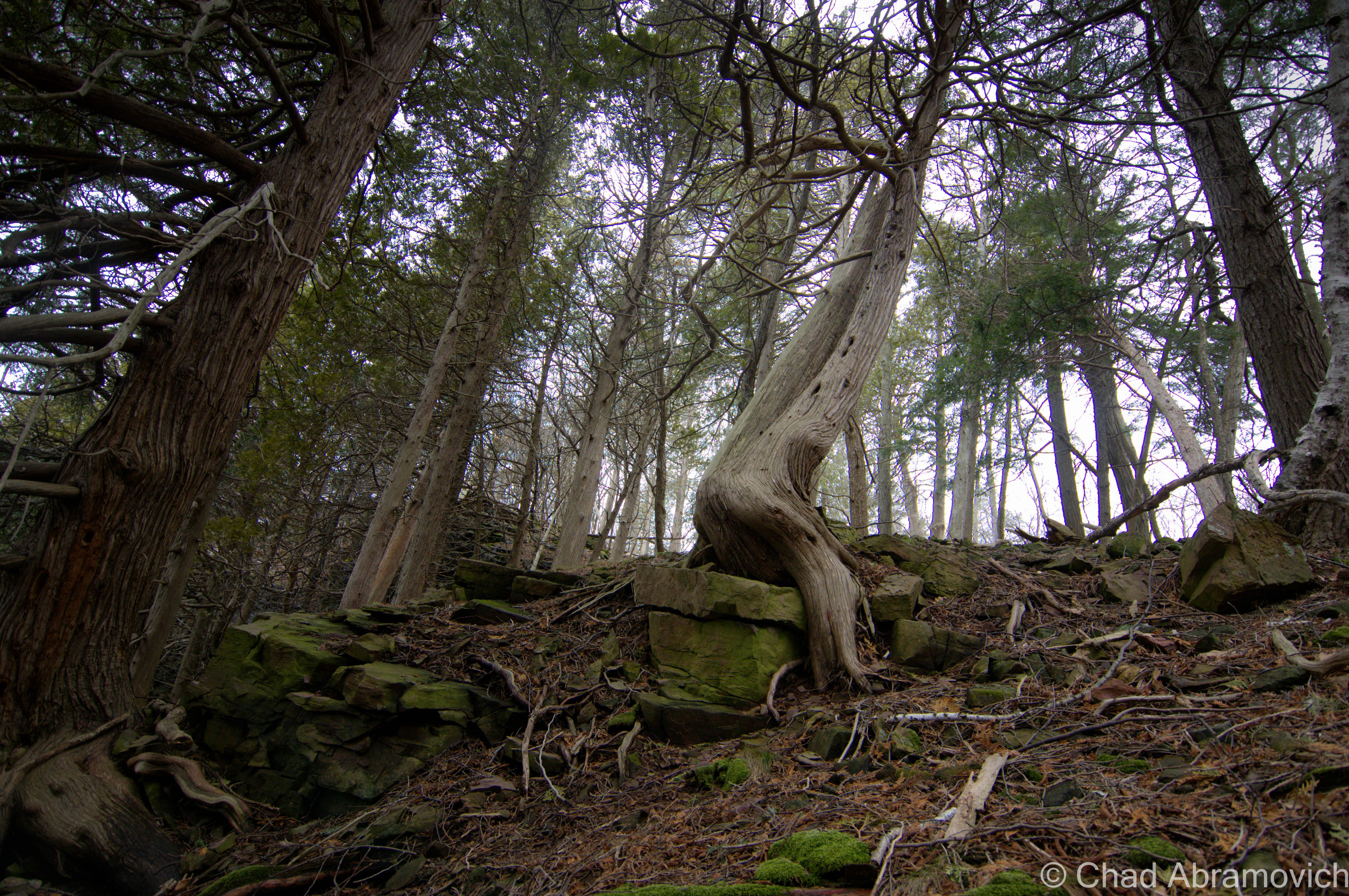
The awkward transitional period between the death of winter and the explosion of spring is a rough one. Looking at the cracked surface of a grey Lake Champlain, the landscape seemed warn down and tired. But there was something different. A warbling, trembling uncertainty rumbled below the atmosphere as the lake surface cracked and groaned, and the distant sounds of water tumbling down dirty cliffs meant snow melt. It meant Spring, and everything was fragile.
Walking along a cold cobblestone beach underneath sentinel cliffs, amazed at how all the trees above me were growing and surviving from their strange perches amidst crumbling stone, I let my cabin fever get the best of me, and started climbing up ledges and over trees, enjoying the “warm” afternoon.
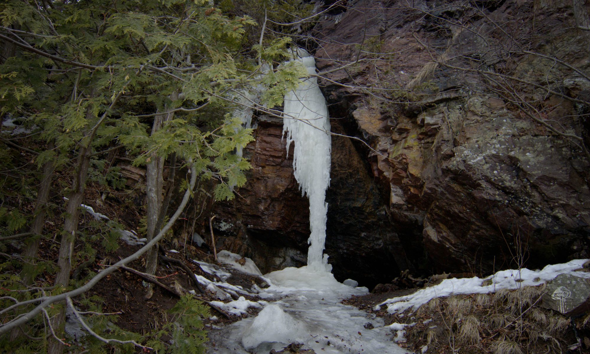
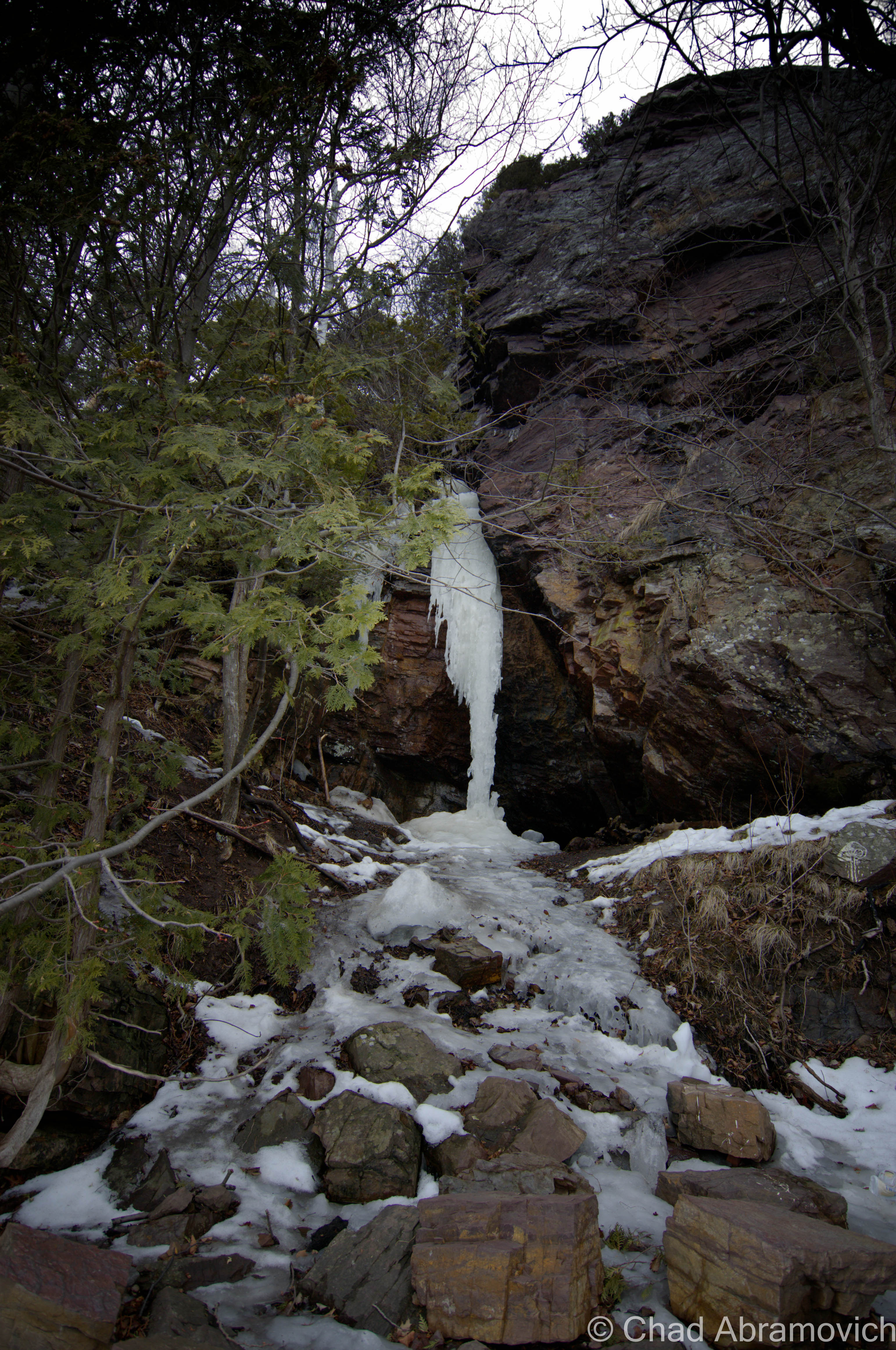
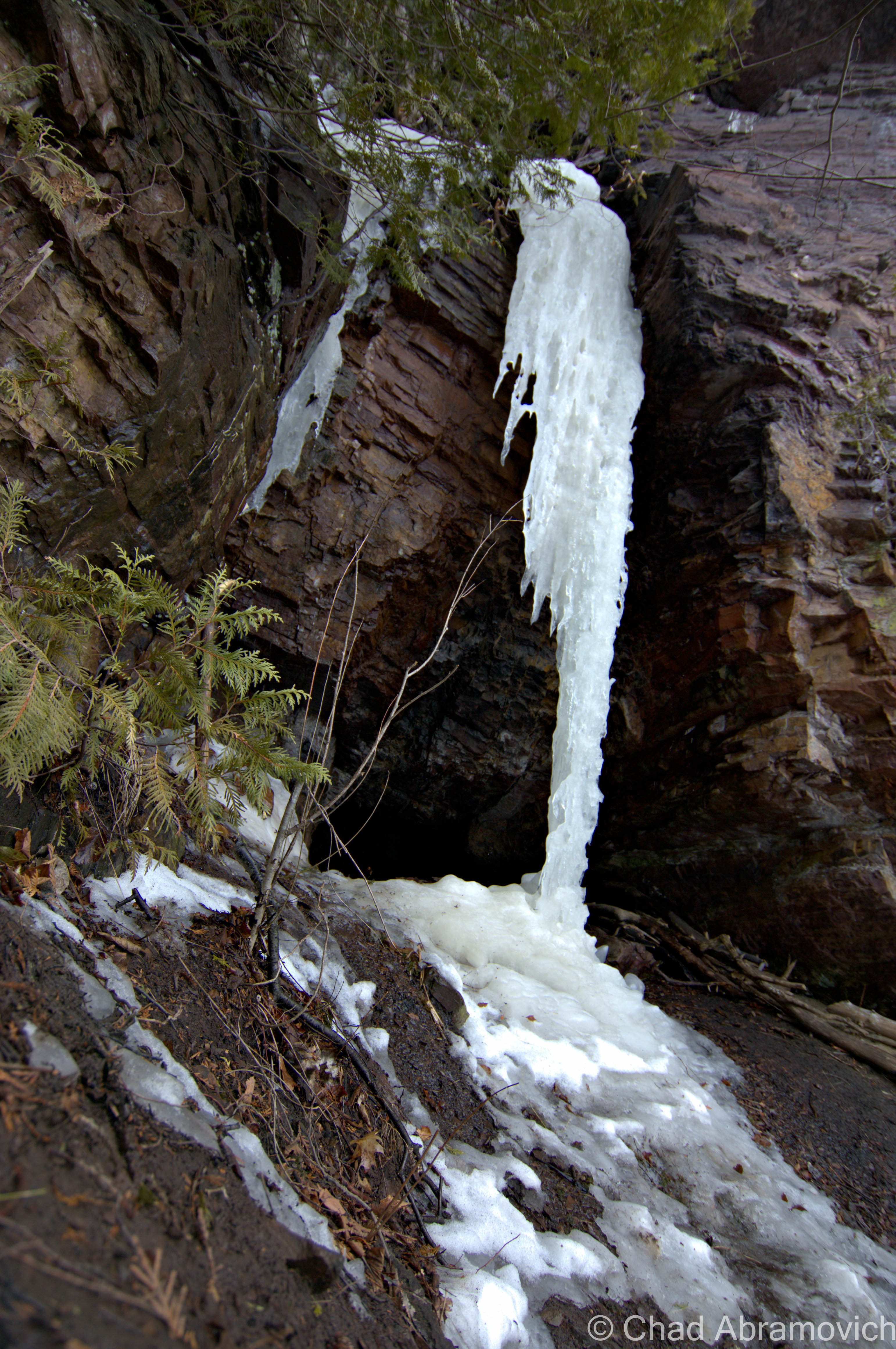
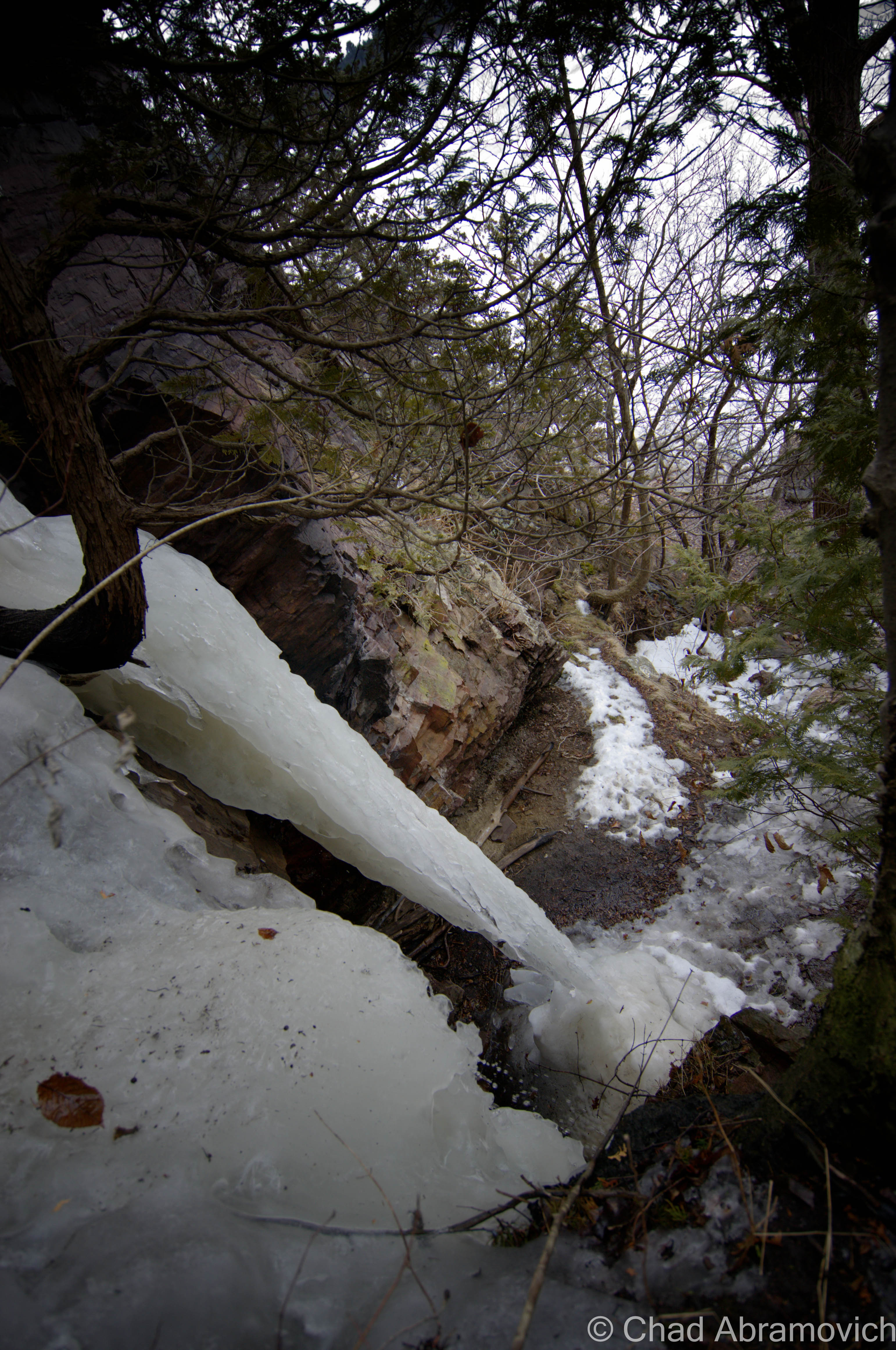
My hands and feet slipped constantly in the muddy banks, a sure sign that mud season is right around the corner. Gripping onto the skeletons of exposed tree routes and getting filth all over my jacket, I found myself staring up at a frozen waterfall of snow runoff, and behind it, the telltale blackness of a crevice in the cliff face. I decided to get closer.
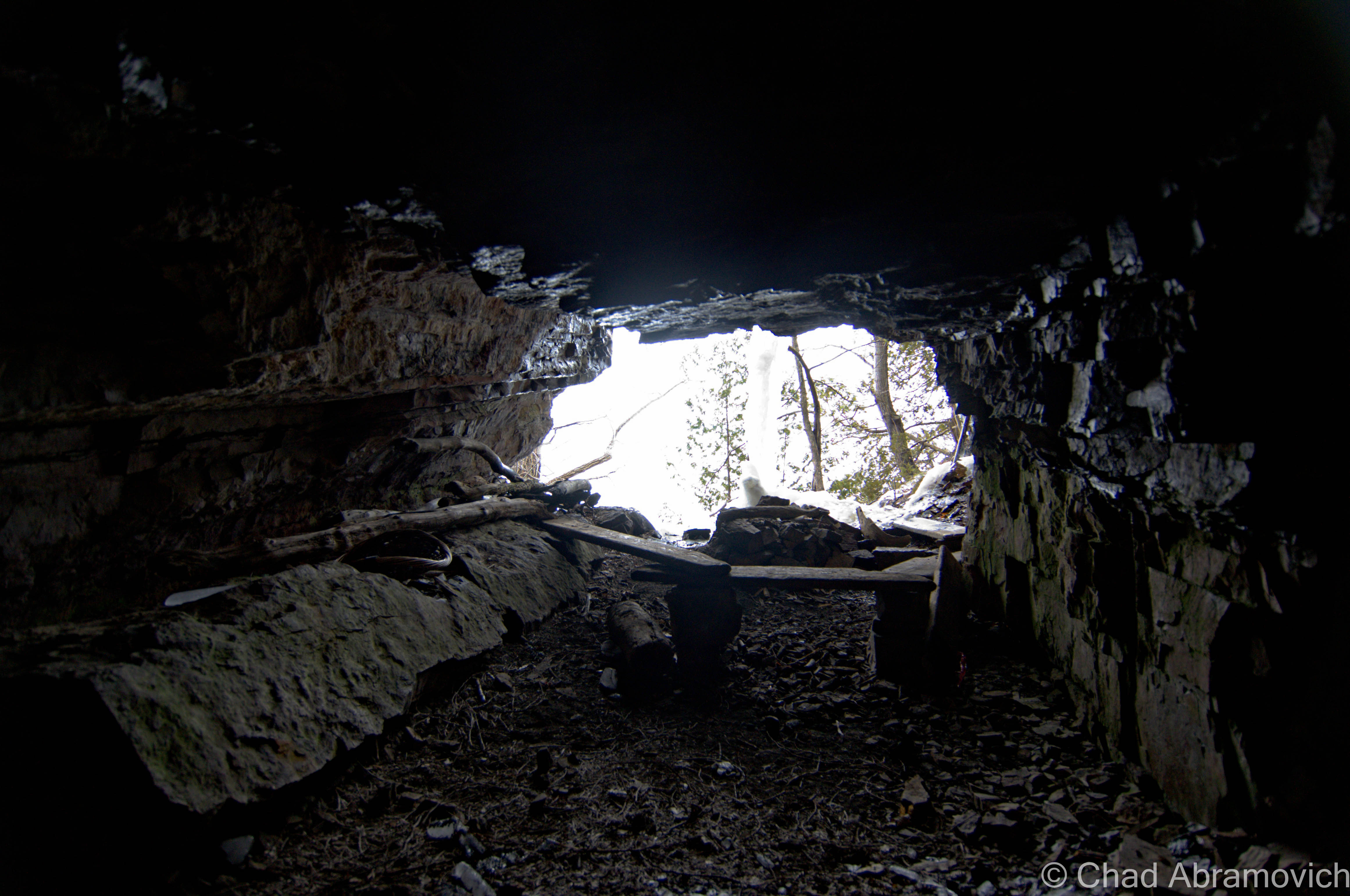
As I got closer, and decided it was safe enough to approach without falling down what I had just climbed up, I realized it was more than just an indent in the rocks, I was starting at the mouth of a cave.
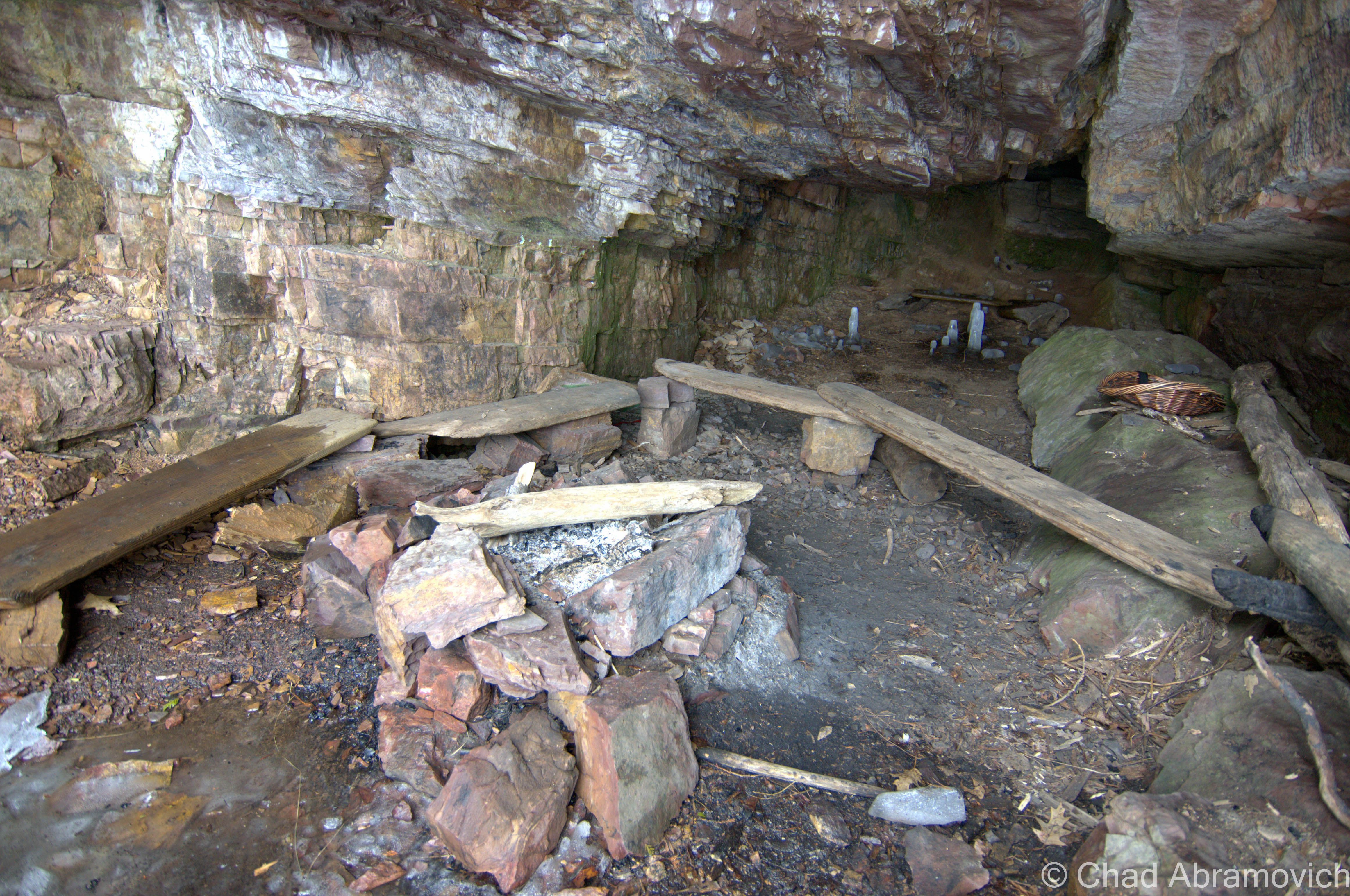
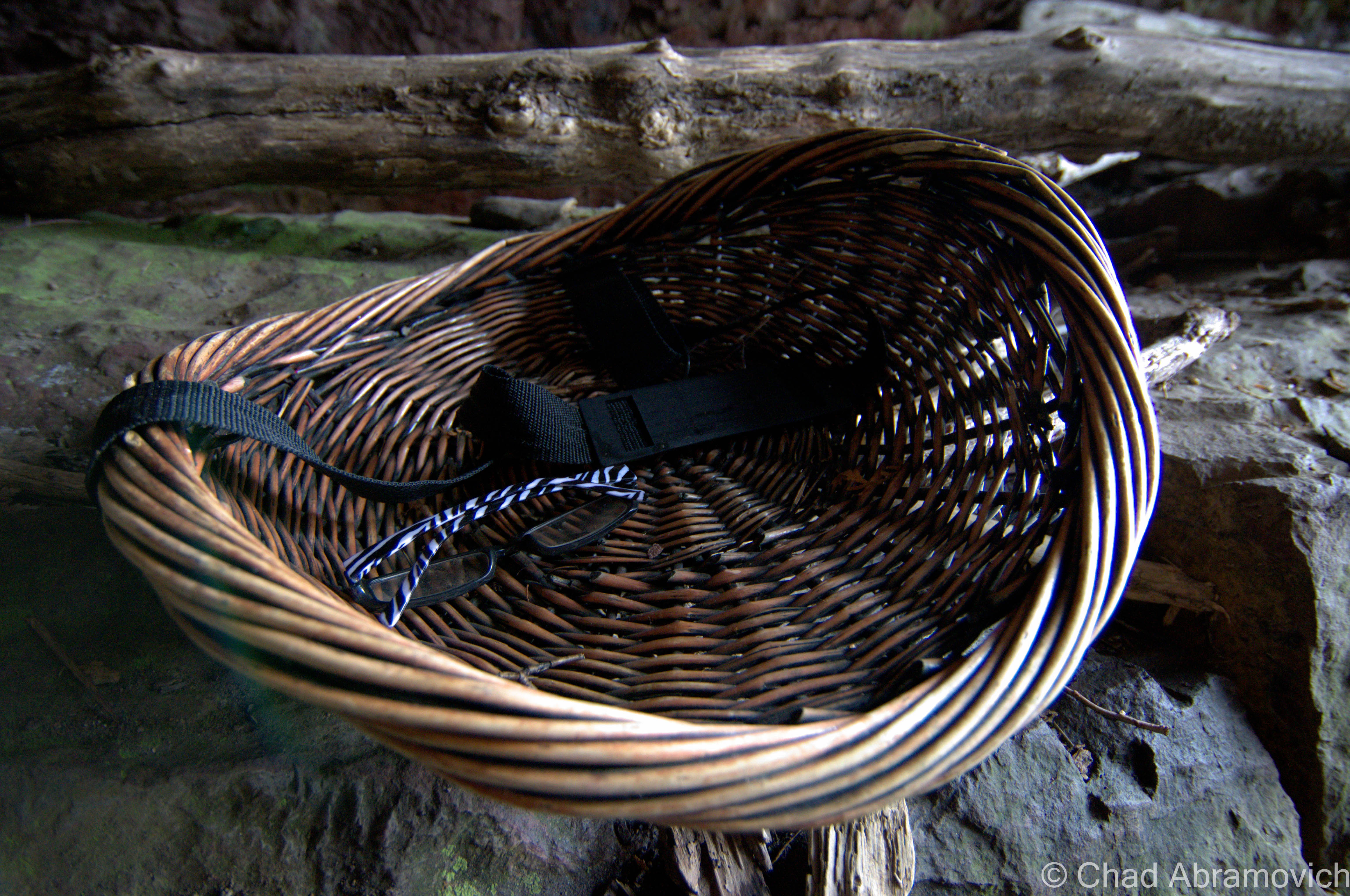
Of course, when you stumble upon a cave, natural instinct is to go inside and check it out, and that’s what I did. This cave was a constant surprise. What I had assumed to be small was actually a very decent sized chamber that went far back underneath the ledges. Greeting me almost right away was a very cool site, a makeshift bench made from driftwood hauled up from the nearby beach, and a DIY fire pit, with the scatterings of ash still inside.
Further behind the sitting area, some artifacts had been left behind. A wicker basket was placed on a rock table, with a pair of Zebra striped glasses left inside.
Now the cave was getting narrow and the ceiling was getting lower, ice water was dripping down the back of my neck. For an awkward section, I had to crouch down on my knees to get back further, and just when I thought I had reached the end, the cave suddenly opened back up again and created a sort of second chamber, with a rock seating area along the back wall, and some cool stand alone ice formations on the frozen cave floor.
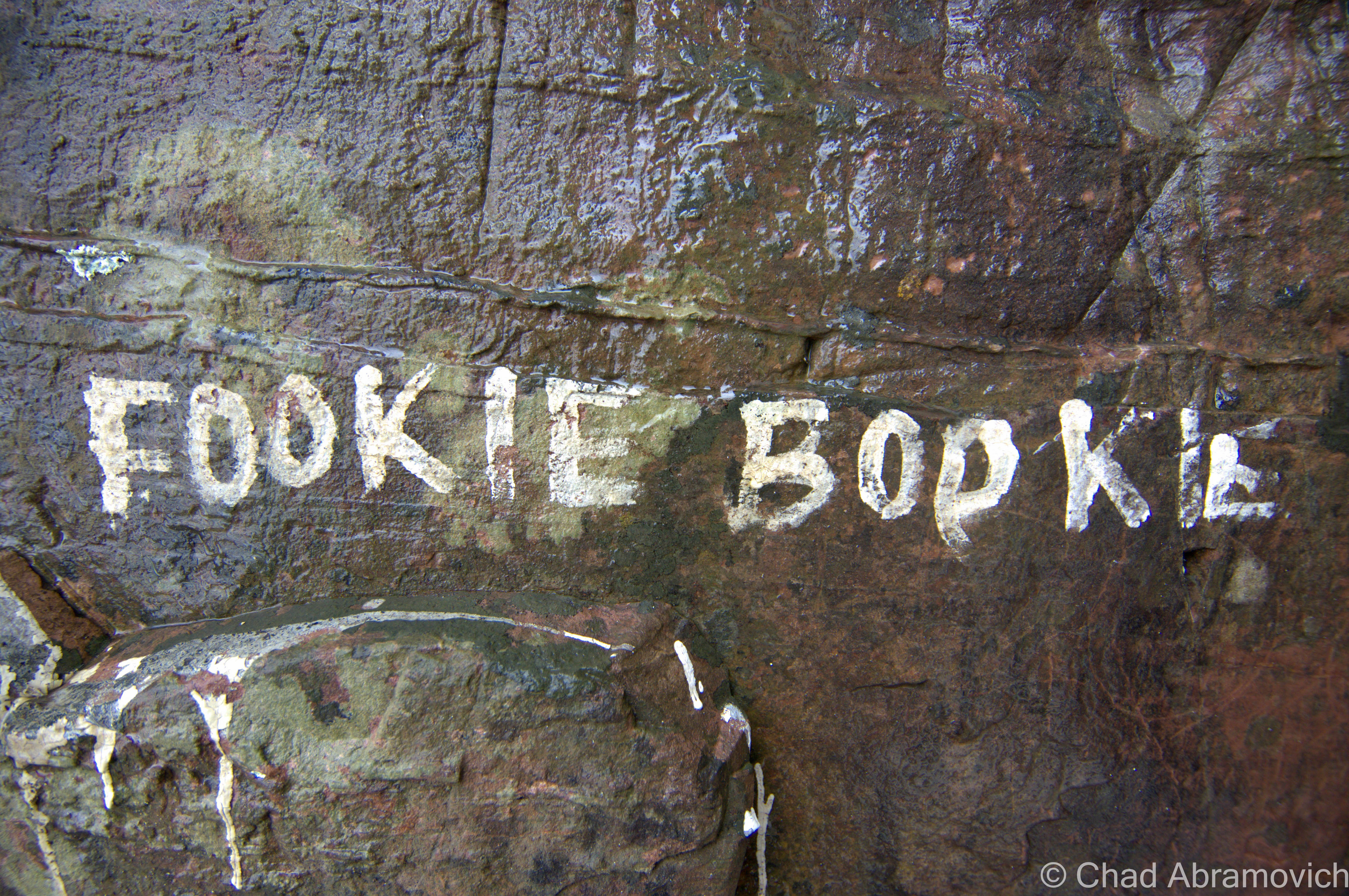
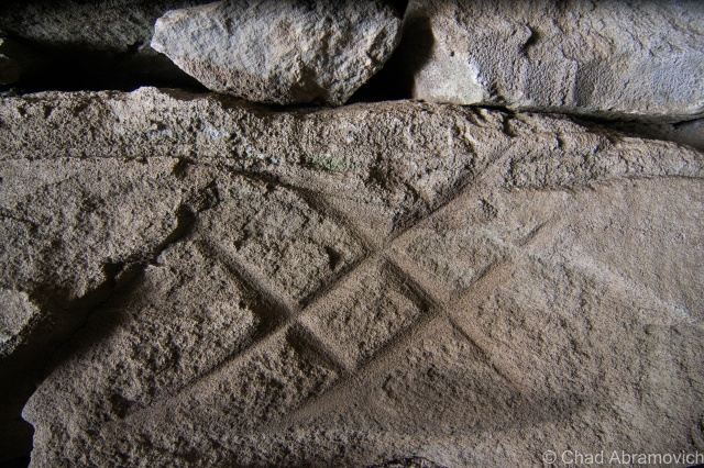
It was definitely a cool place, something I’d most likely build myself if I had more ready access to a cave. I wondered, who put the effort into making this cool cliff side hangout, when and why? And maybe the best question, how many people know about it? But all was a mystery. Even the few marks of cave graffiti very neatly painted on the walls offered no incite.
At the top of the waterfallLooking up the ledges
The cave was an awesome discovery, and I can imagine it being the perfect place to hang out on cool summer nights. I know when I left for a walk today, I never expected to find a hidden hangout spot underneath a cliff. You never know what you’ll find if you don’t venture off the beaten path.
—————————————————————————————————————————————–
To all of my amazing fans and supporters, I am truly grateful and humbled by all of the support and donations through out the years that have kept Obscure Vermont up and running.
As you all know I spend countless hours researching, writing, and traveling to produce and sustain this blog. Obscure Vermont is funded entirely on generous donations that you the wonderful viewers and supporters have made. Expenses range from internet fees to host the blog, to investing in research materials, to traveling expenses. Also, donations help keep me current with my photography gear, computer, and computer software so that I can deliver the best quality possible.
If you value, appreciate, and enjoy reading about my adventures please consider making a donation to my new Gofundme account or Paypal. Any donation would not only be greatly appreciated and help keep this blog going, it would also keep me doing what I love. Thank you!
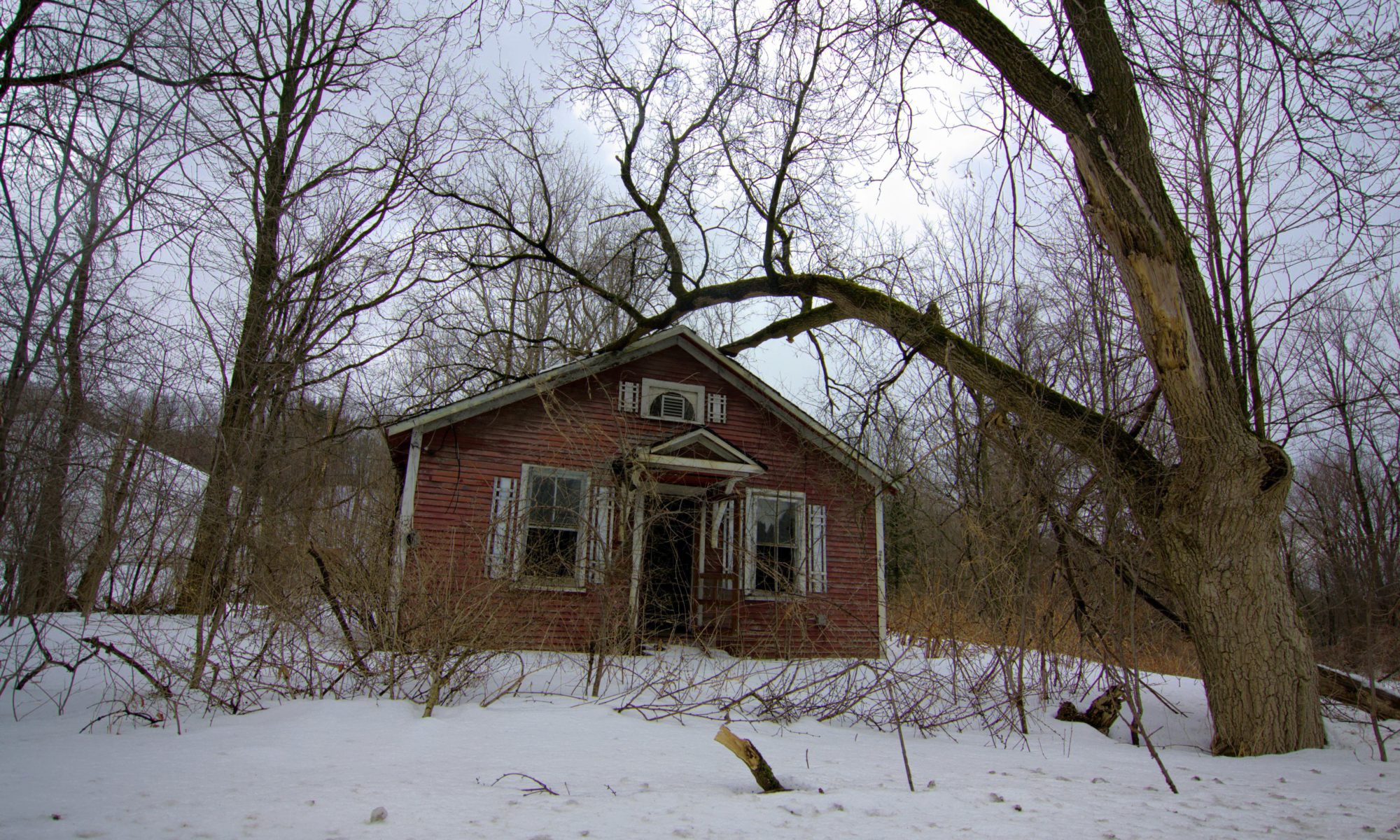
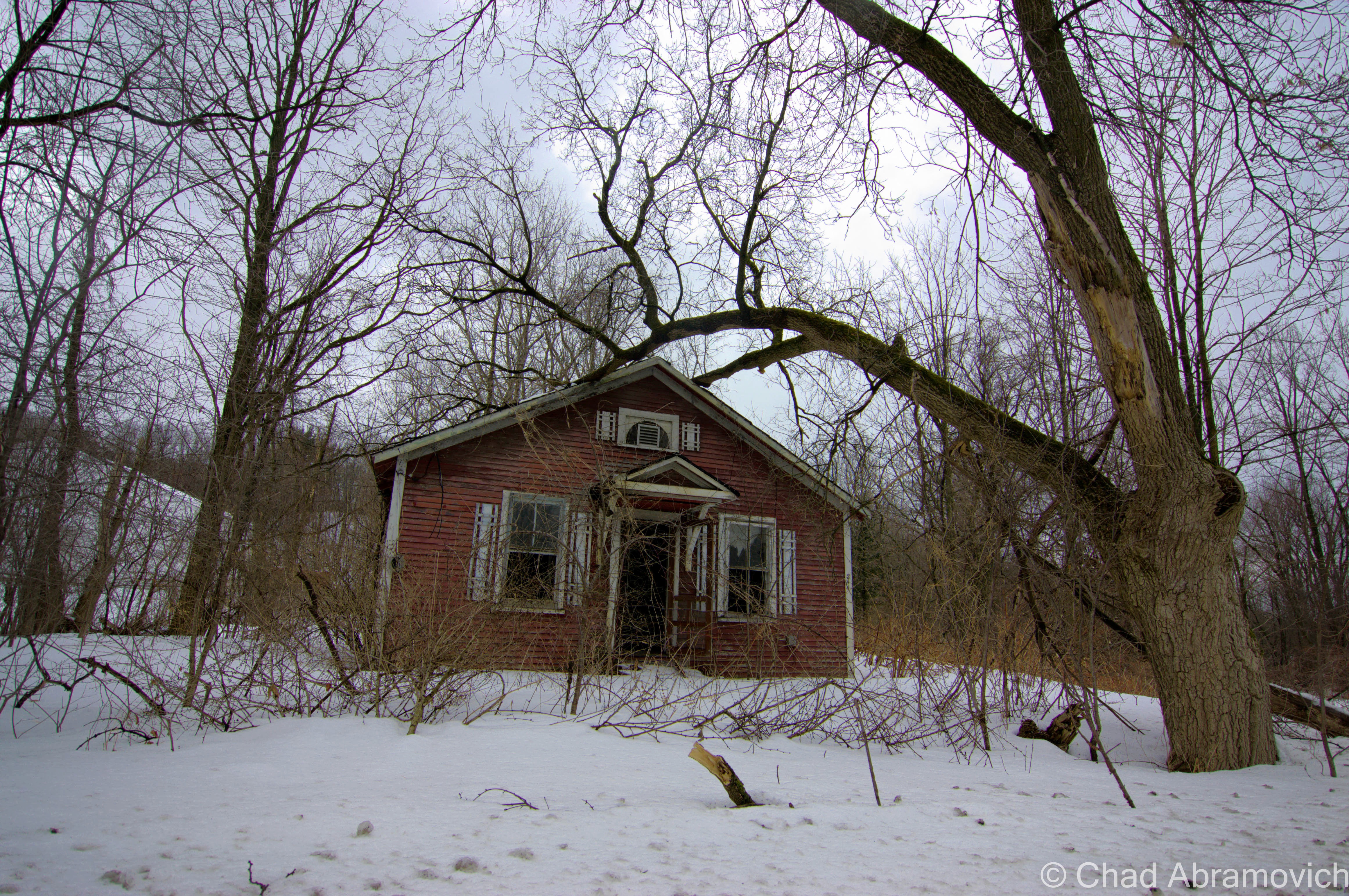
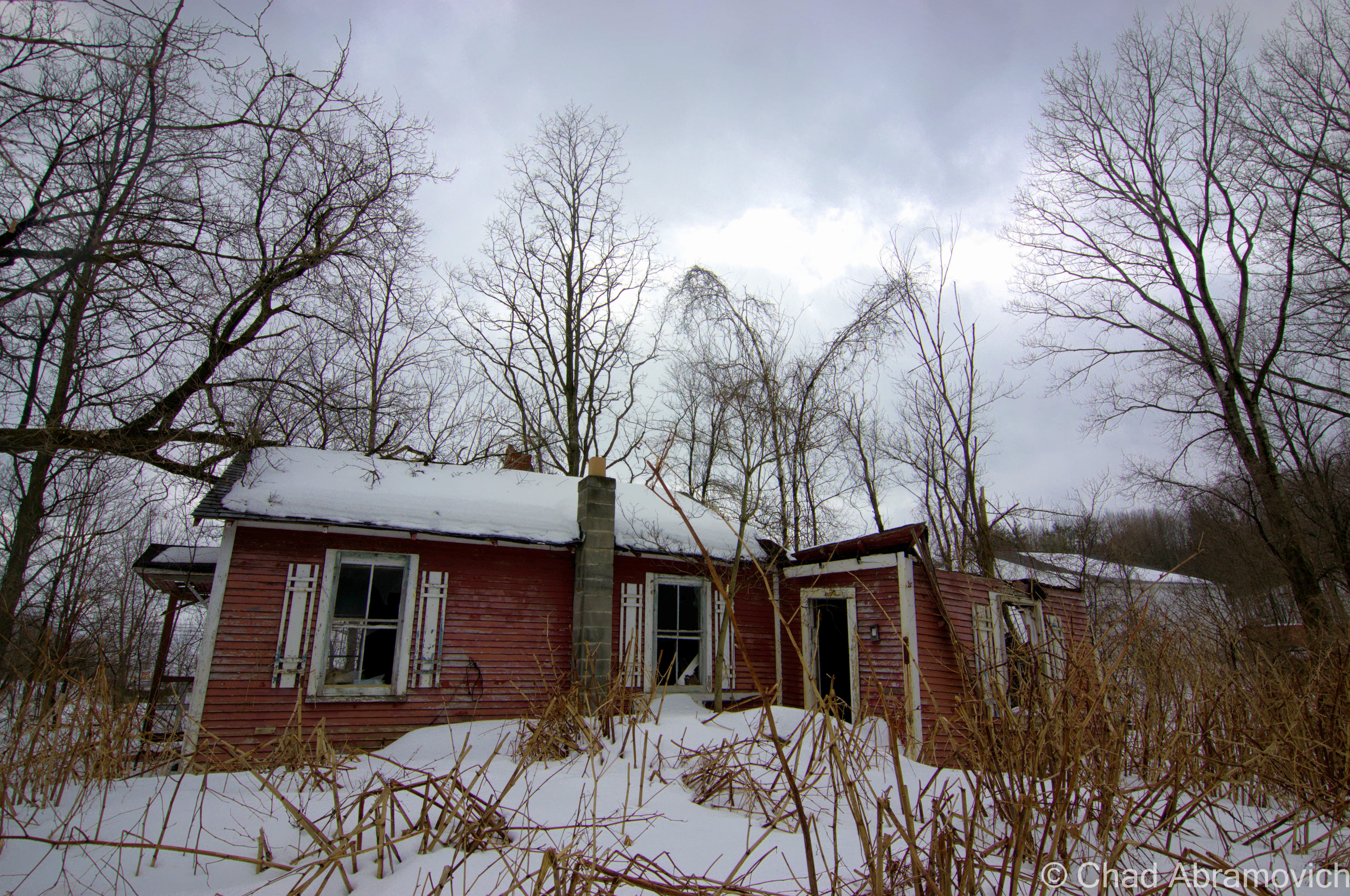
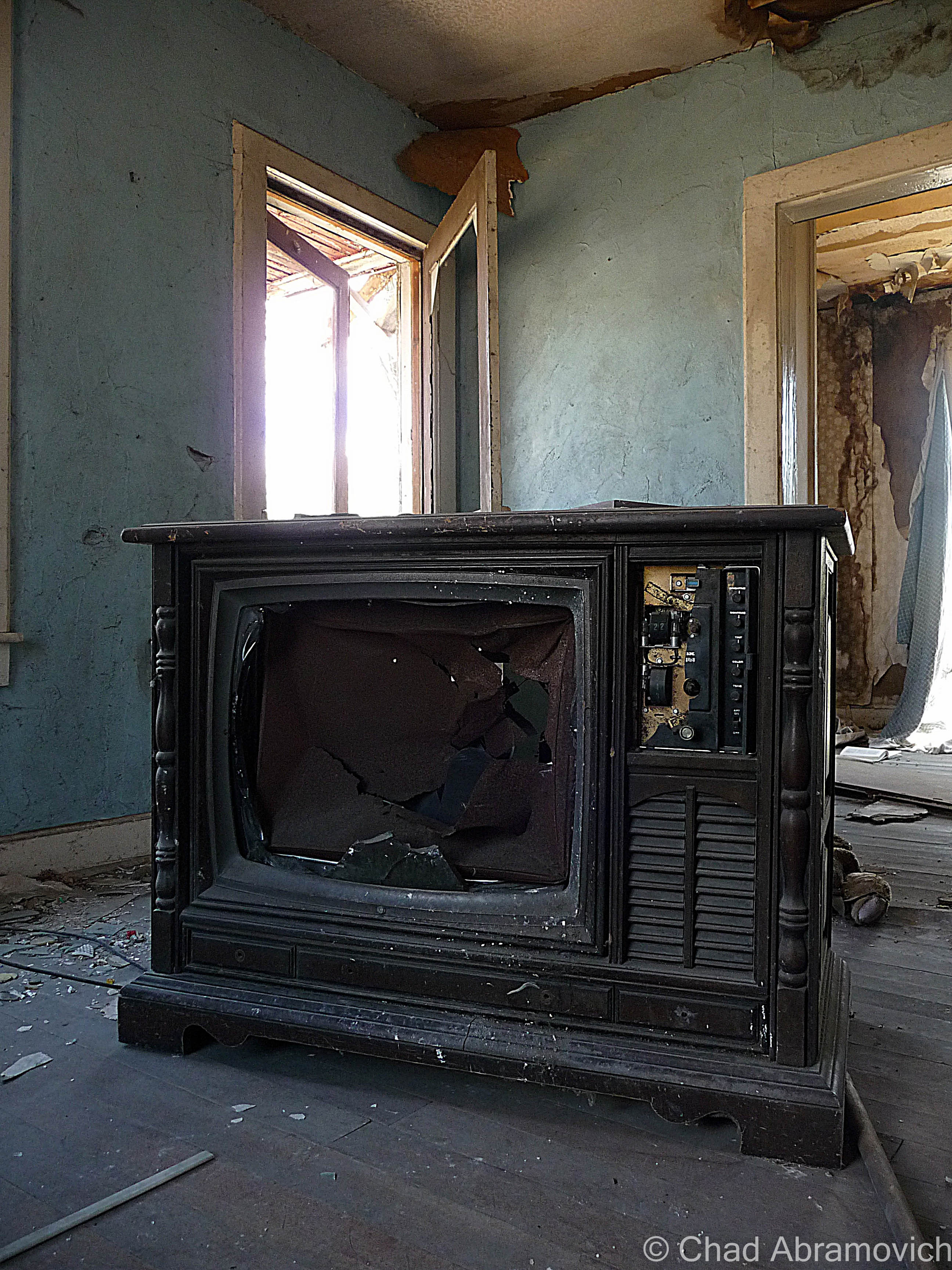
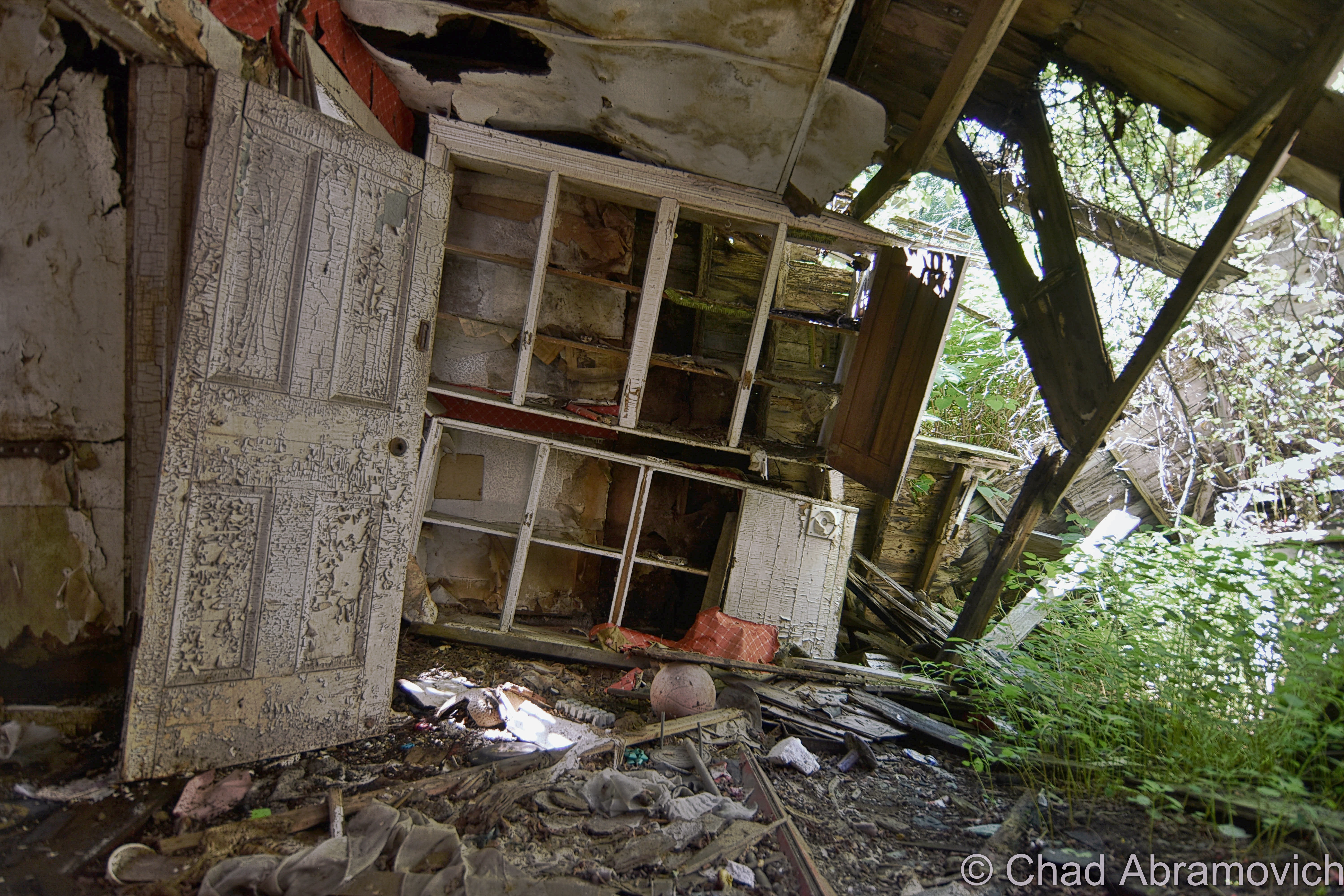
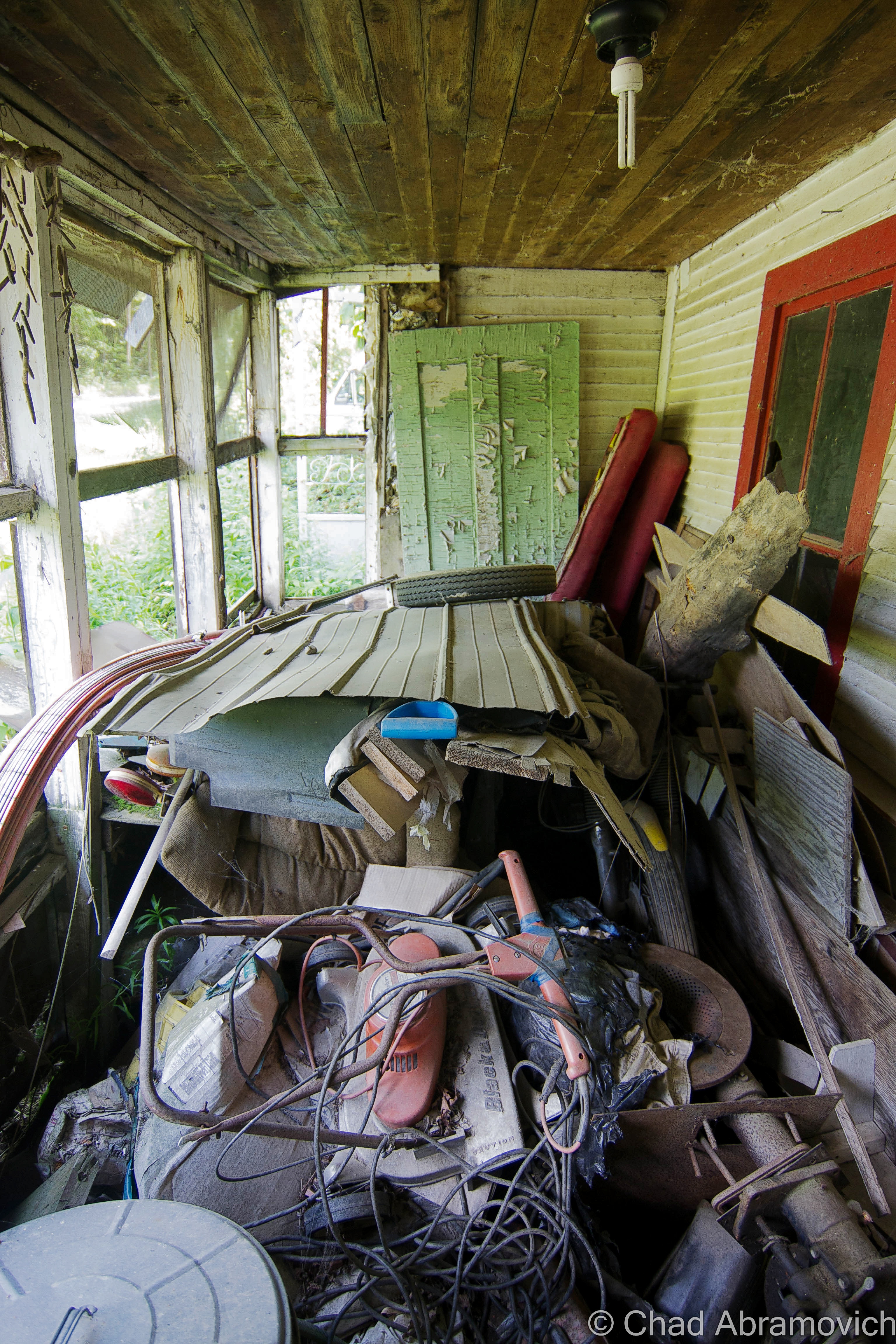
This abandoned house is lost in between the lines of the blur of traffic and the pensive solitude of the woods it sits in. Only a stones throw away from the nightmare that is 5 corners, this house sits alone on the threshold of suburbia, licking its wounds in dense woods that serves as its sanctuary. Time seems to have been forgotten by the modern world here, whose motorists pass it frequently 10 feet beyond its rotting doorstep.
The modest 6 room wooden structure has succumbed to its slow death, refusing to make a sound, allowing mother nature to reclaim it at her own rate.
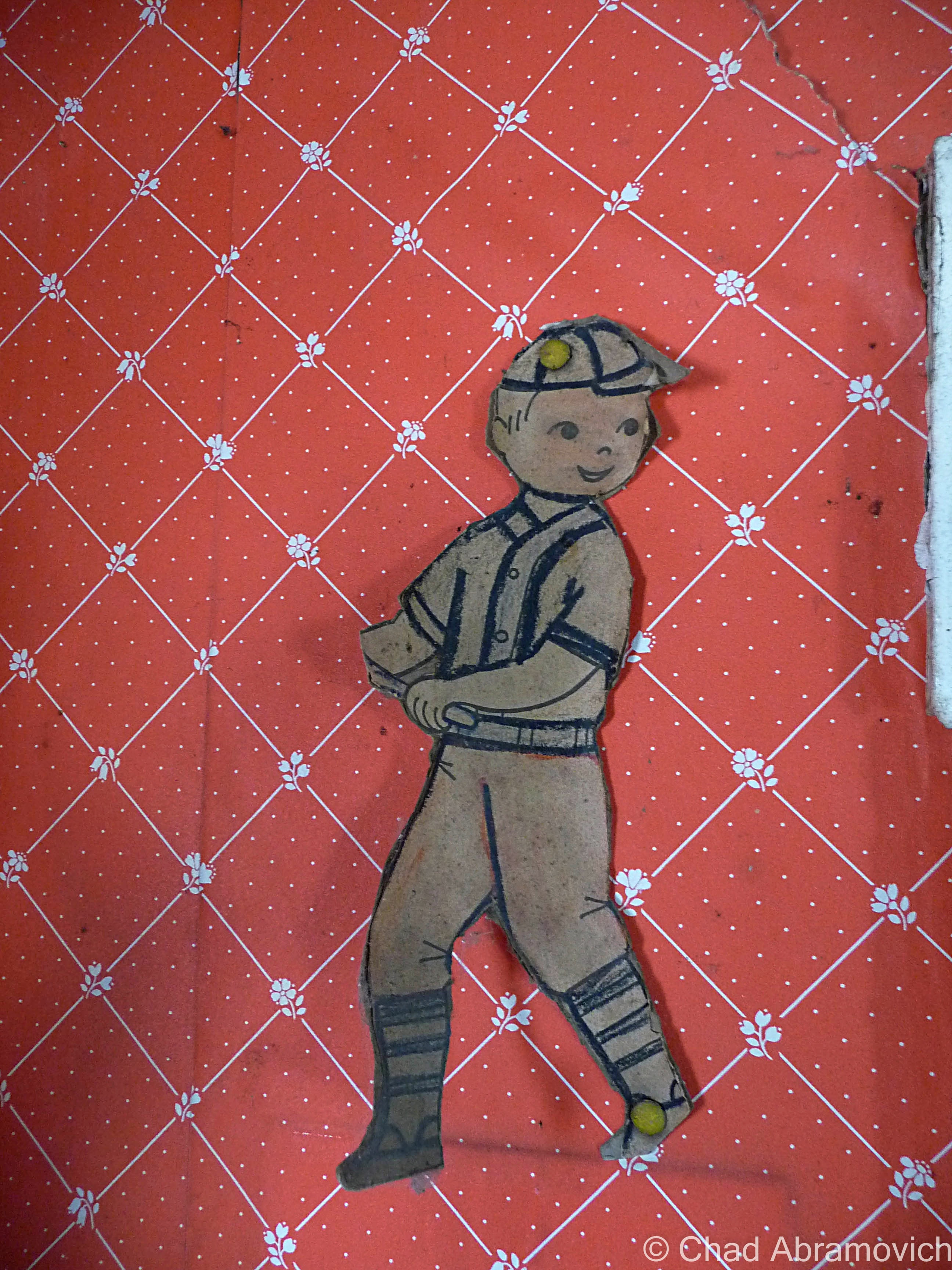
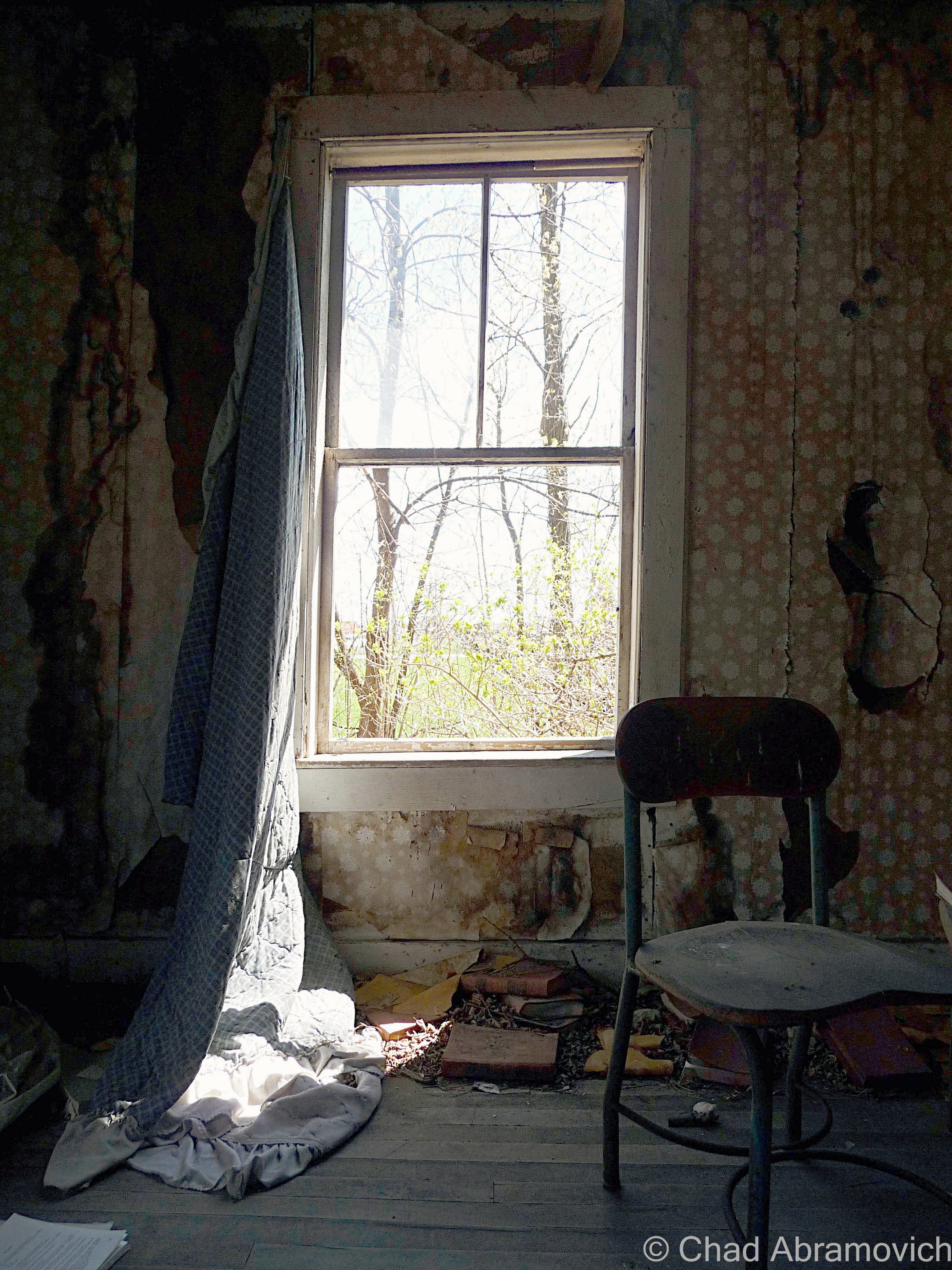
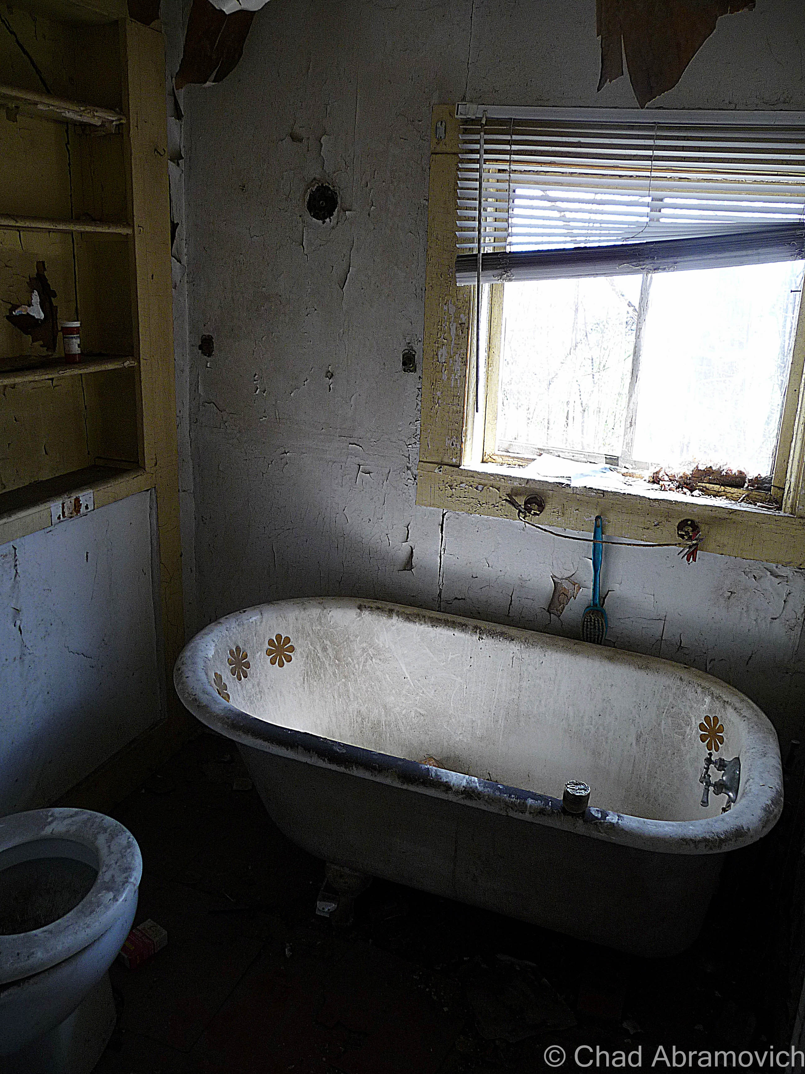
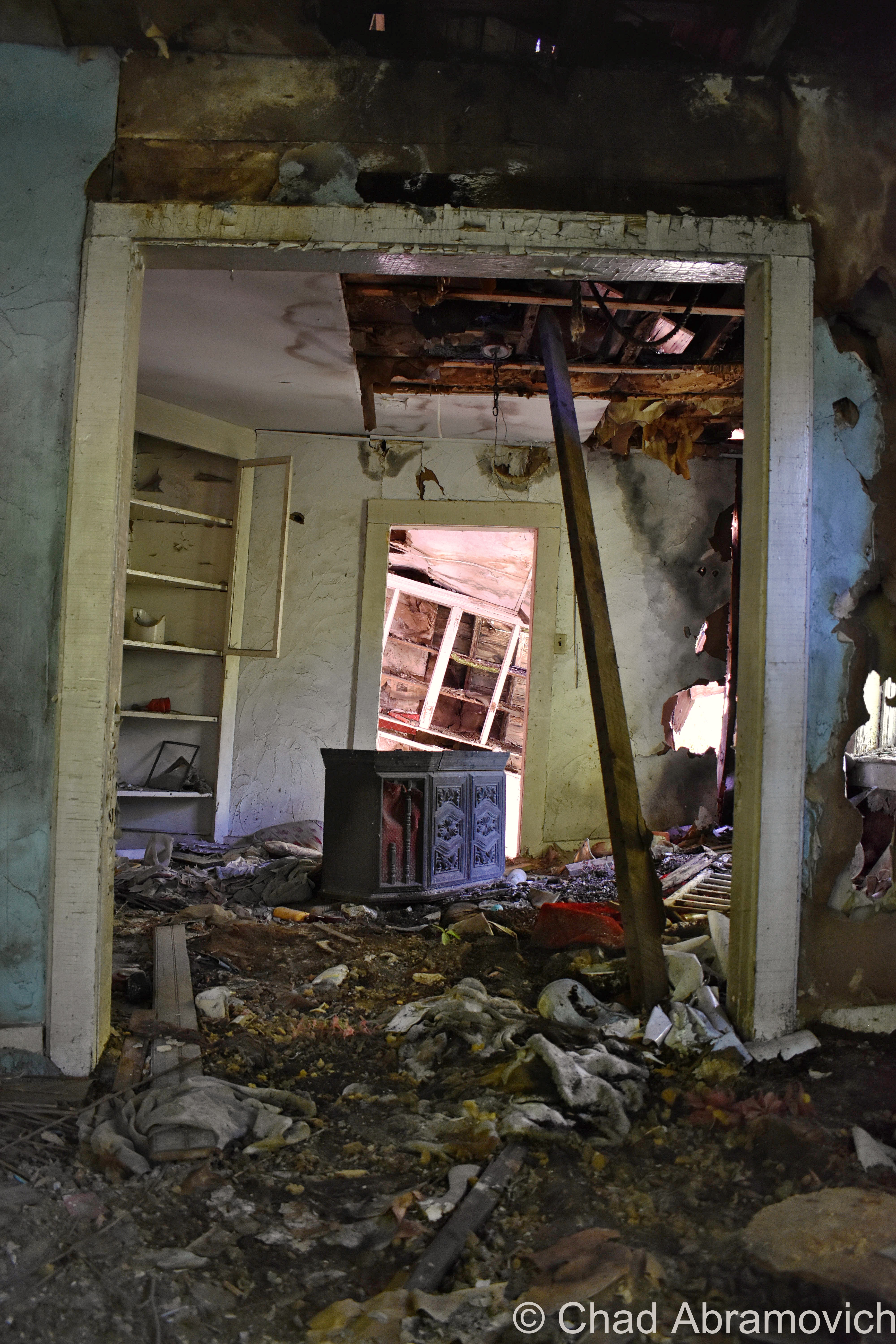
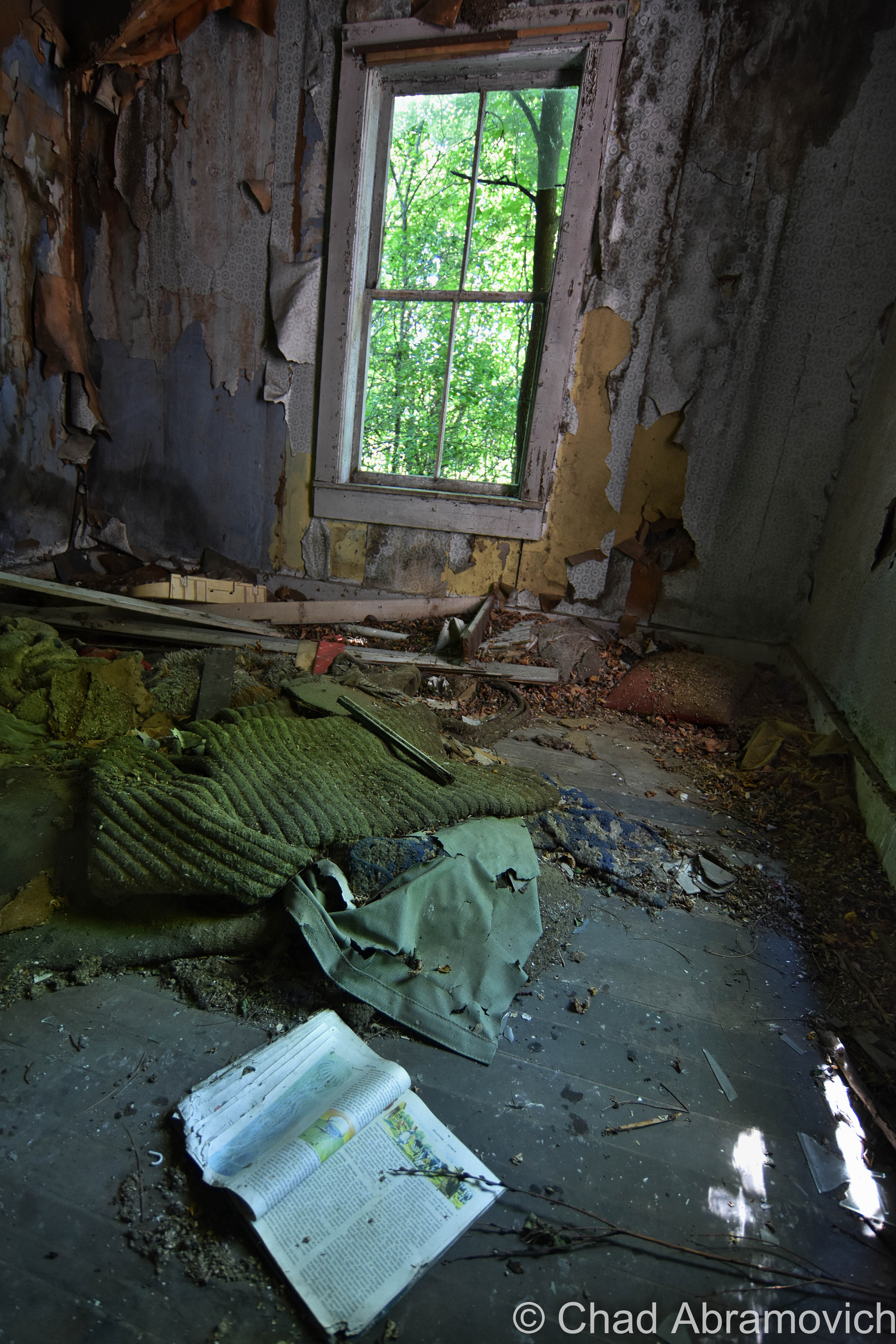
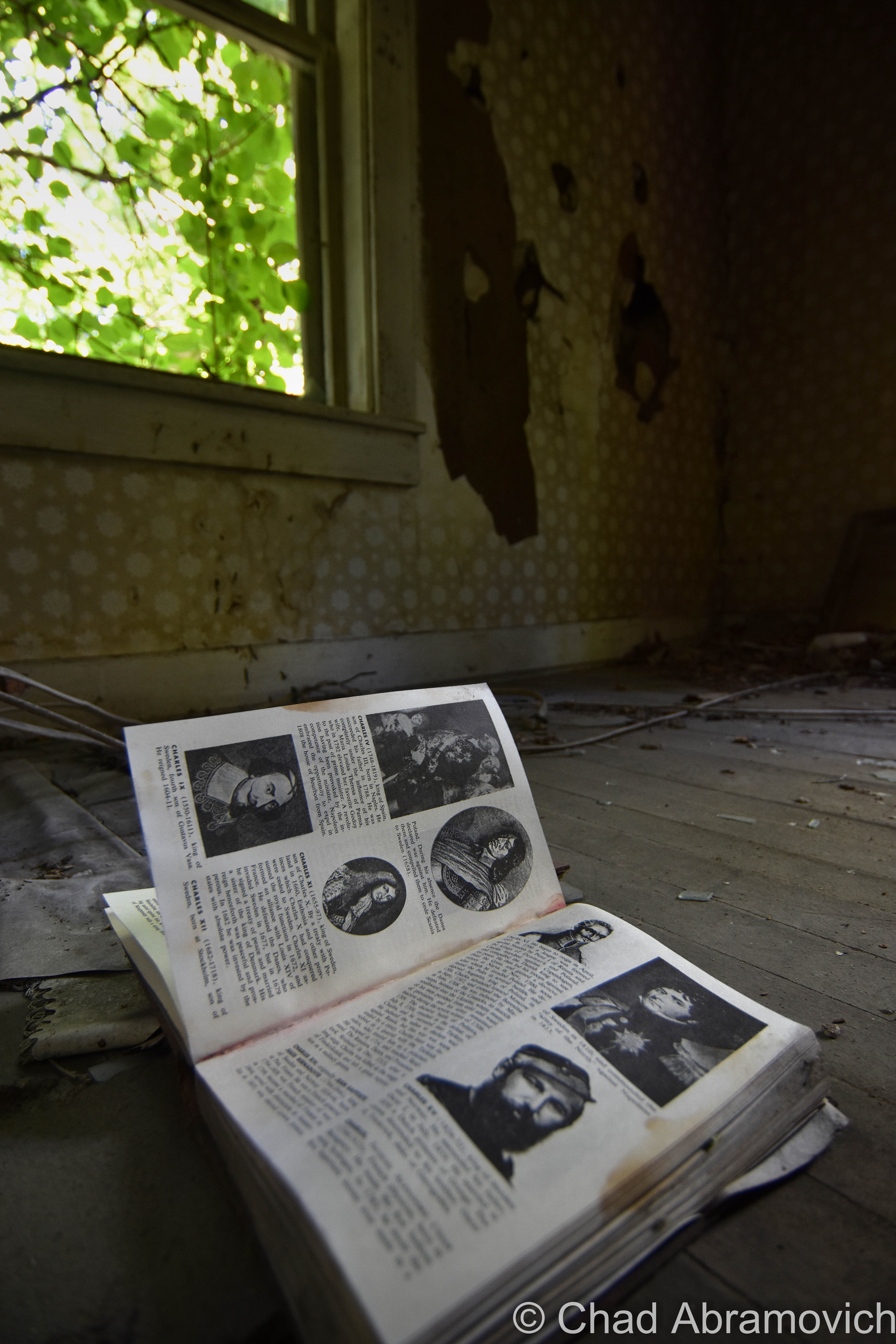
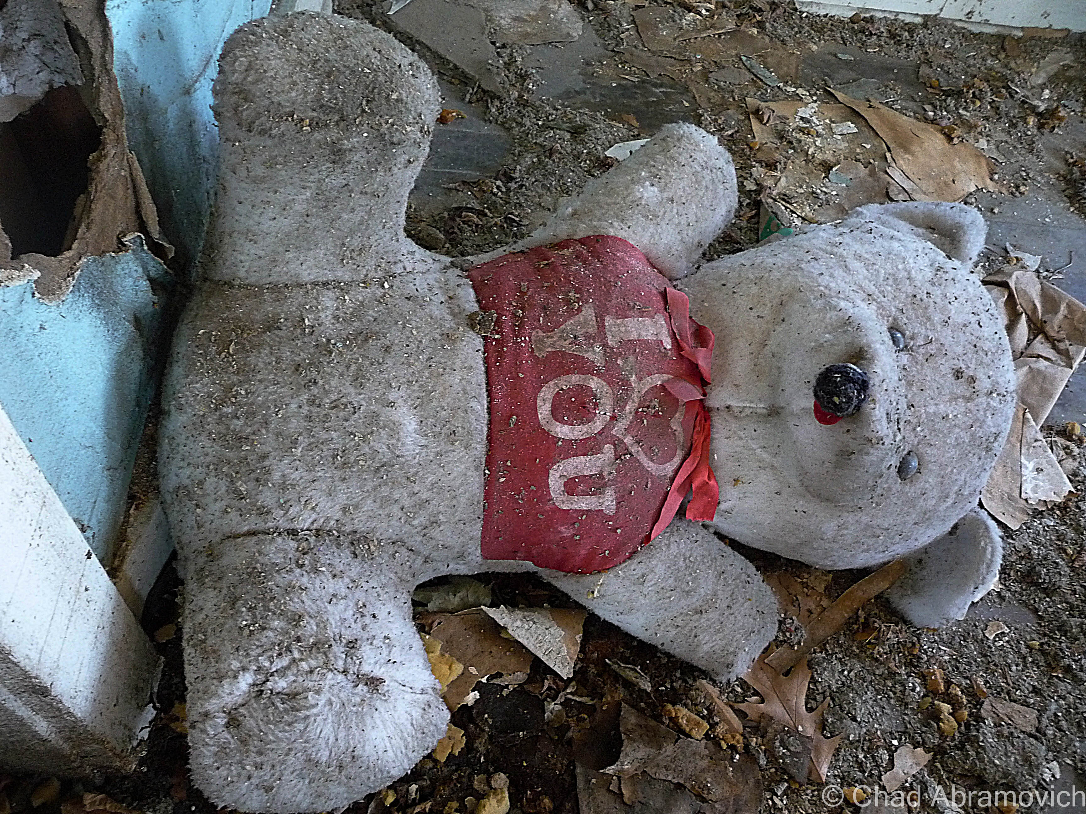
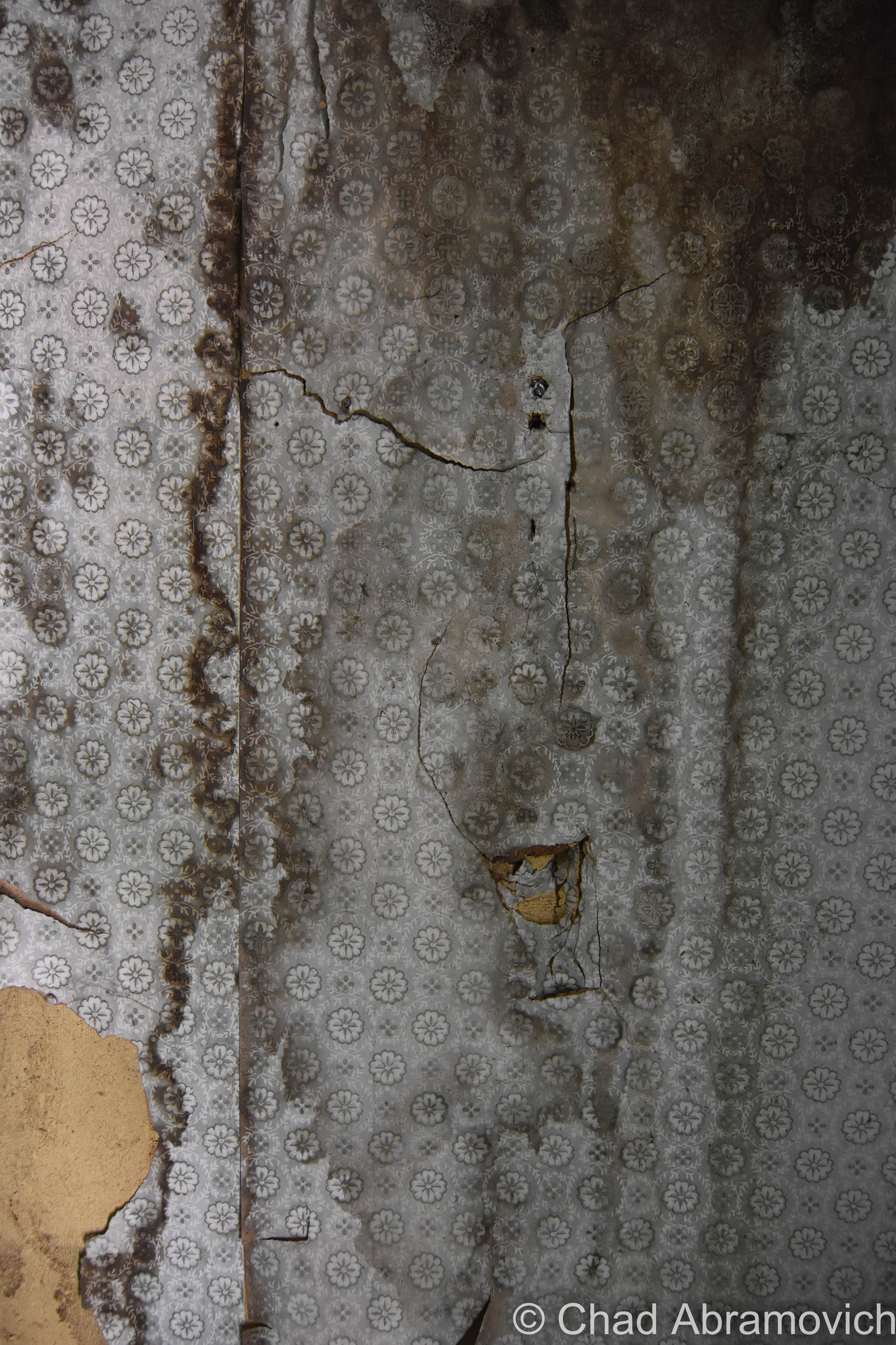
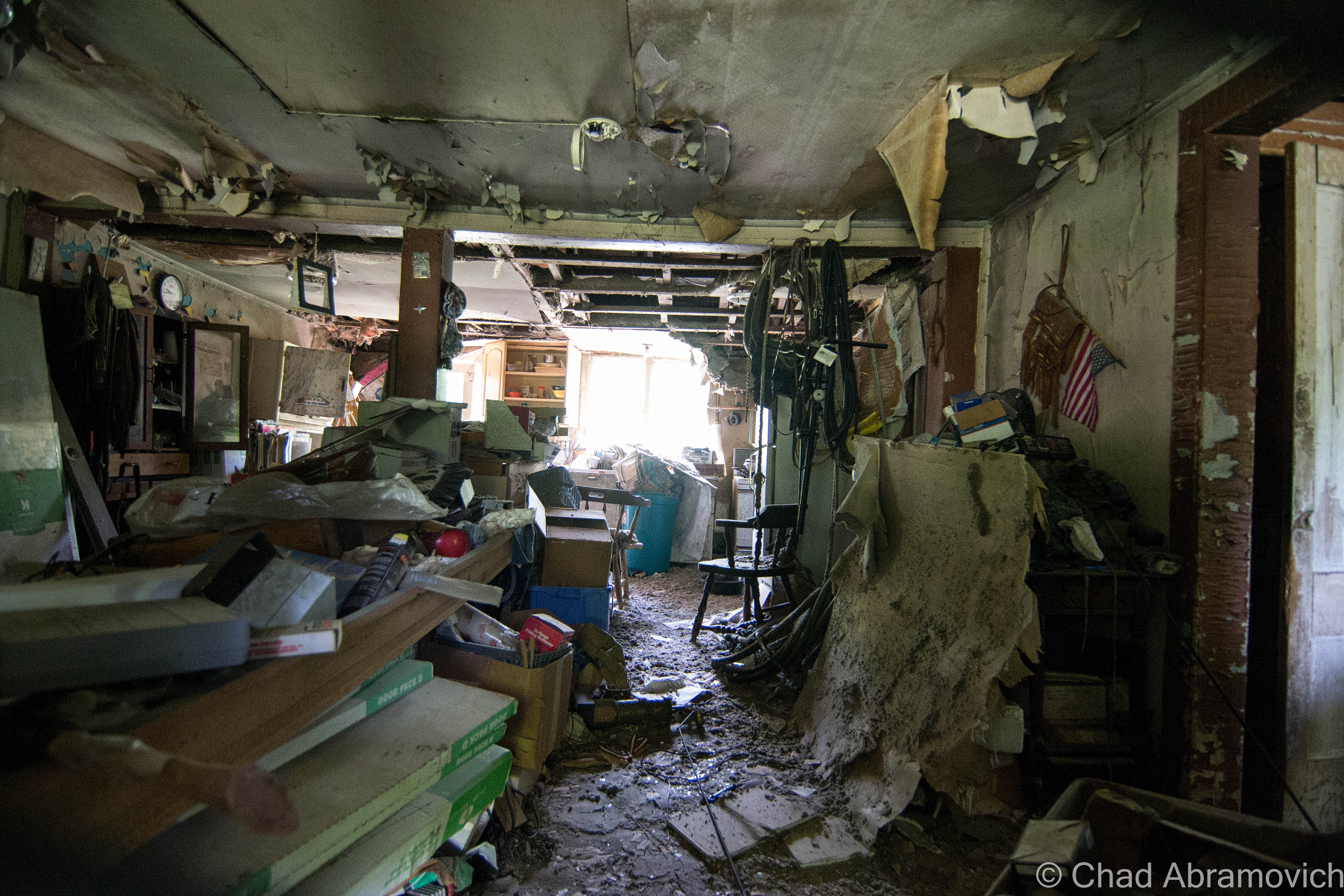
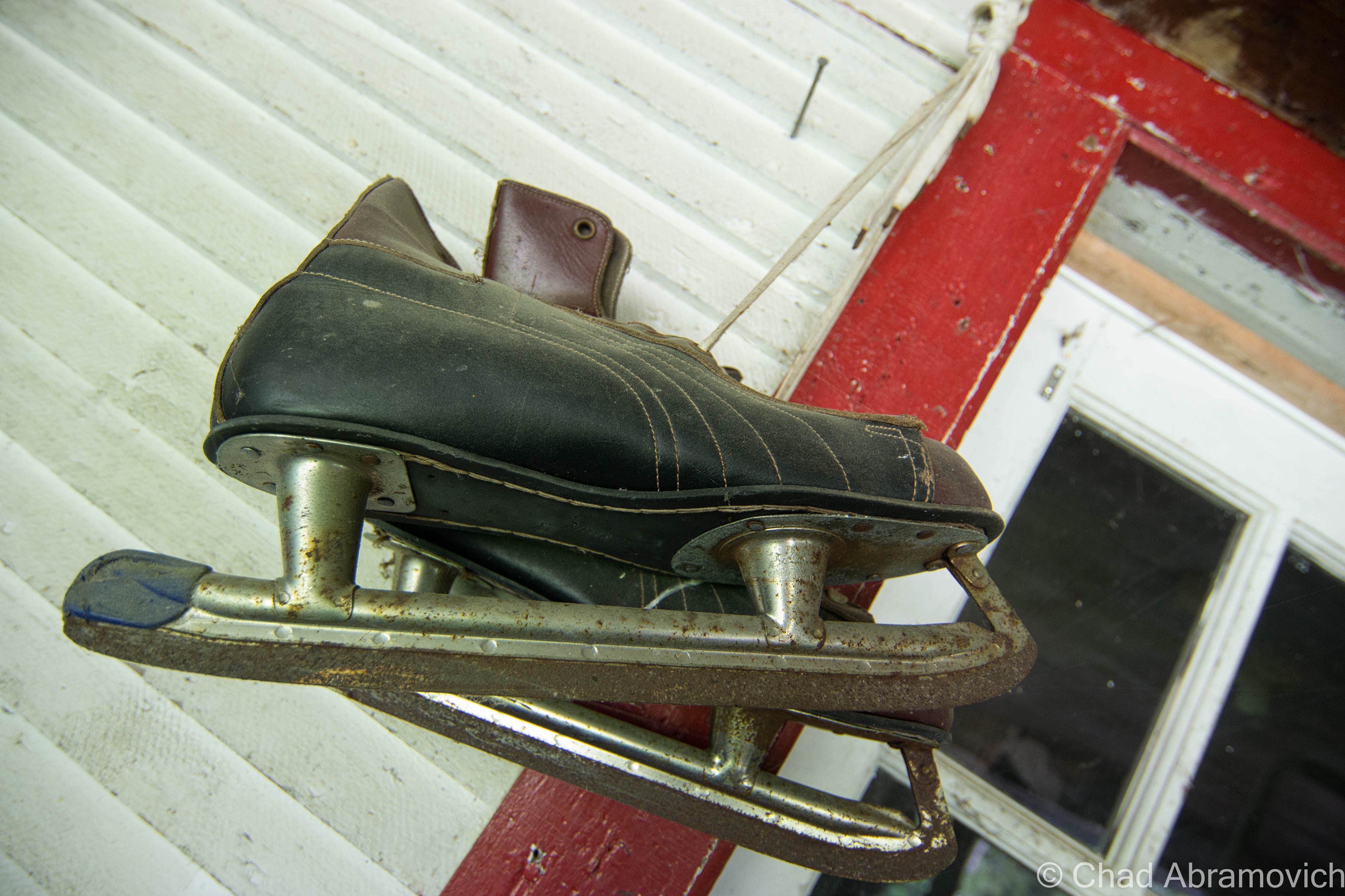
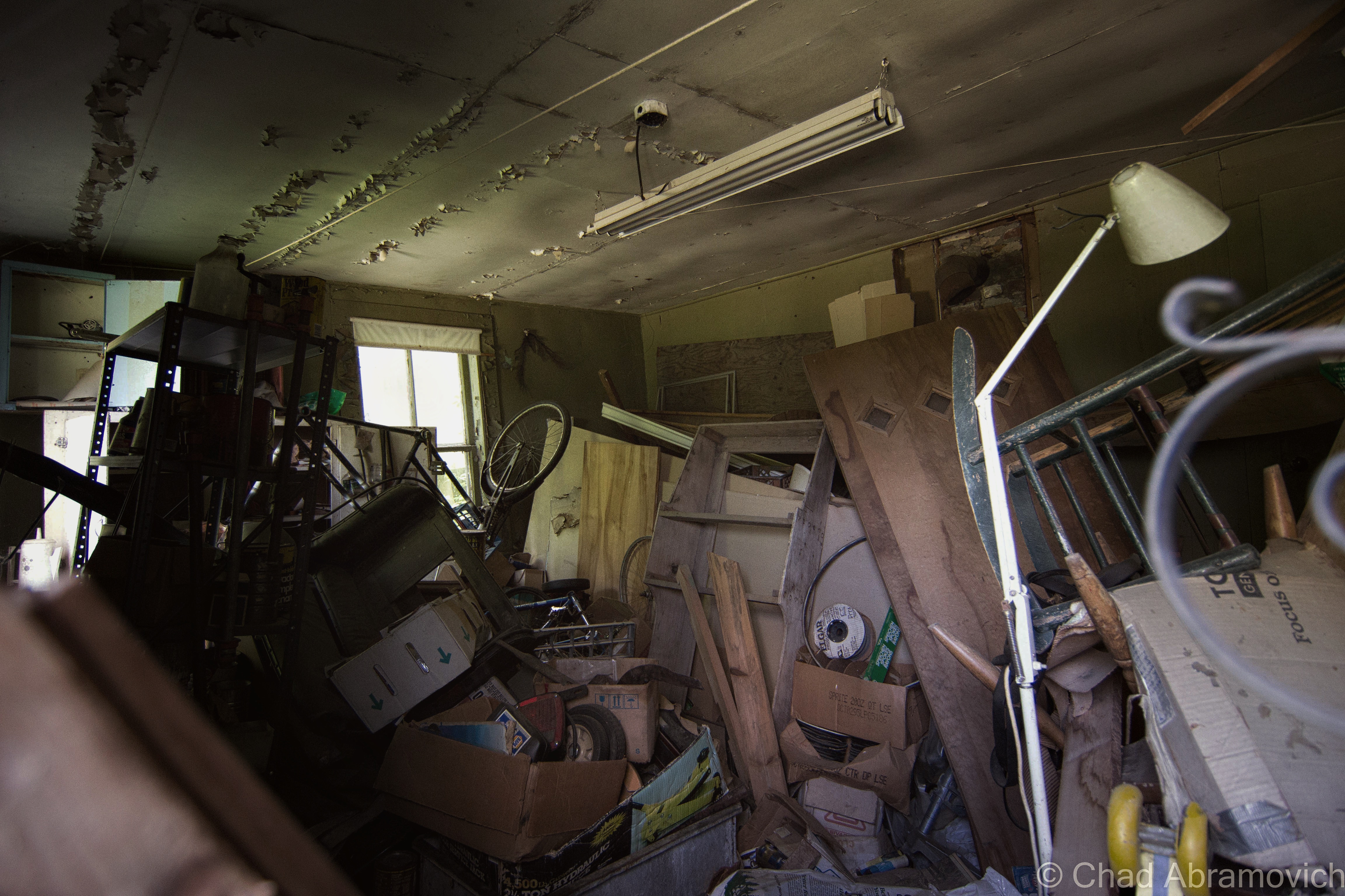
This house tells an ambiguous story. Its age is evident, most likely preceding most of the development around it, and now a symbol of how good times come and go, and how anything can be broken. Inside are various keepsakes littering the dirty floors in knee-high mounds, most indistinguishable as the years and the weather mold everything together in soiled masses of soggy decay. Vines and trees snake their way into the kitchen and furniture sinks its way into the rotting wooden floors.
Local lore tells that a local boy made good, who today owns an area sports team and a huge local transportation company, grew up here, and the reason of the house’s disintegration is because he couldn’t bear the thought of his childhood home being torn down, and would rather have it in a state of decay than the alternative of it not standing on the increasingly busy route it’s fading on.
To some, a small farmhouse might be a boring place to explore, opting for the dreamier abandoned asylums or hotels of neighboring states. But it seems every town has a forsaken property of some caliber. And it’s here in these forgotten and neglected spaces that incubate some of life’s most poignant stories, falling on those with open ears and minds.
Only time will tell what will become of this place, as years go by and the woods grow thicker.
—————————————————————————————————————————————–
To all of my amazing fans and supporters, I am truly grateful and humbled by all of the support and donations through out the years that have kept Obscure Vermont up and running.
As you all know I spend countless hours researching, writing, and traveling to produce and sustain this blog. Obscure Vermont is funded entirely on generous donations that you the wonderful viewers and supporters have made. Expenses range from internet fees to host the blog, to investing in research materials, to traveling expenses. Also, donations help keep me current with my photography gear, computer, and computer software so that I can deliver the best quality possible.
If you value, appreciate, and enjoy reading about my adventures please consider making a donation to my new Gofundme account or Paypal. Any donation would not only be greatly appreciated and help keep this blog going, it would also keep me doing what I love. Thank you!
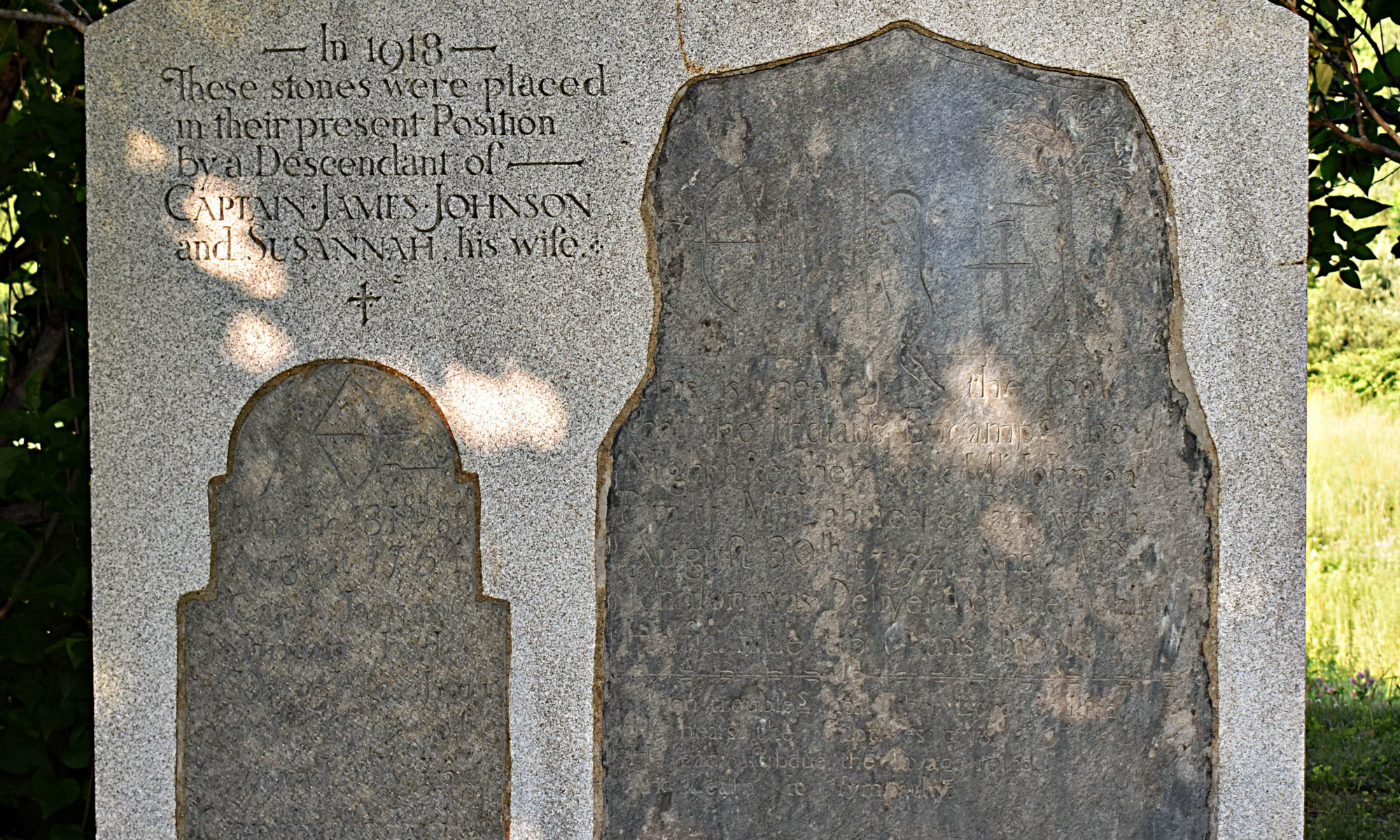
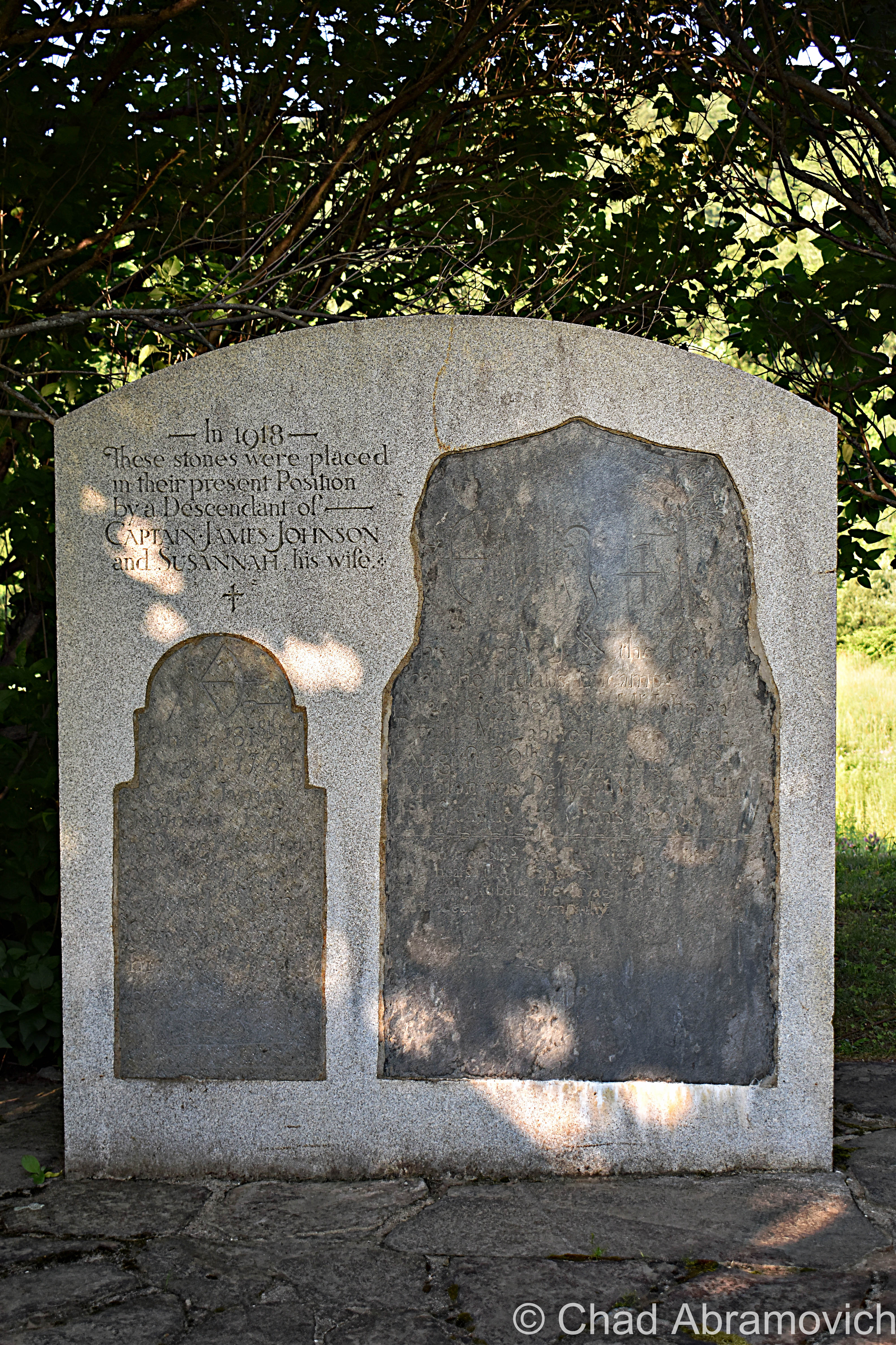
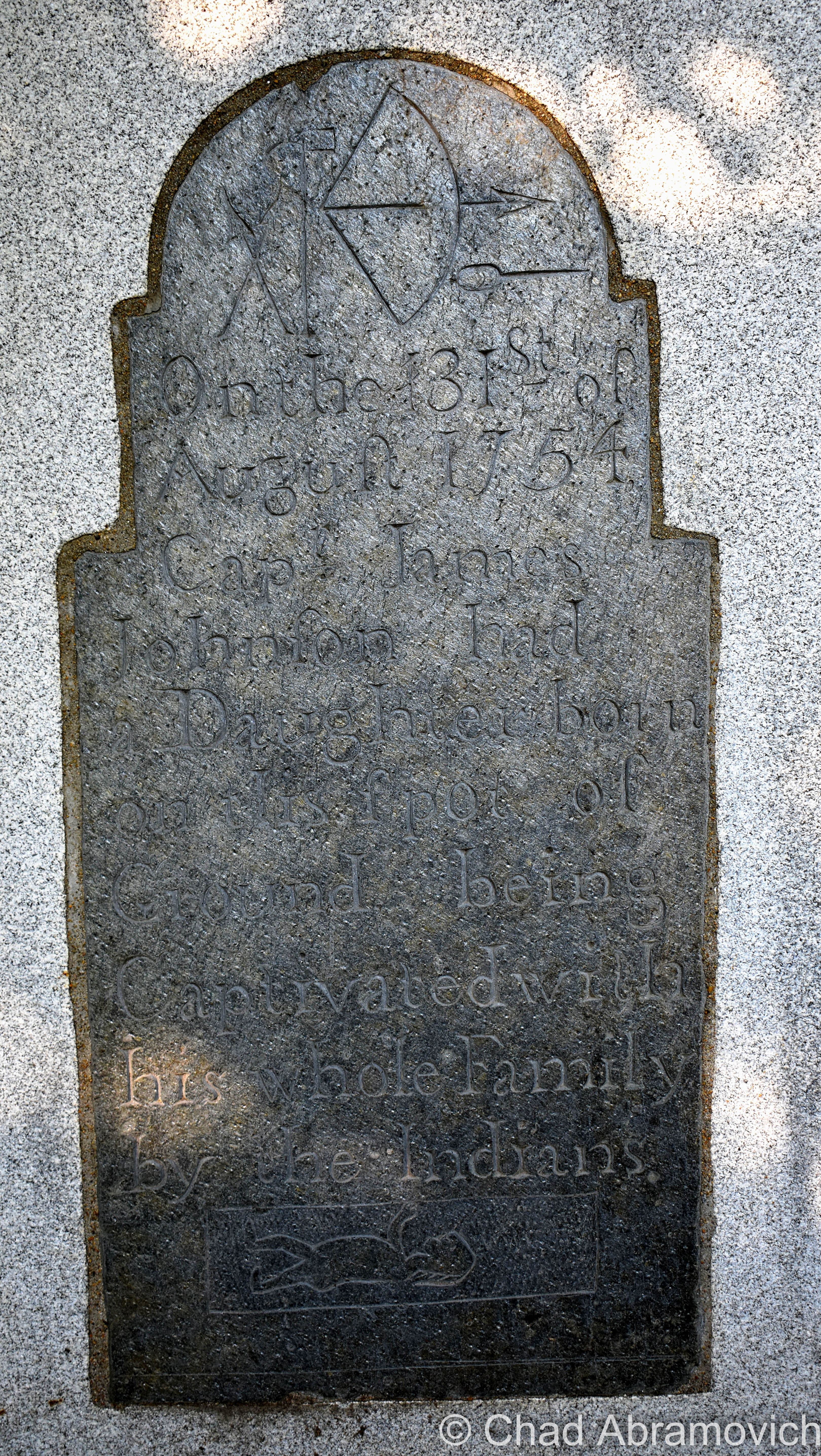
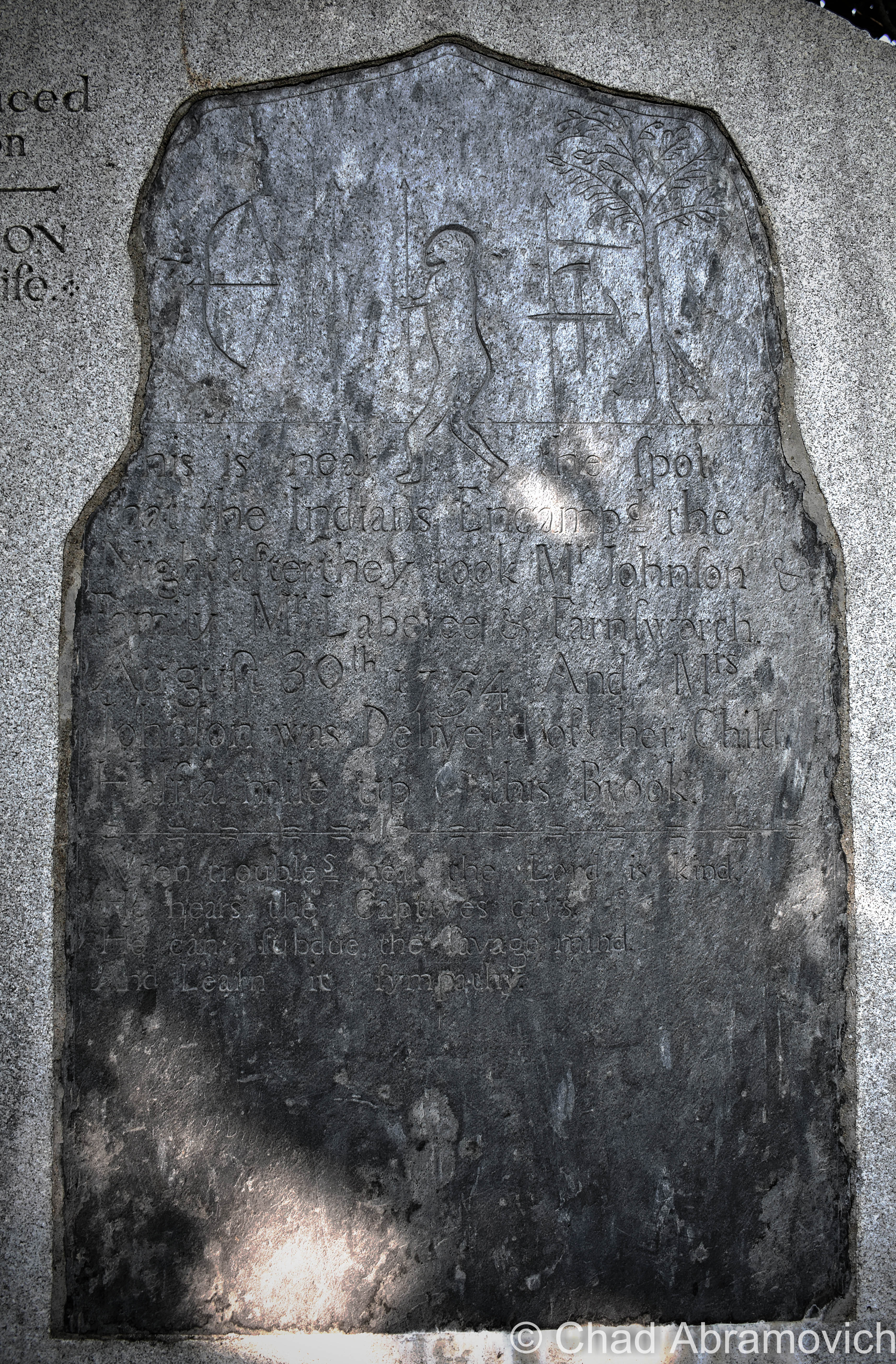
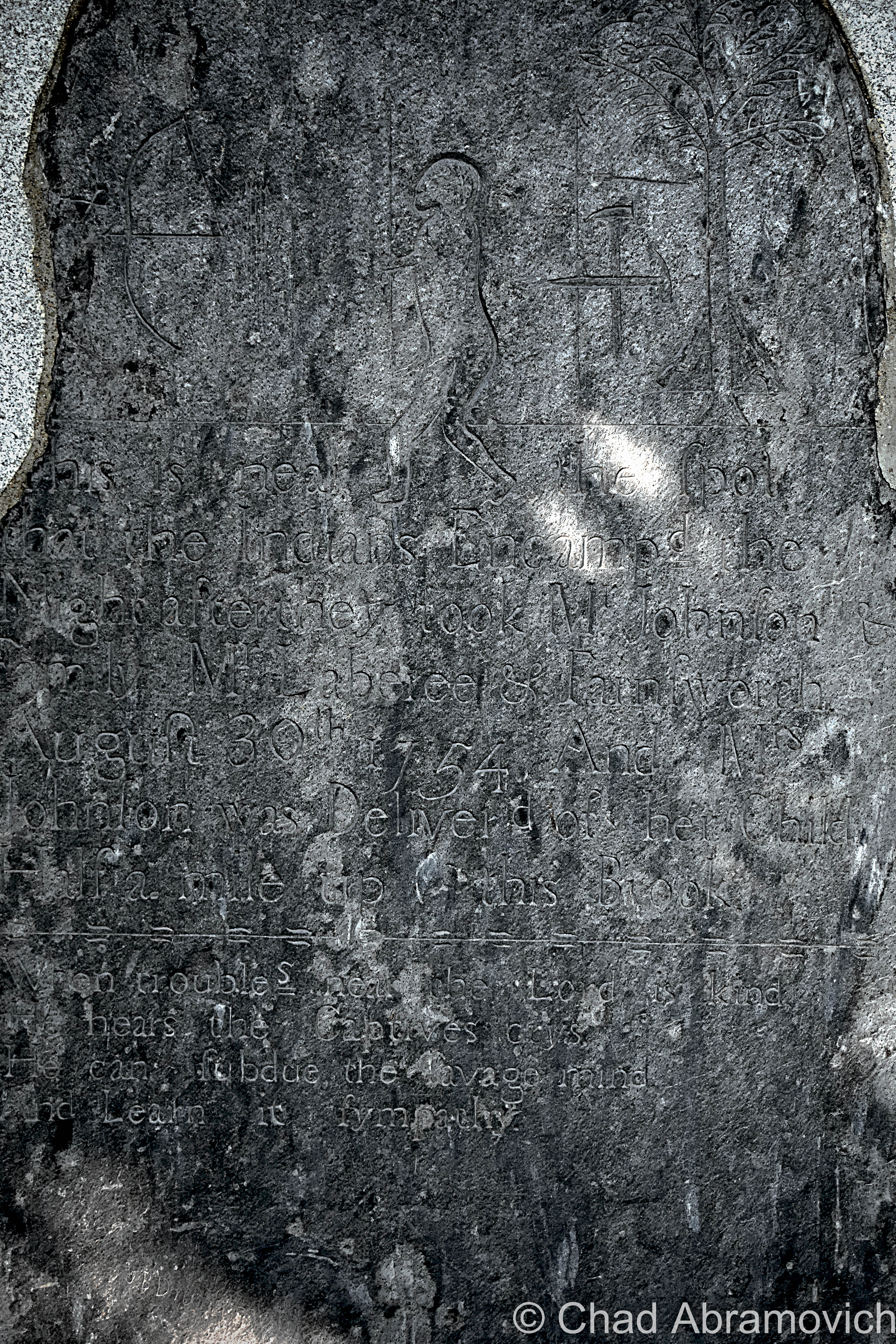
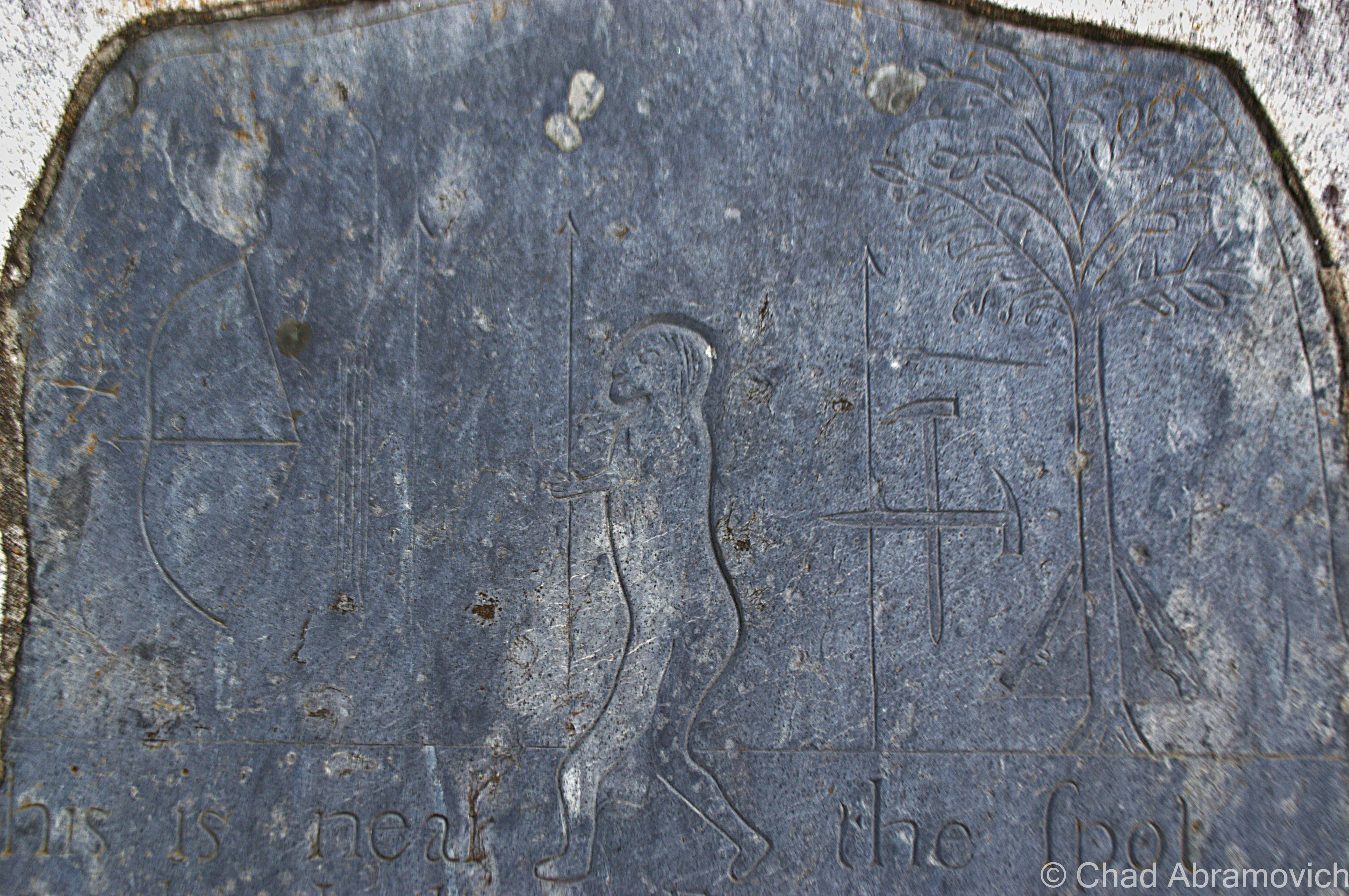
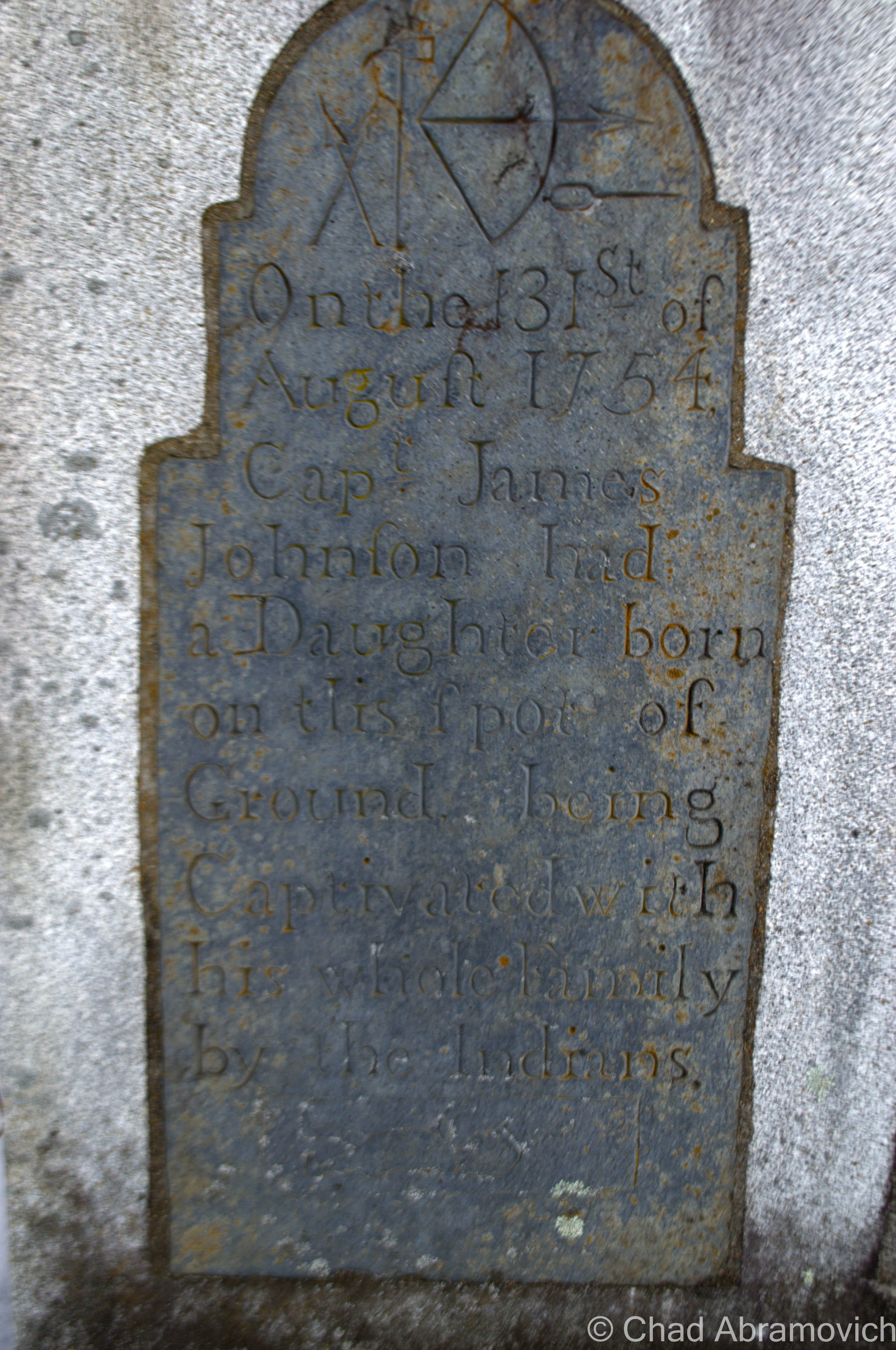
Propped inconspicuously off a no-frills stretch of state route 106 in Reading, south of the attractive little village of Felchville are a curious set of stones that are too easy to miss. If you were to take a look, you might be perplexed at the strange, enigmatic hieroglyphs found on them, with pictures of a bow an arrow, people, trees and what appear to be pick axes, what do these curious images mean? Underneath is faded scrawl, scribed in eighteenth-century English. These stones are certainly vexing. So what are they?
These are actually a monument, chiseled and erected in 1799 that mark an older occurrence, an Indian abduction.
Susanna Johnson and her family were abducted by a party of Abenaki in 1754 from Charlestown, NH, and were marched by their captors across Vermont towards Canada. But when they reached the banks of Knapp Brook, Mrs. Johnson went into labor and unceremoniously gave birth to a daughter, before being forced to continue the trek shortly after.
During their years in captivity, her son assimilated into the Abnaki culture, while her daughter was sold to a French Canadian family from Montreal. The details are vague here, but Mrs. Johnson would eventually return home.
But years later, through a series of contacts, the three family members were briefly united. However, they were unable to communicate with each other linguistically or culturally.
Mrs. Johnson had the abduction stones monument made and put in their current spot, both where she gave birth and where they still sit today, and are the oldest such monument in the country. But while the 18th century English is translatable, the weird assortment of carved pictures are pretty peculiar. Perhaps we’ll never know.
In 1918, someone encased the stones in a larger stone monument, to preserve them forever, and today they rest on the side of Route 106, barely noticed by passersby.
If you wish to find them, look for the dirt pull off on Route 106, near the junction of Knapp Brook Road in Reading.
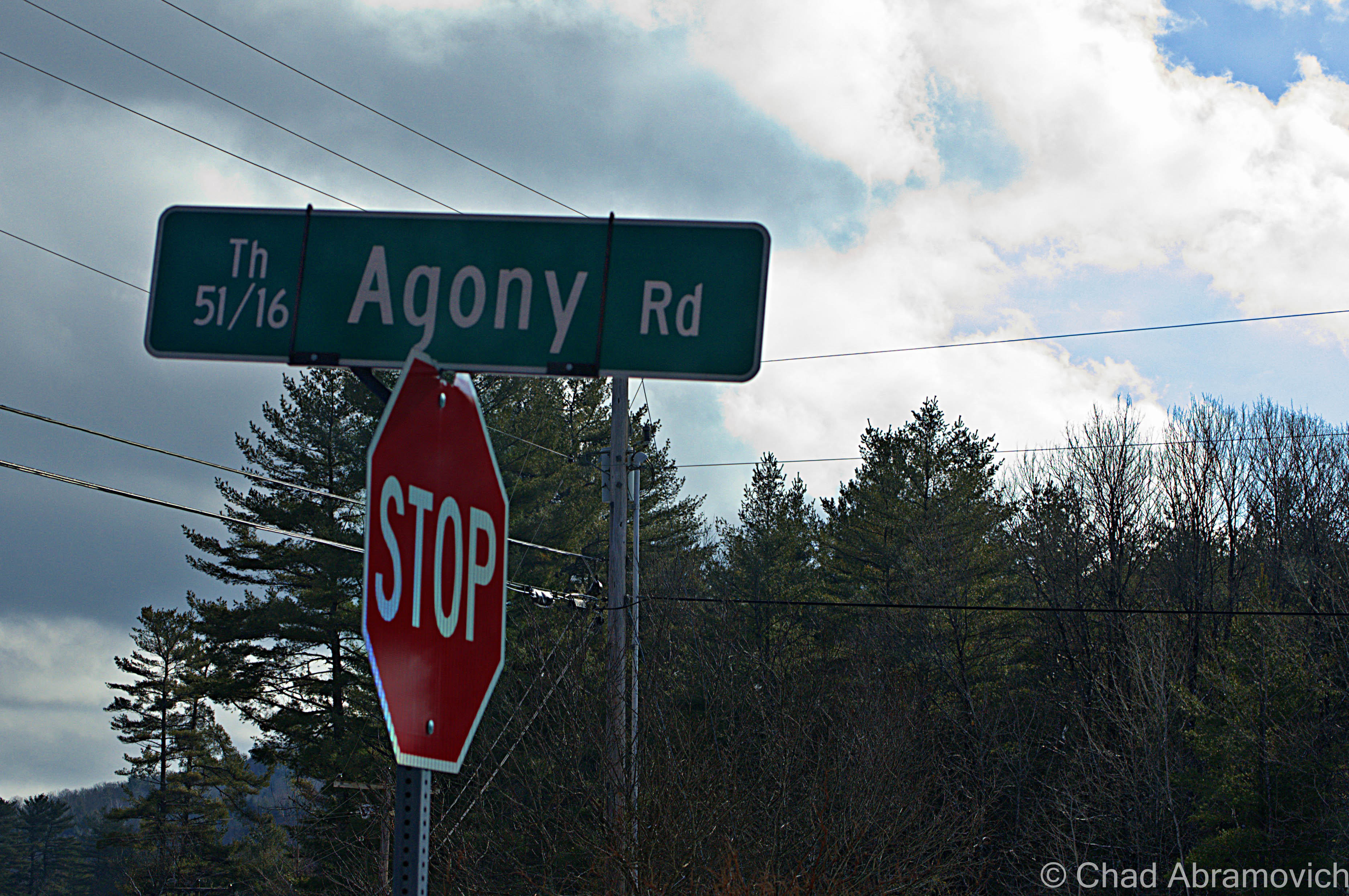
As seen driving down Route 106. What’s in a name anyway?
—————————————————————————————————————————————–
To all of my amazing fans and supporters, I am truly grateful and humbled by all of the support and donations through out the years that have kept Obscure Vermont up and running.
As you all know I spend countless hours researching, writing, and traveling to produce and sustain this blog. Obscure Vermont is funded entirely on generous donations that you the wonderful viewers and supporters have made. Expenses range from internet fees to host the blog, to investing in research materials, to traveling expenses. Also, donations help keep me current with my photography gear, computer, and computer software so that I can deliver the best quality possible.
If you value, appreciate, and enjoy reading about my adventures please consider making a donation to my new Gofundme account or Paypal. Any donation would not only be greatly appreciated and help keep this blog going, it would also keep me doing what I love. Thank you!
Within the deep bogs and silent forests of Woodbury, along nearly impassible back roads when the weather is just right, is another world entirely. People live up here in palpable solitude. Marshes gently bleed into immortal evergreen forests that are bounded by jagged slate cliffs. The Green Mountains are the oldest mountains in the world, and Woodbury is a good look into the haunting archaic beauty and amiable stillness of the region.
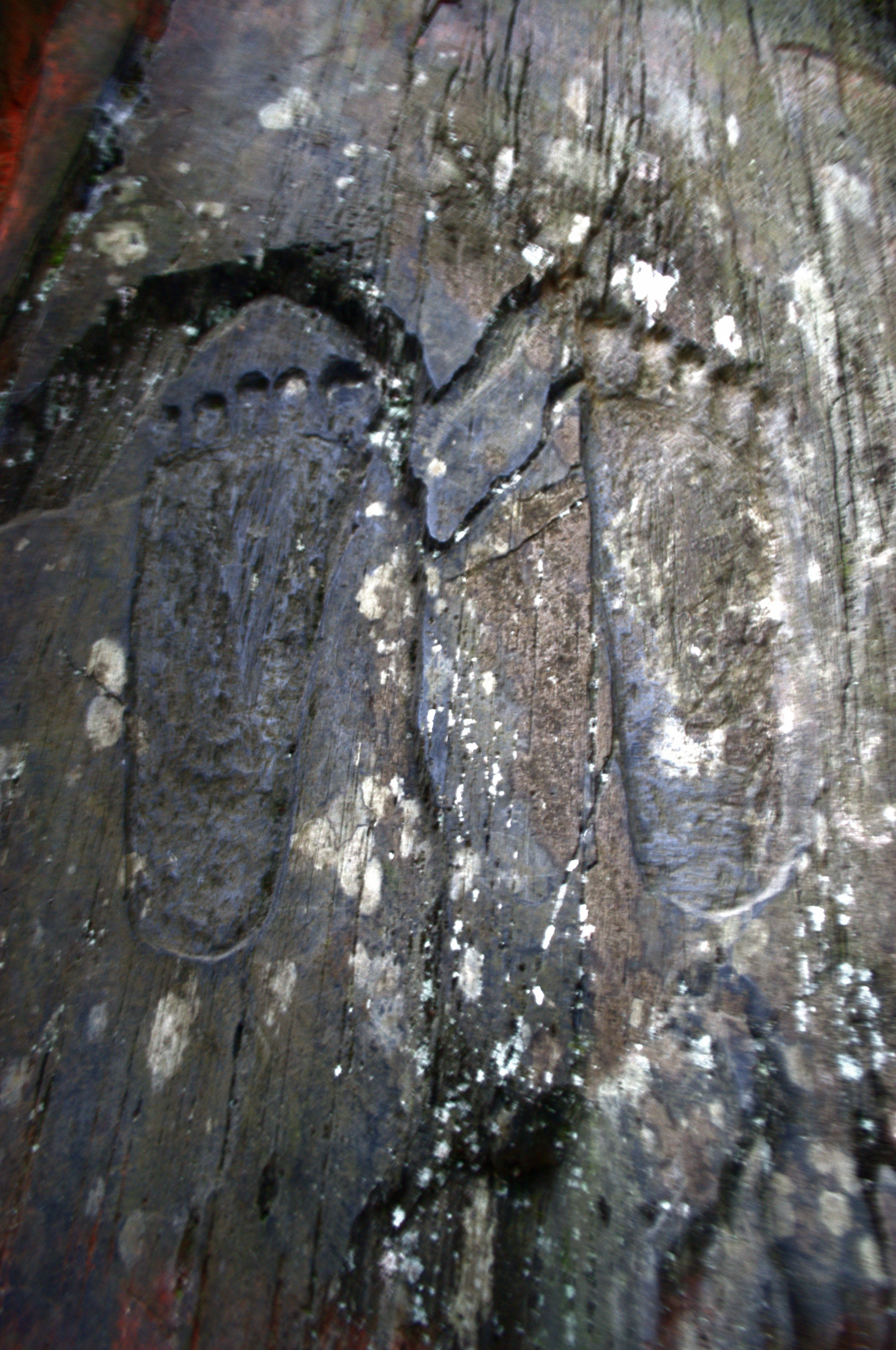
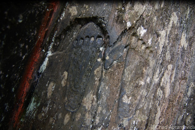
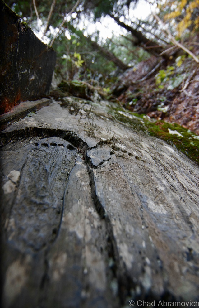
It is here off one of these jarring back roads that winds around bogs and through cliff lined gulfs that two footprints stare at you on a crumbling ledge that seems to vanish into a dark forest above you. That is, if you happen to notice them. And if you do notice the fading, waist high footprints, you might become puzzled over their seemingly random existence in the middle of nowhere.
Why are they here? Who’s footprints are they? From what I know, no one really has any definite answers, but there is a local legend that works to uncover the mystery.
As what was told to me, most people who grew up in town called them The Indian Footprints, and have been there as long as anyone can remember. On both sides of the road are tall slate cliffs, and thousands of years ago, the road used to be a riverbed, and the cliffs the walls of a hungry gorge. When the water was low, you could easily cross the river, but when it was high, it rose to the top of the cliffs.
The river acted as a boundary between two rival tribes, thousands of years ago. As the story goes, in a classic Romeo and Juliet scenario, a young man and woman from the opposing clans fell in love, but their different circles forbid them to see each other. So they planned to elope secretly at the gorge. But when the woman jumped in the river to swim over and meet her lover, the water was higher and rougher than she could put up with, and the rushing currents swept her away. The man jumped in to save her, but upon doing so, broke his legs on the rock ledge and drowned in the process. Their bodies would later turn up in present day Nelson Pond, just down the road.
The tragedy brought the two fighting tribes together at the river’s edge. The two grieving chiefs decided to commemorate the tragic event, and carve the footprints of the brave man on the ledge where he suffered his fatal fall. This act symbolized the ending of a long running feud, in hopes that no one else would ever die again because of it.
The footprints have been there ever since, or as the story goes. Over the years though, weather and water have long worked on eroding the footprints, and in 1958, a local resident took it upon himself to hand chisel the footprints back into the rocks in fear of them getting lost forever.
But perhaps a greater mystery than the origin of these stone carvings is just how to find them. Making our way through the worn village of South Woodbury amidst ponds with ink black surfaces that reflected snow dusted forests – my friend’s car slid and spun its way up and down hill top dirt roads far from the safety of cell phone reception. Miraculously, with only the aid of 2 wheel drive, we made it to the right area, and with a lot of searching amongst indistinguishable evergreens and cliffs covered with moss and snow, somehow, their outlines stood out of the rock surface.
Regardless of the authenticity, standing on that back road in Woodbury with snow tumbling down on the ground was simply beautiful, and could easily inspire a love story such as this.
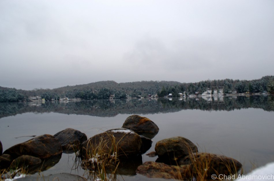
The placid waters of Nelson Pond or Forest Lake today, where their bodies were eventually located.
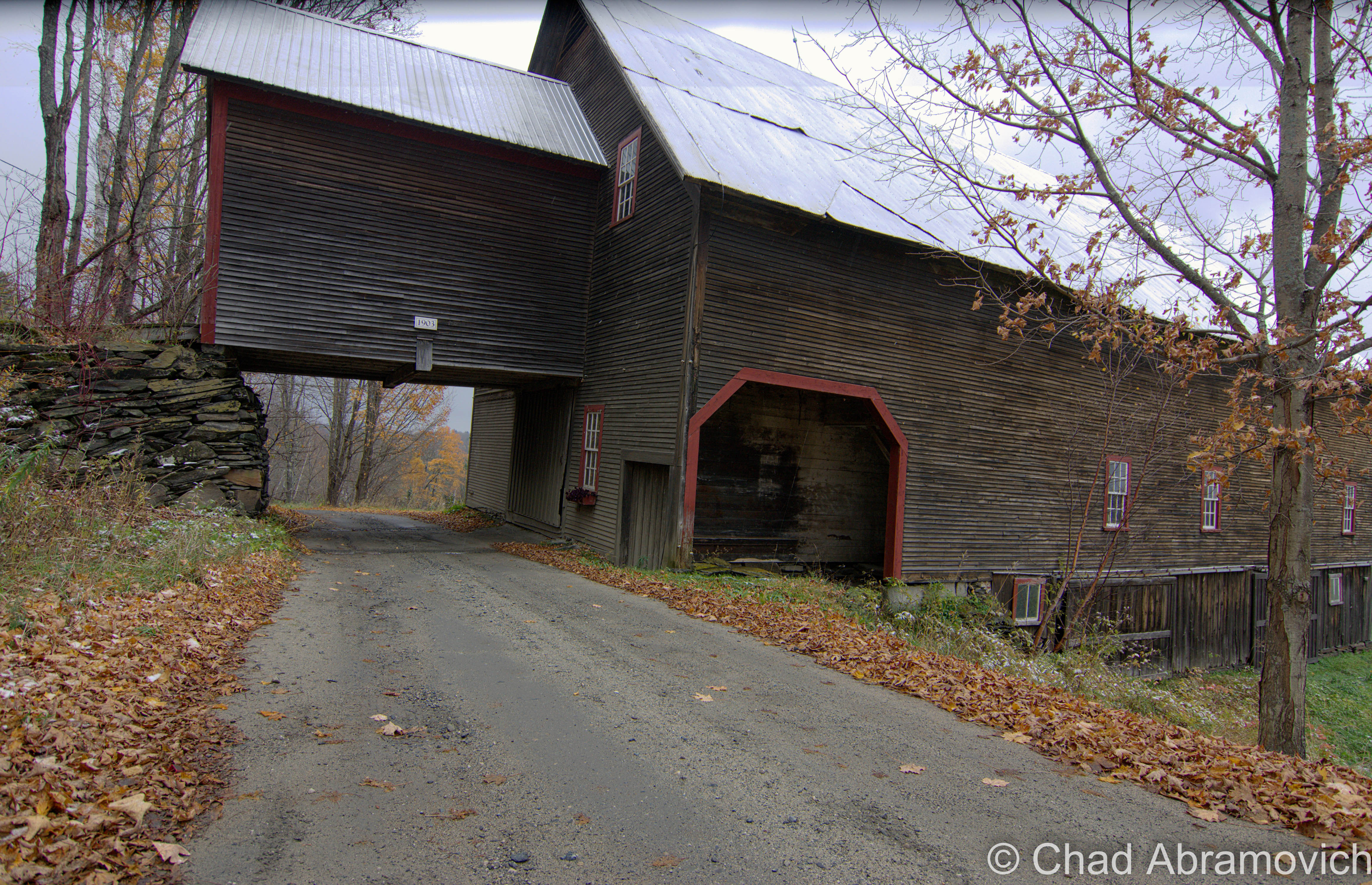
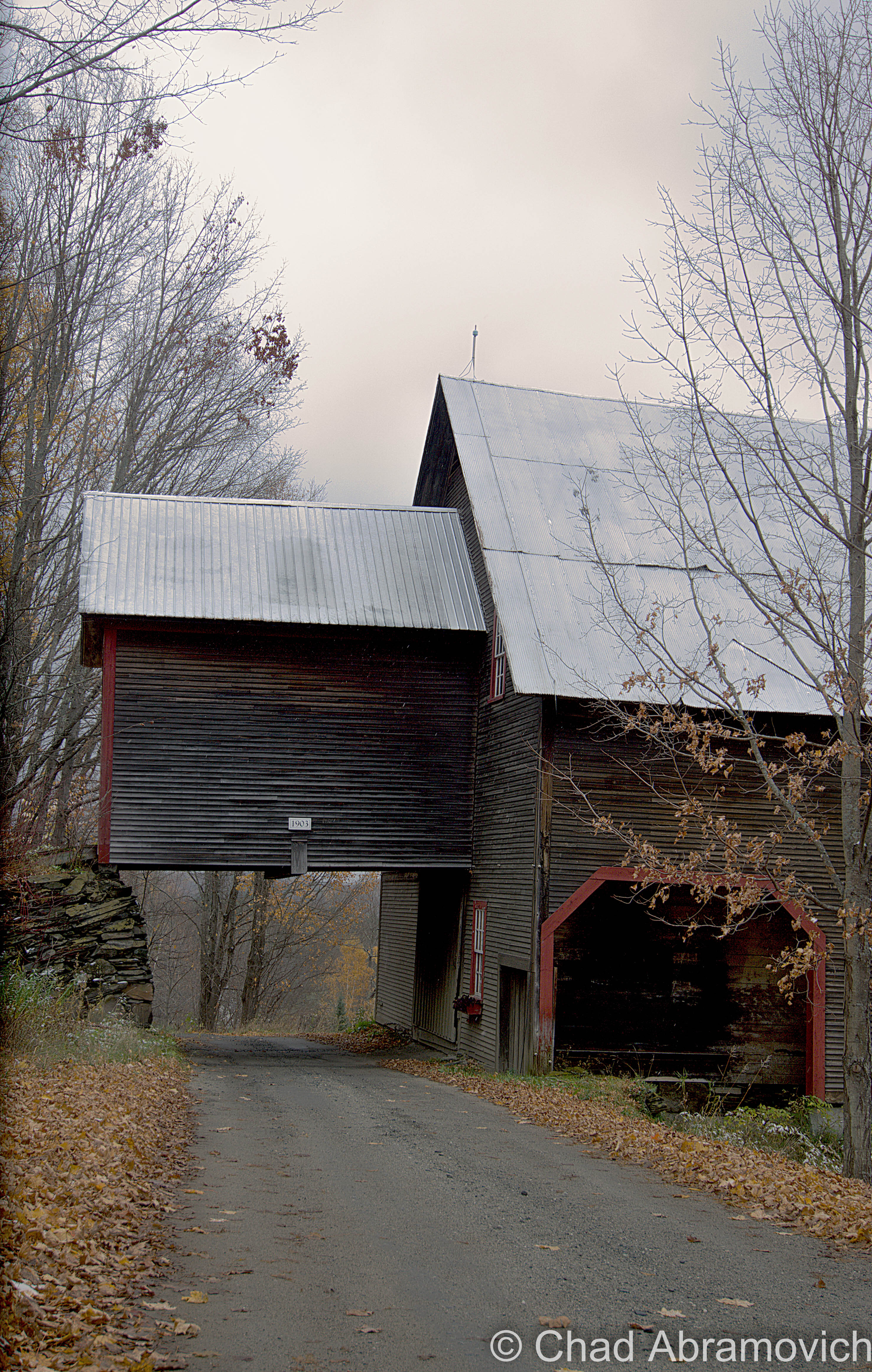
Not related to the Indian Footprints, but related to the area; I really dig this aesthetically prime rural town in Central Vermont. Woodbury has more lakes than any other Vermont township, and around those waterbodies are tons of rocky glacier gouged hills etched with scenic gravel back roads.
Like Chartier Hill Road, which has a barn that was built in 1903, that was also built over the road.
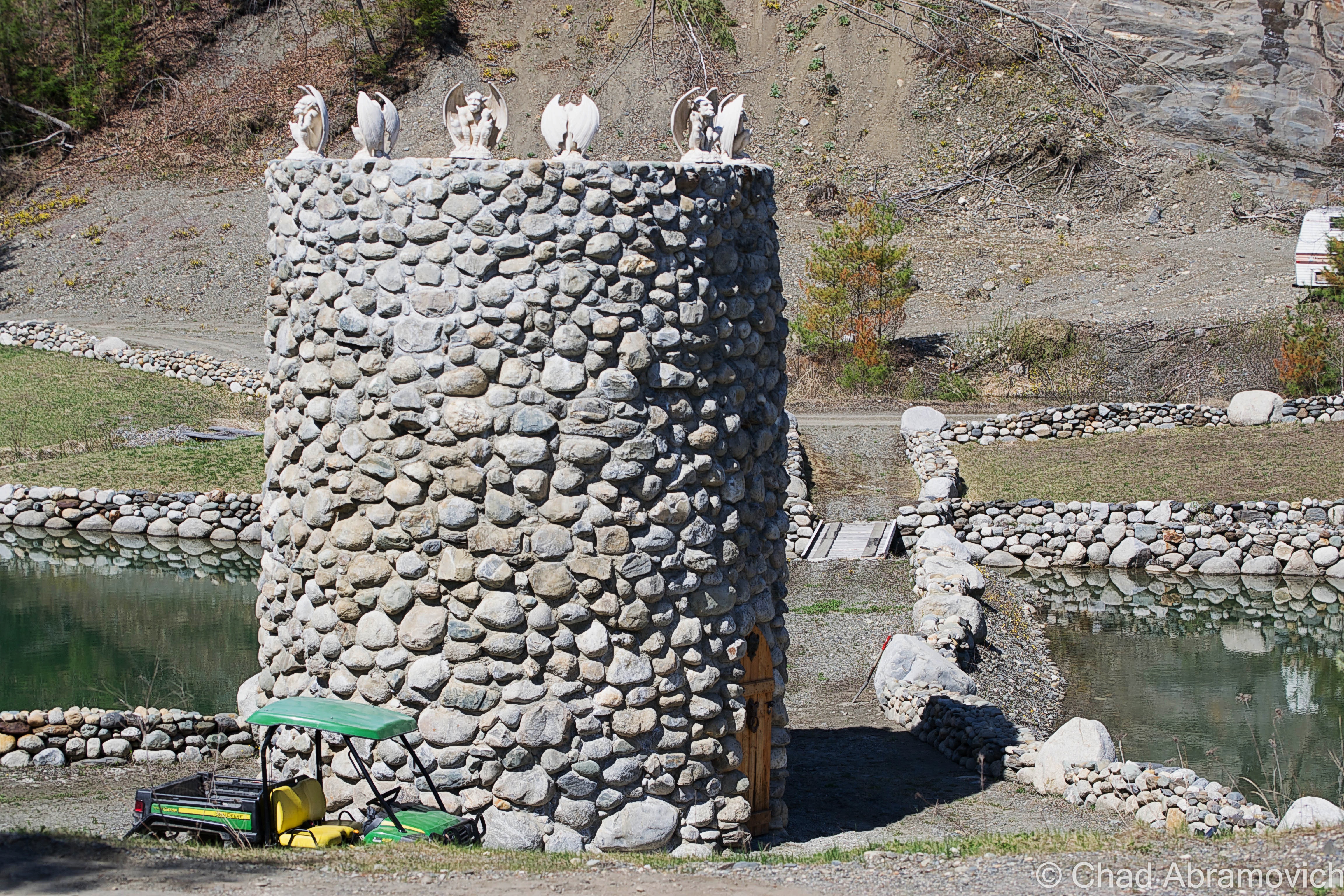
Woodbury’s Medevil Tower
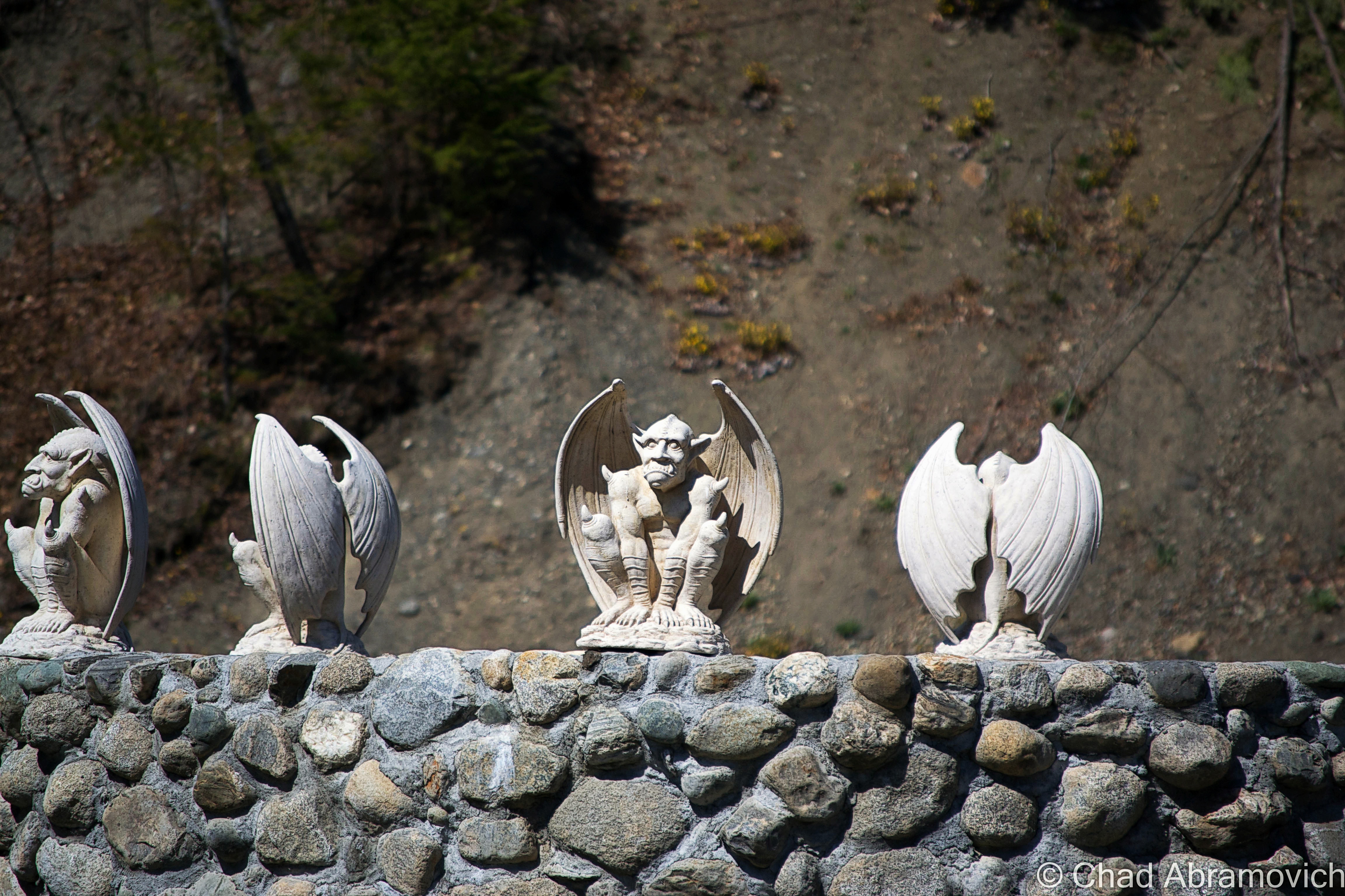
What to do with a defunct quarry and lots of rocks? You could build something like this medieval looking cylindrical watchtower tower on the shores of Sabin Pond, located off a thin back road in a quarried depression. It even has gargoyles perched sentinel around the top rim with faces rictus with gloom.
Property owner Scott McCullough, who also fittingly owns a rock crushing business, decided to begin building the inconspicuous 24-foot cylindrical quasi-mythical structure in 2009, partially in an effort to clean up the eyesore patch of land which locals began to use as a garbage dump, and partially for something to do on weekends. But be warned – trespassers aren’t welcome. And there are several signs to make the point. But I’m told he’s a friendly fellow who is pretty enthusiastic about striking up a conversation about it. Just as long as he’s around and you have permission to be there.
—————————————————————————————————————————————–
To all of my amazing fans and supporters, I am truly grateful and humbled by all of the support and donations through out the years that have kept Obscure Vermont up and running.
As you all know I spend countless hours researching, writing, and traveling to produce and sustain this blog. Obscure Vermont is funded entirely on generous donations that you the wonderful viewers and supporters have made. Expenses range from internet fees to host the blog, to investing in research materials, to traveling expenses. Also, donations help keep me current with my photography gear, computer, and computer software so that I can deliver the best quality possible.
If you value, appreciate, and enjoy reading about my adventures please consider making a donation to my new Gofundme account or Paypal. Any donation would not only be greatly appreciated and help keep this blog going, it would also keep me doing what I love. Thank you!
New England is an old region. But we keep finding unexplainable oddities in our woods that make us wonder just how old. (As a matter of fact, New England just might be a misnomer…) The great north woods that stretch across the northeast successfully hold many unsolved mysteries and intriguing curios. Seriously. Though parts of New England have become characteristically developed over the last century, the varying topography here and it’s fluctuating inaccessibility makes it hard to have a complete idea of exactly what is out there still. For example, a plane that slammed into Jay Peak in 1943 was just found in September of 2016.
Many of our curiosities have been made possible thanks to something ubiquitous to the northeast; rocks. There is “America’s Stonehenge” in Salem, New Hampshire, a strange site featuring exoticisms of stone construction whose builders and purposes are pretty obscure. There is the mysterious Gungywamp in Connecticut that has rock placements that may date back to 2000 BC, the vulnerable Upton Chamber in Massachusetts, and tons of stone tunnels, chambers and monoliths found all over this weird part of America. Many have yet to be discovered, and some are vanishing into the past tense.
Vermont adds to that list of eccentric finds with mysterious stone chambers scattered in the deep forests and rocky highlands around the state.
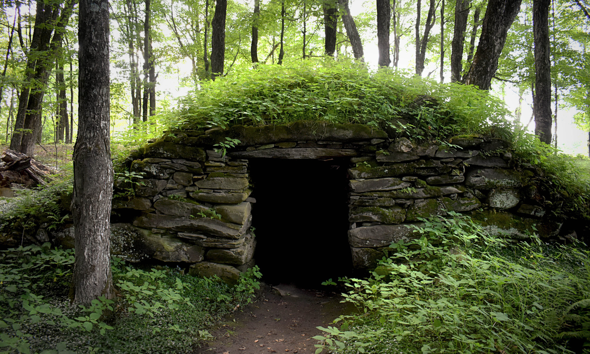
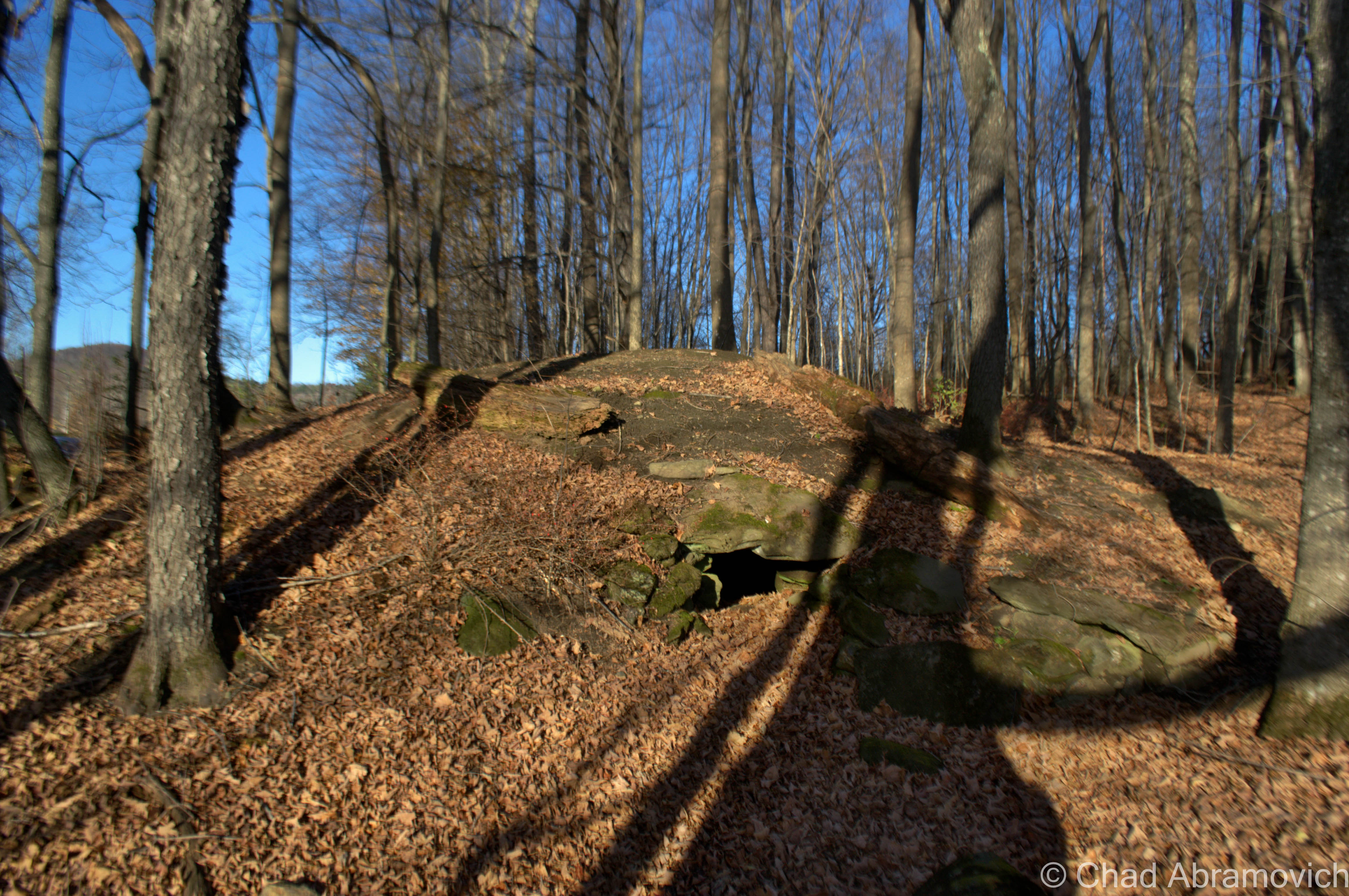
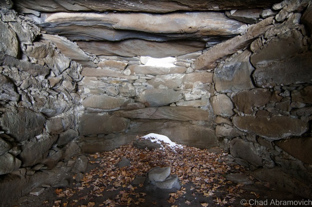
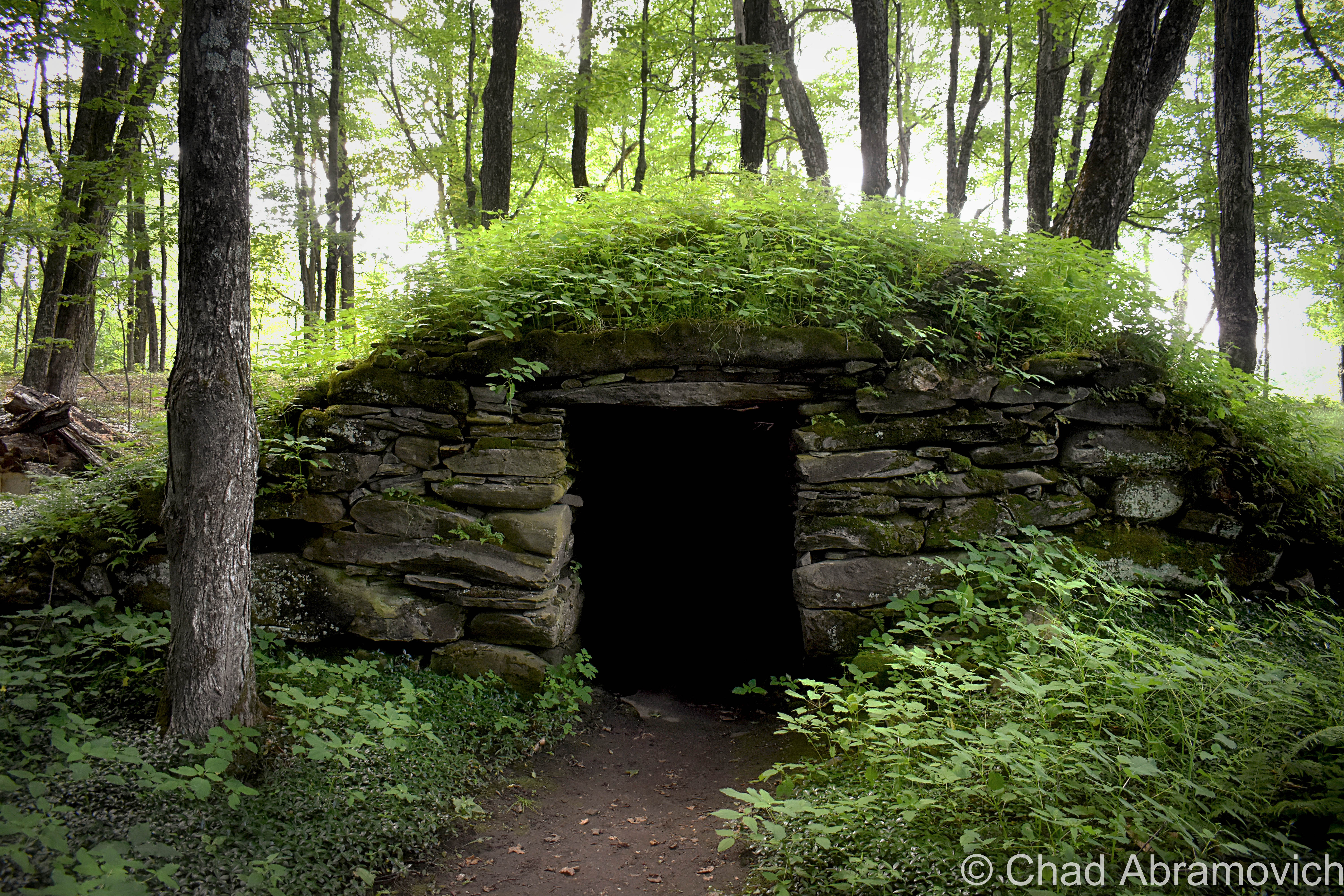
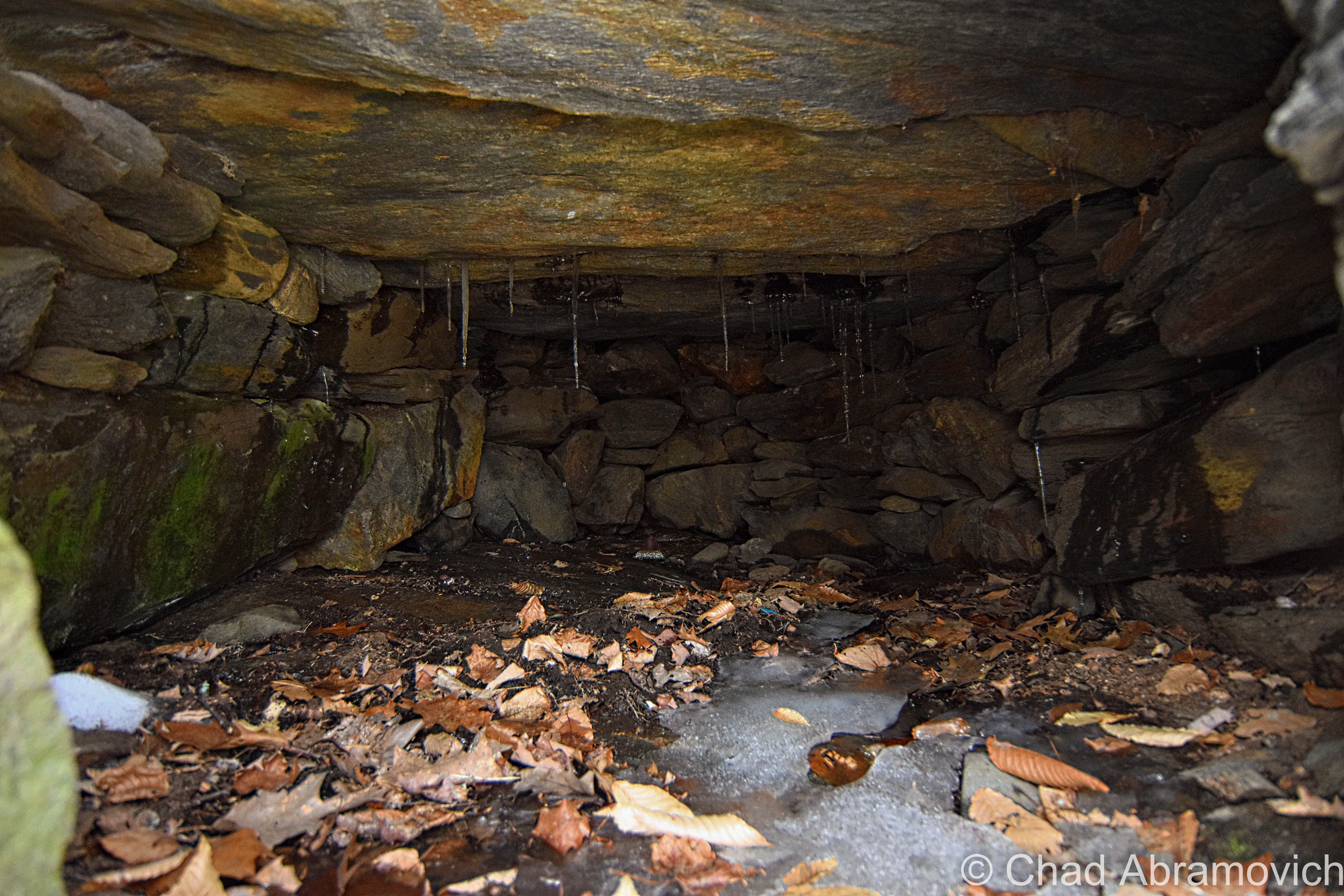
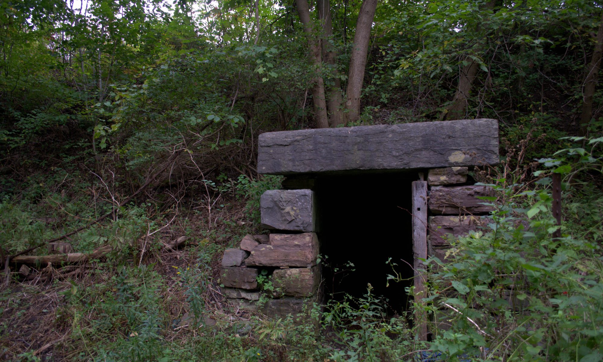
These strange beehive structures have incredible craftsmanship, using several ton stones put together with dexterity and without the use of machinery or mortar. The question is, wtf are they? Who built them, and why?
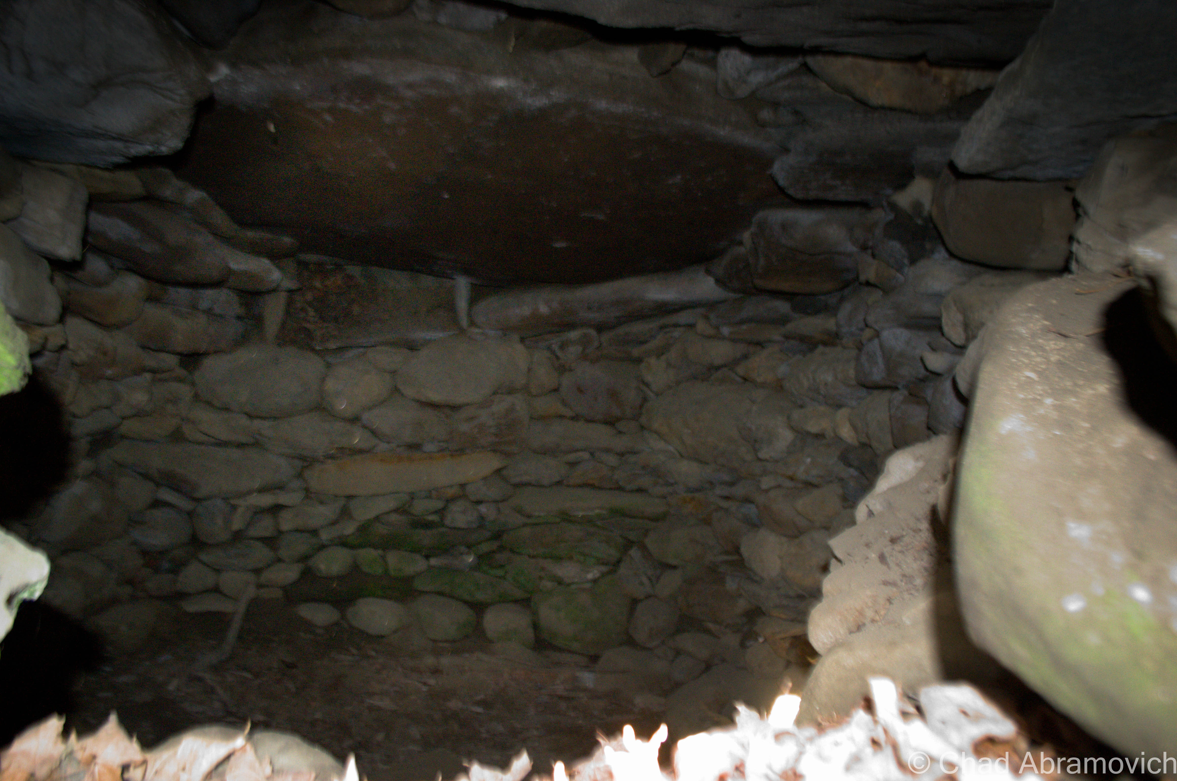
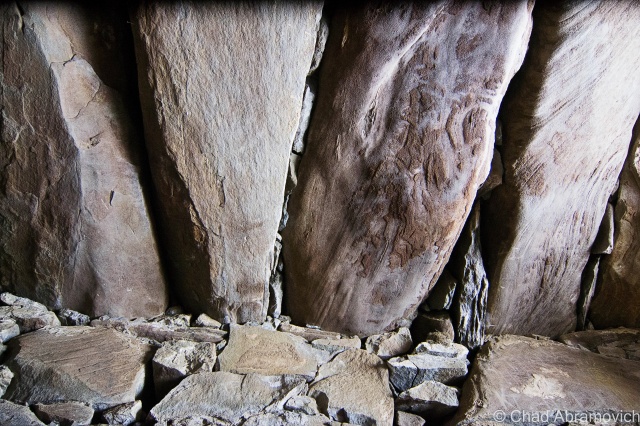
Most of these structures are igloo-shaped, burrowing into a hillside with a door like opening. Inside, the walls are made from perfectly placed stones and the ceilings encompass giant stone slabs weighing several tons. Some have enigmatic inscriptions etched into the stones that have baffled people since they have been discovered. Any information seems to have long ago vanished in some sort of cultural hiccup, ensuring the answers were never handed down, leaving this as one of Vermont’s greatest lingering mysteries.
But there are theories, and depending on who you ask, are the subject of much debate. An accepted theory by the powers that be of state historical research is that these stone igloos are nothing more than colonial root cellars, as old as 200 years. A Google search on them showed me several similar structures all tagged under the same label. But from what I was seeing, these constructions involved more modern planning or construction, often with brick or mortar and more defined delineation. Many of the alleged ancient chambers, weren’t, and were more naturally but impressively put together. Some of these stones weigh several tons, and would have most likely had to be dug up and transported to the building sites. Why all that labor for a root cellar?
More mystique has affixed itself to the masonry of these chambers, sort of debunking the root cellar notion the historical society stubbornly upholds. The Native Americans knew of these chambers as well, denied building them, and seemed to be just as puzzled. So it could be possible that these stone chambers were here long before the first land grabbing Europeans set foot in the hills of Vermont. And apparently, one of them has been carbon dated before, and the results concluded that these may have existed more than 2,000 years ago. So what are they, and who built them?
Another explanation that is gaining popularity is that these mounds are a product right out of Atlantic coast area Europe, and were built by ancient Celts or Vikings, who during seafaring explorations, landed over here in northeastern North America.
While here, they discovered copper deposits, which Vermont is loaded with. Could these mounds be the product of ancient copper miners? And if so, that would further support that Celts or Vikings were here far before Columbus set foot in the western hemisphere. But that still leaves out a revealing detail; what were these stone chambers used for? Some speculate they were tombs, a place to leave the dead to be returned to Mother Earth.
Many of these constructions have some sort of astronomical significance and have been savvily placed to align almost precisely with the vernal equinox or winter solstice.
They’re also pretty similar to traditional Celtic dwellings in Ireland or the British Isles, minus the thatched roof and instead, New England-ized. Some were found to even have chimneys, or, openings in the stone roofs. Could they have been Celtic explorers attempts at homesteading here?
Other chambers offer ways that the past can speak to us in the modern world, but their messages are often hard to decipher, raising more unanswerable questions and scrutiny than not. Ogham/Ogam, a dead ancient Irish language, has been found etched in the very stones that these chambers were constructed from. One inscription was translated as; “Precincts of the gods of the land beyond the sunset”. Could this be Vermont’s original name?
We’ve already debunked the conventional unwisdom of Columbus and later the Pilgrims being the first to set foot around these parts, and are continuously finding evidence of Viking settlements, so why not add the Celts to our visitor roster?
In Vermont alone, there are a reported 200 of these stone structures scattered around the state, with possibly more that have yet to be discovered, and others which have already shook hands with their mortality.
I was on some message boards doing some research on ancient Vermont stuff, and one commenter from Windsor County had written that there was a stone chamber on his property, but some rowdy kids trespassed and pulled a stone out of the wall that they thought had Ogham on it, and later, the whole structure collapsed. I can see why some people aren’t into the idea of these oddities being ancient, because of the disrespectful visitors they can draw. As an oddity-hunter and explorer myself, this is why I almost never give out the locations I visit, because sadly, you can’t trust people not to ruin things. But the biggest cause of death for these sites is actually by construction projects. Often, they have been purposely razed to make way for cheap cookie-cutter housing developments or a farmer wanting to expand their hayfield.
But despite all this, their existence remains largely unknown to most Vermonters, and more shockingly, it seems not many are interested in studying them, creating roadblocks to discovering exactly what they are. And any assumptions a curious adventurer may come up within the throes of wanderlust are meant with the silence of the forests, and the chilly winters coming down your neck. But despite the chills, the fires of my imagination were inspiring me that day when I headed down towards Southern Vermont to see if I could find some answers for myself.
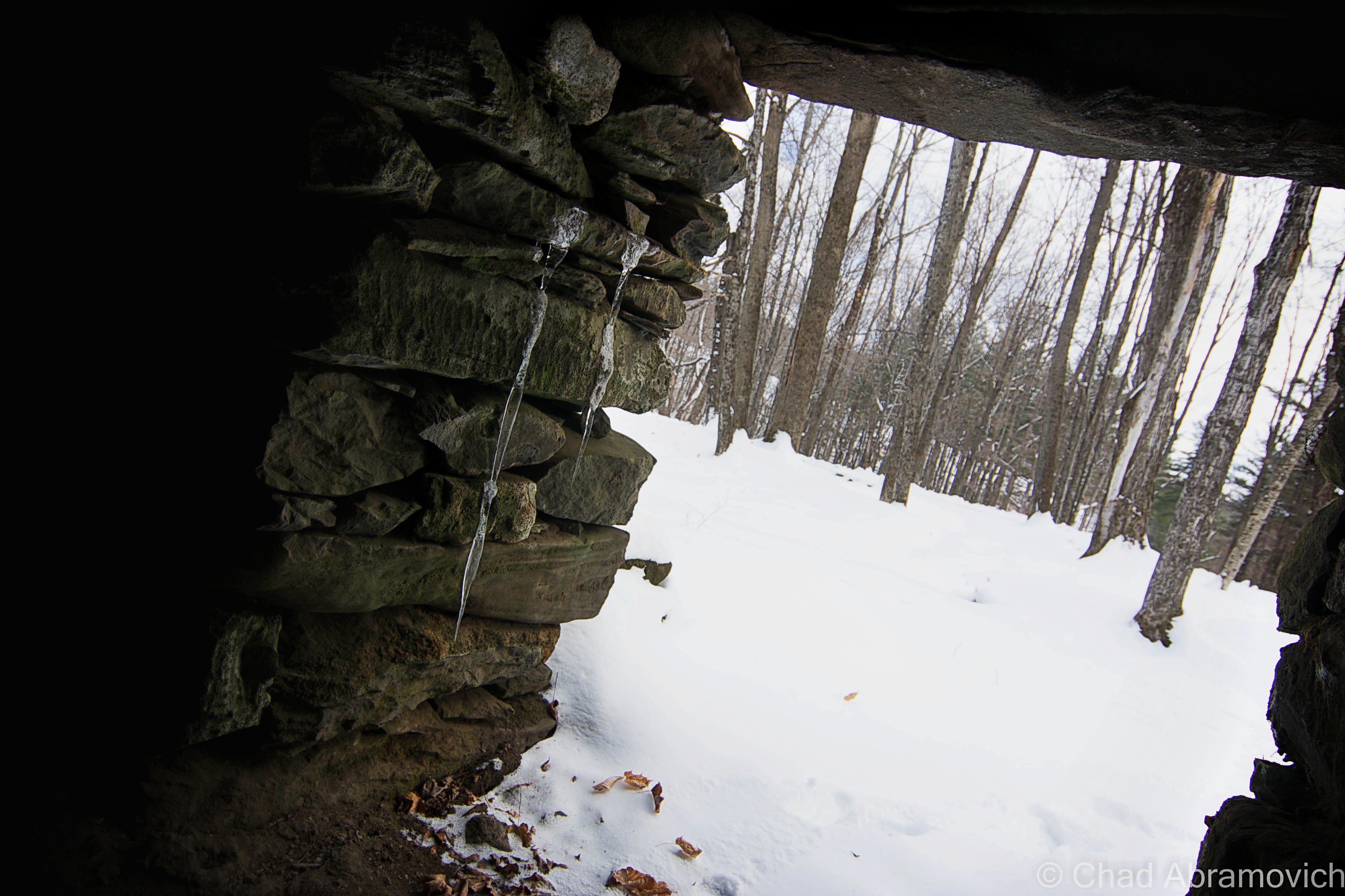
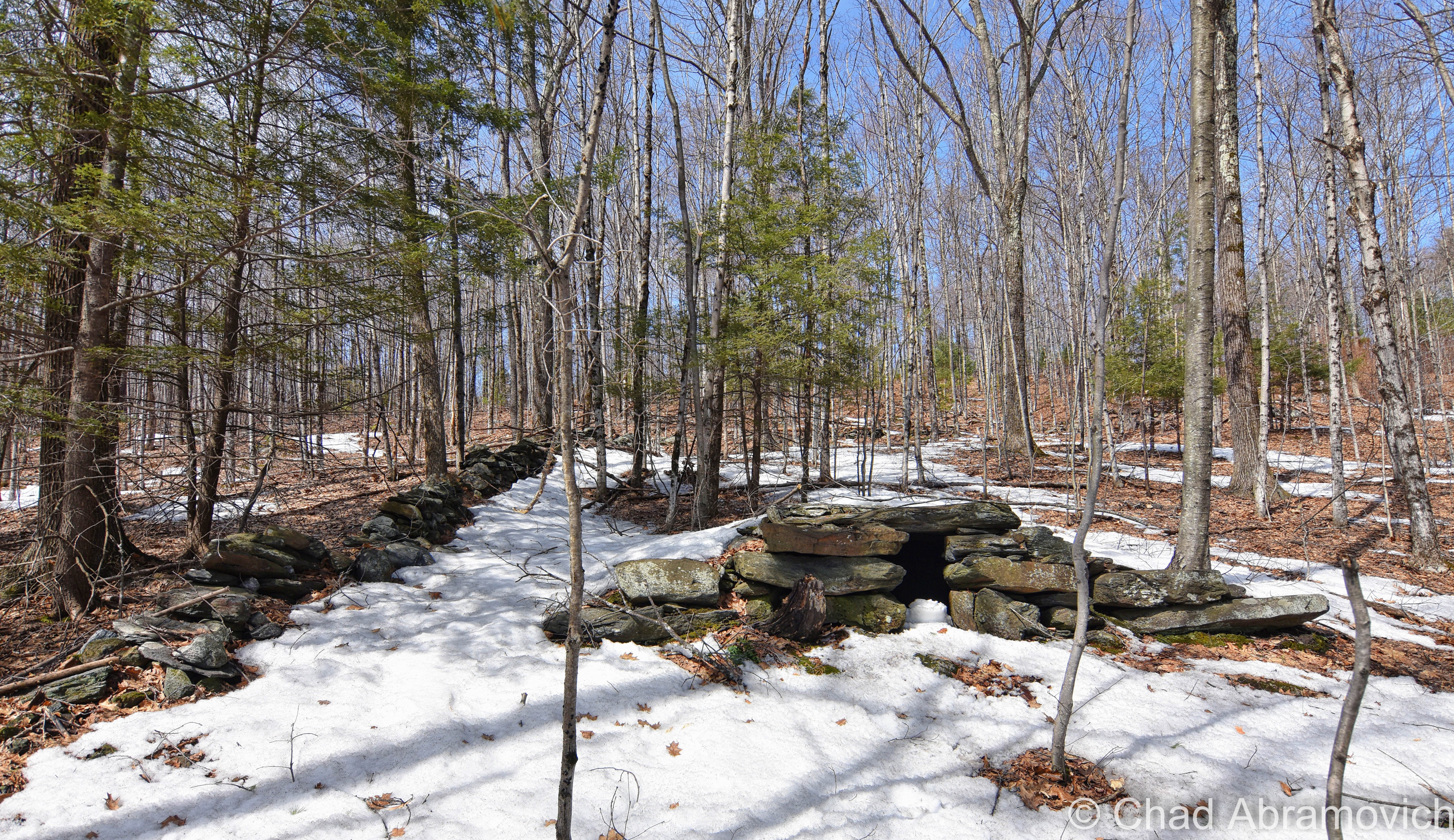
It was those winter chills and the harsh glow of the dying November sun that slipped under my skin as I stepped out of the car. My feet crunched across field grasses and around muddy stream beds as I made my way up the hill. I knew the location of one of these mysterious stone chambers, and I was on a mission to find it. But it seems while I was seeking one mystery, I stumbled into another one. Just where the heck was it? I had vague directions, but underneath the brown leaves that coated the forest floor, everything was indistinguishable. There was no large mound and no doorway. The sun was beginning to sink behind the looming shadow of Killington Peak, and it was getting colder. After awkwardly combing the woods for 20 minutes, I decided to head back to the car, feeling my stomach sink a little.
Not wanting to admit defeat, I decided to utilize a great Vermont resource; the town clerk’s office. And I seemed to be in luck, as my question raised enthusiastic responses from the people inside, as they crowded around the front desk. As one person created a hand-drawn map for me, another was passionately giving me directions in a fashion that can only be described as Vermonty. “Head up the road a ways until you get to the old McIntosh Farm, not sure who owns it now…anyways, you’ll notice a field is on your right-hand side after you pass where the schoolhouse used to be, but if you hit the old snowmobile trail, you’ve gone too far and have to turn around…”
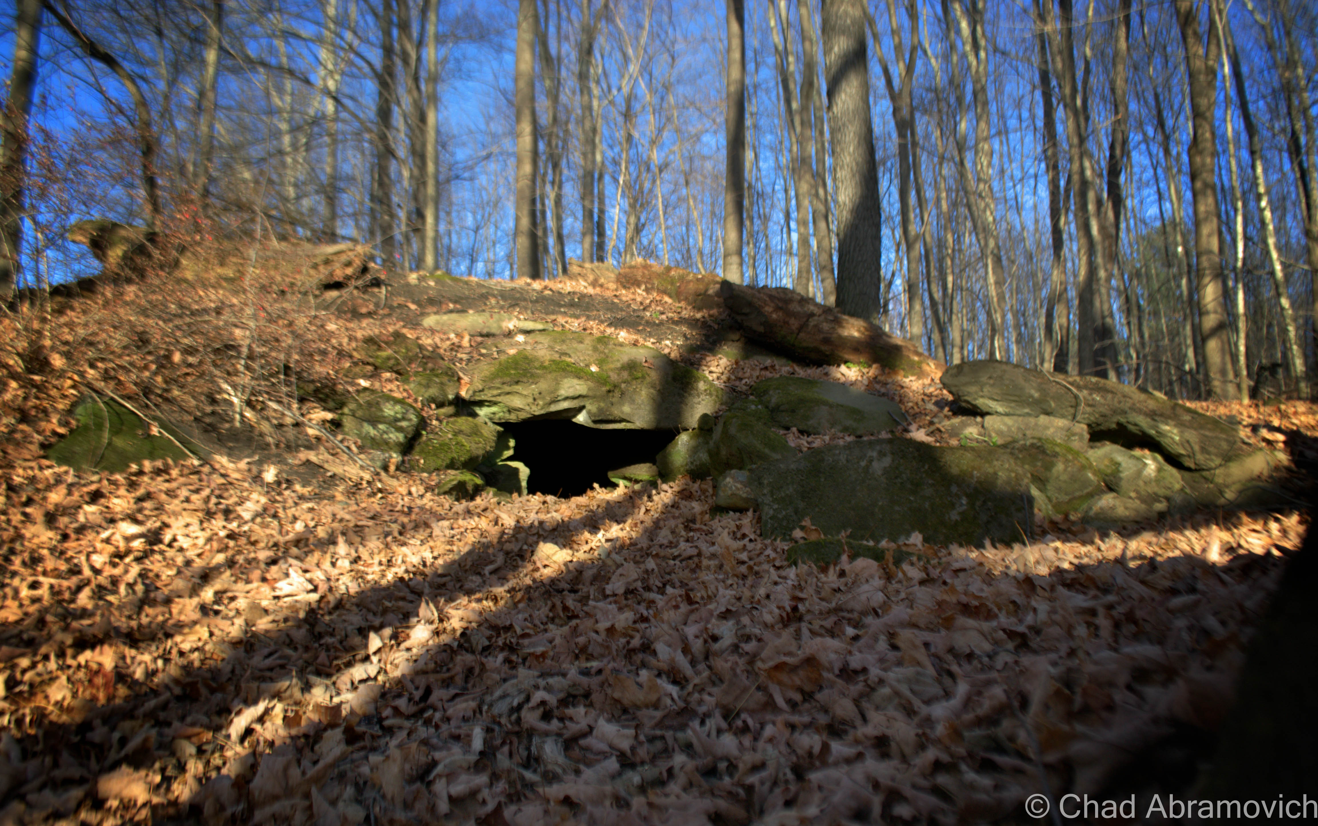
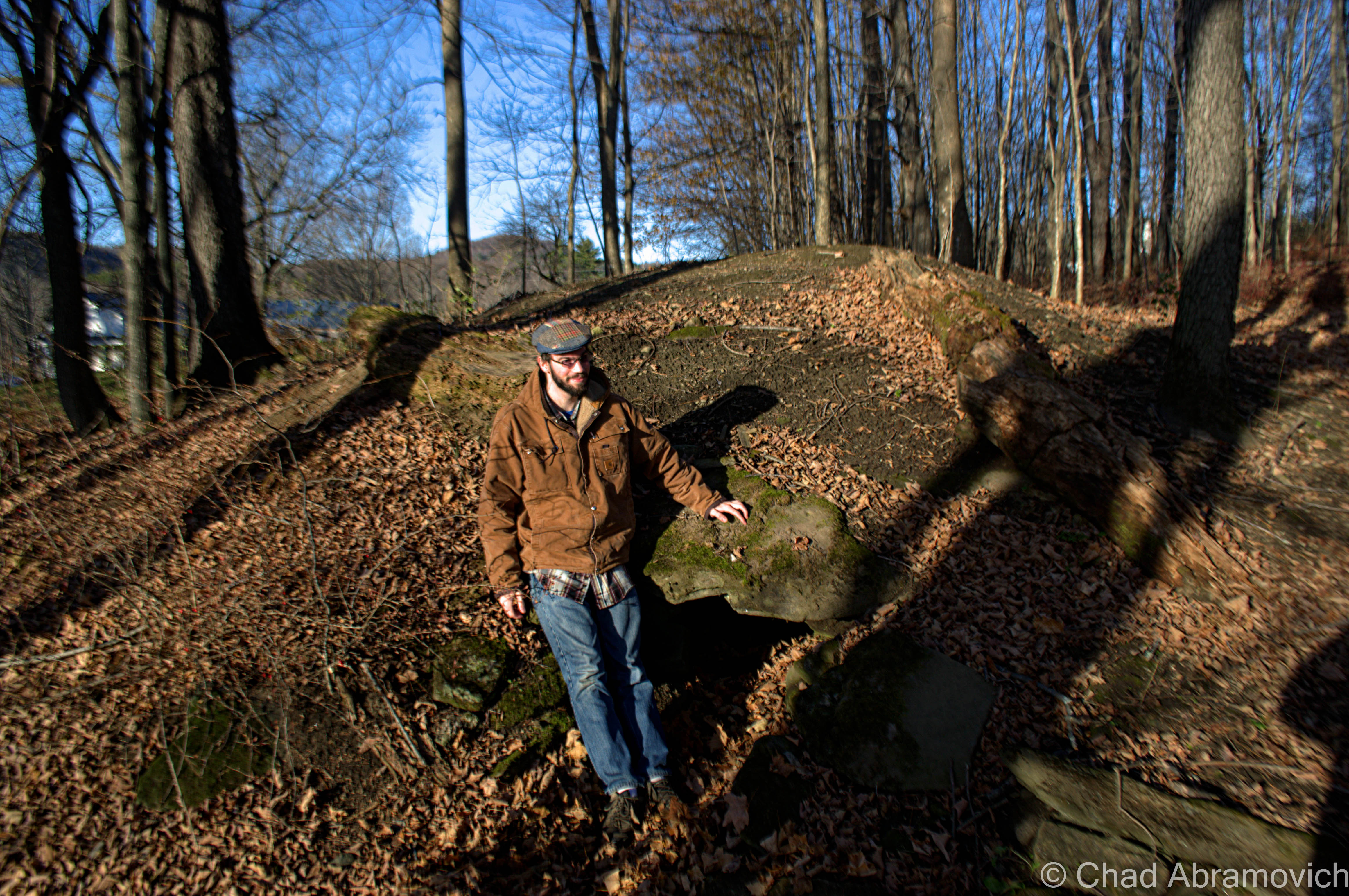
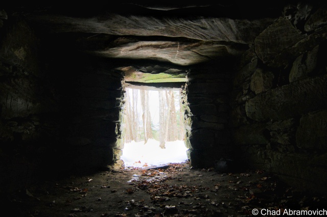
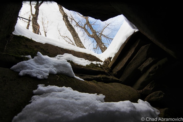
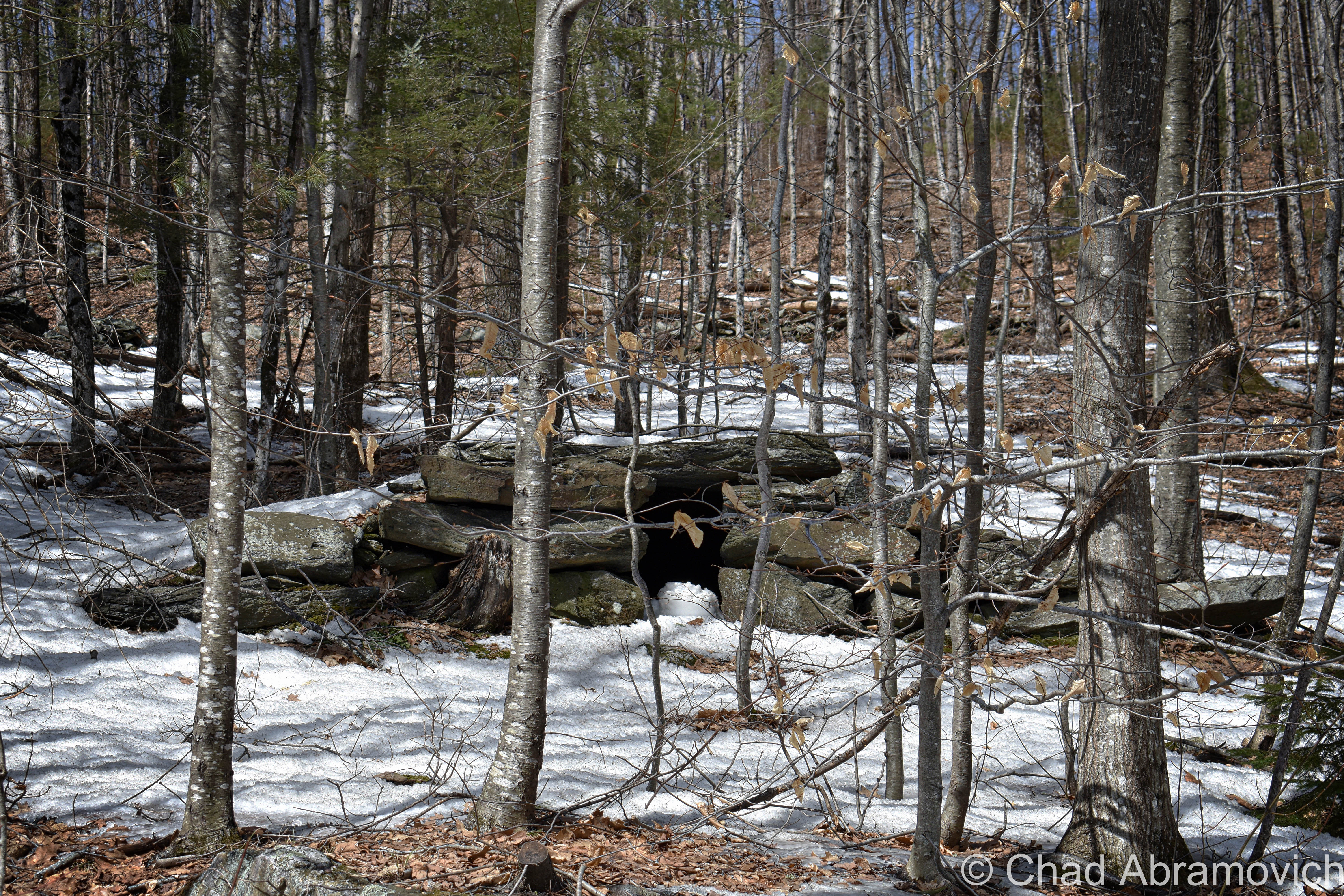
Heading back up into the hills with my new directions, I was going to give it another shot. And as it turns out, I was almost right on top of it to begin with. This time, I noticed it, barely. A small hole in a rolling mound of earth just at the edge of a field. As I walked over, it became clear what had happened. The “hole” was actually the entryway I was looking for, filled in with years of erosion and leaves that had fallen in front of it. A few kicks with my foot widened the claustrophobic entrance, but not by much. It was just enough for me to crawl into. But I was hesitant. Were there animals inside? And just how stable was this place? But perhaps what was unnerving me the most, was the weird feeling it was giving me.
As I watched the clouds overwhelm the evening sun, It was strangely bittersweet. I was happy I had managed to find it. It seems like in a few years, this dome is in danger of becoming buried by mother nature, another thing long lost. It seemed so simplistic, a simple stone igloo structure, and yet, the work that went into making it was incredibly labor-intensive. I felt like I had a brief connection with something that was much bigger than me, and yet, it seemed vacant, like a tomb – nothing breathed there in the cold.
You can see just how small the opening was next to my cold and intrigued self.
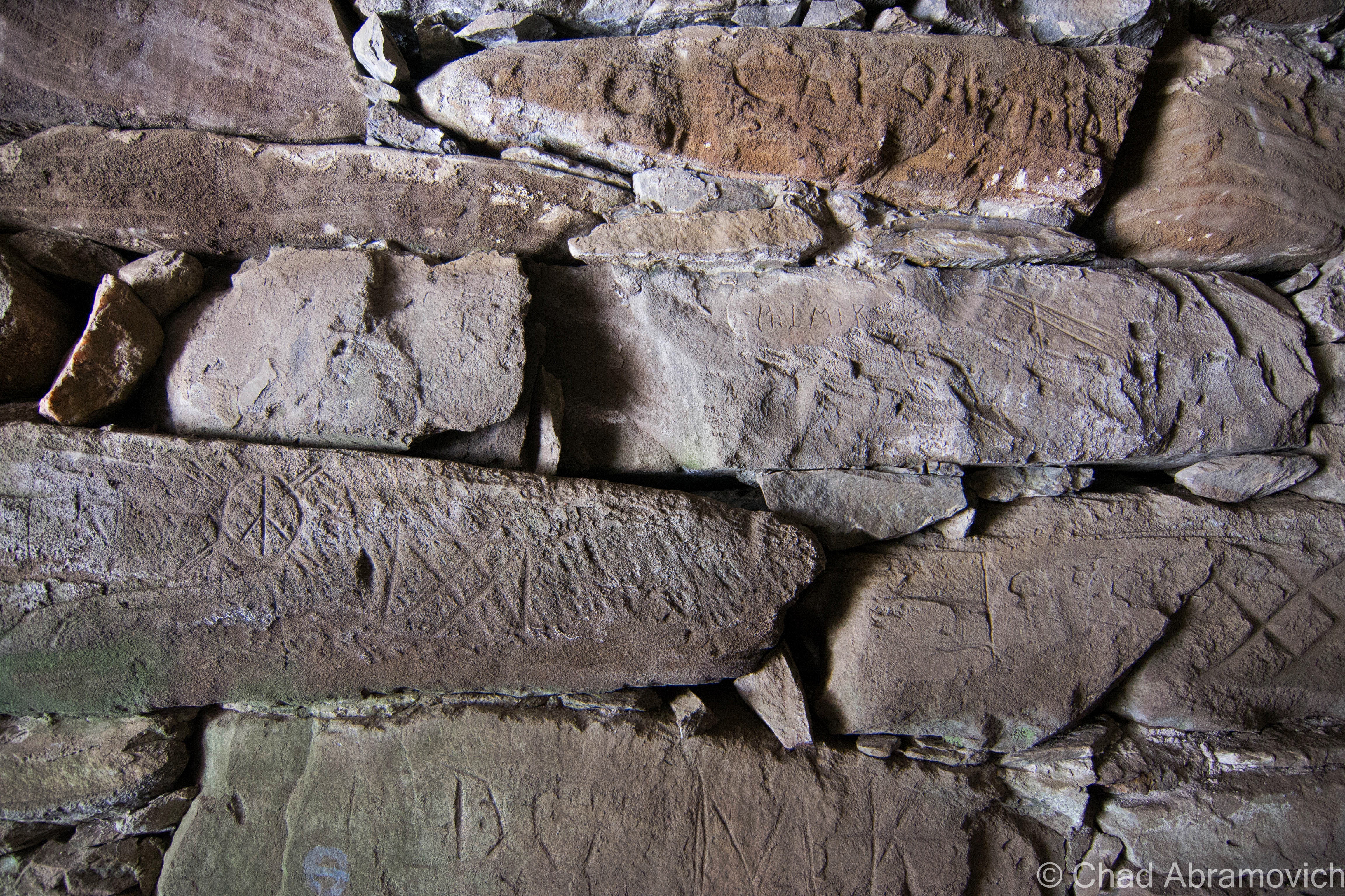
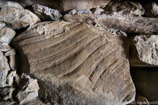
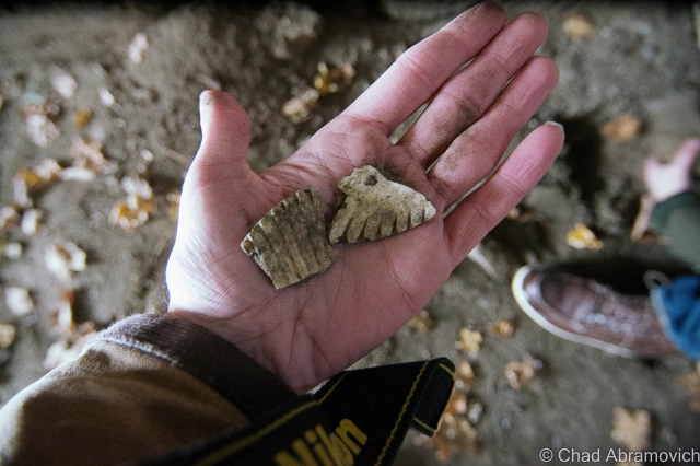
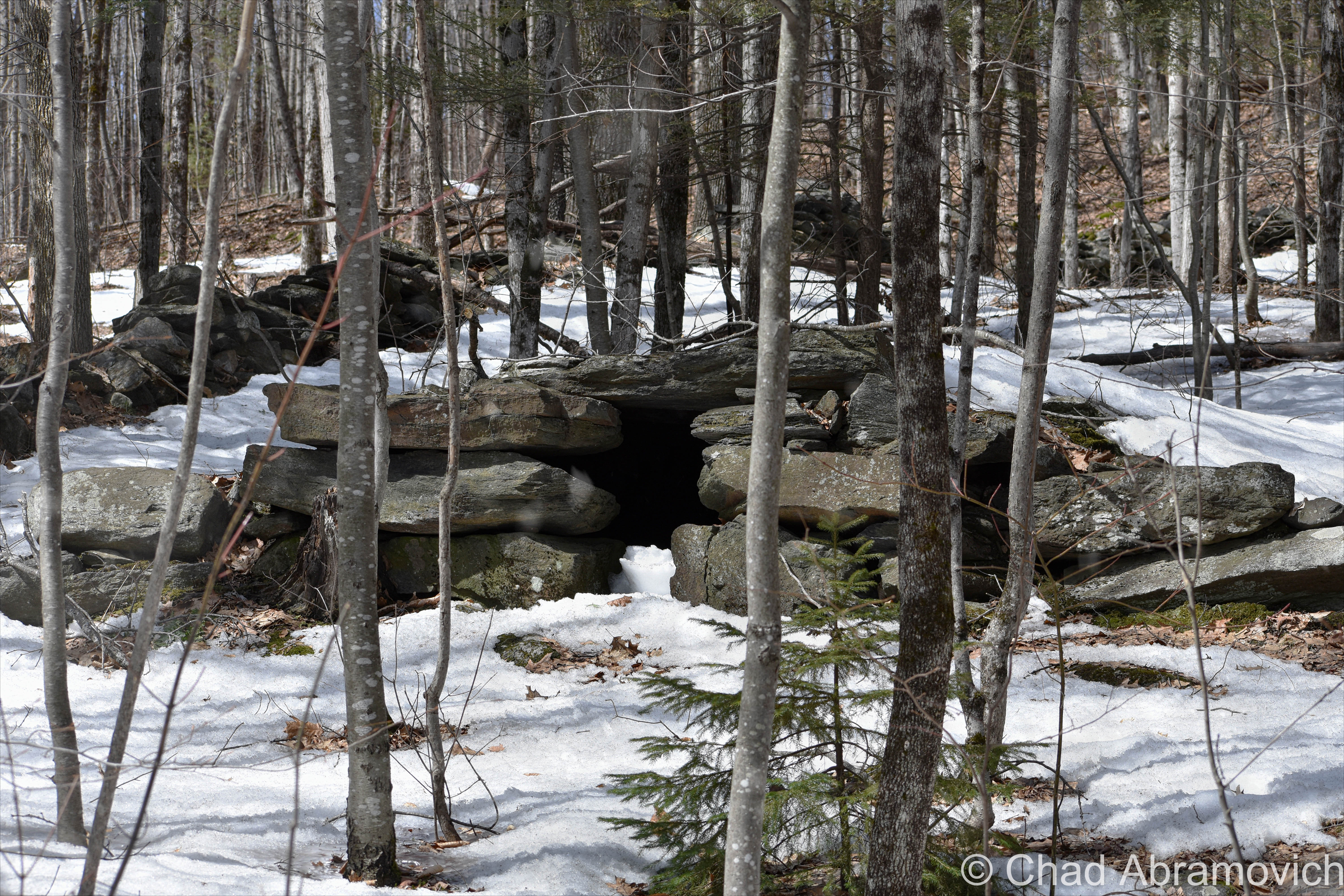
In 2016, I tracked down another chamber with a good compadre, and made a 2-hour drive to do a little investigating. Ancient Vermont enthusiasts know this particular chamber pretty well, and as we found out, so do other people. The earth floor was uncommonly flat with a chimney-like opening towards the back surrounded by notable stone slabs that made up the ceiling with hefty masses, that were aligned together and supported almost precisely. I read that some explorers and archeologists had found subterranean chambers, or spaces underneath some of these chambers, their entrances hidden by stone slabs on the floor. There was a debris pile in the back below the chimney that I started to pluck a few stones from, just to see if this was one of those chambers. It wasn’t.
Many of the stones were carved up with prior visitors in modern-day English, but we did find a few obscure linear patterns and scribings that, may have been done by a previous tourist, but seems a little weird in terms of what is normally graffitied in these sort of locations. We were able to pull up Wikipedia on my friend’s phone and tried to dabble in cryptography for a bit, seeing if any of these hieroglyphs were anything close to Ogam, but there were no confident matches I could make.
The same chamber, but on a soft July evening.
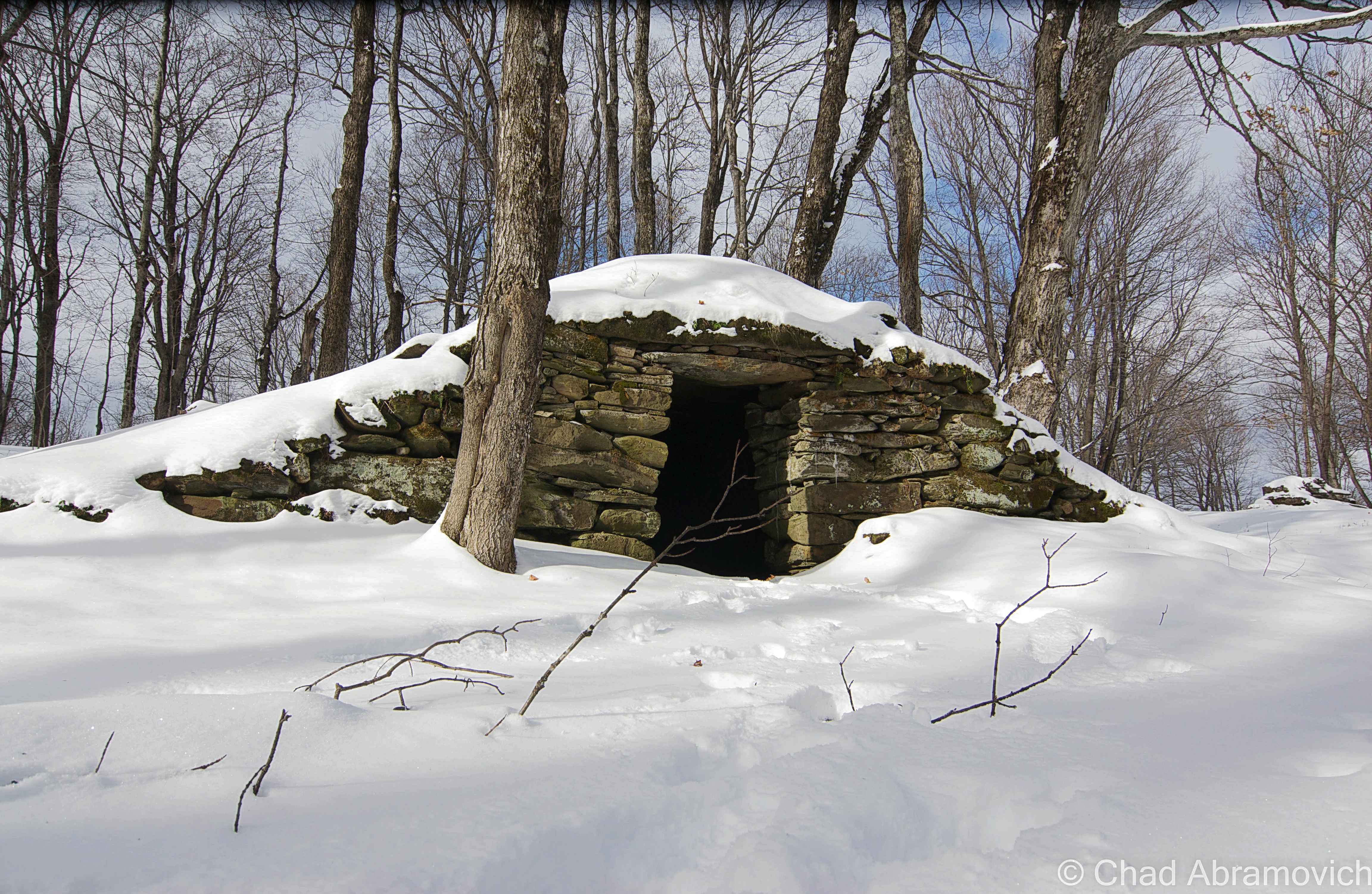
Here’s another chamber down on Putney Mountain, which is crossed by some rough dirt roads that ramble along more stone walls per capita than anywhere else I’ve ever seen. It was pretty remarkable.
The chamber was hard to spot. It looked more like a primitive drainage culvert, but my intel said it was on a certain road, and after that road turned into a 4-wheeler trail and I saw nothing else that resembled what I was looking for, I figured I’d make my way up into the woods and peer inside the small opening.
I’m glad I did, though deceiving, it really opened up inside. It was what I was looking for!
My guest on it being a culvert was a bit well founded, though. It seemed the entrance had a scanty drainage channel that flowed down towards the road, which made sense because the inside of the chamber sure was swampy. This stone room was also facing east, like so many other ones in New England.
There’s another one somewhere nearby called “The Pig Pen”, because farmers were just as vexed by its presence back in the day, and used it as a place to corral their pigs and cattle. That one would require GPS coordinates and a good bushwhack, though, so I’ll have to attempt that adventure on a warmer, more prepared day.
There are plenty of different theories and research compilations done about these stone chambers. Here are a few good ones if you’re interested in further research:
To all of my amazing fans and supporters, I am truly grateful and humbled by all of the support and donations through out the years that have kept Obscure Vermont up and running.
As you all know I spend countless hours researching, writing, and traveling to produce and sustain this blog. Obscure Vermont is funded entirely on generous donations that you the wonderful viewers and supporters have made. Expenses range from internet fees to host the blog, to investing in research materials, to traveling expenses. Also, donations help keep me current with my photography gear, computer, and computer software so that I can deliver the best quality possible.
If you value, appreciate, and enjoy reading about my adventures please consider making a donation to my new Gofundme account or Paypal. Any donation would not only be greatly appreciated and help keep this blog going, it would also keep me doing what I love. Thank you!
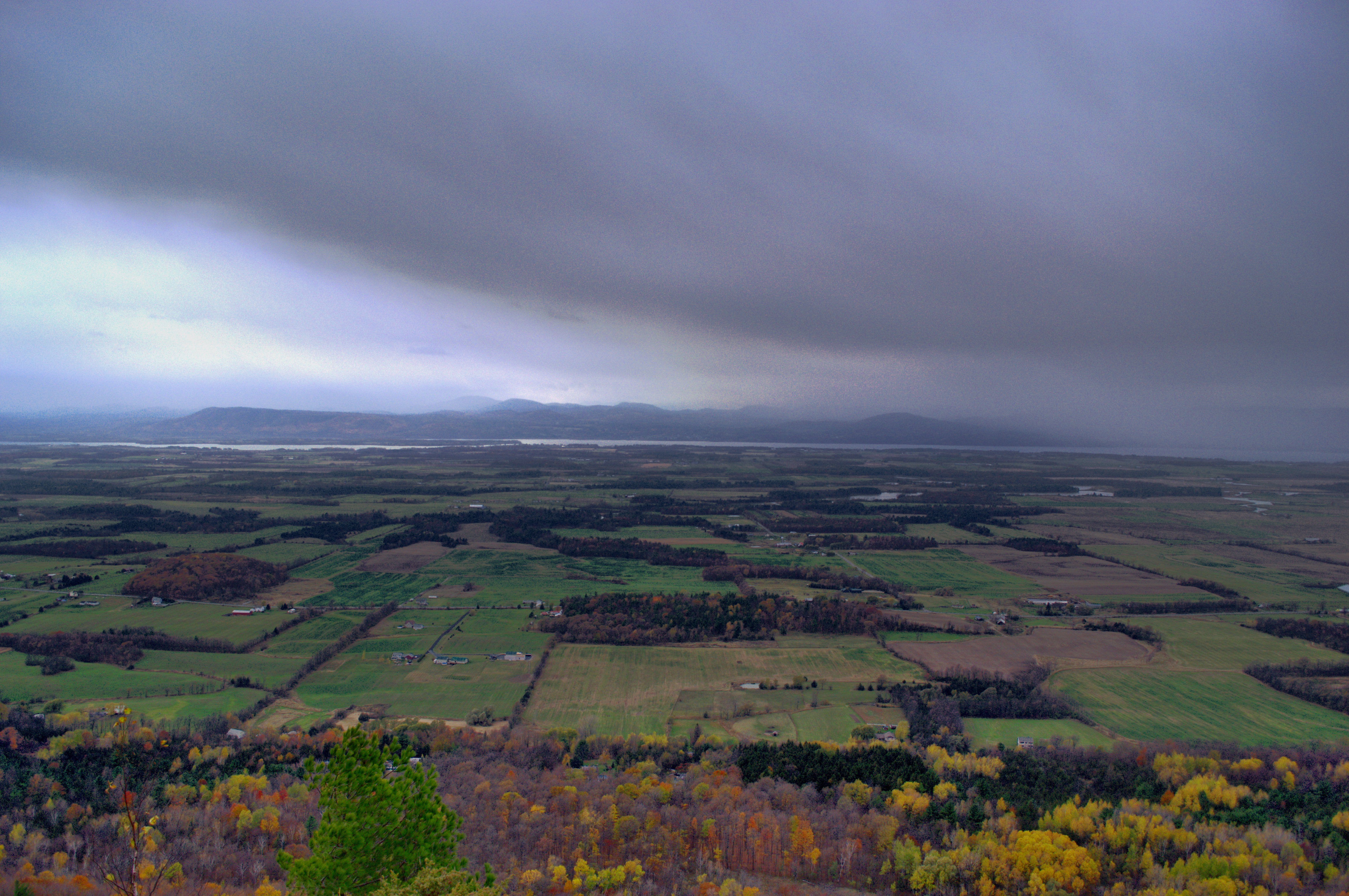
Fog shrouded the barren farmlands as icy winds sputtered and spinned outside the car as we moved down Route 22A through the flats of Addison County. There is something about late Fall, the odd transition period of old and the rebirth of Spring that is strangely ideal for adventuring. There is a certain melancholy about this time of year that rides the winds that blow in off the lake, something that a good adventure can temporarily alleviate. Things are more vulnerable in the Fall, and more raw. These thoughts were confirmed as the hulking and lengthy form of Snake Mountain loomed ahead in the fog and cold rain.
There is something mysterious about Snake Mountain that is conjured by its isolation. Sitting right in the middle of otherwise pancake flat farmland in the heart of Addison County, the sprawling monadnock raises a lofty 1,287 feet above the valley below – its craggy ledges the only surface that managed to capture the sun’s warming gleam. It’s not a widely recognized area. As a matter of fact, not many seem to know you even can hike the mountain, making it all the more alluring.
Snake Mountain is the focal point of the 1,215 acre wildlife management area of the same name, forever protecting the mountain and a 9500-year-old kettle lake known as Cranberry Bog, which according to the fish and wildlife department, formed shortly after the retreat of the last glacier in Vermont. But it’s a discrete area, one that isn’t clearly marked and still remains uncongested by mobs of tourists.
When I was younger, I was told that the dense and disparate patch of wilderness used to be called Rattlesnake Mountain, and its ledges and boulders were home to the only venomous reptile in the state (which isn’t true – Fair Haven’s Rattlesnake Ridge is bestowed that honor). But if the strange urban legends are true about this enclave of no man’s land in the middle of the county, then there are far more sinister things that haunt the wooded slopes and bogs. Snake Mountain is also reportedly home to a strange cryptid dubbed as “The Black Beast of Snake Mountain”, which supposedly stalked the slopes and terrorized unsuspecting farmers back in the 1920s and 1930s.
Though I couldn’t find a description of this brazen creature, it was said to lurk behind barns and houses that surrounded the mountain, and if encountered, its said to be savage. According to The Vermont Monster Guide, one woman was attacked by this elusive creature one night while driving home after a visit with a neighbor. It began to chase her vehicle as she panicked and began to pick up speed down a winding road that carved along the base of the mountain. To her surprise, not only was this thing managing to keep up with her car, it was catching up! Not wanting to get in a car accident, she pulled off into the first farm she saw, and it wasted no time in jumping on top of her car and began to claw at the roof. Now in hysterics, she did the only thing she could think of; she wailed on her horn. The noise grabbed the attention of the family who owned the farm, who soon appeared on the front porch in curiosity. But as soon as the floodlights were turned on, the women ran back into the house screaming at the first sight of the terrifying encounter. The men ran in shortly after to grab their guns, but when they came back outside, the animal had vanished into the Addison night.
The stories continue. Another account reported it would also jump down from tree limbs and scare children working on nearby farms. Every attempt to shoot at it was a failure, it would always vanish successfully, leaving nothing but shaken onlookers and a terrifying memory. It seems the mysterious Black Beast faded into memory and folklore, and to this day no evidence exists of what exactly was terrifying isolated residents back in the 1920s.
And now, here I was underneath gloomy grey skies battered by chilly winds and rain, staring up at my destination. The summit appeared more distant and forlorn underneath the shifting clouds that wouldn’t open up the sky. My only thoughts at the moment were how my coffee didn’t seem to be working. Although the lore about the mountain was wondrous, that wasn’t why I was there. There is also a human mystery about Snake Mountain, one that was palpable underneath shedding foliage and autumn stillness.
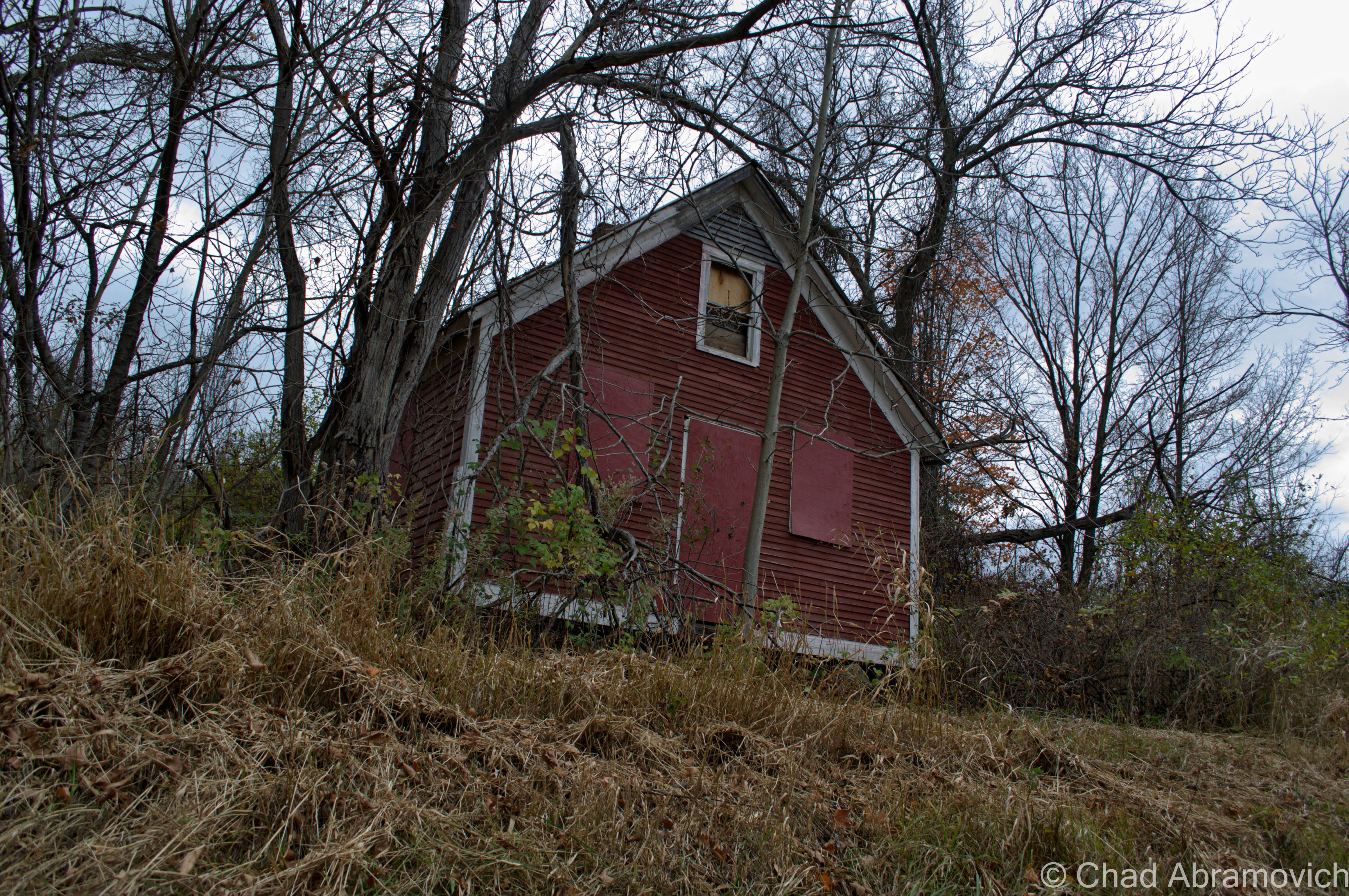
At the entrance to the hard to find Wilmarth Woods trail, sits an old building that looks like it may have served a nearby farm at one point, or perhaps a very tiny one room schoolhouse. Though it has been boarded up, the strange urban legends I’ve heard still swirled in my head. Stories of people peaking through the windows and seeing dusty mason jars filled with odd colored liquids and cryptic contents floating lazily inside them were alluring and most likely far fetched. Regardless of the accuracy behind that claim, the boarded windows ensured I wouldn’t be finding any answers today.
Embarking up The Wilmarth Woods Trail, it winds its way through thick brush, past the remnants of ancient mangled farm machinery and eventually follows the rather broad and rocky remnants of an old carriage road that snakes its way up the rocky hills and silent forests – the pungent smell of wet leaves and mud hung heavy in the air. Though my starting point was sluggish, I soon couldn’t help be taken by the beauty and therapy of the forest.
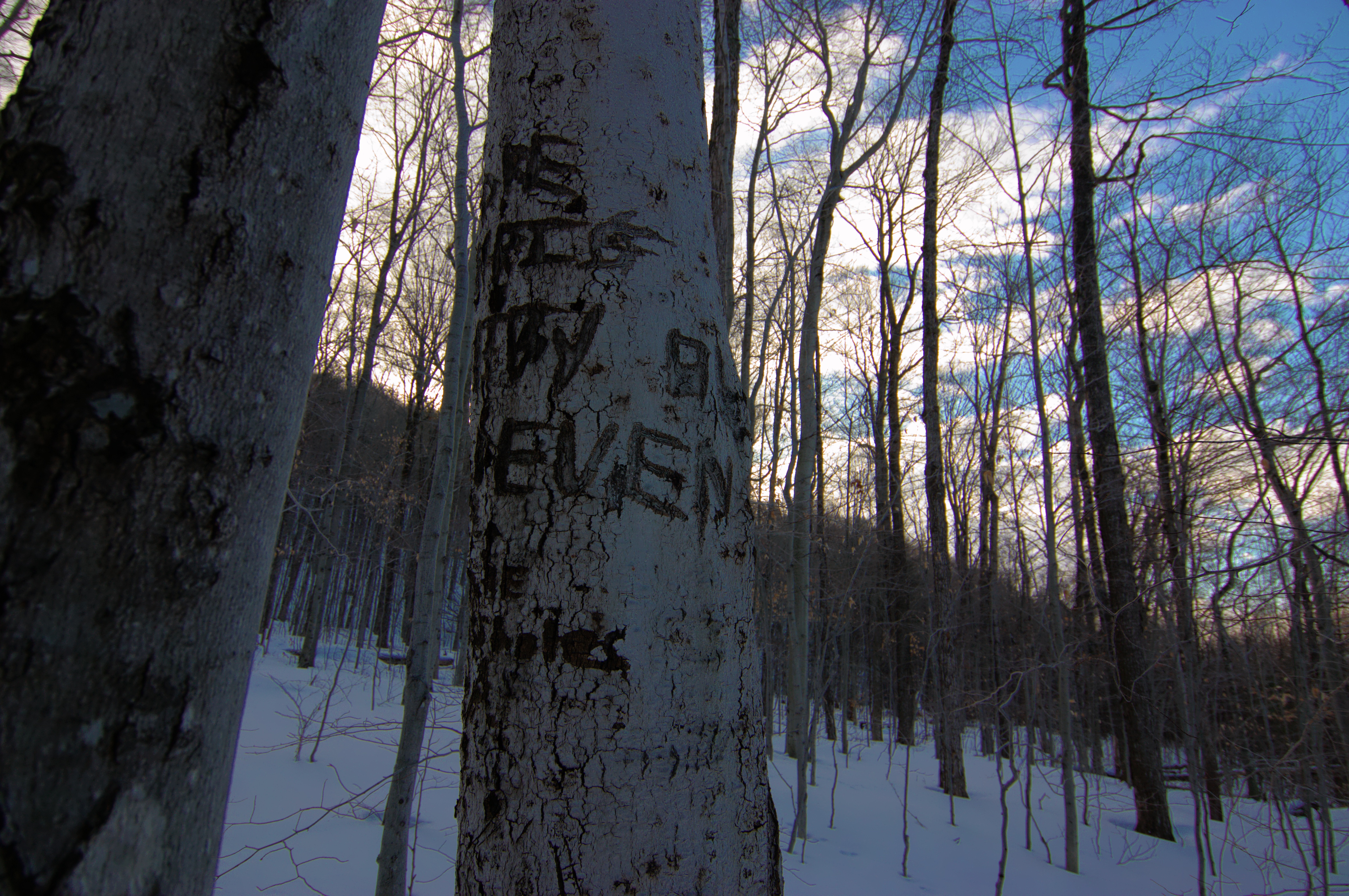
While trekking through the woods, they begin to tell a seperate story, adding to the mountain’s cryptic reputation. The birch stands at the base of the mountain are covered in ambigious tree carvings – it seems that every bored teenager in Addison County has made it to Snake Mountain to carve the name of their loved on into a tree, or to tell the world that they were there. Some carvings were remarkably old, dating back almost 30 years. These youth hieroglyphics are cool to see and read as you make your way up the slopes.
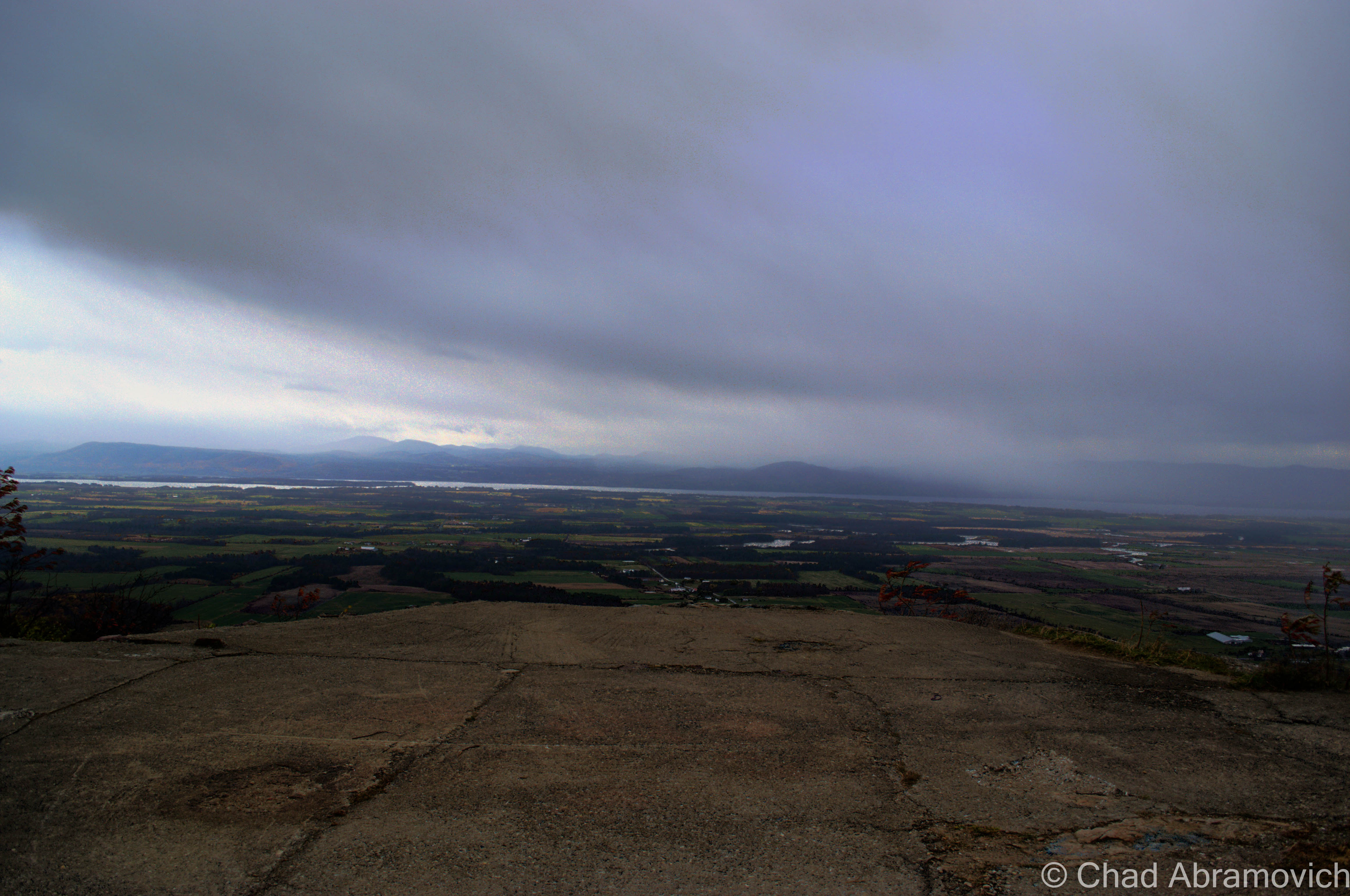
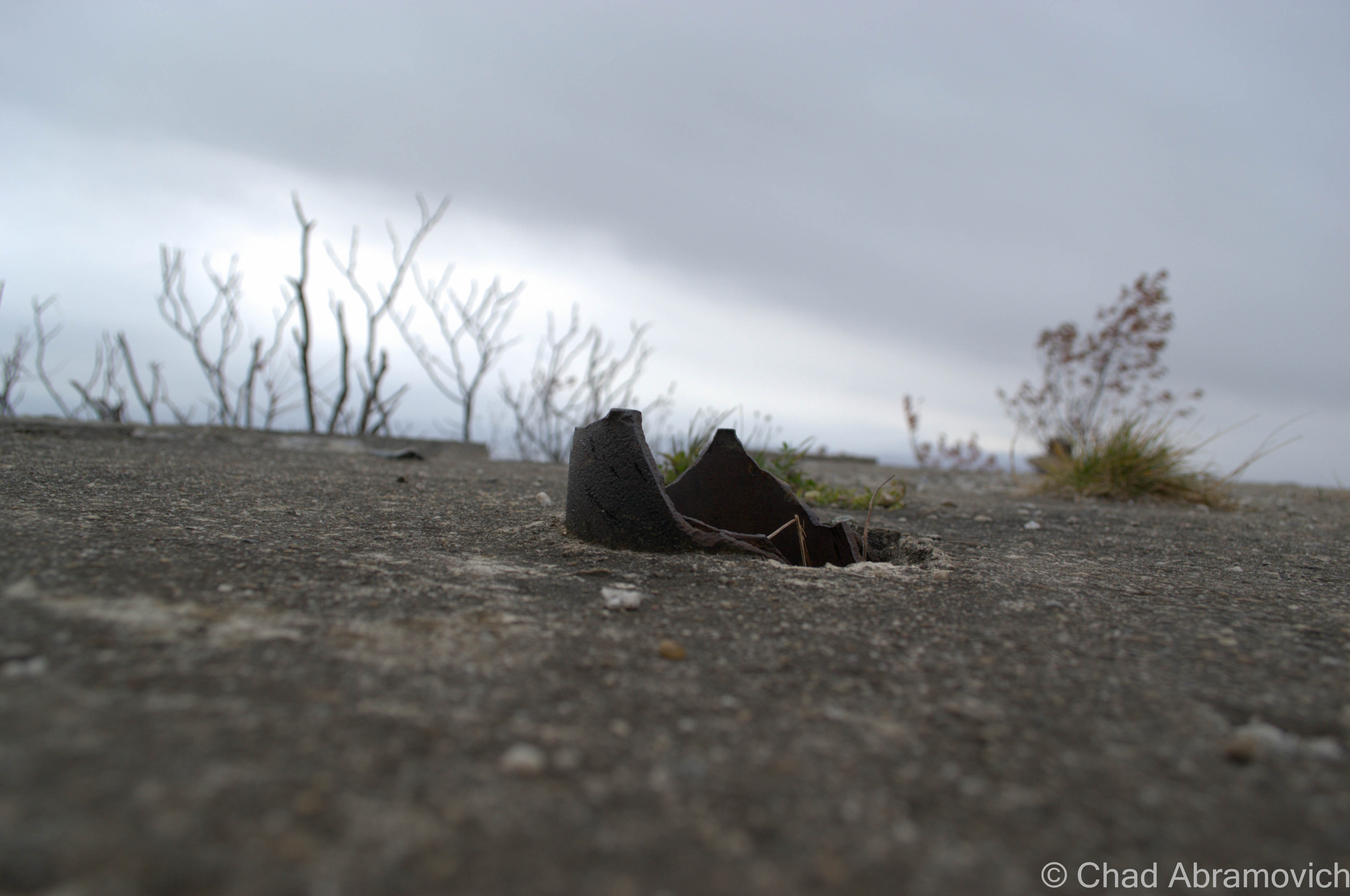
The carriage road continues to playfully climb the mountain and dip through shadowy dales until it reaches a particular point of interest at the summit – the reason for the carriage road’s existence. Sitting on top of magnificent views of Addison County and the rugged Adirondacks in the distance lies a crumbling concrete slab that buts right up to dizzying ledges. This is the foundation of the former Grand View Hotel. Built in 1870 by Jonas N. Smith, this hotel was built during an era when many mountaintops across the Northeast were being developed into resort properties, offering fresh country and and grand views to its eager clientele. Some even claimed that fresh country air would be an ailment to whatever health issues that were plaguing you. Because of the hotel, Snake Mountain became briefly known as Grand View Mountain. In 1925, the hotel was ravaged by a fire, leaving a smoldering pile of ruins scattered along the wind swept summit. Today, the foundation and steel rods that held the building in place are still visible, along with some of the best views anywhere.
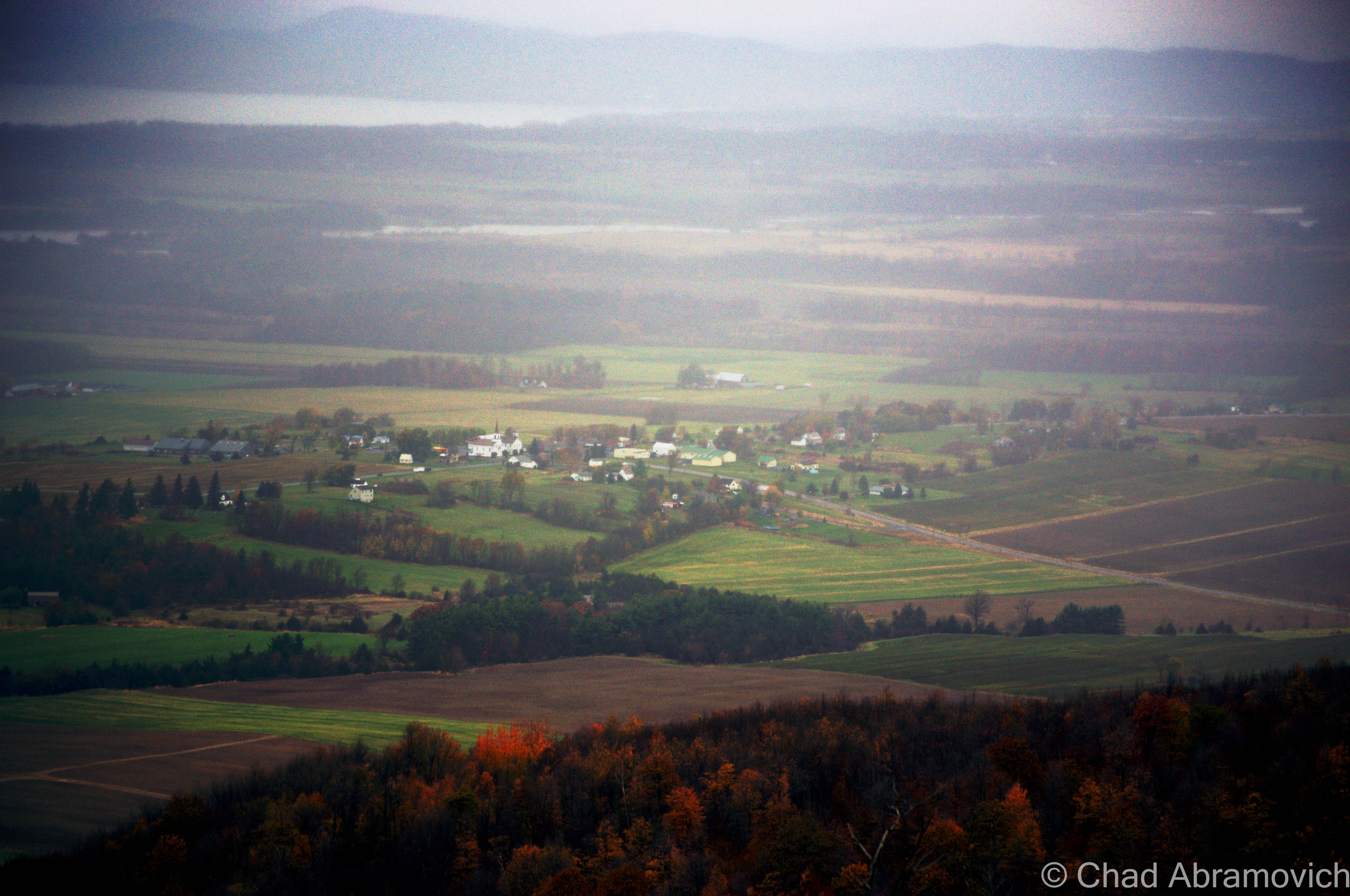
The weather worn foundation of the former Grand View Hotel and Champlain Valley splendor in the background.One of the original pipes, its jagged stump still protruding from the foundation surfaceThe small town of Addison, visible through the mists upon Snake Mountain.Snake Mountain Panorama
From up here on the top of Addison County, a strange silence climbs into your head. Your thoughts become more lucid, and you get a strange sense of scale as you look at the patchwork fields and gleaming silos below you. The strange connection of you being apart of this uncertain game called life which is played at the bottom of the ledges at your feet, and loneliness up there in the deep. Snake Mountain offers a great excuse to get out for a easy and rewarding day hike. And there is no better therapy to what ails you than nature.
From either approach on Route 22A, make a turn on Wilmarth Road. Follow it the short distance until it intersects and ends with aptly named Mountain Road, which runs along the base of the mountain. Take a left, and follow Mountain Road a short distance until you see a dirt parking lot to your left. The Wilmarth Woods Trail head is just before the parking lot on the right side of the road. Look for the dilapidated red building.
—————————————————————————————————————————————–
To all of my amazing fans and supporters, I am truly grateful and humbled by all of the support and donations through out the years that have kept Obscure Vermont up and running.
As you all know I spend countless hours researching, writing, and traveling to produce and sustain this blog. Obscure Vermont is funded entirely on generous donations that you the wonderful viewers and supporters have made. Expenses range from internet fees to host the blog, to investing in research materials, to traveling expenses. Also, donations help keep me current with my photography gear, computer, and computer software so that I can deliver the best quality possible.
If you value, appreciate, and enjoy reading about my adventures please consider making a donation to my new Gofundme account or Paypal. Any donation would not only be greatly appreciated and help keep this blog going, it would also keep me doing what I love. Thank you!
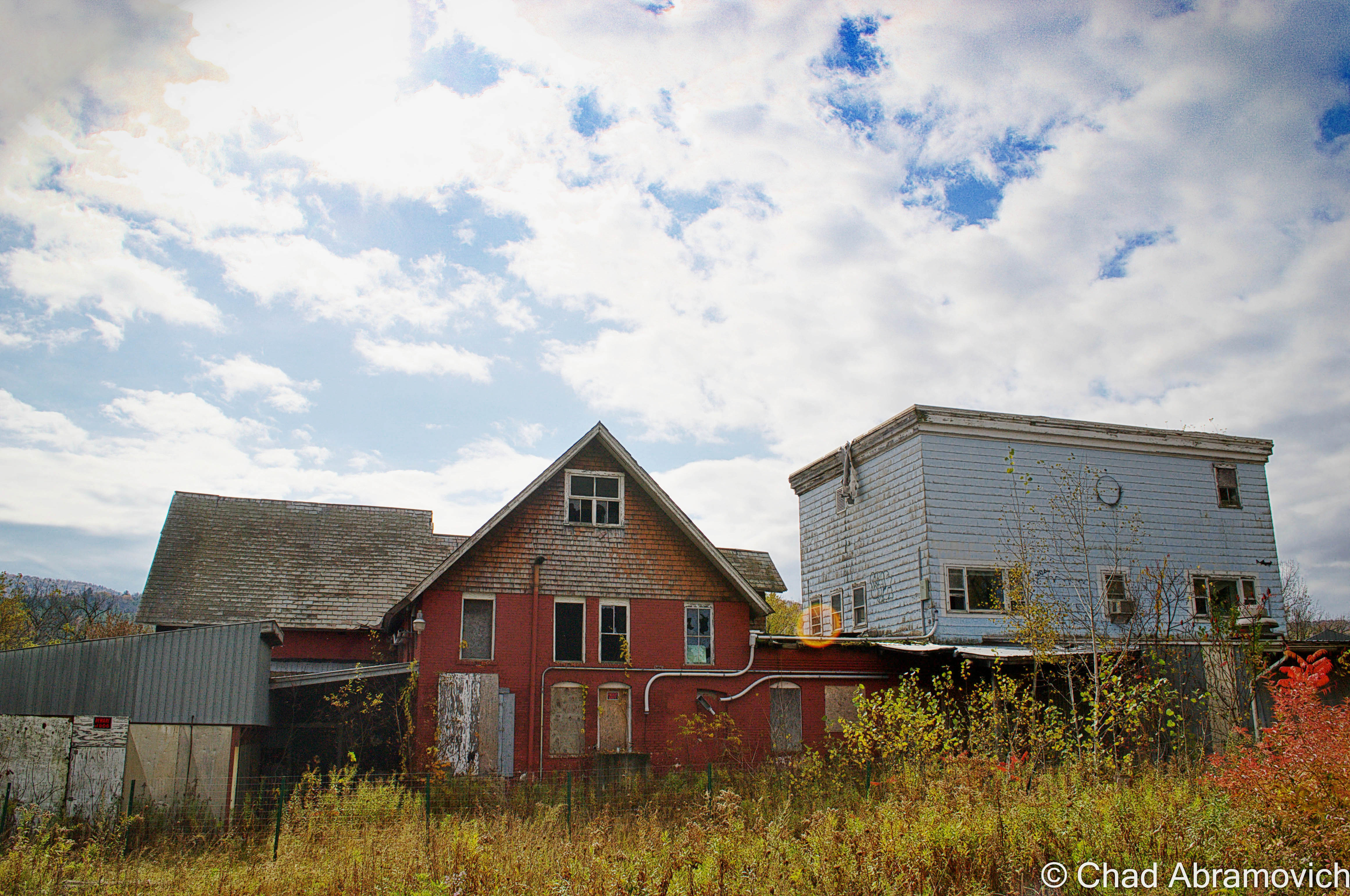
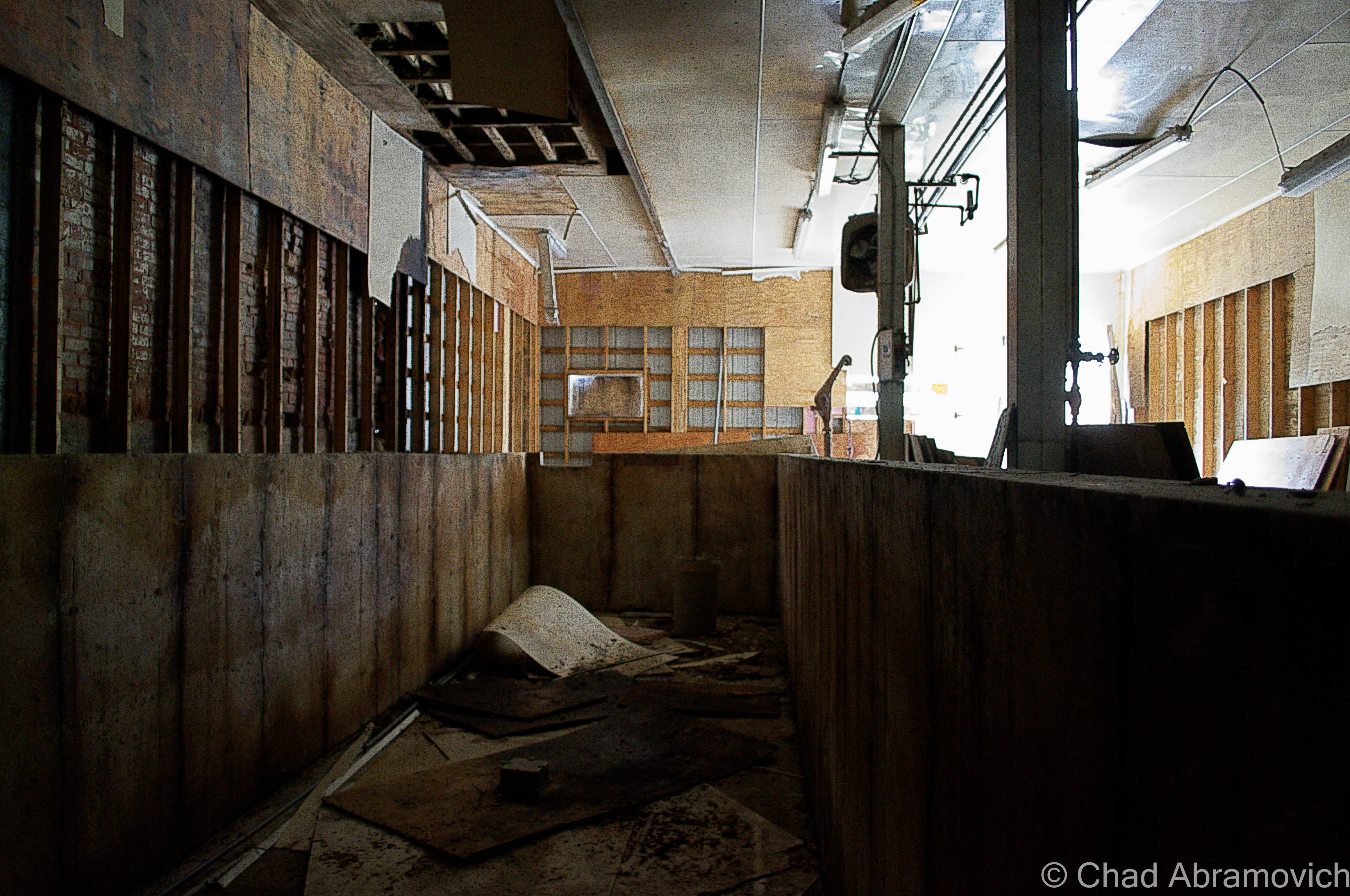
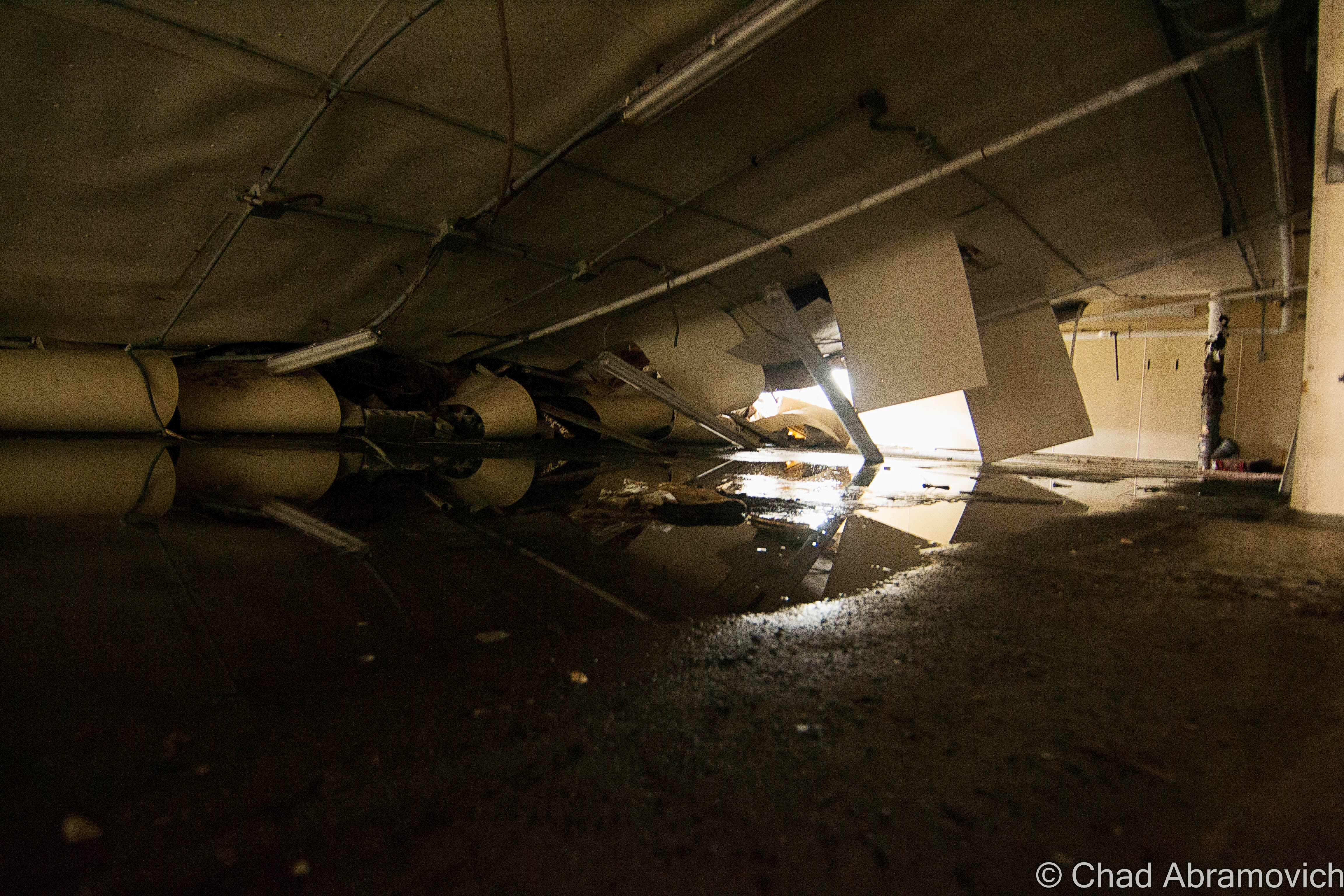
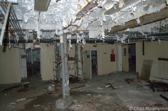
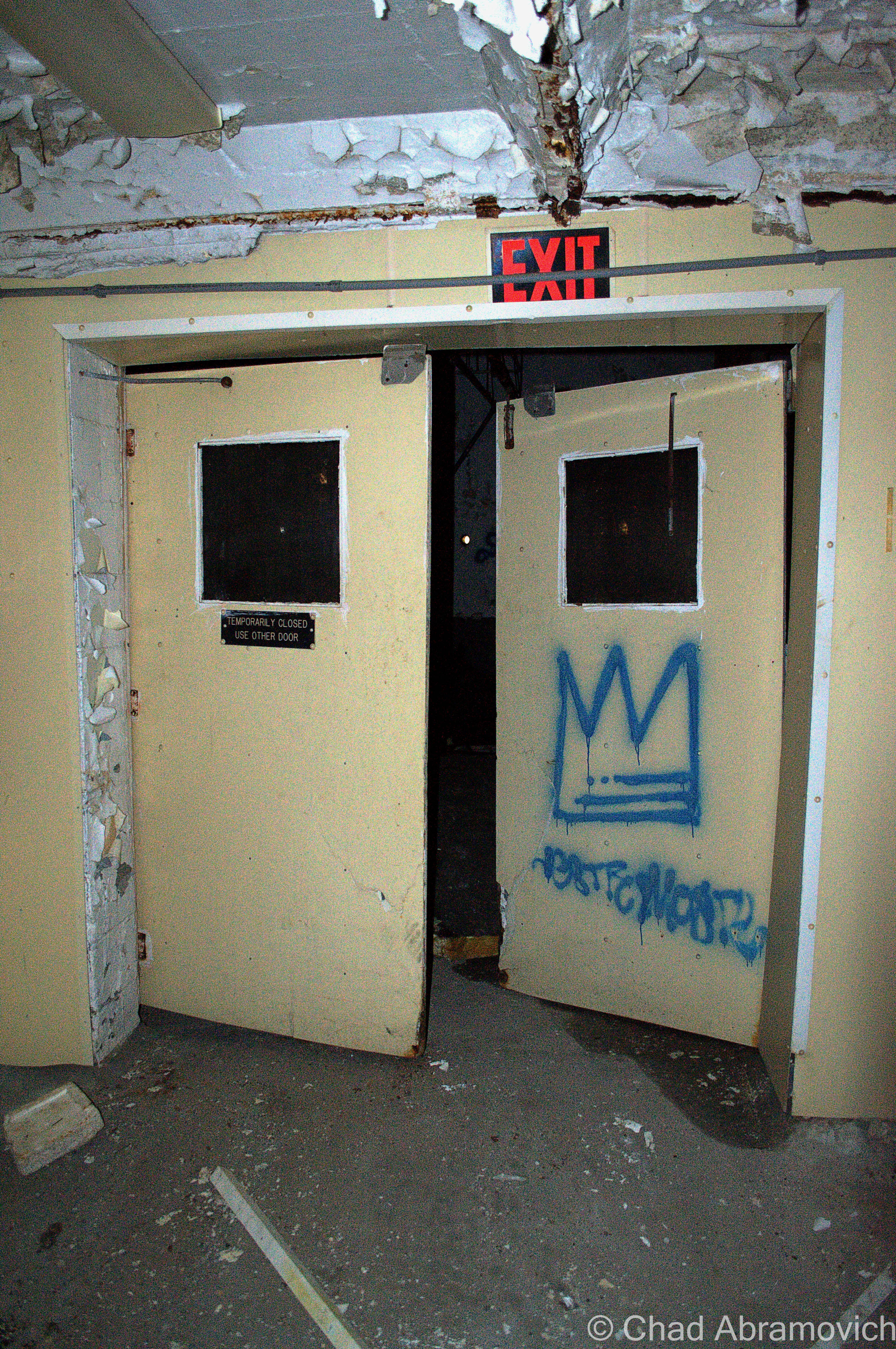
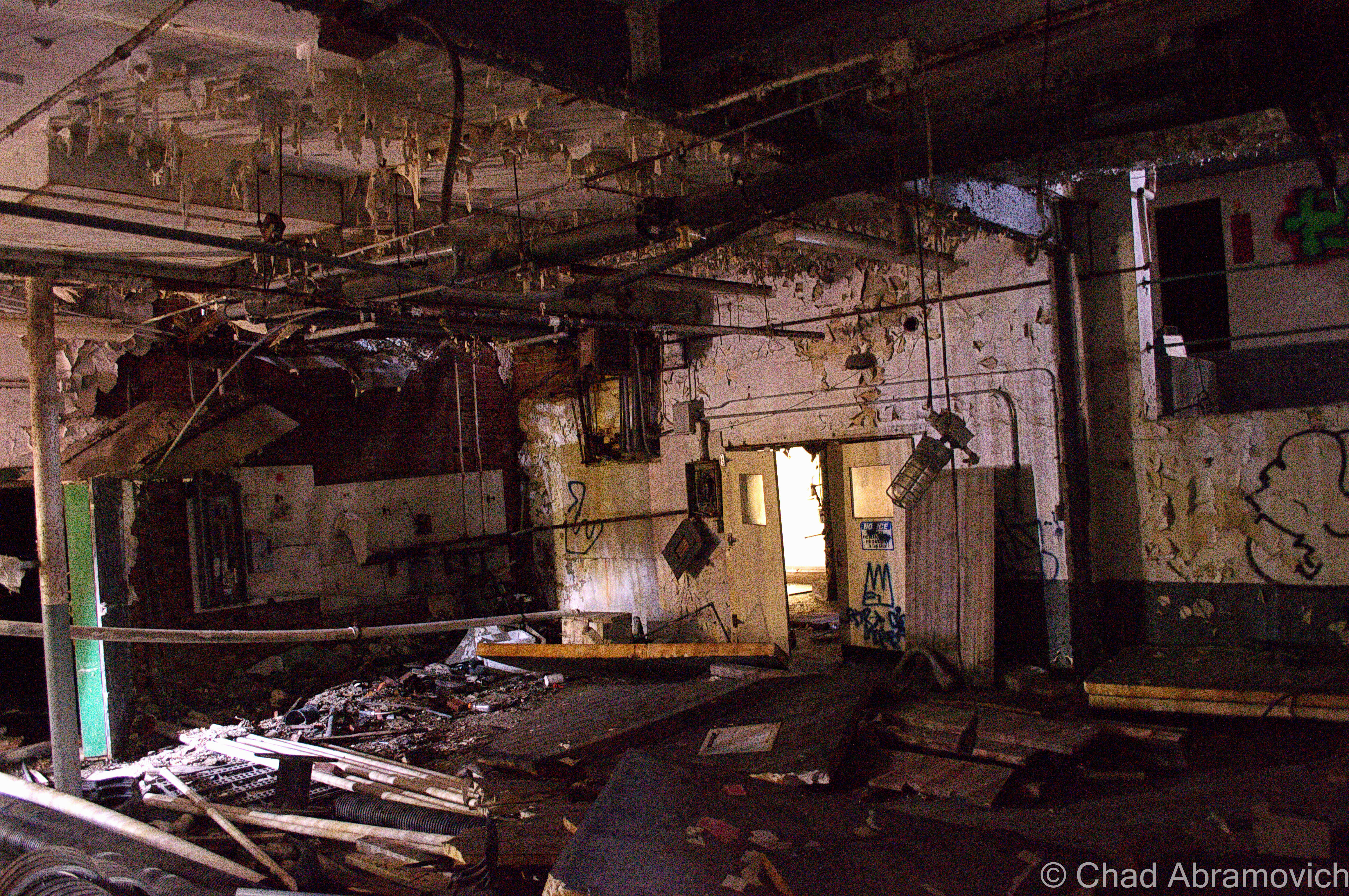
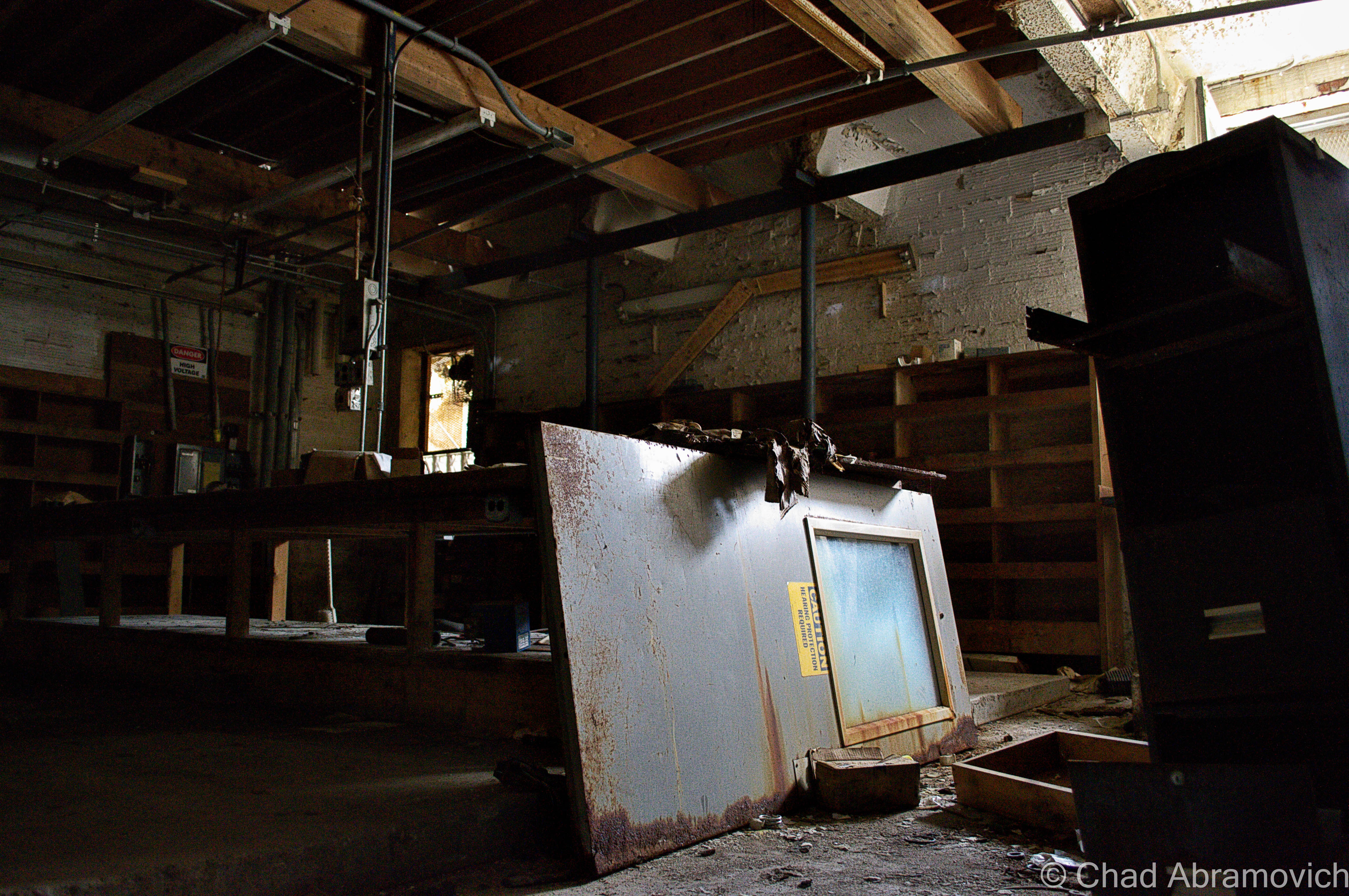
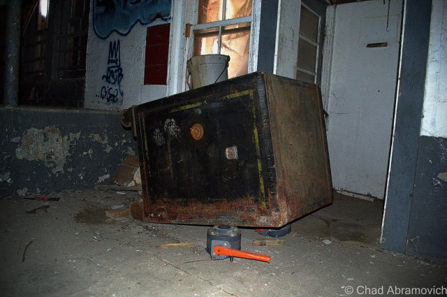
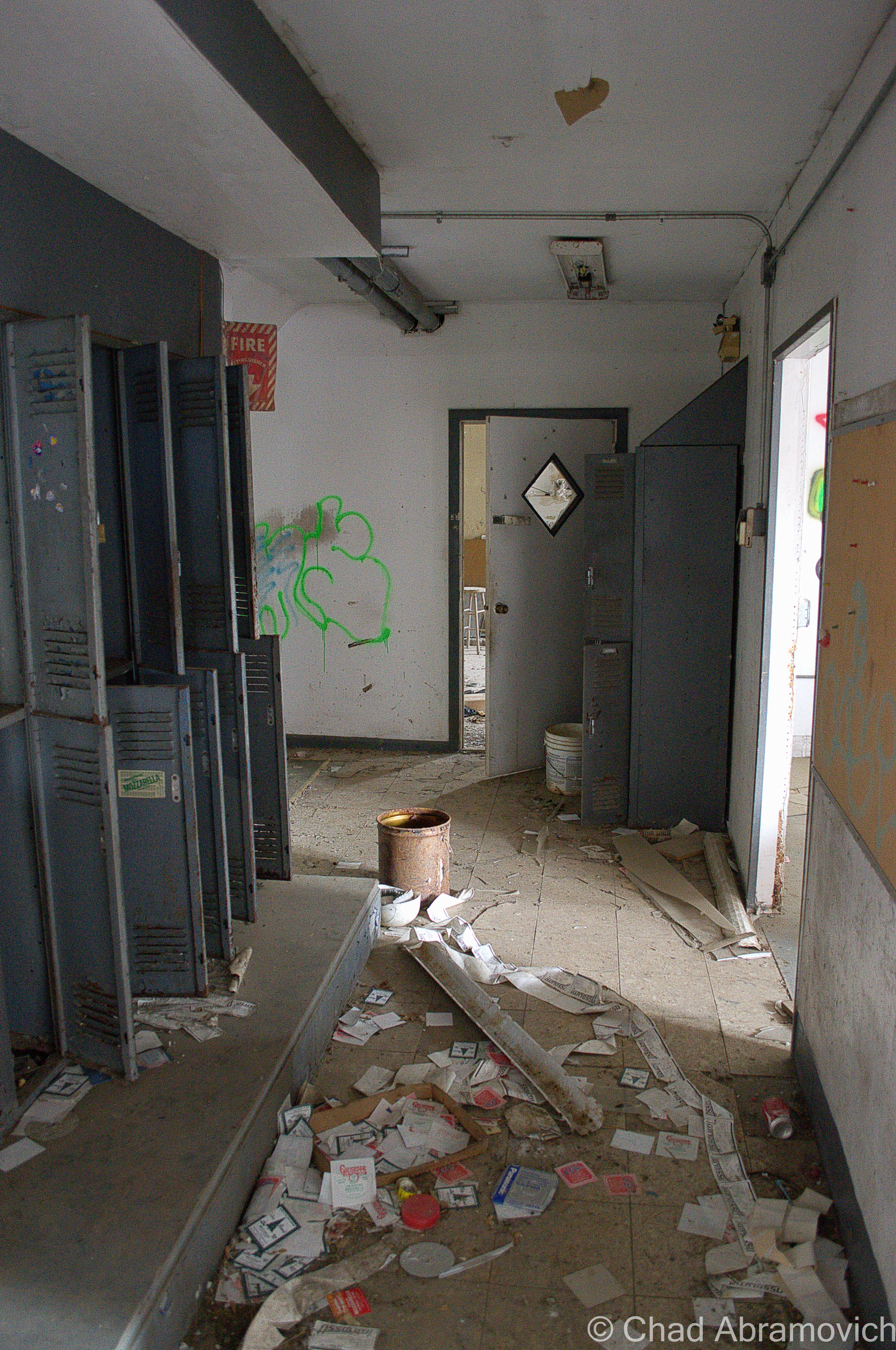
Strangely Isolated from its central village location and untouched for more than 30 years – this place has the eerie kind of remoteness where every noise heard inside its cavernous and dark interior is startling, and the thought of this once being an active business with a vibrant human presence borders on the absurd.
What was once a prosperous creamery seemed to have suffered the same inevitable fate as other Vermont creameries. Fluctuating milk prices and the high costs of expenses were much higher than the final paychecks distributed to local dairy farmers, and the eventual pressure from larger industrial creameries made smaller operations like this one obsolete. And as gravity came, the good times couldn’t be reinvented. Built in the early 1900s, this rural creamery operated for most of the century, shipping it’s milk and dairy products locally and beyond to exotic destinations like Boston and New York City. In the last years of it’s life, it became a cheese factory, before finally shutting down in 1999 after a landslide of problems the business couldn’t circumnavigate.
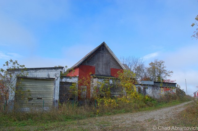
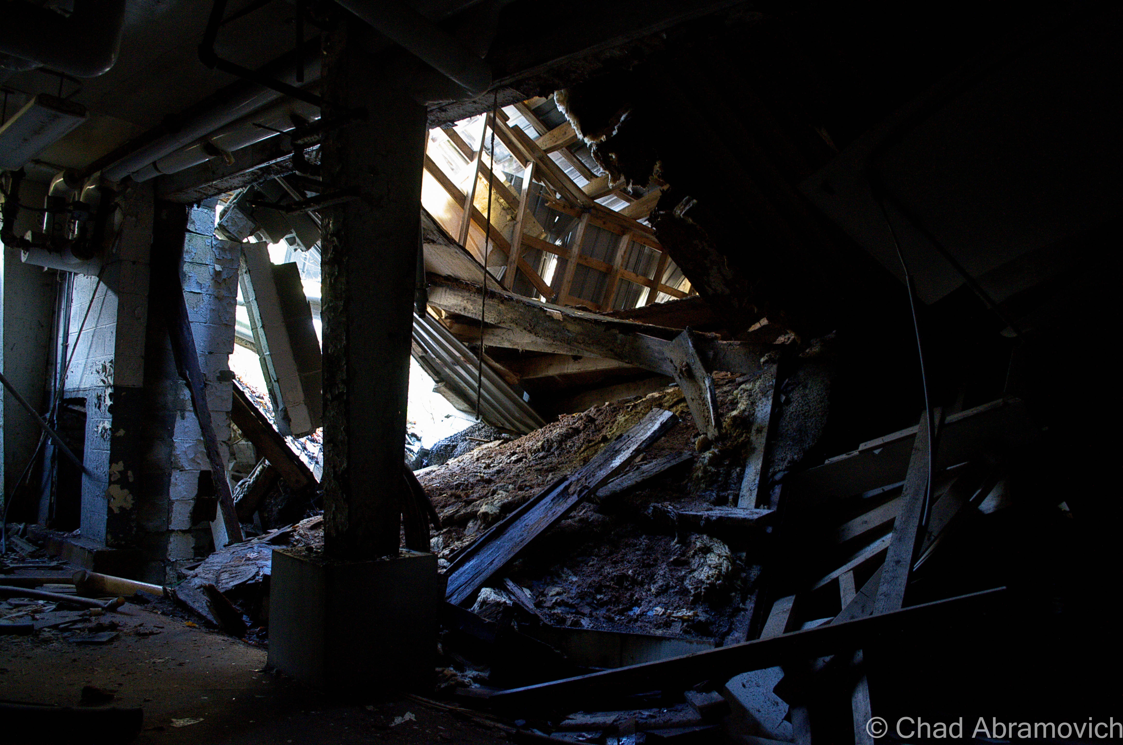
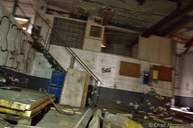
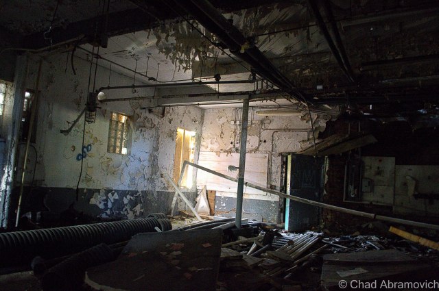
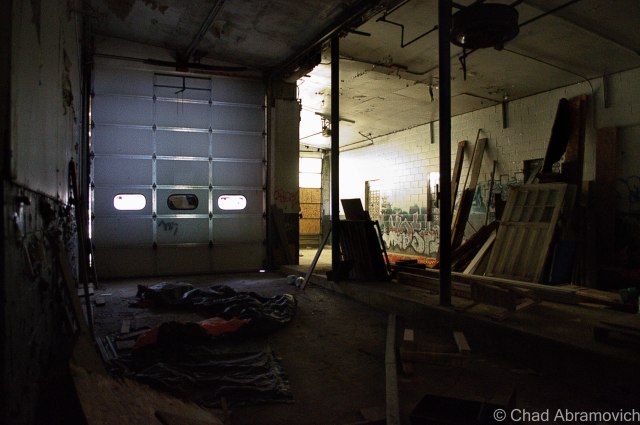
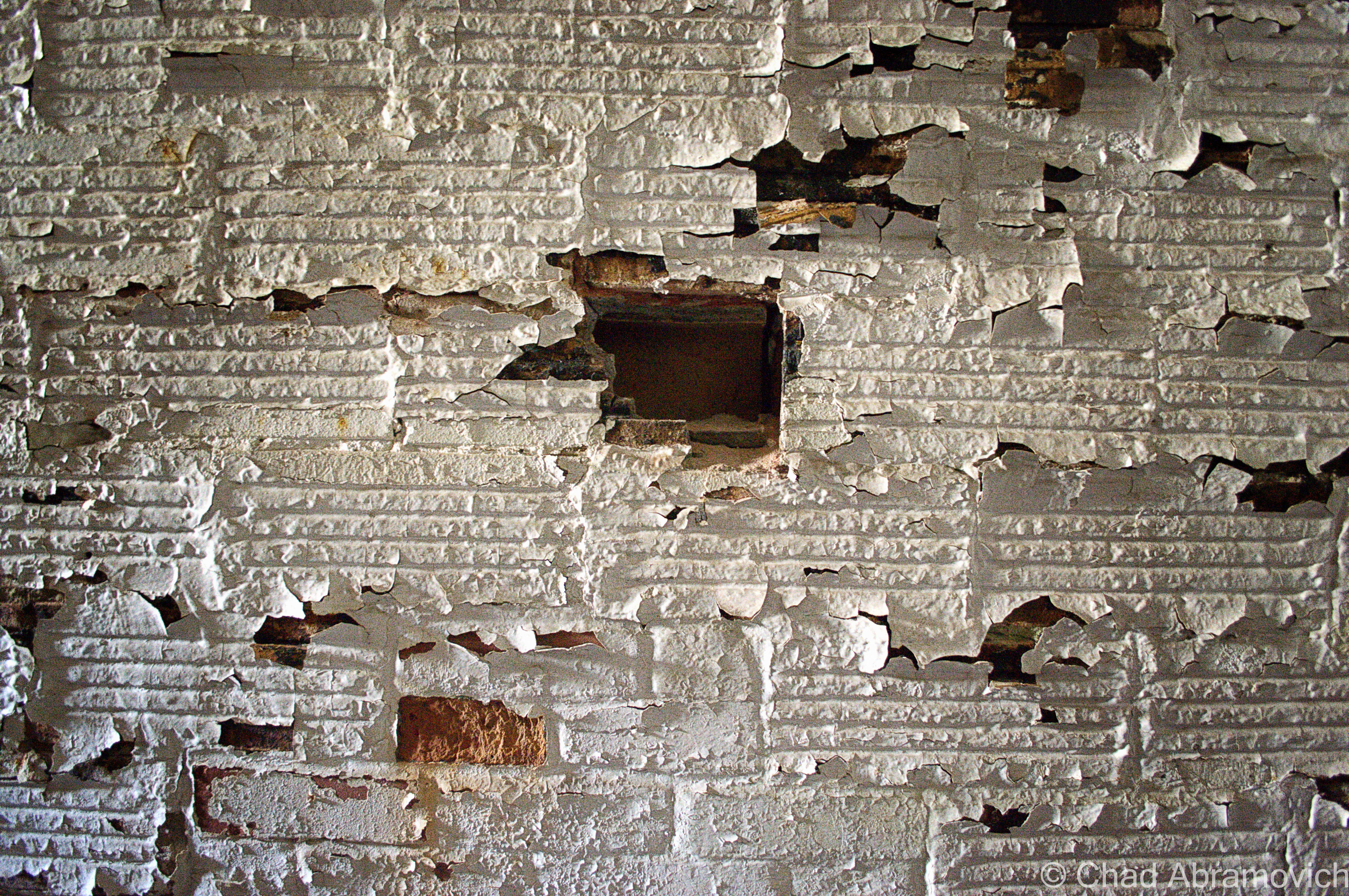
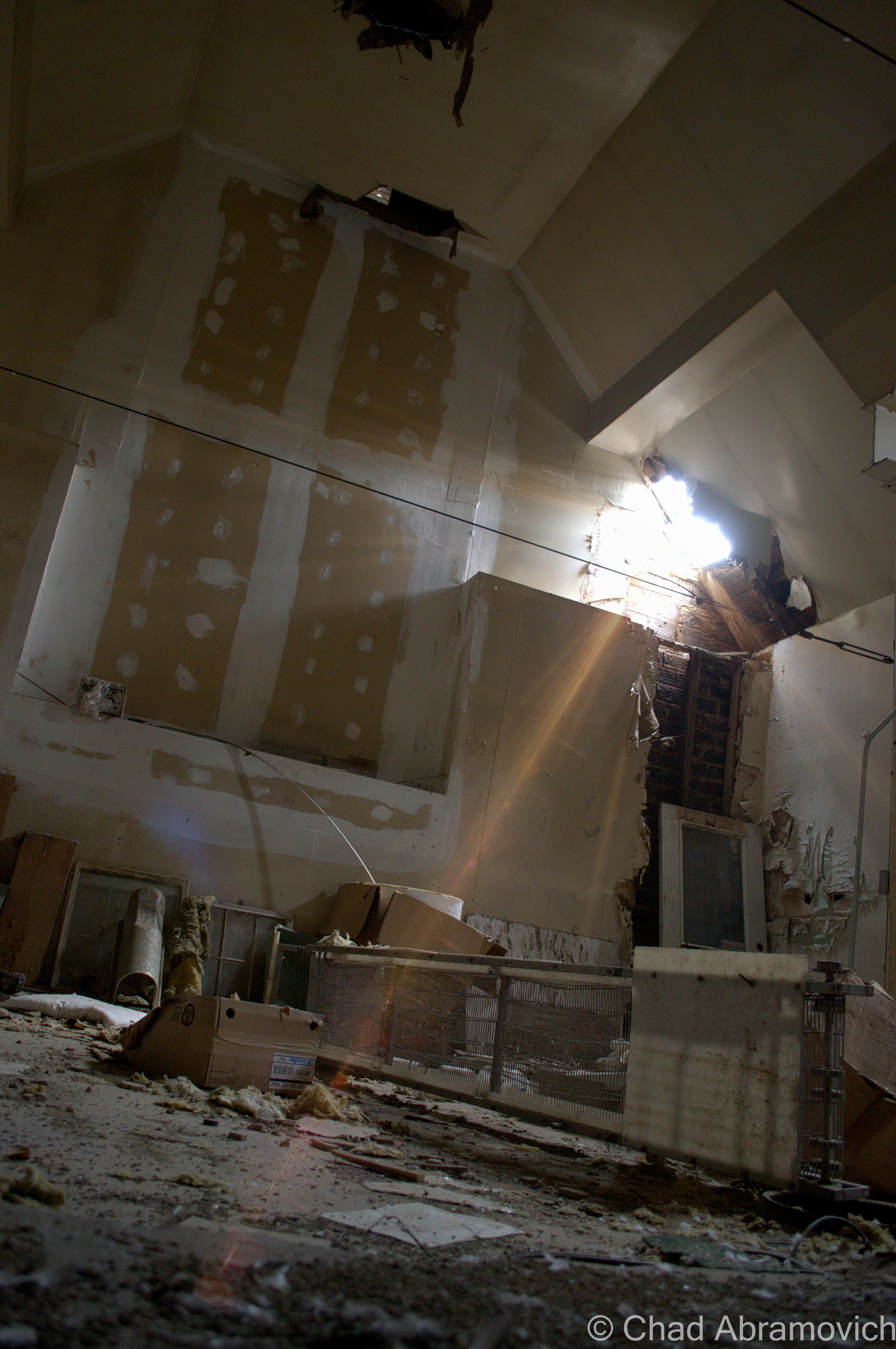
Because of the thick forests that obstruct it from view, it was only when I walked right underneath its shadow that I got a good impression of the place. A sizable melding of wood and brick that eventually raises to 4 stories, the complex is made up of rambling additions that marked periods of the creamery’s success, now a chaotic collection of decaying ruins surrounded by young forests and actively farmed fields. From the outside, the warping geometry of the wooden structure is showing signs of neglect and pride that has long vanished into the smoke – the building slowly burying its storied legacy.
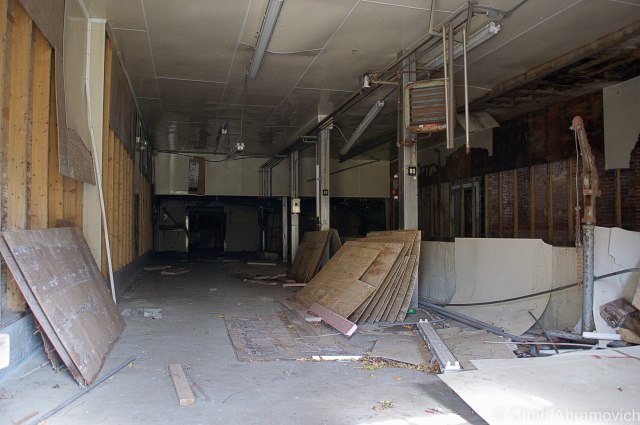
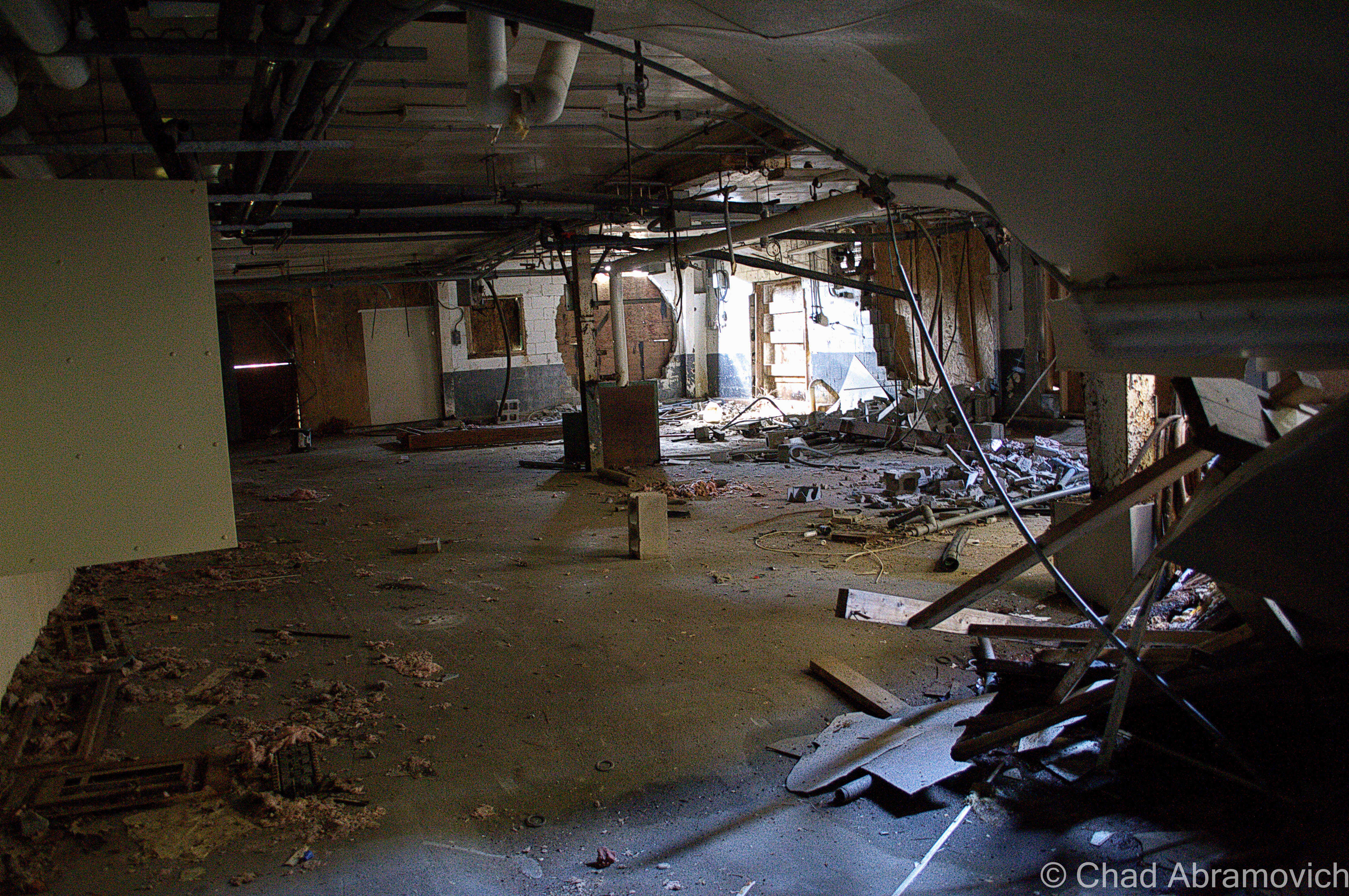
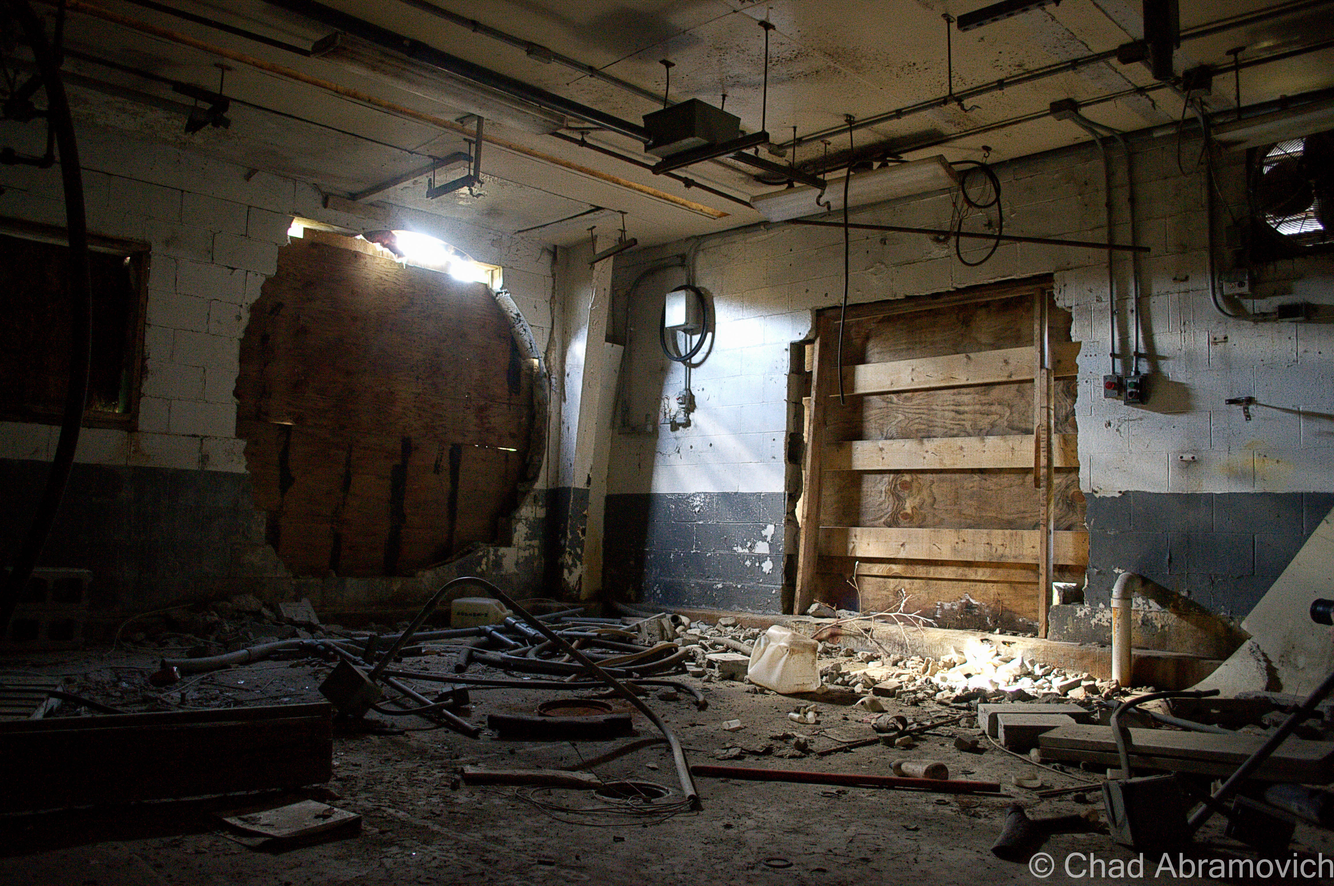
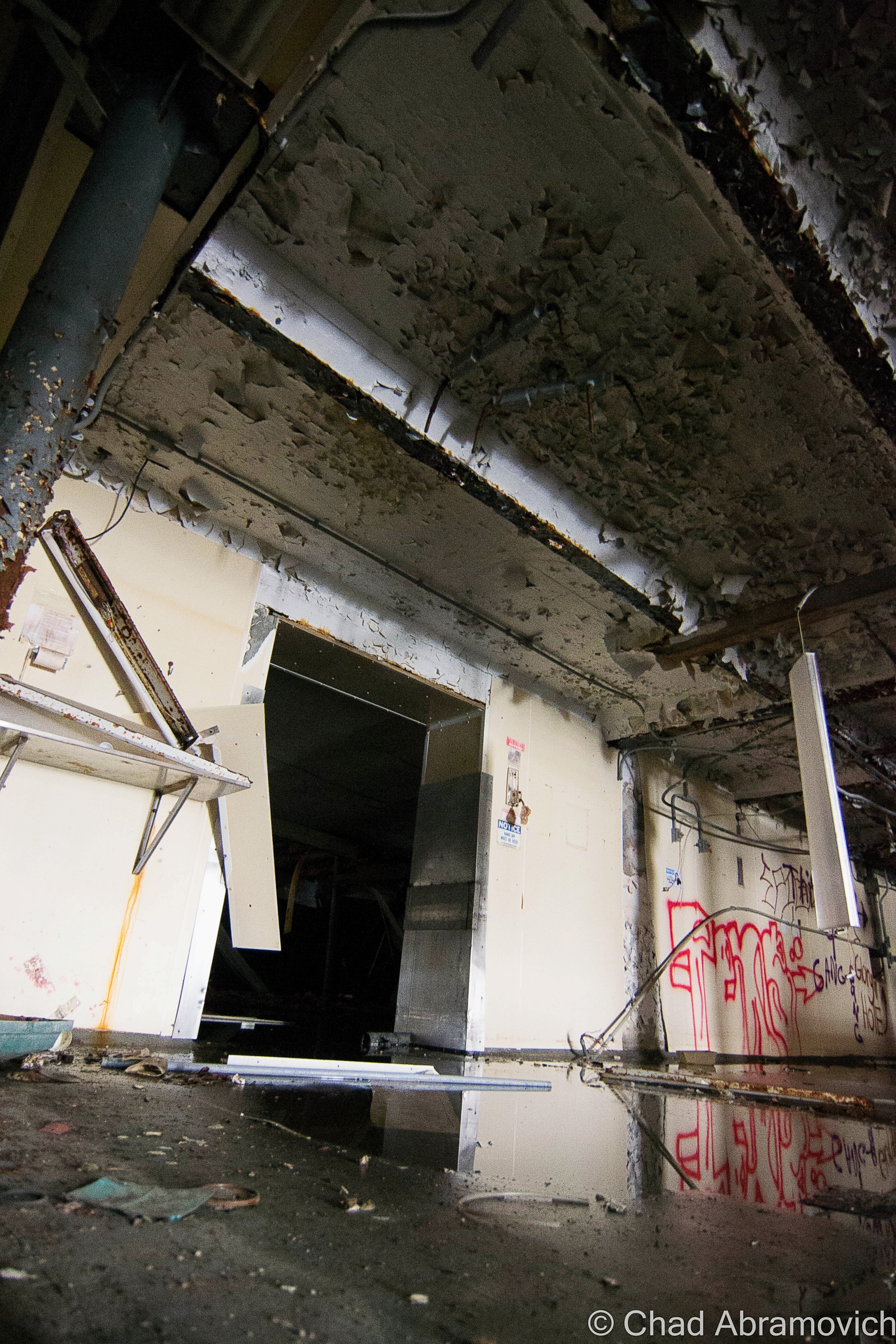
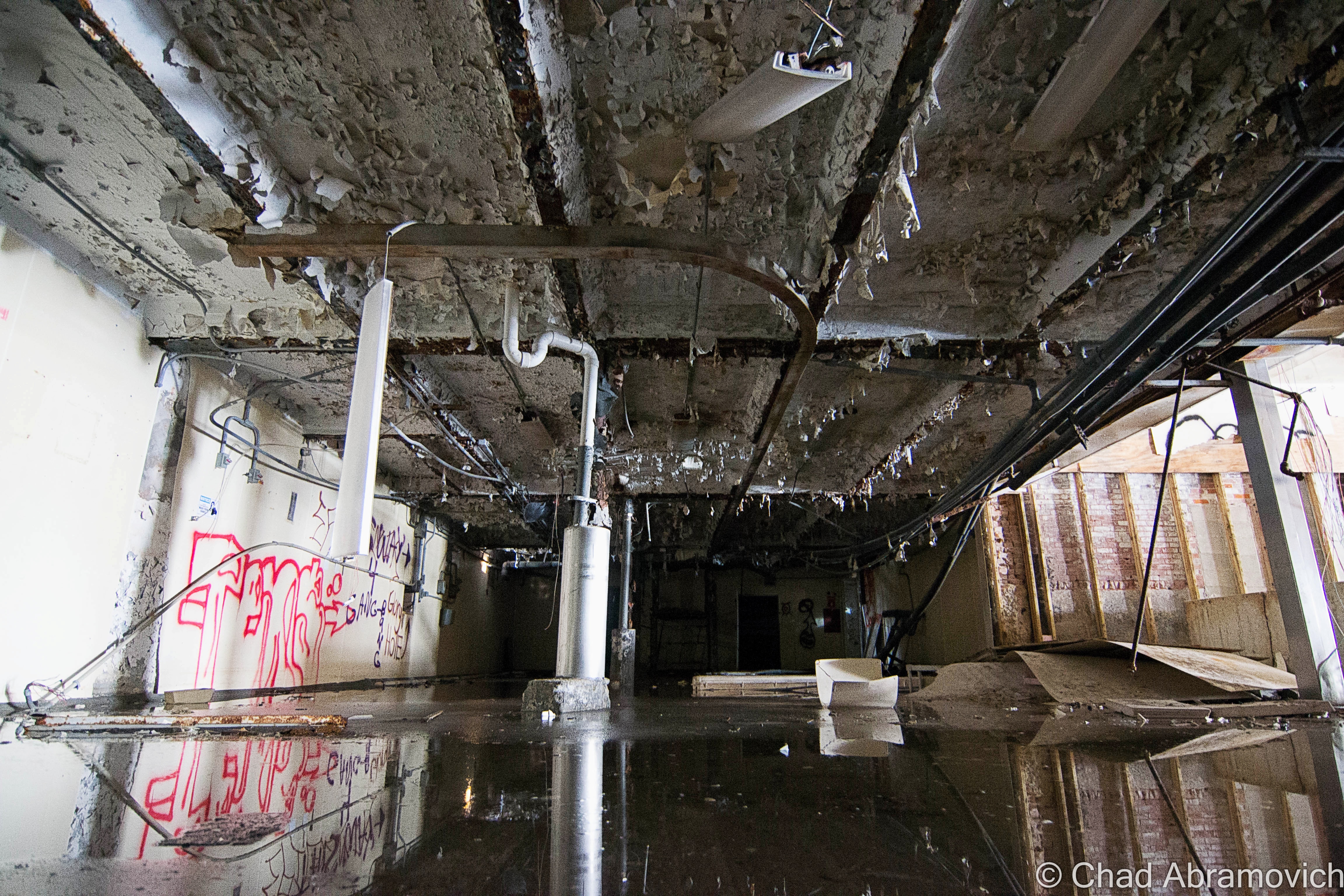
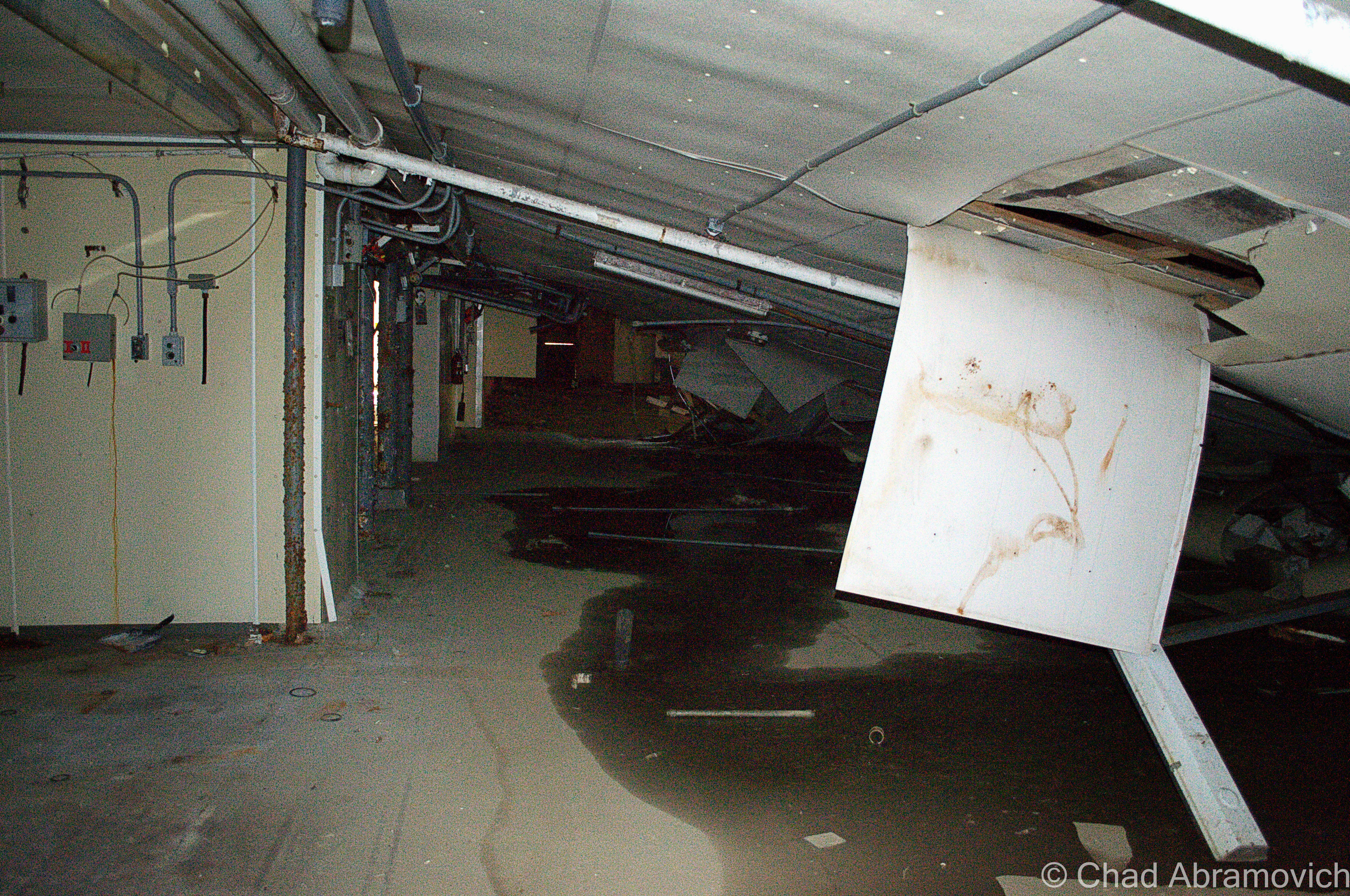
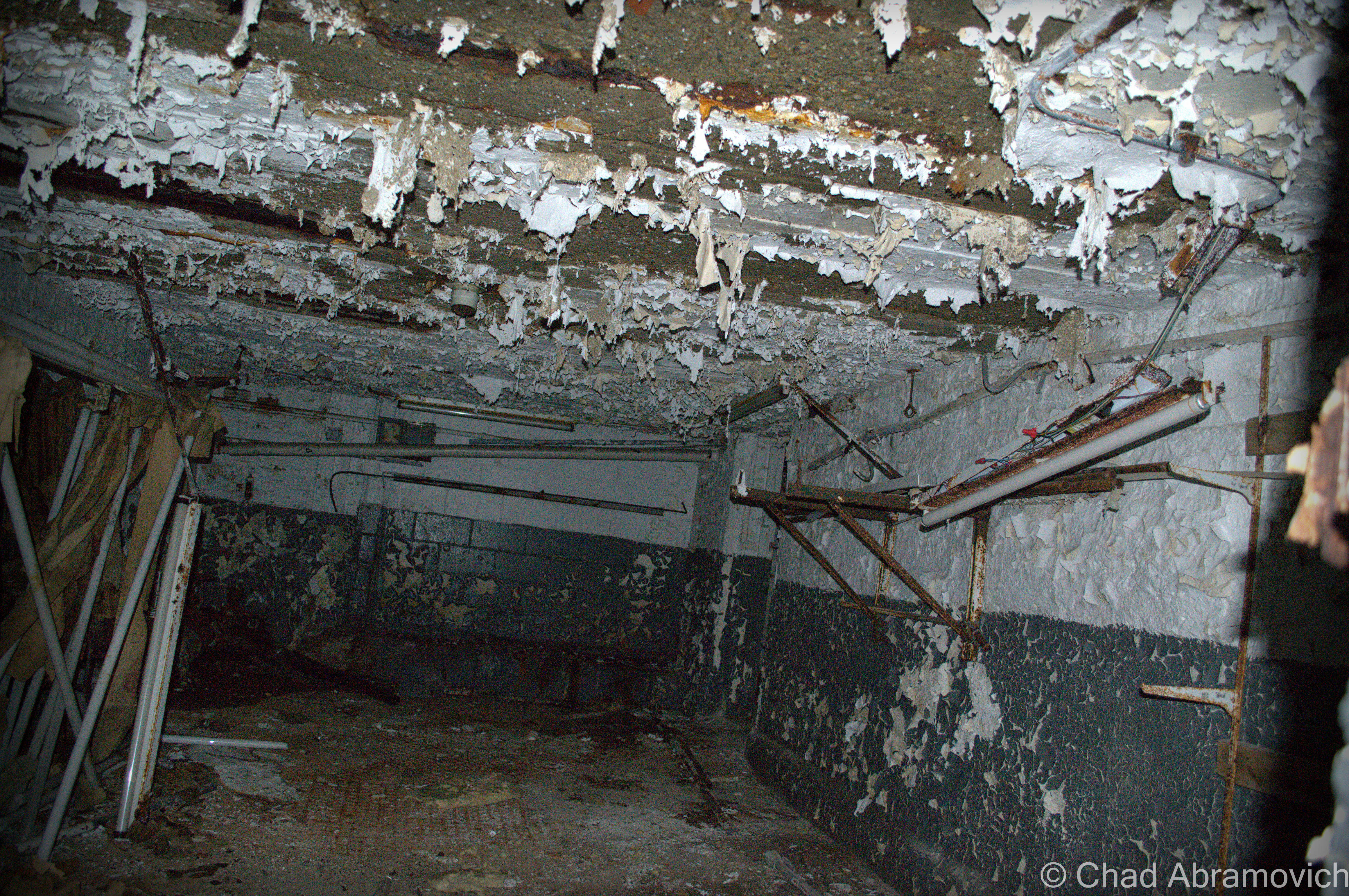
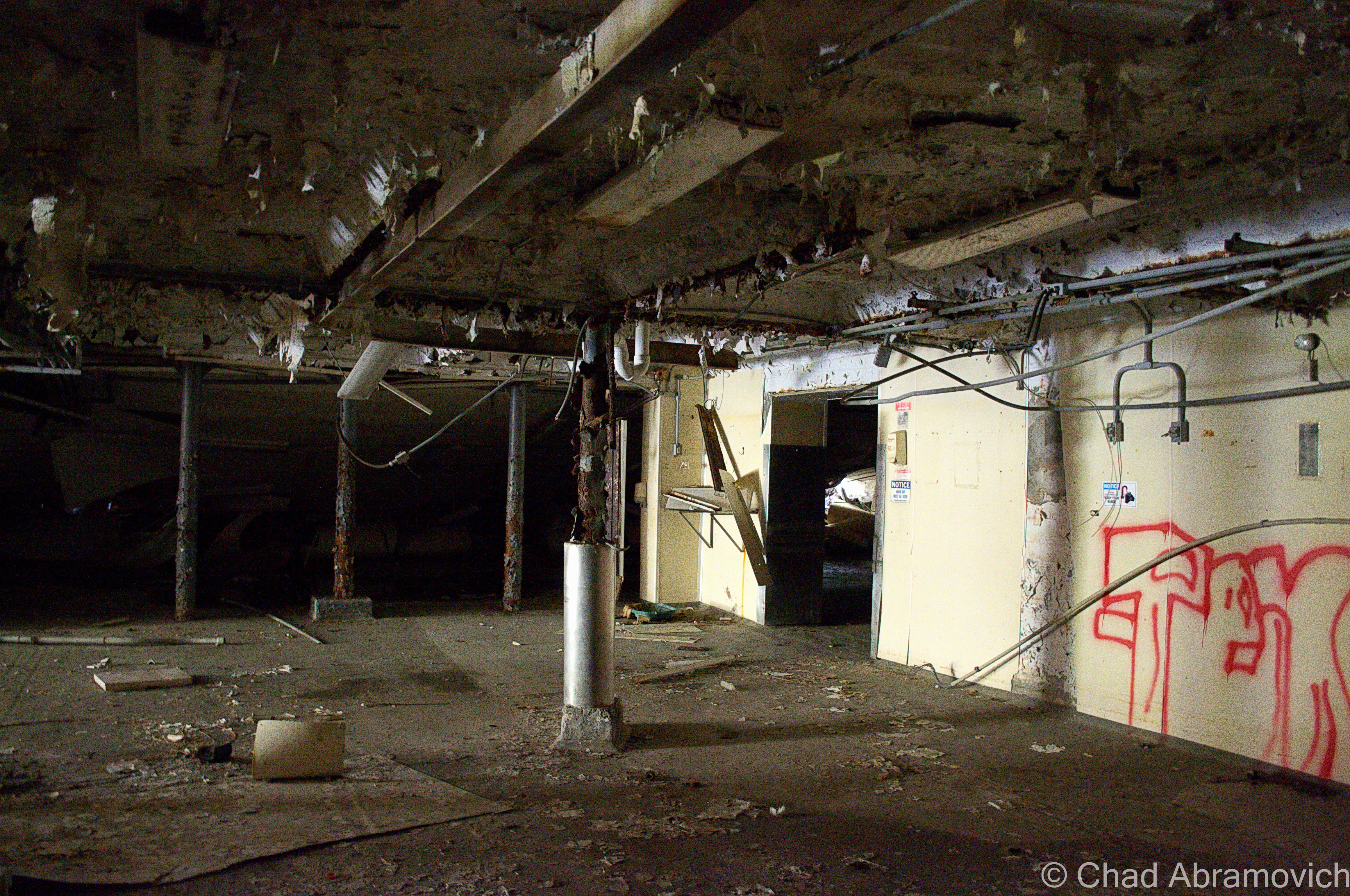
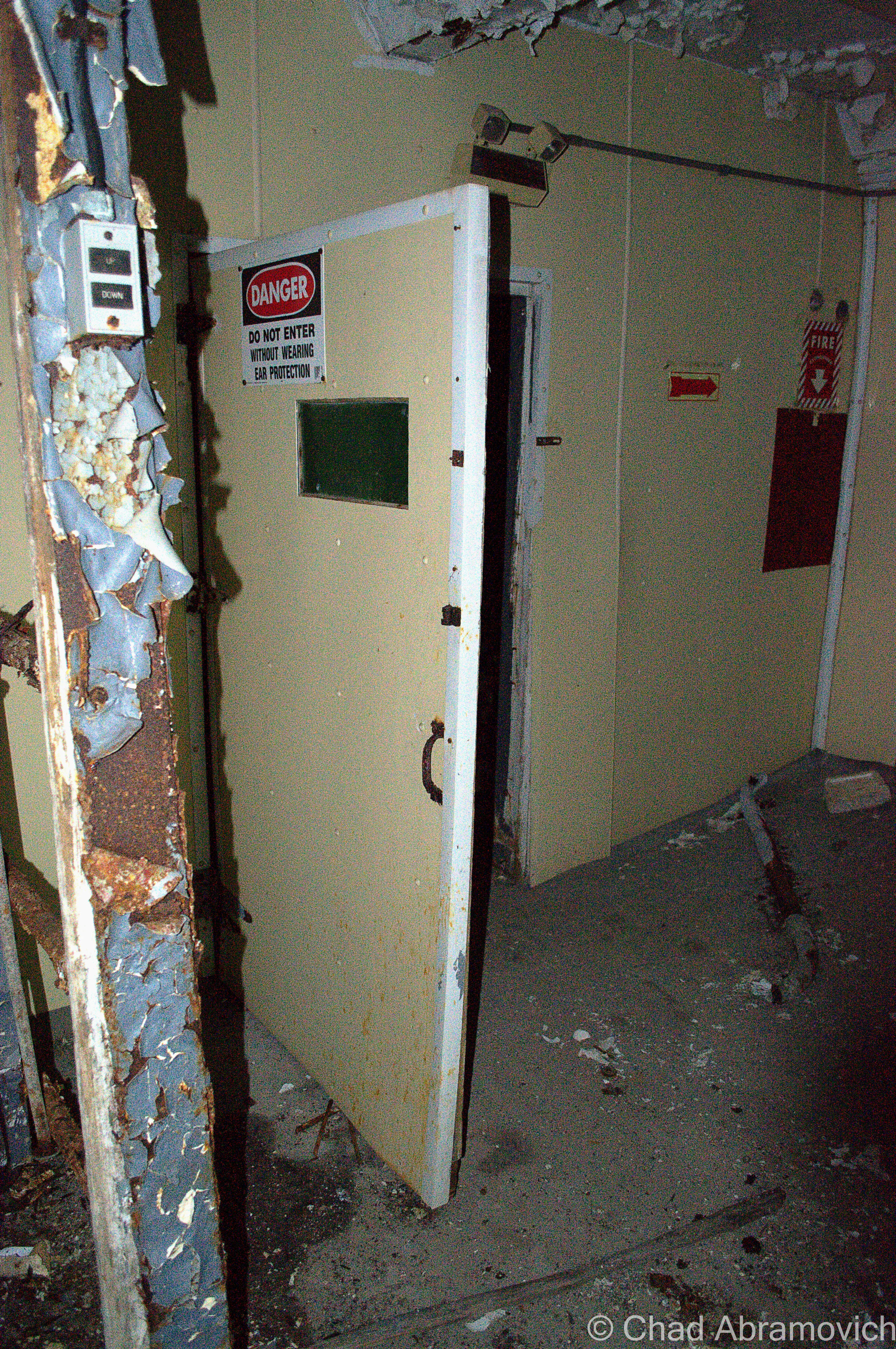
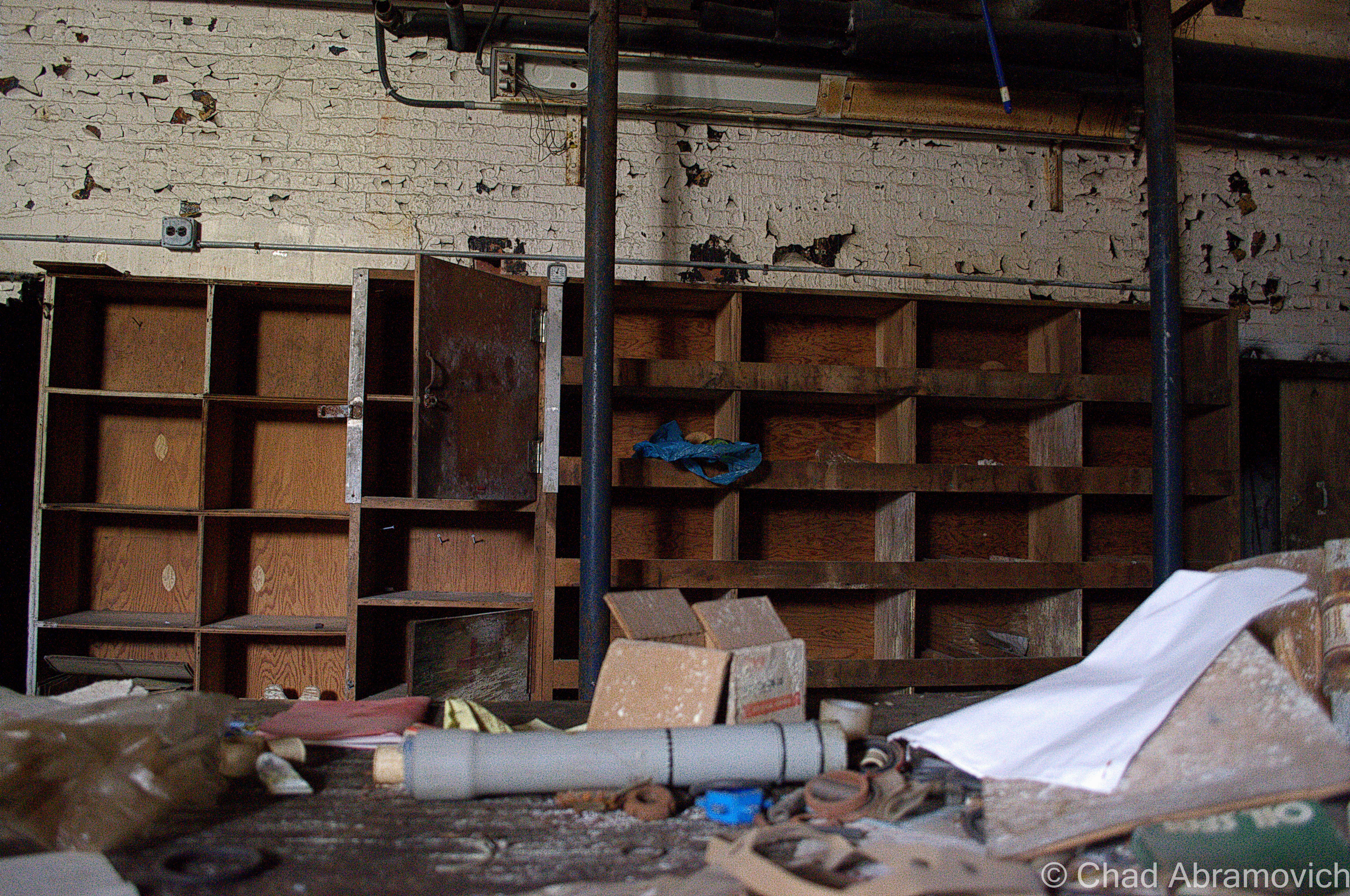
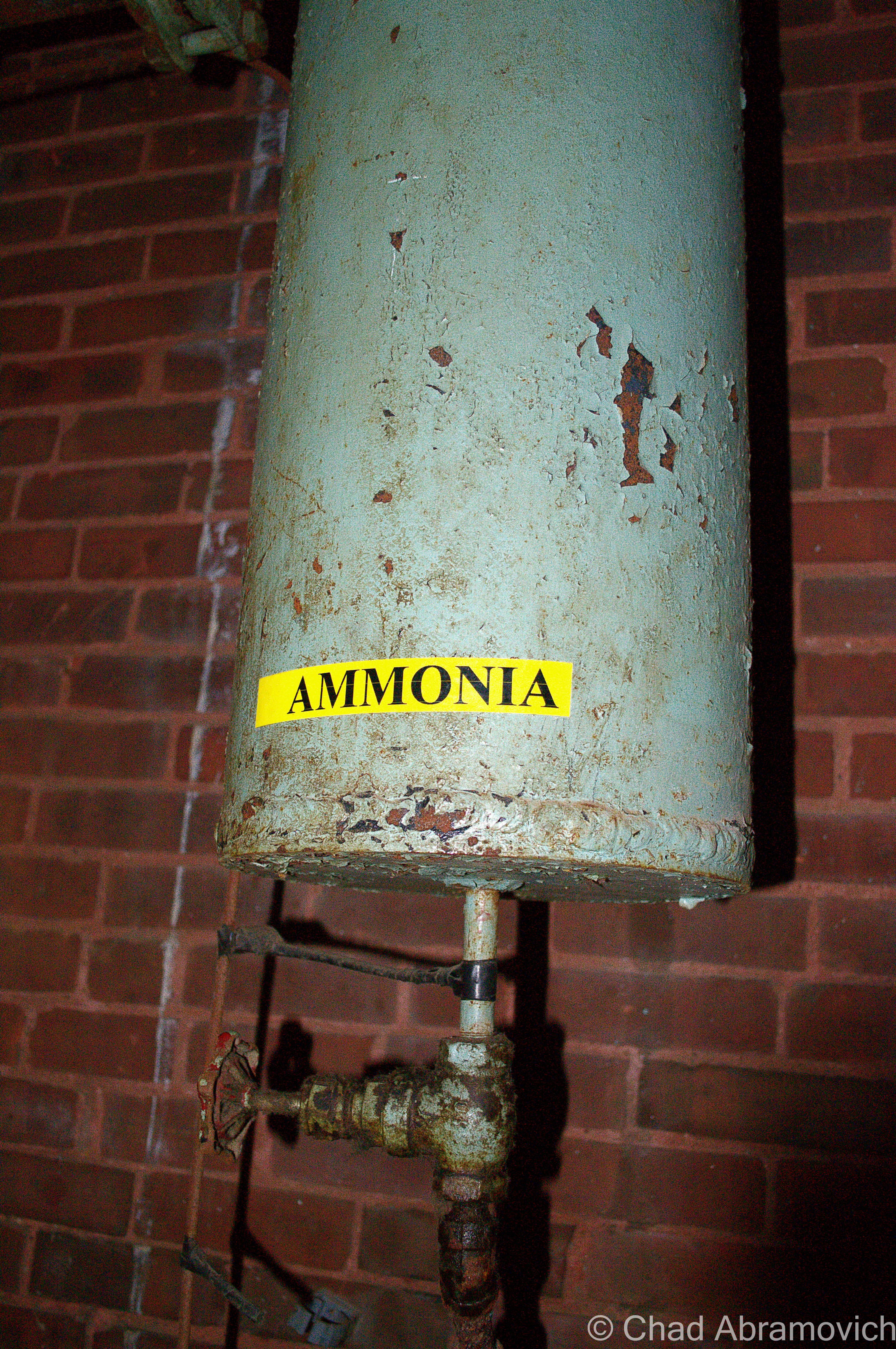
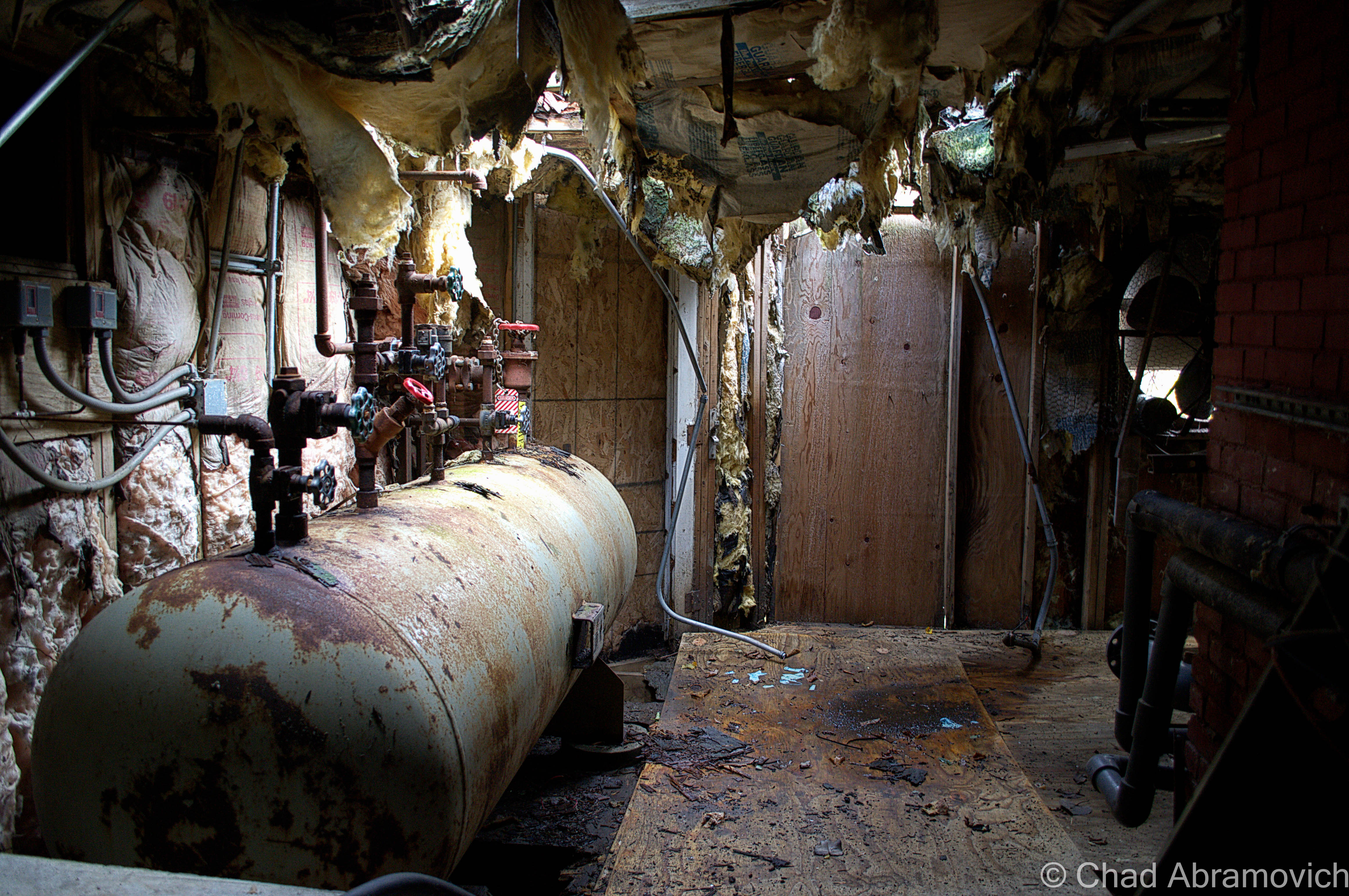
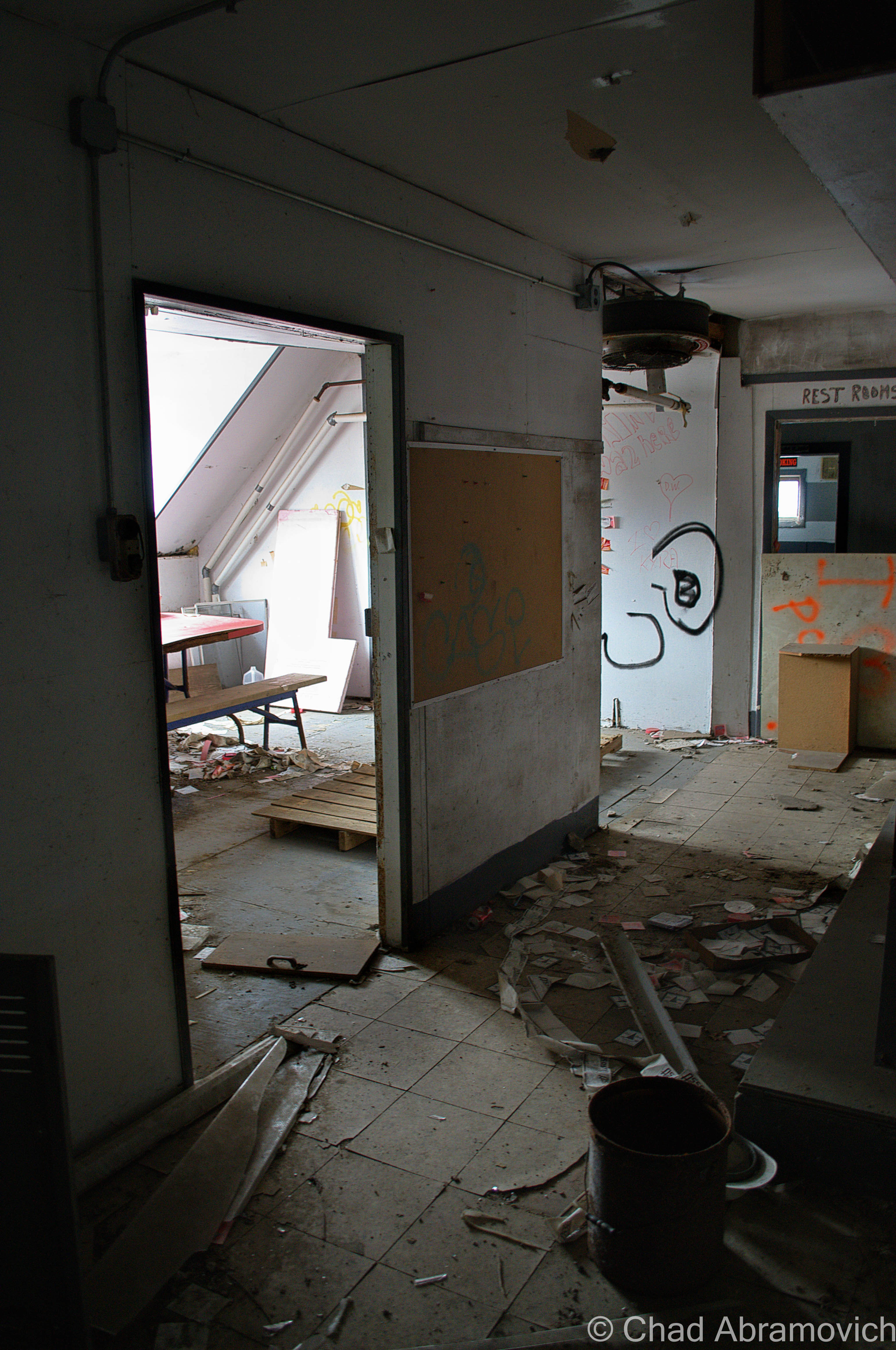
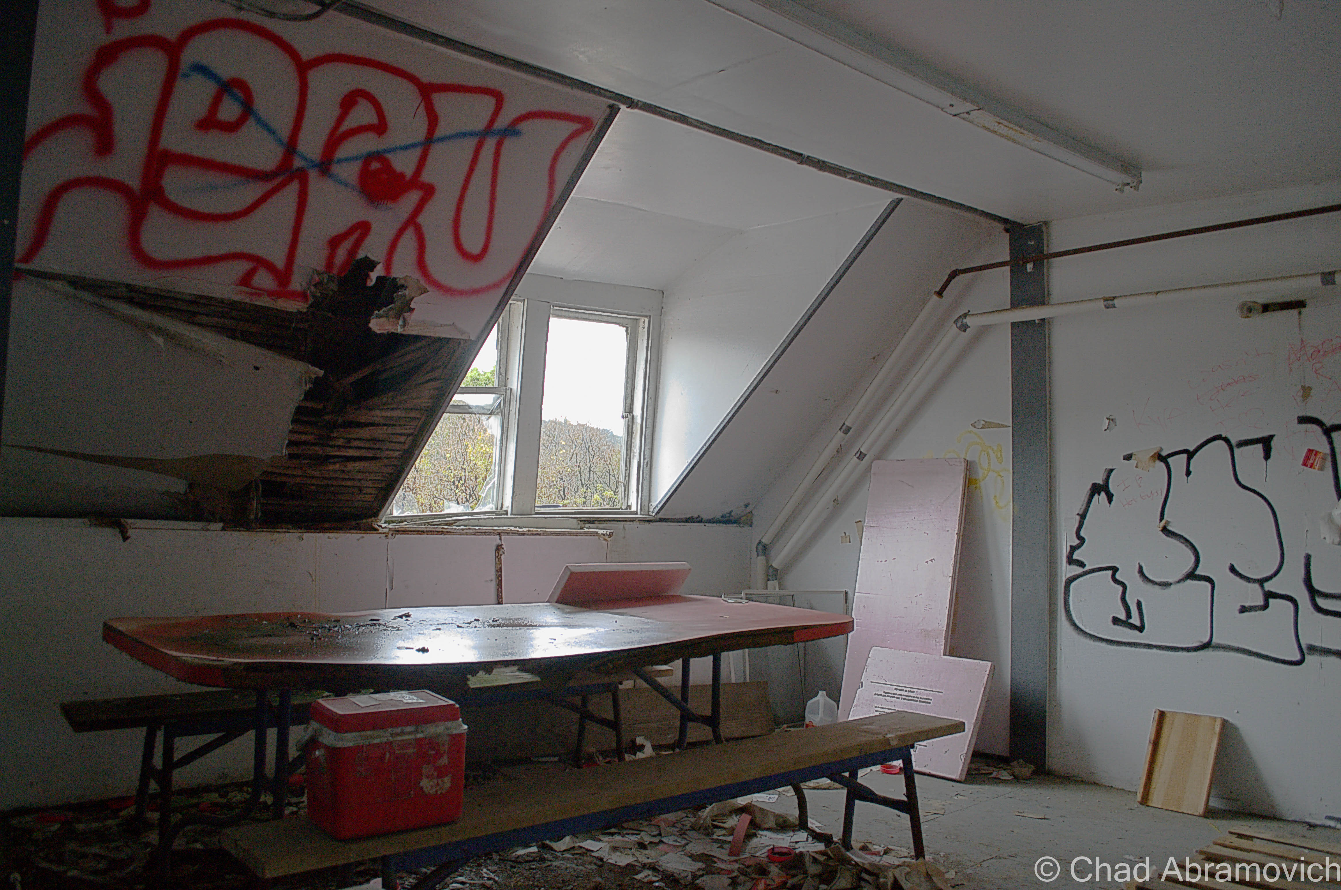
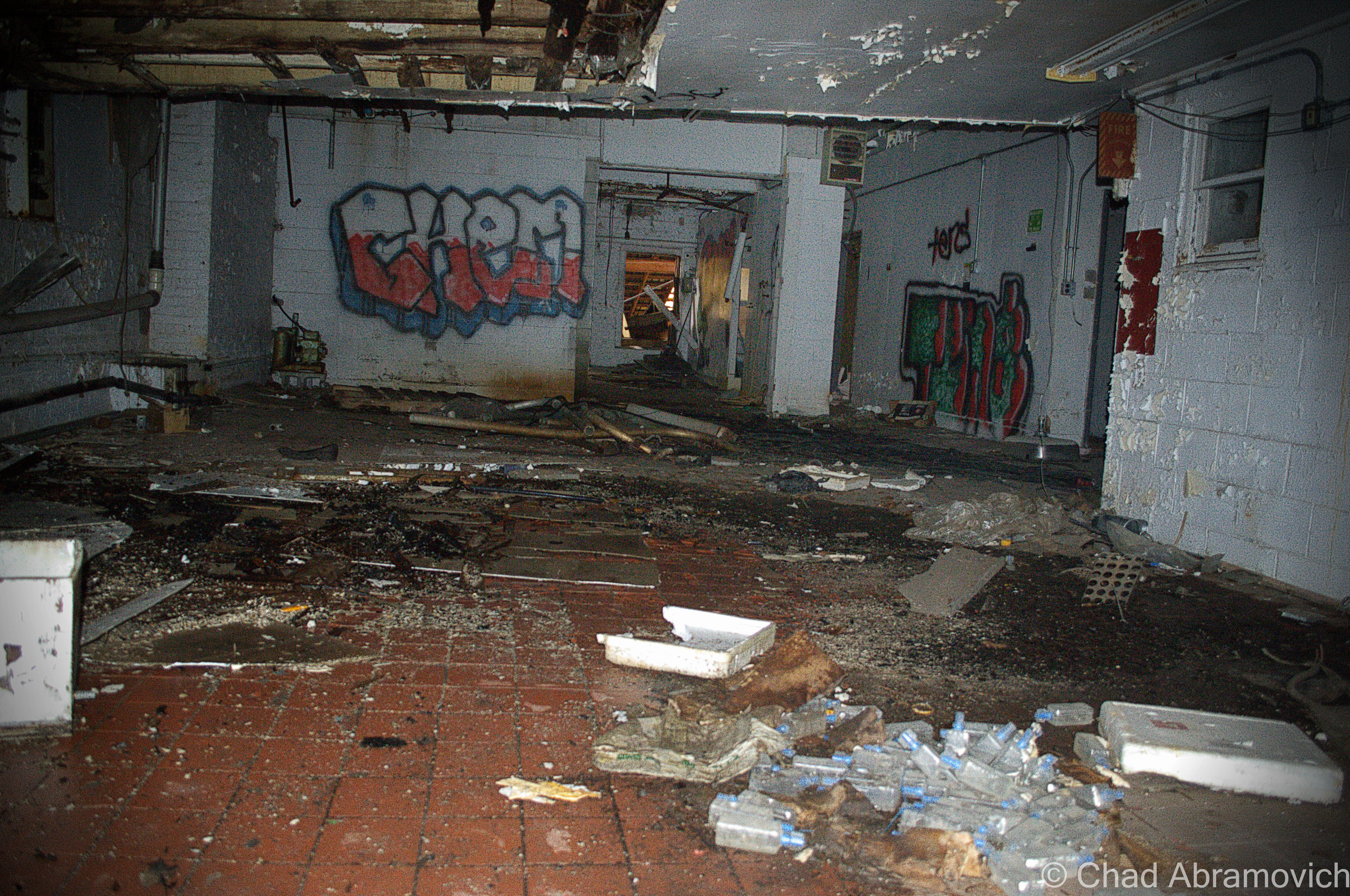
Inside, once you are enveloped by cold and filthy shadows, no order prevails. As you walk around, you begin to adapt to your surroundings as you notice the uncomfortable stillness that creeps over your skin. Your boots crunch over plaster dust and broken glass and lead paint rains from the ceilings. You experience feelings of vertigo as you maneuver your way around collapsing ceilings that are masqueraded by the dark. The floors are littered with debris and dirt. Wooden tables sit underneath years of dust which obscure the artifacts left behind. Fading signs that comically demand you partake in sanitation efforts still hang on warped vinyl walls, an almost laughable concept amongst the utter filth that hangs around you. Certain hallways were plagued so badly by water damage that my boots sank into the tiles like a sponge as I passed. It’s easy to lose yourself in the dark and desolation, but someone else has been here. Graffiti can be seen on dingy white walls where offices once resided. As you take a moment to take it all in, the wind blows a lose piece of rusted mangled tin – the sound echoes throughout the building as you immediately tense up. And on this lovely Autumn day as the Green Mountains blazed outside broken windows, an odd sense of tranquility permeated through the hallways.
This decrepit place is apparently well known to local kids who are revved up everything and wild like hurricanes. It makes sense. Small town kids love the mystic of places like this, just as I did. Although, my visits were one of reverence, and these kids seem to erroneously view the old creamery as a “law free zone”. According to a police officer who saw me go in with my camera and pulled me out a gun point, the powers that be have to enter the sketchy property far more than they’d like too. The reasons range from those aforementioned kids stashing stolen property there, drug labs and drug usage, and activities that range on the more destructive, such as arson attempts or scrapping. Because the property is designated as a brownfields location because of heavy contaminants as asbestos, lead paint and heavy metals, little can be done with the otherwise prime piece of real estate without lots of money for state approved clean up and permitting, and so far, no developers are interested enough in investing.
Sort of like how the abandoned creamery in my hometown was a local rite of passage for kids, the creamery in this burg is of the same culture. A friend and frequent exploring companion used to work at a restaurant nearby, and one night as he was offhandedly conversing with their teenage dishwasher, the youth told him animatedly “Oh, yeah, I know the old creamery! I fell through the floor there a few weeks ago!” Good times, I’m sure.
A historic postcard view, circa 1938
Fall 2013
—————————————————————————————————————————————–
To all of my amazing fans and supporters, I am truly grateful and humbled by all of the support and donations through out the years that have kept Obscure Vermont up and running.
As you all know I spend countless hours researching, writing, and traveling to produce and sustain this blog. Obscure Vermont is funded entirely on generous donations that you the wonderful viewers and supporters have made. Expenses range from internet fees to host the blog, to investing in research materials, to traveling expenses. Also, donations help keep me current with my photography gear, computer, and computer software so that I can deliver the best quality possible.
If you value, appreciate, and enjoy reading about my adventures please consider making a donation to my new Gofundme account or Paypal. Any donation would not only be greatly appreciated and help keep this blog going, it would also keep me doing what I love. Thank you!
Somewhere underneath an unremarkable section of industrial railroad tracks, is a stone tunnel with an enduring mystery. Who built it, when and why all seem to be accomplishments that was never passed down to the modern world, and yet, this intriguing piece of Vermont curio oddly exists untouched in the stretches of the state’s largest metropolitan area – its presence not noticed by the majority unless you’re one of the select few that know about it.
If you manage to find it, you can hear the hum of traffic nearby, the various noises that scream from a nearby generating plant and the voices of passing on-goers that carry out though the woods. And yet, here the tunnel sits in an enclaved world protected by treacherous railroad banks covered in thorns and foliage and the remnants of several homeless camps scattered around basins of coal black ooze – an ominous warning for those who decide to leave their world and enter this one.
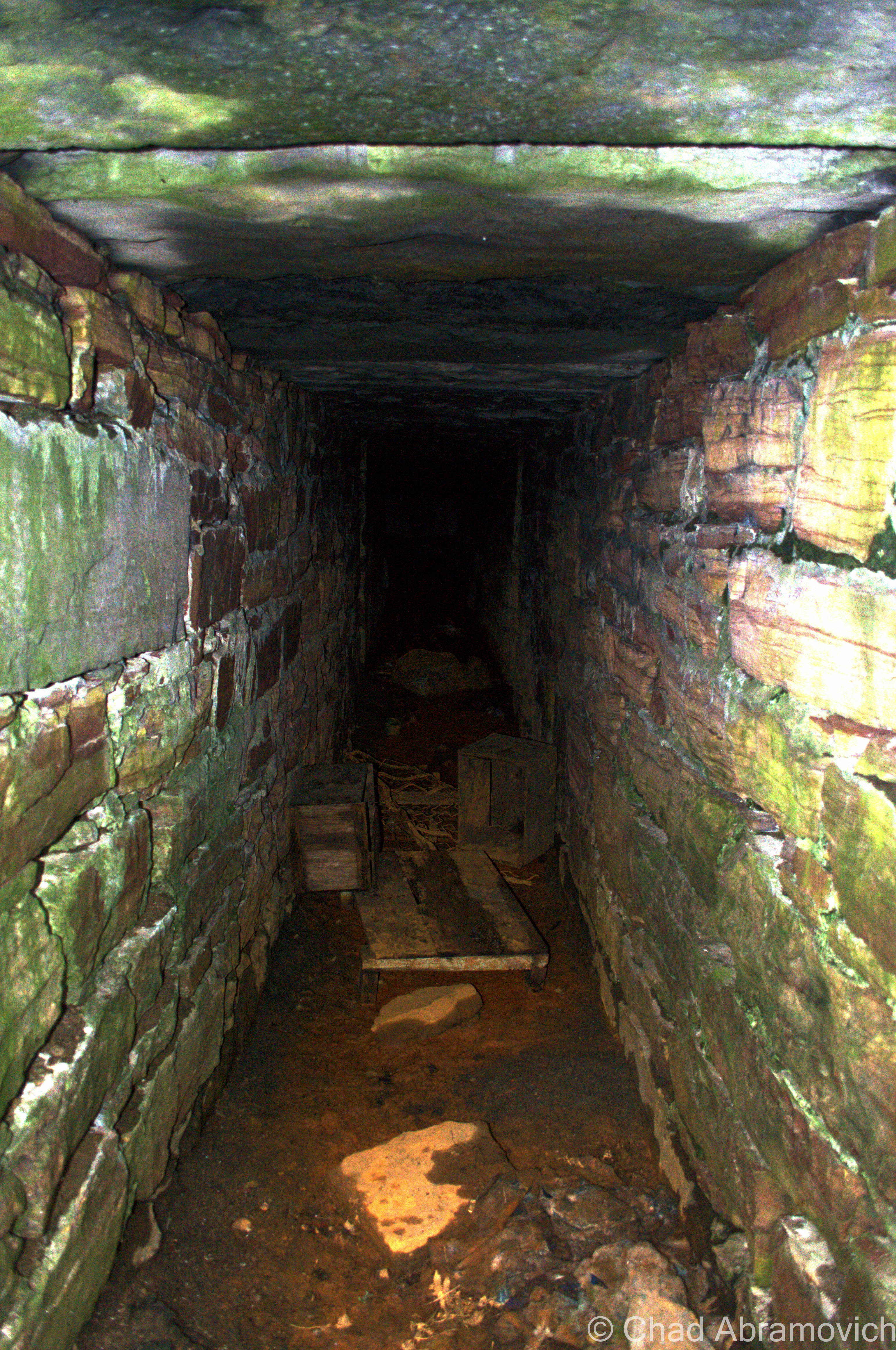
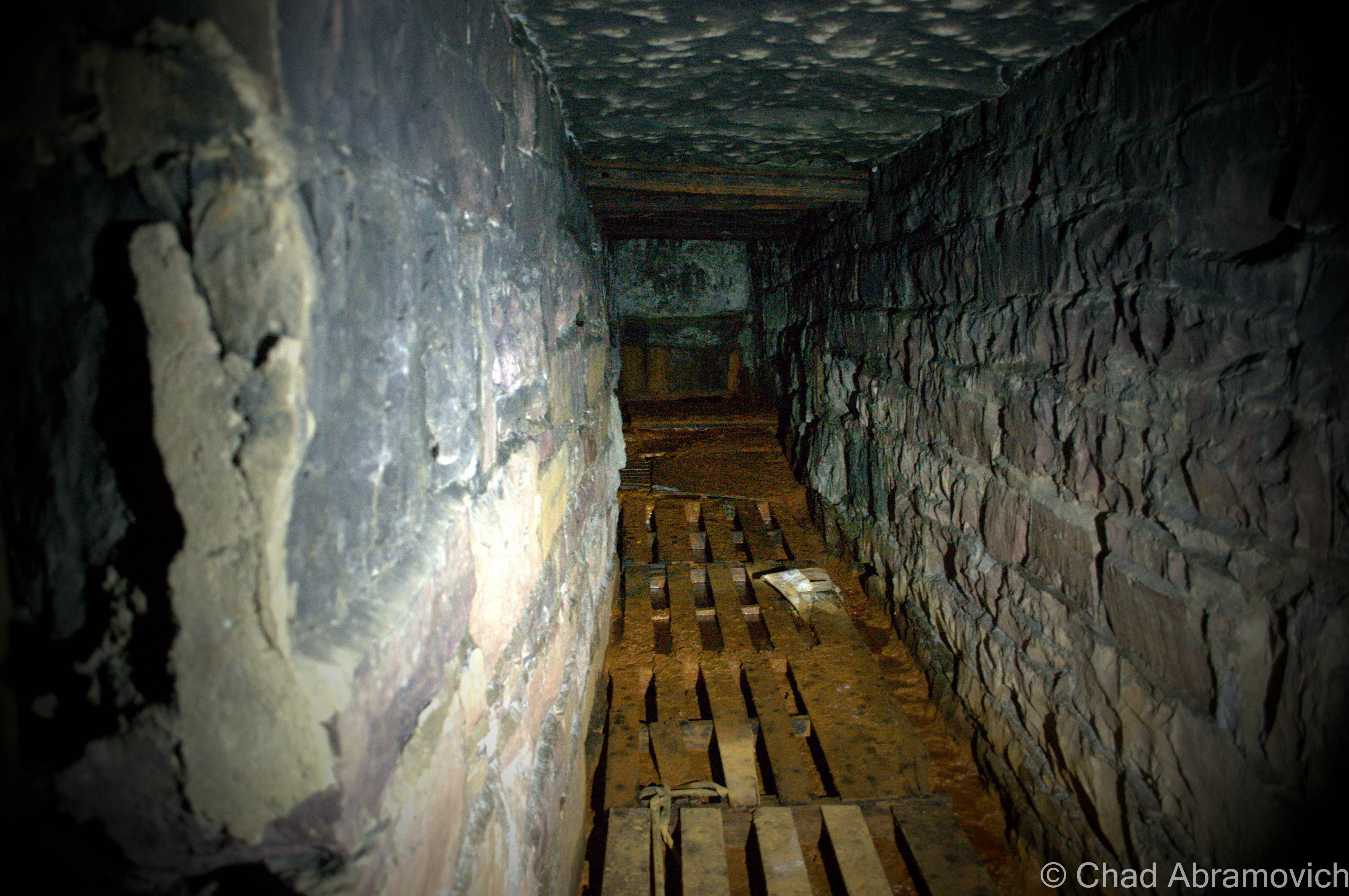
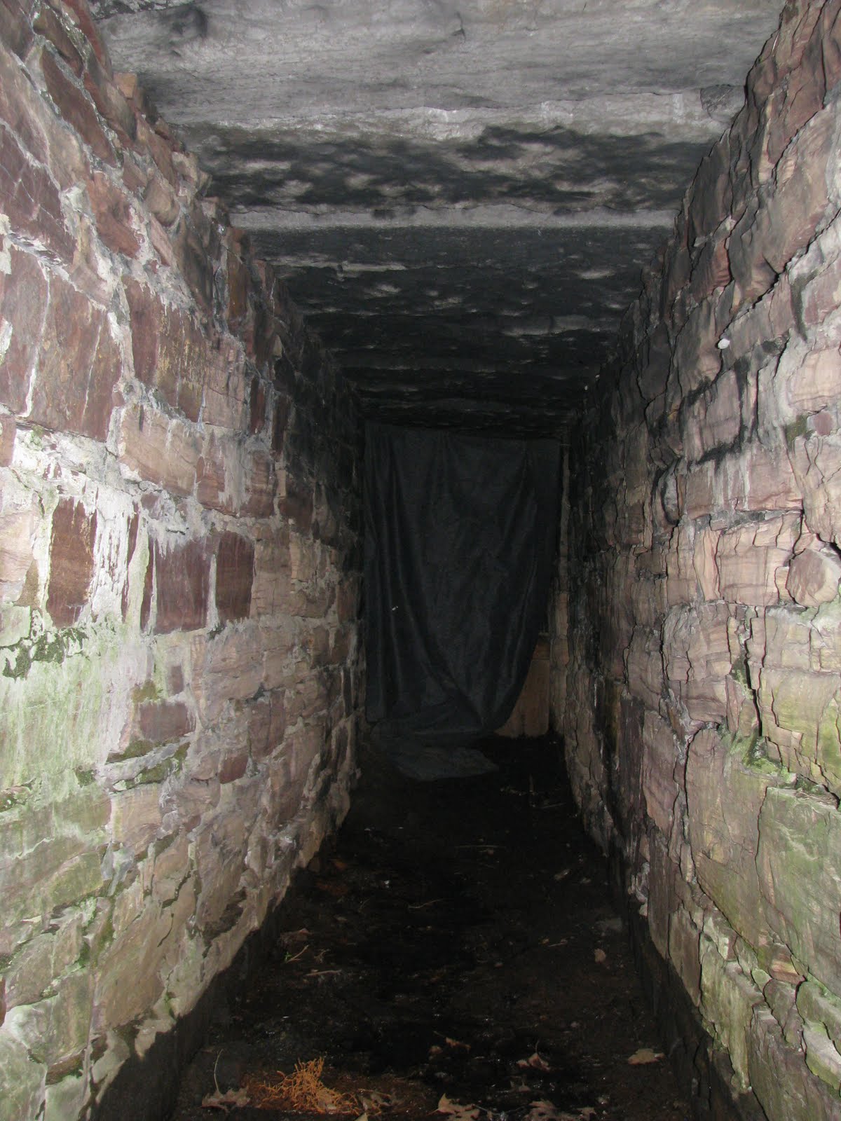
And once you approach the tunnel entrance, a foul blackness that cannot be penetrated descends deep into the bowels of the hillside.
Stories abound about this strange tunnel. Speaking to a friend of mine, he was able to recall plenty of bizarre urban legends and strange lore about it. There was said to be a forbidding barred gate which lies somewhere inside, and macabre tales of dead bodies being discovered deep in the far recesses. I knew I had to see such a place!
We conversed further, as I became eager to get to the bottom of this. The most interesting detail about this tunnel is what makes it so enigmatic. No one seems to be quite sure about why it exists, or when it was constructed.
But there are plenty of theories as to why it was built. Some speculate that it was once a cow tunnel, a way of transporting livestock from one pasture to another which were divided by the railroads. And if you take modern day agro-industrial farming methods into account, the cows of yesteryear were smaller – making the tunnel’s size a realistic possibility. But if this was the case, then why does it dead end into a dripping stone wall some 60 feet from the entrance? Other theories are that when development came to the area, the property owners across the tracks discovered the entrance and sealed it up. But there is no proof of this, so we’re back to speculating. Was the tunnel built one way, or did it have another entrance?
Some speculate that the tunnel was built to house railroad supplies, such as dynamite and rail ties during construction in the mid 1800s – however, this too is only a theory. For a simplistic project, this seemed like a strangely labor intensive storage shed. Too add further confusion, we still aren’t really sure if the tunnel predates the railroad or not, which leads me to the most intriguing possibility.
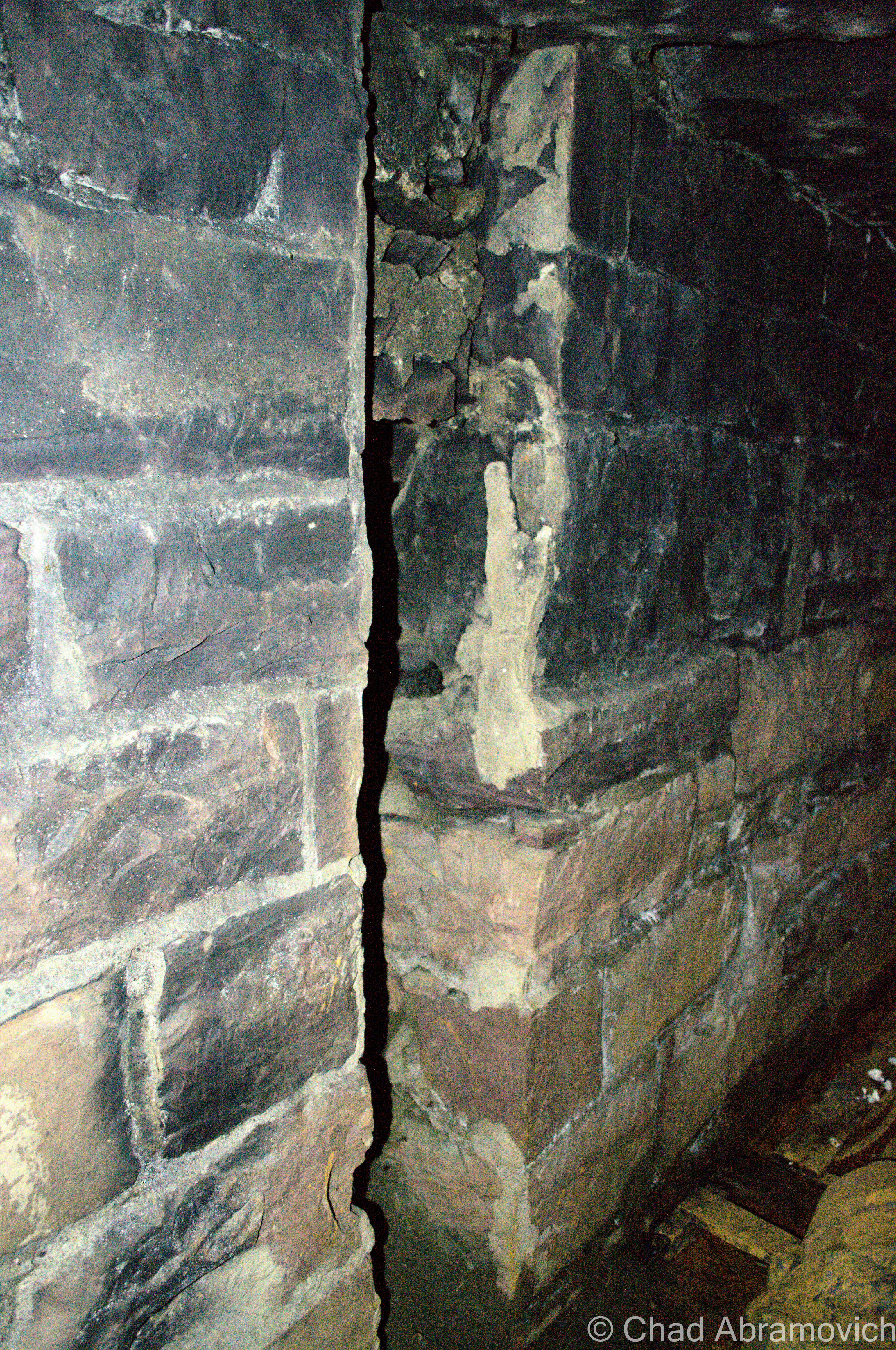
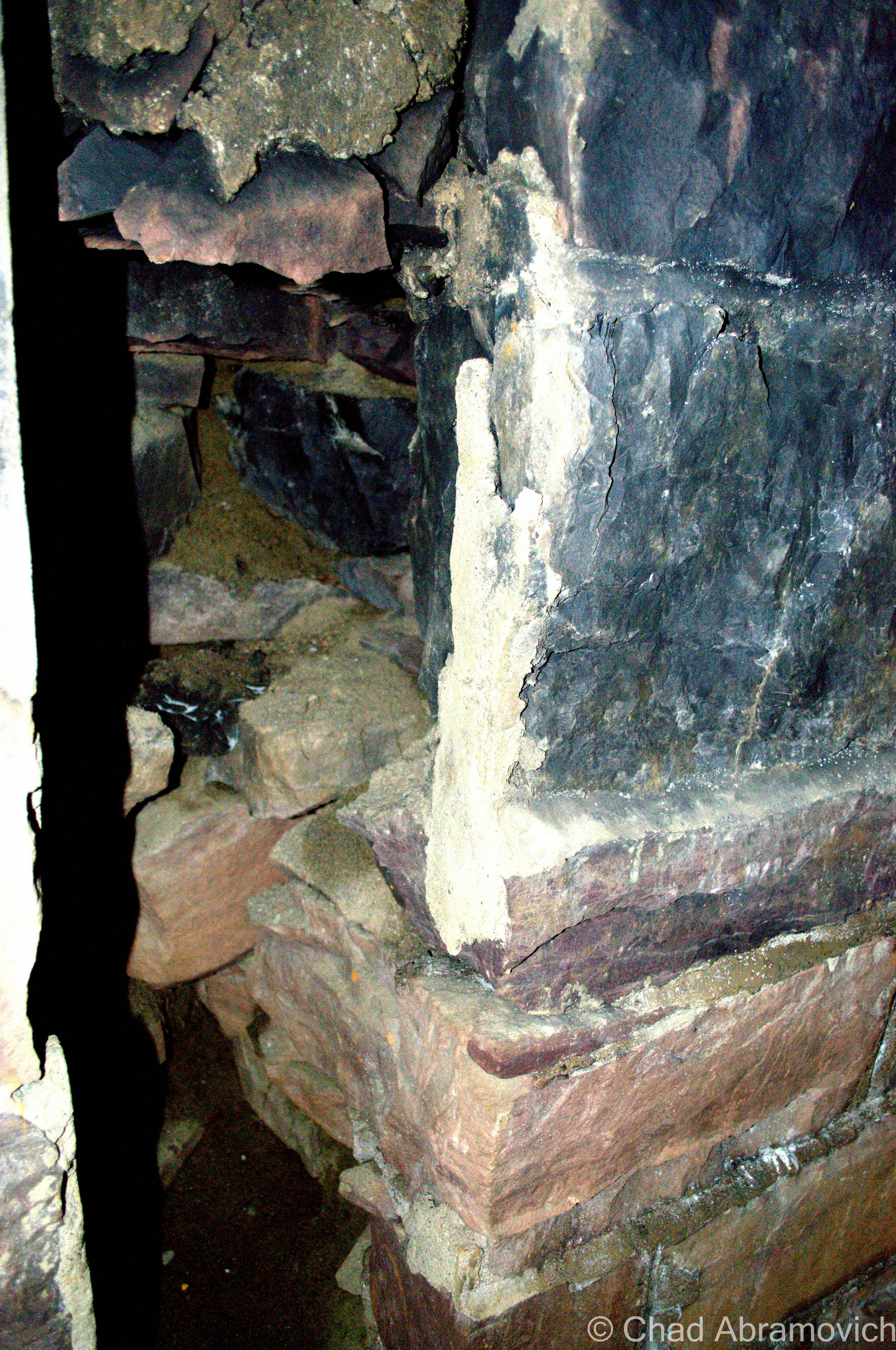
There are some that romanticize about the tunnel being so archaic that it predates Columbian settlement here in the United States. The stones are old, hand hewn and placed to form the walls and ceiling in baffling rhythmic precision in their uneven size and form- so it is a possibility. After all, it is now an accepted theory that Celtic copper miners once came to Vermont before the Europeans did some 3000 years ago, to harvest our vast copper resources when Europe was in the midst of a copper shortage. Upon doing so, they left their legacy here by building several mysterious stone structures and tunnels that lay scattered across the state, some even showcasing ancient inscriptions evocative of that time period. Today, these strange mounds are a topic of hot debate amongst archaeologists. However, Vermont’s ancient stone structures were all constructed differently than the tunnel in question, and it doesn’t quite fit the picture here. Mortar was also used in the construction, meaning that the tunnel is relatively newer than what the first throngs of European explorers would have ran into.
With no specialist making a visit to the tunnel to officially verify the age of its construction, this theory can only be that. And we’re right back to where we started. But one thing is for certain, if you can find it, you can see it for yourself. And that’s what I planned on doing.
Visiting The Tunnel
It was a warm September day when myself and a friend went searching for this elusive tunnel. But the question was, how would we find it? The foliage around the tracks was so thick and unforgiving, that it would be impossible to distinguish a simple stone tunnel underneath so much that competed for our attention.
Eventually after we had been walking the tracks for a good while, we decided to just jump off into the woods, literally, and see if we could get a better view of the steep banks that slumped below the railroad bed. If there was a tunnel here, we’d have to be on ground level to see it. But this literal jump proved to be an adventure we didn’t take into account. Weeds, thick trees with hanging vines and a “ground” made from soggy marshlands and layers of rotting trees was the landscape we were now fighting against, and walking around in it was treacherous and tiresome.
People Of The Sticks
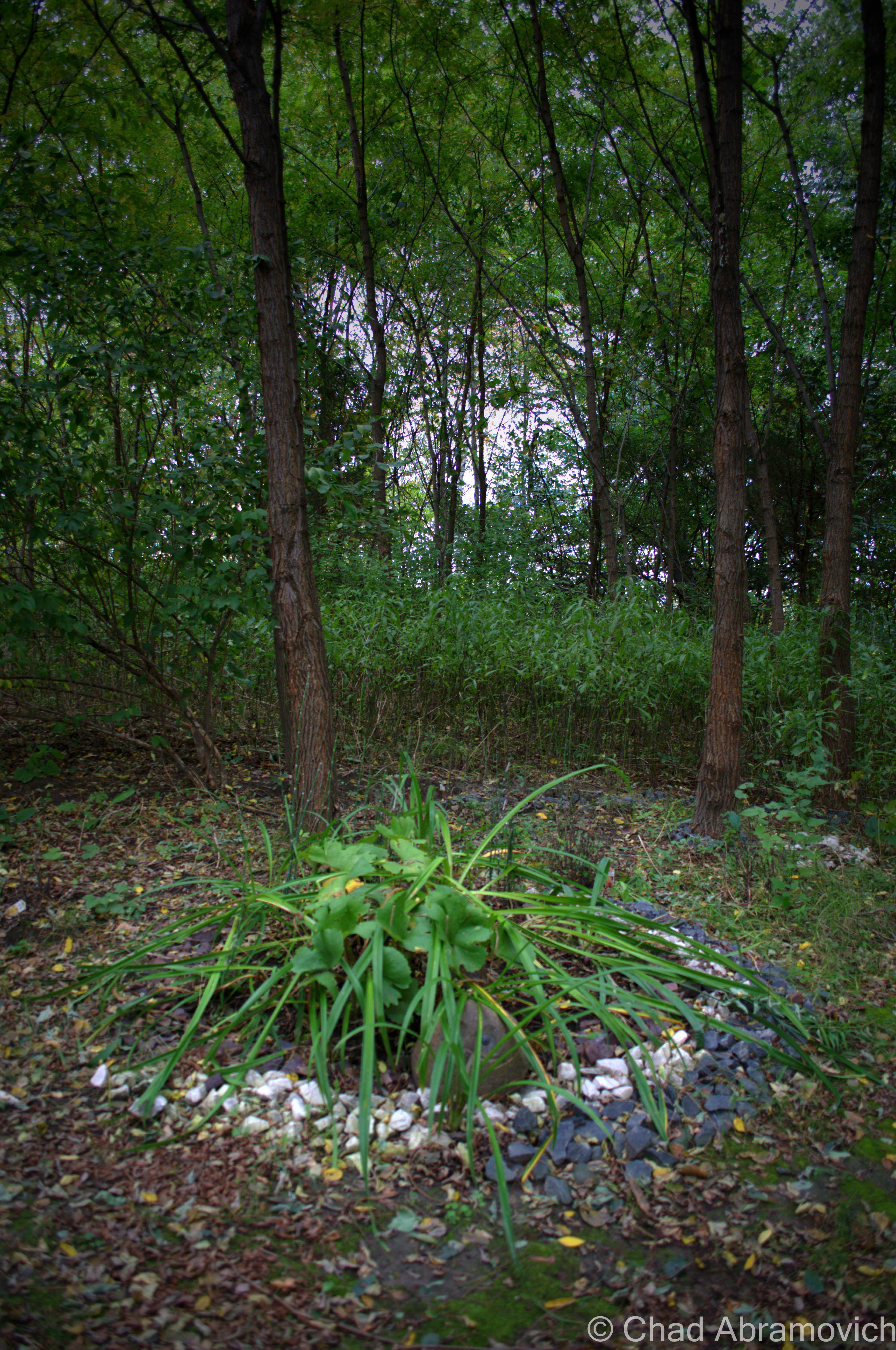
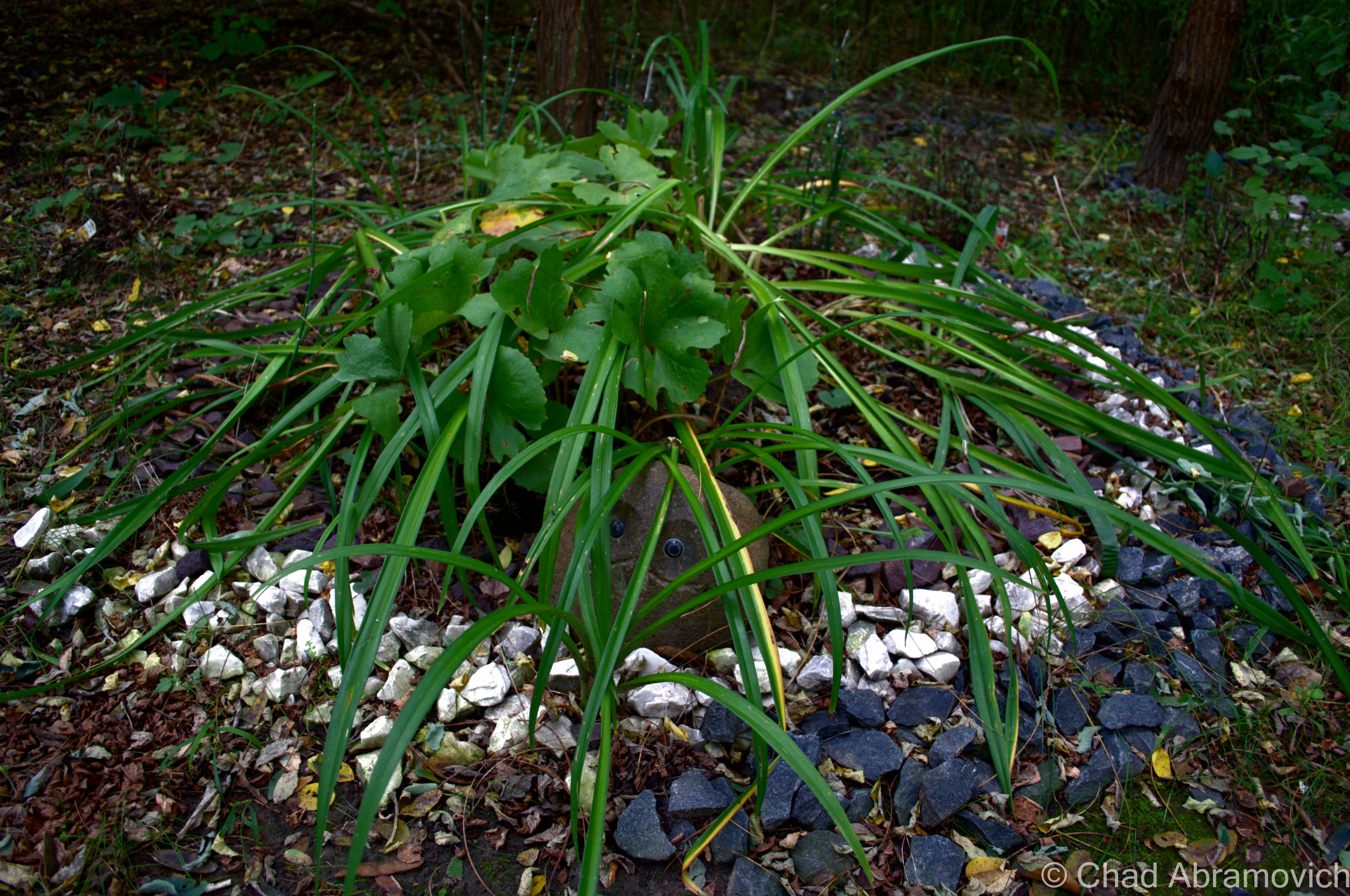
Throughout this desolate and unforgiving landscape, we began to notice a web of sinuous trails that were well worn, and disappeared behind the thick veil of foliage. Making a conscious risky decision, we picked one and followed it. Little did we expect to find what looked like imaginative landscaping attempts. In the middle of nowhere.
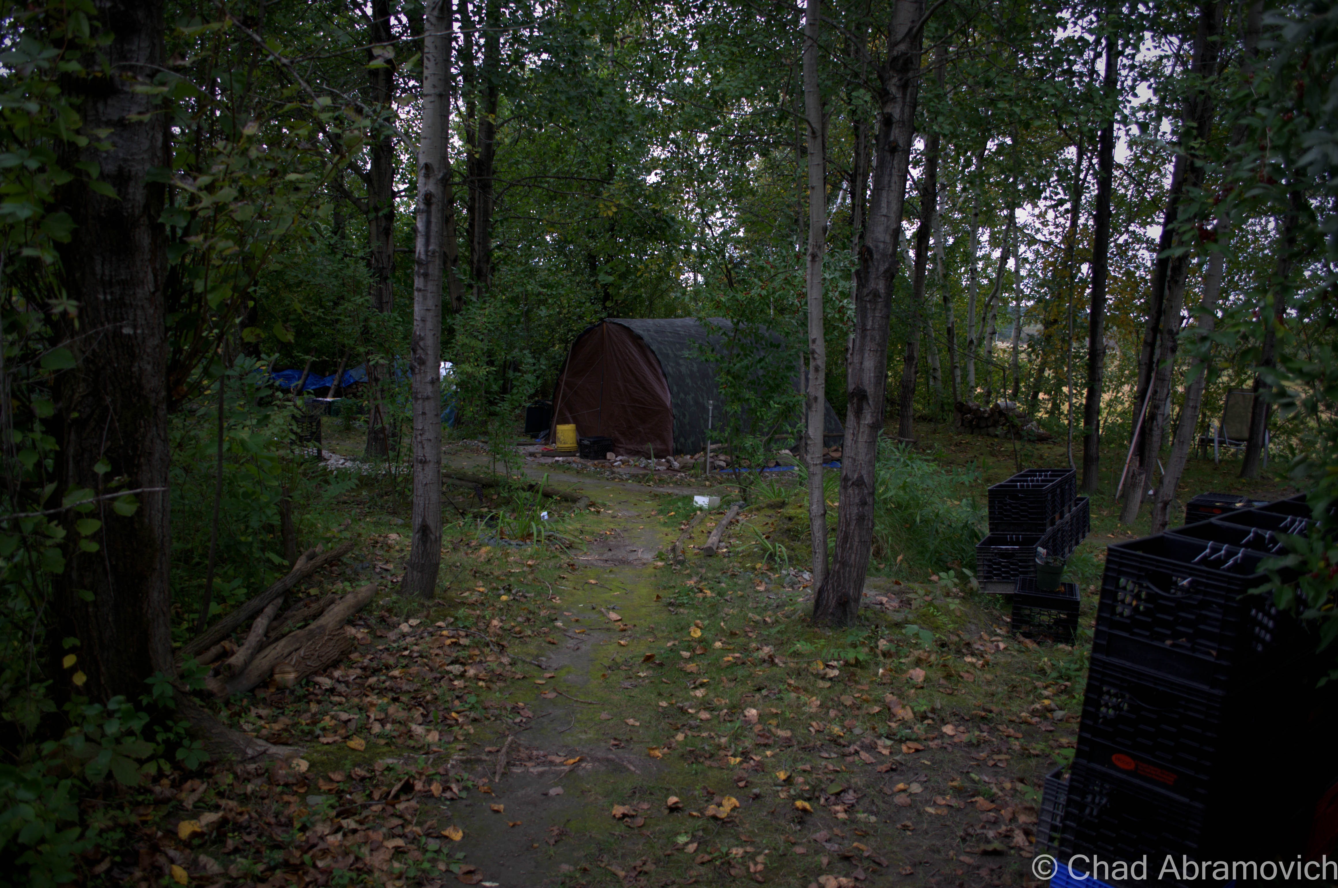
My friend thought the eyes were 2 miniature security cameras. Though we were far away from civilization at this point, we both involuntarily tensed up at the thought.Following the path brought us right to the front door of the exact thing I expected and yet didn’t want to see – a homeless camp. Tents, sleeping bags and shopping carts were stashed underneath thick foliage that clinged to my jacket.
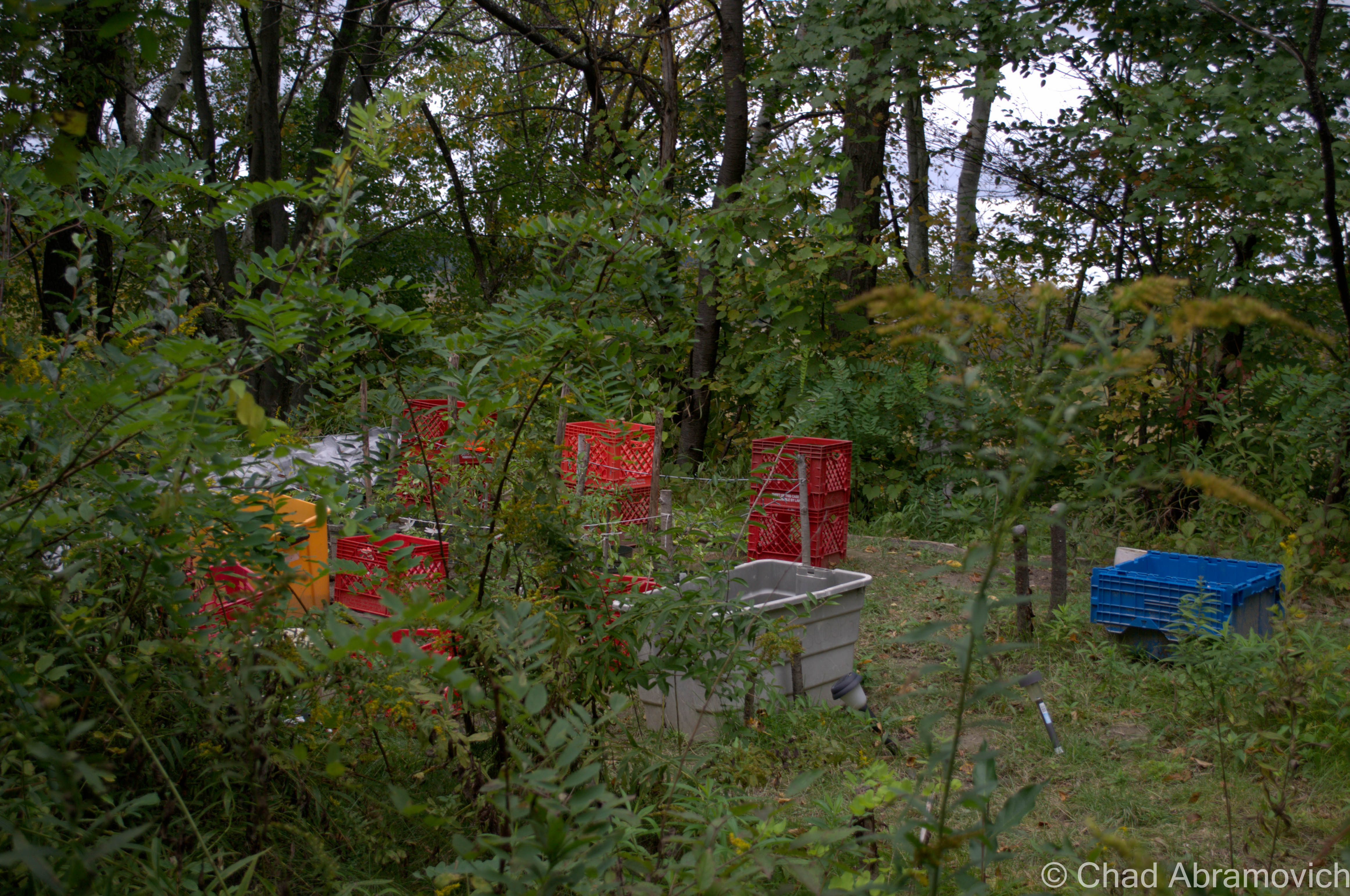
Further down the path, we stumbled into more development. This however seemed to be a clandestine farming operation, the farmers were nowhere to be seen thankfully.
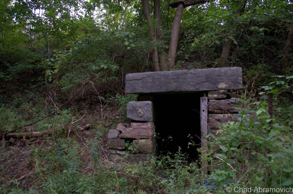
Finally, after an extensive amount of time searching, we had found the fabled tunnel.
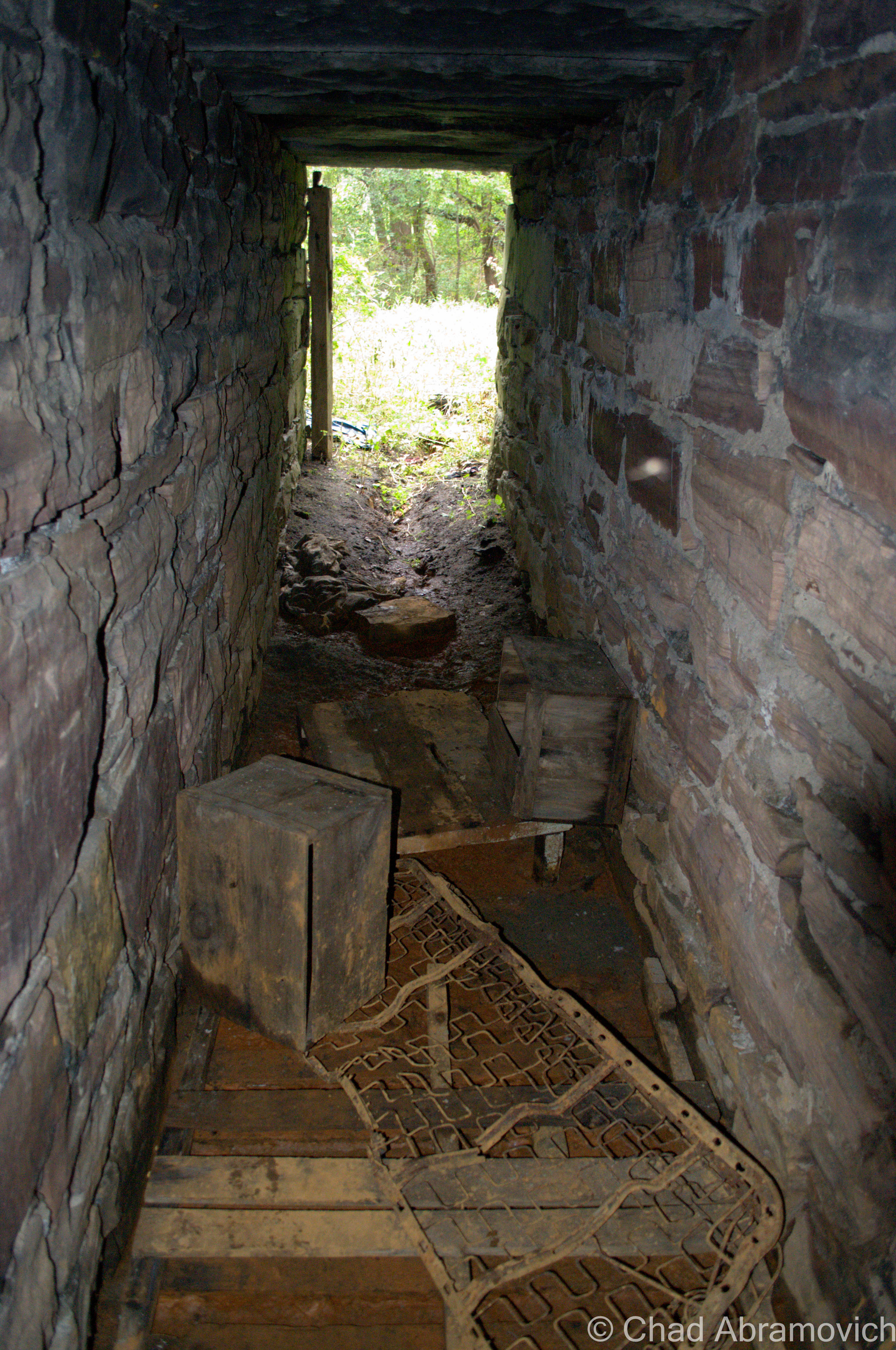
There looked like there once was a wooden door that covered the entrance, but had long been ripped off.
With the overwhelming evidence of homeless camps littering the immediate area, we approached cautiously. Who knew if anyone was sleeping (or perhaps, waiting) inside the dark depths of the tunnel, waiting to strike. Taking out a flashlight, we shined the LED light straight down the center of the shaft, illuminating the gloomy interior, and called out “hello?” a few times. The tunnel was empty, and in we went.
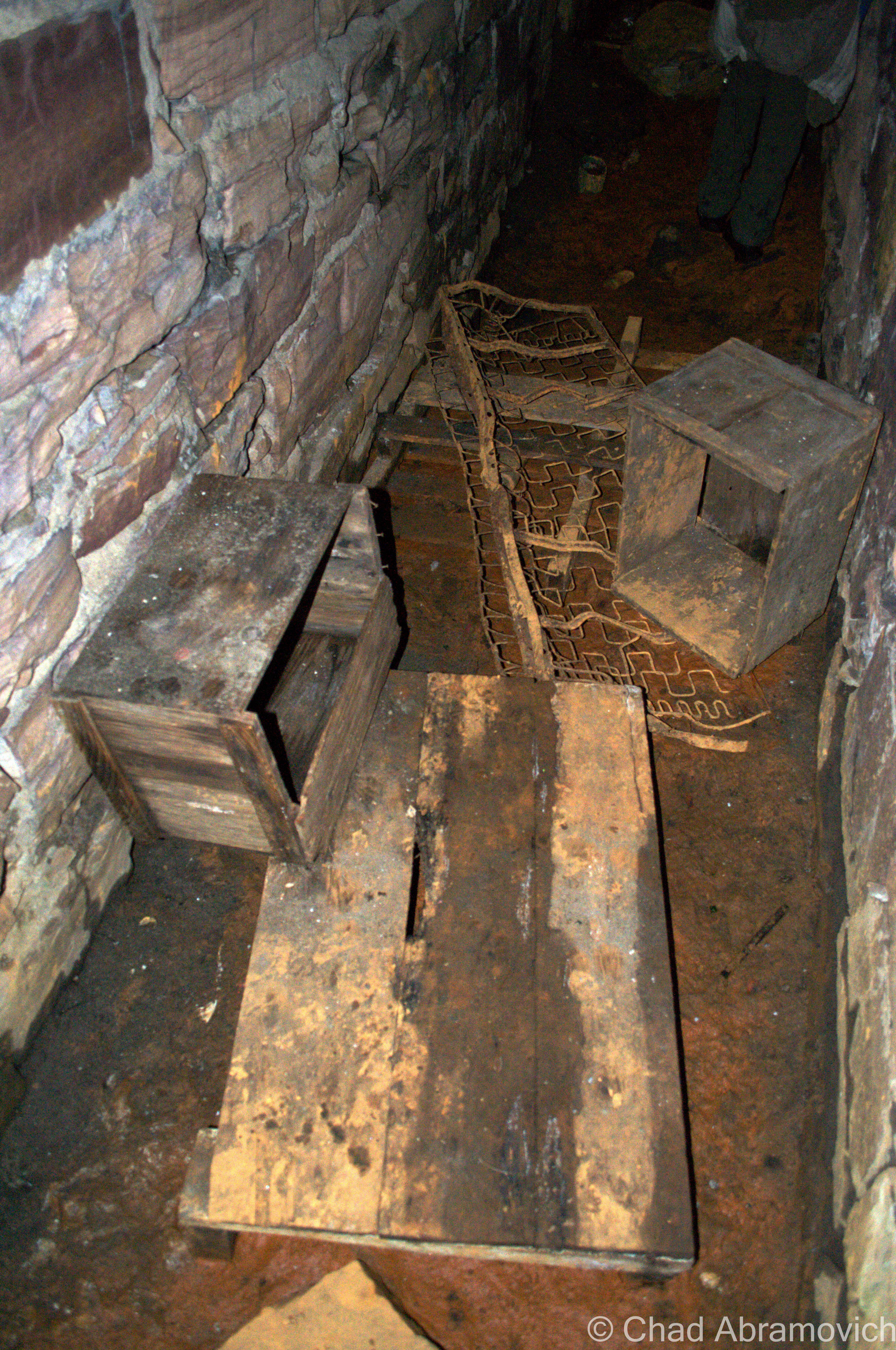
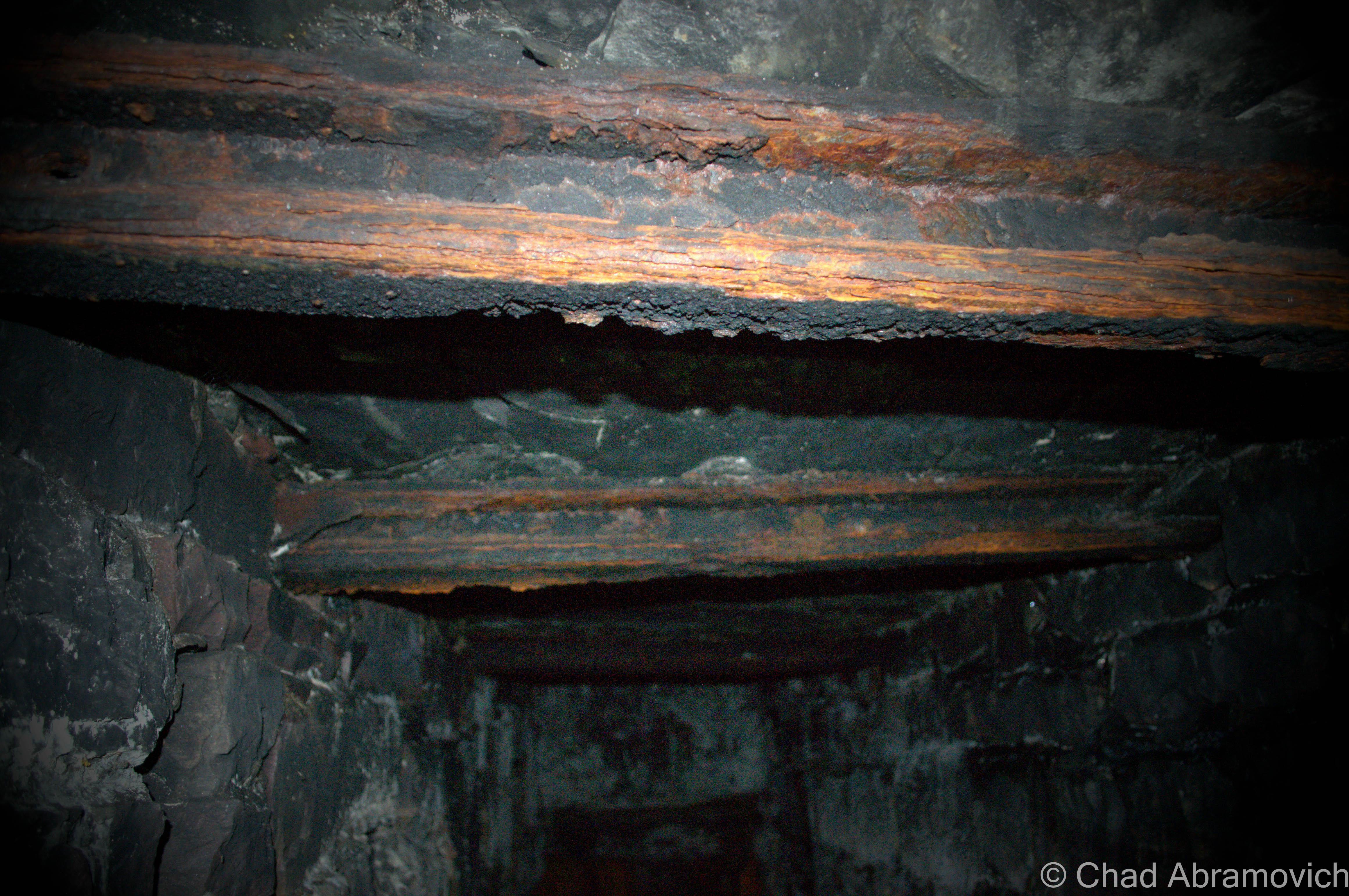
Inside the tunnel, we had to crouch down and ignore the uncomfortable feeling of dripping water coming from the stone roof. Immediately, we were met with the discarded remains of a homeless camp. Boots, a mattress, what appeared to be a few old wooden crates and a few knives that sat in pools of a foul orange slime that seemed to coat the entire tunnel floor. We noticed 2 odd features of the tunnel, one being 2 man made slits in the stone walls that stretched back to about my elbows – just wide enough to store small objects in. In the second, farthest section of the tunnel, the ceiling was supported by what looked like stolen railroad ties, their red rust stood out brilliantly in the flashlight beams.
Traversing this tunnel was no easy feat. The floor was slick and slippery. Not long after entering, our boots were covered with thick orange slime that offered us no traction. The further we ventured back, the more rotted the wood and debris became, almost disintegrating underneath our feat as the tunnel clearance became smaller and smaller. As we stood inside, trying to figure the great mystery about the place, it was impossible. The shadows of the past span so fast that everything the tunnel gave to me was blurred.
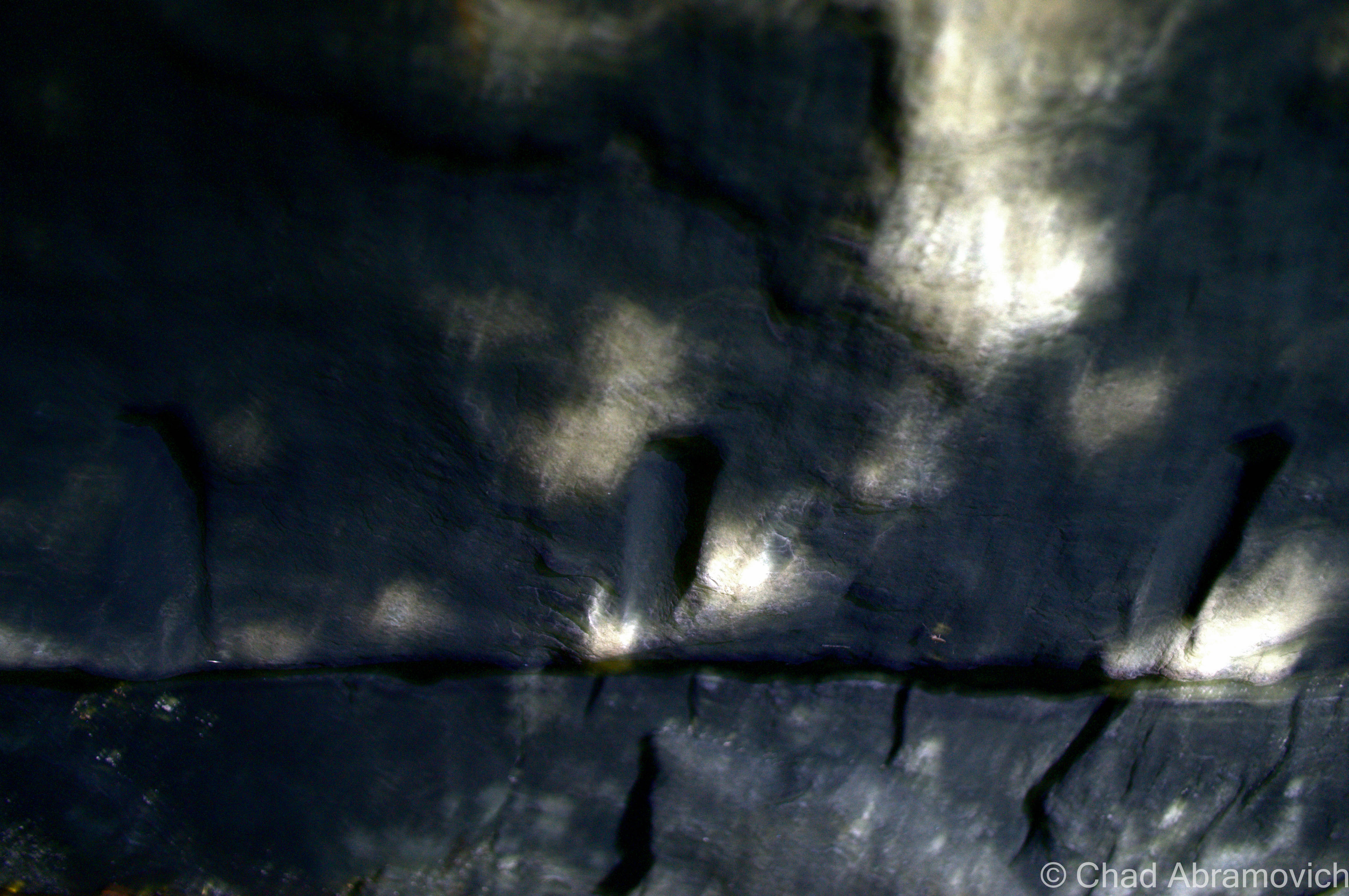
Railroad ties that spanned the ceiling were used in some of the tunnel’s constructioninteresting markings on the tunnel ceiling
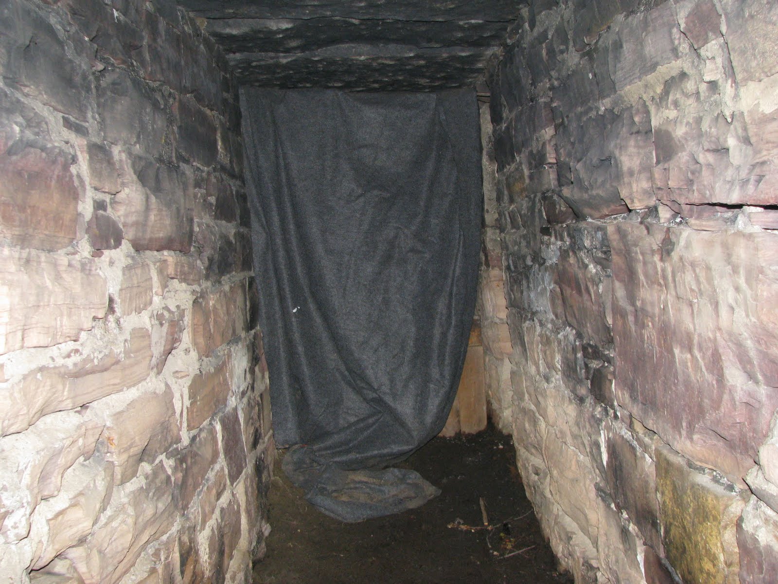
As I was inside, I recalled my friend telling me further about his adventure in this tunnel Years ago. On his expedition inside, he came across a peculiar find. He had ventured inside, and not long after, he noticed his flashlight beam illuminate a thick grey blanket that was hanging across the interior, which was most likely deliberately placed, creating the illusion that the tunnel was actually much shorter than it actually was. Carefully talking down the faux wall, it opened up another several feet of tunnel that rambled off into the dark, before finally ending again at a real stone wall. He guessed that a homeless person who wanted to keep curious visitors away from his home in the end of the tunnel, created the wall for a bit of anonymity and security.
This picture taken by Joe Citro shows the gray blanket draped across the interior he encountered.
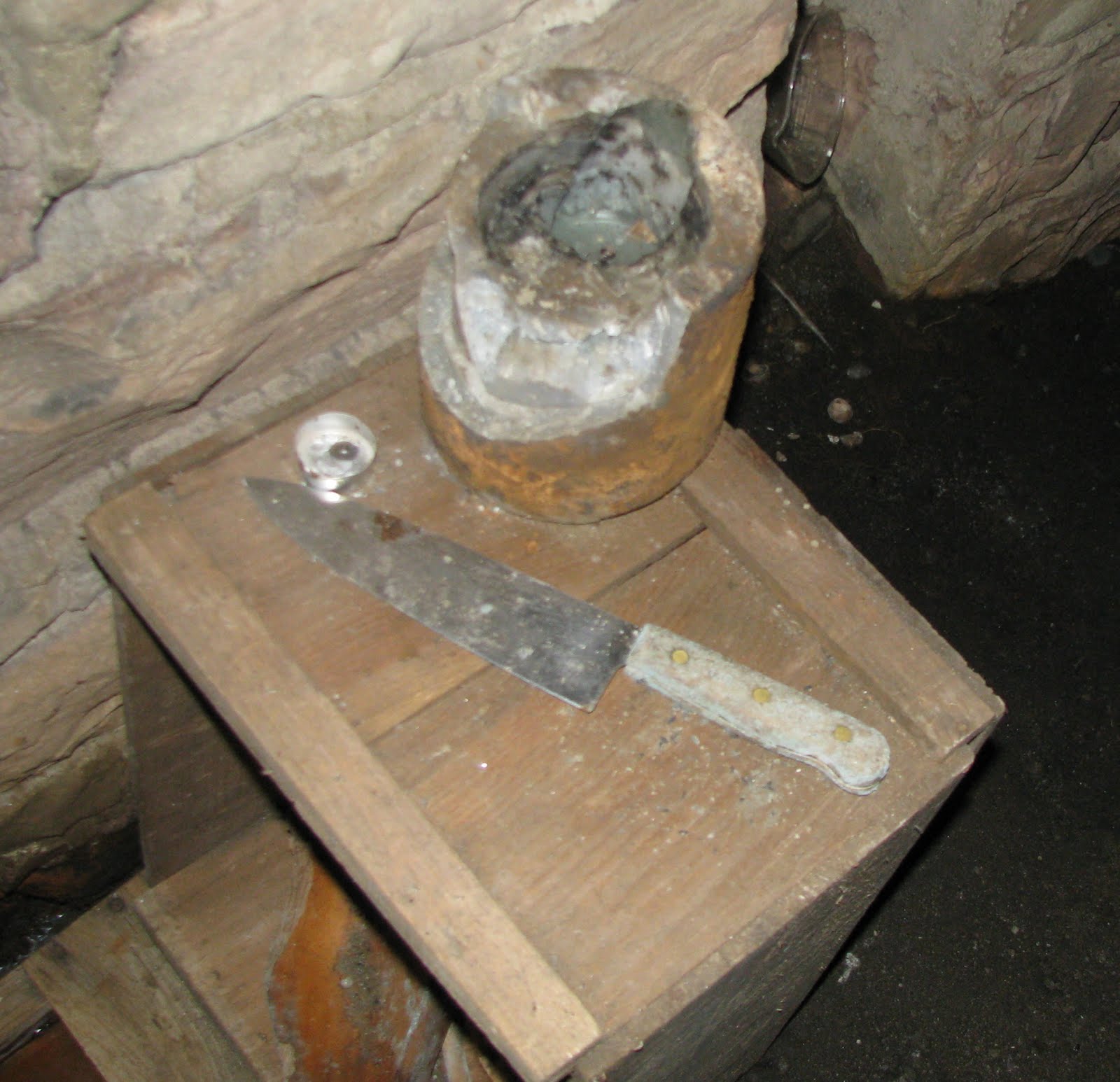
I was warned of the possibility of finding knives or other sinister artifacts inside. It seems Joe Citro found just that. (photo: Joe Citro)
The reality of the mysterious order of people who frequent and possibly live the dank tunnel was a sobering reality, and only added to the deepening mystery. Another friend told me stories of him finding actual knives next to a makeshift bed – and told me to be cautious while exploring. So until some information takes form, or a developer decides to seal it up – the tunnel will continue to baffle curious visitors and harbor the fallen.
Disclaimer: You’ll notice I didn’t give away the location of the tunnel. That was intentional, in order to protect special and endangered locations like this one. So please, don’t ask.
—————————————————————————————————————————————–
To all of my amazing fans and supporters, I am truly grateful and humbled by all of the support and donations through out the years that have kept Obscure Vermont up and running.
As you all know I spend countless hours researching, writing, and traveling to produce and sustain this blog. Obscure Vermont is funded entirely on generous donations that you the wonderful viewers and supporters have made. Expenses range from internet fees to host the blog, to investing in research materials, to traveling expenses. Also, donations help keep me current with my photography gear, computer, and computer software so that I can deliver the best quality possible.
If you value, appreciate, and enjoy reading about my adventures please consider making a donation to my new Gofundme account or Paypal. Any donation would not only be greatly appreciated and help keep this blog going, it would also keep me doing what I love. Thank you!
Sometimes it seems that I could write a sizable book about Burlington, inspired by the seemingly endless tales of fabled places, strange stories and lost history that are begging to be known – their praises seldomly sang by a select and arcane few.
There are many weird and wonderful things that many of us see everyday. The world’s largest tower of filing cabinets makes its home in a weedy field in the South End, and there is a puzzling bridge to nowhere in the intervale that looms over the beltline.
And there are other intriguing mysteries that are more difficult to explain, and even harder to find. Tales of catacombs and tunnels running underneath downtown have been relayed to me, as well as an awesome and mysterious “subway like railroad tunnel” that supposedly runs underneath the Old North End still, years after being defunct and sealed up (which I have yet to find). But, out of all of Burlington’s peculiarities that have long since vanished, there is one that is still refusing to be completely forgotten.
I was interested in this mystery when I accidentally stumbled upon an old city map dating from the mid 1800s in the book Bygone Burlington. It clearly marked streets and familiar landmarks that still exist today. King Street, Main Street, Lake Champlain. But there was something else. The map clearly labels something that would be so conspicuous in today’s Burlington. Just east of present day South Winooski Avenue was a serpentine sunken trench of land that divided the city in a South-West and North-East direction, separating downtown from the hill section. A few bridges crossed the ravine and spurred off onto the hill and towards Colchester Avenue before making the journey to Winooski – the old map describing the ravine as wild and swampy. It was strange seeing this strange ditch co-existing with the city.
It’s obvious that this ravine no longer exists today. Or, so it would seem. As a matter of fact, the ravine is still very much there.
This 1853 map of Burlington shows the former ravine
I knew I wanted to know more, and I set out to do some research. What I found was another interesting layer in Burlington’s story line.
In the beginning, it seemed that this fabled ravine was beneficial to the city. As Burlington prospered and grew during the 19th century, the city would need to meet the demands of a growing population. Old maps created around 1853 indicate that the Vermont Central Railroad purposely used the ravine as a direct route from the waterfront to the mills in Winooski. The former downtown train depot sat at what is now the corner of Main Street and South Winooski Avenue (known then as White Street), where the fire station is today. In 1862 the railroad was re-routed underneath North Avenue and through the intervale on its present day route. Later, in 1880, the ravine would once again serve a utilitarian purpose, and was chosen as the backbone of the city’s new and modern sewer system which was built using a network of stone and brick sluices and culverts that followed the path of the ravine into the lake – all discharging at a location somewhere near the end of Maple Street.
However, there was a population explosion in Burlington around 1880 and the demand for land was high. The ravine soon became a roadblock to progress. Tensions mounted when the existing sidewalks and bridges began rotting and crumbling, creating dangerous hazards and upset residents. The city then embarked on an ambitious project to fill the ravine, and in a classic act of 19th century urbanism, filled it with garbage. That’s how San Francisco reclaimed its now famous waterfront area, so why not Burlington? But, maybe 19th century urban planners didn’t see the problems behind building a city over decomposing garbage piles. But it happened, and the modern day downtown we all identify with was created in its wake.
Over time, people have been curious about the ravine as I have been, and began to pick at the pieces to this intriguing puzzle. And that seems to have raised some issues of debate. Some argue that the ravine was never there to begin with, and was simply an error on a map.
But other arguments prove otherwise. It is known that Burlington’s waterfront is reclaimed marshland, filled in with garbage and wood and old maps show a former branch of the Winooski River actually emptying into the lake here, near the present day Battery Street railyards. Some even speculate there are still remnants of this original tributary still running underneath the streets today, but performing an excavation now would be impossible, problematic and costly, leaving this as speculation.
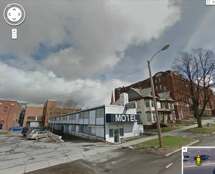
But, you don’t have to do a lot of digging to find some answers, and In this case, the answers take the form of a long, narrow and seedy looking landmark that is a looming eyesore at the main entrance to the vibrant downtown area; The Midtown Motel. You might not guess by looking at it, but the dated structure was purposely built the way it is, because it sits on top of the former ravine and the layers of garbage that filled in the old cavity. The motel opened in 1958 and has served everyone from tourists, young lovers looking for a little respite, and people just down on their luck – and because there were no places to stay in Burlington’s city center at the time, the Midtown Motel prospered.
But, before anything could be built on the property, local architect Benjamin Stein had to figure out how to fit both a motel and ample parking on the usable pieces of the property – the parts that would support development over the fragile layers of fill that cover the ravine.
The Midtown Motel
To make it work, the architect needed to get creative. The narrow motel was elevated and the parking was put below it. The design embodied the International style of architecture, where functionality came first. The motel did well until the 90s, when it went downhill and began drawing seedy clientele, and a bad reputation to go with it. Today the motel is out of business and vacant, and the city block it sits on is considered a “super block”- or, a block that is largely city owned and offers substantial redevelopment potentials. It is one of the only such blocks remaining in Burlington, meaning the value of the land is only growing. However, because the property’s unique setbacks, more delicate measures will have to be made before any large redevelopment projects are taken.
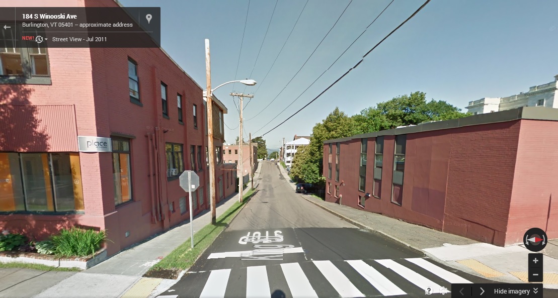
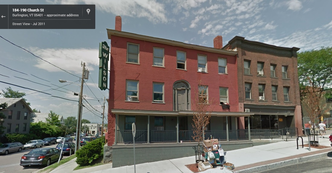
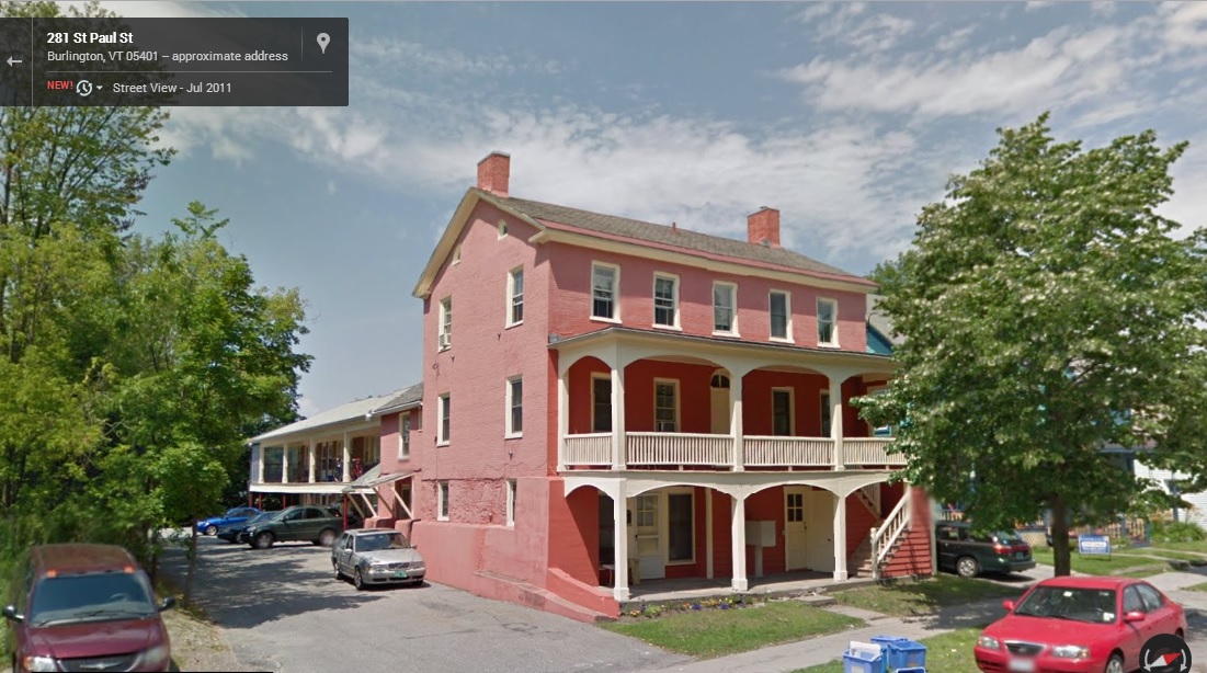
Just down the road from the Midtown Motel is another remnant of the ravine, one that the city hasn’t completely covered up yet. On King Street, there is a sizable and isolated geographical anomaly in the middle of the road itself – a dip in the stretch between Church Street and South Winooski Avenue. From the bottom of the dip you get a good perspective of the raise in elevation around it, and how the city’s buildings have been configured and built. And there are some buildings on Saint Paul Street with exposed foundations, sections of the buildings that appear to have once been above ground.
The Strange Isolated Dip in King StreetThe former Wilson Hotel on the corner of Church and King showcases evidence of changing elevation – the front door is on the second floor!This brick house on St. Paul Street shows that the first floor was at one point the basement.
It seems strange to think about a large trench that divides Burlington in half, a trench so large that it once even had its own toboggan club – but stranger things have happened in the throes of progress. If the entire present day city of Seattle was built literally on top of the original city, then Burlington’s ravine almost seems passively unimpressive to think about. The communities we visit today are drastically different from what they were 100 years ago, almost unrecognizable at times, which is both intriguing and inspiring. Who knows what else is buried underneath the ground you walk on.
To all of my amazing fans and supporters, I am truly grateful and humbled by all of the support and donations through out the years that have kept Obscure Vermont up and running.
As you all know I spend countless hours researching, writing, and traveling to produce and sustain this blog. Obscure Vermont is funded entirely on generous donations that you the wonderful viewers and supporters have made. Expenses range from internet fees to host the blog, to investing in research materials, to traveling expenses. Also, donations help keep me current with my photography gear, computer, and computer software so that I can deliver the best quality possible.
If you value, appreciate, and enjoy reading about my adventures please consider making a donation to my new Gofundme account or Paypal. Any donation would not only be greatly appreciated and help keep this blog going, it would also keep me doing what I love. Thank you!
It seems this year it rains every time the summer sends her best. The weather hasn’t been ideal for adventuring, with a string of floods and road washouts. So when a rare overcast afternoon came my way, I took advantage of it.
Getting together with a good friend, we set off for West Bolton, a remote area located high in the slopes of the Green Mountains, only accessible by a labyrinth of back roads that twist their way up steep hills. But as soon as we left Route 117, we were greeted with washed out dirt roads and attention grabbing orange cones as our car bumped and jarred its way into the mountains.
With Motown soul coming through the radio, I gazed up at the mountains in my reverie, the fogs soluble on the summer canopy. It was wild country up here, and the change of scenery was lifting my spirits, as I felt like I was coming back from what seemed like a ruin.
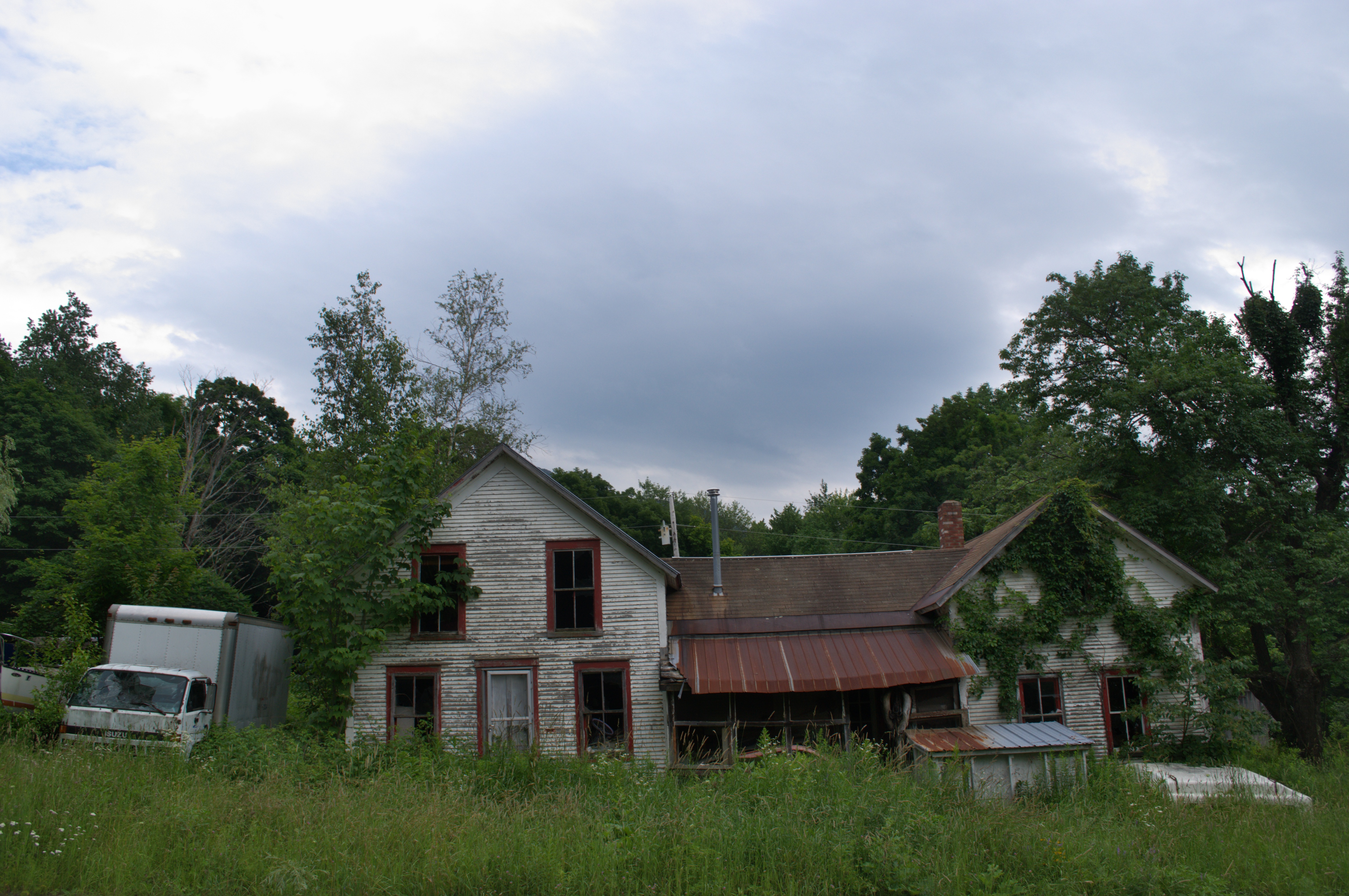
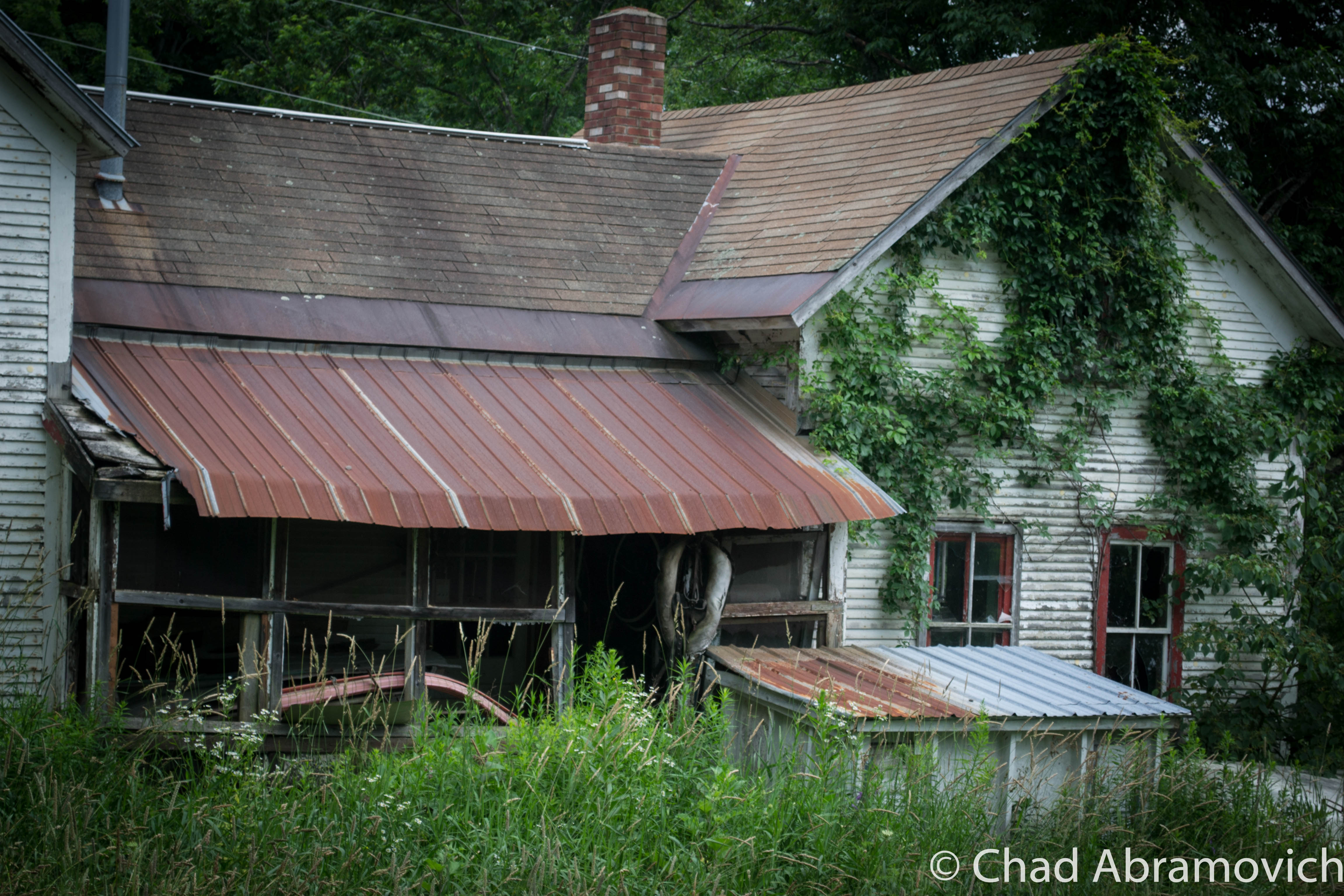
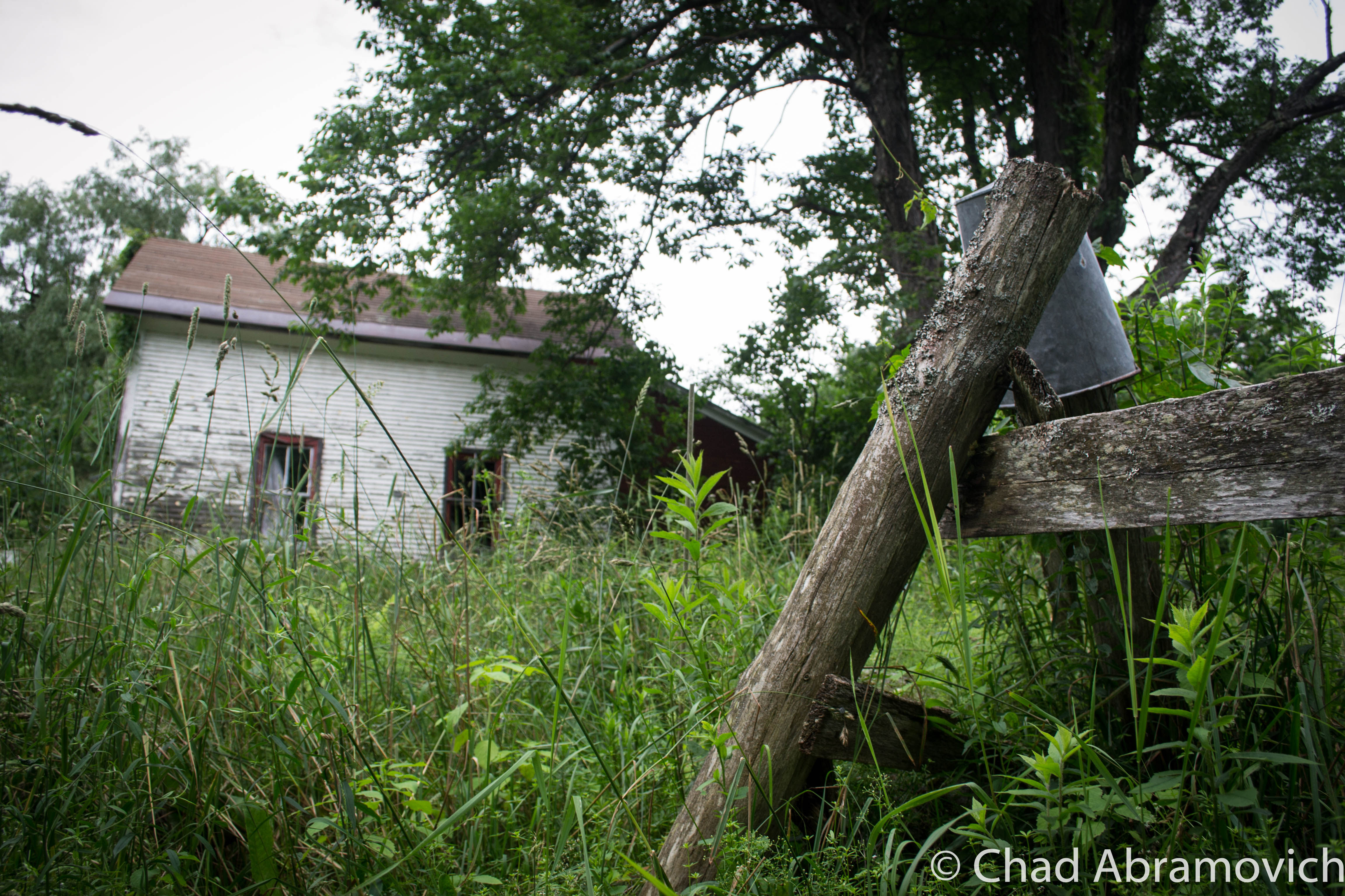
There was one particular house I wanted to see, and as we ascended up a slight turn, it’s ramshackle facade came into view with tall grass and vines and a rusting tin roof under the promise of rain.
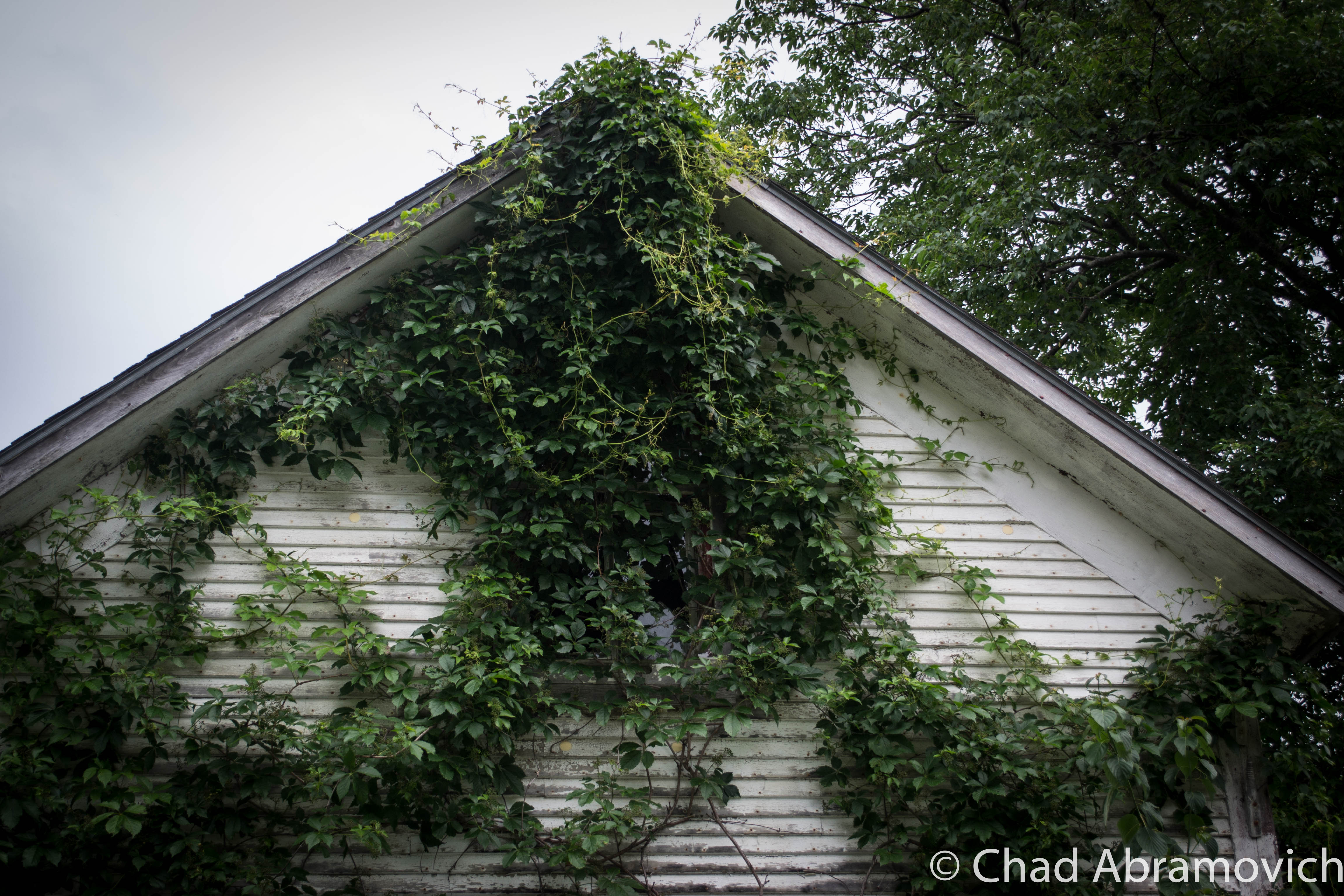
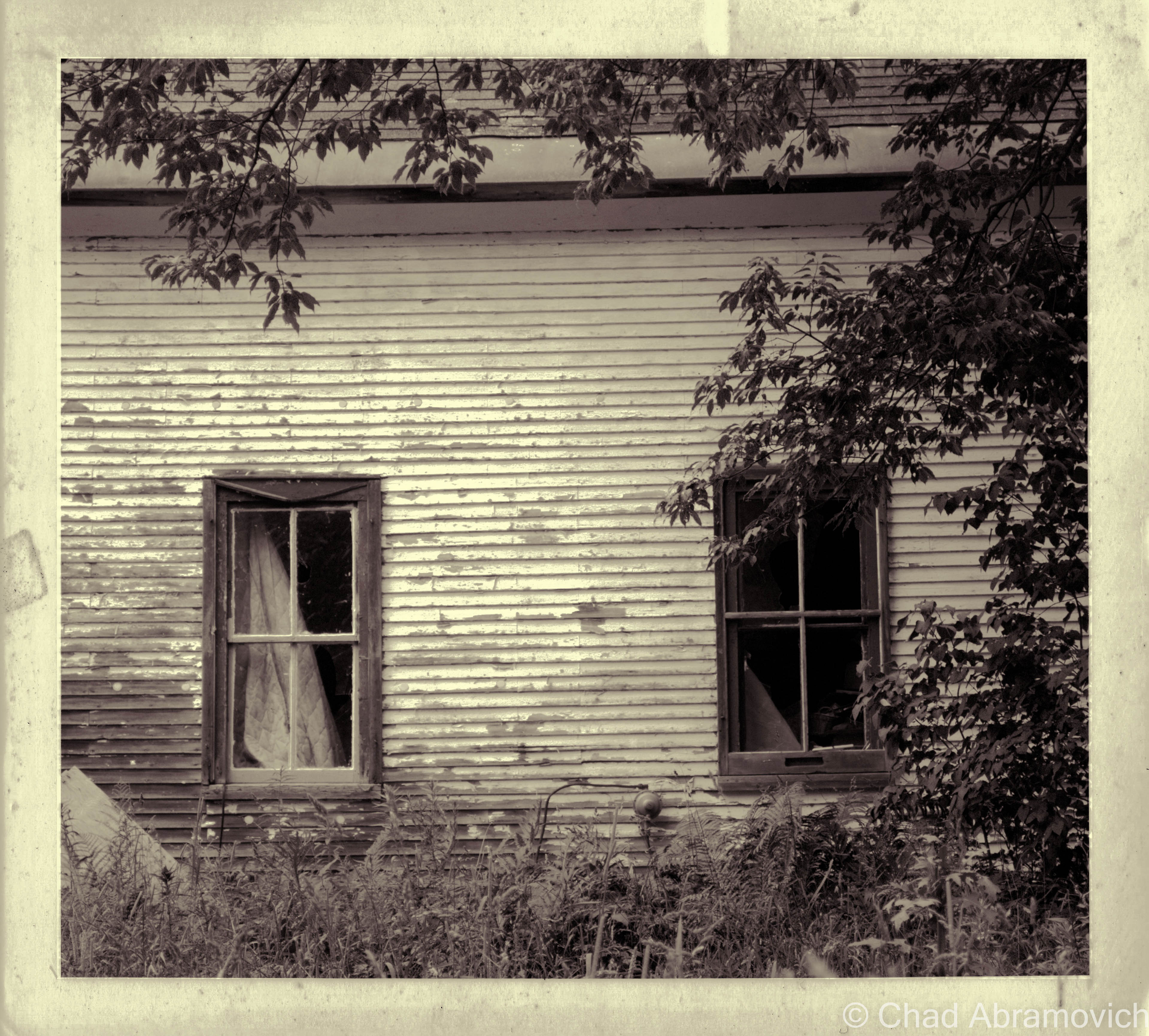
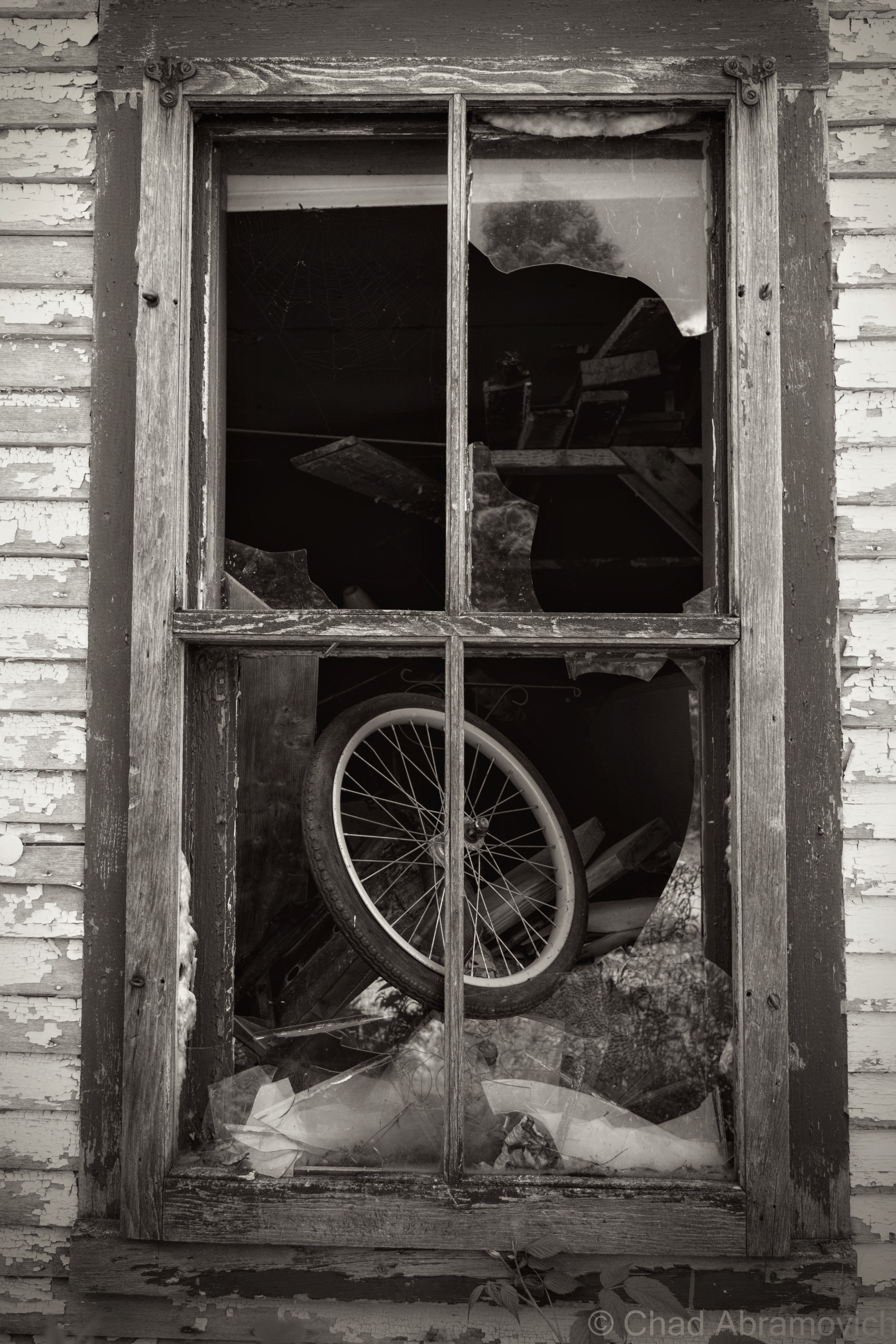
I loved this old house. The front lawn had grown wild and covered the piles of discarded junk that surrounded the house, their forms almost indistinguishable. All of the old farmhouse windows were broken, and from its vulnerable wounds, the inside could be seen. The inside appeared to be chaotic and filthy. Most of the windows had mysterious mounds of debris in front of them, some of it threatening to spill out onto the lawn. Other windows had quilts and bed sheets nailed over them from the inside, and were long moth ridden and disintegrating. But my line of sight faded into the contrasts as the heavy shadows soon swallowed my visibility, keeping the house’s secrets lost in the dark. The battered metal screen door hung open near the front lawn, stopped by the tall grasses. The remnants of a rotting wooden fence occasionally protruded from the growth.
Looking at this old house now, and its depleting condition and fading paint, it’s almost as if this property is wistfully saying “this past century went like a life out of me”
With a surprising steady flow of traffic for a rut chocked back road, and tall grass that obscured our vision, we decided it was best (to my disappointment) not to venture too close to the sagging property. That decision may have proved to be very smart, as we heard scurrying through the grass and the sounds of claws on wooden siding. Some kind of animal had just crawled into one of the broken windows.
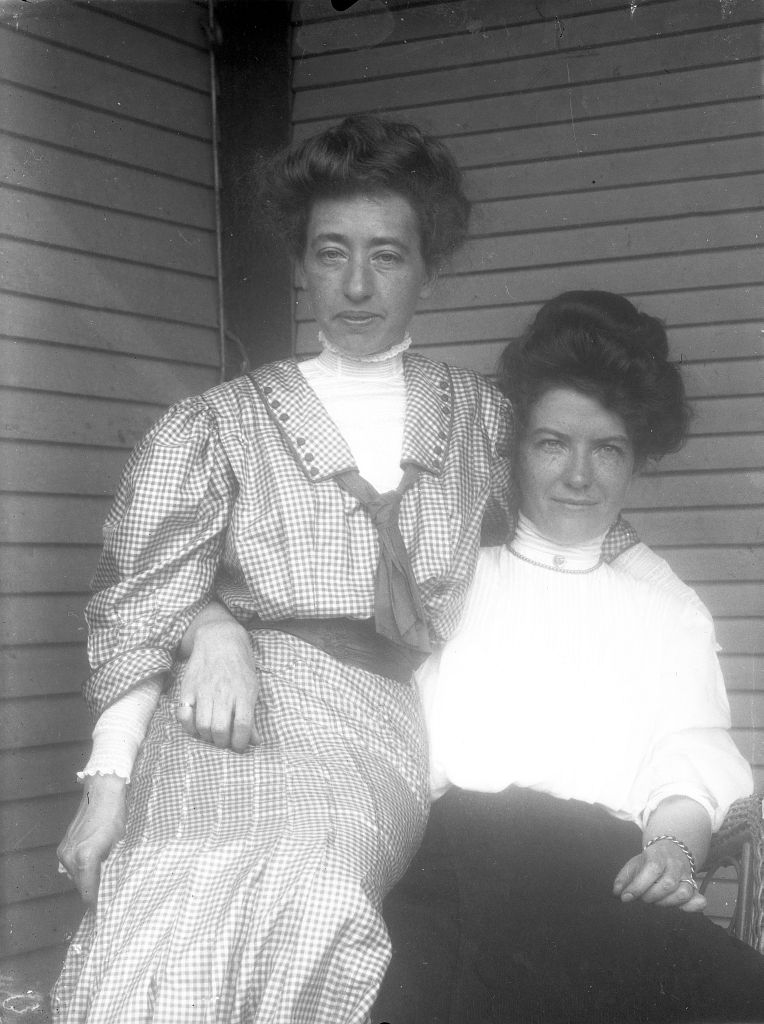
With some quick research, I was able to find some old photos of the house, which offered an interesting glimpse into what once was. The first thing I found out was it had an official name; The Pease House, named after its founding family. The wide open spaces and cleared hill meadows that surrounded the house have long returned to woods – this house a last enclave of Bolton’s former life as the area continues to meld with the untamed mountains above.
The determined people who once cleared the land and built this house, the ones who once knew the front porch and the doorways and cherished the moonlight on hot summer nights, now nothing more than dust – a deadpanning reality at how fragile urban infrastructure is, and how easily things can become lost.
The reasoning for its current abandonment is unknown to me, but as someone informed me, it is owned by someone. Perhaps sometimes, we are the ghosts we don’t believe in.
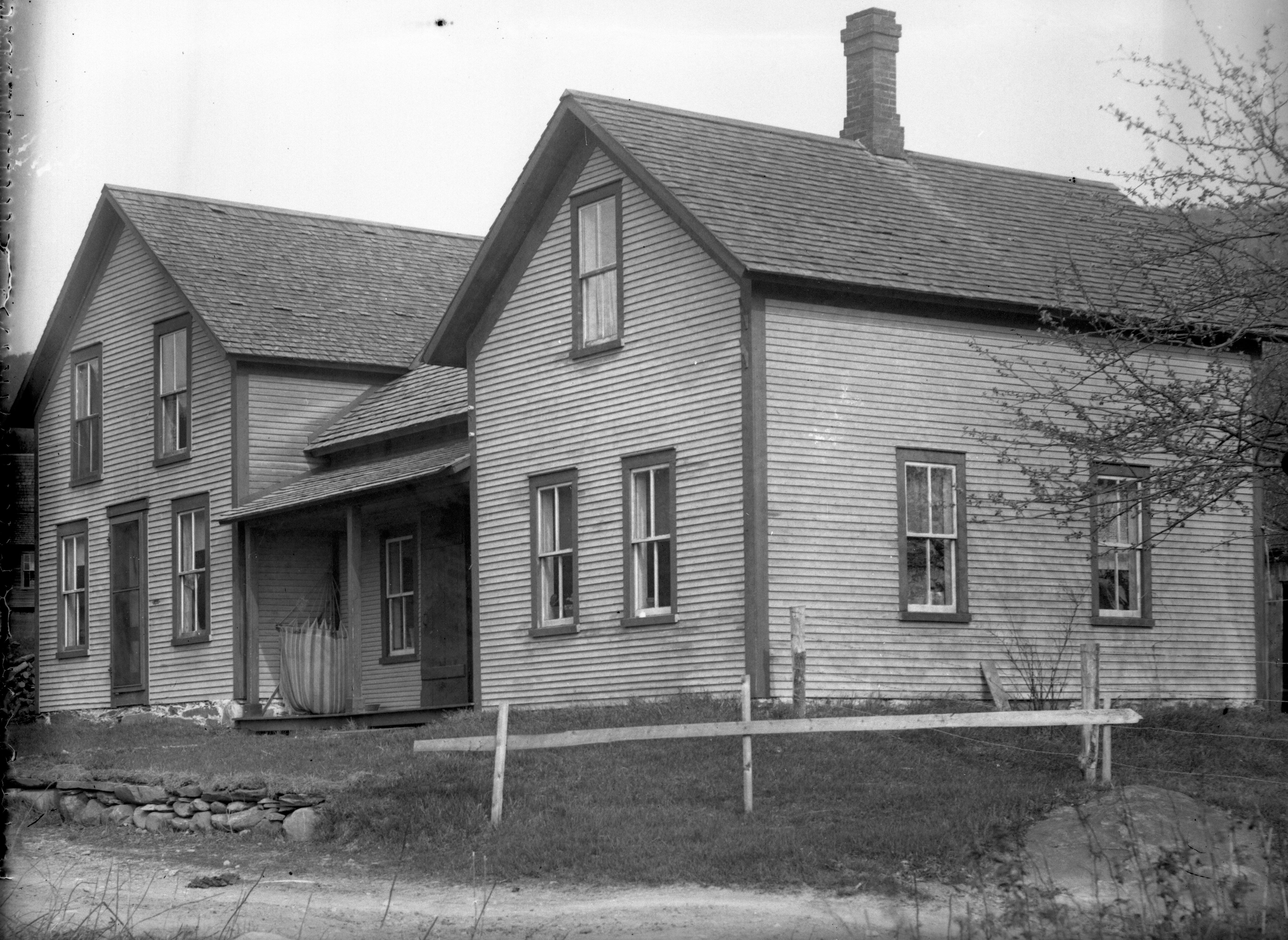
The Pease House circa 1860s
The Pease House Today
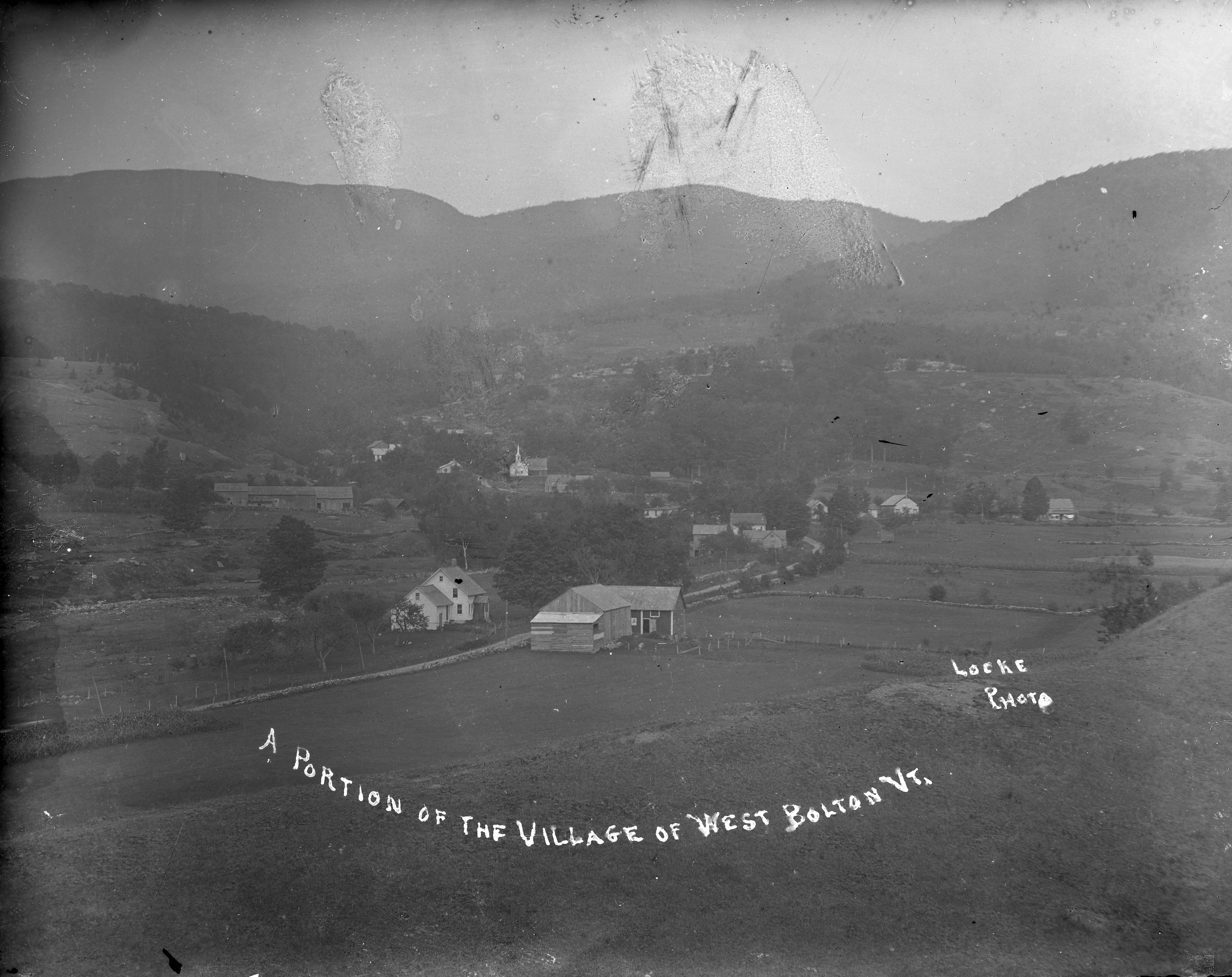
West Bolton is a name lost to history. What used to be a small village in the mountains, complete with 2 churches, a sawmill and general store, is now nothing more then a name on the map, with a scattering of private residences and a more well-known golf course that wears the same name.
The town of Bolton is mountainous, rocky and gave the early settlers more work than they bargained for. It’s no surprise that Bolton is referred to as “the land of boulders and bears.” The town has more than twenty mountains of over 2,000 feet, and nearly as many more just under that height – creating natural barriers to trade and travel in the town, along with isolation that would meet the pioneering families under the stars. Today, it’s rugged slopes create outdoor recreation opportunities in the form of skiing and snowboarding at Bolton Mountain, tons of rock climbing opportunities and the infamous Bolton potholes, a beloved swimming hole that the locals despise because of the hoards of disrespectful visitors who flock there.
Even driving along Interstate 89, which seems to be the most traveled route in town which also doesn’t technically let you off in Bolton, the awesome vertical cliffs that the highway cuts through are testaments to Bolton’s nickname. Though many of Bolton’s bumps remain unnamed, one vertical drop earned its namesake from a man who committed suicide from it years ago. Alan’s leap is seemingly well solidified amongst the locals for its views and it’s perception of a moment of morbidity. Vermont is known for its grueling winters, and Bolton’s position literally on the spine of the Green Mountains means it gets dumped on rather spitefully once the temperatures drop below freezing. A blog commenter recalled that two women who lived down the road from one another both committed suicide because of the internal darkness they faced brought on by the perennial death of the year.
Historical records tell stories of bears coming down from the mountains and mass slaughtering sheep flocks around the village of West Bolton. The bear problem was once so bad that Bolton once had the honor of being the town with more bears slain in its borders than any other town in Vermont.
In the 1930s, The Government bought around 6,000 acres of land around West Bolton and Jericho for the Ethan Allen Training Site, and much of the village of West Bolton was destroyed in the name of progress. Today, all that remains are a few foundations sitting in the quiet woodlands above boulder logged streams and old Apple Trees hinting at the site of a former farm. I was told that UVM mapped the area and had a walking tour for a while in the 1990s.
The surrounding woods along the back roads that travel along the ridge lines and swamps are congested with “US Property, NO Trespassing” warnings on almost every tree.
One of the few remaining foundations we were able to find is the site of a former church, now nothing more than its front stairs.
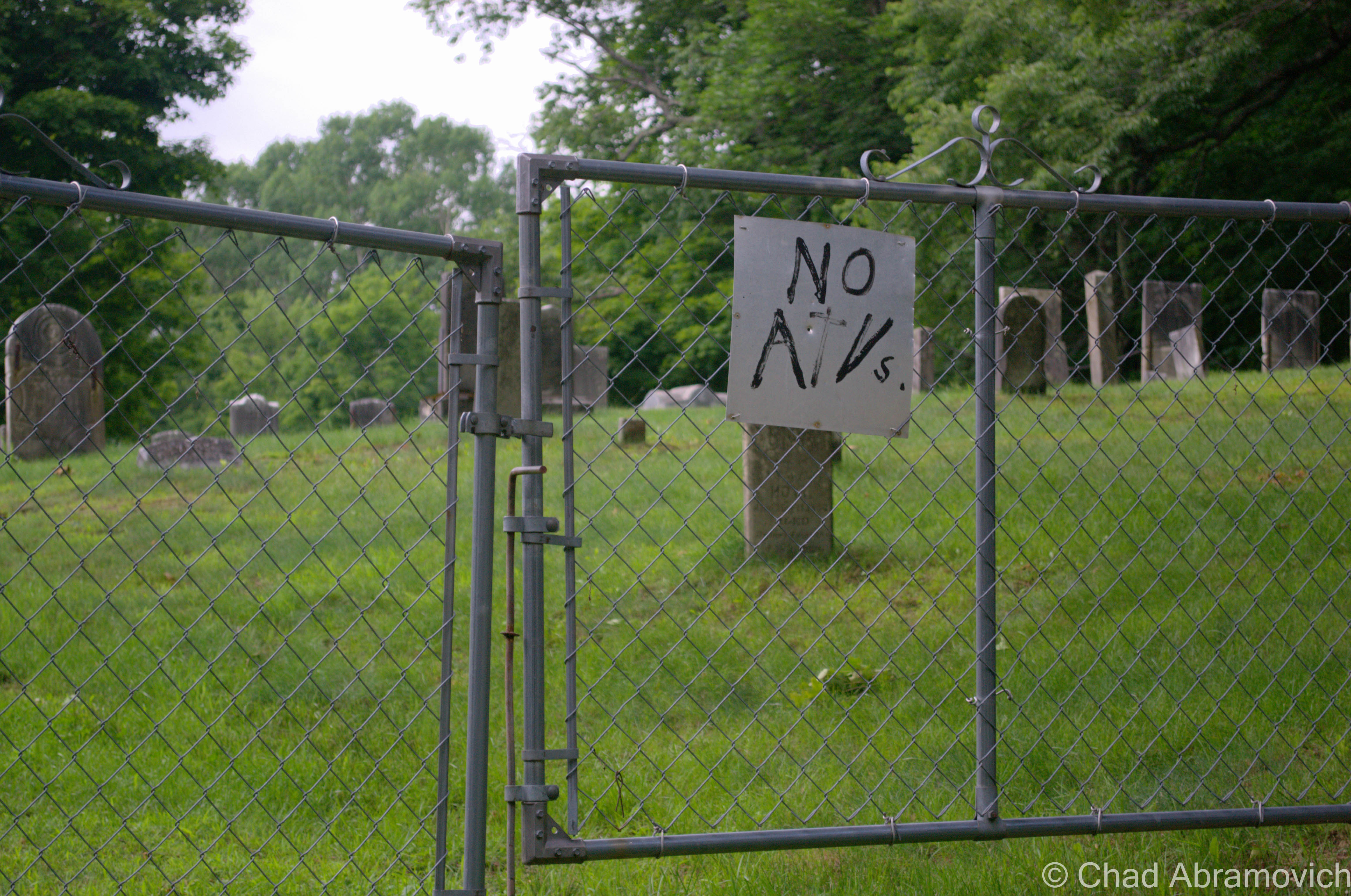
Nearby was the old West Bolton Cemetery, which is still maintained. It was oddly quiet here, with a solemn weight that seemed to hang over the Maples and hollows. There was also an amusing sign attached to the front gate, humorously prohibiting ATVs from riding in the local cemetery. Within 10 seconds of us seeing this sign, a group of ATVs came up the dirt road towards the cemetery, 4 of them packed with 2-3 riders on each one. They slowed down as they approached the fence, revved their engines obnoxiously for several minutes, then took off down the road sending gravel and dust in their wake. Maybe they didn’t like the new sign?
I sometimes enjoy walking through older cemeteries to admire and become intrigued with unique epitaphs, symbols alluding to secret societies, and other oddities that have been chiseled onto the aging headstones. There is always a story to be told. One of my favorite finds in West Bolton was this etching of a hand, with a finger dramatically pointing up to the skies above. In the 1800s, it was sometimes common for this to appear on headstones, with the intention of saying that without a doubt, this deceased soul did in fact go to heaven. But no one knows for sure if this gesture was telling any profound truth or not. And I suppose you don’t have to go ghost hunting in your afterlife to find out.
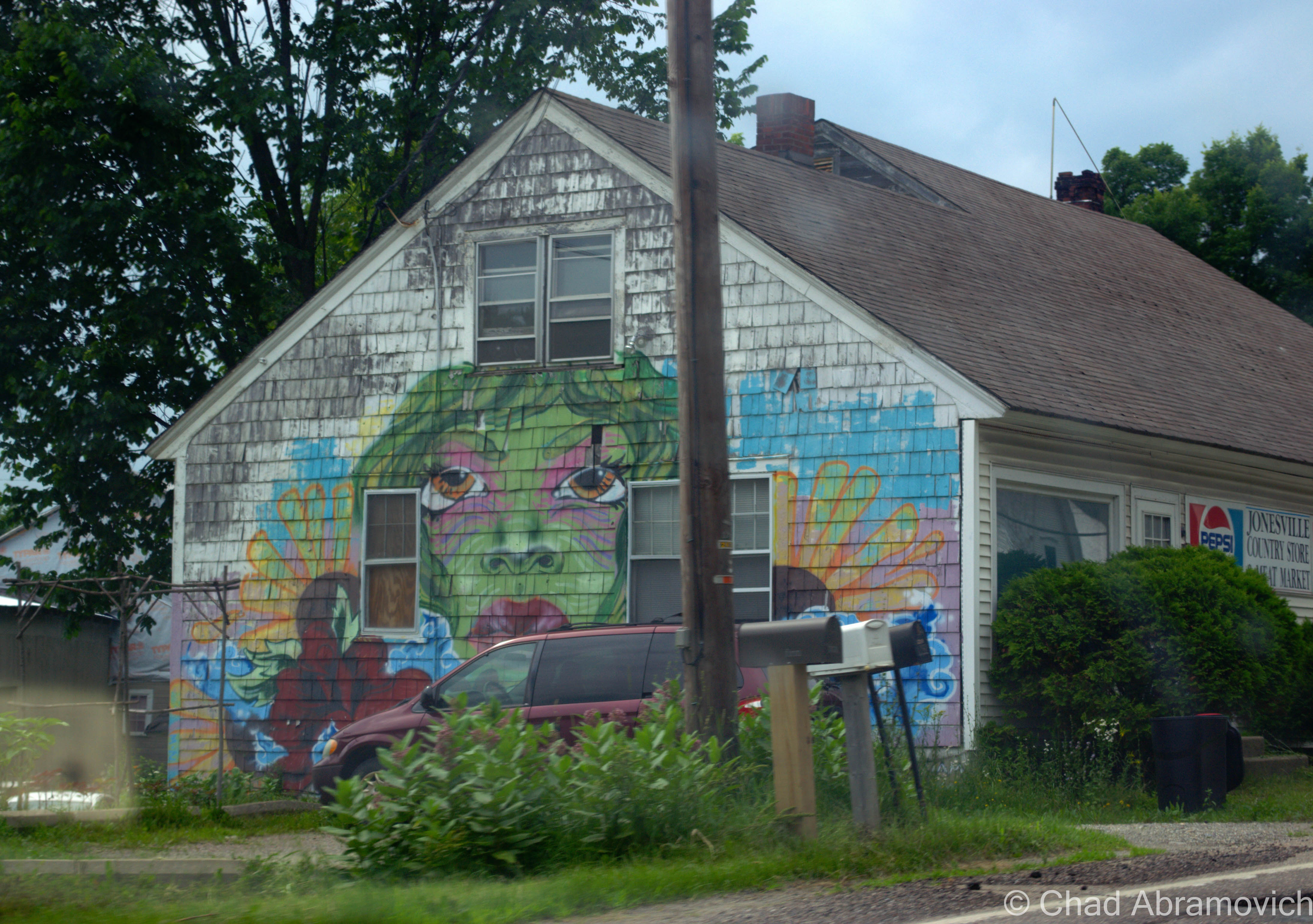
As seen in “Downtown” Jonesville.
—————————————————————————————————————————————–
To all of my amazing fans and supporters, I am truly grateful and humbled by all of the support and donations through out the years that have kept Obscure Vermont up and running.
As you all know I spend countless hours researching, writing, and traveling to produce and sustain this blog. Obscure Vermont is funded entirely on generous donations that you the wonderful viewers and supporters have made. Expenses range from internet fees to host the blog, to investing in research materials, to traveling expenses. Also, donations help keep me current with my photography gear, computer, and computer software so that I can deliver the best quality possible.
If you value, appreciate, and enjoy reading about my adventures please consider making a donation to my new Gofundme account or Paypal. Any donation would not only be greatly appreciated and help keep this blog going, it would also keep me doing what I love. Thank you!