

Sometimes it seems that I could write a sizable book about Burlington, inspired by the seemingly endless tales of fabled places, strange stories and lost history that are begging to be known – their praises seldomly sang by a select and arcane few.
There are many weird and wonderful things that many of us see everyday. The world’s largest tower of filing cabinets makes its home in a weedy field in the South End, and there is a puzzling bridge to nowhere in the intervale that looms over the beltline.
And there are other intriguing mysteries that are more difficult to explain, and even harder to find. Tales of catacombs and tunnels running underneath downtown have been relayed to me, as well as an awesome and mysterious “subway like railroad tunnel” that supposedly runs underneath the Old North End still, years after being defunct and sealed up (which I have yet to find). But, out of all of Burlington’s peculiarities that have long since vanished, there is one that is still refusing to be completely forgotten.
I was interested in this mystery when I accidentally stumbled upon an old city map dating from the mid 1800s in the book Bygone Burlington. It clearly marked streets and familiar landmarks that still exist today. King Street, Main Street, Lake Champlain. But there was something else. The map clearly labels something that would be so conspicuous in today’s Burlington. Just east of present day South Winooski Avenue was a serpentine sunken trench of land that divided the city in a South-West and North-East direction, separating downtown from the hill section. A few bridges crossed the ravine and spurred off onto the hill and towards Colchester Avenue before making the journey to Winooski – the old map describing the ravine as wild and swampy. It was strange seeing this strange ditch co-existing with the city.
It’s obvious that this ravine no longer exists today. Or, so it would seem. As a matter of fact, the ravine is still very much there.

I knew I wanted to know more, and I set out to do some research. What I found was another interesting layer in Burlington’s story line.
In the beginning, it seemed that this fabled ravine was beneficial to the city. As Burlington prospered and grew during the 19th century, the city would need to meet the demands of a growing population. Old maps created around 1853 indicate that the Vermont Central Railroad purposely used the ravine as a direct route from the waterfront to the mills in Winooski. The former downtown train depot sat at what is now the corner of Main Street and South Winooski Avenue (known then as White Street), where the fire station is today. In 1862 the railroad was re-routed underneath North Avenue and through the intervale on its present day route. Later, in 1880, the ravine would once again serve a utilitarian purpose, and was chosen as the backbone of the city’s new and modern sewer system which was built using a network of stone and brick sluices and culverts that followed the path of the ravine into the lake – all discharging at a location somewhere near the end of Maple Street.
However, there was a population explosion in Burlington around 1880 and the demand for land was high. The ravine soon became a roadblock to progress. Tensions mounted when the existing sidewalks and bridges began rotting and crumbling, creating dangerous hazards and upset residents. The city then embarked on an ambitious project to fill the ravine, and in a classic act of 19th century urbanism, filled it with garbage. That’s how San Francisco reclaimed its now famous waterfront area, so why not Burlington? But, maybe 19th century urban planners didn’t see the problems behind building a city over decomposing garbage piles. But it happened, and the modern day downtown we all identify with was created in its wake.
Over time, people have been curious about the ravine as I have been, and began to pick at the pieces to this intriguing puzzle. And that seems to have raised some issues of debate. Some argue that the ravine was never there to begin with, and was simply an error on a map.
But other arguments prove otherwise. It is known that Burlington’s waterfront is reclaimed marshland, filled in with garbage and wood and old maps show a former branch of the Winooski River actually emptying into the lake here, near the present day Battery Street railyards. Some even speculate there are still remnants of this original tributary still running underneath the streets today, but performing an excavation now would be impossible, problematic and costly, leaving this as speculation.
But, you don’t have to do a lot of digging to find some answers, and In this case, the answers take the form of a long, narrow and seedy looking landmark that is a looming eyesore at the main entrance to the vibrant downtown area; The Midtown Motel. You might not guess by looking at it, but the dated structure was purposely built the way it is, because it sits on top of the former ravine and the layers of garbage that filled in the old cavity. The motel opened in 1958 and has served everyone from tourists, young lovers looking for a little respite, and people just down on their luck – and because there were no places to stay in Burlington’s city center at the time, the Midtown Motel prospered.
But, before anything could be built on the property, local architect Benjamin Stein had to figure out how to fit both a motel and ample parking on the usable pieces of the property – the parts that would support development over the fragile layers of fill that cover the ravine.
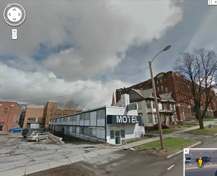
To make it work, the architect needed to get creative. The narrow motel was elevated and the parking was put below it. The design embodied the International style of architecture, where functionality came first. The motel did well until the 90s, when it went downhill and began drawing seedy clientele, and a bad reputation to go with it. Today the motel is out of business and vacant, and the city block it sits on is considered a “super block”- or, a block that is largely city owned and offers substantial redevelopment potentials. It is one of the only such blocks remaining in Burlington, meaning the value of the land is only growing. However, because the property’s unique setbacks, more delicate measures will have to be made before any large redevelopment projects are taken.
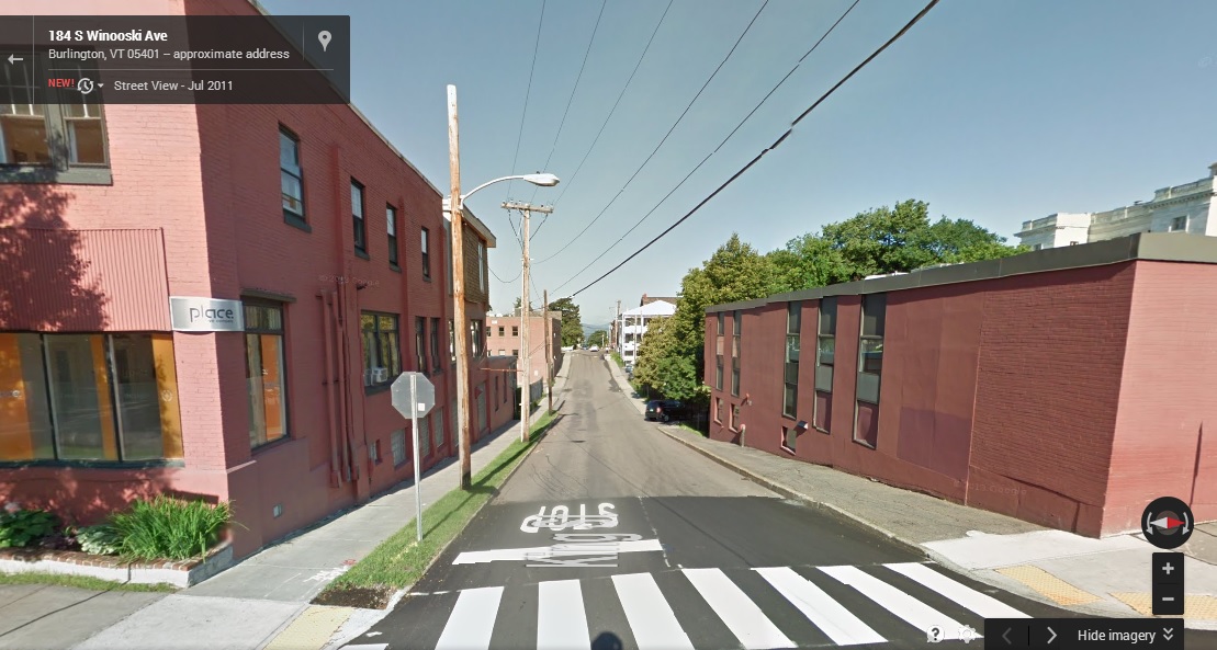
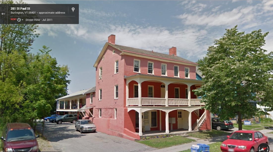
Just down the road from the Midtown Motel is another remnant of the ravine, one that the city hasn’t completely covered up yet. On King Street, there is a sizable and isolated geographical anomaly in the middle of the road itself – a dip in the stretch between Church Street and South Winooski Avenue. From the bottom of the dip you get a good perspective of the raise in elevation around it, and how the city’s buildings have been configured and built. And there are some buildings on Saint Paul Street with exposed foundations, sections of the buildings that appear to have once been above ground.
It seems strange to think about a large trench that divides Burlington in half, a trench so large that it once even had its own toboggan club – but stranger things have happened in the throes of progress. If the entire present day city of Seattle was built literally on top of the original city, then Burlington’s ravine almost seems passively unimpressive to think about. The communities we visit today are drastically different from what they were 100 years ago, almost unrecognizable at times, which is both intriguing and inspiring. Who knows what else is buried underneath the ground you walk on.
Links:
The Midtown Motel in Seven Days
—————————————————————————————————————————————–
To all of my amazing fans and supporters, I am truly grateful and humbled by all of the support and donations through out the years that have kept Obscure Vermont up and running.
As you all know I spend countless hours researching, writing, and traveling to produce and sustain this blog. Obscure Vermont is funded entirely on generous donations that you the wonderful viewers and supporters have made. Expenses range from internet fees to host the blog, to investing in research materials, to traveling expenses. Also, donations help keep me current with my photography gear, computer, and computer software so that I can deliver the best quality possible.
If you value, appreciate, and enjoy reading about my adventures please consider making a donation to my new Gofundme account or Paypal. Any donation would not only be greatly appreciated and help keep this blog going, it would also keep me doing what I love. Thank you!
Gofundme: https://www.gofundme.com/b5jp97d4
![]()