Wizard’s Glen

Ever since we started narrating our folklore collectively as a species, we’ve always marked the wildest places of our topography as incubators of contagion shotgun blasts for the darkest, grimmest things our human minds can create, existing in a variety of forms. These tales often like to hang around well into the intervening years where they should become obsolete, and yet, they don’t. We all deal with the dangers of the world in different ways. Sometimes, carrying on the traditions of talking about these kind of fabled places is a way of dealing with these dangers. And sometimes, these monsters reveal the most about humanity.

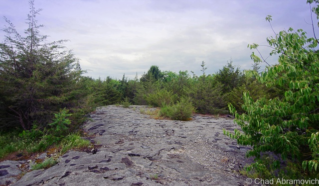
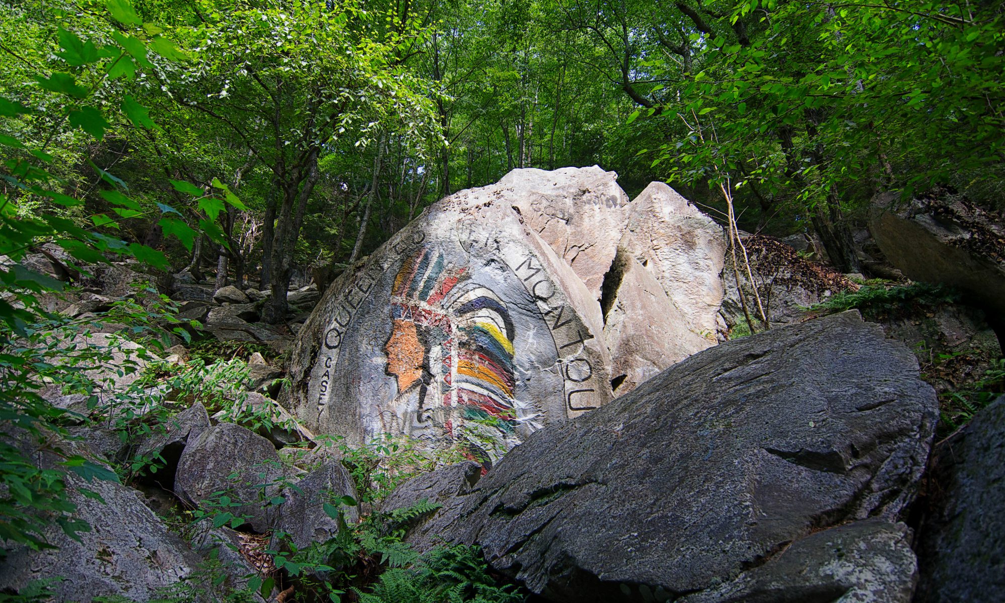
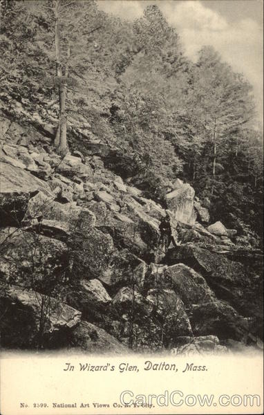
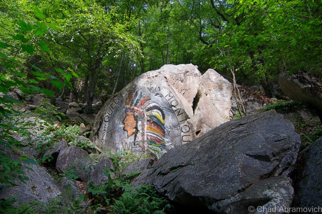
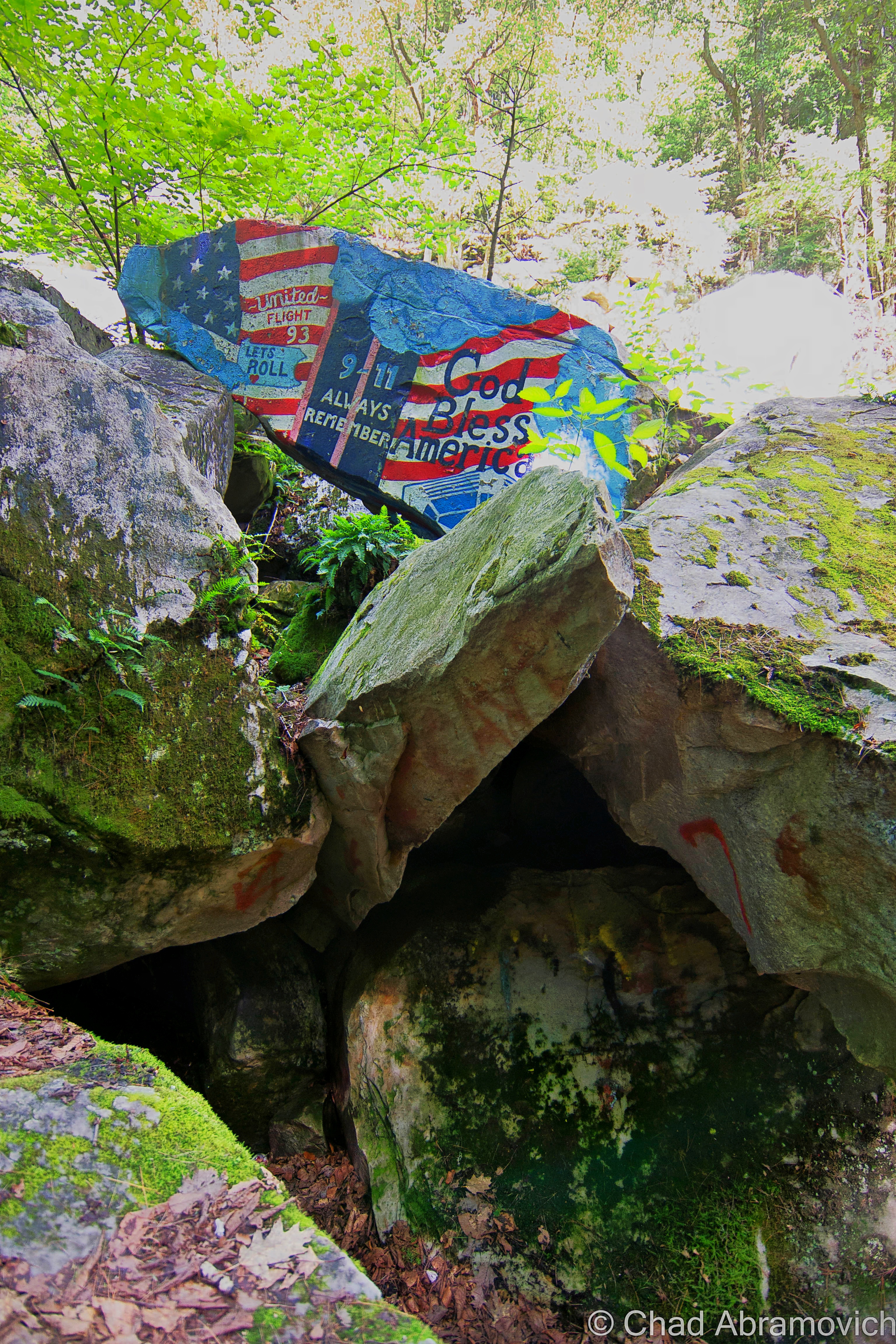
Wizard’s Glen in the Berkshires is a wild, picturesque depression between two steep-sided hills. Intersected by a lone, narrow and often washed out dirt road with it’s to-the-point name of Gulf Road, you are welcomed into this attention-grabbing area by tons of boulders that are stacked up the hillsides, some covered with some impressive and patriotic graffitic murals instead of the flippant teenage rabble I expected to find in such an area.

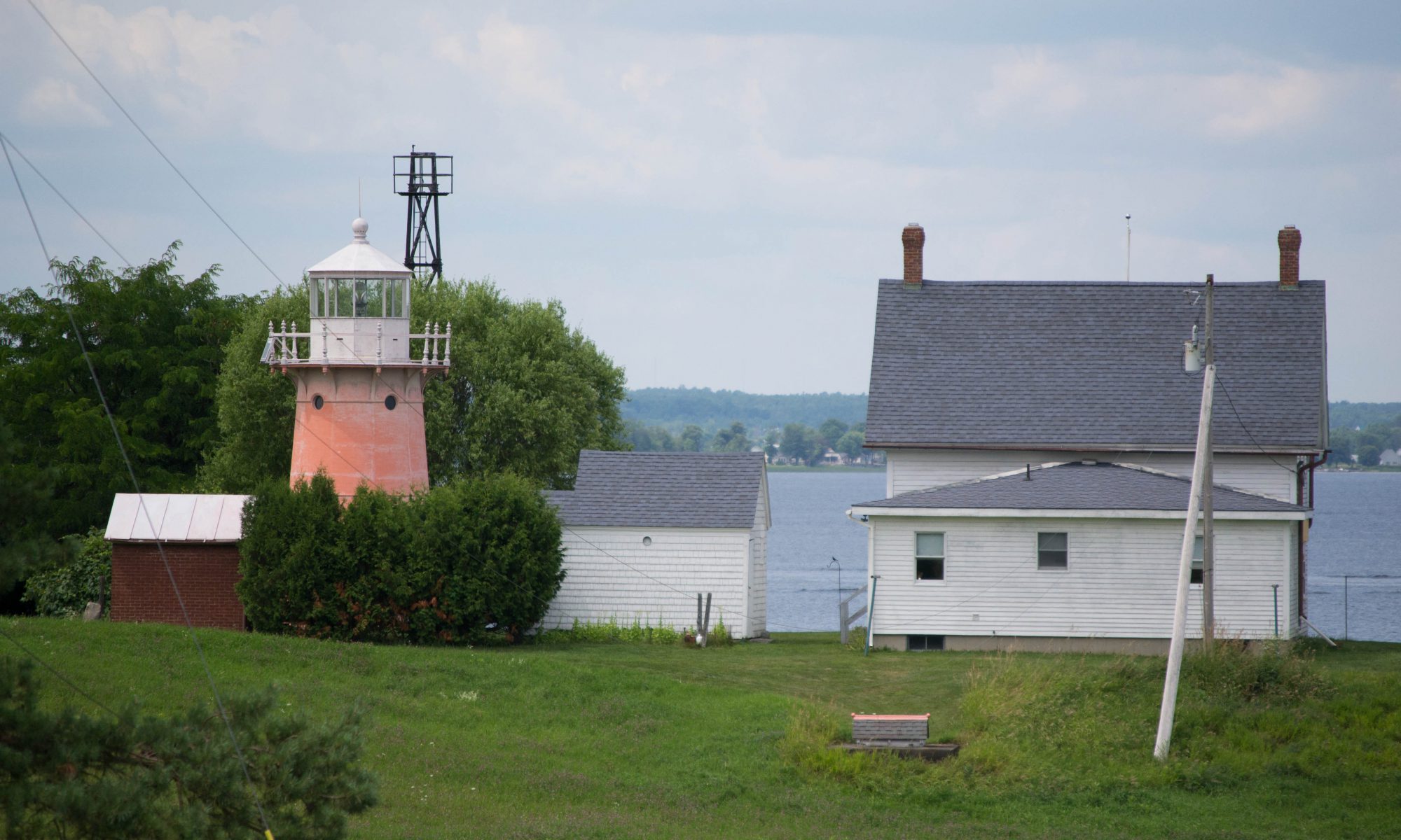
The name “Gulf” interested me before I even began to think about Wizard’s Glen.  The noun is a distinctive part of the obscure Vermont vernacular. Gulfs are known to the rest of the world as a large area of the sea or ocean that’s almost entirely surrounded by land, expect for its mouth. A Vermont gulf is a landlocked one – found in our mountains. We know them as deep ravines (or more dramatically, an “abyss”) that run between two parallel mountains or rises. To my knowledge, us Vermonters were/are the only ones to use the word in that sense. Vermont actually goes as far as to erect road signs to let travelers know that you’re passing through one. Granville, Proctorsville and Williamstown Gulfs come to mind, all of which are great drives. But finding a gulf outside of Vermont, even only in the form of a street name, was sort of cool to me. There is also a Gulf Road in New Hampshire near Brattleboro.

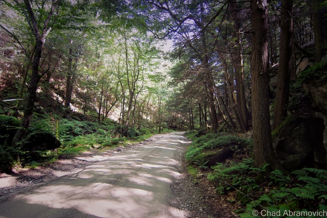
This particular Gulf Road runs east to west over the bumps that are the Berkshires. Both entry points are unobtrusive and start out as an unremarkable suburban street with storm drains, crumbling curbs and cobra head street light fixtures that run to the very point when suddenly, the pavement ends, and the obsessively trimmed lawns cease to exist, and you’re in a surprisingly sizable wilderness area that runs for about 1.8 miles between Lanesborough and Dalton. But at the slow speeds you are forced to crawl on this winding roadway, it feels much longer.

Wizard’s Glen

The area known as Wizard’s Glen, vs. the rest of the area that’s not known as Wizard’s Glen, co-exist very inconspicuously with each other. If it wasn’t for the wayfinding graffiti marked boulders, I would have driven right by it.

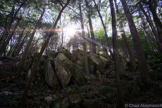
I got out of the car and noticed the temperature was a pleasant few degrees cooler, and the forest was soluble underneath a still silence. I immediately began to get interactive with my environment and started clambering on top of the boulders and under Hemlock boughs and inside the caves and crevices of undetermined pasts.

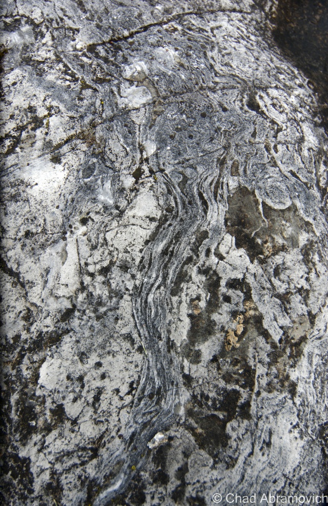
Godfrey Greylock described the diminutive gorge in 1879 as being “as though and angry Jove had here thrown down some impious wall of Heaven-defying Titans. Block lies heaped upon block; squared and bedeviled, as if by more than mortal art…”

I have to say, the stories about this place were far more waggish than it’s real life locality would suggest, which only intrigued me more. This place has spawned plenty of strange tales of the supernatural and the dreadful, and many of them are almost as old as New England is.

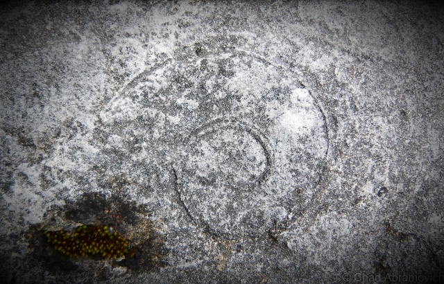
Someone had told me that the hollow is known for its strange sounds and echo-related properties, and claimed that if you banged on one of the rocks with a hammer, it would make a noise sounding like you were smashing the keys of a xylophone, while inexplicably, the surrounding boulders wouldn’t. However, that enticing theory was disappointingly proven false. Well, at least it didn’t work for me.

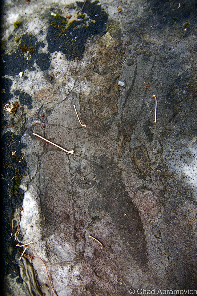
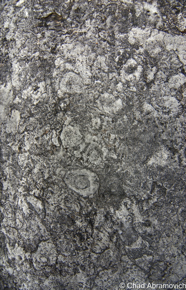
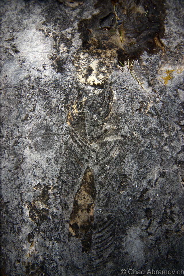
It was here that Indian priests and shaman centuries ago performed rituals, ceremonies and incantations amongst the rocks in the ravine known for its echoes. Because they revered this area to have special properties, it was said they even offered human sacrifices here to Hobomocko, the spirit of evil. There is a flat, broad square-ish rock known as “Devils’ Alter” where these cryptic sacrifices were said to be imposed. The rock today has faint traces of red stains on it, which some say is the remaining blood from the aforementioned occurrences – but the reality is the stains just come from iron in the rocks.  The unique name Wizard’s Glen was actually derived from these legends. And it makes sense – it’s aesthetically the type of place where strange happenings can’t be easily dismissed.

The best known story of the glen is of John Chamberlain, a hunter from Dalton about two hundred years ago whose whopper of a story was passed on in Godfrey Greylock’s book Taghconic: The Romance and Beauty of The Hills in 1852, when he interviewed Joseph Edward Adams, a ninety-year-old man who had heard it from the hunter eyewitness himself.

Chamberlain had killed a deer and was carrying it home on his shoulders, when he was overtaken in the hills by a storm. The tired man decided to take shelter in a cavernous recess in Wizard’s Glen. But despite his fatigue, he was unable to sleep and wound up laying awake, lying on the earth with his wide open in the dark. He was suddenly amazed when, according to him, he saw the woods bend apart, disclosing a long aisle that was mysteriously lighted and contained “hundreds of capering forms”. As his eyes grew accustomed to the new faint light, he made out tails and cloven feet on the dancing figures. One very tall form had wings, who the hunter thought to be the devil himself.

As Chamberlain lay watching the through the spiteful deluge from his cave shelter, a tall and painted Indian leaped on Devil’s Alter, fresh scalps dangling around his body and his eyes blazing with fierce require. He muttered a brief incantation and summoned the shadows around him. They came with torches that burned blue, and began to move around the rock singing some sort of harsh chant, until a sign was given, and a nude Indian girl, shrieking, and fighting, was dragged and flung viciously onto the rock.

The figures now rushed towards her brandishing sharpened weapons in their outstretched arms, and the terrified girl let out a shrill cry that the hunter said haunted him for the rest of his life. The “wizard”, (who I’m assuming is the prominent figure with the wings), raised an ax, as the rest of the group waited apprehensively for the oncoming carnalish blood bath. Lightning flashed and quickly illuminated the dark pocket of woods, and Chamberlain noticed the the girl’s face quickly fell on his. The look she gave him tore at his heartstrings. He gathered as much courage as he could, and decided to act. Grabbing his bible he traveled with, he ran towards the debauchery in self-righteous fashion, clutching it in front of him and hollering the name of his god. There was a crash of thunder. The light faded, the demons vanished and the hunter was left sopping wet in the middle of the woods in silence. When morning came, he had almost convinced himself that it was all a dream, until he realized his deer had vanished.

Though not much is really known about Chamberlain, it was apparently well documented at the time that he was “no lover of the Indian race,” which may explain more about the content or the intent of this fanciful legend than anything. In my humble opinion, this eyebrow furrowing story probably shouldn’t be taken as verbatim of a real event. Even as mythology or folklore, it lacks essentially what most of these tales are built on; meaning.

There is no good evidence that any Native American group up in our part of the country even conducted human sacrifices, but I do believe that Wizard’s Glen held some sort of ritualistic importance to the area’s original natives.

Hobbomocco is a real Algonquin deity, though, and was more so associated with darkness and the night. His name is related to all Algonquin words for death and the dead, and has no relation to the Christian idea of Satan, unless misinterpreted by, well, a Christian. In the Algonquin viewpoint, Hobbomocco is actually a side or nuance of the natural world, a potential source of dangerous visions and power, which can be obtained through communication, sort of similar to Voodoo deities, and how it’s said that with enough persuasion, you can persuade them to either carry out good or evil intentions.  I think the rather dramatic story of Wizard’s Glen may be more of a manifestation of the friction between two clashing cultures and their ideas, where everything else is sort of devalued, open for interpretation, or simply cast away.

There is also said to be a talus “cave” known cryptically as Lucky Seven Cave somewhere in the glen. However, after some time clambering around and almost rolling my ankle, I couldn’t find any opening that could shelter a human who wasn’t a small child, so either it’s long toppled, or I just didn’t have good directions. Some speak of covens, convergences and rituals still being practiced in the cave and around the site, given the various paraphernalia and shitty beer cans that you can find there. I find it interesting that this site may still be attracting modern day wizards, witches or spiritualists, or people that think they are these things, but when I visited, I had the beautiful place all to myself under the heat of the day, despite the fact that it’s a geocache location and the famous Appalachian Scenic Trail crosses Gulf Road near the glen, just east of there.

Historic post card image of Wizards Glen, via cardcow.com. Date unknown.

DSC_0862_peDSC_0877_pe DSC_0880_pe DSC_0858_pe

More Wild Places

While I’m on the topic of gulfs, I’d highly recommend checking out what may be Vermont’s most beautiful; Granville Gulf, a rugged and impressive wilderness area of moss laden cliffs, ferns and waterfalls.

If you’re curious about more of our regional wild places with extraordinary folklore attached to them, my blog entry on Glastenbury and the popularly dubbed “Bennington Triangle” may be worth a read. It’s certainly one of my favorite Vermont tales to tell.

—————————————————————————————————————————————–

To all of my fans and supporters, I am truly grateful and humbled by all of the support and donations throughout the years that have kept Obscure Vermont up and running.

As you all know I spend countless hours researching, writing, and traveling to produce and sustain this blog. Obscure Vermont is funded entirely on generous donations that you the wonderful viewers and supporters have made. Expenses range from internet fees to host the blog, to investing in research materials, to traveling expenses. Also, donations help keep me current with my photography gear, computer, and computer software so that I can deliver the best quality possible. Seriously, even the small cost equivalent to a gas station cup of coffee would help greatly!

If you value, appreciate, and enjoy reading about my adventures please consider making a donation to my new Gofundme account or Paypal. Any donation would not only be greatly appreciated and help keep this blog going, it would also keep me doing what I love. Thank you!

Donate Button with Credit Cards

Gofundme: https://www.gofundme.com/b5jp97d4

Mysteries and Legends Of The Champlain Islands

Though Vermont is the only New England state without a seacoast, we have our fair share of vast waters and attractive islands here. The Champlain Islands – an archipelago stretching from the Canadian Border, encompassing roughly 200 miles of shoreline around a trio of islands and a peninsula, is practically a different world. Accessible only by 3 bridges or a ferry from Cumberland Head, New York, the islands are isolated from the rest of the state, and as a result, are relaxed (though, 21st century stress doesn’t entirely escape) and carry a different attitude.

With the Adirondacks rising dramatically to the west across the lake, and the Green Mountains to the east and the south, the islands are a beautiful place. There’s not much to do, and that’s exactly what I love about this region. Route 2, the main artery, passes through 4 out of 5 towns that make up Grand Isle County, with the only stoplight being on the drawbridge that separates North Hero from Grand Isle. The economy is largely dependent on agriculture and tourism, most often combining the two in agritourism pursuits of farm stands, restaurants, and a few vineyards now days.

Things can coexist up here in the world around it peacefully, and sometimes, even manage to go largely undetected. And those sort of conditions are just ripe for mysteries. The numerous smaller and inaccessible islands that dot the lake are mysteries unto themselves – which are also most commonly private property. It’s easy and fun to speculate what sort of things happen on those remote chunks of rock, and what can be found there.

Carleton’s Prize

One of the most interesting stories I heard comes from off the south west coast of South Hero – a small chunk of rock rising 30 feet from the choppy waters of Lake Champlain, in a large passage between Providence and Stave Islands. One day, I was searching on Google maps, and noticed that this almost insignificantly tiny scrap of land had a rather peculiar name; Carleton’s Prize. Why would a small rock have such a strange name? What exactly is the prize here?

As it turns out, the name can be dated back to the Revolutionary War. Local lore has it that Benedict Arnold escaped around Valcour Island with what remained of his fleet during the battle of Valcour Island– and a dense fog had draped over the lake.  The trailing British fleet, lead by Sir Guy Carleton, were searching for escaping American fleets, but unknown to them, the Americans had slipped by them in the cover of night.

But up ahead, through the fog, they spotted something. A silhouette of what appeared to be a ship. This was their chance. The British bombarded it with cannon fire. However, the smoke from all the black powder obscured their vision even more, and eventually, they couldn’t see a thing. But determined to take down those no good Americans, they kept on firing. An hour later, the cannon fire finally stopped, and they realized that they had wasted several rounds of ammunition on a small rocky outcropping in the lake they had mistaken as a ship.

Since then, somehow and somewhere down the line, the small landmass has been referred to as Carleton’s Prize. Some say that you can still see the scars from cannon fire, and maybe even a cannonball or two on the island’s rocky shore to this day.

This is where the story gets a bit hard to trace. This story apparently isn’t well documented, and not much information exists to actually back this up – apart from a Wikipedia article and a blog entry – but even the blogger was questioning the truth of this interesting legend. So, did this blunder actually happen? I suppose we can only speculate. As far as I know, no one has came back with a cannonball yet.

Though the story of Carleton’s Prize is intriguing, the island’s original name is far more mystical. In the book, In Search of New England’s Native Past, author Gordon Day tells us the Abenaki knew this small rock as odzihózoiskwá, or “Odzihozo’s wife”. But who or what is Odzihozo?

Odzihozo, “the transformer”, was the supernatural being who created Lake Champlain, the mountains and all the lands that made up their homeland.

According to the legend, Odzihozo was an impatient deity, and before he was even completely formed with a head, legs and arms, he set out to change the earth. His last creation was Lake Champlain, which he considered his masterpiece – and he was incredibly happy with it. So happy in fact, that he climbed onto a rock in Burlington Bay and turned himself to stone so he could watch and be near the lake for the rest of eternity. The rock still resides in Burlington Bay, and is known to boaters as Rock Dunder – several miles away from his wife. It was said that the local Abenaki would bring offerings of tobacco to the rock as late as the 1940s.

travel tip: near White’s Beach, make sure to check out the alluring bird house forest and keep an eye out for the miniature Barber castles scattered around the island.

Carleton's Prize - the small bump in between the 2 islands.
Carleton’s Prize – the small bump in between Stave Island (home to one of the few fire towers on Lake Champlain) and larger Providence Island (where one of Vermont’s only malevolent ghosts is said to haunt the bedroom of a lake house – the very room he strangled his wife to death in decades ago…)
Carleton's Prize from White's Beach in South Hero
Carleton’s Prize from White’s Beach in South Hero

Isle La Motte’s Prehistoric Treasure

Isle La Motte has such a different vibe from its other island neighbors, or from the rest of Vermont for that matter. It’s the smallest, most rural, and the most mysterious (in my humble opinion) of Vermont’s Champlain Islands.

It’s the first spot in Vermont that Europeans set actual foot on, when French explorer Samuel De Champlain docked and camped here in 1609. The island is also home to Saint Anne’s Shrine, built atop the original and short lived French settlement. A friend of mine said that a relative of his was allegedly a renown miracle worker at the shrine back in the early 1900s, but to my disappointment, the miracles he might have performed were never penned down in the family history.

Isle La Motte is also the only Grand Isle County town to not be accessible via Route 2, which imparts the island a noticeably quieter, downlevel atmosphere that makes this remarkable oddity find pretty compatible.  

The entire southern third of the tiny island is made up of what experts consider the oldest fossilized coral reef in the world – at some 480 million years old!

This spectacular natural resource pokes through cedar woods and fields thick with wildflowers in contoured rocky outcroppings. It’s both baffling and awe-inspiring – you’d never think you’d find something like this up in the far, occasionally frozen northwestern corner of the state.

But why would a fossil reef be up in Isle La Motte?

This is a state mystery that is actually easy to solve. In the farther reaches of Vermont’s past, some 480 million years ago, the land that is now the green mountain state was under the waters of a tropical sea near where Zimbabwe is. Officially dubbed the Chazy Reef, it once stretched from an area covering Quebec to Tennessee.

But over the millennia, volcanoes, earthquakes, the pull of the tides and other natural phenomena did some terraforming and shifted the earth’s crust. Limestone eventually began to form and preserved a petrified snapshot of pre-Paleozoic life.

With this incredible natural wonder being in my home state, I figured I couldn’t say I was a bonafide Vermont enthusiast unless I drove up to see it for myself, and on a soft summer day, I found myself tracking down the Goodsell Ridge Preserve, where the best-preserved chunk of the reef is.

I was immediately taken by the tranquility of the place. It was a timeless vantage point, which can be said about the entire town of Isle La Motte. And yet, if there weren’t signs to hint at what you were looking at – you might not even know you were walking around such a magnificent treasure.

Scientists from all over venture to Vermont to study its coral reef – trying to connect the dots of this primitive instruction manual left by mother nature.

It’s even more intriguing to think about how many sites in the region possibly contain some of these fragile fossils in their stonework. It’s said that their organic shapes can be spotted in the ruins of Fort Blunder, and someone else wrote to me declaring they think they spotted some in a railroad stone block retaining wall on the Burlington waterfront.

Perhaps the real mystery is why the best-preserved piece of the reef is in Isle La Motte. That still remains to be explained.

DSC_0061_pe DSC_0069_pe DSC_0075_pe DSC_0081_pe DSC_0088_pe DSC_0097_pe

A Pink Lighthouse

To some, the idea of a traditional lighthouse seems out of place in tiny landlocked Vermont. But Lake Champlain’s 587 miles of shoreline is home to 12 lighthouses, 6 of them belonging to The Green Mountain State.

At a total of 120 miles long and 12 miles across at its widest point, Lake Champlain is the 6th largest freshwater lake in the United States – and even had a short distinction as being the 6th great lake, before complaints from the other 5 revoked the title, but we think it’s still pretty great.

Often dubbed as “New England’s West Coast”,  the lake was a vital part of the settlement of the region and has been inseparable from local history.  In 1819, the Champlain Canal was completed, connecting the lake to the Hudson River and eventually New York City. This would change the culture of the lake as it was propelled into a transportation route for trade and tourism. Burlington became the largest port on Lake Champlain, and the third largest lumber port in North America. With this much travel on the lake, lighthouses were needed to make sure travel could be made safely from one end to the other. And with a series of dangerous reefs and no less than 70 islands scattered throughout the lake, these lighthouses played important parts to keeping the lake running efficiently.

In 1819, the Champlain Canal was completed, connecting the lake to the Hudson River and eventually New York City. This would change the culture of the lake as it was propelled into a transportation route for trade and tourism. Burlington became the largest port on Lake Champlain, and the third largest lumber port in North America. The waterfront was transformed into a bustling and chaotic shoreline of mills, factories and no shortage of cargo ships and passenger steam liners. With this much travel on the lake, lighthouses were needed to make sure travel could be made safely from one end to the other. And with a series of dangerous reefs and no less than 70 islands scattered throughout the lake, these lighthouses played important parts to keeping the lake running efficiently.

Today, the lake is a different place then it was 200 years ago. Heavy ship travel have been replaced by personal recreation boats and a few ferries carrying people across the lake. Interstates 87 and 89 run along both sides of the lake, and have became the main routes of travel between Canada and the United States, leaving the lighthouses unnecessary. Now, these vestiges of the past have slowly been forgotten as the lake tides carry their memories into the mists. However, they are still surviving, finding new lives as private estates or cultural showpieces. Some are landmarks, and others have made large efforts to camouflage them from public knowledge, an irony to their original purpose.

The lighthouses of the lake have always been a curious subject for me. I’ve spent summers traveling around the shorelines and seeing countless summer camps, McMansions and beaches, but a lighthouse is a rare, almost unseemly. But as it just so happens, one of the 6 lights in Vermont rests on Isle La Motte, and unlike most, you can sort of catch a glimpse of it.

The realization of the need for a light on Isle La Motte started humbly in 1829 with some good old-fashioned Yankee ingenuity; by hanging a lantern light on a tree branch on the Northwestern tip of the island, to help mariners navigate their way around the island and through the channel.

In 1856, the U.S. government purchased the land around the point for $50. The first attempt at a real structure was made in the form of a pyramid-shaped limestone tower that would hold the lantern.  However, the lantern would always blow out on stormy nights, and eventually, the need of an actual lighthouse became evident, and in 1881, the first permanent lighthouse was finally constructed on Isle La Motte.

A twenty-five-foot tower made of curved cast-iron plates was constructed. Originally painted bright red, the tower features many attentions to detail, such as an Italianate cast railing, arched windows, and molded cornices. Over time, it has faded to a light pink.

During the 1930s, in a cost-saving measure, lighthouses began to be replaced with automated steel skeletal towers. The Isle La Motte light was replaced in 1933. But in 2001, the Coast Guard determined it would be cheaper to bring back the original lighthouse rather than replace the deteriorating steel tower and on October 5, 2002, the lighthouse was once again functional.

A reminder from the locals that they would prefer you not drive down aptly named Light House Point Road - it's a private road.
A reminder from the locals that they would prefer you not drive down aptly named Light House Point Road – it’s a private road, and the lighthouse is private property.
Isle La Motte's Lighthouse, as seen from North Point Road - the best place to get a good view of it, unless you have a boat or a kayak.
Isle La Motte’s Lighthouse, as seen from North Point Road – the best place to get a good view of it, unless you have a boat or a kayak.

DSC_0590

Cloak Island

Off of Isle La Motte’s south-east coast is a small island with a weird name; Cloak Island. Why would you name an island, Cloak Island? In Tara Liloia’s book Champlain Islands, the name behind the interesting moniker is revealed.

According to a re-printed 1857 era map of Lake Champlain and the islands, the tiny island was originally known as Hill’s Island, or Hill Island, most likely named after the owners, as most Lake Champlain islands are. So what’s with the name change?

As the story goes, a domestic quarrel in the 1770s boiled over, when Eleanor Fisk got sick of her husband’s angry tempers. She hitched up her team of horses and set out across the frozen lake towards Alburgh, but never made it. Later, her red cloak was found along the bushes and rocks of the island, which would forever be known as Cloak.

But there is another variation of the story. After Eleanor Fisk went missing, concerned townsfolk suspected she had drowned but needed proof. So, they gathered down near the lake and dropped her red cloak into the water. An old Yankee superstition dictated that to find the body of a drowned victim, all you had to do was drop a cloak belonging to the missing woman in the water and it will come to rest above the body. The cloak eventually found its way over to the island and got tangled on the beach, thus giving Isle La Motte’s tiny neighbor its name.

Noisy Beach

But perhaps my favorite abnormality is a tale of a beach, ‘somewhere’ on Lake Champlain, that is said to be made of sand with a remarkable idiosyncrasy. It’s said that if you fill up 2 bags with sand and clap them together, it makes ‘dog noises’. Not surprisingly, I haven’t been able to track down this marvelous beach or find anything further about this strange anecdote.

Cloak Island
Cloak Island

—————————————————————————————————————————————–

To all of my fans and supporters, I am truly grateful and humbled by all of the support and donations through out the years that have kept Obscure Vermont up and running.

As you all know I spend countless hours researching, writing, and traveling to produce and sustain this blog. Obscure Vermont is funded entirely on generous donations that you the wonderful viewers and supporters have made. Expenses range from internet fees to host the blog, to investing in research materials, to traveling expenses. Also, donations help keep me current with my photography gear, computer, and computer software so that I can deliver the best quality possible.

If you value, appreciate, and enjoy reading about my adventures please consider making a donation to my new Gofundme account or Paypal. Any donation would not only be greatly appreciated and help keep this blog going, it would also keep me doing what I love. Thank you!

Gofundme: https://www.gofundme.com/b5jp97d4

Donate Button with Credit Cards