Ephemera

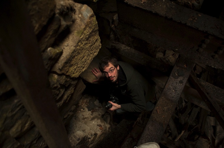
“Wow, how does a place like this even exist?” mulled my friend aloud, lost in her own luminous reverie. I had seen photos of this beautiful dereliction online, but I was just as awed, as the stagnant cold inside stung my hands.

The early morning wintry cold was still hanging over the misty hills of Bolton flats in a hundred shades of blue as we departed for southern New England. While we drove we sat in silence, with heated seats, coffee and the wonderful sounds of Caspian coming through my iPod. After a few hours, Vermont’s brown frozen hills gave way to eight lanes of interstate traffic and lots of Dunkin Donuts signs.

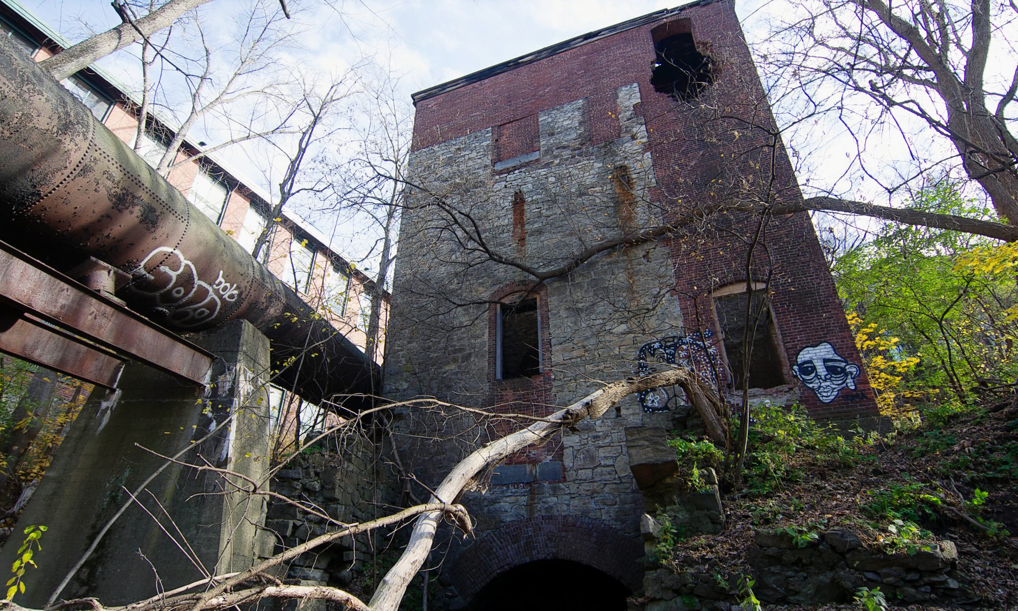
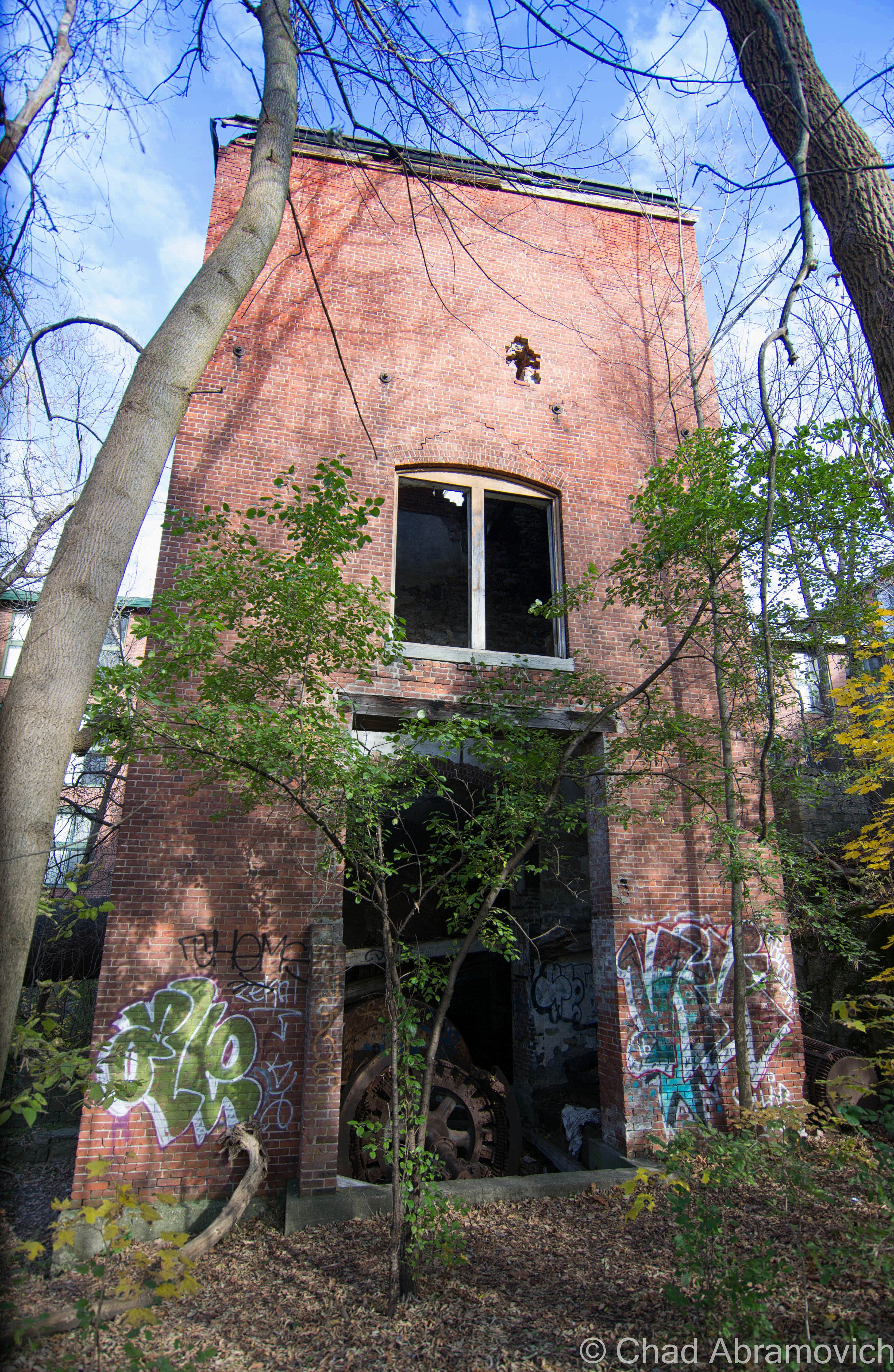
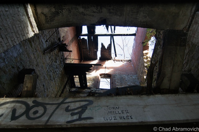
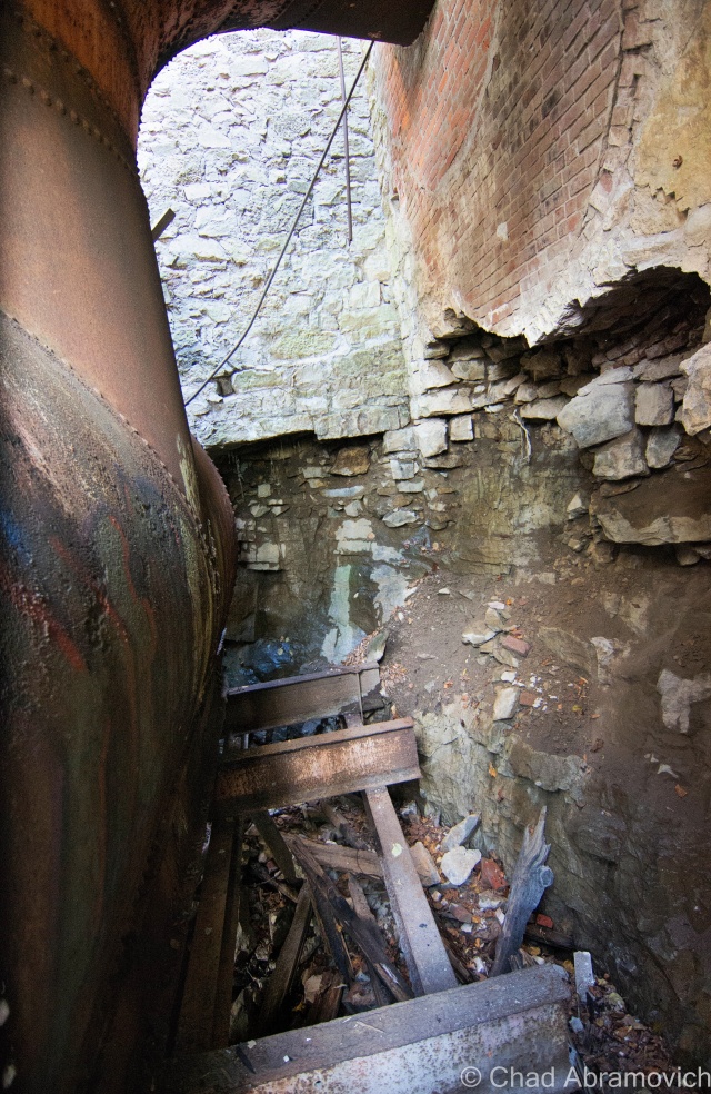
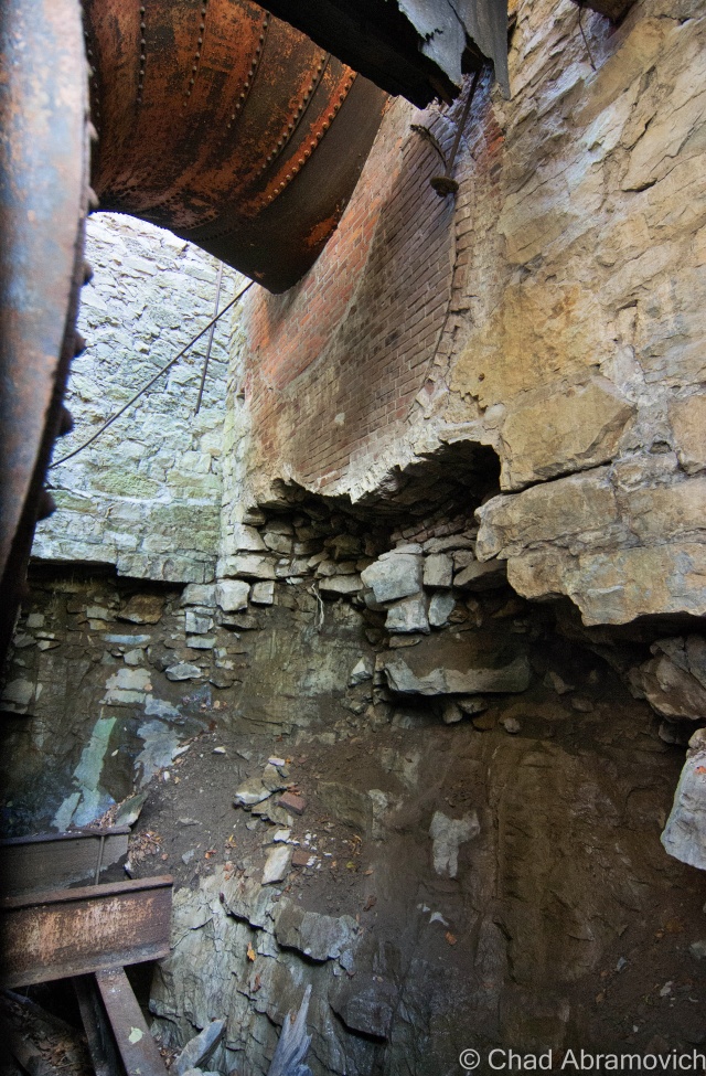
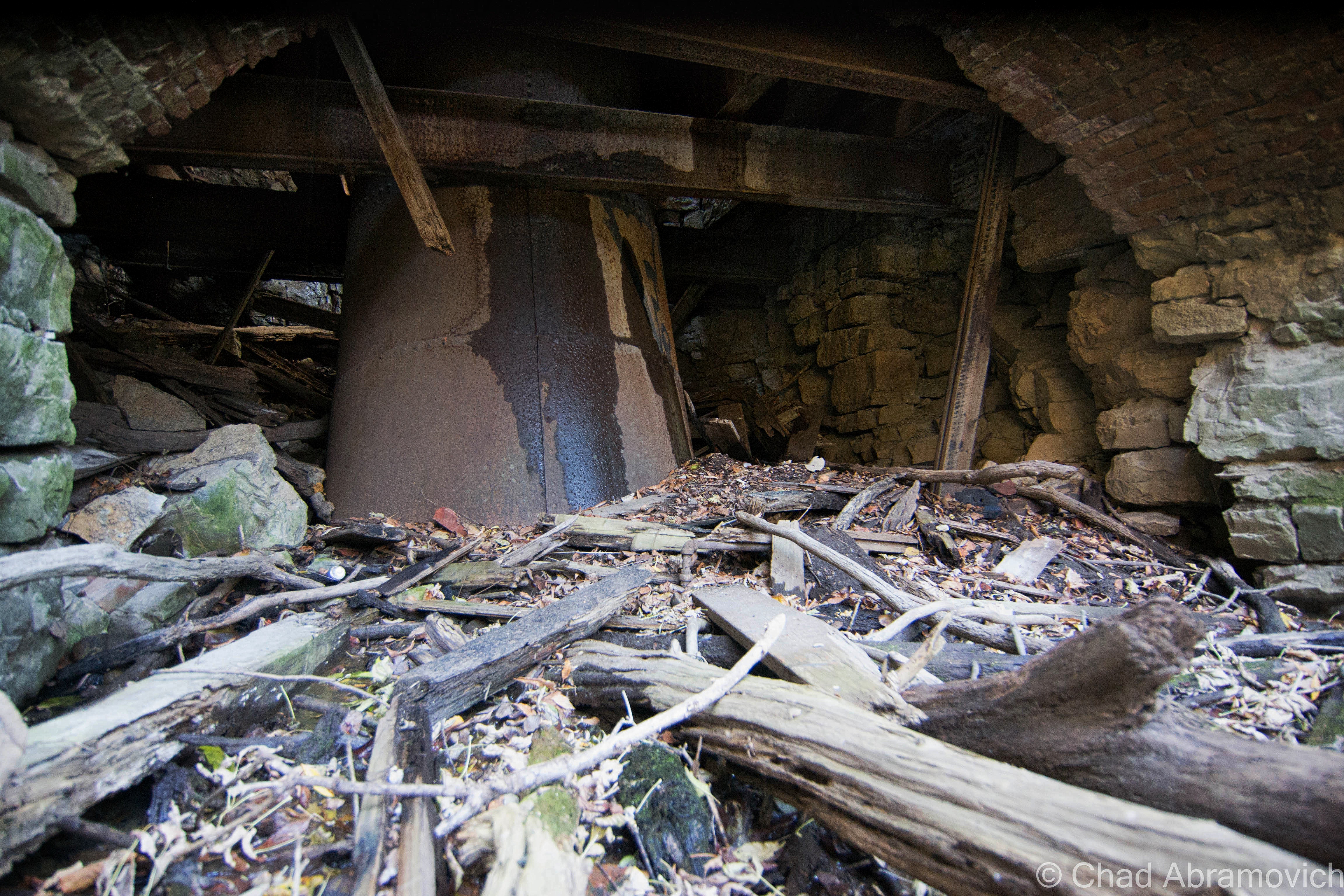
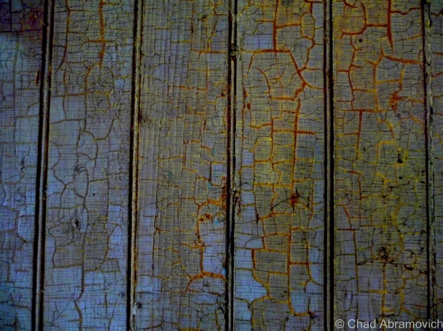
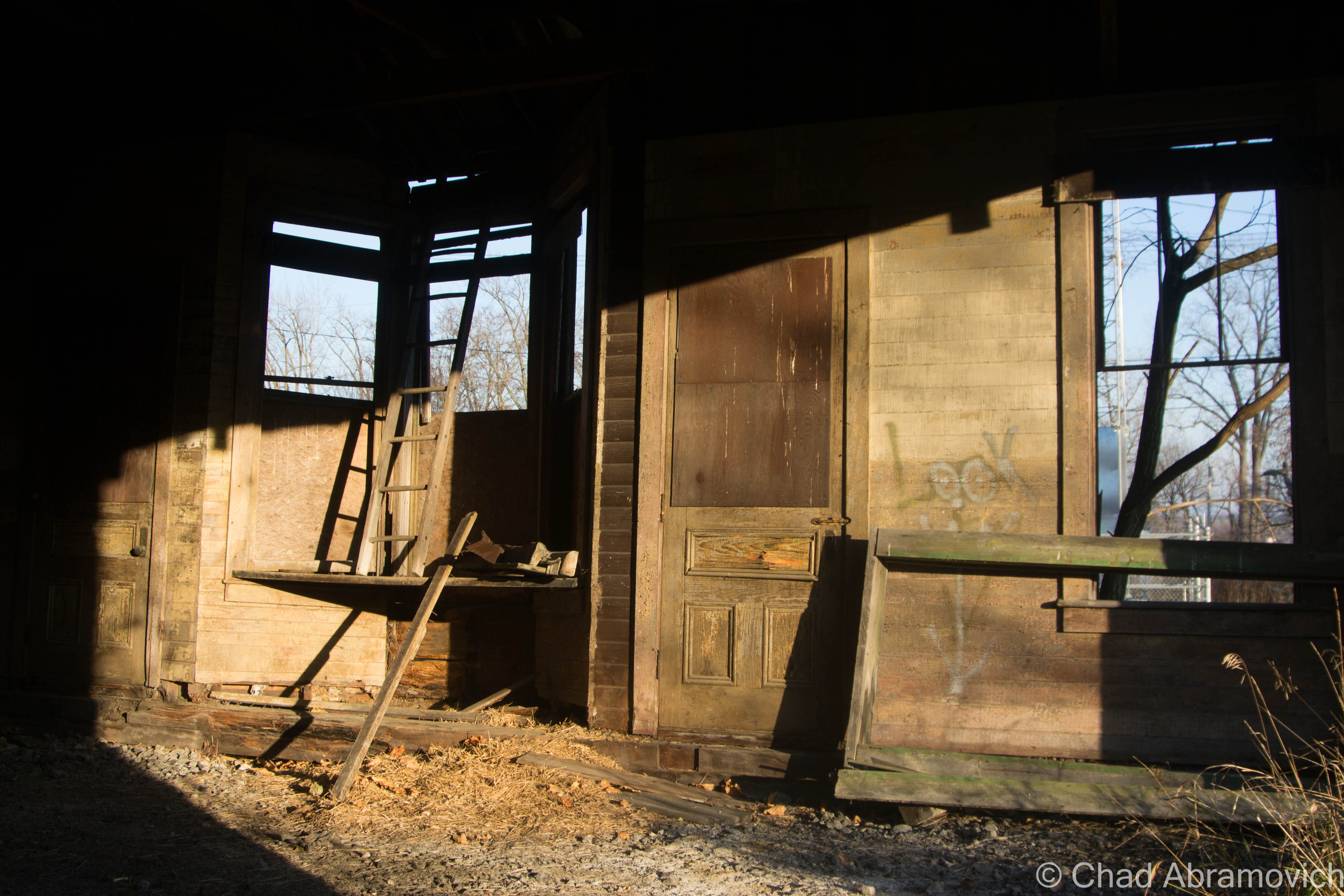
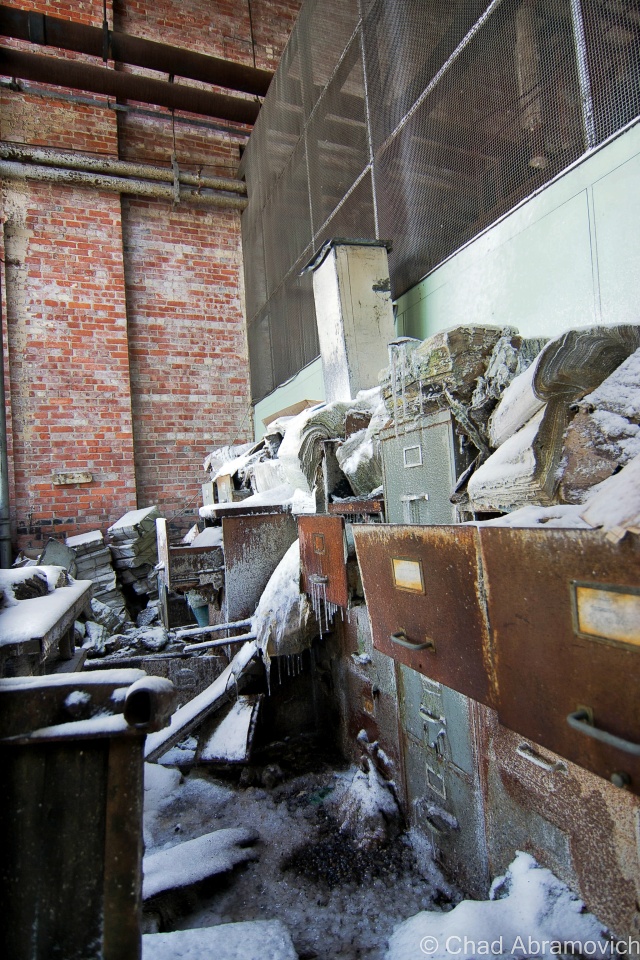
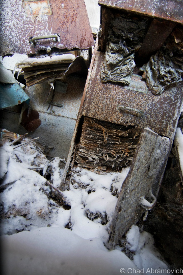
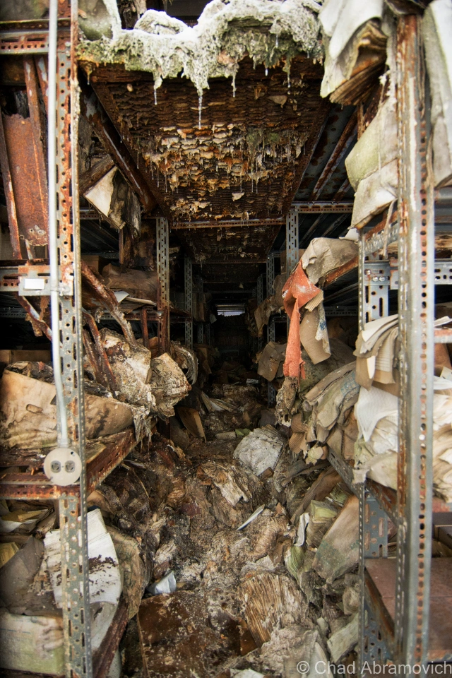
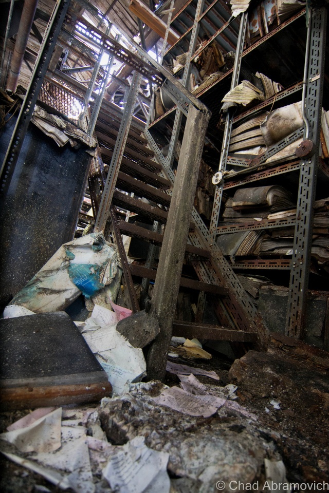
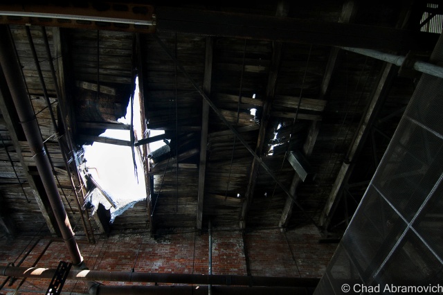
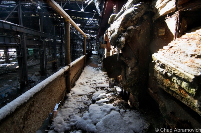
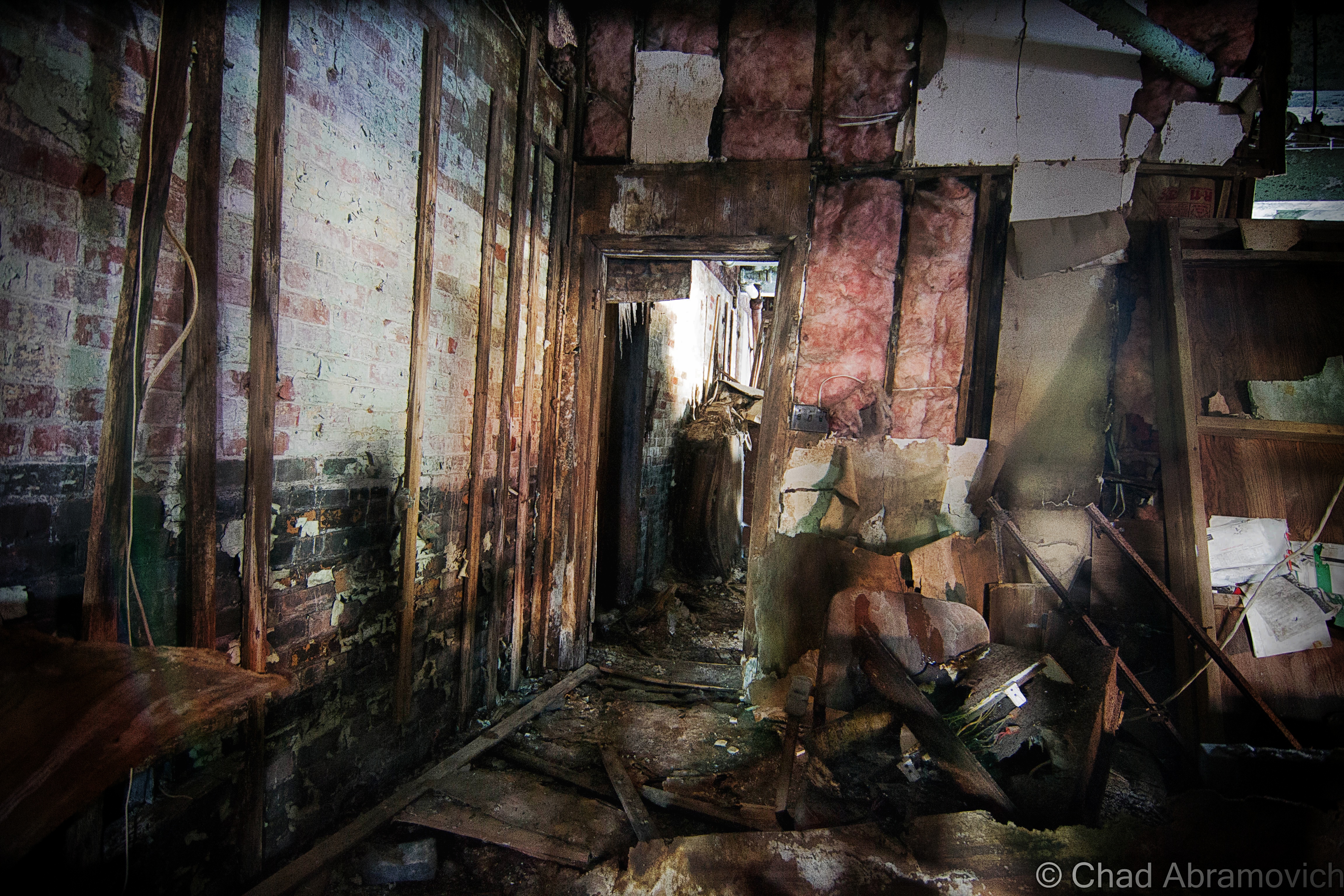
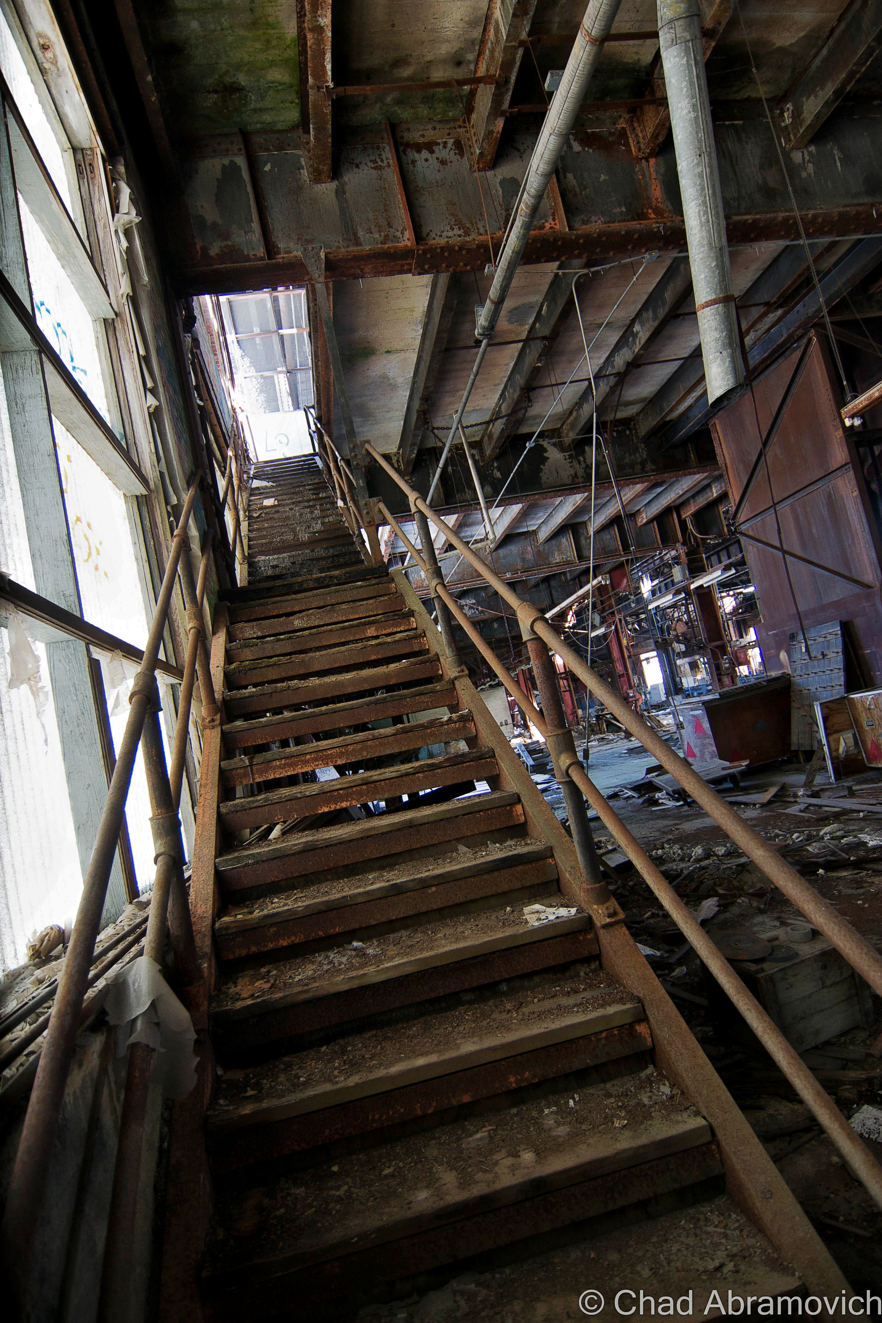
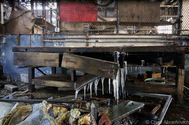
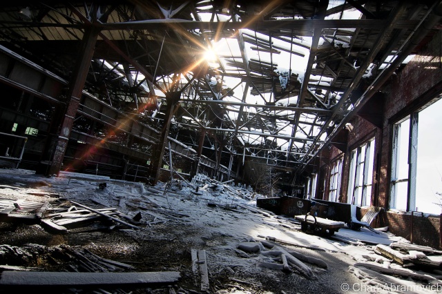
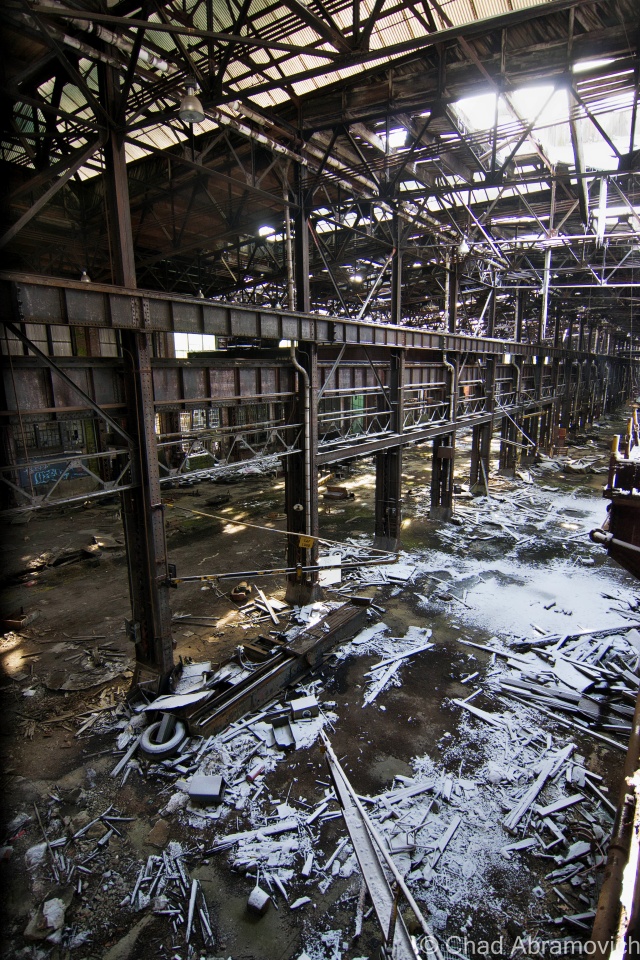
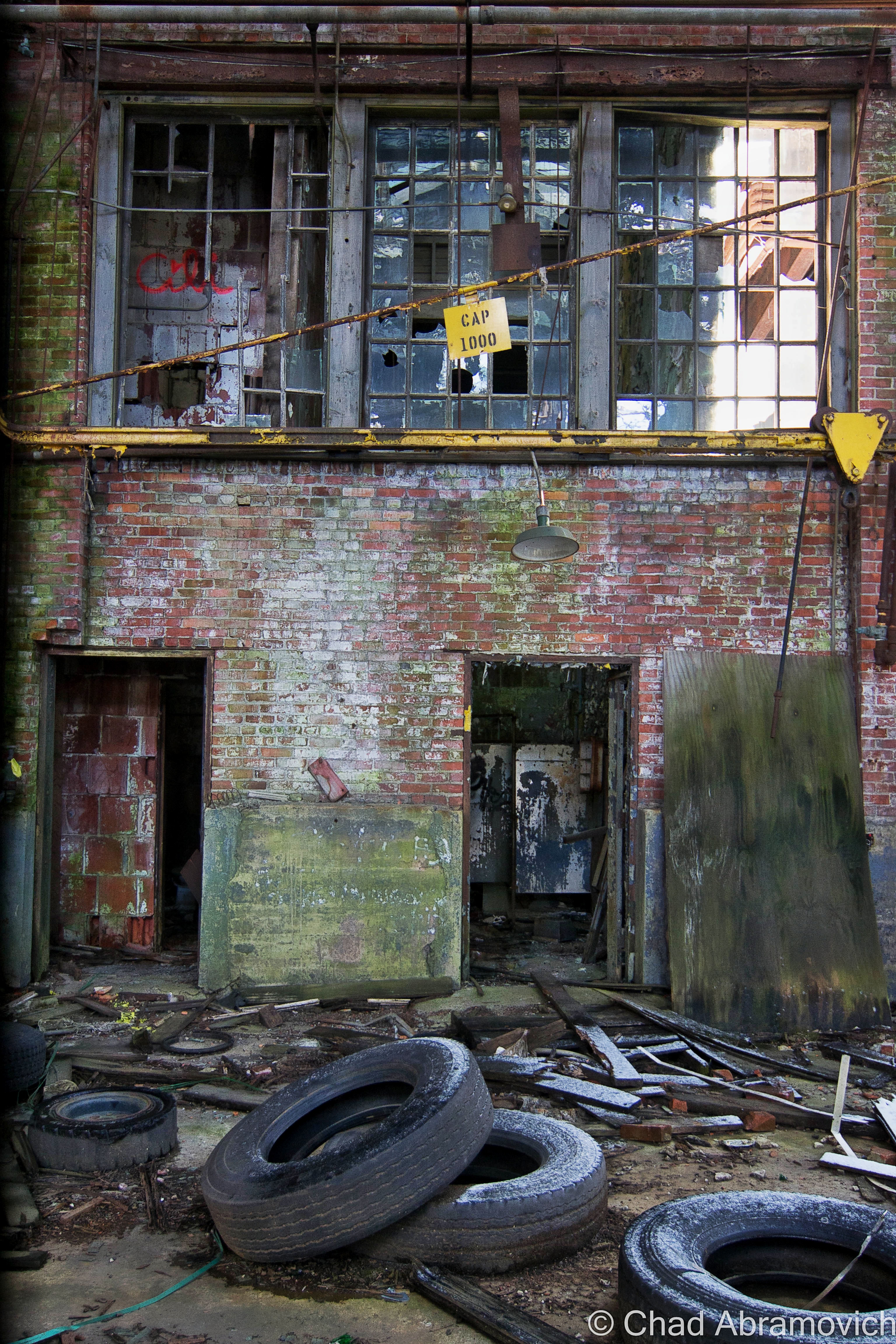
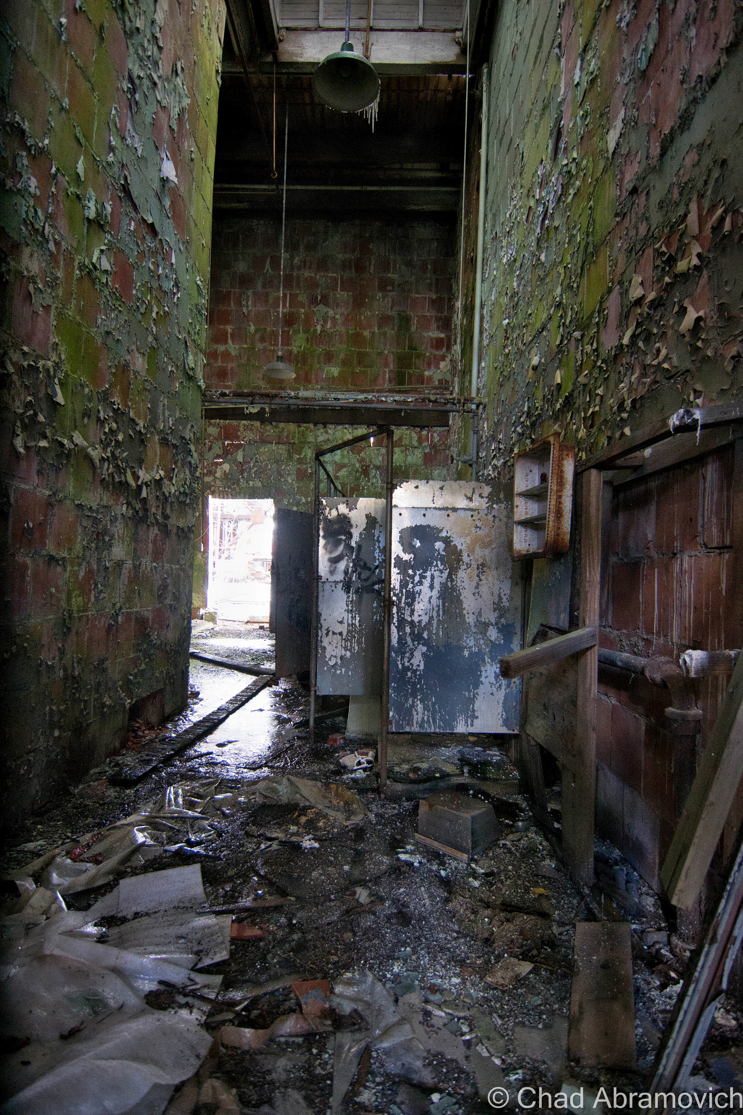
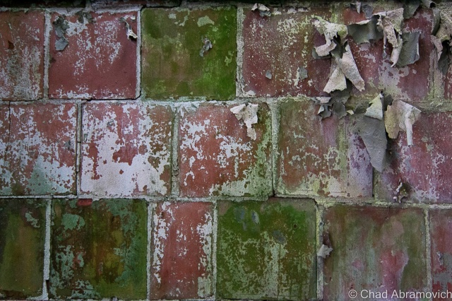
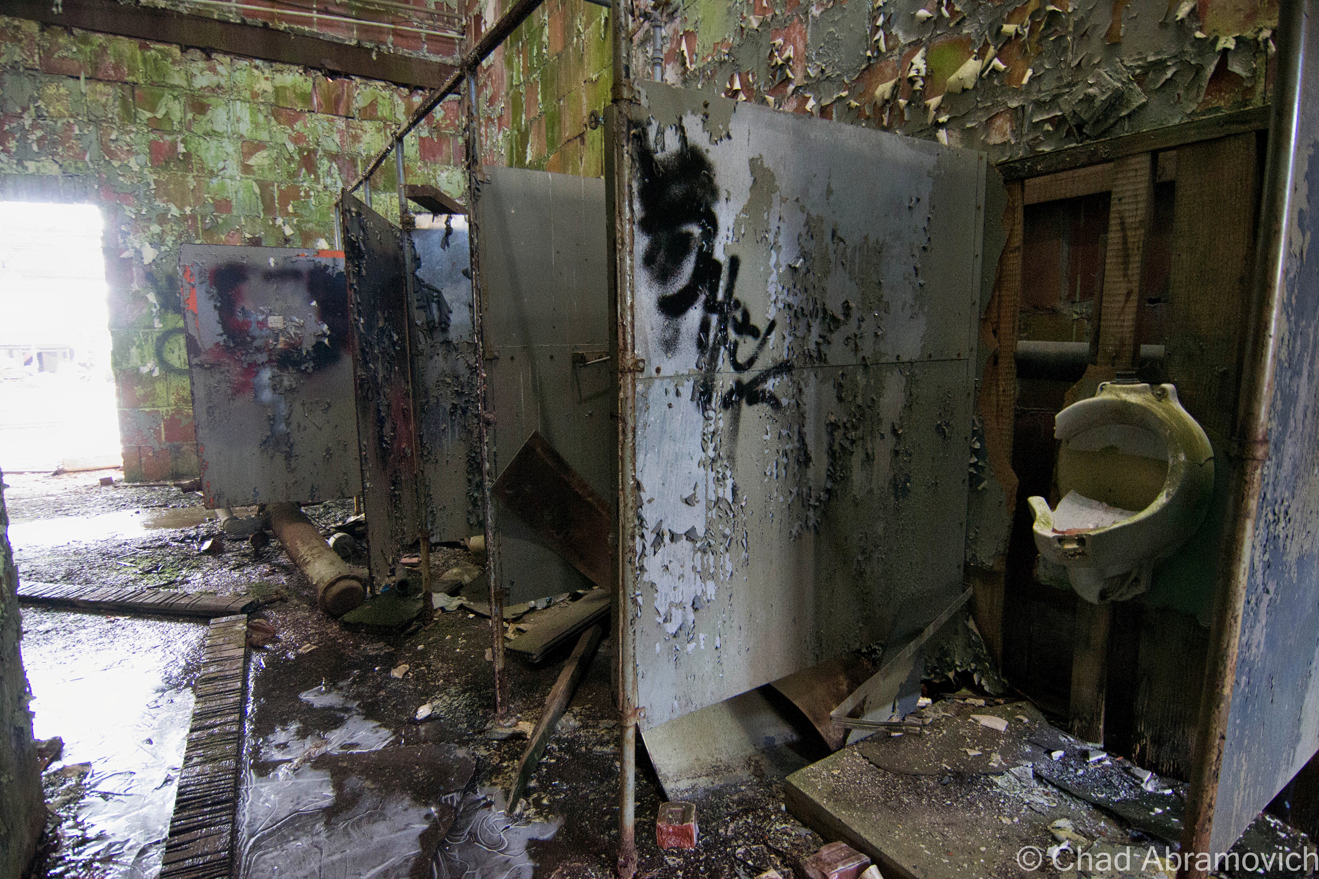
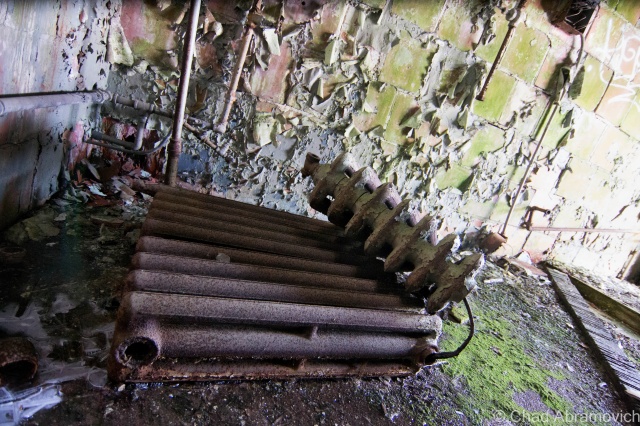
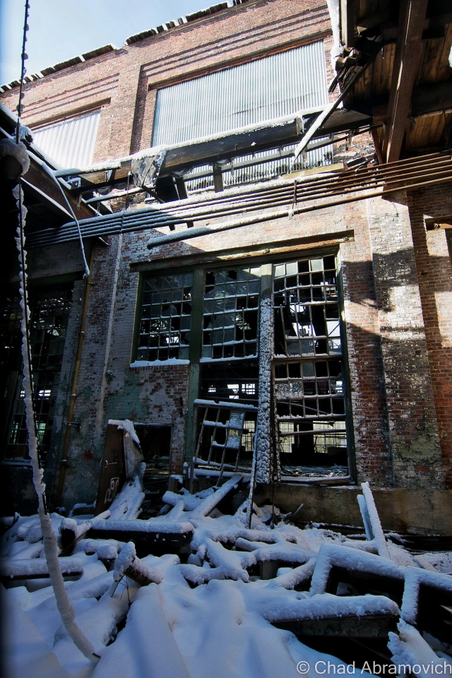
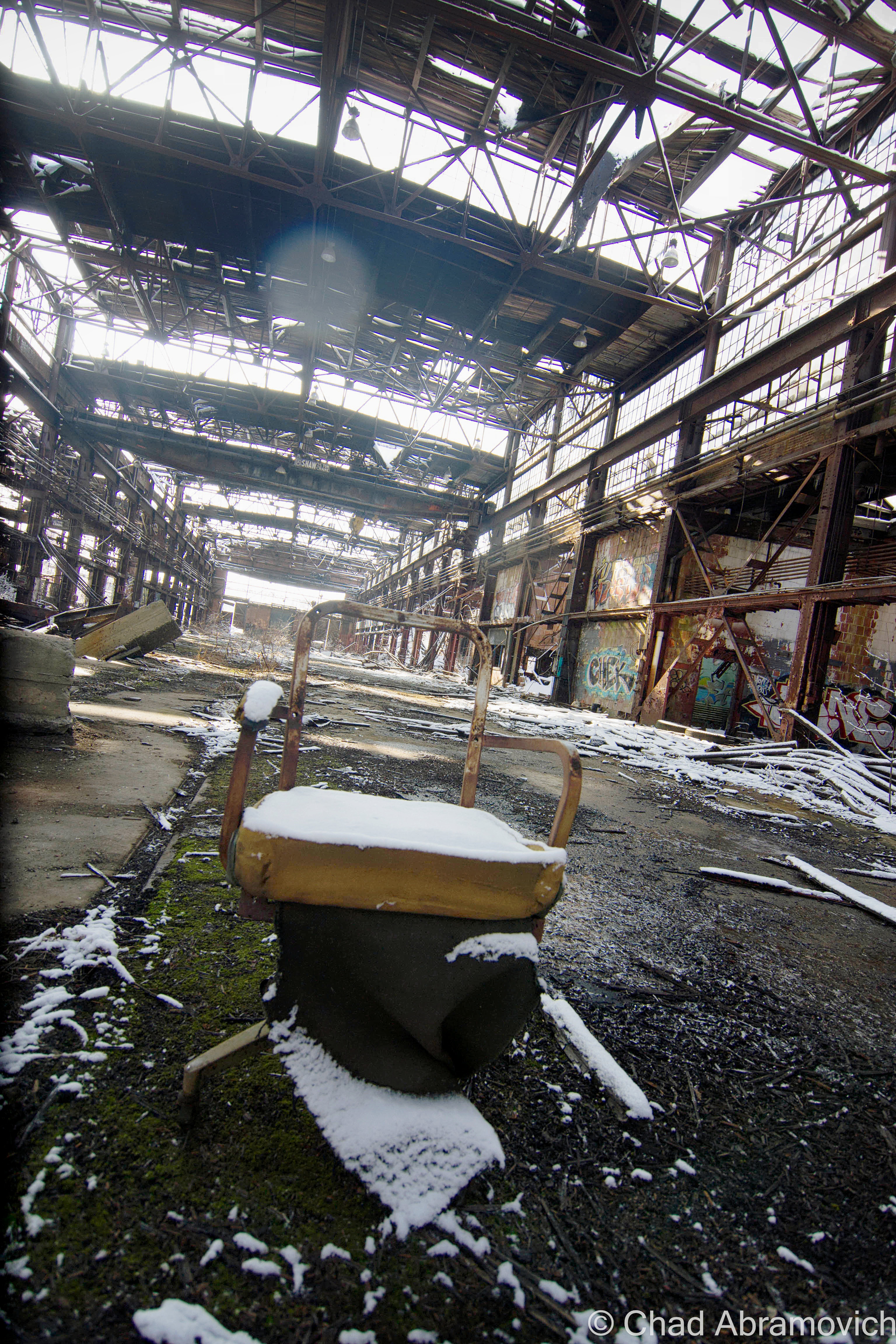
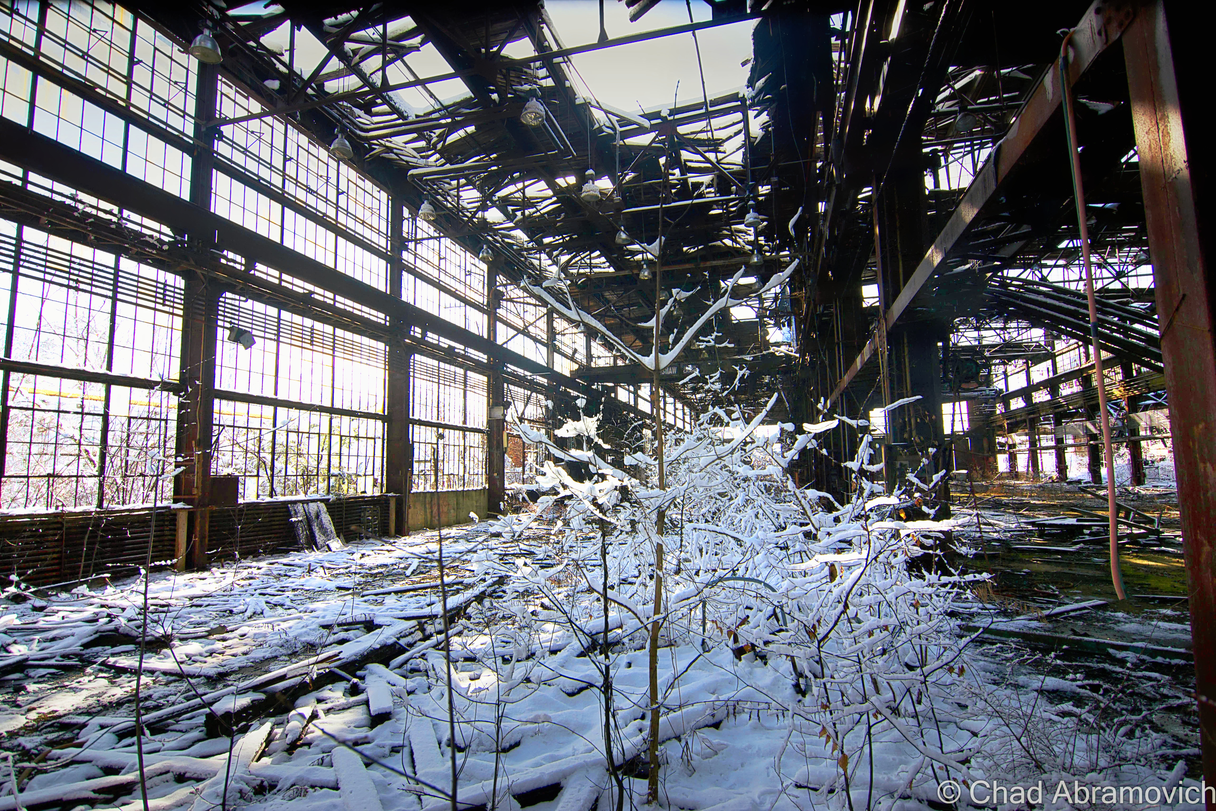
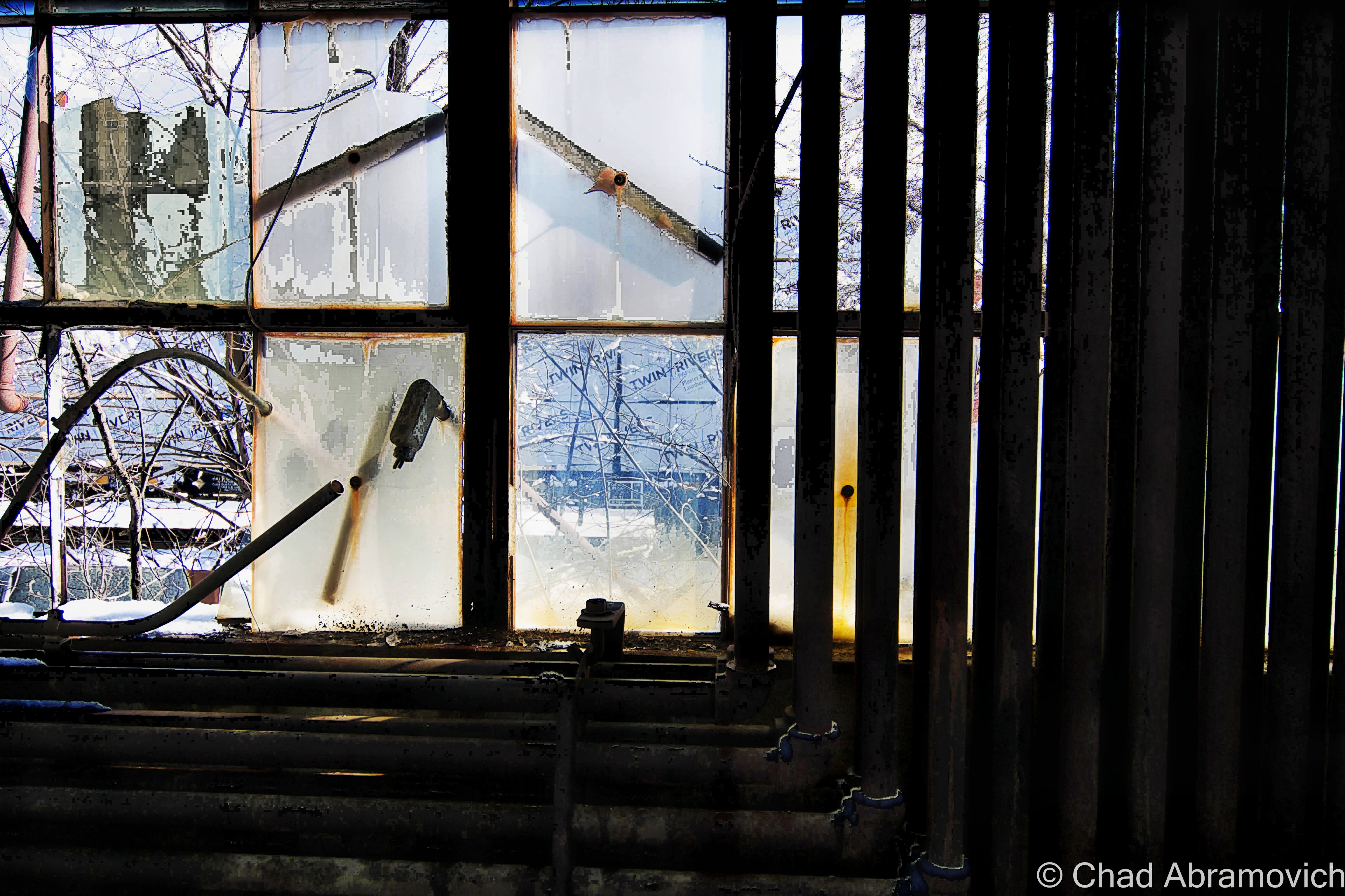
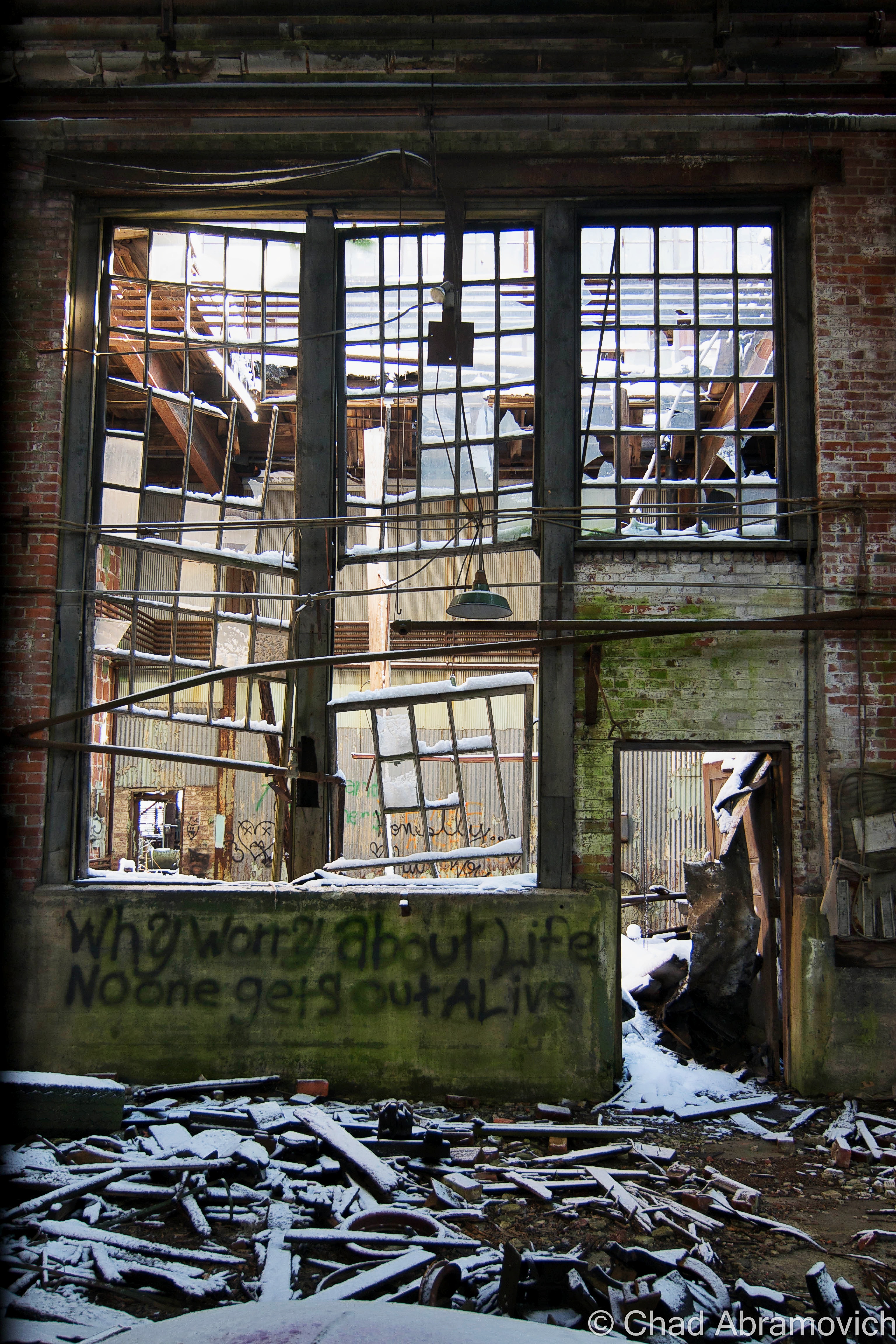
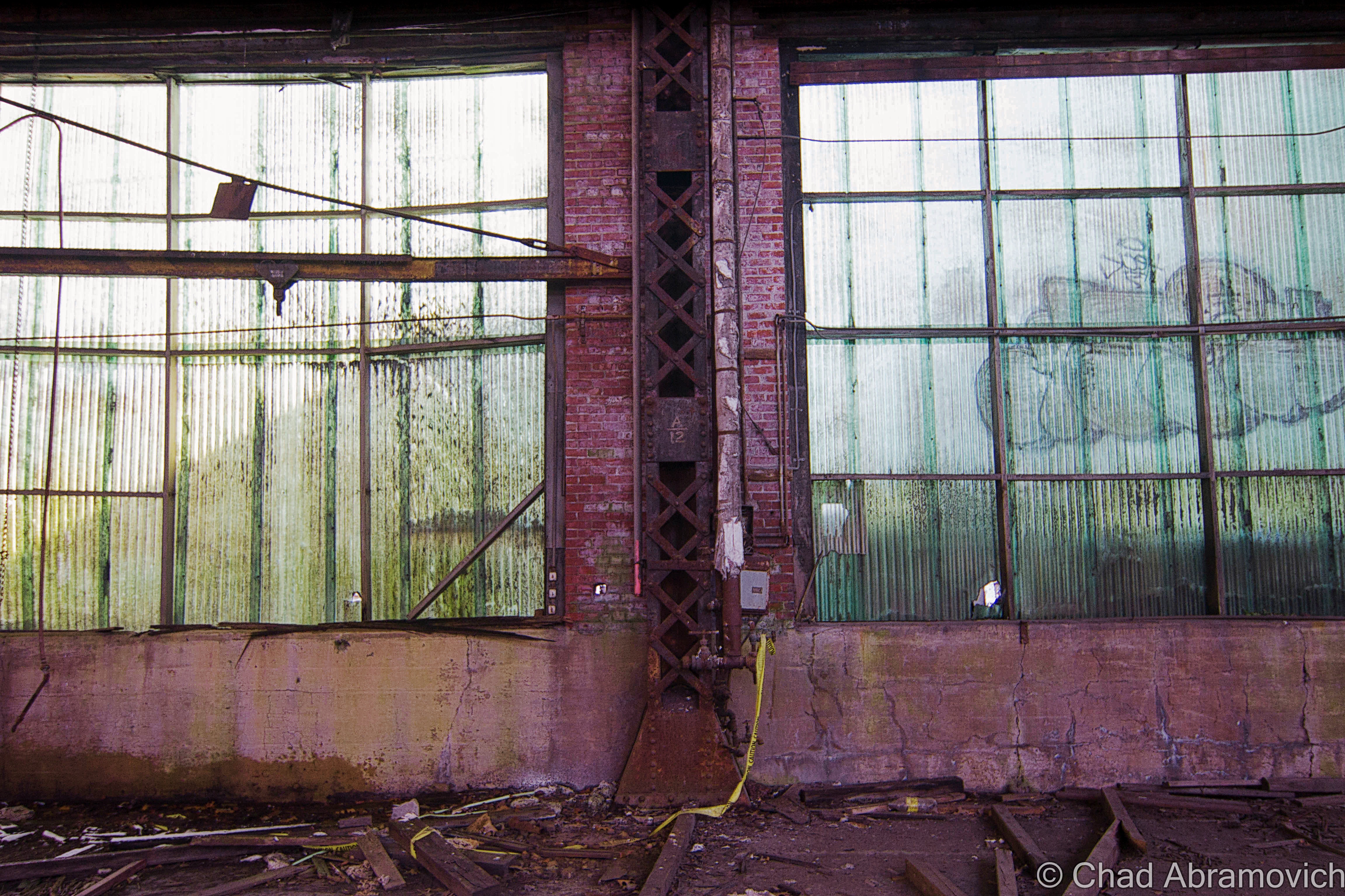
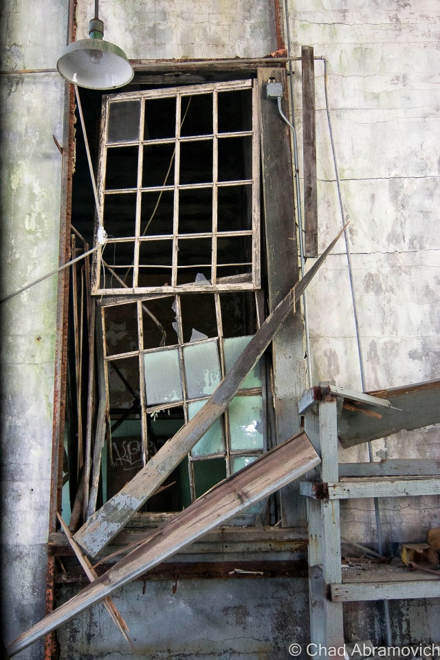
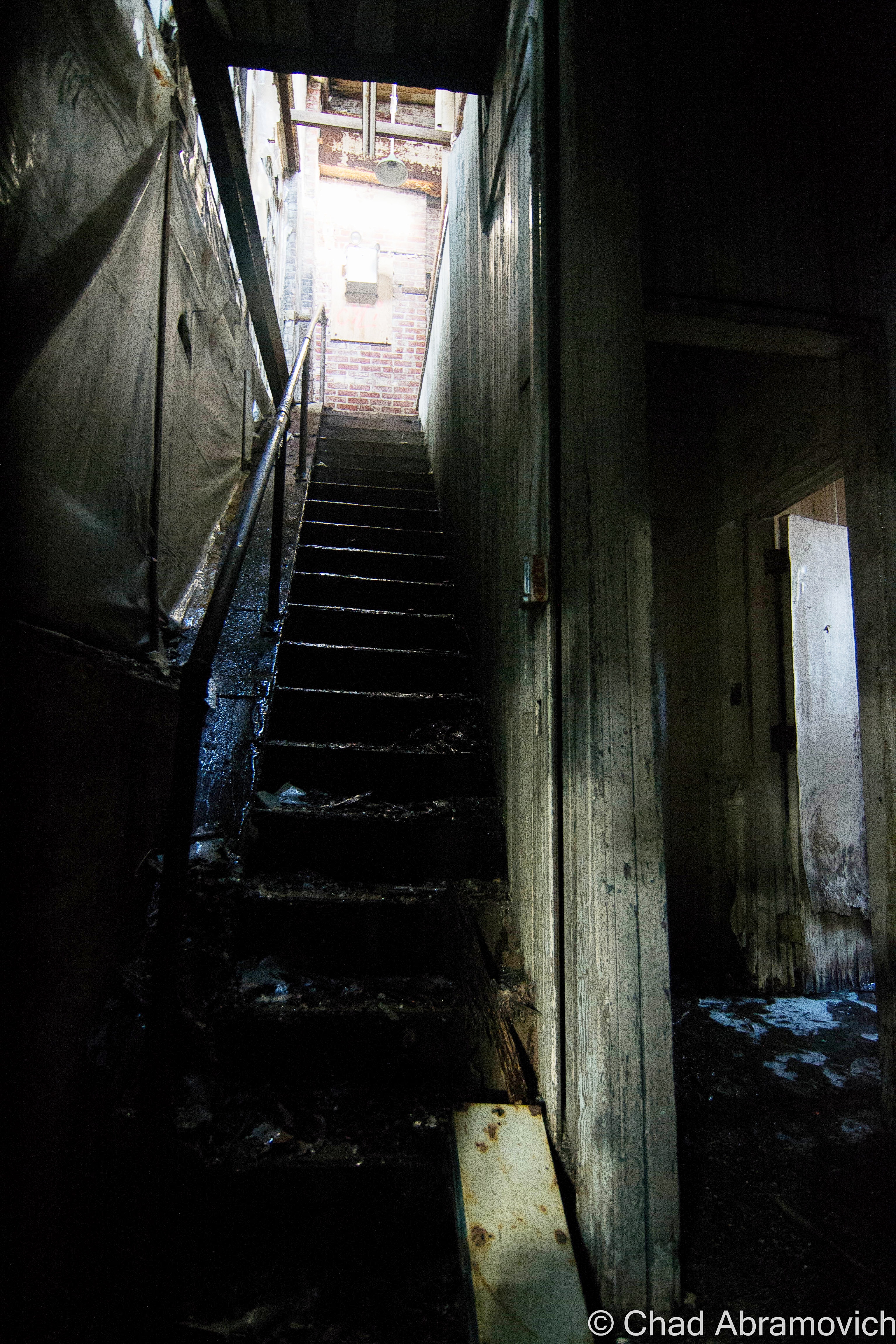
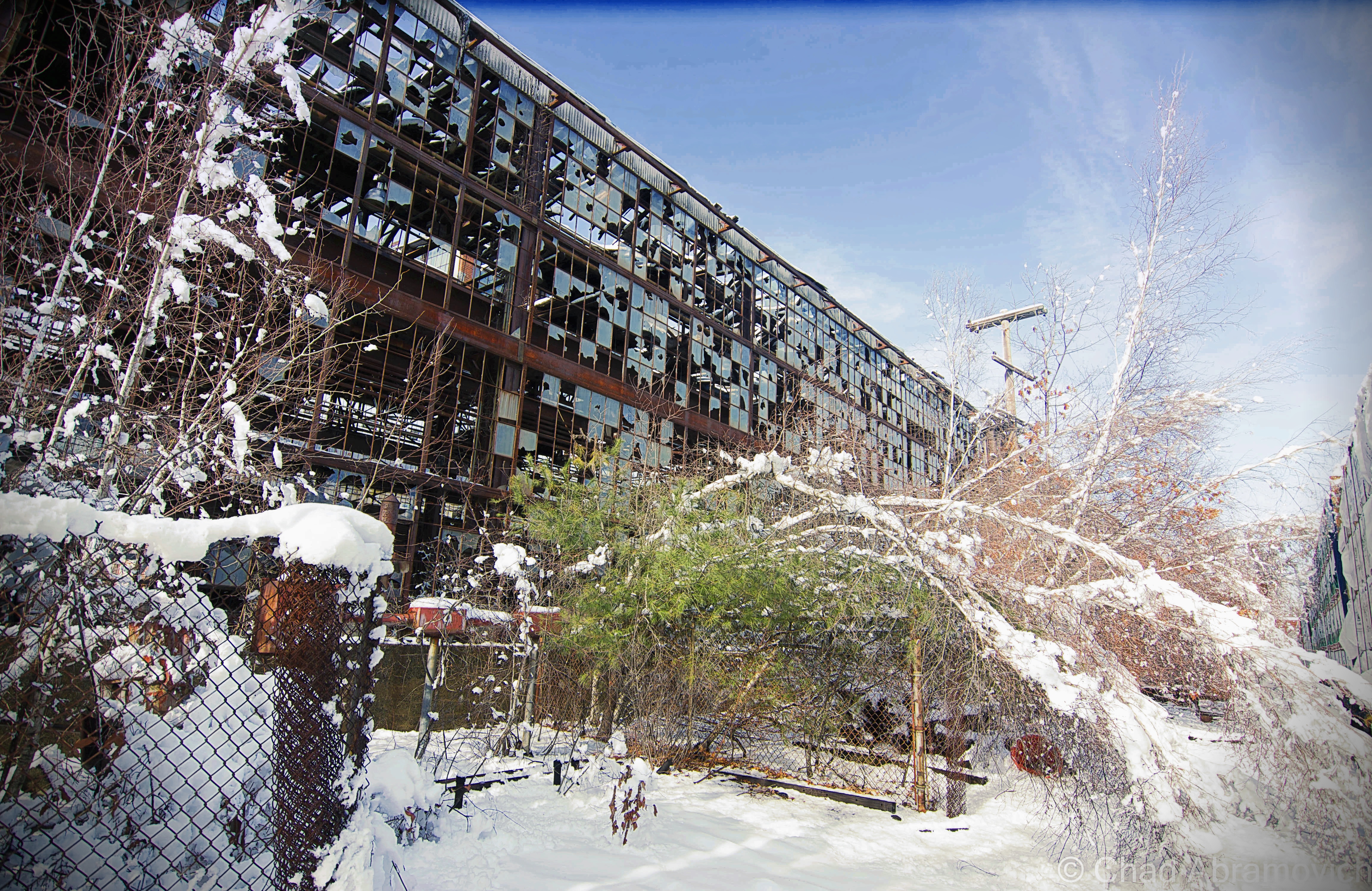
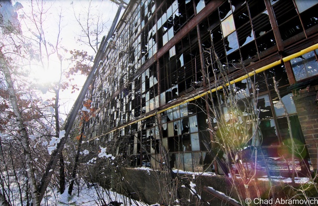
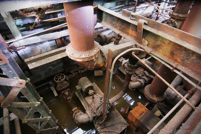
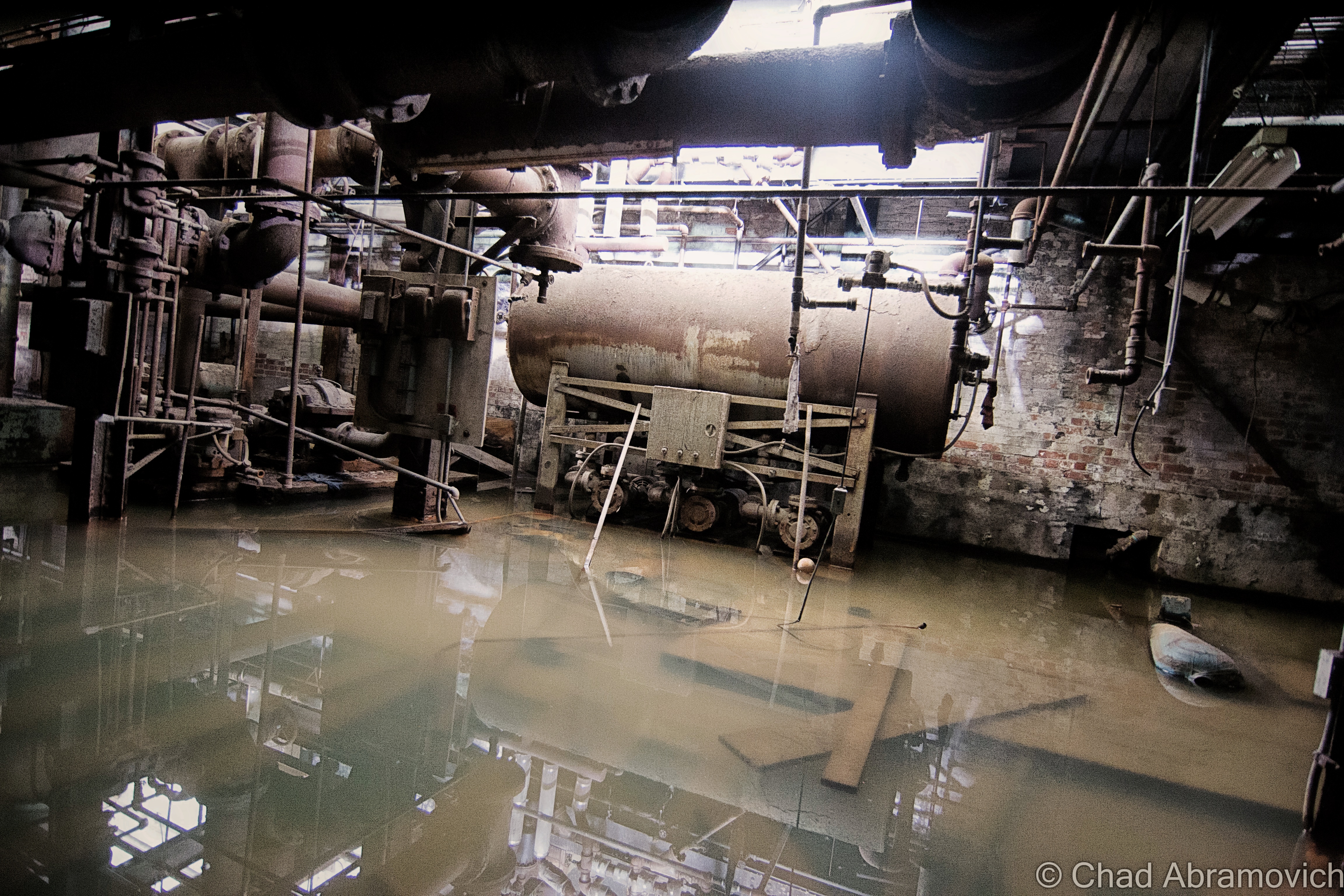
Thirty-two years of fluctuating New England weather and zero upkeep had rotted out the drafty interior. The metal stairwells became stretches of rusty spiderwebs, some were completely untrustworthy. The snow that fell through between broken roof was so loud that you would have thought it was thundering outside. The thick brick walls oozing with slime and glazed by ice blocked cell phone reception pretty well. I received a few texts sent by my friend asking me where I was, hours after she had sent them and on the road back to Vermont, which I guess meant that contact in case of emergencies would have been pretty unaccommodating.

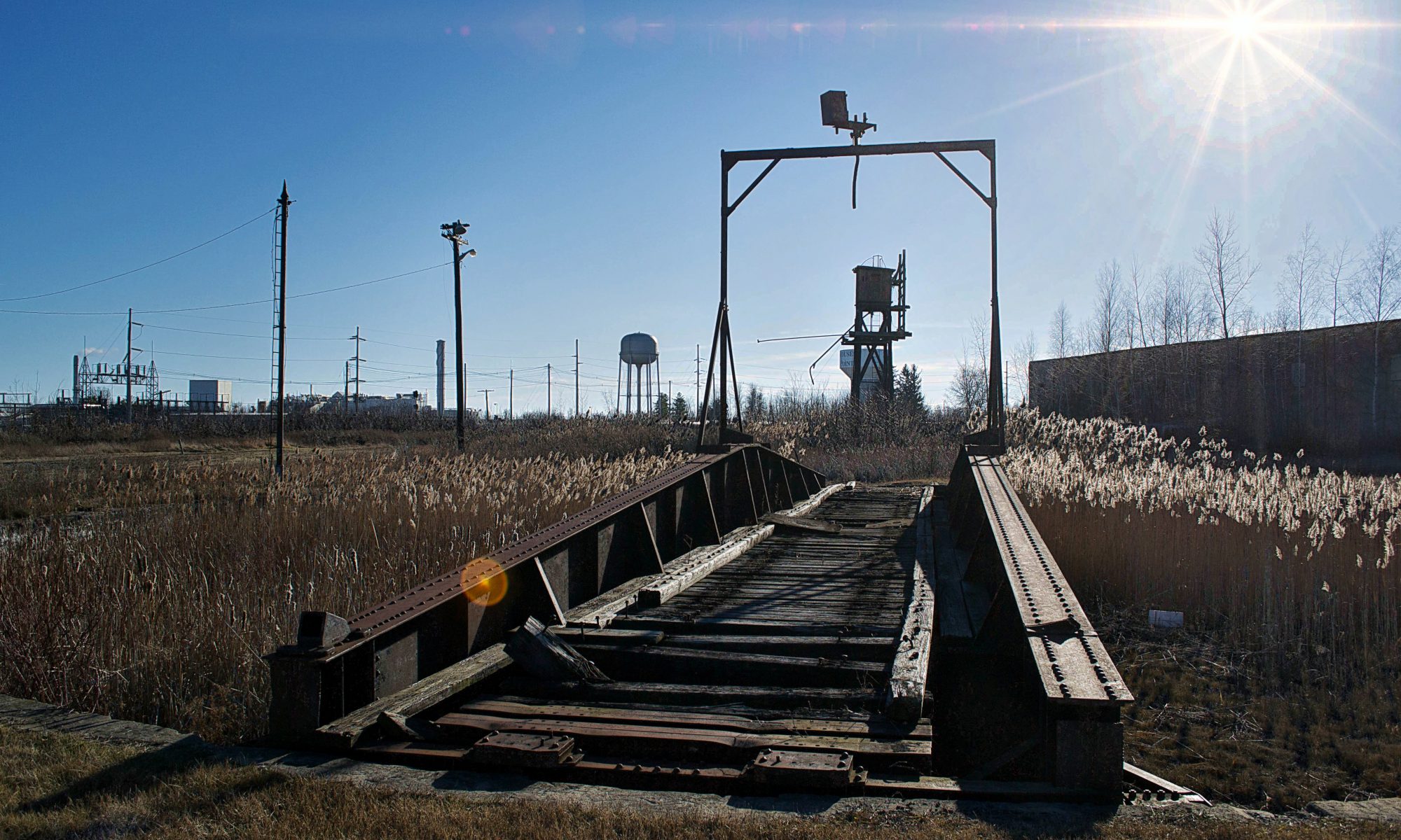
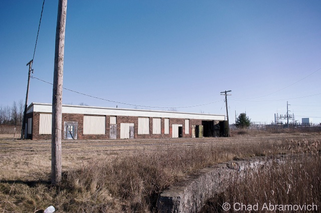
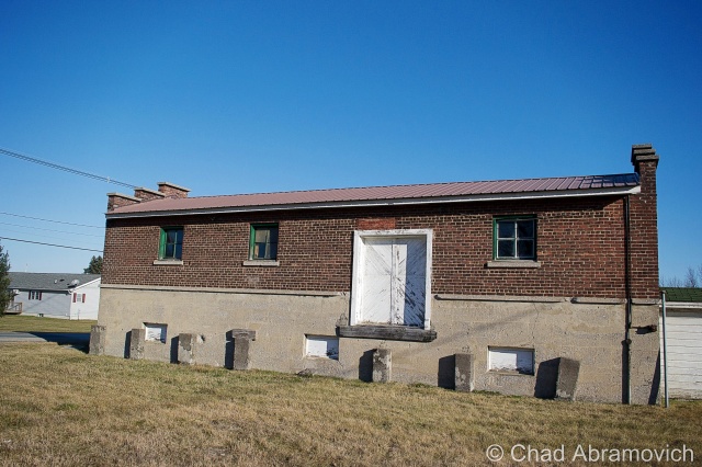
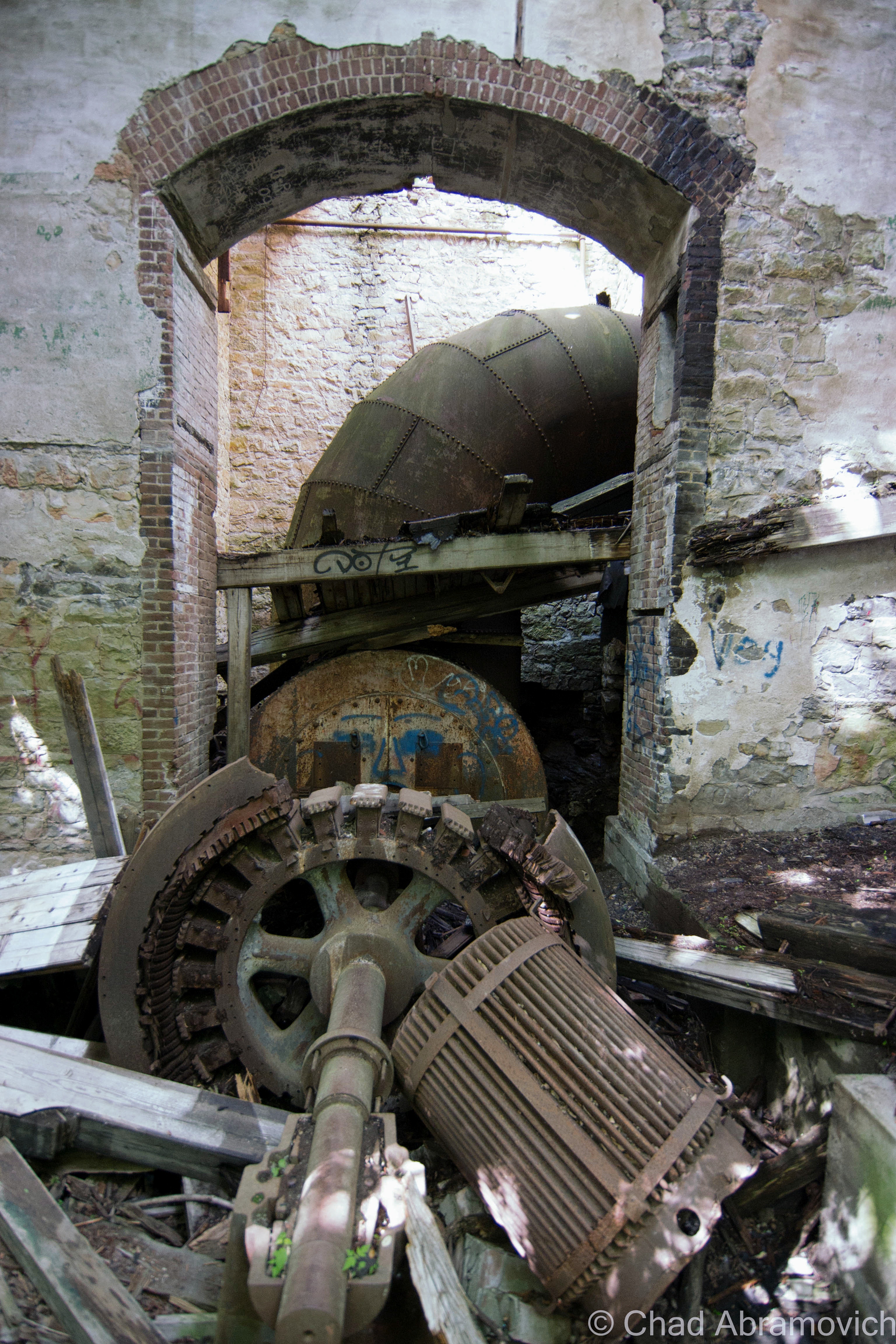
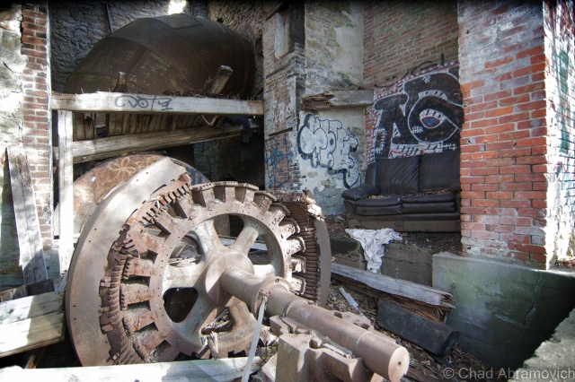
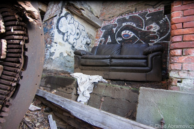
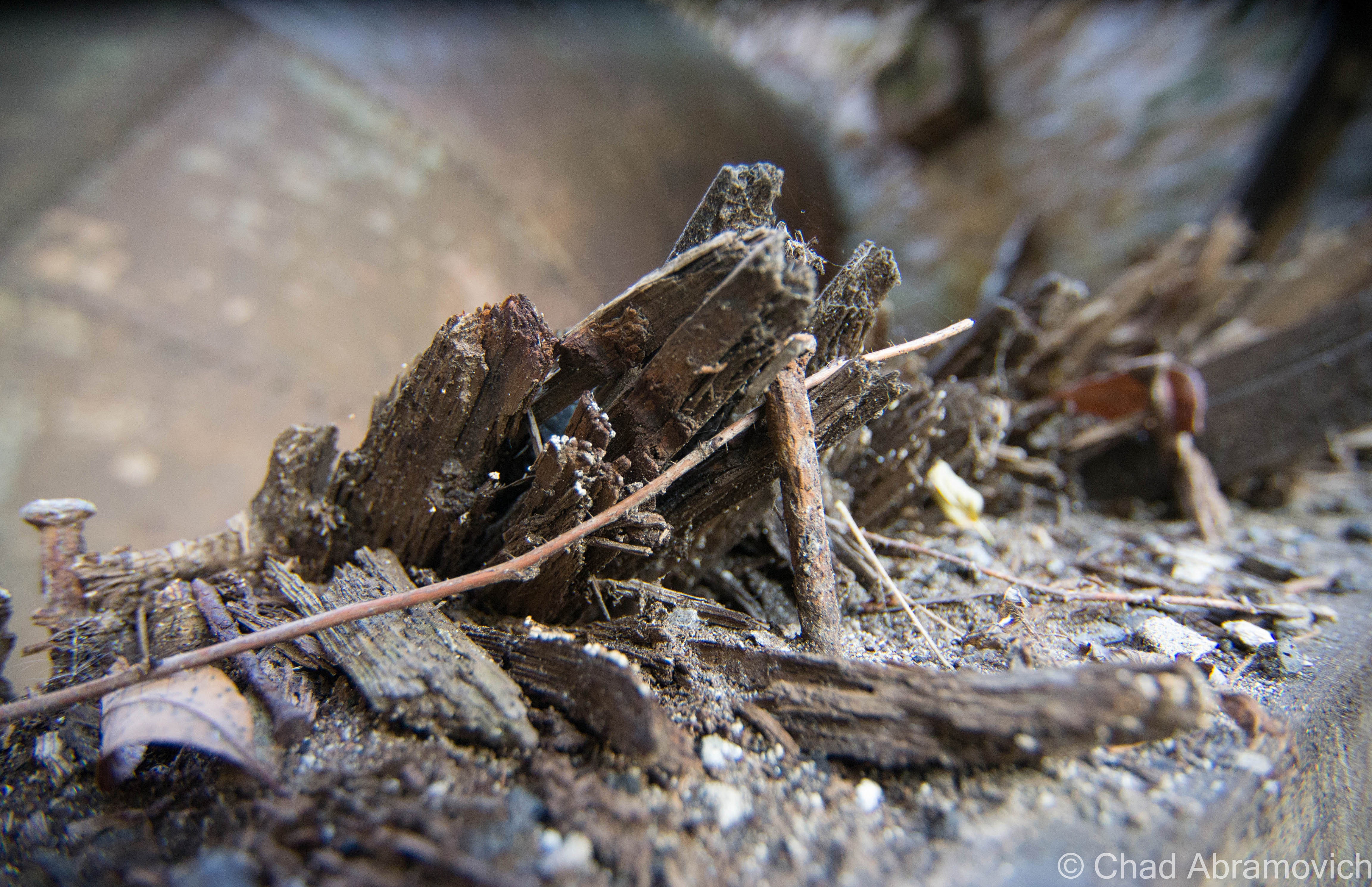
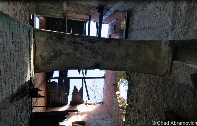
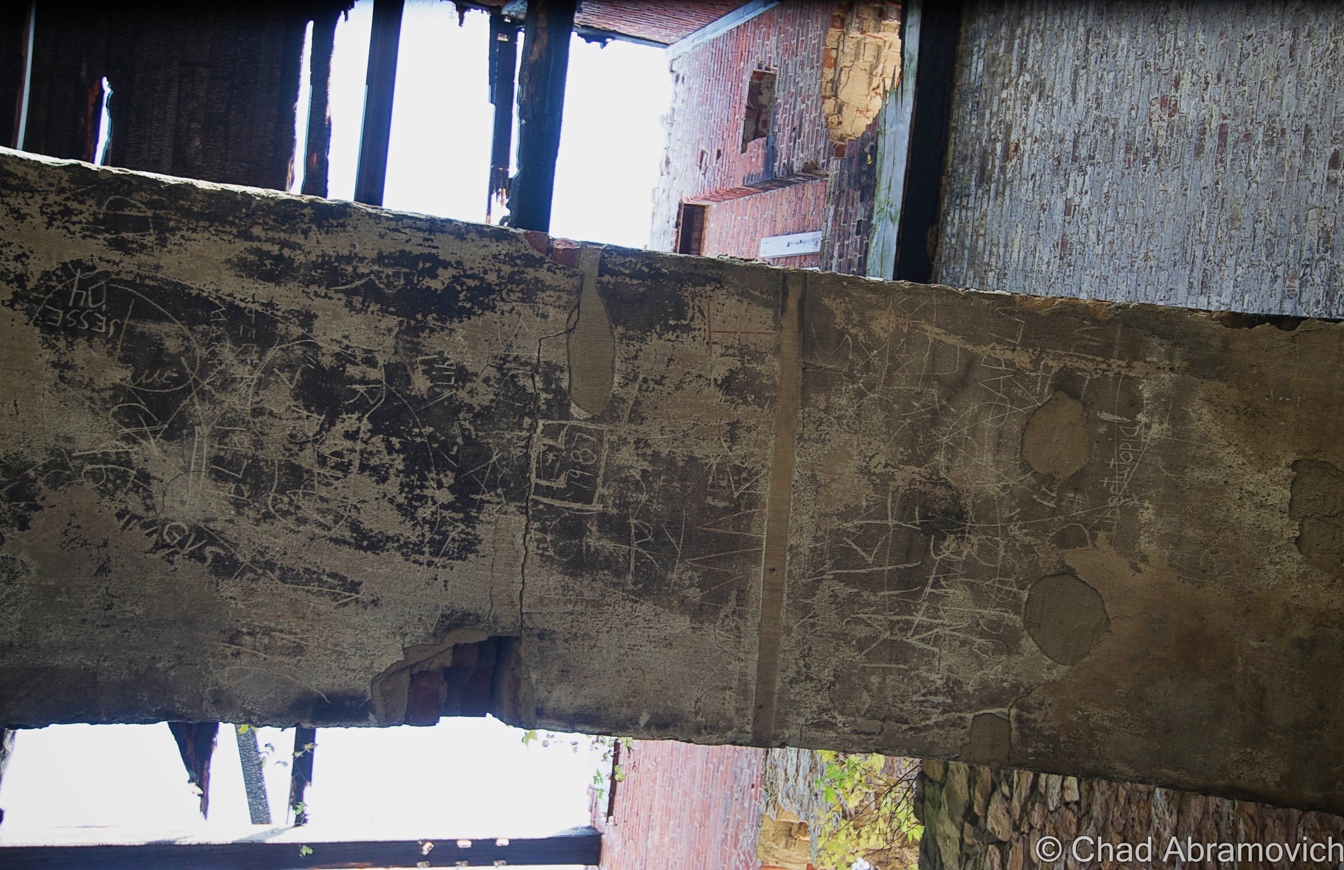
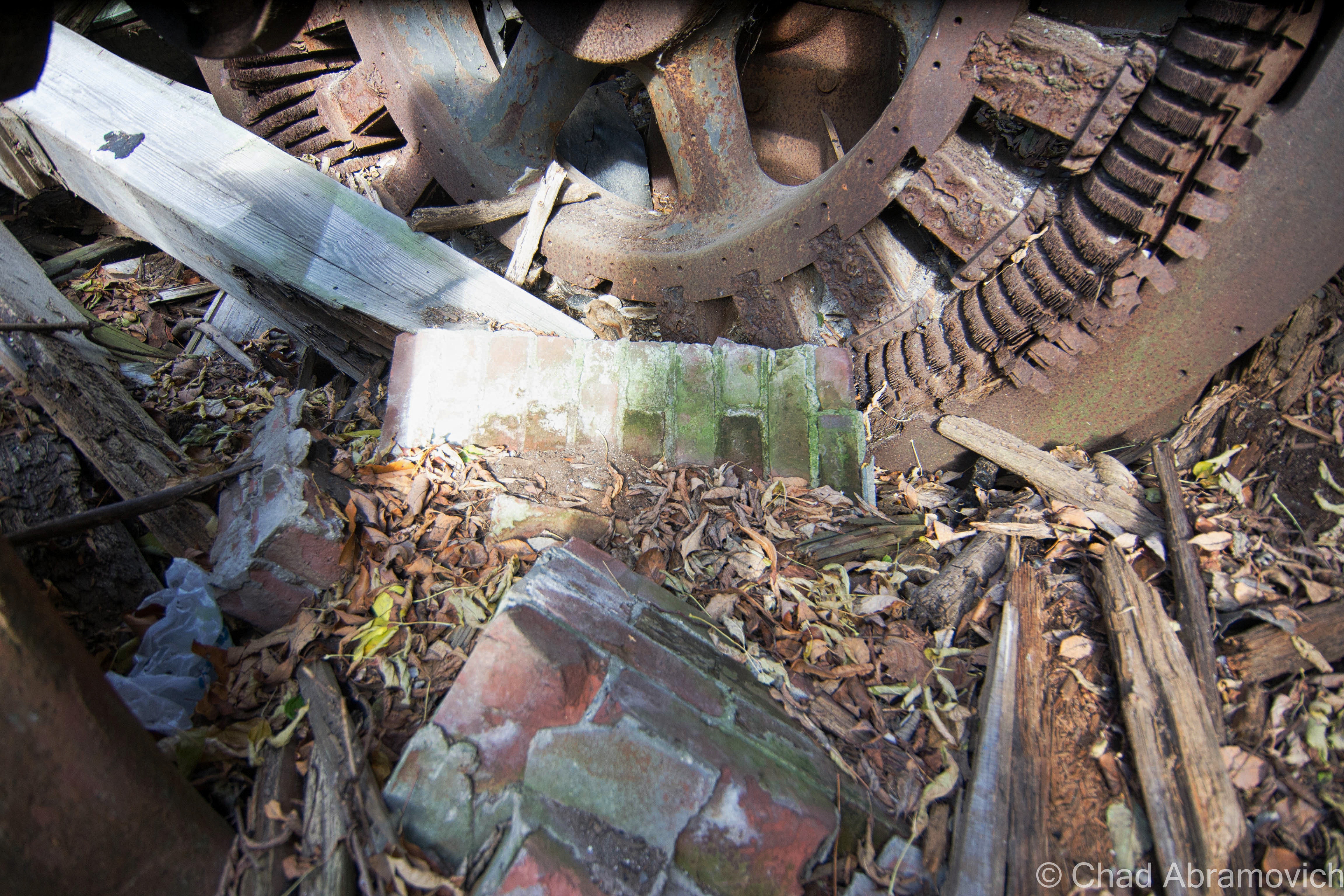
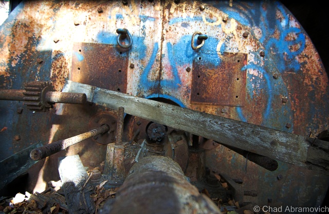
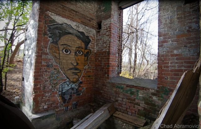
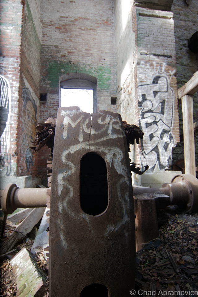
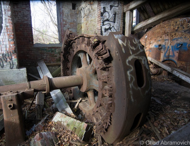
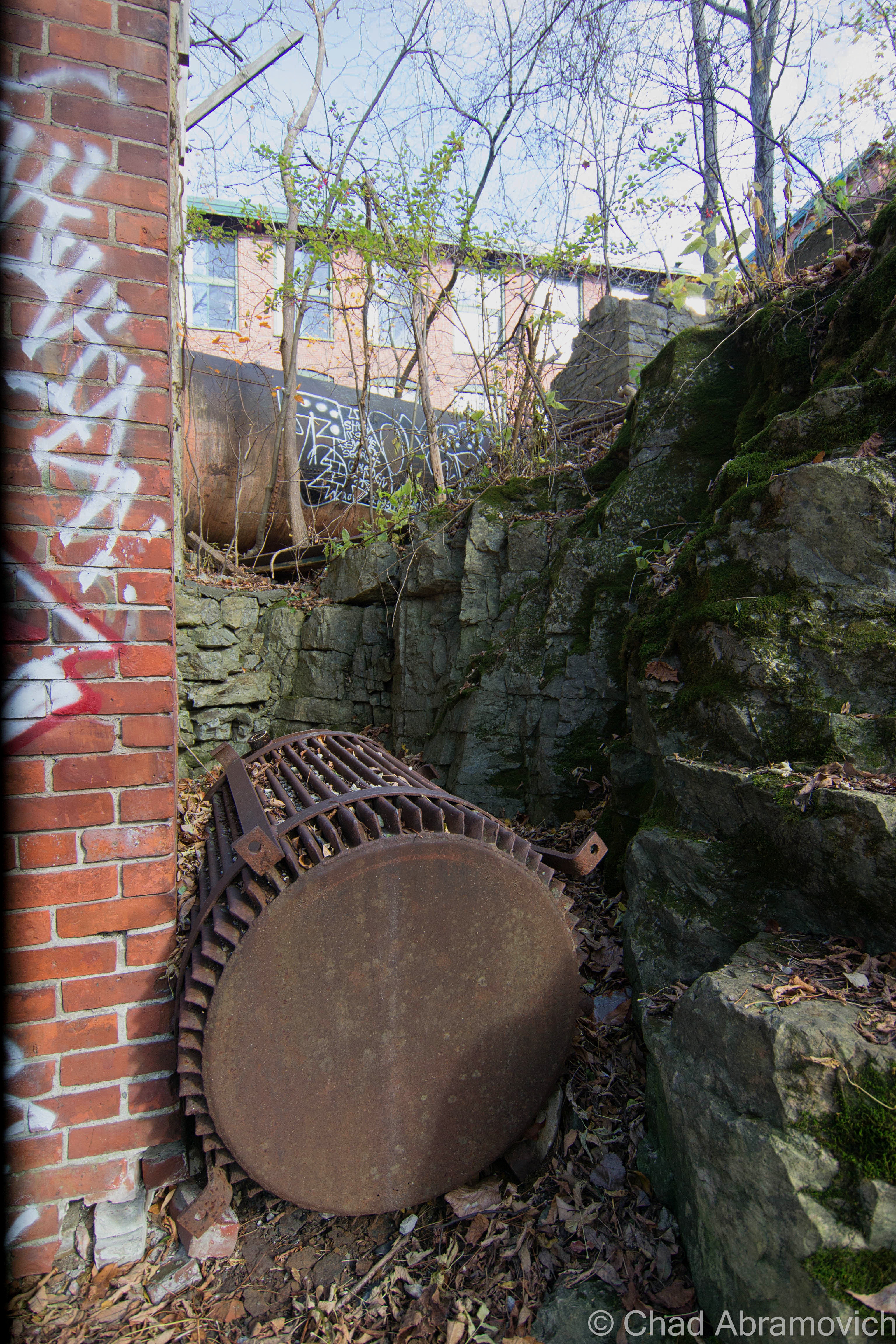
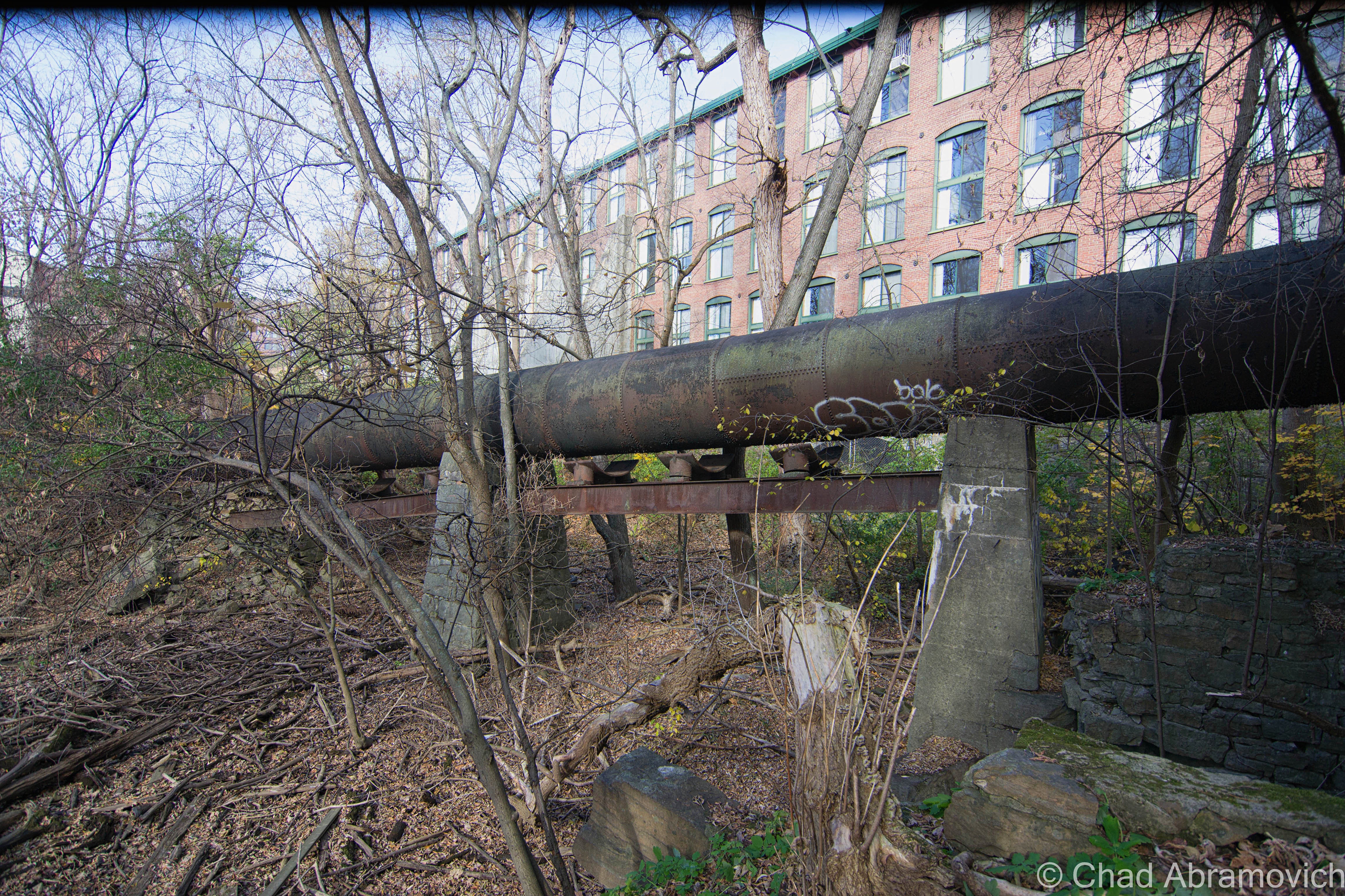
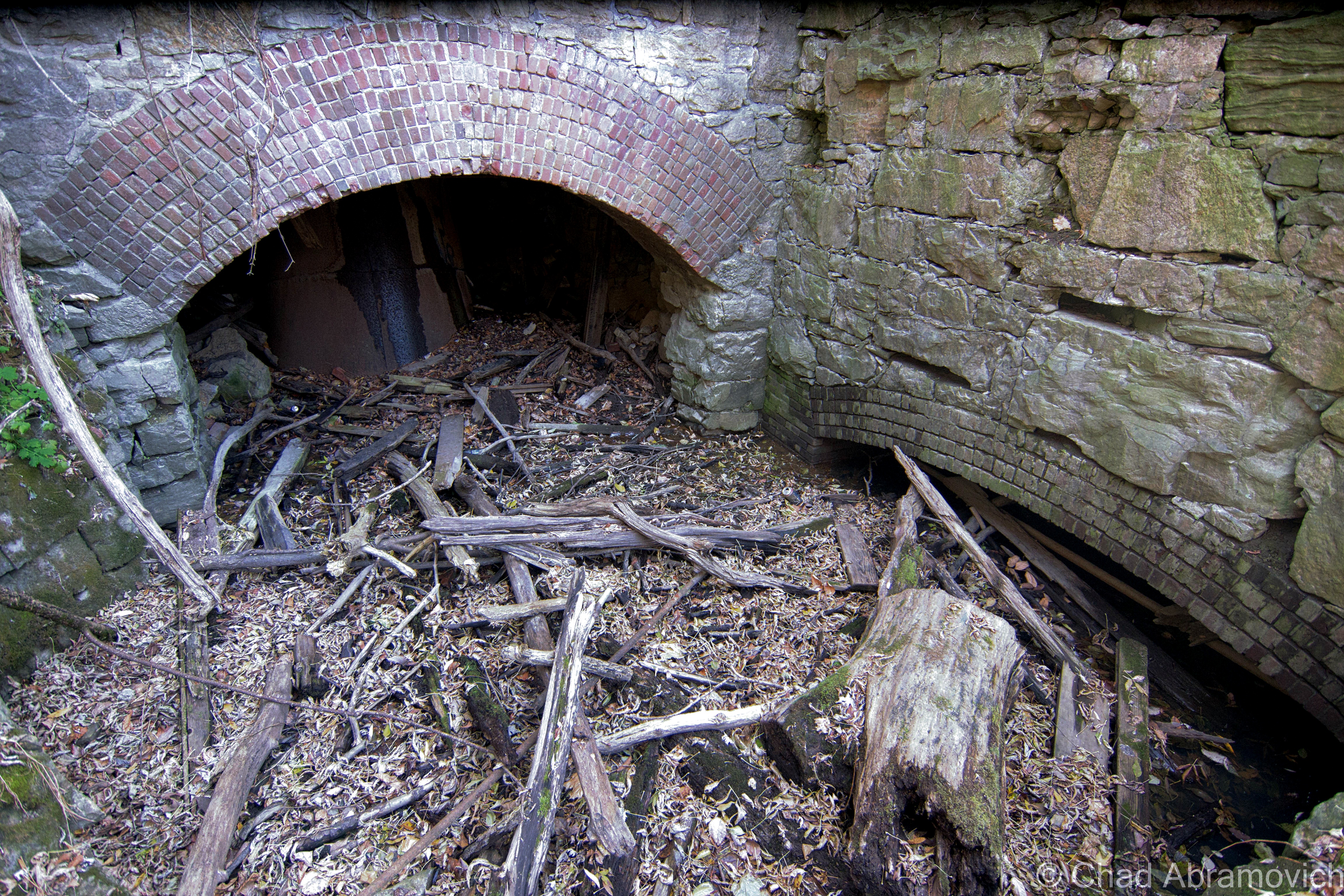
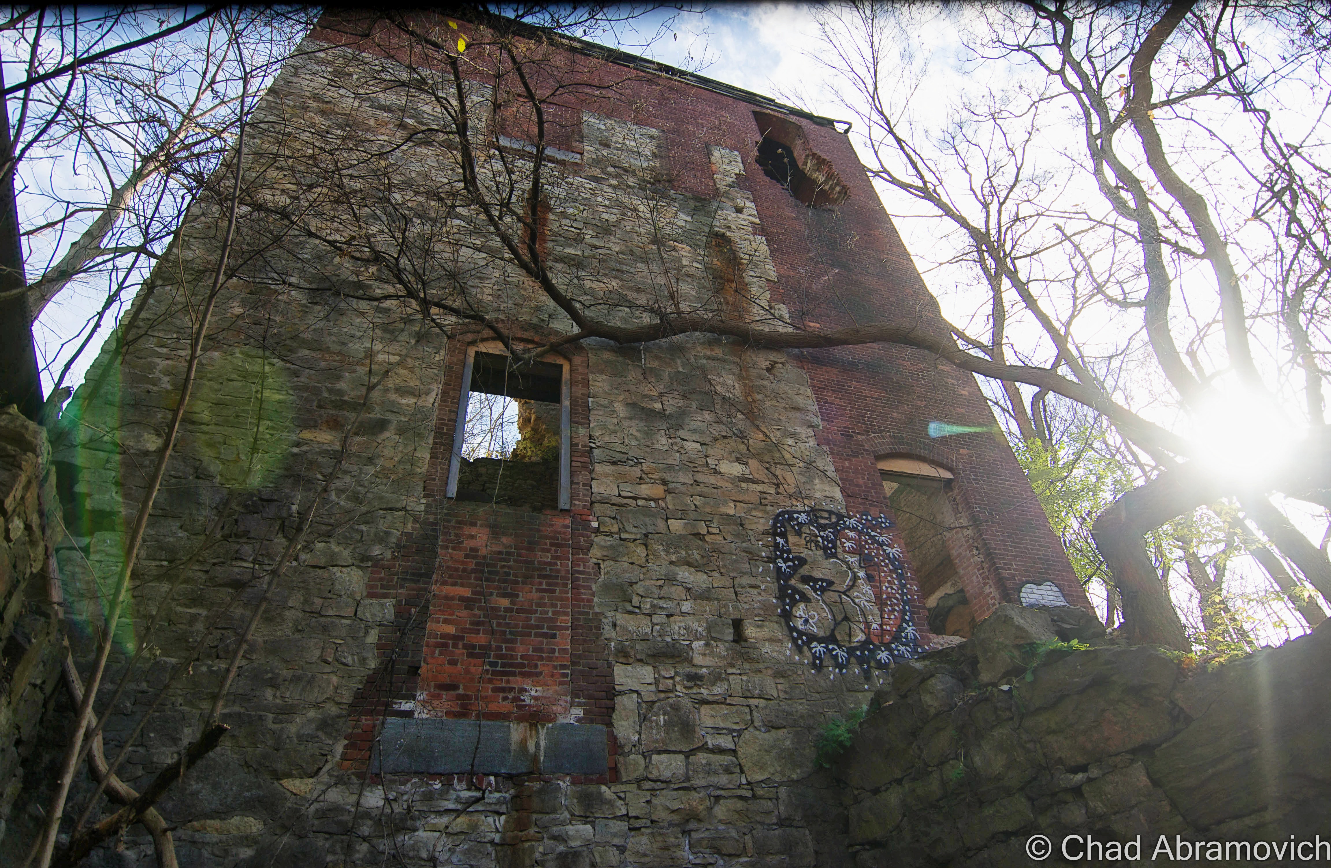
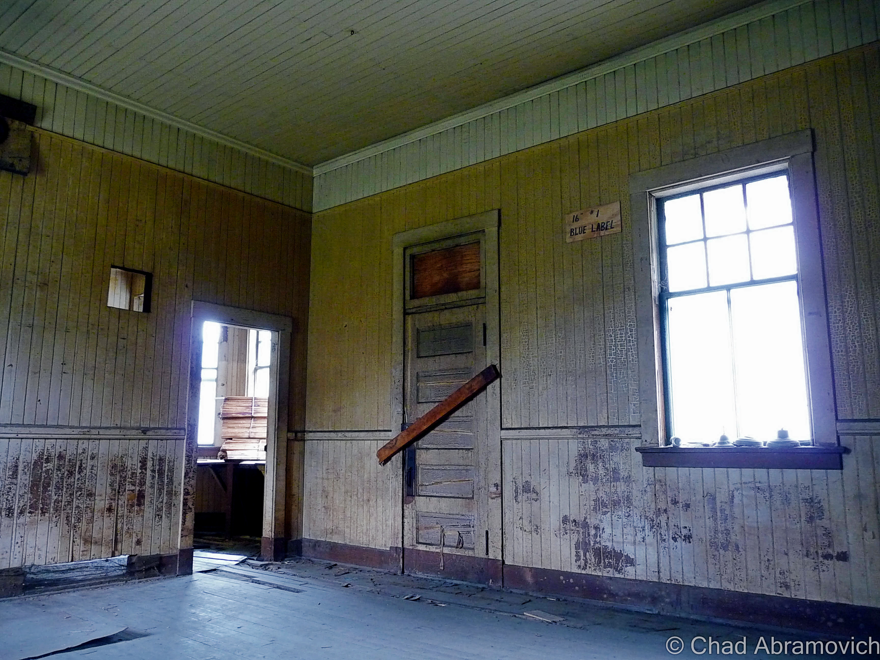
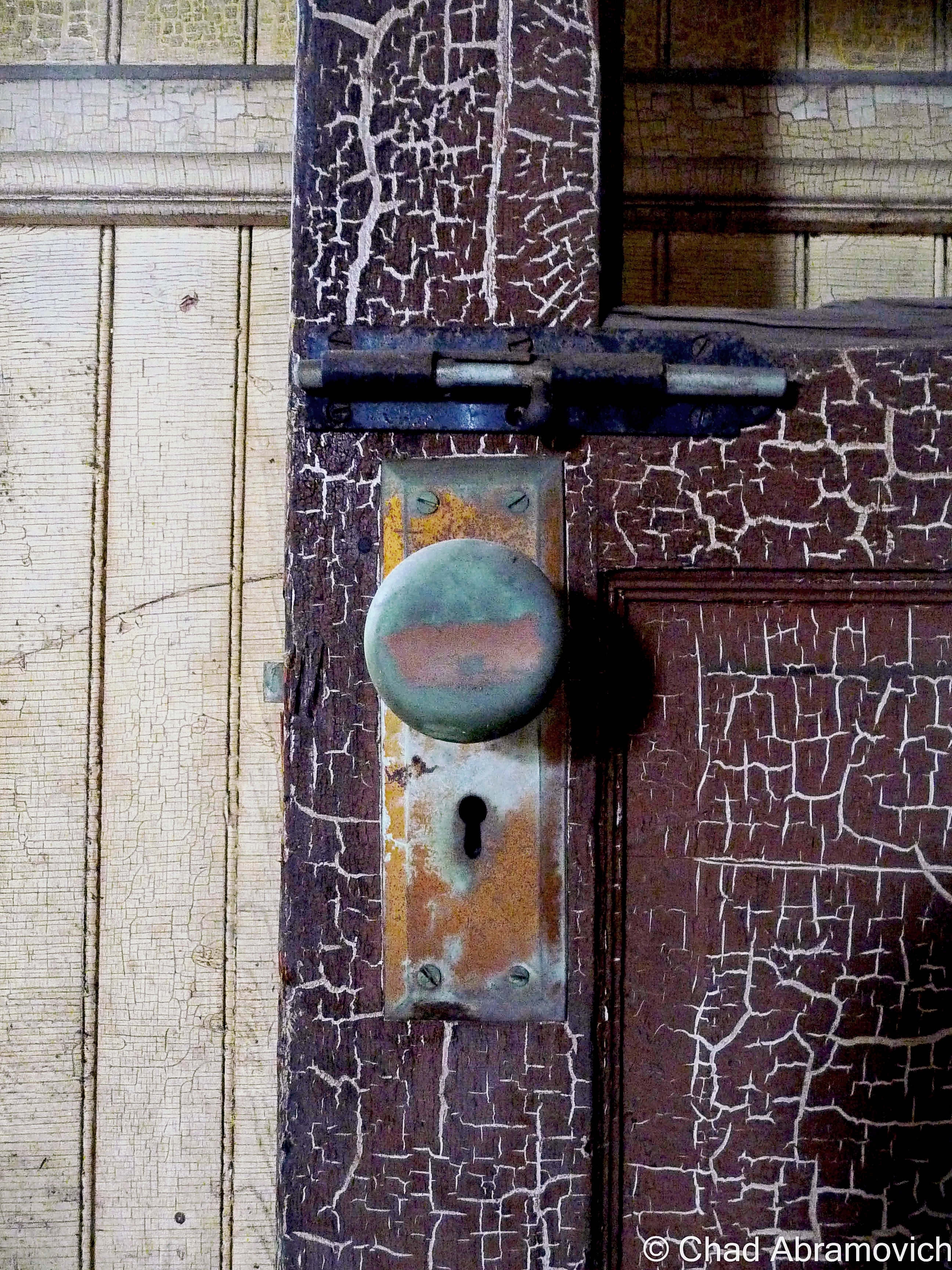
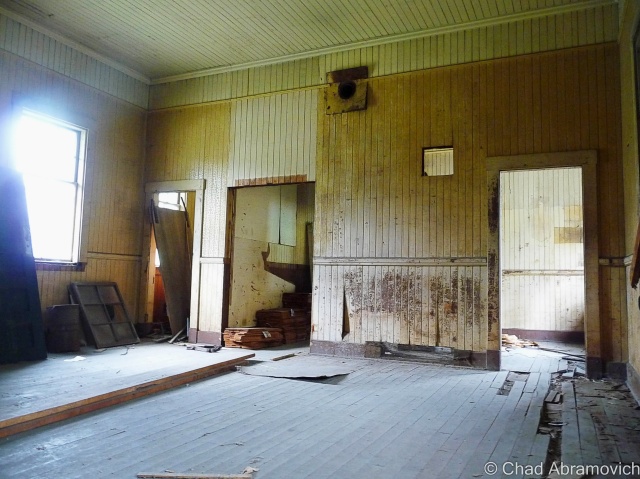
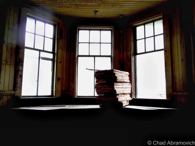
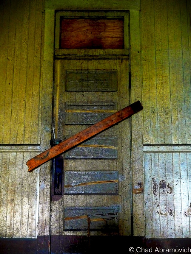
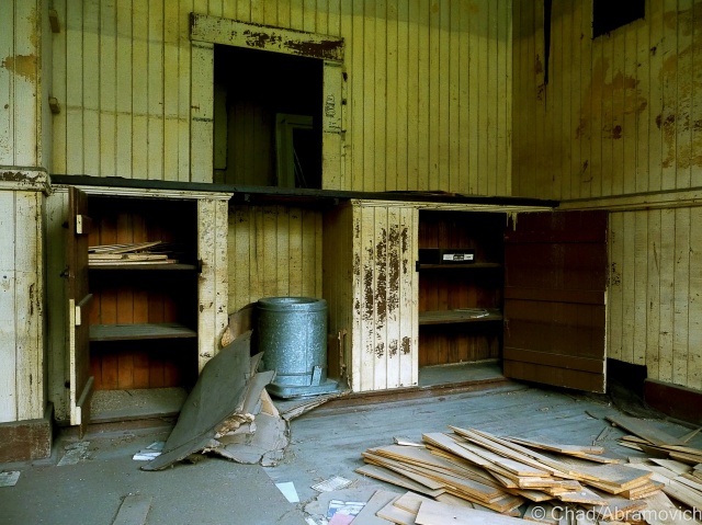
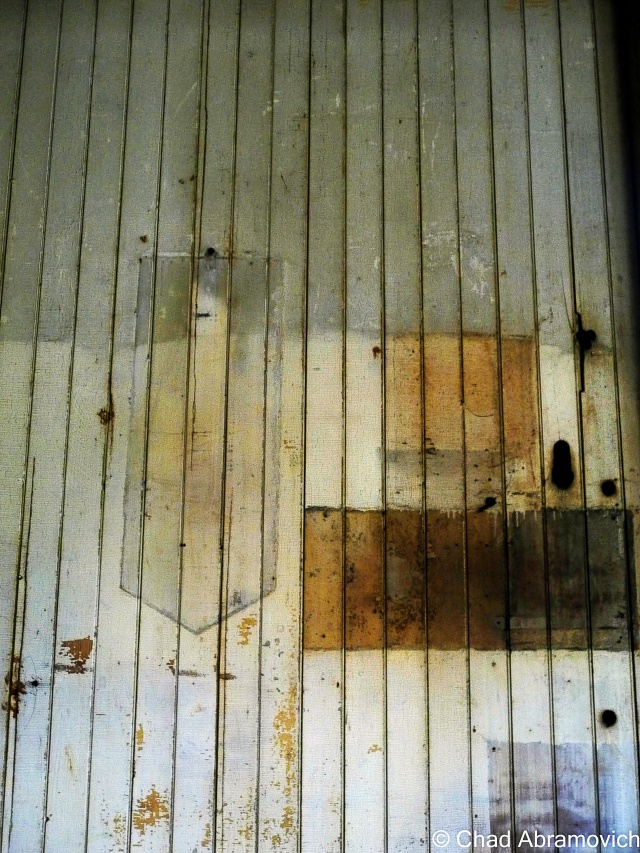
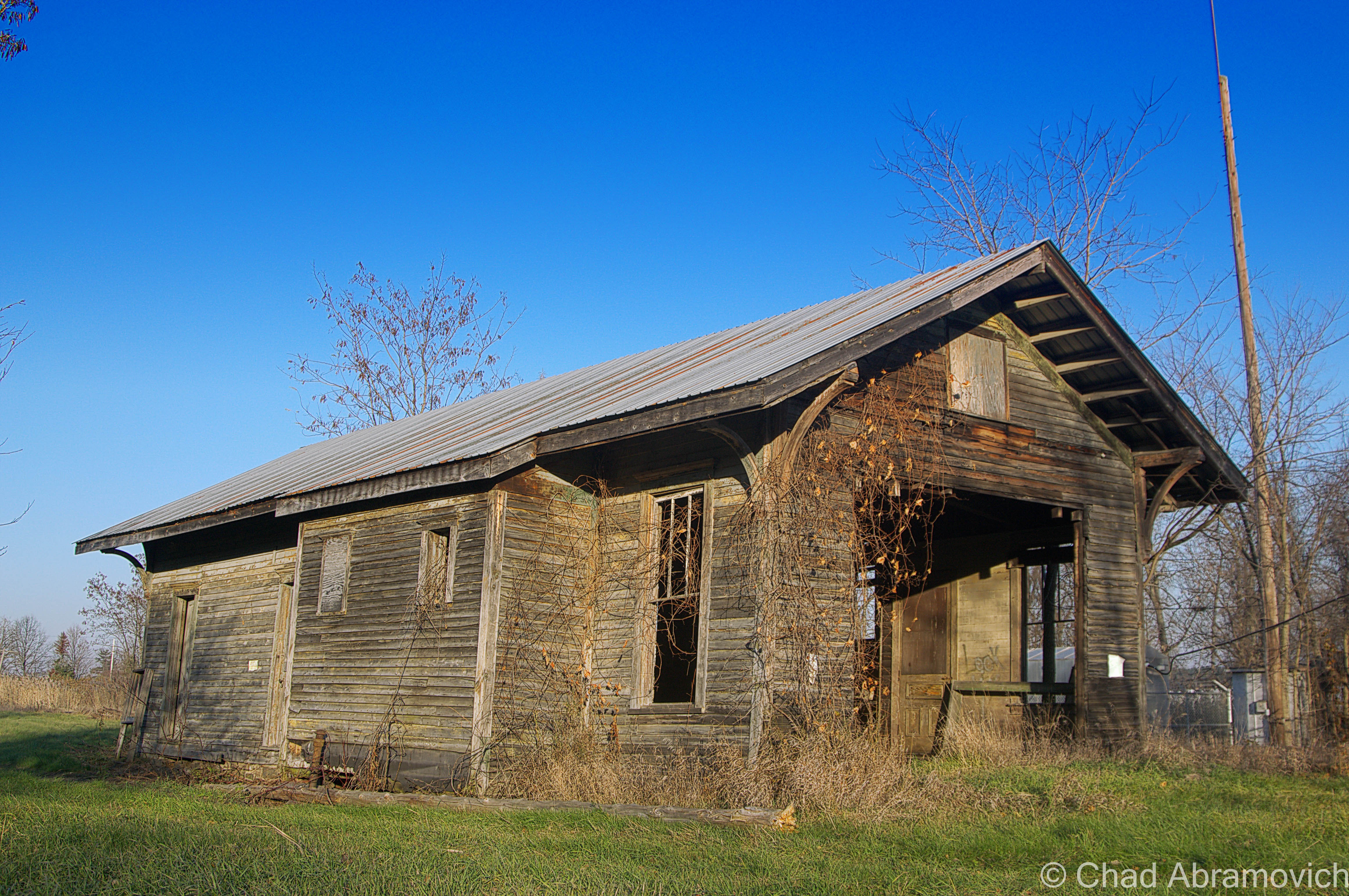
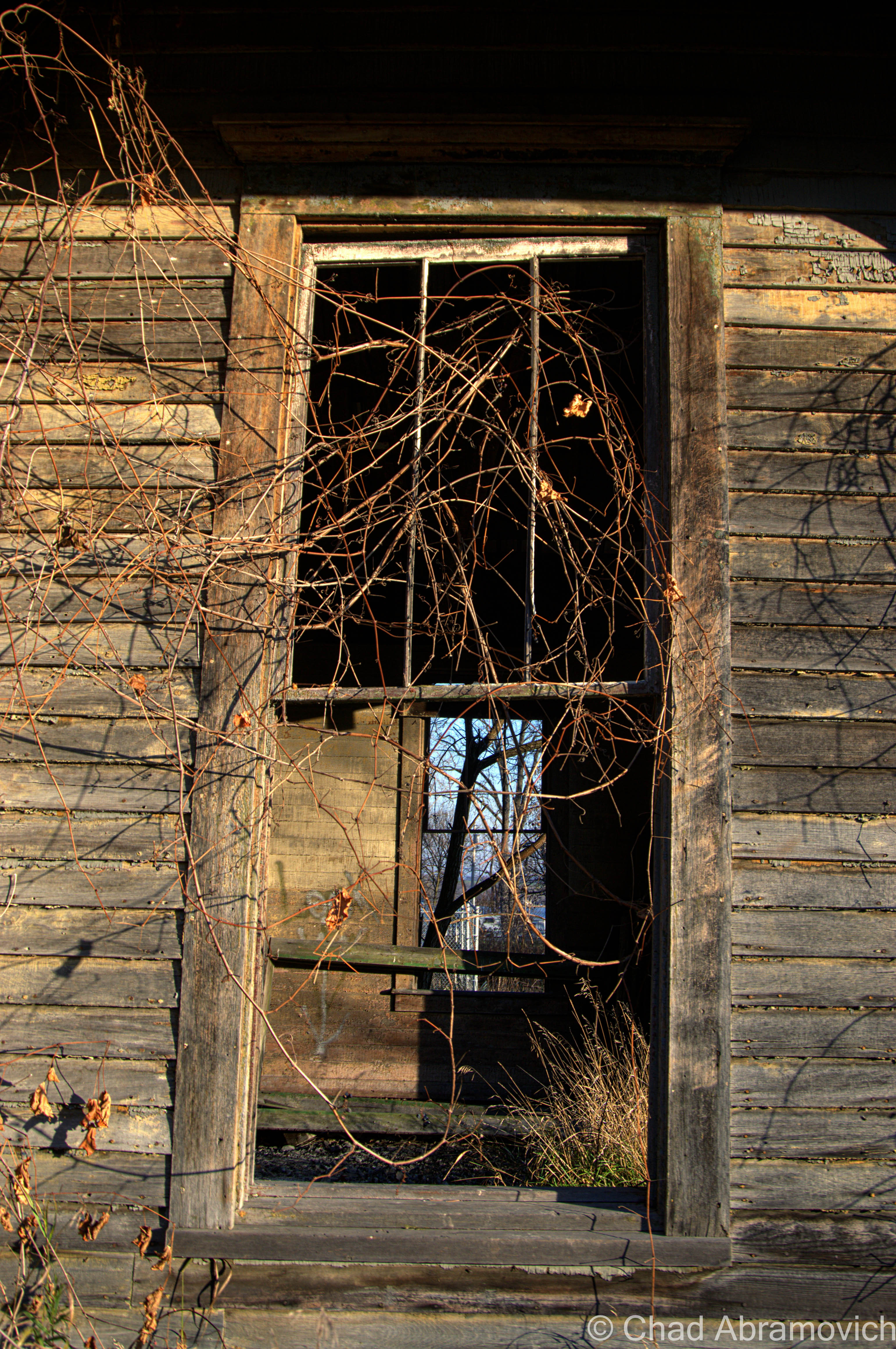
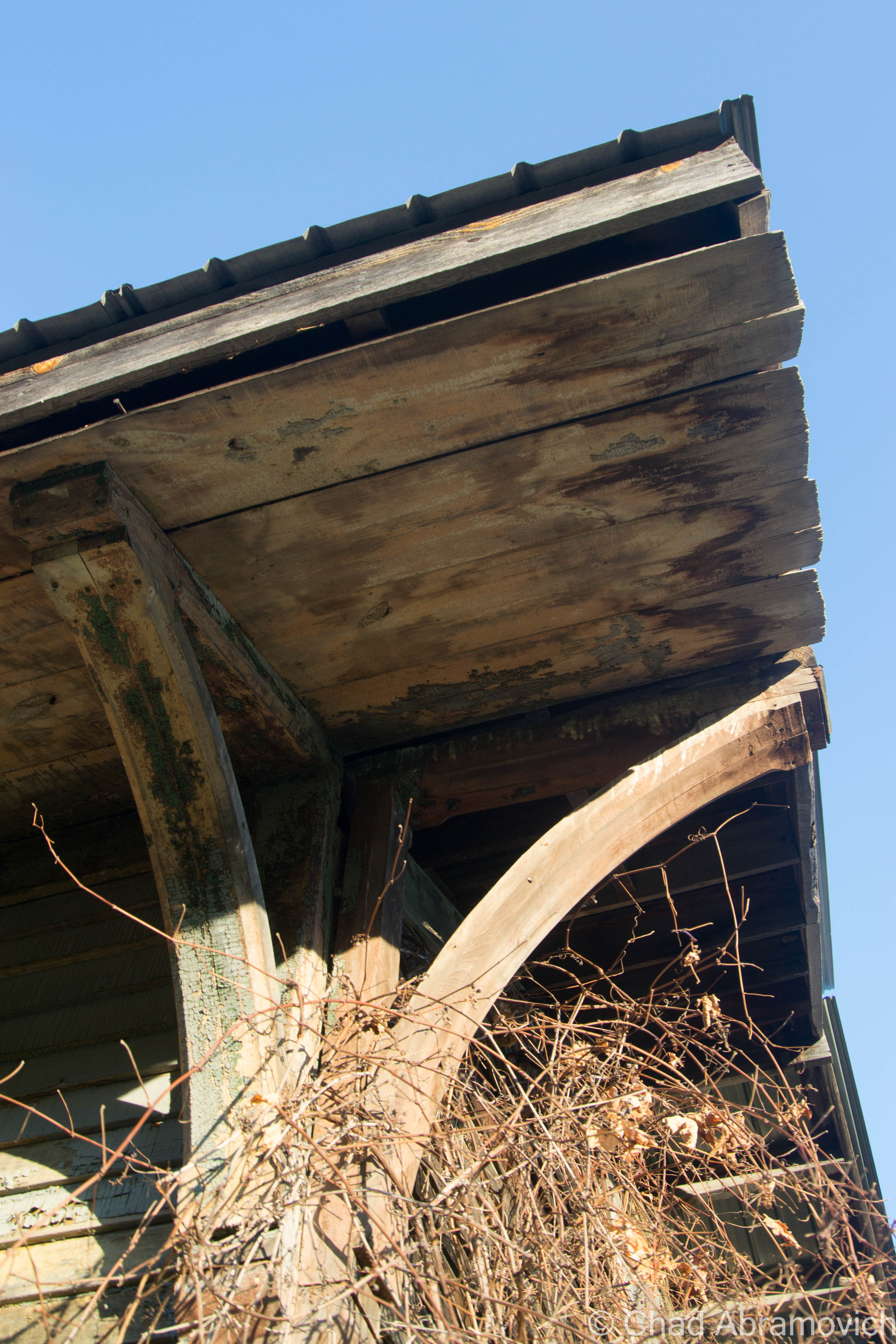
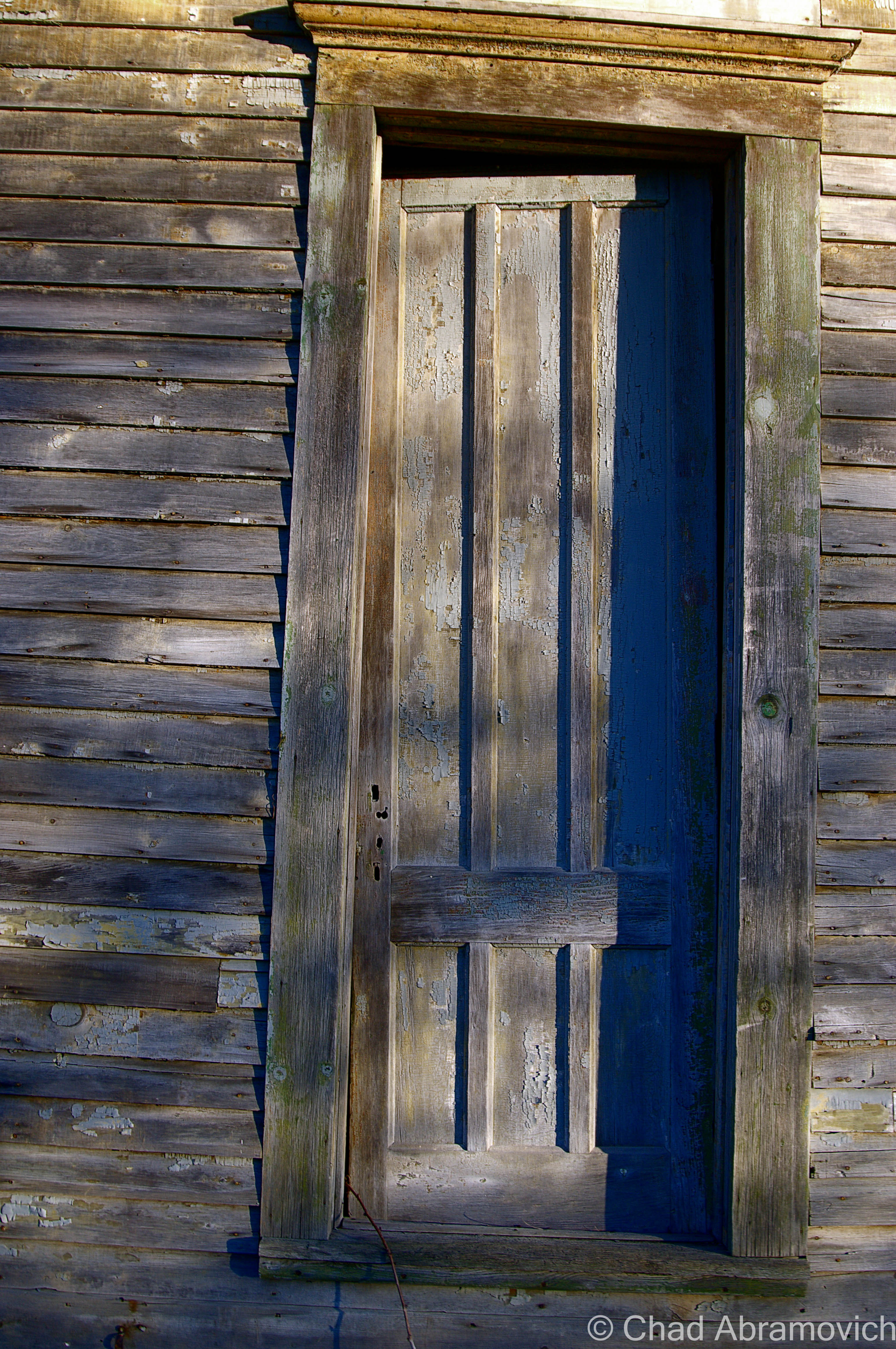
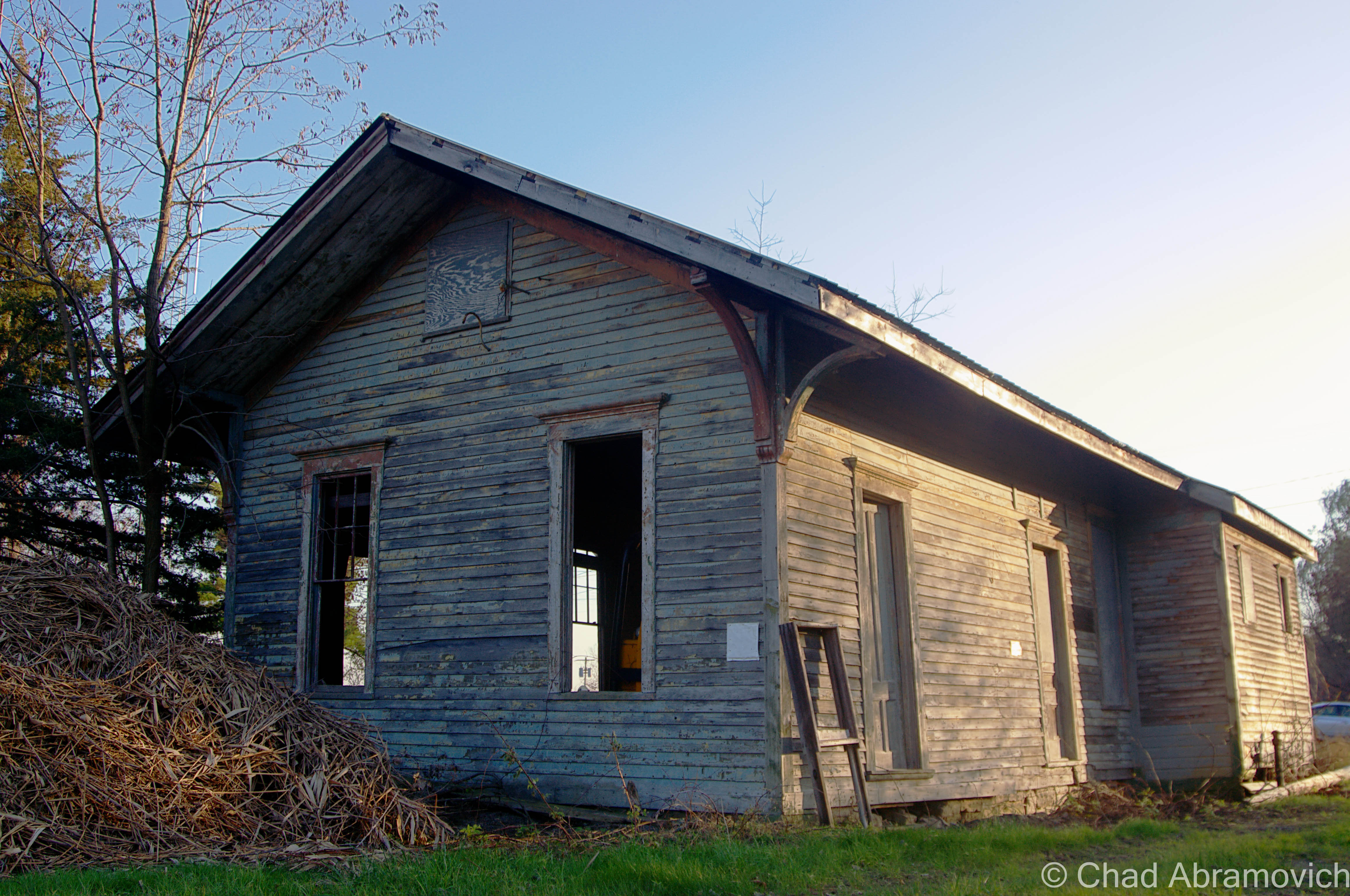
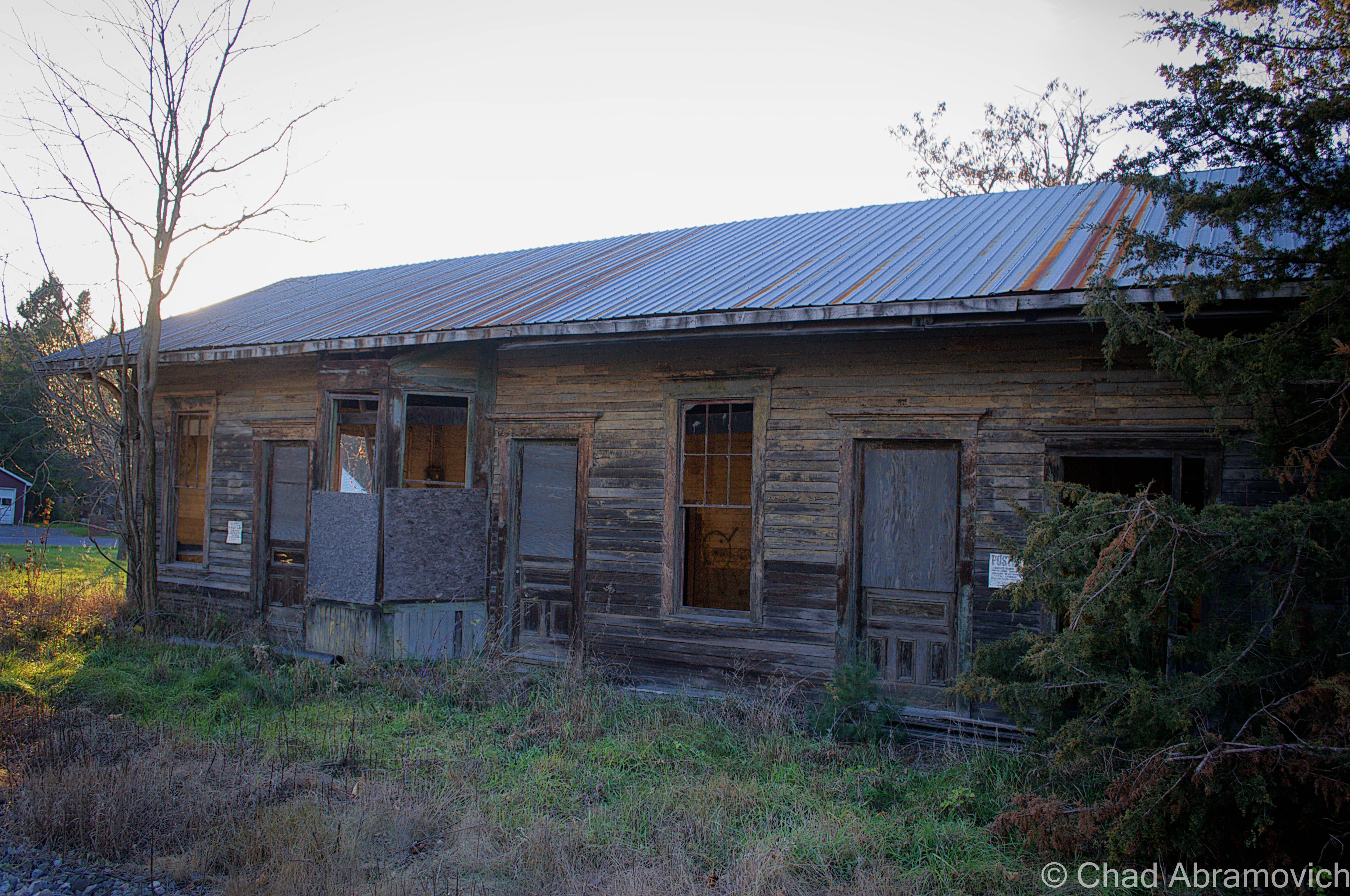
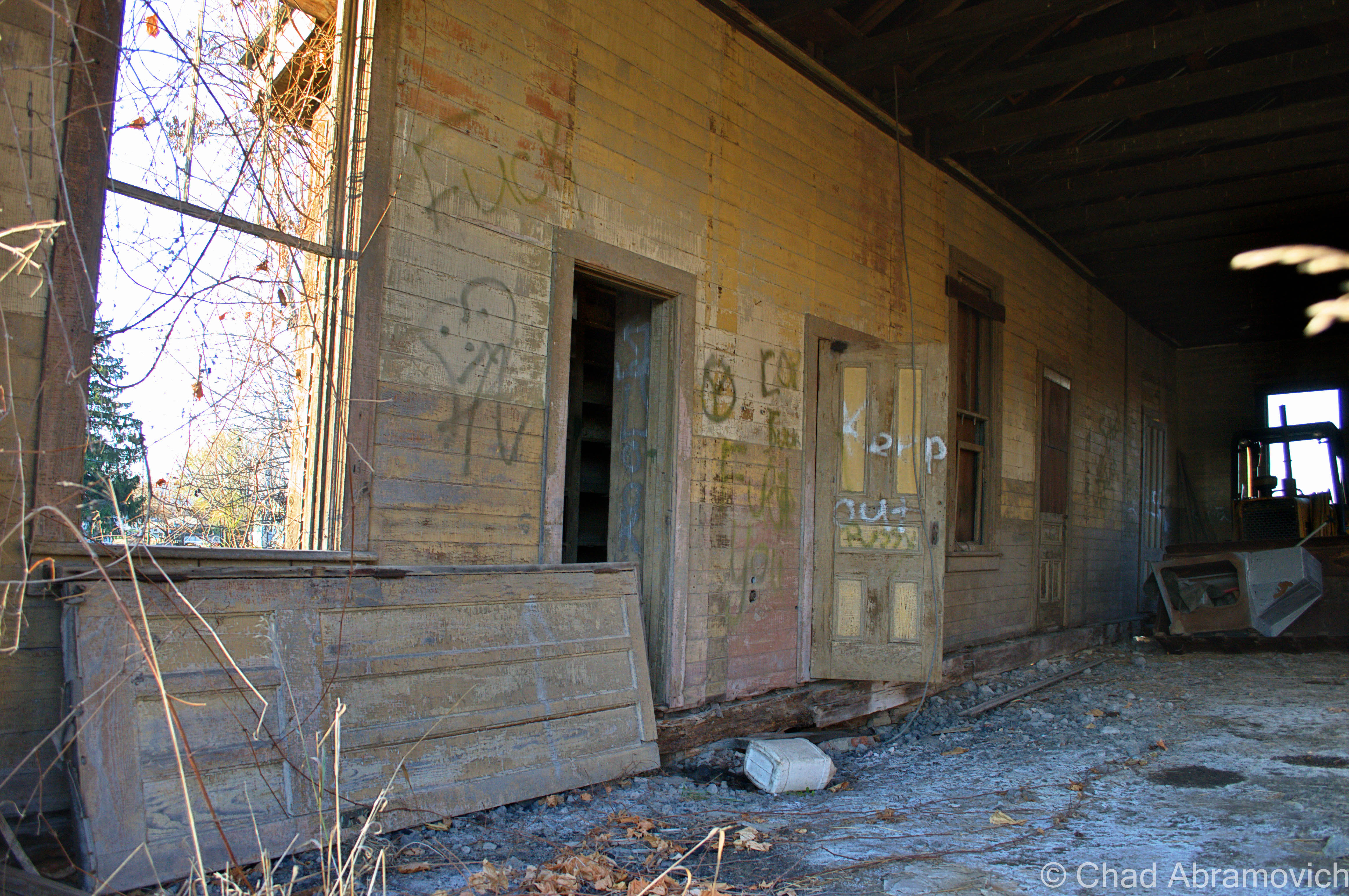
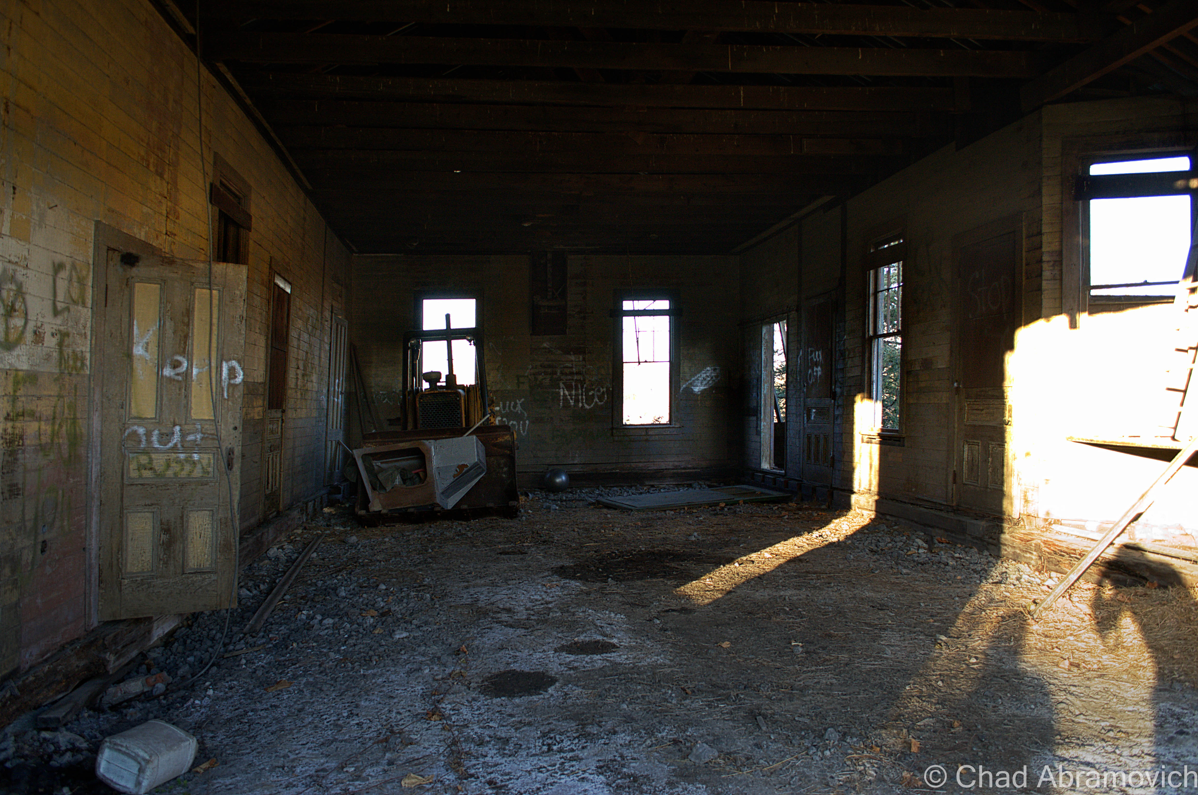
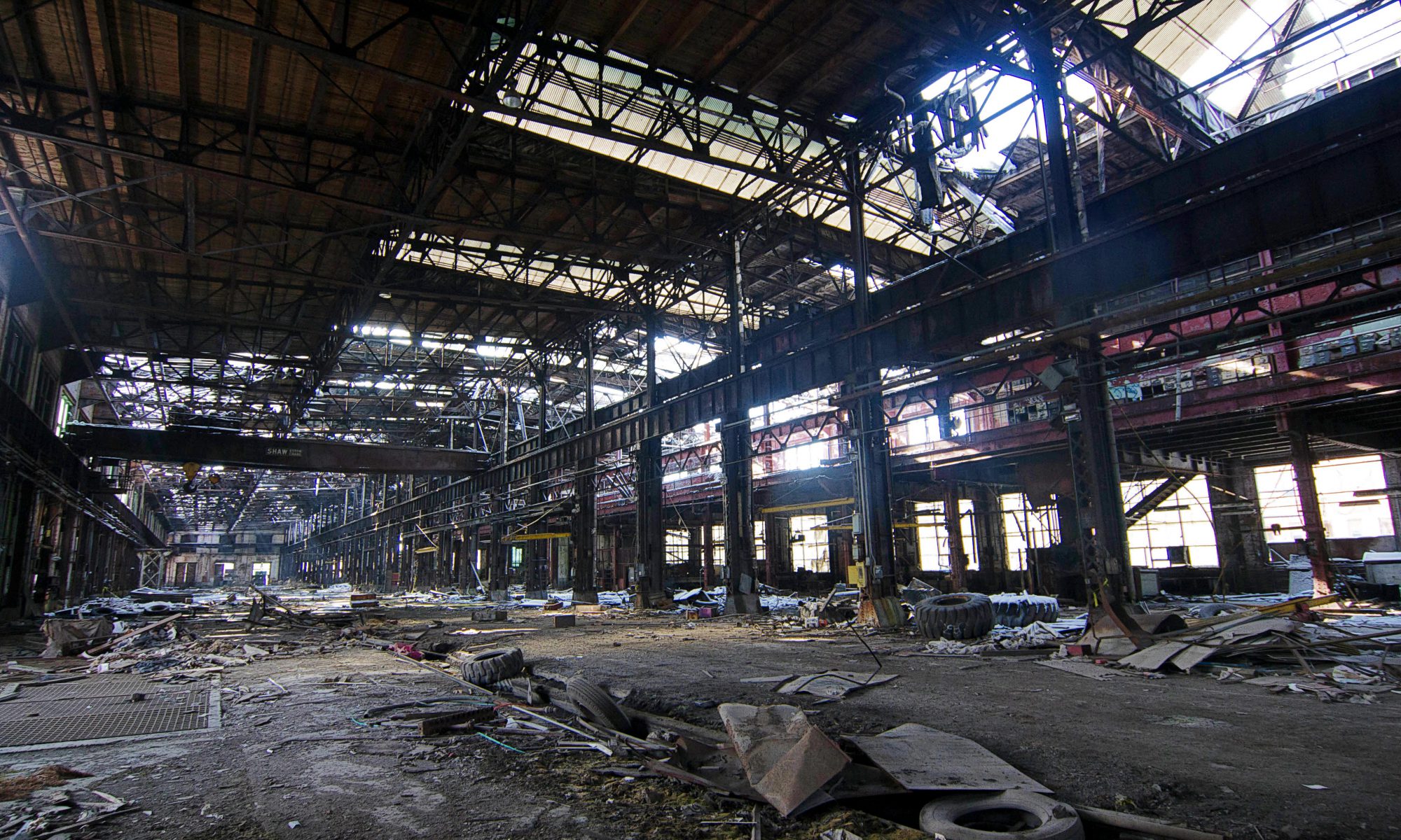
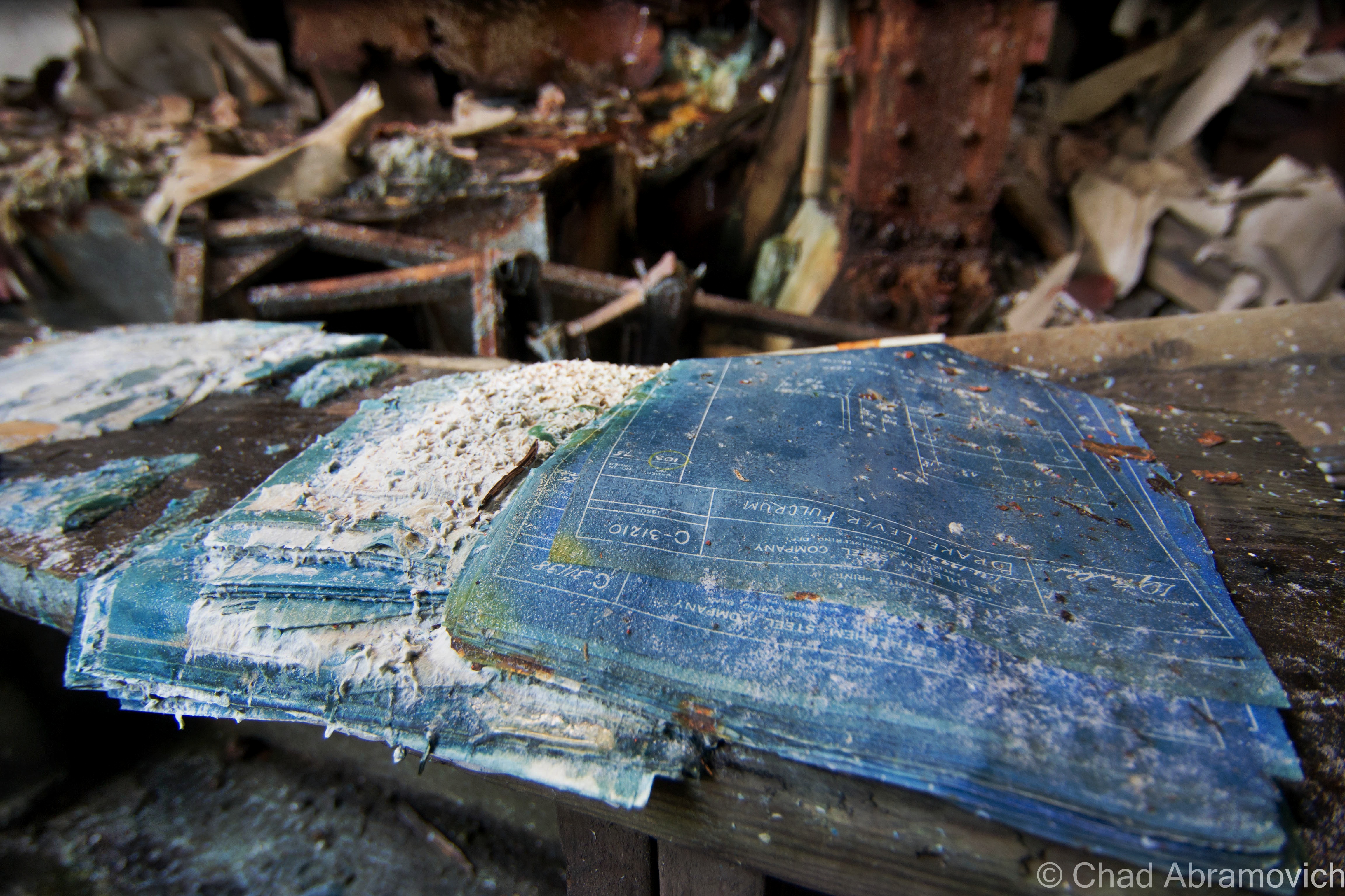
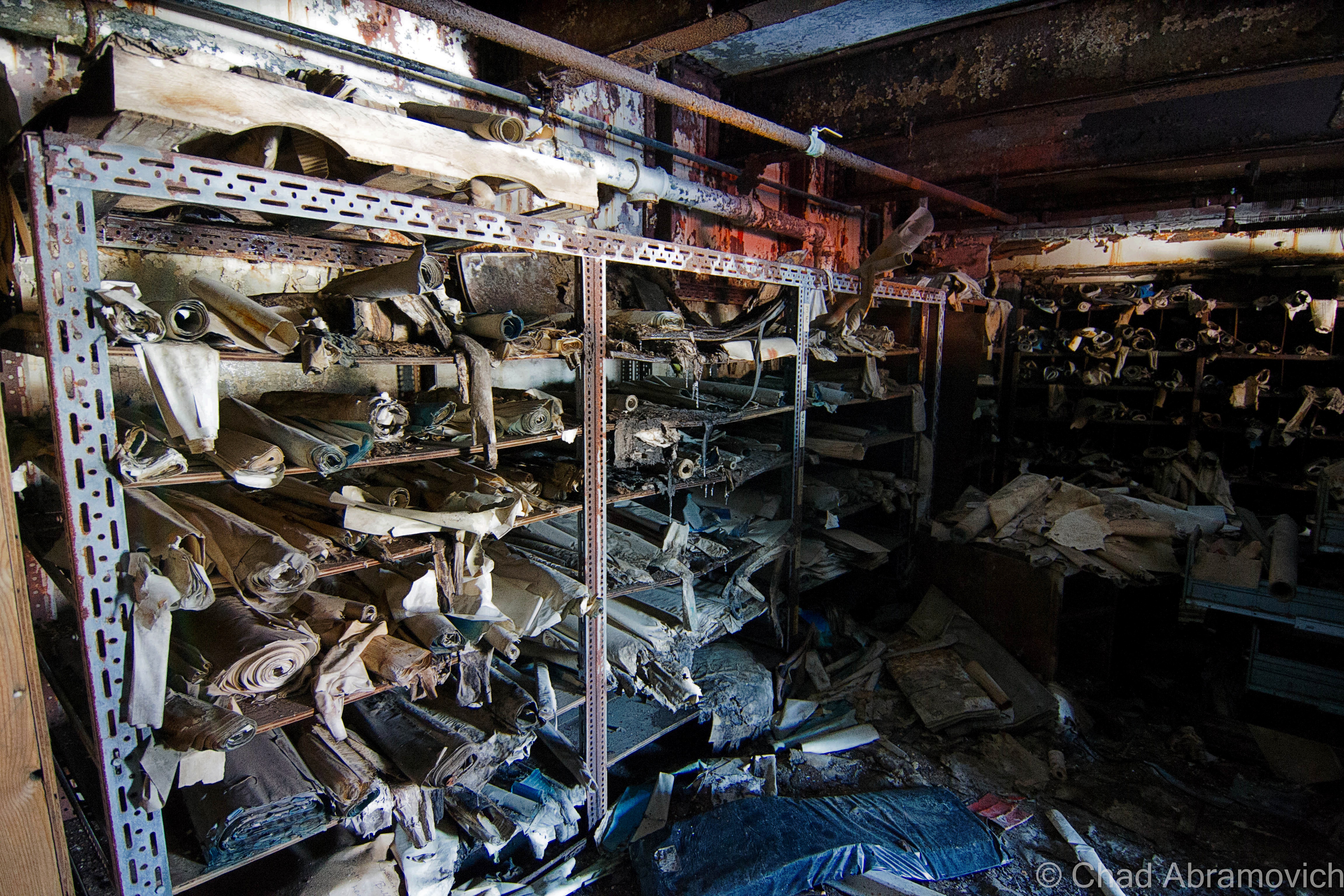
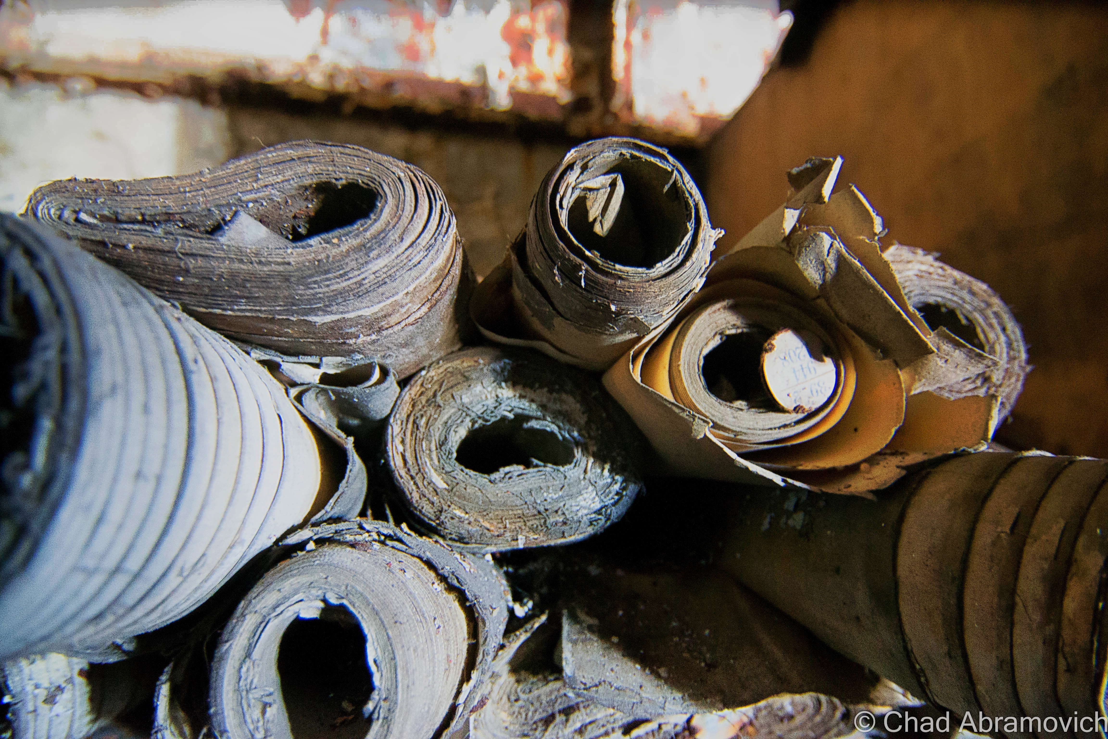
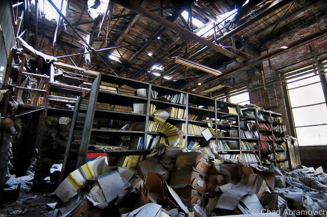
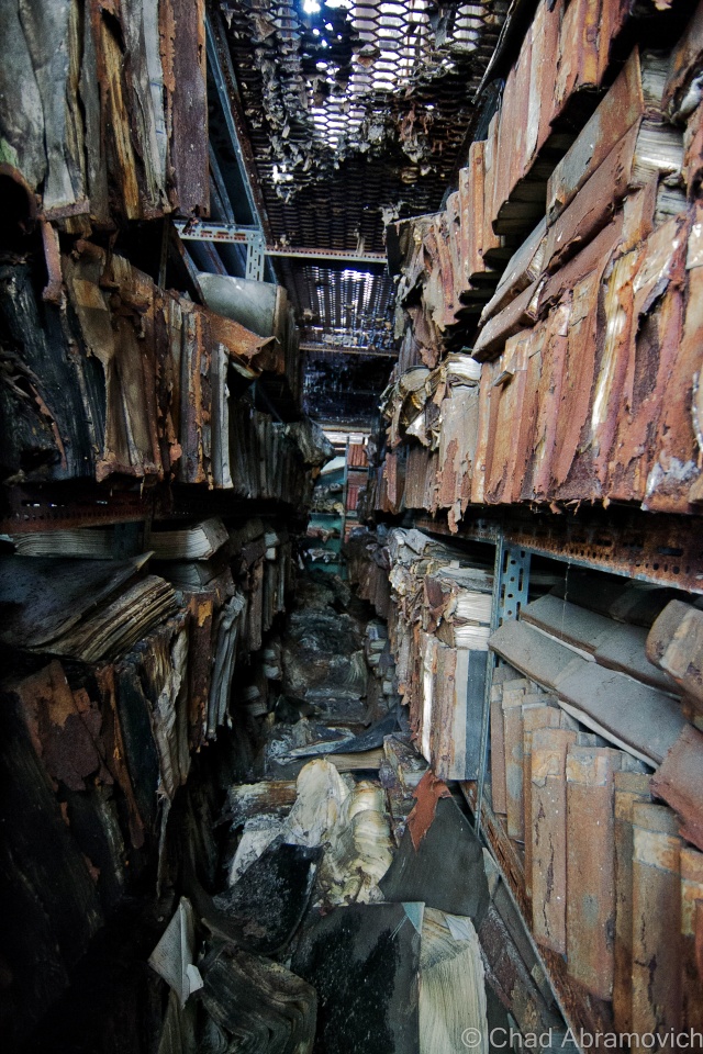
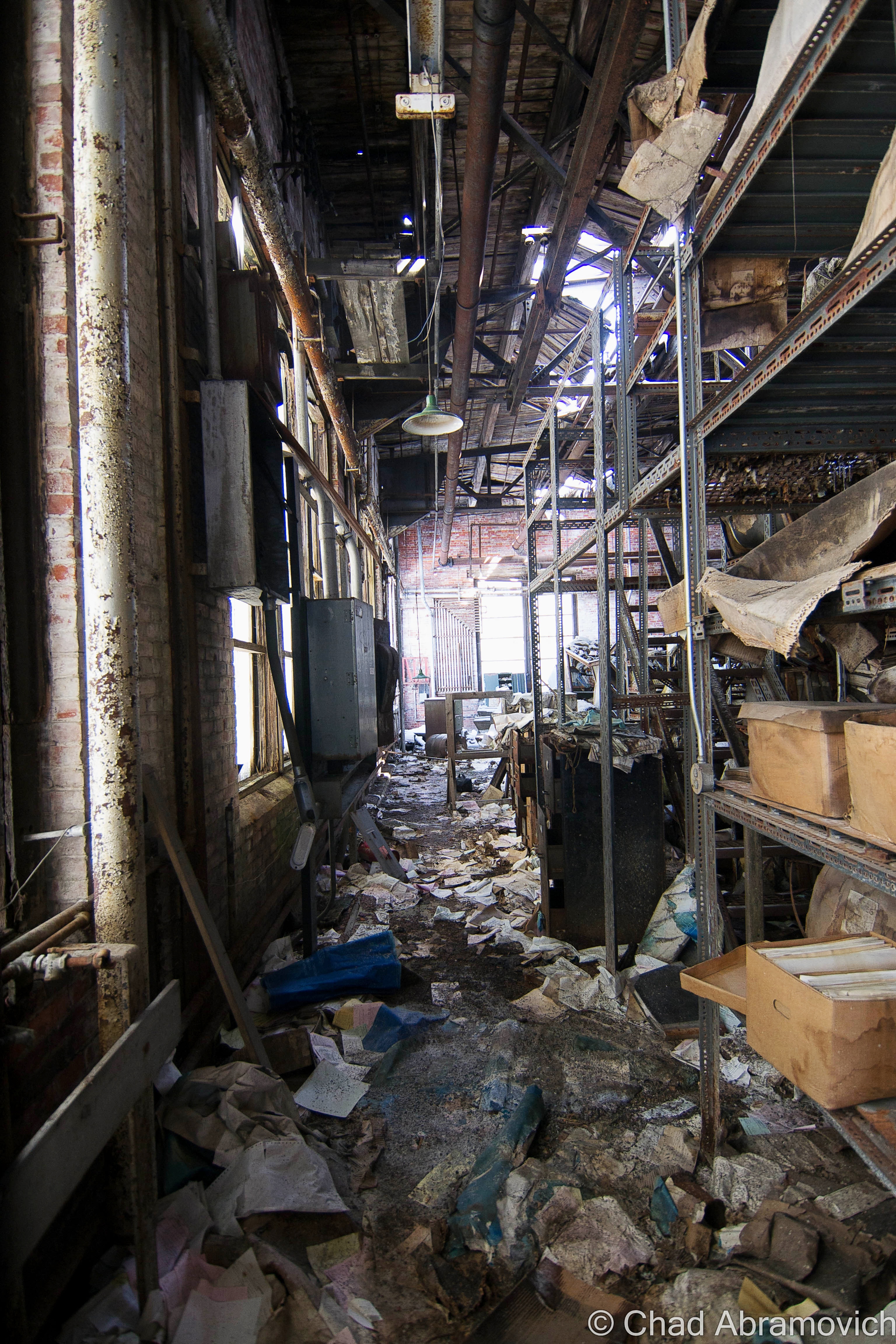
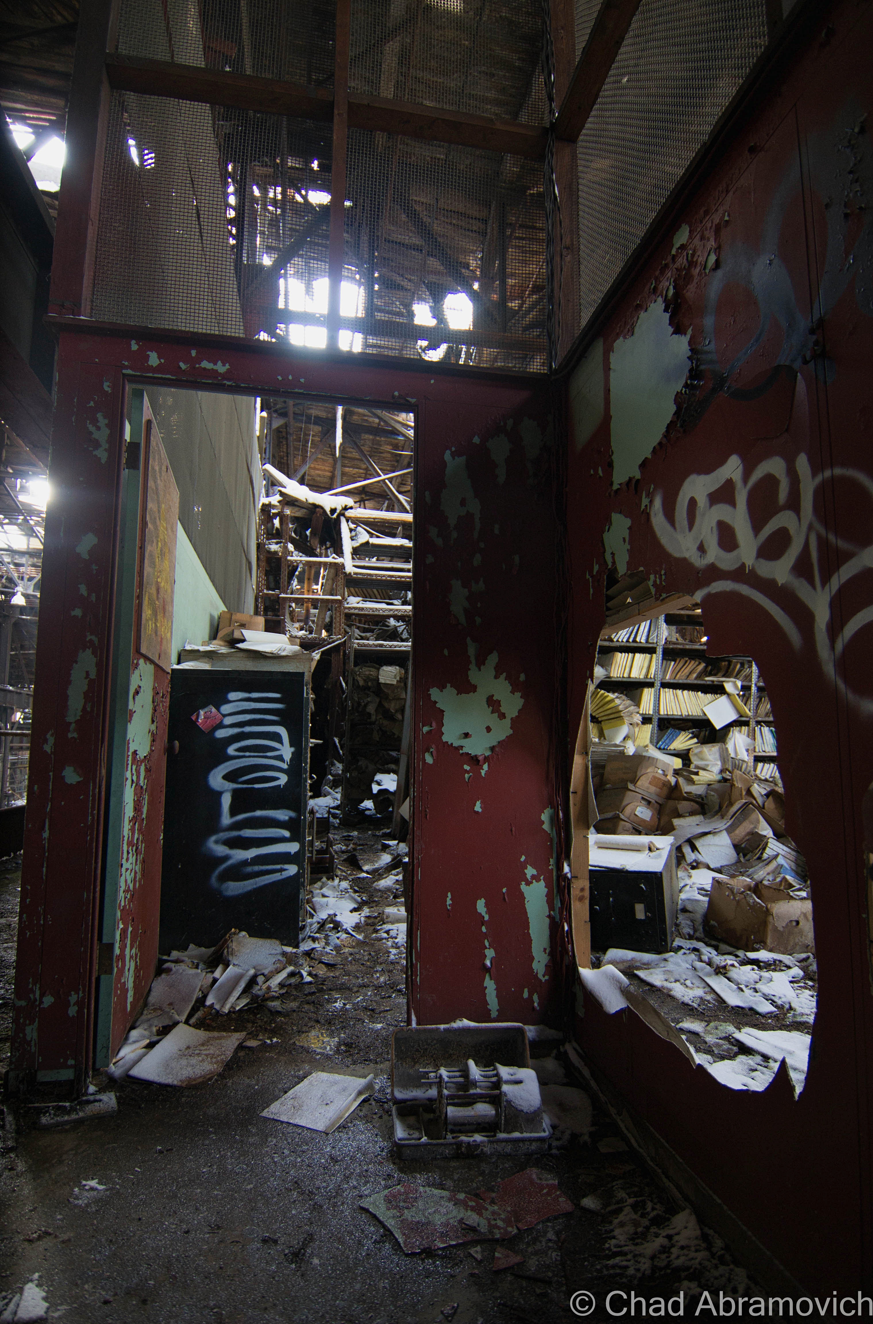
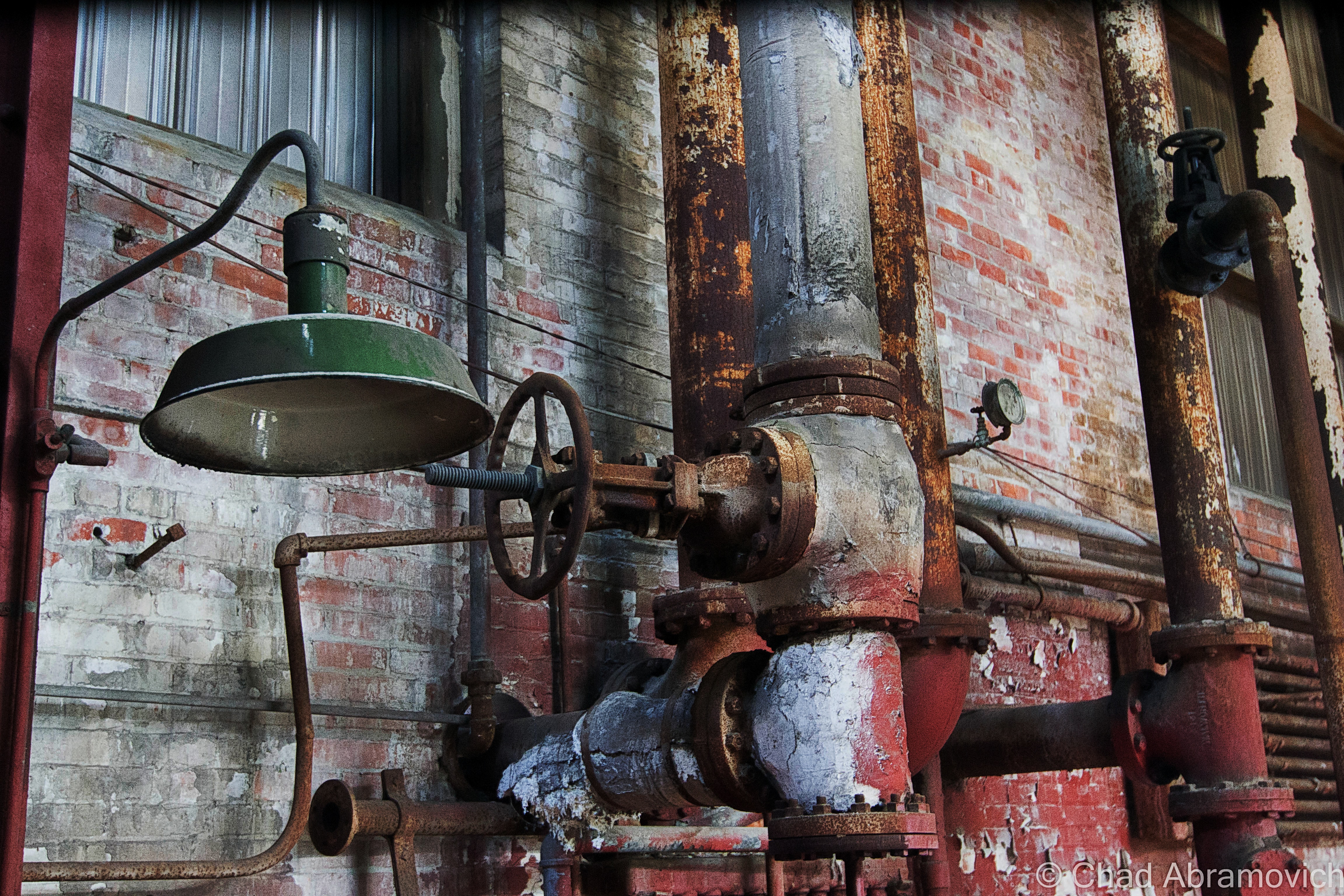
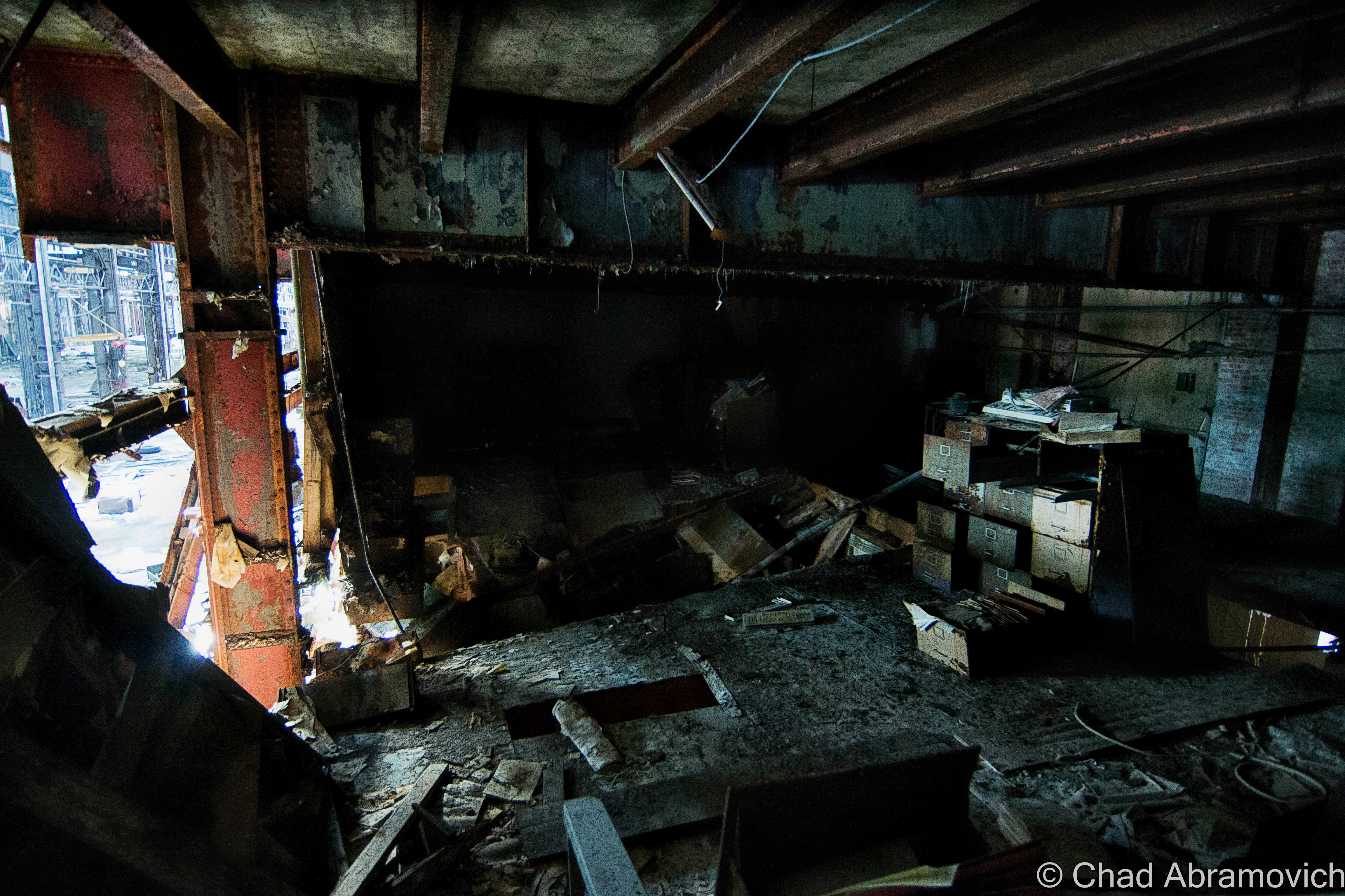
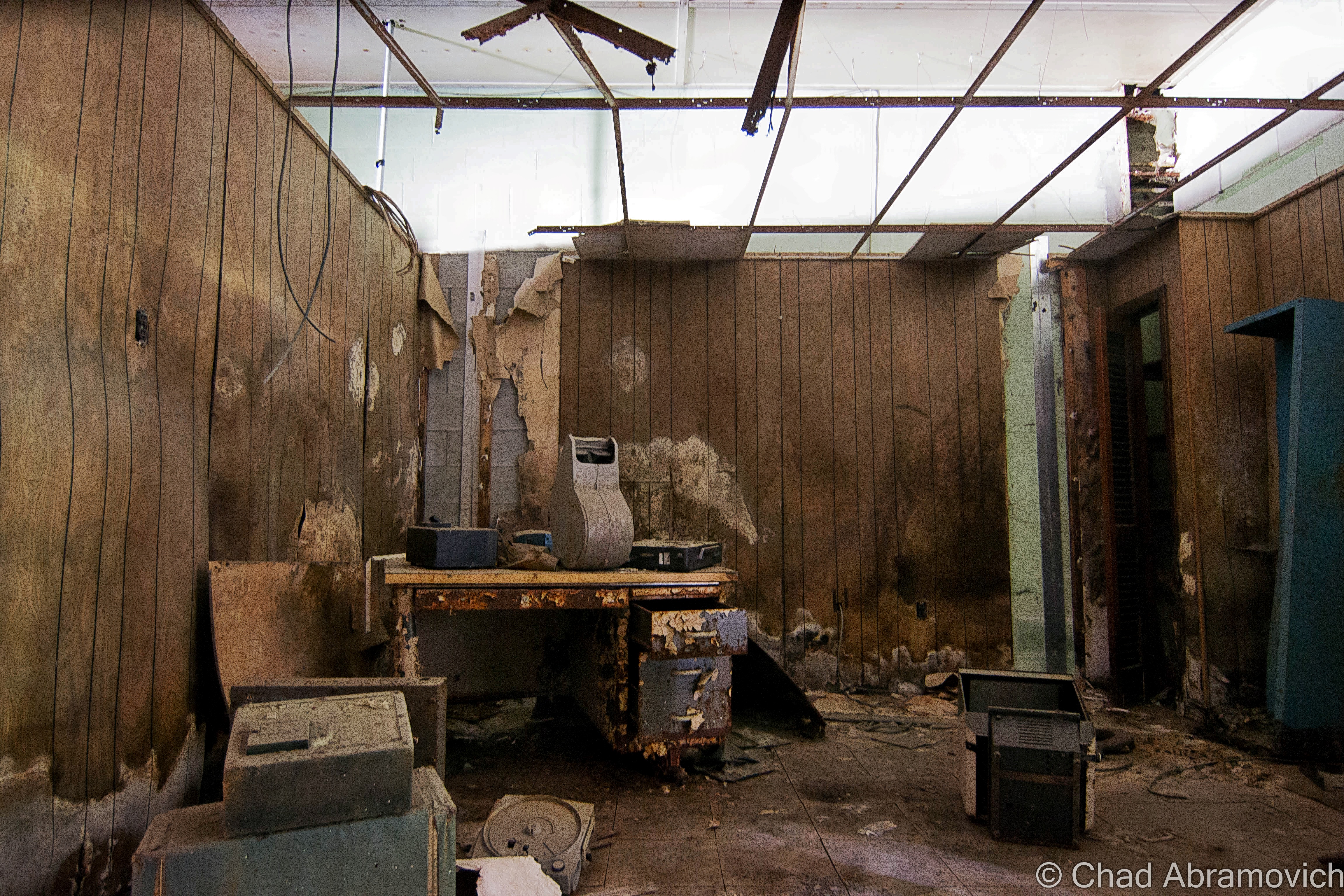
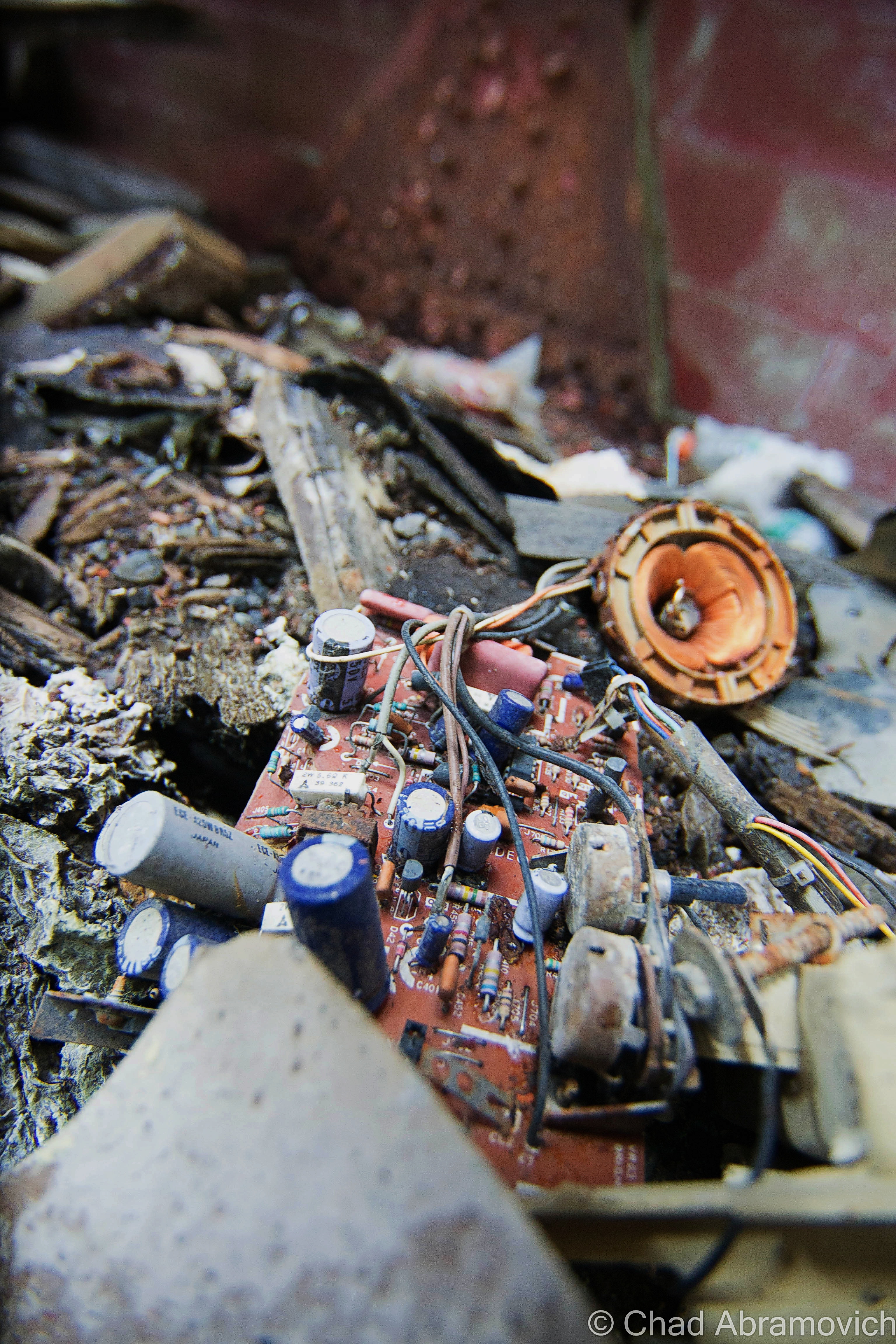
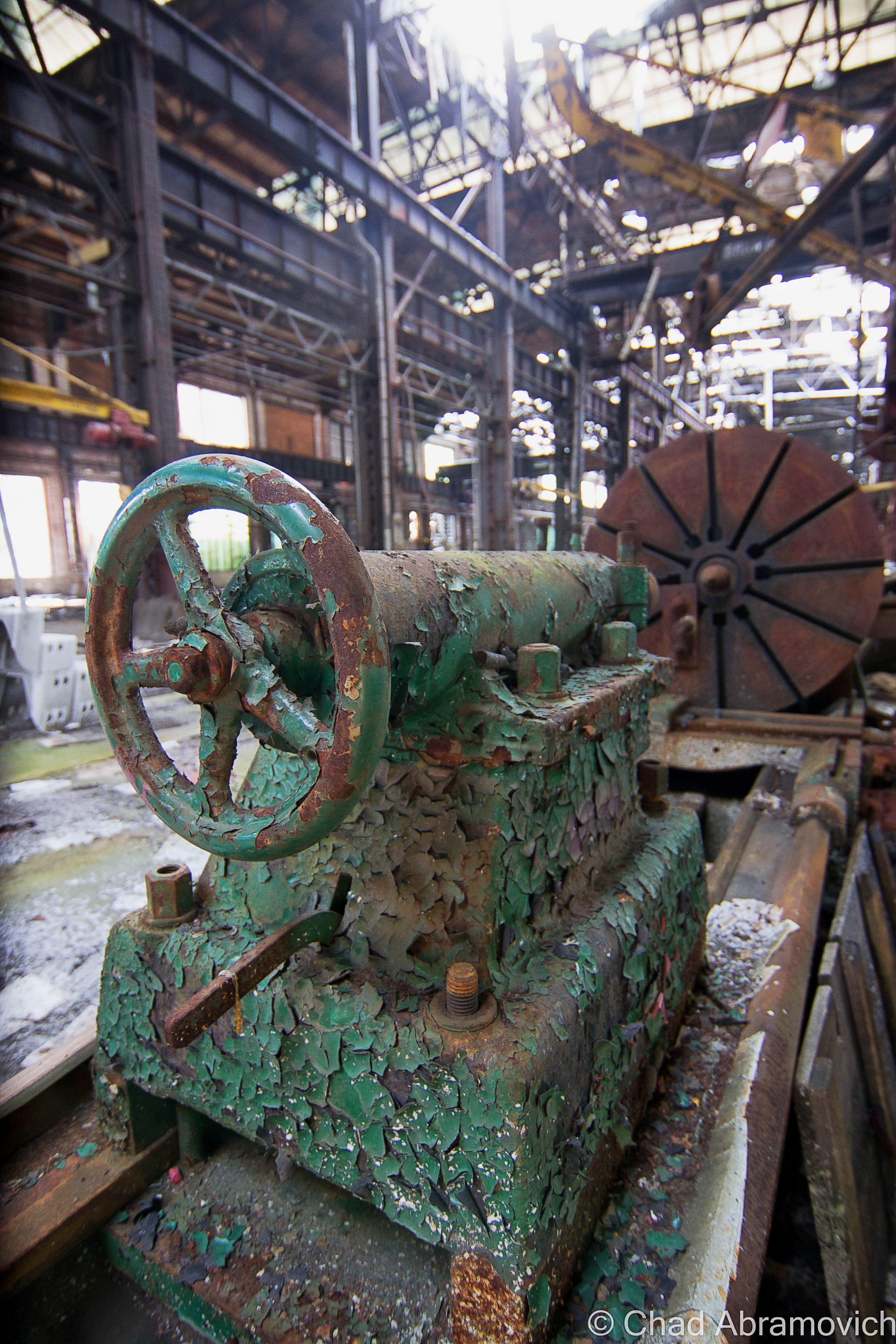
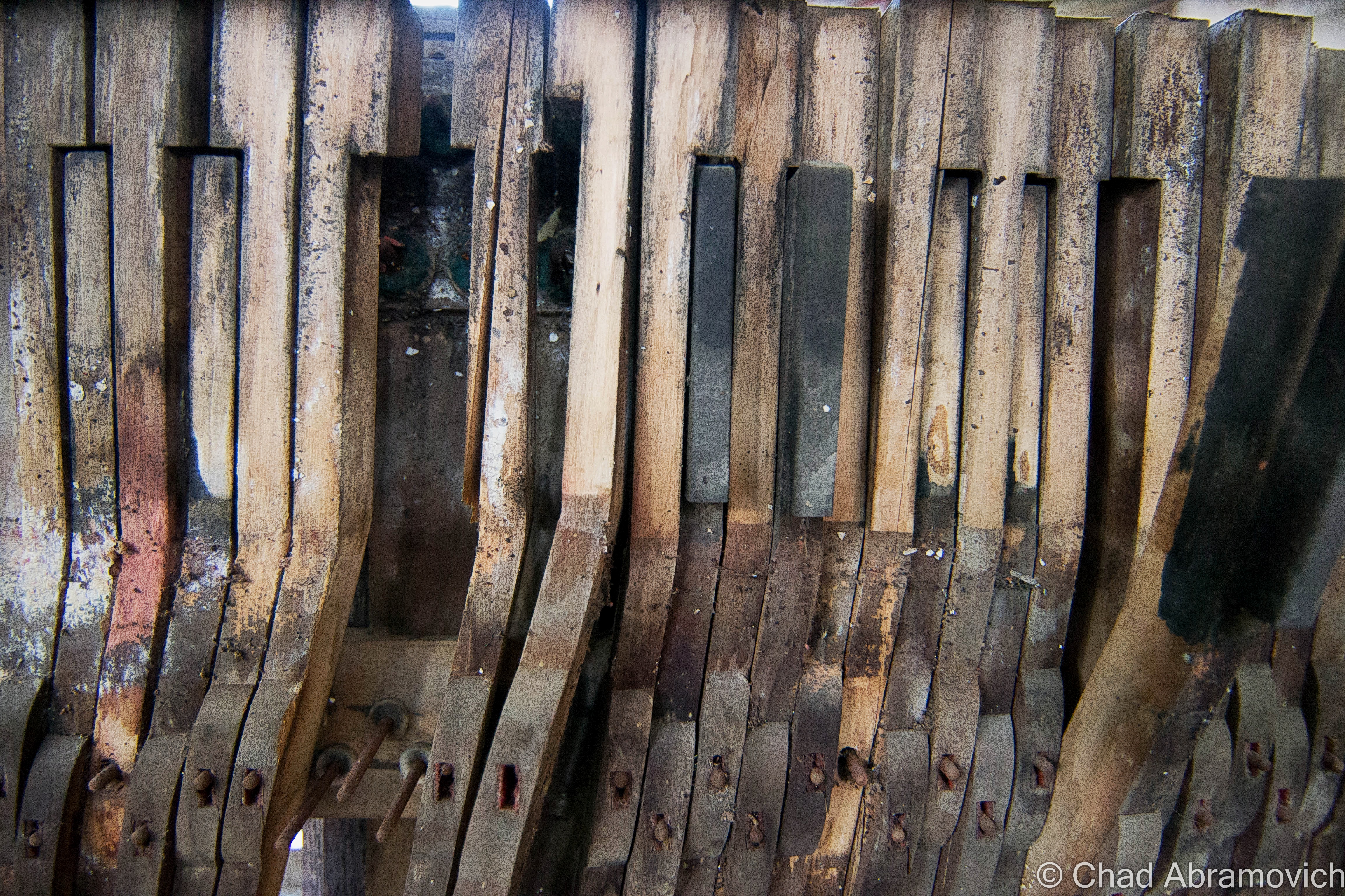
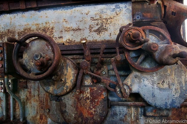
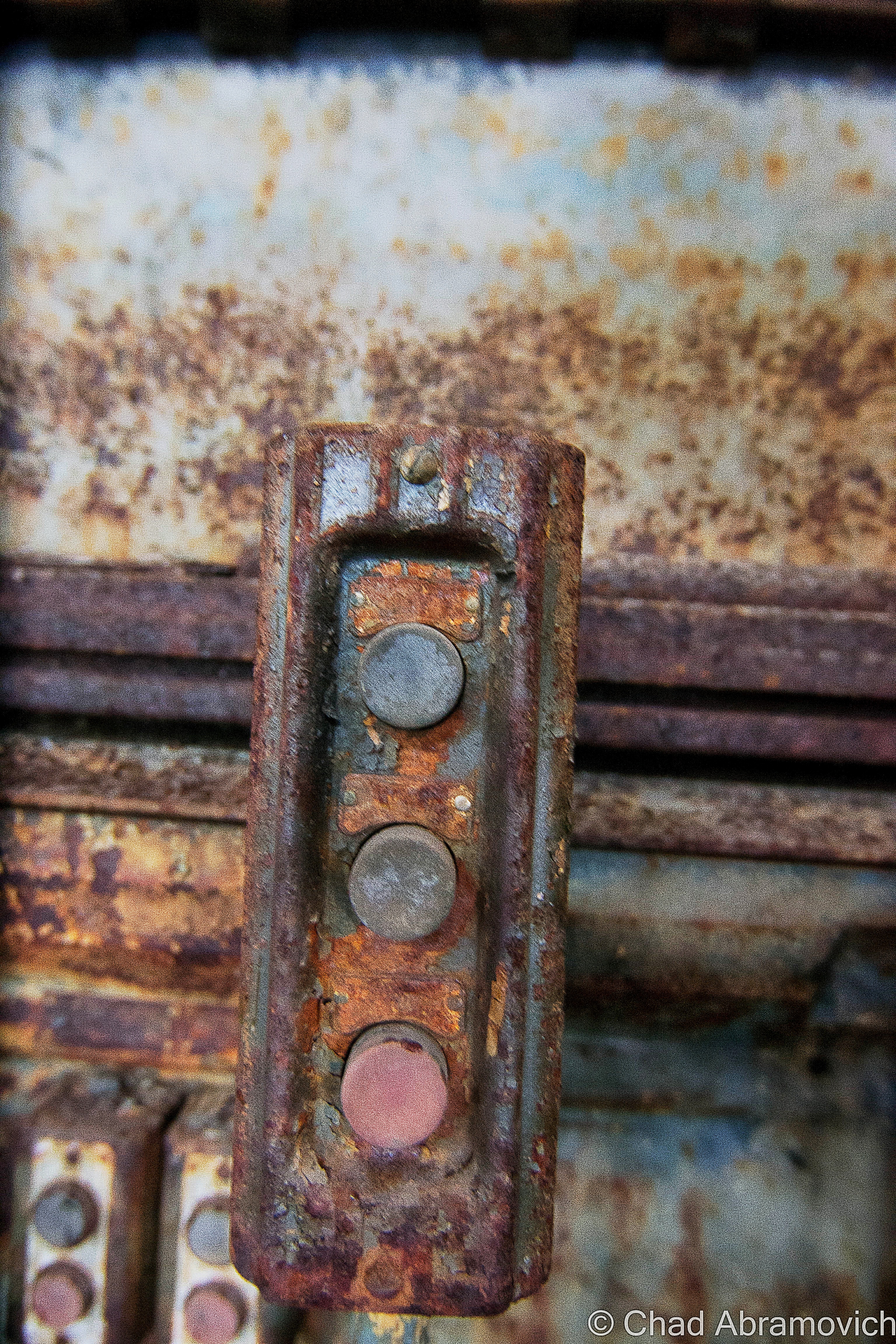
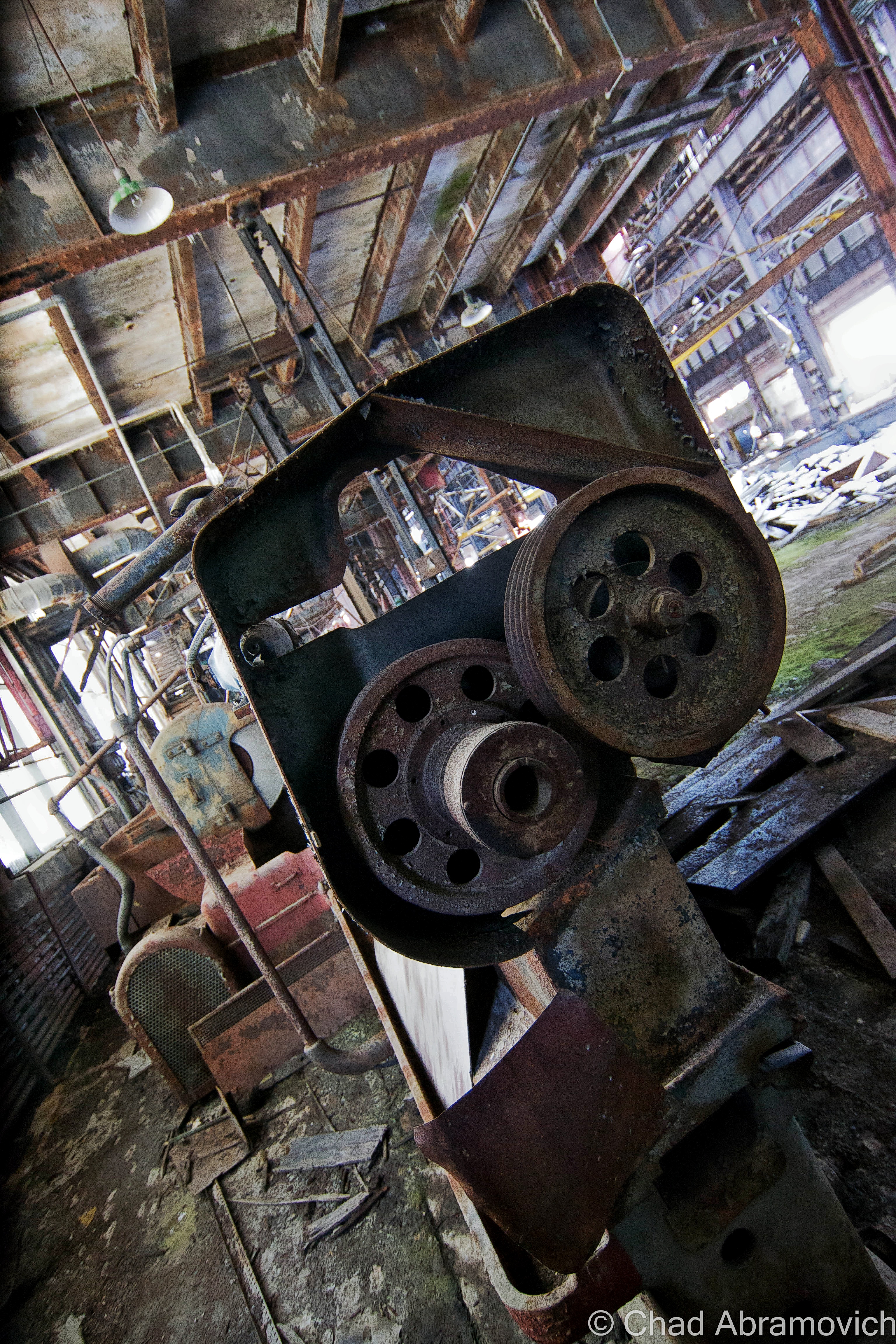
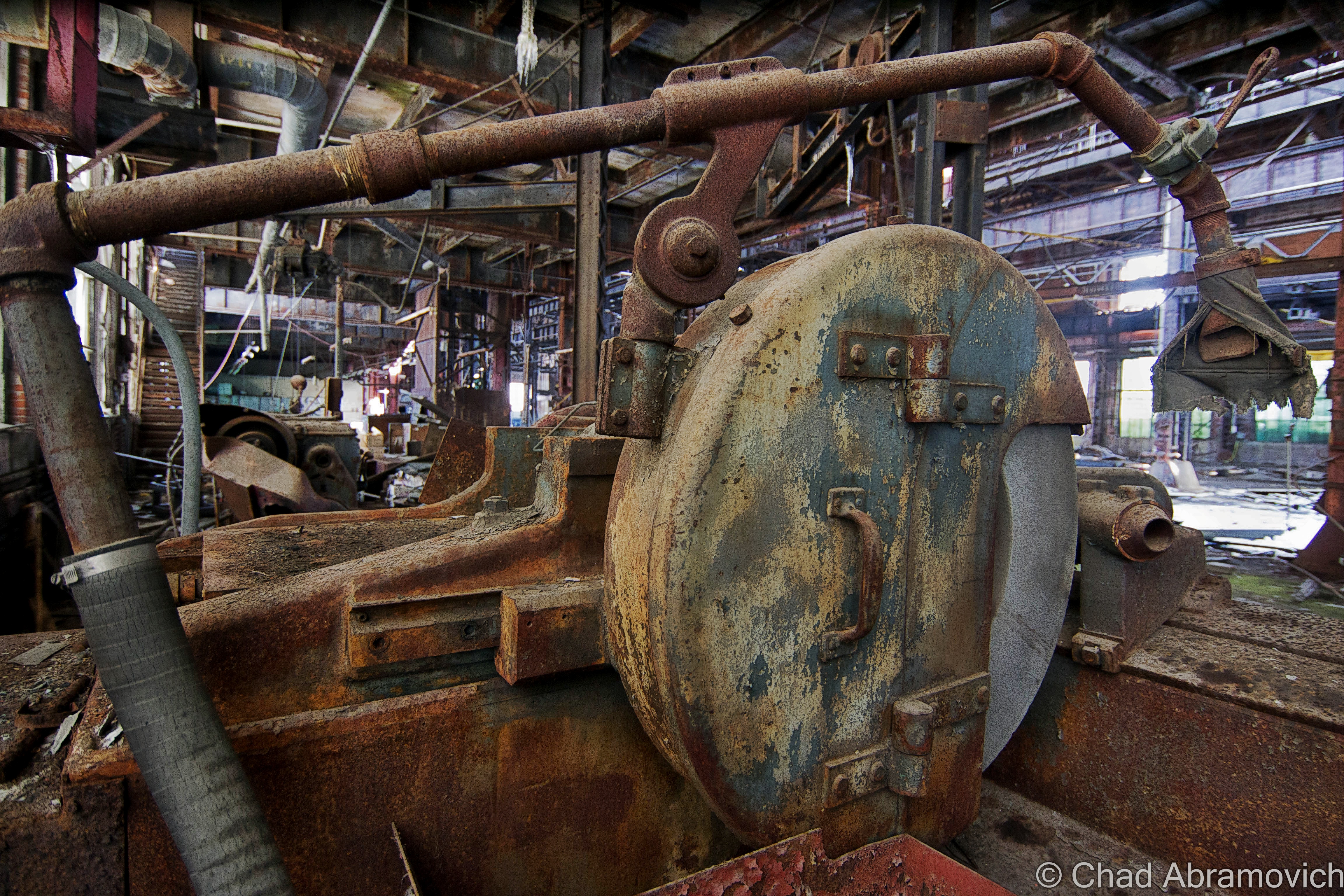
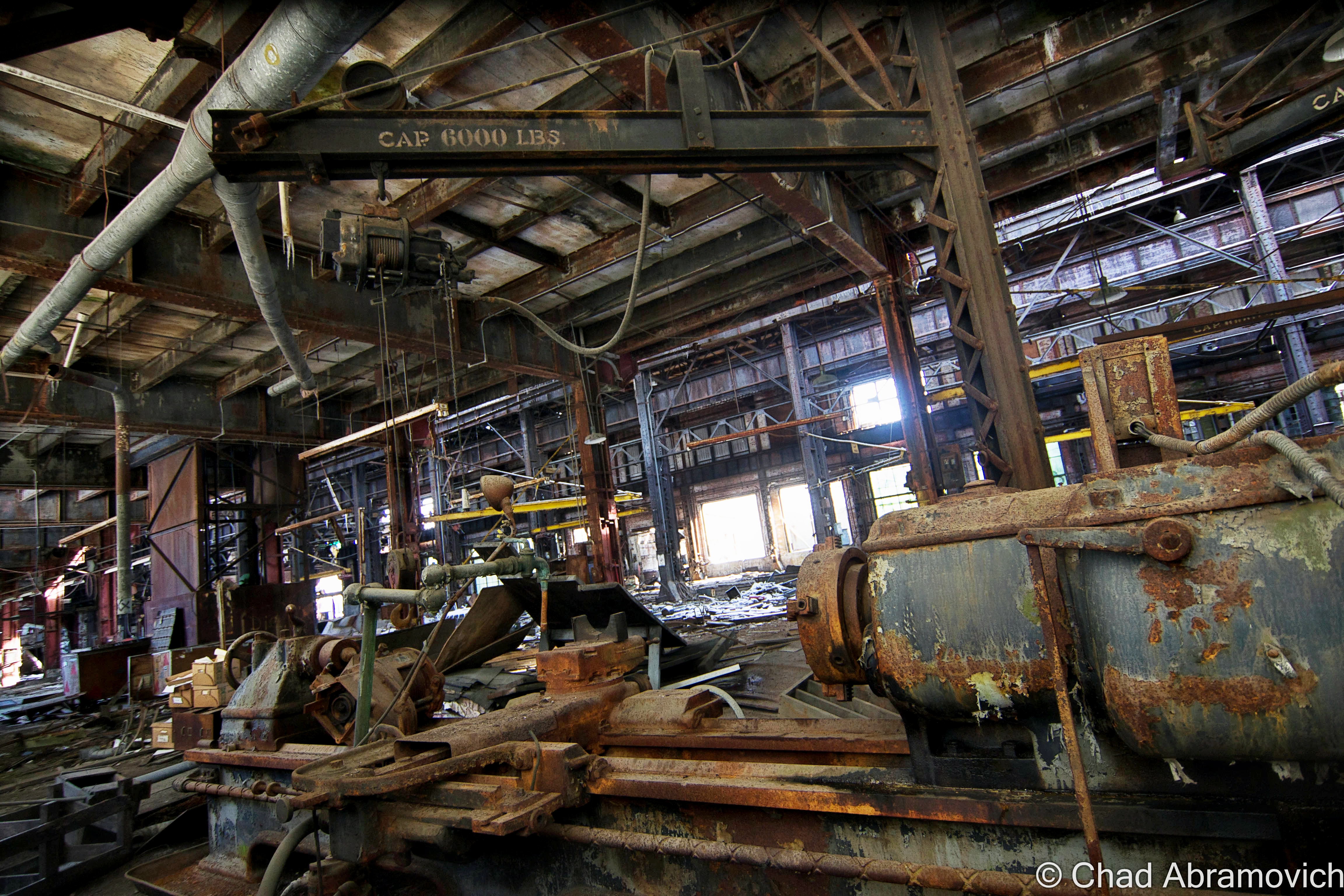
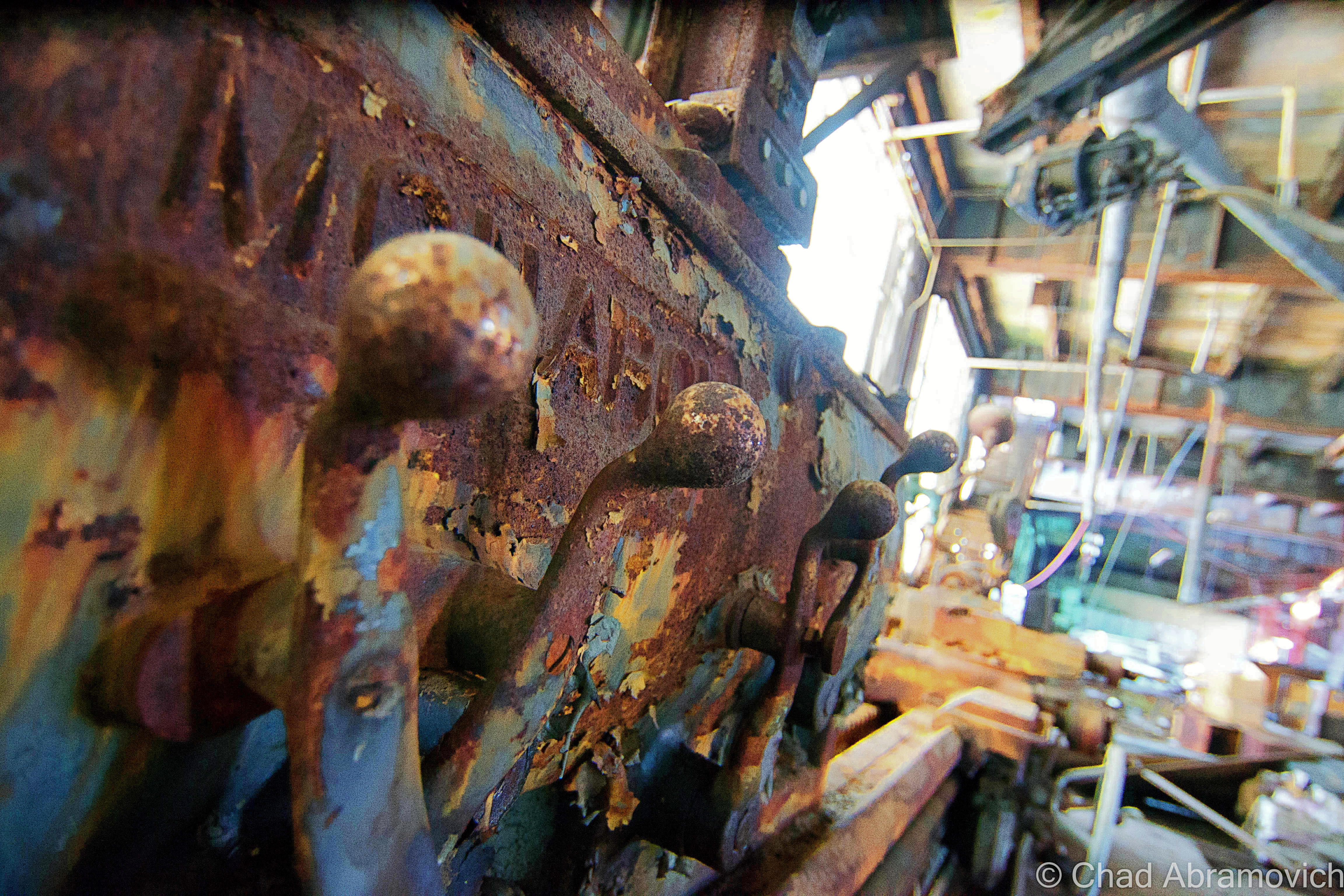
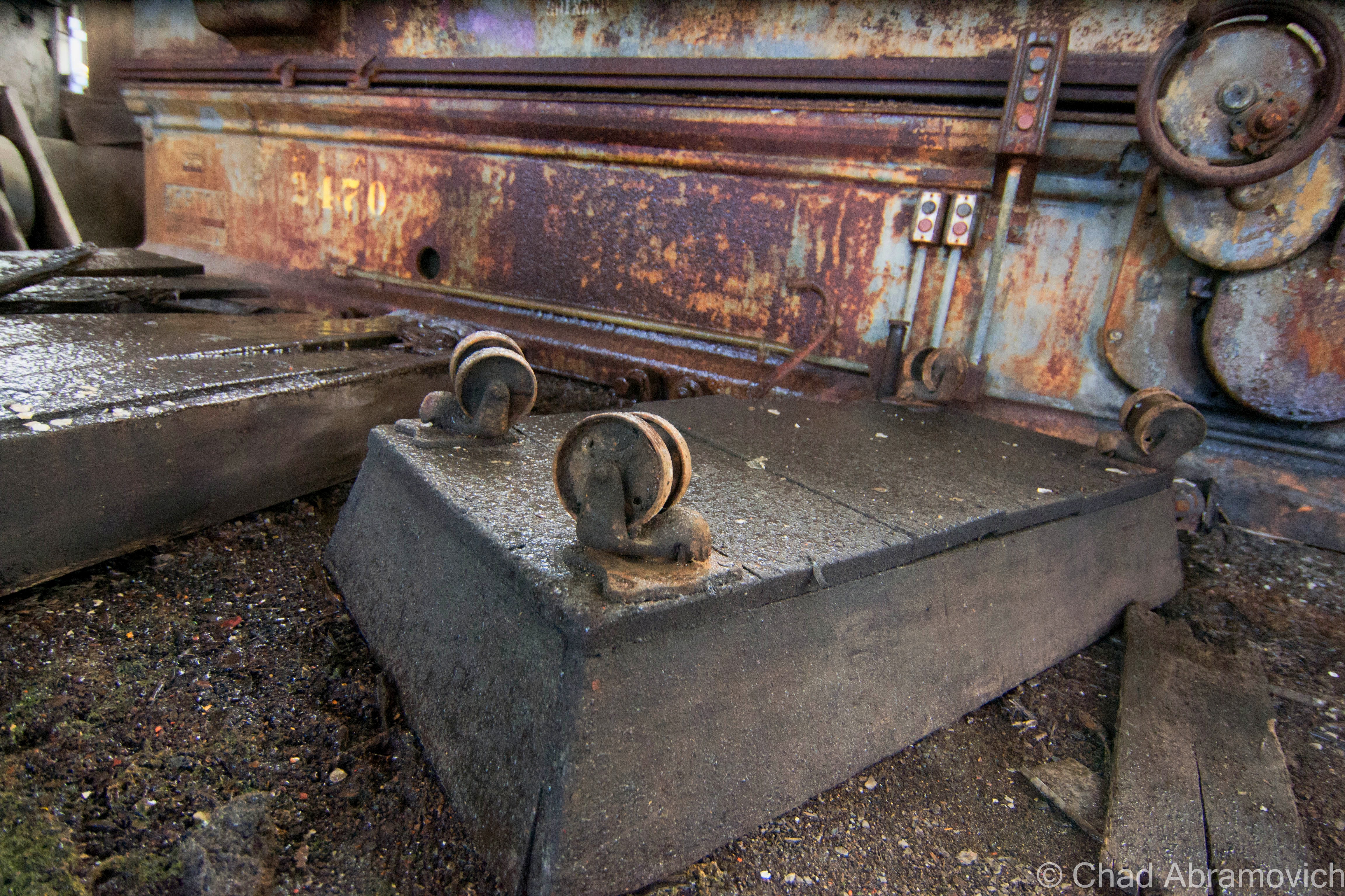
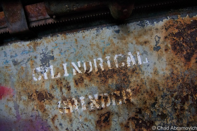
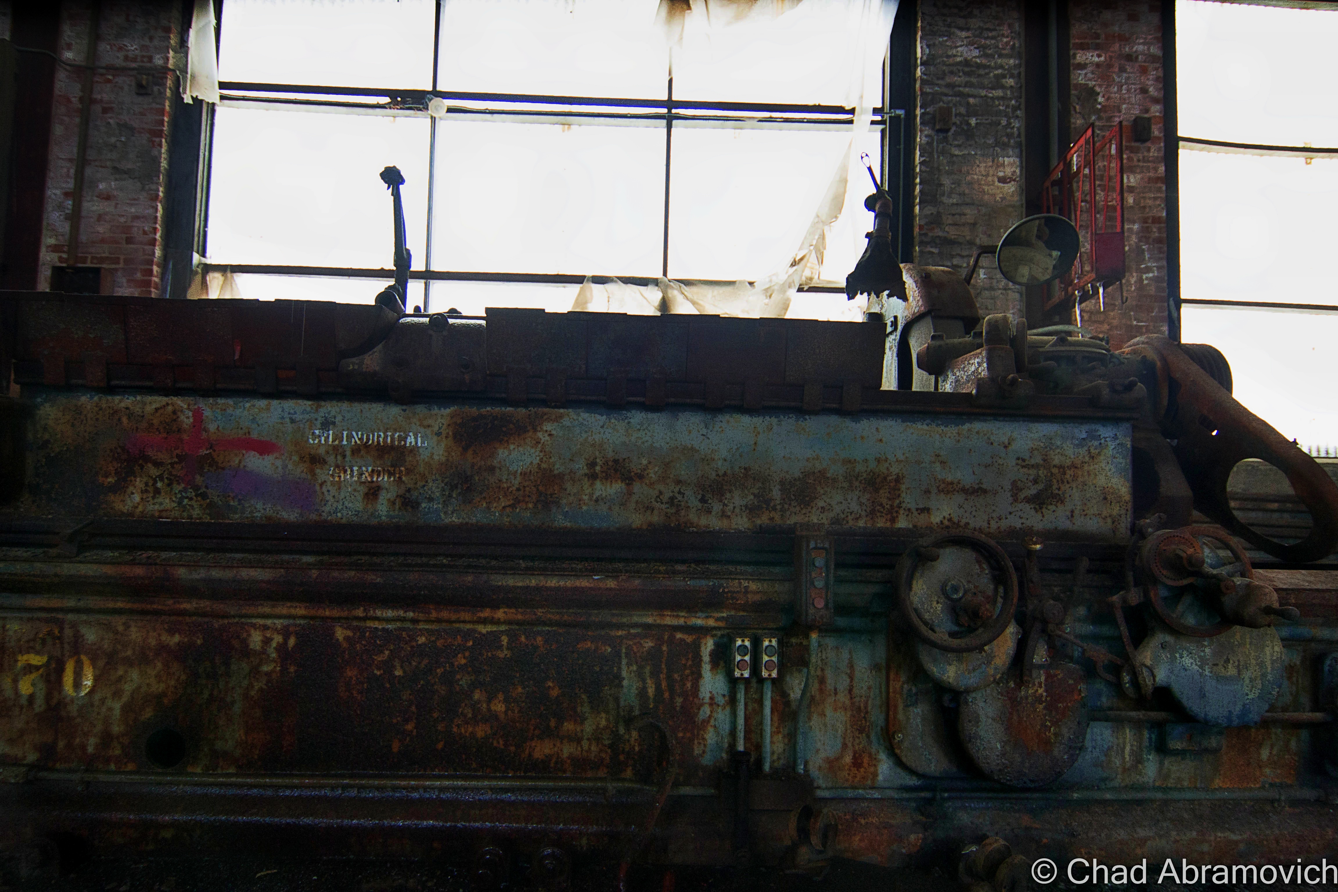
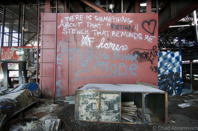
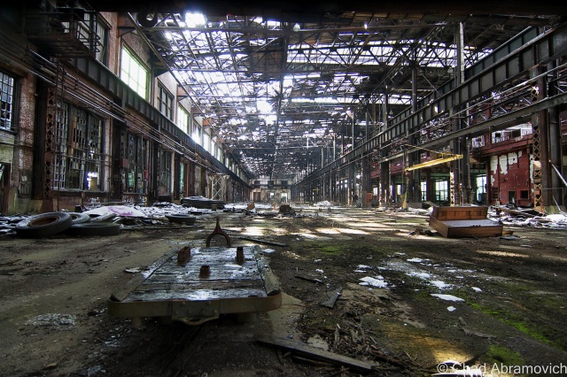
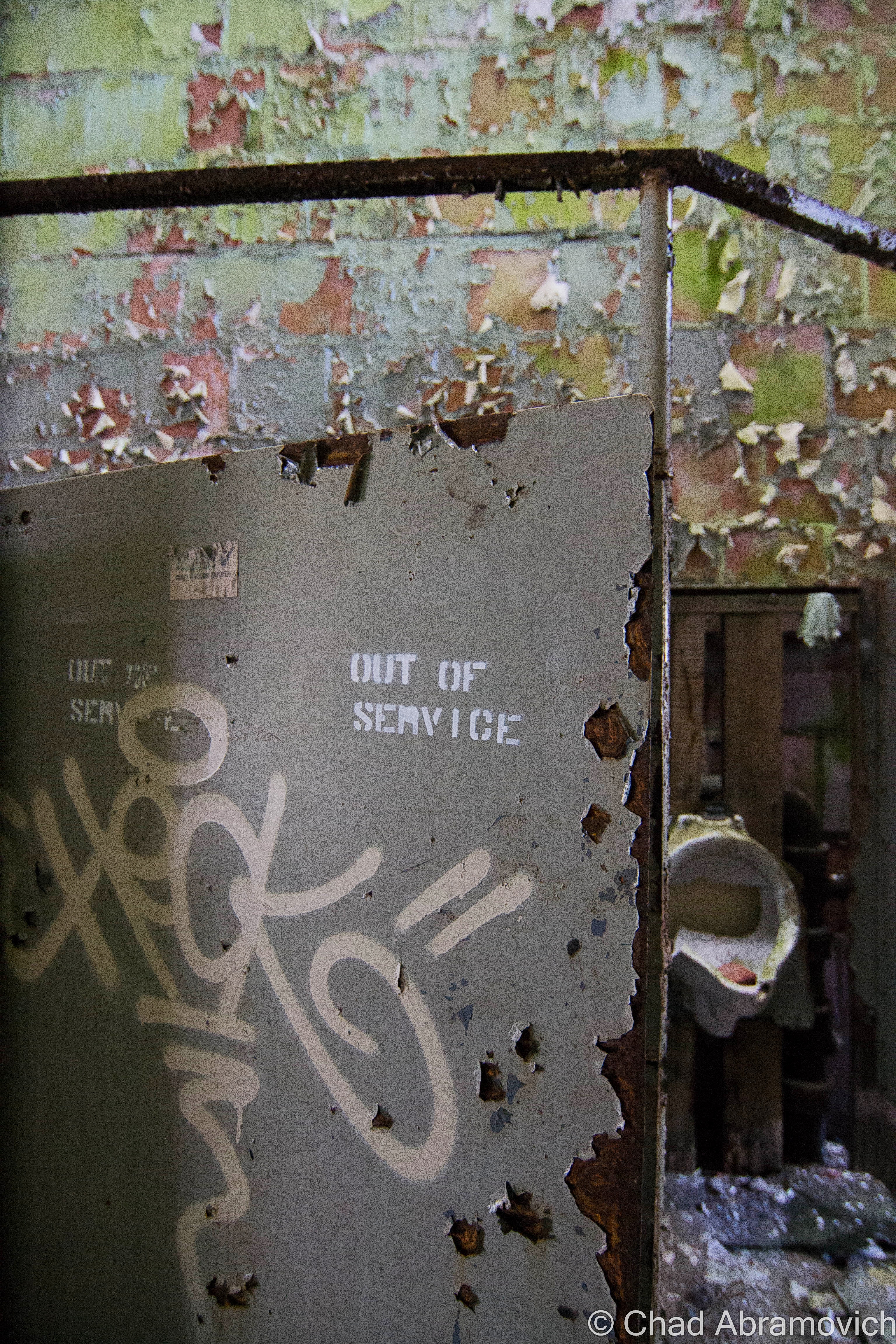
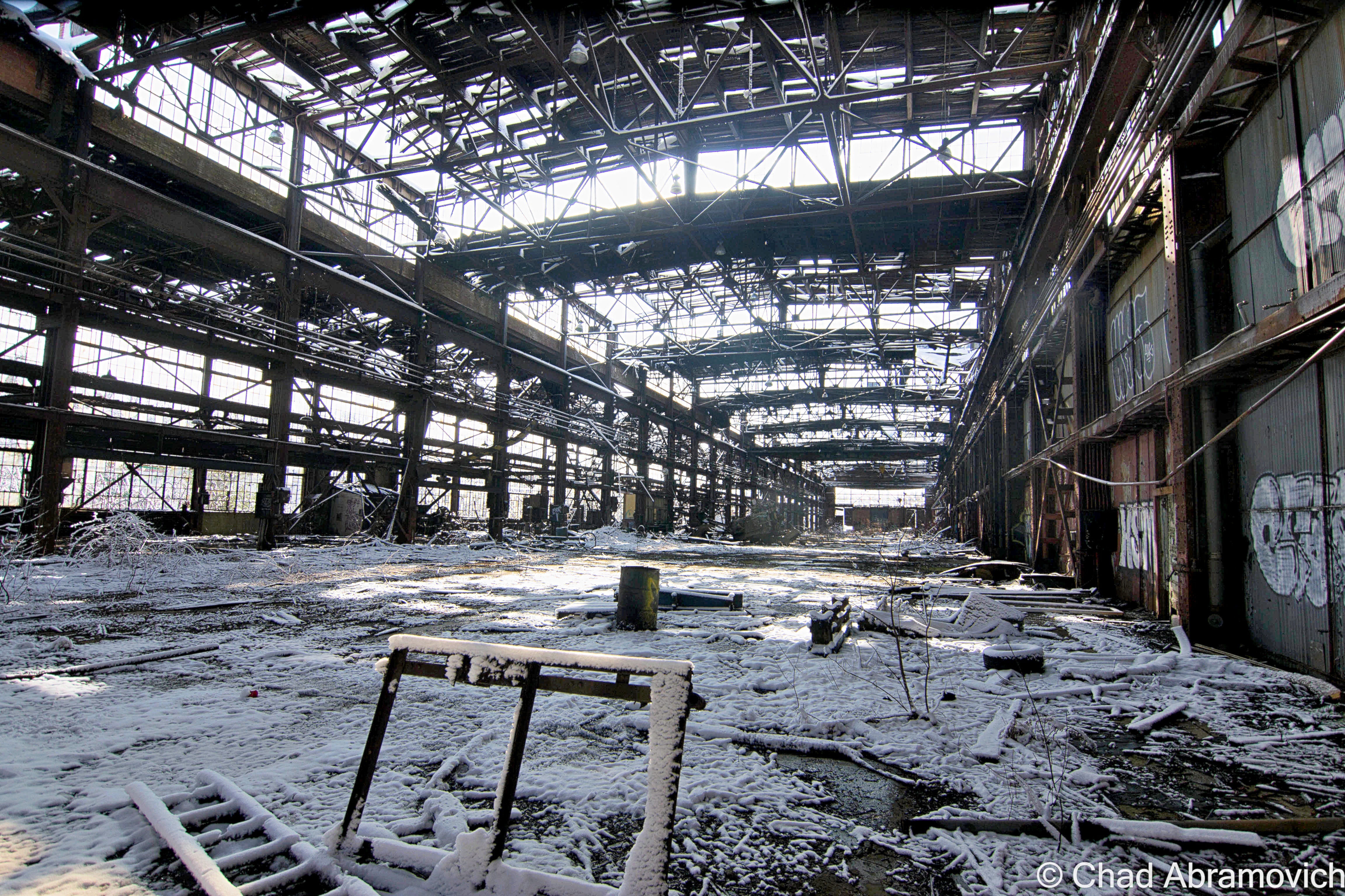
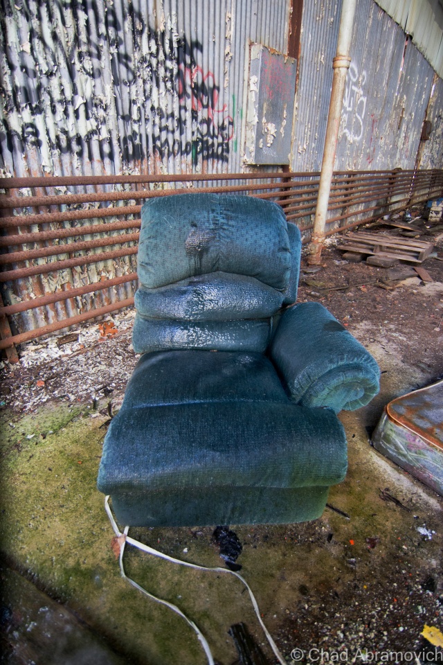
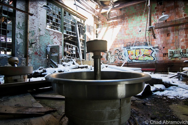
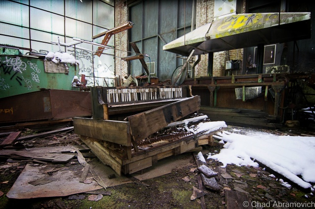
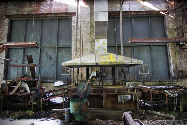
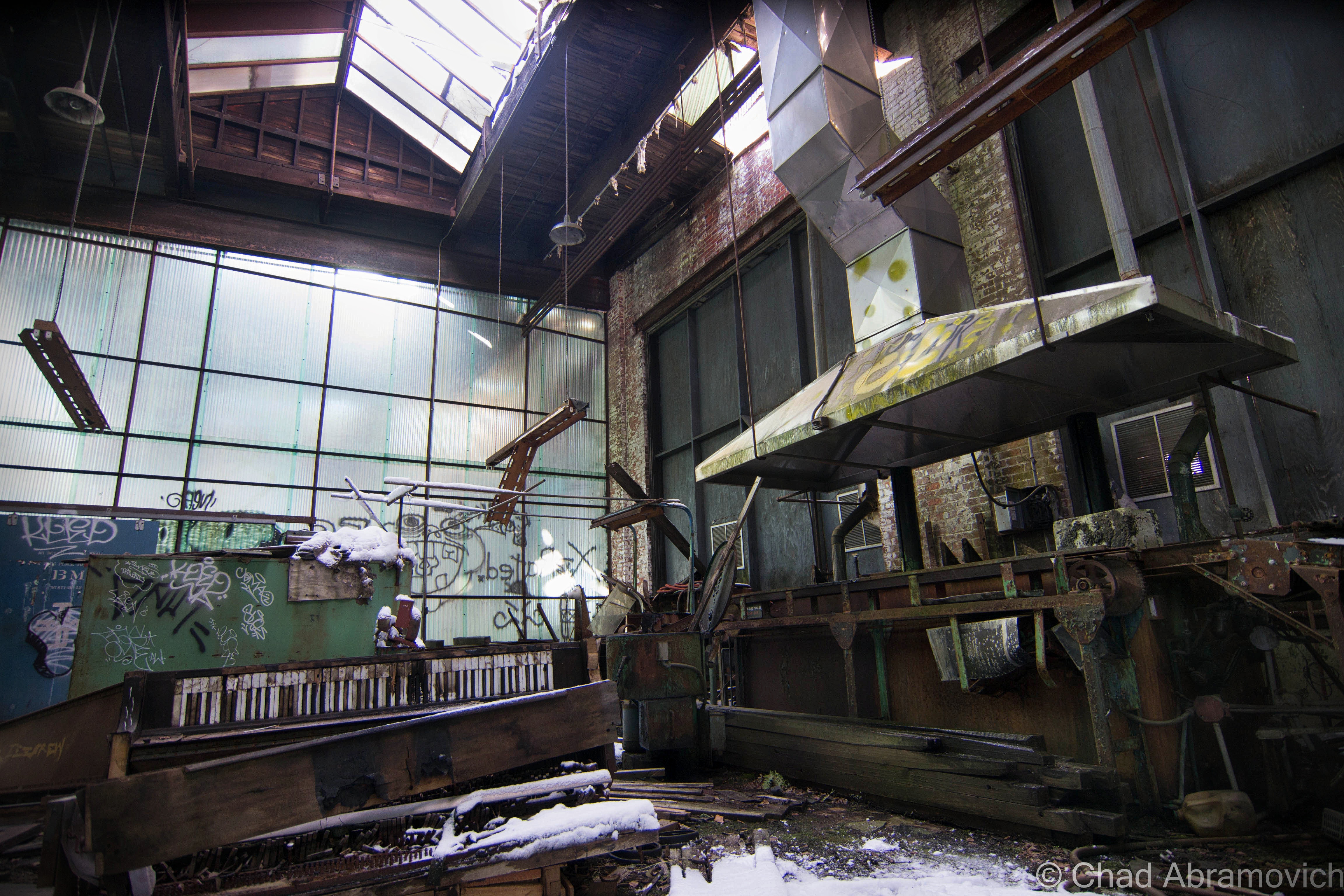
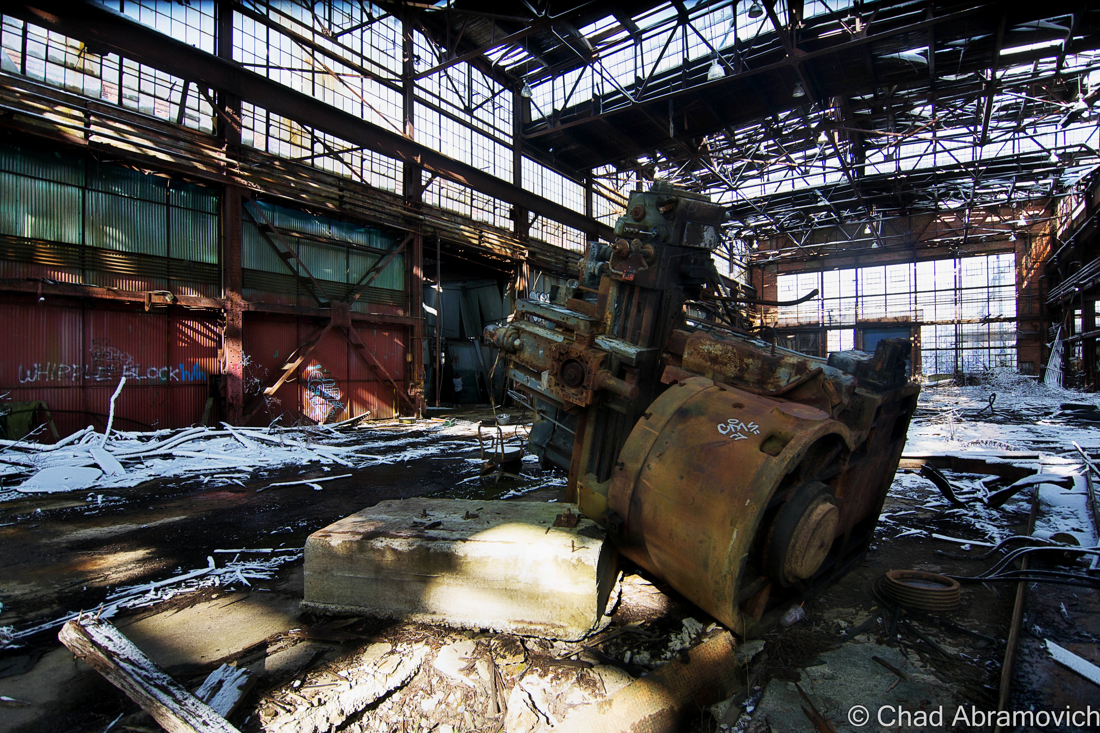
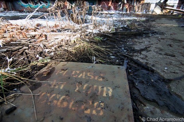
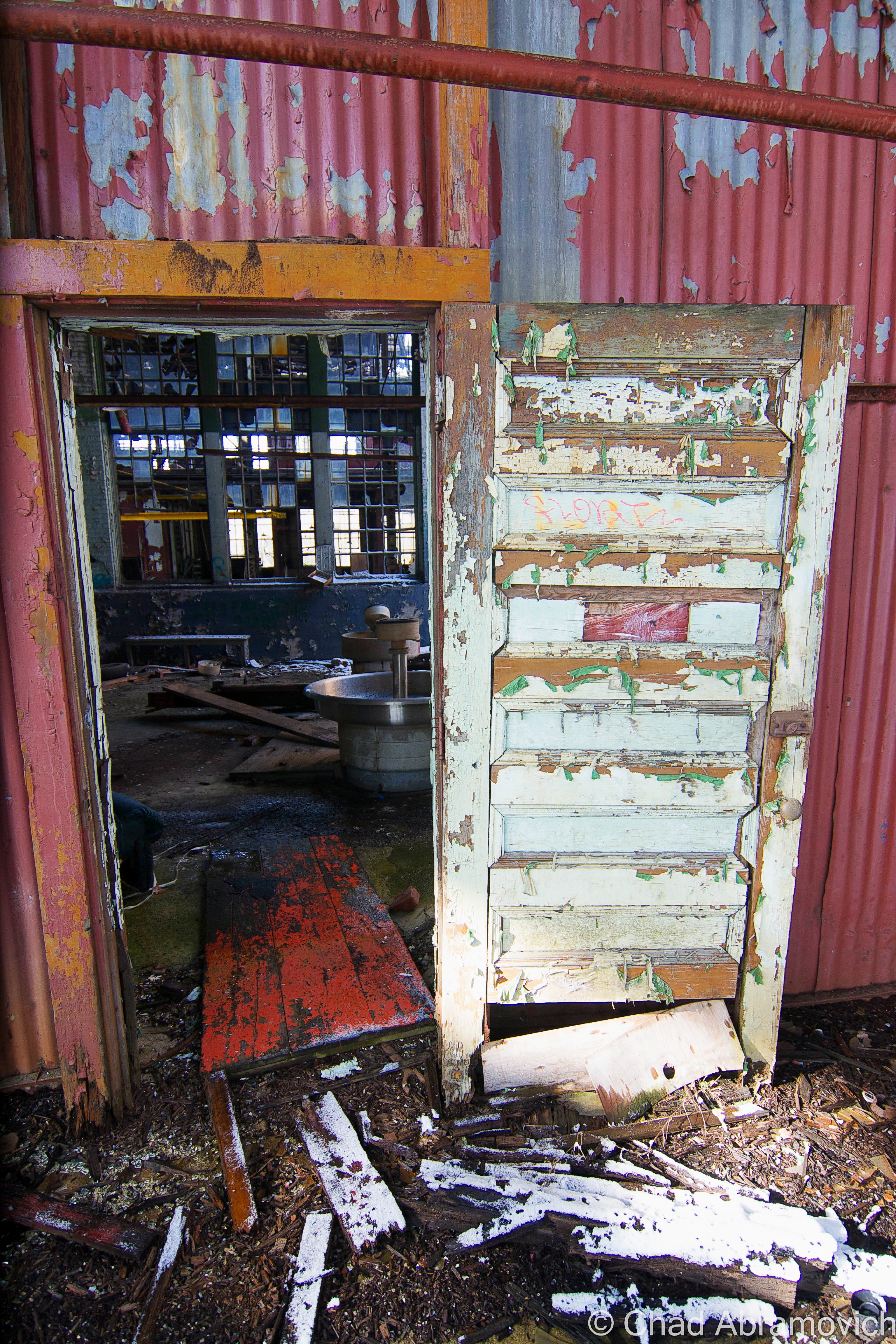
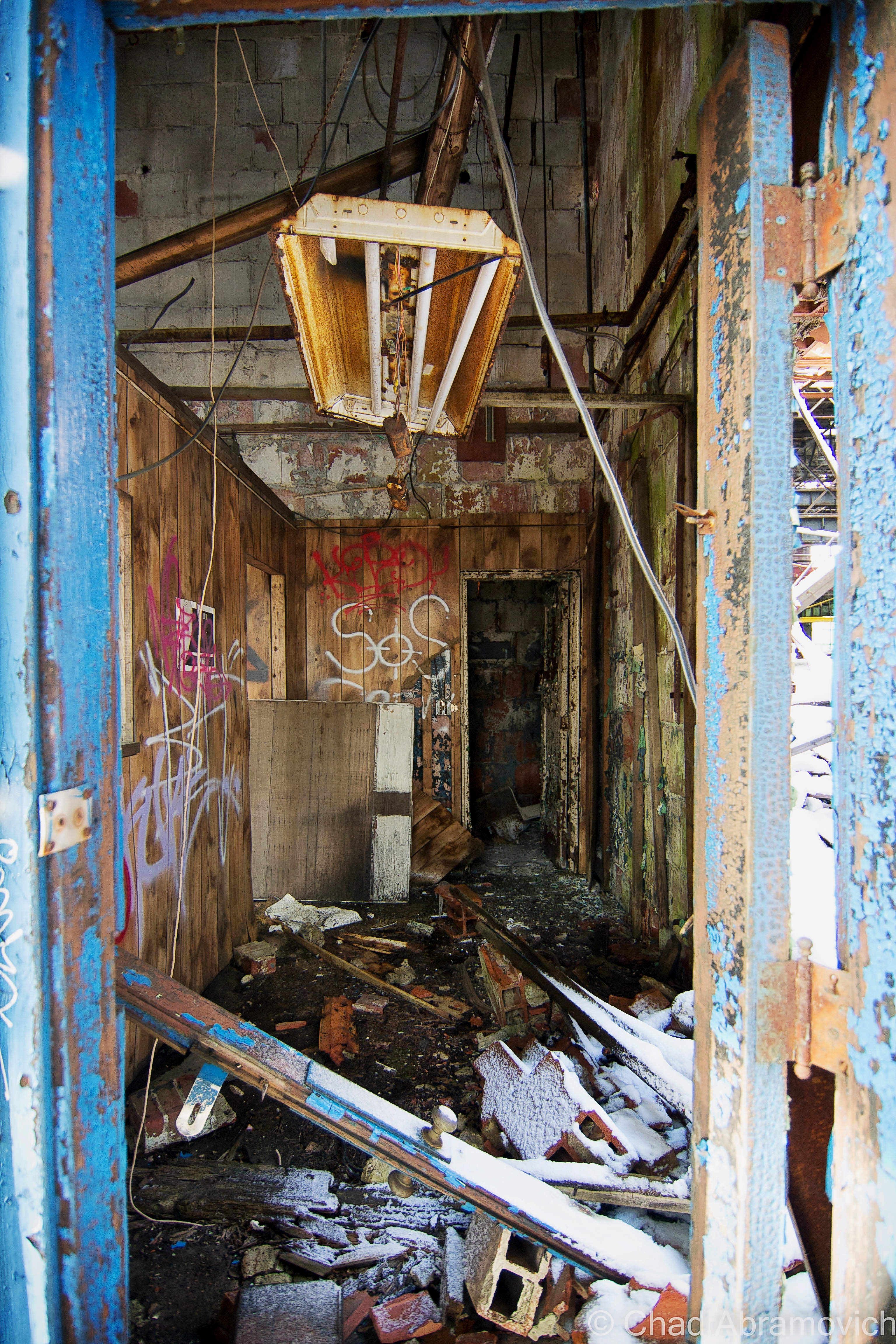
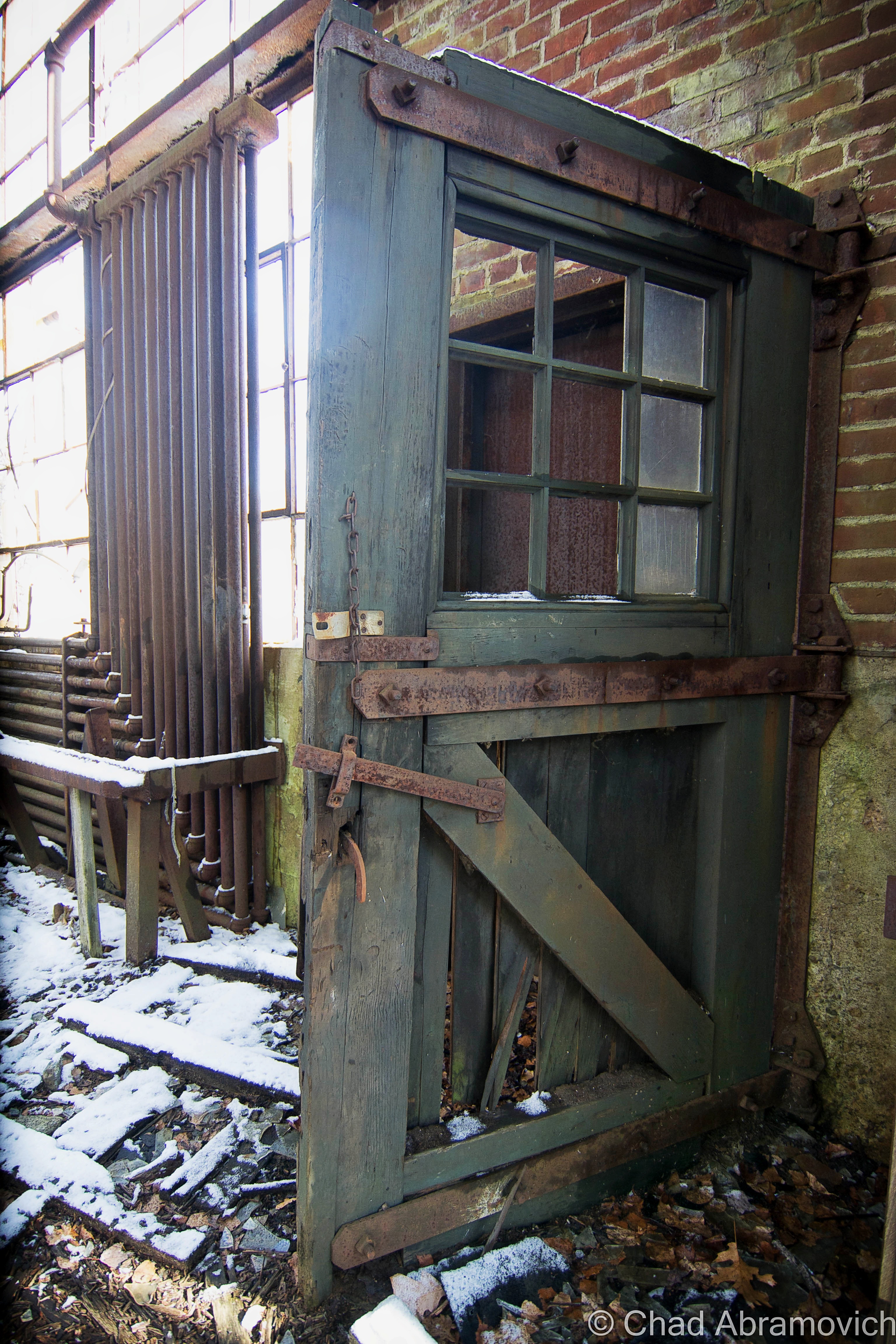
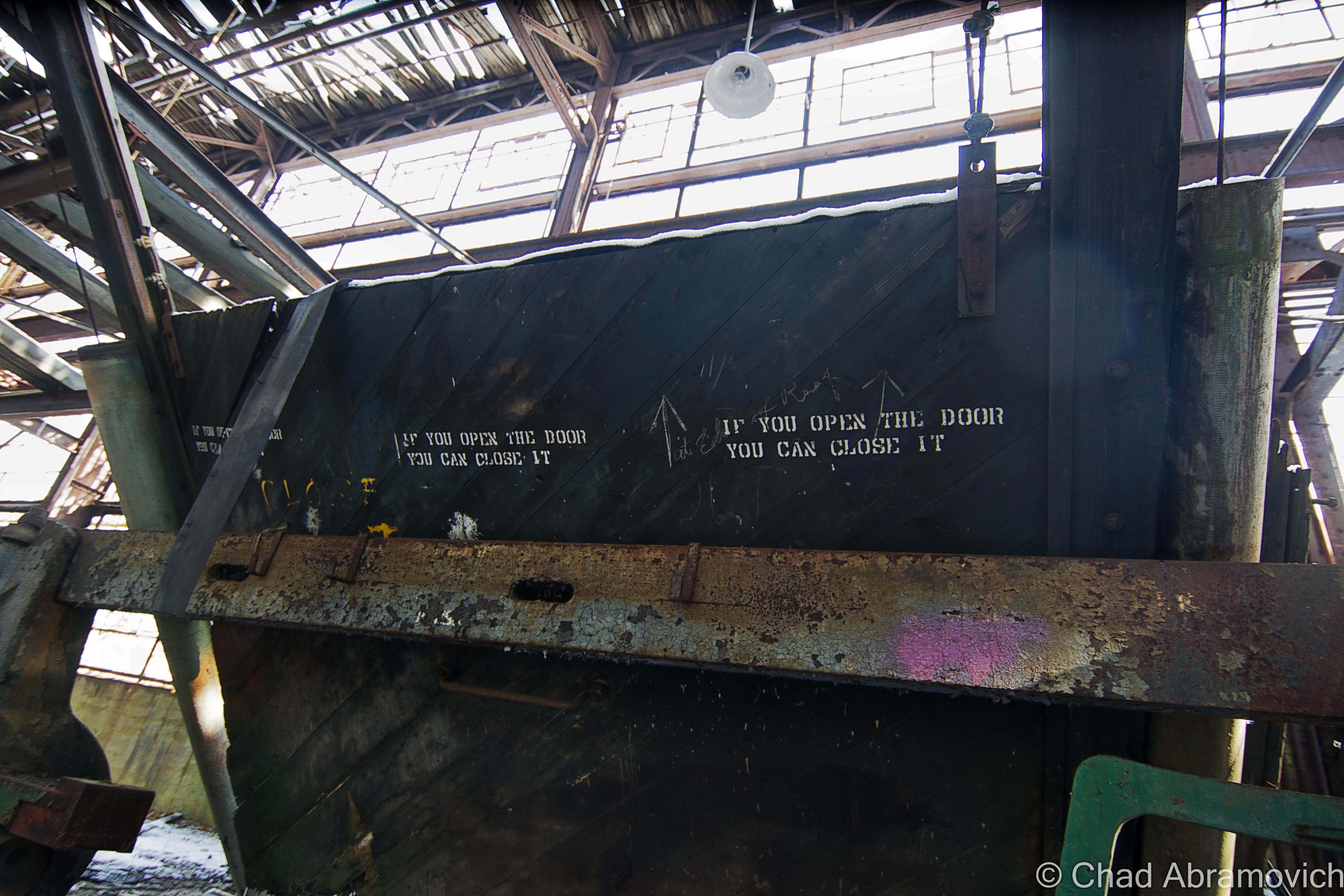
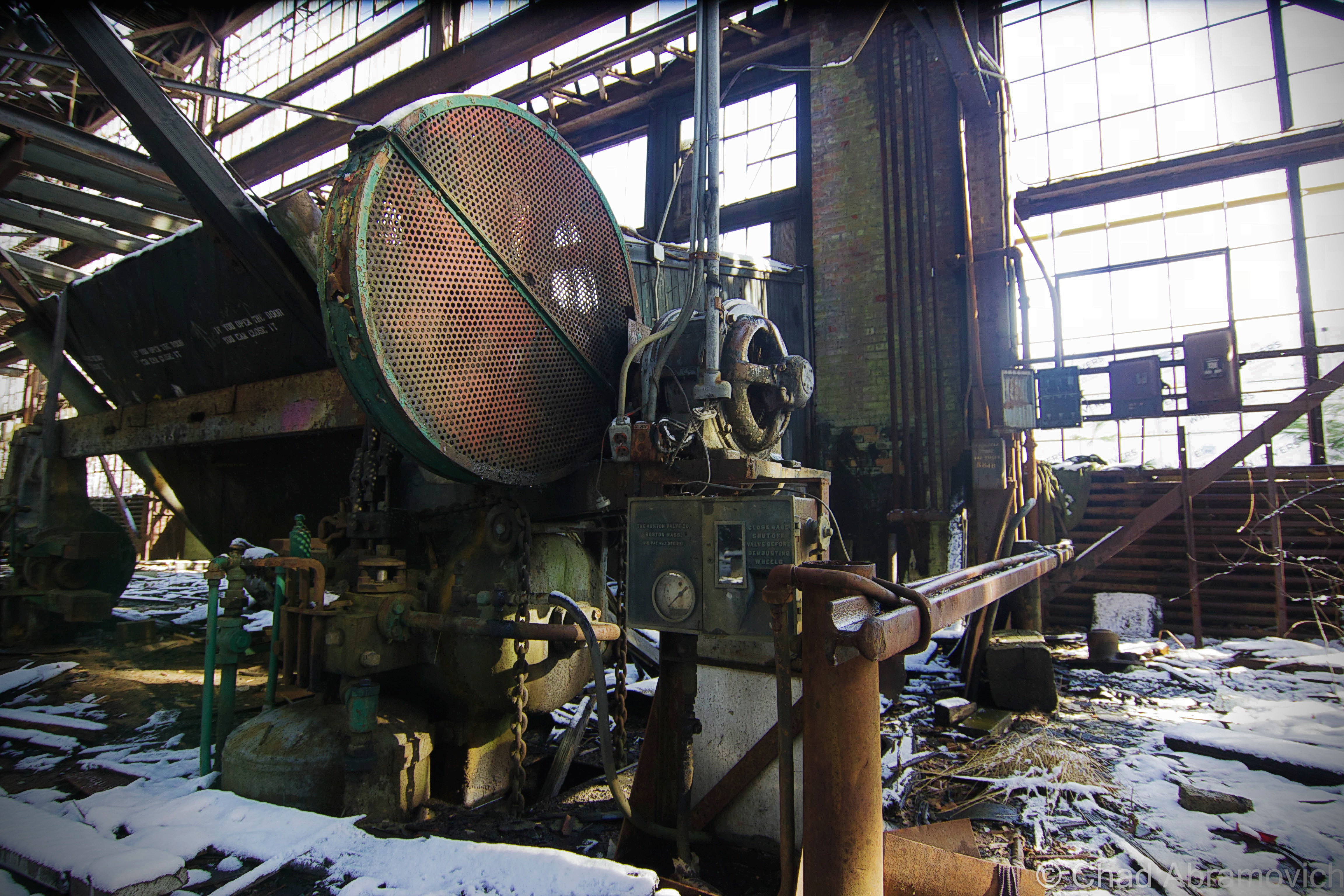
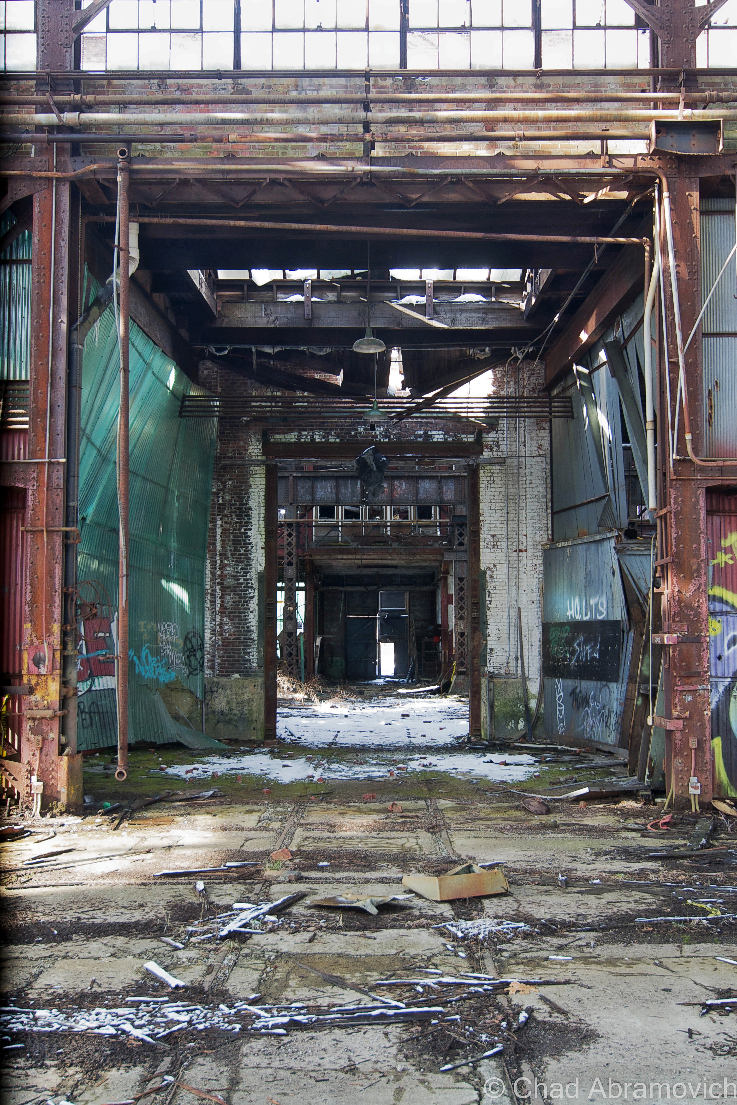
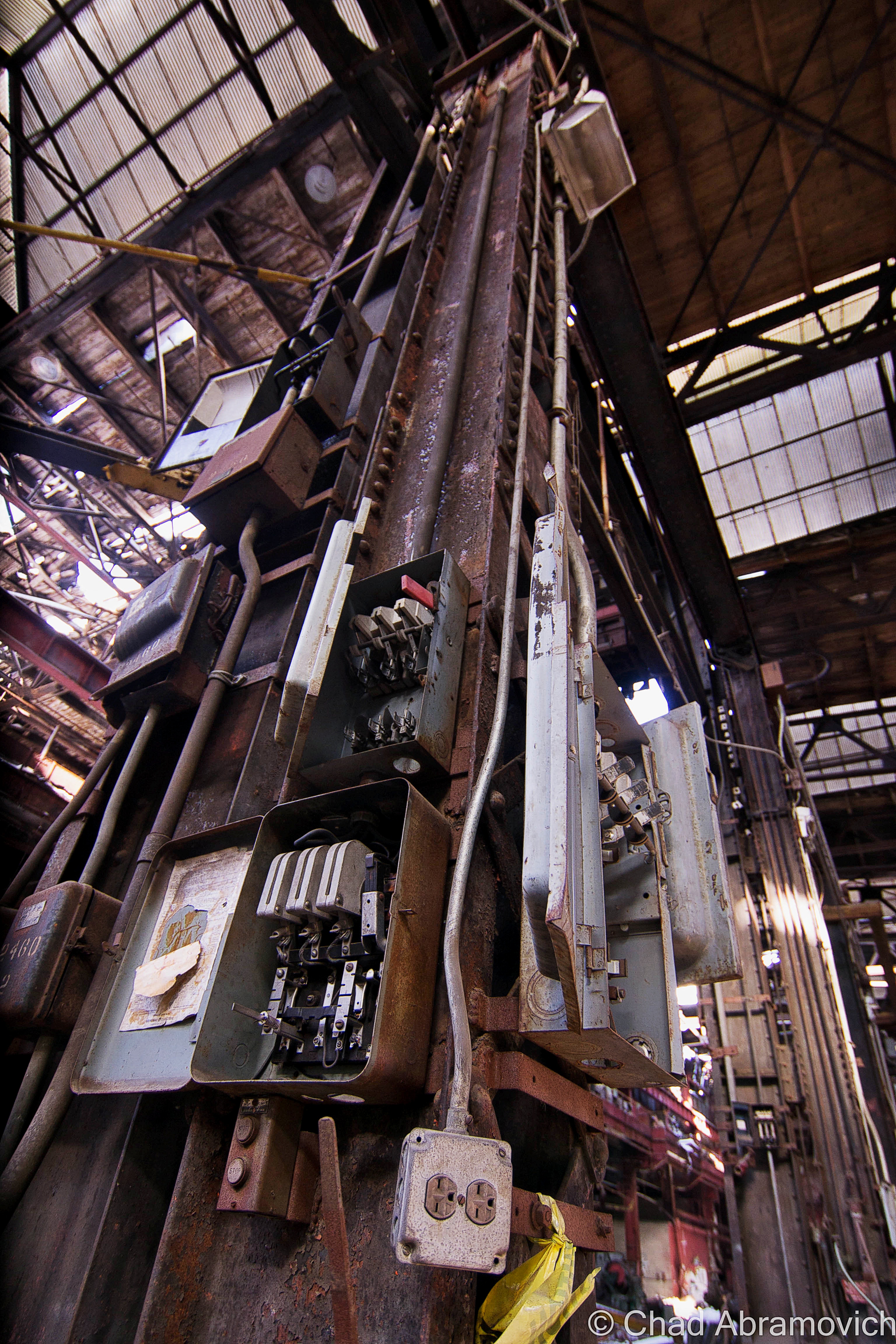
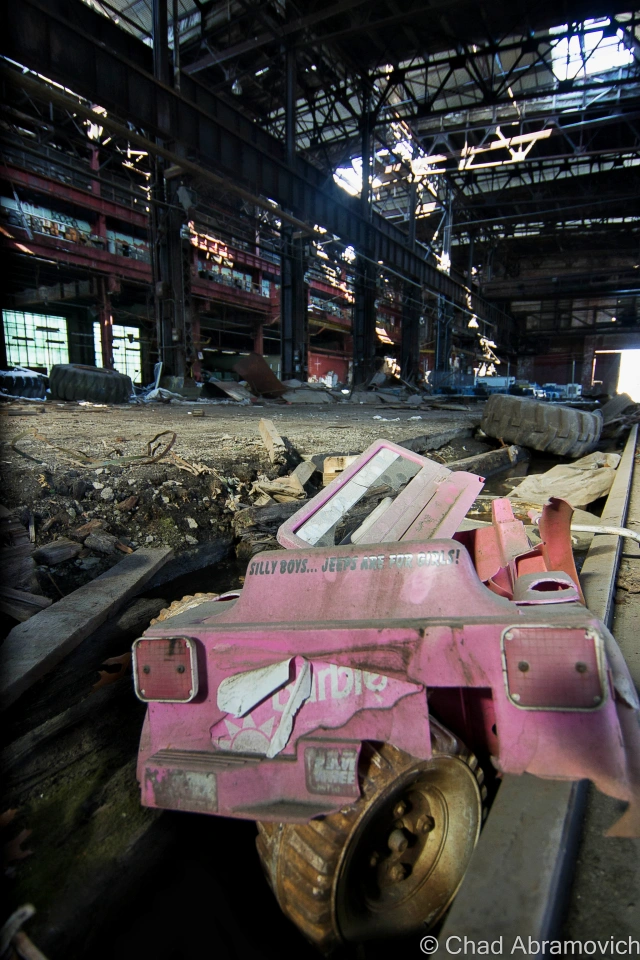
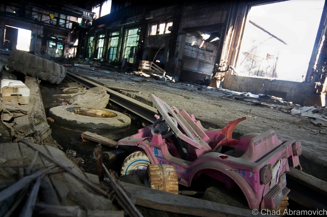
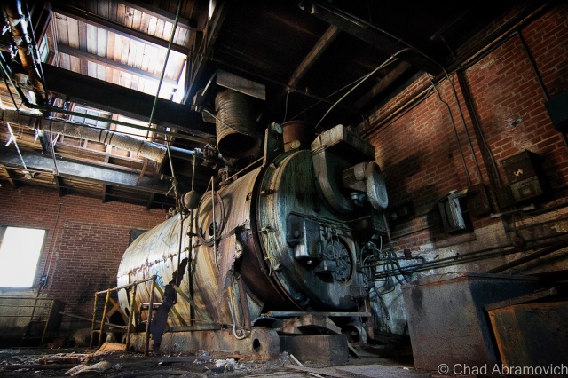
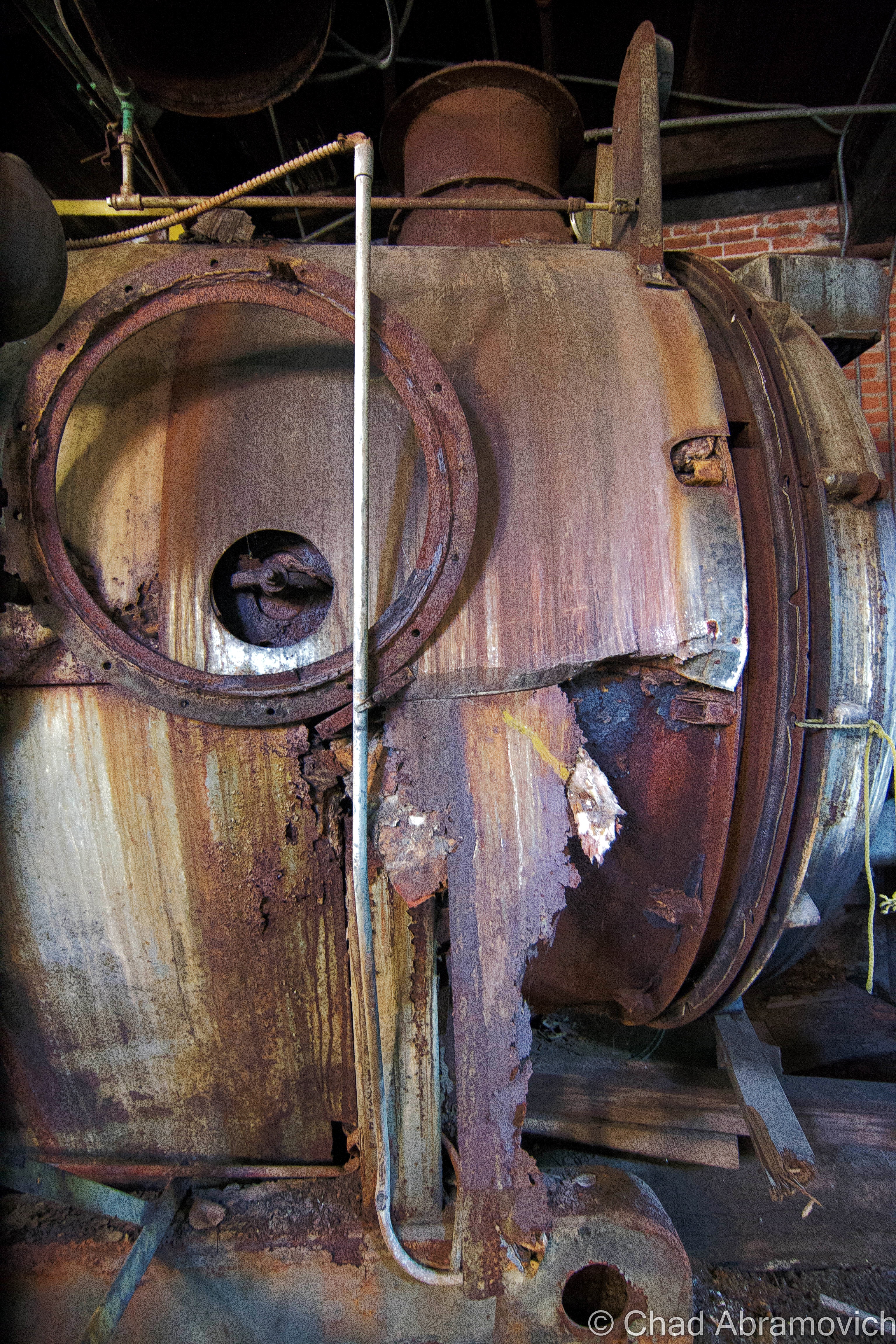
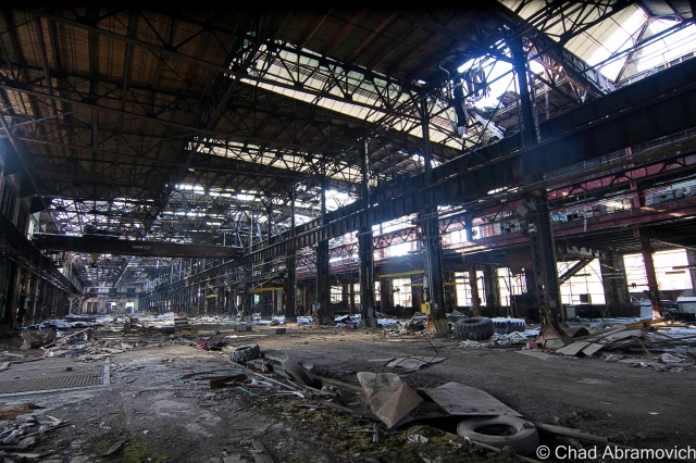
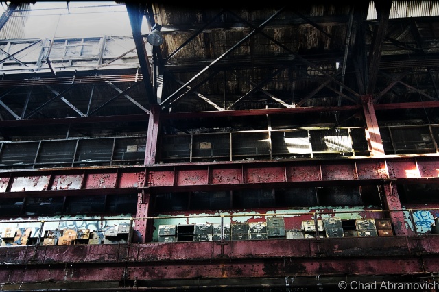
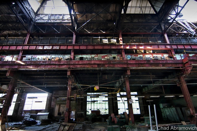
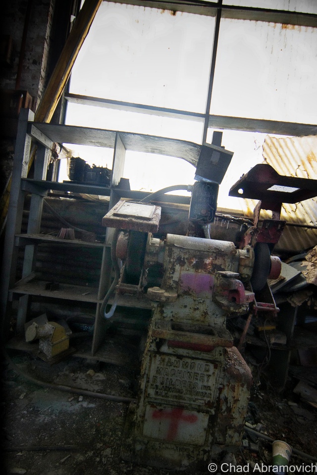
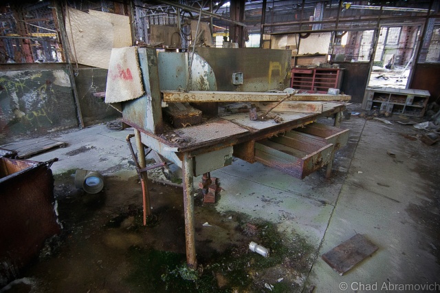
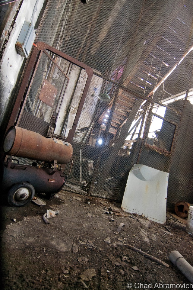
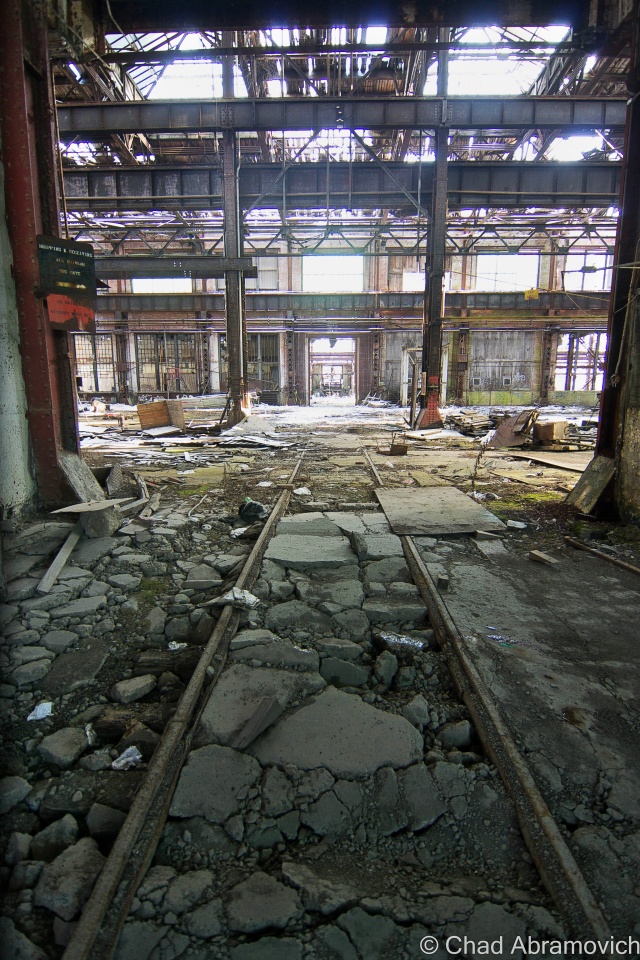
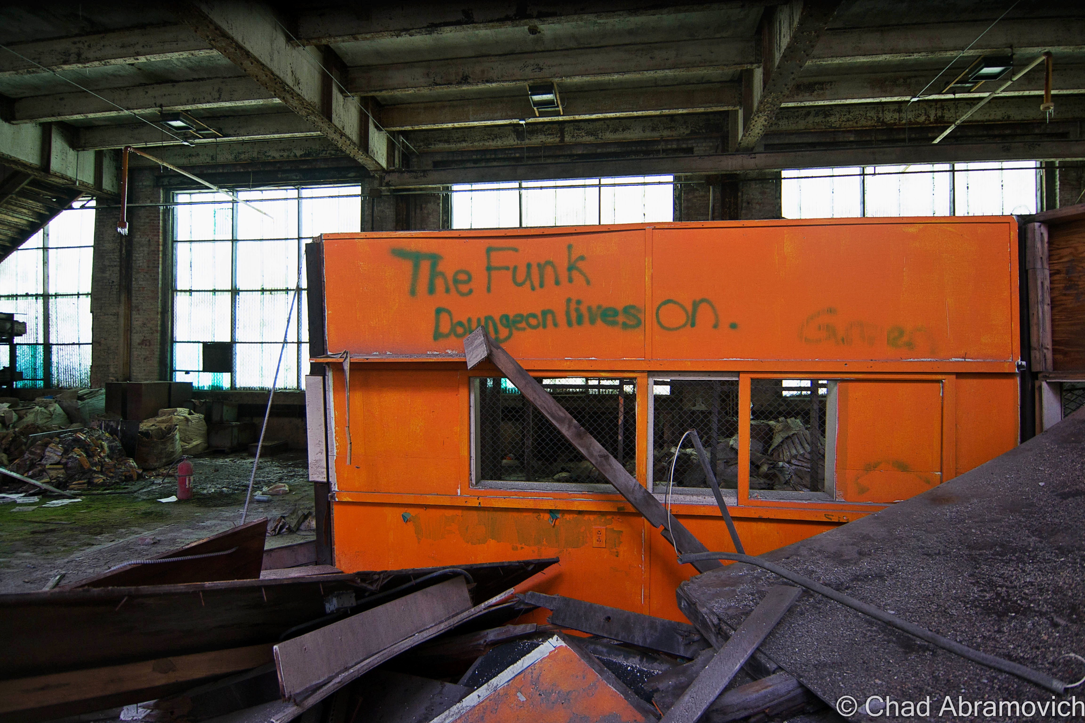
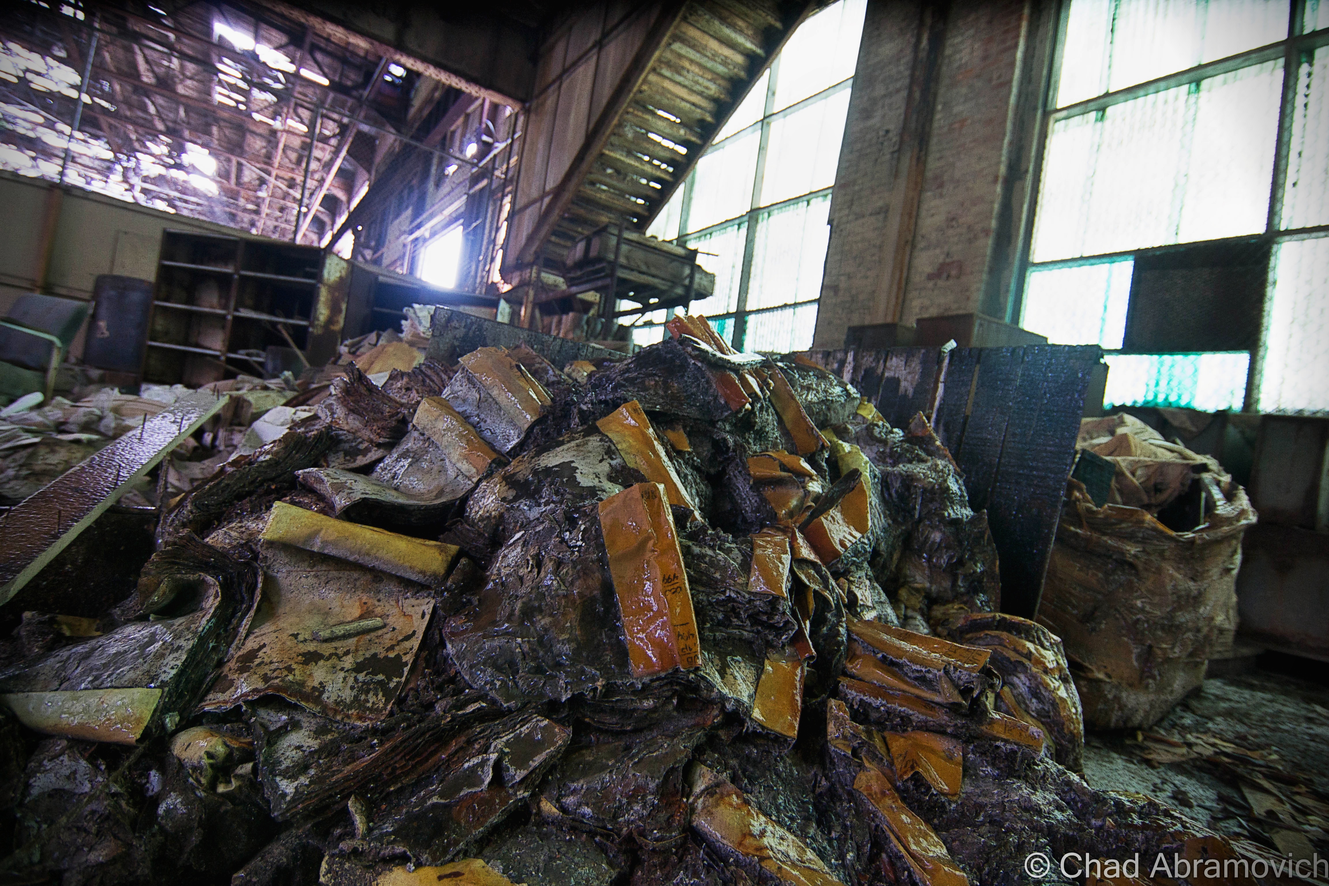
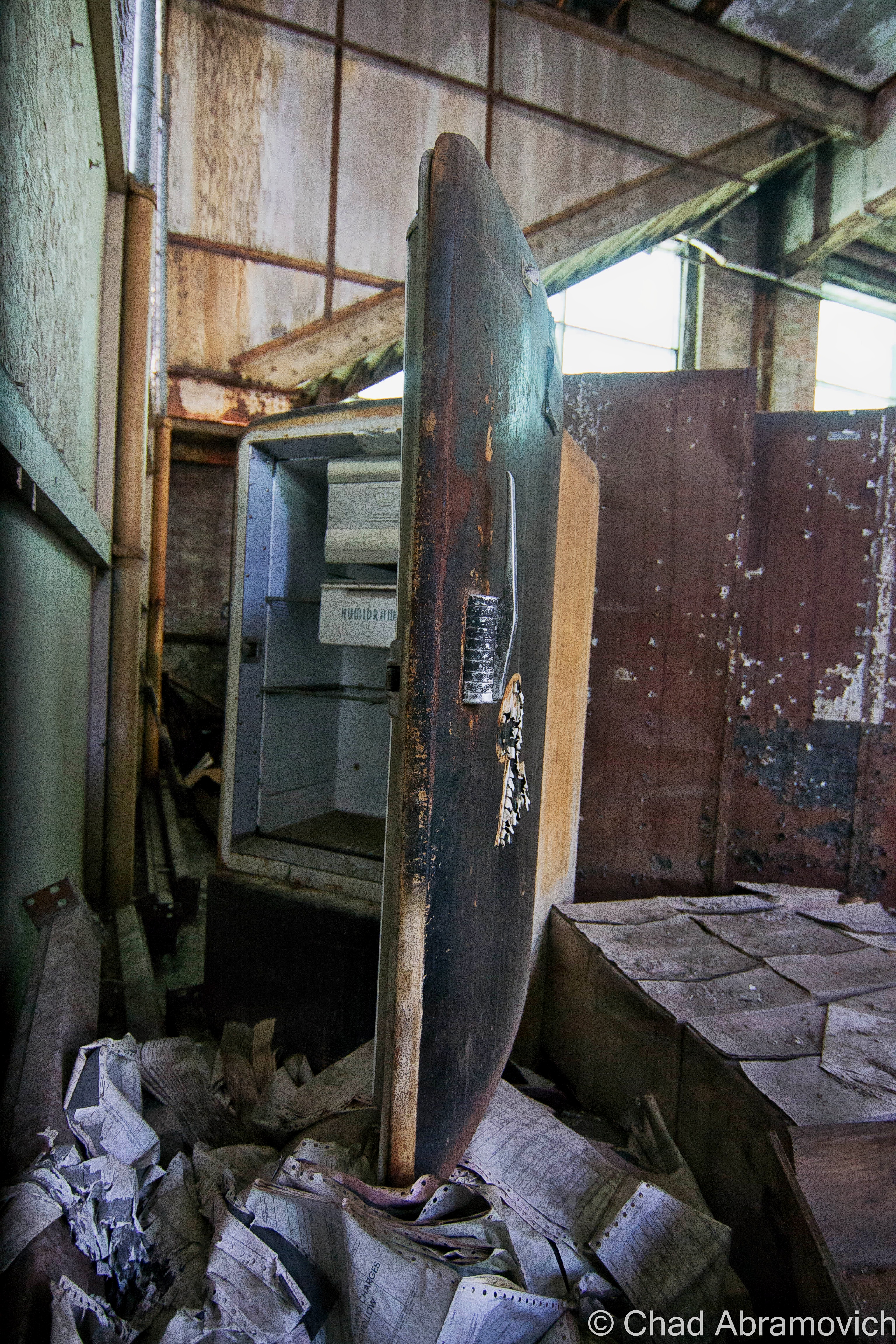
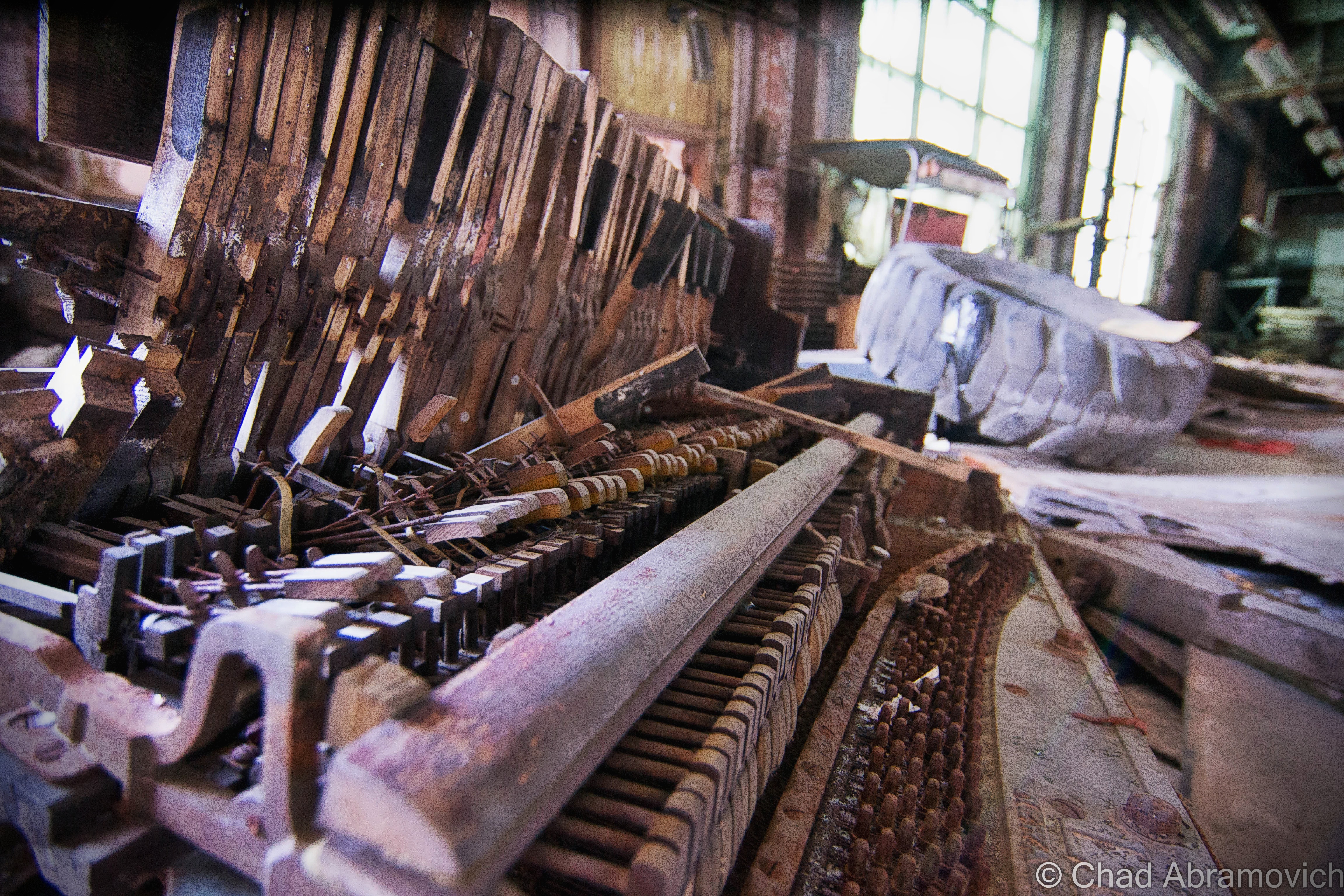
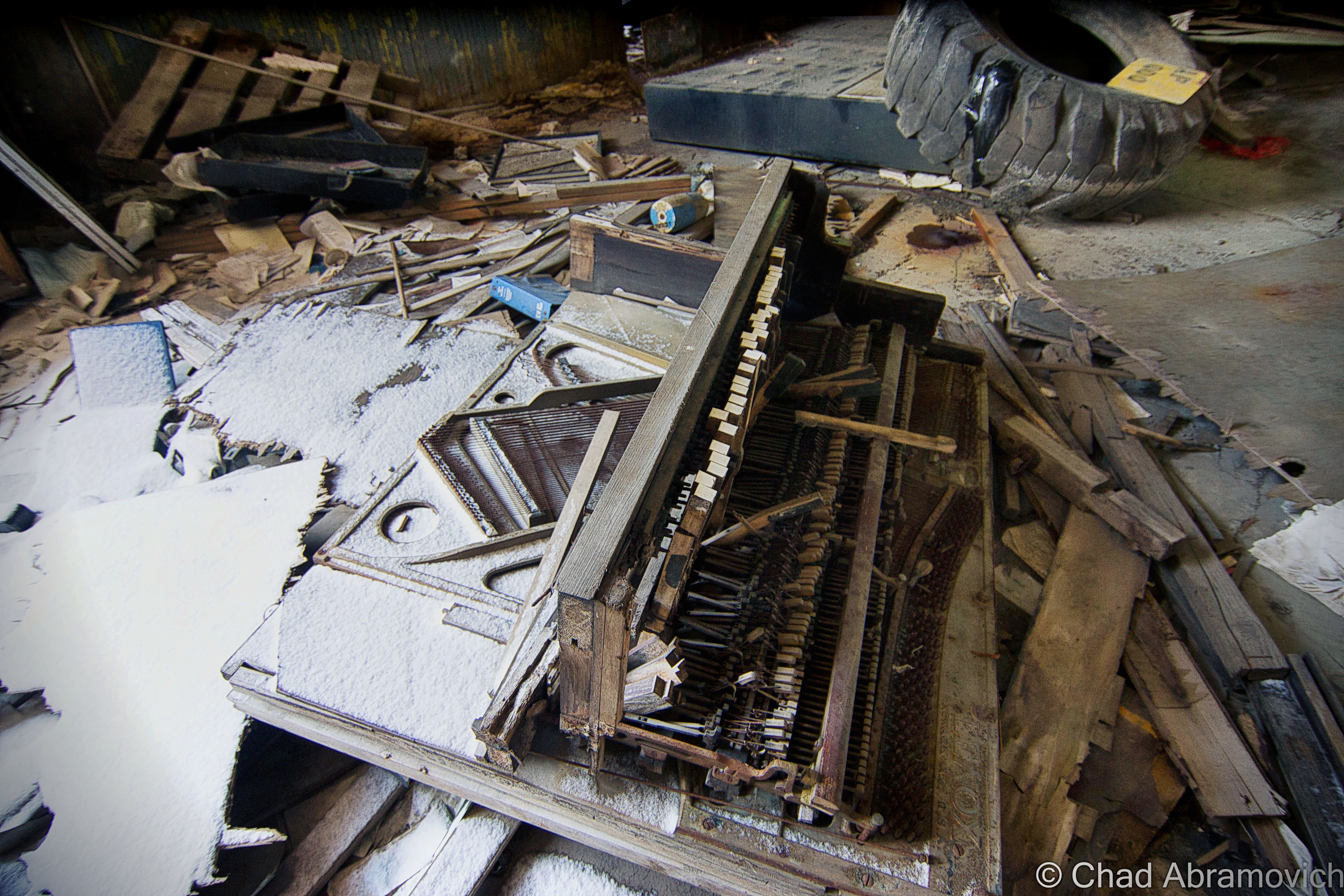
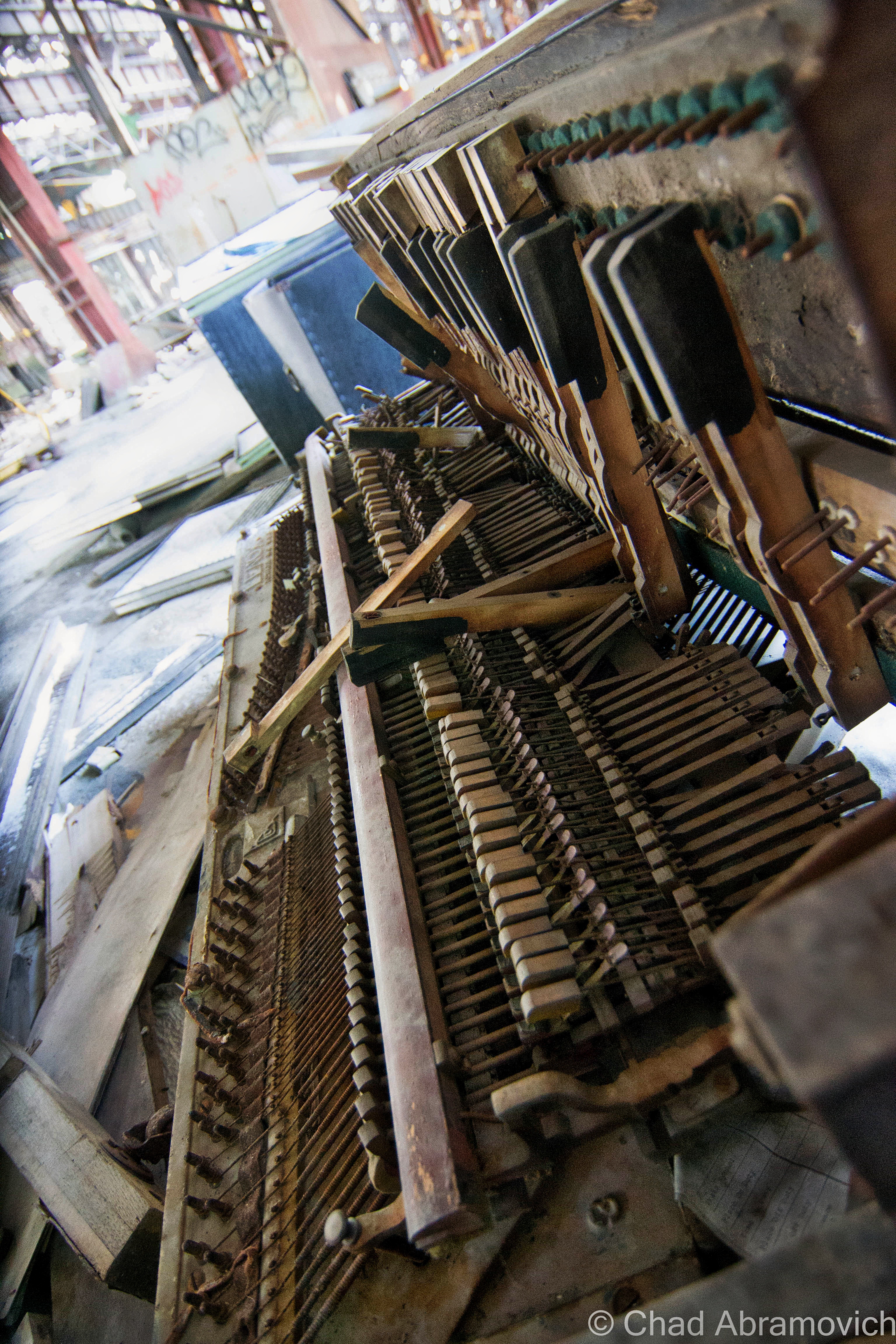
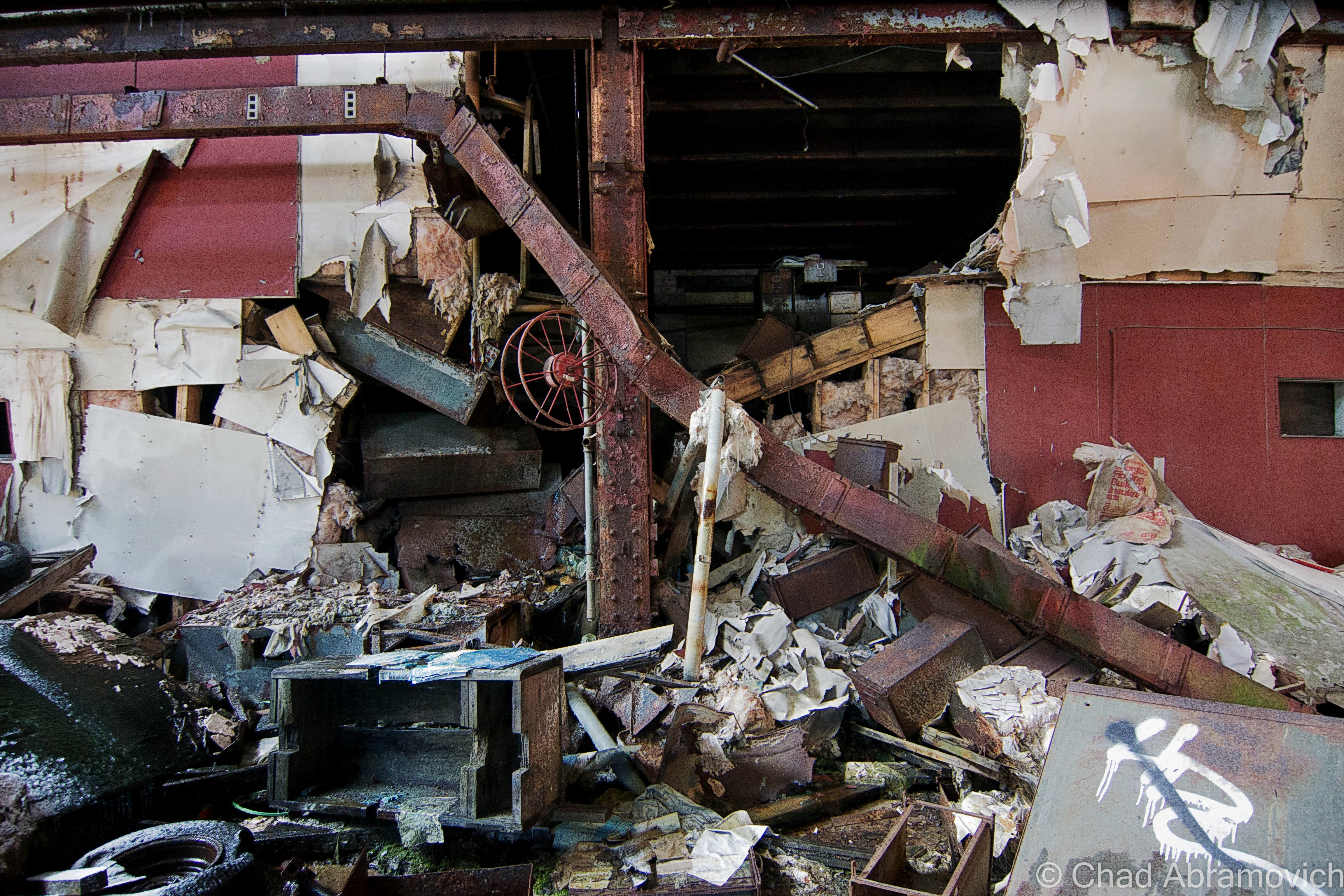
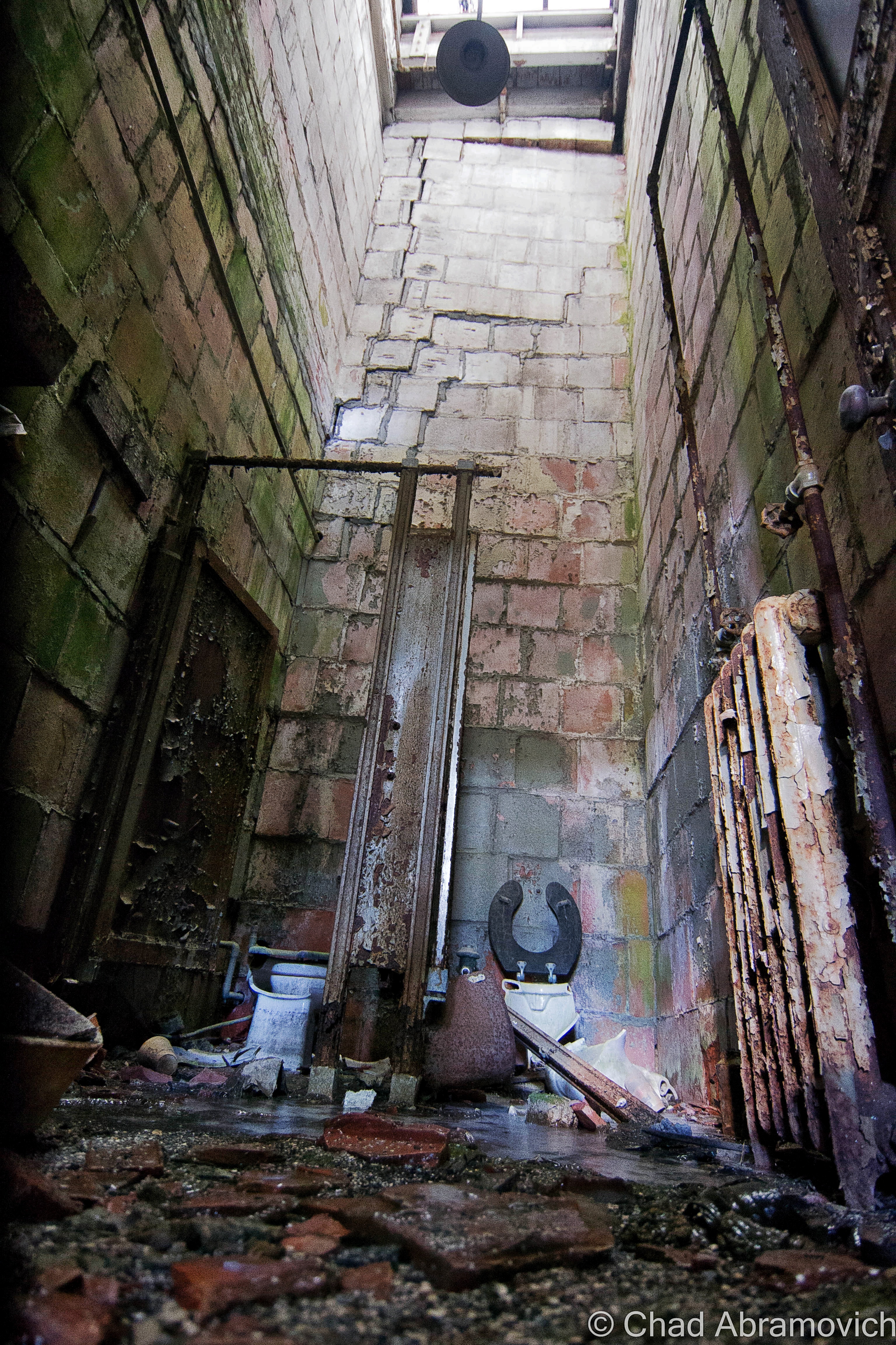
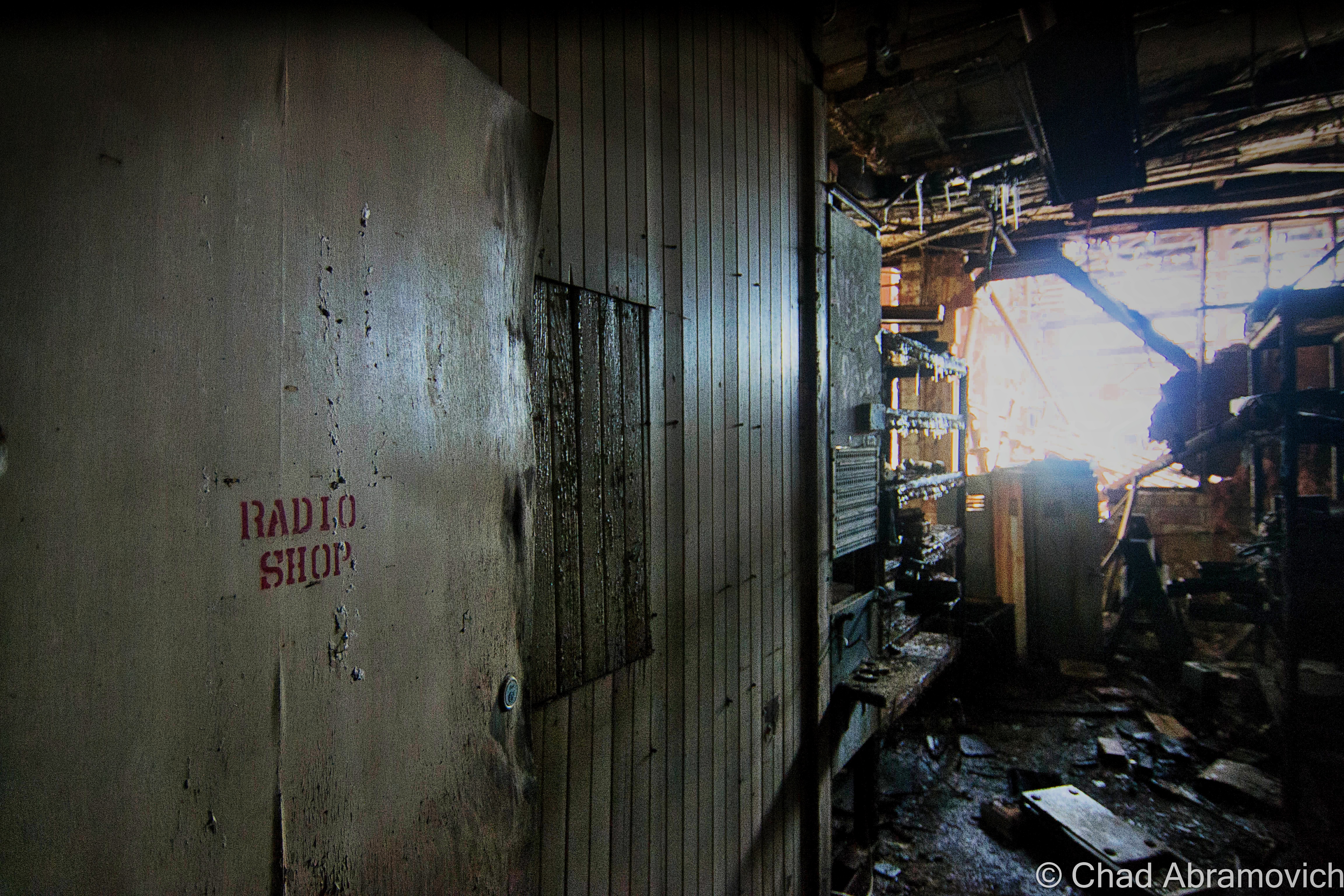
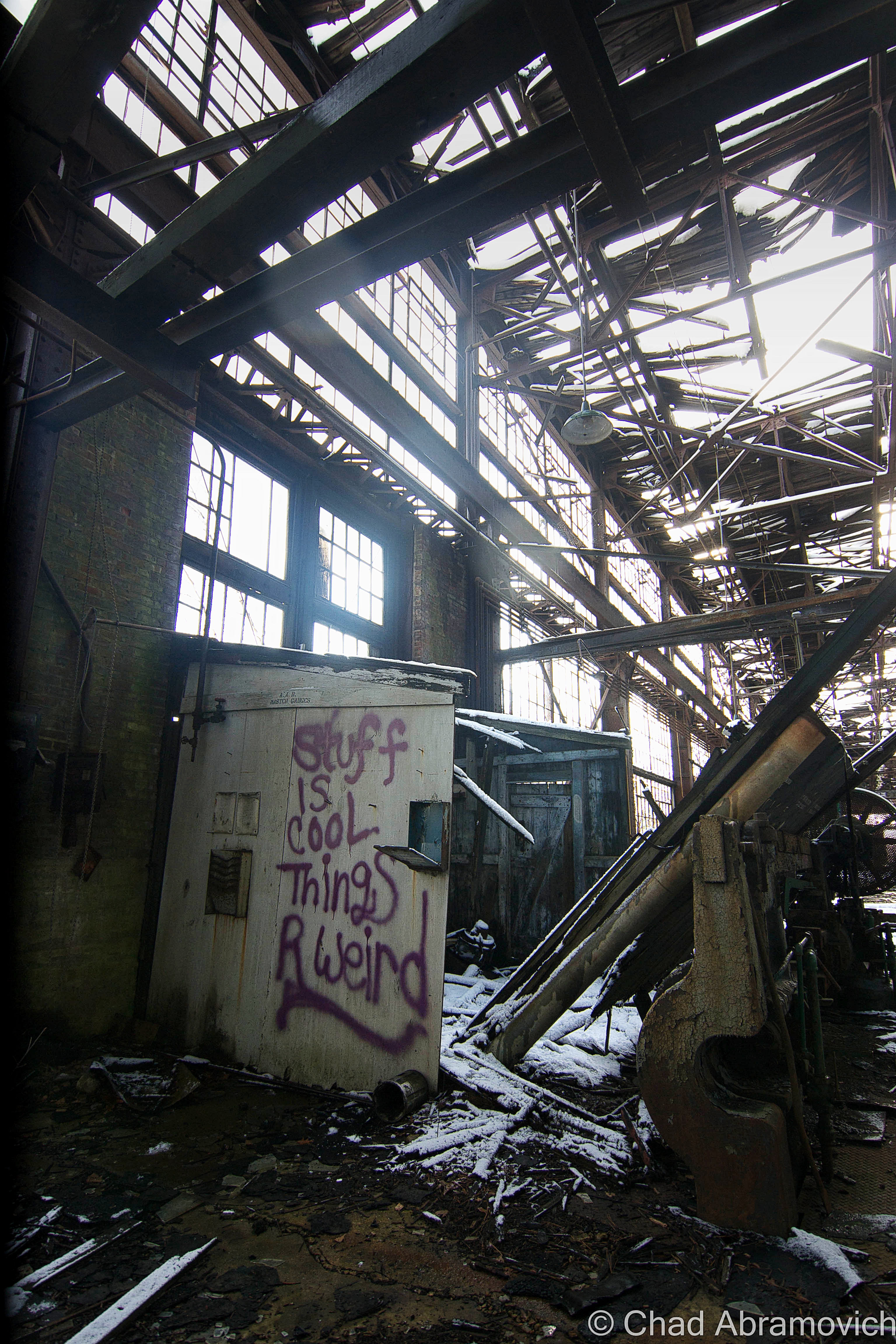
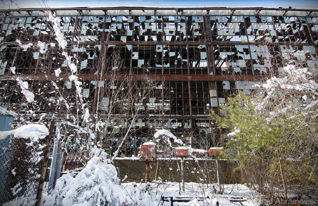
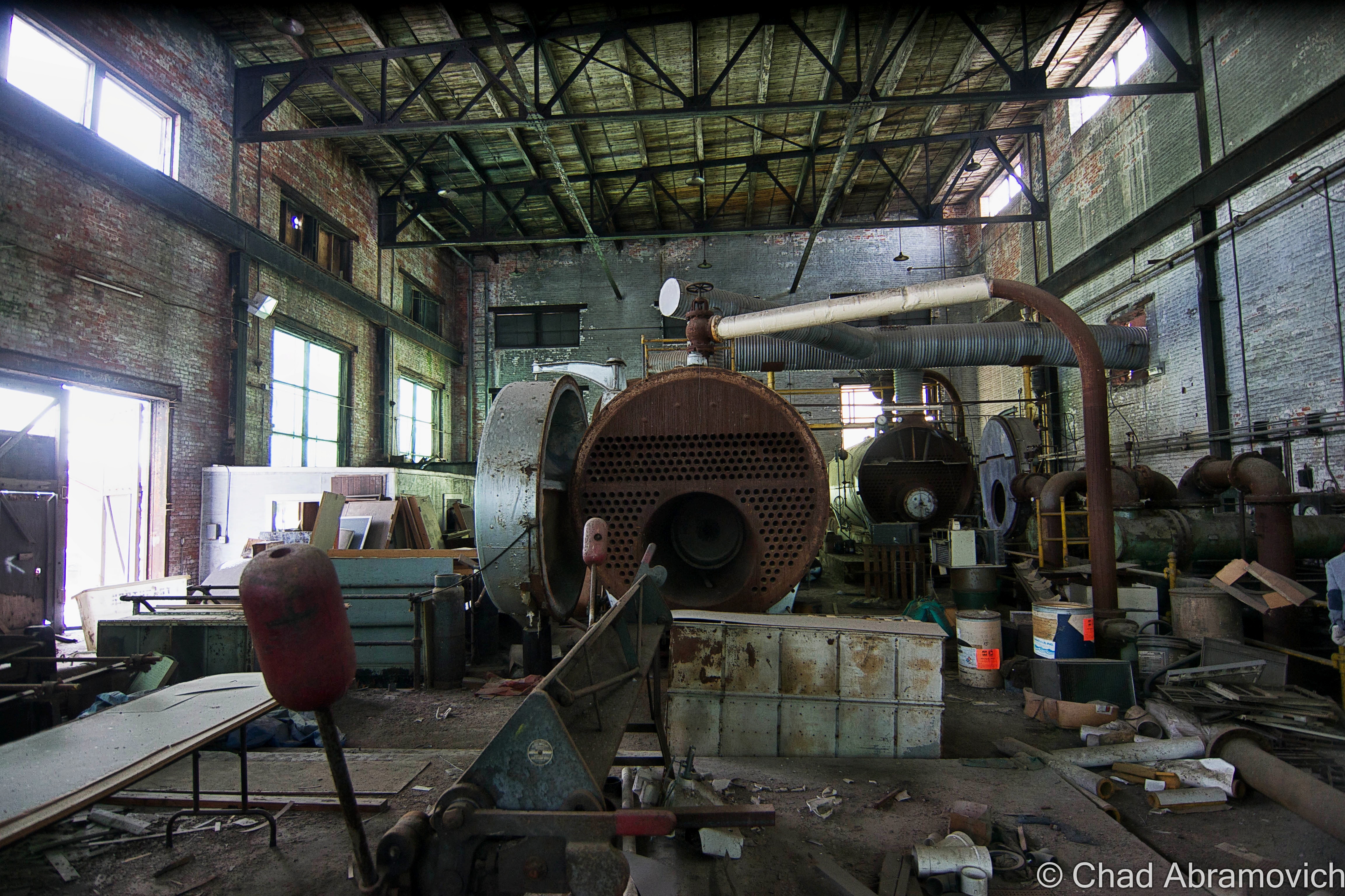
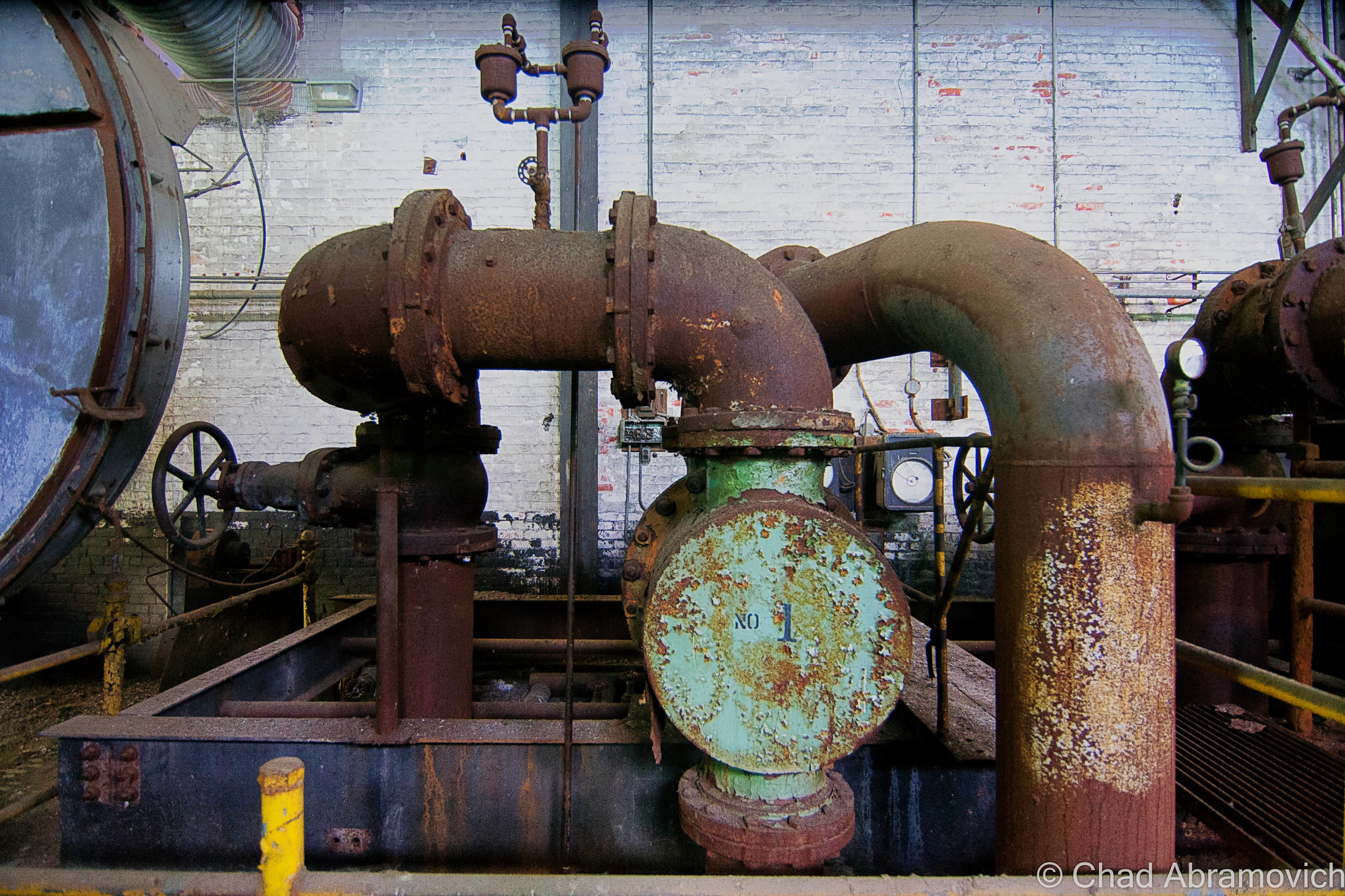
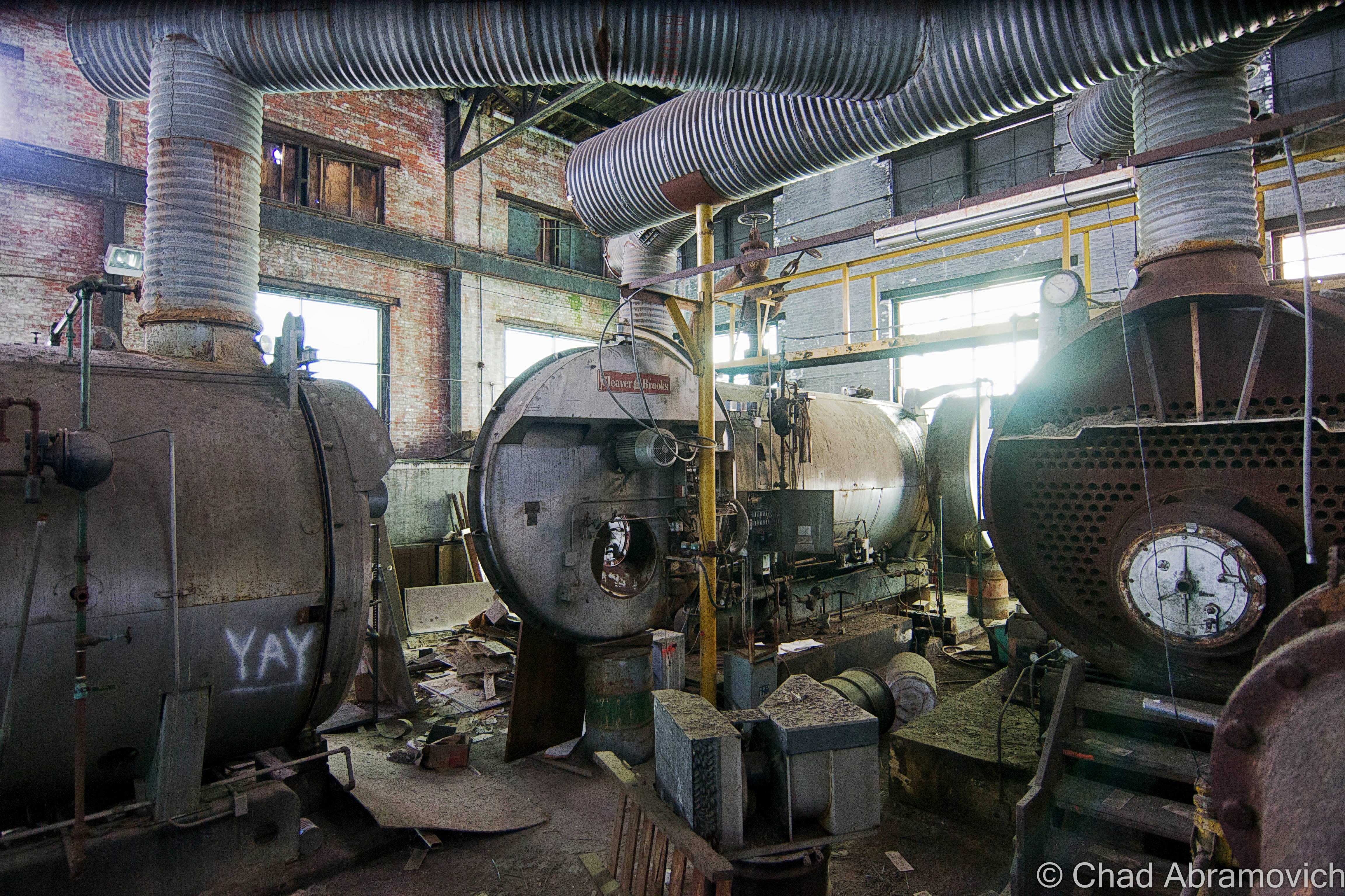
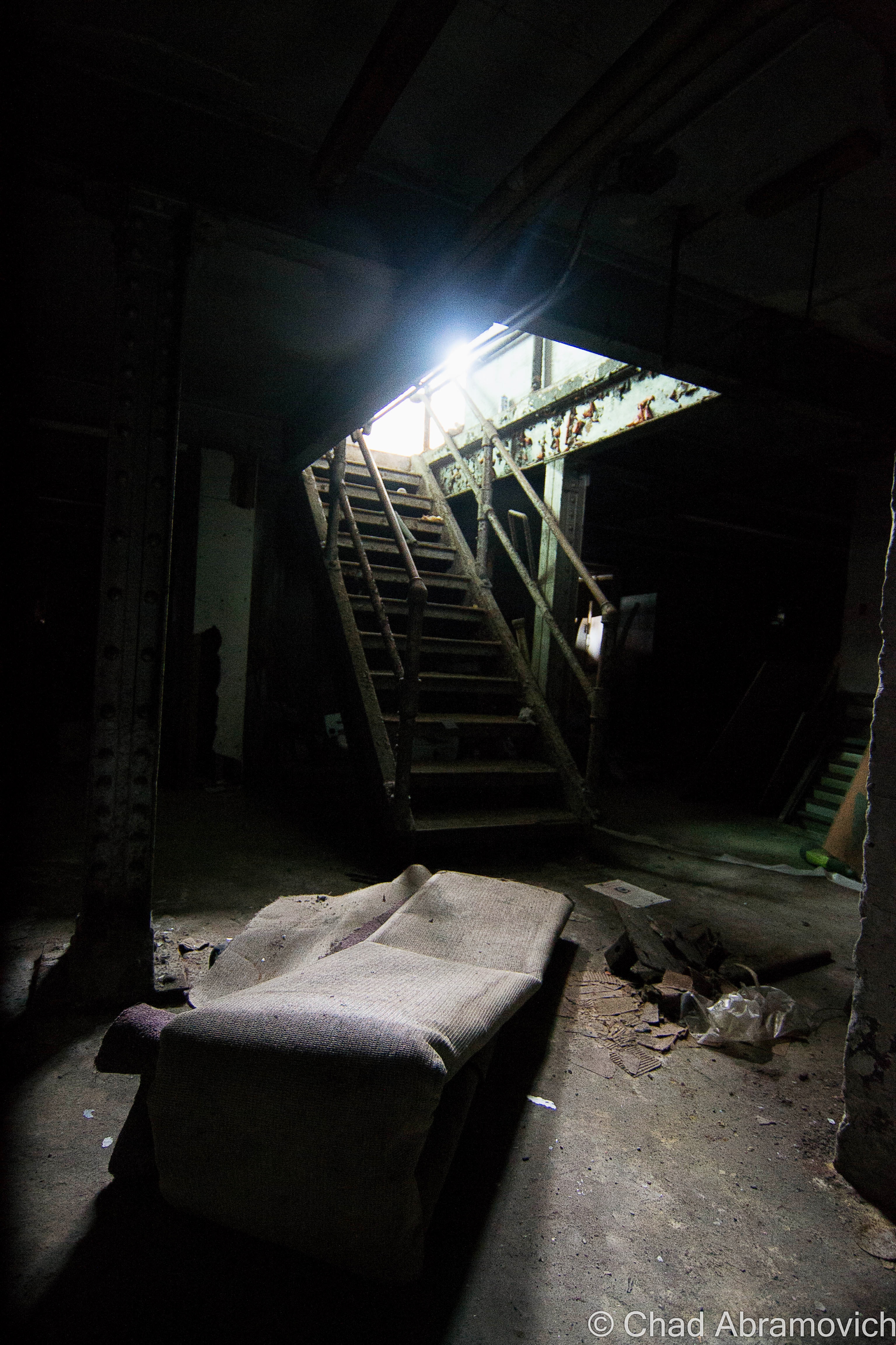
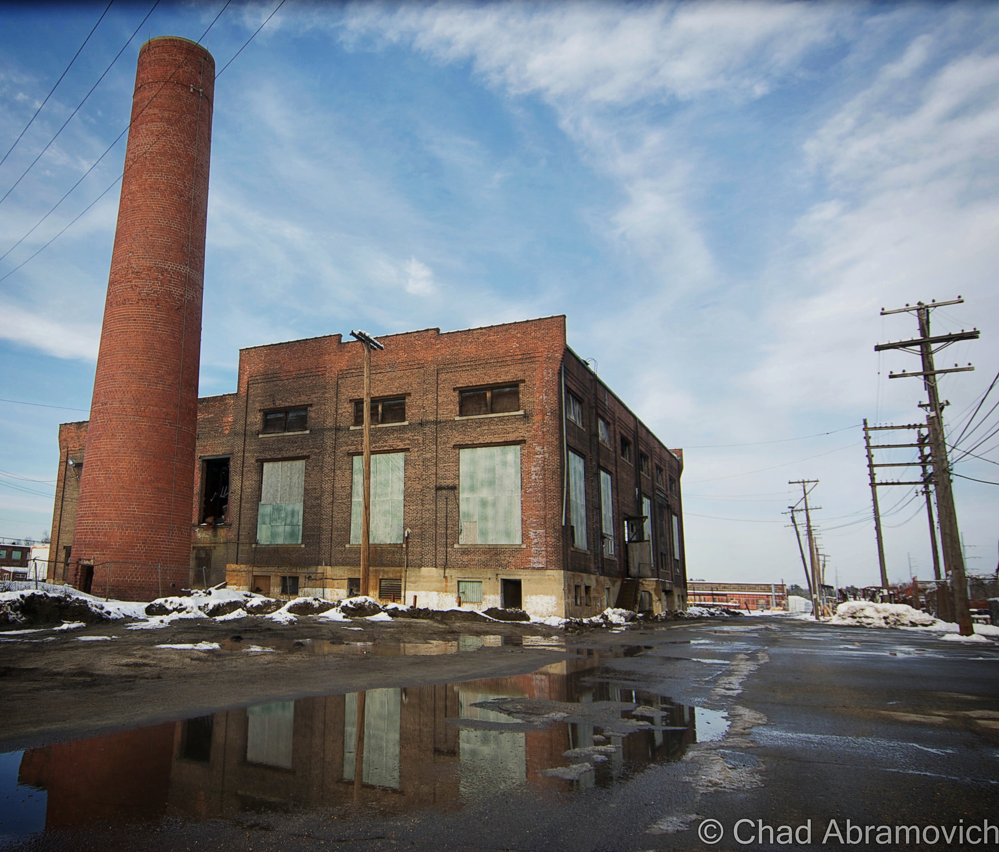
The complex appeared to be a utilitarian and symmetrical layout of two large spaces adjoined by a central row of offices, bathrooms, and mechanical areas. But upon closer and intimate inspection, I was actually more and more surprised at just how many rooms and levels there were, packed in by a labyrinth of confusing staircases and elevated runways. Some spaces were more or less original to their inaugural construction at the turn of the last century, and in the throes of the shifty ways of time, more were accommodated. There were quite a few dank 1970s office spaces put up hastily in areas that contained the infamous giveaway vinyl wall paneling and drop down ceilings, all which were accordion-ing now thanks to precipitous moisture. Some spaces were utterly unidentifiable under the entropy, with collapsing floors and sketchy staircases that lead into ambiguous soggy blackness above. But it was the two main rectangular chambers and their brawniness of broken glass and steel that I was interested in. These cavernous spaces had quite the compendium of artifacts left behind; from magnificent and remarkably intact machinery, actual steel rails still embedded in the floors, to just about anything you can fathom that had somehow found it’s way inside and subsequently left there to waste away. There’s a lot for a person to think about as they walk along the crumbling floors inside this illusion of another world. Just watch out for nails. There are plenty to step on.

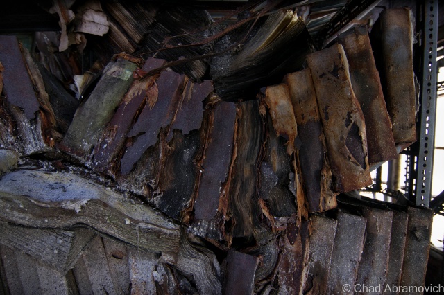
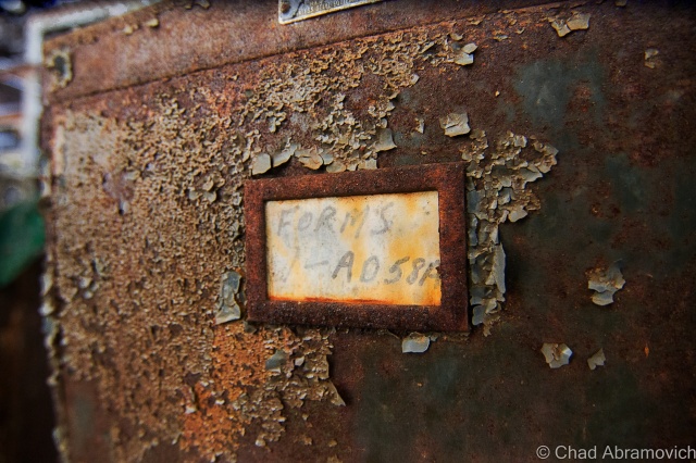
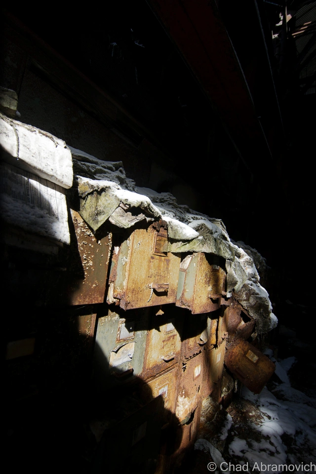
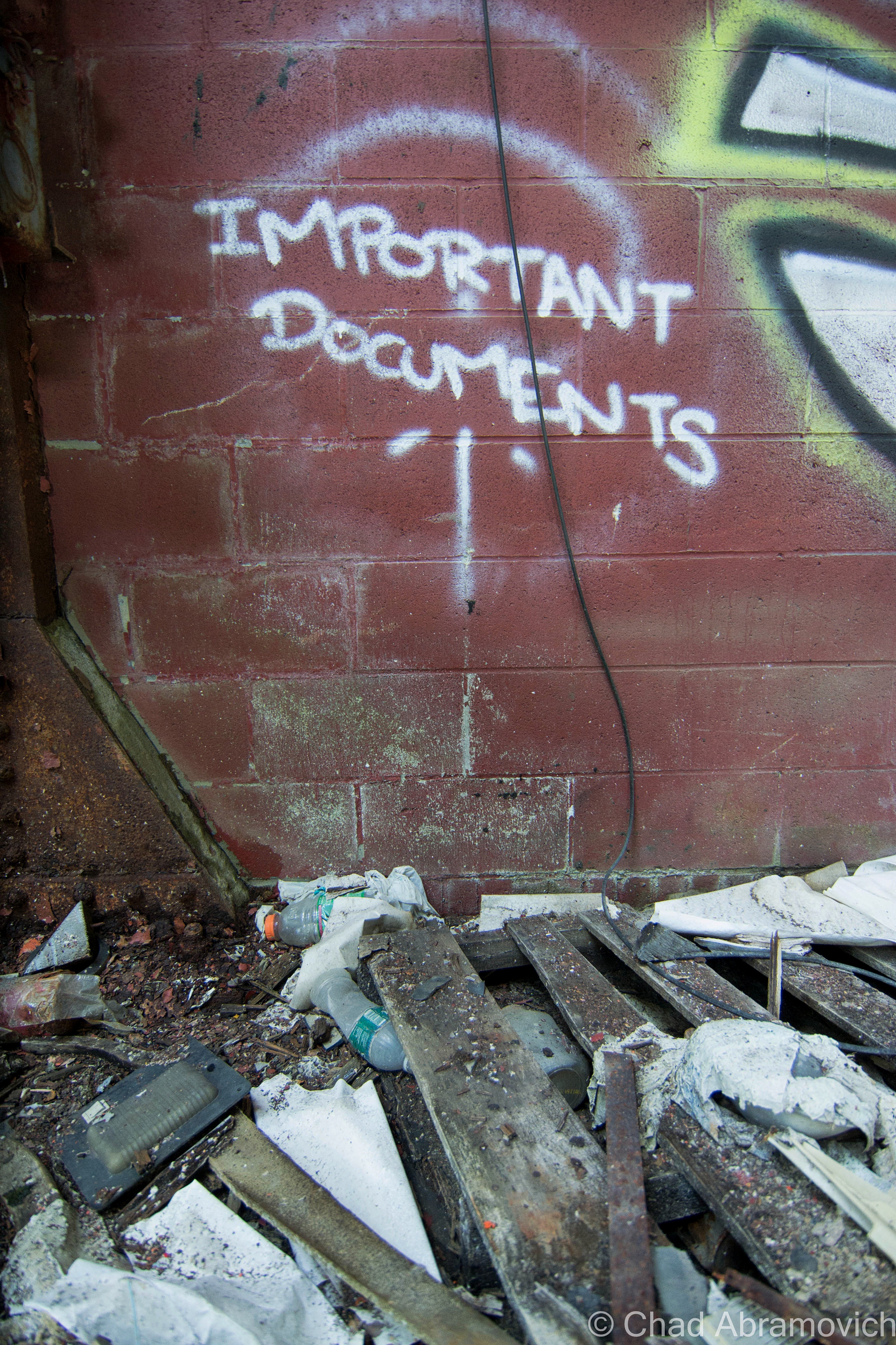
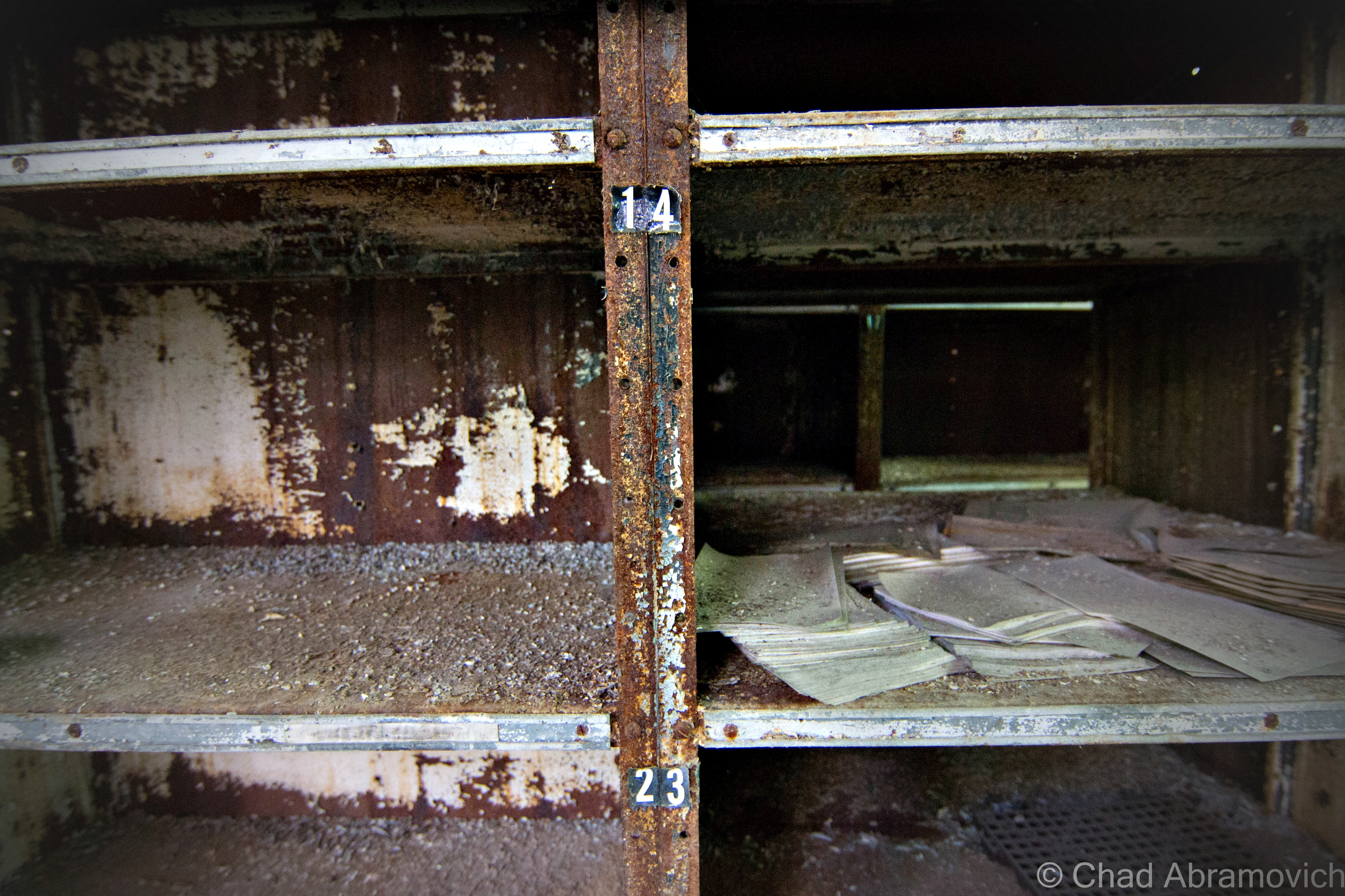
The most interesting of things left to rediscover was the extraordinary amounts of sordid books, paperwork and filing cabinet miscellany (and their accompanying filing cabinets) that had been left behind. I’m talking entire floors filled with wall to collapsing wall of old records mummified in decay. Most of the paperwork was illegible, but the oldest date I was able to find was 1931. Another friend and explorer had joked that a photo of mine was the literal embodiment of “squishy”, but as of now, no destination has been able to surpass The Pines Hotel as my “squishy-est” explore, though this place is definitely a contender.

Though we live in a world that has largely been explored, mapped and reclaimed, these human-made spaces become utterly fascinating after their functionality ceases to exist. The mystery continuum of their inner spaces become sort of last frontiers, as nature begins to reclaim everything that has been forsaken by us, transforming these spaces into something incredible. It’s on these explores that I like to attempt a little amateur forensic archaeology, and try to pick at the bones.

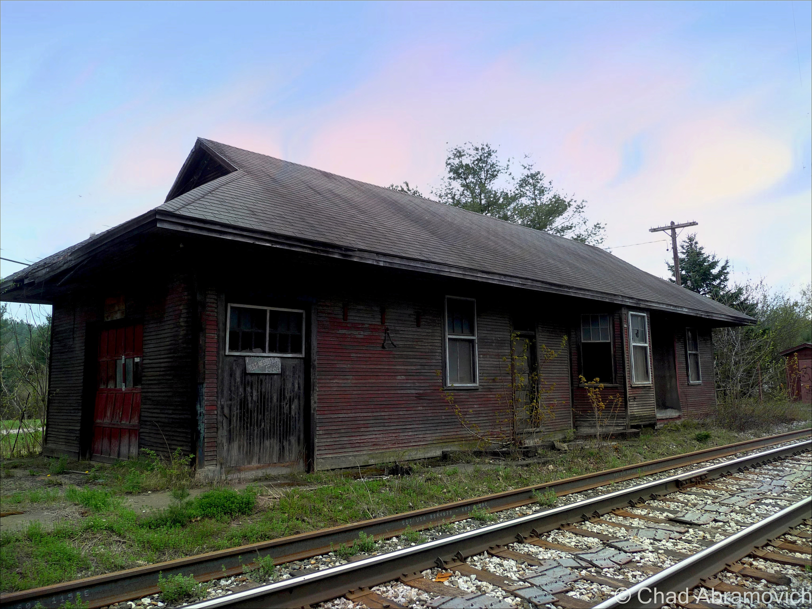
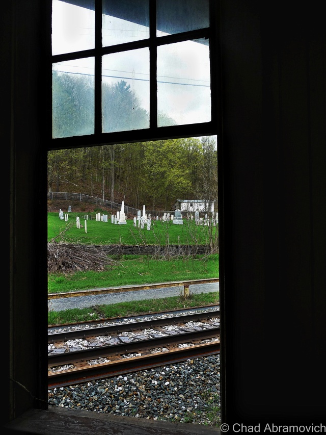
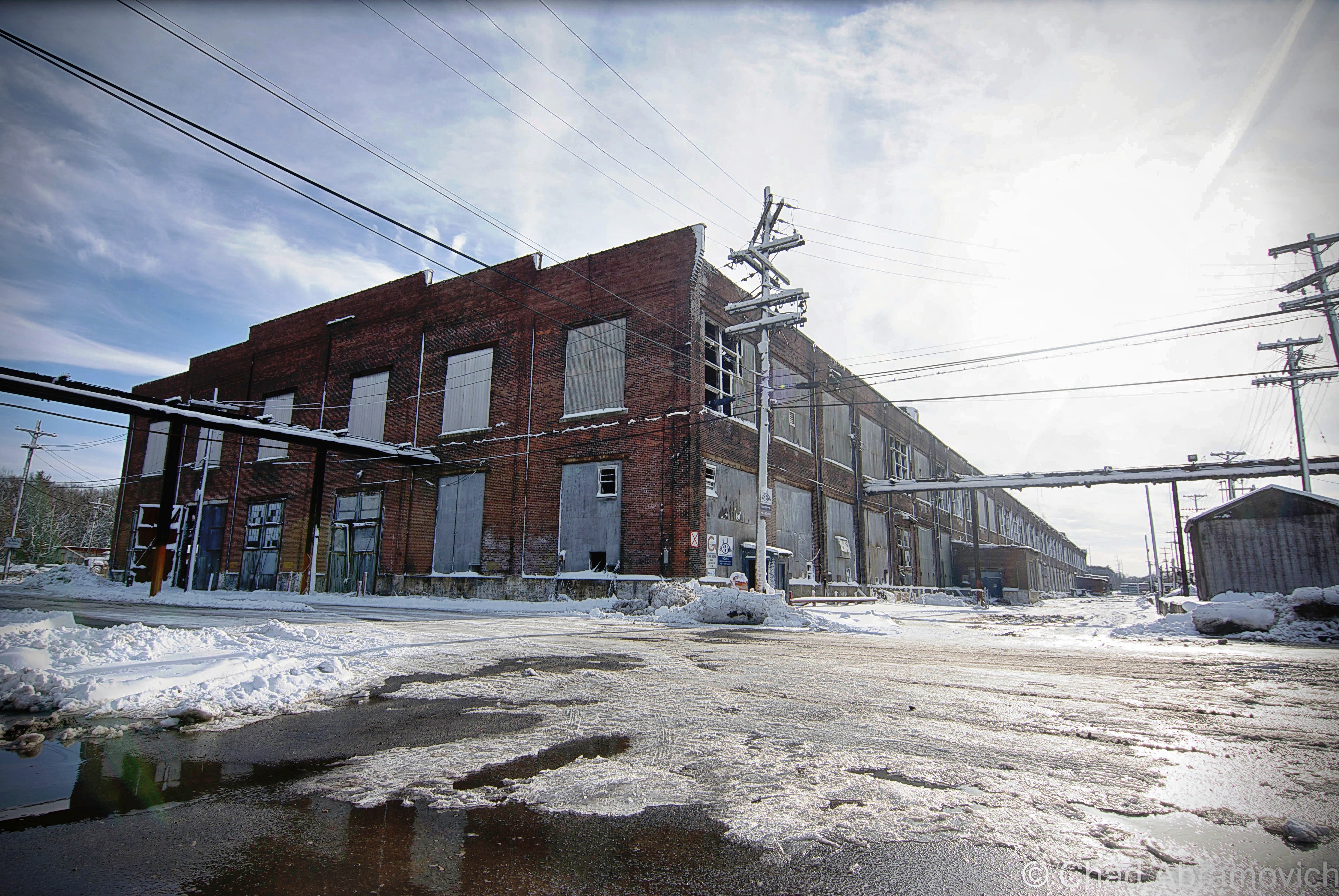
The suburban New England town I traveled too became the chosen plot of land for the formerly prestigious Boston & Maine Railroad to build their rail yards and repair/manufacture shops in 1913. What is considered to be one of American’s oldest suburbs was built up in the adjacent area to accommodate the growing need for laborers, many of the garden enhanced neighborhoods eventually were built up over old track beds that were once spur lines leading back towards the roundhouse, depot and loading docks. The continuously shape-shifting property grew to massive scales as the railroad industry became a future facing wonder, as growing mill towns and their populations created a ravenous market. That is, until the automobile became de rigueur.

The popularization of the automobile and the trucking industry seems to be the harbinger of death for a good amount of the ruins I visit, and this seemed to follow the same storyline, as both the automobile and leveling of the same manufacturing that created the demands for the railroad, murdered it. The railroad had grown so much during its boom years, that it went into unpayable debt for the miles of tracks they laid and smaller companies they acquired in the throes of good-natured greedy competition. Towards the latter half of the 20th century, the railroad industry indignantly stepped back into a darker corner of civic and popular culture, and the massive campus was now useless.

The B&M went bankrupt in 1970 and despite efforts to reorganize and restrategize, became a ghost by 1983, when it was bought by another regional rail company. By 1984, the complex was abandoned altogether because all that space simply wasn’t needed by the diminishing industry. But, not before they left a naively irresponsible legacy of destruction and negligence behind them, as the massive yards were also used for toxic waste dumps and a place to haul train wreck shrapnel over the years, which earned the place an official designation on the Superfund site list, a bone of contention that isn’t even expected to be taken seriously until 2031-ish because like everything else, the EPA doesn’t have the money. To the locals understandable displeasure, there was quite a bit of opacity about their houses abutting a literal toxic waste dump – information which wasn’t even made widely public until some neighbors did a little digging in the late 80s when a pervasive chemically smell began to waft through side streets near the industrial park, and became an uncelebrated normal.

I was able to find a few articles on the local public radio website that explained that the entire 553 acres are so swamped with pollution – ranging from asbestos, arsenic, cadmium, lead, selenium, petrochemicals and wastewater lagoons that it not only earned a spot on the national Superfund database list, but it’s one of the worst in America. “You couldn’t leave your house to go out and even have a nice barbecue because the odor was so bad”, said an interviewed resident recalling how bad it was a few decades ago. To makes things more apprehensive, The EPA says human exposure risk is still “not under control”, though it seems far more controlled today than when the report was written. I guess I can cross off walking around a toxic waste site off my bucket list, regardless of the fact it wasn’t on my list.

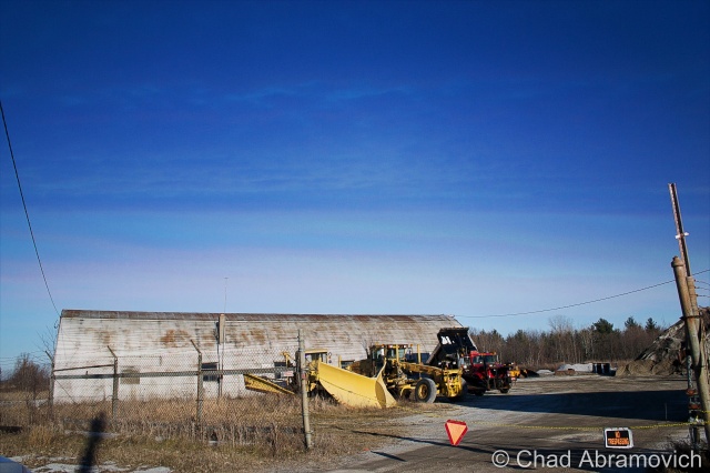
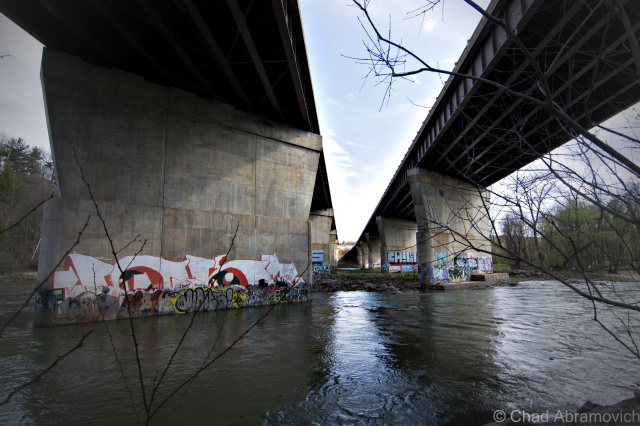
Today, most of the former property has been reincarnated as a shabby looking industrial park. The largest railway in New England has it’s main headquarters here still, that sits directly in the decrepit shadow of the abandoned shop buildings I was walking around, among a few other places with no-frills signage and creepy vacant looking front entrances. That being said, this is still an active industrial park, with employees, cops, and on my visit, guys who operate plows, that are present on a daily basis. Unlike me, who technically has no reason to be here other than curiosity. The rail lines that hem in the property are also still in use, and some of the industrial businesses in the park receive rail traffic.

There is always a certain reward to risk ratio that I use as the dichotomy or gauge of how I treat my explores. On this trip, my friend and I and my friend decided to simply walk towards the buildings with our cameras, as there was no way we could get inside without someone seeing us, and I didn’t drive through three states just to turn around. The man in the plow noticed us as he was relocating a snow drift. We all mutually nodded our heads in affirmation and confidentially walked inside. We were exploring for four hours or so, and the cops never came, which was great, because this fascinating locale has easily turned into one of my fondest explores. This is one of those places I could return to multiple times and have a different experience at.

But I wouldn’t take that one fortunate opportunity for granted. I know a few people who have been dragged out by the powers that be before, which is why brushing up on trespassing laws in other states isn’t necessarily a bad thing.

Until some serious clean up and the accompanying scrutiny happens, these hulking and fetid ruins and all their soggy decay are more or less, in limbo.

DSC_0017_pe DSC_0025_pe DSC_0027_peDSC_0042_peDSC_0047_peDSC_0054_peDSC_0062_peDSC_0070_peDSC_0071_peDSC_0076_peDSC_0065_peDSC_0077_peDSC_0083_peDSC_0088_peDSC_0089_peDSC_0090_peDSC_0091_peDSC_0098_peDSC_0101_peDSC_0108_peDSC_0116_peDSC_0121_peDSC_0123_peDSC_0139_peDSC_0149_peDSC_0151_peDSC_0160_peDSC_0161_peDSC_0163_peDSC_0173_peDSC_0175_peDSC_0150_peDSC_0180_peDSC_0185_peDSC_0190_peDSC_0194_peDSC_0199_peDSC_0202_peDSC_0209_peDSC_0212_peDSC_0218_peDSC_0229_peDSC_0230_pe_peDSC_0237_peDSC_0241_peDSC_0243_peDSC_0248_peDSC_0250_peDSC_0251_peDSC_0253_peDSC_0261_peDSC_0274_peDSC_0278_peDSC_0287_peDSC_0288_peDSC_0290_peDSC_0291_peDSC_0292_peDSC_0295_peDSC_0300_peDSC_0303_peDSC_0304_peDSC_0307_peDSC_0310_peDSC_0311_peDSC_0313_peDSC_0314_peDSC_0315_peDSC_0318_peDSC_0320_peDSC_0322_peDSC_0324_peDSC_0329_peDSC_0333_peDSC_0337_peDSC_0339_peDSC_0344_peDSC_0348_peDSC_0349_peDSC_0136_peDSC_0351_peDSC_0354_peDSC_0360_peDSC_0361_peDSC_0366_peDSC_0367_peDSC_0369_peDSC_0381_peDSC_0392_peDSC_0395_peDSC_0399_peDSC_0405_peDSC_0409_peDSC_0413_pe

—————————————————————————————————————————————–

To all of my amazing fans and supporters, I am truly grateful and humbled by all of the support and donations through out the years that have kept Obscure Vermont up and running.

As you all know I spend countless hours researching, writing, and traveling to produce and sustain this blog. Obscure Vermont is funded entirely on generous donations that you the wonderful viewers and supporters have made. Expenses range from internet fees to host the blog, to investing in research materials, to traveling expenses. Also, donations help keep me current with my photography gear, computer, and computer software so that I can deliver the best quality possible. Seriously, even the small cost equivalent to a gas station cup of coffee would help greatly!

If you value, appreciate, and enjoy reading about my adventures please consider making a donation to my new Gofundme account or Paypal. Any donation would not only be greatly appreciated and help keep this blog going, it would also keep me doing what I love. Thank you!

Gofundme: https://www.gofundme.com/b5jp97d4

Donate Button with Credit Cards

Disappearing Act: Burlington’s lost ravine.

Sometimes it seems that I could write a sizable book about Burlington, inspired by the seemingly endless tales of fabled places, strange stories and lost history that are begging to be known – their praises seldomly sang by a select and arcane few.

There are many weird and wonderful things that many of us see everyday. The world’s largest tower of filing cabinets makes its home in a weedy field in the South End, and there is a puzzling bridge to nowhere in the intervale that looms over the beltline.

And there are other intriguing mysteries that are more difficult to explain, and even harder to find. Tales of catacombs and tunnels running underneath downtown have been relayed to me, as well as an awesome and mysterious “subway like railroad tunnel” that supposedly runs underneath the Old North End still, years after being defunct and sealed up (which I have yet to find). But, out of all of Burlington’s peculiarities that have long since vanished, there is one that is still refusing to be completely forgotten.

I was interested in this mystery when I accidentally stumbled upon an old city map dating from the mid 1800s in the book Bygone Burlington. It clearly marked streets and familiar landmarks that still exist today. King Street, Main Street, Lake Champlain. But there was something else. The map clearly labels something that would be so conspicuous in today’s Burlington. Just east of present day South Winooski Avenue was a serpentine sunken trench of land that divided the city in a South-West and North-East direction, separating downtown from the hill section. A few bridges crossed the ravine and spurred off onto the hill and towards Colchester Avenue before making the journey to Winooski – the old map describing the ravine as wild and swampy. It was strange seeing this strange ditch co-existing with the city.


It’s obvious that this ravine no longer exists today. Or, so it would seem. As a matter of fact, the ravine is still very much there.

Burlington_1853_ChurchStreet_16x20web
This 1853 map of Burlington shows the former ravine

I knew I wanted to know more, and I set out to do some research. What I found was another interesting layer in Burlington’s story line.

In the beginning, it seemed that this fabled ravine was beneficial to the city. As Burlington prospered and grew during the 19th century, the city would need to meet the demands of a growing population. Old maps created around 1853 indicate that the Vermont Central Railroad purposely used the ravine as a direct route from the waterfront to the mills in Winooski. The former downtown train depot sat at what is now the corner of Main Street and South Winooski Avenue (known then as White Street), where the fire station is today. In 1862 the railroad was re-routed underneath North Avenue and through the intervale on its present day route. Later, in 1880, the ravine would once again serve a utilitarian purpose, and was chosen as the backbone of the city’s new and modern sewer system which was built using a network of stone and brick sluices and culverts that followed the path of the ravine into the lake – all discharging at a location somewhere near the end of Maple Street.

However, there was a population explosion in Burlington around 1880 and the demand for land was high. The ravine soon became a roadblock to progress. Tensions mounted when the existing sidewalks and bridges began rotting and crumbling, creating dangerous hazards and upset residents. The city then embarked on an ambitious project to fill the ravine, and in a classic act of 19th century urbanism, filled it with garbage. That’s how San Francisco reclaimed its now famous waterfront area, so why not Burlington? But, maybe 19th century urban planners didn’t see the problems behind building a city over decomposing garbage piles. But it happened, and the modern day downtown we all identify with was created in its wake.

Over time, people have been curious about the ravine as I have been, and began to pick at the pieces to this intriguing puzzle. And that seems to have raised some issues of debate. Some argue that the ravine was never there to begin with, and was simply an error on a map.

But other arguments prove otherwise. It is known that Burlington’s waterfront is reclaimed marshland, filled in with garbage and wood and old maps show a former branch of the Winooski River actually emptying into the lake here, near the present day Battery Street railyards. Some even speculate there are still remnants of this original tributary still running underneath the streets today, but performing an excavation now would be impossible, problematic and costly, leaving this as speculation.

But, you don’t have to do a lot of digging to find some answers, and In this case, the answers take the form of a long, narrow and seedy looking landmark that is a looming eyesore at the main entrance to the vibrant downtown area; The Midtown Motel. You might not guess by looking at it, but the dated structure was purposely built the way it is, because it sits on top of the former ravine and the layers of garbage that filled in the old cavity.  The motel opened in 1958 and has served everyone from tourists, young lovers looking for a little respite, and people just down on their luck – and because there were no places to stay in Burlington’s city center at the time, the Midtown Motel prospered.

But, before anything could be built on the property, local architect Benjamin Stein had to figure out how to fit both a motel and ample parking on the usable pieces of the property – the parts that would support development over the fragile layers of fill that cover the ravine.

The Midtown Motel
The Midtown Motel

To make it work, the architect needed to get creative. The narrow motel was elevated and the parking was put below it. The design embodied the International style of architecture, where functionality came first. The motel did well until the 90s, when it went downhill and began drawing seedy clientele, and a bad reputation to go with it.  Today the motel is out of business and vacant, and the city block it sits on is considered a “super block”- or, a block that is largely city owned and offers substantial redevelopment potentials. It is one of the only such blocks remaining in Burlington, meaning the value of the land is only growing. However, because the property’s unique setbacks, more delicate measures will have to be made before any large redevelopment projects are taken.

Just down the road from the Midtown Motel is another remnant of the ravine, one that the city hasn’t completely covered up yet. On King Street, there is a sizable and isolated geographical anomaly in the middle of the road itself – a dip in the stretch between Church Street and South Winooski Avenue.  From the bottom of the dip you get a good perspective of the raise in elevation around it, and how the city’s buildings have been configured and built. And there are some buildings on Saint Paul Street with exposed foundations, sections of the buildings that appear to have once been above ground.

The Strange Isolated Dip in King Street
The former Wilson Hotel on the corner of Church and King showcases evidence of changing elevation - the front door is on the second floor!
The former Wilson Hotel on the corner of Church and King showcases evidence of changing elevation – the front door is on the second floor!
This brick house on St. Paul Street shows that the first floor was at one point the basement.

It seems strange to think about a large trench that divides Burlington in half, a trench so large that it once even had its own toboggan club – but stranger things have happened in the throes of progress. If the entire present day city of Seattle was built literally on top of the original city, then Burlington’s ravine almost seems passively unimpressive to think about. The communities we visit today are drastically different from what they were 100 years ago, almost unrecognizable at times, which is both intriguing and inspiring. Who knows what else is buried underneath the ground you walk on.

Links:

The Midtown Motel in Seven Days

—————————————————————————————————————————————–

To all of my amazing fans and supporters, I am truly grateful and humbled by all of the support and donations through out the years that have kept Obscure Vermont up and running.

As you all know I spend countless hours researching, writing, and traveling to produce and sustain this blog. Obscure Vermont is funded entirely on generous donations that you the wonderful viewers and supporters have made. Expenses range from internet fees to host the blog, to investing in research materials, to traveling expenses. Also, donations help keep me current with my photography gear, computer, and computer software so that I can deliver the best quality possible.

If you value, appreciate, and enjoy reading about my adventures please consider making a donation to my new Gofundme account or Paypal. Any donation would not only be greatly appreciated and help keep this blog going, it would also keep me doing what I love. Thank you!

Gofundme: https://www.gofundme.com/b5jp97d4

Donate Button with Credit Cards

Railroads and Silos

It was an icy Winters day as me and some friends drove through the Champlain Islands; destination unknown. It was one of those situations where we were seeking a place to explore, hoping to find some inspiration and intrigue in the brown fields burned by the harsh blue skies. In the Winter, the Champlain Islands loose the comfort and allure brought with the Summer months, vanishing with the shivers and darkness of the later half of the year as if it were a completely different place.

Not having any real luck in the islands, we crossed the Alburgh bridge into New York, the sturdy ruins of Fort Montgomery were not being pitied by the season as they were battered by the choppy and relentless waters of Lake Champlain.

For a region with such an extraordinary history and important connection to the rest of the country, a surprisingly large amount of it has been buried (metaphorically and literally), the occasional historical marker is scattered across the geography, hinting at what once was.

Rouses Point, New York has always been a heavily trafficked locality thanks to it being a portal into Quebec. It’s where the dotted border lines of New York, Vermont and Canada all meetup, as well as Lake Champlain and Quebec’s Richelieu River, which were the area’s original super highways before the interstate systems were built.

Automobile, rail and boat traffic is all siphoned through the gateway community, and because there are always nuances, that also includes the more illicit of things, like rum runners, smugglers, the underground railroad, and a few wars fought by the British and the Americans skirmishing on Lake Champlain over the past hundred years. Seriously, Rouses Point was such a noteworthy place that the feds financed a fort to be built at the mouth of the Richelieu just in case British troops wanted to invade us through Canada. Only, the United States was a much younger nation then, which meant that no one knew exactly where the border was, and the fort was accidentally built in Canada, later returned to the U.S, and never actually used. It was eventually partially salvaged for parts, and a lot of the small village was built up with the bricks, stone and wood salvaged from the brawny structure. From what I was told, the present day village offices were built on top of a former prohibition era dumping site of all the paraphernalia that was confiscated. Today, a drive through Rouses Point is mostly simple wood frame houses, moored sailboats and a Dollar General, a ubiquitous find in Upstate New York.

The village really did well for itself when the Delaware and Hudson Railroad decided to build passenger and freight facilities here and a rail yard to accommodate. Though Rouses Point is a pretty obscure community overall today, just outside the village limits are the remains of the oldest and last remaining Delaware and Hudson roundhouse turntables. Being battered by fierce winds, our trip here was short as the numbness in my hands began to outweigh my increasingly diluted curiosity. What can I say, I hate the cold.

This building was formerly used for washing down the rail cars

dsc_0448_pe

Interestingly enough, most railroads, the D&H included, didn’t bother to wash their steam locomotives. Every so often, they would go over them with a mop soaked in kerosene to make them shine, but that’s about it. Roundhouses were built in the steam era as a way to store and maintain the locomotives, as well as repair and prepare them for their next trips. Other buildings on the site would be a coach shop, which was used to repair passenger stock, a cooling tower which was used for fuel, water tower for water, and in some cases a freight house where less than carload items were sorted and shipped out.

So, what is the reason that so many roundhouses are now abandoned?  In short, diesel engines need much much less repair than steam engines. When the steam engines faded away, so did the roundhouses.

This building was used for holding freight.
The original roundhouse

Alburg is a 45th parallel town, and one of a handful of Vermont communities that have found themselves in a weird moniker contention, where the United States Board on Geographic Names decided that they needed to standardize place names around the country in 1891. Every city or town ending in ‘burgh’ had their H dropped, pretty much so the mail would go to the right places and to make them easier to write on federal documents.

Well, over a hundred years later, a few Vermont towns decided that the dropped consonant was something to get up in arms about, with a few bringing it back, and the other few not caring that much.

Back across the bridge, in the pancake flat farmlands of the Champlain Island archipelago, the landscape is dotted with trailers, sagging farmhouses done in vinyl siding, and silver silos that reflect the coarse December sunlight from their gleaming surfaces.

There is a rural road off of Route 2 called Missle Base Road, a moniker that supports the notion that this cul-de-sac is different from other Alburg byways . Whether or not it’s misspelling is a VTrans blunder or intentional, it’s sort of a weird road name in a region that only has a sheriff to bring down the law. That street sign is overshadowed by a much larger and more intimidating sign. In fading lettering, it sort of reads “Stop! Authorized Personnel Only Beyond This Point” in attention grabbing orange, while even more faded text behind it once read “Town of Alburg” (spelled without its H)

A drive down bad tarmac puts you dead ending in front of 2 rusted Quonset Huts, a chain gate, construction equipment that has seen better days and a dune of road salt. You’re looking at the Alburgh town garage!
But the Quonset Huts give its past away. Underneath the salt pile is the reason for the huts construction; an atlas missile silo.

This is the site of one of Vermont’s 2 nuclear missile silos. But you’d never know it. Towards the back of the property, a rusting pile of junk and a dune of road salt sits on top of the closed silo bay doors, each concrete door weighing 45 tons, enclosing the dark dripping confines of the flooded silo below.

Peering down the silo today would be a wondrous gaze into man’s eternal battle with evil and glorious ruin, but if you had peered down this shaft in the early 1960s, you would have been gazing at the tip of a nuclear missile.

In the 1960s, the military was scrambling to build defenses against the potential of a nuclear apocalypse that the Soviet Union was scheming, with the Soviets doing the same thing with the role of the villain reversed. The Army Corps of Engineers constructed 12 sites in a ring around the Air Force base in Plattsburgh — 2 in Vermont, 10 in New York, and absolutely no expenses were spared, with each site costing between $14 and $18 million to build, each one coming with a brazen claim that each could withstand a direct nuclear attack.

But these mysterious and aggressive projects were quite a feat to build. Many workers died during their constructions, with urban legends reciting that some unfortunate souls became entombed in the concrete silo walls they were hired to produce. The thought of the cold walls and dark depths of the missile silo as someone’s last vision is an image is a poignant one.

Ironically, despite the large expenses invested in these agents of destruction, the pulses of these missile silos were short lived, only active from 1962 until 1965, thanks to leaps in progressive apocalyptic technology. To add to the uncertainty, many were disputing afterward whether the missiles would have been able to hit their targets, and even be able to lift off the ground.

But they left a lasting impression on the landscape. However today, they hold contaminated waste and shadows smothered with valiant ghosts.

Each launch site constructed included two Quonset huts, a utility shed and an antenna that could detect a nuclear attack up to 30 miles away. The silo itself was 52 feet wide and 174 feet deep, encased in a shell of incredibly thick and durable concrete.

After their demise, the sites were abandoned. Ownership was now the burden of their communities, including this one, which was, uh, gifted to Alburgh, who turned it into their down highway department headquarters and dumped road salt over the perforation. Others were looted, some were sold to private investors and military enthusiasts. According to lots of testimonies over the intervening decades, most of them flooded to some degree.

Because everything has a market, interest in these intriguing properties has picked up in recent years, thanks to curious buyers who see the old silos as great “fixer-upper” projects, especially for private homes. But due to their deteriorating conditions, these sites require a buyer with a lot of money, patience and time. One of the former sites, in Champlain, New York was found and purchased on eBay. The new owner plans to clean it up and live in the remaining Quonset hut, and possibly in the launch control center. Taking his project a bit further, he has created an intriguing website which tracks his progress cleaning up the site, and gives everyone else a cool and rare look into these fabled locations.

Alburgh’s site wasn’t phenomenally interesting, but I still thought it was cool. I snapped a few photos of the Quonset Huts, because that’s more interesting than a photo of a pile of salt. I’m pretty confident in my assumption that the town won’t be opening up those blast doors anytime soon, so it’ll have to do. A town garage that doubles as a weird monument to humankind’s strange tendency to destroy itself. 

dsc_0480_pe dsc_0481_pe dsc_0483_pe dsc_0484_pe dsc_0485_pe

As of 2015, it looks like the street sign was spell checked, but Google maps still uses the misspelled moniker for the road.

—————————————————————————————————————————————–

To all of my amazing fans and supporters, I am truly grateful and humbled by all of the support and donations through out the years that have kept Obscure Vermont up and running.

As you all know I spend countless hours researching, writing, and traveling to produce and sustain this blog. Obscure Vermont is funded entirely on generous donations that you the wonderful viewers and supporters have made. Expenses range from internet fees to host the blog, to investing in research materials, to traveling expenses. Also, donations help keep me current with my photography gear, computer, and computer software so that I can deliver the best quality possible.

If you value, appreciate, and enjoy reading about my adventures please consider making a donation to my new Gofundme account or Paypal. Any donation would not only be greatly appreciated and help keep this blog going, it would also keep me doing what I love. Thank you!

Gofundme: https://www.gofundme.com/b5jp97d4

Donate Button with Credit Cards

The Broken Tower

Winooski is a brawny old mill town built intentionally on a series of cascades on it’s namesake river that would power the woolen mills that built the city, and a prevalent French Canadian populace that affixed their surnames to street signs and brought down francophone media from Quebec. The textile mills both lifted the city up, and then let it fall when the industry went bust. The flood of 1927 was particularly harsh to business, when swells of rapid brownish watery destruction decimated most of the buildings along the riverfront. The mills never recovered fully, and went from the state’s largest employer, to limping along rather awkwardly until 1954 when they shuttered for good after they no longer landed government contracts when new synthetic fibers became the future.

The town was bruised for decades afterwards underneath economic blight, higher rates of poverty, and a humbling lack of identity. In the late 1970s, the one square mile burb made news when it ambitiously decided it was going to build a glass dome over the city to keep down the costs of heating prices in the winter, and partially for a publicity stunt inspired by a town meeting with lots of wine. That idea surprisingly almost happened, but was coffined in the 80s, when the Reagan administration came into power and decided that there were better things to spend money on.

A few more decades later, Winooski once again made headlines for another construction project; brazenly undertaking the largest downtown redevelopment project in state history, which simultaneously included the construction of a controversial rotary that was oddly blueprinted on a hill. It was intended to lessen traffic congestion where routes 2,7 and 15 met downtown, but instead confused and upset certain commuters and Winooski-ites, earning it the bad for business nickname “the circle of peril”. But their massive scale improvement project seemed to work, and years later, downtown Winooski has filled in with some of the best eateries in the Burlington area, a pretty enjoyable microbrewery and an awesome indie music festival which brings all sorts of converging artists into town.

Brawny industrial towns like Winooski have had their rises and falls, but if there is one good thing about old mill towns, is that their lasting impression comes in the form of admirable architecture. More precisely here, it’s spacious and handsome brick mills. Most of the old mill buildings have taken on new lives as very nice mixed office and apartment space, but a small vestige of Winooski’s raw and unrenovated industrial past can still be seen, if you know where to look.

Sulking behind the expansive brick edifice of the Woolen Mill, down in a recessed area of scraggly trees and the graveyards of stagnant mill ponds once formed by water entering through the low stone tunnels now being filled in by erosion, sits the crumbling remains of a brick tower.


These dangerous ruins were enigmatic to me, as I know practically nothing about early twentieth century mill operations, so with the help from my friend who was also the one who took  me here, a little research was done and was able to shed some light on what this tower once was.

Basically, there is a large intake pipe at the top of the tower. Using gravity, the water flows from the river to the top of the tower.It then is diverted downwards into a turbine where the rushing water turns a wheel before being used for power generation. This turning wheel would have been connected to a shaft that ran into the mill to turn and power the equipment. After 1930 however, the turbine would likely have been repurposed, so instead of using water to create mechanical energy to turn the actual machines, the machines began to use electricity  So the turbine would have been repurposed. Instead of turning a shaft and going into the mill, it turned a shaft that turned an electric generator and this power would have supplied the mill.  Or, something perhaps very similar to the diagram below. (If you are using this blog for any sort of essay information, I encourage you to find a more reputable source)

Fairmount_Water_Works_Jonval_Turbine_Cutaway

Sure enough, there were the remnants of additional pipes and tunnels that formed a broken trail from this spot over to the bridge where the water levels were higher, making this a very plausible description of how this tower might have functioned.

But by looking at the crumbling, and rusted ruins today, they keep their secrets far from your presence, besides the strikingly obvious – this place is dangerous. The tower had made its mark on this part of the property since it’s construction, its shadow forever burning its impression into the wet ground around it, but a few more winters may finally bring this decrepit place down into the muddy recesses of the foul mill wastelands below it.

A surprisingly warm day for December 2nd in Vermont, I probably could have gotten away with just a flannel or a hoodie, but chose to bring a more protective layer just in case. And I’m glad I did. As we shambled over piles of soggy ground and driftwood to the arched entrance, the inside of the tower was noticeably colder – the air was dead inside. There would be no “safe” traveling, so much had fallen that we were constantly crawling over untold amounts of dirty bricks covered in slime and rust, underneath piles of the rotting wooden floors above that had long collapsed below.dsc_0209_pe

dsc_0779_pe dsc_0210_pe dsc_0214_pe dsc_0215_pedsc_0220_pe dsc_0218_pe dsc_0219_pe dsc_0243_pe

Now this is where things became interesting. We climbed further inside the tower, and saw just what we were up against. Behind the massive bulk of debris infront of us, were very narrow crawl passages that hugged the dripping and filthy walls around the tower. To get inside any further, it would require us to squeeze through them. But to get there, we’d have to scale a 6 foot drop to a level below us, onto a series of rusted steel I beams that were glistening with ice, rust and slime. One wrong move, and a sprained ankle would be the least of your problems, as your body would tumble down into a dark rocky cavern beneath in a world where no one would hear your cries for help. Did we want to take this risk? Yes. So one by one, the both of us hoisted ourselves down the 6 foot drop, using the cold and dirty brick foundations as support, the bricks crumbling to dust in our hands.
Now this is where things became interesting. We climbed further inside the tower, and saw just what we were up against. Behind the massive bulk of debris in front of us, were very narrow crawl passages that hugged the dripping and filthy walls around the tower. To get inside any further, it would require us to squeeze through them. But to get there, we’d have to scale a 6 foot drop to a level below us, onto a series of rusted steel beams that were glistening with ice, rust and slime. One wrong move, and a sprained ankle would be the least of your problems, as your body would tumble down into a dark rocky cavern beneath in a world where no one would hear your cries for help. Did we want to take this risk? Yes. So one by one, the both of us hoisted ourselves down the 6-foot drop, using the cold and dirty brick foundations as support, the bricks crumbling to dust in our hands.

dsc_0224_pe dsc_0228_pe dsc_0231_pe dsc_0241_pe dsc_0242_pedsc_0267_pedsc_0246_pedsc_0249_pedsc_0250_pedsc_0252_pedsc_0264_pedsc_0266_pe

At this point, our excitement had gotten the better of us, gawking at the incredible textures to photograph, the industrial gears frozen in rust and time as the shadows became wild. The inevitable and comic question of what the cold slimy substance our hands were touching was mentioned a few times, as well as how surprised we were that we hadn’t ran into any animals yet – these dark and cavernous ruins would make the perfect home for a mischievous creature.

Turning to the realization that we had spent an hour or longer (most definitely longer) inside a dank crumbling tower, and we were beginning to feel the effects. My hands were numb, and we were more than filthy. “I think it’s time we head out” I said. But it was then I realized exactly how much work we went through to get to our current position, and all that clambering and wedging through those tight damp spaces back to the entrance just didn’t excite me. “Think we can fit down there, and climb out that way?” I asked, pointing to the dark area below the steel beams that suspended us above the pit. Below us, was a crumbling shadowy world of filth and fallen bricks, with a tunnel type entrance out to the former mill pond. Going out that way would save us a lot of time, if we could make it. “We’re not 16 anymore” I jokingly called up to my friend – I am not nearly as limber as I was. Down there, it was so cold, icicles were forming on the pipes. “I’ll give you $5 if you eat one of those” my friend called above me. I declined the offer to fatten my wallet and made my way out. He soon followed.

DSC_0372

me
Self Portrait. Here, you can get a good idea of perspective, from where I climbed down and where my friend was standing.

It’s incredible to think about the ingenuity and complex systems behind how these mills harnessed the natural water power of the falls. Today all that remains of Winooski’s industrial legacy are the buildings, a few relics in a museum, and little else. The Winooski skyline as viewed from Burlington is a great picture and one of contrasts, the Champlain Mill and the new downtown symbolically rising next to it.

Nearby, on the rocky ledges of the Winooski River Gorge, there were a few more sites of interest, so before we wrapped up our adventure, we took a short ride from Downtown Winooski to Colchester.

The Walls

Years ago, you had to stumble your way along a riverbank of roots, swamps and thick northern jungle to reach this cool urban locality. Nowadays, there’s a path and a designated natural area that brings you here, which in a way is sort of a bummer.

The area underneath the interstate bridge that spans the Winooski River in Winooski city is colloquially called “the walls”, a youth minted term which is most likely a reference to the humongous concrete pylons supporting one of the busiest bridges in the state overhead. Those pillars are sprayed with some of the best graffiti and spray paint art in the state. In my humble opinion anyways. The robust and colorful artwork is always evolving, with some tags in seemingly difficult to reach places that conjure more questions and hint at the engines and the love of those who do their thing here.

I’ve met some local taggers down there before on a summers afternoon years ago. Most people you run into are friendly folk who will strike up a conversation with you. The other half are either people like me, or teenagers who are smoking swisher sweet cigars they got from the local Maplefields convenience store having fires along the beach areas. The area is a neat one, which is undoubtedly why it draws so many eclectic folks. It’s isolated and a bit of an inconvenience to get to, with thick vegetation, sandy river bottom beaches and the gradual limestone rises of the Winooski gorge giving it a dislocated feel from the pulse of Burlington, but never too far from the hum of the highway.

dsc_0335_pe dsc_0348_pe dsc_0312-2_pe dsc_0316_pe dsc_0318_pe dsc_0325_pe dsc_0326_pe dsc_0332_pe

There is an abandoned hydroelectric station amongst the ledges and evergreen forests of the gorge walls, but as we found out, access is almost impossible, and unless you want to risk a security encounter and some torn clothes as a result of climbing a very sturdy fortified fence. As I later found out from someone, if we had dared to climb down into there ruins, we would have been met with several feet of rapid flowing river water and foul mud that now flows freely through the complex. In this case, it was best just to admire it from a distance.

An area landmark, and a cool one at that, a double railroad trestle bridge spanning the turbulent waters of the Winooski Gorge.
An area landmark, the double truss railroad bridge spanning over a ledgy oxbow river bend in the Winooski Gorge. Locals mistake this impressive feat of engineering as a haunted trestle, where a little girl was struck and killed by a train in the 60s. But that’s actually another truss bridge down the river a ways, crossing into Burlington’s intervale. It’s called “the blue bridge” because according to legend, the girl’s ghost hangs around the bridge and is a pale blue, like an oxygen deprived corpse. If the real blue bridge wasn’t weird enough, I’ve heard tons of stories of sketchy characters who hang out on the bridge. I once ran into a young couple (I assume) dressed in dollar store magician and assistant costume, with top hat and plastic wand, sitting in the middle of the train bridge and quarreling. I’ve seen them 2 additional times afterward. That’s an old ghost story though, not one I think many younger Winooskians are aware of nowadays. It’s easy to see why the double truss bridge would be the assumed monument to tragedy, given its striking location and unique construction. Just make sure you’re not eligible for a statistic if you decide to walk the tracks.

—————————————————————————————————————————————–

To all of my amazing fans and supporters, I am truly grateful and humbled by all of the support and donations through out the years that have kept Obscure Vermont up and running.

As you all know I spend countless hours researching, writing, and traveling to produce and sustain this blog. Obscure Vermont is funded entirely on generous donations that you the wonderful viewers and supporters have made. Expenses range from internet fees to host the blog, to investing in research materials, to traveling expenses. Also, donations help keep me current with my photography gear, computer, and computer software so that I can deliver the best quality possible.

If you value, appreciate, and enjoy reading about my adventures please consider making a donation to my new Gofundme account or Paypal. Any donation would not only be greatly appreciated and help keep this blog going, it would also keep me doing what I love. Thank you!

Gofundme: https://www.gofundme.com/b5jp97d4

Donate Button with Credit Cards

Silent Stations

There was a time in Vermont where even the smallest village had it’s own railroad depot, making a once removed community now accessible to anywhere within the nation’s rail system. It established a sense of identity and pride for local residents, provided the great convenience of transportation, and in many cases helped lure growth to the regions. Even the smallest ones were done with thoughtful craftsmanship. Many in Vermont featured beautiful wooden interiors made from local wood – a thematic reflection of their country location.

But today’s Vermont is a different place, one where transportation is mostly divvied up among the asphalt. Vermonters have Interstates 89 and 91 to take them places at high speeds now, and all our small towns and cities are connected by a road of some form. With the new luxury and independence of owning a vehicle, rail travel suffered a slow decline in the 20th century, and as a result, many train stations closed and became abandoned and neglected. In recent years, old train stations have been refurbished as private homes, others have been turned into restaurants. And in the case of this one, it sits idle and abandoned, conspicuously forsaken by the very town that once urged for it’s construction.

A somber visit

I happened on this small train station completely by accident as I drove by it. It was in one of those small Vermont towns with only a general store and a single stop sign. Just beyond the train station, the speed limit was raised from 25 to 50 mph and traffic wasted no time in speeding up out of the village limits. I decided to have a look around. The building looked like it was in good condition still, but nothing was being done with it. A peek through a dirt streaked window pane revealed the inside had been gutted, and was sort of being used for storage – the rooms housing stacks of cut lumber. I looked to my left and noticed a lumber yard right next door, who was most likely using the station as a shed. I walked around to the former train platform in back and found an open window. That was my chance. I wasted no time, and slipped in quietly and quickly, my feet landing on the dusty wooden floors.

Though there wasn’t much left to the inside, it was still fascinating. The walls were done completely in old wainscoting that was stained with kerosene oil, giving the walls a distinct color that only looked better as they cracked and aged. The station was small, with the ticket vendors office, central waiting room and a few side rooms making up the one floor structure. Inside, it was silent, my footsteps across creaking floorboards making the only sound. Remnants of old signs still stained the old walls. Former built in wall cabinets were now just holes in the wall – their records and artifacts long removed. The sky outside was over cast and a little dismal – grey light was seeping through the stained windows, creating a solemn ambiance. I stopped and savored the moment, knowing that back outside, I would soon be greeting by roaring impatient traffic and the real world. It’s this rare time of reflection that makes these locations so special.

P1020533_peP1020509_peP1020511_pe P1020510_pe P1020512_pe P1020513_pe P1020515_pe P1020526_pe P1020528_pe P1020531_pe P1020532_pe

Inside Out

A chance find lead my tired self to another abandoned train depot, on my way home from another explore. It was in a quiet neighborhood, the type of place where we were probably suspicious just because we happened to be the only car slowly prowling the potholed gravel roads.

Still retaining much of its original character and woodwork, it had been abandoned and then converted into a garage, and then seemingly, abandoned again. The building was pretty much only a shell of what it once was, and it’s dusty old walls had the archetypal small town graffiti affixed to it by local kids most likely. But the antiquity still echoed here under the harsh late Autumn sunset.

DSC_0069_peDSC_0071_peDSC_0072DSC_0074DSC_0076_peDSC_0077_peDSC_0079_peDSC_0088_peDSC_0091_pe

—————————————————————————————————————————————–

To all of my fans and supporters, I am truly grateful and humbled by all of the support and donations through out the years that have kept Obscure Vermont up and running.

As you all know I spend countless hours researching, writing, and traveling to produce and sustain this blog. Obscure Vermont is funded entirely on generous donations that you the wonderful viewers and supporters have made. Expenses range from internet fees to host the blog, to investing in research materials, to traveling expenses. Also, donations help keep me current with my photography gear, computer, and computer software so that I can deliver the best quality possible.

If you value, appreciate, and enjoy reading about my adventures please consider making a donation to my new Gofundme account or Paypal. Any donation would not only be greatly appreciated and help keep this blog going, it would also keep me doing what I love. Thank you!

Gofundme: https://www.gofundme.com/b5jp97d4

Donate Button with Credit Cards