Mysteries and Legends Of The Champlain Islands

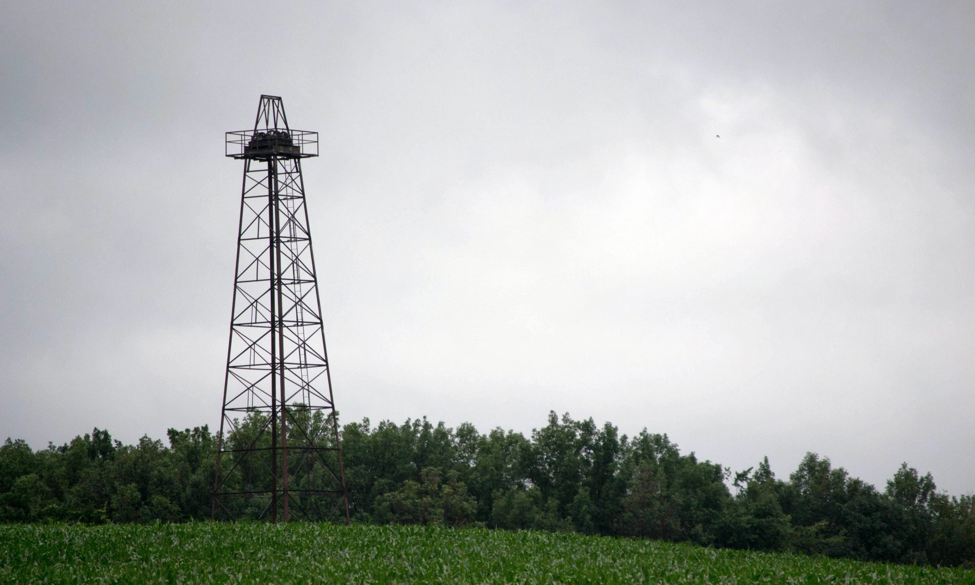
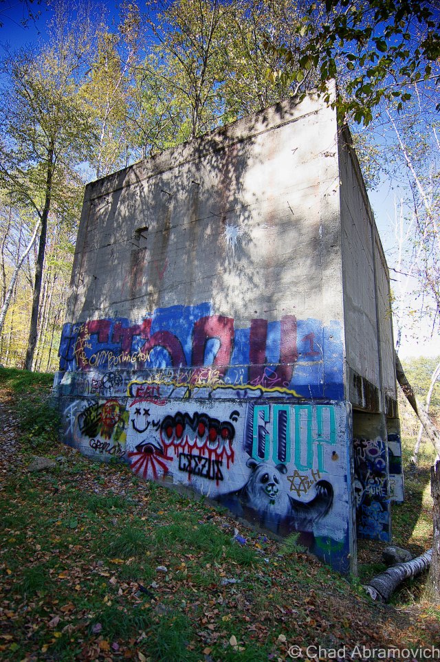
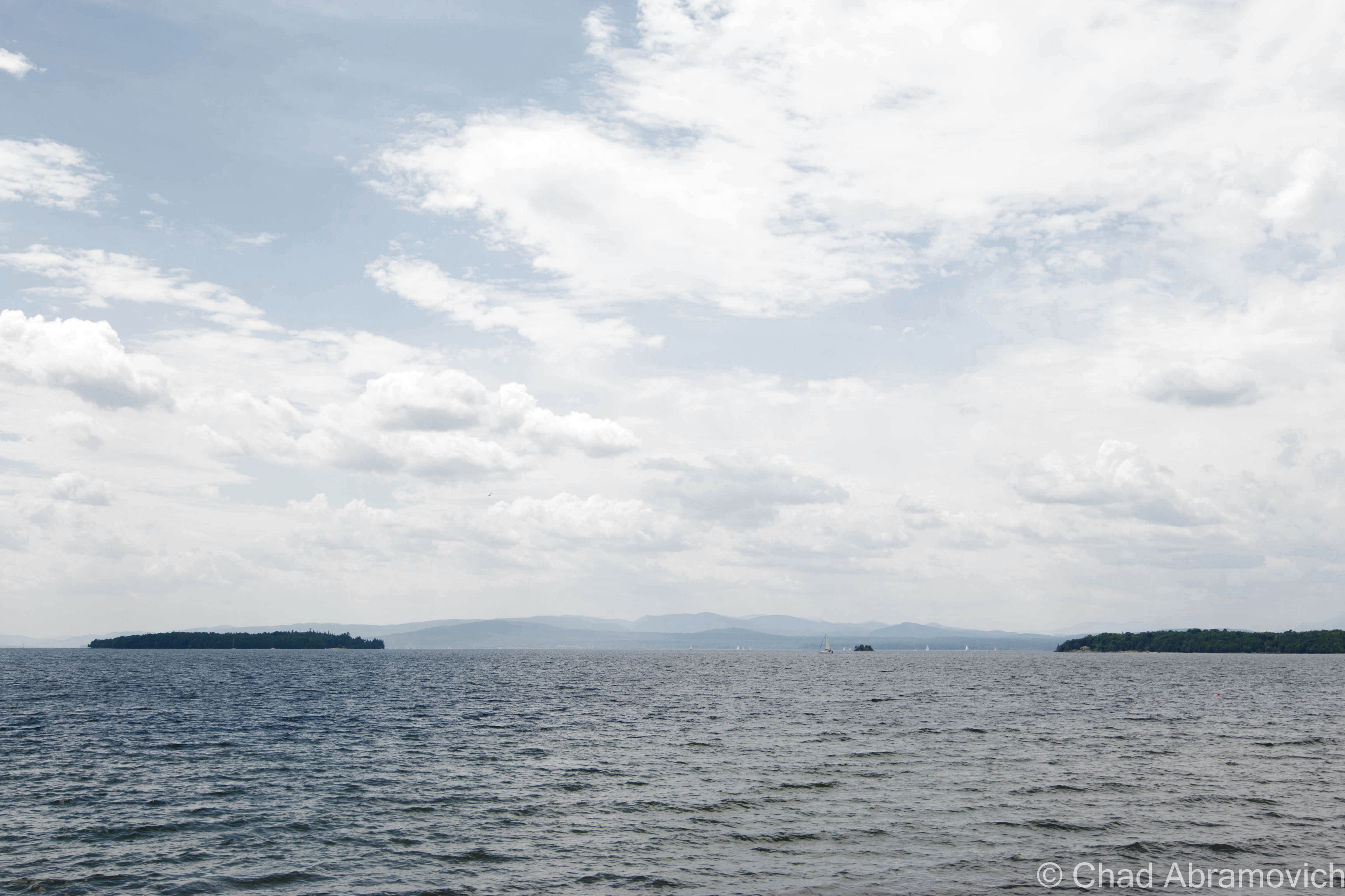
Though Vermont is the only New England state without a seacoast, we have our fair share of vast waters and attractive islands here. The Champlain Islands – an archipelago stretching from the Canadian Border, encompassing roughly 200 miles of shoreline around a trio of islands and a peninsula, is practically a different world. Accessible only by 3 bridges or a ferry from Cumberland Head, New York, the islands are isolated from the rest of the state, and as a result, are relaxed (though, 21st century stress doesn’t entirely escape) and carry a different attitude.

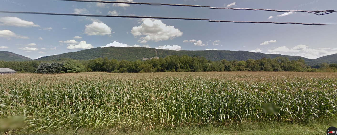
With the Adirondacks rising dramatically to the west across the lake, and the Green Mountains to the east and the south, the islands are a beautiful place. There’s not much to do, and that’s exactly what I love about this region. Route 2, the main artery, passes through 4 out of 5 towns that make up Grand Isle County, with the only stoplight being on the drawbridge that separates North Hero from Grand Isle. The economy is largely dependent on agriculture and tourism, most often combining the two in agritourism pursuits of farm stands, restaurants, and a few vineyards now days.

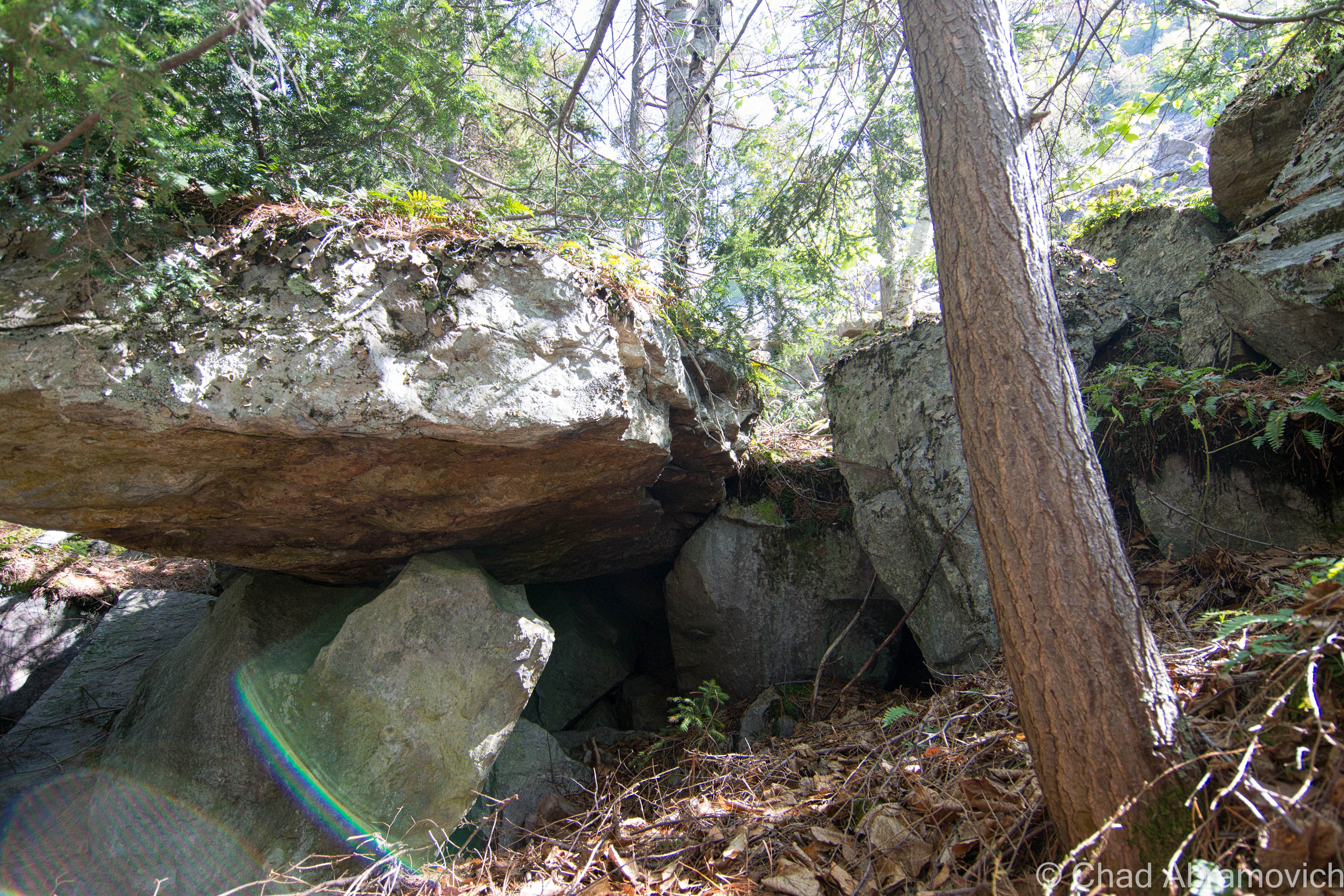
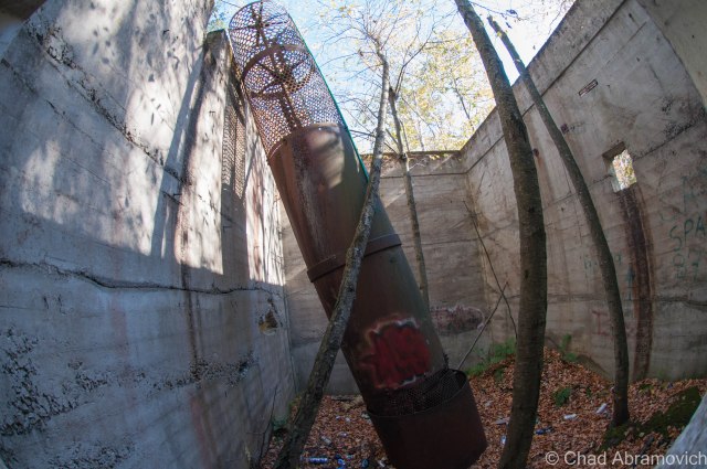
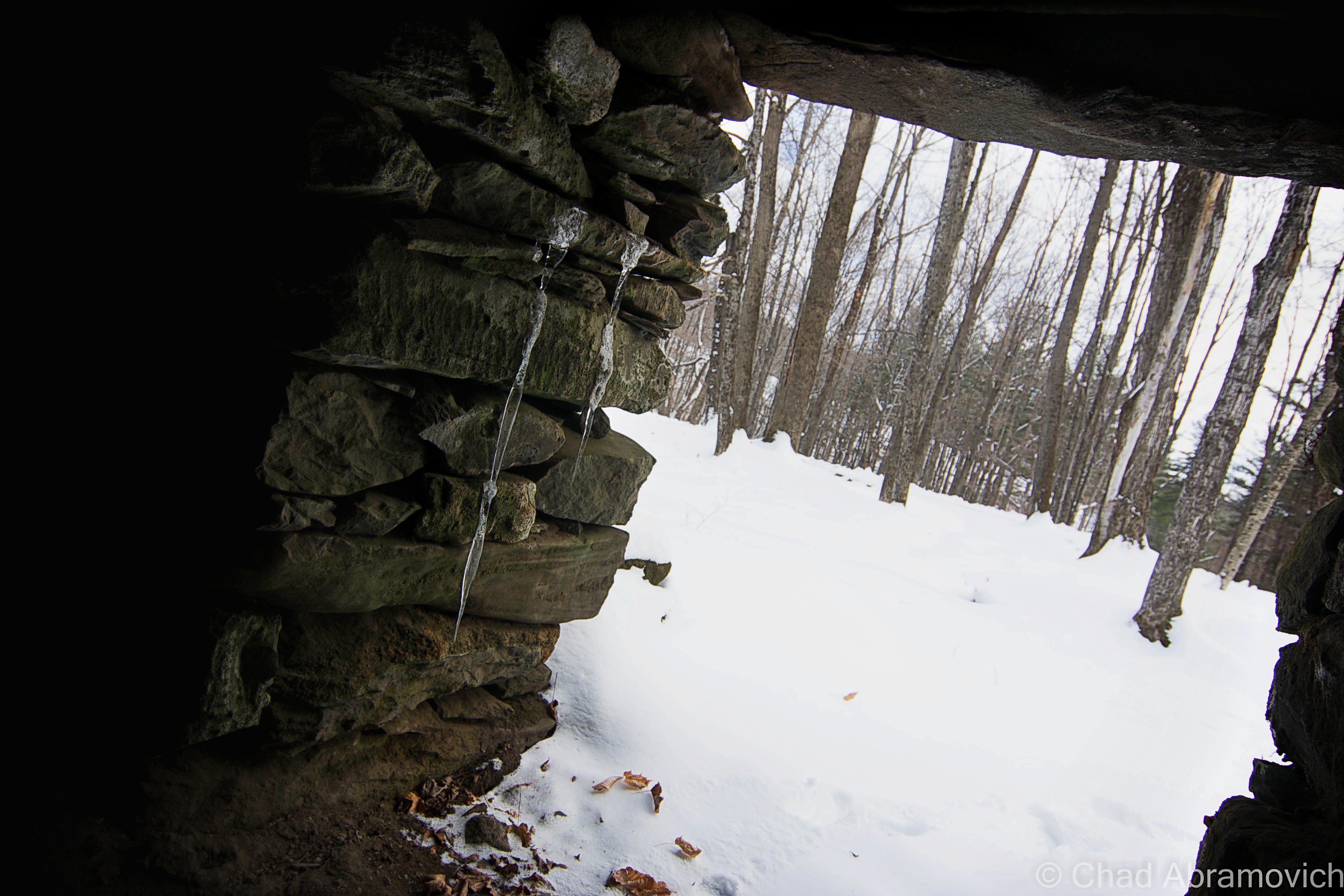
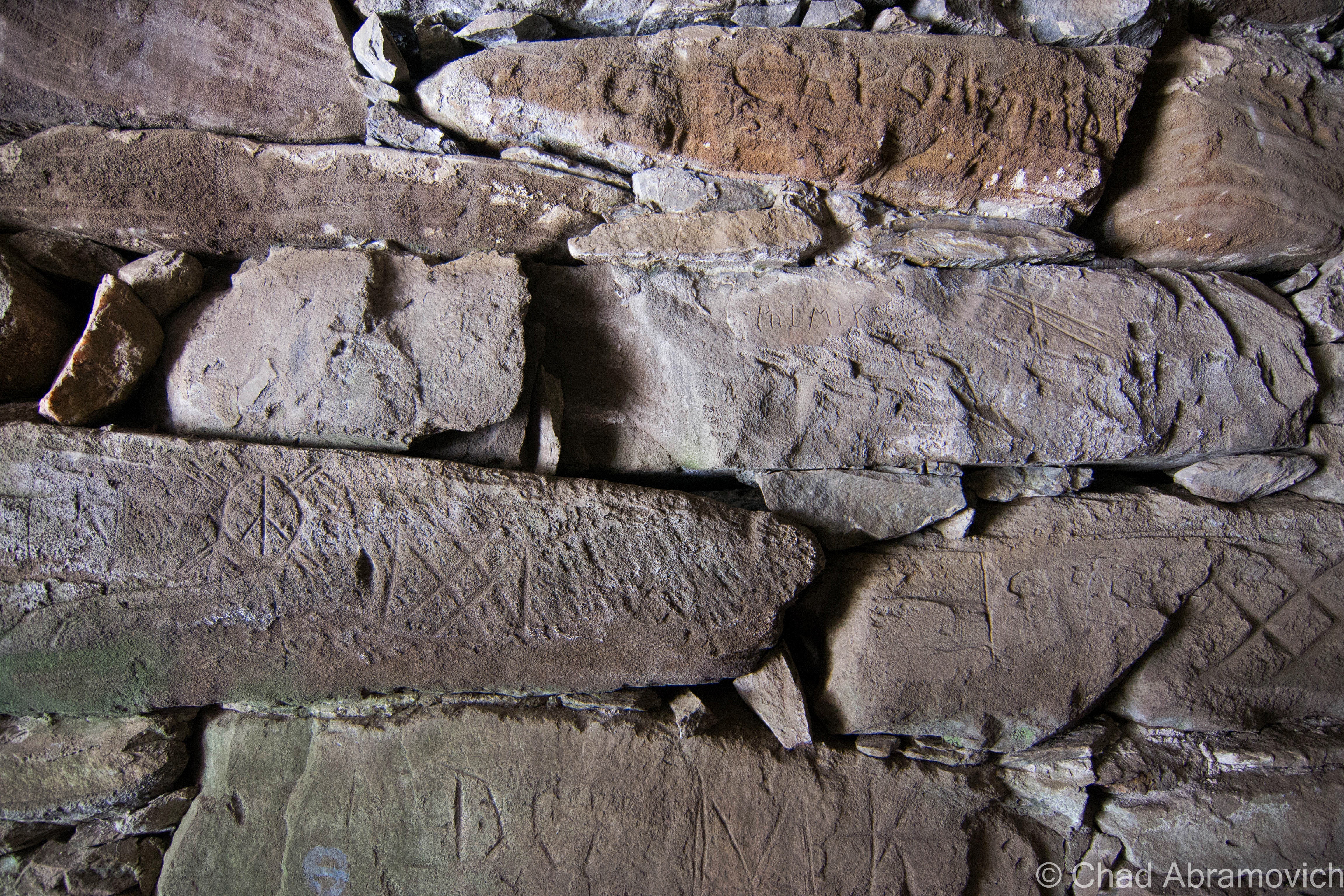
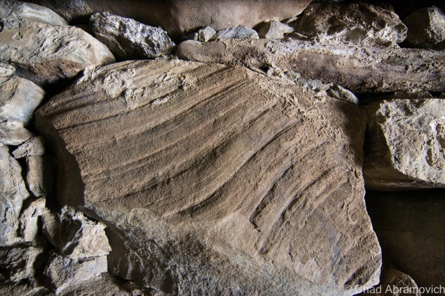
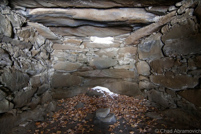
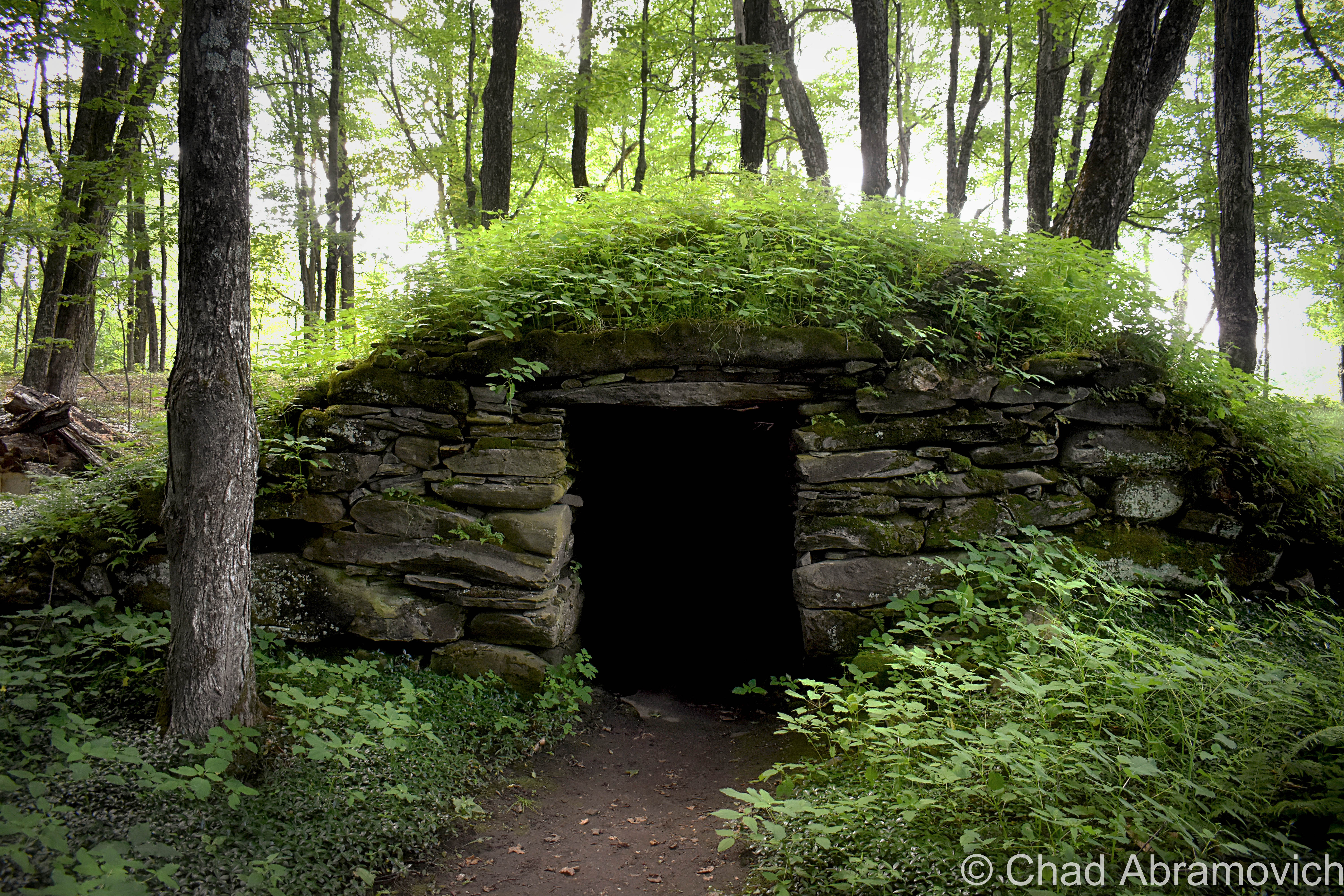
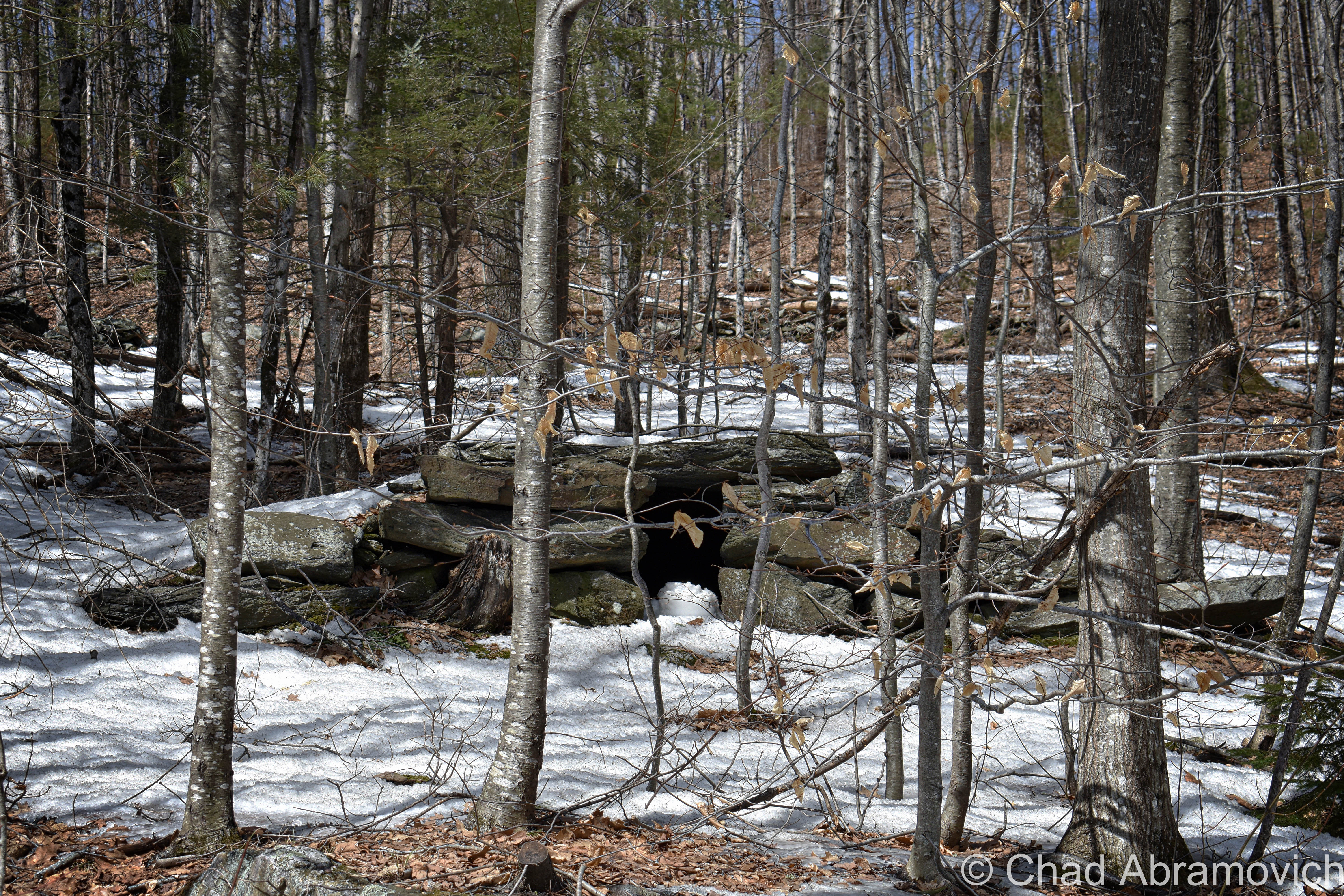
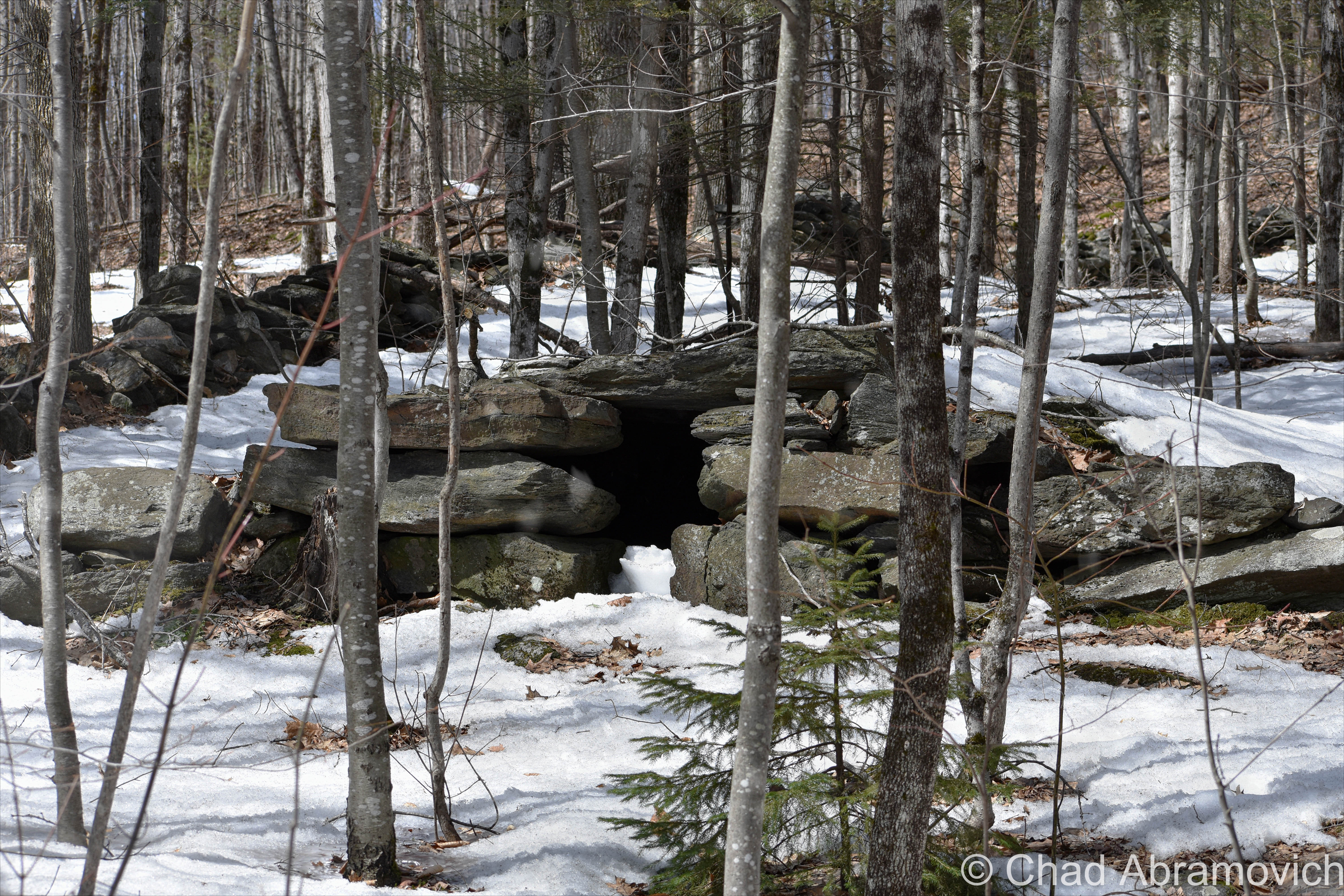
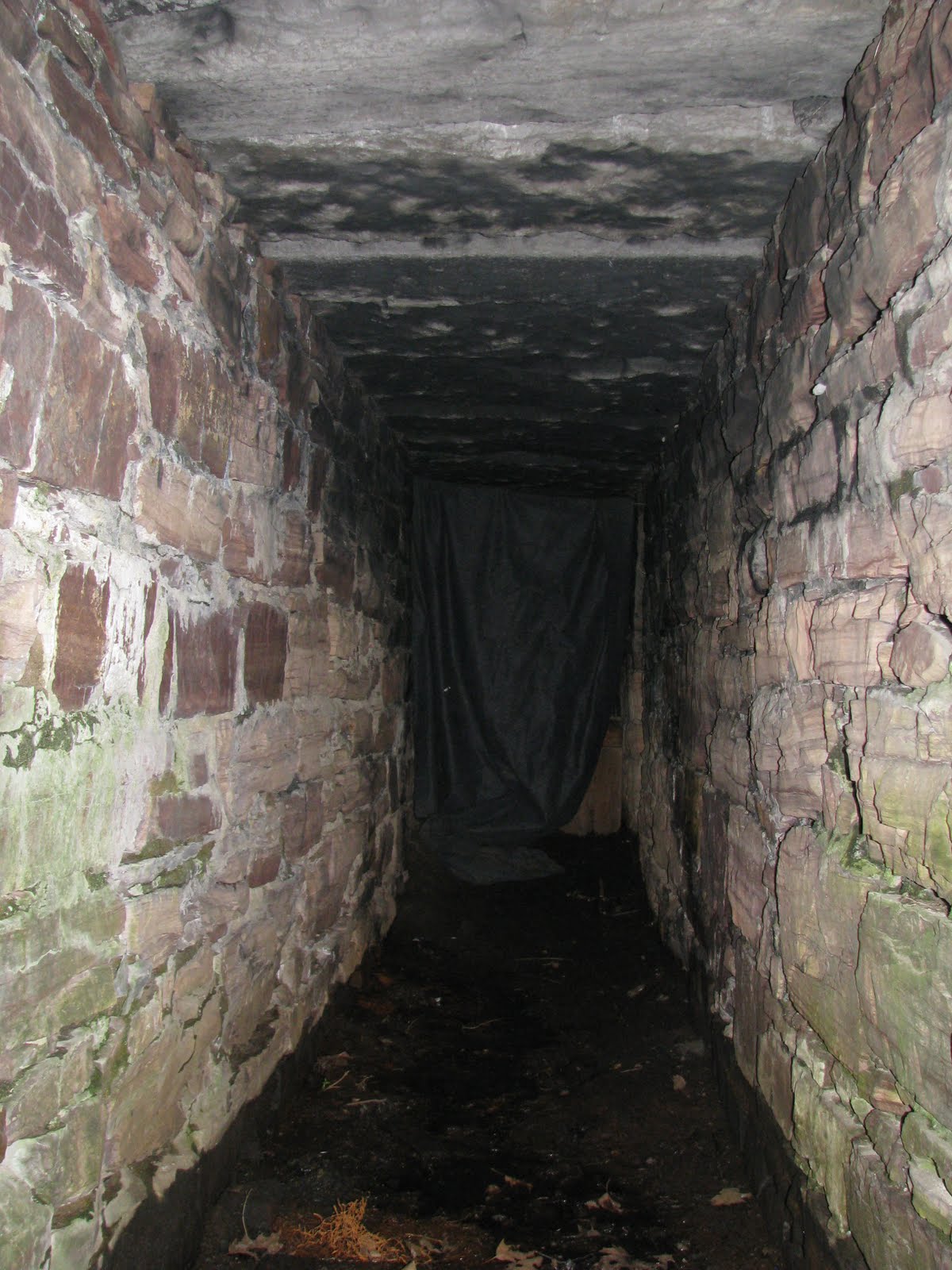
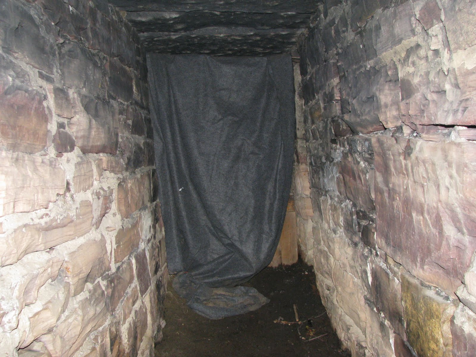
Things can coexist up here in the world around it peacefully, and sometimes, even manage to go largely undetected. And those sort of conditions are just ripe for mysteries. The numerous smaller and inaccessible islands that dot the lake are mysteries unto themselves – which are also most commonly private property. It’s easy and fun to speculate what sort of things happen on those remote chunks of rock, and what can be found there.

Carleton’s Prize

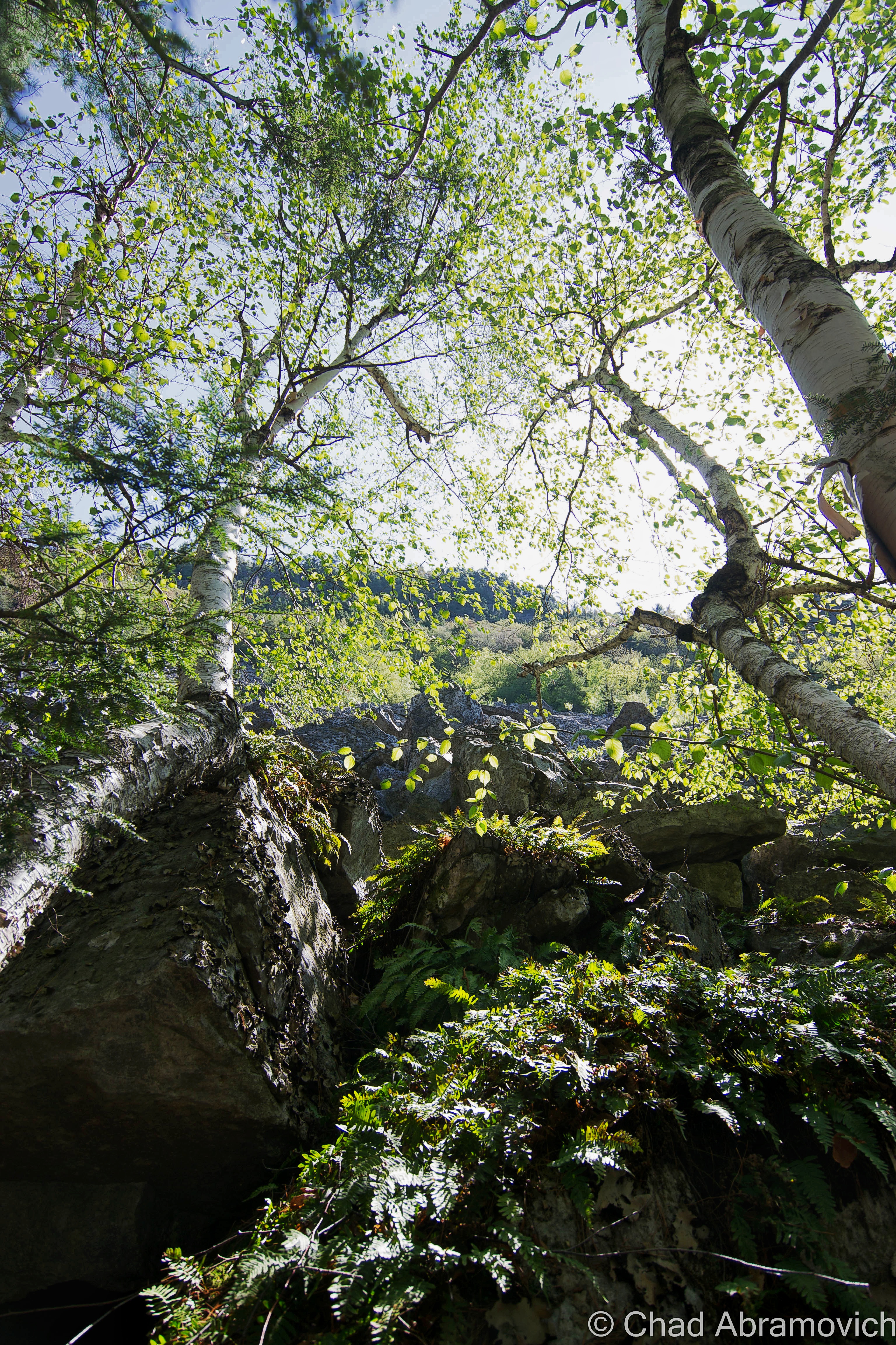
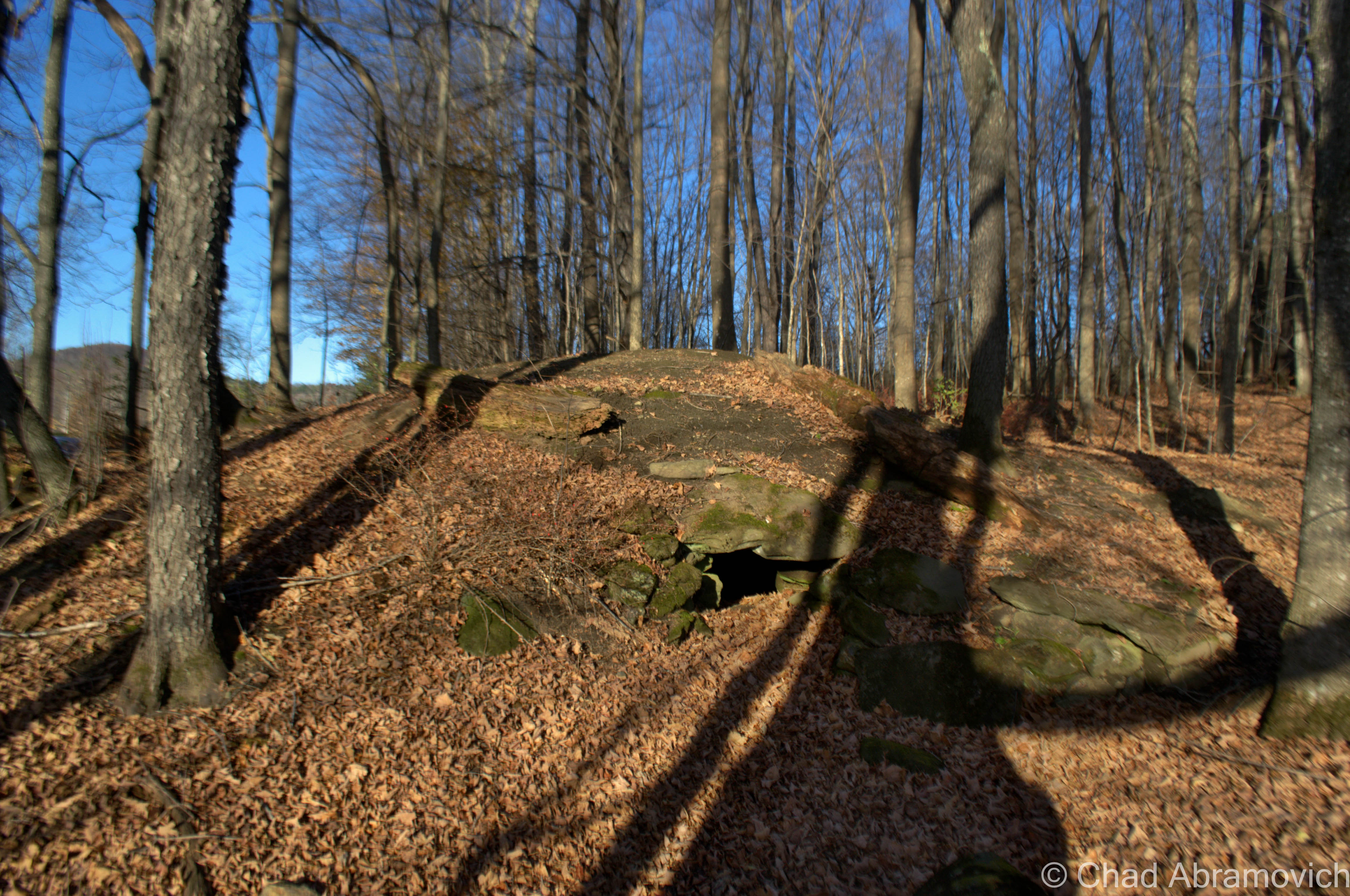
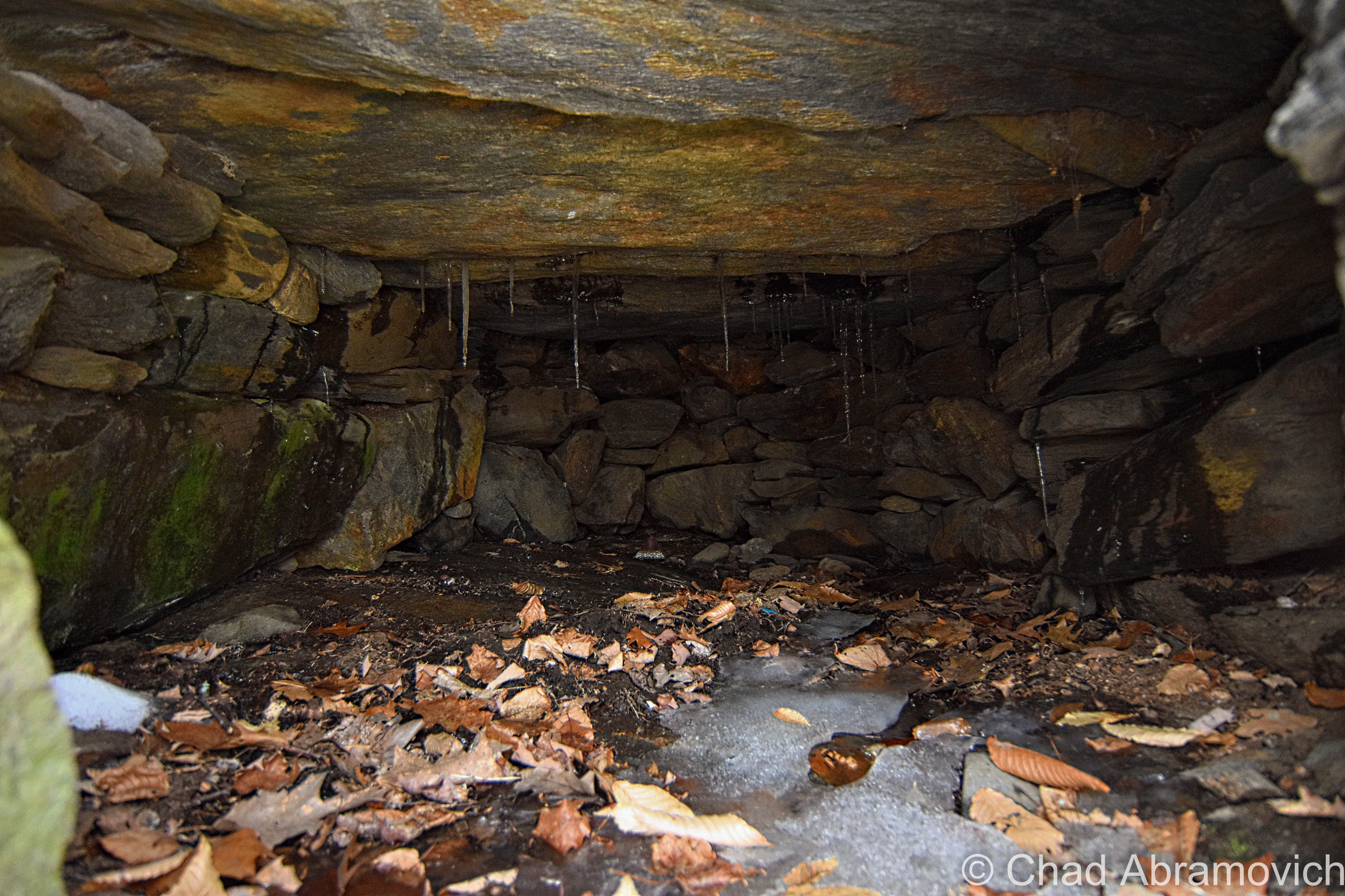
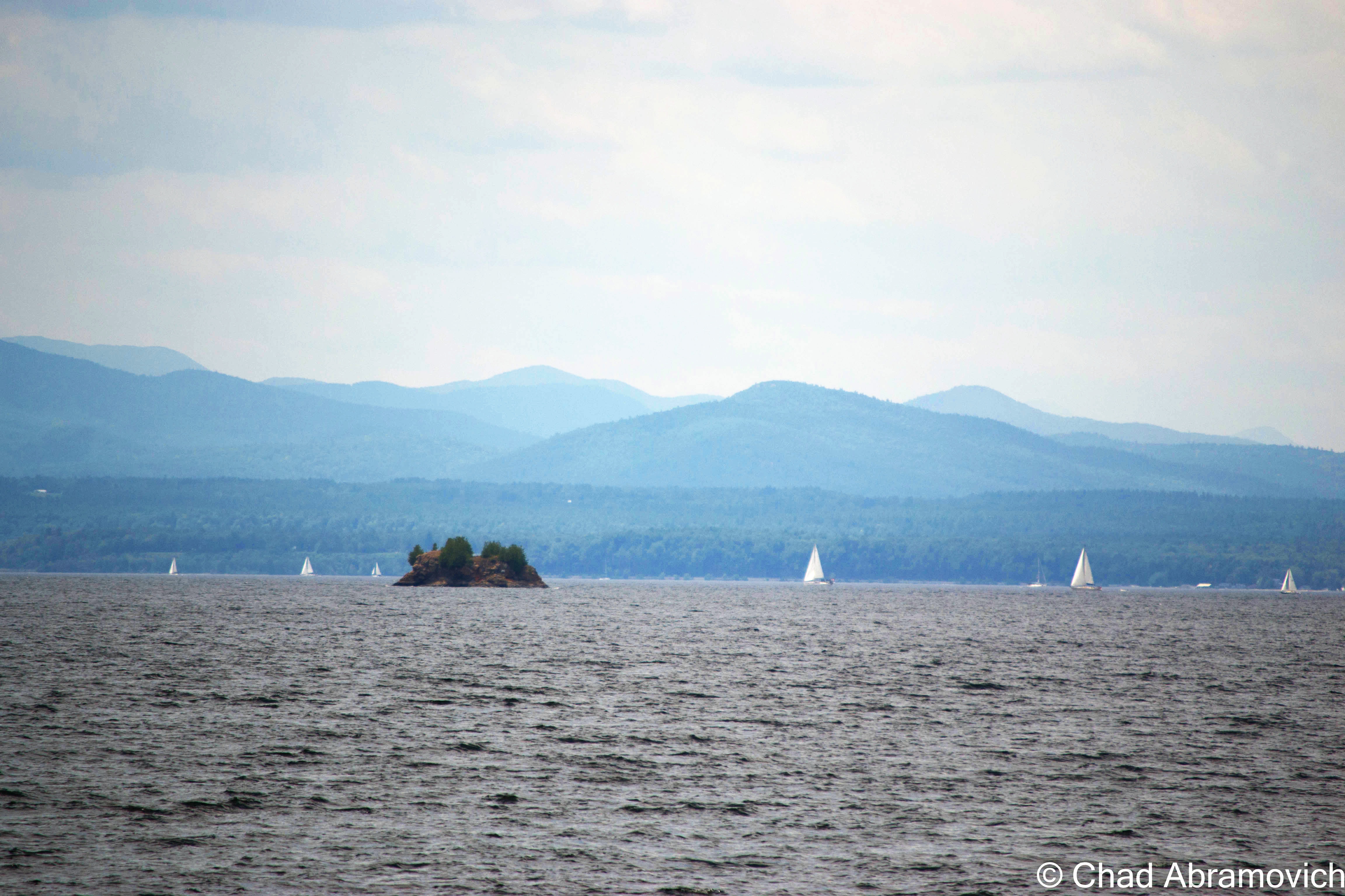
One of the most interesting stories I heard comes from off the south west coast of South Hero – a small chunk of rock rising 30 feet from the choppy waters of Lake Champlain, in a large passage between Providence and Stave Islands. One day, I was searching on Google maps, and noticed that this almost insignificantly tiny scrap of land had a rather peculiar name; Carleton’s Prize. Why would a small rock have such a strange name? What exactly is the prize here?

As it turns out, the name can be dated back to the Revolutionary War. Local lore has it that Benedict Arnold escaped around Valcour Island with what remained of his fleet during the battle of Valcour Island– and a dense fog had draped over the lake.  The trailing British fleet, lead by Sir Guy Carleton, were searching for escaping American fleets, but unknown to them, the Americans had slipped by them in the cover of night.

But up ahead, through the fog, they spotted something. A silhouette of what appeared to be a ship. This was their chance. The British bombarded it with cannon fire. However, the smoke from all the black powder obscured their vision even more, and eventually, they couldn’t see a thing. But determined to take down those no good Americans, they kept on firing. An hour later, the cannon fire finally stopped, and they realized that they had wasted several rounds of ammunition on a small rocky outcropping in the lake they had mistaken as a ship.

Since then, somehow and somewhere down the line, the small landmass has been referred to as Carleton’s Prize. Some say that you can still see the scars from cannon fire, and maybe even a cannonball or two on the island’s rocky shore to this day.

This is where the story gets a bit hard to trace. This story apparently isn’t well documented, and not much information exists to actually back this up – apart from a Wikipedia article and a blog entry – but even the blogger was questioning the truth of this interesting legend. So, did this blunder actually happen? I suppose we can only speculate. As far as I know, no one has came back with a cannonball yet.

Though the story of Carleton’s Prize is intriguing, the island’s original name is far more mystical. In the book, In Search of New England’s Native Past, author Gordon Day tells us the Abenaki knew this small rock as odzihózoiskwá, or “Odzihozo’s wife”. But who or what is Odzihozo?

Odzihozo, “the transformer”, was the supernatural being who created Lake Champlain, the mountains and all the lands that made up their homeland.

According to the legend, Odzihozo was an impatient deity, and before he was even completely formed with a head, legs and arms, he set out to change the earth. His last creation was Lake Champlain, which he considered his masterpiece – and he was incredibly happy with it. So happy in fact, that he climbed onto a rock in Burlington Bay and turned himself to stone so he could watch and be near the lake for the rest of eternity. The rock still resides in Burlington Bay, and is known to boaters as Rock Dunder – several miles away from his wife. It was said that the local Abenaki would bring offerings of tobacco to the rock as late as the 1940s.

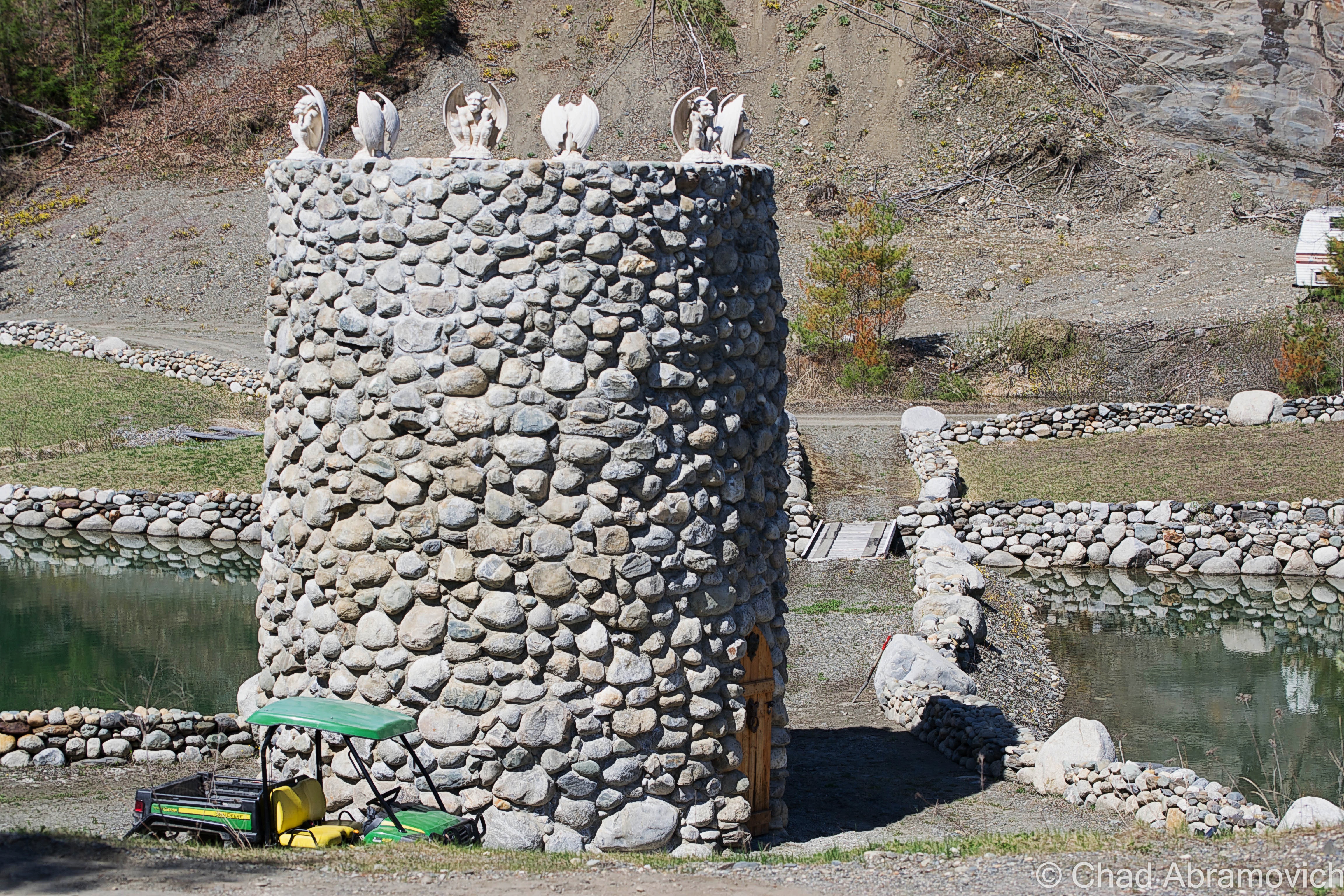
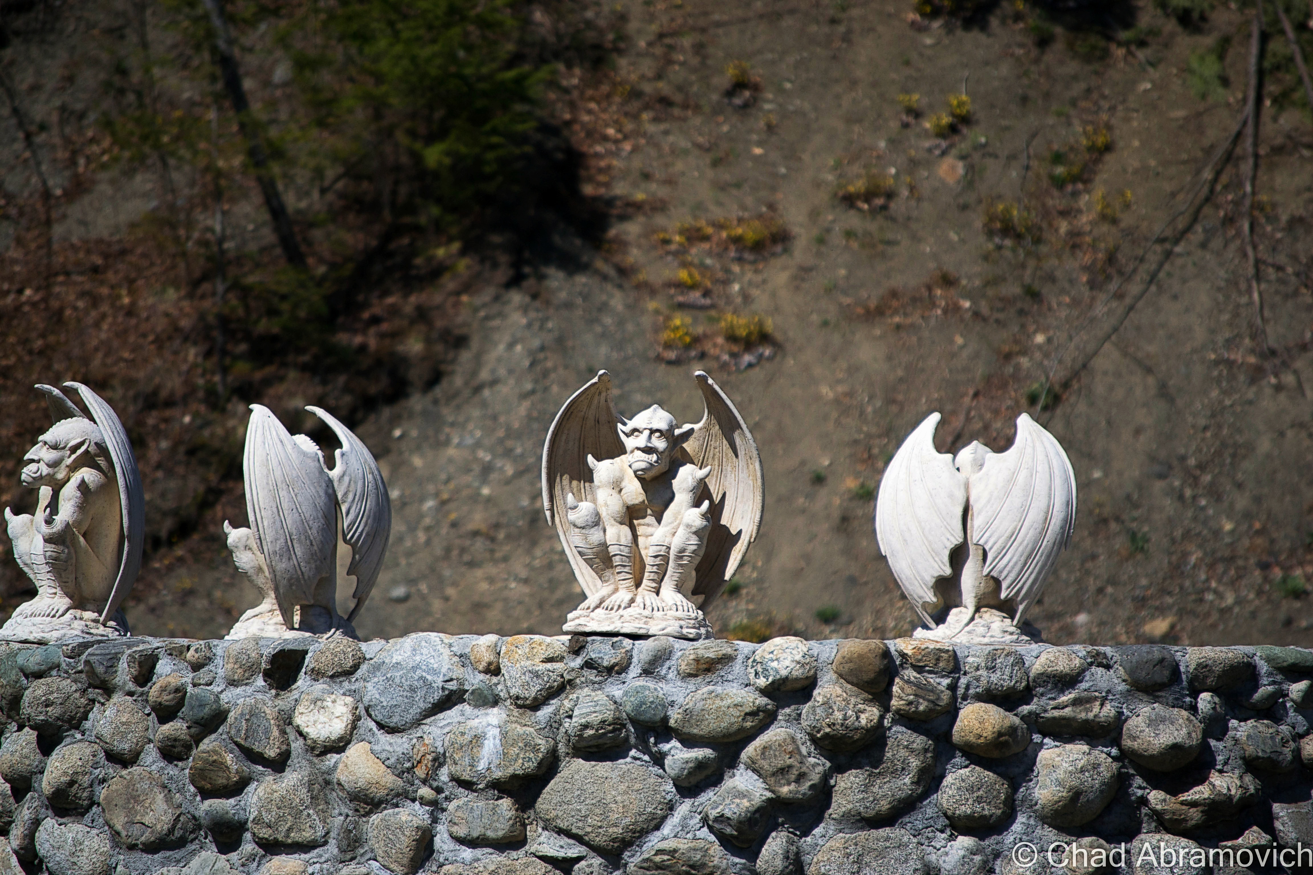
travel tip: near White’s Beach, make sure to check out the alluring bird house forest and keep an eye out for the miniature Barber castles scattered around the island.

Carleton's Prize - the small bump in between the 2 islands.
Carleton’s Prize – the small bump in between Stave Island (home to one of the few fire towers on Lake Champlain) and larger Providence Island (where one of Vermont’s only malevolent ghosts is said to haunt the bedroom of a lake house – the very room he strangled his wife to death in decades ago…)
Carleton's Prize from White's Beach in South Hero
Carleton’s Prize from White’s Beach in South Hero

Isle La Motte’s Prehistoric Treasure

Isle La Motte has such a different vibe from its other island neighbors, or from the rest of Vermont for that matter. It’s the smallest, most rural, and the most mysterious (in my humble opinion) of Vermont’s Champlain Islands.

It’s the first spot in Vermont that Europeans set actual foot on, when French explorer Samuel De Champlain docked and camped here in 1609. The island is also home to Saint Anne’s Shrine, built atop the original and short lived French settlement. A friend of mine said that a relative of his was allegedly a renown miracle worker at the shrine back in the early 1900s, but to my disappointment, the miracles he might have performed were never penned down in the family history.

Isle La Motte is also the only Grand Isle County town to not be accessible via Route 2, which imparts the island a noticeably quieter, downlevel atmosphere that makes this remarkable oddity find pretty compatible.  

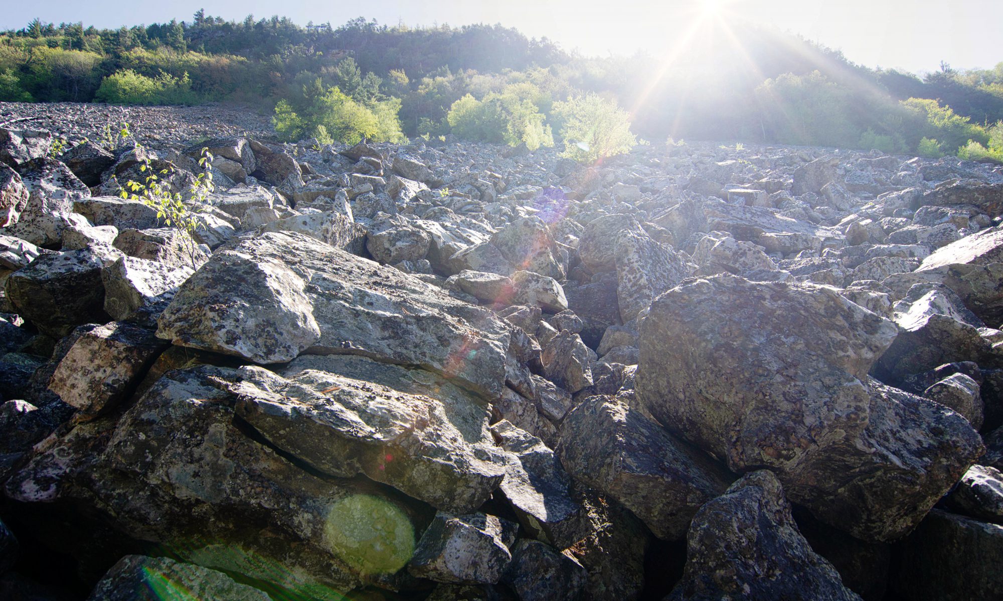
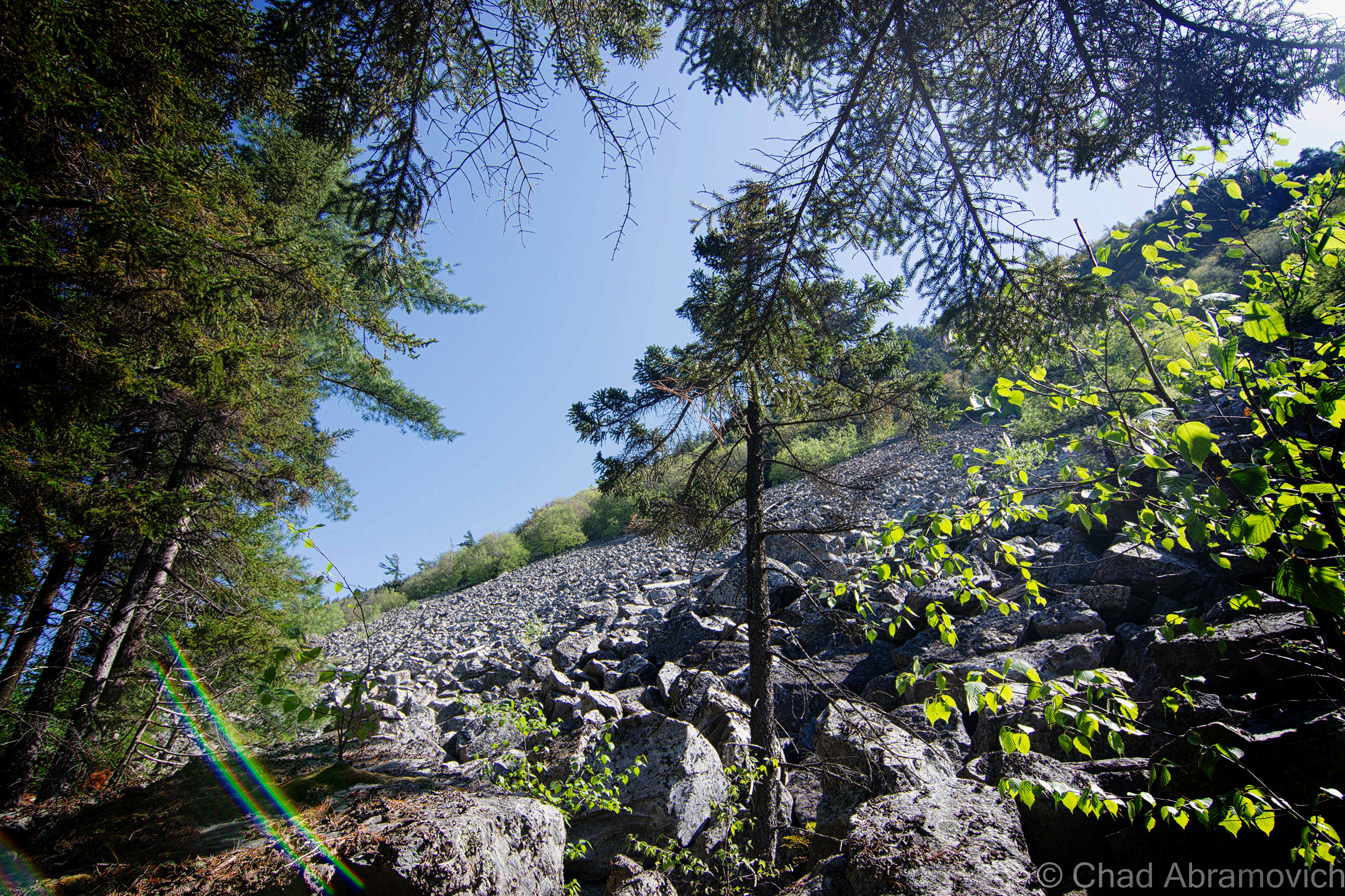
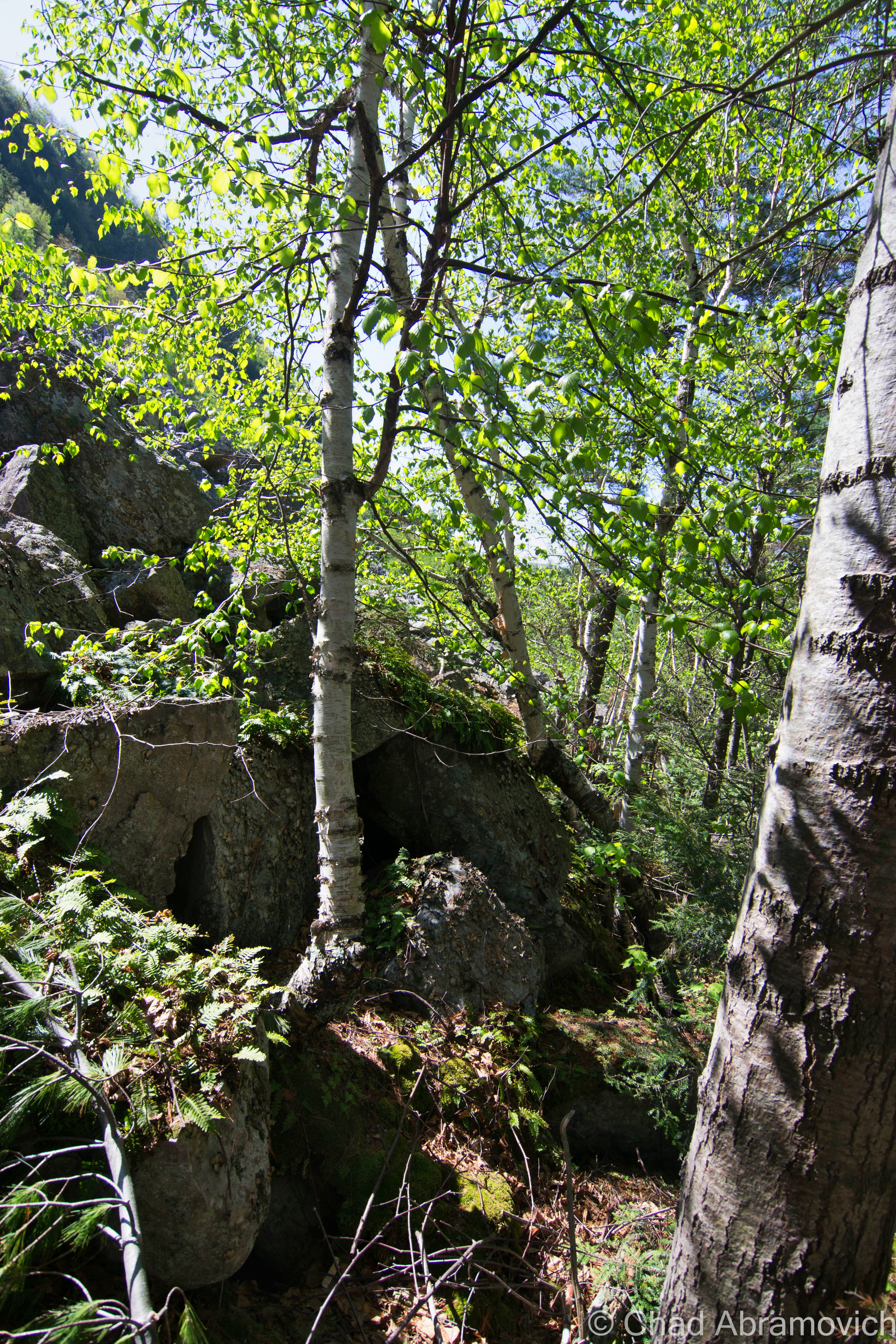
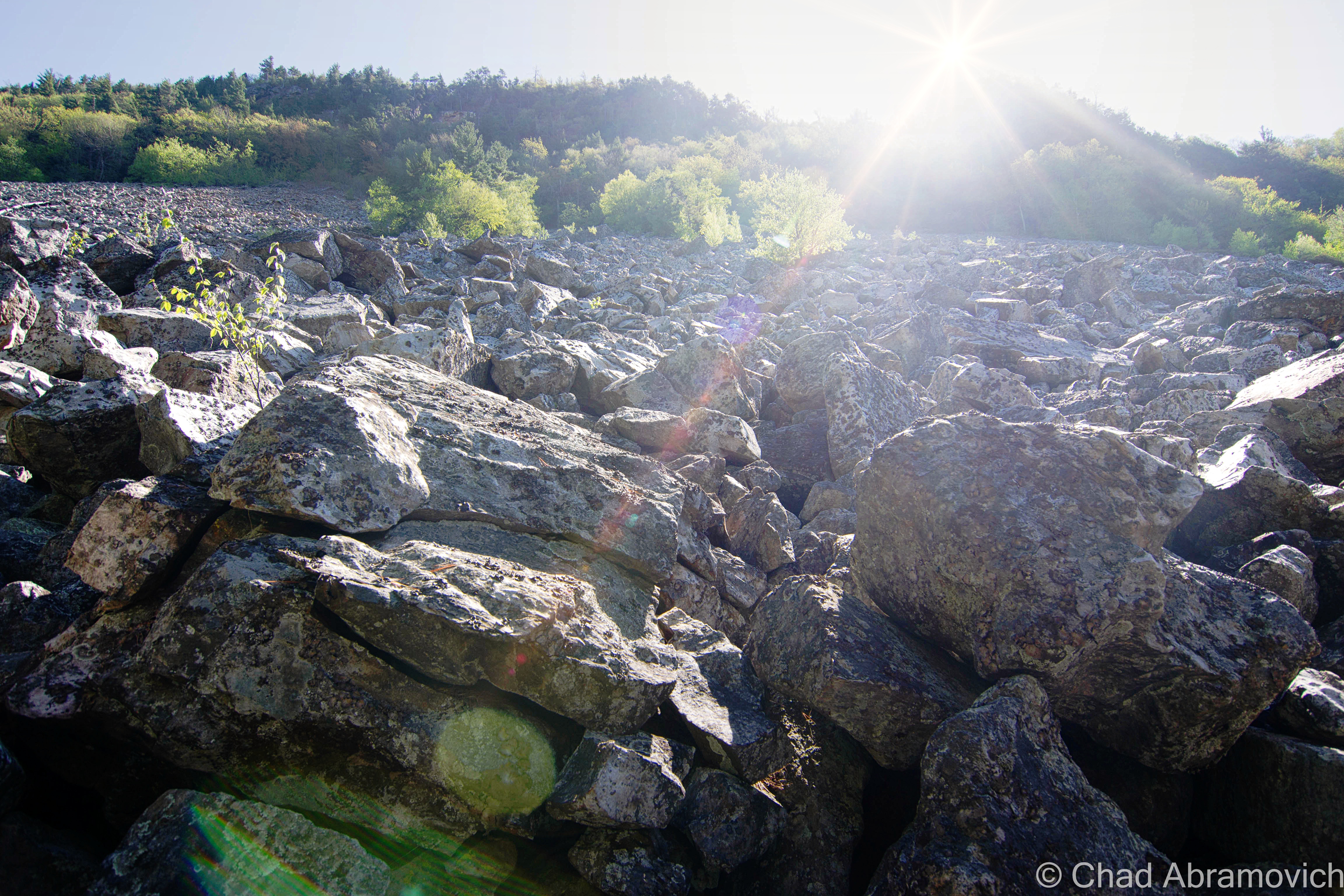
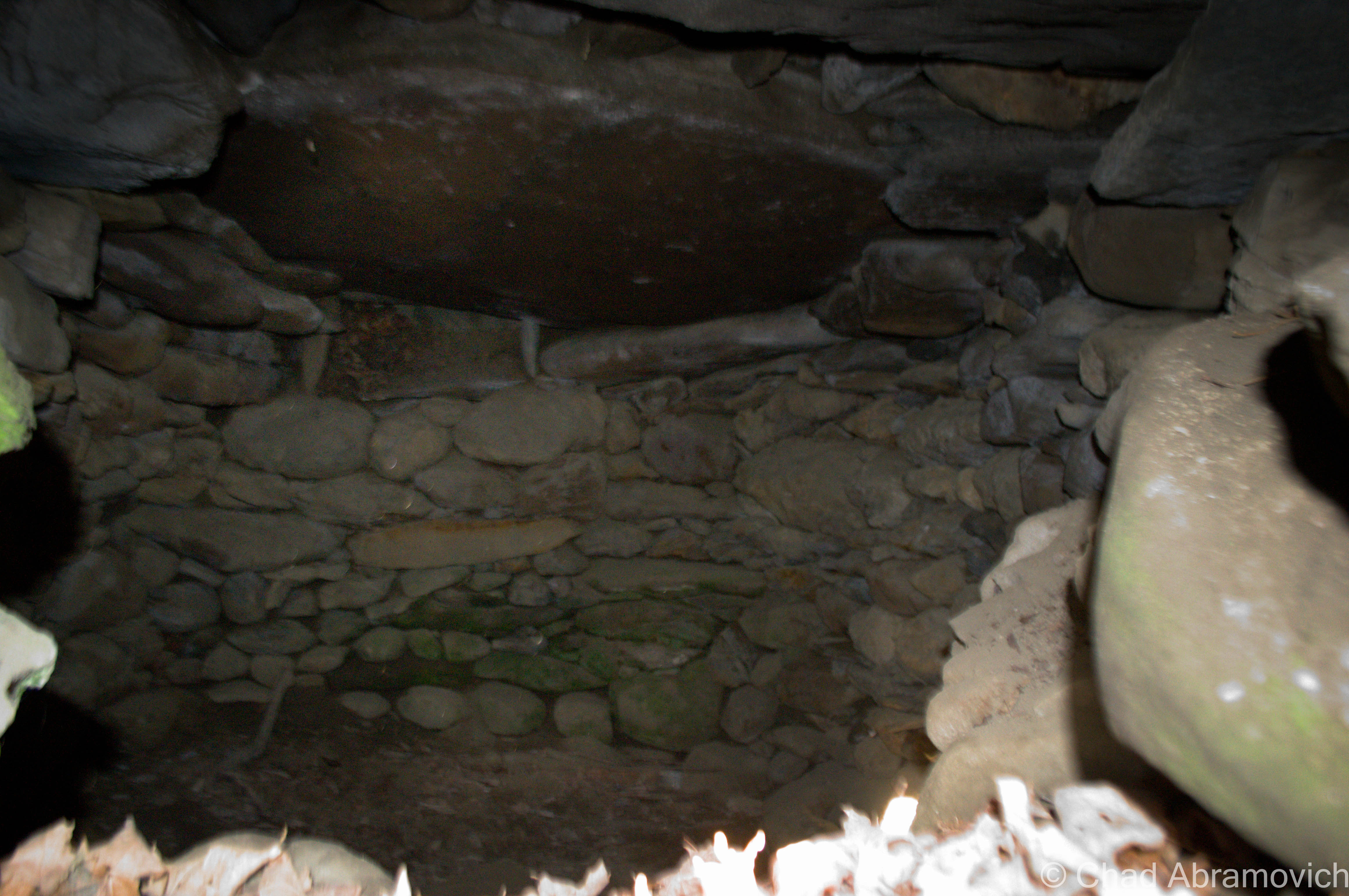
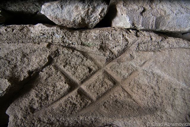
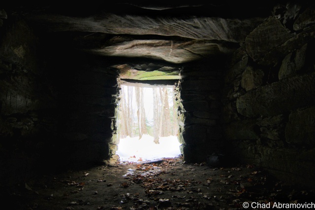
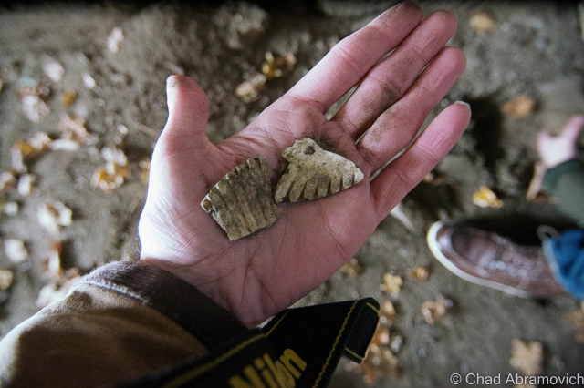
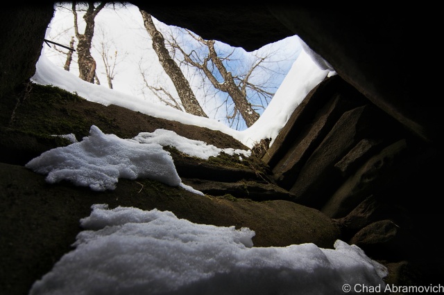
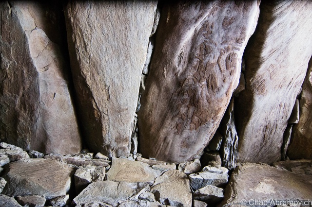
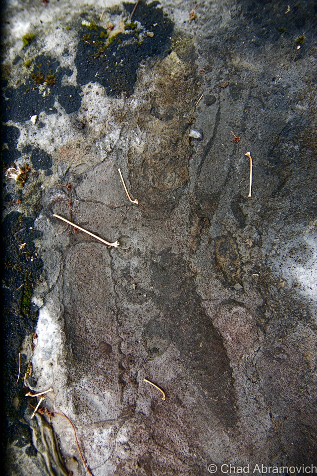
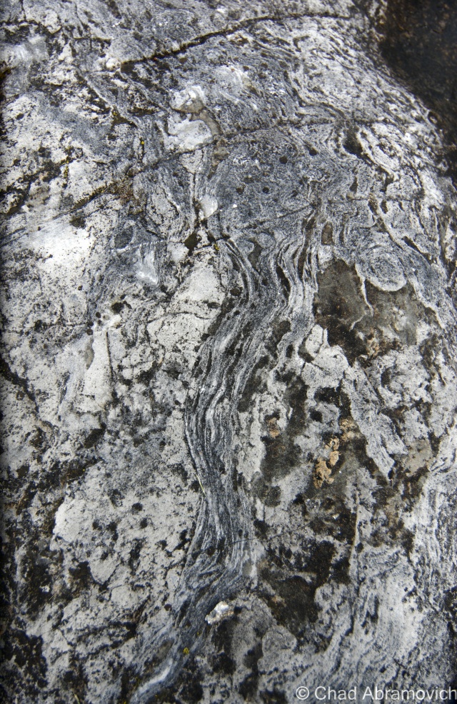
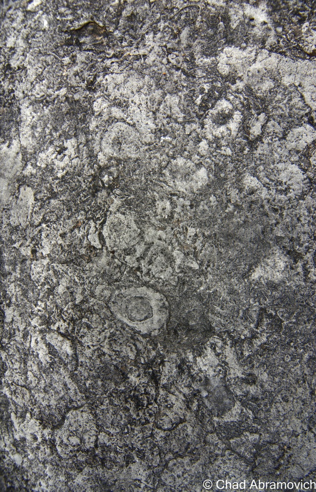
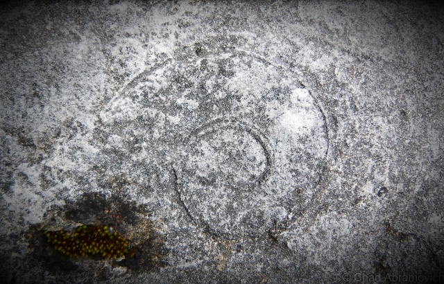
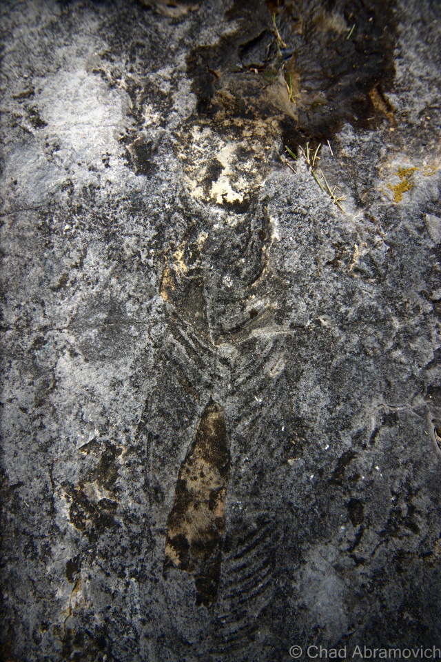
The entire southern third of the tiny island is made up of what experts consider the oldest fossilized coral reef in the world – at some 480 million years old!

This spectacular natural resource pokes through cedar woods and fields thick with wildflowers in contoured rocky outcroppings. It’s both baffling and awe-inspiring – you’d never think you’d find something like this up in the far, occasionally frozen northwestern corner of the state.

But why would a fossil reef be up in Isle La Motte?

This is a state mystery that is actually easy to solve. In the farther reaches of Vermont’s past, some 480 million years ago, the land that is now the green mountain state was under the waters of a tropical sea near where Zimbabwe is. Officially dubbed the Chazy Reef, it once stretched from an area covering Quebec to Tennessee.

But over the millennia, volcanoes, earthquakes, the pull of the tides and other natural phenomena did some terraforming and shifted the earth’s crust. Limestone eventually began to form and preserved a petrified snapshot of pre-Paleozoic life.

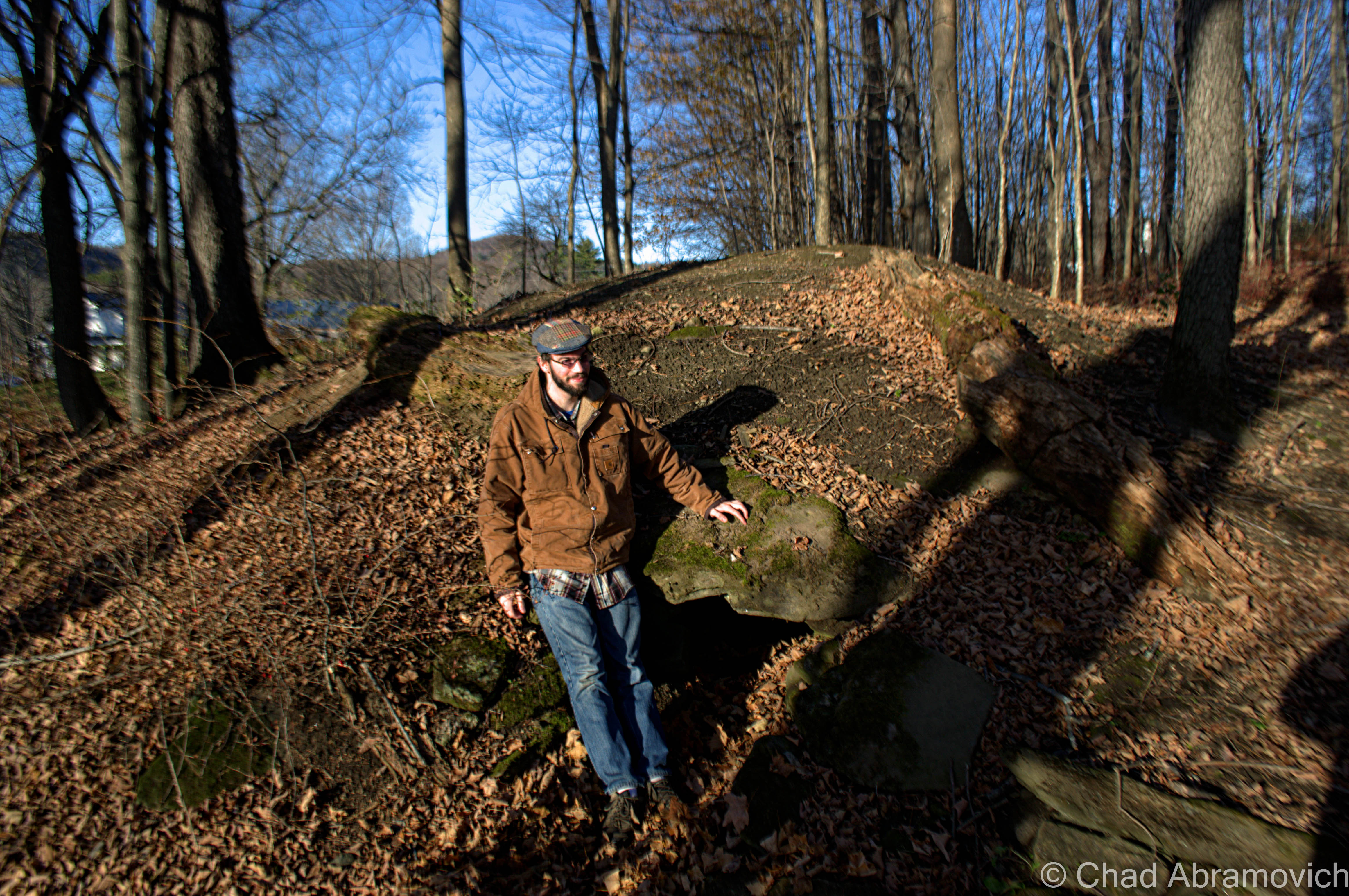
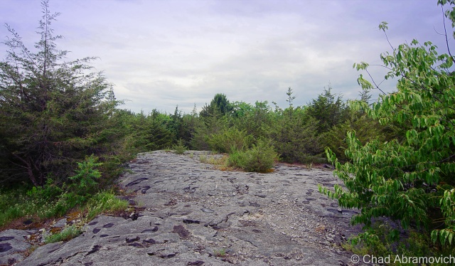
With this incredible natural wonder being in my home state, I figured I couldn’t say I was a bonafide Vermont enthusiast unless I drove up to see it for myself, and on a soft summer day, I found myself tracking down the Goodsell Ridge Preserve, where the best-preserved chunk of the reef is.

I was immediately taken by the tranquility of the place. It was a timeless vantage point, which can be said about the entire town of Isle La Motte. And yet, if there weren’t signs to hint at what you were looking at – you might not even know you were walking around such a magnificent treasure.

Scientists from all over venture to Vermont to study its coral reef – trying to connect the dots of this primitive instruction manual left by mother nature.

It’s even more intriguing to think about how many sites in the region possibly contain some of these fragile fossils in their stonework. It’s said that their organic shapes can be spotted in the ruins of Fort Blunder, and someone else wrote to me declaring they think they spotted some in a railroad stone block retaining wall on the Burlington waterfront.

Perhaps the real mystery is why the best-preserved piece of the reef is in Isle La Motte. That still remains to be explained.

DSC_0061_pe DSC_0069_pe DSC_0075_pe DSC_0081_pe DSC_0088_pe DSC_0097_pe

A Pink Lighthouse

To some, the idea of a traditional lighthouse seems out of place in tiny landlocked Vermont. But Lake Champlain’s 587 miles of shoreline is home to 12 lighthouses, 6 of them belonging to The Green Mountain State.

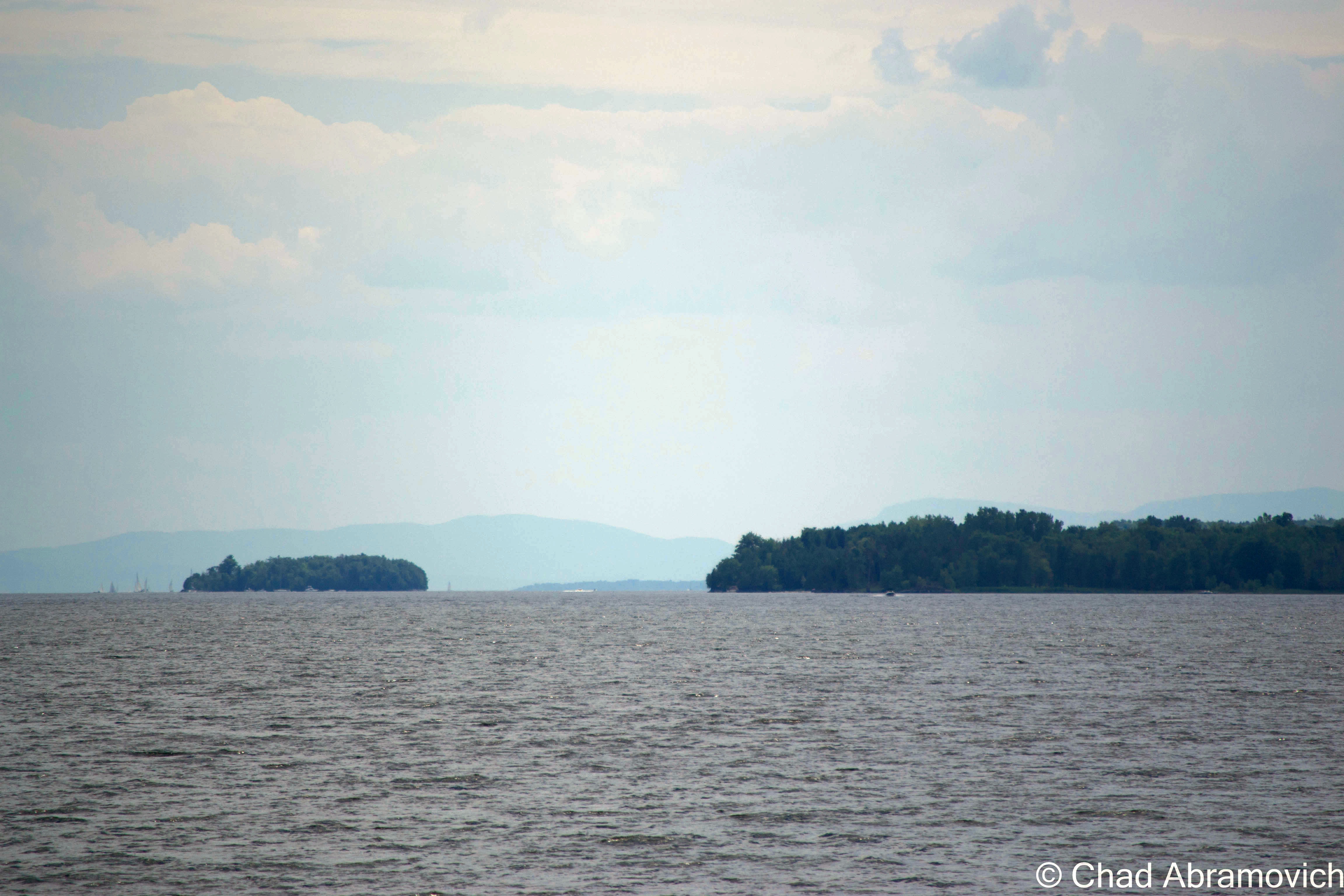
At a total of 120 miles long and 12 miles across at its widest point, Lake Champlain is the 6th largest freshwater lake in the United States – and even had a short distinction as being the 6th great lake, before complaints from the other 5 revoked the title, but we think it’s still pretty great.

Often dubbed as “New England’s West Coast”,  the lake was a vital part of the settlement of the region and has been inseparable from local history.  In 1819, the Champlain Canal was completed, connecting the lake to the Hudson River and eventually New York City. This would change the culture of the lake as it was propelled into a transportation route for trade and tourism. Burlington became the largest port on Lake Champlain, and the third largest lumber port in North America. With this much travel on the lake, lighthouses were needed to make sure travel could be made safely from one end to the other. And with a series of dangerous reefs and no less than 70 islands scattered throughout the lake, these lighthouses played important parts to keeping the lake running efficiently.

In 1819, the Champlain Canal was completed, connecting the lake to the Hudson River and eventually New York City. This would change the culture of the lake as it was propelled into a transportation route for trade and tourism. Burlington became the largest port on Lake Champlain, and the third largest lumber port in North America. The waterfront was transformed into a bustling and chaotic shoreline of mills, factories and no shortage of cargo ships and passenger steam liners. With this much travel on the lake, lighthouses were needed to make sure travel could be made safely from one end to the other. And with a series of dangerous reefs and no less than 70 islands scattered throughout the lake, these lighthouses played important parts to keeping the lake running efficiently.

Today, the lake is a different place then it was 200 years ago. Heavy ship travel have been replaced by personal recreation boats and a few ferries carrying people across the lake. Interstates 87 and 89 run along both sides of the lake, and have became the main routes of travel between Canada and the United States, leaving the lighthouses unnecessary. Now, these vestiges of the past have slowly been forgotten as the lake tides carry their memories into the mists. However, they are still surviving, finding new lives as private estates or cultural showpieces. Some are landmarks, and others have made large efforts to camouflage them from public knowledge, an irony to their original purpose.

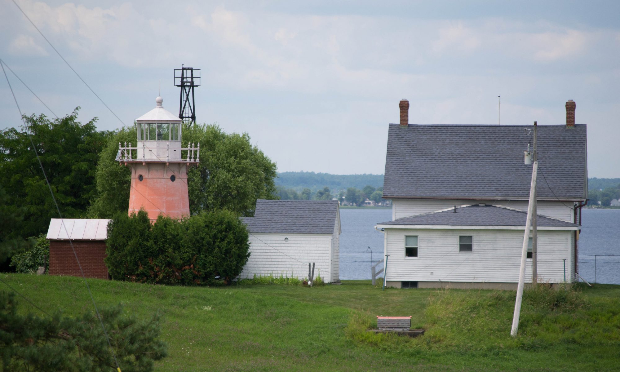
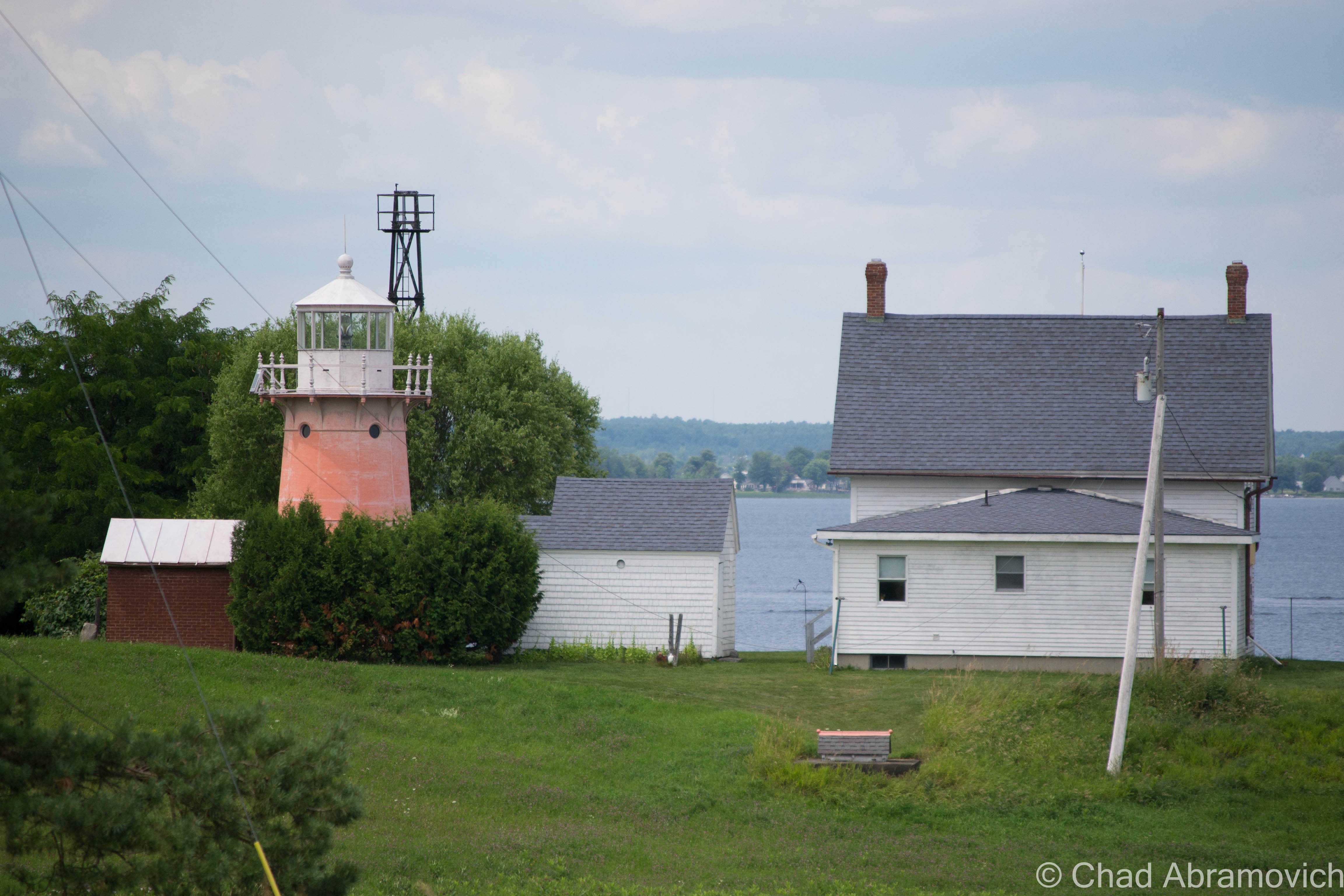
The lighthouses of the lake have always been a curious subject for me. I’ve spent summers traveling around the shorelines and seeing countless summer camps, McMansions and beaches, but a lighthouse is a rare, almost unseemly. But as it just so happens, one of the 6 lights in Vermont rests on Isle La Motte, and unlike most, you can sort of catch a glimpse of it.

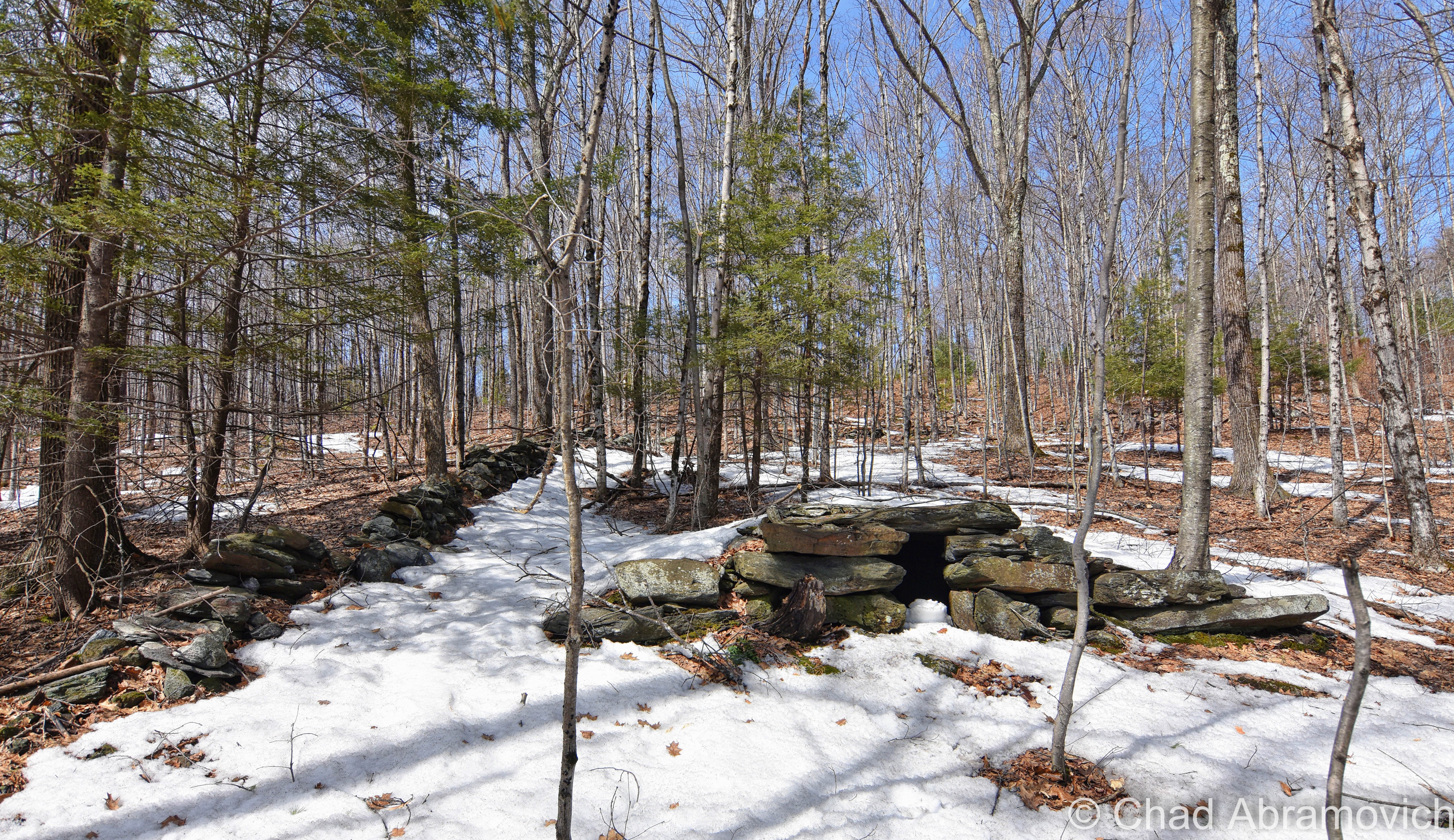
The realization of the need for a light on Isle La Motte started humbly in 1829 with some good old-fashioned Yankee ingenuity; by hanging a lantern light on a tree branch on the Northwestern tip of the island, to help mariners navigate their way around the island and through the channel.

In 1856, the U.S. government purchased the land around the point for $50. The first attempt at a real structure was made in the form of a pyramid-shaped limestone tower that would hold the lantern.  However, the lantern would always blow out on stormy nights, and eventually, the need of an actual lighthouse became evident, and in 1881, the first permanent lighthouse was finally constructed on Isle La Motte.

A twenty-five-foot tower made of curved cast-iron plates was constructed. Originally painted bright red, the tower features many attentions to detail, such as an Italianate cast railing, arched windows, and molded cornices. Over time, it has faded to a light pink.

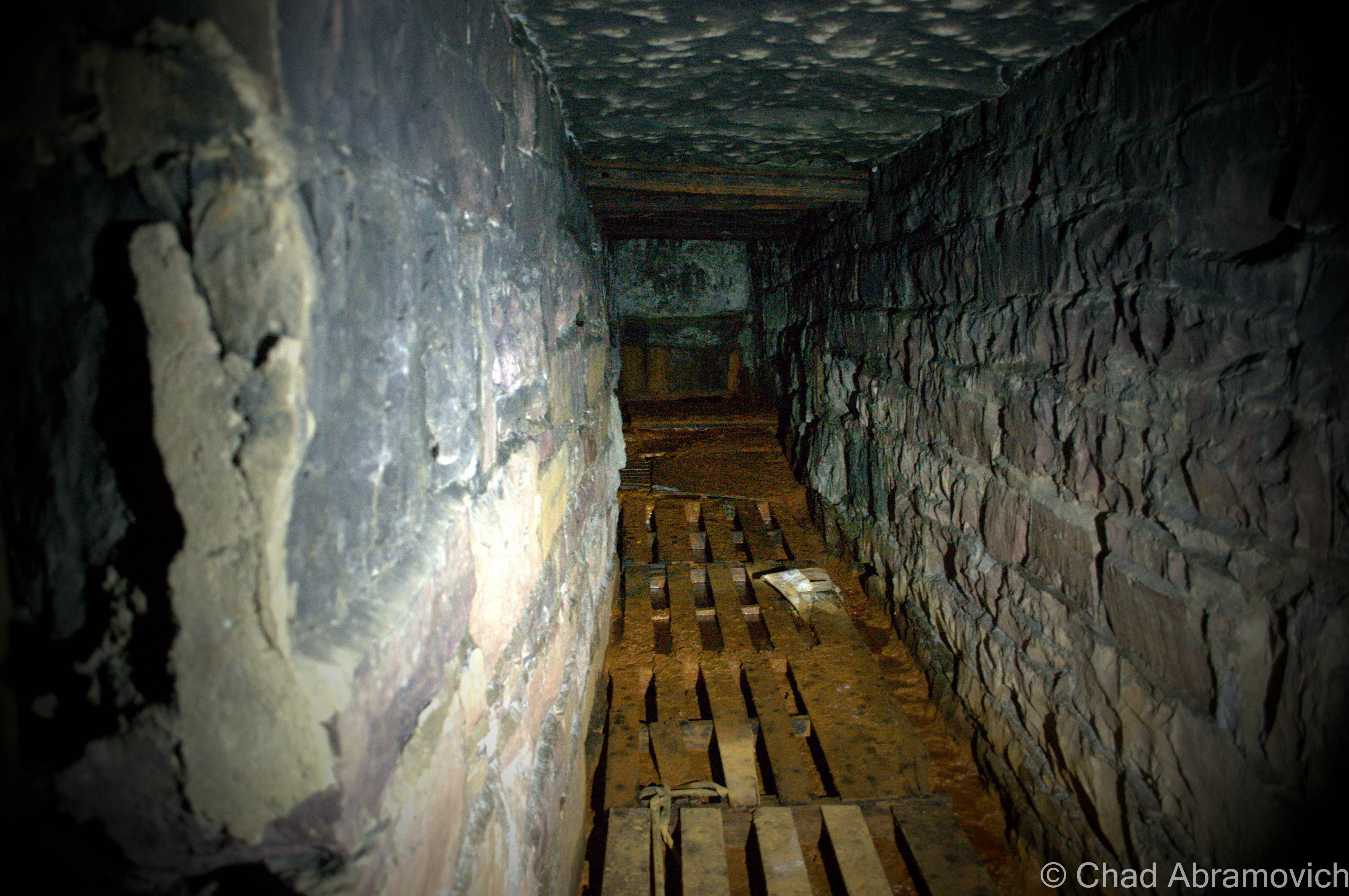
During the 1930s, in a cost-saving measure, lighthouses began to be replaced with automated steel skeletal towers. The Isle La Motte light was replaced in 1933. But in 2001, the Coast Guard determined it would be cheaper to bring back the original lighthouse rather than replace the deteriorating steel tower and on October 5, 2002, the lighthouse was once again functional.

A reminder from the locals that they would prefer you not drive down aptly named Light House Point Road - it's a private road.
A reminder from the locals that they would prefer you not drive down aptly named Light House Point Road – it’s a private road, and the lighthouse is private property.
Isle La Motte's Lighthouse, as seen from North Point Road - the best place to get a good view of it, unless you have a boat or a kayak.
Isle La Motte’s Lighthouse, as seen from North Point Road – the best place to get a good view of it, unless you have a boat or a kayak.

DSC_0590

Cloak Island

Off of Isle La Motte’s south-east coast is a small island with a weird name; Cloak Island. Why would you name an island, Cloak Island? In Tara Liloia’s book Champlain Islands, the name behind the interesting moniker is revealed.

According to a re-printed 1857 era map of Lake Champlain and the islands, the tiny island was originally known as Hill’s Island, or Hill Island, most likely named after the owners, as most Lake Champlain islands are. So what’s with the name change?

As the story goes, a domestic quarrel in the 1770s boiled over, when Eleanor Fisk got sick of her husband’s angry tempers. She hitched up her team of horses and set out across the frozen lake towards Alburgh, but never made it. Later, her red cloak was found along the bushes and rocks of the island, which would forever be known as Cloak.

But there is another variation of the story. After Eleanor Fisk went missing, concerned townsfolk suspected she had drowned but needed proof. So, they gathered down near the lake and dropped her red cloak into the water. An old Yankee superstition dictated that to find the body of a drowned victim, all you had to do was drop a cloak belonging to the missing woman in the water and it will come to rest above the body. The cloak eventually found its way over to the island and got tangled on the beach, thus giving Isle La Motte’s tiny neighbor its name.

Noisy Beach

But perhaps my favorite abnormality is a tale of a beach, ‘somewhere’ on Lake Champlain, that is said to be made of sand with a remarkable idiosyncrasy. It’s said that if you fill up 2 bags with sand and clap them together, it makes ‘dog noises’. Not surprisingly, I haven’t been able to track down this marvelous beach or find anything further about this strange anecdote.

Cloak Island
Cloak Island

—————————————————————————————————————————————–

To all of my fans and supporters, I am truly grateful and humbled by all of the support and donations through out the years that have kept Obscure Vermont up and running.

As you all know I spend countless hours researching, writing, and traveling to produce and sustain this blog. Obscure Vermont is funded entirely on generous donations that you the wonderful viewers and supporters have made. Expenses range from internet fees to host the blog, to investing in research materials, to traveling expenses. Also, donations help keep me current with my photography gear, computer, and computer software so that I can deliver the best quality possible.

If you value, appreciate, and enjoy reading about my adventures please consider making a donation to my new Gofundme account or Paypal. Any donation would not only be greatly appreciated and help keep this blog going, it would also keep me doing what I love. Thank you!

Gofundme: https://www.gofundme.com/b5jp97d4

Donate Button with Credit Cards

Black Gold in the Green Mountain State

On a recent cruise along the back roads of St. Albans town, I came across something peculiar among the sprawling pastures and humble farmhouses. Heading down the dips and rises of Lower Newton Street, the strange object could be seen a long distance away from it’s location, towering above the forests and silos of farm country, and it stuck out. Pulling over to get a better look at this curiosity, my first thought was, “it looks like an oil derrick “. But I stopped. The idea of an oil derrick in Vermont seemed out of place, especially today. So, was this rusting tower, slightly leaning over an entanglement of field grass, in fact an oil well? When I arrived home, coffee mug sitting nearby, I took to the internet, and found what seems to be a lost, yet briefly fascinating era of Vermont history.

Vermont has a rich history of treasure seeking it seems. From the annoyingly mysterious Captain Mallett supposedly burying his gold chest near Coats Island on Malletts Bay, Spanish prospectors finding silver deep within our granite mountains, or the suspected Celtic copper seekers and the strange stone domes left behind from their visits.

The northwest part of the state can also join the ranks of treasure booms, and like many tales, it took a matter of digging deeper to uncover it.

The strangeness started with the Bellrose family of Swanton. Lawrence Bellrose had just dug a 650 foot well, and successfully struck water, which he had then hooked up to the plumbing of their house. Shortly after, a fuse blew out in the cellar, followed by a strange hissing noise. Mr. Bellrose descended the stairs to investigate the damage but was taken by that foreign sound. He struck a match for light, and the room lit up with a fireball.

But this apparently wasn’t an isolated incident, as other Vermonters from around the region have also had similarly bizarre encounters in their own homes.

Highgate Center well digger Lyman Feely was drilling a well in South Alburgh. He had reached 465 feet and hit an abundant water source, which provided 60 gallons a minute. One of his men had light a small fire nearby to keep his hands warm – and when the drill hit water, there was a large explosion which tore through his rig and and badly injured two of his men. After the explosion, Feely found that the well was filled with bubbling gas and floating rock.

Kitchen faucets at Robert Carpenter’s farm in nearby Alburgh blazed like torches, which some people might consider to be attributed to a rare phenomena called fire water. What was going on here?

In St. Albans, a similar event unfolded, but this time, something was different. After a farmer near the Yandow farm accidentally set his entire field ablaze, they noticed that most of the flame quickly went out, but a small crevice continued to burn, which was the key to this seemingly nonsensical phenomena. This wasn’t something supernatural – this was just the opposite and very much natural. They had discovered natural gas deposits in Northern Vermont.

Though this might have came to a shock for some people, as early as the 1950s,  The American Gas Association had mapped and studied the Lake Champlain valley and claimed that the region would be a valuable source for natural gas and oil in the future. And it seemed to be true. Robert Carpenter recalled that a lot of neighboring wells dug in Grand Isle County would often be found to be filled with natural gas.

Nothing was really ever acted upon, until St. Albans businessman Douglass Kelley became interested, and launched Vermont’s first oil boom. Because natural gas is often discovered before oil, Kelley assumed he was sitting on top of a black gold mine.

Kelley banded together a group of like minded associates, and started the now defunct Maquam Gas and Oil Company. On April 19th, 1957, Isadore Yandow’s St. Albans farm became the first place in Vermont to be drilled for oil. Soon, neighboring landowners were swayed by dreams of becoming rich and the rest of the state dreamed of the prosperity that the oil boom had brought other places in the country. Kelley even brought school buses full of children and tourists out to rural St. Albans to see the rig. Everyone seemed to be interested.

But after months of drilling to a depth of 4,500 feet, labor teams working intensely around the clock, and striking rocks, methane, water and everything but oil, operations finally stopped and the prospects were abandoned. Because Vermont was new to the oil culture, maybe they didn’t realize that often only one out of several wells that would be constructed would ever actually strike oil – and Kelley only financed and constructed a single well.

But the seeds were already planted, and a few years later, two more wells were financed and constructed in Malletts Bay, but after reaching 10,000 feet, they ran out of money and left empty handed as well.

Rutland resident and geologist Earle Taylor wasn’t so quick to abandon the dream. He also figured if they found natural gas deposits, then oil would surely follow. Taylor contacted Rutland attorney James Abatiell, and with 24 other Vermonters, formed the Cambrian Corporation, and Taylor’s expertise proved to be as “good as gold”.  He did a large scale geological survey of Vermont, costing well over $100,000, and the results were promising.

Between 1962 and 1963, Cambrian persuaded Belgian oil company Petrofina to come to Vermont and run an operation on a parcel of farmland in Alburgh. From the accounts of the operation, things were looking good – the company had drilled to a depth of over a mile with a tower 160 feet high.  This was also the first dig in Vermont to use rotary equipment – and extensive further studies were conducted as the beginning cuts were made. They even went as far as doing sonic and gamma-ray tests on the topography. It seems this was incredibly and painstakingly well researched and meticulously planned. The crew was said to have kept saying “It’s looking good, it’s looking good!” the entire time. But something happened. They just stopped, left, and gave no explanation. To this day, that remains a mystery. And just like that, Vermont’s first and only oil boom came to an end with little commotion.

Today, almost no visible evidence remains of this short lived time in Vermont history, except for that single abandoned derrick in rural St. Albans, rusting at the edge of a sprawling cornfield. The wooden blocks at the base of the derrick have rotted away long ago, slowly making the derrick tip to about 30 degrees, eventually coming to rest on the well head.

I can’t help but wonder, if someone were to pick up where Kelley left off, would they find a rich supply of Vermont oil just feet before the cutoff point?


If you’re curious, the Vermont Geological Society has a map with all of the former oil drilling operations in the Northwest part of the state – and you can view that here.

Additional Links:

Oil and Gas in Vermont: A collection of oil and gas articles and information dating from the 1950s to 1989

A History of Oil and Gas in Vermont, The Addison Eagle

Vermont Crude“, Green Mountains Dark Tales by Joseph Citro

On Vermont’s Great Oil Boom, Lance Khouri, Vermont Life Spring 1977

—————————————————————————————————————————————–

To all of my amazing fans and supporters, I am truly grateful and humbled by all of the support and donations through out the years that have kept Obscure Vermont up and running.

As you all know I spend countless hours researching, writing, and traveling to produce and sustain this blog. Obscure Vermont is funded entirely on generous donations that you the wonderful viewers and supporters have made. Expenses range from internet fees to host the blog, to investing in research materials, to traveling expenses. Also, donations help keep me current with my photography gear, computer, and computer software so that I can deliver the best quality possible.

If you value, appreciate, and enjoy reading about my adventures please consider making a donation to my new Gofundme account or Paypal. Any donation would not only be greatly appreciated and help keep this blog going, it would also keep me doing what I love. Thank you!

Gofundme: https://www.gofundme.com/b5jp97d4

Donate Button with Credit Cards

Of Mountains and Men; Legends of Bristol’s Cliffs and Hills

I gotta hand it to teenagers, they always seem to find the coolest places to hang out. The Bristol Cliffs will verify that.

I was heading to my old roommate’s parents’ place near Lincoln to help him do a little farm work, and he was pointing out cool terrestrial hangouts he used to haunt when he was a kid. If you’re a Vermonter, chances are, you spent a lot of your youth outside, and Bristol denizens might just have one of the best towns in the state for inspiring geography. That’s also because the entire eastern charted part of the township is cliffs and mountains that are gruelingly steep, which annoyed early settlers quite a bit. Today trends have changed and now it makes for desirable real estate because people want views.

We turned up near Bristol Falls, a hugely popular swimming hole with crowds so thick in the summer that it makes a trip there not worth it at all, at least to me. But the draw is completely understandable, especially viewing the place on an off season day when you’re the only one there.

Hemming in the falls are a set of craggy cliffs that are the side of a 1,825-foot rise known by the Vermont geographical place names board as Deer Leap. Locals just call it Bristol Cliffs, because they’re cliffs, in Bristol.

It’s a win-win for Bristol-ites, because you can admire the eye magnetic precipice from almost any point in town, and also get extraordinarily cool views of Addison County from the top of the to-the-point named ledges if you know which unmarked trail will get you up there.  It seems like most area teens do.

Local lore spins a yarn about Abenaki hunting parties chasing deer to the cliff sides and running them off the edges, where more hunters waited at the bottom to collect the carcasses.

But there is another tale that may offer an explanation, and it seems like sort of an archetypal tale that many small towns across America have in their own particular cast.

In the vague timeline of the 1800s or early 1900s, 2 love struck teens decided to commit suicide here by jumping because their families forbade them from being together, for reasons that never made it into the story. The guy held the girl’s hand, and allegedly said “Ok, dear. Leap!”. But that much of a precise detail would have had to involve a witness, and to my knowledge, none have ever came forward. I think that would make it into conversation at some point.

Today, the almost grueling hike gives you terrific views of Bristol village and Addison County and a sweat soaked shirt. It’s also a Peregrine Falcon nesting area, which can dive bomb at speeds of 200 mph.

The Ledges of Deer Leap in Bristol
The trail up Bristol Cliffs. I love finding tree carved screed.
Hiked above the haze today up to Bristol Cliffs, not to be confused with the other Bristol Cliffs one mountain over. Made it up just in time to feel a change coming up and a storm rumbling in.


“The Money Diggers”

It was one of those first great spring days of the year where having fun sounded better than my adult responsibilities, and I set out towards Bristol with an adventure in mind. My only obstacle was how to get there, which was at least 80% of that aforementioned adventure.

My plan was to bushwhack up towards a remote and grueling area of the Bristol mountainscape spitefully called “Hell’s Half Acre” by silver miners over a century ago. An area with an incredibly gothic ledger of tales affixed to it.

There are no trails here. No signage or public access. Just a giant mountain as a general compass point, which was a huge part of this wild area’s appeal to me. With a photocopied town tax map in hand, I studied the property boundaries and saw my portal; a narrow sliver of land between two lots that was owned by the national forest. That would be my way up to a miserable elevation called South Mountain.

Parking the car off a no trafficked gravel backroad, I simply entered the woods and walked in the direction of the mountain. I knew as long as I was going up, I was technically going in the direction I wanted.

My feet began finding numerous pine needle covered holes in the ground that are easy to slip into while walking, and roll an ankle if you’re lucky. Others are more unfortunate I suppose, and leave with broken limbs.

Eventually, the topical Quartzite rock slide loomed before me as I trekked through the budding woods in bloom, as the sun was already baking their chalky white surfaces. Undoubtedly, this is some of the most inhospitable land in Vermont.

The rocks were still retaining some of their winter moisture and snow runoff and were surprisingly damp and cool underneath where the sun couldn’t reach. It was a surreal world up there on those slopes. I could only imagine what the miners of yesteryear had to endure here. Some of the old shafts were still visible underneath toppled boulders and through drifts of decomposing leaves and pine needles, but were far too dangerous to venture down into without more planning on my part. And alas, no silver to be found.

What’s this about silver? This formidable landscape of boulders is where Vermont’s most well-known treasure tale once conspired a few centuries ago, and is practically a ghost of an occurrence nowadays that can barely be traced with a bit of optimistic scrutiny.

DSC_0400_pe
Trekking through the woods, the land soon became strewn with boulders and loose rocks that tumbled underneath your feet as you climbed higher up the slopes.
DSC_0394_pe
Closer to the rock slides, trees have long adapted to the rough area and have grown up, around and even on top of large boulders.
DSC_0385_pe
The sun baked Quartzite surfaces of Hells’ Half Acre

DSC_0395_pe DSC_0396_pe DSC_0388_pe DSC_0390_pe

For a landlocked state, I was surprised and pleased to hear that Vermont had quite a few buried treasure stories through years of folklore research. And a rough area south of Bristol village seemed to be Vermont’s most notorious and alluring. Mostly because this one enticingly remains unclaimed under inexplicable circumstances- if it ever existed to begin with.

Could there still be a huge load of unclaimed silver up there waiting to be uncovered by a passing woods person?  Clambering my way around the dark holes entering into the bowels of Hells’ Half Acre that validated these claims, I wanted to know more about what happened here.  So I took to researching it, and it’s a terrific story, even if some of it may be nothing but fabrication. I’ll try to condense everything as best I can.

We can begin with this whole treasure hunting business with an outsider appearing in Bristol in 1800, a Spaniard named DeGrau. Because Bristol, Vermont was a small, insular town at the time, the locals took notice to a nonnative wandering into the general store to purchase mining supplies, of all things. He kept to himself, never asked for any favors, and didn’t hang around long enough to socialize.

But it wasn’t until bewildered and frightened kids began telling their parents that a strange gentleman had been threatening them in some unfamiliar tongue when they were playing up South Mountain. They had heard some strange clout and other noises and when they went to investigate, they ran into him and he chased them off. The description matched the fellow folks saw in the general store.

His violent attitude and secretive demeanor was all the reason fathers and older brothers needed to form an angry mob. They armed themselves and marched up onto the mountain with two clear choices for the man; explain his business here, or get driven out of town. Or, maybe both if he was really unlucky.

There, they heard the collision of metal against rock – the same noises that attracted their kids before –  and creating the noise was the oddly dressed Spaniard who was already out of place in the hardscrabble Bristol of the 19th century.  The mob surrounded him and gave him their ultimatum.

Seeing no other way out, he dropped his ax and exhaustively told his accusers that his name was DeGrau, and proceeded to enlighten the curious group with quite the tale.

Many years ago, his father, who was a miner, traveled the area with a group of Spanish explorers in search of precious metals and they found a rich vein of silver near the area he was digging, when Bristol was nothing more than a crude collection of cabins called Pocock.

They procured the mining equipment and a larger crew and began operations. Almost immediately, they found great success – the ore was rich and easily smelted into silver bars. They mined throughout the summer and into the fall and when they were ready to leave, they found that they couldn’t carry everything back with them – they had too much! So, they hid the remaining silver in a cave and hid the entrance. They all agreed they would come back for the rest of the silver, on the condition that they would have to be together. But, complications prevented them from coming back, until years later when DeGrau, who was now a very old man, was the only survivor of the original group.

The residents of Bristol not only believed his tale – they were fascinated by it! But there was a problem. DeGrau couldn’t find the treasure, the mountain looked different now, he didn’t remember where the cave was. It was probably covered by some rock slide that is the trademark feature of this unforgiving landmass. But, the locals who were now doing some scouting of their own,  were able to find evidence of old mining operations around the area, which validated his claim to them. Soon, he faded out of the picture, and eager Bristol residents took his place, digging around the base of the mountain, hoping to strike it rich.

Soon, he faded out of the picture, perhaps more grumpy and disheartened than he was before his last arrival in town,  and eager Bristol residents took his place, digging around the base of the mountain, hoping to strike it rich.

The rock slides and cliffs of Hells' Half Acre and South Mountain, as seen from Route 116. via Google street view.
The rock slides and cliffs of Hells’ Half Acre and South Mountain, as seen from Route 116. via Google street view.

Over time, people from beyond Bristol’s borders made their way to the mountain slopes to seek their fortunes.

Small-time operations existed in the area until around 1840, when a group of Canadians lead by a mysterious “Uncle Sim” trekked down to Bristol and began more intense mining operations. Uncle Sim was said to do no work himself, but instead, would direct and control the operations in idiosyncratic ways. He was said to be very charismatic, and incredibly persuasive, which I guess most hucksters are. He raised all his investments by promising $100 returns for every dollar raised.

Instead of doing the traditional scouting and digging, which relied on methodology and wisdom, Uncle Sim had a better idea, and hired a fortune teller, a clairvoyant Calais woman named “Sleeping Lucy” Ainsworth, Vermont’s most infamous spiritualist, to guide them and tell them where to dig mine shafts.

Stories of miners hiding behind rocks and in caves and making bear noises to scare local kids were also told. When that didn’t work, the diggers also made up terrifying folk tales about ghosts and vicious dogs that haunted the mine.

In just a half acre,  they dug numerous shafts into the rocky mountain soil, some that were said to reach 50 feet down, and then travel hundreds of feet directly under the mountain. The area was honeycombed with so many shafts that were said to be miserable, dark and cold that the area was given the nickname, Hell’s Half Acre. And the name couldn’t have been more fitting.

With months of back breaking labor yielding no results, tragedy and bad luck seemed to be the only thing the ambitious crews were discovering. Mine shafts had to be abandoned due to “foul air”, flooding issues and snow drifts. More work went into reclaiming the shafts than digging them. If that wasn’t bad enough, it was hard to haul food and supplies up into the mountains, so a lot of men were close to starving after a while.

By 1852, Uncle Sim begrudgingly gave up, packed up his crew and headed back to Canada. But he was apparently a determined or foolish man, and a decade later, he returned to the site. With the aid of a new conjurer, he was assured that all he had to do was move a few rocks, and he would discover the elusive passage which contained the treasure. But his effort was shorter lived than his first one. An old man by now, he eventually swallowed the taste of defeat and left Bristol, vanishing into obscurity.

A few other attempts at mining were made throughout the years, but no success ever came out of it, and as far as we know, there is a large treasure of silver still waiting somewhere within the foul depths of Hells’ Half Acre.

Is There Truth Here?

I’m not sure now, after researching this intriguing series of events more closely.

The problem here is that silver isn’t native to Vermont, according to the state geologist- and the idea of Spanish parties trekking down through the out of the way wilds of Vermont’s green mountains and finding veins of silver here is a little, well, unbelievable, considering they really had no reason to be here during that time frame. Unless of course, that silver was brought here and stashed for safe keeping that was all too successful? More interestingly, a few other Vermont towns have their own treasure tales, which are pretty similar to this one. But they all happen to be inspired by Silver, as opposed to Gold, which can be found in Vermont.

About the one thing I can confirm without a doubt is that the mining attempts did happen, and we have the old mine shafts and odds and ends still found underneath loads of pine needles on the forest floor to prove it.

Even the ubiquitously used term “Money Diggers” is a misnomer. They weren’t digging for money, but rather, a precious metal. At least they thought they were.

And “Uncle Sim” was real too. In a few additions of the defunct Bristol Herald, printed circa 1888-89,  newspaper writer Franklin S. Harvey recalled personal accounts of a run in with him in 1860, when Uncle Sim was at that point, a feeble old man. The sight of him digging around the rocks and cliffs looking for that silver was apparently so pitiful, that Harvey forgave him for jumping out behind rocks and making bear noises that scared him so badly when he was a kid investigating the diggings for himself. Harvey even claimed to speak with reliable Bristol old-timers who still remembered DeGrau, so we know he was real too. But the fact DeGrau dug and labored and found nothing also brings a little flimsiness to the story. Later on, Harvey’s accounts were collected into a now out of print book called The Money Diggers

The venerable Joseph Citro thinks that the story may be bunk, and brought forth some great validating research on this story.  Through Citro’s research, he uncovered an interesting thought by New England folklorist and historian Edward Rowe Snow, who speculated that the silver may have found its way into Vermont because of the plundering of a distressed ship off the coast of New London, Connecticut.

In November of 1752, the Spanish ship Spanish ship Santa Elena y Senor San Joseph was on it’s way from Hondorous to Spain. Its hold was loaded with at least 40 chests filled with silver. But on November 24th, the vessel ran into some trouble at sea and was forced to dip in towards New London where it anchored. It should have been a straightforward repair if the requests for aid weren’t met by thievery instead.  Most of that silver somehow vanished while in port, and the whereabouts are a mystery that probably will never be solved. Maybe the stolen loot somehow found its way up into the far-flung wilds of Vermont to be stashed, or maybe the party was on their way to Canada. Maybe. If that’s the case, what about the other Vermont towns and their similar treasure tales?

Another theory is that the local Indians may have put it there, but that also lacks validation.

Ghastly Tales

I guess the laws of buried treasure state that when you have one, you also have the supernatural. In Bristol’s instance, a ghost or two.

The original and more morbid of the tales is that when the mysterious Spanish prospectors were mining the base of South Mountain, they sacrificed a local boy and his dog under the moon, its light burning their blood on the stark white boulders. I guess it’s no secret that avarice brings out the worst in people and our monsters often say the most about humanity.

Anyways, this grim act was supposed to supernaturally bound the boy to protect the mine for all eternity, shambling through the shadowy woodlands around tree stumps and near caves, with a smoldering hot branding iron and a frightful gash across his throat, chasing away anyone who gets too close to the fabled mine. His dog turned hell hound is said to join him, growling and threatening to tear the throats out of anyone who ventures too close. Strangely enough, Harvey once wrote that some of those miners, who were gray-haired, aged men, actually admitted to hearing weird howls and groans at dusk.

The more modern version turns the boy and his dog into sympathetic figures. One fall afternoon, a boy and his dog went hiking in the woods around Hell’s Half Acre, exploring the abandoned mines and cavities and rotting wooden platforms. And perhaps maybe, something flickered in the back of the boy’s mind as he continued with his dog, something about a lost fortune of silver that was never found…

But as night fell, they never came home. His worried parents soon launched a search party, and plenty of neighbors and volunteers combed the woods and found nothing. After weeks of searching, they reluctantly gave up, and the cold Vermont winter rolled in. The next spring, a passing woodsman was walking through the woods, when he noticed something peculiar at the edge of a mine shaft. As he got closer, he recognized it as the skeleton of a dog. Then it clicked. If he was looking at the remains of a dog, sure enough, that vanished boy had to be nearby.

At the bottom of the 50-foot shaft, the skeleton of a little boy was found. The boy had fallen into the mine shaft and broken both his legs, unable to get out, he starved to death. His faithful dog refused to leave his side, and died at the edge of the hole. And then, supernature happened.

For years after, and maybe even today, folks up around Bristol Notch would say that when the weather was just right on certain nights, they could hear something coming through the woods. Something that may have sounded somewhat like a lonely cry for help.

Regardless if any of this is true or not, it was a great area to bushwhack up to none the less, and the landscape, which is strangely alien and dangerous, makes for a great elixir for your imagination.

Sources:

There was some great material to aid my research here; including:

The Money Diggers by Stephen Greene ( in the compilation book; Mischief in the Mountains)

Green Mountains, Dark Tales by Joseph Citro

The Money Diggers, by Franklin Harvey

—————————————————————————————————————————————–

To all of my amazing fans and supporters, I am truly grateful and humbled by all of the support and donations through out the years that have kept Obscure Vermont up and running.

As you all know I spend countless hours researching, writing, and traveling to produce and sustain this blog. Obscure Vermont is funded entirely on generous donations that you the wonderful viewers and supporters have made. Expenses range from internet fees to host the blog, to investing in research materials, to traveling expenses. Also, donations help keep me current with my photography gear, computer, and computer software so that I can deliver the best quality possible.

If you value, appreciate, and enjoy reading about my adventures please consider making a donation to my new Gofundme account or Paypal. Any donation would not only be greatly appreciated and help keep this blog going, it would also keep me doing what I love. Thank you!

Gofundme: https://www.gofundme.com/b5jp97d4

Donate Button with Credit Cards

Weird Moretown

“I swear, there’s something weird about Moretown” said my friend as he sat down on my couch. To be fair, there is something weird about most of Vermont – every community has its obscurities. The difference is while some stories speak slow and heavy, others keep their secrets like a tomb. Moretown is like many Vermont communities – rural and sparsely populated. The town has an estimated 1,658 people spread throughout forested hills and rocky farms along the Mad River banks – the general store which wears the name of the town acts as the focal point for the quiet community. From some parts of town, in the distance, the distinctive outline of Camels’ Hump rises over the foothills. But as for Moretown’s weird side, I knew nothing about it – and was eagerly awaiting my introduction.

My friend lives in one of the oldest houses in town, and he knows this because despite new ownership, the locals still refer to the place after its original occupants. It’s your emblematic Vermont farmhouse in a rural village setting – a two story wooden box with a tin roof, thin walls and tiny rooms with warped wood moldings. A vision that hard work and resilience wrote.

But underneath it’s 19th century antiquated charms and frame of plaster, wood and nails, something else appears to co-exist with my friend and his family like streams of light.

“I always have the radio going in the house when I’m home alone” he begins. He tells me stories of nights he spends alone, and how he hears phantom conversations manifest themselves from the rooms upstairs. These curious voices are barely audible, and indecipherable. Though he can hear them, he also can’t assign a gender to them. “I just know they’re arguing, I can tell by the tone in their voices” he says. Sometimes he recalls hearing the voices coming from the basement instead of upstairs. When I asked him how long the disputes go for, he explains they are random, and often fade away and manifest themselves again later, periodically throughout the night. With the radio running in the background, it drowns out the noises and makes him feel more comfortable, although, he admits by now he’s just used to it.

But this was only the beginning of a long list of peculiar events. One night a few years ago, he had a few friends over to hang out – a way to pass one of the long and bleak Moretown winter nights. They were in the kitchen, when their conversation abruptly stopped at the sound of a clang on the granite counter top, followed by a startled reaction from one of his friends. When the group turned around to investigate, they found a large kitchen knife was laying on the counter – their now distressed friend staring at it with wide eyes. She proceed to explain how the knife flew out of the knife holder on the other end of the counter, landed on the surface and skidded across the counter, powered by some invisible force. That would be an impossible feat without human help. But she says she witnessed the entire thing. As she was explaining this to her incredulous friends, a loud bang was heard, followed by the identifiable sound of a glass bottle rolling across the floor. They turned around and realized what had happened – a bottle of wine had fallen off its shelf and rolled across the floor towards them. But there was something unusual about this scenario; the wine bottle would have had to jump a half foot piece of wooden molding to get off its place on the shelf, before plummeting a 5 foot drop onto the floor, without breaking, and then rolling to a stop at their feet. No one had an explanation for either events.

Later on, as they were sitting and talking on a couch in the living room, one of them suddenly jumped off the couch in a panic. As all attention diverted towards her, she yelled and pointed at her former seat, saying that it felt like two fists had been punching her directly underneath the couch cushion. This isolated event went unnoticed by everyone else sitting on the couch – and of course, there was nothing underneath the couch cushion when it was investigated.

Understandably, two friends decided to leave abruptly after the startling array of events. The remaining friend opted to spend the night on the couch downstairs because he was too tired to make the drive home that late. But that would be a choice he would wind up regretting. Sometime around 4 in the morning, he woke up when he noticed something wasn’t right. As he drifted out of his reverie, he noticed that the lights in the living room were dimming and turning bright again. He knew the lights in the room had a dimmer switch next to the actual light switch, so he rolled over to glance at it – and said he saw the little switch moving up and down by itself! Now officially terrified, he left abruptly at 4 in the morning. “I woke up and he was just gone. He eventually called me later on during the day and told me what had happened. I didn’t know what to say”

I asked my friend about the history of the house, but he didn’t have any answers to give. From his knowledge, nothing tragic has ever happened inside the home that he was aware of, and he’d never spoken to anyone else who had ever claimed to have a strange occurrence inside, so these mysteries were just that.

The Moretown Whatsit

Apart from unaccountable things happening inside his house, my friend also tells me some astonishing occurrences that he witnessed around Moretown.

He recalls one night in his backyard as he was hanging out in his hottub with a few of his friends. Suddenly, he noticed a puzzling noise coming from behind the garage that was right behind them. It was the unmistakable sound of footsteps – and they were coming from behind the garage. He silenced his friends, who also seemed to notice his tense behavior. There was something very bizarre about this situation – something that refused to fade. He reasoned that he surely would have heard footsteps approaching the garage, it was in a wide open area and there were several inches of snow on the ground with a brittle layer of ice crystal on top. And yet, these strange footsteps seemed to literally conjure themselves behind the garage. There were no footprints in the snow that approached the building from either side. It sounded like whatever was back there was pacing back and forth, slowly and steady. Now, the trio of friends sat motionless in the hottub, waiting to see what sort of shapeless terror would eventually step out from behind the garage. But nothing came around the corner, and the pacing continued. Finally, one of the friends made a break for the back door, and the rest followed closely behind. Once inside the closed in porch, they peered out the windows into the stark night – waiting to see what would happen. Nothing.  My friend walked around to the back end of the porch where the windows overlooked behind the garage – and the backyard was empty. There were no footprints, no intruder, no nothing. Just the starless winter skies and bare trees of the silent Vermont woods.

This mystifying incident wasn’t isolated however. A few weeks later, once again while hanging with a friend at his house, his dog started barking, which instantly had my friend behaving apprehensively. “My friend kept asking me what was so weird about my dog barking” he explained. “I told her she didn’t understand, that dog was incredibly old and hadn’t barked in years. I knew something was wrong”.  As he got closer to his frantic dog, he heard what it was so upset about; They heard the sound of footsteps crunching on hard snow on their side porch. Instantly remembering the irregular events that night at the hottub, he cautiously walked over towards the side windows over looking the porch. There was no one there, and there were no footprints on the fresh snow.

His friend was understandably spooked, and asked if he could walk her home, deciding she had had enough. Next thing he knew, they were outside in the wintery cold, armed with flashlights. A few minutes into walking around and scanning his surroundings, he noticed how strangely quiet the moonless night was. There were no sounds at all. After spending about 10 minutes combing his yard and beginning to walk along the road out front, he suddenly heard a chorus of coyote wails coming from the woods across the road – across the grey of the Mad River. Him and his friend froze in their tracks. Suddenly, and almost impossibly, another crescendo of coyote wails could be heard cracking through the night – but this time, it came from the woods behind his house. He knew there was something out there – something the coyotes didn’t like.

Then he heard another noise, but it wasn’t like any noise he had ever heard before, but he knew it definitely didn’t belong to the coyotes. It was a strange screeching noise, what sounded like a cross between a pig grunt and someone howling with misery. But unlike the coyote wails that echoed off the barren mountains, this odd noise seemed to be swallowed by the hungry night, and it came from the direction towards his neighbors house.

As his eyes swept the skies for that night’s revelation, he said he felt compelled to turn his flashlight beam over across the road towards the neighbors house, and saw something he’ll never forget. On the roof above their garage, were what appeared to be two yellow cat’s eyes, gleaming back at him about 5-6 feet above the roof line. He brought the beam of his flashlight over towards the taciturn creature, and saw the eyes duck out of sight just below the peak of the tin roof. He turned off the light and waited, and minutes later, he saw something scramble back onto the tin roof, and was greeted by the uncomfortable sight of the two yellow cat eyes glaring at him.

As his eyes adjusted in the dark, he said he got a “better” look at the creature on the roof. Through the black of the night, he said that those hazy eyes seemed to belong a gangly shadow, with almost human features. Whatever this thing was, it was subtly observing him in a flouting manner. Suddenly, it clambered down the other side of the roof and fled into the deep dark night. The coyotes went wild. He never saw it again.

“I read your post on Pigman, and I thought about how close Moretown is to the Devil’s Washbowl – so I thought, maybe that thing could have been a Pigman sighting” he suggested. But I wasn’t so sure. The reported Pigman sightings had very different details and scenarios to them – this thing, whatever it was, seemed to be something all its own. Could Vermont have a new, undocumented cryptid? I suppose we’ll never know unless another sighting manifests itself into paranormal concrete.

Giant Cats?

Giant Cats are nothing new to Vermont mythology, and have been spotted all over the state for as long as anyone can remember. They’re referred to as Cougars, Mountain Lions, and the archetypal Catamount. So what could account for my friend’s strange occurrence one Saturday morning near a small horse farm on Route 100B in Moretown?

He tells me he was driving south along 100B on a sunny Saturday morning. As he was passing a quiet horse farm on his left, he noticed something moving along the upper edge of the meadow along the tree line. As the horses were grazing in the open field, he said he saw something long, limber and grey looking that was sleuthing down the hill, attentively towards the horses. He never stopped to get a better look, but he describes it as what appeared to be “a giant cat”. Sadly, we’ll never know the identity of this mysterious stalker, or if it ever got what it was after. Perhaps it was one of Vermont’s legendary Catamounts, or maybe, something far stranger and unimaginable?

—————————————————————————————————————————————–

To all of my amazing fans and supporters, I am truly grateful and humbled by all of the support and donations through out the years that have kept Obscure Vermont up and running.

As you all know I spend countless hours researching, writing, and traveling to produce and sustain this blog. Obscure Vermont is funded entirely on generous donations that you the wonderful viewers and supporters have made. Expenses range from internet fees to host the blog, to investing in research materials, to traveling expenses. Also, donations help keep me current with my photography gear, computer, and computer software so that I can deliver the best quality possible.

If you value, appreciate, and enjoy reading about my adventures please consider making a donation to my new Gofundme account or Paypal. Any donation would not only be greatly appreciated and help keep this blog going, it would also keep me doing what I love. Thank you!

Gofundme: https://www.gofundme.com/b5jp97d4

Donate Button with Credit Cards

Strange visitors: Rutland’s Pine Hill Mystery

Saturday, April 21, 1934. Rutland, Vt. 14 year old Raymond Webster is walking around Rutland’s Pine Hill area when he finds a newspaper protruding oddly from the ground. But this is no an ordinary piece of litter — there was something strange about this find. Beneath the paper, the dirt seemed to be fresh, as if something were buried beneath it.

Curious, Webster returns later with a few friends. They manage to extract two boxes from a shallow hole, both wrapped in newspaper. But their wonder is short lived when, almost instantly, two strange men suddenly emerge from the nearby woods and walk towards them. Fearing for their lives, the boys drop the boxes and run.

The strange men call after them and order them to stop, but the boys kept running. Seconds later, they hear the sound of gunfire.

What Webster didn’t know at the time was his terrifying encounter wasn’t unique. Something odd was happening in Rutland in April 1934; other residents noticed it, too. They also began to notice a group of visitors who suddenly appeared in the community — a group whose seemingly strange behavior distressed whomever encountered them.

On April 26, 1934, the Rutland Herald ran this front page headline: “20 mystery sleuths upset Rutland’s calm.” The story revealed that the skulking intruders were FBI agents. Now, concerned residents all had one question on their minds: What was the FBI doing in Rutland?

The Herald and the local authorities weren’t talking — mostly because neither had any answers. The rumors began to spread. Kidnappings, extortion or illegal narcotics all seemed like plausible explanations.

But as details about the FBI’s presence slowly began to leak out, the situation took a turn for the bizarre. The Herald reported they were ordered to keep quiet about the FBI’s arrival until two days after the fact.

When the local police contacted FBI offices to inquire about it, they were told that the agents were only taking instructions from Washington, and any additional information was classified. Local police were then instructed to carry out any arrests the FBI agents called on them to make — without question.

Around the city

Rutland residents soon began to notice that the agents were focusing their investigations on the area of the city around the Rutland Country Club and Pine Hill. People began to speak eagerly of their sightings. Residents saw agents lurking around the country club, and another staking out the area with a pair of binoculars from atop a silo on Grove Street.

Others reported seeing agents using the barn at the Fitzgerald farm on Grove Street as some sort of base camp. Agents were seen entering the barn and exiting shortly after wearing different clothes.

According to some witnesses, agents would return at least four times a day to change their clothing and leave again. These clothing changes appeared to be part of some undercover operation where agents were disguising themselves as hobos, like those who frequented the local railroads and hitched free rides on from Rutland to Ludlow.

Over in Proctor a West Rutland resident recalled a bizarre encounter of his own, which was thought to be related to the mysterious activities in Rutland. One night, as he was hitchhiking on Route 3 in Proctor, he approached a car on the side of the road near a bridge. Concealed by bushes and the shadows of the night, the vehicle would have never been visible unless another car hadn’t driven past with its high beams on. When the lights illuminated the suspicious vehicle, he noted four men inside the car, waiting for something unknown.

What was going on here? Who or what were they looking for?

Pine Hill Park in Rutland. (Matthew Hauke / photo)

The interrogations

While paranoia spread throughout the community, the FBI began to seek out certain individuals for questioning. Among the first to be questioned was Webster, whose startling encounter near Pine Hill had piqued the Feds’ interest.

What was so important about those mysterious boxes buried near Pine Hill? Speculations abound. Soon, there was little distinction between fact and myth. One rumor held that federal agents were trying to catch an extortionist who had been told that there would be ransom money waiting for him at the country club — in the exact spot where Webster found those strange packages.

Another theory posited the agents were sent to Rutland to prevent a kidnapping. The alleged kidnappers were said to have used the Rutland Country Club as a drop site for the ransom money. With the Lindbergh kidnapping captivating the nation at the time, an extortion case in Rutland seemed easy to believe.

After Raymond, FBI agents brought in 28 other young men for questioning at the local federal building. Cloaked in secrecy, the Herald dubbed these interrogations the “Star Chamber Sessions.” The boys’ parents were prohibited from attending these meetings.

Soon, caddies from the Rutland Country Club and several more young men were also brought in for questioning. The interrogations weren’t random; the Feds were looking for someone.

Rumors began to circulate about these clandestine hearings. It was said that everyone who was brought in was fingerprinted and asked to produce a specific writing sample for the agents. The content of the sample was revealed on April 27 when the Herald printed the full text of the cryptic note on the front page. It read:

“If you were co-operate in giving your fingerprints and help us out, it will make the country safer for you and your family. If you meet us at Union Station in Albany on Thursday, Friday or Saturday of the last week in April, your troubles will be over and we will never trouble you again. On your arrival in Albany, you will receive $1,000 for your troubles.”

What did this odd message mean? Why were all who were brought in for questioning required to rewrite it? And what did the FBI intend to do with it?

On April 28, Rutland’s mystery gained national attention as out of state papers such as The New York Times began reporting the story, calling it “The Pine Hill Mystery.”

More puzzling events

Strange things kept happening, and everyone was speculating. Supposedly, a man approached a Rutland businessman and made him a suspicious offer. He offered him $40 for every $100 in $5 and $10 bills he circulated around the city. Naturally suspicious, the businessman went to alert the police, but before he could, the mystery man had disappeared.

Up the road in Forest Dale, a local man made another alarming discovery — this one far more sinister. Reports of explosives concealed in a mattress were found on the side of the road. According to police, they found two tin cans filled with a grayish powder inside. The amount of powder was enough to level a large city block.

Who left these explosives on a back road in Forest Dale? Were they forgotten, or were the mysterious owners planning on coming back for them? Most importantly, were they related to the FBI’s presence in the area?

The notes

Eventually, the FBI agreed to reveal that they were sent to Rutland to investigate mysterious notes that were sent to the Bureau. Though the Feds refused to release the name of the target, they did reveal the contents of the notes they received. All of them threatened death or kidnapping if the victim refused to pay the amount of money that was demanded. Every note was simply signed “The Gang.”

By this point, the Herald had determined that this was an extortion case and ruled out any other possibilities. But if that was the case, then who were the targets — and what did “The Gang” want?

Rumors continued to spread. People spoke of a few Proctor residents who had also received mysterious kidnapping notes. Soon, other so-called extortion letters were reportedly found. The authorities traced the letters to post offices in Fair Haven and Poultney. Federal agents now were spreading their investigations across Rutland County. Newspaper boys from across the county were also brought in for questioning, as the FBI worked to figure out whether the local newspapers were hiding some sort of coded message.

Meanwhile, in Brandon, George H. Young received a death threat instructing him to leave a specific amount of money at a chosen location at Neshobe Country Club. George contacted the police who sent him to the country club to place a dummy package in the designated spot. It was never picked up.

Later, the investigation uncovered an abandoned camp in the woods near a green at the Neshobe Country Club. This secluded woodside perch provided an excellent view of the clubhouse and surrounding area.

Apparently, when George Young dropped off the dummy package at the golf course, the extortionists were observing him the entire time. When they gathered that police were involved, they decided not to retrieve the package.

Among the many who allegedly received kidnapping notes was Redfield Proctor Jr., a well-known local figure, who was formerly a Vermont governor and owner of the Vermont Marble Company. But the Proctor family denied such accusations. A plot against Proctor would have made sense; the well-respected businessman was incredibly wealthy and had great influence. Nevertheless, the Proctors remained silent.

Redfield Proctor

Rutlanders and a gaining population of curious followers across the country were baffled. People wanted answers. Despite the massive scale of the investigation, no information was turning up and no answers were being given — at least to the public.

Undeterred, the Herald continued to seek answers. The paper sent a telegram to the FBI offices in Washington demanding an explanation. The reply was, not surprisingly, vague and didn’t yield any new information.

Instead, the Bureau accused the Herald of exaggerating the story, and attempted to diminish the scope of the investigation by asserting they had only sent 12 agents as opposed to the actual 20 who were currently in the city. The Herald would later print the FBI’s reply.

And then there were none

Just as mysteriously as the mysterious occurrences in the spring of 1934 started, they seemed to stop. Though the FBI held Rutland in gripping tension for two months, the Herald never reported any arrests or any breaks in the case. By May, stories about “The Pine Hill Mystery” seemed to fade.

Then on May 25, four men were reported driving around the town of Proctor for several days in a car with New Hampshire plates. Witnesses also reported seeing a machine gun within the car. But the car and its occupants seemed to simply disappear — as did the federal agents.

After two intense months of shocking encounters and gripping newspaper headlines, the Herald stopped reporting on “The Pine Hill Mystery.”

Now, we are left to ask what happened. Why did the FBI come to Rutland? Was there actually an extortion case? If so, who was the target, and was it ever solved? Or was this a coverup for something far more sinister?

Despite the case running cold, there is an interesting footnote to the story. Years later, former Herald editor Kendall Wild reached out to his high school classmate, Sam Willson, for some answers. Earl V.K. Willson, Sam’s father, was a successful Rutland businessman, who, at one time, lived with his family in the mansion at 1 Shadow Lane in Rutland.

According to Willson, his family was allegedly one of the targets of the extortionists. But his father never spoke a word of it. It was their mother who, decades later, finally told her children about it.

Rob and Sam Willson.

At time, Willson assumed his mother was making it all up until Wild contacted him. Amused, if not a little taken back, Willson was now able to recall some peculiar events from his childhood that suddenly took on another meaning to him. He remembered his parents buying a German shepherd for him, to keep him company. In hindsight, the dog was a likely protector more than companion.

His parents also hired a nanny for him and his younger brother so there would always be an adult supervising them.

But the strangest thing he recalled was the big black sedan that parked for a time at the top of Shadow Lane, blocking the rear entrance of their driveway. Willson now believes his parents kept silent about the case because they didn’t want to scare them.

To this day, no one seems to have any answers, and the FBI isn’t talking. Rutland author Mary Fregosi, who first investigated this strange tale for the Rutland Historical Society in 2007, attempted to contact the FBI for some answers. Their reply stated that their records on this case were destroyed in 1998, leaving this great mystery just that.

So were any arrests ever made? And did the FBI find what they were looking for among Rutland’s residential neighborhoods and manicured golf links? We’ll most likely never know, making this startling mystery an eternal reminder of man’s fight against evil.

(Information for this story was gathered in part from the Rutland Historical Society Quarterly Vol. 38, No. 2, 2008, by Mary Fregosi.)

Pine Hill’s Strange Ruins

These rather cryptic and minimalist ruins sit squat and mute near a former quarry that digs up an entire hillside of the park, and are covered with an awesome array of grattfi art and graffiti vulgarity. The empty concrete shells are probably more interesting in their death as impromptu art installations than what they were originally perfunctorily constructed for. Back in the day, buy local wasn’t a slogan you saw on the bumper of the Subaru in front of you; it was cheaper, more convenient, and you most likely were getting good quality for your patronage.

In 1918, the Rutland Department of Public Works needed more rocks to satiate the growing city’s construction projects. People of the Marble City had loads of them in their back yards, but these collecting localities were finite resources, and the DPW began to grow tired of hauling their rock crusher around the city via a horse. So they settled on a permanent location – where UVM surveyors found a good reserve of Cambrian Quartzite – which was solid in nature and perfect for public works projects. By 1925, the new site with a rock crusher was constructed hastily in Pine Hill Park, but by 1932, a laundry list of opposition resulted in it’s closer; including the aforereferenced half-assed constriction, cheaper prices from other quarries for better quality, and an encroaching city with residents who complained that the rock crushing machines were too loud. The place was abandoned and more or less left as it was, minus the machinery and the innards.

Today, it’s a cool part of the park to wonder around if you’re into spray paint art, are a spray paint artist, or just like urban ruins. Pine Hill Park itself is worth the trek. With a lot of passionate hard work and community involvement, it’s worked its way as a venerated regional mountain bike trail destination.

DSC_0006_pe

DSC_0043 DSC_0042_pe DSC_0037_pe DSC_0035 DSC_0030 DSC_0021 DSC_0001_pe DSC_0015DSC_0807_peDSC_0825_pe

—————————————————————————————————————————————–

To all of my amazing fans and supporters, I am truly grateful and humbled by all of the support and donations through out the years that have kept Obscure Vermont up and running.

As you all know I spend countless hours researching, writing, and traveling to produce and sustain this blog. Obscure Vermont is funded entirely on generous donations that you the wonderful viewers and supporters have made. Expenses range from internet fees to host the blog, to investing in research materials, to traveling expenses. Also, donations help keep me current with my photography gear, computer, and computer software so that I can deliver the best quality possible.

If you value, appreciate, and enjoy reading about my adventures please consider making a donation to my new Gofundme account or Paypal. Any donation would not only be greatly appreciated and help keep this blog going, it would also keep me doing what I love. Thank you!

Gofundme: https://www.gofundme.com/b5jp97d4

Donate Button with Credit Cards

The Indian Footprints; Woodbury Oddities In Stone

Within the deep bogs and silent forests of Woodbury, along nearly impassible back roads when the weather is just right, is another world entirely. People live up here in palpable solitude. Marshes gently bleed into immortal evergreen forests that are bounded by jagged slate cliffs. The Green Mountains are the oldest mountains in the world, and Woodbury is a good look into the haunting archaic beauty and amiable stillness of the region.

It is here off one of these jarring back roads that winds around bogs and through cliff lined gulfs that two footprints stare at you on a crumbling ledge that seems to vanish into a dark forest above you. That is, if you happen to notice them. And if you do notice the fading, waist high footprints, you might become puzzled over their seemingly random existence in the middle of nowhere.

Why are they here? Who’s footprints are they? From what I know, no one really has any definite answers, but there is a local legend that works to uncover the mystery.

As what was told to me, most people who grew up in town called them The Indian Footprints, and have been there as long as anyone can remember. On both sides of the road are tall slate cliffs, and thousands of years ago, the road used to be a riverbed, and the cliffs the walls of a hungry gorge. When the water was low, you could easily cross the river, but when it was high, it rose to the top of the cliffs.

The river acted as a boundary between two rival tribes, thousands of years ago. As the story goes, in a classic Romeo and Juliet scenario, a young man and woman from the opposing clans fell in love, but their different circles forbid them to see each other.  So they planned to elope secretly at the gorge. But when the woman jumped in the river to swim over and meet her lover, the water was higher and rougher than she could put up with, and the rushing currents swept her away. The man jumped in to save her, but upon doing so, broke his legs on the rock ledge and drowned in the process. Their bodies would later turn up in present day Nelson Pond, just down the road.

The tragedy brought the two fighting tribes together at the river’s edge. The two grieving chiefs decided to commemorate the tragic event, and carve the footprints of the brave man on the ledge where he suffered his fatal fall. This act symbolized the ending of a long running feud, in hopes that no one else would ever die again because of it.

The footprints have been there ever since, or as the story goes. Over the years though, weather and water have long worked on eroding the footprints, and in 1958, a local resident took it upon himself to hand chisel the footprints back into the rocks in fear of them getting lost forever.

But perhaps a greater mystery than the origin of these stone carvings is just how to find them. Making our way through the worn village of South Woodbury amidst ponds with ink black surfaces that reflected snow dusted forests – my friend’s car slid and spun its way up and down hill top dirt roads far from the safety of cell phone reception. Miraculously, with only the aid of 2 wheel drive, we made it to the right area, and with a lot of searching amongst indistinguishable evergreens and cliffs covered with moss and snow, somehow, their outlines stood out of the rock surface.

Regardless of the authenticity, standing on that back road in Woodbury with snow tumbling down on the ground was simply beautiful, and could easily inspire a love story such as this.

The placid waters of Nelson Pond today, where their bodies were discovered by their grieving tribes-mates.
The placid waters of Nelson Pond or Forest Lake today, where their bodies were eventually located.

Not related to the Indian Footprints, but related to the area; I really dig this aesthetically prime rural town in Central Vermont. Woodbury has more lakes than any other Vermont township, and around those waterbodies are tons of rocky glacier gouged hills etched with scenic gravel back roads.

Like Chartier Hill Road, which has a barn that was built in 1903, that was also built over the road.

Woodbury’s Medevil Tower 

What to do with a defunct quarry and lots of rocks? You could build something like this medieval looking cylindrical watchtower tower on the shores of Sabin Pond, located off a thin back road in a quarried depression. It even has gargoyles perched sentinel around the top rim with faces rictus with gloom.

Property owner Scott McCullough, who also fittingly owns a rock crushing business, decided to begin building the inconspicuous 24-foot cylindrical quasi-mythical structure in 2009, partially in an effort to clean up the eyesore patch of land which locals began to use as a garbage dump, and partially for something to do on weekends. But be warned – trespassers aren’t welcome. And there are several signs to make the point. But I’m told he’s a friendly fellow who is pretty enthusiastic about striking up a conversation about it. Just as long as he’s around and you have permission to be there.

—————————————————————————————————————————————–

To all of my amazing fans and supporters, I am truly grateful and humbled by all of the support and donations through out the years that have kept Obscure Vermont up and running.

As you all know I spend countless hours researching, writing, and traveling to produce and sustain this blog. Obscure Vermont is funded entirely on generous donations that you the wonderful viewers and supporters have made. Expenses range from internet fees to host the blog, to investing in research materials, to traveling expenses. Also, donations help keep me current with my photography gear, computer, and computer software so that I can deliver the best quality possible.

If you value, appreciate, and enjoy reading about my adventures please consider making a donation to my new Gofundme account or Paypal. Any donation would not only be greatly appreciated and help keep this blog going, it would also keep me doing what I love. Thank you!

Gofundme: https://www.gofundme.com/b5jp97d4

Donate Button with Credit Cards

Vermont’s Mysterious Stone Chambers

New England is an old region. But we keep finding unexplainable oddities in our woods that make us wonder just how old. (As a matter of fact, New England just might be a misnomer…) The great north woods that stretch across the northeast successfully hold many unsolved mysteries and intriguing curios. Seriously. Though parts of New England have become characteristically developed over the last century, the varying topography here and it’s fluctuating inaccessibility makes it hard to have a complete idea of exactly what is out there still. For example, a plane that slammed into Jay Peak in 1943 was just found in September of 2016.

Many of our curiosities have been made possible thanks to something ubiquitous to the northeast; rocks. There is “America’s Stonehenge” in Salem, New Hampshire, a strange site featuring exoticisms of stone construction whose builders and purposes are pretty obscure. There is the mysterious Gungywamp in Connecticut that has rock placements that may date back to 2000 BC, the vulnerable Upton Chamber in Massachusetts, and tons of stone tunnels, chambers and monoliths found all over this weird part of America. Many have yet to be discovered, and some are vanishing into the past tense.

Vermont adds to that list of eccentric finds with mysterious stone chambers scattered in the deep forests and rocky highlands around the state.

These strange beehive structures have incredible craftsmanship, using several ton stones put together with dexterity and without the use of machinery or mortar. The question is, wtf are they? Who built them, and why?

Most of these structures are igloo-shaped, burrowing into a hillside with a door like opening. Inside, the walls are made from perfectly placed stones and the ceilings encompass giant stone slabs weighing several tons. Some have enigmatic inscriptions etched into the stones that have baffled people since they have been discovered. Any information seems to have long ago vanished in some sort of cultural hiccup, ensuring the answers were never handed down, leaving this as one of Vermont’s greatest lingering mysteries.

But there are theories, and depending on who you ask, are the subject of much debate. An accepted theory by the powers that be of state historical research is that these stone igloos are nothing more than colonial root cellars, as old as 200 years. A Google search on them showed me several similar structures all tagged under the same label. But from what I was seeing, these constructions involved more modern planning or construction, often with brick or mortar and more defined delineation. Many of the alleged ancient chambers, weren’t, and were more naturally but impressively put together. Some of these stones weigh several tons, and would have most likely had to be dug up and transported to the building sites. Why all that labor for a root cellar?

More mystique has affixed itself to the masonry of these chambers, sort of debunking the root cellar notion the historical society stubbornly upholds. The Native Americans knew of these chambers as well, denied building them, and seemed to be just as puzzled. So it could be possible that these stone chambers were here long before the first land grabbing Europeans set foot in the hills of Vermont. And apparently, one of them has been carbon dated before, and the results concluded that these may have existed more than 2,000 years ago.  So what are they, and who built them?

Another explanation that is gaining popularity is that these mounds are a product right out of Atlantic coast area Europe, and were built by ancient Celts or Vikings, who during seafaring explorations, landed over here in northeastern North America.

While here, they discovered copper deposits, which Vermont is loaded with. Could these mounds be the product of ancient copper miners? And if so, that would further support that Celts or Vikings were here far before Columbus set foot in the western hemisphere. But that still leaves out a revealing detail; what were these stone chambers used for? Some speculate they were tombs, a place to leave the dead to be returned to Mother Earth.

Many of these constructions have some sort of astronomical significance and have been savvily placed to align almost precisely with the vernal equinox or winter solstice.

They’re also pretty similar to traditional Celtic dwellings in Ireland or the British Isles, minus the thatched roof and instead, New England-ized. Some were found to even have chimneys, or, openings in the stone roofs. Could they have been Celtic explorers attempts at homesteading here?

Other chambers offer ways that the past can speak to us in the modern world, but their messages are often hard to decipher, raising more unanswerable questions and scrutiny than not. Ogham/Ogam, a dead ancient Irish language, has been found etched in the very stones that these chambers were constructed from. One inscription was translated as; “Precincts of the gods of the land beyond the sunset”. Could this be Vermont’s original name?

We’ve already debunked the conventional unwisdom of Columbus and later the Pilgrims being the first to set foot around these parts, and are continuously finding evidence of Viking settlements, so why not add the Celts to our visitor roster?

In Vermont alone, there are a reported 200 of these stone structures scattered around the state, with possibly more that have yet to be discovered, and others which have already shook hands with their mortality.

I was on some message boards doing some research on ancient Vermont stuff, and one commenter from Windsor County had written that there was a stone chamber on his property, but some rowdy kids trespassed and pulled a stone out of the wall that they thought had Ogham on it, and later, the whole structure collapsed. I can see why some people aren’t into the idea of these oddities being ancient, because of the disrespectful visitors they can draw. As an oddity-hunter and explorer myself, this is why I almost never give out the locations I visit, because sadly, you can’t trust people not to ruin things. But the biggest cause of death for these sites is actually by construction projects. Often, they have been purposely razed to make way for cheap cookie-cutter housing developments or a farmer wanting to expand their hayfield.

But despite all this, their existence remains largely unknown to most Vermonters, and more shockingly, it seems not many are interested in studying them, creating roadblocks to discovering exactly what they are. And any assumptions a curious adventurer may come up within the throes of wanderlust are meant with the silence of the forests, and the chilly winters coming down your neck. But despite the chills, the fires of my imagination were inspiring me that day when I headed down towards Southern Vermont to see if I could find some answers for myself.

It was those winter chills and the harsh glow of the dying November sun that slipped under my skin as I stepped out of the car. My feet crunched across field grasses and around muddy stream beds as I made my way up the hill. I knew the location of one of these mysterious stone chambers, and I was on a mission to find it. But it seems while I was seeking one mystery, I stumbled into another one. Just where the heck was it? I had vague directions, but underneath the brown leaves that coated the forest floor, everything was indistinguishable. There was no large mound and no doorway. The sun was beginning to sink behind the looming shadow of Killington Peak, and it was getting colder. After awkwardly combing the woods for 20 minutes, I decided to head back to the car, feeling my stomach sink a little.

Not wanting to admit defeat, I decided to utilize a great Vermont resource; the town clerk’s office. And I seemed to be in luck, as my question raised enthusiastic responses from the people inside, as they crowded around the front desk. As one person created a hand-drawn map for me, another was passionately giving me directions in a fashion that can only be described as Vermonty.  “Head up the road a ways until you get to the old McIntosh Farm, not sure who owns it now…anyways, you’ll notice a field is on your right-hand side after you pass where the schoolhouse used to be, but if you hit the old snowmobile trail, you’ve gone too far and have to turn around…”

Heading back up into the hills with my new directions, I was going to give it another shot. And as it turns out, I was almost right on top of it to begin with. This time, I noticed it, barely. A small hole in a rolling mound of earth just at the edge of a field. As I walked over, it became clear what had happened. The “hole” was actually the entryway I was looking for, filled in with years of erosion and leaves that had fallen in front of it. A few kicks with my foot widened the claustrophobic entrance, but not by much. It was just enough for me to crawl into. But I was hesitant. Were there animals inside? And just how stable was this place? But perhaps what was unnerving me the most, was the weird feeling it was giving me.

As I watched the clouds overwhelm the evening sun, It was strangely bittersweet. I was happy I had managed to find it. It seems like in a few years, this dome is in danger of becoming buried by mother nature, another thing long lost. It seemed so simplistic, a simple stone igloo structure, and yet, the work that went into making it was incredibly labor-intensive. I felt like I had a brief connection with something that was much bigger than me, and yet, it seemed vacant, like a tomb – nothing breathed there in the cold.

DSC_0176_pe DSC_0178_pe DSC_0180_pe

You can see just how small the opening was next to my cold and intrigued self.

In 2016, I tracked down another chamber with a good compadre, and made a 2-hour drive to do a little investigating. Ancient Vermont enthusiasts know this particular chamber pretty well, and as we found out, so do other people. The earth floor was uncommonly flat with a chimney-like opening towards the back surrounded by notable stone slabs that made up the ceiling with hefty masses, that were aligned together and supported almost precisely. I read that some explorers and archeologists had found subterranean chambers, or spaces underneath some of these chambers, their entrances hidden by stone slabs on the floor. There was a debris pile in the back below the chimney that I started to pluck a few stones from, just to see if this was one of those chambers. It wasn’t.

Many of the stones were carved up with prior visitors in modern-day English, but we did find a few obscure linear patterns and scribings that, may have been done by a previous tourist, but seems a little weird in terms of what is normally graffitied in these sort of locations. We were able to pull up Wikipedia on my friend’s phone and tried to dabble in cryptography for a bit, seeing if any of these hieroglyphs were anything close to Ogam, but there were no confident matches I could make.

dsc_0441_pedsc_0434_pe dsc_0414_pe dsc_0416_pe dsc_0417_pe dsc_0421_pe dsc_0432_pedsc_0424_pedsc_0426_pedsc_0430_pe

The same chamber, but on a soft July evening.

Here’s another chamber down on Putney Mountain, which is crossed by some rough dirt roads that ramble along more stone walls per capita than anywhere else I’ve ever seen. It was pretty remarkable.

The chamber was hard to spot. It looked more like a primitive drainage culvert, but my intel said it was on a certain road, and after that road turned into a 4-wheeler trail and I saw nothing else that resembled what I was looking for, I figured I’d make my way up into the woods and peer inside the small opening.

I’m glad I did, though deceiving, it really opened up inside. It was what I was looking for!

My guest on it being a culvert was a bit well founded, though. It seemed the entrance had a scanty drainage channel that flowed down towards the road, which made sense because the inside of the chamber sure was swampy. This stone room was also facing east, like so many other ones in New England.

There’s another one somewhere nearby called “The Pig Pen”, because farmers were just as vexed by its presence back in the day, and used it as a place to corral their pigs and cattle. That one would require GPS coordinates and a good bushwhack, though, so I’ll have to attempt that adventure on a warmer, more prepared day.


There are plenty of different theories and research compilations done about these stone chambers. Here are a few good ones if you’re interested in further research:

Vermont’s Stone Chambers: An inquiry into their past 

Vermont History: Stone Chambers

Lost History: The story of New England’s Stone Chambers

—————————————————————————————————————————————–

To all of my amazing fans and supporters, I am truly grateful and humbled by all of the support and donations through out the years that have kept Obscure Vermont up and running.

As you all know I spend countless hours researching, writing, and traveling to produce and sustain this blog. Obscure Vermont is funded entirely on generous donations that you the wonderful viewers and supporters have made. Expenses range from internet fees to host the blog, to investing in research materials, to traveling expenses. Also, donations help keep me current with my photography gear, computer, and computer software so that I can deliver the best quality possible.

If you value, appreciate, and enjoy reading about my adventures please consider making a donation to my new Gofundme account or Paypal. Any donation would not only be greatly appreciated and help keep this blog going, it would also keep me doing what I love. Thank you!

Gofundme: https://www.gofundme.com/b5jp97d4

Donate Button with Credit Cards

The Cryptic Tunnel

Somewhere underneath an unremarkable section of industrial railroad tracks, is a stone tunnel with an enduring mystery. Who built it, when and why all seem to be accomplishments that was never passed down to the modern world, and yet, this intriguing piece of Vermont curio oddly exists untouched in the stretches of the state’s largest metropolitan area – its presence not noticed by the majority unless you’re one of the select few that know about it.

If you manage to find it, you can hear the hum of traffic nearby, the various noises that scream from a nearby generating plant and the voices of passing on-goers that carry out though the woods. And yet, here the tunnel sits in an enclaved world protected by treacherous railroad banks covered in thorns and foliage and the remnants of several homeless camps scattered around basins of coal black ooze – an ominous warning for those who decide to leave their world and enter this one.

And once you approach the tunnel entrance, a foul blackness that cannot be penetrated descends deep into the bowels of the hillside.

Stories abound about this strange tunnel. Speaking to a friend of mine, he was able to recall plenty of bizarre urban legends and strange lore about it. There was said to be a forbidding barred gate which lies somewhere inside, and macabre tales of dead bodies being discovered deep in the far recesses. I knew I had to see such a place!

We conversed further, as I became eager to get to the bottom of this. The most interesting detail about this tunnel is what makes it so enigmatic. No one seems to be quite sure about why it exists, or when it was constructed.

But there are plenty of theories as to why it was built. Some speculate that it was once a cow tunnel, a way of transporting livestock from one pasture to another which were divided by the railroads. And if you take modern day agro-industrial farming methods into account, the cows of yesteryear were smaller – making the tunnel’s size a realistic possibility. But if this was the case, then why does it dead end into a dripping stone wall some 60 feet from the entrance? Other theories are that when development came to the area, the property owners across the tracks discovered the entrance and sealed it up. But there is no proof of this, so we’re back to speculating. Was the tunnel built one way, or did it have another entrance?

Some speculate that the tunnel was built to house railroad supplies, such as dynamite and rail ties during construction in the mid 1800s – however, this too is only a theory. For a simplistic project, this seemed like a strangely labor intensive storage shed.  Too add further confusion, we still aren’t really sure if the tunnel predates the railroad or not, which leads me to the most intriguing possibility.

There are some that romanticize about the tunnel being so archaic that it predates Columbian settlement here in the United States. The stones are old, hand hewn and placed to form the walls and ceiling in baffling rhythmic precision in their uneven size and form- so it is a possibility. After all, it is now an accepted theory that Celtic copper miners once came to Vermont before the Europeans did some 3000 years ago, to harvest our vast copper resources when Europe was in the midst of a copper shortage. Upon doing so, they left their legacy here by building several mysterious stone structures and tunnels that lay scattered across the state, some even showcasing ancient inscriptions evocative of that time period. Today, these strange mounds are a topic of hot debate amongst archaeologists. However, Vermont’s ancient stone structures were all constructed differently than the tunnel in question, and it doesn’t quite fit the picture here. Mortar was also used in the construction, meaning that the tunnel is relatively newer than what the first throngs of European explorers would have ran into.

With no specialist making a visit to the tunnel to officially verify the age of its construction, this theory can only be that. And we’re right back to where we started. But one thing is for certain, if you can find it, you can see it for yourself. And that’s what I planned on doing.

Visiting The Tunnel

It was a warm September day when myself and a friend went searching for this elusive tunnel. But the question was, how would we find it? The foliage around the tracks was so thick and unforgiving, that it would be impossible to distinguish a simple stone tunnel underneath so much that competed for our attention.

Eventually after we had been walking the tracks for a good while, we decided to just jump off into the woods, literally, and see if we could get a better view of the steep banks that slumped below the railroad bed. If there was a tunnel here, we’d have to be on ground level to see it. But this literal jump proved to be an adventure we didn’t take into account. Weeds, thick trees with hanging vines and a “ground” made from soggy marshlands and layers of rotting trees was the landscape we were now fighting against, and walking around in it was treacherous and tiresome.

People Of The Sticks

Throughout this desolate and unforgiving landscape, we began to notice a web of sinuous trails that were well worn, and disappeared behind the thick veil of foliage. Making a conscious risky decision, we picked one and followed it. Little did we expect to find what looked like imaginative landscaping attempts. In the middle of nowhere.

DSC_0738_pe

My friend thought the eyes were 2 miniature security cameras. Though we were far away from civilization at this point, we both involuntarily tensed up at the thought.
Following the path brought us right to the front door of the exact thing I expected and yet didn’t want to see – a homeless camp. Tents, sleeping bags and shopping carts were stashed underneath thick foliage that clinged to my jacket.


Further down the path, we stumbled into more development. This however seemed to be a clandestine farming operation, the farmers were nowhere to be seen thankfully.


Finally, after an extensive amount of time searching, we had found the fabled tunnel.

DSC_0755_pe
There looked like there once was a wooden door that covered the entrance, but had long been ripped off.

With the overwhelming evidence of homeless camps littering the immediate area, we approached cautiously. Who knew if anyone was sleeping (or perhaps, waiting) inside the dark depths of the tunnel, waiting to strike. Taking out a flashlight, we shined the LED light straight down the center of the shaft, illuminating the gloomy interior, and called out “hello?” a few times. The tunnel was empty, and in we went.

Inside the tunnel, we had to crouch down and ignore the uncomfortable feeling of dripping water coming from the stone roof. Immediately, we were met with the discarded remains of a homeless camp. Boots, a mattress, what appeared to be a few old wooden crates and a few knives that sat in pools of a foul orange slime that seemed to coat the entire tunnel floor. We noticed 2 odd features of the tunnel, one being 2 man made slits in the stone walls that stretched back to about my elbows – just wide enough to store small objects in. In the second, farthest section of the tunnel, the ceiling was supported by what looked like stolen railroad ties, their red rust stood out brilliantly in the flashlight beams.

Traversing this tunnel was no easy feat. The floor was slick and slippery. Not long after entering, our boots were covered with thick orange slime that offered us no traction. The further we ventured back, the more rotted the wood and debris became, almost disintegrating underneath our feat as the tunnel clearance became smaller and smaller. As we stood inside, trying to figure the great mystery about the place, it was impossible. The shadows of the past span so fast that everything the tunnel gave to me was blurred.

DSC_0761_pe DSC_0763_pe

DSC_0765_pe DSC_0768_pe DSC_0772_pe DSC_0773_pe

Railroad ties that spanned the ceiling were used in some of the tunnel’s construction
interesting markings on the tunnel ceiling

As I was inside, I recalled my friend telling me further about his adventure in this tunnel Years ago. On his expedition inside, he came across a peculiar find. He had ventured inside, and not long after, he noticed his flashlight beam illuminate a thick grey blanket that was hanging across the interior, which was most likely deliberately placed, creating the illusion that the tunnel was actually much shorter than it actually was. Carefully talking down the faux wall, it opened up another several feet of tunnel that rambled off into the dark, before finally ending again at a real stone wall. He guessed that a homeless person who wanted to keep curious visitors away from his home in the end of the tunnel, created the wall for a bit of anonymity and security.

This picture taken by Joe Citro shows the gray blanket draped across the interior he encountered.

I was warned of the possibility of finding knives or other sinister artifacts inside. It seems Joe Citro found just that. (photo: Joe Citro)

The reality of the mysterious order of people who frequent and possibly live the dank tunnel was a sobering reality, and only added to the deepening mystery. Another friend told me stories of him finding actual knives next to a makeshift bed – and told me to be cautious while exploring. So until some information takes form, or a developer decides to seal it up – the tunnel will continue to baffle curious visitors and harbor the fallen.

Disclaimer: You’ll notice I didn’t give away the location of the tunnel. That was intentional, in order to protect special and endangered locations like this one. So please, don’t ask.

—————————————————————————————————————————————–

To all of my amazing fans and supporters, I am truly grateful and humbled by all of the support and donations through out the years that have kept Obscure Vermont up and running.

As you all know I spend countless hours researching, writing, and traveling to produce and sustain this blog. Obscure Vermont is funded entirely on generous donations that you the wonderful viewers and supporters have made. Expenses range from internet fees to host the blog, to investing in research materials, to traveling expenses. Also, donations help keep me current with my photography gear, computer, and computer software so that I can deliver the best quality possible.

If you value, appreciate, and enjoy reading about my adventures please consider making a donation to my new Gofundme account or Paypal. Any donation would not only be greatly appreciated and help keep this blog going, it would also keep me doing what I love. Thank you!

Gofundme: https://www.gofundme.com/b5jp97d4

Donate Button with Credit Cards

The Maggot Mountain State?

Writing about as many weird and esoteric things related to our small state as I can, I suppose no directory of Vermont oddities could exist without this intriguing story, because it directly relates to how our state got the most paramount piece to our identity; our name.

The mountains east of Rutland are a beautiful sight, especially in the fall when the dense hardwood forests that climb the slopes above Route 4 are burning in autumn hues as Vermont’s mountains die gloriously for the year.

When the leaves have fallen and the slopes are dusted with snow, leaf peepers are replaced with skiers and snowboarders as they flock in mass numbers to one of the East Coast’s most prominent mountain resorts, Killington.

Even though the 2010 census recorded Killington as having a year round population of around 811, the population almost triples in the winter months as thousands pour into the numerous resorts and motels lining the illustrious mountain road that snakes its way to the resort’s doorstep.

But before skiing and flatlanders were Killington’s claim to fame, it was already finding a place in Vermont history. And this is where my story officially picks up.

In school, we were taught that Samuel de Champlain was one of the first Europeans to set foot in what is now known as Vermont in 1609, along the lake that now bears his name (It’s worth noting that Jacques Cartier was said to have set foot here before him as early as 1535).

Champlain is also first credited in suggesting the name for this new land should be les Verts Monts, or “Green Mountains” in French.

Now, enter another interesting character: Rev. Samuel Peters.

Rev. Peters came to the area from his home state of Connecticut, with the intention of bringing some spirituality to godless Vermont. He traveled around central Vermont considering it his self described altruistic mission to bring sermons and baptisms to the impoverished rural communities. Along the way, he was taken by the mysteries of the mountains.

In the southern portion of the town of Killington is Killington Peak. Rising to a lofty 4,241 feet, it is officially the second-highest point in Vermont (Mount Mansfield is the first). It was here, in 1763, where the magnificent views of perpetual rolling green hills inspired the good reverend to christen the un-organized area Verd-Mont. Peters made his claim official by symbolically smashing a bottle of whiskey on the rocky summit.

14 years later, On June 2, 1777, the local legislature convened and made “Vermont” the official name of the newly formed republic. (Vermont wasn’t granted statehood until 14 years later, in 1791.)

Peters, however, was horrified and outraged at the announcement. What the new legislature didn’t realize was that the literal translation of Vermont (Ver-Mont) in French is “maggot mountain.” (Can you imagine “The Maggot Mountain State” on our license plates?)

Peters insisted they change the spelling to Verdmont as he originally proposed, and adamantly criticized them about the adapted form of the name, saying “the state had rather be considered a mountain of worms then an evergreen mountain!”

But the legislature didn’t listen. This dismissal consumed the reverend. Driven by obsession, he made it his mission to educate people about the great travesty that was done to him (with the concern for the future name of our state apparently secondary) — despite openly ignoring the fact that Samuel De Champlain had coined “les Verts Mont” for the region 154 years before his own unofficial christening.

At this point, few were willing to listen to Peters with many avoiding him, labeling him as a raving mad man, never allowing him to bask in the accolades of pride. This is where a slightly deeper look into the mysterious Rev. Peters is needed. A clergyman from Connecticut, Peters was the first reverend to come to the area on horseback in 1763.

Despite his well intended facade, the reverend was known to be a liar. His most notable example was the time he claimed to have a doctorate from the University of Cortona in Tuscany — a university which never existed.

The reverend was, indeed, something of a con artist. In 1794, he managed to persuade his fellow clergymen into electing him the first Episcopal Bishop of Vermont, an honor the Archbishop of Canterbury refused to consecrate.

It was said that Peters was not an easy person to get along with. Certainly his status as a Tory, or British sympathizer in times of the American Revolution, didn’t make him very popular around these parts. Given this information, it adds a little depth into why some Vermonters began to turn against him.

Not much is known about the later stages of Rev. Peter’s life. He would eventually die in New York City in 1826 in poverty.

Despite his questionable history, Peter’s love for the land that is now known as Vermont was sincere.

Links/Sources:

Vermont Wikipedia

History of Killington, VT

Samuel Peters on Wikipedia

Vermont: Records of the Governor and The State of Vermont (Google Books) 

Vermont: A Guide To The Green Mountain State (Google Books)

—————————————————————————————————————————————–

To all of my amazing fans and supporters, I am truly grateful and humbled by all of the support and donations through out the years that have kept Obscure Vermont up and running.

As you all know I spend countless hours researching, writing, and traveling to produce and sustain this blog. Obscure Vermont is funded entirely on generous donations that you the wonderful viewers and supporters have made. Expenses range from internet fees to host the blog, to investing in research materials, to traveling expenses. Also, donations help keep me current with my photography gear, computer, and computer software so that I can deliver the best quality possible.

If you value, appreciate, and enjoy reading about my adventures please consider making a donation to my new Gofundme account or Paypal. Any donation would not only be greatly appreciated and help keep this blog going, it would also keep me doing what I love. Thank you!

Gofundme: https://www.gofundme.com/b5jp97d4

Donate Button with Credit Cards

Disappearing Act: Burlington’s lost ravine.

Sometimes it seems that I could write a sizable book about Burlington, inspired by the seemingly endless tales of fabled places, strange stories and lost history that are begging to be known – their praises seldomly sang by a select and arcane few.

There are many weird and wonderful things that many of us see everyday. The world’s largest tower of filing cabinets makes its home in a weedy field in the South End, and there is a puzzling bridge to nowhere in the intervale that looms over the beltline.

And there are other intriguing mysteries that are more difficult to explain, and even harder to find. Tales of catacombs and tunnels running underneath downtown have been relayed to me, as well as an awesome and mysterious “subway like railroad tunnel” that supposedly runs underneath the Old North End still, years after being defunct and sealed up (which I have yet to find). But, out of all of Burlington’s peculiarities that have long since vanished, there is one that is still refusing to be completely forgotten.

I was interested in this mystery when I accidentally stumbled upon an old city map dating from the mid 1800s in the book Bygone Burlington. It clearly marked streets and familiar landmarks that still exist today. King Street, Main Street, Lake Champlain. But there was something else. The map clearly labels something that would be so conspicuous in today’s Burlington. Just east of present day South Winooski Avenue was a serpentine sunken trench of land that divided the city in a South-West and North-East direction, separating downtown from the hill section. A few bridges crossed the ravine and spurred off onto the hill and towards Colchester Avenue before making the journey to Winooski – the old map describing the ravine as wild and swampy. It was strange seeing this strange ditch co-existing with the city.


It’s obvious that this ravine no longer exists today. Or, so it would seem. As a matter of fact, the ravine is still very much there.

Burlington_1853_ChurchStreet_16x20web
This 1853 map of Burlington shows the former ravine

I knew I wanted to know more, and I set out to do some research. What I found was another interesting layer in Burlington’s story line.

In the beginning, it seemed that this fabled ravine was beneficial to the city. As Burlington prospered and grew during the 19th century, the city would need to meet the demands of a growing population. Old maps created around 1853 indicate that the Vermont Central Railroad purposely used the ravine as a direct route from the waterfront to the mills in Winooski. The former downtown train depot sat at what is now the corner of Main Street and South Winooski Avenue (known then as White Street), where the fire station is today. In 1862 the railroad was re-routed underneath North Avenue and through the intervale on its present day route. Later, in 1880, the ravine would once again serve a utilitarian purpose, and was chosen as the backbone of the city’s new and modern sewer system which was built using a network of stone and brick sluices and culverts that followed the path of the ravine into the lake – all discharging at a location somewhere near the end of Maple Street.

However, there was a population explosion in Burlington around 1880 and the demand for land was high. The ravine soon became a roadblock to progress. Tensions mounted when the existing sidewalks and bridges began rotting and crumbling, creating dangerous hazards and upset residents. The city then embarked on an ambitious project to fill the ravine, and in a classic act of 19th century urbanism, filled it with garbage. That’s how San Francisco reclaimed its now famous waterfront area, so why not Burlington? But, maybe 19th century urban planners didn’t see the problems behind building a city over decomposing garbage piles. But it happened, and the modern day downtown we all identify with was created in its wake.

Over time, people have been curious about the ravine as I have been, and began to pick at the pieces to this intriguing puzzle. And that seems to have raised some issues of debate. Some argue that the ravine was never there to begin with, and was simply an error on a map.

But other arguments prove otherwise. It is known that Burlington’s waterfront is reclaimed marshland, filled in with garbage and wood and old maps show a former branch of the Winooski River actually emptying into the lake here, near the present day Battery Street railyards. Some even speculate there are still remnants of this original tributary still running underneath the streets today, but performing an excavation now would be impossible, problematic and costly, leaving this as speculation.

But, you don’t have to do a lot of digging to find some answers, and In this case, the answers take the form of a long, narrow and seedy looking landmark that is a looming eyesore at the main entrance to the vibrant downtown area; The Midtown Motel. You might not guess by looking at it, but the dated structure was purposely built the way it is, because it sits on top of the former ravine and the layers of garbage that filled in the old cavity.  The motel opened in 1958 and has served everyone from tourists, young lovers looking for a little respite, and people just down on their luck – and because there were no places to stay in Burlington’s city center at the time, the Midtown Motel prospered.

But, before anything could be built on the property, local architect Benjamin Stein had to figure out how to fit both a motel and ample parking on the usable pieces of the property – the parts that would support development over the fragile layers of fill that cover the ravine.

The Midtown Motel
The Midtown Motel

To make it work, the architect needed to get creative. The narrow motel was elevated and the parking was put below it. The design embodied the International style of architecture, where functionality came first. The motel did well until the 90s, when it went downhill and began drawing seedy clientele, and a bad reputation to go with it.  Today the motel is out of business and vacant, and the city block it sits on is considered a “super block”- or, a block that is largely city owned and offers substantial redevelopment potentials. It is one of the only such blocks remaining in Burlington, meaning the value of the land is only growing. However, because the property’s unique setbacks, more delicate measures will have to be made before any large redevelopment projects are taken.

Just down the road from the Midtown Motel is another remnant of the ravine, one that the city hasn’t completely covered up yet. On King Street, there is a sizable and isolated geographical anomaly in the middle of the road itself – a dip in the stretch between Church Street and South Winooski Avenue.  From the bottom of the dip you get a good perspective of the raise in elevation around it, and how the city’s buildings have been configured and built. And there are some buildings on Saint Paul Street with exposed foundations, sections of the buildings that appear to have once been above ground.

The Strange Isolated Dip in King Street
The former Wilson Hotel on the corner of Church and King showcases evidence of changing elevation - the front door is on the second floor!
The former Wilson Hotel on the corner of Church and King showcases evidence of changing elevation – the front door is on the second floor!
This brick house on St. Paul Street shows that the first floor was at one point the basement.

It seems strange to think about a large trench that divides Burlington in half, a trench so large that it once even had its own toboggan club – but stranger things have happened in the throes of progress. If the entire present day city of Seattle was built literally on top of the original city, then Burlington’s ravine almost seems passively unimpressive to think about. The communities we visit today are drastically different from what they were 100 years ago, almost unrecognizable at times, which is both intriguing and inspiring. Who knows what else is buried underneath the ground you walk on.

Links:

The Midtown Motel in Seven Days

—————————————————————————————————————————————–

To all of my amazing fans and supporters, I am truly grateful and humbled by all of the support and donations through out the years that have kept Obscure Vermont up and running.

As you all know I spend countless hours researching, writing, and traveling to produce and sustain this blog. Obscure Vermont is funded entirely on generous donations that you the wonderful viewers and supporters have made. Expenses range from internet fees to host the blog, to investing in research materials, to traveling expenses. Also, donations help keep me current with my photography gear, computer, and computer software so that I can deliver the best quality possible.

If you value, appreciate, and enjoy reading about my adventures please consider making a donation to my new Gofundme account or Paypal. Any donation would not only be greatly appreciated and help keep this blog going, it would also keep me doing what I love. Thank you!

Gofundme: https://www.gofundme.com/b5jp97d4

Donate Button with Credit Cards