Experiencing East Mountain

It was the mid 1950s, and the United States and The Soviet Union were in the middle of the Cold War. The race was on, both nations stockpiling enough firepower to wipe out most major cities, vaporized in a discharge of enormous mushroom clouds. The ensuing radiation would take care of the rest. According to those in the know, if a nuclear bomb was dropped, the result would be an obliterating flash of light, brighter than a thousand suns.

Paranoia gripped the nation, and preventative measures were taken by the government. Vermont’s desolate Northeast Kingdom became one chosen location to detect and be an early warning against the end of the world.

The United States Air Force chose East Mountain, a 3,438 foot sprawling ridgeline surrounded by some of the most remote wilderness in all of Vermont, to be the site of a radar base. Construction started in 1954, and by 1956 and 21 million dollars later, the North Concord Air Force Station was functional. The base was designed to provide early warning signs and protection from nuclear fallout, as well as sending information to Strategic Air Command Bases.

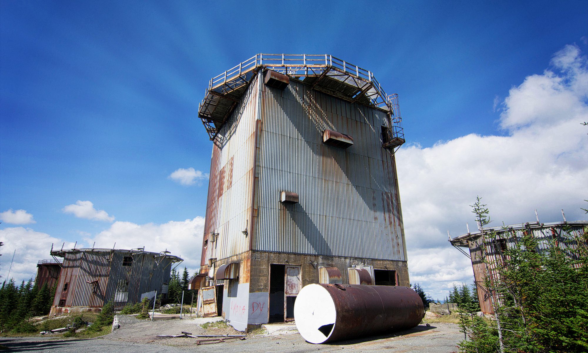
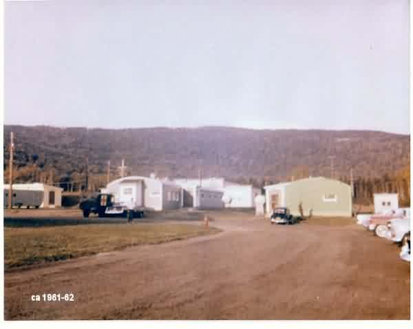
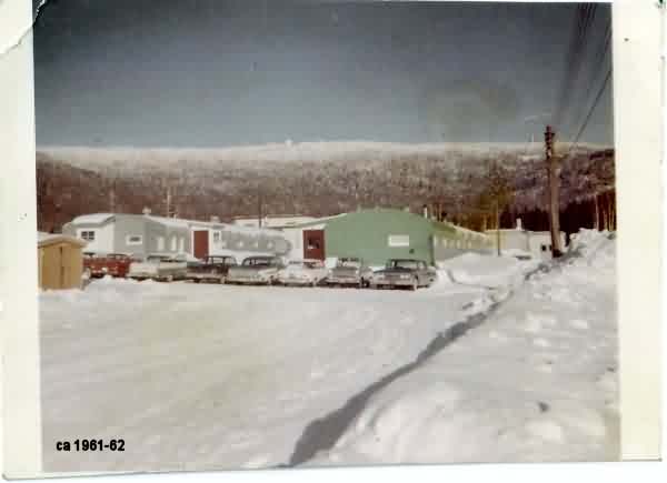
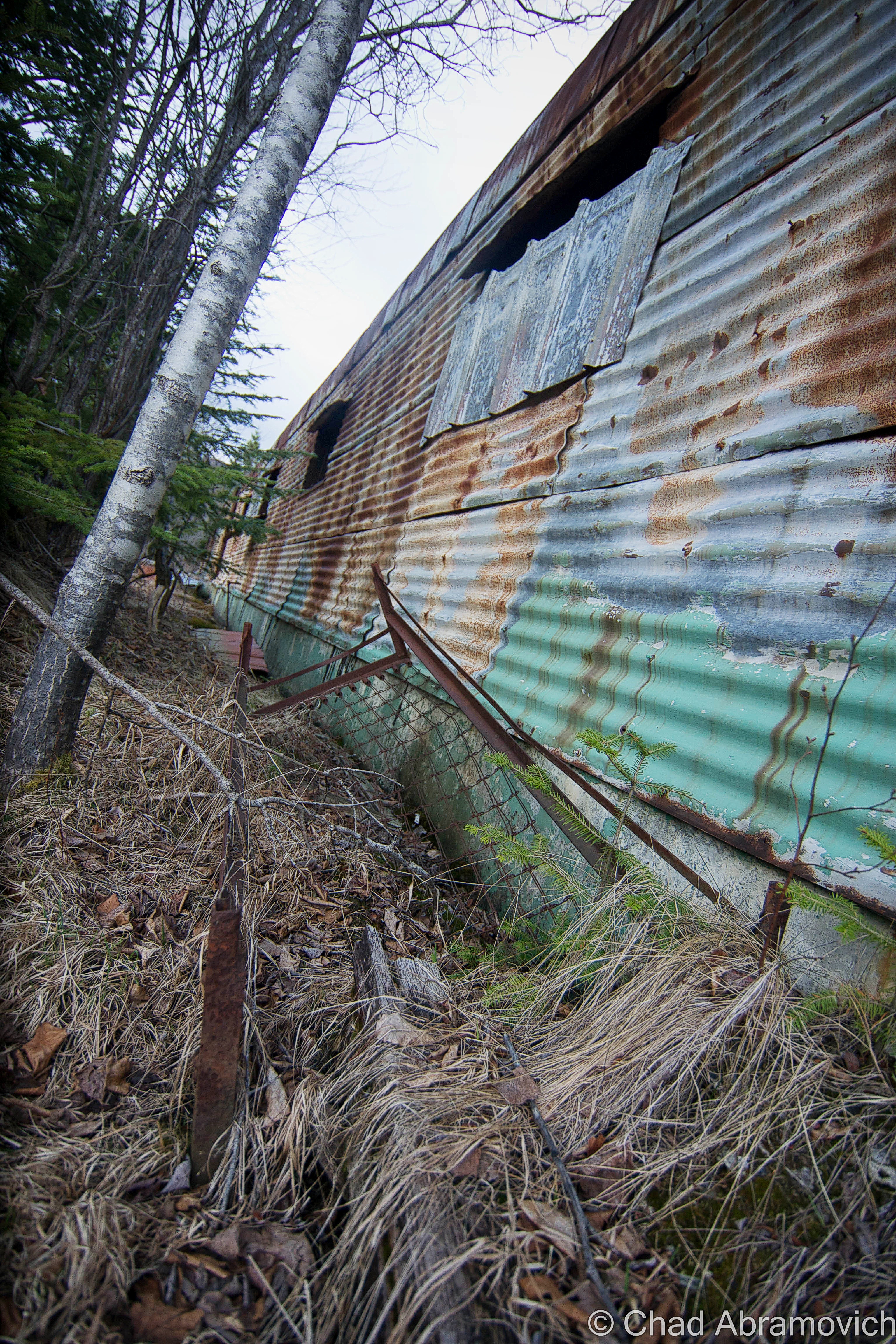
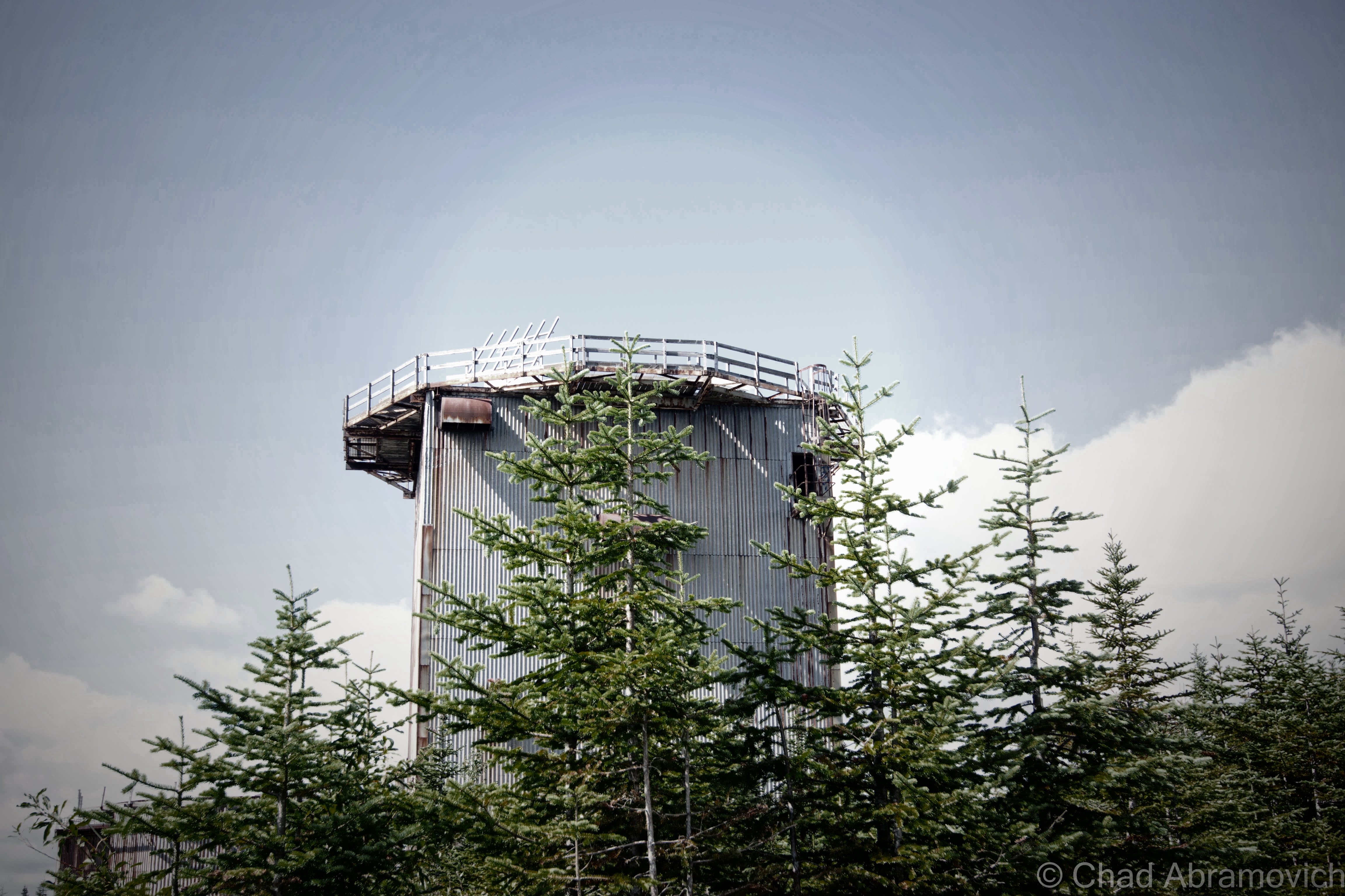
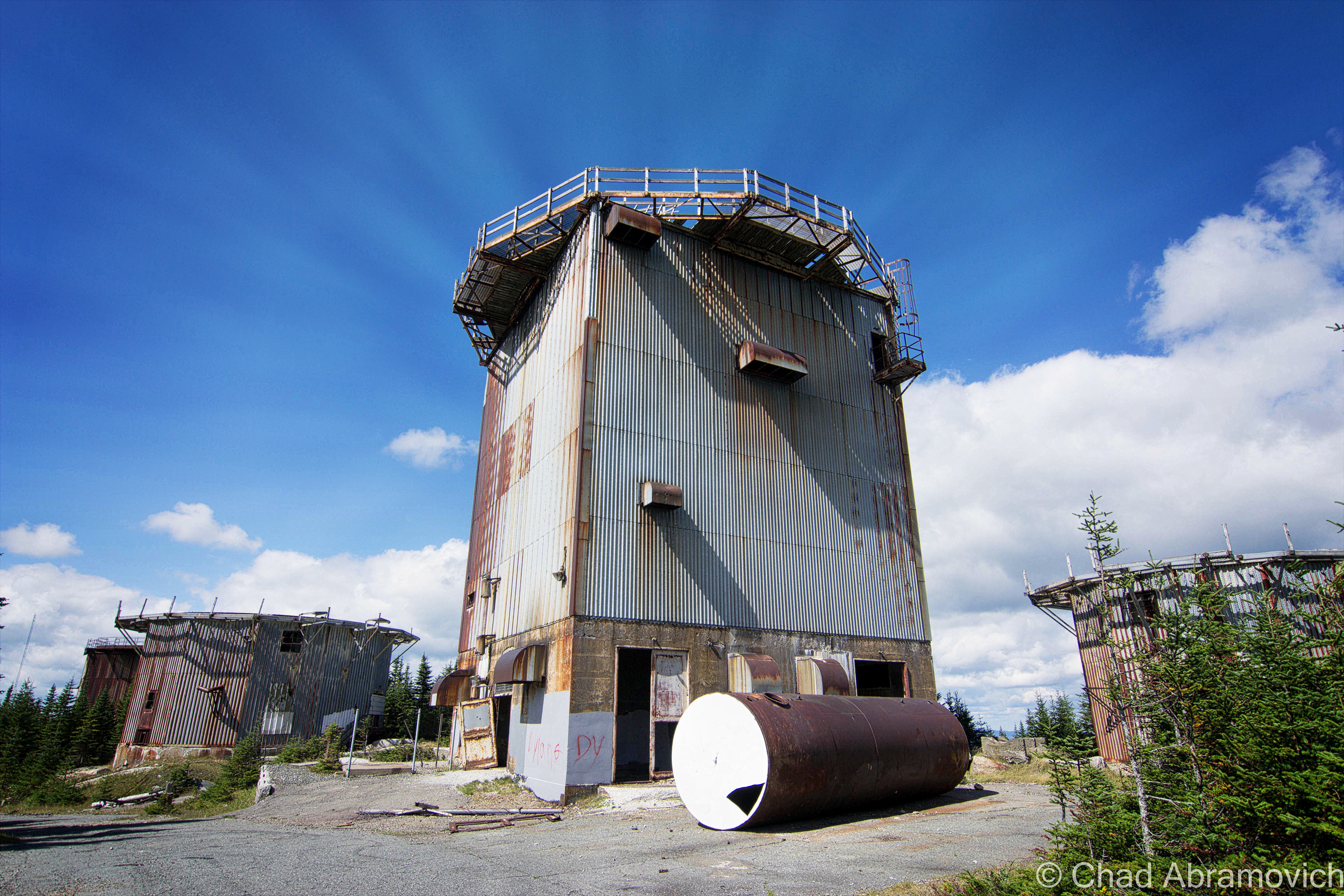
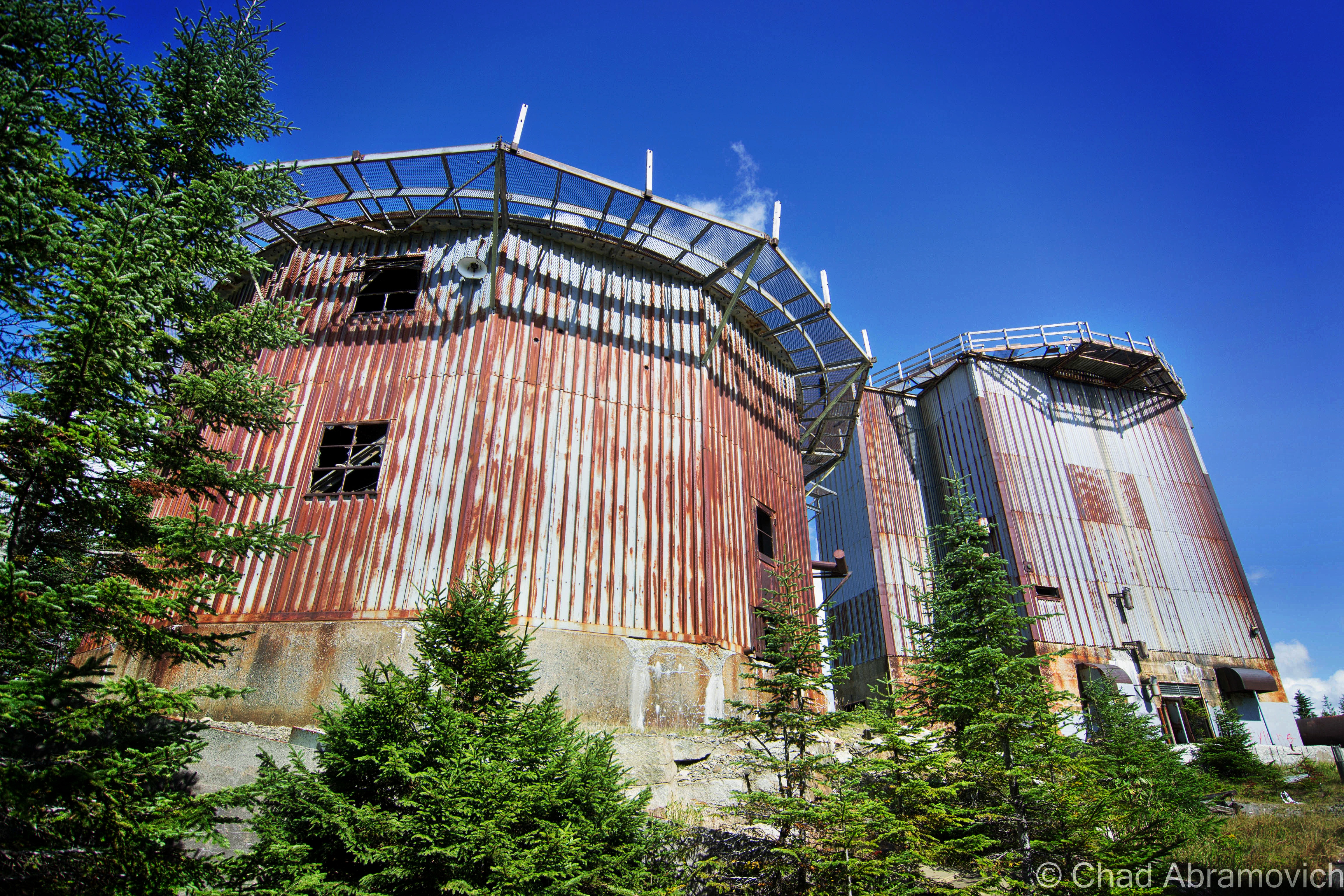
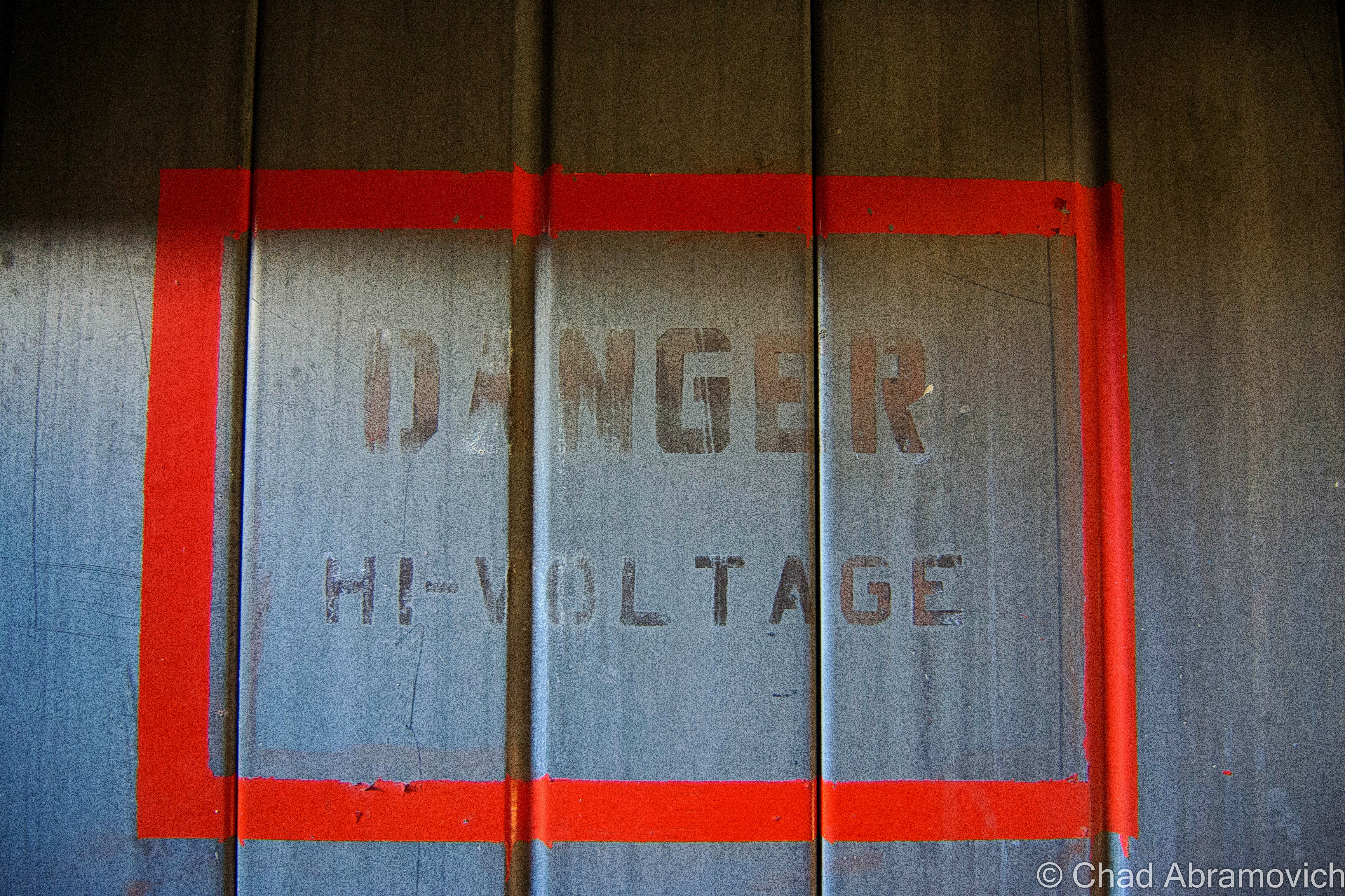
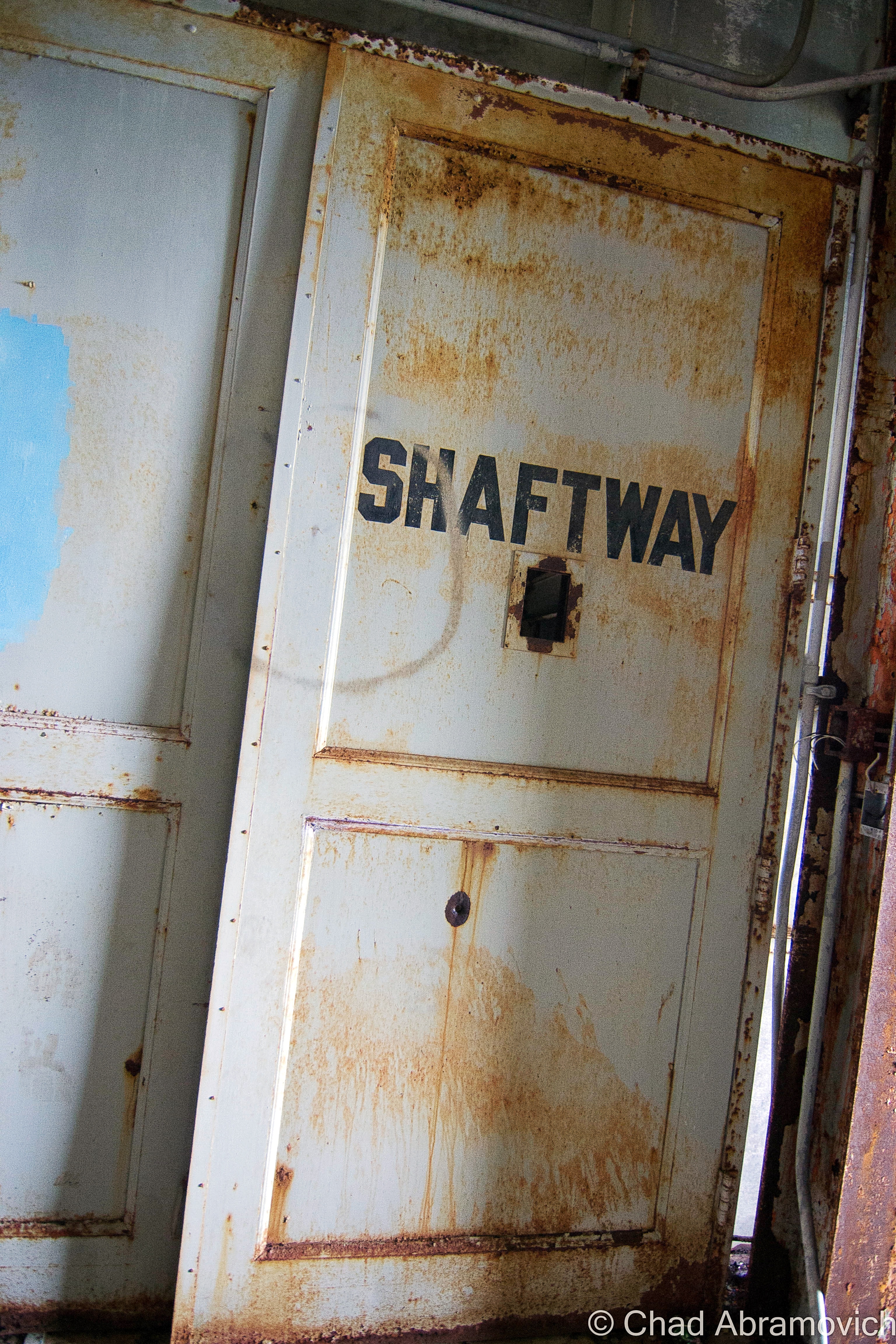
About 174 men lived in the base in a village of tin and steel Quonset Huts known as the administration section, situated on a mid-mountain plateau surrounded by almost impenetrable bogs. Their job was to guard the radar ears, which resided in massive steel and tin towers on the summit of East Mountain – constantly straining to hear the first whines from Soviet bombers coming from the skies above. The giant buildings were topped with large inflatable white domes that protected the radars. The government spared no expense protecting the United States from a possible Soviet attack. People were urged to build bomb shelters in their basements, “duck and cover” drills were actually implemented in school kids’ curriculum, and almost every town had a fallout shelter (which everyone was encouraged to memorize the location of).

The Quonset village offered amenities such as a store, bowling alley and theater, barber shop and mess hall. But the wilds of Vermont were a tough place to live, especially in the winters, when snow drifts could often reach the edge of the roofs. Sometimes, the air boys would be stuck on the mountaintop when the mountain road became impassible, and would have to wait out the storm up there. Some enlisted men dreaded serving their time in Vermont because of this, but it was the city boys who hated it especially – many who served from the Chicago area. A mural of Chicago’s Lake Shore Drive once covered an entire wall of the mess hall in an effort to make the men feel more at home (but that mural can’t be anywhere near detected today). The base also provided a bus that drove to Saint Johnsbury every night, for a little stress relief and therapeutic contact with civilization, so the men could see a movie and hit the bars.

At first, there was only one way to access the base, a dirt road that traveled through tough mountain valleys and up steep slopes to the base, a 9.3 mile drive. In the winters when the snow drifts gained mass, army personnel would have to phone the base from the bottom of the mountain to let them know they were on their way up, because the road was so narrow it only offered room for one vehicle traveling one way at a time, and if you ran into someone else, well, good luck.

Later, a paved road was constructed from East Haven on the mountain’s western slope, offering another approach. Though the base was a cold functioning monument to man’s urge to destroy itself and the trembling hands of fear, it also offered a boost to the area’s economy as well as social impacts to area towns. In 1962, the base’s name was changed to the Lyndonville Air Force Base.

But the functional life of the East Mountain Radar Base was brief, as expensive costs to keep it running were adding up, and advancing technology made it obsolete before construction was even completely finished. It officially closed in 1963. Since then, its became the idol of local legends. Strange stories of death, UFOs and unknown characters skulking behind rusting ruins and evergreen forests slowly began to haunt the place.

The weirdness started before the base even closed. In 1961, a strange object – which many speculate was a UFO – was identified in the skies above East Mountain, which the military reported as lasting for around 18 minutes. A few hours later, Barney and Betty Hill were allegedly abducted by a UFO near Franconia Notch, New Hampshire, which lead some to believe there is a connection between the two coincidental events.

In 1965, Ed Sawyer of East Burke bought the property from the government for $41, 500, and what a purchase it was. The base was in pristine and authentic condition at the time, and he loved it. Sawyer made money by selling surplus equipment and scrap metal. He moved into one of the Quonset Huts and also ran a woodworking shop there. In 1969, a group of snowmobilers rode onto the property without permission. As they were traversing the lengthy access road, one of them hit a chain slung across the road as a makeshift gate, and was decapitated.

Not long after, trespassers and vandals discovered the base, and started making trips up into the vast wilds of the mountains hoping for an adventure. Sawyer installed several gates going up the roads to deter people from coming up, but he would numerously find several padlocks had been pried off and ruined. Sawyer had to replace about 35 padlocks a year. He would eventually result in shooting at trespassers to protect himself when menacing visitors became destructive and violent. He had even been threatened before.

Not only would they loot and steal everything from wiring and original furniture, but they destroyed the buildings. There was even an account where he woke up one night to a bunch of snowmobilers who were able to ride over the roof of his building because the snow drifts were so high!

The constant influx of vandalism and weather took its toll on the radar base, which has since further deteriorated and taking on a forlorn, haunting appearance underneath bounding hills and silent forests.

The property was put on the market, and remained unsold for many years, until recently when Matthew Rubin purchased it, who envisioned building a wind farm on the site, and anyone who has been on East Mountain would understand why. But after years of attempting to get permits from the state, he postponed the project indefinitely. The property has since been added to Vermont’s list of hazardous places, for massive soil contamination from oil and other motor fluids.

Around 1990, another person met their own mortality on East Mountain, when they fell from one of the radar towers and was killed. To add to the radar base’s already mysterious reputation, it’s been said that the rotting ruins have also been home to hobo camps and a hideout for the Hells’ Angels at one point.

Today, the radar base, known variously as East Haven, East Mountain, Lyndonville, and Concord, sits abandoned in a nebulous haze that hangs over the kingdom forests, the incongruous ruins littering the mountain top – the eerie silence is occasionally broken by the winds and the scraping sounds of rusted metal. A disconcerting and questionably regressive riddle to the end of one apocalyptic dream, and the uncertainty of what the future will bring.

The Quonset Village, Circa 1961-62
The radar towers on the summit

photos-LyndonvilleAFSNorthConcordVT61fall photos-LyndonvilleAFSNorthConcordVT61radarevening photos-LyndonvilleAFSNorthConcordVT61topsidewinter

Historical Images via The Air Defense Radar Veterans’ Association – photos from the 1960s

The East Mountain Radar Base - satellite view
The East Mountain Radar Base – satellite view. The Quonset living area is in the lower left corner, and the radar towers are in the upper right, to give you a sense of scale.

The East Mountain Radar Base was one of the most unique places I have ever gotten the chance to explore, and that adventure started even before we arrived there.

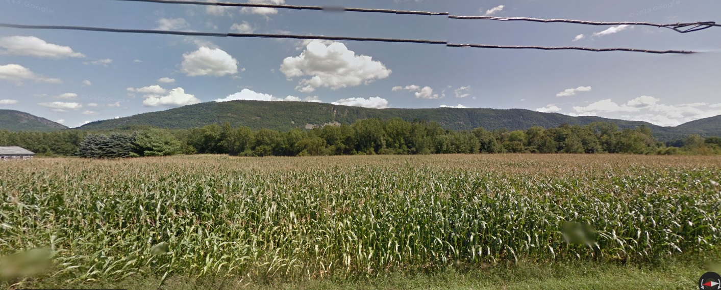
We approached our destination from the small town of Victory underneath the bravado of September skies and rambling mountains. Victory has one of my favorite names for a town in Vermont – it’s one of the few place names in the state that derives from an idea rather than a person or place. A suggestion for the cool name may date back to 1780, when settlers across New England were caught up in a general sentiment of Victory after the tides were beginning to turn against the British, especially after the French had decided to join the American cause.

It’s stand out name is kind of ironically fitting for it’s it’s admittedly stand out culture as a place of uninviting destitution, the power of it’s isolation is irrefutable. There are no state routes or paved roads – only unkempt dirt roads that are rutted into a landscape of hills with mangy looking forests partially scarred by ugly logging activity and expansive bogs with heavy moose traffic. The town is remote, even for Vermont’s idea of the term. It has none of the things that many towns have to formulate an identity; it has no post office, general store, gas station, school, police station, fire department or churches. Instead, a cluster of trailers in various states of upkeep huddled together at the bottom of a steep hill is the closest thing the community has to a village center, an area called “Gallup Mills”, which are what VTran’s green reflective way finding signs direct you to as opposed to Victory.

It does have a town hall though – in a restored one-room schoolhouse, which apparently sees far more feuding amongst the 62 people that live in Victory than actual productive town business affairs.  I’ll take a quote from Victory resident Donna Bacchiochi in a Seven Days article that I think sums up the town; “You see how lonely it is, how out of the way it is? The reason we moved here is we aren’t social. People in Victory are like that. They don’t visit each other, they don’t kibitz, they don’t do anything like that. It’s vicious.”

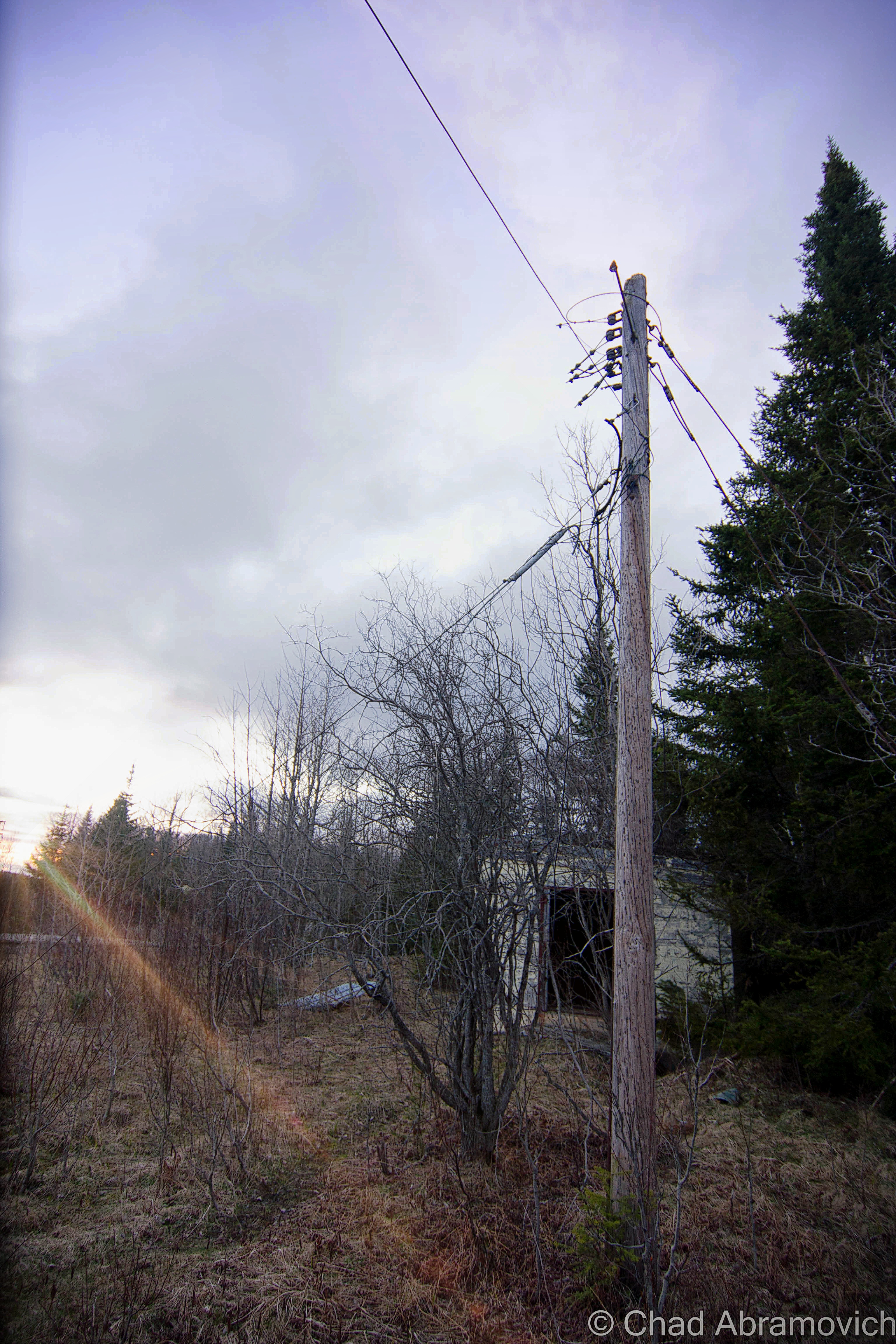
In 1963, Victory made local and national news by becoming the last town in the state to get electricity, and that was pretty much owed to the by then defunct radar base being nearby. With millions spent running power up the mountains to the base, Victory took advantage of a fortuitous situation and made connections down to the valley from the existing grid.

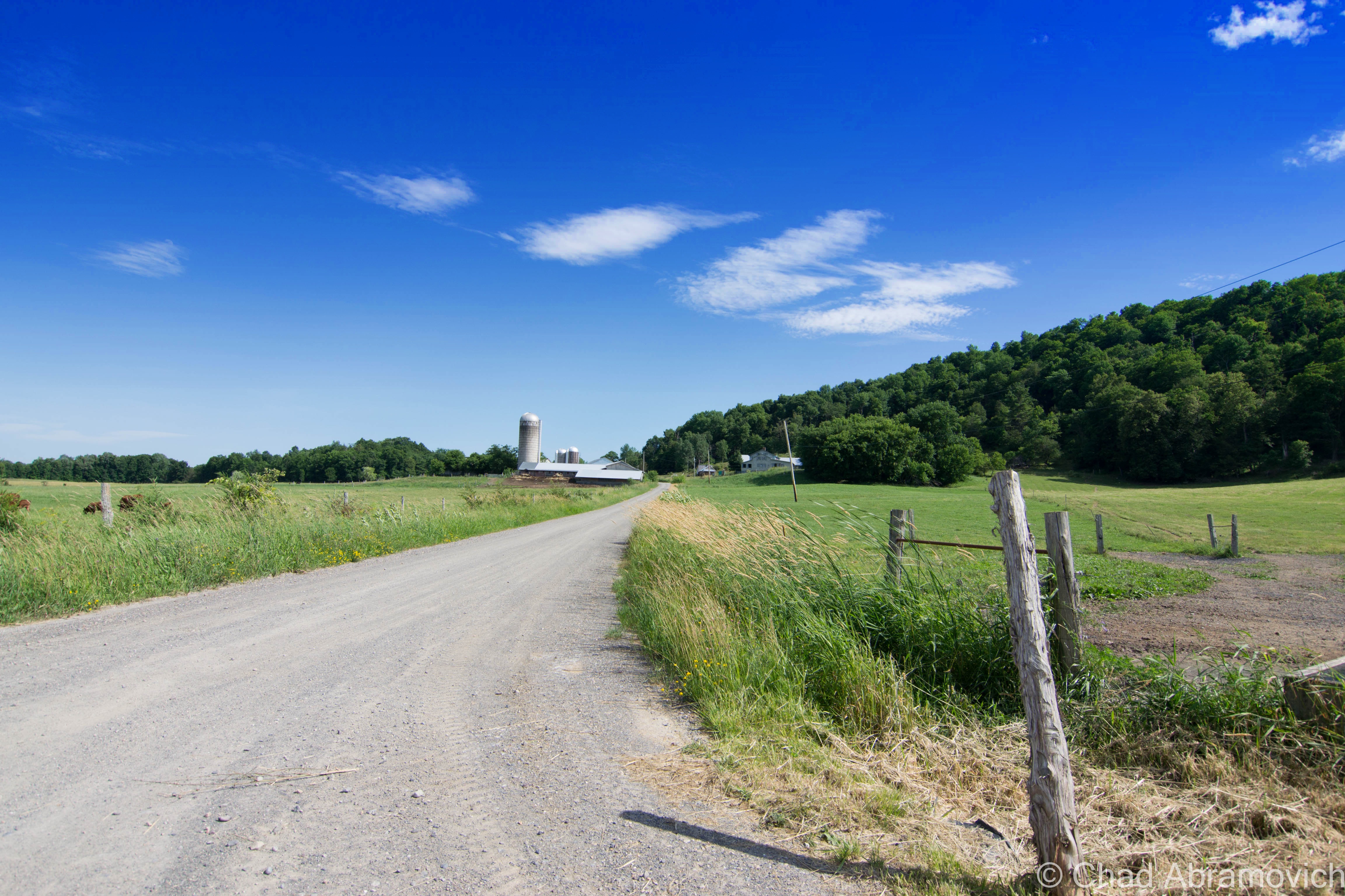
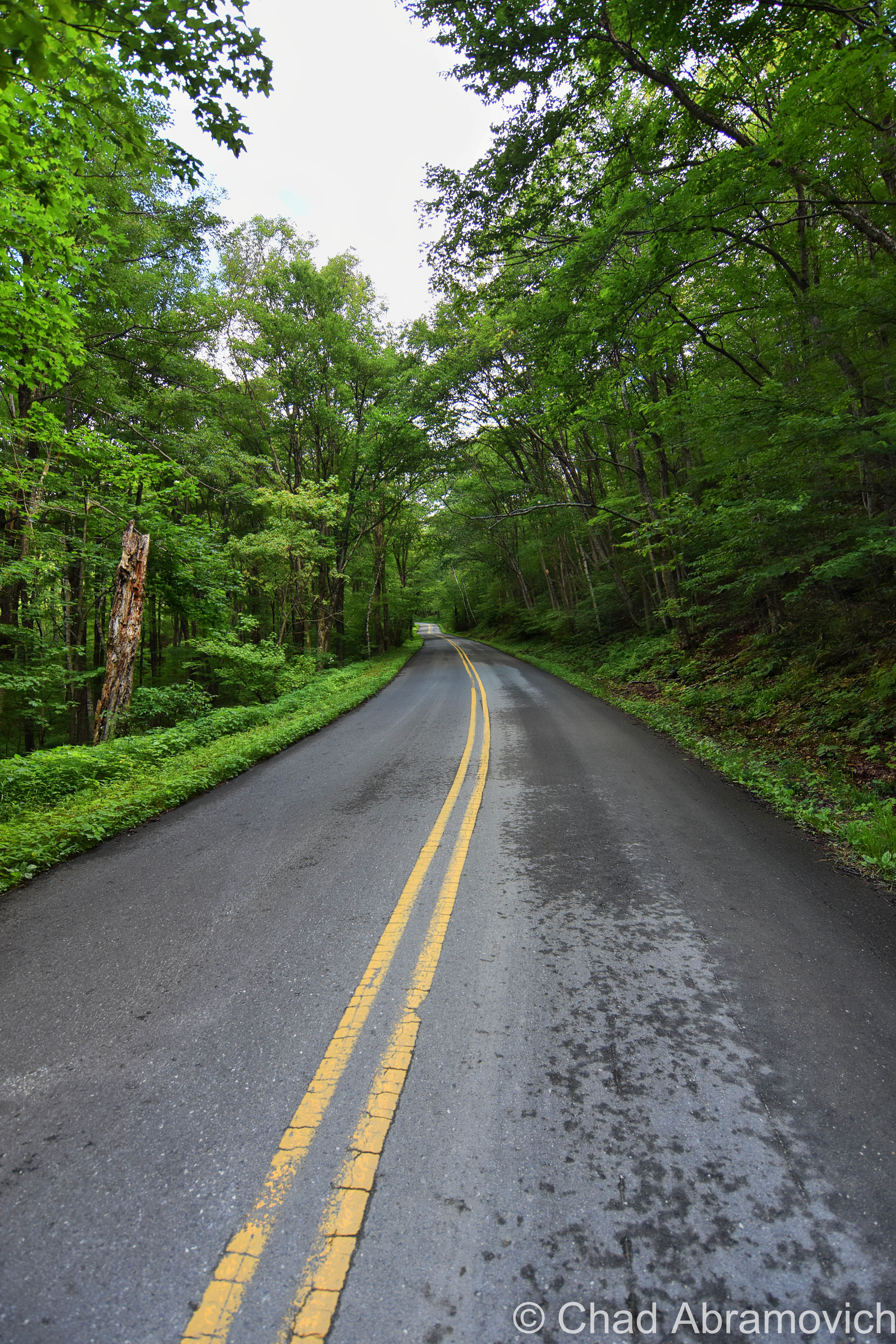
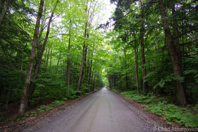
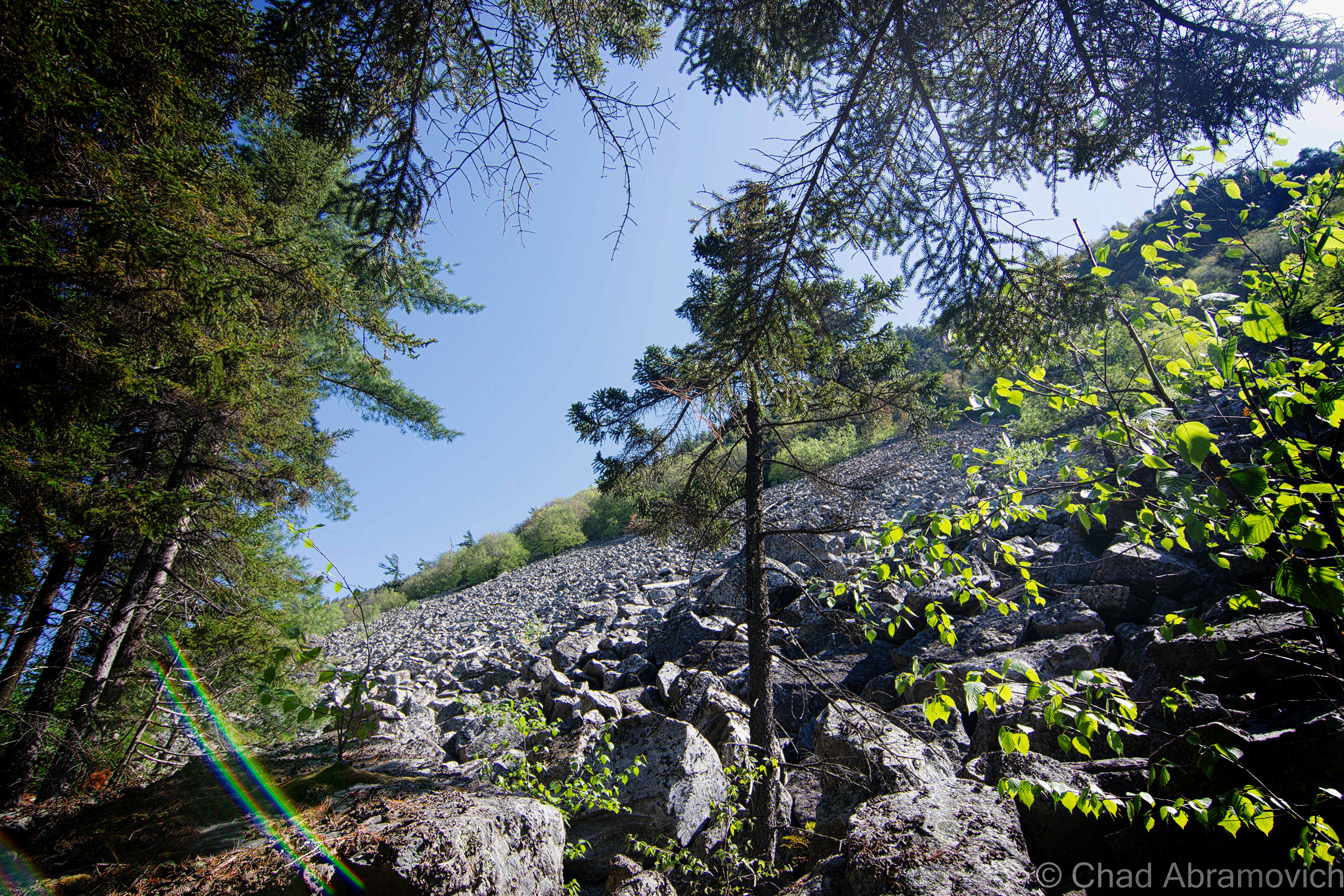
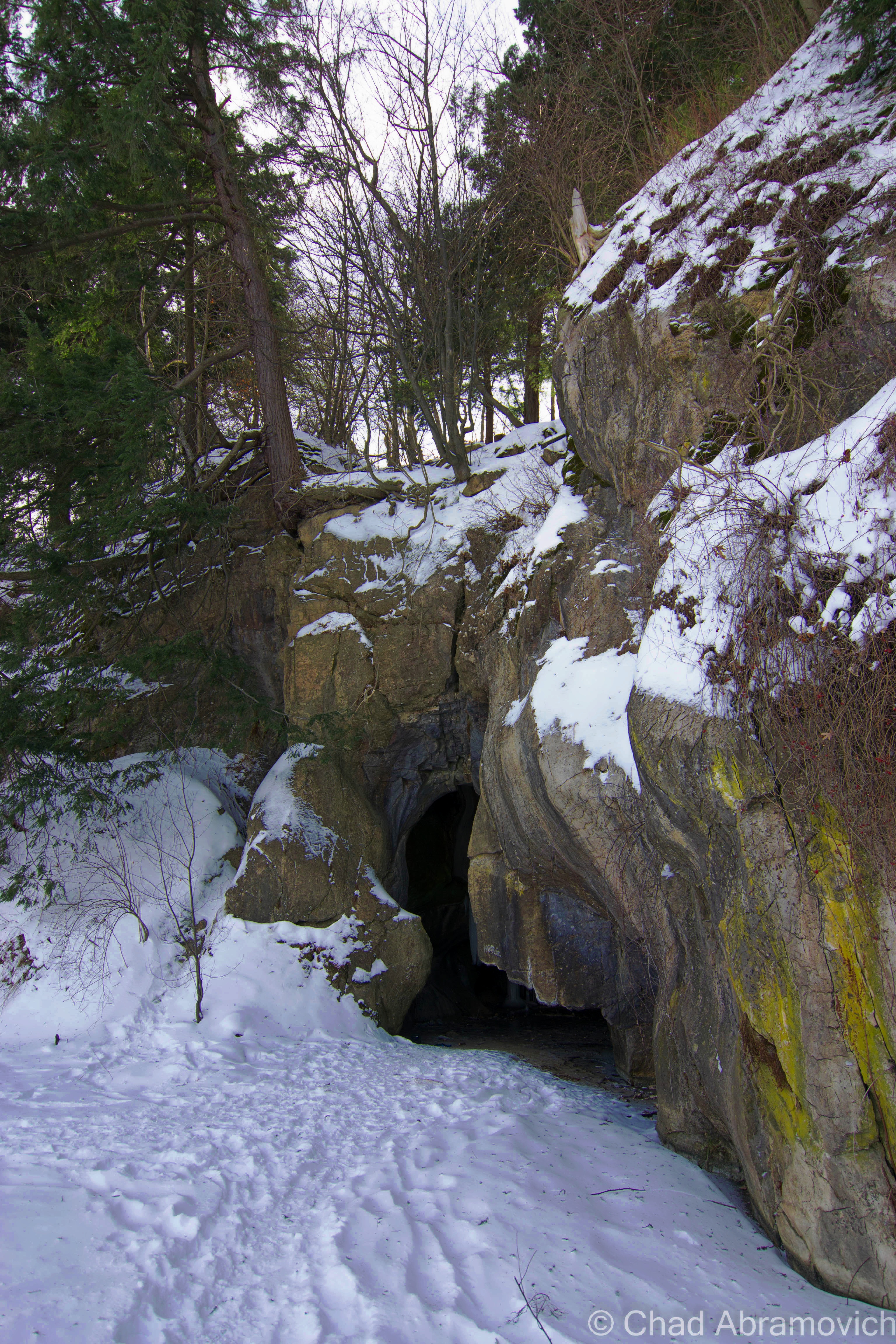
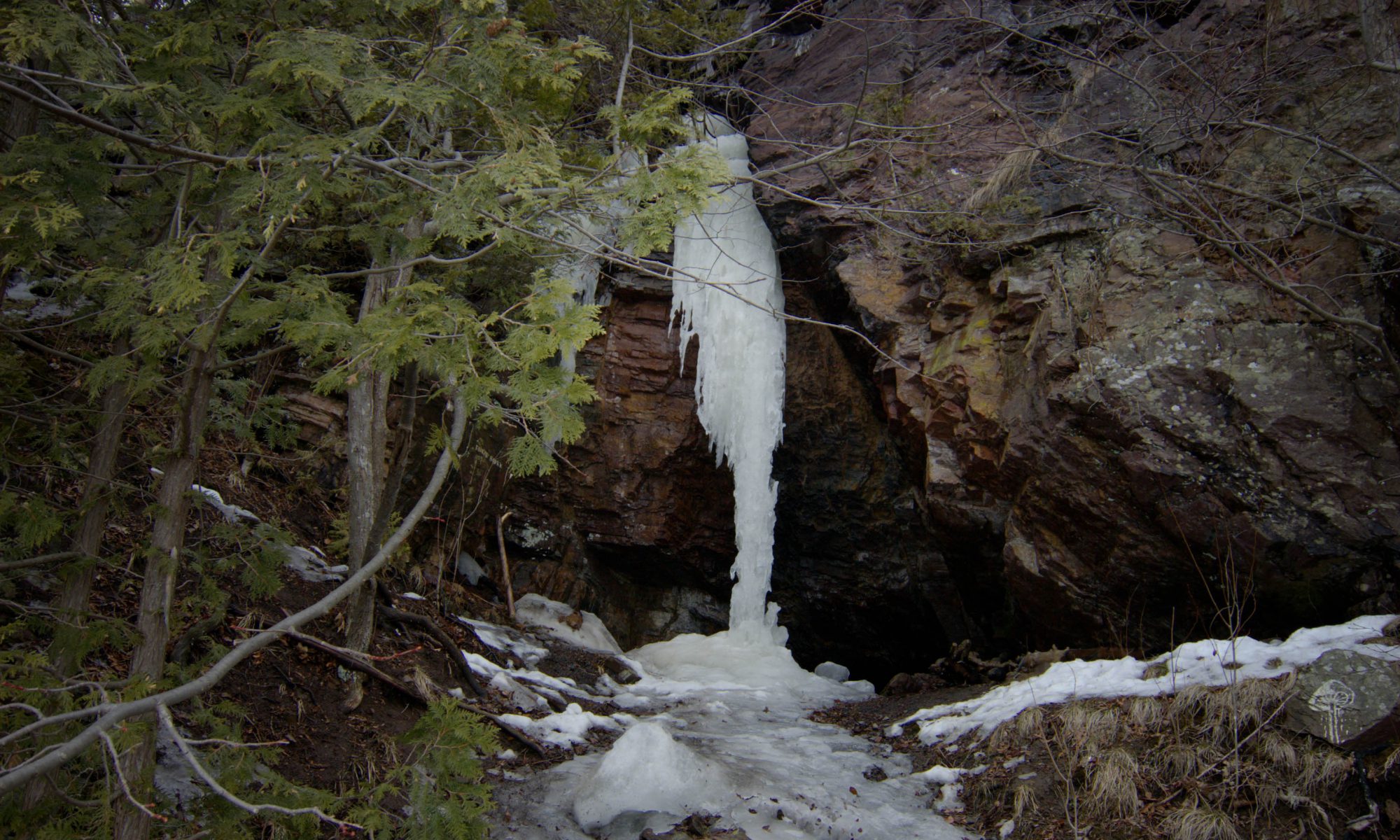
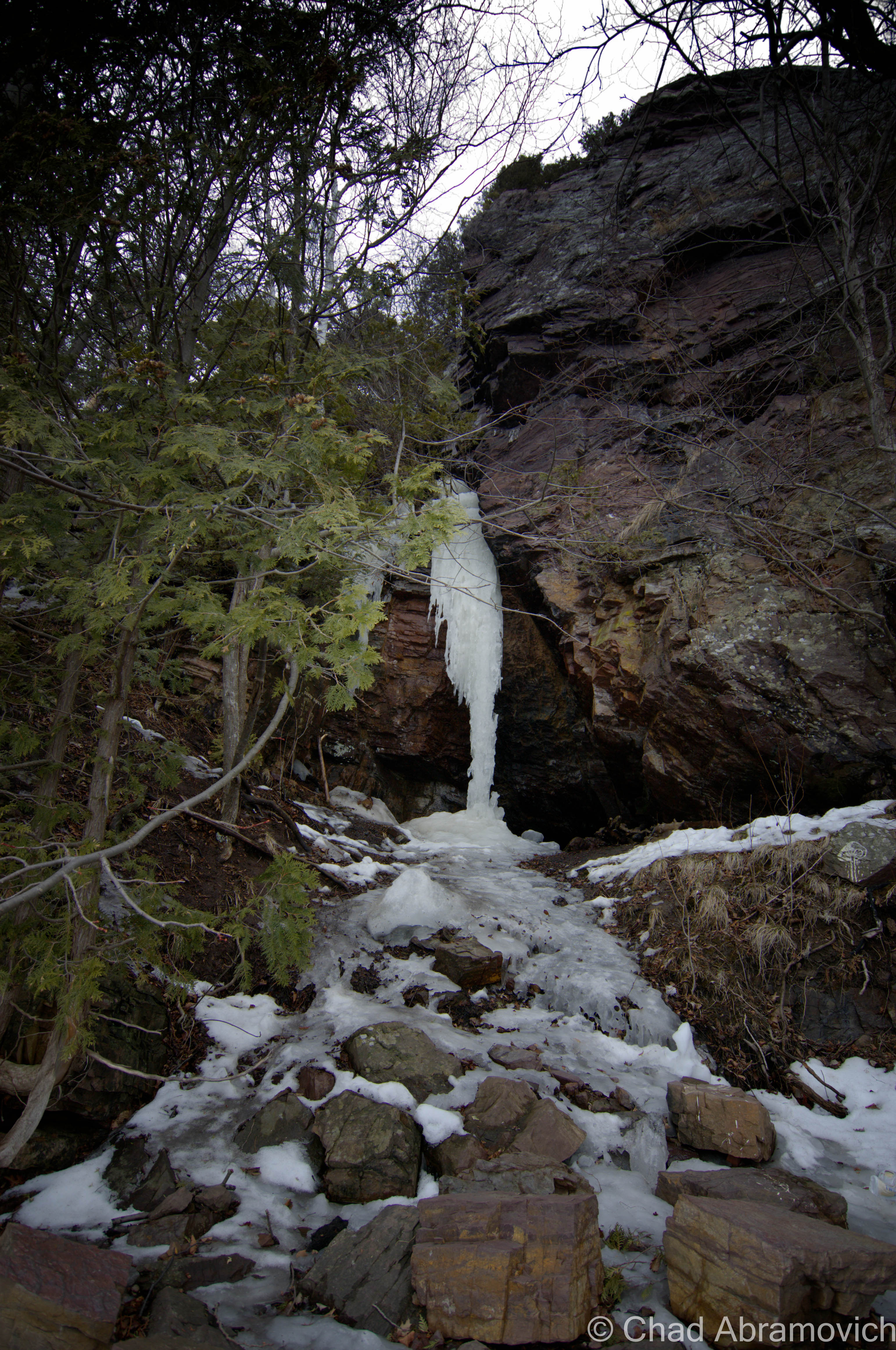
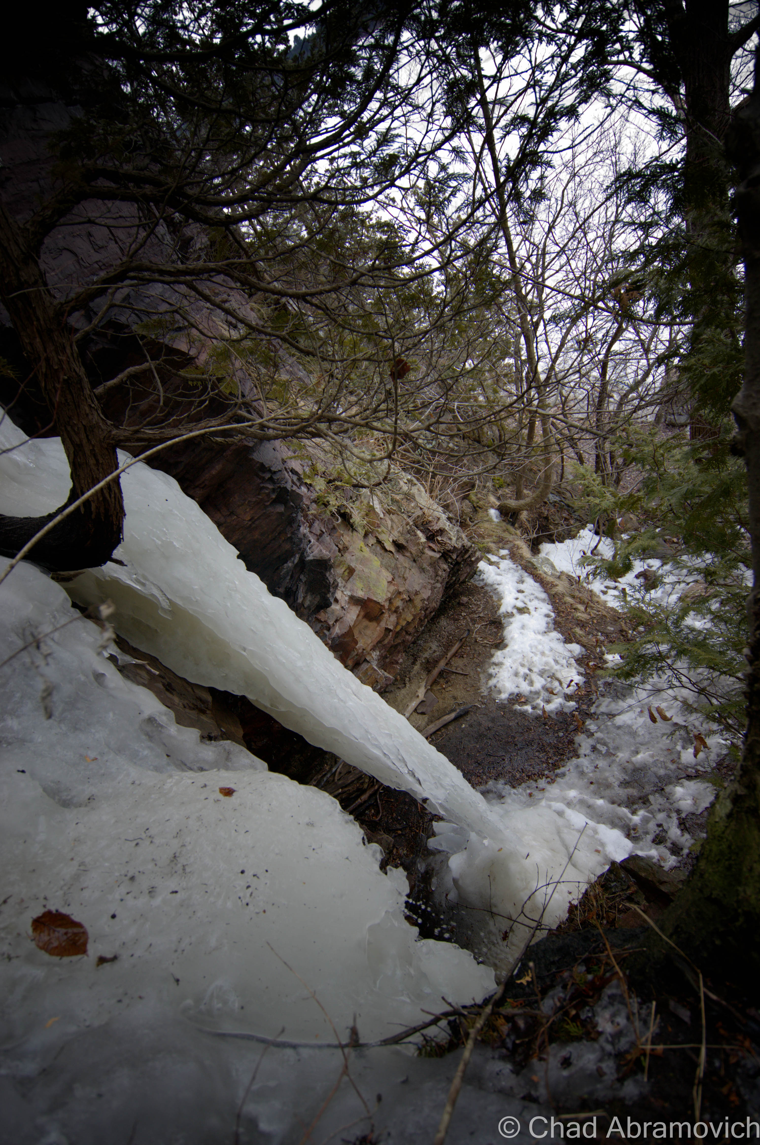
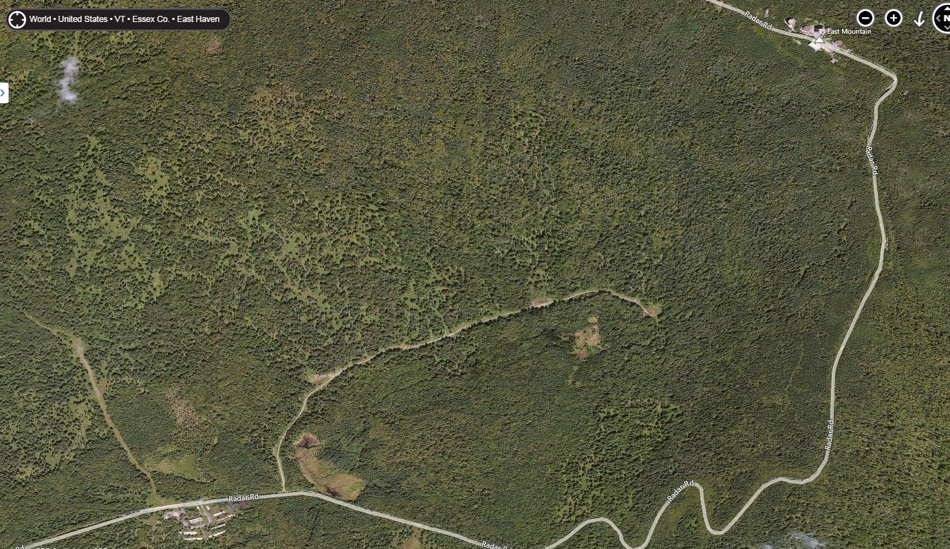
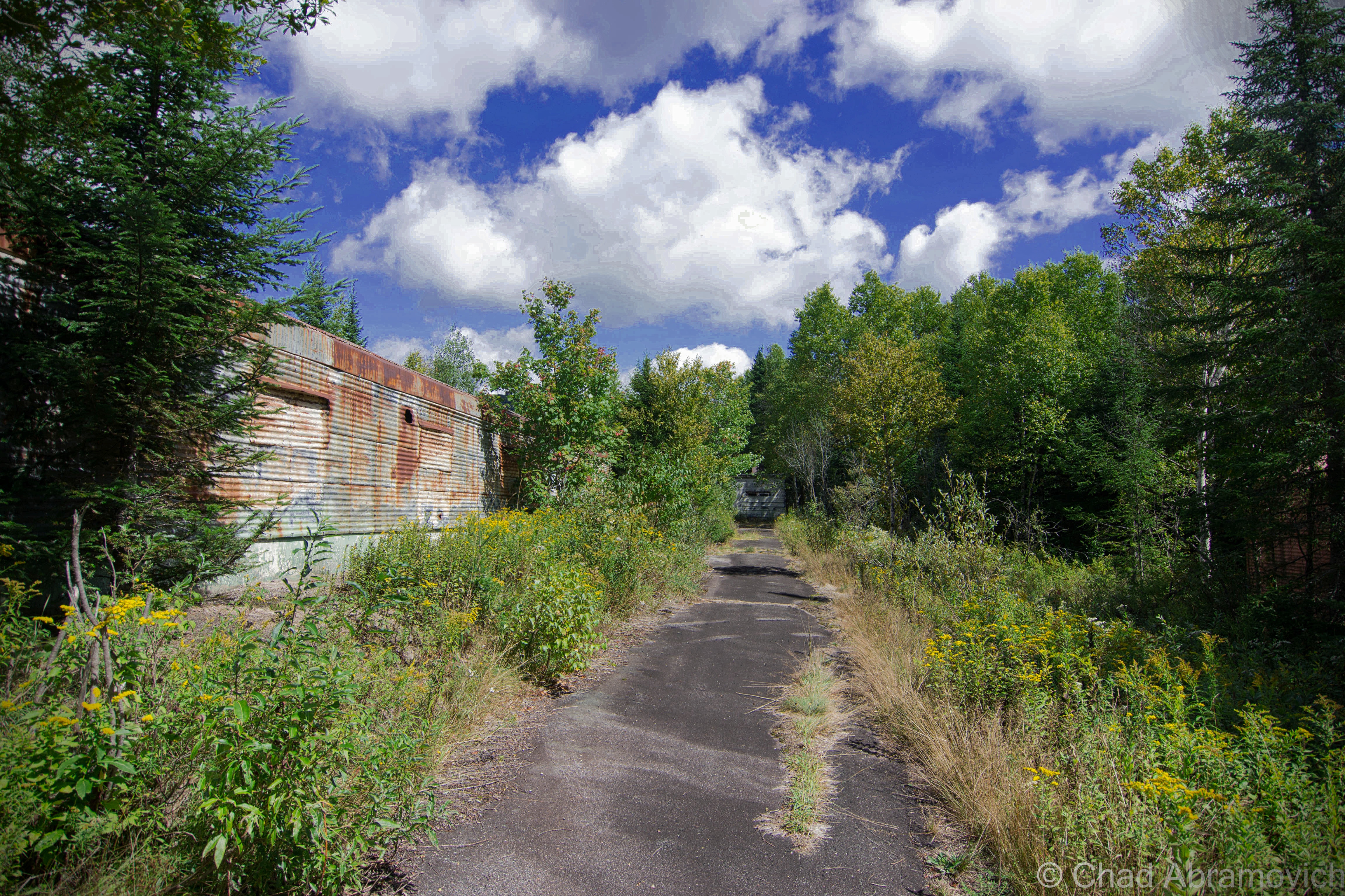
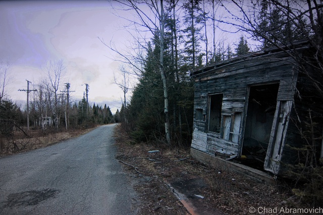
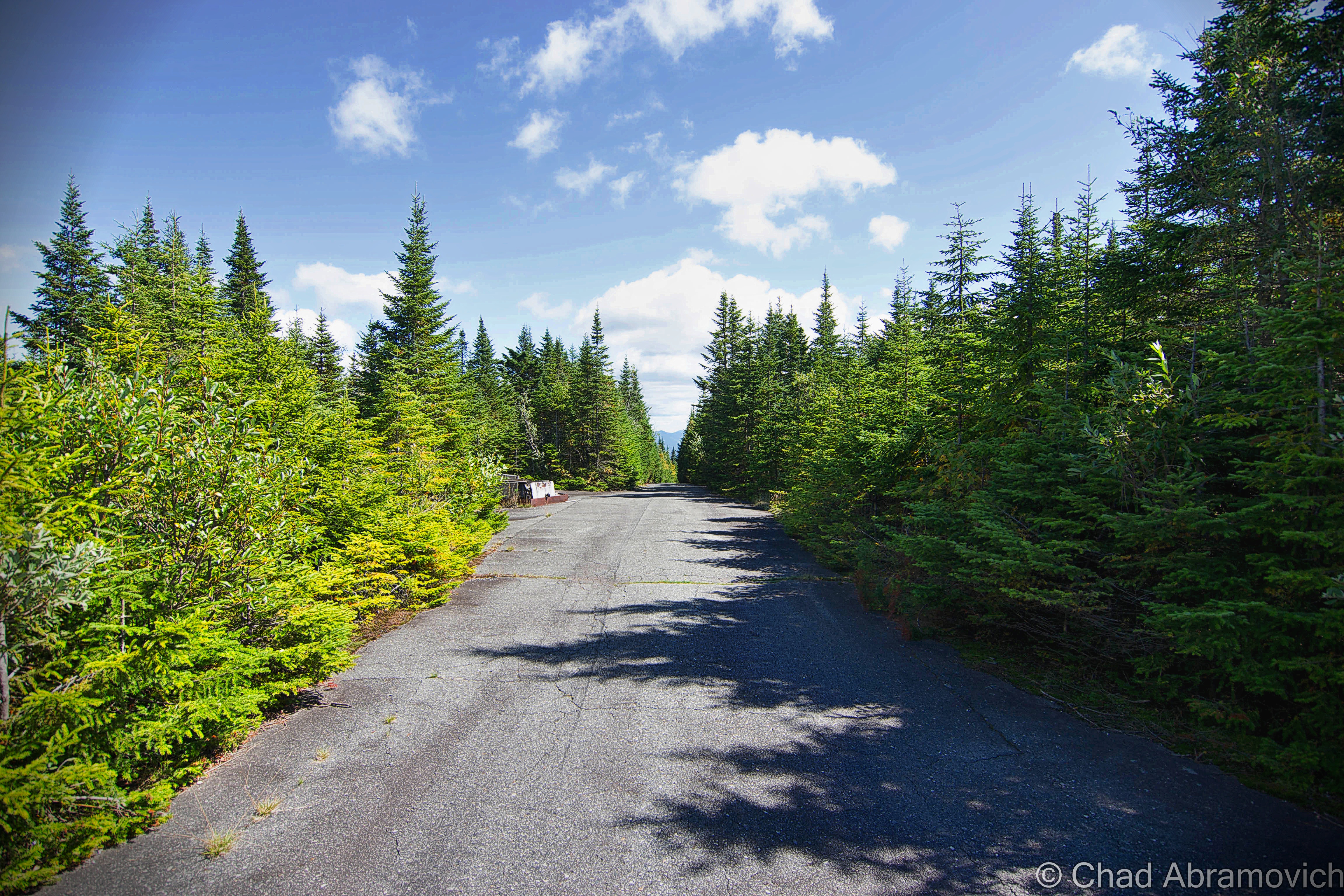
Traveling off into the hills of Victory, we made our way up Radar Road which was built parallel to the bouldery banks of The Moose River and underneath fallen trees that hung over the road, as our tires jarred into pothole washouts. As I’m writing this, I can’t think of accurate words to describe the sense of isolation we felt up in the mountains of East Haven. Miles away from anywhere, no cell phone service, no sounds of the familiar world to ground you and give you a sense of place.

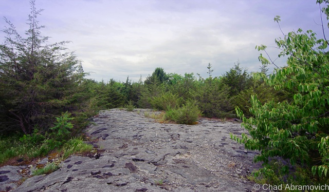
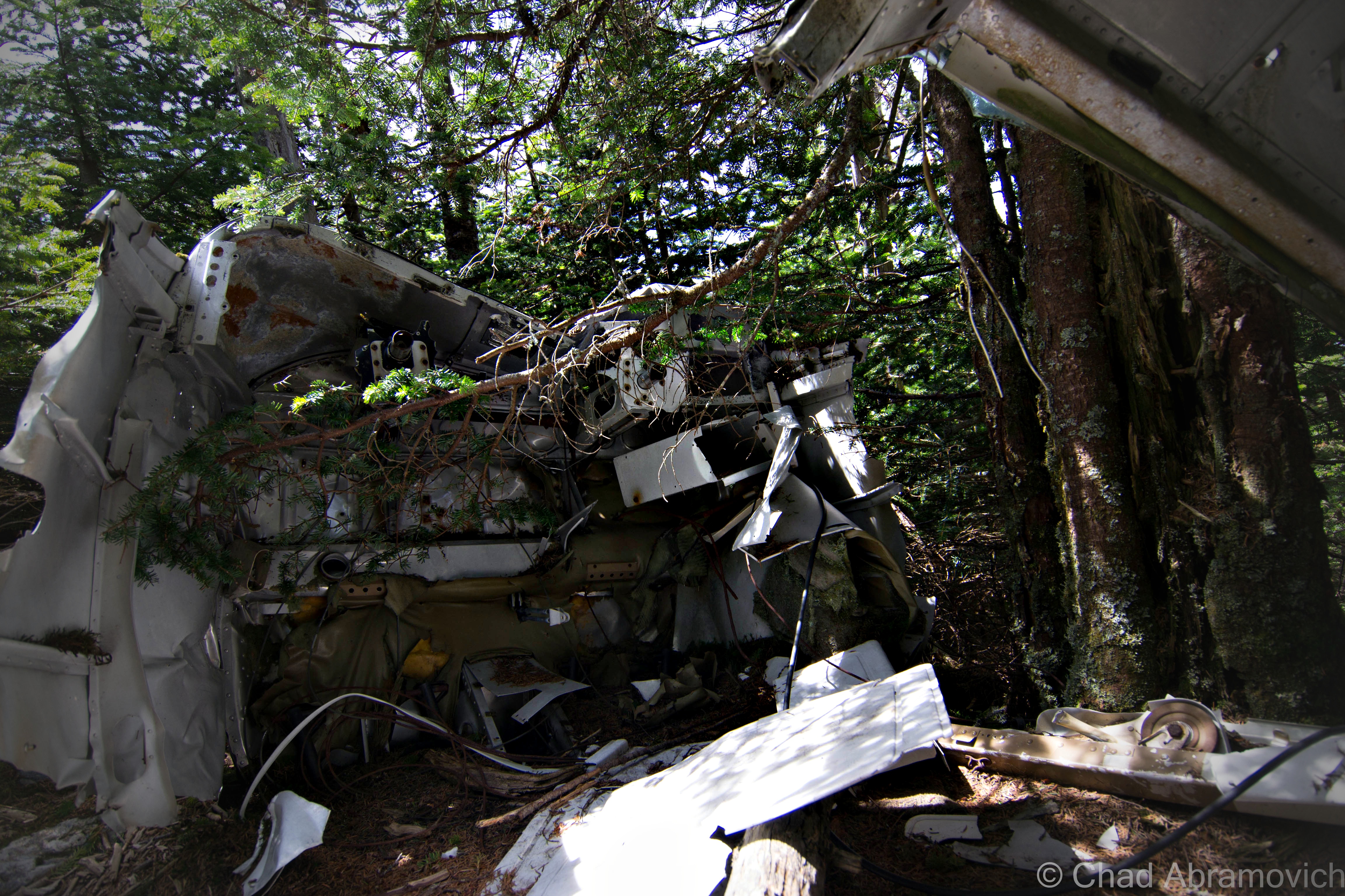
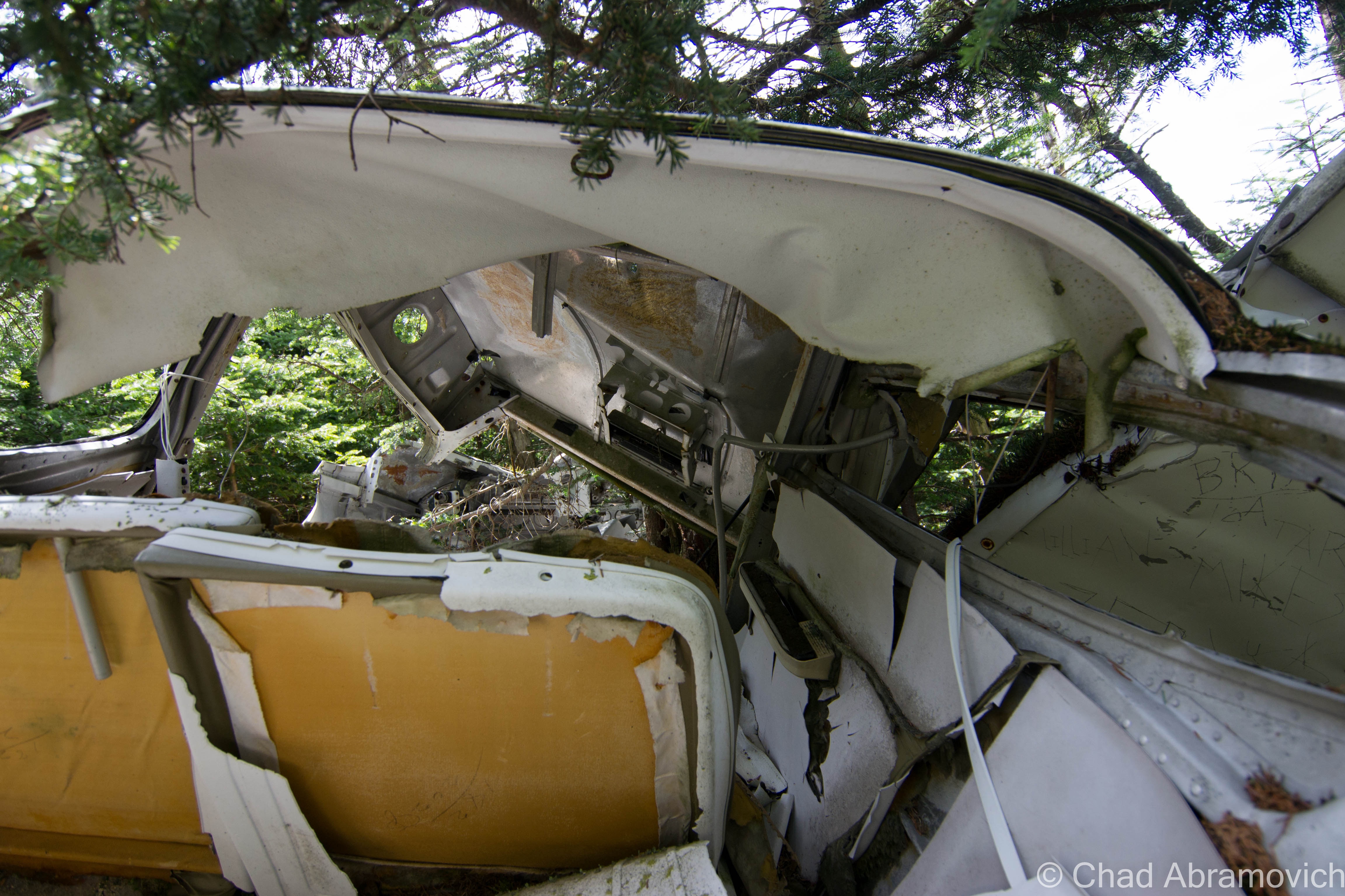
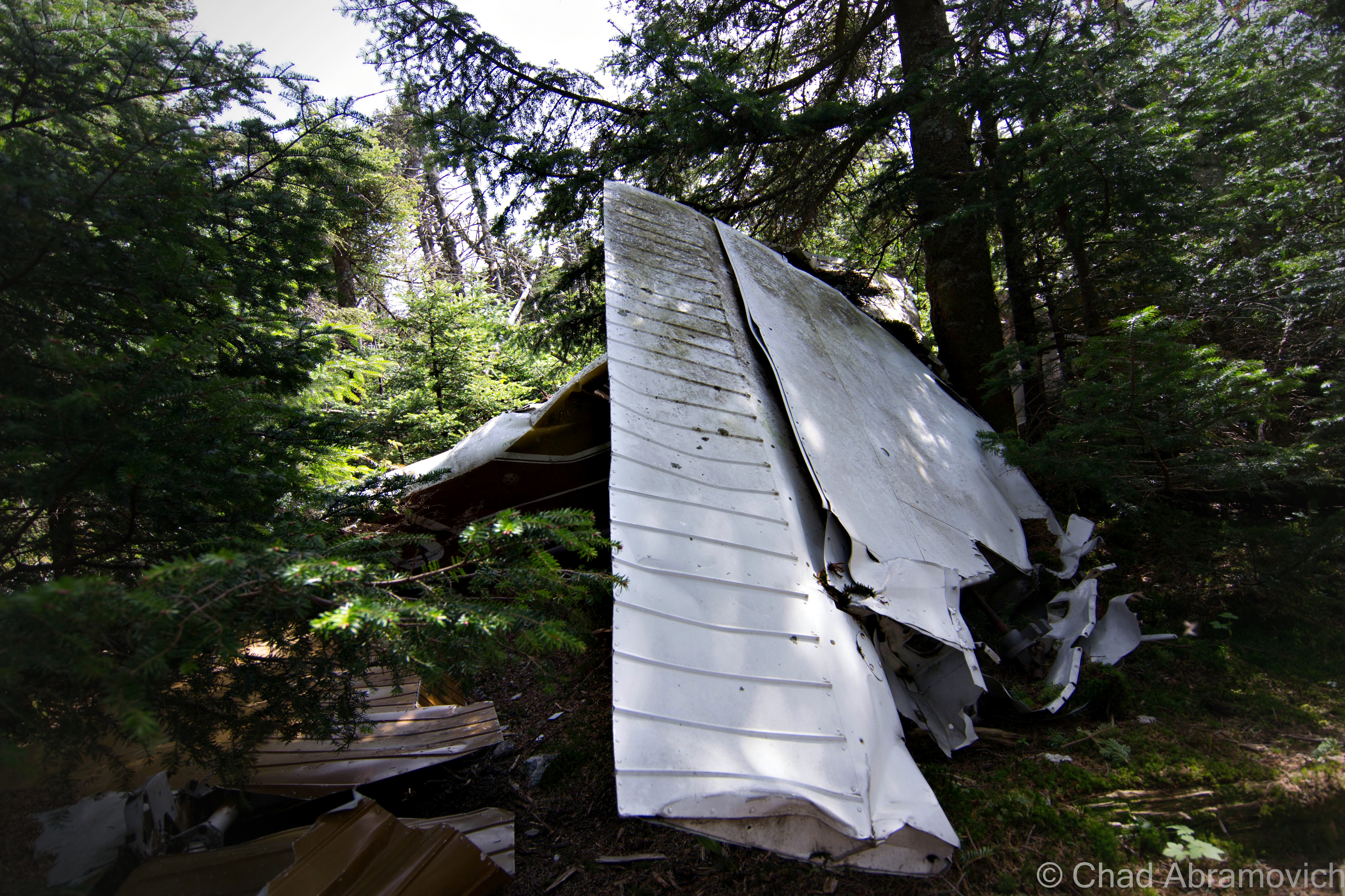
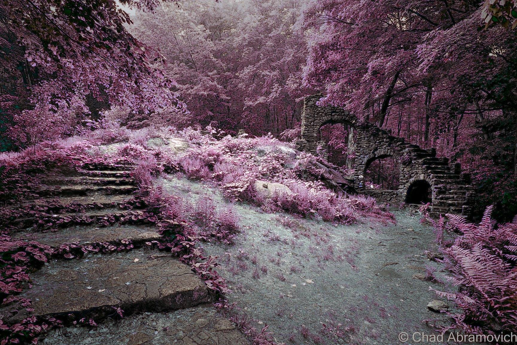
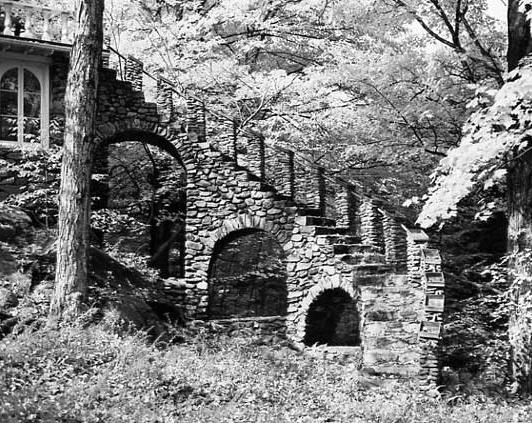
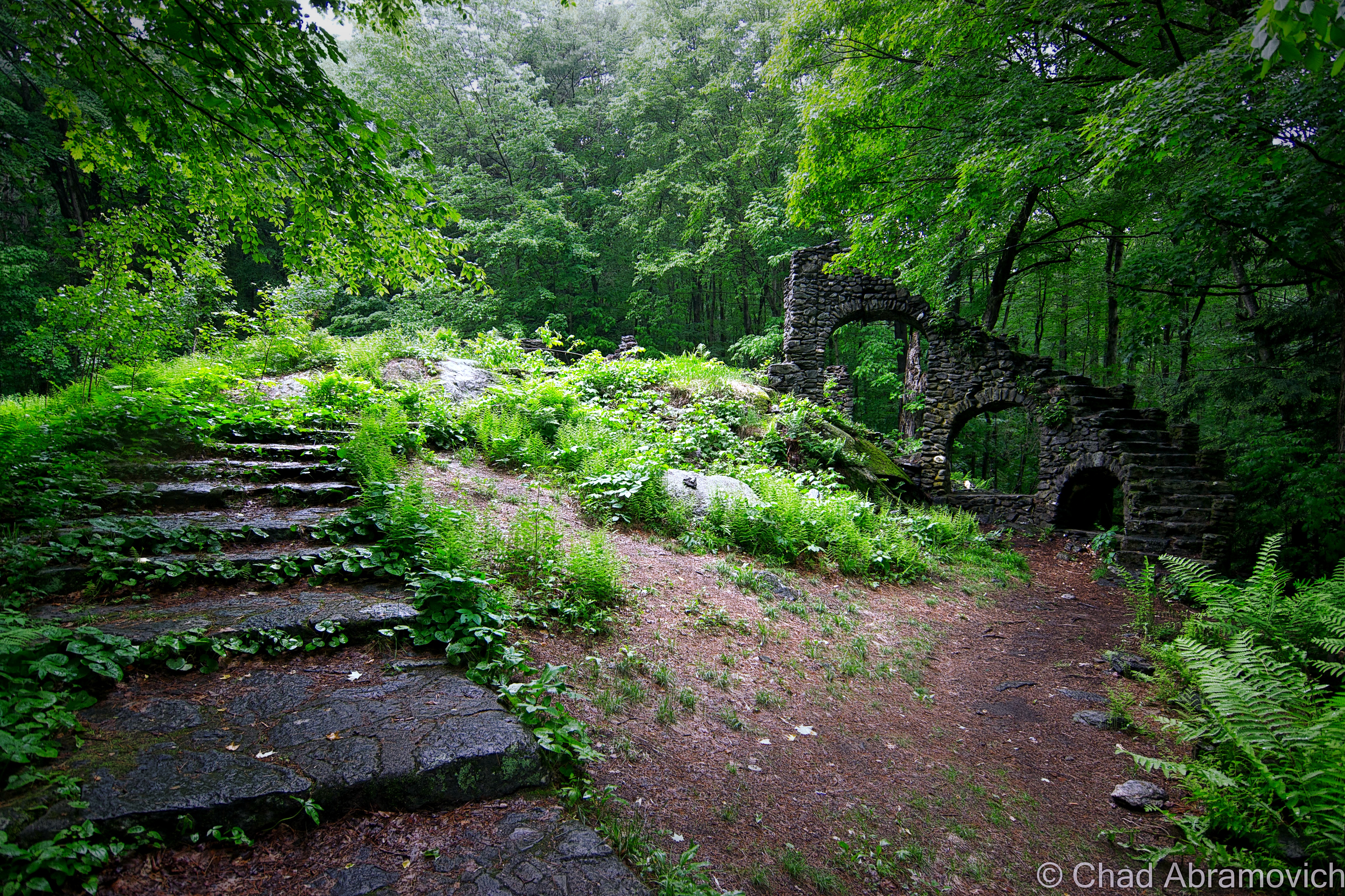
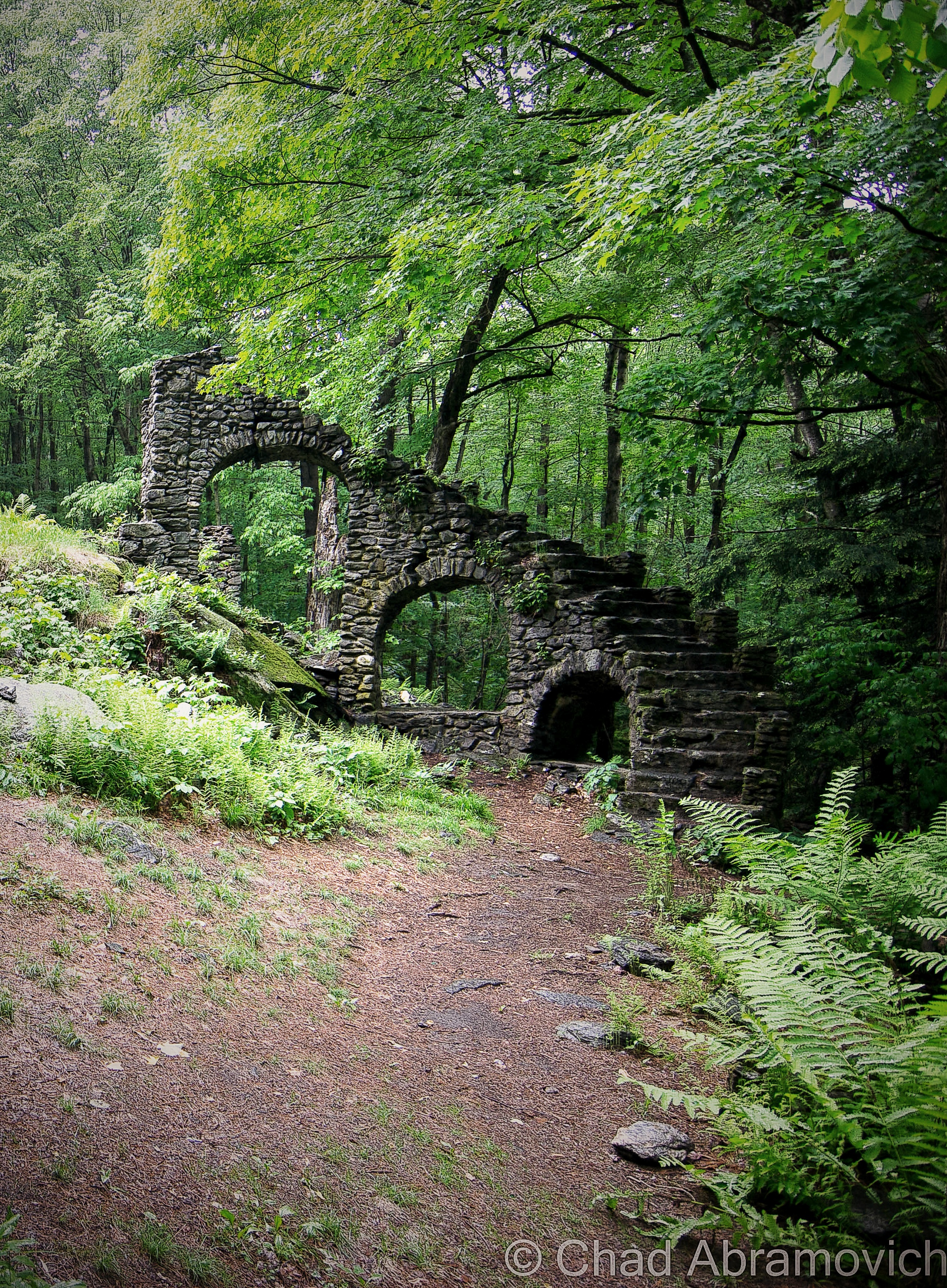
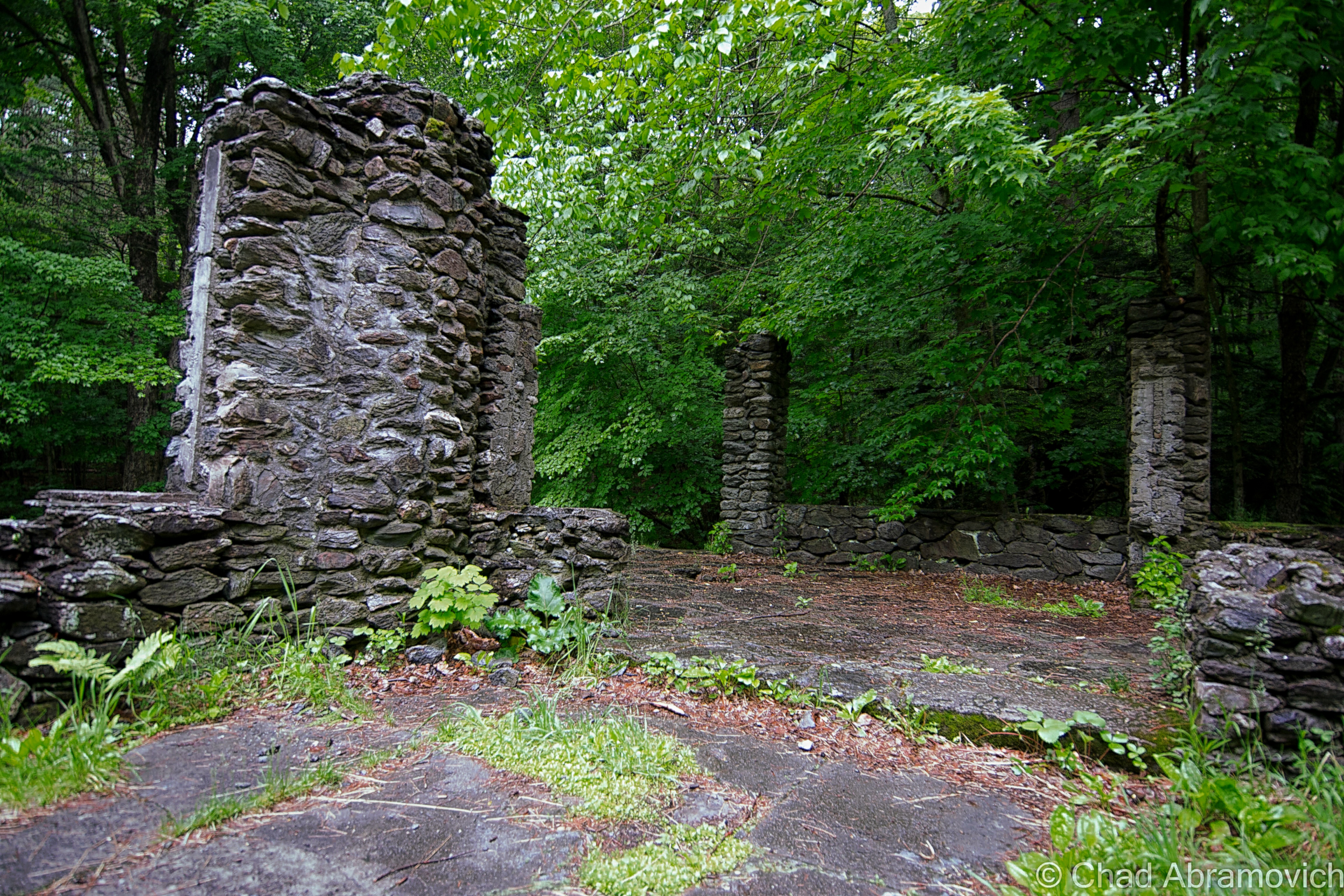
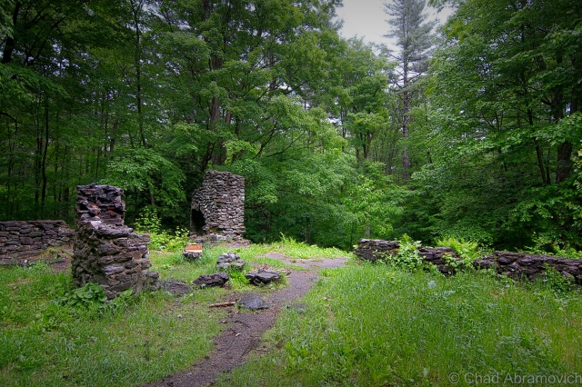
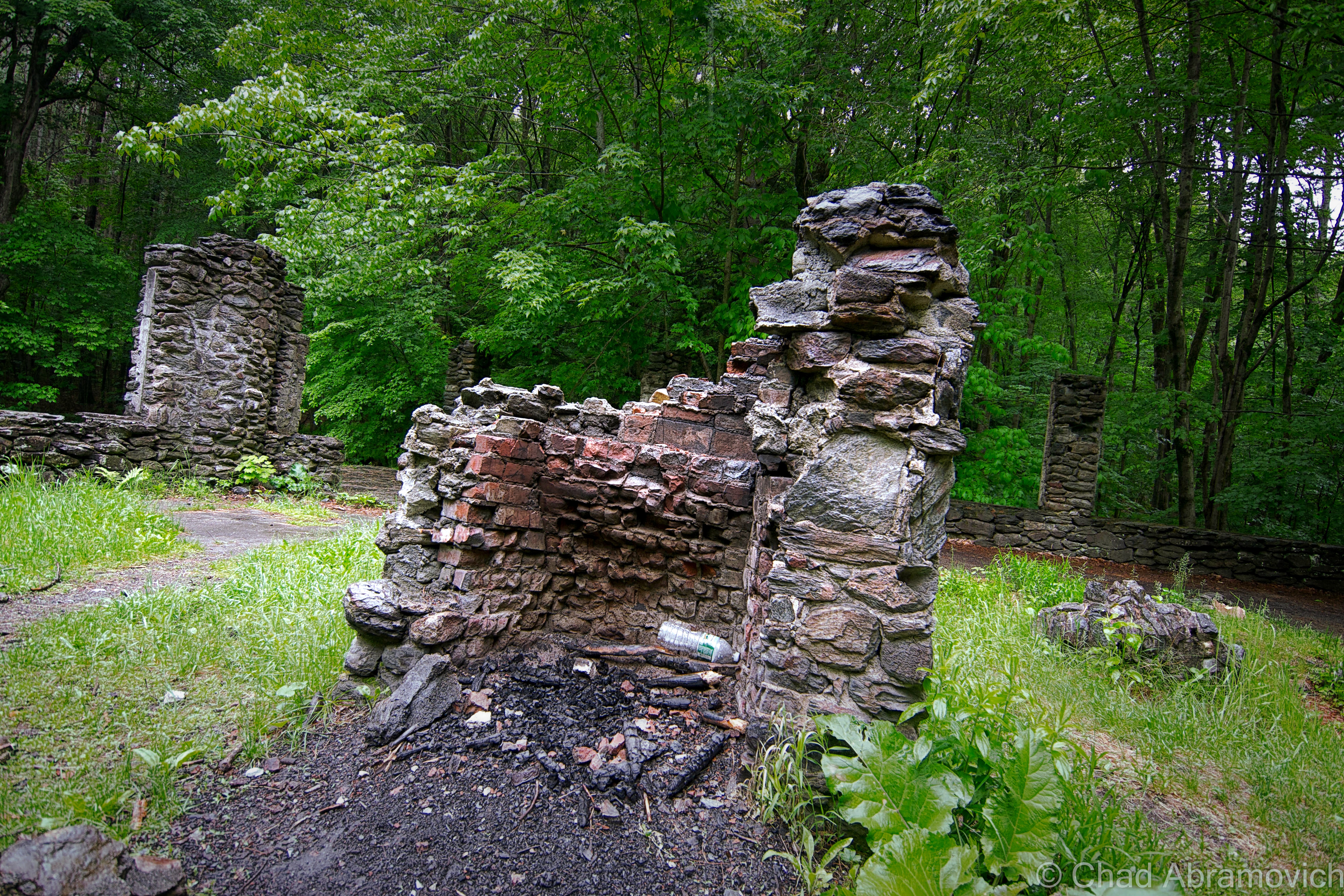
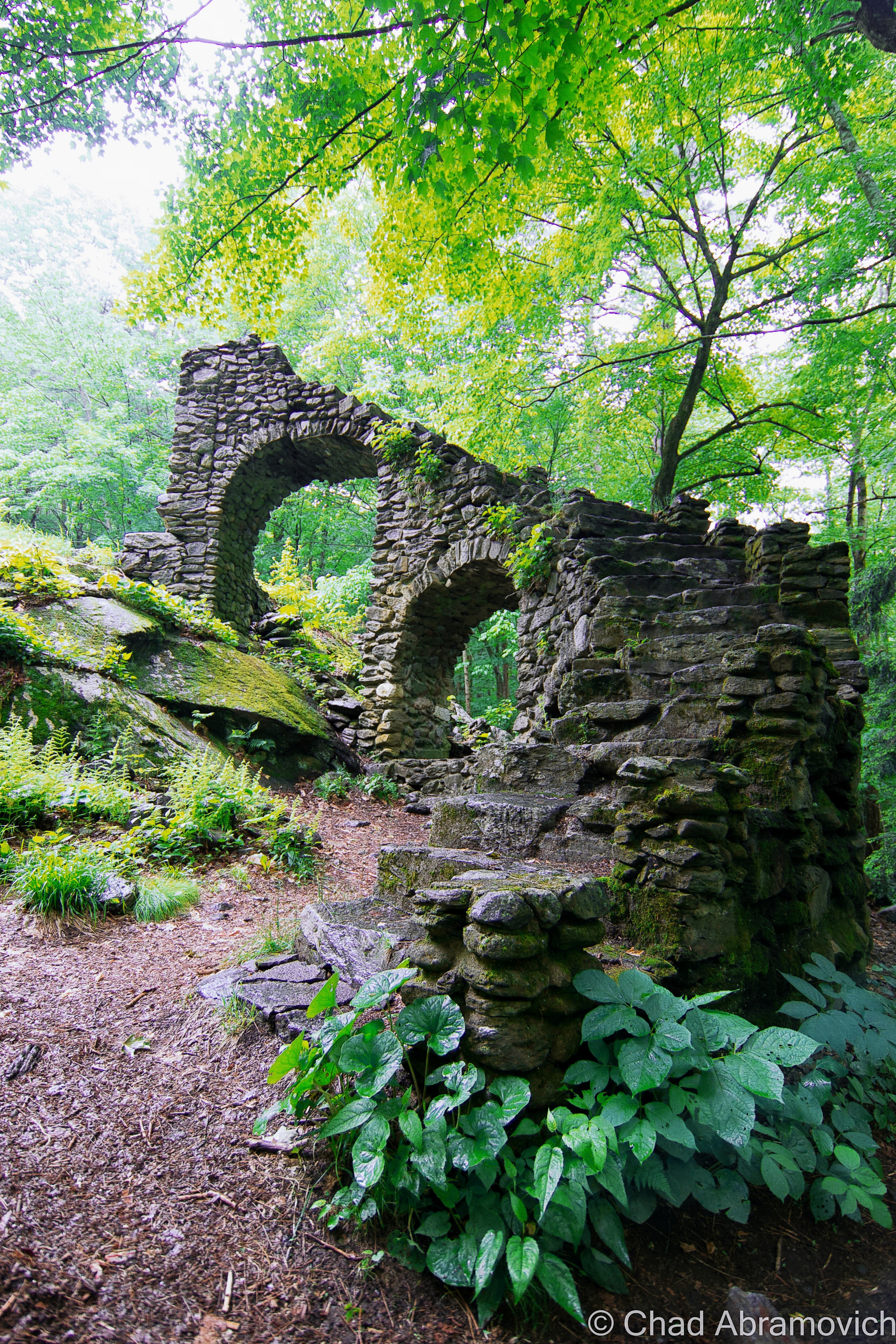
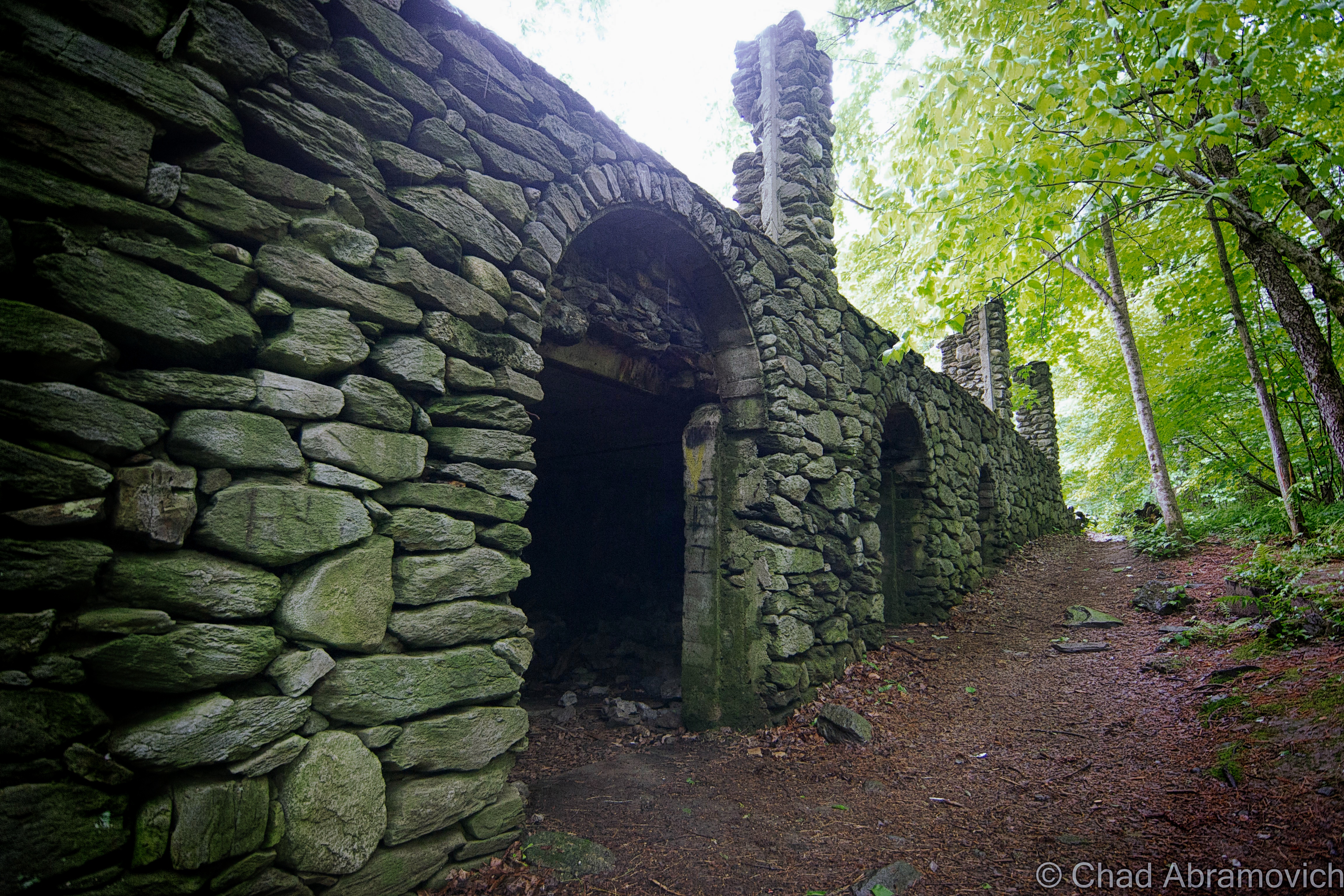
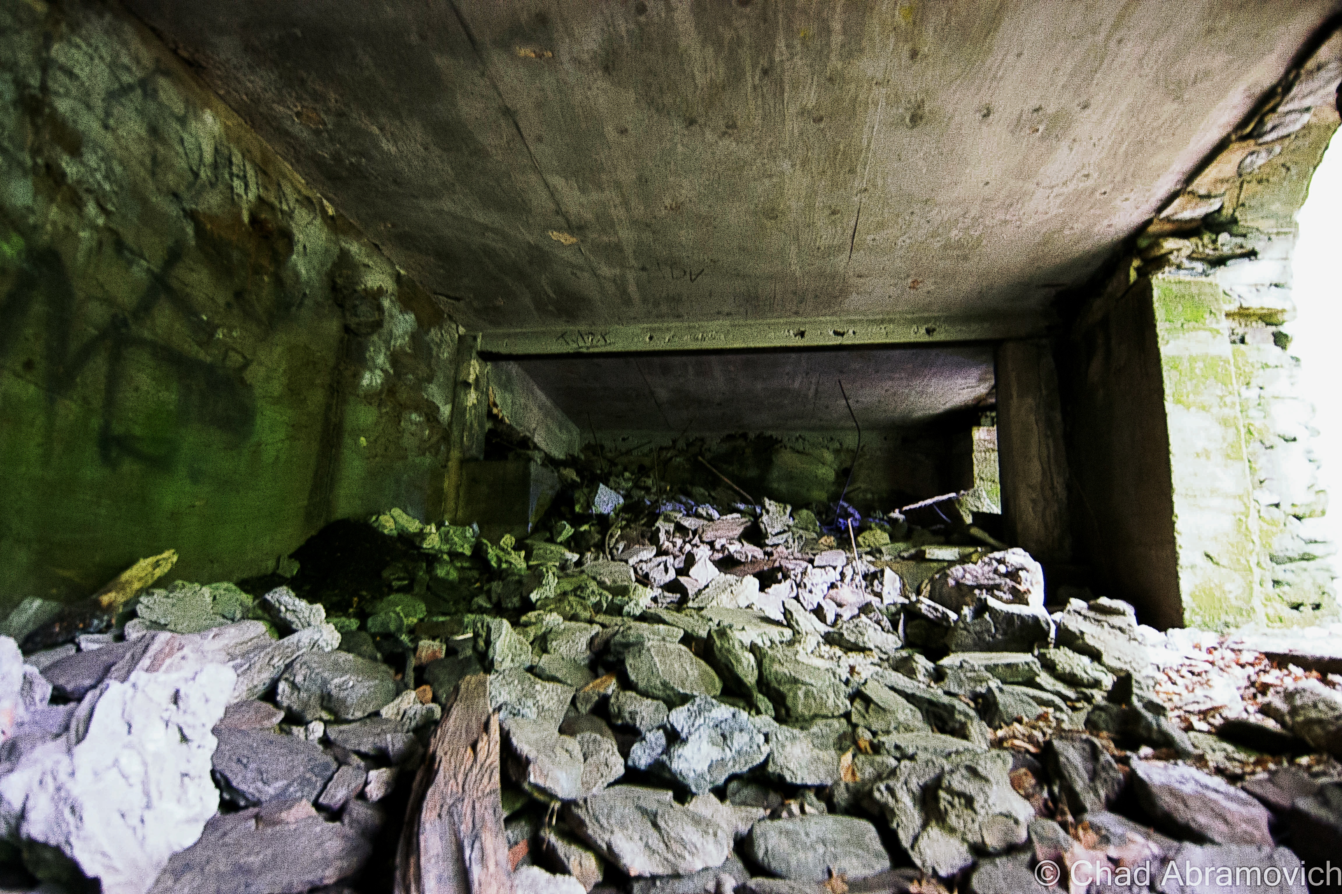
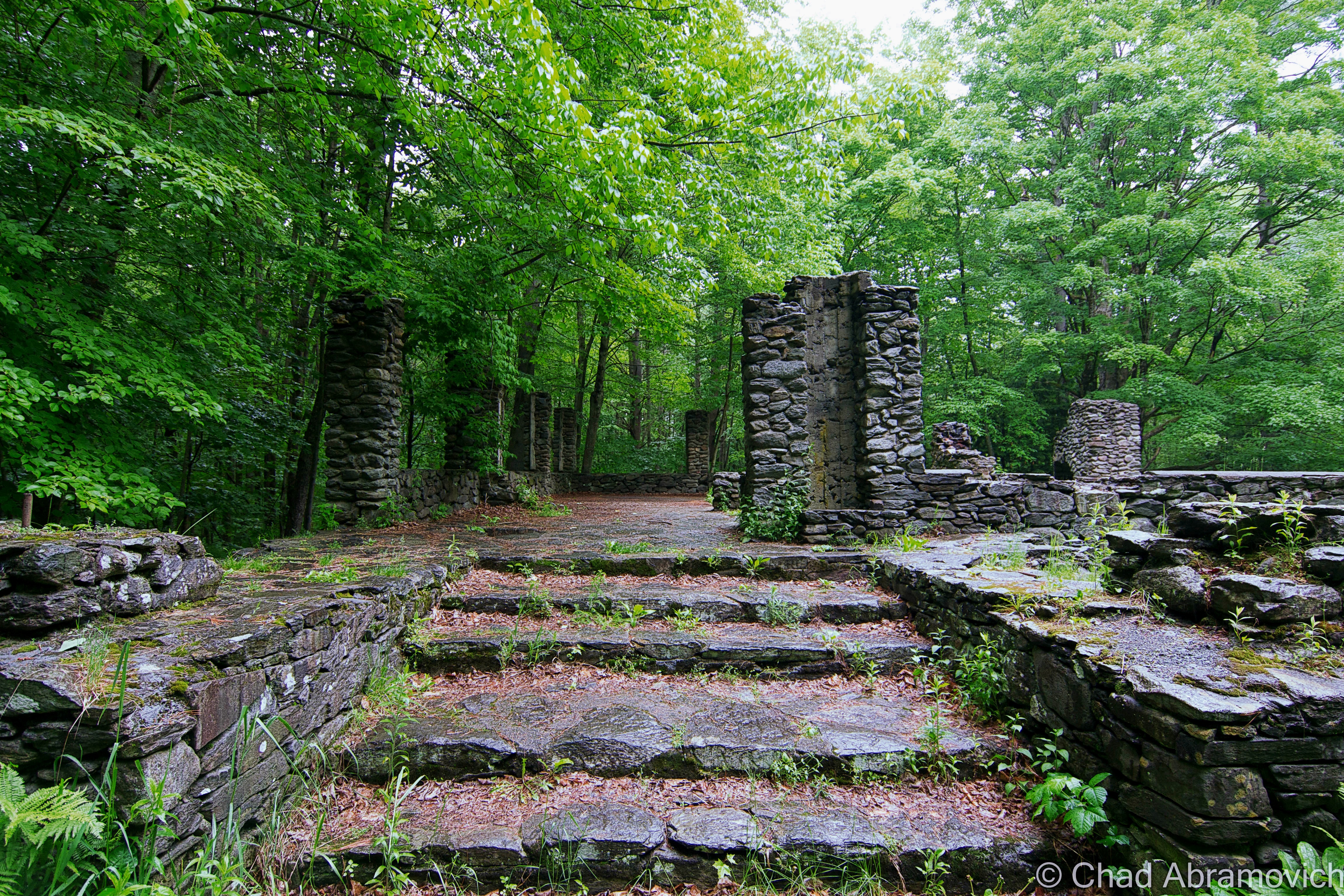
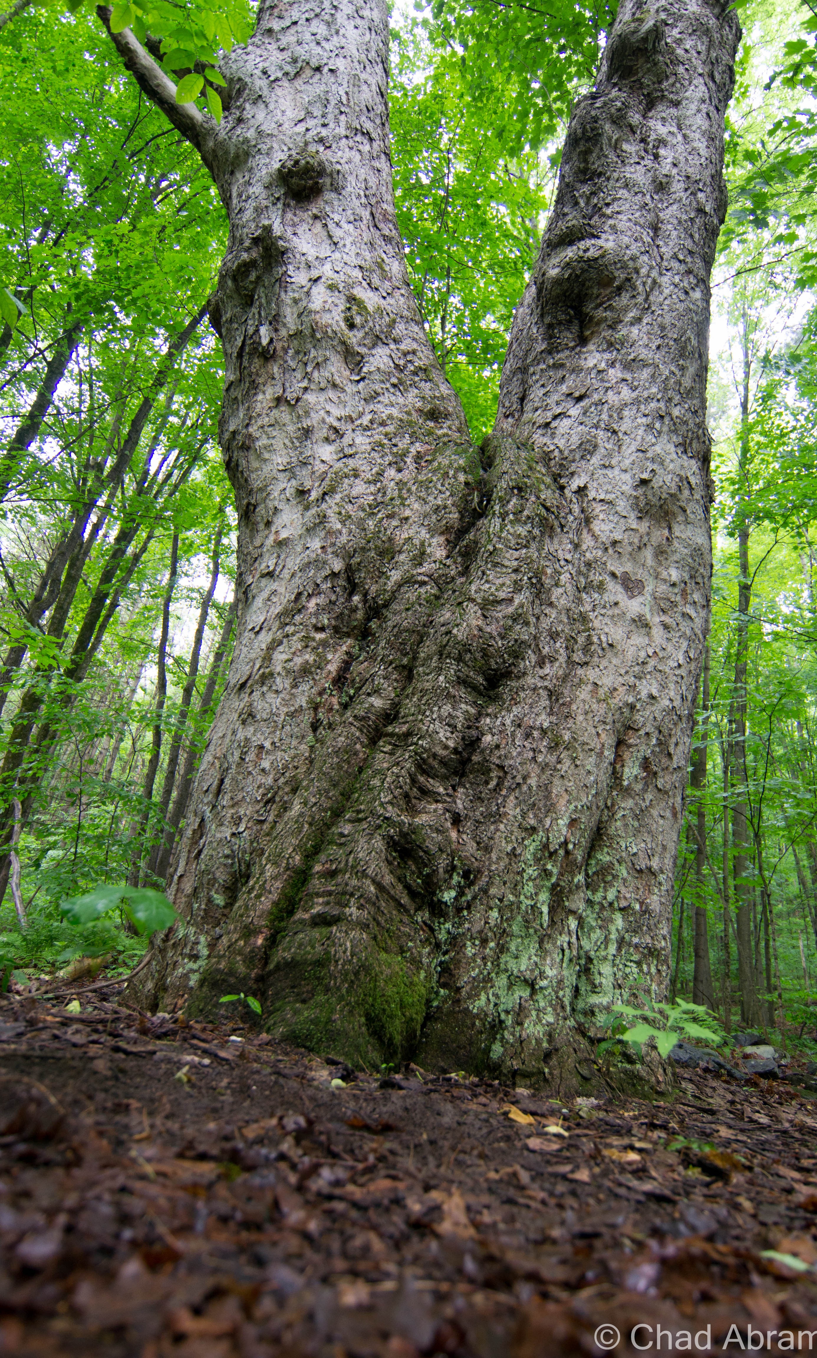
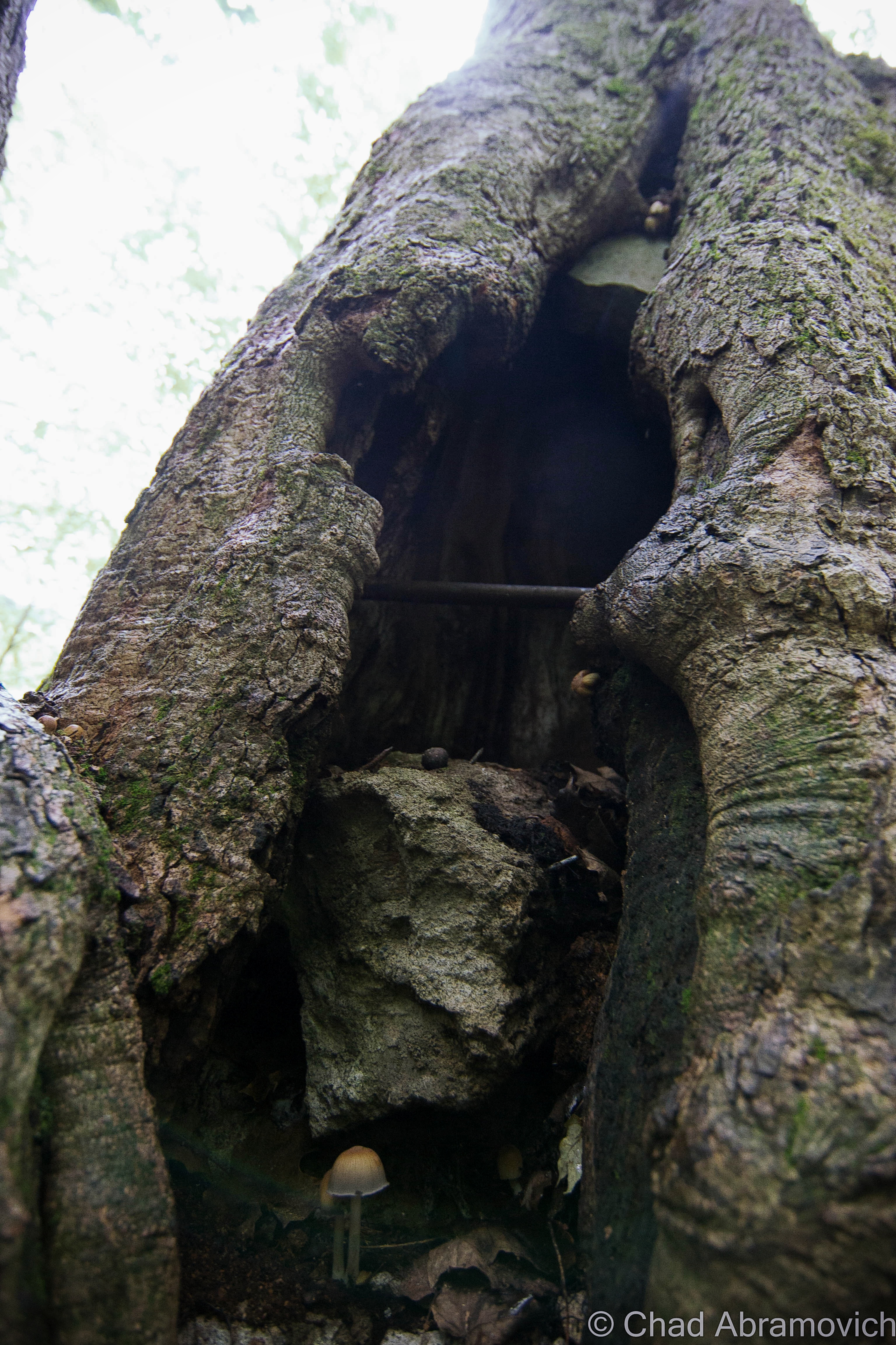
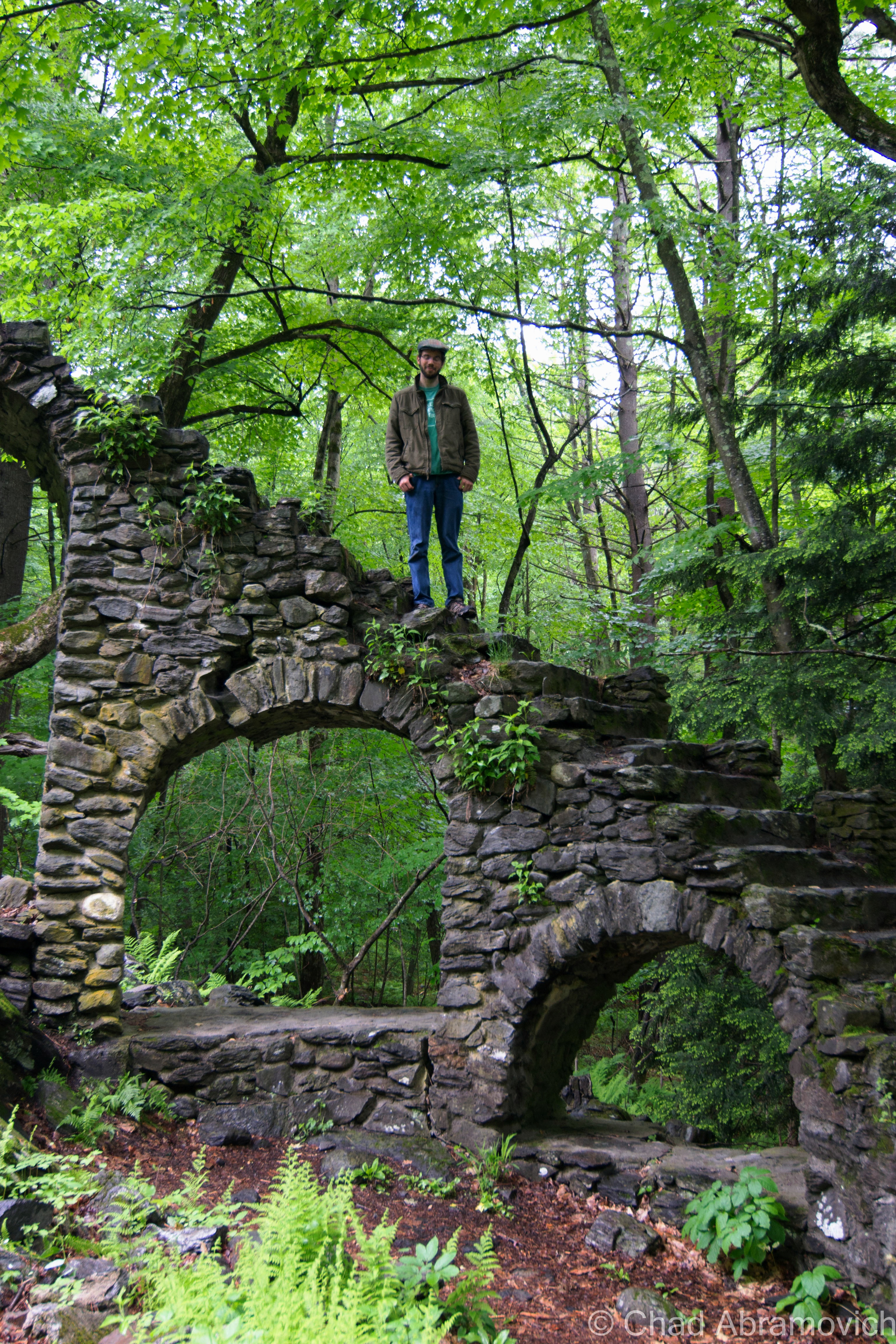
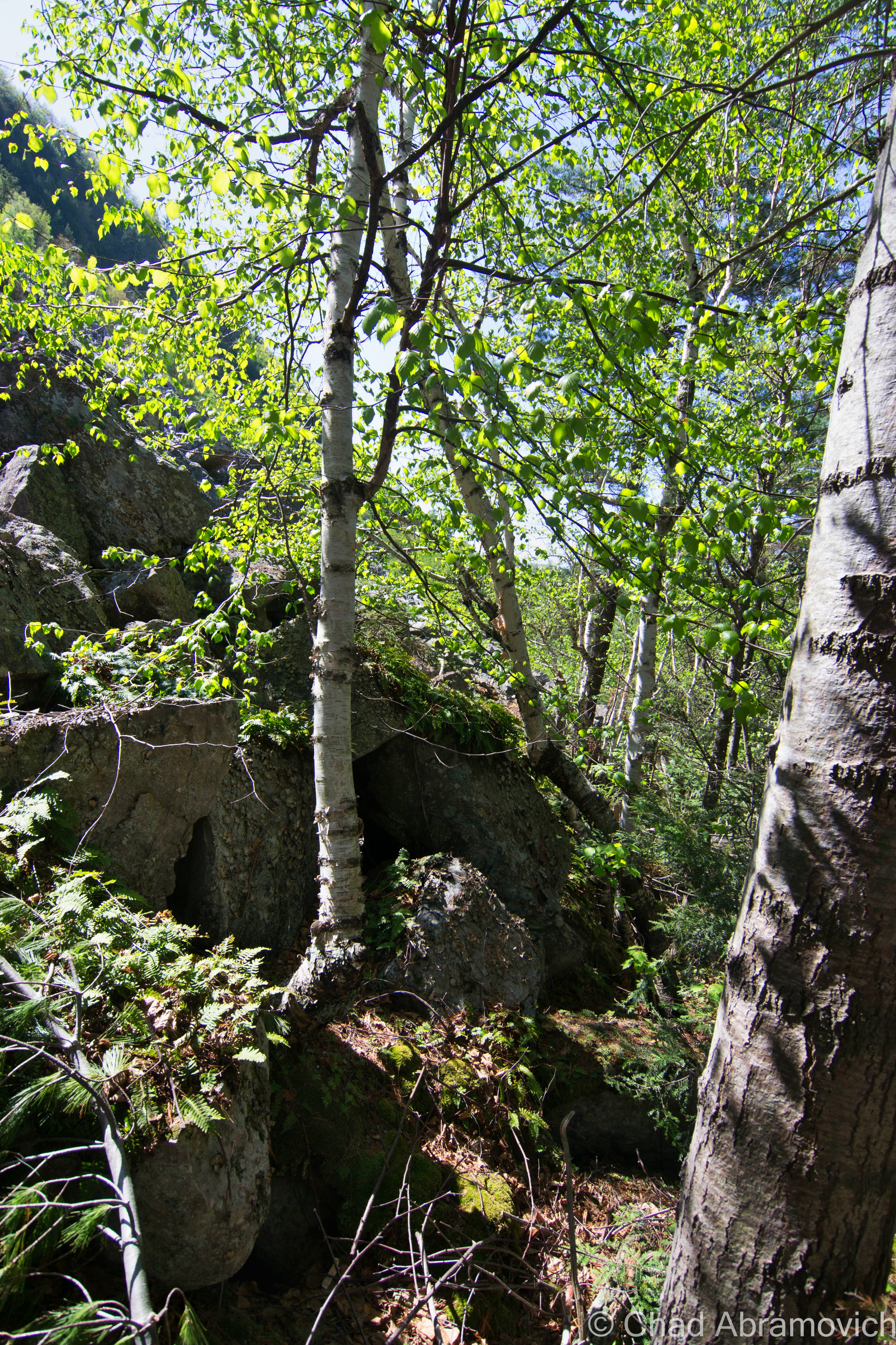
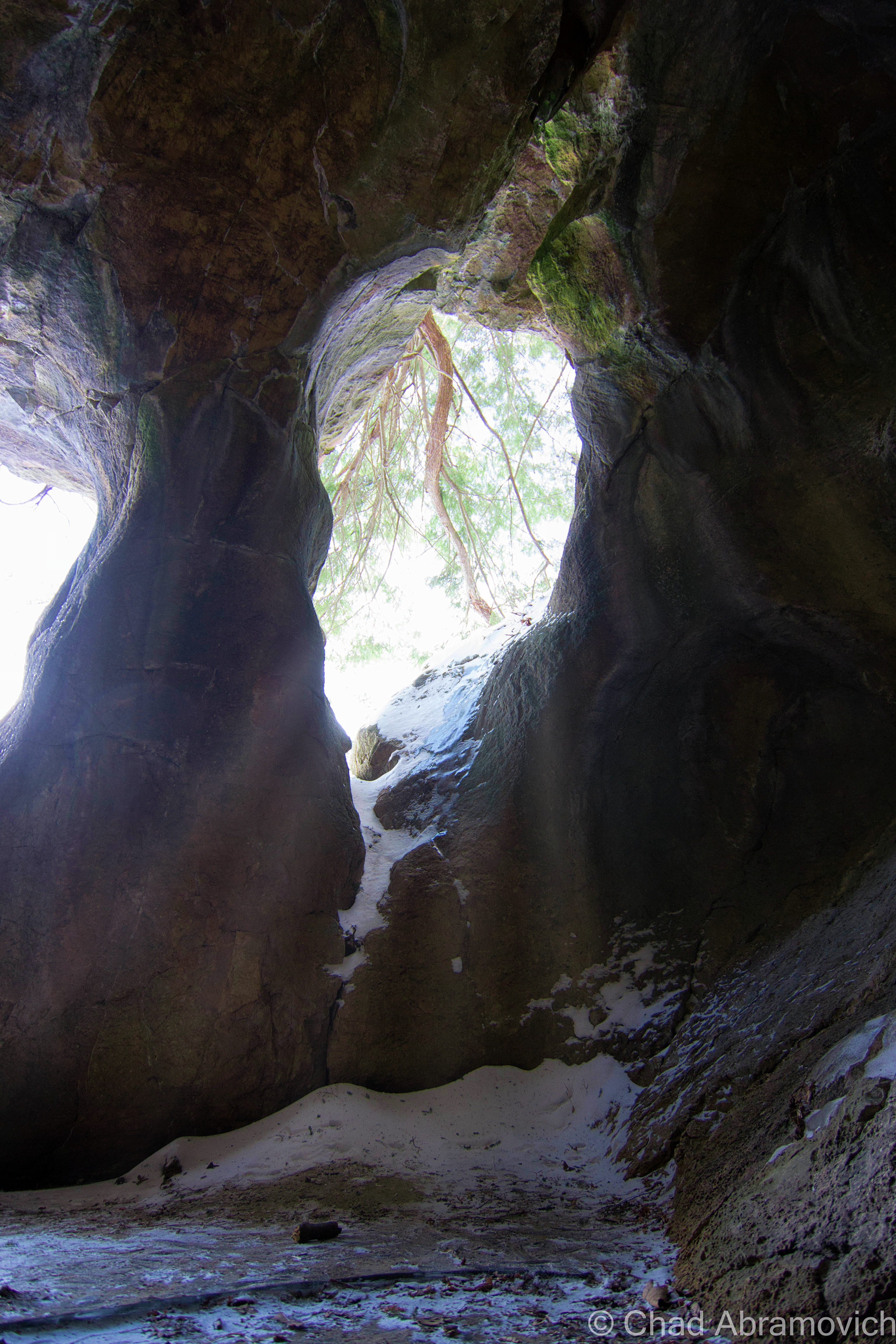
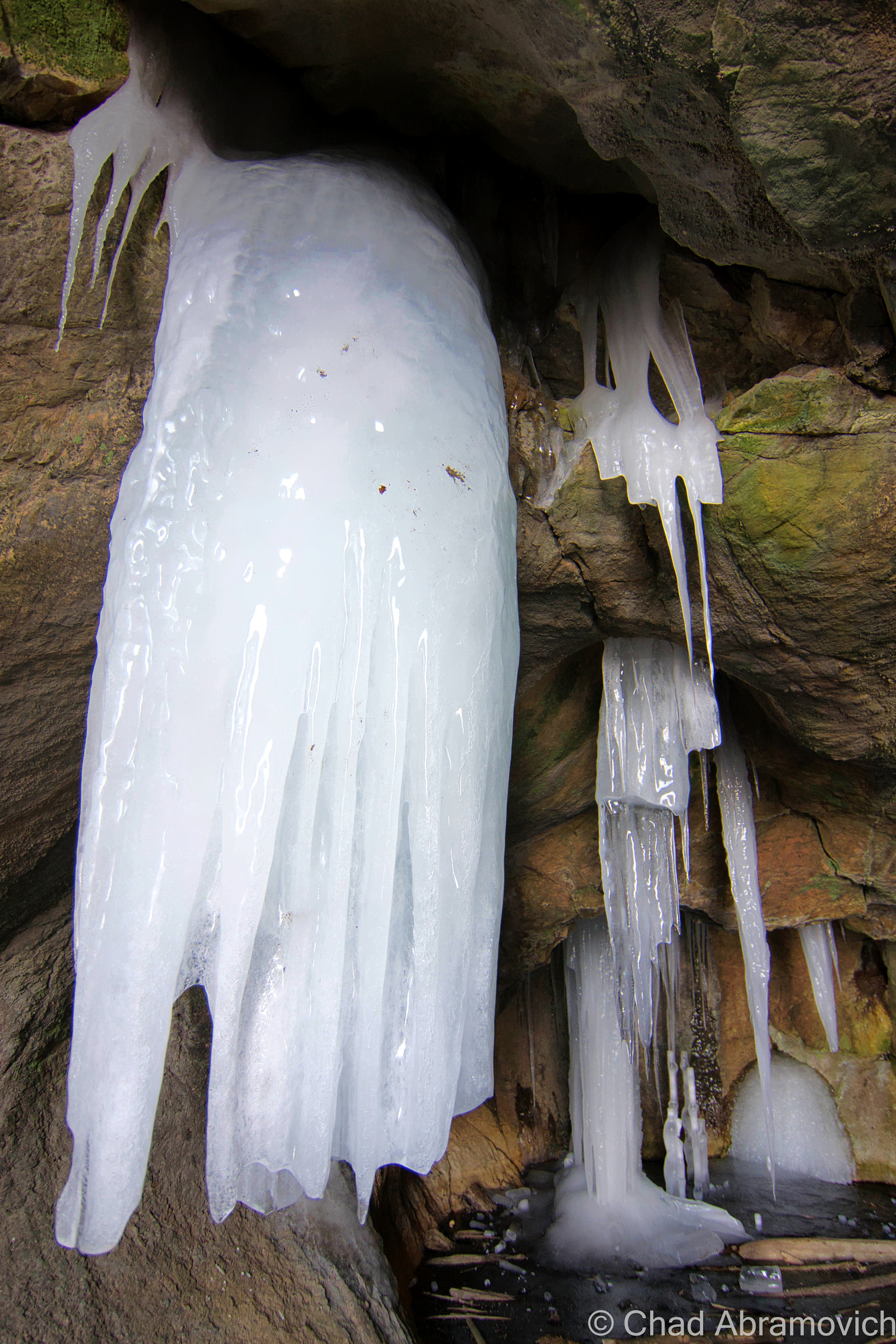
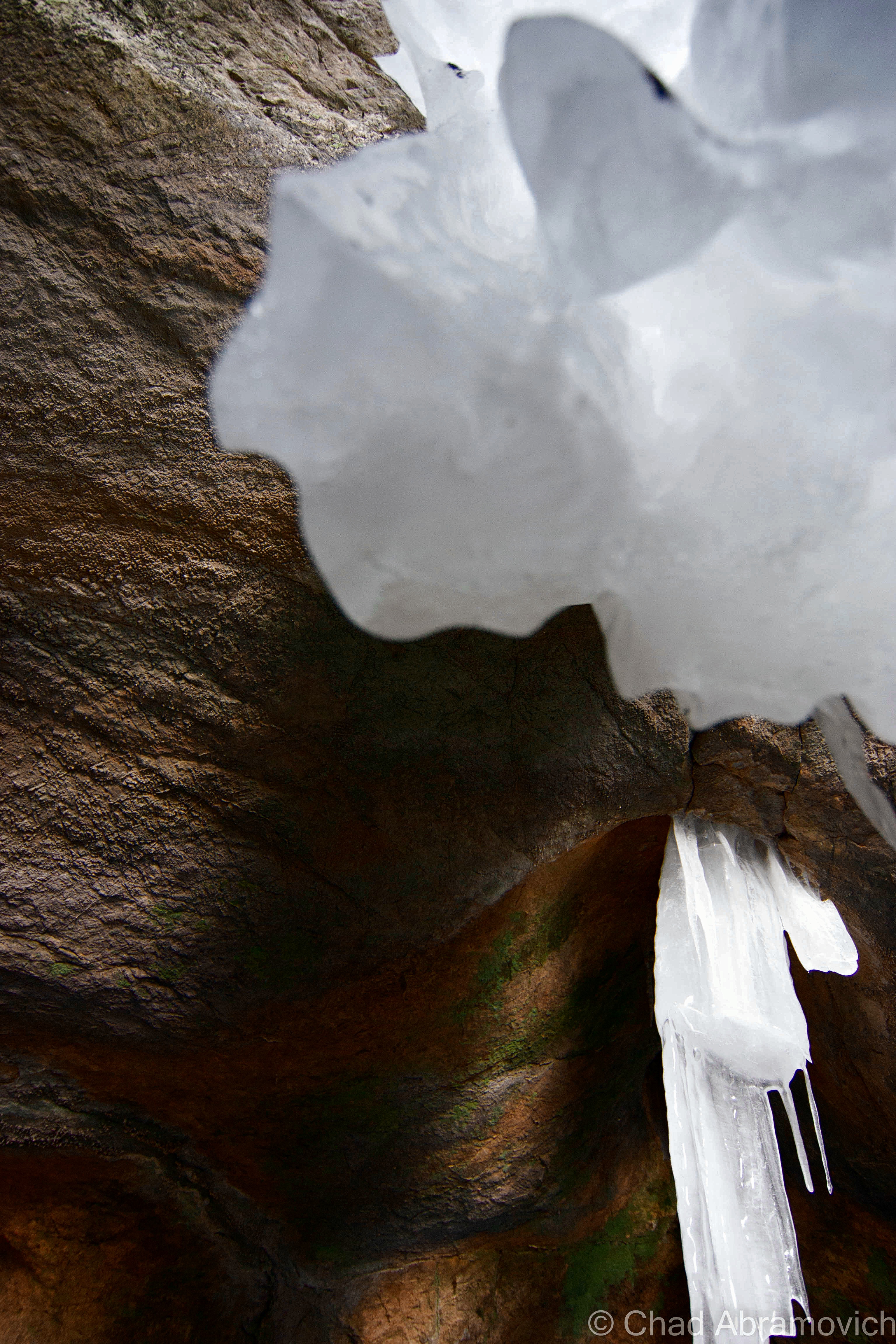
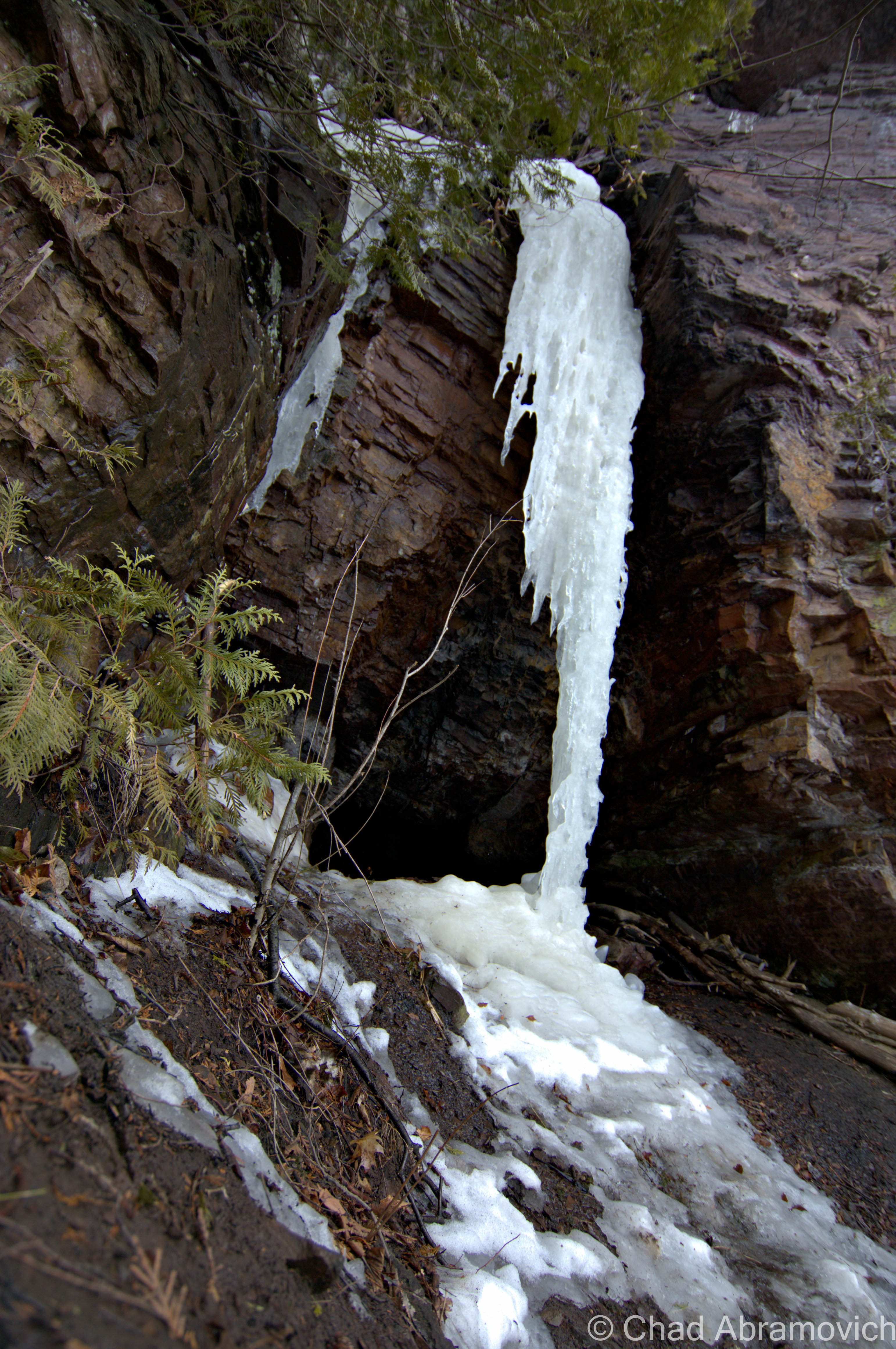
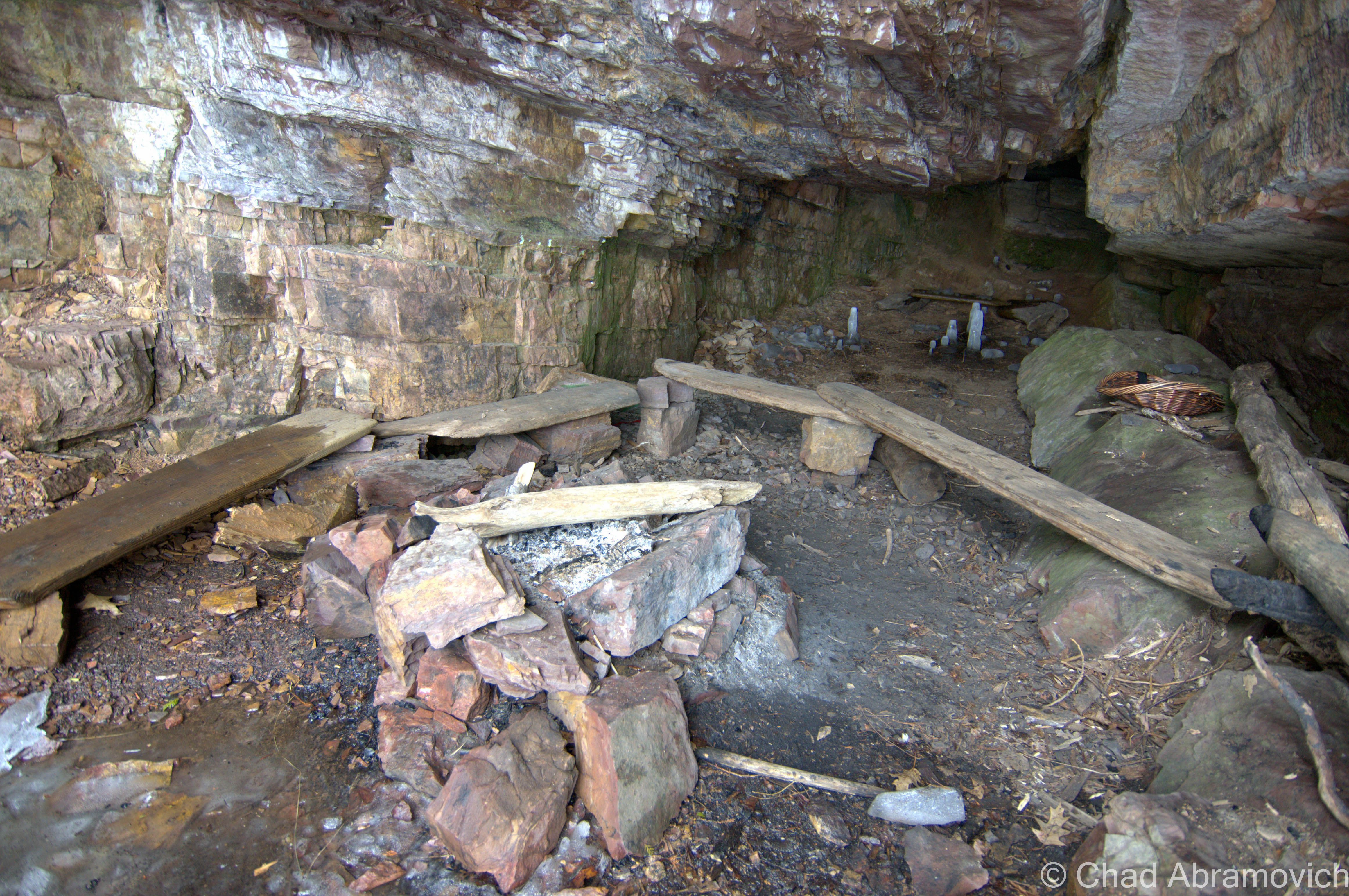
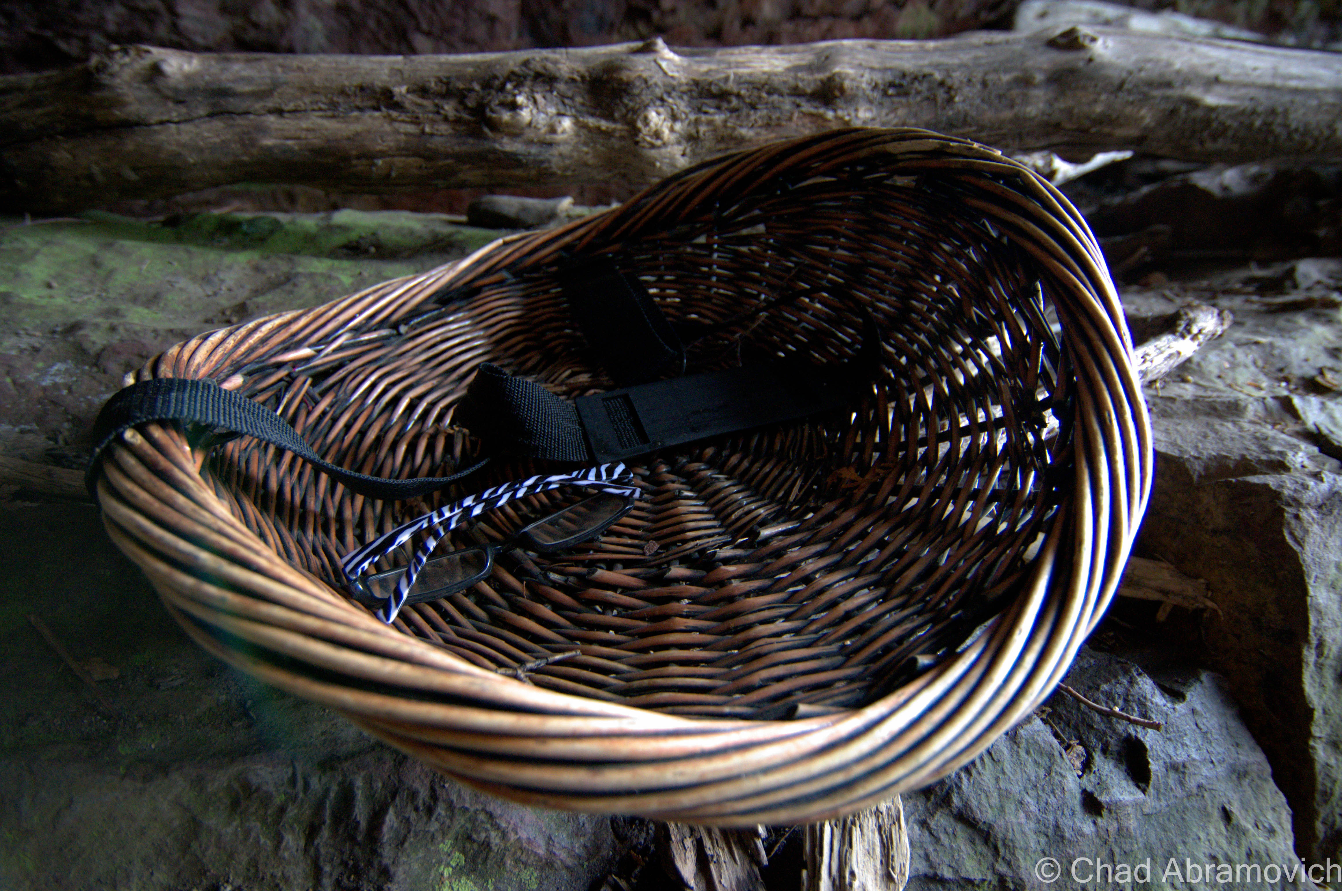
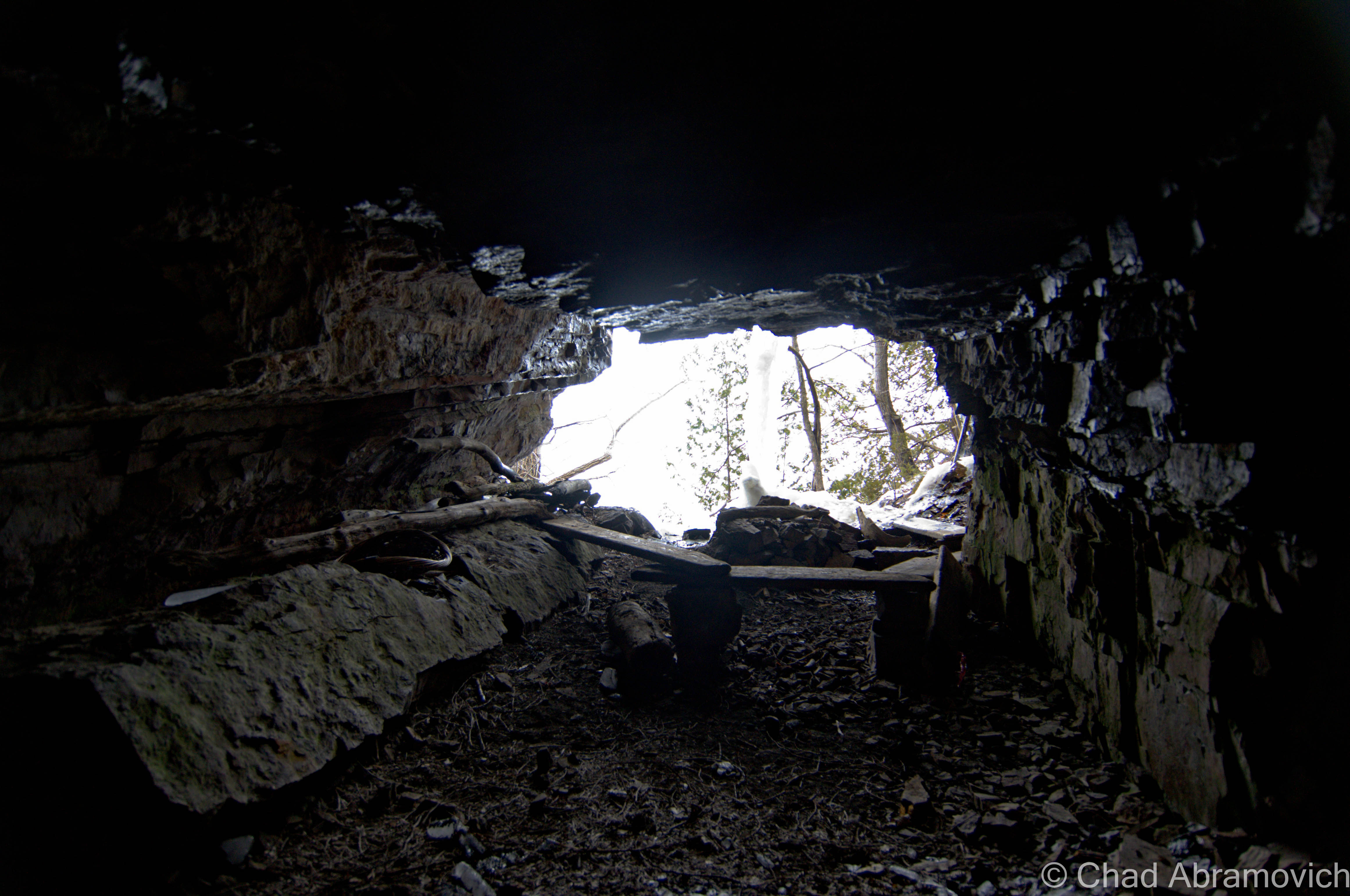
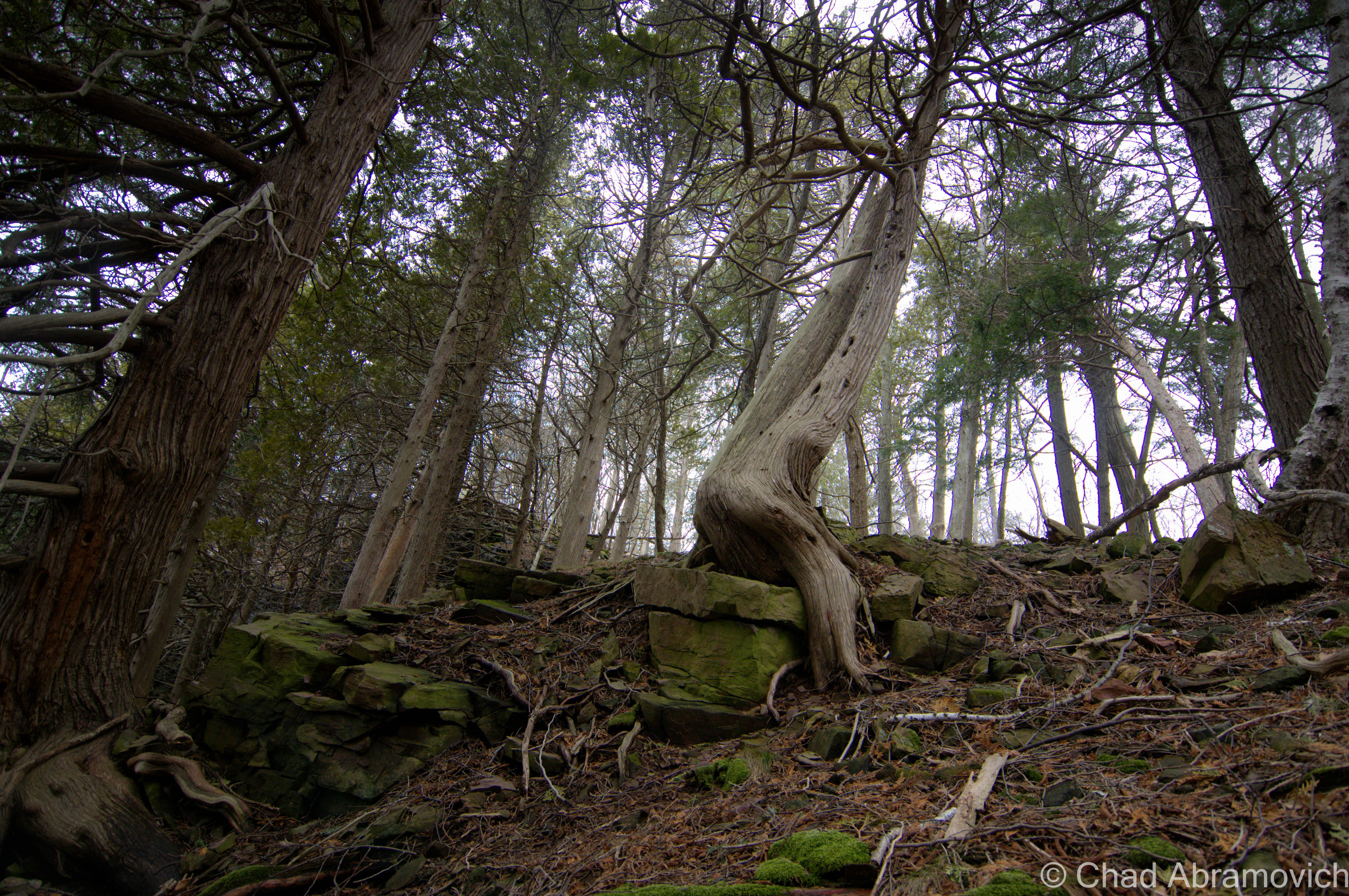
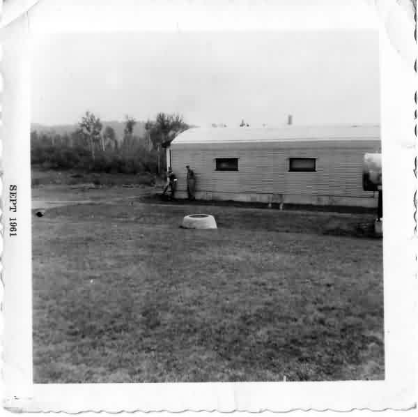
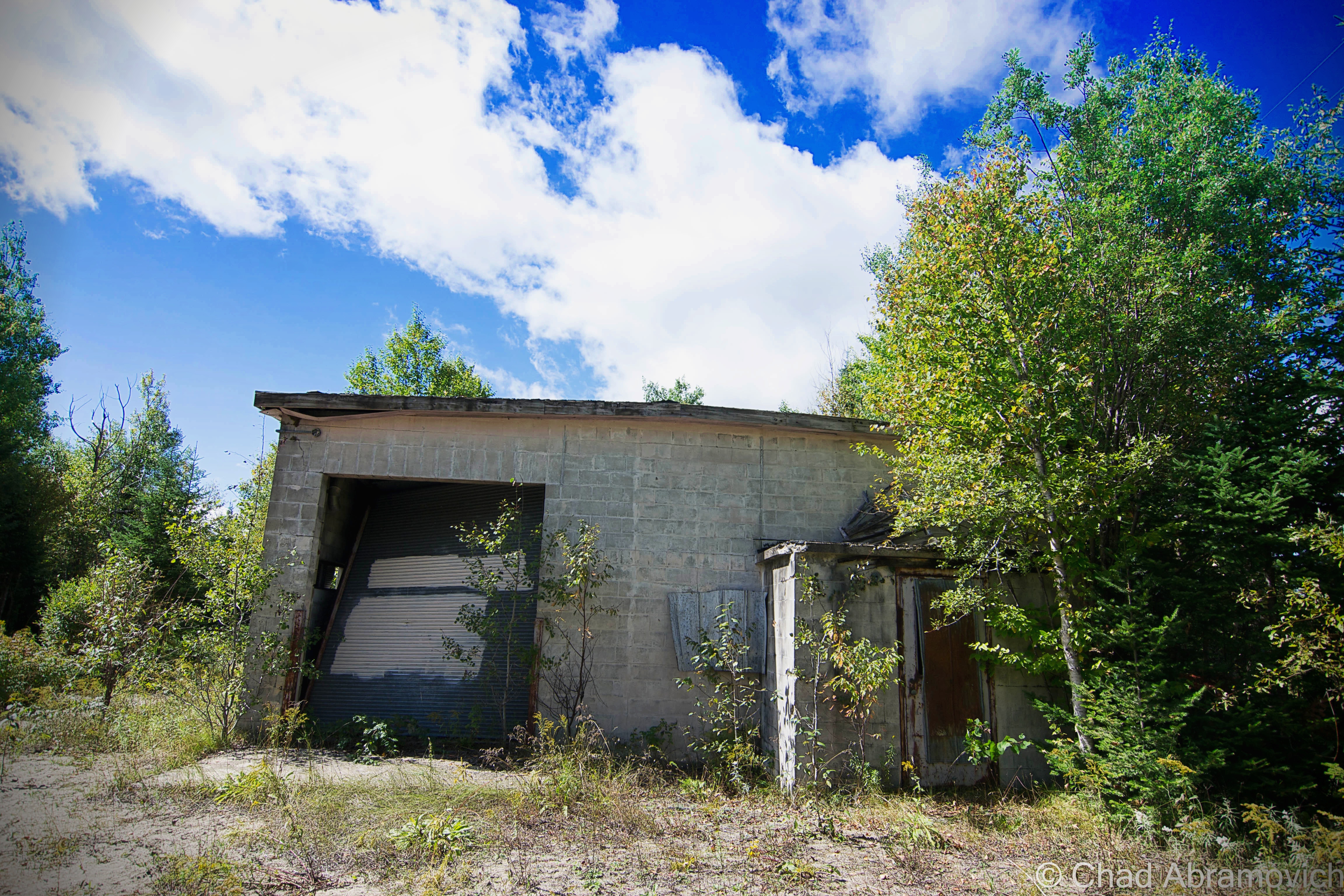
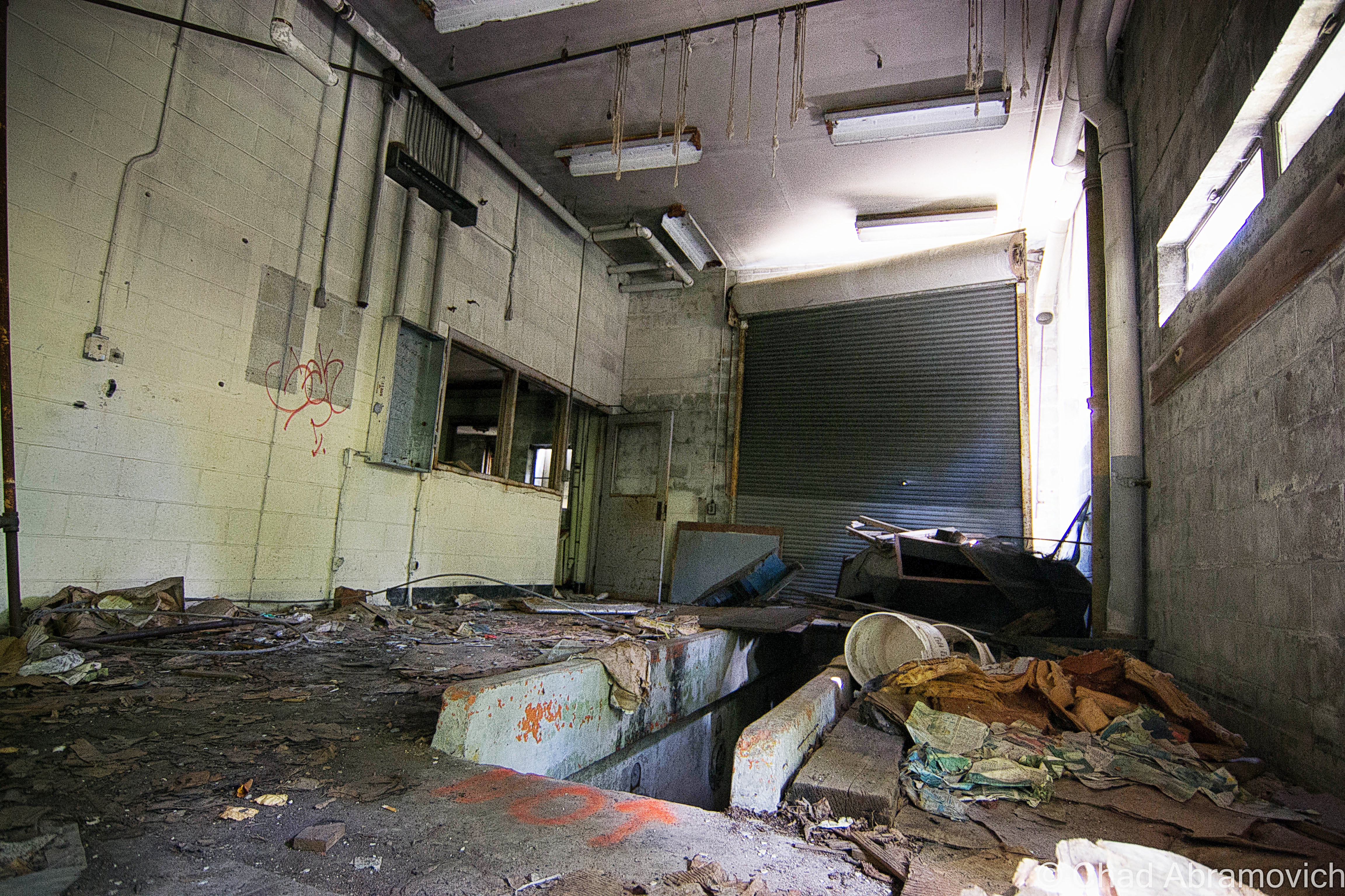
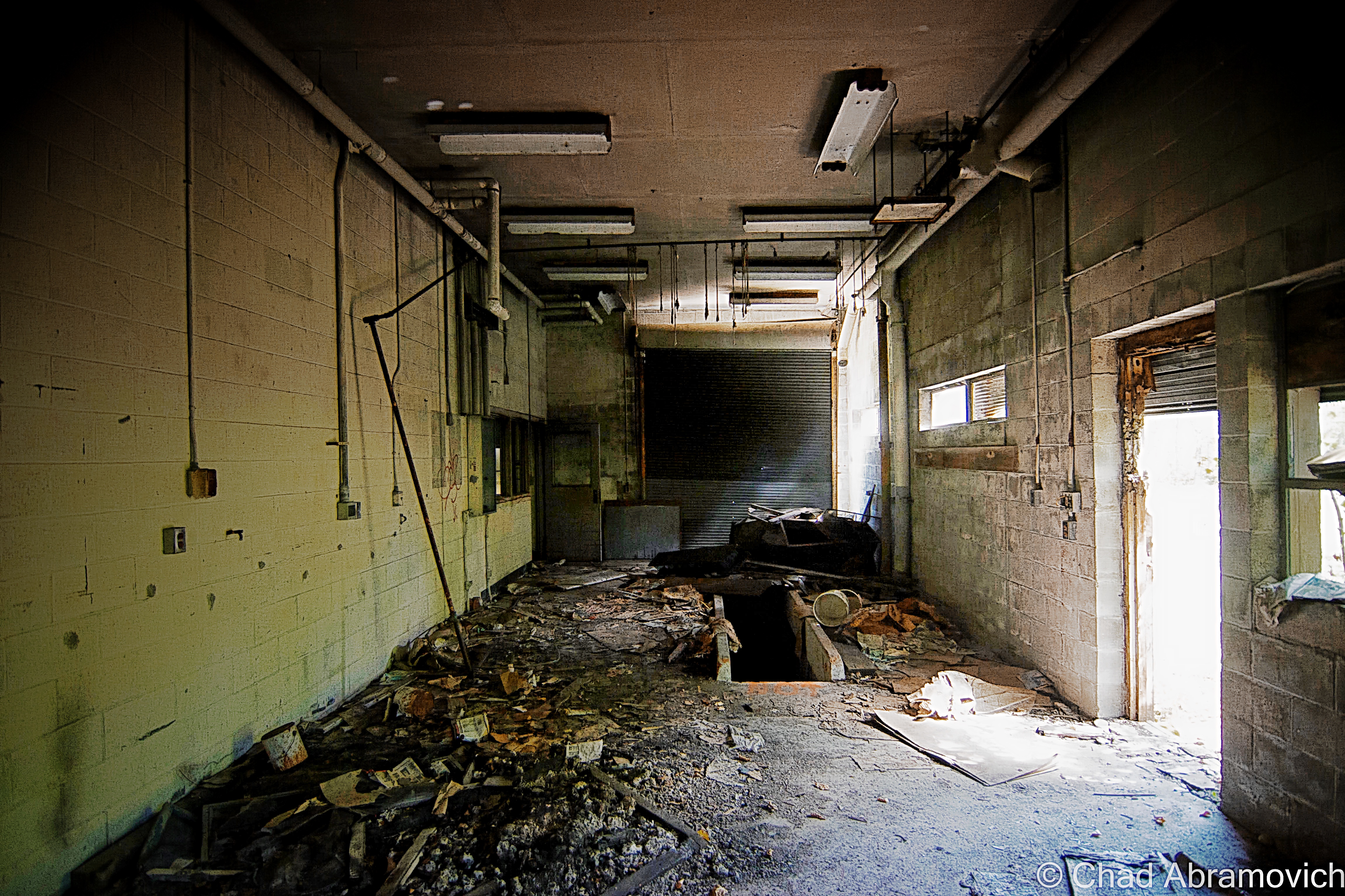
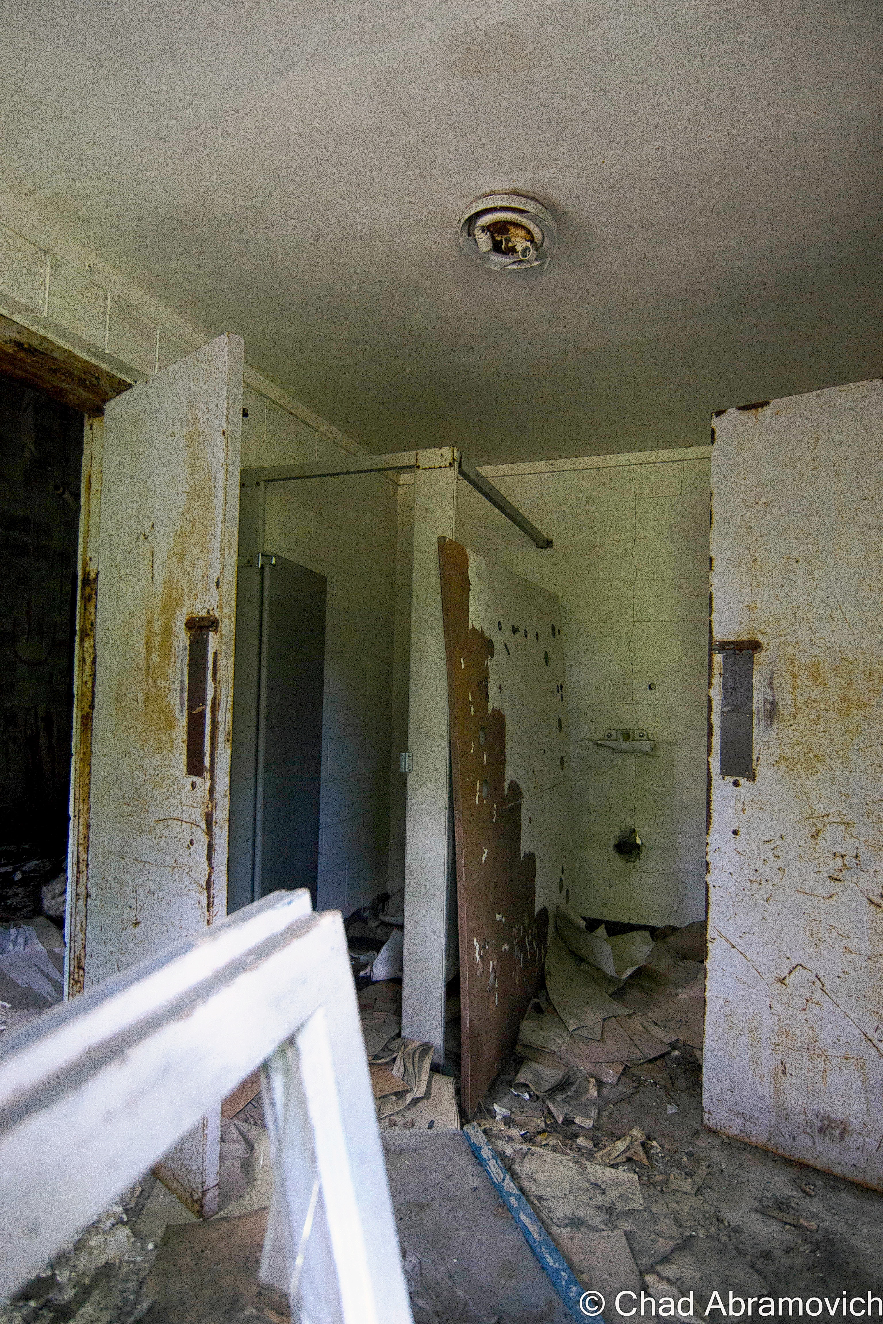
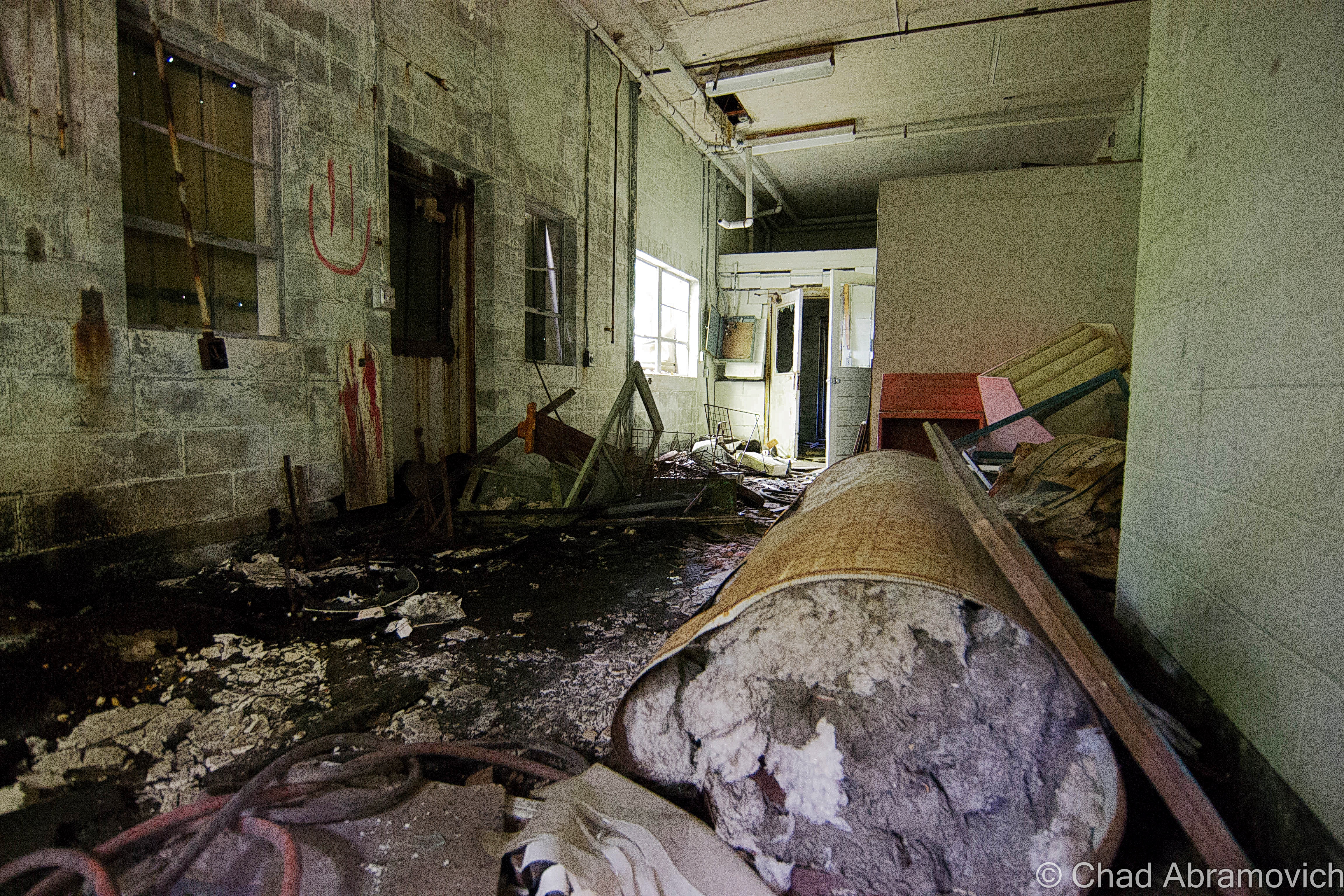
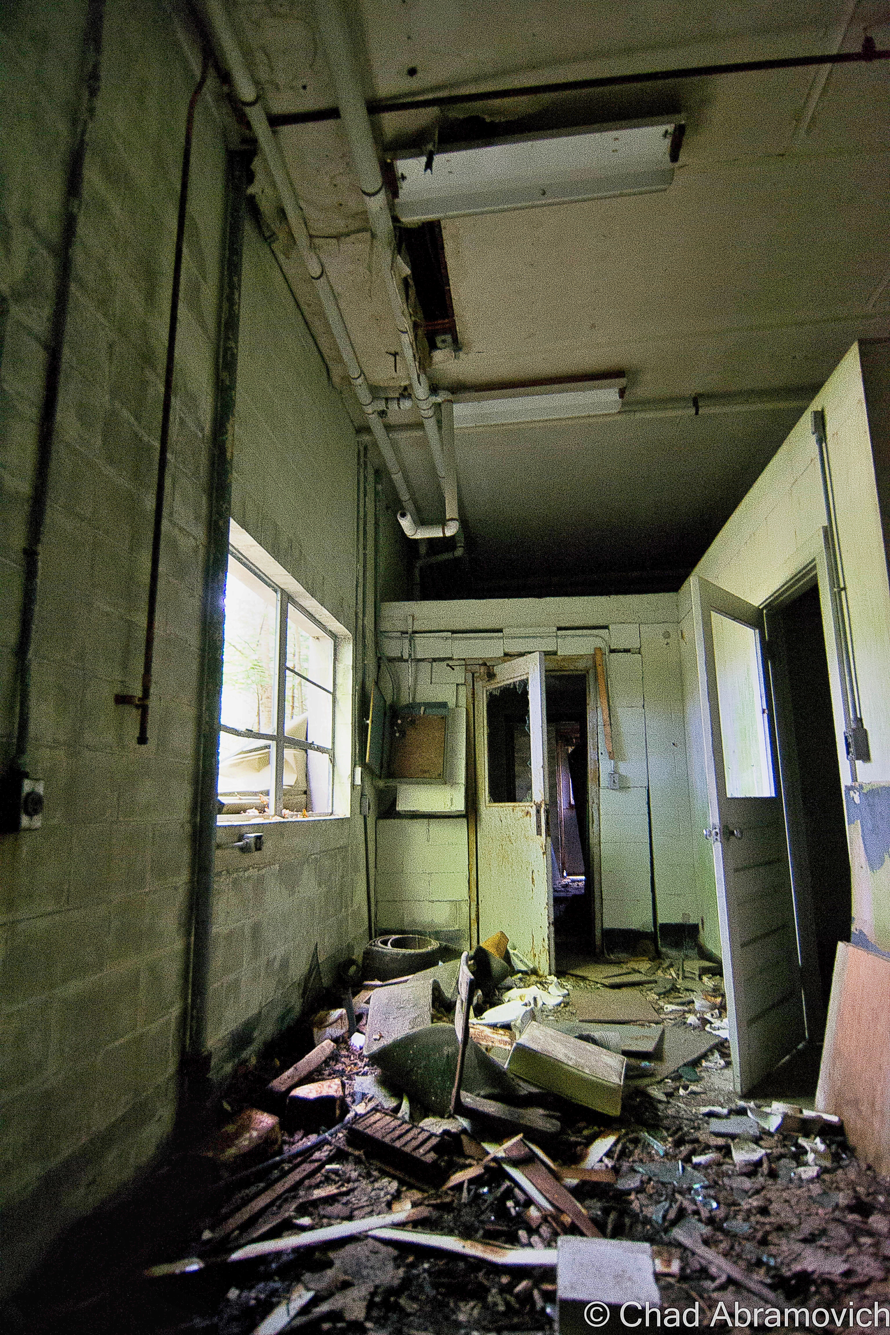
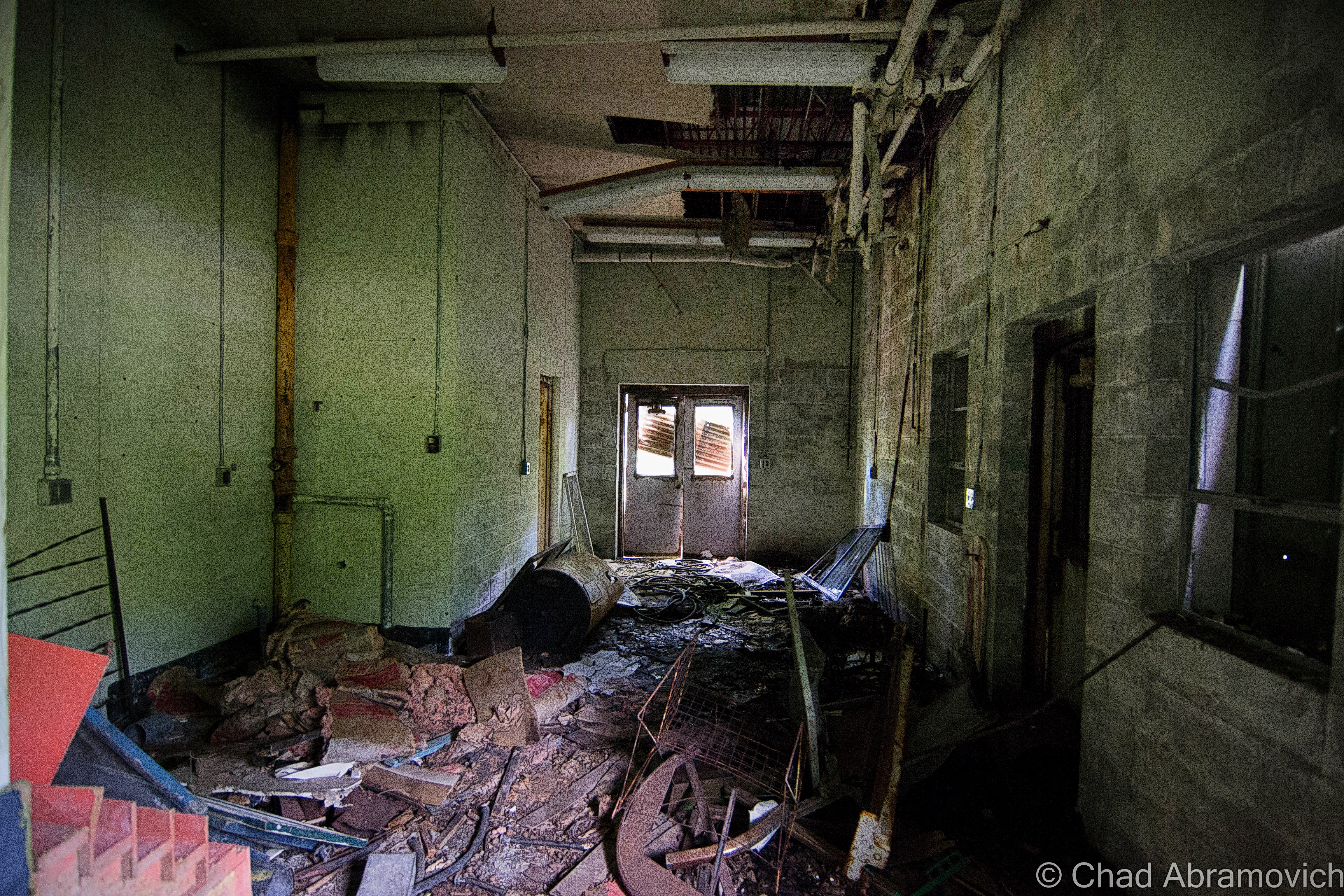
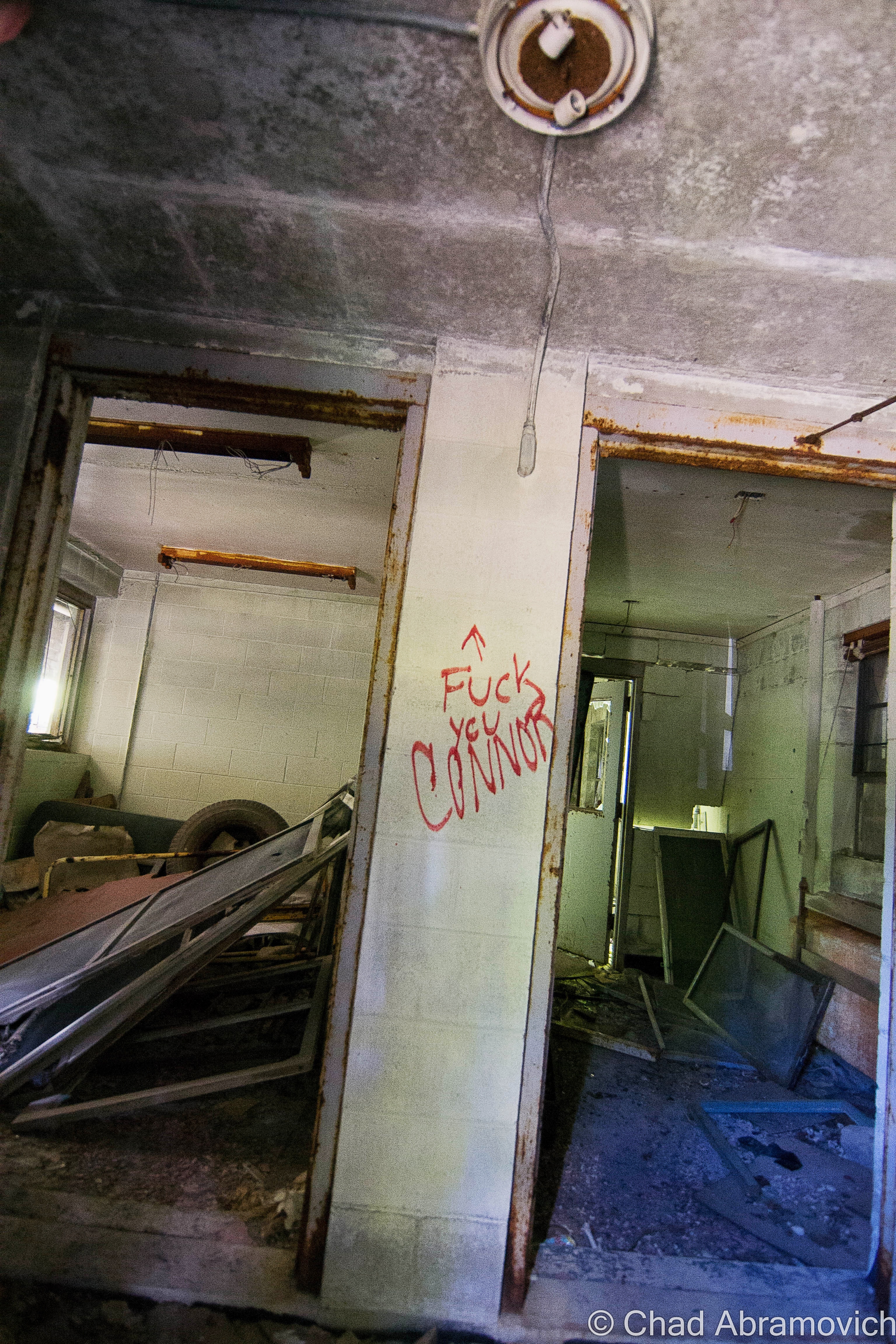
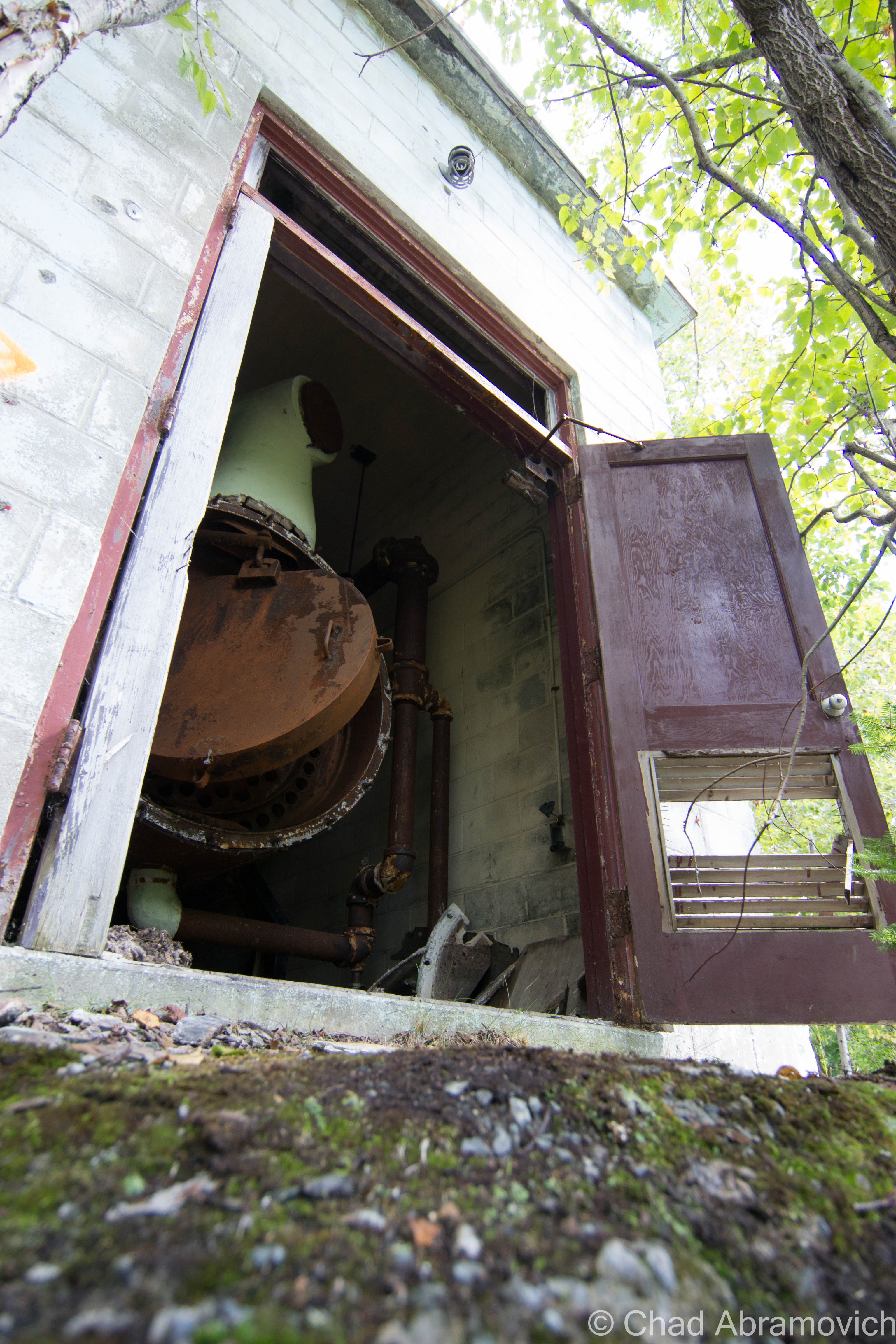
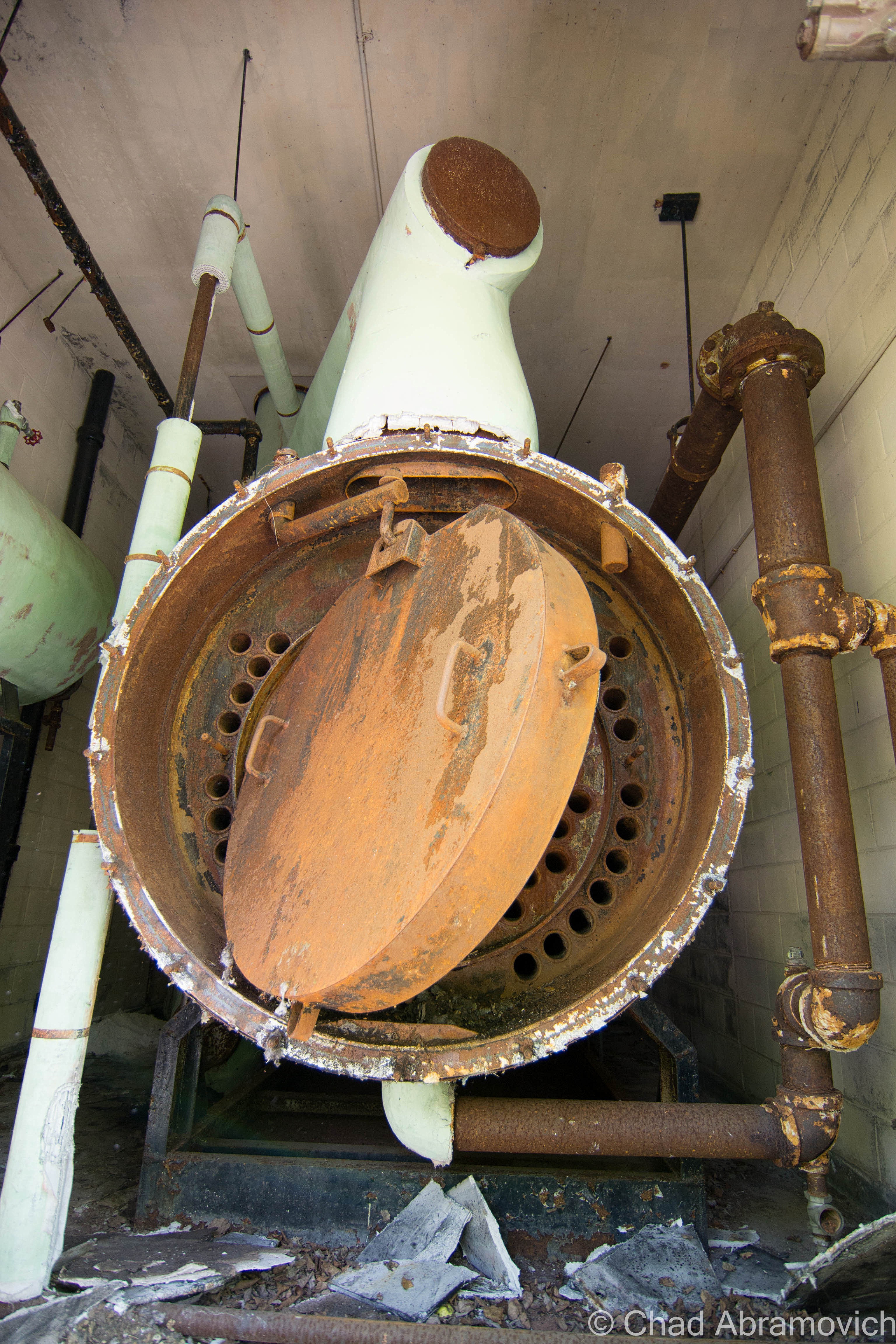
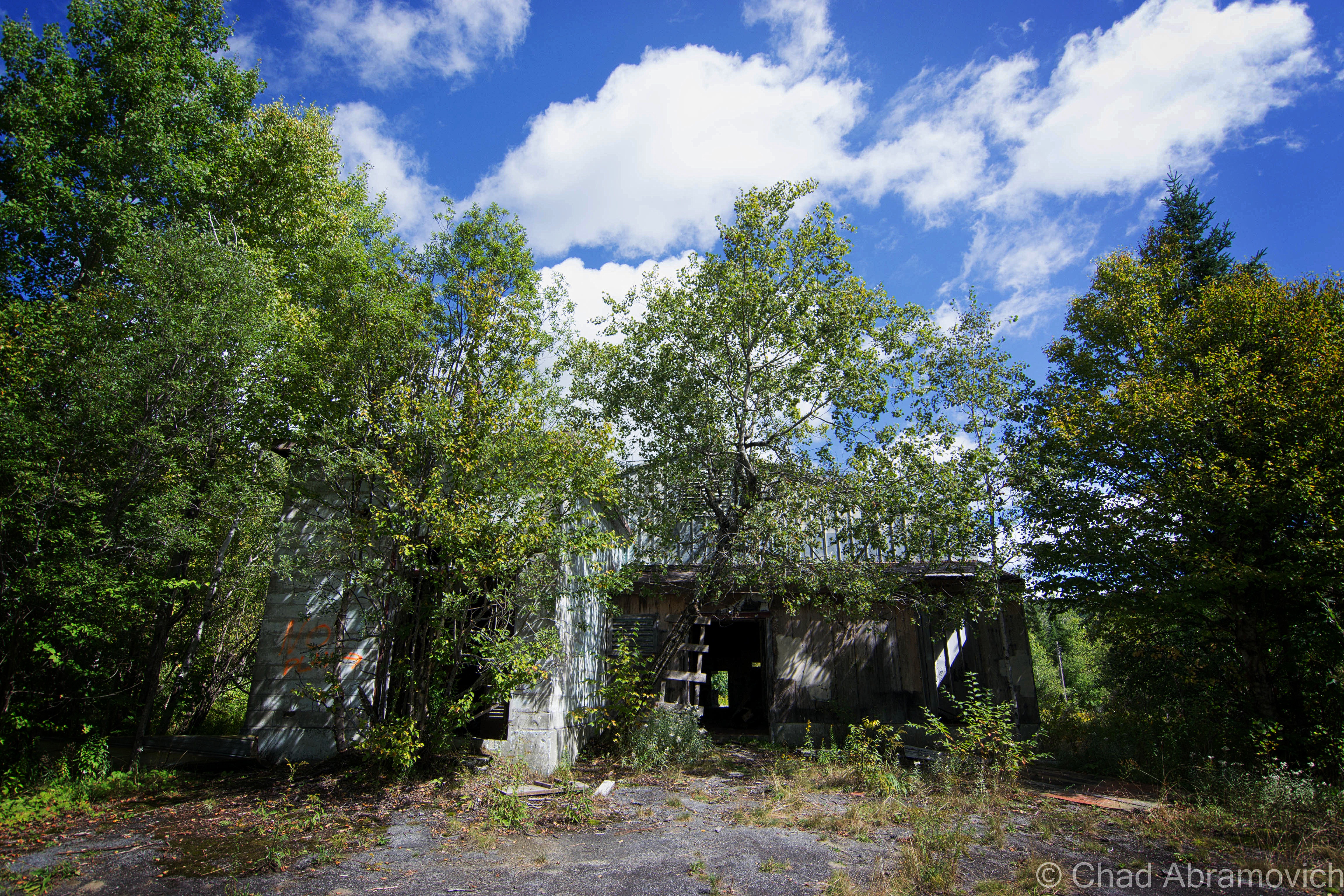
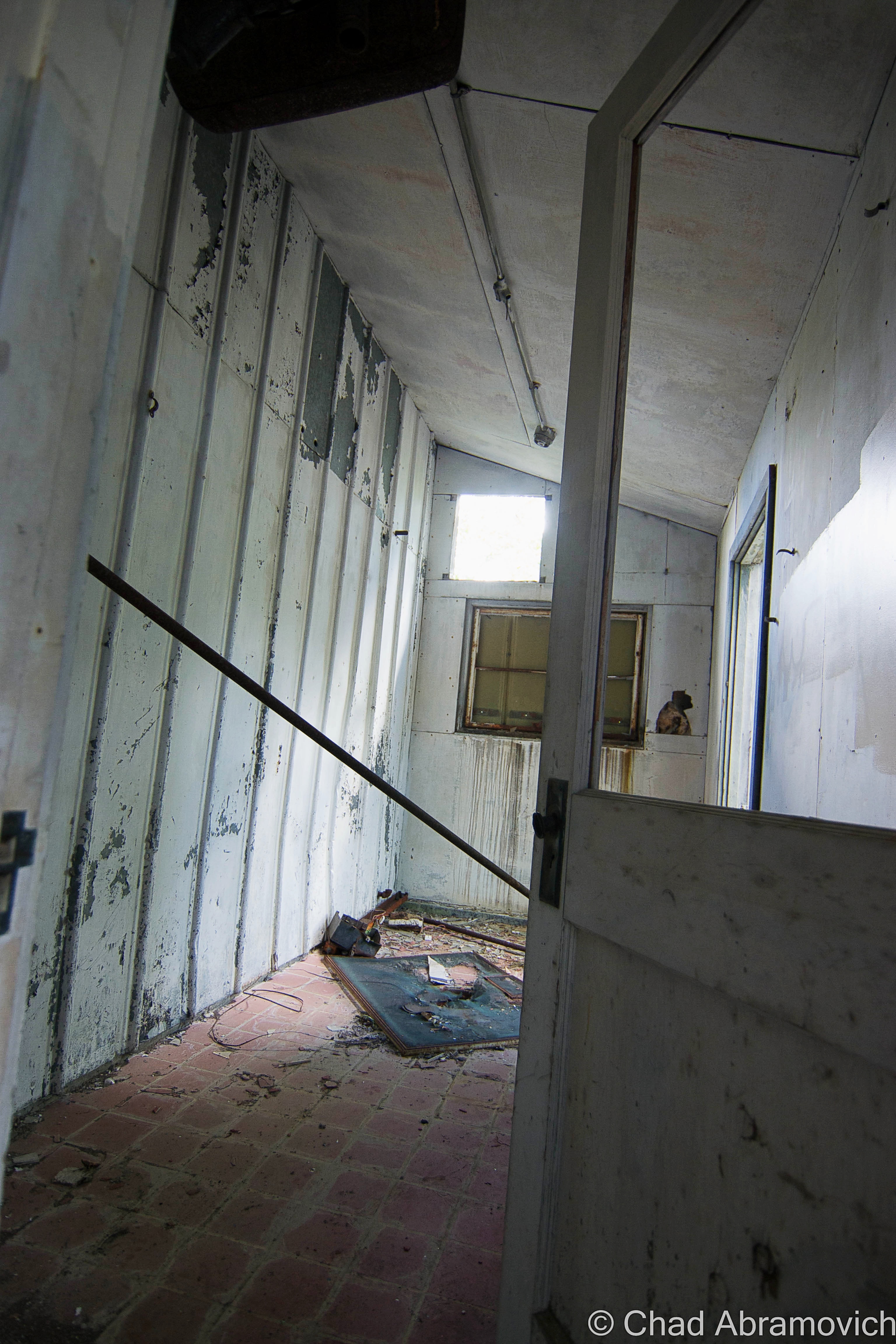
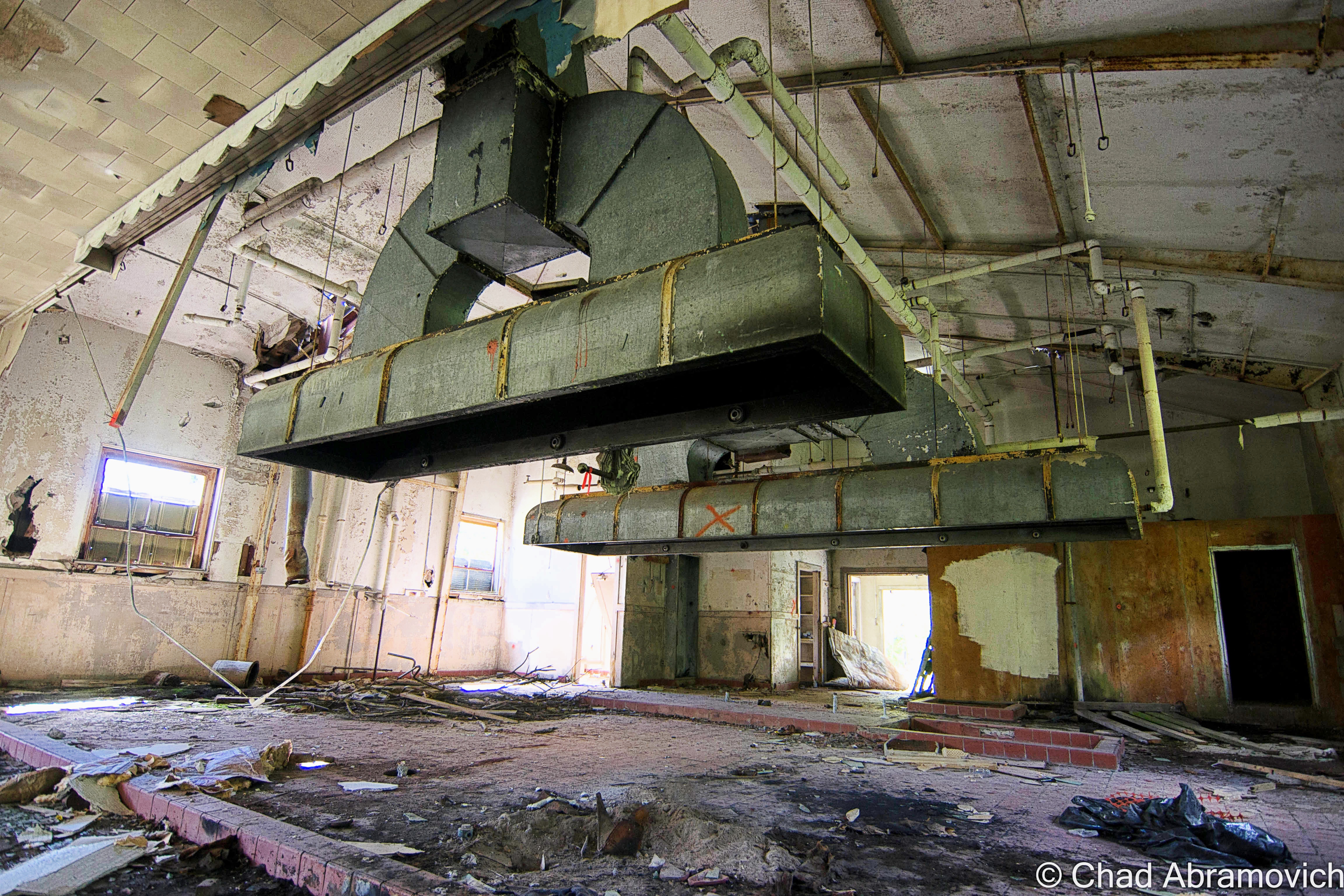
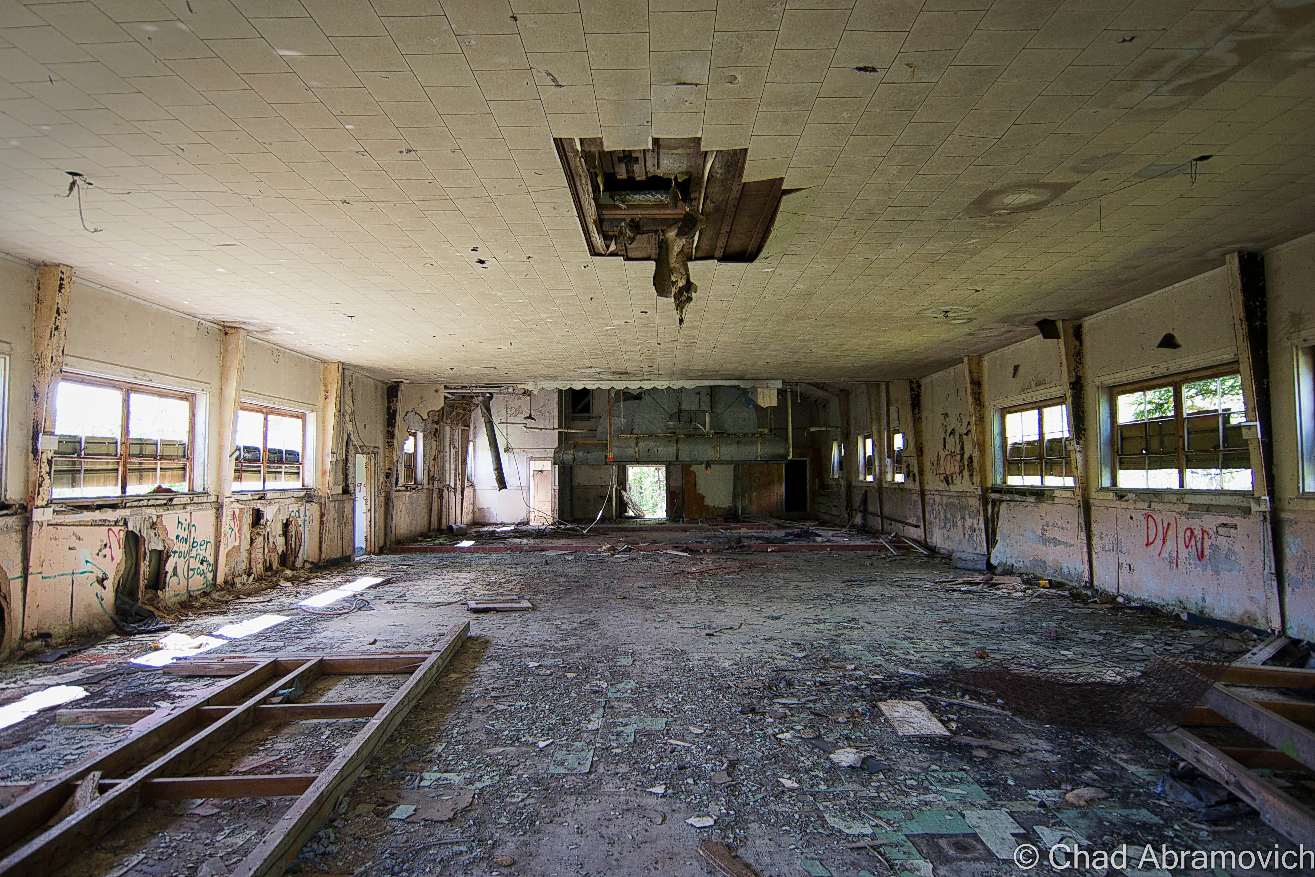
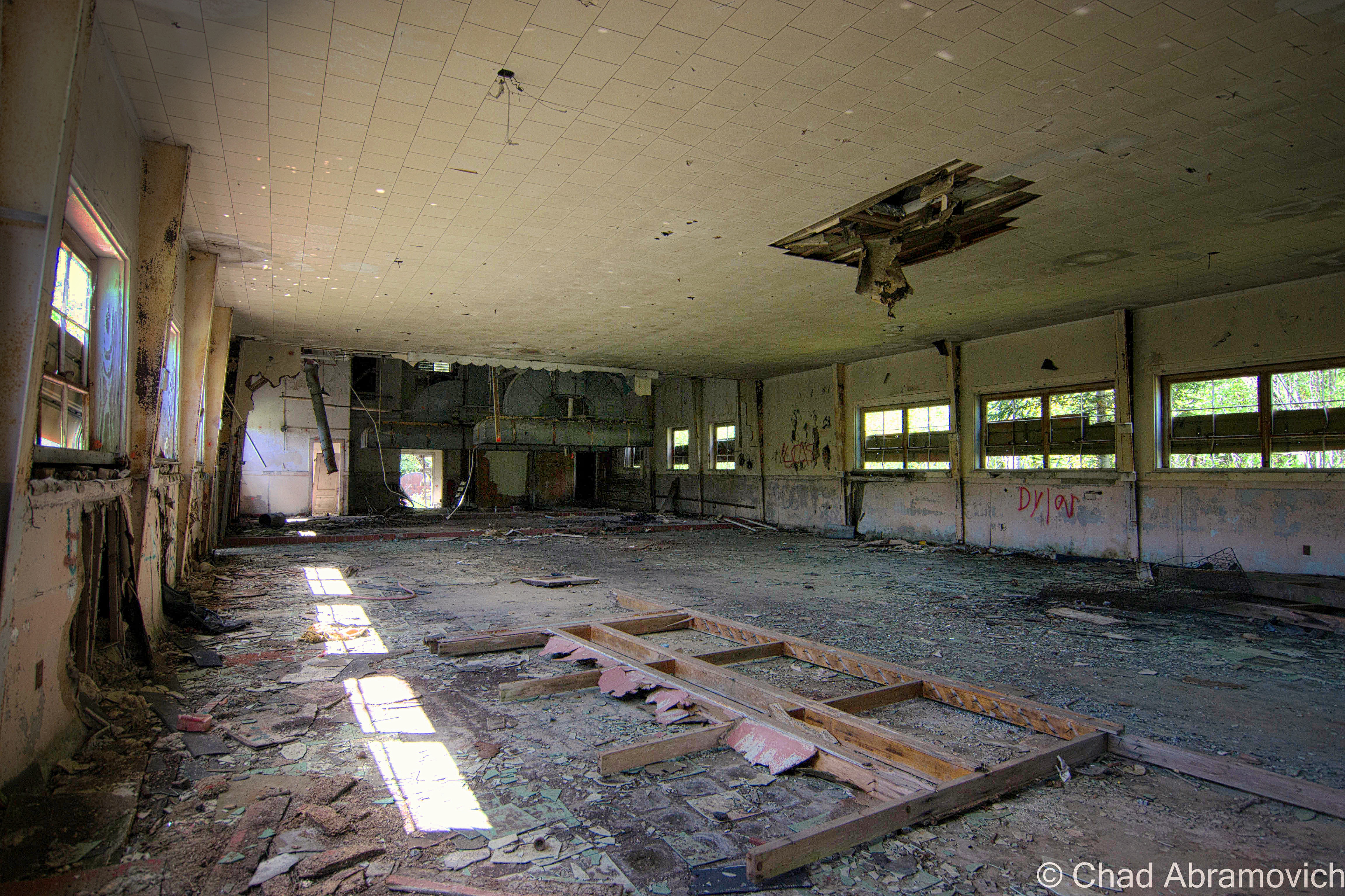
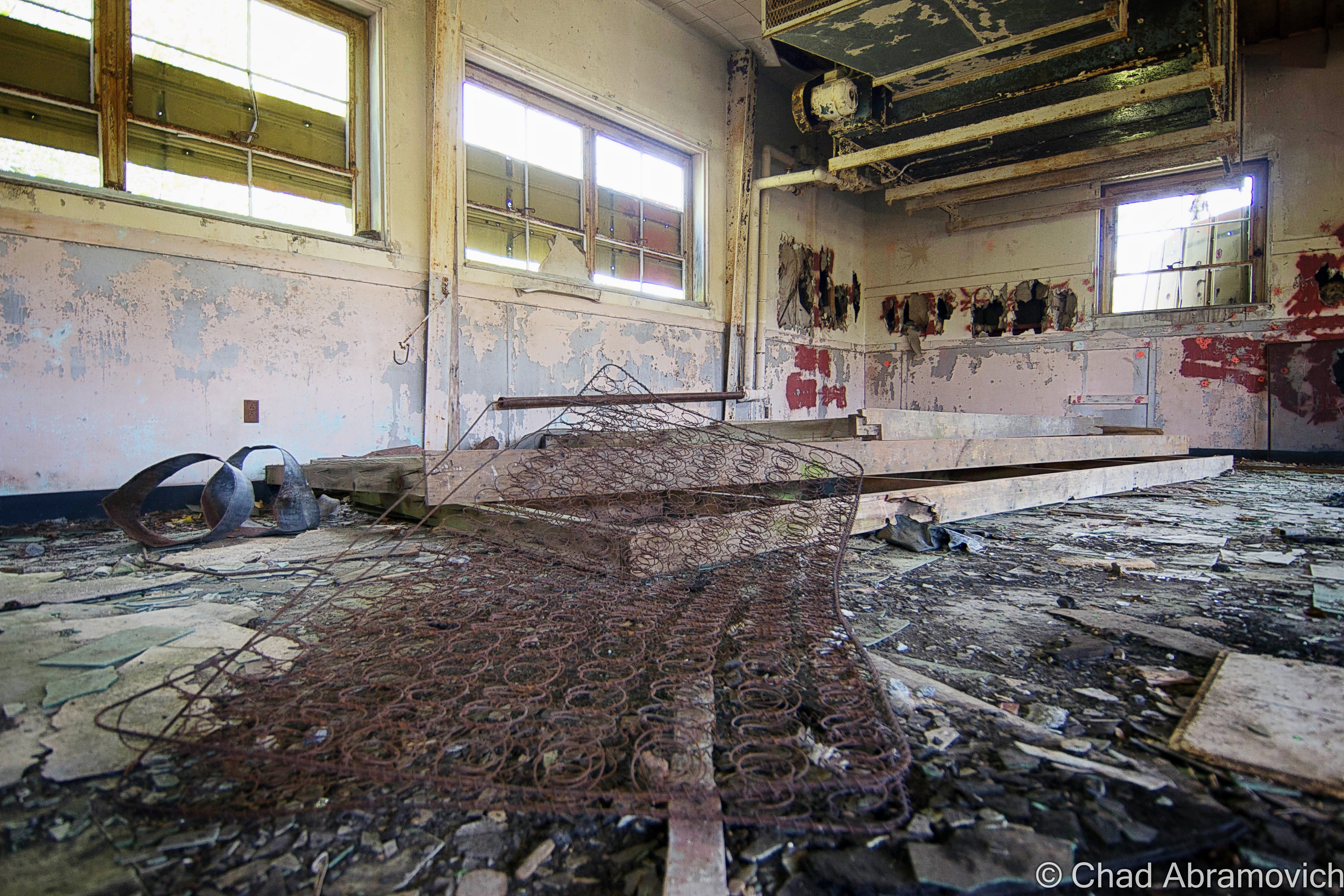
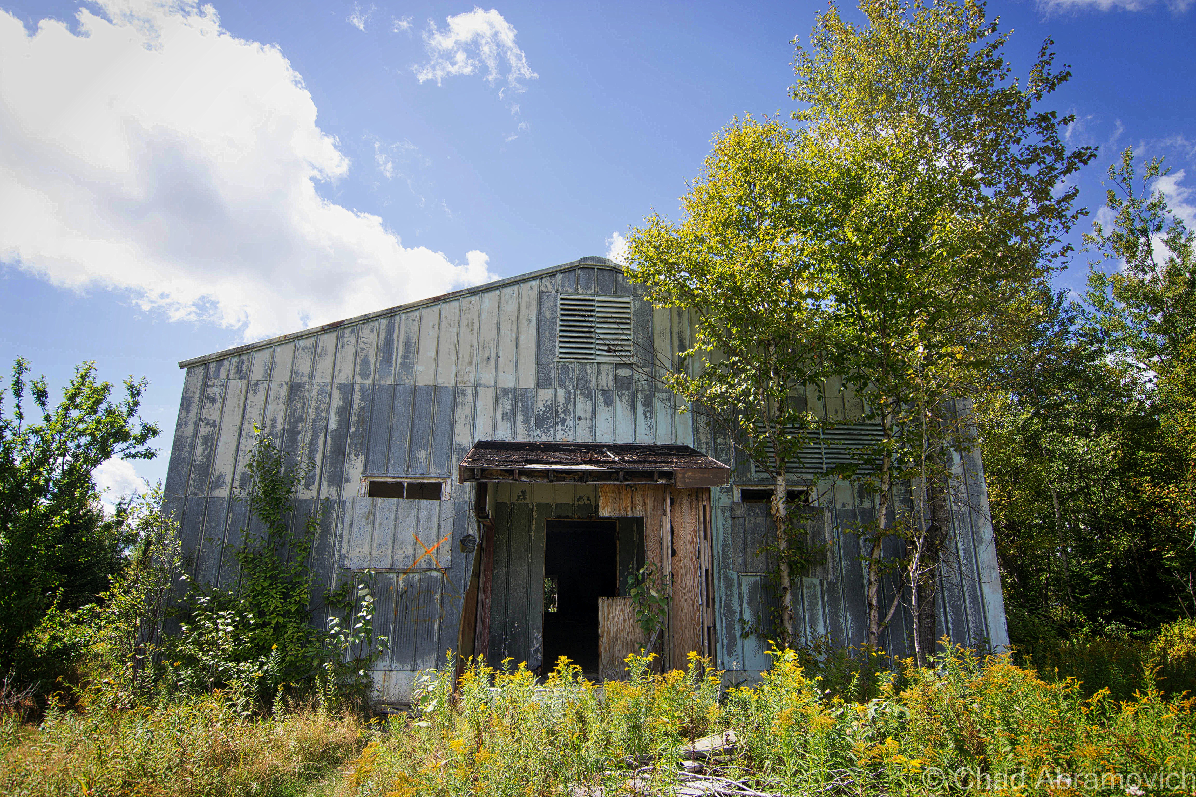
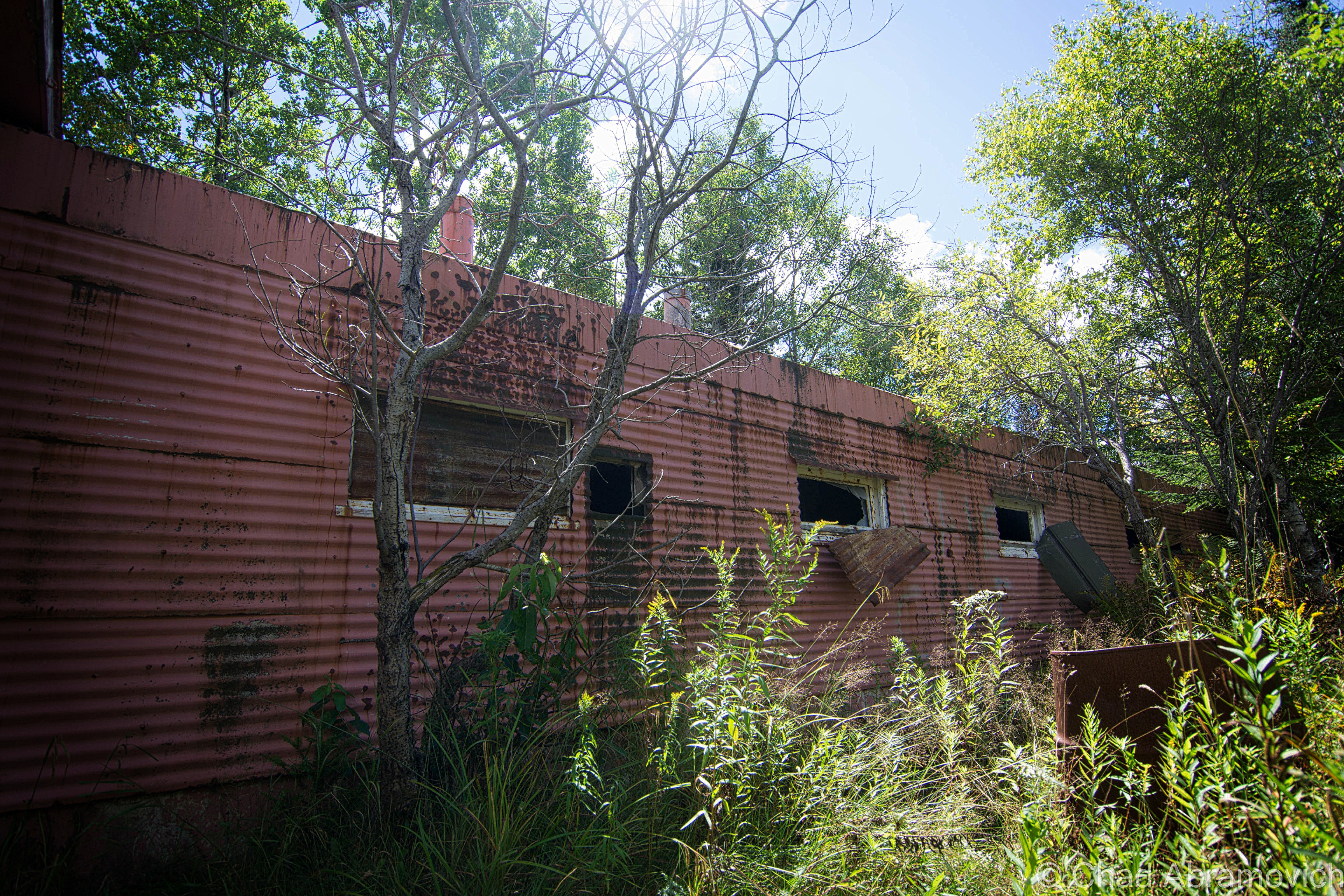
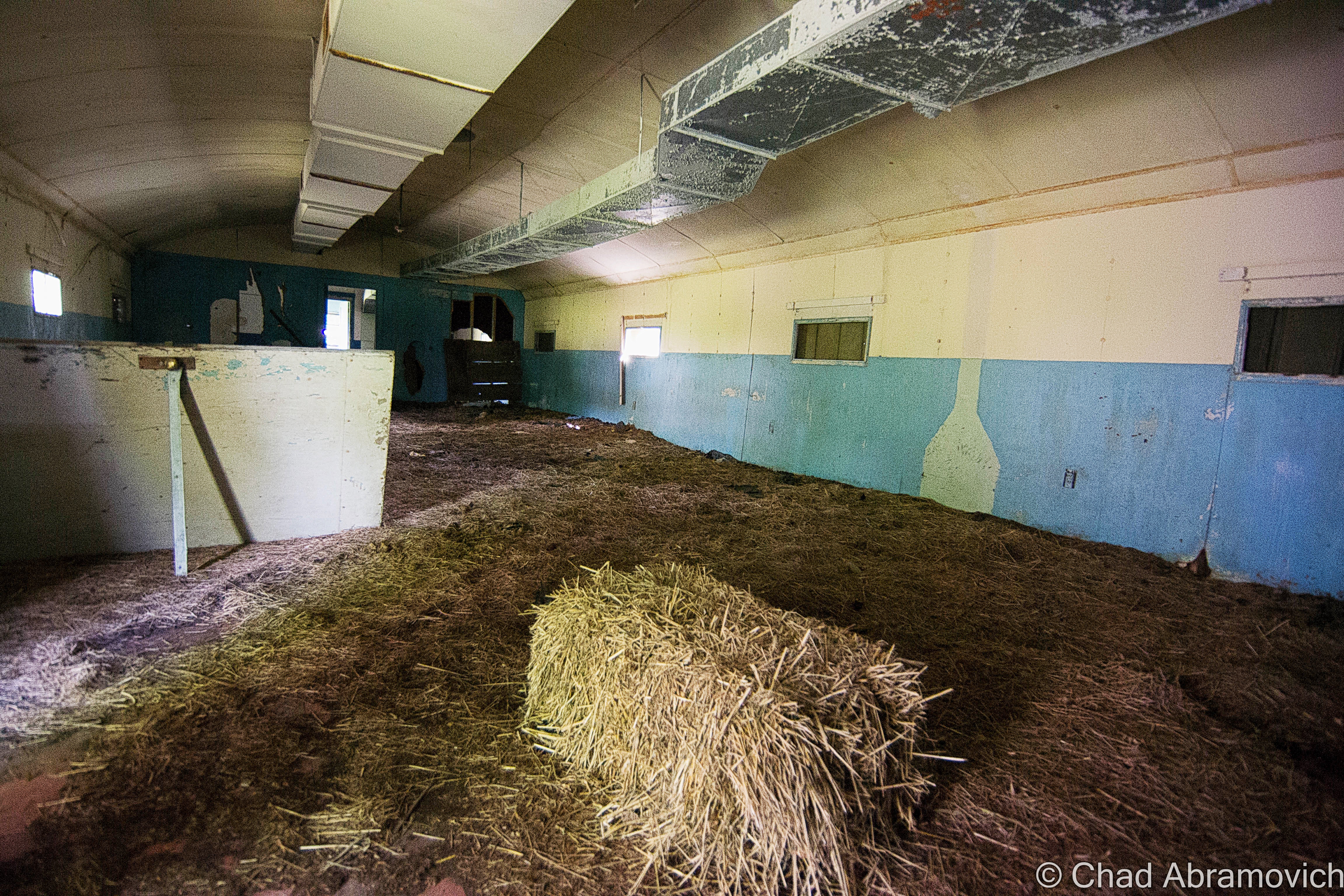
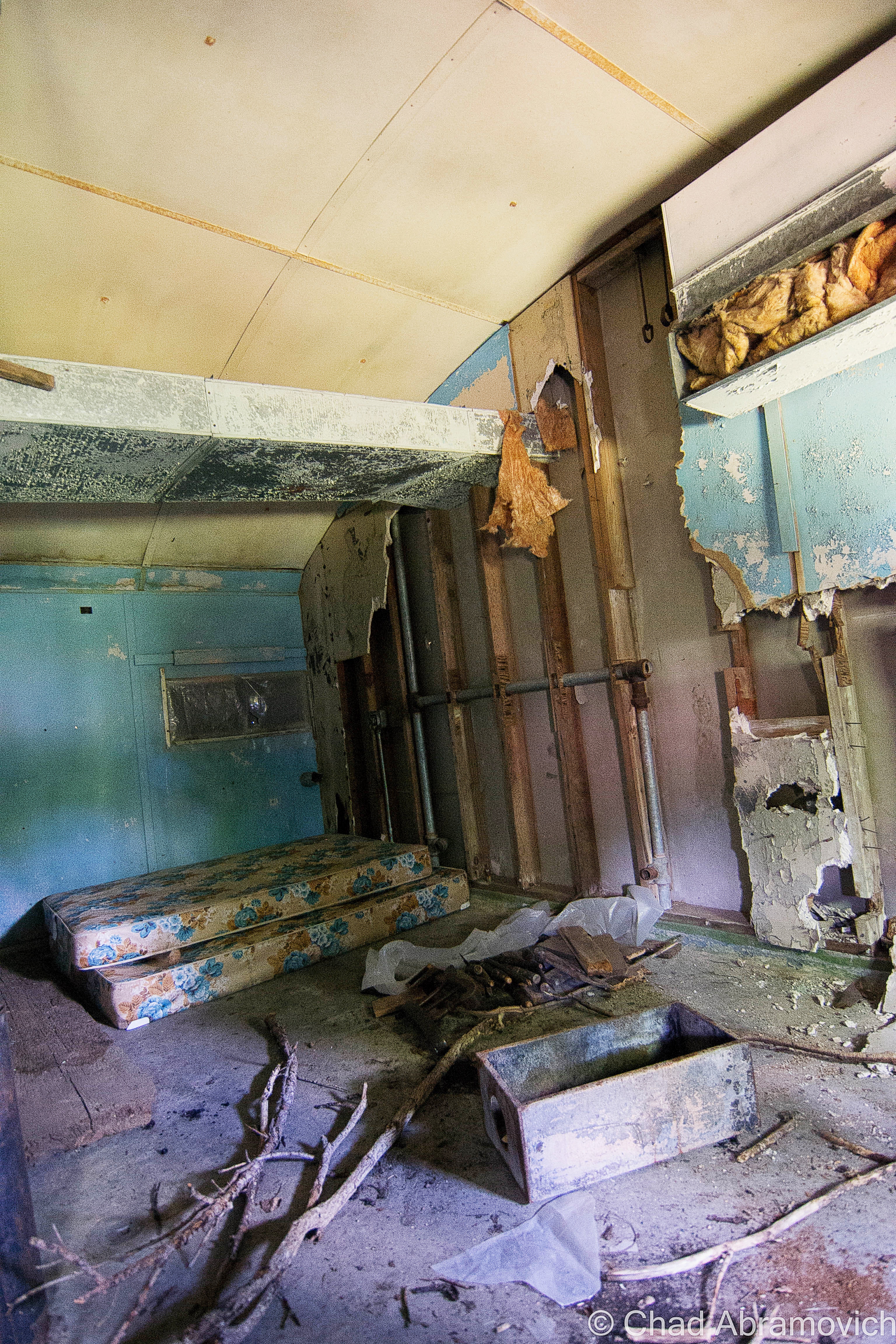
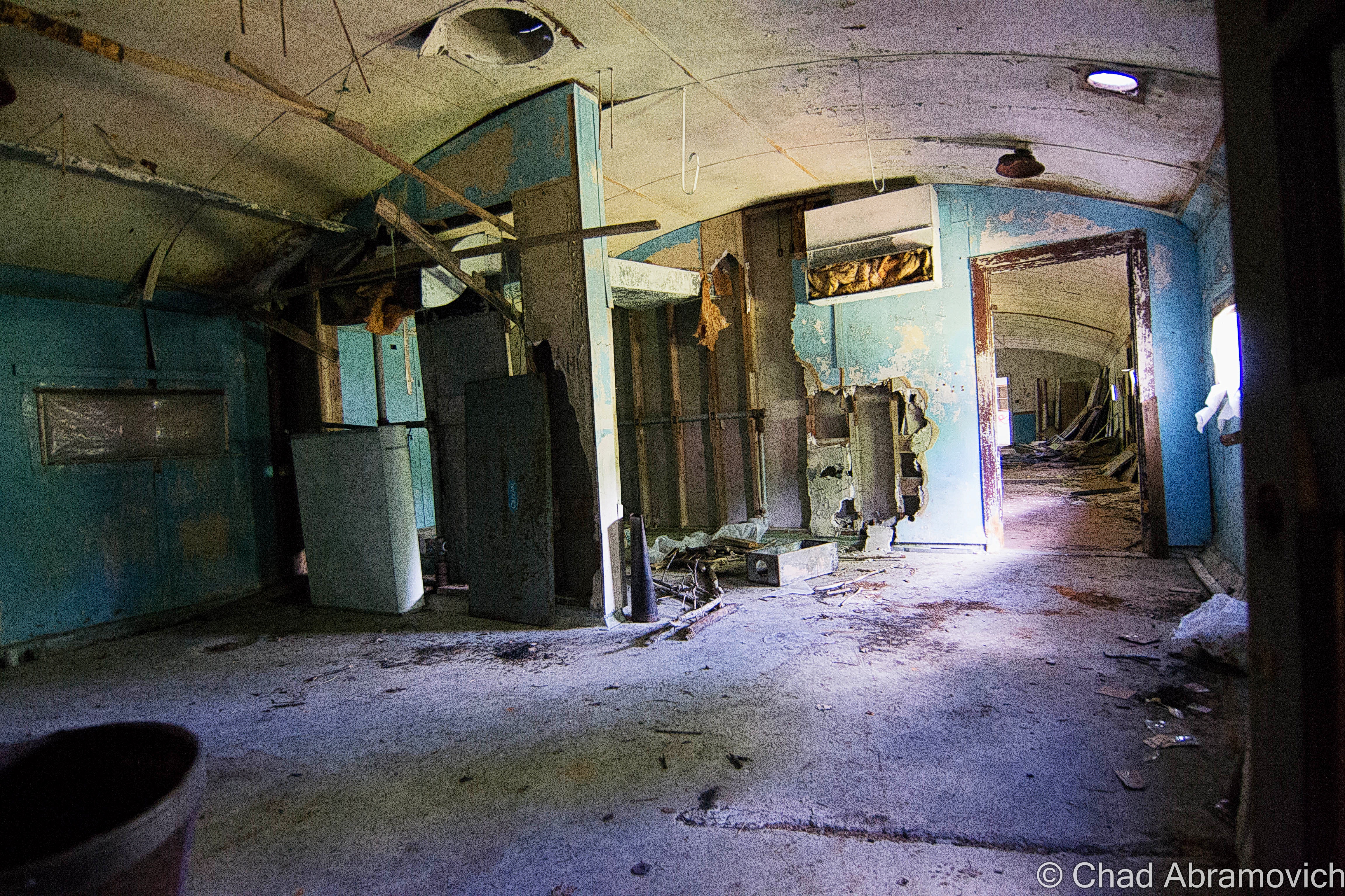
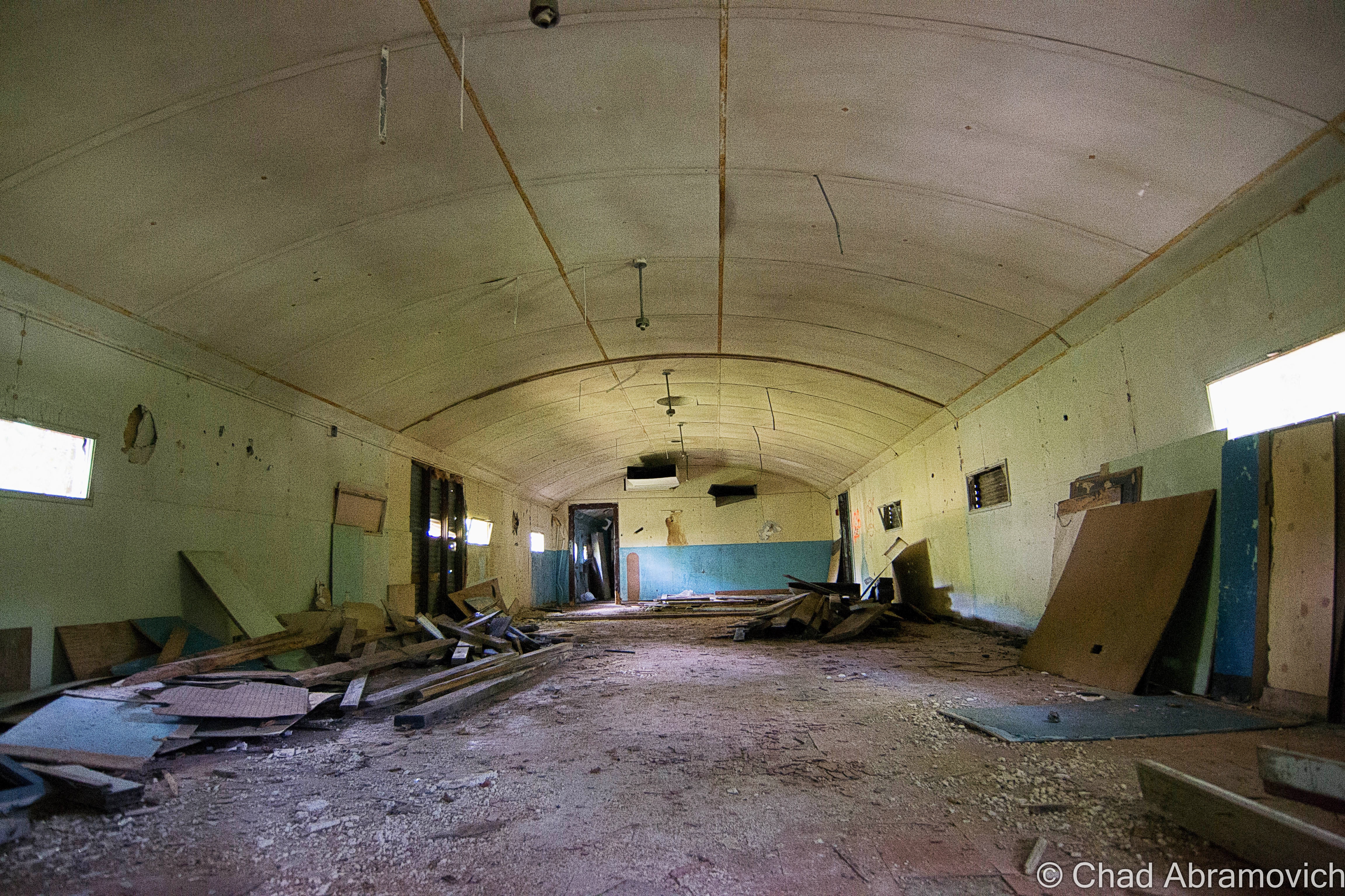
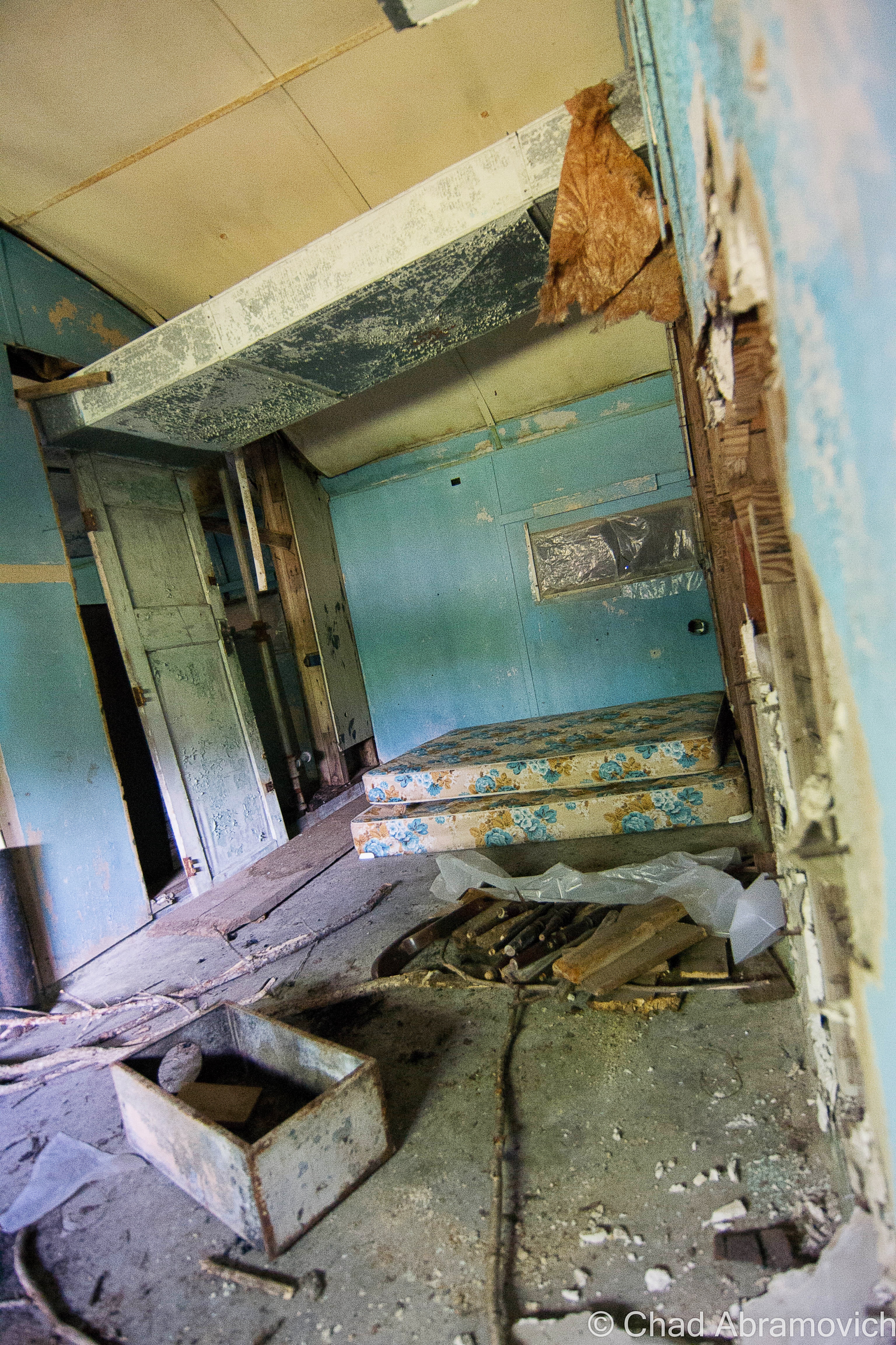
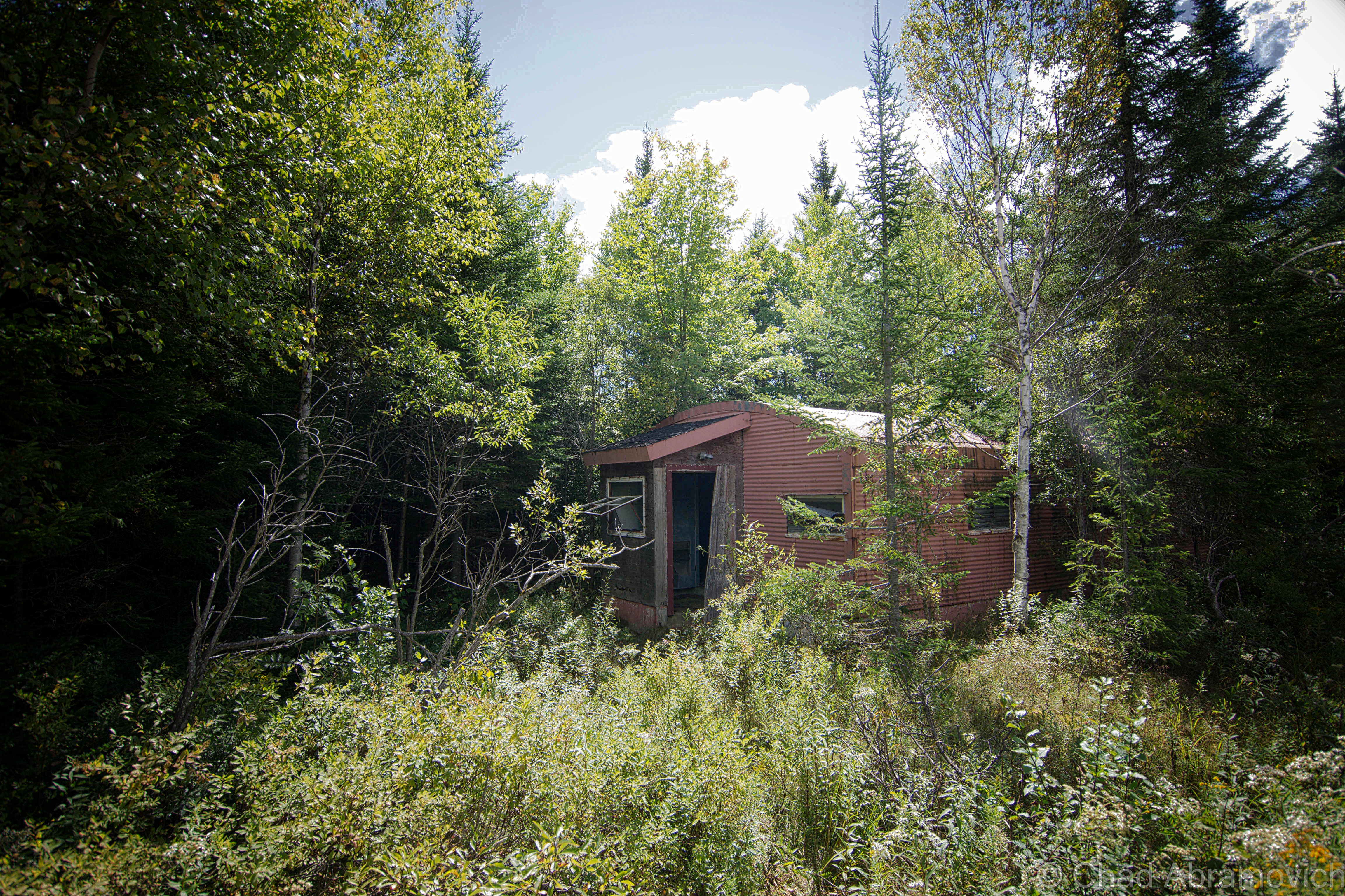
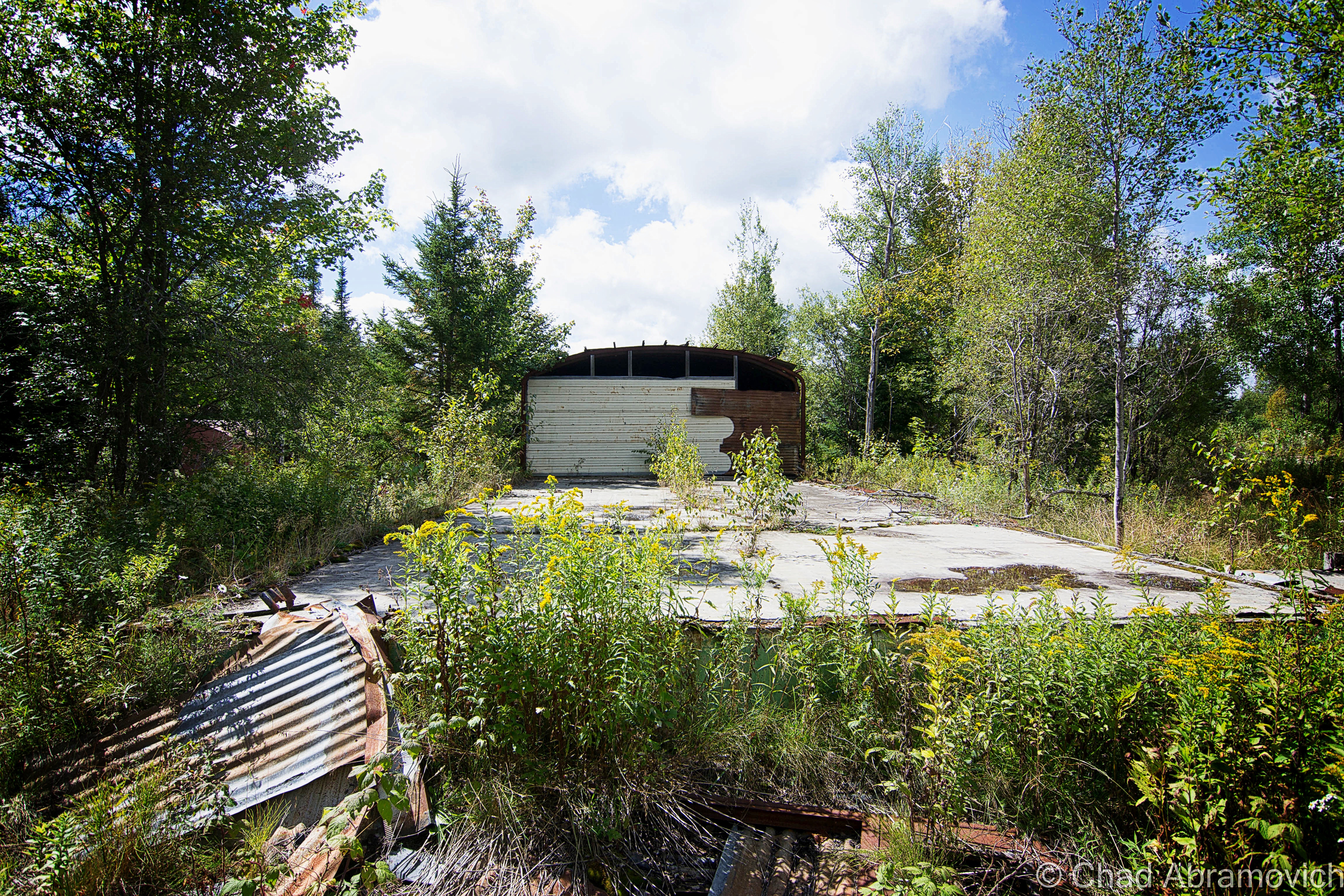
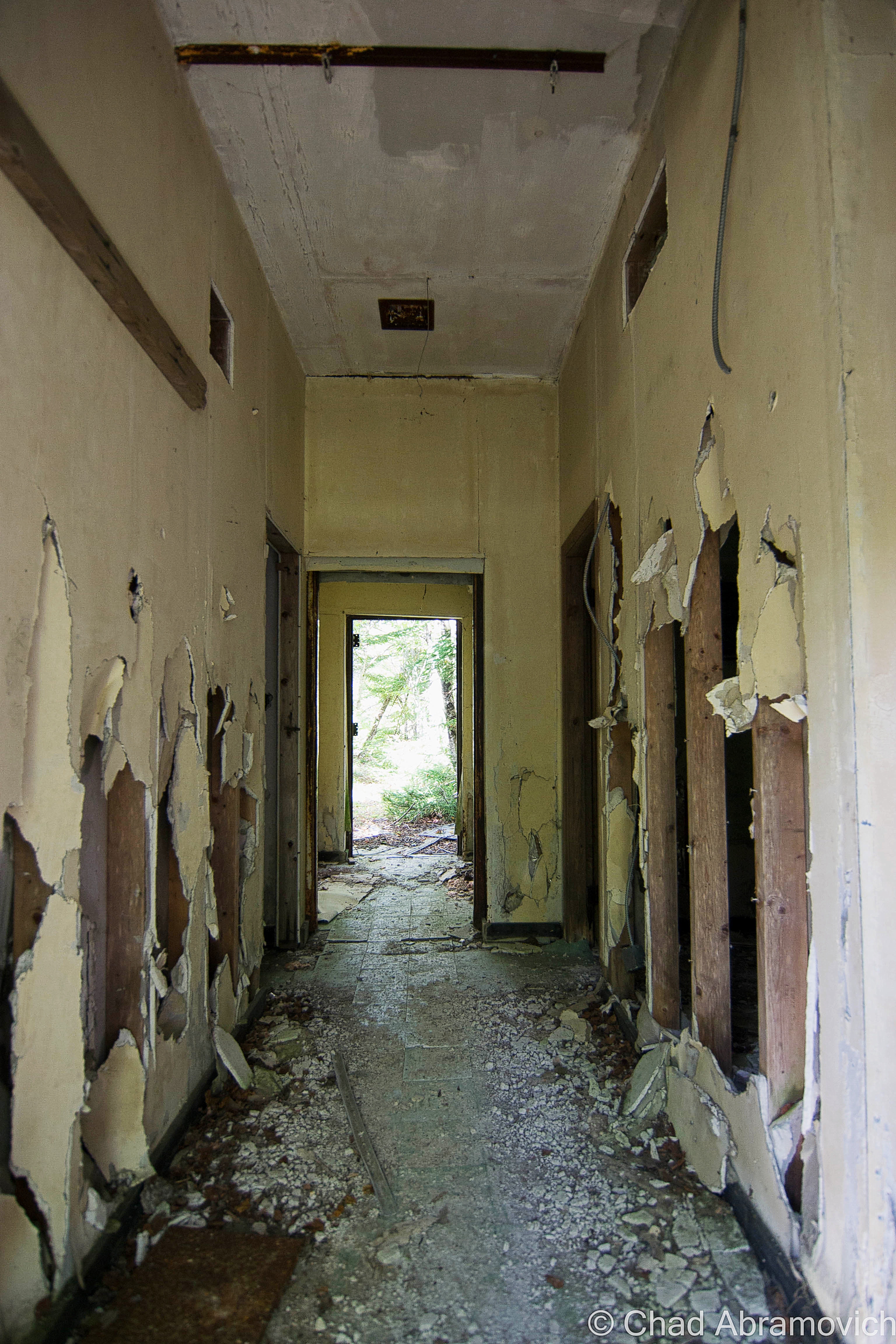
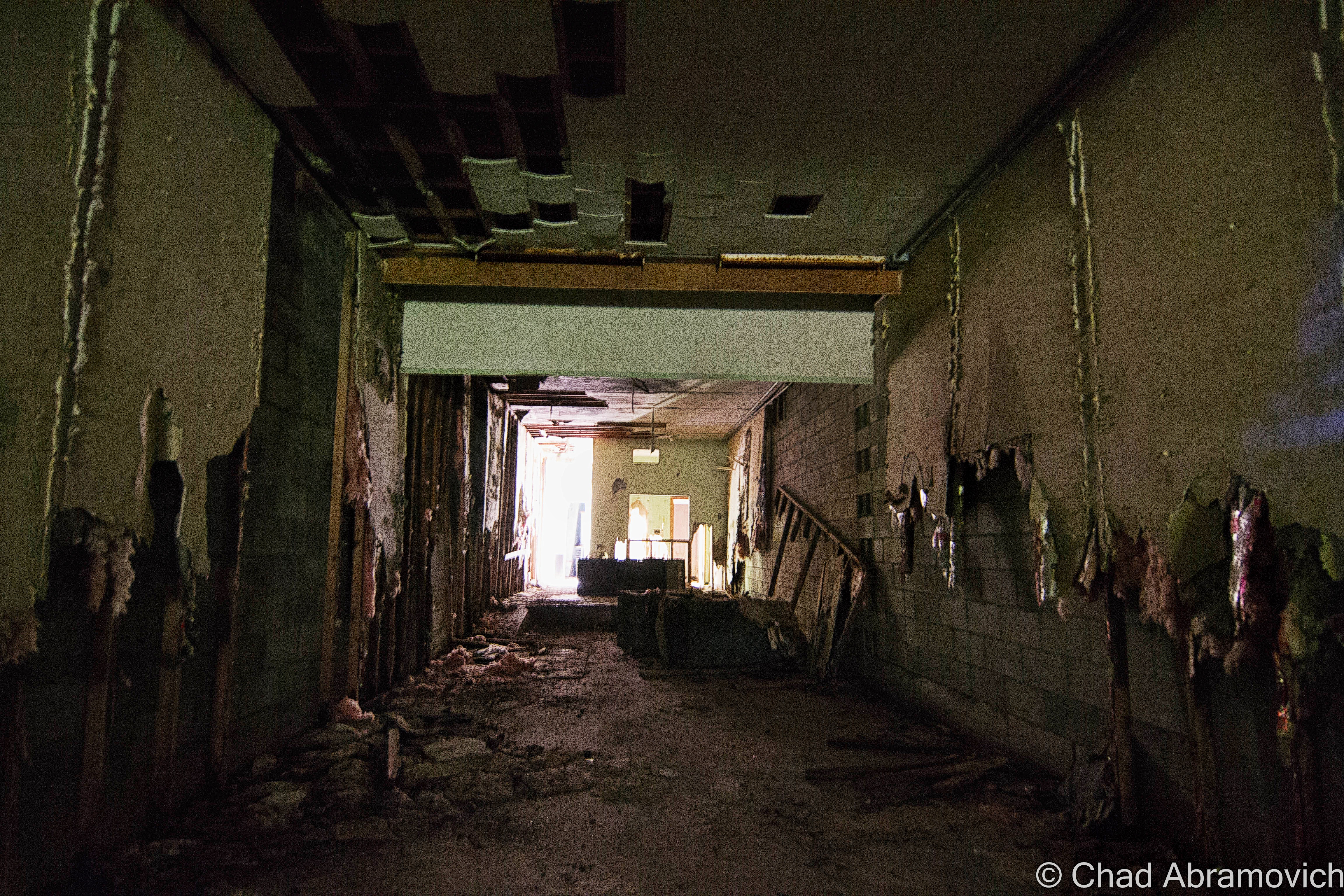
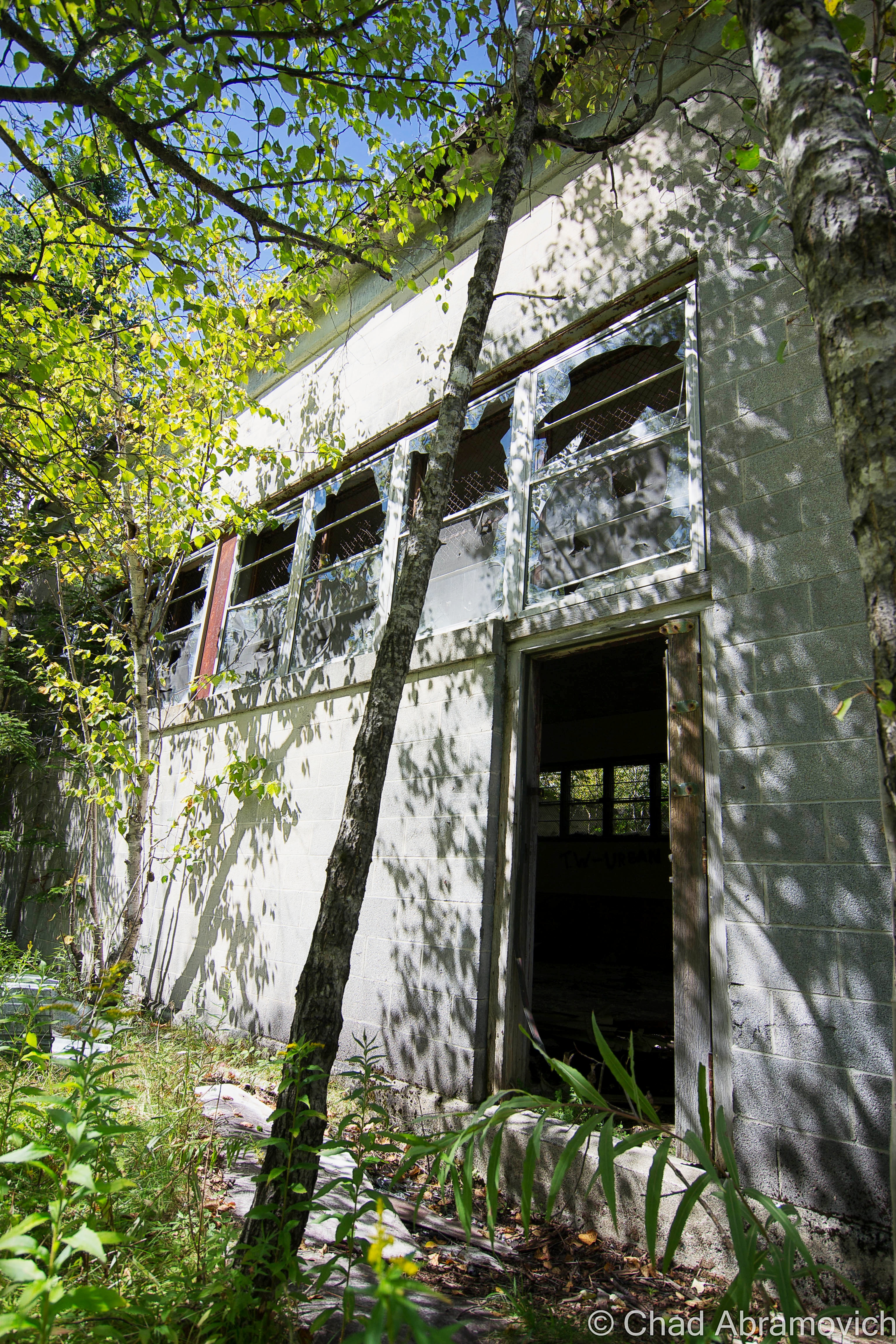
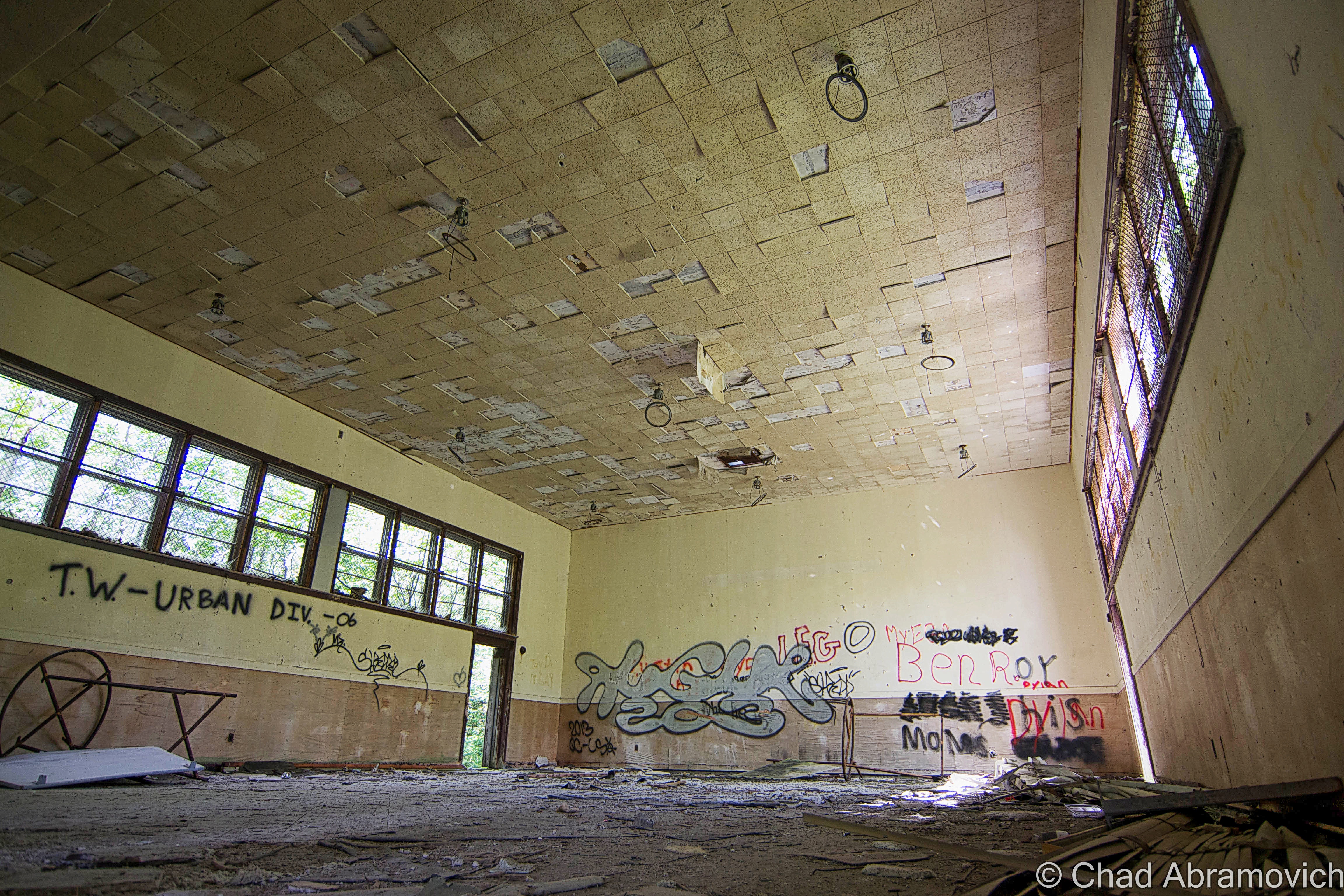
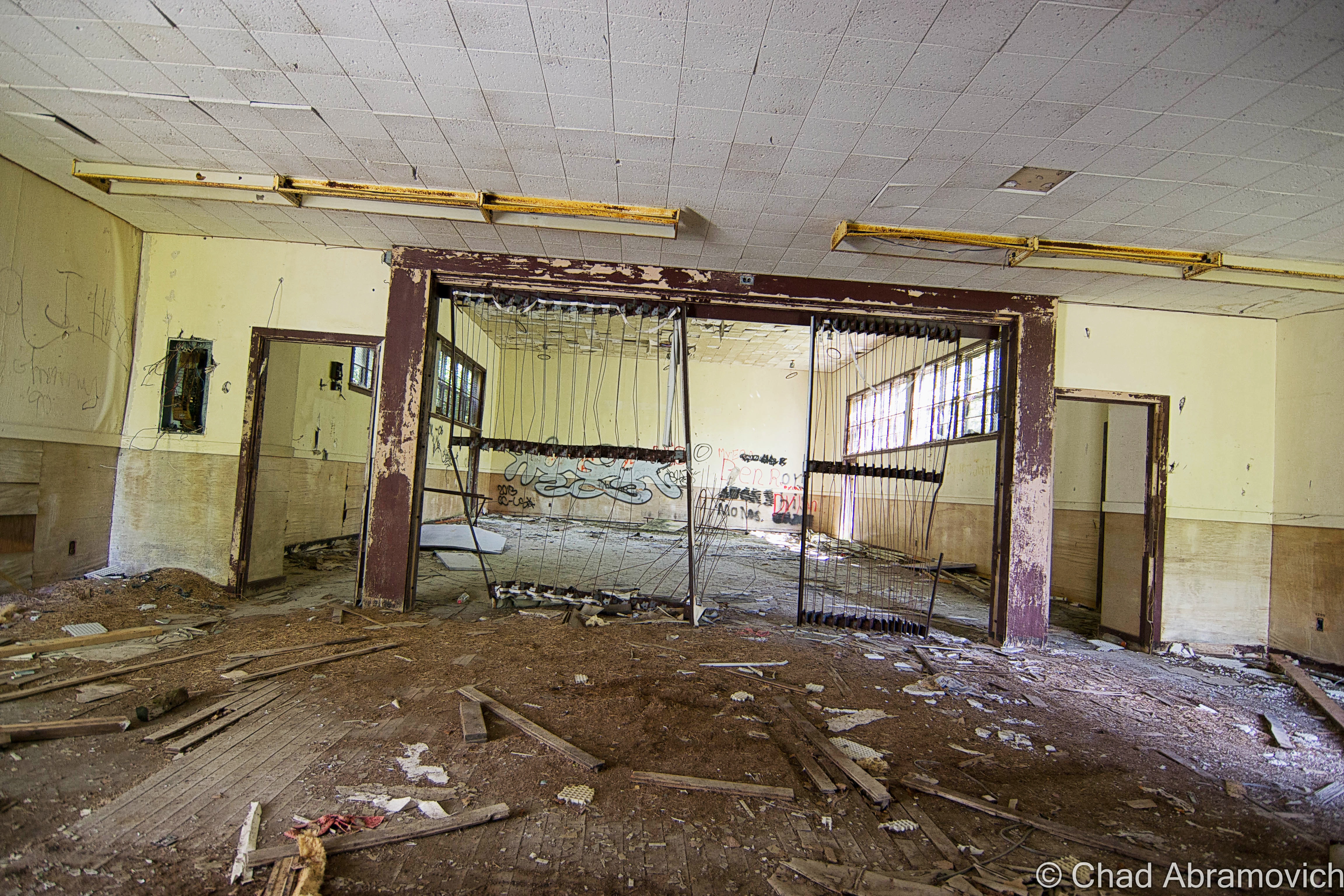
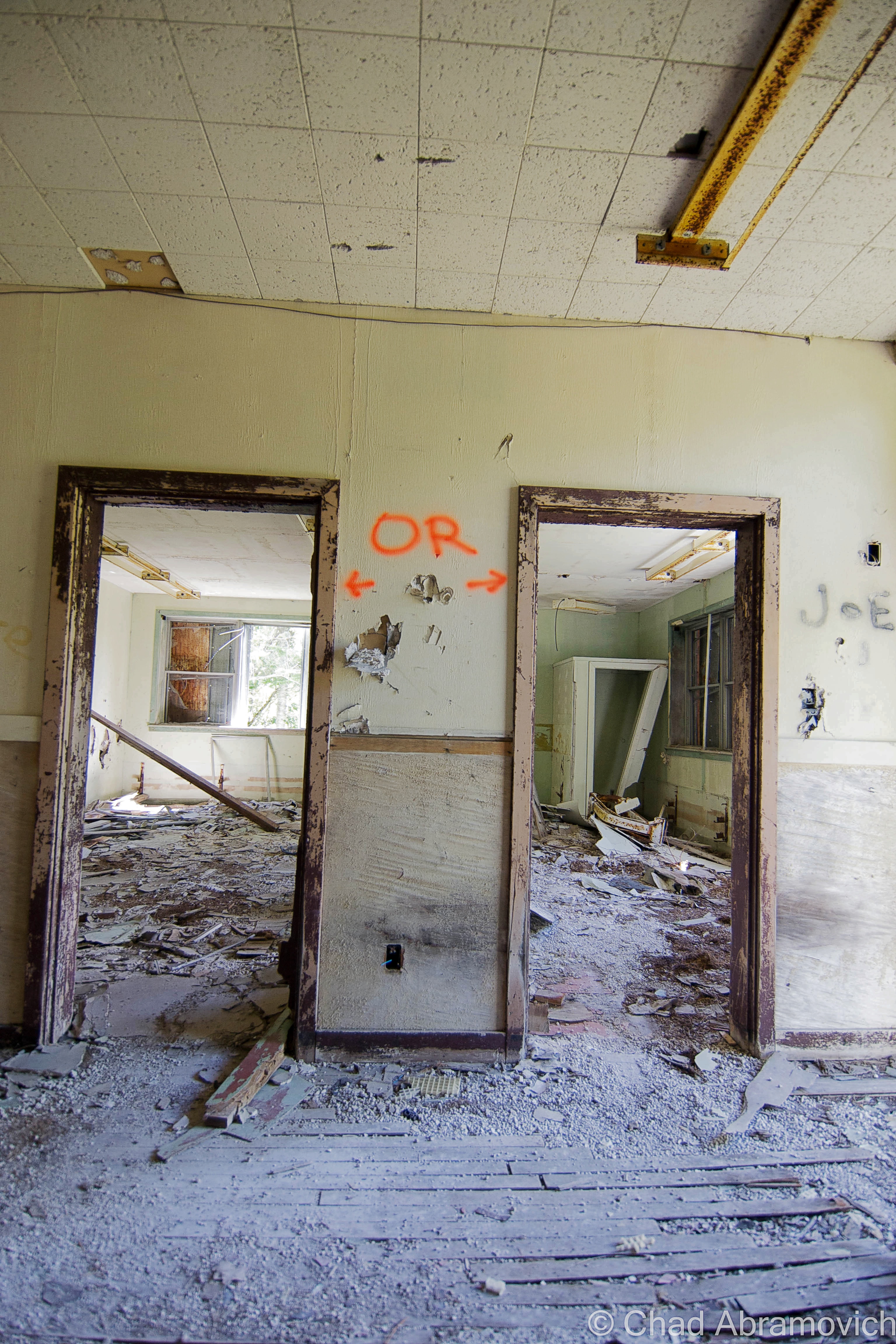
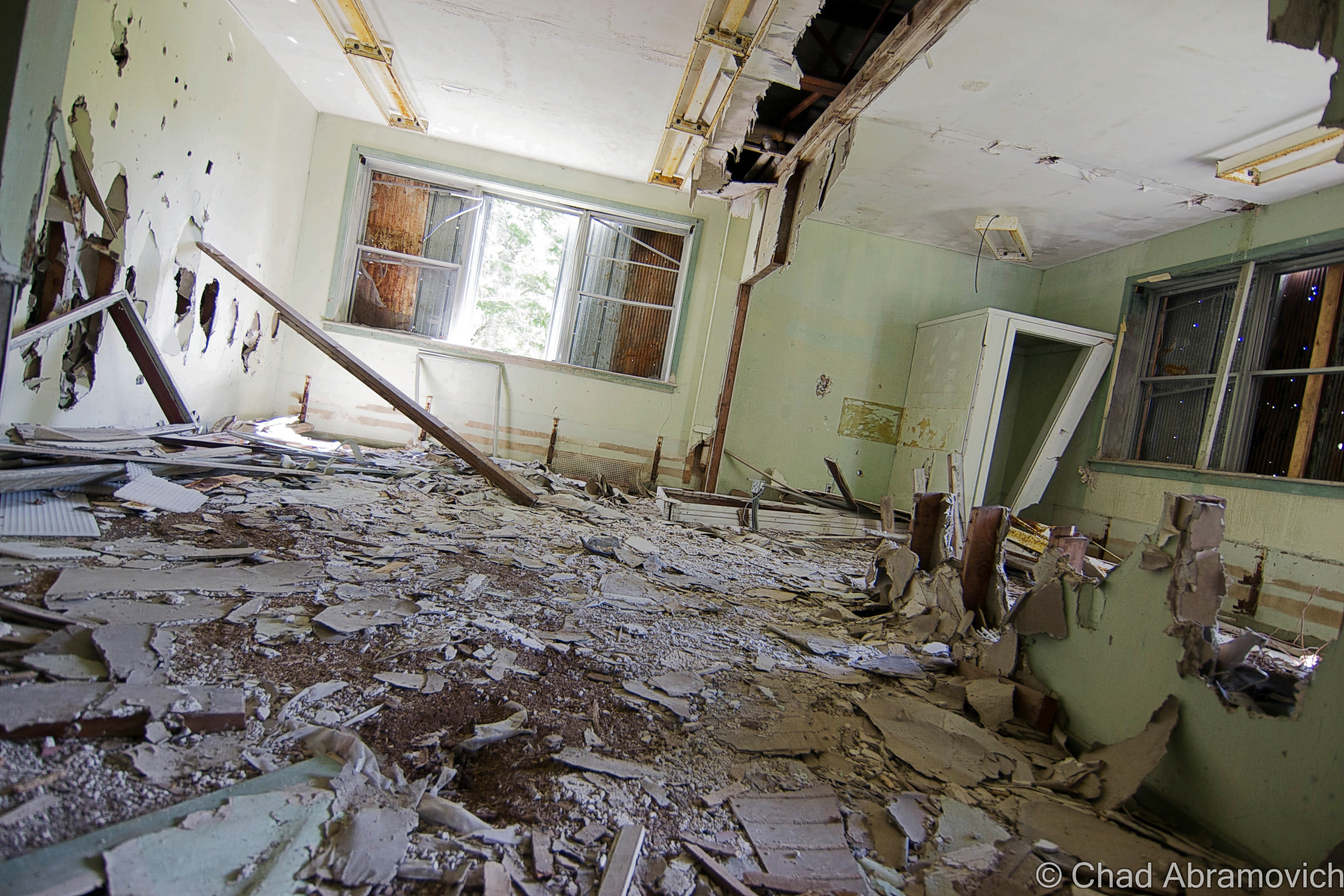
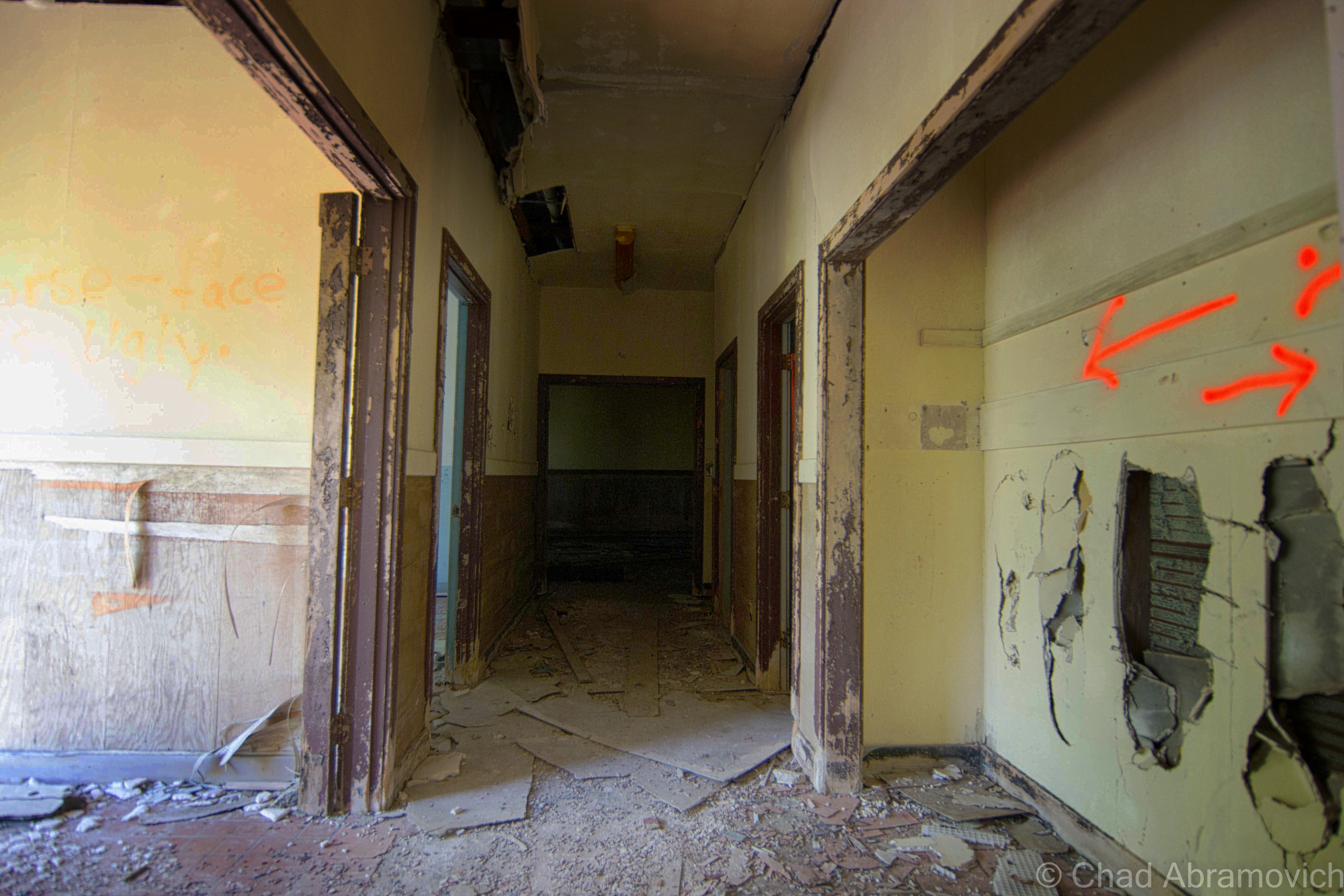
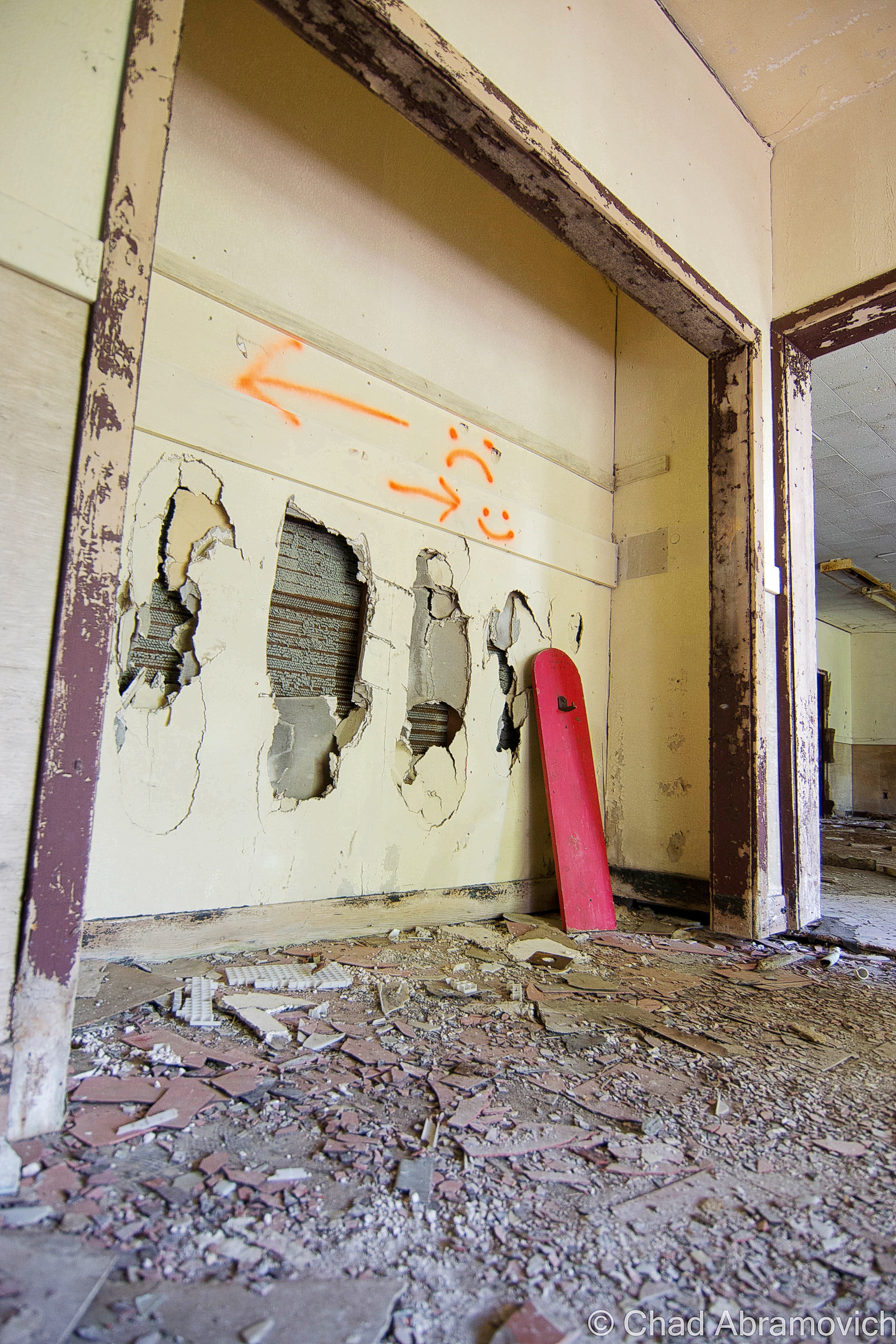
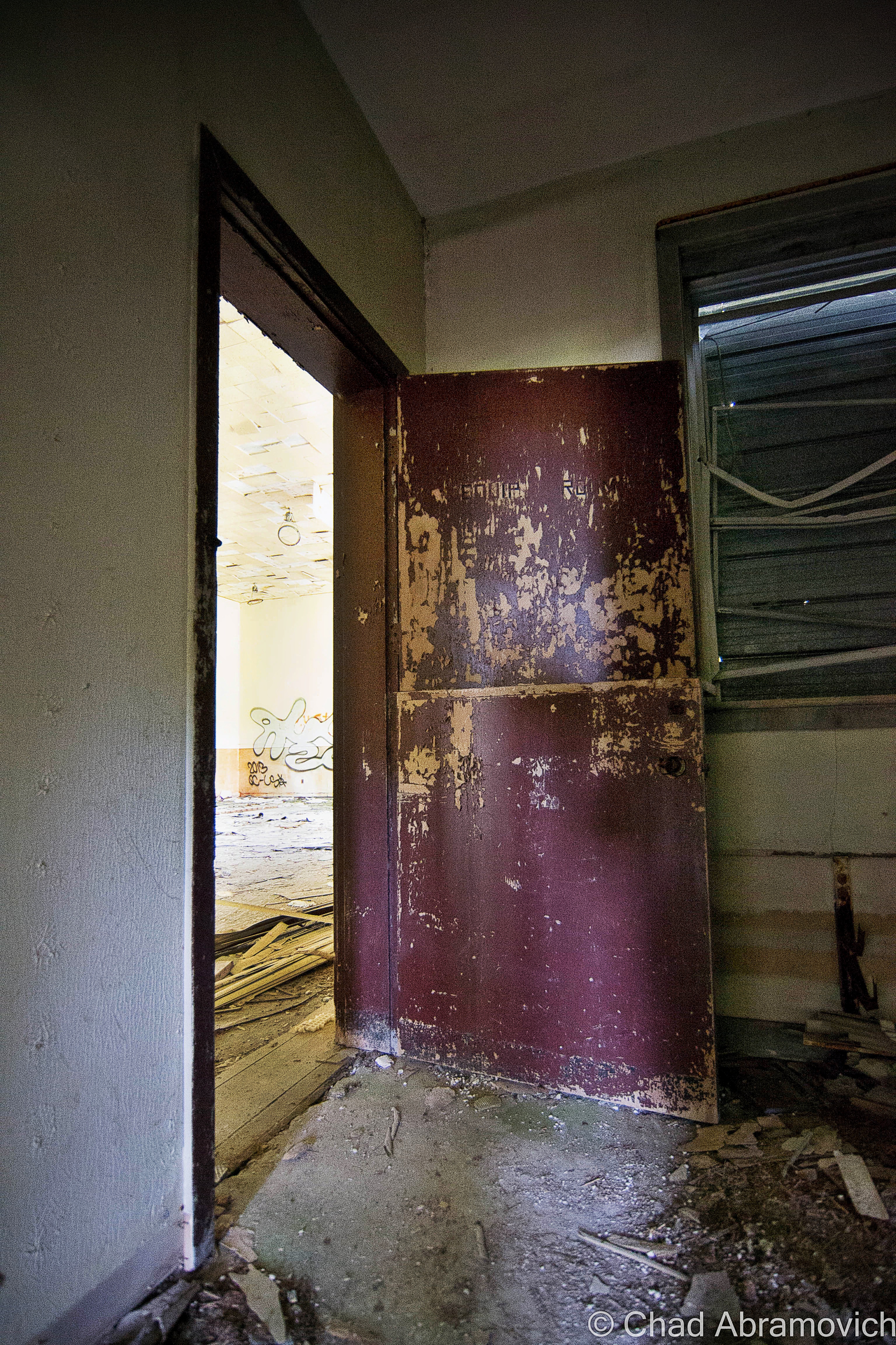
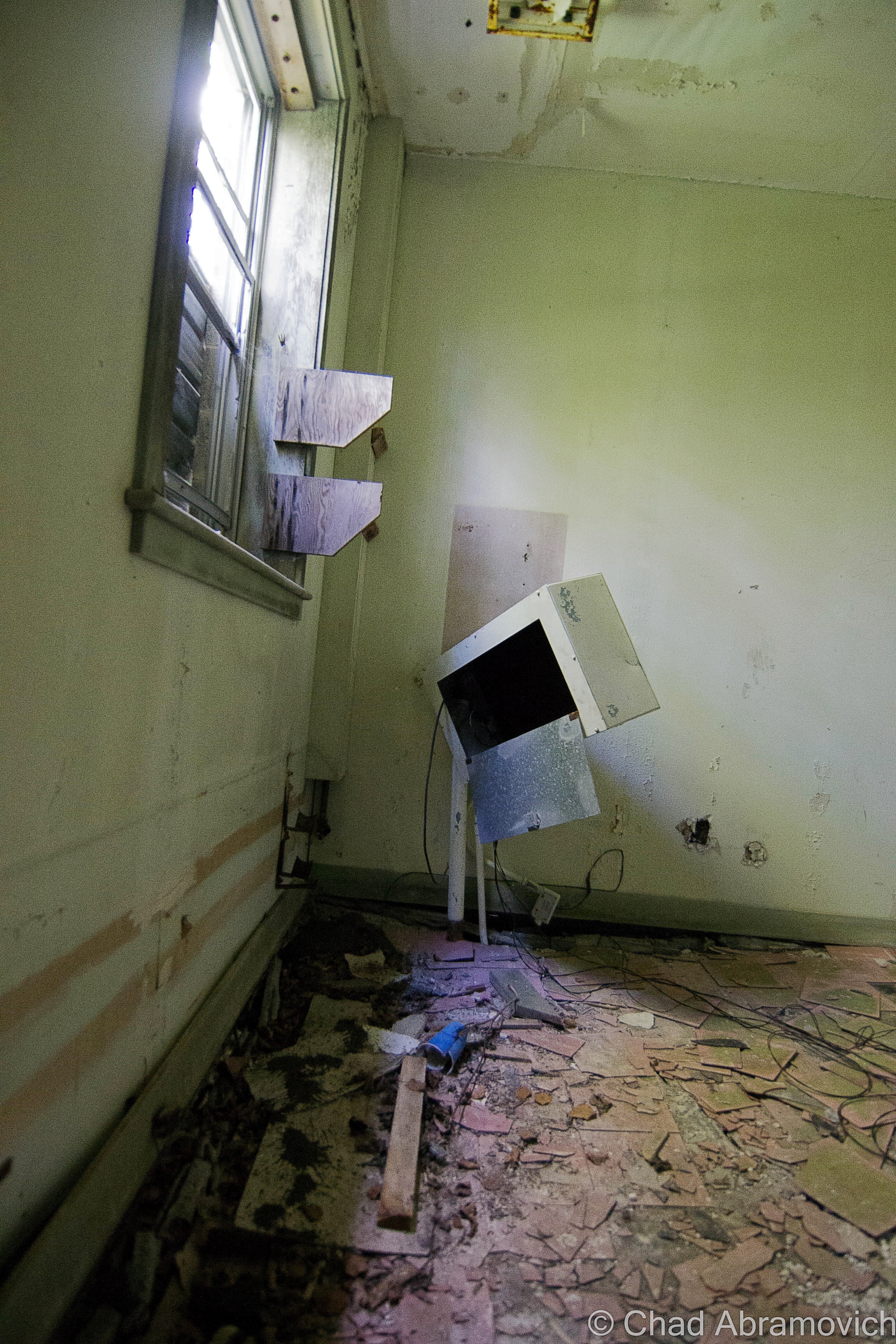
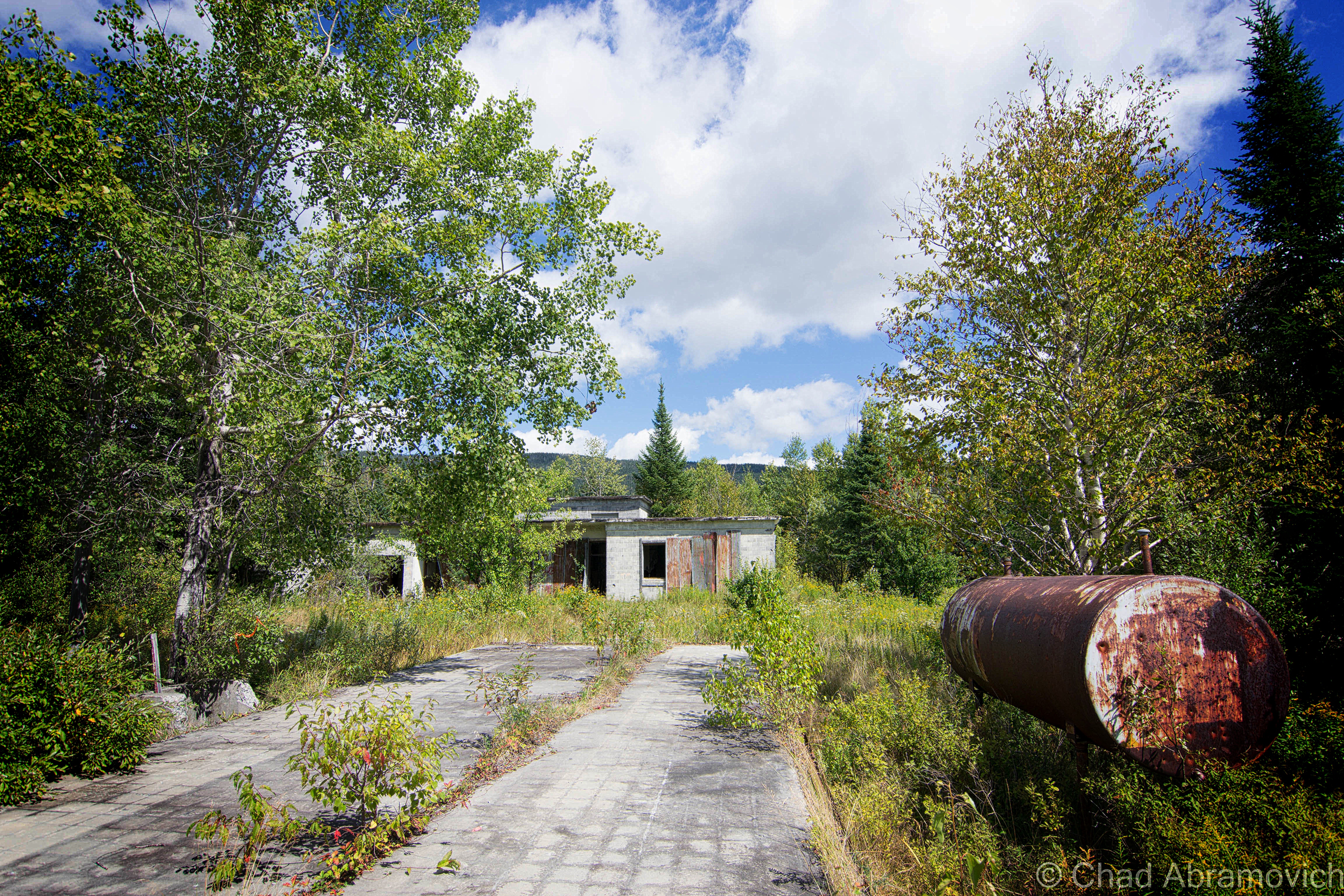
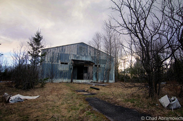
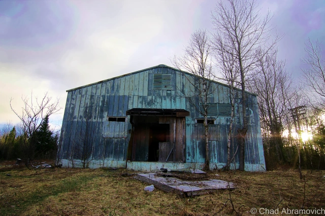
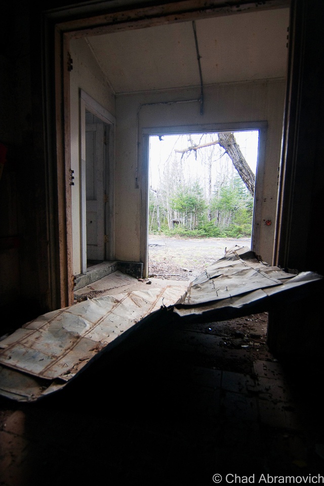
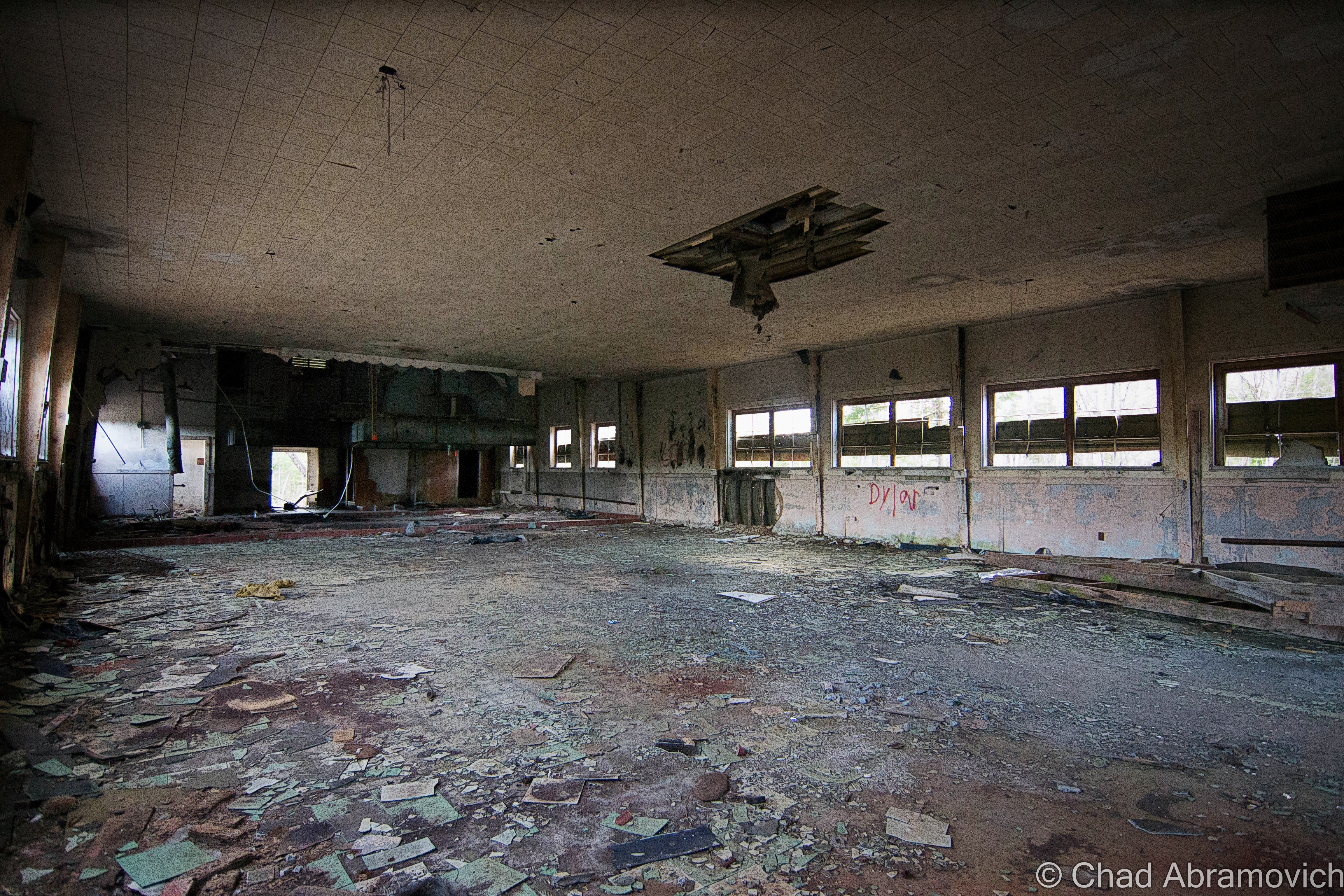
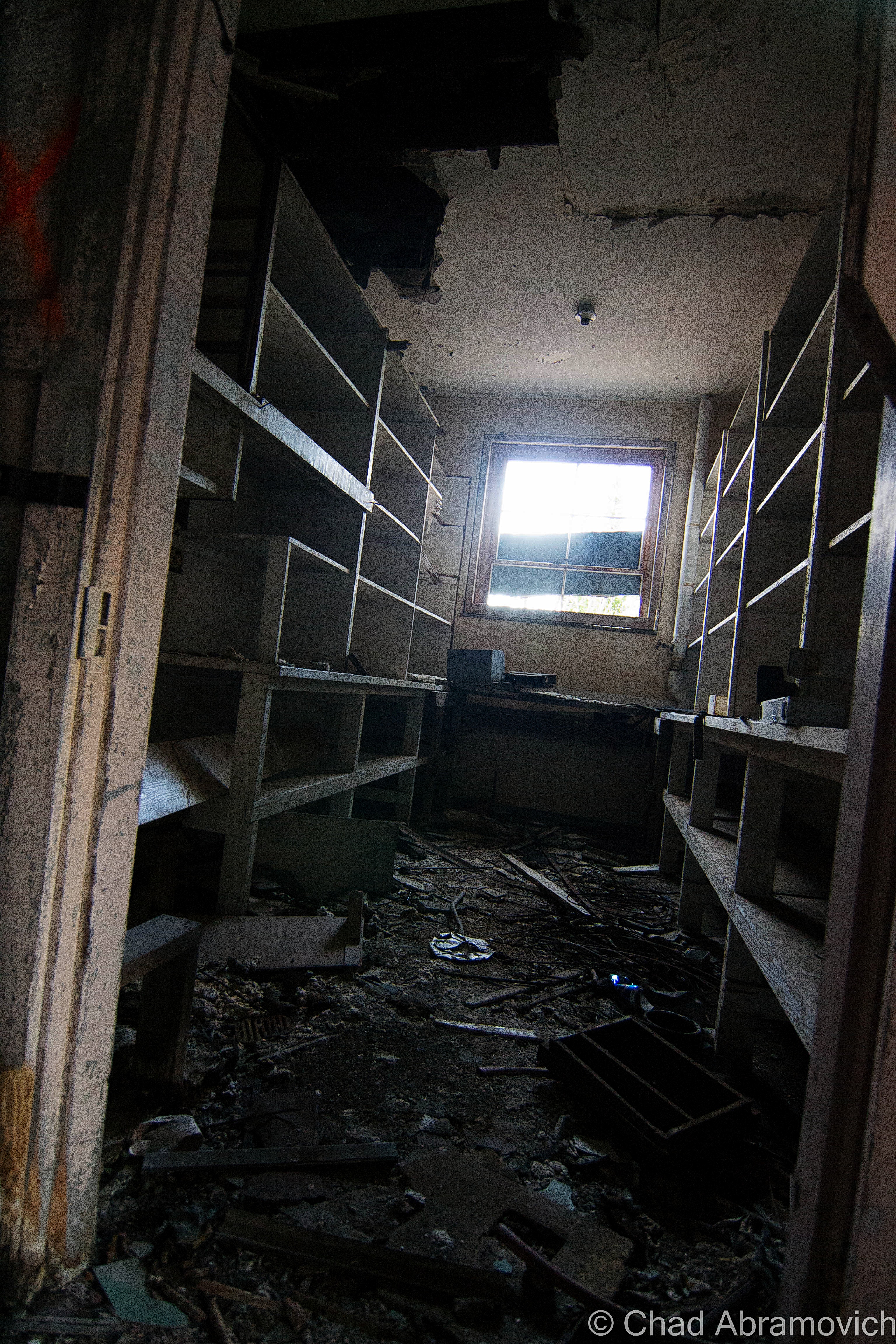
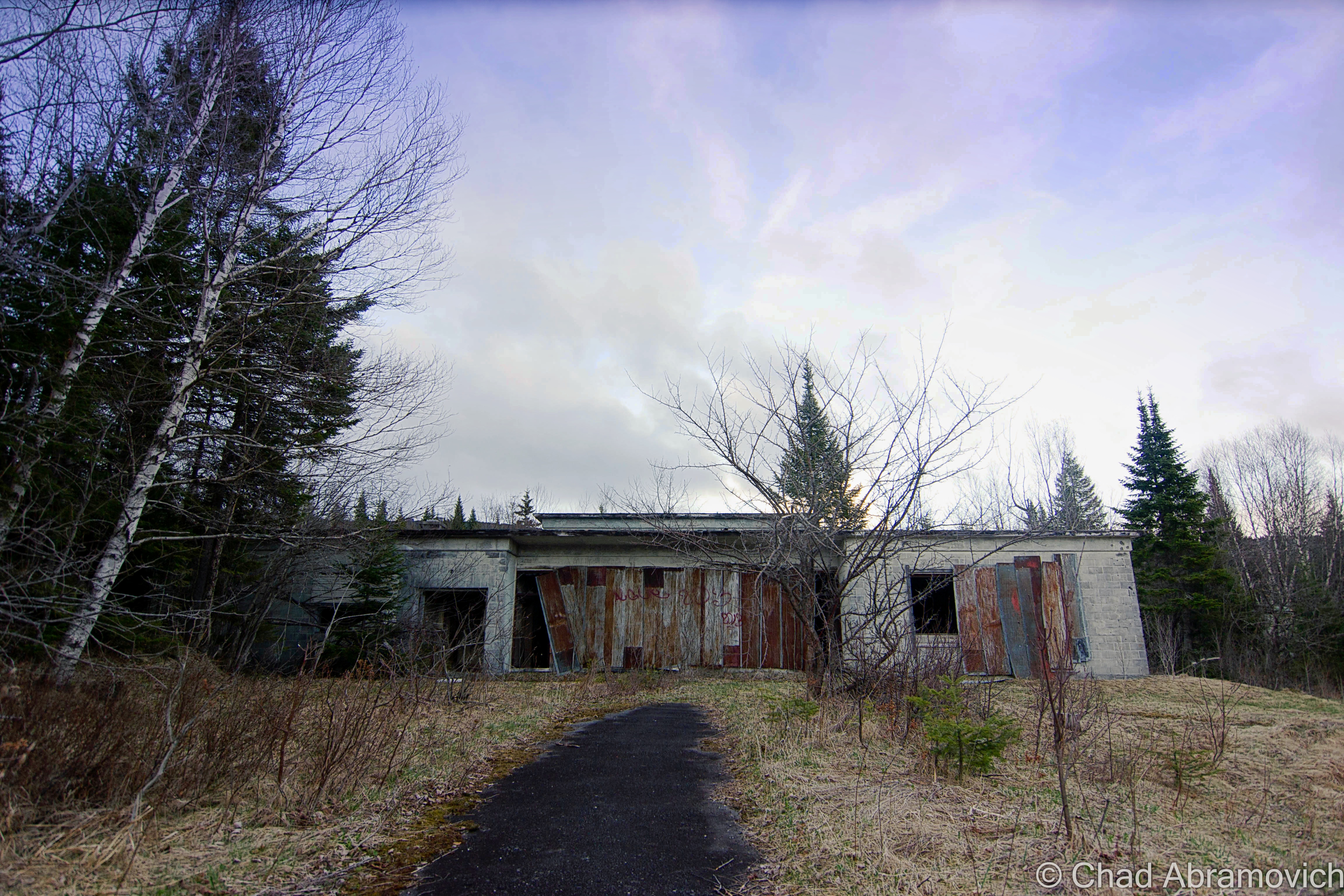
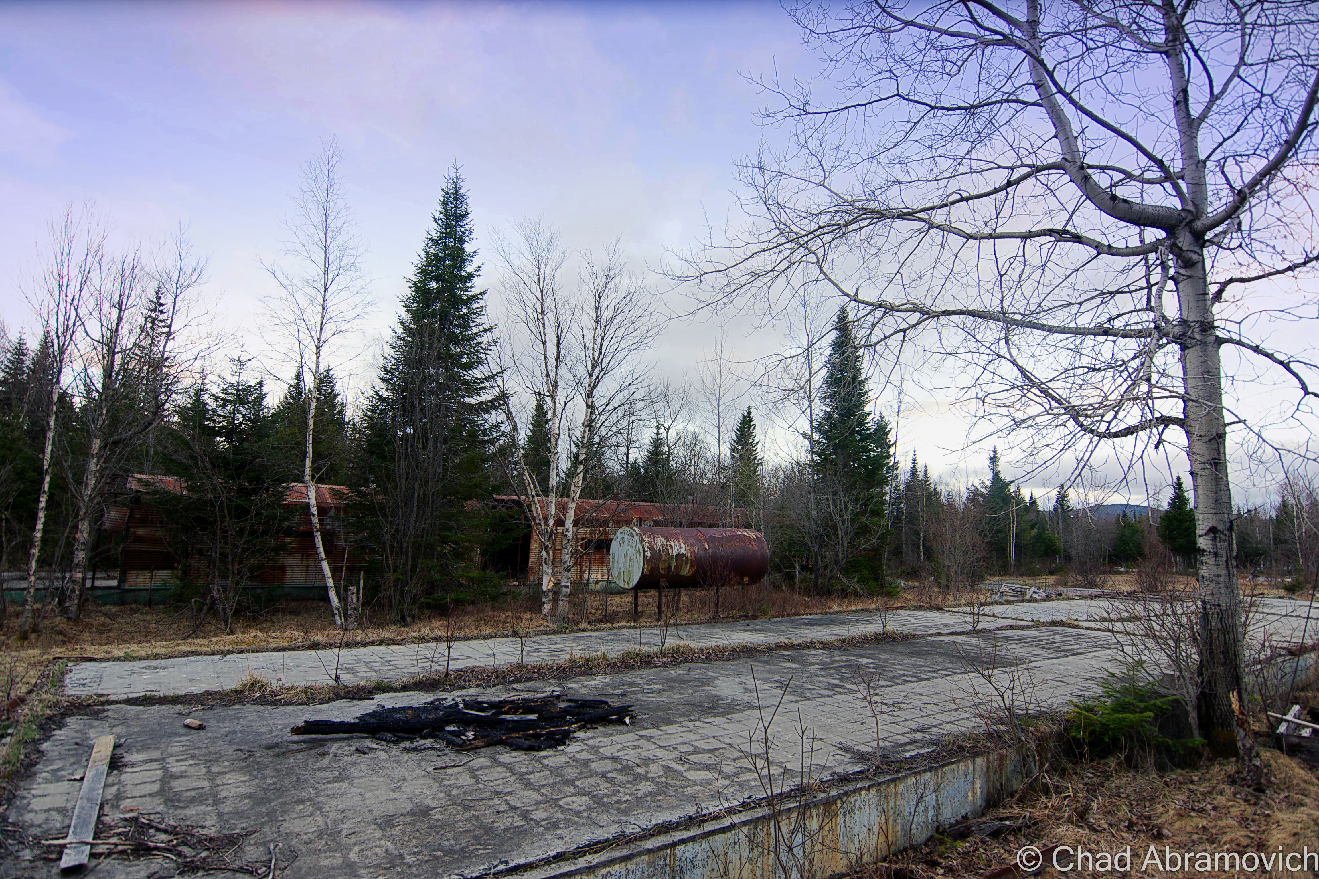
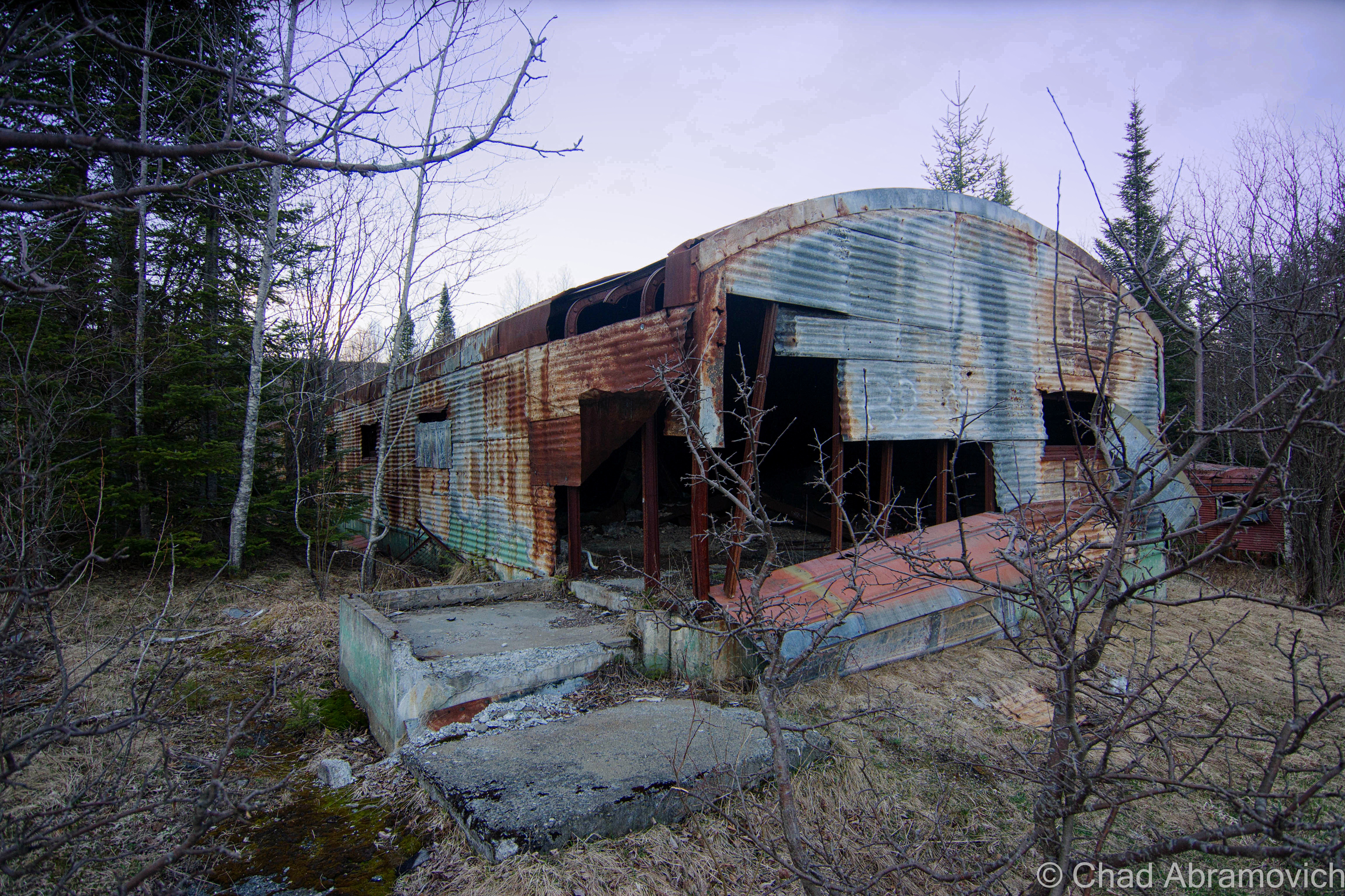
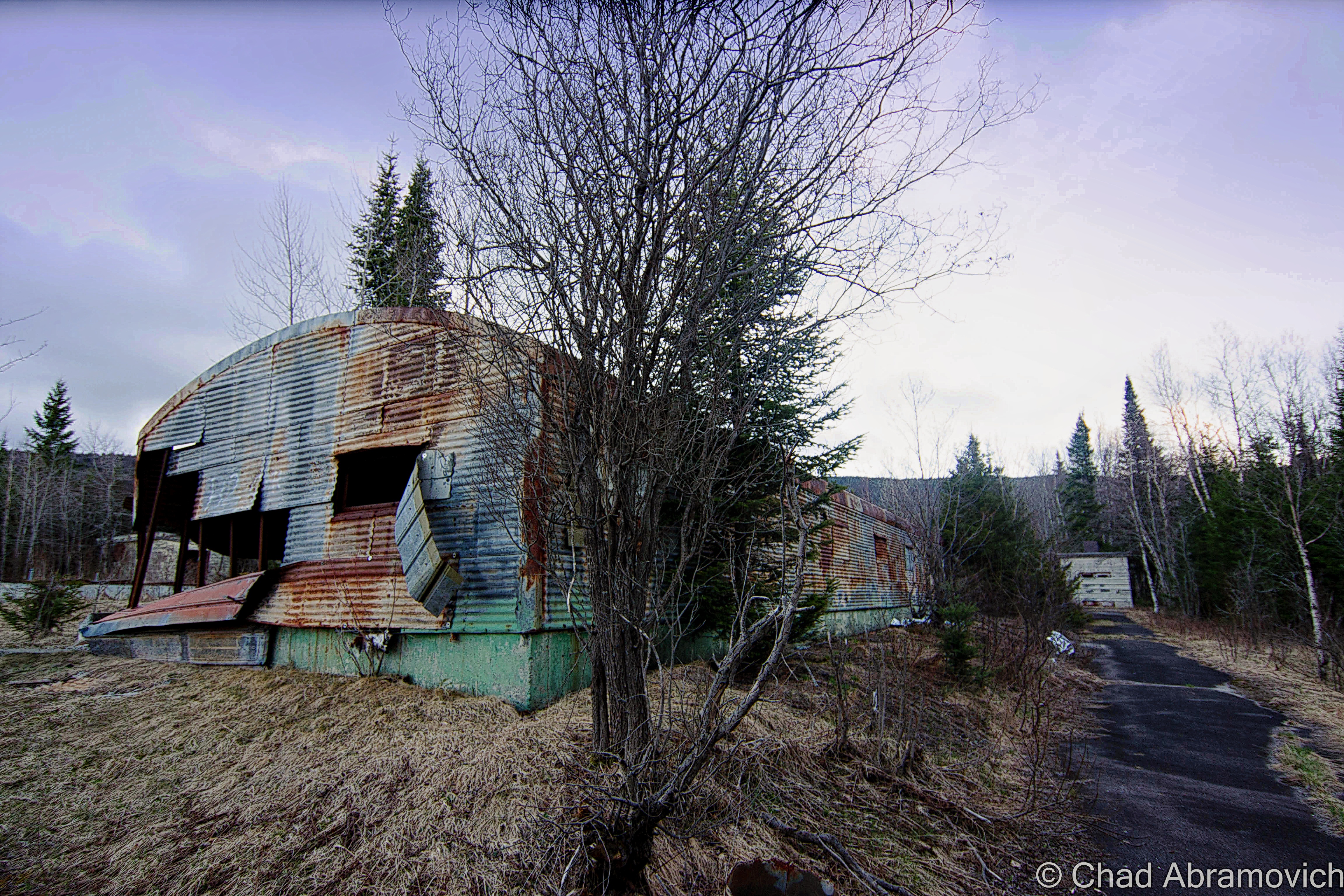
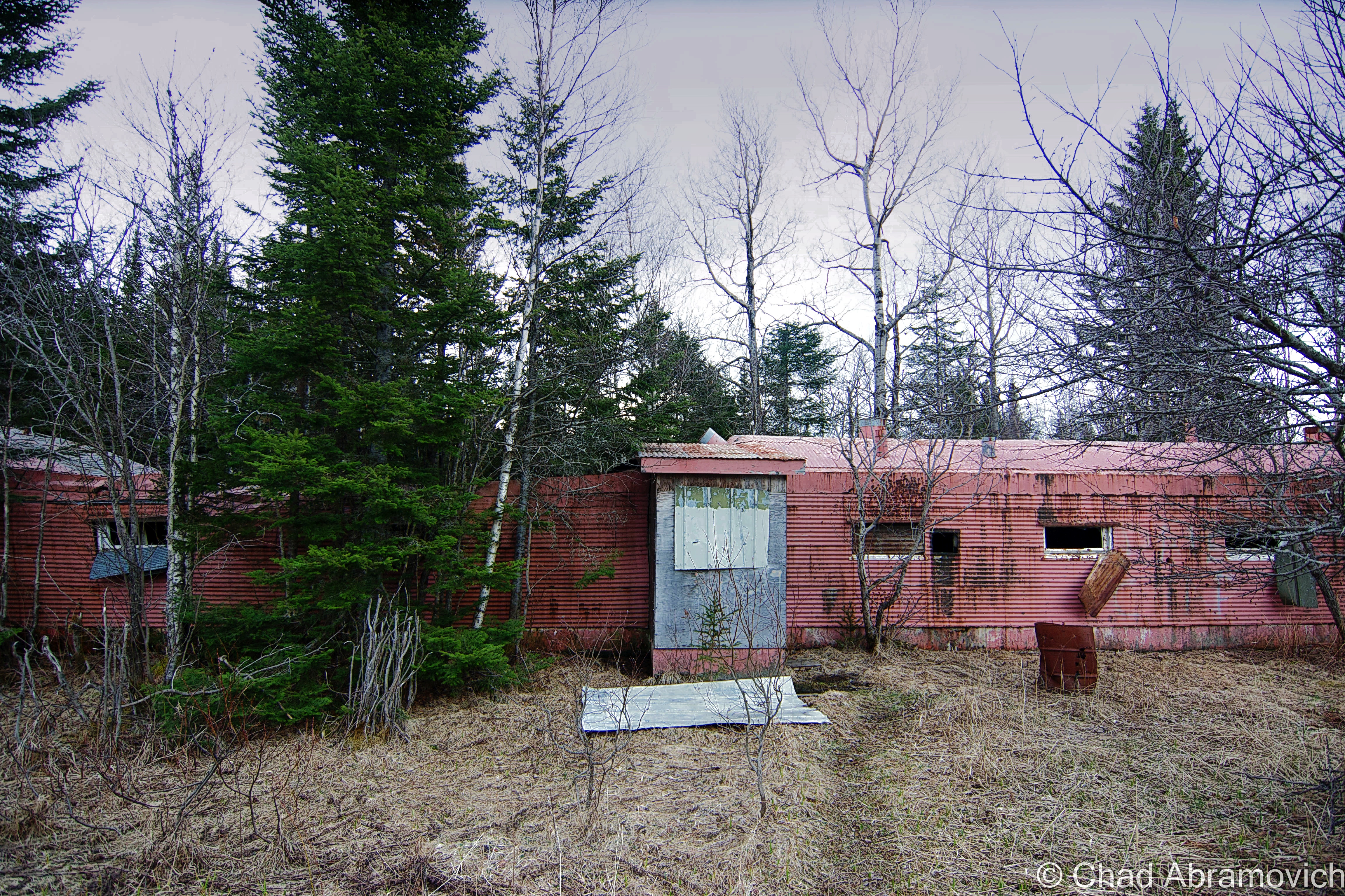
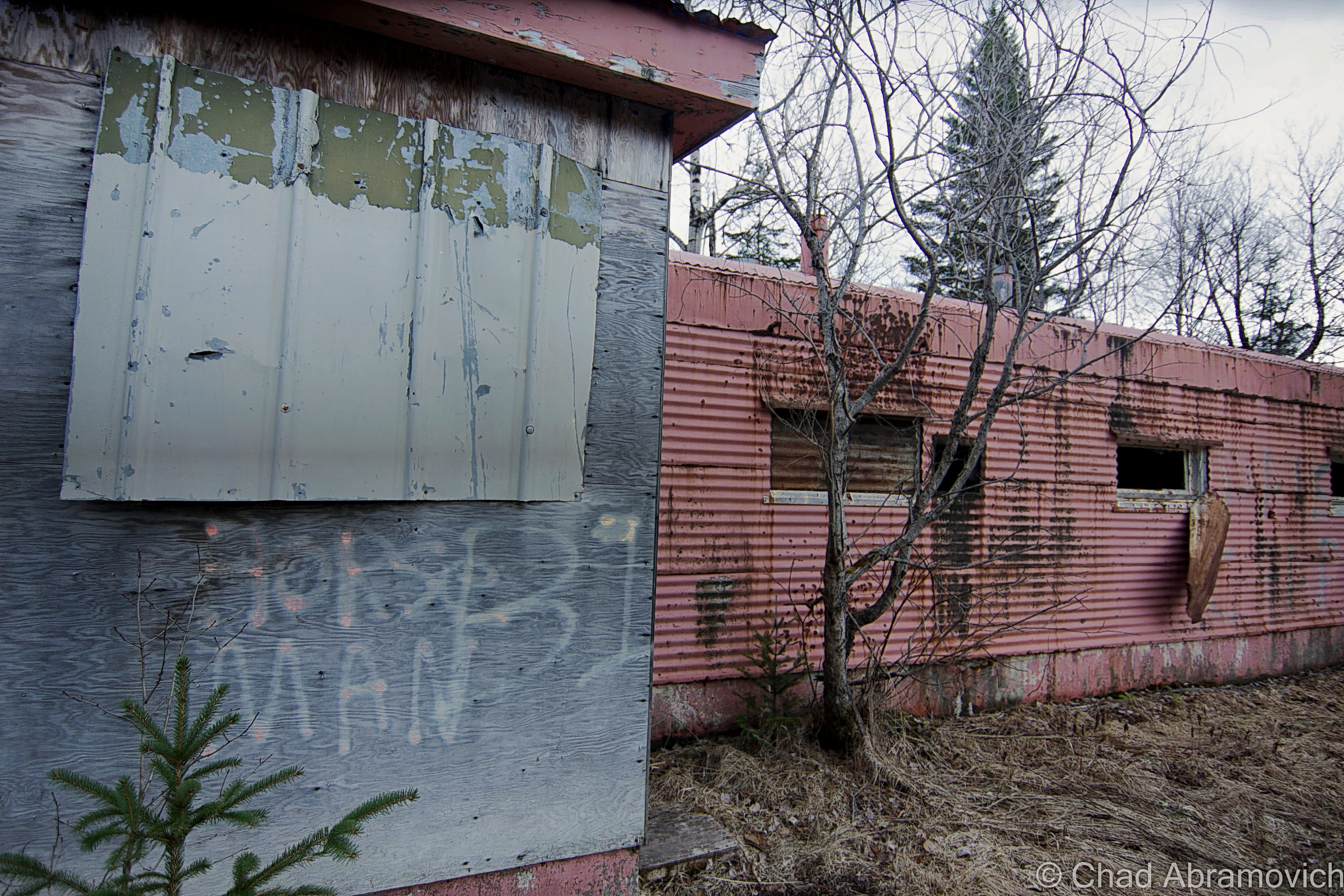
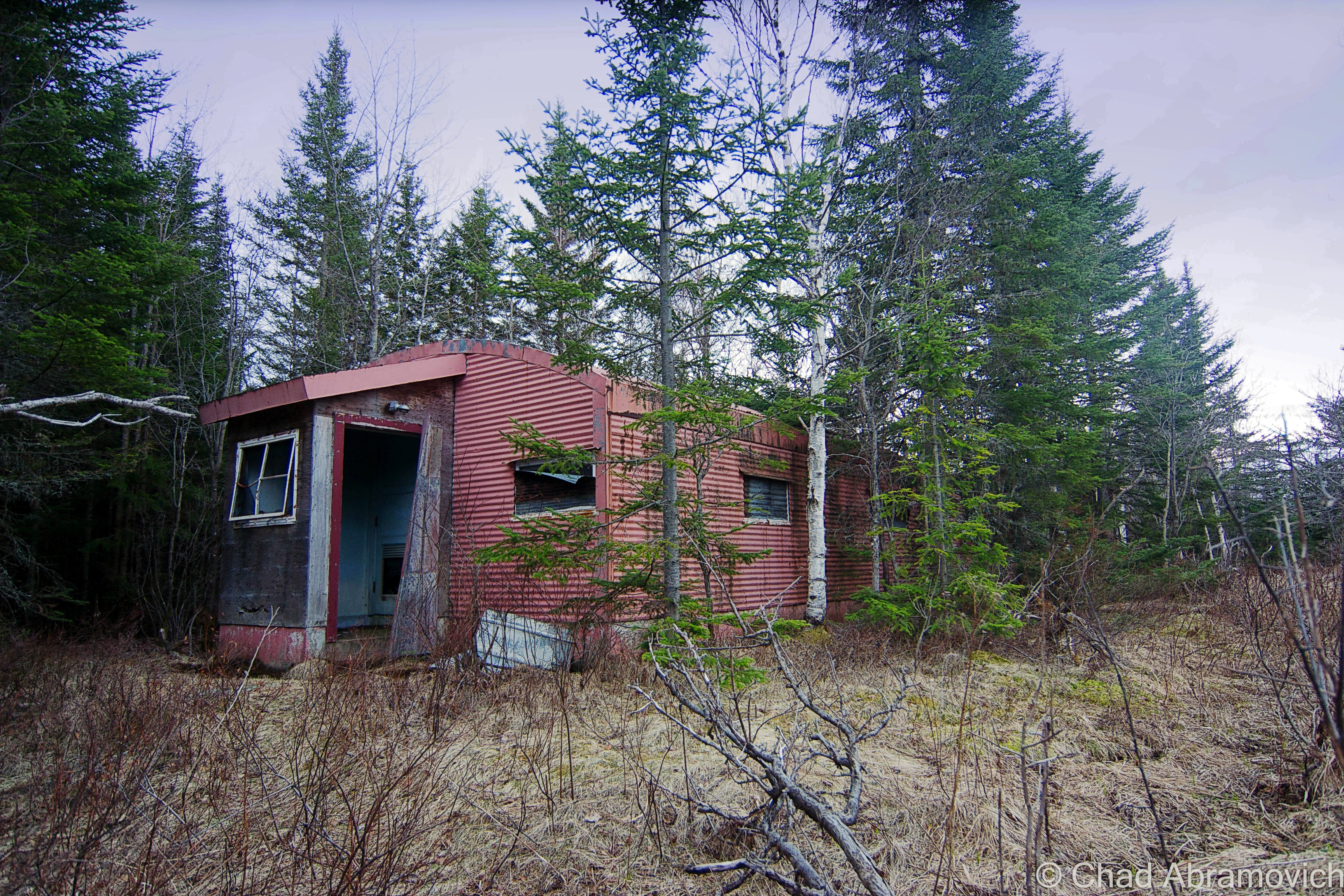
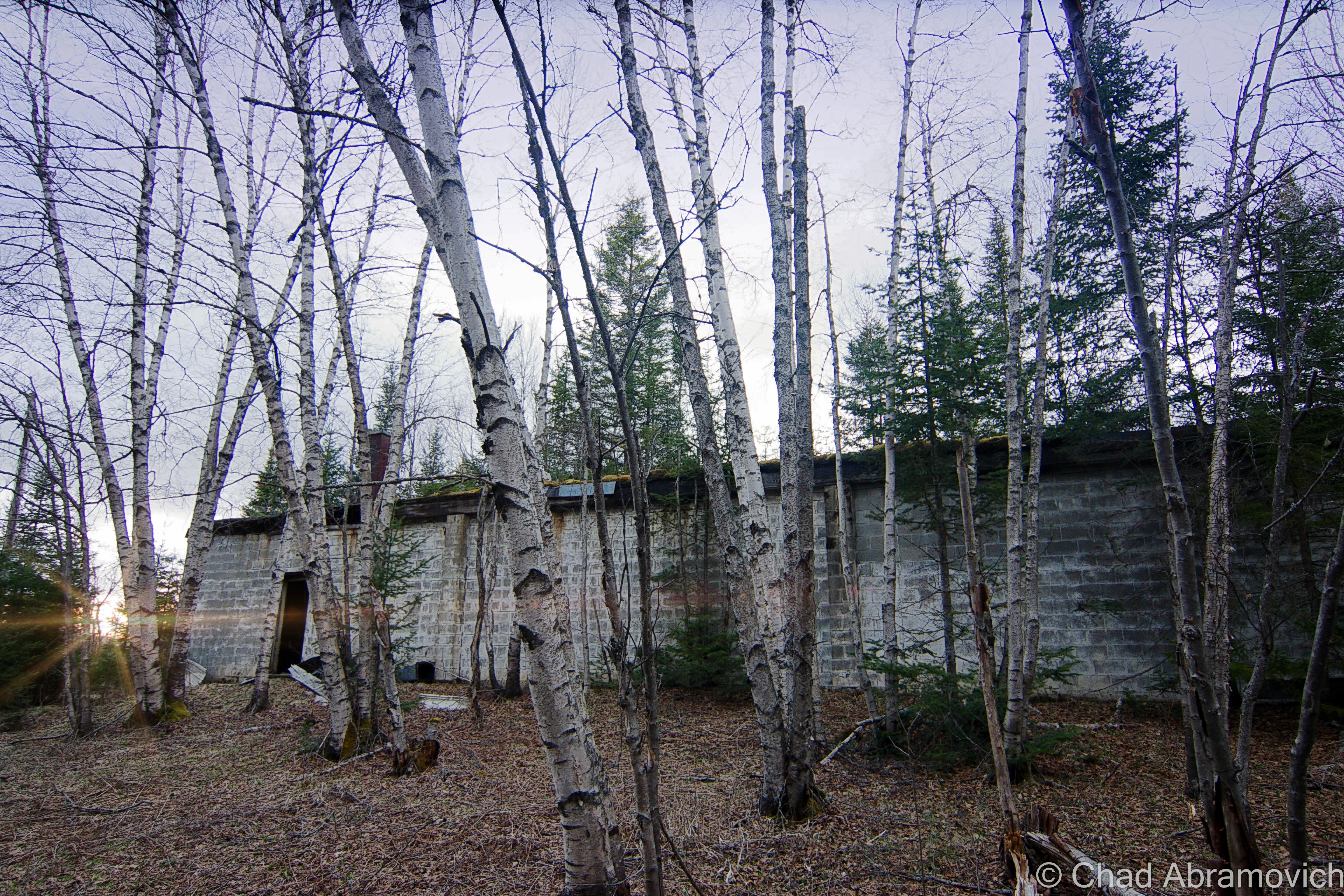
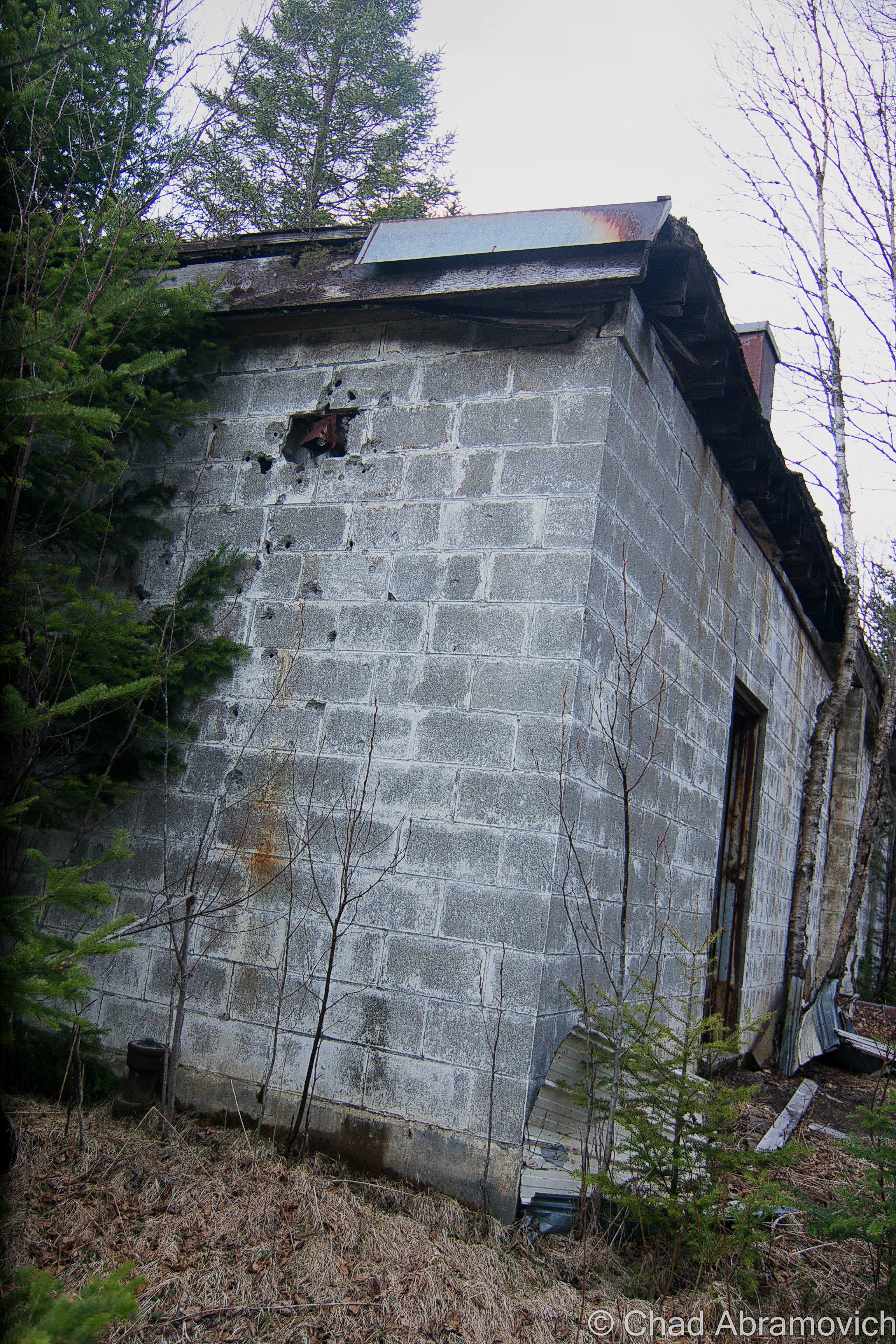
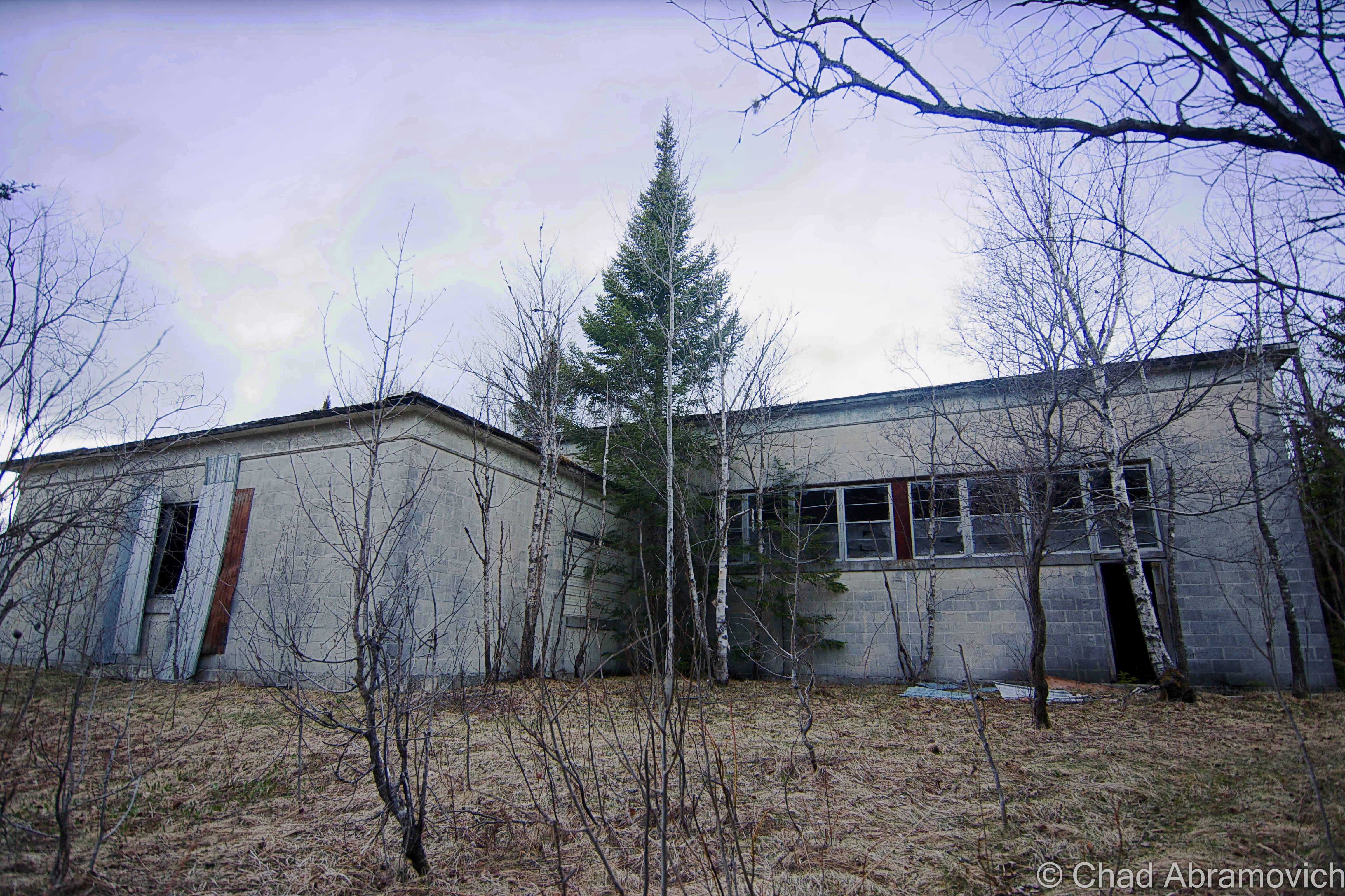
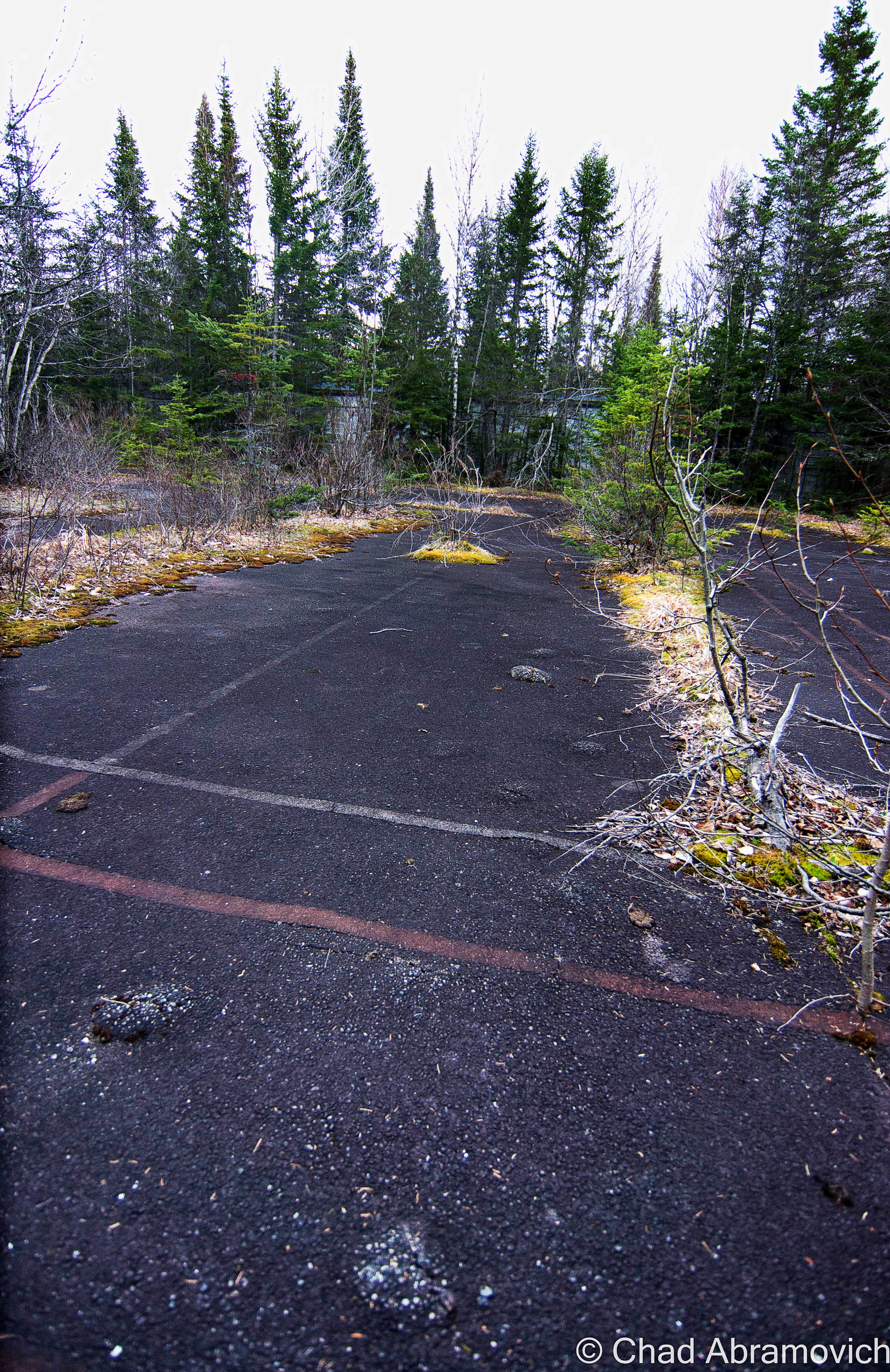
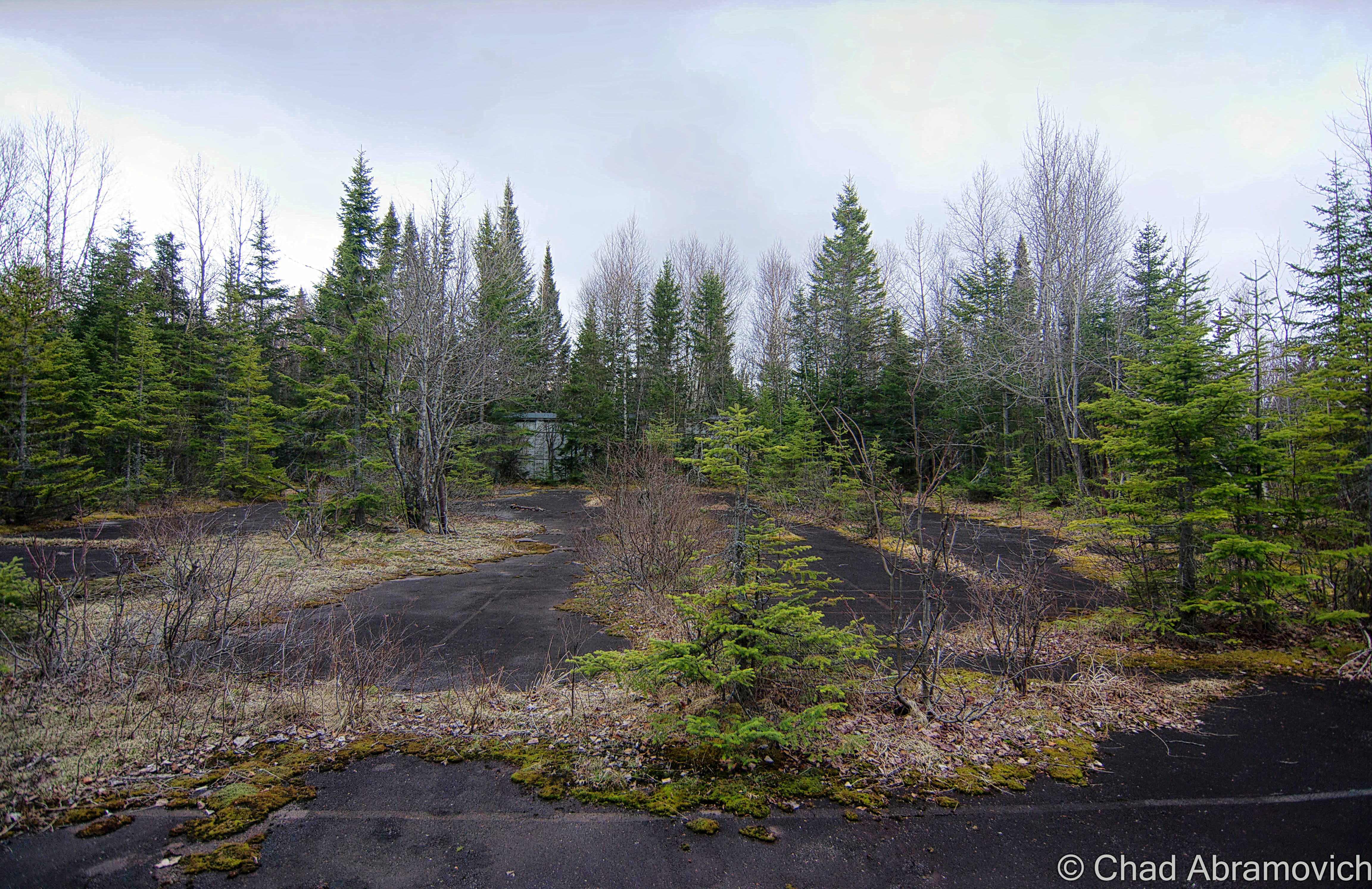
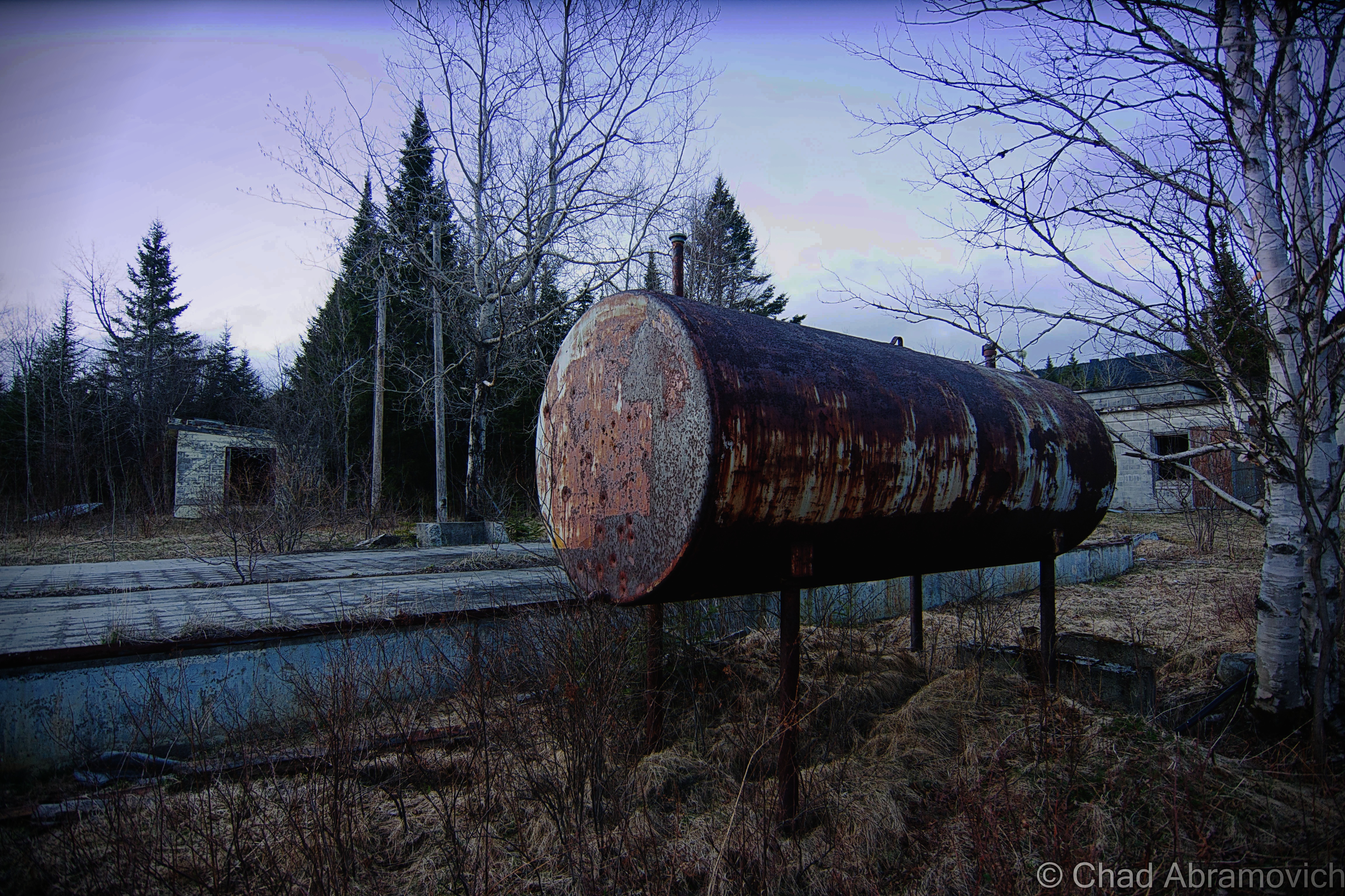
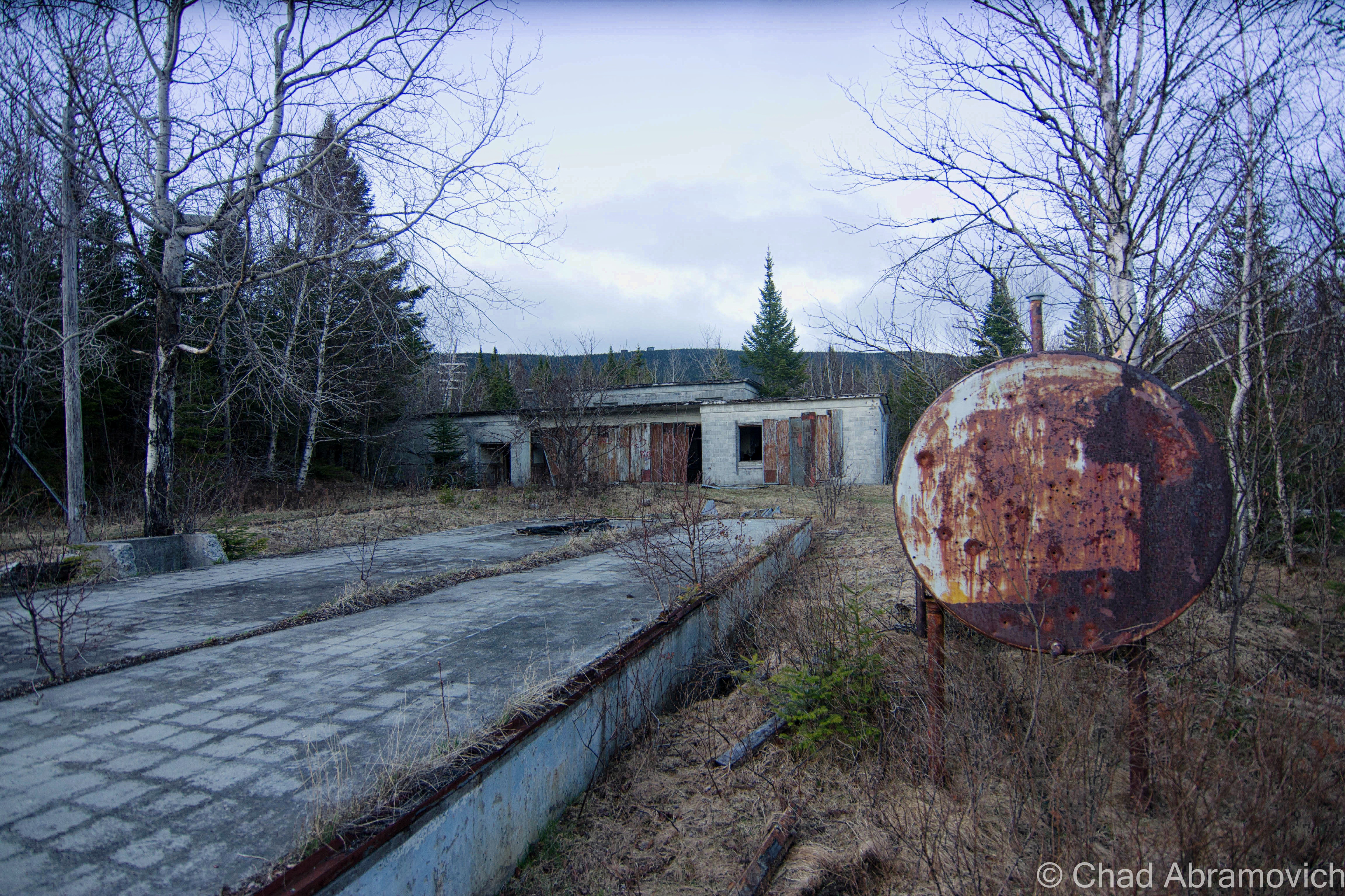
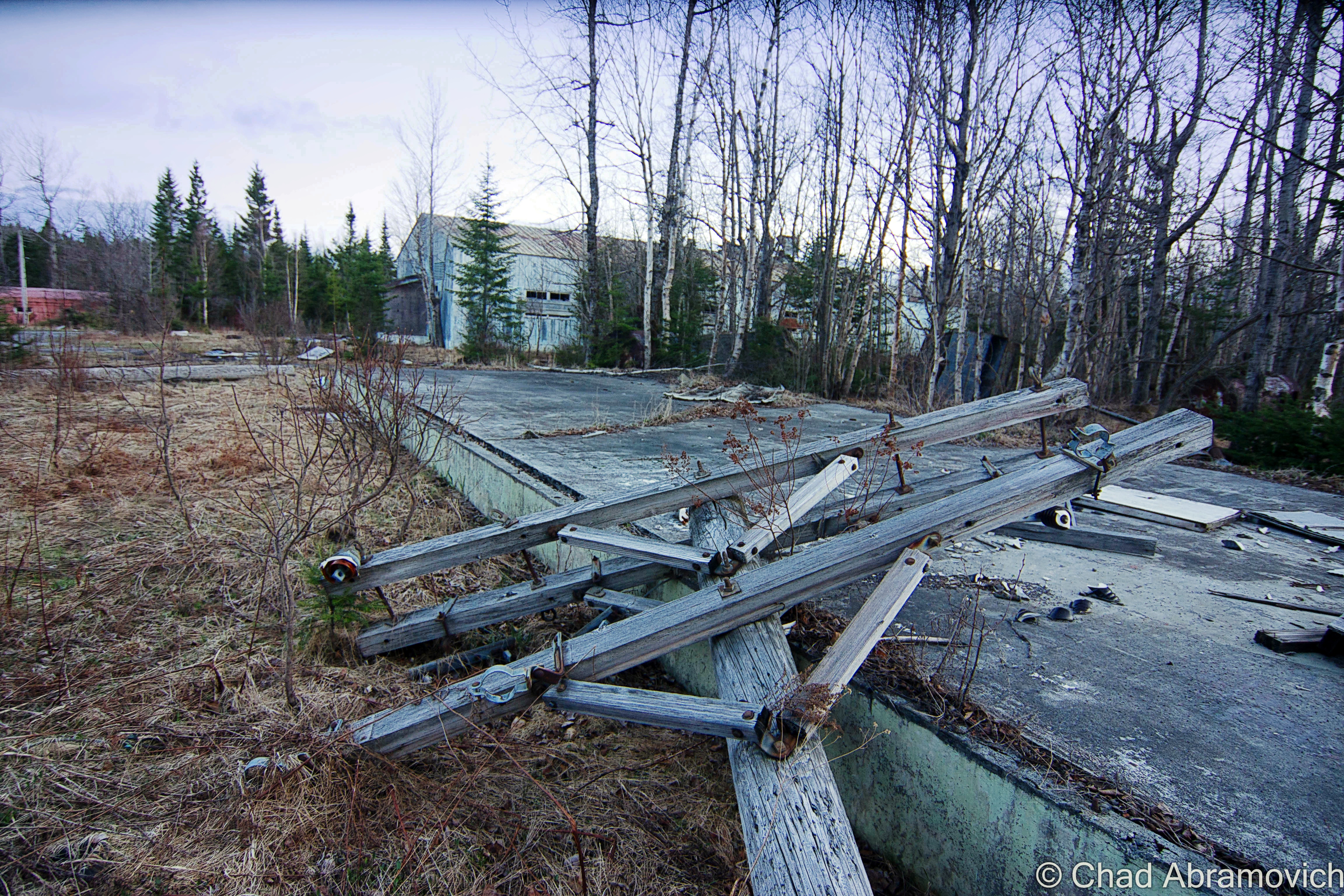
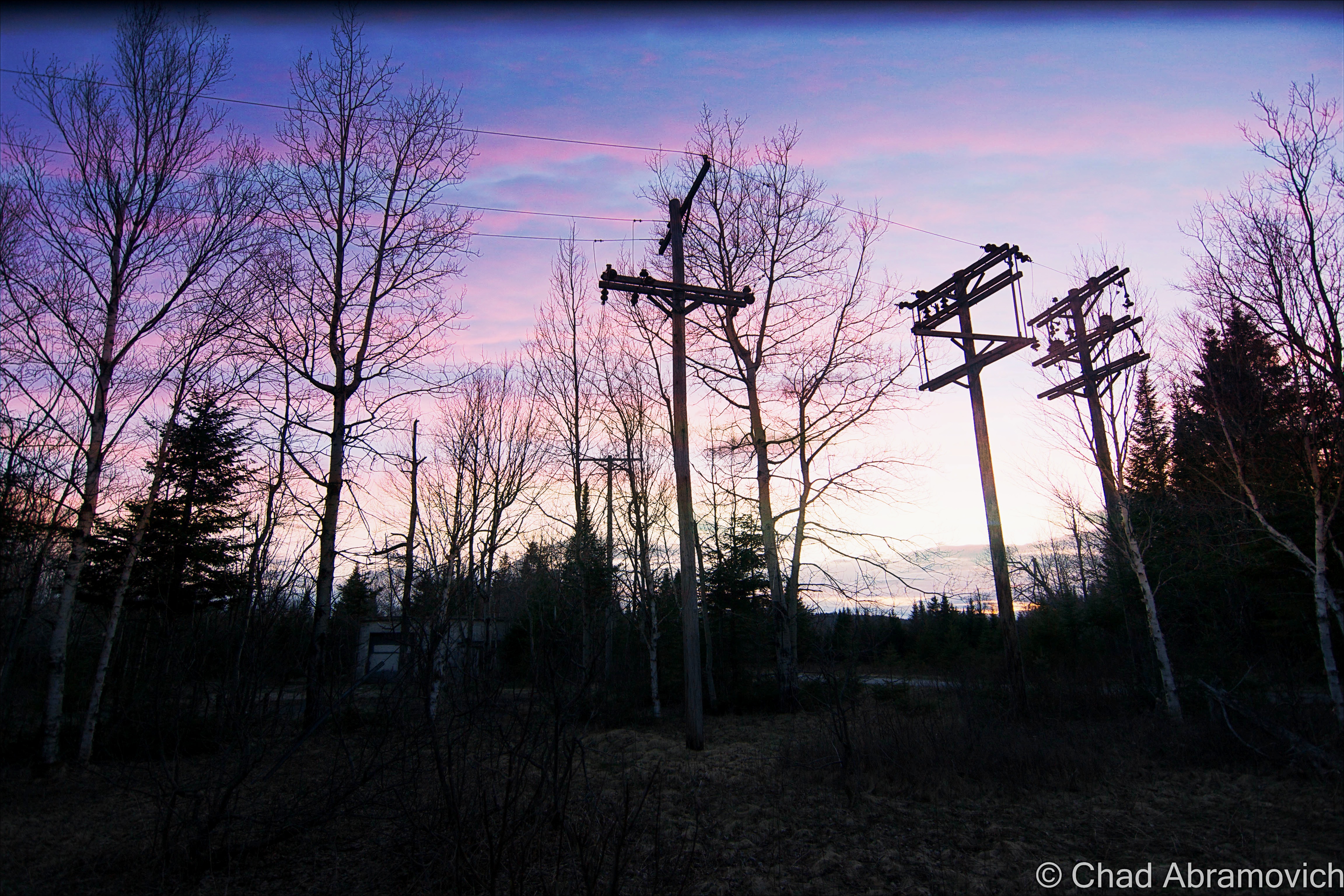
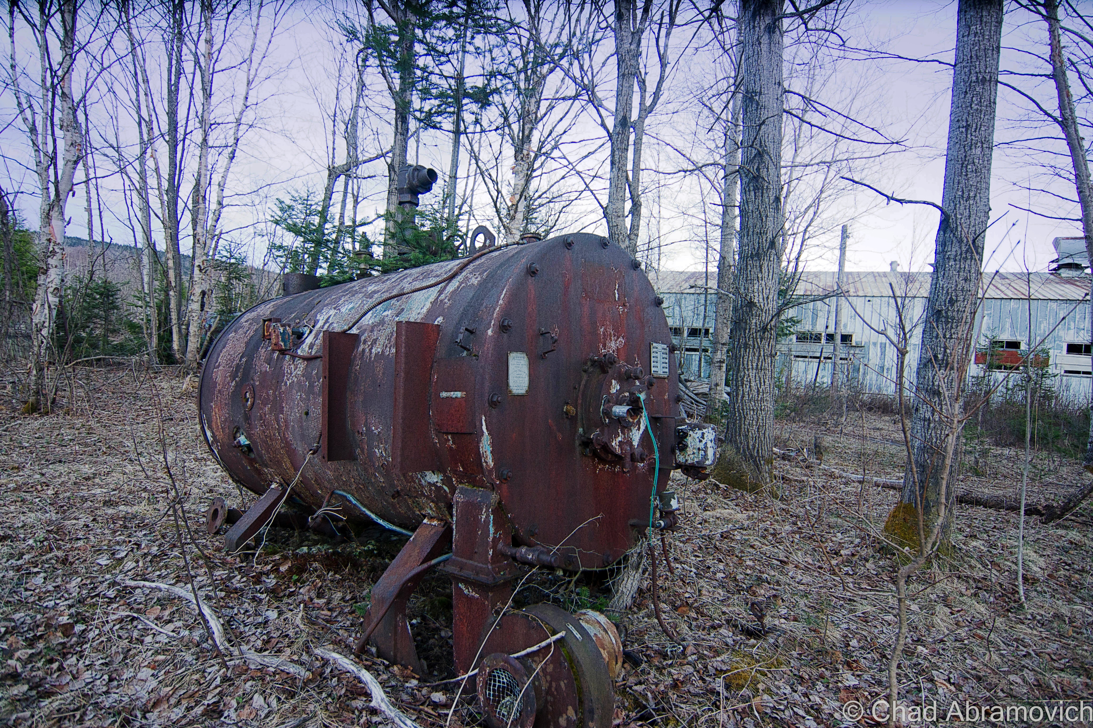
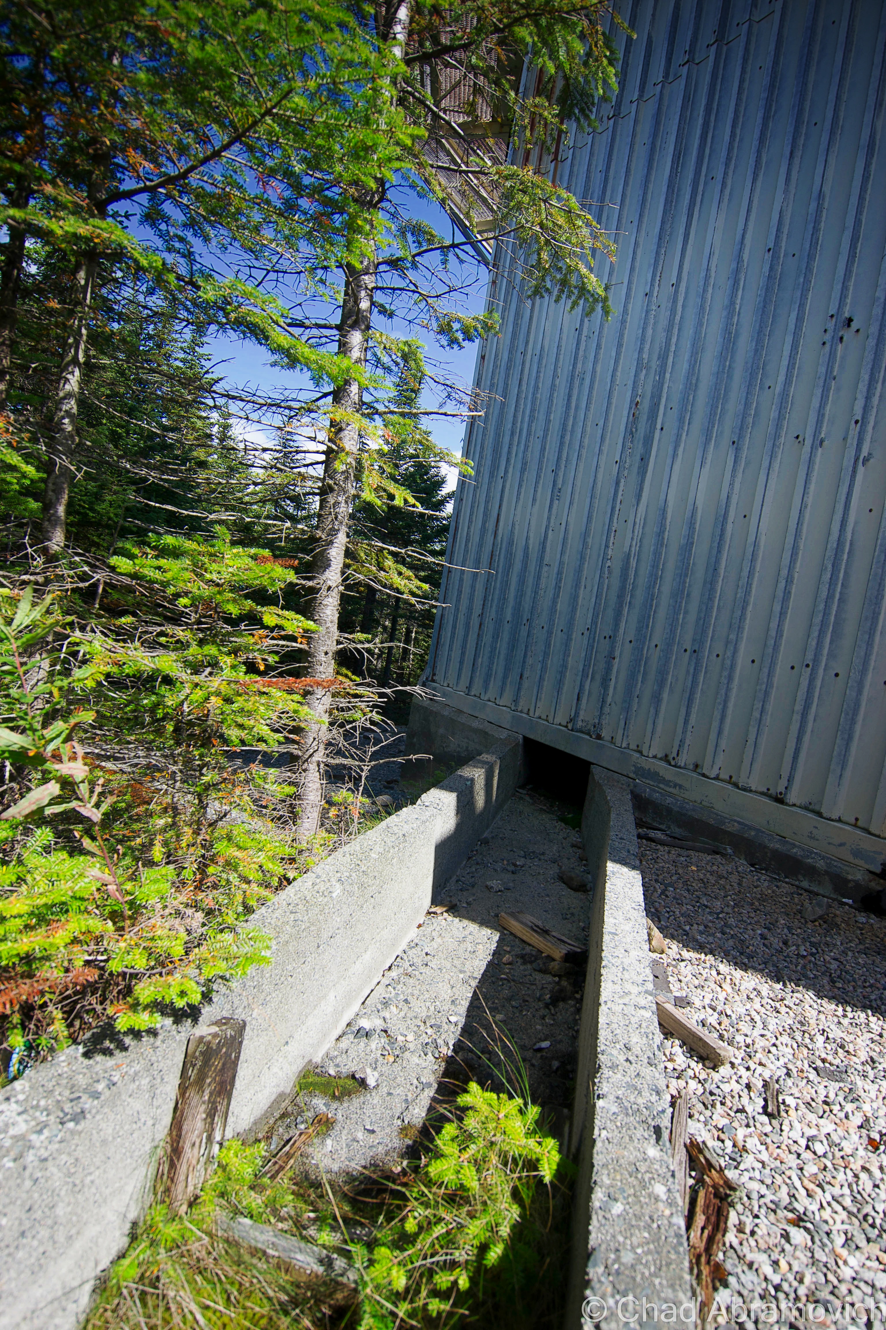
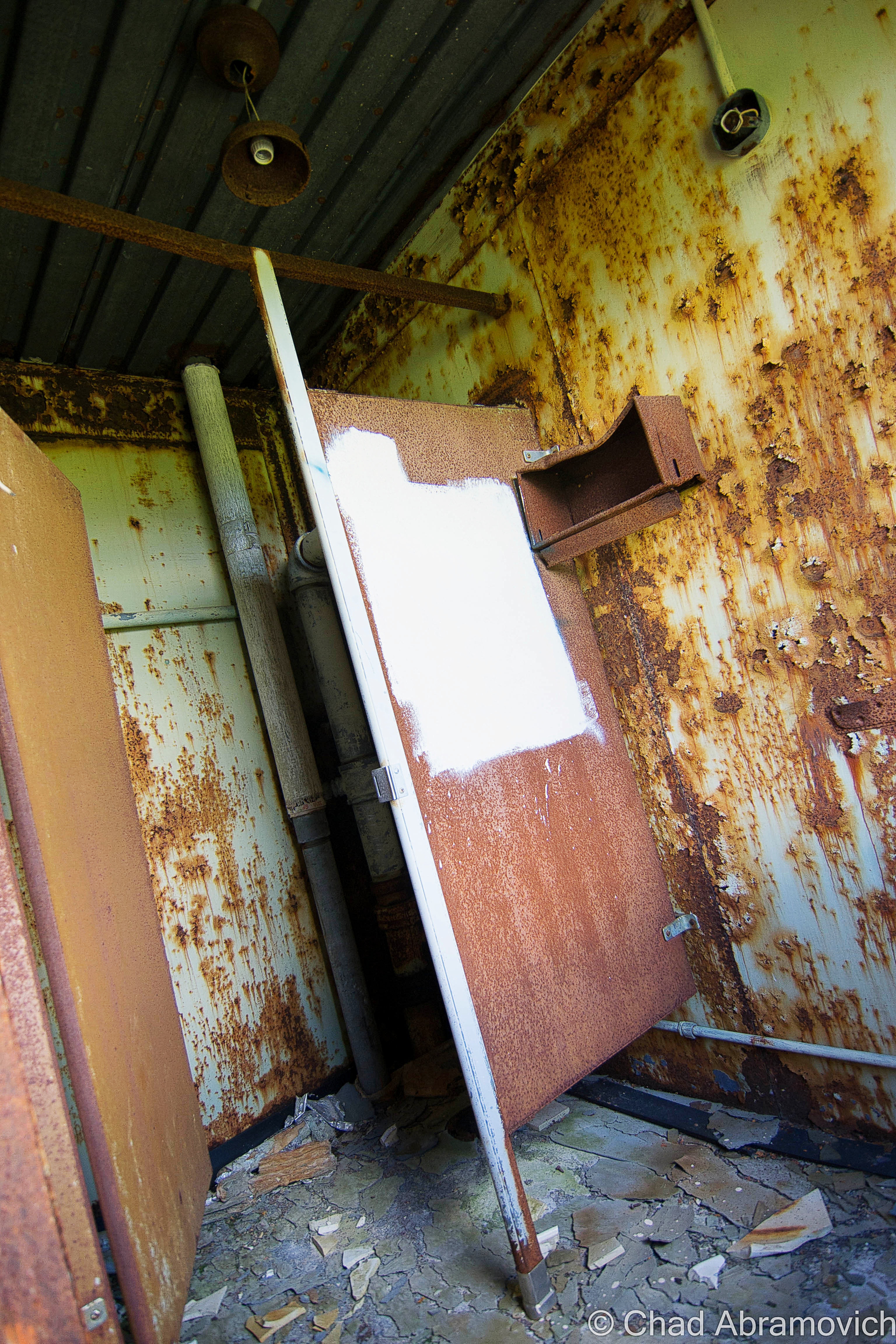
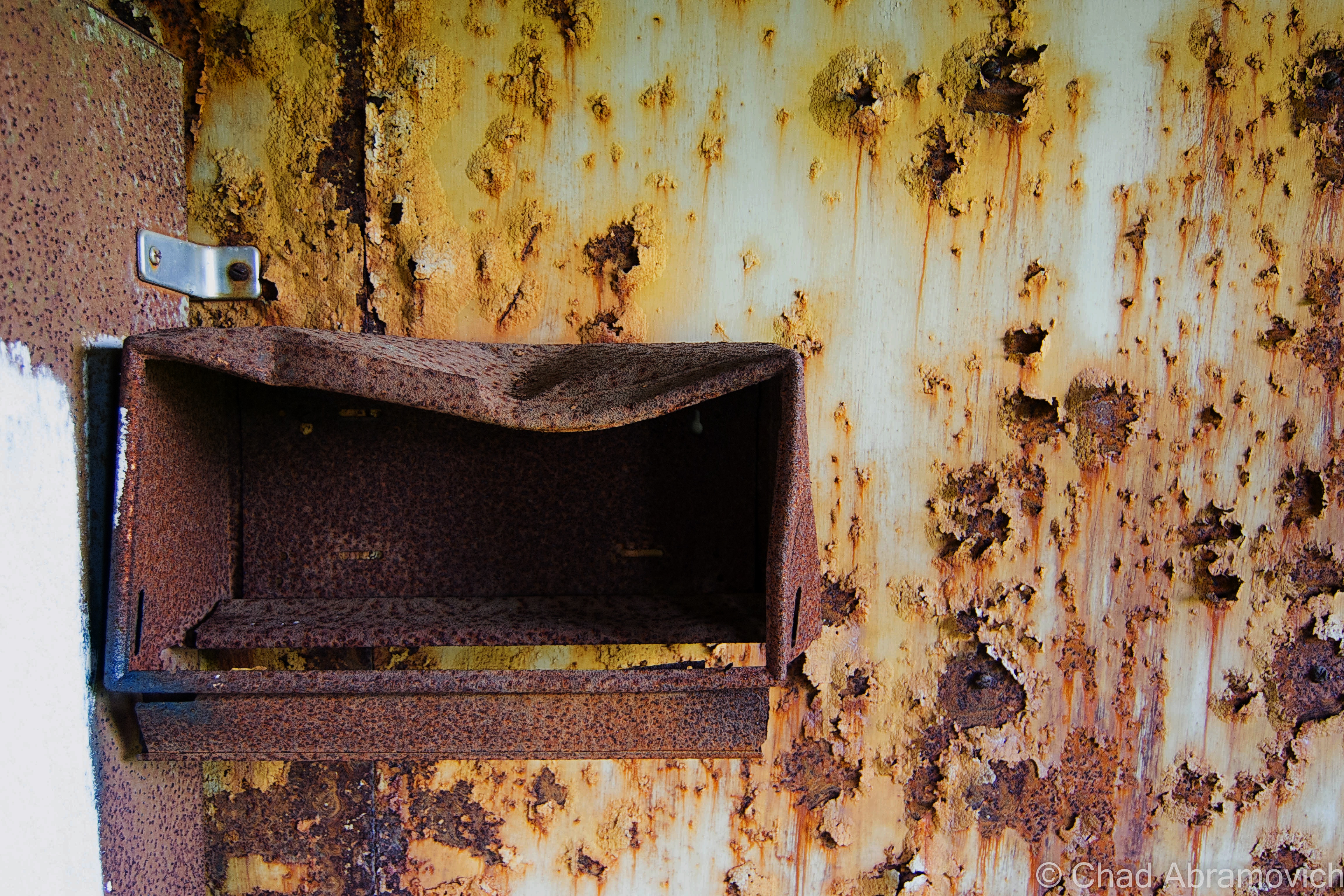
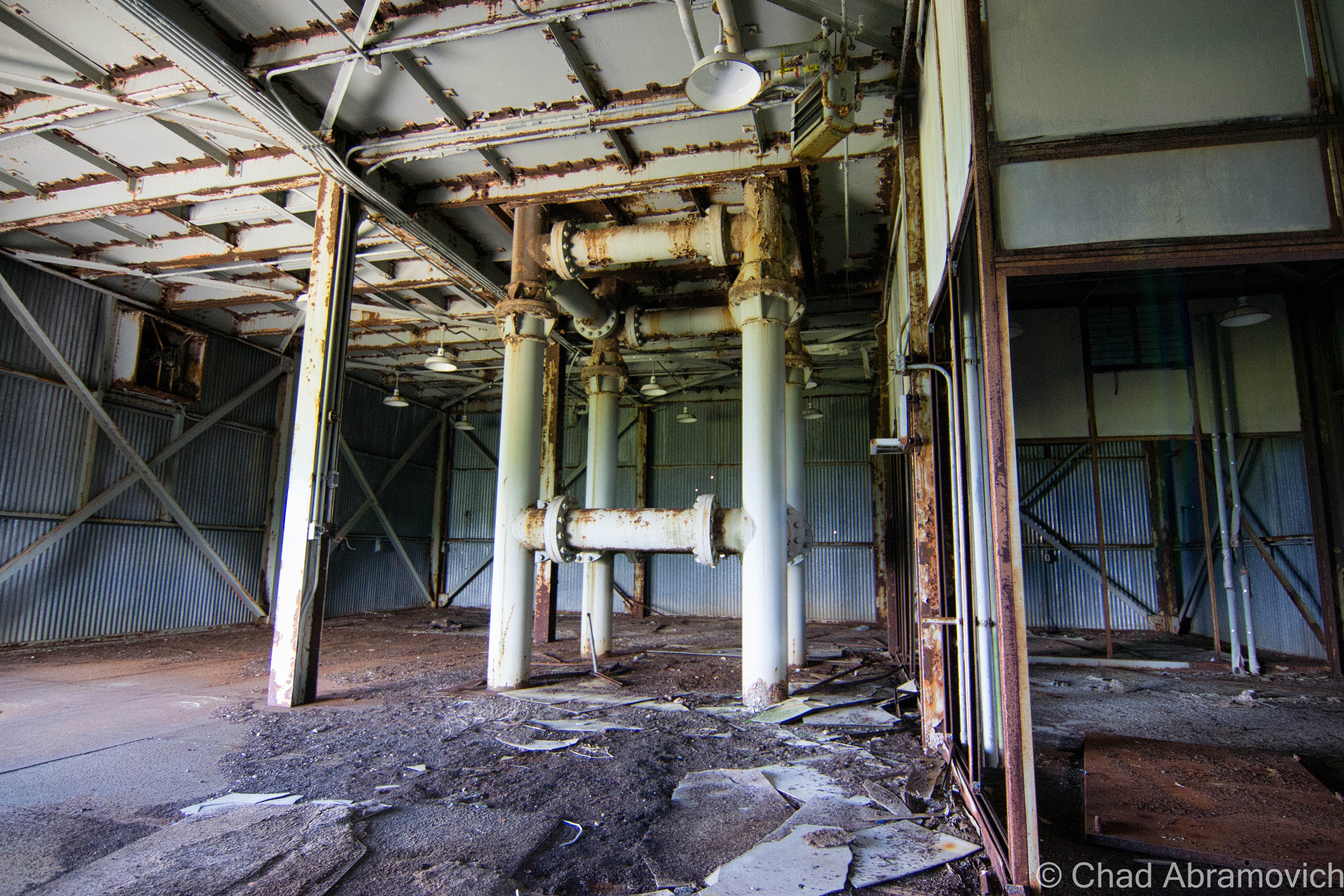
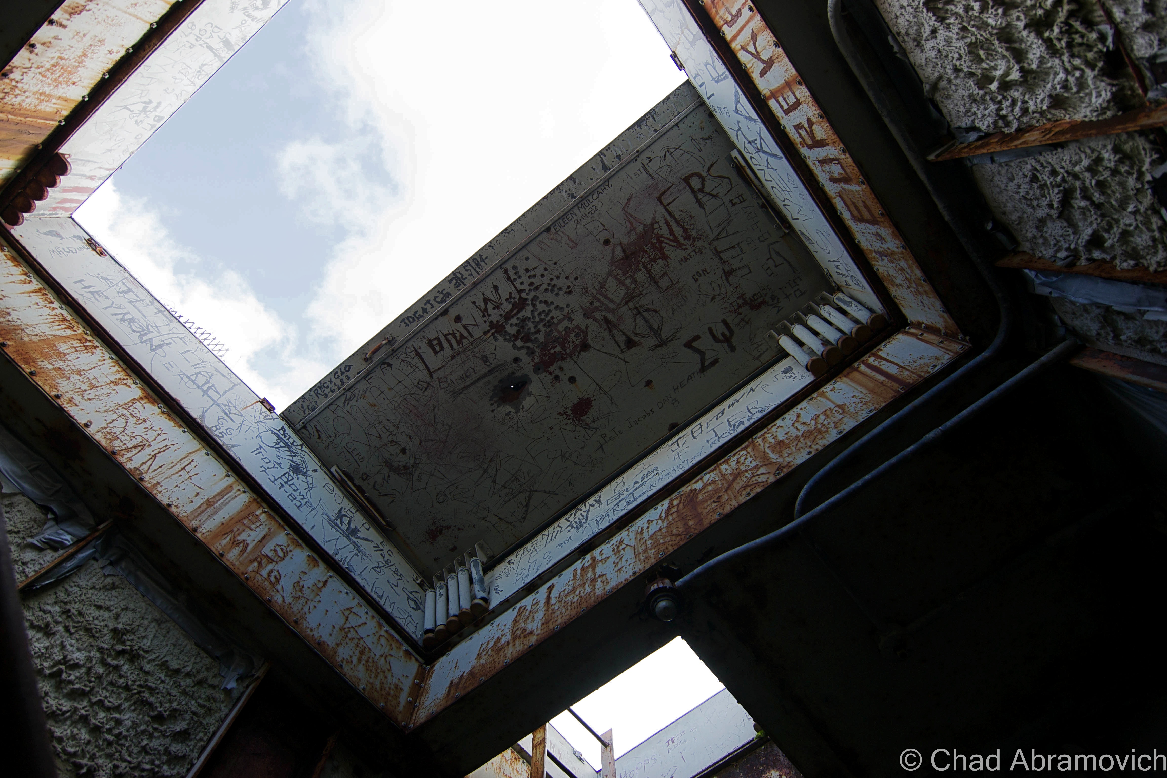
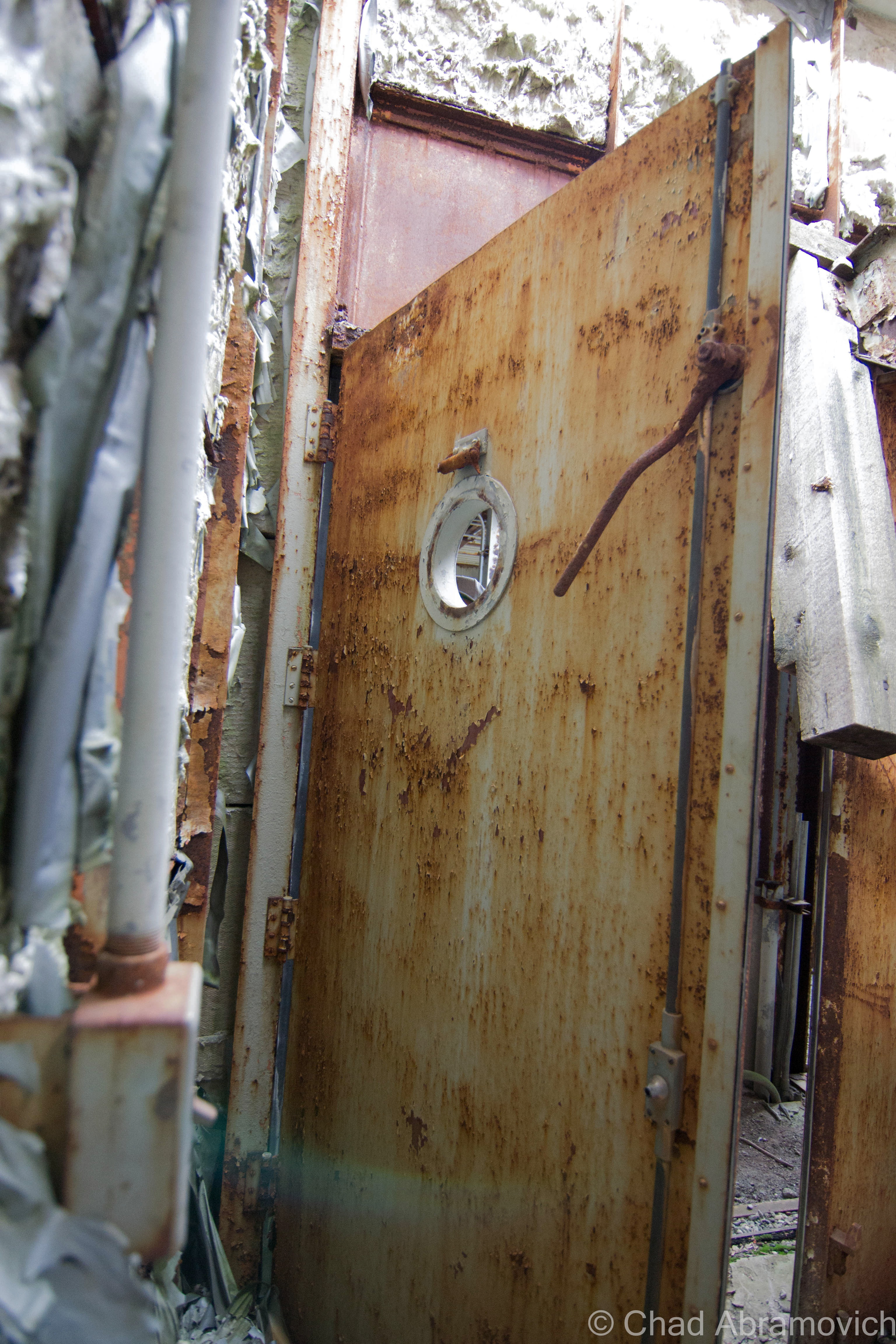
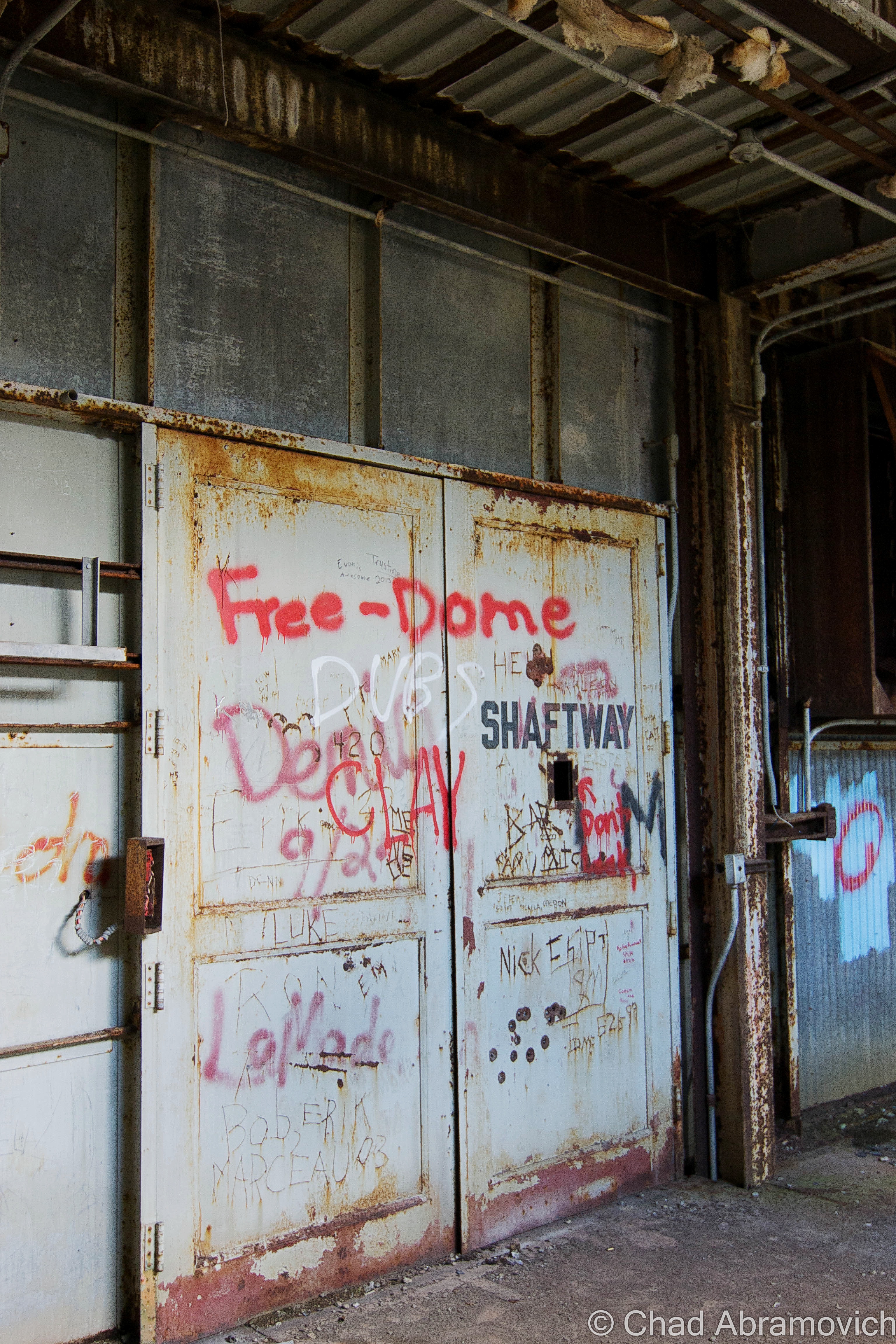
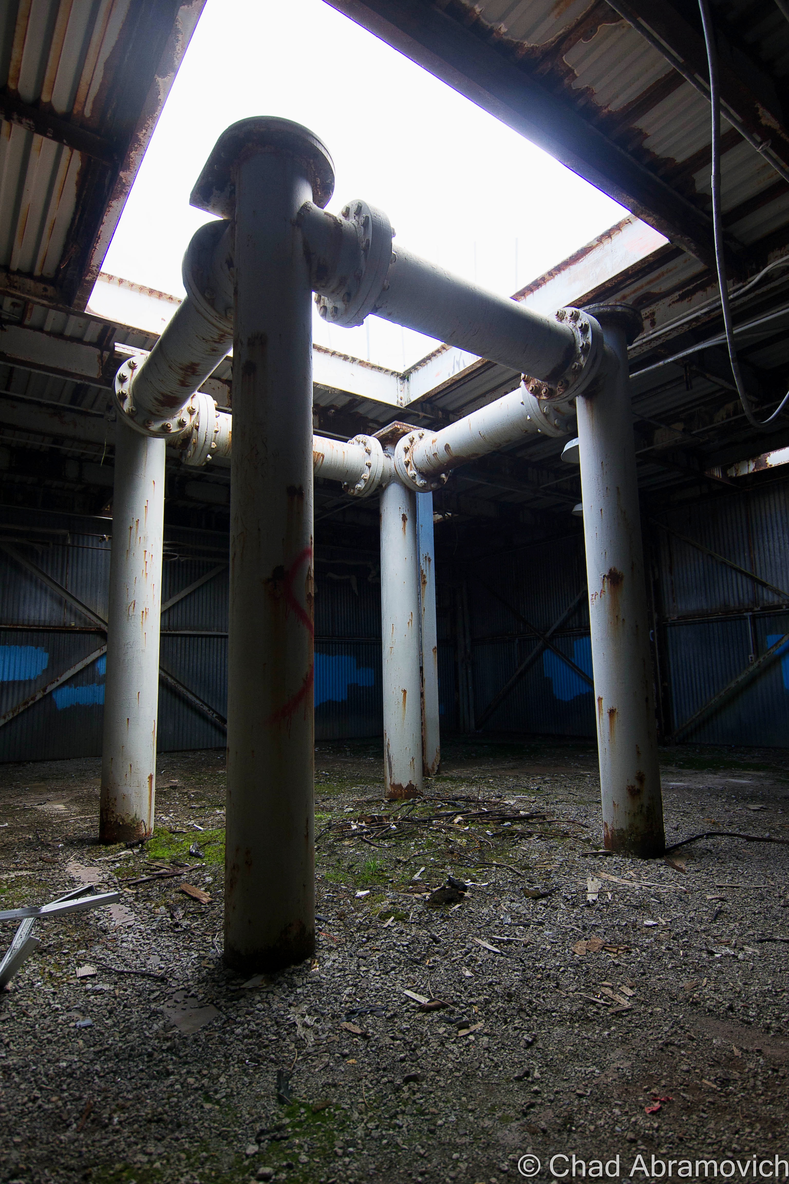
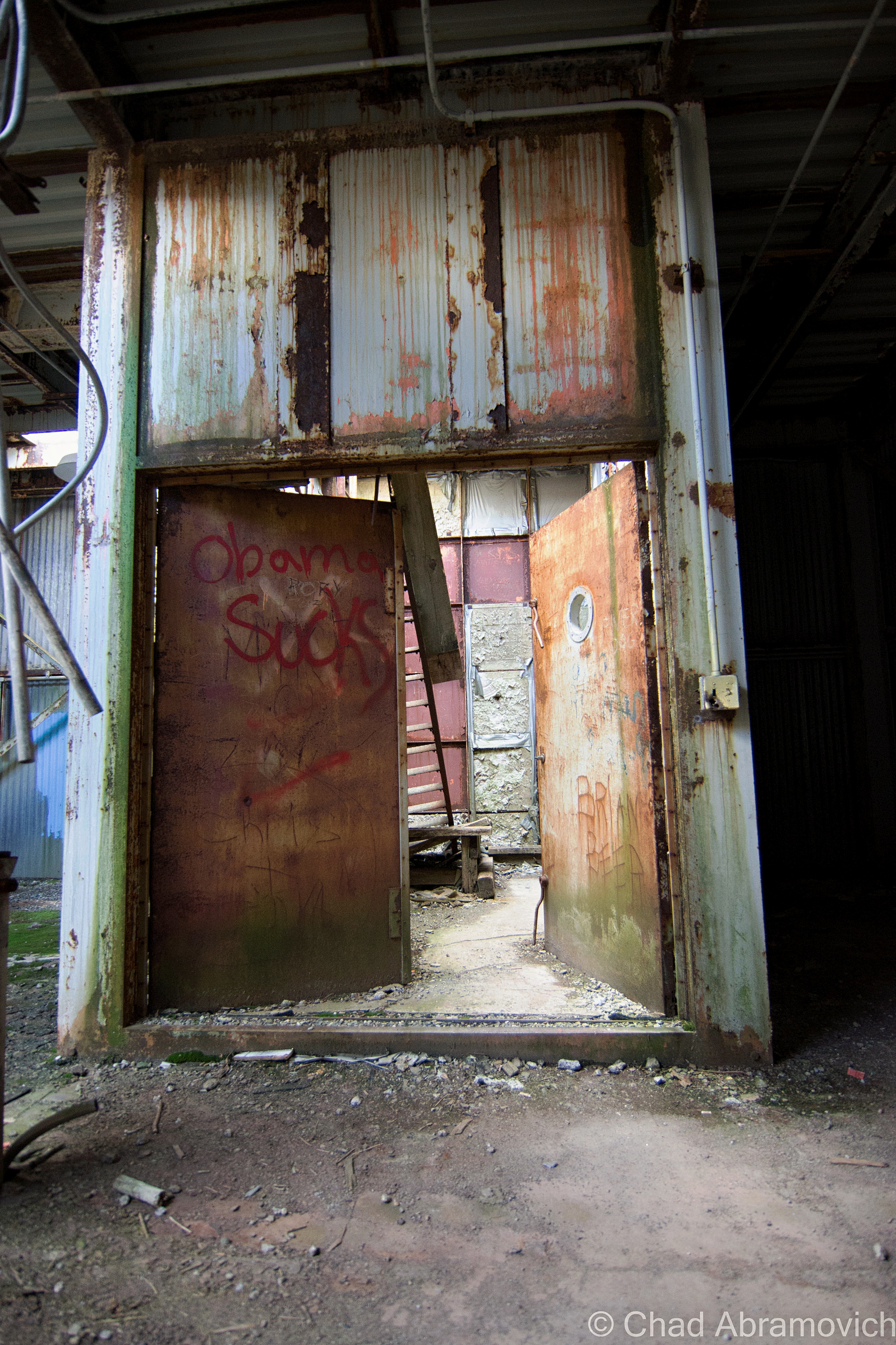
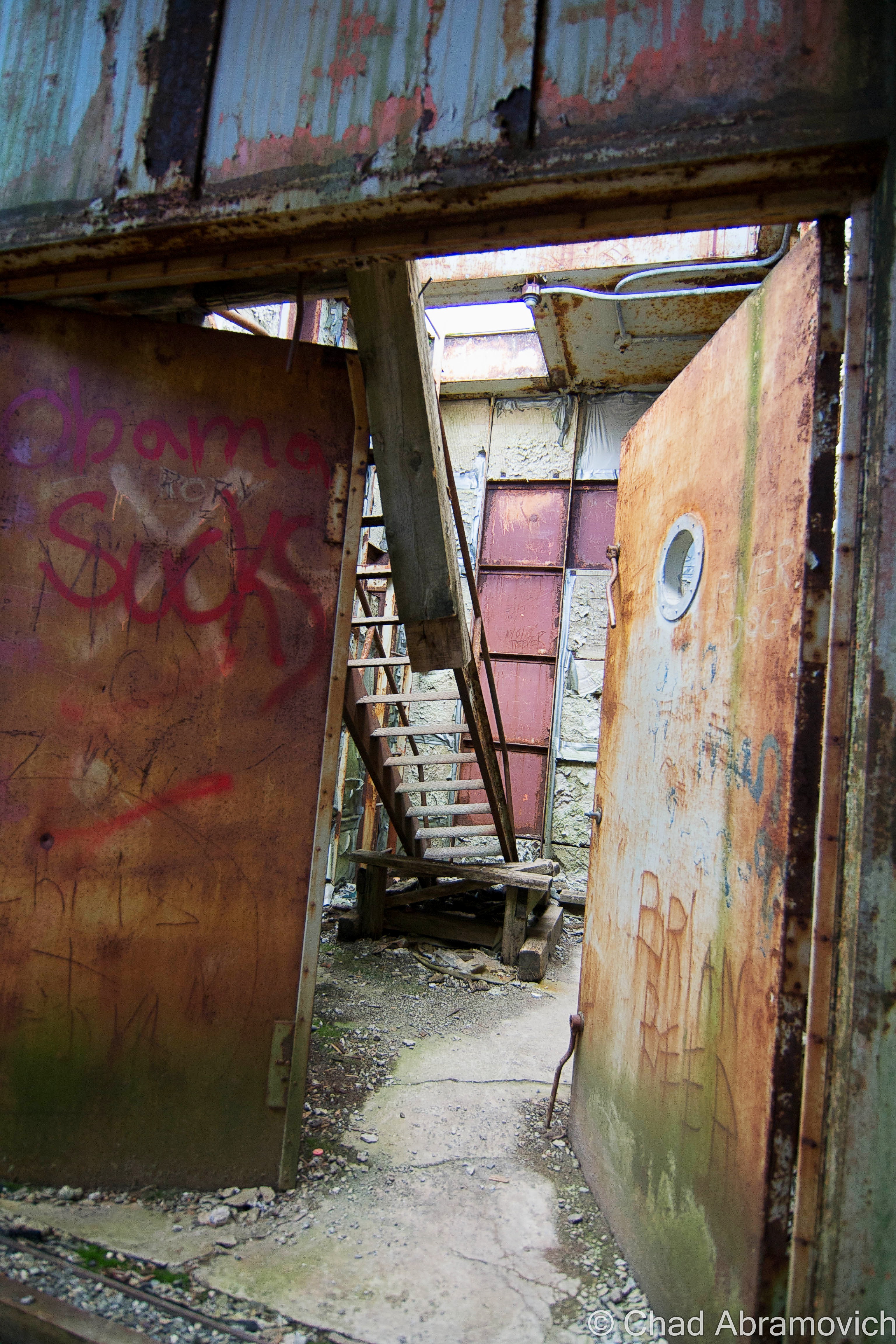
Eventually, we came across a weedy clearing in a sea of Green forest, the formidable forms of the Quonset Huts with their rusted steel facades and broken glass skulking behind the fading colors of early autumn. We had reached the former living area of the base – the sentinel forms of the radar towers high above us could be seen on a steep ridge where congested softwood forests climbed out of the swamps. Many of the huts had been razed already, leaving cement slab foundations choked with weeds. One of them was dismantled and given to the Caledonia County Snowmobile Club, where it was re-assembled. The remaining buildings were low profile, almost completely obscured by the forest that was slowly reclaiming what it once had.

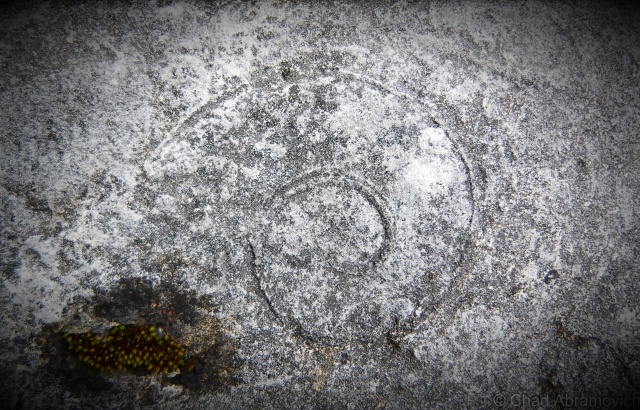
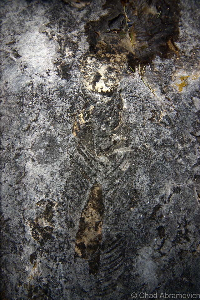
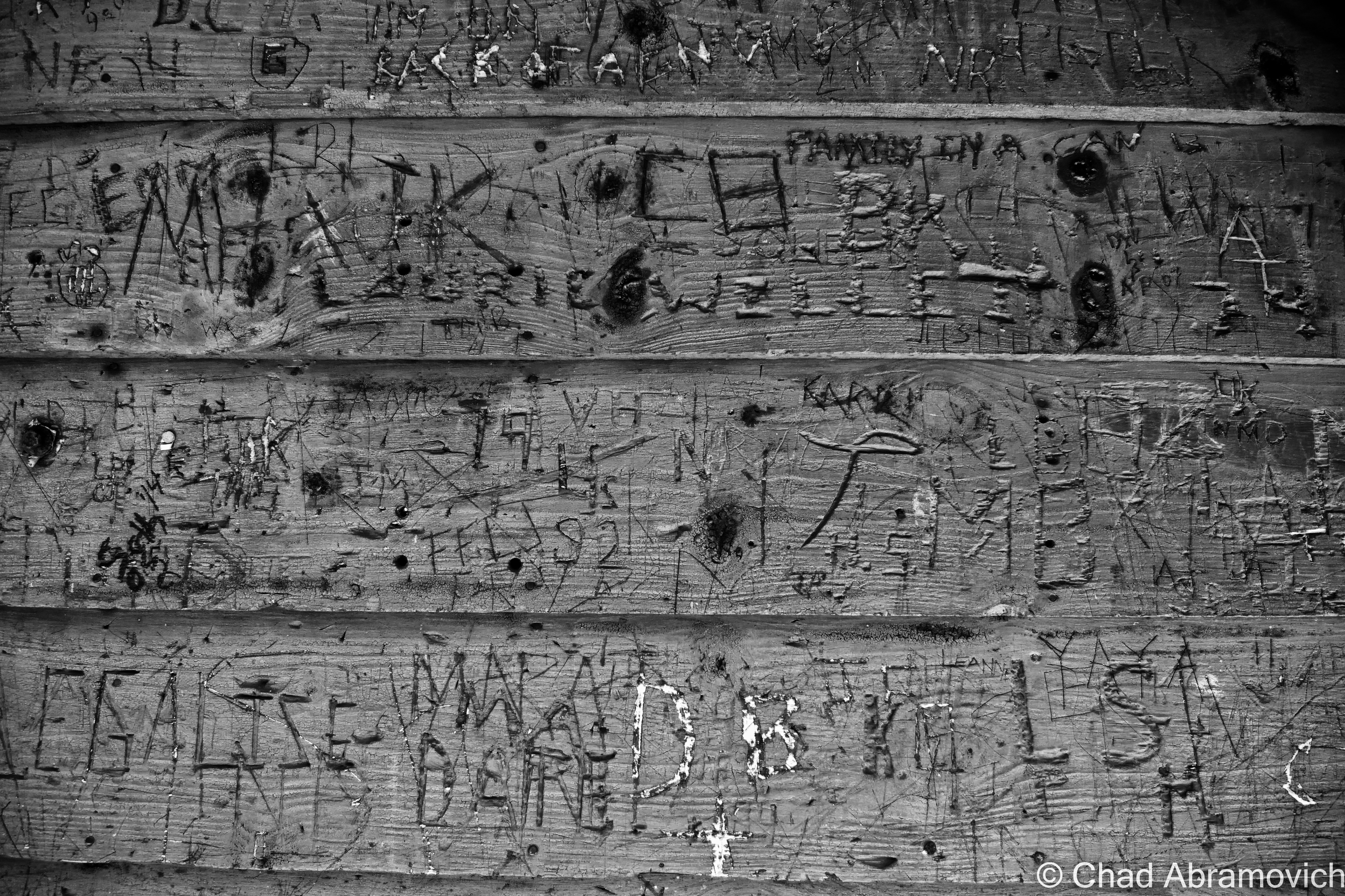
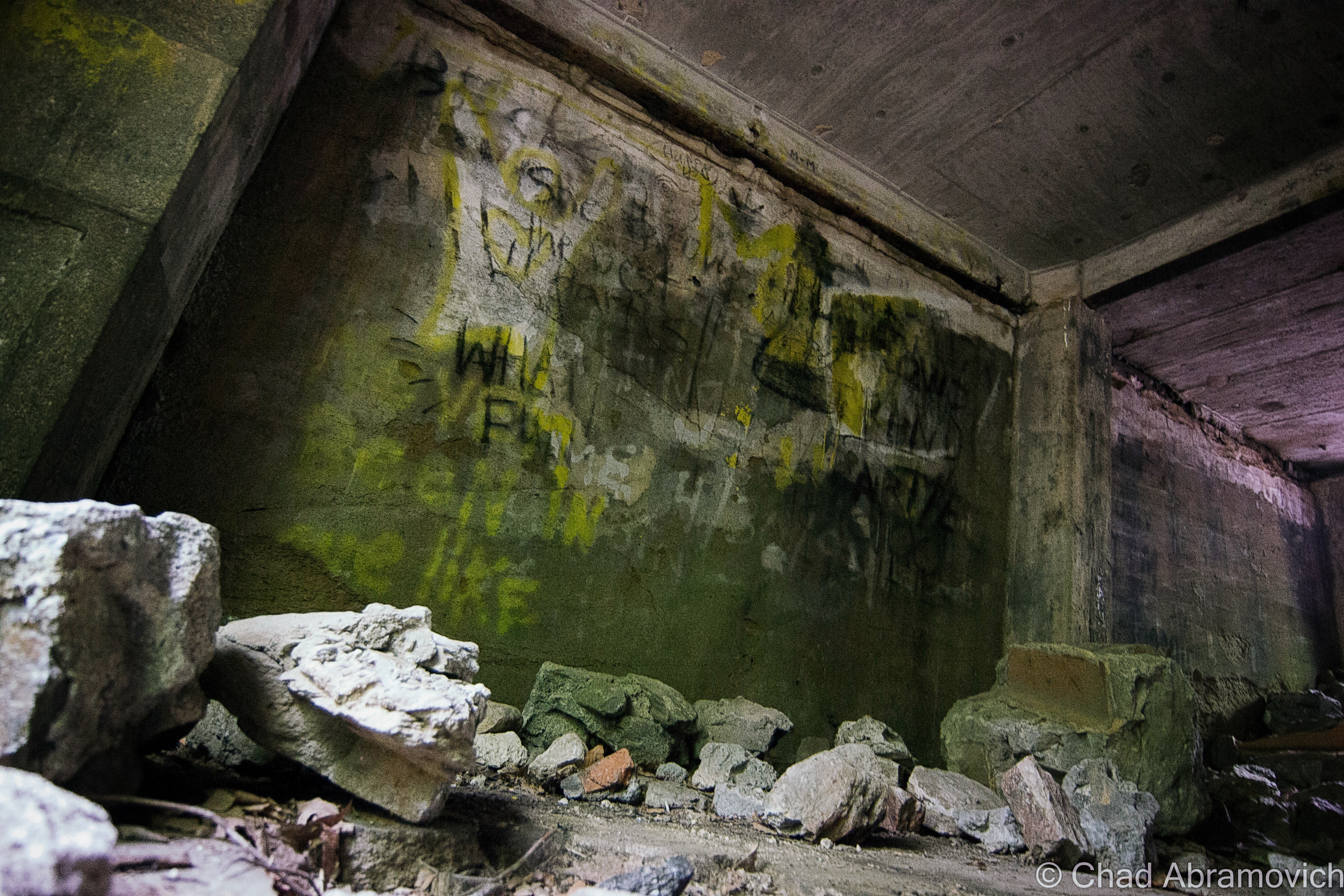
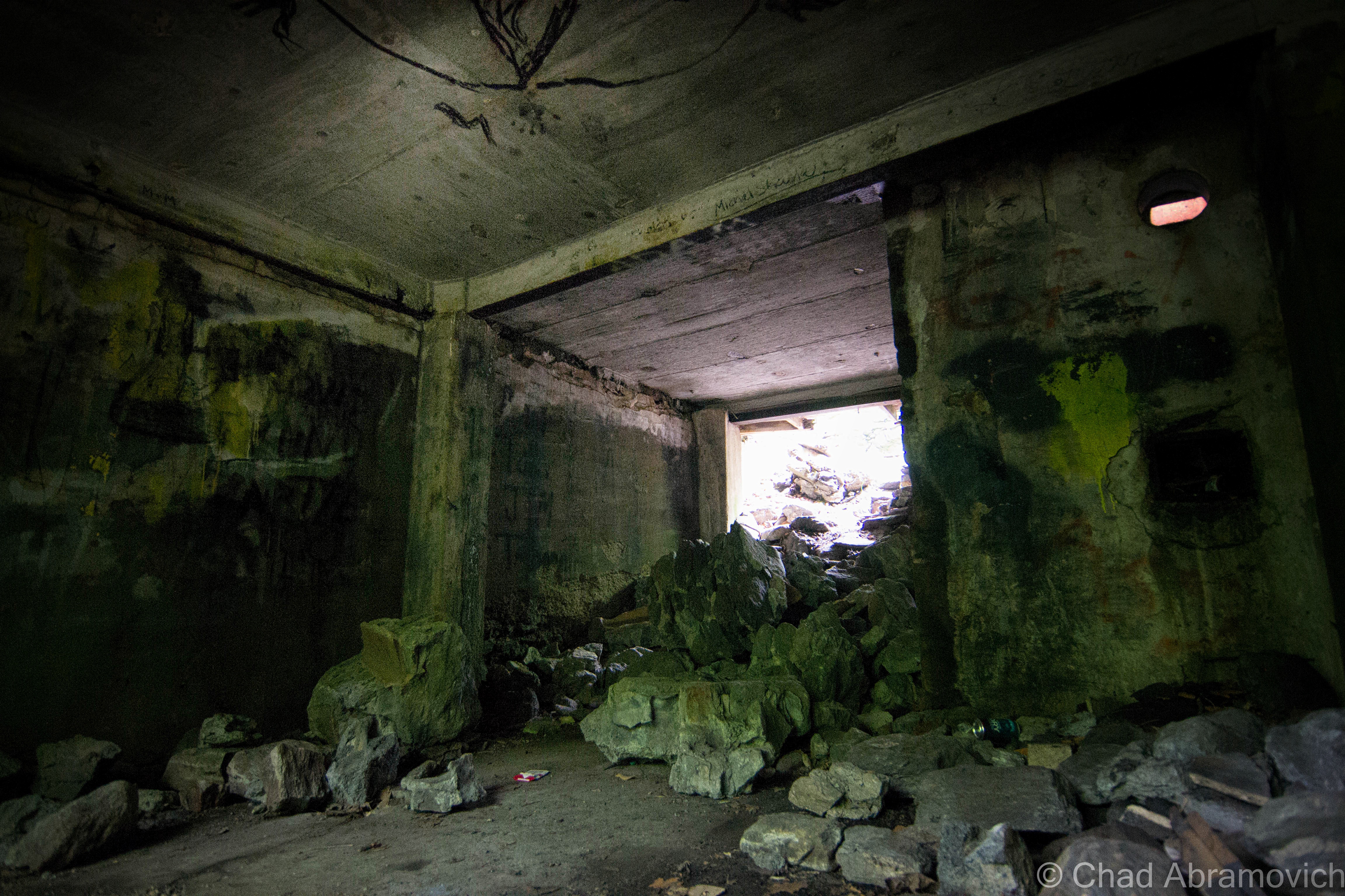
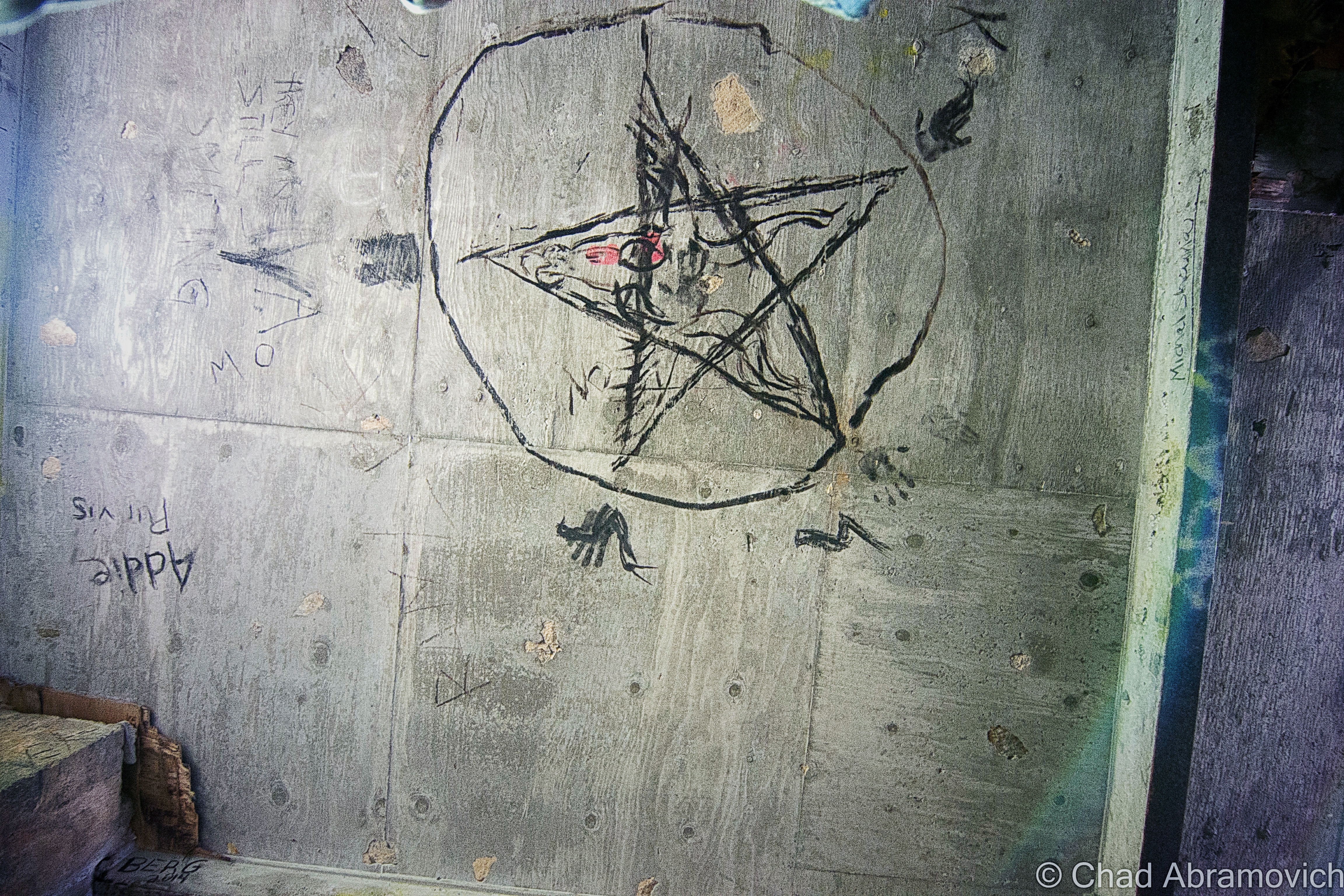
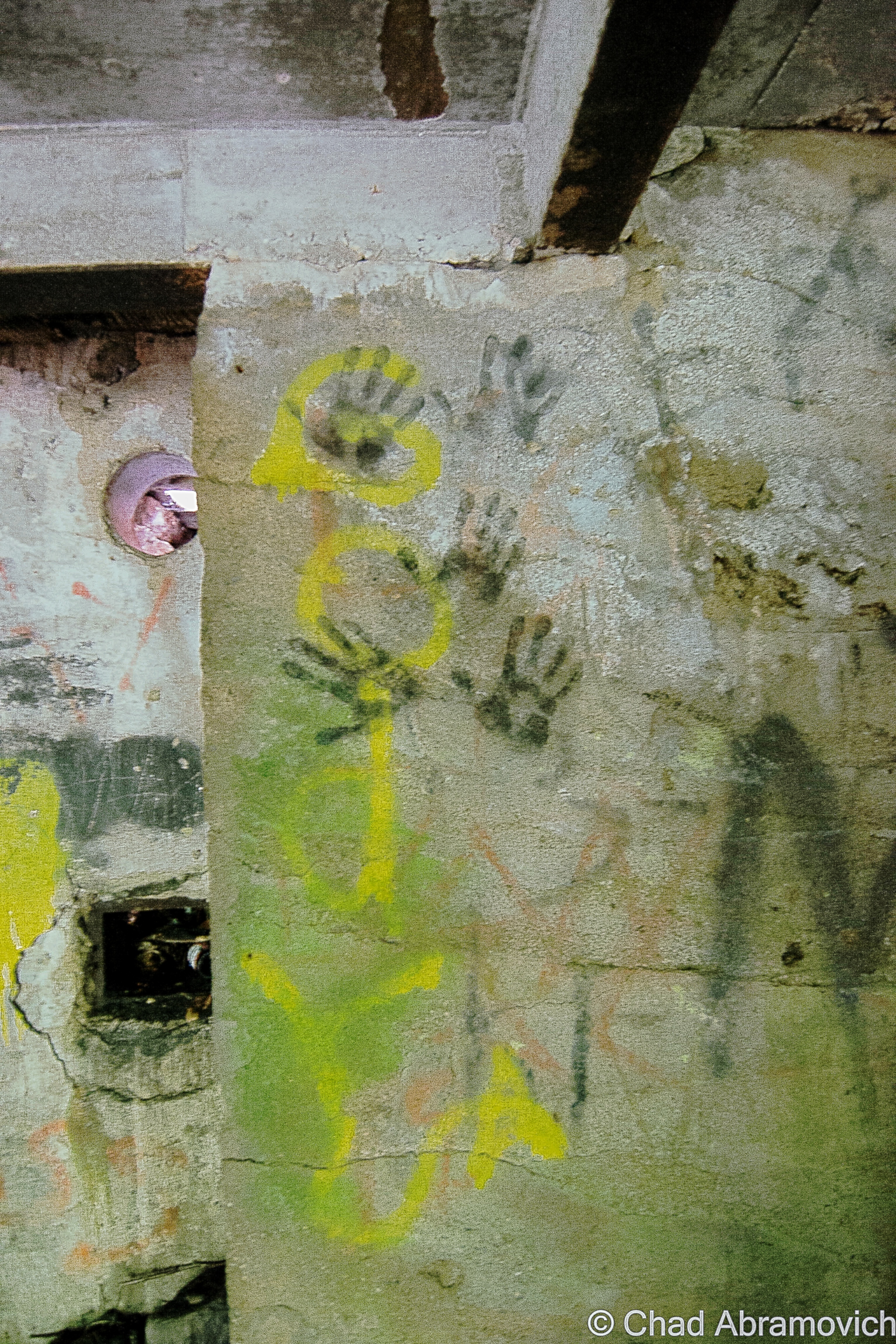
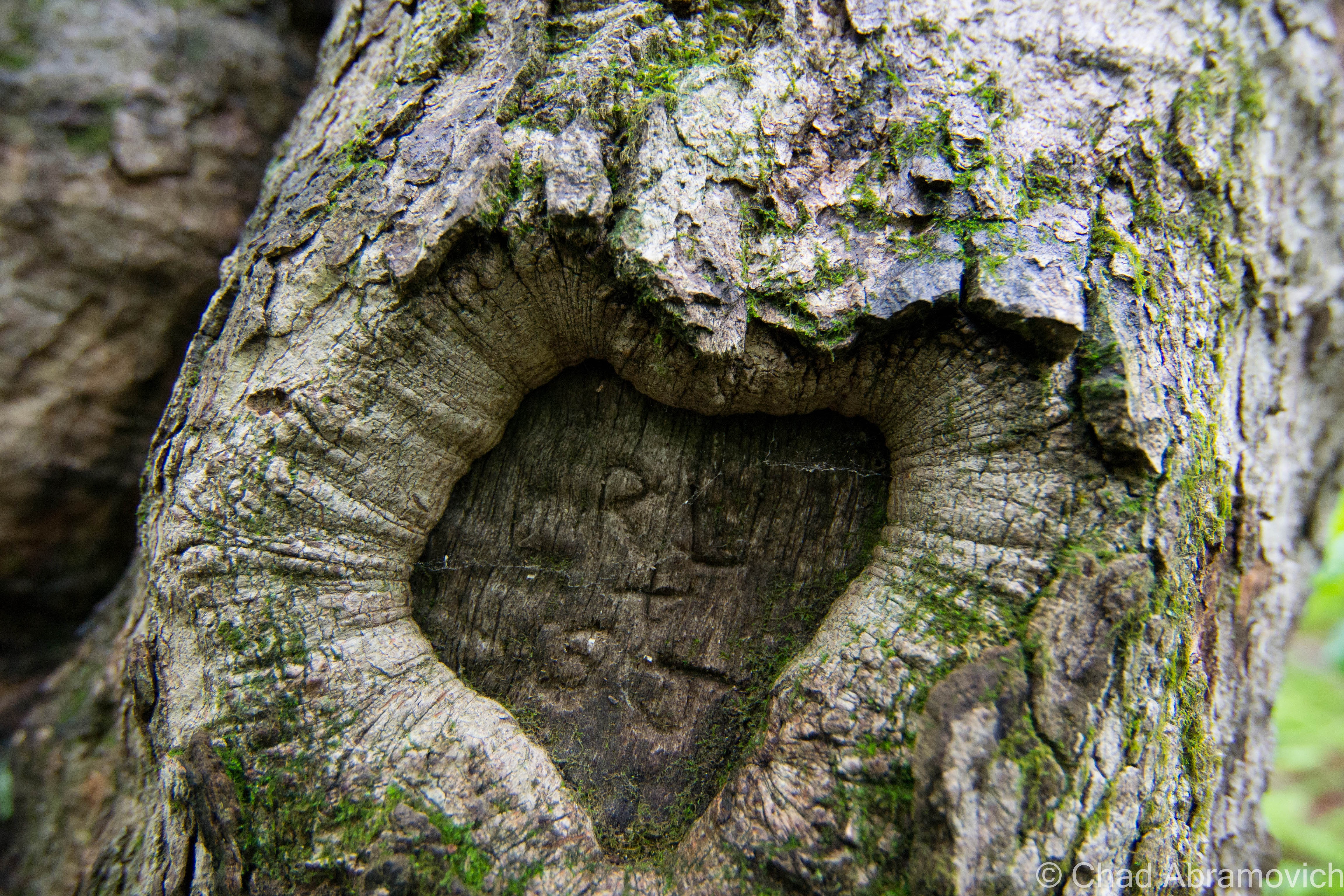
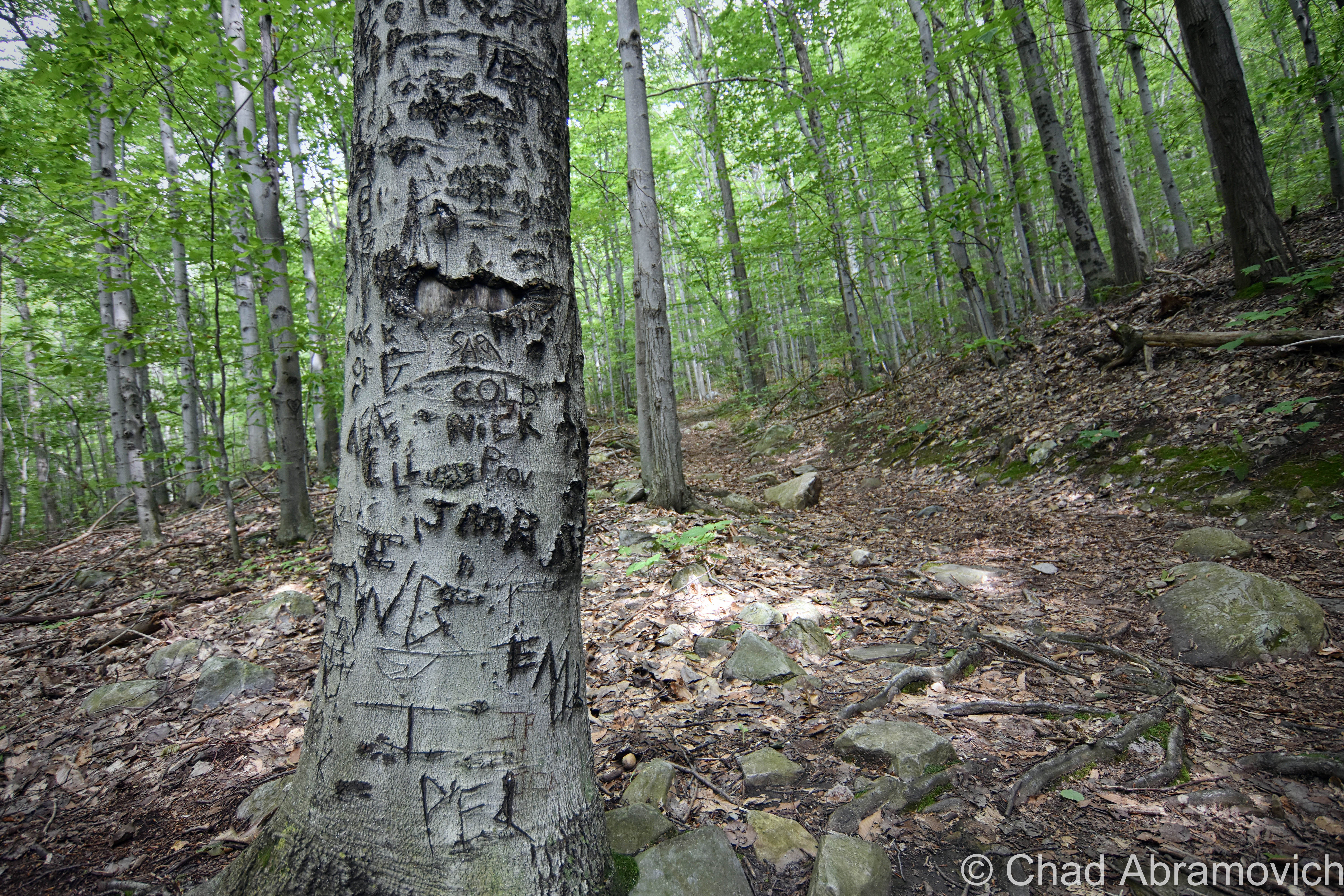
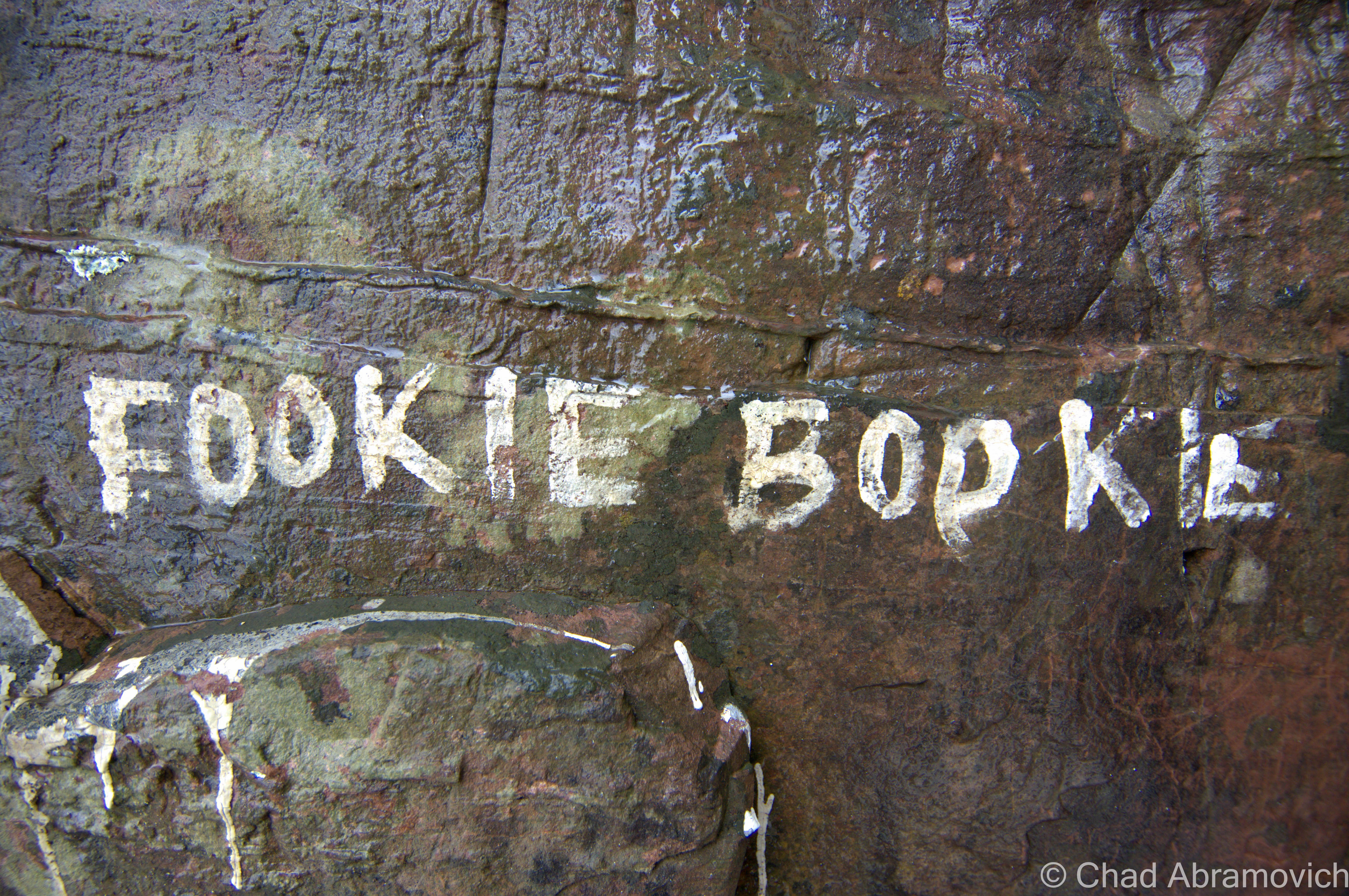
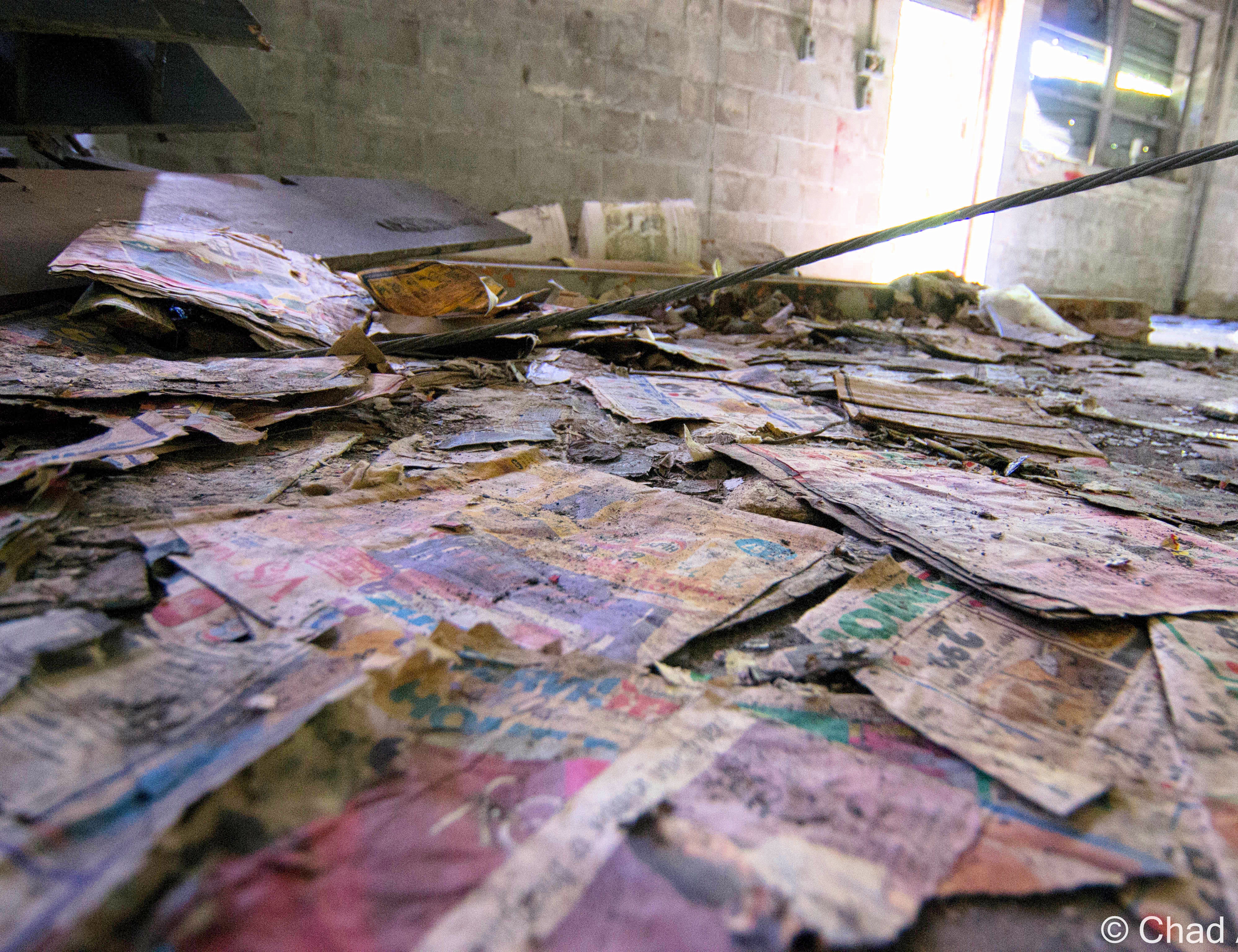
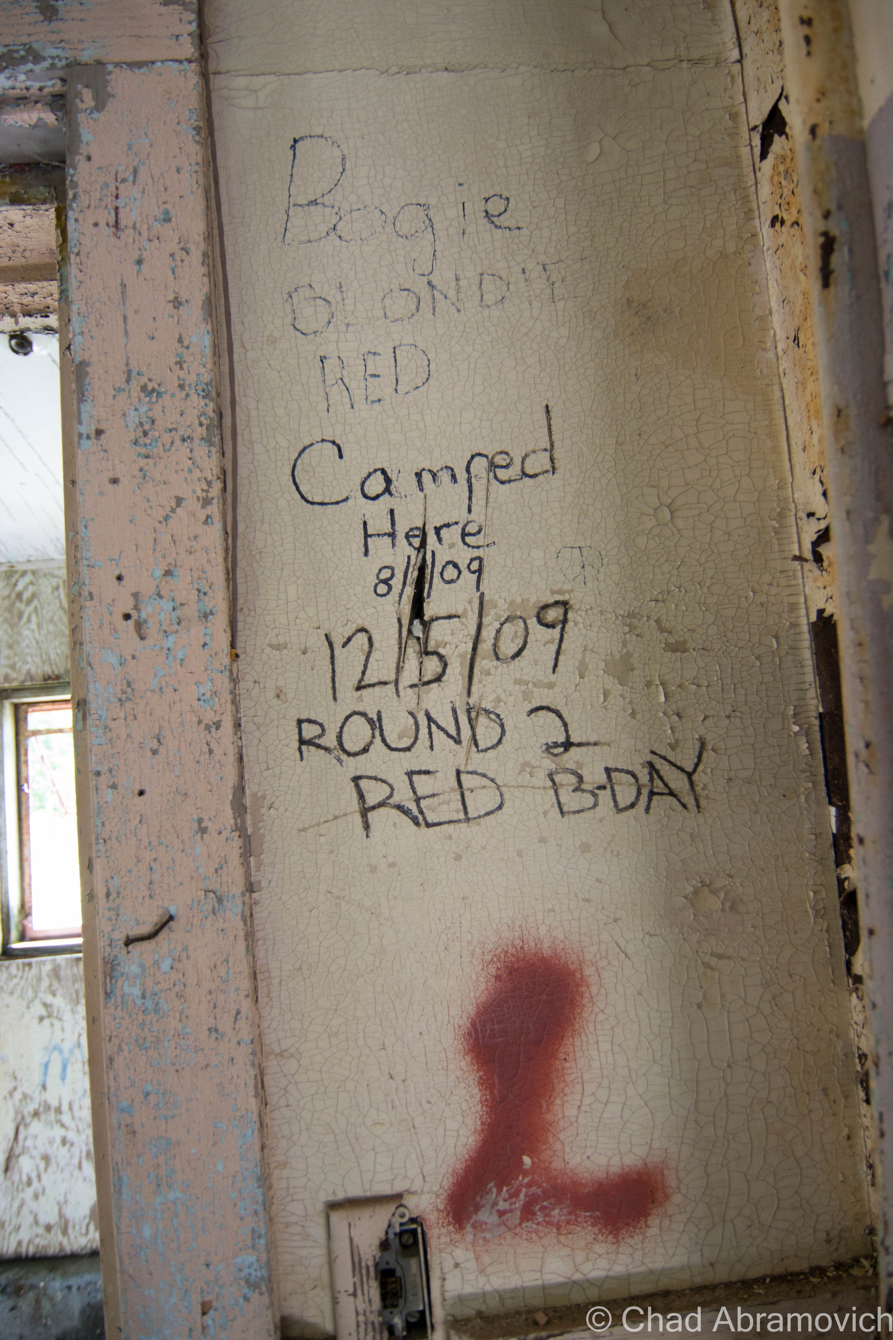
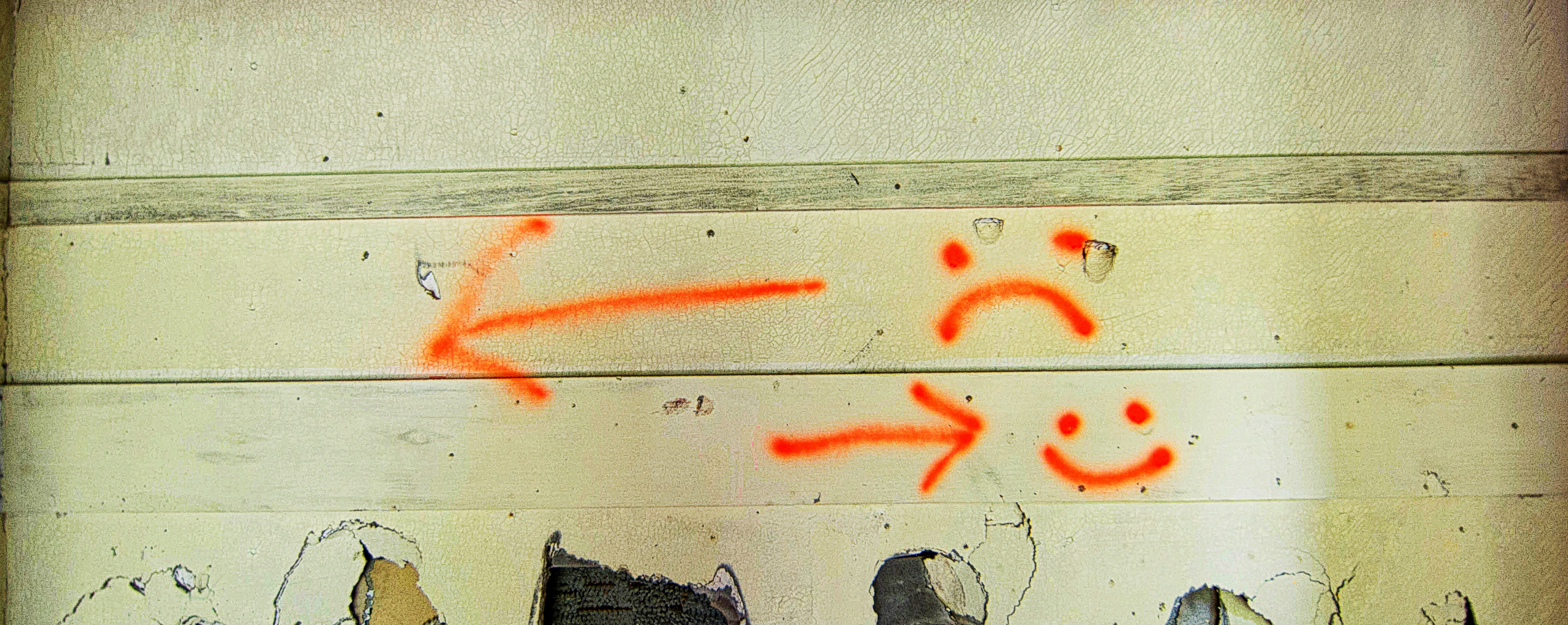
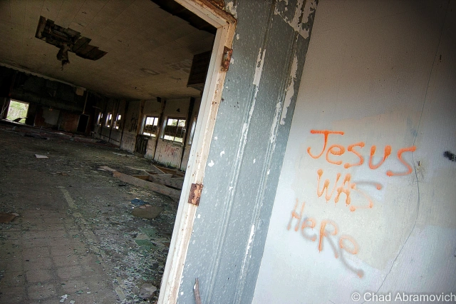
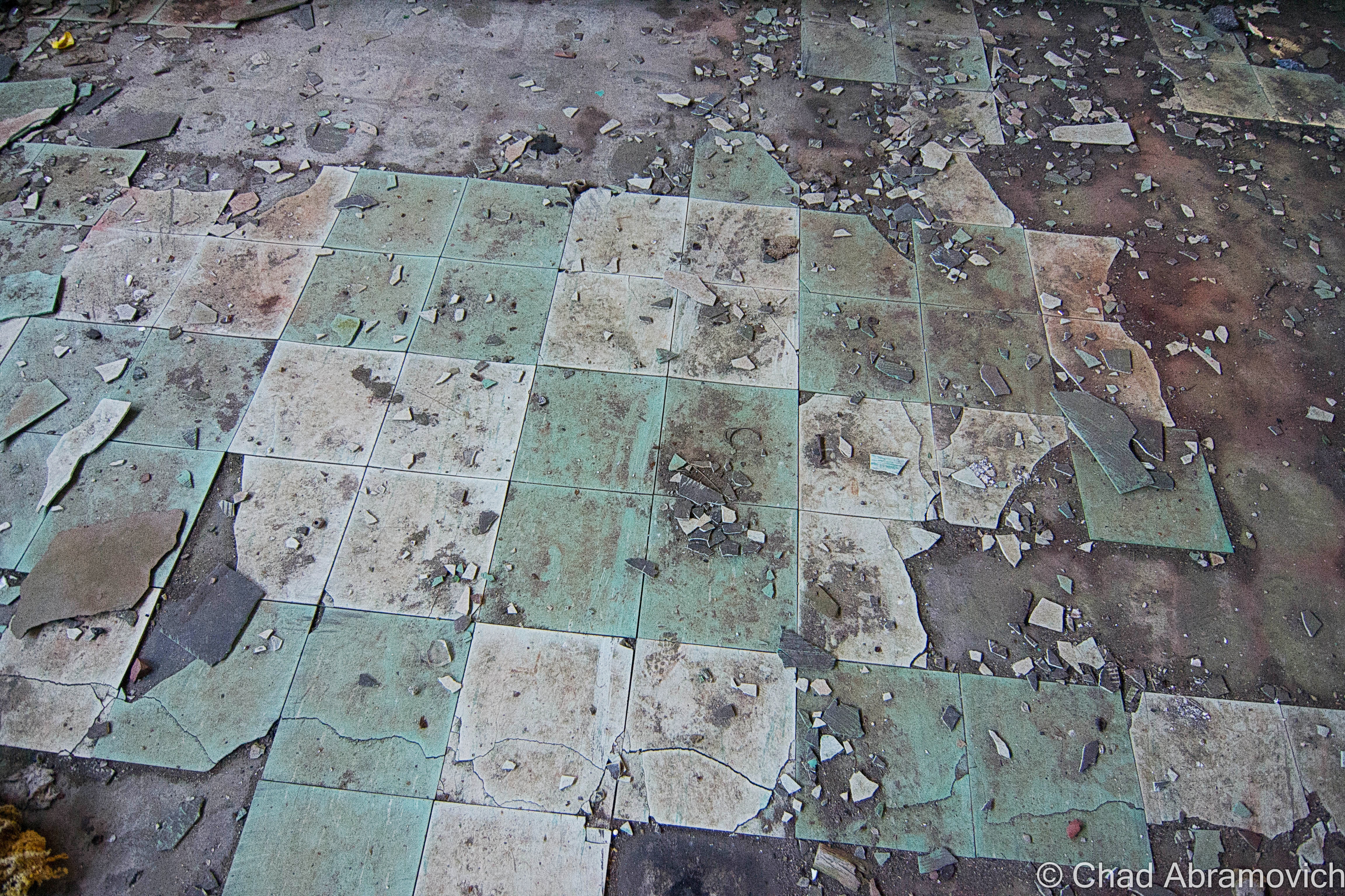
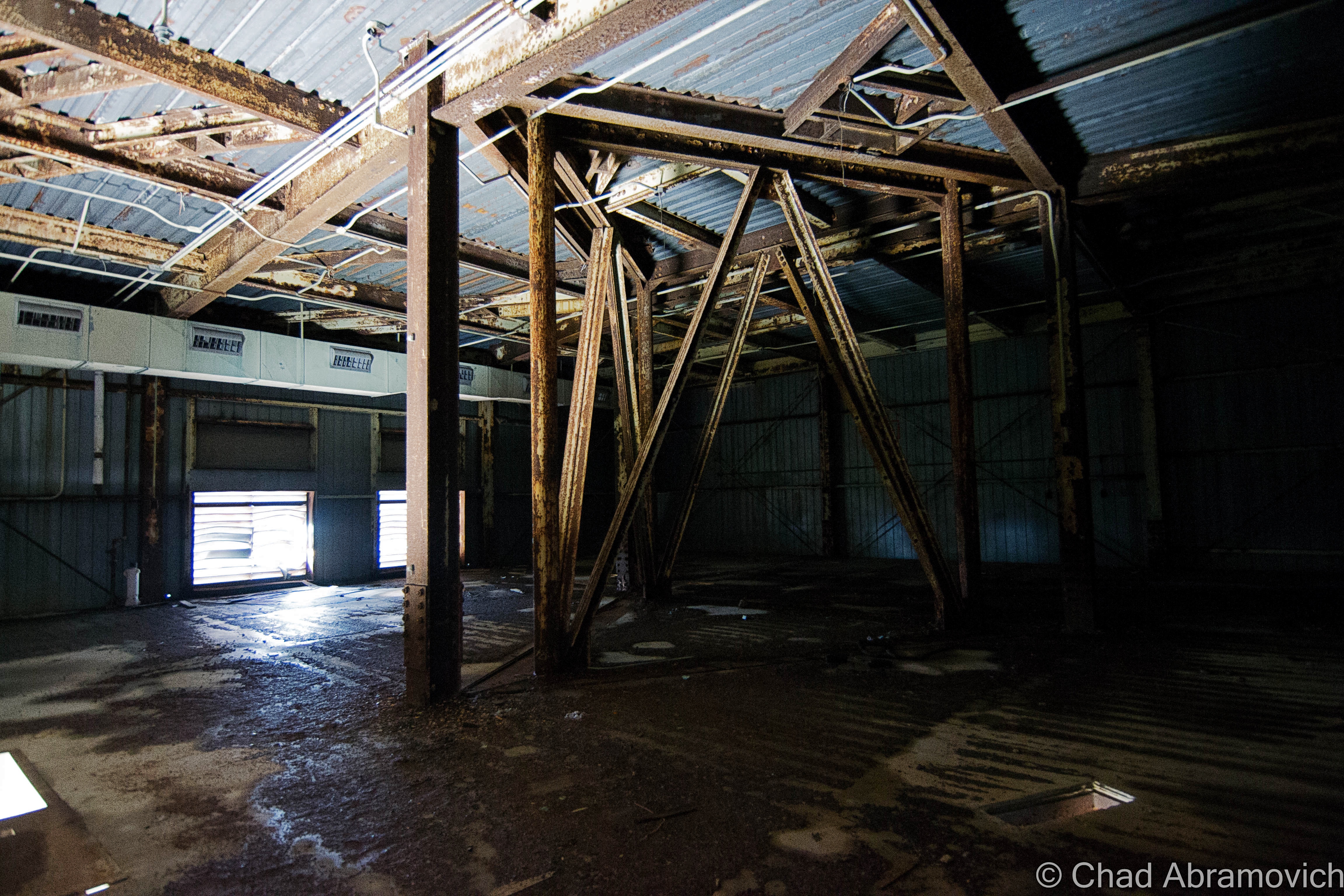
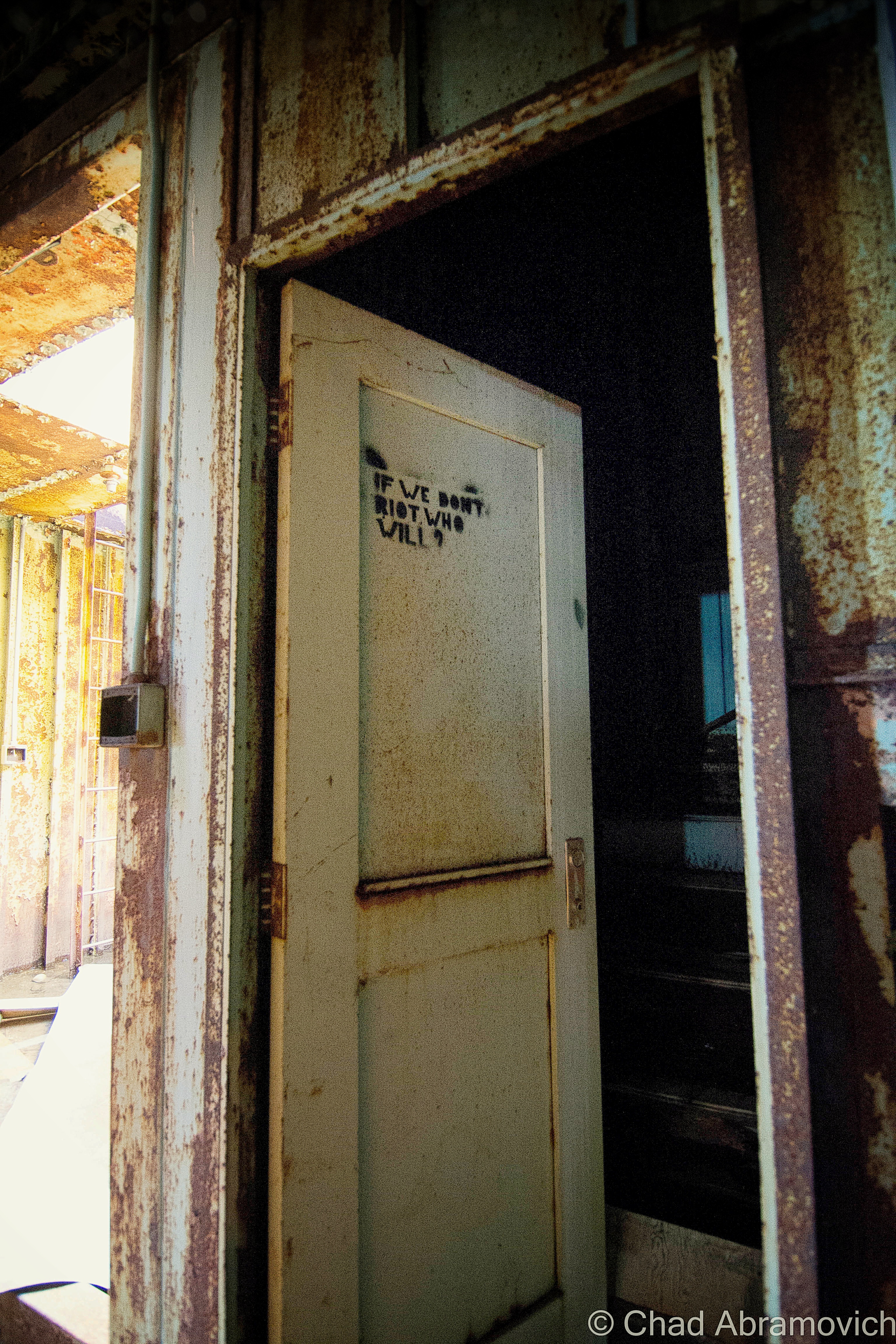
A walk through the buildings was a sentient experience over broken glass, soggy and exposed insulation, a storied compendium of generations of graffiti, and evidence of human habitation, arson and partying.

Administration Section – Fall, 2014

DSC_0002_pe
The Motor Pool.
DSC_0066_pe
Every building on the base was fueled and heated by it’s own enormous oil tank, which also result in the heavy soil pollution there today. The tank pictured here was probably more towards the mess hall – but the new property owners have since moved it to block the road just beyond the administration section, to prevent people from driving up to the towers on the summit now. The only way up is via a 2 hour hike, or if you have 2 wheels.

DSC_0007_peDSC_0011_pe_pe

We didn't know this at the time, but the cumbersome Formica board leaning inside one of those busted bathroom stalls is the former control board interface for the radar computers up on the top of the mountain. The unexposed side still had it's typography, button slots and scones where light bulbs were. It has since been removed.
We didn’t know this at the time, but the cumbersome Formica board leaning inside one of those busted bathroom stalls is the former control board interface for the radar computers up on the top of the mountain. The unexposed side still had it’s typography, button slots and sconces where light bulbs were. It has since been removed.

DSC_0028_peDSC_0036_peDSC_0047_peDSC_0060_peDSC_0063_peDSC_0064_pe_peDSC_0080_peDSC_0081_peDSC_0074_pe_peDSC_0073_peDSC_0084_peDSC_0087_peDSC_0091_peDSC_0094_pe_peDSC_0099_peDSC_0100_peDSC_0103_pe_peDSC_0107_peDSC_0108_pe_peDSC_0115_peDSC_0120_peDSC_0121_peDSC_0124_peDSC_0126_peDSC_0130_pe_peDSC_0136_pe_peDSC_0138_peDSC_0140_peDSC_0146_peDSC_0154_peDSC_0162_peDSC_0168_peDSC_0171_peDSC_0174_pe_peDSC_0176_pe_peDSC_0177_pe_peDSC_0186_pe_peDSC_0180_pe_peDSC_0197_peDSC_0193_peDSC_0194_pe_pe

Return to Radar Mountain – Mothers Day Weekend 2016

On mothers day weekend, I met up with a few friends and we ventured up to radar mountain. It was 72 degrees – perfect for a road trip – and I really needed to get out of the house.

Although, a late start ensured that we got up on the mountain just an hour or so before sunset, but that didn’t stop us from having a little fun. We got a campfire going and my friend hooked up his record player to some period-accurate loud speakers, and played era-appropriate music from the 50s, when the base would have been in operation. I only have eyes for you” was playing as I shot this, making eerie tin can sounds and tossing them across silent swamps and the silhouettes of nearby mountains – which we joked was the radar base theme song.  It was an extraordinarily cool night. 

DSC_0533_pe DSC_0536_pe DSC_0538_pe DSC_0542_pe

DSC_0546_pe
Among the stranger things that we have found inside an abandoned location, my friend said that one of his more uncomfortable finds happened here in the asbestos dusted mess hall – when he found a pair of contact lenses on the gritty floor tiles a few years back.

DSC_0547_peDSC_0550_peDSC_0553_peDSC_0554_peDSC_0556_peDSC_0558_peDSC_0566_peDSC_0567_peDSC_0568_pe

DSC_0569_pe
“Horse Man”

DSC_0571_pe

Furnace. When the building caught fire, the asbestos did what asbestos does, and prevented the hazard from spreading, but in the process, it was also left horribly exposed, making the building a hazard of different proportions.
DSC_0573_pe
What I found really interesting about the construction of the administration area, was that because it was literally built over a mountain swamp, some of the terrain had to be leveled to accommodate the foundations, but that terra-forming was only done around the sites that they were working on, leaving the rest of the area more or less as they found it, as evidenced here by the swampy stand of birches (there are a lot of birches up there) next to a more leveled cinder block construction. I speculate that if this base were to be constructed today, the entire property would just be flattened.
DSC_0575_pe
We know that all sorts of people come up here for various reasons that one would want to come up to a defunct radar base far from the concept of society and law. Plenty of them have firearms. But in this case, these strangers were inside of the building as they were shooting up the walls. My camera lens was staring at bullet exit holes.
DSC_0577_pe
The former gymnasium and theater building. I had never seen it before without all the leaves on the trees. This structure arguably had the largest of all the fuel needs for the administration area, and probably the most asbestos contamination. So big that the gym had it’s own furnace and power plant wing build behind it. Today, the swamp behind the gym is an impenetrable, scrubby and foul area that is burdened by plenty of oil contamination after the base closed.
DSC_0579_pe
Behind the gymnasium, you can still trace the tennis courts. Remarkably well. Though the base has been defunct for 53 years now, it’s paved extremities like the road itself, and this tennis court, have held up very well over the intervening years all things considered. Though, the paved surface is breaking out in isolated subterranean build ups that make rounded protrusions and bumps through the tarmac. Parts of surviving property delineating chain link fence were even still standing.

DSC_0581_peDSC_0584_peDSC_0588_peDSC_0589_peDSC_0597_peDSC_0598_peDSC_0602_peDSC_0604_peDSC_0607_peDSC_0613_peDSC_0618_pe

The old guard shack, which is slumping a bit more as the years go by. Radar Road's 1960's pave job still holds up better than many of Vermont's roads that VTrans dubs as "usable".
The old guard shack, which is slumping a bit more as the years go by. Radar Road’s 1960’s pave job still holds up better than many of Vermont’s roads that VTrans dubs as “usable”.

The radar base was already proving to be a creepy area to explore. The compelling silence up there was occasionally met with auditory hallucinations – we would jump at the sound of what we thought were other people lurking somewhere nearby, or the oncoming roar of a motor of a passing vehicle, only to be greeted by nothing but our own fears and the self imposed things that crawled into our heads.

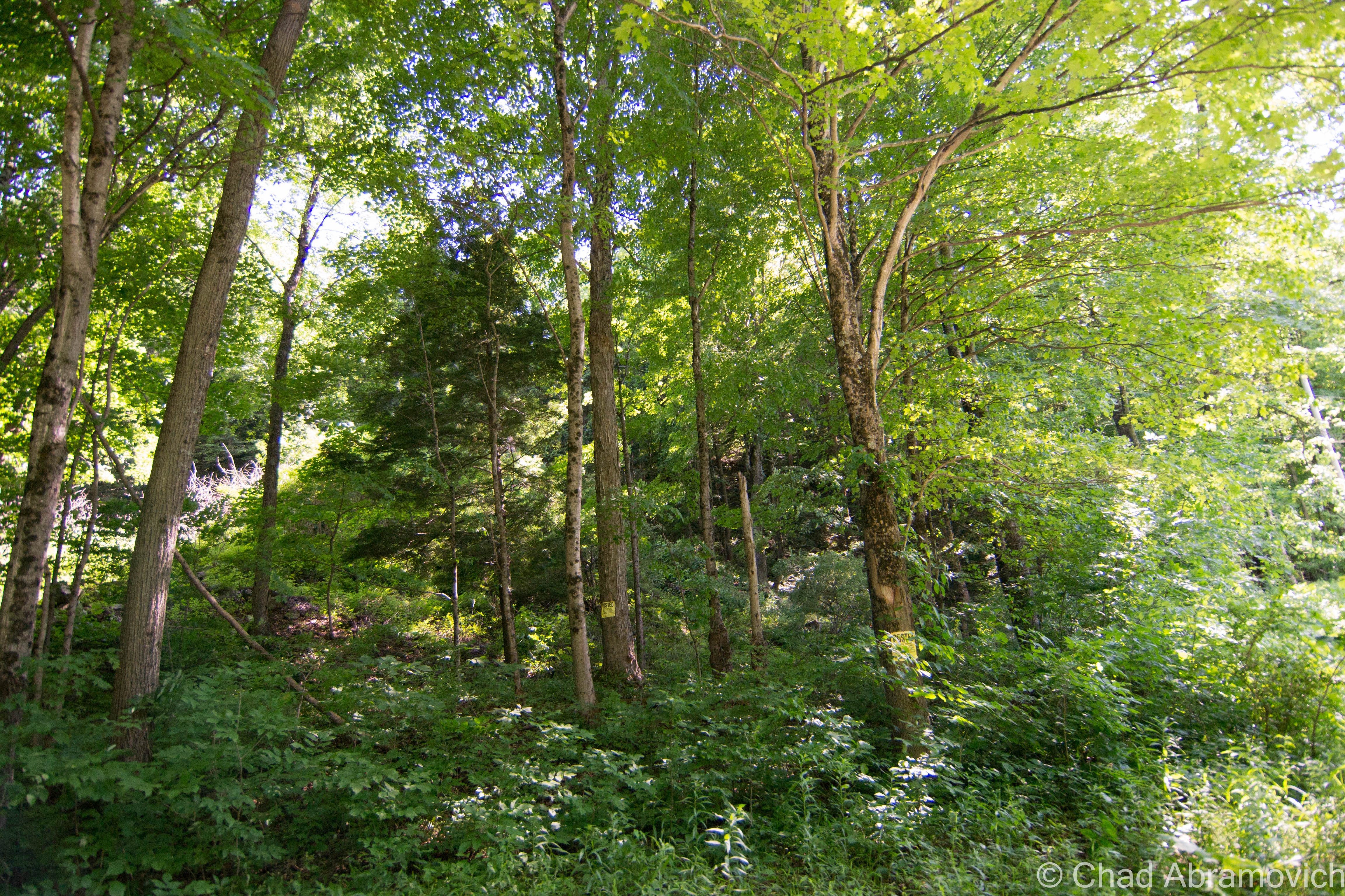
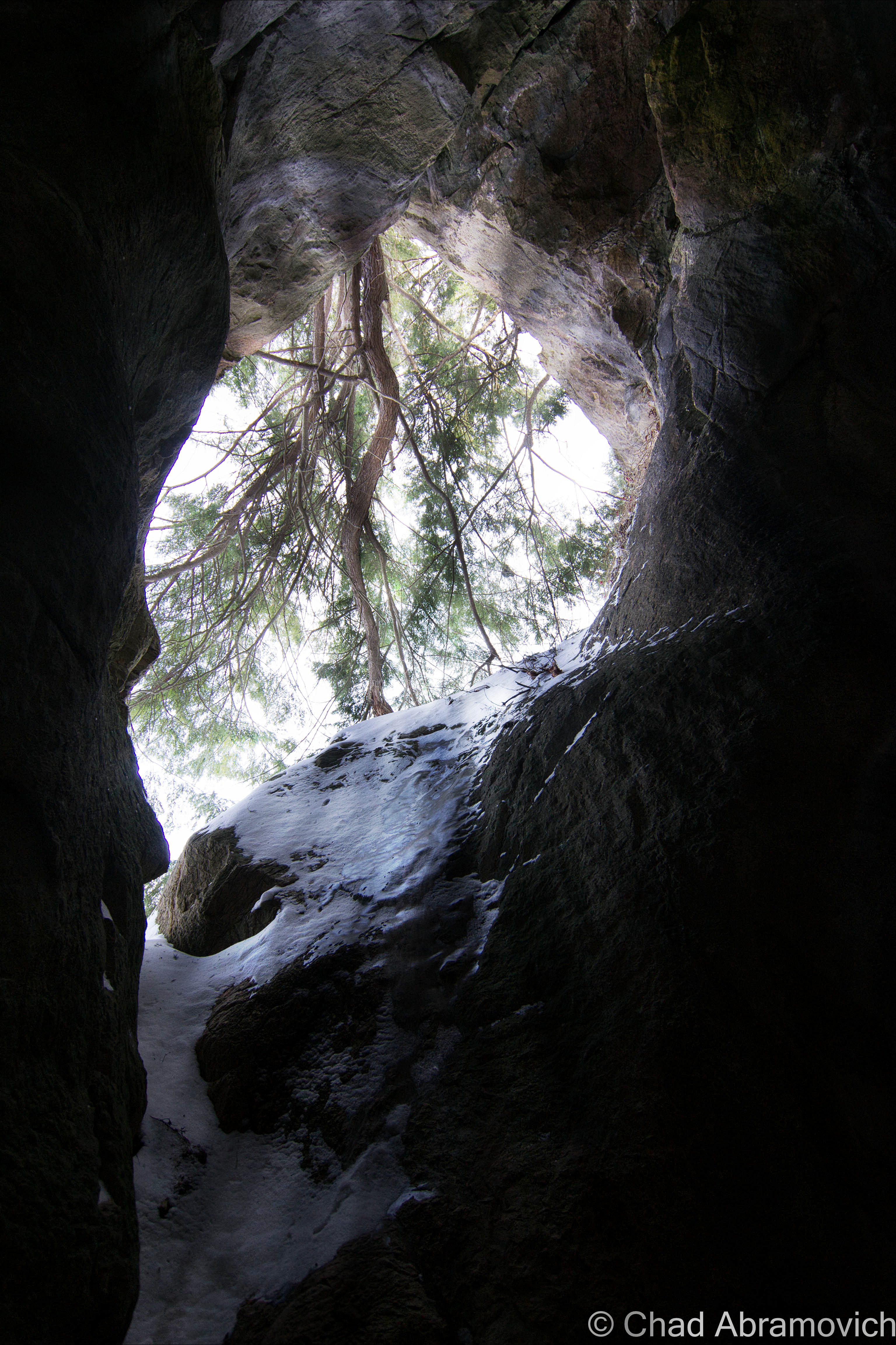
From the administration section, we climbed back in the car and drove up the remaining stretch of Radar Road, and were immediatly met with the most imposing road I’ve ever traveled on. The forest literally was swallowing the road – the cracked paved surface immediately pitched upwards on a grueling steep grade that kept on climbing – the growth was so thick that tree branches came in through our open windows and began to smack us in our faces, until we were forced to roll up the windows. The road was only wide “enough” for one car, and that was even far fetched. There was no place to pull over, no place to turn around. If another car was coming in the opposite direction, especially around one of the many blind hairpin turns that also happen to travel uphill, you would be screwed. One of you would have to give. At this point, the orange glow of my friend’s low fuel light illuminated on the dashboard, giving us another reminder of just how far away we were. If we ran out of gas up here, it would be a very long walk back to civilization.

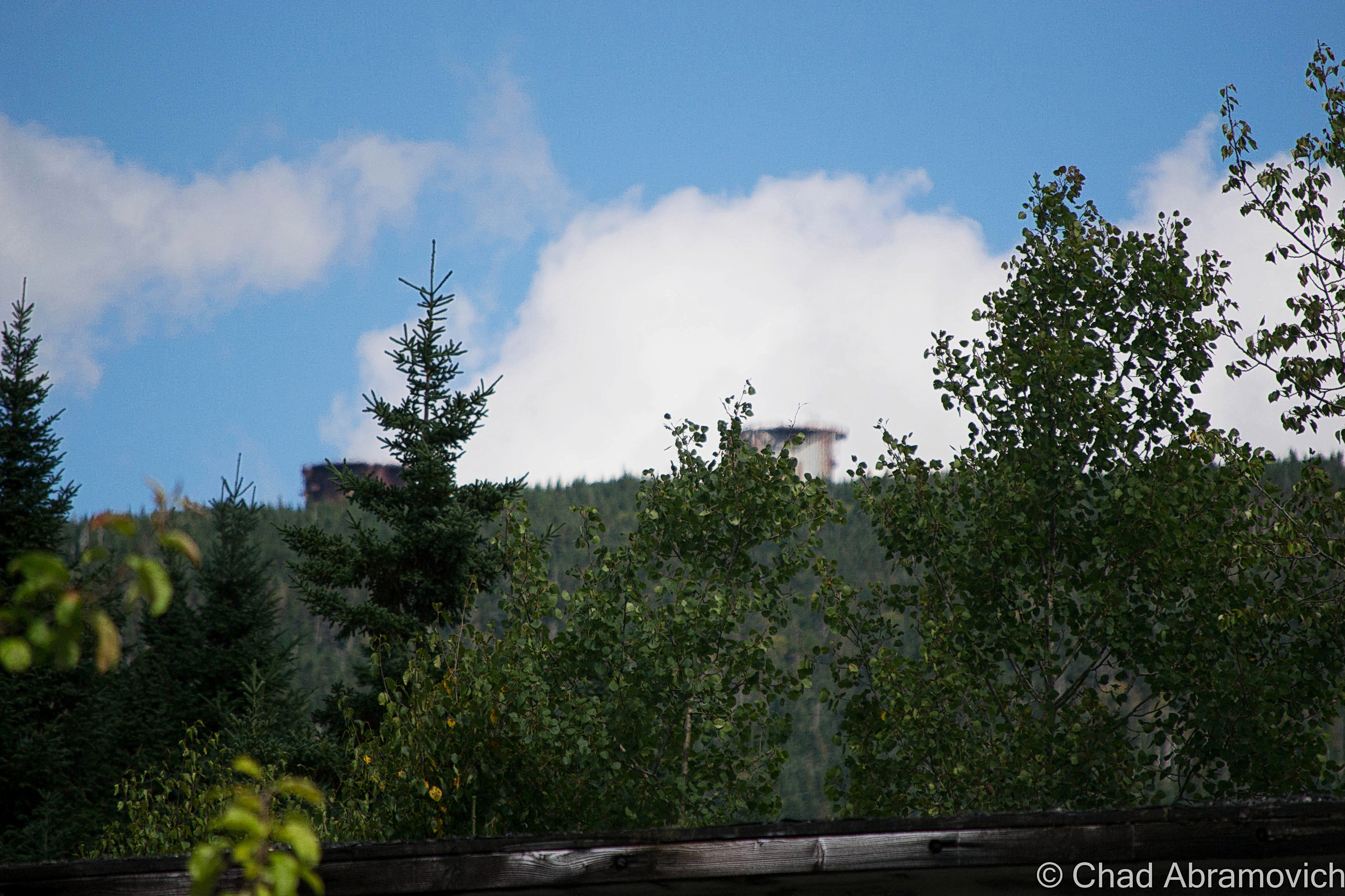
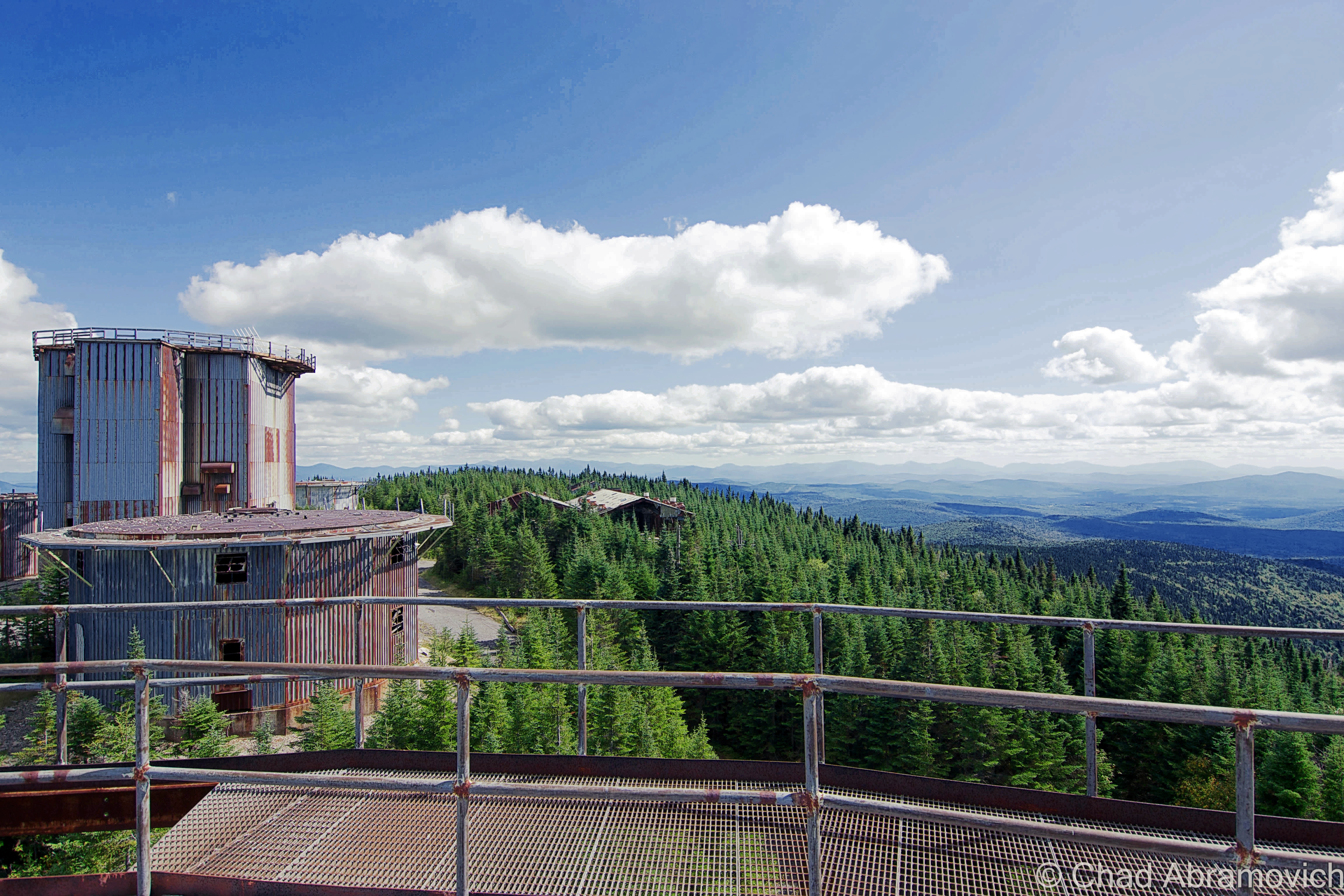
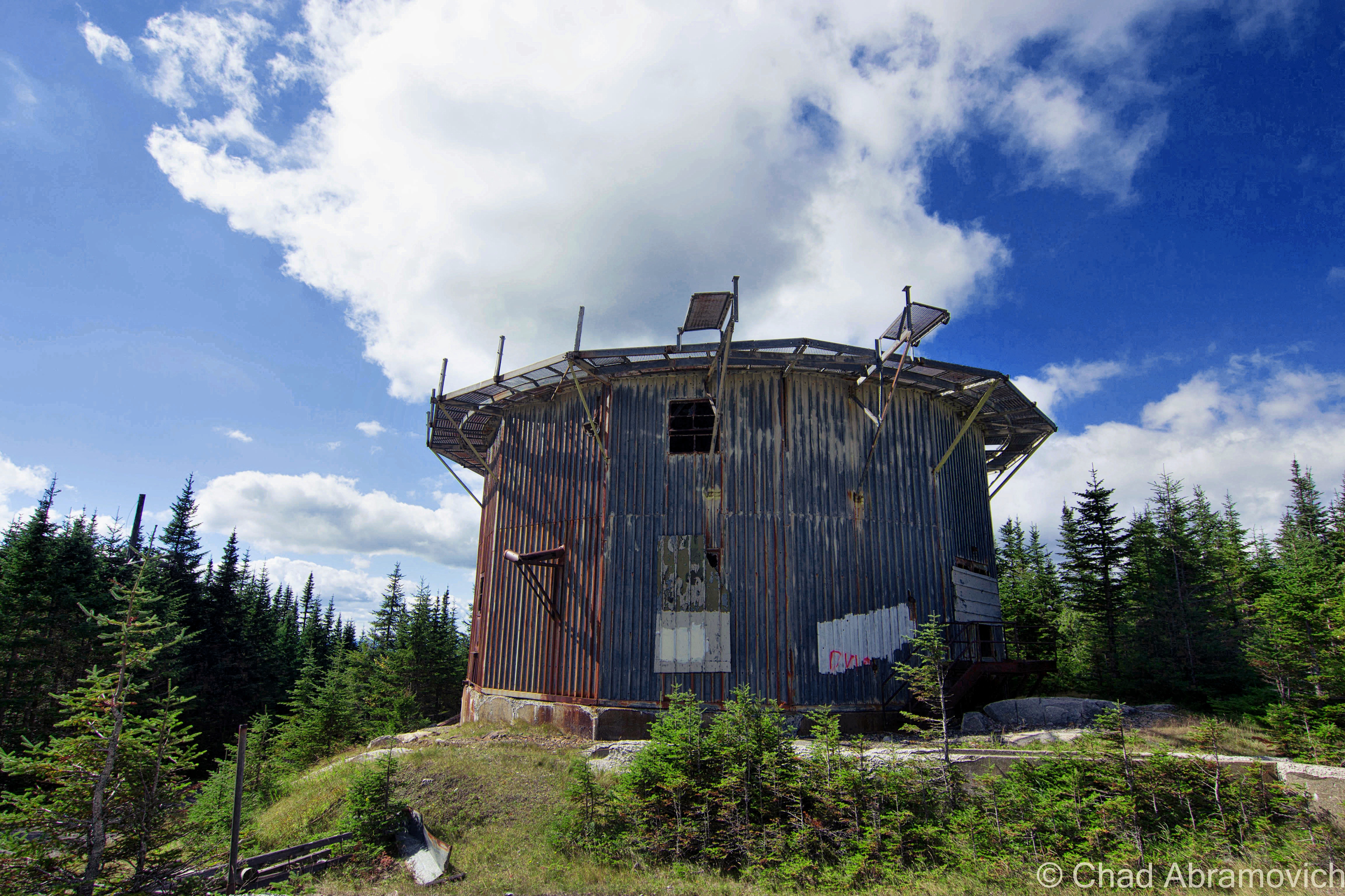
But the drive to the top was exhilarating – the intoxicating scent of Spruce and Balsam trees blew in the winds and filled the car. Soon, the trees became stunted and the horizon began to open up from the dark forests, and the shapes of hazy blue mountains with their knife sharp ridge lines began to undulate in the horizon. All of the sudden, we were underneath the imposing steel skeletons of the radar towers. We had made it.

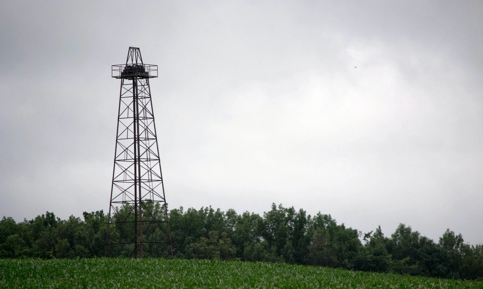
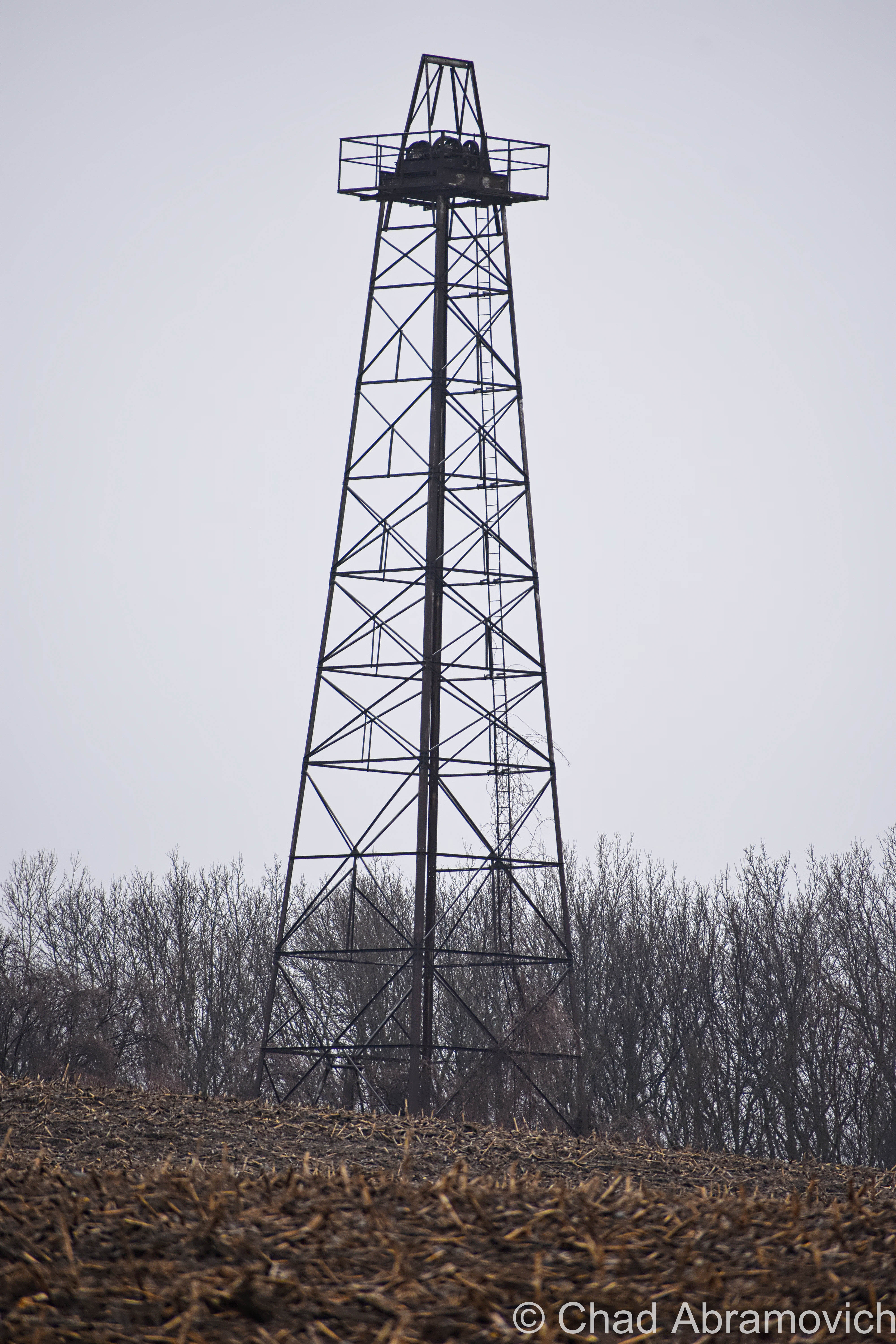
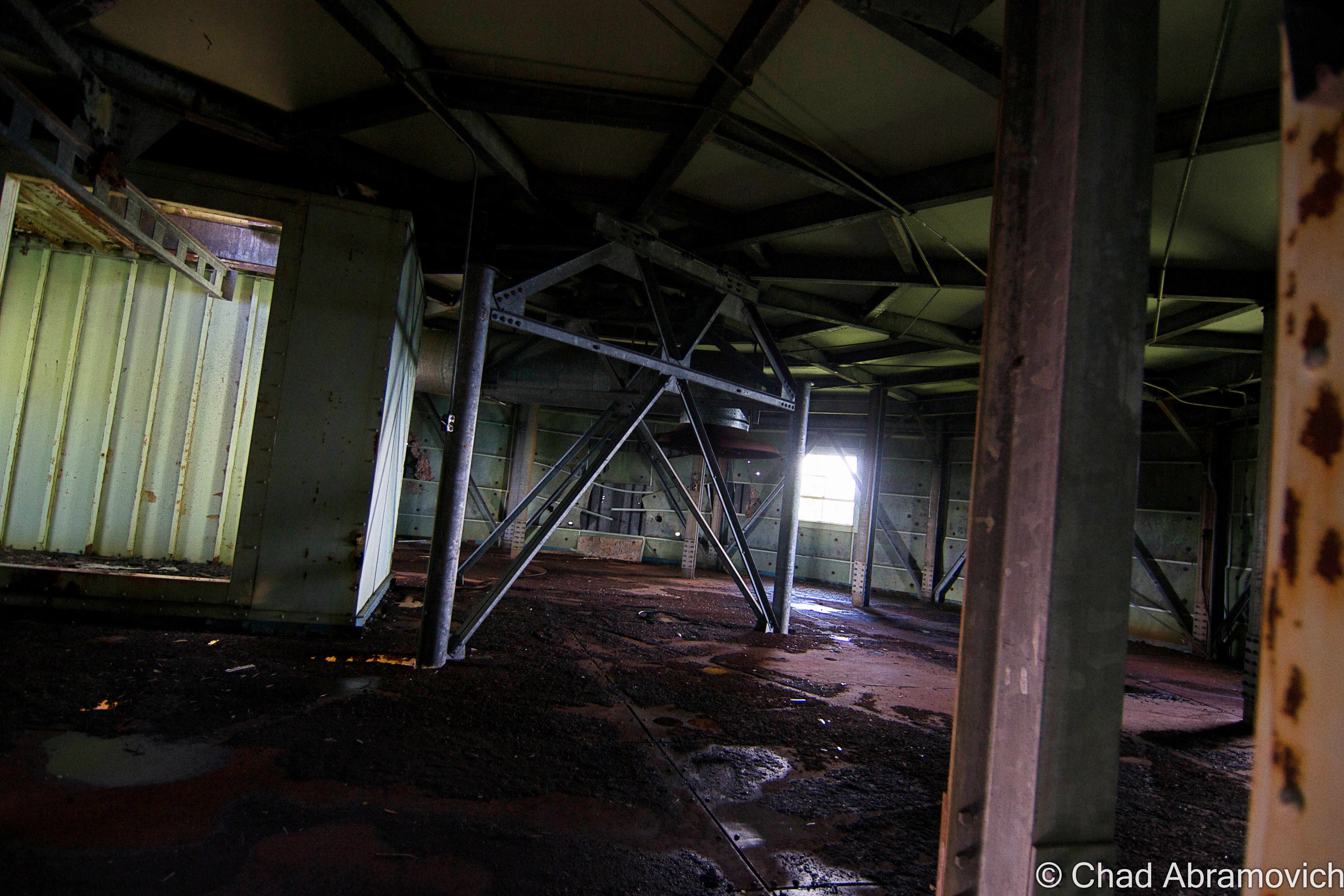
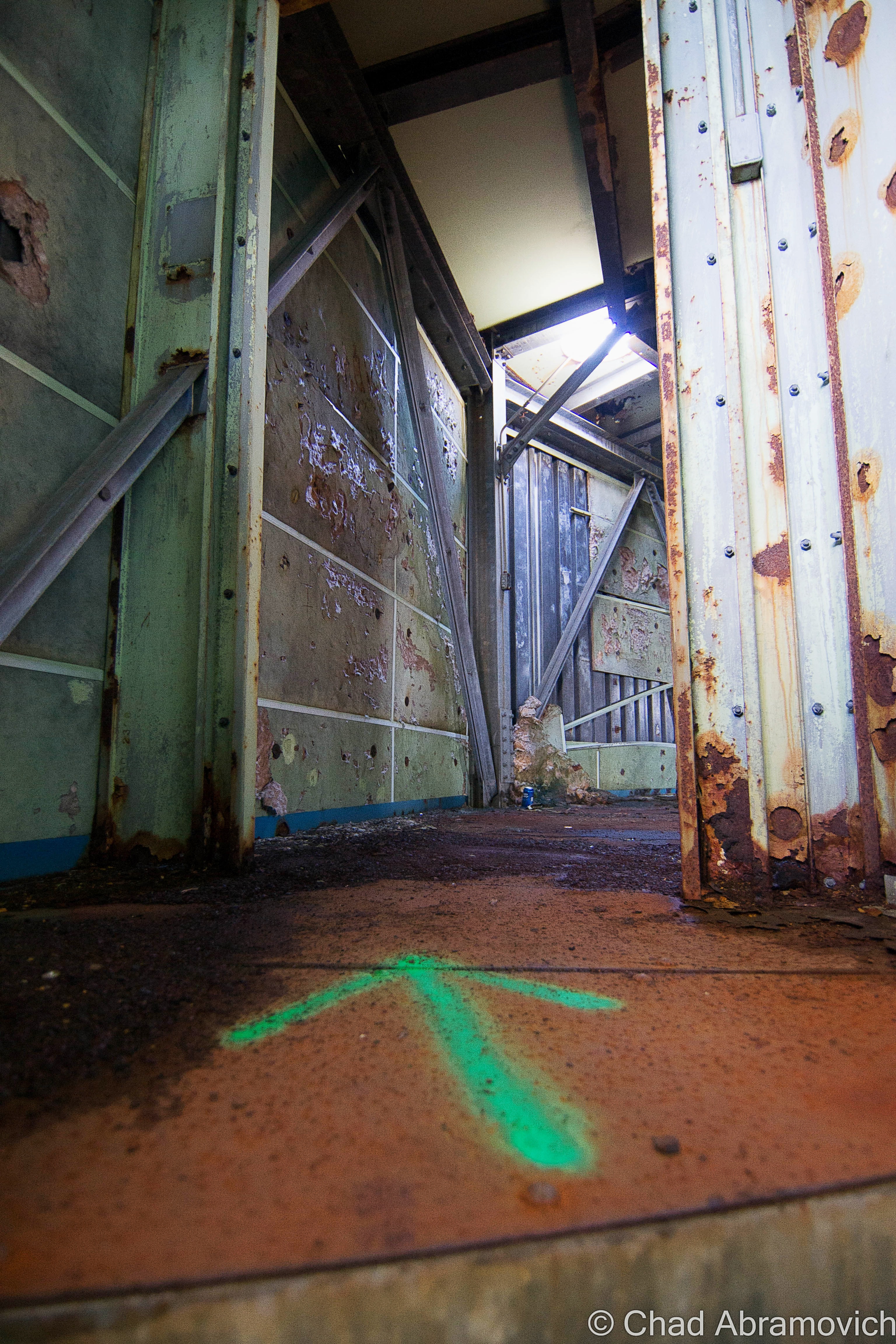
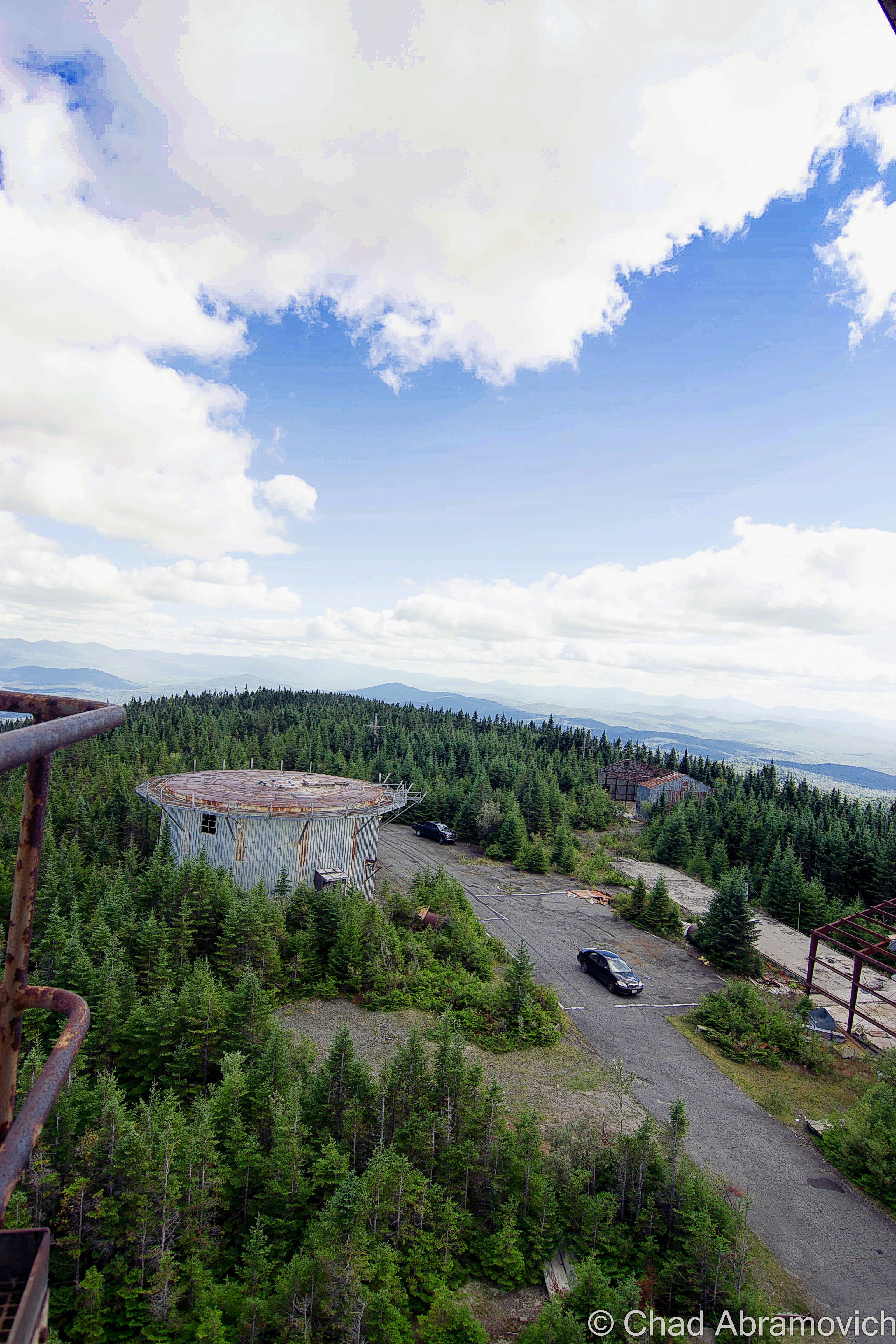
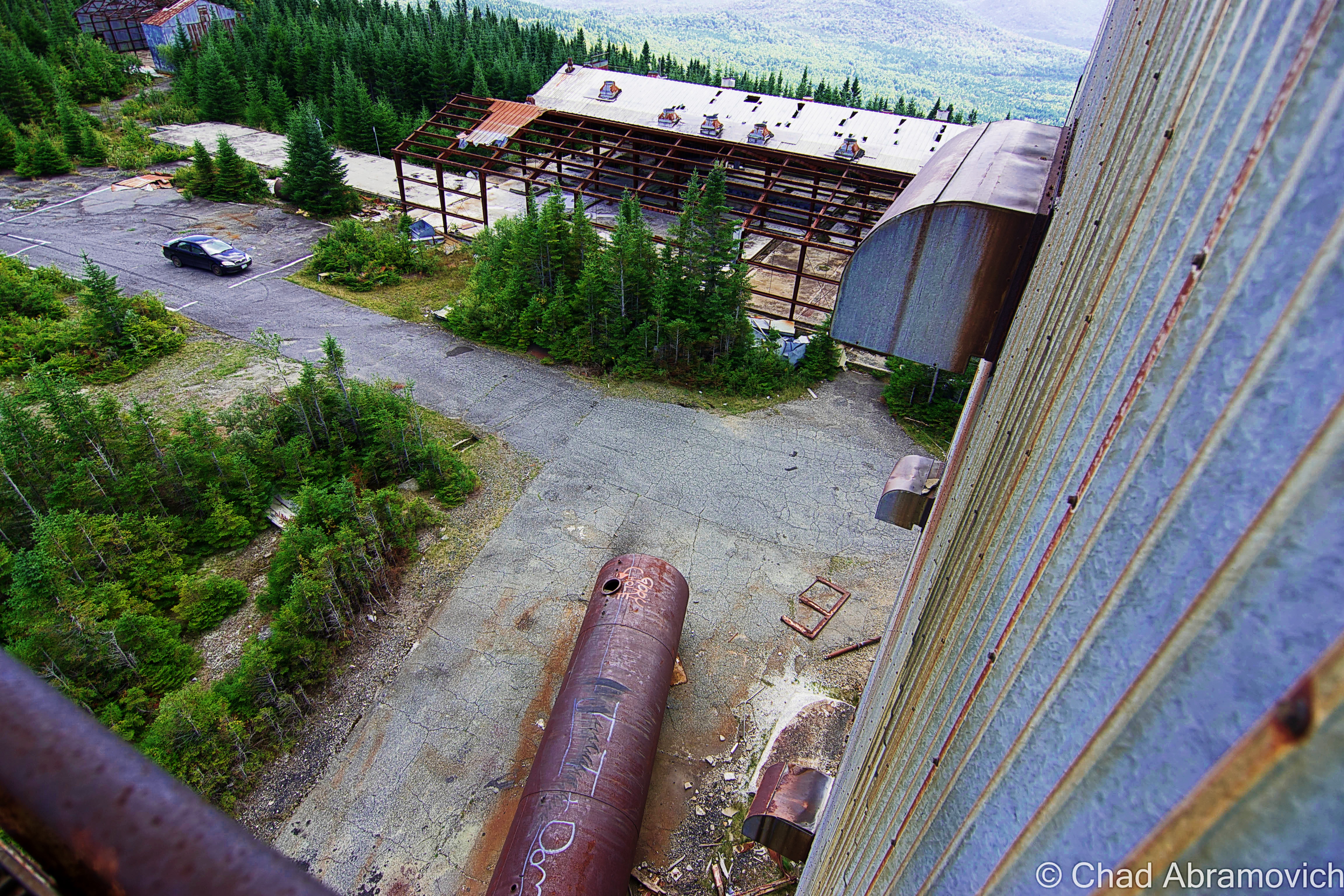
Summit Radar Towers – Fall 2014

DSC_0208_pe
Radar Road as it flattens out on the summit. From up there, you can see New Hampshire’s Presidential Range.

DSC_0211_peDSC_0212_pe_peDSC_0222_peDSC_0225_peDSC_0226_pe_peDSC_0231_pe_peDSC_0233_pe_pe

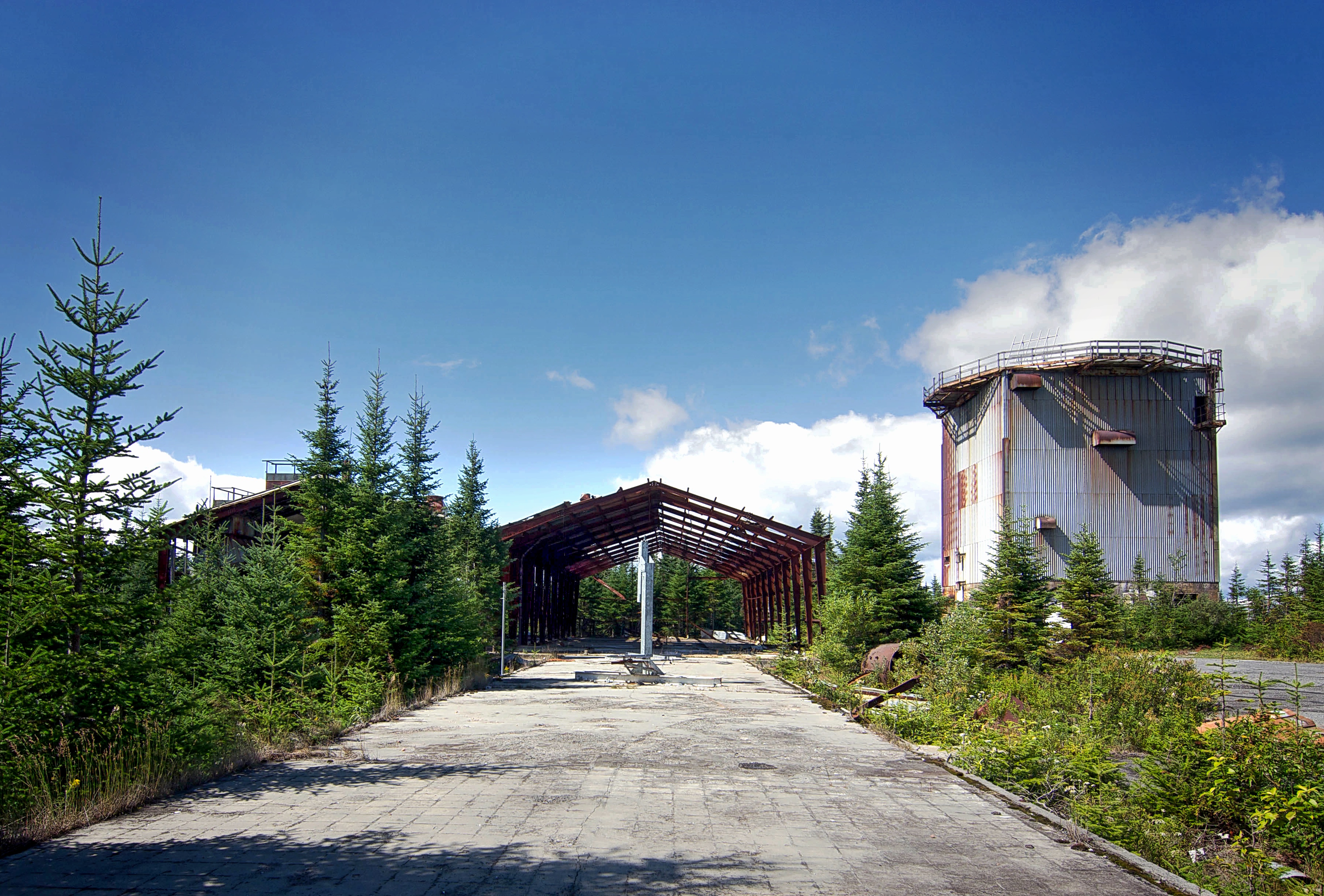
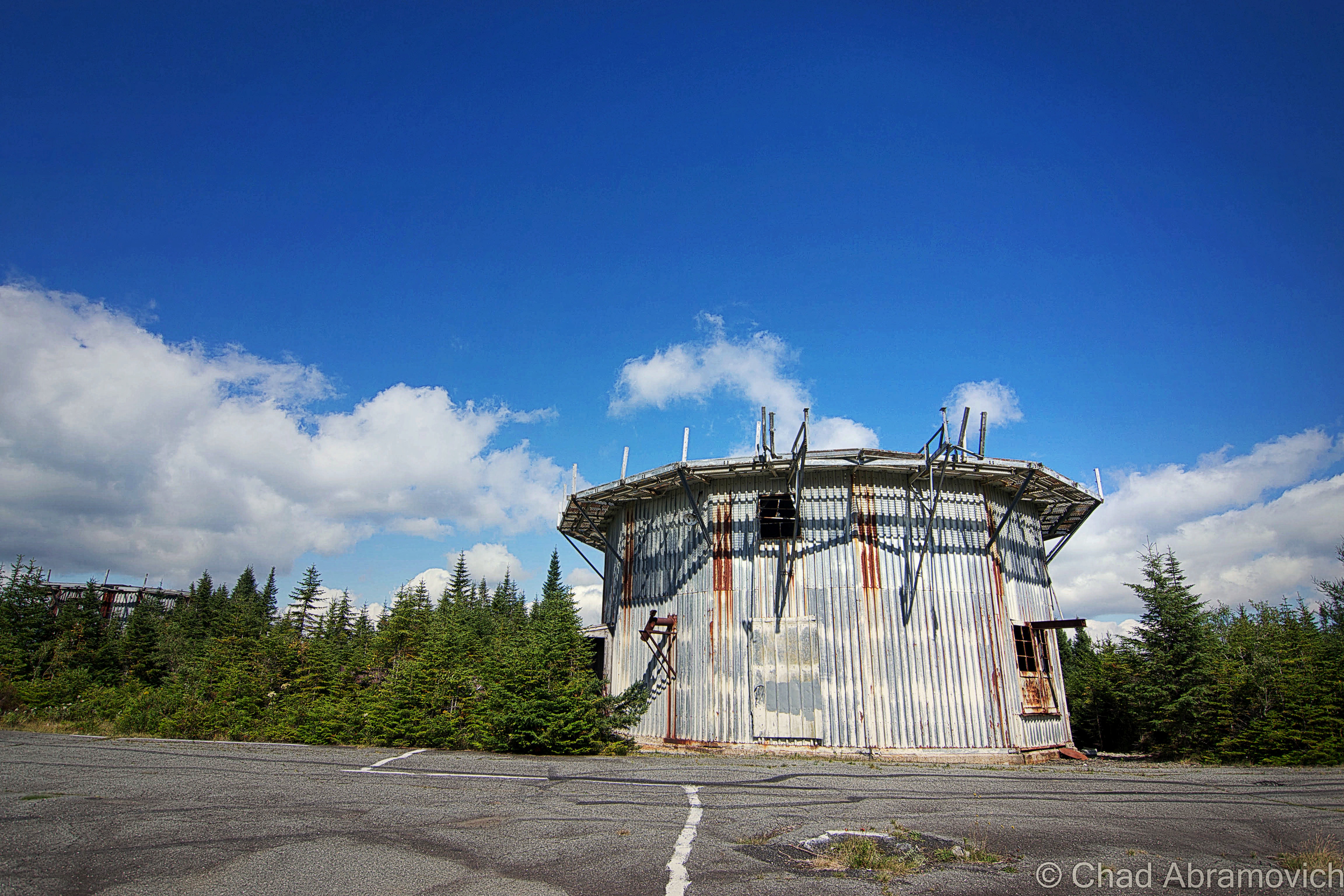
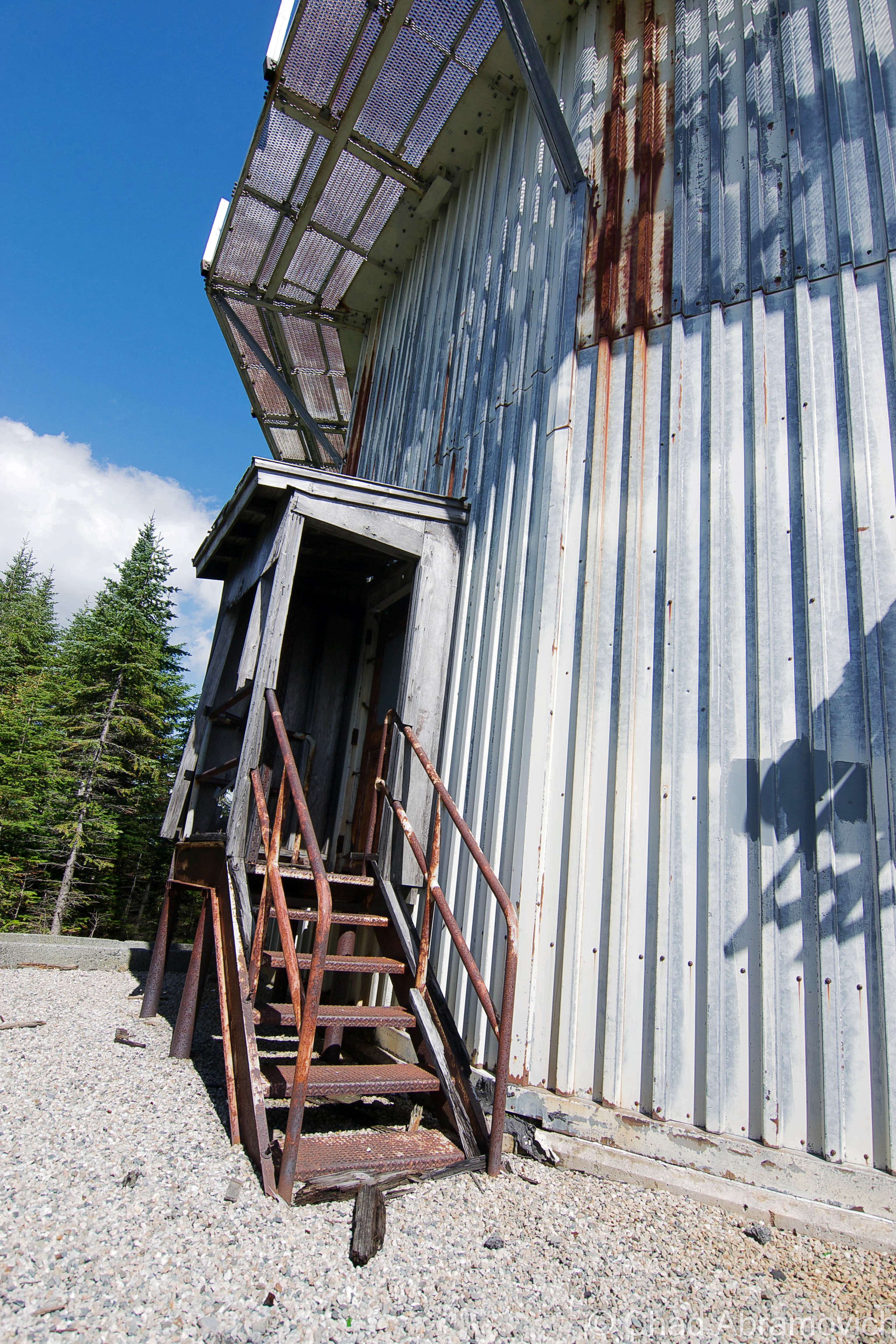
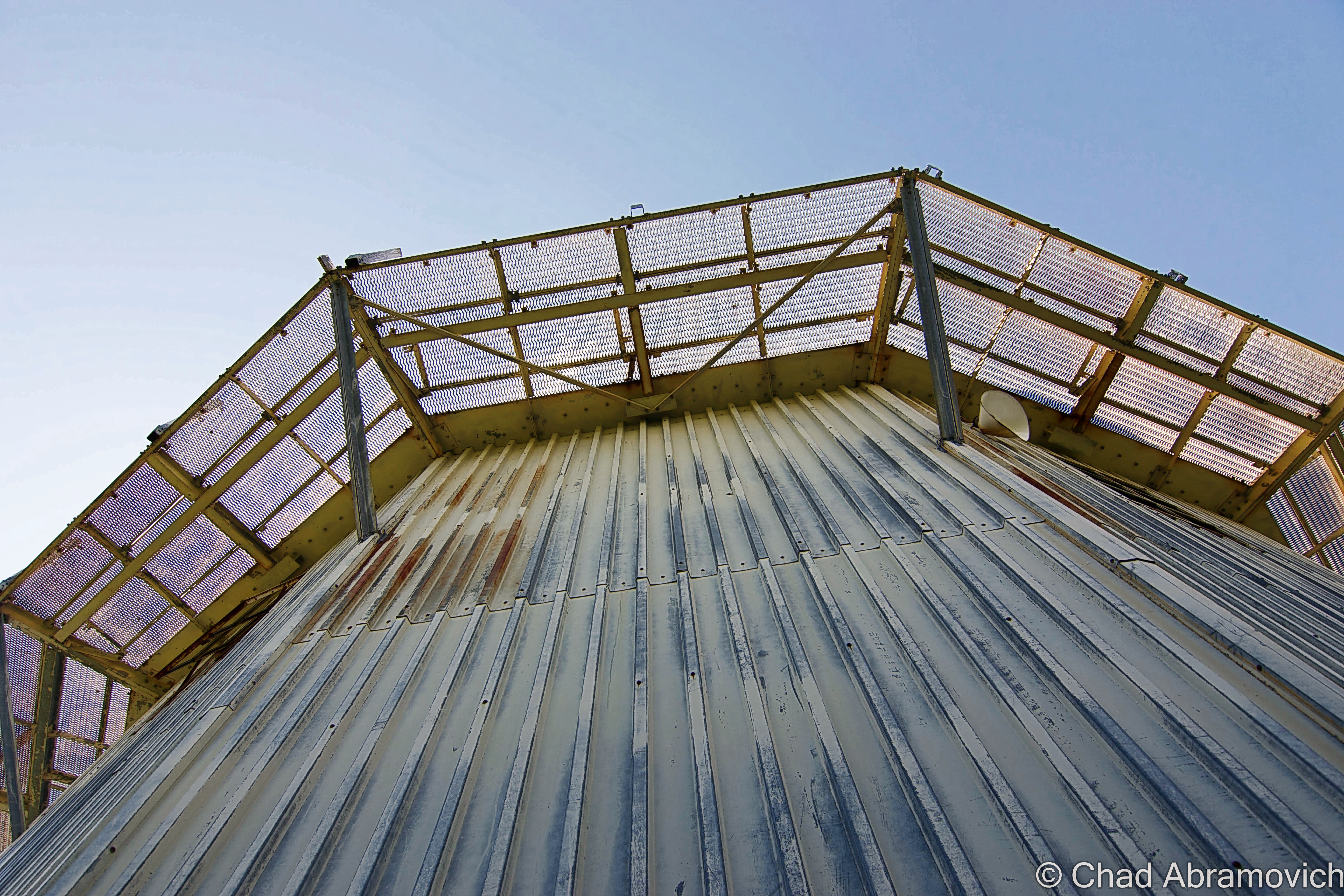
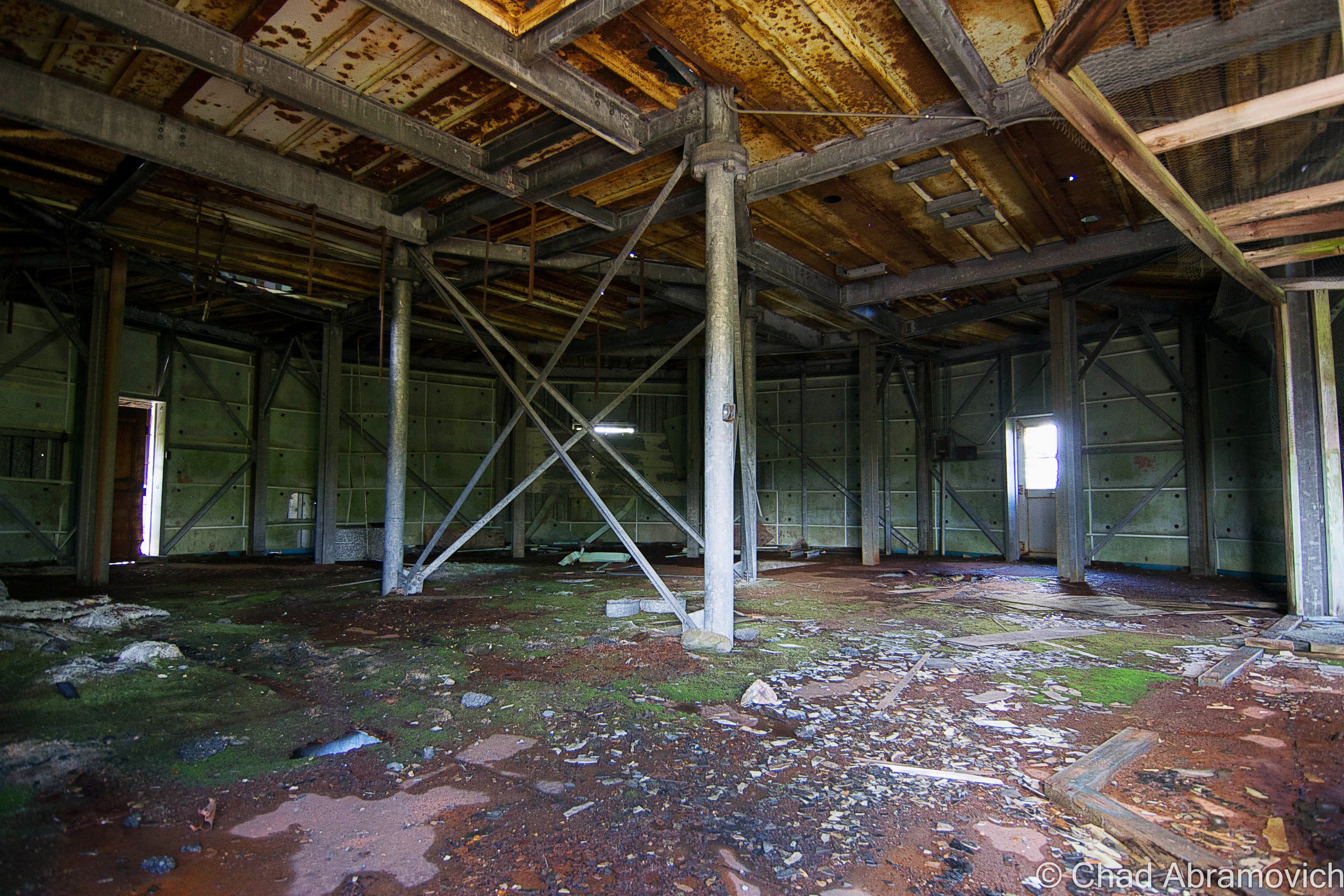
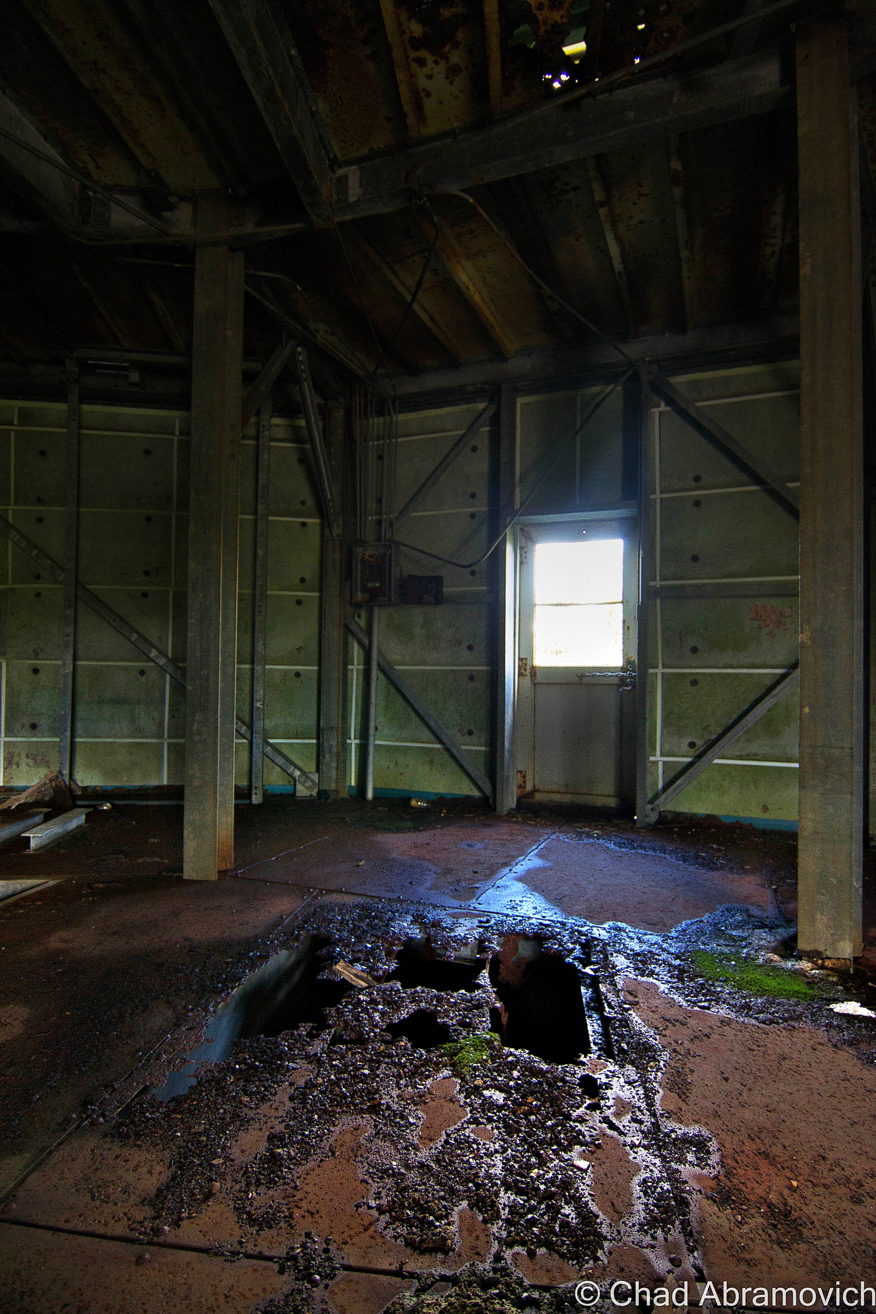
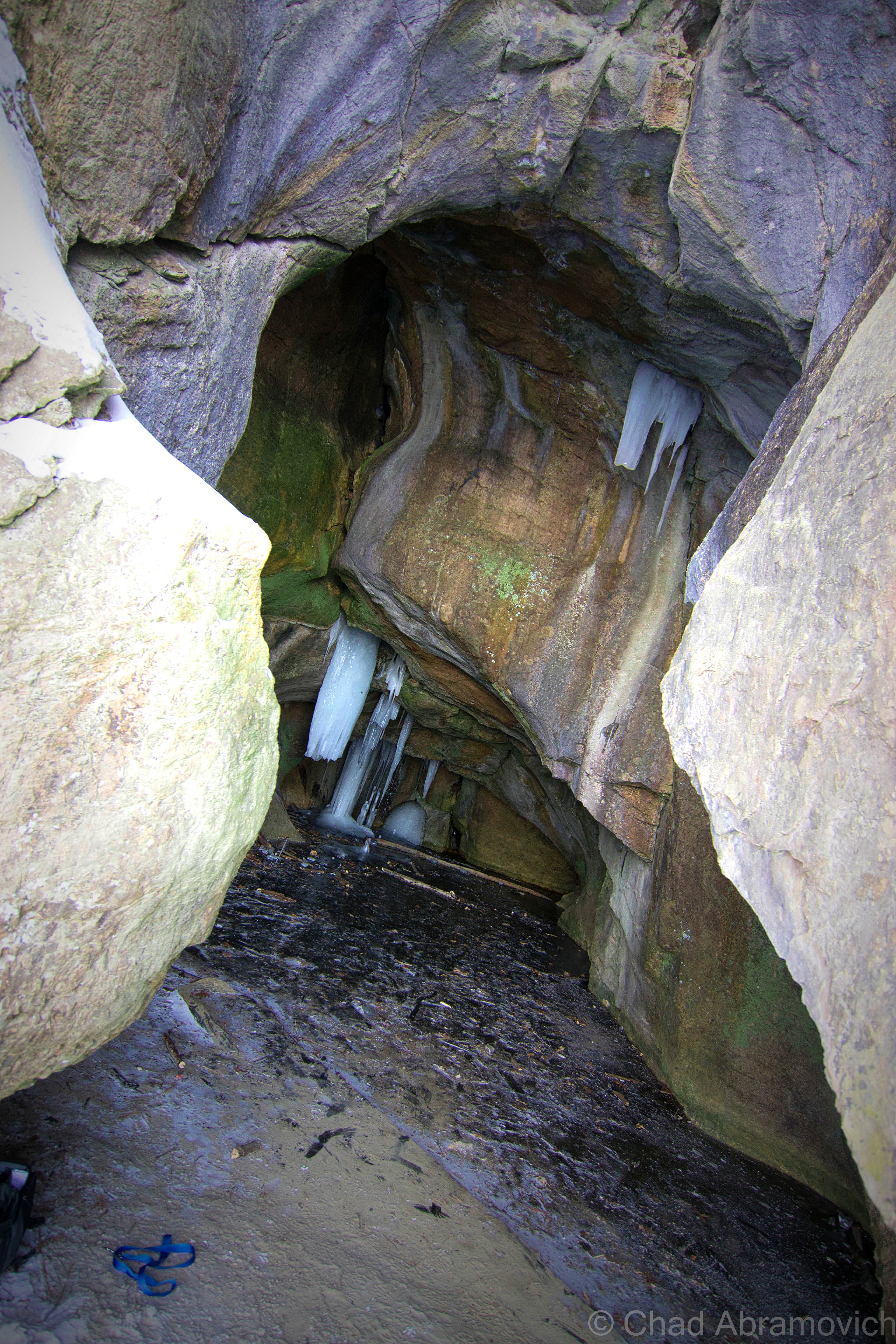
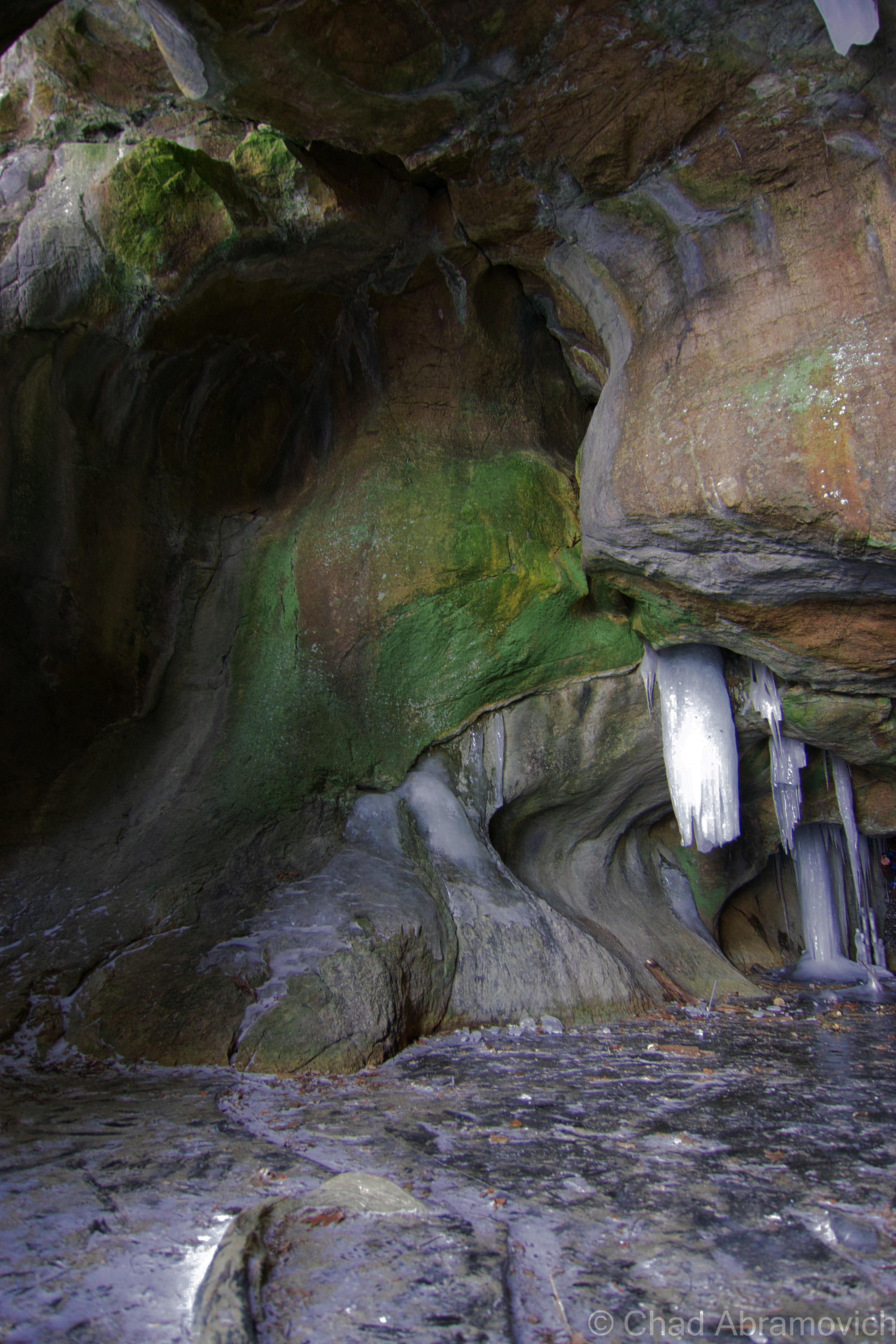
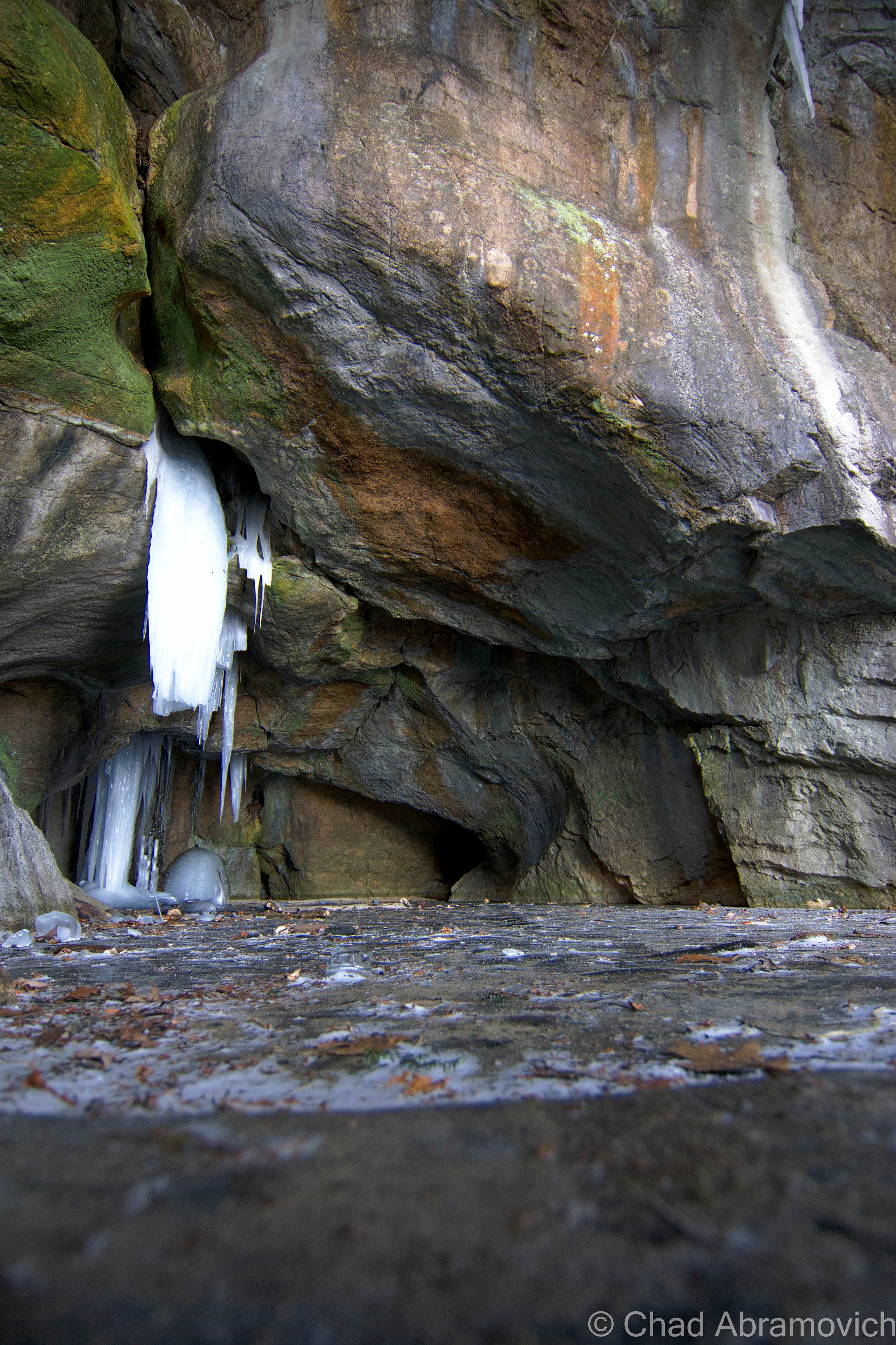
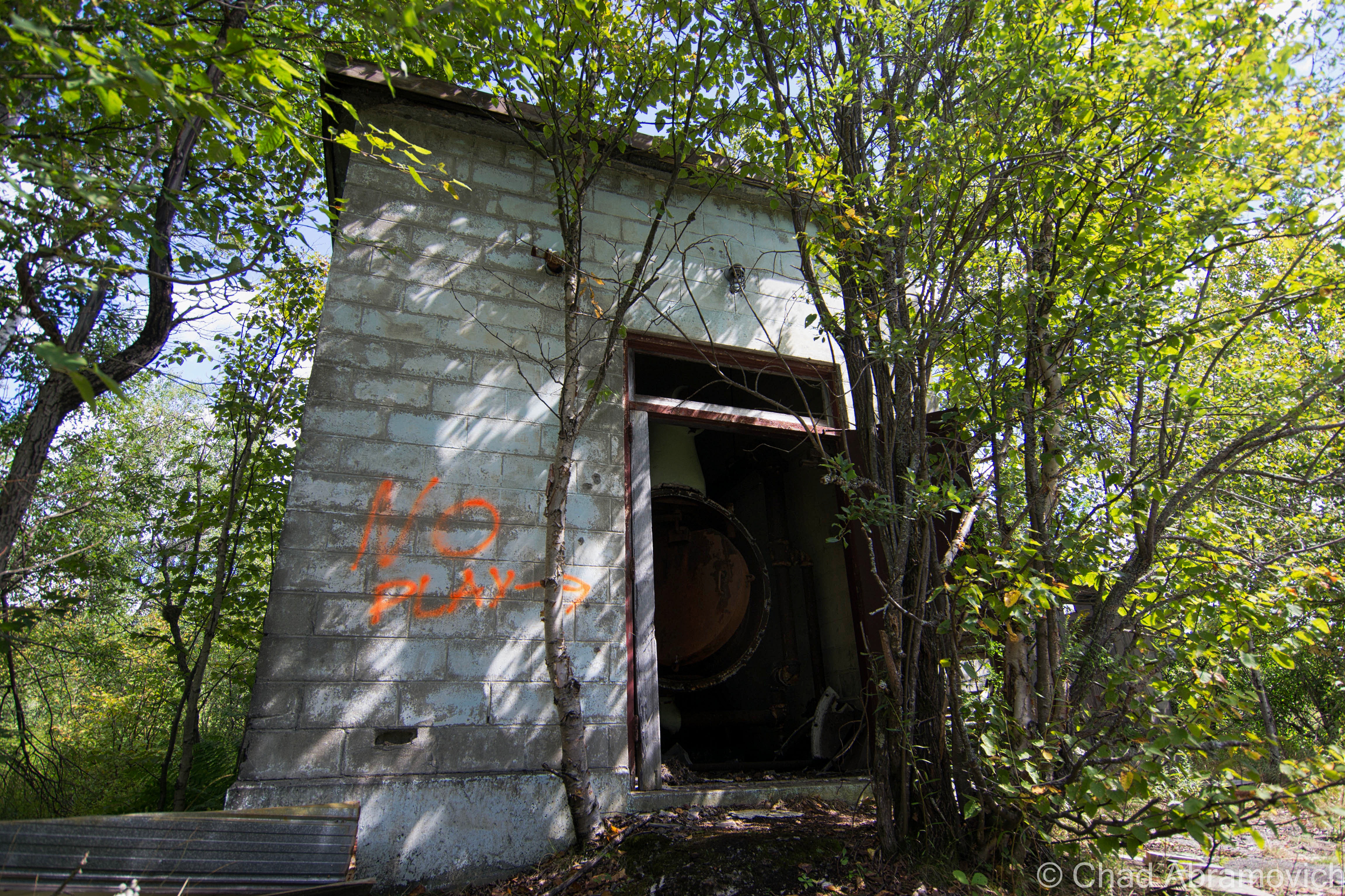
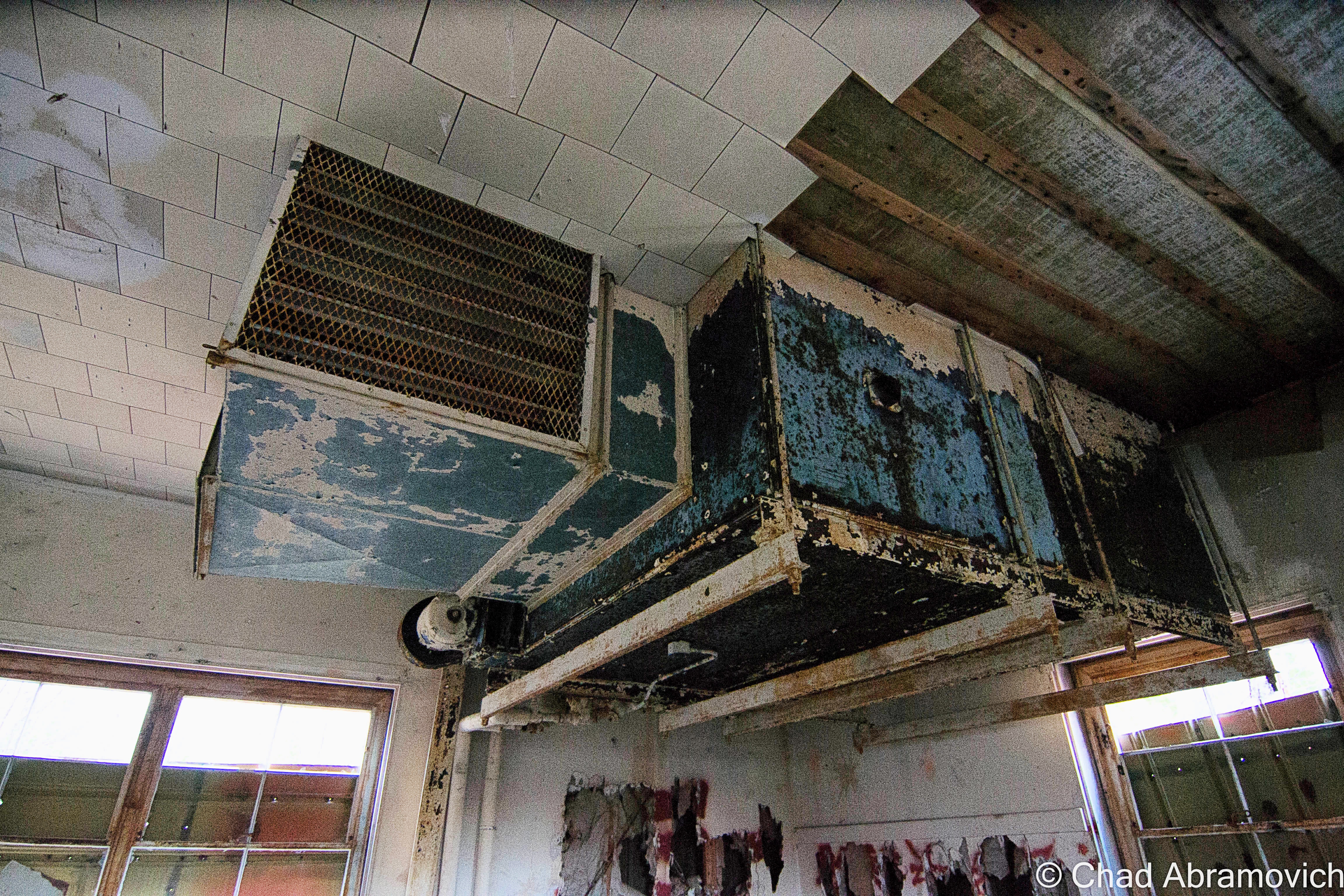
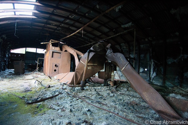
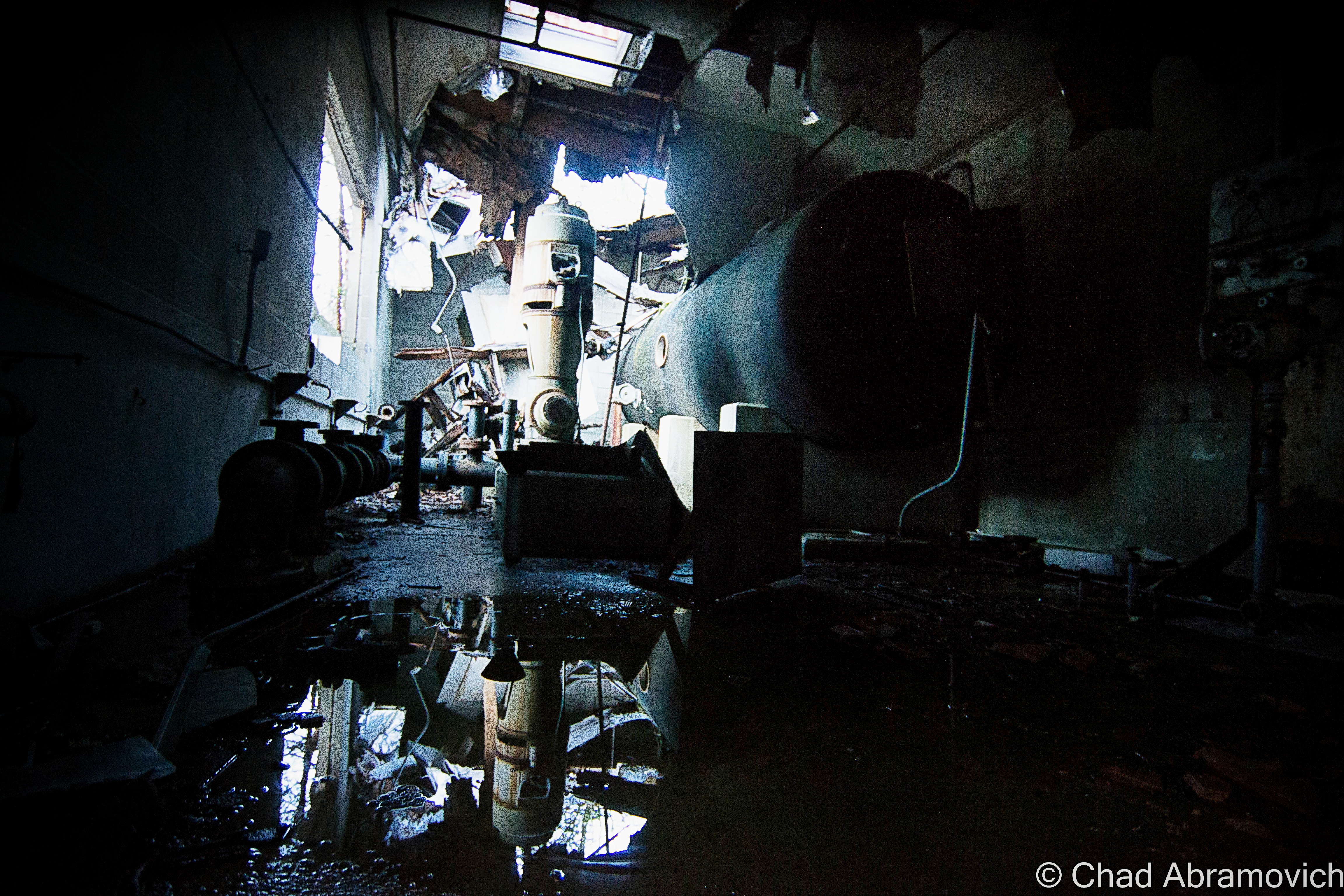
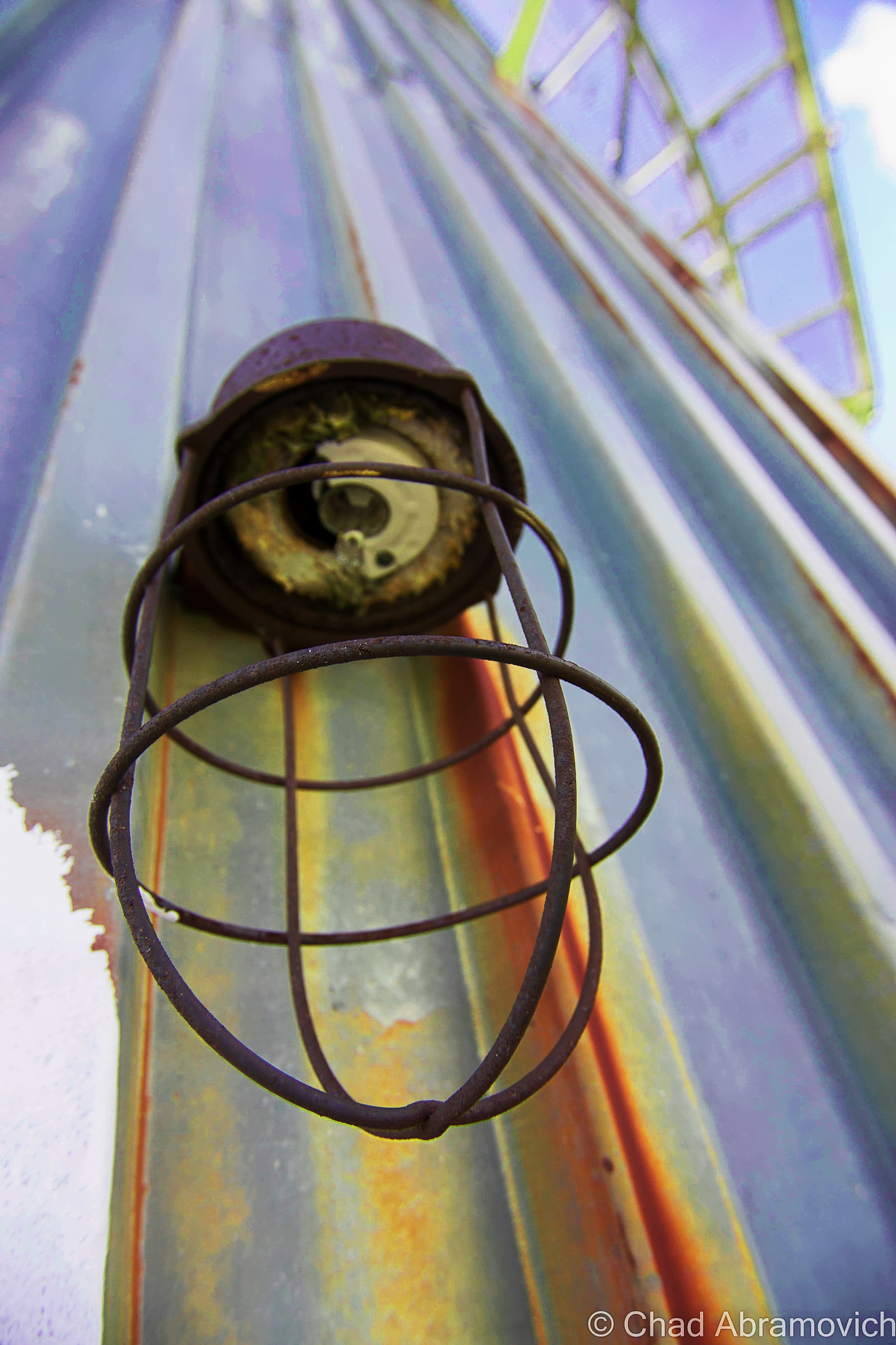
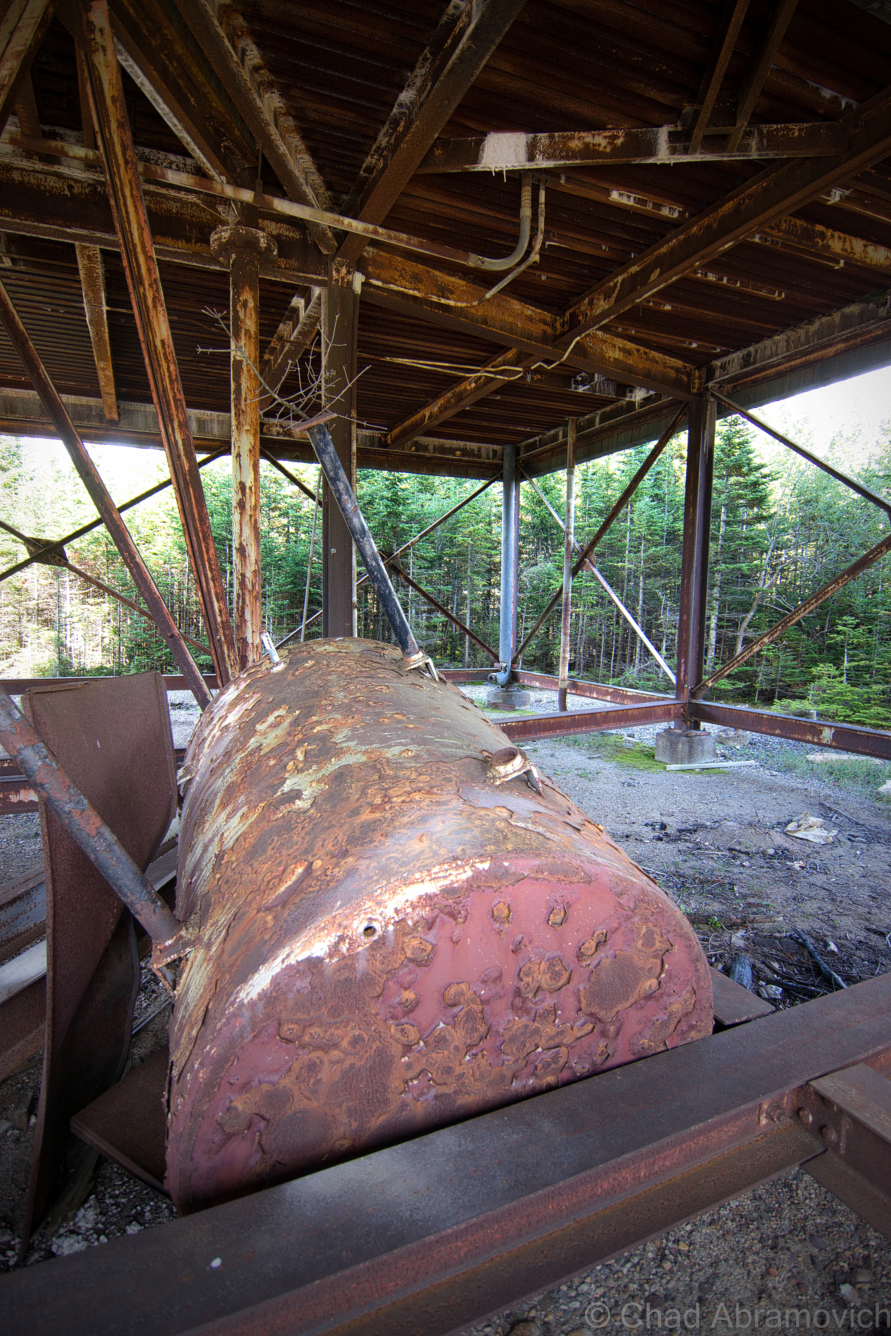
Almost immediately, we were greeted with a good reminder at just how dangerous this place was. Several of the floors in the steel towers were rusted through, some with holes, and others with entire sections that actually swayed and bended with each passing step. Mysterious liquids of various colors rested in odorless pools on the floors and dark spaces, as the wind howled outside and rattled the walls. Rust was everywhere, and the possibility of Tetanus discomforting.

DSC_0236_pe_pe

DSC_0238_pe_pe

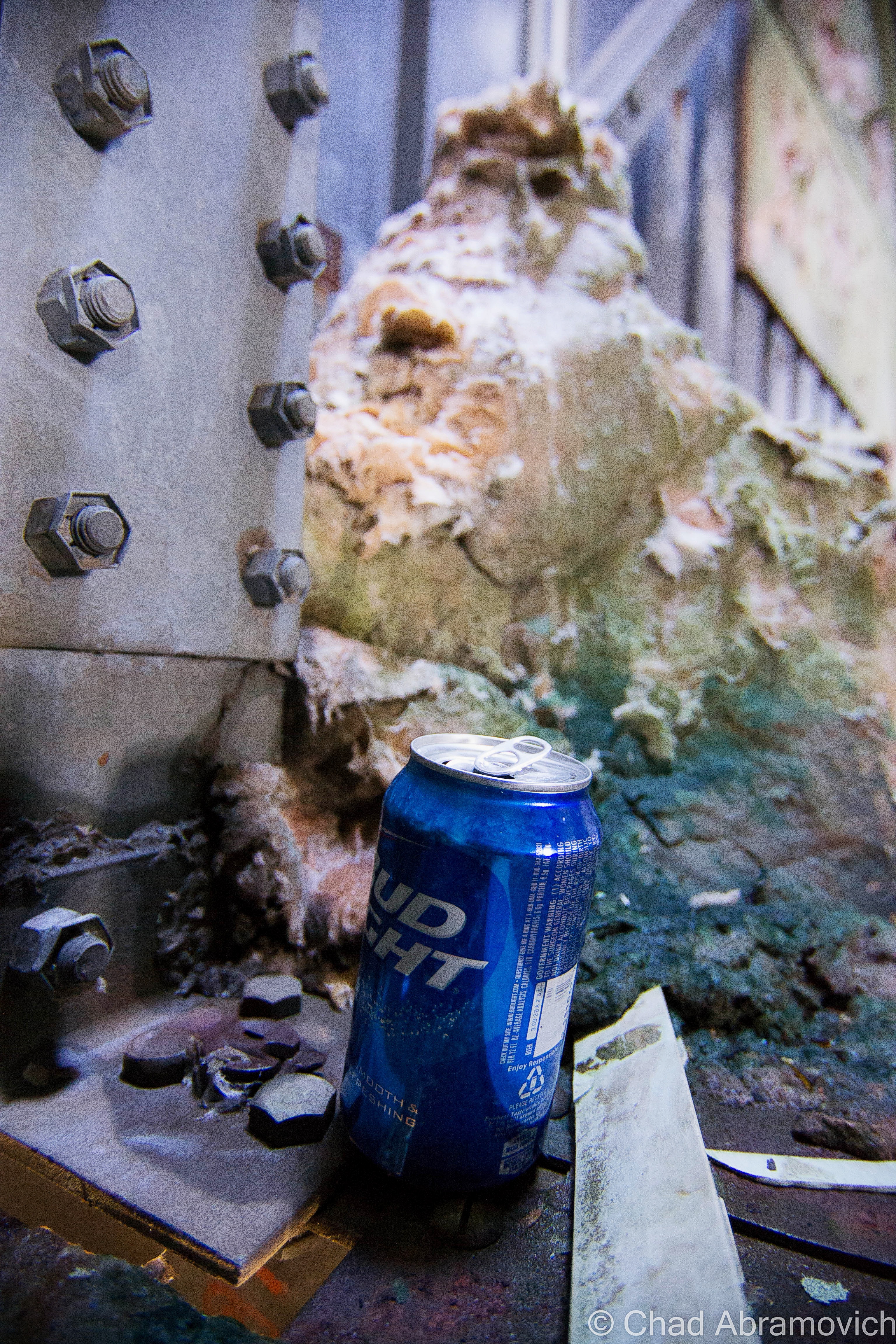
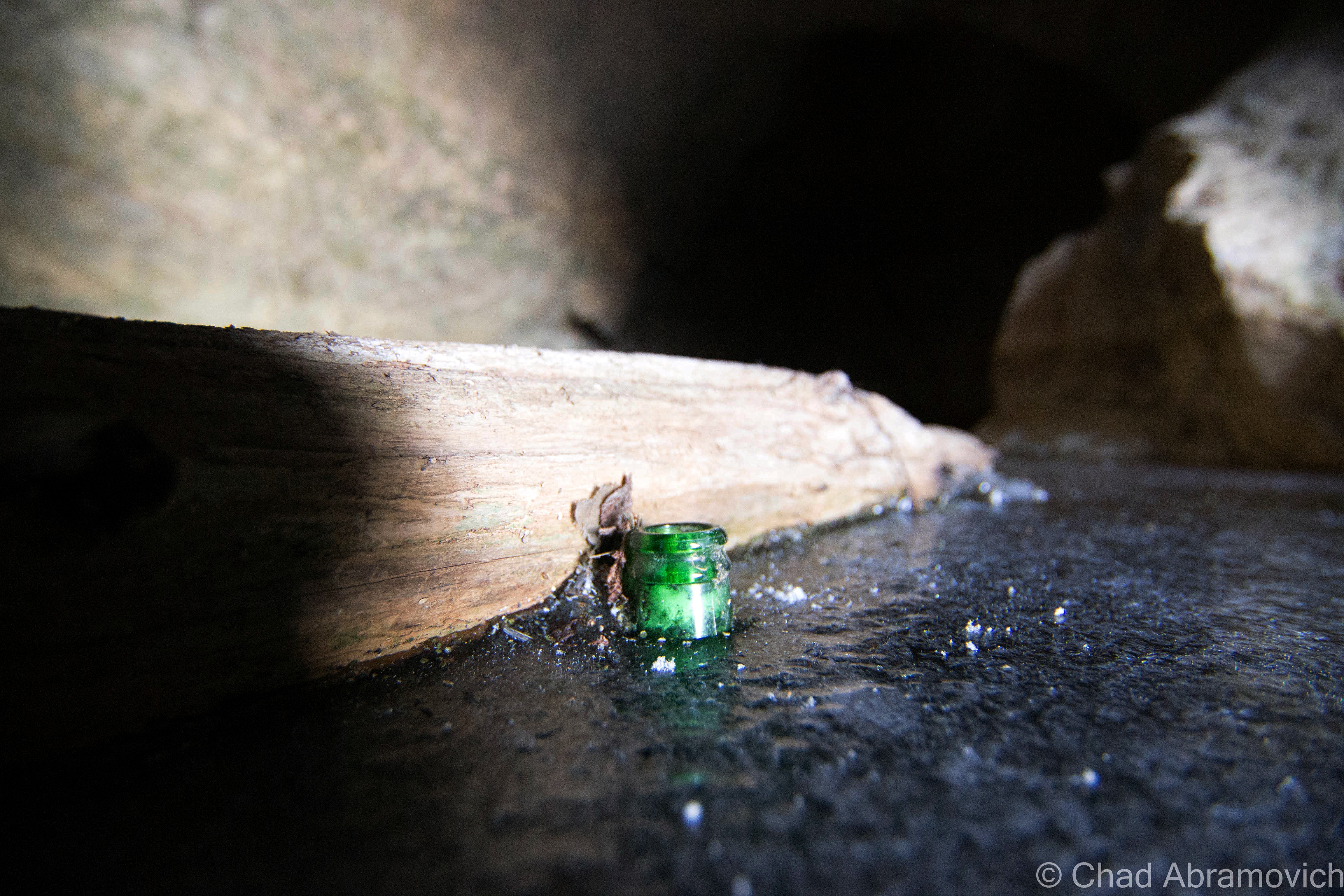
It wouldn’t be an adventure if we didn’t find a Bud Light can along the way, which seems to be the drink of choice for people who frequent these types of locations.

DSC_0242_pe_peDSC_0246_pe_peDSC_0248_pe

This 5 story tower is the tallest structure on the base, and was never actually completed. It was halted before radar equipment was ever installed because the base was decommissioned.

DSC_0253_pe_peDSC_0258_pe_peDSC_0259_pe_peDSC_0261_peDSC_0265_pe_peDSC_0266_peDSC_0279_pe_peDSC_0282_pe_peDSC_0286_peDSC_0288_pe_peDSC_0298_peDSC_0303_pe_peDSC_0306_peDSC_0311_peDSC_0324_pe_peDSC_0330_pe_peDSC_0332_peDSC_0340_peDSC_0342_pe_pe_peDSC_0343_pe_peDSC_0344_peDSC_0345_peDSC_0347_pe_peDSC_0348_pe_peDSC_0349_pe_peDSC_0350_pe_peDSC_0355_peDSC_0357_pe_peDSC_0358_peDSC_0361_pe_peDSC_0367_pe

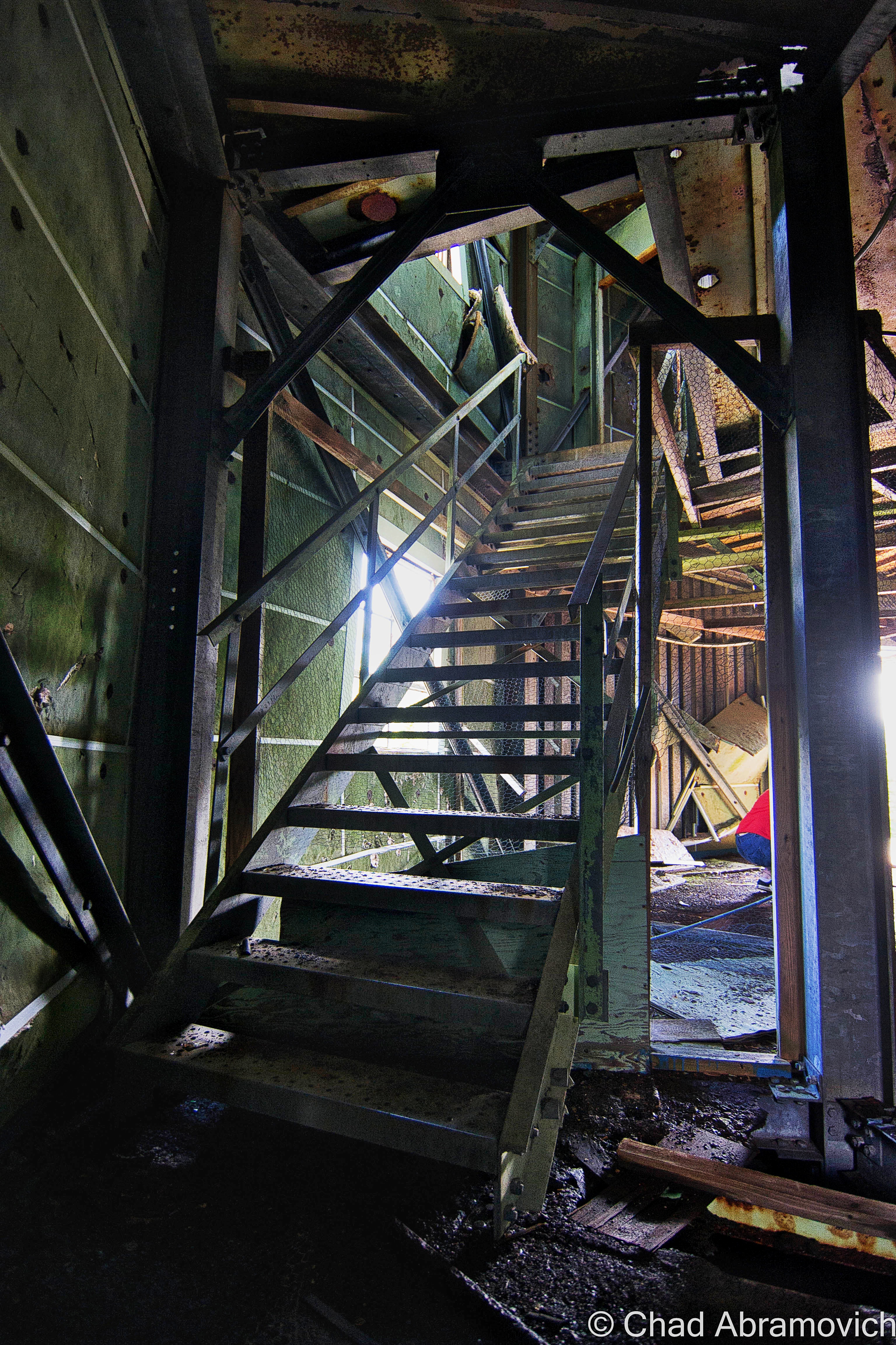
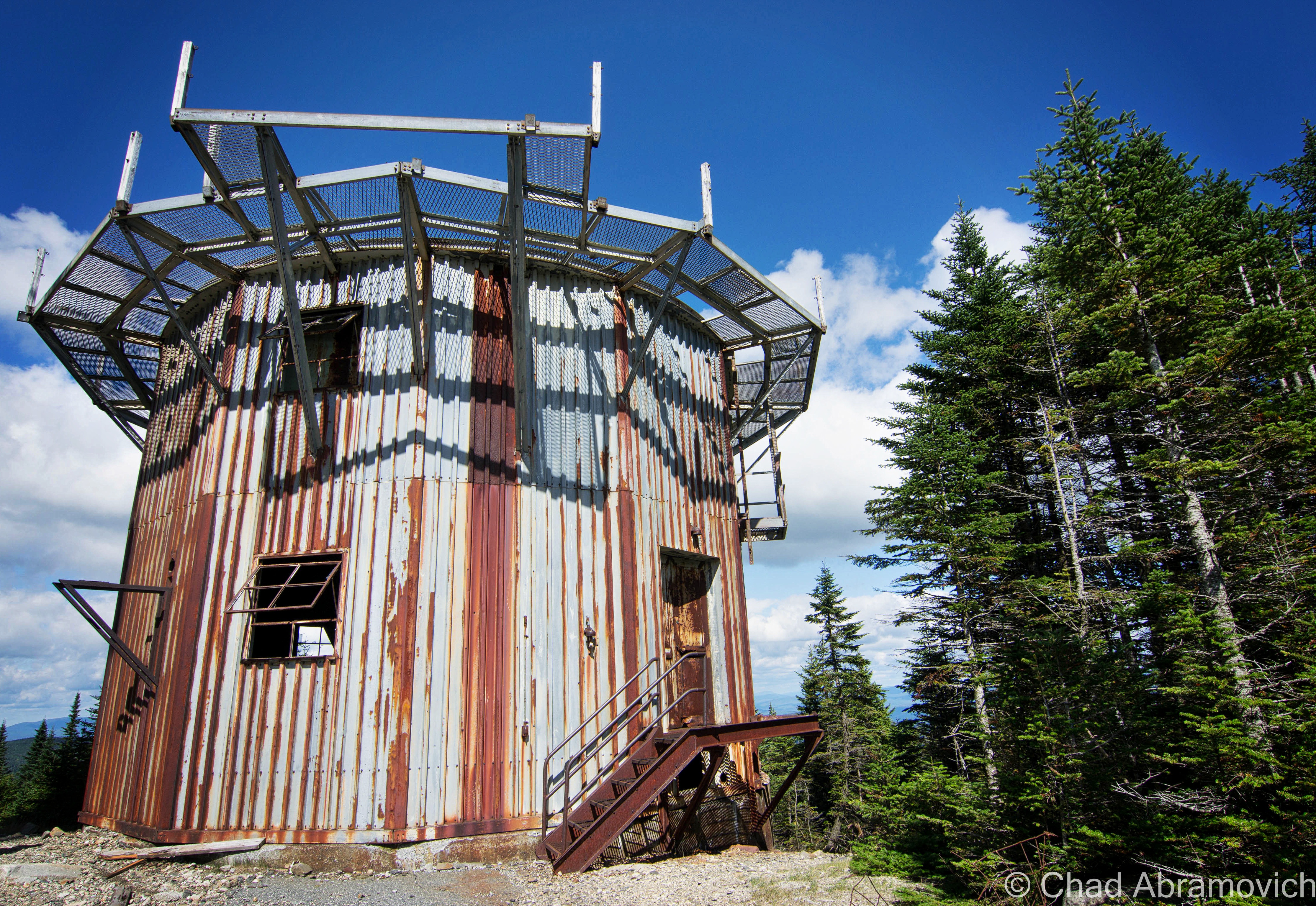
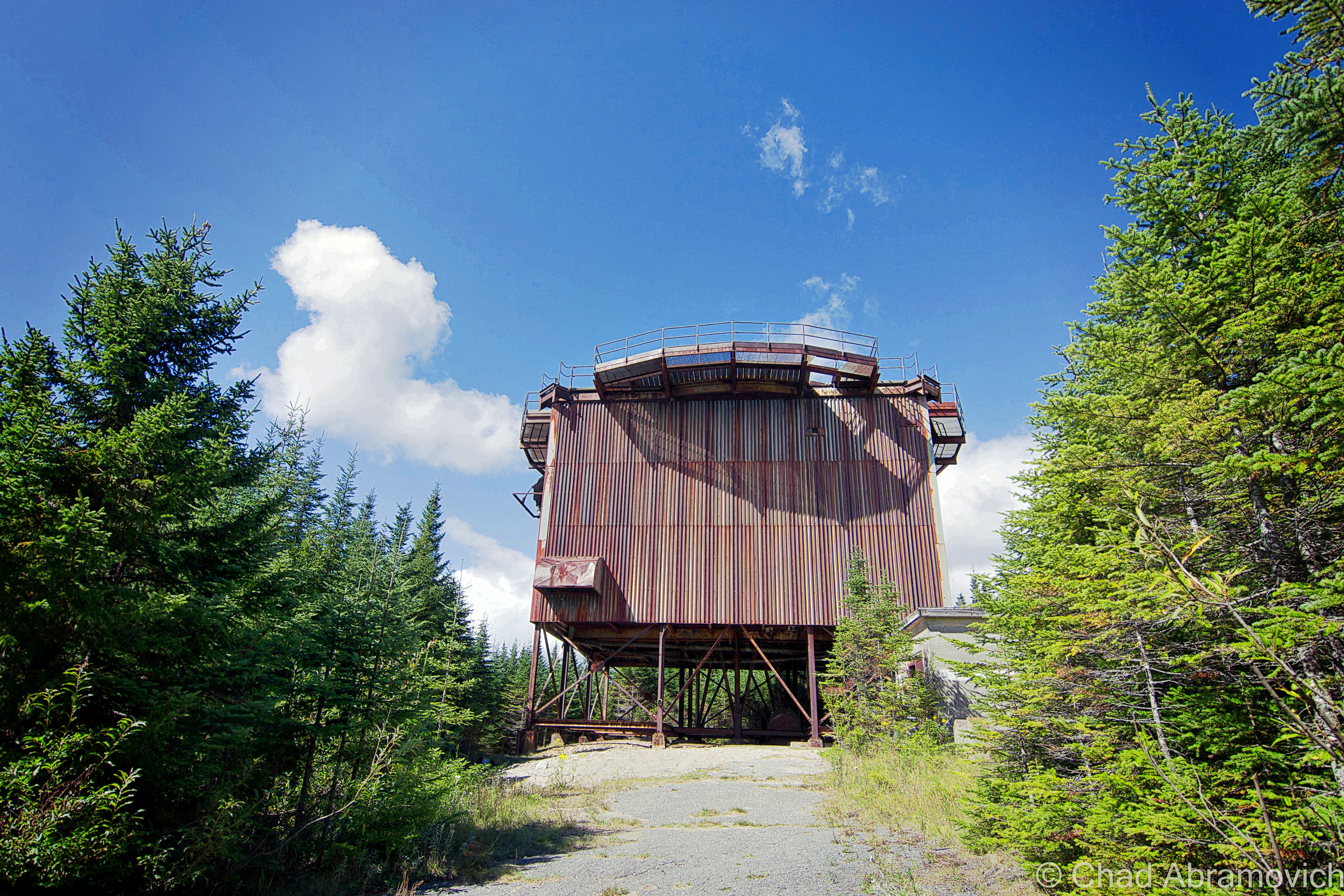
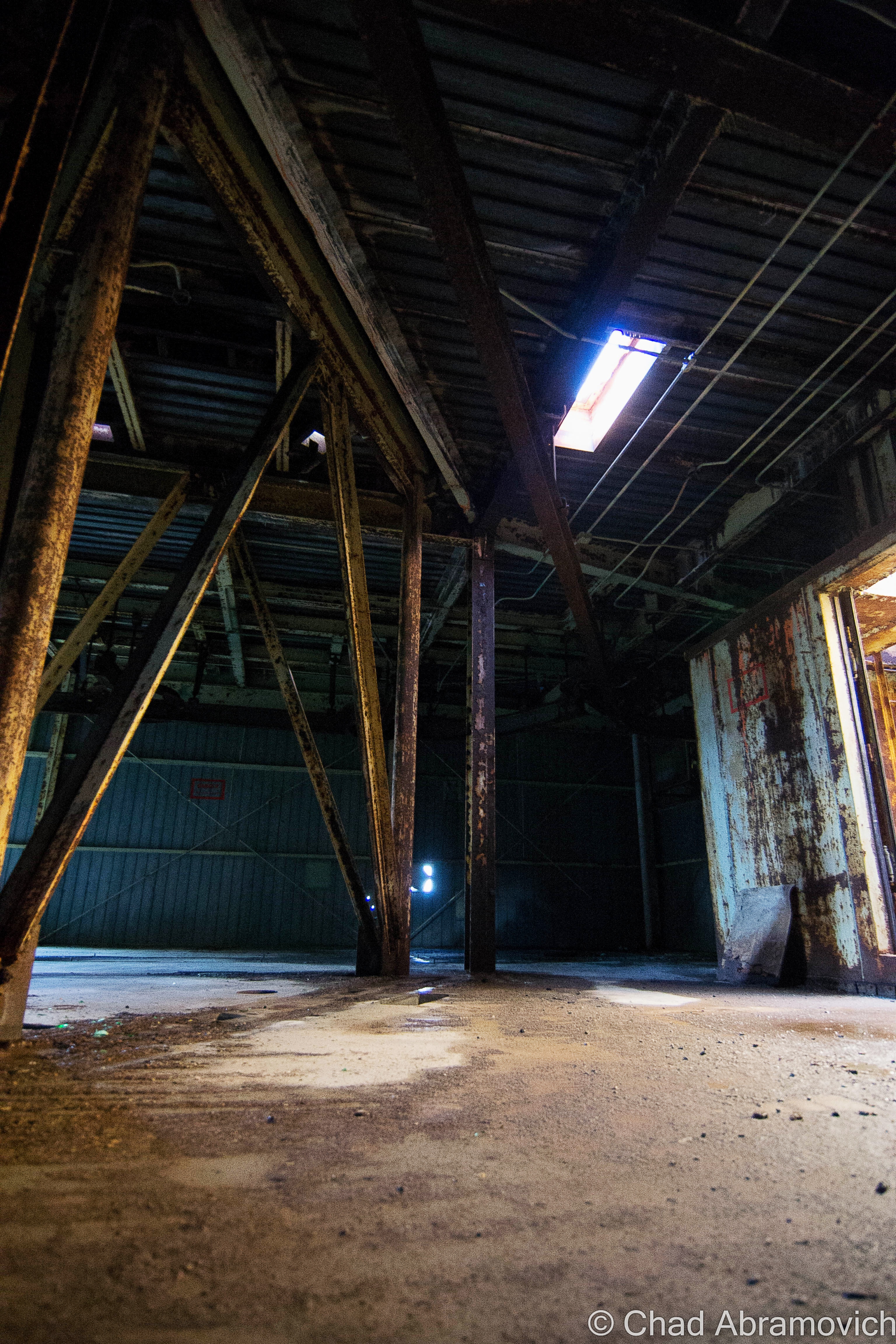
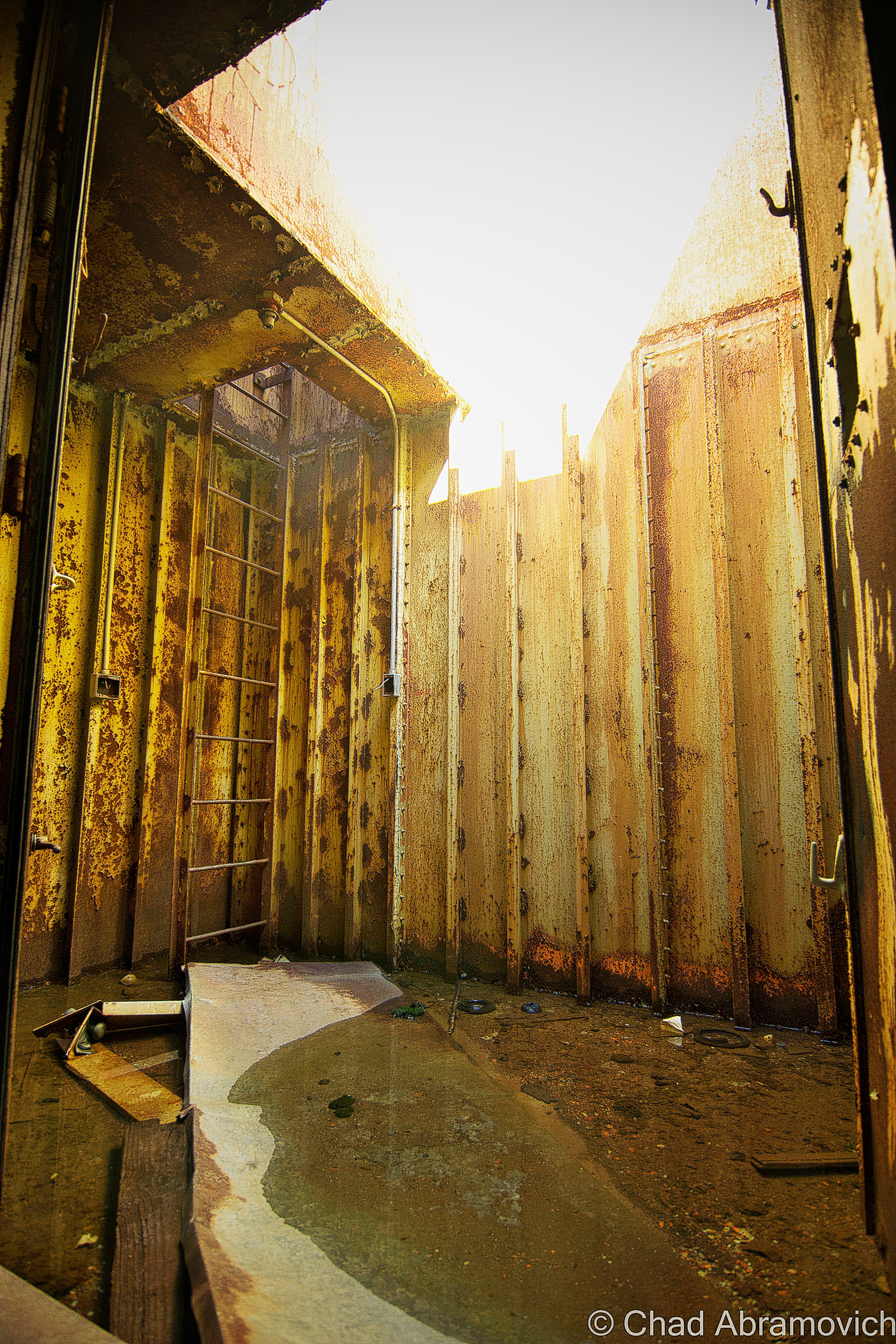
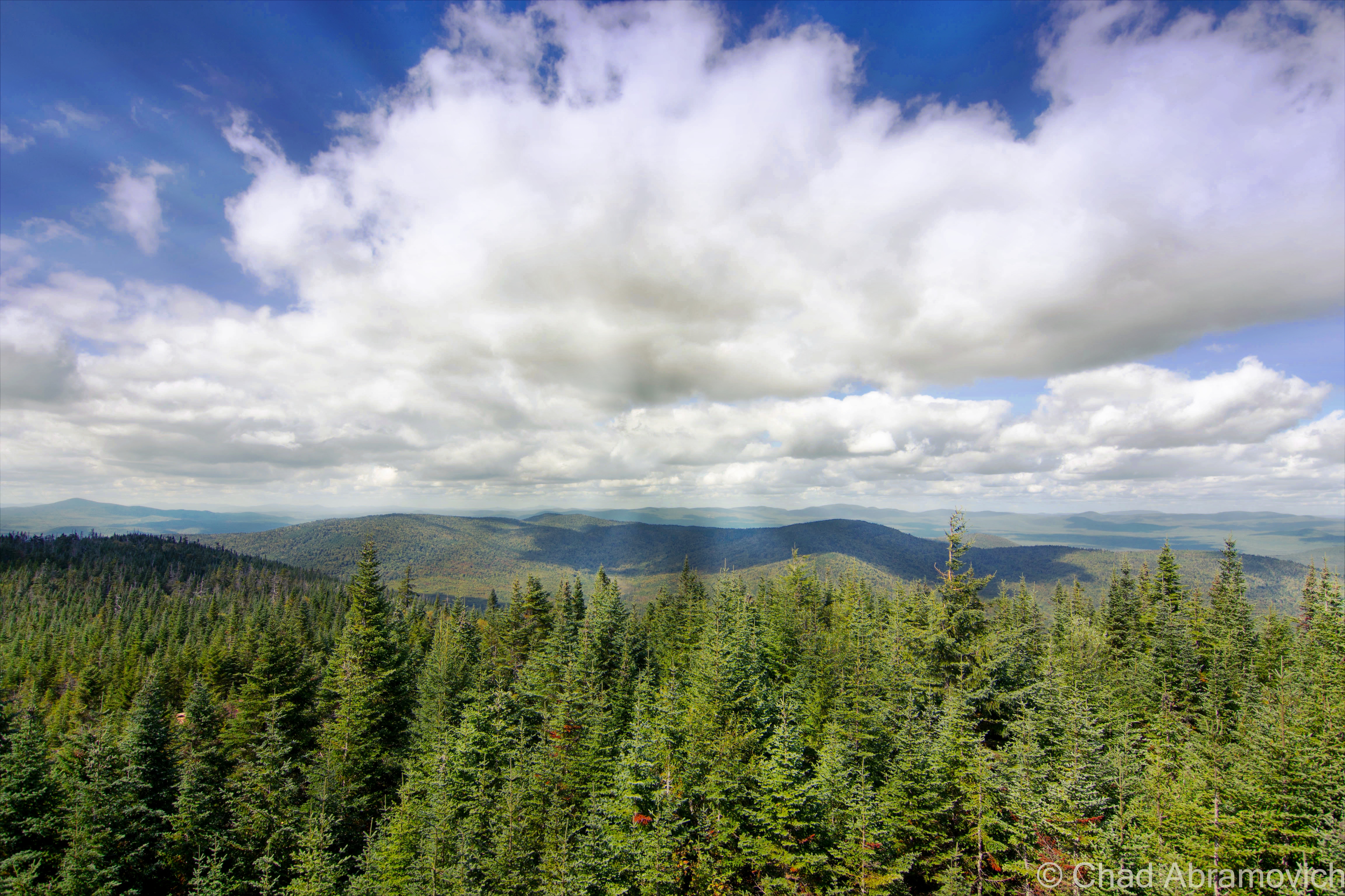
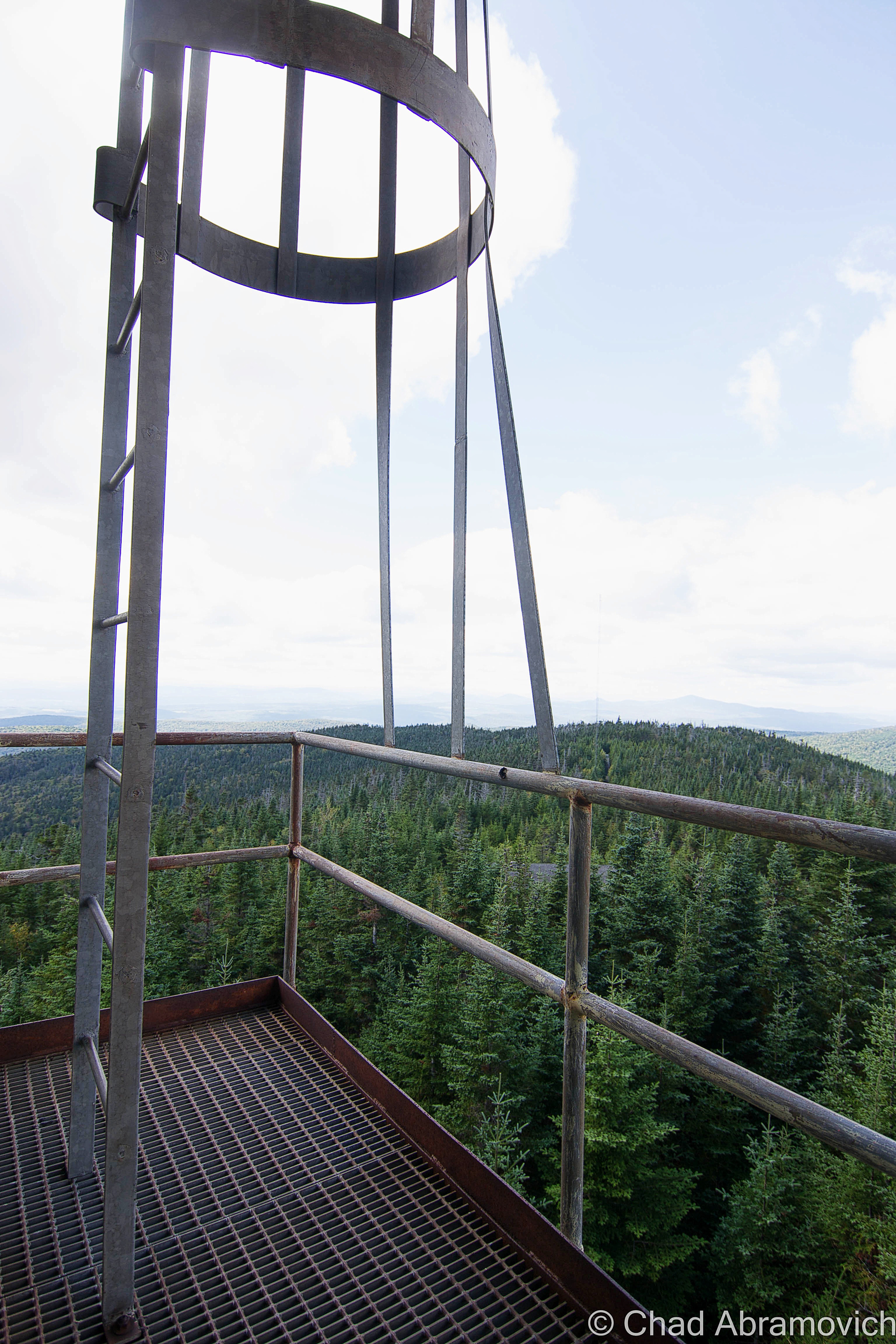
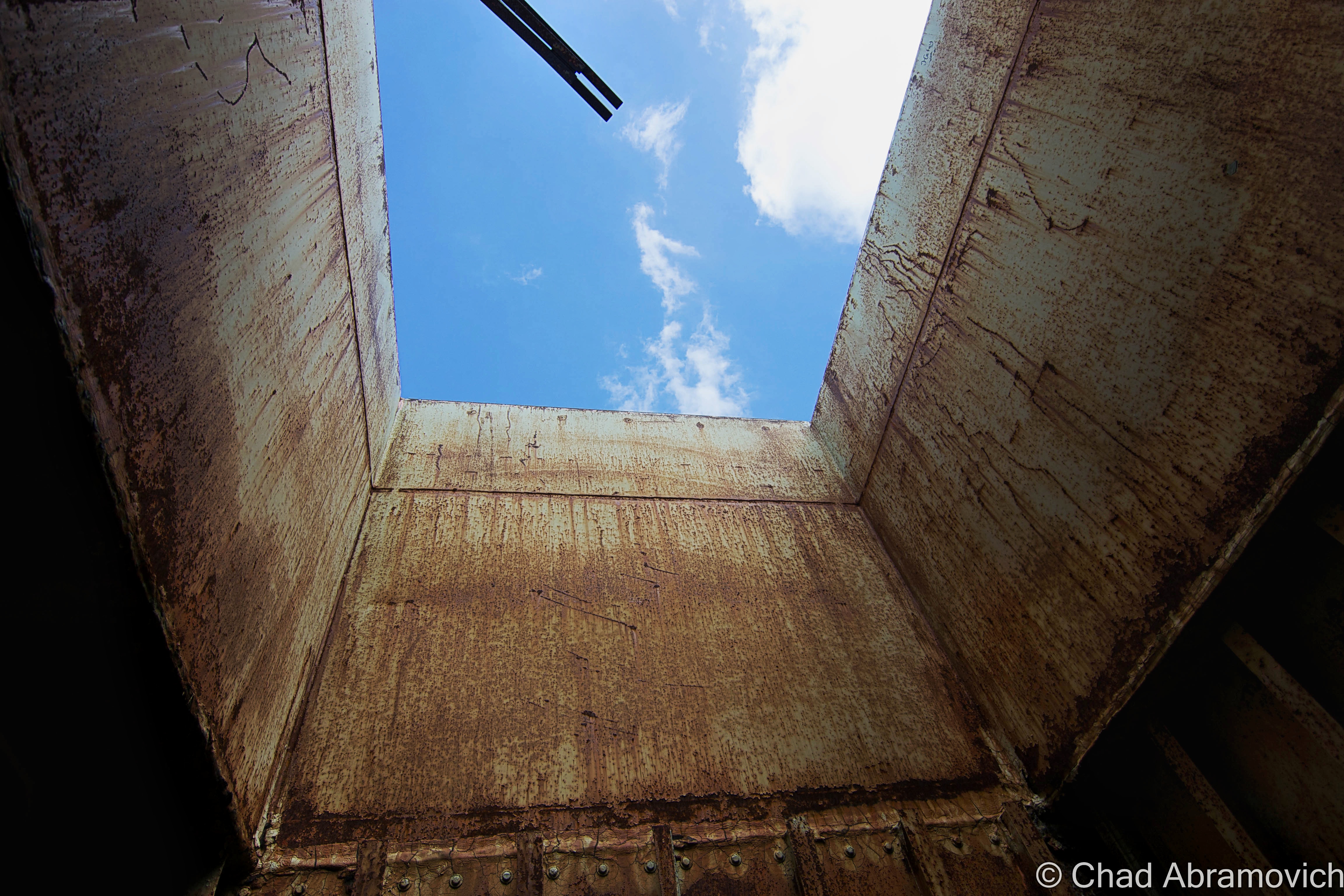
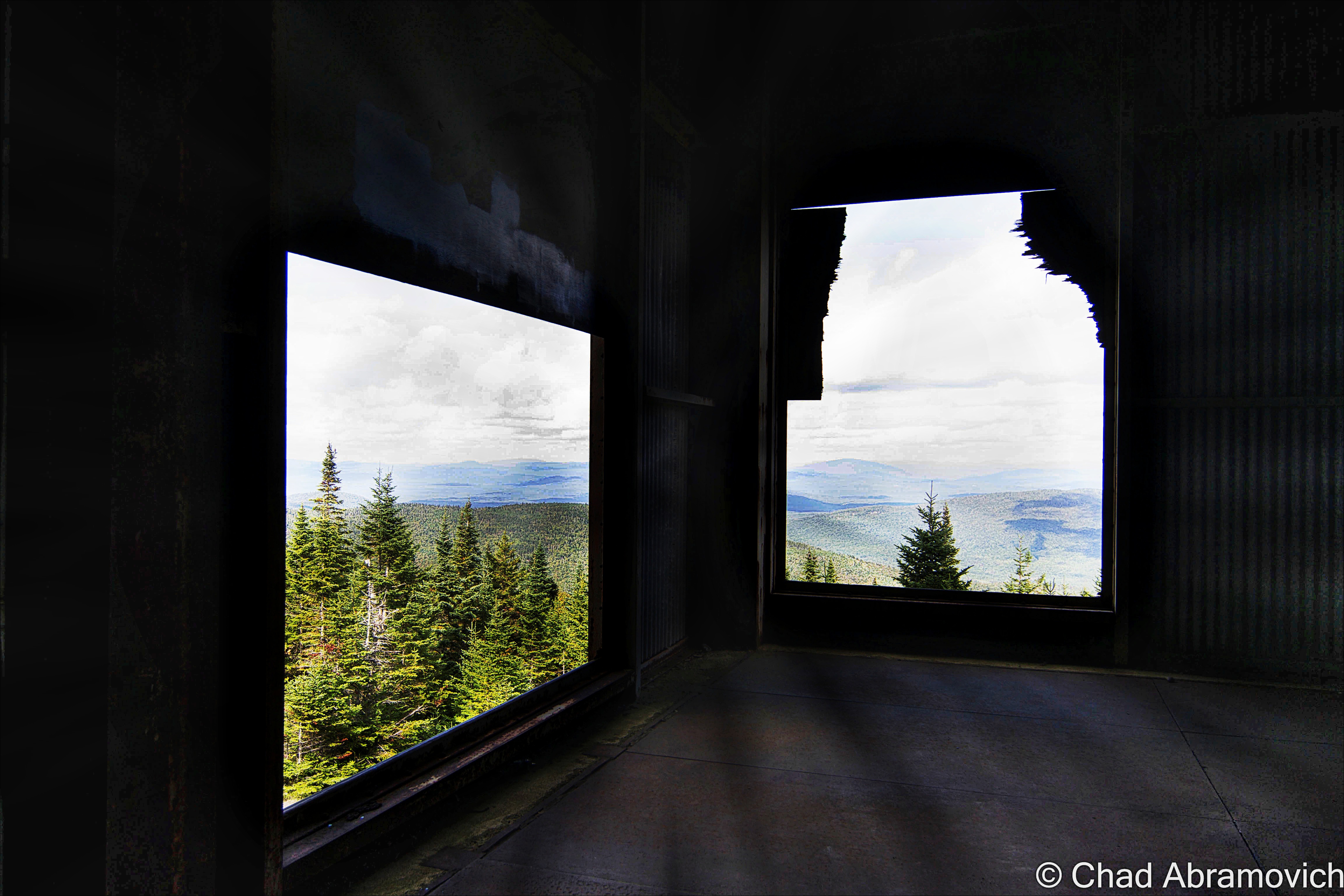
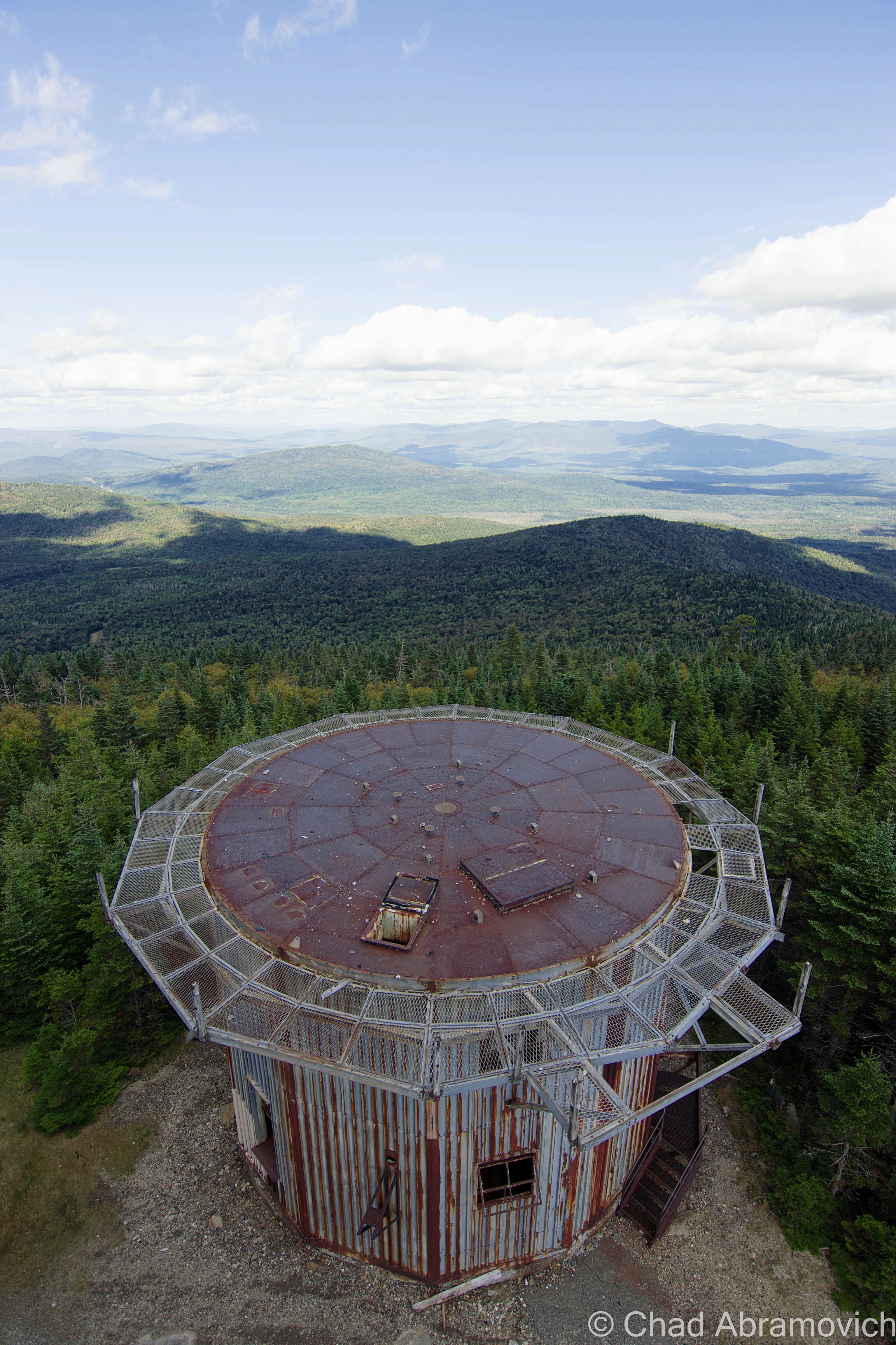
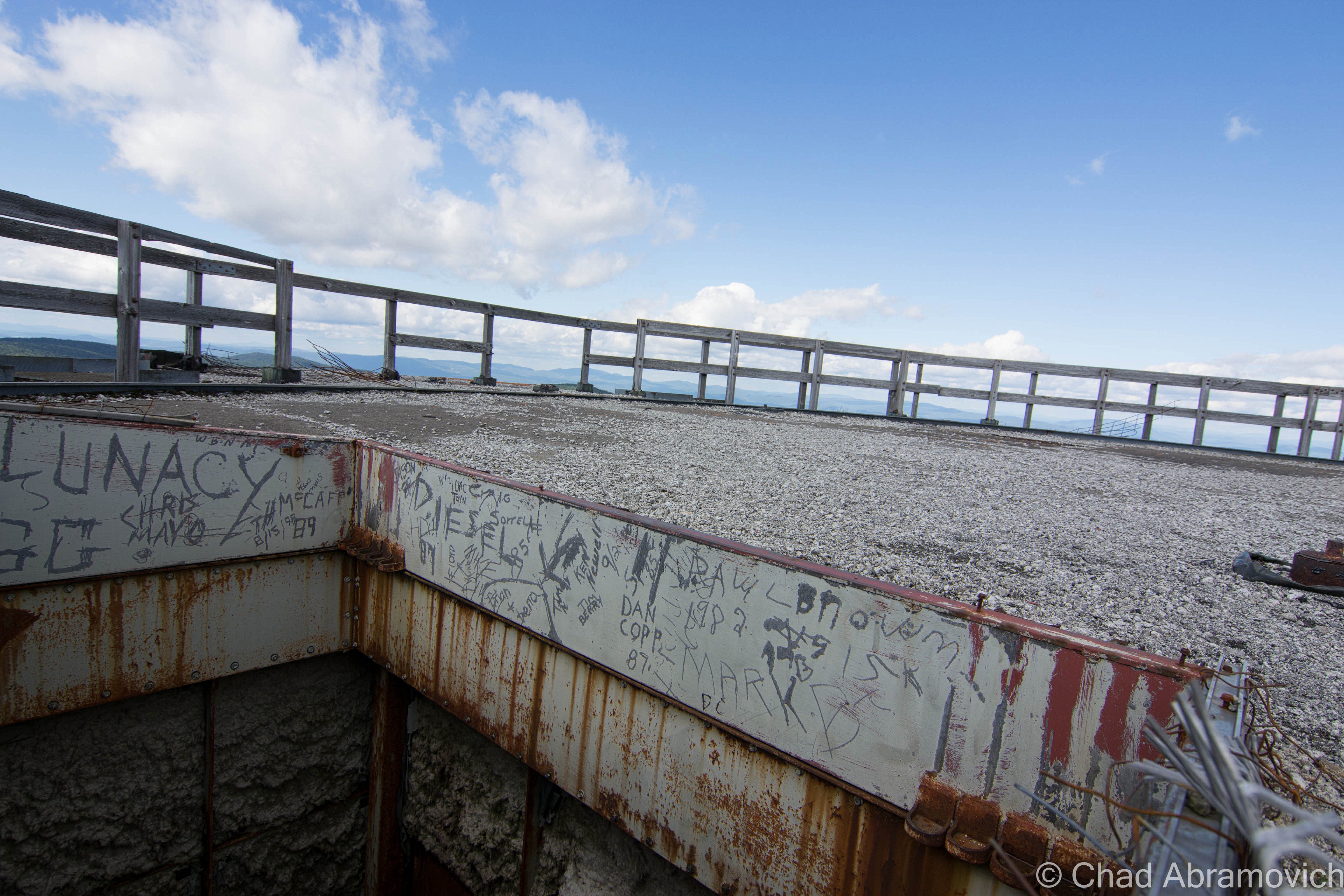
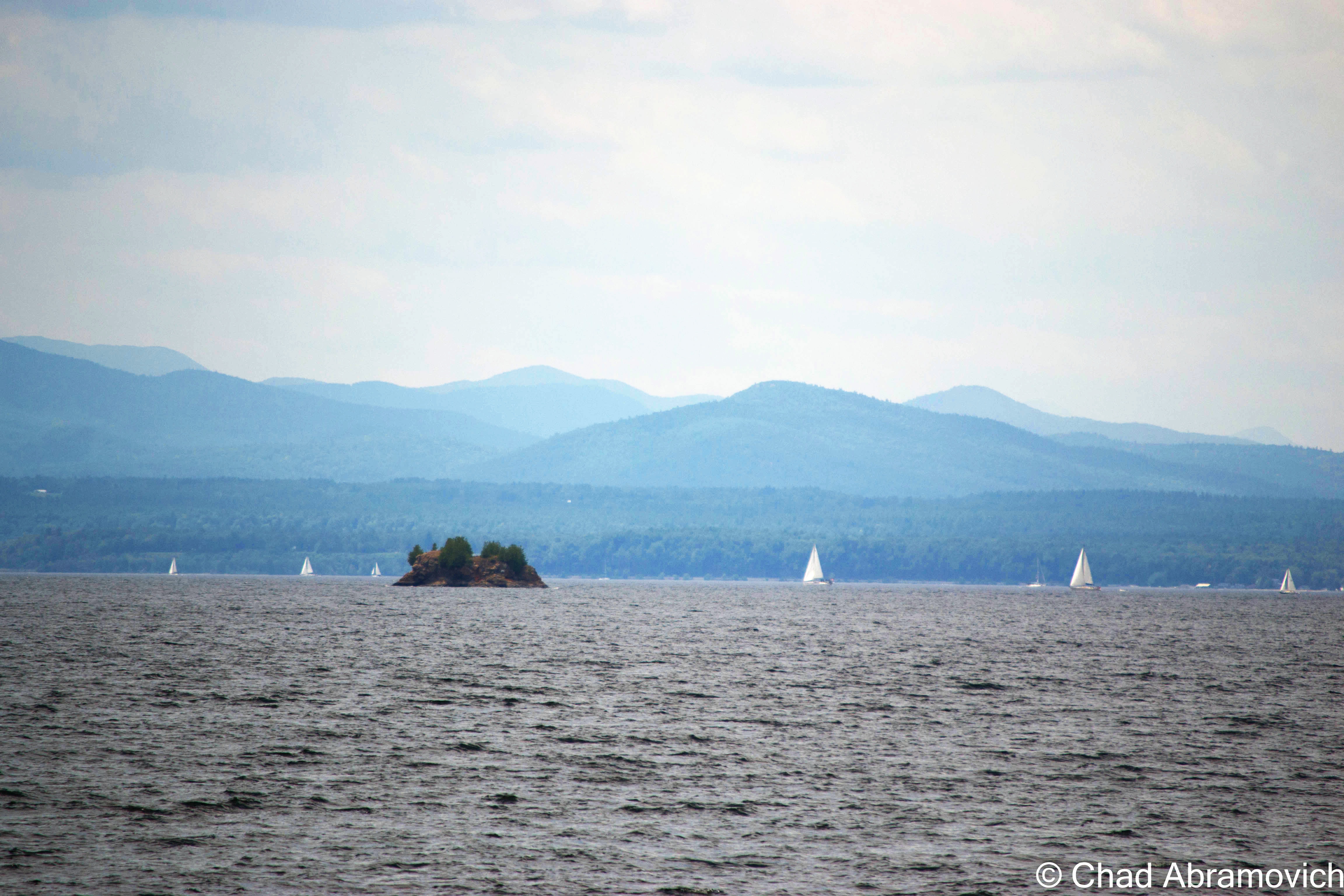
The best part about the visit here was no doubt the magnificent 360 panorama of the Northeast Kingdom and New Hampshire from the top of the tallest radar tower, but getting there was a game of nerves. Climbing up the already questionable structures reverberating with the groans of rusting tin moving in the wind, and up a rusted ladder coated in a layer of mysterious slime that gave you no traction. If you slipped, you plummeted several feet down towards a hard concrete floor into pools of fluids obscuring soggy insulation and rusted objects. But once on top of the tower, as you gaze into unbroken wilderness as far as you can see, and you bask in the profound silence, it’s completely worth it.

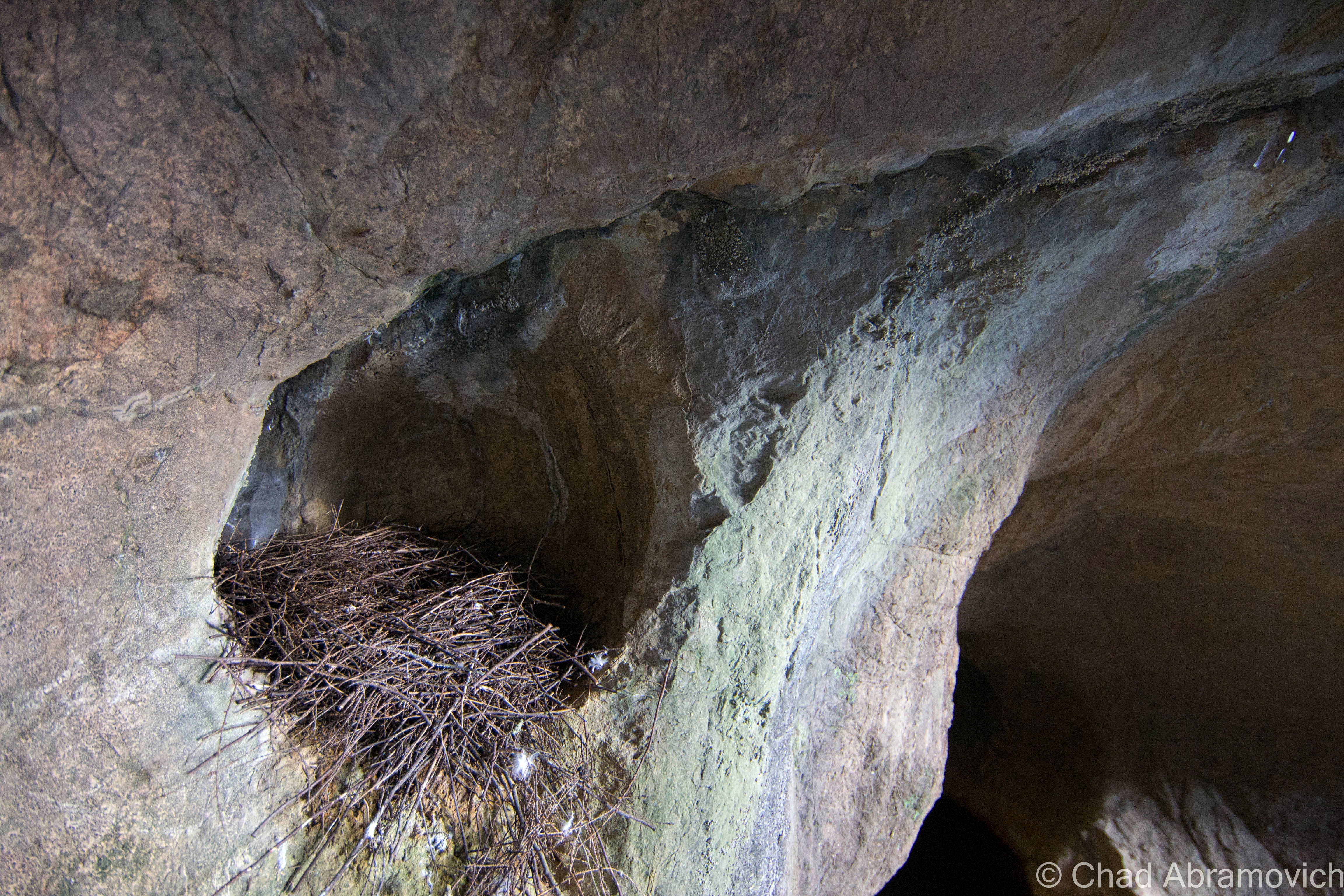
At the summit, there were visible campsites made on the slopes beneath the towers. I couldn’t help but think about how amazing it would be to camp up here in the deep, underneath the constellation light. I’m sure it would be a spectacular experience, perhaps even unsettling. As we were leaving, another car came up the road and parked, before a group of teenagers climbed out holding quite a few packs of Twisted Tea. I guess other people are taken by the strange allure of this place as well – and it draws characters of all kinds.

Proving this point, on the way back down the road, we met up with another vehicle, its roof and grill lights flashing, and it was barreling up the road. Thinking it was the police, we found a place to pull over. As the car passed us, we clearly read the words” Zombie Apocalypse Survival Vehicle” written on the sides in police-esque decals, the car soon sped out of sight as it headed towards the mountaintop.

Sometimes, the pursuit of life can bring you to some incredible places.

Update as of August 2015

A while after I had published this post, I was amused when I saw an inbox message on the blog’s Facebook page from the owner of the “Zombie Apocalypse Survival Vehicle”, which pretty much started out with the line “Hey! I’m the guy with the car!” As it turns out, he’s also one of the members of the East Mountain Preservation Group and might just be the person who is most intimate with the place. He practically lives up there, spending his free time examining it’s ruins and doing some urban archaeology to figure out how the base functioned, and the stories behind the things I saw on my trek up the mountain. So, we struck up a casual social media friendship, which transitioned into a real time friendship, which lead to us planning a radar trip together.

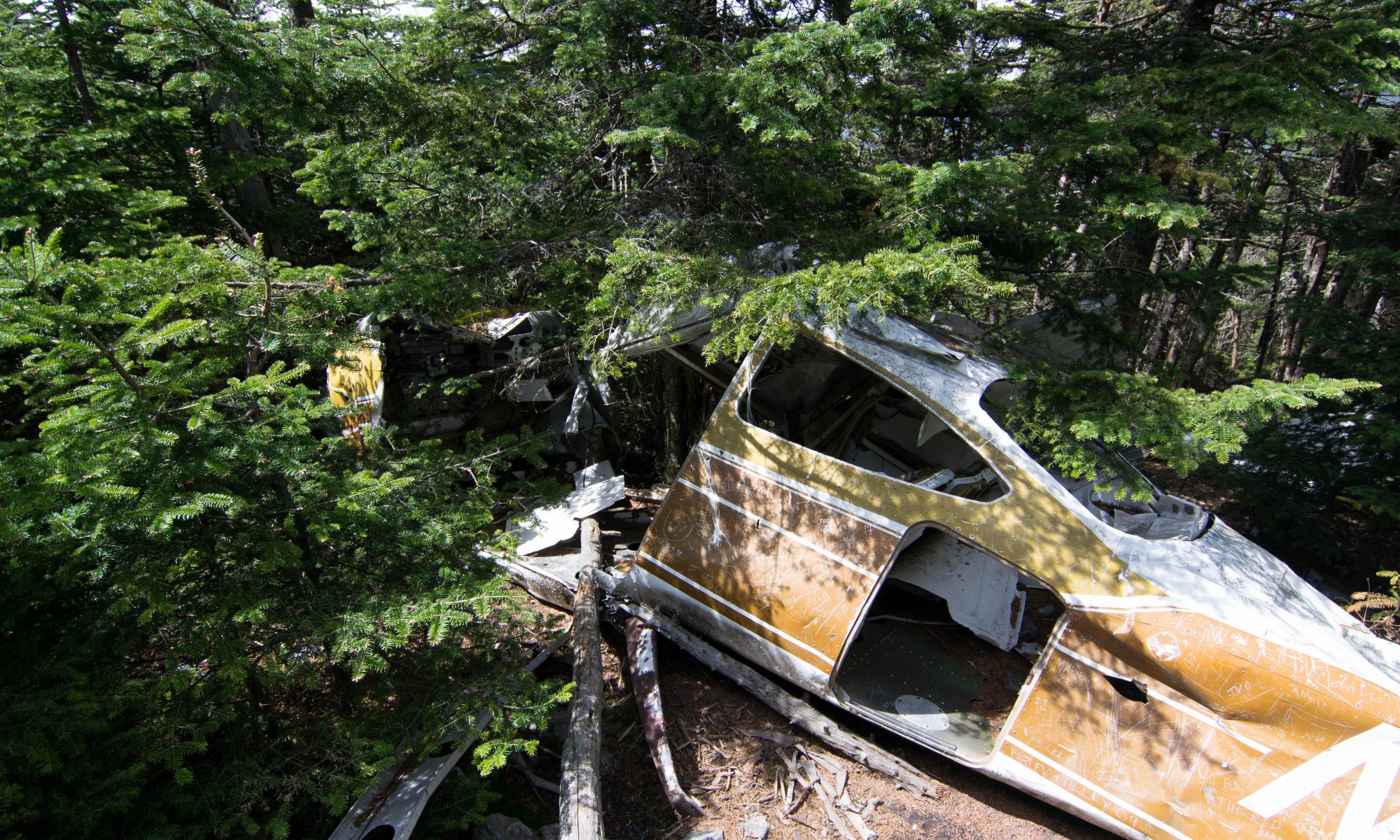
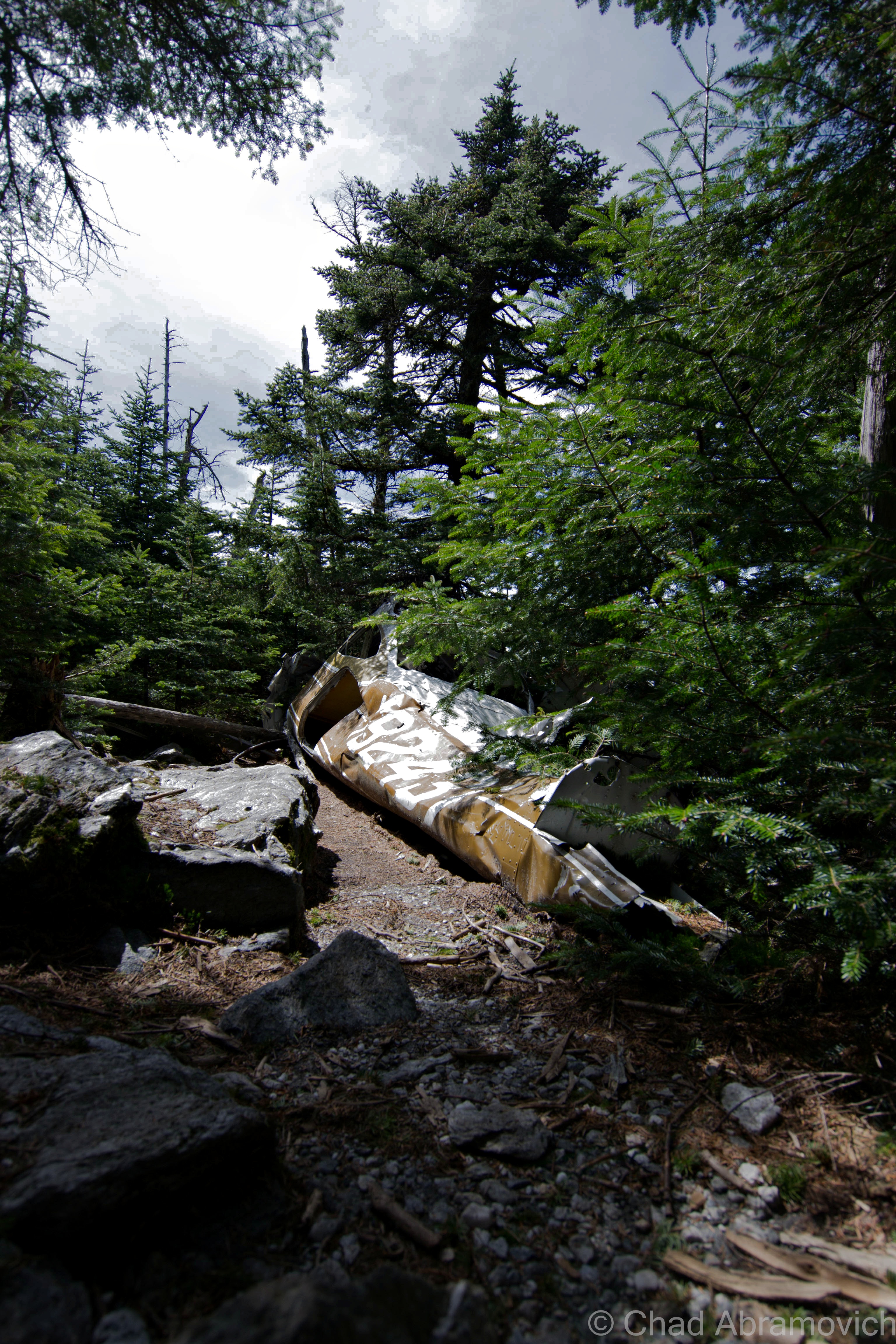
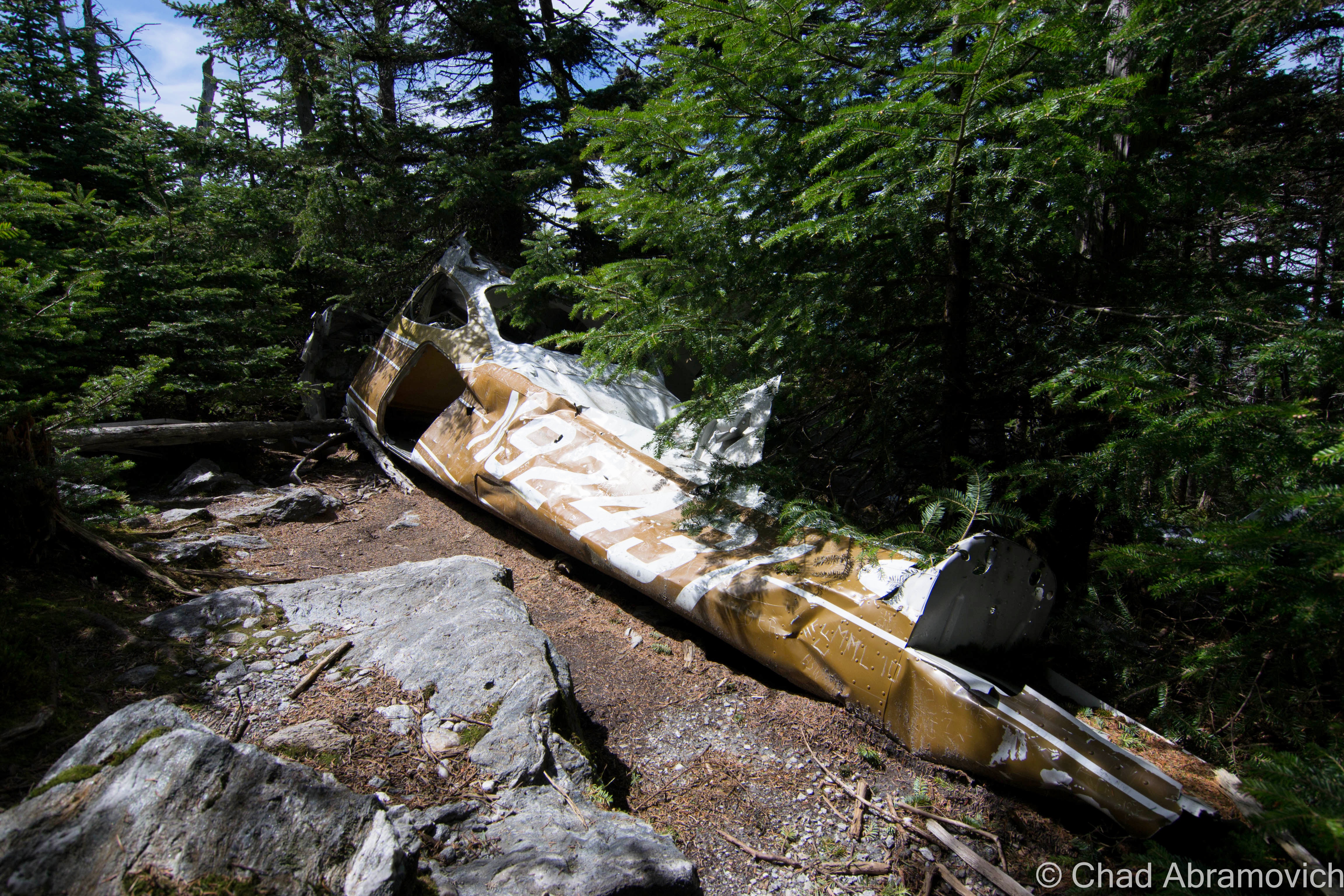
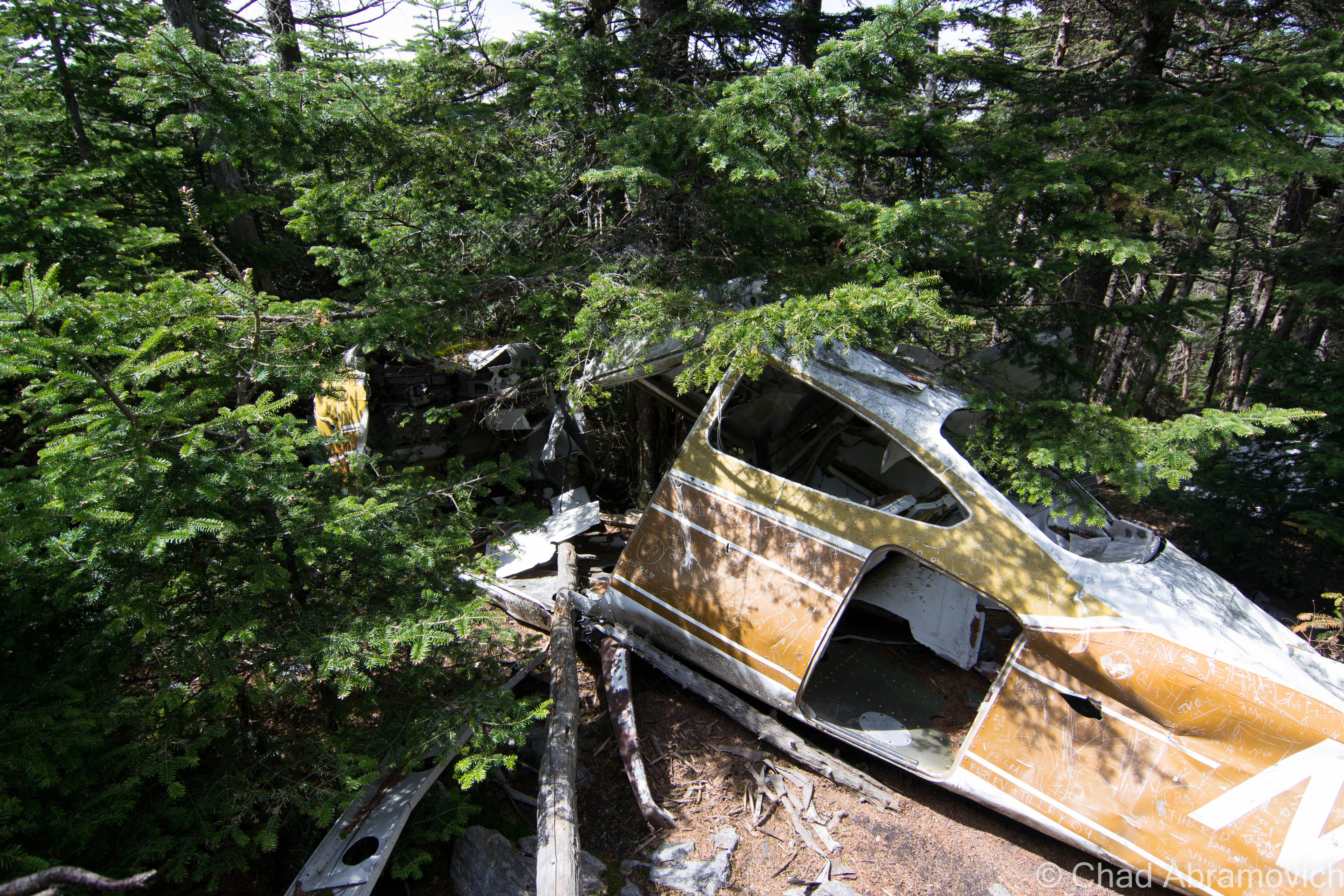
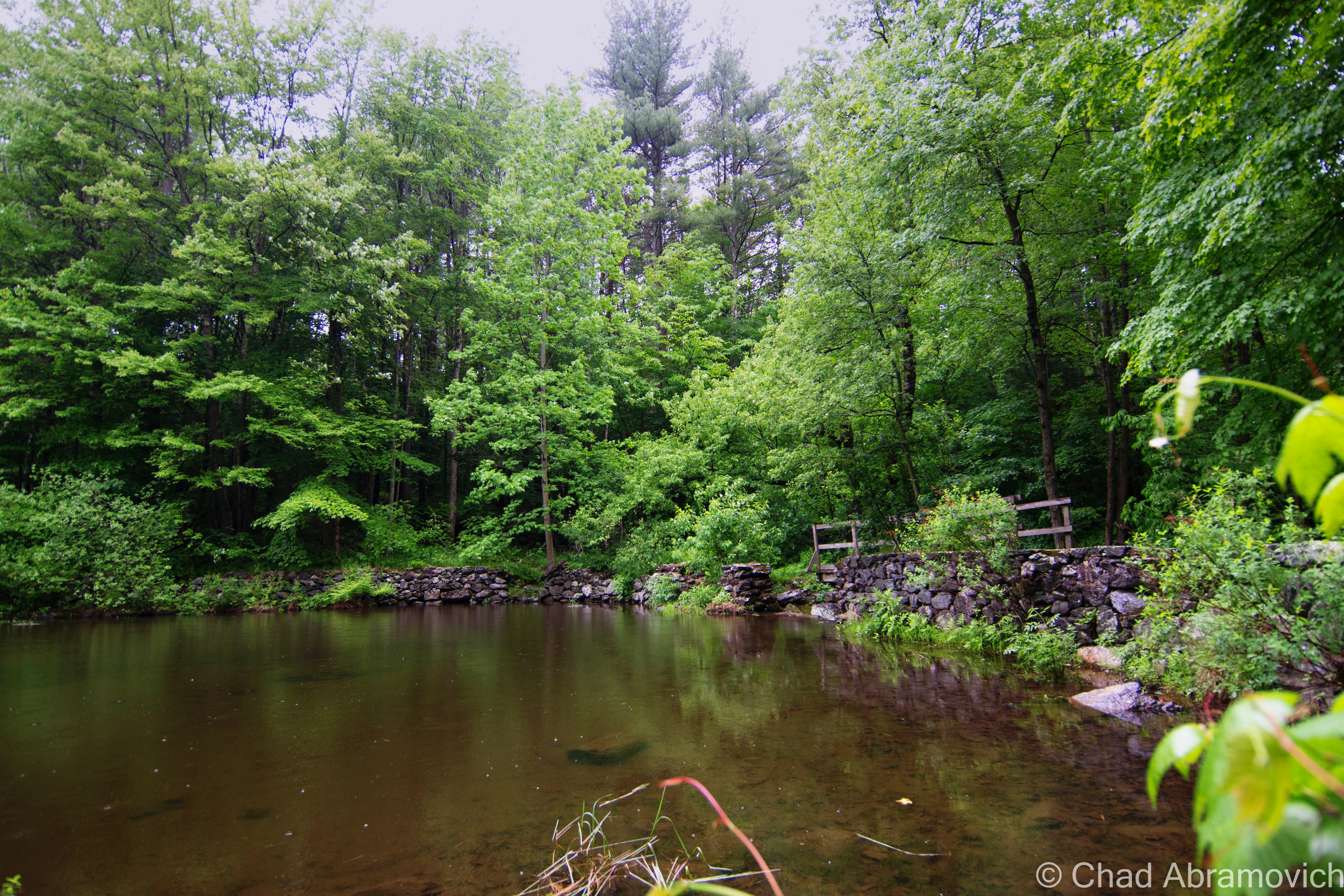
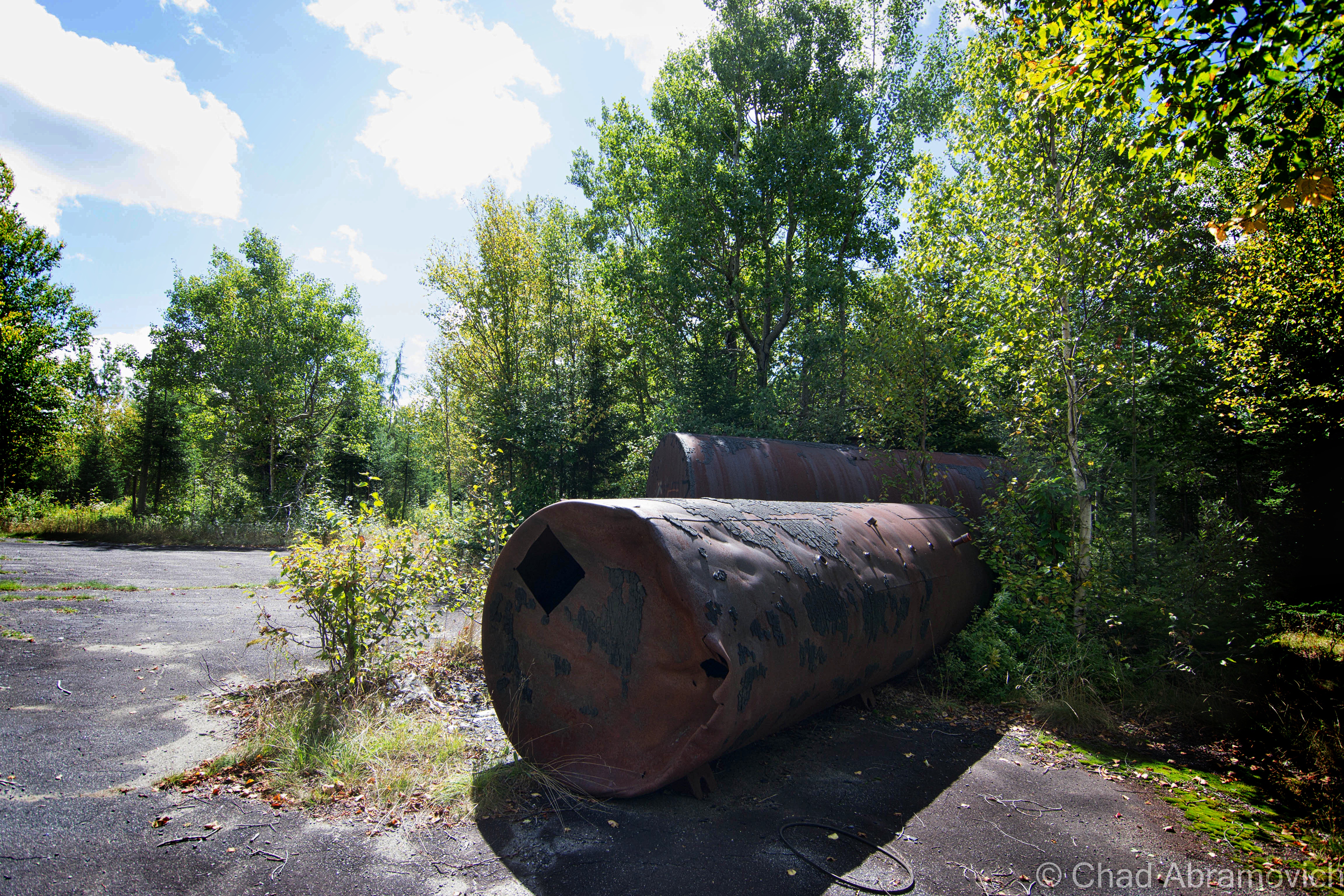
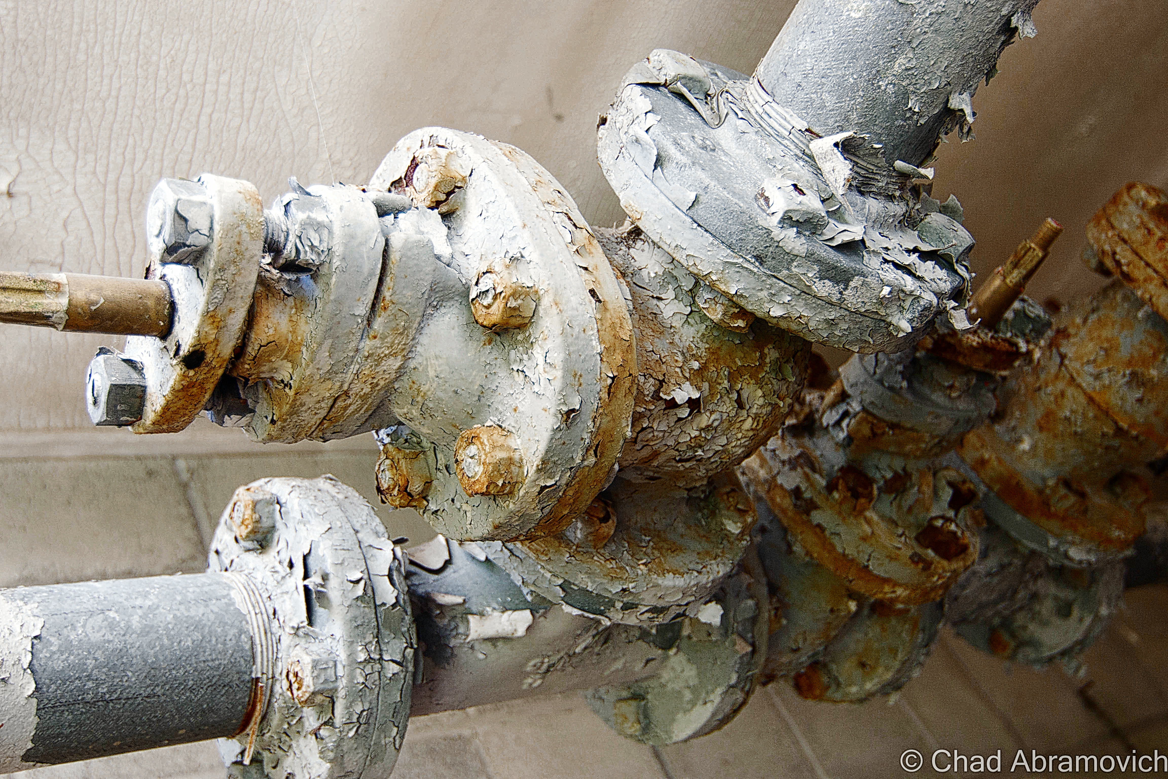
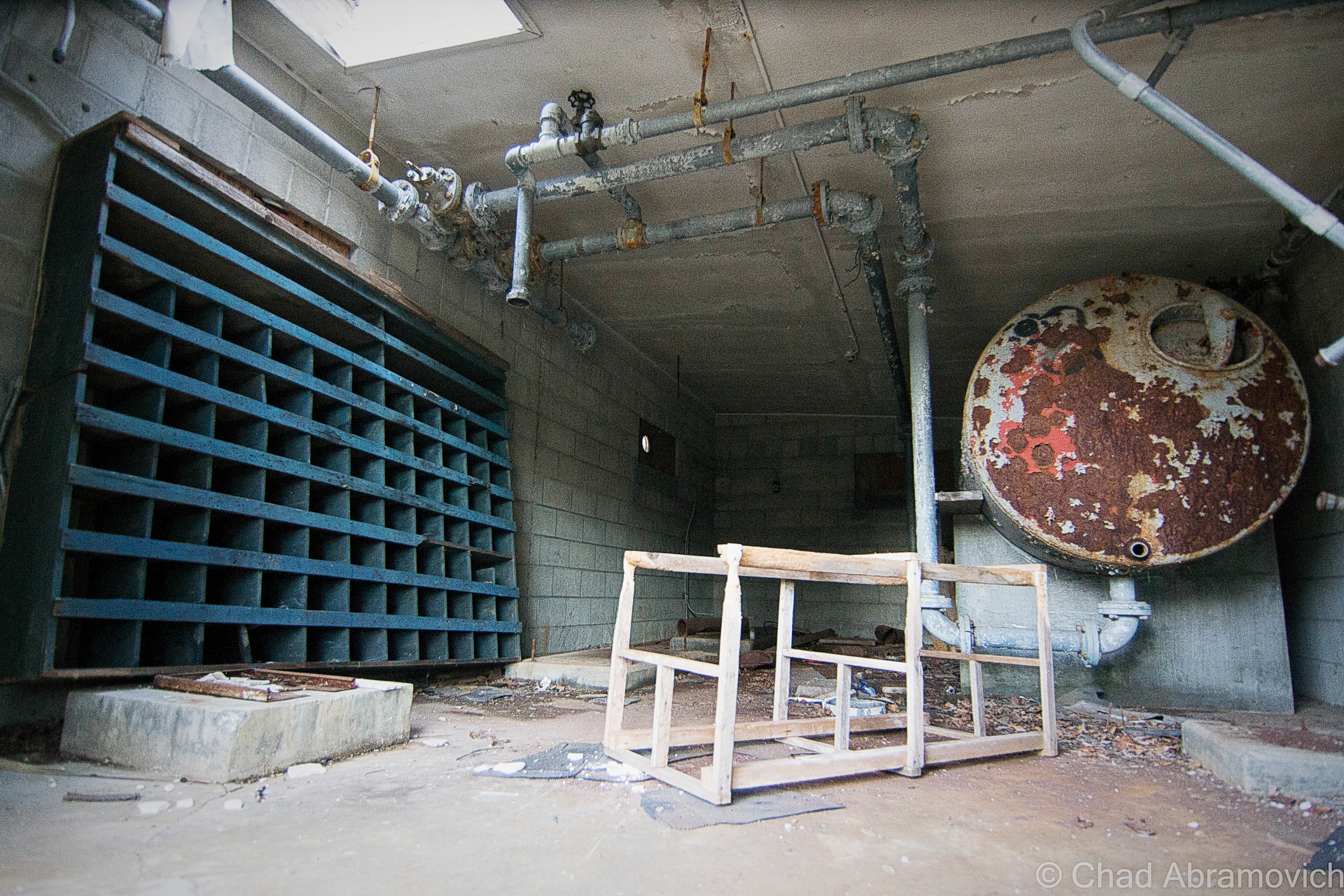
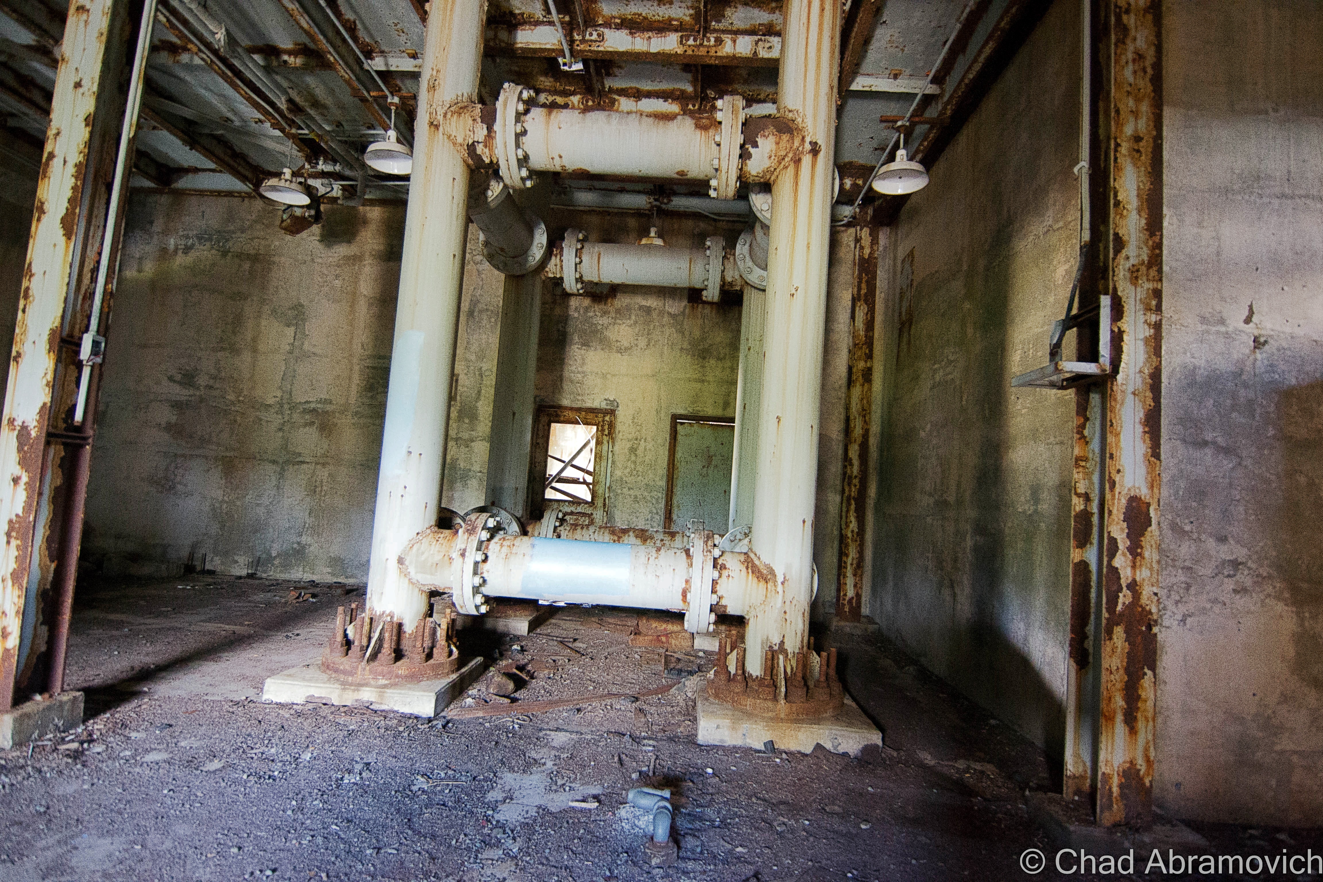
He picked me up in the affor-referenced Zombie Apocalypse Survival Vehicle, and we made a special trek up to the kingdom, to explore the base on the 52nd anniversary of it becoming defunct. He gave me a much more detailed tour of the place, showing me things that I had walked right by or took no notice too. One of my favorites was the collection of old cars that had been junked in a swamp that ringed the administration section. When the base was abandoned, the army trashed the place, heaping their junk and cars into the woods, and dumping lots of excess waste, such as oil and fuel tanks, into the soil. The faint acrid stench of contamination still permeates in the swamps today. Following well packed super highways made by what seem to be countless passing Moose, we were able to find the rusting remains of the vehicles. We also found an old switchboard that once controlled radar and ventilation equipment, switchboards that once served the telephones and their lead cased wires, and several old wells now contaminated with iron that stained the water a stagnant red.

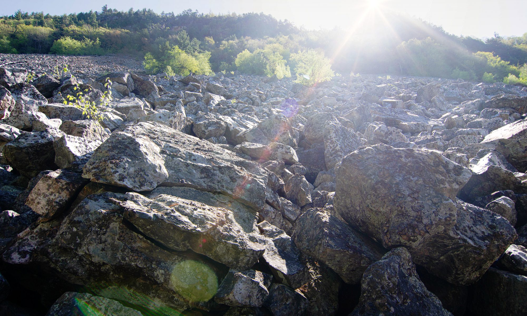
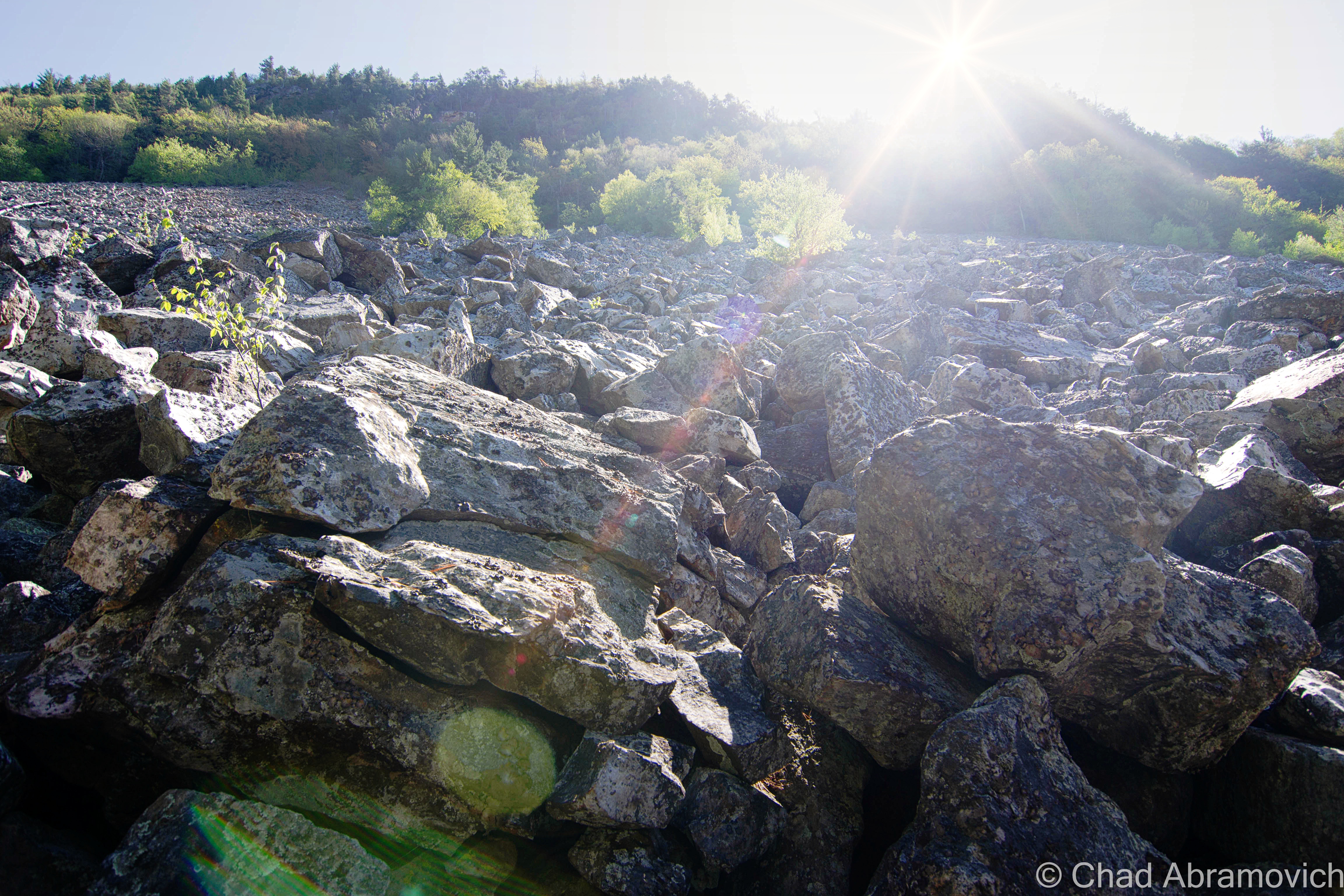
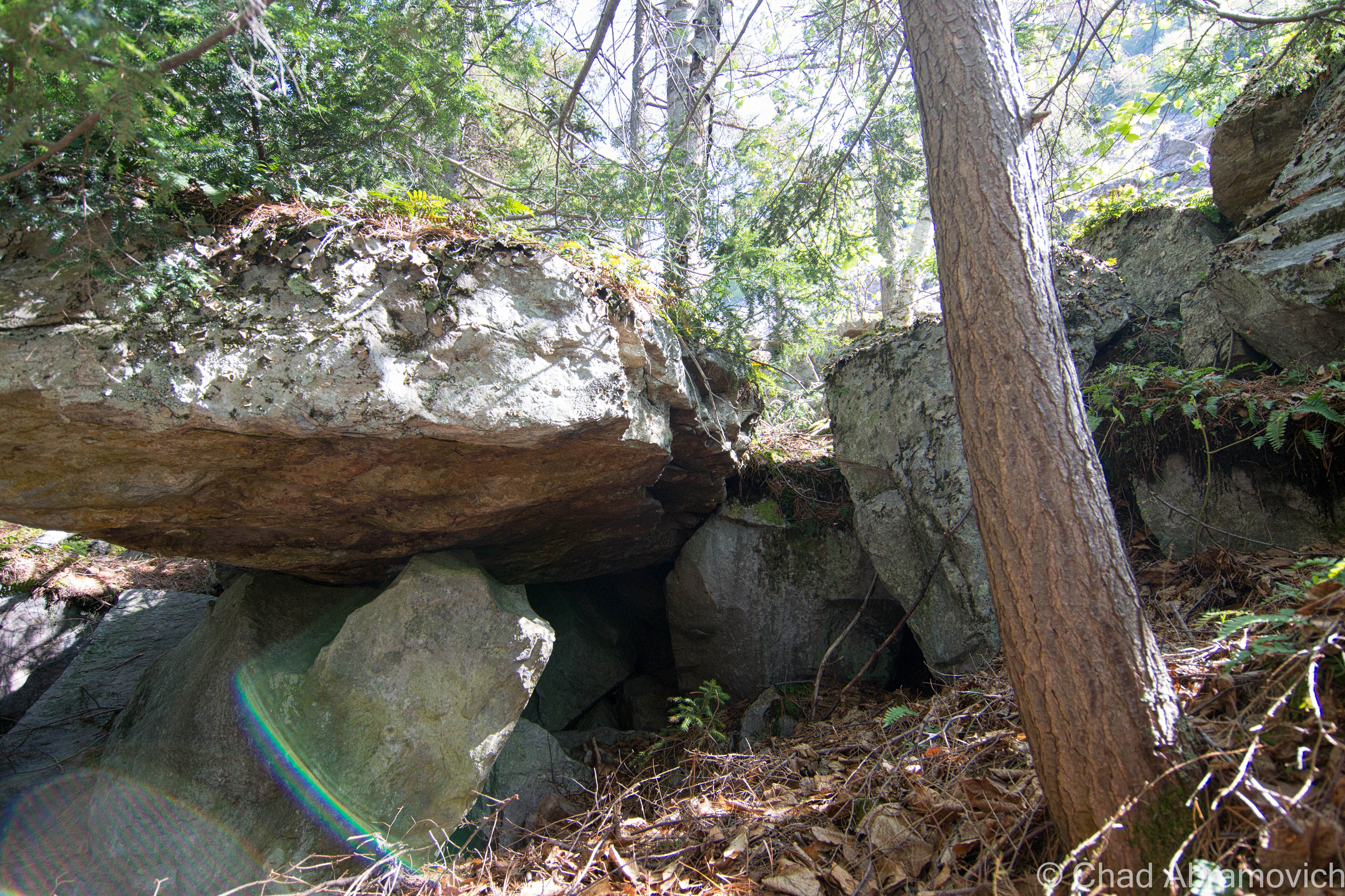
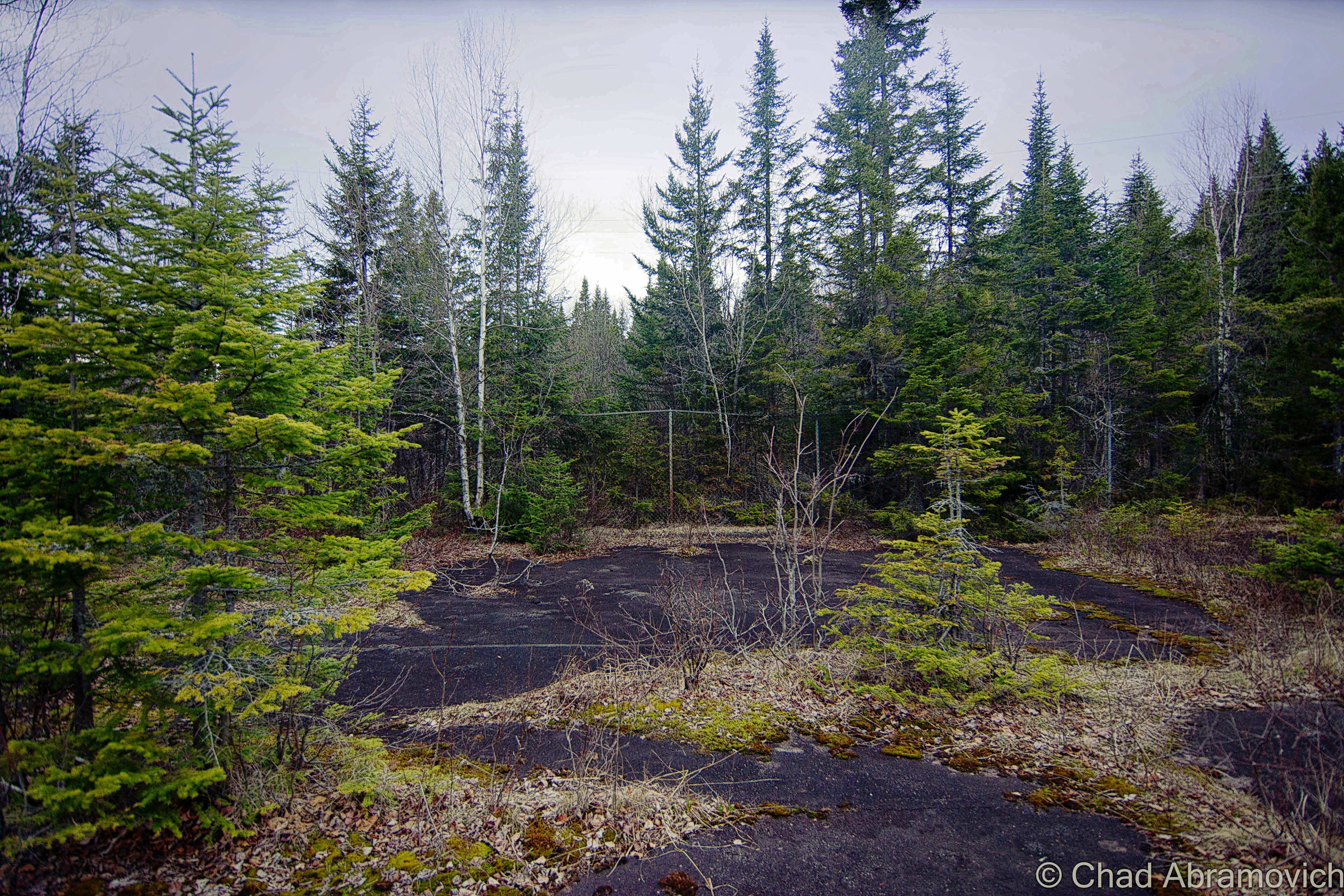
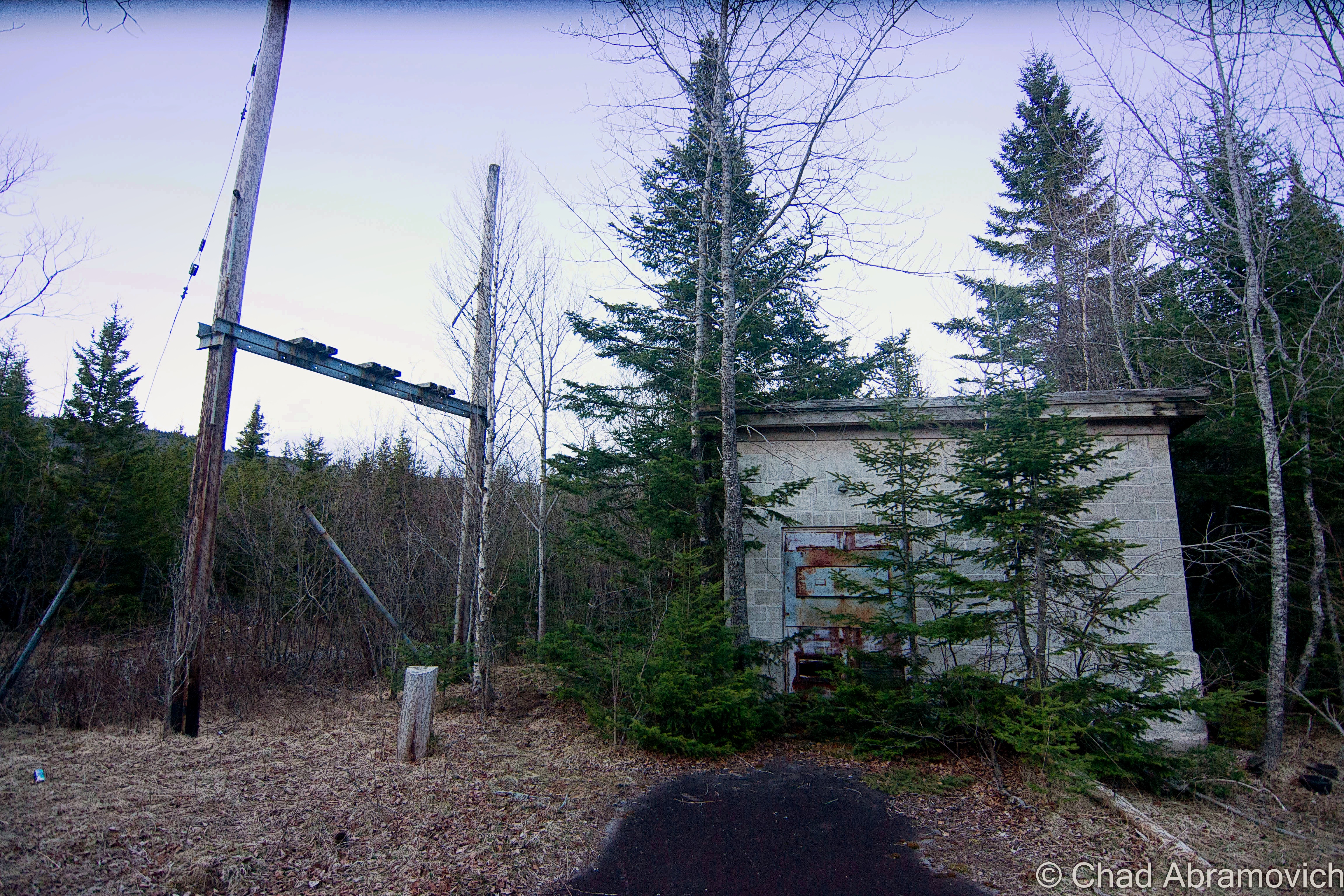
But the most surprising find was what we refer to as “The Boulders”; a very literal moniker we bestowed on a man made road block just beyond the Quonset Huts. Logging equipment was used to dig a trench through the road, and then to drop four gigantic boulders into it, to prevent anyone with a vehicle from driving up the remaining two miles to the radar towers on the summit.

By far the coolest part of the trip was when we were able to get the power running in some of the buildings, after a great deal of rigging and assistance, I heard the eerie yet rewarding sound of a light that hasn’t flickered or hummed in 52 years, come to life. Not a bad way to spend an anniversary.

As it stands as I write this in 2016, the radar base and all visible surrounding property was purchased by a logging company out of Washington State. From what I was told – the company doesn’t plan on being as friendly to recreational land use as the prior landowners were. To get some tax breaks on all those acres of forest, they have to allow some, so they’re focusing on moose hunting permits. But from what I heard, all 4 gates up Radar Road will most likely be closed more than they’re open from now on, so logging and quarrying crews can do their thing without the constant interruptions of over sized trucks with out of state plates coming up the road, which surprisingly carries the traffic volume of a suburban neighborhood than a logging road in the middle of the kingdom. But, only time will tell.

DSC_0882_pe DSC_0883_pe DSC_0885_pe DSC_0887_pe DSC_0888_pe DSC_0889_pe DSC_0892_pe DSC_0895_pe DSC_0896_pe DSC_0906_pe DSC_0908

—————————————————————————————————————————————–

To all of my amazing fans and supporters, I am truly grateful and humbled by all of the support and donations through out the years that have kept Obscure Vermont up and running.

As you all know I spend countless hours researching, writing, and traveling to produce and sustain this blog. Obscure Vermont is funded entirely on generous donations that you the wonderful viewers and supporters have made. Expenses range from internet fees to host the blog, to investing in research materials, to traveling expenses. Also, donations help keep me current with my photography gear, computer, and computer software so that I can deliver the best quality possible.

If you value, appreciate, and enjoy reading about my adventures please consider making a donation to my new Gofundme account or Paypal. Any donation would not only be greatly appreciated and help keep this blog going, it would also keep me doing what I love. Thank you!

Gofundme: https://www.gofundme.com/b5jp97d4

Donate Button with Credit Cards

Milton Mysteries: The Indian Mound

On my quest to discover Vermont curiosities, weirdness and mysteries, I made the mistake of overlooking my former hometown of Milton, a community steeped in stories and legends. But Milton presented a challenge to me. While some lore seemed to be well recited among local residents, the actual stories behind the stories simply weren’t there. Over the past year, I began talking to people, writing down notes and choosing things I wanted to research further in detail. I wanted to bring these great stories to life once again, and through arduous research, I was finally able to fill in some missing pieces. This will be the first in what will hopefully be a few entries on Milton mysteries.

A year ago, I stumbled upon an old photo which fascinated me. The photo depicted a large mound of earth dubbed as “The Indian Mound”, it’s vague description locating it somewhere near the shores of Lake Champlain. Was there an Indian Mound in Milton?

I’ve traveled the many dirt roads of West Milton all my life, but have never seen a geological formation like this before. If there was such a mound, surely it would be of great importance. Why was it so discrete? Do people know of its existence? And, the most heavily weighed question, where was it?

An old photo of an alleged Indian Mound near the shores of Lake Champlain. Photo courtesy of The Milton Historical Society

Speaking with Lorinda Henry from the Milton Historical Society,  she explained that the mystery about the Indian Mound was far greater than the information about it.

After digging through stacks of papers and unlabeled binders at the historical society, I was able to find my first clue; that the mound was located down near Camp Everest in Milton, a hidden area off a series of remote back roads that don’t receive much traffic other than locals, and a name that may very well be lost to many Milton residents today.

A vestige of the days when Milton was a summer tourist destination, Camp Everest was just one of the many large camps that would be built up along the shores of Lake Champlain.

In the mid 1800s, camping in summer cottages and tents would draw people to the shores of Lake Champlain. Milton’s lakeshore was a murderers row of natural beauty, complete with stony beaches, Eagle Mountain’s giant looming rocks, marshlands, and deep forests. Land owners began converting their properties into camps to take advantage of this, and as a result, camps Rich, Martin, Watson, Cold Spring, and Everest would open for business.

Photo: UVM Landscape Change Program
Campers getting ready for a boat excursion on Lake Champlain at Camp Rich in Milton, Early 1900s. Photo: UVM Landscape Change Program

The camps all had farms, providing them with fresh food. Many of them boasted luxuries such as proximity to clear mountain springs, and the availability of fresh cream, eggs, milk and vegetables. The properties also offered many amenities such as recreation halls, lawn sports, fishing excursions and hayrides. Some camps even had handsome hotels built extravagantly and symmetrically, standing above the waters, with classic New England verandas, conical towers, decorative dormers and dramatic features that accentuated different sides of the buildings, almost to a point of tactility. Old advertisements for Camp Watson even boldly claimed that they had “positively no mosquitoes” – although, being quite accustomed to Vermont summers,  I can’t help wonder just how they went around keeping that promise.

A hand drawn map of Milton’s summer camp colonies, and the area town known as Miltonboro. Photo courtesy of The Milton Historical Society.

The area along the lakeshore became known as Miltonboro, which included schoolhouses, a church and meetinghouse which catered to the campers and locals who didn’t want to travel all the way to Milton village. Today, most of Miltonboro has vanished, leaving only a small cemetery ringed by a stone wall, and a name on a map.

LS33343_000_thumb_3
Children at the Miltonboro School, late 1800s. Photo: UVM Landscape Change Program
LS33346_000_thumb_3
Photo: UVM Landscape Change Program

Camp Everest, the southern most of Milton’s lakeshore camps, was established in 1878 by Zebediah Everest and A.W. Austin, and they couldn’t have chosen a more splendid location. Bordered to the south by serpentine marshlands that now make up the Sandbar Wildlife Management Area, and to the north by the dizzying ledges of Eagle Mountain, with a sweeping view of South Hero island and the Adirondacks across the lake. The camp included a camp house, bowling alley and eight cottages, occupied by both family members and renters. It was here at Camp Everest where the alleged mound was located.

Early camps at Camp Everest, in an area called Algonquin Reef. Today, the name is emblazoned on your typical Green street sign.
Early camps at Camp Everest, in an area called Algonquin Reef. Today, the name is emblazoned on your typical Green street sign. Photo: UVM Landscape Change Program

However, the information I read didn’t portray the mound as culturally significant, but rather in a bureaucratic sense – it was simply a piece of property. A camp was built atop the steep hill in 1927 by the Hutchins family, and named “Indian Mound”, perhaps romantically after what the earlier campers viewed the mound to look like. I was able to reach out to Barbara Hutchins, whose family originally owned the camp, and she was kind enough to give me further information.

She explained that the mound itself was probably formed during the glacier age, most likely a remnant of the Saint Lawrence Ice Sheet that once covered this part of North America. UVM did some digs around the mound in the 1950s, and found nothing of Native American significance, but they did find some old sea shells and fossils, evidence of the Champlain Sea,  the tropical sea which covered what is now Vermont millions of years ago.

The Hutchins eventually sold the camp, and lost track of the property. I was able to dig up choppy pieces of information at the historical society – listing the names of various people who leased the camp throughout the years. The dates got sparse after 1970. Eventually, the information just seemed to cease. So, what happened to it? Was it still there?

Lorinda Henry explained that the state of Vermont wanted to hack apart the mound and use it to fill in a nearby swampland in 1948, but further research told me that because the area was prone to flooding, they decided not to, because the amount of dirt they would have gotten from the mound would have most likely been lost within a few years, leading me back to my original question.

The existence of an Indian Mound is also curious, because Vermont was never thought to be associated with mound building Indians. But then again, at one time, it was thought that Native Americans never settled in what is now Vermont. But Milton farmers would constantly find artifacts and arrowheads while clearing and plowing their fields. Arrowheads were also allegedly found when Andrea Lane, a small neighborhood off Route 7, was being constructed years ago. Lorinda Henry explains that because of native traces in the area, there are parts of the neighborhood that can’t even be developed because of archaeological significance. If that myth was debunked, than would the presence of an Indian Mound be that hard to believe?

On a breezy August day this summer, I took the beautiful drive back down towards Camp Everest, with the intention of solving this mystery. The camp is much different from it’s heyday, now a series of private camps, owned by various people. The bowling alley and other amenities have long vanished into history and the creeping forests.

With the hand drawn map featured above in this post as my only reference, I scanned the roadside and across the many meadows bordering the area, but the imposing sight of the Indian Mound was never seen rising above the various clover filled fields or cedar forests near the roadside. I ran into several people, some jogging, others washing their SUVs in their driveways, and they were all happy to talk with me. But sadly, none of them knew about an Indian Mound or a camp of the same name. Some were out of staters and weren’t aware of the area’s history. But then again, a great deal of the area’s history has long vanished over the years.

From the map, I was able to sort of pin point the general location of the mound, but the area is much different than when the picture was taken. I had assumed, the mound might be still existing, now deep in the woods and covered in vegetation. But shortly after publishing this blog entry, I stumbled upon some further information.

Laurie Scott, who is an Everest, explained to me that the mound was eventually purchased by the grandson of the Hutchins family. The Everest’s lease most of the land where the camps sit, but her grandmother, Ethel Everest, sold the mound to them. The mound and the camp are still there, and as I assumed, is now obscured, hiding successfully behind a Vermont forest – an ideal getaway.

A photo of the Indian Mound, Winter 1968. Photo: UVM Landscape Change Program.

An interesting footnote to this story is that while trying to solve the mystery of this “Indian Mound”, Barbara Hutchins recalls that she heard there were a few other professed Indian mounds somewhere in Milton as well, but as for their locations, she doesn’t remember, leaving this intriguing mystery currently ongoing.

—————————————————————————————————————————————–

To all of my amazing fans and supporters, I am truly grateful and humbled by all of the support and donations through out the years that have kept Obscure Vermont up and running.

As you all know I spend countless hours researching, writing, and traveling to produce and sustain this blog. Obscure Vermont is funded entirely on generous donations that you the wonderful viewers and supporters have made. Expenses range from internet fees to host the blog, to investing in research materials, to traveling expenses. Also, donations help keep me current with my photography gear, computer, and computer software so that I can deliver the best quality possible.

If you value, appreciate, and enjoy reading about my adventures please consider making a donation to my new Gofundme account or Paypal. Any donation would not only be greatly appreciated and help keep this blog going, it would also keep me doing what I love. Thank you!

Gofundme: https://www.gofundme.com/b5jp97d4

Donate Button with Credit Cards

Mysteries and Legends Of The Champlain Islands

Though Vermont is the only New England state without a seacoast, we have our fair share of vast waters and attractive islands here. The Champlain Islands – an archipelago stretching from the Canadian Border, encompassing roughly 200 miles of shoreline around a trio of islands and a peninsula, is practically a different world. Accessible only by 3 bridges or a ferry from Cumberland Head, New York, the islands are isolated from the rest of the state, and as a result, are relaxed (though, 21st century stress doesn’t entirely escape) and carry a different attitude.

With the Adirondacks rising dramatically to the west across the lake, and the Green Mountains to the east and the south, the islands are a beautiful place. There’s not much to do, and that’s exactly what I love about this region. Route 2, the main artery, passes through 4 out of 5 towns that make up Grand Isle County, with the only stoplight being on the drawbridge that separates North Hero from Grand Isle. The economy is largely dependent on agriculture and tourism, most often combining the two in agritourism pursuits of farm stands, restaurants, and a few vineyards now days.

Things can coexist up here in the world around it peacefully, and sometimes, even manage to go largely undetected. And those sort of conditions are just ripe for mysteries. The numerous smaller and inaccessible islands that dot the lake are mysteries unto themselves – which are also most commonly private property. It’s easy and fun to speculate what sort of things happen on those remote chunks of rock, and what can be found there.

Carleton’s Prize

One of the most interesting stories I heard comes from off the south west coast of South Hero – a small chunk of rock rising 30 feet from the choppy waters of Lake Champlain, in a large passage between Providence and Stave Islands. One day, I was searching on Google maps, and noticed that this almost insignificantly tiny scrap of land had a rather peculiar name; Carleton’s Prize. Why would a small rock have such a strange name? What exactly is the prize here?

As it turns out, the name can be dated back to the Revolutionary War. Local lore has it that Benedict Arnold escaped around Valcour Island with what remained of his fleet during the battle of Valcour Island– and a dense fog had draped over the lake.  The trailing British fleet, lead by Sir Guy Carleton, were searching for escaping American fleets, but unknown to them, the Americans had slipped by them in the cover of night.

But up ahead, through the fog, they spotted something. A silhouette of what appeared to be a ship. This was their chance. The British bombarded it with cannon fire. However, the smoke from all the black powder obscured their vision even more, and eventually, they couldn’t see a thing. But determined to take down those no good Americans, they kept on firing. An hour later, the cannon fire finally stopped, and they realized that they had wasted several rounds of ammunition on a small rocky outcropping in the lake they had mistaken as a ship.

Since then, somehow and somewhere down the line, the small landmass has been referred to as Carleton’s Prize. Some say that you can still see the scars from cannon fire, and maybe even a cannonball or two on the island’s rocky shore to this day.

This is where the story gets a bit hard to trace. This story apparently isn’t well documented, and not much information exists to actually back this up – apart from a Wikipedia article and a blog entry – but even the blogger was questioning the truth of this interesting legend. So, did this blunder actually happen? I suppose we can only speculate. As far as I know, no one has came back with a cannonball yet.

Though the story of Carleton’s Prize is intriguing, the island’s original name is far more mystical. In the book, In Search of New England’s Native Past, author Gordon Day tells us the Abenaki knew this small rock as odzihózoiskwá, or “Odzihozo’s wife”. But who or what is Odzihozo?

Odzihozo, “the transformer”, was the supernatural being who created Lake Champlain, the mountains and all the lands that made up their homeland.

According to the legend, Odzihozo was an impatient deity, and before he was even completely formed with a head, legs and arms, he set out to change the earth. His last creation was Lake Champlain, which he considered his masterpiece – and he was incredibly happy with it. So happy in fact, that he climbed onto a rock in Burlington Bay and turned himself to stone so he could watch and be near the lake for the rest of eternity. The rock still resides in Burlington Bay, and is known to boaters as Rock Dunder – several miles away from his wife. It was said that the local Abenaki would bring offerings of tobacco to the rock as late as the 1940s.

travel tip: near White’s Beach, make sure to check out the alluring bird house forest and keep an eye out for the miniature Barber castles scattered around the island.

Carleton's Prize - the small bump in between the 2 islands.
Carleton’s Prize – the small bump in between Stave Island (home to one of the few fire towers on Lake Champlain) and larger Providence Island (where one of Vermont’s only malevolent ghosts is said to haunt the bedroom of a lake house – the very room he strangled his wife to death in decades ago…)
Carleton's Prize from White's Beach in South Hero
Carleton’s Prize from White’s Beach in South Hero

Isle La Motte’s Prehistoric Treasure

Isle La Motte has such a different vibe from its other island neighbors, or from the rest of Vermont for that matter. It’s the smallest, most rural, and the most mysterious (in my humble opinion) of Vermont’s Champlain Islands.

It’s the first spot in Vermont that Europeans set actual foot on, when French explorer Samuel De Champlain docked and camped here in 1609. The island is also home to Saint Anne’s Shrine, built atop the original and short lived French settlement. A friend of mine said that a relative of his was allegedly a renown miracle worker at the shrine back in the early 1900s, but to my disappointment, the miracles he might have performed were never penned down in the family history.

Isle La Motte is also the only Grand Isle County town to not be accessible via Route 2, which imparts the island a noticeably quieter, downlevel atmosphere that makes this remarkable oddity find pretty compatible.  

The entire southern third of the tiny island is made up of what experts consider the oldest fossilized coral reef in the world – at some 480 million years old!

This spectacular natural resource pokes through cedar woods and fields thick with wildflowers in contoured rocky outcroppings. It’s both baffling and awe-inspiring – you’d never think you’d find something like this up in the far, occasionally frozen northwestern corner of the state.

But why would a fossil reef be up in Isle La Motte?

This is a state mystery that is actually easy to solve. In the farther reaches of Vermont’s past, some 480 million years ago, the land that is now the green mountain state was under the waters of a tropical sea near where Zimbabwe is. Officially dubbed the Chazy Reef, it once stretched from an area covering Quebec to Tennessee.

But over the millennia, volcanoes, earthquakes, the pull of the tides and other natural phenomena did some terraforming and shifted the earth’s crust. Limestone eventually began to form and preserved a petrified snapshot of pre-Paleozoic life.

With this incredible natural wonder being in my home state, I figured I couldn’t say I was a bonafide Vermont enthusiast unless I drove up to see it for myself, and on a soft summer day, I found myself tracking down the Goodsell Ridge Preserve, where the best-preserved chunk of the reef is.

I was immediately taken by the tranquility of the place. It was a timeless vantage point, which can be said about the entire town of Isle La Motte. And yet, if there weren’t signs to hint at what you were looking at – you might not even know you were walking around such a magnificent treasure.

Scientists from all over venture to Vermont to study its coral reef – trying to connect the dots of this primitive instruction manual left by mother nature.

It’s even more intriguing to think about how many sites in the region possibly contain some of these fragile fossils in their stonework. It’s said that their organic shapes can be spotted in the ruins of Fort Blunder, and someone else wrote to me declaring they think they spotted some in a railroad stone block retaining wall on the Burlington waterfront.

Perhaps the real mystery is why the best-preserved piece of the reef is in Isle La Motte. That still remains to be explained.

DSC_0061_pe DSC_0069_pe DSC_0075_pe DSC_0081_pe DSC_0088_pe DSC_0097_pe

A Pink Lighthouse

To some, the idea of a traditional lighthouse seems out of place in tiny landlocked Vermont. But Lake Champlain’s 587 miles of shoreline is home to 12 lighthouses, 6 of them belonging to The Green Mountain State.

At a total of 120 miles long and 12 miles across at its widest point, Lake Champlain is the 6th largest freshwater lake in the United States – and even had a short distinction as being the 6th great lake, before complaints from the other 5 revoked the title, but we think it’s still pretty great.

Often dubbed as “New England’s West Coast”,  the lake was a vital part of the settlement of the region and has been inseparable from local history.  In 1819, the Champlain Canal was completed, connecting the lake to the Hudson River and eventually New York City. This would change the culture of the lake as it was propelled into a transportation route for trade and tourism. Burlington became the largest port on Lake Champlain, and the third largest lumber port in North America. With this much travel on the lake, lighthouses were needed to make sure travel could be made safely from one end to the other. And with a series of dangerous reefs and no less than 70 islands scattered throughout the lake, these lighthouses played important parts to keeping the lake running efficiently.

In 1819, the Champlain Canal was completed, connecting the lake to the Hudson River and eventually New York City. This would change the culture of the lake as it was propelled into a transportation route for trade and tourism. Burlington became the largest port on Lake Champlain, and the third largest lumber port in North America. The waterfront was transformed into a bustling and chaotic shoreline of mills, factories and no shortage of cargo ships and passenger steam liners. With this much travel on the lake, lighthouses were needed to make sure travel could be made safely from one end to the other. And with a series of dangerous reefs and no less than 70 islands scattered throughout the lake, these lighthouses played important parts to keeping the lake running efficiently.

Today, the lake is a different place then it was 200 years ago. Heavy ship travel have been replaced by personal recreation boats and a few ferries carrying people across the lake. Interstates 87 and 89 run along both sides of the lake, and have became the main routes of travel between Canada and the United States, leaving the lighthouses unnecessary. Now, these vestiges of the past have slowly been forgotten as the lake tides carry their memories into the mists. However, they are still surviving, finding new lives as private estates or cultural showpieces. Some are landmarks, and others have made large efforts to camouflage them from public knowledge, an irony to their original purpose.

The lighthouses of the lake have always been a curious subject for me. I’ve spent summers traveling around the shorelines and seeing countless summer camps, McMansions and beaches, but a lighthouse is a rare, almost unseemly. But as it just so happens, one of the 6 lights in Vermont rests on Isle La Motte, and unlike most, you can sort of catch a glimpse of it.

The realization of the need for a light on Isle La Motte started humbly in 1829 with some good old-fashioned Yankee ingenuity; by hanging a lantern light on a tree branch on the Northwestern tip of the island, to help mariners navigate their way around the island and through the channel.

In 1856, the U.S. government purchased the land around the point for $50. The first attempt at a real structure was made in the form of a pyramid-shaped limestone tower that would hold the lantern.  However, the lantern would always blow out on stormy nights, and eventually, the need of an actual lighthouse became evident, and in 1881, the first permanent lighthouse was finally constructed on Isle La Motte.

A twenty-five-foot tower made of curved cast-iron plates was constructed. Originally painted bright red, the tower features many attentions to detail, such as an Italianate cast railing, arched windows, and molded cornices. Over time, it has faded to a light pink.

During the 1930s, in a cost-saving measure, lighthouses began to be replaced with automated steel skeletal towers. The Isle La Motte light was replaced in 1933. But in 2001, the Coast Guard determined it would be cheaper to bring back the original lighthouse rather than replace the deteriorating steel tower and on October 5, 2002, the lighthouse was once again functional.

A reminder from the locals that they would prefer you not drive down aptly named Light House Point Road - it's a private road.
A reminder from the locals that they would prefer you not drive down aptly named Light House Point Road – it’s a private road, and the lighthouse is private property.
Isle La Motte's Lighthouse, as seen from North Point Road - the best place to get a good view of it, unless you have a boat or a kayak.
Isle La Motte’s Lighthouse, as seen from North Point Road – the best place to get a good view of it, unless you have a boat or a kayak.

DSC_0590

Cloak Island

Off of Isle La Motte’s south-east coast is a small island with a weird name; Cloak Island. Why would you name an island, Cloak Island? In Tara Liloia’s book Champlain Islands, the name behind the interesting moniker is revealed.

According to a re-printed 1857 era map of Lake Champlain and the islands, the tiny island was originally known as Hill’s Island, or Hill Island, most likely named after the owners, as most Lake Champlain islands are. So what’s with the name change?

As the story goes, a domestic quarrel in the 1770s boiled over, when Eleanor Fisk got sick of her husband’s angry tempers. She hitched up her team of horses and set out across the frozen lake towards Alburgh, but never made it. Later, her red cloak was found along the bushes and rocks of the island, which would forever be known as Cloak.

But there is another variation of the story. After Eleanor Fisk went missing, concerned townsfolk suspected she had drowned but needed proof. So, they gathered down near the lake and dropped her red cloak into the water. An old Yankee superstition dictated that to find the body of a drowned victim, all you had to do was drop a cloak belonging to the missing woman in the water and it will come to rest above the body. The cloak eventually found its way over to the island and got tangled on the beach, thus giving Isle La Motte’s tiny neighbor its name.

Noisy Beach

But perhaps my favorite abnormality is a tale of a beach, ‘somewhere’ on Lake Champlain, that is said to be made of sand with a remarkable idiosyncrasy. It’s said that if you fill up 2 bags with sand and clap them together, it makes ‘dog noises’. Not surprisingly, I haven’t been able to track down this marvelous beach or find anything further about this strange anecdote.

Cloak Island
Cloak Island

—————————————————————————————————————————————–

To all of my fans and supporters, I am truly grateful and humbled by all of the support and donations through out the years that have kept Obscure Vermont up and running.

As you all know I spend countless hours researching, writing, and traveling to produce and sustain this blog. Obscure Vermont is funded entirely on generous donations that you the wonderful viewers and supporters have made. Expenses range from internet fees to host the blog, to investing in research materials, to traveling expenses. Also, donations help keep me current with my photography gear, computer, and computer software so that I can deliver the best quality possible.

If you value, appreciate, and enjoy reading about my adventures please consider making a donation to my new Gofundme account or Paypal. Any donation would not only be greatly appreciated and help keep this blog going, it would also keep me doing what I love. Thank you!

Gofundme: https://www.gofundme.com/b5jp97d4

Donate Button with Credit Cards

Black Gold in the Green Mountain State

On a recent cruise along the back roads of St. Albans town, I came across something peculiar among the sprawling pastures and humble farmhouses. Heading down the dips and rises of Lower Newton Street, the strange object could be seen a long distance away from it’s location, towering above the forests and silos of farm country, and it stuck out. Pulling over to get a better look at this curiosity, my first thought was, “it looks like an oil derrick “. But I stopped. The idea of an oil derrick in Vermont seemed out of place, especially today. So, was this rusting tower, slightly leaning over an entanglement of field grass, in fact an oil well? When I arrived home, coffee mug sitting nearby, I took to the internet, and found what seems to be a lost, yet briefly fascinating era of Vermont history.

Vermont has a rich history of treasure seeking it seems. From the annoyingly mysterious Captain Mallett supposedly burying his gold chest near Coats Island on Malletts Bay, Spanish prospectors finding silver deep within our granite mountains, or the suspected Celtic copper seekers and the strange stone domes left behind from their visits.

The northwest part of the state can also join the ranks of treasure booms, and like many tales, it took a matter of digging deeper to uncover it.

The strangeness started with the Bellrose family of Swanton. Lawrence Bellrose had just dug a 650 foot well, and successfully struck water, which he had then hooked up to the plumbing of their house. Shortly after, a fuse blew out in the cellar, followed by a strange hissing noise. Mr. Bellrose descended the stairs to investigate the damage but was taken by that foreign sound. He struck a match for light, and the room lit up with a fireball.

But this apparently wasn’t an isolated incident, as other Vermonters from around the region have also had similarly bizarre encounters in their own homes.

Highgate Center well digger Lyman Feely was drilling a well in South Alburgh. He had reached 465 feet and hit an abundant water source, which provided 60 gallons a minute. One of his men had light a small fire nearby to keep his hands warm – and when the drill hit water, there was a large explosion which tore through his rig and and badly injured two of his men. After the explosion, Feely found that the well was filled with bubbling gas and floating rock.

Kitchen faucets at Robert Carpenter’s farm in nearby Alburgh blazed like torches, which some people might consider to be attributed to a rare phenomena called fire water. What was going on here?

In St. Albans, a similar event unfolded, but this time, something was different. After a farmer near the Yandow farm accidentally set his entire field ablaze, they noticed that most of the flame quickly went out, but a small crevice continued to burn, which was the key to this seemingly nonsensical phenomena. This wasn’t something supernatural – this was just the opposite and very much natural. They had discovered natural gas deposits in Northern Vermont.

Though this might have came to a shock for some people, as early as the 1950s,  The American Gas Association had mapped and studied the Lake Champlain valley and claimed that the region would be a valuable source for natural gas and oil in the future. And it seemed to be true. Robert Carpenter recalled that a lot of neighboring wells dug in Grand Isle County would often be found to be filled with natural gas.

Nothing was really ever acted upon, until St. Albans businessman Douglass Kelley became interested, and launched Vermont’s first oil boom. Because natural gas is often discovered before oil, Kelley assumed he was sitting on top of a black gold mine.

Kelley banded together a group of like minded associates, and started the now defunct Maquam Gas and Oil Company. On April 19th, 1957, Isadore Yandow’s St. Albans farm became the first place in Vermont to be drilled for oil. Soon, neighboring landowners were swayed by dreams of becoming rich and the rest of the state dreamed of the prosperity that the oil boom had brought other places in the country. Kelley even brought school buses full of children and tourists out to rural St. Albans to see the rig. Everyone seemed to be interested.

But after months of drilling to a depth of 4,500 feet, labor teams working intensely around the clock, and striking rocks, methane, water and everything but oil, operations finally stopped and the prospects were abandoned. Because Vermont was new to the oil culture, maybe they didn’t realize that often only one out of several wells that would be constructed would ever actually strike oil – and Kelley only financed and constructed a single well.

But the seeds were already planted, and a few years later, two more wells were financed and constructed in Malletts Bay, but after reaching 10,000 feet, they ran out of money and left empty handed as well.

Rutland resident and geologist Earle Taylor wasn’t so quick to abandon the dream. He also figured if they found natural gas deposits, then oil would surely follow. Taylor contacted Rutland attorney James Abatiell, and with 24 other Vermonters, formed the Cambrian Corporation, and Taylor’s expertise proved to be as “good as gold”.  He did a large scale geological survey of Vermont, costing well over $100,000, and the results were promising.

Between 1962 and 1963, Cambrian persuaded Belgian oil company Petrofina to come to Vermont and run an operation on a parcel of farmland in Alburgh. From the accounts of the operation, things were looking good – the company had drilled to a depth of over a mile with a tower 160 feet high.  This was also the first dig in Vermont to use rotary equipment – and extensive further studies were conducted as the beginning cuts were made. They even went as far as doing sonic and gamma-ray tests on the topography. It seems this was incredibly and painstakingly well researched and meticulously planned. The crew was said to have kept saying “It’s looking good, it’s looking good!” the entire time. But something happened. They just stopped, left, and gave no explanation. To this day, that remains a mystery. And just like that, Vermont’s first and only oil boom came to an end with little commotion.

Today, almost no visible evidence remains of this short lived time in Vermont history, except for that single abandoned derrick in rural St. Albans, rusting at the edge of a sprawling cornfield. The wooden blocks at the base of the derrick have rotted away long ago, slowly making the derrick tip to about 30 degrees, eventually coming to rest on the well head.

I can’t help but wonder, if someone were to pick up where Kelley left off, would they find a rich supply of Vermont oil just feet before the cutoff point?


If you’re curious, the Vermont Geological Society has a map with all of the former oil drilling operations in the Northwest part of the state – and you can view that here.

Additional Links:

Oil and Gas in Vermont: A collection of oil and gas articles and information dating from the 1950s to 1989

A History of Oil and Gas in Vermont, The Addison Eagle

Vermont Crude“, Green Mountains Dark Tales by Joseph Citro

On Vermont’s Great Oil Boom, Lance Khouri, Vermont Life Spring 1977

—————————————————————————————————————————————–

To all of my amazing fans and supporters, I am truly grateful and humbled by all of the support and donations through out the years that have kept Obscure Vermont up and running.

As you all know I spend countless hours researching, writing, and traveling to produce and sustain this blog. Obscure Vermont is funded entirely on generous donations that you the wonderful viewers and supporters have made. Expenses range from internet fees to host the blog, to investing in research materials, to traveling expenses. Also, donations help keep me current with my photography gear, computer, and computer software so that I can deliver the best quality possible.

If you value, appreciate, and enjoy reading about my adventures please consider making a donation to my new Gofundme account or Paypal. Any donation would not only be greatly appreciated and help keep this blog going, it would also keep me doing what I love. Thank you!

Gofundme: https://www.gofundme.com/b5jp97d4

Donate Button with Credit Cards

Ghost Hollow

West Haven’s Ghost Hollow is the only geographical location in the state named after a paranormal occurrence. Well, as far as I know.

The name is sure to fire up the imaginations of any curious traveler or map gazer. The tiny town of West Haven is on the extreme southern tip of Lake Champlain, where the lake joins the Poultney River. Surrounded almost completely by water on most sides, the town forms an awkward looking peninsula that dangles into New York State. There are no state routes or highways passing through town (with the exception of Route 22A clipping a tiny portion on the eastern border, near landmark Devil’s Bowl Speedway), West Haven is isolated from the rest of Vermont – a land of rolling farmland and hardwood forests, rising above deep bays and winding rivers of brown water.

Among West Haven’s assortment of quiet byways is a narrow and winding dirt road, barely wide enough for 2 cars, passing through quiet pastures and rocky ledges, called Ghost Hollow Road. But why the interesting moniker?

The story is an old one, dating back to the days before established roads and railroads linked Vermont together, Lake Champlain was the main highway between Canada and New York City. Rough communities sprung up around the water, building landing areas for boats. Once on land in West Haven, a long narrow rutted road spurred away from the wharf and into a wooded hollow, where even on sunny days, it was said to be dark.

It was on this unwelcoming path that a young man found himself sprinting upon one night over 2 centuries ago. He frantically made his way through the dark and cold woods to see his wife, who was in labor. Back in those days, the chances of surviving childbirth were poor, especially in rural locations where often the only ones to aid you were neighbors and friends, who were likely inexperienced with delivering a baby.

As the young man was racing ahead through the woods, he noticed something ahead. It was a figure, and it was approaching him. As he slowed down to assess the situation, he realized he was staring at a radiant young woman, dressed in the moonlight and paler than bone, in a white gown. A sudden realization gripped him as he grew closer. The woman in white was his wife! Almost immediately, he began to panic. As he raced over towards her, about to ask her what she was doing out of bed in a time like this, she vanished.

The young man’s curiosity and concern now turned into terror, and as he raced back home and stumbled in the front door, he was confronted by what he dreaded most, his wife had died in childbirth. The last time he ever saw his wife was that encounter in the hollow.

Ever since then, the area has been known as Ghost Hollow. Ghost Hollow Road itself is nothing like the legend alludes to. Today, there is nothing ghostly about it. It’s a pleasant back road that menders through beautiful countryside and hay fields with grass that undulates under summer breezes. It’s a quiet place, where all you can hear is the gravel crunching underneath your tires.

I was told that the street sign for Ghost Hollow Road was stolen so many times (it may possibly be found in some teenager’s bedroom) that the town of West Haven decided to create a solution, by printing the name of the road on a giant boulder near the intersection. I’d like to see someone try to steal that.

DSC_0451_peDSC_0456_peDSC_0460_peDSC_0462_peDSC_0464_pe


—————————————————————————————————————————————–

To all of my amazing fans and supporters, I am truly grateful and humbled by all of the support and donations through out the years that have kept Obscure Vermont up and running.

As you all know I spend countless hours researching, writing, and traveling to produce and sustain this blog. Obscure Vermont is funded entirely on generous donations that you the wonderful viewers and supporters have made. Expenses range from internet fees to host the blog, to investing in research materials, to traveling expenses. Also, donations help keep me current with my photography gear, computer, and computer software so that I can deliver the best quality possible.

If you value, appreciate, and enjoy reading about my adventures please consider making a donation to my new Gofundme account or Paypal. Any donation would not only be greatly appreciated and help keep this blog going, it would also keep me doing what I love. Thank you!

Gofundme: https://www.gofundme.com/b5jp97d4

Donate Button with Credit Cards


Mount Abraham; The Protectors Of The Gap And A Plane Wreck

Every story has to start somewhere, and in the case of Mount Abraham, which rises over the eastern edge of Addison County, it has compacted and intertwined layers of history and folklore that make up a layer of bedrock that can’t be studied by geologists.

Mount Abraham is the fifth largest peak in the state of Vermont, rising at a lofty 4,017 feet. It’s crossed by Vermont’s fabled Long Trail, and is the tallest peak in Vermont’s presidential range, a range within the Green Mountains.

At the mountain’s base is the small town of Lincoln, a gateway to the Green Mountain National Forest. From the back roads that mender along the narrow valleys, the mountains form an imposing wall that almost look impenetrable, as the hardwood forests slide into the evergreens as your eye travels up towards the ridge lines. It almost may come as a surprise to some when Lincoln Gap Road becomes steeper and steeper as it switchbacks up sheer ledges and stunted hardwood trees before finally going up and over Lincoln Gap, a steep and wild mountain pass at 2,424 feet – making it the highest gap road in Vermont. The road is narrow and considered so steep that many Vermonters consider it one of the most difficult drives in the state, and for that reason alone, it’s closed in the winter. In the summer, it’s common for you to find the already unnerving road clogged with parked cars and hikers.

The Lincoln Gap Road, from the Lincoln approach.

I love Lincoln Gap, it’s a real beauty. I love all of Vermont’s mountain passes, called gaps or “notches” here. For someone who loves road tripping and discovering as much of Vermont as I can, these clefts in the mountains offer great drives, scenery, and outdoor recreation opportunities. There’s just something so satisfying about driving over a mountain, for some reason. In the winter, the gap is a magnet for adventurous people who like to fly down a mountain on sleds, skis or snowboards – with a 1,000 foot drop achieved in about a mile on the Lincoln Gap Road.

But long before a road ran up over the gap and Vermont was an established state, this land was occupied and settled by another group of people, The Abenaki.

The Abenaki generally settled in the fertile lowlands of the Champlain Valley, where the rivers and lake provided excellent fishing and the rolling hills and their deep forests offered reliable hunting. They generally avoided going up into the mountains, not because of curses, but because they were sacred places, where their god, Gluskabe, lived, which translates interestingly into the title of “The Owner”.

Cuts in the mountains such as Lincoln Gap were used to travel means, routes linking hunting parties with the Mad River Valley to the east and The Champlain Valley to the west. But when the White Europeans came down Lake Champlain and eventually streamed into the valleys and built settlements, the Abenaki were eventually pushed off their land. Some assimilated into the new culture and adopted Christianity as their religion, while others sought refuge in the higher elevations, including places like Lincoln Gap, which were seemingly safe in that impenetrable Green Mountain wall. What I found very interesting was to learn that as late as 1940, Abenaki long house villages could still be found along the Addison County shore of Lake Champlain, before becoming a part of something largely forgotten.

Today, the Abenaki have held on and survived, and can be found living around Vermont, especially in the north west corner near Canada. But some people say that the ghosts of an Abenaki party have remained, skulking behind the trees and outcroppings of Lincoln Gap. Also known as “the protectors of the Gap”, these presences occasionally make their existence known. The smell of burning wood from campfires has sent hikers off the trails to investigate the source of the smell, only to find nothing. Some have reported that the scent of the fire changed directions when the wind changed.  Others shrugged it off as someone burning down in the valley, but did admit to them thinking that the fire sure seemed like it was close by. Other hikers have reported seeing eyes staring at them through the woods and fleeting shadows moving at inhuman speeds along the trails, but never getting too close.  Not much is known about this ghostly hunting party, but they’ve been written about in quite a few publications on Vermont ghosts and folklore. One theory is that they are trying to forever protect the wilderness of Lincoln Gap, one of Vermont’s last wild places.

Twisted Shrapnel and Sweeping Views

Somewhere below the wind swept summit of Mount Abraham lies another interesting part of the mountain’s history – the battered remains of a plane wreck, rotting below scented Spruces.

The story behind this interesting wreckage is rather uncomplicated. The plane is a Cessna 182N model, and it crashed on June 28th, 1973 when a pilot was trying to navigate a cloud bank and instead struck the slopes of Mount Abraham, just below the 4,000 foot mark. The pilot survived the crash. According to local lore, he climbed out of the plane and walked down the mountain. Not much is left of the wreck, apart from crumbled pieces of twisted metal. Most of the cockpit, the controls and the interior have been completely deteriorated. The engine is missing as well, possibly hurled further down the slopes, resting somewhere in deep scraggly forests not treaded in by humans in years. The fuselage may have been the most interesting thing about the wreck – completely carved with various graffiti of countless passersby who have all left their mark here. Thought the wreck might be a little underwhelming, it’s what the wreck isn’t that is the most fascinating. A representation of the ongoing story of man’s battle with nature, and the will to survive.

The mountains of Vermont are scattered with various plane wrecks, most people can recall the most famous one being on Camels Hump, but there are plenty others worth the adventure, all offering stories to tell to someone other than the mountain winds.

DSC_0815_pe DSC_0814_pe DSC_0823_pe DSC_0822_pe DSC_0820_pe DSC_0827_peDSC_0829_pe

Another interesting sight, the carved walls of Mount Abraham's Battel Shelter, located on the Long Trail just south of the summit.
Another interesting sight, the carved walls of Mount Abraham’s Battel Shelter, located on the Long Trail just south of the summit.

—————————————————————————————————————————————–

To all of my amazing fans and supporters, I am truly grateful and humbled by all of the support and donations through out the years that have kept Obscure Vermont up and running.

As you all know I spend countless hours researching, writing, and traveling to produce and sustain this blog. Obscure Vermont is funded entirely on generous donations that you the wonderful viewers and supporters have made. Expenses range from internet fees to host the blog, to investing in research materials, to traveling expenses. Also, donations help keep me current with my photography gear, computer, and computer software so that I can deliver the best quality possible.

If you value, appreciate, and enjoy reading about my adventures please consider making a donation to my new Gofundme account or Paypal. Any donation would not only be greatly appreciated and help keep this blog going, it would also keep me doing what I love. Thank you!

Gofundme: https://www.gofundme.com/b5jp97d4

Donate Button with Credit Cards

Madame Sherri’s Castle Ruins

One thing about human beings, is we tend to leave behind fascinating ruins that simultaneously tell our story and raise far more questions. New England is a little lackluster on such places – opting for cellar holes, old cemeteries and names on a map instead. But we do have our share – like Connecticut’s mysterious Gungywamp or New Hampshire’s Stonehenge of America, all incorporating what is found in abundance here, stone.

In Chesterfield, New Hampshire, across the river from the bustling town of Brattleboro are a set of stone ruins that are incredibly recent in the grand scheme of things. A dramatic stone staircase soars 20 feet into the air before ending abruptly above a collection of crumbling stone pillars and weed chocked foundations in the background of a dense forest unbroken as far as the eye can see.

The official name for this place is Madame Sherri Forest. Locals call it Madame Sherri’s Castle, and it’s 500 acres of wild and protected land combed by hiking trails, beaver ponds and ledges.

But who is Madame Sherri? Madame Antoinette Sherri, (who is just as interesting as the ruins of her grand home) was a French costume designer, born in Paris and transplanted in New York. However, her fame would be achieved not in the empire state, but tiny New Hampshire. She bought land in Chesterfield and built a summer home tucked away in the deep forests and gulfs during the 1920s. What started as a simple farmhouse turned into a lavish summer home by 1931 as she wasted no expenses in expanding.

She was well known for her wildly lavish parties she threw at her “castle” with an equally eclectic group of friends from the city. When she wasn’t partying, she was known for being the life of the party elsewhere by doing such things as riding around the region in her Packard touring car in nothing but a fur coat. Reportedly, she eventually ran out of money and abandoned her her grand home as it fell into ruin. But with a personal mantra like “only the best”, I suppose this was inevitable. By 1946, she abandoned her castle. A fire in 1962 eventually brought the demise of her property, leaving only the stone ruins left to this day, sitting curiously in the middle of the forest.

The fire left behind a rather forlorn yet satisfying medieval-looking ruin, displaced in the middle of New England, which is most likely where the “castle” moniker came into its name, from people who have visited since. After comparing older photos of the mansion, it definitely looks more like a castle now than it did when it was inhabitable.

The “first floor”, or, the only floor, of the ruin still has a few surviving stone columns and chimneys that sit above crumbling remnants of the old stone floor, covered in weeds and wild flowers. But there is a level beneath the rocks which is starting to slowly cave in, filled with detritus, broken beer bottles and satanic graffiti. It may have been larger at once point, but with the level of collapse, it’s hard to tell. It’s very evident from the discarded bottles, cigarette packs and smoldering charcoal that people party here – and perhaps worship the paranormal, just as Madame Sherri would have wanted.

On my somber visit here today, it had been raining steadily since I got off the interstate in Brattleboro. Once crossing the river, I turned down Gulf Road, a distractingly beautiful drive through beautiful forests and jagged cliffs leering over the road covered in moss – everything was below a come down fog. The rain however made the ruins more of a dangerous trek than anticipated. The stones were slick and it was easy to loose your footing. This was most evident when I tried climbing up to the top of the large staircase. There are large cracks in several places, part of the stonework is eroding, and the steps offered no traction. Avoiding my own stupidity being my murderer, I tromped around the rest of the ruins. The dank cellar area was littered in interesting graffiti, and there was lots to read. People who came and went, their names, quotes and opinions underneath dripping ceilings, especially someone named Tyler telling me he visited as recent as this year. Around the property were older growth trees, most likely original to the house, towering above the young forest. One tree in particular was peculiar, the inside was partly hollow, and it was filled curiously with lead pipes and a various assortment of placed boulders. There were also several inscriptions and carved initials in the bark, which were amusing to read.

I think the impression that weighed with me the most about this place, was just how silent and deep the forest was around the dripping ruins – I truly felt something pleasant slip under my skin, but the ruins held supreme, over taking the striking beauty of the New Hampshire forest, the sound of rain falling onto the leaves.

The eccentric and mysterious Madame Sherri
The iconic stone staircase, equipped with a hand railing, leading to a very nice looking balcony.
Madame Sherri’s Packard touring car. According to legend, she used to cruise around town wearing nothing but a fur coat.
Madame Sherri’s “Castle”

DSC_0721_peDSC_0727_pe

DSC_0733_peDSC_0733_pe_peDSC_0733_pe_pe_peDSC_0739_peDSC_0740_peDSC_0743_peDSC_0747_peDSC_0750_pe

“Because she throws the best parties….What fun!…She throws grand parties”

DSC_0761_pe_peDSC_0765_peDSC_0763_peDSC_0767_peDSC_0770_peDSC_0777_peDSC_0778_peDSC_0779_pe

yours truly.
your blogger.

—————————————————————————————————————————————–

To all of my fans and supporters, I am truly grateful and humbled by all of the support and donations through out the years that have kept Obscure Vermont up and running.

As you all know I spend countless hours researching, writing, and traveling to produce and sustain this blog. Obscure Vermont is funded entirely on generous donations that you the wonderful viewers and supporters have made. Expenses range from internet fees to host the blog, to investing in research materials, to traveling expenses. Also, donations help keep me current with my photography gear, computer, and computer software so that I can deliver the best quality possible.

If you value, appreciate, and enjoy reading about my adventures please consider making a donation to my new Gofundme account or Paypal. Any donation would not only be greatly appreciated and help keep this blog going, it would also keep me doing what I love. Thank you!

Gofundme: https://www.gofundme.com/b5jp97d4

Donate Button with Credit Cards

Of Mountains and Men; Legends of Bristol’s Cliffs and Hills

I gotta hand it to teenagers, they always seem to find the coolest places to hang out. The Bristol Cliffs will verify that.

I was heading to my old roommate’s parents’ place near Lincoln to help him do a little farm work, and he was pointing out cool terrestrial hangouts he used to haunt when he was a kid. If you’re a Vermonter, chances are, you spent a lot of your youth outside, and Bristol denizens might just have one of the best towns in the state for inspiring geography. That’s also because the entire eastern charted part of the township is cliffs and mountains that are gruelingly steep, which annoyed early settlers quite a bit. Today trends have changed and now it makes for desirable real estate because people want views.

We turned up near Bristol Falls, a hugely popular swimming hole with crowds so thick in the summer that it makes a trip there not worth it at all, at least to me. But the draw is completely understandable, especially viewing the place on an off season day when you’re the only one there.

Hemming in the falls are a set of craggy cliffs that are the side of a 1,825-foot rise known by the Vermont geographical place names board as Deer Leap. Locals just call it Bristol Cliffs, because they’re cliffs, in Bristol.

It’s a win-win for Bristol-ites, because you can admire the eye magnetic precipice from almost any point in town, and also get extraordinarily cool views of Addison County from the top of the to-the-point named ledges if you know which unmarked trail will get you up there.  It seems like most area teens do.

Local lore spins a yarn about Abenaki hunting parties chasing deer to the cliff sides and running them off the edges, where more hunters waited at the bottom to collect the carcasses.

But there is another tale that may offer an explanation, and it seems like sort of an archetypal tale that many small towns across America have in their own particular cast.

In the vague timeline of the 1800s or early 1900s, 2 love struck teens decided to commit suicide here by jumping because their families forbade them from being together, for reasons that never made it into the story. The guy held the girl’s hand, and allegedly said “Ok, dear. Leap!”. But that much of a precise detail would have had to involve a witness, and to my knowledge, none have ever came forward. I think that would make it into conversation at some point.

Today, the almost grueling hike gives you terrific views of Bristol village and Addison County and a sweat soaked shirt. It’s also a Peregrine Falcon nesting area, which can dive bomb at speeds of 200 mph.

The Ledges of Deer Leap in Bristol
The trail up Bristol Cliffs. I love finding tree carved screed.
Hiked above the haze today up to Bristol Cliffs, not to be confused with the other Bristol Cliffs one mountain over. Made it up just in time to feel a change coming up and a storm rumbling in.


“The Money Diggers”

It was one of those first great spring days of the year where having fun sounded better than my adult responsibilities, and I set out towards Bristol with an adventure in mind. My only obstacle was how to get there, which was at least 80% of that aforementioned adventure.

My plan was to bushwhack up towards a remote and grueling area of the Bristol mountainscape spitefully called “Hell’s Half Acre” by silver miners over a century ago. An area with an incredibly gothic ledger of tales affixed to it.

There are no trails here. No signage or public access. Just a giant mountain as a general compass point, which was a huge part of this wild area’s appeal to me. With a photocopied town tax map in hand, I studied the property boundaries and saw my portal; a narrow sliver of land between two lots that was owned by the national forest. That would be my way up to a miserable elevation called South Mountain.

Parking the car off a no trafficked gravel backroad, I simply entered the woods and walked in the direction of the mountain. I knew as long as I was going up, I was technically going in the direction I wanted.

My feet began finding numerous pine needle covered holes in the ground that are easy to slip into while walking, and roll an ankle if you’re lucky. Others are more unfortunate I suppose, and leave with broken limbs.

Eventually, the topical Quartzite rock slide loomed before me as I trekked through the budding woods in bloom, as the sun was already baking their chalky white surfaces. Undoubtedly, this is some of the most inhospitable land in Vermont.

The rocks were still retaining some of their winter moisture and snow runoff and were surprisingly damp and cool underneath where the sun couldn’t reach. It was a surreal world up there on those slopes. I could only imagine what the miners of yesteryear had to endure here. Some of the old shafts were still visible underneath toppled boulders and through drifts of decomposing leaves and pine needles, but were far too dangerous to venture down into without more planning on my part. And alas, no silver to be found.

What’s this about silver? This formidable landscape of boulders is where Vermont’s most well-known treasure tale once conspired a few centuries ago, and is practically a ghost of an occurrence nowadays that can barely be traced with a bit of optimistic scrutiny.

DSC_0400_pe
Trekking through the woods, the land soon became strewn with boulders and loose rocks that tumbled underneath your feet as you climbed higher up the slopes.
DSC_0394_pe
Closer to the rock slides, trees have long adapted to the rough area and have grown up, around and even on top of large boulders.
DSC_0385_pe
The sun baked Quartzite surfaces of Hells’ Half Acre

DSC_0395_pe DSC_0396_pe DSC_0388_pe DSC_0390_pe

For a landlocked state, I was surprised and pleased to hear that Vermont had quite a few buried treasure stories through years of folklore research. And a rough area south of Bristol village seemed to be Vermont’s most notorious and alluring. Mostly because this one enticingly remains unclaimed under inexplicable circumstances- if it ever existed to begin with.

Could there still be a huge load of unclaimed silver up there waiting to be uncovered by a passing woods person?  Clambering my way around the dark holes entering into the bowels of Hells’ Half Acre that validated these claims, I wanted to know more about what happened here.  So I took to researching it, and it’s a terrific story, even if some of it may be nothing but fabrication. I’ll try to condense everything as best I can.

We can begin with this whole treasure hunting business with an outsider appearing in Bristol in 1800, a Spaniard named DeGrau. Because Bristol, Vermont was a small, insular town at the time, the locals took notice to a nonnative wandering into the general store to purchase mining supplies, of all things. He kept to himself, never asked for any favors, and didn’t hang around long enough to socialize.

But it wasn’t until bewildered and frightened kids began telling their parents that a strange gentleman had been threatening them in some unfamiliar tongue when they were playing up South Mountain. They had heard some strange clout and other noises and when they went to investigate, they ran into him and he chased them off. The description matched the fellow folks saw in the general store.

His violent attitude and secretive demeanor was all the reason fathers and older brothers needed to form an angry mob. They armed themselves and marched up onto the mountain with two clear choices for the man; explain his business here, or get driven out of town. Or, maybe both if he was really unlucky.

There, they heard the collision of metal against rock – the same noises that attracted their kids before –  and creating the noise was the oddly dressed Spaniard who was already out of place in the hardscrabble Bristol of the 19th century.  The mob surrounded him and gave him their ultimatum.

Seeing no other way out, he dropped his ax and exhaustively told his accusers that his name was DeGrau, and proceeded to enlighten the curious group with quite the tale.

Many years ago, his father, who was a miner, traveled the area with a group of Spanish explorers in search of precious metals and they found a rich vein of silver near the area he was digging, when Bristol was nothing more than a crude collection of cabins called Pocock.

They procured the mining equipment and a larger crew and began operations. Almost immediately, they found great success – the ore was rich and easily smelted into silver bars. They mined throughout the summer and into the fall and when they were ready to leave, they found that they couldn’t carry everything back with them – they had too much! So, they hid the remaining silver in a cave and hid the entrance. They all agreed they would come back for the rest of the silver, on the condition that they would have to be together. But, complications prevented them from coming back, until years later when DeGrau, who was now a very old man, was the only survivor of the original group.

The residents of Bristol not only believed his tale – they were fascinated by it! But there was a problem. DeGrau couldn’t find the treasure, the mountain looked different now, he didn’t remember where the cave was. It was probably covered by some rock slide that is the trademark feature of this unforgiving landmass. But, the locals who were now doing some scouting of their own,  were able to find evidence of old mining operations around the area, which validated his claim to them. Soon, he faded out of the picture, and eager Bristol residents took his place, digging around the base of the mountain, hoping to strike it rich.

Soon, he faded out of the picture, perhaps more grumpy and disheartened than he was before his last arrival in town,  and eager Bristol residents took his place, digging around the base of the mountain, hoping to strike it rich.

The rock slides and cliffs of Hells' Half Acre and South Mountain, as seen from Route 116. via Google street view.
The rock slides and cliffs of Hells’ Half Acre and South Mountain, as seen from Route 116. via Google street view.

Over time, people from beyond Bristol’s borders made their way to the mountain slopes to seek their fortunes.

Small-time operations existed in the area until around 1840, when a group of Canadians lead by a mysterious “Uncle Sim” trekked down to Bristol and began more intense mining operations. Uncle Sim was said to do no work himself, but instead, would direct and control the operations in idiosyncratic ways. He was said to be very charismatic, and incredibly persuasive, which I guess most hucksters are. He raised all his investments by promising $100 returns for every dollar raised.

Instead of doing the traditional scouting and digging, which relied on methodology and wisdom, Uncle Sim had a better idea, and hired a fortune teller, a clairvoyant Calais woman named “Sleeping Lucy” Ainsworth, Vermont’s most infamous spiritualist, to guide them and tell them where to dig mine shafts.

Stories of miners hiding behind rocks and in caves and making bear noises to scare local kids were also told. When that didn’t work, the diggers also made up terrifying folk tales about ghosts and vicious dogs that haunted the mine.

In just a half acre,  they dug numerous shafts into the rocky mountain soil, some that were said to reach 50 feet down, and then travel hundreds of feet directly under the mountain. The area was honeycombed with so many shafts that were said to be miserable, dark and cold that the area was given the nickname, Hell’s Half Acre. And the name couldn’t have been more fitting.

With months of back breaking labor yielding no results, tragedy and bad luck seemed to be the only thing the ambitious crews were discovering. Mine shafts had to be abandoned due to “foul air”, flooding issues and snow drifts. More work went into reclaiming the shafts than digging them. If that wasn’t bad enough, it was hard to haul food and supplies up into the mountains, so a lot of men were close to starving after a while.

By 1852, Uncle Sim begrudgingly gave up, packed up his crew and headed back to Canada. But he was apparently a determined or foolish man, and a decade later, he returned to the site. With the aid of a new conjurer, he was assured that all he had to do was move a few rocks, and he would discover the elusive passage which contained the treasure. But his effort was shorter lived than his first one. An old man by now, he eventually swallowed the taste of defeat and left Bristol, vanishing into obscurity.

A few other attempts at mining were made throughout the years, but no success ever came out of it, and as far as we know, there is a large treasure of silver still waiting somewhere within the foul depths of Hells’ Half Acre.

Is There Truth Here?

I’m not sure now, after researching this intriguing series of events more closely.

The problem here is that silver isn’t native to Vermont, according to the state geologist- and the idea of Spanish parties trekking down through the out of the way wilds of Vermont’s green mountains and finding veins of silver here is a little, well, unbelievable, considering they really had no reason to be here during that time frame. Unless of course, that silver was brought here and stashed for safe keeping that was all too successful? More interestingly, a few other Vermont towns have their own treasure tales, which are pretty similar to this one. But they all happen to be inspired by Silver, as opposed to Gold, which can be found in Vermont.

About the one thing I can confirm without a doubt is that the mining attempts did happen, and we have the old mine shafts and odds and ends still found underneath loads of pine needles on the forest floor to prove it.

Even the ubiquitously used term “Money Diggers” is a misnomer. They weren’t digging for money, but rather, a precious metal. At least they thought they were.

And “Uncle Sim” was real too. In a few additions of the defunct Bristol Herald, printed circa 1888-89,  newspaper writer Franklin S. Harvey recalled personal accounts of a run in with him in 1860, when Uncle Sim was at that point, a feeble old man. The sight of him digging around the rocks and cliffs looking for that silver was apparently so pitiful, that Harvey forgave him for jumping out behind rocks and making bear noises that scared him so badly when he was a kid investigating the diggings for himself. Harvey even claimed to speak with reliable Bristol old-timers who still remembered DeGrau, so we know he was real too. But the fact DeGrau dug and labored and found nothing also brings a little flimsiness to the story. Later on, Harvey’s accounts were collected into a now out of print book called The Money Diggers

The venerable Joseph Citro thinks that the story may be bunk, and brought forth some great validating research on this story.  Through Citro’s research, he uncovered an interesting thought by New England folklorist and historian Edward Rowe Snow, who speculated that the silver may have found its way into Vermont because of the plundering of a distressed ship off the coast of New London, Connecticut.

In November of 1752, the Spanish ship Spanish ship Santa Elena y Senor San Joseph was on it’s way from Hondorous to Spain. Its hold was loaded with at least 40 chests filled with silver. But on November 24th, the vessel ran into some trouble at sea and was forced to dip in towards New London where it anchored. It should have been a straightforward repair if the requests for aid weren’t met by thievery instead.  Most of that silver somehow vanished while in port, and the whereabouts are a mystery that probably will never be solved. Maybe the stolen loot somehow found its way up into the far-flung wilds of Vermont to be stashed, or maybe the party was on their way to Canada. Maybe. If that’s the case, what about the other Vermont towns and their similar treasure tales?

Another theory is that the local Indians may have put it there, but that also lacks validation.

Ghastly Tales

I guess the laws of buried treasure state that when you have one, you also have the supernatural. In Bristol’s instance, a ghost or two.

The original and more morbid of the tales is that when the mysterious Spanish prospectors were mining the base of South Mountain, they sacrificed a local boy and his dog under the moon, its light burning their blood on the stark white boulders. I guess it’s no secret that avarice brings out the worst in people and our monsters often say the most about humanity.

Anyways, this grim act was supposed to supernaturally bound the boy to protect the mine for all eternity, shambling through the shadowy woodlands around tree stumps and near caves, with a smoldering hot branding iron and a frightful gash across his throat, chasing away anyone who gets too close to the fabled mine. His dog turned hell hound is said to join him, growling and threatening to tear the throats out of anyone who ventures too close. Strangely enough, Harvey once wrote that some of those miners, who were gray-haired, aged men, actually admitted to hearing weird howls and groans at dusk.

The more modern version turns the boy and his dog into sympathetic figures. One fall afternoon, a boy and his dog went hiking in the woods around Hell’s Half Acre, exploring the abandoned mines and cavities and rotting wooden platforms. And perhaps maybe, something flickered in the back of the boy’s mind as he continued with his dog, something about a lost fortune of silver that was never found…

But as night fell, they never came home. His worried parents soon launched a search party, and plenty of neighbors and volunteers combed the woods and found nothing. After weeks of searching, they reluctantly gave up, and the cold Vermont winter rolled in. The next spring, a passing woodsman was walking through the woods, when he noticed something peculiar at the edge of a mine shaft. As he got closer, he recognized it as the skeleton of a dog. Then it clicked. If he was looking at the remains of a dog, sure enough, that vanished boy had to be nearby.

At the bottom of the 50-foot shaft, the skeleton of a little boy was found. The boy had fallen into the mine shaft and broken both his legs, unable to get out, he starved to death. His faithful dog refused to leave his side, and died at the edge of the hole. And then, supernature happened.

For years after, and maybe even today, folks up around Bristol Notch would say that when the weather was just right on certain nights, they could hear something coming through the woods. Something that may have sounded somewhat like a lonely cry for help.

Regardless if any of this is true or not, it was a great area to bushwhack up to none the less, and the landscape, which is strangely alien and dangerous, makes for a great elixir for your imagination.

Sources:

There was some great material to aid my research here; including:

The Money Diggers by Stephen Greene ( in the compilation book; Mischief in the Mountains)

Green Mountains, Dark Tales by Joseph Citro

The Money Diggers, by Franklin Harvey

—————————————————————————————————————————————–

To all of my amazing fans and supporters, I am truly grateful and humbled by all of the support and donations through out the years that have kept Obscure Vermont up and running.

As you all know I spend countless hours researching, writing, and traveling to produce and sustain this blog. Obscure Vermont is funded entirely on generous donations that you the wonderful viewers and supporters have made. Expenses range from internet fees to host the blog, to investing in research materials, to traveling expenses. Also, donations help keep me current with my photography gear, computer, and computer software so that I can deliver the best quality possible.

If you value, appreciate, and enjoy reading about my adventures please consider making a donation to my new Gofundme account or Paypal. Any donation would not only be greatly appreciated and help keep this blog going, it would also keep me doing what I love. Thank you!

Gofundme: https://www.gofundme.com/b5jp97d4

Donate Button with Credit Cards

Scouting Burlington’s Intervale

Spring in Vermont often means weeks of gloom and rain, which mixes up with the sour in my cup. Sometimes the best cure for Spring fever is adventuring.

I knew of two local spectacles in Burlington’s intervale, one a local landmark and another a striking existence of hidden obscura.

Cruising down North Champlain Street, jarring along the many “speed humps” along the cracked road, I gazed at the Old North End’s many brightly colored old homes which seemed to be blazing underneath melancholy skies. Turning into the beltline, I shortly arrived at my first place of interest.

Burlington’s Bridge To Nowhere

If you’ve ever driven the Burlington Beltline before (Route 127), you’ve probably noticed this unique wooden arched bridge that stretches dramatically across the roadway, resting into a steep slope. But upon closer investigation, something seems weird about this particular bridge – it doesn’t seem to go anywhere – the bridge ends abruptly into a steep hillside rising above the highway. More puzzling is that there are at least 2 other bridges that also cross the highway, but they are all in use and connect to a network of bicycle trails. So what’s the story with this bridge? Why doesn’t it go anywhere? Why is it here?

To be blunt – federal law. The Beltline – Vermont’s first planned circ highway- sliced through land designated as parkland by the Winooski Valley Park District, and created a division in a piece of parkland west of the highway, aka that useless steep and over grown slope. Because the highway site was purchased with federal funds, law stated that the park’s land had to be connected for access purposes , thus a bridge had to be constructed to maintain the park’s continuity — even though the western side, in this case, was too steep and densely forested to enjoy or use. But federal law is federal law, regardless of the logic.

The bridge might not look like anything truly extraordinary, but as it turns out, a lot of detail and planning were included in the design. Rich Ranaldo, the Agency of Transportation engineer who designed the bridge, wanted to do something different than what has been done before. He wanted the bridge’s design to compliment the natural setting of the intervale. The decided idea was a unique timber arch bridge, which they have never designed before. In the end, it was a success.

The Burlington Department of Parks and Recreation has closed the end of the bridge to the public – blocked off by a chain link fence, which has raised a less than positive response from people who view the deserted span as wasteful. At one time, it was proposed to make a bike path connecting the bridge to the New North End, but the idea was declined, saying the funding just wasn’t there. Above the rough slope lies Revere Court, a small cul-de-sac neighborhood, whose residents apparently weren’t that thrilled at the time with more traffic entering their quiet street. The parks department said the slope was too problematic for construction, given the nature of it’s unstable soil.

Walking on the bridge as the mist in the air weighted heavily on my skin, my feet slipped several times on the slick wood as my boots made high and lonesome sounds. For being in such an area of high traffic, I felt strangely isolated up above the highway. Surprisingly, the bridge is reflectively clean for such a large abandoned structure in an urban area. It’s void of graffiti and has minimal rot damage. I walked as far as I could go until I hit the fence. Beyond it, there was evidence that others have climbed over and trekked up the steep hill, a worn footpath made its way through tanglewoods. In the summer, the entire slope would be wild and filled with prickers, making that a path I’d want to avoid.

The good news is that if the bridge were ever to be refurbished and utilized as another pedestrian or cycling trail, the work wouldn’t be difficult. But until that day comes, the bridge will continue to awkwardly span The Beltline, vexing residents and passersby for years to come.

DSC_0173_pe DSC_0177_pe DSC_0181_pe DSC_0182_pe DSC_0184_pe DSC_0186_pe DSC_0188_pe

The Donahue Sea Caves

Burlington can boast an impressive amount of geographical features within its 16 square miles. Rocky points and sandy beaches slide into the lake as steep hills, vast swamps and river bottoms make up the surprisingly diverse land that rises up from the lake shore. But one of Burlington’s most curious features are what have been dubbed as The Donahue Sea Caves, something that many residents in the city are unaware even exist, including myself until a few days ago.

Midway on North Avenue, across from Burlington High School, lies a discrete small brown sign near a bus stop that simply reads “Donahue Sea Caves“, with a dirt path leading down the steep banks into the intervale below. I don’t know how many times I’ve passed this strange trail head before without noticing it, and I was curious. What exactly were the Donahue Sea Caves? So, I followed the trail, down the hill and into a world of woods shambling up steep clay banks and deep swamps. But the roar of traffic from the Beltline nearby brought me back to reality. Eventually, the trail went from dirt to swamp, and the land literally ended at my soaking wet feet as the trail bled into a wide open dark pool that ran along the base of steep ledges. I looked around, and was wondering exactly what I was supposed to see now that I was here. Way in the distance, around a rocky outcropping, was a black hole in the rock ledges. I was staring at the entrance to a cave, and it seemed the only way to get there was with a kayak. Or swimming. I didn’t have a kayak and didn’t feel like taking a swim, so I hiked back up to North Avenue, defeated.

Later that day, I did some research and found out the story behind these mysterious caves. First of all, “Sea Caves” is a bit deceptive, because there is only one cave. The name Donahue comes from David Donahue, who donated the land to the Winooski Valley Park District. The “Sea Caves” part of the name struck me as odd, considering we’re in landlocked Vermont, but I soon found out that the limestone caves are remnants of the Champlain Sea, formed by the waves when the sea once covered this area over 10,000 years ago. However, that might be a bit controversial. A UVM geologist explained that he thinks the caves are instead the product of a glacier retreating, probably shaping the cave when the glaciers retreated from what it is now Vermont.

To add a little more to the mystery, my grandfather told me that Burlington old timers once referred to the cave as “Devil’s Cave” – which is a moniker given to many creepy, dark and remote places across New England.

The trail head off North Avenue
Literally, the end of the line. The cave would be in the ledges to the left.
On the hike back up, I found something sort of cool, what appeared to be an old stone retaining wall that holds up North Avenue from collapsing down into the dark pools below. The wall is most likely as old as when the road was first "modernized", but I'm just assuming. Also located here was the BHS litter gardens - giving an incite into local culture and their eating habits.
On the hike back up, I found something sort of cool, what appeared to be an old stone retaining wall that holds up North Avenue from collapsing down into the dark pools below. The wall is most likely as old as when the road was first “modernized”, but I’m just assuming. Also located here was the BHS litter gardens – giving an incite into local culture and their eating habits.

A year after I had posted this, cabin fever would drive me out of the house. Because most bodies of water in the area had frozen, the Donahue Sea Caves came to mind, and because it was -3 degrees with a colder windchill, I welcomed the idea of a local adventure that would hopefully be sheltered from the horrible winds.

The caves twisting rock walls and undulating textures coated with icy stalagmites dripping into solid ice floors which are otherwise thawed and a murky green in the summer months, with depths that are said to link to underground pools and hold an assortment of urban relics, are just a few reasons why this chamber is a cool place to walk around and explore, even with temperatures well below zero. The best time to access this area is in the winter, when the swamps freeze over. Otherwise, you’ll need a kayak.

DSC_0656_pe DSC_0663_pe DSC_0627_pe

Ice cold beer.
Ice cold beer.
As the cave ascended further back into the hill, I noticed there was movement beneath the layers of ice under my feet. There was running water lapping below in black pools, and the darting motions of hundreds of minnows

DSC_0641_pe DSC_0642_pe DSC_0643_pe DSC_0647_pe DSC_0648_pe DSC_0651_pe DSC_0652_pe DSC_0653_peDSC_0672_pe

How To Get Here:

The Donahue Sea Caves can be reached from the trail head on North Avenue, directly opposite the Burlington High School. The small brown sign can be seen a few feet north of the bus stop across the road. Follow the trail down the hill to the swamps. You’ll need a kayak, boat, or dependable ice to make this trek.

—————————————————————————————————————————————–

To all of my amazing fans and supporters, I am truly grateful and humbled by all of the support and donations through out the years that have kept Obscure Vermont up and running.

As you all know I spend countless hours researching, writing, and traveling to produce and sustain this blog. Obscure Vermont is funded entirely on generous donations that you the wonderful viewers and supporters have made. Expenses range from internet fees to host the blog, to investing in research materials, to traveling expenses. Also, donations help keep me current with my photography gear, computer, and computer software so that I can deliver the best quality possible.

If you value, appreciate, and enjoy reading about my adventures please consider making a donation to my new Gofundme account or Paypal. Any donation would not only be greatly appreciated and help keep this blog going, it would also keep me doing what I love. Thank you!

Gofundme: https://www.gofundme.com/b5jp97d4

Donate Button with Credit Cards

The Hidden Cave

The awkward transitional period between the death of winter and the explosion of spring is a rough one. Looking at the cracked surface of a grey Lake Champlain, the landscape seemed warn down and tired. But there was something different. A warbling, trembling uncertainty rumbled below the atmosphere as the lake surface cracked and groaned, and the distant sounds of water tumbling down dirty cliffs meant snow melt. It meant Spring, and everything was fragile.

Walking along a cold cobblestone beach underneath sentinel cliffs, amazed at how all the trees above me were growing and surviving from their strange perches amidst crumbling stone, I let my cabin fever get the best of me, and started climbing up ledges and over trees, enjoying the “warm” afternoon.

My hands and feet slipped constantly in the muddy banks, a sure sign that mud season is right around the corner. Gripping onto the skeletons of exposed tree routes and getting filth all over my jacket, I found myself staring up at a frozen waterfall of snow runoff, and behind it, the telltale blackness of a crevice in the cliff face. I decided to get closer.

DSC_0835_pe

As I got closer, and decided it was safe enough to approach without falling down what I had just climbed up, I realized it was more than just an indent in the rocks, I was starting at the mouth of a cave.

DSC_0850_pe

Of course, when you stumble upon a cave, natural instinct is to go inside and check it out, and that’s what I did. This cave was a constant surprise. What I had assumed to be small was actually a very decent sized chamber that went far back underneath the ledges. Greeting me almost right away was a very cool site, a makeshift bench made from driftwood hauled up from the nearby beach, and a DIY fire pit, with the scatterings of ash still inside.

DSC_0843_pe

Further behind the sitting area, some artifacts had been left behind. A wicker basket was placed on a rock table, with a pair of Zebra striped glasses left inside.

DSC_0837_pe

Now the cave was getting narrow and the ceiling was getting lower, ice water was dripping down the back of my neck. For an awkward section, I had to crouch down on my knees to get back further, and just when I thought I had reached the end, the cave suddenly opened back up again and created a sort of second chamber, with a rock seating area along the back wall, and some cool stand alone ice formations on the frozen cave floor.

DSC_0841_pe

DSC_0838_pe

It was definitely a cool place, something I’d most likely build myself if I had more ready access to a cave. I wondered, who put the effort into making this cool cliff side hangout, when and why? And maybe the best question, how many people know about it? But all was a mystery. Even the few marks of cave graffiti very neatly painted on the walls offered no incite.

DSC_0847_pe

At the top of the waterfall
Looking up the ledges

The cave was an awesome discovery, and I can imagine it being the perfect place to hang out on cool summer nights. I know when I left for a walk today, I never expected to find a hidden hangout spot underneath a cliff. You never know what you’ll find if you don’t venture off the beaten path.

—————————————————————————————————————————————–

To all of my amazing fans and supporters, I am truly grateful and humbled by all of the support and donations through out the years that have kept Obscure Vermont up and running.

As you all know I spend countless hours researching, writing, and traveling to produce and sustain this blog. Obscure Vermont is funded entirely on generous donations that you the wonderful viewers and supporters have made. Expenses range from internet fees to host the blog, to investing in research materials, to traveling expenses. Also, donations help keep me current with my photography gear, computer, and computer software so that I can deliver the best quality possible.

If you value, appreciate, and enjoy reading about my adventures please consider making a donation to my new Gofundme account or Paypal. Any donation would not only be greatly appreciated and help keep this blog going, it would also keep me doing what I love. Thank you!

Gofundme: https://www.gofundme.com/b5jp97d4

Donate Button with Credit Cards