

On Halloween weekend, me and a friend took an awesome 3 state sojourn – with a Pennsylvanian ghost town being the main objective – seeking out Americana, abandonment, backroads, and weirdness on the way, while getting completely fisticuffed by sputtering rain and the chill of the season.
This would be my first time to the Keystone State, so I was excited.
As what often comes with adventuring, some of the places I wanted to see had changed or torn down, or we just underestimated the travel distance between oddities, so looks like I’ll just have to plan a few more excursions.
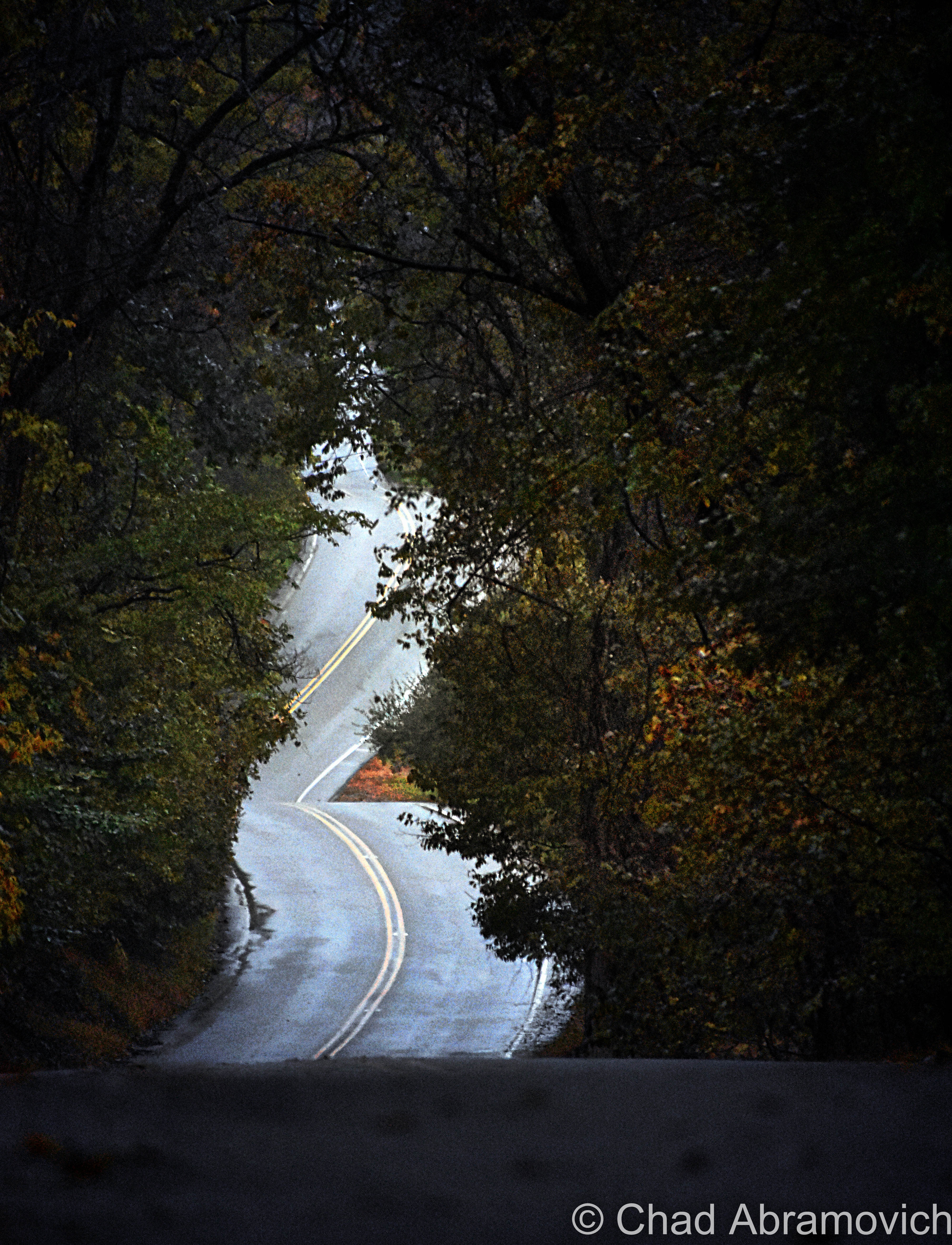
Instead of taking the interstates, we decided it’d be fun to go shunpiking instead and wander around as many small upstate New York towns as we could.
2 of my favorite games to play when traveling through New York are trying to pronounce place names, and something we affectionately call; abandoned or recluse? The idea is simple, with the name of the game doubling as the instruction manual, and there is plenty to wonder about on those upstate backroads.
Spontaneously adventuring within another adventure can really pay off! As me and my friend were heading through upstate New York, we noticed an advertisement for an old motel listed on one of New York’s blue service directory signs.
We really digged the retro font in the logo and decided to veer off course for a few miles to see if the motel had a sign that would be on level with its cool.
And Behold!
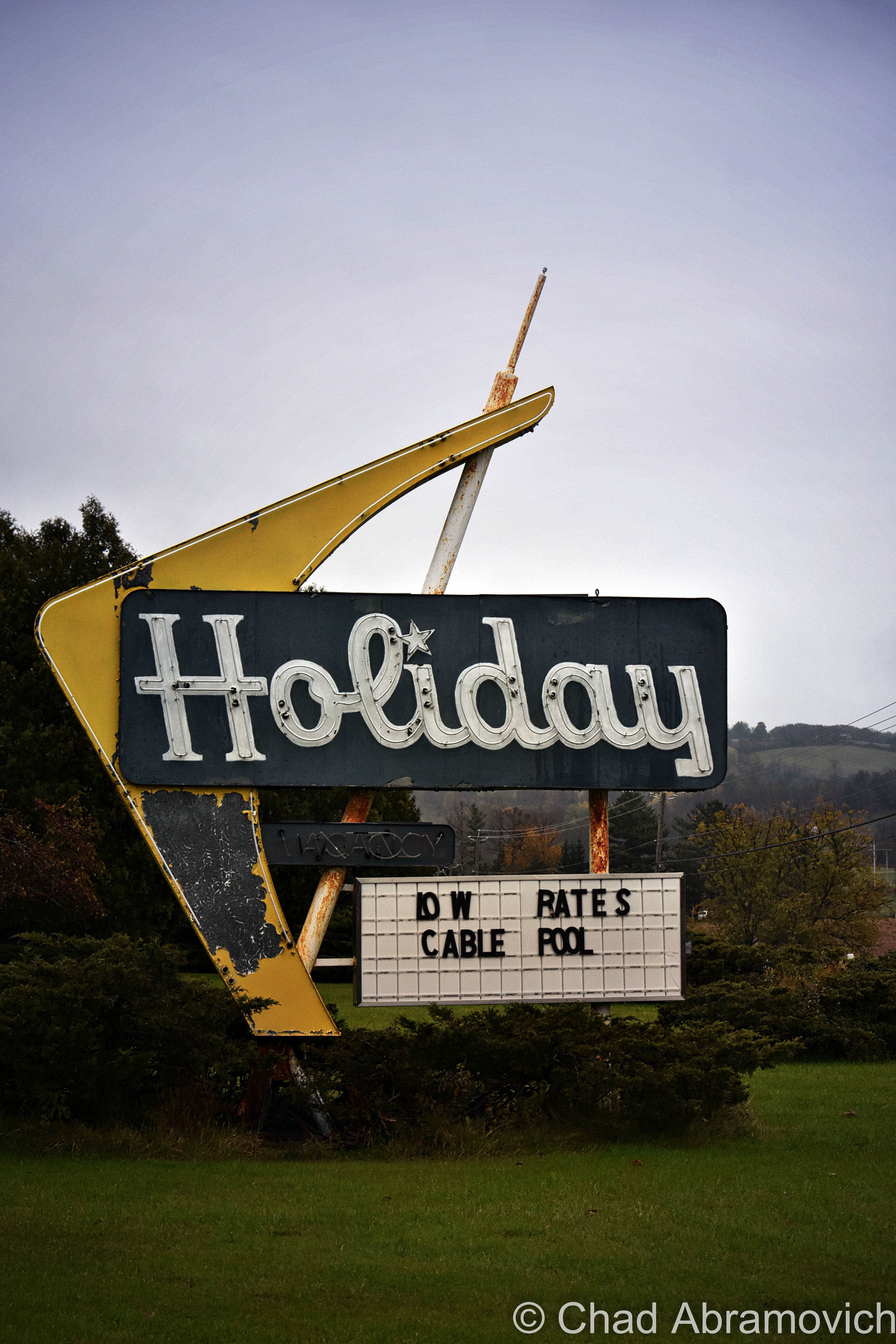
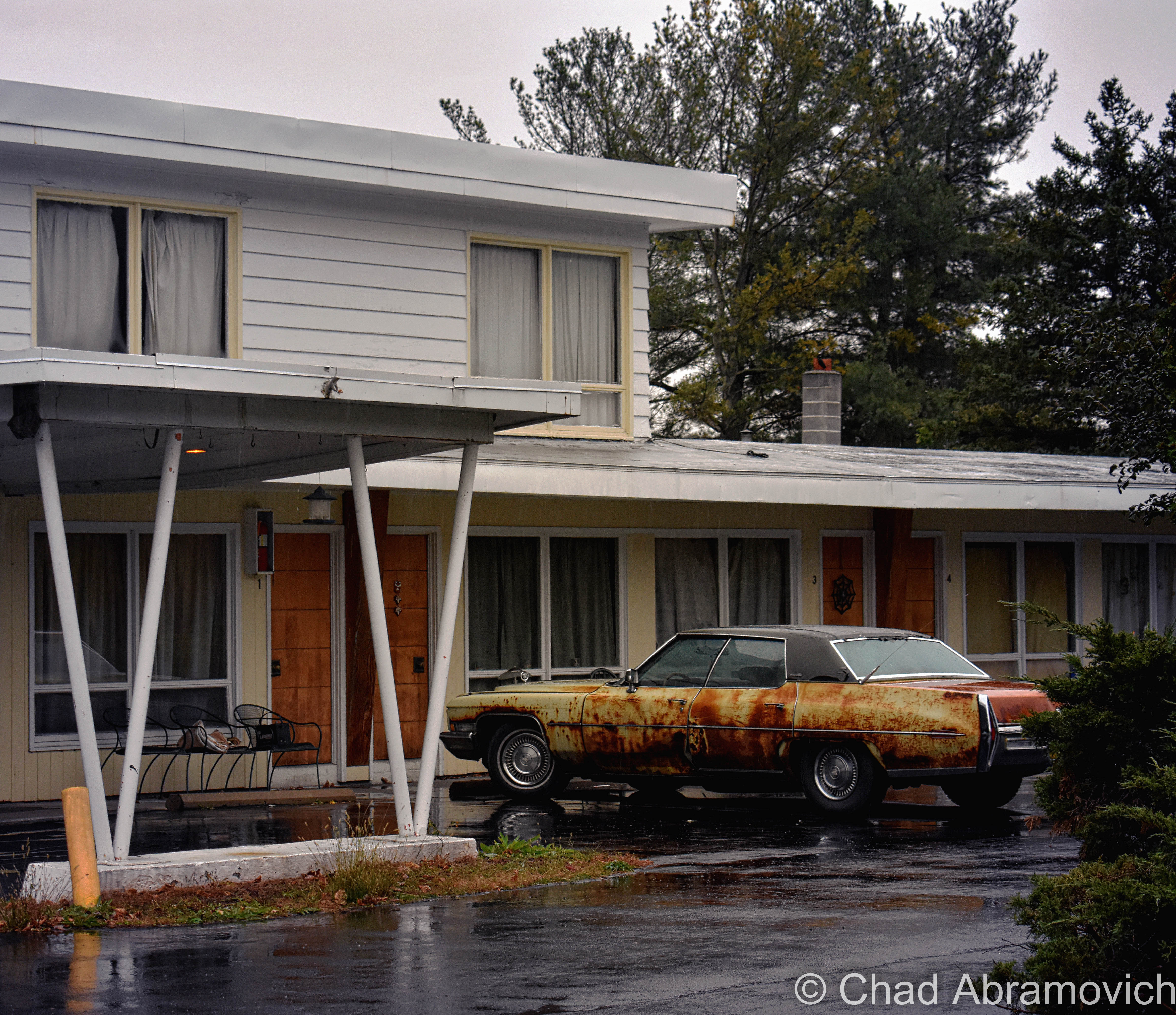
We were rewarded with this fantastic mid-century gem of a sign! The adjacent motel was pretty great too, but we couldn’t tell if it was still a functional motel or long-term housing or none of the above.
I really really dig Americana and hunting for old signs, and Upstate New York is loaded with some terrific ephemera. One of my first out of state explores when I was getting this blog started was spending a few days traveling down US Route 9 between Plattsburgh and North Hudson to shoot some of them.
I think my fascination and reverence distills from the fact that they’re things we’ve lost as American instant gratification and laziness have rearranged routes and highways to bypass Main Streets; replaced by unimaginative, uninspiring, cookie-cutter corporate-owned businesses built right off the interstate that value profit over purpose.
The dilemma is there are many of us who want to preserve these special places and keep them vital to their communities and future generations, but with so many rural towns struggling to stay afloat, or even as a viable place to exist, it’s just another part of the tug of war.
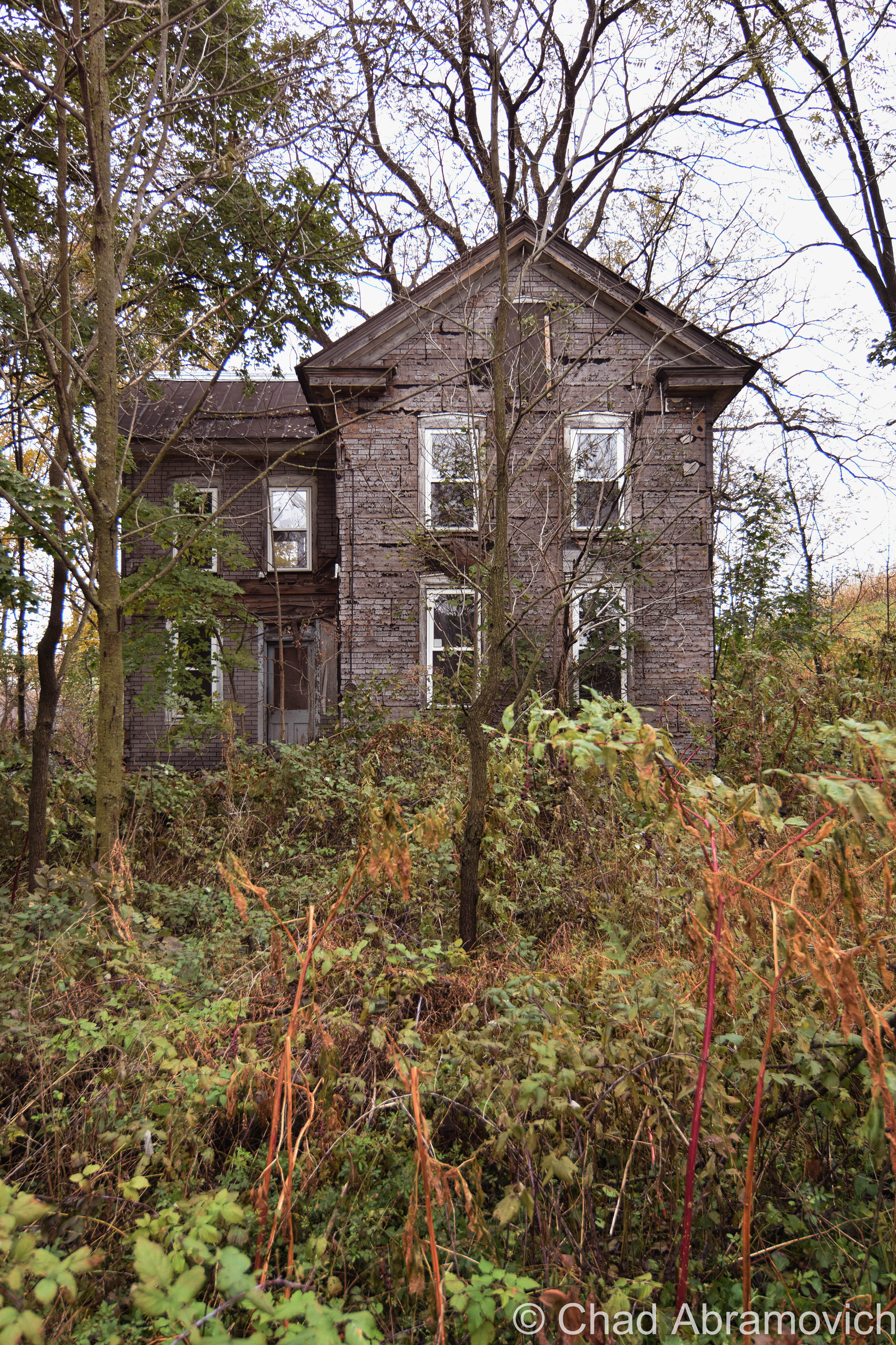
There are some awesomely storied little towns in upstate New York that are literally moldering in their own history, and we drove through a bunch of them.
Their main drags were lined with remarkable historic homes, probably from the era of state history when the canals were bringing people and prosperity up that way. Now, many of these towns are practically dead, and these old homes are in various states of disrepair.
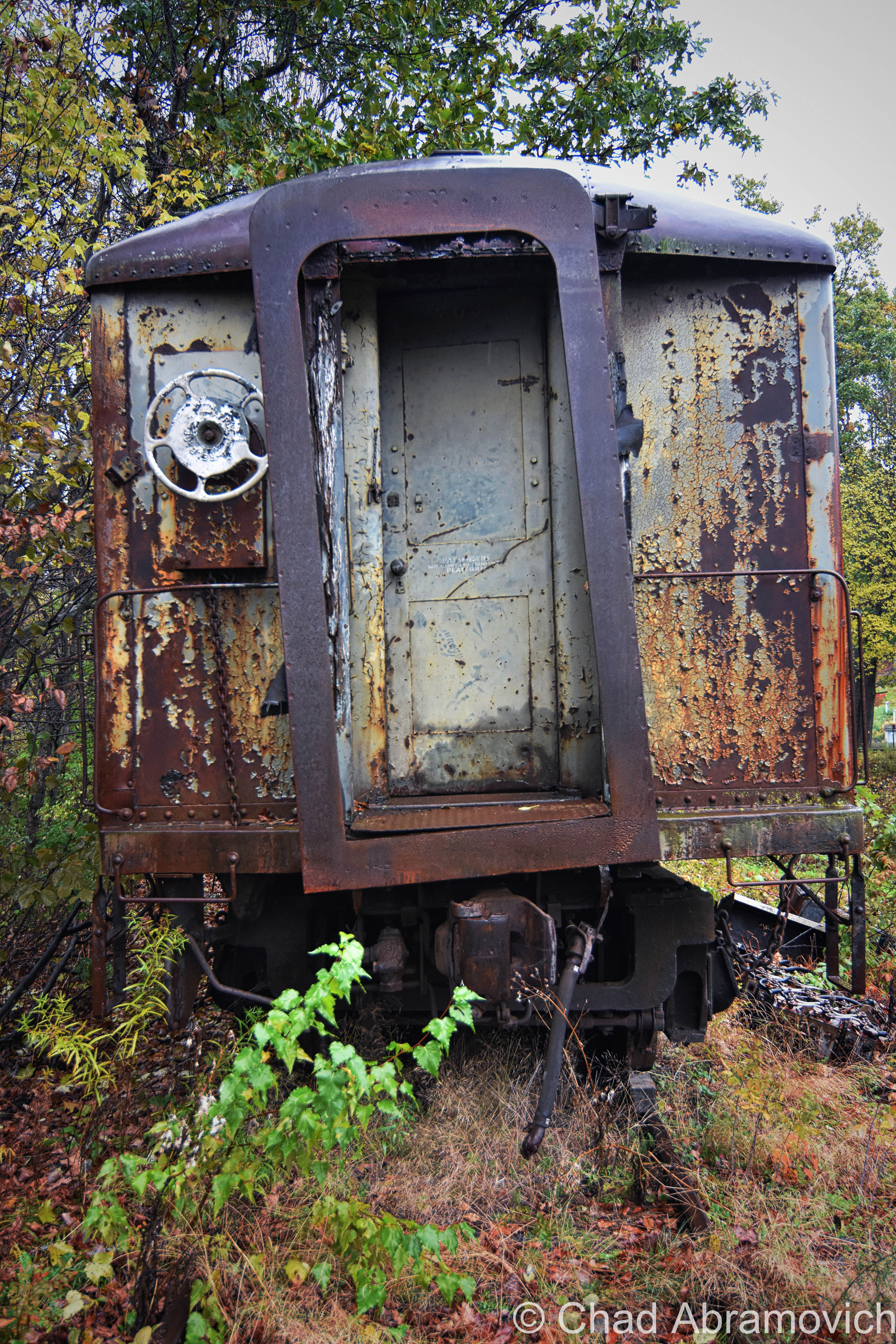
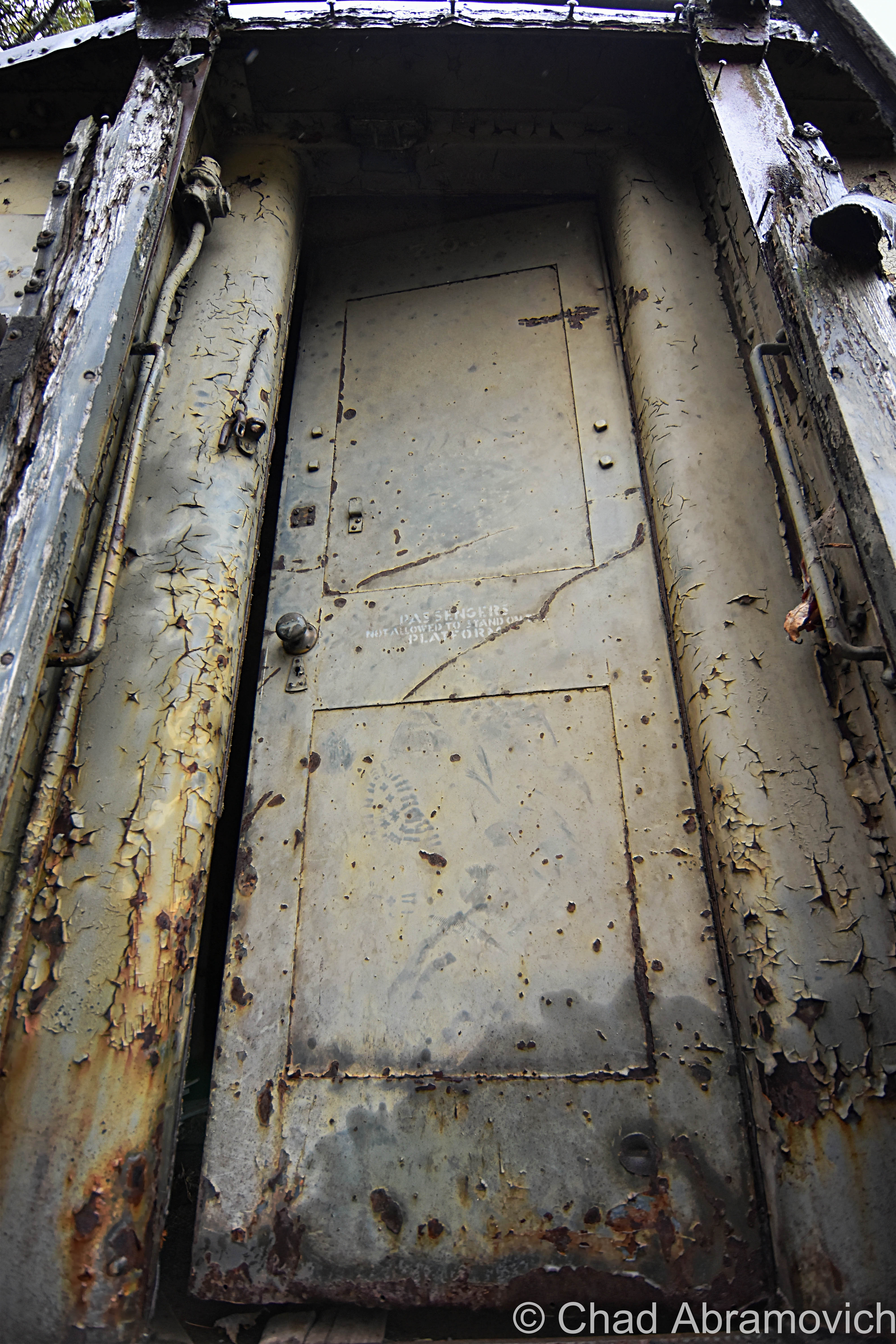
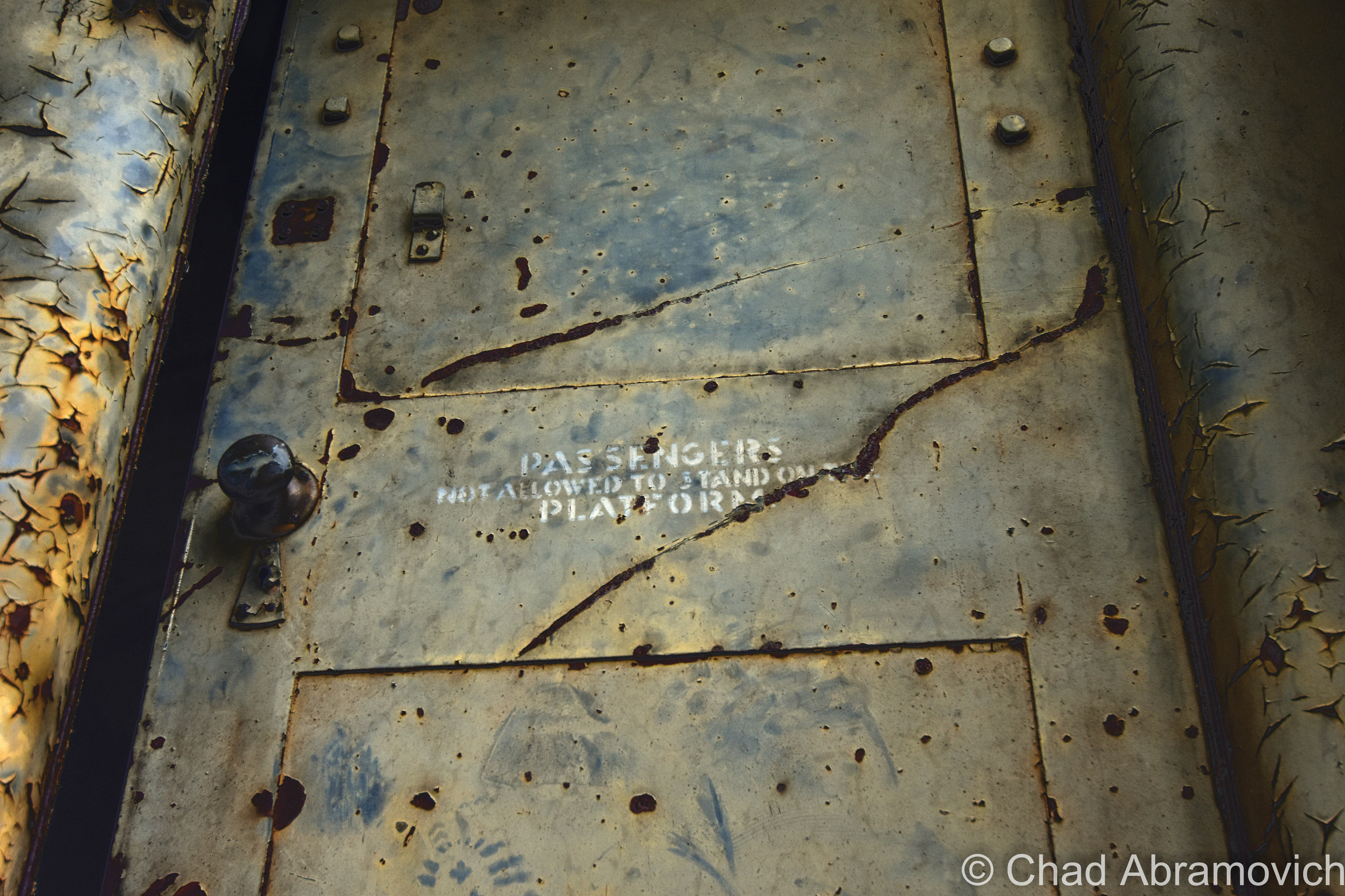
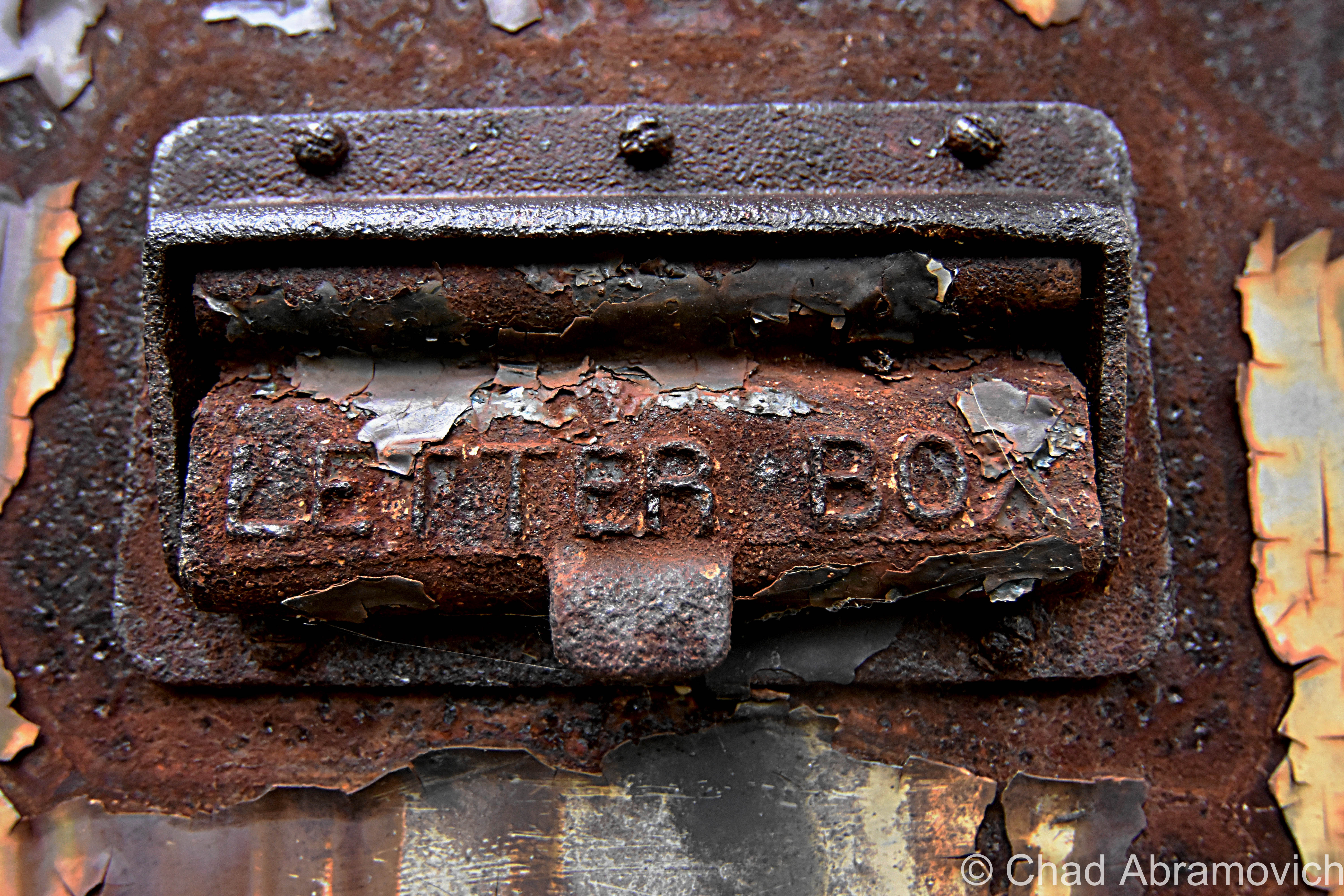
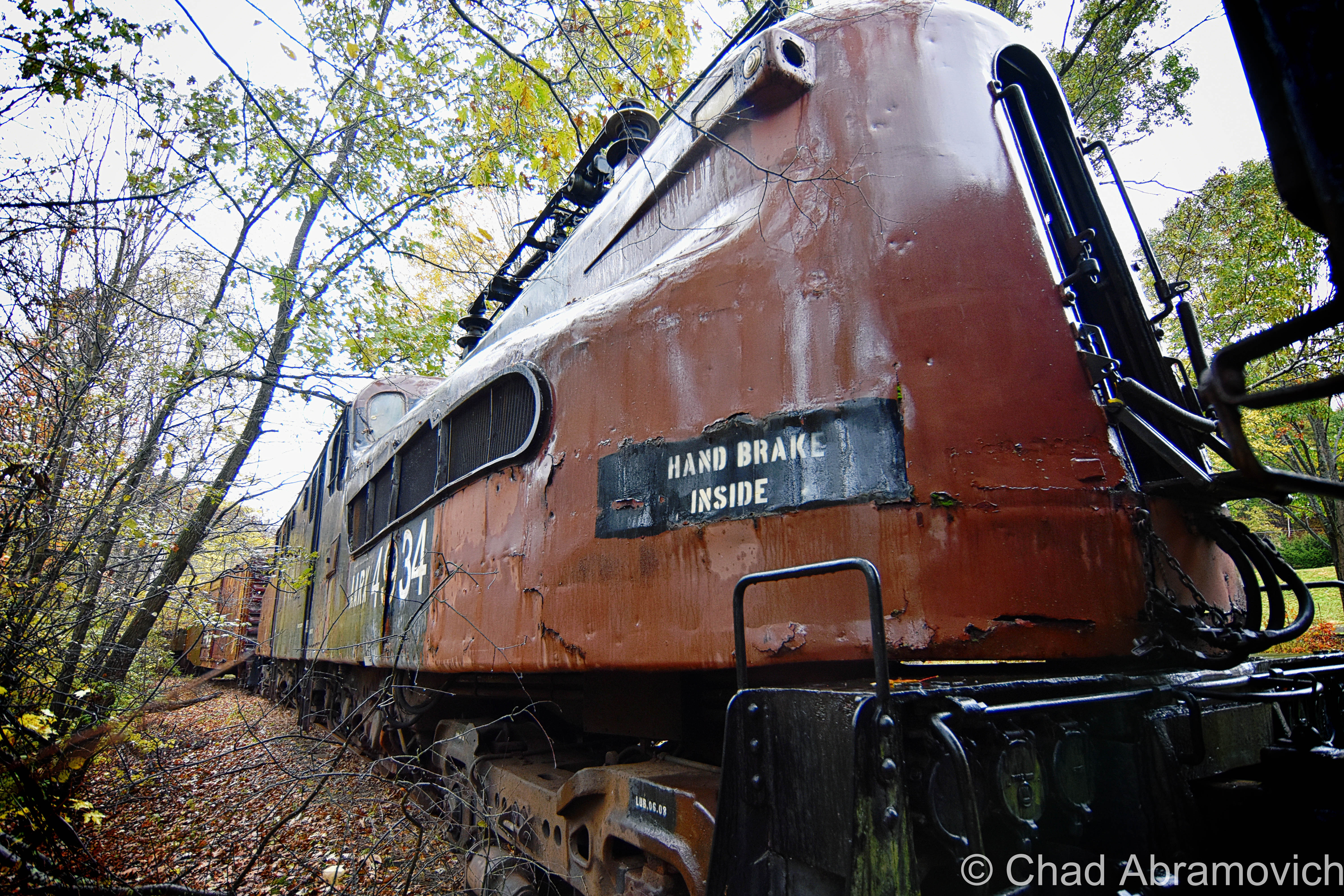
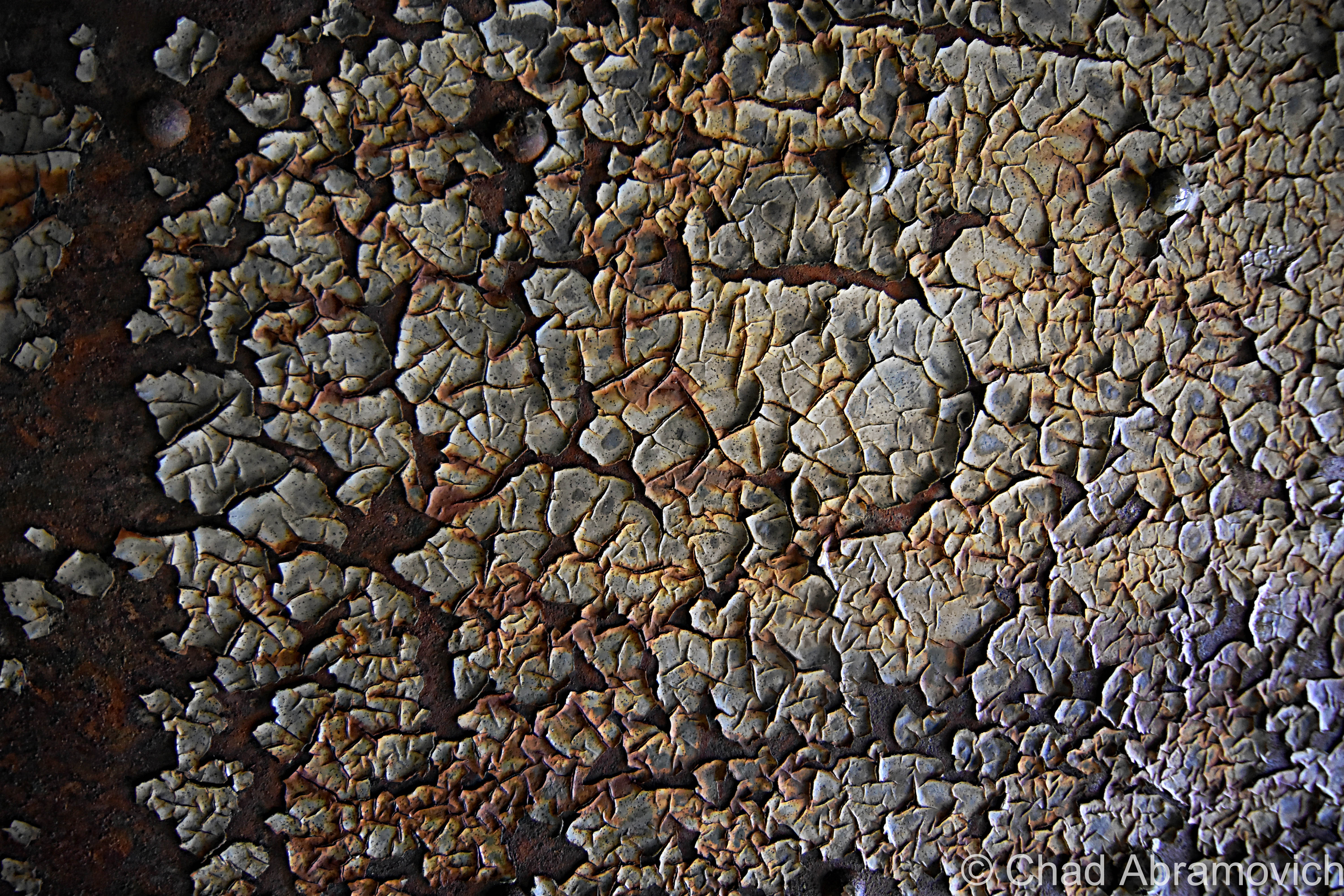
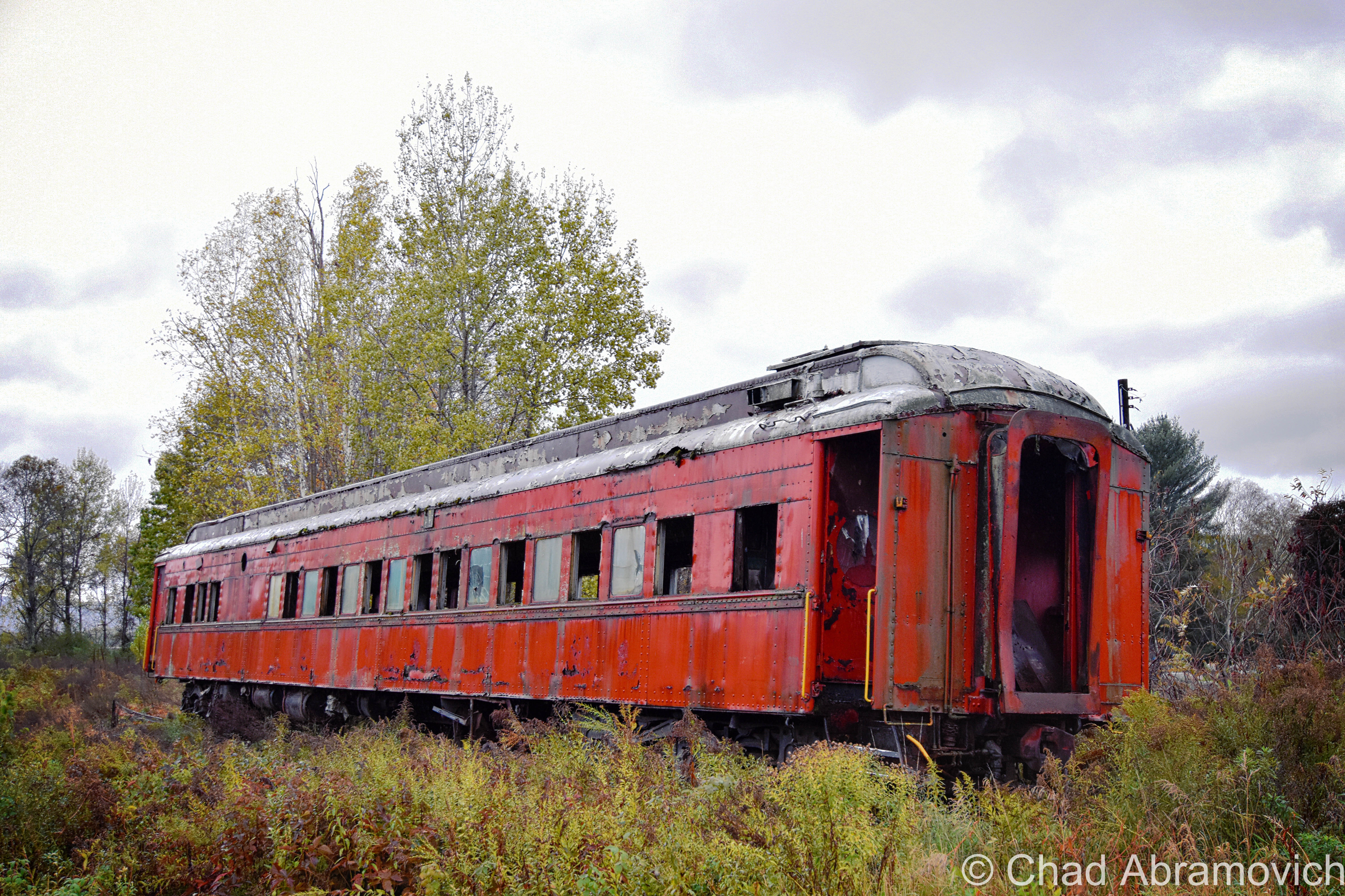
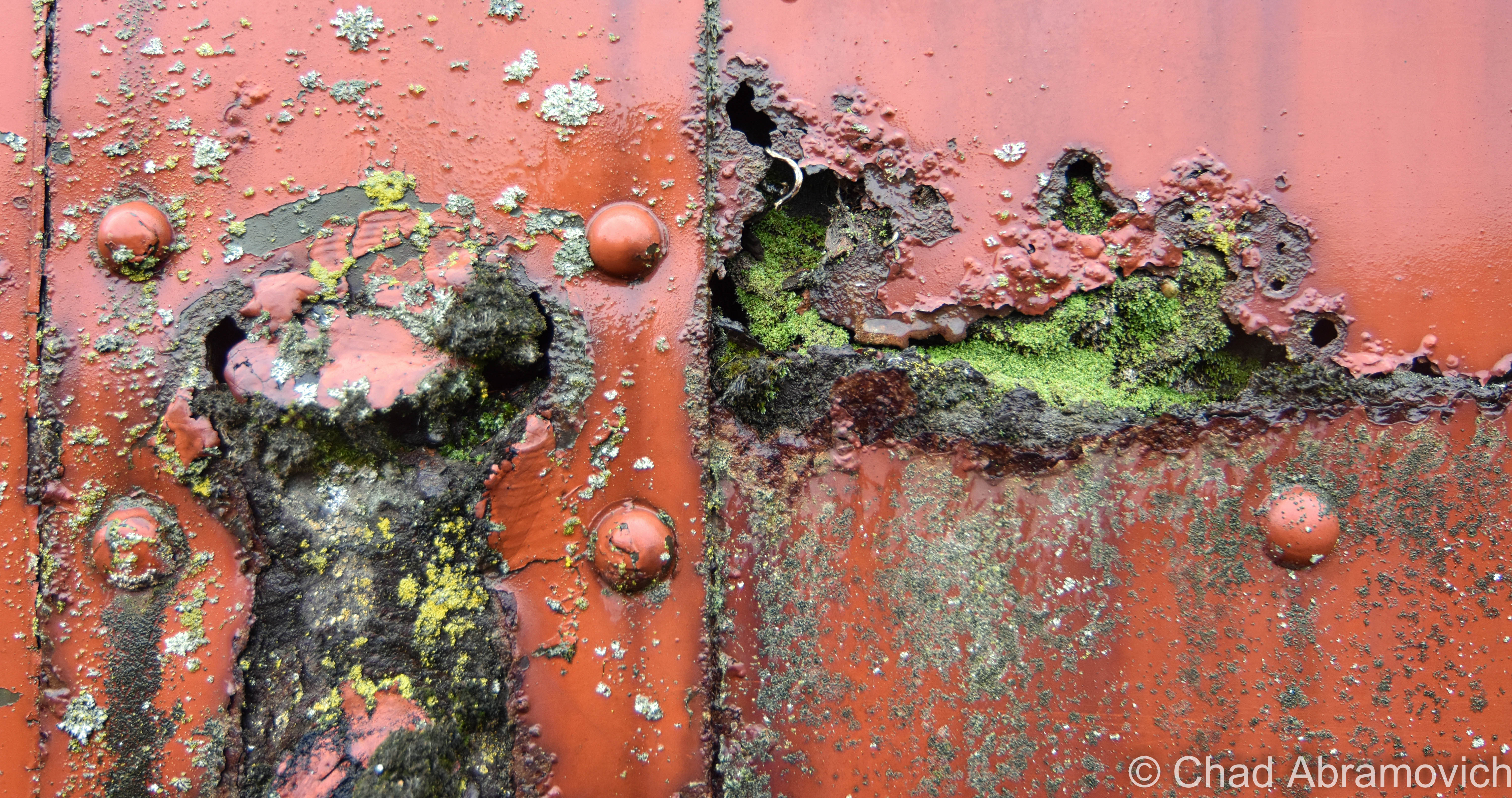
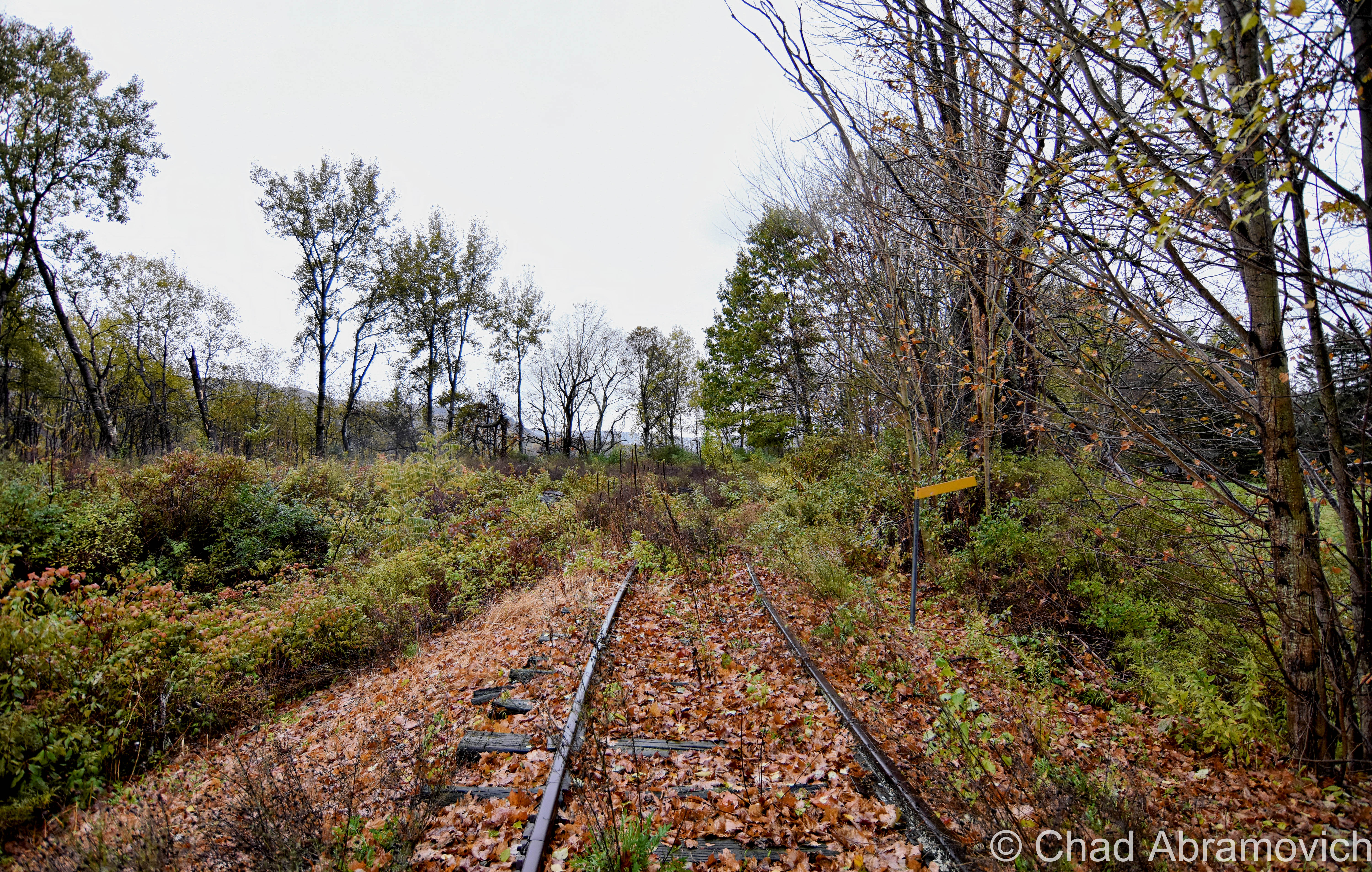
Passing through Cooperstown Junction, we noticed a whole string of abandoned locomotives on discontinued tracks, and we just had to U-Turn in the pounding rain and biting chill to shoot them.
After trudging through a bunch of ruthless tree branches and prickers, I detected an old GG1!
The cliff notes here are; they were beautiful 475,000-pound art deco machines conceptualized by General Electric and built for the Pennsylvania Railroad between 1935 and 1943. They were electric and deemed to slow for passenger transport, so they were mostly used as freight trains, with ball and socket construction that made them suitable character for sharp turns. 139 were made, American railroad franchises subsequently merged and then went bankrupt through the mid 20th century, and the last one was fazed out by 1985. Most of them have disappointingly since been scrapped.
When I got home from this trip, I dove into my ritual of brewing coffee, Google maps, and researching my GPScapade. Amusingly, the only Google information that really came up for Cooperstown Junction was the fact that a few trainspotters knew that these GG1s were there.

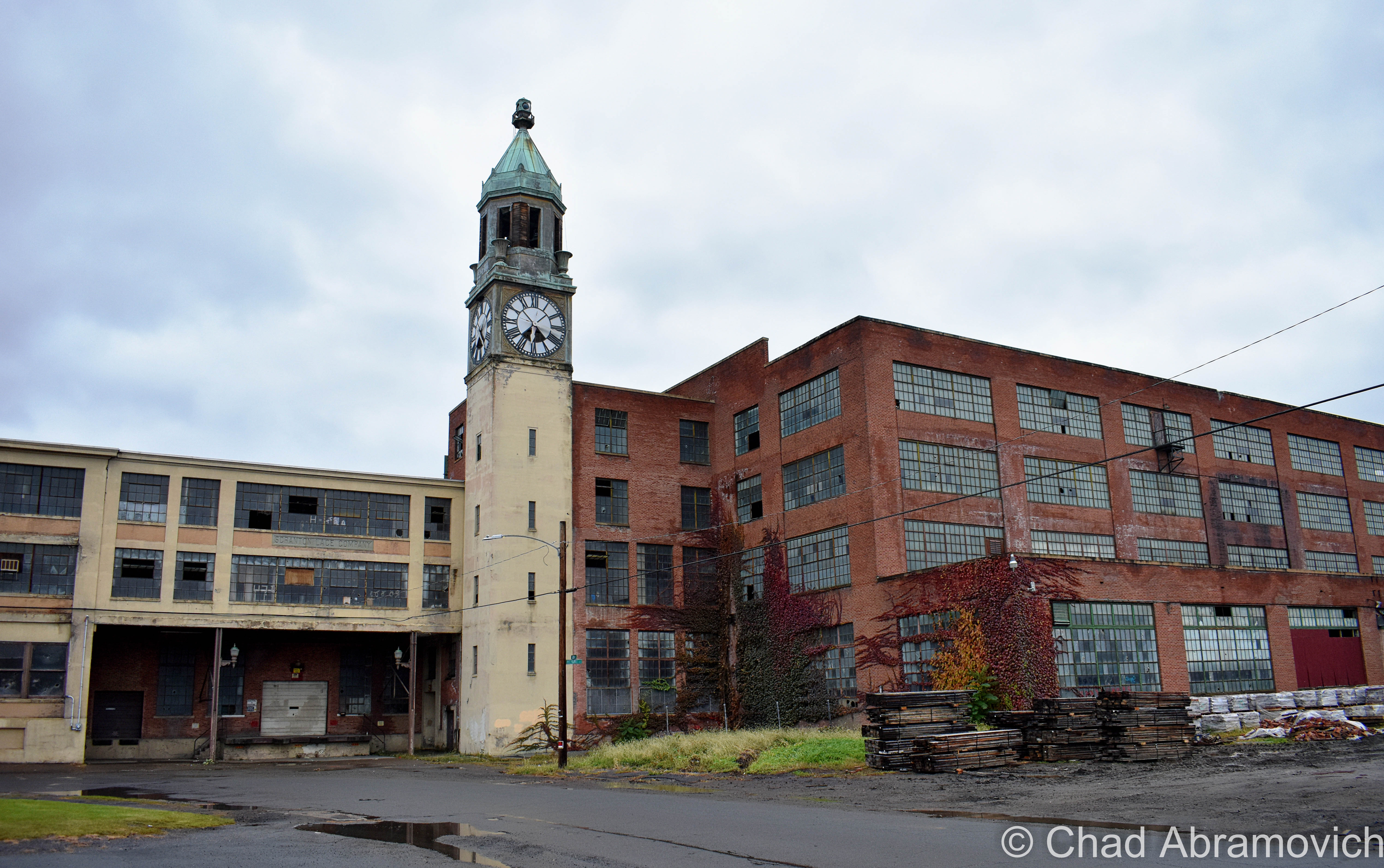
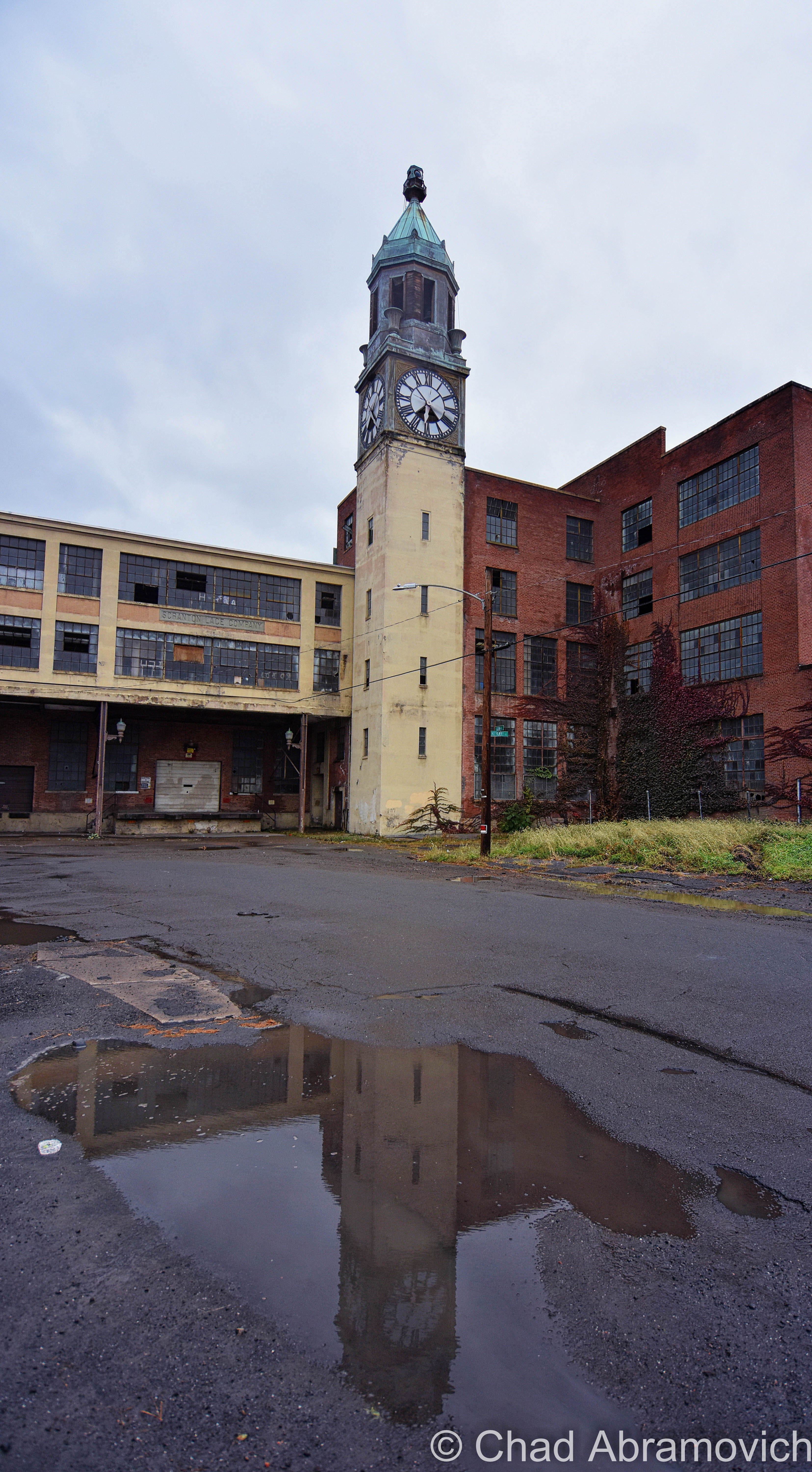
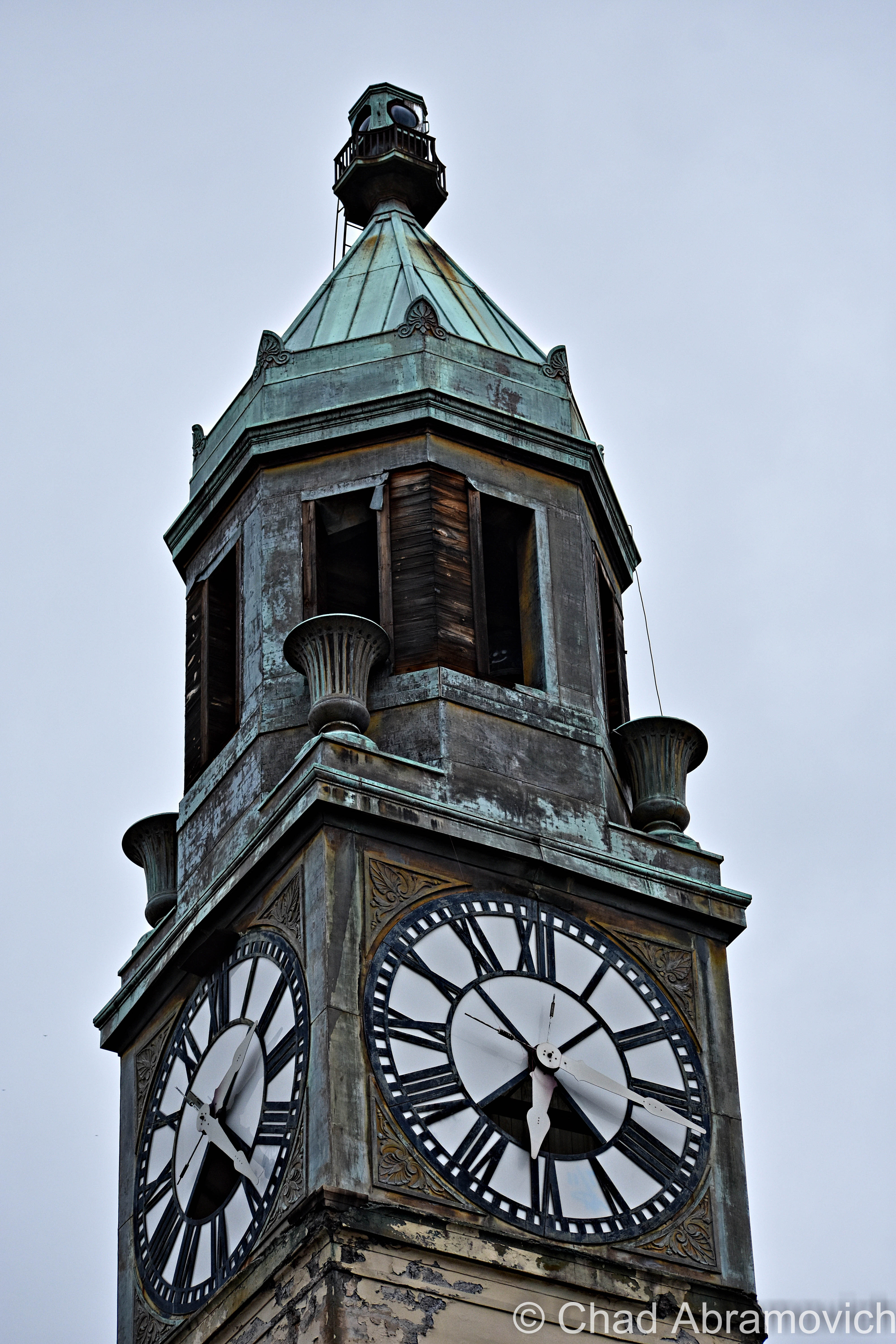
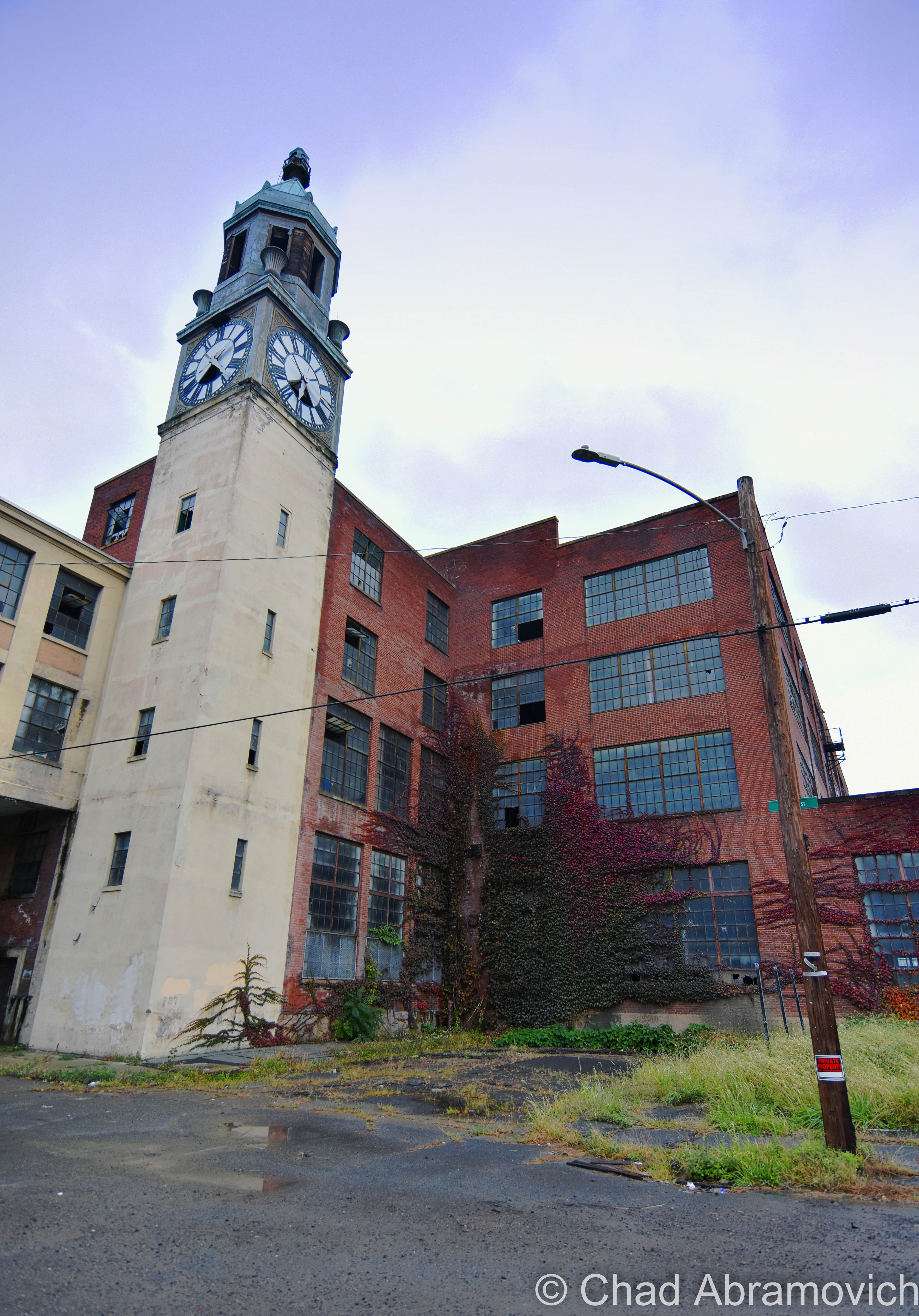
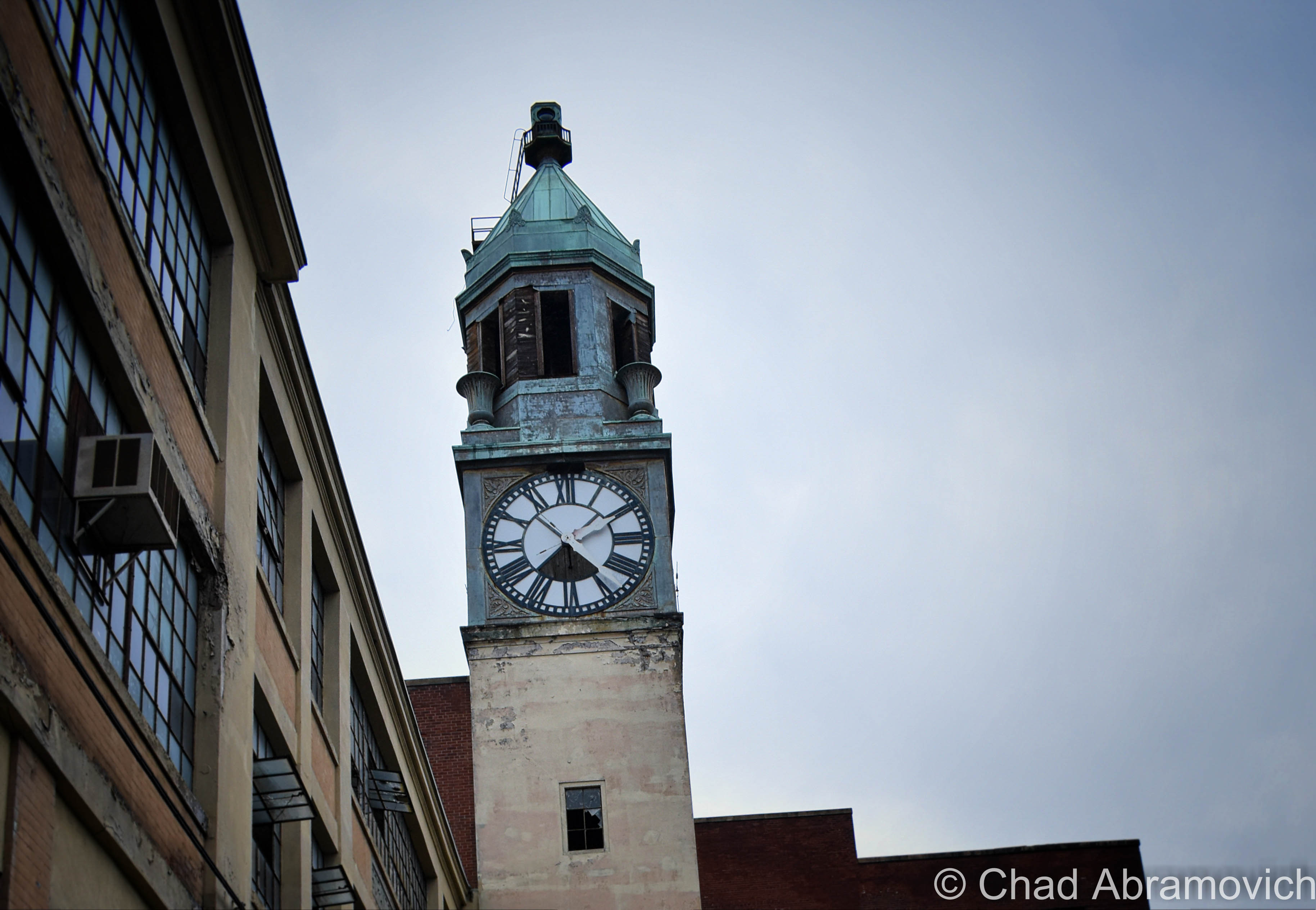
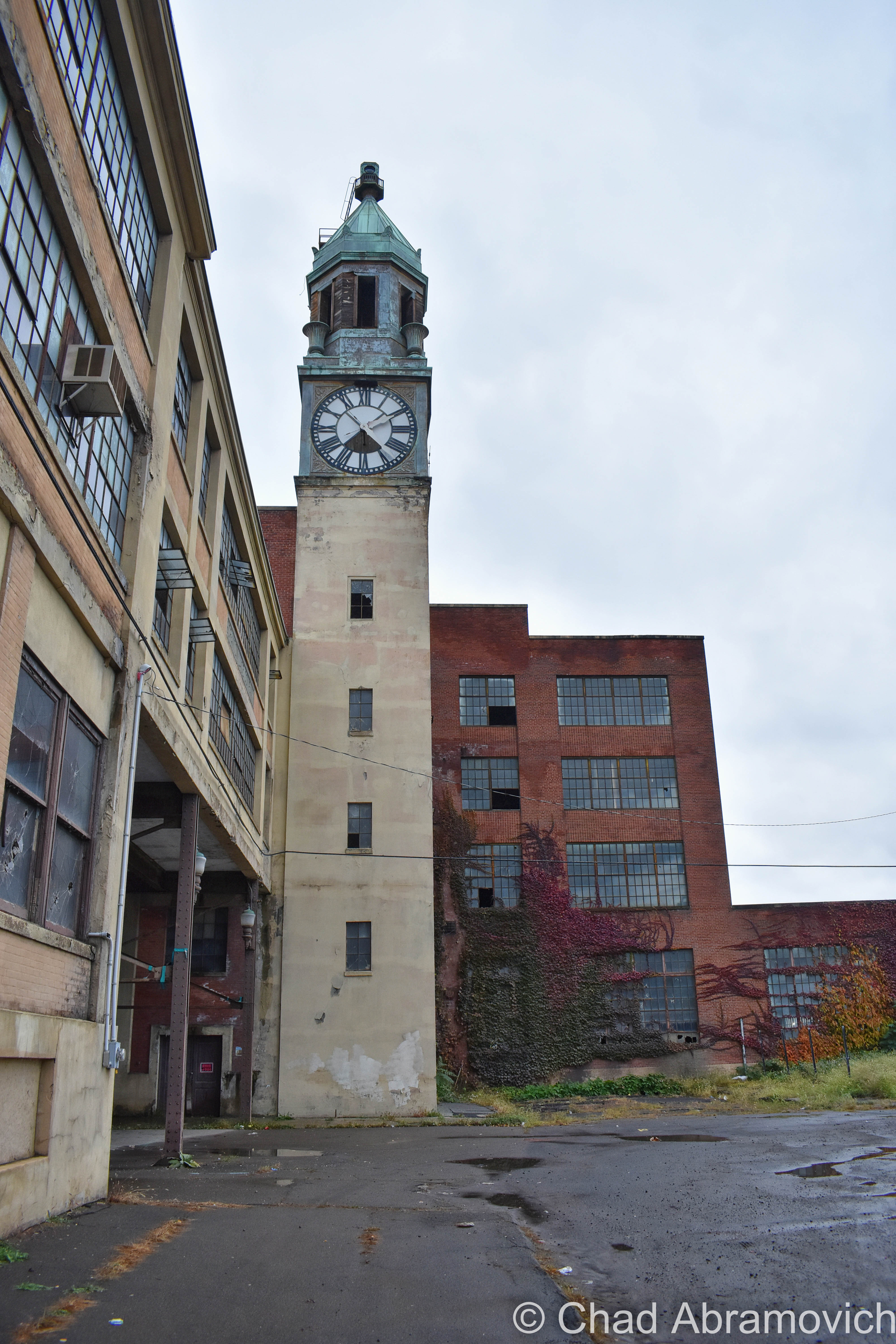
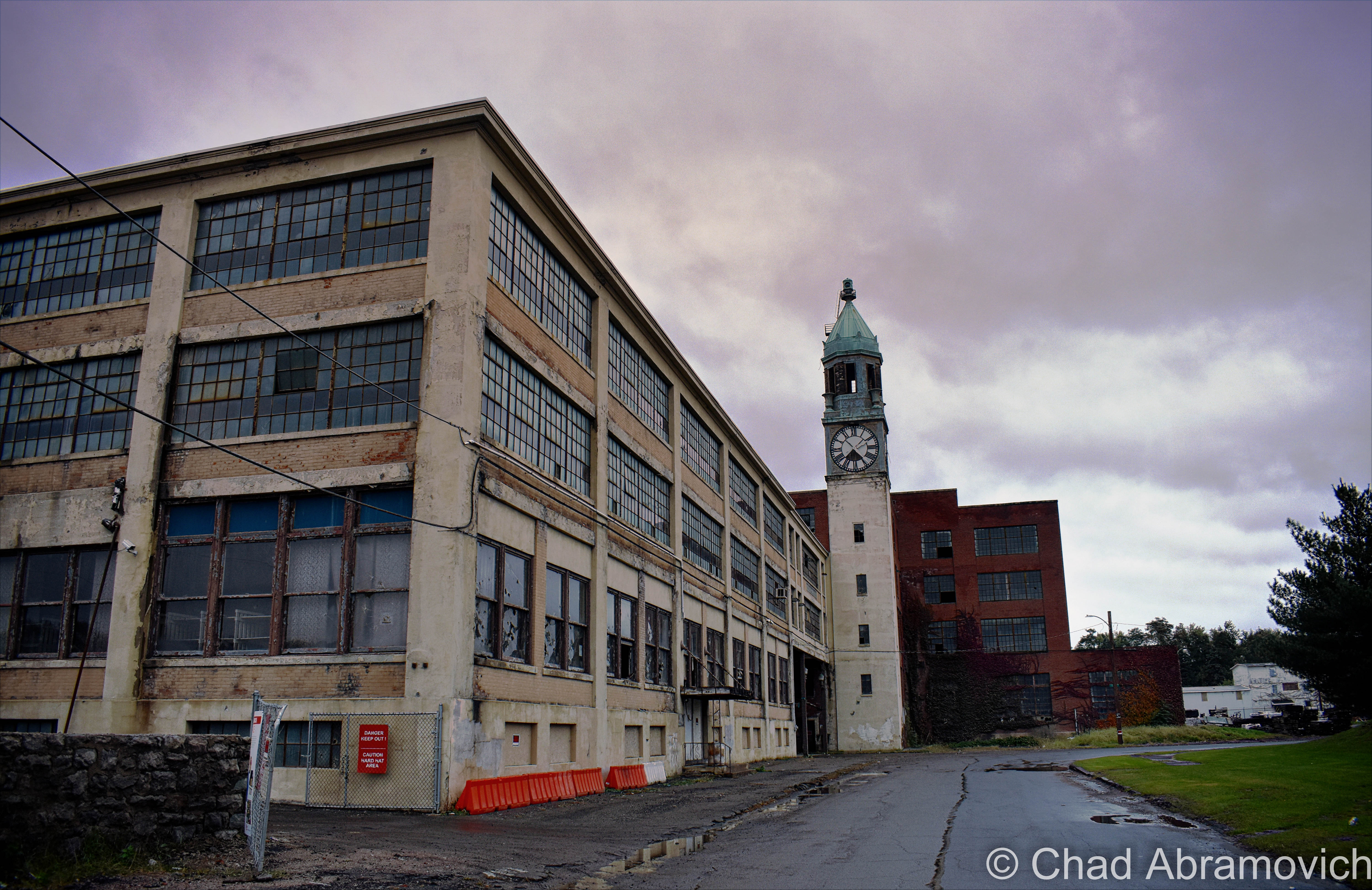
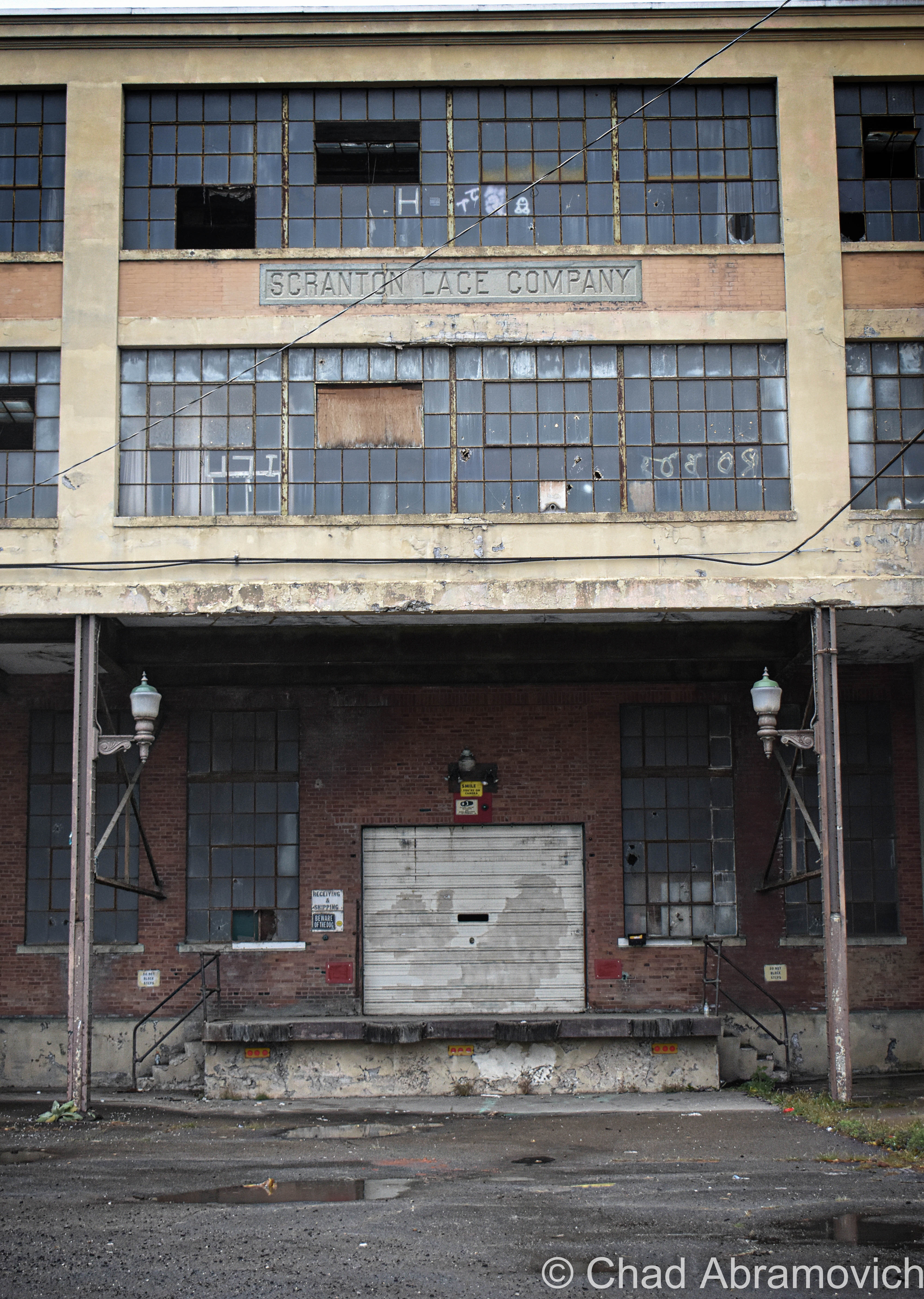
Eventually, we started seeing signs for Scranton, Pennsylvania, and I just had to detour to see whatever was left of the Scranton Lace Factory – named after it’s home Pennsylvanian city and it’s supreme export.
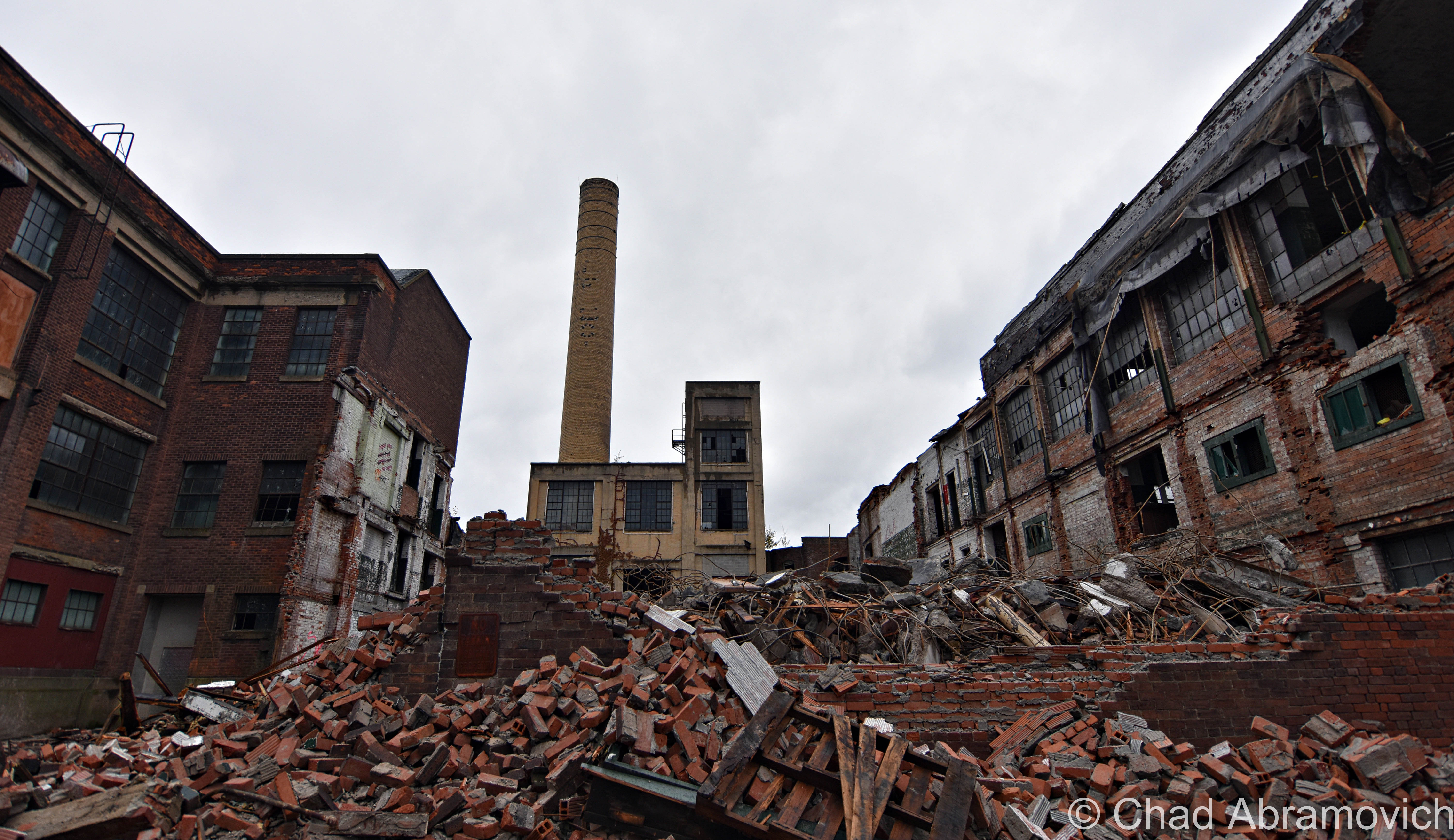
I’ve been wanting to see this place for years, and as cosmic relief would have it, the brobdingnagian factory is in the throes of demolition. But it’s still an eye magnetic wonder, complete with one of my favorite clock towers which features a Meneely cast iron bell.
Scranton Lace began industrializing in 1890, and would produce a sundry of textiles – anything from tablecloths, yarn, laminates, and their signature good; lace. The company would become the first and largest producer of Nottingham Lace in the United States.
The factory boomed during the world wars, would grow in dimension and employees (employing 1,400 people at its zenith) and was so large it had it’s own 4 lane bowling alley, a theater, barbershop, an infirmary and a gym on the premises.
Some risky investments and advances in technology would eventually weld its clout, and kill the factory by 2002. In the last years of its life, it only had 50 people working there!
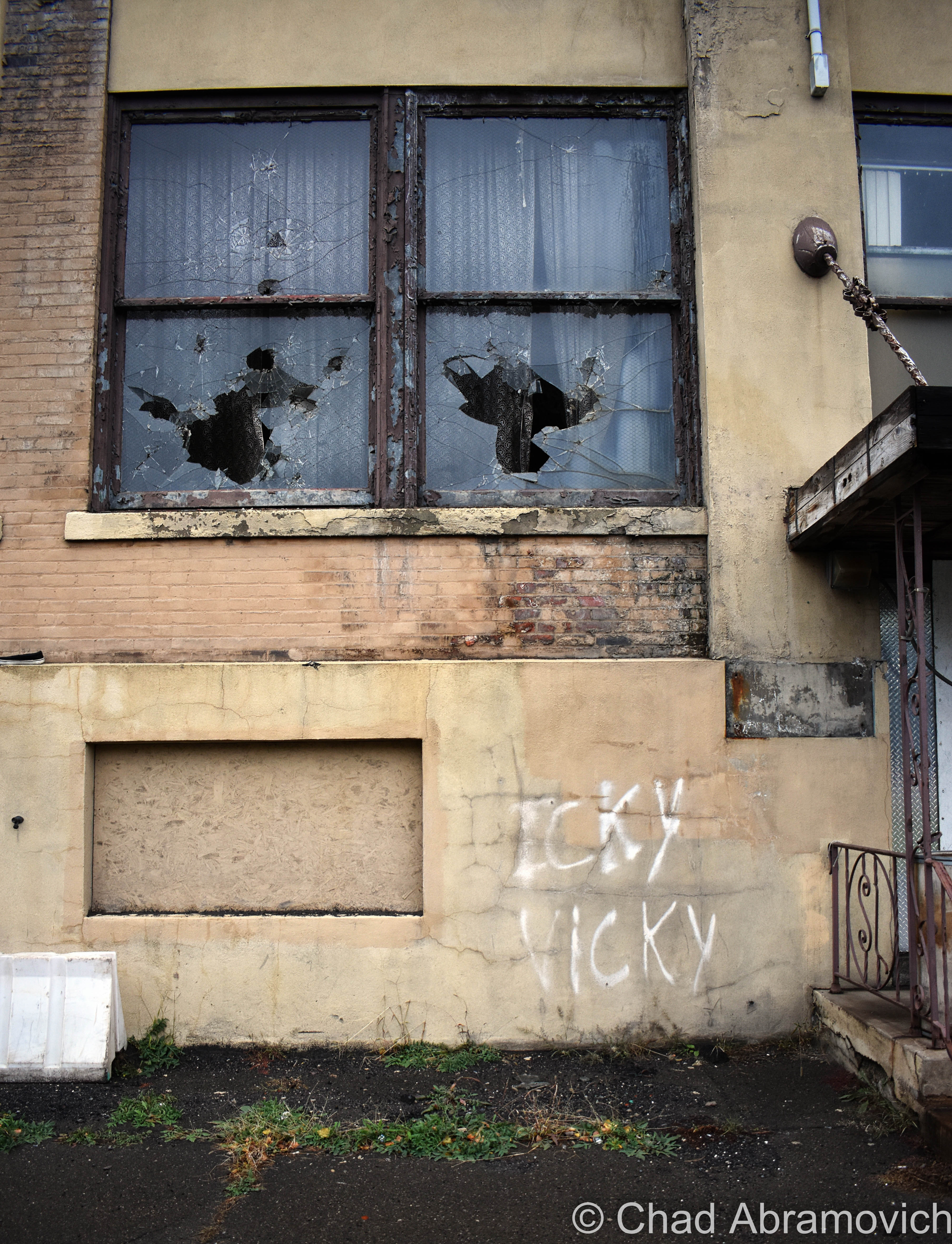
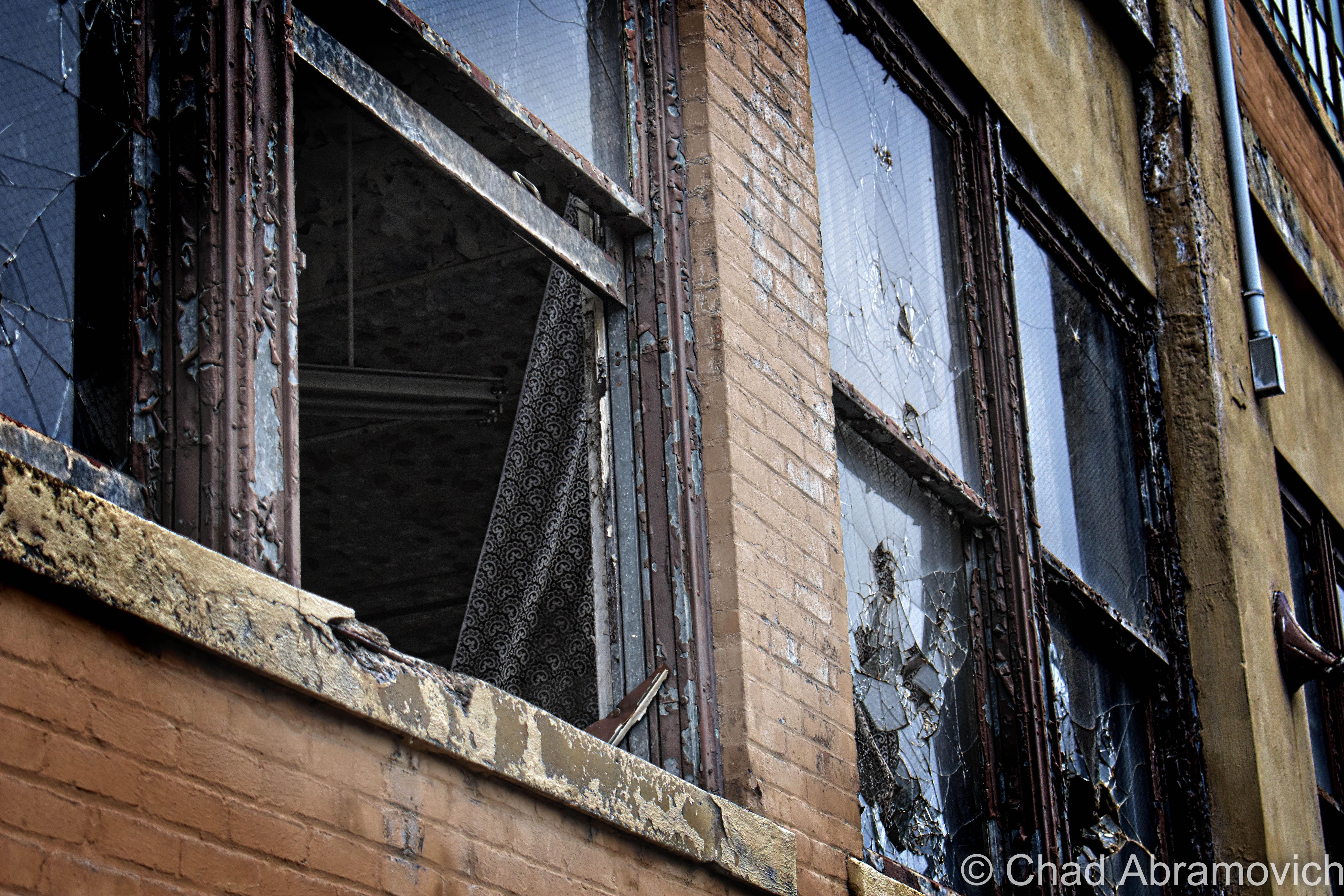
Seeing the building in real time, I wondered how often the skeleton crew crossed paths, given the size…
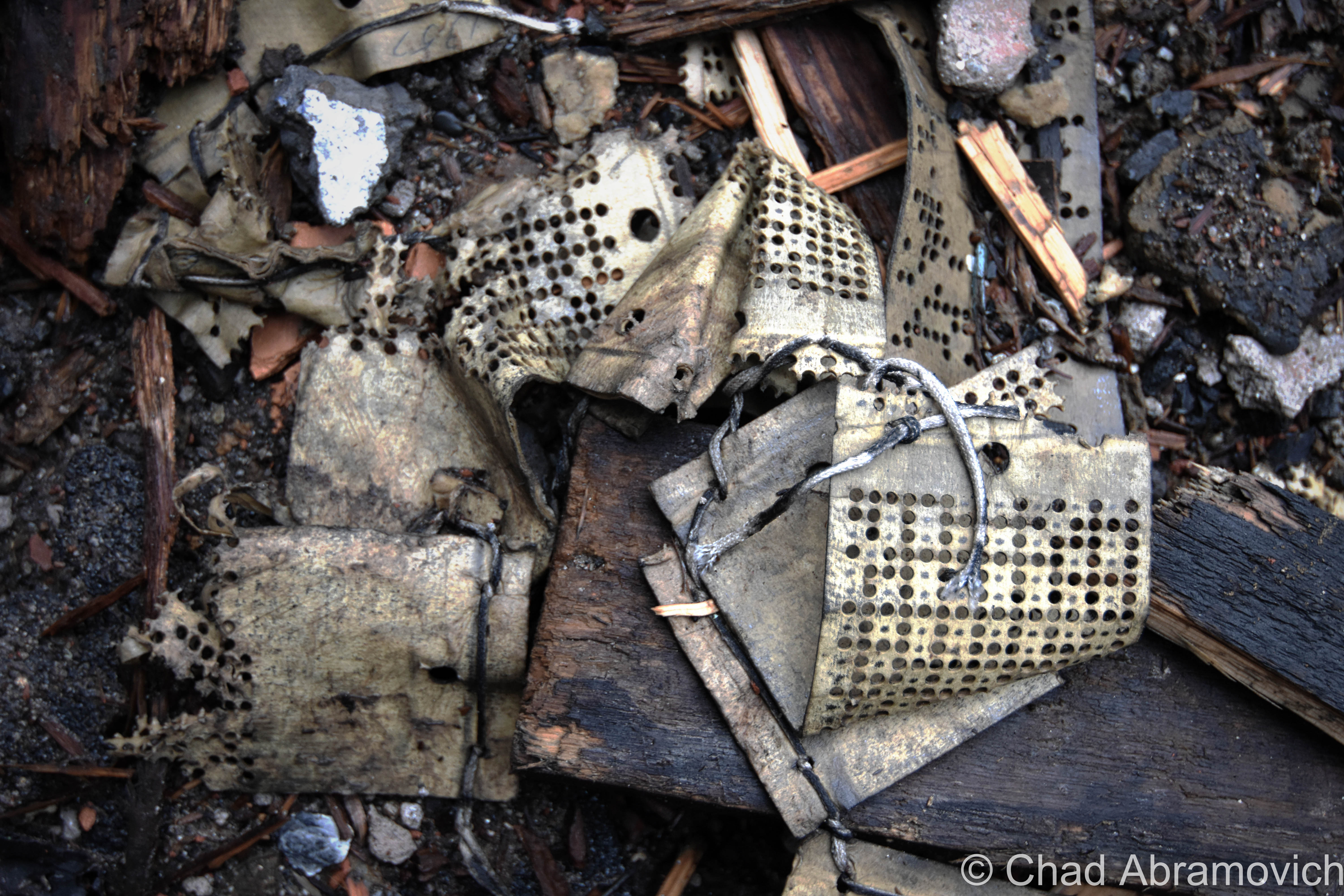
An amateur autopsy revealed that the inside was trashed, and most goodies have been removed or destroyed. Also, the ruins are said to be loaded with arsenic. But little treasures still remain. Sheets of soggy lace and wooden dowels were scattered all over the debris.
We settled for a sketchy hotel in Harrisburg with neat features like an un-closable front door (we wound up propping a chair in front of it) and a room that smelled like burnt popcorn without the burnt popcorn, and headed out before first light to make up for travel time to get to the lion’s share of our adventure.
But first, we tracked down a favorite camp of oddity; a gravity hill.
If you’ve been following me for a while, you know I dig gravity hills – unique stretches of roads where gravity is said to not work as it should, and pull your vehicle uphill. I’ve sought a few out, where you could witness the magic if you squinted and kept an open mind, but this one on in Lewisberry was apparently the real McCoy (and that may or may not have something to do with ghost children).
It didn’t just pull our car uphill, it yanked it, and then tried to pull us down another hill nearby where gravity than would have then behaved as it should and possibly careen us into oncoming traffic.
I tried getting a shitty, dim cellphone video to as evidence because you can actually prominently see both a hill and the car being pulled up it. No tomfoolery on our end, promise!
Because my friend and I are also huge diner enthusiasts, we drove a few towns over just to eat at one, and then it was off to Pennsylvania coal country.
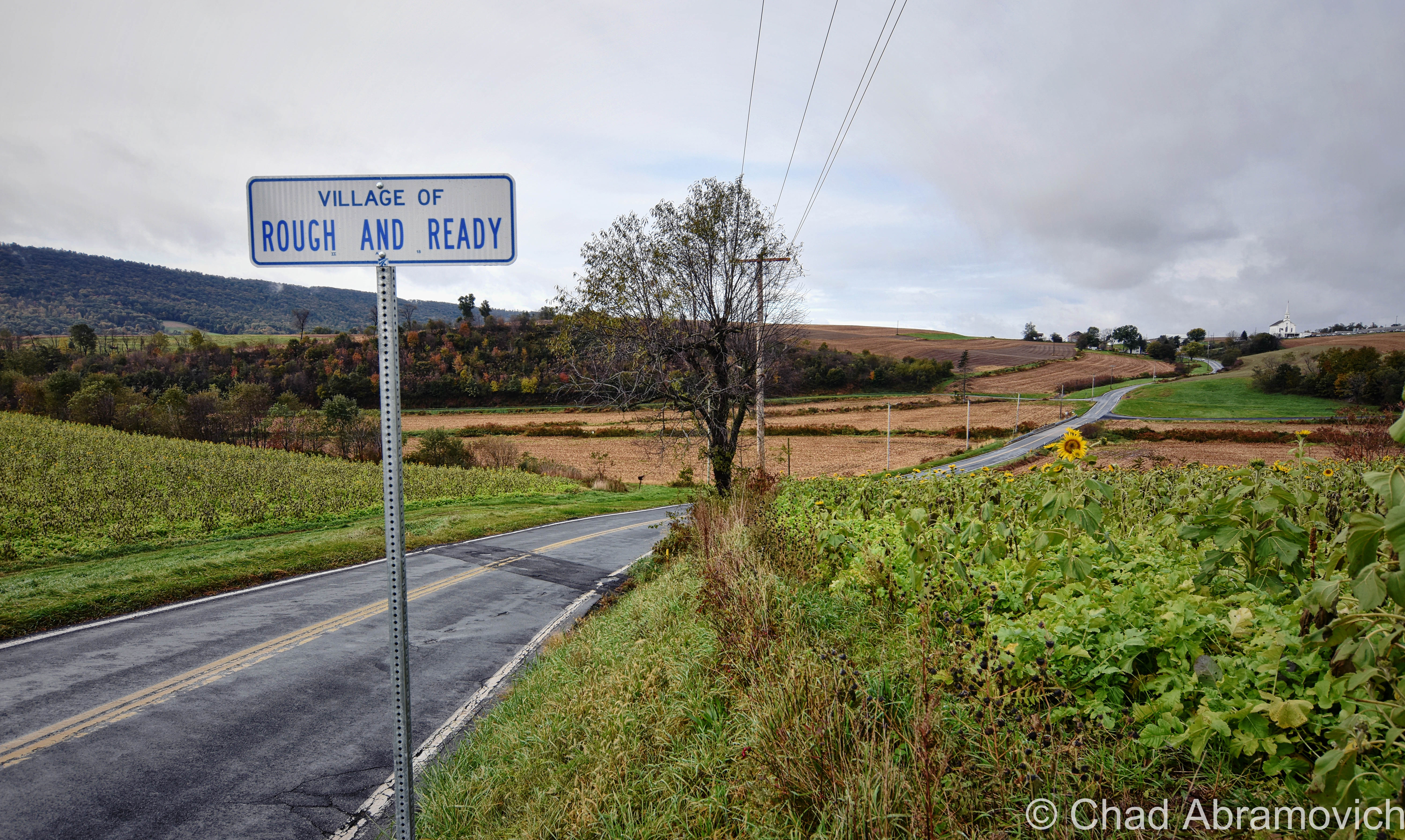
Anyone else really interested in rural American town names? Rough and Ready, PA is little more than a 4-way with a terrific name. It was actually named after the tiny gold rush town in California, and that one was named by their mine to honor Zachary Taylor’s nickname – the obscure 12th president of the United States. I had to Google him.
It seemed like all the locals were at church when we pulled into town, and it was eerily tranquil.
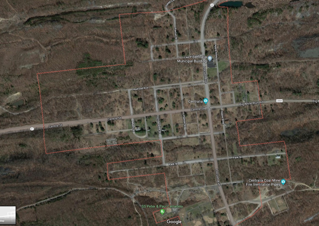
Centralia, Pennsylvania
In May of 1962, a small Pennsylvanian coal mining town decided the best way to clear out a defunct landfill was to burn it. It’s an activity that’s been done before, but in Centralia’s case, it would create one of the most batshit crazy American stories I’ve ever heard.
The town was built on Anthracite coal deposits, and the blaze above ignited a blaze below – lighting the tip of an exposed coal shoot that serpentines for miles underneath the town, and an underground inferno started to spread slowly and stealthily over the next couple of decades, working its way to the surface.
I guess I don’t understand why anyone would burn anything near an “exposed coal seam”.
Centralians alerted the state government about the fire but found themselves flippantly disregarded. Ironically, the fire could have been almost completely extinguished months after it was set, but the dispatched state officials on the scene decided that taking labor day weekend off was more important than finishing what they started, so the fire was allowed to spread.
By 1976 – a temperature of 746 degrees was recorded in a woman’s backyard behind the swimming pool. Vegetable gardens were cooking in the soil. Some residents claimed their basements were so warm, they didn’t need to use their hot water heaters to warm their bathwater.
In 1979, local gas station owner John Coddington inserted a dipstick into one of his underground tanks to check the fuel levels, and was shocked to find the temperature read 180 degrees!
The Pennsylvania Bureau of Mines decided the best judgment here was to just let the fire burn itself out.
In 1981, a fiery sinkhole opened up and attempted to swallow 12-year-old Todd Domboski in his grandmother’s backyard. He immediately was deluged by hot, slippery mud and scorched by heat that was later measured at 350 degrees. He tried to gain his footing and frantically clambered around for anything he could use to pull himself up while breathing in large amounts of carbon monoxide and toxic gases, but it was futile.
Eventually, he was able to stabilize himself by grabbing hold of a tree root and then started screaming for help. His cousin, 14-year-old Eric Wolfgang, heard his terror imbued shrieks and pulled him out. It was determined that the levels of carbon monoxide and toxic vapors in the sinkhole would have been enough to kill Todd within minutes if he hadn’t been pulled out. The incident went viral.
The Pennsylvanian government had been muting the coal fire and resulting anxieties since it began, but now, they had no choice but to face it. Centralia suddenly found itself in the gravity of nationwide chitter chatter and the now irrefutable revelation of subterranean calamity hurt a lot of Centralians’ good day.
The underground fire caused sinkholes to yawn, roads to heave and fracture and endangered the lives of everyone who lived over the conflagration. And because those coal seams are so far-reaching, that demographic not only included every person in town but conceivably neighboring towns if (or when…) it trundles towards them.
The ground began collapsing unpredictably and devoured swaths of ground above. Hunters would start coming out of the woods with broken ankles. Sometimes deer carcasses would be spotted sticking out of a hole vertically, with steam billowing out around it. They had either starved to death or suffocated from the fumes.
Pets, too, were victims. A group of kids playing on a backyard swingset witnessed the grim death of their neighbor’s cat when the grass around it suddenly turned brown and it dropped down into a sinkhole.
Poisonous gasses began billowing into cellars and the local school. Some Centralians began developing a bad hacking cough that was compared to black lung – an absolutely horrific sounding miners’ ailment.
Others were constantly falling asleep in their homes because carbon monoxide levels were getting so high. It was getting so bad, that the state pushed people to install carbon monoxide detectors in their homes, but some were even buying canaries to do the job because the detectors weren’t…
Clumsy attempts to extinguish the fire, including boring ventilation holes down into the underground shoots, made the fire burn more triumphantly. Oops.
Another proposed resolution was to dig a gigantic trench around the town, which would have cost millions of dollars and wasn’t guaranteed to even work. It became evident that this fire wasn’t going to burn itself out anytime soon, because of the amazing amount of interconnected underground coal veins in the region that were all vulnerable.
Eventually, The government decided it’d just be easier to evacuate the town and inaugurate it onto club of elite communities like Times Beach and Pricher.
At first, they made the exodus voluntary, because they figured that no one wanted to live about a raging hellfire that was apparently as deadly as the surface of Saturn, and offered relocation buyouts.
But, the buyout prices were little more than pathetic because of the catch 22 the town had become – or, houses that are above a raging coal fire just don’t have that much market value, and as a result, a percentage was taken off the price, which was well below what was needed to move to another town and purchase a new home.
Because of that, some outright refused to leave, either thinking that the fire could be eventually extinguished, or shrugged it off as it not being that big of a problem. Some miners felt like they were being treated condescendingly when it came to the government officials and scientists that came to town to discuss the situation, so they stayed out of spite.
The homes and businesses of those who did accept the deals were then demolished so they couldn’t change their mind and come back.
But the emptying was slow, and by 1986, the government was getting impatient, so they turned to good ol’ eminent domain, which made the remaining leery recalcitrants invent the usual conspiracy theories, like how the government was greedily only after the coal stocks below the town.
Seriously. Centralia has such a wealth of the stuff that the Molly Maguires considered the burg important enough to be thugs in back in the 1800s when mining was appearing on the scene.
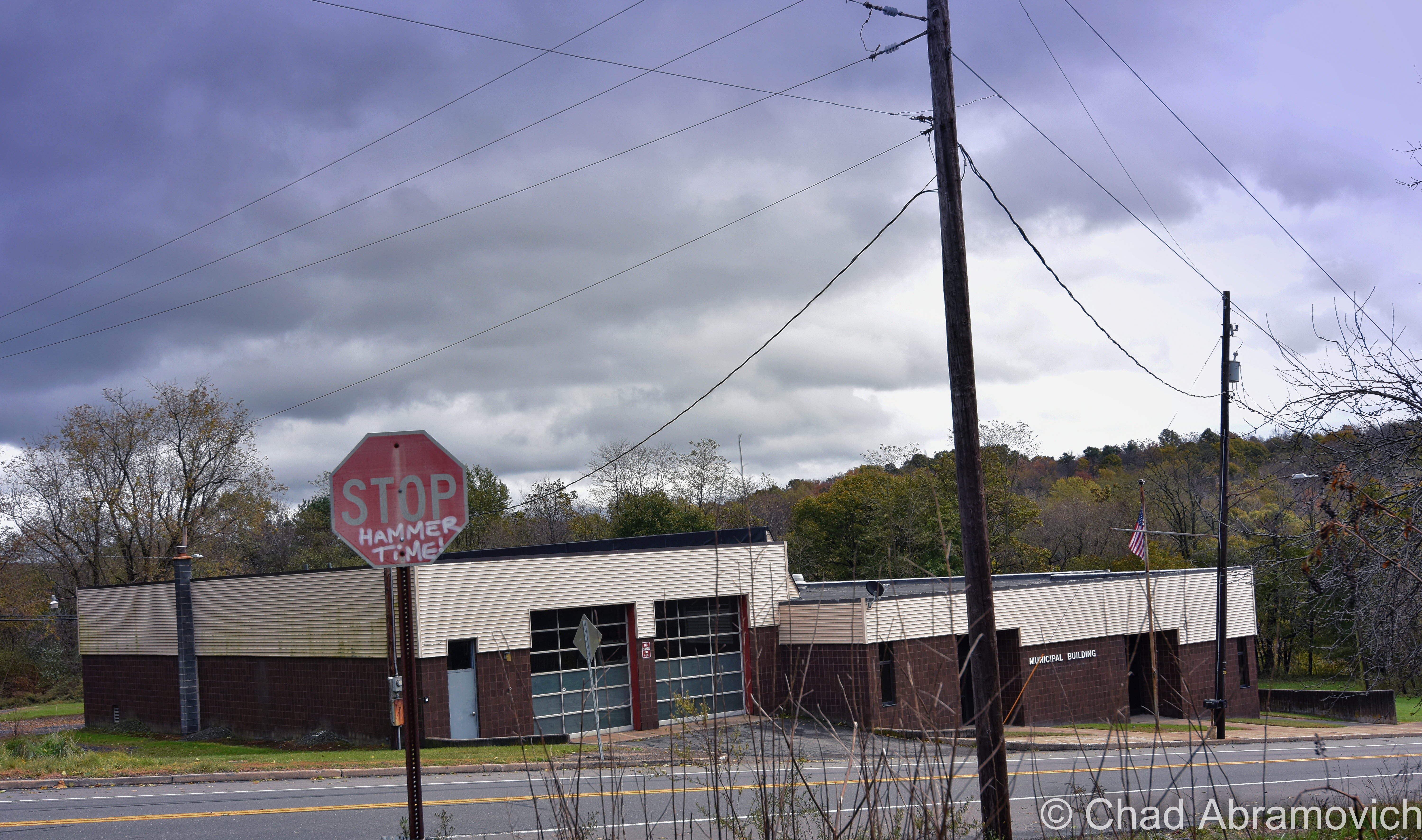
And speaking of conspiracy theories, others declared that Pennsylvania was consequently trying to erase the town. They removed the town’s zip code and its name from the municipal building – which is one of the few holdout structures left. I read somewhere that PennDOT also removed Centralia from wayfinding signs, but I clearly read it on a few new-ish looking signs on my trek there – including at the intersection of PA Routes 54 and 61 in Ashland.
Other varieties of signs, including street signs and the popularly photographed danger signs alerting you of both the mine fires and terrible risks to your future health if you hang around, have also gone missing in the intervening years. Theft has a probable role in that – and a few signs might be hanging in some teenagers bedrooms somewhere.
But with Centralia’s growing postmortem celebrity and things like GPS and Google maps, you will never be able to entirely erase it.
And that’s apparent with all the tourists that go there with an interest in ridiculous human disasters. People like me! Even though the Pennsylvania Department of Environmental Protection explicitly discouraged visitors and memoed that “Walking and/or driving in the immediate area could result in serious injury or death. There are dangerous gases present, and the ground is prone to sudden and unexpected collapse.”
Centralia isn’t the only perennially burning ghost town in America, nor is it the oldest. But its story is probably the most compelling, and pretty eerie.
You might already know about Centralia without knowing it. The movie Silent Hill was inspired by the doomed hilltop community within perennial wispy smoke – which may be part of the reason why this increasingly legendary dot of the Pennsylvanian atlas is in the din of the upper gradations of American oddities.
There are actually two vanished towns, the other with the unlikely name of Byrnesville, which was another casualty of the Centralia mine fire. The last building in Byrnesville was torn down in 1996, and there really isn’t all that much left that identifies the former village apart from a residual religious shrine to the Virgin Mary turned roadside landmark in the woods off Pennsylvania Route 61 between Centralia and Ashland – which is still called Byrnsville Road.
Centralia; First Impressions
Centralia still burns, and there is enough coal to stoke the flames for an estimated 600-1000 more years, depending on who you ask.
Centralia is far from being any sort of Brigadoon. It’s actually very easy to miss because it doesn’t really look like you’re driving into a hellscape. When we arrived, it was actually a cheerfully warm and sunny October day.
It’s right on PA Route 61 at the junction of PA route 42 in a little dip between 2 hills that’s between 2 still functioning towns, where the roadsides are a bit weedier and disheveled. You can spot a crumbling curb or amputated stretch of sidewalk still if you look close enough, and there’s the iconic dated brown municipal building.
My own imagination and the promoted hype built it up pretty good – so I guess I was a little, well, disappointed when I finally rolled into “town”.
If you’re wondering if you’ve actually found the place – the lines of shoehorned parked cars, people taking selfies, and youths riding around on dirtbikes will be a good wayfinding point.
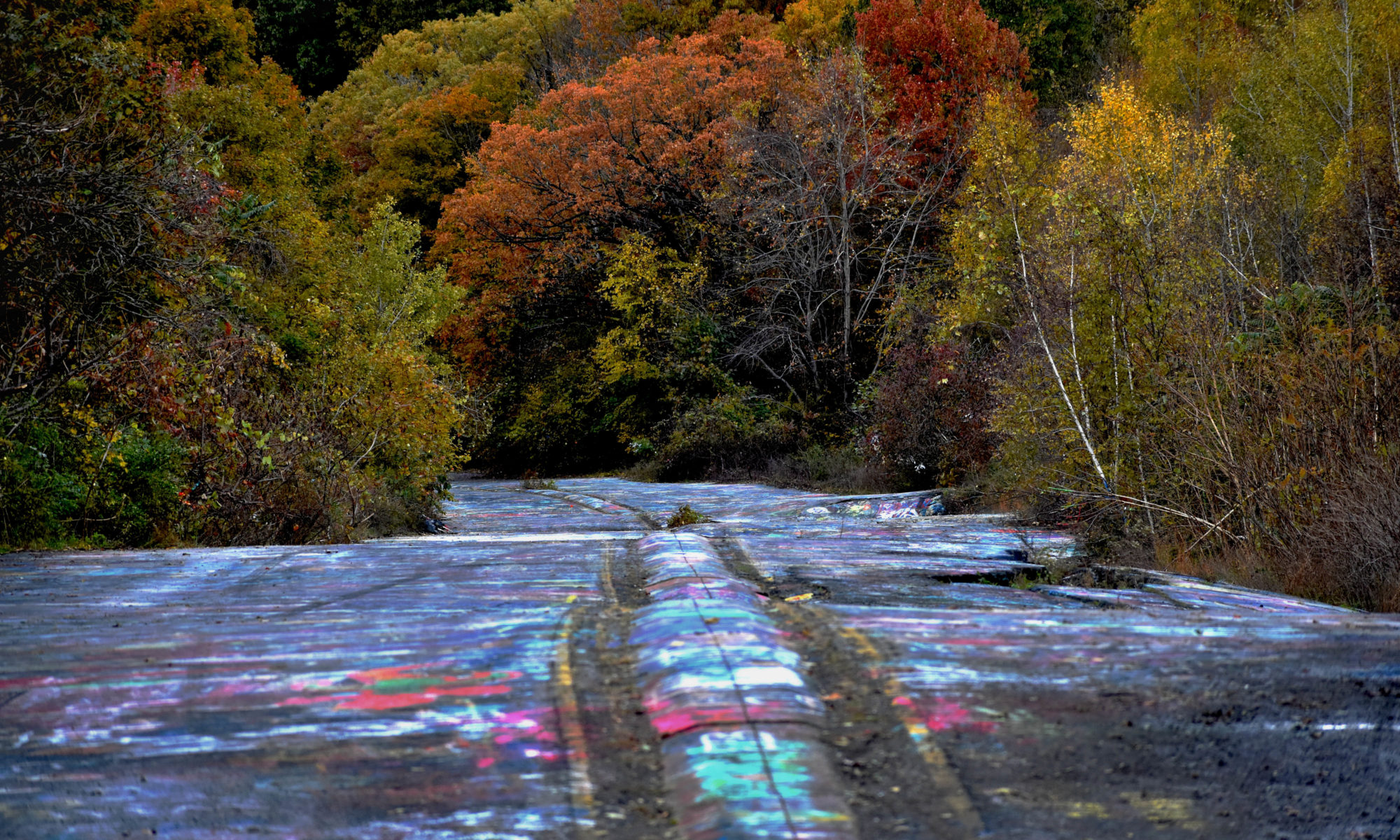
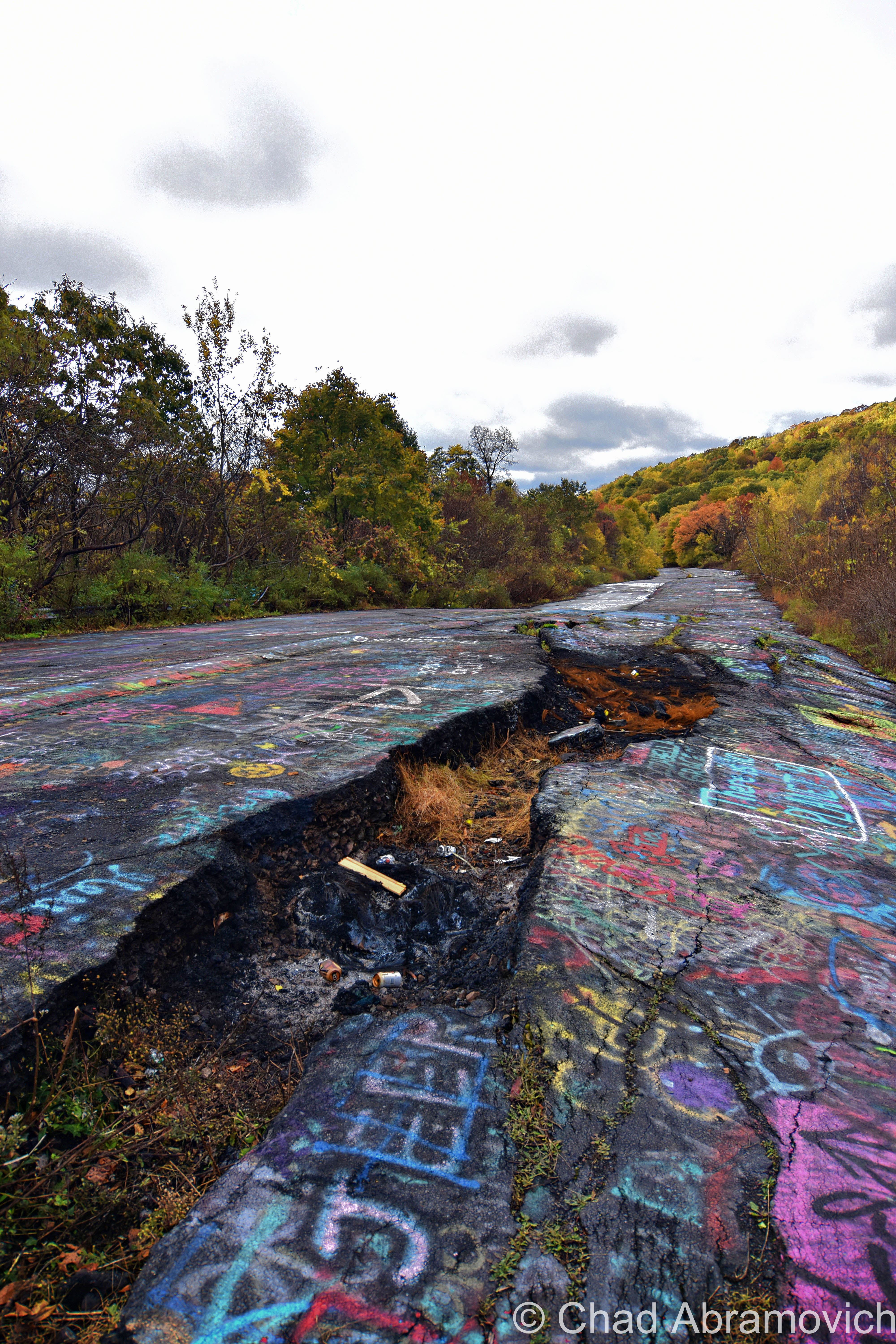
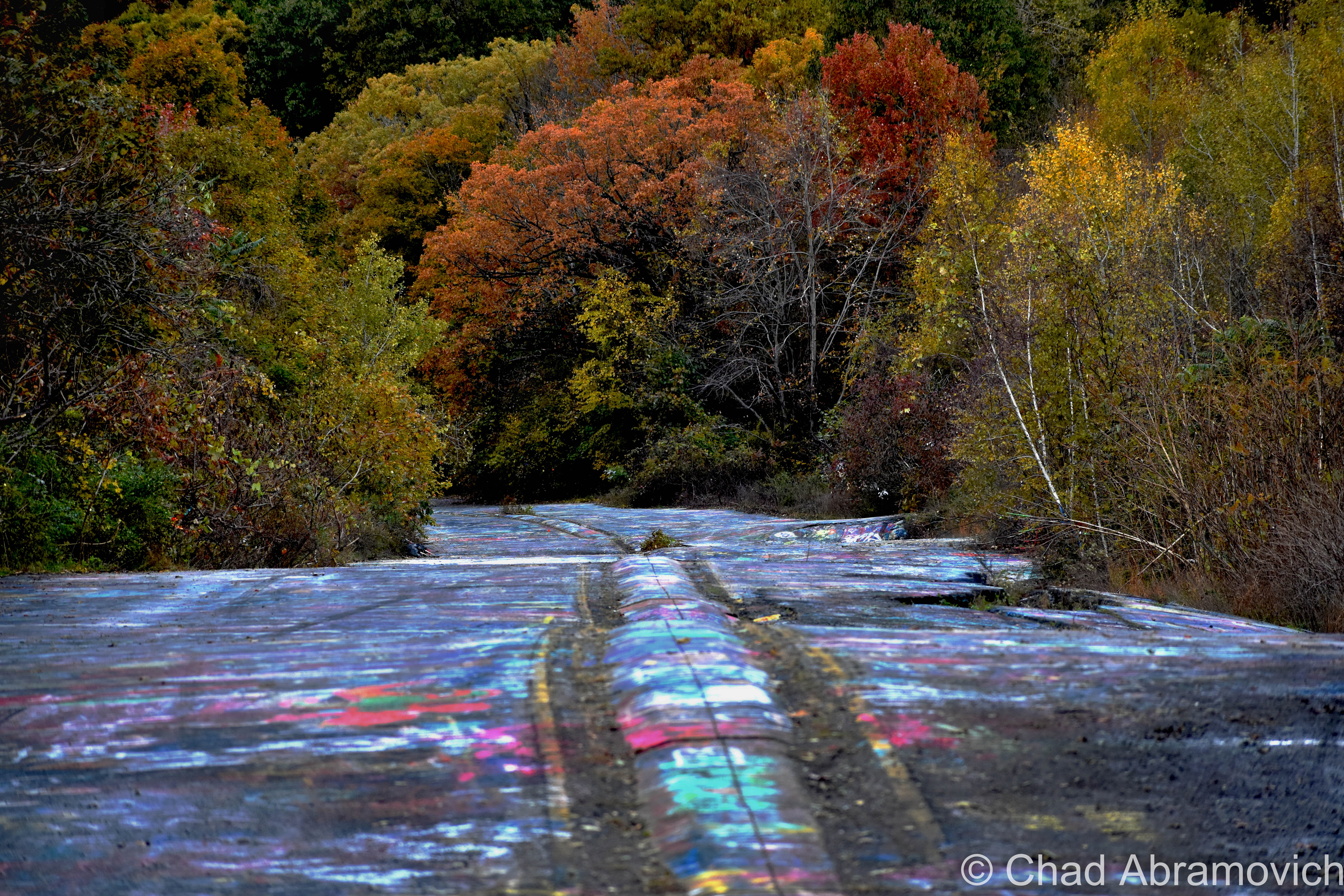
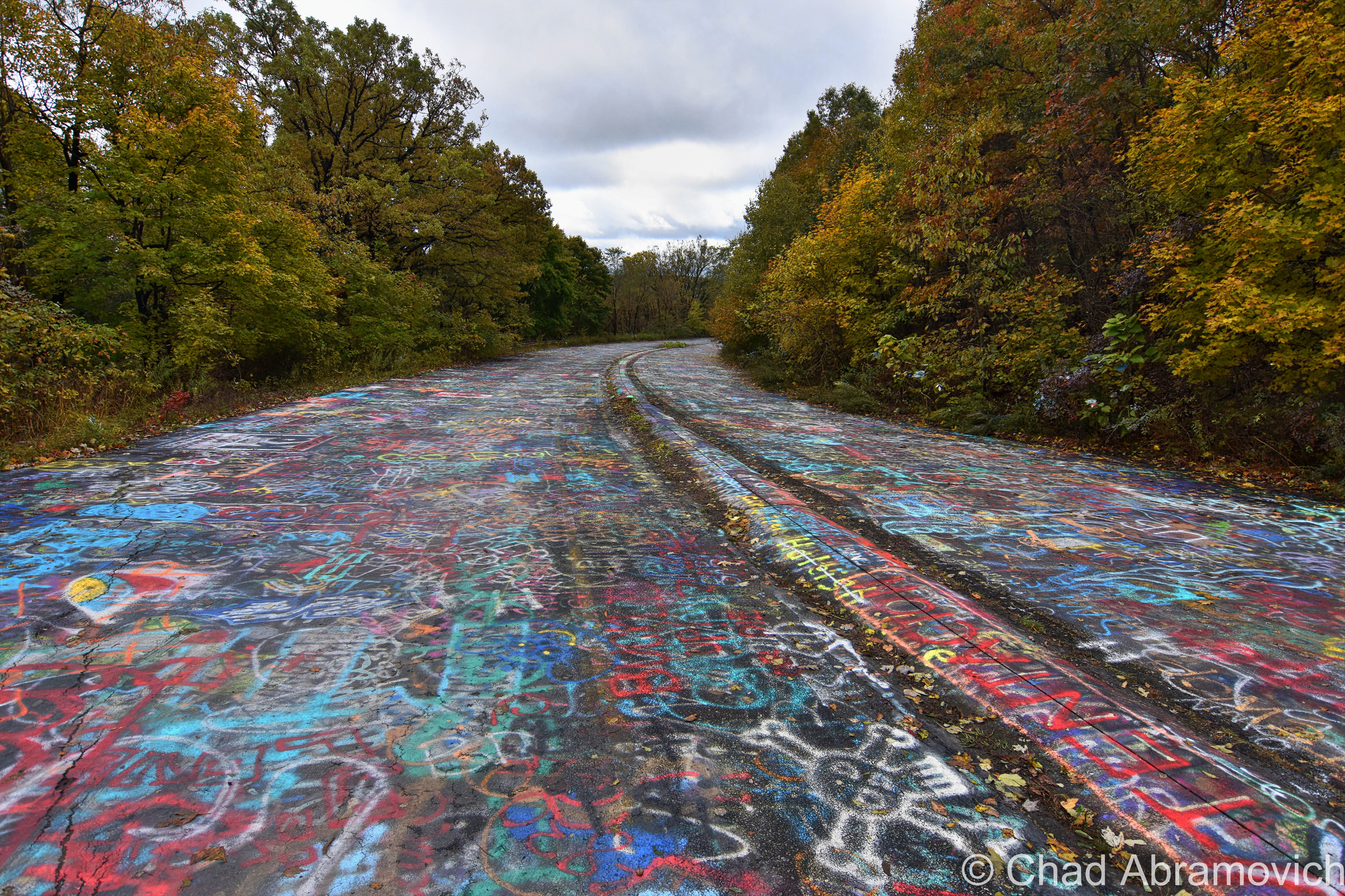
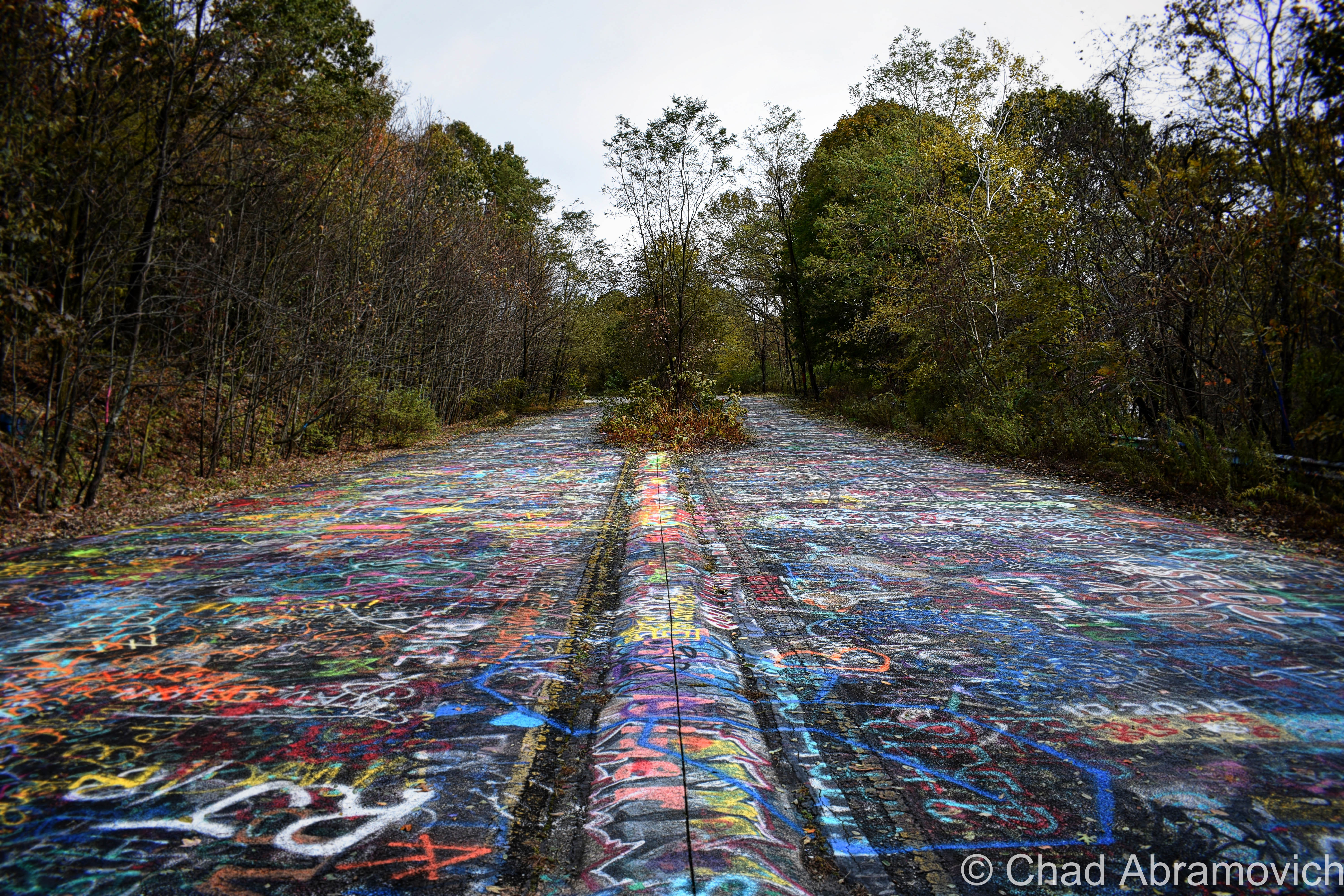
They’ve all gotten out of their cars to see the main attraction at Centralia, something that’s become known as “graffiti highway” because it’s literally just that. Google maps calls it “PA-61 Destroyed”, which is also pretty accurate. If any start-up bands out there are looking for the title of their debut EP, that’d also be a badass sounding contender.
It’s an abandoned portion of Route 61 that had to be closed, and a new stretch of road re-routed around it because the temperature below got so perilously hot, the asphalt began to undulate and contort open.
Over time, the half-mile of tarmac became a canvas for taggers – mostly of the uncreative variety given how many phalluses there were, but I saw a few gems amongst the ironic elegy on my stroll.
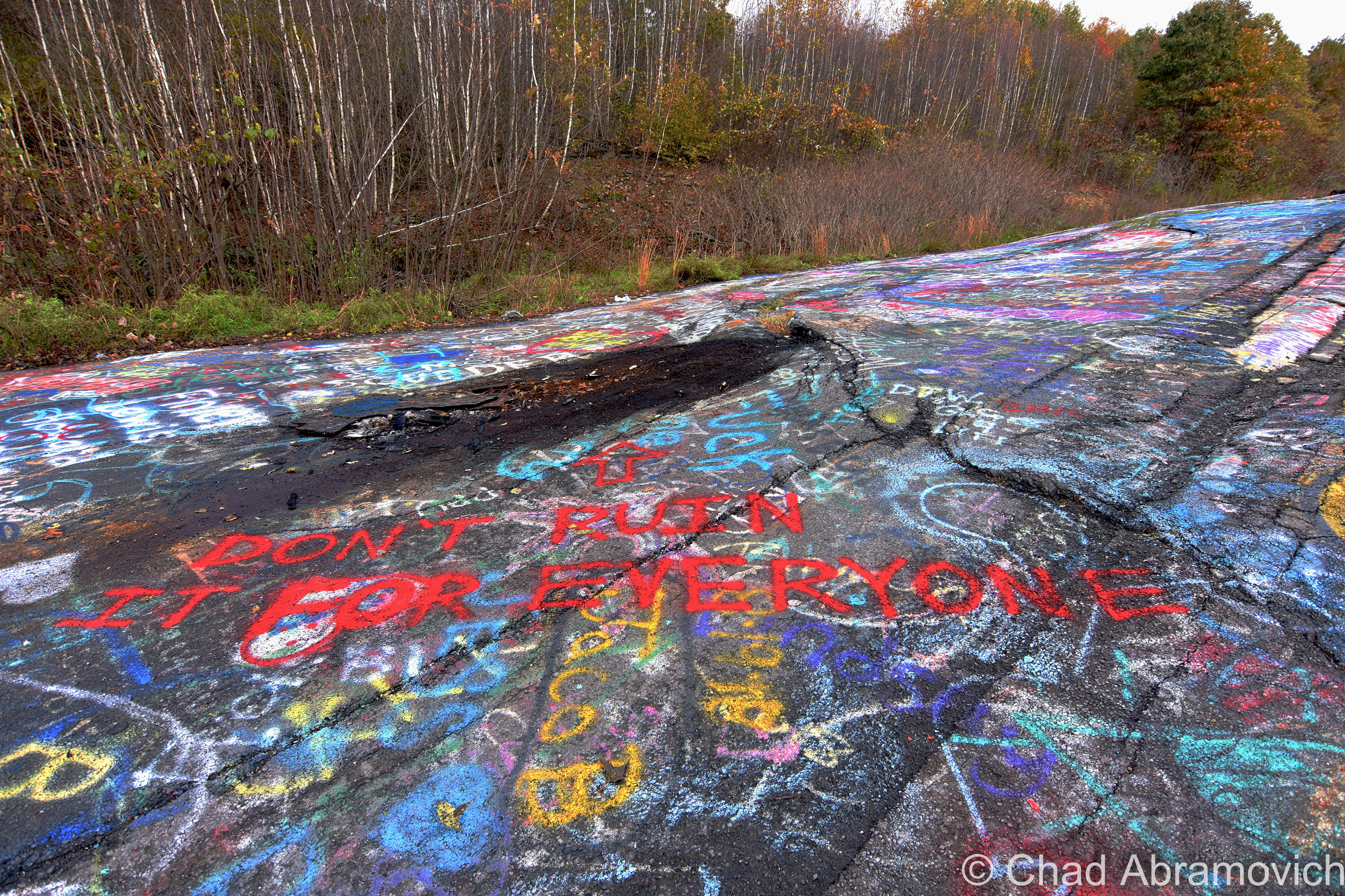
All the colorful and squiggly graffiti certainly is a sight, but further down the road was something far more impressive – a roughly 100-foot sinuating fissure that was lazily venting wisps of smoke.
A gaggle of boys on dirtbikes propelled past us to the other terminus of the defunct highway, then turned around, did some wheelies, and stopped at the smoking crack to gawk at it while I was taking some photos. Behind me, 3 teenage girls were heading my way – all of them on their phones, and behind them, a young couple with a happy golden retriever were just lazily ambling along parallel-ish to another teenage fella piloting a drone.
This place was certainly no terra nullius, it was packed! Which really gave a conflicting feeling to the casual atmosphere on a road with a raging coal fire underneath, its heat odiously evacuating into our realm through the giant rift. It was weird.
The venting gasses smelled pretty rank and carried a good distance down the road, and there was evidence of toasted garbage and random stuff people tossed into the crack, probably just to stupidly see if it would burn. It did.
It wasn’t really smoking heavily, though, on my visit. It was only really noticeable once you were a few feet from it, and was difficult to capture in a photograph.
The walk back up the disintegrating road to the car left me feeling kinda vertiginous, and I’d like to think it wasn’t because I was realizing how out of shape I was walking back up the hill.
The entire town was a portend to the possibility of the ground opening up beneath me and taking me under, which I have to say is a first on an adventure of mine so far.
I guess I was also expecting the road to have a tactile temperature difference and for my shoes to be nice and toasty, but that didn’t happen either.
Nearby the graffiti highway and down a side street is the Odd Fellows cemetery, where it was said that the fire originally started and also where I’ve heard smoke can occasionally be spotted rising from the ground and curling around the gravestones, but it disappointingly looked like a normal cemetery when I strolled by. I’ve also heard of tales of tourists ostensibly being sucked into surprise sinkholes in the woods behind it.
Centralia has taken on new life – as a place to ride off-road vehicles. The marauding went beyond the graffiti highway – there were groups on dirtbikes, a few 4 wheelers, and even some lifted, mud-splattered trucks that were all doing their thing down what remained of the former gridded streets that all bled into well-worn dirt trails through the woods. It’s practically a real-time scene out of a post-apocalyptic film.
It’s strange to remember that there are a few people who still live here, (the 2012 census counted 9) and according to what I’ve been researching online, they hate the tourists. One woman reportedly started chasing people away with a broom who disrespectfully got too close to her house. Can’t say I blame her.

Because this was both of our first time in Centralia, and we had about a 9-hour drive back to Vermont ahead of us, our time was a bit hurried.
When I got back home and began researching, I found that we also missed a few sites that would have been cool to see, like some of the remaining houses, the popularly and poignantly photographed time capsule marker (which was opened early back in 2014 with mostly ruined contents), and, this faux geyser! It’s said that this is created by runoff going through 200-year-old drainage tunnels of nearby collieries, and is only visible after a good rain.
Oh well, maybe next time.
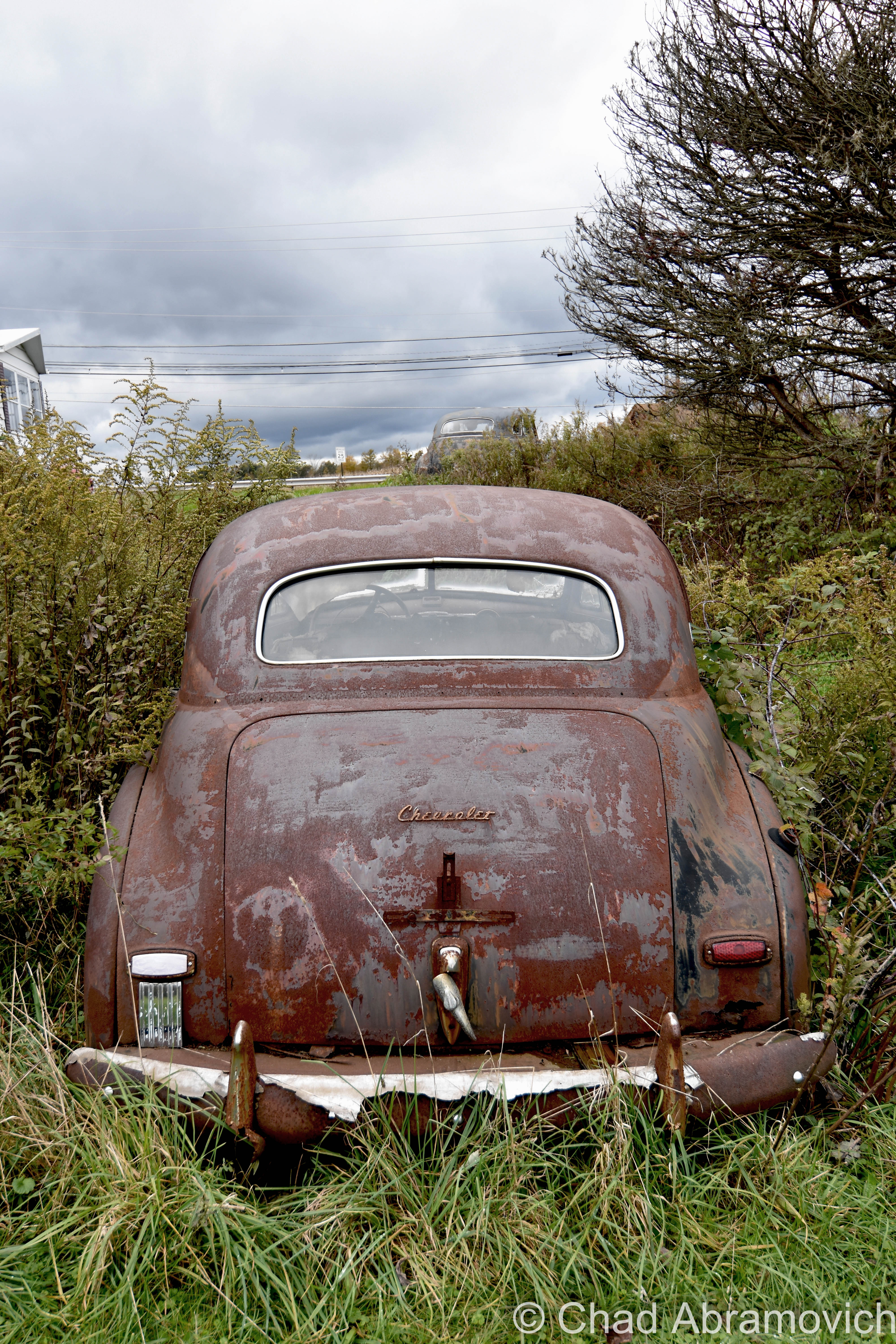
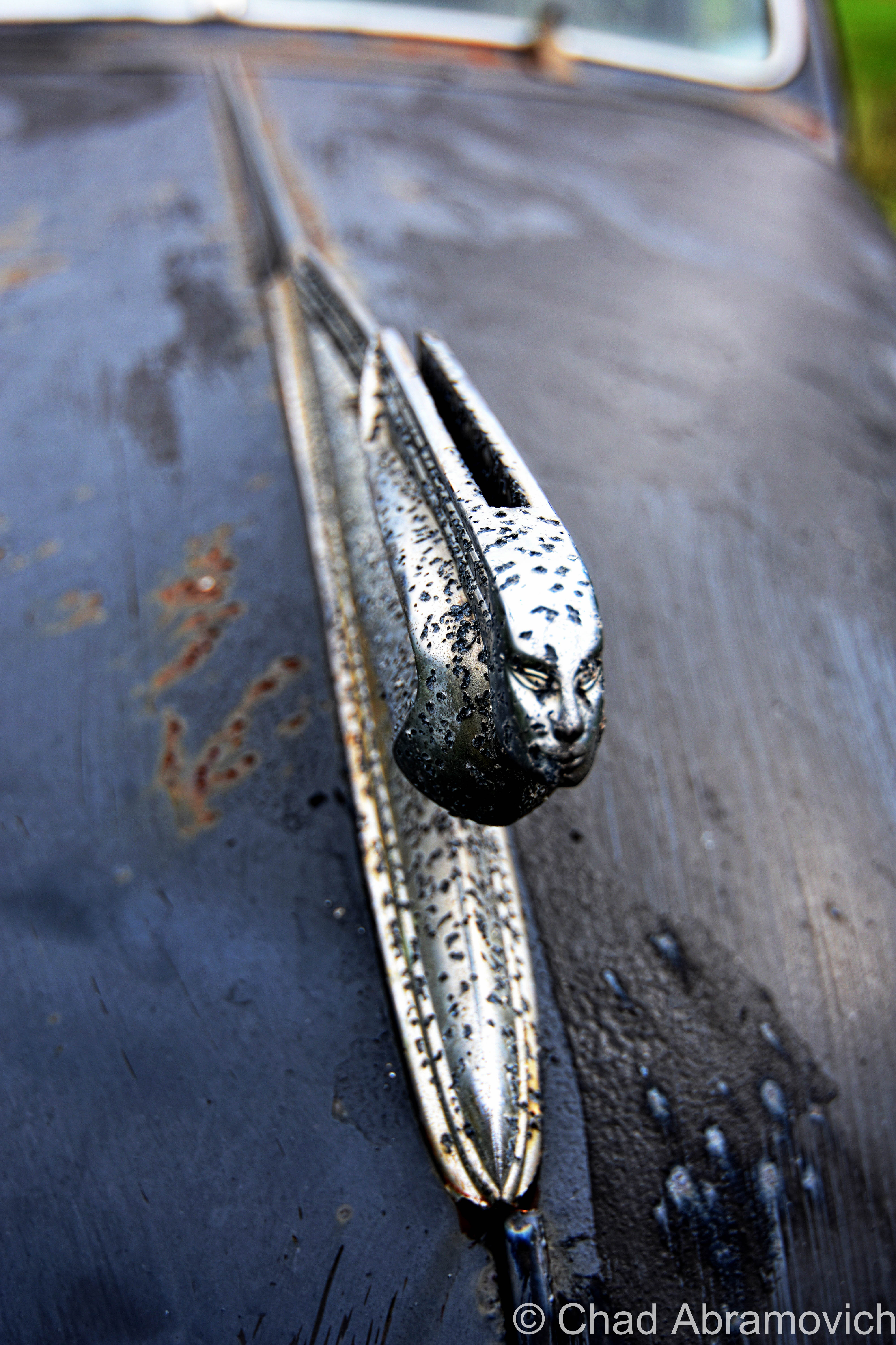
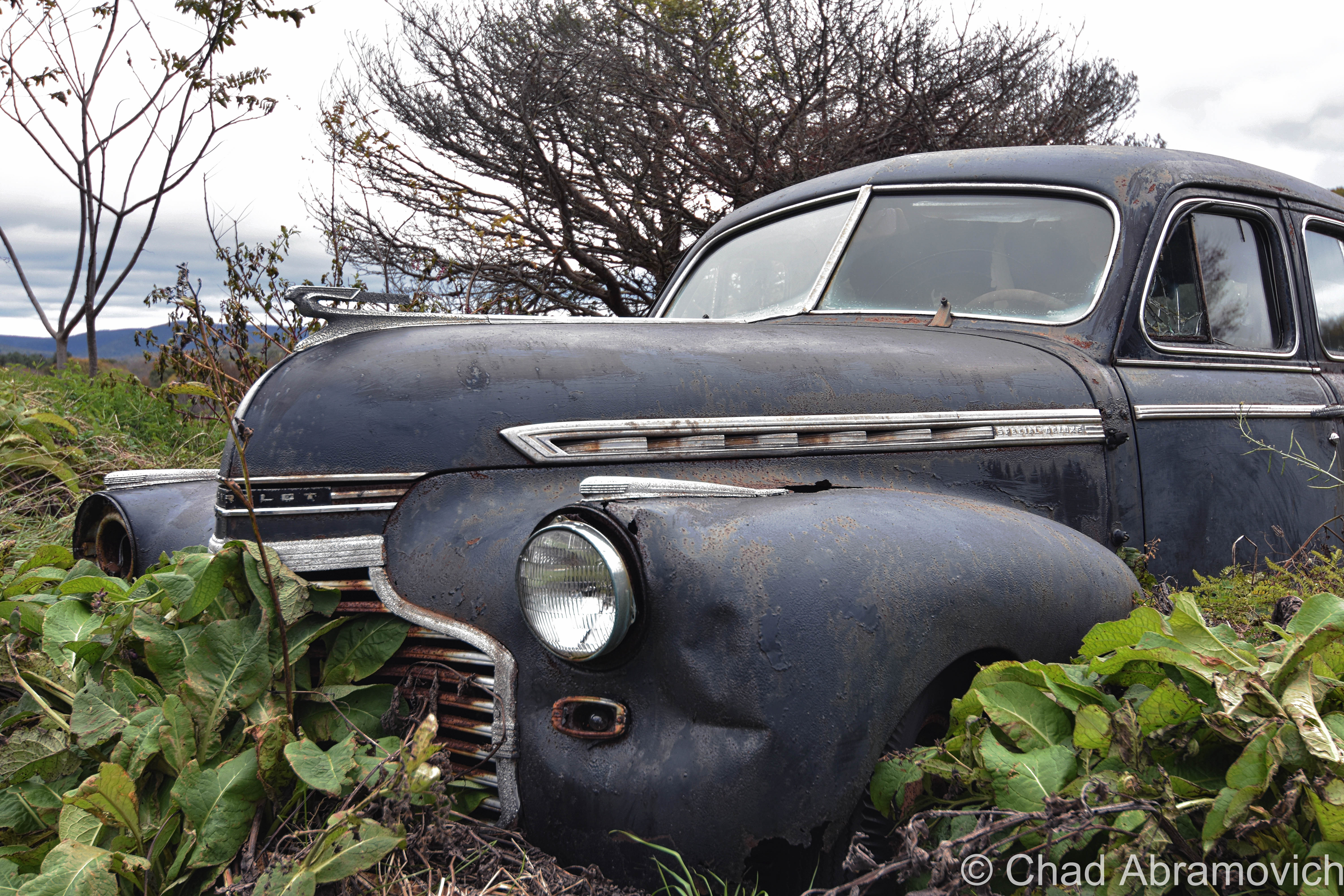
Kind of feeling a bit underwhelmed in Centralia, we headed out of town and found some great abandoned rusted Chevrolets sitting in a field off a back road which were fun to shoot, before we deemed ourselves exhausted and drove back to Vermont. 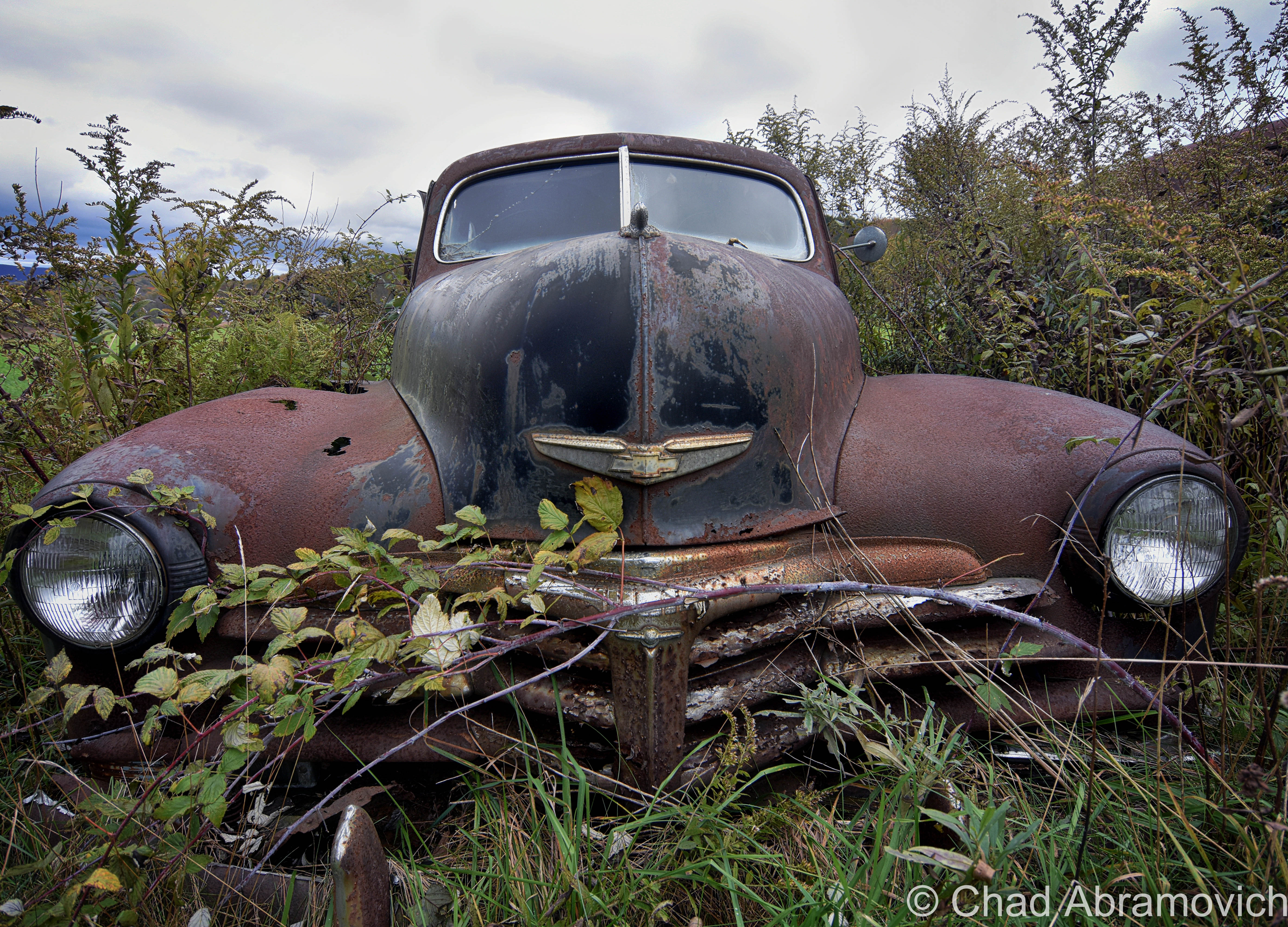
The thing about Centralia is that it really grows on you the more time you have to reflect on it. It really does. This trip also really reaffirmed that there are unbelievable sites that exist closer than you think.
There’s actually a fansite for the town, with lots of information! If you’re a Centralia enthusiast, you should check it out!
_____________________________________________________________________
Since 2012, I’ve been seeking out venerable examples of Vermont weirdness, whether that be traveling around the state or taking to my internet connection and digging up forsaken places, oddities, esoterica, and unique natural features. And along the way, I’ve been sharing it with you on my website, Obscure Vermont. This is what keeps my spirit inspired.
I never expected Obscure Vermont to get as much appreciation and fanfare as it’s getting, and I’m truly grateful and humbled. Especially in recent years, where I’ve gained the opportunity to interact with and befriend more oddity lovers and outside the box thinkers around Vermont and New England. As Obscure Vermont has grown, I’ve been growing with it, and the developing attention is keeping me earnest and pushing me harder to be more introspective and going further into seeking out the strange.
I spend countless hours researching, writing, and traveling to keep this blog going. Obscure Vermont is funded almost entirely by generous donations. Expenses range from hosting fees to keep the blog live, investing in research materials, travel expenses and the required planning, and updating/maintaining vital tools such as my camera and my computer. I really pride and push myself to try to put out the best of what I’m able to create, and I gauge it by only posting stuff that I personally would want to see on the glow of my computer screen.
I want to continuously diversify how I write and the odd things I write about. Your patronage would greatly help me continue bringing you cool and unusual content and keep me doing what I love!
![]()