

It was a great late summer day to be on a Vermont-venture!
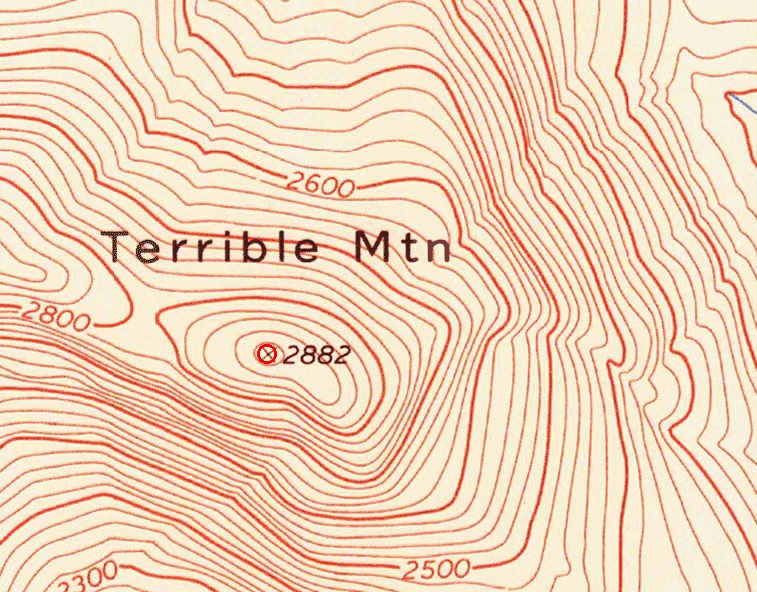
We got a late start, and we had a little over a 2 hour drive down towards the southern part of the state before dusk, but we decided we were going to go for it anyway – and set off to locate the deformed remains of a terrible tragedy on Terrible Mountain, an aptly named geographical growth on the Weston-Andover town line.
Vermonters have always been fighting with their topography. An old local yarn is that if you were to somehow flatten all of our hills, Vermont would have a land area the size of Texas (although, I’m pretty sure that was actually debunked).
Sometimes, our mountains were a huge annoyance to our forerunners which would earn them on-the-level toponyms telling you what was what. One of my favorites is East Wallingford’s Hateful Hill.
In Terrible Mountain’s case – it’s pretty formidable and definitely not hoaxing anyone, despite how reposeful it looks.
Over 200 years ago, unaware surveyors put the mountain right in the middle of the town of Andover and it made getting from one end of town to the other a huge trouble. So much so that the west part of town split and formed its own town, becoming Weston by 1799.
At 2,882 feet, it’s steep and thick with brush and ticks, and an annex of the Okemo State Forest.
We were looking for a plane crash wreck site.
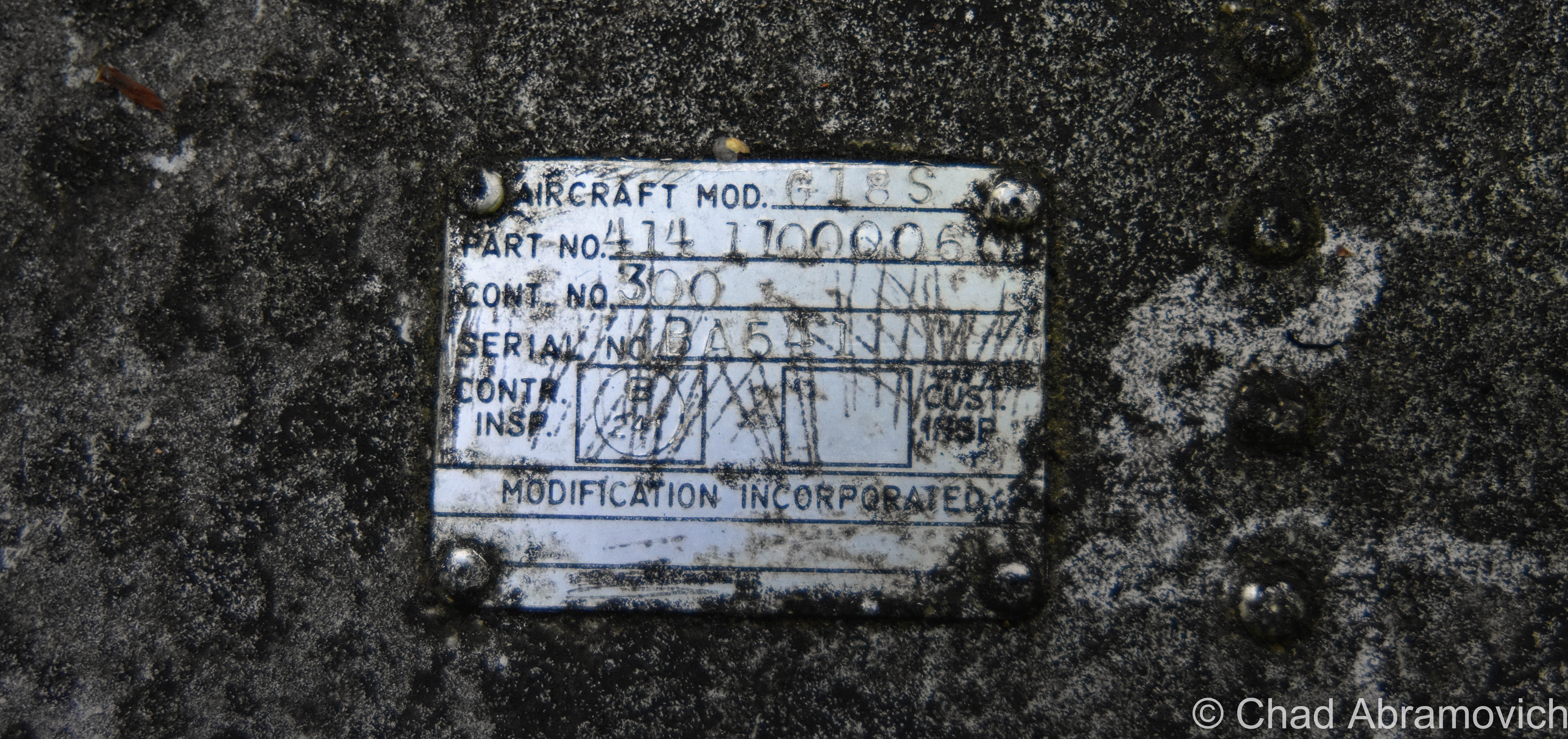
It happened on March 19th, 1968, when bad weather impaired a twin-engine Beechcraft plane carrying 7 men – 5 of them executives of Springfield’s Jones and Lamson Company. It crashed into the southwestern side of Terrible Mountain in a terrific fireball and killed all of them on impact.
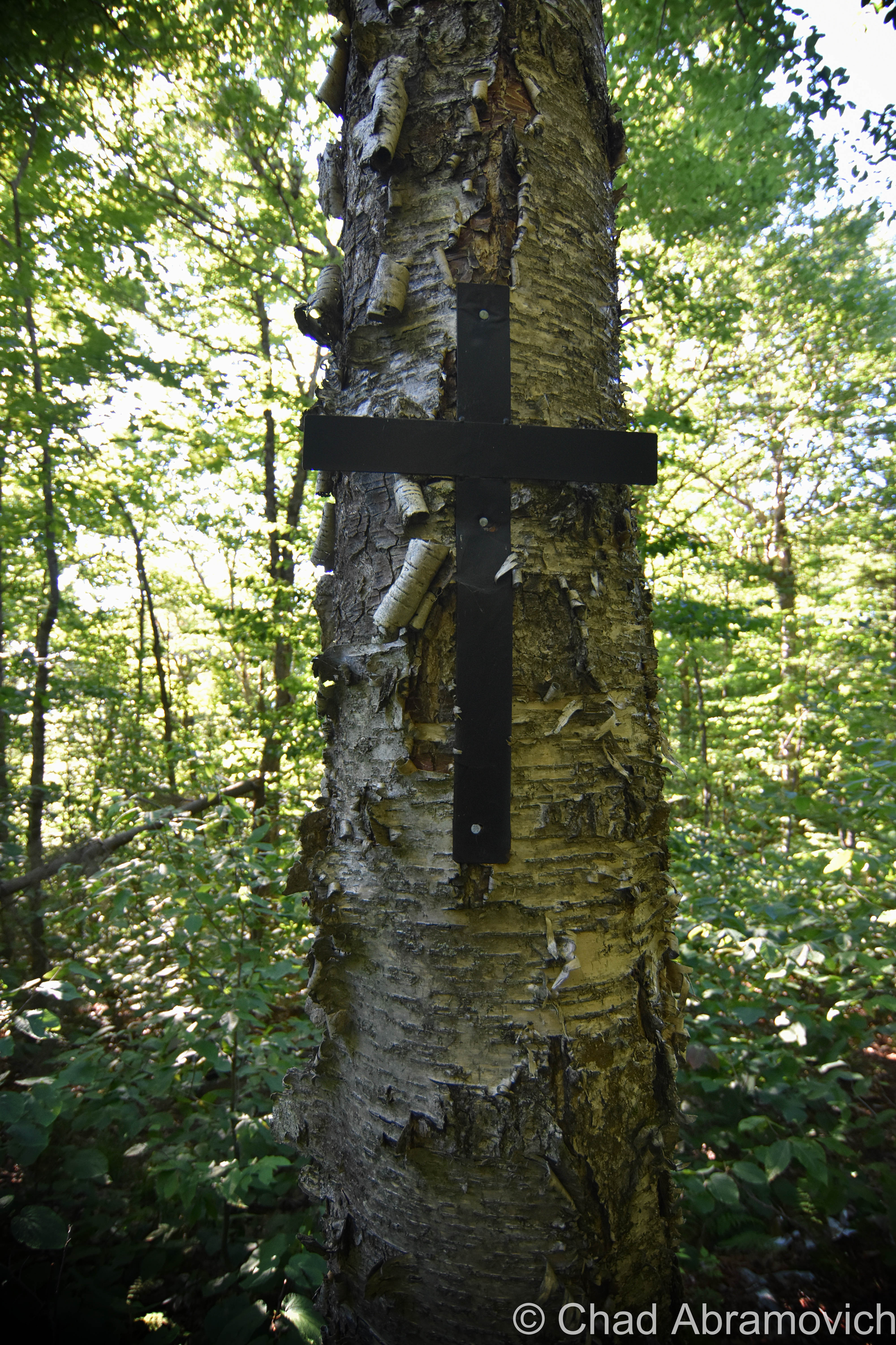
Adjacent locals still recall seeing and feeling the collision and trekking up through 5 feet of snow to the conflagration. It’s pretty intriguing that over half a century later, the debris field is still littering the mountainside. Sometime in the intervening years, someone created a small black cross from 2 plastic bands and nailed it to a birch tree as a somber memorial.
The hardest part was a close toss up between the hike and finding the place to begin the hike. Though the mountain is apart of the Okemo State Forest, it’s a primitive domain without convenient access. And for a while, we thought without any access at all.
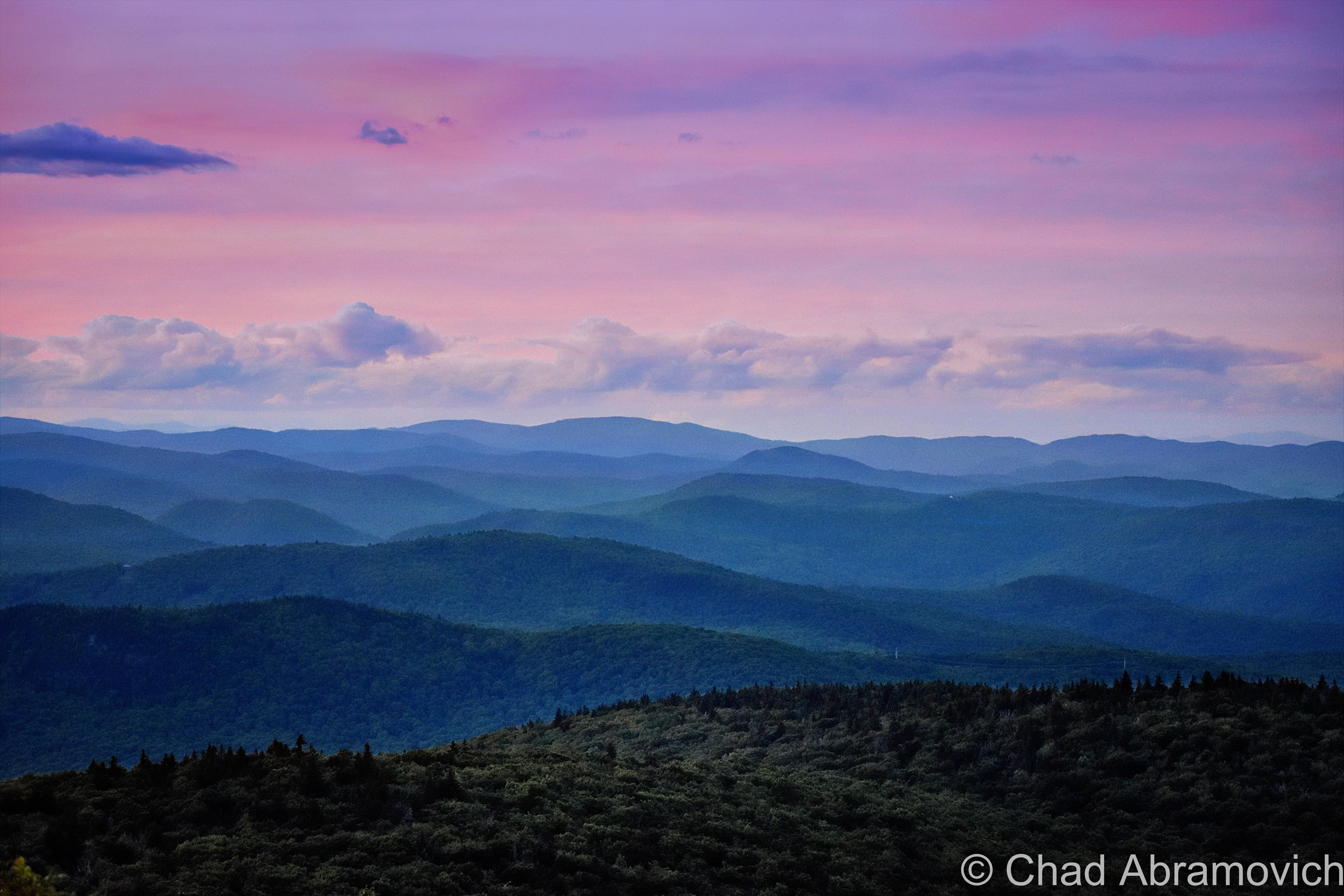
I managed to settle on the road I thought would get us to our entry into the woods, and the higher we drove, the better the views became. I was enthusiastically enjoying wide-ranging vistas of the Green Mountain National Forest and north to Okemo Mountain that was beginning to silhouette underneath the shimmer of a summer sunset.
Eventually, we uncomfortably drove down what was probably someones’ long gravel driveway, before the narrow road forked – the left lead to what I assume was a McMansion in the woods, and the right was pretty much just some ruts that ran up over a slight hill and faded into a weedy clearing with growth that was about shoulder high at that point.
And there it was – behind the overgrowth – a fading green and yellow sign that read “Okemo State Forest”. We figured that was a good of a place as any to leave the car, and prepared for our blind adventure into the wild.
I already have Lyme Disease, and man oh man is it inconvenient. Not wanting to get double Lyme, I broke out the tick spray and diffused it liberally all over my body.
Terrible Mountain is an accurate name (and an admittedly cool one to find in a state over-inundated with cloying contrived ones like “Sunset View” and “Honeysuckle Hollow”). We were definitely breaking a sweat, stumbling over seasonally dry rills and through thick brush and fallen trees that just kept getting more perpendicular.
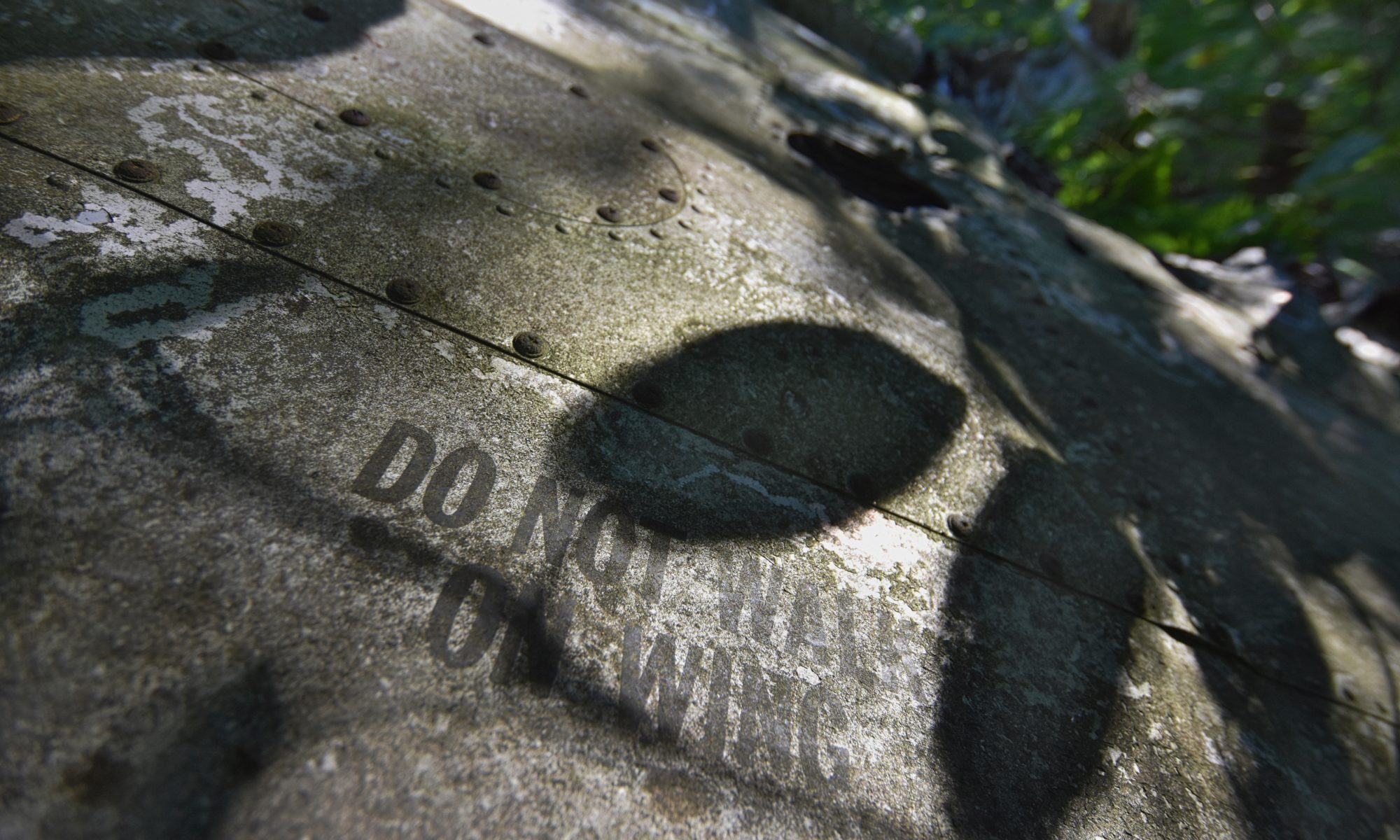
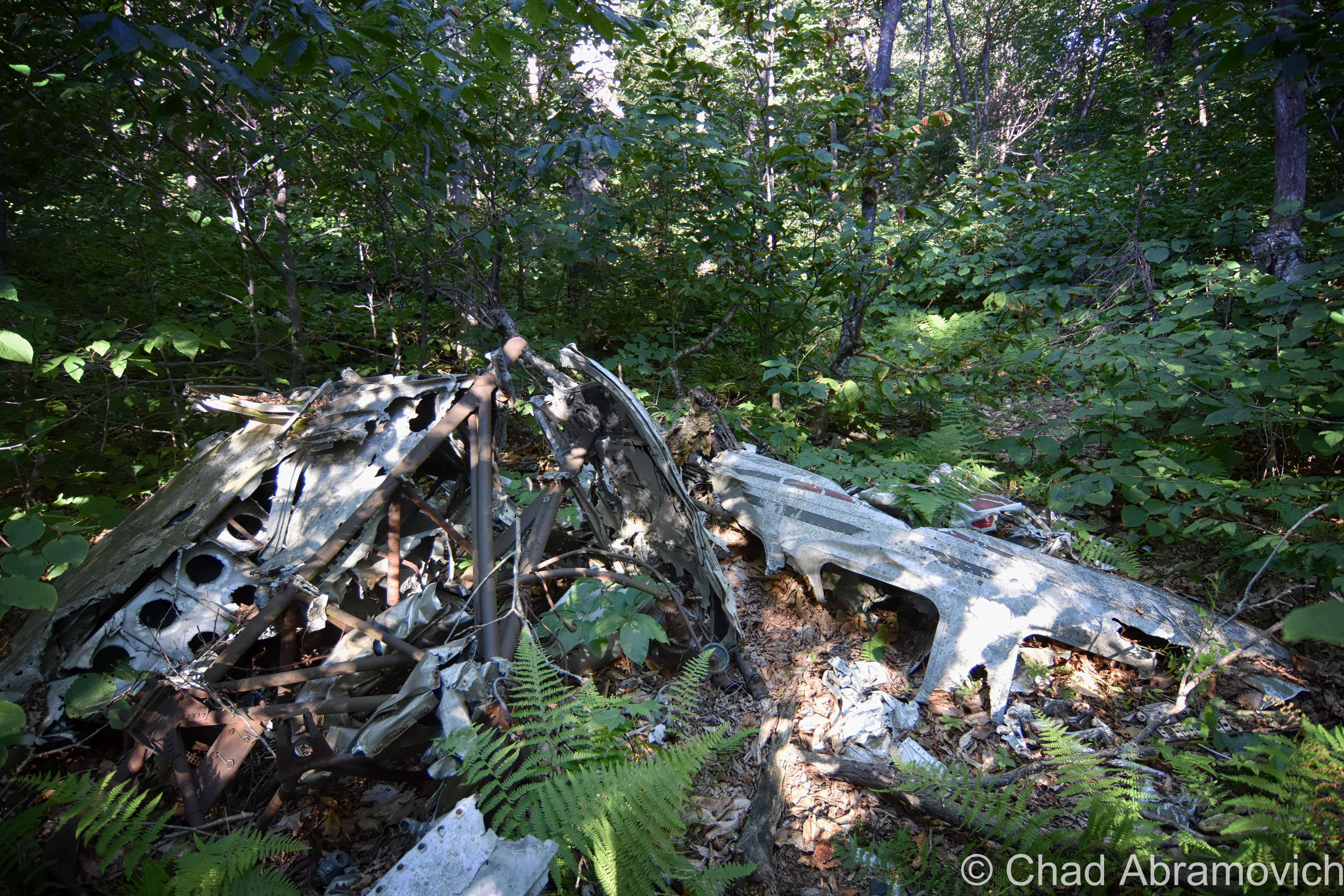
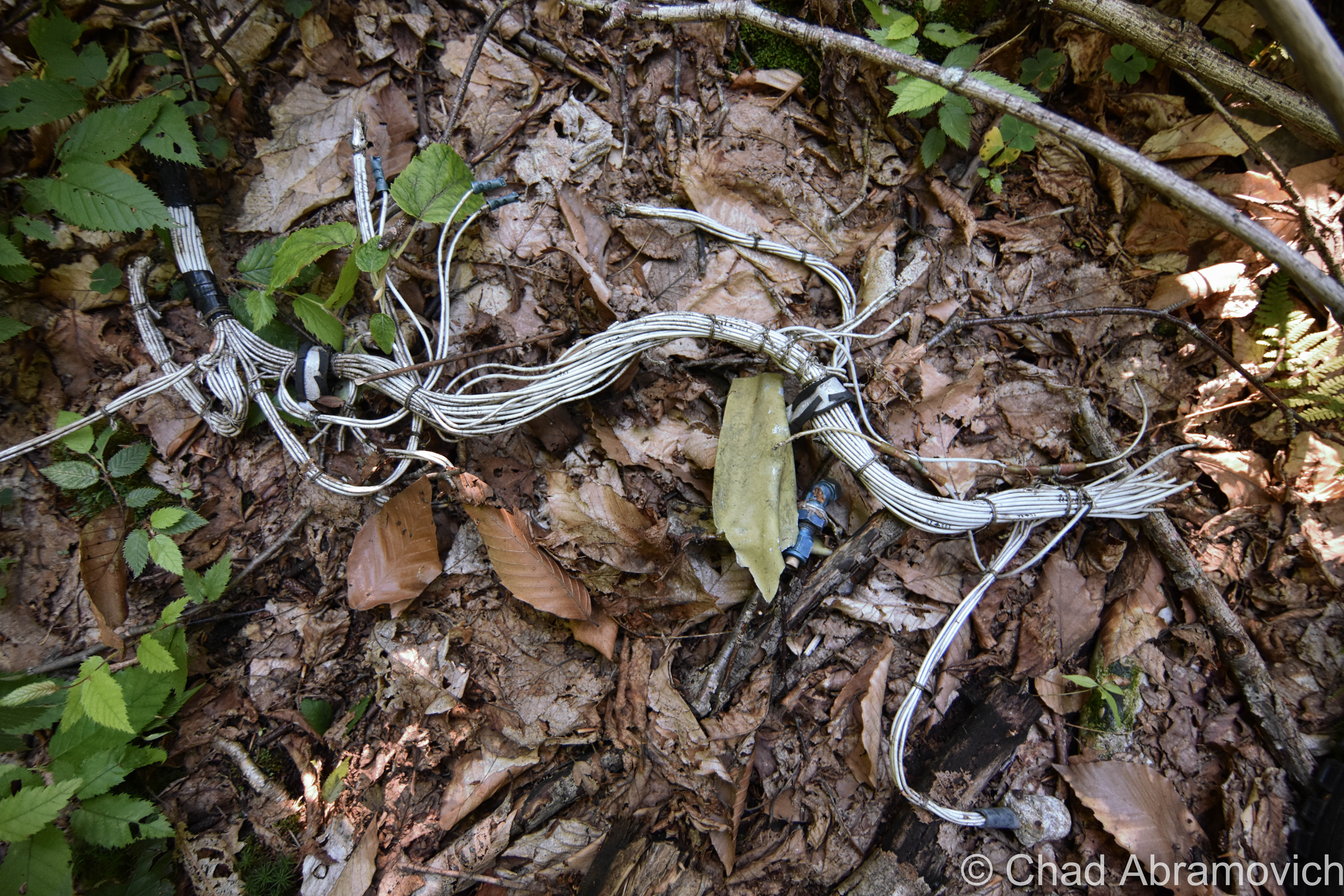
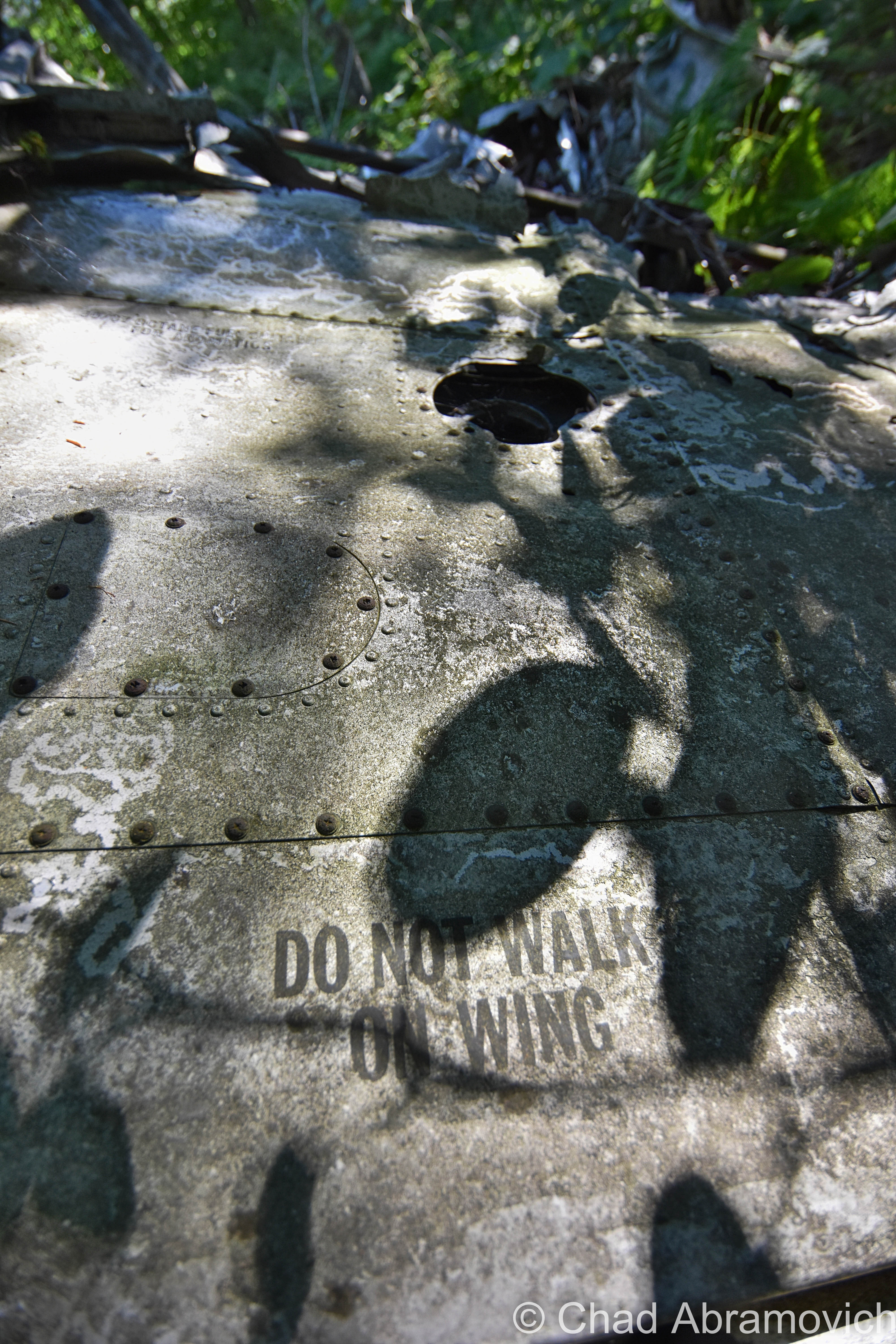
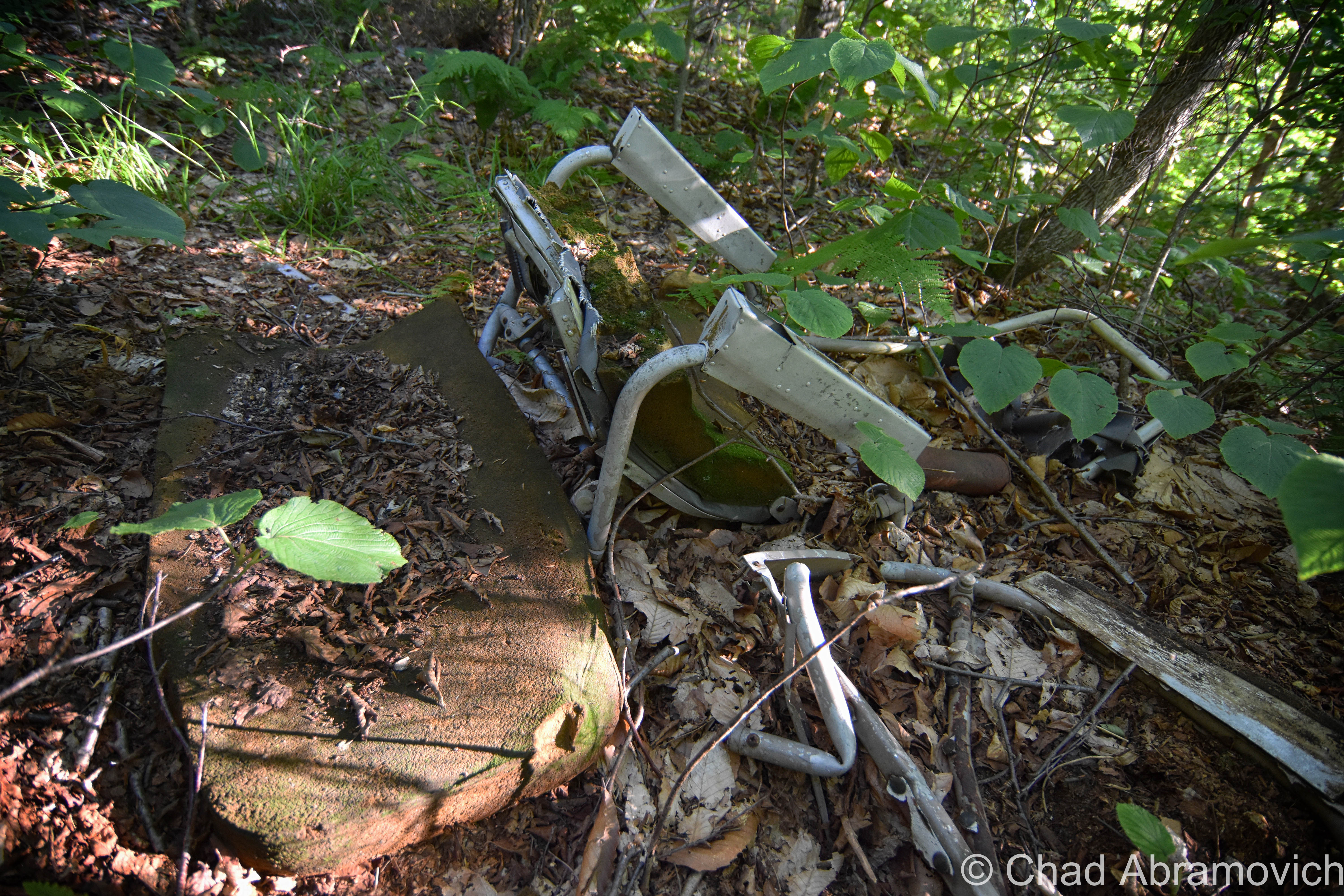
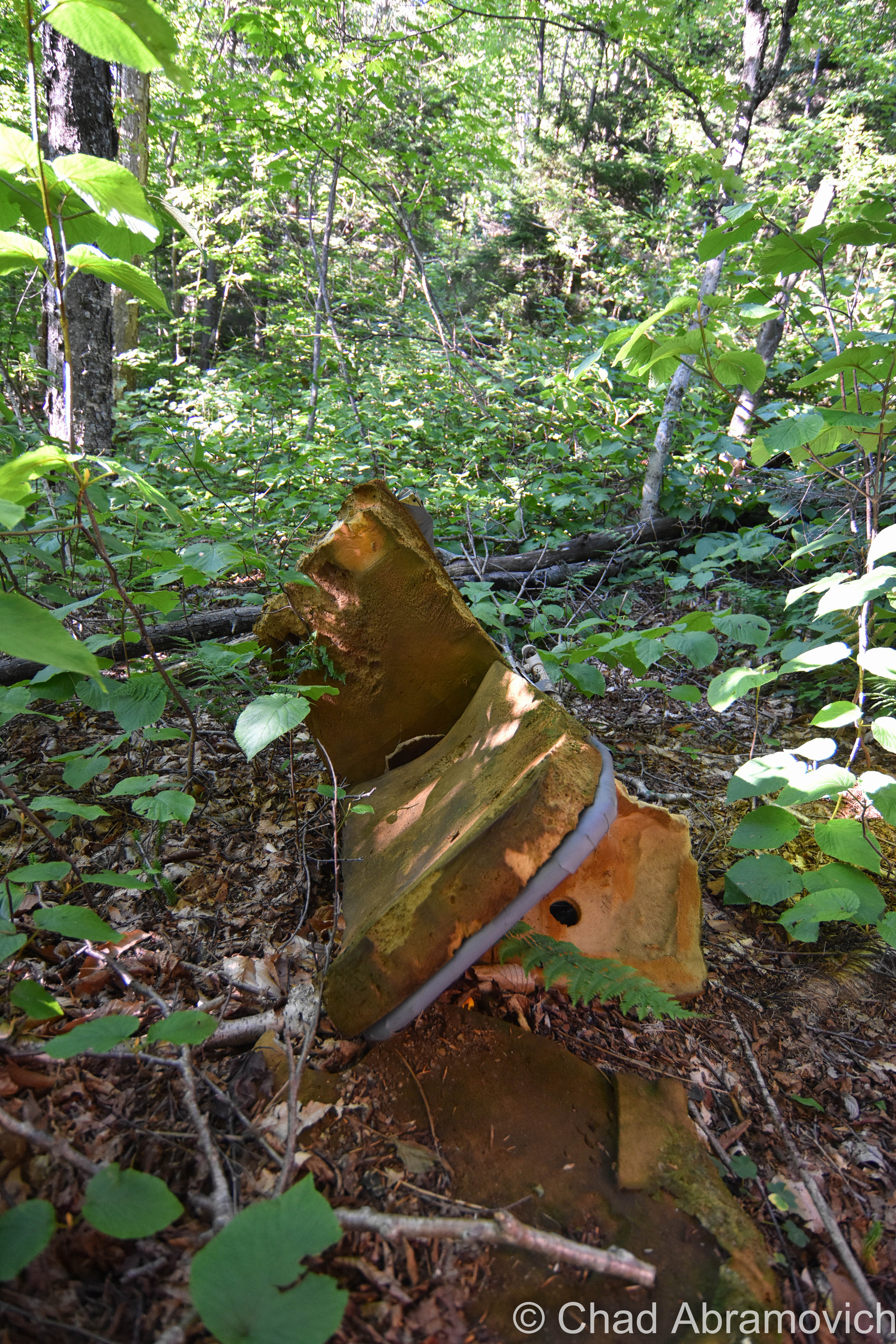
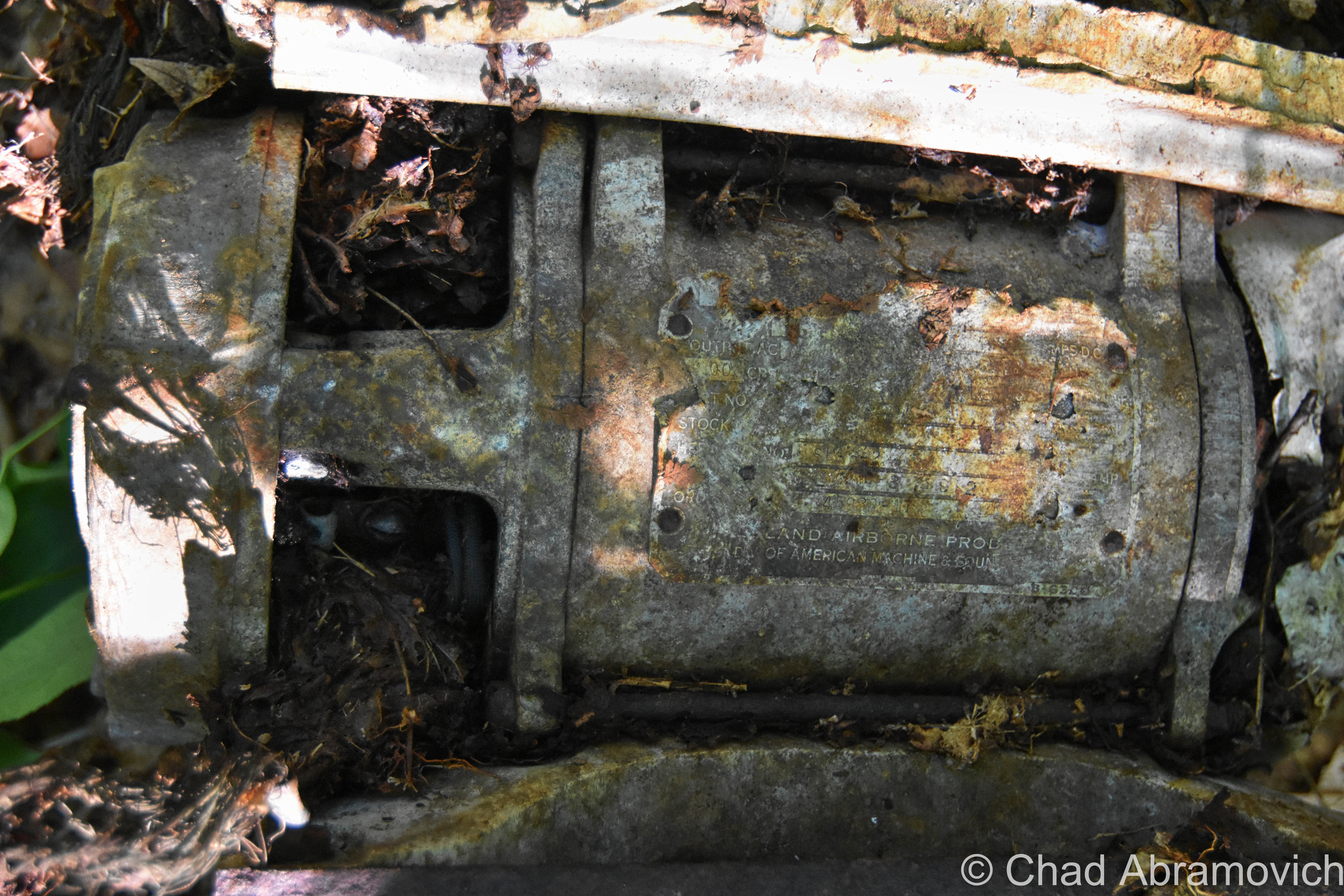
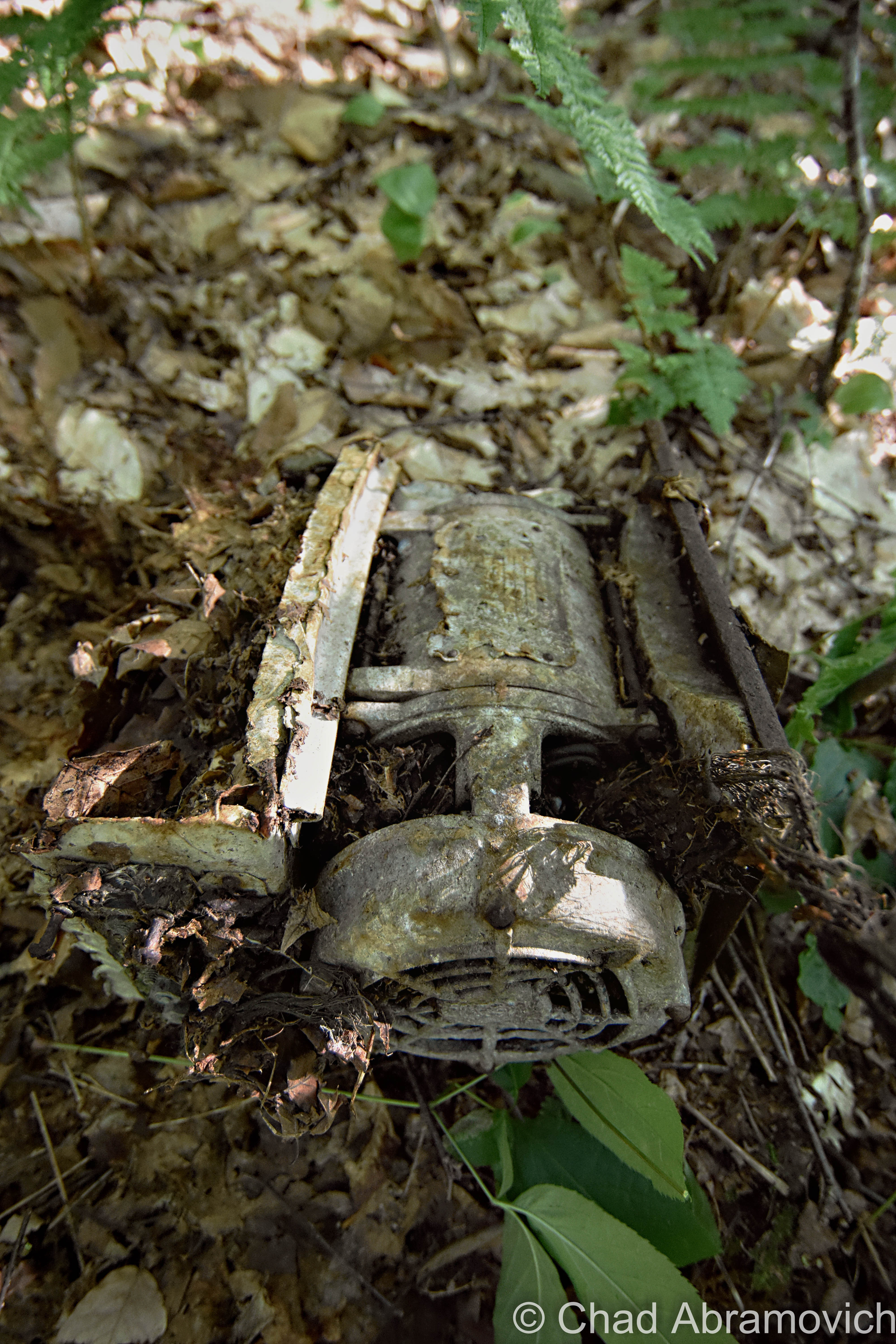
The wreckage was hard to find. You don’t really detect it until you’re pretty much stepping on the shrapnel – but it’s definitely detectable, and I have the photos to prove it!
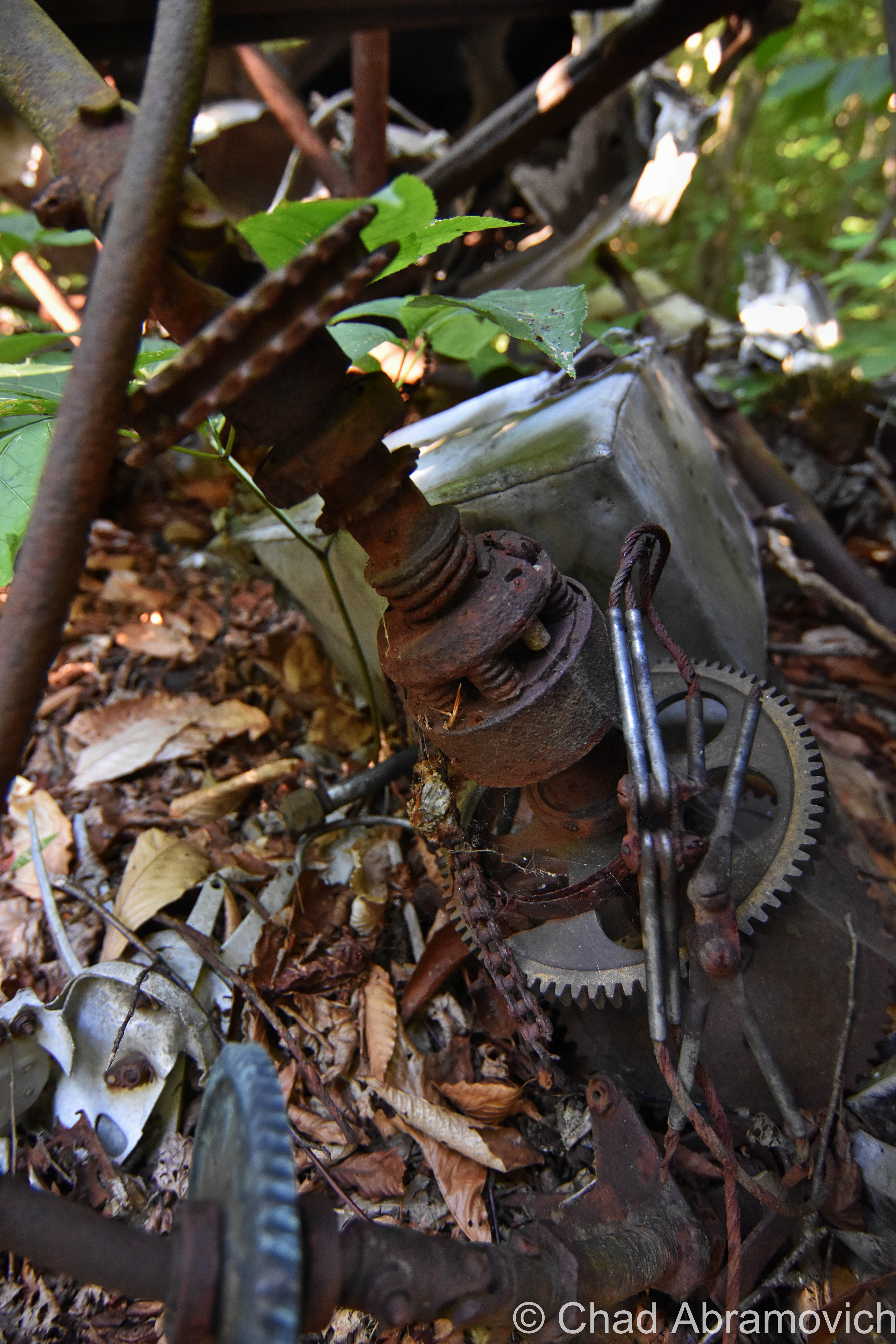
The pieces themselves are all over the place. Some are as small as a baseball, and others are as large as an automobile. Most were hard to photograph without leaving me wondering what I was seeing in my digital preview afterward.
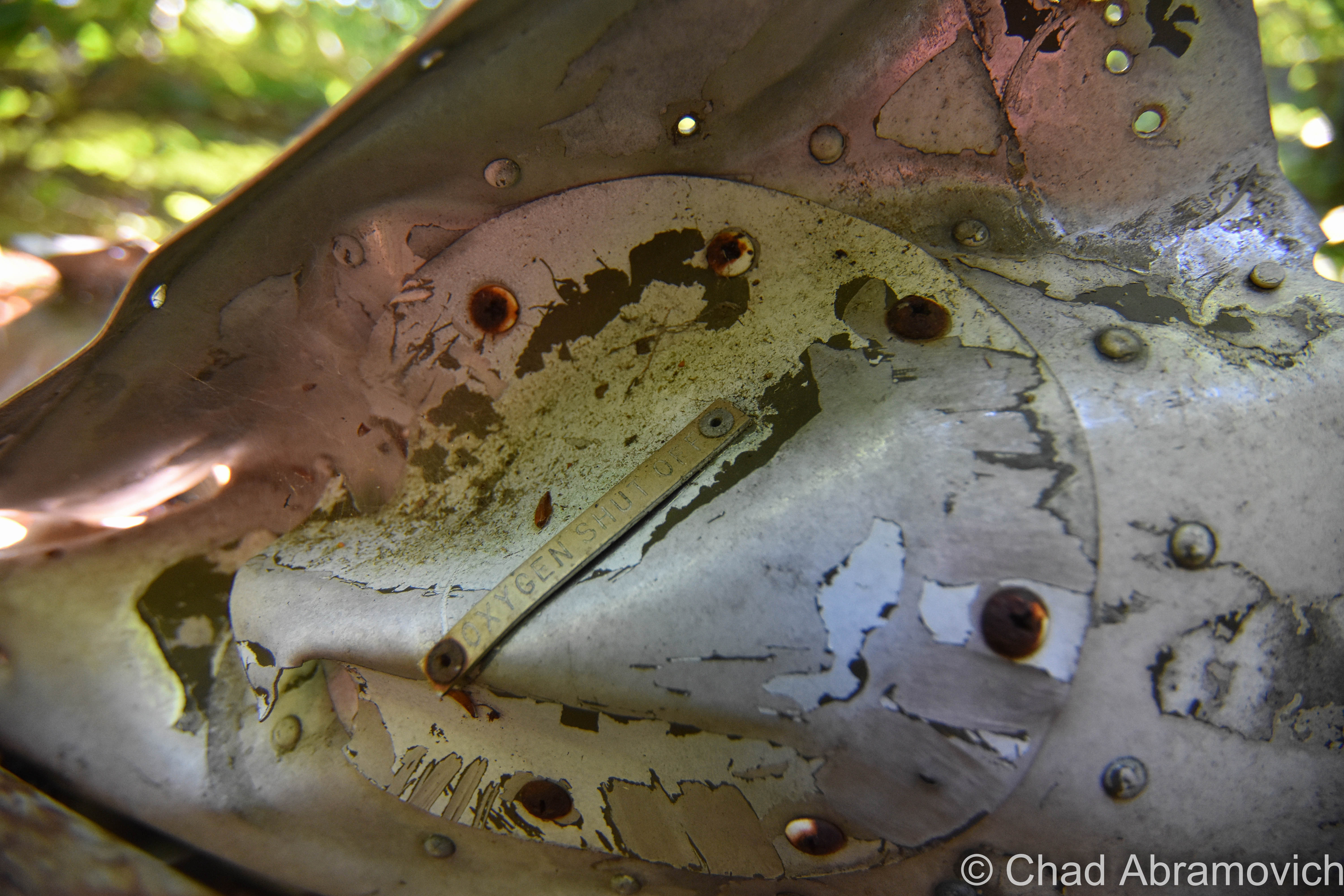
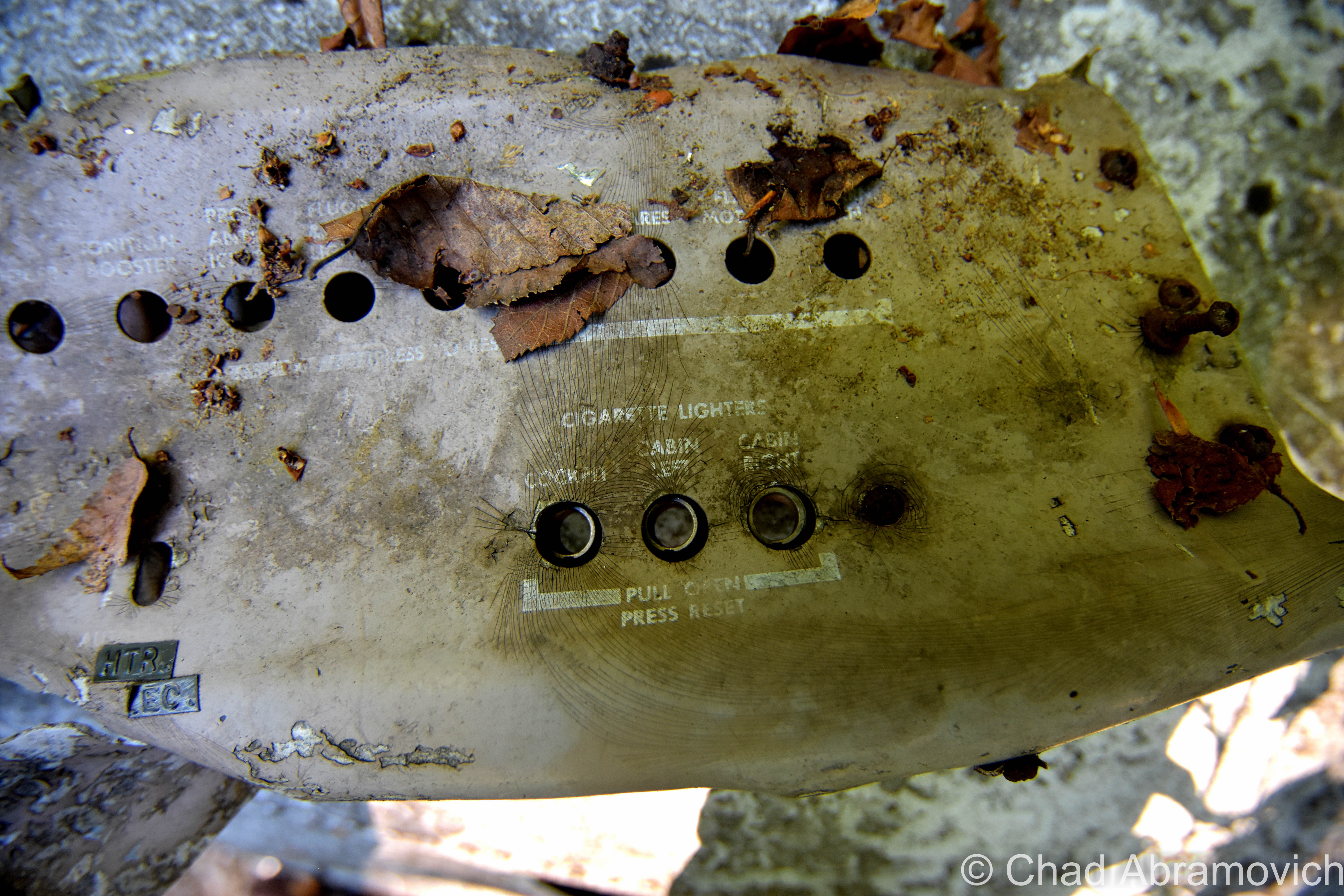
The dashboard and engine were still there, underneath heaps of dead leaves. All of the text above the control sockets was still legible, but most of what I was seeing was unintelligible to a layman like me. Seeing the seats was a bit creepy, and the heavy silence and gentle wind that rattled the leaves atop the mountain imbued the atmosphere with kind of a dismally still feeling.
Just being here gave me an uncanny feeling. So much of what I glean comes through the glow of a screen and the presentation of the internet. And being an oddity hunter – these sort of topics tends to end up in my Chrome tabs more often than not. It kind of desensitizes and trivializes this kind of stuff. Things happen. This site was especially poignant because it’s the real deal. It hasn’t been cleaned up. There isn’t a bronze plaque and a blazed hiking trail. It’s just here, in the same spot it slammed into decades ago, slowly being consumed by nature.
Additional links:
My interests are eclectic and take me all over the place. Exploring can take me anywhere from the rambling lead-painted wards of an abandoned asylum, or a defunct quarry right in my own back yard. But there are Vermonters who’ve narrowed their focus specifically on green mountain plane crashes – I’ll link you a cool Seven Days article about that here! I hope to track down more in the future! Though Vermont isn’t that known for its abundance of aircraft collisions, our Green Mountains have absorbed the impact of quite a few over the 20th century, many of these wrecks still loam silently within our deep slopes. I tracked down another one on Mount Abraham years ago.
Terrible Mountain’s impact wasn’t the worst aviation disaster in Vermont – that grim accolade would go to Hawk Mountain, near the Weathersfield village of Perkinsville. (Behind Hawk Mountain is also one of Vermont’s more obscure towns – Baltimore).
There are other ‘triangles’ in Vermont than the infamous Bennington Triangle – or – blurrily defined realms where things seem to just go missing. According to some, Lake Champlain might be a sort of northeastern Bermuda Triangle – because 25 (!) planes have gone down or gone missing over the legend culled waterbody.
Since 2012, I’ve been seeking out venerable examples of Vermont weirdness, whether that be traveling around the state or taking to my internet connection and digging up forsaken places, oddities, esoterica, and unique natural features. And along the way, I’ve been sharing it with you on my website, Obscure Vermont. This is what keeps my spirit inspired.
I never expected Obscure Vermont to get as much appreciation and fanfare as it’s getting, and I’m truly grateful and humbled. Especially in recent years, where I’ve gained the opportunity to interact with and befriend more oddity lovers and outside the box thinkers around Vermont and New England. As Obscure Vermont has grown, I’ve been growing with it, and the developing attention is keeping me earnest and pushing me harder to be more introspective and going further into seeking out the strange.
I spend countless hours researching, writing, and traveling to keep this blog going. Obscure Vermont is funded almost entirely by generous donations. Expenses range from hosting fees to keep the blog live, investing in research materials, travel expenses and the required planning, and updating/maintaining vital tools such as my camera and my computer. I really pride and push myself to try to put out the best of what I’m able to create, and I gauge it by only posting stuff that I personally would want to see on the glow of my computer screen.
I want to continuously diversify how I write and the odd things I write about. Your patronage would greatly help me continue bringing you cool and unusual content and keep me doing what I love!
![]()