Writing about as many weird and esoteric things related to our small state as I can, I suppose no directory of Vermont oddities could exist without this intriguing story, because it directly relates to how our state got the most paramount piece to our identity; our name.
The mountains east of Rutland are a beautiful sight, especially in the fall when the dense hardwood forests that climb the slopes above Route 4 are burning in autumn hues as Vermont’s mountains die gloriously for the year.
When the leaves have fallen and the slopes are dusted with snow, leaf peepers are replaced with skiers and snowboarders as they flock in mass numbers to one of the East Coast’s most prominent mountain resorts, Killington.
Even though the 2010 census recorded Killington as having a year round population of around 811, the population almost triples in the winter months as thousands pour into the numerous resorts and motels lining the illustrious mountain road that snakes its way to the resort’s doorstep.
But before skiing and flatlanders were Killington’s claim to fame, it was already finding a place in Vermont history. And this is where my story officially picks up.
In school, we were taught that Samuel de Champlain was one of the first Europeans to set foot in what is now known as Vermont in 1609, along the lake that now bears his name (It’s worth noting that Jacques Cartier was said to have set foot here before him as early as 1535).
Champlain is also first credited in suggesting the name for this new land should be les Verts Monts, or “Green Mountains” in French.
Now, enter another interesting character: Rev. Samuel Peters.
Rev. Peters came to the area from his home state of Connecticut, with the intention of bringing some spirituality to godless Vermont. He traveled around central Vermont considering it his self described altruistic mission to bring sermons and baptisms to the impoverished rural communities. Along the way, he was taken by the mysteries of the mountains.
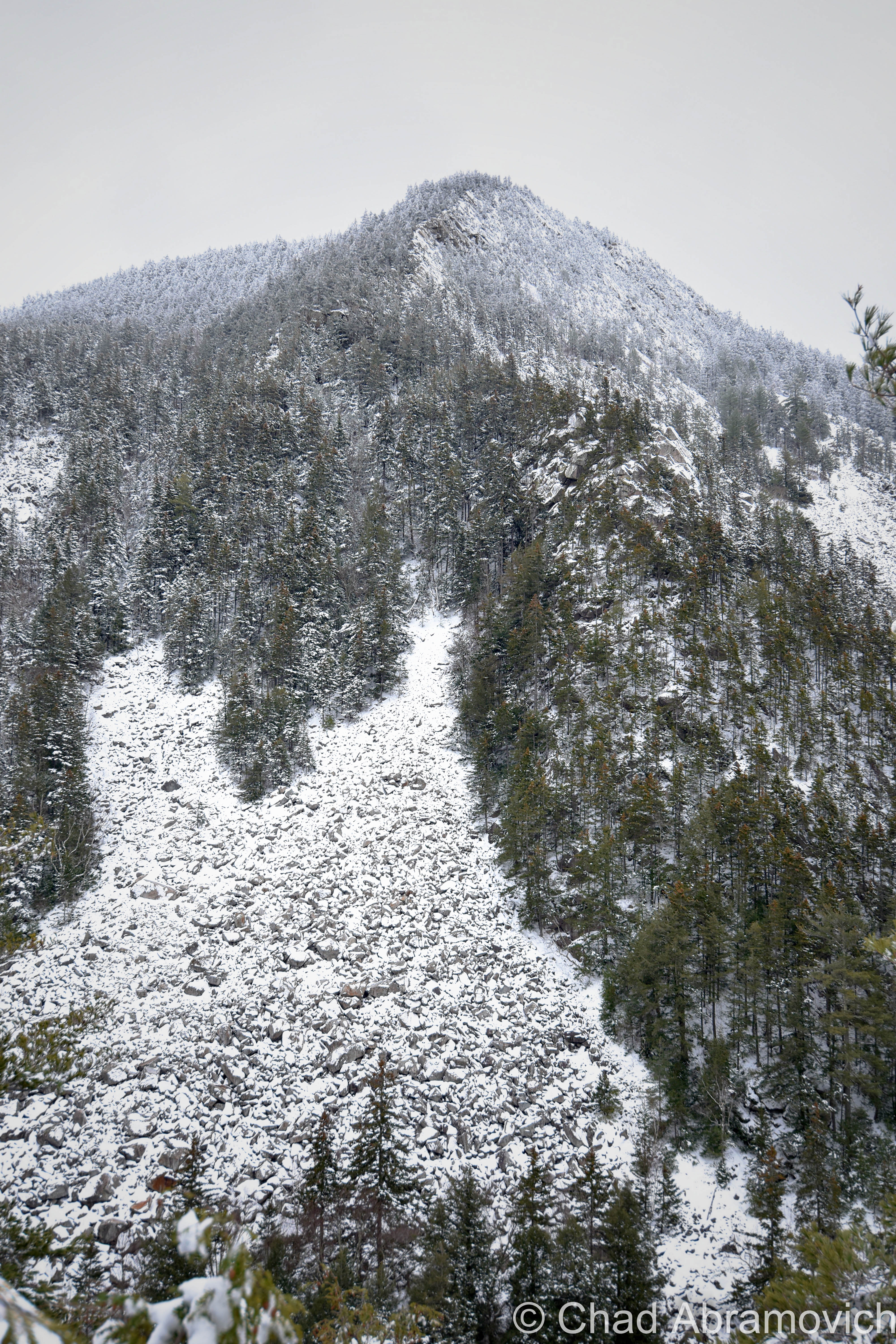
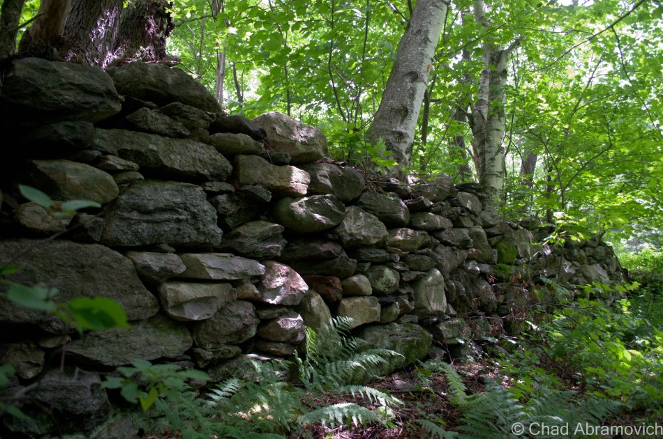
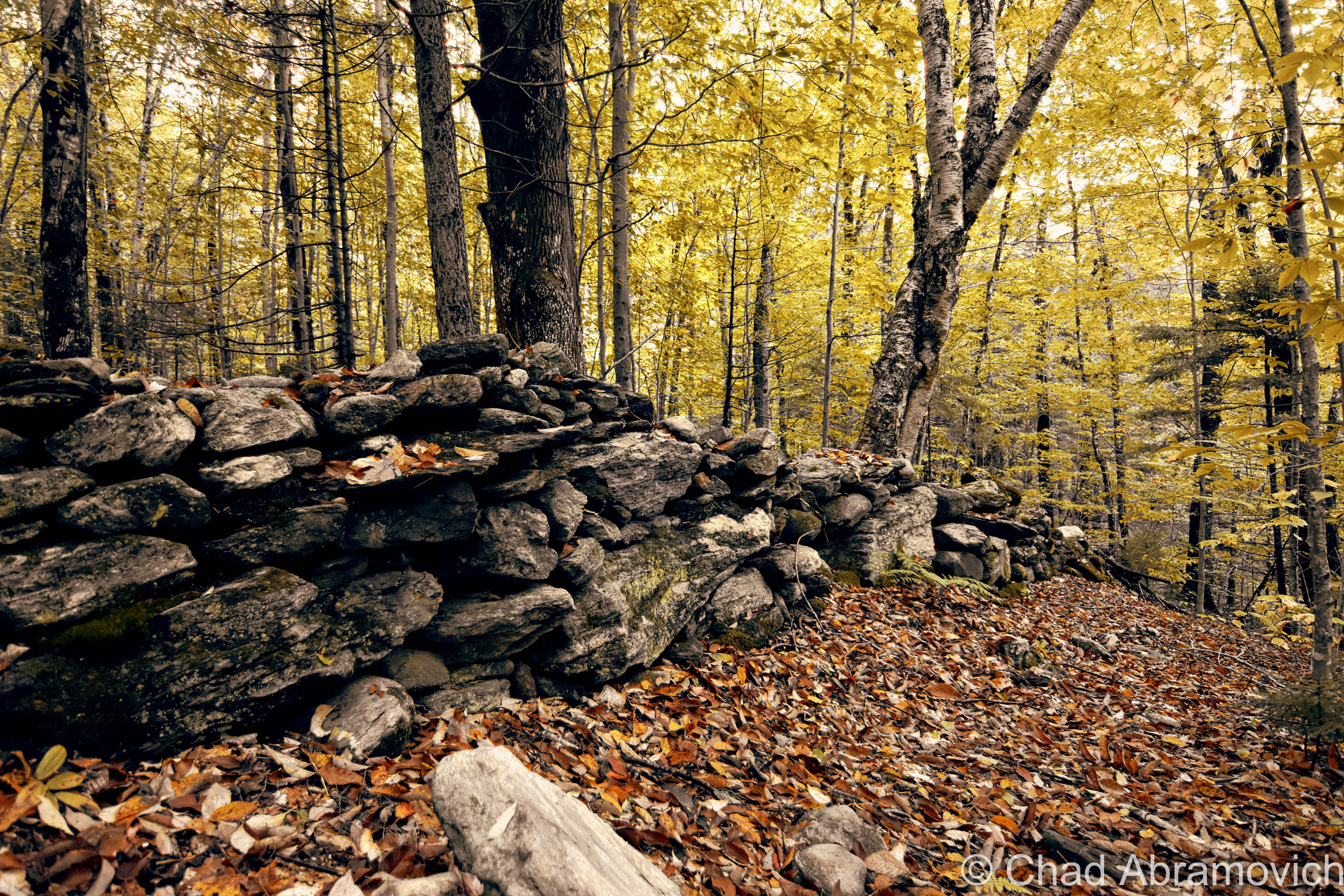
In the southern portion of the town of Killington is Killington Peak. Rising to a lofty 4,241 feet, it is officially the second-highest point in Vermont (Mount Mansfield is the first). It was here, in 1763, where the magnificent views of perpetual rolling green hills inspired the good reverend to christen the un-organized area Verd-Mont. Peters made his claim official by symbolically smashing a bottle of whiskey on the rocky summit.
14 years later, On June 2, 1777, the local legislature convened and made “Vermont” the official name of the newly formed republic. (Vermont wasn’t granted statehood until 14 years later, in 1791.)
Peters, however, was horrified and outraged at the announcement. What the new legislature didn’t realize was that the literal translation of Vermont (Ver-Mont) in French is “maggot mountain.” (Can you imagine “The Maggot Mountain State” on our license plates?)
Peters insisted they change the spelling to Verdmont as he originally proposed, and adamantly criticized them about the adapted form of the name, saying “the state had rather be considered a mountain of worms then an evergreen mountain!”
But the legislature didn’t listen. This dismissal consumed the reverend. Driven by obsession, he made it his mission to educate people about the great travesty that was done to him (with the concern for the future name of our state apparently secondary) — despite openly ignoring the fact that Samuel De Champlain had coined “les Verts Mont” for the region 154 years before his own unofficial christening.
At this point, few were willing to listen to Peters with many avoiding him, labeling him as a raving mad man, never allowing him to bask in the accolades of pride. This is where a slightly deeper look into the mysterious Rev. Peters is needed. A clergyman from Connecticut, Peters was the first reverend to come to the area on horseback in 1763.
Despite his well intended facade, the reverend was known to be a liar. His most notable example was the time he claimed to have a doctorate from the University of Cortona in Tuscany — a university which never existed.
The reverend was, indeed, something of a con artist. In 1794, he managed to persuade his fellow clergymen into electing him the first Episcopal Bishop of Vermont, an honor the Archbishop of Canterbury refused to consecrate.
It was said that Peters was not an easy person to get along with. Certainly his status as a Tory, or British sympathizer in times of the American Revolution, didn’t make him very popular around these parts. Given this information, it adds a little depth into why some Vermonters began to turn against him.
Not much is known about the later stages of Rev. Peter’s life. He would eventually die in New York City in 1826 in poverty.
Despite his questionable history, Peter’s love for the land that is now known as Vermont was sincere.
To all of my amazing fans and supporters, I am truly grateful and humbled by all of the support and donations through out the years that have kept Obscure Vermont up and running.
As you all know I spend countless hours researching, writing, and traveling to produce and sustain this blog. Obscure Vermont is funded entirely on generous donations that you the wonderful viewers and supporters have made. Expenses range from internet fees to host the blog, to investing in research materials, to traveling expenses. Also, donations help keep me current with my photography gear, computer, and computer software so that I can deliver the best quality possible.
If you value, appreciate, and enjoy reading about my adventures please consider making a donation to my new Gofundme account or Paypal. Any donation would not only be greatly appreciated and help keep this blog going, it would also keep me doing what I love. Thank you!
Sometimes it seems that I could write a sizable book about Burlington, inspired by the seemingly endless tales of fabled places, strange stories and lost history that are begging to be known – their praises seldomly sang by a select and arcane few.
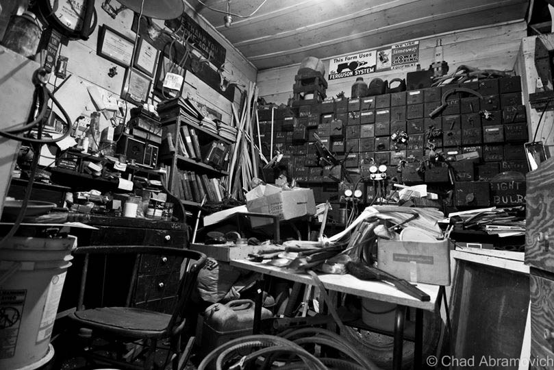
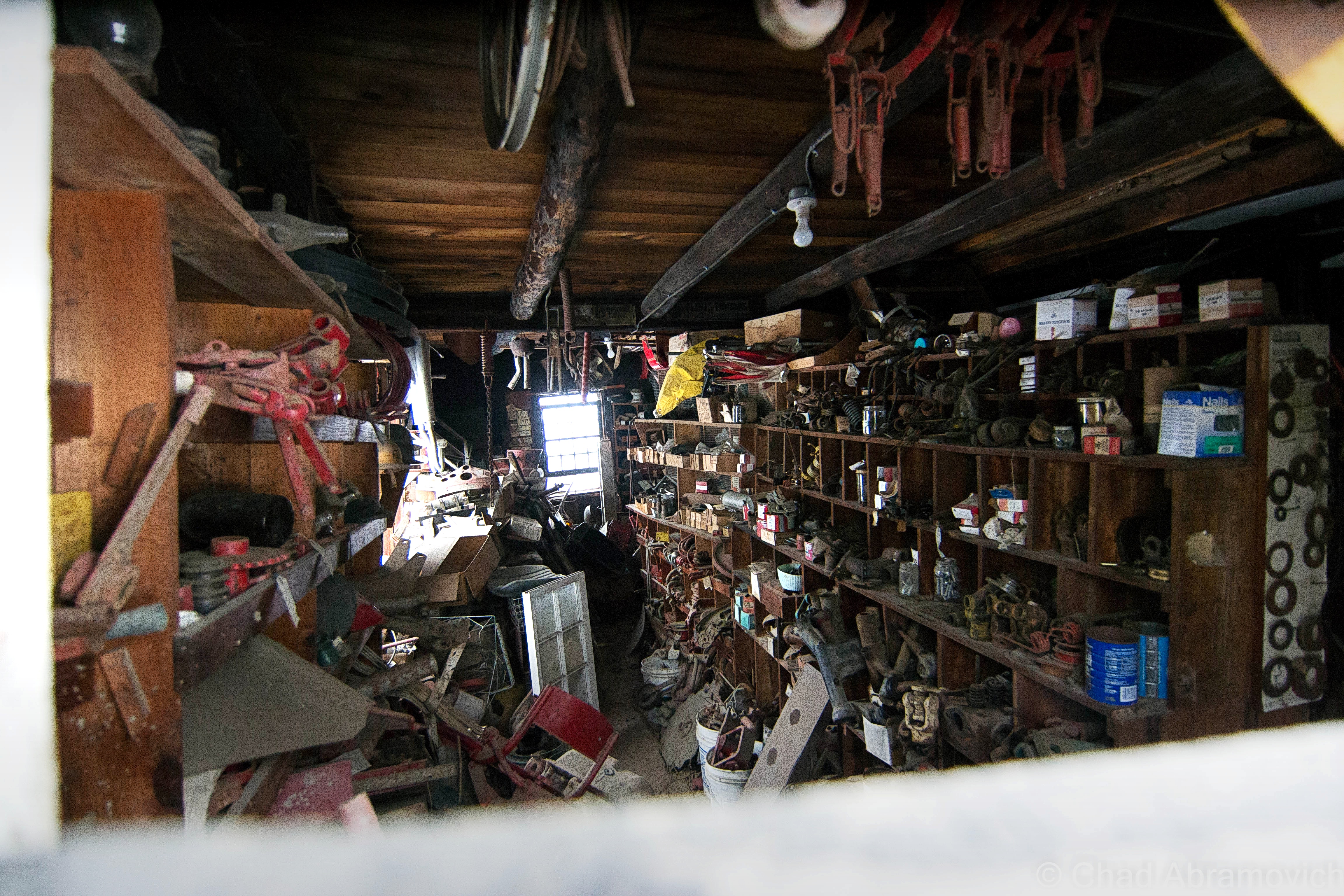
There are many weird and wonderful things that many of us see everyday. The world’s largest tower of filing cabinets makes its home in a weedy field in the South End, and there is a puzzling bridge to nowhere in the intervale that looms over the beltline.
And there are other intriguing mysteries that are more difficult to explain, and even harder to find. Tales of catacombs and tunnels running underneath downtown have been relayed to me, as well as an awesome and mysterious “subway like railroad tunnel” that supposedly runs underneath the Old North End still, years after being defunct and sealed up (which I have yet to find). But, out of all of Burlington’s peculiarities that have long since vanished, there is one that is still refusing to be completely forgotten.
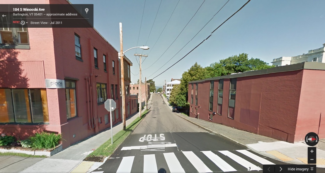
I was interested in this mystery when I accidentally stumbled upon an old city map dating from the mid 1800s in the book Bygone Burlington. It clearly marked streets and familiar landmarks that still exist today. King Street, Main Street, Lake Champlain. But there was something else. The map clearly labels something that would be so conspicuous in today’s Burlington. Just east of present day South Winooski Avenue was a serpentine sunken trench of land that divided the city in a South-West and North-East direction, separating downtown from the hill section. A few bridges crossed the ravine and spurred off onto the hill and towards Colchester Avenue before making the journey to Winooski – the old map describing the ravine as wild and swampy. It was strange seeing this strange ditch co-existing with the city.
It’s obvious that this ravine no longer exists today. Or, so it would seem. As a matter of fact, the ravine is still very much there.
This 1853 map of Burlington shows the former ravine
I knew I wanted to know more, and I set out to do some research. What I found was another interesting layer in Burlington’s story line.
In the beginning, it seemed that this fabled ravine was beneficial to the city. As Burlington prospered and grew during the 19th century, the city would need to meet the demands of a growing population. Old maps created around 1853 indicate that the Vermont Central Railroad purposely used the ravine as a direct route from the waterfront to the mills in Winooski. The former downtown train depot sat at what is now the corner of Main Street and South Winooski Avenue (known then as White Street), where the fire station is today. In 1862 the railroad was re-routed underneath North Avenue and through the intervale on its present day route. Later, in 1880, the ravine would once again serve a utilitarian purpose, and was chosen as the backbone of the city’s new and modern sewer system which was built using a network of stone and brick sluices and culverts that followed the path of the ravine into the lake – all discharging at a location somewhere near the end of Maple Street.
However, there was a population explosion in Burlington around 1880 and the demand for land was high. The ravine soon became a roadblock to progress. Tensions mounted when the existing sidewalks and bridges began rotting and crumbling, creating dangerous hazards and upset residents. The city then embarked on an ambitious project to fill the ravine, and in a classic act of 19th century urbanism, filled it with garbage. That’s how San Francisco reclaimed its now famous waterfront area, so why not Burlington? But, maybe 19th century urban planners didn’t see the problems behind building a city over decomposing garbage piles. But it happened, and the modern day downtown we all identify with was created in its wake.
Over time, people have been curious about the ravine as I have been, and began to pick at the pieces to this intriguing puzzle. And that seems to have raised some issues of debate. Some argue that the ravine was never there to begin with, and was simply an error on a map.
But other arguments prove otherwise. It is known that Burlington’s waterfront is reclaimed marshland, filled in with garbage and wood and old maps show a former branch of the Winooski River actually emptying into the lake here, near the present day Battery Street railyards. Some even speculate there are still remnants of this original tributary still running underneath the streets today, but performing an excavation now would be impossible, problematic and costly, leaving this as speculation.
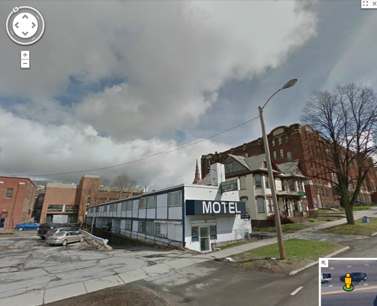
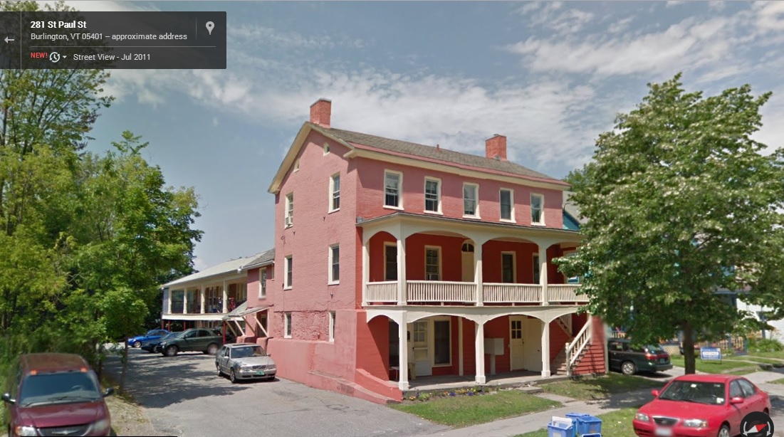
But, you don’t have to do a lot of digging to find some answers, and In this case, the answers take the form of a long, narrow and seedy looking landmark that is a looming eyesore at the main entrance to the vibrant downtown area; The Midtown Motel. You might not guess by looking at it, but the dated structure was purposely built the way it is, because it sits on top of the former ravine and the layers of garbage that filled in the old cavity. The motel opened in 1958 and has served everyone from tourists, young lovers looking for a little respite, and people just down on their luck – and because there were no places to stay in Burlington’s city center at the time, the Midtown Motel prospered.
But, before anything could be built on the property, local architect Benjamin Stein had to figure out how to fit both a motel and ample parking on the usable pieces of the property – the parts that would support development over the fragile layers of fill that cover the ravine.
The Midtown Motel
To make it work, the architect needed to get creative. The narrow motel was elevated and the parking was put below it. The design embodied the International style of architecture, where functionality came first. The motel did well until the 90s, when it went downhill and began drawing seedy clientele, and a bad reputation to go with it. Today the motel is out of business and vacant, and the city block it sits on is considered a “super block”- or, a block that is largely city owned and offers substantial redevelopment potentials. It is one of the only such blocks remaining in Burlington, meaning the value of the land is only growing. However, because the property’s unique setbacks, more delicate measures will have to be made before any large redevelopment projects are taken.
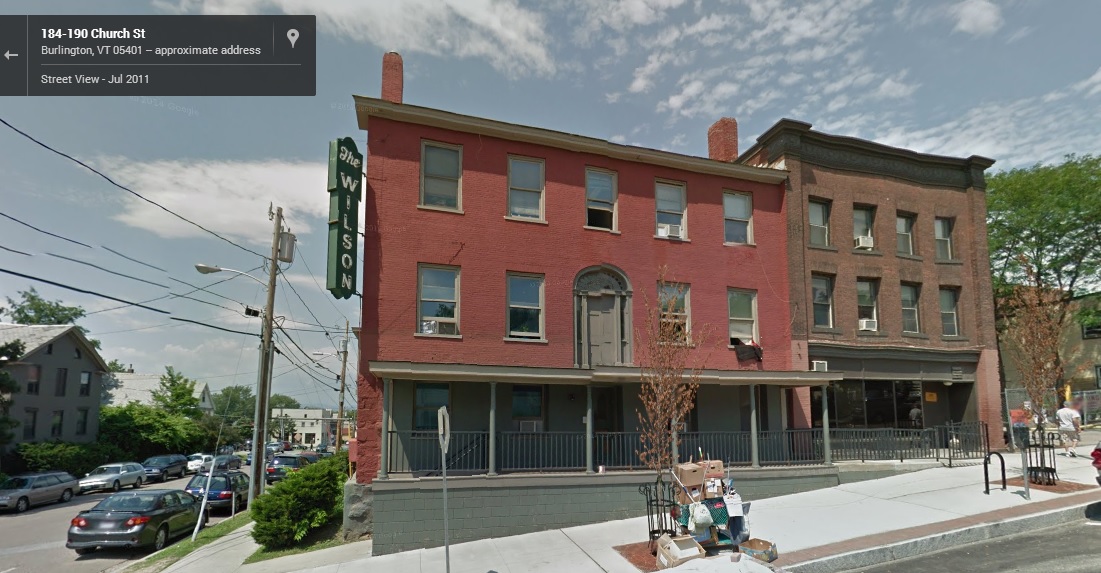
Just down the road from the Midtown Motel is another remnant of the ravine, one that the city hasn’t completely covered up yet. On King Street, there is a sizable and isolated geographical anomaly in the middle of the road itself – a dip in the stretch between Church Street and South Winooski Avenue. From the bottom of the dip you get a good perspective of the raise in elevation around it, and how the city’s buildings have been configured and built. And there are some buildings on Saint Paul Street with exposed foundations, sections of the buildings that appear to have once been above ground.
The Strange Isolated Dip in King StreetThe former Wilson Hotel on the corner of Church and King showcases evidence of changing elevation – the front door is on the second floor!This brick house on St. Paul Street shows that the first floor was at one point the basement.
It seems strange to think about a large trench that divides Burlington in half, a trench so large that it once even had its own toboggan club – but stranger things have happened in the throes of progress. If the entire present day city of Seattle was built literally on top of the original city, then Burlington’s ravine almost seems passively unimpressive to think about. The communities we visit today are drastically different from what they were 100 years ago, almost unrecognizable at times, which is both intriguing and inspiring. Who knows what else is buried underneath the ground you walk on.
To all of my amazing fans and supporters, I am truly grateful and humbled by all of the support and donations through out the years that have kept Obscure Vermont up and running.
As you all know I spend countless hours researching, writing, and traveling to produce and sustain this blog. Obscure Vermont is funded entirely on generous donations that you the wonderful viewers and supporters have made. Expenses range from internet fees to host the blog, to investing in research materials, to traveling expenses. Also, donations help keep me current with my photography gear, computer, and computer software so that I can deliver the best quality possible.
If you value, appreciate, and enjoy reading about my adventures please consider making a donation to my new Gofundme account or Paypal. Any donation would not only be greatly appreciated and help keep this blog going, it would also keep me doing what I love. Thank you!
It seems this year it rains every time the summer sends her best. The weather hasn’t been ideal for adventuring, with a string of floods and road washouts. So when a rare overcast afternoon came my way, I took advantage of it.
Getting together with a good friend, we set off for West Bolton, a remote area located high in the slopes of the Green Mountains, only accessible by a labyrinth of back roads that twist their way up steep hills. But as soon as we left Route 117, we were greeted with washed out dirt roads and attention grabbing orange cones as our car bumped and jarred its way into the mountains.
With Motown soul coming through the radio, I gazed up at the mountains in my reverie, the fogs soluble on the summer canopy. It was wild country up here, and the change of scenery was lifting my spirits, as I felt like I was coming back from what seemed like a ruin.
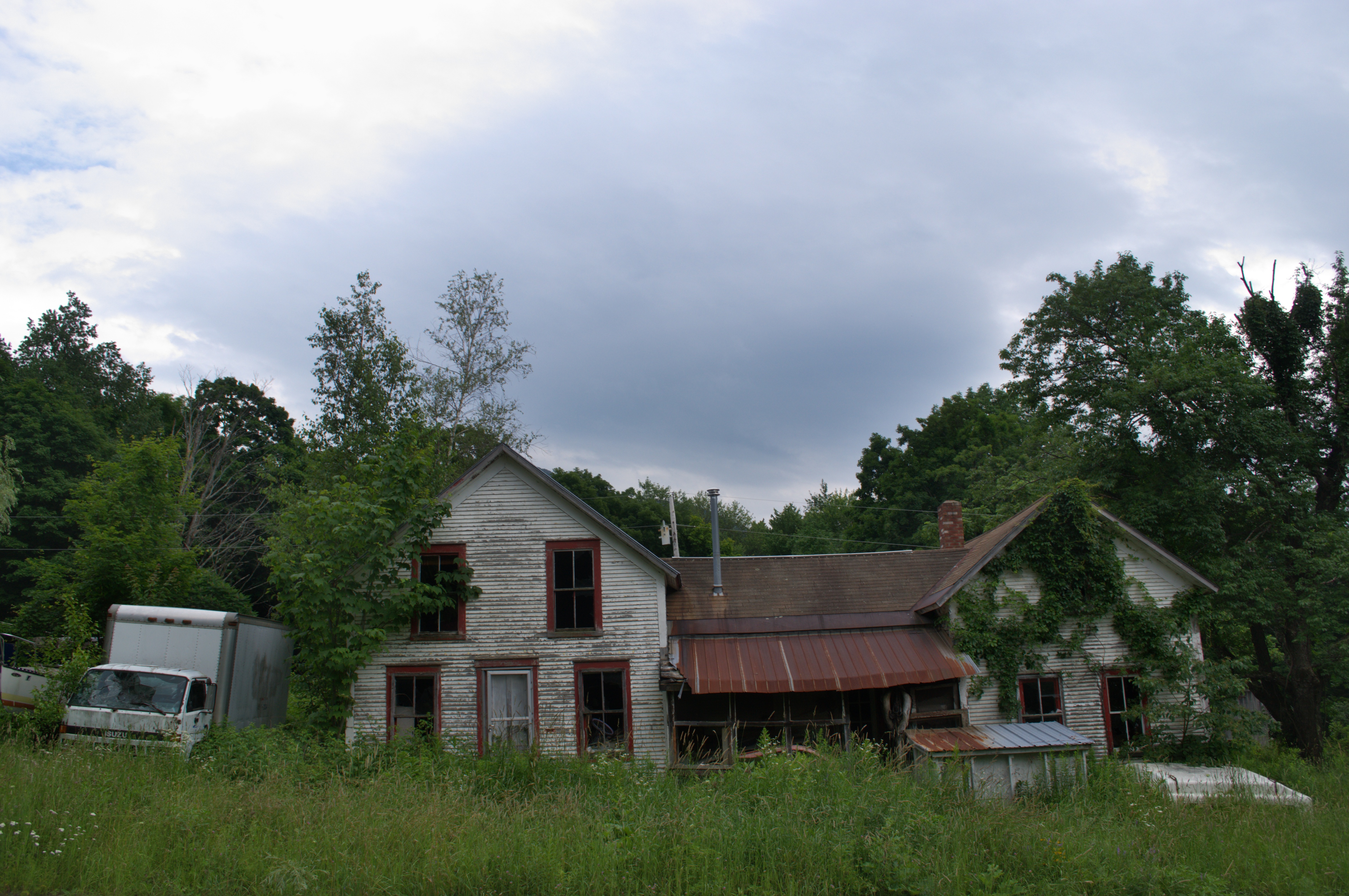
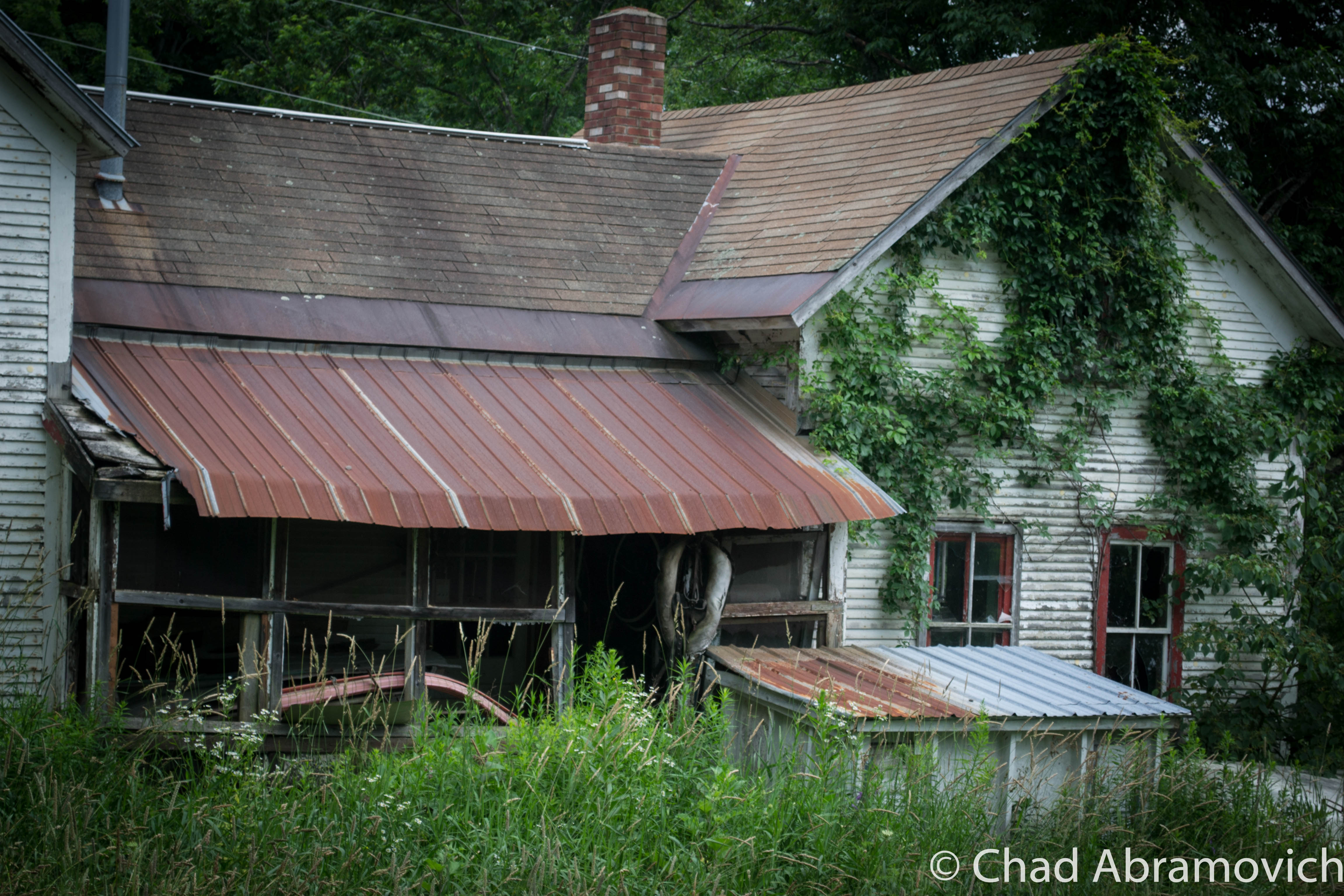
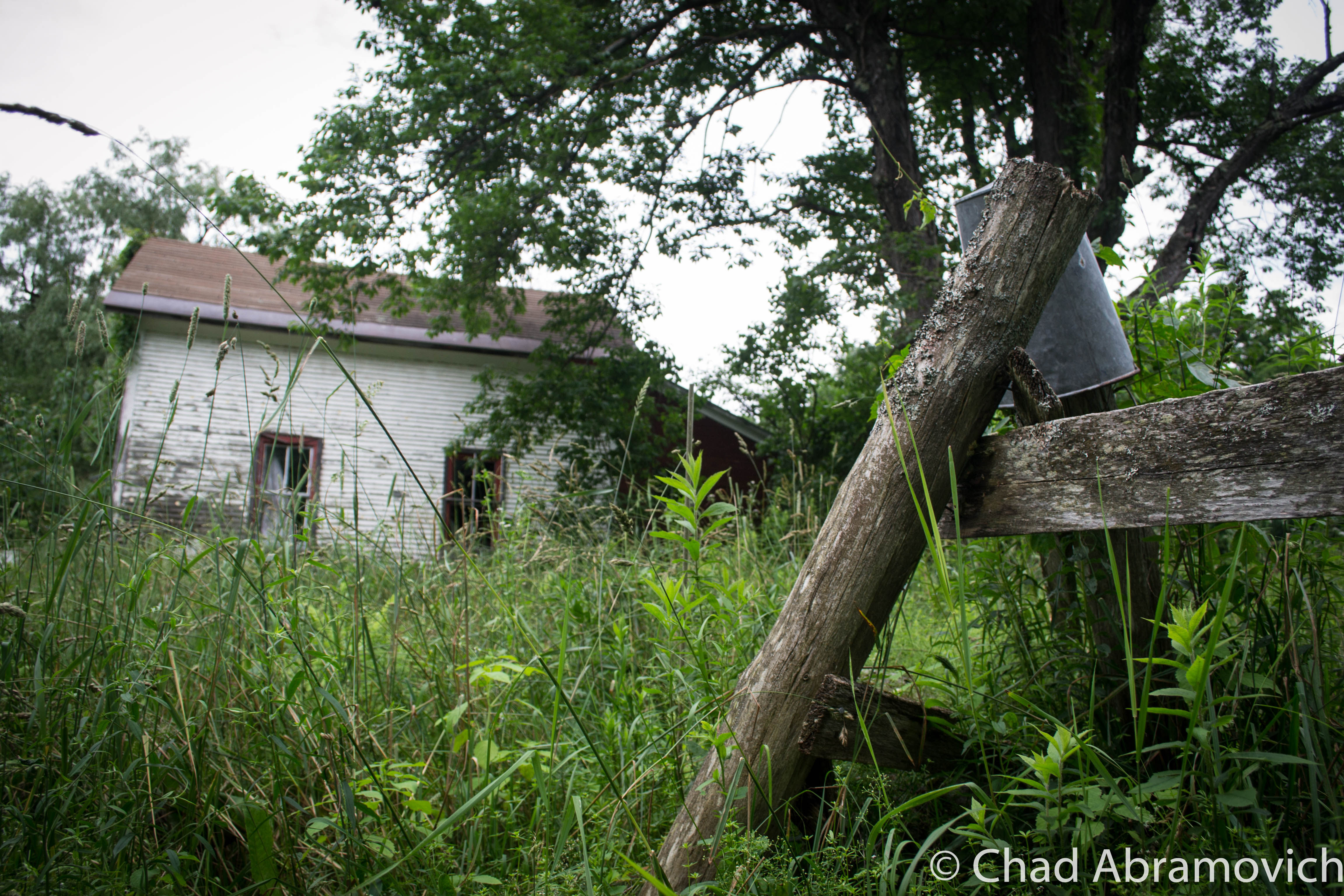
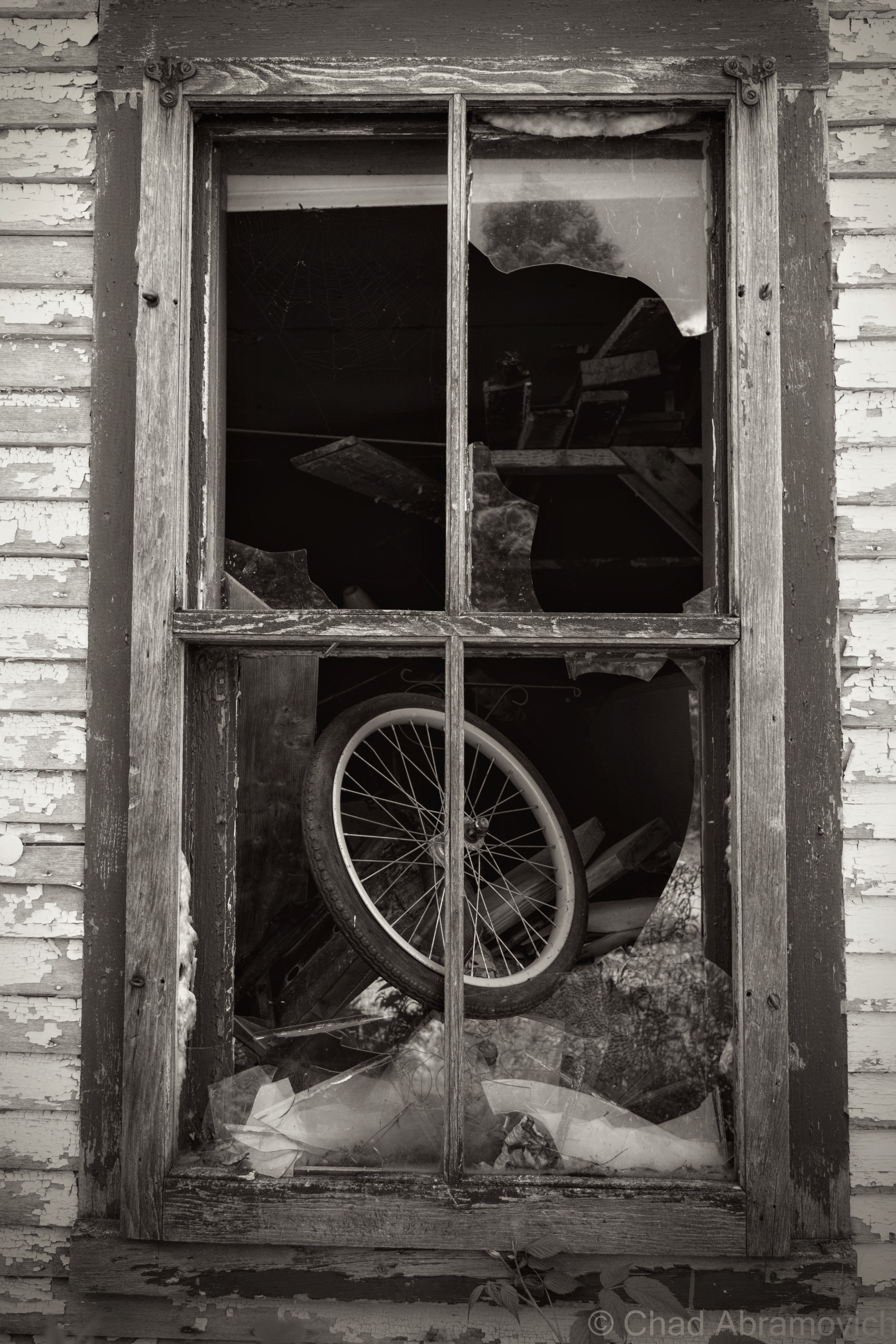
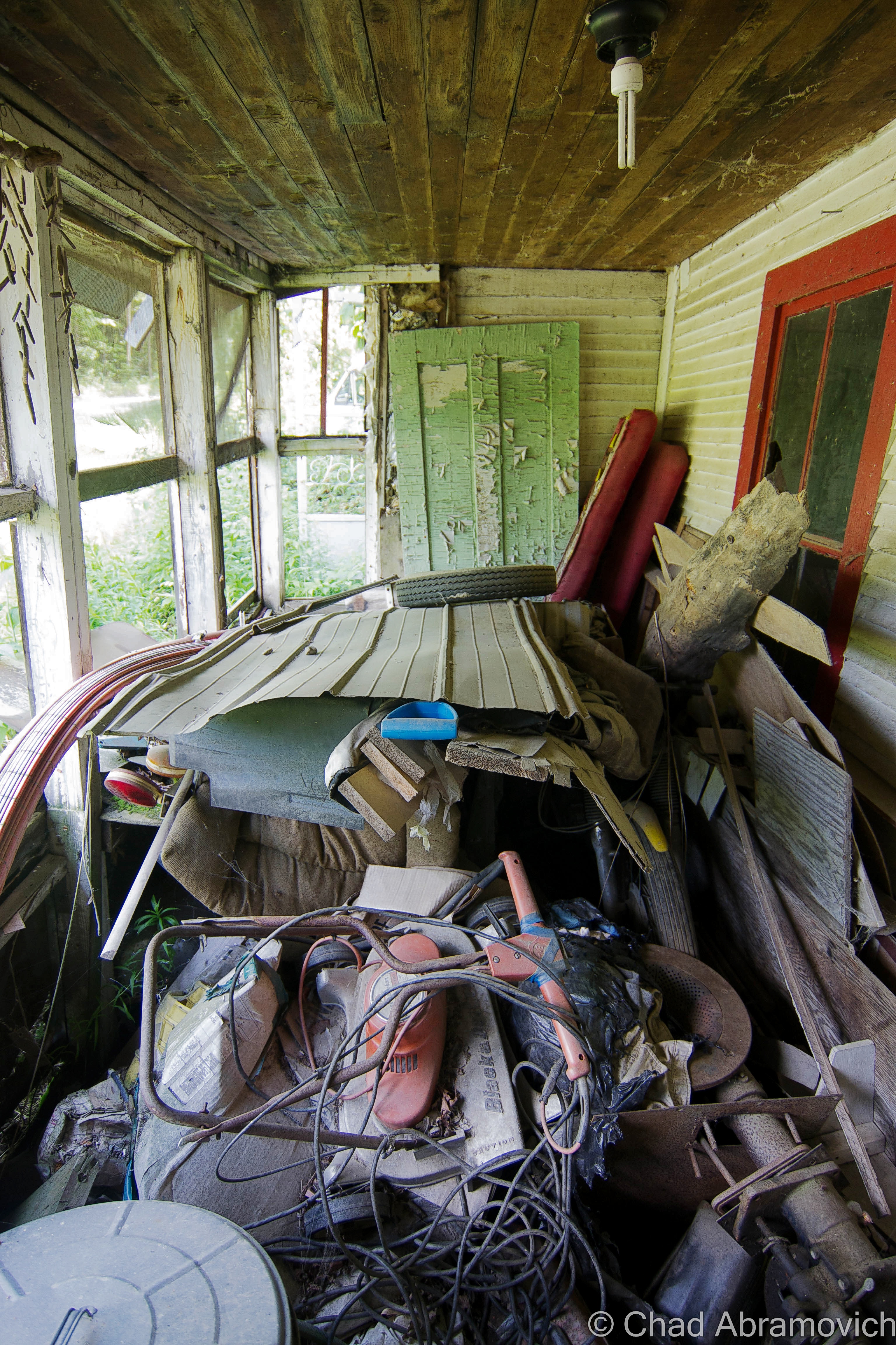
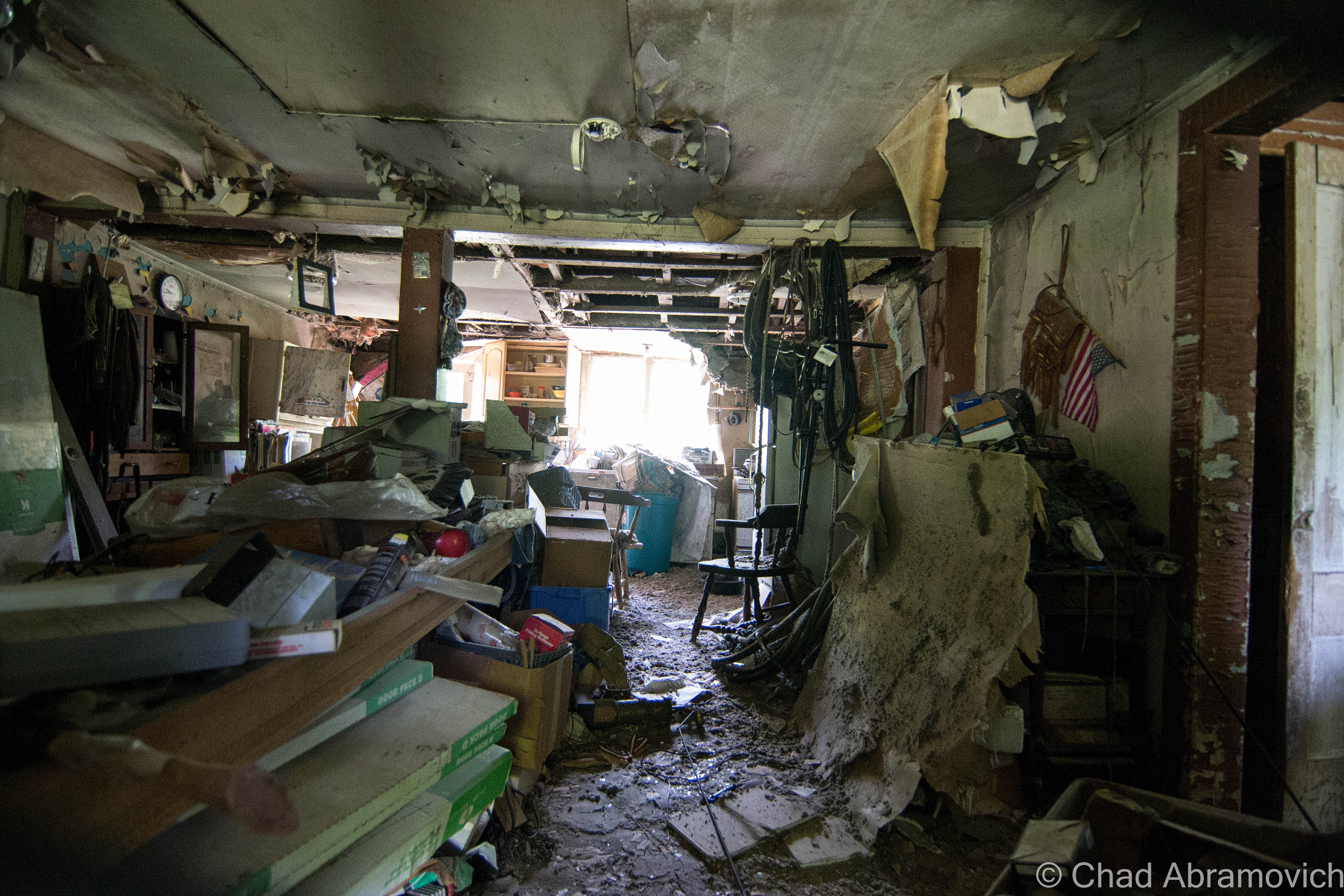
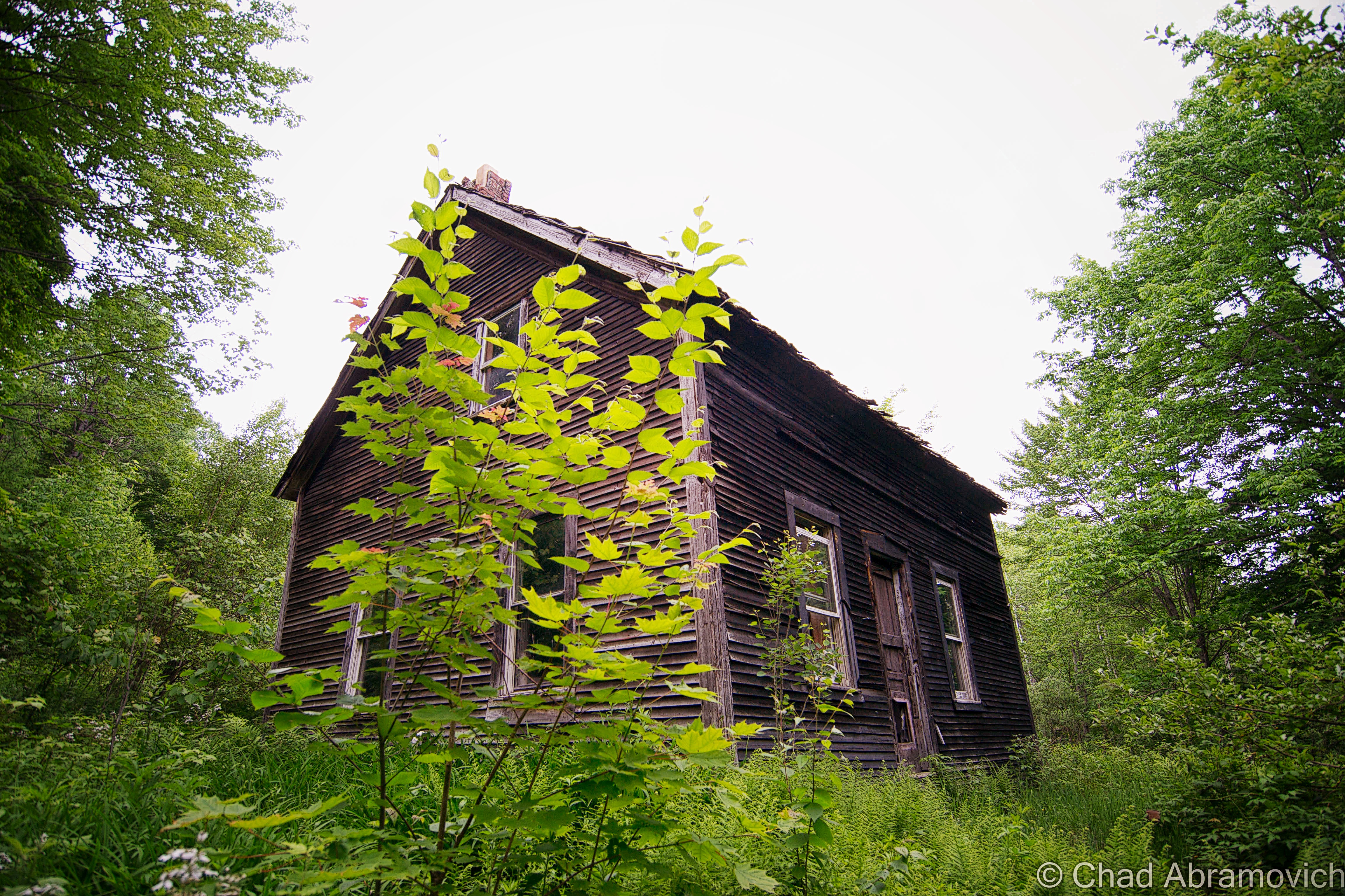
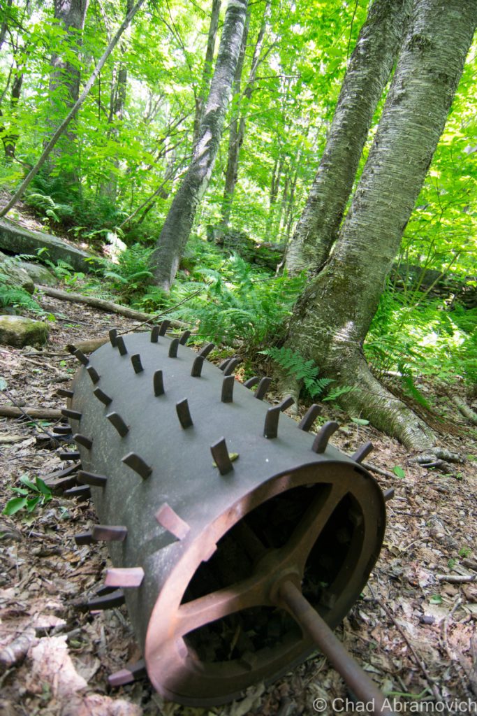
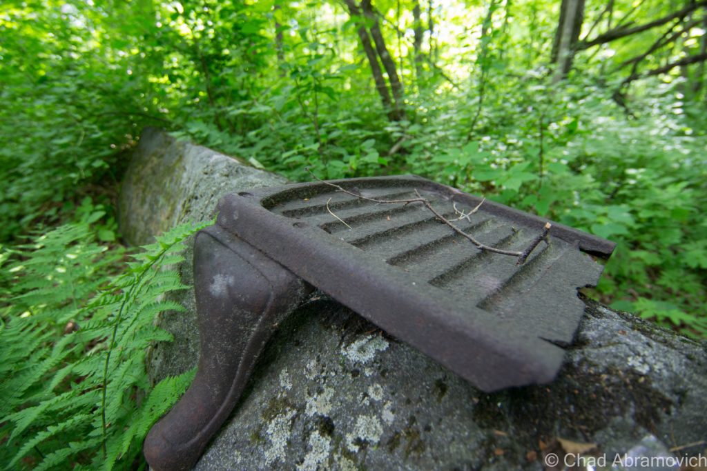
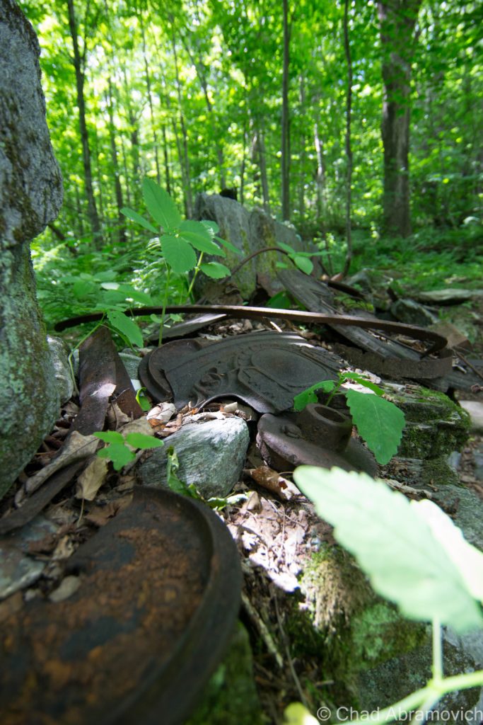
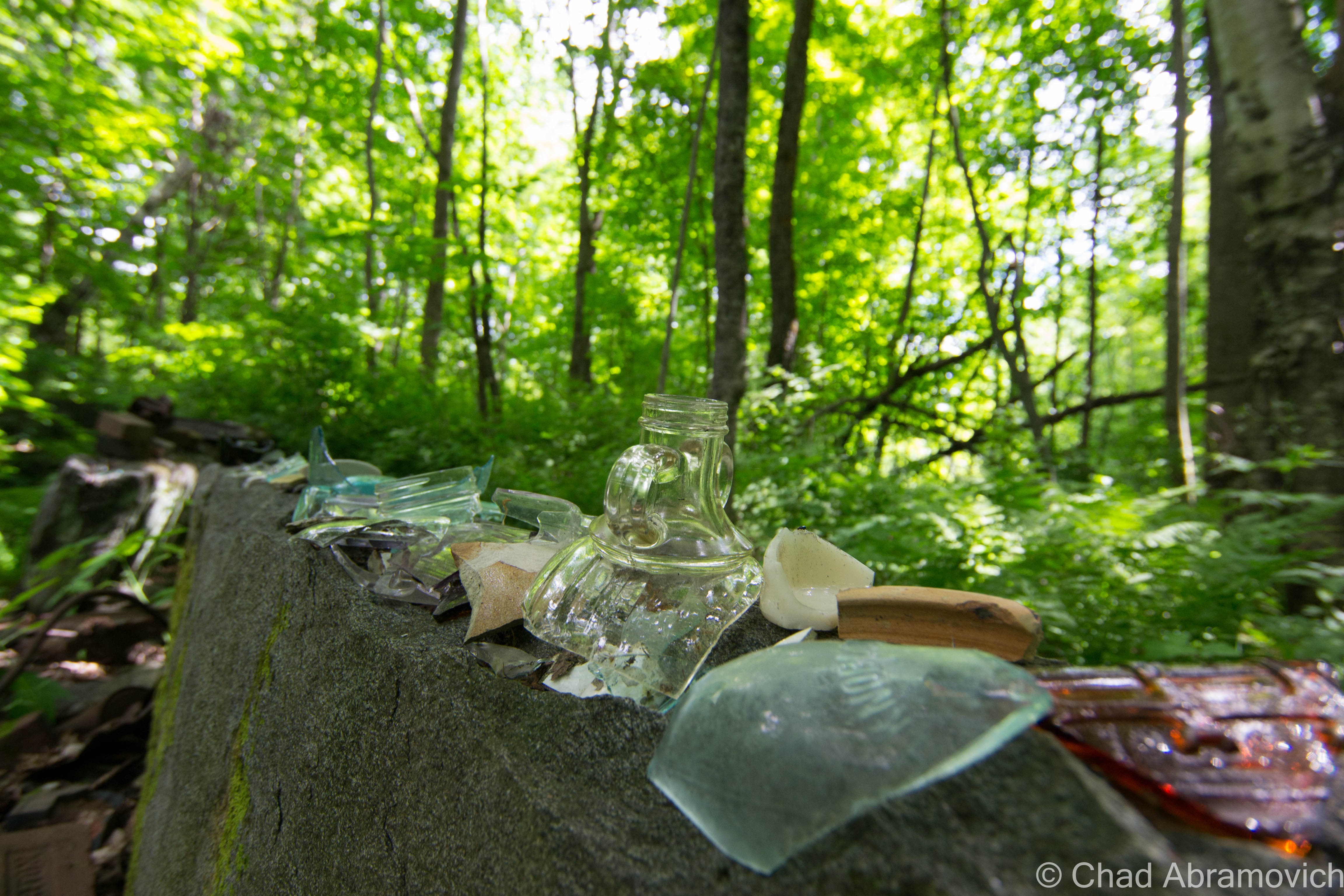
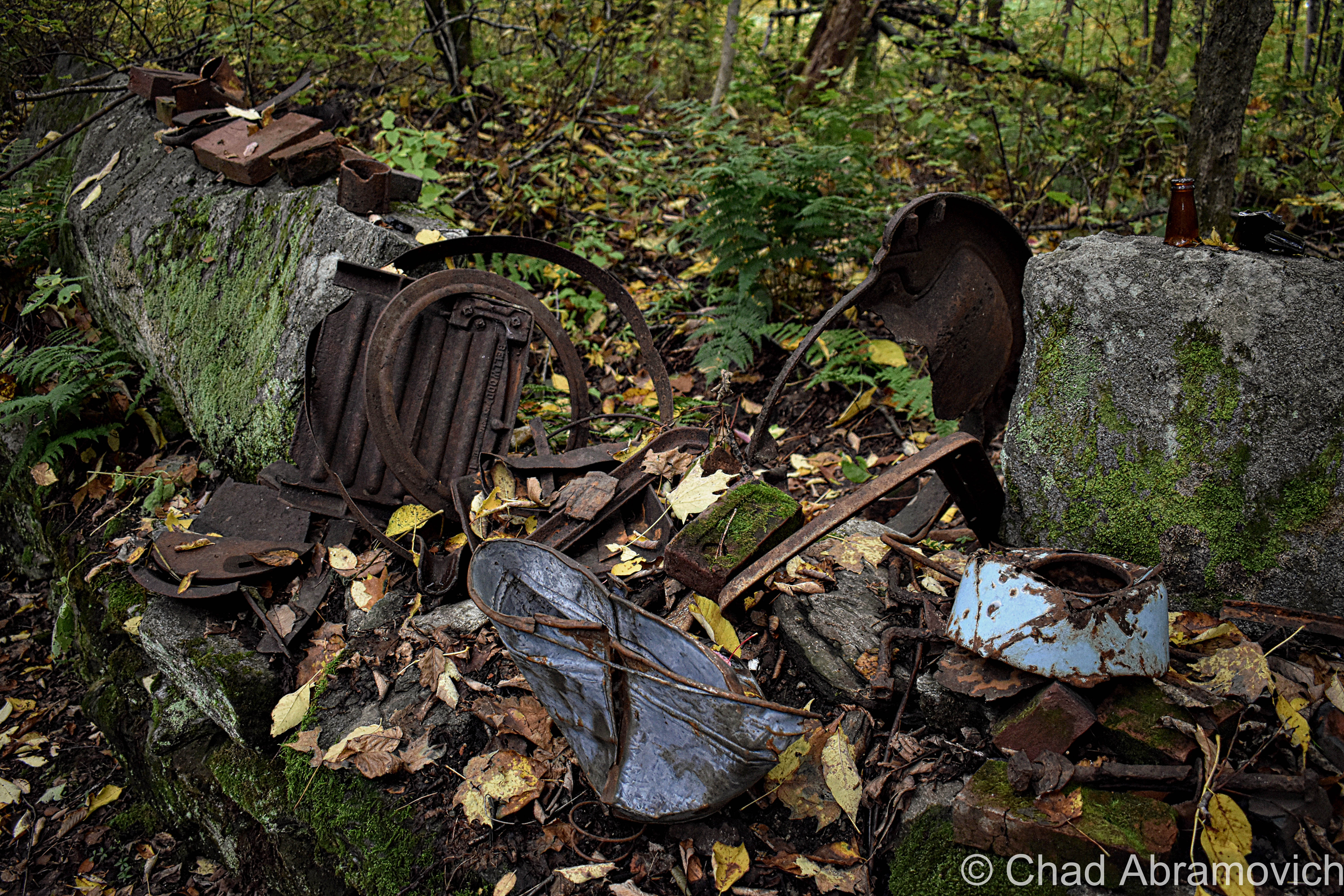
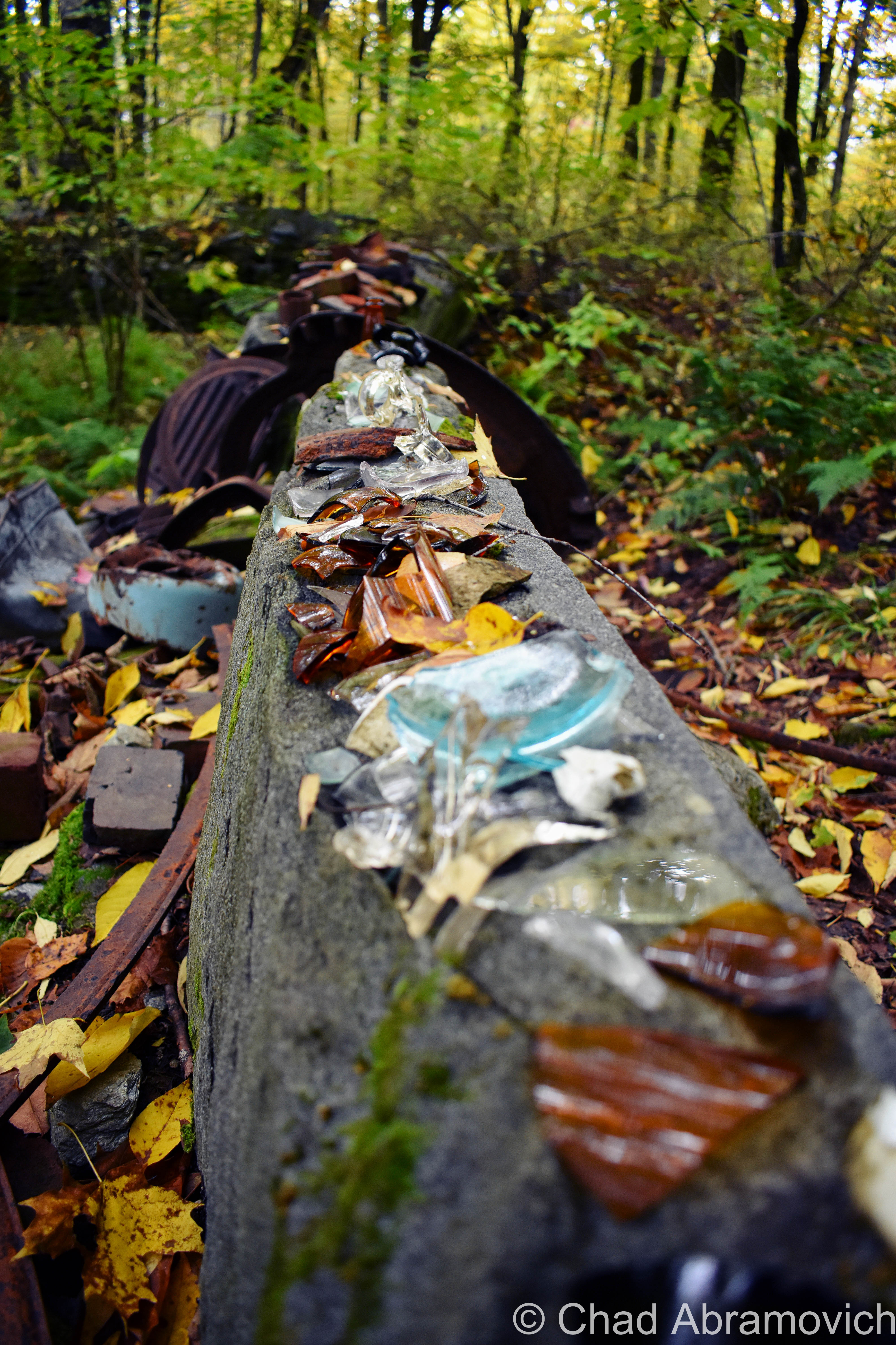
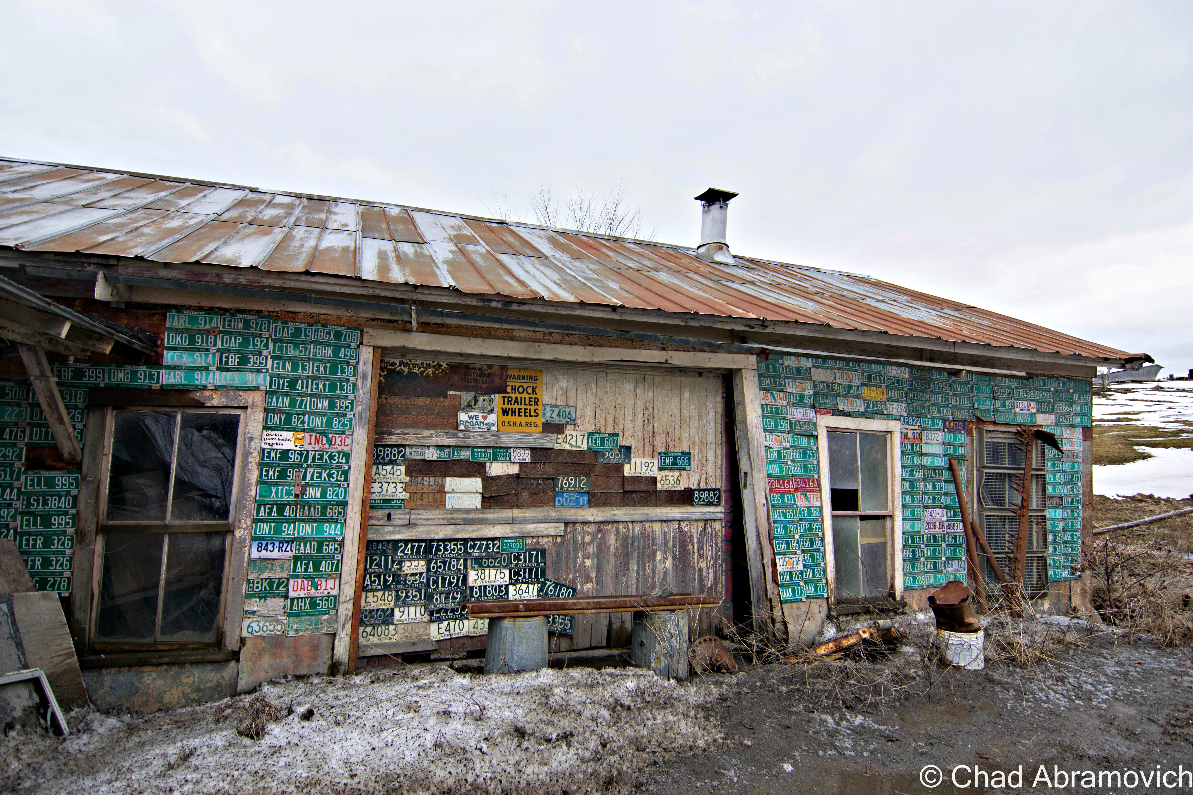
There was one particular house I wanted to see, and as we ascended up a slight turn, it’s ramshackle facade came into view with tall grass and vines and a rusting tin roof under the promise of rain.
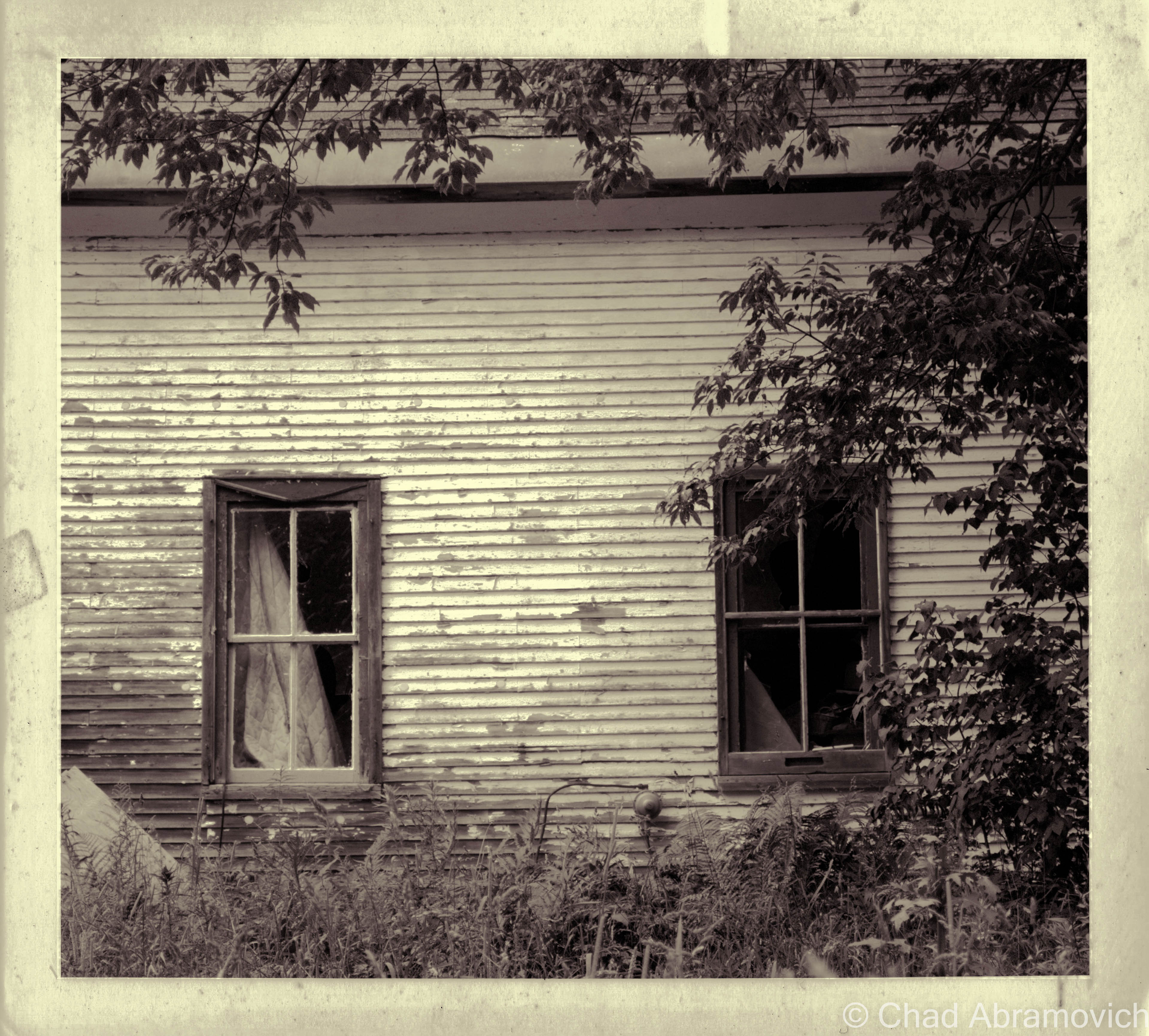
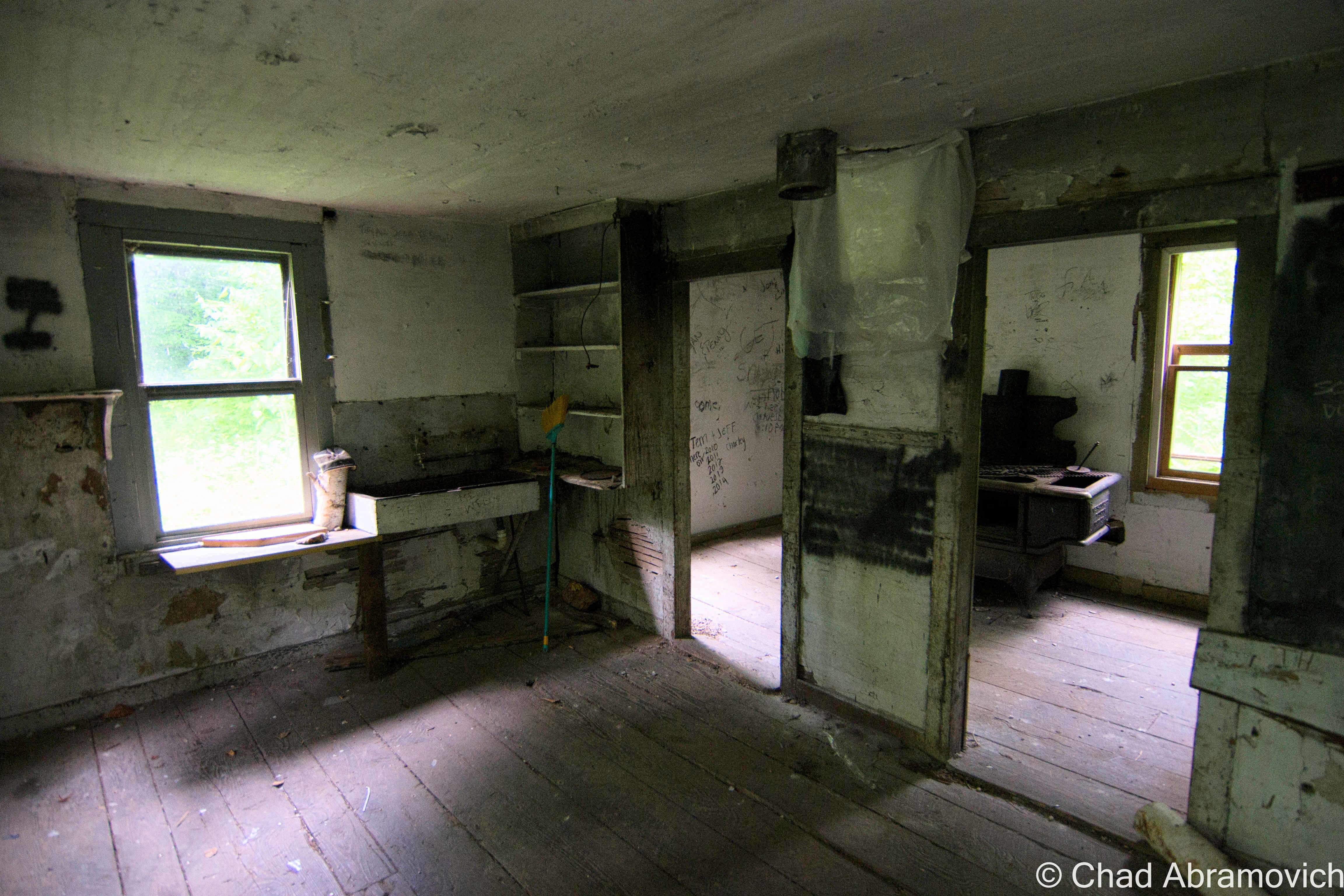
I loved this old house. The front lawn had grown wild and covered the piles of discarded junk that surrounded the house, their forms almost indistinguishable. All of the old farmhouse windows were broken, and from its vulnerable wounds, the inside could be seen. The inside appeared to be chaotic and filthy. Most of the windows had mysterious mounds of debris in front of them, some of it threatening to spill out onto the lawn. Other windows had quilts and bed sheets nailed over them from the inside, and were long moth ridden and disintegrating. But my line of sight faded into the contrasts as the heavy shadows soon swallowed my visibility, keeping the house’s secrets lost in the dark. The battered metal screen door hung open near the front lawn, stopped by the tall grasses. The remnants of a rotting wooden fence occasionally protruded from the growth.
Looking at this old house now, and its depleting condition and fading paint, it’s almost as if this property is wistfully saying “this past century went like a life out of me”
With a surprising steady flow of traffic for a rut chocked back road, and tall grass that obscured our vision, we decided it was best (to my disappointment) not to venture too close to the sagging property. That decision may have proved to be very smart, as we heard scurrying through the grass and the sounds of claws on wooden siding. Some kind of animal had just crawled into one of the broken windows.
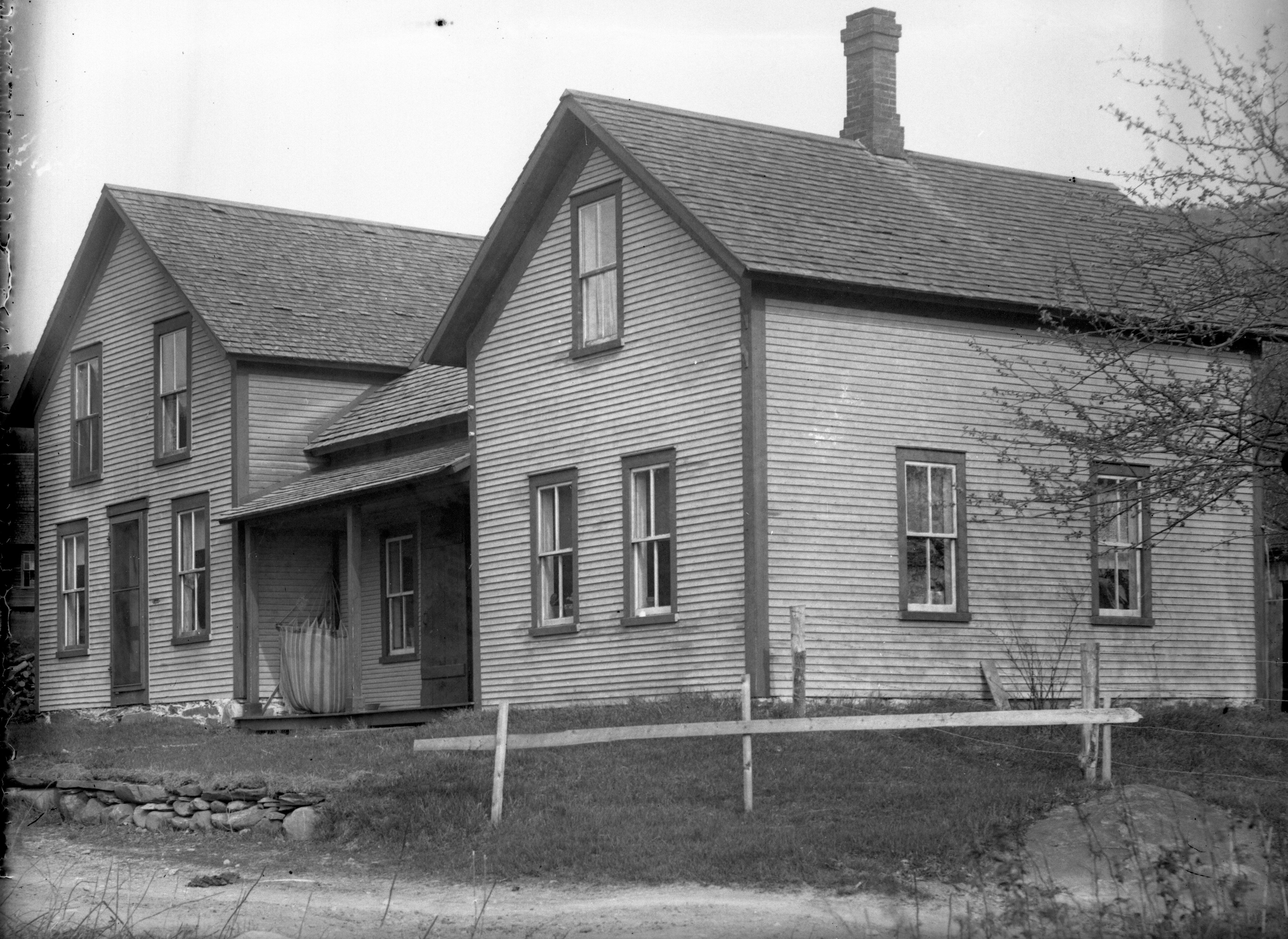
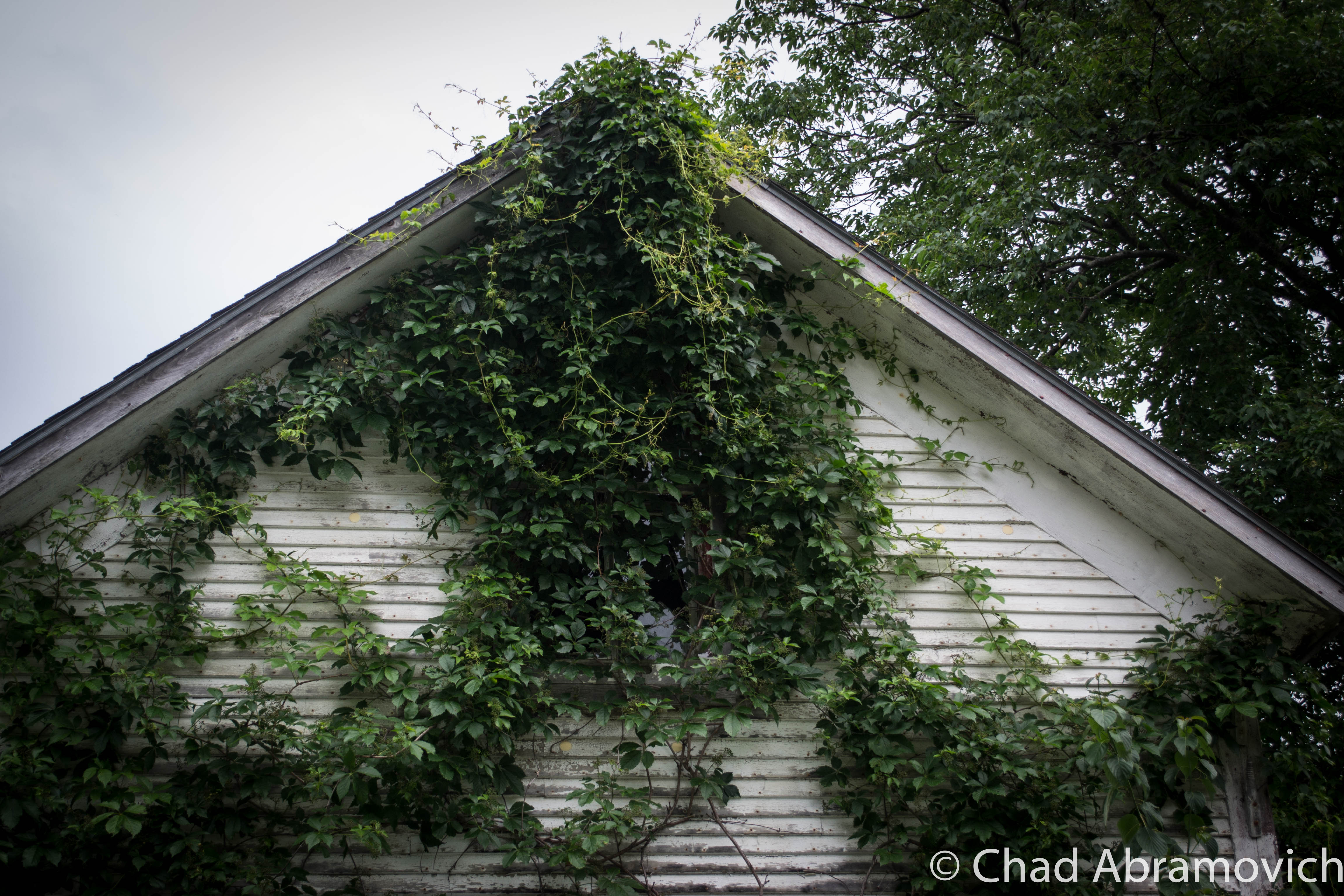
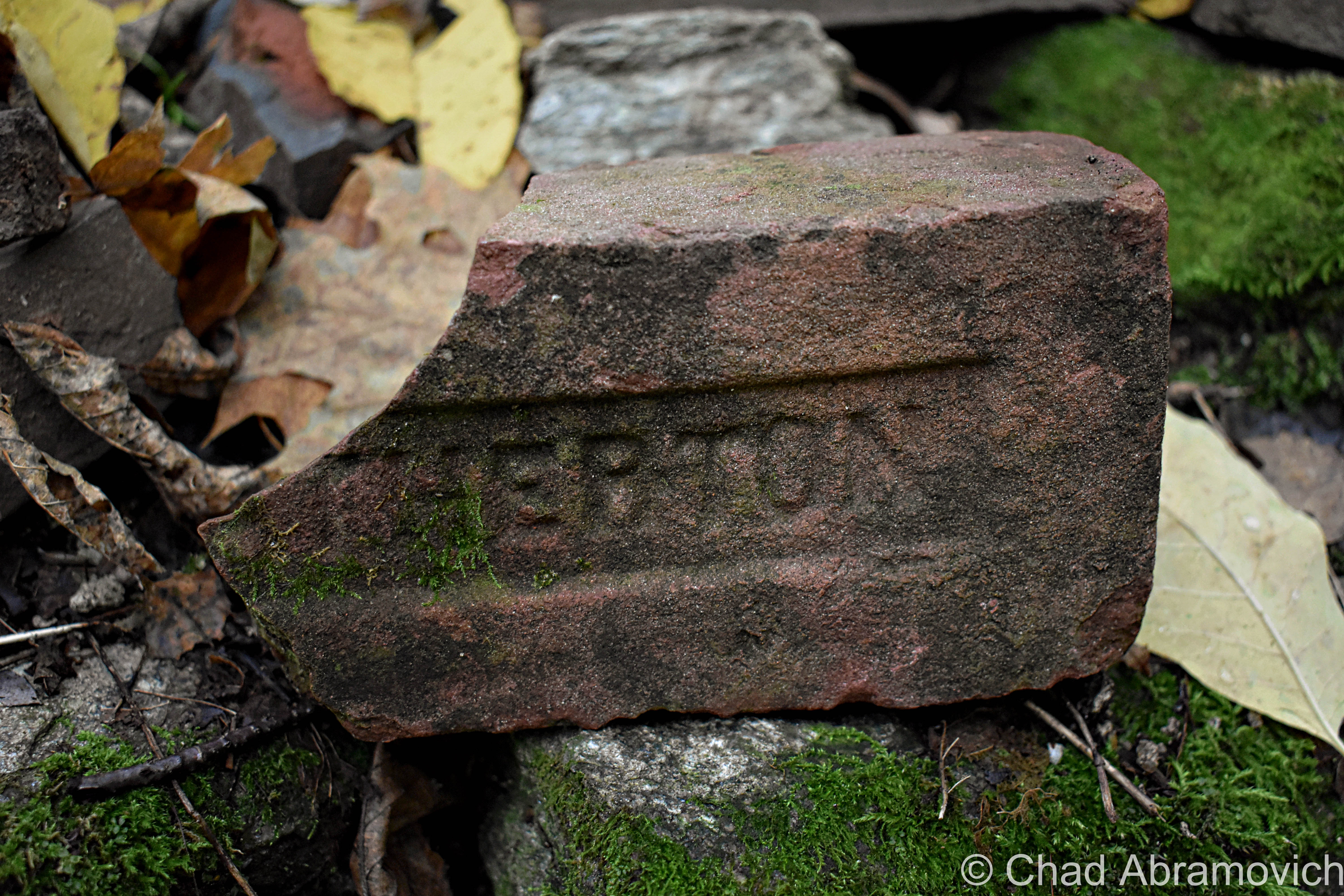
With some quick research, I was able to find some old photos of the house, which offered an interesting glimpse into what once was. The first thing I found out was it had an official name; The Pease House, named after its founding family. The wide open spaces and cleared hill meadows that surrounded the house have long returned to woods – this house a last enclave of Bolton’s former life as the area continues to meld with the untamed mountains above.
The determined people who once cleared the land and built this house, the ones who once knew the front porch and the doorways and cherished the moonlight on hot summer nights, now nothing more than dust – a deadpanning reality at how fragile urban infrastructure is, and how easily things can become lost.
The reasoning for its current abandonment is unknown to me, but as someone informed me, it is owned by someone. Perhaps sometimes, we are the ghosts we don’t believe in.
The Pease House circa 1860s
The Pease House Today
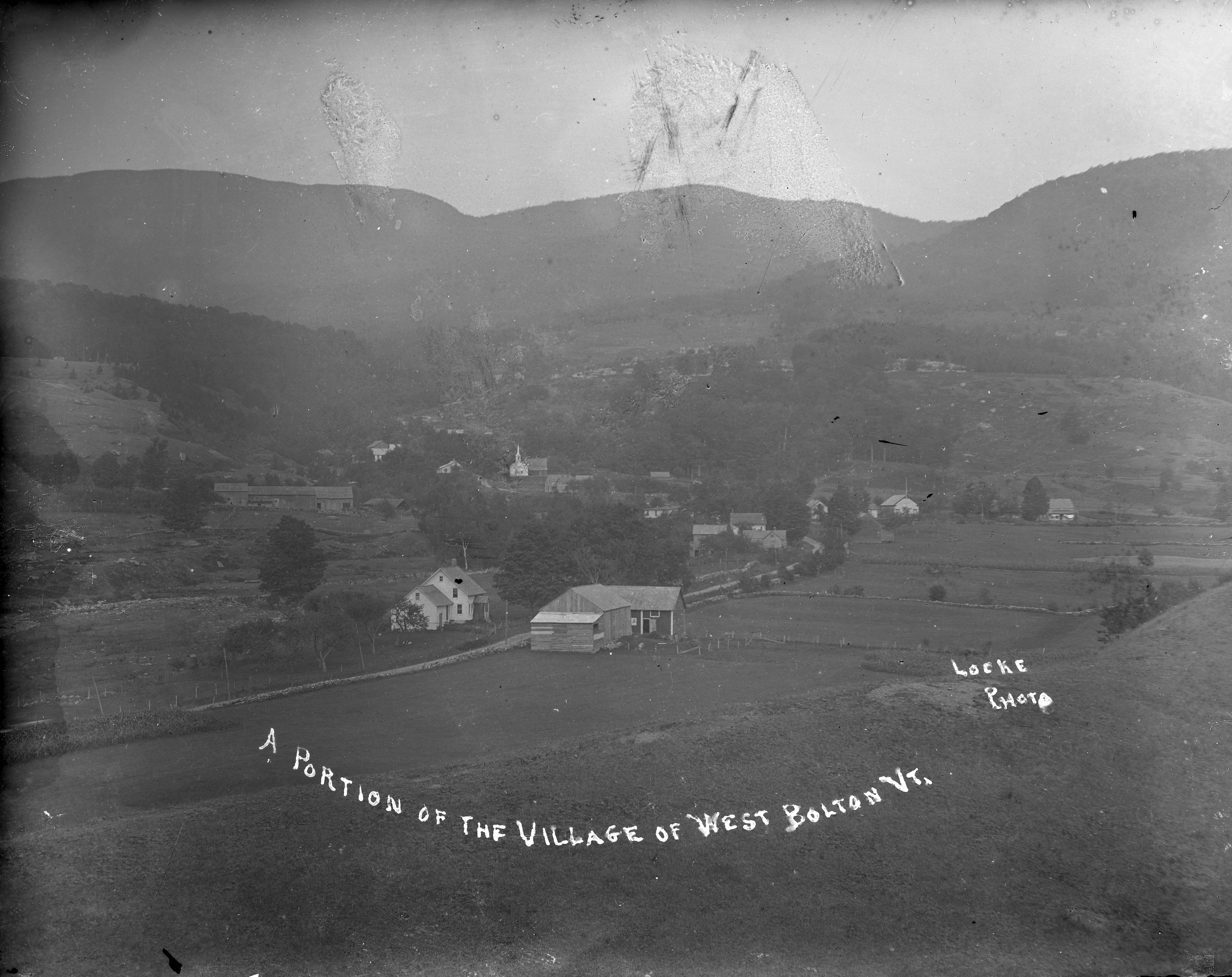
West Bolton is a name lost to history. What used to be a small village in the mountains, complete with 2 churches, a sawmill and general store, is now nothing more then a name on the map, with a scattering of private residences and a more well-known golf course that wears the same name.
The town of Bolton is mountainous, rocky and gave the early settlers more work than they bargained for. It’s no surprise that Bolton is referred to as “the land of boulders and bears.” The town has more than twenty mountains of over 2,000 feet, and nearly as many more just under that height – creating natural barriers to trade and travel in the town, along with isolation that would meet the pioneering families under the stars. Today, it’s rugged slopes create outdoor recreation opportunities in the form of skiing and snowboarding at Bolton Mountain, tons of rock climbing opportunities and the infamous Bolton potholes, a beloved swimming hole that the locals despise because of the hoards of disrespectful visitors who flock there.
Even driving along Interstate 89, which seems to be the most traveled route in town which also doesn’t technically let you off in Bolton, the awesome vertical cliffs that the highway cuts through are testaments to Bolton’s nickname. Though many of Bolton’s bumps remain unnamed, one vertical drop earned its namesake from a man who committed suicide from it years ago. Alan’s leap is seemingly well solidified amongst the locals for its views and it’s perception of a moment of morbidity. Vermont is known for its grueling winters, and Bolton’s position literally on the spine of the Green Mountains means it gets dumped on rather spitefully once the temperatures drop below freezing. A blog commenter recalled that two women who lived down the road from one another both committed suicide because of the internal darkness they faced brought on by the perennial death of the year.
Historical records tell stories of bears coming down from the mountains and mass slaughtering sheep flocks around the village of West Bolton. The bear problem was once so bad that Bolton once had the honor of being the town with more bears slain in its borders than any other town in Vermont.
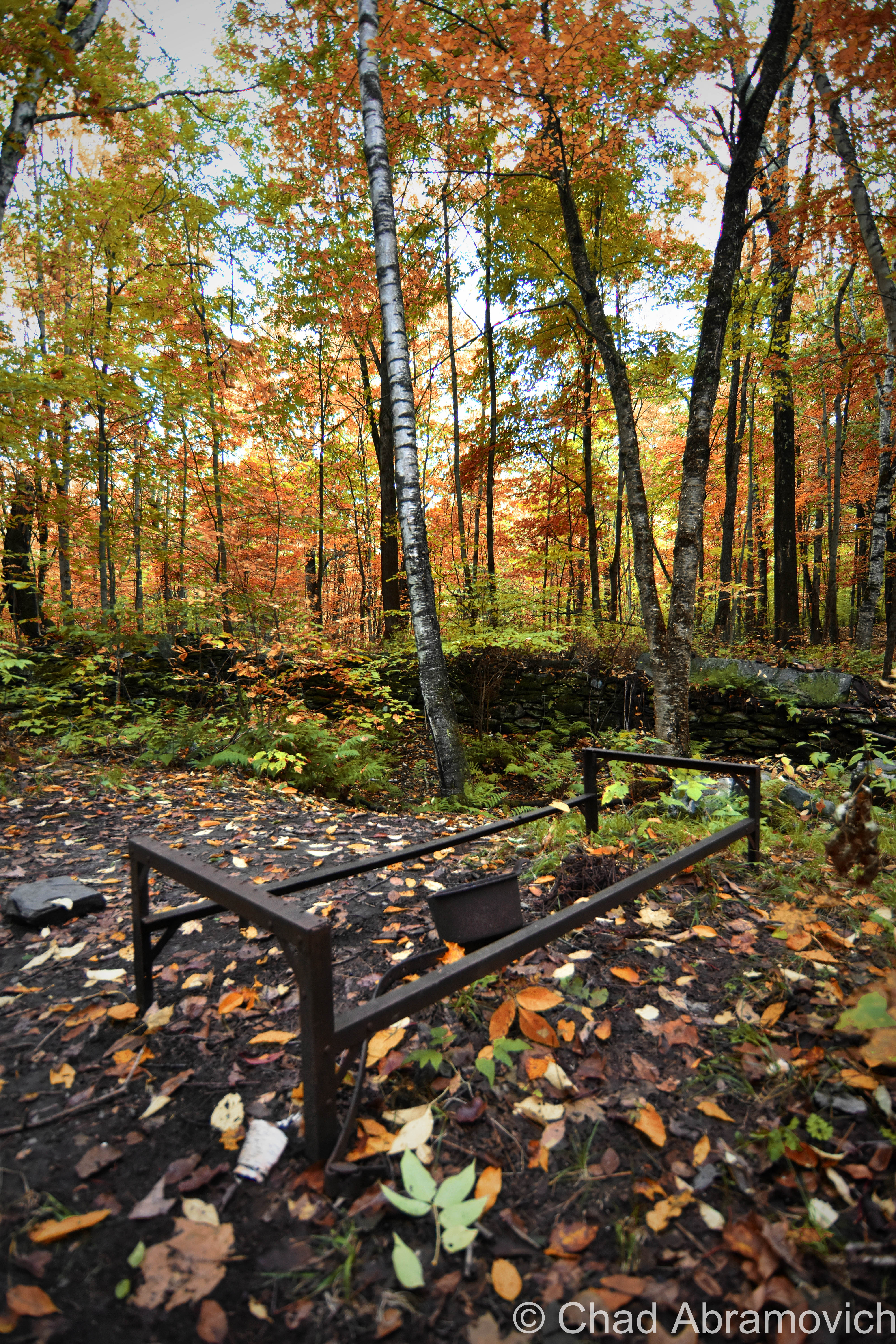
In the 1930s, The Government bought around 6,000 acres of land around West Bolton and Jericho for the Ethan Allen Training Site, and much of the village of West Bolton was destroyed in the name of progress. Today, all that remains are a few foundations sitting in the quiet woodlands above boulder logged streams and old Apple Trees hinting at the site of a former farm. I was told that UVM mapped the area and had a walking tour for a while in the 1990s.
The surrounding woods along the back roads that travel along the ridge lines and swamps are congested with “US Property, NO Trespassing” warnings on almost every tree.
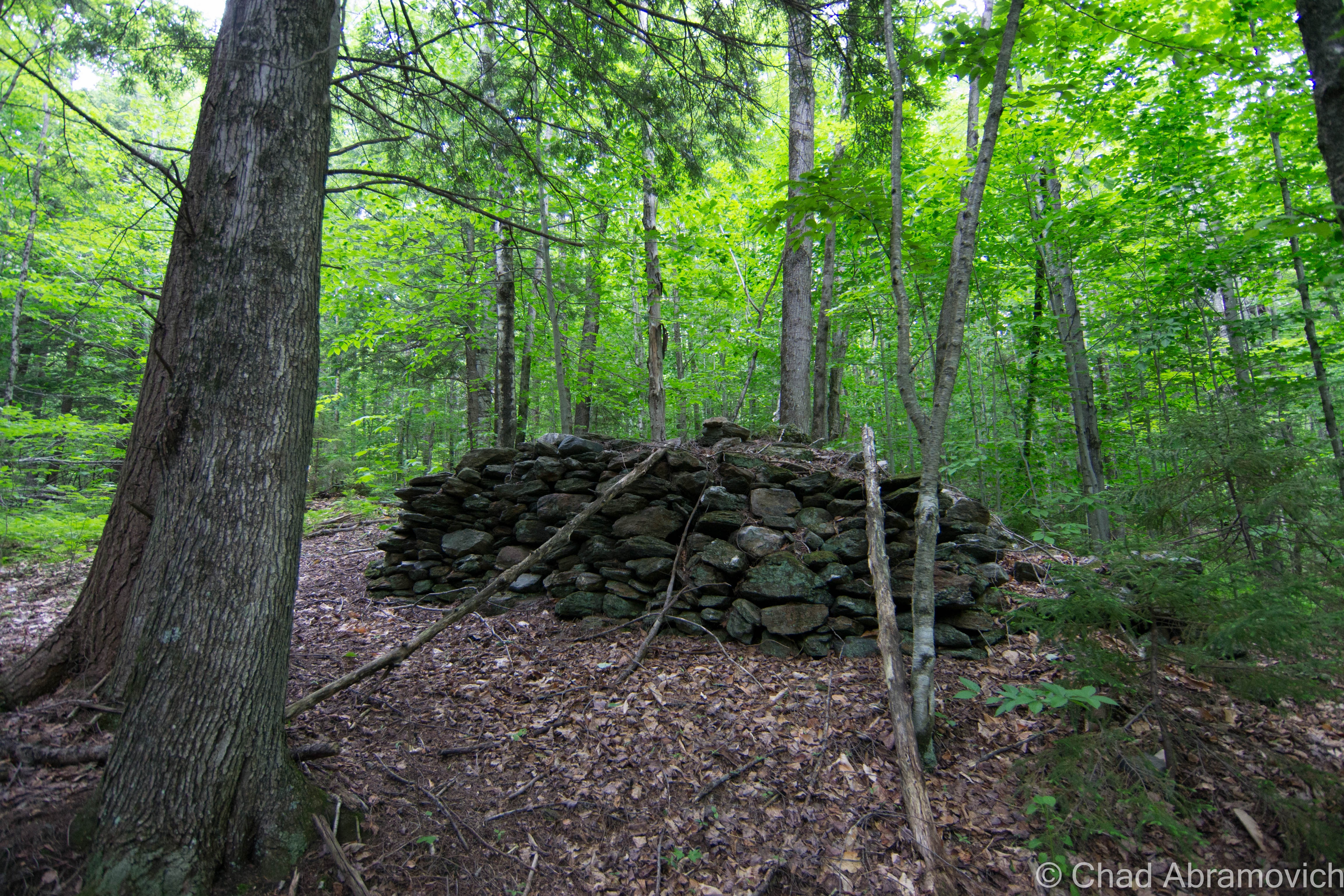
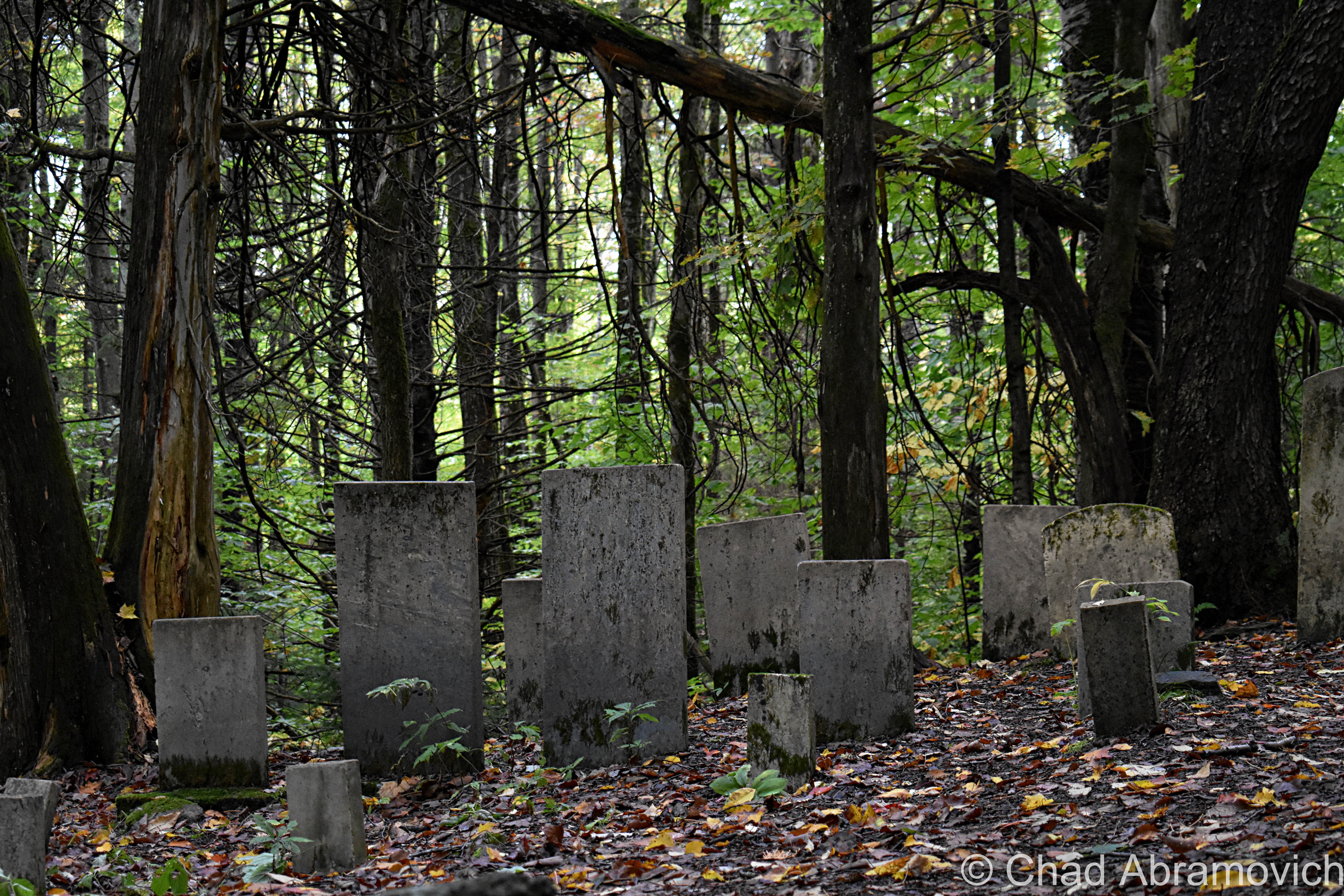
One of the few remaining foundations we were able to find is the site of a former church, now nothing more than its front stairs.
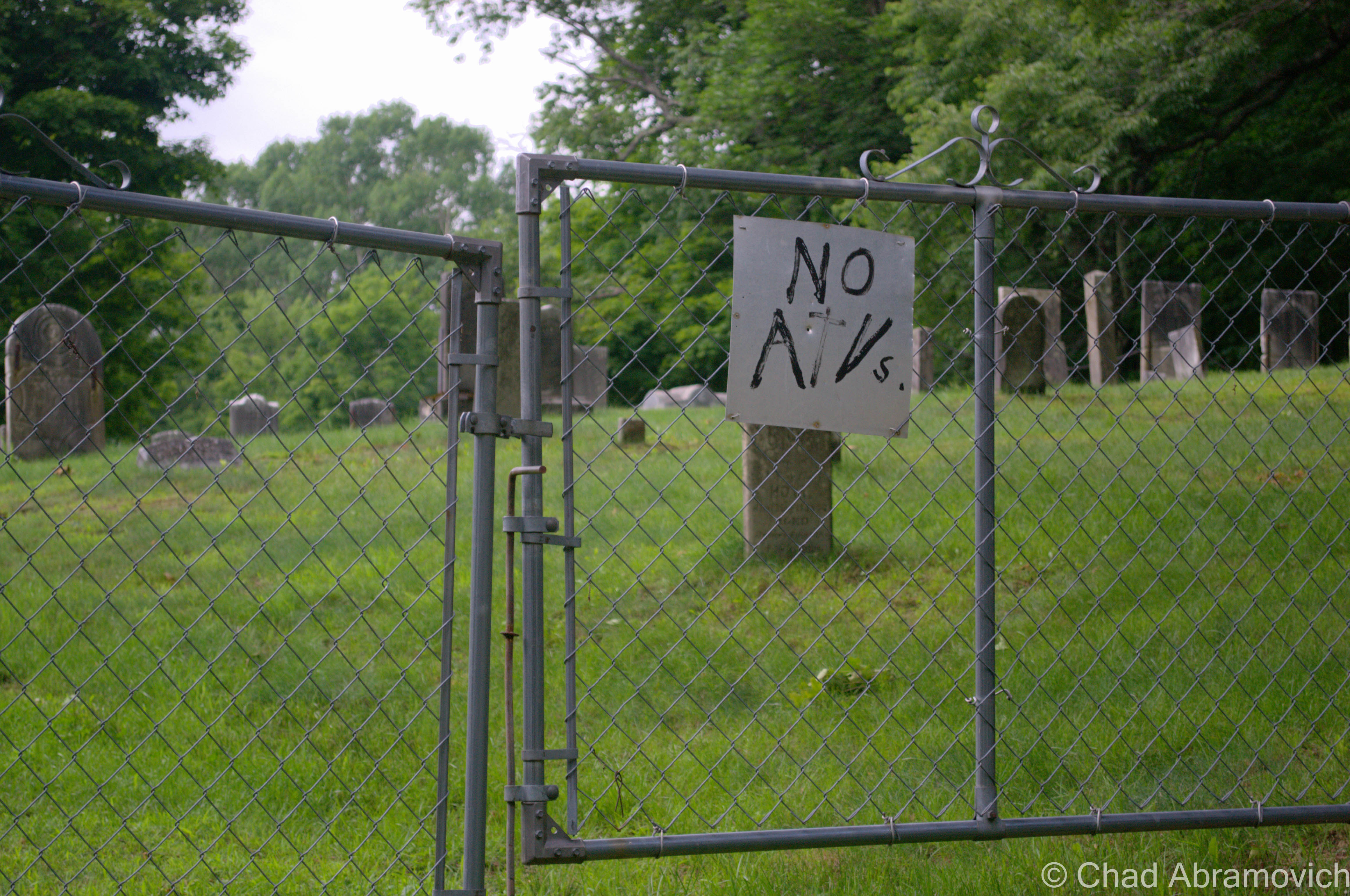
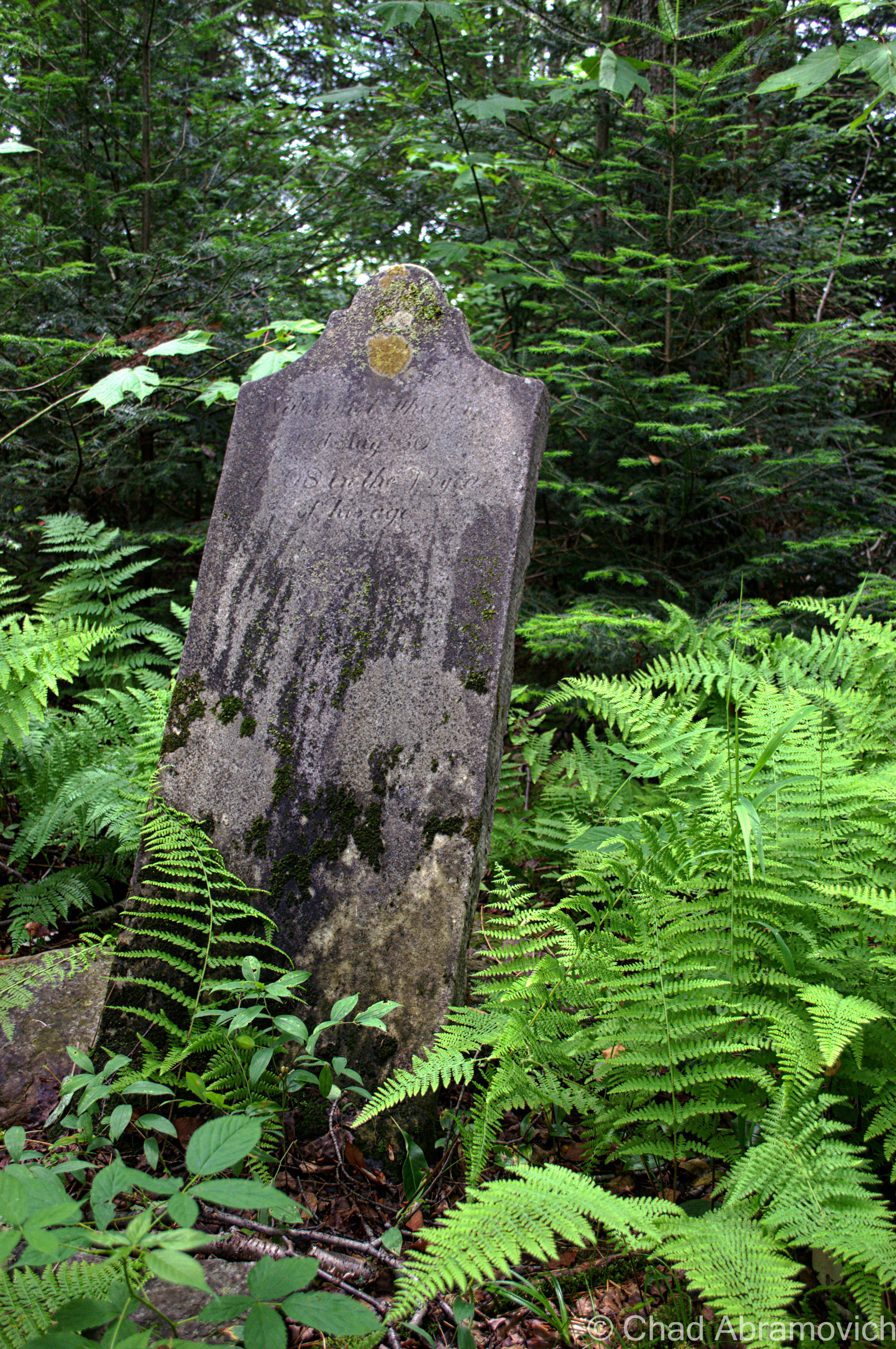
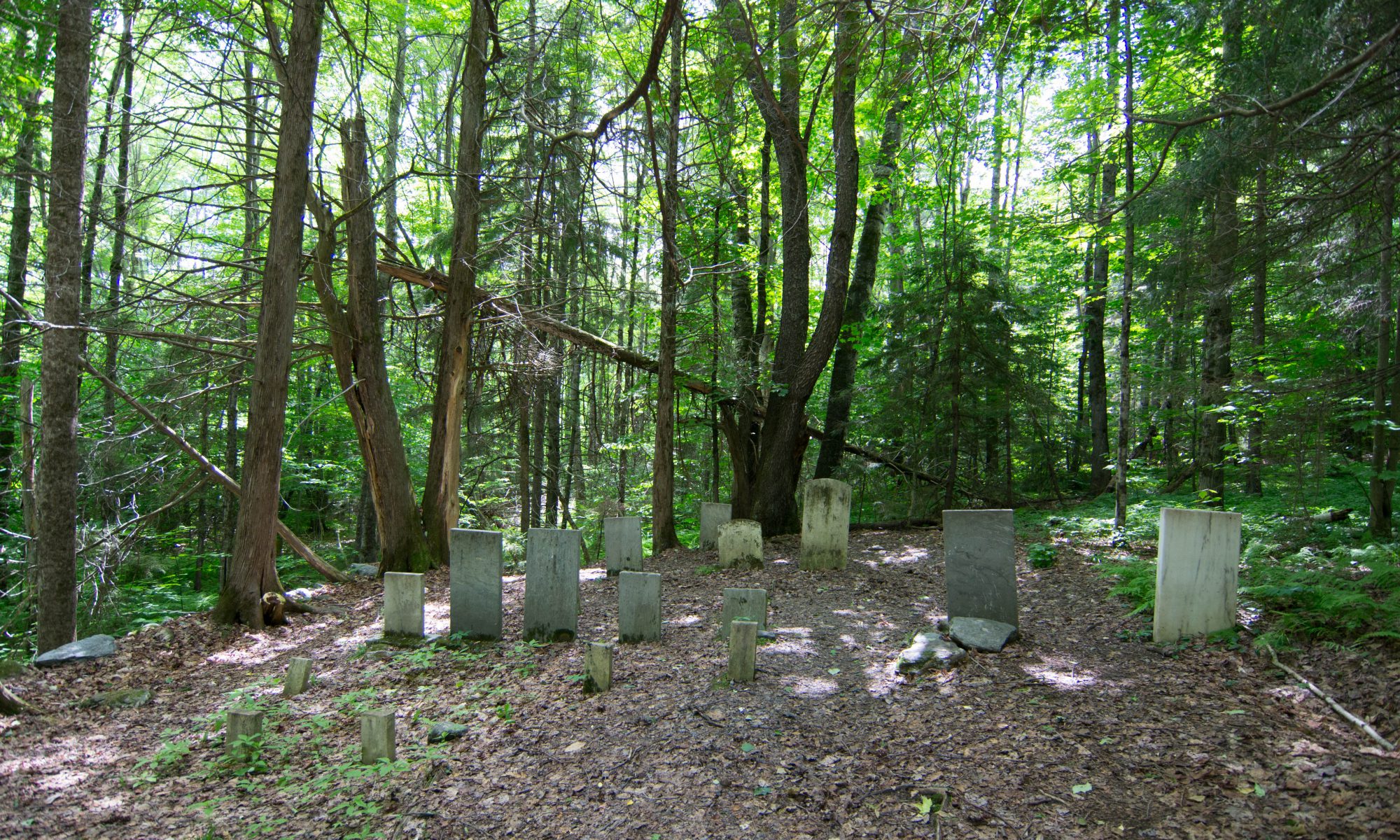
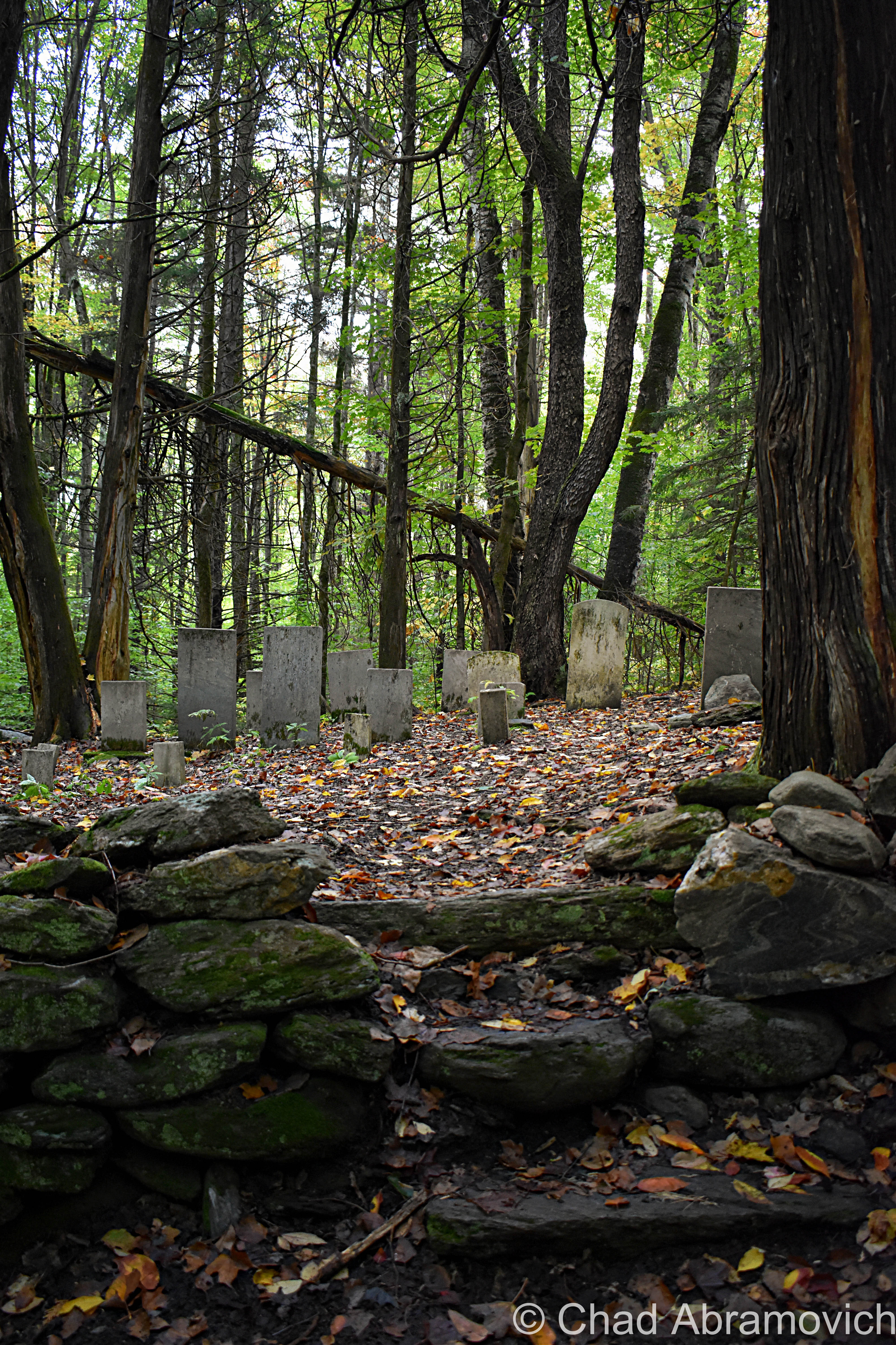
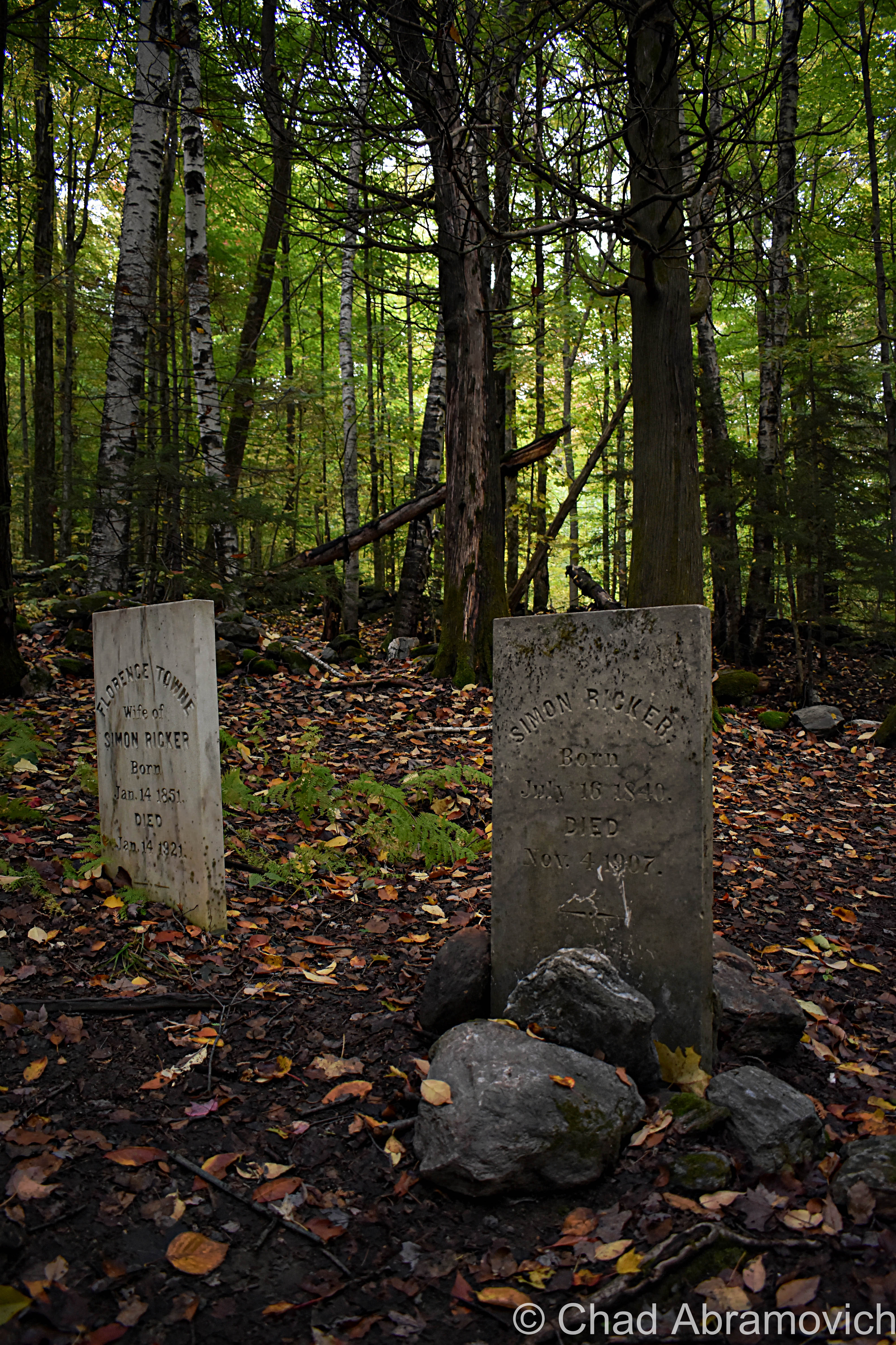
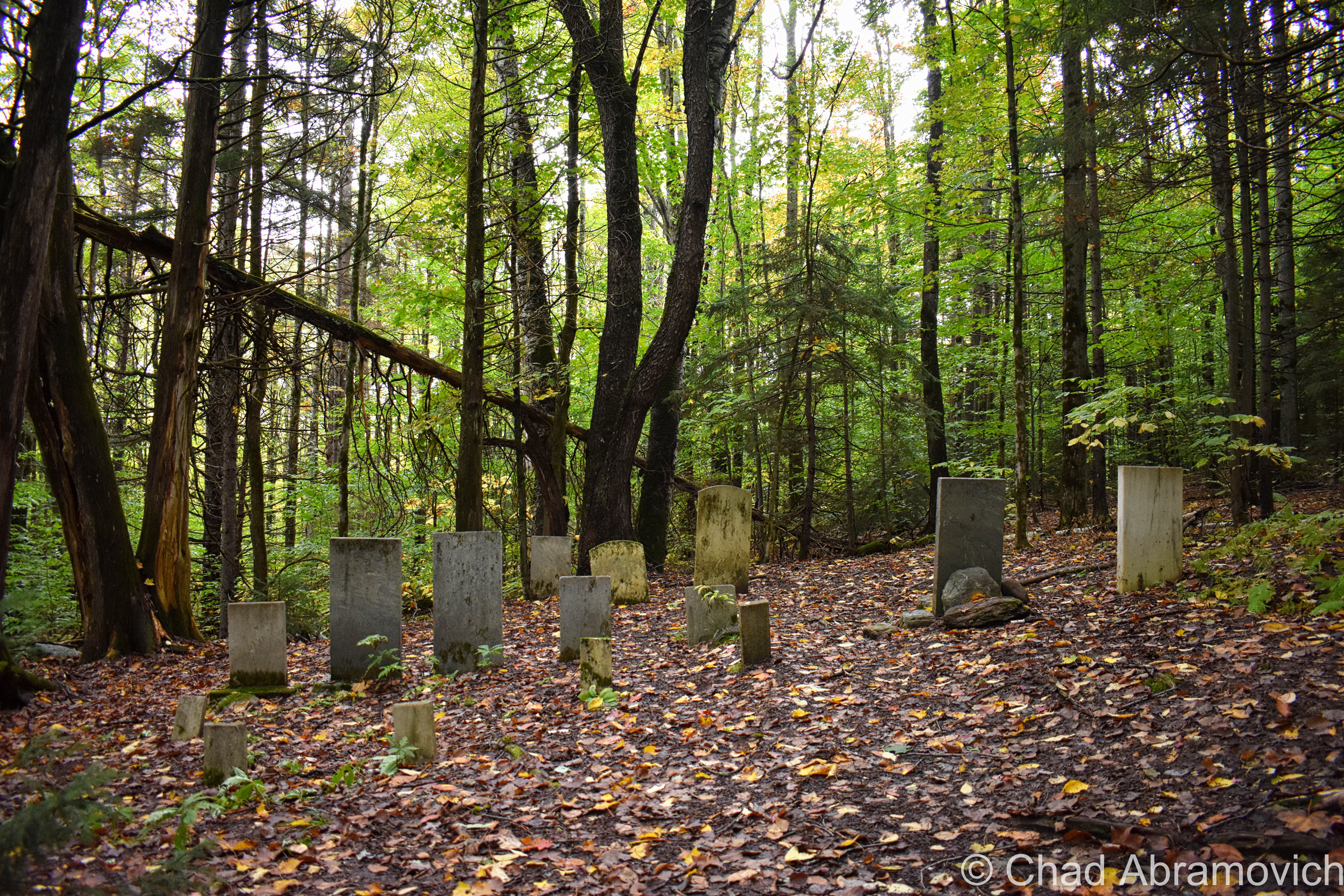
Nearby was the old West Bolton Cemetery, which is still maintained. It was oddly quiet here, with a solemn weight that seemed to hang over the Maples and hollows. There was also an amusing sign attached to the front gate, humorously prohibiting ATVs from riding in the local cemetery. Within 10 seconds of us seeing this sign, a group of ATVs came up the dirt road towards the cemetery, 4 of them packed with 2-3 riders on each one. They slowed down as they approached the fence, revved their engines obnoxiously for several minutes, then took off down the road sending gravel and dust in their wake. Maybe they didn’t like the new sign?
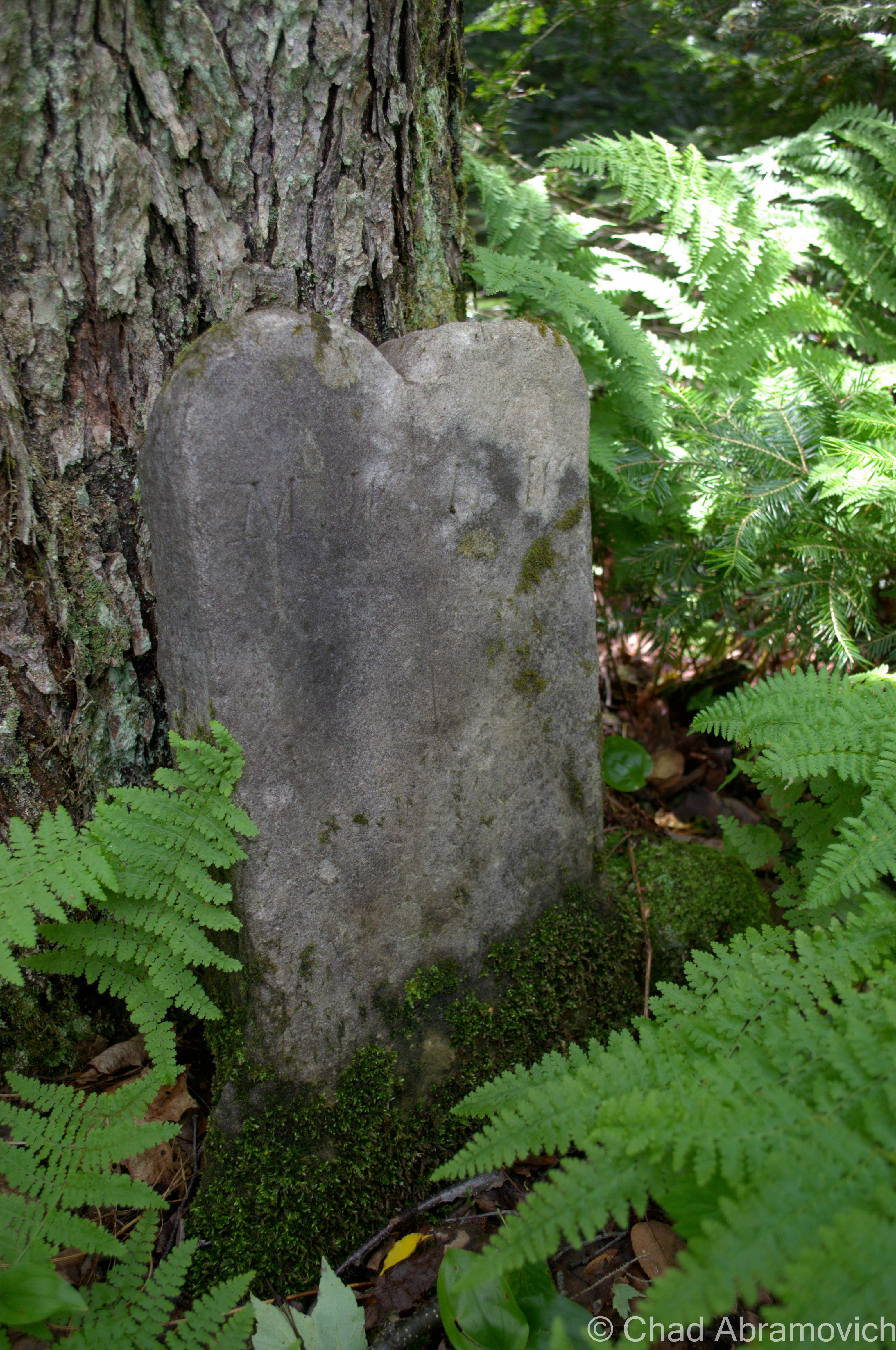
I sometimes enjoy walking through older cemeteries to admire and become intrigued with unique epitaphs, symbols alluding to secret societies, and other oddities that have been chiseled onto the aging headstones. There is always a story to be told. One of my favorite finds in West Bolton was this etching of a hand, with a finger dramatically pointing up to the skies above. In the 1800s, it was sometimes common for this to appear on headstones, with the intention of saying that without a doubt, this deceased soul did in fact go to heaven. But no one knows for sure if this gesture was telling any profound truth or not. And I suppose you don’t have to go ghost hunting in your afterlife to find out.
As seen in “Downtown” Jonesville.
—————————————————————————————————————————————–
To all of my amazing fans and supporters, I am truly grateful and humbled by all of the support and donations through out the years that have kept Obscure Vermont up and running.
As you all know I spend countless hours researching, writing, and traveling to produce and sustain this blog. Obscure Vermont is funded entirely on generous donations that you the wonderful viewers and supporters have made. Expenses range from internet fees to host the blog, to investing in research materials, to traveling expenses. Also, donations help keep me current with my photography gear, computer, and computer software so that I can deliver the best quality possible.
If you value, appreciate, and enjoy reading about my adventures please consider making a donation to my new Gofundme account or Paypal. Any donation would not only be greatly appreciated and help keep this blog going, it would also keep me doing what I love. Thank you!
If I had to pick a place in Vermont I loved most, it would probably be the town of Wallingford. A small town unknown to most, a shimmer in the rolling geography and rushing traffic moving from Rutland to Bennington. Wallingford offers an attractive historic village on Route 7 and an incredible amount of vast land rising up the wooded slopes of the Green Mountains to the east of town – a rugged and wild landscape of boulders, dark forests and streams fed by melting ice.
I spent some of the best days of my childhood here at my deer camp, cherished memories that still haunt me today. But apart from all that, Wallingford is a town of intrigue and mystery. Its deep forests have swallowed ghost towns and have buried the remnants of an impolite massacre that happened over a century ago.
My favorite entrance to any town, ever. You can’t beat the view as Route 140 curves its way into East Wallingford.
According to local lore, Wallingford’s Sugar Hill was where Maple Syrup was first made in Vermont. Roughly before the town became industrialized, the cryptic remains of the skeleton of a man were unearthed behind the old stone shop on Main Street, the rotting remains of a rusted gun barrel found alongside him. Some speculated that the remains were thought to be of a soldier of the French and Indian wars, but as to how he met his death, whether by treachery, lurking savage, disease or wild beasts of the Wallingford wilds, has never been known.
But perhaps the most mysterious area of town is an unforgiving and conspicuous geographical anomaly that can be seen from all parts of town – an area aptly named White Rocks.
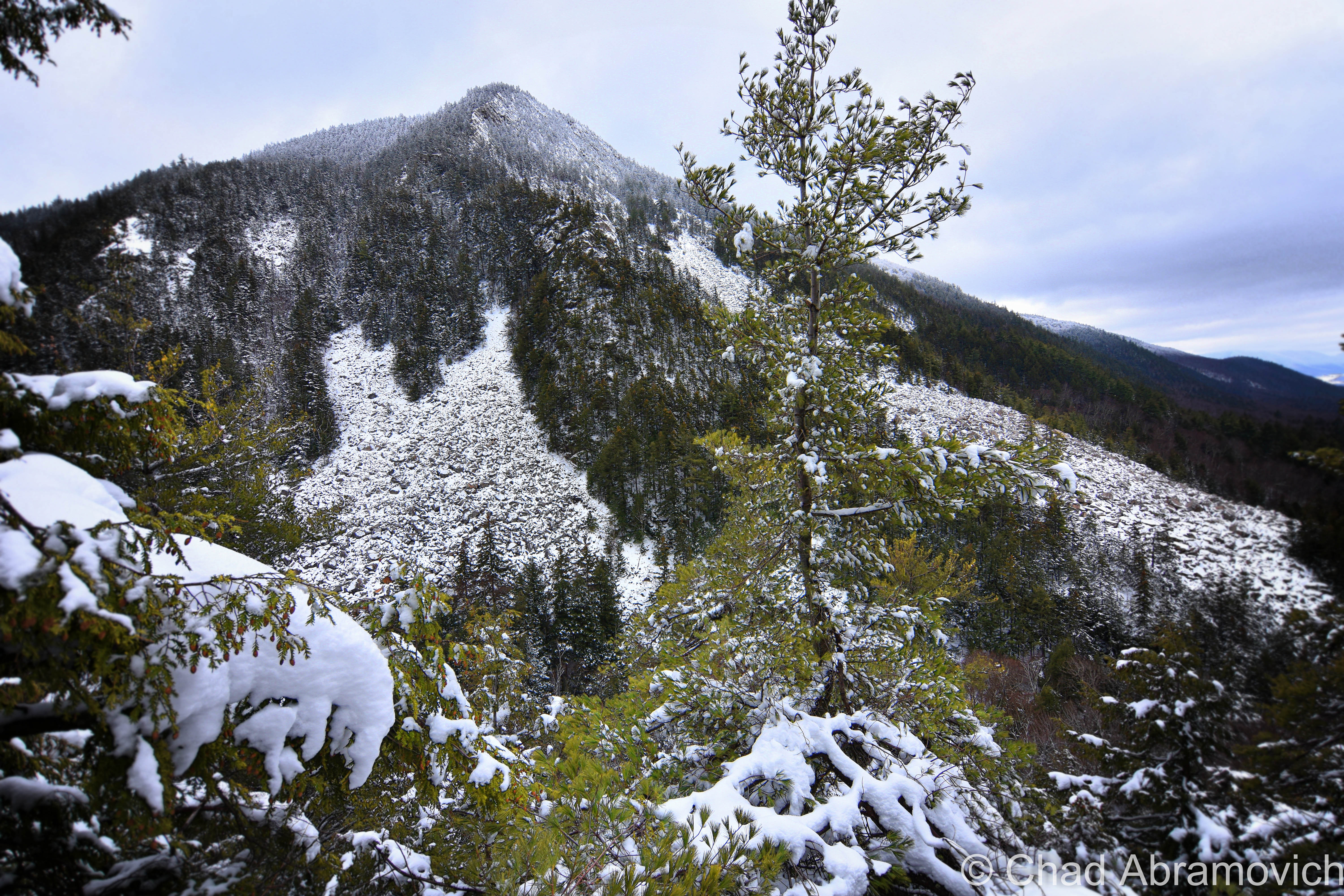
Rising about 2,600 feet above The Valley of Vermont, White Rocks mountain is an incredible sight. During the last Ice Age, glaciers scoured and exposed the Quartzite cliffs that makes up the framework of the mountain. Over time, the slopes eroded to a point where the face of the mountain became weak, creating several massive rock slides that crumbled down the slopes to dales and glens below, sending gigantic Quartzite boulders, some larger than an average house, down the mountain ripping up the evergreen forests as they made their visible scars.
It is here amidst this merciless landscape where an area known as the Ice Beds lay, where melting ice harbored deep within protected mountain caves feeds crystal clear mountain streams that meander their way through the woodlands. The temperature drops a good 15-20 degrees here and is a welcome respite on hot summer days.
But there is another sight among the sites here, something far more likely to capture the most vulnerable of imaginations. According to a little-known piece of local lore that was in danger of almost vanishing; the White Rocks are said to be the final resting place of a fabled treasure lost over 2 centuries ago.
As the story goes, sometime during the late 1700s, a group of Spanish prospectors passed through the area now known as Wallingford seeking fortune in the new land. In the mountains, they discovered a rich vein of silver. The group began to set up mining operations and began to dig deep cavities at the base of the mountain. Here, they were able to work in secrecy where they smelted the ore and turned it into silver coins. Eventually, they decided that they all had enough to live comfortably for the rest of their lives. But there was a problem. They had no way to transport all of their newly found wealth back to Spain. They filled their saddlebags with what they could, and hid the rest in the mine. The opening was discrete and hard to find, and they all agreed that it would be highly unlikely that another wayward prospector or woodsman would stumble upon it. But just in case, they disguised the opening the best they could, with the hopes of coming back whenever they wanted if they needed more money.
Years passed and most of the original group had died off, all but one. A frail old man by now, he wondered onto the streets of Chester, Vermont looking tired and a little confused. A kind young local man noticed his appearance and asked the old man if he was alright and needed assistance. The Spaniard was apparently so grateful at his generosity and taken by his personality that he decided to return the favor in a way the wide-eyed young man could have never seen coming. The Spaniard told his new friend now known as Richard Lawrence that his that his saddle bags were filled with silver coins, and told him about the mine in Wallingford. He informed Richard that whatever treasure was left in the mine was his to keep, on the condition that he waited until he passed away to go claim it.
As it turns out, Richard proved to be just as honest as the old man had predicted, and didn’t tell anyone about the treasure until years later, when he told a few of his good friends and decided to set out to Wallingford and the mysterious White Rocks. But after a diligent and organized search, they could not find the opening of the cave. Search efforts carried on for several months, but after frustratingly grueling hours, they reluctantly gave up and left with their heads and their hearts tossed around like the boulders that fell from those slopes long ago.
Today, the treasure has yet to be found, and the mountains still remain as elusive and mysterious. It’s no wonder that the deep area where the rock slide collided with the forest floor is known as “Chaos Canyon”. If you do believe that a buried treasure still exists within the catacomb of twisting caves and eternal ice behind the mountain, don’t plan on digging for it. The White Rocks is protected land, part of the White Rocks National Recreation Area within The Green Mountain National Forest. So for now, visions of buried treasure and the more humbling reality of the limitations of man will sink with the northern sun.
White Rocks Mountain underneath the mists.The Ice Beds at the base of the mountain, underneath thick mists that were beginning to settle deep in the rocky glens below the craggy summit. On dry summer days, the rocks provide a great place to climb around – something I have spent hours doing before. But not today. The rain that had began to fall had made the Quartzite boulders slippery and dangerous.
If you venture up the Keewaydin Trail, you will eventually hike past a strange looking structure sitting off into the woods. It looks like a miniature house that comes up to your chest, but this odd little one-roomed structure is long abandoned, as indicated by a giant hole in the roof. Peering inside, the rotting interior was filled with stagnant black water. There seemed to be a stream, either natural or created by runoff oozing out from underneath it. But what was it? I had no ideas. A passing hiker informed me that this was one of Vermont’s “Fairy Houses“, which are scattered mostly around the town of Grafton. But after doing the research, it just didn’t add up. This seemed more utilitarian, and a little less…I’m not sure, whimsical? Maybe this was something that once protected a natural spring? If anyone has any idea, feel free to pass the information along.
The White Rocks and their vast silence of a still winter’s day. The hike was great.
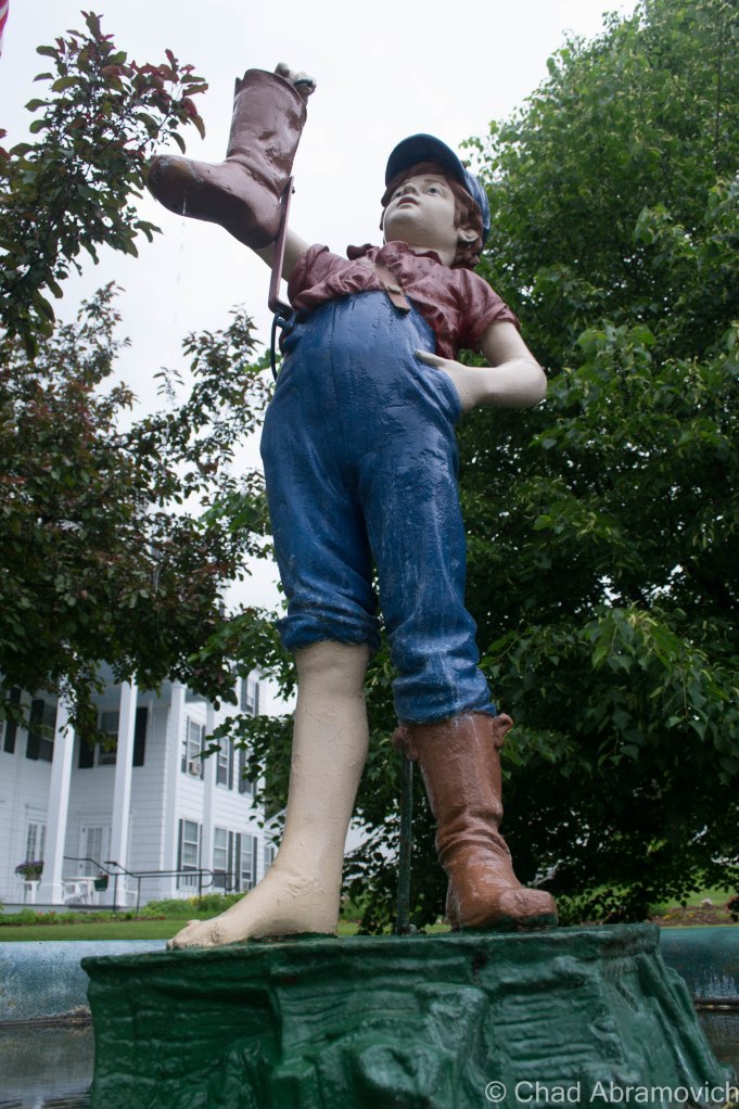
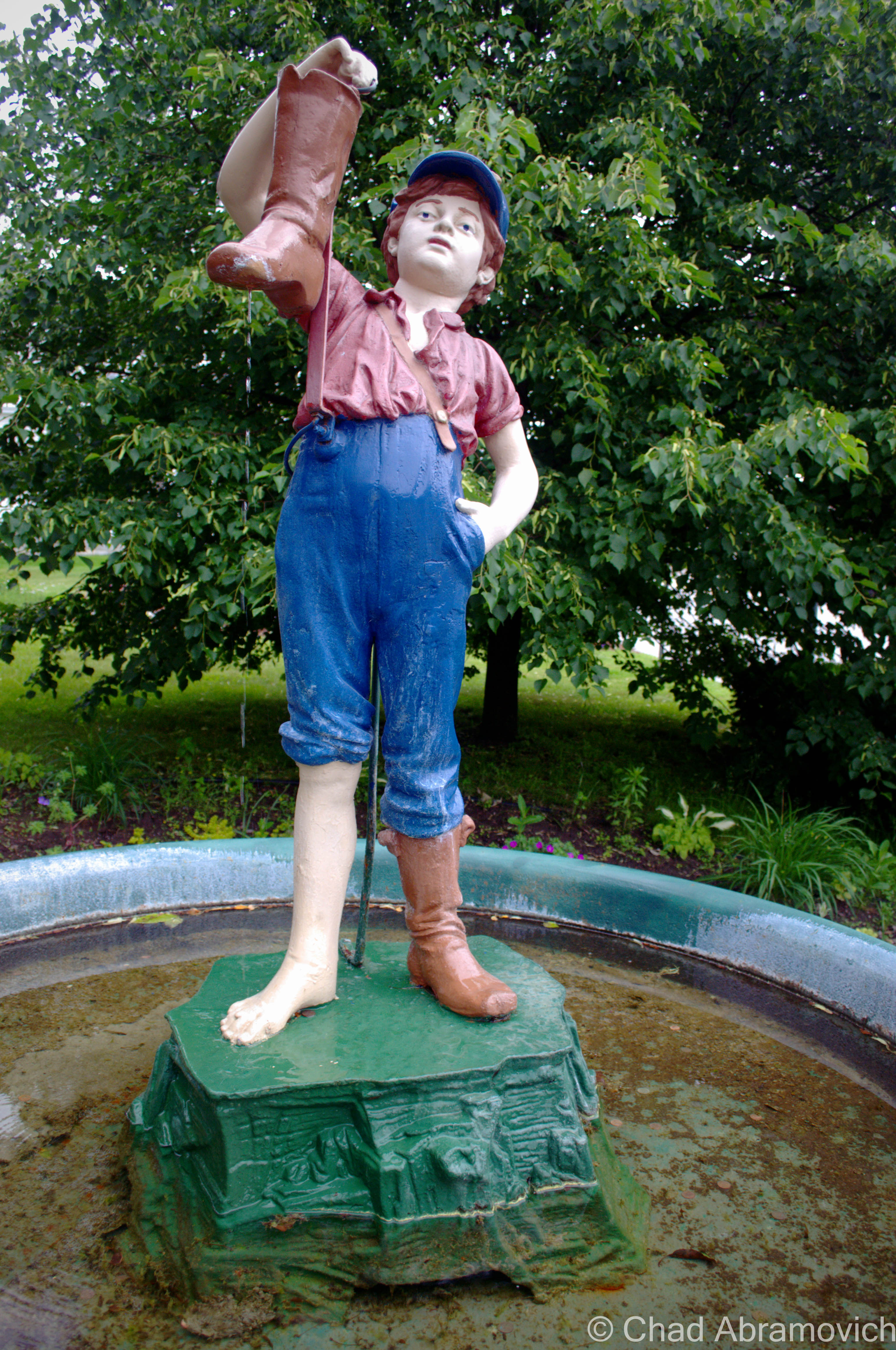
From the White Rocks, Route 140 twists its way down through a deep gulf formed by the aptly named Roaring Brook. The narrow highway offers one more serpentine turn before dipping into Wallingford village, where elegant Victorian houses climb down the hillside to the small downtown district. Here, at the only traffic light in town, sits another Wallingford curiosity that is far more gentle than the White Rocks, but practically as enigmatic.
It’s made out of cast iron, colorfully painted, and depicts a young boy holding a boot which eternally drips water from a small hole into a circular pool below – his faraway eyes forever depicting a state of reverie. This is Wallingford’s “Boy with the Boot”.
At the base of the statue pool, there is a small plaque that reads: “Erected to the memory of Arnold Young by his children, April 3, 1898.” Arnold Young was the innkeeper of the Wallingford House hotel that sits directly behind the statue. It is said that Arnold’s children thought that this statue would somehow be a fitting memorial and gift to their father. But it seems like a rather peculiar memorial that a well-respected innkeeper would choose. Would Mr. Young have chosen a different memorial, rather than a boy with a leaking boot? Or maybe there was some sort of comedy at work here – an inside joke perhaps, or something that the Wallingford of the late 19th century would have understood that has since been lost?
Around 1910, the Boy disappeared and was discovered ten years later in the Inn’s attic. He was restored and has since stood in front of the hotel. The statue has become an icon of community pride, so much so that the Wallingford town website even features an animated Boy and the Boot.
The mystery, however, deepened even more after I had published an article about it in the Rutland Reader. Some old-timers recalled the statue once being painted black, and others say his eyes were originally closed, only to be painted open. And others argued against both claims, saying the statue has always looked the way it did when I photographed it.
But it wasn’t until I found a compilement of speculated history that just adds to the mystery continuum, because none of the interesting information I read was sure of itself. Written up by Emma B. Towsley, Alex Fleck and Charles Hill (a descendant of Arnold Hill), this edifice may just be ” the most mysterious statue in the world”. According to the essay title anyways.
More than 80 years ago, seven of these statues were allegedly shipped to America from Germany, but to contradict this, others have argued that this statue isn’t of German origin, but have no records as to where it’s from. Records or not, some say it came from Rome, Italy. But the Italian Embassy in New York City didn’t seem to agree with that statement. But a Swedish gentleman who had traveled through Italy swore he saw the original copy, and then had a copy of it made which can now be found existing in Stockholm, Sweden. It seems like many more copies had been made around the 1800s, and were given as gifts to English, Canadian and American cities. But no one, not foreign governments, so-called authorities of art and state museums couldn’t weigh in at all as to who the original sculpture was.
There has been a “Boy With The Leaking Boot” Statue in Fresno, California for over 64 years, Winnipeg, Canada since 1895, Menominee, Michigan’s was brought over from Germany over 70 years ago, and the oldest one of them was around for more than 80 years in front of the Porter House Hotel in Sandusky, Ohio, where the Porterhouse Steak was debuted. Ellenville, NY is the only city to have two copies. Ohio once had two, but one died in the impact of a car crash in Wellsville. Records show that Seattle had one that came from Belgium, but it was later stolen.
The boy, suggested being depicted as being about ten years old, is an enigma himself. Who was he? One theory published long ago in an English newspaper said that the boy was modeled after a well-liked newsboy who sold papers on the streets of a town in Italy, and as the story goes, tragically drowned while he was fishing. But two men in a Californian city give their own story, and say that this boy was actually a “drummer boy” in either the Revolutionary War or Civil War, and would try to care for sick or wounded soldiers on the battlefield. Using what little he had, he pulled off his boot, ran to a nearby creek and filled it with water to give the agonized men a drink, while plugging up the hole in the front of the boot so the water wouldn’t leak out as he was running back.
All we know for sure is that fifteen of them were made, and one is on display in the middle of downtown Wallingford.
—————————————————————————————————————————————–
To all of my amazing fans and supporters, I am truly grateful and humbled by all of the support and donations through out the years that have kept Obscure Vermont up and running.
As you all know I spend countless hours researching, writing, and traveling to produce and sustain this blog. Obscure Vermont is funded entirely on generous donations that you the wonderful viewers and supporters have made. Expenses range from internet fees to host the blog, to investing in research materials, to traveling expenses. Also, donations help keep me current with my photography gear, computer, and computer software so that I can deliver the best quality possible.
If you value, appreciate, and enjoy reading about my adventures please consider making a donation to my new Gofundme account or Paypal. Any donation would not only be greatly appreciated and help keep this blog going, it would also keep me doing what I love. Thank you!
St Albans, Vermont, 1874. It seems that the summer brought more to town than sultry weather. The entire town was coping with a string of random and violent acts that were plaguing everyone’s peace of mind. A series of unsolved burglaries had the business community on edge, as well as a mysterious assault on a local physician who couldn’t identify his attackers. Later, a French Canadian man was killed in a stabbing incident, his attacker or attackers faded into the summer heat.
And then, on July 24th, something happened that finally caused the Railroad City to come apart at the seams.
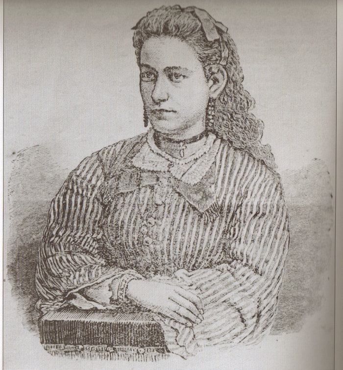
20 year old Marietta Ball had just been hired for a teaching position at a rural schoolhouse on French Hill during the summer months. She was described as a tall and slender young woman who was intelligent and kind hearted. She had blue eyes, light brown hair and weighed 130 pounds. Because she was a spinster, she didn’t mind the work or her rural location. French Hill, being a steep and remote hill area located east of the city, involved a steep climb up the west slope before dropping behind a ridge line to get to the schoolhouse. Even today, French Hill Road is steep and challenging, and in the winter it’s a white knuckle, break riding accent down to the safety of Route 104 below.
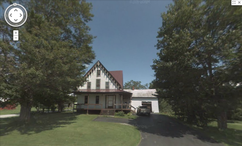
Marietta had arranged for room and board with a neighboring farm family, The Abels. After she would be finished at the schoolhouse, she would walk a lonely road that ran south from the schoolhouse just underneath the crest of the hill to get there. On the weekends however, she would stay with the Page family whose house stood at the very south end of the road, at the junction of today’s Vermont Route 36. But on that warm July evening, she would never reach her destination.
After much time had elapsed and Marietta hadn’t arrived, the Pages began to worry. Towards the evening, Mrs. Page’s concern got the best of her, and she began walking up the road to the nearby Collins residence to see if they had possibly seen her. As she walked up into the hills, the night air began to cool down and the sunset was burning with fiery vengeance. The Collins however were just as surprised that Marietta hadn’t shown up, and by 10 P.M., a search party was assembled.
Marietta Ball’s final destination, the Page Farm, still stands today.
Not long after setting out, the party’s lantern lights soon found what appeared to be the sight of an ambush in a nearby hollow. Near the site of the ambush was their first clue hinting that something sinister had taken place here; a makeshift mask that had been made from a piece of torn carpeting. Around 1 A.M., Frank Harris, a black man who was employed by Mr. Page, began shouting that he found a body. Through the haze of the lanterns keeping the wild shadows at bay, the gruesome remains of Marietta Ball began to take form.
Upon first assumptions, the party agreed that she had been sexually assaulted. But a later post mortem was conducted during daylight hours by a St. Albans physician named Dr. Fassett and a visiting New York physician, Dr. Janeway. Now they understood exactly what had happened. They noticed that her assailant had wrapped her head in her overskirt, which was a bit peculiar. Once that was removed, her brutal wounds were revealed. She had been savagely beaten to death. Her attacker must have had a moment of reconsideration, and made a clumsy attempt at hiding what he had done. They noted that her limbs were also re-positioned in an attempt to deceive whoever found her.
Marietta Ball
The town was outraged and their thirst for blood was ignited. Not long after Marietta’s body was found, the first of what would become several arrests were made. Frank Harris would be the first one taken into custody. A neighbor of the Page’s, Mrs Drinkwine, claimed that she left behind a fragment of the same carpet that was found at the crime scene in a rental house she owned. As it turned out, Mr. Harris was living in the house at the time of the murder, and Mrs. Drinkwine thought that was evidence. She insisted that she could prove the carpet was from the house by providing a sample of the same carpet in her own home, but her son became the voice of reason and told her that she shouldn’t make any accusations unless she knew they were true. Embarrassed, she dropped the matter and Frank Harris was released from custody with no grounds to hold him.
On July 27th, a search party was organized to search the area of the murder, in an attempt to find more evidence. Various items were soon discovered that belonged to her, including a ribbon from her hair and her damaged watch. The face of the watch had been smashed, it ceasing to function around 4:20. The search party assumed that was probably her time of death. Further investigation finally uncovered a rather large stone that had dried blood glazing its surface – they had found the murder weapon. But the frustrated party returned home with no evidence that could apprehend anyone.
Marietta’s funeral was also held on the 27th as the search party combed the slopes and marshlands of French Hill.
After Harris’s release from custody, a second suspect was immediately brought in, a former French Canadian student of Miss Ball’s named Revoir. It was known that he had been punished and removed from the school by her after an issue of conflict had taken place, which made him a suspicious character with a motive. But he also didn’t have enough evidence to be convicted, and was later released.
To add to escalating tensions and paranoia, rumors began to spread about an organized gang with sinister intentions who were hiding out in a swampy and inaccessible region of Fairfield known as Cedar Swamp. Some even blamed them for all of the burglaries and the assault on the local physician that happened before Marietta’s murder. Even today, the Cedar Swamp region of Fairfield is a mysteriously beautiful and remote location that remains almost as wild as it probably did then.
Soon, anyone who was labeled as suspicious by the ever growing tense population were detained and brought in for questioning. But because of a popular dislike at the time of “outsiders” (the lower classes, traveling beggars and minority populations), they sadly were most oftentimes the targets of suspicion and often found themselves in the wrong place at the wrong time. The local papers, desperate for updates on the story, printed anything they could regardless of factual information.
Now, rumor began to replace fact. Mrs. Page seemed to recall a strange man who was seen around the schoolhouse during the week before the murder, which helped aid the growing fear.
Another story accused an Irish engineer from The Vermont Central Railroad of being guilty, because a year ago he admitted he had feelings for Miss Ball but it was said that she rejected him. He didn’t take the rejection well and said some harsh words as a response, something about revenge or getting even. But upon further investigation, it was discovered that he was actually in his home at the time of the murder, and once again, the case was right back to where it began.
In a more bizarre case, a clairvoyant named “Sleeping Lucy” gave authorities a description of a man who she claimed to be the murderer, – the image of a man who came to her in a vision. Going by her description, they were actually able to find this gentleman, and he was arrested and interrogated. But despite admitting to knowing Miss Ball, by August 3rd, they had no grounds to hold him, and he was released.
By August 14th, St. Albans seemed to be in the clutches of obsession. The murder wasn’t fading into memory, it was a wildfire burning. There had already been several arrests and no convictions. Until now, the immigrant populations and the minority groups had been targeted, (Harris who was black, Revoir who was French and the train engineer who was Irish, etc) but that cup was full, and now the more esteemed members of St. Albans society began to be suspected.
The first to be suspected was the eldest son of ex-Governor Smith, George Gregory Smith. But it would be a full year before he would be be questioned, and that was only because of mounting public pressure for him to do so. And before his hearing, he openly challenged anyone who suspected him to show up and state their claim.
Others were accused as well. Friends turned on friends. If you were reported to even being in the vicinity of French Hill near the time of the murder, someone would mention your name to the police. Several people were brought in just for riding in their carriages down the hill into town. Someone else was supposedly suspected because she wore the same earrings as Miss Ball did.
Refusing to give way to the triumph of their enemies, more measures were taken. On June 25th, 1875, a group of citizens formed “The Union Investigation Society” to further embark down the long, dark road of the murder case. Among those who joined were Mr. Page and Mr. Collins. The group would then be divided into smaller groups who would be assigned to search certain districts of town.
Soon, another puzzling piece of information was unveiled. Georgia resident Eleazer Jewitt claimed that Marietta’s father, George Ball, had once told him that he knew that George Smith was the one who killed his daughter. But shortly after, Mr. Ball had reportedly gained a considerable amount of money and immediately left town for California. But before he left, he changed his story, and insisted that Frank Harris had killed her. So, did George Smith pay Mr. Ball for his silence? A further investigation revealed that the money Mr. Ball had received was only $200, sent from his sons in California to pay for his trip there so he could live with them. An officer of the local bank assisted in his defense, and said that Mr. Ball had been in serious debt and did not inherit any amounts of money. To further prove this, a trip to his small farmhouse revealed all of his furniture to be cheap and purchased at various auctions. So Mr. Smith and Mr. Ball were both acquitted of their accusations.
Another curious piece of evidence came shortly after, a blood soaked handkerchief was found near the murder scene with the name “G.J. Ingram” monogrammed in it. But the police were at a loss. After an extensive search, no person with the name Ingram was found to be existing in the area.
After over a years worth of investigating and community outcry, the murder of Marietta Ball seemed to be as mysterious as when it first started. Many were accused, neighbors turned against each other and the community was easily a whole lot worse for wear. It seemed like the secrets would forever be lost to the cold ground of French Hill, the light of the moon masquerading those things that we’d never know.
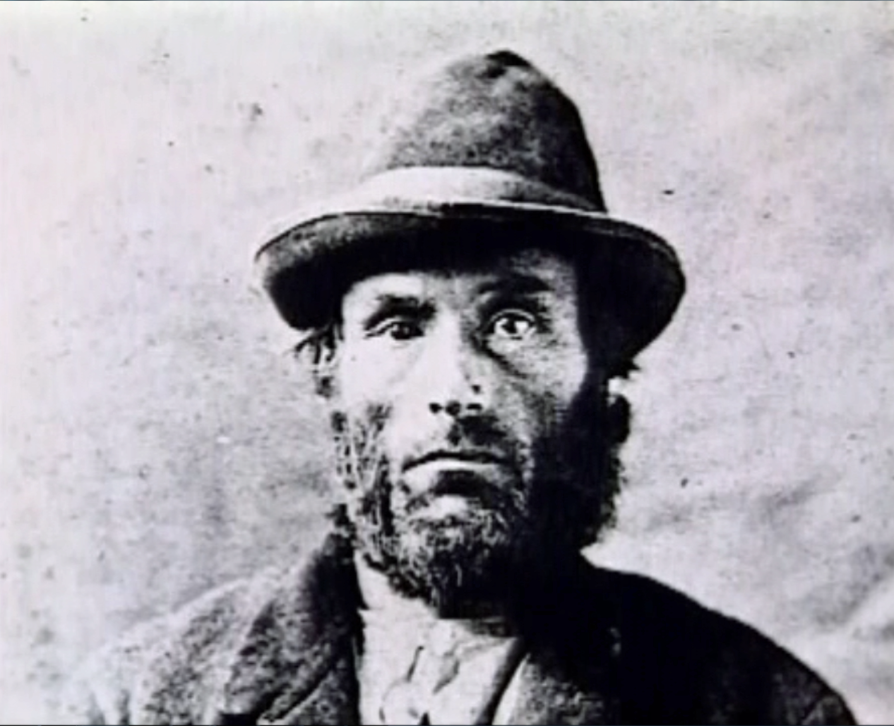
But on October 14th, 1875, a shocking discovery was made. A French Canadian named Joseph LaPage was convicted of brutally murdering Josie Langmaid of Suncook, New Hampshire. And someone made a strange note that the way Josie was murdered was almost exactly the same as Marietta Ball’s murder. News traveled back to St. Albans and Mr. W.N. Abel of The St Albans Messanger recalled Joseph LaPage living in the French Hill area at the time of the murder. He contacted Justice Farnsworth of St. Albans, who immediately contacted officials in Suncook. LaPage had just became the latest suspect in the murder of Miss Ball.
Joseph LaPage
On January 13th, 1876, Joseph LaPage was sentenced to appear in court, and was found guilty for both murders. On March 15th, he was sent to the gallows in Concord, New Hampshire. It was said that he loudly claimed his innocence from when he was first accused until just hours before he was hanged, when he choked out a sobbing confession. It seems the skeletons he was hiding finally found him.
But some questions remain. Why was Mr. Ball so determined to accuse George Smith of murder? What suspicions induced the community to suspect him to begin with? And who was G.J. Ingram? And there are some who argue that the evidence that linked Joseph LaPage to the murders wasn’t enough to convict him. So, if this is the case, did they hang the wrong person? Perhaps only the good night knows these answers as the softness of the summer attempts to sooth the community’s scars.
But this tragic tale has another ending. I was also told that Joseph LaPage was finally caught when his son, who somehow discovered his dark past, made his way to St. Albans and reported him to local authorities. But there doesn’t seem to be any record of this, making me believe this is the product of the re-shaping of a story as it travels through the years.
French Hill Today
Until recently, a friend of mine owned a beautiful piece of property on French Hill, comprised of mix woodlands and a vast beaver pond which, on summer nights, was a strikingly beautiful place to sit by under the songs of the cicadas, and she was the one who turned me onto this intriguing story and compelled me to research it.
She had no information about the murder until one day, an actual descendant of Marietta Ball stopped by her house, and asked permission to look around the property. Confused, she asked why, and the man filled her in on the story. He said he was looking for the place where Marietta’s body was found. But he also had a theory that Joseph LaPage’s house may have actually stood on the property as well, and was in hopes of finding the old foundation. Though the man couldn’t be certain, he assumed that after Marietta had been murdered, Joseph crossed a brook that ran through the property and went back to his house. But sadly, I’ll never know if he found what he was looking for.
But this was an interesting turn of events, because before that chance encounter, my friend swore her house was haunted. By what, she wasn’t certain. But both her and members of her family swore they felt uncomfortable in certain rooms of the house, and the stairway leading to the second floor. Feelings of being watched by some sort of dark entity were reported often. Now it seems a connection could be made. Was it in fact the ghost of Joseph LaPage who was haunting their house? Did he seek refuge on the wilds of French Hill in his afterlife? Or maybe, these uncomfortable feelings can be attributed to something else?
Another strange footnote to the story; Marietta Ball was buried in St Albans’ Greenwood Cemetery, and was given an elaborate headstone which was much nicer than most of the graves in the cemetery. But years of neglect and weather erosion have made the kind gesture into something sad and fading. Her grave site is also the only grave in the entire cemetery that faces East. I’ve heard a theory that it’s position was done deliberately, so it would be facing French Hill which arcs above the tree tops in the distance. Or maybe, it was a simple mistake?
So what lessons can we learn from this story? And will we remember them? I think its sad to say that the outcomes that were inspired by Marietta’s murder are very similar to what would happen even today. And when we rely on the justice system to handle such matters, can we honestly say that justice is really being served at times? Or will these things be obscured by the solemn sounds of sirens wailing in the dark woods?
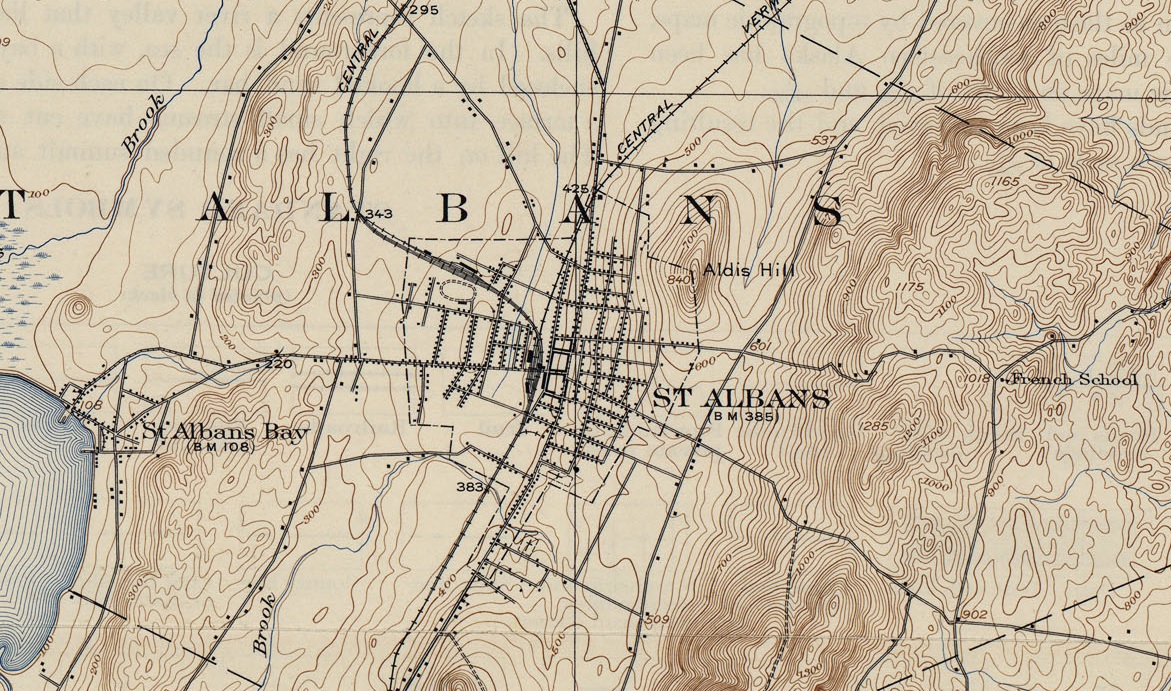
The “French School” indicates where the old school house once stood on French Hill Road, now nothing more than a foundation buried in the woods. The North-South road that runs to the left of it would have been the route that Marietta Ball had walked and met her unfortunate end on. Today, the road that Marietta walked has long became defunct. Only a short half mile portion remains of the original road, a private road named “Fred Lake Road” The Page Farm is marked by the black dot at the southern end of the road, near the “902” elevation mark.
Links and sources: For a much more detailed look into the murder than what I have provided:
As it turns out, someone has written a good write up about the Suncook Murders
The very detailed write up “The East Hill Murders”, Ronald C. Murphy, 1983
—————————————————————————————————————————————–
To all of my amazing fans and supporters, I am truly grateful and humbled by all of the support and donations through out the years that have kept Obscure Vermont up and running.
As you all know I spend countless hours researching, writing, and traveling to produce and sustain this blog. Obscure Vermont is funded entirely on generous donations that you the wonderful viewers and supporters have made. Expenses range from internet fees to host the blog, to investing in research materials, to traveling expenses. Also, donations help keep me current with my photography gear, computer, and computer software so that I can deliver the best quality possible.
If you value, appreciate, and enjoy reading about my adventures please consider making a donation to my new Gofundme account or Paypal. Any donation would not only be greatly appreciated and help keep this blog going, it would also keep me doing what I love. Thank you!
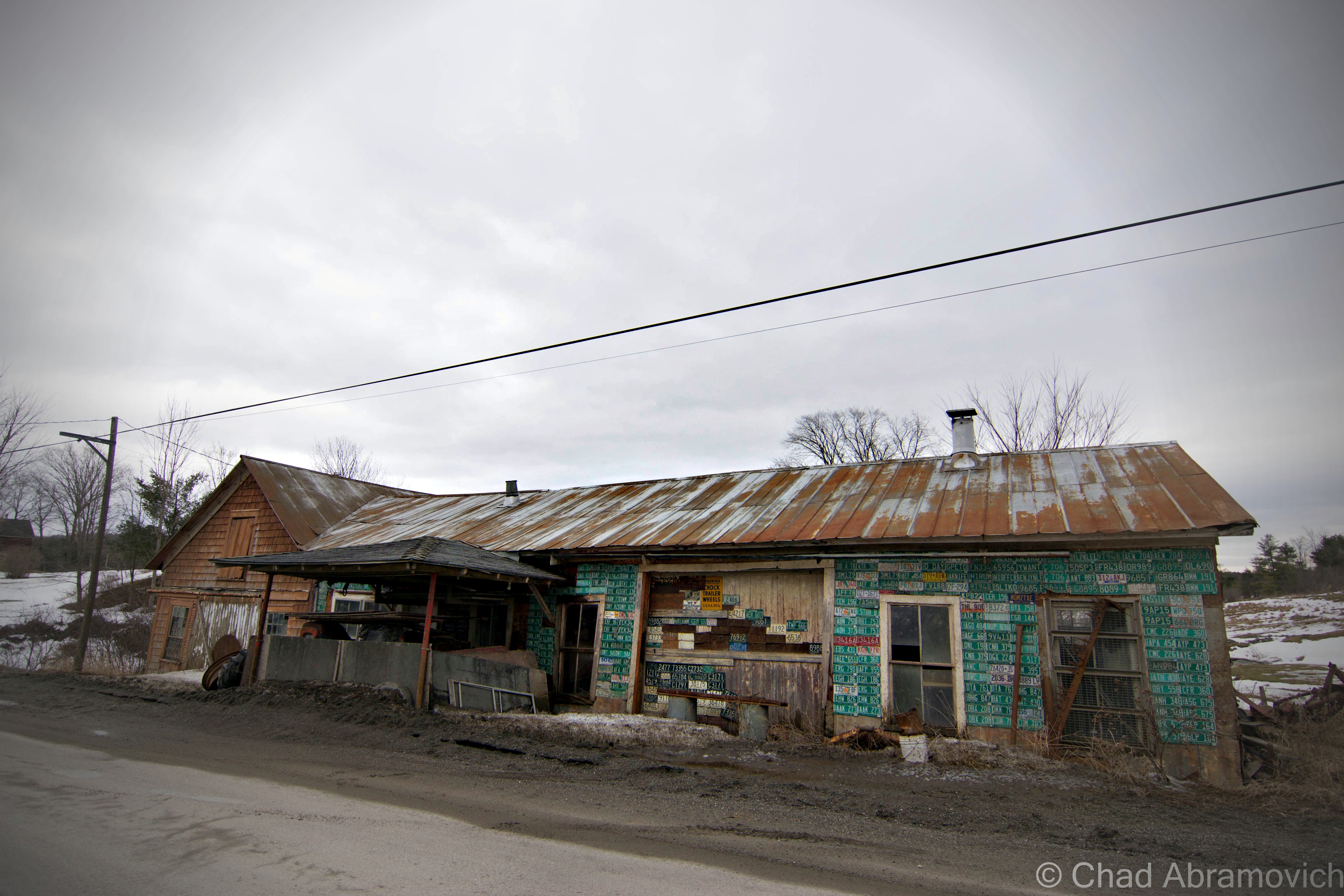
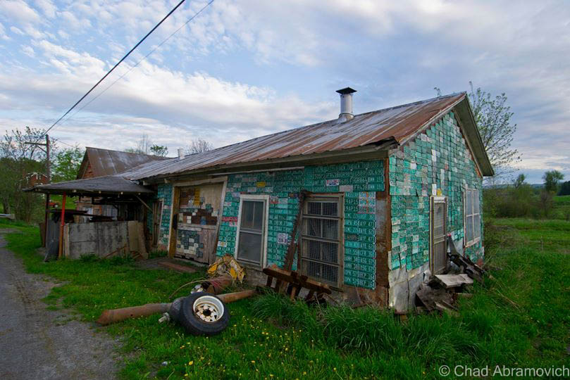
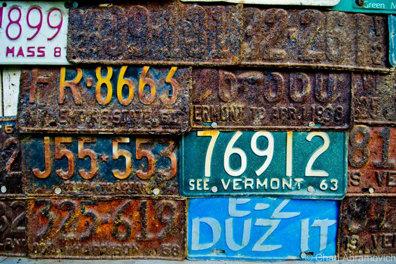
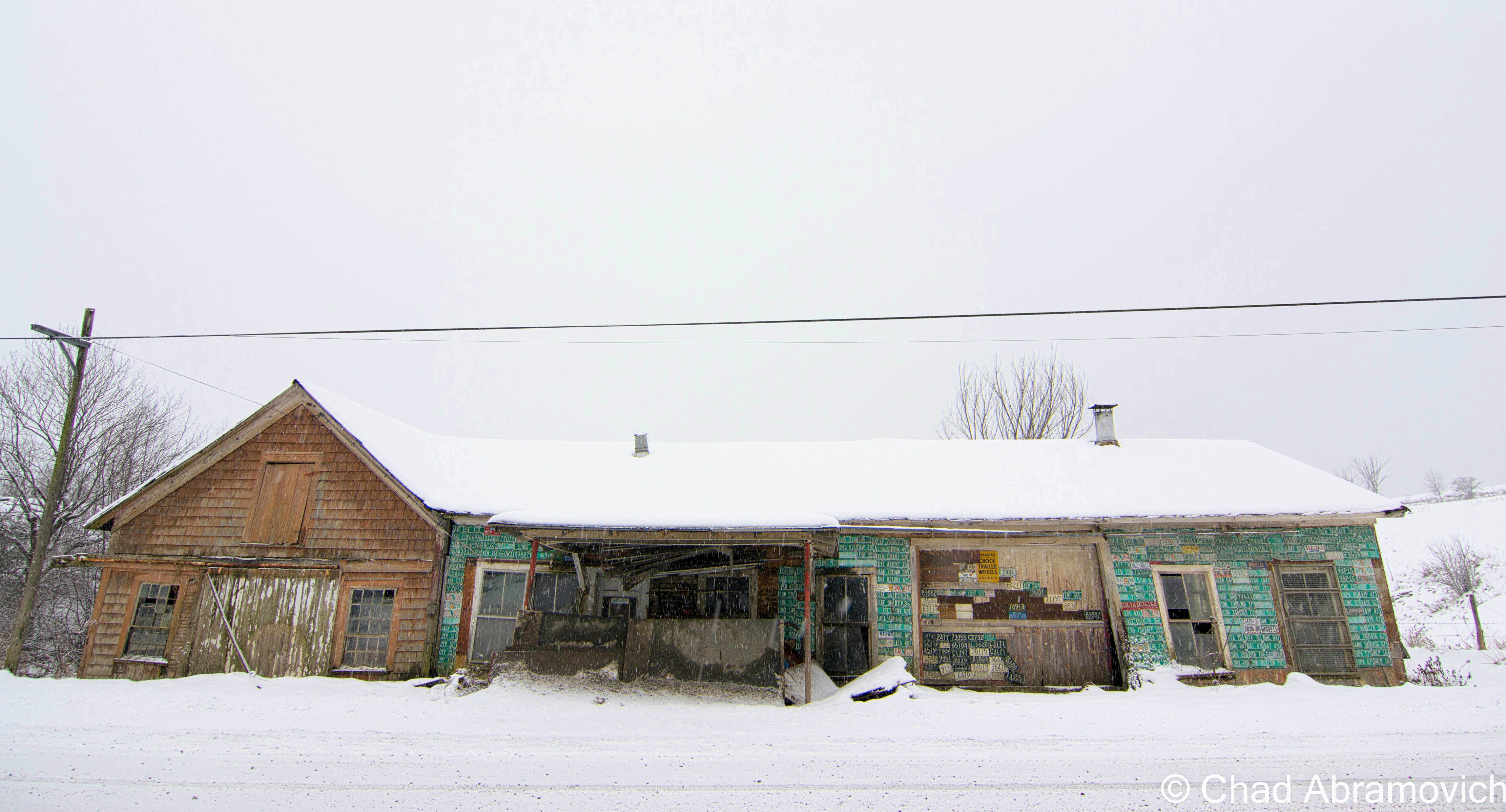
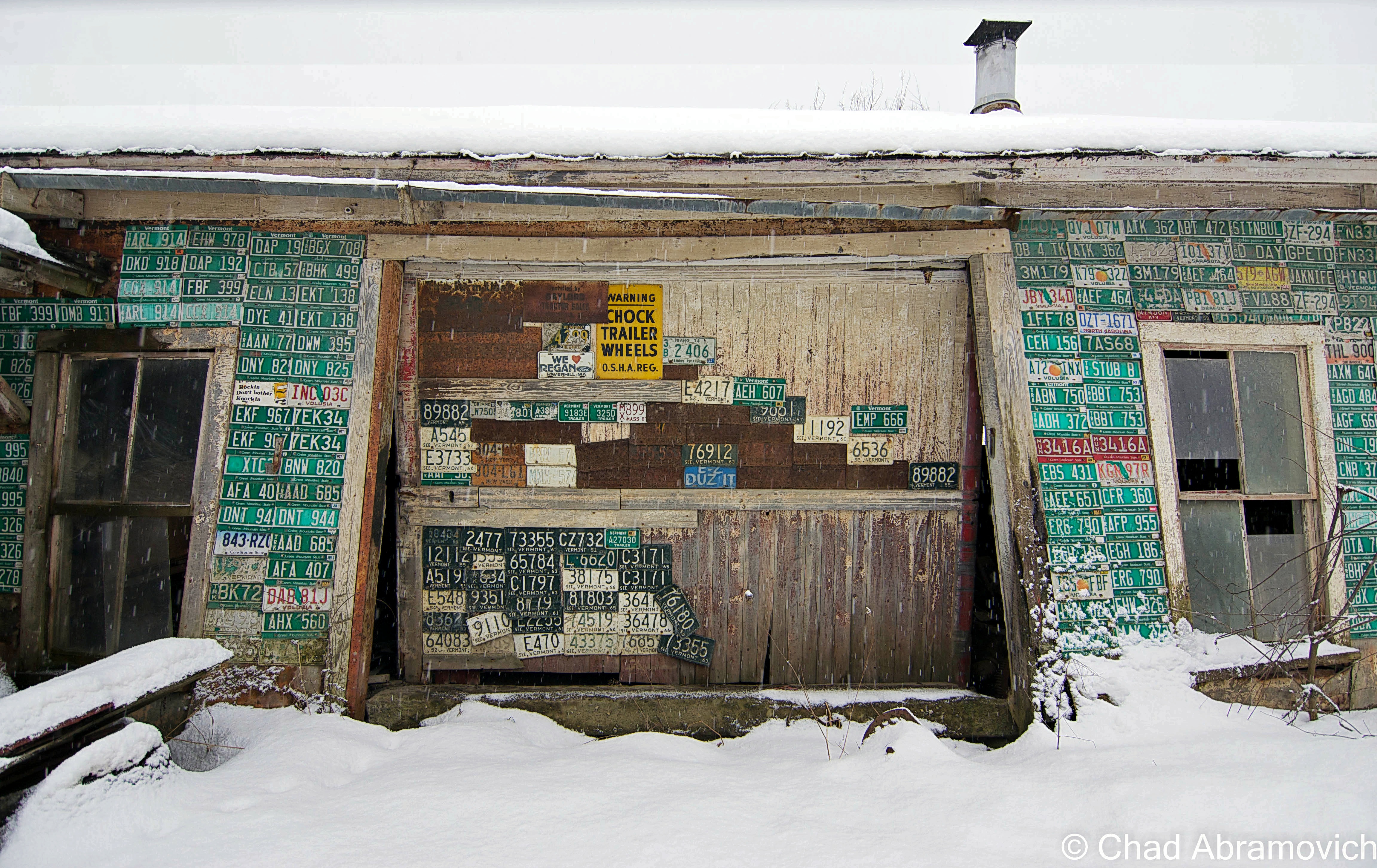
If you asked a Vermonter where the town of Chittenden was, a lot of people would probably be confused. Some would ask if you meant Chittenden County instead, and others would probably just shrug apologetically. If you do happen to know about this off beat community, chances are you know about the storied Eddy Brothers, who over a century ago vexed the world by conjuring shapeless entities and communicating with the unknown within their ramshackle farmhouse. Or perhaps you have stayed at the scenic Mountain Top Inn, a luxury Bed and Breakfast overlooking the icy waters of the Chittenden Reservoir, nestled within a remote mountain wilderness that is unbroken for miles.
But other than these two images, the town of Chittenden is little known to most, and I suppose that’s not a huge surprise. Chittenden is actually the largest town in the state, at around 74 square miles. But despite it’s vast size, the land remains divided by dense mountains, making the town largely unsettled with only a few dirt roads leading in and out.
But Chittenden is a curious place, its abundant wilderness holds and protects much of the town’s secrets and history in its own sense of time.
In the past few months, I had began to hear a lot of strange accounts and unusual tales about this small community, which sparked my curiosity. Chittenden had never struck me as one of Vermont’s weird locales, so this intrigued me, and I began my attempts at finding out more.
I began hearing vague accounts of unsettling happenings and arcane events in an area of town that locals call “New Boston”. Stories of witch hunts, secular rituals and sinister things like bodies being dumped under the shelter of the shadowy woodlands, the evidence feeding the hungry roots of the forest. For those who had visited, they explain that the feeling is off and heavy, a presence that unnerves you mentally and leaves you trying to re-familiarize yourself with your surroundings. I was told that a few paranormal groups from Rutland once claimed to capture a few EVPs of disembodied voices from a largely forgotten cemetery in the woods nearby.
To add to this growing mystery, it has been said that Chittenden is where Vermont’s only photographic evidence of an elusive cryptid was taken, something so infamous that it has long captured the minds of Vermonters and people from around the world for centuries; bigfoot.
Vermonter’s have claimed to see monsters and abnormally large animals in the woods for years, but it wasn’t until 1977 that a photograph was taken that may have offered definitive proof to the long debated mystery. Deep within the Green Mountain National Forest, a large stocky creature covered with silvery hair and had the head of a gorilla had been captured on film near a logging road. It had been standing behind the safety of some thick scrub, as if this creature had been watching the photographer. When news of it was unveiled, the picture was met with harsh speculation and curiosity. Many tried to not only debunk it, but cover up its existence while others hailed it as legitimate proof. Today, this mysterious photograph has not only largely been forgotten, but it has yet to be proved or disproved. As a matter of fact, it is theorized that the late Dr. Warren Cook from Castleton state College became interested in the photograph, only later to attempt to cover it up and dismiss its existence. Is it possible he was threatened by an activist group or some secret branch of the government? Or is it just a rumor that has found its way around successfully?
Despite all of this great information, I had reached a roadblock. My research however proved that the area’s existence seemed to be as mysterious as the stories surrounding it. I found an area of the Green Mountain National Forest by the same name, with a few hiking trails leading off into the silent woods. Apart from finding a future location for me to hike, it didn’t really answer my burning questions. So I emailed the Chittenden Historical society and waited for a reply.
Within a few days, I received an email from karen, who began to add some factual detail to this story.
Chittenden was named after Thomas Chittenden, Vermont’s first governor, and who Chittenden County to the north was named after. But despite the honorable gesture, the govenor had little to do with the town.
New Boston was the first actual settlement in Chittenden. Around 1813 economic hardships and slow settlement led to the area’s demise. Most families moved away and the town eventually became the property of mother nature again. A large area of town to the north was also settled and called “Philadelphia”, but with the harsh rocky terrain and slow settlement, the town was eventually disorganized and much of the land was granted to neighboring towns, the majority was annexed to Chittenden.
Later, the tiny village of South Chittenden would gain nationwide popularity due to a pair of sullen and simpleminded brothers; The Eddy Brothers. Spiritualism got its humble start in the small village of Hydesville, New York in 1848, when local residents Kate and Margaret Fox claimed that they had the ability to communicate with the dead in their sordid farmhouse. Bemused onlookers were treated to quite the show; The Fox sisters speaking with the unknown, and the spirits giving answers by using audible rapping sounds that everyone could hear! Soon, their showmanship gained the attention of an ever growing leader of followers, and the nation began engrossed and captivated at the idea of talking to the dead. If spiritualism wasn’t a hoax, could this be proof that there was in-fact ghosts, and an afterlife?
By 1870, Chittenden, Vermont jumped on the spiritualism bandwagon when William and Horatio Eddy moved into the family farmhouse after their father had passed on, and treated the invited public to seances. This wasn’t a business ploy; the Eddy brothers claimed to have connections with things on the other side of the seance table from their youth, when they played with ghostly children, went into prolonged trances, allowed willing spirits to speak through their own vocals, and were eventually expelled from school for levitating desks and making books fly through the air. Their father Zepaniah, who was not only tired of the paranormal shenanigans his offspring were becoming intimate with, but he figured out that he could exploit their purported abilities, and sold them to a traveling side show. 14 years later, they returned after their fathers death and set up a show of their own in the dingy parlor of their farmhouse, and whatever things manifested themselves under the slow candles burning, attracted people from around the world. However, not everyone was convinced, and the Eddy’s were also met with lots of skepticism.
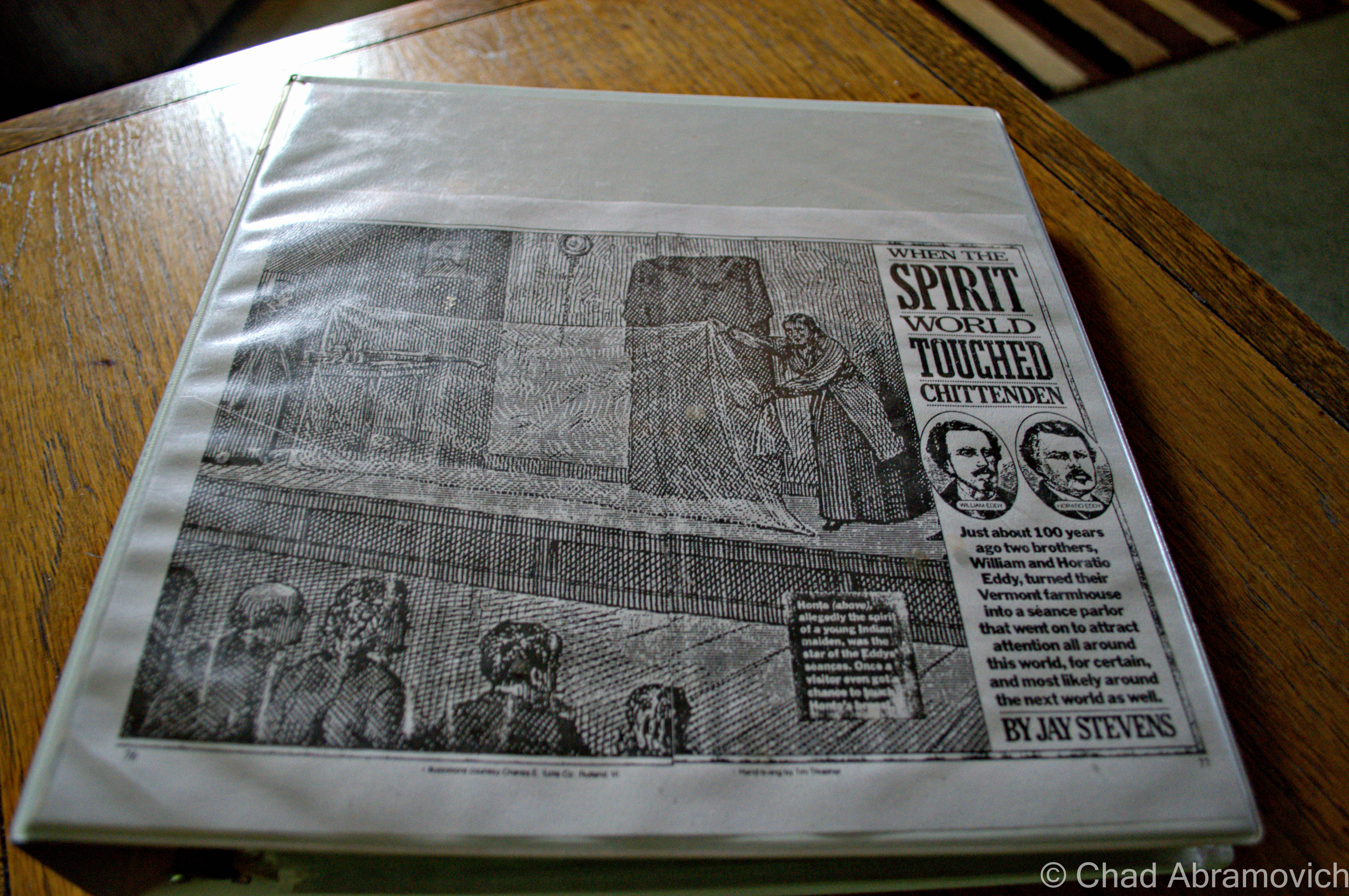
In 1874, Henry S. Olcott, a journalist from New York, visited the Eddy Brothers several times in hopes of proving them to be frauds. He eventually and maybe a bit begrudgingly wrote a book, “People From The Other World,” which was a journal of his experiences at their seances. However, he was never able to successfully debunk the Eddy Brothers, and his book remains as the best existing account of them today.
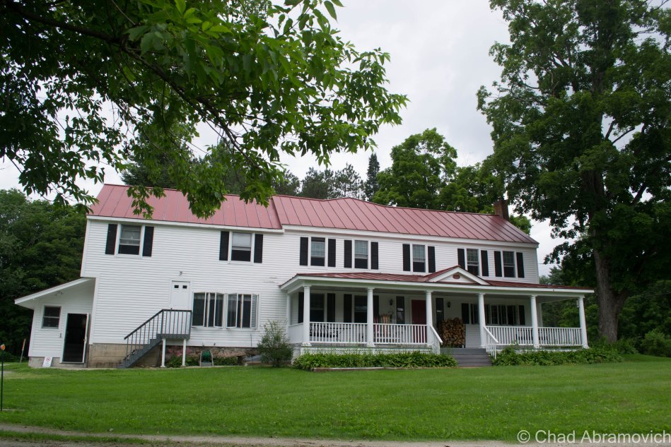
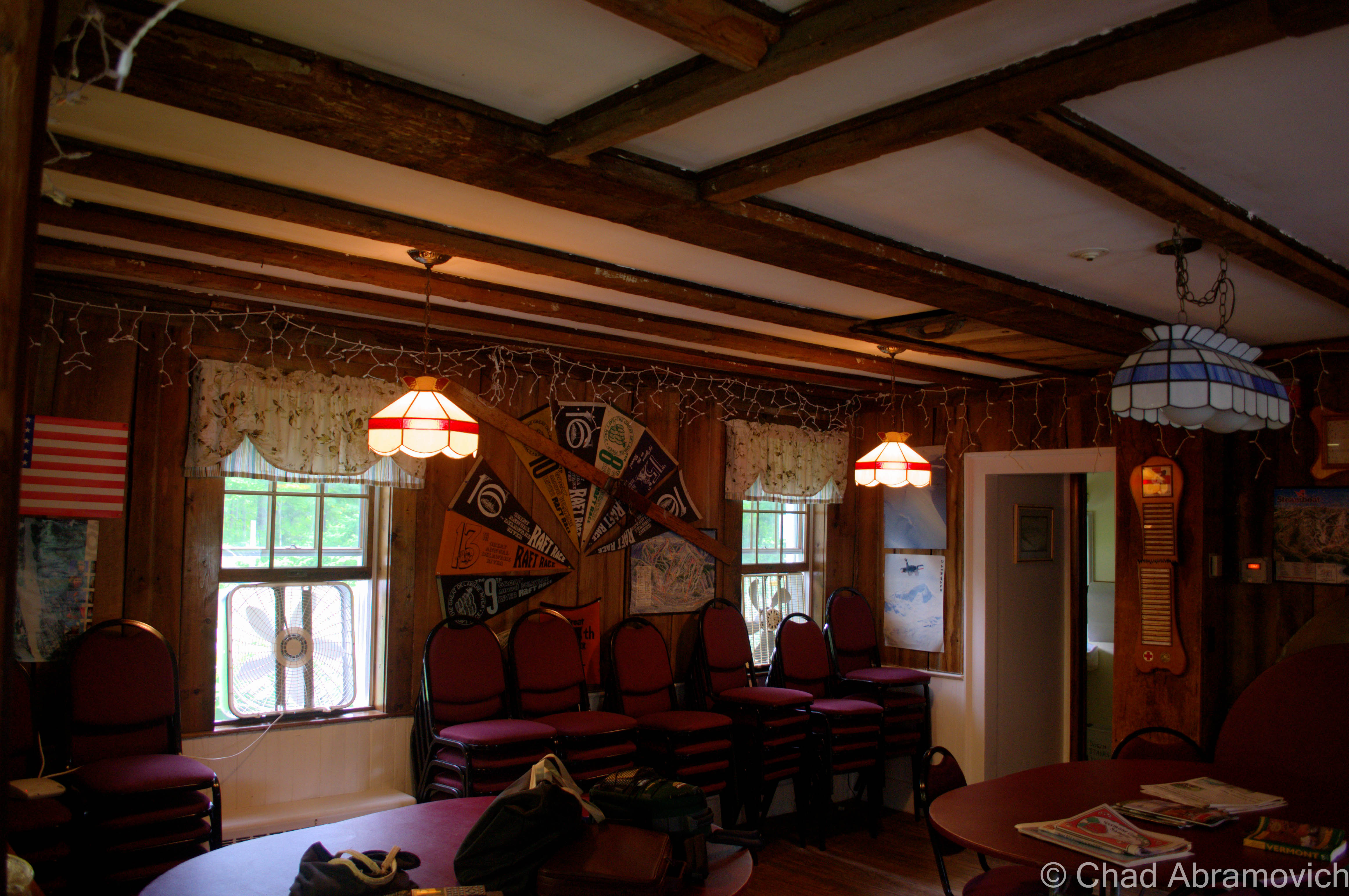
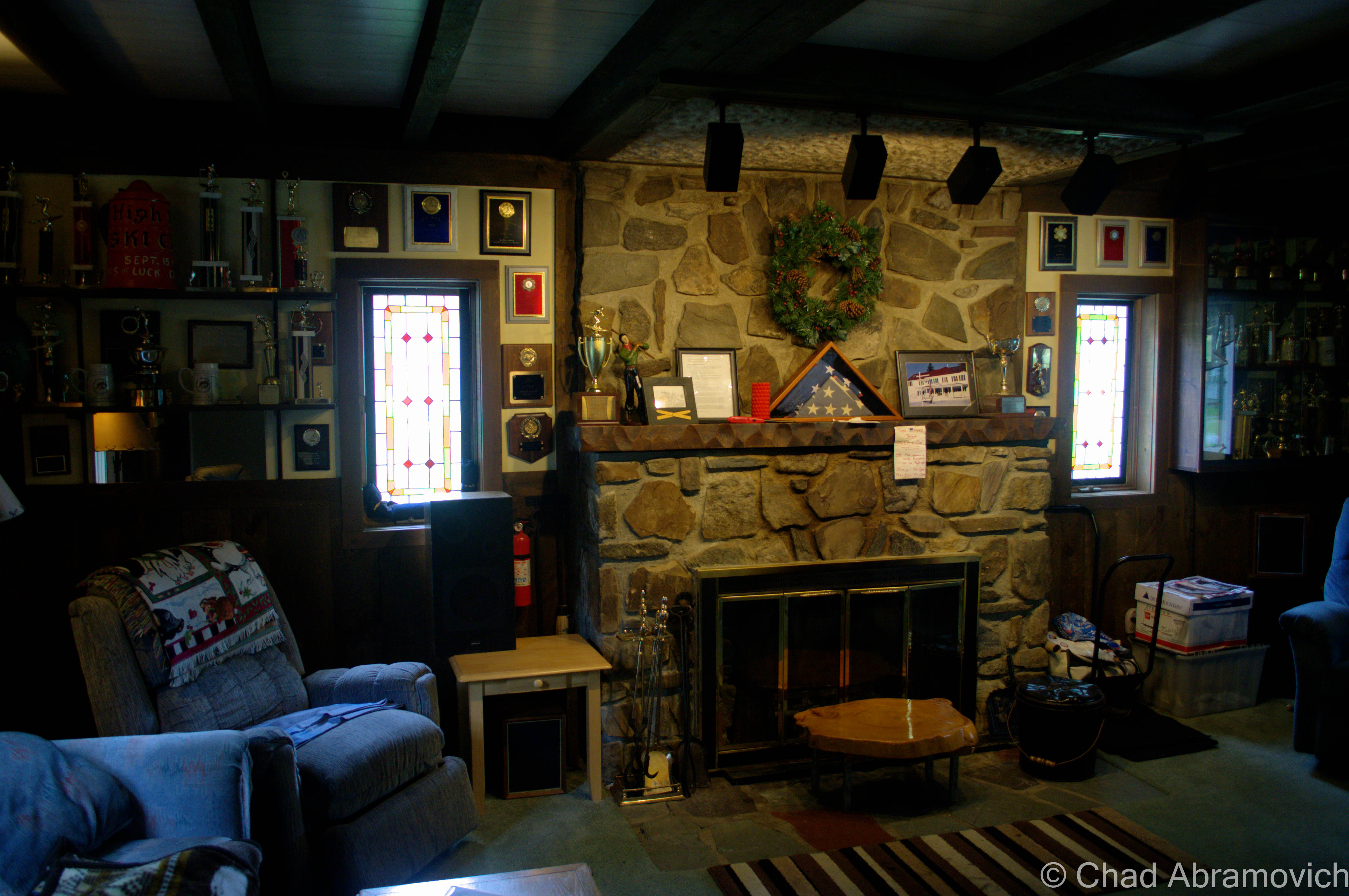
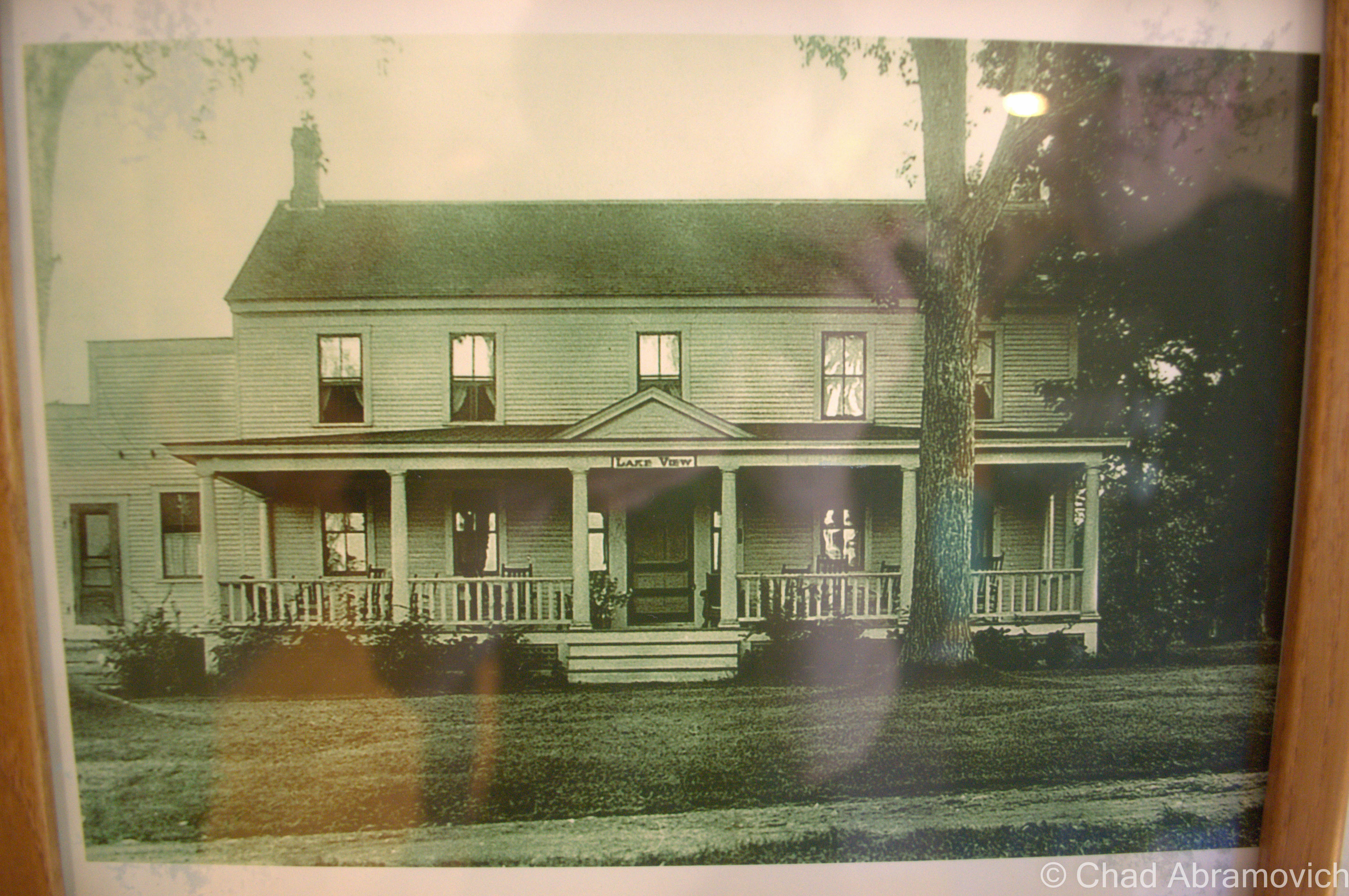
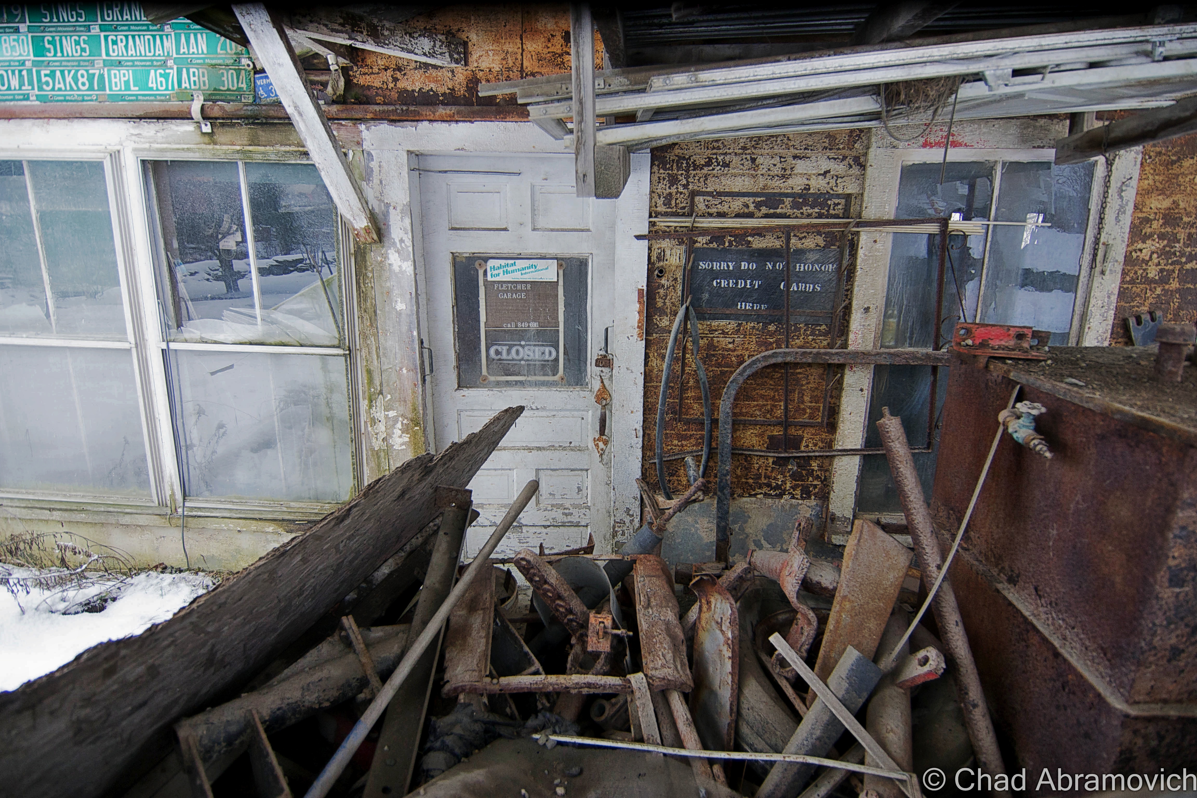
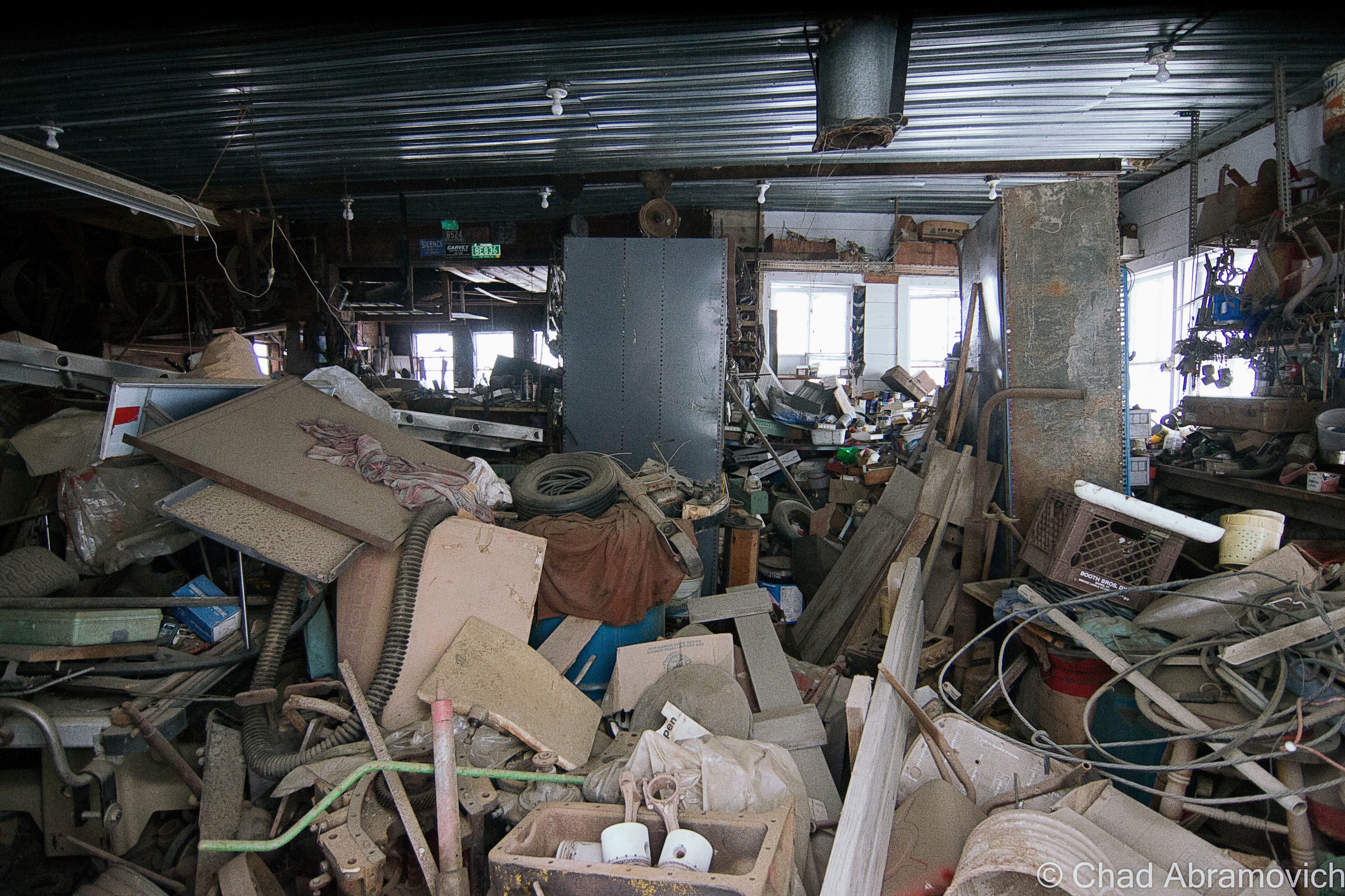
The Eddy Brothers, though an fascinating and important part of Vermont history, have already been talked about far too many times, in pain painstakingly researched detail by numerous Vermont Eddy enthusiasts, so I won’t jump into it any further when I feel that there is far better material existing that you could seek out. However, a few months ago, a friend of mine told me that he had met someone who had recently stayed in the Eddy Brother’s farmhouse. Though she had no knowledge of its history, she claimed that “weird stuff happens there”. But as luck would have it, as I was driving by, a member of the ski club who now owns the property was kind enough to introduce himself and give me a tour. How could I say no?
The old farmhouse was beautifully restored, and was a place I could easily see myself enjoying on Fall or Winter days (if I had the money) But one question was on my mind; if the room where the original seances were held still existed. The gentleman rolled his eyes and gave me a good hearted laugh. “That’s the thing, we don’t really know which room they they happened in” he said. “It honestly could have been any room in the house” He explained that he wasn’t on board the Eddy bandwagon, and had no idea of the house’s history until the club purchased it and he became a member afterwards. “Most everyone still refers to this place as the Eddy House” he stated “We’ll never live that one down”Though the club wasn’t all that thrilled about the house’s occult reputation attached to it, they approached it humorously and kept accounts and information about The Eddy Brothers around the house.An original picture of the Eddy Brothers Farmhouse. (circa 1920-1930). Notice the name “Lake View” above the porch? The Eddy Brothers Farmhouse used to be surrounded by a beautiful pond, the house sitting on a peninsula in the middle. Older photos of the farm show the barns sitting across the bays of the pond with the house in the foreground. However, In the early 1900s, the beaver dam burst, and within hours, the pond had drained. Today, the ravine where the former pond was can still be traced, now filled in with younger growth trees and countless berry bushes.
When I asked Karen about the strange paranormal occurrences in the area, she was quick to assure me that they were all myths. Although, she did recall something strange happening there. There was a murder that took place around the New Boston area in the 1970s, in which a boot containing a foot was found. As far as I know, it was a cold case. “No body was ever found to go with the foot”. said Karen.
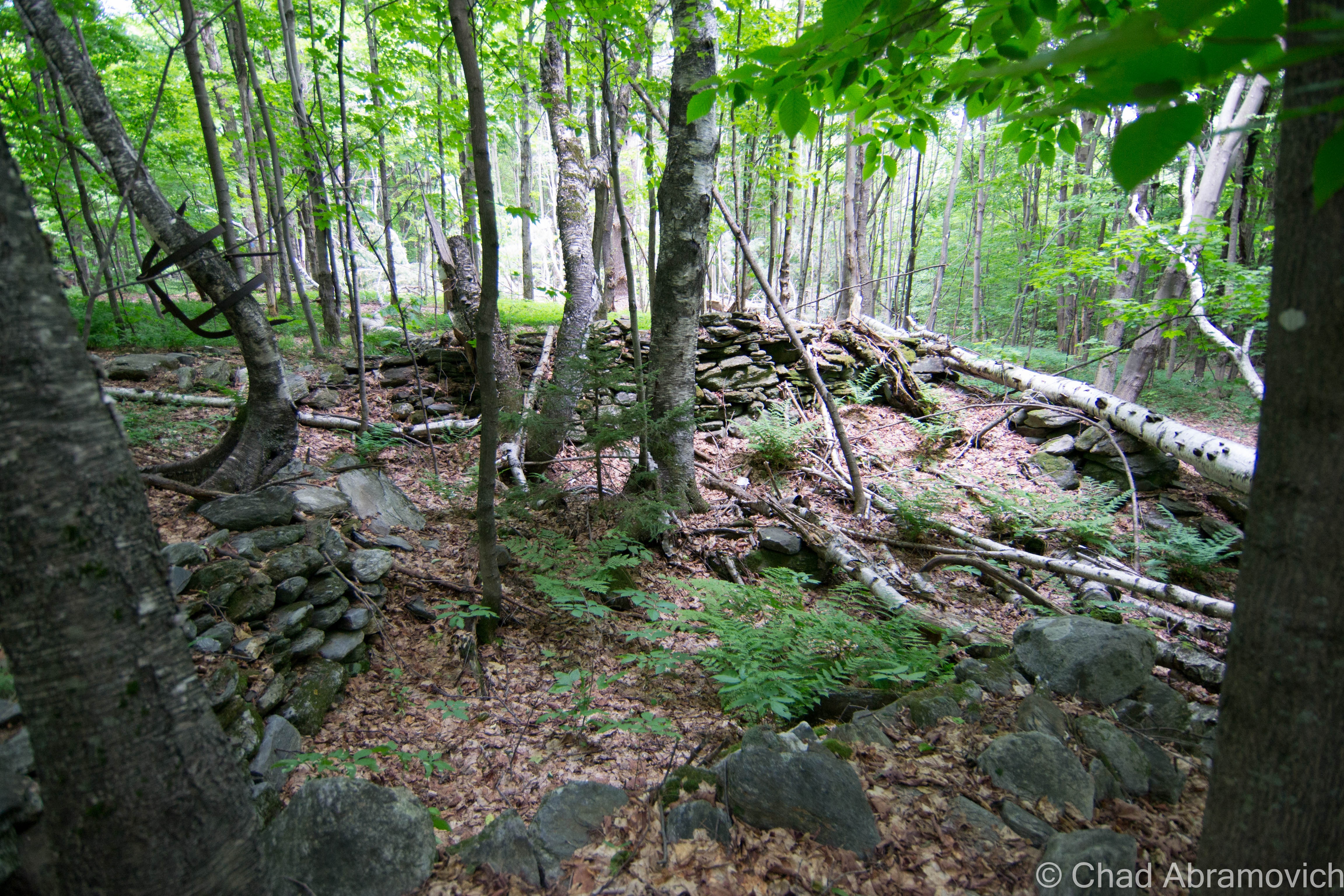
Today, there are grave sites, stonewalls and old foundations that are reminders of the vanished village. The name “New Boston” has been reused to designate the forest region around that area, which is scattered with hiking trials, snow mobile trails and old roads. Local youth also frequent the region for late night drives, with the purpose of getting creeped out.
Another interesting point of information was behind the strange names around town. I had been wondering why certain areas of Chittenden, and in other parts of the state were named after cities and areas in other states – Settlements with significantly larger populations that in a lot of cases, Vermont seems to shun. The answer was a comic one. Areas like Boston, Philadelphia, Michigan etc all received their names over a century ago, when these remote places were more remote then, and were considered so far out there that they might have been as far as Boston, or any other large American city at the time to most Vermonters. So in a quirky sense of Vermont humor laced with sarcasm, any remote and challenging region to travel too was often given the name “New Boston”.
The small town of Chittenden is saturated in local lore and fascinating history, weighted down by the heavy snowfalls that blanket the desolate mountain tops. But is there a reason behind all of the unusual phenomenon within the town lines ? Could the legendary Eddy Brothers have accidentally opened some sort of door into another world, allowing spirits to pass through at will? Or does the rocky soil beneath the town harbor some sort of ancient trouble? Or maybe, it’s just all coincidence.
Whether these amusing stories are real or just passed down by others who have the same interest, I suppose will never be known for sure. But perhaps the mystery is more exciting than the explanation.
Visiting New Boston
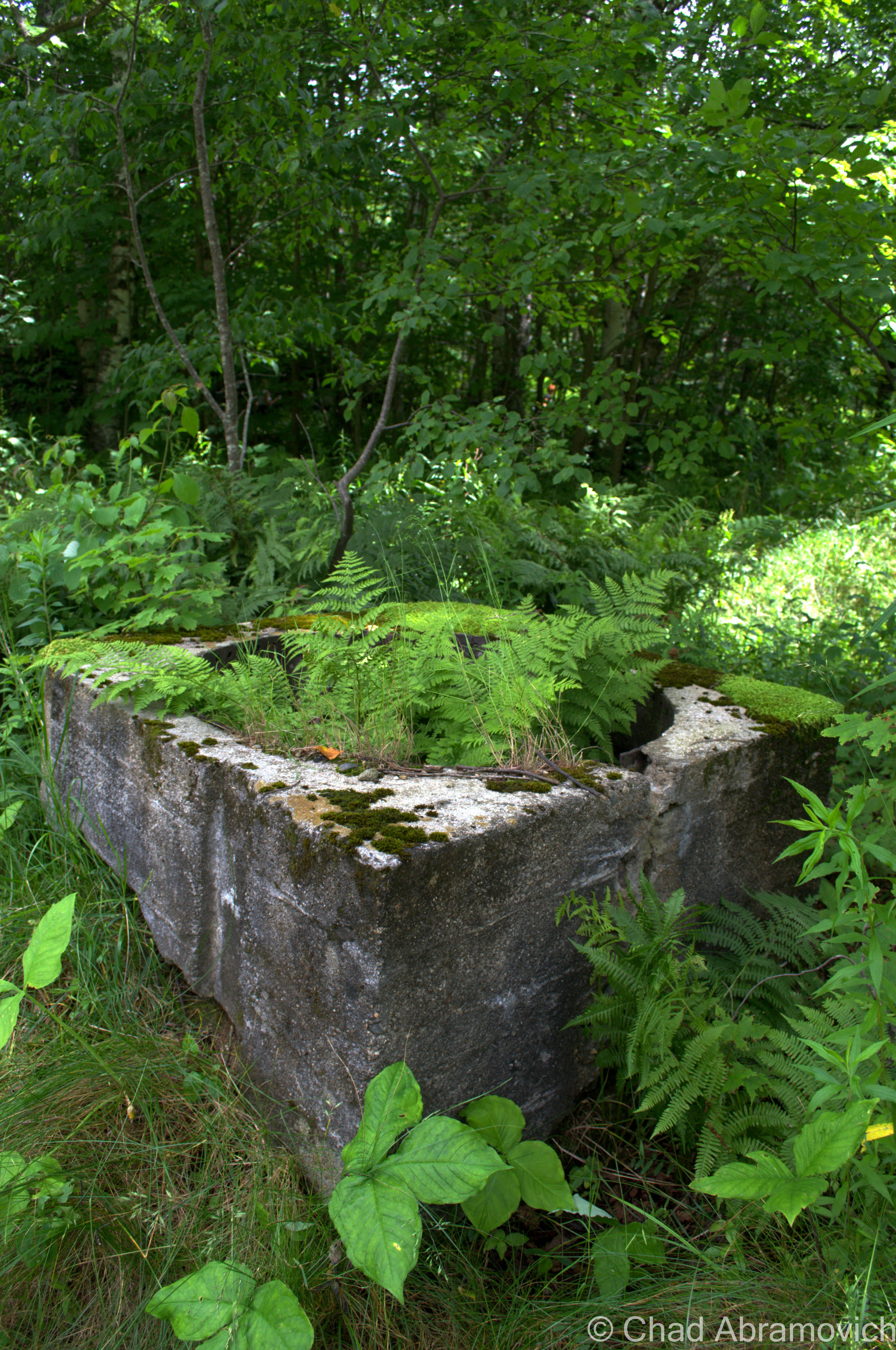
Pictured below are a few remaining foundations and gravestones of the settlement of New Boston. There probably is more, but it’s a question of where. The woods around Chittenden are vast and are good at holding their secrets. A few people reminisced with me earlier, and told me they remembered New Boston and the nice place it was. Some used to party out in the abandoned houses when they were in high school, and recall there being some remains. But if this is the case, we couldn’t find them on that brisk summer afternoon.
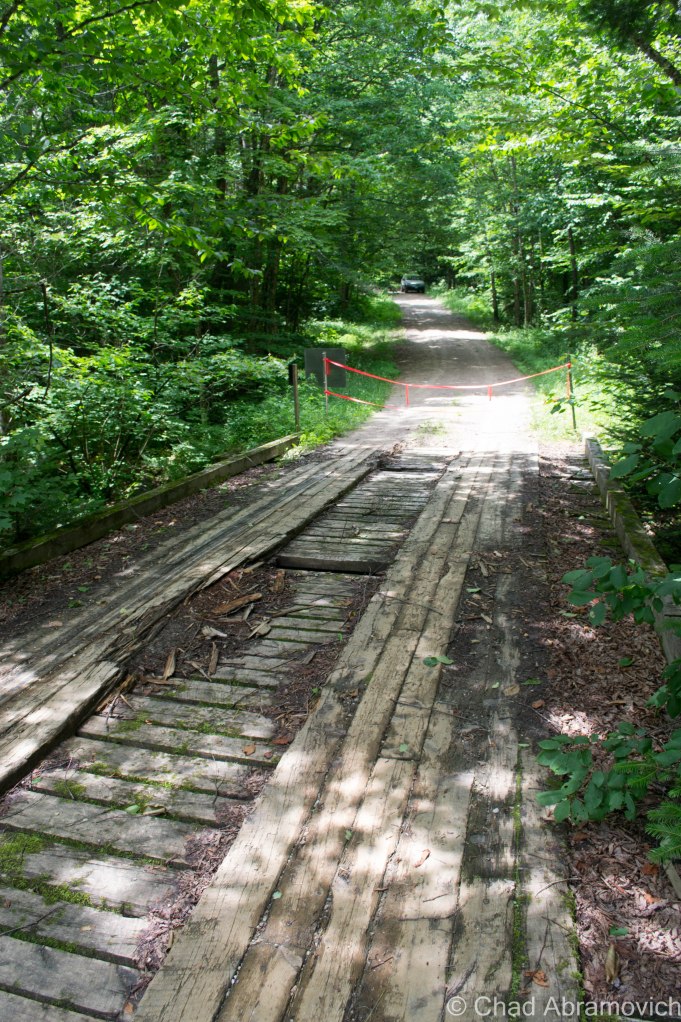
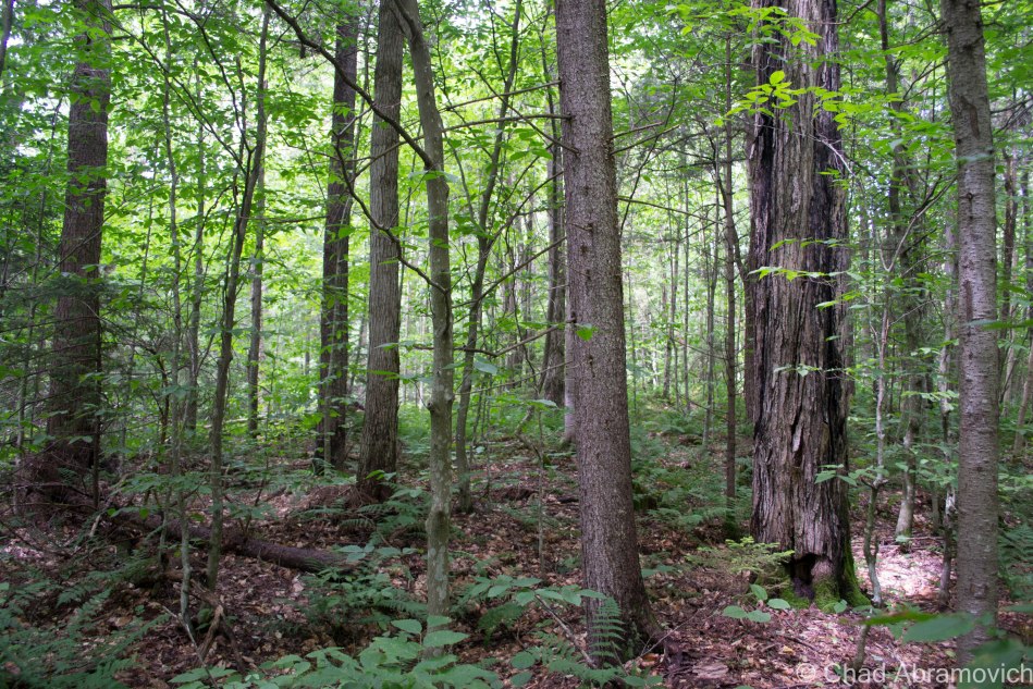
The forest road to New Boston, closed due to a very rainy summer and flash flooding.The deep woods of New Boston
A Lost Door
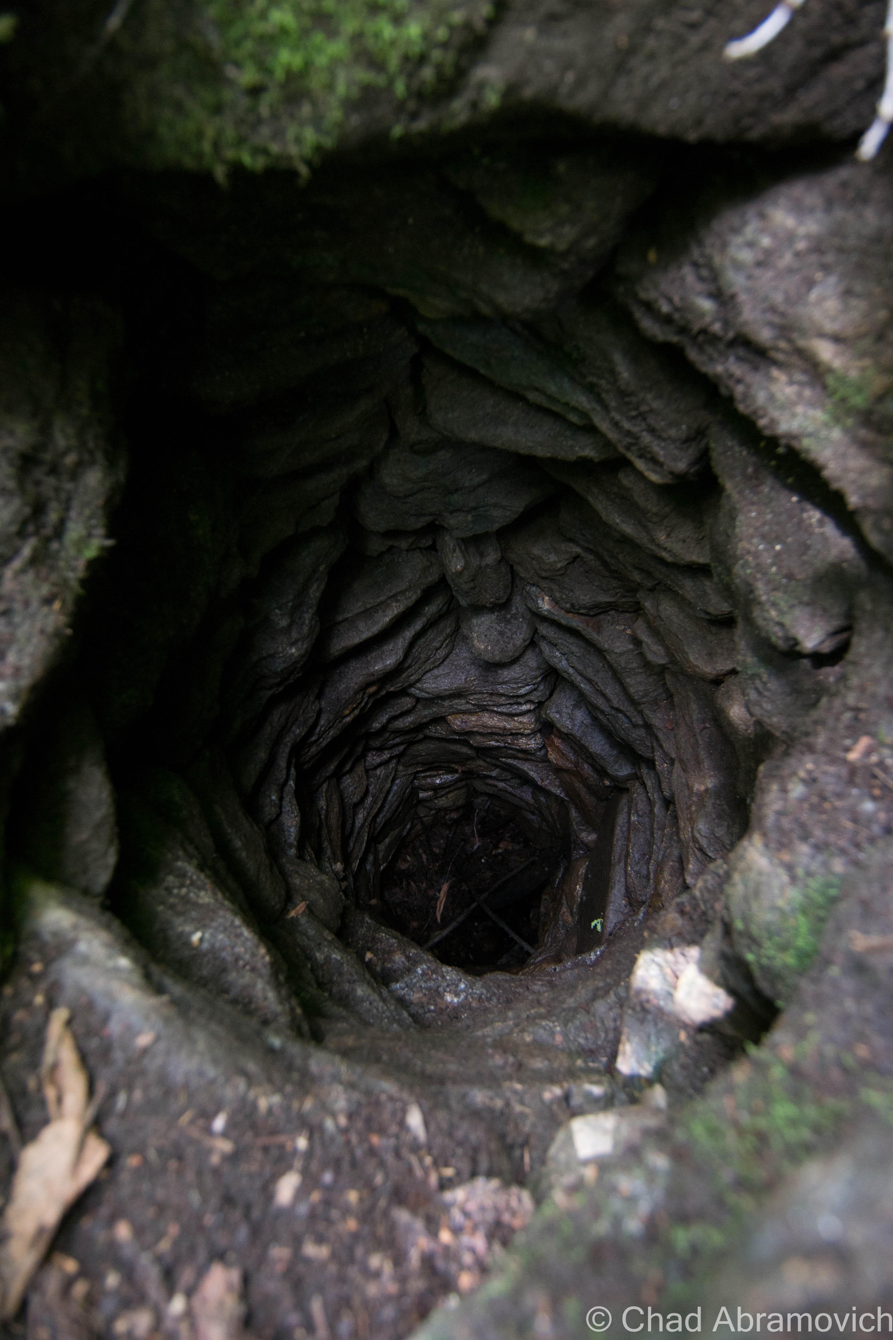
This last bit of Chittenden weirdness may be the most obscure. Sometime around the 1970s, a local woman had claimed that one day while out for a walk, she found a mysterious doorway leading into a hillside, deep within the woods of Chittenden. Deciding to investigate, she gave the door a good pull, and it opened, revealing a stone spiral staircase that allegedly wound its way down far below the ground, fading into black shadow. The woman decided to make the run back home and grab a flashlight, and then come back. But she was never able to find the door again, leaving this fascinating story a lost one. Could this woman have in fact found a doorway leading deep into the Vermont mountains? What would she have found if she followed that staircase? It makes you wonder. Surely the construction of a spiral stone staircase leading to the subterranean world below Chittenden’s mountains would surely lead to something important, right?
Though this story is intriguing, others question whether it was just a yarn well spun. According to those I spoke with, her alibi just didn’t add up. She reportedly claimed she had been back a few times alone, but when she was asked to show someone else, she suddenly couldn’t recall where the door was… But in the end, I’ll suppose we’ll never know. After hiking the woods of New Boston, I recognized just how easy it could be for someone to get lost up there.
Another interesting footnote to this story; this isn’t the first time a mysterious door was found in a Vermont hillside. Years ago, another such door was supposedly found in the small town of Ryegate. However, when the family came back to investigate, the door had vanished completely.
—————————————————————————————————————————————–
To all of my amazing fans and supporters, I am truly grateful and humbled by all of the support and donations through out the years that have kept Obscure Vermont up and running.
As you all know I spend countless hours researching, writing, and traveling to produce and sustain this blog. Obscure Vermont is funded entirely on generous donations that you the wonderful viewers and supporters have made. Expenses range from internet fees to host the blog, to investing in research materials, to traveling expenses. Also, donations help keep me current with my photography gear, computer, and computer software so that I can deliver the best quality possible.
If you value, appreciate, and enjoy reading about my adventures please consider making a donation to my new Gofundme account or Paypal. Any donation would not only be greatly appreciated and help keep this blog going, it would also keep me doing what I love. Thank you!
Why do remote and wild places captivate us so much? Maybe it’s because these inaccessible places don’t easily give their secrets or their history – forcing the curious adventurer to truly dig for answers (sometimes literally). Or maybe it’s because here, our imaginations run wild as we find ourselves detached from the modern comforts and the familiarization of our backyards. We seek these places for their inspiring beauty, and ask for the answers to our questions which burn in our veins of desire. Anything can happen out there.
Vermont’s mountains hold quite a few ghastly secrets. Perhaps the most well known story to come out of the Green Mountains is the legend of The Bennington Triangle and the now vanished town of Glastenbury. It was here on the wild slopes of Glastenbury Mountain where 5 innocent people dissapeared without a trace between 1945 and 1950 – no clues or remains were ever found, but the theories were more than plentiful.
I’d like to tell a story just as sinister and lesser known, in a place just as remote and wild. But this story is more gruesome because it can be proved, and its catalysts are human rather then paranormal – hinting that sometimes the most dangerous things on Earth can be ourselves. I’m especially fond of this story for it’s obscurity, and that it’s darkness happened near one of my favorite places.
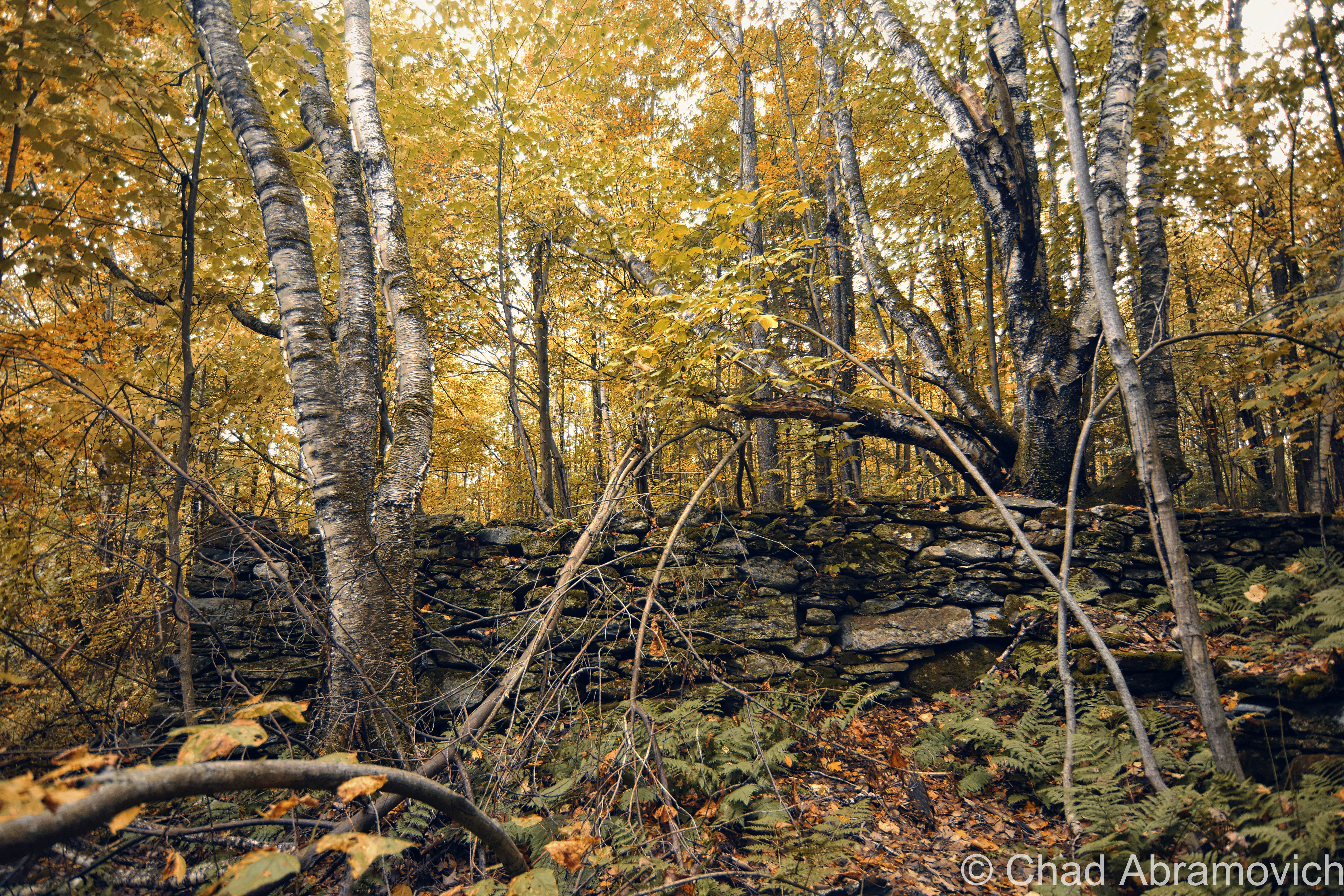
Patch Hollow
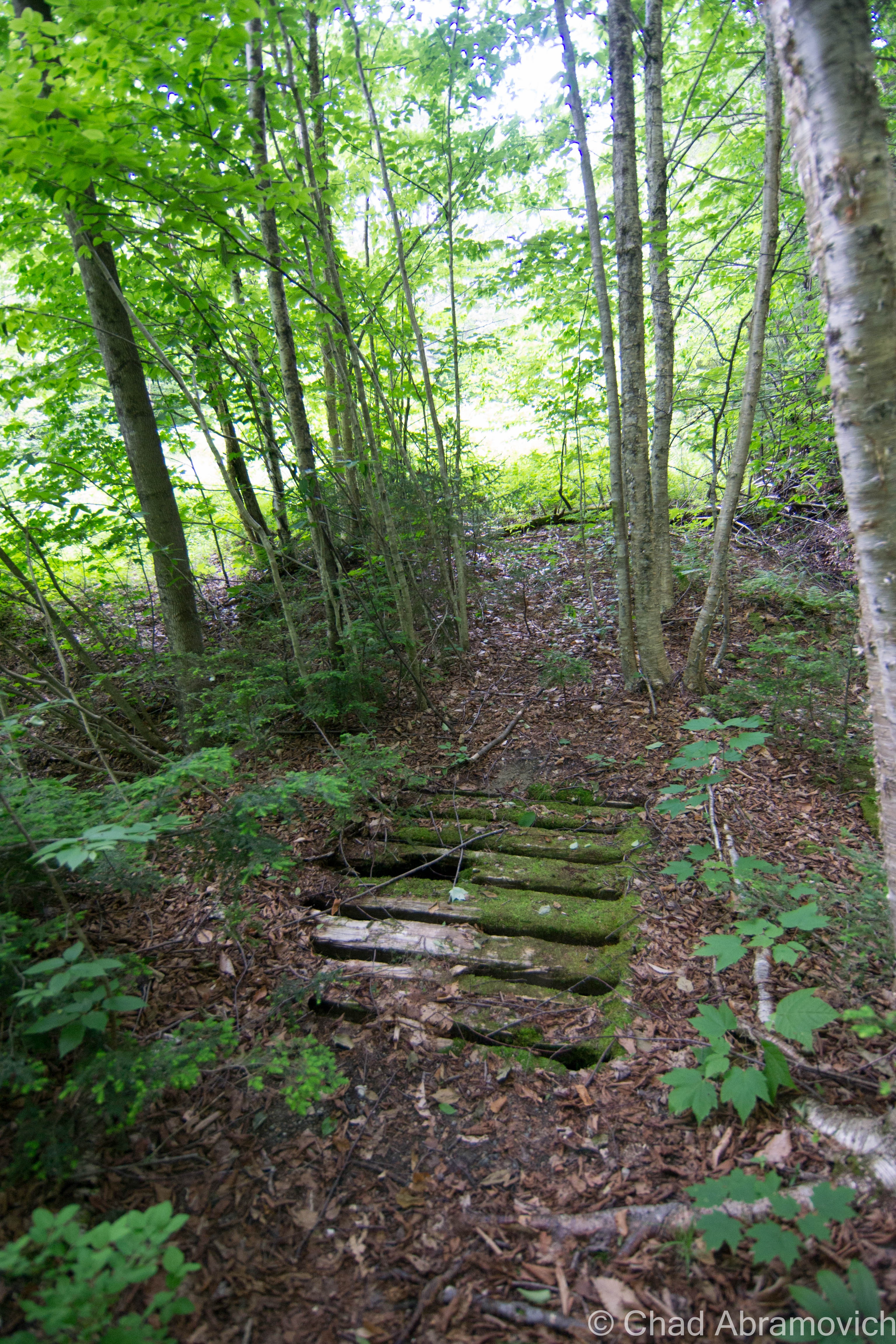
The Long Trail travels north from Glastenbury, over the peaks of Southern Vermont’s Green Mountains, dips down and back up the steep gulf around Route 140, and descends upon a wild and desolate area above Wallingford called “Patch Hollow”.
Running in a north-south direction, Patch Hollow is a deep trench of land high in the Green Mountains, formed by the steep slope of Bear Mountain to the west, and the more gentle Button Hill to the east. In the center of this densely wooded bowl is a large swamp, its green waters occasionally protruded by the skeletons of dead trees that twist towards the Wallingford skies above. In 2008, the beaver dam broke with such a force that it sent a large wall of water plowing down the steep hillsides, carving a jagged gorge into the land and completely taking out a chunk of Route 140, the bafflingly large boulders that were transported down the hill still rest along the roadside today.
The power of Mother Nature is both awesome and awe inspiring, and Patch Hollow is indeed a wild place. I know this hollow personally, as I grew up hiking here and riding my 4 wheeler through the few trails that traversed the rough terrain (and are not for the inexperienced rider). But what I didn’t know at the time, was that there used to be a settlement here – one with a gruesome tale attached.
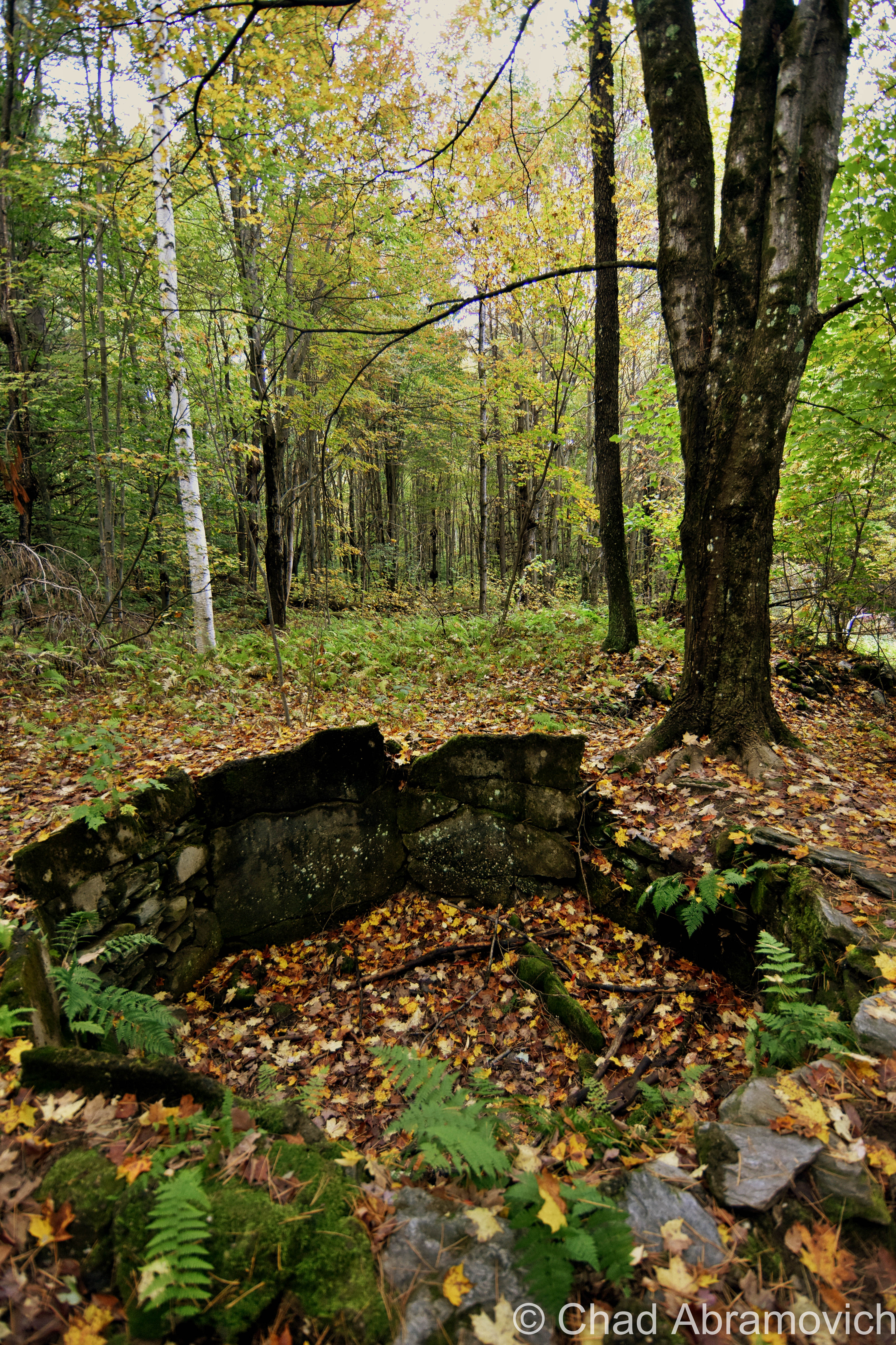
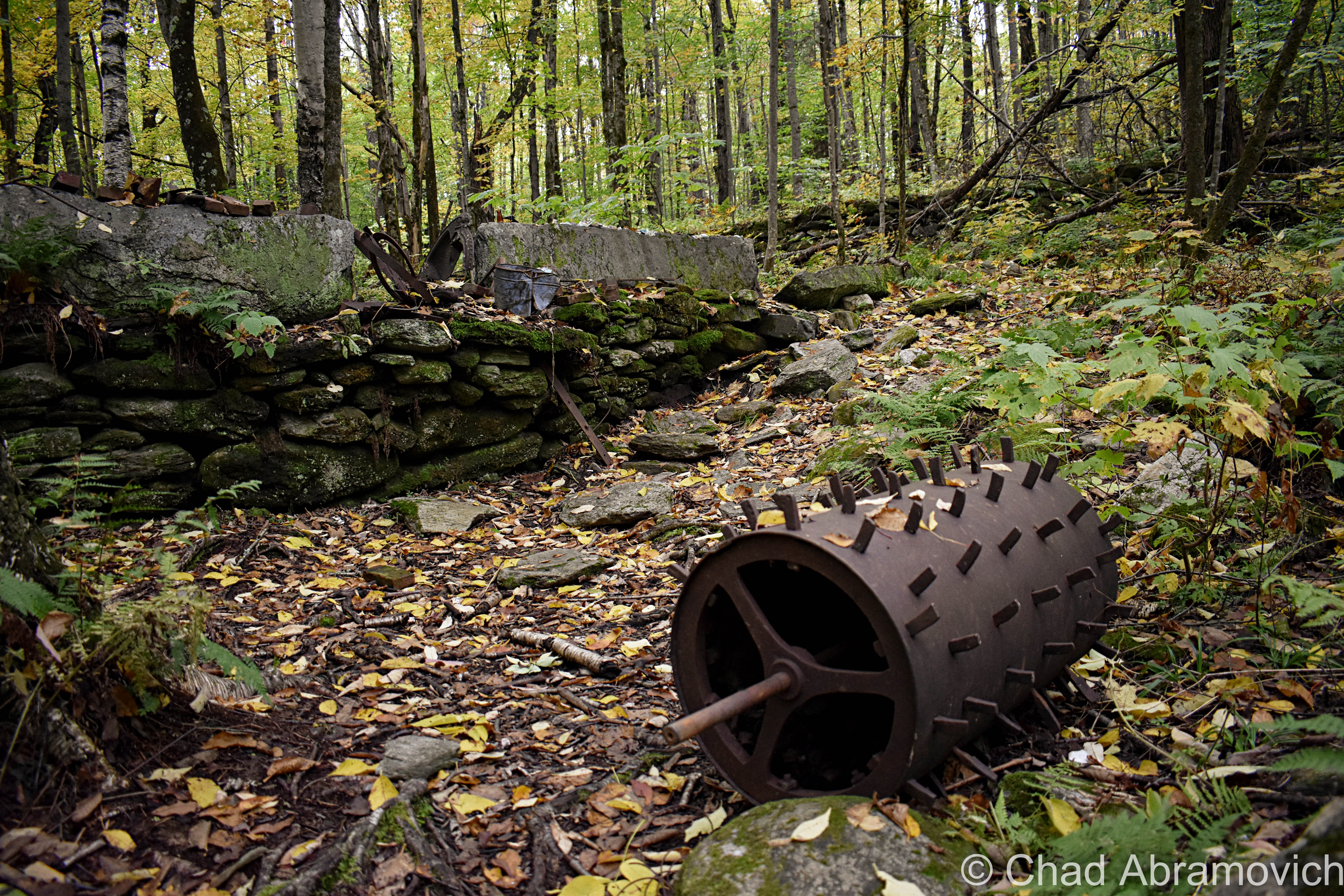
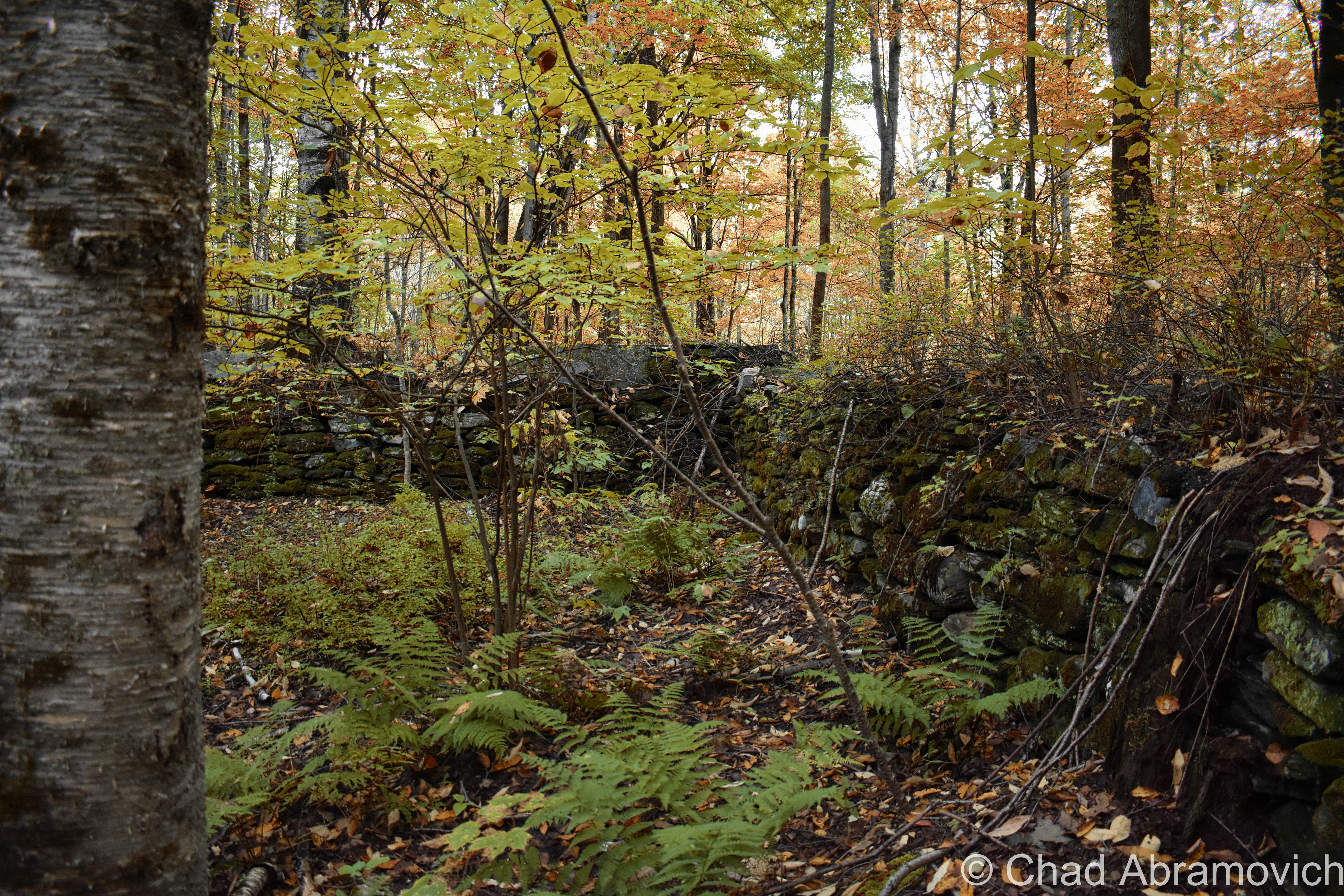
My first thoughts of any sort of community way up in Patch Hollow, far above the valleys amused me. Looking at the stark wilderness today, it seems almost unrealistic. This is where a lesson in Vermont history comes in handy. When towns were being settled, and the first roads were being cleared, often they were built through the highlands and the mountains because the valleys were prone to flooding and washouts. This means that at one time, Patch Hollow was on the main road through town. In the book “History of Wallingford, Vermont” by By Walter Thorpe, he writes that a settlement of at least 5 families once made their home here. But there are no clues that are left that would point to the bloody struggle that took place at here, not even a hint that civilization was once rooted in this sunny dale.
So what happened here? The story goes back to May 11, 1831. One of the settlements in the hollow was owned by Rolon Wheeler, a “man of violent passions and jealous disposition,” according to an account written in 1911. Wheeler was reportedly guilty of sexual acts with his wife’s sister — a situation that when was leaked, created a great deal of resentment from the community.
Some community members from Wallingford and nearby Shrewsbury were so resentful that they decided to go as far as form a mob – with the intent of tar and feathering him. The threats were made so publicly that Wheeler was forewarned and took measures to defend himself. He fashioned a knife from a large file and barred his door.
On the night of May 11, your classic angry mom scenario formed two parties from Shrewsbury and Wallingford, and set out for Patch Hollow for some justice. Equipped with jugs of rum, a bucket of tar and a sack of feathers, both parties made their way into the mountains. The party from Shrewsbury never made it – getting lost in the woods instead. Their pride damaged – the reality of getting lost over powered the want for vigilante justice, and the group returned home.
The Wallingford group didn’t share the same fate, and did arrive at Wheeler’s house. They eventually forced their way in by prying a hole in the gable end of the roof. Three men leaped into the house and struggled with Wheeler in the dark. Wheeler stabbed one man in the side and another was slashed an excessive amount of 14 times. The door to the cabin was unbarred and more people poured into the cabin. In the scuffle, someone was killed. The angry mob stopped being belligerent and went to get a better look at their prize.
But, in all the haste, they made a fatal, and rather embarrassing mistake. They killed group member and friend, Issac Osborne by mistake…Wheeler was nowhere to be found. After a few minutes of trying to comprehend the situation, the group noticed that a set of clothes had been strewn across the cabin floor. The picture was clearer now. Wheeler had escaped the hands of one of his attackers by wrestling out of his clothes, crawling under his bed, and prying up some floorboards before escaping beneath the house.
A moment of realization was then sparked under the watchful eye of the Patch Hollow shadows. The mob panicked, most likely all scared because they committed murder that night, and hastily fled the house. Later, Dr. John Fox of Wallingford would visit the scene, which he recounted as “the most terrible sight he could recall.”
By the light of a candle, Fox saw “the livid body of Osborne on the bed and cabin literally soaked in blood.”
After escaping his blood stained house, Wheeler decided that spending the night naked in the woods was a safer decision than venturing back into town. Before dawn he stole a shirt from a clothesline, walked to the Hartsboro section of town (now a ghost town and a road of the same name) and hid in a barn. Needing clothes, he spent part of the day crudely weaving a dress from rye straw he found in the barn, and then retreating to his sister’s home in Pawlet. But after all that, Wheeler was finally caught.
He was arrested and put on trial in a makeshift court held at the Baptist Church in Wallingford — the only building in town that could hold the crowds eager to watch the proceedings. In the end, he was found innocent under terms of self defense.
The mob who assaulted him didn’t get off so easily. Two of his attackers were fined $60 each,while three others were fined $40. Justice was served, just not in the way the angry mob had expected.
After the court hearing, something strange happened to Patch Hollow. Perhaps the tragic events of that chaotic night left its scar in the minds of everyone who partook, forever troubling the land. Or maybe it was just “bad for business”. After that bloody incident, Patch Hollow became abandoned shortly afterwards and to this day, no one has tried to rebuild it.
Today’s Patch Hollow is quieter, as the mountain forests reclaimed the land, the only visitors now are the countless hikers that loyally hike the Long Trail to get lost in the Vermont woods for little while, letting the wilderness and the solitude quell their thoughts.
How To Get Here:
Take the Long Trail North from the Route 140 trail head in Wallingford, or South from The Clarendon Gorge just off Route 103 in Shrewsbury.
Links:
For those who are further interested in The Bennington Triangle, there is a great documentary on the area’s history on Youtube
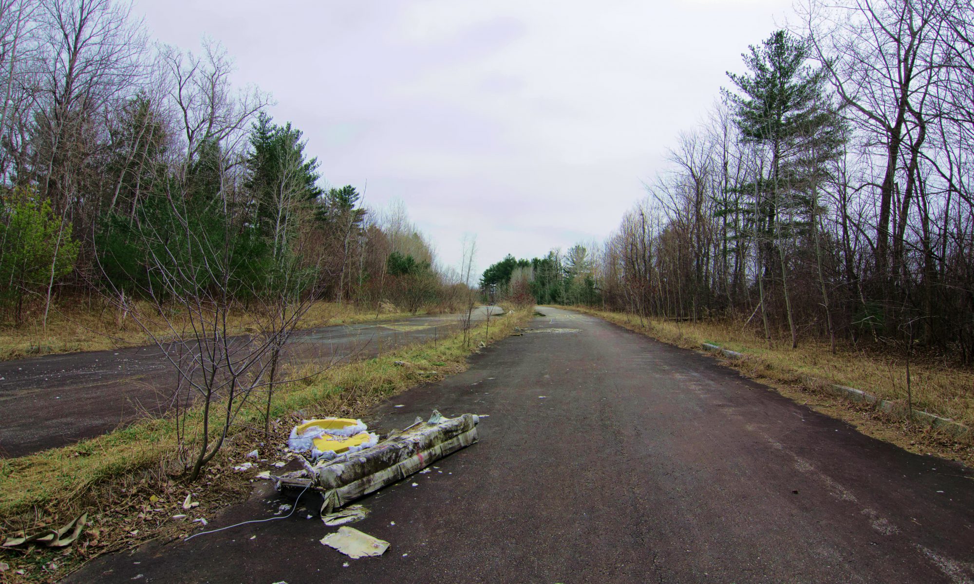
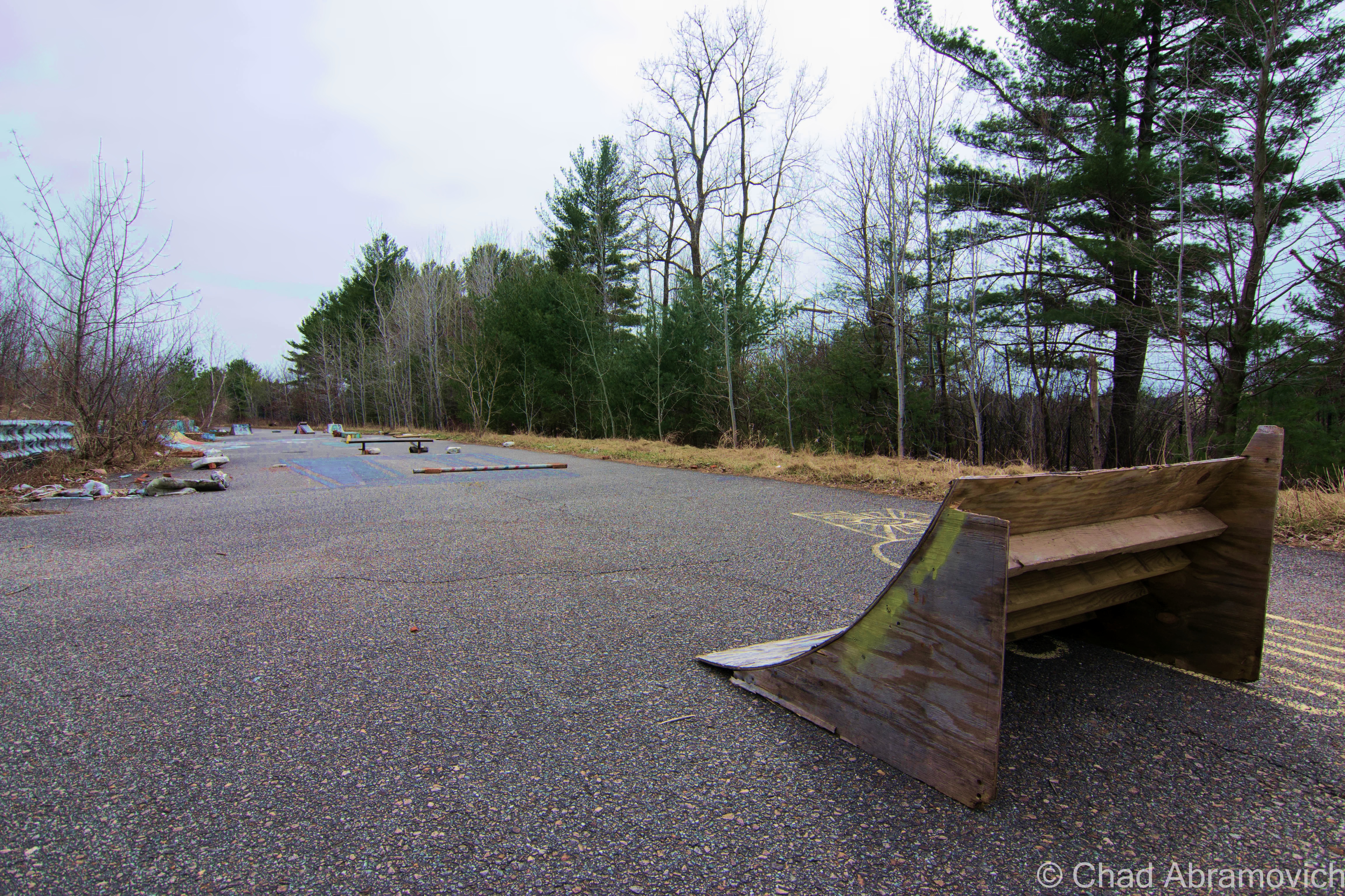
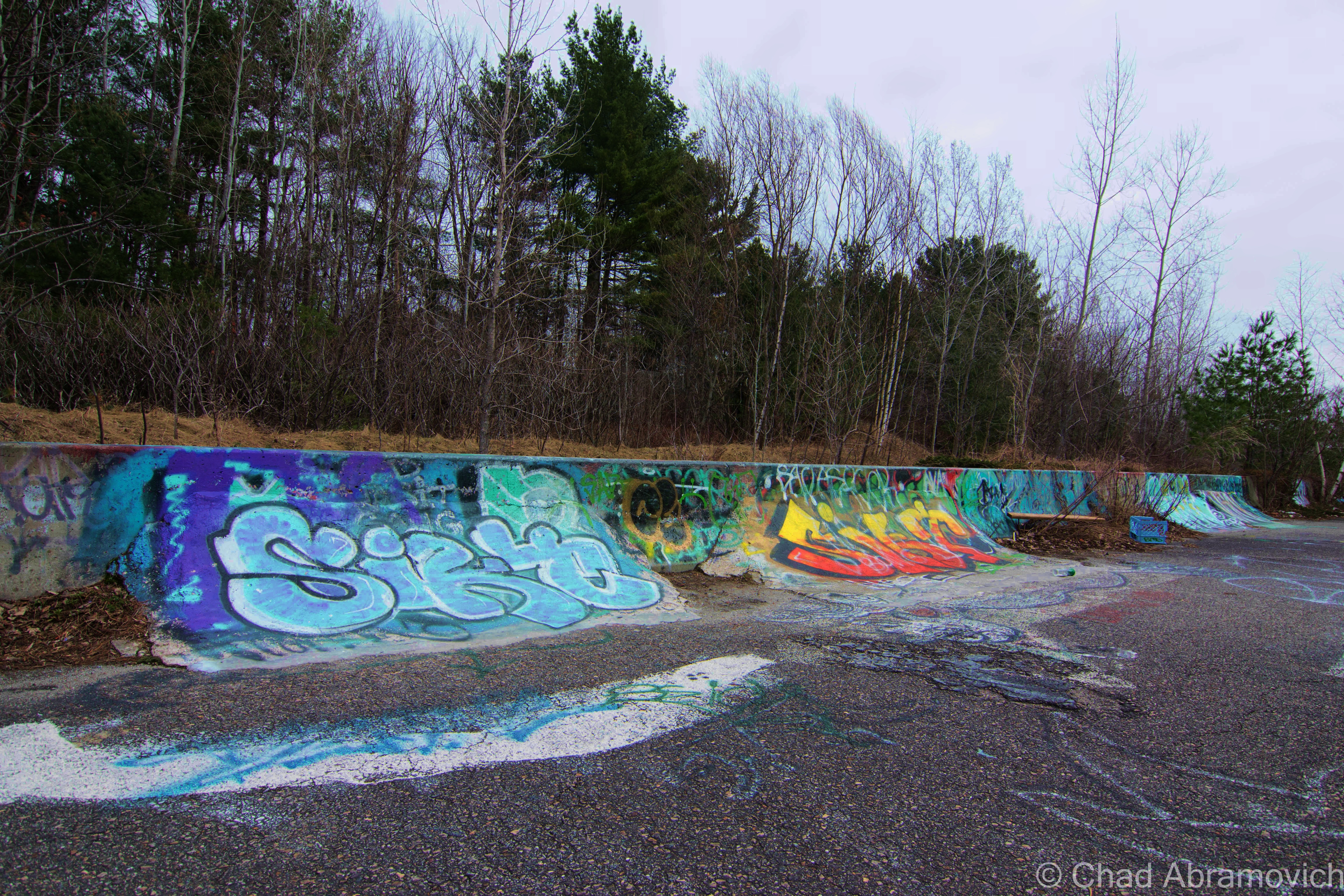
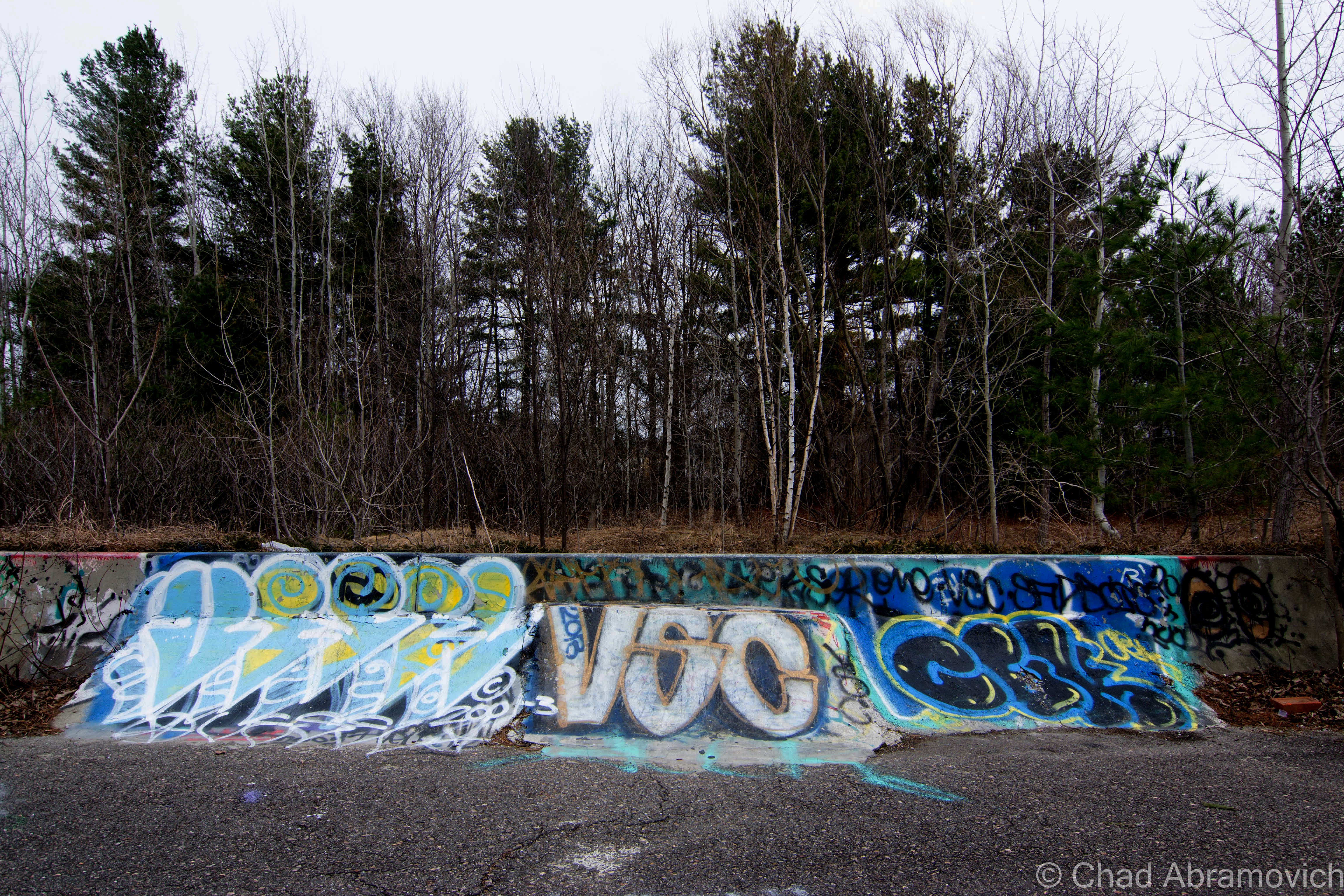
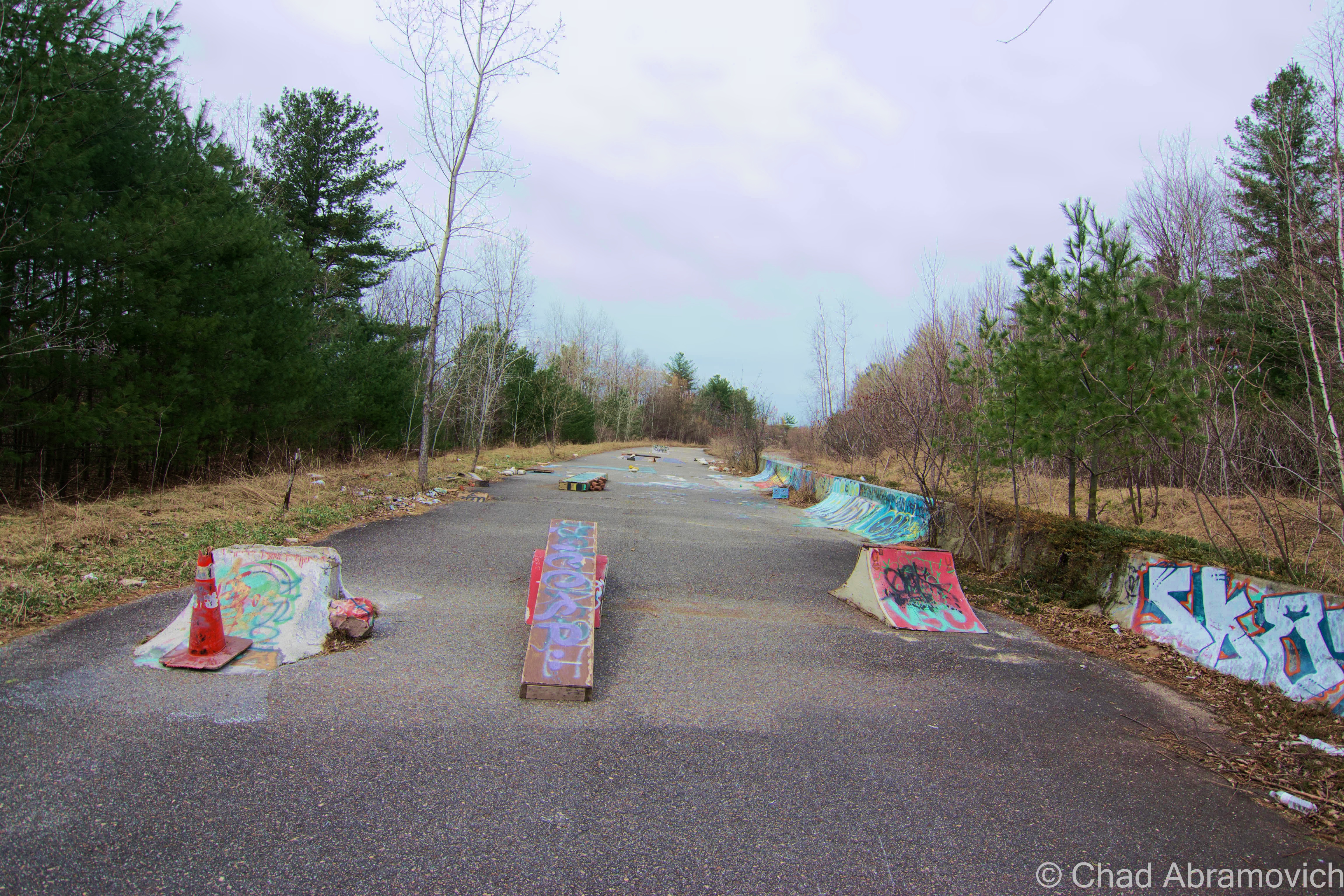
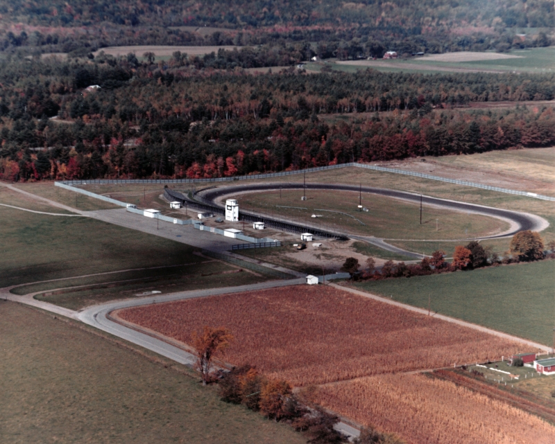
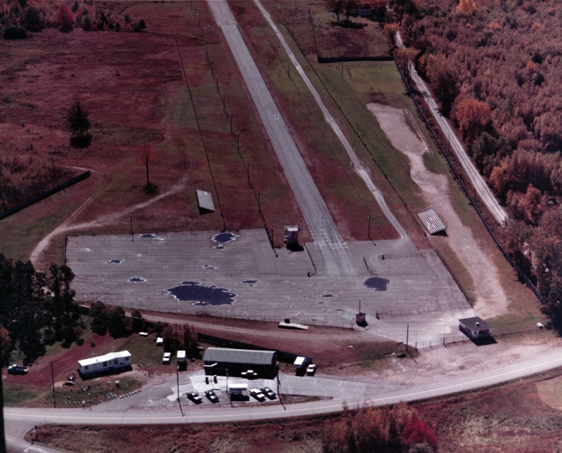
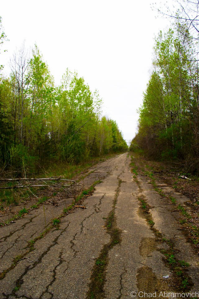
Abandoned roads have a story to tell. They represent abandoned dreams and ambitious projects that reflect the growth and often tumultuousness of our society, or the irresponsibility of our governments, cracked asphalt scars that mar the landscape and are reincarnated into monuments of failure.
The Southern Connector
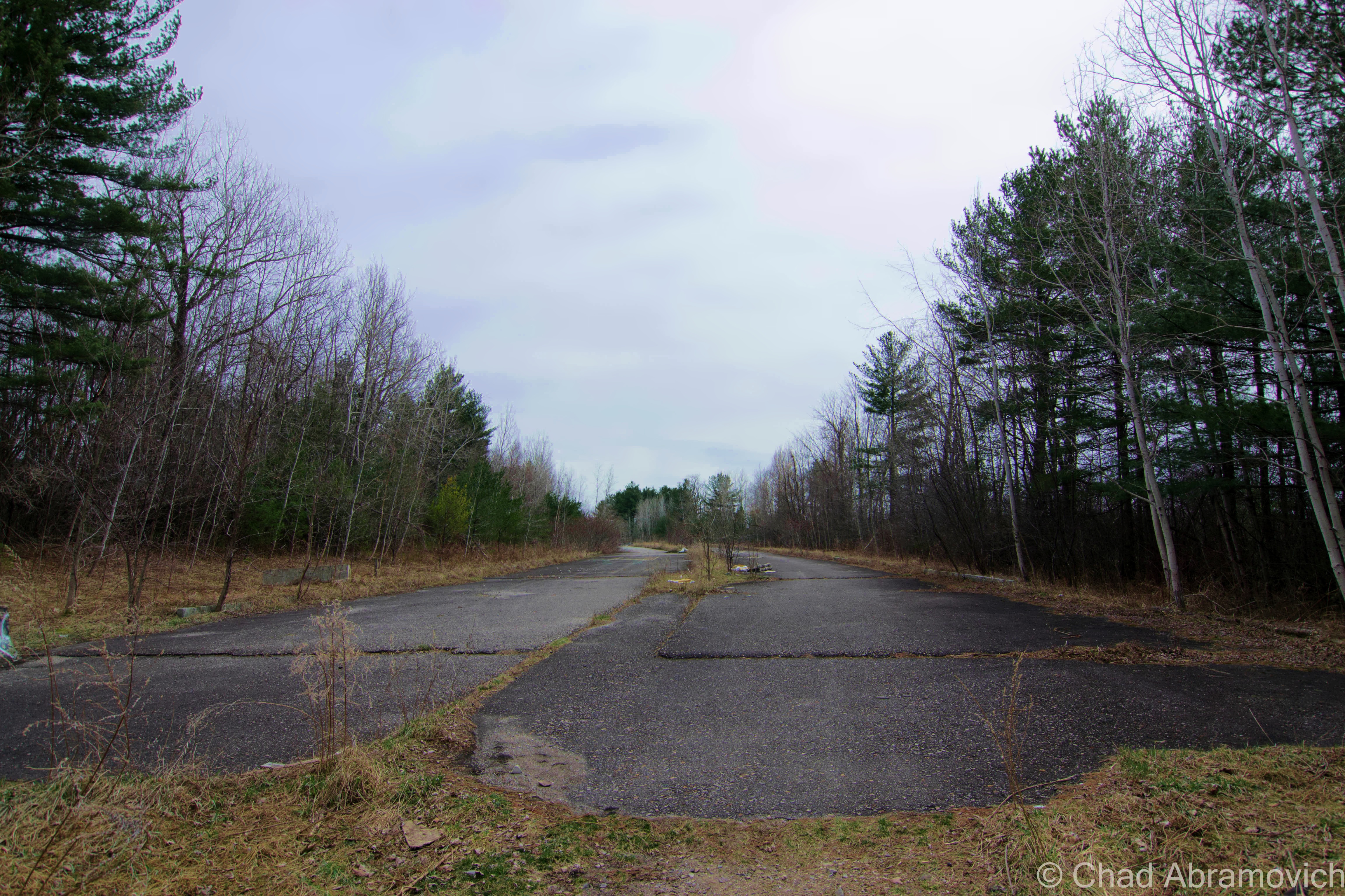
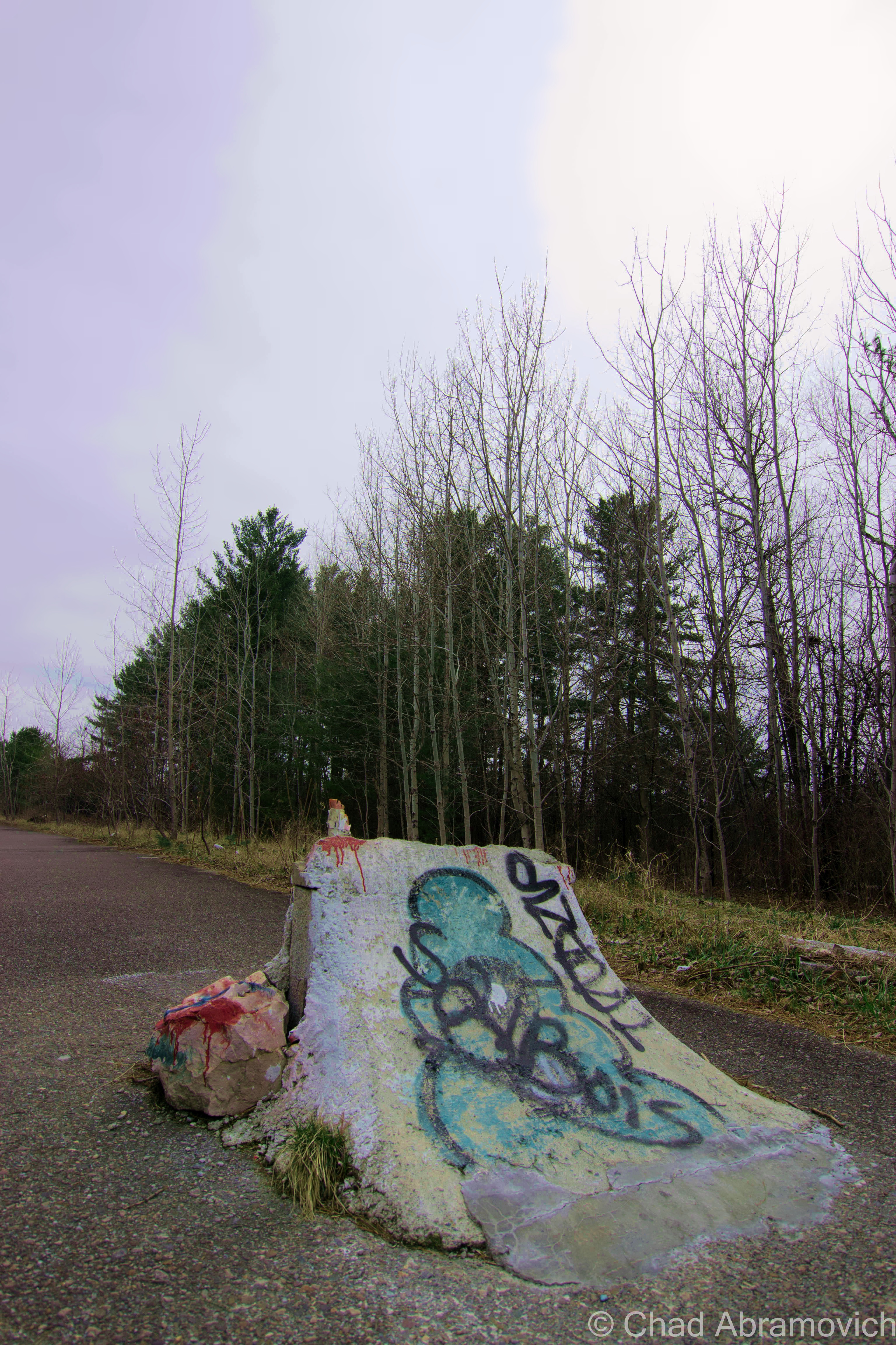
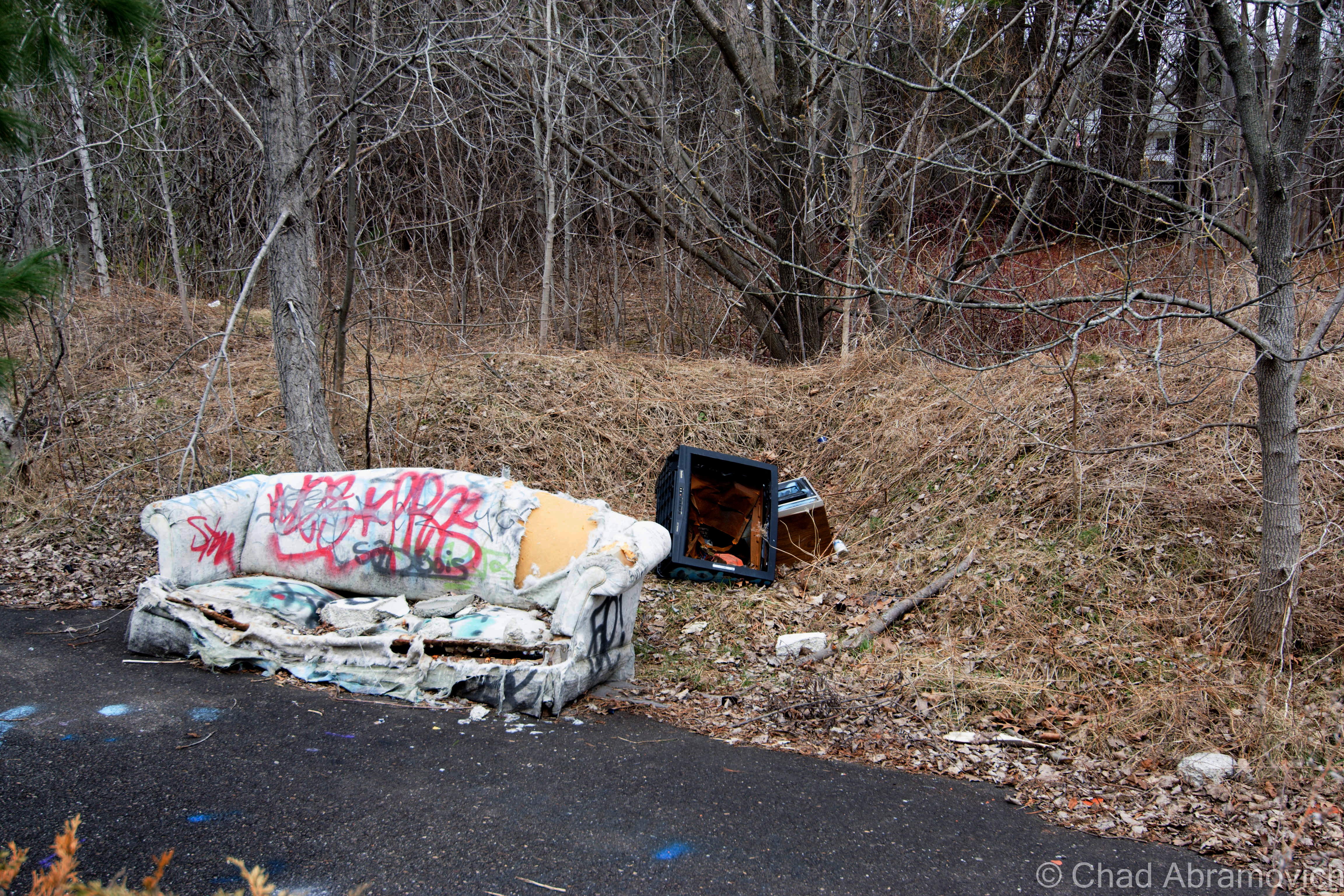
There is a stretch of abandoned interstate highway in Burlington’s south end, crumbling to pieces as the urban development around it was designed purposely to obscure the fact the blighted stretch of pavement even exists, with privacy fences and shrubbery. If you’ve approached town via exit 13 or have driven on the southern section of Pine Street where it ends at Queen City Park Road, you’ve most likely seen the incongruous graffitied space blocked off by jersey barriers. And maybe, you’ve wondered what it was, or why it was there.
In the 1960s, American cities were jumping on the massive urban renewal bandwagon, which was aimed at revitalizing communities long forgotten by neglect, and the de rigueur of American suburbia. Being Vermont’s largest city, Burlington was having an identity crisis, and figured that Vermont’s largest city should be something more than an unflattering image of blighted industrial waterfront and vacant downtown. So, The Queen City jumped on the urban renewal bandwagon. Their grand vision was a multifarious one which envisioned many future facing wonders; a shiny new downtown area connected to it’s environs by an efficient circumferential highway. They achieved this dream by using the power of eminent domain, and discombobulated an entire neighborhood of primarily Italian immigrants, to build canyons of featureless brick, glass and concrete, with loads of parking real-estate, which reflected the precipitously rising car culture obsession.
Stage two of the plan was to build a highway that would move traffic in and out of the city efficiently. Because Burlington was built on an awkward grid system from the 1800s, the city layout was never met to accommodate an unprecedented population rise or a society where everyone drove a car. Traffic was already piling up and into residential neighborhoods, which was frazzling local residents.
Construction broke in 1965, and the “Southern Connector” was started, creating today’s exit 13, aka, the Shelburne Road exit. But, the project quickly ran into problems.
Directly in the path of the proposed highway was a contaminated swath of swampland wedged between Pine Street and the lake.The Pine Street Barge Canal, a former industrial waterway turned Superfund site, was discovered to be highly polluted by the state of Vermont in the late 60s. If construction crews were to build over the canal, all of the trapped ground contaminants such as coal ooze and gasoline from irresponsible industrial disposal decades ago would all be released into the lake.
Because of this, construction halted, and a forlorn stretch of pavement was left stretching from Shelburne Road to Home Avenue. The only solution was to just block off the remained of the now unusable highway, and divert the exit to dump out onto Route 7. The project could go no further. Plans to finish the highway were proposed for several years, but it wasn’t until 2010 when plans resurfaced again. This time, it was recreated as “The Champlain Parkway”, and the reinvented idea was to merge the highway onto the south end of Pine Street, then turn the street into a 4 lane boulevard with updated pedestrian crossings and sidewalks, creating a main artery to and from downtown. But that too fell into problems, including concerns from south end residents who weren’t thrilled with the idea. Eventually, a compromise was made between city hall and opposed denizens, that include selective signage that only mark the anticipated parkway from certain directions, in an attempt to reduce traffic flow. But in the GPS era, I doubt that omitting signage in certain areas of the city will truly be a solution.
Today, the so called road to nowhere still goes nowhere, There are remnants of many homeless camps behind crumbling jersey barriers, and the local teen crew has converted much into a make shift skate park and a canvas for graffiti artists. It’s an interesting place to walk around on a warm spring day.
Places like this are special – an unusual contrast only separated from the dead eyes of the city by a chain link fence and new growth trees. Here it’s a different world, frequented by mysterious people of all types, all leaving their marks and appreciating what was otherwise left to rot.
The Milton Speedway
A few miles to the north of Burlington is the growing town of Milton, which is nostalgically remembered for being the former home of Catamount Stadium, a legendary stock car racing stadium and a now demolished staple of local culture.
In the 1960s and 70s, Milton had a reputation for being the “race town”, with a strong local culture and two lively institutions supporting it.
In the last century, Vermont had over 22 race tracks, with many being hastily created to assist the growing American car culture and it’s ripple effects. In 1960, the iconic Thunder Road would open in Barre, which was noted for it’s fine and thoughtful construction – something that resembled a modern track instead of the many crude and clumsy oval type tracks that were otherwise being built across the state. Thunder Road was such a success that the Vermont racing community began to brain storm. Building a track in a populated area near major transportation arteries would not only expand awareness of local racing culture, but give it’s participants more places to, well, race.
Milton’s proximity to New York, Quebec and Burlington and land which now was found to be conveniently suited for a racing track would be what would inspire Catamount to be financed and built by 1965 on farmland purchased from Kermit Bushey. A racetrack in town drew in lots of Milton locals and got them involved as racers, spectators or mechanics, which would prove to be one the things that would make the 1/3rd of a mile oval track such a success story.
The track was built to NASCAR specifications by excited local contractors and businessmen, and enjoyed considerable notoriety, those who remember it speak fondly of it. It hosted drivers of all skill, from nationally acclaimed to local heros, and would hold races of all varieties from circuit races to it’s grand finale of an enduro race, which many feel was an insulting way to go out. It was the type of place where car lovers and the curious could witness the latest trends in what would be racing on the track, or the more rigged homemade inventions and the characters that drove them. The locals would come with chips and a cooler full of beers, while the more prestigious could pay to sit in private boxes. All were there for a good time. One summer nights, the stadium could most often be found filled to capacity, and created a loyal fan base. The track would play host to adrenaline and voyeurism until 1987 when the Greater Burlington Industrial Cooperation, who curiously came in possession of the land, wouldn’t agree to renew the track’s lease, leaving Catamount with no choice but to shut down.
Apart from the stadium, Milton had another monument to man’s love of his car and pushing the limits of societal boundaries; a drag strip. In the 1950s, the young and reckless would find isolated stretches of road to drag race on. In 1963, the illegal sport’s popularity inspired local residents Herbert McCormick and Maurice Bousquet, owners of the former B&M Motors, to finance a drag strip of their own. At a quarter mile long, the track was a spectacle itself, located near the Route 7/West Milton Road interchange.
The Milton Speedway. Photo: UVM Landscape Change Program
Billing itself as “The Milton Speedway”, it was apparently quite active in its heyday. Old newspaper clippings show that the speedway was an animated place, and boasted cash prizes and contests. It’s allure drew some notable clientele such as Shirley Muldowney and The Royal Pontiac GTO Racing Crew, who all raced in Milton at one point. But the drag strip’s existence was brief, as the phenomenal costs of resurfacing the road proved to be too much. It was closed by 1971.
In the 1980s, Milton experienced a real estate boom – with the lure of cheap land and close proximity to Burlington – the community soon found itself shedding its old skin as a farming town, and becoming a bedroom community. A few neighbors of mine talked about how they remembered the old stadium when they first built their houses around 1984. Even 4 miles away, they recalled standing on their back decks at night underneath the cool summer skies and hearing the howl of the engines being carried through the dark.
By 1987, partially due to the exorbitant cost of automobile and track maintenance, the stadium closed forever, a sad loss for Milton. The Catamount Stadium was appreciated by the entire region, and its closure was a bitter one. Catamount was very much a community affair. A few Milton residents who I spoke with recalled their fathers, friends and neighbors who used to race there over the years. Today an almost excessive plenitude of automobile related businesses still line Route 7 through town, a fading reminder of a dead era.
The Catamount Stadium grounds were redeveloped to the successful Catamount Industrial Park, which today among other things, houses a helicopter sales business, a warehouse for Burlington based Gardener’s Supply Company and a printing company.
But one relic of Milton’s automobile past does still remain, if you do a little searching. If you head into town on Route 7, towards the grungy stained cinderblock walls of the Milton diner, there is a large vacant and gravely weed chocked field on your right. If you look far back into the field, you notice a perfectly straight segment of roadway that seems to emerge from the otherwise dead ground, and cuts into the woods behind it, going back as far as the eye can see. The pavement is cracked and potholed, weeds are plentiful, and the entrance is blocked by a set of very old Jersey barriers. This is all that remains of Milton’s drag strip.
The drag strip is hard to find now because everything is so grown up around it, so it doesn’t come as a surprise that most people don’t realize this small piece of history still exists. And if they stumble across it, do they know what they are staring at? The overgrown footprint continues for a few miles, until it abruptly ends in crumbling asphalt and birch trees, its ghosts sitting in the branches that tangle over your head.
Today it is a somber place, sitting behind a building supply store and a local diner, pretty much forgotten by the locals. The few that do remember the old strip refer to neighboring Racine Road as “Racin Road”, because the road runs directly parallel to the former strip, and is perfectly straight. Not surprisingly, some like to occasionally race there.
Last I heard, condos are scheduled to be developed on the upper half of the drag strip.
Two stretches of abandoned highways, both with very unique stories to tell.
The Milton Speedway Today.
A great find on Youtube! The Milton Drag Strip, 1963. The identifiable shape of Cobble Hill can be seen in the background.
Links
If you are curious about the Catamount Stadium, or have fond memories of it, there is a great website devoted to it
—————————————————————————————————————————————–
To all of my amazing fans and supporters, I am truly grateful and humbled by all of the support and donations through out the years that have kept Obscure Vermont up and running.
As you all know I spend countless hours researching, writing, and traveling to produce and sustain this blog. Obscure Vermont is funded entirely on generous donations that you the wonderful viewers and supporters have made. Expenses range from internet fees to host the blog, to investing in research materials, to traveling expenses. Also, donations help keep me current with my photography gear, computer, and computer software so that I can deliver the best quality possible.
If you value, appreciate, and enjoy reading about my adventures please consider making a donation to my new Gofundme account or Paypal. Any donation would not only be greatly appreciated and help keep this blog going, it would also keep me doing what I love. Thank you!
Every once and a while, I’ll have someone tell me a bizarre or strange tale that they swear has supposedly happened to them. Some of them are entertaining at best, but others surpass that, and create long lasting impressions. I don’t know, maybe I love these tales because they make me think that perhaps we’re something else than meat and bones, or perhaps it’s the allure of the ability for things to still exist that can defy any explanation that can be backed by science. Simply put; they challenge my very logical way of thinking and make me look at the familiar in an unfamiliar way. These are the stories that I would like to feature on this blog, and I think I found a good one to start with.
A Lost Town
Little River State Park in the town of Waterbury has shoreline on the beautiful Waterbury Reservoir, and extends into a grand patch of bumpy land that climbs up the mountains that form the back spine of lofty Mount Mansfield. Driving up Little River Road as it follows the sand banked river of the same name, it immediately becomes apparent that the area is wildly beautiful. But it’s tumbling topography yields another truth; the land up this way is rugged and rough. While outdoor enthusiasts really dig the state park, a century ago, the people who settled here weren’t as fond of the place – but their desperation for independence and land to build that on outweighed the many pitfalls.
The sinuous reservoir that snakes around green mountains was built for more practical purposes; to attempt to prevent ruinous floods that wiped out the town that once used to be here.
A century ago, real estate worked a bit differently than today’s trends. Prospectors pretty much settled anywhere where there was available land, including topography of the rough and rocky variety. Higher elevations were also less prone to flooding than down in the valleys, which is why many old stage roads or settlements can be found in higher elevations or places we may consider strange.
The slopes of Western Waterbury were cleared in the 1800s, and a small community of about 50 people formed, unofficially called “Ricker Mills”, “Ricker Basin” or sometimes, “The Ricker Mountain District”, all monikered after the large cluster of people who settled there with the same last name.
The settlement would eventually grow to encompass about 4,000 acres on the southeastern slopes of Ricker Mountain, which also took on the prevalent surname. But their choice of location made life up in the hills pretty rotten.
Most settling families were impoverished but they got by alright, their farms -which were hard to support on land that was mostly rocks – never prospered. The only other industries to really take off here were sawmills, taking advantage of mountains of timber and the many streams that picked up speed as they tumbled down to the valleys below.
Even today, some elderly residents who live in neighboring towns can still recall Ricker Mills as an existing place, and tell nostalgic stories of hardships. Families all had to pitch together to work on the farms in order to run a successful operation, and if one member wasn’t doing their job, the farm would limp or come to a stand still.
Eventually, younger generations began to slowly move away, looking for better opportunities. But the town’s death was sped up by the infamous flood of 1927 on November 3rd and 4th, when torrential rainfalls and frozen ground created a disastrous flood that paralyzed Vermont. The little river’s rising waters drove the valley residents to their roofs and isolated the settlement from the rest of Waterbury when the roads were washed out. In 1934, a second flood put an end to the already crippled community. Those who already hadn’t moved away were forced out when the state decided to close the roads into town for good, then began buying up all the land. The flooding inspired the creation of the aforementioned Waterbury reservoir and dam, a toilsome task built by five thousand men of the U.S. Army Corps Of Engineers and the Civilian Conservation Corps, who finally finished the massive retention project in 1938.
I attempted to go back roading back in March with a buddy, which was really just us sliding around wash boarded, muddy dirt roads a lot and wondering if it was a good idea. We found ourselves at the foot of the Waterbury Dam. I was really digging the Art Deco detailing I was seeing.
Today, old cemeteries, sawmill remains, old town roads, bridges, and many cellar holes can still be seen as evidence of a past community. Surprisingly, a lone farmhouse from the settlement’s existence also survives off one of the trails; the ramshackle and haunted looking Almeran Goodell farmhouse, which was at one point a hunting camp before the park took possession of it. Little River State Park owns the land know, and a walk on one of its many hiking trails make these ruins easily accessible for anyone who wants to see them. Local lore maintains that when the water levels are low enough in the reservoir, which is now a popular place for outdoor recreation lovers, you can see the soaked and rusted remnants of the old iron bridge that once bridged Little River and was the main entrance into town.
Though the ghost town is an almost unsatisfyingly easy place to get too via Little River Road that parallels its river namesake, once you’re on one of the well-trodden hiking trails, it’s a surprisingly vast and desolate place, almost otherworldly. Tromping around the scattered ruins through bushy foliage that is brilliant in the fall, you can actually get a good sense of vanishing history.
Stone foundations and a variety of constructions can be found throughout the woods on the trails.If you wanted to travel anywhere in the mountains, you had to cross plenty of streams, so local communities built “high bridges”, or, bridges built atop stone culverts to better withstand flood waters. But they often didn’t.The old road has long faded into obscurity.
The Goodell House is the last remaining house on Ricker Mountain, partially thanks to help from local Boy Scouts who fought to restore it, at over 140 years old.
Foundation at Little RiverLooking down an old well.Artifacts left behind
But does something else remain here other than stone foundations and weathered gravestones? Does something unknown skulk among the trees and silent swampland? I’ve heard more rumors than I thought I would that Little River State Park was haunted, but never have actually heard any specific accounts to back them up. Most details fall flat and don’t offer anything credible. A ghost town in the middle of a pretty remote stretch of woods is certain to conjure up some sort of folklore, though. Vermont is a state of extremes where either a topic has been written about to monotony, or it hasn’t been covered at all. I was hoping to break some ground here, and I knew I was onto something good when I heard this story.
A Night In The Woods
I’m proud to have been entrusted with this story, and to write about it in my blog. This is the first time this has ever been written down or told beyond a quite campfire in my backyard.
A few years ago, John, an experienced hunter took a hike into the wilds of Ricker Mountain. His plans were to spend a few days in the woods hunting and camping under the stars – a little much-needed rest and relaxation. Being an experienced woodsman, he planned carefully. He found a suitable spot for his campsite, and began to clear it of brush and tree branches. He even found some nice flat stones nearby to construct a fire pit from.
People generally are in two different camps when it comes to spending the night in the woods. John loved it. The first night, he was almost asleep inside his tent when he heard a strange noise. In the darkness, he listened carefully. It sounded like fingertips that were scratching the outside of his tent. He knew he had cleared the area of any tree branches, and it was a windless night, so he thought it had to be an animal. But he noticed that the woods had descended into an eerie silence, a silence he has never heard before. After a while, the tapping stopped. He waited for it to start up again, but it didn’t. He soon shrugged it off and fell asleep.
The next night, he awoke to the sound of someone or something, tugging at his tent straps. Again the woods fell into that eerie silence. He sat up in his sleeping bag and tried to assess the bizarre situation, but couldn’t really think about what to do other than wait for something to happen. The tugging soon stopped, and nothing ever happened. But he didn’t go back to sleep – and spent the rest of the night in anticipation, waiting until the sun rose. The next morning he noticed that the tent strap hadn’t just been pulled, it had been cut! It was a clean-cut, as done with a knife, yet he hadn’t heard the sound of tearing fabric, or the noises of any other human around.
Weighing his options, he decided to stay another night, trying to jump to a logical conclusion that could explain the previous night’s events while also falling into the gravity of his stubborn nature. He nonchalantly assumed that whatever it was, it didn’t really pose a real threat to him, and it didn’t know how long he was camping here because even John didn’t know! Surely it was gone by now. He wanted to leave when he’s good and ready, because it was hard enough to get time off from work and he wanted to enjoy the little time he had. So he decided to stay.
But on the third night, John got the surprise of his life. He woke up suddenly when the bottom of his sleeping bag, which had moved in his slumber and was touching the tent wall, was grabbed violently “as with human hands” and forcefully yanked towards the tent door. He instinctively grabbed his shotgun next to him and yelled “try that again and you’ll be sorry!” and waited with bated breath and adrenaline for something to happen. But nothing did. Again he noticed the eerie, almost unnatural silence of the woods. Nothing was making a sound, and this time, he recalled being incredibly uncomfortable by it. Surely he would have heard whatever the intruder was, retreating across all the brittle fallen leaves near the campsite, but he didn’t.
He knew it would be foolish to leave in the middle of the night, especially because he didn’t know exactly what was out there waiting for him. He knew it would be a foolish attempt to get back down towards the road. So he spent the rest of the night awake, shotgun at the ready, and as soon as dawn cracked the dark, he began to frantically pack his things.
As he took down his tent, he noticed something peculiar. As he was ensuring that the embers in the firepit were extinguished, he noticed something about one of the stones he had used to form the circular wall that he hadn’t noticed before. Somehow, unknowingly, he had used a fallen headstone from a forgotten and neglected cemetery nearby, now almost indistinguishable from years of dead leaves and fallen branches.
John doesn’t believe in ghosts, and doesn’t subscribe to any of the mythology of the paranormal and the tales that other people chase, but he managed to choke out an out of character diagnosis. “Well, man I don’t know. Maybe it was one of the ghosts of Ricker Mountain, angry that I used their headstone as part of my firepit.”
I asked John if he would ever go back to Ricker Mountain. He just shook his head and said “nope”. I guess I can’t blame him.
Digging into Trouble
Upon hearing that strange tale, my own father came forward with a story of his own, one that was as unusual, if not frightening to me. Whether it actually happened or not…well, I’ll let you decide for yourself.
When he was in his early 20s, he and his cousin were fly fishing along The Housatonic River in the small Connecticut town of Kent, in the rural Litchfield Hills. It was a perfect spring afternoon, and they were having good luck on the river.
As they fished down the riverbanks, they came to a spot where a large row of power lines crossed over the river and up a nearby mountain. Mounted above a rather steep ledge above them was a large copper plaque. Being curious, they both got closer to read it. The plaque was commemorating a tragic death that took place on that very spot 100 years ago, when a copper mine collapsed killing an unknown amount of miners. They were standing on a mass grave. What happened next has no explanation. One of them suggested digging up the grave – or what appeared to be the grave site. The earth was soft and seemed easy to dig through. My father agreed. Being young and immortal, they began to pick away at the hillside. And within minutes, the pleasant spring weather turned ugly. The skies turned a dark black and before they knew it, a freak bolt of lightning struck the power lines directly above their heads.
Terrified, the two of them stopped their digging and hastily retreated back to the safety of their car. And that was when they realized that this wasn’t just an ordinary storm.
“I looked back, and noticed that the lightning was striking and hitting every tree or pole that we were running by! It was – it was like it was following us!” my dad said animatedly, getting caught up in his memory. They scrambled back onto Route 7, both breathing heavily and scared out of their minds. And just as soon as the storm started, it stopped. The skies were clear again. It was like nothing had ever happened.
They scrambled back onto Route 7, both breathing heavily and scared out of their minds. I guess anyone would be in that situation. And just as soon as the storm started, it stopped. The skies were clear again. It was like nothing had ever happened.
So is there an explanation here, supernatural or other? Was this just a bad freak storm that passed right over their heads? After all, New England is known for it’s weird weather. Or was it something more, perhaps it really was an act of vengeance from the angered ghosts of the dead minors who lost their lives under that very spot. Neither of them have an explanation, and the only conclusion I have is that they did experience something. One thing is for certain, they have never done anything that stupid ever again.
—————————————————————————————————————————————–
To all of my amazing fans and supporters, I am truly grateful and humbled by all of the support and donations through out the years that have kept Obscure Vermont up and running.
As you all know I spend countless hours researching, writing, and traveling to produce and sustain this blog. Obscure Vermont is funded entirely on generous donations that you the wonderful viewers and supporters have made. Expenses range from internet fees to host the blog, to investing in research materials, to traveling expenses. Also, donations help keep me current with my photography gear, computer, and computer software so that I can deliver the best quality possible.
If you value, appreciate, and enjoy reading about my adventures please consider making a donation to my new Gofundme account or Paypal. Any donation would not only be greatly appreciated and help keep this blog going, it would also keep me doing what I love. Thank you!
One of my favorite oddities in Vermont to photograph is on the back roads of rural Fletcher. Instead of using traditional vinyl or wooden siding, the owner of this ramshackle structure had a much more original idea – he covered it wall to wall with what might be the largest collection of license plates in the state of Vermont. The plates range in age, dating as far back as the 1920s and going as late as the 1990s. Most were Vermont plates, but there were a few outliers. Connecticut, Massachusetts, Kentucky and Wisconsin were included. Knowing a good photo opportunity when I see one, I had to stop. Thankfully, the town of Fletcher seemed to be free of traffic that day, so I had the whole road and a good chunk of time to get a decent picture of the structure without worrying about my safety.
It was a beautiful spring evening, the sky was stained with a mixture of brilliant blues and pinks, which was a vibrant contrast to the green fields blooming with dandelions and the perfume of wet earth. As I was adjusting my camera settings, I noticed that I was no longer alone. An elderly gentleman had walked up behind me. I assumed he was most likely the owner of the building. Just as I thought I was going to get a stern talking too for being too close and standing there for too long, he asked me how I was doing. He had a puzzled look on his face, but his question was sincere. I smiled and told him I liked his building. He looked over at it, then back at me, an amused grin on his face. I could tell he never thought of his own property as much of an attraction before. “You from the Burlington area, or are you a flatlander?” he said with a grin. I chuckled a little at this, suddenly a bit self-conscious of my appearance. I’ve always been proud of my Vermont roots, and have never had to question my appearance before.
Then unexpectedly, he motioned for me to follow him with his hand, and before I knew it, he was digging in his pocket. Out came a key, and he began to fiddle with a padlock. There was an awkward moment where he and the garage door seemed to be fighting with one another. The building’s structure was so lopsided that it seemed either the door was going to fall out of it’s frame, or the building was going to collapse. But it finally gave way, and slid open on its rusty wheels. “Well, are you coming?” he questioned. I asked myself the same thing, and stepped inside. He fumbled for the light switch and I heard the buzzing noise of a Mercury Vapor light come on.
Generations of artifacts and various knick knacks lay piled inside. So many in fact that the building was filled to it’s rafters, there was barely any room to move, yet alone get a good idea of where to begin processing what I was seeing. It was incredible.
There was a moment of awkward silence, I didn’t quite know what to say. I looked over and noticed he was now holding a wooden pipe in one hand, and packing it with tobacco with the other. As he lit up, it seemed at this point that he felt comfortable enough to start really engaging in conversation, and before I knew it, my questions were soon answered. As it turns out, this used to be a gas station, and has been in his family since the 1920s. His great grandfather started the business, and was a self taught and skilled auto mechanic, as well as a dedicated farmer. The gas station served as both his mechanic shop and his farm workshop. A perfect example of Yankee Ingenuity, he used the brook behind the building for power, by means of a homemade generator complete with a hand-carved wooden wheel that rotated with a belt attached to it. I was at a loss for words.
The gas station changed hands from his grandfather to his father and later, him. Locals from Fletcher who recall the place in operation said it was cool. One person told me that he used to drop by to gas up his call, and inside the office near the door, there was a tin can where you could leave your money. Everyone was on the honor system.
Its doors closed during the 80s when pressure from the gas industry forced people into modernizing the gas pumps, which was something the family couldn’t afford to do. The original gas pumps still sit out front – sort of. Last winter, a plow truck came through the area a little too fast and took them out completely. The town wouldn’t reimburse the family for the damages, so they did the only thing they could do – move the remains out of the road. He lifted up a weathered tarp and revealed the busted remains. Though damaged, the antique pumps were still a cool site to see.
I asked about the license plates, and his answer was simple. “We’ve owned a lot of cars”. Whether this was a true answer or just sarcasm, I was satisfied with his right to the point reply.
I can’t describe in writing the genuine old time feeling this place had to it, with it’s distinct barn smell and eclectic array of aging antiques and artifacts, sitting in cluttered piles collecting dust. But he assured me everything had its place here. “My dad had a system. He always knew where everything was” he told me. I asked about some of the vintage posters on the wall, hoping maybe he would sell one for the right price, but my request was instantly meant with a stern no. “Nope. They’ve always been here on the wall and that’s right where they are going to stay”
What I didn’t realize, was that a lot of the antiques I saw actually didn’t belong to him. A lot of stuff came from family and friends from the Waitsfield-Warren area, being stored here after a lot of the farms down that way were damaged from tropical storm Irene. He also explained why the building was in such bad shape, another result of tropical storm Irene. The quiet stream that runs behind the building overflowed its banks and swelled through the cracks of the building and into the foundation. The damage is “too expensive to fix” and the state has deemed the place uninhabitable. “I can’t really do much but wait for it to fall down” he said, a sense of loss in his voice.
He gave the garage door another good wedge and pulled it shut. I thanked him for the tour and shook his hand. I could tell as he walked away that he was amused by my curiosity by his property, and as for me, I was just thankful he took the time out of that spring night to share it with me.
Taken early spring of 2014, when I drove by again. Sadly, my original photos of the spring 2012 shoot were lost when my hard drive crashed. A poignant reminder to back up your work…
—————————————————————————————————————————————–
To all of my amazing fans and supporters, I am truly grateful and humbled by all of the support and donations through out the years that have kept Obscure Vermont up and running.
As you all know I spend countless hours researching, writing, and traveling to produce and sustain this blog. Obscure Vermont is funded entirely on generous donations that you the wonderful viewers and supporters have made. Expenses range from internet fees to host the blog, to investing in research materials, to traveling expenses. Also, donations help keep me current with my photography gear, computer, and computer software so that I can deliver the best quality possible.
If you value, appreciate, and enjoy reading about my adventures please consider making a donation to my new Gofundme account or Paypal. Any donation would not only be greatly appreciated and help keep this blog going, it would also keep me doing what I love. Thank you!